

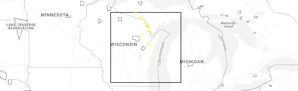
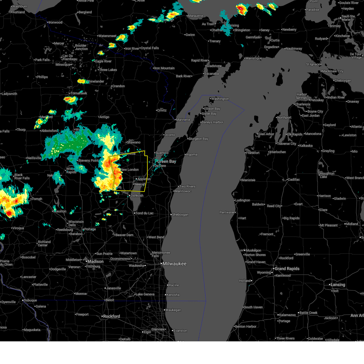
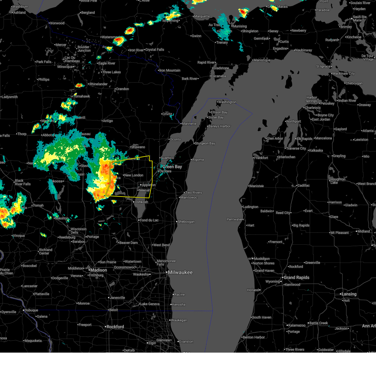
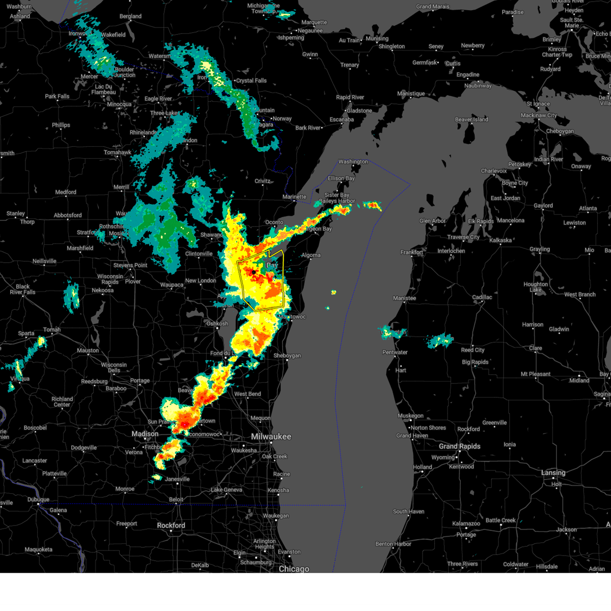
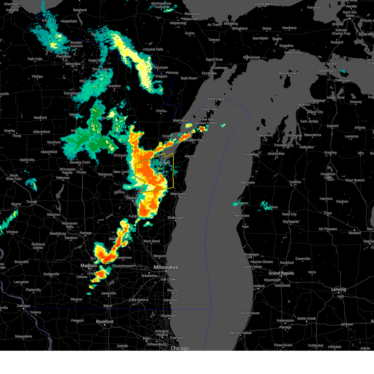
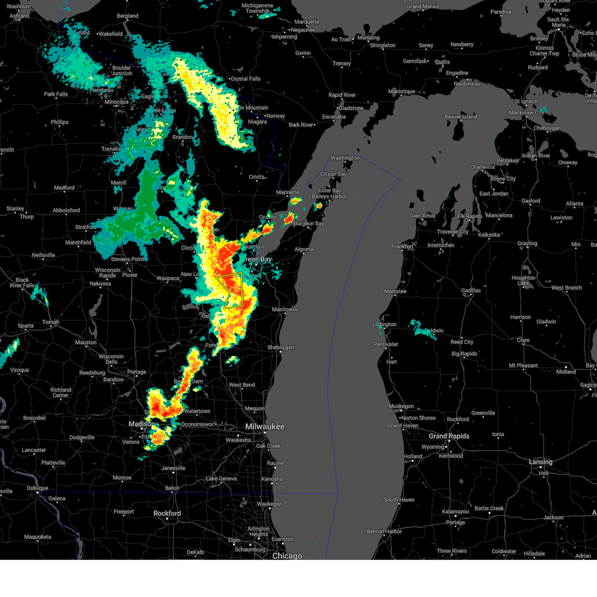
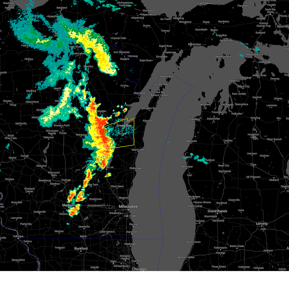
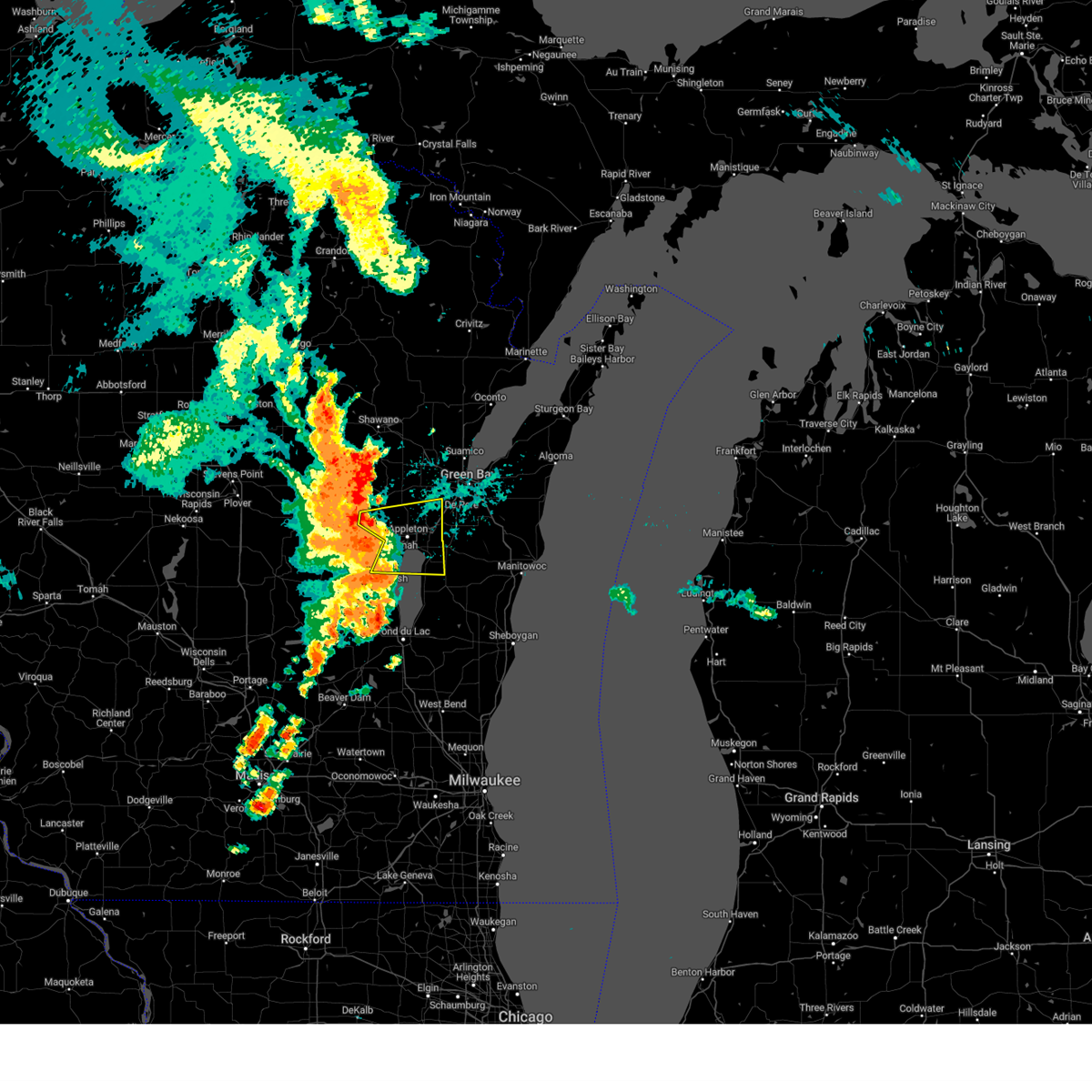
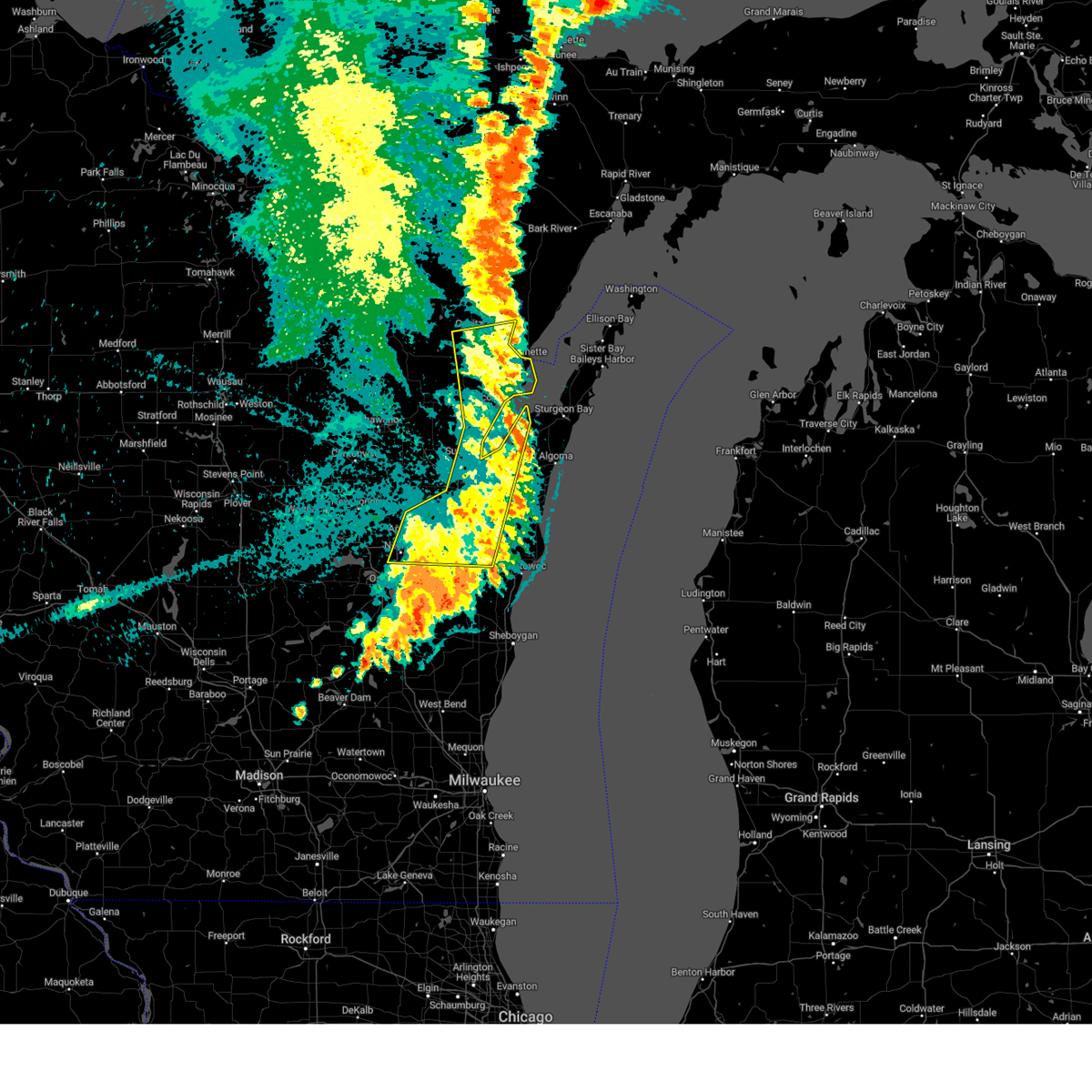
Hail Map for Wrightstown, WI
The Wrightstown, WI area has had 5 reports of on-the-ground hail by trained spotters, and has been under severe weather warnings 23 times during the past 12 months. Doppler radar has detected hail at or near Wrightstown, WI on 43 occasions, including 3 occasions during the past year.
| Name: | Wrightstown, WI |
| Where Located: | 14.8 miles SSW of Green Bay, WI |
| Map: | Google Map for Wrightstown, WI |
| Population: | 2827 |
| Housing Units: | 1087 |
| More Info: | Search Google for Wrightstown, WI |
1
The Top Recent Hail Date for Wrightstown, WI is Tuesday, July 8, 2025 (15th out of 43)
Hail and Wind Damage Spotted near Wrightstown, WI
| Date / Time | Report Details |
|---|---|
| 6/29/2025 3:36 PM CDT |
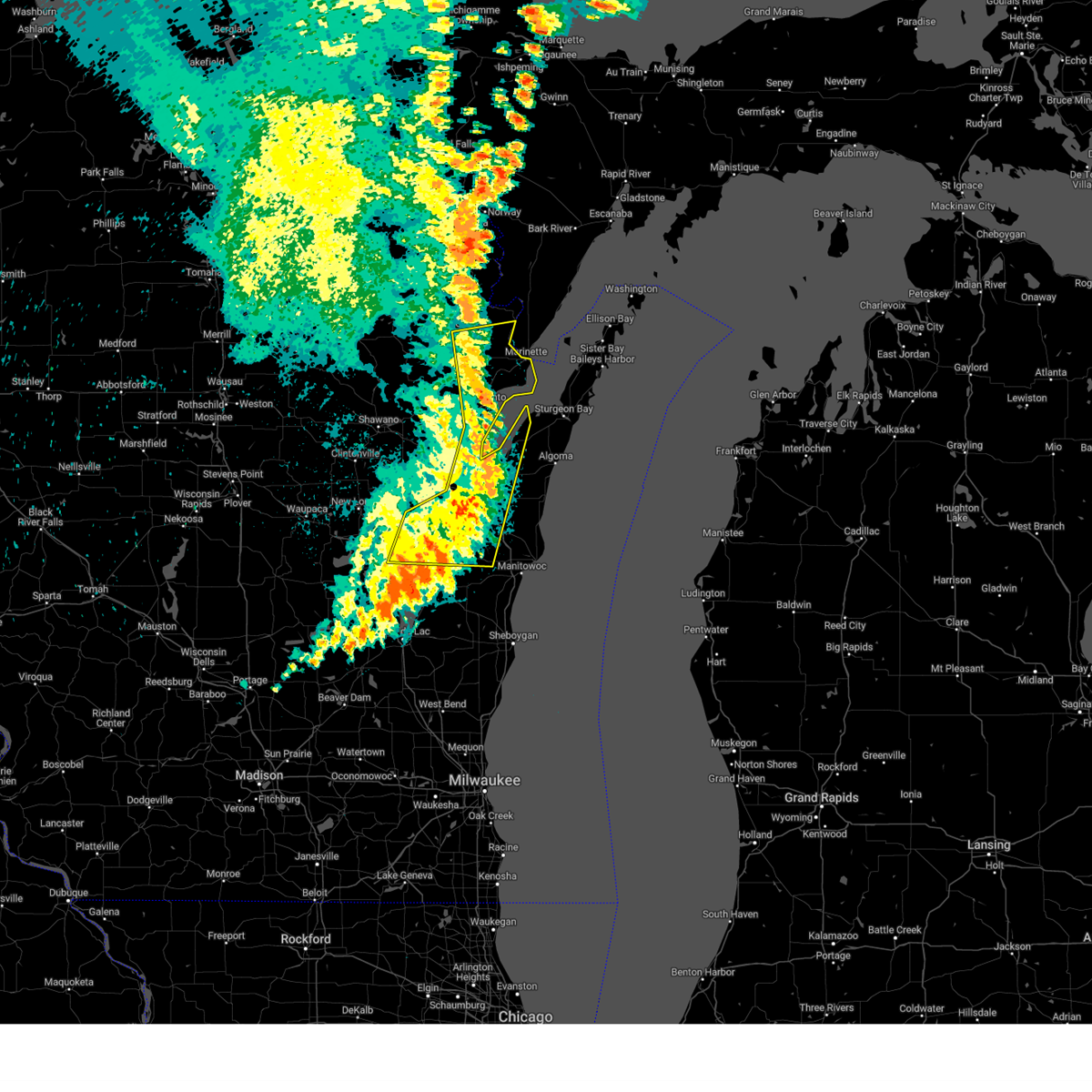
 Svrgrb the national weather service in green bay has issued a * severe thunderstorm warning for, brown county in northeastern wisconsin, kewaunee county in northeastern wisconsin, southeastern outagamie county in northeastern wisconsin, northeastern manitowoc county in east central wisconsin, * until 430 pm cdt. * at 335 pm cdt, severe thunderstorms were located along a line extending from near bay shore park to near menasha, moving east at 25 mph (radar indicated). Hazards include 60 mph wind gusts and quarter size hail. Hail damage to vehicles is expected. expect wind damage to roofs, siding, and trees. severe thunderstorms will be near, green bay, kaukauna, little chute, and bellevue town around 340 pm cdt. luxemburg around 345 pm cdt. algoma and denmark around 400 pm cdt. kewaunee around 415 pm cdt. Other locations impacted by these severe thunderstorms include krok, maribel, larrabee, slovan, gregorville, curran, wayside, morrison, rankin, and humboldt. Svrgrb the national weather service in green bay has issued a * severe thunderstorm warning for, brown county in northeastern wisconsin, kewaunee county in northeastern wisconsin, southeastern outagamie county in northeastern wisconsin, northeastern manitowoc county in east central wisconsin, * until 430 pm cdt. * at 335 pm cdt, severe thunderstorms were located along a line extending from near bay shore park to near menasha, moving east at 25 mph (radar indicated). Hazards include 60 mph wind gusts and quarter size hail. Hail damage to vehicles is expected. expect wind damage to roofs, siding, and trees. severe thunderstorms will be near, green bay, kaukauna, little chute, and bellevue town around 340 pm cdt. luxemburg around 345 pm cdt. algoma and denmark around 400 pm cdt. kewaunee around 415 pm cdt. Other locations impacted by these severe thunderstorms include krok, maribel, larrabee, slovan, gregorville, curran, wayside, morrison, rankin, and humboldt.
|
| 6/23/2025 3:25 PM CDT |
 Svrgrb the national weather service in green bay has issued a * severe thunderstorm warning for, brown county in northeastern wisconsin, eastern outagamie county in northeastern wisconsin, * until 400 pm cdt. * at 325 pm cdt, a severe thunderstorm was located near black creek, or 13 miles north of appleton, moving east at 55 mph (radar indicated). Hazards include 60 mph wind gusts. Expect damage to roofs, siding, and trees. this severe thunderstorm will be near, green bay around 330 pm cdt. bellevue town around 335 pm cdt. Other locations impacted by this severe thunderstorm include little rapids, mackville, humboldt, de pere, lambeau field, freedom, ledgeview, wolf river bottoms wildlife area, hobart, and leo frigo bridge. Svrgrb the national weather service in green bay has issued a * severe thunderstorm warning for, brown county in northeastern wisconsin, eastern outagamie county in northeastern wisconsin, * until 400 pm cdt. * at 325 pm cdt, a severe thunderstorm was located near black creek, or 13 miles north of appleton, moving east at 55 mph (radar indicated). Hazards include 60 mph wind gusts. Expect damage to roofs, siding, and trees. this severe thunderstorm will be near, green bay around 330 pm cdt. bellevue town around 335 pm cdt. Other locations impacted by this severe thunderstorm include little rapids, mackville, humboldt, de pere, lambeau field, freedom, ledgeview, wolf river bottoms wildlife area, hobart, and leo frigo bridge.
|
| 6/23/2025 3:17 PM CDT |
 At 317 pm cdt, severe thunderstorms were located along a line extending from near navarino wildlife area to near appleton to near oshkosh, moving east at 45 mph (radar indicated). Hazards include 60 mph wind gusts. Expect damage to roofs, siding, and trees. these severe storms will be near, appleton, kaukauna, little chute, kimberly, and black creek around 320 pm cdt. Other locations impacted by these severe thunderstorms include nichols, fitzgerald corners, mackville, leeman, hofa park, northport, sugar bush, rose lawn, freedom, and wolf river bottoms wildlife area. At 317 pm cdt, severe thunderstorms were located along a line extending from near navarino wildlife area to near appleton to near oshkosh, moving east at 45 mph (radar indicated). Hazards include 60 mph wind gusts. Expect damage to roofs, siding, and trees. these severe storms will be near, appleton, kaukauna, little chute, kimberly, and black creek around 320 pm cdt. Other locations impacted by these severe thunderstorms include nichols, fitzgerald corners, mackville, leeman, hofa park, northport, sugar bush, rose lawn, freedom, and wolf river bottoms wildlife area.
|
| 6/23/2025 3:17 PM CDT |
 the severe thunderstorm warning has been cancelled and is no longer in effect the severe thunderstorm warning has been cancelled and is no longer in effect
|
| 6/23/2025 3:01 PM CDT |
 the severe thunderstorm warning has been cancelled and is no longer in effect the severe thunderstorm warning has been cancelled and is no longer in effect
|
| 6/23/2025 3:01 PM CDT |
 At 301 pm cdt, severe thunderstorms were located along a line extending from near clintonville to 8 miles southeast of new london to 7 miles south of lake poygan, moving east at 45 mph (radar indicated). Hazards include 60 mph wind gusts. Expect damage to roofs, siding, and trees. these severe storms will be near, appleton, menasha, black creek, and northern lake winnebago around 310 pm cdt. little chute, kimberly, and central lake winnebago around 315 pm cdt. kaukauna and darboy around 320 pm cdt. high cliff state park around 325 pm cdt. Other locations impacted by these severe thunderstorms include nichols, fitzgerald corners, mackville, leeman, butte des morts, larsen, hofa park, northport, sugar bush, and orihula. At 301 pm cdt, severe thunderstorms were located along a line extending from near clintonville to 8 miles southeast of new london to 7 miles south of lake poygan, moving east at 45 mph (radar indicated). Hazards include 60 mph wind gusts. Expect damage to roofs, siding, and trees. these severe storms will be near, appleton, menasha, black creek, and northern lake winnebago around 310 pm cdt. little chute, kimberly, and central lake winnebago around 315 pm cdt. kaukauna and darboy around 320 pm cdt. high cliff state park around 325 pm cdt. Other locations impacted by these severe thunderstorms include nichols, fitzgerald corners, mackville, leeman, butte des morts, larsen, hofa park, northport, sugar bush, and orihula.
|
| 6/23/2025 2:47 PM CDT |
 Svrgrb the national weather service in green bay has issued a * severe thunderstorm warning for, northwestern calumet county in east central wisconsin, northern winnebago county in east central wisconsin, northeastern waushara county in central wisconsin, central waupaca county in northeastern wisconsin, outagamie county in northeastern wisconsin, eastern shawano county in northeastern wisconsin, * until 330 pm cdt. * at 247 pm cdt, severe thunderstorms were located along a line extending from 7 miles southwest of clintonville to fremont to near redgranite, moving east at 45 mph (radar indicated). Hazards include 60 mph wind gusts. Expect damage to roofs, siding, and trees. severe thunderstorms will be near, new london, fremont, and lake poygan around 250 pm cdt. appleton, menasha, black creek, and northern lake winnebago around 310 pm cdt. little chute, kimberly, and central lake winnebago around 315 pm cdt. kaukauna and darboy around 320 pm cdt. high cliff state park around 325 pm cdt. Other locations impacted by these severe thunderstorms include mackville, leeman, butte des morts, larsen, northport, sugar bush, orihula, rose lawn, freedom, and wolf river bottoms wildlife area. Svrgrb the national weather service in green bay has issued a * severe thunderstorm warning for, northwestern calumet county in east central wisconsin, northern winnebago county in east central wisconsin, northeastern waushara county in central wisconsin, central waupaca county in northeastern wisconsin, outagamie county in northeastern wisconsin, eastern shawano county in northeastern wisconsin, * until 330 pm cdt. * at 247 pm cdt, severe thunderstorms were located along a line extending from 7 miles southwest of clintonville to fremont to near redgranite, moving east at 45 mph (radar indicated). Hazards include 60 mph wind gusts. Expect damage to roofs, siding, and trees. severe thunderstorms will be near, new london, fremont, and lake poygan around 250 pm cdt. appleton, menasha, black creek, and northern lake winnebago around 310 pm cdt. little chute, kimberly, and central lake winnebago around 315 pm cdt. kaukauna and darboy around 320 pm cdt. high cliff state park around 325 pm cdt. Other locations impacted by these severe thunderstorms include mackville, leeman, butte des morts, larsen, northport, sugar bush, orihula, rose lawn, freedom, and wolf river bottoms wildlife area.
|
| 5/16/2025 6:04 PM CDT | At 604 pm cdt, severe thunderstorms were located along a line extending from 8 miles northeast of pulaski to 7 miles west of bay shore park to 6 miles west of denmark, moving northeast at 55 mph (radar indicated). Hazards include 60 mph wind gusts. Expect damage to roofs, siding, and trees. these severe storms will be near, green bay and bellevue town around 610 pm cdt. Other locations impacted by these severe thunderstorms include little rapids, wayside, morrison, sobieski, south chase, de pere, lambeau field, ledgeview, hobart, and leo frigo bridge. |
| 5/16/2025 6:04 PM CDT | the severe thunderstorm warning has been cancelled and is no longer in effect |
| 5/16/2025 5:54 PM CDT | At 554 pm cdt, severe thunderstorms were located along a line extending from near pulaski to 7 miles northwest of green bay to 7 miles north of brillion, moving northeast at 55 mph (radar indicated). Hazards include 70 mph wind gusts. Expect considerable tree damage. damage is likely to mobile homes, roofs, and outbuildings. these severe storms will be near, green bay and bellevue town around 600 pm cdt. Other locations impacted by these severe thunderstorms include wayside, morrison, rose lawn, freedom, ledgeview, leo frigo bridge, askeaton, howard, st john, and frazer corners. |
| 5/16/2025 5:54 PM CDT | the severe thunderstorm warning has been cancelled and is no longer in effect |
| 5/16/2025 5:27 PM CDT | Svrgrb the national weather service in green bay has issued a * severe thunderstorm warning for, brown county in northeastern wisconsin, northern calumet county in east central wisconsin, northeastern winnebago county in east central wisconsin, northeastern waupaca county in northeastern wisconsin, south central oconto county in northeastern wisconsin, outagamie county in northeastern wisconsin, eastern shawano county in northeastern wisconsin, west central manitowoc county in east central wisconsin, * until 615 pm cdt. * at 527 pm cdt, severe thunderstorms were located along a line extending from 9 miles northeast of new london to near black creek to near central lake winnebago, moving northeast at 55 mph (radar indicated). Hazards include 70 mph wind gusts. Expect considerable tree damage. damage is likely to mobile homes, roofs, and outbuildings. severe thunderstorms will be near, appleton, menasha, kaukauna, little chute, kimberly, black creek, darboy, high cliff state park, and northern lake winnebago around 535 pm cdt. green bay around 540 pm cdt. pulaski around 545 pm cdt. bellevue town around 550 pm cdt. Other locations impacted by these severe thunderstorms include mackville, leeman, wayside, morrison, sugar bush, rose lawn, freedom, ledgeview, wolf river bottoms wildlife area, and leo frigo bridge. |
| 8/27/2024 11:27 AM CDT |
 At 1127 am cdt, severe thunderstorms were located along a line extending from near green bay to near bellevue town to near denmark to 11 miles northeast of brillion, moving east at 45 mph (trained weather spotters). Hazards include 60 mph wind gusts and penny size hail. Expect damage to roofs, siding, and trees. these severe storms will be near, green bay, denmark, and bellevue town around 1130 am cdt. bay shore park around 1140 am cdt. Other locations impacted by these severe thunderstorms include little rapids, kellnersville, maribel, wayside, morrison, rose lawn, humboldt, de pere, lambeau field, and ledgeview. At 1127 am cdt, severe thunderstorms were located along a line extending from near green bay to near bellevue town to near denmark to 11 miles northeast of brillion, moving east at 45 mph (trained weather spotters). Hazards include 60 mph wind gusts and penny size hail. Expect damage to roofs, siding, and trees. these severe storms will be near, green bay, denmark, and bellevue town around 1130 am cdt. bay shore park around 1140 am cdt. Other locations impacted by these severe thunderstorms include little rapids, kellnersville, maribel, wayside, morrison, rose lawn, humboldt, de pere, lambeau field, and ledgeview.
|
| 8/27/2024 11:15 AM CDT |
 At 1114 am cdt, severe thunderstorms were located along a line extending from 10 miles south of pulaski to 10 miles north of kaukauna to 8 miles southwest of bellevue town to near brillion, moving east at 45 mph (trained weather spotters). Hazards include 60 mph wind gusts and penny size hail. Expect damage to roofs, siding, and trees. these severe storms will be near, green bay, denmark, and bellevue town around 1120 am cdt. bay shore park around 1140 am cdt. Other locations impacted by these severe thunderstorms include mackville, little rapids, kellnersville, maribel, wayside, morrison, rose lawn, humboldt, de pere, and lambeau field. At 1114 am cdt, severe thunderstorms were located along a line extending from 10 miles south of pulaski to 10 miles north of kaukauna to 8 miles southwest of bellevue town to near brillion, moving east at 45 mph (trained weather spotters). Hazards include 60 mph wind gusts and penny size hail. Expect damage to roofs, siding, and trees. these severe storms will be near, green bay, denmark, and bellevue town around 1120 am cdt. bay shore park around 1140 am cdt. Other locations impacted by these severe thunderstorms include mackville, little rapids, kellnersville, maribel, wayside, morrison, rose lawn, humboldt, de pere, and lambeau field.
|
| 8/27/2024 11:13 AM CDT |
 Although the original severe thunderstorm warning will expire at 1115 am cdt, a new severe thunderstorm warning has been issued for eastern outagamie and northern calumet counties until 1145 am cdt. Although the original severe thunderstorm warning will expire at 1115 am cdt, a new severe thunderstorm warning has been issued for eastern outagamie and northern calumet counties until 1145 am cdt.
|
| 8/27/2024 11:05 AM CDT |
 At 1105 am cdt, severe thunderstorms were located along a line extending from 7 miles southeast of black creek to 8 miles east of little chute to near kaukauna, moving east at 55 mph (trained weather spotters). Hazards include 60 mph wind gusts and penny size hail. Expect damage to roofs, siding, and trees. These severe thunderstorms will remain over mainly rural areas of northwestern calumet and southeastern outagamie counties, including the following locations, mackville, twelve corners, dundas, murphy corner, five corners, st john, combined locks, freedom, sherwood, and wrightstown. At 1105 am cdt, severe thunderstorms were located along a line extending from 7 miles southeast of black creek to 8 miles east of little chute to near kaukauna, moving east at 55 mph (trained weather spotters). Hazards include 60 mph wind gusts and penny size hail. Expect damage to roofs, siding, and trees. These severe thunderstorms will remain over mainly rural areas of northwestern calumet and southeastern outagamie counties, including the following locations, mackville, twelve corners, dundas, murphy corner, five corners, st john, combined locks, freedom, sherwood, and wrightstown.
|
| 8/27/2024 11:05 AM CDT |
 the severe thunderstorm warning has been cancelled and is no longer in effect the severe thunderstorm warning has been cancelled and is no longer in effect
|
| 8/27/2024 11:01 AM CDT |
 Svrgrb the national weather service in green bay has issued a * severe thunderstorm warning for, brown county in northeastern wisconsin, northern calumet county in east central wisconsin, eastern outagamie county in northeastern wisconsin, northwestern manitowoc county in east central wisconsin, * until 1145 am cdt. * at 1101 am cdt, severe thunderstorms were located along a line extending from near black creek to 8 miles north of appleton to near kaukauna to near darboy, moving east at 45 mph (trained weather spotters). Hazards include 60 mph wind gusts and penny size hail. Expect damage to roofs, siding, and trees. severe thunderstorms will be near, kaukauna around 1105 am cdt. green bay around 1115 am cdt. denmark and bellevue town around 1120 am cdt. Other locations impacted by these severe thunderstorms include mackville, little rapids, kellnersville, maribel, wayside, morrison, rose lawn, humboldt, de pere, and lambeau field. Svrgrb the national weather service in green bay has issued a * severe thunderstorm warning for, brown county in northeastern wisconsin, northern calumet county in east central wisconsin, eastern outagamie county in northeastern wisconsin, northwestern manitowoc county in east central wisconsin, * until 1145 am cdt. * at 1101 am cdt, severe thunderstorms were located along a line extending from near black creek to 8 miles north of appleton to near kaukauna to near darboy, moving east at 45 mph (trained weather spotters). Hazards include 60 mph wind gusts and penny size hail. Expect damage to roofs, siding, and trees. severe thunderstorms will be near, kaukauna around 1105 am cdt. green bay around 1115 am cdt. denmark and bellevue town around 1120 am cdt. Other locations impacted by these severe thunderstorms include mackville, little rapids, kellnersville, maribel, wayside, morrison, rose lawn, humboldt, de pere, and lambeau field.
|
| 8/27/2024 10:57 AM CDT |
 At 1057 am cdt, severe thunderstorms were located along a line extending from near black creek to kaukauna to darboy, moving east at 50 mph (radar indicated). Hazards include 60 mph wind gusts and penny size hail. Expect damage to roofs, siding, and trees. these severe storms will be near, kaukauna and little chute around 1100 am cdt. Other locations impacted by these severe thunderstorms include mackville, uw fox valley, murphy corner, greenville, freedom, sherwood, stephensville, harrison, twelve corners, and dundas. At 1057 am cdt, severe thunderstorms were located along a line extending from near black creek to kaukauna to darboy, moving east at 50 mph (radar indicated). Hazards include 60 mph wind gusts and penny size hail. Expect damage to roofs, siding, and trees. these severe storms will be near, kaukauna and little chute around 1100 am cdt. Other locations impacted by these severe thunderstorms include mackville, uw fox valley, murphy corner, greenville, freedom, sherwood, stephensville, harrison, twelve corners, and dundas.
|
| 8/27/2024 10:44 AM CDT |
 Svrgrb the national weather service in green bay has issued a * severe thunderstorm warning for, northwestern calumet county in east central wisconsin, northeastern winnebago county in east central wisconsin, southern outagamie county in northeastern wisconsin, * until 1115 am cdt. * at 1043 am cdt, severe thunderstorms were located along a line extending from near new london to near menasha to 7 miles west of northern lake winnebago, moving east at 55 mph (radar indicated). Hazards include 60 mph wind gusts and penny size hail. Expect damage to roofs, siding, and trees. severe thunderstorms will be near, appleton, menasha, kaukauna, little chute, kimberly, darboy, and northern lake winnebago around 1050 am cdt. high cliff state park around 1055 am cdt. Other locations impacted by these severe thunderstorms include butte des morts, mackville, uw fox valley, murphy corner, greenville, freedom, sherwood, hortonville, stephensville, and harrison. Svrgrb the national weather service in green bay has issued a * severe thunderstorm warning for, northwestern calumet county in east central wisconsin, northeastern winnebago county in east central wisconsin, southern outagamie county in northeastern wisconsin, * until 1115 am cdt. * at 1043 am cdt, severe thunderstorms were located along a line extending from near new london to near menasha to 7 miles west of northern lake winnebago, moving east at 55 mph (radar indicated). Hazards include 60 mph wind gusts and penny size hail. Expect damage to roofs, siding, and trees. severe thunderstorms will be near, appleton, menasha, kaukauna, little chute, kimberly, darboy, and northern lake winnebago around 1050 am cdt. high cliff state park around 1055 am cdt. Other locations impacted by these severe thunderstorms include butte des morts, mackville, uw fox valley, murphy corner, greenville, freedom, sherwood, hortonville, stephensville, and harrison.
|
| 8/27/2024 1:23 AM CDT |
 The storms which prompted the warning have weakened below severe limits, and no longer pose an immediate threat to life or property. therefore, the warning will be allowed to expire. however, small hail, gusty winds and heavy rain are still possible with these thunderstorms. a severe thunderstorm watch remains in effect until 400 am cdt for northeastern and east central wisconsin. The storms which prompted the warning have weakened below severe limits, and no longer pose an immediate threat to life or property. therefore, the warning will be allowed to expire. however, small hail, gusty winds and heavy rain are still possible with these thunderstorms. a severe thunderstorm watch remains in effect until 400 am cdt for northeastern and east central wisconsin.
|
| 8/27/2024 1:08 AM CDT |
 At 106 am cdt, severe thunderstorms were located along a line extending from 9 miles east of pound to 9 miles southeast of oconto to near brillion, moving east at 40 mph (radar indicated). Hazards include 60 mph wind gusts. Expect damage to roofs, siding, and trees. Locations impacted include, green bay, appleton, marinette, bay shore park, menasha, kaukauna, little chute, kimberly, oconto, and brillion. At 106 am cdt, severe thunderstorms were located along a line extending from 9 miles east of pound to 9 miles southeast of oconto to near brillion, moving east at 40 mph (radar indicated). Hazards include 60 mph wind gusts. Expect damage to roofs, siding, and trees. Locations impacted include, green bay, appleton, marinette, bay shore park, menasha, kaukauna, little chute, kimberly, oconto, and brillion.
|
| 8/27/2024 12:26 AM CDT |
 Svrgrb the national weather service in green bay has issued a * severe thunderstorm warning for, brown county in northeastern wisconsin, northwestern kewaunee county in northeastern wisconsin, southern marinette county in northeastern wisconsin, southern door county in northeastern wisconsin, northern calumet county in east central wisconsin, northeastern winnebago county in east central wisconsin, southern oconto county in northeastern wisconsin, eastern outagamie county in northeastern wisconsin, northwestern manitowoc county in east central wisconsin, * until 130 am cdt. * at 1225 am cdt, severe thunderstorms were located along a line extending from near bear paw scout camp to 6 miles south of gillett to 7 miles west of menasha, moving east at 40 mph (radar indicated). Hazards include 60 mph wind gusts. expect damage to roofs, siding, and trees Svrgrb the national weather service in green bay has issued a * severe thunderstorm warning for, brown county in northeastern wisconsin, northwestern kewaunee county in northeastern wisconsin, southern marinette county in northeastern wisconsin, southern door county in northeastern wisconsin, northern calumet county in east central wisconsin, northeastern winnebago county in east central wisconsin, southern oconto county in northeastern wisconsin, eastern outagamie county in northeastern wisconsin, northwestern manitowoc county in east central wisconsin, * until 130 am cdt. * at 1225 am cdt, severe thunderstorms were located along a line extending from near bear paw scout camp to 6 miles south of gillett to 7 miles west of menasha, moving east at 40 mph (radar indicated). Hazards include 60 mph wind gusts. expect damage to roofs, siding, and trees
|
| 7/13/2024 6:29 PM CDT |
 The storms which prompted the warning have weakened below severe limits, and no longer pose an immediate threat to life or property. therefore, the warning will be allowed to expire. however, gusty winds of 40 to 50 mph are still possible with these thunderstorms. a severe thunderstorm watch remains in effect until 1000 pm cdt for northeastern wisconsin. The storms which prompted the warning have weakened below severe limits, and no longer pose an immediate threat to life or property. therefore, the warning will be allowed to expire. however, gusty winds of 40 to 50 mph are still possible with these thunderstorms. a severe thunderstorm watch remains in effect until 1000 pm cdt for northeastern wisconsin.
|
| 7/13/2024 6:10 PM CDT | At 610 pm cdt, severe thunderstorms were located along a line extending from near pulaski to near black creek, moving east at 35 mph (radar indicated). Hazards include 60 mph wind gusts and penny size hail. Expect damage to roofs, siding, and trees. Locations impacted include, green bay, bay shore park, pulaski, black creek, bellevue town, navarino wildlife area, oneida, de pere, howard, and ashwaubenon. |
| 7/13/2024 5:50 PM CDT |
 Svrgrb the national weather service in green bay has issued a * severe thunderstorm warning for, brown county in northeastern wisconsin, south central oconto county in northeastern wisconsin, northern outagamie county in northeastern wisconsin, eastern shawano county in northeastern wisconsin, * until 630 pm cdt. * at 550 pm cdt, severe thunderstorms were located along a line extending from 7 miles east of shawano to 7 miles northeast of new london, moving east at 35 mph (radar indicated). Hazards include 60 mph wind gusts. expect damage to roofs, siding, and trees Svrgrb the national weather service in green bay has issued a * severe thunderstorm warning for, brown county in northeastern wisconsin, south central oconto county in northeastern wisconsin, northern outagamie county in northeastern wisconsin, eastern shawano county in northeastern wisconsin, * until 630 pm cdt. * at 550 pm cdt, severe thunderstorms were located along a line extending from 7 miles east of shawano to 7 miles northeast of new london, moving east at 35 mph (radar indicated). Hazards include 60 mph wind gusts. expect damage to roofs, siding, and trees
|
| 5/21/2024 9:36 PM CDT |
 The storms which prompted the warning have moved out of the area. therefore, the warning will be allowed to expire. however, gusty winds up to 30 to 40 mph are still possible with these thunderstorms. a tornado watch remains in effect until midnight cdt for northeastern and east central wisconsin. The storms which prompted the warning have moved out of the area. therefore, the warning will be allowed to expire. however, gusty winds up to 30 to 40 mph are still possible with these thunderstorms. a tornado watch remains in effect until midnight cdt for northeastern and east central wisconsin.
|
| 5/21/2024 9:29 PM CDT |
 the severe thunderstorm warning has been cancelled and is no longer in effect the severe thunderstorm warning has been cancelled and is no longer in effect
|
| 5/21/2024 9:29 PM CDT |
 At 928 pm cdt, severe thunderstorms were located along a line extending from 8 miles north of green bay to near bellevue town to 7 miles north of valders, moving northeast at 60 mph (radar indicated). Hazards include 60 mph wind gusts. Expect damage to roofs, siding, and trees. Locations impacted include, green bay, appleton, kaukauna, little chute, kimberly, chilton, pulaski, brillion, cleveland, and valders. At 928 pm cdt, severe thunderstorms were located along a line extending from 8 miles north of green bay to near bellevue town to 7 miles north of valders, moving northeast at 60 mph (radar indicated). Hazards include 60 mph wind gusts. Expect damage to roofs, siding, and trees. Locations impacted include, green bay, appleton, kaukauna, little chute, kimberly, chilton, pulaski, brillion, cleveland, and valders.
|
| 5/21/2024 9:15 PM CDT |
 the severe thunderstorm warning has been cancelled and is no longer in effect the severe thunderstorm warning has been cancelled and is no longer in effect
|
| 5/21/2024 9:15 PM CDT |
 At 914 pm cdt, severe thunderstorms were located along a line extending from 9 miles east of black creek to 9 miles east of kaukauna to near chilton, moving northeast at 60 mph (radar indicated). Hazards include 70 mph wind gusts. Expect considerable tree damage. damage is likely to mobile homes, roofs, and outbuildings. Locations impacted include, green bay, appleton, menasha, kaukauna, little chute, kimberly, chilton, pulaski, brillion, and cleveland. At 914 pm cdt, severe thunderstorms were located along a line extending from 9 miles east of black creek to 9 miles east of kaukauna to near chilton, moving northeast at 60 mph (radar indicated). Hazards include 70 mph wind gusts. Expect considerable tree damage. damage is likely to mobile homes, roofs, and outbuildings. Locations impacted include, green bay, appleton, menasha, kaukauna, little chute, kimberly, chilton, pulaski, brillion, and cleveland.
|
| 5/21/2024 9:06 PM CDT |
 At 905 pm cdt, severe thunderstorms were located along a line extending from near black creek to near kaukauna to near chilton, moving northeast at 60 mph (radar indicated). Hazards include 70 mph wind gusts. Expect considerable tree damage. damage is likely to mobile homes, roofs, and outbuildings. Locations impacted include, green bay, appleton, oshkosh, menasha, kaukauna, little chute, new london, kimberly, clintonville, and chilton. At 905 pm cdt, severe thunderstorms were located along a line extending from near black creek to near kaukauna to near chilton, moving northeast at 60 mph (radar indicated). Hazards include 70 mph wind gusts. Expect considerable tree damage. damage is likely to mobile homes, roofs, and outbuildings. Locations impacted include, green bay, appleton, oshkosh, menasha, kaukauna, little chute, new london, kimberly, clintonville, and chilton.
|
| 5/21/2024 8:52 PM CDT |
 At 851 pm cdt, severe thunderstorms were located along a line extending from near new london to near northern lake winnebago to near fond du lac, moving northeast at 60 mph (radar indicated). Hazards include 70 mph wind gusts. Expect considerable tree damage. damage is likely to mobile homes, roofs, and outbuildings. Locations impacted include, green bay, appleton, oshkosh, menasha, kaukauna, little chute, new london, kimberly, clintonville, and chilton. At 851 pm cdt, severe thunderstorms were located along a line extending from near new london to near northern lake winnebago to near fond du lac, moving northeast at 60 mph (radar indicated). Hazards include 70 mph wind gusts. Expect considerable tree damage. damage is likely to mobile homes, roofs, and outbuildings. Locations impacted include, green bay, appleton, oshkosh, menasha, kaukauna, little chute, new london, kimberly, clintonville, and chilton.
|
| 5/21/2024 8:47 PM CDT |
 Svrgrb the national weather service in green bay has issued a * severe thunderstorm warning for, brown county in northeastern wisconsin, calumet county in east central wisconsin, winnebago county in east central wisconsin, eastern waupaca county in northeastern wisconsin, outagamie county in northeastern wisconsin, western manitowoc county in east central wisconsin, * until 945 pm cdt. * at 847 pm cdt, severe thunderstorms were located along a line extending from near new london to near oshkosh to near oakfield, moving northeast at 60 mph (radar indicated). Hazards include 70 mph wind gusts. Expect considerable tree damage. Damage is likely to mobile homes, roofs, and outbuildings. Svrgrb the national weather service in green bay has issued a * severe thunderstorm warning for, brown county in northeastern wisconsin, calumet county in east central wisconsin, winnebago county in east central wisconsin, eastern waupaca county in northeastern wisconsin, outagamie county in northeastern wisconsin, western manitowoc county in east central wisconsin, * until 945 pm cdt. * at 847 pm cdt, severe thunderstorms were located along a line extending from near new london to near oshkosh to near oakfield, moving northeast at 60 mph (radar indicated). Hazards include 70 mph wind gusts. Expect considerable tree damage. Damage is likely to mobile homes, roofs, and outbuildings.
|
| 8/3/2023 5:20 PM CDT | Multiple trees and powerlines down. royal st. patrick golf clubhouse had its roof blown of in brown county WI, 0.4 miles W of Wrightstown, WI |
| 7/23/2022 6:39 PM CDT |
 The severe thunderstorm warning for eastern calumet and eastern outagamie counties will expire at 645 pm cdt, the storms which prompted the warning have moved out of the area. therefore, the warning will be allowed to expire. however heavy rain is still possible with additional thunderstorms. a severe thunderstorm watch remains in effect until 1100 pm cdt for northeastern and east central wisconsin. The severe thunderstorm warning for eastern calumet and eastern outagamie counties will expire at 645 pm cdt, the storms which prompted the warning have moved out of the area. therefore, the warning will be allowed to expire. however heavy rain is still possible with additional thunderstorms. a severe thunderstorm watch remains in effect until 1100 pm cdt for northeastern and east central wisconsin.
|
| 7/23/2022 6:38 PM CDT |
 At 638 pm cdt, severe thunderstorms were located along a line extending from 9 miles east of black creek to green bay to near denmark to 10 miles west of two creeks to near manitowoc, moving northeast at 30 mph (radar indicated). Hazards include 60 mph wind gusts. Expect damage to roofs, siding, and trees. these severe storms will be near, manitowoc and denmark around 645 pm cdt. two creeks around 700 pm cdt. bay shore park around 730 pm cdt. other locations impacted by these severe thunderstorms include maribel, larrabee, wayside, morrison, humboldt, ledgeview, leo frigo bridge, askeaton, howard and shirley. hail threat, radar indicated max hail size, <. 75 in wind threat, radar indicated max wind gust, 60 mph. At 638 pm cdt, severe thunderstorms were located along a line extending from 9 miles east of black creek to green bay to near denmark to 10 miles west of two creeks to near manitowoc, moving northeast at 30 mph (radar indicated). Hazards include 60 mph wind gusts. Expect damage to roofs, siding, and trees. these severe storms will be near, manitowoc and denmark around 645 pm cdt. two creeks around 700 pm cdt. bay shore park around 730 pm cdt. other locations impacted by these severe thunderstorms include maribel, larrabee, wayside, morrison, humboldt, ledgeview, leo frigo bridge, askeaton, howard and shirley. hail threat, radar indicated max hail size, <. 75 in wind threat, radar indicated max wind gust, 60 mph.
|
| 7/23/2022 6:32 PM CDT |
 At 632 pm cdt, severe thunderstorms were located along a line extending from 6 miles northwest of green bay to bellevue town to near denmark to 12 miles west of two creeks to 6 miles northeast of valders, moving northeast at 60 mph (trained weather spotters). Hazards include 70 mph wind gusts. Expect considerable tree damage. damage is likely to mobile homes, roofs, and outbuildings. locations impacted include, kaukauna, little chute, chilton, brillion, st anna, oneida, new holstein, wrightstown, hilbert and freedom. thunderstorm damage threat, considerable hail threat, radar indicated max hail size, <. 75 in wind threat, observed max wind gust, 70 mph. At 632 pm cdt, severe thunderstorms were located along a line extending from 6 miles northwest of green bay to bellevue town to near denmark to 12 miles west of two creeks to 6 miles northeast of valders, moving northeast at 60 mph (trained weather spotters). Hazards include 70 mph wind gusts. Expect considerable tree damage. damage is likely to mobile homes, roofs, and outbuildings. locations impacted include, kaukauna, little chute, chilton, brillion, st anna, oneida, new holstein, wrightstown, hilbert and freedom. thunderstorm damage threat, considerable hail threat, radar indicated max hail size, <. 75 in wind threat, observed max wind gust, 70 mph.
|
| 7/23/2022 6:24 PM CDT |
 At 624 pm cdt, severe thunderstorms were located along a line extending from 9 miles east of black creek to 7 miles southwest of bellevue town to 7 miles northeast of brillion to near st. nazianz, moving east at 45 mph (trained weather spotters). Hazards include 70 mph wind gusts. Expect considerable tree damage. damage is likely to mobile homes, roofs, and outbuildings. these severe storms will be near, denmark around 635 pm cdt. green bay, manitowoc and bellevue town around 640 pm cdt. two creeks around 650 pm cdt. bay shore park around 655 pm cdt. other locations impacted by these severe thunderstorms include maribel, larrabee, wayside, morrison, humboldt, ledgeview, leo frigo bridge, askeaton, howard and shirley. thunderstorm damage threat, considerable hail threat, radar indicated max hail size, <. 75 in wind threat, observed max wind gust, 70 mph. At 624 pm cdt, severe thunderstorms were located along a line extending from 9 miles east of black creek to 7 miles southwest of bellevue town to 7 miles northeast of brillion to near st. nazianz, moving east at 45 mph (trained weather spotters). Hazards include 70 mph wind gusts. Expect considerable tree damage. damage is likely to mobile homes, roofs, and outbuildings. these severe storms will be near, denmark around 635 pm cdt. green bay, manitowoc and bellevue town around 640 pm cdt. two creeks around 650 pm cdt. bay shore park around 655 pm cdt. other locations impacted by these severe thunderstorms include maribel, larrabee, wayside, morrison, humboldt, ledgeview, leo frigo bridge, askeaton, howard and shirley. thunderstorm damage threat, considerable hail threat, radar indicated max hail size, <. 75 in wind threat, observed max wind gust, 70 mph.
|
| 7/23/2022 6:16 PM CDT |
 At 616 pm cdt, severe thunderstorms were located along a line extending from 6 miles east of black creek to 7 miles northeast of kaukauna to near brillion to near chilton, moving northeast at 50 mph (trained weather spotters). Hazards include 70 mph wind gusts. Expect considerable tree damage. damage is likely to mobile homes, roofs, and outbuildings. these severe thunderstorms will remain over mainly rural areas of calumet and eastern outagamie counties, including the following locations, killsnake wildlife area, mackville, jericho, freedom, charlesburg, brothertown, twelve corners, five corners, st john and potter. thunderstorm damage threat, considerable hail threat, radar indicated max hail size, <. 75 in wind threat, observed max wind gust, 70 mph. At 616 pm cdt, severe thunderstorms were located along a line extending from 6 miles east of black creek to 7 miles northeast of kaukauna to near brillion to near chilton, moving northeast at 50 mph (trained weather spotters). Hazards include 70 mph wind gusts. Expect considerable tree damage. damage is likely to mobile homes, roofs, and outbuildings. these severe thunderstorms will remain over mainly rural areas of calumet and eastern outagamie counties, including the following locations, killsnake wildlife area, mackville, jericho, freedom, charlesburg, brothertown, twelve corners, five corners, st john and potter. thunderstorm damage threat, considerable hail threat, radar indicated max hail size, <. 75 in wind threat, observed max wind gust, 70 mph.
|
| 7/23/2022 6:08 PM CDT |
 At 607 pm cdt, severe thunderstorms were located along a line extending from 6 miles south of black creek to kaukauna to near brillion to near chilton to near st. nazianz, moving northeast at 60 mph (trained weather spotters). Hazards include 70 mph wind gusts. Expect considerable tree damage. damage is likely to mobile homes, roofs, and outbuildings. severe thunderstorms will be near, valders around 615 pm cdt. manitowoc around 620 pm cdt. green bay, denmark and bellevue town around 630 pm cdt. bay shore park around 640 pm cdt. two creeks around 645 pm cdt. other locations impacted by these severe thunderstorms include maribel, larrabee, wayside, morrison, humboldt, ledgeview, leo frigo bridge, askeaton, howard and shirley. thunderstorm damage threat, considerable hail threat, radar indicated max hail size, <. 75 in wind threat, observed max wind gust, 70 mph. At 607 pm cdt, severe thunderstorms were located along a line extending from 6 miles south of black creek to kaukauna to near brillion to near chilton to near st. nazianz, moving northeast at 60 mph (trained weather spotters). Hazards include 70 mph wind gusts. Expect considerable tree damage. damage is likely to mobile homes, roofs, and outbuildings. severe thunderstorms will be near, valders around 615 pm cdt. manitowoc around 620 pm cdt. green bay, denmark and bellevue town around 630 pm cdt. bay shore park around 640 pm cdt. two creeks around 645 pm cdt. other locations impacted by these severe thunderstorms include maribel, larrabee, wayside, morrison, humboldt, ledgeview, leo frigo bridge, askeaton, howard and shirley. thunderstorm damage threat, considerable hail threat, radar indicated max hail size, <. 75 in wind threat, observed max wind gust, 70 mph.
|
| 7/23/2022 6:02 PM CDT |
 At 601 pm cdt, severe thunderstorms were located along a line extending from 7 miles northwest of appleton to darboy to high cliff state park to near central lake winnebago to near camp rokilio scout camp, moving east at 60 mph (trained weather spotters). Hazards include 70 mph wind gusts. Expect considerable tree damage. damage is likely to mobile homes, roofs, and outbuildings. these severe storms will be near, kaukauna around 605 pm cdt. chilton around 610 pm cdt. brillion around 615 pm cdt. other locations impacted by these severe thunderstorms include killsnake wildlife area, mackville, jericho, freedom, charlesburg, brothertown, medina, twelve corners, five corners and st john. thunderstorm damage threat, considerable hail threat, radar indicated max hail size, <. 75 in wind threat, observed max wind gust, 70 mph. At 601 pm cdt, severe thunderstorms were located along a line extending from 7 miles northwest of appleton to darboy to high cliff state park to near central lake winnebago to near camp rokilio scout camp, moving east at 60 mph (trained weather spotters). Hazards include 70 mph wind gusts. Expect considerable tree damage. damage is likely to mobile homes, roofs, and outbuildings. these severe storms will be near, kaukauna around 605 pm cdt. chilton around 610 pm cdt. brillion around 615 pm cdt. other locations impacted by these severe thunderstorms include killsnake wildlife area, mackville, jericho, freedom, charlesburg, brothertown, medina, twelve corners, five corners and st john. thunderstorm damage threat, considerable hail threat, radar indicated max hail size, <. 75 in wind threat, observed max wind gust, 70 mph.
|
| 7/23/2022 5:50 PM CDT |
 At 549 pm cdt, severe thunderstorms were located along a line extending from 11 miles southeast of new london to near menasha to near northern lake winnebago to near oshkosh to near central lake winnebago, moving northeast at 60 mph (trained weather spotters). Hazards include 70 mph wind gusts. Expect considerable tree damage. damage is likely to mobile homes, roofs, and outbuildings. severe thunderstorms will be near, menasha around 555 pm cdt. appleton, kimberly, darboy and northern lake winnebago around 600 pm cdt. kaukauna, little chute, chilton and high cliff state park around 605 pm cdt. brillion around 615 pm cdt. other locations impacted by these severe thunderstorms include killsnake wildlife area, mackville, jericho, freedom, charlesburg, brothertown, medina, twelve corners, five corners and st john. thunderstorm damage threat, considerable hail threat, radar indicated max hail size, <. 75 in wind threat, observed max wind gust, 70 mph. At 549 pm cdt, severe thunderstorms were located along a line extending from 11 miles southeast of new london to near menasha to near northern lake winnebago to near oshkosh to near central lake winnebago, moving northeast at 60 mph (trained weather spotters). Hazards include 70 mph wind gusts. Expect considerable tree damage. damage is likely to mobile homes, roofs, and outbuildings. severe thunderstorms will be near, menasha around 555 pm cdt. appleton, kimberly, darboy and northern lake winnebago around 600 pm cdt. kaukauna, little chute, chilton and high cliff state park around 605 pm cdt. brillion around 615 pm cdt. other locations impacted by these severe thunderstorms include killsnake wildlife area, mackville, jericho, freedom, charlesburg, brothertown, medina, twelve corners, five corners and st john. thunderstorm damage threat, considerable hail threat, radar indicated max hail size, <. 75 in wind threat, observed max wind gust, 70 mph.
|
| 6/15/2022 7:03 PM CDT |
 At 702 pm cdt, severe thunderstorms were located along a line extending from 6 miles southeast of black creek to near kaukauna to near southern lake winnebago, moving northeast at 50 mph (radar indicated). Hazards include 60 mph wind gusts. Expect damage to roofs, siding, and trees. locations impacted include, chilton, northern lake winnebago, high cliff state park and brillion. hail threat, radar indicated max hail size, <. 75 in wind threat, radar indicated max wind gust, 60 mph. At 702 pm cdt, severe thunderstorms were located along a line extending from 6 miles southeast of black creek to near kaukauna to near southern lake winnebago, moving northeast at 50 mph (radar indicated). Hazards include 60 mph wind gusts. Expect damage to roofs, siding, and trees. locations impacted include, chilton, northern lake winnebago, high cliff state park and brillion. hail threat, radar indicated max hail size, <. 75 in wind threat, radar indicated max wind gust, 60 mph.
|
| 6/15/2022 6:43 PM CDT |
 At 643 pm cdt, severe thunderstorms were located along a line extending from 8 miles northeast of lake poygan to 6 miles west of northern lake winnebago to near rosendale, moving northeast at 70 mph (radar indicated). Hazards include 60 mph wind gusts. Expect damage to roofs, siding, and trees. severe thunderstorms will be near, menasha and northern lake winnebago around 650 pm cdt. appleton, little chute, kimberly, darboy and high cliff state park around 655 pm cdt. kaukauna and central lake winnebago around 700 pm cdt. other locations in the path of these severe thunderstorms include st anna, chilton and brillion. hail threat, radar indicated max hail size, <. 75 in wind threat, radar indicated max wind gust, 60 mph. At 643 pm cdt, severe thunderstorms were located along a line extending from 8 miles northeast of lake poygan to 6 miles west of northern lake winnebago to near rosendale, moving northeast at 70 mph (radar indicated). Hazards include 60 mph wind gusts. Expect damage to roofs, siding, and trees. severe thunderstorms will be near, menasha and northern lake winnebago around 650 pm cdt. appleton, little chute, kimberly, darboy and high cliff state park around 655 pm cdt. kaukauna and central lake winnebago around 700 pm cdt. other locations in the path of these severe thunderstorms include st anna, chilton and brillion. hail threat, radar indicated max hail size, <. 75 in wind threat, radar indicated max wind gust, 60 mph.
|
| 6/15/2022 6:15 PM CDT |
 At 615 pm cdt, severe thunderstorms were located along a line extending from near navarino wildlife area to 8 miles north of black creek to 9 miles north of little chute to near darboy, moving northeast at 75 mph (radar indicated). Hazards include 70 mph wind gusts. Expect considerable tree damage. damage is likely to mobile homes, roofs, and outbuildings. severe thunderstorms will be near, green bay, pulaski and bellevue town around 625 pm cdt. gillett around 630 pm cdt. bay shore park and denmark around 635 pm cdt. other locations in the path of these severe thunderstorms include oconto, luxemburg, kewaunee, algoma, marinette, sturgeon bay, menominee and egg harbor. thunderstorm damage threat, considerable hail threat, radar indicated max hail size, <. 75 in wind threat, radar indicated max wind gust, 70 mph. At 615 pm cdt, severe thunderstorms were located along a line extending from near navarino wildlife area to 8 miles north of black creek to 9 miles north of little chute to near darboy, moving northeast at 75 mph (radar indicated). Hazards include 70 mph wind gusts. Expect considerable tree damage. damage is likely to mobile homes, roofs, and outbuildings. severe thunderstorms will be near, green bay, pulaski and bellevue town around 625 pm cdt. gillett around 630 pm cdt. bay shore park and denmark around 635 pm cdt. other locations in the path of these severe thunderstorms include oconto, luxemburg, kewaunee, algoma, marinette, sturgeon bay, menominee and egg harbor. thunderstorm damage threat, considerable hail threat, radar indicated max hail size, <. 75 in wind threat, radar indicated max wind gust, 70 mph.
|
| 6/15/2022 5:40 PM CDT |
 At 539 pm cdt, severe thunderstorms were located along a line extending from near napowan scout camp to near redgranite to near berlin to near montello, moving northeast at 65 mph (radar indicated). Hazards include 70 mph wind gusts. Expect considerable tree damage. damage is likely to mobile homes, roofs, and outbuildings. severe thunderstorms will be near, lake poygan around 550 pm cdt. fremont around 555 pm cdt. new london and rush lake around 605 pm cdt. appleton and menasha around 610 pm cdt. little chute and darboy around 615 pm cdt. oshkosh, kaukauna, kimberly and black creek around 620 pm cdt. northern lake winnebago around 630 pm cdt. Other locations impacted by these severe thunderstorms include pickett, butte des morts, mackville, larsen, orihula, rose lawn, freedom, winneconne, zittau and harbor springs. At 539 pm cdt, severe thunderstorms were located along a line extending from near napowan scout camp to near redgranite to near berlin to near montello, moving northeast at 65 mph (radar indicated). Hazards include 70 mph wind gusts. Expect considerable tree damage. damage is likely to mobile homes, roofs, and outbuildings. severe thunderstorms will be near, lake poygan around 550 pm cdt. fremont around 555 pm cdt. new london and rush lake around 605 pm cdt. appleton and menasha around 610 pm cdt. little chute and darboy around 615 pm cdt. oshkosh, kaukauna, kimberly and black creek around 620 pm cdt. northern lake winnebago around 630 pm cdt. Other locations impacted by these severe thunderstorms include pickett, butte des morts, mackville, larsen, orihula, rose lawn, freedom, winneconne, zittau and harbor springs.
|
| 4/12/2022 6:14 PM CDT |
 At 614 pm cdt, a severe thunderstorm was located 8 miles west of green bay, moving east at 60 mph (trained weather spotters). Hazards include quarter size hail. Damage to vehicles is expected. locations impacted include, green bay, appleton, menasha, kaukauna, little chute, kimberly, denmark, darboy, bellevue town and northern lake winnebago. hail threat, observed max hail size, 1. 00 in wind threat, radar indicated max wind gust, <50 mph. At 614 pm cdt, a severe thunderstorm was located 8 miles west of green bay, moving east at 60 mph (trained weather spotters). Hazards include quarter size hail. Damage to vehicles is expected. locations impacted include, green bay, appleton, menasha, kaukauna, little chute, kimberly, denmark, darboy, bellevue town and northern lake winnebago. hail threat, observed max hail size, 1. 00 in wind threat, radar indicated max wind gust, <50 mph.
|
| 4/12/2022 5:57 PM CDT |
 At 556 pm cdt, a severe thunderstorm was located near black creek, or 9 miles north of appleton, moving east at 65 mph (trained weather spotters). Hazards include ping pong ball size hail and 60 mph wind gusts. People and animals outdoors will be injured. expect hail damage to roofs, siding, windows, and vehicles. expect wind damage to roofs, siding, and trees. locations impacted include, green bay, appleton, menasha, kaukauna, little chute, kimberly, brillion, denmark, black creek and darboy. hail threat, observed max hail size, 1. 50 in wind threat, radar indicated max wind gust, 60 mph. At 556 pm cdt, a severe thunderstorm was located near black creek, or 9 miles north of appleton, moving east at 65 mph (trained weather spotters). Hazards include ping pong ball size hail and 60 mph wind gusts. People and animals outdoors will be injured. expect hail damage to roofs, siding, windows, and vehicles. expect wind damage to roofs, siding, and trees. locations impacted include, green bay, appleton, menasha, kaukauna, little chute, kimberly, brillion, denmark, black creek and darboy. hail threat, observed max hail size, 1. 50 in wind threat, radar indicated max wind gust, 60 mph.
|
| 4/12/2022 5:50 PM CDT |
 At 550 pm cdt, a severe thunderstorm was located 8 miles southwest of black creek, or 11 miles northwest of appleton, moving east at 65 mph (trained weather spotters). Hazards include 60 mph wind gusts and quarter size hail. Hail damage to vehicles is expected. Expect wind damage to roofs, siding, and trees. At 550 pm cdt, a severe thunderstorm was located 8 miles southwest of black creek, or 11 miles northwest of appleton, moving east at 65 mph (trained weather spotters). Hazards include 60 mph wind gusts and quarter size hail. Hail damage to vehicles is expected. Expect wind damage to roofs, siding, and trees.
|
| 9/7/2021 9:18 AM CDT |
 At 918 am cdt, a severe thunderstorm was located near kaukauna, or 12 miles east of appleton, moving east at 60 mph (trained weather spotters). Hazards include tennis ball size hail and 60 mph wind gusts. People and animals outdoors will be injured. expect hail damage to roofs, siding, windows, and vehicles. expect wind damage to roofs, siding, and trees. locations impacted include, green bay, appleton, kaukauna, little chute, kimberly, denmark, bellevue town, oneida, de pere and ashwaubenon. thunderstorm damage threat, considerable hail threat, observed max hail size, 2. 50 in wind threat, radar indicated max wind gust, 60 mph. At 918 am cdt, a severe thunderstorm was located near kaukauna, or 12 miles east of appleton, moving east at 60 mph (trained weather spotters). Hazards include tennis ball size hail and 60 mph wind gusts. People and animals outdoors will be injured. expect hail damage to roofs, siding, windows, and vehicles. expect wind damage to roofs, siding, and trees. locations impacted include, green bay, appleton, kaukauna, little chute, kimberly, denmark, bellevue town, oneida, de pere and ashwaubenon. thunderstorm damage threat, considerable hail threat, observed max hail size, 2. 50 in wind threat, radar indicated max wind gust, 60 mph.
|
| 9/7/2021 9:05 AM CDT |
 At 904 am cdt, a severe thunderstorm was located 8 miles southwest of bellevue town, or 11 miles south of green bay, moving east at 55 mph. at 859 am tennis ball size hail was reported near wrightstown (trained weather spotters). Hazards include tennis ball size hail and 60 mph wind gusts. People and animals outdoors will be injured. expect hail damage to roofs, siding, windows, and vehicles. expect wind damage to roofs, siding, and trees. locations impacted include, denmark. thunderstorm damage threat, considerable hail threat, observed max hail size, 2. 50 in wind threat, radar indicated max wind gust, 60 mph. At 904 am cdt, a severe thunderstorm was located 8 miles southwest of bellevue town, or 11 miles south of green bay, moving east at 55 mph. at 859 am tennis ball size hail was reported near wrightstown (trained weather spotters). Hazards include tennis ball size hail and 60 mph wind gusts. People and animals outdoors will be injured. expect hail damage to roofs, siding, windows, and vehicles. expect wind damage to roofs, siding, and trees. locations impacted include, denmark. thunderstorm damage threat, considerable hail threat, observed max hail size, 2. 50 in wind threat, radar indicated max wind gust, 60 mph.
|
| 9/7/2021 8:59 AM CDT | Tennis Ball sized hail reported 0.1 miles ENE of Wrightstown, WI |
| 9/7/2021 8:57 AM CDT | Hen Egg sized hail reported 0.1 miles ENE of Wrightstown, WI |
| 9/7/2021 8:47 AM CDT |
 At 846 am cdt, a severe thunderstorm was located near black creek, or 7 miles north of appleton, moving east at 60 mph. tennis ball size hail was reported 6 miles north of the appleton airport (spotter reported). Hazards include two inch hail and 60 mph wind gusts. People and animals outdoors will be injured. expect hail damage to roofs, siding, windows, and vehicles. expect wind damage to roofs, siding, and trees. this severe storm will be near, kaukauna around 850 am cdt. other locations in the path of this severe thunderstorm include bellevue town and denmark. thunderstorm damage threat, considerable hail threat, observed max hail size, 2. 00 in wind threat, radar indicated max wind gust, 60 mph. At 846 am cdt, a severe thunderstorm was located near black creek, or 7 miles north of appleton, moving east at 60 mph. tennis ball size hail was reported 6 miles north of the appleton airport (spotter reported). Hazards include two inch hail and 60 mph wind gusts. People and animals outdoors will be injured. expect hail damage to roofs, siding, windows, and vehicles. expect wind damage to roofs, siding, and trees. this severe storm will be near, kaukauna around 850 am cdt. other locations in the path of this severe thunderstorm include bellevue town and denmark. thunderstorm damage threat, considerable hail threat, observed max hail size, 2. 00 in wind threat, radar indicated max wind gust, 60 mph.
|
| 9/7/2021 8:42 AM CDT |
 At 841 am cdt, a severe thunderstorm was located 7 miles south of black creek, or 8 miles northwest of appleton, moving east at 55 mph. one inch hail was observed near new london around 825 am (radar indicated). Hazards include 60 mph wind gusts and quarter size hail. Hail damage to vehicles is expected. expect wind damage to roofs, siding, and trees. this severe thunderstorm will be near, appleton around 845 am cdt. kaukauna, little chute and kimberly around 850 am cdt. other locations in the path of this severe thunderstorm include bellevue town and denmark. hail threat, observed max hail size, 1. 00 in wind threat, radar indicated max wind gust, 60 mph. At 841 am cdt, a severe thunderstorm was located 7 miles south of black creek, or 8 miles northwest of appleton, moving east at 55 mph. one inch hail was observed near new london around 825 am (radar indicated). Hazards include 60 mph wind gusts and quarter size hail. Hail damage to vehicles is expected. expect wind damage to roofs, siding, and trees. this severe thunderstorm will be near, appleton around 845 am cdt. kaukauna, little chute and kimberly around 850 am cdt. other locations in the path of this severe thunderstorm include bellevue town and denmark. hail threat, observed max hail size, 1. 00 in wind threat, radar indicated max wind gust, 60 mph.
|
| 8/27/2021 8:31 PM CDT |
 At 831 pm cdt, severe thunderstorms were located along a line extending from 8 miles northwest of bay shore park to near luxemburg to near bellevue town, moving east at 40 mph (radar indicated). Hazards include 60 mph wind gusts. Expect damage to roofs, siding, and trees. these severe storms will be near, bay shore park around 835 pm cdt. denmark around 840 pm cdt. hail threat, radar indicated max hail size, <. 75 in wind threat, radar indicated max wind gust, 60 mph. At 831 pm cdt, severe thunderstorms were located along a line extending from 8 miles northwest of bay shore park to near luxemburg to near bellevue town, moving east at 40 mph (radar indicated). Hazards include 60 mph wind gusts. Expect damage to roofs, siding, and trees. these severe storms will be near, bay shore park around 835 pm cdt. denmark around 840 pm cdt. hail threat, radar indicated max hail size, <. 75 in wind threat, radar indicated max wind gust, 60 mph.
|
| 8/27/2021 8:21 PM CDT |
 At 821 pm cdt, severe thunderstorms were located along a line extending from 10 miles east of pulaski to near green bay to 9 miles southwest of bellevue town, moving east at 40 mph (radar indicated). Hazards include 60 mph wind gusts. Expect damage to roofs, siding, and trees. these severe storms will be near, bellevue town around 825 pm cdt. other locations in the path of these severe thunderstorms include bay shore park and denmark. hail threat, radar indicated max hail size, <. 75 in wind threat, radar indicated max wind gust, 60 mph. At 821 pm cdt, severe thunderstorms were located along a line extending from 10 miles east of pulaski to near green bay to 9 miles southwest of bellevue town, moving east at 40 mph (radar indicated). Hazards include 60 mph wind gusts. Expect damage to roofs, siding, and trees. these severe storms will be near, bellevue town around 825 pm cdt. other locations in the path of these severe thunderstorms include bay shore park and denmark. hail threat, radar indicated max hail size, <. 75 in wind threat, radar indicated max wind gust, 60 mph.
|
| 8/27/2021 8:07 PM CDT |
 At 807 pm cdt, severe thunderstorms were located along a line extending from near pulaski to 6 miles northwest of green bay to 8 miles north of kaukauna, moving east at 45 mph (radar indicated). Hazards include 60 mph wind gusts. Expect damage to roofs, siding, and trees. these severe storms will be near, green bay around 810 pm cdt. bellevue town around 815 pm cdt. other locations in the path of these severe thunderstorms include bay shore park and denmark. hail threat, radar indicated max hail size, <. 75 in wind threat, radar indicated max wind gust, 60 mph. At 807 pm cdt, severe thunderstorms were located along a line extending from near pulaski to 6 miles northwest of green bay to 8 miles north of kaukauna, moving east at 45 mph (radar indicated). Hazards include 60 mph wind gusts. Expect damage to roofs, siding, and trees. these severe storms will be near, green bay around 810 pm cdt. bellevue town around 815 pm cdt. other locations in the path of these severe thunderstorms include bay shore park and denmark. hail threat, radar indicated max hail size, <. 75 in wind threat, radar indicated max wind gust, 60 mph.
|
| 8/27/2021 7:55 PM CDT |
 At 755 pm cdt, severe thunderstorms were located along a line extending from 6 miles northwest of pulaski to near black creek, moving east at 40 mph (radar indicated). Hazards include 60 mph wind gusts. Expect damage to roofs, siding, and trees. severe thunderstorms will be near, pulaski around 800 pm cdt. other locations in the path of these severe thunderstorms include bellevue town, bay shore park and denmark. hail threat, radar indicated max hail size, <. 75 in wind threat, radar indicated max wind gust, 60 mph. At 755 pm cdt, severe thunderstorms were located along a line extending from 6 miles northwest of pulaski to near black creek, moving east at 40 mph (radar indicated). Hazards include 60 mph wind gusts. Expect damage to roofs, siding, and trees. severe thunderstorms will be near, pulaski around 800 pm cdt. other locations in the path of these severe thunderstorms include bellevue town, bay shore park and denmark. hail threat, radar indicated max hail size, <. 75 in wind threat, radar indicated max wind gust, 60 mph.
|
| 7/27/2021 1:22 AM CDT |
 The severe thunderstorm warning for brown county will expire at 130 am cdt, the storms which prompted the warning have moved out of the warned area. therefore, the warning will be allowed to expire. The severe thunderstorm warning for brown county will expire at 130 am cdt, the storms which prompted the warning have moved out of the warned area. therefore, the warning will be allowed to expire.
|
| 7/27/2021 1:11 AM CDT |
 At 111 am cdt, severe thunderstorms were located along a line extending from near jacksonport to near kewaunee to near brillion, moving southeast at 55 mph (trained weather spotters). Hazards include 60 mph wind gusts. Expect damage to roofs, siding, and trees. Locations impacted include, green bay, bay shore park, denmark, bellevue town, oneida, de pere, howard, ashwaubenon, bellevue and allouez. At 111 am cdt, severe thunderstorms were located along a line extending from near jacksonport to near kewaunee to near brillion, moving southeast at 55 mph (trained weather spotters). Hazards include 60 mph wind gusts. Expect damage to roofs, siding, and trees. Locations impacted include, green bay, bay shore park, denmark, bellevue town, oneida, de pere, howard, ashwaubenon, bellevue and allouez.
|
| 7/27/2021 12:59 AM CDT |
 At 1258 am cdt, severe thunderstorms were located along a line extending from 8 miles southwest of egg harbor to near luxemburg to near brillion, moving southeast at 55 mph (trained weather spotters. at 1247 am a wind gust to 61 mph was measured at the green bay airport). Hazards include 60 mph wind gusts. Expect damage to roofs, siding, and trees. Locations impacted include, green bay, marinette, bay shore park, menominee, oconto, denmark, bellevue town, oneida, de pere and howard. At 1258 am cdt, severe thunderstorms were located along a line extending from 8 miles southwest of egg harbor to near luxemburg to near brillion, moving southeast at 55 mph (trained weather spotters. at 1247 am a wind gust to 61 mph was measured at the green bay airport). Hazards include 60 mph wind gusts. Expect damage to roofs, siding, and trees. Locations impacted include, green bay, marinette, bay shore park, menominee, oconto, denmark, bellevue town, oneida, de pere and howard.
|
| 7/27/2021 12:54 AM CDT |
 The severe thunderstorm warning for waupaca and outagamie counties will expire at 100 am cdt, the storms which prompted the warning have moved out of the area. therefore, the warning will be allowed to expire. however heavy rain is still possible with these thunderstorms. The severe thunderstorm warning for waupaca and outagamie counties will expire at 100 am cdt, the storms which prompted the warning have moved out of the area. therefore, the warning will be allowed to expire. however heavy rain is still possible with these thunderstorms.
|
| 7/27/2021 12:48 AM CDT |
 At 1248 am cdt, severe thunderstorms were located along a line extending from near marinette to 6 miles southwest of bay shore park to little chute, moving southeast at 55 mph (radar indicated). Hazards include 60 mph wind gusts. Expect damage to roofs, siding, and trees. Locations impacted include, green bay, marinette, bay shore park, menominee, oconto, pulaski, denmark, crivitz, pound and bellevue town. At 1248 am cdt, severe thunderstorms were located along a line extending from near marinette to 6 miles southwest of bay shore park to little chute, moving southeast at 55 mph (radar indicated). Hazards include 60 mph wind gusts. Expect damage to roofs, siding, and trees. Locations impacted include, green bay, marinette, bay shore park, menominee, oconto, pulaski, denmark, crivitz, pound and bellevue town.
|
| 7/27/2021 12:34 AM CDT |
 At 1233 am cdt, severe thunderstorms were located along a line extending from near pulaski to 6 miles east of new london to near waupaca, moving southeast at 55 mph (radar indicated). Hazards include 60 mph wind gusts. Expect damage to roofs, siding, and trees. these severe storms will be near, appleton around 1245 am cdt. kimberly and darboy around 1250 am cdt. Other locations impacted by these severe thunderstorms include nichols, fitzgerald corners, mackville, leeman, schmidt corner, northport, sugar bush, rose lawn, freedom and scandinavia. At 1233 am cdt, severe thunderstorms were located along a line extending from near pulaski to 6 miles east of new london to near waupaca, moving southeast at 55 mph (radar indicated). Hazards include 60 mph wind gusts. Expect damage to roofs, siding, and trees. these severe storms will be near, appleton around 1245 am cdt. kimberly and darboy around 1250 am cdt. Other locations impacted by these severe thunderstorms include nichols, fitzgerald corners, mackville, leeman, schmidt corner, northport, sugar bush, rose lawn, freedom and scandinavia.
|
| 7/27/2021 12:24 AM CDT |
 At 1224 am cdt, severe thunderstorms were located along a line extending from near crivitz to near pulaski to near new london, moving southeast at 55 mph (radar indicated). Hazards include 70 mph wind gusts. Expect considerable tree damage. damage is likely to mobile homes, roofs, and outbuildings. severe thunderstorms will be near, pulaski around 1230 am cdt. green bay and marinette around 1240 am cdt. Other locations in the path of these severe thunderstorms include menominee, bellevue town and bay shore park. At 1224 am cdt, severe thunderstorms were located along a line extending from near crivitz to near pulaski to near new london, moving southeast at 55 mph (radar indicated). Hazards include 70 mph wind gusts. Expect considerable tree damage. damage is likely to mobile homes, roofs, and outbuildings. severe thunderstorms will be near, pulaski around 1230 am cdt. green bay and marinette around 1240 am cdt. Other locations in the path of these severe thunderstorms include menominee, bellevue town and bay shore park.
|
| 7/26/2021 11:58 PM CDT |
 At 1157 pm cdt, severe thunderstorms were located along a line extending from near neopit to 9 miles southeast of wittenberg to near bevent, moving southeast at 55 mph (radar indicated). Hazards include 70 mph wind gusts and penny size hail. Expect considerable tree damage. damage is likely to mobile homes, roofs, and outbuildings. severe thunderstorms will be near, clintonville around 1215 am cdt. new london around 1230 am cdt. waupaca around 1240 am cdt. appleton around 1245 am cdt. kaukauna, little chute, kimberly and fremont around 1250 am cdt. darboy around 1255 am cdt. Other locations impacted by these severe thunderstorms include nichols, fitzgerald corners, mackville, leeman, schmidt corner, northport, sugar bush, rose lawn, north star and freedom. At 1157 pm cdt, severe thunderstorms were located along a line extending from near neopit to 9 miles southeast of wittenberg to near bevent, moving southeast at 55 mph (radar indicated). Hazards include 70 mph wind gusts and penny size hail. Expect considerable tree damage. damage is likely to mobile homes, roofs, and outbuildings. severe thunderstorms will be near, clintonville around 1215 am cdt. new london around 1230 am cdt. waupaca around 1240 am cdt. appleton around 1245 am cdt. kaukauna, little chute, kimberly and fremont around 1250 am cdt. darboy around 1255 am cdt. Other locations impacted by these severe thunderstorms include nichols, fitzgerald corners, mackville, leeman, schmidt corner, northport, sugar bush, rose lawn, north star and freedom.
|
| 6/24/2021 8:11 AM CDT |
 At 811 am cdt, severe thunderstorms were located along a line extending from near brillion to 10 miles east of lake poygan to near napowan scout camp to 9 miles west of wautoma, moving southeast at 40 mph (radar indicated). Hazards include 60 mph wind gusts and quarter size hail. Hail damage to vehicles is expected. expect wind damage to roofs, siding, and trees. Locations impacted include, appleton, oshkosh, waupaca, wautoma, menasha, kaukauna, little chute, new london, kimberly and chilton. At 811 am cdt, severe thunderstorms were located along a line extending from near brillion to 10 miles east of lake poygan to near napowan scout camp to 9 miles west of wautoma, moving southeast at 40 mph (radar indicated). Hazards include 60 mph wind gusts and quarter size hail. Hail damage to vehicles is expected. expect wind damage to roofs, siding, and trees. Locations impacted include, appleton, oshkosh, waupaca, wautoma, menasha, kaukauna, little chute, new london, kimberly and chilton.
|
| 6/24/2021 7:56 AM CDT |
 A severe thunderstorm warning remains in effect until 845 am cdt for southeastern portage. calumet. winnebago. waushara. waupaca and outagamie counties. At 755 am cdt, severe thunderstorms were located along a line extending from 6 miles north of little chute to near fremont to near chain o` lakes-king to 9 miles southwest of plainfield, moving south. A severe thunderstorm warning remains in effect until 845 am cdt for southeastern portage. calumet. winnebago. waushara. waupaca and outagamie counties. At 755 am cdt, severe thunderstorms were located along a line extending from 6 miles north of little chute to near fremont to near chain o` lakes-king to 9 miles southwest of plainfield, moving south.
|
| 6/24/2021 7:39 AM CDT |
 At 739 am cdt, severe thunderstorms were located along a line extending from near black creek to 6 miles north of fremont to near amherst to near new rome, moving southeast at 45 mph (radar indicated). Hazards include 60 mph wind gusts and quarter size hail. Hail damage to vehicles is expected. Expect wind damage to roofs, siding, and trees. At 739 am cdt, severe thunderstorms were located along a line extending from near black creek to 6 miles north of fremont to near amherst to near new rome, moving southeast at 45 mph (radar indicated). Hazards include 60 mph wind gusts and quarter size hail. Hail damage to vehicles is expected. Expect wind damage to roofs, siding, and trees.
|
| 5/2/2021 5:18 PM CDT |
 At 518 pm cdt, a severe thunderstorm was located near fremont, or 17 miles southeast of waupaca. another severe thunderstorm was located near combined locks. the severe thunderstorms were moving east at 20 mph (radar indicated). Hazards include 60 mph wind gusts and quarter size hail. Hail damage to vehicles is expected. Expect wind damage to roofs, siding, and trees. At 518 pm cdt, a severe thunderstorm was located near fremont, or 17 miles southeast of waupaca. another severe thunderstorm was located near combined locks. the severe thunderstorms were moving east at 20 mph (radar indicated). Hazards include 60 mph wind gusts and quarter size hail. Hail damage to vehicles is expected. Expect wind damage to roofs, siding, and trees.
|
| 6/2/2020 8:37 PM CDT |
 At 836 pm cdt, severe thunderstorms were located along a line extending from near high cliff state park to 7 miles southeast of northern lake winnebago to near central lake winnebago to near southern lake winnebago, moving east at 25 mph (radar indicated). Hazards include 60 mph wind gusts and nickel size hail. expect damage to roofs, siding, and trees At 836 pm cdt, severe thunderstorms were located along a line extending from near high cliff state park to 7 miles southeast of northern lake winnebago to near central lake winnebago to near southern lake winnebago, moving east at 25 mph (radar indicated). Hazards include 60 mph wind gusts and nickel size hail. expect damage to roofs, siding, and trees
|
| 4/20/2020 8:05 PM CDT |
 At 805 pm cdt, severe thunderstorms were located along a line extending from 6 miles northeast of bellevue town to 7 miles southwest of denmark to near southern lake winnebago, moving east at 60 mph (radar indicated). Hazards include 60 mph wind gusts and penny size hail. Expect damage to roofs, siding, and trees. these severe storms will be near, denmark around 810 pm cdt. chilton and luxemburg around 815 pm cdt. two creeks around 820 pm cdt. kewaunee, algoma, st. nazianz and camp rokilio scout camp around 825 pm cdt. cleveland around 830 pm cdt. Other locations impacted by these severe thunderstorms include curran, wayside, gregorville, rankin, newtonberg, howard, st john, shirley, potter and lincoln. At 805 pm cdt, severe thunderstorms were located along a line extending from 6 miles northeast of bellevue town to 7 miles southwest of denmark to near southern lake winnebago, moving east at 60 mph (radar indicated). Hazards include 60 mph wind gusts and penny size hail. Expect damage to roofs, siding, and trees. these severe storms will be near, denmark around 810 pm cdt. chilton and luxemburg around 815 pm cdt. two creeks around 820 pm cdt. kewaunee, algoma, st. nazianz and camp rokilio scout camp around 825 pm cdt. cleveland around 830 pm cdt. Other locations impacted by these severe thunderstorms include curran, wayside, gregorville, rankin, newtonberg, howard, st john, shirley, potter and lincoln.
|
| 4/20/2020 7:58 PM CDT | Downed spruce tree across road on main st. downed powerlines as well. measured 53 mph wind gus in brown county WI, 0.4 miles W of Wrightstown, WI |
| 4/20/2020 7:40 PM CDT |
 The severe thunderstorm warning for winnebago, eastern waushara, eastern waupaca, outagamie and eastern shawano counties will expire at 745 pm cdt, the storms which prompted the warning have moved out of the area. therefore, the warning will be allowed to expire. however, a severe thunderstorm warning has been reissued for eastern outagamie and winnebago county until 845 pm. The severe thunderstorm warning for winnebago, eastern waushara, eastern waupaca, outagamie and eastern shawano counties will expire at 745 pm cdt, the storms which prompted the warning have moved out of the area. therefore, the warning will be allowed to expire. however, a severe thunderstorm warning has been reissued for eastern outagamie and winnebago county until 845 pm.
|
| 4/20/2020 7:37 PM CDT |
 At 736 pm cdt, severe thunderstorms were located along a line extending from 6 miles northeast of black creek to appleton to near rush lake, moving east at 60 mph (radar indicated). Hazards include 60 mph wind gusts and penny size hail. Expect damage to roofs, siding, and trees. severe thunderstorms will be near, appleton, menasha, little chute, kimberly and darboy around 740 pm cdt. kaukauna and high cliff state park around 745 pm cdt. green bay, brillion and bellevue town around 755 pm cdt. central lake winnebago around 805 pm cdt. luxemburg around 810 pm cdt. st anna around 815 pm cdt. kewaunee and two creeks around 820 pm cdt. st. nazianz and camp rokilio scout camp around 825 pm cdt. Other locations impacted by these severe thunderstorms include pickett, butte des morts, curran, wayside, gregorville, rankin, rose lawn, freedom, newtonberg and harbor springs. At 736 pm cdt, severe thunderstorms were located along a line extending from 6 miles northeast of black creek to appleton to near rush lake, moving east at 60 mph (radar indicated). Hazards include 60 mph wind gusts and penny size hail. Expect damage to roofs, siding, and trees. severe thunderstorms will be near, appleton, menasha, little chute, kimberly and darboy around 740 pm cdt. kaukauna and high cliff state park around 745 pm cdt. green bay, brillion and bellevue town around 755 pm cdt. central lake winnebago around 805 pm cdt. luxemburg around 810 pm cdt. st anna around 815 pm cdt. kewaunee and two creeks around 820 pm cdt. st. nazianz and camp rokilio scout camp around 825 pm cdt. Other locations impacted by these severe thunderstorms include pickett, butte des morts, curran, wayside, gregorville, rankin, rose lawn, freedom, newtonberg and harbor springs.
|
| 4/20/2020 7:29 PM CDT |
 At 728 pm cdt, severe thunderstorms were located along a line extending from near navarino wildlife area to near lake poygan to montello, moving southeast at 55 mph (radar indicated). Hazards include 60 mph wind gusts and penny size hail. Expect damage to roofs, siding, and trees. these severe storms will be near, black creek around 735 pm cdt. oshkosh around 745 pm cdt. central lake winnebago around 800 pm cdt. Other locations impacted by these severe thunderstorms include pickett, butte des morts, mackville, leeman, larsen, northport, orihula, sugar bush, rose lawn and freedom. At 728 pm cdt, severe thunderstorms were located along a line extending from near navarino wildlife area to near lake poygan to montello, moving southeast at 55 mph (radar indicated). Hazards include 60 mph wind gusts and penny size hail. Expect damage to roofs, siding, and trees. these severe storms will be near, black creek around 735 pm cdt. oshkosh around 745 pm cdt. central lake winnebago around 800 pm cdt. Other locations impacted by these severe thunderstorms include pickett, butte des morts, mackville, leeman, larsen, northport, orihula, sugar bush, rose lawn and freedom.
|
| 4/20/2020 7:15 PM CDT |
 At 715 pm cdt, severe thunderstorms were located along a line extending from near navarino wildlife area to near lake poygan to near westfield, moving southeast at 55 mph (radar indicated). Hazards include 60 mph wind gusts. Expect damage to roofs, siding, and trees. these severe storms will be near, fremont, lake poygan and navarino wildlife area around 720 pm cdt. black creek around 730 pm cdt. oshkosh around 740 pm cdt. Other locations impacted by these severe thunderstorms include pickett, butte des morts, northport, rose lawn, freedom, borth, zittau, harbor springs, allenville and frazer corners. At 715 pm cdt, severe thunderstorms were located along a line extending from near navarino wildlife area to near lake poygan to near westfield, moving southeast at 55 mph (radar indicated). Hazards include 60 mph wind gusts. Expect damage to roofs, siding, and trees. these severe storms will be near, fremont, lake poygan and navarino wildlife area around 720 pm cdt. black creek around 730 pm cdt. oshkosh around 740 pm cdt. Other locations impacted by these severe thunderstorms include pickett, butte des morts, northport, rose lawn, freedom, borth, zittau, harbor springs, allenville and frazer corners.
|
| 4/20/2020 6:58 PM CDT |
 At 657 pm cdt, severe thunderstorms were located along a line extending from 10 miles northwest of embarrass to near chain o` lakes-king to 6 miles east of adams, moving southeast at 55 mph (radar indicated). Hazards include 60 mph wind gusts. Expect damage to roofs, siding, and trees. severe thunderstorms will be near, waupaca and napowan scout camp around 705 pm cdt. shawano, clintonville and embarrass around 710 pm cdt. fremont around 715 pm cdt. lake poygan and navarino wildlife area around 720 pm cdt. black creek around 730 pm cdt. oshkosh around 735 pm cdt. central lake winnebago around 745 pm cdt. Other locations impacted by these severe thunderstorms include pickett, butte des morts, northport, rose lawn, freedom, borth, whitcomb, zittau, harbor springs and allenville. At 657 pm cdt, severe thunderstorms were located along a line extending from 10 miles northwest of embarrass to near chain o` lakes-king to 6 miles east of adams, moving southeast at 55 mph (radar indicated). Hazards include 60 mph wind gusts. Expect damage to roofs, siding, and trees. severe thunderstorms will be near, waupaca and napowan scout camp around 705 pm cdt. shawano, clintonville and embarrass around 710 pm cdt. fremont around 715 pm cdt. lake poygan and navarino wildlife area around 720 pm cdt. black creek around 730 pm cdt. oshkosh around 735 pm cdt. central lake winnebago around 745 pm cdt. Other locations impacted by these severe thunderstorms include pickett, butte des morts, northport, rose lawn, freedom, borth, whitcomb, zittau, harbor springs and allenville.
|
| 8/7/2019 7:53 PM CDT |
 The severe thunderstorm warning for brown, southwestern kewaunee, southeastern outagamie and northern manitowoc counties will expire at 800 pm cdt, the storms which prompted the warning has weakened below severe limits, and no longer poses an immediate threat to life or property. therefore, the warning will be allowed to expire. however hail up to penny size and wind gusts to 40 mph along with heavy rain are still possible with these thunderstorms. The severe thunderstorm warning for brown, southwestern kewaunee, southeastern outagamie and northern manitowoc counties will expire at 800 pm cdt, the storms which prompted the warning has weakened below severe limits, and no longer poses an immediate threat to life or property. therefore, the warning will be allowed to expire. however hail up to penny size and wind gusts to 40 mph along with heavy rain are still possible with these thunderstorms.
|
| 8/7/2019 7:40 PM CDT |
 At 734 pm cdt, severe thunderstorms were located from southwest of kewaunee to tisch mills to kellnersville moving east at 40 mph. additional severe storms were located from near appleton, morrison and larrabee also moving east at 40 mph. public reported quarter size hail near appleton around 730 pm (radar indicated). Hazards include 60 mph wind gusts and quarter size hail. Hail damage to vehicles is expected. expect wind damage to roofs, siding, and trees. locations impacted include, green bay, appleton, kewaunee, kaukauna, little chute, kimberly, luxemburg, denmark, two creeks and darboy. People at downtown green bay should seek safe shelter immediately!. At 734 pm cdt, severe thunderstorms were located from southwest of kewaunee to tisch mills to kellnersville moving east at 40 mph. additional severe storms were located from near appleton, morrison and larrabee also moving east at 40 mph. public reported quarter size hail near appleton around 730 pm (radar indicated). Hazards include 60 mph wind gusts and quarter size hail. Hail damage to vehicles is expected. expect wind damage to roofs, siding, and trees. locations impacted include, green bay, appleton, kewaunee, kaukauna, little chute, kimberly, luxemburg, denmark, two creeks and darboy. People at downtown green bay should seek safe shelter immediately!.
|
| 8/7/2019 7:22 PM CDT |
 The national weather service in green bay has issued a * severe thunderstorm warning for. brown county in northeastern wisconsin. southwestern kewaunee county in northeastern wisconsin. southeastern outagamie county in northeastern wisconsin. Northern manitowoc county in east central wisconsin. The national weather service in green bay has issued a * severe thunderstorm warning for. brown county in northeastern wisconsin. southwestern kewaunee county in northeastern wisconsin. southeastern outagamie county in northeastern wisconsin. Northern manitowoc county in east central wisconsin.
|
| 8/7/2019 5:19 PM CDT |
 At 519 pm cdt, a severe thunderstorm was located near black creek, or 14 miles north of appleton, moving east at 45 mph (trained weather spotters). Hazards include 60 mph wind gusts and penny size hail. Expect damage to roofs, siding, and trees. locations impacted include, green bay, black creek, bellevue town, oneida, de pere, howard, ashwaubenon, allouez, ledgeview and hobart. People at downtown green bay should seek safe shelter immediately!. At 519 pm cdt, a severe thunderstorm was located near black creek, or 14 miles north of appleton, moving east at 45 mph (trained weather spotters). Hazards include 60 mph wind gusts and penny size hail. Expect damage to roofs, siding, and trees. locations impacted include, green bay, black creek, bellevue town, oneida, de pere, howard, ashwaubenon, allouez, ledgeview and hobart. People at downtown green bay should seek safe shelter immediately!.
|
| 8/7/2019 5:09 PM CDT |
 At 509 pm cdt, a severe thunderstorm was located over black creek, or 15 miles north of appleton, moving east at 55 mph (trained weather spotters). Hazards include 60 mph wind gusts. Expect damage to roofs, siding, and trees. locations impacted include, green bay, new london, black creek, bellevue town, oneida, de pere, howard, ashwaubenon, allouez and ledgeview. People at downtown green bay should seek safe shelter immediately!. At 509 pm cdt, a severe thunderstorm was located over black creek, or 15 miles north of appleton, moving east at 55 mph (trained weather spotters). Hazards include 60 mph wind gusts. Expect damage to roofs, siding, and trees. locations impacted include, green bay, new london, black creek, bellevue town, oneida, de pere, howard, ashwaubenon, allouez and ledgeview. People at downtown green bay should seek safe shelter immediately!.
|
| 8/7/2019 4:51 PM CDT |
 At 450 pm cdt, a severe thunderstorm was located 8 miles northwest of new london, or 14 miles northeast of waupaca, moving east at 55 mph (trained weather spotters. at 442 pm, downed trees was reported iola). Hazards include 60 mph wind gusts. expect damage to roofs, siding, and trees At 450 pm cdt, a severe thunderstorm was located 8 miles northwest of new london, or 14 miles northeast of waupaca, moving east at 55 mph (trained weather spotters. at 442 pm, downed trees was reported iola). Hazards include 60 mph wind gusts. expect damage to roofs, siding, and trees
|
| 7/20/2019 12:15 PM CDT | Trees and wires down all across wrightstown. time estimate in brown county WI, 0.4 miles W of Wrightstown, WI |
| 7/20/2019 12:06 PM CDT |
 At 1205 pm cdt, severe thunderstorms were located along a line extending from 9 miles east of gillett to 9 miles northwest of bay shore park to 6 miles west of luxemburg to 6 miles northwest of two creeks to 8 miles northwest of manitowoc to near st anna, moving east at 55 mph. these are very dangerous storms (radar indicated). Hazards include 80 mph wind gusts. Flying debris will be dangerous to those caught without shelter. mobile homes will be heavily damaged. expect considerable damage to roofs, windows, and vehicles. extensive tree damage and power outages are likely. these severe storms will be near, bay shore park, luxemburg and two creeks around 1210 pm cdt. kewaunee and valders around 1215 pm cdt. other locations impacted by these severe thunderstorms include curran, wayside, gregorville, rankin, rose lawn, freedom, newtonberg, howard, st john and shirley. People at pulaski community park should seek safe shelter immediately!. At 1205 pm cdt, severe thunderstorms were located along a line extending from 9 miles east of gillett to 9 miles northwest of bay shore park to 6 miles west of luxemburg to 6 miles northwest of two creeks to 8 miles northwest of manitowoc to near st anna, moving east at 55 mph. these are very dangerous storms (radar indicated). Hazards include 80 mph wind gusts. Flying debris will be dangerous to those caught without shelter. mobile homes will be heavily damaged. expect considerable damage to roofs, windows, and vehicles. extensive tree damage and power outages are likely. these severe storms will be near, bay shore park, luxemburg and two creeks around 1210 pm cdt. kewaunee and valders around 1215 pm cdt. other locations impacted by these severe thunderstorms include curran, wayside, gregorville, rankin, rose lawn, freedom, newtonberg, howard, st john and shirley. People at pulaski community park should seek safe shelter immediately!.
|
| 7/20/2019 11:56 AM CDT |
 The tornado warning for western brown and outagamie counties will expire at noon cdt, the tornado warning that was previously in effect has been reissued for brown, northern manitowoc and kewaunee counties until 1230 pm cdt. please see that bulletin for details. widespread damaging straight line winds and embedded tornadoes are likely with this squall line. this is a dangerous situation! please take shelter immediately!!!. The tornado warning for western brown and outagamie counties will expire at noon cdt, the tornado warning that was previously in effect has been reissued for brown, northern manitowoc and kewaunee counties until 1230 pm cdt. please see that bulletin for details. widespread damaging straight line winds and embedded tornadoes are likely with this squall line. this is a dangerous situation! please take shelter immediately!!!.
|
| 7/20/2019 11:47 AM CDT |
 At 1146 am cdt, severe thunderstorms capable of producing both tornadoes and extensive straight line wind damage were located 8 miles southwest of bellevue town, or 9 miles southwest of green bay, moving east at 45 mph (radar indicated rotation). Hazards include tornado. Flying debris will be dangerous to those caught without shelter. mobile homes will be damaged or destroyed. damage to roofs, windows, and vehicles will occur. tree damage is likely. these dangerous storms will be near, bellevue town around 1155 am cdt. denmark around 1200 pm cdt. kewaunee around 1225 pm cdt. Other locations impacted by this tornadic thunderstorm include krok, mishicot, little rapids, kellnersville, maribel, larrabee, curran, wayside, morrison and de pere. At 1146 am cdt, severe thunderstorms capable of producing both tornadoes and extensive straight line wind damage were located 8 miles southwest of bellevue town, or 9 miles southwest of green bay, moving east at 45 mph (radar indicated rotation). Hazards include tornado. Flying debris will be dangerous to those caught without shelter. mobile homes will be damaged or destroyed. damage to roofs, windows, and vehicles will occur. tree damage is likely. these dangerous storms will be near, bellevue town around 1155 am cdt. denmark around 1200 pm cdt. kewaunee around 1225 pm cdt. Other locations impacted by this tornadic thunderstorm include krok, mishicot, little rapids, kellnersville, maribel, larrabee, curran, wayside, morrison and de pere.
|
| 7/20/2019 11:45 AM CDT |
 At 1144 am cdt, severe thunderstorms were located along a line extending from near legend lake to near pulaski to 8 miles west of green bay to 9 miles west of denmark to near brillion to near southern lake winnebago, moving east at 55 mph (radar indicated). Hazards include 70 mph wind gusts and quarter size hail. Hail damage to vehicles is expected. expect considerable tree damage. wind damage is also likely to mobile homes, roofs, and outbuildings. these severe storms will be near, green bay and brillion around 1150 am cdt. denmark, valders and bellevue town around 1155 am cdt. bay shore park, chilton and st anna around 1205 pm cdt. luxemburg and two creeks around 1210 pm cdt. kewaunee, st. nazianz and camp rokilio scout camp around 1215 pm cdt. other locations impacted by these severe thunderstorms include wayside, gregorville, freedom, whitcomb, allenville, frazer corners, metz, buckbee, uw fox valley and dyckesville. People at pulaski community park, downtown green bay, ford festival park, and experimental aircraft association grounds should seek safe shelter immediately! a tornado warning remains in effect until noon for western brown and outagamie counties. At 1144 am cdt, severe thunderstorms were located along a line extending from near legend lake to near pulaski to 8 miles west of green bay to 9 miles west of denmark to near brillion to near southern lake winnebago, moving east at 55 mph (radar indicated). Hazards include 70 mph wind gusts and quarter size hail. Hail damage to vehicles is expected. expect considerable tree damage. wind damage is also likely to mobile homes, roofs, and outbuildings. these severe storms will be near, green bay and brillion around 1150 am cdt. denmark, valders and bellevue town around 1155 am cdt. bay shore park, chilton and st anna around 1205 pm cdt. luxemburg and two creeks around 1210 pm cdt. kewaunee, st. nazianz and camp rokilio scout camp around 1215 pm cdt. other locations impacted by these severe thunderstorms include wayside, gregorville, freedom, whitcomb, allenville, frazer corners, metz, buckbee, uw fox valley and dyckesville. People at pulaski community park, downtown green bay, ford festival park, and experimental aircraft association grounds should seek safe shelter immediately! a tornado warning remains in effect until noon for western brown and outagamie counties.
|
| 7/20/2019 11:44 AM CDT | Multiple large trees down. located near the middle of the cit in brown county WI, 0.4 miles W of Wrightstown, WI |
| 7/20/2019 11:38 AM CDT |
 At 1134 am cdt, a radar confirmed tornado was located 2 miles southeast of black creek or near freedpm, or about 10 miles northeast of appleton, moving east at 50 mph (radar confirmed tornado). Hazards include damaging tornado. Flying debris will be dangerous to those caught without shelter. mobile homes will be damaged or destroyed. damage to roofs, windows, and vehicles will occur. tree damage is likely. this tornado will be near, green bay and bellevue town by 1150 am cdt. other locations impacted by this tornadic thunderstorm include mackville, little rapids, wayside, morrison, de pere, freedom, lambeau field, ledgeview, hobart and leo frigo bridge. People at downtown green bay should seek safe shelter immediately!. At 1134 am cdt, a radar confirmed tornado was located 2 miles southeast of black creek or near freedpm, or about 10 miles northeast of appleton, moving east at 50 mph (radar confirmed tornado). Hazards include damaging tornado. Flying debris will be dangerous to those caught without shelter. mobile homes will be damaged or destroyed. damage to roofs, windows, and vehicles will occur. tree damage is likely. this tornado will be near, green bay and bellevue town by 1150 am cdt. other locations impacted by this tornadic thunderstorm include mackville, little rapids, wayside, morrison, de pere, freedom, lambeau field, ledgeview, hobart and leo frigo bridge. People at downtown green bay should seek safe shelter immediately!.
|
| 7/20/2019 11:22 AM CDT |
 At 1121 am cdt, a tornado producing storm was located 9 miles southwest of black creek, or 9 miles northwest of appleton, moving east at 50 mph (radar confirmed tornado). Hazards include damaging tornado. Flying debris will be dangerous to those caught without shelter. mobile homes will be damaged or destroyed. damage to roofs, windows, and vehicles will occur. tree damage is likely. this tornadic storm will be near, appleton and black creek around 1130 am cdt. kaukauna and little chute around 1135 am cdt. green bay around 1155 am cdt. bellevue town around 1200 pm cdt. other locations impacted by this tornadic thunderstorm include mackville, little rapids, wayside, morrison, de pere, freedom, lambeau field, ledgeview, hobart and leo frigo bridge. People at downtown green bay should seek safe shelter immediately!. At 1121 am cdt, a tornado producing storm was located 9 miles southwest of black creek, or 9 miles northwest of appleton, moving east at 50 mph (radar confirmed tornado). Hazards include damaging tornado. Flying debris will be dangerous to those caught without shelter. mobile homes will be damaged or destroyed. damage to roofs, windows, and vehicles will occur. tree damage is likely. this tornadic storm will be near, appleton and black creek around 1130 am cdt. kaukauna and little chute around 1135 am cdt. green bay around 1155 am cdt. bellevue town around 1200 pm cdt. other locations impacted by this tornadic thunderstorm include mackville, little rapids, wayside, morrison, de pere, freedom, lambeau field, ledgeview, hobart and leo frigo bridge. People at downtown green bay should seek safe shelter immediately!.
|
| 7/20/2019 11:21 AM CDT |
 The national weather service in green bay has issued a * severe thunderstorm warning for. brown county in northeastern wisconsin. kewaunee county in northeastern wisconsin. calumet county in east central wisconsin. Winnebago county in east central wisconsin. The national weather service in green bay has issued a * severe thunderstorm warning for. brown county in northeastern wisconsin. kewaunee county in northeastern wisconsin. calumet county in east central wisconsin. Winnebago county in east central wisconsin.
|
| 7/19/2019 10:08 PM CDT |
 At 1008 pm cdt, severe thunderstorms were located along a line extending from 22 miles northwest of the big sable point lighthouse to 6 miles northeast of cleveland to near green lake, moving southeast at 50 mph (radar indicated). Hazards include 60 mph wind gusts. Expect damage to roofs, siding, and trees. locations impacted include, appleton, oshkosh, manitowoc, kewaunee, wautoma, menasha, kaukauna, kimberly, berlin and chilton. People at ford festival park should seek safe shelter immediately!. At 1008 pm cdt, severe thunderstorms were located along a line extending from 22 miles northwest of the big sable point lighthouse to 6 miles northeast of cleveland to near green lake, moving southeast at 50 mph (radar indicated). Hazards include 60 mph wind gusts. Expect damage to roofs, siding, and trees. locations impacted include, appleton, oshkosh, manitowoc, kewaunee, wautoma, menasha, kaukauna, kimberly, berlin and chilton. People at ford festival park should seek safe shelter immediately!.
|
| 7/19/2019 9:49 PM CDT |
 At 948 pm cdt, severe thunderstorms were located along a line extending from near luxemburg to bellevue town to 8 miles east of black creek to 7 miles northwest of menasha to near friendship, moving southeast at 45 mph (radar indicated). Hazards include 60 mph wind gusts. Expect damage to roofs, siding, and trees. these severe storms will be near, appleton, menasha and luxemburg around 955 pm cdt. kewaunee, little chute, kimberly, darboy, high cliff state park and bellevue town around 1000 pm cdt. Other locations impacted by these severe thunderstorms include krok, butte des morts, mackville, larsen, orihula, slovan, humboldt, freedom, ledgeview and borth. At 948 pm cdt, severe thunderstorms were located along a line extending from near luxemburg to bellevue town to 8 miles east of black creek to 7 miles northwest of menasha to near friendship, moving southeast at 45 mph (radar indicated). Hazards include 60 mph wind gusts. Expect damage to roofs, siding, and trees. these severe storms will be near, appleton, menasha and luxemburg around 955 pm cdt. kewaunee, little chute, kimberly, darboy, high cliff state park and bellevue town around 1000 pm cdt. Other locations impacted by these severe thunderstorms include krok, butte des morts, mackville, larsen, orihula, slovan, humboldt, freedom, ledgeview and borth.
|
| 7/19/2019 9:40 PM CDT |
 At 940 pm cdt, severe thunderstorms were located along a line extending from near algoma to near kaukauna to 11 miles southwest of plainfield, moving southeast at 70 mph (radar indicated). Hazards include 60 mph wind gusts. expect damage to roofs, siding, and trees At 940 pm cdt, severe thunderstorms were located along a line extending from near algoma to near kaukauna to 11 miles southwest of plainfield, moving southeast at 70 mph (radar indicated). Hazards include 60 mph wind gusts. expect damage to roofs, siding, and trees
|
| 7/19/2019 9:38 PM CDT |
 At 937 pm cdt, severe thunderstorms were located along a line extending from near bay shore park to near green bay to 6 miles north of black creek to near new london to 6 miles northeast of necedah, moving southeast at 45 mph (radar indicated). Hazards include 60 mph wind gusts. Expect damage to roofs, siding, and trees. these severe storms will be near, green bay, black creek and bellevue town around 945 pm cdt. luxemburg around 950 pm cdt. appleton and menasha around 955 pm cdt. kewaunee, little chute, kimberly, darboy and high cliff state park around 1000 pm cdt. Other locations impacted by these severe thunderstorms include krok, butte des morts, mackville, larsen, northport, orihula, slovan, sugar bush, humboldt and freedom. At 937 pm cdt, severe thunderstorms were located along a line extending from near bay shore park to near green bay to 6 miles north of black creek to near new london to 6 miles northeast of necedah, moving southeast at 45 mph (radar indicated). Hazards include 60 mph wind gusts. Expect damage to roofs, siding, and trees. these severe storms will be near, green bay, black creek and bellevue town around 945 pm cdt. luxemburg around 950 pm cdt. appleton and menasha around 955 pm cdt. kewaunee, little chute, kimberly, darboy and high cliff state park around 1000 pm cdt. Other locations impacted by these severe thunderstorms include krok, butte des morts, mackville, larsen, northport, orihula, slovan, sugar bush, humboldt and freedom.
|
| 7/19/2019 9:10 PM CDT |
 At 910 pm cdt, severe thunderstorms were located along a line extending from 8 miles north of pulaski to near navarino wildlife area to near embarrass to 7 miles north of waupaca to 11 miles southwest of babcock, moving southeast at 45 mph (radar indicated). Hazards include 60 mph wind gusts. Expect damage to roofs, siding, and trees. severe thunderstorms will be near, clintonville and embarrass around 915 pm cdt. waupaca around 920 pm cdt. navarino wildlife area around 925 pm cdt. new london and fremont around 930 pm cdt. green bay around 935 pm cdt. black creek and bellevue town around 940 pm cdt. luxemburg around 950 pm cdt. appleton and menasha around 955 pm cdt. Other locations impacted by these severe thunderstorms include butte des morts, northport, rose lawn, coddington, freedom, borth, kellner, zittau, howard and allenville. At 910 pm cdt, severe thunderstorms were located along a line extending from 8 miles north of pulaski to near navarino wildlife area to near embarrass to 7 miles north of waupaca to 11 miles southwest of babcock, moving southeast at 45 mph (radar indicated). Hazards include 60 mph wind gusts. Expect damage to roofs, siding, and trees. severe thunderstorms will be near, clintonville and embarrass around 915 pm cdt. waupaca around 920 pm cdt. navarino wildlife area around 925 pm cdt. new london and fremont around 930 pm cdt. green bay around 935 pm cdt. black creek and bellevue town around 940 pm cdt. luxemburg around 950 pm cdt. appleton and menasha around 955 pm cdt. Other locations impacted by these severe thunderstorms include butte des morts, northport, rose lawn, coddington, freedom, borth, kellner, zittau, howard and allenville.
|
| 6/27/2019 5:45 PM CDT |
 At 545 pm cdt, severe thunderstorms were located along a line extending from 6 miles north of pulaski to near green bay to near denmark, moving northeast at 40 mph (radar indicated). Hazards include 60 mph wind gusts. Expect damage to roofs, siding, and trees. these severe storms will be near, bay shore park around 600 pm cdt. Other locations impacted by these severe thunderstorms include wayside, morrison, humboldt, ledgeview, leo frigo bridge, askeaton, howard, shirley, frazer corners and angelica. At 545 pm cdt, severe thunderstorms were located along a line extending from 6 miles north of pulaski to near green bay to near denmark, moving northeast at 40 mph (radar indicated). Hazards include 60 mph wind gusts. Expect damage to roofs, siding, and trees. these severe storms will be near, bay shore park around 600 pm cdt. Other locations impacted by these severe thunderstorms include wayside, morrison, humboldt, ledgeview, leo frigo bridge, askeaton, howard, shirley, frazer corners and angelica.
|
| 6/27/2019 5:31 PM CDT |
 At 531 pm cdt, severe thunderstorms were located along a line extending from near shawano to near pulaski to 7 miles southwest of green bay, moving northeast at 35 mph (trained weather spotters). Hazards include 60 mph wind gusts. Expect damage to roofs, siding, and trees. locations impacted include, kaukauna, little chute, kimberly, black creek, oneida, seymour, combined locks, wrightstown, freedom and nichols. People at norbert hill center should seek safe shelter immediately!. At 531 pm cdt, severe thunderstorms were located along a line extending from near shawano to near pulaski to 7 miles southwest of green bay, moving northeast at 35 mph (trained weather spotters). Hazards include 60 mph wind gusts. Expect damage to roofs, siding, and trees. locations impacted include, kaukauna, little chute, kimberly, black creek, oneida, seymour, combined locks, wrightstown, freedom and nichols. People at norbert hill center should seek safe shelter immediately!.
|
| 6/27/2019 5:18 PM CDT |
 At 518 pm cdt, severe thunderstorms were located along a line extending from navarino wildlife area to 11 miles east of black creek to 6 miles southeast of kaukauna, moving northeast at 40 mph (radar indicated). Hazards include 60 mph wind gusts. Expect damage to roofs, siding, and trees. severe thunderstorms will be near, green bay around 535 pm cdt. denmark and bellevue town around 545 pm cdt. bay shore park around 610 pm cdt. Other locations impacted by these severe thunderstorms include wayside, morrison, humboldt, ledgeview, leo frigo bridge, askeaton, howard, shirley, frazer corners and angelica. At 518 pm cdt, severe thunderstorms were located along a line extending from navarino wildlife area to 11 miles east of black creek to 6 miles southeast of kaukauna, moving northeast at 40 mph (radar indicated). Hazards include 60 mph wind gusts. Expect damage to roofs, siding, and trees. severe thunderstorms will be near, green bay around 535 pm cdt. denmark and bellevue town around 545 pm cdt. bay shore park around 610 pm cdt. Other locations impacted by these severe thunderstorms include wayside, morrison, humboldt, ledgeview, leo frigo bridge, askeaton, howard, shirley, frazer corners and angelica.
|
| 6/27/2019 5:11 PM CDT |
 At 511 pm cdt, severe thunderstorms were located along a line extending from near embarrass to near black creek to near kaukauna, moving northeast at 40 mph (trained weather spotters). Hazards include 60 mph wind gusts. Expect damage to roofs, siding, and trees. locations impacted include, appleton, kaukauna, little chute, new london, kimberly, black creek, oneida, greenville, seymour and combined locks. People at norbert hill center should seek safe shelter immediately!. At 511 pm cdt, severe thunderstorms were located along a line extending from near embarrass to near black creek to near kaukauna, moving northeast at 40 mph (trained weather spotters). Hazards include 60 mph wind gusts. Expect damage to roofs, siding, and trees. locations impacted include, appleton, kaukauna, little chute, new london, kimberly, black creek, oneida, greenville, seymour and combined locks. People at norbert hill center should seek safe shelter immediately!.
|
| 6/27/2019 4:54 PM CDT |
 At 454 pm cdt, severe thunderstorms were located along a line extending from 6 miles south of clintonville to 7 miles east of new london to 9 miles northwest of menasha, moving northeast at 35 mph (radar indicated). Hazards include 60 mph wind gusts. Expect damage to roofs, siding, and trees. severe thunderstorms will be near, appleton around 505 pm cdt. black creek around 510 pm cdt. other locations impacted by these severe thunderstorms include nichols, mackville, leeman, rose lawn, freedom, wolf river bottoms wildlife area, twelve corners, medina, five corners and bear creek. People at norbert hill center should seek safe shelter immediately!. At 454 pm cdt, severe thunderstorms were located along a line extending from 6 miles south of clintonville to 7 miles east of new london to 9 miles northwest of menasha, moving northeast at 35 mph (radar indicated). Hazards include 60 mph wind gusts. Expect damage to roofs, siding, and trees. severe thunderstorms will be near, appleton around 505 pm cdt. black creek around 510 pm cdt. other locations impacted by these severe thunderstorms include nichols, mackville, leeman, rose lawn, freedom, wolf river bottoms wildlife area, twelve corners, medina, five corners and bear creek. People at norbert hill center should seek safe shelter immediately!.
|
| 9/17/2018 8:07 PM CDT |
 At 806 pm cdt, a severe thunderstorm was located 8 miles northeast of kaukauna, or 13 miles southwest of green bay, moving east at 35 mph. the storm has weakened in the past 10 minutes, but still appeared capable of producing damaging wind gusts (radar indicated). Hazards include 60 mph wind gusts. Expect damage to roofs, siding, and trees. Locations impacted include, wrightstown, morrison, holland, greenleaf, askeaton, wayside, shirley and lark. At 806 pm cdt, a severe thunderstorm was located 8 miles northeast of kaukauna, or 13 miles southwest of green bay, moving east at 35 mph. the storm has weakened in the past 10 minutes, but still appeared capable of producing damaging wind gusts (radar indicated). Hazards include 60 mph wind gusts. Expect damage to roofs, siding, and trees. Locations impacted include, wrightstown, morrison, holland, greenleaf, askeaton, wayside, shirley and lark.
|
| 9/17/2018 7:51 PM CDT |
 At 750 pm cdt, a severe thunderstorm was located near little chute, or near appleton, moving east at 35 mph (radar indicated). Hazards include 60 mph wind gusts. Expect damage to roofs, siding, and trees. Locations impacted include, appleton, kaukauna, little chute, kimberly, darboy, bellevue town, de pere, allouez, ledgeview and combined locks. At 750 pm cdt, a severe thunderstorm was located near little chute, or near appleton, moving east at 35 mph (radar indicated). Hazards include 60 mph wind gusts. Expect damage to roofs, siding, and trees. Locations impacted include, appleton, kaukauna, little chute, kimberly, darboy, bellevue town, de pere, allouez, ledgeview and combined locks.
|
| 9/17/2018 7:35 PM CDT |
 At 734 pm cdt, a severe thunderstorm was located near appleton, moving east at 30 mph (radar indicated). Hazards include 60 mph wind gusts. expect damage to roofs, siding, and trees At 734 pm cdt, a severe thunderstorm was located near appleton, moving east at 30 mph (radar indicated). Hazards include 60 mph wind gusts. expect damage to roofs, siding, and trees
|
| 8/28/2018 2:45 PM CDT |
 At 244 pm cdt, a severe thunderstorm was located near black creek, or 11 miles north of appleton, moving northeast at 30 mph (radar indicated). Hazards include 60 mph wind gusts. Expect damage to roofs, siding, and trees. Locations impacted include, green bay, appleton, black creek, oneida, de pere, howard, ashwaubenon, allouez, hobart and seymour. At 244 pm cdt, a severe thunderstorm was located near black creek, or 11 miles north of appleton, moving northeast at 30 mph (radar indicated). Hazards include 60 mph wind gusts. Expect damage to roofs, siding, and trees. Locations impacted include, green bay, appleton, black creek, oneida, de pere, howard, ashwaubenon, allouez, hobart and seymour.
|
| 8/28/2018 2:35 PM CDT |
 At 235 pm cdt, a severe thunderstorm was located near black creek, or 10 miles north of appleton, moving northeast at 30 mph (radar indicated). Hazards include 60 mph wind gusts. expect damage to roofs, siding, and trees At 235 pm cdt, a severe thunderstorm was located near black creek, or 10 miles north of appleton, moving northeast at 30 mph (radar indicated). Hazards include 60 mph wind gusts. expect damage to roofs, siding, and trees
|
| 8/27/2018 10:25 PM CDT |
 At 1023 pm cdt, severe thunderstorms were located along a line extending from 8 miles west of green bay to near darboy, moving east at 60 mph (radar indicated). Hazards include 60 mph wind gusts. Expect damage to roofs, siding, and trees. locations impacted include, appleton, oshkosh, menasha, kaukauna, little chute, kimberly, black creek, northern lake winnebago, darboy and high cliff state park. A wind gust of 52 mph was reported at austin straubel airport at 1023 pm cdt. At 1023 pm cdt, severe thunderstorms were located along a line extending from 8 miles west of green bay to near darboy, moving east at 60 mph (radar indicated). Hazards include 60 mph wind gusts. Expect damage to roofs, siding, and trees. locations impacted include, appleton, oshkosh, menasha, kaukauna, little chute, kimberly, black creek, northern lake winnebago, darboy and high cliff state park. A wind gust of 52 mph was reported at austin straubel airport at 1023 pm cdt.
|
| 8/27/2018 10:14 PM CDT |
 At 1013 pm cdt, severe thunderstorms were located along a line extending from near black creek to menasha, moving northeast at 75 mph (radar indicated). Hazards include 60 mph wind gusts. Expect damage to roofs, siding, and trees. These severe thunderstorms will remain over mainly rural areas of northwestern calumet, winnebago and outagamie counties, including the following locations, nichols, butte des morts, mackville, leeman, larsen, lake butte des morts, rose lawn, rivermoor, freedom and wolf river bottoms wildlife area. At 1013 pm cdt, severe thunderstorms were located along a line extending from near black creek to menasha, moving northeast at 75 mph (radar indicated). Hazards include 60 mph wind gusts. Expect damage to roofs, siding, and trees. These severe thunderstorms will remain over mainly rural areas of northwestern calumet, winnebago and outagamie counties, including the following locations, nichols, butte des morts, mackville, leeman, larsen, lake butte des morts, rose lawn, rivermoor, freedom and wolf river bottoms wildlife area.
|
| 8/27/2018 9:59 PM CDT |
 The national weather service in green bay has issued a * severe thunderstorm warning for. northwestern calumet county in east central wisconsin. winnebago county in east central wisconsin. eastern waupaca county in northeastern wisconsin. Outagamie county in northeastern wisconsin. The national weather service in green bay has issued a * severe thunderstorm warning for. northwestern calumet county in east central wisconsin. winnebago county in east central wisconsin. eastern waupaca county in northeastern wisconsin. Outagamie county in northeastern wisconsin.
|
| 8/4/2018 10:20 PM CDT |
 The severe thunderstorm warning for southeastern outagamie county will expire at 1030 pm cdt, the storms which prompted the warning have weakened below severe limits, and have exited the warned area. therefore, the warning will be allowed to expire. however heavy rain is still possible with these thunderstorms. The severe thunderstorm warning for southeastern outagamie county will expire at 1030 pm cdt, the storms which prompted the warning have weakened below severe limits, and have exited the warned area. therefore, the warning will be allowed to expire. however heavy rain is still possible with these thunderstorms.
|
| 8/4/2018 10:06 PM CDT |
 At 1006 pm cdt, severe thunderstorms were located along a line extending from 10 miles east of black creek to appleton, moving northeast at 45 mph (radar indicated). Hazards include 60 mph wind gusts. Expect damage to roofs, siding, and trees. Locations impacted include, appleton, kaukauna, little chute, kimberly, black creek, darboy, oneida, greenville, combined locks and wrightstown. At 1006 pm cdt, severe thunderstorms were located along a line extending from 10 miles east of black creek to appleton, moving northeast at 45 mph (radar indicated). Hazards include 60 mph wind gusts. Expect damage to roofs, siding, and trees. Locations impacted include, appleton, kaukauna, little chute, kimberly, black creek, darboy, oneida, greenville, combined locks and wrightstown.
|
| 8/4/2018 9:43 PM CDT |
 At 943 pm cdt, severe thunderstorms were located along a line extending from near black creek to 8 miles northwest of appleton, moving northeast at 50 mph (radar indicated). Hazards include 60 mph wind gusts. Expect damage to roofs, siding, and trees. These severe thunderstorms will remain over mainly rural areas of outagamie county, including the following locations, nichols, mackville, leeman, briarton, murphy corner, greenville, rose lawn, shiocton, chicago corners and oneida. At 943 pm cdt, severe thunderstorms were located along a line extending from near black creek to 8 miles northwest of appleton, moving northeast at 50 mph (radar indicated). Hazards include 60 mph wind gusts. Expect damage to roofs, siding, and trees. These severe thunderstorms will remain over mainly rural areas of outagamie county, including the following locations, nichols, mackville, leeman, briarton, murphy corner, greenville, rose lawn, shiocton, chicago corners and oneida.
|
| 8/4/2018 9:30 PM CDT |
 The national weather service in green bay has issued a * severe thunderstorm warning for. outagamie county in northeastern wisconsin. until 1030 pm cdt. At 930 pm cdt, severe thunderstorms were located along a line extending from 7 miles southwest of black creek to 7 miles south of. The national weather service in green bay has issued a * severe thunderstorm warning for. outagamie county in northeastern wisconsin. until 1030 pm cdt. At 930 pm cdt, severe thunderstorms were located along a line extending from 7 miles southwest of black creek to 7 miles south of.
|
| 7/25/2018 9:00 PM CDT |
 At 900 pm cdt, a severe thunderstorm was located near black creek, or 12 miles north of appleton, moving east at 40 mph (radar indicated). Hazards include 60 mph wind gusts. Expect damage to roofs, siding, and trees. this severe thunderstorm will remain over mainly rural areas of outagamie county, including the following locations, nichols, mackville, leeman, murphy corner, greenville, shiocton, chicago corners, freedom, hortonville and stephensville. People at outagamie county fairgrounds in seymour should seek safe shelter immediately!. At 900 pm cdt, a severe thunderstorm was located near black creek, or 12 miles north of appleton, moving east at 40 mph (radar indicated). Hazards include 60 mph wind gusts. Expect damage to roofs, siding, and trees. this severe thunderstorm will remain over mainly rural areas of outagamie county, including the following locations, nichols, mackville, leeman, murphy corner, greenville, shiocton, chicago corners, freedom, hortonville and stephensville. People at outagamie county fairgrounds in seymour should seek safe shelter immediately!.
|
| 7/25/2018 8:52 PM CDT |
 At 852 pm cdt, a severe thunderstorm was located near black creek, or 12 miles northwest of appleton, moving east at 35 mph (radar indicated). Hazards include 60 mph wind gusts. Expect damage to roofs, siding, and trees. this severe storm will be near, black creek around 855 pm cdt. appleton around 900 pm cdt. little chute around 910 pm cdt. kaukauna around 915 pm cdt. other locations impacted by this severe thunderstorm include nichols, mackville, leeman, murphy corner, sugar bush, greenville, shiocton, chicago corners, freedom and wolf river bottoms wildlife area. People at outagamie county fairgrounds in seymour should seek safe shelter immediately!. At 852 pm cdt, a severe thunderstorm was located near black creek, or 12 miles northwest of appleton, moving east at 35 mph (radar indicated). Hazards include 60 mph wind gusts. Expect damage to roofs, siding, and trees. this severe storm will be near, black creek around 855 pm cdt. appleton around 900 pm cdt. little chute around 910 pm cdt. kaukauna around 915 pm cdt. other locations impacted by this severe thunderstorm include nichols, mackville, leeman, murphy corner, sugar bush, greenville, shiocton, chicago corners, freedom and wolf river bottoms wildlife area. People at outagamie county fairgrounds in seymour should seek safe shelter immediately!.
|
| 7/25/2018 8:49 PM CDT |
 At 849 pm cdt, a severe thunderstorm was located near black creek, or 13 miles northwest of appleton, moving east at 35 mph (radar indicated). Hazards include 60 mph wind gusts. Expect damage to roofs, siding, and trees. this severe thunderstorm will be near, black creek around 855 pm cdt. appleton around 900 pm cdt. little chute around 910 pm cdt. kaukauna around 915 pm cdt. other locations impacted by this severe thunderstorm include nichols, mackville, leeman, murphy corner, sugar bush, greenville, shiocton, chicago corners, freedom and wolf river bottoms wildlife area. People at outagamie county fairgrounds in seymour should seek safe shelter immediately!. At 849 pm cdt, a severe thunderstorm was located near black creek, or 13 miles northwest of appleton, moving east at 35 mph (radar indicated). Hazards include 60 mph wind gusts. Expect damage to roofs, siding, and trees. this severe thunderstorm will be near, black creek around 855 pm cdt. appleton around 900 pm cdt. little chute around 910 pm cdt. kaukauna around 915 pm cdt. other locations impacted by this severe thunderstorm include nichols, mackville, leeman, murphy corner, sugar bush, greenville, shiocton, chicago corners, freedom and wolf river bottoms wildlife area. People at outagamie county fairgrounds in seymour should seek safe shelter immediately!.
|
| 7/1/2018 2:40 PM CDT |
 At 240 pm cdt, severe thunderstorms were located along a line extending from 7 miles west of black creek to appleton, moving northeast at 45 mph (radar indicated). Hazards include 60 mph wind gusts and penny size hail. expect damage to roofs, siding, and trees At 240 pm cdt, severe thunderstorms were located along a line extending from 7 miles west of black creek to appleton, moving northeast at 45 mph (radar indicated). Hazards include 60 mph wind gusts and penny size hail. expect damage to roofs, siding, and trees
|
| 9/20/2017 8:42 PM CDT |
 The severe thunderstorm warning for southwestern brown, northeastern calumet and southeastern outagamie counties will expire at 845 pm cdt, the storms which prompted the warning have weakened below severe limits, and no longer pose an immediate threat to life or property. therefore the warning will be allowed to expire. however torrential rain is still likely, and may lead to flooding of urban areas and small streams. to report severe weather, contact your nearest law enforcement agency. they will relay your report to the national weather service green bay. The severe thunderstorm warning for southwestern brown, northeastern calumet and southeastern outagamie counties will expire at 845 pm cdt, the storms which prompted the warning have weakened below severe limits, and no longer pose an immediate threat to life or property. therefore the warning will be allowed to expire. however torrential rain is still likely, and may lead to flooding of urban areas and small streams. to report severe weather, contact your nearest law enforcement agency. they will relay your report to the national weather service green bay.
|
| 9/20/2017 8:31 PM CDT |
 At 830 pm cdt, a severe thunderstorm was located near kaukauna, or 11 miles east of appleton, moving northeast at 35 mph (radar indicated). Hazards include 60 mph wind gusts and quarter size hail. Hail damage to vehicles is expected. expect wind damage to roofs, siding, and trees. locations impacted include, green bay, kaukauna, little chute, kimberly, darboy, high cliff state park, bellevue town, northern lake winnebago, de pere and allouez. Hail up to half dollar size was reported near appleton at 821 pm. At 830 pm cdt, a severe thunderstorm was located near kaukauna, or 11 miles east of appleton, moving northeast at 35 mph (radar indicated). Hazards include 60 mph wind gusts and quarter size hail. Hail damage to vehicles is expected. expect wind damage to roofs, siding, and trees. locations impacted include, green bay, kaukauna, little chute, kimberly, darboy, high cliff state park, bellevue town, northern lake winnebago, de pere and allouez. Hail up to half dollar size was reported near appleton at 821 pm.
|
| 9/20/2017 8:16 PM CDT |
 At 816 pm cdt, a severe thunderstorm was located over darboy, or near appleton, moving east at 30 mph (radar indicated). Hazards include 60 mph wind gusts and half dollar size hail. Hail damage to vehicles is expected. expect wind damage to roofs, siding, and trees. Locations impacted include, green bay, appleton, menasha, kaukauna, little chute, kimberly, northern lake winnebago, darboy, high cliff state park and bellevue town. At 816 pm cdt, a severe thunderstorm was located over darboy, or near appleton, moving east at 30 mph (radar indicated). Hazards include 60 mph wind gusts and half dollar size hail. Hail damage to vehicles is expected. expect wind damage to roofs, siding, and trees. Locations impacted include, green bay, appleton, menasha, kaukauna, little chute, kimberly, northern lake winnebago, darboy, high cliff state park and bellevue town.
|
| 9/20/2017 8:04 PM CDT |
 At 803 pm cdt, a severe thunderstorm was located over menasha, or near appleton, moving northeast at 35 mph (radar indicated). Hazards include 60 mph wind gusts and quarter size hail. Hail damage to vehicles is expected. Expect wind damage to roofs, siding, and trees. At 803 pm cdt, a severe thunderstorm was located over menasha, or near appleton, moving northeast at 35 mph (radar indicated). Hazards include 60 mph wind gusts and quarter size hail. Hail damage to vehicles is expected. Expect wind damage to roofs, siding, and trees.
|
| 8/30/2017 3:56 PM CDT |
 The severe thunderstorm warning for southern brown, southwestern kewaunee, southern outagamie and northwestern manitowoc counties will expire at 400 pm cdt, the storms which prompted the warning have moved out of the area. therefore, the warning will be allowed to expire. however, small hail, gusty winds and heavy rain are still possible with these thunderstorms. The severe thunderstorm warning for southern brown, southwestern kewaunee, southern outagamie and northwestern manitowoc counties will expire at 400 pm cdt, the storms which prompted the warning have moved out of the area. therefore, the warning will be allowed to expire. however, small hail, gusty winds and heavy rain are still possible with these thunderstorms.
|
| 8/30/2017 3:40 PM CDT |
 At 339 pm cdt, severe thunderstorms were located along a line extending from near two creeks to 6 miles east of kaukauna to 7 miles southwest of black creek, moving southeast at 25 mph (radar indicated). Hazards include 60 mph wind gusts and quarter size hail. Hail damage to vehicles is expected. expect wind damage to roofs, siding, and trees. Locations impacted include, appleton, kaukauna, little chute, kimberly, denmark, darboy, combined locks, wrightstown, morrison and holland. At 339 pm cdt, severe thunderstorms were located along a line extending from near two creeks to 6 miles east of kaukauna to 7 miles southwest of black creek, moving southeast at 25 mph (radar indicated). Hazards include 60 mph wind gusts and quarter size hail. Hail damage to vehicles is expected. expect wind damage to roofs, siding, and trees. Locations impacted include, appleton, kaukauna, little chute, kimberly, denmark, darboy, combined locks, wrightstown, morrison and holland.
|
| 8/30/2017 3:22 PM CDT |
 At 321 pm cdt, severe thunderstorms were located along a line extending from bellevue town to 10 miles northeast of kaukauna to near black creek, moving southeast at 35 mph (radar indicated). Hazards include golf ball size hail and 60 mph wind gusts. People and animals outdoors will be injured. expect hail damage to roofs, siding, windows, and vehicles. expect wind damage to roofs, siding, and trees. Locations impacted include, green bay, appleton, kaukauna, little chute, kimberly, denmark, darboy, bellevue town, de pere and ashwaubenon. At 321 pm cdt, severe thunderstorms were located along a line extending from bellevue town to 10 miles northeast of kaukauna to near black creek, moving southeast at 35 mph (radar indicated). Hazards include golf ball size hail and 60 mph wind gusts. People and animals outdoors will be injured. expect hail damage to roofs, siding, windows, and vehicles. expect wind damage to roofs, siding, and trees. Locations impacted include, green bay, appleton, kaukauna, little chute, kimberly, denmark, darboy, bellevue town, de pere and ashwaubenon.
|
| 8/30/2017 3:11 PM CDT |
 At 310 pm cdt, severe thunderstorms were located along a line extending from near green bay to 10 miles north of kaukauna to 7 miles west of black creek, moving southeast at 35 mph (radar indicated). Hazards include golf ball size hail and 60 mph wind gusts. People and animals outdoors will be injured. expect hail damage to roofs, siding, windows, and vehicles. Expect wind damage to roofs, siding, and trees. At 310 pm cdt, severe thunderstorms were located along a line extending from near green bay to 10 miles north of kaukauna to 7 miles west of black creek, moving southeast at 35 mph (radar indicated). Hazards include golf ball size hail and 60 mph wind gusts. People and animals outdoors will be injured. expect hail damage to roofs, siding, windows, and vehicles. Expect wind damage to roofs, siding, and trees.
|
| 8/10/2017 4:11 PM CDT |
 At 410 pm cdt, a severe thunderstorm was located 7 miles southwest of green bay, moving east at 30 mph (radar indicated). Hazards include 60 mph wind gusts and quarter size hail. Hail damage to vehicles is expected. expect wind damage to roofs, siding, and trees. Locations impacted include, green bay, denmark, bellevue town, oneida, de pere, howard, ashwaubenon, bellevue, allouez and ledgeview. At 410 pm cdt, a severe thunderstorm was located 7 miles southwest of green bay, moving east at 30 mph (radar indicated). Hazards include 60 mph wind gusts and quarter size hail. Hail damage to vehicles is expected. expect wind damage to roofs, siding, and trees. Locations impacted include, green bay, denmark, bellevue town, oneida, de pere, howard, ashwaubenon, bellevue, allouez and ledgeview.
|
| 8/10/2017 4:05 PM CDT |
 At 404 pm cdt, a severe thunderstorm was located 7 miles southwest of green bay, moving east at 30 mph (radar indicated). Hazards include 60 mph wind gusts and quarter size hail. Hail damage to vehicles is expected. expect wind damage to roofs, siding, and trees. Locations impacted include, green bay, denmark, bellevue town, oneida, de pere, howard, ashwaubenon, bellevue, allouez and ledgeview. At 404 pm cdt, a severe thunderstorm was located 7 miles southwest of green bay, moving east at 30 mph (radar indicated). Hazards include 60 mph wind gusts and quarter size hail. Hail damage to vehicles is expected. expect wind damage to roofs, siding, and trees. Locations impacted include, green bay, denmark, bellevue town, oneida, de pere, howard, ashwaubenon, bellevue, allouez and ledgeview.
|
| 8/10/2017 3:49 PM CDT |
 At 349 pm cdt, a severe thunderstorm was located 8 miles east of black creek, or 13 miles northeast of appleton, moving east at 30 mph (radar indicated). Hazards include 60 mph wind gusts and quarter size hail. Hail damage to vehicles is expected. expect wind damage to roofs, siding, and trees. Locations impacted include, green bay, denmark, bellevue town, oneida, de pere, howard, ashwaubenon, bellevue, allouez and ledgeview. At 349 pm cdt, a severe thunderstorm was located 8 miles east of black creek, or 13 miles northeast of appleton, moving east at 30 mph (radar indicated). Hazards include 60 mph wind gusts and quarter size hail. Hail damage to vehicles is expected. expect wind damage to roofs, siding, and trees. Locations impacted include, green bay, denmark, bellevue town, oneida, de pere, howard, ashwaubenon, bellevue, allouez and ledgeview.
|
| 8/10/2017 3:44 PM CDT |
 At 343 pm cdt, a severe thunderstorm was located near black creek, or 11 miles north of appleton, moving east at 35 mph (radar indicated). Hazards include 60 mph wind gusts and quarter size hail. Hail damage to vehicles is expected. Expect wind damage to roofs, siding, and trees. At 343 pm cdt, a severe thunderstorm was located near black creek, or 11 miles north of appleton, moving east at 35 mph (radar indicated). Hazards include 60 mph wind gusts and quarter size hail. Hail damage to vehicles is expected. Expect wind damage to roofs, siding, and trees.
|
| 7/18/2017 6:32 PM CDT |
 At 612 pm cdt, a severe thunderstorm was located near black creek, or 13 miles north of appleton, moving east at 35 mph (radar indicated). Hazards include 60 mph wind gusts and penny size hail. Expect damage to roofs, siding, and trees. this severe thunderstorm will be near, bellevue town around 640 pm cdt. denmark around 655 pm cdt. Other locations impacted by this severe thunderstorm include little rapids, langes corners, murphy corner, humboldt, chicago corners, bellevue, glenmore, oneida, de pere and lambeau field. At 612 pm cdt, a severe thunderstorm was located near black creek, or 13 miles north of appleton, moving east at 35 mph (radar indicated). Hazards include 60 mph wind gusts and penny size hail. Expect damage to roofs, siding, and trees. this severe thunderstorm will be near, bellevue town around 640 pm cdt. denmark around 655 pm cdt. Other locations impacted by this severe thunderstorm include little rapids, langes corners, murphy corner, humboldt, chicago corners, bellevue, glenmore, oneida, de pere and lambeau field.
|
| 7/18/2017 6:12 PM CDT |
 At 612 pm cdt, a severe thunderstorm was located near black creek, or 13 miles north of appleton, moving east at 35 mph (radar indicated). Hazards include 60 mph wind gusts and penny size hail. Expect damage to roofs, siding, and trees. this severe thunderstorm will be near, bellevue town around 640 pm cdt. denmark around 655 pm cdt. Other locations impacted by this severe thunderstorm include little rapids, langes corners, murphy corner, humboldt, chicago corners, bellevue, glenmore, oneida, de pere and lambeau field. At 612 pm cdt, a severe thunderstorm was located near black creek, or 13 miles north of appleton, moving east at 35 mph (radar indicated). Hazards include 60 mph wind gusts and penny size hail. Expect damage to roofs, siding, and trees. this severe thunderstorm will be near, bellevue town around 640 pm cdt. denmark around 655 pm cdt. Other locations impacted by this severe thunderstorm include little rapids, langes corners, murphy corner, humboldt, chicago corners, bellevue, glenmore, oneida, de pere and lambeau field.
|
| 7/15/2017 8:47 PM CDT |
 At 846 pm cdt, severe thunderstorms were located along a line extending from 9 miles southwest of denmark to near brillion to near high cliff state park to darboy, moving south at 35 mph (radar indicated). Hazards include 70 mph wind gusts and penny size hail. Expect considerable tree damage. damage is likely to mobile homes, roofs, and outbuildings. these severe storms will be near, brillion and high cliff state park around 855 pm cdt. northern lake winnebago around 900 pm cdt. chilton around 905 pm cdt. oshkosh around 915 pm cdt. central lake winnebago around 920 pm cdt. st anna around 925 pm cdt. southern lake winnebago around 930 pm cdt. other locations impacted by these severe thunderstorms include killsnake wildlife area, mackville, morrison, jericho, reedsville, charlesburg, brothertown, askeaton, st john and potter. People at sunset park in kimberly should seek safe shelter immediately!. At 846 pm cdt, severe thunderstorms were located along a line extending from 9 miles southwest of denmark to near brillion to near high cliff state park to darboy, moving south at 35 mph (radar indicated). Hazards include 70 mph wind gusts and penny size hail. Expect considerable tree damage. damage is likely to mobile homes, roofs, and outbuildings. these severe storms will be near, brillion and high cliff state park around 855 pm cdt. northern lake winnebago around 900 pm cdt. chilton around 905 pm cdt. oshkosh around 915 pm cdt. central lake winnebago around 920 pm cdt. st anna around 925 pm cdt. southern lake winnebago around 930 pm cdt. other locations impacted by these severe thunderstorms include killsnake wildlife area, mackville, morrison, jericho, reedsville, charlesburg, brothertown, askeaton, st john and potter. People at sunset park in kimberly should seek safe shelter immediately!.
|
| 7/15/2017 8:34 PM CDT |
 At 833 pm cdt, severe thunderstorms were located along a line extending from 6 miles southwest of bellevue town to 10 miles north of brillion to near kaukauna to near little chute to near black creek, moving south at 30 mph (radar indicated). Hazards include 70 mph wind gusts and nickel size hail. Expect considerable tree damage. damage is likely to mobile homes, roofs, and outbuildings. severe thunderstorms will be near, appleton, kaukauna, little chute and kimberly around 840 pm cdt. darboy around 845 pm cdt. menasha and high cliff state park around 855 pm cdt. northern lake winnebago around 905 pm cdt. brillion around 910 pm cdt. chilton around 920 pm cdt. oshkosh around 925 pm cdt. central lake winnebago, southern lake winnebago and st anna around 930 pm cdt. other locations impacted by these severe thunderstorms include killsnake wildlife area, mackville, morrison, jericho, reedsville, charlesburg, brothertown, askeaton, st john and potter. People at sunset park in kimberly should seek safe shelter immediately!. At 833 pm cdt, severe thunderstorms were located along a line extending from 6 miles southwest of bellevue town to 10 miles north of brillion to near kaukauna to near little chute to near black creek, moving south at 30 mph (radar indicated). Hazards include 70 mph wind gusts and nickel size hail. Expect considerable tree damage. damage is likely to mobile homes, roofs, and outbuildings. severe thunderstorms will be near, appleton, kaukauna, little chute and kimberly around 840 pm cdt. darboy around 845 pm cdt. menasha and high cliff state park around 855 pm cdt. northern lake winnebago around 905 pm cdt. brillion around 910 pm cdt. chilton around 920 pm cdt. oshkosh around 925 pm cdt. central lake winnebago, southern lake winnebago and st anna around 930 pm cdt. other locations impacted by these severe thunderstorms include killsnake wildlife area, mackville, morrison, jericho, reedsville, charlesburg, brothertown, askeaton, st john and potter. People at sunset park in kimberly should seek safe shelter immediately!.
|
| 7/15/2017 8:27 PM CDT |
 At 826 pm cdt, a severe thunderstorm was located 9 miles northeast of kaukauna, or 12 miles southwest of green bay, moving south at 30 mph (64 mph wind was reported at austin straubel airport in green bay). Hazards include 60 mph wind gusts and penny size hail. Expect damage to roofs, siding, and trees. This severe thunderstorm will remain over mainly rural areas of western brown and eastern outagamie counties, including the following locations: little rapids, chicago corners, lark, oneida, de pere, lambeau field, ledgeview, hobart, leo frigo bridge and greenleaf. At 826 pm cdt, a severe thunderstorm was located 9 miles northeast of kaukauna, or 12 miles southwest of green bay, moving south at 30 mph (64 mph wind was reported at austin straubel airport in green bay). Hazards include 60 mph wind gusts and penny size hail. Expect damage to roofs, siding, and trees. This severe thunderstorm will remain over mainly rural areas of western brown and eastern outagamie counties, including the following locations: little rapids, chicago corners, lark, oneida, de pere, lambeau field, ledgeview, hobart, leo frigo bridge and greenleaf.
|
| 7/15/2017 8:20 PM CDT |
 At 820 pm cdt, a severe thunderstorm was located 9 miles southwest of bellevue town, or 10 miles southwest of green bay, moving south at 30 mph (radar indicated). Hazards include 60 mph wind gusts and quarter size hail. Hail damage to vehicles is expected. expect wind damage to roofs, siding, and trees. This severe thunderstorm will remain over mainly rural areas of western brown and eastern outagamie counties, including the following locations: little rapids, chicago corners, lark, oneida, de pere, lambeau field, ledgeview, hobart, leo frigo bridge and greenleaf. At 820 pm cdt, a severe thunderstorm was located 9 miles southwest of bellevue town, or 10 miles southwest of green bay, moving south at 30 mph (radar indicated). Hazards include 60 mph wind gusts and quarter size hail. Hail damage to vehicles is expected. expect wind damage to roofs, siding, and trees. This severe thunderstorm will remain over mainly rural areas of western brown and eastern outagamie counties, including the following locations: little rapids, chicago corners, lark, oneida, de pere, lambeau field, ledgeview, hobart, leo frigo bridge and greenleaf.
|
| 7/15/2017 8:11 PM CDT |
 At 810 pm cdt, a severe thunderstorm was located 7 miles west of green bay, moving south at 30 mph (radar indicated). Hazards include 60 mph wind gusts and quarter size hail. Hail damage to vehicles is possible. expect wind damage to roofs, siding, and trees. this severe storm will be near, bellevue town around 815 pm cdt. kaukauna around 830 pm cdt. Other locations impacted by this severe thunderstorm include little rapids, chicago corners, lark, oneida, de pere, lambeau field, ledgeview, hobart, leo frigo bridge and greenleaf. At 810 pm cdt, a severe thunderstorm was located 7 miles west of green bay, moving south at 30 mph (radar indicated). Hazards include 60 mph wind gusts and quarter size hail. Hail damage to vehicles is possible. expect wind damage to roofs, siding, and trees. this severe storm will be near, bellevue town around 815 pm cdt. kaukauna around 830 pm cdt. Other locations impacted by this severe thunderstorm include little rapids, chicago corners, lark, oneida, de pere, lambeau field, ledgeview, hobart, leo frigo bridge and greenleaf.
|
| 7/15/2017 7:56 PM CDT |
 At 756 pm cdt, a severe thunderstorm was located near pulaski, or 9 miles northwest of green bay, moving south at 30 mph (radar indicated). Hazards include 60 mph wind gusts and penny size hail. Expect damage to roofs, siding, and trees. this severe thunderstorm will be near, green bay around 800 pm cdt. bellevue town around 810 pm cdt. kaukauna around 830 pm cdt. Other locations impacted by this severe thunderstorm include little rapids, anston, kunesh, chicago corners, lark, oneida, de pere, lambeau field, ledgeview and hobart. At 756 pm cdt, a severe thunderstorm was located near pulaski, or 9 miles northwest of green bay, moving south at 30 mph (radar indicated). Hazards include 60 mph wind gusts and penny size hail. Expect damage to roofs, siding, and trees. this severe thunderstorm will be near, green bay around 800 pm cdt. bellevue town around 810 pm cdt. kaukauna around 830 pm cdt. Other locations impacted by this severe thunderstorm include little rapids, anston, kunesh, chicago corners, lark, oneida, de pere, lambeau field, ledgeview and hobart.
|
| 6/14/2017 3:56 PM CDT |
 At 354 pm cdt, tornado producing storms were located along a line extending from 6 miles west of pulaski to 10 miles west of green bay to 7 miles southwest of bellevue town, moving northeast at 40 mph. tornado on the ground in the town of lessor (law enforcement confirmed tornado). Hazards include damaging tornado. Flying debris will be dangerous to those caught without shelter. mobile homes will be damaged or destroyed. damage to roofs, windows, and vehicles will occur. tree damage is likely. these tornadic storms will be near, green bay and bellevue town around 405 pm cdt. Other locations impacted by these tornadic storms include rose lawn, humboldt, ledgeview, leo frigo bridge, howard, shirley, frazer corners, angelica, bonduel and wrightstown. At 354 pm cdt, tornado producing storms were located along a line extending from 6 miles west of pulaski to 10 miles west of green bay to 7 miles southwest of bellevue town, moving northeast at 40 mph. tornado on the ground in the town of lessor (law enforcement confirmed tornado). Hazards include damaging tornado. Flying debris will be dangerous to those caught without shelter. mobile homes will be damaged or destroyed. damage to roofs, windows, and vehicles will occur. tree damage is likely. these tornadic storms will be near, green bay and bellevue town around 405 pm cdt. Other locations impacted by these tornadic storms include rose lawn, humboldt, ledgeview, leo frigo bridge, howard, shirley, frazer corners, angelica, bonduel and wrightstown.
|
| 6/14/2017 3:51 PM CDT |
 At 350 pm cdt, a severe squall line capable of producing both tornadoes and extensive straight line wind damage was located along a line extending from near navarino wildlife area to 9 miles south of pulaski to 8 miles northeast of kaukauna, moving northeast at 35 mph (law enforcement reported a tornado on the ground between the shawano and outagamie county line near navarino). Hazards include tornado. Flying debris will be dangerous to those caught without shelter. mobile homes will be damaged or destroyed. damage to roofs, windows, and vehicles will occur. tree damage is likely. these dangerous storms will be near, green bay, pulaski and bellevue town around 405 pm cdt. denmark around 410 pm cdt. Other locations impacted by these tornadic storms include rose lawn, humboldt, ledgeview, leo frigo bridge, howard, shirley, frazer corners, angelica, bonduel and wrightstown. At 350 pm cdt, a severe squall line capable of producing both tornadoes and extensive straight line wind damage was located along a line extending from near navarino wildlife area to 9 miles south of pulaski to 8 miles northeast of kaukauna, moving northeast at 35 mph (law enforcement reported a tornado on the ground between the shawano and outagamie county line near navarino). Hazards include tornado. Flying debris will be dangerous to those caught without shelter. mobile homes will be damaged or destroyed. damage to roofs, windows, and vehicles will occur. tree damage is likely. these dangerous storms will be near, green bay, pulaski and bellevue town around 405 pm cdt. denmark around 410 pm cdt. Other locations impacted by these tornadic storms include rose lawn, humboldt, ledgeview, leo frigo bridge, howard, shirley, frazer corners, angelica, bonduel and wrightstown.
|
| 6/14/2017 3:45 PM CDT |
 At 345 pm cdt, severe thunderstorms capable of producing both tornadoes and extensive straight line wind damage were located along a line extending from near navarino wildlife area to 7 miles northeast of black creek to 6 miles northeast of kaukauna, moving northeast at 35 mph (radar indicated rotation). Hazards include tornado. Flying debris will be dangerous to those caught without shelter. mobile homes will be damaged or destroyed. damage to roofs, windows, and vehicles will occur. tree damage is likely. these dangerous storms will be near, green bay, pulaski and bellevue town around 405 pm cdt. denmark around 410 pm cdt. Other locations impacted by these tornadic storms include rose lawn, humboldt, ledgeview, leo frigo bridge, howard, shirley, frazer corners, angelica, bonduel and wrightstown. At 345 pm cdt, severe thunderstorms capable of producing both tornadoes and extensive straight line wind damage were located along a line extending from near navarino wildlife area to 7 miles northeast of black creek to 6 miles northeast of kaukauna, moving northeast at 35 mph (radar indicated rotation). Hazards include tornado. Flying debris will be dangerous to those caught without shelter. mobile homes will be damaged or destroyed. damage to roofs, windows, and vehicles will occur. tree damage is likely. these dangerous storms will be near, green bay, pulaski and bellevue town around 405 pm cdt. denmark around 410 pm cdt. Other locations impacted by these tornadic storms include rose lawn, humboldt, ledgeview, leo frigo bridge, howard, shirley, frazer corners, angelica, bonduel and wrightstown.
|
| 6/14/2017 3:25 PM CDT |
 At 325 pm cdt, severe thunderstorms were located along a line extending from near clintonville to 6 miles north of new london to 9 miles southwest of black creek to near central lake winnebago, moving northeast at 55 mph (radar indicated). Hazards include 60 mph wind gusts and quarter size hail. Hail damage to vehicles is expected. Expect wind damage to roofs, siding, and trees. At 325 pm cdt, severe thunderstorms were located along a line extending from near clintonville to 6 miles north of new london to 9 miles southwest of black creek to near central lake winnebago, moving northeast at 55 mph (radar indicated). Hazards include 60 mph wind gusts and quarter size hail. Hail damage to vehicles is expected. Expect wind damage to roofs, siding, and trees.
|
| 6/12/2017 7:09 PM CDT |
 At 708 pm cdt, severe thunderstorms were located along a line extending from 7 miles southwest of neopit to near navarino wildlife area to near menasha, moving east at 45 mph (radar indicated). Hazards include 60 mph wind gusts and penny size hail. Expect damage to roofs, siding, and trees. severe thunderstorms will be near, appleton and navarino wildlife area around 715 pm cdt. little chute, kimberly and darboy around 720 pm cdt. shawano and kaukauna around 725 pm cdt. pulaski around 735 pm cdt. other locations impacted by these severe thunderstorms include college of menominee nation, leeman, mackville, northport, sugar bush, rose lawn, freedom, birnamwood, tigerton and wolf river bottoms wildlife area. This warning extends the warning already in effect for outagamie and shawano counties. At 708 pm cdt, severe thunderstorms were located along a line extending from 7 miles southwest of neopit to near navarino wildlife area to near menasha, moving east at 45 mph (radar indicated). Hazards include 60 mph wind gusts and penny size hail. Expect damage to roofs, siding, and trees. severe thunderstorms will be near, appleton and navarino wildlife area around 715 pm cdt. little chute, kimberly and darboy around 720 pm cdt. shawano and kaukauna around 725 pm cdt. pulaski around 735 pm cdt. other locations impacted by these severe thunderstorms include college of menominee nation, leeman, mackville, northport, sugar bush, rose lawn, freedom, birnamwood, tigerton and wolf river bottoms wildlife area. This warning extends the warning already in effect for outagamie and shawano counties.
|
| 6/3/2017 8:55 PM CDT |
 The severe thunderstorm warning for brown county will expire at 900 pm cdt, the storms which prompted the warning have weakened below severe limits, and have exited the warned area. therefore the warning will be allowed to expire. however small hail, gusty winds and heavy rain are still possible with these thunderstorms. The severe thunderstorm warning for brown county will expire at 900 pm cdt, the storms which prompted the warning have weakened below severe limits, and have exited the warned area. therefore the warning will be allowed to expire. however small hail, gusty winds and heavy rain are still possible with these thunderstorms.
|
| 6/3/2017 8:42 PM CDT |
 The severe thunderstorm warning for southeastern waupaca and outagamie counties will expire at 845 pm cdt, the storms which prompted the warning have moved out of the area. therefore the warning will be allowed to expire. however gusty winds to 30 mph are still possible with these thunderstorms and brief heavy rainfall. The severe thunderstorm warning for southeastern waupaca and outagamie counties will expire at 845 pm cdt, the storms which prompted the warning have moved out of the area. therefore the warning will be allowed to expire. however gusty winds to 30 mph are still possible with these thunderstorms and brief heavy rainfall.
|
| 6/3/2017 8:31 PM CDT |
 At 831 pm cdt, severe thunderstorms were located along a line extending from 7 miles west of bay shore park to green bay to 10 miles southwest of bellevue town to kaukauna, moving east at 45 mph (radar indicated). Hazards include 60 mph wind gusts and penny size hail. Expect damage to roofs, siding, and trees. Locations impacted include, green bay, bay shore park, denmark, bellevue town, oneida, de pere, howard, ashwaubenon, bellevue and allouez. At 831 pm cdt, severe thunderstorms were located along a line extending from 7 miles west of bay shore park to green bay to 10 miles southwest of bellevue town to kaukauna, moving east at 45 mph (radar indicated). Hazards include 60 mph wind gusts and penny size hail. Expect damage to roofs, siding, and trees. Locations impacted include, green bay, bay shore park, denmark, bellevue town, oneida, de pere, howard, ashwaubenon, bellevue and allouez.
|
| 6/3/2017 8:23 PM CDT |
 At 822 pm cdt, severe thunderstorms were located along a line extending from 10 miles east of pulaski to 6 miles southwest of green bay to near menasha, moving east at 45 mph (radar indicated). Hazards include 60 mph wind gusts and penny size hail. Expect damage to roofs, siding, and trees. Locations impacted include, appleton, kaukauna, little chute, kimberly, black creek, fremont, darboy, oneida, greenville and seymour. At 822 pm cdt, severe thunderstorms were located along a line extending from 10 miles east of pulaski to 6 miles southwest of green bay to near menasha, moving east at 45 mph (radar indicated). Hazards include 60 mph wind gusts and penny size hail. Expect damage to roofs, siding, and trees. Locations impacted include, appleton, kaukauna, little chute, kimberly, black creek, fremont, darboy, oneida, greenville and seymour.
|
| 6/3/2017 8:04 PM CDT |
 At 802 pm cdt, severe thunderstorms were located along a line extending from 6 miles west of pulaski to black creek to near fremont, moving east at 60 mph (spotter near clintonville reported an estimated wind gust to 70 mph). Hazards include 60 to 70 mph wind gusts and penny size hail. Expect damage to roofs, siding, and trees. Locations impacted include, appleton, waupaca, kaukauna, little chute, new london, kimberly, clintonville, pulaski, black creek and fremont. At 802 pm cdt, severe thunderstorms were located along a line extending from 6 miles west of pulaski to black creek to near fremont, moving east at 60 mph (spotter near clintonville reported an estimated wind gust to 70 mph). Hazards include 60 to 70 mph wind gusts and penny size hail. Expect damage to roofs, siding, and trees. Locations impacted include, appleton, waupaca, kaukauna, little chute, new london, kimberly, clintonville, pulaski, black creek and fremont.
|
| 6/3/2017 8:01 PM CDT |
 At 800 pm cdt, severe thunderstorms were located along a line extending from 7 miles west of pulaski to black creek to fremont, moving east at 50 mph (radar indicated). Hazards include 70 mph wind gusts and penny size hail. Expect considerable tree damage. damage is likely to mobile homes, roofs, and outbuildings. severe thunderstorms will be near, pulaski around 810 pm cdt. green bay around 820 pm cdt. bellevue town around 825 pm cdt. denmark around 840 pm cdt. Other locations impacted by these severe thunderstorms include little rapids, wayside, morrison, humboldt, kunesh, de pere, lambeau field, ledgeview, hobart and leo frigo bridge. At 800 pm cdt, severe thunderstorms were located along a line extending from 7 miles west of pulaski to black creek to fremont, moving east at 50 mph (radar indicated). Hazards include 70 mph wind gusts and penny size hail. Expect considerable tree damage. damage is likely to mobile homes, roofs, and outbuildings. severe thunderstorms will be near, pulaski around 810 pm cdt. green bay around 820 pm cdt. bellevue town around 825 pm cdt. denmark around 840 pm cdt. Other locations impacted by these severe thunderstorms include little rapids, wayside, morrison, humboldt, kunesh, de pere, lambeau field, ledgeview, hobart and leo frigo bridge.
|
| 6/3/2017 7:54 PM CDT |
 At 754 pm cdt, severe thunderstorms were located along a line extending from near navarino wildlife area to 6 miles west of black creek to near waupaca, moving east at 50 mph (trained weather spotters). Hazards include 70 mph wind gusts and penny size hail. Expect considerable tree damage. damage is likely to mobile homes, roofs, and outbuildings. these severe storms will be near, black creek around 800 pm cdt. new london and pulaski around 805 pm cdt. appleton around 825 pm cdt. kimberly and darboy around 830 pm cdt. Other locations impacted by these severe thunderstorms include nichols, fitzgerald corners, leeman, mackville, hofa park, northport, sugar bush, rose lawn, freedom and scandinavia. At 754 pm cdt, severe thunderstorms were located along a line extending from near navarino wildlife area to 6 miles west of black creek to near waupaca, moving east at 50 mph (trained weather spotters). Hazards include 70 mph wind gusts and penny size hail. Expect considerable tree damage. damage is likely to mobile homes, roofs, and outbuildings. these severe storms will be near, black creek around 800 pm cdt. new london and pulaski around 805 pm cdt. appleton around 825 pm cdt. kimberly and darboy around 830 pm cdt. Other locations impacted by these severe thunderstorms include nichols, fitzgerald corners, leeman, mackville, hofa park, northport, sugar bush, rose lawn, freedom and scandinavia.
|
| 6/3/2017 7:44 PM CDT |
 At 744 pm cdt, severe thunderstorms were located along a line extending from navarino wildlife area to 6 miles southeast of clintonville to near waupaca, moving east at 55 mph (radar indicated). Hazards include 60 mph wind gusts and penny size hail. Expect damage to roofs, siding, and trees. severe thunderstorms will be near, navarino wildlife area around 750 pm cdt. black creek and fremont around 755 pm cdt. new london and pulaski around 800 pm cdt. appleton around 820 pm cdt. kaukauna, little chute, kimberly and darboy around 825 pm cdt. Other locations impacted by these severe thunderstorms include leeman, mackville, schmidt corner, northport, sugar bush, rose lawn, freedom, wolf river bottoms wildlife area, medina and king. At 744 pm cdt, severe thunderstorms were located along a line extending from navarino wildlife area to 6 miles southeast of clintonville to near waupaca, moving east at 55 mph (radar indicated). Hazards include 60 mph wind gusts and penny size hail. Expect damage to roofs, siding, and trees. severe thunderstorms will be near, navarino wildlife area around 750 pm cdt. black creek and fremont around 755 pm cdt. new london and pulaski around 800 pm cdt. appleton around 820 pm cdt. kaukauna, little chute, kimberly and darboy around 825 pm cdt. Other locations impacted by these severe thunderstorms include leeman, mackville, schmidt corner, northport, sugar bush, rose lawn, freedom, wolf river bottoms wildlife area, medina and king.
|
| 5/17/2017 10:25 PM CDT |
 At 1025 pm cdt, severe thunderstorms were located along a line extending from near legend lake to 10 miles west of green bay to 9 miles northeast of kaukauna to near st anna, moving northeast at 55 mph (radar indicated). Hazards include 60 mph wind gusts. Expect damage to roofs, siding, and trees. these severe storms will be near, green bay, st. nazianz and bellevue town around 1035 pm cdt. denmark, gillett and valders around 1040 pm cdt. manitowoc around 1045 pm cdt. bay shore park and luxemburg around 1050 pm cdt. kewaunee around 1100 pm cdt. other locations impacted by these severe thunderstorms include curran, wayside, gregorville, rankin, rose lawn, hayes, freedom, newtonberg, howard and st john. A tornado watch remains in effect until 100 am cdt for northeastern and east central wisconsin. At 1025 pm cdt, severe thunderstorms were located along a line extending from near legend lake to 10 miles west of green bay to 9 miles northeast of kaukauna to near st anna, moving northeast at 55 mph (radar indicated). Hazards include 60 mph wind gusts. Expect damage to roofs, siding, and trees. these severe storms will be near, green bay, st. nazianz and bellevue town around 1035 pm cdt. denmark, gillett and valders around 1040 pm cdt. manitowoc around 1045 pm cdt. bay shore park and luxemburg around 1050 pm cdt. kewaunee around 1100 pm cdt. other locations impacted by these severe thunderstorms include curran, wayside, gregorville, rankin, rose lawn, hayes, freedom, newtonberg, howard and st john. A tornado watch remains in effect until 100 am cdt for northeastern and east central wisconsin.
|
| 5/17/2017 10:14 PM CDT |
 At 1013 pm cdt, severe thunderstorms were located along a line extending from near shawano to 6 miles southeast of black creek to near st anna, moving northeast at 55 mph (radar indicated). Hazards include 60 mph wind gusts. a gust to 61 mph was reported at appleton international airport at 1005 pm. expect damage to roofs, siding, and trees At 1013 pm cdt, severe thunderstorms were located along a line extending from near shawano to 6 miles southeast of black creek to near st anna, moving northeast at 55 mph (radar indicated). Hazards include 60 mph wind gusts. a gust to 61 mph was reported at appleton international airport at 1005 pm. expect damage to roofs, siding, and trees
|
| 9/6/2016 6:39 PM CDT |
 The severe thunderstorm warning for southwestern brown, southeastern outagamie, northern calumet and northeastern winnebago counties will expire at 645 pm cdt, the storm which prompted the warning has weakened below severe limits, and no longer pose an immediate threat to life or property. therefore the warning will be allowed to expire. however gusty winds are still possible with this thunderstorm. a severe thunderstorm watch remains in effect until 100 am cdt for northeastern and east central wisconsin. The severe thunderstorm warning for southwestern brown, southeastern outagamie, northern calumet and northeastern winnebago counties will expire at 645 pm cdt, the storm which prompted the warning has weakened below severe limits, and no longer pose an immediate threat to life or property. therefore the warning will be allowed to expire. however gusty winds are still possible with this thunderstorm. a severe thunderstorm watch remains in effect until 100 am cdt for northeastern and east central wisconsin.
|
| 9/6/2016 6:30 PM CDT |
 At 630 pm cdt, a severe thunderstorm was located over little chute, or near appleton, moving east at 30 mph (radar indicated). Hazards include 60 mph wind gusts and penny size hail. Expect damage to roofs. siding. and trees. Locations impacted include, appleton, menasha, kaukauna, little chute, kimberly, brillion, darboy, northern lake winnebago, neenah and de pere. At 630 pm cdt, a severe thunderstorm was located over little chute, or near appleton, moving east at 30 mph (radar indicated). Hazards include 60 mph wind gusts and penny size hail. Expect damage to roofs. siding. and trees. Locations impacted include, appleton, menasha, kaukauna, little chute, kimberly, brillion, darboy, northern lake winnebago, neenah and de pere.
|
| 9/6/2016 6:13 PM CDT |
 At 613 pm cdt, a severe thunderstorm was located near appleton, moving east at 40 mph (radar indicated). Hazards include 60 mph wind gusts and quarter size hail. Hail damage to vehicles is expected. Expect wind damage to roofs, siding, and trees. At 613 pm cdt, a severe thunderstorm was located near appleton, moving east at 40 mph (radar indicated). Hazards include 60 mph wind gusts and quarter size hail. Hail damage to vehicles is expected. Expect wind damage to roofs, siding, and trees.
|
| 9/6/2016 4:08 PM CDT |
 At 408 pm cdt, a severe thunderstorm was located near holland, moving east at 40 mph (radar indicated). Hazards include 60 mph wind gusts and quarter size hail. Hail damage to vehicles is expected. Expect wind damage to roofs, siding, and trees. At 408 pm cdt, a severe thunderstorm was located near holland, moving east at 40 mph (radar indicated). Hazards include 60 mph wind gusts and quarter size hail. Hail damage to vehicles is expected. Expect wind damage to roofs, siding, and trees.
|
| 9/6/2016 3:44 PM CDT |
 At 343 pm cdt, a severe thunderstorm was located near mackville, moving east at 40 mph (radar indicated). Hazards include ping pong ball size hail and 60 mph wind gusts. People and animals outdoors will be injured. expect hail damage to roofs, siding, windows, and vehicles. expect wind damage to roofs, siding, and trees. this severe storm will be near, kaukauna around 355 pm cdt. Other locations impacted by this severe thunderstorm include murphy corner, twelve corners, greenville, freedom, mackville, five corners, combined locks and stephensville. At 343 pm cdt, a severe thunderstorm was located near mackville, moving east at 40 mph (radar indicated). Hazards include ping pong ball size hail and 60 mph wind gusts. People and animals outdoors will be injured. expect hail damage to roofs, siding, windows, and vehicles. expect wind damage to roofs, siding, and trees. this severe storm will be near, kaukauna around 355 pm cdt. Other locations impacted by this severe thunderstorm include murphy corner, twelve corners, greenville, freedom, mackville, five corners, combined locks and stephensville.
|
| 9/6/2016 3:32 PM CDT |
 At 332 pm cdt, a severe thunderstorm was located 8 miles southwest of black creek, or 10 miles northwest of appleton, moving east at 40 mph (radar indicated). Hazards include golf ball size hail and 70 mph wind gusts. People and animals outdoors will be injured. expect hail damage to roofs, siding, windows, and vehicles. expect considerable tree damage. wind damage is also likely to mobile homes, roofs, and outbuildings. this severe storm will be near, appleton around 340 pm cdt. little chute and kimberly around 350 pm cdt. kaukauna around 355 pm cdt. Other locations impacted by this severe thunderstorm include murphy corner, twelve corners, hortonville, greenville, freedom, mackville, five corners, combined locks and stephensville. At 332 pm cdt, a severe thunderstorm was located 8 miles southwest of black creek, or 10 miles northwest of appleton, moving east at 40 mph (radar indicated). Hazards include golf ball size hail and 70 mph wind gusts. People and animals outdoors will be injured. expect hail damage to roofs, siding, windows, and vehicles. expect considerable tree damage. wind damage is also likely to mobile homes, roofs, and outbuildings. this severe storm will be near, appleton around 340 pm cdt. little chute and kimberly around 350 pm cdt. kaukauna around 355 pm cdt. Other locations impacted by this severe thunderstorm include murphy corner, twelve corners, hortonville, greenville, freedom, mackville, five corners, combined locks and stephensville.
|
| 9/6/2016 3:24 PM CDT |
 At 323 pm cdt, a severe thunderstorm was located near new london, or 13 miles northwest of appleton, moving east at 40 mph (radar indicated). Hazards include 60 mph wind gusts and quarter size hail. Hail damage to vehicles is expected. expect wind damage to roofs, siding, and trees. this severe thunderstorm will be near, appleton around 340 pm cdt. kaukauna, little chute, kimberly and darboy around 350 pm cdt. Other locations impacted by this severe thunderstorm include murphy corner, twelve corners, hortonville, binghamton, greenville, mackville, combined locks, medina, freedom and five corners. At 323 pm cdt, a severe thunderstorm was located near new london, or 13 miles northwest of appleton, moving east at 40 mph (radar indicated). Hazards include 60 mph wind gusts and quarter size hail. Hail damage to vehicles is expected. expect wind damage to roofs, siding, and trees. this severe thunderstorm will be near, appleton around 340 pm cdt. kaukauna, little chute, kimberly and darboy around 350 pm cdt. Other locations impacted by this severe thunderstorm include murphy corner, twelve corners, hortonville, binghamton, greenville, mackville, combined locks, medina, freedom and five corners.
|
| 7/21/2016 8:54 AM CDT |
 At 853 am cdt, severe thunderstorms were located along a line extending from 6 miles east of luxemburg to near northern lake winnebago, moving east at 40 mph (radar indicated). Hazards include 60 mph wind gusts and penny size hail. Expect damage to roofs. siding. and trees. These severe thunderstorms will impact the following locations: askeaton, greenleaf, wrightstown, lark, langes corners, holland, bellevue, humboldt, champion and wayside. At 853 am cdt, severe thunderstorms were located along a line extending from 6 miles east of luxemburg to near northern lake winnebago, moving east at 40 mph (radar indicated). Hazards include 60 mph wind gusts and penny size hail. Expect damage to roofs. siding. and trees. These severe thunderstorms will impact the following locations: askeaton, greenleaf, wrightstown, lark, langes corners, holland, bellevue, humboldt, champion and wayside.
|
| 7/21/2016 8:39 AM CDT |
 At 837 am cdt, severe thunderstorms were located along a line extending from 7 miles north of luxemburg to near menasha, moving east at 40 mph (radar indicated). Hazards include 70 mph wind gusts and quarter size hail. Hail damage to vehicles is expected. expect considerable tree damage. wind damage is also likely to mobile homes, roofs, and outbuildings. these severe storms will be near, dyckesville, brussles and appleton around 845 am cdt. kimberly around 855 am cdt. other locations impacted by these severe thunderstorms include askeaton, greenleaf, anston, wrightstown, seymour. Oneida, lark, langes corners and holland. At 837 am cdt, severe thunderstorms were located along a line extending from 7 miles north of luxemburg to near menasha, moving east at 40 mph (radar indicated). Hazards include 70 mph wind gusts and quarter size hail. Hail damage to vehicles is expected. expect considerable tree damage. wind damage is also likely to mobile homes, roofs, and outbuildings. these severe storms will be near, dyckesville, brussles and appleton around 845 am cdt. kimberly around 855 am cdt. other locations impacted by these severe thunderstorms include askeaton, greenleaf, anston, wrightstown, seymour. Oneida, lark, langes corners and holland.
|
| 7/21/2016 8:07 AM CDT |
 At 806 am cdt, severe thunderstorms were located along a line extending from 7 miles southwest of oconto to near fremont, moving east at 60 mph. these are very dangerous storms capable of widespread wind damage (radar indicated). Hazards include 80 mph wind gusts and quarter size hail. Flying debris will be dangerous to those caught without shelter. mobile homes will be heavily damaged. expect considerable damage to roofs, windows, and vehicles. extensive tree damage and power outages are likely. these severe storms will be near, appleton around 825 am cdt. little chute and kimberly around 830 am cdt. kaukauna around 835 am cdt. Other locations impacted by these severe thunderstorms include askeaton, greenleaf, murphy corner, leeman, lark, langes corners, kunesh, leo frigo bridge, shiocton and champion. At 806 am cdt, severe thunderstorms were located along a line extending from 7 miles southwest of oconto to near fremont, moving east at 60 mph. these are very dangerous storms capable of widespread wind damage (radar indicated). Hazards include 80 mph wind gusts and quarter size hail. Flying debris will be dangerous to those caught without shelter. mobile homes will be heavily damaged. expect considerable damage to roofs, windows, and vehicles. extensive tree damage and power outages are likely. these severe storms will be near, appleton around 825 am cdt. little chute and kimberly around 830 am cdt. kaukauna around 835 am cdt. Other locations impacted by these severe thunderstorms include askeaton, greenleaf, murphy corner, leeman, lark, langes corners, kunesh, leo frigo bridge, shiocton and champion.
|
| 7/21/2016 7:53 AM CDT |
 At 752 am cdt, severe thunderstorms were located along a line extending from near gillett to near amherst, moving southeast at 40 mph (radar indicated). Hazards include 60 mph wind gusts and quarter size hail. Hail damage to vehicles is expected. Expect wind damage to roofs, siding, and trees. At 752 am cdt, severe thunderstorms were located along a line extending from near gillett to near amherst, moving southeast at 40 mph (radar indicated). Hazards include 60 mph wind gusts and quarter size hail. Hail damage to vehicles is expected. Expect wind damage to roofs, siding, and trees.
|
| 6/26/2016 3:05 AM CDT |
 At 302 am cdt, severe thunderstorms were located along a line extending from 7 miles northeast of black creek to near appleton, moving east at 55 mph. radar indicates the strongest storm is tracking over northeast outagamie county (radar indicated). Hazards include 60 mph wind gusts and nickel size hail. Expect damage to roofs. siding. and trees. Locations impacted include, appleton, kaukauna, little chute, new london, kimberly, black creek, darboy, oneida, greenville and seymour. At 302 am cdt, severe thunderstorms were located along a line extending from 7 miles northeast of black creek to near appleton, moving east at 55 mph. radar indicates the strongest storm is tracking over northeast outagamie county (radar indicated). Hazards include 60 mph wind gusts and nickel size hail. Expect damage to roofs. siding. and trees. Locations impacted include, appleton, kaukauna, little chute, new london, kimberly, black creek, darboy, oneida, greenville and seymour.
|
| 6/26/2016 2:50 AM CDT |
 At 250 am cdt, severe thunderstorms were located along a line extending from 7 miles south of navarino wildlife area to 8 miles southeast of new london, moving east at 50 mph (radar indicated). Hazards include 60 mph wind gusts and nickel size hail. Expect damage to roofs. siding. and trees. Locations impacted include, appleton, kaukauna, little chute, new london, kimberly, black creek, darboy, oneida, greenville and seymour. At 250 am cdt, severe thunderstorms were located along a line extending from 7 miles south of navarino wildlife area to 8 miles southeast of new london, moving east at 50 mph (radar indicated). Hazards include 60 mph wind gusts and nickel size hail. Expect damage to roofs. siding. and trees. Locations impacted include, appleton, kaukauna, little chute, new london, kimberly, black creek, darboy, oneida, greenville and seymour.
|
| 6/26/2016 2:45 AM CDT |
 At 244 am cdt, severe thunderstorms were located along a line extending from navarino wildlife area to 6 miles south of new london, moving east at 55 mph (radar indicated). Hazards include 60 mph wind gusts and nickel size hail. Expect damage to roofs. siding. And trees. At 244 am cdt, severe thunderstorms were located along a line extending from navarino wildlife area to 6 miles south of new london, moving east at 55 mph (radar indicated). Hazards include 60 mph wind gusts and nickel size hail. Expect damage to roofs. siding. And trees.
|
| 6/25/2016 11:21 PM CDT |
 At 1120 pm cdt, a severe thunderstorm was located near black creek, or 12 miles north of appleton, moving east at 20 mph (radar indicated). Hazards include 60 mph wind gusts and half dollar size hail. Hail damage to vehicles is expected. expect wind damage to roofs, siding, and trees. this severe thunderstorm will be near, green bay around 1210 am cdt. bellevue town around 1215 am cdt. Other locations impacted by this severe thunderstorm include wrightstown, langes corners, allouez, leo frigo bridge, bellevue, humboldt, red banks, champion, little rapids and uw green bay. At 1120 pm cdt, a severe thunderstorm was located near black creek, or 12 miles north of appleton, moving east at 20 mph (radar indicated). Hazards include 60 mph wind gusts and half dollar size hail. Hail damage to vehicles is expected. expect wind damage to roofs, siding, and trees. this severe thunderstorm will be near, green bay around 1210 am cdt. bellevue town around 1215 am cdt. Other locations impacted by this severe thunderstorm include wrightstown, langes corners, allouez, leo frigo bridge, bellevue, humboldt, red banks, champion, little rapids and uw green bay.
|
| 6/10/2016 8:29 PM CDT |
 At 828 pm cdt, severe thunderstorms were located along a line extending from green bay to near chilton, moving east at 45 mph (radar indicated). Hazards include 60 mph wind gusts and quarter size hail. Hail damage to vehicles is expected. expect wind damage to roofs, siding, and trees. locations impacted include, green bay, manitowoc, kewaunee, chilton, brillion, luxemburg, denmark, cleveland, valders and st. Nazianz. At 828 pm cdt, severe thunderstorms were located along a line extending from green bay to near chilton, moving east at 45 mph (radar indicated). Hazards include 60 mph wind gusts and quarter size hail. Hail damage to vehicles is expected. expect wind damage to roofs, siding, and trees. locations impacted include, green bay, manitowoc, kewaunee, chilton, brillion, luxemburg, denmark, cleveland, valders and st. Nazianz.
|
| 6/10/2016 8:19 PM CDT |
 At 818 pm cdt, severe thunderstorms were located along a line extending from 7 miles west of green bay to near chilton, moving east at 75 mph. some weak rotation has also been indicated by radar around hilbert (radar indicated). Hazards include 60 mph wind gusts and quarter size hail. Hail damage to vehicles is expected. expect wind damage to roofs, siding, and trees. Locations impacted include, green bay, appleton, manitowoc, kewaunee, menasha, kaukauna, little chute, kimberly, chilton and brillion. At 818 pm cdt, severe thunderstorms were located along a line extending from 7 miles west of green bay to near chilton, moving east at 75 mph. some weak rotation has also been indicated by radar around hilbert (radar indicated). Hazards include 60 mph wind gusts and quarter size hail. Hail damage to vehicles is expected. expect wind damage to roofs, siding, and trees. Locations impacted include, green bay, appleton, manitowoc, kewaunee, menasha, kaukauna, little chute, kimberly, chilton and brillion.
|
| 6/10/2016 8:14 PM CDT |
 At 812 pm cdt, severe thunderstorms were located along a line extending from near green bay to near central lake winnebago, moving east at 45 mph (radar indicated). Hazards include 60 mph wind gusts and quarter size hail. Hail damage to vehicles is expected. Expect wind damage to roofs, siding, and trees. At 812 pm cdt, severe thunderstorms were located along a line extending from near green bay to near central lake winnebago, moving east at 45 mph (radar indicated). Hazards include 60 mph wind gusts and quarter size hail. Hail damage to vehicles is expected. Expect wind damage to roofs, siding, and trees.
|
| 6/10/2016 8:00 PM CDT |
 At 759 pm cdt, a severe thunderstorm capable of producing a tornado was located 7 miles south of black creek, or 8 miles northwest of appleton, moving southeast at 30 mph (radar indicated rotation). Hazards include tornado and quarter size hail. Flying debris will be dangerous to those caught without shelter. mobile homes will be damaged or destroyed. damage to roofs, windows, and vehicles will occur. tree damage is likely. this dangerous storm will be near, appleton around 815 pm cdt. kaukauna, little chute and kimberly around 820 pm cdt. Other locations impacted by this tornadic thunderstorm include greenville, combined locks and mackville. At 759 pm cdt, a severe thunderstorm capable of producing a tornado was located 7 miles south of black creek, or 8 miles northwest of appleton, moving southeast at 30 mph (radar indicated rotation). Hazards include tornado and quarter size hail. Flying debris will be dangerous to those caught without shelter. mobile homes will be damaged or destroyed. damage to roofs, windows, and vehicles will occur. tree damage is likely. this dangerous storm will be near, appleton around 815 pm cdt. kaukauna, little chute and kimberly around 820 pm cdt. Other locations impacted by this tornadic thunderstorm include greenville, combined locks and mackville.
|
| 6/10/2016 7:56 PM CDT |
 At 754 pm cdt, a severe thunderstorm was located 7 miles south of navarino wildlife area, or 16 miles south of shawano, moving southeast at 35 mph (radar indicated). Hazards include ping pong ball size hail and 60 mph wind gusts. People and animals outdoors will be injured. expect hail damage to roofs, siding, windows, and vehicles. expect wind damage to roofs, siding, and trees. this severe storm will be near, black creek around 805 pm cdt. seymour around 810 pm cdt. freedom around 815 pm cdt. Other locations impacted by this severe thunderstorm include murphy corner, briarton, twelve corners, leeman, hortonville, binghamton, greenville, mackville and combined locks. At 754 pm cdt, a severe thunderstorm was located 7 miles south of navarino wildlife area, or 16 miles south of shawano, moving southeast at 35 mph (radar indicated). Hazards include ping pong ball size hail and 60 mph wind gusts. People and animals outdoors will be injured. expect hail damage to roofs, siding, windows, and vehicles. expect wind damage to roofs, siding, and trees. this severe storm will be near, black creek around 805 pm cdt. seymour around 810 pm cdt. freedom around 815 pm cdt. Other locations impacted by this severe thunderstorm include murphy corner, briarton, twelve corners, leeman, hortonville, binghamton, greenville, mackville and combined locks.
|
| 6/10/2016 7:51 PM CDT |
 At 751 pm cdt, a severe thunderstorm was located 7 miles northwest of green bay, moving southeast at 35 mph (radar indicated). Hazards include 60 mph wind gusts. Expect damage to roofs. siding. And trees. At 751 pm cdt, a severe thunderstorm was located 7 miles northwest of green bay, moving southeast at 35 mph (radar indicated). Hazards include 60 mph wind gusts. Expect damage to roofs. siding. And trees.
|
| 6/10/2016 7:41 PM CDT |
 At 740 pm cdt, a severe thunderstorm was located over clintonville, or 12 miles southwest of shawano, moving southeast at 35 mph (radar indicated). Hazards include 60 mph wind gusts and quarter size hail. Hail damage to vehicles is expected. expect wind damage to roofs, siding, and trees. this severe storm will be near, black creek around 815 pm cdt. Other locations impacted by this severe thunderstorm include murphy corner, briarton, twelve corners, leeman, hortonville, binghamton, seymour, greenville, mackville and combined locks. At 740 pm cdt, a severe thunderstorm was located over clintonville, or 12 miles southwest of shawano, moving southeast at 35 mph (radar indicated). Hazards include 60 mph wind gusts and quarter size hail. Hail damage to vehicles is expected. expect wind damage to roofs, siding, and trees. this severe storm will be near, black creek around 815 pm cdt. Other locations impacted by this severe thunderstorm include murphy corner, briarton, twelve corners, leeman, hortonville, binghamton, seymour, greenville, mackville and combined locks.
|
| 6/10/2016 7:26 PM CDT |
 At 726 pm cdt, severe thunderstorms were located along a line extending from keshena to 10 miles west of clintonville, moving east at 40 mph (radar indicated). Hazards include 60 mph wind gusts and penny size hail. Expect damage to roofs. siding. and trees. severe thunderstorms will be near, black creek around 800 pm cdt. Other locations impacted by these severe thunderstorms include murphy corner, briarton, twelve corners, leeman, hortonville, binghamton, seymour, greenville, mackville and combined locks. At 726 pm cdt, severe thunderstorms were located along a line extending from keshena to 10 miles west of clintonville, moving east at 40 mph (radar indicated). Hazards include 60 mph wind gusts and penny size hail. Expect damage to roofs. siding. and trees. severe thunderstorms will be near, black creek around 800 pm cdt. Other locations impacted by these severe thunderstorms include murphy corner, briarton, twelve corners, leeman, hortonville, binghamton, seymour, greenville, mackville and combined locks.
|
| 6/5/2016 5:58 PM CDT |
 At 556 pm cdt, severe thunderstorms were located along a line extending from green bay to 9 miles southwest of bellevue town to high cliff state park, moving east at 60 mph (radar indicated). Hazards include 60 mph wind gusts. Expect damage to roofs. siding. and trees. these severe thunderstorms will remain over mainly rural areas of brown and southeastern outagamie counties, including the following locations: askeaton, greenleaf, wrightstown, lark, leo frigo bridge, bellevue, red banks, morrison, ashwaubenon and hobart. Wind gusts to 53 mph have been reported at green bay and gusts to 62 mph have been reported at appleton. At 556 pm cdt, severe thunderstorms were located along a line extending from green bay to 9 miles southwest of bellevue town to high cliff state park, moving east at 60 mph (radar indicated). Hazards include 60 mph wind gusts. Expect damage to roofs. siding. and trees. these severe thunderstorms will remain over mainly rural areas of brown and southeastern outagamie counties, including the following locations: askeaton, greenleaf, wrightstown, lark, leo frigo bridge, bellevue, red banks, morrison, ashwaubenon and hobart. Wind gusts to 53 mph have been reported at green bay and gusts to 62 mph have been reported at appleton.
|
| 6/5/2016 5:51 PM CDT | No power in cit in brown county WI, 0.4 miles W of Wrightstown, WI |
| 6/5/2016 5:42 PM CDT |
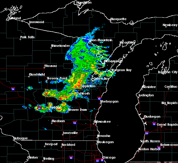 At 541 pm cdt, severe thunderstorms were located along a line extending from near pulaski to 6 miles southeast of black creek to 10 miles east of lake poygan, moving east at 50 mph (radar indicated). Hazards include 60 mph wind gusts. Expect damage to roofs. siding. and trees. severe thunderstorms will be near, green bay around 550 pm cdt. kaukauna, little chute and pulaski around 555 pm cdt. Other locations impacted by these severe thunderstorms include askeaton, greenleaf, murphy corner, sobieski, lark, kunesh, leo frigo bridge, ashwaubenon, pittsfield and hobart. At 541 pm cdt, severe thunderstorms were located along a line extending from near pulaski to 6 miles southeast of black creek to 10 miles east of lake poygan, moving east at 50 mph (radar indicated). Hazards include 60 mph wind gusts. Expect damage to roofs. siding. and trees. severe thunderstorms will be near, green bay around 550 pm cdt. kaukauna, little chute and pulaski around 555 pm cdt. Other locations impacted by these severe thunderstorms include askeaton, greenleaf, murphy corner, sobieski, lark, kunesh, leo frigo bridge, ashwaubenon, pittsfield and hobart.
|
| 8/14/2015 4:51 PM CDT |
 At 450 pm cdt, severe thunderstorms were located along a line extending from 6 miles northeast of denmark to 9 miles southwest of green bay to 6 miles northeast of new london, moving southeast at 30 mph (radar indicated). Hazards include 60 mph wind gusts and quarter size hail. Hail damage to vehicles is expected. expect wind damage to roofs, siding and trees. severe thunderstorms will be near, denmark around 455 pm cdt. appleton around 515 pm cdt. Other locations impacted by these severe thunderstorms include holland, greenville, grimms, hortonville, dundas, wrightstown, shirley, hickory grove, langes corners and rosecrans. At 450 pm cdt, severe thunderstorms were located along a line extending from 6 miles northeast of denmark to 9 miles southwest of green bay to 6 miles northeast of new london, moving southeast at 30 mph (radar indicated). Hazards include 60 mph wind gusts and quarter size hail. Hail damage to vehicles is expected. expect wind damage to roofs, siding and trees. severe thunderstorms will be near, denmark around 455 pm cdt. appleton around 515 pm cdt. Other locations impacted by these severe thunderstorms include holland, greenville, grimms, hortonville, dundas, wrightstown, shirley, hickory grove, langes corners and rosecrans.
|
| 8/2/2015 4:20 PM CDT |
 At 420 pm cdt, severe thunderstorms were located along a line extending from near luxemburg to near bellevue town to near black creek to 10 miles west of menasha to near lake poygan, moving east at 45 mph (trained weather spotters). Hazards include golf ball size hail and 60 mph wind gusts. People and animals outdoors will be injured. expect hail damage to roofs, siding, windows and vehicles. expect wind damage to roofs, siding and trees. these severe storms will be near, appleton and darboy around 430 pm cdt. Other locations impacted by these severe thunderstorms include holland, greenville, metz, boom bay, chicago corners, rivermoor, de pere, hortonville, oneida and wrightstown. At 420 pm cdt, severe thunderstorms were located along a line extending from near luxemburg to near bellevue town to near black creek to 10 miles west of menasha to near lake poygan, moving east at 45 mph (trained weather spotters). Hazards include golf ball size hail and 60 mph wind gusts. People and animals outdoors will be injured. expect hail damage to roofs, siding, windows and vehicles. expect wind damage to roofs, siding and trees. these severe storms will be near, appleton and darboy around 430 pm cdt. Other locations impacted by these severe thunderstorms include holland, greenville, metz, boom bay, chicago corners, rivermoor, de pere, hortonville, oneida and wrightstown.
|
| 8/2/2015 3:57 PM CDT |
 At 356 pm cdt, severe thunderstorms were located along a line extending from 5 miles west of green bay to 8 miles northeast of black creek to 7 miles north of new london to near waupaca to near plainfield, moving east at 55 mph (trained weather spotters). Hazards include golf ball size hail and 60 mph wind gusts. People and animals outdoors will be injured. expect hail damage to roofs, siding, windows and vehicles. expect wind damage to roofs, siding and trees. these severe storms will be near, green bay around 400 pm cdt. black creek and bellevue town around 415 pm cdt. kaukauna and lake poygan around 425 pm cdt. appleton, menasha and darboy around 430 pm cdt. Other locations impacted by these severe thunderstorms include holland, greenville, metz, northport, manawa, boom bay, chicago corners, rivermoor, de pere and hortonville. At 356 pm cdt, severe thunderstorms were located along a line extending from 5 miles west of green bay to 8 miles northeast of black creek to 7 miles north of new london to near waupaca to near plainfield, moving east at 55 mph (trained weather spotters). Hazards include golf ball size hail and 60 mph wind gusts. People and animals outdoors will be injured. expect hail damage to roofs, siding, windows and vehicles. expect wind damage to roofs, siding and trees. these severe storms will be near, green bay around 400 pm cdt. black creek and bellevue town around 415 pm cdt. kaukauna and lake poygan around 425 pm cdt. appleton, menasha and darboy around 430 pm cdt. Other locations impacted by these severe thunderstorms include holland, greenville, metz, northport, manawa, boom bay, chicago corners, rivermoor, de pere and hortonville.
|
| 8/2/2015 3:47 PM CDT |
 At 347 pm cdt, severe thunderstorms were located along a line extending from 7 miles south of pulaski to 5 miles north of black creek to 10 miles southwest of clintonville to near hartman creek state park to near plainfield, moving southeast at 35 mph (trained weather spotters). Hazards include golf ball size hail and 70 mph wind gusts. People and animals outdoors will be injured. expect hail damage to roofs, siding, windows and vehicles. expect considerable tree damage. wind damage is also likely to mobile homes, roofs and outbuildings. these severe storms will be near, black creek around 350 pm cdt. waupaca around 400 pm cdt. green bay and new london around 405 pm cdt. bellevue town around 415 pm cdt. fremont and lake poygan around 420 pm cdt. appleton around 430 pm cdt. Other locations impacted by these severe thunderstorms include holland, greenville, metz, northport, manawa, boom bay, chicago corners, rivermoor, de pere and hortonville. At 347 pm cdt, severe thunderstorms were located along a line extending from 7 miles south of pulaski to 5 miles north of black creek to 10 miles southwest of clintonville to near hartman creek state park to near plainfield, moving southeast at 35 mph (trained weather spotters). Hazards include golf ball size hail and 70 mph wind gusts. People and animals outdoors will be injured. expect hail damage to roofs, siding, windows and vehicles. expect considerable tree damage. wind damage is also likely to mobile homes, roofs and outbuildings. these severe storms will be near, black creek around 350 pm cdt. waupaca around 400 pm cdt. green bay and new london around 405 pm cdt. bellevue town around 415 pm cdt. fremont and lake poygan around 420 pm cdt. appleton around 430 pm cdt. Other locations impacted by these severe thunderstorms include holland, greenville, metz, northport, manawa, boom bay, chicago corners, rivermoor, de pere and hortonville.
|
| 8/2/2015 3:28 PM CDT |
 At 327 pm cdt, severe thunderstorms were located along a line extending from 13 miles west of clintonville to near amherst to near new rome, moving east at 55 mph (trained weather spotters). Hazards include 70 mph wind gusts and quarter size hail. Hail damage to vehicles is expected. expect considerable tree damage. wind damage is also likely to mobile homes, roofs and outbuildings. severe thunderstorms will be near, chain o` lakes-king around 335 pm cdt. waupaca and clintonville around 340 pm cdt. plainfield around 345 pm cdt. new london around 355 pm cdt. black creek around 400 pm cdt. appleton and menasha around 415 pm cdt. green bay, kaukauna, little chute, kimberly, darboy and lake poygan around 420 pm cdt. bellevue town around 425 pm cdt. Other locations impacted by these severe thunderstorms include holland, greenville, metz, northport, manawa, boom bay, chicago corners, rivermoor, de pere and hortonville. At 327 pm cdt, severe thunderstorms were located along a line extending from 13 miles west of clintonville to near amherst to near new rome, moving east at 55 mph (trained weather spotters). Hazards include 70 mph wind gusts and quarter size hail. Hail damage to vehicles is expected. expect considerable tree damage. wind damage is also likely to mobile homes, roofs and outbuildings. severe thunderstorms will be near, chain o` lakes-king around 335 pm cdt. waupaca and clintonville around 340 pm cdt. plainfield around 345 pm cdt. new london around 355 pm cdt. black creek around 400 pm cdt. appleton and menasha around 415 pm cdt. green bay, kaukauna, little chute, kimberly, darboy and lake poygan around 420 pm cdt. bellevue town around 425 pm cdt. Other locations impacted by these severe thunderstorms include holland, greenville, metz, northport, manawa, boom bay, chicago corners, rivermoor, de pere and hortonville.
|
| 7/18/2015 6:12 AM CDT |
 At 611 am cdt, severe thunderstorms were located along a line extending from 7 miles north of green bay to 8 miles west of denmark to near st. nazianz, moving east at 45 mph (trained weather spotters). Hazards include 65 mph wind gusts. Expect damage to roofs. siding and trees. these severe storms will be near, st. nazianz around 615 am cdt. denmark and valders around 620 am cdt. manitowoc, luxemburg and cleveland around 630 am cdt. two creeks around 640 am cdt. algoma around 645 am cdt. Other locations impacted by these severe thunderstorms include millhome, stangelville, euren, de pere, zander, ledgeview, shoto, humboldt, suamico and hayton. At 611 am cdt, severe thunderstorms were located along a line extending from 7 miles north of green bay to 8 miles west of denmark to near st. nazianz, moving east at 45 mph (trained weather spotters). Hazards include 65 mph wind gusts. Expect damage to roofs. siding and trees. these severe storms will be near, st. nazianz around 615 am cdt. denmark and valders around 620 am cdt. manitowoc, luxemburg and cleveland around 630 am cdt. two creeks around 640 am cdt. algoma around 645 am cdt. Other locations impacted by these severe thunderstorms include millhome, stangelville, euren, de pere, zander, ledgeview, shoto, humboldt, suamico and hayton.
|
| 7/18/2015 5:59 AM CDT |
 At 557 am cdt, severe thunderstorms were located along a line extending from pulaski to near kaukauna to near chilton, moving east at 45 mph. several reports of 60 mph gusts and funnel clouds have been reported along the line of thunderstorms (trained weather spotters). Hazards include 60 mph wind gusts and possible weak tornadoes. Expect damage to roofs. siding and trees. these severe storms will be near, brillion around 605 am cdt. st. nazianz around 615 am cdt. denmark and valders around 620 am cdt. manitowoc around 630 am cdt. two creeks around 635 am cdt. kewaunee and algoma around 645 am cdt. Other locations impacted by these severe thunderstorms include kunesh, millhome, stangelville, euren, de pere, zander, oneida, dundas, ledgeview and shoto. At 557 am cdt, severe thunderstorms were located along a line extending from pulaski to near kaukauna to near chilton, moving east at 45 mph. several reports of 60 mph gusts and funnel clouds have been reported along the line of thunderstorms (trained weather spotters). Hazards include 60 mph wind gusts and possible weak tornadoes. Expect damage to roofs. siding and trees. these severe storms will be near, brillion around 605 am cdt. st. nazianz around 615 am cdt. denmark and valders around 620 am cdt. manitowoc around 630 am cdt. two creeks around 635 am cdt. kewaunee and algoma around 645 am cdt. Other locations impacted by these severe thunderstorms include kunesh, millhome, stangelville, euren, de pere, zander, oneida, dundas, ledgeview and shoto.
|
| 7/18/2015 5:47 AM CDT |
 At 547 am cdt, severe thunderstorms were located along a line extending from 7 miles north of black creek to appleton to 8 miles southeast of oshkosh, moving east at 45 mph (trained weather spotters). Hazards include 60 mph wind gusts. Expect damage to roofs. siding and trees. severe thunderstorms will be near, little chute, kimberly, darboy and high cliff state park around 550 am cdt. kaukauna around 555 am cdt. pulaski around 600 am cdt. chilton and st anna around 605 am cdt. green bay and bellevue town around 610 am cdt. valders and st. nazianz around 620 am cdt. denmark around 625 am cdt. manitowoc, luxemburg and cleveland around 630 am cdt. Other locations impacted by these severe thunderstorms include kunesh, millhome, stangelville, euren, de pere, zander, oneida, dundas, ledgeview and marytown. At 547 am cdt, severe thunderstorms were located along a line extending from 7 miles north of black creek to appleton to 8 miles southeast of oshkosh, moving east at 45 mph (trained weather spotters). Hazards include 60 mph wind gusts. Expect damage to roofs. siding and trees. severe thunderstorms will be near, little chute, kimberly, darboy and high cliff state park around 550 am cdt. kaukauna around 555 am cdt. pulaski around 600 am cdt. chilton and st anna around 605 am cdt. green bay and bellevue town around 610 am cdt. valders and st. nazianz around 620 am cdt. denmark around 625 am cdt. manitowoc, luxemburg and cleveland around 630 am cdt. Other locations impacted by these severe thunderstorms include kunesh, millhome, stangelville, euren, de pere, zander, oneida, dundas, ledgeview and marytown.
|
| 7/13/2015 4:37 AM CDT |
 The tornado warning for southeastern outagamie county will expire at 445 am cdt, the storm which prompted the warning has moved out of the area. therefore the warning will be allowed to expire. The tornado warning for southeastern outagamie county will expire at 445 am cdt, the storm which prompted the warning has moved out of the area. therefore the warning will be allowed to expire.
|
| 7/13/2015 4:33 AM CDT |
 At 431 am cdt, a severe thunderstorm capable of producing a tornado was located 8 miles northeast of kaukauna, or 12 miles southwest of green bay, moving east at 45 mph (radar indicated rotation). Hazards include tornado. Flying debris will be dangerous to those caught without shelter. mobile homes will be damaged or destroyed. damage to roofs, windows and vehicles will occur. tree damage is likely. Locations impacted include, black creek, freedom. At 431 am cdt, a severe thunderstorm capable of producing a tornado was located 8 miles northeast of kaukauna, or 12 miles southwest of green bay, moving east at 45 mph (radar indicated rotation). Hazards include tornado. Flying debris will be dangerous to those caught without shelter. mobile homes will be damaged or destroyed. damage to roofs, windows and vehicles will occur. tree damage is likely. Locations impacted include, black creek, freedom.
|
| 7/13/2015 4:19 AM CDT |
 At 418 am cdt, a severe thunderstorm capable of producing a tornado was located near black creek, or 8 miles north of appleton, moving east at 45 mph (radar indicated rotation). Hazards include tornado. Flying debris will be dangerous to those caught without shelter. mobile homes will be damaged or destroyed. damage to roofs, windows and vehicles will occur. Tree damage is likely. At 418 am cdt, a severe thunderstorm capable of producing a tornado was located near black creek, or 8 miles north of appleton, moving east at 45 mph (radar indicated rotation). Hazards include tornado. Flying debris will be dangerous to those caught without shelter. mobile homes will be damaged or destroyed. damage to roofs, windows and vehicles will occur. Tree damage is likely.
|
| 7/13/2015 3:56 AM CDT |
 At 355 am cdt, a severe thunderstorm was located 8 miles east of fremont, or 13 miles west of appleton, moving northeast at 45 mph (radar indicated). Hazards include 60 mph wind gusts. Expect damage to roofs. siding and trees. this severe thunderstorm will be near, appleton around 415 am cdt. little chute and kimberly around 420 am cdt. kaukauna around 425 am cdt. Other locations impacted by this severe thunderstorm include greenville, five corners, binghamton, shiocton, seymour, chicago corners, bear creek, sugar bush, twelve corners and murphy corner. At 355 am cdt, a severe thunderstorm was located 8 miles east of fremont, or 13 miles west of appleton, moving northeast at 45 mph (radar indicated). Hazards include 60 mph wind gusts. Expect damage to roofs. siding and trees. this severe thunderstorm will be near, appleton around 415 am cdt. little chute and kimberly around 420 am cdt. kaukauna around 425 am cdt. Other locations impacted by this severe thunderstorm include greenville, five corners, binghamton, shiocton, seymour, chicago corners, bear creek, sugar bush, twelve corners and murphy corner.
|
| 8/7/2013 12:48 AM CDT | Numerous trees down and possible injuries at the apple creek campgroun in brown county WI, 1.7 miles SE of Wrightstown, WI |
| 7/30/2012 7:28 PM CDT | Golf Ball sized hail reported 0.4 miles W of Wrightstown, WI, windshield cracked |
| 7/30/2012 7:12 PM CDT | Quarter sized hail reported 0.4 miles W of Wrightstown, WI, hail began at 710 pm and ended at 712 pm. |
| 1/1/0001 12:00 AM | Storm damage reported in brown county WI, 0.4 miles W of Wrightstown, WI |
| 1/1/0001 12:00 AM | Semi truck blown over on county road u and hwy 41. delayed repor in brown county WI, 0.4 miles W of Wrightstown, WI |
| 1/1/0001 12:00 AM | Semi trunk blown over on county road u and hwy 41. delayed repor in brown county WI, 0.4 miles W of Wrightstown, WI |
| 1/1/0001 12:00 AM | Quarter sized hail reported 0.4 miles W of Wrightstown, WI |
| 1/1/0001 12:00 AM | Roof torn off building in brown county WI, 0.4 miles W of Wrightstown, WI |
| 1/1/0001 12:00 AM | Building damaged on county hwy d in brown county WI, 3.5 miles N of Wrightstown, WI |
Hail Maps for Wrightstown, WI
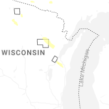


Connect with Interactive Hail Maps