

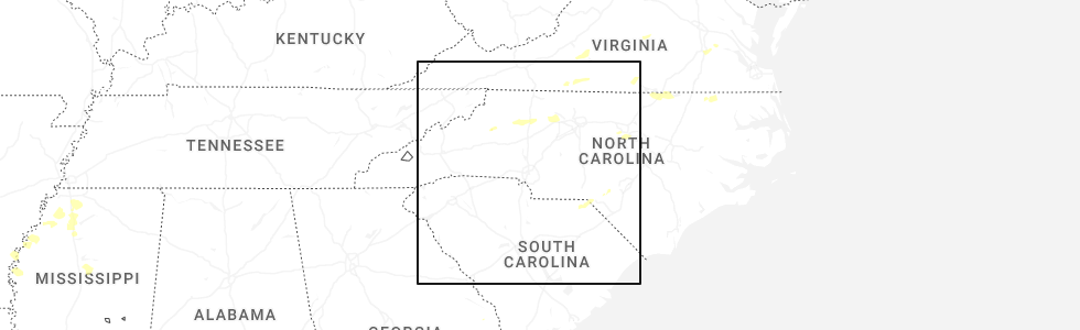
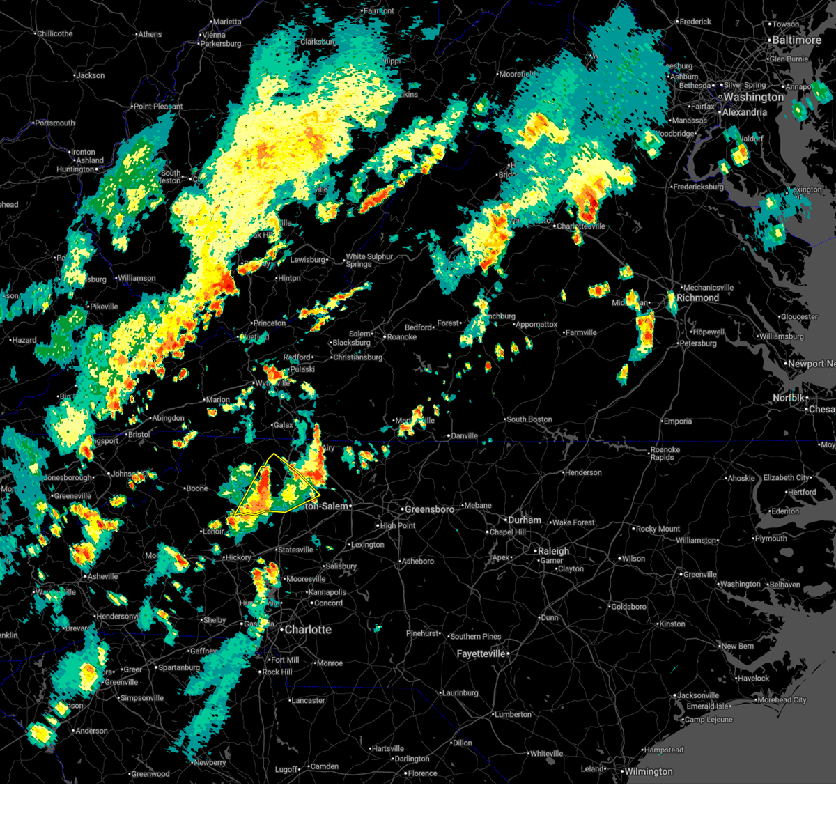
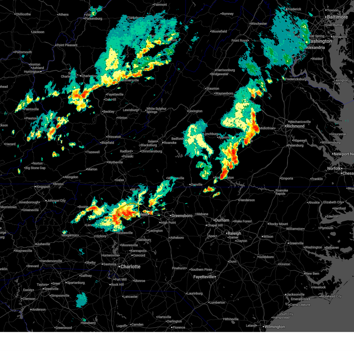
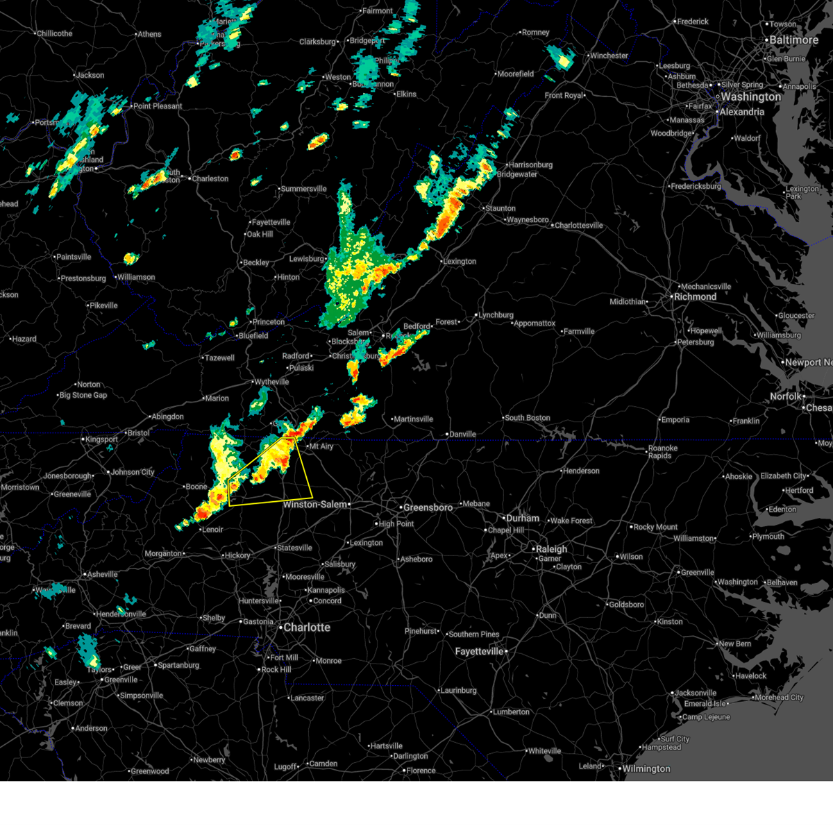
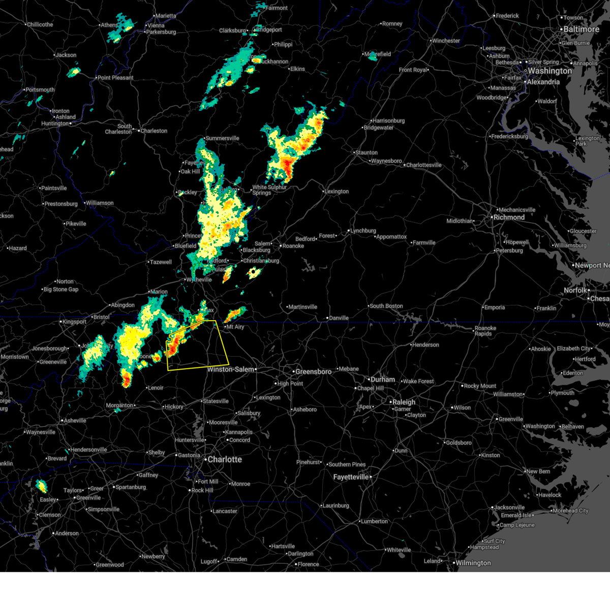
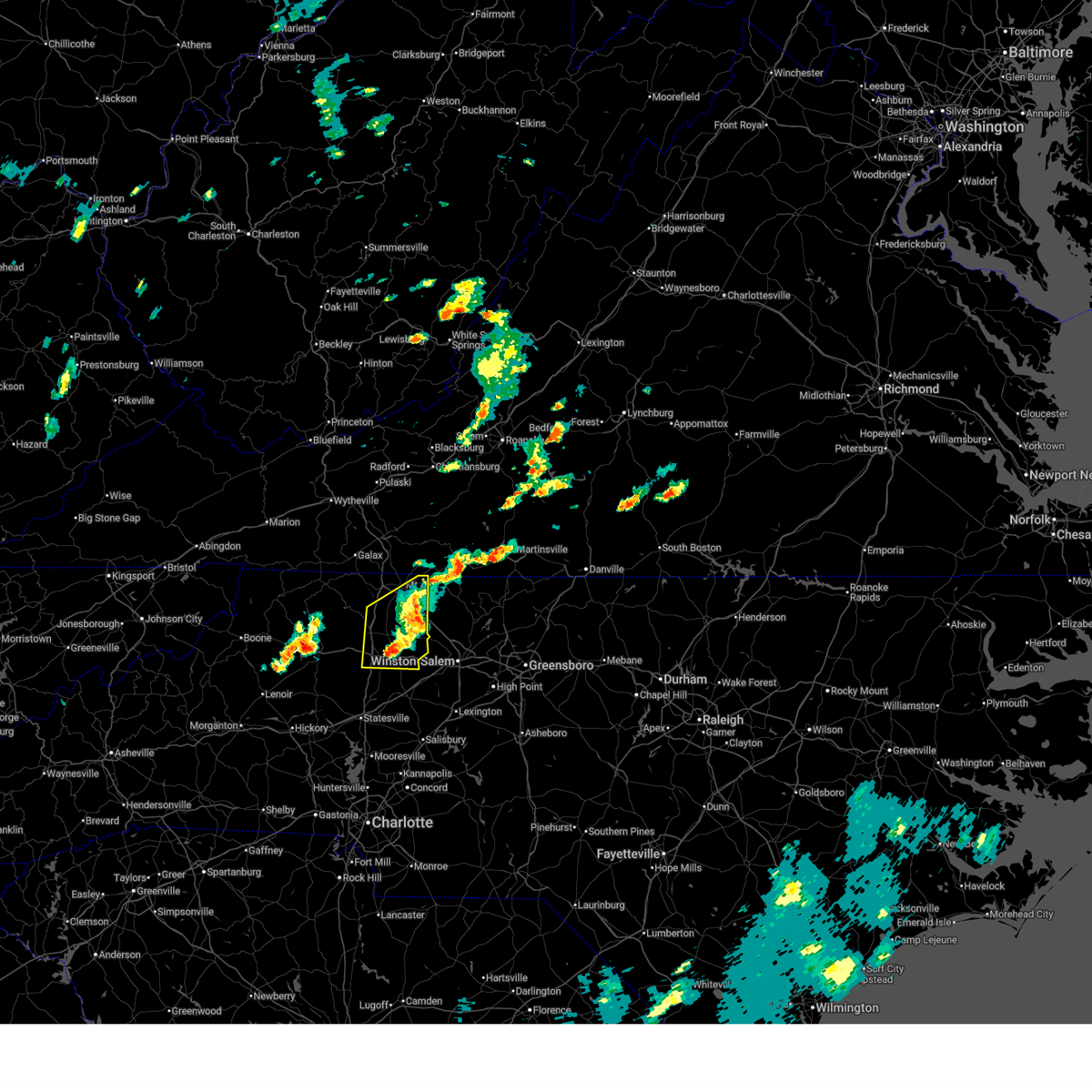
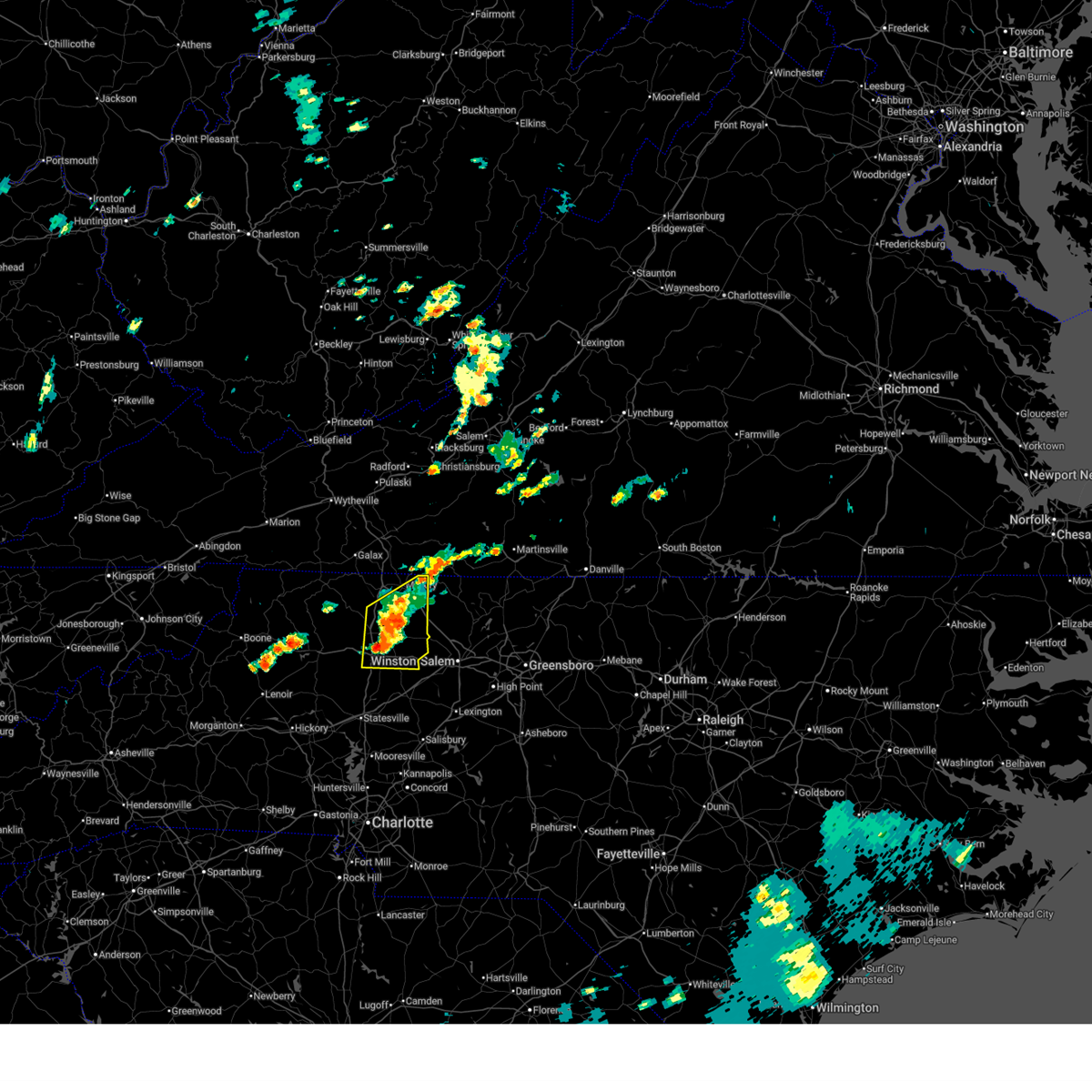
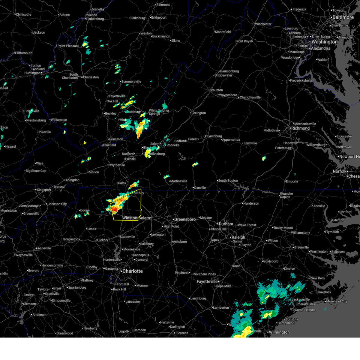
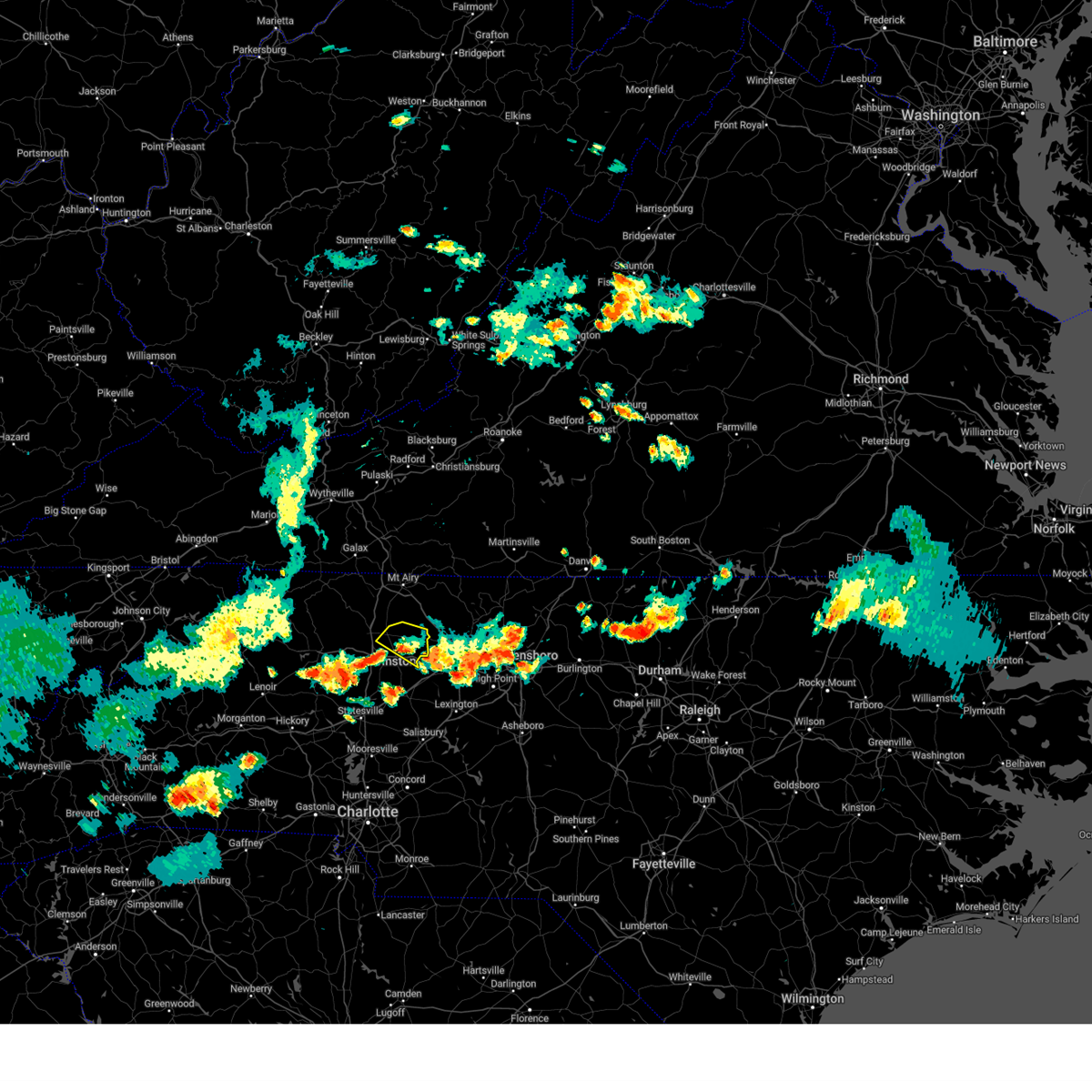
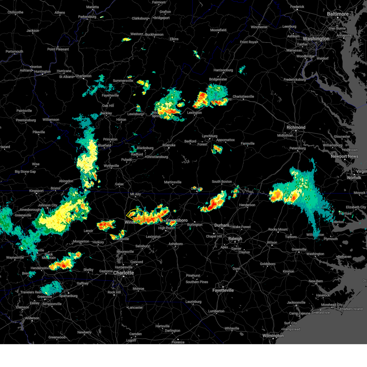
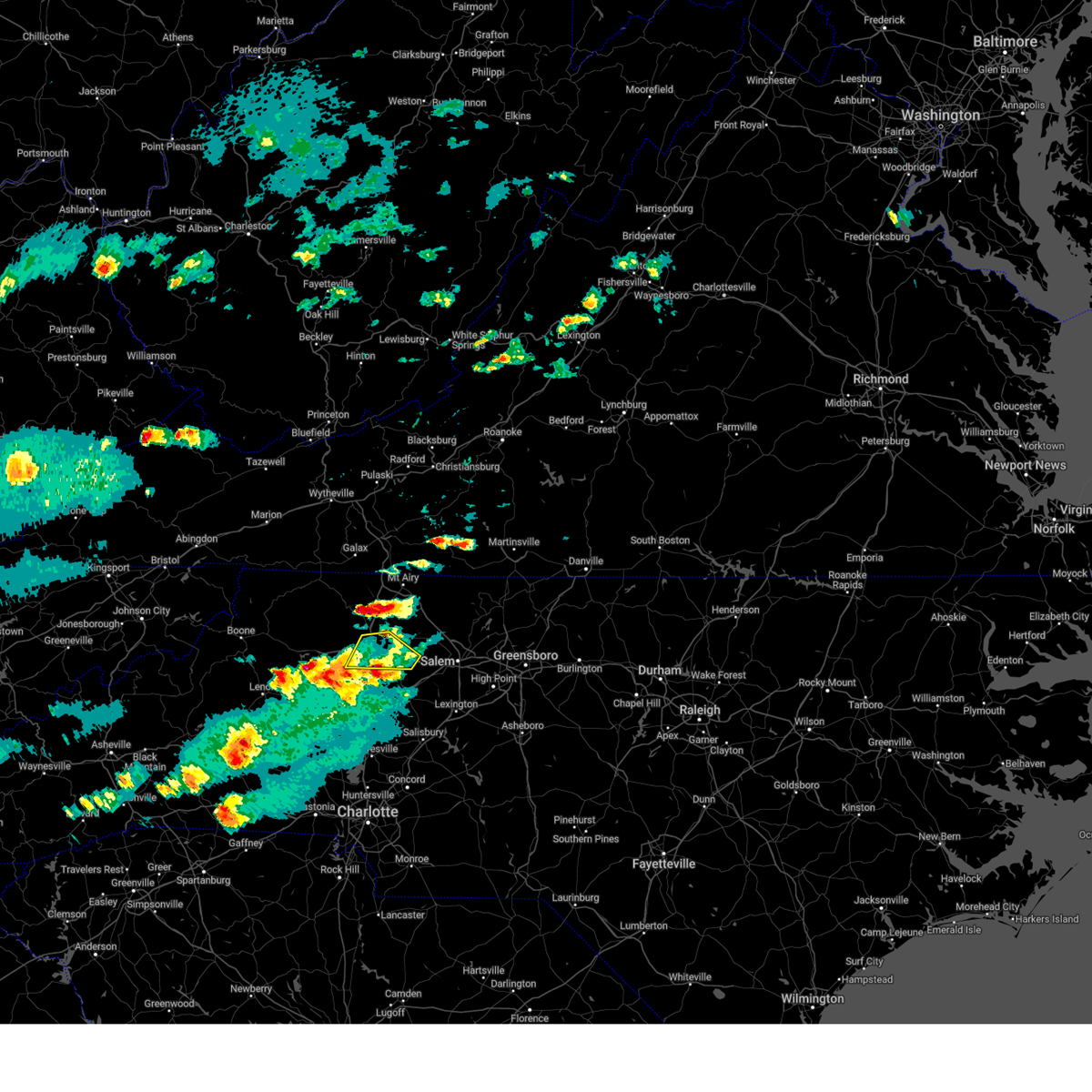
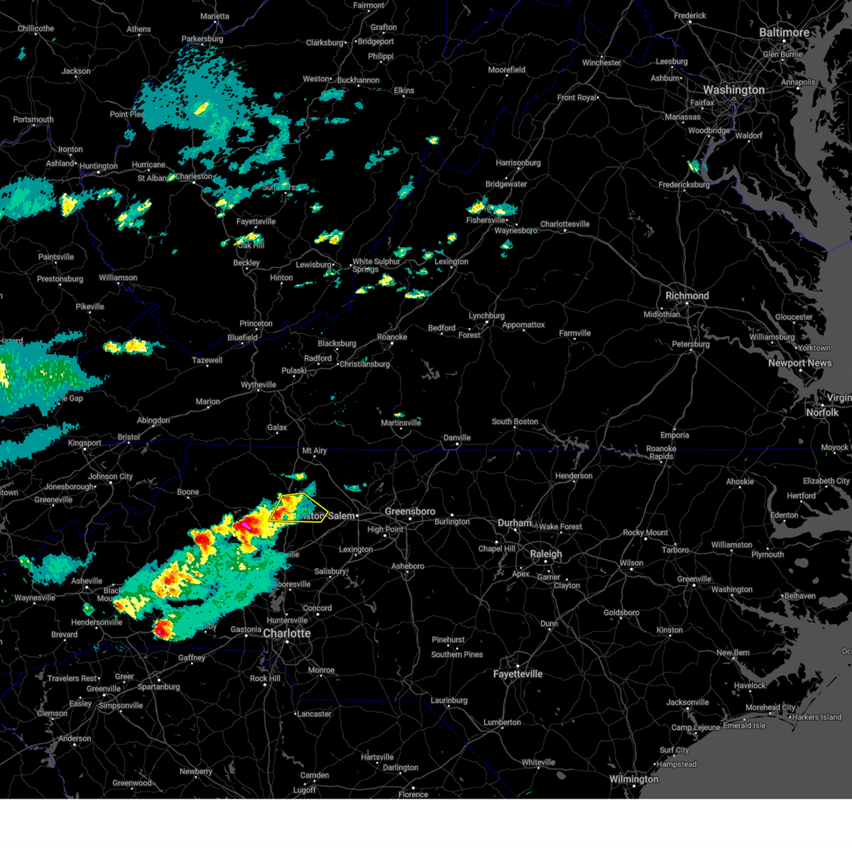
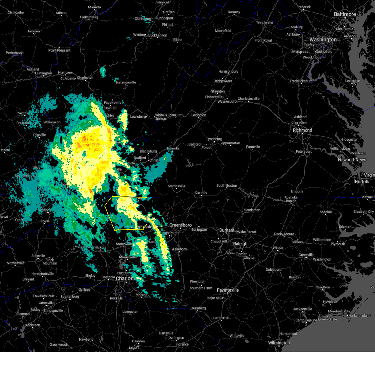
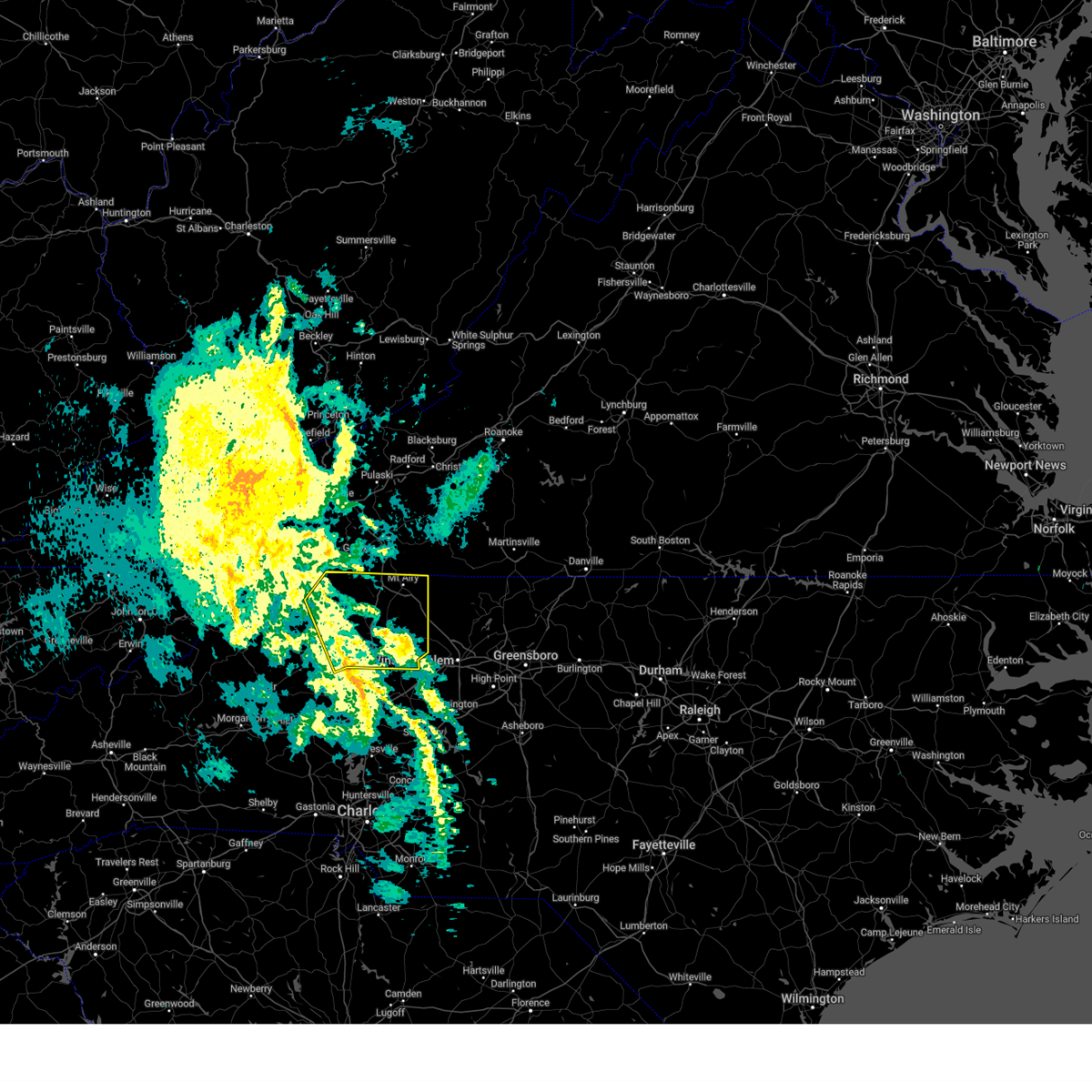
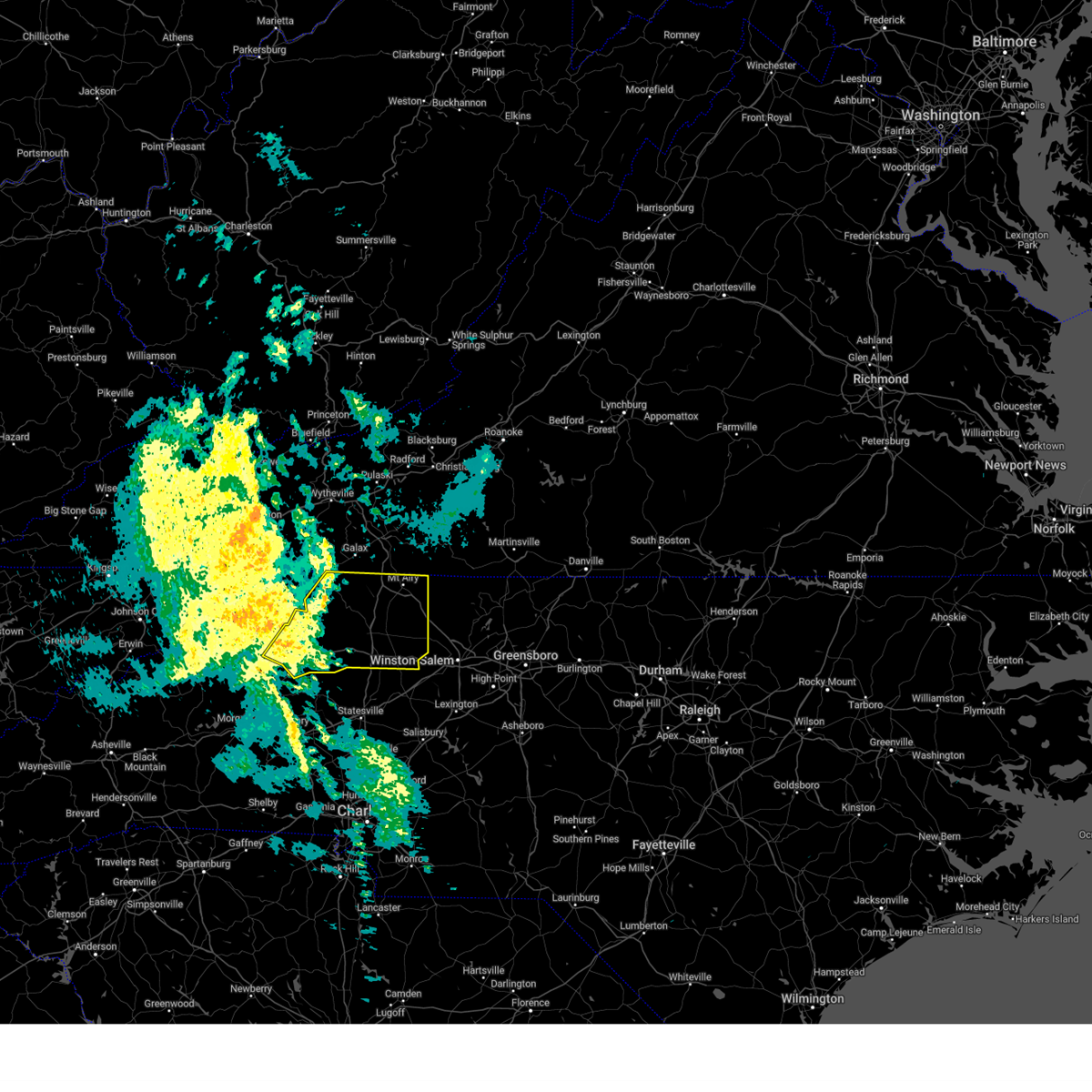
Hail Map for Yadkinville, NC
The Yadkinville, NC area has had 11 reports of on-the-ground hail by trained spotters, and has been under severe weather warnings 29 times during the past 12 months. Doppler radar has detected hail at or near Yadkinville, NC on 41 occasions, including 2 occasions during the past year.
| Name: | Yadkinville, NC |
| Where Located: | 63.3 miles N of Charlotte, NC |
| Map: | Google Map for Yadkinville, NC |
| Population: | 2959 |
| Housing Units: | 1235 |
| More Info: | Search Google for Yadkinville, NC |
0
The Top Recent Hail Date for Yadkinville, NC is Thursday, June 19, 2025 (39th out of 41)
Hail and Wind Damage Spotted near Yadkinville, NC
| Date / Time | Report Details |
|---|---|
| 7/9/2025 5:06 PM EDT |
 The storm which prompted the warning has weakened below severe limits, and no longer poses an immediate threat to life or property. therefore, the warning will be allowed to expire. a severe thunderstorm watch remains in effect until 1000 pm edt for north central and northwestern north carolina, and southwestern virginia. The storm which prompted the warning has weakened below severe limits, and no longer poses an immediate threat to life or property. therefore, the warning will be allowed to expire. a severe thunderstorm watch remains in effect until 1000 pm edt for north central and northwestern north carolina, and southwestern virginia.
|
| 7/9/2025 4:37 PM EDT |
 Svrrnk the national weather service in blacksburg has issued a * severe thunderstorm warning for, southeastern surry county in northwestern north carolina, yadkin county in northwestern north carolina, * until 515 pm edt. * at 437 pm edt, a severe thunderstorm was located over brooks crossroads, or 7 miles west of yadkinville, moving northeast at 30 mph (radar indicated). Hazards include 60 mph wind gusts and quarter size hail. Hail damage to vehicles is expected. Expect wind damage to roofs, siding, and trees. Svrrnk the national weather service in blacksburg has issued a * severe thunderstorm warning for, southeastern surry county in northwestern north carolina, yadkin county in northwestern north carolina, * until 515 pm edt. * at 437 pm edt, a severe thunderstorm was located over brooks crossroads, or 7 miles west of yadkinville, moving northeast at 30 mph (radar indicated). Hazards include 60 mph wind gusts and quarter size hail. Hail damage to vehicles is expected. Expect wind damage to roofs, siding, and trees.
|
| 7/1/2025 6:12 PM EDT |
 The storm which prompted the warning has moved out of the area. therefore, the warning will be allowed to expire. The storm which prompted the warning has moved out of the area. therefore, the warning will be allowed to expire.
|
| 7/1/2025 5:40 PM EDT |
 At 540 pm edt, a severe thunderstorm was located over roaring river, or over ronda, moving northeast at 30 mph (radar indicated). Hazards include 60 mph wind gusts. Expect damage to roofs, siding, and trees. Locations impacted include, north wilkesboro, elkin, wilkesboro, fairview, yadkinville, jonesville, and boonville. At 540 pm edt, a severe thunderstorm was located over roaring river, or over ronda, moving northeast at 30 mph (radar indicated). Hazards include 60 mph wind gusts. Expect damage to roofs, siding, and trees. Locations impacted include, north wilkesboro, elkin, wilkesboro, fairview, yadkinville, jonesville, and boonville.
|
| 7/1/2025 5:19 PM EDT |
 Svrrnk the national weather service in blacksburg has issued a * severe thunderstorm warning for, southwestern surry county in northwestern north carolina, wilkes county in northwestern north carolina, yadkin county in northwestern north carolina, * until 615 pm edt. * at 519 pm edt, a severe thunderstorm was located near moravian falls, or near wilkesboro, moving northeast at 20 mph (radar indicated). Hazards include 60 mph wind gusts. expect damage to roofs, siding, and trees Svrrnk the national weather service in blacksburg has issued a * severe thunderstorm warning for, southwestern surry county in northwestern north carolina, wilkes county in northwestern north carolina, yadkin county in northwestern north carolina, * until 615 pm edt. * at 519 pm edt, a severe thunderstorm was located near moravian falls, or near wilkesboro, moving northeast at 20 mph (radar indicated). Hazards include 60 mph wind gusts. expect damage to roofs, siding, and trees
|
| 6/26/2025 3:18 PM EDT | Trees down along taylor stree in yadkin county NC, 0.5 miles W of Yadkinville, NC |
| 6/19/2025 4:55 PM EDT |
 The storms which prompted the warning have weakened below severe limits, and no longer pose an immediate threat to life or property. therefore, the warning will be allowed to expire. however, gusty winds and heavy rain are still possible with these thunderstorms. a severe thunderstorm watch remains in effect until 900 pm edt for north central and northwestern north carolina, and southwestern virginia. The storms which prompted the warning have weakened below severe limits, and no longer pose an immediate threat to life or property. therefore, the warning will be allowed to expire. however, gusty winds and heavy rain are still possible with these thunderstorms. a severe thunderstorm watch remains in effect until 900 pm edt for north central and northwestern north carolina, and southwestern virginia.
|
| 6/19/2025 4:30 PM EDT |
 At 429 pm edt, a cluster of severe thunderstorms were located from enon to near love valley, moving east at 45 mph (radar indicated). Hazards include 60 mph wind gusts. Expect damage to roofs, siding, and trees. Locations impacted include, yadkinville, boonville, east bend, nebo, courtney, buck shoals, and brooks crossroads. At 429 pm edt, a cluster of severe thunderstorms were located from enon to near love valley, moving east at 45 mph (radar indicated). Hazards include 60 mph wind gusts. Expect damage to roofs, siding, and trees. Locations impacted include, yadkinville, boonville, east bend, nebo, courtney, buck shoals, and brooks crossroads.
|
| 6/19/2025 4:30 PM EDT |
 the severe thunderstorm warning has been cancelled and is no longer in effect the severe thunderstorm warning has been cancelled and is no longer in effect
|
| 6/19/2025 4:16 PM EDT | At 415 pm edt, severe thunderstorms were located along a line extending from near germanton to near love valley, moving east at 45 mph (radar indicated). Hazards include 60 mph wind gusts and quarter size hail. Hail damage to vehicles is expected. expect wind damage to roofs, siding, and trees. Locations impacted include, yadkinville, boonville, east bend, windy gap, nebo, buck shoals, and huntsville. |
| 6/19/2025 4:00 PM EDT | Svrrnk the national weather service in blacksburg has issued a * severe thunderstorm warning for, southeastern surry county in northwestern north carolina, southern wilkes county in northwestern north carolina, yadkin county in northwestern north carolina, * until 500 pm edt. * at 400 pm edt, severe thunderstorms were located along a line extending from enon to 6 miles south of darby, moving east at 35 mph (radar indicated). Hazards include 60 mph wind gusts and quarter size hail. Hail damage to vehicles is expected. Expect wind damage to roofs, siding, and trees. |
| 6/19/2025 1:56 PM EDT |
 At 155 pm edt, a severe thunderstorm was located over mountain park, moving east at 30 mph (radar indicated). Hazards include 60 mph wind gusts and quarter size hail. Hail damage to vehicles is expected. expect wind damage to roofs, siding, and trees. Locations impacted include, north wilkesboro, elkin, wilkesboro, fairview, yadkinville, jonesville, and dobson. At 155 pm edt, a severe thunderstorm was located over mountain park, moving east at 30 mph (radar indicated). Hazards include 60 mph wind gusts and quarter size hail. Hail damage to vehicles is expected. expect wind damage to roofs, siding, and trees. Locations impacted include, north wilkesboro, elkin, wilkesboro, fairview, yadkinville, jonesville, and dobson.
|
| 6/19/2025 1:22 PM EDT |
 Svrrnk the national weather service in blacksburg has issued a * severe thunderstorm warning for, southern alleghany county in northwestern north carolina, western surry county in northwestern north carolina, wilkes county in northwestern north carolina, northwestern yadkin county in northwestern north carolina, * until 215 pm edt. * at 122 pm edt, a severe thunderstorm was located near dockery, or near mc grady, moving east at 30 mph (radar indicated). Hazards include 60 mph wind gusts and quarter size hail. Hail damage to vehicles is expected. Expect wind damage to roofs, siding, and trees. Svrrnk the national weather service in blacksburg has issued a * severe thunderstorm warning for, southern alleghany county in northwestern north carolina, western surry county in northwestern north carolina, wilkes county in northwestern north carolina, northwestern yadkin county in northwestern north carolina, * until 215 pm edt. * at 122 pm edt, a severe thunderstorm was located near dockery, or near mc grady, moving east at 30 mph (radar indicated). Hazards include 60 mph wind gusts and quarter size hail. Hail damage to vehicles is expected. Expect wind damage to roofs, siding, and trees.
|
| 6/14/2025 2:32 PM EDT |
 The severe thunderstorm which prompted the warning has weakened. therefore, the warning has been allowed to expire. however, heavy rain and occasional cloud-to-ground lightning is still possible with this thunderstorm. The severe thunderstorm which prompted the warning has weakened. therefore, the warning has been allowed to expire. however, heavy rain and occasional cloud-to-ground lightning is still possible with this thunderstorm.
|
| 6/14/2025 2:28 PM EDT | Tree down... blocking one lane of country club roa in yadkin county NC, 1.5 miles S of Yadkinville, NC |
| 6/14/2025 2:07 PM EDT |
 At 204 pm edt, a severe thunderstorm was located near brooks crossroads, or near boonville, moving east at 15 mph (radar indicated). Hazards include 60 mph wind gusts. half inch hail and very heavy rain is also likely. Expect damage to roofs, siding, and trees. Locations impacted include, mount airy, elkin, fairview, flat rock, yadkinville, jonesville, and dobson. At 204 pm edt, a severe thunderstorm was located near brooks crossroads, or near boonville, moving east at 15 mph (radar indicated). Hazards include 60 mph wind gusts. half inch hail and very heavy rain is also likely. Expect damage to roofs, siding, and trees. Locations impacted include, mount airy, elkin, fairview, flat rock, yadkinville, jonesville, and dobson.
|
| 6/14/2025 2:07 PM EDT |
 the severe thunderstorm warning has been cancelled and is no longer in effect the severe thunderstorm warning has been cancelled and is no longer in effect
|
| 6/14/2025 1:26 PM EDT |
 Svrrnk the national weather service in blacksburg has issued a * severe thunderstorm warning for, surry county in northwestern north carolina, eastern wilkes county in northwestern north carolina, yadkin county in northwestern north carolina, * until 230 pm edt. * at 124 pm edt, a severe thunderstorm was located over pleasant hill, or over ronda, moving east at 25 mph (radar indicated). Hazards include 60 mph wind gusts. expect damage to roofs, siding, and trees Svrrnk the national weather service in blacksburg has issued a * severe thunderstorm warning for, surry county in northwestern north carolina, eastern wilkes county in northwestern north carolina, yadkin county in northwestern north carolina, * until 230 pm edt. * at 124 pm edt, a severe thunderstorm was located over pleasant hill, or over ronda, moving east at 25 mph (radar indicated). Hazards include 60 mph wind gusts. expect damage to roofs, siding, and trees
|
| 6/6/2025 8:38 PM EDT |
 The storm which prompted the warning has moved out of the area. therefore, the warning will be allowed to expire. however, heavy rain is still possible with this thunderstorm. The storm which prompted the warning has moved out of the area. therefore, the warning will be allowed to expire. however, heavy rain is still possible with this thunderstorm.
|
| 6/6/2025 8:14 PM EDT |
 At 814 pm edt, a severe thunderstorm was located over winston-salem, moving southeast at 25 mph (radar indicated). Hazards include 60 mph wind gusts and quarter size hail. Hail damage to vehicles is expected. expect wind damage to roofs, siding, and trees. Locations impacted include, yadkinville, boonville, east bend, nebo, shacktown, rockford, and enon. At 814 pm edt, a severe thunderstorm was located over winston-salem, moving southeast at 25 mph (radar indicated). Hazards include 60 mph wind gusts and quarter size hail. Hail damage to vehicles is expected. expect wind damage to roofs, siding, and trees. Locations impacted include, yadkinville, boonville, east bend, nebo, shacktown, rockford, and enon.
|
| 6/6/2025 7:45 PM EDT | Svrrnk the national weather service in blacksburg has issued a * severe thunderstorm warning for, southeastern surry county in northwestern north carolina, central yadkin county in northwestern north carolina, * until 845 pm edt. * at 744 pm edt, a severe thunderstorm was located over enon, or near east bend, moving southeast at 25 mph (radar indicated). Hazards include 60 mph wind gusts and quarter size hail. Hail damage to vehicles is expected. Expect wind damage to roofs, siding, and trees. |
| 5/8/2025 6:13 PM EDT | Svrrnk the national weather service in blacksburg has issued a * severe thunderstorm warning for, surry county in northwestern north carolina, northwestern stokes county in north central north carolina, northern yadkin county in northwestern north carolina, the city of martinsville in south central virginia, western henry county in south central virginia, patrick county in southwestern virginia, * until 715 pm edt. * at 612 pm edt, severe thunderstorms were located along a broken line extending from near sanville to near pilot mountain to near arlington, moving east at 15 mph (radar indicated). Hazards include quarter size hail. damage to vehicles is expected |
| 5/8/2025 5:49 PM EDT |
 the severe thunderstorm warning has been cancelled and is no longer in effect the severe thunderstorm warning has been cancelled and is no longer in effect
|
| 5/8/2025 5:28 PM EDT |
 Svrrnk the national weather service in blacksburg has issued a * severe thunderstorm warning for, southeastern wilkes county in northwestern north carolina, yadkin county in northwestern north carolina, * until 615 pm edt. * at 527 pm edt, a severe thunderstorm was located near buck shoals, or 9 miles south of ronda, moving southeast at 15 mph (radar indicated). Hazards include 60 mph wind gusts and quarter size hail. Hail damage to vehicles is expected. Expect wind damage to roofs, siding, and trees. Svrrnk the national weather service in blacksburg has issued a * severe thunderstorm warning for, southeastern wilkes county in northwestern north carolina, yadkin county in northwestern north carolina, * until 615 pm edt. * at 527 pm edt, a severe thunderstorm was located near buck shoals, or 9 miles south of ronda, moving southeast at 15 mph (radar indicated). Hazards include 60 mph wind gusts and quarter size hail. Hail damage to vehicles is expected. Expect wind damage to roofs, siding, and trees.
|
| 12/29/2024 10:30 AM EST |
 The storms which prompted the warning have weakened below severe limits, and no longer pose an immediate threat to life or property. therefore, the warning has been allowed to expire. however, gusty winds and heavy rain are still possible with these thunderstorms. a severe thunderstorm watch remains in effect until 500 pm est for north central and northwestern north carolina. The storms which prompted the warning have weakened below severe limits, and no longer pose an immediate threat to life or property. therefore, the warning has been allowed to expire. however, gusty winds and heavy rain are still possible with these thunderstorms. a severe thunderstorm watch remains in effect until 500 pm est for north central and northwestern north carolina.
|
| 12/29/2024 10:04 AM EST |
 At 1004 am est, severe thunderstorms were located along a line extending from twin oaks to near cleveland, moving northeast at 40 mph (radar indicated). Hazards include 60 mph wind gusts. Expect damage to roofs, siding, and trees. Locations impacted include, mount airy, north wilkesboro, elkin, fairview, flat rock, yadkinville, and jonesville. At 1004 am est, severe thunderstorms were located along a line extending from twin oaks to near cleveland, moving northeast at 40 mph (radar indicated). Hazards include 60 mph wind gusts. Expect damage to roofs, siding, and trees. Locations impacted include, mount airy, north wilkesboro, elkin, fairview, flat rock, yadkinville, and jonesville.
|
| 12/29/2024 9:25 AM EST |
 Svrrnk the national weather service in blacksburg has issued a * severe thunderstorm warning for, alleghany county in northwestern north carolina, surry county in northwestern north carolina, wilkes county in northwestern north carolina, yadkin county in northwestern north carolina, * until 1030 am est. * at 923 am est, severe thunderstorms were located along a line extending from near darby to near stanley, moving northeast at 50 mph (radar indicated). Hazards include 70 mph wind gusts. Expect considerable tree damage. Damage is likely to mobile homes, roofs, and outbuildings. Svrrnk the national weather service in blacksburg has issued a * severe thunderstorm warning for, alleghany county in northwestern north carolina, surry county in northwestern north carolina, wilkes county in northwestern north carolina, yadkin county in northwestern north carolina, * until 1030 am est. * at 923 am est, severe thunderstorms were located along a line extending from near darby to near stanley, moving northeast at 50 mph (radar indicated). Hazards include 70 mph wind gusts. Expect considerable tree damage. Damage is likely to mobile homes, roofs, and outbuildings.
|
| 8/30/2024 6:59 PM EDT |
 Svrrnk the national weather service in blacksburg has issued a * severe thunderstorm warning for, central wilkes county in northwestern north carolina, southwestern yadkin county in northwestern north carolina, * until 800 pm edt. * at 658 pm edt, severe thunderstorms were located along a line extending from halls mills to near swancreek to near buck shoals, and are nearly stationary (radar indicated). Hazards include 60 mph wind gusts and quarter size hail. Hail damage to vehicles is expected. Expect wind damage to roofs, siding, and trees. Svrrnk the national weather service in blacksburg has issued a * severe thunderstorm warning for, central wilkes county in northwestern north carolina, southwestern yadkin county in northwestern north carolina, * until 800 pm edt. * at 658 pm edt, severe thunderstorms were located along a line extending from halls mills to near swancreek to near buck shoals, and are nearly stationary (radar indicated). Hazards include 60 mph wind gusts and quarter size hail. Hail damage to vehicles is expected. Expect wind damage to roofs, siding, and trees.
|
| 8/18/2024 5:35 PM EDT |
 At 535 pm edt, a severe thunderstorm was located over enon, or over east bend, moving east at 25 mph (radar indicated). Hazards include 60 mph wind gusts and quarter size hail. Hail damage to vehicles is expected. expect wind damage to roofs, siding, and trees. Locations impacted include, yadkinville, east bend, nebo, shacktown, siloam, enon, and pilot mountain state park. At 535 pm edt, a severe thunderstorm was located over enon, or over east bend, moving east at 25 mph (radar indicated). Hazards include 60 mph wind gusts and quarter size hail. Hail damage to vehicles is expected. expect wind damage to roofs, siding, and trees. Locations impacted include, yadkinville, east bend, nebo, shacktown, siloam, enon, and pilot mountain state park.
|
| 8/18/2024 5:20 PM EDT |
 Svrrnk the national weather service in blacksburg has issued a * severe thunderstorm warning for, southeastern surry county in northwestern north carolina, eastern yadkin county in northwestern north carolina, * until 600 pm edt. * at 520 pm edt, a severe thunderstorm was located near nebo, or near east bend, moving east at 15 mph (radar indicated). Hazards include 60 mph wind gusts. expect damage to roofs, siding, and trees Svrrnk the national weather service in blacksburg has issued a * severe thunderstorm warning for, southeastern surry county in northwestern north carolina, eastern yadkin county in northwestern north carolina, * until 600 pm edt. * at 520 pm edt, a severe thunderstorm was located near nebo, or near east bend, moving east at 15 mph (radar indicated). Hazards include 60 mph wind gusts. expect damage to roofs, siding, and trees
|
| 8/3/2024 5:45 PM EDT | Gas station canopy fell on car. several trees uproot... falling in the same directio in yadkin county NC, 0.6 miles N of Yadkinville, NC |
| 5/7/2024 6:23 PM EDT |
 Svrrnk the national weather service in blacksburg has issued a * severe thunderstorm warning for, southern surry county in northwestern north carolina, yadkin county in northwestern north carolina, * until 700 pm edt. * at 622 pm edt, a severe thunderstorm was located over burch, or near boonville, moving east at 25 mph (radar indicated). Hazards include 60 mph wind gusts and quarter size hail. Hail damage to vehicles is expected. Expect wind damage to roofs, siding, and trees. Svrrnk the national weather service in blacksburg has issued a * severe thunderstorm warning for, southern surry county in northwestern north carolina, yadkin county in northwestern north carolina, * until 700 pm edt. * at 622 pm edt, a severe thunderstorm was located over burch, or near boonville, moving east at 25 mph (radar indicated). Hazards include 60 mph wind gusts and quarter size hail. Hail damage to vehicles is expected. Expect wind damage to roofs, siding, and trees.
|
| 4/11/2024 8:26 PM EDT |
 The storms which prompted the warning have moved out of the area. therefore, the warning will be allowed to expire. a tornado watch remains in effect until 1100 pm edt for north central and northwestern north carolina, and south central, southwestern and west central virginia. The storms which prompted the warning have moved out of the area. therefore, the warning will be allowed to expire. a tornado watch remains in effect until 1100 pm edt for north central and northwestern north carolina, and south central, southwestern and west central virginia.
|
| 4/11/2024 8:08 PM EDT |
 At 807 pm edt, severe thunderstorms were located along a line extending from laurel fork to westfield to near enon, moving northeast at 40 mph (radar indicated). Hazards include 60 mph wind gusts. Expect damage to roofs, siding, and trees. Locations impacted include, mount airy, flat rock, yadkinville, pilot mountain, east bend, francisco, and cana. At 807 pm edt, severe thunderstorms were located along a line extending from laurel fork to westfield to near enon, moving northeast at 40 mph (radar indicated). Hazards include 60 mph wind gusts. Expect damage to roofs, siding, and trees. Locations impacted include, mount airy, flat rock, yadkinville, pilot mountain, east bend, francisco, and cana.
|
| 4/11/2024 7:49 PM EDT |
 At 748 pm edt, severe thunderstorms were located along a line extending from near lambsburg to near level cross to near yadkinville, moving northeast at 40 mph (radar indicated). Hazards include 60 mph wind gusts. Expect damage to roofs, siding, and trees. Locations impacted include, mount airy, fairview, flat rock, yadkinville, dobson, pilot mountain, and boonville. At 748 pm edt, severe thunderstorms were located along a line extending from near lambsburg to near level cross to near yadkinville, moving northeast at 40 mph (radar indicated). Hazards include 60 mph wind gusts. Expect damage to roofs, siding, and trees. Locations impacted include, mount airy, fairview, flat rock, yadkinville, dobson, pilot mountain, and boonville.
|
| 4/11/2024 7:49 PM EDT |
 the severe thunderstorm warning has been cancelled and is no longer in effect the severe thunderstorm warning has been cancelled and is no longer in effect
|
| 4/11/2024 7:39 PM EDT |
 Torrnk the national weather service in blacksburg has issued a * tornado warning for, southeastern surry county in northwestern north carolina, west central stokes county in north central north carolina, northwestern yadkin county in northwestern north carolina, * until 815 pm edt. * at 739 pm edt, a severe thunderstorm capable of producing a tornado was located over boonville, moving northeast at 35 mph (radar indicated rotation). Hazards include tornado. Flying debris will be dangerous to those caught without shelter. mobile homes will be damaged or destroyed. damage to roofs, windows, and vehicles will occur. Tree damage is likely. Torrnk the national weather service in blacksburg has issued a * tornado warning for, southeastern surry county in northwestern north carolina, west central stokes county in north central north carolina, northwestern yadkin county in northwestern north carolina, * until 815 pm edt. * at 739 pm edt, a severe thunderstorm capable of producing a tornado was located over boonville, moving northeast at 35 mph (radar indicated rotation). Hazards include tornado. Flying debris will be dangerous to those caught without shelter. mobile homes will be damaged or destroyed. damage to roofs, windows, and vehicles will occur. Tree damage is likely.
|
| 4/11/2024 7:33 PM EDT |
 Svrrnk the national weather service in blacksburg has issued a * severe thunderstorm warning for, eastern alleghany county in northwestern north carolina, surry county in northwestern north carolina, western stokes county in north central north carolina, northeastern wilkes county in northwestern north carolina, yadkin county in northwestern north carolina, south central carroll county in southwestern virginia, southeastern grayson county in southwestern virginia, southwestern patrick county in southwestern virginia, * until 830 pm edt. * at 733 pm edt, severe thunderstorms were located along a line extending from low gap to near burch to near buck shoals, moving northeast at 40 mph (radar indicated). Hazards include 60 mph wind gusts. expect damage to roofs, siding, and trees Svrrnk the national weather service in blacksburg has issued a * severe thunderstorm warning for, eastern alleghany county in northwestern north carolina, surry county in northwestern north carolina, western stokes county in north central north carolina, northeastern wilkes county in northwestern north carolina, yadkin county in northwestern north carolina, south central carroll county in southwestern virginia, southeastern grayson county in southwestern virginia, southwestern patrick county in southwestern virginia, * until 830 pm edt. * at 733 pm edt, severe thunderstorms were located along a line extending from low gap to near burch to near buck shoals, moving northeast at 40 mph (radar indicated). Hazards include 60 mph wind gusts. expect damage to roofs, siding, and trees
|
| 9/13/2023 3:16 PM EDT |
 At 315 pm edt, severe thunderstorms were located along a line extending from burch to near roaring river, moving east at 15 mph (radar indicated). Hazards include 60 mph wind gusts and quarter size hail. Hail damage to vehicles is expected. expect wind damage to roofs, siding, and trees. locations impacted include, elkin, fairview, yadkinville, jonesville, boonville, ronda, and nebo. hail threat, radar indicated max hail size, 1. 00 in wind threat, radar indicated max wind gust, 60 mph. At 315 pm edt, severe thunderstorms were located along a line extending from burch to near roaring river, moving east at 15 mph (radar indicated). Hazards include 60 mph wind gusts and quarter size hail. Hail damage to vehicles is expected. expect wind damage to roofs, siding, and trees. locations impacted include, elkin, fairview, yadkinville, jonesville, boonville, ronda, and nebo. hail threat, radar indicated max hail size, 1. 00 in wind threat, radar indicated max wind gust, 60 mph.
|
| 9/13/2023 2:53 PM EDT |
 At 253 pm edt, severe thunderstorms were located along a line extending from state road to wilkes county airport, moving east at 15 mph (radar indicated). Hazards include 60 mph wind gusts and quarter size hail. Hail damage to vehicles is expected. Expect wind damage to roofs, siding, and trees. At 253 pm edt, severe thunderstorms were located along a line extending from state road to wilkes county airport, moving east at 15 mph (radar indicated). Hazards include 60 mph wind gusts and quarter size hail. Hail damage to vehicles is expected. Expect wind damage to roofs, siding, and trees.
|
| 7/29/2023 7:36 PM EDT |
 The severe thunderstorm warning for southern surry, east central wilkes and yadkin counties will expire at 745 pm edt, the storms which prompted the warning have moved out of the area. therefore, the warning will be allowed to expire. a severe thunderstorm watch remains in effect until 1000 pm edt for north central and northwestern north carolina, and southwestern virginia. The severe thunderstorm warning for southern surry, east central wilkes and yadkin counties will expire at 745 pm edt, the storms which prompted the warning have moved out of the area. therefore, the warning will be allowed to expire. a severe thunderstorm watch remains in effect until 1000 pm edt for north central and northwestern north carolina, and southwestern virginia.
|
| 7/29/2023 7:17 PM EDT |
 At 717 pm edt, severe thunderstorms were located along a line extending from near east bend to buck shoals, moving southeast at 30 mph (radar indicated). Hazards include 60 mph wind gusts. Expect damage to roofs, siding, and trees. locations impacted include, elkin, yadkinville, jonesville, boonville, east bend, ronda, and nebo. hail threat, radar indicated max hail size, <. 75 in wind threat, radar indicated max wind gust, 60 mph. At 717 pm edt, severe thunderstorms were located along a line extending from near east bend to buck shoals, moving southeast at 30 mph (radar indicated). Hazards include 60 mph wind gusts. Expect damage to roofs, siding, and trees. locations impacted include, elkin, yadkinville, jonesville, boonville, east bend, ronda, and nebo. hail threat, radar indicated max hail size, <. 75 in wind threat, radar indicated max wind gust, 60 mph.
|
| 7/29/2023 6:37 PM EDT |
 At 637 pm edt, severe thunderstorms were located along a line extending from fairview to mulberry, moving southeast at 30 mph (radar indicated). Hazards include 60 mph wind gusts. expect damage to roofs, siding, and trees At 637 pm edt, severe thunderstorms were located along a line extending from fairview to mulberry, moving southeast at 30 mph (radar indicated). Hazards include 60 mph wind gusts. expect damage to roofs, siding, and trees
|
| 7/9/2023 10:27 AM EDT |
 The severe thunderstorm warning for southeastern surry and eastern yadkin counties will expire at 1030 am edt, the storm which prompted the warning has moved out of the area. therefore, the warning will be allowed to expire. however gusty winds and heavy rain are still possible with this thunderstorm. remember, a severe thunderstorm warning still remains in effect for northern forsyth county until 11:00 am. The severe thunderstorm warning for southeastern surry and eastern yadkin counties will expire at 1030 am edt, the storm which prompted the warning has moved out of the area. therefore, the warning will be allowed to expire. however gusty winds and heavy rain are still possible with this thunderstorm. remember, a severe thunderstorm warning still remains in effect for northern forsyth county until 11:00 am.
|
| 7/9/2023 10:17 AM EDT |
 At 1016 am edt, a severe thunderstorm was located near east bend, moving northeast at 25 mph (radar indicated). Hazards include 60 mph wind gusts and nickel size hail. Expect damage to roofs, siding, and trees. locations impacted include, yadkinville, pilot mountain, east bend, nebo, woodville, ararat, and westfield. hail threat, radar indicated max hail size, 0. 88 in wind threat, radar indicated max wind gust, 60 mph. At 1016 am edt, a severe thunderstorm was located near east bend, moving northeast at 25 mph (radar indicated). Hazards include 60 mph wind gusts and nickel size hail. Expect damage to roofs, siding, and trees. locations impacted include, yadkinville, pilot mountain, east bend, nebo, woodville, ararat, and westfield. hail threat, radar indicated max hail size, 0. 88 in wind threat, radar indicated max wind gust, 60 mph.
|
| 7/9/2023 10:07 AM EDT |
 At 1007 am edt, a severe thunderstorm was located over east bend, moving east at 25 mph (radar indicated). Hazards include 60 mph wind gusts and quarter size hail. Hail damage to vehicles is expected. expect wind damage to roofs, siding, and trees. locations impacted include, fairview, yadkinville, jonesville, dobson, pilot mountain, boonville, and east bend. hail threat, radar indicated max hail size, 1. 00 in wind threat, radar indicated max wind gust, 60 mph. At 1007 am edt, a severe thunderstorm was located over east bend, moving east at 25 mph (radar indicated). Hazards include 60 mph wind gusts and quarter size hail. Hail damage to vehicles is expected. expect wind damage to roofs, siding, and trees. locations impacted include, fairview, yadkinville, jonesville, dobson, pilot mountain, boonville, and east bend. hail threat, radar indicated max hail size, 1. 00 in wind threat, radar indicated max wind gust, 60 mph.
|
| 7/9/2023 9:57 AM EDT |
 At 957 am edt, a severe thunderstorm was located over nebo, or near boonville, moving northeast at 20 mph (radar indicated). Hazards include 60 mph wind gusts and quarter size hail. Hail damage to vehicles is expected. Expect wind damage to roofs, siding, and trees. At 957 am edt, a severe thunderstorm was located over nebo, or near boonville, moving northeast at 20 mph (radar indicated). Hazards include 60 mph wind gusts and quarter size hail. Hail damage to vehicles is expected. Expect wind damage to roofs, siding, and trees.
|
| 7/8/2023 8:13 PM EDT |
 At 811 pm edt, severe thunderstorms were located along a line extending from jonesville to windy gap, moving southeast at 20 mph (radar indicated). Hazards include 60 mph wind gusts. very heavy rainfall. dangerous cloud- to-ground lightning. Expect damage to roofs, siding, and trees. Flooding possible in low-lying and flood prone areas. At 811 pm edt, severe thunderstorms were located along a line extending from jonesville to windy gap, moving southeast at 20 mph (radar indicated). Hazards include 60 mph wind gusts. very heavy rainfall. dangerous cloud- to-ground lightning. Expect damage to roofs, siding, and trees. Flooding possible in low-lying and flood prone areas.
|
| 6/26/2023 7:54 PM EDT | Tree downed by thunderstorm winds on highway 601 at tennessee street... causing road closur in yadkin county NC, 0.8 miles S of Yadkinville, NC |
| 6/26/2023 7:52 PM EDT |
 At 752 pm edt, a severe thunderstorm was located over yadkinville, moving east at 20 mph (radar indicated). Hazards include 60 mph wind gusts and quarter size hail. Hail damage to vehicles is expected. expect wind damage to roofs, siding, and trees. locations impacted include, yadkinville, east bend, courtney, huntsville, brooks crossroads, shacktown, and enon. hail threat, radar indicated max hail size, 1. 00 in wind threat, radar indicated max wind gust, 60 mph. At 752 pm edt, a severe thunderstorm was located over yadkinville, moving east at 20 mph (radar indicated). Hazards include 60 mph wind gusts and quarter size hail. Hail damage to vehicles is expected. expect wind damage to roofs, siding, and trees. locations impacted include, yadkinville, east bend, courtney, huntsville, brooks crossroads, shacktown, and enon. hail threat, radar indicated max hail size, 1. 00 in wind threat, radar indicated max wind gust, 60 mph.
|
| 6/26/2023 7:27 PM EDT |
 At 727 pm edt, a severe thunderstorm was located over shacktown, or over yadkinville, moving east at 20 mph (radar indicated). Hazards include 60 mph wind gusts and half dollar size hail. Hail damage to vehicles is expected. Expect wind damage to roofs, siding, and trees. At 727 pm edt, a severe thunderstorm was located over shacktown, or over yadkinville, moving east at 20 mph (radar indicated). Hazards include 60 mph wind gusts and half dollar size hail. Hail damage to vehicles is expected. Expect wind damage to roofs, siding, and trees.
|
| 6/26/2023 7:13 PM EDT |
 At 713 pm edt, a severe thunderstorm was located near yadkinville, moving east at 25 mph (radar indicated). Hazards include ping pong ball size hail and 60 mph wind gusts. People and animals outdoors will be injured. expect hail damage to roofs, siding, windows, and vehicles. expect wind damage to roofs, siding, and trees. locations impacted include, yadkinville, jonesville, boonville, east bend, nebo, buck shoals, and huntsville. hail threat, radar indicated max hail size, 1. 50 in wind threat, radar indicated max wind gust, 60 mph. At 713 pm edt, a severe thunderstorm was located near yadkinville, moving east at 25 mph (radar indicated). Hazards include ping pong ball size hail and 60 mph wind gusts. People and animals outdoors will be injured. expect hail damage to roofs, siding, windows, and vehicles. expect wind damage to roofs, siding, and trees. locations impacted include, yadkinville, jonesville, boonville, east bend, nebo, buck shoals, and huntsville. hail threat, radar indicated max hail size, 1. 50 in wind threat, radar indicated max wind gust, 60 mph.
|
| 6/26/2023 7:05 PM EDT | Half Dollar sized hail reported 5.1 miles E of Yadkinville, NC |
| 6/26/2023 6:58 PM EDT |
 At 658 pm edt, a severe thunderstorm was located over buck shoals, or near jonesville, moving east at 20 mph (radar indicated). Hazards include 60 mph wind gusts and quarter size hail. Hail damage to vehicles is expected. expect wind damage to roofs, siding, and trees. locations impacted include, yadkinville, jonesville, boonville, east bend, ronda, windy gap, and nebo. hail threat, radar indicated max hail size, 1. 00 in wind threat, radar indicated max wind gust, 60 mph. At 658 pm edt, a severe thunderstorm was located over buck shoals, or near jonesville, moving east at 20 mph (radar indicated). Hazards include 60 mph wind gusts and quarter size hail. Hail damage to vehicles is expected. expect wind damage to roofs, siding, and trees. locations impacted include, yadkinville, jonesville, boonville, east bend, ronda, windy gap, and nebo. hail threat, radar indicated max hail size, 1. 00 in wind threat, radar indicated max wind gust, 60 mph.
|
| 6/26/2023 6:33 PM EDT |
 At 633 pm edt, a severe thunderstorm was located over windy gap, or near ronda, moving east at 35 mph (radar indicated). Hazards include 60 mph wind gusts and quarter size hail. Hail damage to vehicles is expected. Expect wind damage to roofs, siding, and trees. At 633 pm edt, a severe thunderstorm was located over windy gap, or near ronda, moving east at 35 mph (radar indicated). Hazards include 60 mph wind gusts and quarter size hail. Hail damage to vehicles is expected. Expect wind damage to roofs, siding, and trees.
|
| 6/26/2023 6:07 PM EDT |
 The severe thunderstorm warning for southeastern wilkes and southwestern yadkin counties will expire at 615 pm edt, the storm which prompted the warning has moved out of the area. therefore, the warning will be allowed to expire. a severe thunderstorm watch remains in effect until 1000 pm edt for north central and northwestern north carolina. The severe thunderstorm warning for southeastern wilkes and southwestern yadkin counties will expire at 615 pm edt, the storm which prompted the warning has moved out of the area. therefore, the warning will be allowed to expire. a severe thunderstorm watch remains in effect until 1000 pm edt for north central and northwestern north carolina.
|
| 6/26/2023 5:58 PM EDT | Quarter sized hail reported 5.4 miles ENE of Yadkinville, NC |
| 6/26/2023 5:49 PM EDT |
 At 549 pm edt, a severe thunderstorm was located near buck shoals, or 12 miles south of ronda, moving southeast at 20 mph (radar indicated). Hazards include golf ball size hail and 60 mph wind gusts. People and animals outdoors will be injured. expect hail damage to roofs, siding, windows, and vehicles. expect wind damage to roofs, siding, and trees. locations impacted include, buck shoals, lone hickory, brooks crossroads, swancreek, and clingman. thunderstorm damage threat, considerable hail threat, radar indicated max hail size, 1. 75 in wind threat, radar indicated max wind gust, 60 mph. At 549 pm edt, a severe thunderstorm was located near buck shoals, or 12 miles south of ronda, moving southeast at 20 mph (radar indicated). Hazards include golf ball size hail and 60 mph wind gusts. People and animals outdoors will be injured. expect hail damage to roofs, siding, windows, and vehicles. expect wind damage to roofs, siding, and trees. locations impacted include, buck shoals, lone hickory, brooks crossroads, swancreek, and clingman. thunderstorm damage threat, considerable hail threat, radar indicated max hail size, 1. 75 in wind threat, radar indicated max wind gust, 60 mph.
|
| 6/26/2023 5:41 PM EDT |
 At 540 pm edt, a severe thunderstorm was located near windy gap, or 9 miles south of ronda, moving east at 15 mph (radar indicated). Hazards include 60 mph wind gusts and half dollar size hail. Hail damage to vehicles is expected. expect wind damage to roofs, siding, and trees. locations impacted include, windy gap, buck shoals, clingman, lone hickory, brooks crossroads, and swancreek. hail threat, radar indicated max hail size, 1. 25 in wind threat, radar indicated max wind gust, 60 mph. At 540 pm edt, a severe thunderstorm was located near windy gap, or 9 miles south of ronda, moving east at 15 mph (radar indicated). Hazards include 60 mph wind gusts and half dollar size hail. Hail damage to vehicles is expected. expect wind damage to roofs, siding, and trees. locations impacted include, windy gap, buck shoals, clingman, lone hickory, brooks crossroads, and swancreek. hail threat, radar indicated max hail size, 1. 25 in wind threat, radar indicated max wind gust, 60 mph.
|
| 6/26/2023 5:14 PM EDT |
 At 513 pm edt, a severe thunderstorm was located near windy gap, or near north wilkesboro, moving east at 20 mph (radar indicated). Hazards include 60 mph wind gusts and quarter size hail. Hail damage to vehicles is expected. Expect wind damage to roofs, siding, and trees. At 513 pm edt, a severe thunderstorm was located near windy gap, or near north wilkesboro, moving east at 20 mph (radar indicated). Hazards include 60 mph wind gusts and quarter size hail. Hail damage to vehicles is expected. Expect wind damage to roofs, siding, and trees.
|
| 5/16/2023 8:55 PM EDT |
 The severe thunderstorm warning for eastern surry, stokes, southeastern wilkes, northwestern rockingham and yadkin counties will expire at 900 pm edt, the storms which prompted the warning have weakened below severe limits, and have exited the warned area. therefore, the warning will be allowed to expire. a severe thunderstorm watch remains in effect until 1000 pm edt for north central and northwestern north carolina, and south central, southwestern and west central virginia. The severe thunderstorm warning for eastern surry, stokes, southeastern wilkes, northwestern rockingham and yadkin counties will expire at 900 pm edt, the storms which prompted the warning have weakened below severe limits, and have exited the warned area. therefore, the warning will be allowed to expire. a severe thunderstorm watch remains in effect until 1000 pm edt for north central and northwestern north carolina, and south central, southwestern and west central virginia.
|
| 5/16/2023 8:20 PM EDT |
 At 819 pm edt, severe thunderstorms were located along a line extending from danbury to harmony, moving east at 50 mph (radar indicated). Hazards include 60 mph wind gusts. Expect damage to roofs, siding, and trees. locations impacted include, eden, north wilkesboro, elkin, wilkesboro, fairview, yadkinville, and mayodan. hail threat, radar indicated max hail size, <. 75 in wind threat, radar indicated max wind gust, 60 mph. At 819 pm edt, severe thunderstorms were located along a line extending from danbury to harmony, moving east at 50 mph (radar indicated). Hazards include 60 mph wind gusts. Expect damage to roofs, siding, and trees. locations impacted include, eden, north wilkesboro, elkin, wilkesboro, fairview, yadkinville, and mayodan. hail threat, radar indicated max hail size, <. 75 in wind threat, radar indicated max wind gust, 60 mph.
|
| 5/16/2023 8:12 PM EDT | Several trees were blown down in multiple locations across the town of yadkinville. a power pole was blown down onto a home. in addition... a shed was blown over and de in yadkin county NC, 0.1 miles SSE of Yadkinville, NC |
| 5/16/2023 7:56 PM EDT |
 At 755 pm edt, severe thunderstorms were located along a line extending from near flat rock to near windy gap, moving east at 50 mph (radar indicated). Hazards include 60 mph wind gusts. expect damage to roofs, siding, and trees At 755 pm edt, severe thunderstorms were located along a line extending from near flat rock to near windy gap, moving east at 50 mph (radar indicated). Hazards include 60 mph wind gusts. expect damage to roofs, siding, and trees
|
| 4/28/2023 5:18 PM EDT |
 At 517 pm edt, a severe thunderstorm was located near nebo, or near east bend, moving east at 25 mph (the public reported multiple trees down and quarter size hail in elkin, north carolina). Hazards include 60 mph wind gusts and quarter size hail. Hail damage to vehicles is expected. expect wind damage to roofs, siding, and trees. locations impacted include, fairview, yadkinville, boonville, nebo, level cross, crutchfield, and courtney. hail threat, observed max hail size, 1. 00 in wind threat, observed max wind gust, 60 mph. At 517 pm edt, a severe thunderstorm was located near nebo, or near east bend, moving east at 25 mph (the public reported multiple trees down and quarter size hail in elkin, north carolina). Hazards include 60 mph wind gusts and quarter size hail. Hail damage to vehicles is expected. expect wind damage to roofs, siding, and trees. locations impacted include, fairview, yadkinville, boonville, nebo, level cross, crutchfield, and courtney. hail threat, observed max hail size, 1. 00 in wind threat, observed max wind gust, 60 mph.
|
| 4/28/2023 4:59 PM EDT |
 At 458 pm edt, a severe thunderstorm was located over boonville, moving east at 25 mph (radar indicated). Hazards include 60 mph wind gusts and quarter size hail. Hail damage to vehicles is expected. expect wind damage to roofs, siding, and trees. locations impacted include, elkin, fairview, yadkinville, jonesville, boonville, nebo, and level cross. hail threat, radar indicated max hail size, 1. 00 in wind threat, radar indicated max wind gust, 60 mph. At 458 pm edt, a severe thunderstorm was located over boonville, moving east at 25 mph (radar indicated). Hazards include 60 mph wind gusts and quarter size hail. Hail damage to vehicles is expected. expect wind damage to roofs, siding, and trees. locations impacted include, elkin, fairview, yadkinville, jonesville, boonville, nebo, and level cross. hail threat, radar indicated max hail size, 1. 00 in wind threat, radar indicated max wind gust, 60 mph.
|
| 4/28/2023 4:50 PM EDT |
 At 449 pm edt, a severe thunderstorm was located over arlington, or over jonesville, moving east at 25 mph (radar indicated). Hazards include 60 mph wind gusts and quarter size hail. Hail damage to vehicles is expected. expect wind damage to roofs, siding, and trees. locations impacted include, elkin, fairview, yadkinville, jonesville, boonville, ronda, and nebo. hail threat, radar indicated max hail size, 1. 00 in wind threat, radar indicated max wind gust, 60 mph. At 449 pm edt, a severe thunderstorm was located over arlington, or over jonesville, moving east at 25 mph (radar indicated). Hazards include 60 mph wind gusts and quarter size hail. Hail damage to vehicles is expected. expect wind damage to roofs, siding, and trees. locations impacted include, elkin, fairview, yadkinville, jonesville, boonville, ronda, and nebo. hail threat, radar indicated max hail size, 1. 00 in wind threat, radar indicated max wind gust, 60 mph.
|
| 4/28/2023 4:30 PM EDT |
 At 430 pm edt, a severe thunderstorm was located over ronda, moving east at 20 mph (radar indicated). Hazards include 60 mph wind gusts and quarter size hail. Hail damage to vehicles is expected. Expect wind damage to roofs, siding, and trees. At 430 pm edt, a severe thunderstorm was located over ronda, moving east at 20 mph (radar indicated). Hazards include 60 mph wind gusts and quarter size hail. Hail damage to vehicles is expected. Expect wind damage to roofs, siding, and trees.
|
| 7/23/2022 10:07 PM EDT |
 At 1007 pm edt, a severe thunderstorm was located over buck shoals, or 11 miles southwest of yadkinville, moving south at 25 mph (radar indicated). Hazards include 60 mph wind gusts and quarter size hail. Hail damage to vehicles is expected. expect wind damage to roofs, siding, and trees. locations impacted include, yadkinville, jonesville, boonville, nebo, buck shoals, lone hickory, and courtney. hail threat, radar indicated max hail size, 1. 00 in wind threat, radar indicated max wind gust, 60 mph. At 1007 pm edt, a severe thunderstorm was located over buck shoals, or 11 miles southwest of yadkinville, moving south at 25 mph (radar indicated). Hazards include 60 mph wind gusts and quarter size hail. Hail damage to vehicles is expected. expect wind damage to roofs, siding, and trees. locations impacted include, yadkinville, jonesville, boonville, nebo, buck shoals, lone hickory, and courtney. hail threat, radar indicated max hail size, 1. 00 in wind threat, radar indicated max wind gust, 60 mph.
|
| 7/23/2022 9:55 PM EDT |
 At 955 pm edt, a severe thunderstorm was located over buck shoals, or 7 miles south of jonesville, moving south at 25 mph (radar indicated). Hazards include 60 mph wind gusts and quarter size hail. Hail damage to vehicles is expected. expect wind damage to roofs, siding, and trees. locations impacted include, elkin, yadkinville, jonesville, boonville, ronda, windy gap, and nebo. hail threat, radar indicated max hail size, 1. 00 in wind threat, radar indicated max wind gust, 60 mph. At 955 pm edt, a severe thunderstorm was located over buck shoals, or 7 miles south of jonesville, moving south at 25 mph (radar indicated). Hazards include 60 mph wind gusts and quarter size hail. Hail damage to vehicles is expected. expect wind damage to roofs, siding, and trees. locations impacted include, elkin, yadkinville, jonesville, boonville, ronda, windy gap, and nebo. hail threat, radar indicated max hail size, 1. 00 in wind threat, radar indicated max wind gust, 60 mph.
|
| 7/23/2022 9:44 PM EDT |
 At 943 pm edt, a severe thunderstorm was located over swancreek, or over jonesville, moving south at 25 mph (radar indicated). Hazards include 60 mph wind gusts and quarter size hail. Hail damage to vehicles is expected. Expect wind damage to roofs, siding, and trees. At 943 pm edt, a severe thunderstorm was located over swancreek, or over jonesville, moving south at 25 mph (radar indicated). Hazards include 60 mph wind gusts and quarter size hail. Hail damage to vehicles is expected. Expect wind damage to roofs, siding, and trees.
|
| 7/7/2022 8:05 PM EDT | Two trees down in the hamptonville are in yadkin county NC, 6.3 miles ENE of Yadkinville, NC |
| 7/6/2022 6:04 PM EDT |
 At 604 pm edt, severe thunderstorms were located along a line extending from mountain park to near roaring river to near buck, moving southeast at 30 mph (radar indicated). Hazards include 60 mph wind gusts. Expect damage to roofs, siding, and trees. locations impacted include, north wilkesboro, elkin, wilkesboro, fairview, yadkinville, jonesville, and boonville. hail threat, radar indicated max hail size, <. 75 in wind threat, radar indicated max wind gust, 60 mph. At 604 pm edt, severe thunderstorms were located along a line extending from mountain park to near roaring river to near buck, moving southeast at 30 mph (radar indicated). Hazards include 60 mph wind gusts. Expect damage to roofs, siding, and trees. locations impacted include, north wilkesboro, elkin, wilkesboro, fairview, yadkinville, jonesville, and boonville. hail threat, radar indicated max hail size, <. 75 in wind threat, radar indicated max wind gust, 60 mph.
|
| 7/6/2022 5:46 PM EDT |
 At 545 pm edt, severe thunderstorms were located along a line extending from near roaring gap to hays to near millers creek, moving southeast at 40 mph (radar indicated). Hazards include 60 mph wind gusts. expect damage to roofs, siding, and trees At 545 pm edt, severe thunderstorms were located along a line extending from near roaring gap to hays to near millers creek, moving southeast at 40 mph (radar indicated). Hazards include 60 mph wind gusts. expect damage to roofs, siding, and trees
|
| 7/6/2022 4:11 PM EDT |
 The severe thunderstorm warning for southern yadkin county will expire at 415 pm edt, the storm which prompted the warning has weakened below severe limits, and no longer poses an immediate threat to life or property. therefore, the warning will be allowed to expire. The severe thunderstorm warning for southern yadkin county will expire at 415 pm edt, the storm which prompted the warning has weakened below severe limits, and no longer poses an immediate threat to life or property. therefore, the warning will be allowed to expire.
|
| 7/6/2022 4:00 PM EDT | Several trees down in the town of yadkinvill in yadkin county NC, 0.8 miles S of Yadkinville, NC |
| 7/6/2022 3:56 PM EDT |
 At 355 pm edt, a severe thunderstorm was located over courtney, or near yadkinville, moving southeast at 15 mph (radar indicated). Hazards include 60 mph wind gusts. Expect damage to roofs, siding, and trees. locations impacted include, yadkinville, courtney, buck shoals, brooks crossroads, shacktown, lone hickory, and swancreek. hail threat, radar indicated max hail size, <. 75 in wind threat, radar indicated max wind gust, 60 mph. At 355 pm edt, a severe thunderstorm was located over courtney, or near yadkinville, moving southeast at 15 mph (radar indicated). Hazards include 60 mph wind gusts. Expect damage to roofs, siding, and trees. locations impacted include, yadkinville, courtney, buck shoals, brooks crossroads, shacktown, lone hickory, and swancreek. hail threat, radar indicated max hail size, <. 75 in wind threat, radar indicated max wind gust, 60 mph.
|
| 7/6/2022 3:42 PM EDT |
 At 342 pm edt, a severe thunderstorm was located near brooks crossroads, or near yadkinville, moving southeast at 15 mph (radar indicated). Hazards include 60 mph wind gusts and quarter size hail. Hail damage to vehicles is expected. Expect wind damage to roofs, siding, and trees. At 342 pm edt, a severe thunderstorm was located near brooks crossroads, or near yadkinville, moving southeast at 15 mph (radar indicated). Hazards include 60 mph wind gusts and quarter size hail. Hail damage to vehicles is expected. Expect wind damage to roofs, siding, and trees.
|
| 7/2/2022 8:27 PM EDT |
 The severe thunderstorm warning for southeastern surry, east central wilkes and yadkin counties will expire at 830 pm edt, the storms which prompted the warning have weakened below severe limits, and no longer pose an immediate threat to life or property. therefore, the warning will be allowed to expire. however gusty winds and heavy rain are still possible with these thunderstorms. The severe thunderstorm warning for southeastern surry, east central wilkes and yadkin counties will expire at 830 pm edt, the storms which prompted the warning have weakened below severe limits, and no longer pose an immediate threat to life or property. therefore, the warning will be allowed to expire. however gusty winds and heavy rain are still possible with these thunderstorms.
|
| 7/2/2022 8:08 PM EDT |
 At 808 pm edt, severe thunderstorms were located along a line extending from siloam to near brooks crossroads, moving southeast at 15 mph (radar indicated). Hazards include 60 mph wind gusts and quarter size hail. Hail damage to vehicles is expected. expect wind damage to roofs, siding, and trees. locations impacted include, elkin, fairview, yadkinville, jonesville, boonville, east bend, and ronda. hail threat, radar indicated max hail size, 1. 00 in wind threat, radar indicated max wind gust, 60 mph. At 808 pm edt, severe thunderstorms were located along a line extending from siloam to near brooks crossroads, moving southeast at 15 mph (radar indicated). Hazards include 60 mph wind gusts and quarter size hail. Hail damage to vehicles is expected. expect wind damage to roofs, siding, and trees. locations impacted include, elkin, fairview, yadkinville, jonesville, boonville, east bend, and ronda. hail threat, radar indicated max hail size, 1. 00 in wind threat, radar indicated max wind gust, 60 mph.
|
| 7/2/2022 7:47 PM EDT |
 At 747 pm edt, severe thunderstorms were located along a line extending from near ararat to near ronda, moving southeast at 15 mph (radar indicated). Hazards include 60 mph wind gusts and quarter size hail. Hail damage to vehicles is expected. expect wind damage to roofs, siding, and trees. locations impacted include, mount airy, elkin, fairview, yadkinville, jonesville, dobson, and pilot mountain. hail threat, radar indicated max hail size, 1. 00 in wind threat, radar indicated max wind gust, 60 mph. At 747 pm edt, severe thunderstorms were located along a line extending from near ararat to near ronda, moving southeast at 15 mph (radar indicated). Hazards include 60 mph wind gusts and quarter size hail. Hail damage to vehicles is expected. expect wind damage to roofs, siding, and trees. locations impacted include, mount airy, elkin, fairview, yadkinville, jonesville, dobson, and pilot mountain. hail threat, radar indicated max hail size, 1. 00 in wind threat, radar indicated max wind gust, 60 mph.
|
| 7/2/2022 7:28 PM EDT |
 At 727 pm edt, severe thunderstorms were located along a line extending from near white plains to near dockery, moving southeast at 15 mph (radar indicated). Hazards include 60 mph wind gusts and quarter size hail. Hail damage to vehicles is expected. Expect wind damage to roofs, siding, and trees. At 727 pm edt, severe thunderstorms were located along a line extending from near white plains to near dockery, moving southeast at 15 mph (radar indicated). Hazards include 60 mph wind gusts and quarter size hail. Hail damage to vehicles is expected. Expect wind damage to roofs, siding, and trees.
|
| 6/17/2022 5:54 PM EDT |
 The severe thunderstorm warning for stokes, rockingham, western caswell, yadkin, pittsylvania and henry counties, the city of danville and the city of martinsville will expire at 600 pm edt, the storms which prompted the warning have moved southeast and out of the warned area. therefore, the warning will be allowed to expire. at 545 pm edt, regional radars indicated severe thunderstorms were moving southeast through southside virginia and into the northern piedmont of north carolina between south boston, virginia, and burlington, north carolina, moving southeast at 50 mph. The severe thunderstorm warning for stokes, rockingham, western caswell, yadkin, pittsylvania and henry counties, the city of danville and the city of martinsville will expire at 600 pm edt, the storms which prompted the warning have moved southeast and out of the warned area. therefore, the warning will be allowed to expire. at 545 pm edt, regional radars indicated severe thunderstorms were moving southeast through southside virginia and into the northern piedmont of north carolina between south boston, virginia, and burlington, north carolina, moving southeast at 50 mph.
|
| 6/17/2022 5:16 PM EDT |
 At 510 pm edt, strong winds were being produced by thunderstorms that were aligned just east of the blue ridge, and were moving into southside virginia and then piedmont of north carolina. wind gusts of 40 to 60 mph were being reported with these storms (radar indicated). Hazards include 60 mph wind gusts and penny size hail. Expect damage to roofs, siding, and trees. locations impacted include, danville, eden, reidsville, martinsville, yadkinville, wentworth, and mayodan. this includes the following locations the martinsville speedway, martinsville airport, and danville airport. hail threat, radar indicated max hail size, 0. 75 in wind threat, radar indicated max wind gust, 60 mph. At 510 pm edt, strong winds were being produced by thunderstorms that were aligned just east of the blue ridge, and were moving into southside virginia and then piedmont of north carolina. wind gusts of 40 to 60 mph were being reported with these storms (radar indicated). Hazards include 60 mph wind gusts and penny size hail. Expect damage to roofs, siding, and trees. locations impacted include, danville, eden, reidsville, martinsville, yadkinville, wentworth, and mayodan. this includes the following locations the martinsville speedway, martinsville airport, and danville airport. hail threat, radar indicated max hail size, 0. 75 in wind threat, radar indicated max wind gust, 60 mph.
|
| 6/17/2022 4:40 PM EDT |
 At 436 pm edt, severe thunderstorms were located along a line extending from near rocky mount virginia to wilkesboro north carolina, moving southeast at 50 mph. additional thunderstorms were developing ahead of this line, near wentworth and yadkinville, north carolina (radar indicated). Hazards include 60 mph wind gusts and quarter size hail. Hail damage to vehicles is expected. Expect wind damage to roofs, siding, and trees. At 436 pm edt, severe thunderstorms were located along a line extending from near rocky mount virginia to wilkesboro north carolina, moving southeast at 50 mph. additional thunderstorms were developing ahead of this line, near wentworth and yadkinville, north carolina (radar indicated). Hazards include 60 mph wind gusts and quarter size hail. Hail damage to vehicles is expected. Expect wind damage to roofs, siding, and trees.
|
| 6/16/2022 4:41 PM EDT | Multiple trees down on the southside of yadkinville n in yadkin county NC, 0.1 miles SSE of Yadkinville, NC |
| 6/16/2022 4:26 PM EDT |
 At 426 pm edt, a severe thunderstorm was located near swancreek, or near ronda, moving southeast at 15 mph (radar indicated). Hazards include 60 mph wind gusts and quarter size hail. Hail damage to vehicles is expected. Expect wind damage to roofs, siding, and trees. At 426 pm edt, a severe thunderstorm was located near swancreek, or near ronda, moving southeast at 15 mph (radar indicated). Hazards include 60 mph wind gusts and quarter size hail. Hail damage to vehicles is expected. Expect wind damage to roofs, siding, and trees.
|
| 6/16/2022 4:15 PM EDT |
 At 414 pm edt, a severe thunderstorm was located over boonville, moving south at 15 mph (radar indicated). Hazards include 60 mph wind gusts and quarter size hail. Hail damage to vehicles is expected. expect wind damage to roofs, siding, and trees. locations impacted include, elkin, fairview, jonesville, boonville, east bend, nebo, and enon. hail threat, radar indicated max hail size, 1. 00 in wind threat, radar indicated max wind gust, 60 mph. At 414 pm edt, a severe thunderstorm was located over boonville, moving south at 15 mph (radar indicated). Hazards include 60 mph wind gusts and quarter size hail. Hail damage to vehicles is expected. expect wind damage to roofs, siding, and trees. locations impacted include, elkin, fairview, jonesville, boonville, east bend, nebo, and enon. hail threat, radar indicated max hail size, 1. 00 in wind threat, radar indicated max wind gust, 60 mph.
|
| 6/16/2022 3:34 PM EDT |
 At 334 pm edt, a severe thunderstorm was located over crutchfield, or over fairview, moving east at 20 mph (radar indicated). Hazards include 60 mph wind gusts and quarter size hail. Hail damage to vehicles is expected. Expect wind damage to roofs, siding, and trees. At 334 pm edt, a severe thunderstorm was located over crutchfield, or over fairview, moving east at 20 mph (radar indicated). Hazards include 60 mph wind gusts and quarter size hail. Hail damage to vehicles is expected. Expect wind damage to roofs, siding, and trees.
|
| 6/16/2022 2:37 PM EDT |
 At 237 pm edt, a severe thunderstorm was located over pinnacle, or near pilot mountain, moving southeast at 25 mph (radar indicated). Hazards include 60 mph wind gusts and quarter size hail. Hail damage to vehicles is expected. expect wind damage to roofs, siding, and trees. locations impacted include, mount airy, fairview, flat rock, yadkinville, dobson, pilot mountain, and walnut cove. hail threat, radar indicated max hail size, 1. 00 in wind threat, radar indicated max wind gust, 60 mph. At 237 pm edt, a severe thunderstorm was located over pinnacle, or near pilot mountain, moving southeast at 25 mph (radar indicated). Hazards include 60 mph wind gusts and quarter size hail. Hail damage to vehicles is expected. expect wind damage to roofs, siding, and trees. locations impacted include, mount airy, fairview, flat rock, yadkinville, dobson, pilot mountain, and walnut cove. hail threat, radar indicated max hail size, 1. 00 in wind threat, radar indicated max wind gust, 60 mph.
|
| 6/16/2022 2:16 PM EDT |
 At 215 pm edt, a severe thunderstorm was located over westfield, or near pilot mountain, moving southeast at 25 mph (radar indicated). Hazards include 60 mph wind gusts and quarter size hail. Hail damage to vehicles is expected. Expect wind damage to roofs, siding, and trees. At 215 pm edt, a severe thunderstorm was located over westfield, or near pilot mountain, moving southeast at 25 mph (radar indicated). Hazards include 60 mph wind gusts and quarter size hail. Hail damage to vehicles is expected. Expect wind damage to roofs, siding, and trees.
|
| 6/2/2022 3:11 PM EDT |
 At 311 pm edt, a severe thunderstorm was located over moravian falls, or near wilkesboro, moving east at 30 mph (radar indicated). Hazards include 60 mph wind gusts and quarter size hail. Hail damage to vehicles is expected. Expect wind damage to roofs, siding, and trees. At 311 pm edt, a severe thunderstorm was located over moravian falls, or near wilkesboro, moving east at 30 mph (radar indicated). Hazards include 60 mph wind gusts and quarter size hail. Hail damage to vehicles is expected. Expect wind damage to roofs, siding, and trees.
|
| 5/26/2022 9:11 PM EDT |
 At 910 pm edt, severe thunderstorms were located along a line extending from near laurel fork to huntsville, moving northeast at 40 mph (radar indicated). Hazards include 60 mph wind gusts. expect damage to roofs, siding, and trees At 910 pm edt, severe thunderstorms were located along a line extending from near laurel fork to huntsville, moving northeast at 40 mph (radar indicated). Hazards include 60 mph wind gusts. expect damage to roofs, siding, and trees
|
| 5/26/2022 8:59 PM EDT |
 At 858 pm edt, severe thunderstorms were located along a line extending from near mount airy to courtney, moving northeast at 30 mph (radar indicated). Hazards include 60 mph wind gusts. Expect damage to roofs, siding, and trees. Locations impacted include, mount airy, elkin, fairview, flat rock, yadkinville, jonesville, and dobson. At 858 pm edt, severe thunderstorms were located along a line extending from near mount airy to courtney, moving northeast at 30 mph (radar indicated). Hazards include 60 mph wind gusts. Expect damage to roofs, siding, and trees. Locations impacted include, mount airy, elkin, fairview, flat rock, yadkinville, jonesville, and dobson.
|
| 5/26/2022 8:20 PM EDT |
 At 820 pm edt, a severe thunderstorm was located near love valley, or 12 miles south of ronda, moving northeast at 35 mph (radar indicated). Hazards include 60 mph wind gusts. expect damage to roofs, siding, and trees At 820 pm edt, a severe thunderstorm was located near love valley, or 12 miles south of ronda, moving northeast at 35 mph (radar indicated). Hazards include 60 mph wind gusts. expect damage to roofs, siding, and trees
|
| 5/6/2022 6:59 PM EDT |
 At 658 pm edt, a severe thunderstorm capable of producing a tornado was located over yadkinville, moving northeast at 25 mph (radar indicated rotation). Hazards include tornado and quarter size hail. Flying debris will be dangerous to those caught without shelter. mobile homes will be damaged or destroyed. damage to roofs, windows, and vehicles will occur. Tree damage is likely. At 658 pm edt, a severe thunderstorm capable of producing a tornado was located over yadkinville, moving northeast at 25 mph (radar indicated rotation). Hazards include tornado and quarter size hail. Flying debris will be dangerous to those caught without shelter. mobile homes will be damaged or destroyed. damage to roofs, windows, and vehicles will occur. Tree damage is likely.
|
| 8/12/2021 4:45 PM EDT | Several trees dow in yadkin county NC, 4.4 miles NNW of Yadkinville, NC |
| 8/12/2021 4:39 PM EDT |
 At 439 pm edt, a severe thunderstorm was located over huntsville, or near yadkinville, and is nearly stationary (radar indicated). Hazards include 60 mph wind gusts and quarter size hail. Hail damage to vehicles is expected. expect wind damage to roofs, siding, and trees. locations impacted include, enon, courtney, huntsville, and shacktown. hail threat, radar indicated max hail size, 1. 00 in wind threat, radar indicated max wind gust, 60 mph. At 439 pm edt, a severe thunderstorm was located over huntsville, or near yadkinville, and is nearly stationary (radar indicated). Hazards include 60 mph wind gusts and quarter size hail. Hail damage to vehicles is expected. expect wind damage to roofs, siding, and trees. locations impacted include, enon, courtney, huntsville, and shacktown. hail threat, radar indicated max hail size, 1. 00 in wind threat, radar indicated max wind gust, 60 mph.
|
| 8/12/2021 4:27 PM EDT |
 At 427 pm edt, a severe thunderstorm was located over shacktown, or near yadkinville, and is nearly stationary (radar indicated). Hazards include 60 mph wind gusts and half dollar size hail. Hail damage to vehicles is expected. Expect wind damage to roofs, siding, and trees. At 427 pm edt, a severe thunderstorm was located over shacktown, or near yadkinville, and is nearly stationary (radar indicated). Hazards include 60 mph wind gusts and half dollar size hail. Hail damage to vehicles is expected. Expect wind damage to roofs, siding, and trees.
|
| 8/11/2021 4:02 PM EDT |
 At 402 pm edt, a severe thunderstorm was located near nebo, or near east bend, and is nearly stationary (radar indicated). Hazards include 60 mph wind gusts and quarter size hail. Hail damage to vehicles is expected. expect wind damage to roofs, siding, and trees. locations impacted include, yadkinville, east bend, nebo, and shacktown. hail threat, radar indicated max hail size, 1. 00 in wind threat, radar indicated max wind gust, 60 mph. At 402 pm edt, a severe thunderstorm was located near nebo, or near east bend, and is nearly stationary (radar indicated). Hazards include 60 mph wind gusts and quarter size hail. Hail damage to vehicles is expected. expect wind damage to roofs, siding, and trees. locations impacted include, yadkinville, east bend, nebo, and shacktown. hail threat, radar indicated max hail size, 1. 00 in wind threat, radar indicated max wind gust, 60 mph.
|
| 8/11/2021 3:46 PM EDT |
 At 346 pm edt, a severe thunderstorm was located over nebo, or near yadkinville, and is nearly stationary (radar indicated). Hazards include 60 mph wind gusts and quarter size hail. Hail damage to vehicles is expected. Expect wind damage to roofs, siding, and trees. At 346 pm edt, a severe thunderstorm was located over nebo, or near yadkinville, and is nearly stationary (radar indicated). Hazards include 60 mph wind gusts and quarter size hail. Hail damage to vehicles is expected. Expect wind damage to roofs, siding, and trees.
|
| 8/10/2021 4:02 PM EDT |
 At 401 pm edt, severe thunderstorms were located along a line extending from near meadows to near windy gap, moving southeast at 20 mph (radar indicated). Hazards include 60 mph wind gusts and quarter size hail. Hail damage to vehicles is expected. expect wind damage to roofs, siding, and trees. locations impacted include, elkin, fairview, yadkinville, jonesville, pilot mountain, walnut cove, and boonville. hail threat, radar indicated max hail size, 1. 00 in wind threat, radar indicated max wind gust, 60 mph. At 401 pm edt, severe thunderstorms were located along a line extending from near meadows to near windy gap, moving southeast at 20 mph (radar indicated). Hazards include 60 mph wind gusts and quarter size hail. Hail damage to vehicles is expected. expect wind damage to roofs, siding, and trees. locations impacted include, elkin, fairview, yadkinville, jonesville, pilot mountain, walnut cove, and boonville. hail threat, radar indicated max hail size, 1. 00 in wind threat, radar indicated max wind gust, 60 mph.
|
| 8/10/2021 3:37 PM EDT |
 At 337 pm edt, severe thunderstorms were located along a line extending from danbury to near windy gap, moving southeast at 20 mph (radar indicated). Hazards include 60 mph wind gusts and quarter size hail. Hail damage to vehicles is expected. Expect wind damage to roofs, siding, and trees. At 337 pm edt, severe thunderstorms were located along a line extending from danbury to near windy gap, moving southeast at 20 mph (radar indicated). Hazards include 60 mph wind gusts and quarter size hail. Hail damage to vehicles is expected. Expect wind damage to roofs, siding, and trees.
|
| 8/7/2021 7:29 PM EDT |
 At 729 pm edt, severe thunderstorms were located along a line extending from meadows of dan to near nebo, moving east at 10 mph (public reported multiple trees down in mount airy). Hazards include 60 mph wind gusts and quarter size hail. Hail damage to vehicles is expected. expect wind damage to roofs, siding, and trees. locations impacted include, mount airy, flat rock, yadkinville, pilot mountain, stuart, east bend, and francisco. hail threat, radar indicated max hail size, 1. 00 in wind threat, radar indicated max wind gust, 60 mph. At 729 pm edt, severe thunderstorms were located along a line extending from meadows of dan to near nebo, moving east at 10 mph (public reported multiple trees down in mount airy). Hazards include 60 mph wind gusts and quarter size hail. Hail damage to vehicles is expected. expect wind damage to roofs, siding, and trees. locations impacted include, mount airy, flat rock, yadkinville, pilot mountain, stuart, east bend, and francisco. hail threat, radar indicated max hail size, 1. 00 in wind threat, radar indicated max wind gust, 60 mph.
|
| 8/7/2021 7:13 PM EDT |
 At 713 pm edt, severe thunderstorms were located along a line extending from meadows of dan to nebo, moving east at 20 mph (radar indicated). Hazards include 60 mph wind gusts and quarter size hail. Hail damage to vehicles is expected. expect wind damage to roofs, siding, and trees. locations impacted include, mount airy, fairview, flat rock, yadkinville, dobson, pilot mountain, and stuart. hail threat, radar indicated max hail size, 1. 00 in wind threat, radar indicated max wind gust, 60 mph. At 713 pm edt, severe thunderstorms were located along a line extending from meadows of dan to nebo, moving east at 20 mph (radar indicated). Hazards include 60 mph wind gusts and quarter size hail. Hail damage to vehicles is expected. expect wind damage to roofs, siding, and trees. locations impacted include, mount airy, fairview, flat rock, yadkinville, dobson, pilot mountain, and stuart. hail threat, radar indicated max hail size, 1. 00 in wind threat, radar indicated max wind gust, 60 mph.
|
| 8/7/2021 6:54 PM EDT |
 At 654 pm edt, severe thunderstorms were located along a line extending from dugspur to near arlington, moving east at 10 mph (radar indicated). Hazards include 60 mph wind gusts and quarter size hail. Hail damage to vehicles is expected. Expect wind damage to roofs, siding, and trees. At 654 pm edt, severe thunderstorms were located along a line extending from dugspur to near arlington, moving east at 10 mph (radar indicated). Hazards include 60 mph wind gusts and quarter size hail. Hail damage to vehicles is expected. Expect wind damage to roofs, siding, and trees.
|
| 7/26/2021 2:24 PM EDT |
 At 223 pm edt, severe thunderstorms were located along a line extending from enon to near lake wylie, moving southeast at 30 mph (radar indicated). Hazards include 60 mph wind gusts. Expect damage to roofs, siding, and trees. Locations impacted include, yadkinville, boonville, east bend, windy gap, nebo, buck shoals, and enon. At 223 pm edt, severe thunderstorms were located along a line extending from enon to near lake wylie, moving southeast at 30 mph (radar indicated). Hazards include 60 mph wind gusts. Expect damage to roofs, siding, and trees. Locations impacted include, yadkinville, boonville, east bend, windy gap, nebo, buck shoals, and enon.
|
| 7/26/2021 2:14 PM EDT |
 At 212 pm edt, severe thunderstorms were located along a line extending from near east bend to near taylorsville, moving southeast at 30 mph (radar indicated). Hazards include 60 mph wind gusts. Expect damage to roofs, siding, and trees. Locations impacted include, yadkinville, boonville, east bend, windy gap, nebo, buck shoals, and enon. At 212 pm edt, severe thunderstorms were located along a line extending from near east bend to near taylorsville, moving southeast at 30 mph (radar indicated). Hazards include 60 mph wind gusts. Expect damage to roofs, siding, and trees. Locations impacted include, yadkinville, boonville, east bend, windy gap, nebo, buck shoals, and enon.
|
| 7/26/2021 1:52 PM EDT |
 At 151 pm edt, severe thunderstorms were located along a line extending from near level cross to near boomer, moving southeast at 30 mph (radar indicated). Hazards include 60 mph wind gusts. Expect damage to roofs, siding, and trees. Locations impacted include, north wilkesboro, elkin, wilkesboro, fairview, yadkinville, jonesville, and dobson. At 151 pm edt, severe thunderstorms were located along a line extending from near level cross to near boomer, moving southeast at 30 mph (radar indicated). Hazards include 60 mph wind gusts. Expect damage to roofs, siding, and trees. Locations impacted include, north wilkesboro, elkin, wilkesboro, fairview, yadkinville, jonesville, and dobson.
|
| 7/26/2021 1:40 PM EDT |
 At 140 pm edt, severe thunderstorms were located along a line extending from dobson to near elkville, moving southeast at 30 mph (radar indicated). Hazards include 60 mph wind gusts. Expect damage to roofs, siding, and trees. Locations impacted include, mount airy, north wilkesboro, elkin, wilkesboro, fairview, yadkinville, and jonesville. At 140 pm edt, severe thunderstorms were located along a line extending from dobson to near elkville, moving southeast at 30 mph (radar indicated). Hazards include 60 mph wind gusts. Expect damage to roofs, siding, and trees. Locations impacted include, mount airy, north wilkesboro, elkin, wilkesboro, fairview, yadkinville, and jonesville.
|
| 7/26/2021 1:24 PM EDT |
 At 124 pm edt, severe thunderstorms were located along a line extending from near bottom to near darby, moving southeast at 30 mph (radar indicated). Hazards include 60 mph wind gusts. expect damage to roofs, siding, and trees At 124 pm edt, severe thunderstorms were located along a line extending from near bottom to near darby, moving southeast at 30 mph (radar indicated). Hazards include 60 mph wind gusts. expect damage to roofs, siding, and trees
|
| 7/17/2021 8:02 PM EDT |
 At 802 pm edt, severe thunderstorms were located along a line extending from near rocky knob summit to boonville, moving east at 30 mph (radar indicated). Hazards include 60 mph wind gusts. Expect damage to roofs, siding, and trees. Locations impacted include, mount airy, fairview, flat rock, yadkinville, pilot mountain, walnut cove, and stuart. At 802 pm edt, severe thunderstorms were located along a line extending from near rocky knob summit to boonville, moving east at 30 mph (radar indicated). Hazards include 60 mph wind gusts. Expect damage to roofs, siding, and trees. Locations impacted include, mount airy, fairview, flat rock, yadkinville, pilot mountain, walnut cove, and stuart.
|
| 7/17/2021 7:44 PM EDT |
 At 744 pm edt, severe thunderstorms were located along a line extending from near mabry mill to near swancreek, moving east at 25 mph (radar indicated). Hazards include 60 mph wind gusts. expect damage to roofs, siding, and trees At 744 pm edt, severe thunderstorms were located along a line extending from near mabry mill to near swancreek, moving east at 25 mph (radar indicated). Hazards include 60 mph wind gusts. expect damage to roofs, siding, and trees
|
| 7/11/2021 1:33 PM EDT | *** 3 inj *** corrects previous storm report. a tree fell onto a trailer at 1034 moms farm trail in yadkinville... nc. 3 minor injuries reported by the emergency manage in yadkin county NC, 4.9 miles WNW of Yadkinville, NC |
| 7/9/2021 5:40 PM EDT |
 At 540 pm edt, severe thunderstorms were located along a line extending from danbury to near yadkinville, moving east at 20 mph (radar indicated). Hazards include 60 mph wind gusts and quarter size hail. Hail damage to vehicles is expected. Expect wind damage to roofs, siding, and trees. At 540 pm edt, severe thunderstorms were located along a line extending from danbury to near yadkinville, moving east at 20 mph (radar indicated). Hazards include 60 mph wind gusts and quarter size hail. Hail damage to vehicles is expected. Expect wind damage to roofs, siding, and trees.
|
| 7/1/2021 9:30 PM EDT | Tree down. time estimated from rada in yadkin county NC, 2.8 miles S of Yadkinville, NC |
| 6/14/2021 5:05 PM EDT |
 The severe thunderstorm warning for southeastern yadkin county will expire at 515 pm edt, the storm which prompted the warning has moved out of the area. therefore, the warning will be allowed to expire. when it is safe to do so, please send your reports of hail of any size, as well as reports of any wind damage, including downed trees or large limbs, to the national weather service by calling toll free at 1, 8 6 6, 2 1 5, 4 3 2 4. reports and pictures can also be shared on the national weather service blacksburg facebook page and on twitter. The severe thunderstorm warning for southeastern yadkin county will expire at 515 pm edt, the storm which prompted the warning has moved out of the area. therefore, the warning will be allowed to expire. when it is safe to do so, please send your reports of hail of any size, as well as reports of any wind damage, including downed trees or large limbs, to the national weather service by calling toll free at 1, 8 6 6, 2 1 5, 4 3 2 4. reports and pictures can also be shared on the national weather service blacksburg facebook page and on twitter.
|
| 6/14/2021 4:37 PM EDT |
 At 437 pm edt, a severe thunderstorm was located over shacktown, or near yadkinville, moving southeast at 10 mph (radar indicated). Hazards include 60 mph wind gusts and quarter size hail. Hail damage to vehicles is expected. Expect wind damage to roofs, siding, and trees. At 437 pm edt, a severe thunderstorm was located over shacktown, or near yadkinville, moving southeast at 10 mph (radar indicated). Hazards include 60 mph wind gusts and quarter size hail. Hail damage to vehicles is expected. Expect wind damage to roofs, siding, and trees.
|
| 6/11/2021 1:49 PM EDT |
 At 149 pm edt, a severe thunderstorm was located near king, or near east bend, moving northeast at 15 mph (radar indicated). Hazards include 60 mph wind gusts. Expect damage to roofs, siding, and trees. Locations impacted include, walnut cove, east bend, danbury, king, nebo, enon, and pinnacle. At 149 pm edt, a severe thunderstorm was located near king, or near east bend, moving northeast at 15 mph (radar indicated). Hazards include 60 mph wind gusts. Expect damage to roofs, siding, and trees. Locations impacted include, walnut cove, east bend, danbury, king, nebo, enon, and pinnacle.
|
| 6/11/2021 1:35 PM EDT |
 At 135 pm edt, a severe thunderstorm was located over east bend, moving northeast at 15 mph (radar indicated). Hazards include 60 mph wind gusts. expect damage to roofs, siding, and trees At 135 pm edt, a severe thunderstorm was located over east bend, moving northeast at 15 mph (radar indicated). Hazards include 60 mph wind gusts. expect damage to roofs, siding, and trees
|
| 6/11/2021 12:56 PM EDT | Sheriff reports tree down along sloans mill road. time estimated from rada in yadkin county NC, 8.3 miles ENE of Yadkinville, NC |
| 3/27/2021 3:06 PM EDT |
 At 305 pm edt, severe thunderstorms were located along a line extending from terrys fork to near stuart to near courtney, moving east at 50 mph (radar indicated). Hazards include 60 mph wind gusts. Expect damage to roofs, siding, and trees. locations impacted include, christiansburg, eden, martinsville, mount airy, rocky mount, elkin, and fairview. This includes the following locations the martinsville speedway and martinsville airport. At 305 pm edt, severe thunderstorms were located along a line extending from terrys fork to near stuart to near courtney, moving east at 50 mph (radar indicated). Hazards include 60 mph wind gusts. Expect damage to roofs, siding, and trees. locations impacted include, christiansburg, eden, martinsville, mount airy, rocky mount, elkin, and fairview. This includes the following locations the martinsville speedway and martinsville airport.
|
| 3/27/2021 2:56 PM EDT |
 At 256 pm edt, severe thunderstorms were located along a line extending from near pilot to ararat to near buck shoals, moving east at 50 mph (radar indicated). Hazards include 60 mph wind gusts. expect damage to roofs, siding, and trees At 256 pm edt, severe thunderstorms were located along a line extending from near pilot to ararat to near buck shoals, moving east at 50 mph (radar indicated). Hazards include 60 mph wind gusts. expect damage to roofs, siding, and trees
|
| 10/29/2020 9:50 AM EDT |
 At 947 am edt, a severe thunderstorm was located near pilot mountain, moving northeast at 55 mph. this is a very dangerous storm (radar indicated). Hazards include 80 mph wind gusts. Flying debris will be dangerous to those caught without shelter. mobile homes will be heavily damaged. expect considerable damage to roofs, windows, and vehicles. Extensive tree damage and power outages are likely. At 947 am edt, a severe thunderstorm was located near pilot mountain, moving northeast at 55 mph. this is a very dangerous storm (radar indicated). Hazards include 80 mph wind gusts. Flying debris will be dangerous to those caught without shelter. mobile homes will be heavily damaged. expect considerable damage to roofs, windows, and vehicles. Extensive tree damage and power outages are likely.
|
| 8/6/2020 6:39 PM EDT |
 The severe thunderstorm warning for southern surry, east central wilkes, southwestern stokes and yadkin counties will expire at 645 pm edt, the storm which prompted the warning has weakened below severe limits, and no longer poses an immediate threat to life or property. therefore, the warning will be allowed to expire. however heavy rain is still possible with this thunderstorm. when it is safe to do so, please send your reports of hail of any size, as well as reports of any wind damage, including downed trees or large limbs, to the national weather service by calling toll free at 1, 8 6 6, 2 1 5, 4 3 2 4. reports and pictures can also be shared on the national weather service blacksburg facebook page and on twitter. The severe thunderstorm warning for southern surry, east central wilkes, southwestern stokes and yadkin counties will expire at 645 pm edt, the storm which prompted the warning has weakened below severe limits, and no longer poses an immediate threat to life or property. therefore, the warning will be allowed to expire. however heavy rain is still possible with this thunderstorm. when it is safe to do so, please send your reports of hail of any size, as well as reports of any wind damage, including downed trees or large limbs, to the national weather service by calling toll free at 1, 8 6 6, 2 1 5, 4 3 2 4. reports and pictures can also be shared on the national weather service blacksburg facebook page and on twitter.
|
| 8/6/2020 6:33 PM EDT |
 At 633 pm edt, a severe thunderstorm was located near siloam, or near east bend, moving east at 25 mph (radar indicated). Hazards include 60 mph wind gusts. Expect damage to roofs, siding, and trees. Locations impacted include, elkin, fairview, yadkinville, jonesville, dobson, pilot mountain, and boonville. At 633 pm edt, a severe thunderstorm was located near siloam, or near east bend, moving east at 25 mph (radar indicated). Hazards include 60 mph wind gusts. Expect damage to roofs, siding, and trees. Locations impacted include, elkin, fairview, yadkinville, jonesville, dobson, pilot mountain, and boonville.
|
| 8/6/2020 6:15 PM EDT |
 At 614 pm edt, a severe thunderstorm was located over rockford, or near fairview, moving east at 25 mph (radar indicated). Hazards include 60 mph wind gusts and quarter size hail. Hail damage to vehicles is expected. expect wind damage to roofs, siding, and trees. Locations impacted include, elkin, fairview, yadkinville, jonesville, dobson, pilot mountain, and boonville. At 614 pm edt, a severe thunderstorm was located over rockford, or near fairview, moving east at 25 mph (radar indicated). Hazards include 60 mph wind gusts and quarter size hail. Hail damage to vehicles is expected. expect wind damage to roofs, siding, and trees. Locations impacted include, elkin, fairview, yadkinville, jonesville, dobson, pilot mountain, and boonville.
|
| 8/6/2020 5:53 PM EDT |
 At 553 pm edt, a severe thunderstorm was located over burch, or near fairview, moving east at 25 mph (radar indicated). Hazards include 60 mph wind gusts. expect damage to roofs, siding, and trees At 553 pm edt, a severe thunderstorm was located over burch, or near fairview, moving east at 25 mph (radar indicated). Hazards include 60 mph wind gusts. expect damage to roofs, siding, and trees
|
| 7/20/2020 3:50 PM EDT | Large branch broken and fell into nearby house on buck shoals road. time estimated from rada in yadkin county NC, 9.4 miles ENE of Yadkinville, NC |
| 7/20/2020 3:48 PM EDT |
 At 347 pm edt, a severe thunderstorm was located over brooks crossroads, or 7 miles west of yadkinville, moving southeast at 15 mph (radar indicated). Hazards include 60 mph wind gusts and quarter size hail. Hail damage to vehicles is expected. Expect wind damage to roofs, siding, and trees. At 347 pm edt, a severe thunderstorm was located over brooks crossroads, or 7 miles west of yadkinville, moving southeast at 15 mph (radar indicated). Hazards include 60 mph wind gusts and quarter size hail. Hail damage to vehicles is expected. Expect wind damage to roofs, siding, and trees.
|
| 7/10/2020 7:51 PM EDT |
 The severe thunderstorm warning for southwestern surry and western yadkin counties will expire at 800 pm edt, the storm which prompted the warning has moved out of the area. therefore, the warning will be allowed to expire. when it is safe to do so, please send your reports of hail of any size, as well as reports of any wind damage, including downed trees or large limbs, to the national weather service by calling toll free at 1, 8 6 6, 2 1 5, 4 3 2 4. reports and pictures can also be shared on the national weather service blacksburg facebook page and on twitter. The severe thunderstorm warning for southwestern surry and western yadkin counties will expire at 800 pm edt, the storm which prompted the warning has moved out of the area. therefore, the warning will be allowed to expire. when it is safe to do so, please send your reports of hail of any size, as well as reports of any wind damage, including downed trees or large limbs, to the national weather service by calling toll free at 1, 8 6 6, 2 1 5, 4 3 2 4. reports and pictures can also be shared on the national weather service blacksburg facebook page and on twitter.
|
| 7/10/2020 7:31 PM EDT |
 At 731 pm edt, severe thunderstorms were located along a line extending from near siloam to lone hickory, moving east at 30 mph (radar indicated). Hazards include 60 mph wind gusts and quarter size hail. Hail damage to vehicles is expected. Expect wind damage to roofs, siding, and trees. At 731 pm edt, severe thunderstorms were located along a line extending from near siloam to lone hickory, moving east at 30 mph (radar indicated). Hazards include 60 mph wind gusts and quarter size hail. Hail damage to vehicles is expected. Expect wind damage to roofs, siding, and trees.
|
| 7/10/2020 7:24 PM EDT |
 At 724 pm edt, a severe thunderstorm was located near arlington, or near jonesville, moving southeast at 15 mph (radar indicated). Hazards include 60 mph wind gusts and quarter size hail. Hail damage to vehicles is expected. expect wind damage to roofs, siding, and trees. Locations impacted include, elkin, fairview, yadkinville, jonesville, boonville, nebo, and buck shoals. At 724 pm edt, a severe thunderstorm was located near arlington, or near jonesville, moving southeast at 15 mph (radar indicated). Hazards include 60 mph wind gusts and quarter size hail. Hail damage to vehicles is expected. expect wind damage to roofs, siding, and trees. Locations impacted include, elkin, fairview, yadkinville, jonesville, boonville, nebo, and buck shoals.
|
| 7/10/2020 7:00 PM EDT |
 At 700 pm edt, a severe thunderstorm was located over ronda, moving southeast at 10 mph (radar indicated). Hazards include 60 mph wind gusts and quarter size hail. Hail damage to vehicles is expected. Expect wind damage to roofs, siding, and trees. At 700 pm edt, a severe thunderstorm was located over ronda, moving southeast at 10 mph (radar indicated). Hazards include 60 mph wind gusts and quarter size hail. Hail damage to vehicles is expected. Expect wind damage to roofs, siding, and trees.
|
| 7/10/2020 6:24 PM EDT |
 At 624 pm edt, a severe thunderstorm was located over shacktown, or near yadkinville, moving east at 15 mph (radar indicated). Hazards include 60 mph wind gusts. Expect damage to roofs, siding, and trees. Locations impacted include, yadkinville, east bend, enon, shacktown, nebo, and courtney. At 624 pm edt, a severe thunderstorm was located over shacktown, or near yadkinville, moving east at 15 mph (radar indicated). Hazards include 60 mph wind gusts. Expect damage to roofs, siding, and trees. Locations impacted include, yadkinville, east bend, enon, shacktown, nebo, and courtney.
|
| 7/10/2020 6:11 PM EDT |
 At 611 pm edt, a severe thunderstorm was located over yadkinville, moving east at 10 mph (radar indicated). Hazards include 60 mph wind gusts and quarter size hail. Hail damage to vehicles is expected. Expect wind damage to roofs, siding, and trees. At 611 pm edt, a severe thunderstorm was located over yadkinville, moving east at 10 mph (radar indicated). Hazards include 60 mph wind gusts and quarter size hail. Hail damage to vehicles is expected. Expect wind damage to roofs, siding, and trees.
|
| 4/13/2020 4:27 AM EDT |
 The severe thunderstorm warning for southern surry, southeastern wilkes and yadkin counties will expire at 430 am edt, the storm which prompted the warning has moved out of the area. therefore, the warning will be allowed to expire. when it is safe to do so, please send your reports of hail of any size, as well as reports of any wind damage, including downed trees or large limbs, to the national weather service by calling toll free at 1, 8 6 6, 2 1 5, 4 3 2 4. reports and pictures can also be shared on the national weather service blacksburg facebook page and on twitter. remember, a tornado warning still remains in effect for yadkin county and southeastern surry county until 445 am edt. The severe thunderstorm warning for southern surry, southeastern wilkes and yadkin counties will expire at 430 am edt, the storm which prompted the warning has moved out of the area. therefore, the warning will be allowed to expire. when it is safe to do so, please send your reports of hail of any size, as well as reports of any wind damage, including downed trees or large limbs, to the national weather service by calling toll free at 1, 8 6 6, 2 1 5, 4 3 2 4. reports and pictures can also be shared on the national weather service blacksburg facebook page and on twitter. remember, a tornado warning still remains in effect for yadkin county and southeastern surry county until 445 am edt.
|
| 4/13/2020 4:20 AM EDT |
 At 419 am edt, a severe thunderstorm capable of producing a tornado was located over yadkinville, moving northeast at 80 mph (radar indicated rotation). Hazards include tornado. Flying debris will be dangerous to those caught without shelter. mobile homes will be damaged or destroyed. damage to roofs, windows, and vehicles will occur. tree damage is likely. Locations impacted include, yadkinville, boonville, east bend, nebo, brooks crossroads, rockford, and siloam. At 419 am edt, a severe thunderstorm capable of producing a tornado was located over yadkinville, moving northeast at 80 mph (radar indicated rotation). Hazards include tornado. Flying debris will be dangerous to those caught without shelter. mobile homes will be damaged or destroyed. damage to roofs, windows, and vehicles will occur. tree damage is likely. Locations impacted include, yadkinville, boonville, east bend, nebo, brooks crossroads, rockford, and siloam.
|
| 4/13/2020 4:12 AM EDT |
 At 411 am edt, a severe thunderstorm capable of producing a tornado was located near harmony, or 14 miles southwest of yadkinville, moving northeast at 60 mph (radar indicated rotation). Hazards include tornado and quarter size hail. Flying debris will be dangerous to those caught without shelter. mobile homes will be damaged or destroyed. damage to roofs, windows, and vehicles will occur. Tree damage is likely. At 411 am edt, a severe thunderstorm capable of producing a tornado was located near harmony, or 14 miles southwest of yadkinville, moving northeast at 60 mph (radar indicated rotation). Hazards include tornado and quarter size hail. Flying debris will be dangerous to those caught without shelter. mobile homes will be damaged or destroyed. damage to roofs, windows, and vehicles will occur. Tree damage is likely.
|
| 4/13/2020 4:06 AM EDT |
 At 405 am edt, a severe thunderstorm was located over love valley, or 12 miles east of taylorsville, moving northeast at 65 mph (radar indicated). Hazards include 60 mph wind gusts. expect damage to roofs, siding, and trees At 405 am edt, a severe thunderstorm was located over love valley, or 12 miles east of taylorsville, moving northeast at 65 mph (radar indicated). Hazards include 60 mph wind gusts. expect damage to roofs, siding, and trees
|
| 2/6/2020 10:57 AM EST |
 At 1057 am est, severe thunderstorms were located along a line extending from pilot mountain state park to courtney, moving northeast at 80 mph (radar indicated). Hazards include 60 mph wind gusts. expect damage to roofs, siding, and trees At 1057 am est, severe thunderstorms were located along a line extending from pilot mountain state park to courtney, moving northeast at 80 mph (radar indicated). Hazards include 60 mph wind gusts. expect damage to roofs, siding, and trees
|
| 1/11/2020 9:47 PM EST |
 At 946 pm est, severe thunderstorms were located along a line extending from near merrimac to near huntsville, moving northeast at 60 mph (radar indicated). Hazards include 70 mph wind gusts. Expect considerable tree damage. damage is likely to mobile homes, roofs, and outbuildings. Locations impacted include, mount airy, elkin, fairview, flat rock, yadkinville, hillsville, and jonesville. At 946 pm est, severe thunderstorms were located along a line extending from near merrimac to near huntsville, moving northeast at 60 mph (radar indicated). Hazards include 70 mph wind gusts. Expect considerable tree damage. damage is likely to mobile homes, roofs, and outbuildings. Locations impacted include, mount airy, elkin, fairview, flat rock, yadkinville, hillsville, and jonesville.
|
| 1/11/2020 9:32 PM EST |
 At 930 pm est, severe thunderstorms were located along a line extending from near eggleston to near boonville, moving northeast at 75 mph (radar indicated). Hazards include 70 mph wind gusts. Expect considerable tree damage. damage is likely to mobile homes, roofs, and outbuildings. Locations impacted include, mount airy, galax, elkin, fairview, flat rock, yadkinville, and hillsville. At 930 pm est, severe thunderstorms were located along a line extending from near eggleston to near boonville, moving northeast at 75 mph (radar indicated). Hazards include 70 mph wind gusts. Expect considerable tree damage. damage is likely to mobile homes, roofs, and outbuildings. Locations impacted include, mount airy, galax, elkin, fairview, flat rock, yadkinville, and hillsville.
|
| 1/11/2020 9:07 PM EST |
 At 907 pm est, severe thunderstorms were located along a line extending from max meadows to near stony point, moving northeast at 75 mph (radar indicated). Hazards include 70 mph wind gusts. Expect considerable tree damage. Damage is likely to mobile homes, roofs, and outbuildings. At 907 pm est, severe thunderstorms were located along a line extending from max meadows to near stony point, moving northeast at 75 mph (radar indicated). Hazards include 70 mph wind gusts. Expect considerable tree damage. Damage is likely to mobile homes, roofs, and outbuildings.
|
| 8/22/2019 3:08 PM EDT |
 The severe thunderstorm warning for yadkin county will expire at 315 pm edt, the severe thunderstorm which prompted the warning has moved out of the warned area. therefore, the warning will be allowed to expire. when it is safe to do so, please send your reports of hail of any size, as well as reports of any wind damage, including downed trees or large limbs, to the national weather service by calling toll free at 1, 8 6 6, 2 1 5, 4 3 2 4. reports and pictures can also be shared on the national weather service blacksburg facebook page and on twitter. The severe thunderstorm warning for yadkin county will expire at 315 pm edt, the severe thunderstorm which prompted the warning has moved out of the warned area. therefore, the warning will be allowed to expire. when it is safe to do so, please send your reports of hail of any size, as well as reports of any wind damage, including downed trees or large limbs, to the national weather service by calling toll free at 1, 8 6 6, 2 1 5, 4 3 2 4. reports and pictures can also be shared on the national weather service blacksburg facebook page and on twitter.
|
| 8/22/2019 2:54 PM EDT |
 At 253 pm edt, a severe thunderstorm was located over nebo, moving east at 35 mph (radar indicated). Hazards include 60 mph wind gusts. Expect damage to roofs, siding, and trees. Locations impacted include, yadkinville, jonesville, boonville, east bend, and nebo. At 253 pm edt, a severe thunderstorm was located over nebo, moving east at 35 mph (radar indicated). Hazards include 60 mph wind gusts. Expect damage to roofs, siding, and trees. Locations impacted include, yadkinville, jonesville, boonville, east bend, and nebo.
|
| 8/22/2019 2:32 PM EDT |
 At 231 pm edt, a severe thunderstorm was located over clingman, moving east at 10 mph (radar indicated). Hazards include 60 mph wind gusts. Expect damage to roofs, siding, and trees. Locations impacted include, yadkinville, jonesville, boonville, east bend, and nebo. At 231 pm edt, a severe thunderstorm was located over clingman, moving east at 10 mph (radar indicated). Hazards include 60 mph wind gusts. Expect damage to roofs, siding, and trees. Locations impacted include, yadkinville, jonesville, boonville, east bend, and nebo.
|
| 8/22/2019 2:11 PM EDT |
 The national weather service in blacksburg has issued a * severe thunderstorm warning for. southeastern wilkes county in northwestern north carolina. yadkin county in northwestern north carolina. Until 315 pm edt * at 211 pm edt, a severe thunderstorm was located over windy gap,. The national weather service in blacksburg has issued a * severe thunderstorm warning for. southeastern wilkes county in northwestern north carolina. yadkin county in northwestern north carolina. Until 315 pm edt * at 211 pm edt, a severe thunderstorm was located over windy gap,.
|
| 8/13/2019 4:20 PM EDT |
 The severe thunderstorm warning for southeastern yadkin county will expire at 430 pm edt, the storms which prompted the warning have moved out of the warned area. therefore, the warning will be allowed to expire. a severe thunderstorm watch remains in effect until 700 pm edt for north central and northwestern north carolina, and southwestern virginia. when it is safe to do so, please send your reports of hail of any size, as well as reports of any wind damage, including downed trees or large limbs, to the national weather service by calling toll free at 1, 8 6 6, 2 1 5, 4 3 2 4. reports and pictures can also be shared on the national weather service blacksburg facebook page and on twitter. The severe thunderstorm warning for southeastern yadkin county will expire at 430 pm edt, the storms which prompted the warning have moved out of the warned area. therefore, the warning will be allowed to expire. a severe thunderstorm watch remains in effect until 700 pm edt for north central and northwestern north carolina, and southwestern virginia. when it is safe to do so, please send your reports of hail of any size, as well as reports of any wind damage, including downed trees or large limbs, to the national weather service by calling toll free at 1, 8 6 6, 2 1 5, 4 3 2 4. reports and pictures can also be shared on the national weather service blacksburg facebook page and on twitter.
|
| 8/13/2019 4:16 PM EDT |
 At 415 pm edt, severe thunderstorms were located along a line extending from near king to near love valley, moving southeast at 25 mph (radar indicated). Hazards include 60 mph wind gusts and quarter size hail. Hail damage to vehicles is expected. expect wind damage to roofs, siding, and trees. Locations impacted include, yadkinville, courtney, enon, huntsville, and lone hickory. At 415 pm edt, severe thunderstorms were located along a line extending from near king to near love valley, moving southeast at 25 mph (radar indicated). Hazards include 60 mph wind gusts and quarter size hail. Hail damage to vehicles is expected. expect wind damage to roofs, siding, and trees. Locations impacted include, yadkinville, courtney, enon, huntsville, and lone hickory.
|
| 8/13/2019 3:57 PM EDT |
 At 357 pm edt, severe thunderstorms were located along a line extending from near pilot mountain state park to love valley, moving southeast at 25 mph (radar indicated). Hazards include 60 mph wind gusts and quarter size hail. Hail damage to vehicles is expected. expect wind damage to roofs, siding, and trees. Locations impacted include, yadkinville, east bend, king, nebo, and buck shoals. At 357 pm edt, severe thunderstorms were located along a line extending from near pilot mountain state park to love valley, moving southeast at 25 mph (radar indicated). Hazards include 60 mph wind gusts and quarter size hail. Hail damage to vehicles is expected. expect wind damage to roofs, siding, and trees. Locations impacted include, yadkinville, east bend, king, nebo, and buck shoals.
|
| 8/13/2019 3:41 PM EDT |
 At 341 pm edt, severe thunderstorms were located along a line extending from near ararat to 6 miles southeast of moravian falls, moving east at 25 mph (radar indicated). Hazards include 60 mph wind gusts and quarter size hail. Hail damage to vehicles is expected. expect wind damage to roofs, siding, and trees. Locations impacted include, elkin, fairview, yadkinville, jonesville, and boonville. At 341 pm edt, severe thunderstorms were located along a line extending from near ararat to 6 miles southeast of moravian falls, moving east at 25 mph (radar indicated). Hazards include 60 mph wind gusts and quarter size hail. Hail damage to vehicles is expected. expect wind damage to roofs, siding, and trees. Locations impacted include, elkin, fairview, yadkinville, jonesville, and boonville.
|
| 8/13/2019 3:21 PM EDT |
 At 320 pm edt, severe thunderstorms were located along a line extending from near dobson to roaring gap to elkville, moving southeast at 25 mph (radar indicated). Hazards include 60 mph wind gusts and quarter size hail. Hail damage to vehicles is expected. expect wind damage to roofs, siding, and trees. Locations impacted include, north wilkesboro, elkin, wilkesboro, fairview, and yadkinville. At 320 pm edt, severe thunderstorms were located along a line extending from near dobson to roaring gap to elkville, moving southeast at 25 mph (radar indicated). Hazards include 60 mph wind gusts and quarter size hail. Hail damage to vehicles is expected. expect wind damage to roofs, siding, and trees. Locations impacted include, north wilkesboro, elkin, wilkesboro, fairview, and yadkinville.
|
| 8/13/2019 2:59 PM EDT |
 The national weather service in blacksburg has issued a * severe thunderstorm warning for. southeastern alleghany county in northwestern north carolina. southern surry county in northwestern north carolina. wilkes county in northwestern north carolina. Southwestern stokes county in north central north carolina. The national weather service in blacksburg has issued a * severe thunderstorm warning for. southeastern alleghany county in northwestern north carolina. southern surry county in northwestern north carolina. wilkes county in northwestern north carolina. Southwestern stokes county in north central north carolina.
|
| 8/10/2019 6:34 PM EDT |
 At 633 pm edt, a severe thunderstorm was located near buck shoals, moving southeast at 20 mph (radar indicated). Hazards include 60 mph wind gusts and quarter size hail. Hail damage to vehicles is expected. expect wind damage to roofs, siding, and trees. Locations impacted include, elkin, yadkinville, jonesville, boonville, and ronda. At 633 pm edt, a severe thunderstorm was located near buck shoals, moving southeast at 20 mph (radar indicated). Hazards include 60 mph wind gusts and quarter size hail. Hail damage to vehicles is expected. expect wind damage to roofs, siding, and trees. Locations impacted include, elkin, yadkinville, jonesville, boonville, and ronda.
|
| 8/10/2019 6:07 PM EDT |
 At 607 pm edt, a severe thunderstorm was located over buck shoals, moving southeast at 20 mph (radar indicated). Hazards include 60 mph wind gusts and quarter size hail. Hail damage to vehicles is expected. Expect wind damage to roofs, siding, and trees. At 607 pm edt, a severe thunderstorm was located over buck shoals, moving southeast at 20 mph (radar indicated). Hazards include 60 mph wind gusts and quarter size hail. Hail damage to vehicles is expected. Expect wind damage to roofs, siding, and trees.
|
| 7/20/2019 1:20 AM EDT |
 At 120 am edt, a severe thunderstorm was located over pinnacle, moving west at 20 mph (radar indicated). Hazards include 60 mph wind gusts. expect damage to roofs, siding, and trees At 120 am edt, a severe thunderstorm was located over pinnacle, moving west at 20 mph (radar indicated). Hazards include 60 mph wind gusts. expect damage to roofs, siding, and trees
|
| 7/6/2019 2:13 PM EDT |
 The severe thunderstorm warning for surry and central yadkin counties will expire at 215 pm edt, the storms which prompted the warning have weakened below severe limits and no longer pose an immediate threat to life or property. therefore, the warning will be allowed to expire. however gusty winds and heavy rain are still possible with these thunderstorms. when it is safe to do so, please send your reports of hail of any size, as well as reports of any wind damage, including downed trees or large limbs, to the national weather service by calling toll free at 1, 8 6 6, 2 1 5, 4 3 2 4. reports and pictures can also be shared on the national weather service blacksburg facebook page and on twitter. The severe thunderstorm warning for surry and central yadkin counties will expire at 215 pm edt, the storms which prompted the warning have weakened below severe limits and no longer pose an immediate threat to life or property. therefore, the warning will be allowed to expire. however gusty winds and heavy rain are still possible with these thunderstorms. when it is safe to do so, please send your reports of hail of any size, as well as reports of any wind damage, including downed trees or large limbs, to the national weather service by calling toll free at 1, 8 6 6, 2 1 5, 4 3 2 4. reports and pictures can also be shared on the national weather service blacksburg facebook page and on twitter.
|
| 7/6/2019 2:07 PM EDT |
 At 206 pm edt, severe thunderstorms were located along a line extending from toast to yadkinville, moving east at 25 mph (radar indicated). Hazards include 60 mph wind gusts. Expect damage to roofs, siding, and trees. Locations impacted include, mount airy, elkin, fairview, flat rock, and yadkinville. At 206 pm edt, severe thunderstorms were located along a line extending from toast to yadkinville, moving east at 25 mph (radar indicated). Hazards include 60 mph wind gusts. Expect damage to roofs, siding, and trees. Locations impacted include, mount airy, elkin, fairview, flat rock, and yadkinville.
|
| 7/6/2019 1:43 PM EDT |
 At 142 pm edt, severe thunderstorms were located along a line extending from near bottom to brooks crossroads, moving east at 20 mph (radar indicated). Hazards include 60 mph wind gusts and quarter size hail. Hail damage to vehicles is expected. expect wind damage to roofs, siding, and trees. Locations impacted include, mount airy, elkin, fairview, flat rock, and yadkinville. At 142 pm edt, severe thunderstorms were located along a line extending from near bottom to brooks crossroads, moving east at 20 mph (radar indicated). Hazards include 60 mph wind gusts and quarter size hail. Hail damage to vehicles is expected. expect wind damage to roofs, siding, and trees. Locations impacted include, mount airy, elkin, fairview, flat rock, and yadkinville.
|
| 7/6/2019 1:17 PM EDT |
 At 117 pm edt, severe thunderstorms were located along a line extending from near barrett to near windy gap, moving east at 25 mph (radar indicated). Hazards include 60 mph wind gusts and quarter size hail. Hail damage to vehicles is expected. Expect wind damage to roofs, siding, and trees. At 117 pm edt, severe thunderstorms were located along a line extending from near barrett to near windy gap, moving east at 25 mph (radar indicated). Hazards include 60 mph wind gusts and quarter size hail. Hail damage to vehicles is expected. Expect wind damage to roofs, siding, and trees.
|
| 6/20/2019 1:22 PM EDT |
 At 121 pm edt, a severe thunderstorm was located near boonville, moving east at 40 mph (radar indicated). Hazards include 60 mph wind gusts. Expect damage to roofs, siding, and trees. Locations impacted include, fairview, yadkinville, jonesville, dobson, and pilot mountain. At 121 pm edt, a severe thunderstorm was located near boonville, moving east at 40 mph (radar indicated). Hazards include 60 mph wind gusts. Expect damage to roofs, siding, and trees. Locations impacted include, fairview, yadkinville, jonesville, dobson, and pilot mountain.
|
| 6/20/2019 1:20 PM EDT | Multiple trees down countywid in yadkin county NC, 0.8 miles S of Yadkinville, NC |
| 6/20/2019 1:05 PM EDT |
 At 104 pm edt, a severe thunderstorm was located over clingman, moving east at 40 mph (radar indicated). Hazards include 60 mph wind gusts. expect damage to roofs, siding, and trees At 104 pm edt, a severe thunderstorm was located over clingman, moving east at 40 mph (radar indicated). Hazards include 60 mph wind gusts. expect damage to roofs, siding, and trees
|
| 4/14/2019 11:39 PM EDT |
 At 1139 pm edt, severe thunderstorms were located along a line extending from near alum ridge to near buck shoals, moving east at 25 mph (radar indicated). Hazards include 60 mph wind gusts. expect damage to roofs, siding, and trees At 1139 pm edt, severe thunderstorms were located along a line extending from near alum ridge to near buck shoals, moving east at 25 mph (radar indicated). Hazards include 60 mph wind gusts. expect damage to roofs, siding, and trees
|
| 4/14/2019 11:19 PM EDT |
 At 1119 pm edt, severe thunderstorms were located along a line extending from near alum ridge to near windy gap, moving east at 25 mph (radar indicated). Hazards include 60 mph wind gusts. Expect damage to roofs, siding, and trees. locations impacted include, mount airy, elkin, fairview, flat rock, and yadkinville. A tornado watch remains in effect until 500 am edt for north central and northwestern north carolina, and south central, southwestern and west central virginia. At 1119 pm edt, severe thunderstorms were located along a line extending from near alum ridge to near windy gap, moving east at 25 mph (radar indicated). Hazards include 60 mph wind gusts. Expect damage to roofs, siding, and trees. locations impacted include, mount airy, elkin, fairview, flat rock, and yadkinville. A tornado watch remains in effect until 500 am edt for north central and northwestern north carolina, and south central, southwestern and west central virginia.
|
| 4/14/2019 10:48 PM EDT |
 At 1047 pm edt, severe thunderstorms were located along a line extending from near allisonia to near moravian falls, moving east at 45 mph (radar indicated). Hazards include 60 mph wind gusts. Expect damage to roofs, siding, and trees. locations impacted include, mount airy, galax, north wilkesboro, elkin, and wilkesboro. A tornado watch remains in effect until 500 am edt for north central and northwestern north carolina, and south central, southwestern and west central virginia. At 1047 pm edt, severe thunderstorms were located along a line extending from near allisonia to near moravian falls, moving east at 45 mph (radar indicated). Hazards include 60 mph wind gusts. Expect damage to roofs, siding, and trees. locations impacted include, mount airy, galax, north wilkesboro, elkin, and wilkesboro. A tornado watch remains in effect until 500 am edt for north central and northwestern north carolina, and south central, southwestern and west central virginia.
|
| 4/14/2019 10:29 PM EDT |
 At 1029 pm edt, severe thunderstorms were located along a line extending from near patterson to near elkville, moving east at 30 mph (radar indicated). Hazards include 60 mph wind gusts. expect damage to roofs, siding, and trees At 1029 pm edt, severe thunderstorms were located along a line extending from near patterson to near elkville, moving east at 30 mph (radar indicated). Hazards include 60 mph wind gusts. expect damage to roofs, siding, and trees
|
| 4/14/2019 2:46 PM EDT |
 At 245 pm edt, a severe thunderstorm capable of producing a tornado was located over brooks crossroads, moving northeast at 55 mph (radar indicated rotation). Hazards include tornado. Flying debris will be dangerous to those caught without shelter. mobile homes will be damaged or destroyed. damage to roofs, windows, and vehicles will occur. Tree damage is likely. At 245 pm edt, a severe thunderstorm capable of producing a tornado was located over brooks crossroads, moving northeast at 55 mph (radar indicated rotation). Hazards include tornado. Flying debris will be dangerous to those caught without shelter. mobile homes will be damaged or destroyed. damage to roofs, windows, and vehicles will occur. Tree damage is likely.
|
| 4/14/2019 11:40 AM EDT |
 At 1140 am edt, a severe thunderstorm capable of producing a tornado was located near nebo, moving northeast at 45 mph (radar indicated rotation). Hazards include tornado and quarter size hail. Flying debris will be dangerous to those caught without shelter. mobile homes will be damaged or destroyed. damage to roofs, windows, and vehicles will occur. Tree damage is likely. At 1140 am edt, a severe thunderstorm capable of producing a tornado was located near nebo, moving northeast at 45 mph (radar indicated rotation). Hazards include tornado and quarter size hail. Flying debris will be dangerous to those caught without shelter. mobile homes will be damaged or destroyed. damage to roofs, windows, and vehicles will occur. Tree damage is likely.
|
| 4/14/2019 11:35 AM EDT | A large tree was blown down along old b road near highway 60 in yadkin county NC, 1 miles SE of Yadkinville, NC |
| 4/14/2019 11:29 AM EDT |
 At 1129 am edt, a severe thunderstorm capable of producing a tornado was located over lone hickory, moving northeast at 45 mph (radar indicated rotation). Hazards include tornado and quarter size hail. Flying debris will be dangerous to those caught without shelter. mobile homes will be damaged or destroyed. damage to roofs, windows, and vehicles will occur. tree damage is likely. Locations impacted include, yadkinville, boonville, nebo, courtney, and brooks crossroads. At 1129 am edt, a severe thunderstorm capable of producing a tornado was located over lone hickory, moving northeast at 45 mph (radar indicated rotation). Hazards include tornado and quarter size hail. Flying debris will be dangerous to those caught without shelter. mobile homes will be damaged or destroyed. damage to roofs, windows, and vehicles will occur. tree damage is likely. Locations impacted include, yadkinville, boonville, nebo, courtney, and brooks crossroads.
|
| 4/14/2019 11:17 AM EDT |
 At 1116 am edt, a severe thunderstorm capable of producing a tornado was located near harmony, moving northeast at 50 mph (radar indicated rotation). Hazards include tornado and quarter size hail. Flying debris will be dangerous to those caught without shelter. mobile homes will be damaged or destroyed. damage to roofs, windows, and vehicles will occur. Tree damage is likely. At 1116 am edt, a severe thunderstorm capable of producing a tornado was located near harmony, moving northeast at 50 mph (radar indicated rotation). Hazards include tornado and quarter size hail. Flying debris will be dangerous to those caught without shelter. mobile homes will be damaged or destroyed. damage to roofs, windows, and vehicles will occur. Tree damage is likely.
|
| 9/16/2018 4:48 PM EDT | Tree down in yadkin county NC, 2.9 miles ENE of Yadkinville, NC |
| 8/8/2018 6:08 PM EDT |
 The severe thunderstorm warning for southeastern surry, southern stokes and central yadkin counties will expire at 615 pm edt, the storms which prompted the warning have weakened below severe limits, and have exited the warned area. therefore, the warning will be allowed to expire. when it is safe to do so, please send your reports of hail of any size, as well as reports of any wind damage, including downed trees or large limbs, to the national weather service by calling toll free at 1, 8 6 6, 2 1 5, 4 3 2 4. reports and pictures can also be shared on the national weather service blacksburg facebook page and on twitter. The severe thunderstorm warning for southeastern surry, southern stokes and central yadkin counties will expire at 615 pm edt, the storms which prompted the warning have weakened below severe limits, and have exited the warned area. therefore, the warning will be allowed to expire. when it is safe to do so, please send your reports of hail of any size, as well as reports of any wind damage, including downed trees or large limbs, to the national weather service by calling toll free at 1, 8 6 6, 2 1 5, 4 3 2 4. reports and pictures can also be shared on the national weather service blacksburg facebook page and on twitter.
|
| 8/8/2018 5:56 PM EDT |
 At 556 pm edt, severe thunderstorms were located along a line extending from walnut cove to near huntsville, moving southeast at 15 mph (radar indicated). Hazards include 60 mph wind gusts. Expect damage to roofs, siding, and trees. Locations impacted include, yadkinville, walnut cove, east bend, king, and nebo. At 556 pm edt, severe thunderstorms were located along a line extending from walnut cove to near huntsville, moving southeast at 15 mph (radar indicated). Hazards include 60 mph wind gusts. Expect damage to roofs, siding, and trees. Locations impacted include, yadkinville, walnut cove, east bend, king, and nebo.
|
| 8/8/2018 5:45 PM EDT |
 At 544 pm edt, severe thunderstorms were located along a line extending from near meadows to shacktown, moving southeast at 25 mph (radar indicated). Hazards include 60 mph wind gusts. Expect damage to roofs, siding, and trees. Locations impacted include, yadkinville, pilot mountain, walnut cove, boonville, and east bend. At 544 pm edt, severe thunderstorms were located along a line extending from near meadows to shacktown, moving southeast at 25 mph (radar indicated). Hazards include 60 mph wind gusts. Expect damage to roofs, siding, and trees. Locations impacted include, yadkinville, pilot mountain, walnut cove, boonville, and east bend.
|
| 8/8/2018 5:19 PM EDT |
 At 518 pm edt, severe thunderstorms were located along a line extending from near francisco to near brooks crossroads, moving east at 20 mph (radar indicated). Hazards include 60 mph wind gusts. expect damage to roofs, siding, and trees At 518 pm edt, severe thunderstorms were located along a line extending from near francisco to near brooks crossroads, moving east at 20 mph (radar indicated). Hazards include 60 mph wind gusts. expect damage to roofs, siding, and trees
|
| 8/7/2018 9:06 PM EDT |
 A severe thunderstorm warning remains in effect until 930 pm edt for central yadkin county. at 904 pm edt, a severe thunderstorm was located over nebo, moving southeast at 10 mph. hazard. 60 mph wind gusts and quarter size hail. A severe thunderstorm warning remains in effect until 930 pm edt for central yadkin county. at 904 pm edt, a severe thunderstorm was located over nebo, moving southeast at 10 mph. hazard. 60 mph wind gusts and quarter size hail.
|
| 8/7/2018 8:54 PM EDT |
 At 854 pm edt, a severe thunderstorm was located over nebo, moving east at 10 mph (radar indicated). Hazards include 60 mph wind gusts and quarter size hail. Hail damage to vehicles is expected. expect wind damage to roofs, siding, and trees. Locations impacted include, elkin, yadkinville, jonesville, boonville, and east bend. At 854 pm edt, a severe thunderstorm was located over nebo, moving east at 10 mph (radar indicated). Hazards include 60 mph wind gusts and quarter size hail. Hail damage to vehicles is expected. expect wind damage to roofs, siding, and trees. Locations impacted include, elkin, yadkinville, jonesville, boonville, and east bend.
|
| 8/7/2018 8:33 PM EDT |
 At 833 pm edt, a severe thunderstorm was located near arlington, moving southeast at 10 mph (radar indicated). Hazards include 60 mph wind gusts and quarter size hail. Hail damage to vehicles is expected. Expect wind damage to roofs, siding, and trees. At 833 pm edt, a severe thunderstorm was located near arlington, moving southeast at 10 mph (radar indicated). Hazards include 60 mph wind gusts and quarter size hail. Hail damage to vehicles is expected. Expect wind damage to roofs, siding, and trees.
|
| 8/6/2018 3:17 PM EDT |
 At 301 pm edt, a severe thunderstorm was located over buck shoals, moving southeast at 10 mph (radar indicated). Hazards include 60 mph wind gusts and quarter size hail. Hail damage to vehicles is expected. Expect wind damage to roofs, siding, and trees. At 301 pm edt, a severe thunderstorm was located over buck shoals, moving southeast at 10 mph (radar indicated). Hazards include 60 mph wind gusts and quarter size hail. Hail damage to vehicles is expected. Expect wind damage to roofs, siding, and trees.
|
| 8/6/2018 3:02 PM EDT |
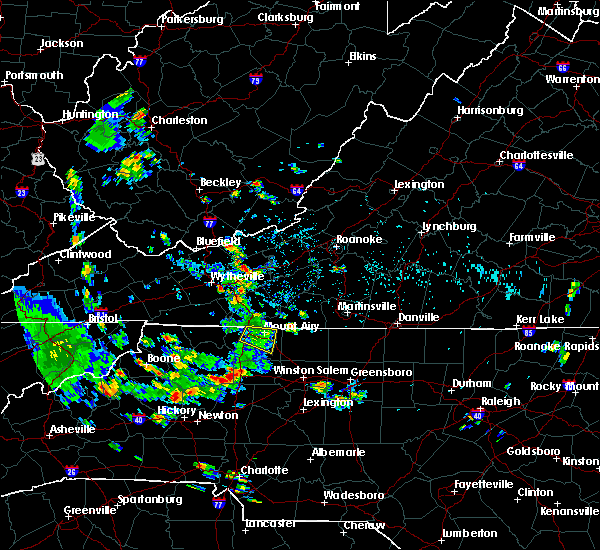 At 301 pm edt, a severe thunderstorm was located over buck shoals, moving southeast at 10 mph (radar indicated). Hazards include 60 mph wind gusts and quarter size hail. Hail damage to vehicles is expected. Expect wind damage to roofs, siding, and trees. At 301 pm edt, a severe thunderstorm was located over buck shoals, moving southeast at 10 mph (radar indicated). Hazards include 60 mph wind gusts and quarter size hail. Hail damage to vehicles is expected. Expect wind damage to roofs, siding, and trees.
|
| 8/2/2018 6:24 PM EDT |
 At 620 pm edt, several thunderstorms extended from near taylorsville through mocksville to near winston-salem. these storms are moving north at 25 mph. the storms are expected to merge and reach severe levels during the next hour (radar indicated). Hazards include 60 mph wind gusts. expect damage to roofs, siding, and trees At 620 pm edt, several thunderstorms extended from near taylorsville through mocksville to near winston-salem. these storms are moving north at 25 mph. the storms are expected to merge and reach severe levels during the next hour (radar indicated). Hazards include 60 mph wind gusts. expect damage to roofs, siding, and trees
|
| 7/31/2018 4:56 PM EDT |
 The severe thunderstorm warning for southeastern yadkin county will expire at 500 pm edt, the severe thunderstorm which prompted the warning has moved out of the warned area. therefore, the warning will be allowed to expire. when it is safe to do so, please send your reports of hail of any size, as well as reports of any wind damage, including downed trees or large limbs, to the national weather service by calling toll free at 1, 8 6 6, 2 1 5, 4 3 2 4. reports and pictures can also be shared on the national weather service blacksburg facebook page and on twitter. The severe thunderstorm warning for southeastern yadkin county will expire at 500 pm edt, the severe thunderstorm which prompted the warning has moved out of the warned area. therefore, the warning will be allowed to expire. when it is safe to do so, please send your reports of hail of any size, as well as reports of any wind damage, including downed trees or large limbs, to the national weather service by calling toll free at 1, 8 6 6, 2 1 5, 4 3 2 4. reports and pictures can also be shared on the national weather service blacksburg facebook page and on twitter.
|
| 7/31/2018 4:37 PM EDT |
 At 437 pm edt, a severe thunderstorm was located near enon, moving east at 15 mph (radar indicated). Hazards include 60 mph wind gusts. Expect damage to roofs, siding, and trees. Locations impacted include, yadkinville, east bend, courtney, huntsville, and shacktown. At 437 pm edt, a severe thunderstorm was located near enon, moving east at 15 mph (radar indicated). Hazards include 60 mph wind gusts. Expect damage to roofs, siding, and trees. Locations impacted include, yadkinville, east bend, courtney, huntsville, and shacktown.
|
| 7/31/2018 3:59 PM EDT |
 At 359 pm edt, a severe thunderstorm was located near shacktown, moving east at 15 mph (radar indicated). Hazards include 60 mph wind gusts. expect damage to roofs, siding, and trees At 359 pm edt, a severe thunderstorm was located near shacktown, moving east at 15 mph (radar indicated). Hazards include 60 mph wind gusts. expect damage to roofs, siding, and trees
|
| 7/31/2018 3:22 PM EDT | Several trees down at hinshaw road and old 421. time from rada in yadkin county NC, 1.3 miles SW of Yadkinville, NC |
| 7/31/2018 3:06 PM EDT |
 At 305 pm edt, a severe thunderstorm was located over boonville, moving northeast at 15 mph (radar indicated). Hazards include 60 mph wind gusts. Expect damage to roofs, siding, and trees. Locations impacted include, elkin, fairview, yadkinville, jonesville, and boonville. At 305 pm edt, a severe thunderstorm was located over boonville, moving northeast at 15 mph (radar indicated). Hazards include 60 mph wind gusts. Expect damage to roofs, siding, and trees. Locations impacted include, elkin, fairview, yadkinville, jonesville, and boonville.
|
| 7/31/2018 2:30 PM EDT |
 At 229 pm edt, a severe thunderstorm was located over brooks crossroads, moving northeast at 15 mph (radar indicated). Hazards include 60 mph wind gusts. expect damage to roofs, siding, and trees At 229 pm edt, a severe thunderstorm was located over brooks crossroads, moving northeast at 15 mph (radar indicated). Hazards include 60 mph wind gusts. expect damage to roofs, siding, and trees
|
| 7/25/2018 3:20 PM EDT |
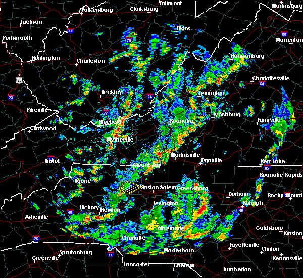 The severe thunderstorm warning for central yadkin county will expire at 330 pm edt, the storm which prompted the warning has weakened below severe limits, and no longer poses an immediate threat to life or property. therefore, the warning will be allowed to expire. when it is safe to do so, please send your reports of hail of any size, as well as reports of any wind damage, including downed trees or large limbs, to the national weather service by calling toll free at 1, 8 6 6, 2 1 5, 4 3 2 4. reports and pictures can also be shared on the national weather service blacksburg facebook page and on twitter. The severe thunderstorm warning for central yadkin county will expire at 330 pm edt, the storm which prompted the warning has weakened below severe limits, and no longer poses an immediate threat to life or property. therefore, the warning will be allowed to expire. when it is safe to do so, please send your reports of hail of any size, as well as reports of any wind damage, including downed trees or large limbs, to the national weather service by calling toll free at 1, 8 6 6, 2 1 5, 4 3 2 4. reports and pictures can also be shared on the national weather service blacksburg facebook page and on twitter.
|
| 7/25/2018 2:51 PM EDT |
 At 251 pm edt, a severe thunderstorm was located over brooks crossroads, moving southeast at 20 mph (radar indicated). Hazards include 60 mph wind gusts. Expect damage to roofs, siding, and trees. Locations impacted include, yadkinville, boonville, nebo, lone hickory, and brooks crossroads. At 251 pm edt, a severe thunderstorm was located over brooks crossroads, moving southeast at 20 mph (radar indicated). Hazards include 60 mph wind gusts. Expect damage to roofs, siding, and trees. Locations impacted include, yadkinville, boonville, nebo, lone hickory, and brooks crossroads.
|
| 7/25/2018 2:34 PM EDT |
 At 234 pm edt, a severe thunderstorm was located near arlington, moving southeast at 15 mph (radar indicated). Hazards include 60 mph wind gusts and quarter size hail. Hail damage to vehicles is expected. Expect wind damage to roofs, siding, and trees. At 234 pm edt, a severe thunderstorm was located near arlington, moving southeast at 15 mph (radar indicated). Hazards include 60 mph wind gusts and quarter size hail. Hail damage to vehicles is expected. Expect wind damage to roofs, siding, and trees.
|
| 6/25/2018 6:20 PM EDT |
 At 620 pm edt, severe thunderstorms were located along a line extending from near burch to near buck shoals, moving east at 20 mph (radar indicated). Hazards include 60 mph wind gusts and quarter size hail. Hail damage to vehicles is expected. expect wind damage to roofs, siding, and trees. Locations impacted include, elkin, yadkinville, jonesville, boonville, and east bend. At 620 pm edt, severe thunderstorms were located along a line extending from near burch to near buck shoals, moving east at 20 mph (radar indicated). Hazards include 60 mph wind gusts and quarter size hail. Hail damage to vehicles is expected. expect wind damage to roofs, siding, and trees. Locations impacted include, elkin, yadkinville, jonesville, boonville, and east bend.
|
| 6/25/2018 6:18 PM EDT | Tree down on hoots road near watson road. time radar estimate in yadkin county NC, 5.2 miles ENE of Yadkinville, NC |
| 6/25/2018 5:58 PM EDT |
 At 558 pm edt, severe thunderstorms were located along a line extending from near dockery to north wilkesboro, moving east at 20 mph (radar indicated). Hazards include 60 mph wind gusts and quarter size hail. Hail damage to vehicles is expected. Expect wind damage to roofs, siding, and trees. At 558 pm edt, severe thunderstorms were located along a line extending from near dockery to north wilkesboro, moving east at 20 mph (radar indicated). Hazards include 60 mph wind gusts and quarter size hail. Hail damage to vehicles is expected. Expect wind damage to roofs, siding, and trees.
|
| 6/11/2018 5:30 PM EDT | Several trees and large limbs down along baltimore road in forbush in yadkin county NC, 7.8 miles W of Yadkinville, NC |
| 6/1/2018 5:31 PM EDT |
 At 531 pm edt, a severe thunderstorm was located over yadkinville, moving northeast at 25 mph (radar indicated). Hazards include 60 mph wind gusts. Expect damage to roofs, siding, and trees. Locations impacted include, yadkinville, east bend, courtney, huntsville, and shacktown. At 531 pm edt, a severe thunderstorm was located over yadkinville, moving northeast at 25 mph (radar indicated). Hazards include 60 mph wind gusts. Expect damage to roofs, siding, and trees. Locations impacted include, yadkinville, east bend, courtney, huntsville, and shacktown.
|
| 6/1/2018 5:30 PM EDT | Multiple reports of trees down countywid in yadkin county NC, 0.1 miles SSE of Yadkinville, NC |
| 6/1/2018 5:20 PM EDT |
 At 517 pm edt, a severe thunderstorm was located over buck shoals, moving east at 25 mph (radar indicated). Hazards include 60 mph wind gusts and quarter size hail. Hail damage to vehicles is expected. Expect wind damage to roofs, siding, and trees. At 517 pm edt, a severe thunderstorm was located over buck shoals, moving east at 25 mph (radar indicated). Hazards include 60 mph wind gusts and quarter size hail. Hail damage to vehicles is expected. Expect wind damage to roofs, siding, and trees.
|
| 5/20/2018 5:11 PM EDT |
 The severe thunderstorm warning for southeastern wilkes and yadkin counties will expire at 515 pm edt, the storms which prompted the warning have moved out of the area. therefore, the warning will be allowed to expire. however, there some lingering flooding can be expected though early this evening. when it is safe to do so, please send your reports of hail of any size, as well as reports of any wind damage, including downed trees or large limbs, to the national weather service by calling toll free at 1, 8 6 6, 2 1 5, 4 3 2 4. reports and pictures can also be shared on the national weather service blacksburg facebook page and on twitter. The severe thunderstorm warning for southeastern wilkes and yadkin counties will expire at 515 pm edt, the storms which prompted the warning have moved out of the area. therefore, the warning will be allowed to expire. however, there some lingering flooding can be expected though early this evening. when it is safe to do so, please send your reports of hail of any size, as well as reports of any wind damage, including downed trees or large limbs, to the national weather service by calling toll free at 1, 8 6 6, 2 1 5, 4 3 2 4. reports and pictures can also be shared on the national weather service blacksburg facebook page and on twitter.
|
| 5/20/2018 4:53 PM EDT |
 At 453 pm edt, severe thunderstorms were located along a line extending from near boonville to near taylorsville, moving southeast at 20 mph (radar indicated). Hazards include 60 mph wind gusts and quarter size hail. Hail damage to vehicles is expected. expect wind damage to roofs, siding, and trees. Locations impacted include, yadkinville, boonville, windy gap, nebo, and buck shoals. At 453 pm edt, severe thunderstorms were located along a line extending from near boonville to near taylorsville, moving southeast at 20 mph (radar indicated). Hazards include 60 mph wind gusts and quarter size hail. Hail damage to vehicles is expected. expect wind damage to roofs, siding, and trees. Locations impacted include, yadkinville, boonville, windy gap, nebo, and buck shoals.
|
| 5/20/2018 4:22 PM EDT |
 The national weather service in blacksburg has issued a * severe thunderstorm warning for. southwestern surry county in northwestern north carolina. southeastern wilkes county in northwestern north carolina. yadkin county in northwestern north carolina. Until 515 pm edt. The national weather service in blacksburg has issued a * severe thunderstorm warning for. southwestern surry county in northwestern north carolina. southeastern wilkes county in northwestern north carolina. yadkin county in northwestern north carolina. Until 515 pm edt.
|
| 5/10/2018 3:33 PM EDT |
 At 332 pm edt, a severe thunderstorm was located over swancreek, moving east at 45 mph (radar indicated). Hazards include 60 mph wind gusts and quarter size hail. Hail damage to vehicles is expected. expect wind damage to roofs, siding, and trees. Locations impacted include, north wilkesboro, elkin, wilkesboro, yadkinville, and jonesville. At 332 pm edt, a severe thunderstorm was located over swancreek, moving east at 45 mph (radar indicated). Hazards include 60 mph wind gusts and quarter size hail. Hail damage to vehicles is expected. expect wind damage to roofs, siding, and trees. Locations impacted include, north wilkesboro, elkin, wilkesboro, yadkinville, and jonesville.
|
| 5/10/2018 2:58 PM EDT |
 The national weather service in blacksburg has issued a * severe thunderstorm warning for. southeastern surry county in northwestern north carolina. wilkes county in northwestern north carolina. yadkin county in northwestern north carolina. Until 400 pm edt. The national weather service in blacksburg has issued a * severe thunderstorm warning for. southeastern surry county in northwestern north carolina. wilkes county in northwestern north carolina. yadkin county in northwestern north carolina. Until 400 pm edt.
|
| 4/15/2018 4:08 PM EDT |
 At 407 pm edt, a severe thunderstorm was located near mocksville, moving northeast at 65 mph (radar indicated). Hazards include 60 mph wind gusts and quarter size hail. Hail damage to vehicles is expected. Expect wind damage to roofs, siding, and trees. At 407 pm edt, a severe thunderstorm was located near mocksville, moving northeast at 65 mph (radar indicated). Hazards include 60 mph wind gusts and quarter size hail. Hail damage to vehicles is expected. Expect wind damage to roofs, siding, and trees.
|
| 10/23/2017 6:21 PM EDT |
 The severe thunderstorm warning for central surry and yadkin counties will expire at 630 pm edt, the storm which prompted the warning has weakened below severe limits, and has exited the warned area. therefore, the warning will be allowed to expire. a tornado watch remains in effect until 900 pm edt for north central and northwestern north carolina. a tornado watch also remains in effect until 200 am edt for southwestern virginia. when it is safe to do so, please send your reports of hail of any size, as well as reports of any wind damage, including downed trees or large limbs, to the national weather service by calling toll free at 1, 8 6 6, 2 1 5, 4 3 2 4. reports and pictures can also be shared on the national weather service blacksburg facebook page and on twitter. The severe thunderstorm warning for central surry and yadkin counties will expire at 630 pm edt, the storm which prompted the warning has weakened below severe limits, and has exited the warned area. therefore, the warning will be allowed to expire. a tornado watch remains in effect until 900 pm edt for north central and northwestern north carolina. a tornado watch also remains in effect until 200 am edt for southwestern virginia. when it is safe to do so, please send your reports of hail of any size, as well as reports of any wind damage, including downed trees or large limbs, to the national weather service by calling toll free at 1, 8 6 6, 2 1 5, 4 3 2 4. reports and pictures can also be shared on the national weather service blacksburg facebook page and on twitter.
|
| 10/23/2017 6:01 PM EDT |
 At 600 pm edt, a severe thunderstorm was located over burch, moving north at 30 mph (radar indicated). Hazards include 60 mph wind gusts and quarter size hail. Hail damage to vehicles is expected. expect wind damage to roofs, siding, and trees. locations impacted include, elkin, fairview, yadkinville, jonesville, and dobson. a tornado watch remains in effect until 900 pm edt for north central and northwestern north carolina. A tornado watch also remains in effect until 200 am edt for southwestern virginia. At 600 pm edt, a severe thunderstorm was located over burch, moving north at 30 mph (radar indicated). Hazards include 60 mph wind gusts and quarter size hail. Hail damage to vehicles is expected. expect wind damage to roofs, siding, and trees. locations impacted include, elkin, fairview, yadkinville, jonesville, and dobson. a tornado watch remains in effect until 900 pm edt for north central and northwestern north carolina. A tornado watch also remains in effect until 200 am edt for southwestern virginia.
|
| 10/23/2017 5:35 PM EDT | Thunderstorm winds downed a tree at the intersection of wilson street and west main stree in yadkin county NC, 0.1 miles SSE of Yadkinville, NC |
| 10/23/2017 5:23 PM EDT |
 At 523 pm edt, a severe thunderstorm was located near buck shoals, moving north at 30 mph (radar indicated). Hazards include 60 mph wind gusts and quarter size hail. Hail damage to vehicles is expected. Expect wind damage to roofs, siding, and trees. At 523 pm edt, a severe thunderstorm was located near buck shoals, moving north at 30 mph (radar indicated). Hazards include 60 mph wind gusts and quarter size hail. Hail damage to vehicles is expected. Expect wind damage to roofs, siding, and trees.
|
| 6/13/2017 4:12 PM EDT |
 At 412 pm edt, severe thunderstorms were located along a line extending from huntsville to near buck shoals, moving west at 20 mph (radar indicated). Hazards include 60 mph wind gusts and quarter size hail. Hail damage to vehicles is expected. expect wind damage to roofs, siding, and trees. Locations impacted include, courtney, buck shoals, enon, huntsville, and lone hickory. At 412 pm edt, severe thunderstorms were located along a line extending from huntsville to near buck shoals, moving west at 20 mph (radar indicated). Hazards include 60 mph wind gusts and quarter size hail. Hail damage to vehicles is expected. expect wind damage to roofs, siding, and trees. Locations impacted include, courtney, buck shoals, enon, huntsville, and lone hickory.
|
| 6/13/2017 3:48 PM EDT |
 At 348 pm edt, severe thunderstorms were located along a line extending from meadows to near shacktown to near buck shoals, moving southeast at 5 mph (radar indicated). Hazards include 60 mph wind gusts and quarter size hail. Hail damage to vehicles is expected. expect wind damage to roofs, siding, and trees. Locations impacted include, yadkinville, walnut cove, east bend, king, and buck shoals. At 348 pm edt, severe thunderstorms were located along a line extending from meadows to near shacktown to near buck shoals, moving southeast at 5 mph (radar indicated). Hazards include 60 mph wind gusts and quarter size hail. Hail damage to vehicles is expected. expect wind damage to roofs, siding, and trees. Locations impacted include, yadkinville, walnut cove, east bend, king, and buck shoals.
|
| 6/13/2017 3:42 PM EDT | Tree down blocking rod in hamptonville. relayed via twitter from wfmy. time radar estimate in yadkin county NC, 7.3 miles E of Yadkinville, NC |
| 6/13/2017 3:24 PM EDT |
 At 323 pm edt, severe thunderstorms were located along a line extending from danbury to shacktown to near swancreek, moving southeast at 5 mph (radar indicated). Hazards include 60 mph wind gusts and quarter size hail. Hail damage to vehicles is expected. Expect wind damage to roofs, siding, and trees. At 323 pm edt, severe thunderstorms were located along a line extending from danbury to shacktown to near swancreek, moving southeast at 5 mph (radar indicated). Hazards include 60 mph wind gusts and quarter size hail. Hail damage to vehicles is expected. Expect wind damage to roofs, siding, and trees.
|
| 5/24/2017 4:37 PM EDT |
 At 436 pm edt, a possible tornado was located near east bend, moving northeast at 30 mph (public reports of a tornado). Hazards include damaging tornado and quarter size hail. Flying debris will be dangerous to those caught without shelter. mobile homes will be damaged or destroyed. damage to roofs, windows, and vehicles will occur. tree damage is likely. Locations impacted include, east bend, enon, huntsville, and shacktown. At 436 pm edt, a possible tornado was located near east bend, moving northeast at 30 mph (public reports of a tornado). Hazards include damaging tornado and quarter size hail. Flying debris will be dangerous to those caught without shelter. mobile homes will be damaged or destroyed. damage to roofs, windows, and vehicles will occur. tree damage is likely. Locations impacted include, east bend, enon, huntsville, and shacktown.
|
| 5/24/2017 4:33 PM EDT | 1800 block of hamptonville road four trees were blown down...trees were blocking the roa in yadkin county NC, 6.5 miles ENE of Yadkinville, NC |
| 5/24/2017 4:28 PM EDT |
 At 428 pm edt, a severe thunderstorm capable of producing a tornado was located over shacktown, moving northeast at 30 mph (radar indicated rotation). Hazards include tornado and quarter size hail. Flying debris will be dangerous to those caught without shelter. mobile homes will be damaged or destroyed. damage to roofs, windows, and vehicles will occur. tree damage is likely. Locations impacted include, east bend, enon, huntsville, and shacktown. At 428 pm edt, a severe thunderstorm capable of producing a tornado was located over shacktown, moving northeast at 30 mph (radar indicated rotation). Hazards include tornado and quarter size hail. Flying debris will be dangerous to those caught without shelter. mobile homes will be damaged or destroyed. damage to roofs, windows, and vehicles will occur. tree damage is likely. Locations impacted include, east bend, enon, huntsville, and shacktown.
|
| 5/24/2017 4:18 PM EDT |
 At 417 pm edt, a severe thunderstorm capable of producing a tornado was located over courtney, moving northeast at 30 mph (radar indicated rotation). Hazards include tornado and quarter size hail. Flying debris will be dangerous to those caught without shelter. mobile homes will be damaged or destroyed. damage to roofs, windows, and vehicles will occur. Tree damage is likely. At 417 pm edt, a severe thunderstorm capable of producing a tornado was located over courtney, moving northeast at 30 mph (radar indicated rotation). Hazards include tornado and quarter size hail. Flying debris will be dangerous to those caught without shelter. mobile homes will be damaged or destroyed. damage to roofs, windows, and vehicles will occur. Tree damage is likely.
|
| 5/19/2017 3:55 PM EDT |
 The severe thunderstorm warning for southeastern surry, southwestern stokes and yadkin counties will expire at 400 pm edt, the storms which prompted the warning have moved out of the area. therefore the warning will be allowed to expire. when it is safe to do so, please send your reports of hail of any size, as well as reports of any wind damage, including downed trees or large limbs, to the national weather service by calling toll free at 1, 8 6 6, 2 1 5, 4 3 2 4. reports and pictures can also be shared on the national weather service blacksburg facebook page and on twitter. The severe thunderstorm warning for southeastern surry, southwestern stokes and yadkin counties will expire at 400 pm edt, the storms which prompted the warning have moved out of the area. therefore the warning will be allowed to expire. when it is safe to do so, please send your reports of hail of any size, as well as reports of any wind damage, including downed trees or large limbs, to the national weather service by calling toll free at 1, 8 6 6, 2 1 5, 4 3 2 4. reports and pictures can also be shared on the national weather service blacksburg facebook page and on twitter.
|
| 5/19/2017 3:36 PM EDT |
 At 335 pm edt, severe thunderstorms were located along a line extending from pinnacle to near yadkinville to buck shoals, and are nearly stationary. a spotter reported dime size hail covering the ground in east bend at 333 pm (radar indicated). Hazards include 60 mph wind gusts and quarter size hail. Minor damage to vehicles is possible. expect wind damage to trees and power lines. Locations impacted include, yadkinville, pilot mountain, boonville, east bend, and king. At 335 pm edt, severe thunderstorms were located along a line extending from pinnacle to near yadkinville to buck shoals, and are nearly stationary. a spotter reported dime size hail covering the ground in east bend at 333 pm (radar indicated). Hazards include 60 mph wind gusts and quarter size hail. Minor damage to vehicles is possible. expect wind damage to trees and power lines. Locations impacted include, yadkinville, pilot mountain, boonville, east bend, and king.
|
| 5/19/2017 3:25 PM EDT |
 At 324 pm edt, severe thunderstorms were located along a line extending from pinnacle to near yadkinville to buck shoals, moving east at 30 mph (radar indicated). Hazards include 60 mph wind gusts and quarter size hail. Minor damage to vehicles is possible. expect wind damage to trees and power lines. Locations impacted include, yadkinville, jonesville, pilot mountain, boonville, and east bend. At 324 pm edt, severe thunderstorms were located along a line extending from pinnacle to near yadkinville to buck shoals, moving east at 30 mph (radar indicated). Hazards include 60 mph wind gusts and quarter size hail. Minor damage to vehicles is possible. expect wind damage to trees and power lines. Locations impacted include, yadkinville, jonesville, pilot mountain, boonville, and east bend.
|
| 5/19/2017 3:21 PM EDT | Quarter sized hail reported 4 miles E of Yadkinville, NC |
| 5/19/2017 3:16 PM EDT | Quarter sized hail reported 6.2 miles E of Yadkinville, NC |
| 5/19/2017 3:16 PM EDT | Thunderstorm winds resulted in multiple trees down across the county... including in the community of hamptonvill in yadkin county NC, 6.2 miles E of Yadkinville, NC |
| 5/19/2017 3:10 PM EDT |
 At 309 pm edt, a severe thunderstorm was located over brooks crossroads, moving east at 15 mph. weak rotation was observed on radar with this storm in southern yadkin county (radar indicated). Hazards include 60 mph wind gusts and half dollar size hail. Minor damage to vehicles is possible. expect wind damage to trees and power lines. Locations impacted include, yadkinville, jonesville, pilot mountain, boonville, and east bend. At 309 pm edt, a severe thunderstorm was located over brooks crossroads, moving east at 15 mph. weak rotation was observed on radar with this storm in southern yadkin county (radar indicated). Hazards include 60 mph wind gusts and half dollar size hail. Minor damage to vehicles is possible. expect wind damage to trees and power lines. Locations impacted include, yadkinville, jonesville, pilot mountain, boonville, and east bend.
|
| 5/19/2017 3:00 PM EDT |
 At 300 pm edt, severe thunderstorms were located along a line extending from near siloam to nebo to near brooks crossroads to near windy gap, and are nearly stationary (radar indicated). Hazards include 60 mph wind gusts and quarter size hail. Minor damage to vehicles is possible. Expect wind damage to trees and power lines. At 300 pm edt, severe thunderstorms were located along a line extending from near siloam to nebo to near brooks crossroads to near windy gap, and are nearly stationary (radar indicated). Hazards include 60 mph wind gusts and quarter size hail. Minor damage to vehicles is possible. Expect wind damage to trees and power lines.
|
| 5/9/2017 7:25 PM EDT |
 The severe thunderstorm warning for southeastern alleghany, southwestern surry, northeastern wilkes and yadkin counties in northwestern north carolina will expire at 730 pm edt, the storm which prompted the warning has weakened below severe limits, and no longer poses an immediate threat to life or property. therefore the warning will be allowed to expire. however gusty winds are still possible with this thunderstorm. when it is safe to do so, please send your reports of hail of any size, as well as reports of any wind damage, including downed trees or large limbs, to the national weather service by calling toll free at 1, 8 6 6, 2 1 5, 4 3 2 4. reports and pictures can also be shared on the national weather service blacksburg facebook page and on twitter. The severe thunderstorm warning for southeastern alleghany, southwestern surry, northeastern wilkes and yadkin counties in northwestern north carolina will expire at 730 pm edt, the storm which prompted the warning has weakened below severe limits, and no longer poses an immediate threat to life or property. therefore the warning will be allowed to expire. however gusty winds are still possible with this thunderstorm. when it is safe to do so, please send your reports of hail of any size, as well as reports of any wind damage, including downed trees or large limbs, to the national weather service by calling toll free at 1, 8 6 6, 2 1 5, 4 3 2 4. reports and pictures can also be shared on the national weather service blacksburg facebook page and on twitter.
|
| 5/9/2017 6:53 PM EDT |
 At 652 pm edt, a severe thunderstorm was located over ronda, moving southeast at 35 mph (radar indicated). Hazards include 60 mph wind gusts and quarter size hail. Minor damage to vehicles is possible. expect wind damage to trees and power lines. Locations impacted include, elkin, yadkinville, jonesville, boonville, and ronda. At 652 pm edt, a severe thunderstorm was located over ronda, moving southeast at 35 mph (radar indicated). Hazards include 60 mph wind gusts and quarter size hail. Minor damage to vehicles is possible. expect wind damage to trees and power lines. Locations impacted include, elkin, yadkinville, jonesville, boonville, and ronda.
|
| 5/9/2017 6:36 PM EDT |
 At 635 pm edt, a severe thunderstorm was located over abshers, moving southeast at 35 mph (radar indicated). Hazards include 60 mph wind gusts and quarter size hail. Minor damage to vehicles is possible. Expect wind damage to trees and power lines. At 635 pm edt, a severe thunderstorm was located over abshers, moving southeast at 35 mph (radar indicated). Hazards include 60 mph wind gusts and quarter size hail. Minor damage to vehicles is possible. Expect wind damage to trees and power lines.
|
| 5/1/2017 4:43 PM EDT | One tree down on liberty church road in yadkin county NC, 5.3 miles NNE of Yadkinville, NC |
| 5/1/2017 4:42 PM EDT | Two trees down on lone hickory road in yadkin county NC, 5.3 miles NNE of Yadkinville, NC |
| 9/29/2016 7:38 PM EDT |
 The tornado warning for central yadkin county will expire at 745 pm edt, the tornado threat has diminished and the tornado warning has been cancelled. however, large hail and damaging winds remain likely and a severe thunderstorm warning remains in effect for the area. however small hail, gusty winds, and heavy rain are still possible with this thunderstorm. when it is safe to do so, please send your reports of hail of any size, as well as reports of any wind damage, including downed trees or large limbs, to the national weather service by calling toll free at 1, 8 6 6, 2 1 5, 4 3 2 4. reports and pictures can also be shared on the national weather service blacksburg facebook page and on twitter. remember, a severe thunderstorm warning still remains in effect for yadkin county until 800 pm edt. The tornado warning for central yadkin county will expire at 745 pm edt, the tornado threat has diminished and the tornado warning has been cancelled. however, large hail and damaging winds remain likely and a severe thunderstorm warning remains in effect for the area. however small hail, gusty winds, and heavy rain are still possible with this thunderstorm. when it is safe to do so, please send your reports of hail of any size, as well as reports of any wind damage, including downed trees or large limbs, to the national weather service by calling toll free at 1, 8 6 6, 2 1 5, 4 3 2 4. reports and pictures can also be shared on the national weather service blacksburg facebook page and on twitter. remember, a severe thunderstorm warning still remains in effect for yadkin county until 800 pm edt.
|
| 9/29/2016 7:32 PM EDT |
 At 732 pm edt, a severe thunderstorm was located near east bend, moving northeast at 20 mph (radar indicated). Hazards include 60 mph wind gusts and quarter size hail. Hail damage to vehicles is expected. expect wind damage to roofs, siding, and trees. Locations impacted include, mount airy, fairview, flat rock, yadkinville, and dobson. At 732 pm edt, a severe thunderstorm was located near east bend, moving northeast at 20 mph (radar indicated). Hazards include 60 mph wind gusts and quarter size hail. Hail damage to vehicles is expected. expect wind damage to roofs, siding, and trees. Locations impacted include, mount airy, fairview, flat rock, yadkinville, and dobson.
|
| 9/29/2016 7:23 PM EDT |
 At 722 pm edt, a severe thunderstorm capable of producing a tornado was located over yadkinville, moving northeast at 15 mph (radar indicated rotation). Hazards include tornado and quarter size hail. Flying debris will be dangerous to those caught without shelter. mobile homes will be damaged or destroyed. damage to roofs, windows, and vehicles will occur. tree damage is likely. Locations impacted include, yadkinville, boonville, shacktown, and nebo. At 722 pm edt, a severe thunderstorm capable of producing a tornado was located over yadkinville, moving northeast at 15 mph (radar indicated rotation). Hazards include tornado and quarter size hail. Flying debris will be dangerous to those caught without shelter. mobile homes will be damaged or destroyed. damage to roofs, windows, and vehicles will occur. tree damage is likely. Locations impacted include, yadkinville, boonville, shacktown, and nebo.
|
| 9/29/2016 7:08 PM EDT |
 At 707 pm edt, a severe thunderstorm capable of producing a tornado was located over yadkinville, moving northeast at 15 mph (radar indicated rotation). Hazards include tornado and quarter size hail. Flying debris will be dangerous to those caught without shelter. mobile homes will be damaged or destroyed. damage to roofs, windows, and vehicles will occur. Tree damage is likely. At 707 pm edt, a severe thunderstorm capable of producing a tornado was located over yadkinville, moving northeast at 15 mph (radar indicated rotation). Hazards include tornado and quarter size hail. Flying debris will be dangerous to those caught without shelter. mobile homes will be damaged or destroyed. damage to roofs, windows, and vehicles will occur. Tree damage is likely.
|
| 9/29/2016 7:04 PM EDT |
 At 704 pm edt, a severe thunderstorm was located near lone hickory, moving northeast at 20 mph (radar indicated). Hazards include 60 mph wind gusts and quarter size hail. Hail damage to vehicles is expected. Expect wind damage to roofs, siding, and trees. At 704 pm edt, a severe thunderstorm was located near lone hickory, moving northeast at 20 mph (radar indicated). Hazards include 60 mph wind gusts and quarter size hail. Hail damage to vehicles is expected. Expect wind damage to roofs, siding, and trees.
|
| 9/28/2016 5:40 PM EDT |
 At 539 pm edt, a severe thunderstorm was located over rockford, moving east at 25 mph (public). Hazards include 60 mph wind gusts and quarter size hail. Hail damage to vehicles is expected. Expect wind damage to roofs, siding, and trees. At 539 pm edt, a severe thunderstorm was located over rockford, moving east at 25 mph (public). Hazards include 60 mph wind gusts and quarter size hail. Hail damage to vehicles is expected. Expect wind damage to roofs, siding, and trees.
|
| 9/26/2016 4:03 PM EDT |
 At 425 pm edt, a severe thunderstorm was located over arlington, moving east at 25 mph (radar indicated). Hazards include 60 mph wind gusts. Expect damage to roofs. siding. and trees. Locations impacted include, elkin, fairview, jonesville, boonville, and ronda. At 425 pm edt, a severe thunderstorm was located over arlington, moving east at 25 mph (radar indicated). Hazards include 60 mph wind gusts. Expect damage to roofs. siding. and trees. Locations impacted include, elkin, fairview, jonesville, boonville, and ronda.
|
| 8/1/2016 1:13 AM EDT |
 At 112 am edt, a severe thunderstorm was located over east bend, moving northeast at 15 mph (radar indicated). Hazards include 60 mph wind gusts. Expect damage to roofs. siding. and trees. Locations impacted include, yadkinville, boonville, east bend, brooks crossroads, and huntsville. At 112 am edt, a severe thunderstorm was located over east bend, moving northeast at 15 mph (radar indicated). Hazards include 60 mph wind gusts. Expect damage to roofs. siding. and trees. Locations impacted include, yadkinville, boonville, east bend, brooks crossroads, and huntsville.
|
| 8/1/2016 1:10 AM EDT | The yadkin county 911 center reports that multiple power lines were down near the intersection of old u.s. highway 421 and baltimore road. old u.s. highway 421 had to b in yadkin county NC, 7.9 miles W of Yadkinville, NC |
| 8/1/2016 12:53 AM EDT |
 At 1252 am edt, a severe thunderstorm was located near shacktown, moving northeast at 15 mph (radar indicated). Hazards include 60 mph wind gusts. Expect damage to roofs. siding. And trees. At 1252 am edt, a severe thunderstorm was located near shacktown, moving northeast at 15 mph (radar indicated). Hazards include 60 mph wind gusts. Expect damage to roofs. siding. And trees.
|
| 7/31/2016 3:30 PM EDT | A few trees reported down in the hamptonville area. time radar estimate in yadkin county NC, 7.3 miles E of Yadkinville, NC |
| 7/31/2016 3:27 PM EDT |
 At 327 pm edt, a severe thunderstorm was located over brooks crossroads, moving east at 20 mph (radar indicated). Hazards include 60 mph wind gusts. Expect damage to roofs. siding. and trees. Locations impacted include, yadkinville, jonesville, boonville, brooks crossroads, and lone hickory. At 327 pm edt, a severe thunderstorm was located over brooks crossroads, moving east at 20 mph (radar indicated). Hazards include 60 mph wind gusts. Expect damage to roofs. siding. and trees. Locations impacted include, yadkinville, jonesville, boonville, brooks crossroads, and lone hickory.
|
| 7/31/2016 3:14 PM EDT |
 At 314 pm edt, a severe thunderstorm was located over swancreek, moving east at 15 mph (radar indicated). Hazards include 60 mph wind gusts. Expect damage to roofs. siding. And trees. At 314 pm edt, a severe thunderstorm was located over swancreek, moving east at 15 mph (radar indicated). Hazards include 60 mph wind gusts. Expect damage to roofs. siding. And trees.
|
| 7/27/2016 7:58 PM EDT |
 At 757 pm edt, a severe thunderstorm was located near shacktown, moving northeast at 15 mph (radar indicated). Hazards include 60 mph wind gusts and nickel size hail. Expect damage to roofs. siding. and trees. Locations impacted include, yadkinville, east bend, huntsville, lone hickory, and shacktown. At 757 pm edt, a severe thunderstorm was located near shacktown, moving northeast at 15 mph (radar indicated). Hazards include 60 mph wind gusts and nickel size hail. Expect damage to roofs. siding. and trees. Locations impacted include, yadkinville, east bend, huntsville, lone hickory, and shacktown.
|
| 7/27/2016 7:49 PM EDT |
 At 748 pm edt, a severe thunderstorm was located over shacktown, moving northeast at 15 mph (radar indicated). Hazards include 60 mph wind gusts and nickel size hail. Expect damage to roofs. siding. and trees. Locations impacted include, yadkinville, east bend, huntsville, lone hickory, and nebo. At 748 pm edt, a severe thunderstorm was located over shacktown, moving northeast at 15 mph (radar indicated). Hazards include 60 mph wind gusts and nickel size hail. Expect damage to roofs. siding. and trees. Locations impacted include, yadkinville, east bend, huntsville, lone hickory, and nebo.
|
| 7/27/2016 7:33 PM EDT | One tree down at the intersection of myers road and old us route 421 in yadkin county NC, 1.8 miles WSW of Yadkinville, NC |
| 7/27/2016 7:31 PM EDT | One tree down at the intersection of brandon hills road and neelie road in yadkin county NC, 2.9 miles NNE of Yadkinville, NC |
| 7/27/2016 7:31 PM EDT |
 At 731 pm edt, a severe thunderstorm was located over yadkinville, moving northeast at 15 mph (radar indicated). Hazards include 60 mph wind gusts and quarter size hail. Hail damage to vehicles is expected. Expect wind damage to roofs, siding, and trees. At 731 pm edt, a severe thunderstorm was located over yadkinville, moving northeast at 15 mph (radar indicated). Hazards include 60 mph wind gusts and quarter size hail. Hail damage to vehicles is expected. Expect wind damage to roofs, siding, and trees.
|
| 7/22/2016 3:40 PM EDT | Tree blown down onto truck near turners creek baptist church. report via social medi in yadkin county NC, 5.1 miles NW of Yadkinville, NC |
| 7/22/2016 3:35 PM EDT | Trees and power lines dow in yadkin county NC, 0.1 miles SSE of Yadkinville, NC |
| 7/19/2016 7:44 PM EDT | Thunderstorm winds downed two trees along country club roa in yadkin county NC, 2.8 miles S of Yadkinville, NC |
| 7/19/2016 7:41 PM EDT |
 At 741 pm edt, a severe thunderstorm was located near huntsville, moving southeast at 30 mph (radar indicated). Hazards include 60 mph wind gusts. Expect damage to roofs. siding. and trees. Locations impacted include, yadkinville, jonesville, boonville, brooks crossroads, and huntsville. At 741 pm edt, a severe thunderstorm was located near huntsville, moving southeast at 30 mph (radar indicated). Hazards include 60 mph wind gusts. Expect damage to roofs. siding. and trees. Locations impacted include, yadkinville, jonesville, boonville, brooks crossroads, and huntsville.
|
| 7/19/2016 7:20 PM EDT |
 At 709 pm edt, a severe thunderstorm was located over boonville, moving southeast at 30 mph (radar indicated). Hazards include 60 mph wind gusts. Expect damage to roofs. siding. And trees. At 709 pm edt, a severe thunderstorm was located over boonville, moving southeast at 30 mph (radar indicated). Hazards include 60 mph wind gusts. Expect damage to roofs. siding. And trees.
|
| 7/19/2016 7:09 PM EDT |
 At 709 pm edt, a severe thunderstorm was located over boonville, moving southeast at 30 mph (radar indicated). Hazards include 60 mph wind gusts. Expect damage to roofs. siding. And trees. At 709 pm edt, a severe thunderstorm was located over boonville, moving southeast at 30 mph (radar indicated). Hazards include 60 mph wind gusts. Expect damage to roofs. siding. And trees.
|
| 7/8/2016 7:58 PM EDT |
 The severe thunderstorm warning for yadkin and surry counties will expire at 800 pm edt, the storms which prompted the warning have moved out of the area. therefore the warning will be allowed to expire. however heavy rain is still possible with these thunderstorms. a severe thunderstorm watch remains in effect until 1000 pm edt for north carolina and virginia. when it is safe to do so, please send your reports of hail of any size, as well as any reports of wind damage, including downed trees or large limbs, to the national weather service by calling toll free at 1, 8 6 6, 2 1 5, 4 3 2 4. reports and pictures can also be shared on the national weather service blacksburg facebook page and on twitter. The severe thunderstorm warning for yadkin and surry counties will expire at 800 pm edt, the storms which prompted the warning have moved out of the area. therefore the warning will be allowed to expire. however heavy rain is still possible with these thunderstorms. a severe thunderstorm watch remains in effect until 1000 pm edt for north carolina and virginia. when it is safe to do so, please send your reports of hail of any size, as well as any reports of wind damage, including downed trees or large limbs, to the national weather service by calling toll free at 1, 8 6 6, 2 1 5, 4 3 2 4. reports and pictures can also be shared on the national weather service blacksburg facebook page and on twitter.
|
| 7/8/2016 7:49 PM EDT | Numerous large trees blown down by thunderstorm winds on angus road near boonevill in yadkin county NC, 5.7 miles SSE of Yadkinville, NC |
| 7/8/2016 7:43 PM EDT |
 At 741 pm edt, severe thunderstorms were located along a line extending from near mountain park to near elkin to near brooks crossroads, moving east at 55 mph (trained weather spotters). Hazards include 70 mph wind gusts and quarter size hail. Hail damage to vehicles is expected. expect considerable tree damage. wind damage is also likely to mobile homes, roofs, and outbuildings. Locations impacted include, mount airy, elkin, fairview, flat rock, and yadkinville. At 741 pm edt, severe thunderstorms were located along a line extending from near mountain park to near elkin to near brooks crossroads, moving east at 55 mph (trained weather spotters). Hazards include 70 mph wind gusts and quarter size hail. Hail damage to vehicles is expected. expect considerable tree damage. wind damage is also likely to mobile homes, roofs, and outbuildings. Locations impacted include, mount airy, elkin, fairview, flat rock, and yadkinville.
|
| 7/8/2016 7:21 PM EDT |
 At 720 pm edt, severe thunderstorms were located along a line extending from near doughton park to hays to near moravian falls, moving east at 70 mph (trained weather spotters report excessive wind damage from this line of storms). Hazards include 70 mph wind gusts and quarter size hail. Hail damage to vehicles is expected. expect considerable tree damage. wind damage is also likely to mobile homes, roofs, and outbuildings. Locations impacted include, mount airy, north wilkesboro, elkin, wilkesboro, and fairview. At 720 pm edt, severe thunderstorms were located along a line extending from near doughton park to hays to near moravian falls, moving east at 70 mph (trained weather spotters report excessive wind damage from this line of storms). Hazards include 70 mph wind gusts and quarter size hail. Hail damage to vehicles is expected. expect considerable tree damage. wind damage is also likely to mobile homes, roofs, and outbuildings. Locations impacted include, mount airy, north wilkesboro, elkin, wilkesboro, and fairview.
|
| 7/8/2016 7:06 PM EDT |
 At 704 pm edt, severe thunderstorms were located along a line extending from near lansing to glendale springs to near maple springs, moving east at 70 mph. additional storms capable of hail are located near windy gap and dobson (radar indicated and trained spotter verified). Hazards include 70 mph wind gusts and half dollar size hail. Hail damage to vehicles is expected. expect considerable tree damage. Wind damage is also likely to mobile homes, roofs, and outbuildings. At 704 pm edt, severe thunderstorms were located along a line extending from near lansing to glendale springs to near maple springs, moving east at 70 mph. additional storms capable of hail are located near windy gap and dobson (radar indicated and trained spotter verified). Hazards include 70 mph wind gusts and half dollar size hail. Hail damage to vehicles is expected. expect considerable tree damage. Wind damage is also likely to mobile homes, roofs, and outbuildings.
|
| 6/29/2016 4:56 PM EDT |
 At 455 pm edt, a severe thunderstorm was located over brooks crossroads, moving east at 25 mph (radar indicated). Hazards include 60 mph wind gusts and penny size hail. Expect damage to roofs. siding. and trees. Locations impacted include, yadkinville, east bend, brooks crossroads, huntsville, and lone hickory. At 455 pm edt, a severe thunderstorm was located over brooks crossroads, moving east at 25 mph (radar indicated). Hazards include 60 mph wind gusts and penny size hail. Expect damage to roofs. siding. and trees. Locations impacted include, yadkinville, east bend, brooks crossroads, huntsville, and lone hickory.
|
| 6/29/2016 4:22 PM EDT |
 At 422 pm edt, a severe thunderstorm was located near buck shoals, moving east at 20 mph (radar indicated). Hazards include 60 mph wind gusts and quarter size hail. Hail damage to vehicles is expected. Expect wind damage to roofs, siding, and trees. At 422 pm edt, a severe thunderstorm was located near buck shoals, moving east at 20 mph (radar indicated). Hazards include 60 mph wind gusts and quarter size hail. Hail damage to vehicles is expected. Expect wind damage to roofs, siding, and trees.
|
| 6/27/2016 4:47 PM EDT |
 At 447 pm edt, severe thunderstorms were located along a line extending from yadkinville to near harmony, moving southeast at 20 mph (radar indicated). Hazards include 60 mph wind gusts. Expect damage to roofs. siding. and trees. Locations impacted include, yadkinville, jonesville, brooks crossroads, huntsville, and lone hickory. At 447 pm edt, severe thunderstorms were located along a line extending from yadkinville to near harmony, moving southeast at 20 mph (radar indicated). Hazards include 60 mph wind gusts. Expect damage to roofs. siding. and trees. Locations impacted include, yadkinville, jonesville, brooks crossroads, huntsville, and lone hickory.
|
| 6/27/2016 4:17 PM EDT |
 At 417 pm edt, severe thunderstorms were located along a line extending from arlington to near buck shoals, moving southeast at 20 mph (radar indicated). Hazards include 60 mph wind gusts and quarter size hail. Hail damage to vehicles is expected. Expect wind damage to roofs, siding, and trees. At 417 pm edt, severe thunderstorms were located along a line extending from arlington to near buck shoals, moving southeast at 20 mph (radar indicated). Hazards include 60 mph wind gusts and quarter size hail. Hail damage to vehicles is expected. Expect wind damage to roofs, siding, and trees.
|
| 6/23/2016 10:26 PM EDT |
 The severe thunderstorm warning for yadkin, surry, stokes, wilkes, watauga, alleghany, ashe, southwestern patrick, southeastern grayson and carroll counties and the city of galax will expire at 1030 pm edt, the storms which prompted the warning have weakened below severe limits, and no longer pose an immediate threat to life or property. therefore the warning will be allowed to expire. however gusty winds and heavy rain are still possible with these thunderstorms. a severe thunderstorm watch remains in effect until 1100 pm edt for north carolina and virginia. The severe thunderstorm warning for yadkin, surry, stokes, wilkes, watauga, alleghany, ashe, southwestern patrick, southeastern grayson and carroll counties and the city of galax will expire at 1030 pm edt, the storms which prompted the warning have weakened below severe limits, and no longer pose an immediate threat to life or property. therefore the warning will be allowed to expire. however gusty winds and heavy rain are still possible with these thunderstorms. a severe thunderstorm watch remains in effect until 1100 pm edt for north carolina and virginia.
|
| 6/23/2016 9:50 PM EDT |
 At 949 pm edt, severe thunderstorms were located along a line extending from near dugspur to stone mountain state park to 7 miles west of mountain city, moving southeast at 50 mph (radar indicated). Hazards include 60 mph wind gusts. Expect damage to roofs. siding. and trees. locations impacted include, boone, mount airy, galax, north wilkesboro, and elkin. This includes appalachian state university. At 949 pm edt, severe thunderstorms were located along a line extending from near dugspur to stone mountain state park to 7 miles west of mountain city, moving southeast at 50 mph (radar indicated). Hazards include 60 mph wind gusts. Expect damage to roofs. siding. and trees. locations impacted include, boone, mount airy, galax, north wilkesboro, and elkin. This includes appalachian state university.
|
| 6/23/2016 9:29 PM EDT |
 At 929 pm edt, severe thunderstorms were located along a line extending from gunton park to mouth of wilson to bristol va, moving southeast at 55 mph (radar indicated). Hazards include 60 mph wind gusts. Expect damage to roofs. siding. And trees. At 929 pm edt, severe thunderstorms were located along a line extending from gunton park to mouth of wilson to bristol va, moving southeast at 55 mph (radar indicated). Hazards include 60 mph wind gusts. Expect damage to roofs. siding. And trees.
|
| 6/16/2016 11:36 PM EDT |
 The severe thunderstorm warning for central yadkin, surry, northeastern wilkes and eastern alleghany counties will expire at 1145 pm edt, the storm which prompted the warning has weakened below severe limits, and no longer poses an immediate threat to life or property. therefore the warning will be allowed to expire. however gusty winds are still possible with this thunderstorm. when it is safe to do so, please send your reports of hail of any size, as well as any reports of wind damage, including downed trees or large limbs, to the national weather service by calling toll free at 1, 8 6 6, 2 1 5, 4 3 2 4. reports and pictures can also be shared on the national weather service blacksburg facebook page and on twitter. The severe thunderstorm warning for central yadkin, surry, northeastern wilkes and eastern alleghany counties will expire at 1145 pm edt, the storm which prompted the warning has weakened below severe limits, and no longer poses an immediate threat to life or property. therefore the warning will be allowed to expire. however gusty winds are still possible with this thunderstorm. when it is safe to do so, please send your reports of hail of any size, as well as any reports of wind damage, including downed trees or large limbs, to the national weather service by calling toll free at 1, 8 6 6, 2 1 5, 4 3 2 4. reports and pictures can also be shared on the national weather service blacksburg facebook page and on twitter.
|
| 6/16/2016 11:15 PM EDT |
 At 1114 pm edt, a cluster of severe thunderstorm was located near mountain park, moving southeast at 35 mph (radar indicated). Hazards include 60 mph wind gusts. Expect damage to roofs. siding. and trees. Locations impacted include, mount airy, north wilkesboro, elkin, fairview, and yadkinville. At 1114 pm edt, a cluster of severe thunderstorm was located near mountain park, moving southeast at 35 mph (radar indicated). Hazards include 60 mph wind gusts. Expect damage to roofs. siding. and trees. Locations impacted include, mount airy, north wilkesboro, elkin, fairview, and yadkinville.
|
| 6/16/2016 10:51 PM EDT |
 At 1049 pm edt, a severe thunderstorm was located over glade valley, moving southeast at 45 mph (radar indicated). Hazards include 60 mph wind gusts. Expect damage to roofs. siding. And trees. At 1049 pm edt, a severe thunderstorm was located over glade valley, moving southeast at 45 mph (radar indicated). Hazards include 60 mph wind gusts. Expect damage to roofs. siding. And trees.
|
| 5/12/2016 3:42 PM EDT |
 At 342 pm edt, a severe thunderstorm was located over roaring river, moving east at 15 mph (radar indicated). Hazards include 60 mph wind gusts and quarter size hail. Hail damage to vehicles is expected. Expect wind damage to roofs, siding, and trees. At 342 pm edt, a severe thunderstorm was located over roaring river, moving east at 15 mph (radar indicated). Hazards include 60 mph wind gusts and quarter size hail. Hail damage to vehicles is expected. Expect wind damage to roofs, siding, and trees.
|
| 2/24/2016 1:07 PM EST | Trees down on farmington road in yadkin county NC, 8.2 miles WNW of Yadkinville, NC |
| 8/5/2015 7:48 PM EDT | Multiple trees and power lines down in town of hamptonville in yadkin county NC, 7.3 miles E of Yadkinville, NC |
| 4/9/2015 6:39 PM EDT | A severe thunderstorm warning remains in effect until 700 pm edt for eastern yadkin county. at 639 pm edt. severe thunderstorms were located along a line extending from siloam to near east bend to shacktown. moving east at 30 mph. hazard. 70 mph wind gusts and quarter size hail. |
| 4/9/2015 6:37 PM EDT | Trees and power line down on falcon r in yadkin county NC, 5.6 miles W of Yadkinville, NC |
| 4/9/2015 6:17 PM EDT | The national weather service in blacksburg has issued a * severe thunderstorm warning for. yadkin county in northwestern north carolina. until 700 pm edt * at 617 pm edt. Severe thunderstorms were located along a line extending from burch to near brooks crossroads to buck shoals. |
| 6/16/2014 5:15 PM EDT | Half Dollar sized hail reported 5.3 miles NE of Yadkinville, NC, half dollar size hail on bethel church road. hail lasted about 10 minutes. |
| 8/10/2013 2:09 PM EDT | Two trees down along courtney-huntsville road near the intersection of chris drive...time estimated from radar in yadkin county NC, 5.1 miles NW of Yadkinville, NC |
| 8/10/2013 2:05 PM EDT | One tree down along shacktown road near the intersection of blue dan lane...time estimated from radar in yadkin county NC, 1.7 miles WNW of Yadkinville, NC |
| 8/10/2013 2:00 PM EDT | One tree down along rome anthony road close to the intersection of lone hickory road...time estimated from radar in yadkin county NC, 4.2 miles NNE of Yadkinville, NC |
| 8/10/2013 1:56 PM EDT | Two trees down along hoots road about two miles west of route 601...time estimated from radar in yadkin county NC, 2.1 miles NE of Yadkinville, NC |
| 8/9/2013 6:25 PM EDT | Tree down in yadkin county NC, 4.6 miles NNW of Yadkinville, NC |
| 6/26/2013 4:16 PM EDT | Tree down in yadkin county NC, 6 miles ENE of Yadkinville, NC |
| 6/13/2013 3:38 PM EDT | Quarter sized hail reported 0.1 miles SSE of Yadkinville, NC |
| 6/13/2013 3:38 PM EDT | Trees down on four house in yadkin county NC, 0.1 miles SSE of Yadkinville, NC |
| 6/13/2013 3:35 PM EDT | Quarter sized hail reported 0.8 miles S of Yadkinville, NC |
| 5/6/2013 5:51 PM EDT | Quarter sized hail reported 8 miles ENE of Yadkinville, NC, cranfill rd... time estimated by radar |
| 4/19/2013 4:38 PM EDT | One tree dow in yadkin county NC, 0.1 miles SSE of Yadkinville, NC |
| 5/1/2012 5:12 PM EDT | Quarter sized hail reported 5.2 miles NW of Yadkinville, NC, employee at courtney elementary school reported quarter size hail |
| 1/1/0001 12:00 AM | Several trees down in the courtney area in yadkin county NC, 5 miles NNW of Yadkinville, NC |
| 1/1/0001 12:00 AM | Trees down on a power line on hoots road...which then fell on a house and has trapped people insid in yadkin county NC, 0.1 miles SSE of Yadkinville, NC |
| 1/1/0001 12:00 AM | Roof blown off barn in yadkin county NC, 2.8 miles E of Yadkinville, NC |
| 1/1/0001 12:00 AM | Four trees blown down in yadkinvill in yadkin county NC, 0.1 miles SSE of Yadkinville, NC |
| 1/1/0001 12:00 AM | The yadkin county sheriffs office reported a tree blown down near the campus of the surry community college on hwy 60 in yadkin county NC, 1.9 miles SE of Yadkinville, NC |
| 1/1/0001 12:00 AM | Half Dollar sized hail reported 9.5 miles NW of Yadkinville, NC, up to nearly ping pong ball sized hail. |
| 1/1/0001 12:00 AM | Several trees down in yadkin county NC, 6 miles ENE of Yadkinville, NC |
| 1/1/0001 12:00 AM | Roof blown off structure on brawley road...additional structural damage on wyo roa in yadkin county NC, 4.3 miles NW of Yadkinville, NC |
| 1/1/0001 12:00 AM | Half Dollar sized hail reported 6.8 miles E of Yadkinville, NC |
| 1/1/0001 12:00 AM | About 4 trees blown down in the hamptonville are in yadkin county NC, 8 miles E of Yadkinville, NC |
Hail Maps for Yadkinville, NC


Connect with Interactive Hail Maps