

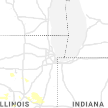
Hail Map for Thursday, August 12, 2021

Number of Impacted Households on 8/12/2021
0
Impacted by 1" or Larger Hail
0
Impacted by 1.75" or Larger Hail
0
Impacted by 2.5" or Larger Hail
Square Miles of Populated Area Impacted on 8/12/2021
0
Impacted by 1" or Larger Hail
0
Impacted by 1.75" or Larger Hail
0
Impacted by 2.5" or Larger Hail


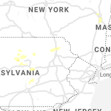


Cities Most Affected by Hail Storms of 8/12/2021
| Hail Size | Demographics of Zip Codes Affected | ||||||
|---|---|---|---|---|---|---|---|
| City | Count | Average | Largest | Pop Density | House Value | Income | Age |
| Olathe, KS | 1 | 1.75 | 1.75 | 886 | $124k | $52.8k | 33.4 |
| Jefferson, NC | 1 | 1.75 | 1.75 | 106 | $101k | $29.9k | 46.2 |
| Grinnell, KS | 1 | 1.75 | 1.75 | 1 | $45k | $40.4k | 50.2 |
| Rexford, KS | 1 | 1.75 | 1.75 | 1 | $30k | $39.4k | 38.5 |
| Vona, CO | 1 | 1.75 | 1.75 | 1 | $38k | $30.3k | 47.1 |
Hail and Wind Damage Spotted on 8/12/2021
Filter by Report Type:Hail ReportsWind Reports
States Impacted
Ohio, Illinois, Pennsylvania, New York, North Carolina, Virginia, Missouri, New Jersey, Massachusetts, Alabama, Connecticut, Texas, Indiana, New Mexico, Florida, Kansas, Colorado, Michigan, Maine, Kentucky, Arizona, Nevada, NebraskaOhio
| Local Time | Report Details |
|---|---|
| 10:32 AM EDT | Large branch and utility wires dow in geauga county OH, 22.1 miles ESE of Cleveland, OH |
| 10:38 AM EDT | Tree down on wire in geauga county OH, 25.9 miles ESE of Cleveland, OH |
| 11:00 AM EDT | Several trees dow in trumbull county OH, 42.7 miles E of Cleveland, OH |
| 3:51 PM EDT | Tree down. time estimated from rada in summit county OH, 21.8 miles SSE of Cleveland, OH |
| 3:57 PM EDT | Several large limbs down and 8 inch diameter trees snapped of in summit county OH, 24.1 miles SSE of Cleveland, OH |
| 4:11 PM EDT | Tree down on garag in summit county OH, 27.7 miles SSE of Cleveland, OH |
| 4:13 PM EDT | Quarter sized hail reported near London, OH, 27.5 miles W of Columbus, OH |
| 4:14 PM EDT | Large limb dow in summit county OH, 28.9 miles SSE of Cleveland, OH |
| 4:20 PM EDT | Tree down at lewis ave. and lincoln ave. in maplewood park. time estimated via rada in trumbull county OH, 57.3 miles NNW of Pittsburgh, PA |
| 4:44 PM EDT | Tree fell onto backyard poo in portage county OH, 38.4 miles ESE of Cleveland, OH |
| 4:49 PM EDT | Tree down on wire in trumbull county OH, 42 miles ESE of Cleveland, OH |
| 5:09 PM EDT | *** 1 inj *** tree fell on a vehicle near the intersection of springvalley road and state route 665 leading to one injury. time estimated using radar dat in madison county OH, 21.1 miles WSW of Columbus, OH |
| 5:11 PM EDT | Photo of snapped trees in steubenville. time estimated based on rada in jefferson county OH, 34.7 miles W of Pittsburgh, PA |
| 5:18 PM EDT | Multiple trees down on wilson road. time estimated using radar dat in madison county OH, 16.9 miles WSW of Columbus, OH |
| 6:02 PM EDT | Large tree down blocking roadwa in madison county OH, 18.1 miles WSW of Columbus, OH |
| 6:05 PM EDT | Large tree down blocking roadwa in madison county OH, 18.5 miles SW of Columbus, OH |
| 6:05 PM EDT | Multiple large trees down blocking road in madison county OH, 18.1 miles SW of Columbus, OH |
| 6:07 PM EDT | Multiple large tree limbs downed in roadwa in pickaway county OH, 16.4 miles SW of Columbus, OH |
| 6:09 PM EDT | Large tree down. fell into power line in madison county OH, 19.3 miles SW of Columbus, OH |
| 6:11 PM EDT | Photo of snapped trees in steubenville. time estimated based on rada in jefferson county OH, 34.7 miles W of Pittsburgh, PA |
| 6:13 PM EDT | Quarter sized hail reported near Mount Sterling, OH, 18.9 miles SW of Columbus, OH |
| 6:13 PM EDT | Large tree down in roadwa in madison county OH, 20.6 miles SW of Columbus, OH |
| 6:19 PM EDT | Multiple large tree limbs down on us 6 in franklin county OH, 13.7 miles SW of Columbus, OH |
| 6:52 PM EDT | Report and photo of multiple trees down blocking 4th avenue. time estimated based on rada in columbiana county OH, 34.9 miles WNW of Pittsburgh, PA |
| 7:05 PM EDT | Photos show numerous large tree branches snapped. time estimated based on rada in muskingum county OH, 53.3 miles E of Columbus, OH |
| 7:36 PM EDT | Report of large tree down in yar in muskingum county OH, 52.7 miles E of Columbus, OH |
| 7:41 PM EDT | Report of multiple trees down and widespread power outage in muskingum county OH, 67 miles E of Columbus, OH |
| 7:45 PM EDT | Multiple large trees dow in miami county OH, 63.6 miles N of Cincinnati, OH |
| 7:50 PM EDT | Report of trees down and power outages. time estimated based on rada in guernsey county OH, 78.6 miles ENE of Columbus, OH |
| 8:39 PM EDT | County reported several trees and power lines down in the area in jefferson county OH, 35.9 miles WSW of Pittsburgh, PA |
| 9:05 PM EDT | Multiple trees down between sherrodsville and leesville in carroll county OH, 64.5 miles W of Pittsburgh, PA |
Illinois
| Local Time | Report Details |
|---|---|
| 9:55 AM CDT | Report of large trees blown down and a gast station sign blown over. time estimated from rada in champaign county IL, 57.6 miles NNE of Mattoon, IL |
| 2:39 PM CDT | 2 to 3 inch tree limbs down - time estimated by radar in sangamon county IL, 55.4 miles S of Peoria, IL |
| 2:40 PM CDT | Trees down on isles and leonard rd as well as leonard and ree in sangamon county IL, 63.8 miles S of Peoria, IL |
| 2:44 PM CDT | Tree limb down on north side of interstat in sangamon county IL, 64.4 miles S of Peoria, IL |
| 2:44 PM CDT | Tree limb down. time estimated from rada in sangamon county IL, 59.5 miles S of Peoria, IL |
| 2:45 PM CDT | Report of trees dow in menard county IL, 51 miles S of Peoria, IL |
| 2:47 PM CDT | 16 in diameter healthy tree snapped. several branches down in the same area as well. time estimated from rada in sangamon county IL, 59.5 miles S of Peoria, IL |
| 2:47 PM CDT | 16 in diameter healthy tree snapped. several branches down in the same area as well. time estimated from rada in sangamon county IL, 62.3 miles S of Peoria, IL |
| 2:48 PM CDT | Power pole snapped and tents damaged at state fairgrounds in sangamon county IL, 58.9 miles S of Peoria, IL |
| 2:48 PM CDT | Storm damage reported in sangamon county IL, 58.9 miles S of Peoria, IL |
| 2:48 PM CDT | Large tree down in bridgeview par in sangamon county IL, 69.4 miles WNW of Mattoon, IL |
| 2:48 PM CDT | Large tree down in bridgeview par in sangamon county IL, 69.4 miles WNW of Mattoon, IL |
| 2:48 PM CDT | Large tree split and blown down south of toronto rd on north cotton hill r in sangamon county IL, 67.8 miles S of Peoria, IL |
| 2:48 PM CDT | Report from mping: 1-inch tree limbs broken; shingles blown of in sangamon county IL, 70.3 miles W of Mattoon, IL |
| 3:01 PM CDT | Power outages reporte in sangamon county IL, 60.2 miles S of Peoria, IL |
| 3:06 PM CDT | Trees uprooted... extensive tree damage in sangamon county IL, 58.2 miles S of Peoria, IL |
| 3:10 PM CDT | Personal weather station read 58 mph before equipment outage in christian county IL, 47.3 miles W of Mattoon, IL |
| 3:10 PM CDT | Large limbs up to 3 in down some of which that have fallen on houses and vehicles. time estimated from rada in christian county IL, 46.3 miles W of Mattoon, IL |
| 3:10 PM CDT | A few trees broken in two... several limbs down. weather station recorded gusts of 50 to 75 mp in christian county IL, 44.8 miles WNW of Mattoon, IL |
| 3:10 PM CDT | Personal weather equipment read 58 mph before failin in christian county IL, 49.6 miles W of Mattoon, IL |
| 3:15 PM CDT | Branches down north silver st 800 block blocking roa in christian county IL, 50.2 miles W of Mattoon, IL |
| 3:16 PM CDT | Storm damage reported in christian county IL, 51.1 miles W of Mattoon, IL |
| 3:20 PM CDT | Trained spotter estimated 70-75 mph wind in christian county IL, 47.3 miles W of Mattoon, IL |
| 3:20 PM CDT | Trained spotter reported 70-75 mph wind gust in christian county IL, 49.6 miles W of Mattoon, IL |
| 3:27 PM CDT | Several large tree branches down and power outage. time estimated from rada in sangamon county IL, 69.4 miles WNW of Mattoon, IL |
| 3:30 PM CDT | Several trees damage in montgomery county IL, 50.5 miles WSW of Mattoon, IL |
| 3:38 PM CDT | Fire department damaged... metal roof blown off a church... and a tree down on a ca in shelby county IL, 31.9 miles WSW of Mattoon, IL |
| 3:48 PM CDT | Very large tree estimated 3 ft diameter reported broken at the base. several 2 to 3 in tree limbs reported as wel in sangamon county IL, 55.3 miles S of Peoria, IL |
| 3:50 PM CDT | Power pole knocked down. time estimated from rada in shelby county IL, 23.7 miles WSW of Mattoon, IL |
| 4:20 PM CDT | Tree limbs down in effingham county IL, 24.9 miles SSW of Mattoon, IL |
| 5:30 PM CDT | Quarter sized hail reported near Meredosia, IL, 73.7 miles ESE of Kahoka, MO, penny to quarter size hail |
| 6:54 PM CDT | Large tree blown over onto illinois route in madison county IL, 6.8 miles NNE of Saint Louis, MO |
| 7:01 PM CDT | Storm damage reported in st. clair county IL, 4.2 miles SE of Saint Louis, MO |
| 7:01 PM CDT | Storm damage reported in st. clair county IL, 4.5 miles SSE of Saint Louis, MO |
| 7:07 PM CDT | Several trees blown down around town. also... several power lines were blown dow in madison county IL, 10.5 miles ENE of Saint Louis, MO |
| 7:10 PM CDT | Numerous tree limbs blown down. via faceboo in st. clair county IL, 13 miles SSE of Saint Louis, MO |
| 7:20 PM CDT | Power lines blown down at the intersection of illinois route 15 and jefferson roa in st. clair county IL, 18.6 miles SE of Saint Louis, MO |
| 7:22 PM CDT | Numerous trees and tree limbs blown down around tow in st. clair county IL, 20.8 miles SE of Saint Louis, MO |
| 8:10 PM CDT | 63 mph wind gust reported by a viewers weather statio in perry county IL, 54.4 miles N of Cape Girardeau, MO |
| 8:25 PM CDT | Trees reported dow in perry county IL, 60.3 miles NNE of Cape Girardeau, MO |
Pennsylvania
| Local Time | Report Details |
|---|---|
| 1:15 PM EDT | Multiple trees and wires dow in lycoming county PA, 52.8 miles NE of State College, PA |
| 1:15 PM EDT | Tree dow in tioga county PA, 62.9 miles NNE of State College, PA |
| 1:25 PM EDT | Trees and wires dow in tioga county PA, 64.8 miles NE of State College, PA |
| 1:25 PM EDT | Report of trees down in and around west kittannin in armstrong county PA, 35.5 miles NE of Pittsburgh, PA |
| 1:35 PM EDT | Multiple wires down on roadwa in lycoming county PA, 66 miles W of Scranton, PA |
| 1:38 PM EDT | Reported multiple trees down on hamilton porter rd and ewing rd in perry township in jefferson county PA, 57.2 miles NE of Pittsburgh, PA |
| 1:40 PM EDT | Multiple trees reported down on power lines in the area of young township in jefferson county PA, 60.8 miles W of State College, PA |
| 1:42 PM EDT | Several trees and power lines down in punxsutawney in jefferson county PA, 59.5 miles W of State College, PA |
| 1:55 PM EDT | Multiple wires dow in sullivan county PA, 47.9 miles W of Scranton, PA |
| 2:05 PM EDT | Multiple trees dow in sullivan county PA, 48.5 miles W of Scranton, PA |
| 2:26 PM EDT | Multiple reports of wires down. time estimated from rada in luzerne county PA, 27.3 miles WSW of Scranton, PA |
| 2:48 PM EDT | Wires down on hillside road. time estimated from rada in luzerne county PA, 16.4 miles WSW of Scranton, PA |
| 3:10 PM EDT | Tree and wires blown down on ranger trail near tobyhann in monroe county PA, 19.7 miles SSE of Scranton, PA |
| 3:10 PM EDT | Mping report of a tree uprooted or snapped. time estimated from rada in monroe county PA, 20.9 miles S of Scranton, PA |
| 3:15 PM EDT | Tree down across route 43 in lackawanna county PA, 13.9 miles SE of Scranton, PA |
| 3:15 PM EDT | Multiple reports of trees and wires down in the pocono lake area. time estimated from rada in monroe county PA, 21.5 miles SSE of Scranton, PA |
| 3:25 PM EDT | Trees blown down in scotrun. time estimated from rada in monroe county PA, 29.4 miles SE of Scranton, PA |
| 5:15 PM EDT | Lawrence county public safety reports several trees down in the area... including the city of new wilmingto in lawrence county PA, 50.2 miles NNW of Pittsburgh, PA |
| 5:30 PM EDT | Lawrence county public safety reports several trees down in the area... including the city of new castl in lawrence county PA, 43 miles NNW of Pittsburgh, PA |
| 5:38 PM EDT | Report of power line and tree down. time estimated based on rada in clarion county PA, 63.1 miles NNE of Pittsburgh, PA |
| 5:40 PM EDT | Tree fell onto a house severely damaging the home near summit township in western crawford county. a mobile home was severely damaged. numerous trees were blown down. t in crawford county PA, 72.4 miles E of Cleveland, OH |
| 5:45 PM EDT | Tree down on power lines in brookville off church st in jefferson county PA, 68.6 miles WNW of State College, PA |
| 5:52 PM EDT | Spotter reported several trees down along or near route 168 in eastbrook in lawrence county PA, 43.9 miles NNW of Pittsburgh, PA |
| 6:00 PM EDT | Report of many downed or broken trees. time estimated based on rada in butler county PA, 21.3 miles NNW of Pittsburgh, PA |
| 6:01 PM EDT | Photo of large uprooted tree on settlers village circle. time estimated based on rada in butler county PA, 21.1 miles NNW of Pittsburgh, PA |
| 6:04 PM EDT | Report of several trees and lines down in the area of cranberry township in butler county PA, 17.7 miles NNW of Pittsburgh, PA |
| 6:05 PM EDT | Trees and wires down in clearfield county PA, 52.5 miles WNW of State College, PA |
| 6:06 PM EDT | Trees and wires down in clearfield county PA, 51.9 miles WNW of State College, PA |
| 6:10 PM EDT | Tree on a vehicle in clearfield county PA, 53.7 miles WNW of State College, PA |
| 6:34 PM EDT | Rough estimate of around 20 trees down by rmus campus in allegheny county PA, 12.5 miles WNW of Pittsburgh, PA |
| 6:37 PM EDT | Trees and power lines down at the intersection of beaver st and glen mitchell rd in allegheny county PA, 11.1 miles NW of Pittsburgh, PA |
| 6:38 PM EDT | Report of power line and tree down. time estimated based on rada in clarion county PA, 63.1 miles NNE of Pittsburgh, PA |
| 6:38 PM EDT | Trees and wires down between haysville light and glen mitchell roa in allegheny county PA, 11.1 miles NW of Pittsburgh, PA |
| 6:40 PM EDT | Report of lots of trees down and power outages... with picture of downed tree along 5th avenu in allegheny county PA, 9.9 miles WNW of Pittsburgh, PA |
| 6:43 PM EDT | Lines and tree down on highway 322 near detrick road in clarion county PA, 63.5 miles NE of Pittsburgh, PA |
| 6:47 PM EDT | Several trees down in the area... including on burgettstown rd in mt pleasant township in washington county PA, 20.1 miles WSW of Pittsburgh, PA |
| 6:58 PM EDT | Tree down across dutch road in clearfield county PA, 50 miles WNW of State College, PA |
| 7:00 PM EDT | Report of downed trees. time estimated based on rada in allegheny county PA, 2 miles E of Pittsburgh, PA |
| 7:04 PM EDT | Tree down on mayview rd in bridgeville in allegheny county PA, 10.1 miles SW of Pittsburgh, PA |
| 7:05 PM EDT | Several trees and lines reported down in allegheny township in westmoreland county PA, 21.7 miles NE of Pittsburgh, PA |
| 7:07 PM EDT | Tree down on trailer on werner camp road in allegheny county PA, 11.3 miles NE of Pittsburgh, PA |
| 7:09 PM EDT | Report of trees down. time estimated based on rada in jefferson county PA, 59.5 miles W of State College, PA |
| 7:11 PM EDT | Tree down on sleepy hollow rd in mt lebanon in allegheny county PA, 4.4 miles SSW of Pittsburgh, PA |
| 7:14 PM EDT | Report of large tree branches dow in westmoreland county PA, 16 miles ENE of Pittsburgh, PA |
| 7:17 PM EDT | Tree down on 7th st. extension in trafford in westmoreland county PA, 13.5 miles ESE of Pittsburgh, PA |
| 7:18 PM EDT | Lines down on applewood dr and garvers ferry in lower burrell in westmoreland county PA, 18.8 miles NE of Pittsburgh, PA |
| 7:20 PM EDT | Tree down on labelle vue rd. in vandergrift in westmoreland county PA, 24.2 miles ENE of Pittsburgh, PA |
| 7:23 PM EDT | Tree across road in clearfield county PA, 26.6 miles NW of State College, PA |
| 7:31 PM EDT | Report of uprooted trees in the are in westmoreland county PA, 25.1 miles ENE of Pittsburgh, PA |
| 7:32 PM EDT | Trees across road in clearfield county PA, 41.5 miles WNW of State College, PA |
| 7:37 PM EDT | Several trees and power lines down around cecil township in washington county PA, 11.6 miles SW of Pittsburgh, PA |
| 7:40 PM EDT | Trees and wires down in clearfield county PA, 36.3 miles WNW of State College, PA |
| 7:41 PM EDT | Report and photos of snapped trees in delmon in westmoreland county PA, 22.6 miles E of Pittsburgh, PA |
| 7:42 PM EDT | County officials have reported several trees and lines down in peters township in washington county PA, 13 miles SSW of Pittsburgh, PA |
| 7:43 PM EDT | Trees and lines down at thomsville and parkwood in peters twp in washington county PA, 11.1 miles SSW of Pittsburgh, PA |
| 7:45 PM EDT | Trees down in clearfield county PA, 37.4 miles WNW of State College, PA |
| 7:45 PM EDT | Several trees and power lines down in penn township in westmoreland county PA, 19.3 miles ESE of Pittsburgh, PA |
| 8:08 PM EDT | *** 1 inj *** several trees down and one individual severely injured by a fallen tre in lycoming county PA, 50.3 miles NNE of State College, PA |
| 8:26 PM EDT | Trees and wires down in centre county PA, 8.8 miles N of State College, PA |
| 8:30 PM EDT | *** 1 inj *** vehicle struck a fallen tre in lycoming county PA, 49.1 miles NE of State College, PA |
| 8:34 PM EDT | Tree across road in lycoming county PA, 52 miles NE of State College, PA |
| 8:36 PM EDT | Trees down in lycoming county PA, 52.8 miles NE of State College, PA |
| 8:40 PM EDT | Trees down in lycoming county PA, 53.2 miles NE of State College, PA |
| 8:45 PM EDT | Tree down on washington pike in independence township in washington county PA, 27.7 miles WSW of Pittsburgh, PA |
| 8:49 PM EDT | Several reports of trees and wires down in the williamsport area and surrounding township in lycoming county PA, 50.7 miles NE of State College, PA |
| 9:15 PM EDT | Trees and wires down in lycoming county PA, 60.4 miles WSW of Scranton, PA |
| 9:25 PM EDT | Power lines down on four mile run rd in westmoreland county PA, 39.8 miles ESE of Pittsburgh, PA |
| 9:25 PM EDT | Trees and wires down in snyder county PA, 40.9 miles E of State College, PA |
| 9:30 PM EDT | Report of lots of tree damage and downed limb in allegheny county PA, 5.3 miles WNW of Pittsburgh, PA |
| 9:30 PM EDT | Trees down across ligonier townshi in westmoreland county PA, 43.3 miles ESE of Pittsburgh, PA |
| 9:33 PM EDT | Trees and power lines down upper raven creek rd. benton tw in columbia county PA, 38.2 miles WSW of Scranton, PA |
| 10:00 PM EDT | Multiple branches and small trees down. radar-estimated tim in luzerne county PA, 23.2 miles SW of Scranton, PA |
| 10:00 PM EDT | Large tree down on highway 11. radar estimated tim in wyoming county PA, 16.4 miles NNW of Scranton, PA |
| 10:00 PM EDT | Trees on wires in northumberland county PA, 54.3 miles E of State College, PA |
| 10:05 PM EDT | Tree down on seminary road. via dispatch scanner. radar-estimated tim in lackawanna county PA, 10.6 miles NNW of Scranton, PA |
| 10:15 PM EDT | Trees across roa in northumberland county PA, 63.4 miles SW of Scranton, PA |
| 10:15 PM EDT | Tree and wires down on roadway... via dispatch scanner. radar estimated tim in lackawanna county PA, 9.7 miles NNW of Scranton, PA |
| 10:15 PM EDT | Tree down on hickory ridge road of greenfield township. via dispatch scanner. radar-estimated tim in lackawanna county PA, 14.6 miles NNE of Scranton, PA |
| 10:18 PM EDT | Tree down on stanton drive. via dispatch scanner. radar estimated tim in lackawanna county PA, 5.5 miles N of Scranton, PA |
| 10:23 PM EDT | Tree down on road... via dispatch scanner feed. radar estimated tim in lackawanna county PA, 18.4 miles NNE of Scranton, PA |
| 10:38 PM EDT | Tree across i-81 blocking roadwa in schuylkill county PA, 71.7 miles SW of Scranton, PA |
| 10:45 PM EDT | Tree down on perkins pond road. via dispatch scanner. radar-estimated tim in wayne county PA, 30.5 miles ENE of Scranton, PA |
| 10:50 PM EDT | Tree down blocking wolf creek road. time estimated from rada in berks county PA, 67.1 miles SSW of Scranton, PA |
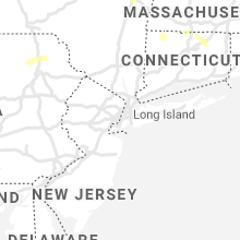
New York
| Local Time | Report Details |
|---|---|
| 1:53 PM EDT | A few reports of trees down on junction road in schoharie county NY, 20.1 miles WSW of Schenectady, NY |
| 2:48 PM EDT | Tree limbs and power poles down at dunsback roa in saratoga county NY, 9.2 miles E of Schenectady, NY |
| 2:49 PM EDT | Roue 9 has all lanes closed between osborne road and spring street road due to downed wires in albany county NY, 11.6 miles SE of Schenectady, NY |
| 2:53 PM EDT | Trees down along route 9 in cohoes. time estimated by rada in albany county NY, 10.8 miles E of Schenectady, NY |
| 2:59 PM EDT | Tree and wires down at irish road and route 40 in rensselaer county NY, 15.8 miles E of Schenectady, NY |
| 2:59 PM EDT | Large tree down across north lake avenue and kestner lane in tro in rensselaer county NY, 14.9 miles ESE of Schenectady, NY |
| 3:00 PM EDT | Wires were downed across the road at north lake and valley view in rensselaer county NY, 14.9 miles ESE of Schenectady, NY |
| 3:01 PM EDT | Tree down across the road on ridge road in rensselaer county NY, 15.9 miles ESE of Schenectady, NY |
| 3:19 PM EDT | Numerous trees and wires down from ridge road to phillips road north of hays road in rensselaer county NY, 18.2 miles SE of Schenectady, NY |
| 3:28 PM EDT | Tree and wires down on petersburg junction road in rensselaer county NY, 31.1 miles E of Schenectady, NY |
| 3:35 PM EDT | Large tree down along route 9 in rensselaer county NY, 23 miles SE of Schenectady, NY |
| 3:35 PM EDT | Tree down across the road on south old post road in rensselaer county NY, 22.2 miles SE of Schenectady, NY |
| 4:03 PM EDT | Tree and wires down on route 9j south of ridge road in columbia county NY, 26.5 miles SSE of Schenectady, NY |
| 5:14 PM EDT | Trees down across road in bear mountain state par in rockland county NY, 40.5 miles N of Brooklyn, NY |
| 5:17 PM EDT | 60 knot gust measured at 40 fee in anz335 county NY, 20.5 miles NE of Brooklyn, NY |
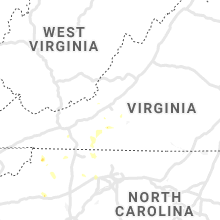
North Carolina
| Local Time | Report Details |
|---|---|
| 2:17 PM EDT | Multiple trees in lawsonville are in stokes county NC, 56.2 miles SSW of Roanoke, VA |
| 2:45 PM EDT | Numerous trees down along 421... to the mt.pleasant are in wilkes county NC, 61.2 miles ESE of Bristol, TN |
| 2:57 PM EDT | Ping Pong Ball sized hail reported near West Jefferson, NC, 45.8 miles ESE of Bristol, TN |
| 3:01 PM EDT | Multiple trees down in the danbury are in stokes county NC, 61.3 miles SSW of Roanoke, VA |
| 3:01 PM EDT | Multiple trees down in the danbury are in stokes county NC, 61.3 miles SSW of Roanoke, VA |
| 3:09 PM EDT | Half Dollar sized hail reported near Jefferson, NC, 43.5 miles ESE of Bristol, TN |
| 3:15 PM EDT | Golf Ball sized hail reported near Jefferson, NC, 43.5 miles ESE of Bristol, TN |
| 3:17 PM EDT | Tree down at white pine country club road near highway 5 in surry county NC, 63.4 miles SW of Roanoke, VA |
| 3:20 PM EDT | Multiple trees down in the boomer are in wilkes county NC, 61.6 miles NNW of Charlotte, NC |
| 3:20 PM EDT | Multiple trees down in the boomer are in wilkes county NC, 62.9 miles NNW of Charlotte, NC |
| 3:32 PM EDT | Trees down near sheep farm road and highway 5 in surry county NC, 65.4 miles SSW of Roanoke, VA |
| 3:32 PM EDT | Trees down near sheep farm road and old us 5 in surry county NC, 65.9 miles SSW of Roanoke, VA |
| 4:22 PM EDT | Numerous trees down outside the moores spring are in stokes county NC, 62.4 miles SSW of Roanoke, VA |
| 4:36 PM EDT | Fire dept reported tree down on dobson farm rd blocking the roa in iredell county NC, 49.7 miles N of Charlotte, NC |
| 4:45 PM EDT | Several trees dow in yadkin county NC, 59.6 miles N of Charlotte, NC |
| 5:10 PM EDT | 911 call center reported tree down on umberger r in rowan county NC, 31.6 miles NNE of Charlotte, NC |
| 5:20 PM EDT | Powerlines and powerpoles dow in forsyth county NC, 58.4 miles NNE of Charlotte, NC |
| 5:22 PM EDT | Tree on house. no injuries reporte in forsyth county NC, 66.7 miles NNE of Charlotte, NC |
| 5:24 PM EDT | Public reported large tree limbs/branches down in table roc in burke county NC, 56.7 miles SSE of Bristol, TN |
| 5:32 PM EDT | Tree down on s stratford roa in forsyth county NC, 64.9 miles NNE of Charlotte, NC |
| 5:36 PM EDT | Tree down on donnaha r in forsyth county NC, 73.8 miles NNE of Charlotte, NC |
Virginia
| Local Time | Report Details |
|---|---|
| 2:59 PM EDT | Multiple trees down north of the westlake corner are in franklin county VA, 15.6 miles SE of Roanoke, VA |
| 3:35 PM EDT | Thunderstorm winds blew down multiple large tree limbs along ruritan roa in franklin county VA, 22.2 miles S of Roanoke, VA |
| 3:35 PM EDT | One tree was blown down by thunderstorm winds along byllesby roa in carroll county VA, 64.8 miles WSW of Roanoke, VA |
| 3:40 PM EDT | Tree down on franklin street and stave mountain roa in franklin county VA, 20.1 miles S of Roanoke, VA |
| 3:52 PM EDT | Tree down on 6 mile post road and factory hill roa in franklin county VA, 20.7 miles SSW of Roanoke, VA |
| 3:55 PM EDT | Tree down at intersection of rock ridge road and ferrum mountain roa in franklin county VA, 21.7 miles SSW of Roanoke, VA |
| 4:16 PM EDT | Multiple trees were blown down by thunderstorm winds around the community of vest in patrick county VA, 44.6 miles SSW of Roanoke, VA |
| 4:20 PM EDT | Tree and large limbs down across bent mountain road and clover hill road. time estimated from rada in roanoke county VA, 14.8 miles SW of Roanoke, VA |
| 4:53 PM EDT | Tree down at endicott road and franklin stree in franklin county VA, 28.1 miles SSW of Roanoke, VA |
| 5:00 PM EDT | Two trees down on shooting creek road s in floyd county VA, 30.1 miles SW of Roanoke, VA |
Missouri
| Local Time | Report Details |
|---|---|
| 2:35 PM CDT | 4 to 6 inch diameter limbs down with reports of some power outage in livingston county MO, 73.2 miles NE of Kansas City, MO |
| 3:15 PM CDT | Tree limbs downed and power outages across marceline in linn county MO, 61.8 miles NNW of Columbia, MO |
| 3:56 PM CDT | Quarter sized hail reported near Kansas City, MO, 15.4 miles NNW of Kansas City, MO |
| 4:00 PM CDT | Storm damage reported in platte county MO, 15.4 miles NNW of Kansas City, MO |
| 4:36 PM CDT | Tree limbs down across roa in audrain county MO, 29.1 miles ENE of Columbia, MO |
| 4:40 PM CDT | Quarter sized hail reported near Blue Springs, MO, 18.8 miles ESE of Kansas City, MO |
| 4:45 PM CDT | Tree limbs downed in jackson county MO, 19 miles ESE of Kansas City, MO |
| 4:45 PM CDT | Fence destroyed... tree limbs downded... and bbq grill thrown several yards over due to strong wind in jackson county MO, 19.3 miles ESE of Kansas City, MO |
| 4:45 PM CDT | 6 to 8 in diameter limb broken off of tre in lincoln county MO, 48.6 miles WNW of Saint Louis, MO |
| 4:45 PM CDT | Tree down onto a campe in marion county MO, 48.8 miles SSE of Kahoka, MO |
| 4:50 PM CDT | Trees dow in marion county MO, 51.6 miles SSE of Kahoka, MO |
| 4:55 PM CDT | Storm damage reported in audrain county MO, 31.6 miles ENE of Columbia, MO |
| 4:55 PM CDT | Camper flipped ove in marion county MO, 48.5 miles SSE of Kahoka, MO |
| 4:55 PM CDT | Multiple 5 inch diameter tree limbs downe in audrain county MO, 25.2 miles ENE of Columbia, MO |
| 4:55 PM CDT | Measured kmyj awo in audrain county MO, 31.2 miles ENE of Columbia, MO |
| 5:17 PM CDT | Lxt asos measures 78 mph wind gust in jackson county MO, 15.1 miles SE of Kansas City, MO |
| 5:48 PM CDT | Numerous trees... tree limbs and power lines blown down across the northern half of the county. a large tree branch was blown onto a house. also... a trampoline as blow in lincoln county MO, 48.6 miles WNW of Saint Louis, MO |
| 5:48 PM CDT | At least three power poles snapped along hwy 4 in lincoln county MO, 45.8 miles WNW of Saint Louis, MO |
| 5:50 PM CDT | Tree downed and blocking highway 58 at gray road in cass county MO, 25.3 miles SSE of Kansas City, MO |
| 5:52 PM CDT | Storm damage reported in cass county MO, 22.4 miles SSE of Kansas City, MO |
| 6:01 PM CDT | 3-5 inch tree limb dow in lincoln county MO, 38.9 miles NW of Saint Louis, MO |
| 6:01 PM CDT | Tree down in lincoln county MO, 41.2 miles NW of Saint Louis, MO |
| 6:02 PM CDT | Large tree blown over onto w. meyer road in wentzvill in st. charles county MO, 41.4 miles WNW of Saint Louis, MO |
| 6:04 PM CDT | Portion of flat roof peeled off of elementary school in st. charles county MO, 37.8 miles W of Saint Louis, MO |
| 6:05 PM CDT | Modot observation site on interstate 7 in st. charles county MO, 39.7 miles WNW of Saint Louis, MO |
| 6:14 PM CDT | Several trees blown down near intersection of mexico road and belleau creek roa in st. charles county MO, 27.8 miles WNW of Saint Louis, MO |
| 6:15 PM CDT | Several trees blown down near intersection of highways n and in st. charles county MO, 28.6 miles WNW of Saint Louis, MO |
| 6:21 PM CDT | Tree and power line blown down over highway dd near intersection with highway 9 in st. charles county MO, 31.4 miles W of Saint Louis, MO |
| 6:21 PM CDT | Gust front winds blew down several trees and power lines down around labadi in franklin county MO, 35.9 miles W of Saint Louis, MO |
| 6:24 PM CDT | 3 to 4 inch diameter tree limbs dow in franklin county MO, 33.9 miles WSW of Saint Louis, MO |
| 6:29 PM CDT | Shingles blown off of a few house in st. louis county MO, 24.7 miles WSW of Saint Louis, MO |
| 6:34 PM CDT | Large limbs down on hous in st. louis county MO, 13.6 miles NNW of Saint Louis, MO |
| 6:37 PM CDT | Several trees and numerous tree limbs blown down near the intersection of manchester road and geyer roa in st. louis county MO, 12.4 miles WSW of Saint Louis, MO |
| 6:37 PM CDT | Several trees and numerous tree limbs were blown down near the intersection of manchester road and geyer roa in st. louis county MO, 12.1 miles W of Saint Louis, MO |
| 6:39 PM CDT | Corrects previous tstm wnd gst report from 1 wnw berkeley. wind gust reported at st. louis-lambert international airpor in st. louis county MO, 12.1 miles NW of Saint Louis, MO |
| 6:41 PM CDT | Power lines down and multiple trees snappe in jefferson county MO, 18.4 miles WSW of Saint Louis, MO |
| 6:41 PM CDT | Tree down blocking watson roa in st. louis county MO, 9.1 miles WSW of Saint Louis, MO |
| 6:41 PM CDT | Large tree snapped in half causing damage to a house on pine avenue near the intersection with st. clair in brentwoo in st. louis county MO, 8.2 miles W of Saint Louis, MO |
| 6:42 PM CDT | Large tree limb blown dow in st. louis county MO, 7.8 miles WSW of Saint Louis, MO |
| 6:44 PM CDT | Several trees down across mccausland av in st. louis city county MO, 6 miles W of Saint Louis, MO |
| 6:51 PM CDT | Numerous tree limbs blown dow in st. louis county MO, 14.5 miles SSW of Saint Louis, MO |
| 6:54 PM CDT | Limbs down in st. louis county MO, 7.9 miles NW of Saint Louis, MO |
| 6:55 PM CDT | Storm damage reported in st. louis county MO, 13 miles NW of Saint Louis, MO |
| 6:55 PM CDT | Numerous tree limbs blown down. via faceboo in jefferson county MO, 23.2 miles SSW of Saint Louis, MO |
| 6:58 PM CDT | 1 to 3 inch limbs dow in st. louis city county MO, 5.5 miles SW of Saint Louis, MO |
| 7:00 PM CDT | Large tree down across road in jefferson county MO, 27.7 miles SSW of Saint Louis, MO |
| 7:00 PM CDT | Large tree limbs dow in st. louis county MO, 13.9 miles SSW of Saint Louis, MO |
| 7:05 PM CDT | Numerous tree limbs blown down. winds estimated between 60 and 70 mp in jefferson county MO, 27.4 miles SSW of Saint Louis, MO |
| 8:09 PM CDT | Measured at the perryville airpor in perry county MO, 42.2 miles NNW of Cape Girardeau, MO |
| 8:20 PM CDT | Tree on a house in perryville. minor damage to home. power knocked ou in perry county MO, 34.5 miles NNW of Cape Girardeau, MO |
| 10:00 PM CDT | Trees downed on d highway north of van bure in carter county MO, 50.9 miles SE of Salem, MO |
| 10:06 PM CDT | Tree down in piedmon in wayne county MO, 56.9 miles SE of Salem, MO |
| 10:30 PM CDT | Tree down on v highway just outside ellsinore. a car wrecked into the downed tree. time estimated from rada in carter county MO, 65.2 miles SE of Salem, MO |
New Jersey
| Local Time | Report Details |
|---|---|
| 3:55 PM EDT | Multiple reports of trees and wires down in sussex county. time estimated from rada in sussex county NJ, 47.2 miles ESE of Scranton, PA |
| 4:40 PM EDT | Tree down blocking a road. time estimated from rada in morris county NJ, 32.6 miles W of Brooklyn, NY |
| 4:46 PM EDT | Large (3ft diameter) tree dow in passaic county NJ, 19.6 miles NNW of Brooklyn, NY |
Massachusetts
| Local Time | Report Details |
|---|---|
| 4:49 PM EDT | Tree and wires down on wilson hill road near purlington lane in franklin county MA, 64.9 miles E of Schenectady, NY |
| 4:51 PM EDT | Tree down on christian hill road in berkshire county MA, 50.8 miles SE of Schenectady, NY |
| 4:54 PM EDT | Tree down on washington mountain road in berkshire county MA, 50.2 miles SE of Schenectady, NY |
| 4:59 PM EDT | Tree down on yokum pond road in berkshire county MA, 54.4 miles SE of Schenectady, NY |
| 5:23 PM EDT | Utliity pole down and wires down on unoccupied car on upper russell road in hampshire county MA, 67.5 miles SE of Schenectady, NY |
| 5:27 PM EDT | Multiple trees down blocking a portion of rte 202 in hampden county MA, 72.8 miles WNW of Providence, RI |
| 5:27 PM EDT | Storm damage reported in hampden county MA, 70.7 miles WNW of Providence, RI |
| 5:27 PM EDT | Tree and wires down on westhampton road in franklin county MA, 76.7 miles E of Schenectady, NY |
| 5:30 PM EDT | Tree down on rte 23 at rte 20 intersection in hampden county MA, 70.8 miles SE of Schenectady, NY |
| 5:33 PM EDT | Tree and wires down on building and car on wilson ave in hampden county MA, 68.6 miles WNW of Providence, RI |
| 5:35 PM EDT | Tree and wires down on northhampton street in hampshire county MA, 72.1 miles WNW of Providence, RI |
| 5:37 PM EDT | Storm damage reported in hampden county MA, 63.1 miles WNW of Providence, RI |
| 5:37 PM EDT | Multiple trees down on rte 202 in hampshire county MA, 64.9 miles WNW of Providence, RI |
| 5:44 PM EDT | Tree and wires down on high street. tree down on line street in hampden county MA, 64.5 miles WNW of Providence, RI |
| 5:50 PM EDT | Tree down on home on crescent drive in hampden county MA, 64.5 miles WNW of Providence, RI |
| 6:25 PM EDT | Tree and wires down on old douglas road in worcester county MA, 48.5 miles NW of Providence, RI |
| 6:38 PM EDT | Trees and wires down on ferdinand street in worcester county MA, 37 miles NNW of Providence, RI |
Alabama
| Local Time | Report Details |
|---|---|
| 4:00 PM CDT | A couple of trees and power lines were blown down in the southwest part of the county in houston county AL, 71.9 miles NE of Miramar Beach, FL |
| 4:30 PM CDT | Tree down along county road 14 in dale county AL, 85 miles NE of Miramar Beach, FL |
| 4:45 PM CDT | Tree down in ozark in dale county AL, 80.4 miles S of Auburn, AL |
Connecticut
| Local Time | Report Details |
|---|---|
| 5:13 PM EDT | Multiple trees down along huntington road... one on a house... one on power lines... one on a driveway and a few in a yard at the top of the hill in litchfield county CT, 75.3 miles SE of Schenectady, NY |
| 5:43 PM EDT | Multiple trees down along huntington road... one on a house... one on power lines... one on a driveway and a few in a yard at the top of the hill in litchfield county CT, 75.3 miles SE of Schenectady, NY |
| 5:46 PM EDT | Tree down on wires at wallens hill road and rams gate road in litchfield county CT, 75.3 miles SE of Schenectady, NY |
| 6:00 PM EDT | 6 power poles down on south street in hartford county CT, 60.6 miles W of Providence, RI |
| 6:20 PM EDT | Tree and wires down on south road in hartford county CT, 74.6 miles SE of Schenectady, NY |
| 6:40 PM EDT | Trees down on eldridge mills road in tolland county CT, 44.4 miles W of Providence, RI |
| 7:04 PM EDT | Trees and wires down on pinch street in windham county CT, 35.6 miles WSW of Providence, RI |
Texas
| Local Time | Report Details |
|---|---|
| 4:26 PM CDT | Storm damage reported in lubbock county TX, 16.3 miles SW of Lubbock, TX |
| 5:05 PM CDT | Storm damage reported in swisher county TX, 46.3 miles S of Amarillo, TX |
| 5:38 PM CDT | Storm damage reported in armstrong county TX, 48.5 miles ESE of Amarillo, TX |
Indiana
| Local Time | Report Details |
|---|---|
| 5:30 PM EDT | Delayed report. partially rotted tree snapped in half along cr 8 north of bristol... i in elkhart county IN, 58.7 miles NW of Fort Wayne, IN |
| 6:15 PM EDT | Large tree blown onto power lines. time estimated from rada in sullivan county IN, 56.2 miles ESE of Mattoon, IL |
| 7:01 PM EDT | Tree limbs 4 to 6 inches in diameter downed near vincenne in knox county IN, 48.6 miles N of Evansville, IN |
| 6:43 PM CDT | Roof damage to the gibson county correctional building. time estimated by rada in gibson county IN, 26.4 miles N of Evansville, IN |
New Mexico
| Local Time | Report Details |
|---|---|
| 3:32 PM MDT | Kcao aso in union county NM, 94.3 miles NNE of Tucumcari, NM |
Florida
| Local Time | Report Details |
|---|---|
| 5:34 PM EDT | Corrects previous tstm wnd gst report from 3 ene saint petersburg. delayed report... asos station kspg st petersburg albert whitted airport reported a wind gust of 61 m in pinellas county FL, 19.2 miles N of Bradenton, FL |
| 5:59 PM EDT | Delayed report... state emergency management reported that a roof was blown off of a mobile home on imperial avenue near ellenton. no injuries reported. time estimated in manatee county FL, 5.3 miles NNE of Bradenton, FL |
| 6:01 PM EDT | Delayed report... state emergency management reported that a tree fell onto a mobile home on 46th avenue drive east in ellenton. no injuries reported. time estimated fr in manatee county FL, 3.9 miles ENE of Bradenton, FL |
Kansas
| Local Time | Report Details |
|---|---|
| 4:36 PM CDT | Quarter sized hail reported near Tescott, KS, 71.8 miles W of Manhattan, KS, corrects previous hail report from tescott. |
| 4:45 PM CDT | Estimated 50-60mph winds between cr 15 and cr 17 east of leoti along with half mile visibility due to heavy rain in wichita county KS, 42.2 miles NNW of Garden City, KS |
| 4:51 PM CDT | Power pole snappe in lincoln county KS, 61 miles E of Hays, KS |
| 4:56 PM CDT | Ups truck blown over near highway 14 just east of lincol in lincoln county KS, 65.8 miles E of Hays, KS |
| 4:57 PM CDT | Storm damage reported in lincoln county KS, 51.7 miles E of Hays, KS |
| 5:00 PM CDT | Quarter sized hail reported near Sylvan Grove, KS, 51.7 miles E of Hays, KS |
| 5:10 PM CDT | Ping Pong Ball sized hail reported near Hunter, KS, 50.1 miles ENE of Hays, KS, a few stones up to ping pong ball size. |
| 5:10 PM CDT | Ping Pong Ball sized hail reported near Lucas, KS, 48.8 miles ENE of Hays, KS, a few stones up to ping pong ball size. |
| 5:11 PM CDT | Quarter sized hail reported near Olathe, KS, 19.1 miles SW of Kansas City, MO |
| 5:15 PM CDT | Quarter sized hail reported near Hunter, KS, 51.9 miles ENE of Hays, KS |
| 5:20 PM CDT | Golf Ball sized hail reported near Olathe, KS, 19.1 miles SW of Kansas City, MO, quarter to golf ball sized hail |
| 5:38 PM CDT | Quarter sized hail reported near Overland Park, KS, 19.2 miles SSW of Kansas City, MO |
| 5:38 PM CDT | Storm damage reported in johnson county KS, 19.2 miles SSW of Kansas City, MO |
| 5:40 PM CDT | Tree blown down 3 miles west of sylvan grov in lincoln county KS, 48.5 miles ENE of Hays, KS |
| 5:41 PM CDT | Quarter sized hail reported near Sylvan Grove, KS, 52.8 miles ENE of Hays, KS |
| 5:41 PM CDT | Storm damage reported in lincoln county KS, 52.8 miles ENE of Hays, KS |
| 5:59 PM CDT | Report came in via faceboo in russell county KS, 44.6 miles ENE of Hays, KS |
| 6:12 PM CDT | Power pole reorted dow in lincoln county KS, 47.4 miles ENE of Hays, KS |
| 6:20 PM CDT | Quarter sized hail reported near Plainville, KS, 24.8 miles N of Hays, KS, facebook photo sent to wfo gld. time estimated from radar. |
| 6:21 PM CDT | Golf Ball sized hail reported near Grinnell, KS, 26.4 miles ESE of Colby, KS, public report of quarter to golfball hail |
| 6:28 PM CDT | Quarter sized hail reported near Osborne, KS, 40.7 miles NNE of Hays, KS, scattered hail up to quarter size. |
| 6:37 PM CDT | Quarter sized hail reported near Grinnell, KS, 23.8 miles SE of Colby, KS, sustained hail for 5-10mins ranging from pea to quarters |
| 6:45 PM CDT | Measured by mesonet statio in ellis county KS, 1.5 miles SSW of Hays, KS |
| 6:45 PM CDT | Quarter sized hail reported near Winona, KS, 25.7 miles SSW of Colby, KS, quarter size hail reported in winona... has been ongoing for 5-10 mins |
| 6:55 PM CDT | Quarter sized hail reported near Hays, KS, 2.8 miles NNE of Hays, KS |
| 6:55 PM CDT | Estimated 50-60 mph wind gust in ellis county KS, 2.8 miles NNE of Hays, KS |
| 7:02 PM CDT | Quarter sized hail reported near Hays, KS, 0.9 miles NE of Hays, KS, picture of quarter size hail posted on social media. |
| 7:14 PM CDT | Quarter sized hail reported near Tecumseh, KS, 52.4 miles W of Kansas City, MO |
| 7:26 PM CDT | Golf Ball sized hail reported near Rexford, KS, 17.6 miles E of Colby, KS, spotter reported golf ball size hail |
| 8:17 PM CDT | Quarter sized hail reported near Shawnee, KS, 8.5 miles WSW of Kansas City, MO, nickel to quarter size hail reported at 68th and lackman |
| 9:45 PM CDT | Ping Pong Ball sized hail reported near Tonganoxie, KS, 23.1 miles W of Kansas City, MO |
| 9:54 PM CDT | Half Dollar sized hail reported near Kansas City, KS, 13.1 miles WSW of Kansas City, MO |
| 1:40 AM CDT | 10 inch diameter tree blown down onto a vehicl in lyon county KS, 57.5 miles SSE of Manhattan, KS |
| 1:58 AM CDT | 62 mph gust reported at kem in lyon county KS, 60.2 miles NW of Chanute, KS |
Colorado
| Local Time | Report Details |
|---|---|
| 3:46 PM MDT | Dispatch relayed from on patrol deputy of 50-60 mph winds in town in cheyenne county CO, 80.6 miles WSW of Colby, KS |
| 7:15 PM MDT | Quarter sized hail reported near Vona, CO, 56.5 miles S of Yuma, CO |
| 7:24 PM MDT | Golf Ball sized hail reported near Vona, CO, 55.8 miles S of Yuma, CO, report of at least golf ball hail ongoing in town. also reported 1.75 inches of rain in rain gauge. |
| 7:45 PM MDT | Quarter sized hail reported near Peyton, CO, 50.6 miles SSE of Denver, CO, cocorahs observer commented most 3/4 inch with largest 1 inch. |
Michigan
| Local Time | Report Details |
|---|---|
| 6:20 PM EDT | Delayed report. a few trees down (size and health unknown) on moreland road just west of jerome roa in hillsdale county MI, 73.5 miles NNE of Fort Wayne, IN |
Maine
| Local Time | Report Details |
|---|---|
| 8:13 PM EDT | Tree on power lin in aroostook county ME, 24 miles NW of Caribou, ME |
| 8:15 PM EDT | Tree on rt 162 and tree on power lin in aroostook county ME, 24.6 miles NNW of Caribou, ME |
Kentucky
| Local Time | Report Details |
|---|---|
| 9:36 PM EDT | Multiple trees down in jonesville in grant county KY, 35.2 miles SSW of Cincinnati, OH |
| 9:40 PM EDT | Multiple trees and powerlines blown down. demossville and butler areas hardest hi in pendleton county KY, 23 miles SSE of Cincinnati, OH |
| 9:46 PM EDT | Tree down on calendar road in owen county KY, 33.6 miles SSW of Cincinnati, OH |
| 9:53 PM EDT | Multiple trees down across town in grant county KY, 29.9 miles S of Cincinnati, OH |
| 10:03 PM EDT | Power pulls snapped along dixie highway near sherman. time estimated from radar dat in grant county KY, 26.5 miles S of Cincinnati, OH |
Arizona
| Local Time | Report Details |
|---|---|
| 7:00 PM MST | Numerous power poles blown down along avenue 40 e between e county 6th st and 8th st. time estimated from spotter between 700 and 745 p in yuma county AZ, 39.4 miles E of Yuma, AZ |
| 7:40 PM MST | Trees down on highway 95 in north part of quartzsite. bypassers assisted deputy to remove large tree blocking highway. debris from properties blowing on to residential in la paz county AZ, 55.2 miles S of Lake Havasu City, AZ |
| 7:46 PM MST | Multiple semi trucks reported blown over on westbound i-10 east of quartzsite... resulting in closure of the interstat in la paz county AZ, 62.8 miles SSE of Lake Havasu City, AZ |
Nevada
| Local Time | Report Details |
|---|---|
| 7:54 PM PDT | Storm damage reported in clark county NV, 31 miles NE of Las Vegas, NV |
| 9:15 PM PDT | Peak wind gust of 63 mph reported at 915 pm with thunderstorm at boulder island. sustained wind with the ob was 30 mph out of the nort in clark county NV, 22.6 miles ESE of Las Vegas, NV |
Nebraska
| Local Time | Report Details |
|---|---|
| 10:47 PM CDT | Quarter sized hail reported near Indianola, NE, 66.7 miles SSE of North Platte, NE, report of pea to quarter size hail. |
Connect with Interactive Hail Maps