

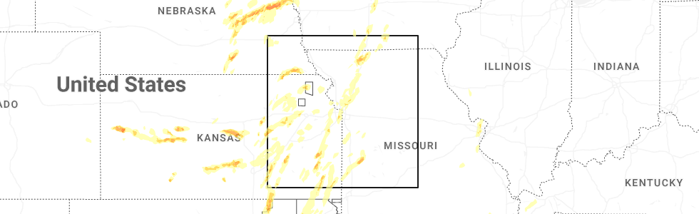
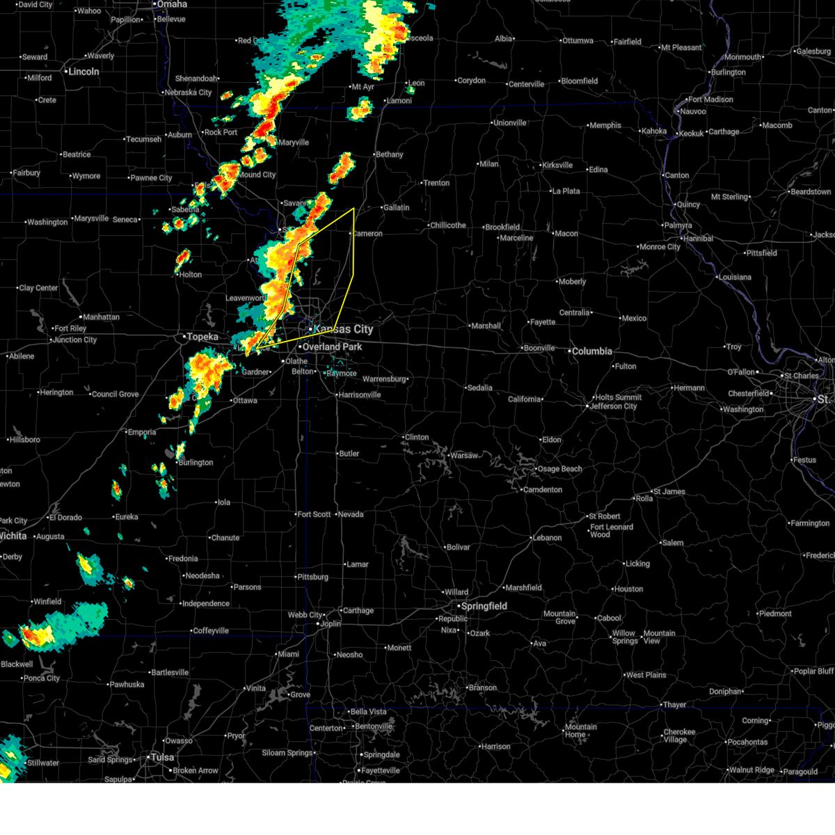
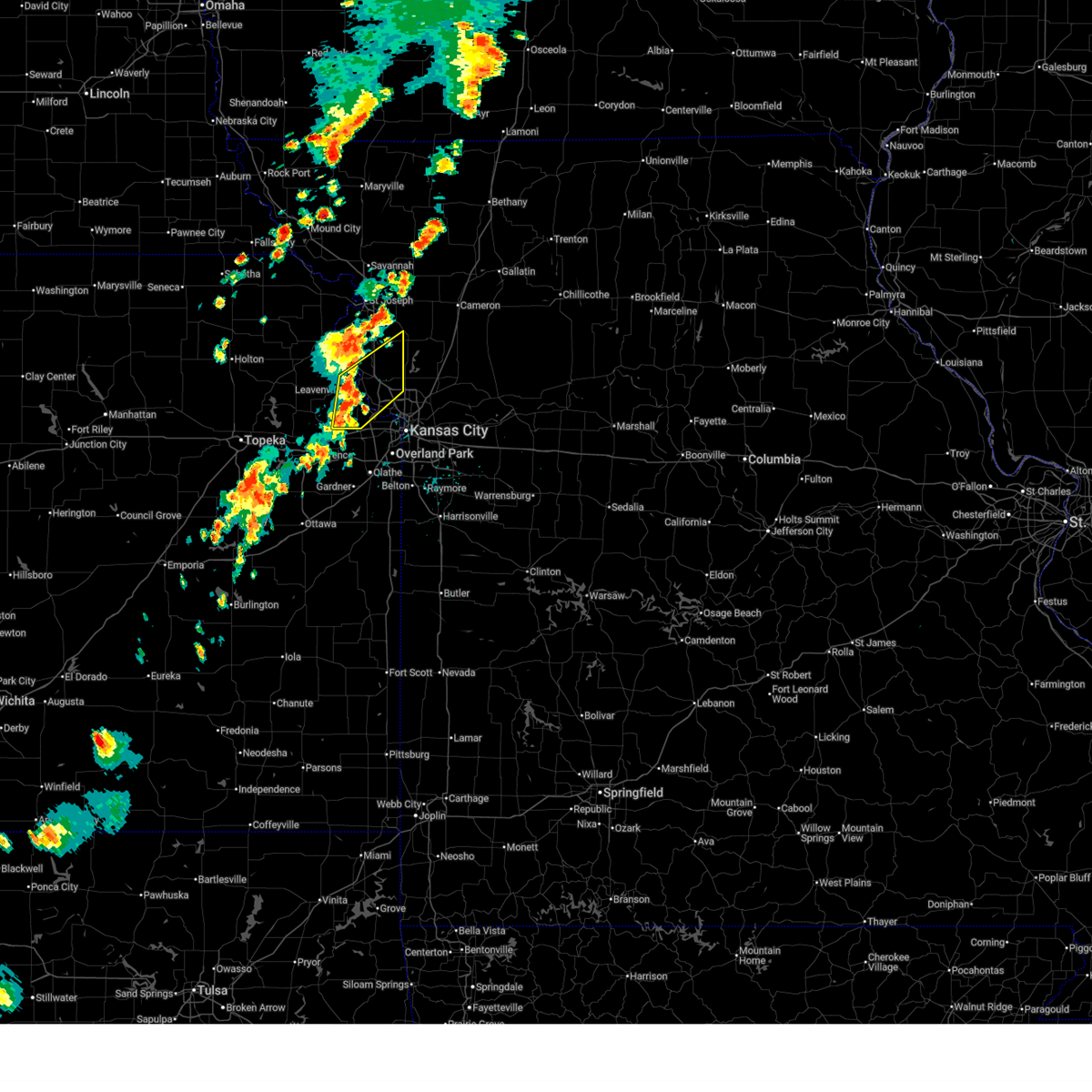
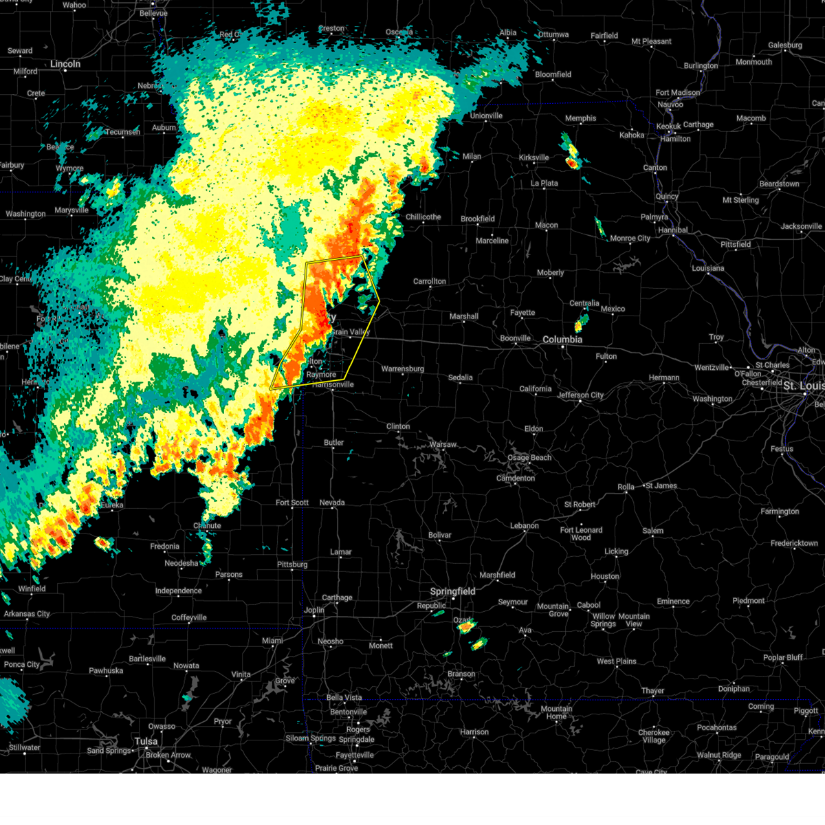
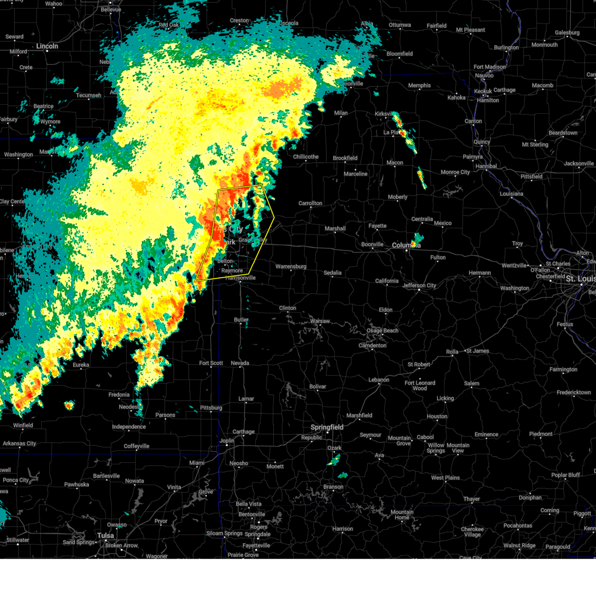
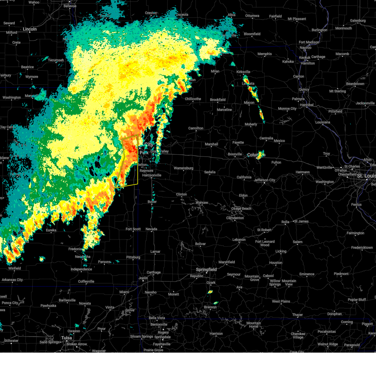
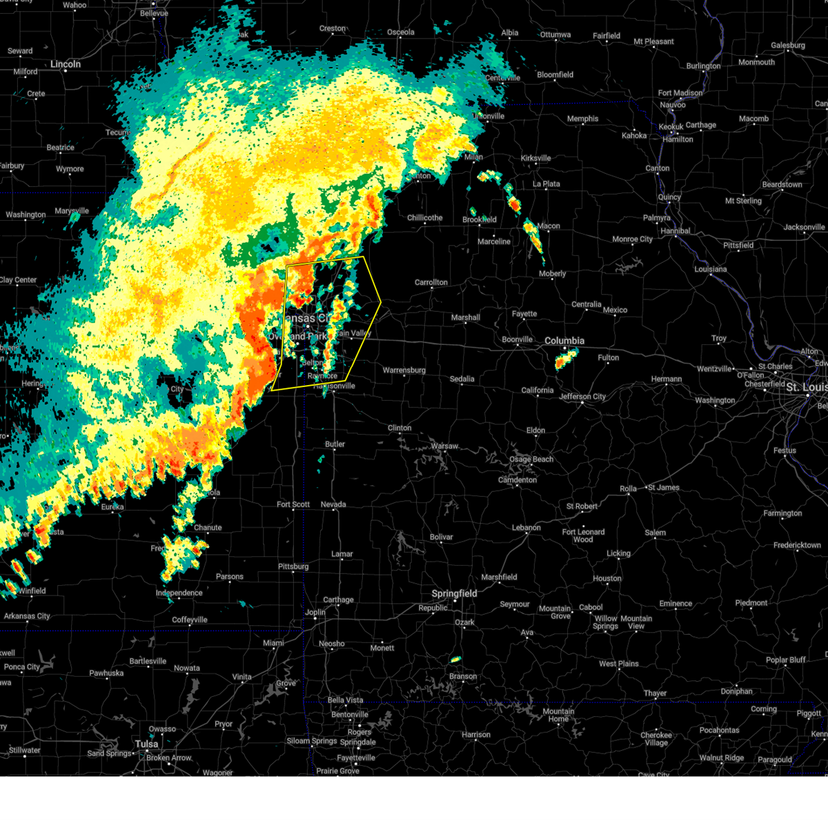
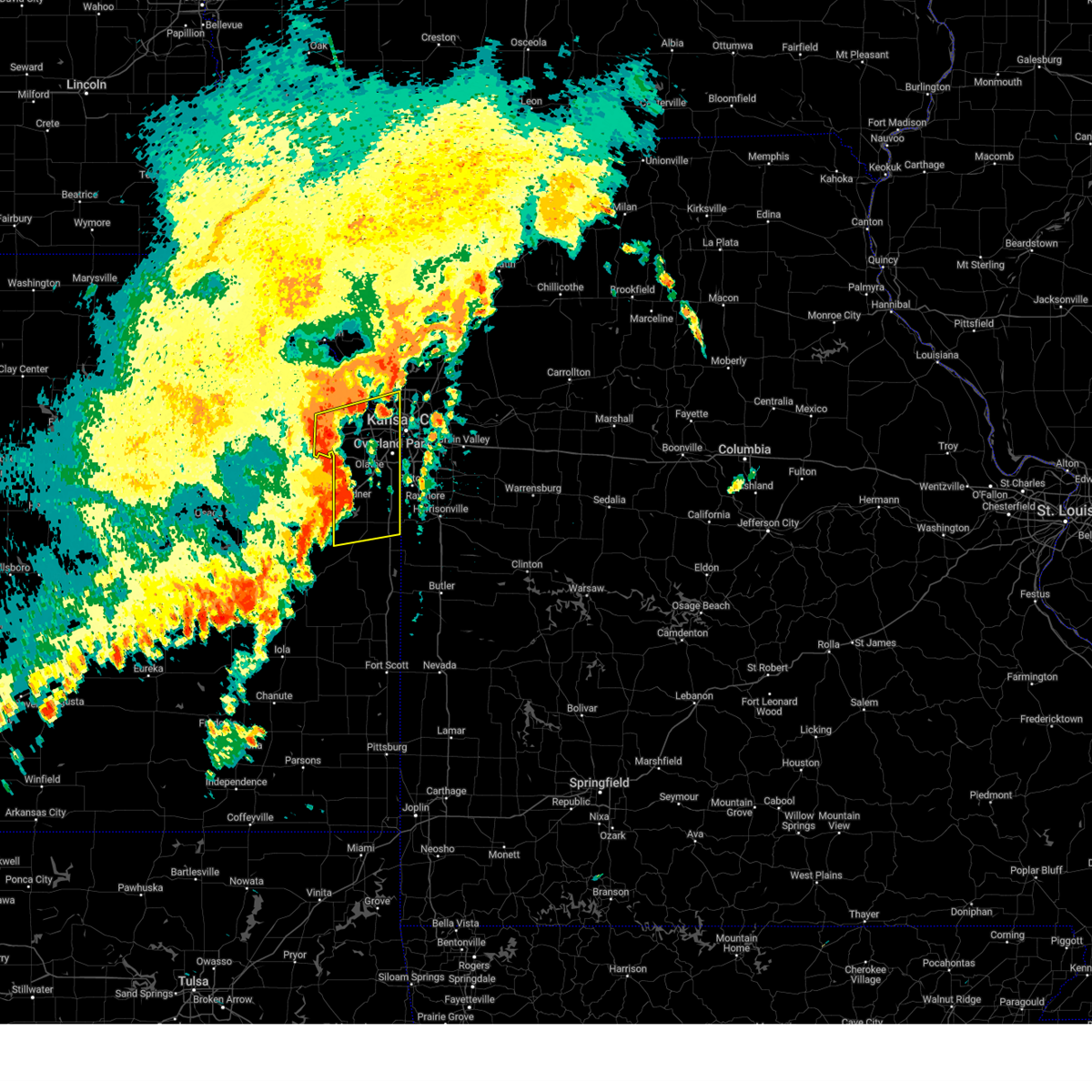
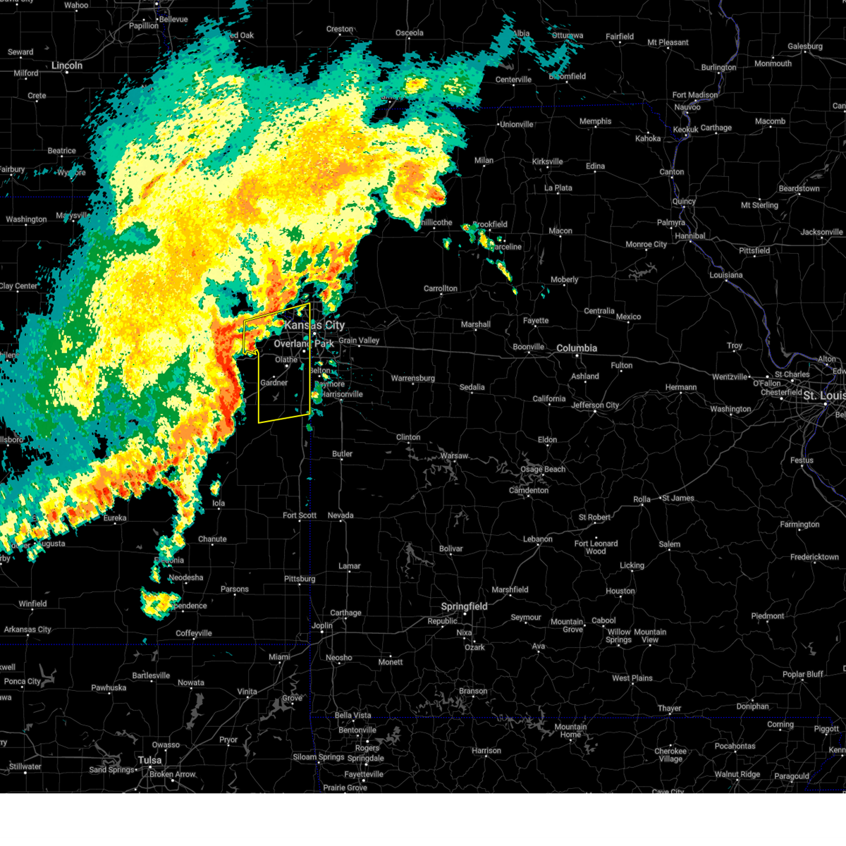
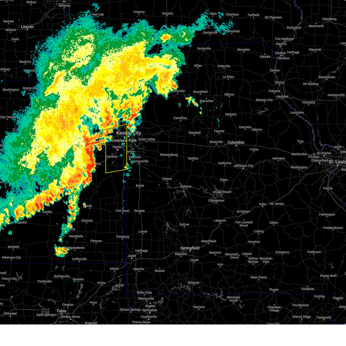
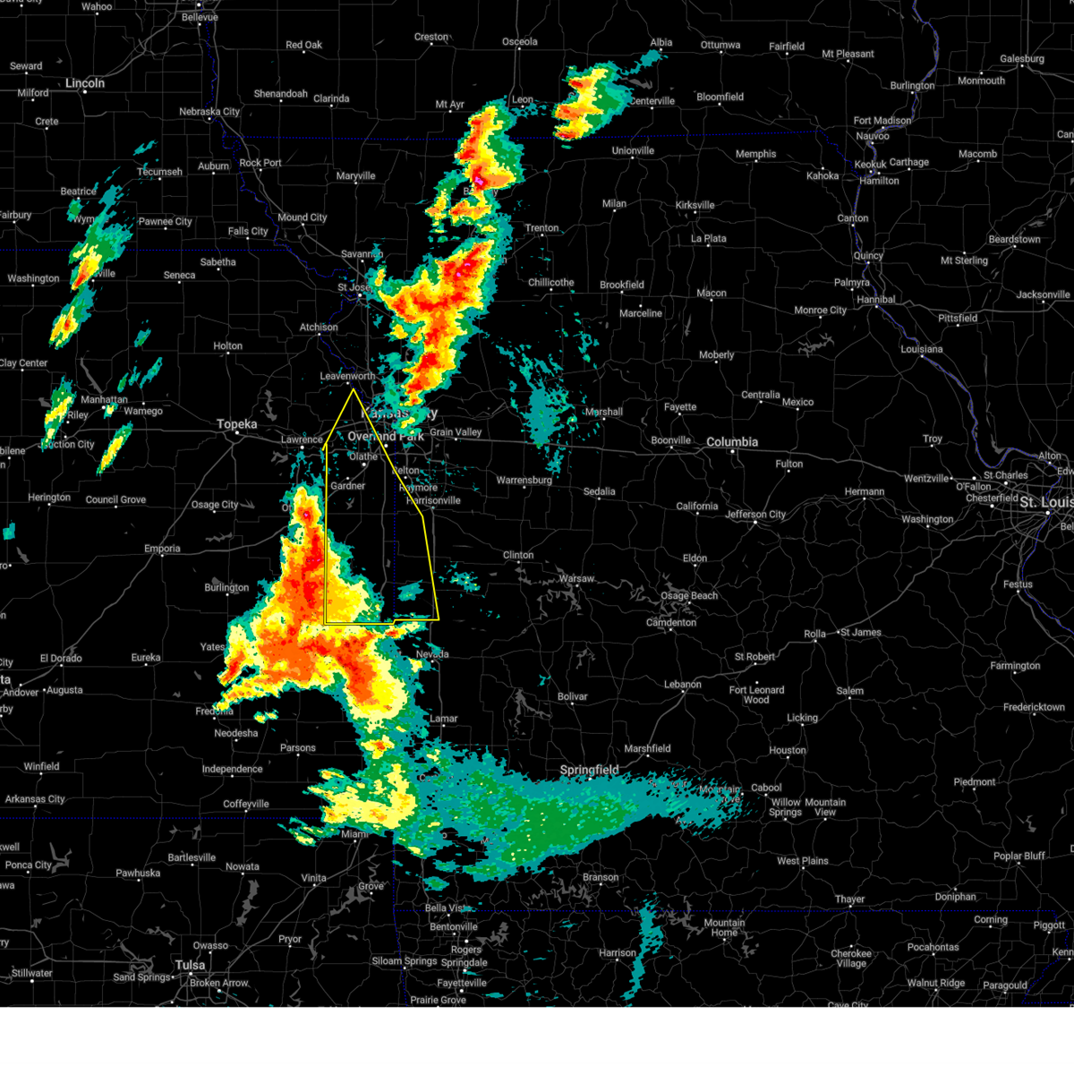
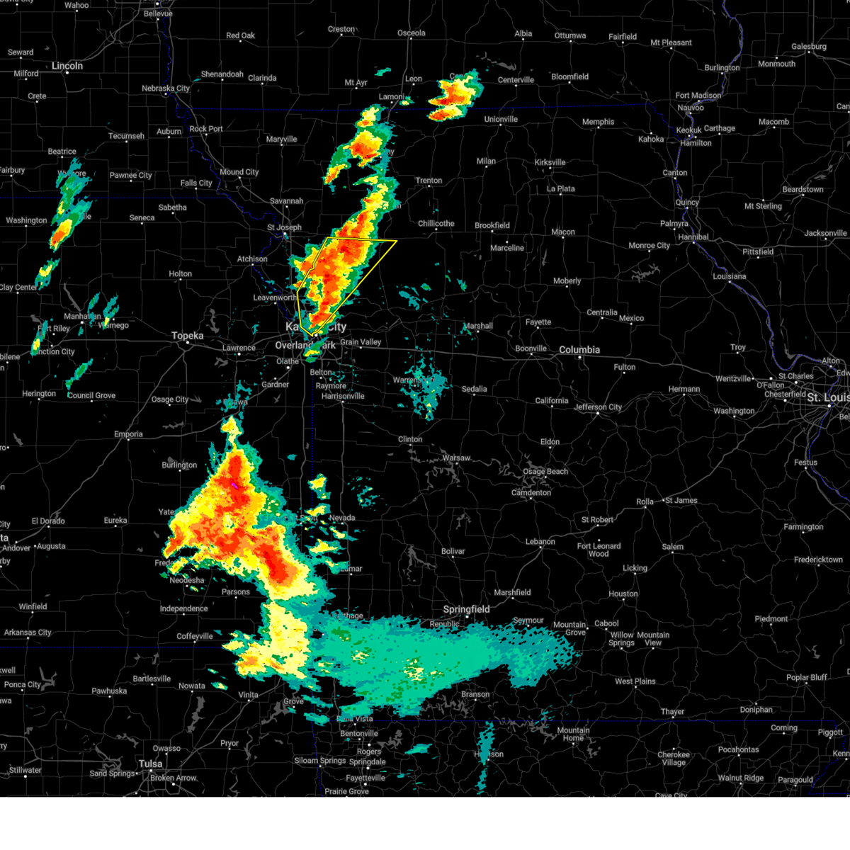
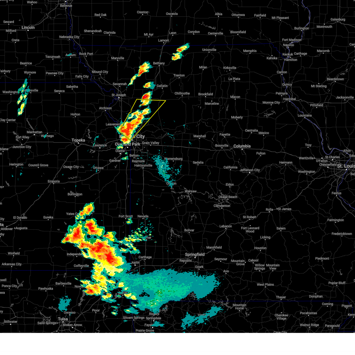
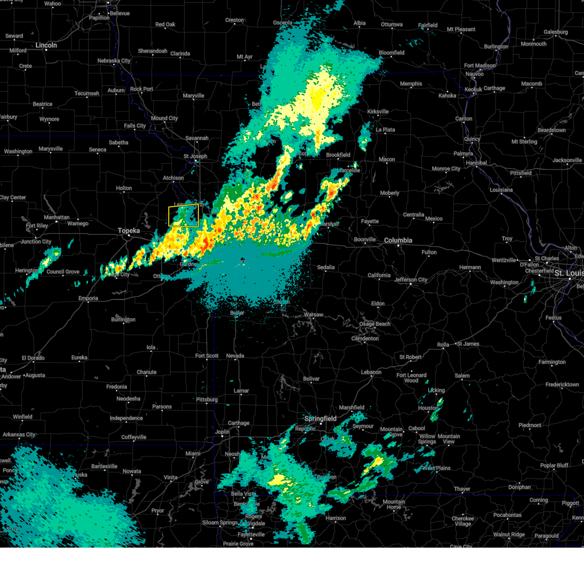
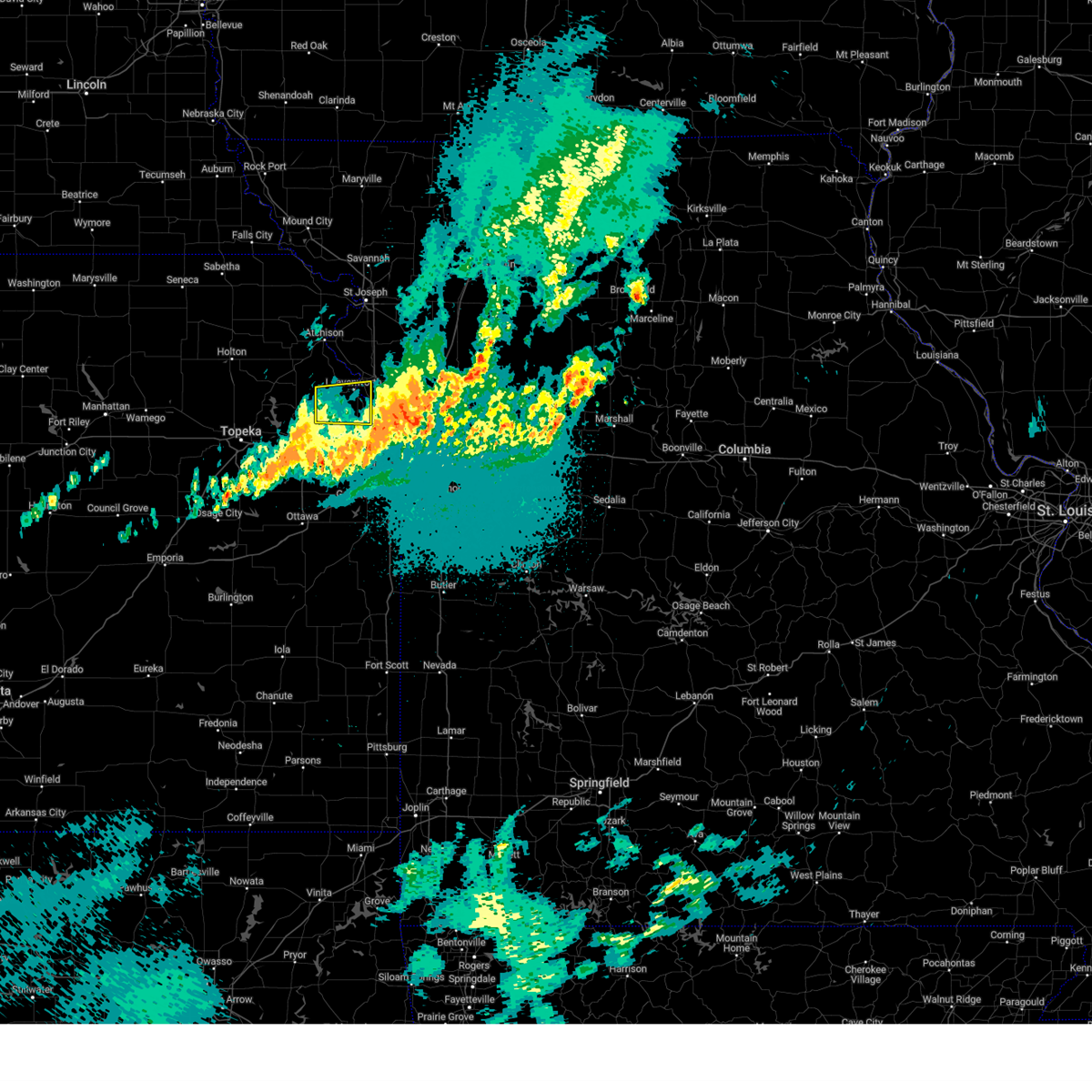
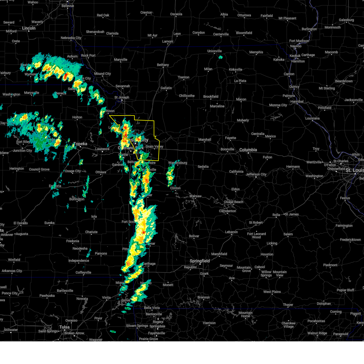
Hail Map for Kansas City, KS
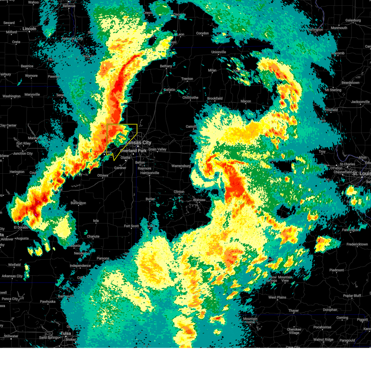
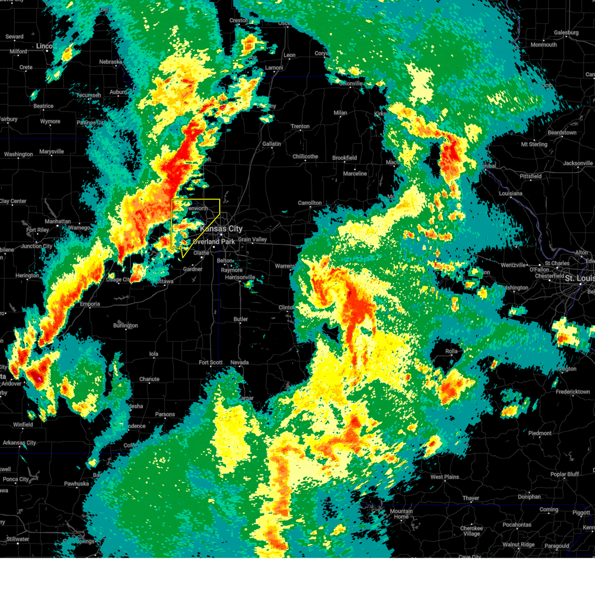
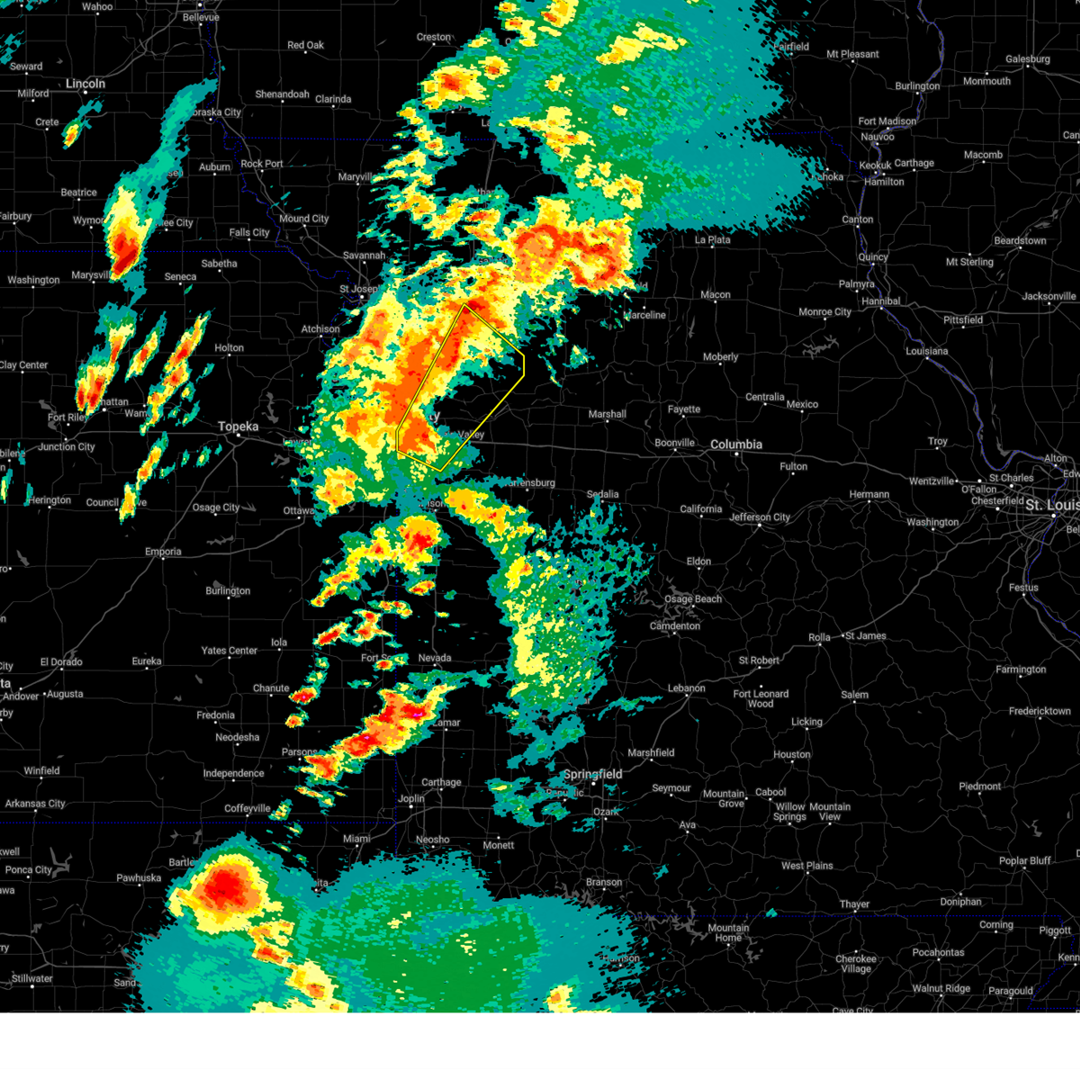
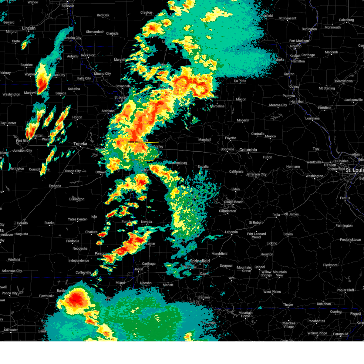
The Kansas City, KS area has had 40 reports of on-the-ground hail by trained spotters, and has been under severe weather warnings 108 times during the past 12 months. Doppler radar has detected hail at or near Kansas City, KS on 134 occasions, including 12 occasions during the past year.
| Name: | Kansas City, KS |
| Where Located: | 8.7 miles W of Kansas City, MO |
| Map: | Google Map for Kansas City, KS |
| Population: | 145786 |
| Housing Units: | 61969 |
| More Info: | Search Google for Kansas City, KS |
1
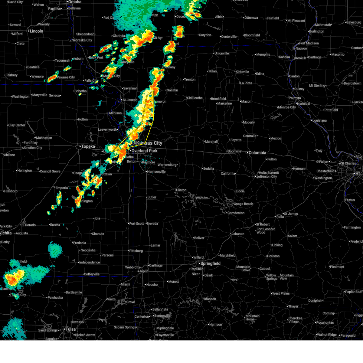
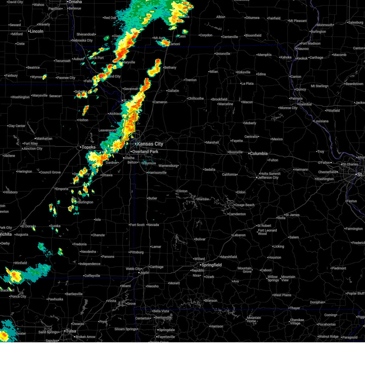
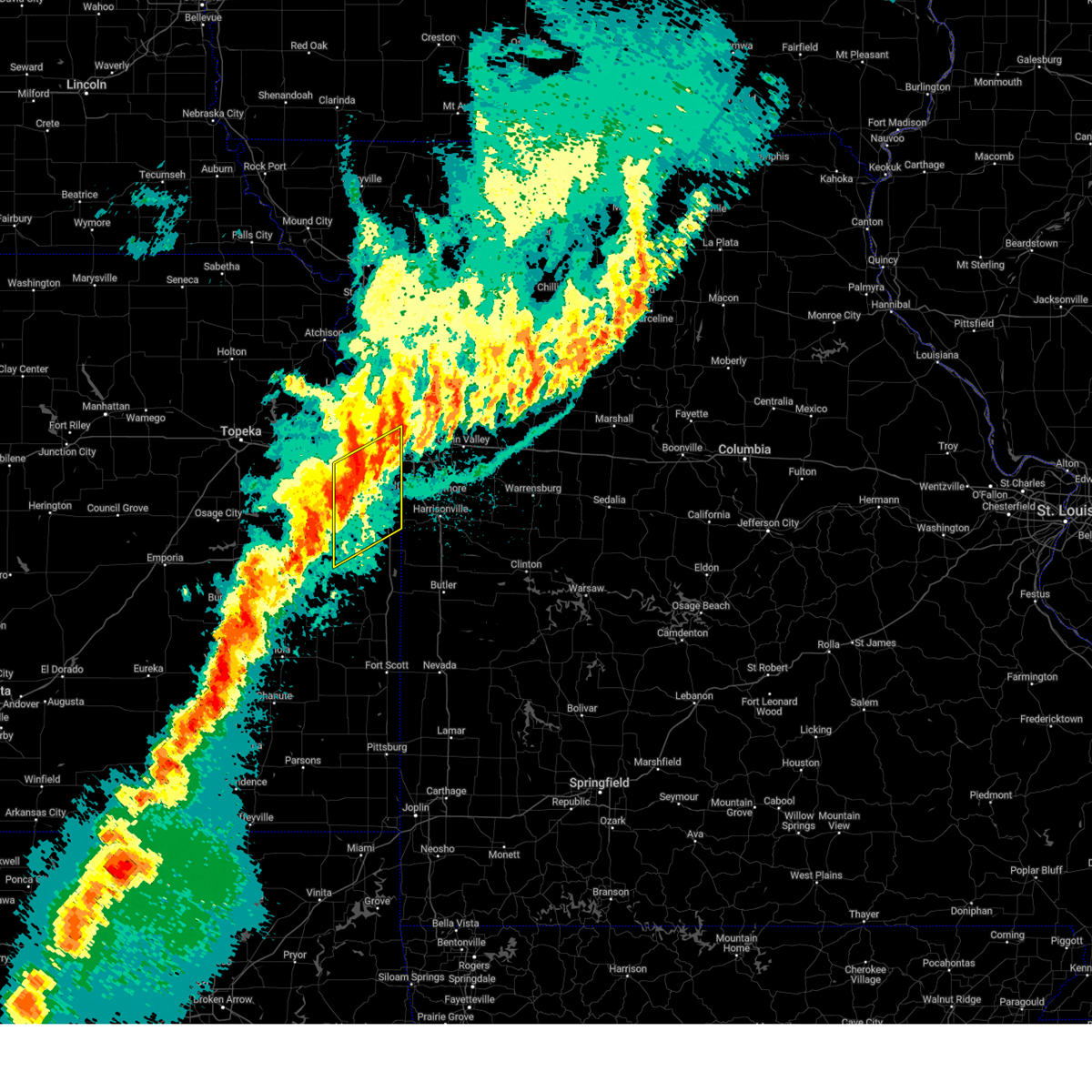
The Top Recent Hail Date for Kansas City, KS is Monday, May 19, 2025 (21st out of 134)
Hail and Wind Damage Spotted near Kansas City, KS
| Date / Time | Report Details |
|---|---|
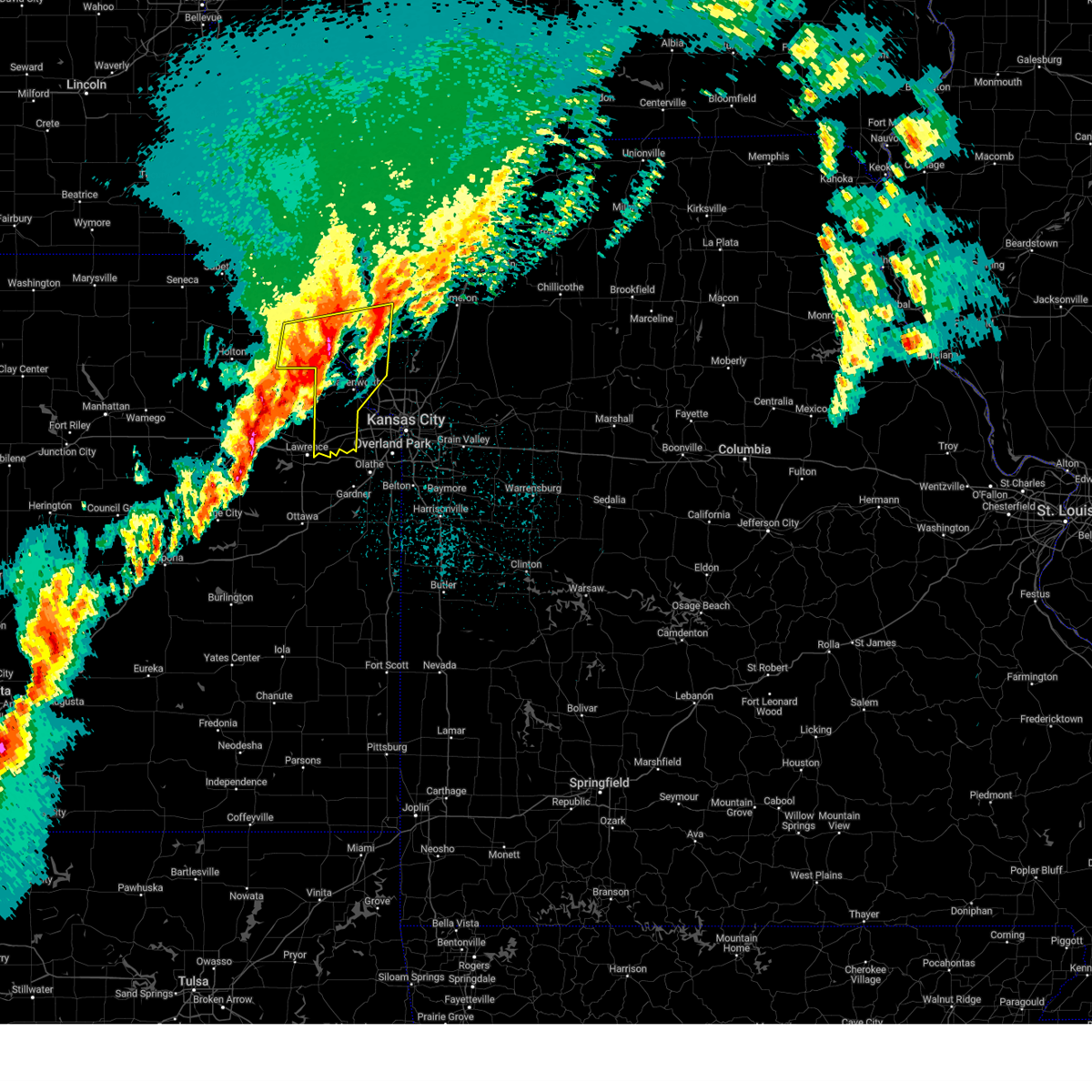
| 6/26/2025 6:35 PM CDT | The storm which prompted the warning has weakened below severe limits, and no longer poses an immediate threat to life or property. therefore, the warning will be allowed to expire. however, gusty winds and heavy rain are still possible with this thunderstorm. a severe thunderstorm watch remains in effect until 900 pm cdt for northeastern kansas. |
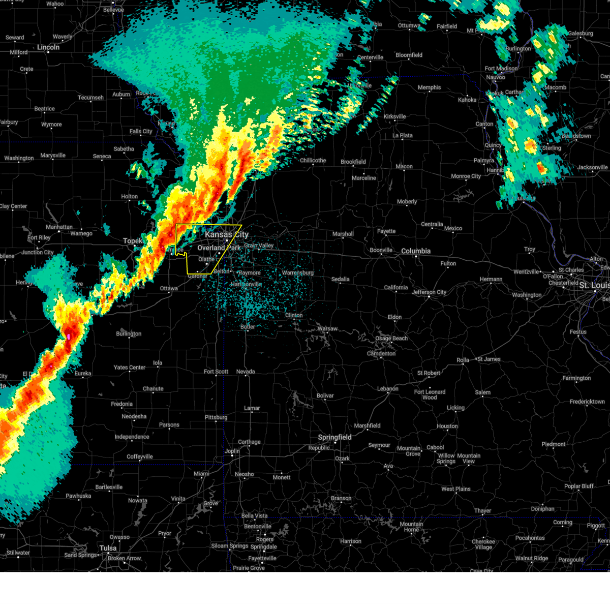
| 6/26/2025 6:19 PM CDT | At 618 pm cdt, a severe thunderstorm was located over raytown, moving east at 25 mph (public. several reports of tree and power line damage have been received from the overland park, leawood, and south kansas city areas). Hazards include 70 mph wind gusts. Expect considerable tree damage. damage is likely to mobile homes, roofs, and outbuildings. locations impacted include, kansas city, overland park, independence, lee's summit, blue springs, leawood, raytown, grandview, prairie village, grain valley, merriam, mission, greenwood, fairway, mission hills, buckner, lake lotawana, westwood, lake winnebago, and lone jack. this includes the following highways, interstate 70 in missouri between mile markers 6 and 25. interstate 35 in kansas between mile markers 226 and 232. interstate 635 near mile marker 0. interstate 470 between mile markers 0 and 16. interstate 435 between mile markers 61 and 80. Interstate 49 between mile markers 178 and 183. |
| 6/26/2025 6:17 PM CDT | The storm which prompted the warning has moved out of the area. therefore, the warning has been allowed to expire. a severe thunderstorm watch remains in effect until 900 pm cdt for northeastern kansas. to report severe weather, contact your nearest law enforcement agency. they will relay your report to the national weather service pleasant hill. |
| 6/26/2025 6:10 PM CDT | At 609 pm cdt, a severe thunderstorm was located near leawood, moving east at 25 mph (public. reports of trees down between overland park and leawood have been received). Hazards include 70 mph wind gusts. Expect considerable tree damage. damage is likely to mobile homes, roofs, and outbuildings. locations impacted include, kansas city, overland park, independence, lee's summit, blue springs, leawood, raytown, grandview, prairie village, grain valley, merriam, mission, greenwood, fairway, mission hills, buckner, lake lotawana, westwood, lake winnebago, and lone jack. this includes the following highways, interstate 70 in missouri between mile markers 6 and 25. interstate 35 in kansas between mile markers 226 and 232. interstate 635 near mile marker 0. interstate 470 between mile markers 0 and 16. interstate 435 between mile markers 61 and 80. Interstate 49 between mile markers 178 and 183. |
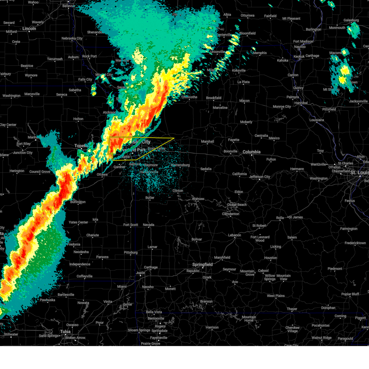
| 6/26/2025 6:01 PM CDT | Svreax the national weather service in pleasant hill has issued a * severe thunderstorm warning for, east central wyandotte county in northeastern kansas, northeastern johnson county in east central kansas, jackson county in west central missouri, * until 645 pm cdt. * at 601 pm cdt, a severe thunderstorm was located over overland park, moving east at 25 mph (radar indicated). Hazards include 70 mph wind gusts. Expect considerable tree damage. Damage is likely to mobile homes, roofs, and outbuildings. |
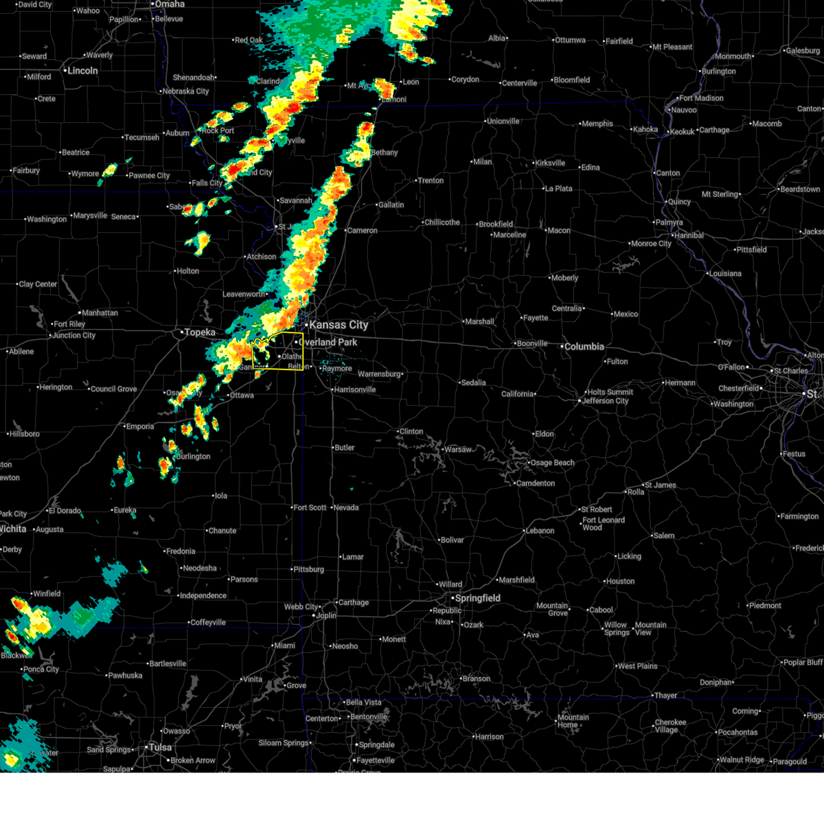
| 6/26/2025 5:59 PM CDT | Downed tree and wires near osage avenue. time estimated from rada in wyandotte county KS, 6.3 miles WNW of Kansas City, KS |
| 6/26/2025 5:52 PM CDT |
 At 552 pm cdt, severe thunderstorms were located along a line extending from near osborn to near kearney to riverside, moving northeast at 25 mph (radar indicated). Hazards include 60 mph wind gusts. Expect damage to roofs, siding, and trees. locations impacted include, kansas city, independence, shawnee, liberty, gladstone, excelsior springs, merriam, cameron, mission, kearney, bonner springs, de soto, parkville, edwardsville, north kansas city, sugar creek, riverside, lawson, lathrop, and claycomo. this includes the following highways, interstate 70 in missouri between mile markers 0 and 6. interstate 70 in kansas between mile markers 410 and 423. interstate 35 in missouri between mile markers 0 and 57. interstate 35 in kansas between mile markers 230 and 235. interstate 29 between mile markers 0 and 7. interstate 635 between mile markers 0 and 12. interstate 435 between mile markers 7 and 14, and between mile markers 42 and 61. Kansas turnpike near mile marker 226. At 552 pm cdt, severe thunderstorms were located along a line extending from near osborn to near kearney to riverside, moving northeast at 25 mph (radar indicated). Hazards include 60 mph wind gusts. Expect damage to roofs, siding, and trees. locations impacted include, kansas city, independence, shawnee, liberty, gladstone, excelsior springs, merriam, cameron, mission, kearney, bonner springs, de soto, parkville, edwardsville, north kansas city, sugar creek, riverside, lawson, lathrop, and claycomo. this includes the following highways, interstate 70 in missouri between mile markers 0 and 6. interstate 70 in kansas between mile markers 410 and 423. interstate 35 in missouri between mile markers 0 and 57. interstate 35 in kansas between mile markers 230 and 235. interstate 29 between mile markers 0 and 7. interstate 635 between mile markers 0 and 12. interstate 435 between mile markers 7 and 14, and between mile markers 42 and 61. Kansas turnpike near mile marker 226.
|
| 6/26/2025 5:37 PM CDT | Downed tree and wires near orchard street. time estimated from rada in wyandotte county KS, 4 miles NE of Kansas City, KS |
| 6/26/2025 5:37 PM CDT |
 the severe thunderstorm warning has been cancelled and is no longer in effect the severe thunderstorm warning has been cancelled and is no longer in effect
|
| 6/26/2025 5:37 PM CDT |
 At 536 pm cdt, severe thunderstorms were located along a line extending from near osborn to near smithville to kansas city, moving northeast at 25 mph (public. several reports of wind damage have been received from leavenworth and platte counties with these storms). Hazards include 60 mph wind gusts and nickel size hail. Expect damage to roofs, siding, and trees. locations impacted include, kansas city, independence, shawnee, liberty, gladstone, excelsior springs, merriam, cameron, mission, smithville, kearney, bonner springs, de soto, parkville, edwardsville, north kansas city, sugar creek, riverside, lawson, and plattsburg. this includes the following highways, interstate 70 in missouri between mile markers 0 and 6. interstate 70 in kansas between mile markers 410 and 423. interstate 35 in missouri between mile markers 0 and 57. interstate 35 in kansas between mile markers 230 and 235. interstate 29 between mile markers 0 and 11. interstate 635 between mile markers 0 and 12. interstate 435 between mile markers 7 and 22, and between mile markers 36 and 61. Kansas turnpike between mile markers 223 and 226. At 536 pm cdt, severe thunderstorms were located along a line extending from near osborn to near smithville to kansas city, moving northeast at 25 mph (public. several reports of wind damage have been received from leavenworth and platte counties with these storms). Hazards include 60 mph wind gusts and nickel size hail. Expect damage to roofs, siding, and trees. locations impacted include, kansas city, independence, shawnee, liberty, gladstone, excelsior springs, merriam, cameron, mission, smithville, kearney, bonner springs, de soto, parkville, edwardsville, north kansas city, sugar creek, riverside, lawson, and plattsburg. this includes the following highways, interstate 70 in missouri between mile markers 0 and 6. interstate 70 in kansas between mile markers 410 and 423. interstate 35 in missouri between mile markers 0 and 57. interstate 35 in kansas between mile markers 230 and 235. interstate 29 between mile markers 0 and 11. interstate 635 between mile markers 0 and 12. interstate 435 between mile markers 7 and 22, and between mile markers 36 and 61. Kansas turnpike between mile markers 223 and 226.
|
| 6/26/2025 5:33 PM CDT | Mping report of downed trees near leavenworth road. time estimated from rada in wyandotte county KS, 4.1 miles SW of Kansas City, KS |
| 6/26/2025 5:31 PM CDT |
 Svreax the national weather service in pleasant hill has issued a * severe thunderstorm warning for, johnson county in east central kansas, * until 615 pm cdt. * at 531 pm cdt, a severe thunderstorm was located near de soto, moving northeast at 35 mph (radar indicated). Hazards include 60 mph wind gusts. expect damage to roofs, siding, and trees Svreax the national weather service in pleasant hill has issued a * severe thunderstorm warning for, johnson county in east central kansas, * until 615 pm cdt. * at 531 pm cdt, a severe thunderstorm was located near de soto, moving northeast at 35 mph (radar indicated). Hazards include 60 mph wind gusts. expect damage to roofs, siding, and trees
|
| 6/26/2025 5:26 PM CDT | Very large mature tree uprooted and fell onto house at the 1500 block of north 78th stree in wyandotte county KS, 1.7 miles SSE of Kansas City, KS |
| 6/26/2025 5:25 PM CDT | Several social media and spotter reports and photos of trees and power poles down near state avenue between 78th and 94th streets. time estimated from rada in wyandotte county KS, 1.7 miles SSE of Kansas City, KS |
| 6/26/2025 5:24 PM CDT | Social media report and photos of several downed tree limbs near 78th and i-70. time estimated from rada in wyandotte county KS, 1.1 miles SE of Kansas City, KS |
| 6/26/2025 5:20 PM CDT | Mping report of downed tree limbs near 71st terrace. time estimated from rada in wyandotte county KS, 0.3 miles WSW of Kansas City, KS |
| 6/26/2025 5:19 PM CDT | Trees down on 72nd and riverview near the turner diagona in wyandotte county KS, 0.3 miles ESE of Kansas City, KS |
| 6/26/2025 5:18 PM CDT |
 At 518 pm cdt, a severe thunderstorm was located over edgerton, or 7 miles south of gower, moving northeast at 35 mph (automated weather station. kci airport reported a 66 mph wind gust with this storm). Hazards include 60 mph wind gusts and nickel size hail. Expect damage to roofs, siding, and trees. locations impacted include, lansing, parkville, platte city, weatherby lake, gower, kansas city intl arpt, kansas city, edgerton, camden point, ferrelview, tracy, farley, ridgely, wolcott, waldron, hoover, and piper. this includes the following highways, interstate 29 between mile markers 9 and 22. Interstate 435 between mile markers 16 and 39. At 518 pm cdt, a severe thunderstorm was located over edgerton, or 7 miles south of gower, moving northeast at 35 mph (automated weather station. kci airport reported a 66 mph wind gust with this storm). Hazards include 60 mph wind gusts and nickel size hail. Expect damage to roofs, siding, and trees. locations impacted include, lansing, parkville, platte city, weatherby lake, gower, kansas city intl arpt, kansas city, edgerton, camden point, ferrelview, tracy, farley, ridgely, wolcott, waldron, hoover, and piper. this includes the following highways, interstate 29 between mile markers 9 and 22. Interstate 435 between mile markers 16 and 39.
|
| 6/26/2025 5:15 PM CDT | Trees downed near state ave & 90th street east of the legend in wyandotte county KS, 2.8 miles ESE of Kansas City, KS |
| 6/26/2025 5:14 PM CDT | Mping report of downed tree limbs near state avenue. time estimated from rada in wyandotte county KS, 3.3 miles ESE of Kansas City, KS |
| 6/26/2025 5:11 PM CDT |
 Svreax the national weather service in pleasant hill has issued a * severe thunderstorm warning for, wyandotte county in northeastern kansas, southeastern leavenworth county in northeastern kansas, northwestern johnson county in east central kansas, southeastern buchanan county in northwestern missouri, clay county in west central missouri, clinton county in northwestern missouri, eastern platte county in west central missouri, northwestern jackson county in west central missouri, southeastern dekalb county in northwestern missouri, * until 615 pm cdt. * at 510 pm cdt, severe thunderstorms were located along a line extending from near gower to weatherby lake to near bonner springs, moving northeast at 25 mph (automated weather station). Hazards include 60 mph wind gusts and nickel size hail. expect damage to roofs, siding, and trees Svreax the national weather service in pleasant hill has issued a * severe thunderstorm warning for, wyandotte county in northeastern kansas, southeastern leavenworth county in northeastern kansas, northwestern johnson county in east central kansas, southeastern buchanan county in northwestern missouri, clay county in west central missouri, clinton county in northwestern missouri, eastern platte county in west central missouri, northwestern jackson county in west central missouri, southeastern dekalb county in northwestern missouri, * until 615 pm cdt. * at 510 pm cdt, severe thunderstorms were located along a line extending from near gower to weatherby lake to near bonner springs, moving northeast at 25 mph (automated weather station). Hazards include 60 mph wind gusts and nickel size hail. expect damage to roofs, siding, and trees
|
| 6/26/2025 4:54 PM CDT | At 453 pm cdt, a severe thunderstorm was located over tracy, or near weston, moving northeast at 35 mph (radar indicated. power outages have been reported in the leavenworth area). Hazards include 60 mph wind gusts and nickel size hail. Expect damage to roofs, siding, and trees. locations impacted include, leavenworth, lansing, bonner springs, parkville, platte city, basehor, weatherby lake, weston, gower, kansas city intl arpt, kansas city, edgerton, camden point, ferrelview, tracy, fairmount, farley, ridgely, fort leavenworth, and waldron. this includes the following highways, interstate 29 between mile markers 9 and 29. Interstate 435 between mile markers 16 and 39. |
| 6/26/2025 4:42 PM CDT |
 Svreax the national weather service in pleasant hill has issued a * severe thunderstorm warning for, northwestern wyandotte county in northeastern kansas, central leavenworth county in northeastern kansas, southeastern buchanan county in northwestern missouri, platte county in west central missouri, * until 530 pm cdt. * at 442 pm cdt, a severe thunderstorm was located over leavenworth, moving northeast at 35 mph (radar indicated). Hazards include 60 mph wind gusts and nickel size hail. expect damage to roofs, siding, and trees Svreax the national weather service in pleasant hill has issued a * severe thunderstorm warning for, northwestern wyandotte county in northeastern kansas, central leavenworth county in northeastern kansas, southeastern buchanan county in northwestern missouri, platte county in west central missouri, * until 530 pm cdt. * at 442 pm cdt, a severe thunderstorm was located over leavenworth, moving northeast at 35 mph (radar indicated). Hazards include 60 mph wind gusts and nickel size hail. expect damage to roofs, siding, and trees
|
| 6/3/2025 2:40 PM CDT |
 At 240 pm cdt, severe thunderstorms were located along a line extending from near smithville to near independence to 6 miles southwest of belton, moving northeast at 50 mph (automated weather station. several reports of 60 to 70 mph winds have been received as the storms have crossed the kc metro). Hazards include 70 mph wind gusts and nickel size hail. Expect considerable tree damage. damage is likely to mobile homes, roofs, and outbuildings. locations impacted include, kansas city, overland park, olathe, independence, lee's summit, blue springs, leawood, raytown, liberty, gladstone, grandview, belton, prairie village, raymore, grain valley, excelsior springs, mission, smithville, kearney, and pleasant hill. this includes the following highways, interstate 70 in missouri between mile markers 0 and 30. interstate 70 in kansas between mile markers 422 and 423. interstate 35 in missouri between mile markers 0 and 39. interstate 35 in kansas between mile markers 232 and 235. interstate 29 between mile markers 0 and 3. interstate 470 between mile markers 0 and 16. interstate 435 between mile markers 40 and 82. Interstate 49 between mile markers 167 and 183. At 240 pm cdt, severe thunderstorms were located along a line extending from near smithville to near independence to 6 miles southwest of belton, moving northeast at 50 mph (automated weather station. several reports of 60 to 70 mph winds have been received as the storms have crossed the kc metro). Hazards include 70 mph wind gusts and nickel size hail. Expect considerable tree damage. damage is likely to mobile homes, roofs, and outbuildings. locations impacted include, kansas city, overland park, olathe, independence, lee's summit, blue springs, leawood, raytown, liberty, gladstone, grandview, belton, prairie village, raymore, grain valley, excelsior springs, mission, smithville, kearney, and pleasant hill. this includes the following highways, interstate 70 in missouri between mile markers 0 and 30. interstate 70 in kansas between mile markers 422 and 423. interstate 35 in missouri between mile markers 0 and 39. interstate 35 in kansas between mile markers 232 and 235. interstate 29 between mile markers 0 and 3. interstate 470 between mile markers 0 and 16. interstate 435 between mile markers 40 and 82. Interstate 49 between mile markers 167 and 183.
|
| 6/3/2025 2:32 PM CDT |
 At 232 pm cdt, severe thunderstorms were located along a line extending from near ferrelview to near raytown to 6 miles east of spring hill, moving northeast at 50 mph (public. several reports of wind damage have been received from the kc metro area). Hazards include 70 mph wind gusts and nickel size hail. Expect considerable tree damage. damage is likely to mobile homes, roofs, and outbuildings. locations impacted include, kansas city, overland park, olathe, independence, lee's summit, shawnee, blue springs, lenexa, leawood, raytown, liberty, gladstone, grandview, belton, prairie village, raymore, grain valley, excelsior springs, merriam, and mission. this includes the following highways, interstate 70 in missouri between mile markers 0 and 30. interstate 70 in kansas between mile markers 418 and 423. interstate 35 in missouri between mile markers 0 and 39. interstate 35 in kansas between mile markers 220 and 235. interstate 29 between mile markers 0 and 9. interstate 635 between mile markers 0 and 12. interstate 470 between mile markers 0 and 16. interstate 435 near mile marker 0, and between mile markers 37 and 83. Interstate 49 between mile markers 167 and 183. At 232 pm cdt, severe thunderstorms were located along a line extending from near ferrelview to near raytown to 6 miles east of spring hill, moving northeast at 50 mph (public. several reports of wind damage have been received from the kc metro area). Hazards include 70 mph wind gusts and nickel size hail. Expect considerable tree damage. damage is likely to mobile homes, roofs, and outbuildings. locations impacted include, kansas city, overland park, olathe, independence, lee's summit, shawnee, blue springs, lenexa, leawood, raytown, liberty, gladstone, grandview, belton, prairie village, raymore, grain valley, excelsior springs, merriam, and mission. this includes the following highways, interstate 70 in missouri between mile markers 0 and 30. interstate 70 in kansas between mile markers 418 and 423. interstate 35 in missouri between mile markers 0 and 39. interstate 35 in kansas between mile markers 220 and 235. interstate 29 between mile markers 0 and 9. interstate 635 between mile markers 0 and 12. interstate 470 between mile markers 0 and 16. interstate 435 near mile marker 0, and between mile markers 37 and 83. Interstate 49 between mile markers 167 and 183.
|
| 6/3/2025 2:32 PM CDT |
 the severe thunderstorm warning has been cancelled and is no longer in effect the severe thunderstorm warning has been cancelled and is no longer in effect
|
| 6/3/2025 2:22 PM CDT |
 At 221 pm cdt, severe thunderstorms were located along a line extending from tracy to near prairie village to near edgerton, moving northeast at 45 mph (public). Hazards include 70 mph wind gusts and nickel size hail. Expect considerable tree damage. damage is likely to mobile homes, roofs, and outbuildings. locations impacted include, overland park, olathe, shawnee, lenexa, leawood, prairie village, gardner, lansing, merriam, mission, bonner springs, paola, parkville, spring hill, osawatomie, edwardsville, louisburg, fairway, mission hills, and riverside. this includes the following highways, interstate 70 in kansas between mile markers 410 and 422. interstate 35 in kansas between mile markers 206 and 234. interstate 29 between mile markers 5 and 11. interstate 635 between mile markers 0 and 11. interstate 435 between mile markers 0 and 25, and between mile markers 76 and 83. Kansas turnpike between mile markers 224 and 226. At 221 pm cdt, severe thunderstorms were located along a line extending from tracy to near prairie village to near edgerton, moving northeast at 45 mph (public). Hazards include 70 mph wind gusts and nickel size hail. Expect considerable tree damage. damage is likely to mobile homes, roofs, and outbuildings. locations impacted include, overland park, olathe, shawnee, lenexa, leawood, prairie village, gardner, lansing, merriam, mission, bonner springs, paola, parkville, spring hill, osawatomie, edwardsville, louisburg, fairway, mission hills, and riverside. this includes the following highways, interstate 70 in kansas between mile markers 410 and 422. interstate 35 in kansas between mile markers 206 and 234. interstate 29 between mile markers 5 and 11. interstate 635 between mile markers 0 and 11. interstate 435 between mile markers 0 and 25, and between mile markers 76 and 83. Kansas turnpike between mile markers 224 and 226.
|
| 6/3/2025 2:19 PM CDT | Downed tree and wires near 17th street. time estimated from rada in wyandotte county KS, 5.1 miles W of Kansas City, KS |
| 6/3/2025 2:19 PM CDT | Downed tree onto a building near the ku medical center. social media report and photo. time estimated from rada in wyandotte county KS, 8 miles WNW of Kansas City, KS |
| 6/3/2025 2:16 PM CDT | Downed wires near greeley avenue. time estimated from rada in wyandotte county KS, 2.9 miles SW of Kansas City, KS |
| 6/3/2025 2:16 PM CDT | Semi blown over on i-635 near parallel parkway. time estimated from rada in wyandotte county KS, 4.1 miles WSW of Kansas City, KS |
| 6/3/2025 2:16 PM CDT | Downed tree and wires near cleveland avenue. time estimated from rada in wyandotte county KS, 2.6 miles SSW of Kansas City, KS |
| 6/3/2025 2:12 PM CDT | Downed tree and wires near 82nd street. time estimated from rada in wyandotte county KS, 1.5 miles ESE of Kansas City, KS |
| 6/3/2025 2:12 PM CDT | Downed tree and wires near elizabeth avenue. time estimated from rada in wyandotte county KS, 1.5 miles ESE of Kansas City, KS |
| 6/3/2025 2:07 PM CDT |
 Svreax the national weather service in pleasant hill has issued a * severe thunderstorm warning for, eastern wyandotte county in northeastern kansas, northeastern miami county in east central kansas, eastern leavenworth county in northeastern kansas, eastern johnson county in east central kansas, northwestern cass county in west central missouri, southern clinton county in northwestern missouri, clay county in west central missouri, western ray county in west central missouri, southwestern caldwell county in north central missouri, west central lafayette county in west central missouri, eastern platte county in west central missouri, jackson county in west central missouri, * until 300 pm cdt. * at 207 pm cdt, severe thunderstorms were located along a line extending from near lansing to near overland park to near osawatomie, moving northeast at 50 mph (radar indicated). Hazards include 70 mph wind gusts and nickel size hail. Expect considerable tree damage. Damage is likely to mobile homes, roofs, and outbuildings. Svreax the national weather service in pleasant hill has issued a * severe thunderstorm warning for, eastern wyandotte county in northeastern kansas, northeastern miami county in east central kansas, eastern leavenworth county in northeastern kansas, eastern johnson county in east central kansas, northwestern cass county in west central missouri, southern clinton county in northwestern missouri, clay county in west central missouri, western ray county in west central missouri, southwestern caldwell county in north central missouri, west central lafayette county in west central missouri, eastern platte county in west central missouri, jackson county in west central missouri, * until 300 pm cdt. * at 207 pm cdt, severe thunderstorms were located along a line extending from near lansing to near overland park to near osawatomie, moving northeast at 50 mph (radar indicated). Hazards include 70 mph wind gusts and nickel size hail. Expect considerable tree damage. Damage is likely to mobile homes, roofs, and outbuildings.
|
| 6/3/2025 1:55 PM CDT |
 At 154 pm cdt, severe thunderstorms were located along a line extending from near tonganoxie to near gardner to near princeton, moving northeast at 45 mph (radar indicated). Hazards include 70 mph wind gusts and nickel size hail. Expect considerable tree damage. damage is likely to mobile homes, roofs, and outbuildings. locations impacted include, overland park, olathe, shawnee, lenexa, leawood, prairie village, gardner, lansing, merriam, mission, bonner springs, de soto, paola, parkville, spring hill, tonganoxie, basehor, osawatomie, edwardsville, and louisburg. this includes the following highways, interstate 70 in kansas between mile markers 410 and 422. interstate 35 in kansas between mile markers 200 and 234. interstate 29 between mile markers 5 and 11. interstate 635 between mile markers 0 and 11. interstate 435 between mile markers 0 and 25, and between mile markers 76 and 83. Kansas turnpike between mile markers 206 and 226. At 154 pm cdt, severe thunderstorms were located along a line extending from near tonganoxie to near gardner to near princeton, moving northeast at 45 mph (radar indicated). Hazards include 70 mph wind gusts and nickel size hail. Expect considerable tree damage. damage is likely to mobile homes, roofs, and outbuildings. locations impacted include, overland park, olathe, shawnee, lenexa, leawood, prairie village, gardner, lansing, merriam, mission, bonner springs, de soto, paola, parkville, spring hill, tonganoxie, basehor, osawatomie, edwardsville, and louisburg. this includes the following highways, interstate 70 in kansas between mile markers 410 and 422. interstate 35 in kansas between mile markers 200 and 234. interstate 29 between mile markers 5 and 11. interstate 635 between mile markers 0 and 11. interstate 435 between mile markers 0 and 25, and between mile markers 76 and 83. Kansas turnpike between mile markers 206 and 226.
|
| 6/3/2025 1:40 PM CDT |
 At 140 pm cdt, severe thunderstorms were located along a line extending from near tonganoxie to near wellsville to near richmond, moving northeast at 45 mph (radar indicated). Hazards include 70 mph wind gusts and nickel size hail. Expect considerable tree damage. damage is likely to mobile homes, roofs, and outbuildings. locations impacted include, overland park, olathe, shawnee, lenexa, leawood, prairie village, gardner, lansing, merriam, mission, bonner springs, de soto, paola, parkville, spring hill, tonganoxie, basehor, osawatomie, edwardsville, and louisburg. this includes the following highways, interstate 70 in kansas between mile markers 410 and 422. interstate 35 in kansas between mile markers 200 and 234. interstate 29 between mile markers 5 and 11. interstate 635 between mile markers 0 and 11. interstate 435 between mile markers 0 and 25, and between mile markers 76 and 83. Kansas turnpike between mile markers 206 and 226. At 140 pm cdt, severe thunderstorms were located along a line extending from near tonganoxie to near wellsville to near richmond, moving northeast at 45 mph (radar indicated). Hazards include 70 mph wind gusts and nickel size hail. Expect considerable tree damage. damage is likely to mobile homes, roofs, and outbuildings. locations impacted include, overland park, olathe, shawnee, lenexa, leawood, prairie village, gardner, lansing, merriam, mission, bonner springs, de soto, paola, parkville, spring hill, tonganoxie, basehor, osawatomie, edwardsville, and louisburg. this includes the following highways, interstate 70 in kansas between mile markers 410 and 422. interstate 35 in kansas between mile markers 200 and 234. interstate 29 between mile markers 5 and 11. interstate 635 between mile markers 0 and 11. interstate 435 between mile markers 0 and 25, and between mile markers 76 and 83. Kansas turnpike between mile markers 206 and 226.
|
| 6/3/2025 1:32 PM CDT |
 Svreax the national weather service in pleasant hill has issued a * severe thunderstorm warning for, wyandotte county in northeastern kansas, northern miami county in east central kansas, southern leavenworth county in northeastern kansas, johnson county in east central kansas, southeastern platte county in west central missouri, * until 230 pm cdt. * at 131 pm cdt, severe thunderstorms were located along a line extending from near williamstown to 6 miles south of baldwin city to near harris, moving northeast at 45 mph (radar indicated). Hazards include 60 mph wind gusts and nickel size hail. expect damage to roofs, siding, and trees Svreax the national weather service in pleasant hill has issued a * severe thunderstorm warning for, wyandotte county in northeastern kansas, northern miami county in east central kansas, southern leavenworth county in northeastern kansas, johnson county in east central kansas, southeastern platte county in west central missouri, * until 230 pm cdt. * at 131 pm cdt, severe thunderstorms were located along a line extending from near williamstown to 6 miles south of baldwin city to near harris, moving northeast at 45 mph (radar indicated). Hazards include 60 mph wind gusts and nickel size hail. expect damage to roofs, siding, and trees
|
| 5/19/2025 9:07 PM CDT |
 the severe thunderstorm warning has been cancelled and is no longer in effect the severe thunderstorm warning has been cancelled and is no longer in effect
|
| 5/19/2025 8:38 PM CDT |
 Svreax the national weather service in pleasant hill has issued a * severe thunderstorm warning for, wyandotte county in northeastern kansas, leavenworth county in northeastern kansas, northwestern johnson county in east central kansas, western clay county in west central missouri, southeastern platte county in west central missouri, * until 930 pm cdt. * at 837 pm cdt, severe thunderstorms were located along a line extending from near camden point to near lansing to near lawrence, moving east at 35 mph (radar indicated). Hazards include 60 mph wind gusts and quarter size hail. Hail damage to vehicles is expected. Expect wind damage to roofs, siding, and trees. Svreax the national weather service in pleasant hill has issued a * severe thunderstorm warning for, wyandotte county in northeastern kansas, leavenworth county in northeastern kansas, northwestern johnson county in east central kansas, western clay county in west central missouri, southeastern platte county in west central missouri, * until 930 pm cdt. * at 837 pm cdt, severe thunderstorms were located along a line extending from near camden point to near lansing to near lawrence, moving east at 35 mph (radar indicated). Hazards include 60 mph wind gusts and quarter size hail. Hail damage to vehicles is expected. Expect wind damage to roofs, siding, and trees.
|
| 5/19/2025 8:30 PM CDT |
 At 830 pm cdt, severe thunderstorms were located along a line extending from platte city to tonganoxie to near lawrence, moving east at 35 mph (public). Hazards include 60 mph wind gusts and quarter size hail. Hail damage to vehicles is expected. expect wind damage to roofs, siding, and trees. locations impacted include, leavenworth, lansing, bonner springs, de soto, parkville, tonganoxie, platte city, basehor, edwardsville, weatherby lake, weston, kansas city intl arpt, kansas city, ferrelview, linwood, easton, tracy, reno, fairmount, and farley. this includes the following highways, interstate 70 in kansas between mile markers 410 and 411. interstate 29 between mile markers 8 and 23. interstate 435 between mile markers 13 and 39. Kansas turnpike between mile markers 206 and 226. At 830 pm cdt, severe thunderstorms were located along a line extending from platte city to tonganoxie to near lawrence, moving east at 35 mph (public). Hazards include 60 mph wind gusts and quarter size hail. Hail damage to vehicles is expected. expect wind damage to roofs, siding, and trees. locations impacted include, leavenworth, lansing, bonner springs, de soto, parkville, tonganoxie, platte city, basehor, edwardsville, weatherby lake, weston, kansas city intl arpt, kansas city, ferrelview, linwood, easton, tracy, reno, fairmount, and farley. this includes the following highways, interstate 70 in kansas between mile markers 410 and 411. interstate 29 between mile markers 8 and 23. interstate 435 between mile markers 13 and 39. Kansas turnpike between mile markers 206 and 226.
|
| 5/19/2025 8:16 PM CDT |
 At 815 pm cdt, severe thunderstorms were located along a line extending from near leavenworth to 6 miles northeast of williamstown to near lawrence, moving east at 40 mph (radar indicated). Hazards include 60 mph wind gusts and quarter size hail. Hail damage to vehicles is expected. expect wind damage to roofs, siding, and trees. locations impacted include, leavenworth, lansing, bonner springs, de soto, parkville, tonganoxie, platte city, basehor, edwardsville, weatherby lake, weston, kansas city intl arpt, kansas city, ferrelview, linwood, easton, tracy, reno, fairmount, and farley. this includes the following highways, interstate 70 in kansas between mile markers 410 and 411. interstate 29 between mile markers 8 and 23. interstate 435 between mile markers 13 and 39. Kansas turnpike between mile markers 206 and 226. At 815 pm cdt, severe thunderstorms were located along a line extending from near leavenworth to 6 miles northeast of williamstown to near lawrence, moving east at 40 mph (radar indicated). Hazards include 60 mph wind gusts and quarter size hail. Hail damage to vehicles is expected. expect wind damage to roofs, siding, and trees. locations impacted include, leavenworth, lansing, bonner springs, de soto, parkville, tonganoxie, platte city, basehor, edwardsville, weatherby lake, weston, kansas city intl arpt, kansas city, ferrelview, linwood, easton, tracy, reno, fairmount, and farley. this includes the following highways, interstate 70 in kansas between mile markers 410 and 411. interstate 29 between mile markers 8 and 23. interstate 435 between mile markers 13 and 39. Kansas turnpike between mile markers 206 and 226.
|
| 5/19/2025 8:04 PM CDT |
 Svreax the national weather service in pleasant hill has issued a * severe thunderstorm warning for, northwestern wyandotte county in northeastern kansas, leavenworth county in northeastern kansas, west central johnson county in east central kansas, southeastern atchison county in northeastern kansas, southeastern platte county in west central missouri, * until 845 pm cdt. * at 803 pm cdt, severe thunderstorms were located along a line extending from near easton to near perry lake to near lecompton, moving east at 35 mph (radar indicated). Hazards include 60 mph wind gusts and quarter size hail. Hail damage to vehicles is expected. Expect wind damage to roofs, siding, and trees. Svreax the national weather service in pleasant hill has issued a * severe thunderstorm warning for, northwestern wyandotte county in northeastern kansas, leavenworth county in northeastern kansas, west central johnson county in east central kansas, southeastern atchison county in northeastern kansas, southeastern platte county in west central missouri, * until 845 pm cdt. * at 803 pm cdt, severe thunderstorms were located along a line extending from near easton to near perry lake to near lecompton, moving east at 35 mph (radar indicated). Hazards include 60 mph wind gusts and quarter size hail. Hail damage to vehicles is expected. Expect wind damage to roofs, siding, and trees.
|
| 5/19/2025 5:06 PM CDT | At 506 pm cdt, a severe thunderstorm was located over holt, or near lathrop, moving northeast at 40 mph (automated weather station. kci airport and the downtown kansas city airport both reported wind gusts above 60 mph with these storms). Hazards include 70 mph wind gusts and nickel size hail. Expect considerable tree damage. damage is likely to mobile homes, roofs, and outbuildings. locations impacted include, kansas city, liberty, gladstone, excelsior springs, smithville, kearney, north kansas city, lawson, plattsburg, lathrop, gower, claycomo, pleasant valley, trimble, glenaire, holt, avondale, oakview, excelsior estates, and kansas city downtown. this includes the following highways, interstate 70 in missouri between mile markers 1 and 4. interstate 35 in missouri between mile markers 1 and 38. interstate 29 between mile markers 0 and 2. Interstate 435 between mile markers 40 and 57. |
| 5/19/2025 5:06 PM CDT | the severe thunderstorm warning has been cancelled and is no longer in effect |
| 5/19/2025 4:44 PM CDT |
 Svreax the national weather service in pleasant hill has issued a * severe thunderstorm warning for, southeastern clinton county in northwestern missouri, central clay county in west central missouri, ray county in west central missouri, southwestern caldwell county in north central missouri, west central lafayette county in west central missouri, jackson county in west central missouri, * until 530 pm cdt. * at 443 pm cdt, a severe thunderstorm was located over sugar creek, moving northeast at 50 mph (radar indicated). Hazards include 70 mph wind gusts and penny size hail. Expect considerable tree damage. Damage is likely to mobile homes, roofs, and outbuildings. Svreax the national weather service in pleasant hill has issued a * severe thunderstorm warning for, southeastern clinton county in northwestern missouri, central clay county in west central missouri, ray county in west central missouri, southwestern caldwell county in north central missouri, west central lafayette county in west central missouri, jackson county in west central missouri, * until 530 pm cdt. * at 443 pm cdt, a severe thunderstorm was located over sugar creek, moving northeast at 50 mph (radar indicated). Hazards include 70 mph wind gusts and penny size hail. Expect considerable tree damage. Damage is likely to mobile homes, roofs, and outbuildings.
|
| 5/19/2025 4:39 PM CDT |
 the severe thunderstorm warning has been cancelled and is no longer in effect the severe thunderstorm warning has been cancelled and is no longer in effect
|
| 5/19/2025 4:39 PM CDT |
 At 439 pm cdt, a severe thunderstorm was located near lake tapawingo, or near independence, moving northeast at 50 mph (radar indicated). Hazards include 70 mph wind gusts and penny size hail. Expect considerable tree damage. damage is likely to mobile homes, roofs, and outbuildings. locations impacted include, kansas city, overland park, olathe, independence, lee's summit, shawnee, blue springs, lenexa, leawood, raytown, grandview, prairie village, grain valley, merriam, mission, greenwood, fairway, mission hills, sugar creek, and lake lotawana. this includes the following highways, interstate 70 in missouri between mile markers 0 and 29. interstate 70 in kansas between mile markers 416 and 423. interstate 35 in missouri between mile markers 0 and 4. interstate 35 in kansas between mile markers 216 and 235. interstate 635 between mile markers 0 and 5. interstate 470 between mile markers 0 and 16. interstate 435 between mile markers 0 and 4, and between mile markers 58 and 83. Interstate 49 between mile markers 178 and 183. At 439 pm cdt, a severe thunderstorm was located near lake tapawingo, or near independence, moving northeast at 50 mph (radar indicated). Hazards include 70 mph wind gusts and penny size hail. Expect considerable tree damage. damage is likely to mobile homes, roofs, and outbuildings. locations impacted include, kansas city, overland park, olathe, independence, lee's summit, shawnee, blue springs, lenexa, leawood, raytown, grandview, prairie village, grain valley, merriam, mission, greenwood, fairway, mission hills, sugar creek, and lake lotawana. this includes the following highways, interstate 70 in missouri between mile markers 0 and 29. interstate 70 in kansas between mile markers 416 and 423. interstate 35 in missouri between mile markers 0 and 4. interstate 35 in kansas between mile markers 216 and 235. interstate 635 between mile markers 0 and 5. interstate 470 between mile markers 0 and 16. interstate 435 between mile markers 0 and 4, and between mile markers 58 and 83. Interstate 49 between mile markers 178 and 183.
|
| 5/19/2025 4:34 PM CDT | At 433 pm cdt, severe thunderstorms were located along a line extending from near trenton to pleasant valley, moving northeast at 35 mph (public). Hazards include 60 mph wind gusts and quarter size hail. Hail damage to vehicles is expected. expect wind damage to roofs, siding, and trees. locations impacted include, kansas city, independence, liberty, gladstone, excelsior springs, cameron, chillicothe, kearney, trenton, richmond, north kansas city, sugar creek, buckner, lawson, lathrop, hamilton, gallatin, claycomo, courtney, and pleasant valley. this includes the following highways, interstate 35 in missouri between mile markers 5 and 53, and between mile markers 56 and 73. interstate 29 between mile markers 0 and 1. Interstate 435 between mile markers 46 and 57. |
| 5/19/2025 4:30 PM CDT | Downed wires near 24th street. time estimated from rada in wyandotte county KS, 4.7 miles W of Kansas City, KS |
| 5/19/2025 4:27 PM CDT | Downed wires near hagemann street. time estimated from rada in wyandotte county KS, 4.1 miles NW of Kansas City, KS |
| 5/19/2025 4:26 PM CDT | At 425 pm cdt, a severe thunderstorm was located near raymore, moving northeast at 55 mph. this is a destructive storm for the southern kc metro including johnson county, ks and jackson county, mo (automated weather station). Hazards include 80 mph wind gusts and penny size hail. Flying debris will be dangerous to those caught without shelter. mobile homes will be heavily damaged. expect considerable damage to roofs, windows, and vehicles. extensive tree damage and power outages are likely. locations impacted include, kansas city, overland park, olathe, independence, lee's summit, shawnee, blue springs, lenexa, leawood, raytown, grandview, belton, prairie village, raymore, grain valley, merriam, mission, pleasant hill, spring hill, and greenwood. this includes the following highways, interstate 70 in missouri between mile markers 0 and 29. interstate 70 in kansas between mile markers 416 and 423. interstate 35 in missouri between mile markers 0 and 4. interstate 35 in kansas between mile markers 215 and 235. interstate 635 between mile markers 0 and 5. interstate 470 between mile markers 0 and 16. interstate 435 between mile markers 0 and 4, and between mile markers 58 and 83. Interstate 49 between mile markers 162 and 183. |
| 5/19/2025 4:24 PM CDT | Svreax the national weather service in pleasant hill has issued a * severe thunderstorm warning for, northeastern wyandotte county in northeastern kansas, southeastern buchanan county in northwestern missouri, southern clinton county in northwestern missouri, clay county in west central missouri, northwestern ray county in west central missouri, eastern platte county in west central missouri, northwestern jackson county in west central missouri, * until 515 pm cdt. * at 424 pm cdt, a severe thunderstorm was located over riverside, moving northeast at 40 mph (radar indicated). Hazards include 70 mph wind gusts and nickel size hail. Expect considerable tree damage. Damage is likely to mobile homes, roofs, and outbuildings. |
| 5/19/2025 4:16 PM CDT |
 Svreax the national weather service in pleasant hill has issued a * severe thunderstorm warning for, east central wyandotte county in northeastern kansas, northeastern miami county in east central kansas, eastern johnson county in east central kansas, northwestern cass county in west central missouri, jackson county in west central missouri, * until 445 pm cdt. * at 415 pm cdt, a severe thunderstorm was located near peculiar, moving northeast at 50 mph (radar indicated). Hazards include 70 mph wind gusts and penny size hail. Expect considerable tree damage. Damage is likely to mobile homes, roofs, and outbuildings. Svreax the national weather service in pleasant hill has issued a * severe thunderstorm warning for, east central wyandotte county in northeastern kansas, northeastern miami county in east central kansas, eastern johnson county in east central kansas, northwestern cass county in west central missouri, jackson county in west central missouri, * until 445 pm cdt. * at 415 pm cdt, a severe thunderstorm was located near peculiar, moving northeast at 50 mph (radar indicated). Hazards include 70 mph wind gusts and penny size hail. Expect considerable tree damage. Damage is likely to mobile homes, roofs, and outbuildings.
|
| 5/19/2025 4:13 PM CDT |
 The storms which prompted the warning have weakened below severe limits, and no longer pose an immediate threat to life or property. therefore, the warning will be allowed to expire. however, gusty winds and heavy rain are still possible with these thunderstorms. a tornado watch remains in effect until 900 pm cdt for northeastern and east central kansas, and west central missouri. The storms which prompted the warning have weakened below severe limits, and no longer pose an immediate threat to life or property. therefore, the warning will be allowed to expire. however, gusty winds and heavy rain are still possible with these thunderstorms. a tornado watch remains in effect until 900 pm cdt for northeastern and east central kansas, and west central missouri.
|
| 5/19/2025 4:10 PM CDT |
 Svreax the national weather service in pleasant hill has issued a * severe thunderstorm warning for, daviess county in north central missouri, southern grundy county in north central missouri, eastern clinton county in northwestern missouri, clay county in west central missouri, ray county in west central missouri, northwestern carroll county in north central missouri, caldwell county in north central missouri, northern jackson county in west central missouri, livingston county in north central missouri, * until 500 pm cdt. * at 409 pm cdt, severe thunderstorms were located along a line extending from near jamesport to liberty, moving northeast at 35 mph (public. several reports of quarter to half dollar size hail have been received from kearney and holt with these storms). Hazards include ping pong ball size hail and 60 mph wind gusts. People and animals outdoors will be injured. expect hail damage to roofs, siding, windows, and vehicles. Expect wind damage to roofs, siding, and trees. Svreax the national weather service in pleasant hill has issued a * severe thunderstorm warning for, daviess county in north central missouri, southern grundy county in north central missouri, eastern clinton county in northwestern missouri, clay county in west central missouri, ray county in west central missouri, northwestern carroll county in north central missouri, caldwell county in north central missouri, northern jackson county in west central missouri, livingston county in north central missouri, * until 500 pm cdt. * at 409 pm cdt, severe thunderstorms were located along a line extending from near jamesport to liberty, moving northeast at 35 mph (public. several reports of quarter to half dollar size hail have been received from kearney and holt with these storms). Hazards include ping pong ball size hail and 60 mph wind gusts. People and animals outdoors will be injured. expect hail damage to roofs, siding, windows, and vehicles. Expect wind damage to roofs, siding, and trees.
|
| 5/19/2025 3:52 PM CDT | At 352 pm cdt, severe thunderstorms were located along a line extending from near bonner springs to near olathe to near linn valley to near hume, moving northeast at 55 mph (radar indicated). Hazards include 60 mph wind gusts and quarter size hail. Hail damage to vehicles is expected. expect wind damage to roofs, siding, and trees. locations impacted include, overland park, olathe, shawnee, lenexa, leavenworth, leawood, gardner, lansing, bonner springs, de soto, paola, spring hill, basehor, osawatomie, edwardsville, louisburg, butler, edgerton, rich hill, and pleasanton. this includes the following highways, interstate 70 in kansas between mile markers 410 and 413. interstate 35 in kansas between mile markers 200 and 226. interstate 435 between mile markers 0 and 16, and between mile markers 79 and 83. kansas turnpike between mile markers 216 and 226. Interstate 49 between mile markers 119 and 134. |
| 5/19/2025 3:49 PM CDT |
 Svreax the national weather service in pleasant hill has issued a * severe thunderstorm warning for, northeastern wyandotte county in northeastern kansas, northeastern johnson county in east central kansas, southern clay county in west central missouri, southeastern platte county in west central missouri, northwestern jackson county in west central missouri, * until 430 pm cdt. * at 349 pm cdt, a severe thunderstorm was located over overland park, moving north at 30 mph (radar indicated). Hazards include ping pong ball size hail and 60 mph wind gusts. People and animals outdoors will be injured. expect hail damage to roofs, siding, windows, and vehicles. Expect wind damage to roofs, siding, and trees. Svreax the national weather service in pleasant hill has issued a * severe thunderstorm warning for, northeastern wyandotte county in northeastern kansas, northeastern johnson county in east central kansas, southern clay county in west central missouri, southeastern platte county in west central missouri, northwestern jackson county in west central missouri, * until 430 pm cdt. * at 349 pm cdt, a severe thunderstorm was located over overland park, moving north at 30 mph (radar indicated). Hazards include ping pong ball size hail and 60 mph wind gusts. People and animals outdoors will be injured. expect hail damage to roofs, siding, windows, and vehicles. Expect wind damage to roofs, siding, and trees.
|
| 5/19/2025 3:34 PM CDT |
 At 334 pm cdt, severe thunderstorms were located along a line extending from near edgerton to near osawatomie to near prescott to near fort scott, moving northeast at 60 mph (radar indicated). Hazards include ping pong ball size hail and 60 mph wind gusts. People and animals outdoors will be injured. expect hail damage to roofs, siding, windows, and vehicles. expect wind damage to roofs, siding, and trees. locations impacted include, overland park, olathe, shawnee, lenexa, leavenworth, leawood, gardner, lansing, bonner springs, de soto, paola, spring hill, basehor, osawatomie, edwardsville, louisburg, butler, edgerton, rich hill, and pleasanton. this includes the following highways, interstate 70 in kansas between mile markers 410 and 413. interstate 35 in kansas between mile markers 200 and 226. interstate 435 between mile markers 0 and 16, and between mile markers 79 and 83. kansas turnpike between mile markers 216 and 226. Interstate 49 between mile markers 119 and 134. At 334 pm cdt, severe thunderstorms were located along a line extending from near edgerton to near osawatomie to near prescott to near fort scott, moving northeast at 60 mph (radar indicated). Hazards include ping pong ball size hail and 60 mph wind gusts. People and animals outdoors will be injured. expect hail damage to roofs, siding, windows, and vehicles. expect wind damage to roofs, siding, and trees. locations impacted include, overland park, olathe, shawnee, lenexa, leavenworth, leawood, gardner, lansing, bonner springs, de soto, paola, spring hill, basehor, osawatomie, edwardsville, louisburg, butler, edgerton, rich hill, and pleasanton. this includes the following highways, interstate 70 in kansas between mile markers 410 and 413. interstate 35 in kansas between mile markers 200 and 226. interstate 435 between mile markers 0 and 16, and between mile markers 79 and 83. kansas turnpike between mile markers 216 and 226. Interstate 49 between mile markers 119 and 134.
|
| 5/19/2025 3:21 PM CDT |
 Svreax the national weather service in pleasant hill has issued a * severe thunderstorm warning for, western wyandotte county in northeastern kansas, miami county in east central kansas, linn county in east central kansas, southeastern leavenworth county in northeastern kansas, johnson county in east central kansas, western cass county in west central missouri, western bates county in west central missouri, * until 415 pm cdt. * at 321 pm cdt, severe thunderstorms were located along a line extending from near ottawa to greeley to 6 miles north of redfield to 7 miles east of hepler, moving northeast at 55 mph (radar indicated). Hazards include ping pong ball size hail and 60 mph wind gusts. People and animals outdoors will be injured. expect hail damage to roofs, siding, windows, and vehicles. Expect wind damage to roofs, siding, and trees. Svreax the national weather service in pleasant hill has issued a * severe thunderstorm warning for, western wyandotte county in northeastern kansas, miami county in east central kansas, linn county in east central kansas, southeastern leavenworth county in northeastern kansas, johnson county in east central kansas, western cass county in west central missouri, western bates county in west central missouri, * until 415 pm cdt. * at 321 pm cdt, severe thunderstorms were located along a line extending from near ottawa to greeley to 6 miles north of redfield to 7 miles east of hepler, moving northeast at 55 mph (radar indicated). Hazards include ping pong ball size hail and 60 mph wind gusts. People and animals outdoors will be injured. expect hail damage to roofs, siding, windows, and vehicles. Expect wind damage to roofs, siding, and trees.
|
| 5/19/2025 3:08 PM CDT |
 At 308 pm cdt, a severe thunderstorm was located near trimble, or near smithville, moving northeast at 35 mph (radar indicated). Hazards include half dollar size hail. Damage to vehicles is expected. locations impacted include, kansas city, liberty, gladstone, cameron, smithville, kearney, parkville, north kansas city, riverside, lawson, plattsburg, lathrop, weatherby lake, claycomo, kansas city kansas, kansas city intl arpt, pleasant valley, lake waukomis, trimble, and edgerton. this includes the following highways, interstate 70 in missouri near mile marker 0. interstate 70 in kansas between mile markers 422 and 423. interstate 35 in missouri between mile markers 5 and 52. interstate 29 between mile markers 0 and 16. interstate 635 between mile markers 7 and 12. Interstate 435 between mile markers 32 and 53. At 308 pm cdt, a severe thunderstorm was located near trimble, or near smithville, moving northeast at 35 mph (radar indicated). Hazards include half dollar size hail. Damage to vehicles is expected. locations impacted include, kansas city, liberty, gladstone, cameron, smithville, kearney, parkville, north kansas city, riverside, lawson, plattsburg, lathrop, weatherby lake, claycomo, kansas city kansas, kansas city intl arpt, pleasant valley, lake waukomis, trimble, and edgerton. this includes the following highways, interstate 70 in missouri near mile marker 0. interstate 70 in kansas between mile markers 422 and 423. interstate 35 in missouri between mile markers 5 and 52. interstate 29 between mile markers 0 and 16. interstate 635 between mile markers 7 and 12. Interstate 435 between mile markers 32 and 53.
|
| 5/19/2025 2:45 PM CDT |
 Svreax the national weather service in pleasant hill has issued a * severe thunderstorm warning for, northeastern wyandotte county in northeastern kansas, clinton county in northwestern missouri, clay county in west central missouri, northwestern ray county in west central missouri, southwestern caldwell county in north central missouri, eastern platte county in west central missouri, * until 330 pm cdt. * at 245 pm cdt, a severe thunderstorm was located near ferrelview, or near weatherby lake, moving northeast at 35 mph (radar indicated). Hazards include half dollar size hail. damage to vehicles is expected Svreax the national weather service in pleasant hill has issued a * severe thunderstorm warning for, northeastern wyandotte county in northeastern kansas, clinton county in northwestern missouri, clay county in west central missouri, northwestern ray county in west central missouri, southwestern caldwell county in north central missouri, eastern platte county in west central missouri, * until 330 pm cdt. * at 245 pm cdt, a severe thunderstorm was located near ferrelview, or near weatherby lake, moving northeast at 35 mph (radar indicated). Hazards include half dollar size hail. damage to vehicles is expected
|
| 4/29/2025 12:00 AM CDT |
 the severe thunderstorm warning has been cancelled and is no longer in effect the severe thunderstorm warning has been cancelled and is no longer in effect
|
| 4/28/2025 11:39 PM CDT |
 Svreax the national weather service in pleasant hill has issued a * severe thunderstorm warning for, northwestern wyandotte county in northeastern kansas, central leavenworth county in northeastern kansas, central platte county in west central missouri, * until 1215 am cdt. * at 1139 pm cdt, a severe thunderstorm was located near mclouth, or 9 miles north of tonganoxie, moving east at 55 mph (radar indicated). Hazards include 60 mph wind gusts. expect damage to roofs, siding, and trees Svreax the national weather service in pleasant hill has issued a * severe thunderstorm warning for, northwestern wyandotte county in northeastern kansas, central leavenworth county in northeastern kansas, central platte county in west central missouri, * until 1215 am cdt. * at 1139 pm cdt, a severe thunderstorm was located near mclouth, or 9 miles north of tonganoxie, moving east at 55 mph (radar indicated). Hazards include 60 mph wind gusts. expect damage to roofs, siding, and trees
|
| 4/24/2025 11:45 PM CDT | Quarter sized hail reported 6.2 miles SE of Kansas City, KS, report from mping: quarter (1.00 in.). |
| 4/2/2025 5:12 AM CDT |
 At 512 am cdt, severe thunderstorms were located along a line extending from olathe to near edgerton to near rantoul, moving northeast at 55 mph (radar indicated). Hazards include 60 mph wind gusts. Expect damage to roofs, siding, and trees. locations impacted include, overland park, roeland park, olathe, spring hill, merriam, clare, lenexa, lackmans, stillwell, westwood, stanley, wagstaff, leawood, edgerton, mission hills, mission, fairway, hillsdale, paola, and mission woods. this includes the following highways, interstate 70 in missouri near mile marker 0. interstate 70 in kansas between mile markers 420 and 423. interstate 35 in kansas between mile markers 200 and 234. interstate 635 between mile markers 0 and 3. Interstate 435 between mile markers 0 and 8, and between mile markers 76 and 83. At 512 am cdt, severe thunderstorms were located along a line extending from olathe to near edgerton to near rantoul, moving northeast at 55 mph (radar indicated). Hazards include 60 mph wind gusts. Expect damage to roofs, siding, and trees. locations impacted include, overland park, roeland park, olathe, spring hill, merriam, clare, lenexa, lackmans, stillwell, westwood, stanley, wagstaff, leawood, edgerton, mission hills, mission, fairway, hillsdale, paola, and mission woods. this includes the following highways, interstate 70 in missouri near mile marker 0. interstate 70 in kansas between mile markers 420 and 423. interstate 35 in kansas between mile markers 200 and 234. interstate 635 between mile markers 0 and 3. Interstate 435 between mile markers 0 and 8, and between mile markers 76 and 83.
|
| 4/2/2025 4:56 AM CDT | Semi truck blown over on i70 and 86th reported via media and seen on web camera in wyandotte county KS, 2 miles ESE of Kansas City, KS |
| 4/2/2025 4:52 AM CDT |
 Svreax the national weather service in pleasant hill has issued a * severe thunderstorm warning for, southeastern wyandotte county in northeastern kansas, miami county in east central kansas, johnson county in east central kansas, * until 530 am cdt. * at 451 am cdt, severe thunderstorms were located along a line extending from baldwin city to near ottawa to 6 miles east of new strawn, moving east at 55 mph (radar indicated). Hazards include 60 mph wind gusts. expect damage to roofs, siding, and trees Svreax the national weather service in pleasant hill has issued a * severe thunderstorm warning for, southeastern wyandotte county in northeastern kansas, miami county in east central kansas, johnson county in east central kansas, * until 530 am cdt. * at 451 am cdt, severe thunderstorms were located along a line extending from baldwin city to near ottawa to 6 miles east of new strawn, moving east at 55 mph (radar indicated). Hazards include 60 mph wind gusts. expect damage to roofs, siding, and trees
|
| 4/2/2025 4:30 AM CDT |
 At 430 am cdt, severe thunderstorms were located along a line extending from near excelsior springs to north kansas city to lenexa, moving east at 55 mph (radar indicated). Hazards include 60 mph wind gusts. Expect damage to roofs, siding, and trees. locations impacted include, buckner, north kansas city, houston lake, pomeroy, parkville, lenexa, lackmans, northmoor, fleming, gladstone, mission hills, mission, levasy, kansas city downtown, randolph, camden, kansas city, mission woods, wolcott, and orrick. this includes the following highways, interstate 70 in missouri between mile markers 0 and 20. interstate 70 in kansas between mile markers 410 and 423. interstate 35 in missouri between mile markers 0 and 14. interstate 35 in kansas between mile markers 220 and 235. interstate 29 between mile markers 0 and 6. interstate 635 between mile markers 0 and 12. interstate 470 between mile markers 0 and 3, and between mile markers 13 and 16. interstate 435 between mile markers 0 and 22, and between mile markers 51 and 83. Kansas turnpike between mile markers 216 and 226. At 430 am cdt, severe thunderstorms were located along a line extending from near excelsior springs to north kansas city to lenexa, moving east at 55 mph (radar indicated). Hazards include 60 mph wind gusts. Expect damage to roofs, siding, and trees. locations impacted include, buckner, north kansas city, houston lake, pomeroy, parkville, lenexa, lackmans, northmoor, fleming, gladstone, mission hills, mission, levasy, kansas city downtown, randolph, camden, kansas city, mission woods, wolcott, and orrick. this includes the following highways, interstate 70 in missouri between mile markers 0 and 20. interstate 70 in kansas between mile markers 410 and 423. interstate 35 in missouri between mile markers 0 and 14. interstate 35 in kansas between mile markers 220 and 235. interstate 29 between mile markers 0 and 6. interstate 635 between mile markers 0 and 12. interstate 470 between mile markers 0 and 3, and between mile markers 13 and 16. interstate 435 between mile markers 0 and 22, and between mile markers 51 and 83. Kansas turnpike between mile markers 216 and 226.
|
| 4/2/2025 4:15 AM CDT | Corrects previous tstm wnd dmg report from 2 se maywood. semi truck blown over on i70 and 86th reported via media and seen on web camera in wyandotte county KS, 2 miles ESE of Kansas City, KS |
| 4/2/2025 4:11 AM CDT |
 Svreax the national weather service in pleasant hill has issued a * severe thunderstorm warning for, wyandotte county in northeastern kansas, southern leavenworth county in northeastern kansas, northern johnson county in east central kansas, southern clay county in west central missouri, southwestern ray county in west central missouri, northwestern lafayette county in west central missouri, southeastern platte county in west central missouri, central jackson county in west central missouri, * until 445 am cdt. * at 410 am cdt, severe thunderstorms were located along a line extending from near kearney to kansas city to near de soto, moving east at 60 mph (radar indicated). Hazards include 60 mph wind gusts. expect damage to roofs, siding, and trees Svreax the national weather service in pleasant hill has issued a * severe thunderstorm warning for, wyandotte county in northeastern kansas, southern leavenworth county in northeastern kansas, northern johnson county in east central kansas, southern clay county in west central missouri, southwestern ray county in west central missouri, northwestern lafayette county in west central missouri, southeastern platte county in west central missouri, central jackson county in west central missouri, * until 445 am cdt. * at 410 am cdt, severe thunderstorms were located along a line extending from near kearney to kansas city to near de soto, moving east at 60 mph (radar indicated). Hazards include 60 mph wind gusts. expect damage to roofs, siding, and trees
|
| 4/2/2025 3:41 AM CDT |
 Svreax the national weather service in pleasant hill has issued a * severe thunderstorm warning for, wyandotte county in northeastern kansas, leavenworth county in northeastern kansas, johnson county in east central kansas, southwestern clay county in west central missouri, southeastern platte county in west central missouri, northwestern jackson county in west central missouri, * until 415 am cdt. * at 340 am cdt, severe thunderstorms were located along a line extending from near mclouth to near williamstown to near clinton, moving east at 50 mph (radar indicated). Hazards include 60 mph wind gusts. expect damage to roofs, siding, and trees Svreax the national weather service in pleasant hill has issued a * severe thunderstorm warning for, wyandotte county in northeastern kansas, leavenworth county in northeastern kansas, johnson county in east central kansas, southwestern clay county in west central missouri, southeastern platte county in west central missouri, northwestern jackson county in west central missouri, * until 415 am cdt. * at 340 am cdt, severe thunderstorms were located along a line extending from near mclouth to near williamstown to near clinton, moving east at 50 mph (radar indicated). Hazards include 60 mph wind gusts. expect damage to roofs, siding, and trees
|
| 4/2/2025 3:18 AM CDT |
 Svreax the national weather service in pleasant hill has issued a * severe thunderstorm warning for, southwestern doniphan county in northeastern kansas, leavenworth county in northeastern kansas, atchison county in northeastern kansas, buchanan county in northwestern missouri, northern platte county in west central missouri, * until 345 am cdt. * at 317 am cdt, severe thunderstorms were located along a line extending from lewis and clark village to easton to carbondale, moving east at 60 mph (radar indicated). Hazards include 60 mph wind gusts. expect damage to roofs, siding, and trees Svreax the national weather service in pleasant hill has issued a * severe thunderstorm warning for, southwestern doniphan county in northeastern kansas, leavenworth county in northeastern kansas, atchison county in northeastern kansas, buchanan county in northwestern missouri, northern platte county in west central missouri, * until 345 am cdt. * at 317 am cdt, severe thunderstorms were located along a line extending from lewis and clark village to easton to carbondale, moving east at 60 mph (radar indicated). Hazards include 60 mph wind gusts. expect damage to roofs, siding, and trees
|
| 3/14/2025 3:24 PM CDT |
 The storms which prompted the warning have moved out of the area. therefore, the warning will be allowed to expire. however, very gusty winds are expected. a severe thunderstorm watch remains in effect until 700 pm cdt for northeastern and east central kansas, and west central missouri. The storms which prompted the warning have moved out of the area. therefore, the warning will be allowed to expire. however, very gusty winds are expected. a severe thunderstorm watch remains in effect until 700 pm cdt for northeastern and east central kansas, and west central missouri.
|
| 3/14/2025 3:19 PM CDT |
 At 319 pm cdt, severe thunderstorms were located along a line extending from weston to lake waukomis to near lee's summit, moving north at 55 mph (public reported a 70 mph gust in piper, kansas). Hazards include 70 mph wind gusts and nickel size hail. Expect considerable tree damage. damage is likely to mobile homes, roofs, and outbuildings. locations impacted include, overland park, roeland park, fort leavenworth, olathe, kansas city kansas, spring hill, merriam, clare, pomeroy, lenexa, lackmans, bonner springs, stillwell, westwood, muncie, edwardsville, stanley, leawood, maywood, and leavenworth. this includes the following highways, interstate 70 in missouri near mile marker 0. interstate 70 in kansas between mile markers 410 and 423. interstate 35 in kansas between mile markers 206 and 234. interstate 635 between mile markers 0 and 8. interstate 435 between mile markers 0 and 20, and between mile markers 76 and 83. Kansas turnpike between mile markers 216 and 226. At 319 pm cdt, severe thunderstorms were located along a line extending from weston to lake waukomis to near lee's summit, moving north at 55 mph (public reported a 70 mph gust in piper, kansas). Hazards include 70 mph wind gusts and nickel size hail. Expect considerable tree damage. damage is likely to mobile homes, roofs, and outbuildings. locations impacted include, overland park, roeland park, fort leavenworth, olathe, kansas city kansas, spring hill, merriam, clare, pomeroy, lenexa, lackmans, bonner springs, stillwell, westwood, muncie, edwardsville, stanley, leawood, maywood, and leavenworth. this includes the following highways, interstate 70 in missouri near mile marker 0. interstate 70 in kansas between mile markers 410 and 423. interstate 35 in kansas between mile markers 206 and 234. interstate 635 between mile markers 0 and 8. interstate 435 between mile markers 0 and 20, and between mile markers 76 and 83. Kansas turnpike between mile markers 216 and 226.
|
| 3/14/2025 3:17 PM CDT |
 At 316 pm cdt, severe thunderstorms were located along a line extending from platte city to near claycomo to near harrisonville, moving north at 65 mph (radar indicated). Hazards include 70 mph wind gusts and quarter size hail. Hail damage to vehicles is expected. expect considerable tree damage. wind damage is also likely to mobile homes, roofs, and outbuildings. locations impacted include, excelsior springs, smithville, buckner, north kansas city, houston lake, ferrelview, parkville, northmoor, lake waukomis, beverly, gladstone, levasy, kansas city downtown, randolph, lake lotawana, kansas city, greenwood, weatherby lake, bean lake, and river bend. this includes the following highways, interstate 70 in missouri between mile markers 0 and 29. interstate 70 in kansas between mile markers 421 and 423. interstate 35 in missouri between mile markers 0 and 32. interstate 35 in kansas between mile markers 234 and 235. interstate 29 between mile markers 0 and 30. interstate 635 between mile markers 7 and 12. interstate 470 between mile markers 0 and 16. Interstate 435 between mile markers 21 and 72. At 316 pm cdt, severe thunderstorms were located along a line extending from platte city to near claycomo to near harrisonville, moving north at 65 mph (radar indicated). Hazards include 70 mph wind gusts and quarter size hail. Hail damage to vehicles is expected. expect considerable tree damage. wind damage is also likely to mobile homes, roofs, and outbuildings. locations impacted include, excelsior springs, smithville, buckner, north kansas city, houston lake, ferrelview, parkville, northmoor, lake waukomis, beverly, gladstone, levasy, kansas city downtown, randolph, lake lotawana, kansas city, greenwood, weatherby lake, bean lake, and river bend. this includes the following highways, interstate 70 in missouri between mile markers 0 and 29. interstate 70 in kansas between mile markers 421 and 423. interstate 35 in missouri between mile markers 0 and 32. interstate 35 in kansas between mile markers 234 and 235. interstate 29 between mile markers 0 and 30. interstate 635 between mile markers 7 and 12. interstate 470 between mile markers 0 and 16. Interstate 435 between mile markers 21 and 72.
|
| 3/14/2025 3:16 PM CDT | Measured by personal weather statio in wyandotte county KS, 4.5 miles SE of Kansas City, KS |
| 3/14/2025 3:12 PM CDT |
 At 312 pm cdt, severe thunderstorms were located along a line extending from near leavenworth to riverside to near grandview, moving north at 55 mph (public). Hazards include 70 mph wind gusts and nickel size hail. Expect considerable tree damage. damage is likely to mobile homes, roofs, and outbuildings. locations impacted include, overland park, roeland park, fort leavenworth, olathe, kansas city kansas, spring hill, merriam, clare, pomeroy, lenexa, lackmans, bonner springs, stillwell, westwood, muncie, edwardsville, stanley, leawood, maywood, and leavenworth. this includes the following highways, interstate 70 in missouri near mile marker 0. interstate 70 in kansas between mile markers 410 and 423. interstate 35 in kansas between mile markers 206 and 234. interstate 635 between mile markers 0 and 8. interstate 435 between mile markers 0 and 20, and between mile markers 76 and 83. Kansas turnpike between mile markers 216 and 226. At 312 pm cdt, severe thunderstorms were located along a line extending from near leavenworth to riverside to near grandview, moving north at 55 mph (public). Hazards include 70 mph wind gusts and nickel size hail. Expect considerable tree damage. damage is likely to mobile homes, roofs, and outbuildings. locations impacted include, overland park, roeland park, fort leavenworth, olathe, kansas city kansas, spring hill, merriam, clare, pomeroy, lenexa, lackmans, bonner springs, stillwell, westwood, muncie, edwardsville, stanley, leawood, maywood, and leavenworth. this includes the following highways, interstate 70 in missouri near mile marker 0. interstate 70 in kansas between mile markers 410 and 423. interstate 35 in kansas between mile markers 206 and 234. interstate 635 between mile markers 0 and 8. interstate 435 between mile markers 0 and 20, and between mile markers 76 and 83. Kansas turnpike between mile markers 216 and 226.
|
| 3/14/2025 3:08 PM CDT |
 Svreax the national weather service in pleasant hill has issued a * severe thunderstorm warning for, northeastern wyandotte county in northeastern kansas, clay county in west central missouri, platte county in west central missouri, jackson county in west central missouri, * until 400 pm cdt. * at 308 pm cdt, severe thunderstorms were located along a line extending from near platte city to near westwood hills to near archie, moving northeast at 45 mph (radar indicated). Hazards include 70 mph wind gusts and nickel size hail. Expect considerable tree damage. Damage is likely to mobile homes, roofs, and outbuildings. Svreax the national weather service in pleasant hill has issued a * severe thunderstorm warning for, northeastern wyandotte county in northeastern kansas, clay county in west central missouri, platte county in west central missouri, jackson county in west central missouri, * until 400 pm cdt. * at 308 pm cdt, severe thunderstorms were located along a line extending from near platte city to near westwood hills to near archie, moving northeast at 45 mph (radar indicated). Hazards include 70 mph wind gusts and nickel size hail. Expect considerable tree damage. Damage is likely to mobile homes, roofs, and outbuildings.
|
| 3/14/2025 3:04 PM CDT | Trained spotter relayed measured 67 mph wind gus in wyandotte county KS, 4.5 miles SE of Kansas City, KS |
| 3/14/2025 2:55 PM CDT |
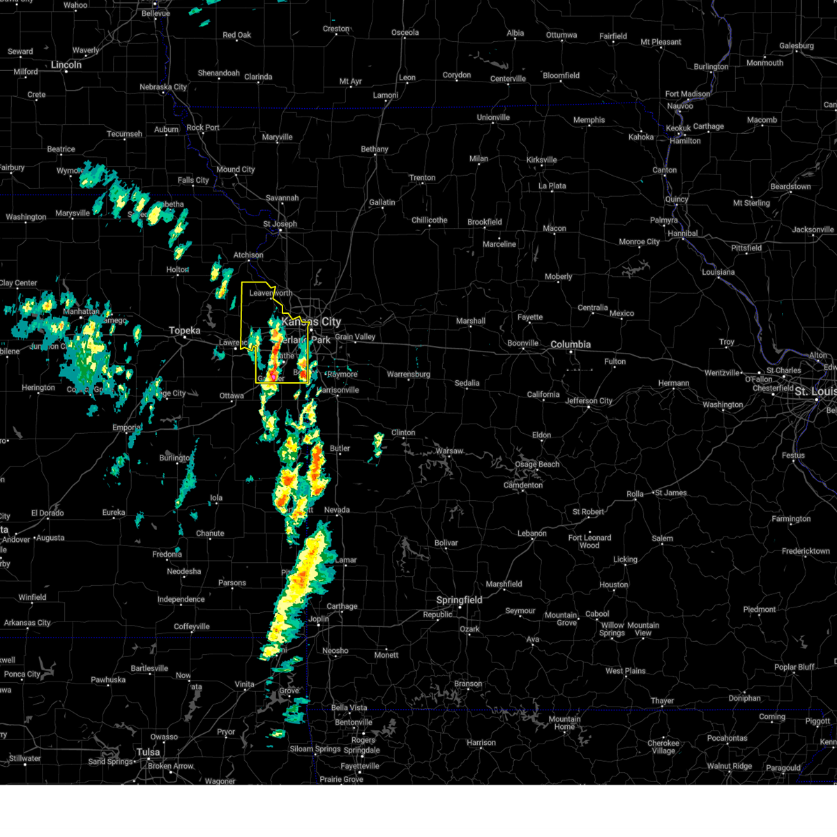 At 253 pm cdt, severe thunderstorms were located along a line extending from near tonganoxie to near merriam to cleveland, moving north at 55 mph (public reported 60 mph wind gusts with these storms). Hazards include 70 mph wind gusts and nickel size hail. Expect considerable tree damage. damage is likely to mobile homes, roofs, and outbuildings. locations impacted include, overland park, roeland park, fort leavenworth, olathe, kansas city kansas, spring hill, merriam, clare, pomeroy, lenexa, lackmans, bonner springs, stillwell, westwood, muncie, edwardsville, linwood, stanley, leawood, and maywood. this includes the following highways, interstate 70 in missouri near mile marker 0. interstate 70 in kansas between mile markers 410 and 423. interstate 35 in kansas between mile markers 202 and 234. interstate 635 between mile markers 0 and 8. interstate 435 between mile markers 0 and 20, and between mile markers 76 and 83. Kansas turnpike between mile markers 206 and 226. At 253 pm cdt, severe thunderstorms were located along a line extending from near tonganoxie to near merriam to cleveland, moving north at 55 mph (public reported 60 mph wind gusts with these storms). Hazards include 70 mph wind gusts and nickel size hail. Expect considerable tree damage. damage is likely to mobile homes, roofs, and outbuildings. locations impacted include, overland park, roeland park, fort leavenworth, olathe, kansas city kansas, spring hill, merriam, clare, pomeroy, lenexa, lackmans, bonner springs, stillwell, westwood, muncie, edwardsville, linwood, stanley, leawood, and maywood. this includes the following highways, interstate 70 in missouri near mile marker 0. interstate 70 in kansas between mile markers 410 and 423. interstate 35 in kansas between mile markers 202 and 234. interstate 635 between mile markers 0 and 8. interstate 435 between mile markers 0 and 20, and between mile markers 76 and 83. Kansas turnpike between mile markers 206 and 226.
|
| 3/14/2025 2:44 PM CDT |
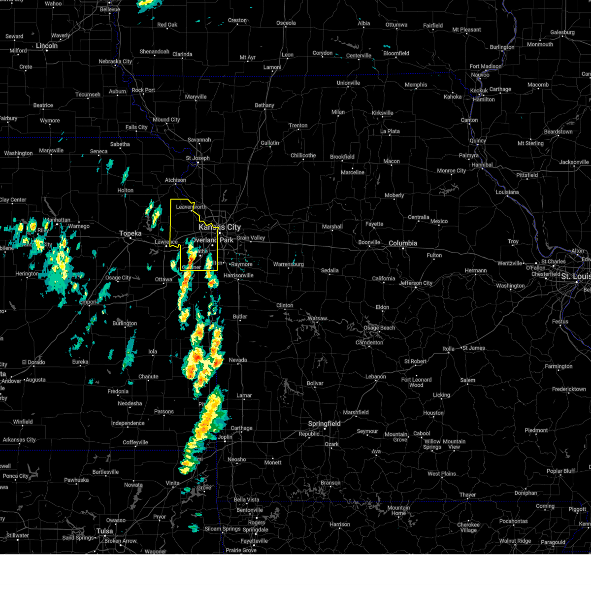 Svreax the national weather service in pleasant hill has issued a * severe thunderstorm warning for, wyandotte county in northeastern kansas, leavenworth county in northeastern kansas, johnson county in east central kansas, * until 330 pm cdt. * at 244 pm cdt, severe thunderstorms were located along a line extending from tonganoxie to olathe to near louisburg, moving northeast at 55 mph (radar indicated). Hazards include 70 mph wind gusts and nickel size hail. Expect considerable tree damage. Damage is likely to mobile homes, roofs, and outbuildings. Svreax the national weather service in pleasant hill has issued a * severe thunderstorm warning for, wyandotte county in northeastern kansas, leavenworth county in northeastern kansas, johnson county in east central kansas, * until 330 pm cdt. * at 244 pm cdt, severe thunderstorms were located along a line extending from tonganoxie to olathe to near louisburg, moving northeast at 55 mph (radar indicated). Hazards include 70 mph wind gusts and nickel size hail. Expect considerable tree damage. Damage is likely to mobile homes, roofs, and outbuildings.
|
| 10/30/2024 7:51 PM CDT |
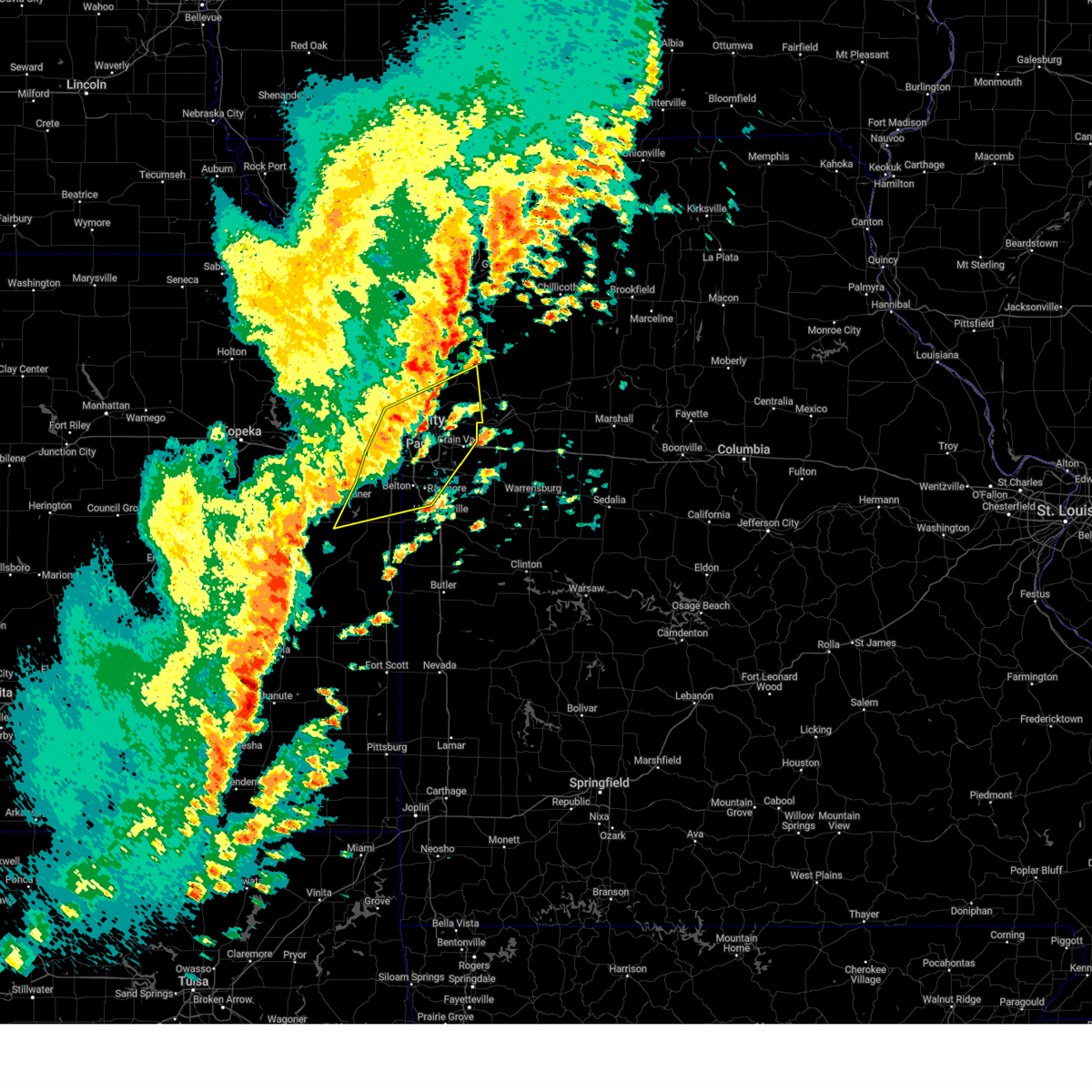 At 751 pm cdt, severe thunderstorms were located along a line extending from near missouri city to near independence to near spring hill, moving northeast at 65 mph (radar indicated). Hazards include 60 mph wind gusts. Expect damage to roofs, siding, and trees. locations impacted include, kansas city, overland park, olathe, independence, lee's summit, shawnee, blue springs, lenexa, leawood, raytown, liberty, gladstone, grandview, belton, prairie village, raymore, gardner, grain valley, excelsior springs, and merriam. this includes the following highways, interstate 70 in missouri between mile markers 0 and 28. interstate 70 in kansas between mile markers 414 and 423. interstate 35 in missouri between mile markers 0 and 22. interstate 35 in kansas between mile markers 206 and 235. interstate 29 between mile markers 0 and 7. interstate 635 between mile markers 0 and 12. interstate 470 between mile markers 0 and 16. Interstate 435 between mile markers 0 and 10, and between mile markers 46 and 83. At 751 pm cdt, severe thunderstorms were located along a line extending from near missouri city to near independence to near spring hill, moving northeast at 65 mph (radar indicated). Hazards include 60 mph wind gusts. Expect damage to roofs, siding, and trees. locations impacted include, kansas city, overland park, olathe, independence, lee's summit, shawnee, blue springs, lenexa, leawood, raytown, liberty, gladstone, grandview, belton, prairie village, raymore, gardner, grain valley, excelsior springs, and merriam. this includes the following highways, interstate 70 in missouri between mile markers 0 and 28. interstate 70 in kansas between mile markers 414 and 423. interstate 35 in missouri between mile markers 0 and 22. interstate 35 in kansas between mile markers 206 and 235. interstate 29 between mile markers 0 and 7. interstate 635 between mile markers 0 and 12. interstate 470 between mile markers 0 and 16. Interstate 435 between mile markers 0 and 10, and between mile markers 46 and 83.
|
| 10/30/2024 7:39 PM CDT | Downed tree limbs and wires near waverly avenue. time estimated from rada in wyandotte county KS, 2.3 miles SSW of Kansas City, KS |
| 10/30/2024 7:37 PM CDT |
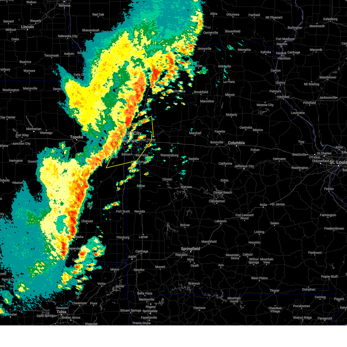 Svreax the national weather service in pleasant hill has issued a * severe thunderstorm warning for, eastern wyandotte county in northeastern kansas, northern miami county in east central kansas, johnson county in east central kansas, northwestern cass county in west central missouri, central clay county in west central missouri, southwestern ray county in west central missouri, southeastern platte county in west central missouri, jackson county in west central missouri, * until 800 pm cdt. * at 736 pm cdt, severe thunderstorms were located along a line extending from near parkville to near overland park to near wellsville, moving northeast at 60 mph (radar indicated). Hazards include 60 mph wind gusts and penny size hail. expect damage to roofs, siding, and trees Svreax the national weather service in pleasant hill has issued a * severe thunderstorm warning for, eastern wyandotte county in northeastern kansas, northern miami county in east central kansas, johnson county in east central kansas, northwestern cass county in west central missouri, central clay county in west central missouri, southwestern ray county in west central missouri, southeastern platte county in west central missouri, jackson county in west central missouri, * until 800 pm cdt. * at 736 pm cdt, severe thunderstorms were located along a line extending from near parkville to near overland park to near wellsville, moving northeast at 60 mph (radar indicated). Hazards include 60 mph wind gusts and penny size hail. expect damage to roofs, siding, and trees
|
| 10/24/2024 9:53 PM CDT |
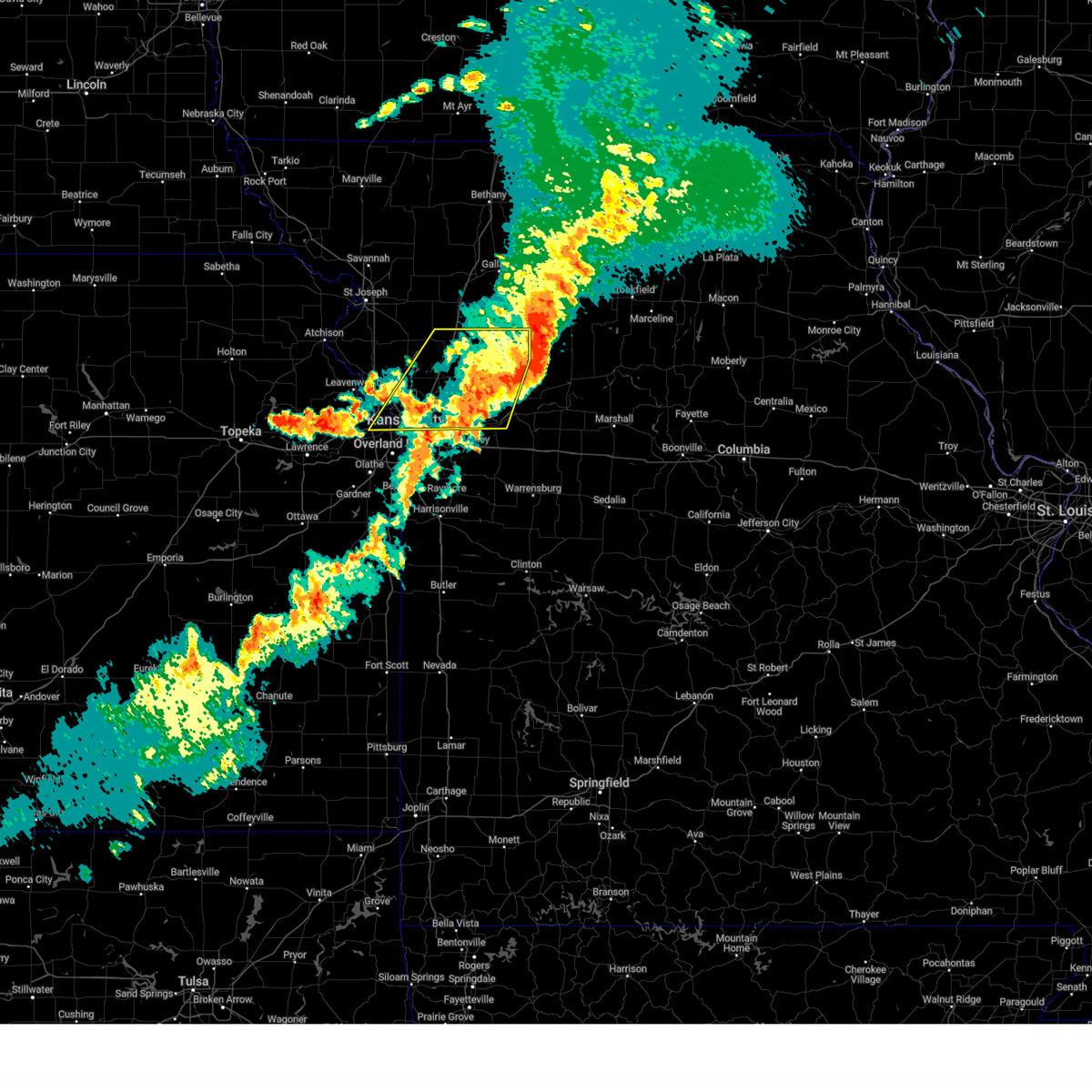 The storms which prompted the warning have weakened below severe limits, and no longer pose an immediate threat to life or property. therefore, the warning will be allowed to expire. however, gusty winds and heavy rain are still possible with these thunderstorms. severe thunderstorm warning 409 is still in effect for portions of ray, carroll, and caldwell counties until 1015pm. The storms which prompted the warning have weakened below severe limits, and no longer pose an immediate threat to life or property. therefore, the warning will be allowed to expire. however, gusty winds and heavy rain are still possible with these thunderstorms. severe thunderstorm warning 409 is still in effect for portions of ray, carroll, and caldwell counties until 1015pm.
|
| 10/24/2024 9:37 PM CDT |
 the severe thunderstorm warning has been cancelled and is no longer in effect the severe thunderstorm warning has been cancelled and is no longer in effect
|
| 10/24/2024 9:37 PM CDT |
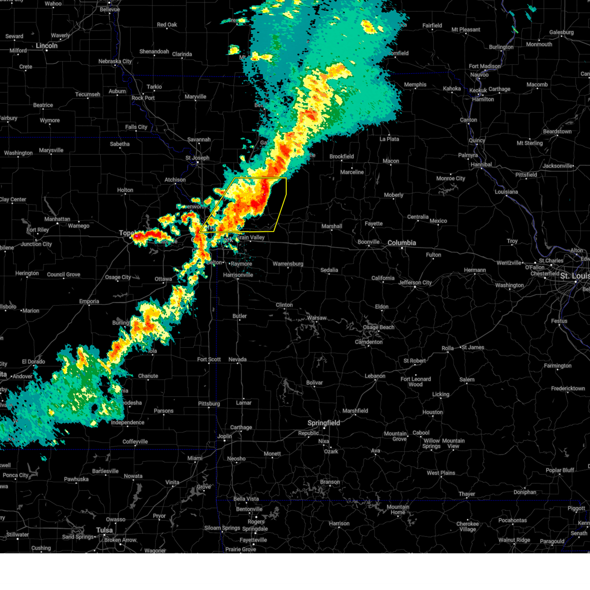 At 936 pm cdt, severe thunderstorms were located along a line extending from cowgill to near richmond to near raytown, moving east at 45 mph (trained weather spotters). Hazards include 60 mph wind gusts and quarter size hail. Hail damage to vehicles is expected. expect wind damage to roofs, siding, and trees. locations impacted include, kansas city, independence, liberty, gladstone, excelsior springs, smithville, kearney, richmond, parkville, lexington, edwardsville, north kansas city, sugar creek, buckner, riverside, lawson, lathrop, weatherby lake, claycomo, and courtney. this includes the following highways, interstate 70 in missouri between mile markers 0 and 2. interstate 70 in kansas between mile markers 411 and 418, and near mile marker 423. interstate 35 in missouri between mile markers 3 and 44. interstate 29 between mile markers 0 and 10. interstate 635 between mile markers 5 and 12. Interstate 435 near mile marker 13, and between mile markers 37 and 59. At 936 pm cdt, severe thunderstorms were located along a line extending from cowgill to near richmond to near raytown, moving east at 45 mph (trained weather spotters). Hazards include 60 mph wind gusts and quarter size hail. Hail damage to vehicles is expected. expect wind damage to roofs, siding, and trees. locations impacted include, kansas city, independence, liberty, gladstone, excelsior springs, smithville, kearney, richmond, parkville, lexington, edwardsville, north kansas city, sugar creek, buckner, riverside, lawson, lathrop, weatherby lake, claycomo, and courtney. this includes the following highways, interstate 70 in missouri between mile markers 0 and 2. interstate 70 in kansas between mile markers 411 and 418, and near mile marker 423. interstate 35 in missouri between mile markers 3 and 44. interstate 29 between mile markers 0 and 10. interstate 635 between mile markers 5 and 12. Interstate 435 near mile marker 13, and between mile markers 37 and 59.
|
| 10/24/2024 9:13 PM CDT |
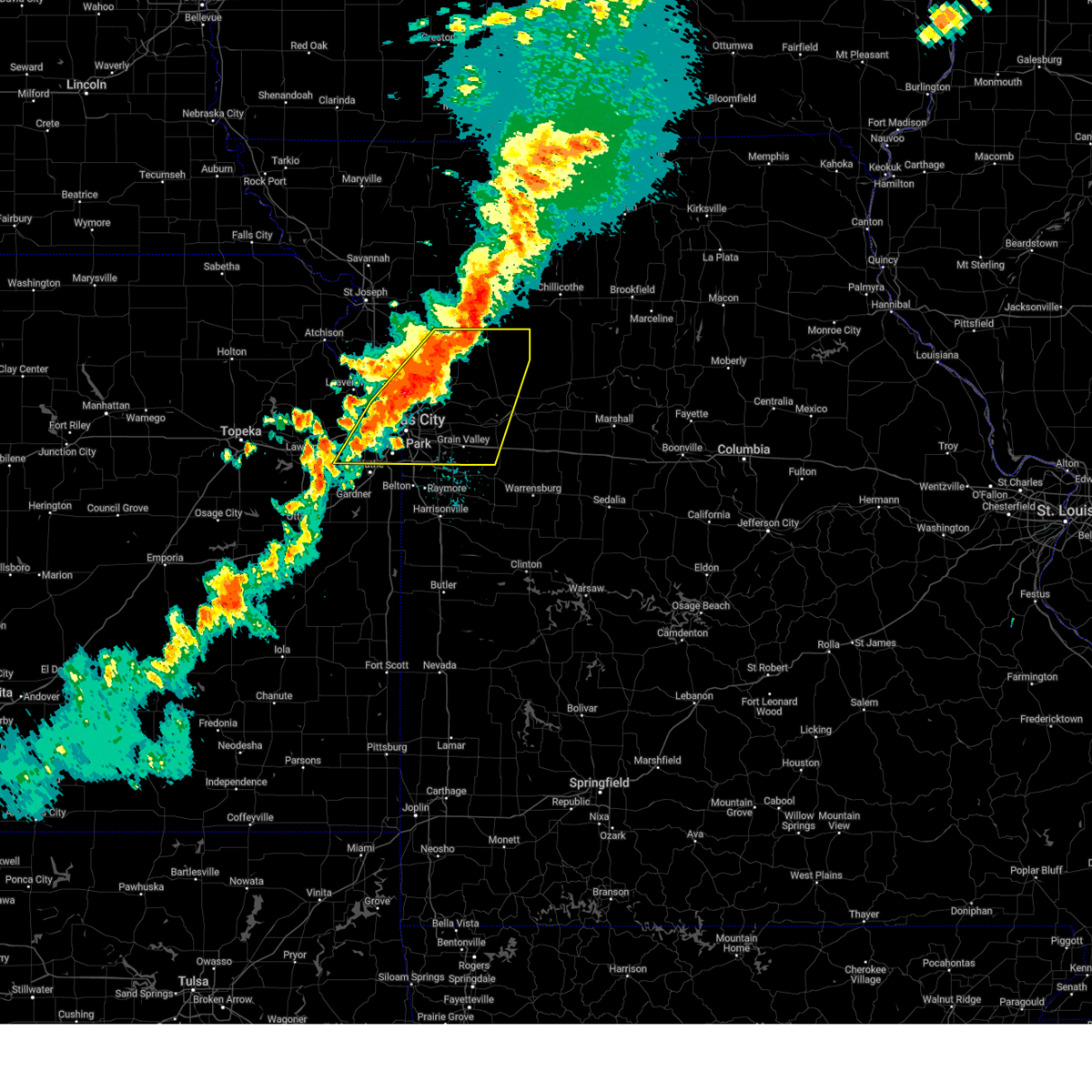 Svreax the national weather service in pleasant hill has issued a * severe thunderstorm warning for, wyandotte county in northeastern kansas, southeastern leavenworth county in northeastern kansas, northern johnson county in east central kansas, southeastern clinton county in northwestern missouri, clay county in west central missouri, ray county in west central missouri, southern caldwell county in north central missouri, southwestern lafayette county in west central missouri, southeastern platte county in west central missouri, jackson county in west central missouri, * until 1000 pm cdt. * at 912 pm cdt, severe thunderstorms were located along a line extending from near polo to glenaire to lenexa, moving east at 50 mph (radar indicated). Hazards include 70 mph wind gusts and quarter size hail. Hail damage to vehicles is expected. expect considerable tree damage. Wind damage is also likely to mobile homes, roofs, and outbuildings. Svreax the national weather service in pleasant hill has issued a * severe thunderstorm warning for, wyandotte county in northeastern kansas, southeastern leavenworth county in northeastern kansas, northern johnson county in east central kansas, southeastern clinton county in northwestern missouri, clay county in west central missouri, ray county in west central missouri, southern caldwell county in north central missouri, southwestern lafayette county in west central missouri, southeastern platte county in west central missouri, jackson county in west central missouri, * until 1000 pm cdt. * at 912 pm cdt, severe thunderstorms were located along a line extending from near polo to glenaire to lenexa, moving east at 50 mph (radar indicated). Hazards include 70 mph wind gusts and quarter size hail. Hail damage to vehicles is expected. expect considerable tree damage. Wind damage is also likely to mobile homes, roofs, and outbuildings.
|
| 10/24/2024 9:01 PM CDT | Downed tree and wires near lyons avenue. time estimated from rada in wyandotte county KS, 0.3 miles ESE of Kansas City, KS |
| 10/24/2024 8:51 PM CDT | Downed tree blocking the road near the intersection of 123rd street and polfer road. time estimated from rada in wyandotte county KS, 8.8 miles SE of Kansas City, KS |
| 10/24/2024 8:37 PM CDT |
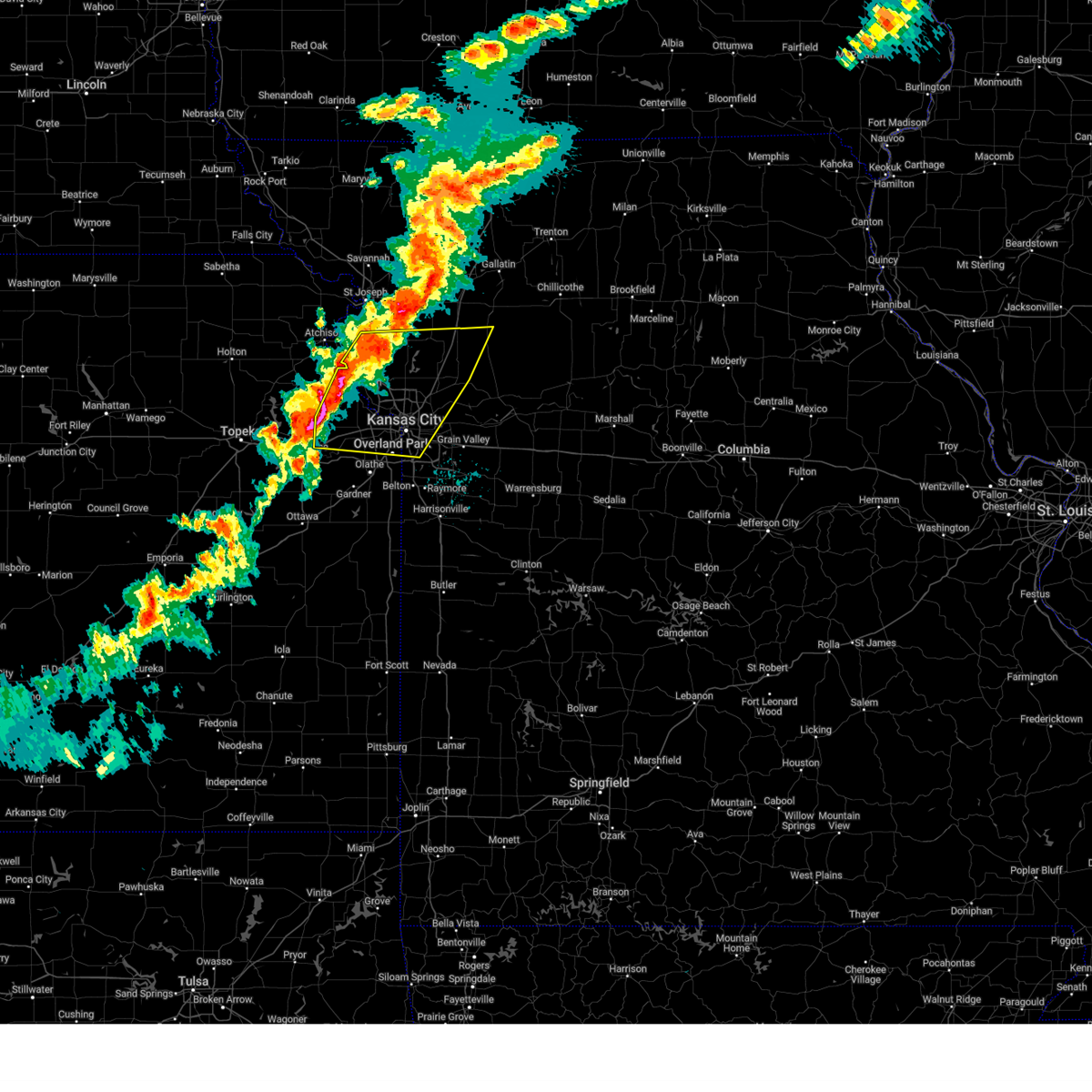 Svreax the national weather service in pleasant hill has issued a * severe thunderstorm warning for, wyandotte county in northeastern kansas, leavenworth county in northeastern kansas, northern johnson county in east central kansas, southeastern buchanan county in northwestern missouri, southern clinton county in northwestern missouri, clay county in west central missouri, northwestern ray county in west central missouri, southwestern caldwell county in north central missouri, platte county in west central missouri, northwestern jackson county in west central missouri, * until 915 pm cdt. * at 836 pm cdt, severe thunderstorms were located along a line extending from near edgerton to near lansing to near pleasant grove, moving east at 45 mph (radar indicated). Hazards include 70 mph wind gusts and quarter size hail. Hail damage to vehicles is expected. expect considerable tree damage. Wind damage is also likely to mobile homes, roofs, and outbuildings. Svreax the national weather service in pleasant hill has issued a * severe thunderstorm warning for, wyandotte county in northeastern kansas, leavenworth county in northeastern kansas, northern johnson county in east central kansas, southeastern buchanan county in northwestern missouri, southern clinton county in northwestern missouri, clay county in west central missouri, northwestern ray county in west central missouri, southwestern caldwell county in north central missouri, platte county in west central missouri, northwestern jackson county in west central missouri, * until 915 pm cdt. * at 836 pm cdt, severe thunderstorms were located along a line extending from near edgerton to near lansing to near pleasant grove, moving east at 45 mph (radar indicated). Hazards include 70 mph wind gusts and quarter size hail. Hail damage to vehicles is expected. expect considerable tree damage. Wind damage is also likely to mobile homes, roofs, and outbuildings.
|
| 8/27/2024 6:41 PM CDT |
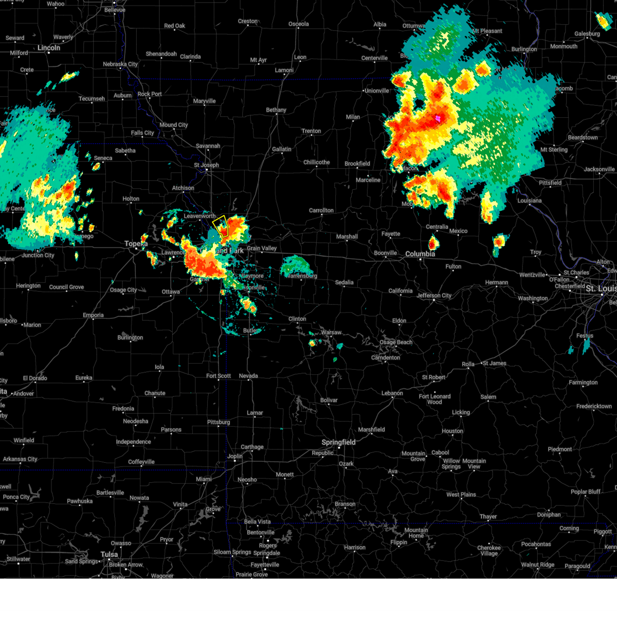 Svreax the national weather service in pleasant hill has issued a * severe thunderstorm warning for, southeastern platte county in west central missouri, * until 715 pm cdt. * at 641 pm cdt, a severe thunderstorm was located over houston lake, or over riverside, moving northwest at 15 mph (radar indicated). Hazards include 60 mph wind gusts and penny size hail. expect damage to roofs, siding, and trees Svreax the national weather service in pleasant hill has issued a * severe thunderstorm warning for, southeastern platte county in west central missouri, * until 715 pm cdt. * at 641 pm cdt, a severe thunderstorm was located over houston lake, or over riverside, moving northwest at 15 mph (radar indicated). Hazards include 60 mph wind gusts and penny size hail. expect damage to roofs, siding, and trees
|
| 8/27/2024 6:18 PM CDT |
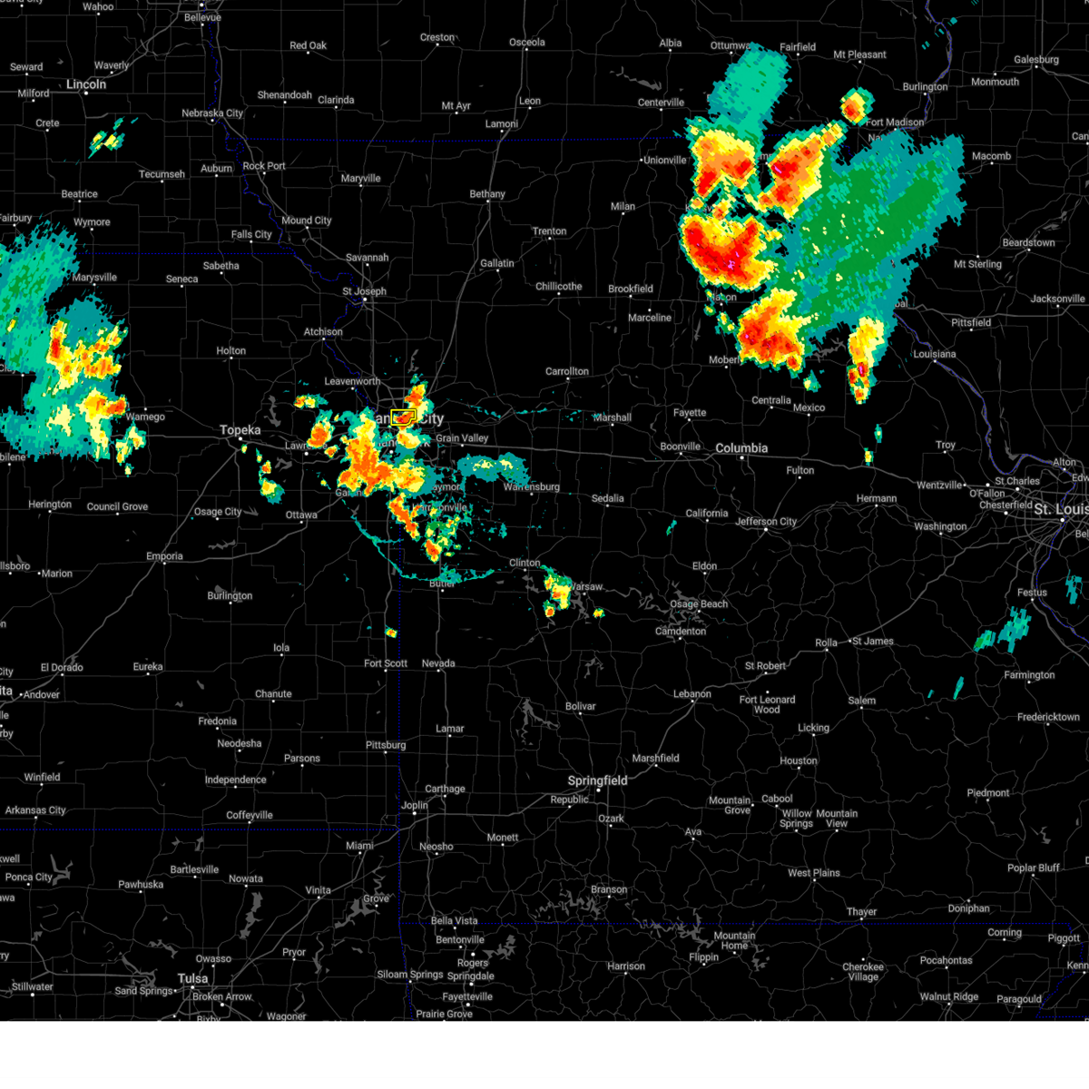 Svreax the national weather service in pleasant hill has issued a * severe thunderstorm warning for, northeastern wyandotte county in northeastern kansas, southwestern clay county in west central missouri, southeastern platte county in west central missouri, * until 645 pm cdt. * at 618 pm cdt, a severe thunderstorm was located over north kansas city, and is nearly stationary (public). Hazards include 60 mph wind gusts and quarter size hail. Hail damage to vehicles is expected. Expect wind damage to roofs, siding, and trees. Svreax the national weather service in pleasant hill has issued a * severe thunderstorm warning for, northeastern wyandotte county in northeastern kansas, southwestern clay county in west central missouri, southeastern platte county in west central missouri, * until 645 pm cdt. * at 618 pm cdt, a severe thunderstorm was located over north kansas city, and is nearly stationary (public). Hazards include 60 mph wind gusts and quarter size hail. Hail damage to vehicles is expected. Expect wind damage to roofs, siding, and trees.
|
| 8/15/2024 12:12 AM CDT | The storms which prompted the warning have moved out of the area. therefore, the warning will be allowed to expire. however, gusty winds are still possible with these thunderstorms. a severe thunderstorm watch remains in effect until 100 am cdt for northeastern kansas, and northwestern and west central missouri. |
| 8/14/2024 11:51 PM CDT | At 1150 pm cdt, severe thunderstorms were located along a line extending from 5 miles east of lathrop to 3 miles north of missouri city to near river bend, moving east at 35 mph (radar indicated). Hazards include 60 mph wind gusts. Expect damage to roofs, siding, and trees. Locations impacted include, kansas city, independence, liberty, gladstone, excelsior springs, smithville, kearney, north kansas city, sugar creek, lawson, plattsburg, lathrop, claycomo, courtney, pleasant valley, trimble, glenaire, holt, avondale, and oakview. |
| 8/14/2024 11:36 PM CDT | At 1136 pm cdt, a severe thunderstorm was located 5 miles north of pleasant valley, moving east at 45 mph (radar indicated). Hazards include 70 mph wind gusts. Expect considerable tree damage. damage is likely to mobile homes, roofs, and outbuildings. Locations impacted include, leavenworth, lansing, parkville, platte city, riverside, weatherby lake, weston, kansas city, lake waukomis, ferrelview, platte woods, northmoor, houston lake, and tracy. |
| 8/14/2024 11:32 PM CDT | At 1132 pm cdt, severe thunderstorms were located along a line extending from near platte city to 4 miles west of parkville to near bonner springs to near linwood, moving east at 40 mph (trained weather spotters). Hazards include 70 mph wind gusts. Expect considerable tree damage. damage is likely to mobile homes, roofs, and outbuildings. Locations impacted include, leavenworth, lansing, and kansas city. |
| 8/14/2024 11:28 PM CDT | Svreax the national weather service in pleasant hill has issued a * severe thunderstorm warning for, east central wyandotte county in northeastern kansas, southern clinton county in northwestern missouri, clay county in west central missouri, northern jackson county in west central missouri, * until 1215 am cdt. * at 1128 pm cdt, severe thunderstorms were located along a line extending from near edgerton to weatherby lake to 3 miles northwest of kansas city, moving east at 50 mph (trained weather spotters). Hazards include 70 mph wind gusts. Expect considerable tree damage. Damage is likely to mobile homes, roofs, and outbuildings. |
| 8/14/2024 11:22 PM CDT | At 1122 pm cdt, severe thunderstorms were located along a line extending from near tracy to near lansing to near tonganoxie to 5 miles northeast of lawrence, moving east at 40 mph (trained weather spotters). Hazards include 70 mph wind gusts. Expect considerable tree damage. damage is likely to mobile homes, roofs, and outbuildings. Locations impacted include, leavenworth, lansing, basehor, kansas city, and easton. |
| 8/14/2024 11:20 PM CDT | Svreax the national weather service in pleasant hill has issued a * severe thunderstorm warning for, northern wyandotte county in northeastern kansas, northeastern leavenworth county in northeastern kansas, platte county in west central missouri, * until 1145 pm cdt. * at 1119 pm cdt, a severe thunderstorm was located near platte city, moving east at 45 mph. this is a destructive storm for platte and northern wyandotte counties (trained weather spotters). Hazards include 80 mph wind gusts. Flying debris will be dangerous to those caught without shelter. mobile homes will be heavily damaged. expect considerable damage to roofs, windows, and vehicles. Extensive tree damage and power outages are likely. |
| 8/14/2024 11:07 PM CDT | At 1107 pm cdt, severe thunderstorms were located along a line extending from 3 miles southeast of lewis and clark village to 4 miles northwest of leavenworth to 5 miles west of lansing to 4 miles north of tonganoxie, moving east at 40 mph (radar indicated). Hazards include 70 mph wind gusts. Expect considerable tree damage. damage is likely to mobile homes, roofs, and outbuildings. Locations impacted include, kansas city, leavenworth, parkville, platte city, riverside, weatherby lake, weston, lake waukomis, edgerton, dearborn, camden point, ferrelview, platte woods, northmoor, houston lake, and tracy. |
| 8/14/2024 11:06 PM CDT | At 1106 pm cdt, severe thunderstorms were located along a line extending from 6 miles northeast of easton to 8 miles north of tonganoxie to 5 miles south of mclouth to lecompton, moving east at 40 mph (radar indicated). Hazards include 70 mph wind gusts. Expect considerable tree damage. damage is likely to mobile homes, roofs, and outbuildings. locations impacted include, leavenworth, lansing, bonner springs, de soto, tonganoxie, basehor, edwardsville, kansas city, linwood, and easton. This includes kansas turnpike between mile markers 207 and 221. |
| 8/14/2024 11:05 PM CDT | Svreax the national weather service in pleasant hill has issued a * severe thunderstorm warning for, northeastern leavenworth county in northeastern kansas, platte county in west central missouri, * until 1145 pm cdt. * at 1105 pm cdt, severe thunderstorms were located along a line extending from 3 miles southeast of lewis and clark village to 4 miles northwest of leavenworth to 5 miles west of lansing to 3 miles north of tonganoxie, moving east at 40 mph (radar indicated). Hazards include 60 mph wind gusts. expect damage to roofs, siding, and trees |
| 8/14/2024 10:55 PM CDT | Svreax the national weather service in pleasant hill has issued a * severe thunderstorm warning for, northwestern wyandotte county in northeastern kansas, leavenworth county in northeastern kansas, south central platte county in west central missouri, * until 1145 pm cdt. * at 1055 pm cdt, severe thunderstorms were located along a line extending from 4 miles north of easton to 3 miles north of mclouth to 4 miles north of williamstown to 4 miles southeast of grantville, moving east at 40 mph (radar indicated). Hazards include 60 mph wind gusts. expect damage to roofs, siding, and trees |
| 7/31/2024 11:39 PM CDT |
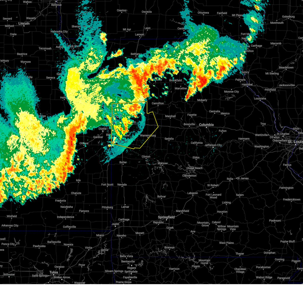 The storms which prompted the warning have weakened below severe limits, and no longer pose an immediate threat to life or property. therefore, the warning will be allowed to expire. however, gusty winds are still possible with these thunderstorms. a severe thunderstorm watch remains in effect until 300 am cdt for northeastern and east central kansas, and central, north central and west central missouri. The storms which prompted the warning have weakened below severe limits, and no longer pose an immediate threat to life or property. therefore, the warning will be allowed to expire. however, gusty winds are still possible with these thunderstorms. a severe thunderstorm watch remains in effect until 300 am cdt for northeastern and east central kansas, and central, north central and west central missouri.
|
| 7/31/2024 11:22 PM CDT |
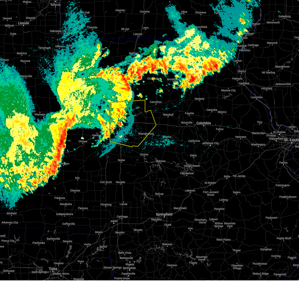 the severe thunderstorm warning has been cancelled and is no longer in effect the severe thunderstorm warning has been cancelled and is no longer in effect
|
| 7/31/2024 11:22 PM CDT |
 At 1121 pm cdt, severe thunderstorms were located along a line extending from near kingston to near wellington to lone jack, moving east at 50 mph (radar indicated). Hazards include 60 mph wind gusts. Expect damage to roofs, siding, and trees. locations impacted include, kansas city, independence, lee's summit, blue springs, leawood, raytown, liberty, gladstone, grandview, belton, prairie village, raymore, warrensburg, grain valley, excelsior springs, harrisonville, smithville, kearney, pleasant hill, and oak grove. this includes the following highways, interstate 70 in missouri between mile markers 1 and 62. interstate 35 in missouri between mile markers 0 and 28. interstate 35 in kansas near mile marker 235. interstate 29 between mile markers 0 and 2. interstate 470 between mile markers 0 and 16. Interstate 435 between mile markers 40 and 75. At 1121 pm cdt, severe thunderstorms were located along a line extending from near kingston to near wellington to lone jack, moving east at 50 mph (radar indicated). Hazards include 60 mph wind gusts. Expect damage to roofs, siding, and trees. locations impacted include, kansas city, independence, lee's summit, blue springs, leawood, raytown, liberty, gladstone, grandview, belton, prairie village, raymore, warrensburg, grain valley, excelsior springs, harrisonville, smithville, kearney, pleasant hill, and oak grove. this includes the following highways, interstate 70 in missouri between mile markers 1 and 62. interstate 35 in missouri between mile markers 0 and 28. interstate 35 in kansas near mile marker 235. interstate 29 between mile markers 0 and 2. interstate 470 between mile markers 0 and 16. Interstate 435 between mile markers 40 and 75.
|
| 7/31/2024 11:04 PM CDT |
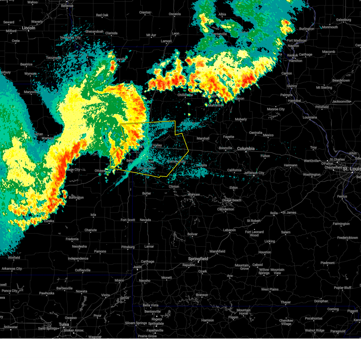 Svreax the national weather service in pleasant hill has issued a * severe thunderstorm warning for, eastern wyandotte county in northeastern kansas, northern miami county in east central kansas, johnson county in east central kansas, cass county in west central missouri, clay county in west central missouri, ray county in west central missouri, lafayette county in west central missouri, southeastern platte county in west central missouri, jackson county in west central missouri, johnson county in west central missouri, * until 1145 pm cdt. * at 1103 pm cdt, severe thunderstorms were located along a line extending from near plattsburg to near independence to near grandview, moving east at 50 mph (radar indicated). Hazards include 60 mph wind gusts. expect damage to roofs, siding, and trees Svreax the national weather service in pleasant hill has issued a * severe thunderstorm warning for, eastern wyandotte county in northeastern kansas, northern miami county in east central kansas, johnson county in east central kansas, cass county in west central missouri, clay county in west central missouri, ray county in west central missouri, lafayette county in west central missouri, southeastern platte county in west central missouri, jackson county in west central missouri, johnson county in west central missouri, * until 1145 pm cdt. * at 1103 pm cdt, severe thunderstorms were located along a line extending from near plattsburg to near independence to near grandview, moving east at 50 mph (radar indicated). Hazards include 60 mph wind gusts. expect damage to roofs, siding, and trees
|
| 7/31/2024 10:50 PM CDT |
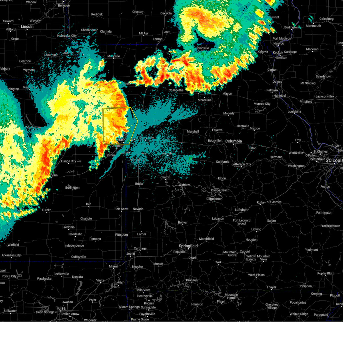 At 1050 pm cdt, a severe thunderstorm was located near smithville, moving east at 55 mph (trained weather spotters). Hazards include 70 mph wind gusts. Expect considerable tree damage. damage is likely to mobile homes, roofs, and outbuildings. locations impacted include, kansas city, overland park, shawnee, lenexa, leavenworth, leawood, liberty, gladstone, prairie village, lansing, merriam, mission, smithville, kearney, bonner springs, de soto, parkville, tonganoxie, platte city, and basehor. this includes the following highways, interstate 70 in missouri between mile markers 0 and 7. interstate 70 in kansas between mile markers 410 and 423. interstate 35 in missouri between mile markers 0 and 24. interstate 35 in kansas between mile markers 223 and 235. interstate 29 between mile markers 0 and 31. interstate 635 between mile markers 0 and 12. interstate 435 between mile markers 2 and 61. Kansas turnpike between mile markers 212 and 226. At 1050 pm cdt, a severe thunderstorm was located near smithville, moving east at 55 mph (trained weather spotters). Hazards include 70 mph wind gusts. Expect considerable tree damage. damage is likely to mobile homes, roofs, and outbuildings. locations impacted include, kansas city, overland park, shawnee, lenexa, leavenworth, leawood, liberty, gladstone, prairie village, lansing, merriam, mission, smithville, kearney, bonner springs, de soto, parkville, tonganoxie, platte city, and basehor. this includes the following highways, interstate 70 in missouri between mile markers 0 and 7. interstate 70 in kansas between mile markers 410 and 423. interstate 35 in missouri between mile markers 0 and 24. interstate 35 in kansas between mile markers 223 and 235. interstate 29 between mile markers 0 and 31. interstate 635 between mile markers 0 and 12. interstate 435 between mile markers 2 and 61. Kansas turnpike between mile markers 212 and 226.
|
| 7/31/2024 10:35 PM CDT | Measured 81 mph wind gus in wyandotte county KS, 4.5 miles SE of Kansas City, KS |
| 7/31/2024 10:34 PM CDT |
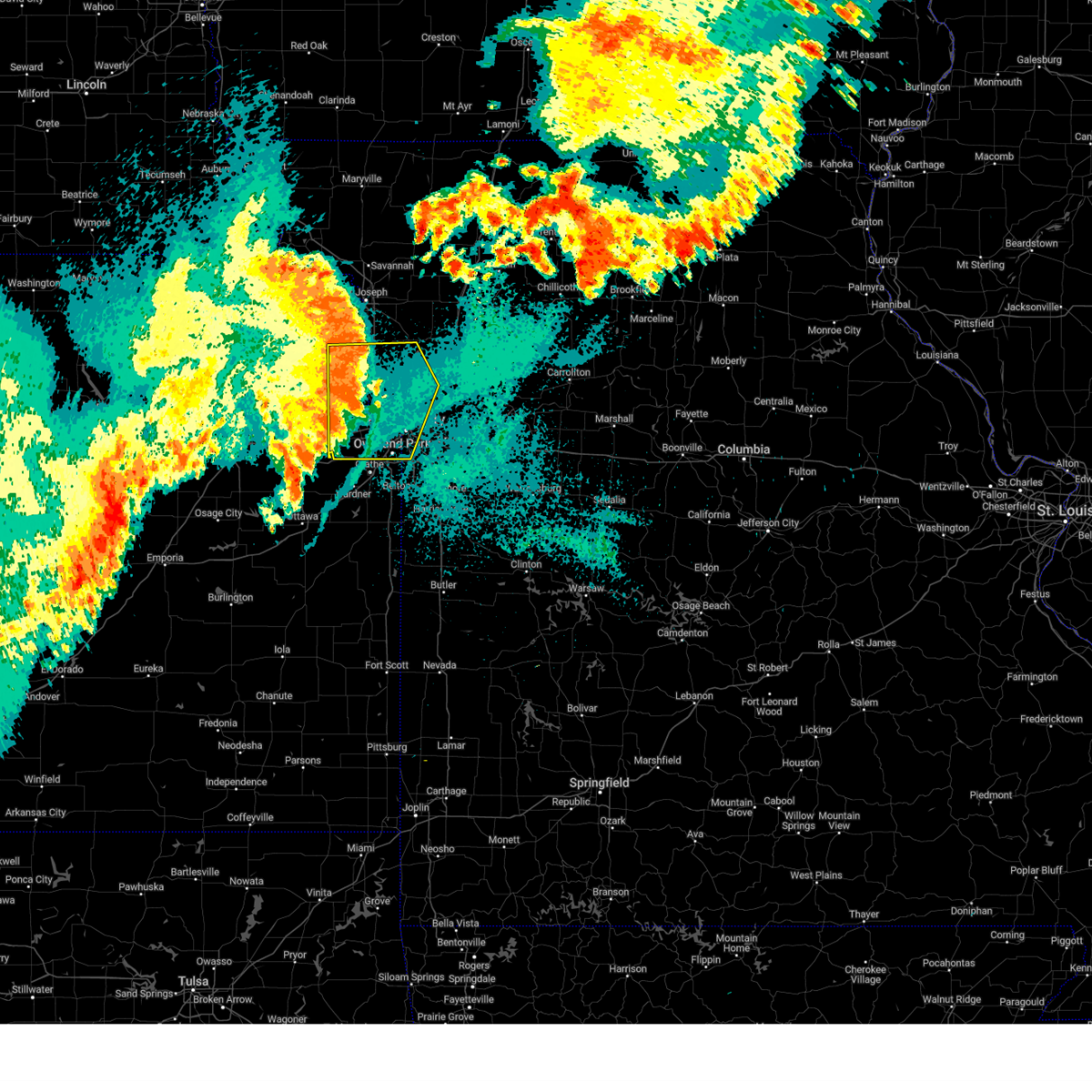 Svreax the national weather service in pleasant hill has issued a * severe thunderstorm warning for, wyandotte county in northeastern kansas, leavenworth county in northeastern kansas, northern johnson county in east central kansas, southeastern atchison county in northeastern kansas, southeastern buchanan county in northwestern missouri, southwestern clinton county in northwestern missouri, western clay county in west central missouri, platte county in west central missouri, northwestern jackson county in west central missouri, * until 1100 pm cdt. * at 1033 pm cdt, a severe thunderstorm was located over tracy, or over platte city, moving east at 55 mph. this is a destructive storm for the kansas city metro (trained weather spotters). Hazards include 80 mph wind gusts. Flying debris will be dangerous to those caught without shelter. mobile homes will be heavily damaged. expect considerable damage to roofs, windows, and vehicles. Extensive tree damage and power outages are likely. Svreax the national weather service in pleasant hill has issued a * severe thunderstorm warning for, wyandotte county in northeastern kansas, leavenworth county in northeastern kansas, northern johnson county in east central kansas, southeastern atchison county in northeastern kansas, southeastern buchanan county in northwestern missouri, southwestern clinton county in northwestern missouri, western clay county in west central missouri, platte county in west central missouri, northwestern jackson county in west central missouri, * until 1100 pm cdt. * at 1033 pm cdt, a severe thunderstorm was located over tracy, or over platte city, moving east at 55 mph. this is a destructive storm for the kansas city metro (trained weather spotters). Hazards include 80 mph wind gusts. Flying debris will be dangerous to those caught without shelter. mobile homes will be heavily damaged. expect considerable damage to roofs, windows, and vehicles. Extensive tree damage and power outages are likely.
|
| 7/31/2024 10:22 PM CDT |
 Svreax the national weather service in pleasant hill has issued a * severe thunderstorm warning for, leavenworth county in northeastern kansas, central atchison county in northeastern kansas, wyandotte county in northeastern kansas, northeastern miami county in east central kansas, doniphan county in northeastern kansas, johnson county in east central kansas, buchanan county in northwestern missouri, southeastern holt county in northwestern missouri, southern andrew county in northwestern missouri, western jackson county in west central missouri, northwestern cass county in west central missouri, clinton county in northwestern missouri, clay county in west central missouri, west central ray county in west central missouri, platte county in west central missouri, western dekalb county in northwestern missouri, * until 1115 pm cdt. * at 1022 pm cdt, severe thunderstorms were located along a line extending from 7 miles northwest of rushville to near lansing to near lawrence, moving east at 55 mph (radar indicated). Hazards include 70 mph wind gusts. Expect considerable tree damage. Damage is likely to mobile homes, roofs, and outbuildings. Svreax the national weather service in pleasant hill has issued a * severe thunderstorm warning for, leavenworth county in northeastern kansas, central atchison county in northeastern kansas, wyandotte county in northeastern kansas, northeastern miami county in east central kansas, doniphan county in northeastern kansas, johnson county in east central kansas, buchanan county in northwestern missouri, southeastern holt county in northwestern missouri, southern andrew county in northwestern missouri, western jackson county in west central missouri, northwestern cass county in west central missouri, clinton county in northwestern missouri, clay county in west central missouri, west central ray county in west central missouri, platte county in west central missouri, western dekalb county in northwestern missouri, * until 1115 pm cdt. * at 1022 pm cdt, severe thunderstorms were located along a line extending from 7 miles northwest of rushville to near lansing to near lawrence, moving east at 55 mph (radar indicated). Hazards include 70 mph wind gusts. Expect considerable tree damage. Damage is likely to mobile homes, roofs, and outbuildings.
|
| 7/31/2024 10:10 PM CDT |
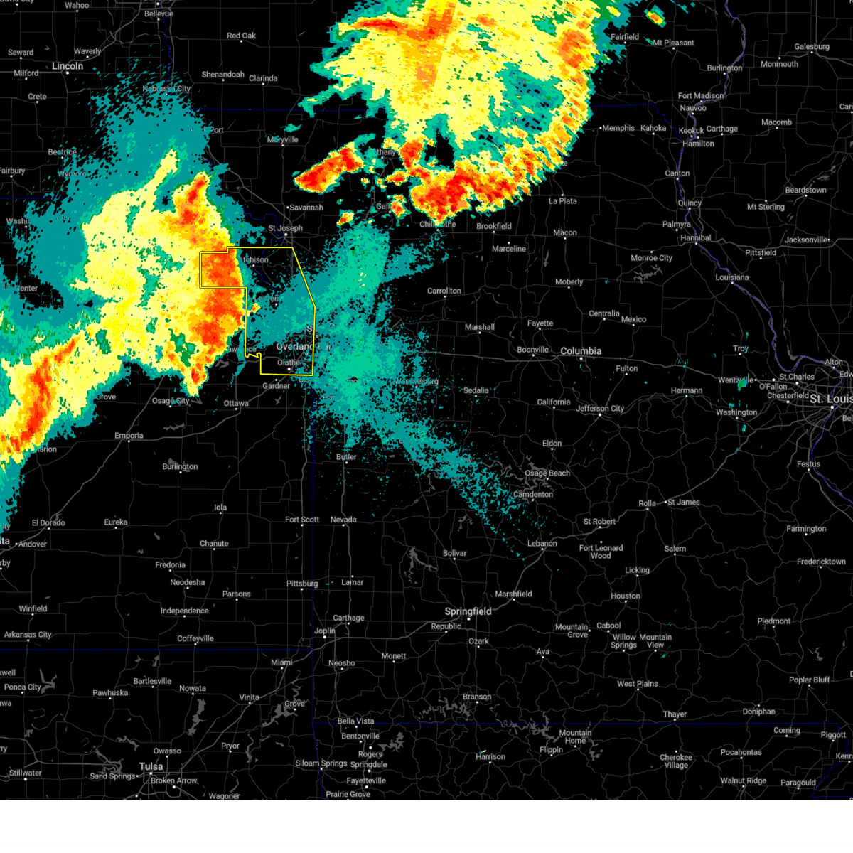 At 1010 pm cdt, a severe thunderstorm was located near lewis and clark village, or 7 miles west of weston, moving east at 55 mph (radar indicated). Hazards include 70 mph wind gusts. Expect considerable tree damage. damage is likely to mobile homes, roofs, and outbuildings. locations impacted include, overland park, olathe, shawnee, lenexa, leavenworth, leawood, prairie village, lansing, atchison, merriam, mission, bonner springs, de soto, parkville, tonganoxie, platte city, basehor, edwardsville, fairway, and mission hills. this includes the following highways, interstate 70 in missouri near mile marker 0. interstate 70 in kansas between mile markers 410 and 423. interstate 35 in kansas between mile markers 215 and 234. interstate 29 between mile markers 4 and 40. interstate 635 between mile markers 0 and 12. interstate 435 between mile markers 0 and 38, and between mile markers 76 and 83. Kansas turnpike between mile markers 206 and 226. At 1010 pm cdt, a severe thunderstorm was located near lewis and clark village, or 7 miles west of weston, moving east at 55 mph (radar indicated). Hazards include 70 mph wind gusts. Expect considerable tree damage. damage is likely to mobile homes, roofs, and outbuildings. locations impacted include, overland park, olathe, shawnee, lenexa, leavenworth, leawood, prairie village, lansing, atchison, merriam, mission, bonner springs, de soto, parkville, tonganoxie, platte city, basehor, edwardsville, fairway, and mission hills. this includes the following highways, interstate 70 in missouri near mile marker 0. interstate 70 in kansas between mile markers 410 and 423. interstate 35 in kansas between mile markers 215 and 234. interstate 29 between mile markers 4 and 40. interstate 635 between mile markers 0 and 12. interstate 435 between mile markers 0 and 38, and between mile markers 76 and 83. Kansas turnpike between mile markers 206 and 226.
|
| 7/31/2024 9:41 PM CDT |
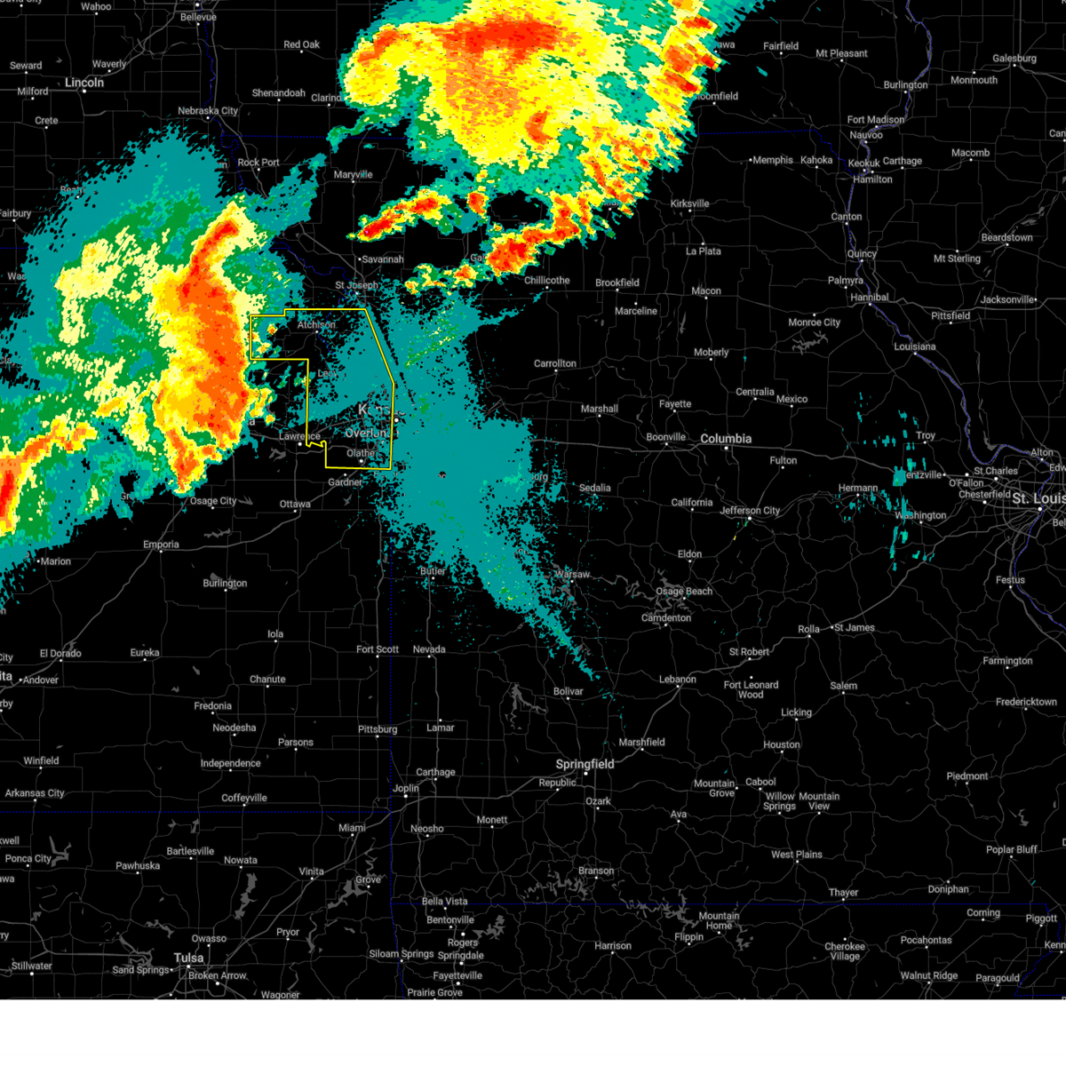 Svreax the national weather service in pleasant hill has issued a * severe thunderstorm warning for, wyandotte county in northeastern kansas, southwestern doniphan county in northeastern kansas, leavenworth county in northeastern kansas, johnson county in east central kansas, atchison county in northeastern kansas, southwestern buchanan county in northwestern missouri, platte county in west central missouri, * until 1030 pm cdt. * at 941 pm cdt, a severe thunderstorm was located near denison, or 7 miles northwest of valley falls, moving east at 55 mph (radar indicated). Hazards include 60 mph wind gusts. expect damage to roofs, siding, and trees Svreax the national weather service in pleasant hill has issued a * severe thunderstorm warning for, wyandotte county in northeastern kansas, southwestern doniphan county in northeastern kansas, leavenworth county in northeastern kansas, johnson county in east central kansas, atchison county in northeastern kansas, southwestern buchanan county in northwestern missouri, platte county in west central missouri, * until 1030 pm cdt. * at 941 pm cdt, a severe thunderstorm was located near denison, or 7 miles northwest of valley falls, moving east at 55 mph (radar indicated). Hazards include 60 mph wind gusts. expect damage to roofs, siding, and trees
|
| 7/25/2024 5:11 PM CDT |
 Svreax the national weather service in pleasant hill has issued a * severe thunderstorm warning for, eastern johnson county in east central kansas, west central jackson county in west central missouri, * until 600 pm cdt. * at 510 pm cdt, a severe thunderstorm was located over mission hills, and is nearly stationary. another severe storm was located over olathe and also nearly stationary (radar indicated). Hazards include 60 mph wind gusts and quarter size hail. Hail damage to vehicles is expected. Expect wind damage to roofs, siding, and trees. Svreax the national weather service in pleasant hill has issued a * severe thunderstorm warning for, eastern johnson county in east central kansas, west central jackson county in west central missouri, * until 600 pm cdt. * at 510 pm cdt, a severe thunderstorm was located over mission hills, and is nearly stationary. another severe storm was located over olathe and also nearly stationary (radar indicated). Hazards include 60 mph wind gusts and quarter size hail. Hail damage to vehicles is expected. Expect wind damage to roofs, siding, and trees.
|
| 7/25/2024 5:06 PM CDT |
 At 506 pm cdt, a severe thunderstorm was located over mission hills, and is nearly stationary (radar indicated). Hazards include 60 mph wind gusts and quarter size hail. Hail damage to vehicles is expected. expect wind damage to roofs, siding, and trees. locations impacted include, kansas city, overland park, shawnee, leawood, prairie village, merriam, mission, fairway, mission hills, westwood, westwood hills, mission woods, countryside, and roeland park. this includes the following highways, interstate 35 in missouri between mile markers 0 and 1. interstate 35 in kansas between mile markers 226 and 229, and between mile markers 231 and 235. interstate 635 near mile marker 0. Interstate 435 between mile markers 63 and 66, and between mile markers 72 and 78. At 506 pm cdt, a severe thunderstorm was located over mission hills, and is nearly stationary (radar indicated). Hazards include 60 mph wind gusts and quarter size hail. Hail damage to vehicles is expected. expect wind damage to roofs, siding, and trees. locations impacted include, kansas city, overland park, shawnee, leawood, prairie village, merriam, mission, fairway, mission hills, westwood, westwood hills, mission woods, countryside, and roeland park. this includes the following highways, interstate 35 in missouri between mile markers 0 and 1. interstate 35 in kansas between mile markers 226 and 229, and between mile markers 231 and 235. interstate 635 near mile marker 0. Interstate 435 between mile markers 63 and 66, and between mile markers 72 and 78.
|
| 7/25/2024 4:58 PM CDT |
 At 458 pm cdt, a severe thunderstorm was located over mission hills, and is nearly stationary (radar indicated). Hazards include 60 mph wind gusts. Expect damage to roofs, siding, and trees. locations impacted include, kansas city, overland park, shawnee, leawood, prairie village, merriam, mission, fairway, mission hills, westwood, westwood hills, mission woods, countryside, and roeland park. this includes the following highways, interstate 35 in missouri between mile markers 0 and 1. interstate 35 in kansas between mile markers 226 and 229, and between mile markers 231 and 235. interstate 635 near mile marker 0. Interstate 435 between mile markers 63 and 66, and between mile markers 72 and 78. At 458 pm cdt, a severe thunderstorm was located over mission hills, and is nearly stationary (radar indicated). Hazards include 60 mph wind gusts. Expect damage to roofs, siding, and trees. locations impacted include, kansas city, overland park, shawnee, leawood, prairie village, merriam, mission, fairway, mission hills, westwood, westwood hills, mission woods, countryside, and roeland park. this includes the following highways, interstate 35 in missouri between mile markers 0 and 1. interstate 35 in kansas between mile markers 226 and 229, and between mile markers 231 and 235. interstate 635 near mile marker 0. Interstate 435 between mile markers 63 and 66, and between mile markers 72 and 78.
|
| 7/25/2024 4:38 PM CDT |
 Svreax the national weather service in pleasant hill has issued a * severe thunderstorm warning for, east central wyandotte county in northeastern kansas, northeastern johnson county in east central kansas, west central jackson county in west central missouri, * until 515 pm cdt. * at 438 pm cdt, a severe thunderstorm was located over mission woods, or over westwood, and is nearly stationary (radar indicated). Hazards include 60 mph wind gusts and penny size hail. expect damage to roofs, siding, and trees Svreax the national weather service in pleasant hill has issued a * severe thunderstorm warning for, east central wyandotte county in northeastern kansas, northeastern johnson county in east central kansas, west central jackson county in west central missouri, * until 515 pm cdt. * at 438 pm cdt, a severe thunderstorm was located over mission woods, or over westwood, and is nearly stationary (radar indicated). Hazards include 60 mph wind gusts and penny size hail. expect damage to roofs, siding, and trees
|
| 7/16/2024 8:56 AM CDT |
 The storms which prompted the warning have weakened below severe limits, and no longer pose an immediate threat to life or property. therefore, the warning will be allowed to expire. however, gusty winds are still possible with these thunderstorms. a severe thunderstorm watch remains in effect until 100 pm cdt for northeastern and east central kansas, and west central missouri. The storms which prompted the warning have weakened below severe limits, and no longer pose an immediate threat to life or property. therefore, the warning will be allowed to expire. however, gusty winds are still possible with these thunderstorms. a severe thunderstorm watch remains in effect until 100 pm cdt for northeastern and east central kansas, and west central missouri.
|
| 7/16/2024 8:48 AM CDT |
 At 848 am cdt, severe thunderstorms were located along a line extending from near liberty to courtney to near raytown to near lee's summit, moving east at 40 mph (radar indicated). Hazards include 60 mph wind gusts. Expect damage to roofs, siding, and trees. locations impacted include, kansas city, overland park, independence, lee's summit, shawnee, blue springs, lenexa, leawood, raytown, liberty, gladstone, grandview, prairie village, excelsior springs, merriam, mission, parkville, greenwood, north kansas city, and fairway. this includes the following highways, interstate 70 in missouri between mile markers 0 and 22. interstate 70 in kansas between mile markers 416 and 423. interstate 35 in missouri between mile markers 0 and 21. interstate 35 in kansas between mile markers 223 and 235. interstate 29 between mile markers 0 and 10. interstate 635 between mile markers 0 and 12. interstate 470 between mile markers 0 and 16. Interstate 435 between mile markers 0 and 6, and between mile markers 46 and 83. At 848 am cdt, severe thunderstorms were located along a line extending from near liberty to courtney to near raytown to near lee's summit, moving east at 40 mph (radar indicated). Hazards include 60 mph wind gusts. Expect damage to roofs, siding, and trees. locations impacted include, kansas city, overland park, independence, lee's summit, shawnee, blue springs, lenexa, leawood, raytown, liberty, gladstone, grandview, prairie village, excelsior springs, merriam, mission, parkville, greenwood, north kansas city, and fairway. this includes the following highways, interstate 70 in missouri between mile markers 0 and 22. interstate 70 in kansas between mile markers 416 and 423. interstate 35 in missouri between mile markers 0 and 21. interstate 35 in kansas between mile markers 223 and 235. interstate 29 between mile markers 0 and 10. interstate 635 between mile markers 0 and 12. interstate 470 between mile markers 0 and 16. Interstate 435 between mile markers 0 and 6, and between mile markers 46 and 83.
|
| 7/16/2024 8:48 AM CDT |
 the severe thunderstorm warning has been cancelled and is no longer in effect the severe thunderstorm warning has been cancelled and is no longer in effect
|
| 7/16/2024 8:40 AM CDT |
 At 840 am cdt, severe thunderstorms were located along a line extending from claycomo to near kansas city to mission hills to overland park, moving southeast at 30 mph (radar indicated). Hazards include 70 mph wind gusts. Expect considerable tree damage. damage is likely to mobile homes, roofs, and outbuildings. locations impacted include, kansas city, overland park, olathe, independence, lee's summit, shawnee, blue springs, lenexa, leawood, raytown, liberty, gladstone, grandview, belton, prairie village, raymore, lansing, excelsior springs, merriam, and mission. this includes the following highways, interstate 70 in missouri between mile markers 0 and 22. interstate 70 in kansas between mile markers 410 and 423. interstate 35 in missouri between mile markers 0 and 21. interstate 35 in kansas between mile markers 216 and 235. interstate 29 between mile markers 0 and 10. interstate 635 between mile markers 0 and 12. interstate 470 between mile markers 0 and 16. interstate 435 between mile markers 0 and 25, and between mile markers 46 and 83. Kansas turnpike between mile markers 224 and 226. At 840 am cdt, severe thunderstorms were located along a line extending from claycomo to near kansas city to mission hills to overland park, moving southeast at 30 mph (radar indicated). Hazards include 70 mph wind gusts. Expect considerable tree damage. damage is likely to mobile homes, roofs, and outbuildings. locations impacted include, kansas city, overland park, olathe, independence, lee's summit, shawnee, blue springs, lenexa, leawood, raytown, liberty, gladstone, grandview, belton, prairie village, raymore, lansing, excelsior springs, merriam, and mission. this includes the following highways, interstate 70 in missouri between mile markers 0 and 22. interstate 70 in kansas between mile markers 410 and 423. interstate 35 in missouri between mile markers 0 and 21. interstate 35 in kansas between mile markers 216 and 235. interstate 29 between mile markers 0 and 10. interstate 635 between mile markers 0 and 12. interstate 470 between mile markers 0 and 16. interstate 435 between mile markers 0 and 25, and between mile markers 46 and 83. Kansas turnpike between mile markers 224 and 226.
|
| 7/16/2024 8:29 AM CDT | Downed tree limbs and wires near francis street. time estimated from rada in wyandotte county KS, 8 miles WNW of Kansas City, KS |
| 7/16/2024 8:27 AM CDT | Downed trees and wires near 32nd street. time estimated from rada in wyandotte county KS, 4.6 miles WSW of Kansas City, KS |
| 7/16/2024 8:24 AM CDT | Downed tree and wires near 45th terrace. time estimated from rada in wyandotte county KS, 4.5 miles SW of Kansas City, KS |
| 7/16/2024 8:21 AM CDT | Downed tree limbs and wires near 71st street. time estimated from rada in wyandotte county KS, 0.8 miles SSW of Kansas City, KS |
| 7/16/2024 8:20 AM CDT |
 Svreax the national weather service in pleasant hill has issued a * severe thunderstorm warning for, wyandotte county in northeastern kansas, southern leavenworth county in northeastern kansas, johnson county in east central kansas, northwestern cass county in west central missouri, southern clay county in west central missouri, southeastern platte county in west central missouri, jackson county in west central missouri, * until 900 am cdt. * at 820 am cdt, severe thunderstorms were located along a line extending from lake waukomis to riverside to near lake quivira to near lenexa, moving southeast at 30 mph (radar indicated). Hazards include 70 mph wind gusts. Expect considerable tree damage. Damage is likely to mobile homes, roofs, and outbuildings. Svreax the national weather service in pleasant hill has issued a * severe thunderstorm warning for, wyandotte county in northeastern kansas, southern leavenworth county in northeastern kansas, johnson county in east central kansas, northwestern cass county in west central missouri, southern clay county in west central missouri, southeastern platte county in west central missouri, jackson county in west central missouri, * until 900 am cdt. * at 820 am cdt, severe thunderstorms were located along a line extending from lake waukomis to riverside to near lake quivira to near lenexa, moving southeast at 30 mph (radar indicated). Hazards include 70 mph wind gusts. Expect considerable tree damage. Damage is likely to mobile homes, roofs, and outbuildings.
|
| 7/16/2024 8:05 AM CDT |
 At 805 am cdt, severe thunderstorms were located along a line extending from near platte city to near lansing to basehor to near linwood to near eudora, moving east at 30 mph (radar indicated). Hazards include 70 mph wind gusts and penny size hail. Expect considerable tree damage. damage is likely to mobile homes, roofs, and outbuildings. locations impacted include, overland park, olathe, shawnee, lenexa, leavenworth, leawood, prairie village, gardner, lansing, merriam, mission, bonner springs, de soto, parkville, tonganoxie, platte city, basehor, edwardsville, fairway, and mission hills. this includes the following highways, interstate 70 in missouri near mile marker 0. interstate 70 in kansas between mile markers 410 and 423. interstate 35 in kansas between mile markers 212 and 234. interstate 29 between mile markers 3 and 23. interstate 635 between mile markers 0 and 12. interstate 435 between mile markers 0 and 39, and between mile markers 76 and 83. Kansas turnpike between mile markers 206 and 226. At 805 am cdt, severe thunderstorms were located along a line extending from near platte city to near lansing to basehor to near linwood to near eudora, moving east at 30 mph (radar indicated). Hazards include 70 mph wind gusts and penny size hail. Expect considerable tree damage. damage is likely to mobile homes, roofs, and outbuildings. locations impacted include, overland park, olathe, shawnee, lenexa, leavenworth, leawood, prairie village, gardner, lansing, merriam, mission, bonner springs, de soto, parkville, tonganoxie, platte city, basehor, edwardsville, fairway, and mission hills. this includes the following highways, interstate 70 in missouri near mile marker 0. interstate 70 in kansas between mile markers 410 and 423. interstate 35 in kansas between mile markers 212 and 234. interstate 29 between mile markers 3 and 23. interstate 635 between mile markers 0 and 12. interstate 435 between mile markers 0 and 39, and between mile markers 76 and 83. Kansas turnpike between mile markers 206 and 226.
|
| 7/16/2024 7:37 AM CDT |
 Svreax the national weather service in pleasant hill has issued a * severe thunderstorm warning for, wyandotte county in northeastern kansas, leavenworth county in northeastern kansas, johnson county in east central kansas, southeastern platte county in west central missouri, * until 830 am cdt. * at 737 am cdt, severe thunderstorms were located along a line extending from near mclouth to near williamstown to lecompton to clinton lake, moving east at 45 mph (radar indicated). Hazards include 70 mph wind gusts and nickel size hail. Expect considerable tree damage. Damage is likely to mobile homes, roofs, and outbuildings. Svreax the national weather service in pleasant hill has issued a * severe thunderstorm warning for, wyandotte county in northeastern kansas, leavenworth county in northeastern kansas, johnson county in east central kansas, southeastern platte county in west central missouri, * until 830 am cdt. * at 737 am cdt, severe thunderstorms were located along a line extending from near mclouth to near williamstown to lecompton to clinton lake, moving east at 45 mph (radar indicated). Hazards include 70 mph wind gusts and nickel size hail. Expect considerable tree damage. Damage is likely to mobile homes, roofs, and outbuildings.
|
| 7/11/2024 11:58 PM CDT |
 The storm which prompted the warning has weakened below severe limits, and no longer poses an immediate threat to life or property. therefore, the warning will be allowed to expire. however, small hail is still possible with this thunderstorm. The storm which prompted the warning has weakened below severe limits, and no longer poses an immediate threat to life or property. therefore, the warning will be allowed to expire. however, small hail is still possible with this thunderstorm.
|
| 7/11/2024 11:14 PM CDT |
 Svreax the national weather service in pleasant hill has issued a * severe thunderstorm warning for, northwestern wyandotte county in northeastern kansas, central leavenworth county in northeastern kansas, south central platte county in west central missouri, * until midnight cdt. * at 1113 pm cdt, a severe thunderstorm was located near lansing, moving southeast at 5 mph (radar indicated). Hazards include golf ball size hail and 60 mph wind gusts. People and animals outdoors will be injured. expect hail damage to roofs, siding, windows, and vehicles. Expect wind damage to roofs, siding, and trees. Svreax the national weather service in pleasant hill has issued a * severe thunderstorm warning for, northwestern wyandotte county in northeastern kansas, central leavenworth county in northeastern kansas, south central platte county in west central missouri, * until midnight cdt. * at 1113 pm cdt, a severe thunderstorm was located near lansing, moving southeast at 5 mph (radar indicated). Hazards include golf ball size hail and 60 mph wind gusts. People and animals outdoors will be injured. expect hail damage to roofs, siding, windows, and vehicles. Expect wind damage to roofs, siding, and trees.
|
| 7/11/2024 11:00 PM CDT | Quarter sized hail reported 9.7 miles ESE of Kansas City, KS, social media photo of measured quarter size hail near intersection of hollingsworth rd and k-7. |
| 7/11/2024 11:00 PM CDT |
 At 1100 pm cdt, a severe thunderstorm was located over lansing, moving southeast at 5 mph (radar indicated). Hazards include golf ball size hail and 60 mph wind gusts. People and animals outdoors will be injured. expect hail damage to roofs, siding, windows, and vehicles. expect wind damage to roofs, siding, and trees. locations impacted include, leavenworth, lansing, bonner springs, parkville, platte city, basehor, edwardsville, weatherby lake, kansas city, ferrelview, tracy, fairmount, farley, fort leavenworth, pomeroy, waldron, stillings, beverly, muncie, and kansas city intl arpt. this includes the following highways, interstate 70 in kansas between mile markers 410 and 416. interstate 29 between mile markers 10 and 23. interstate 435 between mile markers 11 and 36. Kansas turnpike near mile marker 226. At 1100 pm cdt, a severe thunderstorm was located over lansing, moving southeast at 5 mph (radar indicated). Hazards include golf ball size hail and 60 mph wind gusts. People and animals outdoors will be injured. expect hail damage to roofs, siding, windows, and vehicles. expect wind damage to roofs, siding, and trees. locations impacted include, leavenworth, lansing, bonner springs, parkville, platte city, basehor, edwardsville, weatherby lake, kansas city, ferrelview, tracy, fairmount, farley, fort leavenworth, pomeroy, waldron, stillings, beverly, muncie, and kansas city intl arpt. this includes the following highways, interstate 70 in kansas between mile markers 410 and 416. interstate 29 between mile markers 10 and 23. interstate 435 between mile markers 11 and 36. Kansas turnpike near mile marker 226.
|
| 7/11/2024 10:44 PM CDT |
 At 1044 pm cdt, a severe thunderstorm was located over lansing, moving east at 10 mph (radar indicated). Hazards include two inch hail and 60 mph wind gusts. People and animals outdoors will be injured. expect hail damage to roofs, siding, windows, and vehicles. expect wind damage to roofs, siding, and trees. locations impacted include, leavenworth, lansing, bonner springs, parkville, platte city, basehor, edwardsville, weatherby lake, kansas city, ferrelview, tracy, fairmount, farley, fort leavenworth, pomeroy, waldron, stillings, beverly, muncie, and kansas city intl arpt. this includes the following highways, interstate 70 in kansas between mile markers 410 and 416. interstate 29 between mile markers 10 and 23. interstate 435 between mile markers 11 and 36. Kansas turnpike near mile marker 226. At 1044 pm cdt, a severe thunderstorm was located over lansing, moving east at 10 mph (radar indicated). Hazards include two inch hail and 60 mph wind gusts. People and animals outdoors will be injured. expect hail damage to roofs, siding, windows, and vehicles. expect wind damage to roofs, siding, and trees. locations impacted include, leavenworth, lansing, bonner springs, parkville, platte city, basehor, edwardsville, weatherby lake, kansas city, ferrelview, tracy, fairmount, farley, fort leavenworth, pomeroy, waldron, stillings, beverly, muncie, and kansas city intl arpt. this includes the following highways, interstate 70 in kansas between mile markers 410 and 416. interstate 29 between mile markers 10 and 23. interstate 435 between mile markers 11 and 36. Kansas turnpike near mile marker 226.
|
| 7/11/2024 10:40 PM CDT |
 Svreax the national weather service in pleasant hill has issued a * severe thunderstorm warning for, northwestern wyandotte county in northeastern kansas, northeastern leavenworth county in northeastern kansas, southeastern platte county in west central missouri, * until 1115 pm cdt. * at 1039 pm cdt, a severe thunderstorm was located over lansing, moving east at 10 mph (radar indicated). Hazards include ping pong ball size hail and 60 mph wind gusts. People and animals outdoors will be injured. expect hail damage to roofs, siding, windows, and vehicles. Expect wind damage to roofs, siding, and trees. Svreax the national weather service in pleasant hill has issued a * severe thunderstorm warning for, northwestern wyandotte county in northeastern kansas, northeastern leavenworth county in northeastern kansas, southeastern platte county in west central missouri, * until 1115 pm cdt. * at 1039 pm cdt, a severe thunderstorm was located over lansing, moving east at 10 mph (radar indicated). Hazards include ping pong ball size hail and 60 mph wind gusts. People and animals outdoors will be injured. expect hail damage to roofs, siding, windows, and vehicles. Expect wind damage to roofs, siding, and trees.
|
| 7/11/2024 10:22 PM CDT |
 At 1022 pm cdt, a severe thunderstorm was located over lansing, moving southeast at 10 mph (public). Hazards include 60 mph wind gusts and half dollar size hail. Hail damage to vehicles is expected. expect wind damage to roofs, siding, and trees. locations impacted include, leavenworth, lansing, parkville, riverside, weatherby lake, kansas city kansas, kansas city, lake waukomis, platte woods, northmoor, houston lake, fairmount, farley, wolcott, pomeroy, waldron, stillings, beverly hills, kansas city intl arpt, and maywood. this includes the following highways, interstate 70 in missouri near mile marker 0. interstate 70 in kansas between mile markers 413 and 423. interstate 35 in missouri near mile marker 0. interstate 35 in kansas between mile markers 234 and 235. interstate 29 between mile markers 3 and 11. interstate 635 between mile markers 3 and 12. Interstate 435 between mile markers 14 and 28. At 1022 pm cdt, a severe thunderstorm was located over lansing, moving southeast at 10 mph (public). Hazards include 60 mph wind gusts and half dollar size hail. Hail damage to vehicles is expected. expect wind damage to roofs, siding, and trees. locations impacted include, leavenworth, lansing, parkville, riverside, weatherby lake, kansas city kansas, kansas city, lake waukomis, platte woods, northmoor, houston lake, fairmount, farley, wolcott, pomeroy, waldron, stillings, beverly hills, kansas city intl arpt, and maywood. this includes the following highways, interstate 70 in missouri near mile marker 0. interstate 70 in kansas between mile markers 413 and 423. interstate 35 in missouri near mile marker 0. interstate 35 in kansas between mile markers 234 and 235. interstate 29 between mile markers 3 and 11. interstate 635 between mile markers 3 and 12. Interstate 435 between mile markers 14 and 28.
|
| 7/11/2024 10:08 PM CDT |
 Svreax the national weather service in pleasant hill has issued a * severe thunderstorm warning for, wyandotte county in northeastern kansas, northeastern leavenworth county in northeastern kansas, southeastern platte county in west central missouri, * until 1045 pm cdt. * at 1008 pm cdt, a severe thunderstorm was located over lansing, moving southeast at 15 mph (radar indicated). Hazards include ping pong ball size hail and 60 mph wind gusts. People and animals outdoors will be injured. expect hail damage to roofs, siding, windows, and vehicles. Expect wind damage to roofs, siding, and trees. Svreax the national weather service in pleasant hill has issued a * severe thunderstorm warning for, wyandotte county in northeastern kansas, northeastern leavenworth county in northeastern kansas, southeastern platte county in west central missouri, * until 1045 pm cdt. * at 1008 pm cdt, a severe thunderstorm was located over lansing, moving southeast at 15 mph (radar indicated). Hazards include ping pong ball size hail and 60 mph wind gusts. People and animals outdoors will be injured. expect hail damage to roofs, siding, windows, and vehicles. Expect wind damage to roofs, siding, and trees.
|
| 7/11/2024 9:47 PM CDT |
 Svreax the national weather service in pleasant hill has issued a * severe thunderstorm warning for, northern wyandotte county in northeastern kansas, eastern leavenworth county in northeastern kansas, southeastern platte county in west central missouri, * until 1015 pm cdt. * at 946 pm cdt, a severe thunderstorm was located over parkville, moving southeast at 10 mph (radar indicated). Hazards include 60 mph wind gusts and half dollar size hail. Hail damage to vehicles is expected. Expect wind damage to roofs, siding, and trees. Svreax the national weather service in pleasant hill has issued a * severe thunderstorm warning for, northern wyandotte county in northeastern kansas, eastern leavenworth county in northeastern kansas, southeastern platte county in west central missouri, * until 1015 pm cdt. * at 946 pm cdt, a severe thunderstorm was located over parkville, moving southeast at 10 mph (radar indicated). Hazards include 60 mph wind gusts and half dollar size hail. Hail damage to vehicles is expected. Expect wind damage to roofs, siding, and trees.
|
| 7/10/2024 9:11 PM CDT |
 Svreax the national weather service in pleasant hill has issued a * severe thunderstorm warning for, northwestern wyandotte county in northeastern kansas, leavenworth county in northeastern kansas, * until 930 pm cdt. * at 911 pm cdt, a severe thunderstorm was located near tonganoxie, moving south at 45 mph (radar indicated). Hazards include 60 mph wind gusts and quarter size hail. Hail damage to vehicles is expected. Expect wind damage to roofs, siding, and trees. Svreax the national weather service in pleasant hill has issued a * severe thunderstorm warning for, northwestern wyandotte county in northeastern kansas, leavenworth county in northeastern kansas, * until 930 pm cdt. * at 911 pm cdt, a severe thunderstorm was located near tonganoxie, moving south at 45 mph (radar indicated). Hazards include 60 mph wind gusts and quarter size hail. Hail damage to vehicles is expected. Expect wind damage to roofs, siding, and trees.
|
| 7/10/2024 9:00 PM CDT |
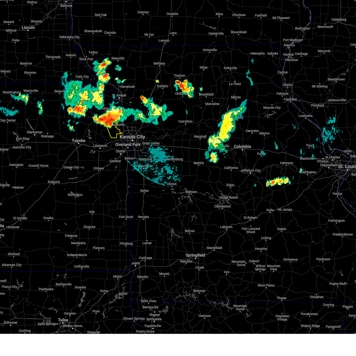 Svreax the national weather service in pleasant hill has issued a * severe thunderstorm warning for, northeastern leavenworth county in northeastern kansas, * until 930 pm cdt. * at 900 pm cdt, a severe thunderstorm was located near leavenworth, moving southeast at 35 mph (radar indicated). Hazards include 60 mph wind gusts and quarter size hail. Hail damage to vehicles is expected. Expect wind damage to roofs, siding, and trees. Svreax the national weather service in pleasant hill has issued a * severe thunderstorm warning for, northeastern leavenworth county in northeastern kansas, * until 930 pm cdt. * at 900 pm cdt, a severe thunderstorm was located near leavenworth, moving southeast at 35 mph (radar indicated). Hazards include 60 mph wind gusts and quarter size hail. Hail damage to vehicles is expected. Expect wind damage to roofs, siding, and trees.
|
| 7/2/2024 7:52 PM CDT |
 the severe thunderstorm warning has been cancelled and is no longer in effect the severe thunderstorm warning has been cancelled and is no longer in effect
|
| 7/2/2024 7:52 PM CDT |
 At 751 pm cdt, a severe thunderstorm was located over liberty, moving east at 50 mph (radar indicated). Hazards include 60 mph wind gusts and quarter size hail. Hail damage to vehicles is expected. expect wind damage to roofs, siding, and trees. locations impacted include, kansas city, independence, liberty, gladstone, excelsior springs, kearney, north kansas city, sugar creek, buckner, claycomo, courtney, pleasant valley, glenaire, avondale, oakview, sibley, missouri city, river bend, mosby, and oakwood park. this includes the following highways, interstate 70 in missouri between mile markers 3 and 4. interstate 35 in missouri between mile markers 4 and 23. interstate 29 between mile markers 0 and 2. Interstate 435 between mile markers 45 and 59. At 751 pm cdt, a severe thunderstorm was located over liberty, moving east at 50 mph (radar indicated). Hazards include 60 mph wind gusts and quarter size hail. Hail damage to vehicles is expected. expect wind damage to roofs, siding, and trees. locations impacted include, kansas city, independence, liberty, gladstone, excelsior springs, kearney, north kansas city, sugar creek, buckner, claycomo, courtney, pleasant valley, glenaire, avondale, oakview, sibley, missouri city, river bend, mosby, and oakwood park. this includes the following highways, interstate 70 in missouri between mile markers 3 and 4. interstate 35 in missouri between mile markers 4 and 23. interstate 29 between mile markers 0 and 2. Interstate 435 between mile markers 45 and 59.
|
| 7/2/2024 7:39 PM CDT |
 the severe thunderstorm warning has been cancelled and is no longer in effect the severe thunderstorm warning has been cancelled and is no longer in effect
|
| 7/2/2024 7:39 PM CDT |
 At 738 pm cdt, a severe thunderstorm was located over riverside, moving east at 40 mph (radar indicated). Hazards include 60 mph wind gusts and quarter size hail. Hail damage to vehicles is expected. expect wind damage to roofs, siding, and trees. locations impacted include, parkville, riverside, weatherby lake, kansas city, beverly hills, muncie, and pomeroy. this includes the following highways, interstate 70 in kansas between mile markers 415 and 419. interstate 635 between mile markers 4 and 8. Interstate 435 between mile markers 20 and 24. At 738 pm cdt, a severe thunderstorm was located over riverside, moving east at 40 mph (radar indicated). Hazards include 60 mph wind gusts and quarter size hail. Hail damage to vehicles is expected. expect wind damage to roofs, siding, and trees. locations impacted include, parkville, riverside, weatherby lake, kansas city, beverly hills, muncie, and pomeroy. this includes the following highways, interstate 70 in kansas between mile markers 415 and 419. interstate 635 between mile markers 4 and 8. Interstate 435 between mile markers 20 and 24.
|
| 7/2/2024 7:34 PM CDT |
 Svreax the national weather service in pleasant hill has issued a * severe thunderstorm warning for, northeastern wyandotte county in northeastern kansas, central clay county in west central missouri, southeastern platte county in west central missouri, northern jackson county in west central missouri, * until 800 pm cdt. * at 733 pm cdt, a severe thunderstorm was located over riverside, moving east at 50 mph (radar indicated). Hazards include 60 mph wind gusts and quarter size hail. Hail damage to vehicles is expected. Expect wind damage to roofs, siding, and trees. Svreax the national weather service in pleasant hill has issued a * severe thunderstorm warning for, northeastern wyandotte county in northeastern kansas, central clay county in west central missouri, southeastern platte county in west central missouri, northern jackson county in west central missouri, * until 800 pm cdt. * at 733 pm cdt, a severe thunderstorm was located over riverside, moving east at 50 mph (radar indicated). Hazards include 60 mph wind gusts and quarter size hail. Hail damage to vehicles is expected. Expect wind damage to roofs, siding, and trees.
|
| 7/2/2024 7:30 PM CDT | Downed trees and wires near edith avenue. time estimated from rada in wyandotte county KS, 4.3 miles SW of Kansas City, KS |
| 7/2/2024 7:24 PM CDT |
 Svreax the national weather service in pleasant hill has issued a * severe thunderstorm warning for, northwestern wyandotte county in northeastern kansas, northeastern leavenworth county in northeastern kansas, southwestern clinton county in northwestern missouri, northwestern clay county in west central missouri, southeastern platte county in west central missouri, * until 815 pm cdt. * at 724 pm cdt, a severe thunderstorm was located over lansing, moving east at 40 mph (radar indicated). Hazards include 60 mph wind gusts. expect damage to roofs, siding, and trees Svreax the national weather service in pleasant hill has issued a * severe thunderstorm warning for, northwestern wyandotte county in northeastern kansas, northeastern leavenworth county in northeastern kansas, southwestern clinton county in northwestern missouri, northwestern clay county in west central missouri, southeastern platte county in west central missouri, * until 815 pm cdt. * at 724 pm cdt, a severe thunderstorm was located over lansing, moving east at 40 mph (radar indicated). Hazards include 60 mph wind gusts. expect damage to roofs, siding, and trees
|
| 7/2/2024 7:20 PM CDT |
 At 719 pm cdt, a severe thunderstorm was located over bonner springs, moving east at 40 mph (radar indicated). Hazards include 60 mph wind gusts and quarter size hail. Hail damage to vehicles is expected. expect wind damage to roofs, siding, and trees. locations impacted include, shawnee, merriam, mission, bonner springs, parkville, basehor, edwardsville, riverside, weatherby lake, lake quivira, kansas city, roeland park, fairmount, wolcott, pomeroy, waldron, holliday, beverly hills, muncie, and maywood. this includes the following highways, interstate 70 in kansas between mile markers 410 and 420. interstate 35 in kansas between mile markers 230 and 232. interstate 635 between mile markers 0 and 8. interstate 435 between mile markers 8 and 24. Kansas turnpike between mile markers 218 and 226. At 719 pm cdt, a severe thunderstorm was located over bonner springs, moving east at 40 mph (radar indicated). Hazards include 60 mph wind gusts and quarter size hail. Hail damage to vehicles is expected. expect wind damage to roofs, siding, and trees. locations impacted include, shawnee, merriam, mission, bonner springs, parkville, basehor, edwardsville, riverside, weatherby lake, lake quivira, kansas city, roeland park, fairmount, wolcott, pomeroy, waldron, holliday, beverly hills, muncie, and maywood. this includes the following highways, interstate 70 in kansas between mile markers 410 and 420. interstate 35 in kansas between mile markers 230 and 232. interstate 635 between mile markers 0 and 8. interstate 435 between mile markers 8 and 24. Kansas turnpike between mile markers 218 and 226.
|
| 7/2/2024 7:09 PM CDT |
 Svreax the national weather service in pleasant hill has issued a * severe thunderstorm warning for, wyandotte county in northeastern kansas, southern leavenworth county in northeastern kansas, northern johnson county in east central kansas, southeastern platte county in west central missouri, * until 745 pm cdt. * at 708 pm cdt, a severe thunderstorm was located near tonganoxie, moving east at 40 mph (radar indicated). Hazards include 60 mph wind gusts and quarter size hail. Hail damage to vehicles is expected. Expect wind damage to roofs, siding, and trees. Svreax the national weather service in pleasant hill has issued a * severe thunderstorm warning for, wyandotte county in northeastern kansas, southern leavenworth county in northeastern kansas, northern johnson county in east central kansas, southeastern platte county in west central missouri, * until 745 pm cdt. * at 708 pm cdt, a severe thunderstorm was located near tonganoxie, moving east at 40 mph (radar indicated). Hazards include 60 mph wind gusts and quarter size hail. Hail damage to vehicles is expected. Expect wind damage to roofs, siding, and trees.
|
| 6/26/2024 4:25 AM CDT |
 At 424 am cdt, severe thunderstorms were located along a line extending from near leawood to 8 miles west of belton to near spring hill to near osawatomie, moving southeast at 55 mph (radar indicated). Hazards include 60 mph wind gusts. Expect damage to roofs, siding, and trees. locations impacted include, kansas city, overland park, olathe, lee's summit, shawnee, lenexa, leawood, raytown, grandview, belton, prairie village, raymore, gardner, merriam, harrisonville, mission, pleasant hill, paola, spring hill, and greenwood. this includes the following highways, interstate 35 in kansas between mile markers 210 and 230. interstate 635 near mile marker 0. interstate 470 between mile markers 0 and 11. Interstate 435 between mile markers 0 and 2, and between mile markers 67 and 83. At 424 am cdt, severe thunderstorms were located along a line extending from near leawood to 8 miles west of belton to near spring hill to near osawatomie, moving southeast at 55 mph (radar indicated). Hazards include 60 mph wind gusts. Expect damage to roofs, siding, and trees. locations impacted include, kansas city, overland park, olathe, lee's summit, shawnee, lenexa, leawood, raytown, grandview, belton, prairie village, raymore, gardner, merriam, harrisonville, mission, pleasant hill, paola, spring hill, and greenwood. this includes the following highways, interstate 35 in kansas between mile markers 210 and 230. interstate 635 near mile marker 0. interstate 470 between mile markers 0 and 11. Interstate 435 between mile markers 0 and 2, and between mile markers 67 and 83.
|
| 6/26/2024 4:12 AM CDT |
 Svreax the national weather service in pleasant hill has issued a * severe thunderstorm warning for, miami county in east central kansas, northeastern linn county in east central kansas, johnson county in east central kansas, cass county in west central missouri, northwestern bates county in west central missouri, southern jackson county in west central missouri, * until 500 am cdt. * at 412 am cdt, severe thunderstorms were located along a line extending from shawnee to near olathe to near edgerton to near wellsville, moving southeast at 50 mph (radar indicated). Hazards include 60 mph wind gusts. expect damage to roofs, siding, and trees Svreax the national weather service in pleasant hill has issued a * severe thunderstorm warning for, miami county in east central kansas, northeastern linn county in east central kansas, johnson county in east central kansas, cass county in west central missouri, northwestern bates county in west central missouri, southern jackson county in west central missouri, * until 500 am cdt. * at 412 am cdt, severe thunderstorms were located along a line extending from shawnee to near olathe to near edgerton to near wellsville, moving southeast at 50 mph (radar indicated). Hazards include 60 mph wind gusts. expect damage to roofs, siding, and trees
|
| 6/26/2024 2:57 AM CDT |
 The storms which prompted the warning have weakened below severe limits, and no longer pose an immediate threat to life or property. therefore, the warning will be allowed to expire. however, gusty winds and heavy rain are still possible with these thunderstorms. a severe thunderstorm watch remains in effect until 700 am cdt for northeastern and east central kansas, and north central and west central missouri. The storms which prompted the warning have weakened below severe limits, and no longer pose an immediate threat to life or property. therefore, the warning will be allowed to expire. however, gusty winds and heavy rain are still possible with these thunderstorms. a severe thunderstorm watch remains in effect until 700 am cdt for northeastern and east central kansas, and north central and west central missouri.
|
| 6/26/2024 2:48 AM CDT |
 At 247 am cdt, severe thunderstorms were located along a line extending from near warrensburg to near lake winnebago to near gardner, moving south at 30 mph. there is a gust front ahead of the main area of thunderstorms and wind gusts of 50 mph have been occurring along and behind that gust front (radar indicated). Hazards include 60 mph wind gusts. Expect damage to roofs, siding, and trees. locations impacted include, kansas city, overland park, olathe, independence, lee's summit, shawnee, blue springs, lenexa, leavenworth, leawood, raytown, liberty, gladstone, grandview, belton, prairie village, raymore, gardner, warrensburg, and grain valley. this includes the following highways, interstate 70 in missouri between mile markers 0 and 49. interstate 70 in kansas between mile markers 410 and 423. interstate 35 in missouri between mile markers 0 and 16. interstate 35 in kansas between mile markers 200 and 235. interstate 29 between mile markers 0 and 10. interstate 635 between mile markers 0 and 12. interstate 470 between mile markers 0 and 16. interstate 435 between mile markers 0 and 26, and between mile markers 48 and 83. Kansas turnpike between mile markers 215 and 226. At 247 am cdt, severe thunderstorms were located along a line extending from near warrensburg to near lake winnebago to near gardner, moving south at 30 mph. there is a gust front ahead of the main area of thunderstorms and wind gusts of 50 mph have been occurring along and behind that gust front (radar indicated). Hazards include 60 mph wind gusts. Expect damage to roofs, siding, and trees. locations impacted include, kansas city, overland park, olathe, independence, lee's summit, shawnee, blue springs, lenexa, leavenworth, leawood, raytown, liberty, gladstone, grandview, belton, prairie village, raymore, gardner, warrensburg, and grain valley. this includes the following highways, interstate 70 in missouri between mile markers 0 and 49. interstate 70 in kansas between mile markers 410 and 423. interstate 35 in missouri between mile markers 0 and 16. interstate 35 in kansas between mile markers 200 and 235. interstate 29 between mile markers 0 and 10. interstate 635 between mile markers 0 and 12. interstate 470 between mile markers 0 and 16. interstate 435 between mile markers 0 and 26, and between mile markers 48 and 83. Kansas turnpike between mile markers 215 and 226.
|
| 6/26/2024 2:31 AM CDT | Downed tree and wires near hubbard road. time estimated from rada in wyandotte county KS, 8.3 miles SE of Kansas City, KS |
| 6/26/2024 2:22 AM CDT |
 Svreax the national weather service in pleasant hill has issued a * severe thunderstorm warning for, wyandotte county in northeastern kansas, northern miami county in east central kansas, central leavenworth county in northeastern kansas, johnson county in east central kansas, cass county in west central missouri, southern clay county in west central missouri, southern ray county in west central missouri, western lafayette county in west central missouri, southeastern platte county in west central missouri, jackson county in west central missouri, johnson county in west central missouri, * until 300 am cdt. * at 221 am cdt, severe thunderstorms were located along a line extending from near mayview to near independence to near lansing, moving south at 50 mph (radar indicated). Hazards include 60 mph wind gusts. expect damage to roofs, siding, and trees Svreax the national weather service in pleasant hill has issued a * severe thunderstorm warning for, wyandotte county in northeastern kansas, northern miami county in east central kansas, central leavenworth county in northeastern kansas, johnson county in east central kansas, cass county in west central missouri, southern clay county in west central missouri, southern ray county in west central missouri, western lafayette county in west central missouri, southeastern platte county in west central missouri, jackson county in west central missouri, johnson county in west central missouri, * until 300 am cdt. * at 221 am cdt, severe thunderstorms were located along a line extending from near mayview to near independence to near lansing, moving south at 50 mph (radar indicated). Hazards include 60 mph wind gusts. expect damage to roofs, siding, and trees
|
| 5/25/2024 10:59 PM CDT |
 Svreax the national weather service in pleasant hill has issued a * severe thunderstorm warning for, eastern wyandotte county in northeastern kansas, johnson county in east central kansas, northwestern jackson county in west central missouri, * until 1130 pm cdt. * at 1059 pm cdt, a severe thunderstorm was located near olathe, moving northeast at 45 mph (radar indicated). Hazards include 60 mph wind gusts. expect damage to roofs, siding, and trees Svreax the national weather service in pleasant hill has issued a * severe thunderstorm warning for, eastern wyandotte county in northeastern kansas, johnson county in east central kansas, northwestern jackson county in west central missouri, * until 1130 pm cdt. * at 1059 pm cdt, a severe thunderstorm was located near olathe, moving northeast at 45 mph (radar indicated). Hazards include 60 mph wind gusts. expect damage to roofs, siding, and trees
|
| 5/21/2024 3:29 PM CDT |
 Svreax the national weather service in pleasant hill has issued a * severe thunderstorm warning for, eastern wyandotte county in northeastern kansas, eastern johnson county in east central kansas, southeastern buchanan county in northwestern missouri, western mercer county in north central missouri, harrison county in north central missouri, jackson county in west central missouri, northwestern johnson county in west central missouri, northern cass county in west central missouri, daviess county in north central missouri, clinton county in northwestern missouri, clay county in west central missouri, gentry county in northwestern missouri, western ray county in west central missouri, caldwell county in north central missouri, southwestern lafayette county in west central missouri, eastern platte county in west central missouri, dekalb county in northwestern missouri, * until 400 pm cdt. * at 329 pm cdt, severe thunderstorms were located along a line extending from near albany to near spring hill, moving east at 65 mph (radar indicated). Hazards include 60 mph wind gusts and quarter size hail. Hail damage to vehicles is expected. Expect wind damage to roofs, siding, and trees. Svreax the national weather service in pleasant hill has issued a * severe thunderstorm warning for, eastern wyandotte county in northeastern kansas, eastern johnson county in east central kansas, southeastern buchanan county in northwestern missouri, western mercer county in north central missouri, harrison county in north central missouri, jackson county in west central missouri, northwestern johnson county in west central missouri, northern cass county in west central missouri, daviess county in north central missouri, clinton county in northwestern missouri, clay county in west central missouri, gentry county in northwestern missouri, western ray county in west central missouri, caldwell county in north central missouri, southwestern lafayette county in west central missouri, eastern platte county in west central missouri, dekalb county in northwestern missouri, * until 400 pm cdt. * at 329 pm cdt, severe thunderstorms were located along a line extending from near albany to near spring hill, moving east at 65 mph (radar indicated). Hazards include 60 mph wind gusts and quarter size hail. Hail damage to vehicles is expected. Expect wind damage to roofs, siding, and trees.
|
| 5/21/2024 2:59 PM CDT |
 Svreax the national weather service in pleasant hill has issued a * severe thunderstorm warning for, northeastern leavenworth county in northeastern kansas, southeastern buchanan county in northwestern missouri, southwestern clinton county in northwestern missouri, northwestern clay county in west central missouri, platte county in west central missouri, * until 330 pm cdt. * at 258 pm cdt, a severe thunderstorm was located over leavenworth, moving northeast at 70 mph (radar indicated). Hazards include 60 mph wind gusts and half dollar size hail. Hail damage to vehicles is expected. Expect wind damage to roofs, siding, and trees. Svreax the national weather service in pleasant hill has issued a * severe thunderstorm warning for, northeastern leavenworth county in northeastern kansas, southeastern buchanan county in northwestern missouri, southwestern clinton county in northwestern missouri, northwestern clay county in west central missouri, platte county in west central missouri, * until 330 pm cdt. * at 258 pm cdt, a severe thunderstorm was located over leavenworth, moving northeast at 70 mph (radar indicated). Hazards include 60 mph wind gusts and half dollar size hail. Hail damage to vehicles is expected. Expect wind damage to roofs, siding, and trees.
|
| 5/19/2024 11:01 PM CDT |
 At 1100 pm cdt, severe thunderstorms were located along a line extending from near effingham to near weston to riverside, moving north at 50 mph (trained weather spotters). Hazards include 60 mph wind gusts. Expect damage to roofs, siding, and trees. locations impacted include, kansas city, leavenworth, liberty, gladstone, lansing, excelsior springs, atchison, smithville, kearney, parkville, platte city, north kansas city, sugar creek, riverside, weatherby lake, weston, claycomo, pleasant valley, lake waukomis, and effingham. this includes the following highways, interstate 35 in missouri between mile markers 5 and 26. interstate 29 between mile markers 0 and 27. interstate 635 between mile markers 9 and 12. Interstate 435 between mile markers 20 and 56. At 1100 pm cdt, severe thunderstorms were located along a line extending from near effingham to near weston to riverside, moving north at 50 mph (trained weather spotters). Hazards include 60 mph wind gusts. Expect damage to roofs, siding, and trees. locations impacted include, kansas city, leavenworth, liberty, gladstone, lansing, excelsior springs, atchison, smithville, kearney, parkville, platte city, north kansas city, sugar creek, riverside, weatherby lake, weston, claycomo, pleasant valley, lake waukomis, and effingham. this includes the following highways, interstate 35 in missouri between mile markers 5 and 26. interstate 29 between mile markers 0 and 27. interstate 635 between mile markers 9 and 12. Interstate 435 between mile markers 20 and 56.
|
| 5/19/2024 10:47 PM CDT | Downed power lines and widespread power outages near lowell avenue. time estimated from rada in wyandotte county KS, 5.7 miles W of Kansas City, KS |
| 5/19/2024 10:47 PM CDT | Widespread power outages in the kck area. thousands of customers without power. time estimated from rada in wyandotte county KS, 5.7 miles W of Kansas City, KS |
| 5/19/2024 10:44 PM CDT | Downed power lines and power outages near 74th street. time estimated from radar and dispatch repor in wyandotte county KS, 0.6 miles NNE of Kansas City, KS |
| 5/19/2024 10:44 PM CDT |
 Svreax the national weather service in pleasant hill has issued a * severe thunderstorm warning for, northern leavenworth county in northeastern kansas, central atchison county in northeastern kansas, clay county in west central missouri, platte county in west central missouri, * until 1130 pm cdt. * at 1044 pm cdt, severe thunderstorms were located along a line extending from near valley falls to near basehor to near merriam, moving north at 50 mph (radar indicated). Hazards include 60 mph wind gusts. expect damage to roofs, siding, and trees Svreax the national weather service in pleasant hill has issued a * severe thunderstorm warning for, northern leavenworth county in northeastern kansas, central atchison county in northeastern kansas, clay county in west central missouri, platte county in west central missouri, * until 1130 pm cdt. * at 1044 pm cdt, severe thunderstorms were located along a line extending from near valley falls to near basehor to near merriam, moving north at 50 mph (radar indicated). Hazards include 60 mph wind gusts. expect damage to roofs, siding, and trees
|
| 5/19/2024 10:19 PM CDT |
 Svreax the national weather service in pleasant hill has issued a * severe thunderstorm warning for, wyandotte county in northeastern kansas, leavenworth county in northeastern kansas, * until 1100 pm cdt. * at 1019 pm cdt, severe thunderstorms were located along a line extending from near perry to 6 miles northwest of edgerton, moving northeast at 55 mph (radar indicated). Hazards include 60 mph wind gusts and quarter size hail. Hail damage to vehicles is expected. Expect wind damage to roofs, siding, and trees. Svreax the national weather service in pleasant hill has issued a * severe thunderstorm warning for, wyandotte county in northeastern kansas, leavenworth county in northeastern kansas, * until 1100 pm cdt. * at 1019 pm cdt, severe thunderstorms were located along a line extending from near perry to 6 miles northwest of edgerton, moving northeast at 55 mph (radar indicated). Hazards include 60 mph wind gusts and quarter size hail. Hail damage to vehicles is expected. Expect wind damage to roofs, siding, and trees.
|
| 5/8/2024 7:26 AM CDT | Golf Ball sized hail reported 6.2 miles W of Kansas City, KS |
| 5/8/2024 7:26 AM CDT |
 At 725 am cdt, a severe thunderstorm was located over pleasant valley, or over claycomo, moving northeast at 55 mph (public). Hazards include golf ball size hail and 60 mph wind gusts. People and animals outdoors will be injured. expect hail damage to roofs, siding, windows, and vehicles. expect wind damage to roofs, siding, and trees. locations impacted include, kansas city, liberty, gladstone, excelsior springs, smithville, kearney, north kansas city, sugar creek, claycomo, pleasant valley, glenaire, avondale, oakview, missouri city, river bend, kansas city downtown, mosby, oakwood park, oakwood, and birmingham. this includes the following highways, interstate 35 in missouri between mile markers 5 and 25. interstate 29 between mile markers 0 and 2. Interstate 435 between mile markers 40 and 56. At 725 am cdt, a severe thunderstorm was located over pleasant valley, or over claycomo, moving northeast at 55 mph (public). Hazards include golf ball size hail and 60 mph wind gusts. People and animals outdoors will be injured. expect hail damage to roofs, siding, windows, and vehicles. expect wind damage to roofs, siding, and trees. locations impacted include, kansas city, liberty, gladstone, excelsior springs, smithville, kearney, north kansas city, sugar creek, claycomo, pleasant valley, glenaire, avondale, oakview, missouri city, river bend, kansas city downtown, mosby, oakwood park, oakwood, and birmingham. this includes the following highways, interstate 35 in missouri between mile markers 5 and 25. interstate 29 between mile markers 0 and 2. Interstate 435 between mile markers 40 and 56.
|
| 5/8/2024 7:26 AM CDT |
 the severe thunderstorm warning has been cancelled and is no longer in effect the severe thunderstorm warning has been cancelled and is no longer in effect
|
| 5/8/2024 7:26 AM CDT |
 The storm which prompted the warning has moved out of the area. therefore, the warning will be allowed to expire. a severe thunderstorm watch remains in effect until 200 pm cdt for northeastern and east central kansas, and west central missouri. The storm which prompted the warning has moved out of the area. therefore, the warning will be allowed to expire. a severe thunderstorm watch remains in effect until 200 pm cdt for northeastern and east central kansas, and west central missouri.
|
| 5/8/2024 7:19 AM CDT | Half Dollar sized hail reported 7.3 miles W of Kansas City, KS, social media report. time estimated from radar. |
| 5/8/2024 7:16 AM CDT | Quarter sized hail reported 6.3 miles W of Kansas City, KS, social media report. |
| 5/8/2024 7:15 AM CDT | Quarter sized hail reported 6.3 miles W of Kansas City, KS, quarter size hail in strawberry hill. |
| 5/8/2024 7:14 AM CDT |
 Svreax the national weather service in pleasant hill has issued a * severe thunderstorm warning for, northeastern wyandotte county in northeastern kansas, clay county in west central missouri, southeastern platte county in west central missouri, northwestern jackson county in west central missouri, * until 745 am cdt. * at 713 am cdt, a severe thunderstorm was located over kansas city downtown, or over kansas city kansas, moving northeast at 55 mph (public golfball size hail). Hazards include golf ball size hail and 60 mph wind gusts. People and animals outdoors will be injured. expect hail damage to roofs, siding, windows, and vehicles. Expect wind damage to roofs, siding, and trees. Svreax the national weather service in pleasant hill has issued a * severe thunderstorm warning for, northeastern wyandotte county in northeastern kansas, clay county in west central missouri, southeastern platte county in west central missouri, northwestern jackson county in west central missouri, * until 745 am cdt. * at 713 am cdt, a severe thunderstorm was located over kansas city downtown, or over kansas city kansas, moving northeast at 55 mph (public golfball size hail). Hazards include golf ball size hail and 60 mph wind gusts. People and animals outdoors will be injured. expect hail damage to roofs, siding, windows, and vehicles. Expect wind damage to roofs, siding, and trees.
|
| 5/8/2024 7:13 AM CDT | Quarter sized hail reported 5.3 miles WNW of Kansas City, KS, social media report. |
| 5/8/2024 7:06 AM CDT |
 At 705 am cdt, a severe thunderstorm was located over prairie village, moving northeast at 55 mph (emergency management reported half dollar size hail). Hazards include 60 mph wind gusts and half dollar size hail. Hail damage to vehicles is expected. expect wind damage to roofs, siding, and trees. locations impacted include, kansas city, overland park, olathe, independence, shawnee, lenexa, leawood, raytown, prairie village, merriam, mission, parkville, edwardsville, north kansas city, fairway, mission hills, sugar creek, westwood, lake quivira, and kansas city kansas. this includes the following highways, interstate 70 in missouri between mile markers 0 and 14. interstate 70 in kansas between mile markers 414 and 423. interstate 35 in missouri between mile markers 0 and 4. interstate 35 in kansas between mile markers 220 and 235. interstate 635 between mile markers 0 and 8. interstate 470 near mile marker 0. Interstate 435 between mile markers 0 and 9, and between mile markers 57 and 83. At 705 am cdt, a severe thunderstorm was located over prairie village, moving northeast at 55 mph (emergency management reported half dollar size hail). Hazards include 60 mph wind gusts and half dollar size hail. Hail damage to vehicles is expected. expect wind damage to roofs, siding, and trees. locations impacted include, kansas city, overland park, olathe, independence, shawnee, lenexa, leawood, raytown, prairie village, merriam, mission, parkville, edwardsville, north kansas city, fairway, mission hills, sugar creek, westwood, lake quivira, and kansas city kansas. this includes the following highways, interstate 70 in missouri between mile markers 0 and 14. interstate 70 in kansas between mile markers 414 and 423. interstate 35 in missouri between mile markers 0 and 4. interstate 35 in kansas between mile markers 220 and 235. interstate 635 between mile markers 0 and 8. interstate 470 near mile marker 0. Interstate 435 between mile markers 0 and 9, and between mile markers 57 and 83.
|
| 5/6/2024 11:23 PM CDT |
 At 1122 pm cdt, severe thunderstorms were located along a line extending from near maysville to near greenwood, moving northeast at 45 mph (public. several reports of wind damage have been received as these storms have passed). Hazards include 70 mph wind gusts and penny size hail. Expect considerable tree damage. damage is likely to mobile homes, roofs, and outbuildings. locations impacted include, kansas city, independence, lee's summit, blue springs, leawood, raytown, liberty, gladstone, grandview, prairie village, grain valley, excelsior springs, cameron, smithville, kearney, greenwood, north kansas city, mission hills, sugar creek, and buckner. this includes the following highways, interstate 70 in missouri between mile markers 1 and 29. interstate 35 in missouri between mile markers 0 and 65. interstate 35 in kansas near mile marker 235. interstate 29 between mile markers 0 and 2. interstate 470 between mile markers 0 and 16. Interstate 435 between mile markers 40 and 75. At 1122 pm cdt, severe thunderstorms were located along a line extending from near maysville to near greenwood, moving northeast at 45 mph (public. several reports of wind damage have been received as these storms have passed). Hazards include 70 mph wind gusts and penny size hail. Expect considerable tree damage. damage is likely to mobile homes, roofs, and outbuildings. locations impacted include, kansas city, independence, lee's summit, blue springs, leawood, raytown, liberty, gladstone, grandview, prairie village, grain valley, excelsior springs, cameron, smithville, kearney, greenwood, north kansas city, mission hills, sugar creek, and buckner. this includes the following highways, interstate 70 in missouri between mile markers 1 and 29. interstate 35 in missouri between mile markers 0 and 65. interstate 35 in kansas near mile marker 235. interstate 29 between mile markers 0 and 2. interstate 470 between mile markers 0 and 16. Interstate 435 between mile markers 40 and 75.
|
| 5/6/2024 11:15 PM CDT |
 The storms which prompted the warning have moved out of the area. therefore, the warning has been allowed to expire. however, heavy rain is still possible with these thunderstorms. a tornado watch remains in effect until 400 am cdt for northeastern and east central kansas, and northwestern and west central missouri. to report severe weather, contact your nearest law enforcement agency. they will relay your report to the national weather service pleasant hill. The storms which prompted the warning have moved out of the area. therefore, the warning has been allowed to expire. however, heavy rain is still possible with these thunderstorms. a tornado watch remains in effect until 400 am cdt for northeastern and east central kansas, and northwestern and west central missouri. to report severe weather, contact your nearest law enforcement agency. they will relay your report to the national weather service pleasant hill.
|
| 5/6/2024 10:55 PM CDT | Downed tree and wires near greeley avenue. time estimated from rada in wyandotte county KS, 5.6 miles WSW of Kansas City, KS |
| 5/6/2024 10:52 PM CDT |
 Svreax the national weather service in pleasant hill has issued a * severe thunderstorm warning for, southwestern daviess county in north central missouri, clinton county in northwestern missouri, clay county in west central missouri, western ray county in west central missouri, western caldwell county in north central missouri, southeastern dekalb county in northwestern missouri, jackson county in west central missouri, * until 1145 pm cdt. * at 1051 pm cdt, severe thunderstorms were located along a line extending from near stewartsville to near spring hill, moving northeast at 50 mph (public. several reports of power outages have been received from kansas city, kansas). Hazards include 60 mph wind gusts and penny size hail. expect damage to roofs, siding, and trees Svreax the national weather service in pleasant hill has issued a * severe thunderstorm warning for, southwestern daviess county in north central missouri, clinton county in northwestern missouri, clay county in west central missouri, western ray county in west central missouri, western caldwell county in north central missouri, southeastern dekalb county in northwestern missouri, jackson county in west central missouri, * until 1145 pm cdt. * at 1051 pm cdt, severe thunderstorms were located along a line extending from near stewartsville to near spring hill, moving northeast at 50 mph (public. several reports of power outages have been received from kansas city, kansas). Hazards include 60 mph wind gusts and penny size hail. expect damage to roofs, siding, and trees
|
| 5/6/2024 10:49 PM CDT | Multiple reports of downed tree limbs and wires in the muncie area. time estimated from rada in wyandotte county KS, 1.7 miles SSE of Kansas City, KS |
| 5/6/2024 10:33 PM CDT | Downed tree and wires near hollingsworth road. time estimated from rada in wyandotte county KS, 9.6 miles SE of Kansas City, KS |
| 5/6/2024 10:33 PM CDT |
 At 1033 pm cdt, severe thunderstorms were located along a line extending from camden point to near edgerton, moving northeast at 40 mph (radar indicated). Hazards include 60 mph wind gusts and penny size hail. Expect damage to roofs, siding, and trees. locations impacted include, overland park, olathe, shawnee, lenexa, leavenworth, leawood, prairie village, gardner, lansing, merriam, mission, bonner springs, de soto, parkville, spring hill, tonganoxie, platte city, basehor, edwardsville, and fairway. this includes the following highways, interstate 70 in missouri near mile marker 0. interstate 70 in kansas between mile markers 410 and 423. interstate 35 in missouri near mile marker 0. interstate 35 in kansas between mile markers 202 and 235. interstate 29 between mile markers 4 and 24. interstate 635 between mile markers 0 and 12. interstate 435 between mile markers 0 and 39, and between mile markers 76 and 83. Kansas turnpike between mile markers 206 and 226. At 1033 pm cdt, severe thunderstorms were located along a line extending from camden point to near edgerton, moving northeast at 40 mph (radar indicated). Hazards include 60 mph wind gusts and penny size hail. Expect damage to roofs, siding, and trees. locations impacted include, overland park, olathe, shawnee, lenexa, leavenworth, leawood, prairie village, gardner, lansing, merriam, mission, bonner springs, de soto, parkville, spring hill, tonganoxie, platte city, basehor, edwardsville, and fairway. this includes the following highways, interstate 70 in missouri near mile marker 0. interstate 70 in kansas between mile markers 410 and 423. interstate 35 in missouri near mile marker 0. interstate 35 in kansas between mile markers 202 and 235. interstate 29 between mile markers 4 and 24. interstate 635 between mile markers 0 and 12. interstate 435 between mile markers 0 and 39, and between mile markers 76 and 83. Kansas turnpike between mile markers 206 and 226.
|
| 5/6/2024 10:13 PM CDT |
 Svreax the national weather service in pleasant hill has issued a * severe thunderstorm warning for, wyandotte county in northeastern kansas, leavenworth county in northeastern kansas, johnson county in east central kansas, platte county in west central missouri, * until 1115 pm cdt. * at 1013 pm cdt, severe thunderstorms were located along a line extending from platte city to near ottawa, moving northeast at 50 mph (radar indicated). Hazards include 60 mph wind gusts and penny size hail. expect damage to roofs, siding, and trees Svreax the national weather service in pleasant hill has issued a * severe thunderstorm warning for, wyandotte county in northeastern kansas, leavenworth county in northeastern kansas, johnson county in east central kansas, platte county in west central missouri, * until 1115 pm cdt. * at 1013 pm cdt, severe thunderstorms were located along a line extending from platte city to near ottawa, moving northeast at 50 mph (radar indicated). Hazards include 60 mph wind gusts and penny size hail. expect damage to roofs, siding, and trees
|
| 4/30/2024 8:23 PM CDT |
 The storm which prompted the warning has weakened below severe limits, and no longer poses an immediate threat to life or property. therefore, the warning will be allowed to expire. however, gusty winds and heavy rain are still possible with this thunderstorm. a severe thunderstorm watch remains in effect until midnight cdt for northeastern and east central kansas, and west central missouri. The storm which prompted the warning has weakened below severe limits, and no longer poses an immediate threat to life or property. therefore, the warning will be allowed to expire. however, gusty winds and heavy rain are still possible with this thunderstorm. a severe thunderstorm watch remains in effect until midnight cdt for northeastern and east central kansas, and west central missouri.
|
| 4/30/2024 8:09 PM CDT |
 At 808 pm cdt, a severe thunderstorm was located over shawnee, moving east at 30 mph (radar indicated). Hazards include 60 mph wind gusts and penny size hail. Expect damage to roofs, siding, and trees. locations impacted include, kansas city, overland park, olathe, independence, shawnee, lenexa, leawood, grandview, prairie village, merriam, mission, bonner springs, edwardsville, north kansas city, fairway, mission hills, westwood, lake quivira, kansas city kansas, and avondale. this includes the following highways, interstate 70 in missouri between mile markers 0 and 8. interstate 70 in kansas between mile markers 416 and 423. interstate 35 in missouri between mile markers 0 and 6. interstate 35 in kansas between mile markers 214 and 235. interstate 635 between mile markers 0 and 5. interstate 470 between mile markers 0 and 2. Interstate 435 between mile markers 0 and 11, and between mile markers 55 and 83. At 808 pm cdt, a severe thunderstorm was located over shawnee, moving east at 30 mph (radar indicated). Hazards include 60 mph wind gusts and penny size hail. Expect damage to roofs, siding, and trees. locations impacted include, kansas city, overland park, olathe, independence, shawnee, lenexa, leawood, grandview, prairie village, merriam, mission, bonner springs, edwardsville, north kansas city, fairway, mission hills, westwood, lake quivira, kansas city kansas, and avondale. this includes the following highways, interstate 70 in missouri between mile markers 0 and 8. interstate 70 in kansas between mile markers 416 and 423. interstate 35 in missouri between mile markers 0 and 6. interstate 35 in kansas between mile markers 214 and 235. interstate 635 between mile markers 0 and 5. interstate 470 between mile markers 0 and 2. Interstate 435 between mile markers 0 and 11, and between mile markers 55 and 83.
|
| 4/30/2024 8:09 PM CDT |
 the severe thunderstorm warning has been cancelled and is no longer in effect the severe thunderstorm warning has been cancelled and is no longer in effect
|
| 4/30/2024 8:08 PM CDT | Downed power lines and power outages near crest drive. time estimated from rada in wyandotte county KS, 4.5 miles NW of Kansas City, KS |
| 4/30/2024 7:57 PM CDT | Downed power lines and power outages near parallel parkway. time estimated from rada in wyandotte county KS, 2.3 miles SSW of Kansas City, KS |
| 4/30/2024 7:50 PM CDT | Downed power lines and power outages near wolcott drive. time estimated from rada in leavenworth county KS, 8.1 miles SSE of Kansas City, KS |
| 4/30/2024 7:50 PM CDT |
 At 749 pm cdt, severe thunderstorms were located along a line extending from near lansing to near de soto, moving east at 40 mph (emergency management. a 56 mph wind gust was observed at 99th and leavenworth road at 745 pm). Hazards include 60 mph wind gusts and quarter size hail. Hail damage to vehicles is expected. expect wind damage to roofs, siding, and trees. locations impacted include, kansas city, overland park, olathe, independence, shawnee, lenexa, leawood, liberty, gladstone, grandview, prairie village, gardner, lansing, merriam, mission, smithville, bonner springs, de soto, parkville, and tonganoxie. this includes the following highways, interstate 70 in missouri between mile markers 0 and 8. interstate 70 in kansas between mile markers 410 and 423. interstate 35 in missouri between mile markers 0 and 18. interstate 35 in kansas between mile markers 215 and 235. interstate 29 between mile markers 0 and 13. interstate 635 between mile markers 0 and 12. interstate 470 between mile markers 0 and 2. interstate 435 between mile markers 0 and 26, and between mile markers 35 and 83. Kansas turnpike between mile markers 206 and 226. At 749 pm cdt, severe thunderstorms were located along a line extending from near lansing to near de soto, moving east at 40 mph (emergency management. a 56 mph wind gust was observed at 99th and leavenworth road at 745 pm). Hazards include 60 mph wind gusts and quarter size hail. Hail damage to vehicles is expected. expect wind damage to roofs, siding, and trees. locations impacted include, kansas city, overland park, olathe, independence, shawnee, lenexa, leawood, liberty, gladstone, grandview, prairie village, gardner, lansing, merriam, mission, smithville, bonner springs, de soto, parkville, and tonganoxie. this includes the following highways, interstate 70 in missouri between mile markers 0 and 8. interstate 70 in kansas between mile markers 410 and 423. interstate 35 in missouri between mile markers 0 and 18. interstate 35 in kansas between mile markers 215 and 235. interstate 29 between mile markers 0 and 13. interstate 635 between mile markers 0 and 12. interstate 470 between mile markers 0 and 2. interstate 435 between mile markers 0 and 26, and between mile markers 35 and 83. Kansas turnpike between mile markers 206 and 226.
|
| 4/30/2024 7:38 PM CDT |
 Svreax the national weather service in pleasant hill has issued a * severe thunderstorm warning for, wyandotte county in northeastern kansas, southern leavenworth county in northeastern kansas, johnson county in east central kansas, western clay county in west central missouri, southeastern platte county in west central missouri, western jackson county in west central missouri, * until 830 pm cdt. * at 737 pm cdt, severe thunderstorms were located along a line extending from near lansing to near eudora, moving east at 40 mph (public). Hazards include 60 mph wind gusts and quarter size hail. Hail damage to vehicles is expected. Expect wind damage to roofs, siding, and trees. Svreax the national weather service in pleasant hill has issued a * severe thunderstorm warning for, wyandotte county in northeastern kansas, southern leavenworth county in northeastern kansas, johnson county in east central kansas, western clay county in west central missouri, southeastern platte county in west central missouri, western jackson county in west central missouri, * until 830 pm cdt. * at 737 pm cdt, severe thunderstorms were located along a line extending from near lansing to near eudora, moving east at 40 mph (public). Hazards include 60 mph wind gusts and quarter size hail. Hail damage to vehicles is expected. Expect wind damage to roofs, siding, and trees.
|
| 4/30/2024 7:32 PM CDT |
 At 731 pm cdt, a severe thunderstorm was located over basehor, moving east at 45 mph (public. quarter size hail was reported in tonganoxie at 729 pm). Hazards include 60 mph wind gusts and half dollar size hail. Hail damage to vehicles is expected. expect wind damage to roofs, siding, and trees. locations impacted include, overland park, olathe, shawnee, lenexa, leavenworth, leawood, prairie village, lansing, merriam, mission, bonner springs, de soto, parkville, tonganoxie, basehor, edwardsville, fairway, mission hills, riverside, and weatherby lake. this includes the following highways, interstate 70 in kansas between mile markers 410 and 420. interstate 35 in kansas between mile markers 218 and 232. interstate 29 between mile markers 12 and 16. interstate 635 between mile markers 0 and 8. interstate 435 between mile markers 0 and 30, between mile markers 32 and 34, and between mile markers 76 and 83. Kansas turnpike between mile markers 206 and 226. At 731 pm cdt, a severe thunderstorm was located over basehor, moving east at 45 mph (public. quarter size hail was reported in tonganoxie at 729 pm). Hazards include 60 mph wind gusts and half dollar size hail. Hail damage to vehicles is expected. expect wind damage to roofs, siding, and trees. locations impacted include, overland park, olathe, shawnee, lenexa, leavenworth, leawood, prairie village, lansing, merriam, mission, bonner springs, de soto, parkville, tonganoxie, basehor, edwardsville, fairway, mission hills, riverside, and weatherby lake. this includes the following highways, interstate 70 in kansas between mile markers 410 and 420. interstate 35 in kansas between mile markers 218 and 232. interstate 29 between mile markers 12 and 16. interstate 635 between mile markers 0 and 8. interstate 435 between mile markers 0 and 30, between mile markers 32 and 34, and between mile markers 76 and 83. Kansas turnpike between mile markers 206 and 226.
|
| 4/30/2024 7:21 PM CDT |
 At 721 pm cdt, a severe thunderstorm was located over tonganoxie, moving east at 45 mph (radar indicated). Hazards include golf ball size hail and 70 mph wind gusts. People and animals outdoors will be injured. expect hail damage to roofs, siding, windows, and vehicles. expect considerable tree damage. wind damage is also likely to mobile homes, roofs, and outbuildings. locations impacted include, overland park, olathe, shawnee, lenexa, leavenworth, leawood, prairie village, lansing, merriam, mission, bonner springs, de soto, parkville, tonganoxie, basehor, edwardsville, fairway, mission hills, riverside, and weatherby lake. this includes the following highways, interstate 70 in kansas between mile markers 410 and 420. interstate 35 in kansas between mile markers 218 and 232. interstate 29 between mile markers 12 and 17. interstate 635 between mile markers 0 and 8. interstate 435 between mile markers 0 and 34, and between mile markers 76 and 83. Kansas turnpike between mile markers 206 and 226. At 721 pm cdt, a severe thunderstorm was located over tonganoxie, moving east at 45 mph (radar indicated). Hazards include golf ball size hail and 70 mph wind gusts. People and animals outdoors will be injured. expect hail damage to roofs, siding, windows, and vehicles. expect considerable tree damage. wind damage is also likely to mobile homes, roofs, and outbuildings. locations impacted include, overland park, olathe, shawnee, lenexa, leavenworth, leawood, prairie village, lansing, merriam, mission, bonner springs, de soto, parkville, tonganoxie, basehor, edwardsville, fairway, mission hills, riverside, and weatherby lake. this includes the following highways, interstate 70 in kansas between mile markers 410 and 420. interstate 35 in kansas between mile markers 218 and 232. interstate 29 between mile markers 12 and 17. interstate 635 between mile markers 0 and 8. interstate 435 between mile markers 0 and 34, and between mile markers 76 and 83. Kansas turnpike between mile markers 206 and 226.
|
| 4/30/2024 7:05 PM CDT |
 Svreax the national weather service in pleasant hill has issued a * severe thunderstorm warning for, wyandotte county in northeastern kansas, leavenworth county in northeastern kansas, northern johnson county in east central kansas, southeastern platte county in west central missouri, * until 745 pm cdt. * at 705 pm cdt, a severe thunderstorm was located over williamstown, or 8 miles south of oskaloosa, moving east at 45 mph (radar indicated). Hazards include tennis ball size hail and 70 mph wind gusts. People and animals outdoors will be injured. expect hail damage to roofs, siding, windows, and vehicles. expect considerable tree damage. Wind damage is also likely to mobile homes, roofs, and outbuildings. Svreax the national weather service in pleasant hill has issued a * severe thunderstorm warning for, wyandotte county in northeastern kansas, leavenworth county in northeastern kansas, northern johnson county in east central kansas, southeastern platte county in west central missouri, * until 745 pm cdt. * at 705 pm cdt, a severe thunderstorm was located over williamstown, or 8 miles south of oskaloosa, moving east at 45 mph (radar indicated). Hazards include tennis ball size hail and 70 mph wind gusts. People and animals outdoors will be injured. expect hail damage to roofs, siding, windows, and vehicles. expect considerable tree damage. Wind damage is also likely to mobile homes, roofs, and outbuildings.
|
| 4/27/2024 7:02 PM CDT |
 the severe thunderstorm warning has been cancelled and is no longer in effect the severe thunderstorm warning has been cancelled and is no longer in effect
|
| 4/27/2024 7:02 PM CDT |
 At 702 pm cdt, severe thunderstorms were located along a line extending from near sibley to near belton, moving northeast at 30 mph (radar indicated). Hazards include 60 mph wind gusts and penny size hail. Expect damage to roofs, siding, and trees. locations impacted include, kansas city, overland park, independence, lee's summit, blue springs, leawood, raytown, grandview, belton, prairie village, raymore, grain valley, greenwood, peculiar, fairway, mission hills, sugar creek, buckner, lake lotawana, and westwood. this includes the following highways, interstate 70 in missouri between mile markers 3 and 24. interstate 35 in missouri between mile markers 0 and 1. interstate 35 in kansas near mile marker 235. interstate 470 between mile markers 0 and 16. Interstate 435 between mile markers 58 and 79. At 702 pm cdt, severe thunderstorms were located along a line extending from near sibley to near belton, moving northeast at 30 mph (radar indicated). Hazards include 60 mph wind gusts and penny size hail. Expect damage to roofs, siding, and trees. locations impacted include, kansas city, overland park, independence, lee's summit, blue springs, leawood, raytown, grandview, belton, prairie village, raymore, grain valley, greenwood, peculiar, fairway, mission hills, sugar creek, buckner, lake lotawana, and westwood. this includes the following highways, interstate 70 in missouri between mile markers 3 and 24. interstate 35 in missouri between mile markers 0 and 1. interstate 35 in kansas near mile marker 235. interstate 470 between mile markers 0 and 16. Interstate 435 between mile markers 58 and 79.
|
| 4/27/2024 6:44 PM CDT |
 Svreax the national weather service in pleasant hill has issued a * severe thunderstorm warning for, east central wyandotte county in northeastern kansas, eastern johnson county in east central kansas, northwestern cass county in west central missouri, jackson county in west central missouri, * until 715 pm cdt. * at 643 pm cdt, severe thunderstorms were located along a line extending from near sugar creek to near cleveland, moving east at 30 mph (radar indicated). Hazards include 60 mph wind gusts and penny size hail. expect damage to roofs, siding, and trees Svreax the national weather service in pleasant hill has issued a * severe thunderstorm warning for, east central wyandotte county in northeastern kansas, eastern johnson county in east central kansas, northwestern cass county in west central missouri, jackson county in west central missouri, * until 715 pm cdt. * at 643 pm cdt, severe thunderstorms were located along a line extending from near sugar creek to near cleveland, moving east at 30 mph (radar indicated). Hazards include 60 mph wind gusts and penny size hail. expect damage to roofs, siding, and trees
|
| 4/18/2024 3:56 AM CDT |
 Svreax the national weather service in pleasant hill has issued a * severe thunderstorm warning for, southeastern clinton county in northwestern missouri, clay county in west central missouri, ray county in west central missouri, northern jackson county in west central missouri, * until 430 am cdt. * at 355 am cdt, severe thunderstorms were located along a line extending from near kearney to near liberty to near raytown, moving east at 55 mph (radar indicated). Hazards include 60 mph wind gusts and quarter size hail. Hail damage to vehicles is expected. Expect wind damage to roofs, siding, and trees. Svreax the national weather service in pleasant hill has issued a * severe thunderstorm warning for, southeastern clinton county in northwestern missouri, clay county in west central missouri, ray county in west central missouri, northern jackson county in west central missouri, * until 430 am cdt. * at 355 am cdt, severe thunderstorms were located along a line extending from near kearney to near liberty to near raytown, moving east at 55 mph (radar indicated). Hazards include 60 mph wind gusts and quarter size hail. Hail damage to vehicles is expected. Expect wind damage to roofs, siding, and trees.
|
| 4/18/2024 3:48 AM CDT |
 At 348 am cdt, severe thunderstorms were located along a line extending from near lathrop to near liberty to merriam, moving east at 45 mph (radar indicated). Hazards include 60 mph wind gusts and quarter size hail. Hail damage to vehicles is expected. expect wind damage to roofs, siding, and trees. locations impacted include, kansas city, overland park, independence, shawnee, lenexa, leawood, raytown, liberty, gladstone, grandview, prairie village, excelsior springs, merriam, cameron, mission, smithville, kearney, parkville, edwardsville, and north kansas city. this includes the following highways, interstate 70 in missouri between mile markers 0 and 13. interstate 70 in kansas between mile markers 414 and 423. interstate 35 in missouri between mile markers 0 and 53. interstate 35 in kansas between mile markers 222 and 235. interstate 29 between mile markers 0 and 9. interstate 635 between mile markers 0 and 12. interstate 470 between mile markers 0 and 2. Interstate 435 between mile markers 0 and 9, and between mile markers 38 and 83. At 348 am cdt, severe thunderstorms were located along a line extending from near lathrop to near liberty to merriam, moving east at 45 mph (radar indicated). Hazards include 60 mph wind gusts and quarter size hail. Hail damage to vehicles is expected. expect wind damage to roofs, siding, and trees. locations impacted include, kansas city, overland park, independence, shawnee, lenexa, leawood, raytown, liberty, gladstone, grandview, prairie village, excelsior springs, merriam, cameron, mission, smithville, kearney, parkville, edwardsville, and north kansas city. this includes the following highways, interstate 70 in missouri between mile markers 0 and 13. interstate 70 in kansas between mile markers 414 and 423. interstate 35 in missouri between mile markers 0 and 53. interstate 35 in kansas between mile markers 222 and 235. interstate 29 between mile markers 0 and 9. interstate 635 between mile markers 0 and 12. interstate 470 between mile markers 0 and 2. Interstate 435 between mile markers 0 and 9, and between mile markers 38 and 83.
|
| 4/18/2024 3:48 AM CDT |
 the severe thunderstorm warning has been cancelled and is no longer in effect the severe thunderstorm warning has been cancelled and is no longer in effect
|
| 4/18/2024 3:38 AM CDT | 64 mph wind gust and dime sized hail covering the groun in wyandotte county KS, 4.5 miles SE of Kansas City, KS |
| 4/18/2024 3:30 AM CDT |
 At 329 am cdt, severe thunderstorms were located along a line extending from gower to near ferrelview to near bonner springs, moving east at 45 mph (radar indicated). Hazards include 60 mph wind gusts and half dollar size hail. Hail damage to vehicles is expected. expect wind damage to roofs, siding, and trees. locations impacted include, kansas city, overland park, olathe, independence, shawnee, lenexa, leavenworth, leawood, raytown, liberty, gladstone, grandview, prairie village, lansing, excelsior springs, merriam, cameron, mission, smithville, and kearney. this includes the following highways, interstate 70 in missouri between mile markers 0 and 13. interstate 70 in kansas between mile markers 410 and 423. interstate 35 in missouri between mile markers 0 and 53. interstate 35 in kansas between mile markers 222 and 235. interstate 29 between mile markers 0 and 22. interstate 635 between mile markers 0 and 12. interstate 470 between mile markers 0 and 2. interstate 435 between mile markers 0 and 83. Kansas turnpike between mile markers 216 and 226. At 329 am cdt, severe thunderstorms were located along a line extending from gower to near ferrelview to near bonner springs, moving east at 45 mph (radar indicated). Hazards include 60 mph wind gusts and half dollar size hail. Hail damage to vehicles is expected. expect wind damage to roofs, siding, and trees. locations impacted include, kansas city, overland park, olathe, independence, shawnee, lenexa, leavenworth, leawood, raytown, liberty, gladstone, grandview, prairie village, lansing, excelsior springs, merriam, cameron, mission, smithville, and kearney. this includes the following highways, interstate 70 in missouri between mile markers 0 and 13. interstate 70 in kansas between mile markers 410 and 423. interstate 35 in missouri between mile markers 0 and 53. interstate 35 in kansas between mile markers 222 and 235. interstate 29 between mile markers 0 and 22. interstate 635 between mile markers 0 and 12. interstate 470 between mile markers 0 and 2. interstate 435 between mile markers 0 and 83. Kansas turnpike between mile markers 216 and 226.
|
| 4/18/2024 3:19 AM CDT |
 At 318 am cdt, severe thunderstorms were located along a line extending from near agency to tracy to near basehor, moving east at 45 mph (radar indicated). Hazards include 60 mph wind gusts and quarter size hail. Hail damage to vehicles is expected. expect wind damage to roofs, siding, and trees. locations impacted include, leavenworth, lansing, tonganoxie, platte city, basehor, weston, agency, edgerton, dearborn, camden point, tracy, reno, fairmount, farley, ridgely, fort leavenworth, faucett, stillings, beverly, and kansas city intl arpt. this includes the following highways, interstate 29 between mile markers 13 and 39. interstate 435 between mile markers 25 and 35. Kansas turnpike between mile markers 206 and 217. At 318 am cdt, severe thunderstorms were located along a line extending from near agency to tracy to near basehor, moving east at 45 mph (radar indicated). Hazards include 60 mph wind gusts and quarter size hail. Hail damage to vehicles is expected. expect wind damage to roofs, siding, and trees. locations impacted include, leavenworth, lansing, tonganoxie, platte city, basehor, weston, agency, edgerton, dearborn, camden point, tracy, reno, fairmount, farley, ridgely, fort leavenworth, faucett, stillings, beverly, and kansas city intl arpt. this includes the following highways, interstate 29 between mile markers 13 and 39. interstate 435 between mile markers 25 and 35. Kansas turnpike between mile markers 206 and 217.
|
| 4/18/2024 3:19 AM CDT |
 the severe thunderstorm warning has been cancelled and is no longer in effect the severe thunderstorm warning has been cancelled and is no longer in effect
|
| 4/18/2024 3:16 AM CDT |
 Svreax the national weather service in pleasant hill has issued a * severe thunderstorm warning for, wyandotte county in northeastern kansas, leavenworth county in northeastern kansas, northern johnson county in east central kansas, southeastern buchanan county in northwestern missouri, clinton county in northwestern missouri, clay county in west central missouri, platte county in west central missouri, northwestern jackson county in west central missouri, * until 400 am cdt. * at 316 am cdt, severe thunderstorms were located along a line extending from near agency to platte city to near linwood, moving east at 45 mph (radar indicated). Hazards include 60 mph wind gusts and half dollar size hail. Hail damage to vehicles is expected. Expect wind damage to roofs, siding, and trees. Svreax the national weather service in pleasant hill has issued a * severe thunderstorm warning for, wyandotte county in northeastern kansas, leavenworth county in northeastern kansas, northern johnson county in east central kansas, southeastern buchanan county in northwestern missouri, clinton county in northwestern missouri, clay county in west central missouri, platte county in west central missouri, northwestern jackson county in west central missouri, * until 400 am cdt. * at 316 am cdt, severe thunderstorms were located along a line extending from near agency to platte city to near linwood, moving east at 45 mph (radar indicated). Hazards include 60 mph wind gusts and half dollar size hail. Hail damage to vehicles is expected. Expect wind damage to roofs, siding, and trees.
|
| 4/18/2024 3:03 AM CDT |
 At 303 am cdt, severe thunderstorms were located along a line extending from near rushville to 6 miles west of weston to near tonganoxie, moving east at 45 mph (radar indicated). Hazards include 70 mph wind gusts and quarter size hail. Hail damage to vehicles is expected. expect considerable tree damage. wind damage is also likely to mobile homes, roofs, and outbuildings. locations impacted include, leavenworth, lansing, tonganoxie, platte city, basehor, weston, agency, edgerton, dearborn, camden point, rushville, easton, tracy, lewis and clark village, reno, fairmount, farley, de kalb, ridgely, and iatan. this includes the following highways, interstate 29 between mile markers 13 and 39. interstate 435 between mile markers 25 and 35. Kansas turnpike between mile markers 206 and 217. At 303 am cdt, severe thunderstorms were located along a line extending from near rushville to 6 miles west of weston to near tonganoxie, moving east at 45 mph (radar indicated). Hazards include 70 mph wind gusts and quarter size hail. Hail damage to vehicles is expected. expect considerable tree damage. wind damage is also likely to mobile homes, roofs, and outbuildings. locations impacted include, leavenworth, lansing, tonganoxie, platte city, basehor, weston, agency, edgerton, dearborn, camden point, rushville, easton, tracy, lewis and clark village, reno, fairmount, farley, de kalb, ridgely, and iatan. this includes the following highways, interstate 29 between mile markers 13 and 39. interstate 435 between mile markers 25 and 35. Kansas turnpike between mile markers 206 and 217.
|
| 4/18/2024 3:00 AM CDT |
 At 300 am cdt, severe thunderstorms were located along a line extending from near rushville to 6 miles northeast of easton to 6 miles west of tonganoxie, moving east at 45 mph (radar indicated). Hazards include 60 mph wind gusts and quarter size hail. Hail damage to vehicles is expected. expect wind damage to roofs, siding, and trees. locations impacted include, leavenworth, lansing, tonganoxie, platte city, basehor, weston, agency, edgerton, dearborn, camden point, rushville, easton, tracy, lewis and clark village, reno, fairmount, farley, de kalb, ridgely, and iatan. this includes the following highways, interstate 29 between mile markers 13 and 39. interstate 435 between mile markers 25 and 35. Kansas turnpike between mile markers 206 and 217. At 300 am cdt, severe thunderstorms were located along a line extending from near rushville to 6 miles northeast of easton to 6 miles west of tonganoxie, moving east at 45 mph (radar indicated). Hazards include 60 mph wind gusts and quarter size hail. Hail damage to vehicles is expected. expect wind damage to roofs, siding, and trees. locations impacted include, leavenworth, lansing, tonganoxie, platte city, basehor, weston, agency, edgerton, dearborn, camden point, rushville, easton, tracy, lewis and clark village, reno, fairmount, farley, de kalb, ridgely, and iatan. this includes the following highways, interstate 29 between mile markers 13 and 39. interstate 435 between mile markers 25 and 35. Kansas turnpike between mile markers 206 and 217.
|
| 4/18/2024 2:45 AM CDT |
 Svreax the national weather service in pleasant hill has issued a * severe thunderstorm warning for, leavenworth county in northeastern kansas, eastern atchison county in northeastern kansas, southern buchanan county in northwestern missouri, platte county in west central missouri, * until 330 am cdt. * at 244 am cdt, severe thunderstorms were located along a line extending from near lancaster to near winchester to near lecompton, moving east at 45 mph (radar indicated). Hazards include 60 mph wind gusts and quarter size hail. Hail damage to vehicles is expected. Expect wind damage to roofs, siding, and trees. Svreax the national weather service in pleasant hill has issued a * severe thunderstorm warning for, leavenworth county in northeastern kansas, eastern atchison county in northeastern kansas, southern buchanan county in northwestern missouri, platte county in west central missouri, * until 330 am cdt. * at 244 am cdt, severe thunderstorms were located along a line extending from near lancaster to near winchester to near lecompton, moving east at 45 mph (radar indicated). Hazards include 60 mph wind gusts and quarter size hail. Hail damage to vehicles is expected. Expect wind damage to roofs, siding, and trees.
|
| 4/16/2024 10:42 AM CDT |
 The storms which prompted the warning have weakened below severe limits, and have exited the warned area. therefore, the warning will be allowed to expire. however, gusty winds and heavy rain are still possible with these thunderstorms. a tornado watch remains in effect until 600 pm cdt for northwestern and west central missouri. The storms which prompted the warning have weakened below severe limits, and have exited the warned area. therefore, the warning will be allowed to expire. however, gusty winds and heavy rain are still possible with these thunderstorms. a tornado watch remains in effect until 600 pm cdt for northwestern and west central missouri.
|
| 4/16/2024 10:16 AM CDT |
 At 1015 am cdt, severe thunderstorms were located along a line extending from near smithville to near raytown to louisburg, moving northeast at 55 mph (public. numerous power outages have been reported near overland park as this line of storms passed). Hazards include 60 mph wind gusts. Expect damage to roofs, siding, and trees. locations impacted include, kansas city, overland park, independence, lee's summit, blue springs, leawood, raytown, liberty, gladstone, grandview, belton, prairie village, raymore, excelsior springs, smithville, kearney, greenwood, peculiar, louisburg, and north kansas city. this includes the following highways, interstate 70 in missouri between mile markers 1 and 19. interstate 35 in missouri between mile markers 0 and 38. interstate 35 in kansas near mile marker 235. interstate 29 between mile markers 0 and 3. interstate 470 between mile markers 0 and 16. Interstate 435 between mile markers 40 and 78. At 1015 am cdt, severe thunderstorms were located along a line extending from near smithville to near raytown to louisburg, moving northeast at 55 mph (public. numerous power outages have been reported near overland park as this line of storms passed). Hazards include 60 mph wind gusts. Expect damage to roofs, siding, and trees. locations impacted include, kansas city, overland park, independence, lee's summit, blue springs, leawood, raytown, liberty, gladstone, grandview, belton, prairie village, raymore, excelsior springs, smithville, kearney, greenwood, peculiar, louisburg, and north kansas city. this includes the following highways, interstate 70 in missouri between mile markers 1 and 19. interstate 35 in missouri between mile markers 0 and 38. interstate 35 in kansas near mile marker 235. interstate 29 between mile markers 0 and 3. interstate 470 between mile markers 0 and 16. Interstate 435 between mile markers 40 and 78.
|
| 4/16/2024 10:16 AM CDT |
 the severe thunderstorm warning has been cancelled and is no longer in effect the severe thunderstorm warning has been cancelled and is no longer in effect
|
| 4/16/2024 9:55 AM CDT | Downed power lines and power outages near 72nd street. time estimated from rada in wyandotte county KS, 2.2 miles S of Kansas City, KS |
| 4/16/2024 9:54 AM CDT |
 Svreax the national weather service in pleasant hill has issued a * severe thunderstorm warning for, wyandotte county in northeastern kansas, northeastern miami county in east central kansas, johnson county in east central kansas, northwestern cass county in west central missouri, southeastern clinton county in northwestern missouri, clay county in west central missouri, southeastern platte county in west central missouri, western jackson county in west central missouri, * until 1045 am cdt. * at 954 am cdt, severe thunderstorms were located along a line extending from houston lake to near paola, moving northeast at 55 mph (radar indicated). Hazards include 60 mph wind gusts. expect damage to roofs, siding, and trees Svreax the national weather service in pleasant hill has issued a * severe thunderstorm warning for, wyandotte county in northeastern kansas, northeastern miami county in east central kansas, johnson county in east central kansas, northwestern cass county in west central missouri, southeastern clinton county in northwestern missouri, clay county in west central missouri, southeastern platte county in west central missouri, western jackson county in west central missouri, * until 1045 am cdt. * at 954 am cdt, severe thunderstorms were located along a line extending from houston lake to near paola, moving northeast at 55 mph (radar indicated). Hazards include 60 mph wind gusts. expect damage to roofs, siding, and trees
|
| 3/13/2024 10:48 PM CDT |
 At 1047 pm cdt, severe thunderstorms were located along a line extending from 6 miles east of rushville to near weston to near leavenworth, moving east at 35 mph (radar indicated). Hazards include 60 mph wind gusts and quarter size hail. Hail damage to vehicles is expected. expect wind damage to roofs, siding, and trees. locations impacted include, leavenworth, lansing, atchison, platte city, weston, kansas city, agency, dearborn, camden point, rushville, easton, tracy, lewis and clark village, fairmount, farley, de kalb, iatan, fort leavenworth, faucett, and waldron. this includes the following highways, interstate 29 between mile markers 17 and 39. Interstate 435 between mile markers 21 and 31. At 1047 pm cdt, severe thunderstorms were located along a line extending from 6 miles east of rushville to near weston to near leavenworth, moving east at 35 mph (radar indicated). Hazards include 60 mph wind gusts and quarter size hail. Hail damage to vehicles is expected. expect wind damage to roofs, siding, and trees. locations impacted include, leavenworth, lansing, atchison, platte city, weston, kansas city, agency, dearborn, camden point, rushville, easton, tracy, lewis and clark village, fairmount, farley, de kalb, iatan, fort leavenworth, faucett, and waldron. this includes the following highways, interstate 29 between mile markers 17 and 39. Interstate 435 between mile markers 21 and 31.
|
| 3/13/2024 10:21 PM CDT |
 Svreax the national weather service in pleasant hill has issued a * severe thunderstorm warning for, northern leavenworth county in northeastern kansas, eastern atchison county in northeastern kansas, southern buchanan county in northwestern missouri, western platte county in west central missouri, * until 1100 pm cdt. * at 1021 pm cdt, severe thunderstorms were located along a line extending from atchison to near easton to oskaloosa, moving east at 35 mph (radar indicated). Hazards include 60 mph wind gusts and quarter size hail. Hail damage to vehicles is expected. Expect wind damage to roofs, siding, and trees. Svreax the national weather service in pleasant hill has issued a * severe thunderstorm warning for, northern leavenworth county in northeastern kansas, eastern atchison county in northeastern kansas, southern buchanan county in northwestern missouri, western platte county in west central missouri, * until 1100 pm cdt. * at 1021 pm cdt, severe thunderstorms were located along a line extending from atchison to near easton to oskaloosa, moving east at 35 mph (radar indicated). Hazards include 60 mph wind gusts and quarter size hail. Hail damage to vehicles is expected. Expect wind damage to roofs, siding, and trees.
|
| 3/13/2024 8:55 PM CDT |
 The storm which prompted the warning has moved out of the area. therefore, the warning will be allowed to expire. a tornado watch remains in effect until 100 am cdt for northeastern kansas, and west central missouri. The storm which prompted the warning has moved out of the area. therefore, the warning will be allowed to expire. a tornado watch remains in effect until 100 am cdt for northeastern kansas, and west central missouri.
|
| 3/13/2024 8:50 PM CDT | Ping Pong Ball sized hail reported 5.5 miles SE of Kansas City, KS, hail fell at 99th and leavenworth road in kck. public reported. |
| 3/13/2024 8:36 PM CDT |
 At 836 pm cdt, a severe thunderstorm was located over pleasant valley, or over claycomo, moving northeast at 30 mph. this is a destructive storm (radar indicated). Hazards include baseball size hail and 60 mph wind gusts. People and animals outdoors will be severely injured. expect shattered windows, extensive damage to roofs, siding, and vehicles. locations impacted include, kansas city, independence, liberty, gladstone, kearney, parkville, north kansas city, sugar creek, riverside, weatherby lake, claycomo, courtney, pleasant valley, lake waukomis, glenaire, avondale, platte woods, oakview, sibley, and northmoor. this includes the following highways, interstate 70 in missouri between mile markers 2 and 5. interstate 35 in missouri between mile markers 3 and 27. interstate 29 between mile markers 0 and 10. interstate 635 between mile markers 9 and 12. Interstate 435 between mile markers 39 and 60. At 836 pm cdt, a severe thunderstorm was located over pleasant valley, or over claycomo, moving northeast at 30 mph. this is a destructive storm (radar indicated). Hazards include baseball size hail and 60 mph wind gusts. People and animals outdoors will be severely injured. expect shattered windows, extensive damage to roofs, siding, and vehicles. locations impacted include, kansas city, independence, liberty, gladstone, kearney, parkville, north kansas city, sugar creek, riverside, weatherby lake, claycomo, courtney, pleasant valley, lake waukomis, glenaire, avondale, platte woods, oakview, sibley, and northmoor. this includes the following highways, interstate 70 in missouri between mile markers 2 and 5. interstate 35 in missouri between mile markers 3 and 27. interstate 29 between mile markers 0 and 10. interstate 635 between mile markers 9 and 12. Interstate 435 between mile markers 39 and 60.
|
| 3/13/2024 8:34 PM CDT |
 the severe thunderstorm warning has been cancelled and is no longer in effect the severe thunderstorm warning has been cancelled and is no longer in effect
|
| 3/13/2024 8:30 PM CDT | Golf Ball sized hail reported 5 miles SE of Kansas City, KS, damage to cars and house shingles. |
| 3/13/2024 8:24 PM CDT |
 Svreax the national weather service in pleasant hill has issued a * severe thunderstorm warning for, northeastern wyandotte county in northeastern kansas, clay county in west central missouri, southeastern platte county in west central missouri, northwestern jackson county in west central missouri, * until 900 pm cdt. * at 824 pm cdt, a severe thunderstorm was located over northmoor, or over gladstone, moving northeast at 30 mph. this is a destructive storm for! (radar indicated). Hazards include three inch hail and 60 mph wind gusts. People and animals outdoors will be severely injured. Expect shattered windows, extensive damage to roofs, siding, and vehicles. Svreax the national weather service in pleasant hill has issued a * severe thunderstorm warning for, northeastern wyandotte county in northeastern kansas, clay county in west central missouri, southeastern platte county in west central missouri, northwestern jackson county in west central missouri, * until 900 pm cdt. * at 824 pm cdt, a severe thunderstorm was located over northmoor, or over gladstone, moving northeast at 30 mph. this is a destructive storm for! (radar indicated). Hazards include three inch hail and 60 mph wind gusts. People and animals outdoors will be severely injured. Expect shattered windows, extensive damage to roofs, siding, and vehicles.
|
| 3/13/2024 8:23 PM CDT | Downed trees and wires near tenny avenue. time estimated from rada in wyandotte county KS, 5.7 miles W of Kansas City, KS |
| 3/13/2024 8:21 PM CDT | Ping Pong Ball sized hail reported 6.3 miles W of Kansas City, KS, report from mping: ping pong ball (1.50 in.). time estimated from radar. |
| 3/13/2024 8:20 PM CDT |
 At 818 pm cdt, a severe thunderstorm was located over parkville, moving northeast at 25 mph. this is a destructive storm (radar indicated). Hazards include three inch hail and 60 mph wind gusts. People and animals outdoors will be severely injured. expect shattered windows, extensive damage to roofs, siding, and vehicles. locations impacted include, gladstone, merriam, mission, parkville, north kansas city, riverside, weatherby lake, westwood, kansas city kansas, kansas city, lake waukomis, platte woods, westwood hills, northmoor, houston lake, kansas city downtown, roeland park, wolcott, pomeroy, and beverly hills. this includes the following highways, interstate 70 in missouri between mile markers 0 and 5. interstate 70 in kansas between mile markers 413 and 423. interstate 35 in missouri between mile markers 0 and 5. interstate 35 in kansas between mile markers 231 and 235. interstate 29 between mile markers 2 and 8. interstate 635 between mile markers 1 and 12. Interstate 435 between mile markers 17 and 21. At 818 pm cdt, a severe thunderstorm was located over parkville, moving northeast at 25 mph. this is a destructive storm (radar indicated). Hazards include three inch hail and 60 mph wind gusts. People and animals outdoors will be severely injured. expect shattered windows, extensive damage to roofs, siding, and vehicles. locations impacted include, gladstone, merriam, mission, parkville, north kansas city, riverside, weatherby lake, westwood, kansas city kansas, kansas city, lake waukomis, platte woods, westwood hills, northmoor, houston lake, kansas city downtown, roeland park, wolcott, pomeroy, and beverly hills. this includes the following highways, interstate 70 in missouri between mile markers 0 and 5. interstate 70 in kansas between mile markers 413 and 423. interstate 35 in missouri between mile markers 0 and 5. interstate 35 in kansas between mile markers 231 and 235. interstate 29 between mile markers 2 and 8. interstate 635 between mile markers 1 and 12. Interstate 435 between mile markers 17 and 21.
|
| 3/13/2024 8:20 PM CDT |
 the severe thunderstorm warning has been cancelled and is no longer in effect the severe thunderstorm warning has been cancelled and is no longer in effect
|
| 3/13/2024 8:14 PM CDT | Golf Ball sized hail reported 6.3 miles W of Kansas City, KS, photo of golf ball sized hail in kansas city... ks. time and location estimated from radar. |
| 3/13/2024 8:10 PM CDT | Golf Ball sized hail reported 2.5 miles ESE of Kansas City, KS, 89th & anne ave.... kck golf ball sized hail and heavy rain. |
| 3/13/2024 8:10 PM CDT |
 At 810 pm cdt, a severe thunderstorm was located over kansas city, or near edwardsville, moving northeast at 20 mph. this is a destructive storm (radar indicated). Hazards include baseball size hail and 60 mph wind gusts. People and animals outdoors will be severely injured. expect shattered windows, extensive damage to roofs, siding, and vehicles. locations impacted include, overland park, shawnee, gladstone, merriam, mission, bonner springs, parkville, edwardsville, north kansas city, fairway, mission hills, riverside, weatherby lake, westwood, lake quivira, kansas city kansas, kansas city, lake waukomis, platte woods, and westwood hills. this includes the following highways, interstate 70 in missouri between mile markers 0 and 5. interstate 70 in kansas between mile markers 410 and 423. interstate 35 in missouri between mile markers 0 and 5. interstate 35 in kansas between mile markers 228 and 235. interstate 29 between mile markers 2 and 8. interstate 635 between mile markers 0 and 12. interstate 435 between mile markers 9 and 21. Kansas turnpike near mile marker 226. At 810 pm cdt, a severe thunderstorm was located over kansas city, or near edwardsville, moving northeast at 20 mph. this is a destructive storm (radar indicated). Hazards include baseball size hail and 60 mph wind gusts. People and animals outdoors will be severely injured. expect shattered windows, extensive damage to roofs, siding, and vehicles. locations impacted include, overland park, shawnee, gladstone, merriam, mission, bonner springs, parkville, edwardsville, north kansas city, fairway, mission hills, riverside, weatherby lake, westwood, lake quivira, kansas city kansas, kansas city, lake waukomis, platte woods, and westwood hills. this includes the following highways, interstate 70 in missouri between mile markers 0 and 5. interstate 70 in kansas between mile markers 410 and 423. interstate 35 in missouri between mile markers 0 and 5. interstate 35 in kansas between mile markers 228 and 235. interstate 29 between mile markers 2 and 8. interstate 635 between mile markers 0 and 12. interstate 435 between mile markers 9 and 21. Kansas turnpike near mile marker 226.
|
| 3/13/2024 8:06 PM CDT |
 At 806 pm cdt, a severe thunderstorm was located over kansas city, or near edwardsville, moving northeast at 30 mph (radar indicated). Hazards include two inch hail and 60 mph wind gusts. People and animals outdoors will be injured. expect hail damage to roofs, siding, windows, and vehicles. expect wind damage to roofs, siding, and trees. locations impacted include, overland park, shawnee, gladstone, merriam, mission, bonner springs, parkville, edwardsville, north kansas city, fairway, mission hills, riverside, weatherby lake, westwood, lake quivira, kansas city kansas, kansas city, lake waukomis, platte woods, and westwood hills. this includes the following highways, interstate 70 in missouri between mile markers 0 and 5. interstate 70 in kansas between mile markers 410 and 423. interstate 35 in missouri between mile markers 0 and 5. interstate 35 in kansas between mile markers 228 and 235. interstate 29 between mile markers 2 and 8. interstate 635 between mile markers 0 and 12. interstate 435 between mile markers 7 and 20. Kansas turnpike between mile markers 225 and 226. At 806 pm cdt, a severe thunderstorm was located over kansas city, or near edwardsville, moving northeast at 30 mph (radar indicated). Hazards include two inch hail and 60 mph wind gusts. People and animals outdoors will be injured. expect hail damage to roofs, siding, windows, and vehicles. expect wind damage to roofs, siding, and trees. locations impacted include, overland park, shawnee, gladstone, merriam, mission, bonner springs, parkville, edwardsville, north kansas city, fairway, mission hills, riverside, weatherby lake, westwood, lake quivira, kansas city kansas, kansas city, lake waukomis, platte woods, and westwood hills. this includes the following highways, interstate 70 in missouri between mile markers 0 and 5. interstate 70 in kansas between mile markers 410 and 423. interstate 35 in missouri between mile markers 0 and 5. interstate 35 in kansas between mile markers 228 and 235. interstate 29 between mile markers 2 and 8. interstate 635 between mile markers 0 and 12. interstate 435 between mile markers 7 and 20. Kansas turnpike between mile markers 225 and 226.
|
| 3/13/2024 8:05 PM CDT | Tennis Ball sized hail reported 4.8 miles ENE of Kansas City, KS, broadcast media reports tennis ball sized hail in edwardsville. time confirmed from radar. |
| 3/13/2024 8:04 PM CDT | Golf Ball sized hail reported 3.2 miles SE of Kansas City, KS, report from mping: golf ball (1.75 in.). time estimated from radar. |
| 3/13/2024 8:03 PM CDT | Ping Pong Ball sized hail reported 4.5 miles SE of Kansas City, KS, ping pong ball sized hail near 99th street and leavenworth road. time confirmed from radar. |
| 3/13/2024 8:02 PM CDT | Quarter sized hail reported 5.8 miles ESE of Kansas City, KS, report from mping: quarter (1.00 in.). time estimated from radar. |
| 3/13/2024 8:02 PM CDT | Half Dollar sized hail reported 6.2 miles SE of Kansas City, KS, report from mping: half dollar (1.25 in.). time estimated from radar. |
| 3/13/2024 8:01 PM CDT | Quarter sized hail reported 5 miles SE of Kansas City, KS, quarter size hail at 99th and leavenworth road in kck. |
| 3/13/2024 7:58 PM CDT | Severe storm damaged power lines and produced power outages south of maywood. time estimated from rada in wyandotte county KS, 4 miles E of Kansas City, KS |
| 3/13/2024 7:57 PM CDT |
 Svreax the national weather service in pleasant hill has issued a * severe thunderstorm warning for, wyandotte county in northeastern kansas, northeastern johnson county in east central kansas, southwestern clay county in west central missouri, southeastern platte county in west central missouri, northwestern jackson county in west central missouri, * until 845 pm cdt. * at 756 pm cdt, a severe thunderstorm was located over shawnee, moving northeast at 20 mph (radar indicated). Hazards include two inch hail and 60 mph wind gusts. People and animals outdoors will be injured. expect hail damage to roofs, siding, windows, and vehicles. Expect wind damage to roofs, siding, and trees. Svreax the national weather service in pleasant hill has issued a * severe thunderstorm warning for, wyandotte county in northeastern kansas, northeastern johnson county in east central kansas, southwestern clay county in west central missouri, southeastern platte county in west central missouri, northwestern jackson county in west central missouri, * until 845 pm cdt. * at 756 pm cdt, a severe thunderstorm was located over shawnee, moving northeast at 20 mph (radar indicated). Hazards include two inch hail and 60 mph wind gusts. People and animals outdoors will be injured. expect hail damage to roofs, siding, windows, and vehicles. Expect wind damage to roofs, siding, and trees.
|
| 3/13/2024 7:50 PM CDT |
 At 750 pm cdt, a severe thunderstorm was located over bonner springs, moving northeast at 15 mph (radar indicated). Hazards include 60 mph wind gusts and half dollar size hail. Hail damage to vehicles is expected. expect wind damage to roofs, siding, and trees. locations impacted include, overland park, shawnee, lenexa, merriam, mission, bonner springs, de soto, basehor, edwardsville, lake quivira, kansas city, roeland park, wolcott, pomeroy, holliday, muncie, maywood, and piper. this includes the following highways, interstate 70 in kansas between mile markers 410 and 418. interstate 35 in kansas between mile markers 229 and 233. interstate 635 between mile markers 0 and 4. interstate 435 between mile markers 4 and 19. Kansas turnpike between mile markers 217 and 226. At 750 pm cdt, a severe thunderstorm was located over bonner springs, moving northeast at 15 mph (radar indicated). Hazards include 60 mph wind gusts and half dollar size hail. Hail damage to vehicles is expected. expect wind damage to roofs, siding, and trees. locations impacted include, overland park, shawnee, lenexa, merriam, mission, bonner springs, de soto, basehor, edwardsville, lake quivira, kansas city, roeland park, wolcott, pomeroy, holliday, muncie, maywood, and piper. this includes the following highways, interstate 70 in kansas between mile markers 410 and 418. interstate 35 in kansas between mile markers 229 and 233. interstate 635 between mile markers 0 and 4. interstate 435 between mile markers 4 and 19. Kansas turnpike between mile markers 217 and 226.
|
| 3/13/2024 7:38 PM CDT |
 At 737 pm cdt, a severe thunderstorm was located over bonner springs, moving northeast at 25 mph (radar indicated). Hazards include 60 mph wind gusts and half dollar size hail. Hail damage to vehicles is expected. expect wind damage to roofs, siding, and trees. locations impacted include, overland park, olathe, shawnee, lenexa, merriam, mission, bonner springs, de soto, basehor, edwardsville, lake quivira, kansas city, linwood, roeland park, wolcott, pomeroy, holliday, muncie, maywood, and piper. this includes the following highways, interstate 70 in kansas between mile markers 410 and 418. interstate 35 in kansas between mile markers 229 and 233. interstate 635 between mile markers 0 and 4. interstate 435 between mile markers 4 and 19. Kansas turnpike between mile markers 212 and 226. At 737 pm cdt, a severe thunderstorm was located over bonner springs, moving northeast at 25 mph (radar indicated). Hazards include 60 mph wind gusts and half dollar size hail. Hail damage to vehicles is expected. expect wind damage to roofs, siding, and trees. locations impacted include, overland park, olathe, shawnee, lenexa, merriam, mission, bonner springs, de soto, basehor, edwardsville, lake quivira, kansas city, linwood, roeland park, wolcott, pomeroy, holliday, muncie, maywood, and piper. this includes the following highways, interstate 70 in kansas between mile markers 410 and 418. interstate 35 in kansas between mile markers 229 and 233. interstate 635 between mile markers 0 and 4. interstate 435 between mile markers 4 and 19. Kansas turnpike between mile markers 212 and 226.
|
| 3/13/2024 7:27 PM CDT |
 At 726 pm cdt, a severe thunderstorm was located near de soto, moving northeast at 25 mph (radar indicated). Hazards include 60 mph wind gusts and half dollar size hail. Hail damage to vehicles is expected. expect wind damage to roofs, siding, and trees. locations impacted include, overland park, olathe, shawnee, lenexa, merriam, mission, bonner springs, de soto, basehor, edwardsville, lake quivira, kansas city, linwood, roeland park, wolcott, pomeroy, holliday, clearview city, muncie, and maywood. this includes the following highways, interstate 70 in kansas between mile markers 410 and 418. interstate 35 in kansas between mile markers 229 and 233. interstate 635 between mile markers 0 and 4. interstate 435 between mile markers 4 and 19. Kansas turnpike between mile markers 211 and 226. At 726 pm cdt, a severe thunderstorm was located near de soto, moving northeast at 25 mph (radar indicated). Hazards include 60 mph wind gusts and half dollar size hail. Hail damage to vehicles is expected. expect wind damage to roofs, siding, and trees. locations impacted include, overland park, olathe, shawnee, lenexa, merriam, mission, bonner springs, de soto, basehor, edwardsville, lake quivira, kansas city, linwood, roeland park, wolcott, pomeroy, holliday, clearview city, muncie, and maywood. this includes the following highways, interstate 70 in kansas between mile markers 410 and 418. interstate 35 in kansas between mile markers 229 and 233. interstate 635 between mile markers 0 and 4. interstate 435 between mile markers 4 and 19. Kansas turnpike between mile markers 211 and 226.
|
| 3/13/2024 7:11 PM CDT |
 Svreax the national weather service in pleasant hill has issued a * severe thunderstorm warning for, wyandotte county in northeastern kansas, southern leavenworth county in northeastern kansas, northwestern johnson county in east central kansas, * until 800 pm cdt. * at 710 pm cdt, a severe thunderstorm was located near de soto, moving northeast at 30 mph (radar indicated). Hazards include 60 mph wind gusts and half dollar size hail. Hail damage to vehicles is expected. Expect wind damage to roofs, siding, and trees. Svreax the national weather service in pleasant hill has issued a * severe thunderstorm warning for, wyandotte county in northeastern kansas, southern leavenworth county in northeastern kansas, northwestern johnson county in east central kansas, * until 800 pm cdt. * at 710 pm cdt, a severe thunderstorm was located near de soto, moving northeast at 30 mph (radar indicated). Hazards include 60 mph wind gusts and half dollar size hail. Hail damage to vehicles is expected. Expect wind damage to roofs, siding, and trees.
|
| 9/23/2023 11:14 AM CDT |
 At 1113 am cdt, a severe thunderstorm was located near raytown, moving east at 25 mph (radar indicated). Hazards include 60 mph wind gusts and half dollar size hail. Hail damage to vehicles is expected. expect wind damage to roofs, siding, and trees. locations impacted include, kansas city, overland park, independence, lee`s summit, shawnee, blue springs, lenexa, leawood, raytown, grandview, prairie village, merriam, mission, north kansas city, fairway, mission hills, sugar creek, westwood, lake quivira and courtney. this includes the following highways, interstate 70 in missouri between mile markers 1 and 17. interstate 70 in kansas between mile markers 420 and 422. interstate 35 in missouri between mile markers 0 and 4. interstate 35 in kansas between mile markers 223 and 235. interstate 635 between mile markers 0 and 3. interstate 470 between mile markers 0 and 16. interstate 435 between mile markers 56 and 82. hail threat, radar indicated max hail size, 1. 25 in wind threat, radar indicated max wind gust, 60 mph. At 1113 am cdt, a severe thunderstorm was located near raytown, moving east at 25 mph (radar indicated). Hazards include 60 mph wind gusts and half dollar size hail. Hail damage to vehicles is expected. expect wind damage to roofs, siding, and trees. locations impacted include, kansas city, overland park, independence, lee`s summit, shawnee, blue springs, lenexa, leawood, raytown, grandview, prairie village, merriam, mission, north kansas city, fairway, mission hills, sugar creek, westwood, lake quivira and courtney. this includes the following highways, interstate 70 in missouri between mile markers 1 and 17. interstate 70 in kansas between mile markers 420 and 422. interstate 35 in missouri between mile markers 0 and 4. interstate 35 in kansas between mile markers 223 and 235. interstate 635 between mile markers 0 and 3. interstate 470 between mile markers 0 and 16. interstate 435 between mile markers 56 and 82. hail threat, radar indicated max hail size, 1. 25 in wind threat, radar indicated max wind gust, 60 mph.
|
| 9/23/2023 10:54 AM CDT |
 At 1054 am cdt, a severe thunderstorm was located near prairie village, moving east at 25 mph (radar indicated). Hazards include 60 mph wind gusts and half dollar size hail. Hail damage to vehicles is expected. Expect wind damage to roofs, siding, and trees. At 1054 am cdt, a severe thunderstorm was located near prairie village, moving east at 25 mph (radar indicated). Hazards include 60 mph wind gusts and half dollar size hail. Hail damage to vehicles is expected. Expect wind damage to roofs, siding, and trees.
|
| 9/23/2023 10:34 AM CDT |
 At 1034 am cdt, a severe thunderstorm was located over lake quivira, moving northeast at 20 mph (radar indicated). Hazards include 60 mph wind gusts and half dollar size hail. Hail damage to vehicles is expected. expect wind damage to roofs, siding, and trees. locations impacted include, kansas city, overland park, olathe, independence, shawnee, lenexa, leawood, raytown, gladstone, prairie village, gardner, merriam, mission, bonner springs, de soto, parkville, basehor, edwardsville, north kansas city and fairway. this includes the following highways, interstate 70 in missouri between mile markers 0 and 10. interstate 70 in kansas between mile markers 410 and 423. interstate 35 in missouri between mile markers 0 and 10. interstate 35 in kansas between mile markers 219 and 235. interstate 29 between mile markers 0 and 7. interstate 635 between mile markers 0 and 12. interstate 435 between mile markers 0 and 18, near mile marker 20, between mile markers 56 and 66, and between mile markers 80 and 83. kansas turnpike between mile markers 223 and 226. hail threat, radar indicated max hail size, 1. 25 in wind threat, radar indicated max wind gust, 60 mph. At 1034 am cdt, a severe thunderstorm was located over lake quivira, moving northeast at 20 mph (radar indicated). Hazards include 60 mph wind gusts and half dollar size hail. Hail damage to vehicles is expected. expect wind damage to roofs, siding, and trees. locations impacted include, kansas city, overland park, olathe, independence, shawnee, lenexa, leawood, raytown, gladstone, prairie village, gardner, merriam, mission, bonner springs, de soto, parkville, basehor, edwardsville, north kansas city and fairway. this includes the following highways, interstate 70 in missouri between mile markers 0 and 10. interstate 70 in kansas between mile markers 410 and 423. interstate 35 in missouri between mile markers 0 and 10. interstate 35 in kansas between mile markers 219 and 235. interstate 29 between mile markers 0 and 7. interstate 635 between mile markers 0 and 12. interstate 435 between mile markers 0 and 18, near mile marker 20, between mile markers 56 and 66, and between mile markers 80 and 83. kansas turnpike between mile markers 223 and 226. hail threat, radar indicated max hail size, 1. 25 in wind threat, radar indicated max wind gust, 60 mph.
|
| 9/23/2023 10:31 AM CDT |
 At 1031 am cdt, a severe thunderstorm was located over lake quivira, moving northeast at 20 mph (radar indicated). Hazards include 60 mph wind gusts and half dollar size hail. Hail damage to vehicles is expected. Expect wind damage to roofs, siding, and trees. At 1031 am cdt, a severe thunderstorm was located over lake quivira, moving northeast at 20 mph (radar indicated). Hazards include 60 mph wind gusts and half dollar size hail. Hail damage to vehicles is expected. Expect wind damage to roofs, siding, and trees.
|
| 8/13/2023 7:12 PM CDT |
 At 712 pm cdt, a severe thunderstorm was located over avondale, or over claycomo, moving east at 35 mph (radar indicated). Hazards include 60 mph wind gusts and penny size hail. Expect damage to roofs, siding, and trees. locations impacted include, kansas city, independence, lee`s summit, blue springs, raytown, liberty, gladstone, north kansas city, sugar creek, riverside, claycomo, kansas city kansas, courtney, pleasant valley, lake waukomis, lake tapawingo, glenaire, avondale, oakview and sibley. this includes the following highways, interstate 70 in missouri between mile markers 0 and 19. interstate 70 in kansas between mile markers 422 and 423. interstate 35 in missouri between mile markers 1 and 17. interstate 29 between mile markers 0 and 5. interstate 635 between mile markers 6 and 12. interstate 470 between mile markers 13 and 16. interstate 435 between mile markers 47 and 63. hail threat, radar indicated max hail size, 0. 75 in wind threat, observed max wind gust, 60 mph. At 712 pm cdt, a severe thunderstorm was located over avondale, or over claycomo, moving east at 35 mph (radar indicated). Hazards include 60 mph wind gusts and penny size hail. Expect damage to roofs, siding, and trees. locations impacted include, kansas city, independence, lee`s summit, blue springs, raytown, liberty, gladstone, north kansas city, sugar creek, riverside, claycomo, kansas city kansas, courtney, pleasant valley, lake waukomis, lake tapawingo, glenaire, avondale, oakview and sibley. this includes the following highways, interstate 70 in missouri between mile markers 0 and 19. interstate 70 in kansas between mile markers 422 and 423. interstate 35 in missouri between mile markers 1 and 17. interstate 29 between mile markers 0 and 5. interstate 635 between mile markers 6 and 12. interstate 470 between mile markers 13 and 16. interstate 435 between mile markers 47 and 63. hail threat, radar indicated max hail size, 0. 75 in wind threat, observed max wind gust, 60 mph.
|
| 8/13/2023 7:05 PM CDT |
 At 705 pm cdt, a severe thunderstorm was located over platte woods, or over parkville, moving east at 30 mph (radar indicated). Hazards include 60 mph wind gusts and penny size hail. expect damage to roofs, siding, and trees At 705 pm cdt, a severe thunderstorm was located over platte woods, or over parkville, moving east at 30 mph (radar indicated). Hazards include 60 mph wind gusts and penny size hail. expect damage to roofs, siding, and trees
|
| 7/30/2023 8:39 PM CDT |
 At 838 pm cdt, severe thunderstorms were located along a line extending from near raytown to near gardner, moving south at 45 mph (radar indicated). Hazards include 70 mph wind gusts. Expect considerable tree damage. damage is likely to mobile homes, roofs, and outbuildings. locations impacted include, kansas city, overland park, olathe, independence, lee`s summit, shawnee, blue springs, lenexa, leawood, raytown, liberty, gladstone, prairie village, merriam, mission, bonner springs, de soto, parkville, tonganoxie and basehor. this includes the following highways, interstate 70 in missouri between mile markers 0 and 18. interstate 70 in kansas between mile markers 410 and 423. interstate 35 in missouri between mile markers 0 and 16. interstate 35 in kansas between mile markers 220 and 235. interstate 29 between mile markers 0 and 5. interstate 635 between mile markers 0 and 12. interstate 470 between mile markers 15 and 16. interstate 435 between mile markers 0 and 18, and between mile markers 49 and 83. kansas turnpike between mile markers 210 and 226. thunderstorm damage threat, considerable hail threat, radar indicated max hail size, <. 75 in wind threat, radar indicated max wind gust, 70 mph. At 838 pm cdt, severe thunderstorms were located along a line extending from near raytown to near gardner, moving south at 45 mph (radar indicated). Hazards include 70 mph wind gusts. Expect considerable tree damage. damage is likely to mobile homes, roofs, and outbuildings. locations impacted include, kansas city, overland park, olathe, independence, lee`s summit, shawnee, blue springs, lenexa, leawood, raytown, liberty, gladstone, prairie village, merriam, mission, bonner springs, de soto, parkville, tonganoxie and basehor. this includes the following highways, interstate 70 in missouri between mile markers 0 and 18. interstate 70 in kansas between mile markers 410 and 423. interstate 35 in missouri between mile markers 0 and 16. interstate 35 in kansas between mile markers 220 and 235. interstate 29 between mile markers 0 and 5. interstate 635 between mile markers 0 and 12. interstate 470 between mile markers 15 and 16. interstate 435 between mile markers 0 and 18, and between mile markers 49 and 83. kansas turnpike between mile markers 210 and 226. thunderstorm damage threat, considerable hail threat, radar indicated max hail size, <. 75 in wind threat, radar indicated max wind gust, 70 mph.
|
| 7/30/2023 8:23 PM CDT |
 At 823 pm cdt, severe thunderstorms were located along a line extending from near missouri city to near lake quivira to de soto, moving southeast at 45 mph (radar indicated). Hazards include 70 mph wind gusts. Expect considerable tree damage. Damage is likely to mobile homes, roofs, and outbuildings. At 823 pm cdt, severe thunderstorms were located along a line extending from near missouri city to near lake quivira to de soto, moving southeast at 45 mph (radar indicated). Hazards include 70 mph wind gusts. Expect considerable tree damage. Damage is likely to mobile homes, roofs, and outbuildings.
|
| 7/30/2023 8:17 PM CDT | Measured near 99th and leavenworth r in wyandotte county KS, 4.5 miles SE of Kansas City, KS |
| 7/30/2023 8:15 PM CDT | Steeple blown off church. relayed via social media through broadcast medi in wyandotte county KS, 5.5 miles ESE of Kansas City, KS |
| 7/30/2023 7:56 PM CDT |
 At 756 pm cdt, severe thunderstorms were located along a line extending from near smithville to near easton, moving south at 45 mph (radar indicated). Hazards include 70 mph wind gusts. Expect considerable tree damage. Damage is likely to mobile homes, roofs, and outbuildings. At 756 pm cdt, severe thunderstorms were located along a line extending from near smithville to near easton, moving south at 45 mph (radar indicated). Hazards include 70 mph wind gusts. Expect considerable tree damage. Damage is likely to mobile homes, roofs, and outbuildings.
|
| 7/30/2023 7:24 PM CDT |
 At 723 pm cdt, severe thunderstorms were located along a line extending from near clarksdale to near rushville to near lancaster, moving southeast at 55 mph (radar indicated). Hazards include 70 mph wind gusts and penny size hail. Expect considerable tree damage. Damage is likely to mobile homes, roofs, and outbuildings. At 723 pm cdt, severe thunderstorms were located along a line extending from near clarksdale to near rushville to near lancaster, moving southeast at 55 mph (radar indicated). Hazards include 70 mph wind gusts and penny size hail. Expect considerable tree damage. Damage is likely to mobile homes, roofs, and outbuildings.
|
| 7/24/2023 7:57 AM CDT |
 At 757 am cdt, a severe thunderstorm was located near independence, moving east at 30 mph (public). Hazards include 70 mph wind gusts and quarter size hail. Hail damage to vehicles is expected. expect considerable tree damage. wind damage is also likely to mobile homes, roofs, and outbuildings. locations impacted include, kansas city, independence, lee`s summit, blue springs, leawood, raytown, grandview, prairie village, grain valley, greenwood, north kansas city, mission hills, sugar creek, lake lotawana, westwood, courtney, lake tapawingo, westwood hills, mission woods and river bend. this includes the following highways, interstate 70 in missouri between mile markers 1 and 23. interstate 35 in missouri between mile markers 0 and 4. interstate 35 in kansas near mile marker 235. interstate 470 between mile markers 0 and 16. interstate 435 between mile markers 56 and 75. thunderstorm damage threat, considerable hail threat, radar indicated max hail size, 1. 00 in wind threat, observed max wind gust, 70 mph. At 757 am cdt, a severe thunderstorm was located near independence, moving east at 30 mph (public). Hazards include 70 mph wind gusts and quarter size hail. Hail damage to vehicles is expected. expect considerable tree damage. wind damage is also likely to mobile homes, roofs, and outbuildings. locations impacted include, kansas city, independence, lee`s summit, blue springs, leawood, raytown, grandview, prairie village, grain valley, greenwood, north kansas city, mission hills, sugar creek, lake lotawana, westwood, courtney, lake tapawingo, westwood hills, mission woods and river bend. this includes the following highways, interstate 70 in missouri between mile markers 1 and 23. interstate 35 in missouri between mile markers 0 and 4. interstate 35 in kansas near mile marker 235. interstate 470 between mile markers 0 and 16. interstate 435 between mile markers 56 and 75. thunderstorm damage threat, considerable hail threat, radar indicated max hail size, 1. 00 in wind threat, observed max wind gust, 70 mph.
|
| 7/24/2023 7:40 AM CDT |
 At 740 am cdt, a severe thunderstorm was located over kansas city downtown, or over kansas city kansas, moving east at 30 mph (public). Hazards include 70 mph wind gusts and quarter size hail. Hail damage to vehicles is expected. expect considerable tree damage. wind damage is also likely to mobile homes, roofs, and outbuildings. locations impacted include, kansas city, overland park, independence, lee`s summit, shawnee, blue springs, lenexa, leawood, raytown, liberty, gladstone, grandview, prairie village, grain valley, merriam, mission, parkville, greenwood, north kansas city and fairway. this includes the following highways, interstate 70 in missouri between mile markers 0 and 23. interstate 70 in kansas between mile markers 417 and 423. interstate 35 in missouri between mile markers 0 and 14. interstate 35 in kansas between mile markers 225 and 235. interstate 29 between mile markers 0 and 6. interstate 635 between mile markers 0 and 12. interstate 470 between mile markers 0 and 16. interstate 435 between mile markers 50 and 75. thunderstorm damage threat, considerable hail threat, radar indicated max hail size, 1. 00 in wind threat, observed max wind gust, 70 mph. At 740 am cdt, a severe thunderstorm was located over kansas city downtown, or over kansas city kansas, moving east at 30 mph (public). Hazards include 70 mph wind gusts and quarter size hail. Hail damage to vehicles is expected. expect considerable tree damage. wind damage is also likely to mobile homes, roofs, and outbuildings. locations impacted include, kansas city, overland park, independence, lee`s summit, shawnee, blue springs, lenexa, leawood, raytown, liberty, gladstone, grandview, prairie village, grain valley, merriam, mission, parkville, greenwood, north kansas city and fairway. this includes the following highways, interstate 70 in missouri between mile markers 0 and 23. interstate 70 in kansas between mile markers 417 and 423. interstate 35 in missouri between mile markers 0 and 14. interstate 35 in kansas between mile markers 225 and 235. interstate 29 between mile markers 0 and 6. interstate 635 between mile markers 0 and 12. interstate 470 between mile markers 0 and 16. interstate 435 between mile markers 50 and 75. thunderstorm damage threat, considerable hail threat, radar indicated max hail size, 1. 00 in wind threat, observed max wind gust, 70 mph.
|
| 7/24/2023 7:36 AM CDT | Quarter sized hail reported 1.4 miles W of Kansas City, KS |
| 7/24/2023 7:35 AM CDT |
 At 735 am cdt, a severe thunderstorm was located over kansas city kansas, moving east at 30 mph (radar indicated). Hazards include 60 mph wind gusts and quarter size hail. Hail damage to vehicles is expected. Expect wind damage to roofs, siding, and trees. At 735 am cdt, a severe thunderstorm was located over kansas city kansas, moving east at 30 mph (radar indicated). Hazards include 60 mph wind gusts and quarter size hail. Hail damage to vehicles is expected. Expect wind damage to roofs, siding, and trees.
|
| 7/24/2023 7:06 AM CDT | 10 power poles along k7 north of fairmont rd are either snapped or leanin in leavenworth county KS, 10.4 miles SE of Kansas City, KS |
| 7/14/2023 4:20 PM CDT | Report from mping: 3-inch tree limbs broken; power poles broke in wyandotte county KS, 4.6 miles W of Kansas City, KS |
| 7/14/2023 4:09 PM CDT | Trained spotter reported 60 mph gusts as well as localized street floodin in wyandotte county KS, 6.9 miles WSW of Kansas City, KS |
| 7/14/2023 4:09 PM CDT |
 At 408 pm cdt, severe thunderstorms were located along a line extending from near avondale to lee`s summit to cleveland, moving east at 45 mph (radar indicated). Hazards include 70 mph wind gusts and quarter size hail. Hail damage to vehicles is expected. expect considerable tree damage. wind damage is also likely to mobile homes, roofs, and outbuildings. locations impacted include, kansas city, overland park, olathe, independence, lee`s summit, shawnee, blue springs, lenexa, leawood, raytown, liberty, gladstone, grandview, belton, prairie village, raymore, grain valley, merriam, harrisonville and mission. this includes the following highways, interstate 70 in missouri between mile markers 0 and 26. interstate 70 in kansas between mile markers 411 and 423. interstate 35 in missouri between mile markers 0 and 18. interstate 35 in kansas between mile markers 212 and 235. interstate 29 between mile markers 0 and 10. interstate 635 between mile markers 0 and 12. interstate 470 between mile markers 0 and 16. interstate 435 between mile markers 0 and 26, and between mile markers 47 and 83. thunderstorm damage threat, considerable hail threat, radar indicated max hail size, 1. 00 in wind threat, radar indicated max wind gust, 70 mph. At 408 pm cdt, severe thunderstorms were located along a line extending from near avondale to lee`s summit to cleveland, moving east at 45 mph (radar indicated). Hazards include 70 mph wind gusts and quarter size hail. Hail damage to vehicles is expected. expect considerable tree damage. wind damage is also likely to mobile homes, roofs, and outbuildings. locations impacted include, kansas city, overland park, olathe, independence, lee`s summit, shawnee, blue springs, lenexa, leawood, raytown, liberty, gladstone, grandview, belton, prairie village, raymore, grain valley, merriam, harrisonville and mission. this includes the following highways, interstate 70 in missouri between mile markers 0 and 26. interstate 70 in kansas between mile markers 411 and 423. interstate 35 in missouri between mile markers 0 and 18. interstate 35 in kansas between mile markers 212 and 235. interstate 29 between mile markers 0 and 10. interstate 635 between mile markers 0 and 12. interstate 470 between mile markers 0 and 16. interstate 435 between mile markers 0 and 26, and between mile markers 47 and 83. thunderstorm damage threat, considerable hail threat, radar indicated max hail size, 1. 00 in wind threat, radar indicated max wind gust, 70 mph.
|
| 7/14/2023 3:50 PM CDT | Report from mping: 1-inch tree limbs broke in wyandotte county KS, 3.4 miles NNW of Kansas City, KS |
| 7/14/2023 3:47 PM CDT | Storm damage reported in wyandotte county KS, 4.5 miles SE of Kansas City, KS |
| 7/14/2023 3:40 PM CDT |
 At 340 pm cdt, severe thunderstorms were located along a line extending from near lansing to near overland park to 6 miles southeast of edgerton, moving east at 45 mph (radar indicated). Hazards include 70 mph wind gusts and quarter size hail. Hail damage to vehicles is expected. expect considerable tree damage. Wind damage is also likely to mobile homes, roofs, and outbuildings. At 340 pm cdt, severe thunderstorms were located along a line extending from near lansing to near overland park to 6 miles southeast of edgerton, moving east at 45 mph (radar indicated). Hazards include 70 mph wind gusts and quarter size hail. Hail damage to vehicles is expected. expect considerable tree damage. Wind damage is also likely to mobile homes, roofs, and outbuildings.
|
| 7/14/2023 3:23 PM CDT |
 At 323 pm cdt, severe thunderstorms were located along a line extending from 6 miles east of mclouth to near de soto to near wellsville, moving southeast at 35 mph (radar indicated). Hazards include 70 mph wind gusts and quarter size hail. Hail damage to vehicles is expected. expect considerable tree damage. wind damage is also likely to mobile homes, roofs, and outbuildings. locations impacted include, overland park, olathe, shawnee, lenexa, leavenworth, gardner, lansing, bonner springs, de soto, paola, spring hill, tonganoxie, basehor, edwardsville, edgerton, lake quivira, kansas city, linwood, reno and fairmount. this includes the following highways, interstate 70 in kansas between mile markers 410 and 413. interstate 35 in kansas between mile markers 200 and 225. interstate 435 between mile markers 0 and 18, and between mile markers 81 and 83. kansas turnpike between mile markers 206 and 226. thunderstorm damage threat, considerable hail threat, radar indicated max hail size, 1. 00 in wind threat, radar indicated max wind gust, 70 mph. At 323 pm cdt, severe thunderstorms were located along a line extending from 6 miles east of mclouth to near de soto to near wellsville, moving southeast at 35 mph (radar indicated). Hazards include 70 mph wind gusts and quarter size hail. Hail damage to vehicles is expected. expect considerable tree damage. wind damage is also likely to mobile homes, roofs, and outbuildings. locations impacted include, overland park, olathe, shawnee, lenexa, leavenworth, gardner, lansing, bonner springs, de soto, paola, spring hill, tonganoxie, basehor, edwardsville, edgerton, lake quivira, kansas city, linwood, reno and fairmount. this includes the following highways, interstate 70 in kansas between mile markers 410 and 413. interstate 35 in kansas between mile markers 200 and 225. interstate 435 between mile markers 0 and 18, and between mile markers 81 and 83. kansas turnpike between mile markers 206 and 226. thunderstorm damage threat, considerable hail threat, radar indicated max hail size, 1. 00 in wind threat, radar indicated max wind gust, 70 mph.
|
| 7/14/2023 3:12 PM CDT |
 At 311 pm cdt, severe thunderstorms were located along a line extending from near winchester to near linwood to near baldwin city, moving east at 30 mph (radar indicated). Hazards include 60 mph wind gusts and quarter size hail. Hail damage to vehicles is expected. Expect wind damage to roofs, siding, and trees. At 311 pm cdt, severe thunderstorms were located along a line extending from near winchester to near linwood to near baldwin city, moving east at 30 mph (radar indicated). Hazards include 60 mph wind gusts and quarter size hail. Hail damage to vehicles is expected. Expect wind damage to roofs, siding, and trees.
|
| 7/14/2023 2:53 PM CDT |
 At 251 pm cdt, severe thunderstorms were located along a line extending from near valley falls to williamstown to richland, moving southeast at 40 mph (radar indicated. 70 to 80 mph wind has been reported in jefferson county kansas). Hazards include 70 mph wind gusts and quarter size hail. Hail damage to vehicles is expected. expect considerable tree damage. wind damage is also likely to mobile homes, roofs, and outbuildings. locations impacted include, olathe, shawnee, lenexa, bonner springs, de soto, tonganoxie, basehor, edgerton, linwood, easton, reno, clearview city, lowemont and jarbalo. this includes kansas turnpike between mile markers 206 and 223. thunderstorm damage threat, considerable hail threat, radar indicated max hail size, 1. 00 in wind threat, observed max wind gust, 70 mph. At 251 pm cdt, severe thunderstorms were located along a line extending from near valley falls to williamstown to richland, moving southeast at 40 mph (radar indicated. 70 to 80 mph wind has been reported in jefferson county kansas). Hazards include 70 mph wind gusts and quarter size hail. Hail damage to vehicles is expected. expect considerable tree damage. wind damage is also likely to mobile homes, roofs, and outbuildings. locations impacted include, olathe, shawnee, lenexa, bonner springs, de soto, tonganoxie, basehor, edgerton, linwood, easton, reno, clearview city, lowemont and jarbalo. this includes kansas turnpike between mile markers 206 and 223. thunderstorm damage threat, considerable hail threat, radar indicated max hail size, 1. 00 in wind threat, observed max wind gust, 70 mph.
|
| 7/14/2023 2:34 PM CDT |
 At 233 pm cdt, severe thunderstorms were located along a line extending from near holton to near perry lake to near auburn, moving east at 40 mph (radar indicated). Hazards include 70 mph wind gusts and quarter size hail. Hail damage to vehicles is expected. expect considerable tree damage. Wind damage is also likely to mobile homes, roofs, and outbuildings. At 233 pm cdt, severe thunderstorms were located along a line extending from near holton to near perry lake to near auburn, moving east at 40 mph (radar indicated). Hazards include 70 mph wind gusts and quarter size hail. Hail damage to vehicles is expected. expect considerable tree damage. Wind damage is also likely to mobile homes, roofs, and outbuildings.
|
| 7/5/2023 1:08 AM CDT |
 At 108 am cdt, severe thunderstorms were located along a line extending from near cameron to courtney, moving east at 35 mph (radar indicated). Hazards include 60 mph wind gusts. Expect damage to roofs, siding, and trees. locations impacted include, kansas city, independence, liberty, gladstone, excelsior springs, cameron, kearney, north kansas city, sugar creek, buckner, lawson, plattsburg, lathrop, claycomo, courtney, pleasant valley, orrick, polo, glenaire and holt. this includes the following highways, interstate 70 in missouri near mile marker 2. interstate 35 in missouri between mile markers 3 and 53. interstate 29 between mile markers 0 and 2. interstate 435 between mile markers 43 and 59. hail threat, radar indicated max hail size, <. 75 in wind threat, radar indicated max wind gust, 60 mph. At 108 am cdt, severe thunderstorms were located along a line extending from near cameron to courtney, moving east at 35 mph (radar indicated). Hazards include 60 mph wind gusts. Expect damage to roofs, siding, and trees. locations impacted include, kansas city, independence, liberty, gladstone, excelsior springs, cameron, kearney, north kansas city, sugar creek, buckner, lawson, plattsburg, lathrop, claycomo, courtney, pleasant valley, orrick, polo, glenaire and holt. this includes the following highways, interstate 70 in missouri near mile marker 2. interstate 35 in missouri between mile markers 3 and 53. interstate 29 between mile markers 0 and 2. interstate 435 between mile markers 43 and 59. hail threat, radar indicated max hail size, <. 75 in wind threat, radar indicated max wind gust, 60 mph.
|
| 7/5/2023 1:02 AM CDT | Large tree fell onto car parked on stree in jackson county MO, 8 miles WNW of Kansas City, KS |
| 7/5/2023 12:52 AM CDT |
 At 1252 am cdt, severe thunderstorms were located along a line extending from kansas city to near louisburg, moving east at 30 mph (radar indicated). Hazards include 60 mph wind gusts. expect damage to roofs, siding, and trees At 1252 am cdt, severe thunderstorms were located along a line extending from kansas city to near louisburg, moving east at 30 mph (radar indicated). Hazards include 60 mph wind gusts. expect damage to roofs, siding, and trees
|
| 7/5/2023 12:42 AM CDT |
 At 1241 am cdt, severe thunderstorms were located along a line extending from near stewartsville to near parkville, moving east at 30 mph (radar indicated). Hazards include 60 mph wind gusts. expect damage to roofs, siding, and trees At 1241 am cdt, severe thunderstorms were located along a line extending from near stewartsville to near parkville, moving east at 30 mph (radar indicated). Hazards include 60 mph wind gusts. expect damage to roofs, siding, and trees
|
| 7/5/2023 12:36 AM CDT |
 At 1236 am cdt, severe thunderstorms were located along a line extending from near platte city to near edgerton, moving east at 30 mph (radar indicated). Hazards include 60 mph wind gusts. Expect damage to roofs, siding, and trees. locations impacted include, overland park, olathe, shawnee, lenexa, leavenworth, leawood, prairie village, gardner, lansing, merriam, mission, smithville, bonner springs, de soto, parkville, spring hill, platte city, basehor, edwardsville and fairway. this includes the following highways, interstate 70 in missouri near mile marker 0. interstate 70 in kansas between mile markers 410 and 423. interstate 35 in kansas between mile markers 200 and 234. interstate 29 between mile markers 3 and 23. interstate 635 between mile markers 0 and 12. interstate 435 between mile markers 0 and 39, and between mile markers 76 and 83. kansas turnpike between mile markers 217 and 226. hail threat, radar indicated max hail size, <. 75 in wind threat, radar indicated max wind gust, 60 mph. At 1236 am cdt, severe thunderstorms were located along a line extending from near platte city to near edgerton, moving east at 30 mph (radar indicated). Hazards include 60 mph wind gusts. Expect damage to roofs, siding, and trees. locations impacted include, overland park, olathe, shawnee, lenexa, leavenworth, leawood, prairie village, gardner, lansing, merriam, mission, smithville, bonner springs, de soto, parkville, spring hill, platte city, basehor, edwardsville and fairway. this includes the following highways, interstate 70 in missouri near mile marker 0. interstate 70 in kansas between mile markers 410 and 423. interstate 35 in kansas between mile markers 200 and 234. interstate 29 between mile markers 3 and 23. interstate 635 between mile markers 0 and 12. interstate 435 between mile markers 0 and 39, and between mile markers 76 and 83. kansas turnpike between mile markers 217 and 226. hail threat, radar indicated max hail size, <. 75 in wind threat, radar indicated max wind gust, 60 mph.
|
| 7/5/2023 12:22 AM CDT | Measured via personal weather station. time estimated via rada in wyandotte county KS, 4.5 miles SE of Kansas City, KS |
| 7/5/2023 12:22 AM CDT | Measured via personal weather station. time estimated via rada in wyandotte county KS, 4.5 miles SE of Kansas City, KS |
| 7/5/2023 12:08 AM CDT |
 At 1207 am cdt, severe thunderstorms were located along a line extending from near weston to near wellsville, moving east at 30 mph (radar indicated). Hazards include 60 mph wind gusts. expect damage to roofs, siding, and trees At 1207 am cdt, severe thunderstorms were located along a line extending from near weston to near wellsville, moving east at 30 mph (radar indicated). Hazards include 60 mph wind gusts. expect damage to roofs, siding, and trees
|
| 7/4/2023 11:42 PM CDT |
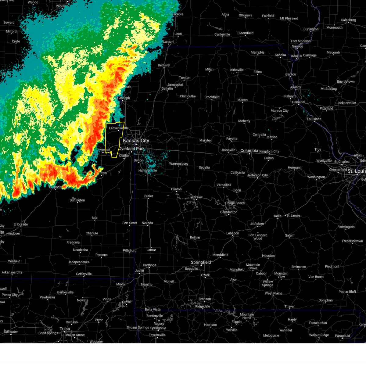 At 1141 pm cdt, severe thunderstorms were located along a line extending from near atchison to mclouth to near clinton lake, moving east at 40 mph (radar indicated). Hazards include 60 mph wind gusts and quarter size hail. Hail damage to vehicles is expected. Expect wind damage to roofs, siding, and trees. At 1141 pm cdt, severe thunderstorms were located along a line extending from near atchison to mclouth to near clinton lake, moving east at 40 mph (radar indicated). Hazards include 60 mph wind gusts and quarter size hail. Hail damage to vehicles is expected. Expect wind damage to roofs, siding, and trees.
|
| 7/4/2023 11:42 PM CDT |
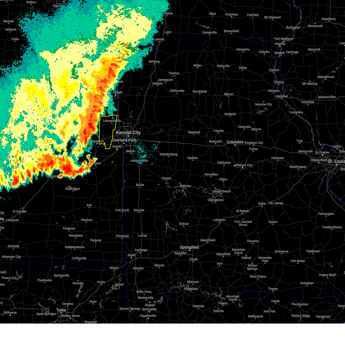 At 1141 pm cdt, severe thunderstorms were located along a line extending from near atchison to mclouth to near clinton lake, moving east at 40 mph (radar indicated). Hazards include 60 mph wind gusts and quarter size hail. Hail damage to vehicles is expected. Expect wind damage to roofs, siding, and trees. At 1141 pm cdt, severe thunderstorms were located along a line extending from near atchison to mclouth to near clinton lake, moving east at 40 mph (radar indicated). Hazards include 60 mph wind gusts and quarter size hail. Hail damage to vehicles is expected. Expect wind damage to roofs, siding, and trees.
|
| 6/30/2023 9:20 PM CDT |
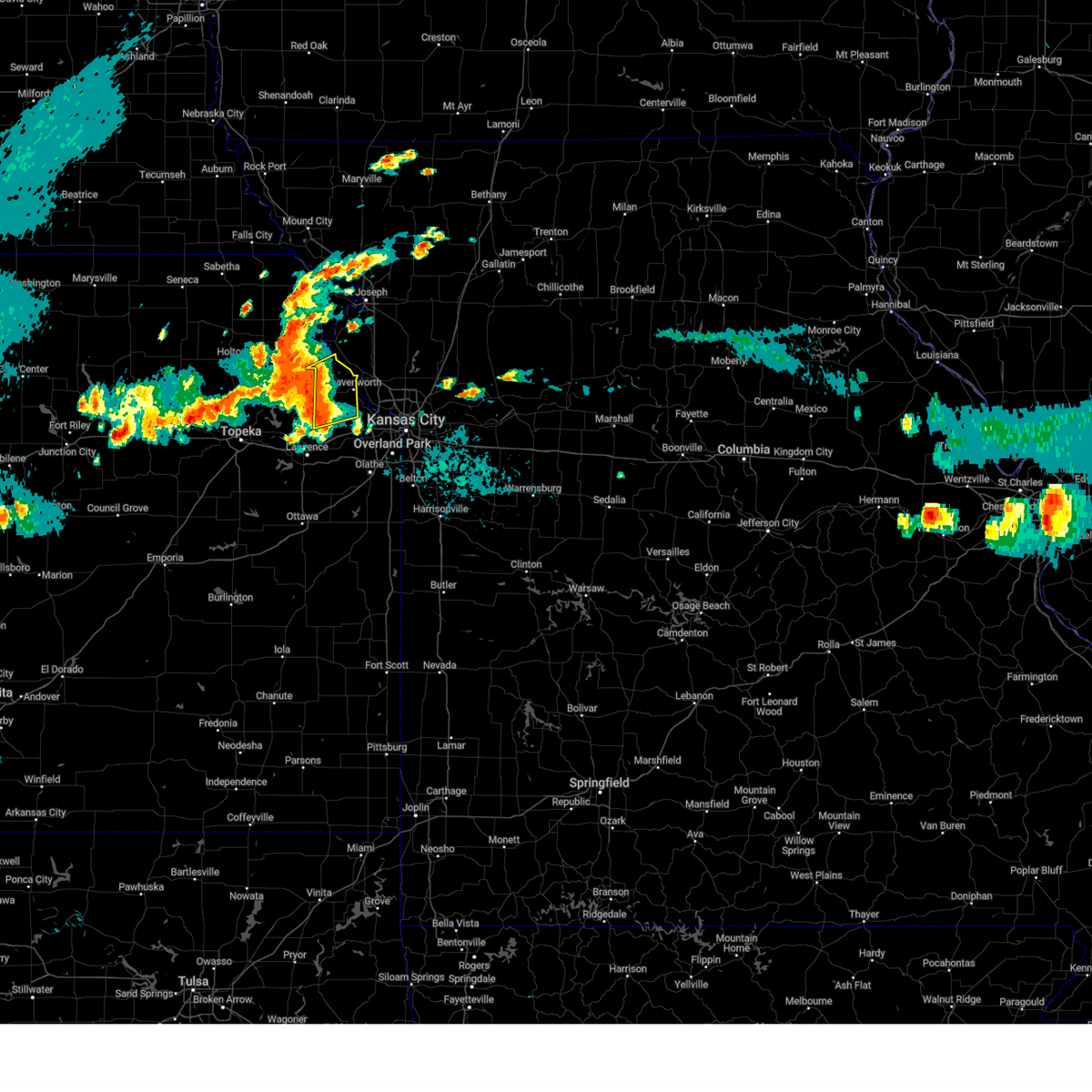 At 920 pm cdt, a severe thunderstorm was located near easton, or 7 miles west of leavenworth, moving northeast at 35 mph. this is a destructive storm (emergency management). Hazards include 80 mph wind gusts and nickel size hail. Flying debris will be dangerous to those caught without shelter. mobile homes will be heavily damaged. expect considerable damage to roofs, windows, and vehicles. extensive tree damage and power outages are likely. locations impacted include, leavenworth, lansing, easton, fairmount, fort leavenworth, lowemont, potter and jarbalo. thunderstorm damage threat, destructive hail threat, radar indicated max hail size, 0. 88 in wind threat, observed max wind gust, 80 mph. At 920 pm cdt, a severe thunderstorm was located near easton, or 7 miles west of leavenworth, moving northeast at 35 mph. this is a destructive storm (emergency management). Hazards include 80 mph wind gusts and nickel size hail. Flying debris will be dangerous to those caught without shelter. mobile homes will be heavily damaged. expect considerable damage to roofs, windows, and vehicles. extensive tree damage and power outages are likely. locations impacted include, leavenworth, lansing, easton, fairmount, fort leavenworth, lowemont, potter and jarbalo. thunderstorm damage threat, destructive hail threat, radar indicated max hail size, 0. 88 in wind threat, observed max wind gust, 80 mph.
|
| 6/30/2023 8:57 PM CDT |
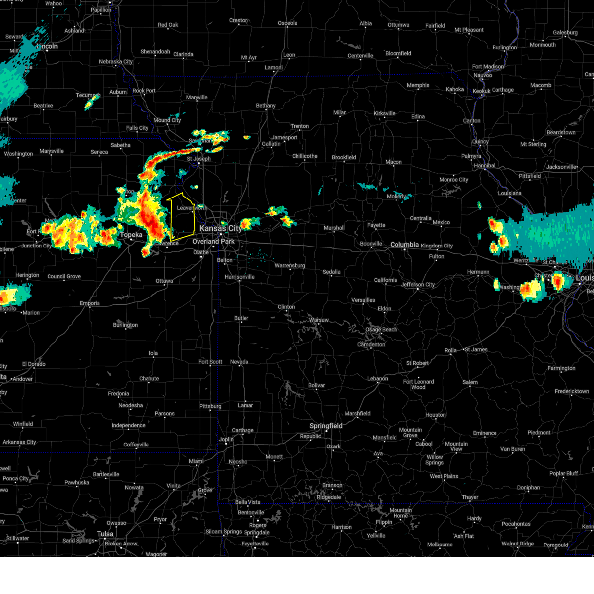 At 857 pm cdt, a severe thunderstorm was located over oskaloosa, moving northeast at 30 mph. this is a destructive storm for leavenworth county (emergency management). Hazards include 80 mph wind gusts and quarter size hail. Flying debris will be dangerous to those caught without shelter. mobile homes will be heavily damaged. expect considerable damage to roofs, windows, and vehicles. Extensive tree damage and power outages are likely. At 857 pm cdt, a severe thunderstorm was located over oskaloosa, moving northeast at 30 mph. this is a destructive storm for leavenworth county (emergency management). Hazards include 80 mph wind gusts and quarter size hail. Flying debris will be dangerous to those caught without shelter. mobile homes will be heavily damaged. expect considerable damage to roofs, windows, and vehicles. Extensive tree damage and power outages are likely.
|
| 4/20/2023 5:23 AM CDT |
 At 523 am cdt, a severe thunderstorm was located near leavenworth, moving east at 35 mph (radar indicated). Hazards include 60 mph wind gusts. Expect damage to roofs, siding, and trees. locations impacted include, leavenworth, lansing, parkville, platte city, basehor, riverside, weatherby lake, weston, kansas city, lake waukomis, ferrelview, platte woods, northmoor, easton, houston lake, tracy, fairmount, farley, fort leavenworth and pomeroy. this includes the following highways, interstate 29 between mile markers 3 and 24. interstate 635 between mile markers 9 and 12. interstate 435 between mile markers 16 and 39. hail threat, radar indicated max hail size, <. 75 in wind threat, radar indicated max wind gust, 60 mph. At 523 am cdt, a severe thunderstorm was located near leavenworth, moving east at 35 mph (radar indicated). Hazards include 60 mph wind gusts. Expect damage to roofs, siding, and trees. locations impacted include, leavenworth, lansing, parkville, platte city, basehor, riverside, weatherby lake, weston, kansas city, lake waukomis, ferrelview, platte woods, northmoor, easton, houston lake, tracy, fairmount, farley, fort leavenworth and pomeroy. this includes the following highways, interstate 29 between mile markers 3 and 24. interstate 635 between mile markers 9 and 12. interstate 435 between mile markers 16 and 39. hail threat, radar indicated max hail size, <. 75 in wind threat, radar indicated max wind gust, 60 mph.
|
| 4/20/2023 5:11 AM CDT |
 At 511 am cdt, a severe thunderstorm was located near easton, or 10 miles west of leavenworth, moving east at 40 mph (radar indicated). Hazards include 60 mph wind gusts. expect damage to roofs, siding, and trees At 511 am cdt, a severe thunderstorm was located near easton, or 10 miles west of leavenworth, moving east at 40 mph (radar indicated). Hazards include 60 mph wind gusts. expect damage to roofs, siding, and trees
|
| 4/20/2023 4:07 AM CDT |
 The severe thunderstorm warning for northwestern wyandotte, northeastern leavenworth and central platte counties will expire at 415 am cdt, the storm which prompted the warning has weakened below severe limits, and has exited the warned area. therefore, the warning will be allowed to expire. a severe thunderstorm watch remains in effect until 600 am cdt for northeastern kansas, and west central missouri. The severe thunderstorm warning for northwestern wyandotte, northeastern leavenworth and central platte counties will expire at 415 am cdt, the storm which prompted the warning has weakened below severe limits, and has exited the warned area. therefore, the warning will be allowed to expire. a severe thunderstorm watch remains in effect until 600 am cdt for northeastern kansas, and west central missouri.
|
| 4/20/2023 3:53 AM CDT |
 At 352 am cdt, a severe thunderstorm was located near lansing, moving northeast at 45 mph (radar indicated). Hazards include 60 mph wind gusts and half dollar size hail. this storm has a history of producing half dollar size hail. Hail damage to vehicles is expected. expect wind damage to roofs, siding, and trees. locations impacted include, leavenworth, lansing, weatherby lake, weston, kansas city, fairmount, farley, fort leavenworth, waldron, stillings, beverly, kansas city intl arpt and east leavenworth. this includes interstate 435 between mile markers 22 and 29. hail threat, radar indicated max hail size, 1. 25 in wind threat, radar indicated max wind gust, 60 mph. At 352 am cdt, a severe thunderstorm was located near lansing, moving northeast at 45 mph (radar indicated). Hazards include 60 mph wind gusts and half dollar size hail. this storm has a history of producing half dollar size hail. Hail damage to vehicles is expected. expect wind damage to roofs, siding, and trees. locations impacted include, leavenworth, lansing, weatherby lake, weston, kansas city, fairmount, farley, fort leavenworth, waldron, stillings, beverly, kansas city intl arpt and east leavenworth. this includes interstate 435 between mile markers 22 and 29. hail threat, radar indicated max hail size, 1. 25 in wind threat, radar indicated max wind gust, 60 mph.
|
| 4/20/2023 3:43 AM CDT |
 At 342 am cdt, a severe thunderstorm was located over tonganoxie, moving northeast at 45 mph (emergency management reported half dollar size hail in tonganoxie). Hazards include ping pong ball size hail and 60 mph wind gusts. People and animals outdoors will be injured. expect hail damage to roofs, siding, windows, and vehicles. Expect wind damage to roofs, siding, and trees. At 342 am cdt, a severe thunderstorm was located over tonganoxie, moving northeast at 45 mph (emergency management reported half dollar size hail in tonganoxie). Hazards include ping pong ball size hail and 60 mph wind gusts. People and animals outdoors will be injured. expect hail damage to roofs, siding, windows, and vehicles. Expect wind damage to roofs, siding, and trees.
|
| 4/20/2023 3:33 AM CDT |
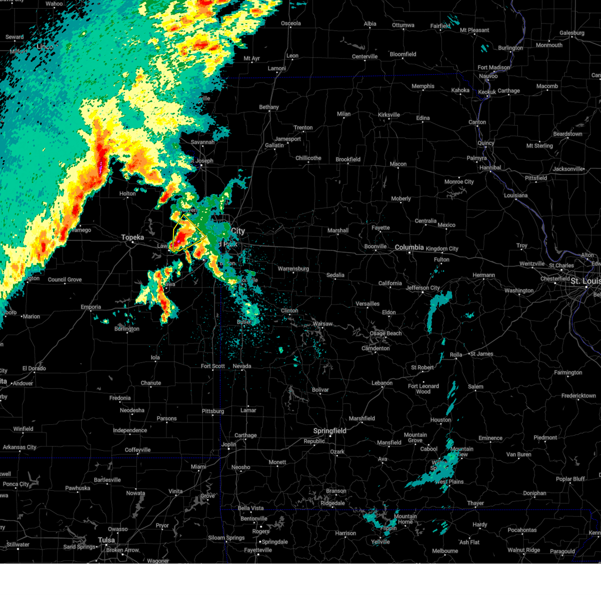 At 332 am cdt, a severe thunderstorm was located over tonganoxie, moving northeast at 45 mph (radar indicated). Hazards include ping pong ball size hail and 60 mph wind gusts. People and animals outdoors will be injured. expect hail damage to roofs, siding, windows, and vehicles. expect wind damage to roofs, siding, and trees. locations impacted include, bonner springs, tonganoxie, basehor, edwardsville, kansas city, linwood, reno, fairmount, jarbalo and piper. this includes the following highways, interstate 70 in kansas between mile markers 410 and 412. interstate 435 between mile markers 12 and 13. kansas turnpike between mile markers 206 and 226. hail threat, radar indicated max hail size, 1. 50 in wind threat, radar indicated max wind gust, 60 mph. At 332 am cdt, a severe thunderstorm was located over tonganoxie, moving northeast at 45 mph (radar indicated). Hazards include ping pong ball size hail and 60 mph wind gusts. People and animals outdoors will be injured. expect hail damage to roofs, siding, windows, and vehicles. expect wind damage to roofs, siding, and trees. locations impacted include, bonner springs, tonganoxie, basehor, edwardsville, kansas city, linwood, reno, fairmount, jarbalo and piper. this includes the following highways, interstate 70 in kansas between mile markers 410 and 412. interstate 435 between mile markers 12 and 13. kansas turnpike between mile markers 206 and 226. hail threat, radar indicated max hail size, 1. 50 in wind threat, radar indicated max wind gust, 60 mph.
|
| 4/20/2023 3:19 AM CDT |
 At 318 am cdt, a severe thunderstorm was located over northeastern lawrence, moving northeast at 45 mph (radar indicated). Hazards include 60 mph wind gusts and quarter size hail. Hail damage to vehicles is expected. Expect wind damage to roofs, siding, and trees. At 318 am cdt, a severe thunderstorm was located over northeastern lawrence, moving northeast at 45 mph (radar indicated). Hazards include 60 mph wind gusts and quarter size hail. Hail damage to vehicles is expected. Expect wind damage to roofs, siding, and trees.
|
| 4/19/2023 11:08 PM CDT |
 At 1107 pm cdt, a severe thunderstorm was located over weatherby lake, moving northeast at 45 mph (radar indicated). Hazards include 60 mph wind gusts and quarter size hail. Hail damage to vehicles is expected. expect wind damage to roofs, siding, and trees. locations impacted include, parkville, platte city, riverside, weatherby lake, kansas city, lake waukomis, ferrelview, platte woods, northmoor, houston lake, tracy, farley, ridgely, wolcott, pomeroy, waldron, stillings, beverly hills, kansas city intl arpt and hoover. this includes the following highways, interstate 29 between mile markers 3 and 20. interstate 635 between mile markers 8 and 12. interstate 435 between mile markers 15 and 39. hail threat, radar indicated max hail size, 1. 00 in wind threat, radar indicated max wind gust, 60 mph. At 1107 pm cdt, a severe thunderstorm was located over weatherby lake, moving northeast at 45 mph (radar indicated). Hazards include 60 mph wind gusts and quarter size hail. Hail damage to vehicles is expected. expect wind damage to roofs, siding, and trees. locations impacted include, parkville, platte city, riverside, weatherby lake, kansas city, lake waukomis, ferrelview, platte woods, northmoor, houston lake, tracy, farley, ridgely, wolcott, pomeroy, waldron, stillings, beverly hills, kansas city intl arpt and hoover. this includes the following highways, interstate 29 between mile markers 3 and 20. interstate 635 between mile markers 8 and 12. interstate 435 between mile markers 15 and 39. hail threat, radar indicated max hail size, 1. 00 in wind threat, radar indicated max wind gust, 60 mph.
|
| 4/19/2023 10:56 PM CDT |
 At 1055 pm cdt, a severe thunderstorm was located near lansing, moving northeast at 45 mph (radar indicated). Hazards include 60 mph wind gusts and quarter size hail. Hail damage to vehicles is expected. Expect wind damage to roofs, siding, and trees. At 1055 pm cdt, a severe thunderstorm was located near lansing, moving northeast at 45 mph (radar indicated). Hazards include 60 mph wind gusts and quarter size hail. Hail damage to vehicles is expected. Expect wind damage to roofs, siding, and trees.
|
| 4/19/2023 10:38 PM CDT |
 At 1038 pm cdt, a severe thunderstorm was located over tonganoxie, moving northeast at 45 mph (radar indicated). Hazards include 60 mph wind gusts and quarter size hail. Hail damage to vehicles is expected. expect wind damage to roofs, siding, and trees. locations impacted include, leavenworth, lansing, bonner springs, tonganoxie, basehor, edwardsville, kansas city, linwood, reno, fairmount, jarbalo and piper. this includes kansas turnpike between mile markers 208 and 226. hail threat, radar indicated max hail size, 1. 00 in wind threat, radar indicated max wind gust, 60 mph. At 1038 pm cdt, a severe thunderstorm was located over tonganoxie, moving northeast at 45 mph (radar indicated). Hazards include 60 mph wind gusts and quarter size hail. Hail damage to vehicles is expected. expect wind damage to roofs, siding, and trees. locations impacted include, leavenworth, lansing, bonner springs, tonganoxie, basehor, edwardsville, kansas city, linwood, reno, fairmount, jarbalo and piper. this includes kansas turnpike between mile markers 208 and 226. hail threat, radar indicated max hail size, 1. 00 in wind threat, radar indicated max wind gust, 60 mph.
|
| 4/19/2023 10:24 PM CDT |
 At 1024 pm cdt, a severe thunderstorm was located near williamstown, or near lawrence, moving northeast at 45 mph (radar indicated). Hazards include 60 mph wind gusts and quarter size hail. Hail damage to vehicles is expected. Expect wind damage to roofs, siding, and trees. At 1024 pm cdt, a severe thunderstorm was located near williamstown, or near lawrence, moving northeast at 45 mph (radar indicated). Hazards include 60 mph wind gusts and quarter size hail. Hail damage to vehicles is expected. Expect wind damage to roofs, siding, and trees.
|
| 4/10/2023 11:10 AM CDT |
 The severe thunderstorm warning for northeastern wyandotte, southwestern clay and southeastern platte counties will expire at 1115 am cdt, the storm which prompted the warning has weakened below severe limits, and no longer poses an immediate threat to life or property. therefore, the warning will be allowed to expire. however small hail and heavy rain are still possible with this thunderstorm. The severe thunderstorm warning for northeastern wyandotte, southwestern clay and southeastern platte counties will expire at 1115 am cdt, the storm which prompted the warning has weakened below severe limits, and no longer poses an immediate threat to life or property. therefore, the warning will be allowed to expire. however small hail and heavy rain are still possible with this thunderstorm.
|
| 4/10/2023 10:46 AM CDT |
 At 1046 am cdt, a severe thunderstorm was located over houston lake, or over riverside, moving east at 10 mph (radar indicated). Hazards include quarter size hail. damage to vehicles is expected At 1046 am cdt, a severe thunderstorm was located over houston lake, or over riverside, moving east at 10 mph (radar indicated). Hazards include quarter size hail. damage to vehicles is expected
|
| 4/4/2023 10:12 PM CDT |
 The severe thunderstorm warning for northwestern wyandotte, northeastern leavenworth and south central platte counties will expire at 1015 pm cdt, the storm which prompted the warning has weakened below severe limits, and no longer poses an immediate threat to life or property. therefore, the warning will be allowed to expire. a severe thunderstorm watch remains in effect until midnight cdt for northeastern kansas, and west central missouri. The severe thunderstorm warning for northwestern wyandotte, northeastern leavenworth and south central platte counties will expire at 1015 pm cdt, the storm which prompted the warning has weakened below severe limits, and no longer poses an immediate threat to life or property. therefore, the warning will be allowed to expire. a severe thunderstorm watch remains in effect until midnight cdt for northeastern kansas, and west central missouri.
|
| 4/4/2023 10:08 PM CDT |
 At 1008 pm cdt, a severe thunderstorm was located over lansing, moving northeast at 55 mph (radar indicated). Hazards include quarter size hail. Damage to vehicles is expected. locations impacted include, leavenworth, lansing, parkville, basehor, kansas city, fairmount, farley, wolcott, east leavenworth, waldron and stillings. this includes interstate 435 between mile markers 21 and 30. hail threat, radar indicated max hail size, 1. 00 in wind threat, radar indicated max wind gust, <50 mph. At 1008 pm cdt, a severe thunderstorm was located over lansing, moving northeast at 55 mph (radar indicated). Hazards include quarter size hail. Damage to vehicles is expected. locations impacted include, leavenworth, lansing, parkville, basehor, kansas city, fairmount, farley, wolcott, east leavenworth, waldron and stillings. this includes interstate 435 between mile markers 21 and 30. hail threat, radar indicated max hail size, 1. 00 in wind threat, radar indicated max wind gust, <50 mph.
|
| 4/4/2023 9:49 PM CDT |
 At 949 pm cdt, a severe thunderstorm was located near tonganoxie, moving northeast at 65 mph (radar indicated). Hazards include quarter size hail. damage to vehicles is expected At 949 pm cdt, a severe thunderstorm was located near tonganoxie, moving northeast at 65 mph (radar indicated). Hazards include quarter size hail. damage to vehicles is expected
|
| 2/27/2023 2:56 AM CST |
 The severe thunderstorm warning for eastern wyandotte, northeastern miami, eastern johnson, northwestern cass, southwestern clay, southeastern platte and western jackson counties will expire at 300 am cst, the storms which prompted the warning have weakened below severe limits, and have exited the warned area. therefore, the warning will be allowed to expire. however strong winds are still possible with these thunderstorms. The severe thunderstorm warning for eastern wyandotte, northeastern miami, eastern johnson, northwestern cass, southwestern clay, southeastern platte and western jackson counties will expire at 300 am cst, the storms which prompted the warning have weakened below severe limits, and have exited the warned area. therefore, the warning will be allowed to expire. however strong winds are still possible with these thunderstorms.
|
| 2/27/2023 2:43 AM CST |
 At 243 am cst, severe thunderstorms were located along a line extending from platte woods to near leawood to near cleveland, moving northeast at 65 mph (radar indicated). Hazards include 60 mph wind gusts. Expect damage to roofs, siding, and trees. locations impacted include, kansas city, overland park, olathe, independence, lee`s summit, shawnee, lenexa, leawood, raytown, liberty, gladstone, grandview, belton, prairie village, raymore, merriam, mission, smithville, parkville and peculiar. this includes the following highways, interstate 70 in missouri between mile markers 0 and 13. interstate 70 in kansas between mile markers 412 and 423. interstate 35 in missouri between mile markers 0 and 13. interstate 35 in kansas between mile markers 222 and 235. interstate 29 between mile markers 0 and 9. interstate 635 between mile markers 0 and 12. interstate 470 between mile markers 0 and 9. Interstate 435 near mile marker 0, near mile marker 10, between mile markers 39 and 42, and between mile markers 47 and 83. At 243 am cst, severe thunderstorms were located along a line extending from platte woods to near leawood to near cleveland, moving northeast at 65 mph (radar indicated). Hazards include 60 mph wind gusts. Expect damage to roofs, siding, and trees. locations impacted include, kansas city, overland park, olathe, independence, lee`s summit, shawnee, lenexa, leawood, raytown, liberty, gladstone, grandview, belton, prairie village, raymore, merriam, mission, smithville, parkville and peculiar. this includes the following highways, interstate 70 in missouri between mile markers 0 and 13. interstate 70 in kansas between mile markers 412 and 423. interstate 35 in missouri between mile markers 0 and 13. interstate 35 in kansas between mile markers 222 and 235. interstate 29 between mile markers 0 and 9. interstate 635 between mile markers 0 and 12. interstate 470 between mile markers 0 and 9. Interstate 435 near mile marker 0, near mile marker 10, between mile markers 39 and 42, and between mile markers 47 and 83.
|
| 2/27/2023 2:27 AM CST |
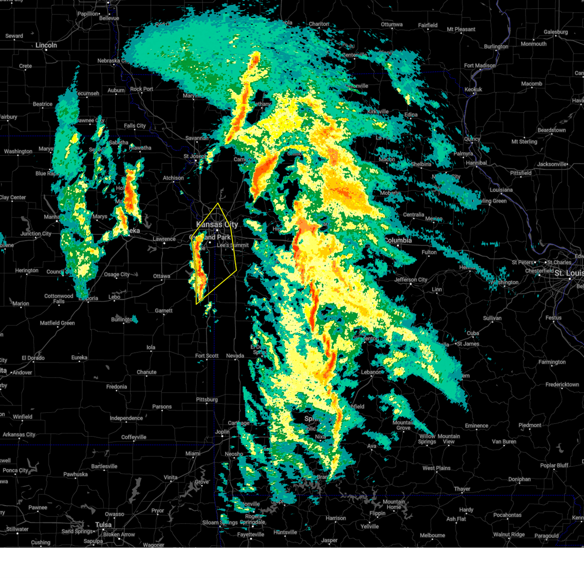 At 226 am cst, severe thunderstorms were located along a line extending from shawnee to spring hill to near paola, moving northeast at 65 mph (radar indicated). Hazards include 60 mph wind gusts. expect damage to roofs, siding, and trees At 226 am cst, severe thunderstorms were located along a line extending from shawnee to spring hill to near paola, moving northeast at 65 mph (radar indicated). Hazards include 60 mph wind gusts. expect damage to roofs, siding, and trees
|
| 2/27/2023 12:58 AM CST |
 At 1258 am cst, severe thunderstorms were located along a line extending from denton to near atchison to near williamstown, moving northeast at 55 mph (radar indicated). Hazards include 60 mph wind gusts. expect damage to roofs, siding, and trees At 1258 am cst, severe thunderstorms were located along a line extending from denton to near atchison to near williamstown, moving northeast at 55 mph (radar indicated). Hazards include 60 mph wind gusts. expect damage to roofs, siding, and trees
|
| 6/21/2022 11:06 PM CDT |
 The severe thunderstorm warning for wyandotte, northeastern johnson, southwestern clinton, clay, southeastern platte and central jackson counties will expire at 1115 pm cdt, the storm which prompted the warning has weakened below severe limits, and no longer poses an immediate threat to life or property. therefore, the warning will be allowed to expire. a severe thunderstorm watch remains in effect until midnight cdt for northeastern and east central kansas, and northwestern and west central missouri. The severe thunderstorm warning for wyandotte, northeastern johnson, southwestern clinton, clay, southeastern platte and central jackson counties will expire at 1115 pm cdt, the storm which prompted the warning has weakened below severe limits, and no longer poses an immediate threat to life or property. therefore, the warning will be allowed to expire. a severe thunderstorm watch remains in effect until midnight cdt for northeastern and east central kansas, and northwestern and west central missouri.
|
| 6/21/2022 10:54 PM CDT |
 At 1052 pm cdt, a severe thunderstorm was located near kearney, moving northeast at 45 mph (radar indicated). Hazards include 60 mph wind gusts and penny size hail. Expect damage to roofs, siding, and trees. locations impacted include, kansas city, overland park, independence, lee`s summit, shawnee, blue springs, lenexa, leawood, raytown, liberty, gladstone, prairie village, grain valley, excelsior springs, merriam, mission, smithville, kearney, parkville and platte city. this includes the following highways, interstate 70 in missouri between mile markers 0 and 22. interstate 70 in kansas between mile markers 412 and 423. interstate 35 in missouri between mile markers 0 and 34. interstate 35 in kansas between mile markers 225 and 235. interstate 29 between mile markers 0 and 20. interstate 635 between mile markers 0 and 12. interstate 470 between mile markers 15 and 16. interstate 435 between mile markers 3 and 13, and between mile markers 20 and 67. hail threat, radar indicated max hail size, 0. 75 in wind threat, radar indicated max wind gust, 60 mph. At 1052 pm cdt, a severe thunderstorm was located near kearney, moving northeast at 45 mph (radar indicated). Hazards include 60 mph wind gusts and penny size hail. Expect damage to roofs, siding, and trees. locations impacted include, kansas city, overland park, independence, lee`s summit, shawnee, blue springs, lenexa, leawood, raytown, liberty, gladstone, prairie village, grain valley, excelsior springs, merriam, mission, smithville, kearney, parkville and platte city. this includes the following highways, interstate 70 in missouri between mile markers 0 and 22. interstate 70 in kansas between mile markers 412 and 423. interstate 35 in missouri between mile markers 0 and 34. interstate 35 in kansas between mile markers 225 and 235. interstate 29 between mile markers 0 and 20. interstate 635 between mile markers 0 and 12. interstate 470 between mile markers 15 and 16. interstate 435 between mile markers 3 and 13, and between mile markers 20 and 67. hail threat, radar indicated max hail size, 0. 75 in wind threat, radar indicated max wind gust, 60 mph.
|
| 6/21/2022 10:47 PM CDT |
 At 1046 pm cdt, a severe thunderstorm was located near smithville, moving northeast at 45 mph (radar indicated). Hazards include 70 mph wind gusts and penny size hail. Expect considerable tree damage. damage is likely to mobile homes, roofs, and outbuildings. locations impacted include, kansas city, overland park, olathe, independence, lee`s summit, shawnee, blue springs, lenexa, leavenworth, leawood, raytown, liberty, gladstone, prairie village, grain valley, excelsior springs, merriam, mission, smithville and kearney. this includes the following highways, interstate 70 in missouri between mile markers 0 and 23. interstate 70 in kansas between mile markers 410 and 423. interstate 35 in missouri between mile markers 0 and 34. interstate 35 in kansas between mile markers 225 and 235. interstate 29 between mile markers 0 and 31. interstate 635 between mile markers 0 and 12. interstate 470 between mile markers 15 and 16. interstate 435 between mile markers 3 and 67. kansas turnpike between mile markers 223 and 226. thunderstorm damage threat, considerable hail threat, radar indicated max hail size, 0. 75 in wind threat, radar indicated max wind gust, 70 mph. At 1046 pm cdt, a severe thunderstorm was located near smithville, moving northeast at 45 mph (radar indicated). Hazards include 70 mph wind gusts and penny size hail. Expect considerable tree damage. damage is likely to mobile homes, roofs, and outbuildings. locations impacted include, kansas city, overland park, olathe, independence, lee`s summit, shawnee, blue springs, lenexa, leavenworth, leawood, raytown, liberty, gladstone, prairie village, grain valley, excelsior springs, merriam, mission, smithville and kearney. this includes the following highways, interstate 70 in missouri between mile markers 0 and 23. interstate 70 in kansas between mile markers 410 and 423. interstate 35 in missouri between mile markers 0 and 34. interstate 35 in kansas between mile markers 225 and 235. interstate 29 between mile markers 0 and 31. interstate 635 between mile markers 0 and 12. interstate 470 between mile markers 15 and 16. interstate 435 between mile markers 3 and 67. kansas turnpike between mile markers 223 and 226. thunderstorm damage threat, considerable hail threat, radar indicated max hail size, 0. 75 in wind threat, radar indicated max wind gust, 70 mph.
|
| 6/21/2022 10:13 PM CDT |
 At 1012 pm cdt, a severe thunderstorm was located near lansing, moving northeast at 45 mph (radar indicated). Hazards include 70 mph wind gusts and penny size hail. Expect considerable tree damage. Damage is likely to mobile homes, roofs, and outbuildings. At 1012 pm cdt, a severe thunderstorm was located near lansing, moving northeast at 45 mph (radar indicated). Hazards include 70 mph wind gusts and penny size hail. Expect considerable tree damage. Damage is likely to mobile homes, roofs, and outbuildings.
|
| 6/15/2022 6:46 PM CDT |
 At 646 pm cdt, a severe thunderstorm was located near tonganoxie, moving east at 40 mph (radar indicated). Hazards include 60 mph wind gusts and quarter size hail. Hail damage to vehicles is expected. Expect wind damage to roofs, siding, and trees. At 646 pm cdt, a severe thunderstorm was located near tonganoxie, moving east at 40 mph (radar indicated). Hazards include 60 mph wind gusts and quarter size hail. Hail damage to vehicles is expected. Expect wind damage to roofs, siding, and trees.
|
| 6/11/2022 11:06 PM CDT |
 At 1105 pm cdt, a severe thunderstorm was located near kearney, moving south at 40 mph (radar indicated). Hazards include 70 mph wind gusts and quarter size hail. Hail damage to vehicles is expected. expect considerable tree damage. Wind damage is also likely to mobile homes, roofs, and outbuildings. At 1105 pm cdt, a severe thunderstorm was located near kearney, moving south at 40 mph (radar indicated). Hazards include 70 mph wind gusts and quarter size hail. Hail damage to vehicles is expected. expect considerable tree damage. Wind damage is also likely to mobile homes, roofs, and outbuildings.
|
| 6/8/2022 1:21 AM CDT |
 At 120 am cdt, a tornado producing storm was located over prairie village, moving east at 45 mph (radar confirmed tornado). Hazards include damaging tornado. Flying debris will be dangerous to those caught without shelter. mobile homes will be damaged or destroyed. damage to roofs, windows, and vehicles will occur. Tree damage is likely. At 120 am cdt, a tornado producing storm was located over prairie village, moving east at 45 mph (radar confirmed tornado). Hazards include damaging tornado. Flying debris will be dangerous to those caught without shelter. mobile homes will be damaged or destroyed. damage to roofs, windows, and vehicles will occur. Tree damage is likely.
|
| 6/8/2022 1:08 AM CDT |
 At 107 am cdt, severe thunderstorms were located along a line extending from tracy to near kansas city to near de soto, moving east at 50 mph (radar indicated). Hazards include 60 mph wind gusts. expect damage to roofs, siding, and trees At 107 am cdt, severe thunderstorms were located along a line extending from tracy to near kansas city to near de soto, moving east at 50 mph (radar indicated). Hazards include 60 mph wind gusts. expect damage to roofs, siding, and trees
|
| 6/8/2022 12:51 AM CDT |
 At 1251 am cdt, severe thunderstorms were located along a line extending from near atchison to near easton to tonganoxie, moving east at 45 mph (radar indicated). Hazards include 60 mph wind gusts and penny size hail. Expect damage to roofs, siding, and trees. locations impacted include, shawnee, lenexa, leavenworth, lansing, atchison, bonner springs, de soto, tonganoxie, platte city, basehor, edwardsville, weston, kansas city, agency, dearborn, camden point, linwood, rushville, easton and tracy. this includes the following highways, interstate 70 in kansas between mile markers 410 and 413. interstate 29 between mile markers 13 and 42. interstate 435 between mile markers 10 and 34. kansas turnpike between mile markers 210 and 226. hail threat, radar indicated max hail size, 0. 75 in wind threat, radar indicated max wind gust, 60 mph. At 1251 am cdt, severe thunderstorms were located along a line extending from near atchison to near easton to tonganoxie, moving east at 45 mph (radar indicated). Hazards include 60 mph wind gusts and penny size hail. Expect damage to roofs, siding, and trees. locations impacted include, shawnee, lenexa, leavenworth, lansing, atchison, bonner springs, de soto, tonganoxie, platte city, basehor, edwardsville, weston, kansas city, agency, dearborn, camden point, linwood, rushville, easton and tracy. this includes the following highways, interstate 70 in kansas between mile markers 410 and 413. interstate 29 between mile markers 13 and 42. interstate 435 between mile markers 10 and 34. kansas turnpike between mile markers 210 and 226. hail threat, radar indicated max hail size, 0. 75 in wind threat, radar indicated max wind gust, 60 mph.
|
| 6/8/2022 12:30 AM CDT |
 At 1230 am cdt, severe thunderstorms were located along a line extending from near lancaster to near winchester to near perry lake, moving east at 45 mph (radar indicated). Hazards include 60 mph wind gusts and penny size hail. expect damage to roofs, siding, and trees At 1230 am cdt, severe thunderstorms were located along a line extending from near lancaster to near winchester to near perry lake, moving east at 45 mph (radar indicated). Hazards include 60 mph wind gusts and penny size hail. expect damage to roofs, siding, and trees
|
| 6/6/2022 9:43 PM CDT |
 At 943 pm cdt, a severe thunderstorm was located over lake quivira, moving southeast at 20 mph (radar indicated). Hazards include 60 mph wind gusts and quarter size hail. Hail damage to vehicles is expected. expect wind damage to roofs, siding, and trees. locations impacted include, overland park, shawnee, lenexa, leawood, prairie village, merriam, mission, edwardsville, fairway, mission hills, westwood, lake quivira, kansas city, westwood hills, mission woods, countryside, roeland park, holliday and muncie. this includes the following highways, interstate 70 in kansas near mile marker 418. interstate 35 in kansas between mile markers 224 and 233. interstate 635 between mile markers 0 and 4. interstate 435 between mile markers 3 and 9. hail threat, radar indicated max hail size, 1. 00 in wind threat, radar indicated max wind gust, 60 mph. At 943 pm cdt, a severe thunderstorm was located over lake quivira, moving southeast at 20 mph (radar indicated). Hazards include 60 mph wind gusts and quarter size hail. Hail damage to vehicles is expected. expect wind damage to roofs, siding, and trees. locations impacted include, overland park, shawnee, lenexa, leawood, prairie village, merriam, mission, edwardsville, fairway, mission hills, westwood, lake quivira, kansas city, westwood hills, mission woods, countryside, roeland park, holliday and muncie. this includes the following highways, interstate 70 in kansas near mile marker 418. interstate 35 in kansas between mile markers 224 and 233. interstate 635 between mile markers 0 and 4. interstate 435 between mile markers 3 and 9. hail threat, radar indicated max hail size, 1. 00 in wind threat, radar indicated max wind gust, 60 mph.
|
| 6/6/2022 9:34 PM CDT |
 At 934 pm cdt, a severe thunderstorm was located over edwardsville, moving southeast at 20 mph (radar indicated). Hazards include 60 mph wind gusts and quarter size hail. Hail damage to vehicles is expected. Expect wind damage to roofs, siding, and trees. At 934 pm cdt, a severe thunderstorm was located over edwardsville, moving southeast at 20 mph (radar indicated). Hazards include 60 mph wind gusts and quarter size hail. Hail damage to vehicles is expected. Expect wind damage to roofs, siding, and trees.
|
| 6/6/2022 8:26 PM CDT |
 The severe thunderstorm warning for northeastern johnson and west central jackson counties will expire at 830 pm cdt, the storm which prompted the warning has weakened below severe limits, and no longer poses an immediate threat to life or property. therefore, the warning will be allowed to expire. The severe thunderstorm warning for northeastern johnson and west central jackson counties will expire at 830 pm cdt, the storm which prompted the warning has weakened below severe limits, and no longer poses an immediate threat to life or property. therefore, the warning will be allowed to expire.
|
| 6/6/2022 8:13 PM CDT |
 At 813 pm cdt, a severe thunderstorm was located over merriam, moving southeast at 30 mph (radar indicated). Hazards include quarter size hail. Damage to vehicles is expected. locations impacted include, kansas city, overland park, olathe, shawnee, lenexa, leawood, prairie village, merriam, mission, bonner springs, fairway, mission hills, westwood, lake quivira, westwood hills, mission woods, countryside, roeland park, lackmans and holliday. this includes the following highways, interstate 35 in kansas between mile markers 218 and 230. interstate 635 near mile marker 0. interstate 435 between mile markers 0 and 7, and between mile markers 75 and 83. hail threat, radar indicated max hail size, 1. 00 in wind threat, radar indicated max wind gust, <50 mph. At 813 pm cdt, a severe thunderstorm was located over merriam, moving southeast at 30 mph (radar indicated). Hazards include quarter size hail. Damage to vehicles is expected. locations impacted include, kansas city, overland park, olathe, shawnee, lenexa, leawood, prairie village, merriam, mission, bonner springs, fairway, mission hills, westwood, lake quivira, westwood hills, mission woods, countryside, roeland park, lackmans and holliday. this includes the following highways, interstate 35 in kansas between mile markers 218 and 230. interstate 635 near mile marker 0. interstate 435 between mile markers 0 and 7, and between mile markers 75 and 83. hail threat, radar indicated max hail size, 1. 00 in wind threat, radar indicated max wind gust, <50 mph.
|
| 6/6/2022 7:56 PM CDT | Quarter sized hail reported 5 miles ESE of Kansas City, KS, legends shopping center. |
| 6/6/2022 7:56 PM CDT |
 At 756 pm cdt, a severe thunderstorm was located over edwardsville, moving southeast at 30 mph (trained weather spotters). Hazards include quarter size hail. damage to vehicles is expected At 756 pm cdt, a severe thunderstorm was located over edwardsville, moving southeast at 30 mph (trained weather spotters). Hazards include quarter size hail. damage to vehicles is expected
|
| 6/6/2022 7:42 PM CDT | Delayed report. tree limbs down at dubs dread golf course. report received via twitte in wyandotte county KS, 8.7 miles SE of Kansas City, KS |
| 6/6/2022 6:03 PM CDT |
 At 603 pm cdt, a severe thunderstorm was located near platte city, moving southeast at 45 mph (radar indicated). Hazards include 60 mph wind gusts and quarter size hail. Hail damage to vehicles is expected. Expect wind damage to roofs, siding, and trees. At 603 pm cdt, a severe thunderstorm was located near platte city, moving southeast at 45 mph (radar indicated). Hazards include 60 mph wind gusts and quarter size hail. Hail damage to vehicles is expected. Expect wind damage to roofs, siding, and trees.
|
| 5/17/2022 10:47 PM CDT |
 At 1046 pm cdt, severe thunderstorms were located along a line extending from near perry to near williamstown to lawrence to near vinland to near pleasant grove to near baldwin city to near centropolis to near pomona lake, moving east at 40 mph (radar indicated). Hazards include 60 mph wind gusts and penny size hail. expect damage to roofs, siding, and trees At 1046 pm cdt, severe thunderstorms were located along a line extending from near perry to near williamstown to lawrence to near vinland to near pleasant grove to near baldwin city to near centropolis to near pomona lake, moving east at 40 mph (radar indicated). Hazards include 60 mph wind gusts and penny size hail. expect damage to roofs, siding, and trees
|
| 5/15/2022 8:13 AM CDT | 50-60mph wind gusts and half inch hail. estimated at kansas city speedway eo in wyandotte county KS, 5.1 miles E of Kansas City, KS |
| 5/15/2022 8:11 AM CDT |
 At 810 am cdt, severe thunderstorms were located along a line extending from near kansas city to near overland park to paola, moving southeast at 50 mph (trained weather spotters). Hazards include 60 mph wind gusts and nickel size hail. expect damage to roofs, siding, and trees At 810 am cdt, severe thunderstorms were located along a line extending from near kansas city to near overland park to paola, moving southeast at 50 mph (trained weather spotters). Hazards include 60 mph wind gusts and nickel size hail. expect damage to roofs, siding, and trees
|
| 5/15/2022 7:54 AM CDT |
 At 754 am cdt, severe thunderstorms were located along a line extending from near lansing to near edgerton to ottawa, moving southeast at 50 mph (radar indicated). Hazards include 60 mph wind gusts and quarter size hail. Hail damage to vehicles is expected. expect wind damage to roofs, siding, and trees. locations impacted include, overland park, olathe, shawnee, lenexa, leavenworth, leawood, prairie village, gardner, lansing, merriam, mission, bonner springs, de soto, parkville, spring hill, tonganoxie, basehor, edwardsville, fairway and mission hills. this includes the following highways, interstate 70 in missouri near mile marker 0. interstate 70 in kansas between mile markers 410 and 423. interstate 35 in missouri near mile marker 0. interstate 35 in kansas between mile markers 202 and 235. interstate 635 between mile markers 0 and 8. interstate 435 between mile markers 0 and 20, and between mile markers 75 and 83. kansas turnpike between mile markers 206 and 226. hail threat, radar indicated max hail size, 1. 00 in wind threat, radar indicated max wind gust, 60 mph. At 754 am cdt, severe thunderstorms were located along a line extending from near lansing to near edgerton to ottawa, moving southeast at 50 mph (radar indicated). Hazards include 60 mph wind gusts and quarter size hail. Hail damage to vehicles is expected. expect wind damage to roofs, siding, and trees. locations impacted include, overland park, olathe, shawnee, lenexa, leavenworth, leawood, prairie village, gardner, lansing, merriam, mission, bonner springs, de soto, parkville, spring hill, tonganoxie, basehor, edwardsville, fairway and mission hills. this includes the following highways, interstate 70 in missouri near mile marker 0. interstate 70 in kansas between mile markers 410 and 423. interstate 35 in missouri near mile marker 0. interstate 35 in kansas between mile markers 202 and 235. interstate 635 between mile markers 0 and 8. interstate 435 between mile markers 0 and 20, and between mile markers 75 and 83. kansas turnpike between mile markers 206 and 226. hail threat, radar indicated max hail size, 1. 00 in wind threat, radar indicated max wind gust, 60 mph.
|
| 5/15/2022 7:29 AM CDT |
 At 728 am cdt, severe thunderstorms were located along a line extending from easton to lawrence to near overbrook, moving southeast at 50 mph (radar indicated). Hazards include 60 mph wind gusts and quarter size hail. Hail damage to vehicles is expected. Expect wind damage to roofs, siding, and trees. At 728 am cdt, severe thunderstorms were located along a line extending from easton to lawrence to near overbrook, moving southeast at 50 mph (radar indicated). Hazards include 60 mph wind gusts and quarter size hail. Hail damage to vehicles is expected. Expect wind damage to roofs, siding, and trees.
|
| 4/29/2022 10:26 PM CDT |
 At 1026 pm cdt, severe thunderstorms were located along a line extending from near ferrelview to shawnee to near edgerton, moving east at 45 mph (radar indicated). Hazards include 60 mph wind gusts and quarter size hail. Hail damage to vehicles is expected. expect wind damage to roofs, siding, and trees. locations impacted include, kansas city, overland park, olathe, independence, lee`s summit, shawnee, lenexa, leavenworth, leawood, raytown, liberty, gladstone, grandview, belton, prairie village, raymore, gardner, lansing, merriam and mission. this includes the following highways, interstate 70 in missouri between mile markers 0 and 13. interstate 70 in kansas between mile markers 410 and 423. interstate 35 in missouri between mile markers 0 and 27. interstate 35 in kansas between mile markers 200 and 235. interstate 29 between mile markers 0 and 23. interstate 635 between mile markers 0 and 12. interstate 470 between mile markers 0 and 8. interstate 435 between mile markers 0 and 83. kansas turnpike between mile markers 216 and 226. hail threat, radar indicated max hail size, 1. 00 in wind threat, radar indicated max wind gust, 60 mph. At 1026 pm cdt, severe thunderstorms were located along a line extending from near ferrelview to shawnee to near edgerton, moving east at 45 mph (radar indicated). Hazards include 60 mph wind gusts and quarter size hail. Hail damage to vehicles is expected. expect wind damage to roofs, siding, and trees. locations impacted include, kansas city, overland park, olathe, independence, lee`s summit, shawnee, lenexa, leavenworth, leawood, raytown, liberty, gladstone, grandview, belton, prairie village, raymore, gardner, lansing, merriam and mission. this includes the following highways, interstate 70 in missouri between mile markers 0 and 13. interstate 70 in kansas between mile markers 410 and 423. interstate 35 in missouri between mile markers 0 and 27. interstate 35 in kansas between mile markers 200 and 235. interstate 29 between mile markers 0 and 23. interstate 635 between mile markers 0 and 12. interstate 470 between mile markers 0 and 8. interstate 435 between mile markers 0 and 83. kansas turnpike between mile markers 216 and 226. hail threat, radar indicated max hail size, 1. 00 in wind threat, radar indicated max wind gust, 60 mph.
|
| 4/29/2022 10:08 PM CDT | Large tree down on home. report via social medi in wyandotte county KS, 7.8 miles WNW of Kansas City, KS |
| 4/29/2022 9:58 PM CDT |
 At 957 pm cdt, severe thunderstorms were located along a line extending from 6 miles northeast of mclouth to near lawrence to near pomona, moving east at 45 mph (radar indicated). Hazards include 60 mph wind gusts and quarter size hail. Hail damage to vehicles is expected. Expect wind damage to roofs, siding, and trees. At 957 pm cdt, severe thunderstorms were located along a line extending from 6 miles northeast of mclouth to near lawrence to near pomona, moving east at 45 mph (radar indicated). Hazards include 60 mph wind gusts and quarter size hail. Hail damage to vehicles is expected. Expect wind damage to roofs, siding, and trees.
|
| 4/13/2022 1:15 AM CDT |
 At 115 am cdt, a severe thunderstorm was located over parkville, moving northeast at 50 mph (radar indicated). Hazards include 60 mph wind gusts. expect damage to roofs, siding, and trees At 115 am cdt, a severe thunderstorm was located over parkville, moving northeast at 50 mph (radar indicated). Hazards include 60 mph wind gusts. expect damage to roofs, siding, and trees
|
| 3/29/2022 9:10 PM CDT |
 At 909 pm cdt, severe thunderstorms were located along a line extending from near union star to near plattsburg to near smithville to shawnee, moving northeast at 50 mph (radar indicated). Hazards include 60 mph wind gusts and quarter size hail. Hail damage to vehicles is expected. Expect wind damage to roofs, siding, and trees. At 909 pm cdt, severe thunderstorms were located along a line extending from near union star to near plattsburg to near smithville to shawnee, moving northeast at 50 mph (radar indicated). Hazards include 60 mph wind gusts and quarter size hail. Hail damage to vehicles is expected. Expect wind damage to roofs, siding, and trees.
|
| 3/29/2022 9:00 PM CDT |
 At 859 pm cdt, severe thunderstorms were located along a line extending from 10 miles northwest of union star to near country club villa to near gower to near ferrelview to near shawnee, moving east at 55 mph (radar indicated). Hazards include 60 mph wind gusts and quarter size hail. Hail damage to vehicles is expected. expect wind damage to roofs, siding, and trees. locations impacted include, kansas city, overland park, olathe, independence, lee`s summit, st. joseph, shawnee, blue springs, lenexa, leawood, raytown, liberty, gladstone, prairie village, grain valley, lansing, excelsior springs, merriam, cameron and mission. this includes the following highways, interstate 70 in missouri between mile markers 0 and 29. interstate 70 in kansas between mile markers 410 and 423. interstate 35 in missouri between mile markers 0 and 54. interstate 35 in kansas between mile markers 220 and 235. interstate 29 between mile markers 0 and 54. interstate 635 between mile markers 0 and 12. interstate 470 between mile markers 0 and 5, and between mile markers 9 and 16. interstate 435 between mile markers 0 and 83. interstate 229 between mile markers 0 and 2. kansas turnpike between mile markers 219 and 226. hail threat, radar indicated max hail size, 1. 00 in wind threat, radar indicated max wind gust, 60 mph. At 859 pm cdt, severe thunderstorms were located along a line extending from 10 miles northwest of union star to near country club villa to near gower to near ferrelview to near shawnee, moving east at 55 mph (radar indicated). Hazards include 60 mph wind gusts and quarter size hail. Hail damage to vehicles is expected. expect wind damage to roofs, siding, and trees. locations impacted include, kansas city, overland park, olathe, independence, lee`s summit, st. joseph, shawnee, blue springs, lenexa, leawood, raytown, liberty, gladstone, prairie village, grain valley, lansing, excelsior springs, merriam, cameron and mission. this includes the following highways, interstate 70 in missouri between mile markers 0 and 29. interstate 70 in kansas between mile markers 410 and 423. interstate 35 in missouri between mile markers 0 and 54. interstate 35 in kansas between mile markers 220 and 235. interstate 29 between mile markers 0 and 54. interstate 635 between mile markers 0 and 12. interstate 470 between mile markers 0 and 5, and between mile markers 9 and 16. interstate 435 between mile markers 0 and 83. interstate 229 between mile markers 0 and 2. kansas turnpike between mile markers 219 and 226. hail threat, radar indicated max hail size, 1. 00 in wind threat, radar indicated max wind gust, 60 mph.
|
| 3/29/2022 8:47 PM CDT |
 At 847 pm cdt, severe thunderstorms were located along a line extending from 7 miles northeast of savannah to lenexa, moving east at 80 mph (radar indicated). Hazards include 60 mph wind gusts and quarter size hail. Hail damage to vehicles is expected. Expect wind damage to roofs, siding, and trees. At 847 pm cdt, severe thunderstorms were located along a line extending from 7 miles northeast of savannah to lenexa, moving east at 80 mph (radar indicated). Hazards include 60 mph wind gusts and quarter size hail. Hail damage to vehicles is expected. Expect wind damage to roofs, siding, and trees.
|
| 3/29/2022 8:08 PM CDT |
 At 808 pm cdt, severe thunderstorms were located along a line extending from near lancaster to clinton, moving northeast at 45 mph (radar indicated). Hazards include 60 mph wind gusts and penny size hail. expect damage to roofs, siding, and trees At 808 pm cdt, severe thunderstorms were located along a line extending from near lancaster to clinton, moving northeast at 45 mph (radar indicated). Hazards include 60 mph wind gusts and penny size hail. expect damage to roofs, siding, and trees
|
| 9/20/2021 5:43 PM CDT |
 At 542 pm cdt, a severe thunderstorm was located over fairway, moving northeast at 25 mph (radar indicated. at 528 pm 2 miles southeast of lake quivira, estimated 1 inch hail was reported). Hazards include two inch hail and 60 mph wind gusts. People and animals outdoors will be injured. expect hail damage to roofs, siding, windows, and vehicles. expect wind damage to roofs, siding, and trees. locations impacted include, kansas city, overland park, independence, lee`s summit, leawood, raytown, prairie village, mission, fairway, mission hills, sugar creek, westwood, westwood hills, mission woods, countryside, roeland park and unity village. this includes the following highways, interstate 70 in missouri between mile markers 1 and 13. interstate 70 in kansas between mile markers 421 and 422. interstate 35 in missouri between mile markers 0 and 4. interstate 35 in kansas between mile markers 231 and 235. interstate 635 between mile markers 0 and 3. interstate 435 between mile markers 56 and 70. thunderstorm damage threat, considerable hail threat, radar indicated max hail size, 2. 00 in wind threat, radar indicated max wind gust, 60 mph. At 542 pm cdt, a severe thunderstorm was located over fairway, moving northeast at 25 mph (radar indicated. at 528 pm 2 miles southeast of lake quivira, estimated 1 inch hail was reported). Hazards include two inch hail and 60 mph wind gusts. People and animals outdoors will be injured. expect hail damage to roofs, siding, windows, and vehicles. expect wind damage to roofs, siding, and trees. locations impacted include, kansas city, overland park, independence, lee`s summit, leawood, raytown, prairie village, mission, fairway, mission hills, sugar creek, westwood, westwood hills, mission woods, countryside, roeland park and unity village. this includes the following highways, interstate 70 in missouri between mile markers 1 and 13. interstate 70 in kansas between mile markers 421 and 422. interstate 35 in missouri between mile markers 0 and 4. interstate 35 in kansas between mile markers 231 and 235. interstate 635 between mile markers 0 and 3. interstate 435 between mile markers 56 and 70. thunderstorm damage threat, considerable hail threat, radar indicated max hail size, 2. 00 in wind threat, radar indicated max wind gust, 60 mph.
|
| 9/20/2021 5:29 PM CDT |
 At 528 pm cdt, a severe thunderstorm was located over merriam, moving northeast at 25 mph (radar indicated. at 522 pm, 1 inch hail was reported 4 miles wsw of shawnee in johnson county, ks). Hazards include two inch hail and 60 mph wind gusts. People and animals outdoors will be injured. expect hail damage to roofs, siding, windows, and vehicles. Expect wind damage to roofs, siding, and trees. At 528 pm cdt, a severe thunderstorm was located over merriam, moving northeast at 25 mph (radar indicated. at 522 pm, 1 inch hail was reported 4 miles wsw of shawnee in johnson county, ks). Hazards include two inch hail and 60 mph wind gusts. People and animals outdoors will be injured. expect hail damage to roofs, siding, windows, and vehicles. Expect wind damage to roofs, siding, and trees.
|
| 9/20/2021 5:17 PM CDT |
 At 517 pm cdt, a severe thunderstorm was located over lenexa, moving east at 30 mph (radar indicated). Hazards include two inch hail and 60 mph wind gusts. People and animals outdoors will be injured. expect hail damage to roofs, siding, windows, and vehicles. expect wind damage to roofs, siding, and trees. locations impacted include, overland park, olathe, shawnee, lenexa, leawood, merriam, edwardsville, lake quivira, kansas city, muncie, lackmans and holliday. this includes the following highways, interstate 35 in kansas between mile markers 219 and 228. interstate 435 between mile markers 0 and 10, and between mile markers 78 and 83. thunderstorm damage threat, considerable hail threat, radar indicated max hail size, 2. 00 in wind threat, radar indicated max wind gust, 60 mph. At 517 pm cdt, a severe thunderstorm was located over lenexa, moving east at 30 mph (radar indicated). Hazards include two inch hail and 60 mph wind gusts. People and animals outdoors will be injured. expect hail damage to roofs, siding, windows, and vehicles. expect wind damage to roofs, siding, and trees. locations impacted include, overland park, olathe, shawnee, lenexa, leawood, merriam, edwardsville, lake quivira, kansas city, muncie, lackmans and holliday. this includes the following highways, interstate 35 in kansas between mile markers 219 and 228. interstate 435 between mile markers 0 and 10, and between mile markers 78 and 83. thunderstorm damage threat, considerable hail threat, radar indicated max hail size, 2. 00 in wind threat, radar indicated max wind gust, 60 mph.
|
| 9/20/2021 5:02 PM CDT |
 At 502 pm cdt, a severe thunderstorm was located over de soto, moving east at 30 mph (radar indicated). Hazards include 60 mph wind gusts and half dollar size hail. Hail damage to vehicles is expected. Expect wind damage to roofs, siding, and trees. At 502 pm cdt, a severe thunderstorm was located over de soto, moving east at 30 mph (radar indicated). Hazards include 60 mph wind gusts and half dollar size hail. Hail damage to vehicles is expected. Expect wind damage to roofs, siding, and trees.
|
| 8/20/2021 11:28 PM CDT |
 The severe thunderstorm warning for wyandotte, johnson, northwestern cass, southwestern clay, southeastern platte and western jackson counties will expire at 1130 pm cdt, the storm which prompted the warning has weakened below severe limits, and has exited the warned area. therefore, the warning will be allowed to expire. however small hail, gusty winds and heavy rain are still possible with this thunderstorm. a severe thunderstorm watch remains in effect until 200 am cdt for northeastern and east central kansas, and west central missouri. The severe thunderstorm warning for wyandotte, johnson, northwestern cass, southwestern clay, southeastern platte and western jackson counties will expire at 1130 pm cdt, the storm which prompted the warning has weakened below severe limits, and has exited the warned area. therefore, the warning will be allowed to expire. however small hail, gusty winds and heavy rain are still possible with this thunderstorm. a severe thunderstorm watch remains in effect until 200 am cdt for northeastern and east central kansas, and west central missouri.
|
| 8/20/2021 11:10 PM CDT |
 At 1109 pm cdt, a severe thunderstorm was located near raytown, moving east at 50 mph (radar indicated). Hazards include 60 mph wind gusts and penny size hail. Expect damage to roofs, siding, and trees. locations impacted include, kansas city, overland park, olathe, independence, lee`s summit, shawnee, lenexa, leawood, raytown, liberty, gladstone, grandview, belton, prairie village, raymore, gardner, merriam, mission, bonner springs and de soto. this includes the following highways, interstate 70 in missouri between mile markers 0 and 17. interstate 70 in kansas between mile markers 410 and 423. interstate 35 in missouri between mile markers 0 and 12. interstate 35 in kansas between mile markers 209 and 235. interstate 29 between mile markers 0 and 6. interstate 635 between mile markers 0 and 12. interstate 470 between mile markers 0 and 9, and between mile markers 13 and 16. interstate 435 between mile markers 0 and 15, and between mile markers 52 and 83. kansas turnpike near mile marker 226. hail threat, radar indicated max hail size, 0. 75 in wind threat, radar indicated max wind gust, 60 mph. At 1109 pm cdt, a severe thunderstorm was located near raytown, moving east at 50 mph (radar indicated). Hazards include 60 mph wind gusts and penny size hail. Expect damage to roofs, siding, and trees. locations impacted include, kansas city, overland park, olathe, independence, lee`s summit, shawnee, lenexa, leawood, raytown, liberty, gladstone, grandview, belton, prairie village, raymore, gardner, merriam, mission, bonner springs and de soto. this includes the following highways, interstate 70 in missouri between mile markers 0 and 17. interstate 70 in kansas between mile markers 410 and 423. interstate 35 in missouri between mile markers 0 and 12. interstate 35 in kansas between mile markers 209 and 235. interstate 29 between mile markers 0 and 6. interstate 635 between mile markers 0 and 12. interstate 470 between mile markers 0 and 9, and between mile markers 13 and 16. interstate 435 between mile markers 0 and 15, and between mile markers 52 and 83. kansas turnpike near mile marker 226. hail threat, radar indicated max hail size, 0. 75 in wind threat, radar indicated max wind gust, 60 mph.
|
| 8/20/2021 10:58 PM CDT |
 At 1058 pm cdt, a severe thunderstorm was located near kansas city kansas, moving east at 50 mph (radar indicated). Hazards include 70 mph wind gusts and penny size hail. Expect considerable tree damage. damage is likely to mobile homes, roofs, and outbuildings. locations impacted include, kansas city, overland park, olathe, independence, lee`s summit, shawnee, lenexa, leawood, raytown, liberty, gladstone, grandview, belton, prairie village, raymore, gardner, merriam, mission, bonner springs and de soto. this includes the following highways, interstate 70 in missouri between mile markers 0 and 17. interstate 70 in kansas between mile markers 410 and 423. interstate 35 in missouri between mile markers 0 and 16. interstate 35 in kansas between mile markers 209 and 235. interstate 29 between mile markers 0 and 10. interstate 635 between mile markers 0 and 12. interstate 470 between mile markers 0 and 9, and between mile markers 13 and 16. interstate 435 between mile markers 0 and 24, between mile markers 39 and 42, and between mile markers 46 and 83. kansas turnpike between mile markers 219 and 226. thunderstorm damage threat, considerable hail threat, radar indicated max hail size, 0. 75 in wind threat, radar indicated max wind gust, 70 mph. At 1058 pm cdt, a severe thunderstorm was located near kansas city kansas, moving east at 50 mph (radar indicated). Hazards include 70 mph wind gusts and penny size hail. Expect considerable tree damage. damage is likely to mobile homes, roofs, and outbuildings. locations impacted include, kansas city, overland park, olathe, independence, lee`s summit, shawnee, lenexa, leawood, raytown, liberty, gladstone, grandview, belton, prairie village, raymore, gardner, merriam, mission, bonner springs and de soto. this includes the following highways, interstate 70 in missouri between mile markers 0 and 17. interstate 70 in kansas between mile markers 410 and 423. interstate 35 in missouri between mile markers 0 and 16. interstate 35 in kansas between mile markers 209 and 235. interstate 29 between mile markers 0 and 10. interstate 635 between mile markers 0 and 12. interstate 470 between mile markers 0 and 9, and between mile markers 13 and 16. interstate 435 between mile markers 0 and 24, between mile markers 39 and 42, and between mile markers 46 and 83. kansas turnpike between mile markers 219 and 226. thunderstorm damage threat, considerable hail threat, radar indicated max hail size, 0. 75 in wind threat, radar indicated max wind gust, 70 mph.
|
| 8/20/2021 10:57 PM CDT | Two inch branches knocked dow in wyandotte county KS, 2.2 miles S of Kansas City, KS |
| 8/20/2021 10:57 PM CDT | Three inch branches knocked dow in wyandotte county KS, 3 miles SSE of Kansas City, KS |
| 8/20/2021 10:44 PM CDT |
 At 1044 pm cdt, a severe thunderstorm was located near linwood, or near tonganoxie, moving east at 50 mph (radar indicated). Hazards include 60 mph wind gusts and penny size hail. expect damage to roofs, siding, and trees At 1044 pm cdt, a severe thunderstorm was located near linwood, or near tonganoxie, moving east at 50 mph (radar indicated). Hazards include 60 mph wind gusts and penny size hail. expect damage to roofs, siding, and trees
|
| 8/12/2021 9:54 PM CDT | Half Dollar sized hail reported 4.8 miles ENE of Kansas City, KS |
| 8/12/2021 8:36 PM CDT |
 The severe thunderstorm warning for southern wyandotte, northeastern johnson and west central jackson counties will expire at 845 pm cdt, the storm which prompted the warning has weakened below severe limits, and no longer poses an immediate threat to life or property. therefore, the warning will be allowed to expire. The severe thunderstorm warning for southern wyandotte, northeastern johnson and west central jackson counties will expire at 845 pm cdt, the storm which prompted the warning has weakened below severe limits, and no longer poses an immediate threat to life or property. therefore, the warning will be allowed to expire.
|
| 8/12/2021 3:56 PM CDT |
 At 356 pm cdt, a severe thunderstorm was located near lake waukomis, or near gladstone, moving southeast at 35 mph (radar indicated). Hazards include 60 mph wind gusts and quarter size hail. Hail damage to vehicles is expected. Expect wind damage to roofs, siding, and trees. At 356 pm cdt, a severe thunderstorm was located near lake waukomis, or near gladstone, moving southeast at 35 mph (radar indicated). Hazards include 60 mph wind gusts and quarter size hail. Hail damage to vehicles is expected. Expect wind damage to roofs, siding, and trees.
|
| 7/10/2021 2:52 AM CDT |
 At 252 am cdt, severe thunderstorms were located along a line extending from near smithville to near kansas city to near lone star, moving east at 55 mph (radar indicated). Hazards include 60 mph wind gusts. Expect damage to roofs, siding, and trees. Locations impacted include, kansas city, overland park, olathe, independence, shawnee, lenexa, leawood, raytown, liberty, gladstone, prairie village, gardner, merriam, mission, bonner springs, de soto, parkville, spring hill, edwardsville and north kansas city. At 252 am cdt, severe thunderstorms were located along a line extending from near smithville to near kansas city to near lone star, moving east at 55 mph (radar indicated). Hazards include 60 mph wind gusts. Expect damage to roofs, siding, and trees. Locations impacted include, kansas city, overland park, olathe, independence, shawnee, lenexa, leawood, raytown, liberty, gladstone, prairie village, gardner, merriam, mission, bonner springs, de soto, parkville, spring hill, edwardsville and north kansas city.
|
| 7/10/2021 2:09 AM CDT |
 At 209 am cdt, severe thunderstorms were located along a line extending from near easton to near perry to near dover, moving east at 55 mph (radar indicated). Hazards include 60 mph wind gusts. expect damage to roofs, siding, and trees At 209 am cdt, severe thunderstorms were located along a line extending from near easton to near perry to near dover, moving east at 55 mph (radar indicated). Hazards include 60 mph wind gusts. expect damage to roofs, siding, and trees
|
| 6/25/2021 4:14 PM CDT |
 At 413 pm cdt, severe thunderstorms were located along a line extending from gladstone to near mclouth, moving north at 35 mph (radar indicated). Hazards include 60 mph wind gusts. expect damage to roofs, siding, and trees At 413 pm cdt, severe thunderstorms were located along a line extending from gladstone to near mclouth, moving north at 35 mph (radar indicated). Hazards include 60 mph wind gusts. expect damage to roofs, siding, and trees
|
| 6/25/2021 4:03 PM CDT | Quarter sized hail reported 3 miles NNW of Kansas City, KS |
| 6/25/2021 3:54 PM CDT |
 At 353 pm cdt, a severe thunderstorm was located over merriam, moving northeast at 20 mph (radar indicated). Hazards include 60 mph wind gusts and quarter size hail. Hail damage to vehicles is expected. expect wind damage to roofs, siding, and trees. this severe thunderstorm will be near, fairway and mission hills around 400 pm cdt. westwood, westwood hills and mission woods around 405 pm cdt. other locations in the path of this severe thunderstorm include kansas city kansas, kansas city downtown, kansas city, parkville, north kansas city, riverside and avondale. this includes the following highways, interstate 70 in missouri between mile markers 0 and 5. interstate 70 in kansas between mile markers 414 and 423. interstate 35 in missouri between mile markers 0 and 7. interstate 35 in kansas between mile markers 224 and 235. interstate 635 between mile markers 0 and 11. Interstate 435 between mile markers 4 and 9, and between mile markers 57 and 58. At 353 pm cdt, a severe thunderstorm was located over merriam, moving northeast at 20 mph (radar indicated). Hazards include 60 mph wind gusts and quarter size hail. Hail damage to vehicles is expected. expect wind damage to roofs, siding, and trees. this severe thunderstorm will be near, fairway and mission hills around 400 pm cdt. westwood, westwood hills and mission woods around 405 pm cdt. other locations in the path of this severe thunderstorm include kansas city kansas, kansas city downtown, kansas city, parkville, north kansas city, riverside and avondale. this includes the following highways, interstate 70 in missouri between mile markers 0 and 5. interstate 70 in kansas between mile markers 414 and 423. interstate 35 in missouri between mile markers 0 and 7. interstate 35 in kansas between mile markers 224 and 235. interstate 635 between mile markers 0 and 11. Interstate 435 between mile markers 4 and 9, and between mile markers 57 and 58.
|
| 6/25/2021 4:40 AM CDT |
 At 439 am cdt, a severe thunderstorm was located near easton, or 9 miles northeast of oskaloosa, moving northeast at 25 mph (radar indicated). Hazards include 60 mph wind gusts and quarter size hail. Hail damage to vehicles is expected. expect wind damage to roofs, siding, and trees. Locations impacted include, leavenworth, lansing, weston, kansas city, easton, fairmount, farley, iatan, fort leavenworth, bean lake, stillings, beverly, east leavenworth, lowemont, jarbalo, potter and wolcott. At 439 am cdt, a severe thunderstorm was located near easton, or 9 miles northeast of oskaloosa, moving northeast at 25 mph (radar indicated). Hazards include 60 mph wind gusts and quarter size hail. Hail damage to vehicles is expected. expect wind damage to roofs, siding, and trees. Locations impacted include, leavenworth, lansing, weston, kansas city, easton, fairmount, farley, iatan, fort leavenworth, bean lake, stillings, beverly, east leavenworth, lowemont, jarbalo, potter and wolcott.
|
| 6/25/2021 4:21 AM CDT |
 At 421 am cdt, a severe thunderstorm was located over oskaloosa, moving east at 40 mph (radar indicated). Hazards include 60 mph wind gusts and quarter size hail. Hail damage to vehicles is expected. Expect wind damage to roofs, siding, and trees. At 421 am cdt, a severe thunderstorm was located over oskaloosa, moving east at 40 mph (radar indicated). Hazards include 60 mph wind gusts and quarter size hail. Hail damage to vehicles is expected. Expect wind damage to roofs, siding, and trees.
|
| 6/24/2021 11:09 PM CDT |
 The severe thunderstorm warning for northwestern wyandotte, west central clay and eastern platte counties will expire at 1115 pm cdt, the storm which prompted the warning has weakened below severe limits, and has exited the warned area. therefore, the warning will be allowed to expire. a severe thunderstorm watch remains in effect until 300 am cdt for northeastern kansas, and west central missouri. The severe thunderstorm warning for northwestern wyandotte, west central clay and eastern platte counties will expire at 1115 pm cdt, the storm which prompted the warning has weakened below severe limits, and has exited the warned area. therefore, the warning will be allowed to expire. a severe thunderstorm watch remains in effect until 300 am cdt for northeastern kansas, and west central missouri.
|
| 6/24/2021 10:55 PM CDT |
 At 1055 pm cdt, a severe thunderstorm was located near platte city, moving east at 35 mph (radar indicated). Hazards include 60 mph wind gusts and quarter size hail. Hail damage to vehicles is expected. expect wind damage to roofs, siding, and trees. Locations impacted include, gladstone, smithville, parkville, platte city, riverside, weatherby lake, kansas city, lake waukomis, camden point, ferrelview, platte woods, oakview, northmoor, houston lake, tracy, farley, oakwood park, oakwood, oaks and pomeroy. At 1055 pm cdt, a severe thunderstorm was located near platte city, moving east at 35 mph (radar indicated). Hazards include 60 mph wind gusts and quarter size hail. Hail damage to vehicles is expected. expect wind damage to roofs, siding, and trees. Locations impacted include, gladstone, smithville, parkville, platte city, riverside, weatherby lake, kansas city, lake waukomis, camden point, ferrelview, platte woods, oakview, northmoor, houston lake, tracy, farley, oakwood park, oakwood, oaks and pomeroy.
|
| 6/24/2021 10:43 PM CDT |
 At 1043 pm cdt, a severe thunderstorm was located over lansing, moving east at 35 mph (radar indicated). Hazards include 60 mph wind gusts and quarter size hail. Hail damage to vehicles is expected. Expect wind damage to roofs, siding, and trees. At 1043 pm cdt, a severe thunderstorm was located over lansing, moving east at 35 mph (radar indicated). Hazards include 60 mph wind gusts and quarter size hail. Hail damage to vehicles is expected. Expect wind damage to roofs, siding, and trees.
|
| 6/24/2021 10:02 PM CDT |
 At 1002 pm cdt, severe thunderstorms were located along a line extending from near cowgill to near woods heights to near smithville to easton, moving southeast at 35 mph (radar indicated). Hazards include 60 mph wind gusts. Expect damage to roofs, siding, and trees. Locations impacted include, kansas city, independence, leavenworth, liberty, gladstone, lansing, excelsior springs, atchison, smithville, kearney, bonner springs, richmond, parkville, tonganoxie, lexington, platte city, basehor, edwardsville, north kansas city and sugar creek. At 1002 pm cdt, severe thunderstorms were located along a line extending from near cowgill to near woods heights to near smithville to easton, moving southeast at 35 mph (radar indicated). Hazards include 60 mph wind gusts. Expect damage to roofs, siding, and trees. Locations impacted include, kansas city, independence, leavenworth, liberty, gladstone, lansing, excelsior springs, atchison, smithville, kearney, bonner springs, richmond, parkville, tonganoxie, lexington, platte city, basehor, edwardsville, north kansas city and sugar creek.
|
| 6/24/2021 9:33 PM CDT |
 At 932 pm cdt, severe thunderstorms were located along a line extending from 6 miles west of kingston to near holt to near camden point to near effingham, moving southeast at 35 mph (radar indicated). Hazards include 60 mph wind gusts and penny size hail. expect damage to roofs, siding, and trees At 932 pm cdt, severe thunderstorms were located along a line extending from 6 miles west of kingston to near holt to near camden point to near effingham, moving southeast at 35 mph (radar indicated). Hazards include 60 mph wind gusts and penny size hail. expect damage to roofs, siding, and trees
|
| 6/11/2021 4:16 PM CDT |
 At 416 pm cdt, a severe thunderstorm was located over raymore, moving southeast at 30 mph (radar indicated). Hazards include 70 mph wind gusts and half dollar size hail. Hail damage to vehicles is expected. expect considerable tree damage. wind damage is also likely to mobile homes, roofs, and outbuildings. Locations impacted include, lake annette. At 416 pm cdt, a severe thunderstorm was located over raymore, moving southeast at 30 mph (radar indicated). Hazards include 70 mph wind gusts and half dollar size hail. Hail damage to vehicles is expected. expect considerable tree damage. wind damage is also likely to mobile homes, roofs, and outbuildings. Locations impacted include, lake annette.
|
| 6/11/2021 3:59 PM CDT |
 At 359 pm cdt, a severe thunderstorm was located near leawood, moving southeast at 30 mph (radar indicated). Hazards include 60 mph wind gusts and half dollar size hail. Hail damage to vehicles is expected. expect wind damage to roofs, siding, and trees. this severe thunderstorm will be near, belton around 405 pm cdt. raymore around 410 pm cdt. other locations in the path of this severe thunderstorm include lake winnebago, peculiar and lake annette. this includes the following highways, interstate 70 in missouri between mile markers 0 and 10. interstate 70 in kansas between mile markers 416 and 423. interstate 35 in missouri between mile markers 0 and 7. interstate 35 in kansas between mile markers 211 and 235. interstate 635 between mile markers 0 and 8. interstate 470 between mile markers 0 and 4. Interstate 435 between mile markers 0 and 8, and between mile markers 55 and 83. At 359 pm cdt, a severe thunderstorm was located near leawood, moving southeast at 30 mph (radar indicated). Hazards include 60 mph wind gusts and half dollar size hail. Hail damage to vehicles is expected. expect wind damage to roofs, siding, and trees. this severe thunderstorm will be near, belton around 405 pm cdt. raymore around 410 pm cdt. other locations in the path of this severe thunderstorm include lake winnebago, peculiar and lake annette. this includes the following highways, interstate 70 in missouri between mile markers 0 and 10. interstate 70 in kansas between mile markers 416 and 423. interstate 35 in missouri between mile markers 0 and 7. interstate 35 in kansas between mile markers 211 and 235. interstate 635 between mile markers 0 and 8. interstate 470 between mile markers 0 and 4. Interstate 435 between mile markers 0 and 8, and between mile markers 55 and 83.
|
| 6/11/2021 3:31 PM CDT |
 At 331 pm cdt, severe thunderstorms were located along a line extending from near kearney to lenexa, moving east at 35 mph (radar indicated). Hazards include 70 mph wind gusts and half dollar size hail. Hail damage to vehicles is expected. expect considerable tree damage. wind damage is also likely to mobile homes, roofs, and outbuildings. Locations impacted include, kearney, holt, prairie village, excelsior springs, fairway, mission hills, lawson, countryside, leawood and grandview. At 331 pm cdt, severe thunderstorms were located along a line extending from near kearney to lenexa, moving east at 35 mph (radar indicated). Hazards include 70 mph wind gusts and half dollar size hail. Hail damage to vehicles is expected. expect considerable tree damage. wind damage is also likely to mobile homes, roofs, and outbuildings. Locations impacted include, kearney, holt, prairie village, excelsior springs, fairway, mission hills, lawson, countryside, leawood and grandview.
|
| 6/11/2021 3:11 PM CDT | Delayed report. numerous photos of snapped trees in areas just west of piper high schoo in wyandotte county KS, 7.9 miles SE of Kansas City, KS |
| 6/11/2021 2:52 PM CDT |
 At 252 pm cdt, severe thunderstorms were located along a line extending from near dearborn to 6 miles southwest of tonganoxie, moving east at 35 mph (radar indicated). Hazards include 70 mph wind gusts and quarter size hail. Hail damage to vehicles is expected. expect considerable tree damage. wind damage is also likely to mobile homes, roofs, and outbuildings. severe thunderstorms will be near, camden point around 300 pm cdt. de soto and trimble around 310 pm cdt. other locations in the path of these severe thunderstorms include smithville, olathe, shawnee, lenexa, kearney, lake quivira, holt, merriam, mission, countryside, prairie village, excelsior springs and lawson. this includes the following highways, interstate 70 in missouri between mile markers 0 and 10. interstate 70 in kansas between mile markers 410 and 423. interstate 35 in missouri between mile markers 0 and 32. interstate 35 in kansas between mile markers 202 and 235. interstate 29 between mile markers 0 and 24. interstate 635 between mile markers 0 and 12. interstate 470 near mile marker 0. interstate 435 between mile markers 0 and 83. Kansas turnpike between mile markers 206 and 226. At 252 pm cdt, severe thunderstorms were located along a line extending from near dearborn to 6 miles southwest of tonganoxie, moving east at 35 mph (radar indicated). Hazards include 70 mph wind gusts and quarter size hail. Hail damage to vehicles is expected. expect considerable tree damage. wind damage is also likely to mobile homes, roofs, and outbuildings. severe thunderstorms will be near, camden point around 300 pm cdt. de soto and trimble around 310 pm cdt. other locations in the path of these severe thunderstorms include smithville, olathe, shawnee, lenexa, kearney, lake quivira, holt, merriam, mission, countryside, prairie village, excelsior springs and lawson. this includes the following highways, interstate 70 in missouri between mile markers 0 and 10. interstate 70 in kansas between mile markers 410 and 423. interstate 35 in missouri between mile markers 0 and 32. interstate 35 in kansas between mile markers 202 and 235. interstate 29 between mile markers 0 and 24. interstate 635 between mile markers 0 and 12. interstate 470 near mile marker 0. interstate 435 between mile markers 0 and 83. Kansas turnpike between mile markers 206 and 226.
|
| 5/27/2021 6:04 PM CDT |
 At 603 pm cdt, a severe thunderstorm was located over parkville, moving east at 25 mph (radar indicated). Hazards include 60 mph wind gusts and quarter size hail. Hail damage to vehicles is expected. expect wind damage to roofs, siding, and trees. Locations impacted include, kansas city, parkville, weatherby lake, riverside, lake waukomis and platte woods. At 603 pm cdt, a severe thunderstorm was located over parkville, moving east at 25 mph (radar indicated). Hazards include 60 mph wind gusts and quarter size hail. Hail damage to vehicles is expected. expect wind damage to roofs, siding, and trees. Locations impacted include, kansas city, parkville, weatherby lake, riverside, lake waukomis and platte woods.
|
| 5/27/2021 5:56 PM CDT | Quarter sized hail reported 5 miles ESE of Kansas City, KS, 1 inch hail reported on social media... a picture verifying measurement was provided. location was near legends near kc speedway. |
| 5/27/2021 5:54 PM CDT |
 At 554 pm cdt, a severe thunderstorm was located near kansas city, or near edwardsville, moving east at 20 mph (radar indicated). Hazards include 60 mph wind gusts and half dollar size hail. Hail damage to vehicles is expected. expect wind damage to roofs, siding, and trees. this severe storm will be near, kansas city around 600 pm cdt. Other locations in the path of this severe thunderstorm include kansas city, parkville, weatherby lake, riverside, lake waukomis and platte woods. At 554 pm cdt, a severe thunderstorm was located near kansas city, or near edwardsville, moving east at 20 mph (radar indicated). Hazards include 60 mph wind gusts and half dollar size hail. Hail damage to vehicles is expected. expect wind damage to roofs, siding, and trees. this severe storm will be near, kansas city around 600 pm cdt. Other locations in the path of this severe thunderstorm include kansas city, parkville, weatherby lake, riverside, lake waukomis and platte woods.
|
| 5/27/2021 5:52 PM CDT | Ping Pong Ball sized hail reported 4.5 miles SE of Kansas City, KS |
| 5/27/2021 5:50 PM CDT | Quarter sized hail reported 5.8 miles ESE of Kansas City, KS, report from mping: quarter (1.00 in.). |
| 5/27/2021 5:40 PM CDT |
 At 540 pm cdt, a severe thunderstorm was located over basehor, moving east at 20 mph (radar indicated). Hazards include two inch hail and 70 mph wind gusts. People and animals outdoors will be injured. expect hail damage to roofs, siding, windows, and vehicles. expect considerable tree damage. wind damage is also likely to mobile homes, roofs, and outbuildings. this severe thunderstorm will be near, edwardsville and kansas city around 555 pm cdt. other locations in the path of this severe thunderstorm include kansas city, parkville, riverside, weatherby lake, lake waukomis and platte woods. this includes the following highways, interstate 70 in kansas between mile markers 410 and 421. interstate 29 between mile markers 5 and 7. interstate 635 between mile markers 3 and 10. interstate 435 between mile markers 9 and 26. Kansas turnpike between mile markers 220 and 226. At 540 pm cdt, a severe thunderstorm was located over basehor, moving east at 20 mph (radar indicated). Hazards include two inch hail and 70 mph wind gusts. People and animals outdoors will be injured. expect hail damage to roofs, siding, windows, and vehicles. expect considerable tree damage. wind damage is also likely to mobile homes, roofs, and outbuildings. this severe thunderstorm will be near, edwardsville and kansas city around 555 pm cdt. other locations in the path of this severe thunderstorm include kansas city, parkville, riverside, weatherby lake, lake waukomis and platte woods. this includes the following highways, interstate 70 in kansas between mile markers 410 and 421. interstate 29 between mile markers 5 and 7. interstate 635 between mile markers 3 and 10. interstate 435 between mile markers 9 and 26. Kansas turnpike between mile markers 220 and 226.
|
| 5/27/2021 5:30 PM CDT |
 At 530 pm cdt, a severe thunderstorm was located near linwood, or near basehor, moving east at 20 mph (radar indicated). Hazards include golf ball size hail and 60 mph wind gusts. People and animals outdoors will be injured. expect hail damage to roofs, siding, windows, and vehicles. expect wind damage to roofs, siding, and trees. Locations impacted include, basehor, shawnee, bonner springs, kansas city, edwardsville and lake quivira. At 530 pm cdt, a severe thunderstorm was located near linwood, or near basehor, moving east at 20 mph (radar indicated). Hazards include golf ball size hail and 60 mph wind gusts. People and animals outdoors will be injured. expect hail damage to roofs, siding, windows, and vehicles. expect wind damage to roofs, siding, and trees. Locations impacted include, basehor, shawnee, bonner springs, kansas city, edwardsville and lake quivira.
|
| 5/27/2021 5:14 PM CDT |
 At 513 pm cdt, a severe thunderstorm was located over linwood, or near tonganoxie, moving east at 25 mph (radar indicated). Hazards include 60 mph wind gusts and quarter size hail. Hail damage to vehicles is expected. expect wind damage to roofs, siding, and trees. this severe thunderstorm will be near, basehor around 530 pm cdt. other locations in the path of this severe thunderstorm include shawnee, bonner springs, edwardsville and lake quivira. this includes the following highways, interstate 70 in kansas between mile markers 410 and 417. interstate 435 between mile markers 7 and 18. Kansas turnpike between mile markers 207 and 226. At 513 pm cdt, a severe thunderstorm was located over linwood, or near tonganoxie, moving east at 25 mph (radar indicated). Hazards include 60 mph wind gusts and quarter size hail. Hail damage to vehicles is expected. expect wind damage to roofs, siding, and trees. this severe thunderstorm will be near, basehor around 530 pm cdt. other locations in the path of this severe thunderstorm include shawnee, bonner springs, edwardsville and lake quivira. this includes the following highways, interstate 70 in kansas between mile markers 410 and 417. interstate 435 between mile markers 7 and 18. Kansas turnpike between mile markers 207 and 226.
|
| 5/9/2021 12:23 AM CDT |
 The severe thunderstorm warning for central clay, southeastern clinton, western ray, southwestern caldwell and northern jackson counties will expire at 1230 am cdt, the storm which prompted the warning has weakened below severe limits, and no longer poses an immediate threat to life or property. therefore, the warning will be allowed to expire. however gusty winds up tp 50 mph are still possible with this thunderstorm. a severe thunderstorm watch remains in effect until 500 am cdt for northeastern kansas, and north central, northwestern and west central missouri. The severe thunderstorm warning for central clay, southeastern clinton, western ray, southwestern caldwell and northern jackson counties will expire at 1230 am cdt, the storm which prompted the warning has weakened below severe limits, and no longer poses an immediate threat to life or property. therefore, the warning will be allowed to expire. however gusty winds up tp 50 mph are still possible with this thunderstorm. a severe thunderstorm watch remains in effect until 500 am cdt for northeastern kansas, and north central, northwestern and west central missouri.
|
| 5/9/2021 12:19 AM CDT |
 At 1219 am cdt, a severe thunderstorm was located over crystal lakes, or near excelsior springs, moving east at 55 mph (radar indicated). Hazards include 60 mph wind gusts and penny size hail. Expect damage to roofs, siding, and trees. Locations impacted include, kansas city, independence, blue springs, liberty, gladstone, excelsior springs, kearney, north kansas city, sugar creek, buckner, lawson, lathrop, claycomo, courtney, pleasant valley, orrick, polo, glenaire, holt and avondale. At 1219 am cdt, a severe thunderstorm was located over crystal lakes, or near excelsior springs, moving east at 55 mph (radar indicated). Hazards include 60 mph wind gusts and penny size hail. Expect damage to roofs, siding, and trees. Locations impacted include, kansas city, independence, blue springs, liberty, gladstone, excelsior springs, kearney, north kansas city, sugar creek, buckner, lawson, lathrop, claycomo, courtney, pleasant valley, orrick, polo, glenaire, holt and avondale.
|
| 5/9/2021 12:12 AM CDT |
 At 1211 am cdt, a severe thunderstorm was located near excelsior springs, moving east at 55 mph (radar indicated). Hazards include 60 mph wind gusts and penny size hail. Expect damage to roofs, siding, and trees. Locations impacted include, kansas city, independence, blue springs, liberty, gladstone, excelsior springs, kearney, north kansas city, sugar creek, buckner, lawson, plattsburg, lathrop, claycomo, courtney, pleasant valley, orrick, polo, glenaire and holt. At 1211 am cdt, a severe thunderstorm was located near excelsior springs, moving east at 55 mph (radar indicated). Hazards include 60 mph wind gusts and penny size hail. Expect damage to roofs, siding, and trees. Locations impacted include, kansas city, independence, blue springs, liberty, gladstone, excelsior springs, kearney, north kansas city, sugar creek, buckner, lawson, plattsburg, lathrop, claycomo, courtney, pleasant valley, orrick, polo, glenaire and holt.
|
| 5/8/2021 11:55 PM CDT |
 At 1154 pm cdt, a severe thunderstorm was located over smithville, moving east at 55 mph (radar indicated). Hazards include 60 mph wind gusts and penny size hail. expect damage to roofs, siding, and trees At 1154 pm cdt, a severe thunderstorm was located over smithville, moving east at 55 mph (radar indicated). Hazards include 60 mph wind gusts and penny size hail. expect damage to roofs, siding, and trees
|
| 5/8/2021 11:47 PM CDT |
 At 1146 pm cdt, a severe thunderstorm was located over platte city, moving east at 55 mph (radar indicated). Hazards include 60 mph wind gusts and nickel size hail. Expect damage to roofs, siding, and trees. Locations impacted include, leavenworth, lansing, mission, bonner springs, parkville, tonganoxie, platte city, basehor, edwardsville, riverside, weatherby lake, weston, gower, westwood, lake quivira, kansas city kansas, kansas city, lake waukomis, edgerton and dearborn. At 1146 pm cdt, a severe thunderstorm was located over platte city, moving east at 55 mph (radar indicated). Hazards include 60 mph wind gusts and nickel size hail. Expect damage to roofs, siding, and trees. Locations impacted include, leavenworth, lansing, mission, bonner springs, parkville, tonganoxie, platte city, basehor, edwardsville, riverside, weatherby lake, weston, gower, westwood, lake quivira, kansas city kansas, kansas city, lake waukomis, edgerton and dearborn.
|
| 5/8/2021 11:35 PM CDT |
 At 1135 pm cdt, a severe thunderstorm was located over leavenworth, moving east at 55 mph (radar indicated). Hazards include 70 mph wind gusts and nickel size hail. Expect considerable tree damage. damage is likely to mobile homes, roofs, and outbuildings. Locations impacted include, leavenworth, lansing, atchison, mission, bonner springs, parkville, tonganoxie, platte city, basehor, edwardsville, riverside, weatherby lake, weston, gower, westwood, lake quivira, kansas city kansas, kansas city, lake waukomis and edgerton. At 1135 pm cdt, a severe thunderstorm was located over leavenworth, moving east at 55 mph (radar indicated). Hazards include 70 mph wind gusts and nickel size hail. Expect considerable tree damage. damage is likely to mobile homes, roofs, and outbuildings. Locations impacted include, leavenworth, lansing, atchison, mission, bonner springs, parkville, tonganoxie, platte city, basehor, edwardsville, riverside, weatherby lake, weston, gower, westwood, lake quivira, kansas city kansas, kansas city, lake waukomis and edgerton.
|
| 5/8/2021 11:19 PM CDT |
 At 1118 pm cdt, a severe thunderstorm was located over winchester, or 7 miles northeast of oskaloosa, moving east at 55 mph (radar indicated). Hazards include 70 mph wind gusts and nickel size hail. Expect considerable tree damage. Damage is likely to mobile homes, roofs, and outbuildings. At 1118 pm cdt, a severe thunderstorm was located over winchester, or 7 miles northeast of oskaloosa, moving east at 55 mph (radar indicated). Hazards include 70 mph wind gusts and nickel size hail. Expect considerable tree damage. Damage is likely to mobile homes, roofs, and outbuildings.
|
| 9/27/2020 11:51 AM CDT |
 At 1151 am cdt, a severe thunderstorm was located over leawood, moving east at 30 mph (radar indicated). Hazards include 60 mph wind gusts and penny size hail. expect damage to roofs, siding, and trees At 1151 am cdt, a severe thunderstorm was located over leawood, moving east at 30 mph (radar indicated). Hazards include 60 mph wind gusts and penny size hail. expect damage to roofs, siding, and trees
|
| 8/31/2020 8:23 AM CDT |
 At 823 am cdt, a severe thunderstorm was located over overland park, moving southeast at 50 mph (radar indicated). Hazards include 60 mph wind gusts and penny size hail. expect damage to roofs, siding, and trees At 823 am cdt, a severe thunderstorm was located over overland park, moving southeast at 50 mph (radar indicated). Hazards include 60 mph wind gusts and penny size hail. expect damage to roofs, siding, and trees
|
| 8/31/2020 8:23 AM CDT |
 The national weather service in pleasant hill has issued a * severe thunderstorm warning for. eastern miami county in east central kansas. johnson county in east central kansas. cass county in west central missouri. Southwestern jackson county in west central missouri. The national weather service in pleasant hill has issued a * severe thunderstorm warning for. eastern miami county in east central kansas. johnson county in east central kansas. cass county in west central missouri. Southwestern jackson county in west central missouri.
|
| 8/31/2020 8:11 AM CDT |
 At 810 am cdt, a severe thunderstorm was located over kansas city kansas, moving southeast at 55 mph (trained weather spotters and weather observation stations). Hazards include 60 mph wind gusts and penny size hail. Expect damage to roofs, siding, and trees. Locations impacted include, kansas city, overland park, independence, shawnee, lenexa, leawood, raytown, liberty, gladstone, prairie village, merriam, mission, bonner springs, parkville, edwardsville, north kansas city, fairway, mission hills, sugar creek and riverside. At 810 am cdt, a severe thunderstorm was located over kansas city kansas, moving southeast at 55 mph (trained weather spotters and weather observation stations). Hazards include 60 mph wind gusts and penny size hail. Expect damage to roofs, siding, and trees. Locations impacted include, kansas city, overland park, independence, shawnee, lenexa, leawood, raytown, liberty, gladstone, prairie village, merriam, mission, bonner springs, parkville, edwardsville, north kansas city, fairway, mission hills, sugar creek and riverside.
|
| 8/31/2020 7:57 AM CDT |
 At 757 am cdt, a severe thunderstorm was located near weatherby lake, moving southeast at 40 mph (radar indicated). Hazards include 60 mph wind gusts and penny size hail. expect damage to roofs, siding, and trees At 757 am cdt, a severe thunderstorm was located near weatherby lake, moving southeast at 40 mph (radar indicated). Hazards include 60 mph wind gusts and penny size hail. expect damage to roofs, siding, and trees
|
| 8/31/2020 6:29 AM CDT |
 At 629 am cdt, a severe thunderstorm was located over kansas city, or near edwardsville, moving east at 20 mph (radar indicated). Hazards include quarter size hail. Damage to vehicles is expected. Locations impacted include, kansas city, overland park, independence, shawnee, raytown, liberty, gladstone, prairie village, merriam, mission, bonner springs, parkville, edwardsville, north kansas city, fairway, mission hills, sugar creek, riverside, weatherby lake and westwood. At 629 am cdt, a severe thunderstorm was located over kansas city, or near edwardsville, moving east at 20 mph (radar indicated). Hazards include quarter size hail. Damage to vehicles is expected. Locations impacted include, kansas city, overland park, independence, shawnee, raytown, liberty, gladstone, prairie village, merriam, mission, bonner springs, parkville, edwardsville, north kansas city, fairway, mission hills, sugar creek, riverside, weatherby lake and westwood.
|
| 8/31/2020 6:10 AM CDT |
 At 610 am cdt, a severe thunderstorm was located near kansas city, or near edwardsville, moving east at 30 mph (radar indicated). Hazards include quarter size hail. damage to vehicles is expected At 610 am cdt, a severe thunderstorm was located near kansas city, or near edwardsville, moving east at 30 mph (radar indicated). Hazards include quarter size hail. damage to vehicles is expected
|
| 7/19/2020 4:26 PM CDT |
 At 425 pm cdt, a severe thunderstorm was located near edwardsville, moving southeast at 15 mph (radar indicated). Hazards include 60 mph wind gusts and quarter size hail. Hail damage to vehicles is expected. Expect wind damage to roofs, siding, and trees. At 425 pm cdt, a severe thunderstorm was located near edwardsville, moving southeast at 15 mph (radar indicated). Hazards include 60 mph wind gusts and quarter size hail. Hail damage to vehicles is expected. Expect wind damage to roofs, siding, and trees.
|
| 7/9/2020 3:07 AM CDT |
 The severe thunderstorm warning for northwestern wyandotte, doniphan, leavenworth, northwestern johnson, atchison, buchanan and platte counties will expire at 315 am cdt, the storms which prompted the warning have weakened below severe limits, and no longer pose an immediate threat to life or property. therefore, the warning will be allowed to expire. however gusty winds are still possible with these thunderstorms. a severe thunderstorm watch remains in effect until 1000 am cdt for northeastern and east central kansas, and northwestern and west central missouri. The severe thunderstorm warning for northwestern wyandotte, doniphan, leavenworth, northwestern johnson, atchison, buchanan and platte counties will expire at 315 am cdt, the storms which prompted the warning have weakened below severe limits, and no longer pose an immediate threat to life or property. therefore, the warning will be allowed to expire. however gusty winds are still possible with these thunderstorms. a severe thunderstorm watch remains in effect until 1000 am cdt for northeastern and east central kansas, and northwestern and west central missouri.
|
| 7/9/2020 2:30 AM CDT |
 At 230 am cdt, severe thunderstorms were located along a line extending from near falls city to near maple hill, moving east at 50 mph (radar indicated). Hazards include 60 mph wind gusts. expect damage to roofs, siding, and trees At 230 am cdt, severe thunderstorms were located along a line extending from near falls city to near maple hill, moving east at 50 mph (radar indicated). Hazards include 60 mph wind gusts. expect damage to roofs, siding, and trees
|
| 7/1/2020 5:38 AM CDT |
 At 538 am cdt, severe thunderstorms were located along a line extending from 10 miles south of cowgill to near richmond to near buckner to blue springs to near raytown, moving southeast at 30 mph (radar indicated). Hazards include 60 mph wind gusts and quarter size hail. Hail damage to vehicles is expected. expect wind damage to roofs, siding, and trees. Locations impacted include, kansas city, independence, lee`s summit, blue springs, leawood, raytown, liberty, grandview, belton, prairie village, raymore, warrensburg, grain valley, excelsior springs, harrisonville, pleasant hill, oak grove, richmond, odessa and greenwood. At 538 am cdt, severe thunderstorms were located along a line extending from 10 miles south of cowgill to near richmond to near buckner to blue springs to near raytown, moving southeast at 30 mph (radar indicated). Hazards include 60 mph wind gusts and quarter size hail. Hail damage to vehicles is expected. expect wind damage to roofs, siding, and trees. Locations impacted include, kansas city, independence, lee`s summit, blue springs, leawood, raytown, liberty, grandview, belton, prairie village, raymore, warrensburg, grain valley, excelsior springs, harrisonville, pleasant hill, oak grove, richmond, odessa and greenwood.
|
| 7/1/2020 5:22 AM CDT |
 At 521 am cdt, severe thunderstorms were located along a line extending from near polo to near woods heights to near missouri city to near independence to near westwood, moving southeast at 30 mph (radar indicated). Hazards include 70 mph wind gusts and quarter size hail. Hail damage to vehicles is expected. expect considerable tree damage. Wind damage is also likely to mobile homes, roofs, and outbuildings. At 521 am cdt, severe thunderstorms were located along a line extending from near polo to near woods heights to near missouri city to near independence to near westwood, moving southeast at 30 mph (radar indicated). Hazards include 70 mph wind gusts and quarter size hail. Hail damage to vehicles is expected. expect considerable tree damage. Wind damage is also likely to mobile homes, roofs, and outbuildings.
|
| 7/1/2020 5:04 AM CDT |
 At 504 am cdt, severe thunderstorms were located along a line extending from lathrop to holt to near kearney to near pleasant valley to near weatherby lake, moving southeast at 35 mph (radar indicated). Hazards include 60 mph wind gusts and quarter size hail. Hail damage to vehicles is expected. expect wind damage to roofs, siding, and trees. Locations impacted include, leavenworth, liberty, gladstone, lansing, excelsior springs, smithville, kearney, bonner springs, parkville, platte city, basehor, edwardsville, north kansas city, riverside, lawson, plattsburg, lathrop, weatherby lake, weston and gower. At 504 am cdt, severe thunderstorms were located along a line extending from lathrop to holt to near kearney to near pleasant valley to near weatherby lake, moving southeast at 35 mph (radar indicated). Hazards include 60 mph wind gusts and quarter size hail. Hail damage to vehicles is expected. expect wind damage to roofs, siding, and trees. Locations impacted include, leavenworth, liberty, gladstone, lansing, excelsior springs, smithville, kearney, bonner springs, parkville, platte city, basehor, edwardsville, north kansas city, riverside, lawson, plattsburg, lathrop, weatherby lake, weston and gower.
|
| 7/1/2020 5:01 AM CDT |
 At 501 am cdt, severe thunderstorms were located along a line extending from near osborn to 7 miles southwest of cameron to lathrop to kearney to near pleasant valley to near ferrelview, moving east at 35 mph (radar indicated). Hazards include 70 mph wind gusts and quarter size hail. Hail damage to vehicles is expected. expect considerable tree damage. Wind damage is also likely to mobile homes, roofs, and outbuildings. At 501 am cdt, severe thunderstorms were located along a line extending from near osborn to 7 miles southwest of cameron to lathrop to kearney to near pleasant valley to near ferrelview, moving east at 35 mph (radar indicated). Hazards include 70 mph wind gusts and quarter size hail. Hail damage to vehicles is expected. expect considerable tree damage. Wind damage is also likely to mobile homes, roofs, and outbuildings.
|
| 7/1/2020 4:44 AM CDT |
 At 444 am cdt, severe thunderstorms were located along a line extending from near stewartsville to near plattsburg to near smithville to near ferrelview to near leavenworth, moving southeast at 35 mph (radar indicated). Hazards include 60 mph wind gusts and quarter size hail. Hail damage to vehicles is expected. expect wind damage to roofs, siding, and trees. locations impacted include, st. Joseph, leavenworth, liberty, gladstone, lansing, excelsior springs, smithville, kearney, bonner springs, parkville, platte city, basehor, edwardsville, north kansas city, riverside, lawson, plattsburg, lathrop, weatherby lake and weston. At 444 am cdt, severe thunderstorms were located along a line extending from near stewartsville to near plattsburg to near smithville to near ferrelview to near leavenworth, moving southeast at 35 mph (radar indicated). Hazards include 60 mph wind gusts and quarter size hail. Hail damage to vehicles is expected. expect wind damage to roofs, siding, and trees. locations impacted include, st. Joseph, leavenworth, liberty, gladstone, lansing, excelsior springs, smithville, kearney, bonner springs, parkville, platte city, basehor, edwardsville, north kansas city, riverside, lawson, plattsburg, lathrop, weatherby lake and weston.
|
| 7/1/2020 4:27 AM CDT |
 At 426 am cdt, severe thunderstorms were located along a line extending from near clarksdale to near agency to near dearborn to near camden point to near weston, moving southeast at 35 mph (radar indicated). Hazards include 60 mph wind gusts and quarter size hail. Hail damage to vehicles is expected. Expect wind damage to roofs, siding, and trees. At 426 am cdt, severe thunderstorms were located along a line extending from near clarksdale to near agency to near dearborn to near camden point to near weston, moving southeast at 35 mph (radar indicated). Hazards include 60 mph wind gusts and quarter size hail. Hail damage to vehicles is expected. Expect wind damage to roofs, siding, and trees.
|
| 6/27/2020 3:08 AM CDT |
 At 307 am cdt, a severe thunderstorm was located over countryside, or over mission, moving southeast at 15 mph (radar indicated). Hazards include 60 mph wind gusts. expect damage to roofs, siding, and trees At 307 am cdt, a severe thunderstorm was located over countryside, or over mission, moving southeast at 15 mph (radar indicated). Hazards include 60 mph wind gusts. expect damage to roofs, siding, and trees
|
| 6/27/2020 3:02 AM CDT | Nws employee reports patio table flippe in wyandotte county KS, 5 miles ESE of Kansas City, KS |
| 6/27/2020 2:35 AM CDT |
 At 234 am cdt, a severe thunderstorm was located near lansing, moving southeast at 60 mph (radar indicated). Hazards include 60 mph wind gusts and quarter size hail. Hail damage to vehicles is expected. Expect wind damage to roofs, siding, and trees. At 234 am cdt, a severe thunderstorm was located near lansing, moving southeast at 60 mph (radar indicated). Hazards include 60 mph wind gusts and quarter size hail. Hail damage to vehicles is expected. Expect wind damage to roofs, siding, and trees.
|
| 6/27/2020 2:09 AM CDT |
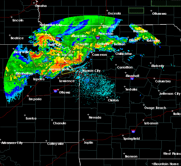 At 209 am cdt, a severe thunderstorm was located near easton, or 7 miles west of leavenworth, moving southeast at 25 mph (radar indicated). Hazards include 60 mph wind gusts and quarter size hail. Hail damage to vehicles is expected. Expect wind damage to roofs, siding, and trees. At 209 am cdt, a severe thunderstorm was located near easton, or 7 miles west of leavenworth, moving southeast at 25 mph (radar indicated). Hazards include 60 mph wind gusts and quarter size hail. Hail damage to vehicles is expected. Expect wind damage to roofs, siding, and trees.
|
| 6/5/2020 3:36 AM CDT |
 At 336 am cdt, severe thunderstorms were located along a line extending from near trimble to lake waukomis to near lenexa, moving southeast at 50 mph (radar indicated). Hazards include 70 mph wind gusts and nickel size hail. Expect considerable tree damage. Damage is likely to mobile homes, roofs, and outbuildings. At 336 am cdt, severe thunderstorms were located along a line extending from near trimble to lake waukomis to near lenexa, moving southeast at 50 mph (radar indicated). Hazards include 70 mph wind gusts and nickel size hail. Expect considerable tree damage. Damage is likely to mobile homes, roofs, and outbuildings.
|
| 6/5/2020 3:23 AM CDT |
 The national weather service in pleasant hill has issued a * severe thunderstorm warning for. southwestern wyandotte county in northeastern kansas. miami county in east central kansas. northern linn county in east central kansas. Johnson county in east central kansas. The national weather service in pleasant hill has issued a * severe thunderstorm warning for. southwestern wyandotte county in northeastern kansas. miami county in east central kansas. northern linn county in east central kansas. Johnson county in east central kansas.
|
| 6/5/2020 2:57 AM CDT |
 At 257 am cdt, severe thunderstorms were located along a line extending from elwood to near lewis and clark village to near mclouth, moving southeast at 60 mph (radar indicated). Hazards include 70 mph wind gusts and nickel size hail. Expect considerable tree damage. Damage is likely to mobile homes, roofs, and outbuildings. At 257 am cdt, severe thunderstorms were located along a line extending from elwood to near lewis and clark village to near mclouth, moving southeast at 60 mph (radar indicated). Hazards include 70 mph wind gusts and nickel size hail. Expect considerable tree damage. Damage is likely to mobile homes, roofs, and outbuildings.
|
| 6/5/2020 2:51 AM CDT |
 At 251 am cdt, severe thunderstorms were located along a line extending from near mclouth to near pleasant grove to near pomona lake, moving southeast at 50 mph (radar indicated). Hazards include 60 mph wind gusts and nickel size hail. expect damage to roofs, siding, and trees At 251 am cdt, severe thunderstorms were located along a line extending from near mclouth to near pleasant grove to near pomona lake, moving southeast at 50 mph (radar indicated). Hazards include 60 mph wind gusts and nickel size hail. expect damage to roofs, siding, and trees
|
| 6/4/2020 2:08 AM CDT |
 The severe thunderstorm warning for wyandotte, leavenworth, northern johnson, eastern buchanan, clay, clinton, northwestern ray, southwestern caldwell, platte and northwestern jackson counties will expire at 215 am cdt, the storms which prompted the warning have moved out of the area. therefore, the warning will be allowed to expire. however gusty winds are still possible with these thunderstorms. a severe thunderstorm watch remains in effect until 300 am cdt for northeastern and east central kansas, and northwestern and west central missouri. remember, a severe thunderstorm warning still remains in effect for johnson and wyandotte county kansas and jackson, clay, and clinton counties in missouri. The severe thunderstorm warning for wyandotte, leavenworth, northern johnson, eastern buchanan, clay, clinton, northwestern ray, southwestern caldwell, platte and northwestern jackson counties will expire at 215 am cdt, the storms which prompted the warning have moved out of the area. therefore, the warning will be allowed to expire. however gusty winds are still possible with these thunderstorms. a severe thunderstorm watch remains in effect until 300 am cdt for northeastern and east central kansas, and northwestern and west central missouri. remember, a severe thunderstorm warning still remains in effect for johnson and wyandotte county kansas and jackson, clay, and clinton counties in missouri.
|
| 6/4/2020 1:52 AM CDT |
 At 152 am cdt, severe thunderstorms were located along a line extending from 9 miles southwest of gallatin to near liberty to near de soto, moving east at 45 mph (radar indicated). Hazards include 60 mph wind gusts and quarter size hail. Hail damage to vehicles is expected. Expect wind damage to roofs, siding, and trees. At 152 am cdt, severe thunderstorms were located along a line extending from 9 miles southwest of gallatin to near liberty to near de soto, moving east at 45 mph (radar indicated). Hazards include 60 mph wind gusts and quarter size hail. Hail damage to vehicles is expected. Expect wind damage to roofs, siding, and trees.
|
| 6/4/2020 1:41 AM CDT |
 At 140 am cdt, severe thunderstorms were located along a line extending from near clarksdale to near camden point to near mclouth, moving southeast at 60 mph (radar indicated). Hazards include 60 mph wind gusts and nickel size hail. expect damage to roofs, siding, and trees At 140 am cdt, severe thunderstorms were located along a line extending from near clarksdale to near camden point to near mclouth, moving southeast at 60 mph (radar indicated). Hazards include 60 mph wind gusts and nickel size hail. expect damage to roofs, siding, and trees
|
| 5/4/2020 10:32 AM CDT | Quarter sized hail reported 0.8 miles W of Kansas City, KS, report from mping: quarter (1.00 in.). |
| 5/4/2020 10:32 AM CDT |
 At 1031 am cdt, a severe thunderstorm was located near mission, moving east at 45 mph (radar indicated). Hazards include 60 mph wind gusts and quarter size hail. Hail damage to vehicles is expected. expect wind damage to roofs, siding, and trees. Locations impacted include, kansas city, overland park, independence, lee`s summit, shawnee, blue springs, lenexa, leawood, raytown, liberty, gladstone, prairie village, merriam, mission, parkville, north kansas city, fairway, mission hills, sugar creek and riverside. At 1031 am cdt, a severe thunderstorm was located near mission, moving east at 45 mph (radar indicated). Hazards include 60 mph wind gusts and quarter size hail. Hail damage to vehicles is expected. expect wind damage to roofs, siding, and trees. Locations impacted include, kansas city, overland park, independence, lee`s summit, shawnee, blue springs, lenexa, leawood, raytown, liberty, gladstone, prairie village, merriam, mission, parkville, north kansas city, fairway, mission hills, sugar creek and riverside.
|
| 5/4/2020 10:15 AM CDT |
 At 1015 am cdt, a severe thunderstorm was located over bonner springs, moving east at 45 mph (radar indicated). Hazards include 60 mph wind gusts and quarter size hail. Hail damage to vehicles is expected. Expect wind damage to roofs, siding, and trees. At 1015 am cdt, a severe thunderstorm was located over bonner springs, moving east at 45 mph (radar indicated). Hazards include 60 mph wind gusts and quarter size hail. Hail damage to vehicles is expected. Expect wind damage to roofs, siding, and trees.
|
| 5/4/2020 10:15 AM CDT |
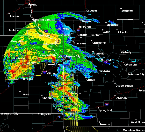 At 1015 am cdt, a severe thunderstorm was located over bonner springs, moving east at 45 mph (radar indicated). Hazards include 60 mph wind gusts and quarter size hail. Hail damage to vehicles is expected. Expect wind damage to roofs, siding, and trees. At 1015 am cdt, a severe thunderstorm was located over bonner springs, moving east at 45 mph (radar indicated). Hazards include 60 mph wind gusts and quarter size hail. Hail damage to vehicles is expected. Expect wind damage to roofs, siding, and trees.
|
| 5/4/2020 9:39 AM CDT |
 At 939 am cdt, a severe thunderstorm was located over williamstown, or 7 miles northwest of lawrence, moving east at 45 mph (radar indicated). Hazards include 60 mph wind gusts and quarter size hail. Hail damage to vehicles is expected. Expect wind damage to roofs, siding, and trees. At 939 am cdt, a severe thunderstorm was located over williamstown, or 7 miles northwest of lawrence, moving east at 45 mph (radar indicated). Hazards include 60 mph wind gusts and quarter size hail. Hail damage to vehicles is expected. Expect wind damage to roofs, siding, and trees.
|
| 4/11/2020 8:09 PM CDT |
 At 808 pm cdt, a severe thunderstorm was located over lake waukomis, or near gladstone, moving northeast at 40 mph (radar indicated). Hazards include 60 mph wind gusts and quarter size hail. Hail damage to vehicles is expected. Expect wind damage to roofs, siding, and trees. At 808 pm cdt, a severe thunderstorm was located over lake waukomis, or near gladstone, moving northeast at 40 mph (radar indicated). Hazards include 60 mph wind gusts and quarter size hail. Hail damage to vehicles is expected. Expect wind damage to roofs, siding, and trees.
|
| 9/27/2019 9:01 PM CDT |
 At 901 pm cdt, a severe thunderstorm was located near de soto, moving east at 30 mph (radar indicated). Hazards include golf ball size hail and 60 mph wind gusts. People and animals outdoors will be injured. expect hail damage to roofs, siding, windows, and vehicles. expect wind damage to roofs, siding, and trees. Locations impacted include, olathe, shawnee, lenexa, gardner, bonner springs, de soto, edwardsville, linwood, clare, lackmans, holliday and clearview city. At 901 pm cdt, a severe thunderstorm was located near de soto, moving east at 30 mph (radar indicated). Hazards include golf ball size hail and 60 mph wind gusts. People and animals outdoors will be injured. expect hail damage to roofs, siding, windows, and vehicles. expect wind damage to roofs, siding, and trees. Locations impacted include, olathe, shawnee, lenexa, gardner, bonner springs, de soto, edwardsville, linwood, clare, lackmans, holliday and clearview city.
|
| 9/27/2019 8:32 PM CDT |
 At 832 pm cdt, a severe thunderstorm was located near vinland, or near lawrence, moving east at 30 mph (radar indicated). Hazards include two inch hail and 60 mph wind gusts. People and animals outdoors will be injured. expect hail damage to roofs, siding, windows, and vehicles. Expect wind damage to roofs, siding, and trees. At 832 pm cdt, a severe thunderstorm was located near vinland, or near lawrence, moving east at 30 mph (radar indicated). Hazards include two inch hail and 60 mph wind gusts. People and animals outdoors will be injured. expect hail damage to roofs, siding, windows, and vehicles. Expect wind damage to roofs, siding, and trees.
|
| 9/27/2019 8:02 PM CDT |
 At 802 pm cdt, a severe thunderstorm was located near lawson, moving northeast at 35 mph (radar indicated). Hazards include two inch hail and 60 mph wind gusts. People and animals outdoors will be injured. expect hail damage to roofs, siding, windows, and vehicles. expect wind damage to roofs, siding, and trees. Locations impacted include, kansas city, liberty, gladstone, excelsior springs, smithville, kearney, richmond, parkville, riverside, lawson, claycomo, pleasant valley, braymer, lake waukomis, polo, glenaire, ferrelview, holt, platte woods and oakview. At 802 pm cdt, a severe thunderstorm was located near lawson, moving northeast at 35 mph (radar indicated). Hazards include two inch hail and 60 mph wind gusts. People and animals outdoors will be injured. expect hail damage to roofs, siding, windows, and vehicles. expect wind damage to roofs, siding, and trees. Locations impacted include, kansas city, liberty, gladstone, excelsior springs, smithville, kearney, richmond, parkville, riverside, lawson, claycomo, pleasant valley, braymer, lake waukomis, polo, glenaire, ferrelview, holt, platte woods and oakview.
|
| 9/27/2019 7:42 PM CDT |
 At 742 pm cdt, a severe thunderstorm was located over kearney, moving northeast at 35 mph (radar indicated). Hazards include ping pong ball size hail and 60 mph wind gusts. People and animals outdoors will be injured. expect hail damage to roofs, siding, windows, and vehicles. Expect wind damage to roofs, siding, and trees. At 742 pm cdt, a severe thunderstorm was located over kearney, moving northeast at 35 mph (radar indicated). Hazards include ping pong ball size hail and 60 mph wind gusts. People and animals outdoors will be injured. expect hail damage to roofs, siding, windows, and vehicles. Expect wind damage to roofs, siding, and trees.
|
| 9/27/2019 6:59 PM CDT |
 At 659 pm cdt, a severe thunderstorm was located near smithville, moving northeast at 20 mph (radar indicated). Hazards include 60 mph wind gusts and half dollar size hail. Hail damage to vehicles is expected. Expect wind damage to roofs, siding, and trees. At 659 pm cdt, a severe thunderstorm was located near smithville, moving northeast at 20 mph (radar indicated). Hazards include 60 mph wind gusts and half dollar size hail. Hail damage to vehicles is expected. Expect wind damage to roofs, siding, and trees.
|
| 9/27/2019 6:33 PM CDT |
 At 633 pm cdt, a severe thunderstorm was located over ferrelview, or near weatherby lake, moving northeast at 25 mph (radar indicated). Hazards include ping pong ball size hail and 60 mph wind gusts. People and animals outdoors will be injured. expect hail damage to roofs, siding, windows, and vehicles. expect wind damage to roofs, siding, and trees. Locations impacted include, kansas city, leavenworth, liberty, gladstone, lansing, smithville, kearney, parkville, platte city, weatherby lake, lake waukomis, ferrelview, holt, platte woods, farley, waldron, kansas city intl arpt, hoover and east leavenworth. At 633 pm cdt, a severe thunderstorm was located over ferrelview, or near weatherby lake, moving northeast at 25 mph (radar indicated). Hazards include ping pong ball size hail and 60 mph wind gusts. People and animals outdoors will be injured. expect hail damage to roofs, siding, windows, and vehicles. expect wind damage to roofs, siding, and trees. Locations impacted include, kansas city, leavenworth, liberty, gladstone, lansing, smithville, kearney, parkville, platte city, weatherby lake, lake waukomis, ferrelview, holt, platte woods, farley, waldron, kansas city intl arpt, hoover and east leavenworth.
|
| 9/27/2019 6:17 PM CDT |
 At 617 pm cdt, a severe thunderstorm was located over ferrelview, or near weatherby lake, moving northeast at 30 mph (radar indicated). Hazards include 60 mph wind gusts and half dollar size hail. Hail damage to vehicles is expected. Expect wind damage to roofs, siding, and trees. At 617 pm cdt, a severe thunderstorm was located over ferrelview, or near weatherby lake, moving northeast at 30 mph (radar indicated). Hazards include 60 mph wind gusts and half dollar size hail. Hail damage to vehicles is expected. Expect wind damage to roofs, siding, and trees.
|
| 8/18/2019 3:24 AM CDT |
 At 247 am cdt, a severe thunderstorm was located over olathe, moving northeast at 25 mph (radar indicated). Hazards include 60 mph wind gusts and nickel size hail. expect damage to roofs, siding, and trees At 247 am cdt, a severe thunderstorm was located over olathe, moving northeast at 25 mph (radar indicated). Hazards include 60 mph wind gusts and nickel size hail. expect damage to roofs, siding, and trees
|
| 8/18/2019 3:14 AM CDT |
 At 314 am cdt, a severe thunderstorm was located over lenexa, moving northeast at 25 mph (radar indicated). Hazards include 60 mph wind gusts and penny size hail. Expect damage to roofs, siding, and trees. Locations impacted include, overland park, olathe, shawnee, lenexa, leawood, prairie village, gardner, merriam, mission, bonner springs, de soto, parkville, basehor, edwardsville, fairway, mission hills, riverside, weatherby lake, westwood and lake quivira. At 314 am cdt, a severe thunderstorm was located over lenexa, moving northeast at 25 mph (radar indicated). Hazards include 60 mph wind gusts and penny size hail. Expect damage to roofs, siding, and trees. Locations impacted include, overland park, olathe, shawnee, lenexa, leawood, prairie village, gardner, merriam, mission, bonner springs, de soto, parkville, basehor, edwardsville, fairway, mission hills, riverside, weatherby lake, westwood and lake quivira.
|
| 8/18/2019 2:47 AM CDT |
 The national weather service in pleasant hill has issued a * severe thunderstorm warning for. wyandotte county in northeastern kansas. southeastern leavenworth county in northeastern kansas. johnson county in east central kansas. Southeastern platte county in west central missouri. The national weather service in pleasant hill has issued a * severe thunderstorm warning for. wyandotte county in northeastern kansas. southeastern leavenworth county in northeastern kansas. johnson county in east central kansas. Southeastern platte county in west central missouri.
|
| 8/18/2019 2:14 AM CDT |
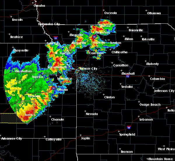 At 214 am cdt, a severe thunderstorm was located near easton, or 11 miles northeast of oskaloosa, moving northeast at 55 mph (radar indicated). Hazards include 60 mph wind gusts and quarter size hail. Hail damage to vehicles is expected. Expect wind damage to roofs, siding, and trees. At 214 am cdt, a severe thunderstorm was located near easton, or 11 miles northeast of oskaloosa, moving northeast at 55 mph (radar indicated). Hazards include 60 mph wind gusts and quarter size hail. Hail damage to vehicles is expected. Expect wind damage to roofs, siding, and trees.
|
| 8/17/2019 2:55 AM CDT |
 At 254 am cdt, severe thunderstorms were located along a line extending from near mclouth to lawrence to near richland, moving southeast at 40 mph (trained weather spotters). Hazards include 70 mph wind gusts and quarter size hail. Hail damage to vehicles is expected. expect considerable tree damage. wind damage is also likely to mobile homes, roofs, and outbuildings. Locations impacted include, olathe, gardner, lansing, bonner springs, de soto, tonganoxie, basehor, edgerton, linwood, reno, fairmount, clearview city and jarbalo. At 254 am cdt, severe thunderstorms were located along a line extending from near mclouth to lawrence to near richland, moving southeast at 40 mph (trained weather spotters). Hazards include 70 mph wind gusts and quarter size hail. Hail damage to vehicles is expected. expect considerable tree damage. wind damage is also likely to mobile homes, roofs, and outbuildings. Locations impacted include, olathe, gardner, lansing, bonner springs, de soto, tonganoxie, basehor, edgerton, linwood, reno, fairmount, clearview city and jarbalo.
|
| 8/17/2019 2:49 AM CDT |
 At 248 am cdt, severe thunderstorms were located along a line extending from near oskaloosa to near lawrence to near richland, moving southeast at 40 mph (radar indicated). Hazards include 60 mph wind gusts and quarter size hail. Hail damage to vehicles is expected. Expect wind damage to roofs, siding, and trees. At 248 am cdt, severe thunderstorms were located along a line extending from near oskaloosa to near lawrence to near richland, moving southeast at 40 mph (radar indicated). Hazards include 60 mph wind gusts and quarter size hail. Hail damage to vehicles is expected. Expect wind damage to roofs, siding, and trees.
|
| 8/17/2019 1:38 AM CDT |
 A severe thunderstorm warning remains in effect until 200 am cdt for clay and northern jackson counties. at 138 am cdt, a severe thunderstorm was located over liberty, moving east at 35 mph. hazard. 60 mph wind gusts and quarter size hail. source. Radar indicated. A severe thunderstorm warning remains in effect until 200 am cdt for clay and northern jackson counties. at 138 am cdt, a severe thunderstorm was located over liberty, moving east at 35 mph. hazard. 60 mph wind gusts and quarter size hail. source. Radar indicated.
|
| 8/17/2019 1:25 AM CDT |
 At 125 am cdt, a severe thunderstorm was located over kansas city downtown, or over kansas city kansas, moving east at 30 mph (radar indicated). Hazards include 60 mph wind gusts and quarter size hail. Hail damage to vehicles is expected. Expect wind damage to roofs, siding, and trees. At 125 am cdt, a severe thunderstorm was located over kansas city downtown, or over kansas city kansas, moving east at 30 mph (radar indicated). Hazards include 60 mph wind gusts and quarter size hail. Hail damage to vehicles is expected. Expect wind damage to roofs, siding, and trees.
|
| 8/17/2019 12:36 AM CDT |
 The national weather service in pleasant hill has issued a * severe thunderstorm warning for. wyandotte county in northeastern kansas. leavenworth county in northeastern kansas. southeastern atchison county in northeastern kansas. Central platte county in west central missouri. The national weather service in pleasant hill has issued a * severe thunderstorm warning for. wyandotte county in northeastern kansas. leavenworth county in northeastern kansas. southeastern atchison county in northeastern kansas. Central platte county in west central missouri.
|
| 8/17/2019 12:36 AM CDT |
 At 1236 am cdt, a severe thunderstorm was located near mclouth, or 8 miles north of tonganoxie, moving east at 40 mph (radar indicated). Hazards include ping pong ball size hail and 60 mph wind gusts. People and animals outdoors will be injured. expect hail damage to roofs, siding, windows, and vehicles. Expect wind damage to roofs, siding, and trees. At 1236 am cdt, a severe thunderstorm was located near mclouth, or 8 miles north of tonganoxie, moving east at 40 mph (radar indicated). Hazards include ping pong ball size hail and 60 mph wind gusts. People and animals outdoors will be injured. expect hail damage to roofs, siding, windows, and vehicles. Expect wind damage to roofs, siding, and trees.
|
| 8/16/2019 3:31 AM CDT |
 At 331 am cdt, a severe thunderstorm was located near easton, or 8 miles northeast of oskaloosa, moving east at 30 mph (radar indicated). Hazards include 60 mph wind gusts and quarter size hail. Hail damage to vehicles is expected. Expect wind damage to roofs, siding, and trees. At 331 am cdt, a severe thunderstorm was located near easton, or 8 miles northeast of oskaloosa, moving east at 30 mph (radar indicated). Hazards include 60 mph wind gusts and quarter size hail. Hail damage to vehicles is expected. Expect wind damage to roofs, siding, and trees.
|
| 8/16/2019 12:58 AM CDT |
 The severe thunderstorm warning for southern clay, southwestern ray, southwestern lafayette and jackson counties will expire at 100 am cdt, the storm which prompted the warning has weakened below severe limits, and no longer poses an immediate threat to life or property. therefore, the warning will be allowed to expire. however small hail, gusty winds and heavy rain are still possible with this thunderstorm. this storm may also reintensify. a severe thunderstorm watch remains in effect until 700 am cdt for northeastern and east central kansas, and west central missouri. remember, a severe thunderstorm warning still remains in effect for 7 am. The severe thunderstorm warning for southern clay, southwestern ray, southwestern lafayette and jackson counties will expire at 100 am cdt, the storm which prompted the warning has weakened below severe limits, and no longer poses an immediate threat to life or property. therefore, the warning will be allowed to expire. however small hail, gusty winds and heavy rain are still possible with this thunderstorm. this storm may also reintensify. a severe thunderstorm watch remains in effect until 700 am cdt for northeastern and east central kansas, and west central missouri. remember, a severe thunderstorm warning still remains in effect for 7 am.
|
| 8/16/2019 12:38 AM CDT |
 At 1237 am cdt, a severe thunderstorm was located over liberty, moving southeast at 25 mph (radar indicated). Hazards include 70 mph wind gusts and quarter size hail. Hail damage to vehicles is expected. expect considerable tree damage. wind damage is also likely to mobile homes, roofs, and outbuildings. Locations impacted include, kansas city, liberty, gladstone, excelsior springs, kearney, north kansas city, claycomo, pleasant valley, glenaire, avondale, missouri city, river bend, mosby, birmingham, prathersville and randolph. At 1237 am cdt, a severe thunderstorm was located over liberty, moving southeast at 25 mph (radar indicated). Hazards include 70 mph wind gusts and quarter size hail. Hail damage to vehicles is expected. expect considerable tree damage. wind damage is also likely to mobile homes, roofs, and outbuildings. Locations impacted include, kansas city, liberty, gladstone, excelsior springs, kearney, north kansas city, claycomo, pleasant valley, glenaire, avondale, missouri city, river bend, mosby, birmingham, prathersville and randolph.
|
| 8/16/2019 12:25 AM CDT |
 A severe thunderstorm warning remains in effect until 1245 am cdt for northeastern wyandotte and clay counties. at 1223 am cdt, a severe thunderstorm was located near liberty, moving southeast at 25 mph. at 1219 am an off duty nws employee reported a 70 mph wind gust just north of kansas city. hazard. 70 mph wind gusts and quarter size hail. A severe thunderstorm warning remains in effect until 1245 am cdt for northeastern wyandotte and clay counties. at 1223 am cdt, a severe thunderstorm was located near liberty, moving southeast at 25 mph. at 1219 am an off duty nws employee reported a 70 mph wind gust just north of kansas city. hazard. 70 mph wind gusts and quarter size hail.
|
| 8/16/2019 12:23 AM CDT |
 The national weather service in pleasant hill has issued a * severe thunderstorm warning for. southern clay county in west central missouri. southwestern ray county in west central missouri. southwestern lafayette county in west central missouri. Jackson county in west central missouri. The national weather service in pleasant hill has issued a * severe thunderstorm warning for. southern clay county in west central missouri. southwestern ray county in west central missouri. southwestern lafayette county in west central missouri. Jackson county in west central missouri.
|
| 8/16/2019 12:00 AM CDT |
 The national weather service in pleasant hill has issued a * severe thunderstorm warning for. northeastern wyandotte county in northeastern kansas. clay county in west central missouri. southern clinton county in northwestern missouri. Eastern platte county in west central missouri. The national weather service in pleasant hill has issued a * severe thunderstorm warning for. northeastern wyandotte county in northeastern kansas. clay county in west central missouri. southern clinton county in northwestern missouri. Eastern platte county in west central missouri.
|
| 8/16/2019 12:00 AM CDT |
 At 1200 am cdt, a severe thunderstorm was located over smithville, moving southeast at 25 mph (radar indicated). Hazards include 60 mph wind gusts and quarter size hail. Hail damage to vehicles is expected. Expect wind damage to roofs, siding, and trees. At 1200 am cdt, a severe thunderstorm was located over smithville, moving southeast at 25 mph (radar indicated). Hazards include 60 mph wind gusts and quarter size hail. Hail damage to vehicles is expected. Expect wind damage to roofs, siding, and trees.
|
| 7/10/2019 9:16 AM CDT |
 At 916 am cdt, severe thunderstorms were located along a line extending from trimble to near raytown to near cleveland, moving east at 45 mph (radar indicated). Hazards include 60 mph wind gusts and quarter size hail. Hail damage to vehicles is expected. expect wind damage to roofs, siding, and trees. Locations impacted include, kansas city, overland park, olathe, independence, lee`s summit, shawnee, blue springs, lenexa, leawood, raytown, liberty, gladstone, grandview, belton, prairie village, raymore, gardner, grain valley, lansing and excelsior springs. At 916 am cdt, severe thunderstorms were located along a line extending from trimble to near raytown to near cleveland, moving east at 45 mph (radar indicated). Hazards include 60 mph wind gusts and quarter size hail. Hail damage to vehicles is expected. expect wind damage to roofs, siding, and trees. Locations impacted include, kansas city, overland park, olathe, independence, lee`s summit, shawnee, blue springs, lenexa, leawood, raytown, liberty, gladstone, grandview, belton, prairie village, raymore, gardner, grain valley, lansing and excelsior springs.
|
| 7/10/2019 9:02 AM CDT |
 At 901 am cdt, severe thunderstorms were located along a line extending from edgerton to near kansas city to near spring hill, moving east at 50 mph (radar indicated). Hazards include 60 mph wind gusts and penny size hail. expect damage to roofs, siding, and trees At 901 am cdt, severe thunderstorms were located along a line extending from edgerton to near kansas city to near spring hill, moving east at 50 mph (radar indicated). Hazards include 60 mph wind gusts and penny size hail. expect damage to roofs, siding, and trees
|
| 7/10/2019 8:57 AM CDT | Storm damage reported in wyandotte county KS, 4.8 miles ESE of Kansas City, KS |
| 7/10/2019 8:39 AM CDT |
 At 832 am cdt, severe thunderstorms were located along a line extending from near atchison to 7 miles southwest of leavenworth to near lawrence, moving east at 50 mph (radar indicated). Hazards include 60 mph wind gusts and quarter size hail. Hail damage to vehicles is expected. expect wind damage to roofs, siding, and trees. Locations impacted include, olathe, shawnee, lenexa, leavenworth, lansing, atchison, bonner springs, de soto, tonganoxie, platte city, basehor, edwardsville, weston, kansas city, effingham, linwood, rushville, lancaster, easton and tracy. At 832 am cdt, severe thunderstorms were located along a line extending from near atchison to 7 miles southwest of leavenworth to near lawrence, moving east at 50 mph (radar indicated). Hazards include 60 mph wind gusts and quarter size hail. Hail damage to vehicles is expected. expect wind damage to roofs, siding, and trees. Locations impacted include, olathe, shawnee, lenexa, leavenworth, lansing, atchison, bonner springs, de soto, tonganoxie, platte city, basehor, edwardsville, weston, kansas city, effingham, linwood, rushville, lancaster, easton and tracy.
|
| 7/10/2019 8:39 AM CDT |
 A severe thunderstorm warning remains in effect until 900 am cdt for northwestern wyandotte. leavenworth. northwestern johnson. southeastern atchison and central platte counties. At 837 am cdt, severe thunderstorms were located along a line extending from near lewis and clark village to lansing to near eudora, moving east at 45 mph. A severe thunderstorm warning remains in effect until 900 am cdt for northwestern wyandotte. leavenworth. northwestern johnson. southeastern atchison and central platte counties. At 837 am cdt, severe thunderstorms were located along a line extending from near lewis and clark village to lansing to near eudora, moving east at 45 mph.
|
| 7/10/2019 8:32 AM CDT |
 At 832 am cdt, severe thunderstorms were located along a line extending from near atchison to 7 miles southwest of leavenworth to near lawrence, moving east at 50 mph (radar indicated). Hazards include 60 mph wind gusts and quarter size hail. Hail damage to vehicles is expected. expect wind damage to roofs, siding, and trees. Locations impacted include, olathe, shawnee, lenexa, leavenworth, lansing, atchison, bonner springs, de soto, tonganoxie, platte city, basehor, edwardsville, weston, kansas city, effingham, linwood, rushville, lancaster, easton and tracy. At 832 am cdt, severe thunderstorms were located along a line extending from near atchison to 7 miles southwest of leavenworth to near lawrence, moving east at 50 mph (radar indicated). Hazards include 60 mph wind gusts and quarter size hail. Hail damage to vehicles is expected. expect wind damage to roofs, siding, and trees. Locations impacted include, olathe, shawnee, lenexa, leavenworth, lansing, atchison, bonner springs, de soto, tonganoxie, platte city, basehor, edwardsville, weston, kansas city, effingham, linwood, rushville, lancaster, easton and tracy.
|
| 7/10/2019 8:11 AM CDT |
 At 810 am cdt, severe thunderstorms were located along a line extending from near everest to near winchester to near perry, moving east at 40 mph (radar indicated). Hazards include 60 mph wind gusts and quarter size hail. Hail damage to vehicles is expected. Expect wind damage to roofs, siding, and trees. At 810 am cdt, severe thunderstorms were located along a line extending from near everest to near winchester to near perry, moving east at 40 mph (radar indicated). Hazards include 60 mph wind gusts and quarter size hail. Hail damage to vehicles is expected. Expect wind damage to roofs, siding, and trees.
|
| 6/21/2019 9:57 AM CDT |
 At 957 am cdt, a severe thunderstorm was located over lake quivira, moving east at 60 mph (radar indicated). Hazards include 60 mph wind gusts. expect damage to roofs, siding, and trees At 957 am cdt, a severe thunderstorm was located over lake quivira, moving east at 60 mph (radar indicated). Hazards include 60 mph wind gusts. expect damage to roofs, siding, and trees
|
| 6/21/2019 9:22 AM CDT |
 At 922 am cdt, a severe thunderstorm was located near winchester, or near oskaloosa, moving east at 50 mph (radar indicated). Hazards include 60 mph wind gusts. expect damage to roofs, siding, and trees At 922 am cdt, a severe thunderstorm was located near winchester, or near oskaloosa, moving east at 50 mph (radar indicated). Hazards include 60 mph wind gusts. expect damage to roofs, siding, and trees
|
| 6/21/2019 7:50 AM CDT |
 At 750 am cdt, severe thunderstorms were located along a line extending from near avondale to near peculiar, moving east at 35 mph (radar indicated). Hazards include 60 mph wind gusts and quarter size hail. Hail damage to vehicles is expected. Expect wind damage to roofs, siding, and trees. At 750 am cdt, severe thunderstorms were located along a line extending from near avondale to near peculiar, moving east at 35 mph (radar indicated). Hazards include 60 mph wind gusts and quarter size hail. Hail damage to vehicles is expected. Expect wind damage to roofs, siding, and trees.
|
| 6/21/2019 7:47 AM CDT |
 At 747 am cdt, a severe thunderstorm was located over grandview, moving east at 35 mph (radar indicated). Hazards include 60 mph wind gusts and quarter size hail. Hail damage to vehicles is expected. expect wind damage to roofs, siding, and trees. Locations impacted include, kansas city, overland park, independence, lee`s summit, leawood, raytown, grandview, belton, prairie village, raymore, merriam, mission, fairway, mission hills, westwood, westwood hills, mission woods, countryside, roeland park and stillwell. At 747 am cdt, a severe thunderstorm was located over grandview, moving east at 35 mph (radar indicated). Hazards include 60 mph wind gusts and quarter size hail. Hail damage to vehicles is expected. expect wind damage to roofs, siding, and trees. Locations impacted include, kansas city, overland park, independence, lee`s summit, leawood, raytown, grandview, belton, prairie village, raymore, merriam, mission, fairway, mission hills, westwood, westwood hills, mission woods, countryside, roeland park and stillwell.
|
| 6/21/2019 7:43 AM CDT |
 At 743 am cdt, a severe thunderstorm was located over riverside, moving northeast at 35 mph (radar indicated). Hazards include 60 mph wind gusts and quarter size hail. Hail damage to vehicles is expected. expect wind damage to roofs, siding, and trees. Locations impacted include, kansas city, independence, gladstone, merriam, mission, parkville, north kansas city, riverside, kansas city kansas, lake waukomis, avondale, platte woods, oakview, northmoor, houston lake, kansas city downtown, roeland park, oakwood park, oakwood and oaks. At 743 am cdt, a severe thunderstorm was located over riverside, moving northeast at 35 mph (radar indicated). Hazards include 60 mph wind gusts and quarter size hail. Hail damage to vehicles is expected. expect wind damage to roofs, siding, and trees. Locations impacted include, kansas city, independence, gladstone, merriam, mission, parkville, north kansas city, riverside, kansas city kansas, lake waukomis, avondale, platte woods, oakview, northmoor, houston lake, kansas city downtown, roeland park, oakwood park, oakwood and oaks.
|
| 6/21/2019 7:32 AM CDT |
 At 732 am cdt, a severe thunderstorm was located near lenexa, moving east at 35 mph (radar indicated). Hazards include 60 mph wind gusts and quarter size hail. Hail damage to vehicles is expected. Expect wind damage to roofs, siding, and trees. At 732 am cdt, a severe thunderstorm was located near lenexa, moving east at 35 mph (radar indicated). Hazards include 60 mph wind gusts and quarter size hail. Hail damage to vehicles is expected. Expect wind damage to roofs, siding, and trees.
|
| 6/21/2019 7:26 AM CDT |
 At 726 am cdt, a severe thunderstorm was located over edwardsville, moving northeast at 35 mph (radar indicated). Hazards include 60 mph wind gusts and nickel size hail. expect damage to roofs, siding, and trees At 726 am cdt, a severe thunderstorm was located over edwardsville, moving northeast at 35 mph (radar indicated). Hazards include 60 mph wind gusts and nickel size hail. expect damage to roofs, siding, and trees
|
| 6/21/2019 7:24 AM CDT |
 At 723 am cdt, severe thunderstorms were located along a line extending from near missouri city to leawood, moving southeast at 35 mph (radar indicated). Hazards include 60 mph wind gusts and quarter size hail. Hail damage to vehicles is expected. expect wind damage to roofs, siding, and trees. Locations impacted include, kansas city, independence, lee`s summit, blue springs, raytown, liberty, gladstone, grain valley, excelsior springs, kearney, oak grove, north kansas city, sugar creek, buckner, lake lotawana, claycomo, courtney, pleasant valley, orrick and wellington. At 723 am cdt, severe thunderstorms were located along a line extending from near missouri city to leawood, moving southeast at 35 mph (radar indicated). Hazards include 60 mph wind gusts and quarter size hail. Hail damage to vehicles is expected. expect wind damage to roofs, siding, and trees. Locations impacted include, kansas city, independence, lee`s summit, blue springs, raytown, liberty, gladstone, grain valley, excelsior springs, kearney, oak grove, north kansas city, sugar creek, buckner, lake lotawana, claycomo, courtney, pleasant valley, orrick and wellington.
|
| 6/21/2019 7:18 AM CDT |
 At 718 am cdt, a severe thunderstorm was located over buckner, moving southeast at 50 mph (radar indicated). Hazards include 60 mph wind gusts and quarter size hail. Hail damage to vehicles is expected. expect wind damage to roofs, siding, and trees. Locations impacted include, kansas city, independence, lee`s summit, blue springs, liberty, gladstone, grain valley, smithville, kearney, parkville, north kansas city, sugar creek, buckner, riverside, weatherby lake, claycomo, courtney, pleasant valley, lake waukomis and orrick. At 718 am cdt, a severe thunderstorm was located over buckner, moving southeast at 50 mph (radar indicated). Hazards include 60 mph wind gusts and quarter size hail. Hail damage to vehicles is expected. expect wind damage to roofs, siding, and trees. Locations impacted include, kansas city, independence, lee`s summit, blue springs, liberty, gladstone, grain valley, smithville, kearney, parkville, north kansas city, sugar creek, buckner, riverside, weatherby lake, claycomo, courtney, pleasant valley, lake waukomis and orrick.
|
| 6/21/2019 7:10 AM CDT |
 The national weather service in pleasant hill has issued a * severe thunderstorm warning for. east central wyandotte county in northeastern kansas. northeastern johnson county in east central kansas. southern clay county in west central missouri. Southwestern ray county in west central missouri. The national weather service in pleasant hill has issued a * severe thunderstorm warning for. east central wyandotte county in northeastern kansas. northeastern johnson county in east central kansas. southern clay county in west central missouri. Southwestern ray county in west central missouri.
|
| 6/21/2019 7:10 AM CDT |
 At 710 am cdt, severe thunderstorms were located along a line extending from near kearney to merriam, moving southeast at 35 mph (radar indicated). Hazards include 60 mph wind gusts and quarter size hail. Hail damage to vehicles is expected. Expect wind damage to roofs, siding, and trees. At 710 am cdt, severe thunderstorms were located along a line extending from near kearney to merriam, moving southeast at 35 mph (radar indicated). Hazards include 60 mph wind gusts and quarter size hail. Hail damage to vehicles is expected. Expect wind damage to roofs, siding, and trees.
|
| 6/21/2019 6:59 AM CDT |
 A severe thunderstorm warning remains in effect until 715 am cdt for wyandotte. northeastern johnson. southeastern platte and west central jackson counties. at 659 am cdt, a severe thunderstorm was located over mission woods, or over mission hills, moving southeast at 45 mph. hazard. 70 mph wind gusts and half dollar size hail. A severe thunderstorm warning remains in effect until 715 am cdt for wyandotte. northeastern johnson. southeastern platte and west central jackson counties. at 659 am cdt, a severe thunderstorm was located over mission woods, or over mission hills, moving southeast at 45 mph. hazard. 70 mph wind gusts and half dollar size hail.
|
| 6/21/2019 6:59 AM CDT |
 At 659 am cdt, a severe thunderstorm was located over mission woods, or over mission hills, moving southeast at 45 mph (radar indicated). Hazards include 70 mph wind gusts and half dollar size hail. Hail damage to vehicles is expected. expect considerable tree damage. wind damage is also likely to mobile homes, roofs, and outbuildings. Locations impacted include, kansas city, overland park, independence, shawnee, lenexa, leawood, raytown, grandview, prairie village, merriam, mission, bonner springs, parkville, edwardsville, north kansas city, fairway, mission hills, sugar creek, riverside and weatherby lake. At 659 am cdt, a severe thunderstorm was located over mission woods, or over mission hills, moving southeast at 45 mph (radar indicated). Hazards include 70 mph wind gusts and half dollar size hail. Hail damage to vehicles is expected. expect considerable tree damage. wind damage is also likely to mobile homes, roofs, and outbuildings. Locations impacted include, kansas city, overland park, independence, shawnee, lenexa, leawood, raytown, grandview, prairie village, merriam, mission, bonner springs, parkville, edwardsville, north kansas city, fairway, mission hills, sugar creek, riverside and weatherby lake.
|
| 6/21/2019 6:53 AM CDT |
 At 652 am cdt, a severe thunderstorm was located near kansas city kansas, moving southeast at 45 mph (radar indicated). Hazards include 70 mph wind gusts and quarter size hail. Hail damage to vehicles is expected. expect considerable tree damage. wind damage is also likely to mobile homes, roofs, and outbuildings. Locations impacted include, kansas city, overland park, independence, shawnee, lenexa, leavenworth, leawood, raytown, grandview, prairie village, lansing, merriam, mission, bonner springs, parkville, basehor, edwardsville, north kansas city, fairway and mission hills. At 652 am cdt, a severe thunderstorm was located near kansas city kansas, moving southeast at 45 mph (radar indicated). Hazards include 70 mph wind gusts and quarter size hail. Hail damage to vehicles is expected. expect considerable tree damage. wind damage is also likely to mobile homes, roofs, and outbuildings. Locations impacted include, kansas city, overland park, independence, shawnee, lenexa, leavenworth, leawood, raytown, grandview, prairie village, lansing, merriam, mission, bonner springs, parkville, basehor, edwardsville, north kansas city, fairway and mission hills.
|
| 6/21/2019 6:42 AM CDT |
 At 642 am cdt, a severe thunderstorm was located near kansas city, or near parkville, moving southeast at 35 mph (radar indicated). Hazards include 70 mph wind gusts and nickel size hail. Expect considerable tree damage. damage is likely to mobile homes, roofs, and outbuildings. Locations impacted include, kansas city, overland park, independence, shawnee, lenexa, leavenworth, leawood, raytown, grandview, prairie village, lansing, merriam, mission, bonner springs, parkville, basehor, edwardsville, north kansas city, fairway and mission hills. At 642 am cdt, a severe thunderstorm was located near kansas city, or near parkville, moving southeast at 35 mph (radar indicated). Hazards include 70 mph wind gusts and nickel size hail. Expect considerable tree damage. damage is likely to mobile homes, roofs, and outbuildings. Locations impacted include, kansas city, overland park, independence, shawnee, lenexa, leavenworth, leawood, raytown, grandview, prairie village, lansing, merriam, mission, bonner springs, parkville, basehor, edwardsville, north kansas city, fairway and mission hills.
|
| 6/21/2019 6:41 AM CDT |
 At 641 am cdt, a severe thunderstorm was located near ferrelview, or near smithville, moving southeast at 50 mph (radar indicated). Hazards include 60 mph wind gusts and nickel size hail. expect damage to roofs, siding, and trees At 641 am cdt, a severe thunderstorm was located near ferrelview, or near smithville, moving southeast at 50 mph (radar indicated). Hazards include 60 mph wind gusts and nickel size hail. expect damage to roofs, siding, and trees
|
| 6/21/2019 6:26 AM CDT |
 At 625 am cdt, a severe thunderstorm was located over lansing, moving southeast at 45 mph (radar indicated). Hazards include 70 mph wind gusts and nickel size hail. Expect considerable tree damage. Damage is likely to mobile homes, roofs, and outbuildings. At 625 am cdt, a severe thunderstorm was located over lansing, moving southeast at 45 mph (radar indicated). Hazards include 70 mph wind gusts and nickel size hail. Expect considerable tree damage. Damage is likely to mobile homes, roofs, and outbuildings.
|
| 6/21/2019 6:07 AM CDT |
 At 606 am cdt, a severe thunderstorm was located over easton, or 11 miles northwest of leavenworth, moving southeast at 45 mph (radar indicated). Hazards include 60 mph wind gusts and nickel size hail. expect damage to roofs, siding, and trees At 606 am cdt, a severe thunderstorm was located over easton, or 11 miles northwest of leavenworth, moving southeast at 45 mph (radar indicated). Hazards include 60 mph wind gusts and nickel size hail. expect damage to roofs, siding, and trees
|
| 6/15/2019 7:05 PM CDT |
 At 705 pm cdt, a severe thunderstorm was located over river bend, or over courtney, moving east at 30 mph (radar indicated). Hazards include ping pong ball size hail and 60 mph wind gusts. People and animals outdoors will be injured. expect hail damage to roofs, siding, windows, and vehicles. expect wind damage to roofs, siding, and trees. Locations impacted include, kansas city, independence, liberty, gladstone, excelsior springs, north kansas city, sugar creek, claycomo, courtney, pleasant valley, glenaire, avondale, oakview, missouri city, river bend, kansas city downtown, mosby, oakwood park, oakwood and birmingham. At 705 pm cdt, a severe thunderstorm was located over river bend, or over courtney, moving east at 30 mph (radar indicated). Hazards include ping pong ball size hail and 60 mph wind gusts. People and animals outdoors will be injured. expect hail damage to roofs, siding, windows, and vehicles. expect wind damage to roofs, siding, and trees. Locations impacted include, kansas city, independence, liberty, gladstone, excelsior springs, north kansas city, sugar creek, claycomo, courtney, pleasant valley, glenaire, avondale, oakview, missouri city, river bend, kansas city downtown, mosby, oakwood park, oakwood and birmingham.
|
| 6/15/2019 6:59 PM CDT |
 At 659 pm cdt, a severe thunderstorm was located over glenaire, or over liberty, moving east at 25 mph (radar indicated). Hazards include ping pong ball size hail and 60 mph wind gusts. People and animals outdoors will be injured. expect hail damage to roofs, siding, windows, and vehicles. expect wind damage to roofs, siding, and trees. Locations impacted include, kansas city, independence, liberty, gladstone, excelsior springs, north kansas city, sugar creek, claycomo, courtney, pleasant valley, glenaire, avondale, oakview, missouri city, excelsior estates, river bend, kansas city downtown, mosby, oakwood park and oakwood. At 659 pm cdt, a severe thunderstorm was located over glenaire, or over liberty, moving east at 25 mph (radar indicated). Hazards include ping pong ball size hail and 60 mph wind gusts. People and animals outdoors will be injured. expect hail damage to roofs, siding, windows, and vehicles. expect wind damage to roofs, siding, and trees. Locations impacted include, kansas city, independence, liberty, gladstone, excelsior springs, north kansas city, sugar creek, claycomo, courtney, pleasant valley, glenaire, avondale, oakview, missouri city, excelsior estates, river bend, kansas city downtown, mosby, oakwood park and oakwood.
|
| 6/15/2019 6:47 PM CDT |
 At 647 pm cdt, a severe thunderstorm was located over gladstone, moving east at 25 mph (radar indicated). Hazards include 60 mph wind gusts and quarter size hail. Hail damage to vehicles is expected. Expect wind damage to roofs, siding, and trees. At 647 pm cdt, a severe thunderstorm was located over gladstone, moving east at 25 mph (radar indicated). Hazards include 60 mph wind gusts and quarter size hail. Hail damage to vehicles is expected. Expect wind damage to roofs, siding, and trees.
|
| 6/12/2019 3:46 PM CDT |
 At 346 pm cdt, severe thunderstorms were located along a line extending from near hardin to near buckner to houston lake, moving south at 40 mph (radar indicated). Hazards include 60 mph wind gusts and quarter size hail. Hail damage to vehicles is expected. Expect wind damage to roofs, siding, and trees. At 346 pm cdt, severe thunderstorms were located along a line extending from near hardin to near buckner to houston lake, moving south at 40 mph (radar indicated). Hazards include 60 mph wind gusts and quarter size hail. Hail damage to vehicles is expected. Expect wind damage to roofs, siding, and trees.
|
| 6/1/2019 4:27 PM CDT |
 The severe thunderstorm warning for northwestern jackson county will expire at 430 pm cdt, the storm which prompted the warning has moved out of the area. therefore, the warning will be allowed to expire. a new severe thunderstorm warning has been issued for areas to the east. a severe thunderstorm watch remains in effect until 1100 pm cdt for east central kansas, and west central missouri. The severe thunderstorm warning for northwestern jackson county will expire at 430 pm cdt, the storm which prompted the warning has moved out of the area. therefore, the warning will be allowed to expire. a new severe thunderstorm warning has been issued for areas to the east. a severe thunderstorm watch remains in effect until 1100 pm cdt for east central kansas, and west central missouri.
|
| 6/1/2019 4:07 PM CDT |
 At 406 pm cdt, a severe thunderstorm was located near raytown, moving east at 30 mph (trained weather spotters reported quarter size hail within the kansas city plaza at 403 pm). Hazards include 60 mph wind gusts and quarter size hail. Hail damage to vehicles is expected. expect wind damage to roofs, siding, and trees. Locations impacted include, kansas city, independence, lee`s summit, raytown, mission hills, sugar creek, westwood, westwood hills, mission woods and unity village. At 406 pm cdt, a severe thunderstorm was located near raytown, moving east at 30 mph (trained weather spotters reported quarter size hail within the kansas city plaza at 403 pm). Hazards include 60 mph wind gusts and quarter size hail. Hail damage to vehicles is expected. expect wind damage to roofs, siding, and trees. Locations impacted include, kansas city, independence, lee`s summit, raytown, mission hills, sugar creek, westwood, westwood hills, mission woods and unity village.
|
| 6/1/2019 4:00 PM CDT | Half Dollar sized hail reported 5.7 miles W of Kansas City, KS |
| 6/1/2019 3:58 PM CDT | Quarter sized hail reported 6.8 miles WNW of Kansas City, KS |
| 6/1/2019 3:57 PM CDT | Quarter sized hail reported 7.8 miles WNW of Kansas City, KS |
| 6/1/2019 3:57 PM CDT |
 The severe thunderstorm warning for central wyandotte and northeastern johnson counties will expire at 400 pm cdt, the storm which prompted the warning has moved out of the area. therefore, the warning will be allowed to expire. a new severe thunderstorm warning has been issued for areas to the east, however, including the kansas city metro. a severe thunderstorm watch remains in effect until 1100 pm cdt for east central kansas. The severe thunderstorm warning for central wyandotte and northeastern johnson counties will expire at 400 pm cdt, the storm which prompted the warning has moved out of the area. therefore, the warning will be allowed to expire. a new severe thunderstorm warning has been issued for areas to the east, however, including the kansas city metro. a severe thunderstorm watch remains in effect until 1100 pm cdt for east central kansas.
|
| 6/1/2019 3:55 PM CDT | Quarter sized hail reported 3.6 miles W of Kansas City, KS |
| 6/1/2019 3:53 PM CDT |
 At 353 pm cdt, a severe thunderstorm was located over mission, moving east at 30 mph (radar indicated). Hazards include 60 mph wind gusts and quarter size hail. Hail damage to vehicles is expected. Expect wind damage to roofs, siding, and trees. At 353 pm cdt, a severe thunderstorm was located over mission, moving east at 30 mph (radar indicated). Hazards include 60 mph wind gusts and quarter size hail. Hail damage to vehicles is expected. Expect wind damage to roofs, siding, and trees.
|
| 6/1/2019 3:47 PM CDT |
 At 347 pm cdt, a severe thunderstorm was located over lake quivira, moving east at 25 mph (radar indicated). Hazards include 60 mph wind gusts and quarter size hail. Hail damage to vehicles is expected. expect wind damage to roofs, siding, and trees. Locations impacted include, overland park, shawnee, lenexa, leawood, prairie village, merriam, mission, bonner springs, edwardsville, fairway, mission hills, lake quivira, kansas city, countryside, roeland park, holliday and muncie. At 347 pm cdt, a severe thunderstorm was located over lake quivira, moving east at 25 mph (radar indicated). Hazards include 60 mph wind gusts and quarter size hail. Hail damage to vehicles is expected. expect wind damage to roofs, siding, and trees. Locations impacted include, overland park, shawnee, lenexa, leawood, prairie village, merriam, mission, bonner springs, edwardsville, fairway, mission hills, lake quivira, kansas city, countryside, roeland park, holliday and muncie.
|
| 6/1/2019 3:37 PM CDT |
 At 337 pm cdt, a severe thunderstorm was located over bonner springs, moving east at 30 mph (radar indicated). Hazards include 60 mph wind gusts and quarter size hail. Hail damage to vehicles is expected. expect wind damage to roofs, siding, and trees. Locations impacted include, overland park, shawnee, lenexa, leawood, prairie village, merriam, mission, bonner springs, edwardsville, fairway, mission hills, lake quivira, kansas city, countryside, roeland park, pomeroy, holliday, muncie, maywood and beverly hills. At 337 pm cdt, a severe thunderstorm was located over bonner springs, moving east at 30 mph (radar indicated). Hazards include 60 mph wind gusts and quarter size hail. Hail damage to vehicles is expected. expect wind damage to roofs, siding, and trees. Locations impacted include, overland park, shawnee, lenexa, leawood, prairie village, merriam, mission, bonner springs, edwardsville, fairway, mission hills, lake quivira, kansas city, countryside, roeland park, pomeroy, holliday, muncie, maywood and beverly hills.
|
| 6/1/2019 3:30 PM CDT |
 At 330 pm cdt, a severe thunderstorm was located over bonner springs, moving east at 30 mph (radar indicated). Hazards include 60 mph wind gusts and quarter size hail. Hail damage to vehicles is expected. Expect wind damage to roofs, siding, and trees. At 330 pm cdt, a severe thunderstorm was located over bonner springs, moving east at 30 mph (radar indicated). Hazards include 60 mph wind gusts and quarter size hail. Hail damage to vehicles is expected. Expect wind damage to roofs, siding, and trees.
|
| 5/28/2019 7:29 PM CDT |
 At 729 pm cdt, a severe thunderstorm was located over lake waukomis, or over parkville, moving northeast at 25 mph (radar indicated). Hazards include 60 mph wind gusts and quarter size hail. Hail damage to vehicles is expected. expect wind damage to roofs, siding, and trees. Locations impacted include, kansas city, liberty, gladstone, smithville, parkville, north kansas city, riverside, weatherby lake, claycomo, pleasant valley, lake waukomis, glenaire, avondale, platte woods, oakview, northmoor, houston lake, oakwood park, oakwood and birmingham. At 729 pm cdt, a severe thunderstorm was located over lake waukomis, or over parkville, moving northeast at 25 mph (radar indicated). Hazards include 60 mph wind gusts and quarter size hail. Hail damage to vehicles is expected. expect wind damage to roofs, siding, and trees. Locations impacted include, kansas city, liberty, gladstone, smithville, parkville, north kansas city, riverside, weatherby lake, claycomo, pleasant valley, lake waukomis, glenaire, avondale, platte woods, oakview, northmoor, houston lake, oakwood park, oakwood and birmingham.
|
| 5/28/2019 7:25 PM CDT |
 At 725 pm cdt, a severe thunderstorm capable of producing a tornado was located near kansas city kansas, moving east at 30 mph (radar indicated rotation). Hazards include tornado and ping pong ball size hail. Flying debris will be dangerous to those caught without shelter. mobile homes will be damaged or destroyed. damage to roofs, windows, and vehicles will occur. tree damage is likely. Locations impacted include, kansas city, gladstone, parkville, north kansas city, riverside, claycomo, kansas city kansas, pleasant valley, avondale, oakview, northmoor, houston lake, kansas city downtown, oakwood park, oakwood, oaks, randolph and beverly hills. At 725 pm cdt, a severe thunderstorm capable of producing a tornado was located near kansas city kansas, moving east at 30 mph (radar indicated rotation). Hazards include tornado and ping pong ball size hail. Flying debris will be dangerous to those caught without shelter. mobile homes will be damaged or destroyed. damage to roofs, windows, and vehicles will occur. tree damage is likely. Locations impacted include, kansas city, gladstone, parkville, north kansas city, riverside, claycomo, kansas city kansas, pleasant valley, avondale, oakview, northmoor, houston lake, kansas city downtown, oakwood park, oakwood, oaks, randolph and beverly hills.
|
| 5/28/2019 7:22 PM CDT |
 At 722 pm cdt, a severe thunderstorm was located over weatherby lake, moving northeast at 35 mph (radar indicated). Hazards include golf ball size hail and 70 mph wind gusts. People and animals outdoors will be injured. expect hail damage to roofs, siding, windows, and vehicles. expect considerable tree damage. wind damage is also likely to mobile homes, roofs, and outbuildings. Locations impacted include, gladstone, parkville, edwardsville, north kansas city, riverside, weatherby lake, kansas city, lake waukomis, ferrelview, avondale, platte woods, oakview, northmoor, houston lake, oakwood park, oakwood, oaks, wolcott, pomeroy and waldron. At 722 pm cdt, a severe thunderstorm was located over weatherby lake, moving northeast at 35 mph (radar indicated). Hazards include golf ball size hail and 70 mph wind gusts. People and animals outdoors will be injured. expect hail damage to roofs, siding, windows, and vehicles. expect considerable tree damage. wind damage is also likely to mobile homes, roofs, and outbuildings. Locations impacted include, gladstone, parkville, edwardsville, north kansas city, riverside, weatherby lake, kansas city, lake waukomis, ferrelview, avondale, platte woods, oakview, northmoor, houston lake, oakwood park, oakwood, oaks, wolcott, pomeroy and waldron.
|
| 5/28/2019 7:21 PM CDT |
 At 721 pm cdt, a severe thunderstorm was located near kansas city, or near parkville, moving east at 35 mph (radar indicated). Hazards include 70 mph wind gusts and ping pong ball size hail. People and animals outdoors will be injured. expect hail damage to roofs, siding, windows, and vehicles. expect considerable tree damage. Wind damage is also likely to mobile homes, roofs, and outbuildings. At 721 pm cdt, a severe thunderstorm was located near kansas city, or near parkville, moving east at 35 mph (radar indicated). Hazards include 70 mph wind gusts and ping pong ball size hail. People and animals outdoors will be injured. expect hail damage to roofs, siding, windows, and vehicles. expect considerable tree damage. Wind damage is also likely to mobile homes, roofs, and outbuildings.
|
| 5/28/2019 7:20 PM CDT |
 At 720 pm cdt, a confirmed large and extremely dangerous tornado was located over kansas city, or near lake quivira, moving east at 35 mph. this is a particularly dangerous situation. take cover now! (emergency management confirmed tornado). Hazards include damaging tornado. You are in a life-threatening situation. flying debris may be deadly to those caught without shelter. mobile homes will be destroyed. considerable damage to homes, businesses, and vehicles is likely and complete destruction is possible. Locations impacted include, kansas city, independence, gladstone, parkville, edwardsville, north kansas city, sugar creek, riverside, claycomo, kansas city kansas, pleasant valley, avondale, oakview, northmoor, houston lake, kansas city downtown, oakwood park, oakwood, oaks and randolph. At 720 pm cdt, a confirmed large and extremely dangerous tornado was located over kansas city, or near lake quivira, moving east at 35 mph. this is a particularly dangerous situation. take cover now! (emergency management confirmed tornado). Hazards include damaging tornado. You are in a life-threatening situation. flying debris may be deadly to those caught without shelter. mobile homes will be destroyed. considerable damage to homes, businesses, and vehicles is likely and complete destruction is possible. Locations impacted include, kansas city, independence, gladstone, parkville, edwardsville, north kansas city, sugar creek, riverside, claycomo, kansas city kansas, pleasant valley, avondale, oakview, northmoor, houston lake, kansas city downtown, oakwood park, oakwood, oaks and randolph.
|
| 5/28/2019 7:09 PM CDT |
 At 709 pm cdt, a confirmed large and extremely dangerous tornado was located over edwardsville, moving east at 30 mph. this is a particularly dangerous situation. take cover now! (emergency management confirmed tornado). Hazards include damaging tornado. You are in a life-threatening situation. flying debris may be deadly to those caught without shelter. mobile homes will be destroyed. Considerable damage to homes, businesses, and vehicles is likely and complete destruction is possible. At 709 pm cdt, a confirmed large and extremely dangerous tornado was located over edwardsville, moving east at 30 mph. this is a particularly dangerous situation. take cover now! (emergency management confirmed tornado). Hazards include damaging tornado. You are in a life-threatening situation. flying debris may be deadly to those caught without shelter. mobile homes will be destroyed. Considerable damage to homes, businesses, and vehicles is likely and complete destruction is possible.
|
| 5/28/2019 6:58 PM CDT |
 At 658 pm cdt, a confirmed large and destructive tornado was located near bonner springs, moving northeast at 30 mph. tornado emergency for northern johnson, wyandotte, and southern leavenworth counties. this is a particularly dangerous situation. take cover now! (emergency management confirmed tornado). Hazards include deadly tornado. You are in a life-threatening situation. flying debris may be deadly to those caught without shelter. mobile homes will be destroyed. considerable damage to homes, businesses, and vehicles is likely and complete destruction is possible. Locations impacted include, shawnee, merriam, bonner springs, de soto, parkville, basehor, edwardsville, lake quivira, kansas city kansas, kansas city, wolcott, pomeroy, holliday, muncie, beverly hills, maywood and piper. At 658 pm cdt, a confirmed large and destructive tornado was located near bonner springs, moving northeast at 30 mph. tornado emergency for northern johnson, wyandotte, and southern leavenworth counties. this is a particularly dangerous situation. take cover now! (emergency management confirmed tornado). Hazards include deadly tornado. You are in a life-threatening situation. flying debris may be deadly to those caught without shelter. mobile homes will be destroyed. considerable damage to homes, businesses, and vehicles is likely and complete destruction is possible. Locations impacted include, shawnee, merriam, bonner springs, de soto, parkville, basehor, edwardsville, lake quivira, kansas city kansas, kansas city, wolcott, pomeroy, holliday, muncie, beverly hills, maywood and piper.
|
| 5/28/2019 6:53 PM CDT |
 At 652 pm cdt, a confirmed large and destructive tornado was located near bonner springs, moving northeast at 30 mph. tornado emergency for northern johnson, wyandotte, and southern leavenworth counties. this is a particularly dangerous situation. take cover now! (emergency management confirmed tornado). Hazards include deadly tornado. You are in a life-threatening situation. flying debris may be deadly to those caught without shelter. mobile homes will be destroyed. considerable damage to homes, businesses, and vehicles is likely and complete destruction is possible. Locations impacted include, shawnee, merriam, bonner springs, de soto, parkville, tonganoxie, basehor, edwardsville, lake quivira, kansas city kansas, kansas city, wolcott, pomeroy, holliday, muncie, beverly hills, maywood and piper. At 652 pm cdt, a confirmed large and destructive tornado was located near bonner springs, moving northeast at 30 mph. tornado emergency for northern johnson, wyandotte, and southern leavenworth counties. this is a particularly dangerous situation. take cover now! (emergency management confirmed tornado). Hazards include deadly tornado. You are in a life-threatening situation. flying debris may be deadly to those caught without shelter. mobile homes will be destroyed. considerable damage to homes, businesses, and vehicles is likely and complete destruction is possible. Locations impacted include, shawnee, merriam, bonner springs, de soto, parkville, tonganoxie, basehor, edwardsville, lake quivira, kansas city kansas, kansas city, wolcott, pomeroy, holliday, muncie, beverly hills, maywood and piper.
|
| 5/28/2019 6:51 PM CDT |
 At 651 pm cdt, a severe thunderstorm was located near tonganoxie, moving northeast at 35 mph (radar indicated). Hazards include golf ball size hail and 70 mph wind gusts. People and animals outdoors will be injured. expect hail damage to roofs, siding, windows, and vehicles. expect considerable tree damage. Wind damage is also likely to mobile homes, roofs, and outbuildings. At 651 pm cdt, a severe thunderstorm was located near tonganoxie, moving northeast at 35 mph (radar indicated). Hazards include golf ball size hail and 70 mph wind gusts. People and animals outdoors will be injured. expect hail damage to roofs, siding, windows, and vehicles. expect considerable tree damage. Wind damage is also likely to mobile homes, roofs, and outbuildings.
|
| 5/28/2019 6:47 PM CDT |
 At 647 pm cdt, a confirmed large and destructive tornado was located near linwood, or near de soto, moving east at 35 mph. tornado emergency for northern johnson, wyandotte, and southern leavenworth counties. this is a particularly dangerous situation. take cover now! (emergency management confirmed tornado). Hazards include deadly tornado. You are in a life-threatening situation. flying debris may be deadly to those caught without shelter. mobile homes will be destroyed. considerable damage to homes, businesses, and vehicles is likely and complete destruction is possible. Locations impacted include, shawnee, merriam, bonner springs, de soto, parkville, basehor, edwardsville, lake quivira, kansas city kansas, kansas city, linwood, wolcott, pomeroy, holliday, muncie, beverly hills, maywood and piper. At 647 pm cdt, a confirmed large and destructive tornado was located near linwood, or near de soto, moving east at 35 mph. tornado emergency for northern johnson, wyandotte, and southern leavenworth counties. this is a particularly dangerous situation. take cover now! (emergency management confirmed tornado). Hazards include deadly tornado. You are in a life-threatening situation. flying debris may be deadly to those caught without shelter. mobile homes will be destroyed. considerable damage to homes, businesses, and vehicles is likely and complete destruction is possible. Locations impacted include, shawnee, merriam, bonner springs, de soto, parkville, basehor, edwardsville, lake quivira, kansas city kansas, kansas city, linwood, wolcott, pomeroy, holliday, muncie, beverly hills, maywood and piper.
|
| 5/28/2019 6:33 PM CDT |
 Tornado emergency for northern johnson, wyandotte, and southern leavenworth counties, the national weather service in pleasant hill has issued a * tornado warning for, wyandotte county in northeastern kansas, southern leavenworth county in northeastern kansas, northwestern johnson county in east central kansas, * until 715 pm cdt. * at 631 pm cdt, a confirmed large and destructive tornado was observed over eudora, or 7 miles east of lawrence, moving northeast at 45 mph. tornado emergency for northern johnson, wyandotte, and southern leavenworth counties. this is a particularly dangerous situation. take cover now! (emergency management confirmed tornado). Hazards include deadly tornado. You are in a life-threatening situation. flying debris may be deadly to those caught without shelter. mobile homes will be destroyed. Considerable damage to homes, businesses, and vehicles is likely and complete destruction is possible. Tornado emergency for northern johnson, wyandotte, and southern leavenworth counties, the national weather service in pleasant hill has issued a * tornado warning for, wyandotte county in northeastern kansas, southern leavenworth county in northeastern kansas, northwestern johnson county in east central kansas, * until 715 pm cdt. * at 631 pm cdt, a confirmed large and destructive tornado was observed over eudora, or 7 miles east of lawrence, moving northeast at 45 mph. tornado emergency for northern johnson, wyandotte, and southern leavenworth counties. this is a particularly dangerous situation. take cover now! (emergency management confirmed tornado). Hazards include deadly tornado. You are in a life-threatening situation. flying debris may be deadly to those caught without shelter. mobile homes will be destroyed. Considerable damage to homes, businesses, and vehicles is likely and complete destruction is possible.
|
| 5/28/2019 6:14 PM CDT |
 At 613 pm cdt, a severe thunderstorm was located over southwestern lawrence, moving northeast at 40 mph (radar indicated). Hazards include 70 mph wind gusts and quarter size hail. Hail damage to vehicles is expected. expect considerable tree damage. Wind damage is also likely to mobile homes, roofs, and outbuildings. At 613 pm cdt, a severe thunderstorm was located over southwestern lawrence, moving northeast at 40 mph (radar indicated). Hazards include 70 mph wind gusts and quarter size hail. Hail damage to vehicles is expected. expect considerable tree damage. Wind damage is also likely to mobile homes, roofs, and outbuildings.
|
| 5/24/2019 7:33 PM CDT |
 At 733 pm cdt, a severe thunderstorm was located 7 miles west of grandview, moving east at 40 mph (radar indicated). Hazards include 60 mph wind gusts. Expect damage to roofs, siding, and trees. Locations impacted include, kansas city, overland park, olathe, independence, lee`s summit, shawnee, lenexa, leawood, raytown, grandview, belton, prairie village, raymore, gardner, merriam, harrisonville, mission, de soto, spring hill and greenwood. At 733 pm cdt, a severe thunderstorm was located 7 miles west of grandview, moving east at 40 mph (radar indicated). Hazards include 60 mph wind gusts. Expect damage to roofs, siding, and trees. Locations impacted include, kansas city, overland park, olathe, independence, lee`s summit, shawnee, lenexa, leawood, raytown, grandview, belton, prairie village, raymore, gardner, merriam, harrisonville, mission, de soto, spring hill and greenwood.
|
| 5/24/2019 7:16 PM CDT |
 At 716 pm cdt, a severe thunderstorm was located near gardner, moving east at 40 mph (radar indicated). Hazards include 60 mph wind gusts. expect damage to roofs, siding, and trees At 716 pm cdt, a severe thunderstorm was located near gardner, moving east at 40 mph (radar indicated). Hazards include 60 mph wind gusts. expect damage to roofs, siding, and trees
|
| 5/24/2019 6:41 PM CDT |
 At 641 pm cdt, a severe thunderstorm was located over eudora, or near de soto, moving north at 70 mph (radar indicated). Hazards include 60 mph wind gusts. expect damage to roofs, siding, and trees At 641 pm cdt, a severe thunderstorm was located over eudora, or near de soto, moving north at 70 mph (radar indicated). Hazards include 60 mph wind gusts. expect damage to roofs, siding, and trees
|
| 4/28/2019 6:40 PM CDT |
 The severe thunderstorm warning for northeastern wyandotte, northeastern johnson, southwestern clay, southeastern platte and northwestern jackson counties will expire at 645 pm cdt, the storm which prompted the warning has weakened below severe limits, and has exited the western half of the warned area. therefore, the warning will be allowed to expire. however small hail is still possible with this thunderstorm. The severe thunderstorm warning for northeastern wyandotte, northeastern johnson, southwestern clay, southeastern platte and northwestern jackson counties will expire at 645 pm cdt, the storm which prompted the warning has weakened below severe limits, and has exited the western half of the warned area. therefore, the warning will be allowed to expire. however small hail is still possible with this thunderstorm.
|
| 4/28/2019 6:27 PM CDT |
 At 626 pm cdt, a severe thunderstorm was located over claycomo, moving east at 30 mph (radar indicated). Hazards include quarter size hail. Damage to vehicles is expected. Locations impacted include, kansas city, overland park, independence, shawnee, gladstone, merriam, mission, parkville, north kansas city, fairway, mission hills, sugar creek, riverside, weatherby lake, westwood, claycomo, kansas city kansas, pleasant valley, lake waukomis and avondale. At 626 pm cdt, a severe thunderstorm was located over claycomo, moving east at 30 mph (radar indicated). Hazards include quarter size hail. Damage to vehicles is expected. Locations impacted include, kansas city, overland park, independence, shawnee, gladstone, merriam, mission, parkville, north kansas city, fairway, mission hills, sugar creek, riverside, weatherby lake, westwood, claycomo, kansas city kansas, pleasant valley, lake waukomis and avondale.
|
| 4/28/2019 6:08 PM CDT |
 At 608 pm cdt, a severe thunderstorm was located over houston lake, or over parkville, moving east at 30 mph (radar indicated). Hazards include quarter size hail. damage to vehicles is expected At 608 pm cdt, a severe thunderstorm was located over houston lake, or over parkville, moving east at 30 mph (radar indicated). Hazards include quarter size hail. damage to vehicles is expected
|
| 4/17/2019 9:59 PM CDT |
 At 959 pm cdt, severe thunderstorms were located along a line extending from near edgerton to 6 miles northeast of rantoul to lane to near greeley, moving northeast at 25 mph (radar indicated). Hazards include 60 mph wind gusts and quarter size hail. Hail damage to vehicles is expected. Expect wind damage to roofs, siding, and trees. At 959 pm cdt, severe thunderstorms were located along a line extending from near edgerton to 6 miles northeast of rantoul to lane to near greeley, moving northeast at 25 mph (radar indicated). Hazards include 60 mph wind gusts and quarter size hail. Hail damage to vehicles is expected. Expect wind damage to roofs, siding, and trees.
|
| 4/17/2019 9:00 PM CDT |
 At 859 pm cdt, severe thunderstorms were located along a line extending from near wellsville to near princeton to near williamsburg, moving northeast at 30 mph (radar indicated). Hazards include 60 mph wind gusts and quarter size hail. Hail damage to vehicles is expected. Expect wind damage to roofs, siding, and trees. At 859 pm cdt, severe thunderstorms were located along a line extending from near wellsville to near princeton to near williamsburg, moving northeast at 30 mph (radar indicated). Hazards include 60 mph wind gusts and quarter size hail. Hail damage to vehicles is expected. Expect wind damage to roofs, siding, and trees.
|
| 4/17/2019 6:09 PM CDT |
 At 608 pm cdt, a severe thunderstorm was located near kansas city, moving northeast at 30 mph (trained weather spotters). Hazards include 60 mph wind gusts and quarter size hail. Hail damage to vehicles is expected. expect wind damage to roofs, siding, and trees. Locations impacted include, kansas city, independence, blue springs, leawood, raytown, liberty, prairie village, north kansas city, fairway, mission hills, sugar creek, westwood, claycomo, courtney, glenaire, westwood hills, missouri city, mission woods, river bend and birmingham. At 608 pm cdt, a severe thunderstorm was located near kansas city, moving northeast at 30 mph (trained weather spotters). Hazards include 60 mph wind gusts and quarter size hail. Hail damage to vehicles is expected. expect wind damage to roofs, siding, and trees. Locations impacted include, kansas city, independence, blue springs, leawood, raytown, liberty, prairie village, north kansas city, fairway, mission hills, sugar creek, westwood, claycomo, courtney, glenaire, westwood hills, missouri city, mission woods, river bend and birmingham.
|
| 4/17/2019 6:01 PM CDT |
 At 601 pm cdt, a severe thunderstorm was located over westwood hills, or over westwood, moving east at 25 mph (radar indicated). Hazards include 60 mph wind gusts and quarter size hail. Hail damage to vehicles is expected. expect wind damage to roofs, siding, and trees. Locations impacted include, kansas city, overland park, independence, shawnee, blue springs, lenexa, leawood, raytown, liberty, prairie village, merriam, mission, north kansas city, fairway, mission hills, sugar creek, westwood, claycomo, kansas city kansas and courtney. At 601 pm cdt, a severe thunderstorm was located over westwood hills, or over westwood, moving east at 25 mph (radar indicated). Hazards include 60 mph wind gusts and quarter size hail. Hail damage to vehicles is expected. expect wind damage to roofs, siding, and trees. Locations impacted include, kansas city, overland park, independence, shawnee, blue springs, lenexa, leawood, raytown, liberty, prairie village, merriam, mission, north kansas city, fairway, mission hills, sugar creek, westwood, claycomo, kansas city kansas and courtney.
|
| 4/17/2019 6:01 PM CDT |
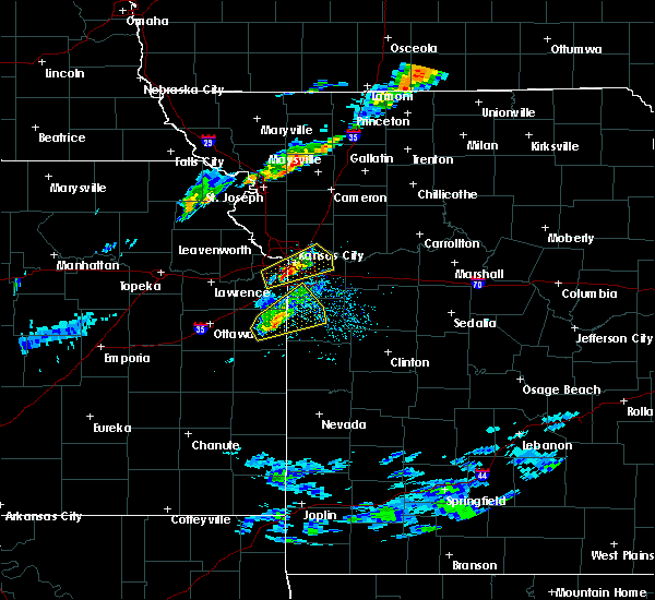 At 601 pm cdt, a severe thunderstorm was located over westwood hills, or over westwood, moving east at 25 mph (radar indicated). Hazards include 60 mph wind gusts and quarter size hail. Hail damage to vehicles is expected. expect wind damage to roofs, siding, and trees. Locations impacted include, kansas city, overland park, independence, shawnee, blue springs, lenexa, leawood, raytown, liberty, prairie village, merriam, mission, north kansas city, fairway, mission hills, sugar creek, westwood, claycomo, kansas city kansas and courtney. At 601 pm cdt, a severe thunderstorm was located over westwood hills, or over westwood, moving east at 25 mph (radar indicated). Hazards include 60 mph wind gusts and quarter size hail. Hail damage to vehicles is expected. expect wind damage to roofs, siding, and trees. Locations impacted include, kansas city, overland park, independence, shawnee, blue springs, lenexa, leawood, raytown, liberty, prairie village, merriam, mission, north kansas city, fairway, mission hills, sugar creek, westwood, claycomo, kansas city kansas and courtney.
|
| 4/17/2019 5:47 PM CDT |
 At 547 pm cdt, a severe thunderstorm was located over merriam, moving northeast at 30 mph (radar indicated). Hazards include 60 mph wind gusts and quarter size hail. Hail damage to vehicles is expected. Expect wind damage to roofs, siding, and trees. At 547 pm cdt, a severe thunderstorm was located over merriam, moving northeast at 30 mph (radar indicated). Hazards include 60 mph wind gusts and quarter size hail. Hail damage to vehicles is expected. Expect wind damage to roofs, siding, and trees.
|
| 8/28/2018 5:23 PM CDT |
 At 523 pm cdt, severe thunderstorms were located along a line extending from near pleasant valley to near mission hills to 6 miles east of spring hill, moving east at 30 mph (radar indicated). Hazards include 70 mph wind gusts and quarter size hail. Hail damage to vehicles is expected. expect considerable tree damage. wind damage is also likely to mobile homes, roofs, and outbuildings. locations impacted include, kansas city, overland park, olathe, independence, lee`s summit, blue springs, lenexa, leawood, raytown, liberty, gladstone, grandview, belton, prairie village, raymore, grain valley, excelsior springs, merriam, mission and kearney. this includes the following highways, interstate 70 in missouri between mile markers 0 and 24. interstate 70 in kansas between mile markers 419 and 423. interstate 35 in missouri between mile markers 0 and 27. interstate 35 in kansas between mile markers 225 and 235. interstate 29 between mile markers 0 and 8. interstate 635 between mile markers 0 and 12. interstate 470 between mile markers 0 and 16. Interstate 435 between mile markers 40 and 82. At 523 pm cdt, severe thunderstorms were located along a line extending from near pleasant valley to near mission hills to 6 miles east of spring hill, moving east at 30 mph (radar indicated). Hazards include 70 mph wind gusts and quarter size hail. Hail damage to vehicles is expected. expect considerable tree damage. wind damage is also likely to mobile homes, roofs, and outbuildings. locations impacted include, kansas city, overland park, olathe, independence, lee`s summit, blue springs, lenexa, leawood, raytown, liberty, gladstone, grandview, belton, prairie village, raymore, grain valley, excelsior springs, merriam, mission and kearney. this includes the following highways, interstate 70 in missouri between mile markers 0 and 24. interstate 70 in kansas between mile markers 419 and 423. interstate 35 in missouri between mile markers 0 and 27. interstate 35 in kansas between mile markers 225 and 235. interstate 29 between mile markers 0 and 8. interstate 635 between mile markers 0 and 12. interstate 470 between mile markers 0 and 16. Interstate 435 between mile markers 40 and 82.
|
| 8/28/2018 5:13 PM CDT |
 At 513 pm cdt, severe thunderstorms were located along a line extending from near lake waukomis to prairie village to near spring hill, moving east at 30 mph (radar indicated). Hazards include 60 mph wind gusts and quarter size hail. Hail damage to vehicles is expected. Expect wind damage to roofs, siding, and trees. At 513 pm cdt, severe thunderstorms were located along a line extending from near lake waukomis to prairie village to near spring hill, moving east at 30 mph (radar indicated). Hazards include 60 mph wind gusts and quarter size hail. Hail damage to vehicles is expected. Expect wind damage to roofs, siding, and trees.
|
| 7/19/2018 4:15 PM CDT |
 At 414 pm cdt, severe thunderstorms were located along a line extending from near bonner springs to spring hill to near lone elm, moving east at 45 mph (radar indicated). Hazards include 70 mph wind gusts and quarter size hail. Hail damage to vehicles is expected. expect considerable tree damage. Wind damage is also likely to mobile homes, roofs, and outbuildings. At 414 pm cdt, severe thunderstorms were located along a line extending from near bonner springs to spring hill to near lone elm, moving east at 45 mph (radar indicated). Hazards include 70 mph wind gusts and quarter size hail. Hail damage to vehicles is expected. expect considerable tree damage. Wind damage is also likely to mobile homes, roofs, and outbuildings.
|
| 7/19/2018 3:30 PM CDT |
 At 329 pm cdt, severe thunderstorms were located along a line extending from near valley falls to ozawkie to lecompton to near lyndon, moving east at 55 mph (radar indicated). Hazards include 70 mph wind gusts and quarter size hail. Hail damage to vehicles is expected. expect considerable tree damage. Wind damage is also likely to mobile homes, roofs, and outbuildings. At 329 pm cdt, severe thunderstorms were located along a line extending from near valley falls to ozawkie to lecompton to near lyndon, moving east at 55 mph (radar indicated). Hazards include 70 mph wind gusts and quarter size hail. Hail damage to vehicles is expected. expect considerable tree damage. Wind damage is also likely to mobile homes, roofs, and outbuildings.
|
| 6/30/2018 10:43 PM CDT |
 At 1031 pm cdt, a severe thunderstorm was located near lansing, moving northeast at 50 mph (radar indicated). Hazards include 60 mph wind gusts. Expect damage to roofs, siding, and trees. locations impacted include, shawnee, leavenworth, lansing, bonner springs, de soto, tonganoxie, basehor, edwardsville, kansas city, linwood, easton, fairmount, fort leavenworth, wolcott, maywood, lowemont, jarbalo and piper. this includes the following highways, interstate 70 in kansas between mile markers 410 and 412. interstate 435 between mile markers 9 and 18. Kansas turnpike between mile markers 212 and 226. At 1031 pm cdt, a severe thunderstorm was located near lansing, moving northeast at 50 mph (radar indicated). Hazards include 60 mph wind gusts. Expect damage to roofs, siding, and trees. locations impacted include, shawnee, leavenworth, lansing, bonner springs, de soto, tonganoxie, basehor, edwardsville, kansas city, linwood, easton, fairmount, fort leavenworth, wolcott, maywood, lowemont, jarbalo and piper. this includes the following highways, interstate 70 in kansas between mile markers 410 and 412. interstate 435 between mile markers 9 and 18. Kansas turnpike between mile markers 212 and 226.
|
| 6/30/2018 10:32 PM CDT |
 At 1031 pm cdt, a severe thunderstorm was located near lansing, moving northeast at 50 mph (radar indicated). Hazards include 60 mph wind gusts. Expect damage to roofs, siding, and trees. locations impacted include, shawnee, leavenworth, lansing, bonner springs, de soto, tonganoxie, basehor, edwardsville, kansas city, linwood, easton, fairmount, fort leavenworth, wolcott, maywood, lowemont, jarbalo and piper. this includes the following highways, interstate 70 in kansas between mile markers 410 and 412. interstate 435 between mile markers 9 and 18. Kansas turnpike between mile markers 212 and 226. At 1031 pm cdt, a severe thunderstorm was located near lansing, moving northeast at 50 mph (radar indicated). Hazards include 60 mph wind gusts. Expect damage to roofs, siding, and trees. locations impacted include, shawnee, leavenworth, lansing, bonner springs, de soto, tonganoxie, basehor, edwardsville, kansas city, linwood, easton, fairmount, fort leavenworth, wolcott, maywood, lowemont, jarbalo and piper. this includes the following highways, interstate 70 in kansas between mile markers 410 and 412. interstate 435 between mile markers 9 and 18. Kansas turnpike between mile markers 212 and 226.
|
| 6/30/2018 10:26 PM CDT |
 At 1025 pm cdt, a severe thunderstorm was located near basehor, moving northeast at 50 mph (radar indicated). Hazards include 60 mph wind gusts. Expect damage to roofs, siding, and trees. locations impacted include, olathe, shawnee, lenexa, leavenworth, lansing, bonner springs, de soto, tonganoxie, basehor, edwardsville, kansas city, linwood, easton, reno, fairmount, fort leavenworth, wolcott, holliday, clearview city and maywood. this includes the following highways, interstate 70 in kansas between mile markers 410 and 412. interstate 35 in kansas between mile markers 218 and 219. interstate 435 between mile markers 6 and 18. Kansas turnpike between mile markers 206 and 226. At 1025 pm cdt, a severe thunderstorm was located near basehor, moving northeast at 50 mph (radar indicated). Hazards include 60 mph wind gusts. Expect damage to roofs, siding, and trees. locations impacted include, olathe, shawnee, lenexa, leavenworth, lansing, bonner springs, de soto, tonganoxie, basehor, edwardsville, kansas city, linwood, easton, reno, fairmount, fort leavenworth, wolcott, holliday, clearview city and maywood. this includes the following highways, interstate 70 in kansas between mile markers 410 and 412. interstate 35 in kansas between mile markers 218 and 219. interstate 435 between mile markers 6 and 18. Kansas turnpike between mile markers 206 and 226.
|
| 6/30/2018 10:07 PM CDT |
 At 1007 pm cdt, a severe thunderstorm was located near williamstown, or 8 miles south of oskaloosa, moving northeast at 50 mph (radar indicated). Hazards include 60 mph wind gusts. expect damage to roofs, siding, and trees At 1007 pm cdt, a severe thunderstorm was located near williamstown, or 8 miles south of oskaloosa, moving northeast at 50 mph (radar indicated). Hazards include 60 mph wind gusts. expect damage to roofs, siding, and trees
|
| 6/30/2018 7:59 PM CDT |
 At 758 pm cdt, a severe thunderstorm was located near eudora, or near de soto, moving northeast at 15 mph (radar indicated). Hazards include 60 mph wind gusts and quarter size hail. Hail damage to vehicles is expected. expect wind damage to roofs, siding, and trees. locations impacted include, olathe, shawnee, lenexa, leavenworth, lansing, bonner springs, de soto, tonganoxie, basehor, edwardsville, kansas city, linwood, reno, fairmount, wolcott, clearview city, maywood and piper. this includes the following highways, interstate 70 in kansas between mile markers 410 and 411. interstate 435 between mile markers 13 and 19. Kansas turnpike between mile markers 209 and 226. At 758 pm cdt, a severe thunderstorm was located near eudora, or near de soto, moving northeast at 15 mph (radar indicated). Hazards include 60 mph wind gusts and quarter size hail. Hail damage to vehicles is expected. expect wind damage to roofs, siding, and trees. locations impacted include, olathe, shawnee, lenexa, leavenworth, lansing, bonner springs, de soto, tonganoxie, basehor, edwardsville, kansas city, linwood, reno, fairmount, wolcott, clearview city, maywood and piper. this includes the following highways, interstate 70 in kansas between mile markers 410 and 411. interstate 435 between mile markers 13 and 19. Kansas turnpike between mile markers 209 and 226.
|
| 6/30/2018 7:08 PM CDT |
 At 707 pm cdt, severe thunderstorms were located along a line extending from near lewis and clark village to baldwin city, moving northeast at 15 mph (radar indicated). Hazards include 60 mph wind gusts and quarter size hail. Hail damage to vehicles is expected. Expect wind damage to roofs, siding, and trees. At 707 pm cdt, severe thunderstorms were located along a line extending from near lewis and clark village to baldwin city, moving northeast at 15 mph (radar indicated). Hazards include 60 mph wind gusts and quarter size hail. Hail damage to vehicles is expected. Expect wind damage to roofs, siding, and trees.
|
| 6/30/2018 5:27 PM CDT |
 At 527 pm cdt, a severe thunderstorm was located over weatherby lake, moving north at 15 mph (radar indicated). Hazards include 60 mph wind gusts and quarter size hail. Hail damage to vehicles is expected. Expect wind damage to roofs, siding, and trees. At 527 pm cdt, a severe thunderstorm was located over weatherby lake, moving north at 15 mph (radar indicated). Hazards include 60 mph wind gusts and quarter size hail. Hail damage to vehicles is expected. Expect wind damage to roofs, siding, and trees.
|
| 6/30/2018 4:25 PM CDT |
 At 424 pm cdt, a severe thunderstorm was located near weatherby lake, moving north at 20 mph (radar indicated). Hazards include 60 mph wind gusts and quarter size hail. Hail damage to vehicles is expected. expect wind damage to roofs, siding, and trees. locations impacted include, kansas city, leavenworth, lansing, parkville, platte city, weatherby lake, ferrelview, tracy, farley, waldron, stillings, beverly, kansas city intl arpt, hoover and east leavenworth. this includes the following highways, interstate 29 between mile markers 11 and 23. Interstate 435 between mile markers 20 and 35. At 424 pm cdt, a severe thunderstorm was located near weatherby lake, moving north at 20 mph (radar indicated). Hazards include 60 mph wind gusts and quarter size hail. Hail damage to vehicles is expected. expect wind damage to roofs, siding, and trees. locations impacted include, kansas city, leavenworth, lansing, parkville, platte city, weatherby lake, ferrelview, tracy, farley, waldron, stillings, beverly, kansas city intl arpt, hoover and east leavenworth. this includes the following highways, interstate 29 between mile markers 11 and 23. Interstate 435 between mile markers 20 and 35.
|
| 6/30/2018 4:12 PM CDT |
 At 412 pm cdt, a severe thunderstorm was located near lansing, moving north at 25 mph (radar indicated). Hazards include 60 mph wind gusts and quarter size hail. Hail damage to vehicles is expected. Expect wind damage to roofs, siding, and trees. At 412 pm cdt, a severe thunderstorm was located near lansing, moving north at 25 mph (radar indicated). Hazards include 60 mph wind gusts and quarter size hail. Hail damage to vehicles is expected. Expect wind damage to roofs, siding, and trees.
|
| 6/26/2018 12:49 PM CDT |
 At 1249 pm cdt, a severe thunderstorm was located over shawnee, moving east at 55 mph (radar indicated). Hazards include 60 mph wind gusts and quarter size hail. Hail damage to vehicles is expected. expect wind damage to roofs, siding, and trees. locations impacted include, kansas city, overland park, olathe, shawnee, lenexa, leawood, prairie village, gardner, merriam, mission, bonner springs, de soto, edwardsville, fairway, mission hills, westwood, lake quivira, kansas city kansas, westwood hills and mission woods. this includes the following highways, interstate 70 in missouri near mile marker 0. interstate 70 in kansas between mile markers 417 and 423. interstate 35 in missouri near mile marker 0. interstate 35 in kansas between mile markers 212 and 235. interstate 635 between mile markers 0 and 5. Interstate 435 between mile markers 0 and 11, and between mile markers 75 and 83. At 1249 pm cdt, a severe thunderstorm was located over shawnee, moving east at 55 mph (radar indicated). Hazards include 60 mph wind gusts and quarter size hail. Hail damage to vehicles is expected. expect wind damage to roofs, siding, and trees. locations impacted include, kansas city, overland park, olathe, shawnee, lenexa, leawood, prairie village, gardner, merriam, mission, bonner springs, de soto, edwardsville, fairway, mission hills, westwood, lake quivira, kansas city kansas, westwood hills and mission woods. this includes the following highways, interstate 70 in missouri near mile marker 0. interstate 70 in kansas between mile markers 417 and 423. interstate 35 in missouri near mile marker 0. interstate 35 in kansas between mile markers 212 and 235. interstate 635 between mile markers 0 and 5. Interstate 435 between mile markers 0 and 11, and between mile markers 75 and 83.
|
| 6/26/2018 12:36 PM CDT |
 At 1236 pm cdt, a severe thunderstorm was located over linwood, or near de soto, moving east at 45 mph (radar indicated). Hazards include 60 mph wind gusts and quarter size hail. Hail damage to vehicles is expected. Expect wind damage to roofs, siding, and trees. At 1236 pm cdt, a severe thunderstorm was located over linwood, or near de soto, moving east at 45 mph (radar indicated). Hazards include 60 mph wind gusts and quarter size hail. Hail damage to vehicles is expected. Expect wind damage to roofs, siding, and trees.
|
| 6/12/2018 12:27 AM CDT |
 At 1227 am cdt, severe thunderstorms were located along a line extending from near baldwin city to near olathe to near lenexa, moving southeast at 30 mph (radar indicated). Hazards include 60 mph wind gusts and quarter size hail. Hail damage to vehicles is expected. expect wind damage to roofs, siding, and trees. locations impacted include, overland park, olathe, shawnee, lenexa, leawood, prairie village, gardner, merriam, mission, bonner springs, de soto, paola, spring hill, edwardsville, louisburg, fairway, mission hills, edgerton, westwood and lake quivira. this includes the following highways, interstate 70 in missouri near mile marker 0. interstate 70 in kansas between mile markers 413 and 423. interstate 35 in kansas between mile markers 200 and 234. interstate 635 between mile markers 0 and 6. interstate 435 between mile markers 0 and 12, and between mile markers 75 and 83. Kansas turnpike between mile markers 206 and 207. At 1227 am cdt, severe thunderstorms were located along a line extending from near baldwin city to near olathe to near lenexa, moving southeast at 30 mph (radar indicated). Hazards include 60 mph wind gusts and quarter size hail. Hail damage to vehicles is expected. expect wind damage to roofs, siding, and trees. locations impacted include, overland park, olathe, shawnee, lenexa, leawood, prairie village, gardner, merriam, mission, bonner springs, de soto, paola, spring hill, edwardsville, louisburg, fairway, mission hills, edgerton, westwood and lake quivira. this includes the following highways, interstate 70 in missouri near mile marker 0. interstate 70 in kansas between mile markers 413 and 423. interstate 35 in kansas between mile markers 200 and 234. interstate 635 between mile markers 0 and 6. interstate 435 between mile markers 0 and 12, and between mile markers 75 and 83. Kansas turnpike between mile markers 206 and 207.
|
| 6/12/2018 12:12 AM CDT |
 At 1212 am cdt, severe thunderstorms were located along a line extending from lawrence to north kansas city, moving south at 35 mph (radar indicated). Hazards include 60 mph wind gusts and quarter size hail. Hail damage to vehicles is expected. Expect wind damage to roofs, siding, and trees. At 1212 am cdt, severe thunderstorms were located along a line extending from lawrence to north kansas city, moving south at 35 mph (radar indicated). Hazards include 60 mph wind gusts and quarter size hail. Hail damage to vehicles is expected. Expect wind damage to roofs, siding, and trees.
|
| 6/11/2018 11:51 PM CDT |
 The severe thunderstorm warning for eastern wyandotte, northeastern johnson, southern clay, southern ray, southwestern carroll, lafayette, jackson and northwestern johnson counties will expire at midnight cdt, the storms which prompted the warning have weakened below severe limits, and no longer pose an immediate threat to life or property. therefore, the warning will be allowed to expire. wind gusts up to 40 mph remain possible. a severe thunderstorm watch remains in effect until 100 am cdt for northeastern and east central kansas, and north central and west central missouri. The severe thunderstorm warning for eastern wyandotte, northeastern johnson, southern clay, southern ray, southwestern carroll, lafayette, jackson and northwestern johnson counties will expire at midnight cdt, the storms which prompted the warning have weakened below severe limits, and no longer pose an immediate threat to life or property. therefore, the warning will be allowed to expire. wind gusts up to 40 mph remain possible. a severe thunderstorm watch remains in effect until 100 am cdt for northeastern and east central kansas, and north central and west central missouri.
|
| 6/11/2018 11:45 PM CDT |
 At 1145 pm cdt, severe thunderstorms were located along a line extending from near ferrelview to near williamstown, moving south at 35 mph (radar indicated). Hazards include 60 mph wind gusts and quarter size hail. Hail damage to vehicles is expected. Expect wind damage to roofs, siding, and trees. At 1145 pm cdt, severe thunderstorms were located along a line extending from near ferrelview to near williamstown, moving south at 35 mph (radar indicated). Hazards include 60 mph wind gusts and quarter size hail. Hail damage to vehicles is expected. Expect wind damage to roofs, siding, and trees.
|
| 6/11/2018 11:30 PM CDT |
 At 1129 pm cdt, severe thunderstorms were located along a line extending from near kansas city to near norborne, moving southeast at 35 mph (radar indicated). Hazards include 60 mph wind gusts and quarter size hail. Hail damage to vehicles is expected. Expect wind damage to roofs, siding, and trees. At 1129 pm cdt, severe thunderstorms were located along a line extending from near kansas city to near norborne, moving southeast at 35 mph (radar indicated). Hazards include 60 mph wind gusts and quarter size hail. Hail damage to vehicles is expected. Expect wind damage to roofs, siding, and trees.
|
| 6/11/2018 11:15 PM CDT |
 At 1114 pm cdt, severe thunderstorms were located along a line extending from near winchester to ferrelview, moving south at 30 mph (radar indicated). Hazards include 60 mph wind gusts and quarter size hail. Hail damage to vehicles is expected. Expect wind damage to roofs, siding, and trees. At 1114 pm cdt, severe thunderstorms were located along a line extending from near winchester to ferrelview, moving south at 30 mph (radar indicated). Hazards include 60 mph wind gusts and quarter size hail. Hail damage to vehicles is expected. Expect wind damage to roofs, siding, and trees.
|
| 6/11/2018 11:03 PM CDT |
 At 1102 pm cdt, severe thunderstorms were located along a line extending from near braymer to near platte city, moving south at 30 mph (radar indicated). Hazards include 60 mph wind gusts and quarter size hail. Hail damage to vehicles is expected. Expect wind damage to roofs, siding, and trees. At 1102 pm cdt, severe thunderstorms were located along a line extending from near braymer to near platte city, moving south at 30 mph (radar indicated). Hazards include 60 mph wind gusts and quarter size hail. Hail damage to vehicles is expected. Expect wind damage to roofs, siding, and trees.
|
| 6/11/2018 11:03 PM CDT |
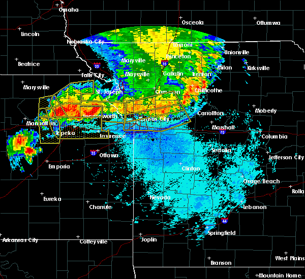 At 1102 pm cdt, severe thunderstorms were located along a line extending from near braymer to near platte city, moving south at 30 mph (radar indicated). Hazards include 60 mph wind gusts and quarter size hail. Hail damage to vehicles is expected. Expect wind damage to roofs, siding, and trees. At 1102 pm cdt, severe thunderstorms were located along a line extending from near braymer to near platte city, moving south at 30 mph (radar indicated). Hazards include 60 mph wind gusts and quarter size hail. Hail damage to vehicles is expected. Expect wind damage to roofs, siding, and trees.
|
| 6/11/2018 10:47 PM CDT |
 At 1047 pm cdt, severe thunderstorms were located along a line extending from near whiting to camden point, moving southeast at 35 mph (radar indicated). Hazards include 60 mph wind gusts and half dollar size hail. Hail damage to vehicles is expected. Expect wind damage to roofs, siding, and trees. At 1047 pm cdt, severe thunderstorms were located along a line extending from near whiting to camden point, moving southeast at 35 mph (radar indicated). Hazards include 60 mph wind gusts and half dollar size hail. Hail damage to vehicles is expected. Expect wind damage to roofs, siding, and trees.
|
| 6/11/2018 10:44 PM CDT |
 At 1043 pm cdt, severe thunderstorms were located along a line extending from 7 miles north of breckenridge to near gower, moving southeast at 30 mph (radar indicated). Hazards include 60 mph wind gusts and quarter size hail. Hail damage to vehicles is expected. Expect wind damage to roofs, siding, and trees. At 1043 pm cdt, severe thunderstorms were located along a line extending from 7 miles north of breckenridge to near gower, moving southeast at 30 mph (radar indicated). Hazards include 60 mph wind gusts and quarter size hail. Hail damage to vehicles is expected. Expect wind damage to roofs, siding, and trees.
|
| 6/2/2018 5:07 AM CDT |
 At 506 am cdt, a severe thunderstorm was located over mission, moving east at 40 mph (measured wind gust). Hazards include 70 mph wind gusts and penny size hail. Expect considerable tree damage. damage is likely to mobile homes, roofs, and outbuildings. Locations impacted include, kansas city, overland park, olathe, independence, shawnee, lenexa, leawood, raytown, liberty, gladstone, grandview, belton, prairie village, raymore, gardner, lansing, merriam, mission, smithville and bonner springs. At 506 am cdt, a severe thunderstorm was located over mission, moving east at 40 mph (measured wind gust). Hazards include 70 mph wind gusts and penny size hail. Expect considerable tree damage. damage is likely to mobile homes, roofs, and outbuildings. Locations impacted include, kansas city, overland park, olathe, independence, shawnee, lenexa, leawood, raytown, liberty, gladstone, grandview, belton, prairie village, raymore, gardner, lansing, merriam, mission, smithville and bonner springs.
|
| 6/2/2018 4:47 AM CDT |
 At 447 am cdt, a severe thunderstorm was located over bonner springs, moving east at 40 mph (radar indicated). Hazards include 60 mph wind gusts and quarter size hail. Hail damage to vehicles is expected. Expect wind damage to roofs, siding, and trees. At 447 am cdt, a severe thunderstorm was located over bonner springs, moving east at 40 mph (radar indicated). Hazards include 60 mph wind gusts and quarter size hail. Hail damage to vehicles is expected. Expect wind damage to roofs, siding, and trees.
|
| 6/2/2018 4:26 AM CDT |
 At 425 am cdt, a severe thunderstorm was located near winchester, or 11 miles northeast of oskaloosa, moving southeast at 50 mph (radar indicated). Hazards include 60 mph wind gusts and quarter size hail. Hail damage to vehicles is expected. Expect wind damage to roofs, siding, and trees. At 425 am cdt, a severe thunderstorm was located near winchester, or 11 miles northeast of oskaloosa, moving southeast at 50 mph (radar indicated). Hazards include 60 mph wind gusts and quarter size hail. Hail damage to vehicles is expected. Expect wind damage to roofs, siding, and trees.
|
| 5/2/2018 9:22 PM CDT |
 At 921 pm cdt, severe thunderstorms were located along a line extending from near raytown to 8 miles southeast of drexel to near prescott, moving east at 55 mph. this is a dangerous line of storms with potential for embedded tornadoes and 70 mph winds (radar indicated). Hazards include 70 mph wind gusts. Expect considerable tree damage. Damage is likely to mobile homes, roofs, and outbuildings. At 921 pm cdt, severe thunderstorms were located along a line extending from near raytown to 8 miles southeast of drexel to near prescott, moving east at 55 mph. this is a dangerous line of storms with potential for embedded tornadoes and 70 mph winds (radar indicated). Hazards include 70 mph wind gusts. Expect considerable tree damage. Damage is likely to mobile homes, roofs, and outbuildings.
|
| 4/13/2018 8:24 PM CDT |
 The severe thunderstorm warning for northwestern wyandotte, central leavenworth and central platte counties will expire at 830 pm cdt, the storms which prompted the warning have weakened below severe limits, and no longer pose an immediate threat to life or property. therefore, the warning will be allowed to expire. however small hail and gusty winds are still possible with these thunderstorms. a tornado watch remains in effect until 900 pm cdt for northeastern kansas, and west central missouri. The severe thunderstorm warning for northwestern wyandotte, central leavenworth and central platte counties will expire at 830 pm cdt, the storms which prompted the warning have weakened below severe limits, and no longer pose an immediate threat to life or property. therefore, the warning will be allowed to expire. however small hail and gusty winds are still possible with these thunderstorms. a tornado watch remains in effect until 900 pm cdt for northeastern kansas, and west central missouri.
|
| 4/13/2018 8:10 PM CDT |
 At 810 pm cdt, severe thunderstorms were located along a line extending from near leavenworth to basehor, moving northeast at 40 mph (radar indicated). Hazards include 60 mph wind gusts and half dollar size hail. Hail damage to vehicles is expected. expect wind damage to roofs, siding, and trees. locations impacted include, leavenworth, lansing, bonner springs, tonganoxie, platte city, basehor, edwardsville, weston, kansas city, tracy, fairmount, farley, iatan, fort leavenworth, wolcott, pomeroy, waldron, stillings, beverly and maywood. this includes the following highways, interstate 70 in kansas between mile markers 410 and 411. interstate 29 between mile markers 18 and 23. interstate 435 between mile markers 13 and 30. kansas turnpike between mile markers 220 and 226. A tornado watch remains in effect until 900 pm cdt for northeastern kansas, and west central missouri. At 810 pm cdt, severe thunderstorms were located along a line extending from near leavenworth to basehor, moving northeast at 40 mph (radar indicated). Hazards include 60 mph wind gusts and half dollar size hail. Hail damage to vehicles is expected. expect wind damage to roofs, siding, and trees. locations impacted include, leavenworth, lansing, bonner springs, tonganoxie, platte city, basehor, edwardsville, weston, kansas city, tracy, fairmount, farley, iatan, fort leavenworth, wolcott, pomeroy, waldron, stillings, beverly and maywood. this includes the following highways, interstate 70 in kansas between mile markers 410 and 411. interstate 29 between mile markers 18 and 23. interstate 435 between mile markers 13 and 30. kansas turnpike between mile markers 220 and 226. A tornado watch remains in effect until 900 pm cdt for northeastern kansas, and west central missouri.
|
| 4/13/2018 7:55 PM CDT |
 The severe thunderstorm warning for southwestern clay and southeastern platte counties will expire at 800 pm cdt, the storm which prompted the warning has weakened below severe limits, and no longer poses an immediate threat to life or property. therefore, the warning will be allowed to expire. however small hail is still possible with this thunderstorm. a tornado watch remains in effect until 900 pm cdt for northeastern kansas, and west central missouri. The severe thunderstorm warning for southwestern clay and southeastern platte counties will expire at 800 pm cdt, the storm which prompted the warning has weakened below severe limits, and no longer poses an immediate threat to life or property. therefore, the warning will be allowed to expire. however small hail is still possible with this thunderstorm. a tornado watch remains in effect until 900 pm cdt for northeastern kansas, and west central missouri.
|
| 4/13/2018 7:54 PM CDT |
 At 753 pm cdt, severe thunderstorms were located along a line extending from 6 miles south of easton to near linwood, moving northeast at 40 mph (radar indicated). Hazards include 60 mph wind gusts and half dollar size hail. Hail damage to vehicles is expected. Expect wind damage to roofs, siding, and trees. At 753 pm cdt, severe thunderstorms were located along a line extending from 6 miles south of easton to near linwood, moving northeast at 40 mph (radar indicated). Hazards include 60 mph wind gusts and half dollar size hail. Hail damage to vehicles is expected. Expect wind damage to roofs, siding, and trees.
|
| 4/13/2018 7:43 PM CDT |
 At 742 pm cdt, a severe thunderstorm was located over gladstone, moving northeast at 40 mph (trained weather spotters). Hazards include 60 mph wind gusts and quarter size hail. Hail damage to vehicles is expected. expect wind damage to roofs, siding, and trees. locations impacted include, kansas city, liberty, gladstone, smithville, kearney, parkville, north kansas city, riverside, claycomo, pleasant valley, lake waukomis, glenaire, avondale, oakview, northmoor, houston lake, oakwood park, oakwood, birmingham and oaks. this includes the following highways, interstate 35 in missouri between mile markers 5 and 24. interstate 29 between mile markers 0 and 6. interstate 635 between mile markers 9 and 12. interstate 435 between mile markers 40 and 55. A tornado watch remains in effect until 900 pm cdt for northeastern kansas, and west central missouri. At 742 pm cdt, a severe thunderstorm was located over gladstone, moving northeast at 40 mph (trained weather spotters). Hazards include 60 mph wind gusts and quarter size hail. Hail damage to vehicles is expected. expect wind damage to roofs, siding, and trees. locations impacted include, kansas city, liberty, gladstone, smithville, kearney, parkville, north kansas city, riverside, claycomo, pleasant valley, lake waukomis, glenaire, avondale, oakview, northmoor, houston lake, oakwood park, oakwood, birmingham and oaks. this includes the following highways, interstate 35 in missouri between mile markers 5 and 24. interstate 29 between mile markers 0 and 6. interstate 635 between mile markers 9 and 12. interstate 435 between mile markers 40 and 55. A tornado watch remains in effect until 900 pm cdt for northeastern kansas, and west central missouri.
|
| 4/13/2018 7:34 PM CDT |
 At 733 pm cdt, a severe thunderstorm was located over kansas city kansas, moving northeast at 40 mph (trained weather spotters). Hazards include golf ball size hail and 60 mph wind gusts. People and animals outdoors will be injured. expect hail damage to roofs, siding, windows, and vehicles. expect wind damage to roofs, siding, and trees. locations impacted include, kansas city, liberty, gladstone, smithville, kearney, parkville, north kansas city, riverside, westwood, claycomo, kansas city kansas, pleasant valley, lake waukomis, glenaire, avondale, platte woods, oakview, westwood hills, northmoor and houston lake. this includes the following highways, interstate 70 in missouri between mile markers 0 and 4. interstate 70 in kansas between mile markers 416 and 423. interstate 35 in missouri between mile markers 0 and 24. interstate 35 in kansas between mile markers 233 and 235. interstate 29 between mile markers 0 and 6. interstate 635 between mile markers 2 and 12. interstate 435 between mile markers 40 and 57. A tornado watch remains in effect until 900 pm cdt for northeastern and east central kansas, and west central missouri. At 733 pm cdt, a severe thunderstorm was located over kansas city kansas, moving northeast at 40 mph (trained weather spotters). Hazards include golf ball size hail and 60 mph wind gusts. People and animals outdoors will be injured. expect hail damage to roofs, siding, windows, and vehicles. expect wind damage to roofs, siding, and trees. locations impacted include, kansas city, liberty, gladstone, smithville, kearney, parkville, north kansas city, riverside, westwood, claycomo, kansas city kansas, pleasant valley, lake waukomis, glenaire, avondale, platte woods, oakview, westwood hills, northmoor and houston lake. this includes the following highways, interstate 70 in missouri between mile markers 0 and 4. interstate 70 in kansas between mile markers 416 and 423. interstate 35 in missouri between mile markers 0 and 24. interstate 35 in kansas between mile markers 233 and 235. interstate 29 between mile markers 0 and 6. interstate 635 between mile markers 2 and 12. interstate 435 between mile markers 40 and 57. A tornado watch remains in effect until 900 pm cdt for northeastern and east central kansas, and west central missouri.
|
| 4/13/2018 7:26 PM CDT |
 At 726 pm cdt, a severe thunderstorm was located near merriam, moving northeast at 40 mph (trained weather spotters). Hazards include golf ball size hail and 60 mph wind gusts. People and animals outdoors will be injured. expect hail damage to roofs, siding, windows, and vehicles. expect wind damage to roofs, siding, and trees. locations impacted include, kansas city, overland park, shawnee, liberty, gladstone, prairie village, merriam, mission, smithville, kearney, parkville, edwardsville, north kansas city, fairway, riverside, westwood, claycomo, lake quivira, kansas city kansas and pleasant valley. this includes the following highways, interstate 70 in missouri between mile markers 0 and 4. interstate 70 in kansas between mile markers 413 and 423. interstate 35 in missouri between mile markers 0 and 24. interstate 35 in kansas between mile markers 227 and 235. interstate 29 between mile markers 0 and 8. interstate 635 between mile markers 0 and 12. interstate 435 between mile markers 9 and 11, and between mile markers 39 and 57. A tornado watch remains in effect until 900 pm cdt for northeastern and east central kansas, and west central missouri. At 726 pm cdt, a severe thunderstorm was located near merriam, moving northeast at 40 mph (trained weather spotters). Hazards include golf ball size hail and 60 mph wind gusts. People and animals outdoors will be injured. expect hail damage to roofs, siding, windows, and vehicles. expect wind damage to roofs, siding, and trees. locations impacted include, kansas city, overland park, shawnee, liberty, gladstone, prairie village, merriam, mission, smithville, kearney, parkville, edwardsville, north kansas city, fairway, riverside, westwood, claycomo, lake quivira, kansas city kansas and pleasant valley. this includes the following highways, interstate 70 in missouri between mile markers 0 and 4. interstate 70 in kansas between mile markers 413 and 423. interstate 35 in missouri between mile markers 0 and 24. interstate 35 in kansas between mile markers 227 and 235. interstate 29 between mile markers 0 and 8. interstate 635 between mile markers 0 and 12. interstate 435 between mile markers 9 and 11, and between mile markers 39 and 57. A tornado watch remains in effect until 900 pm cdt for northeastern and east central kansas, and west central missouri.
|
| 4/13/2018 7:21 PM CDT |
 At 721 pm cdt, a severe thunderstorm was located over lake quivira, moving northeast at 40 mph (trained weather spotters). Hazards include ping pong ball size hail and 60 mph wind gusts. People and animals outdoors will be injured. expect hail damage to roofs, siding, windows, and vehicles. Expect wind damage to roofs, siding, and trees. At 721 pm cdt, a severe thunderstorm was located over lake quivira, moving northeast at 40 mph (trained weather spotters). Hazards include ping pong ball size hail and 60 mph wind gusts. People and animals outdoors will be injured. expect hail damage to roofs, siding, windows, and vehicles. Expect wind damage to roofs, siding, and trees.
|
| 4/13/2018 7:08 PM CDT |
 At 708 pm cdt, a severe thunderstorm was located near shawnee, moving northeast at 45 mph (trained weather spotters). Hazards include 60 mph wind gusts and half dollar size hail. Hail damage to vehicles is expected. expect wind damage to roofs, siding, and trees. locations impacted include, overland park, olathe, shawnee, lenexa, leawood, prairie village, merriam, mission, bonner springs, de soto, edwardsville, fairway, mission hills, westwood, lake quivira, kansas city, westwood hills, mission woods, countryside and roeland park. this includes the following highways, interstate 70 in kansas between mile markers 411 and 415. interstate 35 in kansas between mile markers 219 and 234. interstate 635 between mile markers 0 and 3. interstate 435 between mile markers 0 and 14, and between mile markers 80 and 83. A tornado watch remains in effect until 900 pm cdt for northeastern and east central kansas, and west central missouri. At 708 pm cdt, a severe thunderstorm was located near shawnee, moving northeast at 45 mph (trained weather spotters). Hazards include 60 mph wind gusts and half dollar size hail. Hail damage to vehicles is expected. expect wind damage to roofs, siding, and trees. locations impacted include, overland park, olathe, shawnee, lenexa, leawood, prairie village, merriam, mission, bonner springs, de soto, edwardsville, fairway, mission hills, westwood, lake quivira, kansas city, westwood hills, mission woods, countryside and roeland park. this includes the following highways, interstate 70 in kansas between mile markers 411 and 415. interstate 35 in kansas between mile markers 219 and 234. interstate 635 between mile markers 0 and 3. interstate 435 between mile markers 0 and 14, and between mile markers 80 and 83. A tornado watch remains in effect until 900 pm cdt for northeastern and east central kansas, and west central missouri.
|
| 4/13/2018 7:01 PM CDT |
 At 701 pm cdt, a severe thunderstorm was located near olathe, moving northeast at 45 mph (trained weather spotters). Hazards include 60 mph wind gusts and half dollar size hail. Hail damage to vehicles is expected. expect wind damage to roofs, siding, and trees. locations impacted include, overland park, olathe, shawnee, lenexa, leawood, prairie village, gardner, merriam, mission, bonner springs, de soto, edwardsville, fairway, mission hills, westwood, lake quivira, kansas city, westwood hills, mission woods and countryside. this includes the following highways, interstate 70 in kansas between mile markers 410 and 415. interstate 35 in kansas between mile markers 209 and 234. interstate 635 between mile markers 0 and 3. interstate 470 near mile marker 0. interstate 435 between mile markers 0 and 14, and between mile markers 72 and 83. kansas turnpike near mile marker 226. A tornado watch remains in effect until 900 pm cdt for northeastern and east central kansas, and west central missouri. At 701 pm cdt, a severe thunderstorm was located near olathe, moving northeast at 45 mph (trained weather spotters). Hazards include 60 mph wind gusts and half dollar size hail. Hail damage to vehicles is expected. expect wind damage to roofs, siding, and trees. locations impacted include, overland park, olathe, shawnee, lenexa, leawood, prairie village, gardner, merriam, mission, bonner springs, de soto, edwardsville, fairway, mission hills, westwood, lake quivira, kansas city, westwood hills, mission woods and countryside. this includes the following highways, interstate 70 in kansas between mile markers 410 and 415. interstate 35 in kansas between mile markers 209 and 234. interstate 635 between mile markers 0 and 3. interstate 470 near mile marker 0. interstate 435 between mile markers 0 and 14, and between mile markers 72 and 83. kansas turnpike near mile marker 226. A tornado watch remains in effect until 900 pm cdt for northeastern and east central kansas, and west central missouri.
|
| 4/13/2018 6:49 PM CDT |
 At 649 pm cdt, a severe thunderstorm was located over edgerton, moving northeast at 40 mph (radar indicated). Hazards include 60 mph wind gusts and half dollar size hail. Hail damage to vehicles is expected. Expect wind damage to roofs, siding, and trees. At 649 pm cdt, a severe thunderstorm was located over edgerton, moving northeast at 40 mph (radar indicated). Hazards include 60 mph wind gusts and half dollar size hail. Hail damage to vehicles is expected. Expect wind damage to roofs, siding, and trees.
|
| 4/13/2018 6:32 PM CDT |
 At 631 pm cdt, severe thunderstorms were located along a line extending from near oakview to near sugar creek, moving northeast at 40 mph (trained spotters). Hazards include ping pong ball size hail and 60 mph wind gusts. People and animals outdoors will be injured. expect hail damage to roofs, siding, windows, and vehicles. expect wind damage to roofs, siding, and trees. locations impacted include, kansas city, independence, liberty, gladstone, smithville, kearney, north kansas city, sugar creek, buckner, riverside, claycomo, courtney, pleasant valley, glenaire, avondale, oakview, sibley, northmoor, missouri city and river bend. this includes the following highways, interstate 70 in missouri between mile markers 4 and 10. interstate 35 in missouri between mile markers 4 and 29. interstate 29 between mile markers 0 and 3. interstate 435 between mile markers 38 and 64. A tornado watch remains in effect until 900 pm cdt for northeastern kansas, and northwestern and west central missouri. At 631 pm cdt, severe thunderstorms were located along a line extending from near oakview to near sugar creek, moving northeast at 40 mph (trained spotters). Hazards include ping pong ball size hail and 60 mph wind gusts. People and animals outdoors will be injured. expect hail damage to roofs, siding, windows, and vehicles. expect wind damage to roofs, siding, and trees. locations impacted include, kansas city, independence, liberty, gladstone, smithville, kearney, north kansas city, sugar creek, buckner, riverside, claycomo, courtney, pleasant valley, glenaire, avondale, oakview, sibley, northmoor, missouri city and river bend. this includes the following highways, interstate 70 in missouri between mile markers 4 and 10. interstate 35 in missouri between mile markers 4 and 29. interstate 29 between mile markers 0 and 3. interstate 435 between mile markers 38 and 64. A tornado watch remains in effect until 900 pm cdt for northeastern kansas, and northwestern and west central missouri.
|
| 4/13/2018 6:16 PM CDT |
 A severe thunderstorm warning remains in effect until 645 pm cdt for northeastern wyandotte. northeastern johnson. clay. southwestern clinton. eastern platte and central jackson counties. At 616 pm cdt, severe thunderstorms were located along a line extending from parkville to mission hills, moving northeast at 40 mph. A severe thunderstorm warning remains in effect until 645 pm cdt for northeastern wyandotte. northeastern johnson. clay. southwestern clinton. eastern platte and central jackson counties. At 616 pm cdt, severe thunderstorms were located along a line extending from parkville to mission hills, moving northeast at 40 mph.
|
| 4/13/2018 6:16 PM CDT |
 At 603 pm cdt, severe thunderstorms were located along a line extending from kansas city to near lenexa, moving northeast at 45 mph (trained weather spotters). Hazards include golf ball size hail and 60 mph wind gusts. People and animals outdoors will be injured. expect hail damage to roofs, siding, windows, and vehicles. expect wind damage to roofs, siding, and trees. locations impacted include, kansas city, overland park, olathe, independence, lee`s summit, shawnee, blue springs, lenexa, leavenworth, leawood, raytown, liberty, gladstone, grandview, prairie village, lansing, merriam, mission, smithville and kearney. this includes the following highways, interstate 70 in missouri between mile markers 0 and 21. interstate 70 in kansas between mile markers 410 and 423. interstate 35 in missouri between mile markers 0 and 28. interstate 35 in kansas between mile markers 216 and 235. interstate 29 between mile markers 0 and 21. interstate 635 between mile markers 0 and 12. interstate 470 between mile markers 0 and 6, and between mile markers 12 and 16. interstate 435 between mile markers 0 and 83. kansas turnpike between mile markers 222 and 226. A tornado watch remains in effect until 900 pm cdt for northeastern and east central kansas, and northwestern and west central missouri. At 603 pm cdt, severe thunderstorms were located along a line extending from kansas city to near lenexa, moving northeast at 45 mph (trained weather spotters). Hazards include golf ball size hail and 60 mph wind gusts. People and animals outdoors will be injured. expect hail damage to roofs, siding, windows, and vehicles. expect wind damage to roofs, siding, and trees. locations impacted include, kansas city, overland park, olathe, independence, lee`s summit, shawnee, blue springs, lenexa, leavenworth, leawood, raytown, liberty, gladstone, grandview, prairie village, lansing, merriam, mission, smithville and kearney. this includes the following highways, interstate 70 in missouri between mile markers 0 and 21. interstate 70 in kansas between mile markers 410 and 423. interstate 35 in missouri between mile markers 0 and 28. interstate 35 in kansas between mile markers 216 and 235. interstate 29 between mile markers 0 and 21. interstate 635 between mile markers 0 and 12. interstate 470 between mile markers 0 and 6, and between mile markers 12 and 16. interstate 435 between mile markers 0 and 83. kansas turnpike between mile markers 222 and 226. A tornado watch remains in effect until 900 pm cdt for northeastern and east central kansas, and northwestern and west central missouri.
|
| 4/13/2018 6:03 PM CDT |
 At 603 pm cdt, severe thunderstorms were located along a line extending from kansas city to near lenexa, moving northeast at 45 mph (trained weather spotters). Hazards include golf ball size hail and 60 mph wind gusts. People and animals outdoors will be injured. expect hail damage to roofs, siding, windows, and vehicles. expect wind damage to roofs, siding, and trees. locations impacted include, kansas city, overland park, olathe, independence, lee`s summit, shawnee, blue springs, lenexa, leavenworth, leawood, raytown, liberty, gladstone, grandview, prairie village, lansing, merriam, mission, smithville and kearney. this includes the following highways, interstate 70 in missouri between mile markers 0 and 21. interstate 70 in kansas between mile markers 410 and 423. interstate 35 in missouri between mile markers 0 and 28. interstate 35 in kansas between mile markers 216 and 235. interstate 29 between mile markers 0 and 21. interstate 635 between mile markers 0 and 12. interstate 470 between mile markers 0 and 6, and between mile markers 12 and 16. interstate 435 between mile markers 0 and 83. kansas turnpike between mile markers 222 and 226. A tornado watch remains in effect until 900 pm cdt for northeastern and east central kansas, and northwestern and west central missouri. At 603 pm cdt, severe thunderstorms were located along a line extending from kansas city to near lenexa, moving northeast at 45 mph (trained weather spotters). Hazards include golf ball size hail and 60 mph wind gusts. People and animals outdoors will be injured. expect hail damage to roofs, siding, windows, and vehicles. expect wind damage to roofs, siding, and trees. locations impacted include, kansas city, overland park, olathe, independence, lee`s summit, shawnee, blue springs, lenexa, leavenworth, leawood, raytown, liberty, gladstone, grandview, prairie village, lansing, merriam, mission, smithville and kearney. this includes the following highways, interstate 70 in missouri between mile markers 0 and 21. interstate 70 in kansas between mile markers 410 and 423. interstate 35 in missouri between mile markers 0 and 28. interstate 35 in kansas between mile markers 216 and 235. interstate 29 between mile markers 0 and 21. interstate 635 between mile markers 0 and 12. interstate 470 between mile markers 0 and 6, and between mile markers 12 and 16. interstate 435 between mile markers 0 and 83. kansas turnpike between mile markers 222 and 226. A tornado watch remains in effect until 900 pm cdt for northeastern and east central kansas, and northwestern and west central missouri.
|
| 4/13/2018 5:55 PM CDT |
 At 555 pm cdt, severe thunderstorms were located along a line extending from edwardsville to near olathe, moving northeast at 45 mph (trained weather spotters). Hazards include ping pong ball size hail and 60 mph wind gusts. People and animals outdoors will be injured. expect hail damage to roofs, siding, windows, and vehicles. Expect wind damage to roofs, siding, and trees. At 555 pm cdt, severe thunderstorms were located along a line extending from edwardsville to near olathe, moving northeast at 45 mph (trained weather spotters). Hazards include ping pong ball size hail and 60 mph wind gusts. People and animals outdoors will be injured. expect hail damage to roofs, siding, windows, and vehicles. Expect wind damage to roofs, siding, and trees.
|
| 4/13/2018 5:47 PM CDT |
 At 547 pm cdt, a severe thunderstorm was located near olathe, moving northeast at 50 mph (trained weather spotters). Hazards include golf ball size hail and 60 mph wind gusts. People and animals outdoors will be injured. expect hail damage to roofs, siding, windows, and vehicles. expect wind damage to roofs, siding, and trees. locations impacted include, overland park, olathe, shawnee, lenexa, leawood, belton, prairie village, gardner, merriam, mission, bonner springs, de soto, spring hill, edwardsville, fairway, mission hills, edgerton, lake quivira, kansas city and countryside. this includes the following highways, interstate 35 in kansas between mile markers 200 and 232. interstate 635 between mile markers 0 and 1. interstate 435 between mile markers 0 and 10, and between mile markers 75 and 83. A tornado watch remains in effect until 900 pm cdt for northeastern and east central kansas, and west central missouri. At 547 pm cdt, a severe thunderstorm was located near olathe, moving northeast at 50 mph (trained weather spotters). Hazards include golf ball size hail and 60 mph wind gusts. People and animals outdoors will be injured. expect hail damage to roofs, siding, windows, and vehicles. expect wind damage to roofs, siding, and trees. locations impacted include, overland park, olathe, shawnee, lenexa, leawood, belton, prairie village, gardner, merriam, mission, bonner springs, de soto, spring hill, edwardsville, fairway, mission hills, edgerton, lake quivira, kansas city and countryside. this includes the following highways, interstate 35 in kansas between mile markers 200 and 232. interstate 635 between mile markers 0 and 1. interstate 435 between mile markers 0 and 10, and between mile markers 75 and 83. A tornado watch remains in effect until 900 pm cdt for northeastern and east central kansas, and west central missouri.
|
| 4/13/2018 5:38 PM CDT |
 At 538 pm cdt, a severe thunderstorm was located near gardner, moving northeast at 45 mph (trained weather spotters). Hazards include golf ball size hail and 60 mph wind gusts. People and animals outdoors will be injured. expect hail damage to roofs, siding, windows, and vehicles. expect wind damage to roofs, siding, and trees. locations impacted include, overland park, olathe, shawnee, lenexa, leawood, belton, prairie village, gardner, merriam, mission, bonner springs, de soto, spring hill, edwardsville, fairway, mission hills, edgerton, lake quivira, kansas city and linwood. this includes the following highways, interstate 35 in kansas between mile markers 200 and 232. interstate 635 between mile markers 0 and 1. interstate 435 between mile markers 0 and 10, and between mile markers 75 and 83. kansas turnpike between mile markers 218 and 222. A tornado watch remains in effect until 900 pm cdt for northeastern and east central kansas, and west central missouri. At 538 pm cdt, a severe thunderstorm was located near gardner, moving northeast at 45 mph (trained weather spotters). Hazards include golf ball size hail and 60 mph wind gusts. People and animals outdoors will be injured. expect hail damage to roofs, siding, windows, and vehicles. expect wind damage to roofs, siding, and trees. locations impacted include, overland park, olathe, shawnee, lenexa, leawood, belton, prairie village, gardner, merriam, mission, bonner springs, de soto, spring hill, edwardsville, fairway, mission hills, edgerton, lake quivira, kansas city and linwood. this includes the following highways, interstate 35 in kansas between mile markers 200 and 232. interstate 635 between mile markers 0 and 1. interstate 435 between mile markers 0 and 10, and between mile markers 75 and 83. kansas turnpike between mile markers 218 and 222. A tornado watch remains in effect until 900 pm cdt for northeastern and east central kansas, and west central missouri.
|
| 4/13/2018 5:18 PM CDT |
 At 517 pm cdt, a severe thunderstorm was located near rantoul, or 8 miles east of ottawa, moving northeast at 50 mph (radar indicated). Hazards include golf ball size hail and 60 mph wind gusts. People and animals outdoors will be injured. expect hail damage to roofs, siding, windows, and vehicles. Expect wind damage to roofs, siding, and trees. At 517 pm cdt, a severe thunderstorm was located near rantoul, or 8 miles east of ottawa, moving northeast at 50 mph (radar indicated). Hazards include golf ball size hail and 60 mph wind gusts. People and animals outdoors will be injured. expect hail damage to roofs, siding, windows, and vehicles. Expect wind damage to roofs, siding, and trees.
|
| 10/14/2017 6:05 PM CDT |
 The severe thunderstorm warning for southwestern clay and northwestern jackson counties will expire at 615 pm cdt, the storms which prompted the warning have moved out of the area. therefore the warning will be allowed to expire. a tornado watch remains in effect until 100 am cdt for northeastern and east central kansas, and west central missouri. The severe thunderstorm warning for southwestern clay and northwestern jackson counties will expire at 615 pm cdt, the storms which prompted the warning have moved out of the area. therefore the warning will be allowed to expire. a tornado watch remains in effect until 100 am cdt for northeastern and east central kansas, and west central missouri.
|
| 10/14/2017 5:38 PM CDT |
 At 538 pm cdt, severe thunderstorms were located along a line extending from liberty to kansas city, moving northeast at 45 mph (radar indicated). Hazards include 60 mph wind gusts and quarter size hail. Hail damage to vehicles is expected. Expect wind damage to roofs, siding, and trees. At 538 pm cdt, severe thunderstorms were located along a line extending from liberty to kansas city, moving northeast at 45 mph (radar indicated). Hazards include 60 mph wind gusts and quarter size hail. Hail damage to vehicles is expected. Expect wind damage to roofs, siding, and trees.
|
| 10/14/2017 5:08 PM CDT |
 At 507 pm cdt, a severe thunderstorm was located over oakview, or over gladstone, moving northeast at 60 mph (radar indicated). Hazards include 60 mph wind gusts and quarter size hail. Hail damage to vehicles is expected. expect wind damage to roofs, siding, and trees. locations impacted include, kansas city, overland park, independence, shawnee, liberty, gladstone, excelsior springs, merriam, mission, kearney, bonner springs, parkville, basehor, edwardsville, north kansas city, sugar creek, buckner, riverside, weatherby lake and westwood. this includes the following highways, interstate 70 in missouri between mile markers 0 and 8. interstate 70 in kansas between mile markers 410 and 423. interstate 35 in missouri between mile markers 0 and 29. interstate 35 in kansas between mile markers 230 and 235. interstate 29 between mile markers 0 and 10. interstate 635 between mile markers 0 and 12. interstate 435 between mile markers 7 and 23, and between mile markers 40 and 62. Kansas turnpike between mile markers 223 and 226. At 507 pm cdt, a severe thunderstorm was located over oakview, or over gladstone, moving northeast at 60 mph (radar indicated). Hazards include 60 mph wind gusts and quarter size hail. Hail damage to vehicles is expected. expect wind damage to roofs, siding, and trees. locations impacted include, kansas city, overland park, independence, shawnee, liberty, gladstone, excelsior springs, merriam, mission, kearney, bonner springs, parkville, basehor, edwardsville, north kansas city, sugar creek, buckner, riverside, weatherby lake and westwood. this includes the following highways, interstate 70 in missouri between mile markers 0 and 8. interstate 70 in kansas between mile markers 410 and 423. interstate 35 in missouri between mile markers 0 and 29. interstate 35 in kansas between mile markers 230 and 235. interstate 29 between mile markers 0 and 10. interstate 635 between mile markers 0 and 12. interstate 435 between mile markers 7 and 23, and between mile markers 40 and 62. Kansas turnpike between mile markers 223 and 226.
|
| 10/14/2017 4:42 PM CDT |
 At 442 pm cdt, a severe thunderstorm was located over kansas city, or near parkville, moving northeast at 50 mph (radar indicated). Hazards include 60 mph wind gusts and quarter size hail. Hail damage to vehicles is expected. Expect wind damage to roofs, siding, and trees. At 442 pm cdt, a severe thunderstorm was located over kansas city, or near parkville, moving northeast at 50 mph (radar indicated). Hazards include 60 mph wind gusts and quarter size hail. Hail damage to vehicles is expected. Expect wind damage to roofs, siding, and trees.
|
| 8/21/2017 10:23 PM CDT |
 The severe thunderstorm warning for northeastern johnson county will expire at 1030 pm cdt, the storm which prompted the warning has weakened below severe limits, and no longer poses an immediate threat to life or property. therefore the warning will be allowed to expire. however gusty winds are still possible with this thunderstorm. remember, a severe thunderstorm warning still remains in effect for southern portions of johnson county from a different storm moving into the area. The severe thunderstorm warning for northeastern johnson county will expire at 1030 pm cdt, the storm which prompted the warning has weakened below severe limits, and no longer poses an immediate threat to life or property. therefore the warning will be allowed to expire. however gusty winds are still possible with this thunderstorm. remember, a severe thunderstorm warning still remains in effect for southern portions of johnson county from a different storm moving into the area.
|
| 8/21/2017 10:10 PM CDT |
 At 1009 pm cdt, a severe thunderstorm was located over shawnee, moving east at 30 mph (trained weather spotters reported 63 mph winds in de soto, ks). Hazards include 60 mph wind gusts. Expect damage to roofs, siding, and trees. locations impacted include, overland park, olathe, shawnee, lenexa, leawood, prairie village, merriam, mission, fairway, mission hills, westwood, lake quivira, westwood hills, mission woods, countryside, roeland park and lackmans. this includes the following highways, interstate 35 in kansas between mile markers 217 and 232. interstate 635 near mile marker 0. Interstate 435 between mile markers 0 and 7, and between mile markers 76 and 83. At 1009 pm cdt, a severe thunderstorm was located over shawnee, moving east at 30 mph (trained weather spotters reported 63 mph winds in de soto, ks). Hazards include 60 mph wind gusts. Expect damage to roofs, siding, and trees. locations impacted include, overland park, olathe, shawnee, lenexa, leawood, prairie village, merriam, mission, fairway, mission hills, westwood, lake quivira, westwood hills, mission woods, countryside, roeland park and lackmans. this includes the following highways, interstate 35 in kansas between mile markers 217 and 232. interstate 635 near mile marker 0. Interstate 435 between mile markers 0 and 7, and between mile markers 76 and 83.
|
| 8/21/2017 9:56 PM CDT |
 The severe thunderstorm warning for east central wyandotte, southern clay and central jackson counties will expire at 1000 pm cdt, the storm which prompted the warning has weakened below severe limits, and no longer poses an immediate threat to life or property. therefore the warning will be allowed to expire. however gusty winds of 50 mph are expected with this thunderstorm. The severe thunderstorm warning for east central wyandotte, southern clay and central jackson counties will expire at 1000 pm cdt, the storm which prompted the warning has weakened below severe limits, and no longer poses an immediate threat to life or property. therefore the warning will be allowed to expire. however gusty winds of 50 mph are expected with this thunderstorm.
|
| 8/21/2017 9:55 PM CDT |
 At 955 pm cdt, a severe thunderstorm was located near de soto, moving east at 35 mph (radar indicated). Hazards include 60 mph wind gusts. expect damage to roofs, siding, and trees At 955 pm cdt, a severe thunderstorm was located near de soto, moving east at 35 mph (radar indicated). Hazards include 60 mph wind gusts. expect damage to roofs, siding, and trees
|
| 8/21/2017 9:40 PM CDT |
 At 939 pm cdt, a severe thunderstorm was located over sugar creek, moving southeast at 45 mph (radar indicated). Hazards include 60 mph wind gusts. Expect damage to roofs, siding, and trees. locations impacted include, kansas city, independence, lee`s summit, blue springs, raytown, liberty, gladstone, mission, north kansas city, mission hills, sugar creek, riverside, westwood, claycomo, kansas city kansas, courtney, pleasant valley, lake tapawingo, glenaire and avondale. this includes the following highways, interstate 70 in missouri between mile markers 0 and 18. interstate 70 in kansas between mile markers 420 and 423. interstate 35 in missouri between mile markers 0 and 17. interstate 35 in kansas between mile markers 232 and 235. interstate 29 between mile markers 0 and 2. interstate 470 between mile markers 2 and 16. Interstate 435 between mile markers 48 and 70. At 939 pm cdt, a severe thunderstorm was located over sugar creek, moving southeast at 45 mph (radar indicated). Hazards include 60 mph wind gusts. Expect damage to roofs, siding, and trees. locations impacted include, kansas city, independence, lee`s summit, blue springs, raytown, liberty, gladstone, mission, north kansas city, mission hills, sugar creek, riverside, westwood, claycomo, kansas city kansas, courtney, pleasant valley, lake tapawingo, glenaire and avondale. this includes the following highways, interstate 70 in missouri between mile markers 0 and 18. interstate 70 in kansas between mile markers 420 and 423. interstate 35 in missouri between mile markers 0 and 17. interstate 35 in kansas between mile markers 232 and 235. interstate 29 between mile markers 0 and 2. interstate 470 between mile markers 2 and 16. Interstate 435 between mile markers 48 and 70.
|
| 8/21/2017 9:30 PM CDT |
 At 928 pm cdt, a severe thunderstorm was located near lawrence, moving east at 45 mph (damaging winds have occurred in parts of douglas county kansas from this storm). Hazards include 60 mph wind gusts. expect damage to roofs, siding, and trees At 928 pm cdt, a severe thunderstorm was located near lawrence, moving east at 45 mph (damaging winds have occurred in parts of douglas county kansas from this storm). Hazards include 60 mph wind gusts. expect damage to roofs, siding, and trees
|
| 8/21/2017 9:26 PM CDT |
 At 926 pm cdt, a severe thunderstorm was located over houston lake, or over riverside, moving east at 40 mph (radar indicated). Hazards include 60 mph wind gusts. expect damage to roofs, siding, and trees At 926 pm cdt, a severe thunderstorm was located over houston lake, or over riverside, moving east at 40 mph (radar indicated). Hazards include 60 mph wind gusts. expect damage to roofs, siding, and trees
|
| 8/21/2017 4:19 PM CDT |
 At 419 pm cdt, a severe thunderstorm was located over houston lake, or over riverside, moving northeast at 20 mph (radar indicated). Hazards include 60 mph wind gusts and quarter size hail. Hail damage to vehicles is expected. Expect wind damage to roofs, siding, and trees. At 419 pm cdt, a severe thunderstorm was located over houston lake, or over riverside, moving northeast at 20 mph (radar indicated). Hazards include 60 mph wind gusts and quarter size hail. Hail damage to vehicles is expected. Expect wind damage to roofs, siding, and trees.
|
| 7/22/2017 10:30 PM CDT | Large trees blocking streets in wyandotte county KS, 6.2 miles W of Kansas City, KS |
| 7/22/2017 10:23 PM CDT |
 At 1022 pm cdt, a severe thunderstorm was located over raytown, moving east at 40 mph (radar indicated). Hazards include 70 mph wind gusts and nickel size hail. Expect considerable tree damage. Damage is likely to mobile homes, roofs, and outbuildings. At 1022 pm cdt, a severe thunderstorm was located over raytown, moving east at 40 mph (radar indicated). Hazards include 70 mph wind gusts and nickel size hail. Expect considerable tree damage. Damage is likely to mobile homes, roofs, and outbuildings.
|
| 7/22/2017 9:51 PM CDT |
 At 951 pm cdt, a severe thunderstorm was located over lenexa, moving east at 40 mph (radar indicated). Hazards include 70 mph wind gusts and penny size hail. Expect considerable tree damage. Damage is likely to mobile homes, roofs, and outbuildings. At 951 pm cdt, a severe thunderstorm was located over lenexa, moving east at 40 mph (radar indicated). Hazards include 70 mph wind gusts and penny size hail. Expect considerable tree damage. Damage is likely to mobile homes, roofs, and outbuildings.
|
| 6/29/2017 5:29 PM CDT |
 At 1028 pm cdt, a severe thunderstorm was located over northmoor, or over riverside, moving southeast at 20 mph (radar indicated). Hazards include ping pong ball size hail and 60 mph wind gusts. People and animals outdoors will be injured. expect hail damage to roofs, siding, windows, and vehicles. Expect wind damage to roofs, siding, and trees. At 1028 pm cdt, a severe thunderstorm was located over northmoor, or over riverside, moving southeast at 20 mph (radar indicated). Hazards include ping pong ball size hail and 60 mph wind gusts. People and animals outdoors will be injured. expect hail damage to roofs, siding, windows, and vehicles. Expect wind damage to roofs, siding, and trees.
|
| 6/29/2017 5:11 PM CDT |
 At 1010 pm cdt, a severe thunderstorm was located over parkville, moving southeast at 20 mph (radar indicated). Hazards include ping pong ball size hail and 60 mph wind gusts. People and animals outdoors will be injured. expect hail damage to roofs, siding, windows, and vehicles. expect wind damage to roofs, siding, and trees. locations impacted include, kansas city, independence, liberty, gladstone, mission, parkville, north kansas city, sugar creek, riverside, weatherby lake, claycomo, kansas city kansas, pleasant valley, lake waukomis, glenaire, avondale, platte woods, oakview, northmoor and houston lake. this includes the following highways, interstate 70 in missouri between mile markers 0 and 7. interstate 70 in kansas between mile markers 416 and 423. interstate 35 in missouri between mile markers 0 and 15. interstate 35 in kansas between mile markers 231 and 235. interstate 29 between mile markers 0 and 11. interstate 635 between mile markers 1 and 12. Interstate 435 between mile markers 19 and 21, between mile markers 36 and 38, and between mile markers 48 and 61. At 1010 pm cdt, a severe thunderstorm was located over parkville, moving southeast at 20 mph (radar indicated). Hazards include ping pong ball size hail and 60 mph wind gusts. People and animals outdoors will be injured. expect hail damage to roofs, siding, windows, and vehicles. expect wind damage to roofs, siding, and trees. locations impacted include, kansas city, independence, liberty, gladstone, mission, parkville, north kansas city, sugar creek, riverside, weatherby lake, claycomo, kansas city kansas, pleasant valley, lake waukomis, glenaire, avondale, platte woods, oakview, northmoor and houston lake. this includes the following highways, interstate 70 in missouri between mile markers 0 and 7. interstate 70 in kansas between mile markers 416 and 423. interstate 35 in missouri between mile markers 0 and 15. interstate 35 in kansas between mile markers 231 and 235. interstate 29 between mile markers 0 and 11. interstate 635 between mile markers 1 and 12. Interstate 435 between mile markers 19 and 21, between mile markers 36 and 38, and between mile markers 48 and 61.
|
| 6/29/2017 4:51 PM CDT |
 At 950 pm cdt, a severe thunderstorm was located near weatherby lake, moving southeast at 25 mph (radar indicated). Hazards include ping pong ball size hail. People and animals outdoors will be injured. Expect damage to roofs, siding, windows, and vehicles. At 950 pm cdt, a severe thunderstorm was located near weatherby lake, moving southeast at 25 mph (radar indicated). Hazards include ping pong ball size hail. People and animals outdoors will be injured. Expect damage to roofs, siding, windows, and vehicles.
|
| 6/17/2017 9:28 PM CDT |
 At 926 pm cdt, a severe thunderstorm was located near birmingham, moving southeast at 50 mph. numerous reports of wind gusts up to 75 mph have been received across southern clay county with this storm. this is a very dangerous storm (radar indicated). Hazards include 80 mph wind gusts. Flying debris will be dangerous to those caught without shelter. mobile homes will be heavily damaged. expect considerable damage to roofs, windows, and vehicles. extensive tree damage and power outages are likely. Locations impacted include, kansas city, independence, liberty, gladstone, north kansas city, sugar creek, buckner, claycomo, courtney, pleasant valley, glenaire, avondale, oakview, sibley, missouri city, river bend, oakwood park, oakwood, birmingham and oaks. At 926 pm cdt, a severe thunderstorm was located near birmingham, moving southeast at 50 mph. numerous reports of wind gusts up to 75 mph have been received across southern clay county with this storm. this is a very dangerous storm (radar indicated). Hazards include 80 mph wind gusts. Flying debris will be dangerous to those caught without shelter. mobile homes will be heavily damaged. expect considerable damage to roofs, windows, and vehicles. extensive tree damage and power outages are likely. Locations impacted include, kansas city, independence, liberty, gladstone, north kansas city, sugar creek, buckner, claycomo, courtney, pleasant valley, glenaire, avondale, oakview, sibley, missouri city, river bend, oakwood park, oakwood, birmingham and oaks.
|
| 6/17/2017 9:25 PM CDT |
 The severe thunderstorm warning for east central wyandotte and northeastern johnson counties will expire at 930 pm cdt, the storms which prompted the warning have moved out of the area into missouri. therefore the warning will be allowed to expire. a severe thunderstorm watch remains in effect until 200 am cdt for northeastern and east central kansas. The severe thunderstorm warning for east central wyandotte and northeastern johnson counties will expire at 930 pm cdt, the storms which prompted the warning have moved out of the area into missouri. therefore the warning will be allowed to expire. a severe thunderstorm watch remains in effect until 200 am cdt for northeastern and east central kansas.
|
| 6/17/2017 9:18 PM CDT |
 At 917 pm cdt, severe thunderstorms were located along a line extending from westwood to near leawood to near spring hill, moving east at 40 mph (radar indicated). Hazards include 70 mph wind gusts. Expect considerable tree damage. damage is likely to mobile homes, roofs, and outbuildings. Locations impacted include, overland park, olathe, shawnee, lenexa, leawood, prairie village, merriam, mission, fairway, mission hills, westwood, lake quivira, kansas city, westwood hills, mission woods, countryside, roeland park, lackmans and stanley. At 917 pm cdt, severe thunderstorms were located along a line extending from westwood to near leawood to near spring hill, moving east at 40 mph (radar indicated). Hazards include 70 mph wind gusts. Expect considerable tree damage. damage is likely to mobile homes, roofs, and outbuildings. Locations impacted include, overland park, olathe, shawnee, lenexa, leawood, prairie village, merriam, mission, fairway, mission hills, westwood, lake quivira, kansas city, westwood hills, mission woods, countryside, roeland park, lackmans and stanley.
|
| 6/17/2017 9:15 PM CDT | 3-5 in diameter limbs snappe in wyandotte county KS, 7.8 miles WNW of Kansas City, KS |
| 6/17/2017 9:15 PM CDT |
 At 915 pm cdt, a severe thunderstorm was located over avondale, or over gladstone, moving southeast at 50 mph. at 910 pm a 75 mph wind gust was reported in riverside with this storm (radar indicated). Hazards include 75 mph wind gusts. Expect considerable tree damage. damage is likely to mobile homes, roofs, and outbuildings. Locations impacted include, kansas city, independence, liberty, gladstone, excelsior springs, smithville, kearney, parkville, north kansas city, sugar creek, buckner, riverside, claycomo, courtney, pleasant valley, lake waukomis, glenaire, avondale, platte woods and oakview. At 915 pm cdt, a severe thunderstorm was located over avondale, or over gladstone, moving southeast at 50 mph. at 910 pm a 75 mph wind gust was reported in riverside with this storm (radar indicated). Hazards include 75 mph wind gusts. Expect considerable tree damage. damage is likely to mobile homes, roofs, and outbuildings. Locations impacted include, kansas city, independence, liberty, gladstone, excelsior springs, smithville, kearney, parkville, north kansas city, sugar creek, buckner, riverside, claycomo, courtney, pleasant valley, lake waukomis, glenaire, avondale, platte woods and oakview.
|
| 6/17/2017 9:12 PM CDT |
 The severe thunderstorm warning for northern wyandotte, central leavenworth and platte counties will expire at 915 pm cdt, the storms which prompted the warning have moved out of the area. therefore the warning will be allowed to expire. a severe thunderstorm watch remains in effect until 200 am cdt for northeastern kansas, and northwestern and west central missouri. The severe thunderstorm warning for northern wyandotte, central leavenworth and platte counties will expire at 915 pm cdt, the storms which prompted the warning have moved out of the area. therefore the warning will be allowed to expire. a severe thunderstorm watch remains in effect until 200 am cdt for northeastern kansas, and northwestern and west central missouri.
|
| 6/17/2017 9:10 PM CDT |
 At 910 pm cdt, severe thunderstorms were located along a line extending from near merriam to near lenexa to near spring hill, moving east at 40 mph (radar indicated). Hazards include 70 mph wind gusts. Expect considerable tree damage. damage is likely to mobile homes, roofs, and outbuildings. Locations impacted include, overland park, olathe, shawnee, lenexa, leawood, prairie village, gardner, merriam, mission, bonner springs, de soto, spring hill, edwardsville, fairway, mission hills, edgerton, westwood, lake quivira, kansas city and westwood hills. At 910 pm cdt, severe thunderstorms were located along a line extending from near merriam to near lenexa to near spring hill, moving east at 40 mph (radar indicated). Hazards include 70 mph wind gusts. Expect considerable tree damage. damage is likely to mobile homes, roofs, and outbuildings. Locations impacted include, overland park, olathe, shawnee, lenexa, leawood, prairie village, gardner, merriam, mission, bonner springs, de soto, spring hill, edwardsville, fairway, mission hills, edgerton, westwood, lake quivira, kansas city and westwood hills.
|
| 6/17/2017 9:00 PM CDT |
 At 900 pm cdt, a severe thunderstorm was located near smithville, moving east at 50 mph (radar indicated). Hazards include 60 mph wind gusts. expect damage to roofs, siding, and trees At 900 pm cdt, a severe thunderstorm was located near smithville, moving east at 50 mph (radar indicated). Hazards include 60 mph wind gusts. expect damage to roofs, siding, and trees
|
| 6/17/2017 8:56 PM CDT |
 At 854 pm cdt, severe thunderstorms were located along a line extending from bonner springs to near de soto to near edgerton, moving east at 50 mph. at 853 pm cdt a 68 mph wind gust was recorded in de soto (radar indicated). Hazards include 70 mph wind gusts. Expect considerable tree damage. damage is likely to mobile homes, roofs, and outbuildings. Locations impacted include, overland park, olathe, shawnee, lenexa, leawood, prairie village, gardner, merriam, mission, bonner springs, de soto, spring hill, tonganoxie, basehor, edwardsville, fairway, mission hills, edgerton, westwood and lake quivira. At 854 pm cdt, severe thunderstorms were located along a line extending from bonner springs to near de soto to near edgerton, moving east at 50 mph. at 853 pm cdt a 68 mph wind gust was recorded in de soto (radar indicated). Hazards include 70 mph wind gusts. Expect considerable tree damage. damage is likely to mobile homes, roofs, and outbuildings. Locations impacted include, overland park, olathe, shawnee, lenexa, leawood, prairie village, gardner, merriam, mission, bonner springs, de soto, spring hill, tonganoxie, basehor, edwardsville, fairway, mission hills, edgerton, westwood and lake quivira.
|
| 6/17/2017 8:54 PM CDT |
 At 854 pm cdt, severe thunderstorms were located along a line extending from near camden point to near basehor, moving east at 30 mph (radar indicated). Hazards include 60 mph wind gusts. Expect damage to roofs, siding, and trees. Locations impacted include, leavenworth, lansing, parkville, platte city, basehor, riverside, weatherby lake, weston, kansas city kansas, kansas city, lake waukomis, edgerton, dearborn, camden point, ferrelview, platte woods, northmoor, houston lake, tracy and fairmount. At 854 pm cdt, severe thunderstorms were located along a line extending from near camden point to near basehor, moving east at 30 mph (radar indicated). Hazards include 60 mph wind gusts. Expect damage to roofs, siding, and trees. Locations impacted include, leavenworth, lansing, parkville, platte city, basehor, riverside, weatherby lake, weston, kansas city kansas, kansas city, lake waukomis, edgerton, dearborn, camden point, ferrelview, platte woods, northmoor, houston lake, tracy and fairmount.
|
| 6/17/2017 8:45 PM CDT |
 At 845 pm cdt, severe thunderstorms were located along a line extending from near tonganoxie to near edgerton, moving east at 30 mph (radar indicated). Hazards include 60 mph wind gusts. expect damage to roofs, siding, and trees At 845 pm cdt, severe thunderstorms were located along a line extending from near tonganoxie to near edgerton, moving east at 30 mph (radar indicated). Hazards include 60 mph wind gusts. expect damage to roofs, siding, and trees
|
| 6/17/2017 8:42 PM CDT |
 At 842 pm cdt, a severe thunderstorm was located over lansing, moving east at 50 mph (radar indicated). Hazards include 60 mph wind gusts and quarter size hail. Hail damage to vehicles is expected. expect wind damage to roofs, siding, and trees. Locations impacted include, leavenworth, lansing, parkville, platte city, basehor, riverside, weatherby lake, weston, kansas city kansas, kansas city, lake waukomis, edgerton, dearborn, camden point, ferrelview, platte woods, northmoor, easton, houston lake and tracy. At 842 pm cdt, a severe thunderstorm was located over lansing, moving east at 50 mph (radar indicated). Hazards include 60 mph wind gusts and quarter size hail. Hail damage to vehicles is expected. expect wind damage to roofs, siding, and trees. Locations impacted include, leavenworth, lansing, parkville, platte city, basehor, riverside, weatherby lake, weston, kansas city kansas, kansas city, lake waukomis, edgerton, dearborn, camden point, ferrelview, platte woods, northmoor, easton, houston lake and tracy.
|
| 6/17/2017 8:29 PM CDT |
 At 828 pm cdt, a severe thunderstorm was located near easton, or 9 miles west of leavenworth, moving east at 40 mph (radar indicated). Hazards include ping pong ball size hail and 60 mph wind gusts. People and animals outdoors will be injured. expect hail damage to roofs, siding, windows, and vehicles. Expect wind damage to roofs, siding, and trees. At 828 pm cdt, a severe thunderstorm was located near easton, or 9 miles west of leavenworth, moving east at 40 mph (radar indicated). Hazards include ping pong ball size hail and 60 mph wind gusts. People and animals outdoors will be injured. expect hail damage to roofs, siding, windows, and vehicles. Expect wind damage to roofs, siding, and trees.
|
| 6/17/2017 1:00 AM CDT |
 At 100 am cdt, severe thunderstorms were located along a line extending from near lee`s summit to lake winnebago to near spring hill, moving southeast at 60 mph (radar indicated). Hazards include 60 mph wind gusts. Expect damage to roofs, siding, and trees. Locations impacted include, kansas city, overland park, olathe, independence, lee`s summit, shawnee, lenexa, leawood, raytown, grandview, belton, prairie village, raymore, gardner, merriam, harrisonville, mission, pleasant hill, bonner springs and de soto. At 100 am cdt, severe thunderstorms were located along a line extending from near lee`s summit to lake winnebago to near spring hill, moving southeast at 60 mph (radar indicated). Hazards include 60 mph wind gusts. Expect damage to roofs, siding, and trees. Locations impacted include, kansas city, overland park, olathe, independence, lee`s summit, shawnee, lenexa, leawood, raytown, grandview, belton, prairie village, raymore, gardner, merriam, harrisonville, mission, pleasant hill, bonner springs and de soto.
|
| 6/17/2017 12:49 AM CDT |
 At 1248 am cdt, severe thunderstorms were located along a line extending from near raytown to grandview to near gardner, moving southeast at 60 mph (radar indicated). Hazards include 70 mph wind gusts. Expect considerable tree damage. damage is likely to mobile homes, roofs, and outbuildings. Locations impacted include, kansas city, overland park, olathe, independence, lee`s summit, shawnee, lenexa, leawood, raytown, grandview, belton, prairie village, raymore, gardner, merriam, harrisonville, mission, pleasant hill, bonner springs and de soto. At 1248 am cdt, severe thunderstorms were located along a line extending from near raytown to grandview to near gardner, moving southeast at 60 mph (radar indicated). Hazards include 70 mph wind gusts. Expect considerable tree damage. damage is likely to mobile homes, roofs, and outbuildings. Locations impacted include, kansas city, overland park, olathe, independence, lee`s summit, shawnee, lenexa, leawood, raytown, grandview, belton, prairie village, raymore, gardner, merriam, harrisonville, mission, pleasant hill, bonner springs and de soto.
|
| 6/17/2017 12:28 AM CDT |
 At 1227 am cdt, a severe thunderstorm was located near kansas city kansas, or near lake quivira, moving southeast at 60 mph. this is a very dangerous storm (radar indicated). Hazards include 85 mph wind gusts. Flying debris will be dangerous to those caught without shelter. mobile homes will be heavily damaged. expect considerable damage to roofs, windows, and vehicles. Extensive tree damage and power outages are likely. At 1227 am cdt, a severe thunderstorm was located near kansas city kansas, or near lake quivira, moving southeast at 60 mph. this is a very dangerous storm (radar indicated). Hazards include 85 mph wind gusts. Flying debris will be dangerous to those caught without shelter. mobile homes will be heavily damaged. expect considerable damage to roofs, windows, and vehicles. Extensive tree damage and power outages are likely.
|
| 6/17/2017 12:27 AM CDT |
 At 1224 am cdt, a severe thunderstorm was located over kansas city, or near lake quivira, moving southeast at 60 mph. this is a very dangerous storm (radar indicated). Hazards include 80 mph wind gusts. Flying debris will be dangerous to those caught without shelter. mobile homes will be heavily damaged. expect considerable damage to roofs, windows, and vehicles. extensive tree damage and power outages are likely. Locations impacted include, kansas city, overland park, olathe, independence, lee`s summit, shawnee, blue springs, lenexa, leavenworth, leawood, raytown, gladstone, prairie village, gardner, grain valley, lansing, merriam, mission, bonner springs and de soto. At 1224 am cdt, a severe thunderstorm was located over kansas city, or near lake quivira, moving southeast at 60 mph. this is a very dangerous storm (radar indicated). Hazards include 80 mph wind gusts. Flying debris will be dangerous to those caught without shelter. mobile homes will be heavily damaged. expect considerable damage to roofs, windows, and vehicles. extensive tree damage and power outages are likely. Locations impacted include, kansas city, overland park, olathe, independence, lee`s summit, shawnee, blue springs, lenexa, leavenworth, leawood, raytown, gladstone, prairie village, gardner, grain valley, lansing, merriam, mission, bonner springs and de soto.
|
| 6/17/2017 12:23 AM CDT | At the hollywood casin in wyandotte county KS, 4.6 miles E of Kansas City, KS |
| 6/17/2017 12:21 AM CDT | Storm damage reported in wyandotte county KS, 10.9 miles SE of Kansas City, KS |
| 6/17/2017 12:21 AM CDT | Via twitter...considerable tree damag in wyandotte county KS, 4.5 miles SE of Kansas City, KS |
| 6/17/2017 12:07 AM CDT |
 At 1207 am cdt, severe thunderstorms were located along a line extending from near tonganoxie to near leavenworth, moving southeast at 40 mph (radar indicated). Hazards include 70 mph wind gusts. Expect considerable tree damage. damage is likely to mobile homes, roofs, and outbuildings. Locations impacted include, kansas city, overland park, olathe, independence, lee`s summit, shawnee, blue springs, lenexa, leavenworth, leawood, raytown, gladstone, prairie village, gardner, grain valley, lansing, merriam, mission, bonner springs and de soto. At 1207 am cdt, severe thunderstorms were located along a line extending from near tonganoxie to near leavenworth, moving southeast at 40 mph (radar indicated). Hazards include 70 mph wind gusts. Expect considerable tree damage. damage is likely to mobile homes, roofs, and outbuildings. Locations impacted include, kansas city, overland park, olathe, independence, lee`s summit, shawnee, blue springs, lenexa, leavenworth, leawood, raytown, gladstone, prairie village, gardner, grain valley, lansing, merriam, mission, bonner springs and de soto.
|
| 6/16/2017 11:45 PM CDT |
 At 1144 pm cdt, severe thunderstorms were located along a line extending from near nortonville to near weston, moving southeast at 40 mph (radar indicated). Hazards include 70 mph wind gusts. Expect considerable tree damage. Damage is likely to mobile homes, roofs, and outbuildings. At 1144 pm cdt, severe thunderstorms were located along a line extending from near nortonville to near weston, moving southeast at 40 mph (radar indicated). Hazards include 70 mph wind gusts. Expect considerable tree damage. Damage is likely to mobile homes, roofs, and outbuildings.
|
| 6/16/2017 11:26 PM CDT |
 At 1125 pm cdt, severe thunderstorms were located along a line extending from camden point to near holt to kingston, moving southeast at 55 mph (radar indicated). Hazards include 70 mph wind gusts. Expect considerable tree damage. damage is likely to mobile homes, roofs, and outbuildings. locations impacted include, st. joseph, leavenworth, liberty, gladstone, excelsior springs, cameron, smithville, kearney, richmond, parkville, platte city, north kansas city, sugar creek, riverside, lawson, plattsburg, lathrop, hamilton, weatherby lake and weston. this includes the following highways, interstate 35 in missouri between mile markers 7 and 66. Interstate 29 between mile markers 0 and 47. At 1125 pm cdt, severe thunderstorms were located along a line extending from camden point to near holt to kingston, moving southeast at 55 mph (radar indicated). Hazards include 70 mph wind gusts. Expect considerable tree damage. damage is likely to mobile homes, roofs, and outbuildings. locations impacted include, st. joseph, leavenworth, liberty, gladstone, excelsior springs, cameron, smithville, kearney, richmond, parkville, platte city, north kansas city, sugar creek, riverside, lawson, plattsburg, lathrop, hamilton, weatherby lake and weston. this includes the following highways, interstate 35 in missouri between mile markers 7 and 66. Interstate 29 between mile markers 0 and 47.
|
| 6/16/2017 11:13 PM CDT |
 At 1112 pm cdt, severe thunderstorms were located along a line extending from near dearborn to near plattsburg to near cameron, moving southeast at 50 mph. these are very dangerous storms (radar indicated). Hazards include 80 mph wind gusts. Flying debris will be dangerous to those caught without shelter. mobile homes will be heavily damaged. expect considerable damage to roofs, windows, and vehicles. extensive tree damage and power outages are likely. locations impacted include, st. joseph, leavenworth, liberty, gladstone, excelsior springs, cameron, smithville, kearney, richmond, parkville, platte city, north kansas city, sugar creek, riverside, lawson, plattsburg, lathrop, hamilton, weatherby lake and weston. this includes the following highways, interstate 35 in missouri between mile markers 7 and 66. Interstate 29 between mile markers 0 and 58. At 1112 pm cdt, severe thunderstorms were located along a line extending from near dearborn to near plattsburg to near cameron, moving southeast at 50 mph. these are very dangerous storms (radar indicated). Hazards include 80 mph wind gusts. Flying debris will be dangerous to those caught without shelter. mobile homes will be heavily damaged. expect considerable damage to roofs, windows, and vehicles. extensive tree damage and power outages are likely. locations impacted include, st. joseph, leavenworth, liberty, gladstone, excelsior springs, cameron, smithville, kearney, richmond, parkville, platte city, north kansas city, sugar creek, riverside, lawson, plattsburg, lathrop, hamilton, weatherby lake and weston. this includes the following highways, interstate 35 in missouri between mile markers 7 and 66. Interstate 29 between mile markers 0 and 58.
|
| 6/16/2017 11:04 PM CDT |
 At 1104 pm cdt, severe thunderstorms were located along a line extending from horton to 7 miles southeast of denton, moving southeast at 45 mph (radar indicated). Hazards include 70 mph wind gusts. Expect considerable tree damage. Damage is likely to mobile homes, roofs, and outbuildings. At 1104 pm cdt, severe thunderstorms were located along a line extending from horton to 7 miles southeast of denton, moving southeast at 45 mph (radar indicated). Hazards include 70 mph wind gusts. Expect considerable tree damage. Damage is likely to mobile homes, roofs, and outbuildings.
|
| 6/16/2017 10:56 PM CDT |
 At 1056 pm cdt, severe thunderstorms were located along a line extending from near elwood to near clarksdale to 6 miles northeast of maysville, moving southeast at 70 mph. these are very dangerous storms (radar indicated). Hazards include 80 mph wind gusts. Flying debris will be dangerous to those caught without shelter. mobile homes will be heavily damaged. expect considerable damage to roofs, windows, and vehicles. Extensive tree damage and power outages are likely. At 1056 pm cdt, severe thunderstorms were located along a line extending from near elwood to near clarksdale to 6 miles northeast of maysville, moving southeast at 70 mph. these are very dangerous storms (radar indicated). Hazards include 80 mph wind gusts. Flying debris will be dangerous to those caught without shelter. mobile homes will be heavily damaged. expect considerable damage to roofs, windows, and vehicles. Extensive tree damage and power outages are likely.
|
| 6/15/2017 9:28 PM CDT |
 At 928 pm cdt, a severe thunderstorm was located over pleasant valley, or near claycomo, moving east at 40 mph (radar indicated). Hazards include 60 mph wind gusts and quarter size hail. Hail damage to vehicles is expected. Expect wind damage to roofs, siding, and trees. At 928 pm cdt, a severe thunderstorm was located over pleasant valley, or near claycomo, moving east at 40 mph (radar indicated). Hazards include 60 mph wind gusts and quarter size hail. Hail damage to vehicles is expected. Expect wind damage to roofs, siding, and trees.
|
| 6/15/2017 8:58 PM CDT |
 At 858 pm cdt, a severe thunderstorm was located near easton, or 9 miles west of leavenworth, moving east at 40 mph (radar indicated). Hazards include 60 mph wind gusts and quarter size hail. Hail damage to vehicles is expected. Expect wind damage to roofs, siding, and trees. At 858 pm cdt, a severe thunderstorm was located near easton, or 9 miles west of leavenworth, moving east at 40 mph (radar indicated). Hazards include 60 mph wind gusts and quarter size hail. Hail damage to vehicles is expected. Expect wind damage to roofs, siding, and trees.
|
| 6/15/2017 8:58 PM CDT |
 The national weather service in pleasant hill has issued a * severe thunderstorm warning for. northern wyandotte county in northeastern kansas. central leavenworth county in northeastern kansas. western clay county in west central missouri. Southeastern platte county in west central missouri. The national weather service in pleasant hill has issued a * severe thunderstorm warning for. northern wyandotte county in northeastern kansas. central leavenworth county in northeastern kansas. western clay county in west central missouri. Southeastern platte county in west central missouri.
|
| 5/27/2017 12:14 PM CDT |
 At 1214 pm cdt, a severe thunderstorm was located over overland park, moving east at 35 mph (trained weather spotters). Hazards include 60 mph wind gusts and quarter size hail. Hail damage to vehicles is expected. expect wind damage to roofs, siding, and trees. locations impacted include, overland park, olathe, shawnee, lenexa, leawood, prairie village, merriam, mission, spring hill, fairway, mission hills, westwood, lake quivira, westwood hills, mission woods, countryside, roeland park, lackmans, stillwell and stanley. this includes the following highways, interstate 35 in kansas between mile markers 212 and 231. interstate 635 near mile marker 0. interstate 435 between mile markers 0 and 7, and between mile markers 76 and 83. A tornado watch remains in effect until 700 pm cdt for east central kansas. At 1214 pm cdt, a severe thunderstorm was located over overland park, moving east at 35 mph (trained weather spotters). Hazards include 60 mph wind gusts and quarter size hail. Hail damage to vehicles is expected. expect wind damage to roofs, siding, and trees. locations impacted include, overland park, olathe, shawnee, lenexa, leawood, prairie village, merriam, mission, spring hill, fairway, mission hills, westwood, lake quivira, westwood hills, mission woods, countryside, roeland park, lackmans, stillwell and stanley. this includes the following highways, interstate 35 in kansas between mile markers 212 and 231. interstate 635 near mile marker 0. interstate 435 between mile markers 0 and 7, and between mile markers 76 and 83. A tornado watch remains in effect until 700 pm cdt for east central kansas.
|
| 5/27/2017 11:46 AM CDT |
 At 1146 am cdt, a severe thunderstorm was located near gardner, moving east at 35 mph (radar indicated). Hazards include 60 mph wind gusts and half dollar size hail. Hail damage to vehicles is expected. Expect wind damage to roofs, siding, and trees. At 1146 am cdt, a severe thunderstorm was located near gardner, moving east at 35 mph (radar indicated). Hazards include 60 mph wind gusts and half dollar size hail. Hail damage to vehicles is expected. Expect wind damage to roofs, siding, and trees.
|
| 5/18/2017 10:58 PM CDT |
 The severe thunderstorm warning for east central wyandotte. northeastern johnson. northwestern cass. clay. west central ray. southeastern platte and jackson counties will expire at 1100 pm cdt. the storms which prompted the warning have moved east of the area. therefore the warning will be allowed to expire. However gusty. The severe thunderstorm warning for east central wyandotte. northeastern johnson. northwestern cass. clay. west central ray. southeastern platte and jackson counties will expire at 1100 pm cdt. the storms which prompted the warning have moved east of the area. therefore the warning will be allowed to expire. However gusty.
|
| 5/18/2017 10:38 PM CDT |
 At 1037 pm cdt, severe thunderstorms were located along a line extending from near smithville to liberty to near lee`s summit, moving northeast at 55 mph (radar indicated). Hazards include 70 mph wind gusts. Expect considerable tree damage. damage is likely to mobile homes, roofs, and outbuildings. Locations impacted include, kansas city, overland park, independence, lee`s summit, blue springs, leawood, raytown, liberty, gladstone, grandview, belton, prairie village, raymore, grain valley, excelsior springs, mission, smithville, kearney, oak grove and greenwood. At 1037 pm cdt, severe thunderstorms were located along a line extending from near smithville to liberty to near lee`s summit, moving northeast at 55 mph (radar indicated). Hazards include 70 mph wind gusts. Expect considerable tree damage. damage is likely to mobile homes, roofs, and outbuildings. Locations impacted include, kansas city, overland park, independence, lee`s summit, blue springs, leawood, raytown, liberty, gladstone, grandview, belton, prairie village, raymore, grain valley, excelsior springs, mission, smithville, kearney, oak grove and greenwood.
|
| 5/18/2017 10:23 PM CDT |
 At 1023 pm cdt, severe thunderstorms were located along a line extending from mission to near leawood to near belton, moving east at 40 mph (radar indicated). Hazards include 70 mph wind gusts. Expect considerable tree damage. damage is likely to mobile homes, roofs, and outbuildings. locations impacted include, overland park, olathe, shawnee, lenexa, leawood, prairie village, merriam, mission, de soto, fairway, mission hills, westwood, lake quivira, westwood hills, mission woods, countryside, roeland park, lackmans, stillwell and stanley. this includes the following highways, interstate 35 in kansas between mile markers 216 and 232. interstate 635 near mile marker 0. Interstate 435 between mile markers 0 and 6, and between mile markers 76 and 83. At 1023 pm cdt, severe thunderstorms were located along a line extending from mission to near leawood to near belton, moving east at 40 mph (radar indicated). Hazards include 70 mph wind gusts. Expect considerable tree damage. damage is likely to mobile homes, roofs, and outbuildings. locations impacted include, overland park, olathe, shawnee, lenexa, leawood, prairie village, merriam, mission, de soto, fairway, mission hills, westwood, lake quivira, westwood hills, mission woods, countryside, roeland park, lackmans, stillwell and stanley. this includes the following highways, interstate 35 in kansas between mile markers 216 and 232. interstate 635 near mile marker 0. Interstate 435 between mile markers 0 and 6, and between mile markers 76 and 83.
|
| 5/18/2017 10:22 PM CDT |
 At 1021 pm cdt, a severe thunderstorm was located near kansas city, kansas, or near merriam, moving east at 45 mph (public). Hazards include 70 mph wind gusts. Expect considerable tree damage. damage is likely to mobile homes, roofs, and outbuildings. Locations impacted include, shawnee, lansing, merriam, bonner springs, parkville, basehor, edwardsville, riverside, weatherby lake, lake quivira, kansas city kansas, kansas city, lake waukomis, platte woods, northmoor, houston lake, fairmount, pomeroy, waldron and muncie. At 1021 pm cdt, a severe thunderstorm was located near kansas city, kansas, or near merriam, moving east at 45 mph (public). Hazards include 70 mph wind gusts. Expect considerable tree damage. damage is likely to mobile homes, roofs, and outbuildings. Locations impacted include, shawnee, lansing, merriam, bonner springs, parkville, basehor, edwardsville, riverside, weatherby lake, lake quivira, kansas city kansas, kansas city, lake waukomis, platte woods, northmoor, houston lake, fairmount, pomeroy, waldron and muncie.
|
| 5/18/2017 10:15 PM CDT |
 At 1014 pm cdt, severe thunderstorms were located along a line extending from near lansing to near shawnee to near olathe, moving east at 45 mph (radar indicated). Hazards include 75 mph wind gusts. Expect considerable tree damage. Damage is likely to mobile homes, roofs, and outbuildings. At 1014 pm cdt, severe thunderstorms were located along a line extending from near lansing to near shawnee to near olathe, moving east at 45 mph (radar indicated). Hazards include 75 mph wind gusts. Expect considerable tree damage. Damage is likely to mobile homes, roofs, and outbuildings.
|
| 5/18/2017 10:15 PM CDT |
 The national weather service in pleasant hill has issued a * severe thunderstorm warning for. northeastern wyandotte county in northeastern kansas. eastern johnson county in east central kansas. northwestern cass county in west central missouri. Clay county in west central missouri. The national weather service in pleasant hill has issued a * severe thunderstorm warning for. northeastern wyandotte county in northeastern kansas. eastern johnson county in east central kansas. northwestern cass county in west central missouri. Clay county in west central missouri.
|
| 5/18/2017 10:08 PM CDT |
 At 1007 pm cdt, severe thunderstorms were located along a line extending from near shawnee to near olathe to 6 miles northeast of spring hill, moving east at 45 mph. 78 mph winds were recorded in de soto. these are very dangerous storms (radar indicated). Hazards include 80 mph wind gusts. Flying debris will be dangerous to those caught without shelter. mobile homes will be heavily damaged. expect considerable damage to roofs, windows, and vehicles. extensive tree damage and power outages are likely. locations impacted include, overland park, olathe, shawnee, lenexa, leawood, prairie village, gardner, merriam, mission, de soto, spring hill, fairway, mission hills, edgerton, westwood, lake quivira, westwood hills, mission woods, countryside and roeland park. this includes the following highways, interstate 35 in kansas between mile markers 202 and 232. interstate 635 near mile marker 0. Interstate 435 between mile markers 0 and 6, and between mile markers 76 and 83. At 1007 pm cdt, severe thunderstorms were located along a line extending from near shawnee to near olathe to 6 miles northeast of spring hill, moving east at 45 mph. 78 mph winds were recorded in de soto. these are very dangerous storms (radar indicated). Hazards include 80 mph wind gusts. Flying debris will be dangerous to those caught without shelter. mobile homes will be heavily damaged. expect considerable damage to roofs, windows, and vehicles. extensive tree damage and power outages are likely. locations impacted include, overland park, olathe, shawnee, lenexa, leawood, prairie village, gardner, merriam, mission, de soto, spring hill, fairway, mission hills, edgerton, westwood, lake quivira, westwood hills, mission woods, countryside and roeland park. this includes the following highways, interstate 35 in kansas between mile markers 202 and 232. interstate 635 near mile marker 0. Interstate 435 between mile markers 0 and 6, and between mile markers 76 and 83.
|
| 5/18/2017 10:07 PM CDT |
 At 1007 pm cdt, a severe thunderstorm was located over bonner springs, moving east at 45 mph. this is a very dangerous storm (public). Hazards include 80 mph wind gusts. Flying debris will be dangerous to those caught without shelter. mobile homes will be heavily damaged. expect considerable damage to roofs, windows, and vehicles. extensive tree damage and power outages are likely. locations impacted include, shawnee, lansing, merriam, mission, bonner springs, de soto, parkville, tonganoxie, basehor, edwardsville, riverside, weatherby lake, lake quivira, kansas city kansas, kansas city, lake waukomis, platte woods, linwood, northmoor and houston lake. this includes the following highways, interstate 70 in missouri near mile marker 0. interstate 70 in kansas between mile markers 410 and 423. interstate 35 in kansas between mile markers 231 and 234. interstate 29 between mile markers 4 and 10. interstate 635 between mile markers 1 and 12. interstate 435 between mile markers 7 and 24. Kansas turnpike between mile markers 206 and 226. At 1007 pm cdt, a severe thunderstorm was located over bonner springs, moving east at 45 mph. this is a very dangerous storm (public). Hazards include 80 mph wind gusts. Flying debris will be dangerous to those caught without shelter. mobile homes will be heavily damaged. expect considerable damage to roofs, windows, and vehicles. extensive tree damage and power outages are likely. locations impacted include, shawnee, lansing, merriam, mission, bonner springs, de soto, parkville, tonganoxie, basehor, edwardsville, riverside, weatherby lake, lake quivira, kansas city kansas, kansas city, lake waukomis, platte woods, linwood, northmoor and houston lake. this includes the following highways, interstate 70 in missouri near mile marker 0. interstate 70 in kansas between mile markers 410 and 423. interstate 35 in kansas between mile markers 231 and 234. interstate 29 between mile markers 4 and 10. interstate 635 between mile markers 1 and 12. interstate 435 between mile markers 7 and 24. Kansas turnpike between mile markers 206 and 226.
|
| 5/18/2017 9:53 PM CDT |
 At 952 pm cdt, a severe thunderstorm was located over gardner, moving east at 45 mph (radar indicated). Hazards include 70 mph wind gusts. Expect considerable tree damage. damage is likely to mobile homes, roofs, and outbuildings. locations impacted include, overland park, olathe, shawnee, lenexa, leawood, prairie village, gardner, merriam, mission, de soto, spring hill, fairway, mission hills, edgerton, westwood, lake quivira, westwood hills, mission woods, countryside and roeland park. this includes the following highways, interstate 35 in kansas between mile markers 200 and 232. interstate 635 near mile marker 0. Interstate 435 between mile markers 0 and 6, and between mile markers 76 and 83. At 952 pm cdt, a severe thunderstorm was located over gardner, moving east at 45 mph (radar indicated). Hazards include 70 mph wind gusts. Expect considerable tree damage. damage is likely to mobile homes, roofs, and outbuildings. locations impacted include, overland park, olathe, shawnee, lenexa, leawood, prairie village, gardner, merriam, mission, de soto, spring hill, fairway, mission hills, edgerton, westwood, lake quivira, westwood hills, mission woods, countryside and roeland park. this includes the following highways, interstate 35 in kansas between mile markers 200 and 232. interstate 635 near mile marker 0. Interstate 435 between mile markers 0 and 6, and between mile markers 76 and 83.
|
| 5/18/2017 9:50 PM CDT |
 At 950 pm cdt, a severe thunderstorm was located near lawrence, moving east at 45 mph (radar indicated). Hazards include 60 mph wind gusts. expect damage to roofs, siding, and trees At 950 pm cdt, a severe thunderstorm was located near lawrence, moving east at 45 mph (radar indicated). Hazards include 60 mph wind gusts. expect damage to roofs, siding, and trees
|
| 5/18/2017 9:41 PM CDT |
 At 941 pm cdt, a severe thunderstorm was located over vinland, or near baldwin city, moving east at 45 mph (radar indicated). Hazards include 60 mph wind gusts. expect damage to roofs, siding, and trees At 941 pm cdt, a severe thunderstorm was located over vinland, or near baldwin city, moving east at 45 mph (radar indicated). Hazards include 60 mph wind gusts. expect damage to roofs, siding, and trees
|
| 5/18/2017 9:28 PM CDT |
 At 927 pm cdt, quarter size hail was reported in weatherby lake. this storm was moving northeast at 30 mph (radar indicated). Hazards include half dollar size hail. Damage to vehicles is expected. locations impacted include, kansas city, parkville, weatherby lake, lake waukomis, platte woods, farley, kansas city intl arpt and waldron. this includes the following highways, interstate 29 between mile markers 5 and 12. interstate 435 between mile markers 20 and 30. A tornado watch remains in effect until 1000 pm cdt for northeastern kansas, and west central missouri. At 927 pm cdt, quarter size hail was reported in weatherby lake. this storm was moving northeast at 30 mph (radar indicated). Hazards include half dollar size hail. Damage to vehicles is expected. locations impacted include, kansas city, parkville, weatherby lake, lake waukomis, platte woods, farley, kansas city intl arpt and waldron. this includes the following highways, interstate 29 between mile markers 5 and 12. interstate 435 between mile markers 20 and 30. A tornado watch remains in effect until 1000 pm cdt for northeastern kansas, and west central missouri.
|
| 5/18/2017 9:15 PM CDT | Half Dollar sized hail reported 5.8 miles SE of Kansas City, KS, covering the ground |
| 5/18/2017 9:13 PM CDT |
 At 912 pm cdt, a severe thunderstorm was located near kansas city, or near basehor, moving north at 25 mph (trained weather spotters). Hazards include ping pong ball size hail. People and animals outdoors will be injured. expect damage to roofs, siding, windows, and vehicles. locations impacted include, lansing, bonner springs, parkville, edwardsville, riverside, weatherby lake, kansas city, lake waukomis, platte woods, houston lake, farley, wolcott, pomeroy, waldron, beverly hills, kansas city intl arpt, maywood and piper. this includes the following highways, interstate 70 in kansas between mile markers 410 and 415. interstate 29 between mile markers 5 and 12. interstate 435 between mile markers 12 and 30. kansas turnpike near mile marker 226. A tornado watch remains in effect until 1000 pm cdt for northeastern kansas, and west central missouri. At 912 pm cdt, a severe thunderstorm was located near kansas city, or near basehor, moving north at 25 mph (trained weather spotters). Hazards include ping pong ball size hail. People and animals outdoors will be injured. expect damage to roofs, siding, windows, and vehicles. locations impacted include, lansing, bonner springs, parkville, edwardsville, riverside, weatherby lake, kansas city, lake waukomis, platte woods, houston lake, farley, wolcott, pomeroy, waldron, beverly hills, kansas city intl arpt, maywood and piper. this includes the following highways, interstate 70 in kansas between mile markers 410 and 415. interstate 29 between mile markers 5 and 12. interstate 435 between mile markers 12 and 30. kansas turnpike near mile marker 226. A tornado watch remains in effect until 1000 pm cdt for northeastern kansas, and west central missouri.
|
| 5/18/2017 9:00 PM CDT | Golf Ball sized hail reported 4.5 miles SE of Kansas City, KS |
| 5/18/2017 8:57 PM CDT |
 At 855 pm cdt, a severe thunderstorm was located over bonner springs, moving northeast at 30 mph. golf ball size hail was reported in shawnee with this storm (trained weather spotters). Hazards include golf ball size hail. People and animals outdoors will be injured. Expect damage to roofs, siding, windows, and vehicles. At 855 pm cdt, a severe thunderstorm was located over bonner springs, moving northeast at 30 mph. golf ball size hail was reported in shawnee with this storm (trained weather spotters). Hazards include golf ball size hail. People and animals outdoors will be injured. Expect damage to roofs, siding, windows, and vehicles.
|
| 5/18/2017 8:45 PM CDT |
 At 844 pm cdt, a severe thunderstorm was located near tonganoxie, moving northeast at 30 mph (radar indicated). Hazards include 60 mph wind gusts and quarter size hail. Hail damage to vehicles is expected. Expect wind damage to roofs, siding, and trees. At 844 pm cdt, a severe thunderstorm was located near tonganoxie, moving northeast at 30 mph (radar indicated). Hazards include 60 mph wind gusts and quarter size hail. Hail damage to vehicles is expected. Expect wind damage to roofs, siding, and trees.
|
| 5/18/2017 8:44 PM CDT |
 At 843 pm cdt, a severe thunderstorm was located near de soto, moving north at 30 mph (radar indicated). Hazards include 60 mph wind gusts and half dollar size hail. Hail damage to vehicles is expected. expect wind damage to roofs, siding, and trees. locations impacted include, olathe, shawnee, lenexa, bonner springs, de soto, basehor, edwardsville, lake quivira, kansas city, holliday, muncie, maywood and piper. this includes the following highways, interstate 70 in kansas between mile markers 410 and 416. interstate 435 between mile markers 2 and 16. kansas turnpike between mile markers 221 and 226. A tornado watch remains in effect until 1000 pm cdt for northeastern and east central kansas. At 843 pm cdt, a severe thunderstorm was located near de soto, moving north at 30 mph (radar indicated). Hazards include 60 mph wind gusts and half dollar size hail. Hail damage to vehicles is expected. expect wind damage to roofs, siding, and trees. locations impacted include, olathe, shawnee, lenexa, bonner springs, de soto, basehor, edwardsville, lake quivira, kansas city, holliday, muncie, maywood and piper. this includes the following highways, interstate 70 in kansas between mile markers 410 and 416. interstate 435 between mile markers 2 and 16. kansas turnpike between mile markers 221 and 226. A tornado watch remains in effect until 1000 pm cdt for northeastern and east central kansas.
|
| 5/18/2017 8:19 PM CDT |
 At 819 pm cdt, a severe thunderstorm was located over gardner, moving north at 30 mph (radar indicated). Hazards include 60 mph wind gusts and half dollar size hail. Hail damage to vehicles is expected. Expect wind damage to roofs, siding, and trees. At 819 pm cdt, a severe thunderstorm was located over gardner, moving north at 30 mph (radar indicated). Hazards include 60 mph wind gusts and half dollar size hail. Hail damage to vehicles is expected. Expect wind damage to roofs, siding, and trees.
|
| 5/10/2017 1:54 PM CDT |
 At 153 pm cdt, a severe thunderstorm was located near spring hill, moving northeast at 55 mph (radar indicated). Hazards include 60 mph wind gusts. Expect damage to roofs, siding, and trees. locations impacted include, kansas city, overland park, olathe, lenexa, leawood, grandview, belton, prairie village, raymore, gardner, merriam, mission, spring hill, peculiar, fairway, mission hills, edgerton, westwood, cleveland and westwood hills. this includes the following highways, interstate 35 in kansas between mile markers 203 and 227. interstate 470 between mile markers 0 and 1. Interstate 435 between mile markers 0 and 2, and between mile markers 71 and 83. At 153 pm cdt, a severe thunderstorm was located near spring hill, moving northeast at 55 mph (radar indicated). Hazards include 60 mph wind gusts. Expect damage to roofs, siding, and trees. locations impacted include, kansas city, overland park, olathe, lenexa, leawood, grandview, belton, prairie village, raymore, gardner, merriam, mission, spring hill, peculiar, fairway, mission hills, edgerton, westwood, cleveland and westwood hills. this includes the following highways, interstate 35 in kansas between mile markers 203 and 227. interstate 470 between mile markers 0 and 1. Interstate 435 between mile markers 0 and 2, and between mile markers 71 and 83.
|
| 5/10/2017 1:42 PM CDT |
 At 142 pm cdt, a severe thunderstorm was located near spring hill, moving northeast at 55 mph (radar indicated). Hazards include 60 mph wind gusts. expect damage to roofs, siding, and trees At 142 pm cdt, a severe thunderstorm was located near spring hill, moving northeast at 55 mph (radar indicated). Hazards include 60 mph wind gusts. expect damage to roofs, siding, and trees
|
| 3/29/2017 5:53 PM CDT |
 At 553 pm cdt, a severe thunderstorm was located over mission hills, moving northeast at 35 mph (radar indicated). Hazards include quarter size hail. damage to vehicles is expected At 553 pm cdt, a severe thunderstorm was located over mission hills, moving northeast at 35 mph (radar indicated). Hazards include quarter size hail. damage to vehicles is expected
|
| 3/29/2017 5:31 PM CDT |
 At 531 pm cdt, a severe thunderstorm was located over lenexa, moving northeast at 55 mph (trained weather spotters). Hazards include 60 mph wind gusts and quarter size hail. Hail damage to vehicles is expected. expect wind damage to roofs, siding, and trees. locations impacted include, kansas city, overland park, olathe, shawnee, lenexa, leawood, prairie village, merriam, mission, bonner springs, edwardsville, north kansas city, fairway, mission hills, riverside, westwood, lake quivira, kansas city kansas, avondale and westwood hills. this includes the following highways, interstate 70 in missouri between mile markers 0 and 5. interstate 70 in kansas between mile markers 410 and 423. interstate 35 in missouri between mile markers 0 and 7. interstate 35 in kansas between mile markers 217 and 235. interstate 635 between mile markers 0 and 9. interstate 435 between mile markers 0 and 16, between mile markers 55 and 56, and between mile markers 77 and 83. kansas turnpike near mile marker 226. A tornado watch remains in effect until 1100 pm cdt for east central kansas, and west central missouri. At 531 pm cdt, a severe thunderstorm was located over lenexa, moving northeast at 55 mph (trained weather spotters). Hazards include 60 mph wind gusts and quarter size hail. Hail damage to vehicles is expected. expect wind damage to roofs, siding, and trees. locations impacted include, kansas city, overland park, olathe, shawnee, lenexa, leawood, prairie village, merriam, mission, bonner springs, edwardsville, north kansas city, fairway, mission hills, riverside, westwood, lake quivira, kansas city kansas, avondale and westwood hills. this includes the following highways, interstate 70 in missouri between mile markers 0 and 5. interstate 70 in kansas between mile markers 410 and 423. interstate 35 in missouri between mile markers 0 and 7. interstate 35 in kansas between mile markers 217 and 235. interstate 635 between mile markers 0 and 9. interstate 435 between mile markers 0 and 16, between mile markers 55 and 56, and between mile markers 77 and 83. kansas turnpike near mile marker 226. A tornado watch remains in effect until 1100 pm cdt for east central kansas, and west central missouri.
|
| 3/29/2017 5:22 PM CDT |
 At 522 pm cdt, a severe thunderstorm was located over olathe, moving northeast at 55 mph (radar indicated). Hazards include 60 mph wind gusts and quarter size hail. Hail damage to vehicles is expected. Expect wind damage to roofs, siding, and trees. At 522 pm cdt, a severe thunderstorm was located over olathe, moving northeast at 55 mph (radar indicated). Hazards include 60 mph wind gusts and quarter size hail. Hail damage to vehicles is expected. Expect wind damage to roofs, siding, and trees.
|
| 3/29/2017 5:15 PM CDT |
 At 515 pm cdt, a severe thunderstorm was located near bonner springs, moving north at 35 mph (radar indicated). Hazards include 60 mph wind gusts and quarter size hail. Hail damage to vehicles is expected. Expect wind damage to roofs, siding, and trees. At 515 pm cdt, a severe thunderstorm was located near bonner springs, moving north at 35 mph (radar indicated). Hazards include 60 mph wind gusts and quarter size hail. Hail damage to vehicles is expected. Expect wind damage to roofs, siding, and trees.
|
| 3/29/2017 5:05 PM CDT |
 At 504 pm cdt, a severe thunderstorm was located near de soto, moving north at 40 mph (radar indicated). Hazards include 60 mph wind gusts and quarter size hail. Hail damage to vehicles is expected. expect wind damage to roofs, siding, and trees. locations impacted include, olathe, shawnee, lenexa, merriam, bonner springs, de soto, edwardsville, riverside, lake quivira, kansas city kansas, kansas city, pomeroy, holliday, muncie, beverly hills, maywood and piper. this includes the following highways, interstate 70 in kansas between mile markers 410 and 420. interstate 635 between mile markers 2 and 8. interstate 435 between mile markers 2 and 17. kansas turnpike between mile markers 223 and 226. A tornado watch remains in effect until 1100 pm cdt for east central kansas. At 504 pm cdt, a severe thunderstorm was located near de soto, moving north at 40 mph (radar indicated). Hazards include 60 mph wind gusts and quarter size hail. Hail damage to vehicles is expected. expect wind damage to roofs, siding, and trees. locations impacted include, olathe, shawnee, lenexa, merriam, bonner springs, de soto, edwardsville, riverside, lake quivira, kansas city kansas, kansas city, pomeroy, holliday, muncie, beverly hills, maywood and piper. this includes the following highways, interstate 70 in kansas between mile markers 410 and 420. interstate 635 between mile markers 2 and 8. interstate 435 between mile markers 2 and 17. kansas turnpike between mile markers 223 and 226. A tornado watch remains in effect until 1100 pm cdt for east central kansas.
|
| 3/29/2017 4:51 PM CDT |
 At 450 pm cdt, a severe thunderstorm was located over gardner, moving northeast at 55 mph (radar indicated). Hazards include 60 mph wind gusts and quarter size hail. Hail damage to vehicles is expected. Expect wind damage to roofs, siding, and trees. At 450 pm cdt, a severe thunderstorm was located over gardner, moving northeast at 55 mph (radar indicated). Hazards include 60 mph wind gusts and quarter size hail. Hail damage to vehicles is expected. Expect wind damage to roofs, siding, and trees.
|
| 3/24/2017 10:45 AM CDT | Quarter sized hail reported 4.5 miles SE of Kansas City, KS, social media report of quarter sized hail at 99th and leavenworth road |
| 3/6/2017 7:46 PM CST | Golf Ball sized hail reported 2.8 miles NNE of Kansas City, KS, media reports golf ball size hail on the ground 3 miles east of edwardsville on hwy 32. |
| 3/6/2017 7:46 PM CST | Hen Egg sized hail reported 5.2 miles W of Kansas City, KS |
| 3/6/2017 7:27 PM CST |
 At 727 pm cst, a severe thunderstorm was located over basehor, moving east at 55 mph (radar indicated). Hazards include 60 mph wind gusts and quarter size hail. Hail damage to vehicles is expected. Expect wind damage to roofs, siding, and trees. At 727 pm cst, a severe thunderstorm was located over basehor, moving east at 55 mph (radar indicated). Hazards include 60 mph wind gusts and quarter size hail. Hail damage to vehicles is expected. Expect wind damage to roofs, siding, and trees.
|
| 11/2/2016 7:45 PM CDT |
 At 745 pm cdt, a severe thunderstorm was located near tonganoxie, moving east at 15 mph (radar indicated). Hazards include quarter size hail. damage to vehicles is expected At 745 pm cdt, a severe thunderstorm was located near tonganoxie, moving east at 15 mph (radar indicated). Hazards include quarter size hail. damage to vehicles is expected
|
| 11/2/2016 3:03 PM CDT |
 At 302 pm cdt, a severe thunderstorm was located over lake waukomis, or near gladstone, moving east at 35 mph (radar indicated). Hazards include quarter size hail. damage to vehicles is expected At 302 pm cdt, a severe thunderstorm was located over lake waukomis, or near gladstone, moving east at 35 mph (radar indicated). Hazards include quarter size hail. damage to vehicles is expected
|
| 9/9/2016 9:37 PM CDT |
 At 937 pm cdt, a severe thunderstorm was located over shawnee, moving east at 25 mph (radar indicated). Hazards include 60 mph wind gusts. Expect damage to roofs. siding. And trees. At 937 pm cdt, a severe thunderstorm was located over shawnee, moving east at 25 mph (radar indicated). Hazards include 60 mph wind gusts. Expect damage to roofs. siding. And trees.
|
| 8/24/2016 7:19 PM CDT |
 At 719 pm cdt, a severe thunderstorm was located over tonganoxie, moving east at 60 mph (radar indicated). Hazards include 60 mph wind gusts and quarter size hail. Hail damage to vehicles is expected. Expect wind damage to roofs, siding, and trees. At 719 pm cdt, a severe thunderstorm was located over tonganoxie, moving east at 60 mph (radar indicated). Hazards include 60 mph wind gusts and quarter size hail. Hail damage to vehicles is expected. Expect wind damage to roofs, siding, and trees.
|
| 8/19/2016 7:58 PM CDT |
 At 758 pm cdt, severe thunderstorms were located along a line extending from 7 miles west of lansing to near bonner springs to near gardner, moving east at 35 mph (radar indicated). Hazards include 60 mph wind gusts. Expect damage to roofs. siding. And trees. At 758 pm cdt, severe thunderstorms were located along a line extending from 7 miles west of lansing to near bonner springs to near gardner, moving east at 35 mph (radar indicated). Hazards include 60 mph wind gusts. Expect damage to roofs. siding. And trees.
|
| 7/13/2016 10:44 AM CDT |
 At 1043 am cdt, severe thunderstorms were located along a line extending from near rushville to near weatherby lake to near edgerton, moving east at 30 mph (radar indicated). Hazards include 60 mph wind gusts and nickel size hail. Expect damage to roofs. siding. and trees. locations impacted include, olathe, st. joseph, shawnee, lenexa, leavenworth, gardner, lansing, atchison, bonner springs, de soto, parkville, tonganoxie, platte city, basehor, edwardsville, weatherby lake, weston, lake quivira, kansas city and dearborn. this includes the following highways, interstate 70 in kansas between mile markers 410 and 415. interstate 35 in kansas between mile markers 211 and 216. interstate 29 between mile markers 11 and 35. interstate 435 between mile markers 2 and 34. interstate 229 near mile marker 3. Kansas turnpike between mile markers 215 and 226. At 1043 am cdt, severe thunderstorms were located along a line extending from near rushville to near weatherby lake to near edgerton, moving east at 30 mph (radar indicated). Hazards include 60 mph wind gusts and nickel size hail. Expect damage to roofs. siding. and trees. locations impacted include, olathe, st. joseph, shawnee, lenexa, leavenworth, gardner, lansing, atchison, bonner springs, de soto, parkville, tonganoxie, platte city, basehor, edwardsville, weatherby lake, weston, lake quivira, kansas city and dearborn. this includes the following highways, interstate 70 in kansas between mile markers 410 and 415. interstate 35 in kansas between mile markers 211 and 216. interstate 29 between mile markers 11 and 35. interstate 435 between mile markers 2 and 34. interstate 229 near mile marker 3. Kansas turnpike between mile markers 215 and 226.
|
| 7/13/2016 10:41 AM CDT |
 At 1040 am cdt, severe thunderstorms were located along a line extending from near st. joseph to near ferrelview to near spring hill, moving east at 40 mph (radar indicated). Hazards include 70 mph wind gusts and nickel size hail. Expect considerable tree damage. Damage is likely to mobile homes, roofs, and outbuildings. At 1040 am cdt, severe thunderstorms were located along a line extending from near st. joseph to near ferrelview to near spring hill, moving east at 40 mph (radar indicated). Hazards include 70 mph wind gusts and nickel size hail. Expect considerable tree damage. Damage is likely to mobile homes, roofs, and outbuildings.
|
| 7/12/2016 5:10 AM CDT |
 At 510 am cdt, severe thunderstorms were located along a line extending from lansing to near eudora, moving east at 50 mph (radar indicated). Hazards include 60 mph wind gusts. Expect damage to roofs. siding. And trees. At 510 am cdt, severe thunderstorms were located along a line extending from lansing to near eudora, moving east at 50 mph (radar indicated). Hazards include 60 mph wind gusts. Expect damage to roofs. siding. And trees.
|
| 7/12/2016 4:51 AM CDT |
 At 451 am cdt, severe thunderstorms were located along a line extending from near troy to easton, moving east at 50 mph (radar indicated). Hazards include 60 mph wind gusts. Expect damage to roofs. siding. And trees. At 451 am cdt, severe thunderstorms were located along a line extending from near troy to easton, moving east at 50 mph (radar indicated). Hazards include 60 mph wind gusts. Expect damage to roofs. siding. And trees.
|
| 7/12/2016 3:59 AM CDT |
 At 358 am cdt, severe thunderstorms were located along a line extending from near waverly to levasy to kansas city kansas, moving southeast at 45 mph (radar indicated). Hazards include 60 mph wind gusts. Expect damage to roofs. siding. And trees. At 358 am cdt, severe thunderstorms were located along a line extending from near waverly to levasy to kansas city kansas, moving southeast at 45 mph (radar indicated). Hazards include 60 mph wind gusts. Expect damage to roofs. siding. And trees.
|
| 7/12/2016 3:46 AM CDT |
 At 345 am cdt, severe thunderstorms were located along a line extending from near bosworth to near orrick to near lansing, moving southeast at 20 mph (radar indicated). Hazards include 60 mph wind gusts. Expect damage to roofs. siding. and trees. locations impacted include, kansas city, overland park, independence, lee`s summit, shawnee, blue springs, leavenworth, raytown, liberty, gladstone, prairie village, grain valley, lansing, excelsior springs, merriam, mission, smithville, kearney, oak grove and bonner springs. this includes the following highways, interstate 70 in missouri between mile markers 0 and 48. interstate 70 in kansas between mile markers 410 and 423. interstate 35 in missouri between mile markers 0 and 27. interstate 35 in kansas between mile markers 228 and 235. interstate 29 between mile markers 0 and 21. interstate 635 between mile markers 0 and 12. interstate 470 between mile markers 14 and 16. interstate 435 between mile markers 6 and 66. Kansas turnpike between mile markers 225 and 226. At 345 am cdt, severe thunderstorms were located along a line extending from near bosworth to near orrick to near lansing, moving southeast at 20 mph (radar indicated). Hazards include 60 mph wind gusts. Expect damage to roofs. siding. and trees. locations impacted include, kansas city, overland park, independence, lee`s summit, shawnee, blue springs, leavenworth, raytown, liberty, gladstone, prairie village, grain valley, lansing, excelsior springs, merriam, mission, smithville, kearney, oak grove and bonner springs. this includes the following highways, interstate 70 in missouri between mile markers 0 and 48. interstate 70 in kansas between mile markers 410 and 423. interstate 35 in missouri between mile markers 0 and 27. interstate 35 in kansas between mile markers 228 and 235. interstate 29 between mile markers 0 and 21. interstate 635 between mile markers 0 and 12. interstate 470 between mile markers 14 and 16. interstate 435 between mile markers 6 and 66. Kansas turnpike between mile markers 225 and 226.
|
| 7/12/2016 3:04 AM CDT |
 At 304 am cdt, severe thunderstorms were located along a line extending from near utica to near lathrop to lewis and clark village, moving southeast at 45 mph (radar indicated). Hazards include 60 mph wind gusts. Expect damage to roofs. siding. And trees. At 304 am cdt, severe thunderstorms were located along a line extending from near utica to near lathrop to lewis and clark village, moving southeast at 45 mph (radar indicated). Hazards include 60 mph wind gusts. Expect damage to roofs. siding. And trees.
|
| 7/7/2016 4:48 AM CDT |
 At 448 am cdt, severe thunderstorms were located along a line extending from near kearney to gladstone to bonner springs, moving southeast at 65 mph (radar indicated). Hazards include 60 mph wind gusts. Expect damage to roofs. siding. and trees. locations impacted include, kansas city, overland park, olathe, independence, lee`s summit, shawnee, blue springs, lenexa, leawood, raytown, liberty, gladstone, grandview, prairie village, grain valley, lansing, merriam, mission, smithville and oak grove. this includes the following highways, interstate 70 in missouri between mile markers 0 and 29. interstate 70 in kansas between mile markers 410 and 423. interstate 35 in missouri between mile markers 0 and 24. interstate 35 in kansas between mile markers 212 and 235. interstate 29 between mile markers 0 and 17. interstate 635 between mile markers 0 and 12. interstate 470 between mile markers 0 and 16. interstate 435 between mile markers 0 and 83. Kansas turnpike between mile markers 222 and 226. At 448 am cdt, severe thunderstorms were located along a line extending from near kearney to gladstone to bonner springs, moving southeast at 65 mph (radar indicated). Hazards include 60 mph wind gusts. Expect damage to roofs. siding. and trees. locations impacted include, kansas city, overland park, olathe, independence, lee`s summit, shawnee, blue springs, lenexa, leawood, raytown, liberty, gladstone, grandview, prairie village, grain valley, lansing, merriam, mission, smithville and oak grove. this includes the following highways, interstate 70 in missouri between mile markers 0 and 29. interstate 70 in kansas between mile markers 410 and 423. interstate 35 in missouri between mile markers 0 and 24. interstate 35 in kansas between mile markers 212 and 235. interstate 29 between mile markers 0 and 17. interstate 635 between mile markers 0 and 12. interstate 470 between mile markers 0 and 16. interstate 435 between mile markers 0 and 83. Kansas turnpike between mile markers 222 and 226.
|
| 7/7/2016 4:33 AM CDT |
 At 433 am cdt, severe thunderstorms were located along a line extending from trimble to ferrelview to near lansing, moving southeast at 65 mph (radar indicated). Hazards include 60 mph wind gusts. Expect damage to roofs. siding. And trees. At 433 am cdt, severe thunderstorms were located along a line extending from trimble to ferrelview to near lansing, moving southeast at 65 mph (radar indicated). Hazards include 60 mph wind gusts. Expect damage to roofs. siding. And trees.
|
| 5/26/2016 5:28 PM CDT |
 At 527 pm cdt, a severe thunderstorm was located over kansas city downtown, or over north kansas city, moving east at 40 mph (radar indicated). Hazards include 60 mph wind gusts and penny size hail. Expect damage to roofs. siding. And trees. At 527 pm cdt, a severe thunderstorm was located over kansas city downtown, or over north kansas city, moving east at 40 mph (radar indicated). Hazards include 60 mph wind gusts and penny size hail. Expect damage to roofs. siding. And trees.
|
| 5/26/2016 5:07 PM CDT |
 At 506 pm cdt, a severe thunderstorm was located near basehor, moving east at 55 mph (radar indicated). Hazards include 60 mph wind gusts. Expect damage to roofs. siding. And trees. At 506 pm cdt, a severe thunderstorm was located near basehor, moving east at 55 mph (radar indicated). Hazards include 60 mph wind gusts. Expect damage to roofs. siding. And trees.
|
| 5/26/2016 4:56 PM CDT |
 At 456 pm cdt, a severe thunderstorm was located over weatherby lake, moving northeast at 35 mph (radar indicated). Hazards include 60 mph wind gusts and half dollar size hail. Hail damage to vehicles is expected. Expect wind damage to roofs, siding, and trees. At 456 pm cdt, a severe thunderstorm was located over weatherby lake, moving northeast at 35 mph (radar indicated). Hazards include 60 mph wind gusts and half dollar size hail. Hail damage to vehicles is expected. Expect wind damage to roofs, siding, and trees.
|
| 5/26/2016 4:47 PM CDT |
 At 447 pm cdt, a severe thunderstorm was located over mclouth, or near oskaloosa, moving east at 55 mph (radar indicated). Hazards include 60 mph wind gusts and penny size hail. Expect damage to roofs. siding. And trees. At 447 pm cdt, a severe thunderstorm was located over mclouth, or near oskaloosa, moving east at 55 mph (radar indicated). Hazards include 60 mph wind gusts and penny size hail. Expect damage to roofs. siding. And trees.
|
| 5/26/2016 4:27 PM CDT |
 At 427 pm cdt, a severe thunderstorm was located near pleasant valley, or near gladstone, moving northeast at 30 mph (radar indicated). Hazards include golf ball size hail and 60 mph wind gusts. People and animals outdoors will be injured. expect hail damage to roofs, siding, windows, and vehicles. Expect wind damage to roofs, siding, and trees. At 427 pm cdt, a severe thunderstorm was located near pleasant valley, or near gladstone, moving northeast at 30 mph (radar indicated). Hazards include golf ball size hail and 60 mph wind gusts. People and animals outdoors will be injured. expect hail damage to roofs, siding, windows, and vehicles. Expect wind damage to roofs, siding, and trees.
|
| 5/26/2016 4:15 PM CDT |
 At 414 pm cdt, a confirmed tornado was located over weatherby lake, moving east at 25 mph (emergency management confirmed tornado). Hazards include damaging tornado and two inch hail. Flying debris will be dangerous to those caught without shelter. mobile homes will be damaged or destroyed. damage to roofs, windows, and vehicles will occur. tree damage is likely. locations impacted include, liberty, gladstone, lansing, smithville, parkville, riverside, weatherby lake, claycomo, kansas city, pleasant valley, lake waukomis, ferrelview, avondale, platte woods, oakview, northmoor, houston lake, farley, oakwood park and oakwood. this includes the following highways, interstate 35 in missouri between mile markers 7 and 15. interstate 29 between mile markers 0 and 15. interstate 635 between mile markers 9 and 12. Interstate 435 between mile markers 16 and 30, and between mile markers 32 and 54. At 414 pm cdt, a confirmed tornado was located over weatherby lake, moving east at 25 mph (emergency management confirmed tornado). Hazards include damaging tornado and two inch hail. Flying debris will be dangerous to those caught without shelter. mobile homes will be damaged or destroyed. damage to roofs, windows, and vehicles will occur. tree damage is likely. locations impacted include, liberty, gladstone, lansing, smithville, parkville, riverside, weatherby lake, claycomo, kansas city, pleasant valley, lake waukomis, ferrelview, avondale, platte woods, oakview, northmoor, houston lake, farley, oakwood park and oakwood. this includes the following highways, interstate 35 in missouri between mile markers 7 and 15. interstate 29 between mile markers 0 and 15. interstate 635 between mile markers 9 and 12. Interstate 435 between mile markers 16 and 30, and between mile markers 32 and 54.
|
| 5/26/2016 4:00 PM CDT |
 At 400 pm cdt, a severe thunderstorm capable of producing a tornado was located near weatherby lake, moving east at 25 mph (radar indicated rotation). Hazards include tornado. Flying debris will be dangerous to those caught without shelter. mobile homes will be damaged or destroyed. damage to roofs, windows, and vehicles will occur. Tree damage is likely. At 400 pm cdt, a severe thunderstorm capable of producing a tornado was located near weatherby lake, moving east at 25 mph (radar indicated rotation). Hazards include tornado. Flying debris will be dangerous to those caught without shelter. mobile homes will be damaged or destroyed. damage to roofs, windows, and vehicles will occur. Tree damage is likely.
|
| 5/26/2016 3:51 PM CDT |
 At 349 pm cdt, a possible tornado was located over weatherby lake, moving east at 40 mph (airplane pilot reported tornado). Hazards include damaging tornado and two inch hail. Flying debris will be dangerous to those caught without shelter. mobile homes will be damaged or destroyed. damage to roofs, windows, and vehicles will occur. tree damage is likely. locations impacted include, leavenworth, lansing, bonner springs, parkville, basehor, edwardsville, riverside, weatherby lake, kansas city kansas, kansas city, lake waukomis, ferrelview, platte woods, northmoor, houston lake, fairmount, farley, pomeroy, muncie and maywood. this includes the following highways, interstate 70 in missouri near mile marker 0. interstate 70 in kansas between mile markers 410 and 423. interstate 29 between mile markers 3 and 16. interstate 635 between mile markers 3 and 12. interstate 435 between mile markers 11 and 30, and between mile markers 32 and 39. Kansas turnpike between mile markers 220 and 226. At 349 pm cdt, a possible tornado was located over weatherby lake, moving east at 40 mph (airplane pilot reported tornado). Hazards include damaging tornado and two inch hail. Flying debris will be dangerous to those caught without shelter. mobile homes will be damaged or destroyed. damage to roofs, windows, and vehicles will occur. tree damage is likely. locations impacted include, leavenworth, lansing, bonner springs, parkville, basehor, edwardsville, riverside, weatherby lake, kansas city kansas, kansas city, lake waukomis, ferrelview, platte woods, northmoor, houston lake, fairmount, farley, pomeroy, muncie and maywood. this includes the following highways, interstate 70 in missouri near mile marker 0. interstate 70 in kansas between mile markers 410 and 423. interstate 29 between mile markers 3 and 16. interstate 635 between mile markers 3 and 12. interstate 435 between mile markers 11 and 30, and between mile markers 32 and 39. Kansas turnpike between mile markers 220 and 226.
|
| 5/26/2016 3:32 PM CDT |
 At 332 pm cdt, a severe thunderstorm capable of producing a tornado was located over lansing, moving east at 40 mph (radar indicated rotation). Hazards include tornado and hail up to two inches in diameter. Flying debris will be dangerous to those caught without shelter. mobile homes will be damaged or destroyed. damage to roofs, windows, and vehicles will occur. Tree damage is likely. At 332 pm cdt, a severe thunderstorm capable of producing a tornado was located over lansing, moving east at 40 mph (radar indicated rotation). Hazards include tornado and hail up to two inches in diameter. Flying debris will be dangerous to those caught without shelter. mobile homes will be damaged or destroyed. damage to roofs, windows, and vehicles will occur. Tree damage is likely.
|
| 5/26/2016 3:14 PM CDT |
 At 313 pm cdt, a severe thunderstorm was located near oskaloosa, moving northeast at 40 mph (radar indicated). Hazards include two inch hail and 70 mph wind gusts. People and animals outdoors will be injured. expect hail damage to roofs, siding, windows, and vehicles. expect considerable tree damage. Wind damage is also likely to mobile homes, roofs, and outbuildings. At 313 pm cdt, a severe thunderstorm was located near oskaloosa, moving northeast at 40 mph (radar indicated). Hazards include two inch hail and 70 mph wind gusts. People and animals outdoors will be injured. expect hail damage to roofs, siding, windows, and vehicles. expect considerable tree damage. Wind damage is also likely to mobile homes, roofs, and outbuildings.
|
| 5/26/2016 3:14 PM CDT |
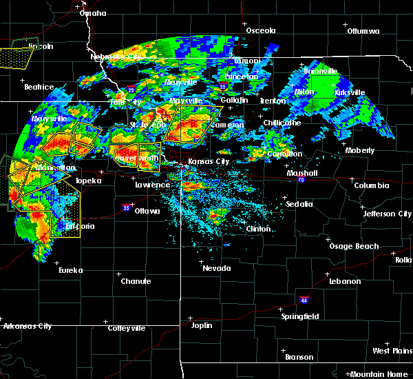 At 313 pm cdt, a severe thunderstorm was located near oskaloosa, moving northeast at 40 mph (radar indicated). Hazards include two inch hail and 70 mph wind gusts. People and animals outdoors will be injured. expect hail damage to roofs, siding, windows, and vehicles. expect considerable tree damage. Wind damage is also likely to mobile homes, roofs, and outbuildings. At 313 pm cdt, a severe thunderstorm was located near oskaloosa, moving northeast at 40 mph (radar indicated). Hazards include two inch hail and 70 mph wind gusts. People and animals outdoors will be injured. expect hail damage to roofs, siding, windows, and vehicles. expect considerable tree damage. Wind damage is also likely to mobile homes, roofs, and outbuildings.
|
| 5/26/2016 1:11 PM CDT |
 At 111 pm cdt, a severe thunderstorm was located over claycomo, moving northeast at 25 mph (trained weather spotters). Hazards include golf ball size hail and 60 mph wind gusts. People and animals outdoors will be injured. expect hail damage to roofs, siding, windows, and vehicles. Expect wind damage to roofs, siding, and trees. At 111 pm cdt, a severe thunderstorm was located over claycomo, moving northeast at 25 mph (trained weather spotters). Hazards include golf ball size hail and 60 mph wind gusts. People and animals outdoors will be injured. expect hail damage to roofs, siding, windows, and vehicles. Expect wind damage to roofs, siding, and trees.
|
| 5/26/2016 12:51 PM CDT |
 At 1250 pm cdt, a severe thunderstorm was located over parkville, moving northeast at 25 mph (trained weather spotters). Hazards include ping pong ball size hail and 60 mph wind gusts. People and animals outdoors will be injured. expect hail damage to roofs, siding, windows, and vehicles. expect wind damage to roofs, siding, and trees. locations impacted include, kansas city, gladstone, parkville, north kansas city, riverside, weatherby lake, kansas city kansas, avondale, northmoor, houston lake, kansas city downtown, oakwood, oaks, randolph, pomeroy, waldron, beverly hills and wolcott. this includes the following highways, interstate 70 in missouri near mile marker 0. interstate 70 in kansas between mile markers 422 and 423. interstate 35 in missouri between mile markers 5 and 10. interstate 29 between mile markers 0 and 6. interstate 635 between mile markers 6 and 12. Interstate 435 between mile markers 18 and 24, and between mile markers 54 and 55. At 1250 pm cdt, a severe thunderstorm was located over parkville, moving northeast at 25 mph (trained weather spotters). Hazards include ping pong ball size hail and 60 mph wind gusts. People and animals outdoors will be injured. expect hail damage to roofs, siding, windows, and vehicles. expect wind damage to roofs, siding, and trees. locations impacted include, kansas city, gladstone, parkville, north kansas city, riverside, weatherby lake, kansas city kansas, avondale, northmoor, houston lake, kansas city downtown, oakwood, oaks, randolph, pomeroy, waldron, beverly hills and wolcott. this includes the following highways, interstate 70 in missouri near mile marker 0. interstate 70 in kansas between mile markers 422 and 423. interstate 35 in missouri between mile markers 5 and 10. interstate 29 between mile markers 0 and 6. interstate 635 between mile markers 6 and 12. Interstate 435 between mile markers 18 and 24, and between mile markers 54 and 55.
|
| 5/26/2016 12:34 PM CDT |
 At 1234 pm cdt, a severe thunderstorm was located over kansas city, or near lake quivira, moving northeast at 25 mph (radar indicated). Hazards include golf ball size hail and 60 mph wind gusts. People and animals outdoors will be injured. expect hail damage to roofs, siding, windows, and vehicles. expect wind damage to roofs, siding, and trees. locations impacted include, kansas city, gladstone, bonner springs, parkville, edwardsville, north kansas city, riverside, weatherby lake, westwood, kansas city kansas, avondale, northmoor, houston lake, kansas city downtown, roeland park, oakwood, oaks, randolph, pomeroy and muncie. this includes the following highways, interstate 70 in missouri between mile markers 0 and 3. interstate 70 in kansas between mile markers 411 and 423. interstate 35 in missouri between mile markers 0 and 10. interstate 35 in kansas between mile markers 232 and 235. interstate 29 between mile markers 0 and 6. interstate 635 between mile markers 1 and 12. Interstate 435 between mile markers 10 and 24, and between mile markers 54 and 55. At 1234 pm cdt, a severe thunderstorm was located over kansas city, or near lake quivira, moving northeast at 25 mph (radar indicated). Hazards include golf ball size hail and 60 mph wind gusts. People and animals outdoors will be injured. expect hail damage to roofs, siding, windows, and vehicles. expect wind damage to roofs, siding, and trees. locations impacted include, kansas city, gladstone, bonner springs, parkville, edwardsville, north kansas city, riverside, weatherby lake, westwood, kansas city kansas, avondale, northmoor, houston lake, kansas city downtown, roeland park, oakwood, oaks, randolph, pomeroy and muncie. this includes the following highways, interstate 70 in missouri between mile markers 0 and 3. interstate 70 in kansas between mile markers 411 and 423. interstate 35 in missouri between mile markers 0 and 10. interstate 35 in kansas between mile markers 232 and 235. interstate 29 between mile markers 0 and 6. interstate 635 between mile markers 1 and 12. Interstate 435 between mile markers 10 and 24, and between mile markers 54 and 55.
|
| 5/26/2016 12:26 PM CDT |
 At 1226 pm cdt, a severe thunderstorm was located over lake quivira, moving northeast at 25 mph (radar indicated). Hazards include golf ball size hail and 70 mph wind gusts. People and animals outdoors will be injured. expect hail damage to roofs, siding, windows, and vehicles. expect considerable tree damage. Wind damage is also likely to mobile homes, roofs, and outbuildings. At 1226 pm cdt, a severe thunderstorm was located over lake quivira, moving northeast at 25 mph (radar indicated). Hazards include golf ball size hail and 70 mph wind gusts. People and animals outdoors will be injured. expect hail damage to roofs, siding, windows, and vehicles. expect considerable tree damage. Wind damage is also likely to mobile homes, roofs, and outbuildings.
|
| 5/26/2016 11:00 AM CDT |
 At 1100 am cdt, a severe thunderstorm was located over kansas city kansas, moving northeast at 10 mph (radar indicated). Hazards include ping pong ball size hail and 60 mph wind gusts. People and animals outdoors will be injured. expect hail damage to roofs, siding, windows, and vehicles. expect wind damage to roofs, siding, and trees. locations impacted include, kansas city, overland park, independence, shawnee, gladstone, merriam, mission, north kansas city, sugar creek, westwood, claycomo, kansas city kansas, avondale, oakview, kansas city downtown, roeland park, oakwood park, oakwood, birmingham and oaks. this includes the following highways, interstate 70 in missouri between mile markers 0 and 5. interstate 70 in kansas between mile markers 413 and 423. interstate 35 in missouri between mile markers 0 and 12. interstate 35 in kansas between mile markers 229 and 235. interstate 29 between mile markers 0 and 2. interstate 635 between mile markers 0 and 8. Interstate 435 between mile markers 52 and 60. At 1100 am cdt, a severe thunderstorm was located over kansas city kansas, moving northeast at 10 mph (radar indicated). Hazards include ping pong ball size hail and 60 mph wind gusts. People and animals outdoors will be injured. expect hail damage to roofs, siding, windows, and vehicles. expect wind damage to roofs, siding, and trees. locations impacted include, kansas city, overland park, independence, shawnee, gladstone, merriam, mission, north kansas city, sugar creek, westwood, claycomo, kansas city kansas, avondale, oakview, kansas city downtown, roeland park, oakwood park, oakwood, birmingham and oaks. this includes the following highways, interstate 70 in missouri between mile markers 0 and 5. interstate 70 in kansas between mile markers 413 and 423. interstate 35 in missouri between mile markers 0 and 12. interstate 35 in kansas between mile markers 229 and 235. interstate 29 between mile markers 0 and 2. interstate 635 between mile markers 0 and 8. Interstate 435 between mile markers 52 and 60.
|
| 5/26/2016 10:52 AM CDT | Quarter sized hail reported 6.3 miles W of Kansas City, KS, quarter size hail reported in kansas city kansas via twitter |
| 5/26/2016 10:51 AM CDT | Golf Ball sized hail reported 6.3 miles W of Kansas City, KS, golfball size hail reported in kansas city kansas via twitter |
| 5/26/2016 10:33 AM CDT |
 At 1032 am cdt, a severe thunderstorm was located over kansas city, moving northeast at 20 mph (radar indicated). Hazards include ping pong ball size hail and 60 mph wind gusts. People and animals outdoors will be injured. expect hail damage to roofs, siding, windows, and vehicles. expect wind damage to roofs, siding, and trees. locations impacted include, kansas city, overland park, independence, lee`s summit, shawnee, blue springs, raytown, gladstone, prairie village, merriam, mission, north kansas city, fairway, mission hills, sugar creek, westwood, claycomo, kansas city kansas, lake tapawingo and avondale. this includes the following highways, interstate 70 in missouri between mile markers 0 and 20. interstate 70 in kansas between mile markers 413 and 423. interstate 35 in missouri between mile markers 0 and 12. interstate 35 in kansas between mile markers 228 and 235. interstate 29 between mile markers 0 and 2. interstate 635 between mile markers 0 and 8. interstate 470 between mile markers 14 and 16. Interstate 435 between mile markers 52 and 68. At 1032 am cdt, a severe thunderstorm was located over kansas city, moving northeast at 20 mph (radar indicated). Hazards include ping pong ball size hail and 60 mph wind gusts. People and animals outdoors will be injured. expect hail damage to roofs, siding, windows, and vehicles. expect wind damage to roofs, siding, and trees. locations impacted include, kansas city, overland park, independence, lee`s summit, shawnee, blue springs, raytown, gladstone, prairie village, merriam, mission, north kansas city, fairway, mission hills, sugar creek, westwood, claycomo, kansas city kansas, lake tapawingo and avondale. this includes the following highways, interstate 70 in missouri between mile markers 0 and 20. interstate 70 in kansas between mile markers 413 and 423. interstate 35 in missouri between mile markers 0 and 12. interstate 35 in kansas between mile markers 228 and 235. interstate 29 between mile markers 0 and 2. interstate 635 between mile markers 0 and 8. interstate 470 between mile markers 14 and 16. Interstate 435 between mile markers 52 and 68.
|
| 5/26/2016 10:26 AM CDT |
 At 1025 am cdt, a severe thunderstorm was located over westwood, moving northeast at 20 mph (radar indicated). Hazards include ping pong ball size hail and 60 mph wind gusts. People and animals outdoors will be injured. expect hail damage to roofs, siding, windows, and vehicles. Expect wind damage to roofs, siding, and trees. At 1025 am cdt, a severe thunderstorm was located over westwood, moving northeast at 20 mph (radar indicated). Hazards include ping pong ball size hail and 60 mph wind gusts. People and animals outdoors will be injured. expect hail damage to roofs, siding, windows, and vehicles. Expect wind damage to roofs, siding, and trees.
|
| 5/26/2016 9:42 AM CDT |
 At 942 am cdt, a severe thunderstorm was located over lenexa, moving northeast at 25 mph (trained weather spotters). Hazards include ping pong ball size hail and 60 mph wind gusts. People and animals outdoors will be injured. expect hail damage to roofs, siding, windows, and vehicles. expect wind damage to roofs, siding, and trees. locations impacted include, overland park, olathe, shawnee, lenexa, leawood, prairie village, merriam, edwardsville, lake quivira, holliday and lackmans. this includes the following highways, interstate 35 in kansas between mile markers 220 and 227. Interstate 435 between mile markers 0 and 8, and between mile markers 80 and 83. At 942 am cdt, a severe thunderstorm was located over lenexa, moving northeast at 25 mph (trained weather spotters). Hazards include ping pong ball size hail and 60 mph wind gusts. People and animals outdoors will be injured. expect hail damage to roofs, siding, windows, and vehicles. expect wind damage to roofs, siding, and trees. locations impacted include, overland park, olathe, shawnee, lenexa, leawood, prairie village, merriam, edwardsville, lake quivira, holliday and lackmans. this includes the following highways, interstate 35 in kansas between mile markers 220 and 227. Interstate 435 between mile markers 0 and 8, and between mile markers 80 and 83.
|
| 5/26/2016 9:36 AM CDT |
 At 936 am cdt, a severe thunderstorm was located near lenexa, moving northeast at 25 mph (radar indicated). Hazards include 60 mph wind gusts and half dollar size hail. Hail damage to vehicles is expected. expect wind damage to roofs, siding, and trees. locations impacted include, overland park, olathe, shawnee, lenexa, leawood, prairie village, merriam, de soto, edwardsville, lake quivira, holliday and lackmans. this includes the following highways, interstate 35 in kansas between mile markers 218 and 227. Interstate 435 between mile markers 0 and 8, and between mile markers 79 and 83. At 936 am cdt, a severe thunderstorm was located near lenexa, moving northeast at 25 mph (radar indicated). Hazards include 60 mph wind gusts and half dollar size hail. Hail damage to vehicles is expected. expect wind damage to roofs, siding, and trees. locations impacted include, overland park, olathe, shawnee, lenexa, leawood, prairie village, merriam, de soto, edwardsville, lake quivira, holliday and lackmans. this includes the following highways, interstate 35 in kansas between mile markers 218 and 227. Interstate 435 between mile markers 0 and 8, and between mile markers 79 and 83.
|
| 5/26/2016 9:30 AM CDT |
 At 930 am cdt, a severe thunderstorm was located over olathe, moving northeast at 25 mph (radar indicated). Hazards include 60 mph wind gusts and half dollar size hail. Hail damage to vehicles is expected. Expect wind damage to roofs, siding, and trees. At 930 am cdt, a severe thunderstorm was located over olathe, moving northeast at 25 mph (radar indicated). Hazards include 60 mph wind gusts and half dollar size hail. Hail damage to vehicles is expected. Expect wind damage to roofs, siding, and trees.
|
| 5/26/2016 8:42 AM CDT |
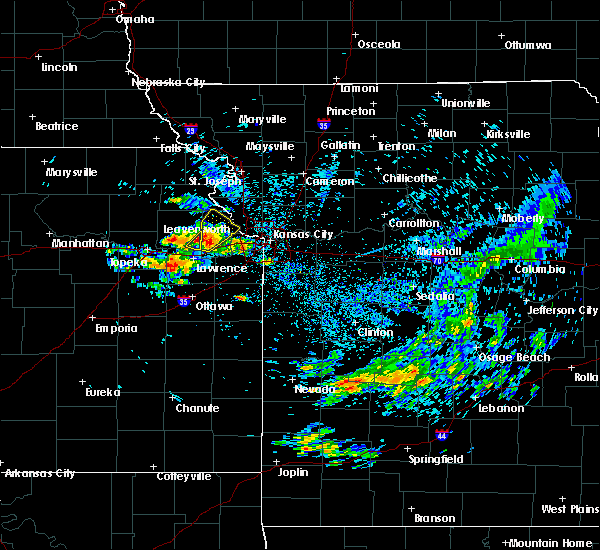 At 842 am cdt, a severe thunderstorm was located near tonganoxie, moving northeast at 40 mph (trained weather spotters). Hazards include golf ball size hail. People and animals outdoors will be injured. expect damage to roofs, siding, windows, and vehicles. locations impacted include, leavenworth, lansing, tonganoxie, easton, reno, fairmount, jarbalo and lowemont. This includes kansas turnpike between mile markers 211 and 212. At 842 am cdt, a severe thunderstorm was located near tonganoxie, moving northeast at 40 mph (trained weather spotters). Hazards include golf ball size hail. People and animals outdoors will be injured. expect damage to roofs, siding, windows, and vehicles. locations impacted include, leavenworth, lansing, tonganoxie, easton, reno, fairmount, jarbalo and lowemont. This includes kansas turnpike between mile markers 211 and 212.
|
| 5/26/2016 8:35 AM CDT |
 At 835 am cdt, a severe thunderstorm was located near tonganoxie, moving northeast at 40 mph (radar indicated). Hazards include 60 mph wind gusts and half dollar size hail. Hail damage to vehicles is expected. Expect wind damage to roofs, siding, and trees. At 835 am cdt, a severe thunderstorm was located near tonganoxie, moving northeast at 40 mph (radar indicated). Hazards include 60 mph wind gusts and half dollar size hail. Hail damage to vehicles is expected. Expect wind damage to roofs, siding, and trees.
|
| 5/11/2016 7:20 AM CDT |
 At 719 am cdt, a severe thunderstorm was located over kansas city kansas, moving east at 20 mph (radar indicated). Hazards include 60 mph wind gusts and penny size hail. Expect damage to roofs. siding. and trees. locations impacted include, kansas city, overland park, independence, shawnee, raytown, gladstone, prairie village, merriam, mission, north kansas city, fairway, mission hills, sugar creek, westwood, lake quivira, kansas city kansas, avondale, westwood hills, mission woods and countryside. this includes the following highways, interstate 70 in missouri between mile markers 0 and 10. interstate 70 in kansas between mile markers 419 and 423. interstate 35 in missouri between mile markers 0 and 10. interstate 35 in kansas between mile markers 227 and 235. interstate 29 between mile markers 0 and 2. interstate 635 between mile markers 0 and 4. Interstate 435 between mile markers 5 and 6, and between mile markers 54 and 67. At 719 am cdt, a severe thunderstorm was located over kansas city kansas, moving east at 20 mph (radar indicated). Hazards include 60 mph wind gusts and penny size hail. Expect damage to roofs. siding. and trees. locations impacted include, kansas city, overland park, independence, shawnee, raytown, gladstone, prairie village, merriam, mission, north kansas city, fairway, mission hills, sugar creek, westwood, lake quivira, kansas city kansas, avondale, westwood hills, mission woods and countryside. this includes the following highways, interstate 70 in missouri between mile markers 0 and 10. interstate 70 in kansas between mile markers 419 and 423. interstate 35 in missouri between mile markers 0 and 10. interstate 35 in kansas between mile markers 227 and 235. interstate 29 between mile markers 0 and 2. interstate 635 between mile markers 0 and 4. Interstate 435 between mile markers 5 and 6, and between mile markers 54 and 67.
|
| 5/11/2016 7:11 AM CDT |
 At 711 am cdt, a severe thunderstorm was located over kansas city, or near kansas city kansas, moving east at 20 mph (radar indicated). Hazards include 60 mph wind gusts and penny size hail. Expect damage to roofs. siding. And trees. At 711 am cdt, a severe thunderstorm was located over kansas city, or near kansas city kansas, moving east at 20 mph (radar indicated). Hazards include 60 mph wind gusts and penny size hail. Expect damage to roofs. siding. And trees.
|
| 5/11/2016 7:07 AM CDT |
 The severe thunderstorm warning for east central leavenworth, northwestern wyandotte and southeastern platte counties will expire at 715 am cdt, the storm which prompted the warning has weakened below severe limits, and no longer pose an immediate threat to life or property. therefore the warning will be allowed to expire. however gusty winds and heavy rain are still possible with this thunderstorm. a severe thunderstorm watch remains in effect until 1000 am cdt for northeastern kansas, and west central missouri. The severe thunderstorm warning for east central leavenworth, northwestern wyandotte and southeastern platte counties will expire at 715 am cdt, the storm which prompted the warning has weakened below severe limits, and no longer pose an immediate threat to life or property. therefore the warning will be allowed to expire. however gusty winds and heavy rain are still possible with this thunderstorm. a severe thunderstorm watch remains in effect until 1000 am cdt for northeastern kansas, and west central missouri.
|
| 5/11/2016 7:04 AM CDT |
 At 704 am cdt, a severe thunderstorm was located near weatherby lake, moving east at 25 mph (radar indicated). Hazards include 60 mph wind gusts and penny size hail. Expect damage to roofs. siding. and trees. locations impacted include, lansing, parkville, weatherby lake, kansas city, pomeroy, waldron, beverly hills and wolcott. This includes interstate 435 between mile markers 16 and 25. At 704 am cdt, a severe thunderstorm was located near weatherby lake, moving east at 25 mph (radar indicated). Hazards include 60 mph wind gusts and penny size hail. Expect damage to roofs. siding. and trees. locations impacted include, lansing, parkville, weatherby lake, kansas city, pomeroy, waldron, beverly hills and wolcott. This includes interstate 435 between mile markers 16 and 25.
|
| 5/11/2016 6:57 AM CDT |
 At 657 am cdt, a severe thunderstorm was located near lansing, moving east at 25 mph (radar indicated). Hazards include 60 mph wind gusts and penny size hail. Expect damage to roofs. siding. and trees. locations impacted include, lansing, parkville, weatherby lake, kansas city, farley, pomeroy, waldron, beverly hills, wolcott and kansas city intl arpt. this includes the following highways, interstate 29 between mile markers 11 and 12. Interstate 435 between mile markers 16 and 27. At 657 am cdt, a severe thunderstorm was located near lansing, moving east at 25 mph (radar indicated). Hazards include 60 mph wind gusts and penny size hail. Expect damage to roofs. siding. and trees. locations impacted include, lansing, parkville, weatherby lake, kansas city, farley, pomeroy, waldron, beverly hills, wolcott and kansas city intl arpt. this includes the following highways, interstate 29 between mile markers 11 and 12. Interstate 435 between mile markers 16 and 27.
|
| 5/11/2016 6:51 AM CDT |
 At 651 am cdt, a severe thunderstorm was located over lansing, moving east at 25 mph (radar indicated). Hazards include 60 mph wind gusts and penny size hail. Expect damage to roofs. siding. And trees. At 651 am cdt, a severe thunderstorm was located over lansing, moving east at 25 mph (radar indicated). Hazards include 60 mph wind gusts and penny size hail. Expect damage to roofs. siding. And trees.
|
| 5/11/2016 5:36 AM CDT |
 The severe thunderstorm warning for central leavenworth and northwestern wyandotte counties will expire at 545 am cdt, the storm which prompted the warning has weakened below severe limits, and no longer pose an immediate threat to life or property. therefore the warning will be allowed to expire. however small. The severe thunderstorm warning for central leavenworth and northwestern wyandotte counties will expire at 545 am cdt, the storm which prompted the warning has weakened below severe limits, and no longer pose an immediate threat to life or property. therefore the warning will be allowed to expire. however small.
|
| 5/11/2016 5:29 AM CDT |
 At 529 am cdt, a severe thunderstorm was located over basehor, moving north at 30 mph (radar indicated). Hazards include 60 mph wind gusts and quarter size hail. Hail damage to vehicles is expected. expect wind damage to roofs, siding, and trees. locations impacted include, bonner springs, basehor, edwardsville, kansas city, fairmount, piper, maywood and pomeroy. this includes the following highways, interstate 70 in kansas between mile markers 410 and 413. interstate 435 between mile markers 11 and 18. Kansas turnpike between mile markers 220 and 226. At 529 am cdt, a severe thunderstorm was located over basehor, moving north at 30 mph (radar indicated). Hazards include 60 mph wind gusts and quarter size hail. Hail damage to vehicles is expected. expect wind damage to roofs, siding, and trees. locations impacted include, bonner springs, basehor, edwardsville, kansas city, fairmount, piper, maywood and pomeroy. this includes the following highways, interstate 70 in kansas between mile markers 410 and 413. interstate 435 between mile markers 11 and 18. Kansas turnpike between mile markers 220 and 226.
|
| 5/11/2016 5:20 AM CDT |
 At 520 am cdt, a severe thunderstorm was located near de soto, moving northeast at 15 mph (trained weather spotters). Hazards include ping pong ball size hail. People and animals outdoors will be injured. expect damage to roofs, siding, windows, and vehicles. locations impacted include, shawnee, lenexa, bonner springs, de soto, basehor, edwardsville, riverside, lake quivira, kansas city, fairmount, piper, pomeroy, muncie, maywood, beverly hills and holliday. this includes the following highways, interstate 70 in kansas between mile markers 410 and 419. interstate 635 between mile markers 4 and 8. interstate 435 between mile markers 5 and 18. Kansas turnpike between mile markers 218 and 226. At 520 am cdt, a severe thunderstorm was located near de soto, moving northeast at 15 mph (trained weather spotters). Hazards include ping pong ball size hail. People and animals outdoors will be injured. expect damage to roofs, siding, windows, and vehicles. locations impacted include, shawnee, lenexa, bonner springs, de soto, basehor, edwardsville, riverside, lake quivira, kansas city, fairmount, piper, pomeroy, muncie, maywood, beverly hills and holliday. this includes the following highways, interstate 70 in kansas between mile markers 410 and 419. interstate 635 between mile markers 4 and 8. interstate 435 between mile markers 5 and 18. Kansas turnpike between mile markers 218 and 226.
|
| 5/11/2016 5:13 AM CDT |
 At 512 am cdt, a severe thunderstorm was located over de soto, moving northeast at 15 mph (trained weather spotters). Hazards include ping pong ball size hail. People and animals outdoors will be injured. Expect damage to roofs, siding, windows, and vehicles. At 512 am cdt, a severe thunderstorm was located over de soto, moving northeast at 15 mph (trained weather spotters). Hazards include ping pong ball size hail. People and animals outdoors will be injured. Expect damage to roofs, siding, windows, and vehicles.
|
| 4/27/2016 3:48 PM CDT |
 At 347 pm cdt, a severe thunderstorm was located over parkville, moving northeast at 30 mph (radar indicated). Hazards include half dollar size hail. Damage to vehicles is expected. locations impacted include, kansas city, gladstone, smithville, parkville, riverside, weatherby lake, lake waukomis, ferrelview, platte woods, houston lake, hoover and kansas city intl arpt. this includes the following highways, interstate 29 between mile markers 4 and 14. interstate 635 near mile marker 12. Interstate 435 between mile markers 21 and 24, and between mile markers 34 and 45. At 347 pm cdt, a severe thunderstorm was located over parkville, moving northeast at 30 mph (radar indicated). Hazards include half dollar size hail. Damage to vehicles is expected. locations impacted include, kansas city, gladstone, smithville, parkville, riverside, weatherby lake, lake waukomis, ferrelview, platte woods, houston lake, hoover and kansas city intl arpt. this includes the following highways, interstate 29 between mile markers 4 and 14. interstate 635 near mile marker 12. Interstate 435 between mile markers 21 and 24, and between mile markers 34 and 45.
|
| 4/27/2016 3:41 PM CDT | Ping Pong Ball sized hail reported 2.5 miles SSE of Kansas City, KS |
| 4/27/2016 3:34 PM CDT | Quarter sized hail reported 3 miles ESE of Kansas City, KS |
| 4/27/2016 3:33 PM CDT |
 At 333 pm cdt, a severe thunderstorm was located over kansas city, or near edwardsville, moving northeast at 30 mph (radar indicated). Hazards include half dollar size hail. damage to vehicles is expected At 333 pm cdt, a severe thunderstorm was located over kansas city, or near edwardsville, moving northeast at 30 mph (radar indicated). Hazards include half dollar size hail. damage to vehicles is expected
|
| 4/26/2016 10:49 PM CDT |
 At 1048 pm cdt, severe thunderstorms were located along a line extending from missouri city to near garden city, moving east at 55 mph (radar indicated). Hazards include 60 mph wind gusts and quarter size hail. Hail damage to vehicles is expected. expect wind damage to roofs, siding, and trees. locations impacted include, kansas city, independence, lee`s summit, blue springs, raytown, liberty, gladstone, grandview, belton, raymore, grain valley, excelsior springs, harrisonville, pleasant hill, oak grove, greenwood, peculiar, north kansas city, sugar creek and buckner. this includes the following highways, interstate 70 in missouri between mile markers 1 and 29. interstate 35 in missouri between mile markers 1 and 21. interstate 29 between mile markers 0 and 4. interstate 635 near mile marker 12. interstate 470 between mile markers 0 and 16. Interstate 435 between mile markers 45 and 74. At 1048 pm cdt, severe thunderstorms were located along a line extending from missouri city to near garden city, moving east at 55 mph (radar indicated). Hazards include 60 mph wind gusts and quarter size hail. Hail damage to vehicles is expected. expect wind damage to roofs, siding, and trees. locations impacted include, kansas city, independence, lee`s summit, blue springs, raytown, liberty, gladstone, grandview, belton, raymore, grain valley, excelsior springs, harrisonville, pleasant hill, oak grove, greenwood, peculiar, north kansas city, sugar creek and buckner. this includes the following highways, interstate 70 in missouri between mile markers 1 and 29. interstate 35 in missouri between mile markers 1 and 21. interstate 29 between mile markers 0 and 4. interstate 635 near mile marker 12. interstate 470 between mile markers 0 and 16. Interstate 435 between mile markers 45 and 74.
|
| 4/26/2016 10:29 PM CDT |
 At 1028 pm cdt, severe thunderstorms were located along a line extending from oakview to 6 miles south of freeman, moving east at 55 mph. this replaces the previous warnings (radar indicated). Hazards include 60 mph wind gusts and quarter size hail. Hail damage to vehicles is expected. Expect wind damage to roofs, siding, and trees. At 1028 pm cdt, severe thunderstorms were located along a line extending from oakview to 6 miles south of freeman, moving east at 55 mph. this replaces the previous warnings (radar indicated). Hazards include 60 mph wind gusts and quarter size hail. Hail damage to vehicles is expected. Expect wind damage to roofs, siding, and trees.
|
| 4/26/2016 9:55 PM CDT |
 At 955 pm cdt, a severe thunderstorm was located over lenexa, moving northeast at 50 mph (radar indicated). Hazards include 60 mph wind gusts and quarter size hail. Hail damage to vehicles is expected. Expect wind damage to roofs, siding, and trees. At 955 pm cdt, a severe thunderstorm was located over lenexa, moving northeast at 50 mph (radar indicated). Hazards include 60 mph wind gusts and quarter size hail. Hail damage to vehicles is expected. Expect wind damage to roofs, siding, and trees.
|
| 4/26/2016 8:53 AM CDT |
 At 852 am cdt, severe thunderstorms were located along a line extending from 6 miles west of kingston to near independence, moving east at 60 mph (trained weather spotters). Hazards include 70 mph wind gusts and ping pong ball size hail. People and animals outdoors will be injured. expect hail damage to roofs, siding, windows, and vehicles. expect considerable tree damage. wind damage is also likely to mobile homes, roofs, and outbuildings. locations impacted include, kansas city, independence, lee`s summit, blue springs, raytown, liberty, gladstone, grain valley, excelsior springs, kearney, oak grove, richmond, parkville, odessa, lexington, north kansas city, sugar creek, buckner, riverside and lawson. this includes the following highways, interstate 70 in missouri between mile markers 0 and 41. interstate 70 in kansas between mile markers 417 and 423. interstate 35 in missouri between mile markers 0 and 45. interstate 35 in kansas between mile markers 234 and 235. interstate 29 between mile markers 0 and 5. interstate 635 between mile markers 3 and 12. interstate 470 between mile markers 13 and 16. Interstate 435 between mile markers 41 and 64. At 852 am cdt, severe thunderstorms were located along a line extending from 6 miles west of kingston to near independence, moving east at 60 mph (trained weather spotters). Hazards include 70 mph wind gusts and ping pong ball size hail. People and animals outdoors will be injured. expect hail damage to roofs, siding, windows, and vehicles. expect considerable tree damage. wind damage is also likely to mobile homes, roofs, and outbuildings. locations impacted include, kansas city, independence, lee`s summit, blue springs, raytown, liberty, gladstone, grain valley, excelsior springs, kearney, oak grove, richmond, parkville, odessa, lexington, north kansas city, sugar creek, buckner, riverside and lawson. this includes the following highways, interstate 70 in missouri between mile markers 0 and 41. interstate 70 in kansas between mile markers 417 and 423. interstate 35 in missouri between mile markers 0 and 45. interstate 35 in kansas between mile markers 234 and 235. interstate 29 between mile markers 0 and 5. interstate 635 between mile markers 3 and 12. interstate 470 between mile markers 13 and 16. Interstate 435 between mile markers 41 and 64.
|
| 4/26/2016 8:44 AM CDT |
 At 843 am cdt, severe thunderstorms were located along a line extending from 6 miles north of lathrop to near sugar creek, moving east at 60 mph (trained weather spotters). Hazards include 70 mph wind gusts and ping pong ball size hail. People and animals outdoors will be injured. expect hail damage to roofs, siding, windows, and vehicles. expect considerable tree damage. Wind damage is also likely to mobile homes, roofs, and outbuildings. At 843 am cdt, severe thunderstorms were located along a line extending from 6 miles north of lathrop to near sugar creek, moving east at 60 mph (trained weather spotters). Hazards include 70 mph wind gusts and ping pong ball size hail. People and animals outdoors will be injured. expect hail damage to roofs, siding, windows, and vehicles. expect considerable tree damage. Wind damage is also likely to mobile homes, roofs, and outbuildings.
|
| 4/26/2016 8:37 AM CDT |
 At 837 am cdt, severe thunderstorms were located along a line extending from near clarksdale to near smithville, moving east at 60 mph (trained weather spotters). Hazards include 70 mph wind gusts and ping pong ball size hail. People and animals outdoors will be injured. expect hail damage to roofs, siding, windows, and vehicles. expect considerable tree damage. wind damage is also likely to mobile homes, roofs, and outbuildings. locations impacted include, kansas city, independence, liberty, gladstone, cameron, smithville, kearney, parkville, north kansas city, sugar creek, riverside, plattsburg, lathrop, weatherby lake, gower, claycomo, courtney, pleasant valley, lake waukomis and trimble. this includes the following highways, interstate 35 in missouri between mile markers 7 and 53. interstate 29 between mile markers 0 and 13. interstate 635 between mile markers 10 and 12. Interstate 435 between mile markers 35 and 57. At 837 am cdt, severe thunderstorms were located along a line extending from near clarksdale to near smithville, moving east at 60 mph (trained weather spotters). Hazards include 70 mph wind gusts and ping pong ball size hail. People and animals outdoors will be injured. expect hail damage to roofs, siding, windows, and vehicles. expect considerable tree damage. wind damage is also likely to mobile homes, roofs, and outbuildings. locations impacted include, kansas city, independence, liberty, gladstone, cameron, smithville, kearney, parkville, north kansas city, sugar creek, riverside, plattsburg, lathrop, weatherby lake, gower, claycomo, courtney, pleasant valley, lake waukomis and trimble. this includes the following highways, interstate 35 in missouri between mile markers 7 and 53. interstate 29 between mile markers 0 and 13. interstate 635 between mile markers 10 and 12. Interstate 435 between mile markers 35 and 57.
|
| 4/26/2016 8:34 AM CDT |
 At 834 am cdt, severe thunderstorms were located along a line extending from near clarksdale to near smithville, moving east at 60 mph (trained weather spotters). Hazards include 70 mph wind gusts and ping pong ball size hail. People and animals outdoors will be injured. expect hail damage to roofs, siding, windows, and vehicles. expect considerable tree damage. wind damage is also likely to mobile homes, roofs, and outbuildings. locations impacted include, kansas city, independence, liberty, gladstone, cameron, smithville, kearney, parkville, north kansas city, sugar creek, riverside, plattsburg, lathrop, weatherby lake, gower, claycomo, maysville, courtney, pleasant valley and lake waukomis. this includes the following highways, interstate 35 in missouri between mile markers 7 and 67. interstate 29 between mile markers 0 and 13. interstate 635 between mile markers 10 and 12. Interstate 435 between mile markers 35 and 56. At 834 am cdt, severe thunderstorms were located along a line extending from near clarksdale to near smithville, moving east at 60 mph (trained weather spotters). Hazards include 70 mph wind gusts and ping pong ball size hail. People and animals outdoors will be injured. expect hail damage to roofs, siding, windows, and vehicles. expect considerable tree damage. wind damage is also likely to mobile homes, roofs, and outbuildings. locations impacted include, kansas city, independence, liberty, gladstone, cameron, smithville, kearney, parkville, north kansas city, sugar creek, riverside, plattsburg, lathrop, weatherby lake, gower, claycomo, maysville, courtney, pleasant valley and lake waukomis. this includes the following highways, interstate 35 in missouri between mile markers 7 and 67. interstate 29 between mile markers 0 and 13. interstate 635 between mile markers 10 and 12. Interstate 435 between mile markers 35 and 56.
|
| 4/26/2016 8:28 AM CDT |
 At 828 am cdt, severe thunderstorms were located along a line extending from near king city to ferrelview, moving east at 60 mph (trained weather spotters). Hazards include 70 mph wind gusts and ping pong ball size hail. People and animals outdoors will be injured. expect hail damage to roofs, siding, windows, and vehicles. expect considerable tree damage. wind damage is also likely to mobile homes, roofs, and outbuildings. locations impacted include, kansas city, independence, st. joseph, leavenworth, liberty, gladstone, lansing, cameron, smithville, kearney, parkville, savannah, platte city, north kansas city, sugar creek, riverside, plattsburg, lathrop, weatherby lake and weston. this includes the following highways, interstate 35 in missouri between mile markers 6 and 67. interstate 29 between mile markers 0 and 58. interstate 635 between mile markers 10 and 12. interstate 435 between mile markers 20 and 57. Interstate 229 between mile markers 0 and 14. At 828 am cdt, severe thunderstorms were located along a line extending from near king city to ferrelview, moving east at 60 mph (trained weather spotters). Hazards include 70 mph wind gusts and ping pong ball size hail. People and animals outdoors will be injured. expect hail damage to roofs, siding, windows, and vehicles. expect considerable tree damage. wind damage is also likely to mobile homes, roofs, and outbuildings. locations impacted include, kansas city, independence, st. joseph, leavenworth, liberty, gladstone, lansing, cameron, smithville, kearney, parkville, savannah, platte city, north kansas city, sugar creek, riverside, plattsburg, lathrop, weatherby lake and weston. this includes the following highways, interstate 35 in missouri between mile markers 6 and 67. interstate 29 between mile markers 0 and 58. interstate 635 between mile markers 10 and 12. interstate 435 between mile markers 20 and 57. Interstate 229 between mile markers 0 and 14.
|
| 4/26/2016 8:17 AM CDT |
 At 816 am cdt, severe thunderstorms were located along a line extending from near union star to near leavenworth, moving east at 55 mph (trained weather spotters). Hazards include 70 mph wind gusts and ping pong ball size hail. People and animals outdoors will be injured. expect hail damage to roofs, siding, windows, and vehicles. expect considerable tree damage. wind damage is also likely to mobile homes, roofs, and outbuildings. locations impacted include, kansas city, independence, st. joseph, leavenworth, liberty, gladstone, lansing, cameron, smithville, kearney, parkville, savannah, platte city, north kansas city, sugar creek, riverside, plattsburg, lathrop, weatherby lake and weston. this includes the following highways, interstate 35 in missouri between mile markers 6 and 67. interstate 29 between mile markers 0 and 59. interstate 635 between mile markers 10 and 12. interstate 435 between mile markers 20 and 57. Interstate 229 between mile markers 0 and 14. At 816 am cdt, severe thunderstorms were located along a line extending from near union star to near leavenworth, moving east at 55 mph (trained weather spotters). Hazards include 70 mph wind gusts and ping pong ball size hail. People and animals outdoors will be injured. expect hail damage to roofs, siding, windows, and vehicles. expect considerable tree damage. wind damage is also likely to mobile homes, roofs, and outbuildings. locations impacted include, kansas city, independence, st. joseph, leavenworth, liberty, gladstone, lansing, cameron, smithville, kearney, parkville, savannah, platte city, north kansas city, sugar creek, riverside, plattsburg, lathrop, weatherby lake and weston. this includes the following highways, interstate 35 in missouri between mile markers 6 and 67. interstate 29 between mile markers 0 and 59. interstate 635 between mile markers 10 and 12. interstate 435 between mile markers 20 and 57. Interstate 229 between mile markers 0 and 14.
|
| 4/26/2016 8:06 AM CDT |
 At 806 am cdt, severe thunderstorms were located along a line extending from near savannah to near leavenworth, moving east at 55 mph (trained weather spotters). Hazards include 70 mph wind gusts and ping pong ball size hail. People and animals outdoors will be injured. expect hail damage to roofs, siding, windows, and vehicles. expect considerable tree damage. wind damage is also likely to mobile homes, roofs, and outbuildings. locations impacted include, kansas city, independence, st. joseph, leavenworth, liberty, gladstone, lansing, atchison, cameron, smithville, kearney, parkville, savannah, platte city, north kansas city, sugar creek, riverside, plattsburg, lathrop and weatherby lake. this includes the following highways, interstate 35 in missouri between mile markers 6 and 67. interstate 29 between mile markers 0 and 67. interstate 635 between mile markers 10 and 12. interstate 435 between mile markers 20 and 57. Interstate 229 between mile markers 0 and 14. At 806 am cdt, severe thunderstorms were located along a line extending from near savannah to near leavenworth, moving east at 55 mph (trained weather spotters). Hazards include 70 mph wind gusts and ping pong ball size hail. People and animals outdoors will be injured. expect hail damage to roofs, siding, windows, and vehicles. expect considerable tree damage. wind damage is also likely to mobile homes, roofs, and outbuildings. locations impacted include, kansas city, independence, st. joseph, leavenworth, liberty, gladstone, lansing, atchison, cameron, smithville, kearney, parkville, savannah, platte city, north kansas city, sugar creek, riverside, plattsburg, lathrop and weatherby lake. this includes the following highways, interstate 35 in missouri between mile markers 6 and 67. interstate 29 between mile markers 0 and 67. interstate 635 between mile markers 10 and 12. interstate 435 between mile markers 20 and 57. Interstate 229 between mile markers 0 and 14.
|
| 4/26/2016 7:51 AM CDT |
 At 750 am cdt, severe thunderstorms were located along a line extending from near fillmore to near easton, moving east at 65 mph (radar indicated). Hazards include golf ball size hail and 70 mph wind gusts. People and animals outdoors will be injured. expect hail damage to roofs, siding, windows, and vehicles. expect considerable tree damage. Wind damage is also likely to mobile homes, roofs, and outbuildings. At 750 am cdt, severe thunderstorms were located along a line extending from near fillmore to near easton, moving east at 65 mph (radar indicated). Hazards include golf ball size hail and 70 mph wind gusts. People and animals outdoors will be injured. expect hail damage to roofs, siding, windows, and vehicles. expect considerable tree damage. Wind damage is also likely to mobile homes, roofs, and outbuildings.
|
| 4/26/2016 7:40 AM CDT |
 The severe thunderstorm warning for southeastern platte and west central clay counties will expire at 745 am cdt, the storm which prompted the warning has moved out of the area. therefore the warning will be allowed to expire. a severe thunderstorm watch remains in effect until 200 pm cdt for northeastern kansas, and west central missouri. The severe thunderstorm warning for southeastern platte and west central clay counties will expire at 745 am cdt, the storm which prompted the warning has moved out of the area. therefore the warning will be allowed to expire. a severe thunderstorm watch remains in effect until 200 pm cdt for northeastern kansas, and west central missouri.
|
| 4/26/2016 7:32 AM CDT |
 At 732 am cdt, a severe thunderstorm was located over platte woods, or over weatherby lake, moving northeast at 30 mph (trained weather spotters). Hazards include golf ball size hail and 60 mph wind gusts. People and animals outdoors will be injured. expect hail damage to roofs, siding, windows, and vehicles. expect wind damage to roofs, siding, and trees. locations impacted include, kansas city, gladstone, parkville, riverside, weatherby lake, pleasant valley, lake waukomis, platte woods, oakview, northmoor, houston lake, oakwood park, oakwood, oaks and waldron. this includes the following highways, interstate 29 between mile markers 1 and 8. interstate 635 between mile markers 11 and 12. Interstate 435 between mile markers 21 and 24, and near mile marker 50. At 732 am cdt, a severe thunderstorm was located over platte woods, or over weatherby lake, moving northeast at 30 mph (trained weather spotters). Hazards include golf ball size hail and 60 mph wind gusts. People and animals outdoors will be injured. expect hail damage to roofs, siding, windows, and vehicles. expect wind damage to roofs, siding, and trees. locations impacted include, kansas city, gladstone, parkville, riverside, weatherby lake, pleasant valley, lake waukomis, platte woods, oakview, northmoor, houston lake, oakwood park, oakwood, oaks and waldron. this includes the following highways, interstate 29 between mile markers 1 and 8. interstate 635 between mile markers 11 and 12. Interstate 435 between mile markers 21 and 24, and near mile marker 50.
|
| 4/26/2016 7:20 AM CDT |
 At 720 am cdt, a severe thunderstorm was located over kansas city, or near parkville, moving northeast at 30 mph (trained weather spotters). Hazards include golf ball size hail and 60 mph wind gusts. People and animals outdoors will be injured. expect hail damage to roofs, siding, windows, and vehicles. expect wind damage to roofs, siding, and trees. locations impacted include, gladstone, parkville, riverside, weatherby lake, kansas city, pleasant valley, lake waukomis, platte woods, oakview, northmoor, houston lake, oakwood park, oakwood, oaks, piper, pomeroy, waldron, maywood, beverly hills and wolcott. this includes the following highways, interstate 70 in kansas between mile markers 413 and 418. interstate 29 between mile markers 1 and 8. interstate 635 between mile markers 5 and 12. Interstate 435 between mile markers 13 and 24, and near mile marker 50. At 720 am cdt, a severe thunderstorm was located over kansas city, or near parkville, moving northeast at 30 mph (trained weather spotters). Hazards include golf ball size hail and 60 mph wind gusts. People and animals outdoors will be injured. expect hail damage to roofs, siding, windows, and vehicles. expect wind damage to roofs, siding, and trees. locations impacted include, gladstone, parkville, riverside, weatherby lake, kansas city, pleasant valley, lake waukomis, platte woods, oakview, northmoor, houston lake, oakwood park, oakwood, oaks, piper, pomeroy, waldron, maywood, beverly hills and wolcott. this includes the following highways, interstate 70 in kansas between mile markers 413 and 418. interstate 29 between mile markers 1 and 8. interstate 635 between mile markers 5 and 12. Interstate 435 between mile markers 13 and 24, and near mile marker 50.
|
| 4/26/2016 7:19 AM CDT | Ping Pong Ball sized hail reported 5.2 miles ENE of Kansas City, KS |
| 4/26/2016 7:12 AM CDT |
 At 712 am cdt, a severe thunderstorm was located over kansas city, or near edwardsville, moving northeast at 30 mph (radar indicated). Hazards include ping pong ball size hail and 60 mph wind gusts. People and animals outdoors will be injured. expect hail damage to roofs, siding, windows, and vehicles. Expect wind damage to roofs, siding, and trees. At 712 am cdt, a severe thunderstorm was located over kansas city, or near edwardsville, moving northeast at 30 mph (radar indicated). Hazards include ping pong ball size hail and 60 mph wind gusts. People and animals outdoors will be injured. expect hail damage to roofs, siding, windows, and vehicles. Expect wind damage to roofs, siding, and trees.
|
| 9/10/2015 9:42 PM CDT | The severe thunderstorm warning for western jackson county will expire at 945 pm cdt, the storm which prompted the warning has weakened below severe limits, and no longer poses an immediate threat to life or property. therefore the warning will be allowed to expire. however gusty winds and heavy rain are still possible with this thunderstorm. a severe thunderstorm watch remains in effect until 200 am cdt for northeastern kansas and west central missouri. |
| 9/10/2015 9:25 PM CDT |
 At 923 pm cdt, a severe thunderstorm was located over lake tapawingo, or near blue springs, moving east at 25 mph (law enforcement and trained spotters reported damaging winds). Hazards include 70 mph wind gusts. Expect considerable tree damage. damage is likely to mobile homes, roofs and outbuildings. locations impacted include, kansas city, independence, lee`s summit, blue springs, leawood, raytown, prairie village, north kansas city, mission hills, sugar creek, lake lotawana, westwood, lake tapawingo, westwood hills, mission woods and unity village. this includes the following highways, interstate 70 in missouri between mile markers 1 and 20. interstate 35 in missouri between mile markers 0 and 4. interstate 35 in kansas near mile marker 235. interstate 470 between mile markers 0 and 16. Interstate 435 between mile markers 56 and 75. At 923 pm cdt, a severe thunderstorm was located over lake tapawingo, or near blue springs, moving east at 25 mph (law enforcement and trained spotters reported damaging winds). Hazards include 70 mph wind gusts. Expect considerable tree damage. damage is likely to mobile homes, roofs and outbuildings. locations impacted include, kansas city, independence, lee`s summit, blue springs, leawood, raytown, prairie village, north kansas city, mission hills, sugar creek, lake lotawana, westwood, lake tapawingo, westwood hills, mission woods and unity village. this includes the following highways, interstate 70 in missouri between mile markers 1 and 20. interstate 35 in missouri between mile markers 0 and 4. interstate 35 in kansas near mile marker 235. interstate 470 between mile markers 0 and 16. Interstate 435 between mile markers 56 and 75.
|
| 9/10/2015 9:15 PM CDT |
 At 914 pm cdt, a severe thunderstorm was located near raytown, moving east at 25 mph (radar indicated). Hazards include 60 mph wind gusts. Expect damage to roofs. Siding and trees. At 914 pm cdt, a severe thunderstorm was located near raytown, moving east at 25 mph (radar indicated). Hazards include 60 mph wind gusts. Expect damage to roofs. Siding and trees.
|
| 9/10/2015 9:00 PM CDT |
 At 859 pm cdt, a severe thunderstorm was located over kansas city, or near lake quivira, moving northeast at 20 mph (radar indicated). Hazards include 60 mph wind gusts and quarter size hail. Hail damage to vehicles is expected. expect wind damage to roofs, siding and trees. locations impacted include, overland park, shawnee, lenexa, leavenworth, leawood, prairie village, lansing, merriam, mission, bonner springs, de soto, parkville, basehor, edwardsville, fairway, mission hills, riverside, weatherby lake, westwood and lake quivira. this includes the following highways, interstate 70 in missouri near mile marker 0. interstate 70 in kansas between mile markers 410 and 423. interstate 35 in kansas between mile markers 223 and 234. interstate 29 between mile markers 3 and 13. interstate 635 between mile markers 0 and 12. interstate 435 between mile markers 0 and 29, between mile markers 34 and 39, and between mile markers 76 and 81, and near mile marker 83. Kansas turnpike between mile markers 214 and 226. At 859 pm cdt, a severe thunderstorm was located over kansas city, or near lake quivira, moving northeast at 20 mph (radar indicated). Hazards include 60 mph wind gusts and quarter size hail. Hail damage to vehicles is expected. expect wind damage to roofs, siding and trees. locations impacted include, overland park, shawnee, lenexa, leavenworth, leawood, prairie village, lansing, merriam, mission, bonner springs, de soto, parkville, basehor, edwardsville, fairway, mission hills, riverside, weatherby lake, westwood and lake quivira. this includes the following highways, interstate 70 in missouri near mile marker 0. interstate 70 in kansas between mile markers 410 and 423. interstate 35 in kansas between mile markers 223 and 234. interstate 29 between mile markers 3 and 13. interstate 635 between mile markers 0 and 12. interstate 435 between mile markers 0 and 29, between mile markers 34 and 39, and between mile markers 76 and 81, and near mile marker 83. Kansas turnpike between mile markers 214 and 226.
|
| 9/10/2015 8:40 PM CDT |
 At 838 pm cdt, a severe thunderstorm was located over bonner springs, moving northeast at 30 mph (radar indicated). Hazards include 60 mph wind gusts and half dollar size hail. Hail damage to vehicles is expected. Expect wind damage to roofs, siding and trees. At 838 pm cdt, a severe thunderstorm was located over bonner springs, moving northeast at 30 mph (radar indicated). Hazards include 60 mph wind gusts and half dollar size hail. Hail damage to vehicles is expected. Expect wind damage to roofs, siding and trees.
|
| 9/10/2015 5:42 AM CDT |
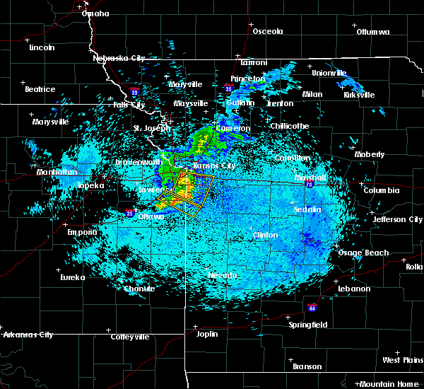 At 541 am cdt, a severe thunderstorm was located over grandview, moving east at 45 mph (radar indicated). Hazards include 60 mph wind gusts and penny size hail. Expect damage to roofs. Siding and trees. At 541 am cdt, a severe thunderstorm was located over grandview, moving east at 45 mph (radar indicated). Hazards include 60 mph wind gusts and penny size hail. Expect damage to roofs. Siding and trees.
|
| 9/10/2015 5:17 AM CDT |
 At 516 am cdt, a severe thunderstorm was located over lake quivira, moving east at 40 mph (radar indicated). Hazards include 60 mph wind gusts and penny size hail. Expect damage to roofs. siding and trees. locations impacted include, overland park, olathe, shawnee, lenexa, merriam, bonner springs, de soto, edwardsville, lake quivira, kansas city, clearview city, muncie, maywood, holliday and lackmans. this includes the following highways, interstate 70 in kansas between mile markers 410 and 419. interstate 35 in kansas between mile markers 215 and 226, and between mile markers 228 and 230. interstate 635 between mile markers 1 and 8. interstate 435 between mile markers 0 and 14, and between mile markers 82 and 83. Kansas turnpike between mile markers 223 and 226. At 516 am cdt, a severe thunderstorm was located over lake quivira, moving east at 40 mph (radar indicated). Hazards include 60 mph wind gusts and penny size hail. Expect damage to roofs. siding and trees. locations impacted include, overland park, olathe, shawnee, lenexa, merriam, bonner springs, de soto, edwardsville, lake quivira, kansas city, clearview city, muncie, maywood, holliday and lackmans. this includes the following highways, interstate 70 in kansas between mile markers 410 and 419. interstate 35 in kansas between mile markers 215 and 226, and between mile markers 228 and 230. interstate 635 between mile markers 1 and 8. interstate 435 between mile markers 0 and 14, and between mile markers 82 and 83. Kansas turnpike between mile markers 223 and 226.
|
| 9/10/2015 5:15 AM CDT |
 At 515 am cdt, a severe thunderstorm was located over lenexa, moving east at 45 mph (radar indicated). Hazards include 60 mph wind gusts and penny size hail. Expect damage to roofs. Siding and trees. At 515 am cdt, a severe thunderstorm was located over lenexa, moving east at 45 mph (radar indicated). Hazards include 60 mph wind gusts and penny size hail. Expect damage to roofs. Siding and trees.
|
| 9/10/2015 4:57 AM CDT |
 At 456 am cdt, a severe thunderstorm was located near linwood, or near tonganoxie, moving east at 40 mph (radar indicated). Hazards include 60 mph wind gusts. Expect damage to roofs. Siding and trees. At 456 am cdt, a severe thunderstorm was located near linwood, or near tonganoxie, moving east at 40 mph (radar indicated). Hazards include 60 mph wind gusts. Expect damage to roofs. Siding and trees.
|
| 7/25/2015 3:31 PM CDT |
 At 330 pm cdt, a severe thunderstorm was located near linwood, or near tonganoxie, moving east at 10 mph (radar indicated). Hazards include 60 mph wind gusts and half dollar size hail. Hail damage to vehicles is expected. Expect wind damage to roofs, siding and trees. At 330 pm cdt, a severe thunderstorm was located near linwood, or near tonganoxie, moving east at 10 mph (radar indicated). Hazards include 60 mph wind gusts and half dollar size hail. Hail damage to vehicles is expected. Expect wind damage to roofs, siding and trees.
|
| 7/6/2015 6:18 PM CDT |
 At 618 pm cdt, severe thunderstorms were located along a line extending from near independence to 5 miles east of drexel, moving east at 35 mph (radar indicated). Hazards include 60 mph wind gusts and penny size hail. Expect damage to roofs. siding and trees. Locations impacted include, kansas city, overland park, independence, lee`s summit, blue springs, leawood, raytown, grandview, belton, prairie village, raymore, grain valley, merriam, harrisonville, mission, pleasant hill, oak grove, roeland park, greenwood and peculiar. At 618 pm cdt, severe thunderstorms were located along a line extending from near independence to 5 miles east of drexel, moving east at 35 mph (radar indicated). Hazards include 60 mph wind gusts and penny size hail. Expect damage to roofs. siding and trees. Locations impacted include, kansas city, overland park, independence, lee`s summit, blue springs, leawood, raytown, grandview, belton, prairie village, raymore, grain valley, merriam, harrisonville, mission, pleasant hill, oak grove, roeland park, greenwood and peculiar.
|
| 7/6/2015 5:59 PM CDT |
 At 559 pm cdt, severe thunderstorms were located along a line extending from north kansas city to 5 miles west of drexel, moving east at 35 mph (radar indicated). Hazards include 70 mph wind gusts and penny size hail. Expect considerable tree damage. Damage is likely to mobile homes, roofs and outbuildings. At 559 pm cdt, severe thunderstorms were located along a line extending from north kansas city to 5 miles west of drexel, moving east at 35 mph (radar indicated). Hazards include 70 mph wind gusts and penny size hail. Expect considerable tree damage. Damage is likely to mobile homes, roofs and outbuildings.
|
| 7/6/2015 4:59 PM CDT |
 At 458 pm cdt, a severe thunderstorm was located over kansas city kansas, moving southeast at 20 mph (radar indicated). Hazards include 60 mph wind gusts and penny size hail. Expect damage to roofs. siding and trees. locations impacted include, shawnee, leavenworth, liberty, gladstone, lansing, smithville, bonner springs, parkville, tonganoxie, platte city, basehor, edwardsville, north kansas city, riverside, weatherby lake, claycomo, lake quivira, kansas city kansas, kansas city and pleasant valley. This includes kansas turnpike between mile markers 206 and 221. At 458 pm cdt, a severe thunderstorm was located over kansas city kansas, moving southeast at 20 mph (radar indicated). Hazards include 60 mph wind gusts and penny size hail. Expect damage to roofs. siding and trees. locations impacted include, shawnee, leavenworth, liberty, gladstone, lansing, smithville, bonner springs, parkville, tonganoxie, platte city, basehor, edwardsville, north kansas city, riverside, weatherby lake, claycomo, lake quivira, kansas city kansas, kansas city and pleasant valley. This includes kansas turnpike between mile markers 206 and 221.
|
| 7/6/2015 4:51 PM CDT |
 At 451 pm cdt, a severe thunderstorm was located over kansas city kansas, moving southeast at 30 mph (radar indicated). Hazards include 60 mph wind gusts and penny size hail. Expect damage to roofs. Siding and trees. At 451 pm cdt, a severe thunderstorm was located over kansas city kansas, moving southeast at 30 mph (radar indicated). Hazards include 60 mph wind gusts and penny size hail. Expect damage to roofs. Siding and trees.
|
| 7/6/2015 4:44 PM CDT | Storm damage reported in wyandotte county KS, 4.5 miles SE of Kansas City, KS |
| 7/6/2015 4:40 PM CDT | Storm damage reported in wyandotte county KS, 4.5 miles SE of Kansas City, KS |
| 7/6/2015 4:18 PM CDT |
 At 417 pm cdt, a severe thunderstorm was located near lansing, moving southeast at 20 mph (radar indicated). Hazards include 60 mph wind gusts and penny size hail. Expect damage to roofs. Siding and trees. At 417 pm cdt, a severe thunderstorm was located near lansing, moving southeast at 20 mph (radar indicated). Hazards include 60 mph wind gusts and penny size hail. Expect damage to roofs. Siding and trees.
|
| 7/1/2015 7:01 PM CDT |
 At 657 pm cdt, a severe thunderstorm was located near kansas city, and moving southeast at 15 mph (radar indicated). Hazards include 60 mph wind gusts and quarter size hail. Hail damage to vehicles is expected. expect wind damage to roofs, siding and trees. locations impacted include, sugar creek, raytown and maywood. this will impact the following interstates, i-70 between mile markers 1 and 11. I-435 loop from mile markers 58 to 73. At 657 pm cdt, a severe thunderstorm was located near kansas city, and moving southeast at 15 mph (radar indicated). Hazards include 60 mph wind gusts and quarter size hail. Hail damage to vehicles is expected. expect wind damage to roofs, siding and trees. locations impacted include, sugar creek, raytown and maywood. this will impact the following interstates, i-70 between mile markers 1 and 11. I-435 loop from mile markers 58 to 73.
|
| 7/1/2015 6:46 PM CDT |
 At 644 pm cdt, a severe thunderstorm was located near kansas city kansas, and moving southeast at 15 mph (radar indicated). Hazards include ping pong ball size hail and 60 mph wind gusts. People and animals outdoors will be injured. expect hail damage to roofs, siding, windows and vehicles. Expect wind damage to roofs, siding and trees. At 644 pm cdt, a severe thunderstorm was located near kansas city kansas, and moving southeast at 15 mph (radar indicated). Hazards include ping pong ball size hail and 60 mph wind gusts. People and animals outdoors will be injured. expect hail damage to roofs, siding, windows and vehicles. Expect wind damage to roofs, siding and trees.
|
| 7/1/2015 1:24 AM CDT |
 At 122 am cdt, severe thunderstorms were located along a line extending from oak grove to raytown, and moving southeast at 35 mph (radar indicated). Hazards include 60 mph wind gusts and nickel size hail. Expect damage to roofs. Siding and trees. At 122 am cdt, severe thunderstorms were located along a line extending from oak grove to raytown, and moving southeast at 35 mph (radar indicated). Hazards include 60 mph wind gusts and nickel size hail. Expect damage to roofs. Siding and trees.
|
| 6/26/2015 1:56 AM CDT |
 A severe thunderstorm warning remains in effect for southeastern johnson county in east central kansas, and southern ray, western lafayette, jackson, clay and northwestern cass counties in west central missouri until 230 am cdt, wind gusts to 80 mph and widespread tree damage have been reported across the kansas city metro. at 152 am cdt, severe thunderstorms were located along a line extending from sibley to raytown to 6 miles northeast of spring hill, and moving southeast at 45 mph. these are very dangerous storms! (radar indicated). Hazards include 80 mph wind gusts. Flying debris will be dangerous to those caught without shelter. mobile homes will be heavily damaged. expect considerable damage to roofs, windows and vehicles. extensive tree damage and power outages are likely. Locations impacted include, lee`s summit, belton, grain valley, lake lotawana, greenwood, richmond, raymore, oak grove, peculiar, pleasant hill, orrick, levasy, lake winnebago, henrietta, lone jack, wellington, stillwell, fleming, tarsney lakes and napoleon. A severe thunderstorm warning remains in effect for southeastern johnson county in east central kansas, and southern ray, western lafayette, jackson, clay and northwestern cass counties in west central missouri until 230 am cdt, wind gusts to 80 mph and widespread tree damage have been reported across the kansas city metro. at 152 am cdt, severe thunderstorms were located along a line extending from sibley to raytown to 6 miles northeast of spring hill, and moving southeast at 45 mph. these are very dangerous storms! (radar indicated). Hazards include 80 mph wind gusts. Flying debris will be dangerous to those caught without shelter. mobile homes will be heavily damaged. expect considerable damage to roofs, windows and vehicles. extensive tree damage and power outages are likely. Locations impacted include, lee`s summit, belton, grain valley, lake lotawana, greenwood, richmond, raymore, oak grove, peculiar, pleasant hill, orrick, levasy, lake winnebago, henrietta, lone jack, wellington, stillwell, fleming, tarsney lakes and napoleon.
|
| 6/26/2015 1:43 AM CDT |
 At 141 am cdt, severe thunderstorms were located along a line extending from excelsior springs to sugar creek to olathe, and moving southeast at 25 mph. these are very dangerous storms (radar indicated). Hazards include 80 mph wind gusts and quarter size hail. Flying debris will be dangerous to those caught without shelter. mobile homes will be heavily damaged. expect considerable damage to roofs, windows and vehicles. Extensive tree damage and power outages are likely. At 141 am cdt, severe thunderstorms were located along a line extending from excelsior springs to sugar creek to olathe, and moving southeast at 25 mph. these are very dangerous storms (radar indicated). Hazards include 80 mph wind gusts and quarter size hail. Flying debris will be dangerous to those caught without shelter. mobile homes will be heavily damaged. expect considerable damage to roofs, windows and vehicles. Extensive tree damage and power outages are likely.
|
| 6/26/2015 1:36 AM CDT |
 At 132 am cdt, severe thunderstorms were located along a line extending from kearney to avondale to lenexa, and moving southeast at 50 mph. these are very dangerous storms (radar indicated). Hazards include 80 mph wind gusts and quarter size hail. Flying debris will be dangerous to those caught without shelter. mobile homes will be heavily damaged. expect considerable damage to roofs, windows and vehicles. extensive tree damage and power outages are likely. Locations impacted include, kansas city, excelsior springs, overland park, mission hills, prairie village, leawood, sugar creek, courtney, independence, raytown, grandview, buckner, blue springs, lee`s summit, westwood hills, mission woods, crystal lakes, woods heights, missouri city and sibley. At 132 am cdt, severe thunderstorms were located along a line extending from kearney to avondale to lenexa, and moving southeast at 50 mph. these are very dangerous storms (radar indicated). Hazards include 80 mph wind gusts and quarter size hail. Flying debris will be dangerous to those caught without shelter. mobile homes will be heavily damaged. expect considerable damage to roofs, windows and vehicles. extensive tree damage and power outages are likely. Locations impacted include, kansas city, excelsior springs, overland park, mission hills, prairie village, leawood, sugar creek, courtney, independence, raytown, grandview, buckner, blue springs, lee`s summit, westwood hills, mission woods, crystal lakes, woods heights, missouri city and sibley.
|
| 6/26/2015 1:26 AM CDT |
 At 123 am, local emergency management reported wind damage in leavenworth. at 122 am cdt, severe thunderstorms were located along a line extending from kearney to platte woods to edwardsville, and moving southeast at 50 mph (radar indicated). Hazards include 70 mph wind gusts and quarter size hail. Hail damage to vehicles is expected. expect considerable tree damage. wind damage is also likely to mobile homes, roofs and outbuildings. Locations impacted include, shawnee, lake quivira, riverside, gladstone, kansas city kansas, liberty, excelsior springs, merriam, lenexa, north kansas city, claycomo, overland park, mission, kansas city, westwood, prairie village, fairway, mission hills, leawood and courtney. At 123 am, local emergency management reported wind damage in leavenworth. at 122 am cdt, severe thunderstorms were located along a line extending from kearney to platte woods to edwardsville, and moving southeast at 50 mph (radar indicated). Hazards include 70 mph wind gusts and quarter size hail. Hail damage to vehicles is expected. expect considerable tree damage. wind damage is also likely to mobile homes, roofs and outbuildings. Locations impacted include, shawnee, lake quivira, riverside, gladstone, kansas city kansas, liberty, excelsior springs, merriam, lenexa, north kansas city, claycomo, overland park, mission, kansas city, westwood, prairie village, fairway, mission hills, leawood and courtney.
|
| 6/26/2015 1:12 AM CDT |
 At 110 am cdt, severe thunderstorms were located along a line extending from kearney to kci airport to basehor, and moving southeast at 50 mph (radar indicated). Hazards include 60 mph wind gusts and penny size hail. Expect damage to roofs. Siding and trees. At 110 am cdt, severe thunderstorms were located along a line extending from kearney to kci airport to basehor, and moving southeast at 50 mph (radar indicated). Hazards include 60 mph wind gusts and penny size hail. Expect damage to roofs. Siding and trees.
|
| 6/21/2015 1:42 PM CDT | At 120 pm, the public reported straight line wind damage in kansas city intl arpt. at 137 pm cdt, a severe thunderstorm was located near blue springs, and moving southeast at 55 mph (radar indicated). Hazards include 60 mph wind gusts and quarter size hail. Hail damage to vehicles is expected. expect wind damage to roofs, siding and trees. locations impacted include, this will impact the following interstates, i-70 between mile markers 11 and 24. i-35 between mile markers 5 and 23. I-435 loop from mile markers 40 to 60. |
| 6/21/2015 1:15 PM CDT |
 At 1245 pm, fire and rescue crews reported softball size hail in de kalb. at 1245 pm, fire and rescue crews reported a e60.00 mph wind gust in de kalb. at 1248 pm, trained weather spotters reported quarter size hail 3 miles west of faucett. at 102 pm, trained weather spotters reported baseball size hail in de kalb. at 110 pm cdt, a severe thunderstorm was located near lake waukomis, and moving southeast at 55 mph (radar indicated). Hazards include tennis ball size hail and 70 mph wind gusts. People and animals outdoors will be injured. expect hail damage to roofs, siding, windows and vehicles. expect considerable tree damage. wind damage is also likely to mobile homes, roofs and outbuildings. locations impacted include, gladstone, north kansas city, claycomo, liberty, sugar creek, courtney, independence, buckner, blue springs, oakview, avondale, pleasant valley, glenaire, missouri city, sibley, lake tapawingo, orrick, oakwood, oaks and randolph. this will impact the following interstates, i-70 between mile markers 11 and 24. i-35 between mile markers 5 and 22. i-435 loop from mile markers 23 to 60. I-29 between mile markers 0 and 26. At 1245 pm, fire and rescue crews reported softball size hail in de kalb. at 1245 pm, fire and rescue crews reported a e60.00 mph wind gust in de kalb. at 1248 pm, trained weather spotters reported quarter size hail 3 miles west of faucett. at 102 pm, trained weather spotters reported baseball size hail in de kalb. at 110 pm cdt, a severe thunderstorm was located near lake waukomis, and moving southeast at 55 mph (radar indicated). Hazards include tennis ball size hail and 70 mph wind gusts. People and animals outdoors will be injured. expect hail damage to roofs, siding, windows and vehicles. expect considerable tree damage. wind damage is also likely to mobile homes, roofs and outbuildings. locations impacted include, gladstone, north kansas city, claycomo, liberty, sugar creek, courtney, independence, buckner, blue springs, oakview, avondale, pleasant valley, glenaire, missouri city, sibley, lake tapawingo, orrick, oakwood, oaks and randolph. this will impact the following interstates, i-70 between mile markers 11 and 24. i-35 between mile markers 5 and 22. i-435 loop from mile markers 23 to 60. I-29 between mile markers 0 and 26.
|
| 6/21/2015 1:01 PM CDT |
 At 1256 pm cdt, a severe thunderstorm was located near tracy, and moving southeast at 55 mph. at 1245 pm, fire and rescue crews reported softball size hail in de kalb. at 1245 pm, fire and rescue crews reported an e60.00 mph wind gust in de kalb. at 1248 pm, trained weather spotters reported quarter size hail 3 miles west of faucett (radar indicated). Hazards include tennis ball size hail and 60 mph wind gusts. People and animals outdoors will be injured. expect hail damage to roofs, siding, windows and vehicles. Expect wind damage to roofs, siding and trees. At 1256 pm cdt, a severe thunderstorm was located near tracy, and moving southeast at 55 mph. at 1245 pm, fire and rescue crews reported softball size hail in de kalb. at 1245 pm, fire and rescue crews reported an e60.00 mph wind gust in de kalb. at 1248 pm, trained weather spotters reported quarter size hail 3 miles west of faucett (radar indicated). Hazards include tennis ball size hail and 60 mph wind gusts. People and animals outdoors will be injured. expect hail damage to roofs, siding, windows and vehicles. Expect wind damage to roofs, siding and trees.
|
| 5/16/2015 11:34 PM CDT | At 1130 pm cdt, severe thunderstorms were located along a line extending from smithville to pleasant valley to grandview, and moving northeast at 50 mph (radar indicated). Hazards include 60 mph wind gusts. Expect damage to roofs. siding and trees. locations impacted include, liberty, independence, courtney, lee`s summit, greenwood, kearney, lake lotawana, blue springs, excelsior springs, buckner, grain valley, lathrop, lawson, oak grove, lake winnebago, lake tapawingo, holt, missouri city, sibley and excelsior estates. this will impact the following interstates, i-70 in missouri between mile markers 0 and 28. i-70 in kansas between mile markers 413 and 423. i-35 in missouri between mile markers 0 and 41. i-35 in kansas between mile markers 217 and 235. i-635 between mile markers 0 and 12. i-435 loop from mile markers 0 to 83. i-29 between mile markers 0 and 18. i-470 between mile markers 0 and 16. 75in. |
| 5/16/2015 11:34 PM CDT | At 1130 pm cdt, severe thunderstorms were located along a line extending from smithville to pleasant valley to grandview, and moving northeast at 50 mph (radar indicated). Hazards include 60 mph wind gusts. Expect damage to roofs. siding and trees. locations impacted include, liberty, independence, courtney, lee`s summit, greenwood, kearney, lake lotawana, blue springs, excelsior springs, buckner, grain valley, lathrop, lawson, oak grove, lake winnebago, lake tapawingo, holt, missouri city, sibley and excelsior estates. this will impact the following interstates, i-70 in missouri between mile markers 0 and 28. i-70 in kansas between mile markers 413 and 423. i-35 in missouri between mile markers 0 and 41. i-35 in kansas between mile markers 217 and 235. i-635 between mile markers 0 and 12. i-435 loop from mile markers 0 to 83. i-29 between mile markers 0 and 18. i-470 between mile markers 0 and 16. 75in. |
| 5/16/2015 11:06 PM CDT | At 1104 pm cdt, severe thunderstorms were located along a line extending from lansing to lake quivira to spring hill, and moving northeast at 50 mph (radar indicated). Hazards include 60 mph wind gusts. Expect damage to roofs. Siding and trees. |
| 5/16/2015 11:06 PM CDT | At 1104 pm cdt, severe thunderstorms were located along a line extending from lansing to lake quivira to spring hill, and moving northeast at 50 mph (radar indicated). Hazards include 60 mph wind gusts. Expect damage to roofs. Siding and trees. |
| 5/16/2015 7:17 PM CDT | At 716 pm cdt, severe thunderstorms were located along a line extending from nortonville to mclouth to vinland, and moving northeast at 35 mph (radar indicated). Hazards include 60 mph wind gusts and penny size hail. Expect damage to roofs. siding and trees. locations impacted include, tonganoxie, gardner, de soto, olathe, atchison, leavenworth, basehor, weston, lansing, bonner springs, platte city, edwardsville, shawnee, lake quivira, easton, linwood, rushville, tracy, camden point and reno. this will impact the following interstates, i-70 in kansas between mile markers 410 and 416. i-35 in kansas between mile markers 208 and 221. i-435 loop from mile markers 1 to 34 to 83. i-29 between mile markers 14 and 30. 0. 75in. |
| 5/16/2015 7:17 PM CDT | At 716 pm cdt, severe thunderstorms were located along a line extending from nortonville to mclouth to vinland, and moving northeast at 35 mph (radar indicated). Hazards include 60 mph wind gusts and penny size hail. Expect damage to roofs. siding and trees. locations impacted include, tonganoxie, gardner, de soto, olathe, atchison, leavenworth, basehor, weston, lansing, bonner springs, platte city, edwardsville, shawnee, lake quivira, easton, linwood, rushville, tracy, camden point and reno. this will impact the following interstates, i-70 in kansas between mile markers 410 and 416. i-35 in kansas between mile markers 208 and 221. i-435 loop from mile markers 1 to 34 to 83. i-29 between mile markers 14 and 30. 0. 75in. |
| 5/16/2015 7:01 PM CDT | At 659 pm cdt, severe thunderstorms were located along a line extending from 5 miles southeast of valley falls to 6 miles west of tonganoxie to 5 miles southwest of baldwin city, and moving northeast at 50 mph (radar indicated). Hazards include 60 mph wind gusts and nickel size hail. Expect damage to roofs. Siding and trees. |
| 5/16/2015 7:01 PM CDT | At 659 pm cdt, severe thunderstorms were located along a line extending from 5 miles southeast of valley falls to 6 miles west of tonganoxie to 5 miles southwest of baldwin city, and moving northeast at 50 mph (radar indicated). Hazards include 60 mph wind gusts and nickel size hail. Expect damage to roofs. Siding and trees. |
| 4/8/2015 5:42 PM CDT | A severe thunderstorm warning remains in effect for southeastern platte and northwestern clay counties until 600 pm cdt. at 538 pm cdt. a severe thunderstorm was located near smithville. and moving northeast at 50 mph. hazard. golf ball size hail and 60 mph wind gusts. source. at 534 pm. Trained weather spotters reported two inch. |
| 4/8/2015 5:37 PM CDT | A severe thunderstorm warning remains in effect for southeastern platte. northwestern clay and northeastern wyandotte counties until 600 pm cdt. at 535 pm cdt. a severe thunderstorm was located near lake waukomis. and moving northeast at 45 mph. hazard. Golf ball size hail and 60 mph wind gusts. |
| 4/8/2015 5:37 PM CDT | A severe thunderstorm warning remains in effect for southeastern platte. northwestern clay and northeastern wyandotte counties until 600 pm cdt. at 535 pm cdt. a severe thunderstorm was located near lake waukomis. and moving northeast at 45 mph. hazard. Golf ball size hail and 60 mph wind gusts. |
| 4/8/2015 5:30 PM CDT | The national weather service in pleasant hill has issued a * severe thunderstorm warning for. northeastern wyandotte county in northeast kansas. northwestern clay county in west central missouri. southeastern platte county in west central missouri. Until 600 pm cdt. |
| 4/8/2015 5:30 PM CDT | The national weather service in pleasant hill has issued a * severe thunderstorm warning for. northeastern wyandotte county in northeast kansas. northwestern clay county in west central missouri. southeastern platte county in west central missouri. Until 600 pm cdt. |
| 7/7/2014 10:39 PM CDT | Storm damage reported in wyandotte county KS, 1.7 miles SSW of Kansas City, KS |
| 6/22/2014 7:58 PM CDT | Tree down on power line in kansas city k in wyandotte county KS, 6.3 miles W of Kansas City, KS |
| 6/5/2014 11:10 AM CDT | Shingle damage by the legends shopping cente in wyandotte county KS, 4.6 miles ESE of Kansas City, KS |
| 1/1/0001 12:00 AM | Douglas ave in wyandotte county KS, 2.2 miles NE of Kansas City, KS |
Hail Maps for Kansas City, KS

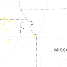
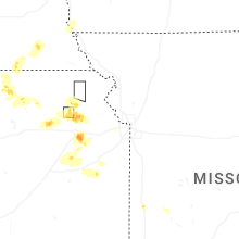
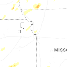


Connect with Interactive Hail Maps