

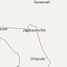
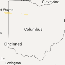
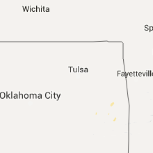
Hail Map for Sunday, August 23, 2015

Number of Impacted Households on 8/23/2015
0
Impacted by 1" or Larger Hail
0
Impacted by 1.75" or Larger Hail
0
Impacted by 2.5" or Larger Hail
Square Miles of Populated Area Impacted on 8/23/2015
0
Impacted by 1" or Larger Hail
0
Impacted by 1.75" or Larger Hail
0
Impacted by 2.5" or Larger Hail


Cities Most Affected by Hail Storms of 8/23/2015
| Hail Size | Demographics of Zip Codes Affected | ||||||
|---|---|---|---|---|---|---|---|
| City | Count | Average | Largest | Pop Density | House Value | Income | Age |
Hail and Wind Damage Spotted on 8/23/2015
Filter by Report Type:Hail ReportsWind Reports
Georgia
| Local Time | Report Details |
|---|---|
| 10:30 AM EDT | 911 call center received reports of numerous trees and powerlines down across fort valley. some locations include west church st...knoxville st...north jones st...and w in peach county GA, 87.5 miles SSE of Atlanta, GA |
| 2:30 PM EDT | Sylvania fire dept reports multiple trees down on private property in the sylvan heights neighborhood. time estimated from radar in screven county GA, 54.5 miles SSE of Augusta, GA |
| 3:04 PM EDT | Two trees down in the clyattville are in lowndes county GA, 59.8 miles ENE of Tallahassee, FL |
| 3:23 PM EDT | Trees down blocking giddens lan in lanier county GA, 35.2 miles SSW of Douglas, GA |
| 3:28 PM EDT | Trees blown down blocking highway 135 nort in lanier county GA, 31.7 miles SSW of Douglas, GA |
| 3:30 PM EDT | Main street in lakeland blocked by trees blown dow in lanier county GA, 34.6 miles SSW of Douglas, GA |
| 3:45 PM EDT | Several reports of trees and power lines down in and around the waycross area. some locations included north mcdonald road and also frank cowart lane. a small tree fell in ware county GA, 37.7 miles SE of Douglas, GA |
| 4:35 PM EDT | Tree and power line down on swamp road. time estimated by rada in clinch county GA, 58.5 miles WNW of Jacksonville, FL |
| 5:21 PM EDT | Tree down in the laurel island subdivision. time estimated by rada in camden county GA, 33.8 miles N of Jacksonville, FL |
| 5:40 PM EDT | Tree down on top of garage in the 1800 block of bowen street. time of event estimated by rada in camden county GA, 28.7 miles NNE of Jacksonville, FL |
Florida
| Local Time | Report Details |
|---|---|
| 4:57 PM EDT | Tree down on county road 250. time estimated by rada in baker county FL, 40.2 miles W of Jacksonville, FL |
| 5:16 PM EDT | Multiple trees reported down in the glen saint mary area. time estimated by rada in baker county FL, 30.4 miles W of Jacksonville, FL |
| 5:35 PM EDT | Tree down on brandies ave. time estimated by rada in nassau county FL, 18.9 miles NNW of Jacksonville, FL |
| 5:50 PM EDT | Central dispatch reported a tree down on power lines on pitts roa in duval county FL, 9.2 miles NW of Jacksonville, FL |
| 5:52 PM EDT | Tree and power line down on beech street in fernandina beach. time estimated by rada in nassau county FL, 26.4 miles NNE of Jacksonville, FL |
| 5:57 PM EDT | Central dispatch reported a tree down on power lines at palmdale street and lake park driv in duval county FL, 4.5 miles NNW of Jacksonville, FL |
| 6:06 PM EDT | Central dispatch reported a tree down on a power line and on fire on lyle lane near the ortega are in duval county FL, 7.1 miles SW of Jacksonville, FL |
| 6:15 PM EDT | Central dispatch reported a tree down on a home off of underhill drive in the arlington are in duval county FL, 3.9 miles E of Jacksonville, FL |
| 8:00 PM EDT | Several trees down in palm coast. estimated wind speed 50 mp in flagler county FL, 58.9 miles SSE of Jacksonville, FL |
Indiana
| Local Time | Report Details |
|---|---|
| 5:05 PM EDT | 2-3 ft diameter limbs down and partial barn roof blown off. time estimated from rada in allen county IN, 15.1 miles NE of Fort Wayne, IN |
Ohio
| Local Time | Report Details |
|---|---|
| 5:06 PM EDT | Report of large limbs down on top of two homes. time estimated from rada in paulding county OH, 18.6 miles ENE of Fort Wayne, IN |
| 5:32 PM EDT | Quarter sized hail reported near Payne, OH, 17.2 miles E of Fort Wayne, IN |
| 5:34 PM EDT | Two large trees down onto power lines. time estimated from rada in paulding county OH, 34.5 miles ENE of Fort Wayne, IN |
| 5:43 PM EDT | Report of trees down on homes. time estimated from rada in paulding county OH, 38.5 miles ENE of Fort Wayne, IN |
| 7:25 PM EDT | Quarter sized hail reported near Carey, OH, 71 miles NNW of Columbus, OH, gas station attendant reported quarter sized hail during storm. |
Texas
| Local Time | Report Details |
|---|---|
| 5:50 PM CDT | 50 to 60 mph wind gusts estimated in westove in baylor county TX, 41.1 miles SW of Wichita Falls, TX |
Connect with Interactive Hail Maps