

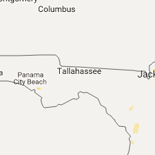
Hail Map for Thursday, August 24, 2017

Number of Impacted Households on 8/24/2017
0
Impacted by 1" or Larger Hail
0
Impacted by 1.75" or Larger Hail
0
Impacted by 2.5" or Larger Hail
Square Miles of Populated Area Impacted on 8/24/2017
0
Impacted by 1" or Larger Hail
0
Impacted by 1.75" or Larger Hail
0
Impacted by 2.5" or Larger Hail


Cities Most Affected by Hail Storms of 8/24/2017
| Hail Size | Demographics of Zip Codes Affected | ||||||
|---|---|---|---|---|---|---|---|
| City | Count | Average | Largest | Pop Density | House Value | Income | Age |
Hail and Wind Damage Spotted on 8/24/2017
Filter by Report Type:Hail ReportsWind Reports
Nebraska
| Local Time | Report Details |
|---|---|
| 12:11 PM CDT | Storm damage reported in wayne county NE, 86.3 miles NW of Omaha, NE |
| 3:20 PM CDT | Quarter sized hail reported near Coleridge, NE, 74.1 miles E of Oneill, NE |
| 4:33 PM CDT | Quarter sized hail reported near Newcastle, NE, 67 miles S of Sioux Falls, SD |
Florida
| Local Time | Report Details |
|---|---|
| 5:05 PM EDT | 911 call center reported power lines down on cravey road. time estimated using radar dat in nassau county FL, 15.9 miles NNW of Jacksonville, FL |
| 5:25 PM EDT | 911 call center reported wires down on thomas creek rd. time estimated using radar dat in nassau county FL, 15.9 miles NW of Jacksonville, FL |
| 5:53 PM EDT | Broadcast media report of trees and wires down on otis road near the nassau county and duval county border. time estimated using radar dat in duval county FL, 16.6 miles W of Jacksonville, FL |
| 6:00 PM EDT | 911 call center reported tree down on fernadina ave. time estimated using radar dat in duval county FL, 3.6 miles NNW of Jacksonville, FL |
| 6:05 PM EDT | 911 call center reported tree down on power lines on church ave. time estimated using radar dat in nassau county FL, 17.5 miles WNW of Jacksonville, FL |
Georgia
| Local Time | Report Details |
|---|---|
| 5:11 PM EDT | Trees down on railroad tracks between lake park and dashe in lowndes county GA, 59.5 miles SSW of Douglas, GA |
| 5:25 PM EDT | Trees down on highway 41 between lake park and the florida georgia lin in lowndes county GA, 61.6 miles SSW of Douglas, GA |
Colorado
| Local Time | Report Details |
|---|---|
| 5:20 PM MDT | Quarter sized hail reported near Akron, CO, 35.3 miles WSW of Yuma, CO, hail covering ground. |
| 5:24 PM MDT | Quarter sized hail reported near Iliff, CO, 46.8 miles NNW of Yuma, CO |
| 6:53 PM MDT | Quarter sized hail reported near Fort Morgan, CO, 56.8 miles W of Yuma, CO |
Idaho
| Local Time | Report Details |
|---|---|
| 7:41 PM MDT | Peak gust measured at the boise airpor in ada county ID, 1.9 miles W of Boise, ID |
Montana
| Local Time | Report Details |
|---|---|
| 9:24 PM MDT | Glasgow airport asos measured a 63 mph wind gust as a squall pushed throug in valley county MT, 1.3 miles NE of Glasgow, MT |
| 9:30 PM MDT | Time estimate in valley county MT, 15 miles NNE of Glasgow, MT |
Connect with Interactive Hail Maps