

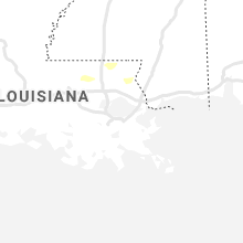
Hail Map for Monday, December 6, 2021

Number of Impacted Households on 12/6/2021
0
Impacted by 1" or Larger Hail
0
Impacted by 1.75" or Larger Hail
0
Impacted by 2.5" or Larger Hail
Square Miles of Populated Area Impacted on 12/6/2021
0
Impacted by 1" or Larger Hail
0
Impacted by 1.75" or Larger Hail
0
Impacted by 2.5" or Larger Hail
Cities Most Affected by Hail Storms of 12/6/2021
| Hail Size | Demographics of Zip Codes Affected | ||||||
|---|---|---|---|---|---|---|---|
| City | Count | Average | Largest | Pop Density | House Value | Income | Age |
Hail and Wind Damage Spotted on 12/6/2021
Filter by Report Type:Hail ReportsWind Reports
Tennessee
| Local Time | Report Details |
|---|---|
| 6:00 AM CST | Damage to a barn. a bus/rv flipped over. possible tornado. time estimated via rada in trousdale county TN, 35.7 miles ENE of Nashville, TN |
| 6:04 AM CST | Tree down blocking the road on river street in downtown hartsvill in trousdale county TN, 37.3 miles ENE of Nashville, TN |
| 6:38 AM CST | Trees down on both side of key west road near pond field road. numerous other trees down in the westpoint are in lawrence county TN, 31.1 miles NNE of Florence, AL |
| 6:48 AM CST | Emergency manager reported 155 houses without power due to limbs down on power lines. locations around lawrenceburg. time estimated via rada in lawrence county TN, 36.4 miles NNE of Florence, AL |
| 7:00 AM CST | Facebook photo of barn partially collapsed on pippin roa in putnam county TN, 68.7 miles E of Nashville, TN |
| 7:05 AM CST | Trees and fences down on highway 111 at the overton and pickett county line. report via faceboo in overton county TN, 79.2 miles WNW of Knoxville, TN |
| 7:06 AM CST | Emergency management reported a facebook report of roof damage in independence. time estimated via rada in overton county TN, 80.8 miles WNW of Knoxville, TN |
| 7:19 AM CST | Shop destroyed and trees and power lines down on toe town road in pleasant shade. report via faceboo in smith county TN, 47.4 miles ENE of Nashville, TN |
| 7:20 AM CST | Trees and power lines down in the ridge top acres area of jamestown. report via faceboo in fentress county TN, 65.5 miles WNW of Knoxville, TN |
| 7:22 AM CST | Damage to hvac equipment on roof of pine haven elementary school as well as outbuildings behind the schoo in fentress county TN, 66.2 miles WNW of Knoxville, TN |
| 7:30 AM CST | Corrects previous tstm wnd dmg report from 8 ssw byrdstown. report of trees down in roadway on wirmingham road in monroe. time estimated via rada in overton county TN, 79.1 miles WNW of Knoxville, TN |
| 7:30 AM CST | Corrects previous tstm wnd dmg report from 8 ssw byrdstown. report of trees down in roadway on wirmingham road in monroe. time estimated via rada in overton county TN, 79.1 miles WNW of Knoxville, TN |
| 7:42 AM CST | Emergency manager reports trees... powerlines... and home damage in northern moore county near ledford mill road west northwest of tullahom in moore county TN, 60 miles SSE of Nashville, TN |
| 7:48 AM CST | Breckenridge community trees down. time estimated via rada in coffee county TN, 55.2 miles WNW of Chattanooga, TN |
| 7:53 AM CST | Report of trees and powerlines down on marbury roa in coffee county TN, 56.1 miles WNW of Chattanooga, TN |
| 8:55 AM EST | Several trees dow in scott county TN, 53.1 miles NW of Knoxville, TN |
| 9:18 AM EST | Tree dow in scott county TN, 38.7 miles WNW of Knoxville, TN |
| 9:27 AM EST | Several trees down across the count in campbell county TN, 36.7 miles NNW of Knoxville, TN |
| 8:30 AM CST | Sewanee police reported numerous trees and some power lines down on university avenu in franklin county TN, 36.2 miles WNW of Chattanooga, TN |
| 8:36 AM CST | Sewanee police department reported numerous trees down on airport road near highway 15 in franklin county TN, 34.8 miles WNW of Chattanooga, TN |
| 9:04 AM CST | A few trees dow in bledsoe county TN, 37.5 miles N of Chattanooga, TN |
| 9:08 AM CST | A few trees dow in bledsoe county TN, 34.3 miles N of Chattanooga, TN |
| 10:10 AM EST | A few trees dow in rhea county TN, 48.2 miles NNE of Chattanooga, TN |
Kentucky
| Local Time | Report Details |
|---|---|
| 7:00 AM EST | Trees down at fall lick rd and drakes creek rd. time estimated from rada in garrard county KY, 30.9 miles WSW of Irvine, KY |
| 7:15 AM EST | Nearby ky mesonet stations gusted 40mph causing many snapped pine trees near dunnville... k in casey county KY, 65.8 miles SW of Irvine, KY |
| 9:30 AM EST | A tree was blown down along ky 3427 near mm 3 around 930 am es in leslie county KY, 60 miles SE of Irvine, KY |
Alabama
| Local Time | Report Details |
|---|---|
| 6:32 AM CST | Tree downed in the 10000 block of frankfort r in colbert county AL, 9.3 miles SSW of Florence, AL |
| 6:32 AM CST | Tree downed in the 10000 block of frankfort r in colbert county AL, 9.3 miles SSW of Florence, AL |
| 8:55 AM CST | Couple trees down along wolf creek rd. time estimated from rada in walker county AL, 40.9 miles WNW of Birmingham, AL |
| 9:01 AM CST | Tree down on barkley bridge rd. time estimated from radar dat in morgan county AL, 49.3 miles ESE of Florence, AL |
| 9:58 AM CST | Trees down in the coleman lakes area of mccalla. nearby wind gust at bessemer airport of 33mp in jefferson county AL, 20.6 miles SW of Birmingham, AL |
| 10:10 AM CST | Tree reported down at hwy280 and cahaba valley rd. another tree down in the meadowbrook neighborhood. winds estimated at 30 to 40mp in shelby county AL, 10.7 miles SE of Birmingham, AL |
| 3:45 PM CST | Multiple trees reported down near 541 siloam church rd. rutledge... al 36071. powerlines also reported down along the 7000 block of greenville hwy & near the intersecti in crenshaw county AL, 56.5 miles ESE of Camden, AL |
Mississippi
| Local Time | Report Details |
|---|---|
| 10:15 AM CST | A roughly 3 inch diameter pine branch was blown down on el dorado road. winds also gusted to around 49mph at jackson medgar wiley evers international airpor in rankin county MS, 7.7 miles E of Jackson, MS |
| 10:20 AM CST | Tree down on a power line on peach orchard rd. likely sub-severe wind gus in hinds county MS, 23.1 miles WSW of Jackson, MS |
| 12:42 PM CST | Power line dow in clarke county MS, 77.5 miles W of Camden, AL |
New York
| Local Time | Report Details |
|---|---|
| 9:13 PM EST | Corrects previous tstm wnd gst report (time) from farmingdale airport asos station kfr in suffolk county NY, 30.1 miles E of Brooklyn, NY |
| 9:43 PM EST | Tree branches reported down near driveway on front law in suffolk county NY, 59.3 miles E of Brooklyn, NY |
| 9:48 PM EST | A convective wind gust of 60 mph was measured at ew5678 stony brook statio in suffolk county NY, 47.3 miles ENE of Brooklyn, NY |
| 9:53 PM EST | Asos station kfrg farmingdale airpor in suffolk county NY, 30.1 miles E of Brooklyn, NY |
Connect with Interactive Hail Maps