

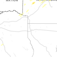
Hail Map for Thursday, January 11, 2024

Number of Impacted Households on 1/11/2024
0
Impacted by 1" or Larger Hail
0
Impacted by 1.75" or Larger Hail
0
Impacted by 2.5" or Larger Hail
Square Miles of Populated Area Impacted on 1/11/2024
0
Impacted by 1" or Larger Hail
0
Impacted by 1.75" or Larger Hail
0
Impacted by 2.5" or Larger Hail


Cities Most Affected by Hail Storms of 1/11/2024
| Hail Size | Demographics of Zip Codes Affected | ||||||
|---|---|---|---|---|---|---|---|
| City | Count | Average | Largest | Pop Density | House Value | Income | Age |
Hail and Wind Damage Spotted on 1/11/2024
Filter by Report Type:Hail ReportsWind Reports
Arkansas
| Local Time | Report Details |
|---|---|
| 8:13 PM CST | Quarter sized hail reported near Pottsville, AR, 55.9 miles NW of Little Rock, AR |
| 10:16 PM CST | Quarter sized hail reported near Caddo Gap, AR, 35 miles NNE of Nashville, AR, report from mping: quarter (1.00 in.). |
| 10:32 PM CST | Storm damage reported in perry county AR, 34.9 miles WNW of Little Rock, AR |
| 10:34 PM CST | Multiple trees blown dow in perry county AR, 32.4 miles WNW of Little Rock, AR |
| 10:52 PM CST | Multiple trees blown down. tree reported on a house on allan point roa in perry county AR, 28 miles NW of Little Rock, AR |
| 11:00 PM CST | Downed tree/limbs oldham road; relayed by medi in benton county AR, 72.9 miles N of Fort Smith, AR |
| 11:22 PM CST | Roofs and fences damaged at dixieland rd and broadwa in benton county AR, 67.3 miles NNE of Fort Smith, AR |
| 11:25 PM CST | Location approximated based on report relayed by neighboring nws office; time based on radar; trees snapped and power lines dow in benton county AR, 70.5 miles SSW of Springfield, MO |
| 11:29 PM CST | Quarter sized hail reported near Little Rock, AR, 13.3 miles WNW of Little Rock, AR |
| 11:39 PM CST | Half Dollar sized hail reported near Maumelle, AR, 10.5 miles NW of Little Rock, AR |
| 11:39 PM CST | Quarter sized hail reported near Elkins, AR, 48.3 miles NNE of Fort Smith, AR |
| 11:41 PM CST | Half Dollar sized hail reported near North Little Rock, AR, 10.9 miles NNW of Little Rock, AR, report from mping: half dollar (1.25 in.). |
| 11:42 PM CST | Quarter sized hail reported near North Little Rock, AR, 9.7 miles NNW of Little Rock, AR |
| 11:53 PM CST | Reports of trees and powerlines dow in independence county AR, 67.1 miles NNE of Little Rock, AR |
| 12:07 AM CST | Reports of trees and powerlines dow in independence county AR, 76.5 miles NE of Little Rock, AR |
| 12:15 AM CST | Quarter sized hail reported near Sherwood, AR, 13.9 miles N of Little Rock, AR |
| 12:21 AM CST | Quarter sized hail reported near Alexander, AR, 14.5 miles WSW of Little Rock, AR, report from mping: quarter (1.00 in.). |
| 12:25 AM CST | Storm spotter estimated thunderstorm wind gusts of 65 mph at markham and santa f in pulaski county AR, 4.8 miles WNW of Little Rock, AR |
| 12:28 AM CST | Ping Pong Ball sized hail reported near Searcy, AR, 46.7 miles NE of Little Rock, AR |
| 12:34 AM CST | Report from mping: 3-inch tree limbs broken; power poles broke in pulaski county AR, 7.8 miles W of Little Rock, AR |
| 12:38 AM CST | Quarter sized hail reported near Bald Knob, AR, 55.6 miles NE of Little Rock, AR |
| 12:40 AM CST | Quarter sized hail reported near Weiner, AR, 58 miles NW of Memphis, TN, quarter-sized hail. |
| 1:42 AM CST | Quarter sized hail reported near Foreman, AR, 35 miles WSW of Nashville, AR, reports of estimated quarter size hail or larger falling at the e-z mart in foreman. |
| 1:59 AM CST | Quarter sized hail reported near Morrilton, AR, 37.6 miles NW of Little Rock, AR |
| 4:12 AM CST | Reports of trees down on highway 82 east... highway 19 south... and highway 78 sout in columbia county AR, 61.4 miles NE of Shreveport, LA |
| 5:16 AM CST | Asos station kpbf pine bluff grider fiel in jefferson county AR, 43.9 miles SSE of Little Rock, AR |
| 5:37 AM CST | Awos station ksgt stuttgart municipal airpor in prairie county AR, 41.4 miles ESE of Little Rock, AR |
Oklahoma
| Local Time | Report Details |
|---|---|
| 10:12 PM CST | Quarter sized hail reported near Wetumka, OK, 59.2 miles N of Atoka, OK |
Missouri
| Local Time | Report Details |
|---|---|
| 11:30 PM CST | Powerlines dow in barry county MO, 56.9 miles SW of Springfield, MO |
| 11:50 PM CST | Trees down on highway 39 and timber springs r in barry county MO, 46.9 miles SSW of Springfield, MO |
| 12:17 AM CST | Quarter sized hail reported near Forsyth, MO, 37 miles SSE of Springfield, MO |
Texas
| Local Time | Report Details |
|---|---|
| 12:37 AM CST | Quarter sized hail reported near Mount Vernon, TX, 95.3 miles WSW of Nashville, AR, multiple reports of quarter size hail around mount vernon. |
Louisiana
| Local Time | Report Details |
|---|---|
| 4:36 AM CST | A tree was downed along hwy 43 between chapman road and albert smith road in far southeast union parish... louisian in union county LA, 18.2 miles WSW of Bastrop, LA |
Connect with Interactive Hail Maps