

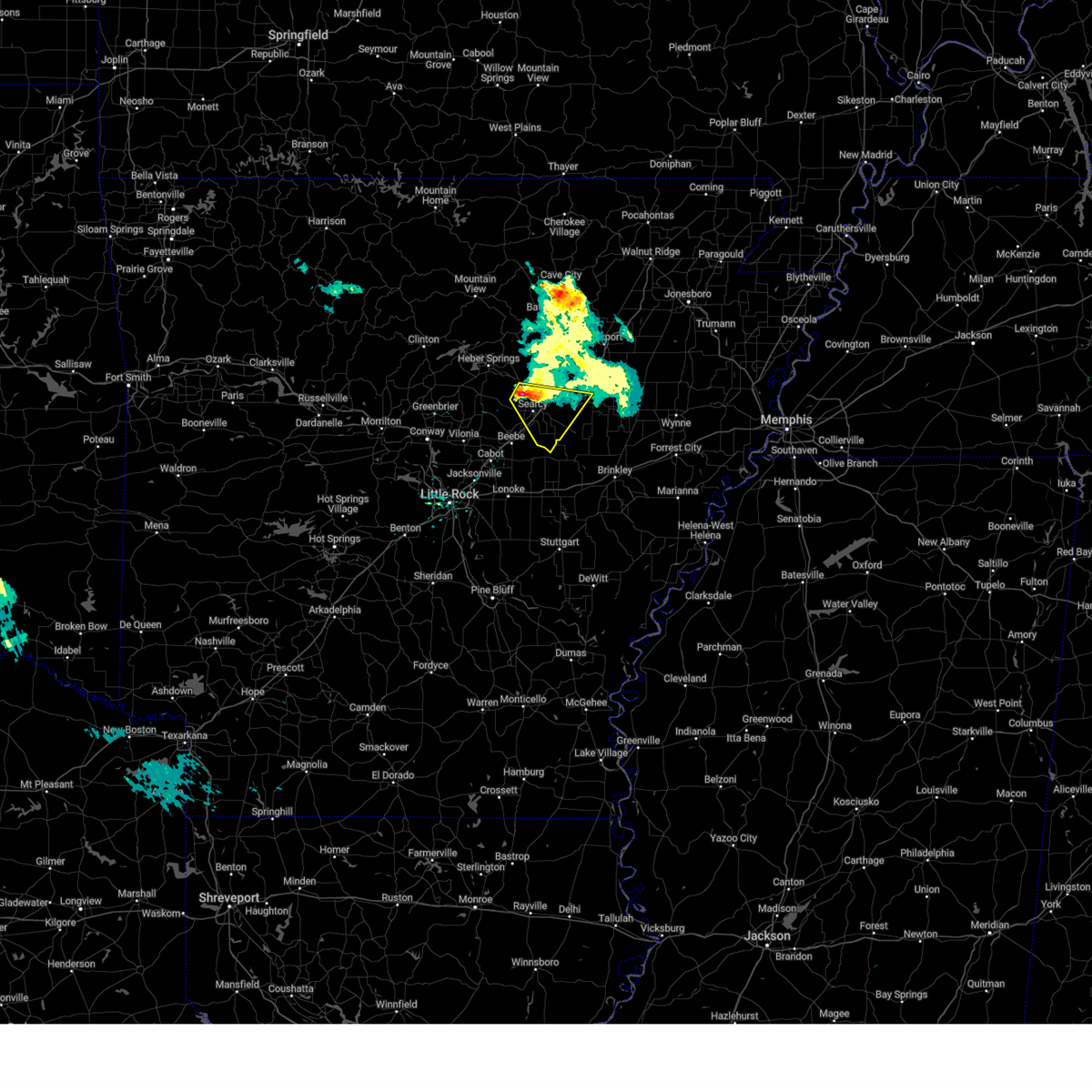
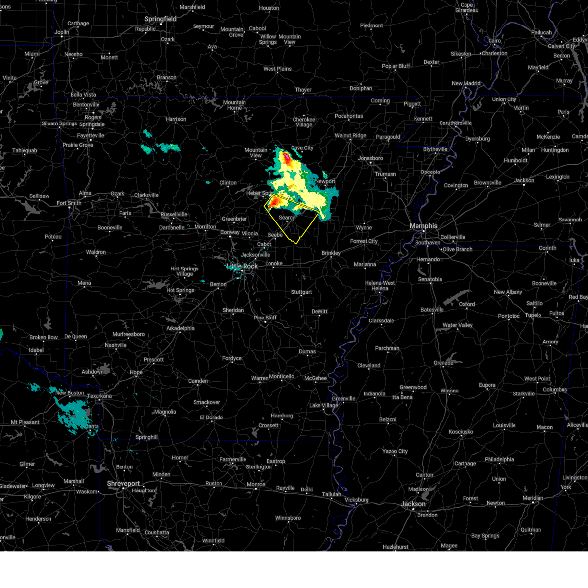
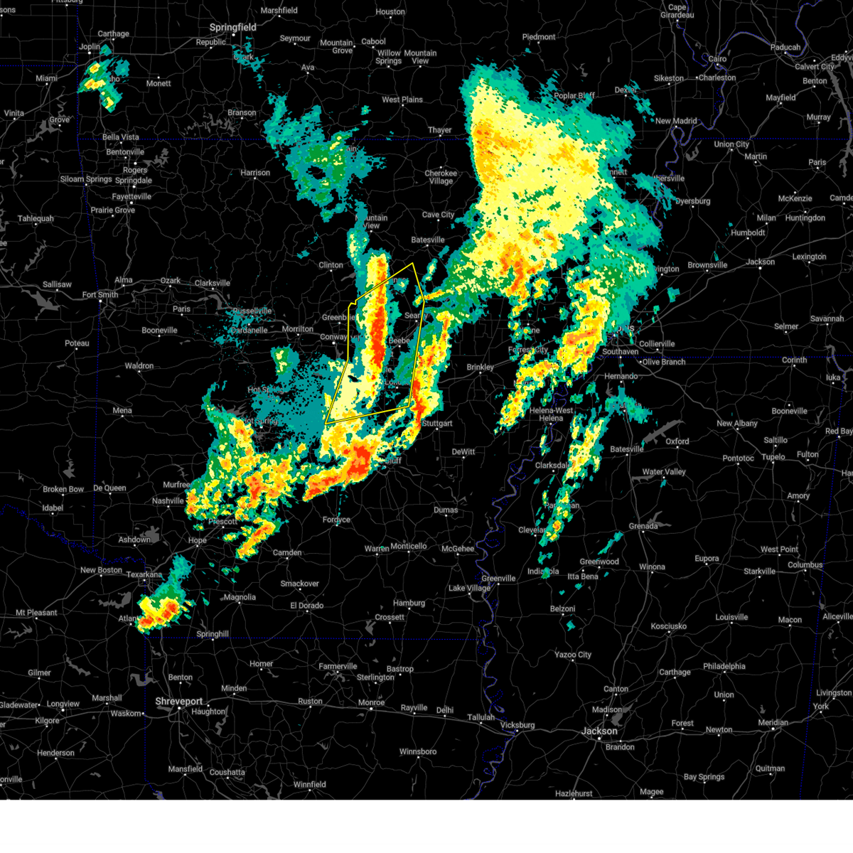
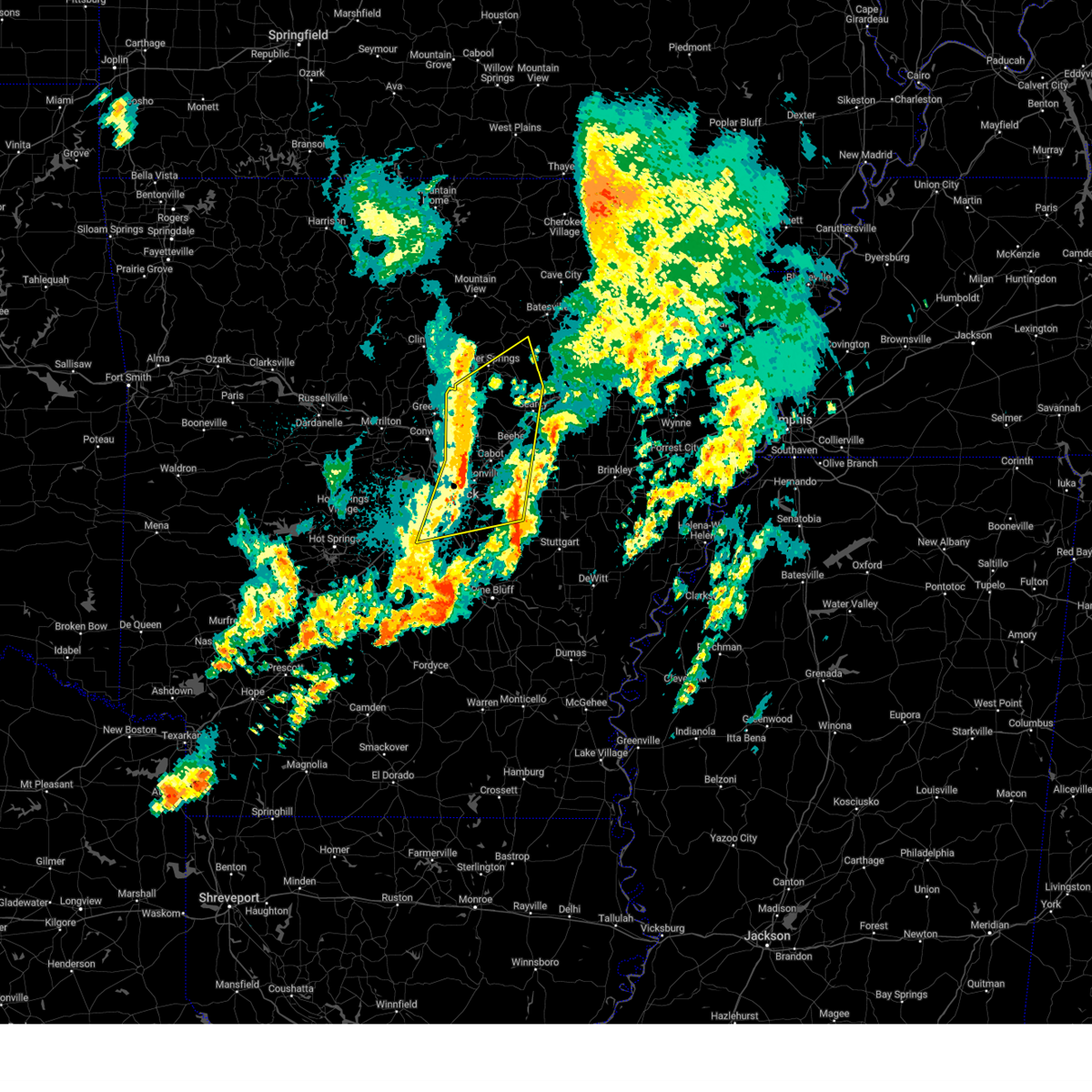
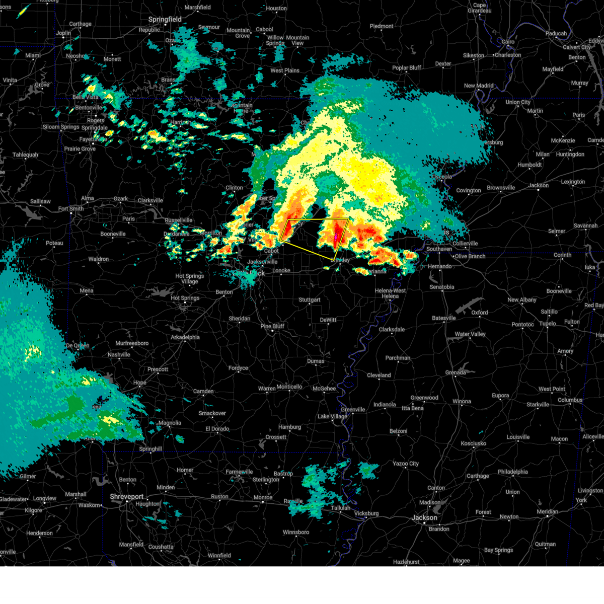
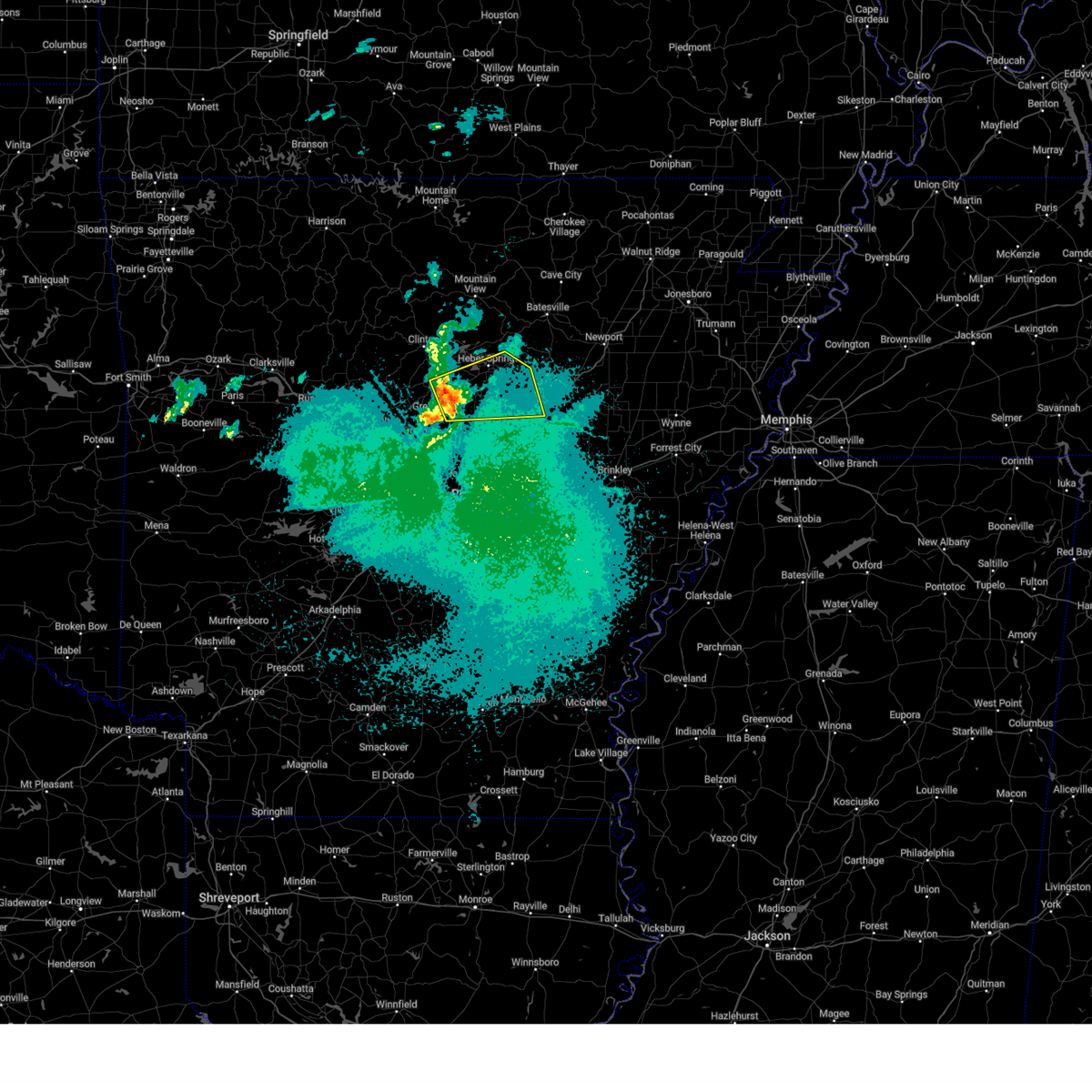
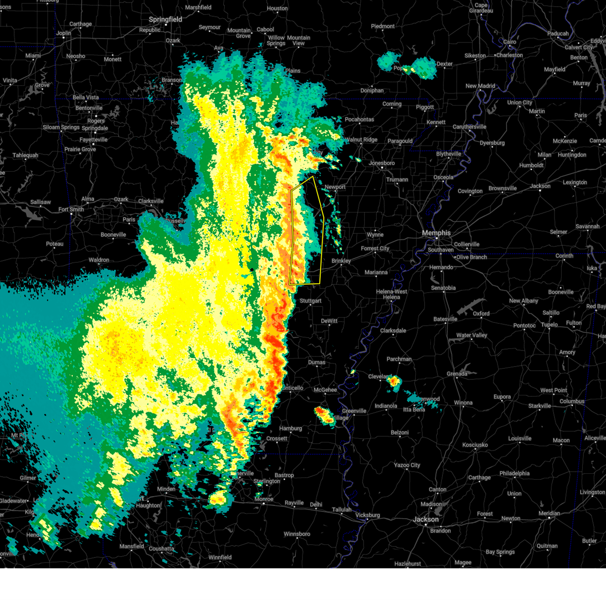
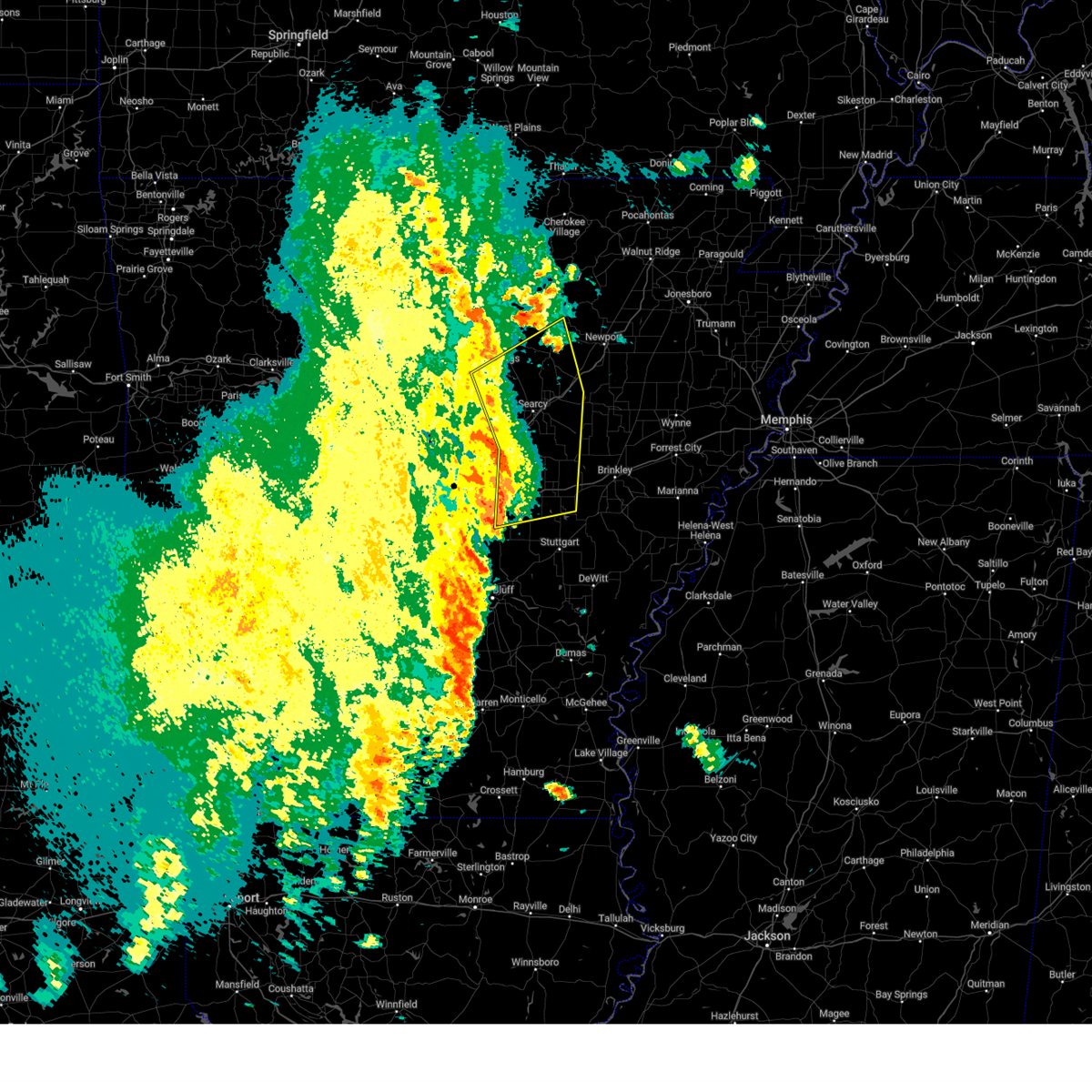
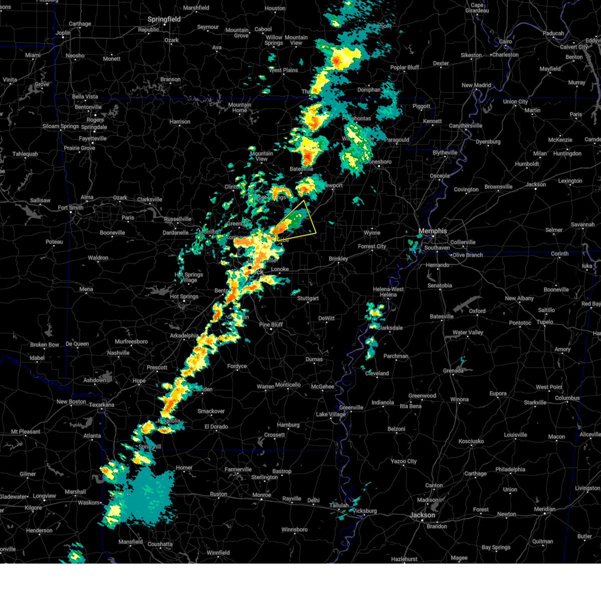
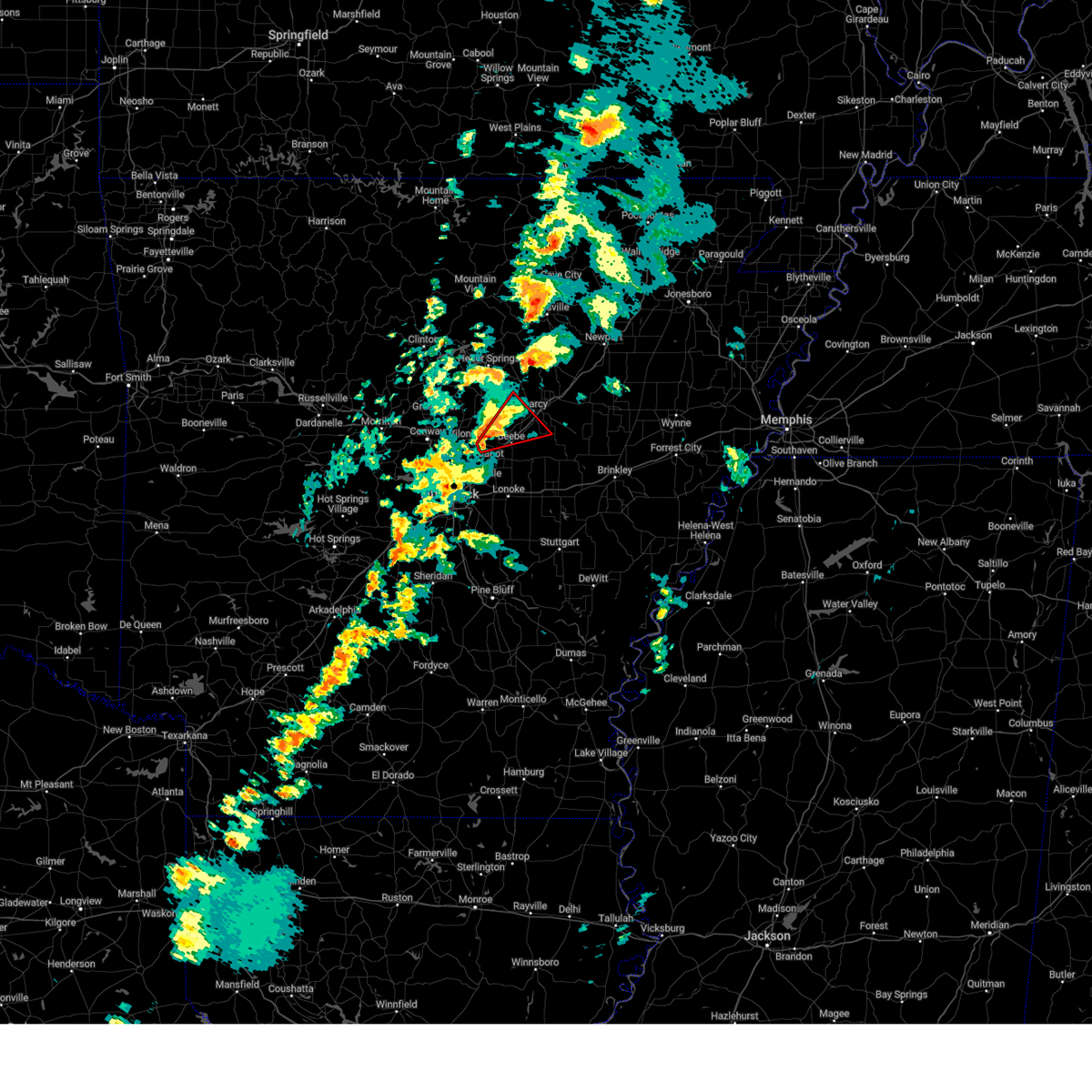
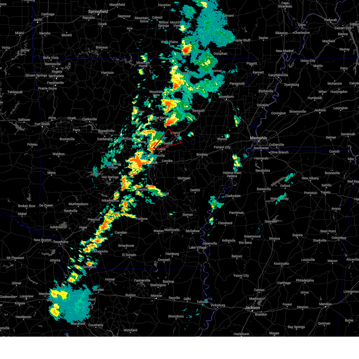
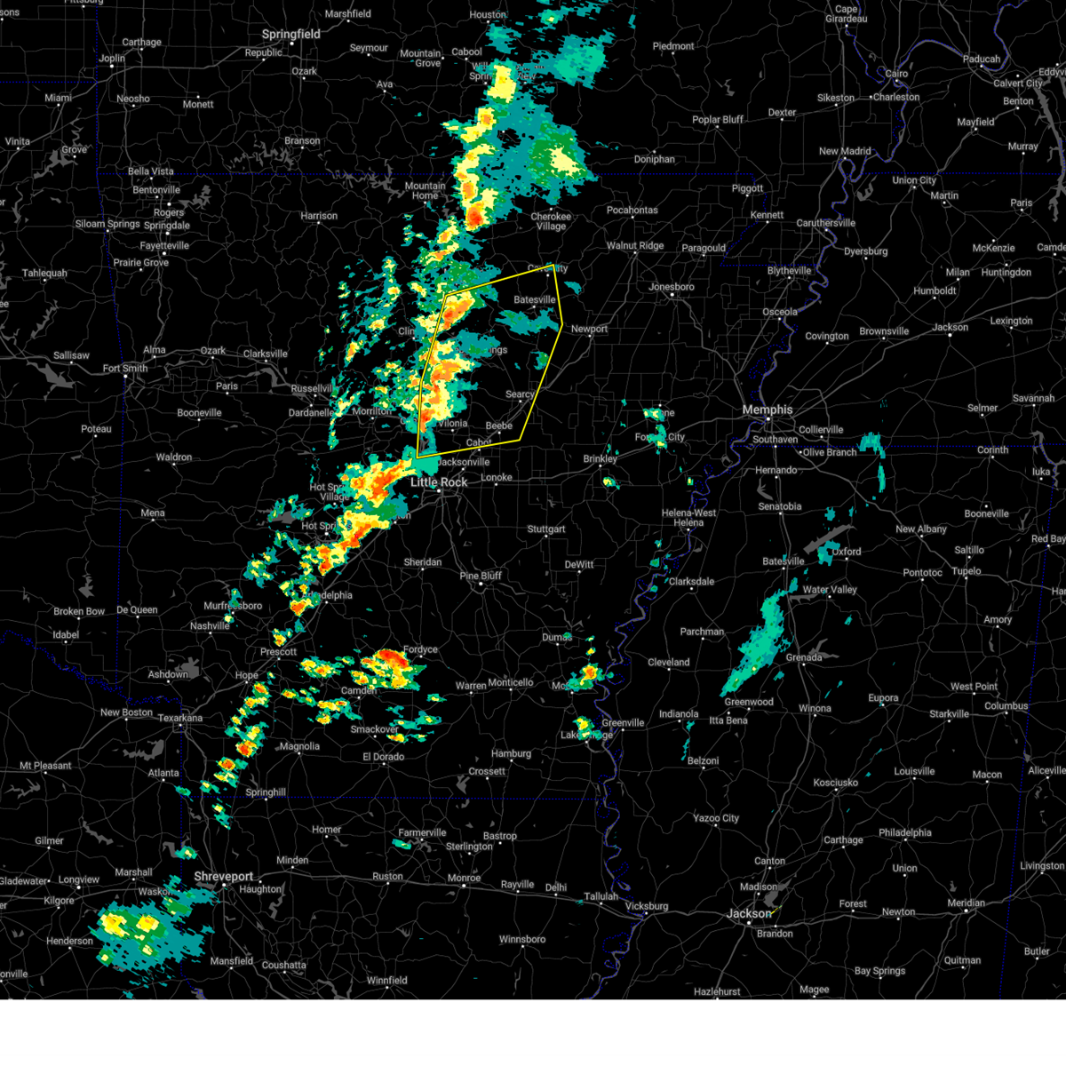
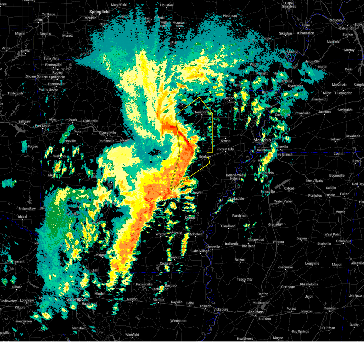
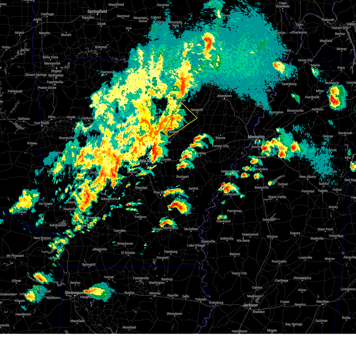
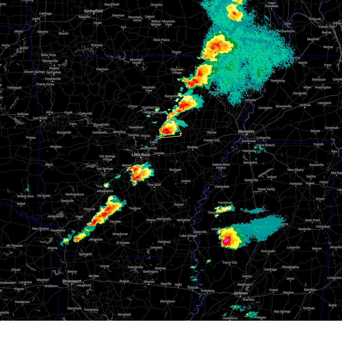
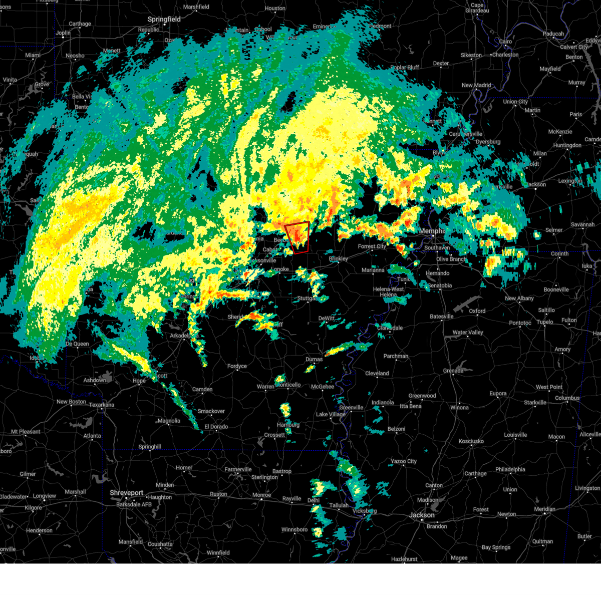
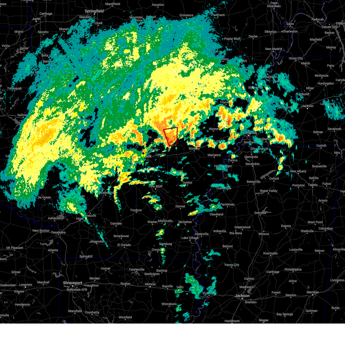
Hail Map for Searcy, AR
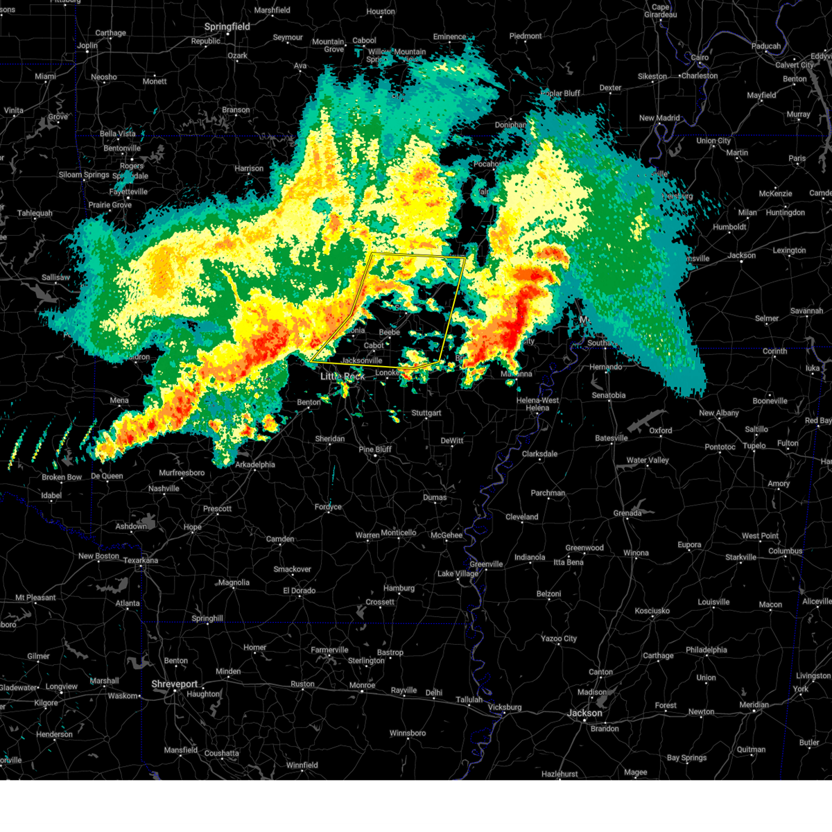
The Searcy, AR area has had 14 reports of on-the-ground hail by trained spotters, and has been under severe weather warnings 56 times during the past 12 months. Doppler radar has detected hail at or near Searcy, AR on 72 occasions, including 7 occasions during the past year.
| Name: | Searcy, AR |
| Where Located: | 46.5 miles NE of Little Rock, AR |
| Map: | Google Map for Searcy, AR |
| Population: | 22858 |
| Housing Units: | 9244 |
| More Info: | Search Google for Searcy, AR |
4
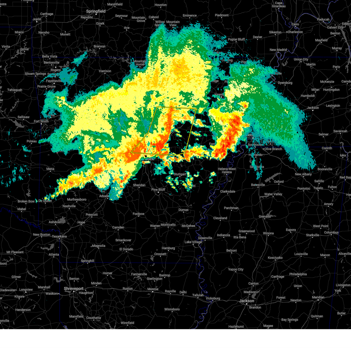
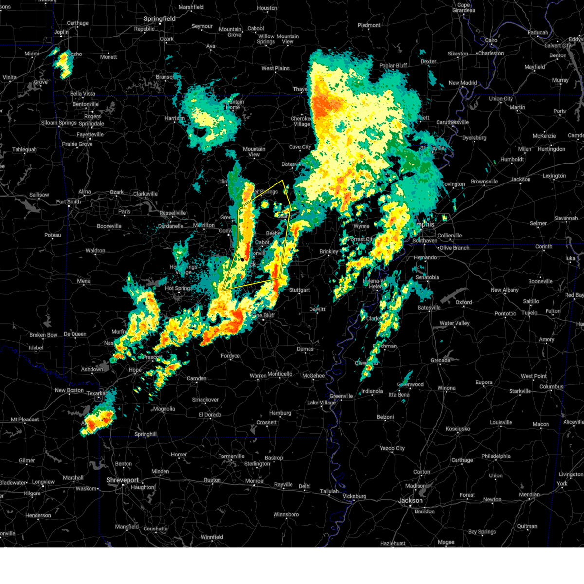
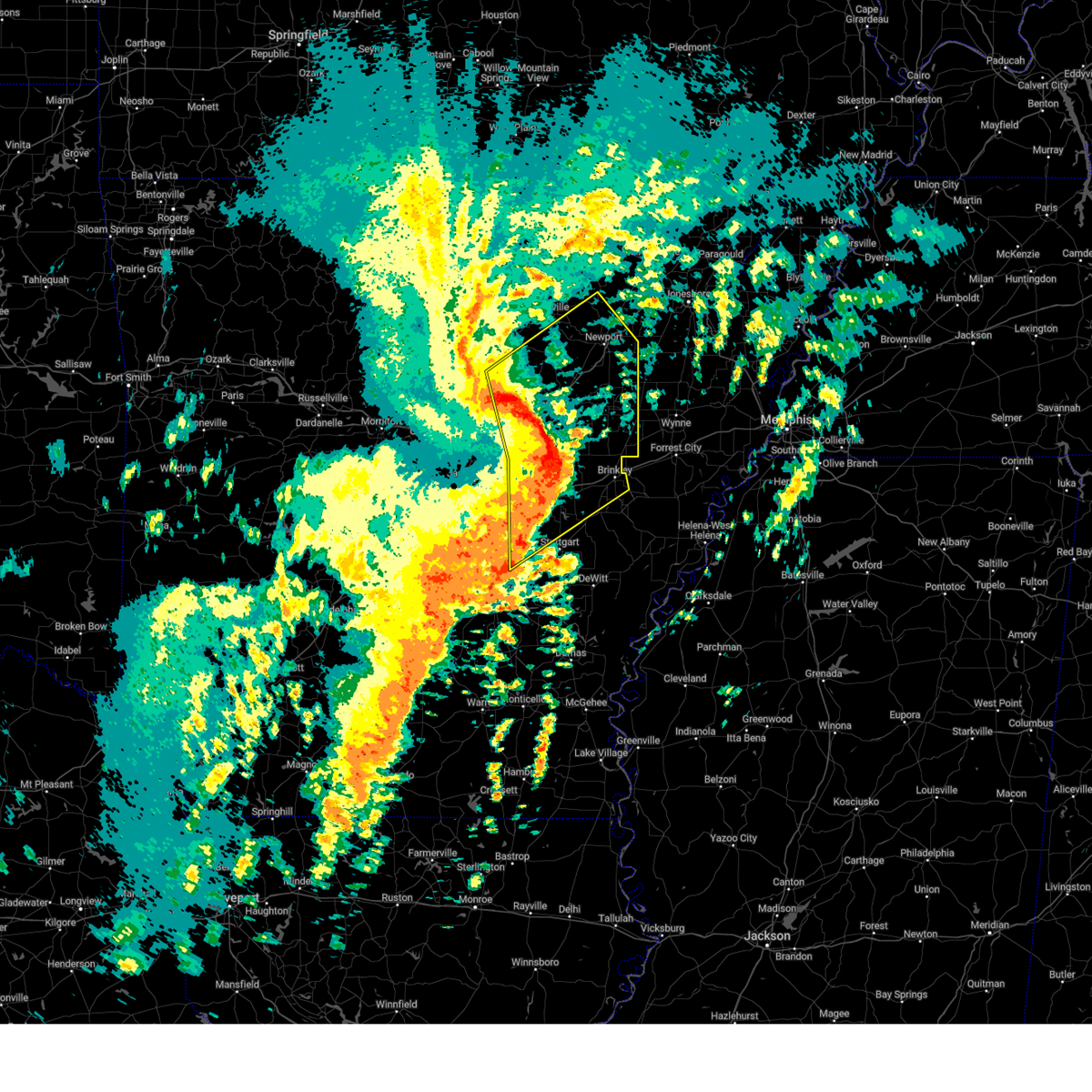
The Top Recent Hail Date for Searcy, AR is Friday, March 14, 2025 (8th out of 72)

Hail and Wind Damage Spotted near Searcy, AR
| Date / Time | Report Details |
|---|---|
| 6/7/2025 9:07 AM CDT |
 The storms which prompted the warning have weakened below severe limits, wind gusts up to 45 mph are still possible through 915 am. a tornado watch remains in effect until noon cdt for central, eastern and north central arkansas. The storms which prompted the warning have weakened below severe limits, wind gusts up to 45 mph are still possible through 915 am. a tornado watch remains in effect until noon cdt for central, eastern and north central arkansas.
|
| 6/7/2025 8:34 AM CDT |
 Svrlzk the national weather service in little rock has issued a * severe thunderstorm warning for, northwestern woodruff county in eastern arkansas, southern independence county in north central arkansas, northern prairie county in central arkansas, southwestern jackson county in eastern arkansas, eastern cleburne county in north central arkansas, northern lonoke county in central arkansas, southeastern faulkner county in central arkansas, white county in central arkansas, northeastern pulaski county in central arkansas, * until 915 am cdt. * at 833 am cdt, severe thunderstorms were located along a line extending from 6 miles northeast of heber springs to near mount vernon to mayflower, moving southeast at 45 mph (radar indicated). Hazards include 60 mph wind gusts and quarter size hail. Hail damage to vehicles is expected. Expect wind damage to roofs, siding, and trees. Svrlzk the national weather service in little rock has issued a * severe thunderstorm warning for, northwestern woodruff county in eastern arkansas, southern independence county in north central arkansas, northern prairie county in central arkansas, southwestern jackson county in eastern arkansas, eastern cleburne county in north central arkansas, northern lonoke county in central arkansas, southeastern faulkner county in central arkansas, white county in central arkansas, northeastern pulaski county in central arkansas, * until 915 am cdt. * at 833 am cdt, severe thunderstorms were located along a line extending from 6 miles northeast of heber springs to near mount vernon to mayflower, moving southeast at 45 mph (radar indicated). Hazards include 60 mph wind gusts and quarter size hail. Hail damage to vehicles is expected. Expect wind damage to roofs, siding, and trees.
|
| 5/22/2025 6:35 PM CDT |
 the severe thunderstorm warning has been cancelled and is no longer in effect the severe thunderstorm warning has been cancelled and is no longer in effect
|
| 5/22/2025 6:23 PM CDT |
 At 622 pm cdt, a severe thunderstorm was located over searcy, moving southeast at 35 mph (radar indicated). Hazards include 60 mph wind gusts and quarter size hail. Hail damage to vehicles is expected. expect wind damage to roofs, siding, and trees. Locations impacted include, pryor, searcy, walker, judsonia, griffithville, worden, jasmine, kensett, higginson, hurricane lake wma, west point, bald knob, plainview in white county,. At 622 pm cdt, a severe thunderstorm was located over searcy, moving southeast at 35 mph (radar indicated). Hazards include 60 mph wind gusts and quarter size hail. Hail damage to vehicles is expected. expect wind damage to roofs, siding, and trees. Locations impacted include, pryor, searcy, walker, judsonia, griffithville, worden, jasmine, kensett, higginson, hurricane lake wma, west point, bald knob, plainview in white county,.
|
| 5/22/2025 6:08 PM CDT |
 At 607 pm cdt, a severe thunderstorm was located near crosby, or near searcy, moving southeast at 35 mph (radar indicated). Hazards include 60 mph wind gusts and quarter size hail. Hail damage to vehicles is expected. expect wind damage to roofs, siding, and trees. Locations impacted include, providence, crosby, pryor, searcy, walker, judsonia, griffithville, letona, worden, jasmine, kensett, higginson, hurricane lake wma, armstrong springs, albion, west point, bald knob, plainview in white county, russell, clay,. At 607 pm cdt, a severe thunderstorm was located near crosby, or near searcy, moving southeast at 35 mph (radar indicated). Hazards include 60 mph wind gusts and quarter size hail. Hail damage to vehicles is expected. expect wind damage to roofs, siding, and trees. Locations impacted include, providence, crosby, pryor, searcy, walker, judsonia, griffithville, letona, worden, jasmine, kensett, higginson, hurricane lake wma, armstrong springs, albion, west point, bald knob, plainview in white county, russell, clay,.
|
| 5/22/2025 6:08 PM CDT |
 the severe thunderstorm warning has been cancelled and is no longer in effect the severe thunderstorm warning has been cancelled and is no longer in effect
|
| 5/22/2025 5:54 PM CDT |
 Svrlzk the national weather service in little rock has issued a * severe thunderstorm warning for, northwestern woodruff county in eastern arkansas, southeastern cleburne county in north central arkansas, central white county in central arkansas, * until 645 pm cdt. * at 554 pm cdt, a severe thunderstorm was located near pangburn, or 10 miles southeast of heber springs, moving southeast at 35 mph (radar indicated). Hazards include 60 mph wind gusts and quarter size hail. Hail damage to vehicles is expected. Expect wind damage to roofs, siding, and trees. Svrlzk the national weather service in little rock has issued a * severe thunderstorm warning for, northwestern woodruff county in eastern arkansas, southeastern cleburne county in north central arkansas, central white county in central arkansas, * until 645 pm cdt. * at 554 pm cdt, a severe thunderstorm was located near pangburn, or 10 miles southeast of heber springs, moving southeast at 35 mph (radar indicated). Hazards include 60 mph wind gusts and quarter size hail. Hail damage to vehicles is expected. Expect wind damage to roofs, siding, and trees.
|
| 5/20/2025 4:28 AM CDT |
 The storms which prompted the warning have weakened below severe limits, and no longer pose an immediate threat to life or property. therefore, the warning will be allowed to expire. however gusty winds and heavy rain are still possible with these thunderstorms. a severe thunderstorm watch remains in effect until 800 am cdt for central and north central arkansas. The storms which prompted the warning have weakened below severe limits, and no longer pose an immediate threat to life or property. therefore, the warning will be allowed to expire. however gusty winds and heavy rain are still possible with these thunderstorms. a severe thunderstorm watch remains in effect until 800 am cdt for central and north central arkansas.
|
| 5/20/2025 4:13 AM CDT |
 At 412 am cdt, severe thunderstorms were located along a line extending from near woolly hollow state park to near enola to olmstead to downtown little rock, moving northeast at 60 mph (radar indicated). Hazards include 60 mph wind gusts. Expect damage to roofs, siding, and trees. Locations impacted include, park hill, wilburn, otter creek, old austin, furlow, antioch in white county, pearson, ironton, quapaw quarter, hillcrest neighborhood, meto, kerr, floyd, vilonia, olmstead, thurman, mccreanor, providence, macon, the heights,. At 412 am cdt, severe thunderstorms were located along a line extending from near woolly hollow state park to near enola to olmstead to downtown little rock, moving northeast at 60 mph (radar indicated). Hazards include 60 mph wind gusts. Expect damage to roofs, siding, and trees. Locations impacted include, park hill, wilburn, otter creek, old austin, furlow, antioch in white county, pearson, ironton, quapaw quarter, hillcrest neighborhood, meto, kerr, floyd, vilonia, olmstead, thurman, mccreanor, providence, macon, the heights,.
|
| 5/20/2025 4:13 AM CDT |
 the severe thunderstorm warning has been cancelled and is no longer in effect the severe thunderstorm warning has been cancelled and is no longer in effect
|
| 5/20/2025 3:58 AM CDT |
 At 357 am cdt, severe thunderstorms were located along a line extending from wooster to near pickles gap to maumelle to near bryant, moving northeast at 55 mph (radar indicated). Hazards include 60 mph wind gusts and penny size hail. Expect damage to roofs, siding, and trees. Locations impacted include, park hill, wilburn, otter creek, old austin, furlow, palarm, antioch in white county, mayflower, pearson, ironton, quapaw quarter, hillcrest neighborhood, meto, haskell, kerr, floyd, vilonia, olmstead, bryant, thurman,. At 357 am cdt, severe thunderstorms were located along a line extending from wooster to near pickles gap to maumelle to near bryant, moving northeast at 55 mph (radar indicated). Hazards include 60 mph wind gusts and penny size hail. Expect damage to roofs, siding, and trees. Locations impacted include, park hill, wilburn, otter creek, old austin, furlow, palarm, antioch in white county, mayflower, pearson, ironton, quapaw quarter, hillcrest neighborhood, meto, haskell, kerr, floyd, vilonia, olmstead, bryant, thurman,.
|
| 5/20/2025 3:48 AM CDT |
 Svrlzk the national weather service in little rock has issued a * severe thunderstorm warning for, southwestern independence county in north central arkansas, northeastern perry county in central arkansas, northwestern prairie county in central arkansas, southern cleburne county in north central arkansas, lonoke county in central arkansas, southeastern conway county in central arkansas, faulkner county in central arkansas, western white county in central arkansas, central saline county in central arkansas, pulaski county in central arkansas, * until 430 am cdt. * at 347 am cdt, severe thunderstorms were located along a line extending from menifee to near toad suck to 6 miles west of chenal valley to near benton, moving northeast at 60 mph (radar indicated). Hazards include 60 mph wind gusts and quarter size hail. Hail damage to vehicles is expected. Expect wind damage to roofs, siding, and trees. Svrlzk the national weather service in little rock has issued a * severe thunderstorm warning for, southwestern independence county in north central arkansas, northeastern perry county in central arkansas, northwestern prairie county in central arkansas, southern cleburne county in north central arkansas, lonoke county in central arkansas, southeastern conway county in central arkansas, faulkner county in central arkansas, western white county in central arkansas, central saline county in central arkansas, pulaski county in central arkansas, * until 430 am cdt. * at 347 am cdt, severe thunderstorms were located along a line extending from menifee to near toad suck to 6 miles west of chenal valley to near benton, moving northeast at 60 mph (radar indicated). Hazards include 60 mph wind gusts and quarter size hail. Hail damage to vehicles is expected. Expect wind damage to roofs, siding, and trees.
|
| 5/18/2025 8:53 PM CDT |
 At 852 pm cdt, a severe thunderstorm was located over pryor, or 10 miles east of searcy, moving east at 40 mph (radar indicated). Hazards include golf ball size hail and 60 mph wind gusts. People and animals outdoors will be injured. expect hail damage to roofs, siding, windows, and vehicles. expect wind damage to roofs, siding, and trees. Locations impacted include, mccrory, howell, mcclelland, gregory, judsonia, grays, griffithville, pumpkin bend, worden, jasmine, kensett, hurricane lake wma, bald knob, georgetown, dixie, cotton plant, augusta, sand hill, pryor, walker,. At 852 pm cdt, a severe thunderstorm was located over pryor, or 10 miles east of searcy, moving east at 40 mph (radar indicated). Hazards include golf ball size hail and 60 mph wind gusts. People and animals outdoors will be injured. expect hail damage to roofs, siding, windows, and vehicles. expect wind damage to roofs, siding, and trees. Locations impacted include, mccrory, howell, mcclelland, gregory, judsonia, grays, griffithville, pumpkin bend, worden, jasmine, kensett, hurricane lake wma, bald knob, georgetown, dixie, cotton plant, augusta, sand hill, pryor, walker,.
|
| 5/18/2025 8:36 PM CDT |
 Svrlzk the national weather service in little rock has issued a * severe thunderstorm warning for, central woodruff county in eastern arkansas, northeastern prairie county in central arkansas, northern monroe county in eastern arkansas, southeastern white county in central arkansas, * until 915 pm cdt. * at 836 pm cdt, a severe thunderstorm was located over searcy, moving east at 40 mph (radar indicated). Hazards include 60 mph wind gusts and quarter size hail. Hail damage to vehicles is expected. Expect wind damage to roofs, siding, and trees. Svrlzk the national weather service in little rock has issued a * severe thunderstorm warning for, central woodruff county in eastern arkansas, northeastern prairie county in central arkansas, northern monroe county in eastern arkansas, southeastern white county in central arkansas, * until 915 pm cdt. * at 836 pm cdt, a severe thunderstorm was located over searcy, moving east at 40 mph (radar indicated). Hazards include 60 mph wind gusts and quarter size hail. Hail damage to vehicles is expected. Expect wind damage to roofs, siding, and trees.
|
| 5/8/2025 1:29 AM CDT |
 At 129 am cdt, a severe thunderstorm was located over gravel hill, or 12 miles west of searcy, moving east at 30 mph (radar indicated). Hazards include 60 mph wind gusts and half dollar size hail. Hail damage to vehicles is expected. expect wind damage to roofs, siding, and trees. Locations impacted include, crosby, joy, kensett, searcy, armstrong springs, gravel hill, albion, center hill,. At 129 am cdt, a severe thunderstorm was located over gravel hill, or 12 miles west of searcy, moving east at 30 mph (radar indicated). Hazards include 60 mph wind gusts and half dollar size hail. Hail damage to vehicles is expected. expect wind damage to roofs, siding, and trees. Locations impacted include, crosby, joy, kensett, searcy, armstrong springs, gravel hill, albion, center hill,.
|
| 5/8/2025 1:29 AM CDT |
 the severe thunderstorm warning has been cancelled and is no longer in effect the severe thunderstorm warning has been cancelled and is no longer in effect
|
| 5/8/2025 1:18 AM CDT |
 At 118 am cdt, a severe thunderstorm was located near gravel hill, or 16 miles south of heber springs, moving east at 30 mph (radar indicated). Hazards include 60 mph wind gusts and half dollar size hail. Hail damage to vehicles is expected. expect wind damage to roofs, siding, and trees. Locations impacted include, clay, crosby, searcy, dewey, romance, center hill, sidon, pangburn, rose bud, letona, joy, kensett, pickens in white county, armstrong springs, gravel hill, albion, mount vernon,. At 118 am cdt, a severe thunderstorm was located near gravel hill, or 16 miles south of heber springs, moving east at 30 mph (radar indicated). Hazards include 60 mph wind gusts and half dollar size hail. Hail damage to vehicles is expected. expect wind damage to roofs, siding, and trees. Locations impacted include, clay, crosby, searcy, dewey, romance, center hill, sidon, pangburn, rose bud, letona, joy, kensett, pickens in white county, armstrong springs, gravel hill, albion, mount vernon,.
|
| 5/8/2025 1:18 AM CDT |
 the severe thunderstorm warning has been cancelled and is no longer in effect the severe thunderstorm warning has been cancelled and is no longer in effect
|
| 5/8/2025 1:07 AM CDT |
 At 106 am cdt, severe thunderstorms were located along a line extending from near quitman to near rose bud to mount vernon, moving east at 35 mph (radar indicated). Hazards include 60 mph wind gusts and half dollar size hail. Hail damage to vehicles is expected. expect wind damage to roofs, siding, and trees. Locations impacted include, wilburn, crosby, searcy, dewey, heber springs, sidon, hopewell in cleburne county, pearson, mount vernon, kensett, pickens in white county, armstrong springs, gravel hill, clay, barney, romance, center hill, enders, pangburn, rose bud,. At 106 am cdt, severe thunderstorms were located along a line extending from near quitman to near rose bud to mount vernon, moving east at 35 mph (radar indicated). Hazards include 60 mph wind gusts and half dollar size hail. Hail damage to vehicles is expected. expect wind damage to roofs, siding, and trees. Locations impacted include, wilburn, crosby, searcy, dewey, heber springs, sidon, hopewell in cleburne county, pearson, mount vernon, kensett, pickens in white county, armstrong springs, gravel hill, clay, barney, romance, center hill, enders, pangburn, rose bud,.
|
| 5/8/2025 1:07 AM CDT |
 the severe thunderstorm warning has been cancelled and is no longer in effect the severe thunderstorm warning has been cancelled and is no longer in effect
|
| 5/8/2025 12:54 AM CDT |
 Svrlzk the national weather service in little rock has issued a * severe thunderstorm warning for, southeastern van buren county in north central arkansas, southern cleburne county in north central arkansas, northeastern faulkner county in central arkansas, northwestern white county in central arkansas, * until 145 am cdt. * at 1253 am cdt, severe thunderstorms were located along a line extending from near damascus to near quitman to near woolly hollow state park, moving east at 35 mph (radar indicated). Hazards include 60 mph wind gusts and quarter size hail. Hail damage to vehicles is expected. Expect wind damage to roofs, siding, and trees. Svrlzk the national weather service in little rock has issued a * severe thunderstorm warning for, southeastern van buren county in north central arkansas, southern cleburne county in north central arkansas, northeastern faulkner county in central arkansas, northwestern white county in central arkansas, * until 145 am cdt. * at 1253 am cdt, severe thunderstorms were located along a line extending from near damascus to near quitman to near woolly hollow state park, moving east at 35 mph (radar indicated). Hazards include 60 mph wind gusts and quarter size hail. Hail damage to vehicles is expected. Expect wind damage to roofs, siding, and trees.
|
| 4/30/2025 7:04 PM CDT |
 At 703 pm cdt, severe thunderstorms were located along a line extending from near pleasant plains to near pryor to near hazen, moving east at 30 mph (radar indicated). Hazards include 60 mph wind gusts. Expect damage to roofs, siding, and trees. Locations impacted include, hickory flat, salado, bradford, searcy, heffington, carlisle, judsonia, huff, worden, kensett, velvet ridge, georgetown, roosevelt, plainview in white county, thurman, screeton, mccreanor, providence, sand hill, pryor,. At 703 pm cdt, severe thunderstorms were located along a line extending from near pleasant plains to near pryor to near hazen, moving east at 30 mph (radar indicated). Hazards include 60 mph wind gusts. Expect damage to roofs, siding, and trees. Locations impacted include, hickory flat, salado, bradford, searcy, heffington, carlisle, judsonia, huff, worden, kensett, velvet ridge, georgetown, roosevelt, plainview in white county, thurman, screeton, mccreanor, providence, sand hill, pryor,.
|
| 4/30/2025 7:04 PM CDT |
 the severe thunderstorm warning has been cancelled and is no longer in effect the severe thunderstorm warning has been cancelled and is no longer in effect
|
| 4/30/2025 6:25 PM CDT |
 Svrlzk the national weather service in little rock has issued a * severe thunderstorm warning for, northwestern woodruff county in eastern arkansas, southwestern independence county in north central arkansas, prairie county in central arkansas, southwestern jackson county in eastern arkansas, southeastern cleburne county in north central arkansas, central lonoke county in central arkansas, white county in central arkansas, * until 715 pm cdt. * at 625 pm cdt, severe thunderstorms were located along a line extending from near heber springs to beebe to near lonoke, moving northeast at 35 mph (radar indicated). Hazards include 60 mph wind gusts. expect damage to roofs, siding, and trees Svrlzk the national weather service in little rock has issued a * severe thunderstorm warning for, northwestern woodruff county in eastern arkansas, southwestern independence county in north central arkansas, prairie county in central arkansas, southwestern jackson county in eastern arkansas, southeastern cleburne county in north central arkansas, central lonoke county in central arkansas, white county in central arkansas, * until 715 pm cdt. * at 625 pm cdt, severe thunderstorms were located along a line extending from near heber springs to beebe to near lonoke, moving northeast at 35 mph (radar indicated). Hazards include 60 mph wind gusts. expect damage to roofs, siding, and trees
|
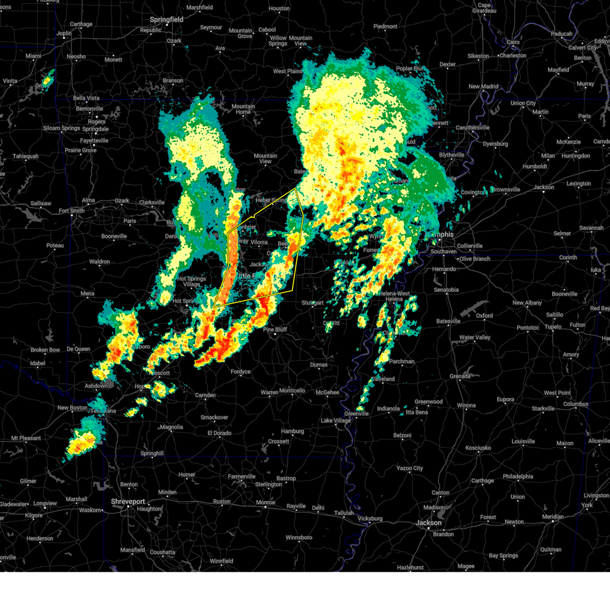
| 4/20/2025 8:21 PM CDT | The tornado threat has diminished and the tornado warning has been cancelled. however, large hail and damaging winds remain likely and a severe thunderstorm warning remains in effect for the area. a tornado watch remains in effect until midnight cdt for eastern, central and north central arkansas. to report severe weather, contact your nearest law enforcement agency. they will relay your report to the national weather service little rock. |
| 4/20/2025 7:52 PM CDT | Torlzk the national weather service in little rock has issued a * tornado warning for, northwestern woodruff county in eastern arkansas, southeastern independence county in north central arkansas, southwestern jackson county in eastern arkansas, northeastern white county in central arkansas, * until 830 pm cdt. * at 752 pm cdt, a severe thunderstorm capable of producing a tornado was located over bald knob, or 9 miles northeast of searcy, moving northeast at 35 mph (radar indicated rotation). Hazards include tornado. Flying debris will be dangerous to those caught without shelter. mobile homes will be damaged or destroyed. damage to roofs, windows, and vehicles will occur. Tree damage is likely. |
| 4/20/2025 7:31 PM CDT | Svrlzk the national weather service in little rock has issued a * severe thunderstorm warning for, northwestern prairie county in central arkansas, northwestern lonoke county in central arkansas, south central white county in central arkansas, * until 815 pm cdt. * at 730 pm cdt, a severe thunderstorm was located over cabot, moving northeast at 45 mph (radar indicated). Hazards include 60 mph wind gusts and quarter size hail. Hail damage to vehicles is expected. Expect wind damage to roofs, siding, and trees. |
| 4/20/2025 7:27 PM CDT | the tornado warning has been cancelled and is no longer in effect |
| 4/20/2025 7:25 PM CDT |
 Svrlzk the national weather service in little rock has issued a * severe thunderstorm warning for, central white county in central arkansas, * until 815 pm cdt. * at 725 pm cdt, a severe thunderstorm was located near crosby, or 8 miles west of searcy, moving northeast at 40 mph (radar indicated). Hazards include 60 mph wind gusts and penny size hail. expect damage to roofs, siding, and trees Svrlzk the national weather service in little rock has issued a * severe thunderstorm warning for, central white county in central arkansas, * until 815 pm cdt. * at 725 pm cdt, a severe thunderstorm was located near crosby, or 8 miles west of searcy, moving northeast at 40 mph (radar indicated). Hazards include 60 mph wind gusts and penny size hail. expect damage to roofs, siding, and trees
|
| 4/20/2025 7:14 PM CDT |
 At 714 pm cdt, a severe thunderstorm capable of producing a tornado was located near beebe, or 9 miles north of cabot, moving northeast at 45 mph (radar indicated rotation). Hazards include tornado. Flying debris will be dangerous to those caught without shelter. mobile homes will be damaged or destroyed. damage to roofs, windows, and vehicles will occur. tree damage is likely. Locations impacted include, crosby, walker, center hill, mcrae, antioch in white county, griffithville, beebe, garner, higginson, armstrong springs, floyd, pickens in white county, searcy,. At 714 pm cdt, a severe thunderstorm capable of producing a tornado was located near beebe, or 9 miles north of cabot, moving northeast at 45 mph (radar indicated rotation). Hazards include tornado. Flying debris will be dangerous to those caught without shelter. mobile homes will be damaged or destroyed. damage to roofs, windows, and vehicles will occur. tree damage is likely. Locations impacted include, crosby, walker, center hill, mcrae, antioch in white county, griffithville, beebe, garner, higginson, armstrong springs, floyd, pickens in white county, searcy,.
|
| 4/20/2025 7:07 PM CDT |
 At 706 pm cdt, a confirmed tornado was located near austin in lonoke county, or near cabot, moving northeast at 35 mph (weather spotters confirmed tornado). Hazards include damaging tornado. Flying debris will be dangerous to those caught without shelter. mobile homes will be damaged or destroyed. damage to roofs, windows, and vehicles will occur. tree damage is likely. Locations impacted include, crosby, walker, center hill, mcrae, antioch in white county, griffithville, beebe, garner, higginson, armstrong springs, floyd, pickens in white county, searcy, cabot,. At 706 pm cdt, a confirmed tornado was located near austin in lonoke county, or near cabot, moving northeast at 35 mph (weather spotters confirmed tornado). Hazards include damaging tornado. Flying debris will be dangerous to those caught without shelter. mobile homes will be damaged or destroyed. damage to roofs, windows, and vehicles will occur. tree damage is likely. Locations impacted include, crosby, walker, center hill, mcrae, antioch in white county, griffithville, beebe, garner, higginson, armstrong springs, floyd, pickens in white county, searcy, cabot,.
|
| 4/20/2025 7:07 PM CDT |
 the tornado warning has been cancelled and is no longer in effect the tornado warning has been cancelled and is no longer in effect
|
| 4/20/2025 7:02 PM CDT |
 the tornado warning has been cancelled and is no longer in effect the tornado warning has been cancelled and is no longer in effect
|
| 4/20/2025 7:02 PM CDT |
 At 702 pm cdt, a confirmed tornado was located near vilonia, or near cabot, moving northeast at 40 mph (weather spotters confirmed tornado). Hazards include damaging tornado. Flying debris will be dangerous to those caught without shelter. mobile homes will be damaged or destroyed. damage to roofs, windows, and vehicles will occur. tree damage is likely. Locations impacted include, crosby, walker, center hill, mcrae, antioch in white county, griffithville, beebe, garner, higginson, armstrong springs, floyd, pickens in white county, el paso, searcy, cabot,. At 702 pm cdt, a confirmed tornado was located near vilonia, or near cabot, moving northeast at 40 mph (weather spotters confirmed tornado). Hazards include damaging tornado. Flying debris will be dangerous to those caught without shelter. mobile homes will be damaged or destroyed. damage to roofs, windows, and vehicles will occur. tree damage is likely. Locations impacted include, crosby, walker, center hill, mcrae, antioch in white county, griffithville, beebe, garner, higginson, armstrong springs, floyd, pickens in white county, el paso, searcy, cabot,.
|
| 4/20/2025 6:58 PM CDT |
 Torlzk the national weather service in little rock has issued a * tornado warning for, northwestern lonoke county in central arkansas, southeastern faulkner county in central arkansas, southwestern white county in central arkansas, northern pulaski county in central arkansas, * until 745 pm cdt. * at 658 pm cdt, a severe thunderstorm capable of producing a tornado was located near vilonia, or 7 miles west of cabot, moving northeast at 40 mph (radar indicated rotation). Hazards include tornado. Flying debris will be dangerous to those caught without shelter. mobile homes will be damaged or destroyed. damage to roofs, windows, and vehicles will occur. Tree damage is likely. Torlzk the national weather service in little rock has issued a * tornado warning for, northwestern lonoke county in central arkansas, southeastern faulkner county in central arkansas, southwestern white county in central arkansas, northern pulaski county in central arkansas, * until 745 pm cdt. * at 658 pm cdt, a severe thunderstorm capable of producing a tornado was located near vilonia, or 7 miles west of cabot, moving northeast at 40 mph (radar indicated rotation). Hazards include tornado. Flying debris will be dangerous to those caught without shelter. mobile homes will be damaged or destroyed. damage to roofs, windows, and vehicles will occur. Tree damage is likely.
|
| 4/20/2025 6:11 PM CDT |
 Svrlzk the national weather service in little rock has issued a * severe thunderstorm warning for, southeastern stone county in north central arkansas, independence county in north central arkansas, southeastern izard county in north central arkansas, northwestern prairie county in central arkansas, southwestern jackson county in eastern arkansas, southeastern van buren county in north central arkansas, cleburne county in north central arkansas, northwestern lonoke county in central arkansas, faulkner county in central arkansas, white county in central arkansas, southwestern sharp county in north central arkansas, northeastern pulaski county in central arkansas, * until 700 pm cdt. * at 611 pm cdt, severe thunderstorms were located along a line extending from mountain view to near quitman to near mayflower, moving northeast at 60 mph (radar indicated). Hazards include 60 mph wind gusts and penny size hail. expect damage to roofs, siding, and trees Svrlzk the national weather service in little rock has issued a * severe thunderstorm warning for, southeastern stone county in north central arkansas, independence county in north central arkansas, southeastern izard county in north central arkansas, northwestern prairie county in central arkansas, southwestern jackson county in eastern arkansas, southeastern van buren county in north central arkansas, cleburne county in north central arkansas, northwestern lonoke county in central arkansas, faulkner county in central arkansas, white county in central arkansas, southwestern sharp county in north central arkansas, northeastern pulaski county in central arkansas, * until 700 pm cdt. * at 611 pm cdt, severe thunderstorms were located along a line extending from mountain view to near quitman to near mayflower, moving northeast at 60 mph (radar indicated). Hazards include 60 mph wind gusts and penny size hail. expect damage to roofs, siding, and trees
|
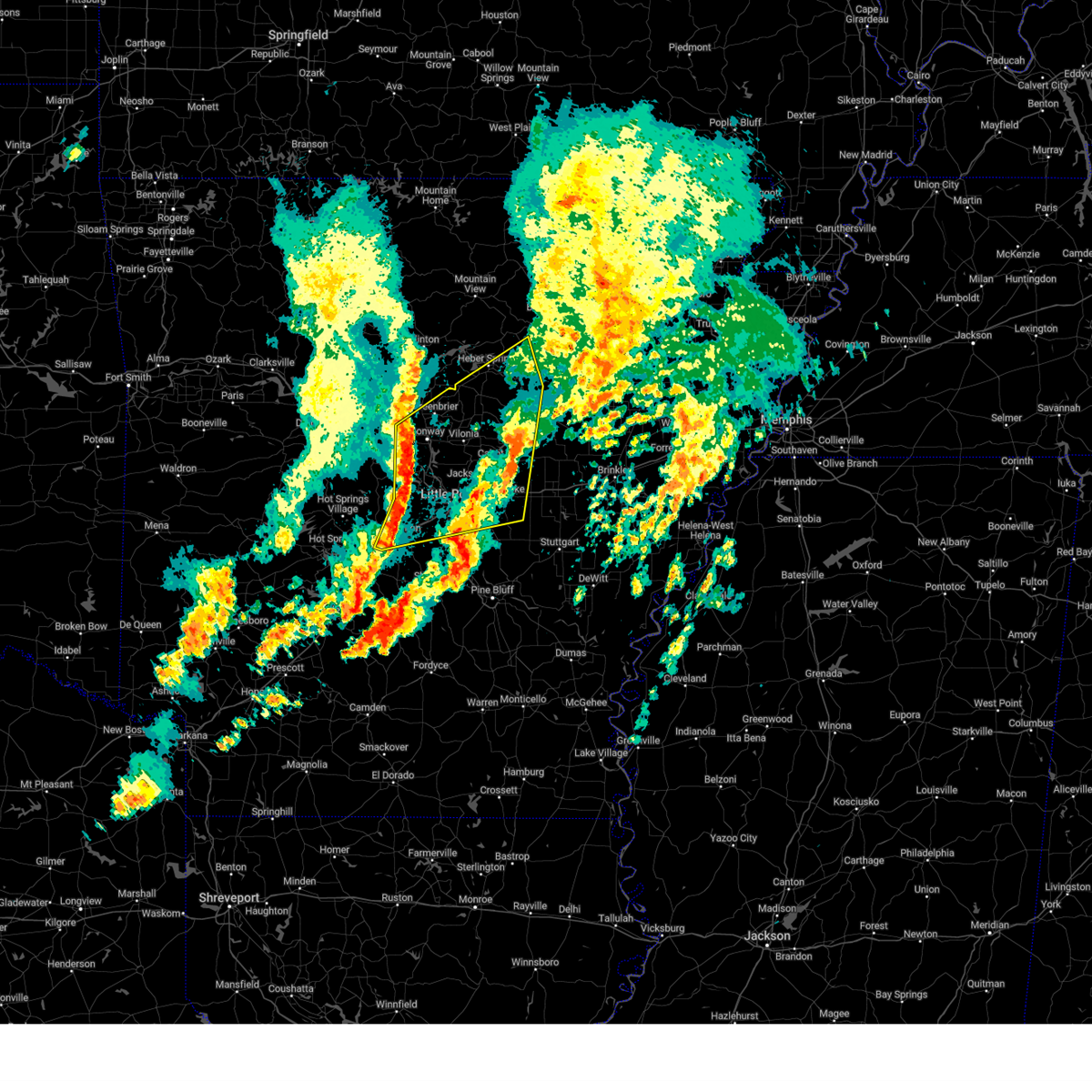
| 4/5/2025 12:10 PM CDT |
 the severe thunderstorm warning has been cancelled and is no longer in effect the severe thunderstorm warning has been cancelled and is no longer in effect
|
| 4/5/2025 12:10 PM CDT |
 At 1210 pm cdt, severe thunderstorms were located along a line extending from pleasant plains to 7 miles southwest of patterson to 7 miles north of stuttgart municipal airport, moving northeast at 65 mph (radar indicated). Hazards include 70 mph wind gusts and quarter size hail. Hail damage to vehicles is expected. expect considerable tree damage. wind damage is also likely to mobile homes, roofs, and outbuildings. Locations impacted include, dobbs landing, mccrory, salado, bradford, mcfadden, judsonia, fitzhugh, fargo, georgetown, plainview in white county, olyphant, humnoke, dixie, hunter, providence, pryor, childers, hutchinson, russell, dowdy,. At 1210 pm cdt, severe thunderstorms were located along a line extending from pleasant plains to 7 miles southwest of patterson to 7 miles north of stuttgart municipal airport, moving northeast at 65 mph (radar indicated). Hazards include 70 mph wind gusts and quarter size hail. Hail damage to vehicles is expected. expect considerable tree damage. wind damage is also likely to mobile homes, roofs, and outbuildings. Locations impacted include, dobbs landing, mccrory, salado, bradford, mcfadden, judsonia, fitzhugh, fargo, georgetown, plainview in white county, olyphant, humnoke, dixie, hunter, providence, pryor, childers, hutchinson, russell, dowdy,.
|
| 4/5/2025 11:52 AM CDT |
 Svrlzk the national weather service in little rock has issued a * severe thunderstorm warning for, woodruff county in eastern arkansas, southeastern independence county in north central arkansas, prairie county in central arkansas, jackson county in eastern arkansas, southeastern cleburne county in north central arkansas, eastern lonoke county in central arkansas, northwestern monroe county in eastern arkansas, white county in central arkansas, north central jefferson county in southeastern arkansas, northern arkansas county in southeastern arkansas, * until 1230 pm cdt. * at 1151 am cdt, severe thunderstorms were located along a line extending from near pangburn to des arc to near humnoke, moving northeast at 65 mph (radar indicated). Hazards include 70 mph wind gusts and quarter size hail. Hail damage to vehicles is expected. expect considerable tree damage. Wind damage is also likely to mobile homes, roofs, and outbuildings. Svrlzk the national weather service in little rock has issued a * severe thunderstorm warning for, woodruff county in eastern arkansas, southeastern independence county in north central arkansas, prairie county in central arkansas, jackson county in eastern arkansas, southeastern cleburne county in north central arkansas, eastern lonoke county in central arkansas, northwestern monroe county in eastern arkansas, white county in central arkansas, north central jefferson county in southeastern arkansas, northern arkansas county in southeastern arkansas, * until 1230 pm cdt. * at 1151 am cdt, severe thunderstorms were located along a line extending from near pangburn to des arc to near humnoke, moving northeast at 65 mph (radar indicated). Hazards include 70 mph wind gusts and quarter size hail. Hail damage to vehicles is expected. expect considerable tree damage. Wind damage is also likely to mobile homes, roofs, and outbuildings.
|
| 4/5/2025 11:47 AM CDT |
 the severe thunderstorm warning has been cancelled and is no longer in effect the severe thunderstorm warning has been cancelled and is no longer in effect
|
| 4/5/2025 11:47 AM CDT |
 At 1147 am cdt, severe thunderstorms were located along a line extending from near crosby to 6 miles south of west point to near prairie center, moving northeast at 65 mph (radar indicated). Hazards include 70 mph wind gusts and quarter size hail. Hail damage to vehicles is expected. expect considerable tree damage. wind damage is also likely to mobile homes, roofs, and outbuildings. Locations impacted include, hickory flat, wilburn, old austin, crosby, searcy, heffington, england, furlow, parnell, carlisle, antioch in white county, judsonia, worden, estes, kensett, meto, pickens in white county, floyd, austin in lonoke county, velvet ridge,. At 1147 am cdt, severe thunderstorms were located along a line extending from near crosby to 6 miles south of west point to near prairie center, moving northeast at 65 mph (radar indicated). Hazards include 70 mph wind gusts and quarter size hail. Hail damage to vehicles is expected. expect considerable tree damage. wind damage is also likely to mobile homes, roofs, and outbuildings. Locations impacted include, hickory flat, wilburn, old austin, crosby, searcy, heffington, england, furlow, parnell, carlisle, antioch in white county, judsonia, worden, estes, kensett, meto, pickens in white county, floyd, austin in lonoke county, velvet ridge,.
|
| 4/5/2025 11:25 AM CDT |
 Svrlzk the national weather service in little rock has issued a * severe thunderstorm warning for, southwestern independence county in north central arkansas, northwestern prairie county in central arkansas, southwestern jackson county in eastern arkansas, southeastern cleburne county in north central arkansas, lonoke county in central arkansas, southeastern faulkner county in central arkansas, white county in central arkansas, northwestern jefferson county in southeastern arkansas, eastern pulaski county in central arkansas, * until noon cdt. * at 1124 am cdt, severe thunderstorms were located along a line extending from vilonia to parnell to near england, moving northeast at 85 mph (radar indicated). Hazards include 70 mph wind gusts and quarter size hail. Hail damage to vehicles is expected. expect considerable tree damage. Wind damage is also likely to mobile homes, roofs, and outbuildings. Svrlzk the national weather service in little rock has issued a * severe thunderstorm warning for, southwestern independence county in north central arkansas, northwestern prairie county in central arkansas, southwestern jackson county in eastern arkansas, southeastern cleburne county in north central arkansas, lonoke county in central arkansas, southeastern faulkner county in central arkansas, white county in central arkansas, northwestern jefferson county in southeastern arkansas, eastern pulaski county in central arkansas, * until noon cdt. * at 1124 am cdt, severe thunderstorms were located along a line extending from vilonia to parnell to near england, moving northeast at 85 mph (radar indicated). Hazards include 70 mph wind gusts and quarter size hail. Hail damage to vehicles is expected. expect considerable tree damage. Wind damage is also likely to mobile homes, roofs, and outbuildings.
|
| 4/4/2025 9:43 PM CDT |
 Svrlzk the national weather service in little rock has issued a * severe thunderstorm warning for, northwestern woodruff county in eastern arkansas, central independence county in north central arkansas, northwestern prairie county in central arkansas, central jackson county in eastern arkansas, eastern white county in central arkansas, southwestern lawrence county in eastern arkansas, southeastern sharp county in north central arkansas, * until 1030 pm cdt. * at 943 pm cdt, severe thunderstorms were located along a line extending from near steprock to near higginson, moving northeast at 50 mph (radar indicated). Hazards include 60 mph wind gusts and quarter size hail. Hail damage to vehicles is expected. Expect wind damage to roofs, siding, and trees. Svrlzk the national weather service in little rock has issued a * severe thunderstorm warning for, northwestern woodruff county in eastern arkansas, central independence county in north central arkansas, northwestern prairie county in central arkansas, central jackson county in eastern arkansas, eastern white county in central arkansas, southwestern lawrence county in eastern arkansas, southeastern sharp county in north central arkansas, * until 1030 pm cdt. * at 943 pm cdt, severe thunderstorms were located along a line extending from near steprock to near higginson, moving northeast at 50 mph (radar indicated). Hazards include 60 mph wind gusts and quarter size hail. Hail damage to vehicles is expected. Expect wind damage to roofs, siding, and trees.
|
| 4/2/2025 5:59 PM CDT | the severe thunderstorm warning has been cancelled and is no longer in effect |
| 4/2/2025 5:59 PM CDT | At 558 pm cdt, a severe thunderstorm was located over west point, or 7 miles southeast of searcy, moving northeast at 55 mph (trained weather spotters). Hazards include two inch hail and 60 mph wind gusts. People and animals outdoors will be injured. expect hail damage to roofs, siding, windows, and vehicles. expect wind damage to roofs, siding, and trees. Locations impacted include, augusta, vinity corner, pryor, searcy, walker, mcclelland, gregory, hayley, judsonia, griffithville, russell, worden, jasmine, kensett, garner, higginson, hurricane lake wma, west point, velvet ridge, bald knob,. |
| 4/2/2025 5:41 PM CDT | the severe thunderstorm warning has been cancelled and is no longer in effect |
| 4/2/2025 5:41 PM CDT | At 540 pm cdt, a severe thunderstorm was located near beebe, or 11 miles east of cabot, moving northeast at 55 mph (trained weather spotters). Hazards include two inch hail and 60 mph wind gusts. People and animals outdoors will be injured. expect hail damage to roofs, siding, windows, and vehicles. expect wind damage to roofs, siding, and trees. Locations impacted include, vinity corner, old austin, searcy, mcclelland, gregory, hayley, judsonia, griffithville, worden, jasmine, kensett, garner, higginson, hurricane lake wma, austin in lonoke county, velvet ridge, bald knob, sylvania, georgetown, plainview in white county,. |
| 4/2/2025 5:29 PM CDT | Svrlzk the national weather service in little rock has issued a * severe thunderstorm warning for, west central woodruff county in eastern arkansas, northwestern prairie county in central arkansas, northern lonoke county in central arkansas, eastern white county in central arkansas, northeastern pulaski county in central arkansas, * until 615 pm cdt. * at 528 pm cdt, a severe thunderstorm was located over parnell, or near cabot, moving northeast at 55 mph (radar indicated). Hazards include golf ball size hail and 60 mph wind gusts. People and animals outdoors will be injured. expect hail damage to roofs, siding, windows, and vehicles. Expect wind damage to roofs, siding, and trees. |
| 4/2/2025 5:22 PM CDT |
 Svrlzk the national weather service in little rock has issued a * severe thunderstorm warning for, south central independence county in north central arkansas, southwestern jackson county in eastern arkansas, southeastern cleburne county in north central arkansas, northern white county in central arkansas, * until 600 pm cdt. * at 522 pm cdt, a severe thunderstorm was located 8 miles northwest of beebe, or 11 miles north of cabot, moving northeast at 55 mph (radar indicated). Hazards include 60 mph wind gusts and quarter size hail. Hail damage to vehicles is expected. Expect wind damage to roofs, siding, and trees. Svrlzk the national weather service in little rock has issued a * severe thunderstorm warning for, south central independence county in north central arkansas, southwestern jackson county in eastern arkansas, southeastern cleburne county in north central arkansas, northern white county in central arkansas, * until 600 pm cdt. * at 522 pm cdt, a severe thunderstorm was located 8 miles northwest of beebe, or 11 miles north of cabot, moving northeast at 55 mph (radar indicated). Hazards include 60 mph wind gusts and quarter size hail. Hail damage to vehicles is expected. Expect wind damage to roofs, siding, and trees.
|
| 3/14/2025 11:37 PM CDT | Torlzk the national weather service in little rock has issued a * tornado warning for, northern woodruff county in eastern arkansas, southeastern jackson county in eastern arkansas, east central white county in central arkansas, * until 1215 am cdt. * at 1136 pm cdt, a severe thunderstorm capable of producing a tornado was located near bald knob, or 9 miles east of searcy, moving northeast at 50 mph (radar indicated rotation). Hazards include tornado and golf ball size hail. Flying debris will be dangerous to those caught without shelter. mobile homes will be damaged or destroyed. damage to roofs, windows, and vehicles will occur. Tree damage is likely. |
| 3/14/2025 11:27 PM CDT | Svrlzk the national weather service in little rock has issued a * severe thunderstorm warning for, northern woodruff county in eastern arkansas, south central jackson county in eastern arkansas, east central white county in central arkansas, * until midnight cdt. * at 1127 pm cdt, a severe thunderstorm was located over judsonia, or near searcy, moving northeast at 55 mph (radar indicated). Hazards include 60 mph wind gusts and half dollar size hail. Hail damage to vehicles is expected. Expect wind damage to roofs, siding, and trees. |
| 3/14/2025 11:17 PM CDT |
 At 1117 pm cdt, a severe thunderstorm was located over higginson, or over searcy, moving northeast at 60 mph (radar indicated). Hazards include 60 mph wind gusts and quarter size hail. Hail damage to vehicles is expected. expect wind damage to roofs, siding, and trees. Locations impacted include, providence, pryor, searcy, walker, mcrae, judsonia, griffithville, kensett, garner, higginson, armstrong springs, west point, bald knob, georgetown, plainview in white county, crosby,. At 1117 pm cdt, a severe thunderstorm was located over higginson, or over searcy, moving northeast at 60 mph (radar indicated). Hazards include 60 mph wind gusts and quarter size hail. Hail damage to vehicles is expected. expect wind damage to roofs, siding, and trees. Locations impacted include, providence, pryor, searcy, walker, mcrae, judsonia, griffithville, kensett, garner, higginson, armstrong springs, west point, bald knob, georgetown, plainview in white county, crosby,.
|
| 3/14/2025 11:17 PM CDT |
 the severe thunderstorm warning has been cancelled and is no longer in effect the severe thunderstorm warning has been cancelled and is no longer in effect
|
| 3/14/2025 10:56 PM CDT | Svrlzk the national weather service in little rock has issued a * severe thunderstorm warning for, northwestern lonoke county in central arkansas, east central faulkner county in central arkansas, southeastern white county in central arkansas, * until 1130 pm cdt. * at 1056 pm cdt, a severe thunderstorm was located near austin in lonoke county, or 7 miles north of cabot, moving northeast at 50 mph (radar indicated). Hazards include 60 mph wind gusts and quarter size hail. Hail damage to vehicles is expected. Expect wind damage to roofs, siding, and trees. |
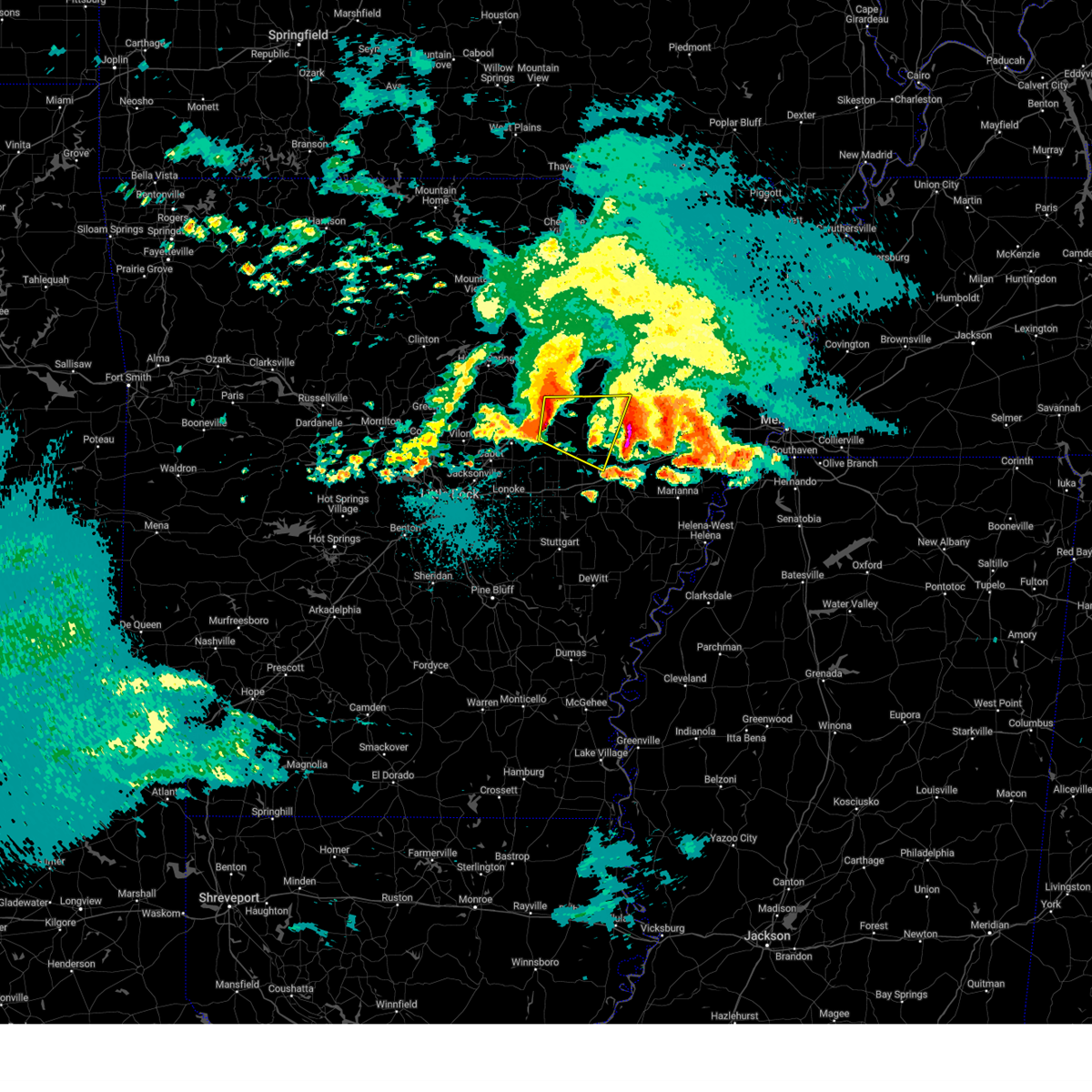
| 7/9/2024 1:11 AM CDT |
 the tornado warning has been cancelled and is no longer in effect the tornado warning has been cancelled and is no longer in effect
|
| 7/9/2024 1:00 AM CDT |
 Torlzk the national weather service in little rock has issued a * tornado warning for, northwestern prairie county in central arkansas, south central white county in central arkansas, * until 130 am cdt. * at 100 am cdt, a severe thunderstorm capable of producing a tornado was located 7 miles northeast of thurman, or 8 miles west of des arc, moving north at 25 mph (radar indicated rotation). Hazards include tornado. Flying debris will be dangerous to those caught without shelter. mobile homes will be damaged or destroyed. damage to roofs, windows, and vehicles will occur. Tree damage is likely. Torlzk the national weather service in little rock has issued a * tornado warning for, northwestern prairie county in central arkansas, south central white county in central arkansas, * until 130 am cdt. * at 100 am cdt, a severe thunderstorm capable of producing a tornado was located 7 miles northeast of thurman, or 8 miles west of des arc, moving north at 25 mph (radar indicated rotation). Hazards include tornado. Flying debris will be dangerous to those caught without shelter. mobile homes will be damaged or destroyed. damage to roofs, windows, and vehicles will occur. Tree damage is likely.
|
| 5/26/2024 10:08 PM CDT |
 At 1007 pm cdt, severe thunderstorms were located along a line extending from near tupelo to kensett, moving east at 30 mph (radar indicated). Hazards include 60 mph wind gusts and quarter size hail. Hail damage to vehicles is expected. expect wind damage to roofs, siding, and trees. Locations impacted include, searcy, augusta, bald knob, judsonia, kensett, patterson, russell, west point, tupelo, mcfadden, pryor, hurricane lake wma, bradford, beedeville, fitzhugh, worden, plainview in white county,. At 1007 pm cdt, severe thunderstorms were located along a line extending from near tupelo to kensett, moving east at 30 mph (radar indicated). Hazards include 60 mph wind gusts and quarter size hail. Hail damage to vehicles is expected. expect wind damage to roofs, siding, and trees. Locations impacted include, searcy, augusta, bald knob, judsonia, kensett, patterson, russell, west point, tupelo, mcfadden, pryor, hurricane lake wma, bradford, beedeville, fitzhugh, worden, plainview in white county,.
|
| 5/26/2024 10:08 PM CDT |
 the severe thunderstorm warning has been cancelled and is no longer in effect the severe thunderstorm warning has been cancelled and is no longer in effect
|
| 5/26/2024 9:41 PM CDT |
 Svrlzk the national weather service in little rock has issued a * severe thunderstorm warning for, northern woodruff county in eastern arkansas, southern jackson county in eastern arkansas, southeastern cleburne county in north central arkansas, central white county in central arkansas, * until 1030 pm cdt. * at 941 pm cdt, severe thunderstorms were located along a line extending from near russell to near crosby, moving east at 30 mph (radar indicated). Hazards include 60 mph wind gusts and quarter size hail. Hail damage to vehicles is expected. Expect wind damage to roofs, siding, and trees. Svrlzk the national weather service in little rock has issued a * severe thunderstorm warning for, northern woodruff county in eastern arkansas, southern jackson county in eastern arkansas, southeastern cleburne county in north central arkansas, central white county in central arkansas, * until 1030 pm cdt. * at 941 pm cdt, severe thunderstorms were located along a line extending from near russell to near crosby, moving east at 30 mph (radar indicated). Hazards include 60 mph wind gusts and quarter size hail. Hail damage to vehicles is expected. Expect wind damage to roofs, siding, and trees.
|
| 5/21/2024 11:33 PM CDT |
 the severe thunderstorm warning has been cancelled and is no longer in effect the severe thunderstorm warning has been cancelled and is no longer in effect
|
| 5/21/2024 11:00 PM CDT |
 Svrlzk the national weather service in little rock has issued a * severe thunderstorm warning for, woodruff county in eastern arkansas, southeastern jackson county in eastern arkansas, southeastern white county in central arkansas, * until 1145 pm cdt. * at 1100 pm cdt, a severe thunderstorm was located over west point, or 7 miles east of searcy, moving east at 40 mph (radar indicated). Hazards include 60 mph wind gusts and quarter size hail. Hail damage to vehicles is expected. Expect wind damage to roofs, siding, and trees. Svrlzk the national weather service in little rock has issued a * severe thunderstorm warning for, woodruff county in eastern arkansas, southeastern jackson county in eastern arkansas, southeastern white county in central arkansas, * until 1145 pm cdt. * at 1100 pm cdt, a severe thunderstorm was located over west point, or 7 miles east of searcy, moving east at 40 mph (radar indicated). Hazards include 60 mph wind gusts and quarter size hail. Hail damage to vehicles is expected. Expect wind damage to roofs, siding, and trees.
|
| 5/21/2024 10:08 PM CDT |
 the severe thunderstorm warning has been cancelled and is no longer in effect the severe thunderstorm warning has been cancelled and is no longer in effect
|
| 5/21/2024 10:08 PM CDT |
 At 1008 pm cdt, a severe thunderstorm was located near crosby, or 8 miles northwest of searcy, moving east at 40 mph (radar indicated). Hazards include 60 mph wind gusts and quarter size hail. Hail damage to vehicles is expected. expect wind damage to roofs, siding, and trees. Locations impacted include, searcy, bald knob, judsonia, kensett, higginson, pangburn, west point, crosby, gravel hill, steprock, letona, albion, clay, providence, dewey, center hill, sidon, joy, pickens in white county, armstrong springs,. At 1008 pm cdt, a severe thunderstorm was located near crosby, or 8 miles northwest of searcy, moving east at 40 mph (radar indicated). Hazards include 60 mph wind gusts and quarter size hail. Hail damage to vehicles is expected. expect wind damage to roofs, siding, and trees. Locations impacted include, searcy, bald knob, judsonia, kensett, higginson, pangburn, west point, crosby, gravel hill, steprock, letona, albion, clay, providence, dewey, center hill, sidon, joy, pickens in white county, armstrong springs,.
|
| 5/21/2024 9:52 PM CDT |
 Svrlzk the national weather service in little rock has issued a * severe thunderstorm warning for, southern independence county in north central arkansas, southern cleburne county in north central arkansas, northeastern faulkner county in central arkansas, central white county in central arkansas, * until 1030 pm cdt. * at 952 pm cdt, a severe thunderstorm was located over rose bud, or 13 miles south of heber springs, moving east at 40 mph (radar indicated). Hazards include 60 mph wind gusts and quarter size hail. Hail damage to vehicles is expected. Expect wind damage to roofs, siding, and trees. Svrlzk the national weather service in little rock has issued a * severe thunderstorm warning for, southern independence county in north central arkansas, southern cleburne county in north central arkansas, northeastern faulkner county in central arkansas, central white county in central arkansas, * until 1030 pm cdt. * at 952 pm cdt, a severe thunderstorm was located over rose bud, or 13 miles south of heber springs, moving east at 40 mph (radar indicated). Hazards include 60 mph wind gusts and quarter size hail. Hail damage to vehicles is expected. Expect wind damage to roofs, siding, and trees.
|
| 5/9/2024 12:11 AM CDT |
 the severe thunderstorm warning has been cancelled and is no longer in effect the severe thunderstorm warning has been cancelled and is no longer in effect
|
| 5/9/2024 12:00 AM CDT |
 At 1200 am cdt, a severe thunderstorm was located near rose bud, or 8 miles south of heber springs, moving east at 40 mph (radar indicated). Hazards include 60 mph wind gusts and quarter size hail. Hail damage to vehicles is expected. expect wind damage to roofs, siding, and trees. Locations impacted include, searcy, heber springs, quitman, pangburn, rose bud, crosby, gravel hill, letona, albion, hickory flat, clay, dewey, center hill, sidon, enders, hopewell in cleburne county, pearson, joy, pickens in white county, armstrong springs,. At 1200 am cdt, a severe thunderstorm was located near rose bud, or 8 miles south of heber springs, moving east at 40 mph (radar indicated). Hazards include 60 mph wind gusts and quarter size hail. Hail damage to vehicles is expected. expect wind damage to roofs, siding, and trees. Locations impacted include, searcy, heber springs, quitman, pangburn, rose bud, crosby, gravel hill, letona, albion, hickory flat, clay, dewey, center hill, sidon, enders, hopewell in cleburne county, pearson, joy, pickens in white county, armstrong springs,.
|
| 5/9/2024 12:00 AM CDT |
 the severe thunderstorm warning has been cancelled and is no longer in effect the severe thunderstorm warning has been cancelled and is no longer in effect
|
| 5/8/2024 11:51 PM CDT |
 Svrlzk the national weather service in little rock has issued a * severe thunderstorm warning for, southeastern van buren county in north central arkansas, southern cleburne county in north central arkansas, northeastern faulkner county in central arkansas, northwestern white county in central arkansas, * until 1230 am cdt. * at 1150 pm cdt, a severe thunderstorm was located over quitman, or 11 miles southwest of heber springs, moving east at 35 mph (radar indicated). Hazards include 60 mph wind gusts and quarter size hail. Hail damage to vehicles is expected. Expect wind damage to roofs, siding, and trees. Svrlzk the national weather service in little rock has issued a * severe thunderstorm warning for, southeastern van buren county in north central arkansas, southern cleburne county in north central arkansas, northeastern faulkner county in central arkansas, northwestern white county in central arkansas, * until 1230 am cdt. * at 1150 pm cdt, a severe thunderstorm was located over quitman, or 11 miles southwest of heber springs, moving east at 35 mph (radar indicated). Hazards include 60 mph wind gusts and quarter size hail. Hail damage to vehicles is expected. Expect wind damage to roofs, siding, and trees.
|
| 4/26/2024 8:13 PM CDT |
 Svrlzk the national weather service in little rock has issued a * severe thunderstorm warning for, southwestern independence county in north central arkansas, western woodruff county in eastern arkansas, northern prairie county in central arkansas, southwestern jackson county in eastern arkansas, southeastern cleburne county in north central arkansas, east central lonoke county in central arkansas, northwestern monroe county in eastern arkansas, white county in central arkansas, * until 900 pm cdt. * at 813 pm cdt, severe thunderstorms were located along a line extending from near pangburn to near searcy to 7 miles south of higginson to barrettsville, moving northeast at 60 mph (radar indicated). Hazards include 60 mph wind gusts and nickel size hail. expect damage to roofs, siding, and trees Svrlzk the national weather service in little rock has issued a * severe thunderstorm warning for, southwestern independence county in north central arkansas, western woodruff county in eastern arkansas, northern prairie county in central arkansas, southwestern jackson county in eastern arkansas, southeastern cleburne county in north central arkansas, east central lonoke county in central arkansas, northwestern monroe county in eastern arkansas, white county in central arkansas, * until 900 pm cdt. * at 813 pm cdt, severe thunderstorms were located along a line extending from near pangburn to near searcy to 7 miles south of higginson to barrettsville, moving northeast at 60 mph (radar indicated). Hazards include 60 mph wind gusts and nickel size hail. expect damage to roofs, siding, and trees
|
| 4/26/2024 8:10 PM CDT | Numerous large trees down in searcy... powerlines also reported down along with fence damag in white county AR, 0.6 miles ESE of Searcy, AR |
| 4/26/2024 8:03 PM CDT |
 At 803 pm cdt, a severe thunderstorm was located near crosby, or 11 miles northwest of searcy, moving northeast at 45 mph (radar indicated). Hazards include 60 mph wind gusts and quarter size hail. Hail damage to vehicles is expected. expect wind damage to roofs, siding, and trees. Locations impacted include, searcy, heber springs, judsonia, kensett, higginson, pangburn, rose bud, crosby, gravel hill, letona, albion, antioch in white county, dam site marina, clay, romance, center hill, sidon, hopewell in cleburne county, joy, pickens in white county,. At 803 pm cdt, a severe thunderstorm was located near crosby, or 11 miles northwest of searcy, moving northeast at 45 mph (radar indicated). Hazards include 60 mph wind gusts and quarter size hail. Hail damage to vehicles is expected. expect wind damage to roofs, siding, and trees. Locations impacted include, searcy, heber springs, judsonia, kensett, higginson, pangburn, rose bud, crosby, gravel hill, letona, albion, antioch in white county, dam site marina, clay, romance, center hill, sidon, hopewell in cleburne county, joy, pickens in white county,.
|
| 4/26/2024 8:03 PM CDT |
 the severe thunderstorm warning has been cancelled and is no longer in effect the severe thunderstorm warning has been cancelled and is no longer in effect
|
| 4/26/2024 7:52 PM CDT |
 At 752 pm cdt, a severe thunderstorm was located over gravel hill, or 15 miles west of searcy, moving northeast at 50 mph (radar indicated). Hazards include 60 mph wind gusts and quarter size hail. Hail damage to vehicles is expected. expect wind damage to roofs, siding, and trees. Locations impacted include, searcy, heber springs, judsonia, kensett, higginson, pangburn, rose bud, enola, mount vernon, crosby, gravel hill, letona, albion, antioch in white county, barney, sidon, hopewell in cleburne county, pickens in white county, floyd, armstrong springs,. At 752 pm cdt, a severe thunderstorm was located over gravel hill, or 15 miles west of searcy, moving northeast at 50 mph (radar indicated). Hazards include 60 mph wind gusts and quarter size hail. Hail damage to vehicles is expected. expect wind damage to roofs, siding, and trees. Locations impacted include, searcy, heber springs, judsonia, kensett, higginson, pangburn, rose bud, enola, mount vernon, crosby, gravel hill, letona, albion, antioch in white county, barney, sidon, hopewell in cleburne county, pickens in white county, floyd, armstrong springs,.
|
| 4/26/2024 7:46 PM CDT |
 At 746 pm cdt, a severe thunderstorm was located over mount vernon, or 17 miles north of cabot, moving northeast at 50 mph (radar indicated). Hazards include 70 mph wind gusts and quarter size hail. Hail damage to vehicles is expected. expect considerable tree damage. wind damage is also likely to mobile homes, roofs, and outbuildings. Locations impacted include, searcy, heber springs, vilonia, judsonia, kensett, greers ferry, quitman, higginson, pangburn, rose bud, enola, mount vernon, crosby, gravel hill, woolly hollow state park, holland, letona, albion, antioch in white county, barney,. At 746 pm cdt, a severe thunderstorm was located over mount vernon, or 17 miles north of cabot, moving northeast at 50 mph (radar indicated). Hazards include 70 mph wind gusts and quarter size hail. Hail damage to vehicles is expected. expect considerable tree damage. wind damage is also likely to mobile homes, roofs, and outbuildings. Locations impacted include, searcy, heber springs, vilonia, judsonia, kensett, greers ferry, quitman, higginson, pangburn, rose bud, enola, mount vernon, crosby, gravel hill, woolly hollow state park, holland, letona, albion, antioch in white county, barney,.
|
| 4/26/2024 7:46 PM CDT |
 the severe thunderstorm warning has been cancelled and is no longer in effect the severe thunderstorm warning has been cancelled and is no longer in effect
|
| 4/26/2024 7:35 PM CDT |
 Svrlzk the national weather service in little rock has issued a * severe thunderstorm warning for, southeastern van buren county in north central arkansas, southern cleburne county in north central arkansas, northwestern lonoke county in central arkansas, northeastern faulkner county in central arkansas, western white county in central arkansas, * until 815 pm cdt. * at 735 pm cdt, a severe thunderstorm was located near vilonia, or 9 miles east of conway, moving northeast at 50 mph (radar indicated). Hazards include 70 mph wind gusts and quarter size hail. Hail damage to vehicles is expected. expect considerable tree damage. Wind damage is also likely to mobile homes, roofs, and outbuildings. Svrlzk the national weather service in little rock has issued a * severe thunderstorm warning for, southeastern van buren county in north central arkansas, southern cleburne county in north central arkansas, northwestern lonoke county in central arkansas, northeastern faulkner county in central arkansas, western white county in central arkansas, * until 815 pm cdt. * at 735 pm cdt, a severe thunderstorm was located near vilonia, or 9 miles east of conway, moving northeast at 50 mph (radar indicated). Hazards include 70 mph wind gusts and quarter size hail. Hail damage to vehicles is expected. expect considerable tree damage. Wind damage is also likely to mobile homes, roofs, and outbuildings.
|
| 4/16/2024 4:15 PM CDT |
 the severe thunderstorm warning has been cancelled and is no longer in effect the severe thunderstorm warning has been cancelled and is no longer in effect
|
| 4/16/2024 4:05 PM CDT |
 At 404 pm cdt, a severe thunderstorm was located over west point, or 10 miles south-southwest of augusta, moving east at 40 mph (radar indicated). Hazards include 60 mph wind gusts and quarter size hail. Hail damage to vehicles is expected. expect wind damage to roofs, siding, and trees. Locations impacted include, searcy, augusta, bald knob, judsonia, kensett, patterson, russell, west point, pryor, hurricane lake wma, mccrory, bradford, griffithville, howell, mcclelland, gregory, fitzhugh, grays, worden, wiville,. At 404 pm cdt, a severe thunderstorm was located over west point, or 10 miles south-southwest of augusta, moving east at 40 mph (radar indicated). Hazards include 60 mph wind gusts and quarter size hail. Hail damage to vehicles is expected. expect wind damage to roofs, siding, and trees. Locations impacted include, searcy, augusta, bald knob, judsonia, kensett, patterson, russell, west point, pryor, hurricane lake wma, mccrory, bradford, griffithville, howell, mcclelland, gregory, fitzhugh, grays, worden, wiville,.
|
| 4/16/2024 3:54 PM CDT |
 Svrlzk the national weather service in little rock has issued a * severe thunderstorm warning for, northwestern woodruff county in eastern arkansas, central white county in central arkansas, * until 445 pm cdt. * at 354 pm cdt, a severe thunderstorm was located over mcrae, or 8 miles southwest of searcy, moving east at 45 mph (radar indicated). Hazards include 60 mph wind gusts and quarter size hail. Hail damage to vehicles is expected. Expect wind damage to roofs, siding, and trees. Svrlzk the national weather service in little rock has issued a * severe thunderstorm warning for, northwestern woodruff county in eastern arkansas, central white county in central arkansas, * until 445 pm cdt. * at 354 pm cdt, a severe thunderstorm was located over mcrae, or 8 miles southwest of searcy, moving east at 45 mph (radar indicated). Hazards include 60 mph wind gusts and quarter size hail. Hail damage to vehicles is expected. Expect wind damage to roofs, siding, and trees.
|
| 4/16/2024 3:53 PM CDT | Quarter sized hail reported 8 miles NNE of Searcy, AR, report relayed through social media. |
| 4/8/2024 8:13 PM CDT |
 Svrlzk the national weather service in little rock has issued a * severe thunderstorm warning for, northwestern woodruff county in eastern arkansas, northwestern prairie county in central arkansas, northern lonoke county in central arkansas, eastern white county in central arkansas, * until 900 pm cdt. * at 813 pm cdt, a severe thunderstorm was located near thurman, or 13 miles west of des arc, moving northeast at 45 mph (radar indicated). Hazards include 60 mph wind gusts and half dollar size hail. Hail damage to vehicles is expected. Expect wind damage to roofs, siding, and trees. Svrlzk the national weather service in little rock has issued a * severe thunderstorm warning for, northwestern woodruff county in eastern arkansas, northwestern prairie county in central arkansas, northern lonoke county in central arkansas, eastern white county in central arkansas, * until 900 pm cdt. * at 813 pm cdt, a severe thunderstorm was located near thurman, or 13 miles west of des arc, moving northeast at 45 mph (radar indicated). Hazards include 60 mph wind gusts and half dollar size hail. Hail damage to vehicles is expected. Expect wind damage to roofs, siding, and trees.
|
| 3/14/2024 9:38 PM CDT |
 The storms which prompted the warning have weakened below severe limits, and no longer pose an immediate threat to life or property. therefore, the warning will be allowed to expire. however gusty winds are still possible with these thunderstorms. a tornado watch remains in effect until midnight cdt for central arkansas. The storms which prompted the warning have weakened below severe limits, and no longer pose an immediate threat to life or property. therefore, the warning will be allowed to expire. however gusty winds are still possible with these thunderstorms. a tornado watch remains in effect until midnight cdt for central arkansas.
|
| 3/14/2024 9:14 PM CDT |
 At 914 pm cdt, severe thunderstorms were located along a line extending from near mount vernon to near vilonia to near mayflower, moving east at 35 mph (radar indicated). Hazards include 60 mph wind gusts. Expect damage to roofs, siding, and trees. Locations impacted include, jacksonville, cabot, searcy, little rock afb, beebe, ward, vilonia, mayflower, austin in lonoke county, rose bud, enola, mount vernon, old austin, crosby, parnell, gravel hill, sylvania, olmstead, mcrae, gibson,. At 914 pm cdt, severe thunderstorms were located along a line extending from near mount vernon to near vilonia to near mayflower, moving east at 35 mph (radar indicated). Hazards include 60 mph wind gusts. Expect damage to roofs, siding, and trees. Locations impacted include, jacksonville, cabot, searcy, little rock afb, beebe, ward, vilonia, mayflower, austin in lonoke county, rose bud, enola, mount vernon, old austin, crosby, parnell, gravel hill, sylvania, olmstead, mcrae, gibson,.
|
| 3/14/2024 8:58 PM CDT |
 Svrlzk the national weather service in little rock has issued a * severe thunderstorm warning for, northwestern lonoke county in central arkansas, faulkner county in central arkansas, southwestern white county in central arkansas, northeastern pulaski county in central arkansas, * until 945 pm cdt. * at 858 pm cdt, severe thunderstorms were located along a line extending from guy to near springhill to conway, moving east at 40 mph (radar indicated). Hazards include 60 mph wind gusts and quarter size hail. Hail damage to vehicles is expected. Expect wind damage to roofs, siding, and trees. Svrlzk the national weather service in little rock has issued a * severe thunderstorm warning for, northwestern lonoke county in central arkansas, faulkner county in central arkansas, southwestern white county in central arkansas, northeastern pulaski county in central arkansas, * until 945 pm cdt. * at 858 pm cdt, severe thunderstorms were located along a line extending from guy to near springhill to conway, moving east at 40 mph (radar indicated). Hazards include 60 mph wind gusts and quarter size hail. Hail damage to vehicles is expected. Expect wind damage to roofs, siding, and trees.
|
| 1/12/2024 1:55 AM CST |
 At 155 am cst, a severe thunderstorm was located over beebe, or 9 miles northeast of cabot, moving northeast at 40 mph (radar indicated). Hazards include 60 mph wind gusts and quarter size hail. Hail damage to vehicles is expected. Expect wind damage to roofs, siding, and trees. At 155 am cst, a severe thunderstorm was located over beebe, or 9 miles northeast of cabot, moving northeast at 40 mph (radar indicated). Hazards include 60 mph wind gusts and quarter size hail. Hail damage to vehicles is expected. Expect wind damage to roofs, siding, and trees.
|
| 1/12/2024 12:39 AM CST |
 At 1238 am cst, a severe thunderstorm was located near bald knob, or 8 miles west of augusta, moving east at 55 mph (radar indicated). Hazards include golf ball size hail and 60 mph wind gusts. People and animals outdoors will be injured. expect hail damage to roofs, siding, windows, and vehicles. expect wind damage to roofs, siding, and trees. locations impacted include, searcy, augusta, bald knob, judsonia, kensett, higginson, patterson, russell, west point, tupelo, mccrory, mcfadden, hurricane lake wma, pryor, garner, griffithville, beedeville, vinity corner, penrose, gregory, thunderstorm damage threat, considerable hail threat, radar indicated max hail size, 1. 75 in wind threat, radar indicated max wind gust, 60 mph. At 1238 am cst, a severe thunderstorm was located near bald knob, or 8 miles west of augusta, moving east at 55 mph (radar indicated). Hazards include golf ball size hail and 60 mph wind gusts. People and animals outdoors will be injured. expect hail damage to roofs, siding, windows, and vehicles. expect wind damage to roofs, siding, and trees. locations impacted include, searcy, augusta, bald knob, judsonia, kensett, higginson, patterson, russell, west point, tupelo, mccrory, mcfadden, hurricane lake wma, pryor, garner, griffithville, beedeville, vinity corner, penrose, gregory, thunderstorm damage threat, considerable hail threat, radar indicated max hail size, 1. 75 in wind threat, radar indicated max wind gust, 60 mph.
|
| 1/12/2024 12:28 AM CST | Ping Pong Ball sized hail reported 0.3 miles S of Searcy, AR |
| 1/12/2024 12:23 AM CST |
 At 1223 am cst, a severe thunderstorm was located over searcy, moving northeast at 60 mph (radar indicated). Hazards include ping pong ball size hail and 60 mph wind gusts. People and animals outdoors will be injured. expect hail damage to roofs, siding, windows, and vehicles. Expect wind damage to roofs, siding, and trees. At 1223 am cst, a severe thunderstorm was located over searcy, moving northeast at 60 mph (radar indicated). Hazards include ping pong ball size hail and 60 mph wind gusts. People and animals outdoors will be injured. expect hail damage to roofs, siding, windows, and vehicles. Expect wind damage to roofs, siding, and trees.
|
| 1/12/2024 12:08 AM CST |
 At 1208 am cst, a severe thunderstorm was located near beebe, or 9 miles north of cabot, moving northeast at 45 mph (radar indicated). Hazards include 60 mph wind gusts and quarter size hail. Hail damage to vehicles is expected. expect wind damage to roofs, siding, and trees. locations impacted include, cabot, searcy, beebe, ward, austin in lonoke county, kensett, higginson, west point, pryor, mcrae, hurricane lake wma, garner, griffithville, antioch in white county, vinity corner, walker, georgetown, hail threat, radar indicated max hail size, 1. 00 in wind threat, radar indicated max wind gust, 60 mph. At 1208 am cst, a severe thunderstorm was located near beebe, or 9 miles north of cabot, moving northeast at 45 mph (radar indicated). Hazards include 60 mph wind gusts and quarter size hail. Hail damage to vehicles is expected. expect wind damage to roofs, siding, and trees. locations impacted include, cabot, searcy, beebe, ward, austin in lonoke county, kensett, higginson, west point, pryor, mcrae, hurricane lake wma, garner, griffithville, antioch in white county, vinity corner, walker, georgetown, hail threat, radar indicated max hail size, 1. 00 in wind threat, radar indicated max wind gust, 60 mph.
|
| 1/11/2024 11:53 PM CST |
 At 1153 pm cst, a severe thunderstorm was located near mcrae, or 7 miles southwest of searcy, moving east at 45 mph (radar indicated). Hazards include 60 mph wind gusts and quarter size hail. Hail damage to vehicles is expected. expect wind damage to roofs, siding, and trees. locations impacted include, cabot, searcy, beebe, ward, vilonia, austin in lonoke county, kensett, higginson, west point, pryor, mcrae, hurricane lake wma, garner, griffithville, antioch in white county, vinity corner, el paso, otto, walker, floyd, hail threat, radar indicated max hail size, 1. 00 in wind threat, radar indicated max wind gust, 60 mph. At 1153 pm cst, a severe thunderstorm was located near mcrae, or 7 miles southwest of searcy, moving east at 45 mph (radar indicated). Hazards include 60 mph wind gusts and quarter size hail. Hail damage to vehicles is expected. expect wind damage to roofs, siding, and trees. locations impacted include, cabot, searcy, beebe, ward, vilonia, austin in lonoke county, kensett, higginson, west point, pryor, mcrae, hurricane lake wma, garner, griffithville, antioch in white county, vinity corner, el paso, otto, walker, floyd, hail threat, radar indicated max hail size, 1. 00 in wind threat, radar indicated max wind gust, 60 mph.
|
| 1/11/2024 11:49 PM CST |
 At 1149 pm cst, a severe thunderstorm was located over steprock, or 11 miles north of searcy, moving east at 50 mph (radar indicated). Hazards include 60 mph wind gusts and quarter size hail. Hail damage to vehicles is expected. expect wind damage to roofs, siding, and trees. Locations impacted include, searcy, bald knob, judsonia, kensett, pangburn, pleasant plains, russell, crosby, steprock, letona, albion, hickory flat, clay, providence, dewey, center hill, huff, pickens in white county, denmark, armstrong springs,. At 1149 pm cst, a severe thunderstorm was located over steprock, or 11 miles north of searcy, moving east at 50 mph (radar indicated). Hazards include 60 mph wind gusts and quarter size hail. Hail damage to vehicles is expected. expect wind damage to roofs, siding, and trees. Locations impacted include, searcy, bald knob, judsonia, kensett, pangburn, pleasant plains, russell, crosby, steprock, letona, albion, hickory flat, clay, providence, dewey, center hill, huff, pickens in white county, denmark, armstrong springs,.
|
| 1/11/2024 11:46 PM CST |
 At 1146 pm cst, a severe thunderstorm was located near steprock, or 10 miles north of searcy, moving east at 50 mph (radar indicated). Hazards include 60 mph wind gusts and quarter size hail. Hail damage to vehicles is expected. expect wind damage to roofs, siding, and trees. Locations impacted include, searcy, bald knob, judsonia, kensett, pangburn, pleasant plains, russell, crosby, gravel hill, steprock, letona, albion, hickory flat, wilburn, dewey, huff, sidon, pickens in white county, armstrong springs, velvet ridge,. At 1146 pm cst, a severe thunderstorm was located near steprock, or 10 miles north of searcy, moving east at 50 mph (radar indicated). Hazards include 60 mph wind gusts and quarter size hail. Hail damage to vehicles is expected. expect wind damage to roofs, siding, and trees. Locations impacted include, searcy, bald knob, judsonia, kensett, pangburn, pleasant plains, russell, crosby, gravel hill, steprock, letona, albion, hickory flat, wilburn, dewey, huff, sidon, pickens in white county, armstrong springs, velvet ridge,.
|
| 1/11/2024 11:39 PM CST |
 At 1139 pm cst, a severe thunderstorm was located 7 miles northwest of beebe, or 10 miles north of cabot, moving east at 45 mph (radar indicated). Hazards include 60 mph wind gusts and quarter size hail. Hail damage to vehicles is expected. Expect wind damage to roofs, siding, and trees. At 1139 pm cst, a severe thunderstorm was located 7 miles northwest of beebe, or 10 miles north of cabot, moving east at 45 mph (radar indicated). Hazards include 60 mph wind gusts and quarter size hail. Hail damage to vehicles is expected. Expect wind damage to roofs, siding, and trees.
|
| 1/11/2024 11:33 PM CST |
 At 1133 pm cst, a severe thunderstorm was located near gravel hill, or 12 miles southeast of heber springs, moving east at 45 mph (radar indicated). Hazards include 60 mph wind gusts and quarter size hail. Hail damage to vehicles is expected. expect wind damage to roofs, siding, and trees. Locations impacted include, searcy, heber springs, bald knob, judsonia, kensett, pangburn, rose bud, pleasant plains, russell, mount vernon, crosby, gravel hill, steprock, letona, albion, hickory flat, wilburn, dewey, huff, sidon,. At 1133 pm cst, a severe thunderstorm was located near gravel hill, or 12 miles southeast of heber springs, moving east at 45 mph (radar indicated). Hazards include 60 mph wind gusts and quarter size hail. Hail damage to vehicles is expected. expect wind damage to roofs, siding, and trees. Locations impacted include, searcy, heber springs, bald knob, judsonia, kensett, pangburn, rose bud, pleasant plains, russell, mount vernon, crosby, gravel hill, steprock, letona, albion, hickory flat, wilburn, dewey, huff, sidon,.
|
| 1/11/2024 11:24 PM CST |
 A severe thunderstorm warning remains in effect until midnight cst for southwestern independence. western jackson. southern cleburne. northeastern faulkner and central white counties. at 1124 pm cst, a severe thunderstorm was located over rose bud, or 12 miles south of heber springs, moving east at 50 mph. hazard. 60 mph wind gusts and quarter size hail. A severe thunderstorm warning remains in effect until midnight cst for southwestern independence. western jackson. southern cleburne. northeastern faulkner and central white counties. at 1124 pm cst, a severe thunderstorm was located over rose bud, or 12 miles south of heber springs, moving east at 50 mph. hazard. 60 mph wind gusts and quarter size hail.
|
| 1/11/2024 11:17 PM CST |
 At 1116 pm cst, a severe thunderstorm was located near mount vernon, or 16 miles southwest of heber springs, moving east at 50 mph (radar indicated). Hazards include 60 mph wind gusts and quarter size hail. Hail damage to vehicles is expected. Expect wind damage to roofs, siding, and trees. At 1116 pm cst, a severe thunderstorm was located near mount vernon, or 16 miles southwest of heber springs, moving east at 50 mph (radar indicated). Hazards include 60 mph wind gusts and quarter size hail. Hail damage to vehicles is expected. Expect wind damage to roofs, siding, and trees.
|
| 8/26/2023 4:50 PM CDT | Social media pictures relayed showing sizable tree limbs (3 to 6 inches in diameter) that were knocked down just northwest of searc in white county AR, 3.7 miles SE of Searcy, AR |
| 8/26/2023 4:37 PM CDT |
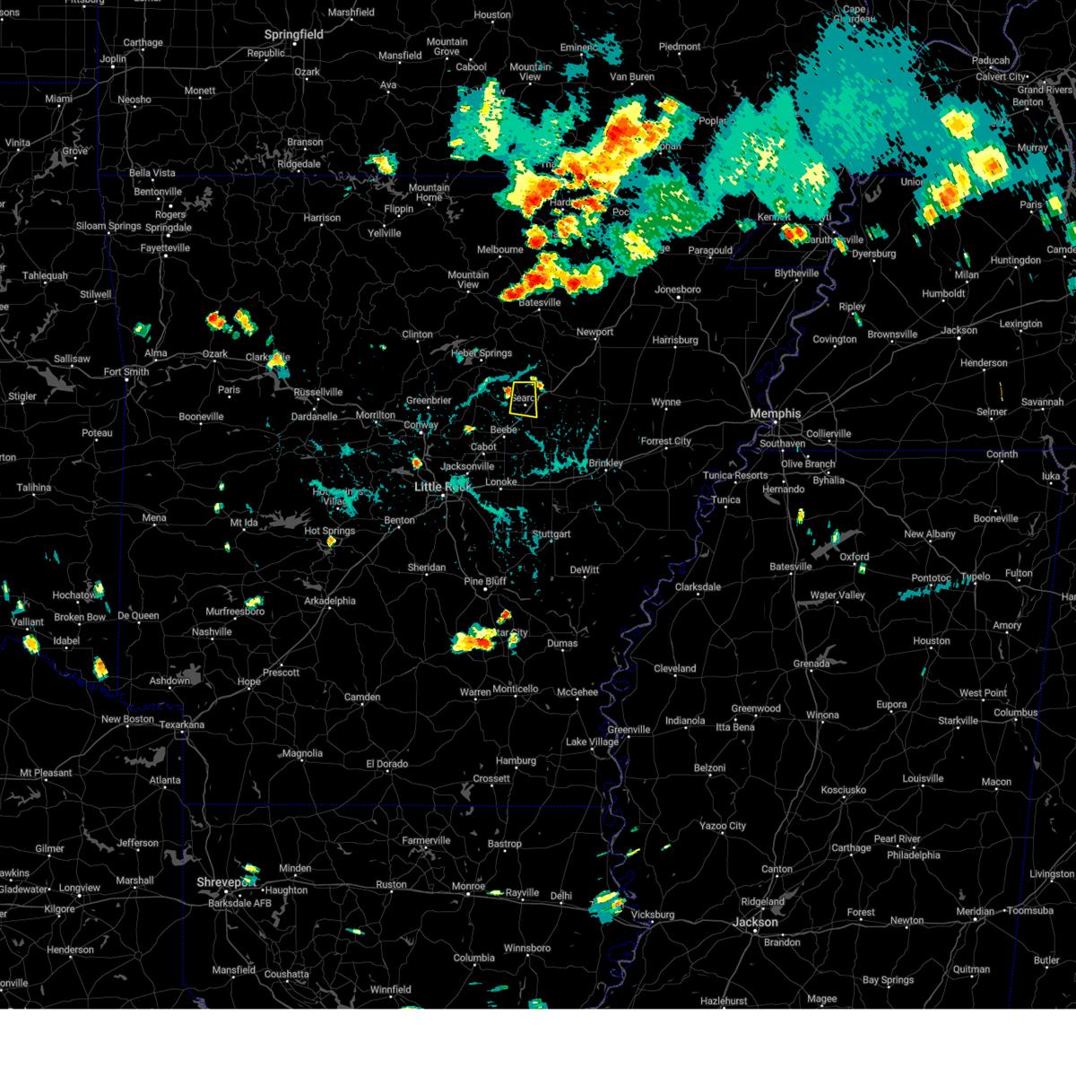 At 437 pm cdt, a severe thunderstorm was located 6 miles north of searcy, moving south at 10 mph (radar indicated). Hazards include 60 mph wind gusts and nickel size hail. expect damage to roofs, siding, and trees At 437 pm cdt, a severe thunderstorm was located 6 miles north of searcy, moving south at 10 mph (radar indicated). Hazards include 60 mph wind gusts and nickel size hail. expect damage to roofs, siding, and trees
|
| 8/10/2023 1:41 AM CDT |
 At 141 am cdt, a severe thunderstorm was located near steprock, or 10 miles north of searcy, moving east at 30 mph (radar indicated). Hazards include ping pong ball size hail and 60 mph wind gusts. People and animals outdoors will be injured. expect hail damage to roofs, siding, windows, and vehicles. expect wind damage to roofs, siding, and trees. locations impacted include, searcy, augusta, bald knob, judsonia, kensett, russell, tupelo, hurricane lake wma, steprock, bradford, letona, weldon, albion, hickory flat, shoffner, dewey, heffington, fitzhugh, worden, armstrong springs, hail threat, radar indicated max hail size, 1. 50 in wind threat, radar indicated max wind gust, 60 mph. At 141 am cdt, a severe thunderstorm was located near steprock, or 10 miles north of searcy, moving east at 30 mph (radar indicated). Hazards include ping pong ball size hail and 60 mph wind gusts. People and animals outdoors will be injured. expect hail damage to roofs, siding, windows, and vehicles. expect wind damage to roofs, siding, and trees. locations impacted include, searcy, augusta, bald knob, judsonia, kensett, russell, tupelo, hurricane lake wma, steprock, bradford, letona, weldon, albion, hickory flat, shoffner, dewey, heffington, fitzhugh, worden, armstrong springs, hail threat, radar indicated max hail size, 1. 50 in wind threat, radar indicated max wind gust, 60 mph.
|
| 8/10/2023 1:35 AM CDT |
 At 135 am cdt, a severe thunderstorm was located near steprock, or 10 miles north of searcy, moving east at 40 mph (radar indicated). Hazards include 60 mph wind gusts and quarter size hail. Hail damage to vehicles is expected. expect wind damage to roofs, siding, and trees. locations impacted include, searcy, augusta, bald knob, judsonia, kensett, pangburn, russell, tupelo, crosby, hurricane lake wma, steprock, bradford, letona, weldon, albion, hickory flat, shoffner, dewey, heffington, fitzhugh, hail threat, radar indicated max hail size, 1. 00 in wind threat, radar indicated max wind gust, 60 mph. At 135 am cdt, a severe thunderstorm was located near steprock, or 10 miles north of searcy, moving east at 40 mph (radar indicated). Hazards include 60 mph wind gusts and quarter size hail. Hail damage to vehicles is expected. expect wind damage to roofs, siding, and trees. locations impacted include, searcy, augusta, bald knob, judsonia, kensett, pangburn, russell, tupelo, crosby, hurricane lake wma, steprock, bradford, letona, weldon, albion, hickory flat, shoffner, dewey, heffington, fitzhugh, hail threat, radar indicated max hail size, 1. 00 in wind threat, radar indicated max wind gust, 60 mph.
|
| 8/10/2023 1:23 AM CDT |
 At 122 am cdt, a severe thunderstorm was located near pangburn, or 8 miles southeast of heber springs, moving east at 35 mph (radar indicated). Hazards include 60 mph wind gusts and quarter size hail. Hail damage to vehicles is expected. Expect wind damage to roofs, siding, and trees. At 122 am cdt, a severe thunderstorm was located near pangburn, or 8 miles southeast of heber springs, moving east at 35 mph (radar indicated). Hazards include 60 mph wind gusts and quarter size hail. Hail damage to vehicles is expected. Expect wind damage to roofs, siding, and trees.
|
| 7/14/2023 10:43 PM CDT |
 At 1042 pm cdt, severe thunderstorms were located along a line extending from near quitman to near greenbrier to st. vincent, moving southeast at 45 mph (radar indicated). Hazards include 60 mph wind gusts and penny size hail. expect damage to roofs, siding, and trees At 1042 pm cdt, severe thunderstorms were located along a line extending from near quitman to near greenbrier to st. vincent, moving southeast at 45 mph (radar indicated). Hazards include 60 mph wind gusts and penny size hail. expect damage to roofs, siding, and trees
|
| 6/18/2023 3:14 AM CDT | Several trees and powerlines are down across the count in white county AR, 0.6 miles ESE of Searcy, AR |
| 6/18/2023 3:13 AM CDT | 60 mph wind gust reporte in white county AR, 0.7 miles NE of Searcy, AR |
| 6/18/2023 2:56 AM CDT |
 At 256 am cdt, severe thunderstorms were located along a line extending from 10 miles west of concord to near pangburn to near ward, moving east at 55 mph (radar indicated). Hazards include 60 mph wind gusts and penny size hail. Expect damage to roofs, siding, and trees. locations impacted include, searcy, heber springs, beebe, bald knob, judsonia, kensett, greers ferry, higginson, pangburn, rose bud, pleasant plains, concord, russell, west point, crosby, pryor, gravel hill, steprock, mcrae, bradford, hail threat, radar indicated max hail size, 0. 75 in wind threat, radar indicated max wind gust, 60 mph. At 256 am cdt, severe thunderstorms were located along a line extending from 10 miles west of concord to near pangburn to near ward, moving east at 55 mph (radar indicated). Hazards include 60 mph wind gusts and penny size hail. Expect damage to roofs, siding, and trees. locations impacted include, searcy, heber springs, beebe, bald knob, judsonia, kensett, greers ferry, higginson, pangburn, rose bud, pleasant plains, concord, russell, west point, crosby, pryor, gravel hill, steprock, mcrae, bradford, hail threat, radar indicated max hail size, 0. 75 in wind threat, radar indicated max wind gust, 60 mph.
|
| 6/18/2023 2:20 AM CDT |
 At 219 am cdt, severe thunderstorms were located along a line extending from near clinton to near woolly hollow state park to near mayflower, moving east at 55 mph (radar indicated). Hazards include 60 mph wind gusts and penny size hail. expect damage to roofs, siding, and trees At 219 am cdt, severe thunderstorms were located along a line extending from near clinton to near woolly hollow state park to near mayflower, moving east at 55 mph (radar indicated). Hazards include 60 mph wind gusts and penny size hail. expect damage to roofs, siding, and trees
|
| 6/10/2023 1:28 PM CDT | Tree limbs blown down around searc in white county AR, 0.7 miles NE of Searcy, AR |
| 4/15/2023 7:08 PM CDT |
 At 708 pm cdt, severe thunderstorms were located along a line extending from 6 miles southwest of steprock to near higginson to near beebe to near little rock afb, moving east at 40 mph (radar indicated). Hazards include 60 mph wind gusts and quarter size hail. Hail damage to vehicles is expected. Expect wind damage to roofs, siding, and trees. At 708 pm cdt, severe thunderstorms were located along a line extending from 6 miles southwest of steprock to near higginson to near beebe to near little rock afb, moving east at 40 mph (radar indicated). Hazards include 60 mph wind gusts and quarter size hail. Hail damage to vehicles is expected. Expect wind damage to roofs, siding, and trees.
|
| 4/15/2023 6:47 PM CDT |
 At 646 pm cdt, severe thunderstorms were located along a line extending from near mount vernon to 6 miles northwest of olmstead to 6 miles southwest of chenal valley to near lonsdale, moving east at 40 mph (radar indicated). Hazards include 60 mph wind gusts and quarter size hail. Hail damage to vehicles is expected. expect wind damage to roofs, siding, and trees. locations impacted include, little rock, north little rock, benton, sherwood, jacksonville, cabot, searcy, west little rock, maumelle, bryant, downtown little rock, north little rock airport, little rock afb, southwest little rock, beebe, ward, haskell, vilonia, shannon hills, mayflower, hail threat, radar indicated max hail size, 1. 00 in wind threat, radar indicated max wind gust, 60 mph. At 646 pm cdt, severe thunderstorms were located along a line extending from near mount vernon to 6 miles northwest of olmstead to 6 miles southwest of chenal valley to near lonsdale, moving east at 40 mph (radar indicated). Hazards include 60 mph wind gusts and quarter size hail. Hail damage to vehicles is expected. expect wind damage to roofs, siding, and trees. locations impacted include, little rock, north little rock, benton, sherwood, jacksonville, cabot, searcy, west little rock, maumelle, bryant, downtown little rock, north little rock airport, little rock afb, southwest little rock, beebe, ward, haskell, vilonia, shannon hills, mayflower, hail threat, radar indicated max hail size, 1. 00 in wind threat, radar indicated max wind gust, 60 mph.
|
| 4/15/2023 6:29 PM CDT |
 At 629 pm cdt, severe thunderstorms were located along a line extending from greenbrier to near little italy to 9 miles south of williams junction to hot springs national park, moving east at 40 mph (radar indicated). Hazards include 60 mph wind gusts and quarter size hail. Hail damage to vehicles is expected. Expect wind damage to roofs, siding, and trees. At 629 pm cdt, severe thunderstorms were located along a line extending from greenbrier to near little italy to 9 miles south of williams junction to hot springs national park, moving east at 40 mph (radar indicated). Hazards include 60 mph wind gusts and quarter size hail. Hail damage to vehicles is expected. Expect wind damage to roofs, siding, and trees.
|
| 3/24/2023 5:30 PM CDT |
 At 530 pm cdt, severe thunderstorms were located along a line extending from magness to near russell to pryor, moving northeast at 55 mph (radar indicated). Hazards include 60 mph wind gusts and penny size hail. Expect damage to roofs, siding, and trees. locations impacted include, batesville, newport, augusta, bald knob, judsonia, tuckerman, kensett, diaz, newark, swifton, patterson, pleasant plains, oil trough, russell, jacksonport, magness, west point, tupelo, moorefield, algoa, hail threat, radar indicated max hail size, 0. 75 in wind threat, radar indicated max wind gust, 60 mph. At 530 pm cdt, severe thunderstorms were located along a line extending from magness to near russell to pryor, moving northeast at 55 mph (radar indicated). Hazards include 60 mph wind gusts and penny size hail. Expect damage to roofs, siding, and trees. locations impacted include, batesville, newport, augusta, bald knob, judsonia, tuckerman, kensett, diaz, newark, swifton, patterson, pleasant plains, oil trough, russell, jacksonport, magness, west point, tupelo, moorefield, algoa, hail threat, radar indicated max hail size, 0. 75 in wind threat, radar indicated max wind gust, 60 mph.
|
| 3/24/2023 5:17 PM CDT |
 At 517 pm cdt, severe thunderstorms were located along a line extending from near southside in independence county to steprock to higginson, moving east at 50 mph (radar indicated). Hazards include 60 mph wind gusts and penny size hail. expect damage to roofs, siding, and trees At 517 pm cdt, severe thunderstorms were located along a line extending from near southside in independence county to steprock to higginson, moving east at 50 mph (radar indicated). Hazards include 60 mph wind gusts and penny size hail. expect damage to roofs, siding, and trees
|
| 2/16/2023 5:36 AM CST |
 At 536 am cst, a severe thunderstorm was located near crosby, or 8 miles west of searcy, moving northeast at 45 mph (radar indicated). Hazards include 60 mph wind gusts and quarter size hail. Hail damage to vehicles is expected. expect wind damage to roofs, siding, and trees. locations impacted include, searcy, bald knob, judsonia, kensett, russell, crosby, gravel hill, steprock, letona, albion, clay, providence, dewey, center hill, worden, joy, denmark, floyd, armstrong springs, sunnydale, hail threat, radar indicated max hail size, 1. 00 in wind threat, radar indicated max wind gust, 60 mph. At 536 am cst, a severe thunderstorm was located near crosby, or 8 miles west of searcy, moving northeast at 45 mph (radar indicated). Hazards include 60 mph wind gusts and quarter size hail. Hail damage to vehicles is expected. expect wind damage to roofs, siding, and trees. locations impacted include, searcy, bald knob, judsonia, kensett, russell, crosby, gravel hill, steprock, letona, albion, clay, providence, dewey, center hill, worden, joy, denmark, floyd, armstrong springs, sunnydale, hail threat, radar indicated max hail size, 1. 00 in wind threat, radar indicated max wind gust, 60 mph.
|
| 2/16/2023 5:22 AM CST |
 At 521 am cst, a severe thunderstorm was located near mount vernon, or 13 miles north of cabot, moving northeast at 65 mph (radar indicated). Hazards include 60 mph wind gusts and quarter size hail. Hail damage to vehicles is expected. Expect wind damage to roofs, siding, and trees. At 521 am cst, a severe thunderstorm was located near mount vernon, or 13 miles north of cabot, moving northeast at 65 mph (radar indicated). Hazards include 60 mph wind gusts and quarter size hail. Hail damage to vehicles is expected. Expect wind damage to roofs, siding, and trees.
|
| 11/4/2022 11:49 PM CDT |
 At 1149 pm cdt, severe thunderstorms were located along a line extending from near searcy to higginson to near thurman, moving northeast at 65 mph (radar indicated). Hazards include 60 mph wind gusts. Expect damage to roofs, siding, and trees. locations impacted include, searcy, lonoke, augusta, des arc, bald knob, judsonia, kensett, higginson, patterson, russell, west point, tupelo, barrettsville, crosby, thurman, pryor, hurricane lake wma, steprock, mcrae, sisemore, hail threat, radar indicated max hail size, <. 75 in wind threat, radar indicated max wind gust, 60 mph. At 1149 pm cdt, severe thunderstorms were located along a line extending from near searcy to higginson to near thurman, moving northeast at 65 mph (radar indicated). Hazards include 60 mph wind gusts. Expect damage to roofs, siding, and trees. locations impacted include, searcy, lonoke, augusta, des arc, bald knob, judsonia, kensett, higginson, patterson, russell, west point, tupelo, barrettsville, crosby, thurman, pryor, hurricane lake wma, steprock, mcrae, sisemore, hail threat, radar indicated max hail size, <. 75 in wind threat, radar indicated max wind gust, 60 mph.
|
| 11/4/2022 11:37 PM CDT |
 At 1137 pm cdt, severe thunderstorms were located along a line extending from 6 miles south of gravel hill to beebe to near sylvania, moving northeast at 65 mph (radar indicated). Hazards include 60 mph wind gusts. expect damage to roofs, siding, and trees At 1137 pm cdt, severe thunderstorms were located along a line extending from 6 miles south of gravel hill to beebe to near sylvania, moving northeast at 65 mph (radar indicated). Hazards include 60 mph wind gusts. expect damage to roofs, siding, and trees
|
| 11/4/2022 11:30 PM CDT |
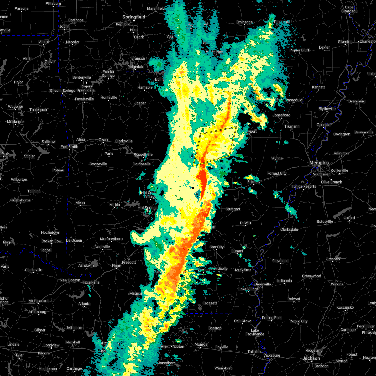 At 1129 pm cdt, severe thunderstorms were located along a line extending from near batesville to 8 miles south of concord to near gravel hill, moving northeast at 40 mph (radar indicated). Hazards include 60 mph wind gusts. Expect damage to roofs, siding, and trees. locations impacted include, heber springs, greers ferry, quitman, pangburn, rose bud, pleasant plains, enola, concord, mount vernon, crosby, gravel hill, steprock, southside in independence count, salado, holland, letona, albion, barney, hickory flat, wilburn, hail threat, radar indicated max hail size, <. 75 in wind threat, radar indicated max wind gust, 60 mph. At 1129 pm cdt, severe thunderstorms were located along a line extending from near batesville to 8 miles south of concord to near gravel hill, moving northeast at 40 mph (radar indicated). Hazards include 60 mph wind gusts. Expect damage to roofs, siding, and trees. locations impacted include, heber springs, greers ferry, quitman, pangburn, rose bud, pleasant plains, enola, concord, mount vernon, crosby, gravel hill, steprock, southside in independence count, salado, holland, letona, albion, barney, hickory flat, wilburn, hail threat, radar indicated max hail size, <. 75 in wind threat, radar indicated max wind gust, 60 mph.
|
| 10/15/2022 7:06 PM CDT |
 At 706 pm cdt, a severe thunderstorm was located near pangburn, or 10 miles southeast of heber springs, moving east at 30 mph (radar indicated). Hazards include half dollar size hail. Damage to vehicles is expected. locations impacted include, pangburn, crosby, gravel hill, letona, albion, clay, center hill, sidon, hopewell in cleburne county, joy, pickens in white county, wilburn, dewey, hail threat, radar indicated max hail size, 1. 25 in wind threat, radar indicated max wind gust, <50 mph. At 706 pm cdt, a severe thunderstorm was located near pangburn, or 10 miles southeast of heber springs, moving east at 30 mph (radar indicated). Hazards include half dollar size hail. Damage to vehicles is expected. locations impacted include, pangburn, crosby, gravel hill, letona, albion, clay, center hill, sidon, hopewell in cleburne county, joy, pickens in white county, wilburn, dewey, hail threat, radar indicated max hail size, 1. 25 in wind threat, radar indicated max wind gust, <50 mph.
|
| 10/15/2022 6:50 PM CDT |
 At 649 pm cdt, a severe thunderstorm was located over rose bud, or 10 miles south of heber springs, moving east at 30 mph (radar indicated). Hazards include half dollar size hail. damage to vehicles is expected At 649 pm cdt, a severe thunderstorm was located over rose bud, or 10 miles south of heber springs, moving east at 30 mph (radar indicated). Hazards include half dollar size hail. damage to vehicles is expected
|
| 7/12/2022 5:26 PM CDT |
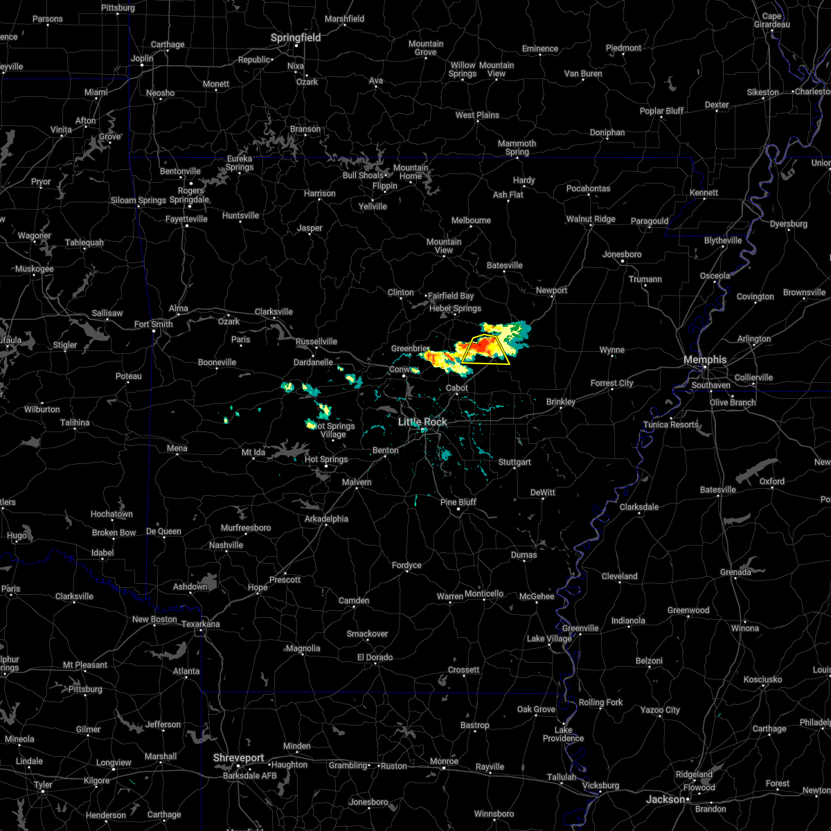 At 525 pm cdt, a severe thunderstorm was located over crosby, or near searcy, moving south at 15 mph (radar indicated). Hazards include 60 mph wind gusts and quarter size hail. Hail damage to vehicles is expected. expect wind damage to roofs, siding, and trees. locations impacted include, searcy, judsonia, kensett, higginson, crosby, albion, floyd, armstrong springs, center hill, this includes us highway 67 between mile markers 40 and 48. hail threat, radar indicated max hail size, 1. 00 in wind threat, radar indicated max wind gust, 60 mph. At 525 pm cdt, a severe thunderstorm was located over crosby, or near searcy, moving south at 15 mph (radar indicated). Hazards include 60 mph wind gusts and quarter size hail. Hail damage to vehicles is expected. expect wind damage to roofs, siding, and trees. locations impacted include, searcy, judsonia, kensett, higginson, crosby, albion, floyd, armstrong springs, center hill, this includes us highway 67 between mile markers 40 and 48. hail threat, radar indicated max hail size, 1. 00 in wind threat, radar indicated max wind gust, 60 mph.
|
| 7/12/2022 5:06 PM CDT |
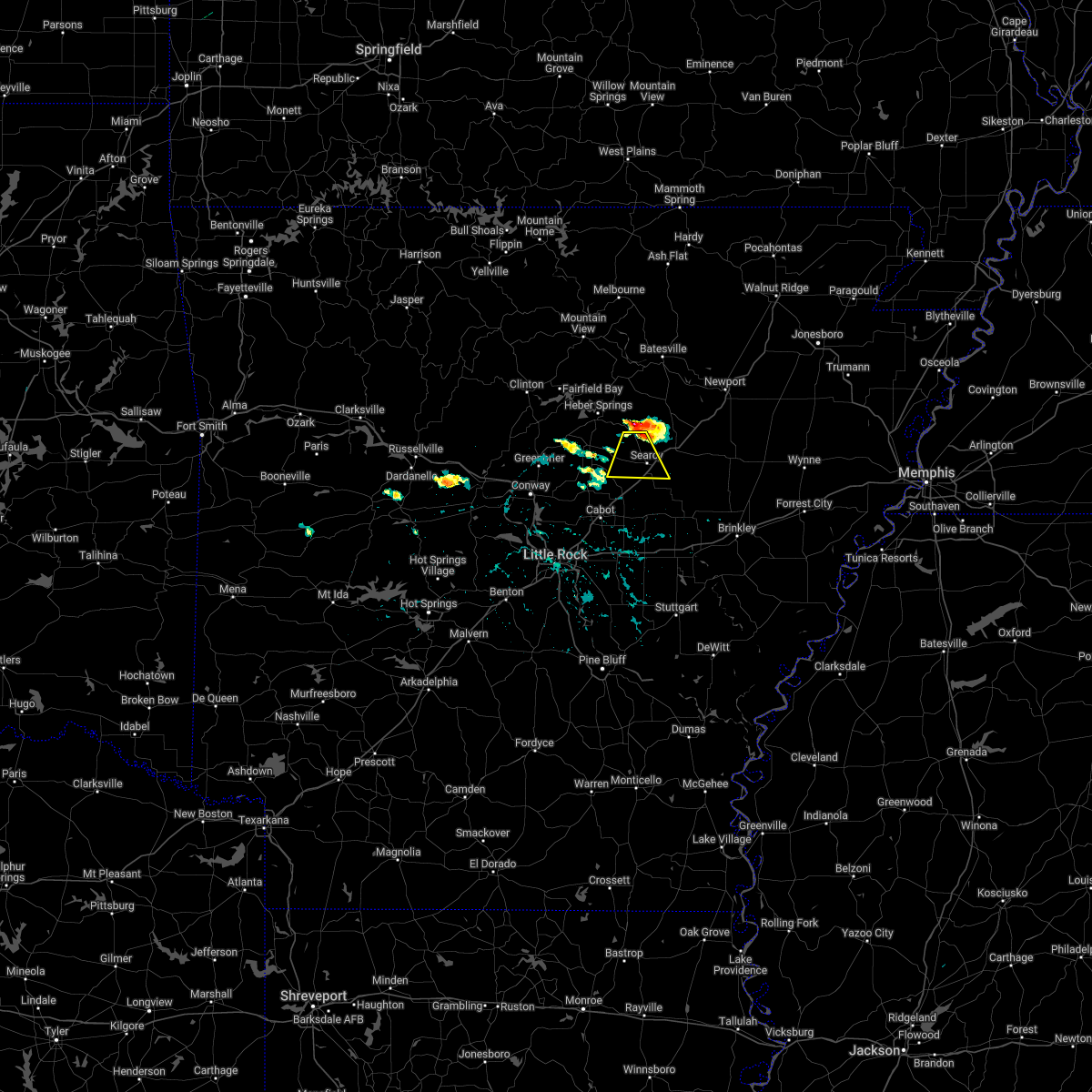 At 506 pm cdt, a severe thunderstorm was located near crosby, or 7 miles northwest of searcy, moving south at 15 mph (radar indicated). Hazards include 60 mph wind gusts and quarter size hail. Hail damage to vehicles is expected. Expect wind damage to roofs, siding, and trees. At 506 pm cdt, a severe thunderstorm was located near crosby, or 7 miles northwest of searcy, moving south at 15 mph (radar indicated). Hazards include 60 mph wind gusts and quarter size hail. Hail damage to vehicles is expected. Expect wind damage to roofs, siding, and trees.
|
| 5/21/2022 9:29 PM CDT |
 At 928 pm cdt, severe thunderstorms were located along a line extending from near crosby to ward to near parnell, moving northeast at 40 mph (radar indicated). Hazards include 60 mph wind gusts and quarter size hail. Hail damage to vehicles is expected. Expect wind damage to roofs, siding, and trees. At 928 pm cdt, severe thunderstorms were located along a line extending from near crosby to ward to near parnell, moving northeast at 40 mph (radar indicated). Hazards include 60 mph wind gusts and quarter size hail. Hail damage to vehicles is expected. Expect wind damage to roofs, siding, and trees.
|
| 5/21/2022 8:37 PM CDT |
 At 837 pm cdt, a severe thunderstorm was located near vilonia, or near cabot, moving east at 45 mph (radar indicated). Hazards include 60 mph wind gusts and quarter size hail. Hail damage to vehicles is expected. Expect wind damage to roofs, siding, and trees. At 837 pm cdt, a severe thunderstorm was located near vilonia, or near cabot, moving east at 45 mph (radar indicated). Hazards include 60 mph wind gusts and quarter size hail. Hail damage to vehicles is expected. Expect wind damage to roofs, siding, and trees.
|
| 5/21/2022 8:03 PM CDT |
 At 803 pm cdt, severe thunderstorms were located along a line extending from near searcy to roland in pulaski county, moving east at 35 mph (radar indicated). Hazards include 60 mph wind gusts and quarter size hail. Hail damage to vehicles is expected. expect wind damage to roofs, siding, and trees. locations impacted include, north little rock, conway, sherwood, jacksonville, cabot, searcy, maumelle, morrilton, brinkley, augusta, des arc, perryville, little rock afb, beebe, greenbrier, ward, vilonia, bald knob, mayflower, austin in lonoke county, this includes the following highways, interstate 40 between mile markers 107 and 145, and between mile markers 201 and 218. us highway 67 between mile markers 8 and 59. hail threat, radar indicated max hail size, 1. 00 in wind threat, radar indicated max wind gust, 60 mph. At 803 pm cdt, severe thunderstorms were located along a line extending from near searcy to roland in pulaski county, moving east at 35 mph (radar indicated). Hazards include 60 mph wind gusts and quarter size hail. Hail damage to vehicles is expected. expect wind damage to roofs, siding, and trees. locations impacted include, north little rock, conway, sherwood, jacksonville, cabot, searcy, maumelle, morrilton, brinkley, augusta, des arc, perryville, little rock afb, beebe, greenbrier, ward, vilonia, bald knob, mayflower, austin in lonoke county, this includes the following highways, interstate 40 between mile markers 107 and 145, and between mile markers 201 and 218. us highway 67 between mile markers 8 and 59. hail threat, radar indicated max hail size, 1. 00 in wind threat, radar indicated max wind gust, 60 mph.
|
| 5/21/2022 7:28 PM CDT |
 At 727 pm cdt, severe thunderstorms were located along a line extending from quitman to near wye mountain, moving east at 50 mph (radar indicated). Hazards include 60 mph wind gusts and quarter size hail. Hail damage to vehicles is expected. Expect wind damage to roofs, siding, and trees. At 727 pm cdt, severe thunderstorms were located along a line extending from quitman to near wye mountain, moving east at 50 mph (radar indicated). Hazards include 60 mph wind gusts and quarter size hail. Hail damage to vehicles is expected. Expect wind damage to roofs, siding, and trees.
|
| 5/21/2022 6:28 PM CDT |
 At 627 pm cdt, severe thunderstorms were located along a line extending from 8 miles east of greers ferry to near hattieville, moving east at 45 mph (radar indicated). Hazards include 60 mph wind gusts and quarter size hail. Hail damage to vehicles is expected. Expect wind damage to roofs, siding, and trees. At 627 pm cdt, severe thunderstorms were located along a line extending from 8 miles east of greers ferry to near hattieville, moving east at 45 mph (radar indicated). Hazards include 60 mph wind gusts and quarter size hail. Hail damage to vehicles is expected. Expect wind damage to roofs, siding, and trees.
|
| 5/15/2022 4:06 PM CDT |
 At 405 pm cdt, severe thunderstorms were located along a line extending from near tupelo to near thurman to camp robinson, moving southeast at 40 mph (trained weather spotters). Hazards include 60 mph wind gusts and quarter size hail. Hail damage to vehicles is expected. expect wind damage to roofs, siding, and trees. locations impacted include, little rock, north little rock, conway, sherwood, jacksonville, cabot, searcy, west little rock, maumelle, downtown little rock, lonoke, augusta, des arc, north little rock airport, little rock afb, beebe, ward, vilonia, bald knob, mayflower, this includes the following highways, interstate 30 between mile markers 136 and 142. interstate 40 between mile markers 128 and 176. interstate 430 between mile markers 8 and 12. interstate 530 between mile markers 1 and 3. interstate 630 between mile markers 1 and 5. interstate 440 between mile markers 1 and 14. us highway 67 between mile markers 1 and 71. hail threat, radar indicated max hail size, 1. 00 in wind threat, observed max wind gust, 60 mph. At 405 pm cdt, severe thunderstorms were located along a line extending from near tupelo to near thurman to camp robinson, moving southeast at 40 mph (trained weather spotters). Hazards include 60 mph wind gusts and quarter size hail. Hail damage to vehicles is expected. expect wind damage to roofs, siding, and trees. locations impacted include, little rock, north little rock, conway, sherwood, jacksonville, cabot, searcy, west little rock, maumelle, downtown little rock, lonoke, augusta, des arc, north little rock airport, little rock afb, beebe, ward, vilonia, bald knob, mayflower, this includes the following highways, interstate 30 between mile markers 136 and 142. interstate 40 between mile markers 128 and 176. interstate 430 between mile markers 8 and 12. interstate 530 between mile markers 1 and 3. interstate 630 between mile markers 1 and 5. interstate 440 between mile markers 1 and 14. us highway 67 between mile markers 1 and 71. hail threat, radar indicated max hail size, 1. 00 in wind threat, observed max wind gust, 60 mph.
|
| 5/15/2022 3:41 PM CDT |
 At 340 pm cdt, severe thunderstorms were located along a line extending from 7 miles east of pleasant plains to near gravel hill to mayflower, moving southeast at 45 mph (trained weather spotters). Hazards include 60 mph wind gusts and quarter size hail. Hail damage to vehicles is expected. Expect wind damage to roofs, siding, and trees. At 340 pm cdt, severe thunderstorms were located along a line extending from 7 miles east of pleasant plains to near gravel hill to mayflower, moving southeast at 45 mph (trained weather spotters). Hazards include 60 mph wind gusts and quarter size hail. Hail damage to vehicles is expected. Expect wind damage to roofs, siding, and trees.
|
| 4/11/2022 11:43 PM CDT | Ping Pong Ball sized hail reported 0.7 miles WSW of Searcy, AR, mping report. |
| 4/11/2022 11:37 PM CDT | Ping Pong Ball sized hail reported 0.7 miles WSW of Searcy, AR, mping report. corrected time. |
| 4/11/2022 11:36 PM CDT | Half Dollar sized hail reported 1.5 miles SW of Searcy, AR, mping report. |
| 4/11/2022 11:34 PM CDT |
 At 1133 pm cdt, a severe thunderstorm was located over searcy, moving southeast at 40 mph (radar indicated). Hazards include ping pong ball size hail and 60 mph wind gusts. People and animals outdoors will be injured. expect hail damage to roofs, siding, windows, and vehicles. expect wind damage to roofs, siding, and trees. locations impacted include, searcy, augusta, bald knob, judsonia, kensett, higginson, west point, pryor, hurricane lake wma, dixie, mcclelland, gregory, worden, armstrong springs, georgetown, plainview in white county, this includes us highway 67 between mile markers 40 and 53. hail threat, radar indicated max hail size, 1. 50 in wind threat, radar indicated max wind gust, 60 mph. At 1133 pm cdt, a severe thunderstorm was located over searcy, moving southeast at 40 mph (radar indicated). Hazards include ping pong ball size hail and 60 mph wind gusts. People and animals outdoors will be injured. expect hail damage to roofs, siding, windows, and vehicles. expect wind damage to roofs, siding, and trees. locations impacted include, searcy, augusta, bald knob, judsonia, kensett, higginson, west point, pryor, hurricane lake wma, dixie, mcclelland, gregory, worden, armstrong springs, georgetown, plainview in white county, this includes us highway 67 between mile markers 40 and 53. hail threat, radar indicated max hail size, 1. 50 in wind threat, radar indicated max wind gust, 60 mph.
|
| 4/11/2022 11:26 PM CDT | Ping Pong Ball sized hail reported 1.7 miles E of Searcy, AR, mping report. |
| 4/11/2022 11:17 PM CDT |
 At 1117 pm cdt, a severe thunderstorm was located 5 miles northwest of searcy, moving east at 40 mph (radar indicated). Hazards include 60 mph wind gusts and quarter size hail. Hail damage to vehicles is expected. Expect wind damage to roofs, siding, and trees. At 1117 pm cdt, a severe thunderstorm was located 5 miles northwest of searcy, moving east at 40 mph (radar indicated). Hazards include 60 mph wind gusts and quarter size hail. Hail damage to vehicles is expected. Expect wind damage to roofs, siding, and trees.
|
| 4/11/2022 11:09 PM CDT |
 The severe thunderstorm warning for northwestern prairie and southeastern white counties will expire at 1115 pm cdt, the storm which prompted the warning has weakened below severe limits, and no longer poses an immediate threat to life or property. therefore, the warning will be allowed to expire. however small hail is still possible with this thunderstorm. The severe thunderstorm warning for northwestern prairie and southeastern white counties will expire at 1115 pm cdt, the storm which prompted the warning has weakened below severe limits, and no longer poses an immediate threat to life or property. therefore, the warning will be allowed to expire. however small hail is still possible with this thunderstorm.
|
| 4/11/2022 11:04 PM CDT |
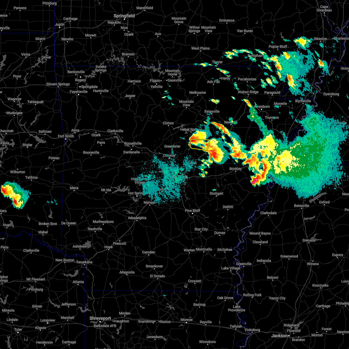 At 1103 pm cdt, a severe thunderstorm was located over crosby, or 8 miles northwest of searcy, moving east at 35 mph (radar indicated). Hazards include 60 mph wind gusts and half dollar size hail. Hail damage to vehicles is expected. expect wind damage to roofs, siding, and trees. Locations impacted include, searcy, rose bud, crosby, gravel hill, letona, albion, providence, joy, pickens in white county, armstrong springs, center hill, sidon,. At 1103 pm cdt, a severe thunderstorm was located over crosby, or 8 miles northwest of searcy, moving east at 35 mph (radar indicated). Hazards include 60 mph wind gusts and half dollar size hail. Hail damage to vehicles is expected. expect wind damage to roofs, siding, and trees. Locations impacted include, searcy, rose bud, crosby, gravel hill, letona, albion, providence, joy, pickens in white county, armstrong springs, center hill, sidon,.
|
| 4/11/2022 10:50 PM CDT |
 At 1049 pm cdt, a severe thunderstorm was located near rose bud, or 10 miles south of heber springs, moving east at 35 mph (radar indicated). Hazards include 60 mph wind gusts and quarter size hail. Hail damage to vehicles is expected. expect wind damage to roofs, siding, and trees. Locations impacted include, searcy, pangburn, rose bud, crosby, gravel hill, letona, albion, clay, providence, dewey, center hill, sidon, hopewell in cleburne county, joy, pickens in white county, armstrong springs,. At 1049 pm cdt, a severe thunderstorm was located near rose bud, or 10 miles south of heber springs, moving east at 35 mph (radar indicated). Hazards include 60 mph wind gusts and quarter size hail. Hail damage to vehicles is expected. expect wind damage to roofs, siding, and trees. Locations impacted include, searcy, pangburn, rose bud, crosby, gravel hill, letona, albion, clay, providence, dewey, center hill, sidon, hopewell in cleburne county, joy, pickens in white county, armstrong springs,.
|
| 4/11/2022 10:48 PM CDT |
 At 1048 pm cdt, a severe thunderstorm was located near higginson, or 9 miles southeast of searcy, moving east at 35 mph (radar indicated). Hazards include 60 mph wind gusts and half dollar size hail. Hail damage to vehicles is expected. expect wind damage to roofs, siding, and trees. locations impacted include, searcy, des arc, bald knob, judsonia, kensett, higginson, west point, crosby, pryor, hurricane lake wma, garner, griffithville, vinity corner, sand hill, walker, hayley, worden, jasmine, armstrong springs, plainview in white county, this includes us highway 67 between mile markers 36 and 56. hail threat, radar indicated max hail size, 1. 25 in wind threat, radar indicated max wind gust, 60 mph. At 1048 pm cdt, a severe thunderstorm was located near higginson, or 9 miles southeast of searcy, moving east at 35 mph (radar indicated). Hazards include 60 mph wind gusts and half dollar size hail. Hail damage to vehicles is expected. expect wind damage to roofs, siding, and trees. locations impacted include, searcy, des arc, bald knob, judsonia, kensett, higginson, west point, crosby, pryor, hurricane lake wma, garner, griffithville, vinity corner, sand hill, walker, hayley, worden, jasmine, armstrong springs, plainview in white county, this includes us highway 67 between mile markers 36 and 56. hail threat, radar indicated max hail size, 1. 25 in wind threat, radar indicated max wind gust, 60 mph.
|
| 4/11/2022 10:35 PM CDT |
 At 1035 pm cdt, a severe thunderstorm was located over mcrae, or 8 miles south of searcy, moving east at 35 mph (radar indicated). Hazards include ping pong ball size hail and 60 mph wind gusts. People and animals outdoors will be injured. expect hail damage to roofs, siding, windows, and vehicles. expect wind damage to roofs, siding, and trees. Locations impacted include, searcy, des arc, beebe, bald knob, judsonia, kensett, higginson, west point, crosby, hurricane lake wma, pryor, mcrae, garner, griffithville, antioch in white county, vinity corner, hayley, worden, jasmine, floyd, this includes us highway 67 between mile markers 28 and 56. At 1035 pm cdt, a severe thunderstorm was located over mcrae, or 8 miles south of searcy, moving east at 35 mph (radar indicated). Hazards include ping pong ball size hail and 60 mph wind gusts. People and animals outdoors will be injured. expect hail damage to roofs, siding, windows, and vehicles. expect wind damage to roofs, siding, and trees. Locations impacted include, searcy, des arc, beebe, bald knob, judsonia, kensett, higginson, west point, crosby, hurricane lake wma, pryor, mcrae, garner, griffithville, antioch in white county, vinity corner, hayley, worden, jasmine, floyd, this includes us highway 67 between mile markers 28 and 56.
|
| 4/11/2022 10:30 PM CDT |
 At 1029 pm cdt, a severe thunderstorm was located over quitman, or 14 miles southwest of heber springs, moving east at 35 mph (radar indicated). Hazards include 60 mph wind gusts and half dollar size hail. Hail damage to vehicles is expected. Expect wind damage to roofs, siding, and trees. At 1029 pm cdt, a severe thunderstorm was located over quitman, or 14 miles southwest of heber springs, moving east at 35 mph (radar indicated). Hazards include 60 mph wind gusts and half dollar size hail. Hail damage to vehicles is expected. Expect wind damage to roofs, siding, and trees.
|
| 4/11/2022 10:26 PM CDT | Quarter sized hail reported 9.6 miles E of Searcy, AR |
| 4/11/2022 10:23 PM CDT |
 At 1023 pm cdt, a severe thunderstorm was located near mcrae, or 11 miles southwest of searcy, moving east at 30 mph (radar indicated). Hazards include ping pong ball size hail and 60 mph wind gusts. People and animals outdoors will be injured. expect hail damage to roofs, siding, windows, and vehicles. Expect wind damage to roofs, siding, and trees. At 1023 pm cdt, a severe thunderstorm was located near mcrae, or 11 miles southwest of searcy, moving east at 30 mph (radar indicated). Hazards include ping pong ball size hail and 60 mph wind gusts. People and animals outdoors will be injured. expect hail damage to roofs, siding, windows, and vehicles. Expect wind damage to roofs, siding, and trees.
|
| 12/10/2021 8:43 PM CST |
 At 843 pm cst, severe thunderstorms were located along a line extending from near patterson to near hurricane lake wma to near pryor to near thurman, moving northeast at 60 mph (public). Hazards include golf ball size hail and 70 mph wind gusts. People and animals outdoors will be injured. expect hail damage to roofs, siding, windows, and vehicles. expect considerable tree damage. wind damage is also likely to mobile homes, roofs, and outbuildings. locations impacted include, augusta, beebe, ward, bald knob, judsonia, kensett, higginson, patterson, west point, mccrory, hurricane lake wma, thurman, pryor, mcrae, sylvania, garner, griffithville, vinity corner, howell, mcclelland, this includes us highway 67 between mile markers 31 and 42. thunderstorm damage threat, considerable hail threat, observed max hail size, 1. 75 in wind threat, radar indicated max wind gust, 70 mph. At 843 pm cst, severe thunderstorms were located along a line extending from near patterson to near hurricane lake wma to near pryor to near thurman, moving northeast at 60 mph (public). Hazards include golf ball size hail and 70 mph wind gusts. People and animals outdoors will be injured. expect hail damage to roofs, siding, windows, and vehicles. expect considerable tree damage. wind damage is also likely to mobile homes, roofs, and outbuildings. locations impacted include, augusta, beebe, ward, bald knob, judsonia, kensett, higginson, patterson, west point, mccrory, hurricane lake wma, thurman, pryor, mcrae, sylvania, garner, griffithville, vinity corner, howell, mcclelland, this includes us highway 67 between mile markers 31 and 42. thunderstorm damage threat, considerable hail threat, observed max hail size, 1. 75 in wind threat, radar indicated max wind gust, 70 mph.
|
| 12/10/2021 8:42 PM CST |
 At 841 pm cst, severe thunderstorms were located along a line extending from near hurricane lake wma to near thurman to little rock, moving northeast at 45 mph (public). Hazards include golf ball size hail and 70 mph wind gusts. golf ball hail was reported in cabot recently!. People and animals outdoors will be injured. expect hail damage to roofs, siding, windows, and vehicles. expect considerable tree damage. wind damage is also likely to mobile homes, roofs, and outbuildings. locations impacted include, augusta, beebe, ward, bald knob, judsonia, kensett, higginson, patterson, west point, mccrory, hurricane lake wma, thurman, pryor, mcrae, sylvania, garner, griffithville, vinity corner, howell, mcclelland, this includes us highway 67 between mile markers 31 and 43. thunderstorm damage threat, considerable hail threat, observed max hail size, 1. 75 in wind threat, radar indicated max wind gust, 70 mph. At 841 pm cst, severe thunderstorms were located along a line extending from near hurricane lake wma to near thurman to little rock, moving northeast at 45 mph (public). Hazards include golf ball size hail and 70 mph wind gusts. golf ball hail was reported in cabot recently!. People and animals outdoors will be injured. expect hail damage to roofs, siding, windows, and vehicles. expect considerable tree damage. wind damage is also likely to mobile homes, roofs, and outbuildings. locations impacted include, augusta, beebe, ward, bald knob, judsonia, kensett, higginson, patterson, west point, mccrory, hurricane lake wma, thurman, pryor, mcrae, sylvania, garner, griffithville, vinity corner, howell, mcclelland, this includes us highway 67 between mile markers 31 and 43. thunderstorm damage threat, considerable hail threat, observed max hail size, 1. 75 in wind threat, radar indicated max wind gust, 70 mph.
|
| 12/10/2021 8:29 PM CST |
 At 828 pm cst, severe thunderstorms were located along a line extending from west point to near parnell to southwest little rock, moving northeast at 45 mph (radar indicated). Hazards include 70 mph wind gusts and quarter size hail. Hail damage to vehicles is expected. expect considerable tree damage. Wind damage is also likely to mobile homes, roofs, and outbuildings. At 828 pm cst, severe thunderstorms were located along a line extending from west point to near parnell to southwest little rock, moving northeast at 45 mph (radar indicated). Hazards include 70 mph wind gusts and quarter size hail. Hail damage to vehicles is expected. expect considerable tree damage. Wind damage is also likely to mobile homes, roofs, and outbuildings.
|
| 12/10/2021 8:14 PM CST |
 At 813 pm cst, severe thunderstorms were located along a line extending from near higginson to near thurman to parnell to gravel ridge, moving northeast at 60 mph (radar indicated). Hazards include 60 mph wind gusts and quarter size hail. Hail damage to vehicles is expected. Expect wind damage to roofs, siding, and trees. At 813 pm cst, severe thunderstorms were located along a line extending from near higginson to near thurman to parnell to gravel ridge, moving northeast at 60 mph (radar indicated). Hazards include 60 mph wind gusts and quarter size hail. Hail damage to vehicles is expected. Expect wind damage to roofs, siding, and trees.
|
| 12/10/2021 7:26 PM CST |
 At 726 pm cst, a severe thunderstorm capable of producing a tornado was located near cabot, moving northeast at 40 mph (radar indicated rotation). Hazards include tornado. Flying debris will be dangerous to those caught without shelter. mobile homes will be damaged or destroyed. damage to roofs, windows, and vehicles will occur. Tree damage is likely. At 726 pm cst, a severe thunderstorm capable of producing a tornado was located near cabot, moving northeast at 40 mph (radar indicated rotation). Hazards include tornado. Flying debris will be dangerous to those caught without shelter. mobile homes will be damaged or destroyed. damage to roofs, windows, and vehicles will occur. Tree damage is likely.
|
| 12/10/2021 7:20 PM CST |
 At 720 pm cst, severe thunderstorms were located along a line extending from 7 miles southeast of concord to pangburn to gravel hill, moving northeast at 60 mph (radar indicated). Hazards include 60 mph wind gusts and penny size hail. Expect damage to roofs, siding, and trees. locations impacted include, pangburn, rose bud, enola, mount vernon, crosby, gravel hill, steprock, holland, letona, albion, barney, hickory flat, clay, wilburn, dewey, romance, center hill, sidon, hopewell in cleburne county, joy, hail threat, radar indicated max hail size, 0. 75 in wind threat, radar indicated max wind gust, 60 mph. At 720 pm cst, severe thunderstorms were located along a line extending from 7 miles southeast of concord to pangburn to gravel hill, moving northeast at 60 mph (radar indicated). Hazards include 60 mph wind gusts and penny size hail. Expect damage to roofs, siding, and trees. locations impacted include, pangburn, rose bud, enola, mount vernon, crosby, gravel hill, steprock, holland, letona, albion, barney, hickory flat, clay, wilburn, dewey, romance, center hill, sidon, hopewell in cleburne county, joy, hail threat, radar indicated max hail size, 0. 75 in wind threat, radar indicated max wind gust, 60 mph.
|
| 12/10/2021 6:53 PM CST |
 At 653 pm cst, severe thunderstorms were located along a line extending from near rose bud to near woolly hollow state park to near enola, moving northeast at 55 mph (radar indicated). Hazards include 60 mph wind gusts and penny size hail. expect damage to roofs, siding, and trees At 653 pm cst, severe thunderstorms were located along a line extending from near rose bud to near woolly hollow state park to near enola, moving northeast at 55 mph (radar indicated). Hazards include 60 mph wind gusts and penny size hail. expect damage to roofs, siding, and trees
|
| 6/9/2021 9:22 PM CDT |
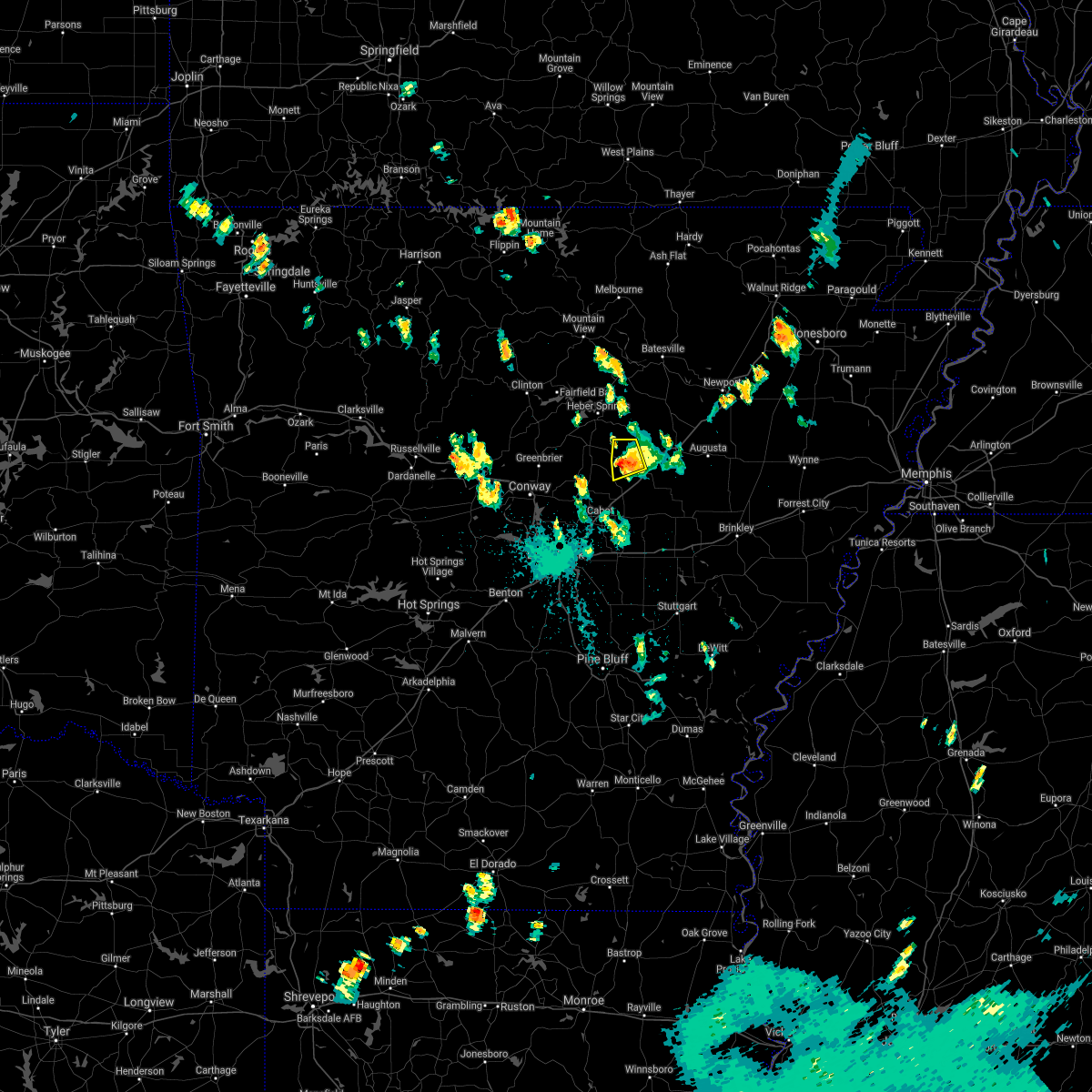 The severe thunderstorm warning for west central white county will expire at 930 pm cdt, this severe thunderstorm warning has been replaced by a tornado warning, effective until 1000 pm cdt for southwestern white county. The severe thunderstorm warning for west central white county will expire at 930 pm cdt, this severe thunderstorm warning has been replaced by a tornado warning, effective until 1000 pm cdt for southwestern white county.
|
| 6/9/2021 9:15 PM CDT | Some limbs were blown down north of center hil in white county AR, 9.5 miles ESE of Searcy, AR |
| 6/9/2021 9:15 PM CDT |
 At 915 pm cdt, a severe thunderstorm was located near gravel hill, or 9 miles west of searcy, moving south at 15 mph. this storm has a history of producing wind damage! (public). Hazards include 60 mph wind gusts and half dollar size hail. Hail damage to vehicles is expected. expect wind damage to roofs, siding, and trees. Locations impacted include, searcy, crosby, letona, albion, pickens in white county, armstrong springs, center hill, sidon, joy,. At 915 pm cdt, a severe thunderstorm was located near gravel hill, or 9 miles west of searcy, moving south at 15 mph. this storm has a history of producing wind damage! (public). Hazards include 60 mph wind gusts and half dollar size hail. Hail damage to vehicles is expected. expect wind damage to roofs, siding, and trees. Locations impacted include, searcy, crosby, letona, albion, pickens in white county, armstrong springs, center hill, sidon, joy,.
|
| 6/9/2021 9:08 PM CDT |
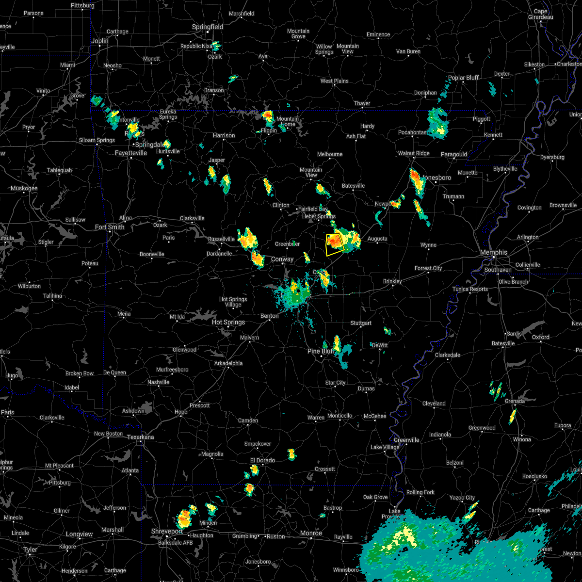 At 908 pm cdt, a severe thunderstorm was located near gravel hill, or 9 miles west of searcy, moving south at 15 mph (radar indicated). Hazards include 60 mph wind gusts and half dollar size hail. Hail damage to vehicles is expected. expect wind damage to roofs, siding, and trees. Locations impacted include, searcy, crosby, letona, albion, pickens in white county, armstrong springs, center hill, sidon, joy,. At 908 pm cdt, a severe thunderstorm was located near gravel hill, or 9 miles west of searcy, moving south at 15 mph (radar indicated). Hazards include 60 mph wind gusts and half dollar size hail. Hail damage to vehicles is expected. expect wind damage to roofs, siding, and trees. Locations impacted include, searcy, crosby, letona, albion, pickens in white county, armstrong springs, center hill, sidon, joy,.
|
| 6/9/2021 9:01 PM CDT |
 At 845 pm cdt, a severe thunderstorm was located near pangburn, or 11 miles northwest of searcy, moving southeast at 10 mph (radar indicated). Hazards include two inch hail and 60 mph wind gusts. People and animals outdoors will be injured. expect hail damage to roofs, siding, windows, and vehicles. expect wind damage to roofs, siding, and trees. Locations impacted include, searcy, judsonia, kensett, pangburn, crosby, letona, albion, clay, center hill, sidon, joy, pickens in white county, armstrong springs, plainview in white county, this includes us highway 67 between mile markers 45 and 51. At 845 pm cdt, a severe thunderstorm was located near pangburn, or 11 miles northwest of searcy, moving southeast at 10 mph (radar indicated). Hazards include two inch hail and 60 mph wind gusts. People and animals outdoors will be injured. expect hail damage to roofs, siding, windows, and vehicles. expect wind damage to roofs, siding, and trees. Locations impacted include, searcy, judsonia, kensett, pangburn, crosby, letona, albion, clay, center hill, sidon, joy, pickens in white county, armstrong springs, plainview in white county, this includes us highway 67 between mile markers 45 and 51.
|
| 6/9/2021 8:45 PM CDT |
 At 845 pm cdt, a severe thunderstorm was located near pangburn, or 11 miles northwest of searcy, moving southeast at 10 mph (radar indicated). Hazards include two inch hail and 60 mph wind gusts. People and animals outdoors will be injured. expect hail damage to roofs, siding, windows, and vehicles. expect wind damage to roofs, siding, and trees. Locations impacted include, searcy, judsonia, kensett, pangburn, crosby, letona, albion, clay, center hill, sidon, joy, pickens in white county, armstrong springs, plainview in white county, this includes us highway 67 between mile markers 45 and 51. At 845 pm cdt, a severe thunderstorm was located near pangburn, or 11 miles northwest of searcy, moving southeast at 10 mph (radar indicated). Hazards include two inch hail and 60 mph wind gusts. People and animals outdoors will be injured. expect hail damage to roofs, siding, windows, and vehicles. expect wind damage to roofs, siding, and trees. Locations impacted include, searcy, judsonia, kensett, pangburn, crosby, letona, albion, clay, center hill, sidon, joy, pickens in white county, armstrong springs, plainview in white county, this includes us highway 67 between mile markers 45 and 51.
|
| 5/9/2021 3:41 PM CDT |
 At 340 pm cdt, severe thunderstorms were located along a line extending from near higginson to near thurman, moving east at 40 mph (radar indicated). Hazards include 60 mph wind gusts and quarter size hail. Hail damage to vehicles is expected. Expect wind damage to roofs, siding, and trees. At 340 pm cdt, severe thunderstorms were located along a line extending from near higginson to near thurman, moving east at 40 mph (radar indicated). Hazards include 60 mph wind gusts and quarter size hail. Hail damage to vehicles is expected. Expect wind damage to roofs, siding, and trees.
|
| 5/9/2021 3:11 PM CDT |
 At 310 pm cdt, a severe thunderstorm was located near crosby, or near searcy, moving east at 40 mph (radar indicated). Hazards include 60 mph wind gusts and nickel size hail. Expect damage to roofs, siding, and trees. Locations impacted include, searcy, beebe, bald knob, judsonia, kensett, higginson, west point, crosby, mcrae, garner, griffithville, antioch in white county, vinity corner, walker, center hill, worden, floyd, armstrong springs, this includes us highway 67 between mile markers 29 and 51. At 310 pm cdt, a severe thunderstorm was located near crosby, or near searcy, moving east at 40 mph (radar indicated). Hazards include 60 mph wind gusts and nickel size hail. Expect damage to roofs, siding, and trees. Locations impacted include, searcy, beebe, bald knob, judsonia, kensett, higginson, west point, crosby, mcrae, garner, griffithville, antioch in white county, vinity corner, walker, center hill, worden, floyd, armstrong springs, this includes us highway 67 between mile markers 29 and 51.
|
| 5/9/2021 3:00 PM CDT |
 At 300 pm cdt, a severe thunderstorm was located over gravel hill, or 11 miles west of searcy, moving east at 35 mph (radar indicated). Hazards include 60 mph wind gusts and half dollar size hail. Hail damage to vehicles is expected. expect wind damage to roofs, siding, and trees. Locations impacted include, searcy, beebe, bald knob, judsonia, kensett, higginson, rose bud, enola, west point, mount vernon, crosby, gravel hill, mcrae, garner, griffithville, antioch in white county, barney, vinity corner, worden, floyd, this includes us highway 67 between mile markers 29 and 51. At 300 pm cdt, a severe thunderstorm was located over gravel hill, or 11 miles west of searcy, moving east at 35 mph (radar indicated). Hazards include 60 mph wind gusts and half dollar size hail. Hail damage to vehicles is expected. expect wind damage to roofs, siding, and trees. Locations impacted include, searcy, beebe, bald knob, judsonia, kensett, higginson, rose bud, enola, west point, mount vernon, crosby, gravel hill, mcrae, garner, griffithville, antioch in white county, barney, vinity corner, worden, floyd, this includes us highway 67 between mile markers 29 and 51.
|
| 5/9/2021 2:41 PM CDT |
 At 241 pm cdt, a severe thunderstorm was located over mount vernon, or 17 miles south of heber springs, moving east at 35 mph (radar indicated). Hazards include golf ball size hail and 60 mph wind gusts. People and animals outdoors will be injured. expect hail damage to roofs, siding, windows, and vehicles. Expect wind damage to roofs, siding, and trees. At 241 pm cdt, a severe thunderstorm was located over mount vernon, or 17 miles south of heber springs, moving east at 35 mph (radar indicated). Hazards include golf ball size hail and 60 mph wind gusts. People and animals outdoors will be injured. expect hail damage to roofs, siding, windows, and vehicles. Expect wind damage to roofs, siding, and trees.
|
| 5/9/2021 2:30 PM CDT |
 At 230 pm cdt, a severe thunderstorm was located near rose bud, or 14 miles south of heber springs, moving east at 55 mph (radar indicated). Hazards include 60 mph wind gusts and quarter size hail. Hail damage to vehicles is expected. expect wind damage to roofs, siding, and trees. Locations impacted include, searcy, heber springs, greenbrier, quitman, guy, pangburn, rose bud, enola, twin groves, mount vernon, crosby, gravel hill, fairbanks, woolly hollow state park, mcrae, garner, letona, albion, antioch in white county, barney, this includes us highway 67 between mile markers 34 and 37. At 230 pm cdt, a severe thunderstorm was located near rose bud, or 14 miles south of heber springs, moving east at 55 mph (radar indicated). Hazards include 60 mph wind gusts and quarter size hail. Hail damage to vehicles is expected. expect wind damage to roofs, siding, and trees. Locations impacted include, searcy, heber springs, greenbrier, quitman, guy, pangburn, rose bud, enola, twin groves, mount vernon, crosby, gravel hill, fairbanks, woolly hollow state park, mcrae, garner, letona, albion, antioch in white county, barney, this includes us highway 67 between mile markers 34 and 37.
|
| 5/9/2021 2:12 PM CDT |
 At 212 pm cdt, a severe thunderstorm was located over guy, or 17 miles northeast of conway, moving east at 50 mph (radar indicated). Hazards include 60 mph wind gusts and quarter size hail. Hail damage to vehicles is expected. Expect wind damage to roofs, siding, and trees. At 212 pm cdt, a severe thunderstorm was located over guy, or 17 miles northeast of conway, moving east at 50 mph (radar indicated). Hazards include 60 mph wind gusts and quarter size hail. Hail damage to vehicles is expected. Expect wind damage to roofs, siding, and trees.
|
| 5/4/2021 2:37 AM CDT |
 At 237 am cdt, severe thunderstorms were located along a line extending from cabot to near toltec mounds state park, moving northeast at 40 mph (radar indicated). Hazards include 60 mph wind gusts and quarter size hail. Hail damage to vehicles is expected. Expect wind damage to roofs, siding, and trees. At 237 am cdt, severe thunderstorms were located along a line extending from cabot to near toltec mounds state park, moving northeast at 40 mph (radar indicated). Hazards include 60 mph wind gusts and quarter size hail. Hail damage to vehicles is expected. Expect wind damage to roofs, siding, and trees.
|
| 4/7/2021 3:22 PM CDT |
 At 321 pm cdt, a severe thunderstorm was located near crosby, or 11 miles northwest of searcy, moving northeast at 55 mph (radar indicated). Hazards include 60 mph wind gusts and quarter size hail. Hail damage to vehicles is expected. expect wind damage to roofs, siding, and trees. Locations impacted include, pangburn, pleasant plains, oil trough, magness, crosby, gravel hill, steprock, bradford, letona, albion, hickory flat, thida, dewey, heffington, huff, sidon, pickens in white county, armstrong springs, velvet ridge, roosevelt, this includes us highway 67 between mile markers 65 and 76. At 321 pm cdt, a severe thunderstorm was located near crosby, or 11 miles northwest of searcy, moving northeast at 55 mph (radar indicated). Hazards include 60 mph wind gusts and quarter size hail. Hail damage to vehicles is expected. expect wind damage to roofs, siding, and trees. Locations impacted include, pangburn, pleasant plains, oil trough, magness, crosby, gravel hill, steprock, bradford, letona, albion, hickory flat, thida, dewey, heffington, huff, sidon, pickens in white county, armstrong springs, velvet ridge, roosevelt, this includes us highway 67 between mile markers 65 and 76.
|
| 4/7/2021 3:16 PM CDT |
 At 315 pm cdt, a severe thunderstorm was located over gravel hill, or 14 miles west of searcy, moving northeast at 55 mph (radar indicated). Hazards include 60 mph wind gusts and quarter size hail. Hail damage to vehicles is expected. Expect wind damage to roofs, siding, and trees. At 315 pm cdt, a severe thunderstorm was located over gravel hill, or 14 miles west of searcy, moving northeast at 55 mph (radar indicated). Hazards include 60 mph wind gusts and quarter size hail. Hail damage to vehicles is expected. Expect wind damage to roofs, siding, and trees.
|
| 3/27/2021 7:13 PM CDT |
 At 713 pm cdt, a severe thunderstorm was located over kensett, or over searcy, moving northeast at 40 mph (radar indicated). Hazards include two inch hail and 60 mph wind gusts. People and animals outdoors will be injured. expect hail damage to roofs, siding, windows, and vehicles. expect wind damage to roofs, siding, and trees. Locations impacted include, searcy, bald knob, judsonia, kensett, higginson, russell, west point, steprock, crosby, letona, albion, clay, providence, dewey, worden, armstrong springs, sunnydale, velvet ridge, plainview in white county, this includes us highway 67 between mile markers 38 and 60. At 713 pm cdt, a severe thunderstorm was located over kensett, or over searcy, moving northeast at 40 mph (radar indicated). Hazards include two inch hail and 60 mph wind gusts. People and animals outdoors will be injured. expect hail damage to roofs, siding, windows, and vehicles. expect wind damage to roofs, siding, and trees. Locations impacted include, searcy, bald knob, judsonia, kensett, higginson, russell, west point, steprock, crosby, letona, albion, clay, providence, dewey, worden, armstrong springs, sunnydale, velvet ridge, plainview in white county, this includes us highway 67 between mile markers 38 and 60.
|
| 3/27/2021 6:50 PM CDT |
 At 650 pm cdt, a severe thunderstorm was located over mcrae, or 12 miles northeast of cabot, moving northeast at 45 mph (radar indicated). Hazards include 60 mph wind gusts and half dollar size hail. Hail damage to vehicles is expected. Expect wind damage to roofs, siding, and trees. At 650 pm cdt, a severe thunderstorm was located over mcrae, or 12 miles northeast of cabot, moving northeast at 45 mph (radar indicated). Hazards include 60 mph wind gusts and half dollar size hail. Hail damage to vehicles is expected. Expect wind damage to roofs, siding, and trees.
|
| 3/27/2021 6:21 PM CDT |
 At 621 pm cdt, a severe thunderstorm was located near mcrae, or 11 miles south of searcy, moving northeast at 35 mph (radar indicated). Hazards include 60 mph wind gusts and quarter size hail. Hail damage to vehicles is expected. expect wind damage to roofs, siding, and trees. Locations impacted include, searcy, bald knob, judsonia, kensett, higginson, russell, west point, pryor, bradford, garner, griffithville, providence, heffington, possum grape, worden, denmark, velvet ridge, plainview in white county, walker, this includes us highway 67 between mile markers 37 and 72. At 621 pm cdt, a severe thunderstorm was located near mcrae, or 11 miles south of searcy, moving northeast at 35 mph (radar indicated). Hazards include 60 mph wind gusts and quarter size hail. Hail damage to vehicles is expected. expect wind damage to roofs, siding, and trees. Locations impacted include, searcy, bald knob, judsonia, kensett, higginson, russell, west point, pryor, bradford, garner, griffithville, providence, heffington, possum grape, worden, denmark, velvet ridge, plainview in white county, walker, this includes us highway 67 between mile markers 37 and 72.
|
| 3/27/2021 5:57 PM CDT |
 The national weather service in little rock has issued a * severe thunderstorm warning for. northwestern woodruff county in eastern arkansas. northwestern prairie county in central arkansas. southwestern jackson county in eastern arkansas. Northeastern lonoke county in central arkansas. The national weather service in little rock has issued a * severe thunderstorm warning for. northwestern woodruff county in eastern arkansas. northwestern prairie county in central arkansas. southwestern jackson county in eastern arkansas. Northeastern lonoke county in central arkansas.
|
| 2/28/2021 3:50 PM CST |
 At 350 pm cst, severe thunderstorms were located along a line extending from near steprock to near higginson to near thurman to parnell, moving east at 45 mph (radar indicated). Hazards include 60 mph wind gusts and quarter size hail. Hail damage to vehicles is expected. expect wind damage to roofs, siding, and trees. Locations impacted include, jacksonville, cabot, searcy, little rock afb, beebe, ward, bald knob, austin in lonoke county, judsonia, kensett, higginson, russell, west point, old austin, parnell, steprock, sylvania, thurman, pryor, mcrae, this includes us highway 67 between mile markers 10 and 18, between mile markers 20 and 24, and between mile markers 29 and 63. At 350 pm cst, severe thunderstorms were located along a line extending from near steprock to near higginson to near thurman to parnell, moving east at 45 mph (radar indicated). Hazards include 60 mph wind gusts and quarter size hail. Hail damage to vehicles is expected. expect wind damage to roofs, siding, and trees. Locations impacted include, jacksonville, cabot, searcy, little rock afb, beebe, ward, bald knob, austin in lonoke county, judsonia, kensett, higginson, russell, west point, old austin, parnell, steprock, sylvania, thurman, pryor, mcrae, this includes us highway 67 between mile markers 10 and 18, between mile markers 20 and 24, and between mile markers 29 and 63.
|
| 2/28/2021 3:37 PM CST |
 At 336 pm cst, severe thunderstorms were located along a line extending from near pangburn to near mcrae to ward to little rock afb, moving east at 45 mph (radar indicated). Hazards include 60 mph wind gusts and quarter size hail. Hail damage to vehicles is expected. expect wind damage to roofs, siding, and trees. Locations impacted include, sherwood, jacksonville, cabot, searcy, little rock afb, beebe, ward, bald knob, austin in lonoke county, judsonia, kensett, higginson, pangburn, russell, west point, old austin, crosby, parnell, olmstead, thurman, this includes us highway 67 between mile markers 10 and 63. At 336 pm cst, severe thunderstorms were located along a line extending from near pangburn to near mcrae to ward to little rock afb, moving east at 45 mph (radar indicated). Hazards include 60 mph wind gusts and quarter size hail. Hail damage to vehicles is expected. expect wind damage to roofs, siding, and trees. Locations impacted include, sherwood, jacksonville, cabot, searcy, little rock afb, beebe, ward, bald knob, austin in lonoke county, judsonia, kensett, higginson, pangburn, russell, west point, old austin, crosby, parnell, olmstead, thurman, this includes us highway 67 between mile markers 10 and 63.
|
| 2/28/2021 3:16 PM CST |
 At 315 pm cst, severe thunderstorms were located along a line extending from near rose bud to near mount vernon to near vilonia to near morgan, moving east at 45 mph (radar indicated). Hazards include 60 mph wind gusts and quarter size hail. Hail damage to vehicles is expected. Expect wind damage to roofs, siding, and trees. At 315 pm cst, severe thunderstorms were located along a line extending from near rose bud to near mount vernon to near vilonia to near morgan, moving east at 45 mph (radar indicated). Hazards include 60 mph wind gusts and quarter size hail. Hail damage to vehicles is expected. Expect wind damage to roofs, siding, and trees.
|
| 11/15/2020 1:50 AM CST |
 At 149 am cst, severe thunderstorms were located along a line extending from near grubbs to near pryor, moving east at 50 mph (radar indicated). Hazards include 60 mph wind gusts. Expect damage to roofs, siding, and trees. Locations impacted include, searcy, newport, augusta, beebe, bald knob, judsonia, kensett, diaz, higginson, patterson, grubbs, russell, jacksonport, west point, tupelo, hunter, algoa, mccrory, mcfadden, pryor, this includes us highway 67 between mile markers 34 and 85. At 149 am cst, severe thunderstorms were located along a line extending from near grubbs to near pryor, moving east at 50 mph (radar indicated). Hazards include 60 mph wind gusts. Expect damage to roofs, siding, and trees. Locations impacted include, searcy, newport, augusta, beebe, bald knob, judsonia, kensett, diaz, higginson, patterson, grubbs, russell, jacksonport, west point, tupelo, hunter, algoa, mccrory, mcfadden, pryor, this includes us highway 67 between mile markers 34 and 85.
|
| 11/15/2020 1:36 AM CST |
 At 135 am cst, severe thunderstorms were located along a line extending from near newport to near mcrae, moving east at 50 mph (radar indicated). Hazards include 60 mph wind gusts. expect damage to roofs, siding, and trees At 135 am cst, severe thunderstorms were located along a line extending from near newport to near mcrae, moving east at 50 mph (radar indicated). Hazards include 60 mph wind gusts. expect damage to roofs, siding, and trees
|
| 9/1/2020 4:45 PM CDT |
 At 445 pm cdt, severe thunderstorms were located along a line extending from 11 miles south of oil trough to russell to kensett, moving northeast at 45 mph (radar indicated). Hazards include 60 mph wind gusts and penny size hail. Expect damage to roofs, siding, and trees. Locations impacted include, searcy, newport, augusta, bald knob, judsonia, kensett, higginson, patterson, russell, west point, tupelo, algoa, mcfadden, hurricane lake wma, pryor, mccrory, bradford, griffithville, beedeville, amagon, this includes us highway 67 between mile markers 43 and 83. At 445 pm cdt, severe thunderstorms were located along a line extending from 11 miles south of oil trough to russell to kensett, moving northeast at 45 mph (radar indicated). Hazards include 60 mph wind gusts and penny size hail. Expect damage to roofs, siding, and trees. Locations impacted include, searcy, newport, augusta, bald knob, judsonia, kensett, higginson, patterson, russell, west point, tupelo, algoa, mcfadden, hurricane lake wma, pryor, mccrory, bradford, griffithville, beedeville, amagon, this includes us highway 67 between mile markers 43 and 83.
|
| 9/1/2020 4:30 PM CDT |
 At 430 pm cdt, severe thunderstorms were located along a line extending from near russell to near kensett to mcrae, moving northeast at 45 mph (radar indicated). Hazards include 60 mph wind gusts and penny size hail. expect damage to roofs, siding, and trees At 430 pm cdt, severe thunderstorms were located along a line extending from near russell to near kensett to mcrae, moving northeast at 45 mph (radar indicated). Hazards include 60 mph wind gusts and penny size hail. expect damage to roofs, siding, and trees
|
| 4/28/2020 11:08 PM CDT | A tree was blown down across the southbound outside lane of u.s. hwy 6 in white county AR, 3.3 miles NNE of Searcy, AR |
| 4/28/2020 11:03 PM CDT |
 At 1103 pm cdt, severe thunderstorms were located along a line extending from near augusta to higginson to near ward, moving southeast at 55 mph (radar indicated). Hazards include 60 mph wind gusts and nickel size hail. Expect damage to roofs, siding, and trees. Locations impacted include, searcy, augusta, des arc, beebe, ward, bald knob, judsonia, kensett, higginson, patterson, russell, west point, mccrory, crosby, thurman, pryor, hurricane lake wma, gravel hill, steprock, mcrae, this includes us highway 67 between mile markers 24 and 64. At 1103 pm cdt, severe thunderstorms were located along a line extending from near augusta to higginson to near ward, moving southeast at 55 mph (radar indicated). Hazards include 60 mph wind gusts and nickel size hail. Expect damage to roofs, siding, and trees. Locations impacted include, searcy, augusta, des arc, beebe, ward, bald knob, judsonia, kensett, higginson, patterson, russell, west point, mccrory, crosby, thurman, pryor, hurricane lake wma, gravel hill, steprock, mcrae, this includes us highway 67 between mile markers 24 and 64.
|
| 4/28/2020 10:53 PM CDT | Ping Pong Ball sized hail reported 9.1 miles E of Searcy, AR, ping pong ball sized hail fell... and winds were estimated at 70 mph. |
| 4/28/2020 10:43 PM CDT |
 At 1037 pm cdt, severe thunderstorms were located along a line extending from near pangburn to rose bud to near enola, moving east at 50 mph (radar indicated). Hazards include 60 mph wind gusts and nickel size hail. expect damage to roofs, siding, and trees At 1037 pm cdt, severe thunderstorms were located along a line extending from near pangburn to rose bud to near enola, moving east at 50 mph (radar indicated). Hazards include 60 mph wind gusts and nickel size hail. expect damage to roofs, siding, and trees
|
| 4/12/2020 8:37 PM CDT |
 At 836 pm cdt, severe thunderstorms were located along a line extending from 8 miles south of mountain view to near pangburn to higginson to near thurman to 6 miles east of keo, moving east at 50 mph (radar indicated). Hazards include 60 mph wind gusts and quarter size hail. Hail damage to vehicles is expected. expect wind damage to roofs, siding, and trees. locations impacted include, searcy, heber springs, lonoke, mountain view, des arc, beebe, bald knob, carlisle, judsonia, kensett, higginson, pangburn, cushman, pleasant plains, concord, russell, west point, barrettsville, crosby, meto, this includes the following highways, interstate 40 between mile markers 168 and 191. Us highway 67 between mile markers 28 and 59. At 836 pm cdt, severe thunderstorms were located along a line extending from 8 miles south of mountain view to near pangburn to higginson to near thurman to 6 miles east of keo, moving east at 50 mph (radar indicated). Hazards include 60 mph wind gusts and quarter size hail. Hail damage to vehicles is expected. expect wind damage to roofs, siding, and trees. locations impacted include, searcy, heber springs, lonoke, mountain view, des arc, beebe, bald knob, carlisle, judsonia, kensett, higginson, pangburn, cushman, pleasant plains, concord, russell, west point, barrettsville, crosby, meto, this includes the following highways, interstate 40 between mile markers 168 and 191. Us highway 67 between mile markers 28 and 59.
|
| 4/12/2020 8:19 PM CDT |
 At 819 pm cdt, severe thunderstorms were located along a line extending from near old lexington to 6 miles southwest of heber springs to near gravel hill to cabot to near ironton, moving east at 45 mph (radar indicated). Hazards include 60 mph wind gusts and quarter size hail. Hail damage to vehicles is expected. Expect wind damage to roofs, siding, and trees. At 819 pm cdt, severe thunderstorms were located along a line extending from near old lexington to 6 miles southwest of heber springs to near gravel hill to cabot to near ironton, moving east at 45 mph (radar indicated). Hazards include 60 mph wind gusts and quarter size hail. Hail damage to vehicles is expected. Expect wind damage to roofs, siding, and trees.
|
| 3/11/2020 9:37 AM CDT |
 At 937 am cdt, severe thunderstorms were located along a line extending from near crosby to near ward to near olmstead, moving southeast at 45 mph (radar indicated). Hazards include 60 mph wind gusts and nickel size hail. Expect damage to roofs, siding, and trees. locations impacted include, jacksonville, cabot, lonoke, des arc, little rock afb, beebe, ward, vilonia, carlisle, austin in lonoke county, barrettsville, old austin, parnell, meto, sylvania, olmstead, thurman, mccreanor, mcrae, sisemore, this includes the following highways, interstate 40 between mile markers 166 and 184. Us highway 67 between mile markers 9 and 41. At 937 am cdt, severe thunderstorms were located along a line extending from near crosby to near ward to near olmstead, moving southeast at 45 mph (radar indicated). Hazards include 60 mph wind gusts and nickel size hail. Expect damage to roofs, siding, and trees. locations impacted include, jacksonville, cabot, lonoke, des arc, little rock afb, beebe, ward, vilonia, carlisle, austin in lonoke county, barrettsville, old austin, parnell, meto, sylvania, olmstead, thurman, mccreanor, mcrae, sisemore, this includes the following highways, interstate 40 between mile markers 166 and 184. Us highway 67 between mile markers 9 and 41.
|
| 3/11/2020 9:27 AM CDT |
 At 926 am cdt, severe thunderstorms were located along a line extending from near gravel hill to near vilonia to near houston, moving southeast at 45 mph (radar indicated). Hazards include 60 mph wind gusts and quarter size hail. Hail damage to vehicles is expected. Expect wind damage to roofs, siding, and trees. At 926 am cdt, severe thunderstorms were located along a line extending from near gravel hill to near vilonia to near houston, moving southeast at 45 mph (radar indicated). Hazards include 60 mph wind gusts and quarter size hail. Hail damage to vehicles is expected. Expect wind damage to roofs, siding, and trees.
|
| 3/11/2020 8:48 AM CDT |
 At 847 am cdt, severe thunderstorms were located along a line extending from kensett to near higginson to near thurman, moving east at 50 mph (radar indicated). Hazards include 60 mph wind gusts and quarter size hail. Hail damage to vehicles is expected. Expect wind damage to roofs, siding, and trees. At 847 am cdt, severe thunderstorms were located along a line extending from kensett to near higginson to near thurman, moving east at 50 mph (radar indicated). Hazards include 60 mph wind gusts and quarter size hail. Hail damage to vehicles is expected. Expect wind damage to roofs, siding, and trees.
|
| 3/11/2020 8:20 AM CDT |
 At 820 am cdt, a severe thunderstorm was located near gravel hill, or 14 miles west of searcy, moving southeast at 35 mph (radar indicated). Hazards include 60 mph wind gusts and quarter size hail. Hail damage to vehicles is expected. Expect wind damage to roofs, siding, and trees. At 820 am cdt, a severe thunderstorm was located near gravel hill, or 14 miles west of searcy, moving southeast at 35 mph (radar indicated). Hazards include 60 mph wind gusts and quarter size hail. Hail damage to vehicles is expected. Expect wind damage to roofs, siding, and trees.
|
| 1/11/2020 1:17 AM CST |
 At 116 am cst, severe thunderstorms were located along a line extending from near newark to near jacksonport to 7 miles northeast of russell to hurricane lake wma to near barrettsville, moving northeast at 25 mph (radar indicated). Hazards include 60 mph wind gusts. expect damage to roofs, siding, and trees At 116 am cst, severe thunderstorms were located along a line extending from near newark to near jacksonport to 7 miles northeast of russell to hurricane lake wma to near barrettsville, moving northeast at 25 mph (radar indicated). Hazards include 60 mph wind gusts. expect damage to roofs, siding, and trees
|
| 1/11/2020 12:08 AM CST |
 At 1207 am cst, severe thunderstorms were located along a line extending from 7 miles west of pleasant plains to near crosby to near beebe to cabot, moving east at 30 mph (radar indicated). Hazards include 60 mph wind gusts. expect damage to roofs, siding, and trees At 1207 am cst, severe thunderstorms were located along a line extending from 7 miles west of pleasant plains to near crosby to near beebe to cabot, moving east at 30 mph (radar indicated). Hazards include 60 mph wind gusts. expect damage to roofs, siding, and trees
|
| 10/21/2019 2:47 AM CDT |
 At 247 am cdt, severe thunderstorms were located along a line extending from near ward to near south bend, moving northeast at 60 mph (radar indicated). Hazards include 60 mph wind gusts and quarter size hail. Hail damage to vehicles is expected. Expect wind damage to roofs, siding, and trees. At 247 am cdt, severe thunderstorms were located along a line extending from near ward to near south bend, moving northeast at 60 mph (radar indicated). Hazards include 60 mph wind gusts and quarter size hail. Hail damage to vehicles is expected. Expect wind damage to roofs, siding, and trees.
|
| 8/13/2019 8:04 PM CDT |
 At 803 pm cdt, a severe thunderstorm was located over russell, or 9 miles northwest of augusta, moving southeast at 30 mph (radar indicated). Hazards include 60 mph wind gusts and quarter size hail. Hail damage to vehicles is expected. Expect wind damage to roofs, siding, and trees. At 803 pm cdt, a severe thunderstorm was located over russell, or 9 miles northwest of augusta, moving southeast at 30 mph (radar indicated). Hazards include 60 mph wind gusts and quarter size hail. Hail damage to vehicles is expected. Expect wind damage to roofs, siding, and trees.
|
| 6/27/2019 11:49 AM CDT |
 At 1149 am cdt, a severe thunderstorm was located near beebe, or 12 miles northeast of cabot, moving southwest at 20 mph (radar indicated). Hazards include 60 mph wind gusts and quarter size hail. Hail damage to vehicles is expected. expect wind damage to roofs, siding, and trees. Locations impacted include, searcy, beebe, thurman, mcrae, garner, antioch in white county, vinity corner, walker, hickory plains, this includes us highway 67 between mile markers 26 and 42. At 1149 am cdt, a severe thunderstorm was located near beebe, or 12 miles northeast of cabot, moving southwest at 20 mph (radar indicated). Hazards include 60 mph wind gusts and quarter size hail. Hail damage to vehicles is expected. expect wind damage to roofs, siding, and trees. Locations impacted include, searcy, beebe, thurman, mcrae, garner, antioch in white county, vinity corner, walker, hickory plains, this includes us highway 67 between mile markers 26 and 42.
|
| 6/27/2019 11:22 AM CDT |
 At 1122 am cdt, a severe thunderstorm was located near mcrae, or 7 miles south of searcy, moving southwest at 20 mph (radar indicated). Hazards include 60 mph wind gusts and quarter size hail. Hail damage to vehicles is expected. Expect wind damage to roofs, siding, and trees. At 1122 am cdt, a severe thunderstorm was located near mcrae, or 7 miles south of searcy, moving southwest at 20 mph (radar indicated). Hazards include 60 mph wind gusts and quarter size hail. Hail damage to vehicles is expected. Expect wind damage to roofs, siding, and trees.
|
| 6/23/2019 3:02 PM CDT |
 At 301 pm cdt, severe thunderstorms were located along a line extending from near tupelo to near pryor, moving southeast at 35 mph (radar indicated). Hazards include 60 mph wind gusts and penny size hail. Expect damage to roofs, siding, and trees. Locations impacted include, searcy, augusta, beebe, bald knob, judsonia, kensett, higginson, patterson, russell, west point, tupelo, mccrory, crosby, hurricane lake wma, pryor, mcrae, bradford, garner, letona, griffithville, this includes us highway 67 between mile markers 27 and 74. At 301 pm cdt, severe thunderstorms were located along a line extending from near tupelo to near pryor, moving southeast at 35 mph (radar indicated). Hazards include 60 mph wind gusts and penny size hail. Expect damage to roofs, siding, and trees. Locations impacted include, searcy, augusta, beebe, bald knob, judsonia, kensett, higginson, patterson, russell, west point, tupelo, mccrory, crosby, hurricane lake wma, pryor, mcrae, bradford, garner, letona, griffithville, this includes us highway 67 between mile markers 27 and 74.
|
| 6/23/2019 2:24 PM CDT |
 At 224 pm cdt, severe thunderstorms were located along a line extending from 7 miles south of oil trough to near crosby, moving southeast at 35 mph (radar indicated). Hazards include 60 mph wind gusts and quarter size hail. Hail damage to vehicles is expected. Expect wind damage to roofs, siding, and trees. At 224 pm cdt, severe thunderstorms were located along a line extending from 7 miles south of oil trough to near crosby, moving southeast at 35 mph (radar indicated). Hazards include 60 mph wind gusts and quarter size hail. Hail damage to vehicles is expected. Expect wind damage to roofs, siding, and trees.
|
| 5/2/2019 2:22 PM CDT |
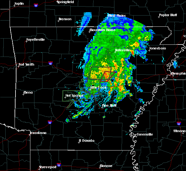 At 221 pm cdt, a severe thunderstorm capable of producing a tornado was located near beebe, or 11 miles northeast of cabot, moving northeast at 20 mph (radar indicated rotation). Hazards include tornado. Flying debris will be dangerous to those caught without shelter. mobile homes will be damaged or destroyed. damage to roofs, windows, and vehicles will occur. tree damage is likely. Locations impacted include, searcy, beebe, higginson, mcrae, garner, this includes us highway 67 between mile markers 29 and 43. At 221 pm cdt, a severe thunderstorm capable of producing a tornado was located near beebe, or 11 miles northeast of cabot, moving northeast at 20 mph (radar indicated rotation). Hazards include tornado. Flying debris will be dangerous to those caught without shelter. mobile homes will be damaged or destroyed. damage to roofs, windows, and vehicles will occur. tree damage is likely. Locations impacted include, searcy, beebe, higginson, mcrae, garner, this includes us highway 67 between mile markers 29 and 43.
|
| 5/2/2019 2:01 PM CDT |
 At 201 pm cdt, a severe thunderstorm capable of producing a tornado was located over sylvania, or near cabot, moving north at 25 mph (radar indicated rotation). Hazards include tornado. Flying debris will be dangerous to those caught without shelter. mobile homes will be damaged or destroyed. damage to roofs, windows, and vehicles will occur. Tree damage is likely. At 201 pm cdt, a severe thunderstorm capable of producing a tornado was located over sylvania, or near cabot, moving north at 25 mph (radar indicated rotation). Hazards include tornado. Flying debris will be dangerous to those caught without shelter. mobile homes will be damaged or destroyed. damage to roofs, windows, and vehicles will occur. Tree damage is likely.
|
| 3/24/2019 9:12 PM CDT |
 At 911 pm cdt, a severe thunderstorm was located near fairbanks, or 10 miles southeast of clinton, moving east at 35 mph (radar indicated). Hazards include 60 mph wind gusts and half dollar size hail. Hail damage to vehicles is expected. Expect wind damage to roofs, siding, and trees. At 911 pm cdt, a severe thunderstorm was located near fairbanks, or 10 miles southeast of clinton, moving east at 35 mph (radar indicated). Hazards include 60 mph wind gusts and half dollar size hail. Hail damage to vehicles is expected. Expect wind damage to roofs, siding, and trees.
|
| 3/9/2019 10:11 AM CST |
 The severe thunderstorm warning for woodruff, southeastern independence, northern prairie, jackson, northwestern lonoke, southeastern cleburne and white counties will expire at 1015 am cst, the storms which prompted the warning have weakened below severe limits, and no longer pose an immediate threat to life or property. therefore, the warning will be allowed to expire. however gusty winds and heavy rain are still possible with these thunderstorms. a severe thunderstorm watch remains in effect until 300 pm cst for central, eastern and north central arkansas. The severe thunderstorm warning for woodruff, southeastern independence, northern prairie, jackson, northwestern lonoke, southeastern cleburne and white counties will expire at 1015 am cst, the storms which prompted the warning have weakened below severe limits, and no longer pose an immediate threat to life or property. therefore, the warning will be allowed to expire. however gusty winds and heavy rain are still possible with these thunderstorms. a severe thunderstorm watch remains in effect until 300 pm cst for central, eastern and north central arkansas.
|
| 3/9/2019 9:46 AM CST |
 At 945 am cst, severe thunderstorms were located along a line extending from near pangburn to near crosby to near beebe, moving northeast at 80 mph (radar indicated). Hazards include 60 mph wind gusts and quarter size hail. Hail damage to vehicles is expected. expect wind damage to roofs, siding, and trees. Locations impacted include, cabot, searcy, newport, augusta, beebe, ward, bald knob, austin in lonoke county, judsonia, tuckerman, kensett, diaz, swifton, higginson, pangburn, patterson, grubbs, pleasant plains, oil trough, russell, this includes us highway 67 between mile markers 22 and 101. At 945 am cst, severe thunderstorms were located along a line extending from near pangburn to near crosby to near beebe, moving northeast at 80 mph (radar indicated). Hazards include 60 mph wind gusts and quarter size hail. Hail damage to vehicles is expected. expect wind damage to roofs, siding, and trees. Locations impacted include, cabot, searcy, newport, augusta, beebe, ward, bald knob, austin in lonoke county, judsonia, tuckerman, kensett, diaz, swifton, higginson, pangburn, patterson, grubbs, pleasant plains, oil trough, russell, this includes us highway 67 between mile markers 22 and 101.
|
| 3/9/2019 9:26 AM CST |
 At 926 am cst, severe thunderstorms were located along a line extending from near rose bud to near vilonia to near mayflower, moving northeast at 80 mph (radar indicated). Hazards include 60 mph wind gusts and quarter size hail. Hail damage to vehicles is expected. Expect wind damage to roofs, siding, and trees. At 926 am cst, severe thunderstorms were located along a line extending from near rose bud to near vilonia to near mayflower, moving northeast at 80 mph (radar indicated). Hazards include 60 mph wind gusts and quarter size hail. Hail damage to vehicles is expected. Expect wind damage to roofs, siding, and trees.
|
| 12/1/2018 2:46 AM CST |
 At 245 am cst, severe thunderstorms were located along a line extending from near olmstead to little rock afb to gravel ridge, moving northeast at 45 mph (radar indicated). Hazards include 60 mph wind gusts. Expect damage to roofs, siding, and trees. locations impacted include, little rock, north little rock, sherwood, jacksonville, cabot, searcy, north little rock airport, little rock afb, beebe, ward, austin in lonoke county, higginson, old austin, burns park, parnell, gravel ridge, marche, oak grove in pulaski county, sylvania, olmstead, this includes the following highways, interstate 30 near mile marker 142. interstate 40 between mile markers 148 and 156. interstate 440 between mile markers 11 and 14. us highway 67 between mile markers 1 and 43. A tornado watch remains in effect until 800 am cst for central arkansas. At 245 am cst, severe thunderstorms were located along a line extending from near olmstead to little rock afb to gravel ridge, moving northeast at 45 mph (radar indicated). Hazards include 60 mph wind gusts. Expect damage to roofs, siding, and trees. locations impacted include, little rock, north little rock, sherwood, jacksonville, cabot, searcy, north little rock airport, little rock afb, beebe, ward, austin in lonoke county, higginson, old austin, burns park, parnell, gravel ridge, marche, oak grove in pulaski county, sylvania, olmstead, this includes the following highways, interstate 30 near mile marker 142. interstate 40 between mile markers 148 and 156. interstate 440 between mile markers 11 and 14. us highway 67 between mile markers 1 and 43. A tornado watch remains in effect until 800 am cst for central arkansas.
|
| 12/1/2018 2:33 AM CST |
 At 233 am cst, severe thunderstorms were located along a line extending from near marche to near oak grove in pulaski county to burns park, moving northeast at 40 mph (radar indicated). Hazards include 60 mph wind gusts. expect damage to roofs, siding, and trees At 233 am cst, severe thunderstorms were located along a line extending from near marche to near oak grove in pulaski county to burns park, moving northeast at 40 mph (radar indicated). Hazards include 60 mph wind gusts. expect damage to roofs, siding, and trees
|
| 12/1/2018 1:51 AM CST |
 At 151 am cst, severe thunderstorms were located along a line extending from near enola to near pickles gap, moving east at 65 mph (radar indicated). Hazards include 60 mph wind gusts. expect damage to roofs, siding, and trees At 151 am cst, severe thunderstorms were located along a line extending from near enola to near pickles gap, moving east at 65 mph (radar indicated). Hazards include 60 mph wind gusts. expect damage to roofs, siding, and trees
|
| 8/19/2018 11:11 PM CDT |
 At 1111 pm cdt, severe thunderstorms were located along a line extending from near pangburn to kensett to 7 miles south of higginson, moving east at 50 mph (radar indicated). Hazards include 60 mph wind gusts and nickel size hail. expect damage to roofs, siding, and trees At 1111 pm cdt, severe thunderstorms were located along a line extending from near pangburn to kensett to 7 miles south of higginson, moving east at 50 mph (radar indicated). Hazards include 60 mph wind gusts and nickel size hail. expect damage to roofs, siding, and trees
|
| 8/19/2018 11:04 PM CDT | Limbs were blown dow in white county AR, 9.1 miles E of Searcy, AR |
| 8/19/2018 11:02 PM CDT |
 At 1102 pm cdt, severe thunderstorms were located along a line extending from near crosby to near searcy to near mcrae, moving northeast at 45 mph (radar indicated). Hazards include 60 mph wind gusts and nickel size hail. Expect damage to roofs, siding, and trees. Locations impacted include, searcy, beebe, judsonia, kensett, higginson, crosby, mcrae, gravel hill, garner, letona, albion, antioch in white county, vinity corner, walker, romance, center hill, joy, floyd, armstrong springs, pickens in white county,. At 1102 pm cdt, severe thunderstorms were located along a line extending from near crosby to near searcy to near mcrae, moving northeast at 45 mph (radar indicated). Hazards include 60 mph wind gusts and nickel size hail. Expect damage to roofs, siding, and trees. Locations impacted include, searcy, beebe, judsonia, kensett, higginson, crosby, mcrae, gravel hill, garner, letona, albion, antioch in white county, vinity corner, walker, romance, center hill, joy, floyd, armstrong springs, pickens in white county,.
|
| 8/19/2018 10:42 PM CDT |
 At 1041 pm cdt, severe thunderstorms were located along a line extending from mount vernon to 6 miles northwest of ward to cabot, moving northeast at 45 mph (radar indicated). Hazards include 60 mph wind gusts and nickel size hail. expect damage to roofs, siding, and trees At 1041 pm cdt, severe thunderstorms were located along a line extending from mount vernon to 6 miles northwest of ward to cabot, moving northeast at 45 mph (radar indicated). Hazards include 60 mph wind gusts and nickel size hail. expect damage to roofs, siding, and trees
|
| 8/7/2018 7:09 PM CDT |
 At 708 pm cdt, a severe thunderstorm was located near gravel hill, or 12 miles west of searcy, moving east at 15 mph (radar indicated). Hazards include 60 mph wind gusts and quarter size hail. Hail damage to vehicles is expected. expect wind damage to roofs, siding, and trees. Locations impacted include, searcy, beebe, judsonia, kensett, higginson, mcrae, gravel hill, garner, antioch in white county, vinity corner, el paso, walker, romance, center hill, joy, floyd, armstrong springs,. At 708 pm cdt, a severe thunderstorm was located near gravel hill, or 12 miles west of searcy, moving east at 15 mph (radar indicated). Hazards include 60 mph wind gusts and quarter size hail. Hail damage to vehicles is expected. expect wind damage to roofs, siding, and trees. Locations impacted include, searcy, beebe, judsonia, kensett, higginson, mcrae, gravel hill, garner, antioch in white county, vinity corner, el paso, walker, romance, center hill, joy, floyd, armstrong springs,.
|
| 8/7/2018 7:01 PM CDT |
 At 701 pm cdt, a severe thunderstorm was located over russell, or 11 miles northwest of augusta, and is nearly stationary (radar indicated). Hazards include 60 mph wind gusts and quarter size hail. Hail damage to vehicles is expected. Expect wind damage to roofs, siding, and trees. At 701 pm cdt, a severe thunderstorm was located over russell, or 11 miles northwest of augusta, and is nearly stationary (radar indicated). Hazards include 60 mph wind gusts and quarter size hail. Hail damage to vehicles is expected. Expect wind damage to roofs, siding, and trees.
|
| 8/7/2018 6:46 PM CDT |
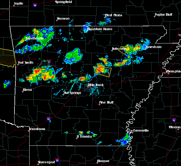 At 646 pm cdt, a severe thunderstorm was located near gravel hill, or 15 miles north of cabot, moving east at 10 mph (radar indicated). Hazards include 60 mph wind gusts and quarter size hail. Hail damage to vehicles is expected. Expect wind damage to roofs, siding, and trees. At 646 pm cdt, a severe thunderstorm was located near gravel hill, or 15 miles north of cabot, moving east at 10 mph (radar indicated). Hazards include 60 mph wind gusts and quarter size hail. Hail damage to vehicles is expected. Expect wind damage to roofs, siding, and trees.
|
| 7/21/2018 2:00 AM CDT |
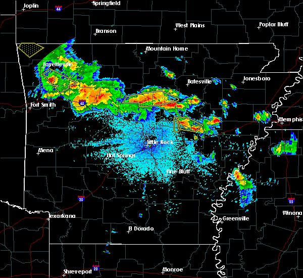 At 159 am cdt, a severe thunderstorm was located near mcrae, or 10 miles south of searcy, moving southeast at 50 mph (public reported quarter size hail in searcy as this thunderstorm moved through!). Hazards include 60 mph wind gusts and quarter size hail. Hail damage to vehicles is expected. expect wind damage to roofs, siding, and trees. Locations impacted include, searcy, des arc, higginson, garner, griffithville, vinity corner, jasmine, walker, hayley,. At 159 am cdt, a severe thunderstorm was located near mcrae, or 10 miles south of searcy, moving southeast at 50 mph (public reported quarter size hail in searcy as this thunderstorm moved through!). Hazards include 60 mph wind gusts and quarter size hail. Hail damage to vehicles is expected. expect wind damage to roofs, siding, and trees. Locations impacted include, searcy, des arc, higginson, garner, griffithville, vinity corner, jasmine, walker, hayley,.
|
| 7/21/2018 1:54 AM CDT |
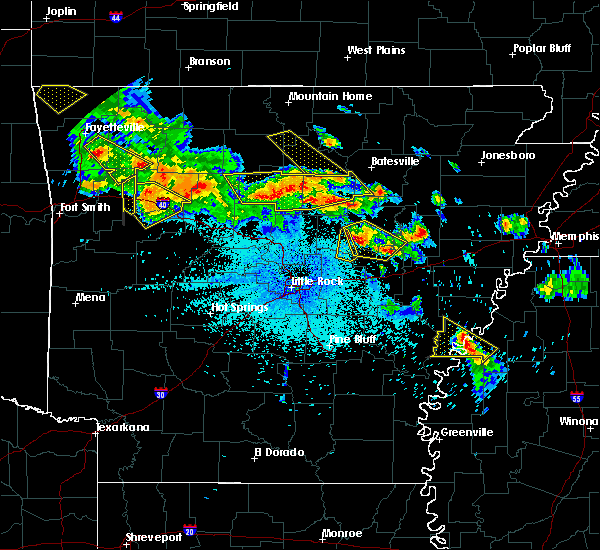 At 154 am cdt, a severe thunderstorm was located near mcrae, or near searcy, moving southeast at 40 mph (radar indicated). Hazards include 60 mph wind gusts and quarter size hail. Hail damage to vehicles is expected. expect wind damage to roofs, siding, and trees. Locations impacted include, searcy, des arc, judsonia, kensett, higginson, west point, pryor, mcrae, garner, griffithville, vinity corner, walker, mcclelland, jasmine, armstrong springs, georgetown, hayley,. At 154 am cdt, a severe thunderstorm was located near mcrae, or near searcy, moving southeast at 40 mph (radar indicated). Hazards include 60 mph wind gusts and quarter size hail. Hail damage to vehicles is expected. expect wind damage to roofs, siding, and trees. Locations impacted include, searcy, des arc, judsonia, kensett, higginson, west point, pryor, mcrae, garner, griffithville, vinity corner, walker, mcclelland, jasmine, armstrong springs, georgetown, hayley,.
|
| 7/21/2018 1:45 AM CDT | Quarter sized hail reported 0.7 miles NE of Searcy, AR |
| 7/21/2018 1:38 AM CDT |
 At 138 am cdt, a severe thunderstorm was located over crosby, or near searcy, moving southeast at 50 mph (radar indicated). Hazards include 60 mph wind gusts and quarter size hail. Hail damage to vehicles is expected. Expect wind damage to roofs, siding, and trees. At 138 am cdt, a severe thunderstorm was located over crosby, or near searcy, moving southeast at 50 mph (radar indicated). Hazards include 60 mph wind gusts and quarter size hail. Hail damage to vehicles is expected. Expect wind damage to roofs, siding, and trees.
|
| 7/20/2018 10:10 AM CDT |
 The severe thunderstorm warning for southeastern independence, woodruff, jackson, southern cleburne and white counties will expire at 1015 am cdt, the storms which prompted the warning have weakened below severe limits, and no longer pose an immediate threat to life or property. therefore, the warning will be allowed to expire. however small hail and gusty winds are still possible with these thunderstorms. The severe thunderstorm warning for southeastern independence, woodruff, jackson, southern cleburne and white counties will expire at 1015 am cdt, the storms which prompted the warning have weakened below severe limits, and no longer pose an immediate threat to life or property. therefore, the warning will be allowed to expire. however small hail and gusty winds are still possible with these thunderstorms.
|
| 7/20/2018 9:59 AM CDT |
 At 943 am cdt, severe thunderstorms were located along a line extending from near newport to near russell to 6 miles north of gravel hill, moving southeast at 50 mph (radar indicated). Hazards include 60 mph wind gusts and penny size hail. Expect damage to roofs, siding, and trees. Locations impacted include, searcy, newport, heber springs, augusta, bald knob, judsonia, tuckerman, kensett, diaz, newark, greers ferry, higginson, pangburn, patterson, grubbs, pleasant plains, oil trough, russell, jacksonport, magness,. At 943 am cdt, severe thunderstorms were located along a line extending from near newport to near russell to 6 miles north of gravel hill, moving southeast at 50 mph (radar indicated). Hazards include 60 mph wind gusts and penny size hail. Expect damage to roofs, siding, and trees. Locations impacted include, searcy, newport, heber springs, augusta, bald knob, judsonia, tuckerman, kensett, diaz, newark, greers ferry, higginson, pangburn, patterson, grubbs, pleasant plains, oil trough, russell, jacksonport, magness,.
|
| 7/20/2018 9:44 AM CDT |
 At 943 am cdt, severe thunderstorms were located along a line extending from near newport to near russell to 6 miles north of gravel hill, moving southeast at 50 mph (radar indicated). Hazards include 60 mph wind gusts and penny size hail. Expect damage to roofs, siding, and trees. Locations impacted include, searcy, newport, heber springs, augusta, bald knob, judsonia, tuckerman, kensett, diaz, newark, greers ferry, higginson, pangburn, patterson, grubbs, pleasant plains, oil trough, russell, jacksonport, magness,. At 943 am cdt, severe thunderstorms were located along a line extending from near newport to near russell to 6 miles north of gravel hill, moving southeast at 50 mph (radar indicated). Hazards include 60 mph wind gusts and penny size hail. Expect damage to roofs, siding, and trees. Locations impacted include, searcy, newport, heber springs, augusta, bald knob, judsonia, tuckerman, kensett, diaz, newark, greers ferry, higginson, pangburn, patterson, grubbs, pleasant plains, oil trough, russell, jacksonport, magness,.
|
| 7/20/2018 9:26 AM CDT |
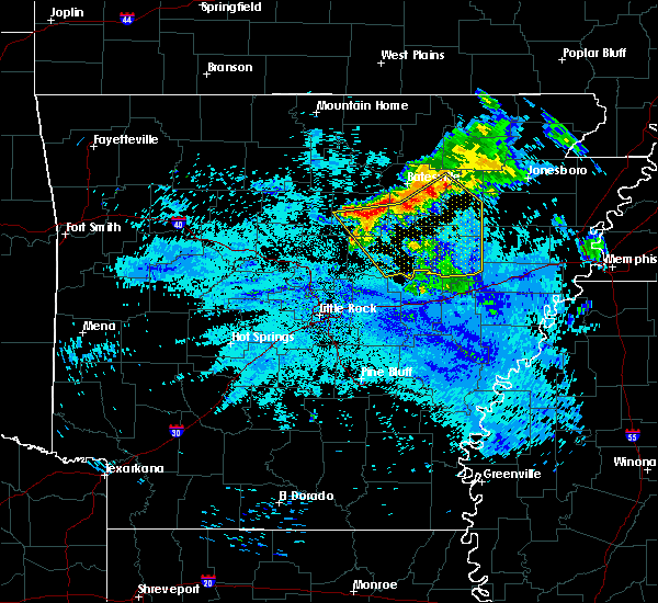 At 925 am cdt, severe thunderstorms were located along a line extending from 6 miles northeast of newark to pleasant plains to near greers ferry, moving southeast at 50 mph (radar indicated). Hazards include 60 mph wind gusts and penny size hail. expect damage to roofs, siding, and trees At 925 am cdt, severe thunderstorms were located along a line extending from 6 miles northeast of newark to pleasant plains to near greers ferry, moving southeast at 50 mph (radar indicated). Hazards include 60 mph wind gusts and penny size hail. expect damage to roofs, siding, and trees
|
| 7/6/2018 3:34 PM CDT |
 At 333 pm cdt, severe thunderstorms were located along a line extending from russell to higginson to 8 miles southeast of mount vernon, moving south at 15 mph (radar indicated). Hazards include 60 mph wind gusts and penny size hail. expect damage to roofs, siding, and trees At 333 pm cdt, severe thunderstorms were located along a line extending from russell to higginson to 8 miles southeast of mount vernon, moving south at 15 mph (radar indicated). Hazards include 60 mph wind gusts and penny size hail. expect damage to roofs, siding, and trees
|
| 5/28/2018 3:57 PM CDT |
 At 357 pm cdt, a severe thunderstorm was located near steprock, or 8 miles north of searcy, moving southwest at 40 mph (radar indicated). Hazards include 60 mph wind gusts and nickel size hail. expect damage to roofs, siding, and trees At 357 pm cdt, a severe thunderstorm was located near steprock, or 8 miles north of searcy, moving southwest at 40 mph (radar indicated). Hazards include 60 mph wind gusts and nickel size hail. expect damage to roofs, siding, and trees
|
| 5/6/2018 5:03 PM CDT | Quarter sized hail reported 3.7 miles NE of Searcy, AR, there was mainly small hail falling but a few were one inch. |
| 5/6/2018 5:02 PM CDT |
 At 502 pm cdt, a severe thunderstorm was located over searcy, moving southeast at 30 mph (radar indicated). Hazards include 60 mph wind gusts and quarter size hail. Hail damage to vehicles is expected. expect wind damage to roofs, siding, and trees. Locations impacted include, searcy, bald knob, judsonia, kensett, higginson, west point, crosby, hurricane lake wma, pryor, mcrae, garner, letona, griffithville, albion, vinity corner, dewey, sidon, pickens in white county, armstrong springs, georgetown,. At 502 pm cdt, a severe thunderstorm was located over searcy, moving southeast at 30 mph (radar indicated). Hazards include 60 mph wind gusts and quarter size hail. Hail damage to vehicles is expected. expect wind damage to roofs, siding, and trees. Locations impacted include, searcy, bald knob, judsonia, kensett, higginson, west point, crosby, hurricane lake wma, pryor, mcrae, garner, letona, griffithville, albion, vinity corner, dewey, sidon, pickens in white county, armstrong springs, georgetown,.
|
| 5/6/2018 4:51 PM CDT |
 At 448 pm cdt, a severe thunderstorm was located near judsonia, or near searcy, moving southeast at 30 mph (radar indicated). Hazards include 60 mph wind gusts and quarter size hail. Hail damage to vehicles is expected. expect wind damage to roofs, siding, and trees. Locations impacted include, searcy, bald knob, judsonia, kensett, higginson, pangburn, west point, crosby, hurricane lake wma, steprock, pryor, mcrae, garner, letona, griffithville, albion, hickory flat, vinity corner, dewey, sidon,. At 448 pm cdt, a severe thunderstorm was located near judsonia, or near searcy, moving southeast at 30 mph (radar indicated). Hazards include 60 mph wind gusts and quarter size hail. Hail damage to vehicles is expected. expect wind damage to roofs, siding, and trees. Locations impacted include, searcy, bald knob, judsonia, kensett, higginson, pangburn, west point, crosby, hurricane lake wma, steprock, pryor, mcrae, garner, letona, griffithville, albion, hickory flat, vinity corner, dewey, sidon,.
|
| 5/6/2018 4:34 PM CDT |
 At 434 pm cdt, a severe thunderstorm was located near pangburn, or 13 miles north of searcy, moving southeast at 30 mph (radar indicated). Hazards include 60 mph wind gusts and quarter size hail. Hail damage to vehicles is expected. Expect wind damage to roofs, siding, and trees. At 434 pm cdt, a severe thunderstorm was located near pangburn, or 13 miles north of searcy, moving southeast at 30 mph (radar indicated). Hazards include 60 mph wind gusts and quarter size hail. Hail damage to vehicles is expected. Expect wind damage to roofs, siding, and trees.
|
| 4/13/2018 10:19 PM CDT |
 At 1018 pm cdt, severe thunderstorms were located along a line extending from near crosby to 7 miles southeast of mount vernon to near cabot to near olmstead, moving east at 40 mph (radar indicated). Hazards include 60 mph wind gusts. Expect damage to roofs, siding, and trees. Locations impacted include, jacksonville, cabot, searcy, augusta, little rock afb, beebe, ward, vilonia, bald knob, austin in lonoke county, judsonia, kensett, higginson, rose bud, russell, west point, mount vernon, old austin, crosby, parnell, a tornado watch remains in effect until 600 am cdt for central, eastern and north central arkansas. At 1018 pm cdt, severe thunderstorms were located along a line extending from near crosby to 7 miles southeast of mount vernon to near cabot to near olmstead, moving east at 40 mph (radar indicated). Hazards include 60 mph wind gusts. Expect damage to roofs, siding, and trees. Locations impacted include, jacksonville, cabot, searcy, augusta, little rock afb, beebe, ward, vilonia, bald knob, austin in lonoke county, judsonia, kensett, higginson, rose bud, russell, west point, mount vernon, old austin, crosby, parnell, a tornado watch remains in effect until 600 am cdt for central, eastern and north central arkansas.
|
| 4/13/2018 9:49 PM CDT |
 At 949 pm cdt, severe thunderstorms were located along a line extending from near rose bud to near springhill to near mayflower to near roland in pulaski county, moving east at 50 mph (radar indicated). Hazards include 70 mph wind gusts. Expect considerable tree damage. Damage is likely to mobile homes, roofs, and outbuildings. At 949 pm cdt, severe thunderstorms were located along a line extending from near rose bud to near springhill to near mayflower to near roland in pulaski county, moving east at 50 mph (radar indicated). Hazards include 70 mph wind gusts. Expect considerable tree damage. Damage is likely to mobile homes, roofs, and outbuildings.
|
| 2/24/2018 4:27 PM CST |
 At 426 pm cst, severe thunderstorms were located along a line extending from near batesville to near salado to near oil trough to near bald knob, moving northeast at 75 mph (radar indicated). Hazards include 60 mph wind gusts. Expect damage to roofs, siding, and trees. locations impacted include, searcy, batesville, newport, augusta, bald knob, judsonia, tuckerman, kensett, diaz, newark, swifton, higginson, grubbs, pleasant plains, oil trough, russell, jacksonport, magness, tupelo, moorefield, this includes us highway 67 between mile markers 44 and 101. A tornado watch remains in effect until 600 pm cst for eastern, central and north central arkansas. At 426 pm cst, severe thunderstorms were located along a line extending from near batesville to near salado to near oil trough to near bald knob, moving northeast at 75 mph (radar indicated). Hazards include 60 mph wind gusts. Expect damage to roofs, siding, and trees. locations impacted include, searcy, batesville, newport, augusta, bald knob, judsonia, tuckerman, kensett, diaz, newark, swifton, higginson, grubbs, pleasant plains, oil trough, russell, jacksonport, magness, tupelo, moorefield, this includes us highway 67 between mile markers 44 and 101. A tornado watch remains in effect until 600 pm cst for eastern, central and north central arkansas.
|
| 2/24/2018 4:24 PM CST |
 The severe thunderstorm warning for southeastern cleburne, northeastern faulkner and northwestern white counties will expire at 430 pm cst, a thunderstorm warning will be allowed to expire as thunderstorms have moved out of the warned area. however, severe thunderstorms are still present in white county. therefore, a newly issued warning is still in effect. gusty winds and heavy rain are still possible with these thunderstorms. a tornado watch remains in effect until 600 pm cst for central and north central arkansas. remember, a severe thunderstorm warning still remains in effect for searcy county. The severe thunderstorm warning for southeastern cleburne, northeastern faulkner and northwestern white counties will expire at 430 pm cst, a thunderstorm warning will be allowed to expire as thunderstorms have moved out of the warned area. however, severe thunderstorms are still present in white county. therefore, a newly issued warning is still in effect. gusty winds and heavy rain are still possible with these thunderstorms. a tornado watch remains in effect until 600 pm cst for central and north central arkansas. remember, a severe thunderstorm warning still remains in effect for searcy county.
|
| 2/24/2018 4:14 PM CST |
 At 413 pm cst, severe thunderstorms were located along a line extending from near concord to 9 miles west of pleasant plains to near steprock to near crosby, moving northeast at 45 mph (radar indicated). Hazards include 60 mph wind gusts. expect damage to roofs, siding, and trees At 413 pm cst, severe thunderstorms were located along a line extending from near concord to 9 miles west of pleasant plains to near steprock to near crosby, moving northeast at 45 mph (radar indicated). Hazards include 60 mph wind gusts. expect damage to roofs, siding, and trees
|
| 2/24/2018 3:55 PM CST |
 At 355 pm cst, severe thunderstorms were located along a line extending from near quitman to near enola to near vilonia, moving east at 40 mph (radar indicated). Hazards include 60 mph wind gusts. Expect damage to roofs, siding, and trees. Locations impacted include, searcy, pangburn, rose bud, mount vernon, crosby, gravel hill, letona, albion, clay, romance, center hill, sidon, hopewell in cleburne county, joy, pickens in white county, floyd, armstrong springs, dewey, a tornado watch remains in effect until 600 pm cst for central and north central arkansas. At 355 pm cst, severe thunderstorms were located along a line extending from near quitman to near enola to near vilonia, moving east at 40 mph (radar indicated). Hazards include 60 mph wind gusts. Expect damage to roofs, siding, and trees. Locations impacted include, searcy, pangburn, rose bud, mount vernon, crosby, gravel hill, letona, albion, clay, romance, center hill, sidon, hopewell in cleburne county, joy, pickens in white county, floyd, armstrong springs, dewey, a tornado watch remains in effect until 600 pm cst for central and north central arkansas.
|
| 2/24/2018 3:43 PM CST |
 At 343 pm cst, severe thunderstorms were located along a line extending from guy to near greenbrier to near pickles gap, moving east at 40 mph (radar indicated). Hazards include 60 mph wind gusts. expect damage to roofs, siding, and trees At 343 pm cst, severe thunderstorms were located along a line extending from guy to near greenbrier to near pickles gap, moving east at 40 mph (radar indicated). Hazards include 60 mph wind gusts. expect damage to roofs, siding, and trees
|
| 11/6/2017 10:43 AM CST | Half Dollar sized hail reported 1.6 miles NW of Searcy, AR, a storm spotter submitted a report of half-dollar sized hail from the nws webpage. |
| 11/6/2017 10:43 AM CST |
 At 1042 am cst, a severe thunderstorm was located over searcy, moving east at 40 mph (radar indicated). Hazards include quarter size hail. Damage to vehicles is expected. Locations impacted include, searcy, bald knob, judsonia, kensett, higginson, west point, pryor, hurricane lake wma, worden, plainview in white county, this includes us highway 67 between mile markers 40 and 53. At 1042 am cst, a severe thunderstorm was located over searcy, moving east at 40 mph (radar indicated). Hazards include quarter size hail. Damage to vehicles is expected. Locations impacted include, searcy, bald knob, judsonia, kensett, higginson, west point, pryor, hurricane lake wma, worden, plainview in white county, this includes us highway 67 between mile markers 40 and 53.
|
| 11/6/2017 10:28 AM CST |
 At 1028 am cst, a severe thunderstorm was located near searcy, moving east at 40 mph (radar indicated). Hazards include quarter size hail. damage to vehicles is expected At 1028 am cst, a severe thunderstorm was located near searcy, moving east at 40 mph (radar indicated). Hazards include quarter size hail. damage to vehicles is expected
|
| 11/6/2017 10:17 AM CST |
 At 1016 am cst, a severe thunderstorm was located near gravel hill, or 11 miles west of searcy, moving east at 50 mph (radar indicated). Hazards include quarter size hail. Damage to vehicles is expected. Locations impacted include, searcy, pangburn, rose bud, crosby, gravel hill, letona, albion, clay, center hill, sidon, joy, pickens in white county, armstrong springs, romance, dewey,. At 1016 am cst, a severe thunderstorm was located near gravel hill, or 11 miles west of searcy, moving east at 50 mph (radar indicated). Hazards include quarter size hail. Damage to vehicles is expected. Locations impacted include, searcy, pangburn, rose bud, crosby, gravel hill, letona, albion, clay, center hill, sidon, joy, pickens in white county, armstrong springs, romance, dewey,.
|
| 11/6/2017 10:05 AM CST |
 At 1005 am cst, a severe thunderstorm was located near rose bud, or 13 miles southwest of heber springs, moving east at 45 mph (radar indicated). Hazards include quarter size hail. damage to vehicles is expected At 1005 am cst, a severe thunderstorm was located near rose bud, or 13 miles southwest of heber springs, moving east at 45 mph (radar indicated). Hazards include quarter size hail. damage to vehicles is expected
|
| 11/6/2017 9:44 AM CST |
 At 943 am cst, a severe thunderstorm was located near pryor, or 10 miles west of augusta, moving east at 45 mph (radar indicated). Hazards include quarter size hail. Damage to vehicles is expected. Locations impacted include, searcy, bald knob, judsonia, kensett, west point, pryor, hurricane lake wma, worden, georgetown, this includes us highway 67 between mile markers 46 and 51. At 943 am cst, a severe thunderstorm was located near pryor, or 10 miles west of augusta, moving east at 45 mph (radar indicated). Hazards include quarter size hail. Damage to vehicles is expected. Locations impacted include, searcy, bald knob, judsonia, kensett, west point, pryor, hurricane lake wma, worden, georgetown, this includes us highway 67 between mile markers 46 and 51.
|
| 11/6/2017 9:28 AM CST |
 At 928 am cst, a severe thunderstorm was located over searcy, moving east at 45 mph (radar indicated). Hazards include half dollar size hail. damage to vehicles is expected At 928 am cst, a severe thunderstorm was located over searcy, moving east at 45 mph (radar indicated). Hazards include half dollar size hail. damage to vehicles is expected
|
| 10/22/2017 4:48 AM CDT |
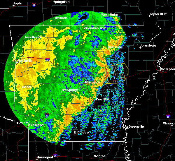 At 448 am cdt, severe thunderstorms were located along a line extending from near west point to near pryor to near des arc to barrettsville, moving east at 45 mph (radar indicated). Hazards include 60 mph wind gusts. Expect damage to roofs, siding, and trees. locations impacted include, searcy, brinkley, augusta, des arc, hazen, de valls bluff, carlisle, judsonia, kensett, higginson, patterson, fredonia, west point, hunter, barrettsville, allendale, mccrory, pryor, prairie center, hurricane lake wma, this includes the following highways, interstate 40 between mile markers 181 and 218. Us highway 67 between mile markers 44 and 46. At 448 am cdt, severe thunderstorms were located along a line extending from near west point to near pryor to near des arc to barrettsville, moving east at 45 mph (radar indicated). Hazards include 60 mph wind gusts. Expect damage to roofs, siding, and trees. locations impacted include, searcy, brinkley, augusta, des arc, hazen, de valls bluff, carlisle, judsonia, kensett, higginson, patterson, fredonia, west point, hunter, barrettsville, allendale, mccrory, pryor, prairie center, hurricane lake wma, this includes the following highways, interstate 40 between mile markers 181 and 218. Us highway 67 between mile markers 44 and 46.
|
| 10/22/2017 4:33 AM CDT |
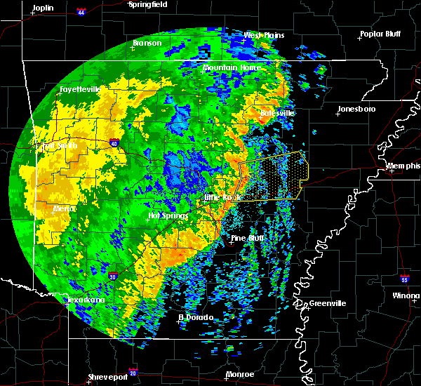 At 433 am cdt, severe thunderstorms were located along a line extending from near mcrae to 8 miles south of higginson to near thurman to sisemore, moving east at 45 mph (radar indicated). Hazards include 60 mph wind gusts. Expect damage to roofs, siding, and trees. locations impacted include, searcy, lonoke, brinkley, augusta, des arc, hazen, de valls bluff, beebe, carlisle, judsonia, kensett, higginson, patterson, fredonia, west point, hunter, barrettsville, allendale, mccrory, thurman, this includes the following highways, interstate 40 between mile markers 170 and 218. Us highway 67 between mile markers 30 and 46. At 433 am cdt, severe thunderstorms were located along a line extending from near mcrae to 8 miles south of higginson to near thurman to sisemore, moving east at 45 mph (radar indicated). Hazards include 60 mph wind gusts. Expect damage to roofs, siding, and trees. locations impacted include, searcy, lonoke, brinkley, augusta, des arc, hazen, de valls bluff, beebe, carlisle, judsonia, kensett, higginson, patterson, fredonia, west point, hunter, barrettsville, allendale, mccrory, thurman, this includes the following highways, interstate 40 between mile markers 170 and 218. Us highway 67 between mile markers 30 and 46.
|
| 10/22/2017 4:23 AM CDT |
 At 422 am cdt, severe thunderstorms were located along a line extending from near mcrae to near beebe to near sylvania to near meto, moving east at 50 mph (radar indicated). Hazards include 60 mph wind gusts. expect damage to roofs, siding, and trees At 422 am cdt, severe thunderstorms were located along a line extending from near mcrae to near beebe to near sylvania to near meto, moving east at 50 mph (radar indicated). Hazards include 60 mph wind gusts. expect damage to roofs, siding, and trees
|
| 6/23/2017 3:57 PM CDT |
 The severe thunderstorm warning for south central stone, southwestern independence, southwestern jackson, cleburne and white counties will expire at 400 pm cdt, the storm which prompted the warning has weakened below severe limits, and no longer poses an immediate threat to life or property. therefore, the warning will be allowed to expire. however gusty winds and heavy rain are still possible with this thunderstorm. a severe thunderstorm watch remains in effect until 900 pm cdt for central, eastern and north central arkansas. The severe thunderstorm warning for south central stone, southwestern independence, southwestern jackson, cleburne and white counties will expire at 400 pm cdt, the storm which prompted the warning has weakened below severe limits, and no longer poses an immediate threat to life or property. therefore, the warning will be allowed to expire. however gusty winds and heavy rain are still possible with this thunderstorm. a severe thunderstorm watch remains in effect until 900 pm cdt for central, eastern and north central arkansas.
|
| 6/23/2017 3:17 PM CDT |
 At 317 pm cdt, a severe thunderstorm was located over heber springs, moving southeast at 55 mph (radar indicated). Hazards include 60 mph wind gusts and half dollar size hail. Hail damage to vehicles is expected. Expect wind damage to roofs, siding, and trees. At 317 pm cdt, a severe thunderstorm was located over heber springs, moving southeast at 55 mph (radar indicated). Hazards include 60 mph wind gusts and half dollar size hail. Hail damage to vehicles is expected. Expect wind damage to roofs, siding, and trees.
|
| 6/22/2017 7:35 PM CDT |
 The tornado warning for southeastern white county will expire at 745 pm cdt, the storm which prompted the warning has weakened, and no longer appears capable of producing a tornado. therefore, the warning will be allowed to expire. however gusty winds and heavy rain are still possible with this thunderstorm. The tornado warning for southeastern white county will expire at 745 pm cdt, the storm which prompted the warning has weakened, and no longer appears capable of producing a tornado. therefore, the warning will be allowed to expire. however gusty winds and heavy rain are still possible with this thunderstorm.
|
| 6/22/2017 7:19 PM CDT |
 At 718 pm cdt, a severe thunderstorm capable of producing a tornado was located near higginson, or 10 miles south of searcy, moving north at 20 mph (radar indicated rotation). Hazards include tornado. Flying debris will be dangerous to those caught without shelter. mobile homes will be damaged or destroyed. damage to roofs, windows, and vehicles will occur. tree damage is likely. Locations impacted include, searcy, bald knob, judsonia, kensett, higginson, west point, crosby, pryor, garner, griffithville, vinity corner, walker, armstrong springs, this includes us highway 67 between mile markers 36 and 51. At 718 pm cdt, a severe thunderstorm capable of producing a tornado was located near higginson, or 10 miles south of searcy, moving north at 20 mph (radar indicated rotation). Hazards include tornado. Flying debris will be dangerous to those caught without shelter. mobile homes will be damaged or destroyed. damage to roofs, windows, and vehicles will occur. tree damage is likely. Locations impacted include, searcy, bald knob, judsonia, kensett, higginson, west point, crosby, pryor, garner, griffithville, vinity corner, walker, armstrong springs, this includes us highway 67 between mile markers 36 and 51.
|
| 6/22/2017 7:12 PM CDT |
 At 712 pm cdt, a severe thunderstorm capable of producing a tornado was located 7 miles southeast of mcrae, or 12 miles south of searcy, moving north at 20 mph (radar indicated rotation). Hazards include tornado. Flying debris will be dangerous to those caught without shelter. mobile homes will be damaged or destroyed. damage to roofs, windows, and vehicles will occur. Tree damage is likely. At 712 pm cdt, a severe thunderstorm capable of producing a tornado was located 7 miles southeast of mcrae, or 12 miles south of searcy, moving north at 20 mph (radar indicated rotation). Hazards include tornado. Flying debris will be dangerous to those caught without shelter. mobile homes will be damaged or destroyed. damage to roofs, windows, and vehicles will occur. Tree damage is likely.
|
| 6/22/2017 6:50 PM CDT |
 At 650 pm cdt, a severe thunderstorm capable of producing a tornado was located over thurman, or 13 miles west of des arc, moving north at 20 mph (radar indicated rotation). Hazards include tornado. Flying debris will be dangerous to those caught without shelter. mobile homes will be damaged or destroyed. damage to roofs, windows, and vehicles will occur. tree damage is likely. Locations impacted include, higginson, thurman, mcrae, garner, griffithville, vinity corner, jasmine, walker, hayley, hickory plains, butlerville, this includes us highway 67 between mile markers 32 and 41. At 650 pm cdt, a severe thunderstorm capable of producing a tornado was located over thurman, or 13 miles west of des arc, moving north at 20 mph (radar indicated rotation). Hazards include tornado. Flying debris will be dangerous to those caught without shelter. mobile homes will be damaged or destroyed. damage to roofs, windows, and vehicles will occur. tree damage is likely. Locations impacted include, higginson, thurman, mcrae, garner, griffithville, vinity corner, jasmine, walker, hayley, hickory plains, butlerville, this includes us highway 67 between mile markers 32 and 41.
|
| 6/22/2017 6:43 PM CDT |
 At 642 pm cdt, a severe thunderstorm capable of producing a tornado was located near thurman, or 13 miles west of des arc, moving north at 25 mph (radar indicated rotation). Hazards include tornado. Flying debris will be dangerous to those caught without shelter. mobile homes will be damaged or destroyed. damage to roofs, windows, and vehicles will occur. Tree damage is likely. At 642 pm cdt, a severe thunderstorm capable of producing a tornado was located near thurman, or 13 miles west of des arc, moving north at 25 mph (radar indicated rotation). Hazards include tornado. Flying debris will be dangerous to those caught without shelter. mobile homes will be damaged or destroyed. damage to roofs, windows, and vehicles will occur. Tree damage is likely.
|
| 5/28/2017 1:35 AM CDT |
 At 135 am cdt, severe thunderstorms were located along a line extending from near enola to near conway to houston, moving southeast at 55 mph (radar indicated). Hazards include 60 mph wind gusts. Expect damage to roofs, siding, and trees. locations impacted include, little rock, north little rock, conway, benton, sherwood, jacksonville, cabot, west little rock, maumelle, bryant, downtown little rock, morrilton, lonoke, des arc, hazen, perryville, north little rock airport, little rock afb, southwest little rock, beebe, this includes the following highways, interstate 30 between mile markers 118 and 142. interstate 40 between mile markers 103 and 196. interstate 430 between mile markers 1 and 12. interstate 530 between mile markers 1 and 23. interstate 630 between mile markers 1 and 7. interstate 440 between mile markers 1 and 14. Us highway 67 between mile markers 1 and 41. At 135 am cdt, severe thunderstorms were located along a line extending from near enola to near conway to houston, moving southeast at 55 mph (radar indicated). Hazards include 60 mph wind gusts. Expect damage to roofs, siding, and trees. locations impacted include, little rock, north little rock, conway, benton, sherwood, jacksonville, cabot, west little rock, maumelle, bryant, downtown little rock, morrilton, lonoke, des arc, hazen, perryville, north little rock airport, little rock afb, southwest little rock, beebe, this includes the following highways, interstate 30 between mile markers 118 and 142. interstate 40 between mile markers 103 and 196. interstate 430 between mile markers 1 and 12. interstate 530 between mile markers 1 and 23. interstate 630 between mile markers 1 and 7. interstate 440 between mile markers 1 and 14. Us highway 67 between mile markers 1 and 41.
|
| 5/28/2017 1:24 AM CDT |
 At 124 am cdt, severe thunderstorms were located along a line extending from near greenbrier to near toad suck to near adona, moving southeast at 70 mph (radar indicated). Hazards include 70 mph wind gusts. Expect considerable tree damage. Damage is likely to mobile homes, roofs, and outbuildings. At 124 am cdt, severe thunderstorms were located along a line extending from near greenbrier to near toad suck to near adona, moving southeast at 70 mph (radar indicated). Hazards include 70 mph wind gusts. Expect considerable tree damage. Damage is likely to mobile homes, roofs, and outbuildings.
|
| 5/19/2017 7:22 PM CDT |
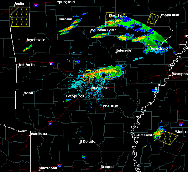 The severe thunderstorm warning for southwestern white county will expire at 730 pm cdt, the storm which prompted the warning has weakened below severe limits, and no longer poses an immediate threat to life or property. therefore, the warning will be allowed to expire. however gusty winds and heavy rain are still possible with this thunderstorm. The severe thunderstorm warning for southwestern white county will expire at 730 pm cdt, the storm which prompted the warning has weakened below severe limits, and no longer poses an immediate threat to life or property. therefore, the warning will be allowed to expire. however gusty winds and heavy rain are still possible with this thunderstorm.
|
| 5/19/2017 7:02 PM CDT |
 At 701 pm cdt, a severe thunderstorm was located over beebe, or 9 miles northeast of cabot, moving northeast at 30 mph (radar indicated). Hazards include 60 mph wind gusts and quarter size hail. Hail damage to vehicles is expected. expect wind damage to roofs, siding, and trees. Locations impacted include, searcy, beebe, judsonia, kensett, higginson, west point, crosby, mcrae, gravel hill, garner, antioch in white county, vinity corner, el paso, walker, romance, center hill, joy, floyd, armstrong springs, this includes us highway 67 between mile markers 26 and 49. At 701 pm cdt, a severe thunderstorm was located over beebe, or 9 miles northeast of cabot, moving northeast at 30 mph (radar indicated). Hazards include 60 mph wind gusts and quarter size hail. Hail damage to vehicles is expected. expect wind damage to roofs, siding, and trees. Locations impacted include, searcy, beebe, judsonia, kensett, higginson, west point, crosby, mcrae, gravel hill, garner, antioch in white county, vinity corner, el paso, walker, romance, center hill, joy, floyd, armstrong springs, this includes us highway 67 between mile markers 26 and 49.
|
| 5/19/2017 6:45 PM CDT |
 At 644 pm cdt, a severe thunderstorm was located over old austin, or over cabot, moving northeast at 30 mph (trained weather spotters). Hazards include 60 mph wind gusts and half dollar size hail. Hail damage to vehicles is expected. Expect wind damage to roofs, siding, and trees. At 644 pm cdt, a severe thunderstorm was located over old austin, or over cabot, moving northeast at 30 mph (trained weather spotters). Hazards include 60 mph wind gusts and half dollar size hail. Hail damage to vehicles is expected. Expect wind damage to roofs, siding, and trees.
|
| 4/30/2017 12:52 AM CDT | Trees and powerlines down in georgetown... including a tree down on a hom in white county AR, 17.3 miles WNW of Searcy, AR |
| 4/30/2017 12:44 AM CDT | Several trailers were overturned northwest of georgetown...near highway 36 and nimmo roa in white county AR, 15.1 miles WNW of Searcy, AR |
| 4/30/2017 12:37 AM CDT | A house sustained major damag in white county AR, 8.3 miles WNW of Searcy, AR |
| 4/30/2017 12:37 AM CDT | Trees and powerlines down around the higginson area... portion of highway 11 blocked as a resul in white county AR, 3.2 miles N of Searcy, AR |
| 4/30/2017 12:35 AM CDT |
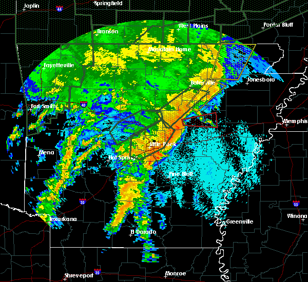 At 1234 am cdt, a severe thunderstorm capable of producing a tornado was located near higginson, or near searcy, moving east at 45 mph (radar indicated rotation). Hazards include tornado. Flying debris will be dangerous to those caught without shelter. mobile homes will be damaged or destroyed. damage to roofs, windows, and vehicles will occur. Tree damage is likely. At 1234 am cdt, a severe thunderstorm capable of producing a tornado was located near higginson, or near searcy, moving east at 45 mph (radar indicated rotation). Hazards include tornado. Flying debris will be dangerous to those caught without shelter. mobile homes will be damaged or destroyed. damage to roofs, windows, and vehicles will occur. Tree damage is likely.
|
| 4/29/2017 11:52 PM CDT |
 At 1151 pm cdt, a severe thunderstorm was located over searcy, moving northeast at 45 mph (radar indicated). Hazards include 60 mph wind gusts and quarter size hail. Hail damage to vehicles is expected. expect wind damage to roofs, siding, and trees. Locations impacted include, searcy, bald knob, judsonia, kensett, higginson, crosby, garner, albion, providence, armstrong springs, plainview in white county, this includes us highway 67 between mile markers 36 and 55. At 1151 pm cdt, a severe thunderstorm was located over searcy, moving northeast at 45 mph (radar indicated). Hazards include 60 mph wind gusts and quarter size hail. Hail damage to vehicles is expected. expect wind damage to roofs, siding, and trees. Locations impacted include, searcy, bald knob, judsonia, kensett, higginson, crosby, garner, albion, providence, armstrong springs, plainview in white county, this includes us highway 67 between mile markers 36 and 55.
|
| 4/29/2017 11:37 PM CDT |
 At 1137 pm cdt, a severe thunderstorm was located near cabot, moving northeast at 45 mph (radar indicated). Hazards include 60 mph wind gusts and quarter size hail. Hail damage to vehicles is expected. Expect wind damage to roofs, siding, and trees. At 1137 pm cdt, a severe thunderstorm was located near cabot, moving northeast at 45 mph (radar indicated). Hazards include 60 mph wind gusts and quarter size hail. Hail damage to vehicles is expected. Expect wind damage to roofs, siding, and trees.
|
| 4/29/2017 10:19 PM CDT |
 At 1019 pm cdt, a severe thunderstorm was located near steprock, or 10 miles northeast of searcy, moving north at 45 mph (radar indicated). Hazards include ping pong ball size hail and 60 mph wind gusts. People and animals outdoors will be injured. expect hail damage to roofs, siding, windows, and vehicles. expect wind damage to roofs, siding, and trees. Locations impacted include, searcy, bald knob, judsonia, pleasant plains, steprock, albion, hickory flat, clay, thida, providence, dewey, heffington, hutchinson, denmark, sunnydale, velvet ridge, roosevelt, plainview in white county, huff, this includes us highway 67 between mile markers 47 and 56. At 1019 pm cdt, a severe thunderstorm was located near steprock, or 10 miles northeast of searcy, moving north at 45 mph (radar indicated). Hazards include ping pong ball size hail and 60 mph wind gusts. People and animals outdoors will be injured. expect hail damage to roofs, siding, windows, and vehicles. expect wind damage to roofs, siding, and trees. Locations impacted include, searcy, bald knob, judsonia, pleasant plains, steprock, albion, hickory flat, clay, thida, providence, dewey, heffington, hutchinson, denmark, sunnydale, velvet ridge, roosevelt, plainview in white county, huff, this includes us highway 67 between mile markers 47 and 56.
|
| 4/29/2017 10:10 PM CDT |
 At 1009 pm cdt, severe thunderstorms were located along a line extending from near choctaw to near woolly hollow state park to near vilonia, moving northeast at 50 mph (radar indicated). Hazards include 60 mph wind gusts and penny size hail. expect damage to roofs, siding, and trees At 1009 pm cdt, severe thunderstorms were located along a line extending from near choctaw to near woolly hollow state park to near vilonia, moving northeast at 50 mph (radar indicated). Hazards include 60 mph wind gusts and penny size hail. expect damage to roofs, siding, and trees
|
| 4/29/2017 10:06 PM CDT |
 At 1006 pm cdt, a severe thunderstorm was located over searcy, moving northeast at 40 mph (radar indicated). Hazards include 60 mph wind gusts and quarter size hail. Hail damage to vehicles is expected. expect wind damage to roofs, siding, and trees. Locations impacted include, searcy, bald knob, judsonia, kensett, higginson, pleasant plains, west point, crosby, steprock, letona, albion, hickory flat, thida, dewey, heffington, armstrong springs, velvet ridge, roosevelt, plainview in white county, clay, this includes us highway 67 between mile markers 38 and 56. At 1006 pm cdt, a severe thunderstorm was located over searcy, moving northeast at 40 mph (radar indicated). Hazards include 60 mph wind gusts and quarter size hail. Hail damage to vehicles is expected. expect wind damage to roofs, siding, and trees. Locations impacted include, searcy, bald knob, judsonia, kensett, higginson, pleasant plains, west point, crosby, steprock, letona, albion, hickory flat, thida, dewey, heffington, armstrong springs, velvet ridge, roosevelt, plainview in white county, clay, this includes us highway 67 between mile markers 38 and 56.
|
| 4/29/2017 9:51 PM CDT |
 At 950 pm cdt, a severe thunderstorm was located over mcrae, or 10 miles southwest of searcy, moving north at 45 mph (radar indicated). Hazards include 60 mph wind gusts and quarter size hail. Hail damage to vehicles is expected. Expect wind damage to roofs, siding, and trees. At 950 pm cdt, a severe thunderstorm was located over mcrae, or 10 miles southwest of searcy, moving north at 45 mph (radar indicated). Hazards include 60 mph wind gusts and quarter size hail. Hail damage to vehicles is expected. Expect wind damage to roofs, siding, and trees.
|
| 3/25/2017 12:02 AM CDT |
 At 1200 am cdt, a severe thunderstorm was located over kensett, or over searcy, moving northeast at 50 mph (radar indicated). Hazards include 70 mph wind gusts. Expect considerable tree damage. damage is likely to mobile homes, roofs, and outbuildings. Locations impacted include, searcy, bald knob, judsonia, kensett, higginson, pangburn, russell, west point, hurricane lake wma, steprock, pryor, bradford, letona, griffithville, albion, dewey, hayley, worden, jasmine, velvet ridge,. At 1200 am cdt, a severe thunderstorm was located over kensett, or over searcy, moving northeast at 50 mph (radar indicated). Hazards include 70 mph wind gusts. Expect considerable tree damage. damage is likely to mobile homes, roofs, and outbuildings. Locations impacted include, searcy, bald knob, judsonia, kensett, higginson, pangburn, russell, west point, hurricane lake wma, steprock, pryor, bradford, letona, griffithville, albion, dewey, hayley, worden, jasmine, velvet ridge,.
|
| 3/25/2017 12:00 AM CDT | Power lines reported to be down in searc in white county AR, 0.7 miles NE of Searcy, AR |
| 3/24/2017 11:52 PM CDT |
 At 1150 pm cdt, a severe thunderstorm was located near mcrae, or 7 miles southwest of searcy, moving northeast at 55 mph. the strongest winds associated with this storm are moving northeast right along highway 67 or 167 and are moving directly at the city of searcy. this is a very dangerous storm (radar indicated). Hazards include 80 mph wind gusts. Flying debris will be dangerous to those caught without shelter. mobile homes will be heavily damaged. expect considerable damage to roofs, windows, and vehicles. extensive tree damage and power outages are likely. If you are in the path of this storm, take cover immediately! locations impacted include, searcy, bald knob, judsonia, kensett, higginson, pangburn, russell, west point, crosby, hurricane lake wma, steprock, thurman, pryor, mcrae, bradford, garner, letona, griffithville, albion, antioch in white county,. At 1150 pm cdt, a severe thunderstorm was located near mcrae, or 7 miles southwest of searcy, moving northeast at 55 mph. the strongest winds associated with this storm are moving northeast right along highway 67 or 167 and are moving directly at the city of searcy. this is a very dangerous storm (radar indicated). Hazards include 80 mph wind gusts. Flying debris will be dangerous to those caught without shelter. mobile homes will be heavily damaged. expect considerable damage to roofs, windows, and vehicles. extensive tree damage and power outages are likely. If you are in the path of this storm, take cover immediately! locations impacted include, searcy, bald knob, judsonia, kensett, higginson, pangburn, russell, west point, crosby, hurricane lake wma, steprock, thurman, pryor, mcrae, bradford, garner, letona, griffithville, albion, antioch in white county,.
|
| 3/24/2017 11:45 PM CDT |
 At 1144 pm cdt, a severe thunderstorm was located over beebe, or 11 miles northeast of cabot, moving northeast at 50 mph. this is a very dangerous storm (radar indicated). Hazards include 80 mph wind gusts. Flying debris will be dangerous to those caught without shelter. mobile homes will be heavily damaged. expect considerable damage to roofs, windows, and vehicles. extensive tree damage and power outages are likely. These damaging winds are over beebe right now, if you are in the path of this storm, take cover immediately! locations impacted include, searcy, des arc, beebe, ward, bald knob, judsonia, kensett, higginson, pangburn, rose bud, russell, west point, crosby, hurricane lake wma, gravel hill, steprock, thurman, pryor, mcrae, bradford,. At 1144 pm cdt, a severe thunderstorm was located over beebe, or 11 miles northeast of cabot, moving northeast at 50 mph. this is a very dangerous storm (radar indicated). Hazards include 80 mph wind gusts. Flying debris will be dangerous to those caught without shelter. mobile homes will be heavily damaged. expect considerable damage to roofs, windows, and vehicles. extensive tree damage and power outages are likely. These damaging winds are over beebe right now, if you are in the path of this storm, take cover immediately! locations impacted include, searcy, des arc, beebe, ward, bald knob, judsonia, kensett, higginson, pangburn, rose bud, russell, west point, crosby, hurricane lake wma, gravel hill, steprock, thurman, pryor, mcrae, bradford,.
|
| 3/24/2017 11:36 PM CDT |
 At 1135 pm cdt, a severe thunderstorm was located over old austin, or near cabot, moving northeast at 55 mph (radar indicated). Hazards include 70 mph wind gusts. Expect considerable tree damage. damage is likely to mobile homes, roofs, and outbuildings. significant damage has been reported from these storms in northern pulaski. If you are in the path of this storm, take cover in a safe shelter immediately!. At 1135 pm cdt, a severe thunderstorm was located over old austin, or near cabot, moving northeast at 55 mph (radar indicated). Hazards include 70 mph wind gusts. Expect considerable tree damage. damage is likely to mobile homes, roofs, and outbuildings. significant damage has been reported from these storms in northern pulaski. If you are in the path of this storm, take cover in a safe shelter immediately!.
|
| 3/7/2017 4:21 AM CST |
 The severe thunderstorm warning for northwestern prairie, northwestern lonoke, east central faulkner, western white and northeastern pulaski counties will expire at 430 am cst, the storms which prompted the warning have continued to weaken and no longer pose an immediate threat to life or property. therefore, the warning will be allowed to expire. however gusty winds and heavy rain are still possible with these thunderstorms. a tornado watch remains in effect until 500 am cst for central arkansas. The severe thunderstorm warning for northwestern prairie, northwestern lonoke, east central faulkner, western white and northeastern pulaski counties will expire at 430 am cst, the storms which prompted the warning have continued to weaken and no longer pose an immediate threat to life or property. therefore, the warning will be allowed to expire. however gusty winds and heavy rain are still possible with these thunderstorms. a tornado watch remains in effect until 500 am cst for central arkansas.
|
| 3/7/2017 3:58 AM CST |
 At 358 am cst, severe thunderstorms were located along a line extending from near crosby to 6 miles south of gravel hill to near cabot, moving east at 45 mph (radar indicated). Hazards include 60 mph wind gusts and penny size hail. Expect damage to roofs, siding, and trees. locations impacted include, cabot, searcy, beebe, ward, vilonia, bald knob, austin in lonoke county, judsonia, kensett, higginson, west point, old austin, crosby, gravel hill, sylvania, thurman, mcrae, garner, letona, griffithville, this includes us highway 67 between mile markers 18 and 55. A tornado watch remains in effect until 500 am cst for central arkansas. At 358 am cst, severe thunderstorms were located along a line extending from near crosby to 6 miles south of gravel hill to near cabot, moving east at 45 mph (radar indicated). Hazards include 60 mph wind gusts and penny size hail. Expect damage to roofs, siding, and trees. locations impacted include, cabot, searcy, beebe, ward, vilonia, bald knob, austin in lonoke county, judsonia, kensett, higginson, west point, old austin, crosby, gravel hill, sylvania, thurman, mcrae, garner, letona, griffithville, this includes us highway 67 between mile markers 18 and 55. A tornado watch remains in effect until 500 am cst for central arkansas.
|
| 3/7/2017 3:43 AM CST |
 At 342 am cst, severe thunderstorms were located along a line extending from near rose bud to near enola to near vilonia, moving east at 45 mph (radar indicated). Hazards include 60 mph wind gusts and penny size hail. expect damage to roofs, siding, and trees At 342 am cst, severe thunderstorms were located along a line extending from near rose bud to near enola to near vilonia, moving east at 45 mph (radar indicated). Hazards include 60 mph wind gusts and penny size hail. expect damage to roofs, siding, and trees
|
| 2/28/2017 7:29 PM CST |
 At 729 pm cst, a severe thunderstorm was located over pryor, or 10 miles southeast of searcy, moving east at 45 mph. this is a very dangerous storm (radar indicated). Hazards include baseball size hail and 70 mph wind gusts. People and animals outdoors will be severely injured. expect shattered windows, extensive damage to roofs, siding, and vehicles. locations impacted include, augusta, bald knob, judsonia, kensett, patterson, russell, west point, tupelo, mccrory, hurricane lake wma, pryor, bradford, griffithville, weldon, shoffner, heffington, gregory, grays, fitzhugh, worden, this includes us highway 67 between mile markers 51 and 77. A tornado watch remains in effect until 1000 pm cst for eastern, central and north central arkansas. At 729 pm cst, a severe thunderstorm was located over pryor, or 10 miles southeast of searcy, moving east at 45 mph. this is a very dangerous storm (radar indicated). Hazards include baseball size hail and 70 mph wind gusts. People and animals outdoors will be severely injured. expect shattered windows, extensive damage to roofs, siding, and vehicles. locations impacted include, augusta, bald knob, judsonia, kensett, patterson, russell, west point, tupelo, mccrory, hurricane lake wma, pryor, bradford, griffithville, weldon, shoffner, heffington, gregory, grays, fitzhugh, worden, this includes us highway 67 between mile markers 51 and 77. A tornado watch remains in effect until 1000 pm cst for eastern, central and north central arkansas.
|
| 2/28/2017 7:14 PM CST |
 At 714 pm cst, a severe thunderstorm capable of producing a tornado was located over judsonia, or near searcy, moving northeast at 40 mph (radar indicated rotation). Hazards include tornado and baseball size hail. Flying debris will be dangerous to those caught without shelter. mobile homes will be damaged or destroyed. damage to roofs, windows, and vehicles will occur. Tree damage is likely. At 714 pm cst, a severe thunderstorm capable of producing a tornado was located over judsonia, or near searcy, moving northeast at 40 mph (radar indicated rotation). Hazards include tornado and baseball size hail. Flying debris will be dangerous to those caught without shelter. mobile homes will be damaged or destroyed. damage to roofs, windows, and vehicles will occur. Tree damage is likely.
|
| 2/28/2017 7:09 PM CST |
 At 709 pm cst, a severe thunderstorm was located over mcrae, or 10 miles southwest of searcy, moving east at 45 mph. this is a very dangerous storm (radar indicated). Hazards include baseball size hail and 70 mph wind gusts. People and animals outdoors will be severely injured. Expect shattered windows, extensive damage to roofs, siding, and vehicles. At 709 pm cst, a severe thunderstorm was located over mcrae, or 10 miles southwest of searcy, moving east at 45 mph. this is a very dangerous storm (radar indicated). Hazards include baseball size hail and 70 mph wind gusts. People and animals outdoors will be severely injured. Expect shattered windows, extensive damage to roofs, siding, and vehicles.
|
| 2/28/2017 7:01 PM CST |
 At 700 pm cst, a severe thunderstorm was located over beebe, or 10 miles northeast of cabot, moving east at 45 mph. this is a very dangerous storm (radar indicated). Hazards include three inch hail and 70 mph wind gusts. People and animals outdoors will be severely injured. expect shattered windows, extensive damage to roofs, siding, and vehicles. this storm is producing hail larger than baseballs near beebe, take cover if you are in the path of this storm! locations impacted include, cabot, searcy, beebe, ward, bald knob, austin in lonoke county, judsonia, kensett, higginson, west point, pryor, mcrae, garner, griffithville, antioch in white county, vinity corner, providence, walker, armstrong springs, plainview in white county, this includes us highway 67 between mile markers 20 and 56. A tornado watch remains in effect until 1000 pm cst for central and eastern arkansas. At 700 pm cst, a severe thunderstorm was located over beebe, or 10 miles northeast of cabot, moving east at 45 mph. this is a very dangerous storm (radar indicated). Hazards include three inch hail and 70 mph wind gusts. People and animals outdoors will be severely injured. expect shattered windows, extensive damage to roofs, siding, and vehicles. this storm is producing hail larger than baseballs near beebe, take cover if you are in the path of this storm! locations impacted include, cabot, searcy, beebe, ward, bald knob, austin in lonoke county, judsonia, kensett, higginson, west point, pryor, mcrae, garner, griffithville, antioch in white county, vinity corner, providence, walker, armstrong springs, plainview in white county, this includes us highway 67 between mile markers 20 and 56. A tornado watch remains in effect until 1000 pm cst for central and eastern arkansas.
|
| 2/28/2017 7:00 PM CST | Several trees and powerlines down near highway 36 in white county AR, 4.6 miles N of Searcy, AR |
| 2/28/2017 6:59 PM CST |
 At 658 pm cst, a severe thunderstorm capable of producing a tornado was located near higginson, or near searcy, moving northeast at 35 mph (radar indicated rotation). Hazards include tornado and baseball size hail. Flying debris will be dangerous to those caught without shelter. mobile homes will be damaged or destroyed. damage to roofs, windows, and vehicles will occur. tree damage is likely. the city of searcy is in the direct path of this storm. If you are in or near searcy, take cover immediately! locations impacted include, searcy, bald knob, judsonia, kensett, higginson, west point, pryor, providence, armstrong springs, plainview in white county, this includes us highway 67 between mile markers 39 and 56. At 658 pm cst, a severe thunderstorm capable of producing a tornado was located near higginson, or near searcy, moving northeast at 35 mph (radar indicated rotation). Hazards include tornado and baseball size hail. Flying debris will be dangerous to those caught without shelter. mobile homes will be damaged or destroyed. damage to roofs, windows, and vehicles will occur. tree damage is likely. the city of searcy is in the direct path of this storm. If you are in or near searcy, take cover immediately! locations impacted include, searcy, bald knob, judsonia, kensett, higginson, west point, pryor, providence, armstrong springs, plainview in white county, this includes us highway 67 between mile markers 39 and 56.
|
| 2/28/2017 6:47 PM CST |
 At 646 pm cst, a severe thunderstorm capable of producing a tornado was located near mcrae, or 10 miles southwest of searcy, moving east at 40 mph (radar indicated rotation). Hazards include tornado and two inch hail. Flying debris will be dangerous to those caught without shelter. mobile homes will be damaged or destroyed. damage to roofs, windows, and vehicles will occur. tree damage is likely. Locations impacted include, searcy, bald knob, judsonia, kensett, higginson, west point, crosby, pryor, mcrae, garner, antioch in white county, providence, armstrong springs, plainview in white county, floyd, center hill, this includes us highway 67 between mile markers 33 and 56. At 646 pm cst, a severe thunderstorm capable of producing a tornado was located near mcrae, or 10 miles southwest of searcy, moving east at 40 mph (radar indicated rotation). Hazards include tornado and two inch hail. Flying debris will be dangerous to those caught without shelter. mobile homes will be damaged or destroyed. damage to roofs, windows, and vehicles will occur. tree damage is likely. Locations impacted include, searcy, bald knob, judsonia, kensett, higginson, west point, crosby, pryor, mcrae, garner, antioch in white county, providence, armstrong springs, plainview in white county, floyd, center hill, this includes us highway 67 between mile markers 33 and 56.
|
| 2/28/2017 6:33 PM CST |
 At 633 pm cst, a severe thunderstorm capable of producing a tornado was located 8 miles northwest of ward, or 10 miles north of cabot, moving northeast at 45 mph (storm spotter reported a funnel cloud near el paso). Hazards include tornado and baseball size hail. Flying debris will be dangerous to those caught without shelter. mobile homes will be damaged or destroyed. damage to roofs, windows, and vehicles will occur. Tree damage is likely. At 633 pm cst, a severe thunderstorm capable of producing a tornado was located 8 miles northwest of ward, or 10 miles north of cabot, moving northeast at 45 mph (storm spotter reported a funnel cloud near el paso). Hazards include tornado and baseball size hail. Flying debris will be dangerous to those caught without shelter. mobile homes will be damaged or destroyed. damage to roofs, windows, and vehicles will occur. Tree damage is likely.
|
| 2/28/2017 6:25 PM CST |
 At 625 pm cst, a severe thunderstorm was located near vilonia, or 9 miles northwest of cabot, moving northeast at 45 mph (radar indicated). Hazards include tennis ball size hail and 70 mph wind gusts. People and animals outdoors will be injured. expect hail damage to roofs, siding, windows, and vehicles. expect considerable tree damage. Wind damage is also likely to mobile homes, roofs, and outbuildings. At 625 pm cst, a severe thunderstorm was located near vilonia, or 9 miles northwest of cabot, moving northeast at 45 mph (radar indicated). Hazards include tennis ball size hail and 70 mph wind gusts. People and animals outdoors will be injured. expect hail damage to roofs, siding, windows, and vehicles. expect considerable tree damage. Wind damage is also likely to mobile homes, roofs, and outbuildings.
|
| 12/26/2016 5:05 PM CST |
 At 504 pm cst, a severe thunderstorm capable of producing a tornado was located over crosby, or 8 miles west of searcy, moving northeast at 25 mph (radar indicated rotation). Hazards include tornado. Flying debris will be dangerous to those caught without shelter. mobile homes will be damaged or destroyed. damage to roofs, windows, and vehicles will occur. tree damage is likely. Locations impacted include, searcy, bald knob, judsonia, pangburn, russell, crosby, steprock, gravel hill, letona, albion, velvet ridge, clay, center hill, dewey, armstrong springs, hickory flat, sunnydale, floyd, pickens in white county, denmark, this includes us highway 67 between mile markers 47 and 53, and near mile marker 62. At 504 pm cst, a severe thunderstorm capable of producing a tornado was located over crosby, or 8 miles west of searcy, moving northeast at 25 mph (radar indicated rotation). Hazards include tornado. Flying debris will be dangerous to those caught without shelter. mobile homes will be damaged or destroyed. damage to roofs, windows, and vehicles will occur. tree damage is likely. Locations impacted include, searcy, bald knob, judsonia, pangburn, russell, crosby, steprock, gravel hill, letona, albion, velvet ridge, clay, center hill, dewey, armstrong springs, hickory flat, sunnydale, floyd, pickens in white county, denmark, this includes us highway 67 between mile markers 47 and 53, and near mile marker 62.
|
| 12/26/2016 4:57 PM CST |
 At 457 pm cst, a severe thunderstorm capable of producing a tornado was located near gravel hill, or 10 miles west of searcy, moving northeast at 25 mph (radar indicated rotation). Hazards include tornado. Flying debris will be dangerous to those caught without shelter. mobile homes will be damaged or destroyed. damage to roofs, windows, and vehicles will occur. Tree damage is likely. At 457 pm cst, a severe thunderstorm capable of producing a tornado was located near gravel hill, or 10 miles west of searcy, moving northeast at 25 mph (radar indicated rotation). Hazards include tornado. Flying debris will be dangerous to those caught without shelter. mobile homes will be damaged or destroyed. damage to roofs, windows, and vehicles will occur. Tree damage is likely.
|
| 12/17/2016 4:21 PM CST |
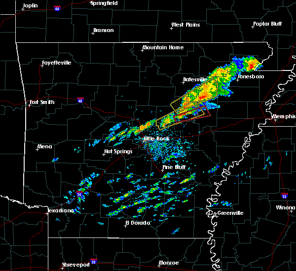 At 420 pm cst, a severe thunderstorm capable of producing a tornado was located 2 mile southwest of higginson, moving east at 50 mph (radar indicated rotation). Hazards include tornado. Flying debris will be dangerous to those caught without shelter. mobile homes will be damaged or destroyed. damage to roofs, windows, and vehicles will occur. Tree damage is likely. At 420 pm cst, a severe thunderstorm capable of producing a tornado was located 2 mile southwest of higginson, moving east at 50 mph (radar indicated rotation). Hazards include tornado. Flying debris will be dangerous to those caught without shelter. mobile homes will be damaged or destroyed. damage to roofs, windows, and vehicles will occur. Tree damage is likely.
|
| 12/17/2016 4:15 PM CST |
 At 415 pm cst, a severe thunderstorm was located over garner, moving northeast at 55 mph (radar indicated). Hazards include 60 mph wind gusts and penny size hail. Expect damage to roofs, siding, and trees. locations impacted include, cabot, searcy, augusta, beebe, ward, bald knob, austin in lonoke county, judsonia, kensett, higginson, russell, west point, pryor, hurricane lake wma, old austin, mcrae, bradford, garner, griffithville, antioch in white county, this includes us highway 67 between mile markers 17 and 66. A tornado watch remains in effect until 900 pm cst for eastern and central arkansas. At 415 pm cst, a severe thunderstorm was located over garner, moving northeast at 55 mph (radar indicated). Hazards include 60 mph wind gusts and penny size hail. Expect damage to roofs, siding, and trees. locations impacted include, cabot, searcy, augusta, beebe, ward, bald knob, austin in lonoke county, judsonia, kensett, higginson, russell, west point, pryor, hurricane lake wma, old austin, mcrae, bradford, garner, griffithville, antioch in white county, this includes us highway 67 between mile markers 17 and 66. A tornado watch remains in effect until 900 pm cst for eastern and central arkansas.
|
| 12/17/2016 4:10 PM CST |
 At 409 pm cst, a severe thunderstorm was located 8 miles south of oil trough, or 12 miles southwest of newport, moving northeast at 60 mph (radar indicated). Hazards include 60 mph wind gusts and penny size hail. Expect damage to roofs, siding, and trees. locations impacted include, searcy, newport, bald knob, judsonia, tuckerman, diaz, swifton, grubbs, pleasant plains, oil trough, russell, jacksonport, algoa, steprock, bradford, letona, campbell station, amagon, balch, albion, this includes us highway 67 between mile markers 49 and 54, and between mile markers 58 and 100. A tornado watch remains in effect until 900 pm cst for eastern and central arkansas. At 409 pm cst, a severe thunderstorm was located 8 miles south of oil trough, or 12 miles southwest of newport, moving northeast at 60 mph (radar indicated). Hazards include 60 mph wind gusts and penny size hail. Expect damage to roofs, siding, and trees. locations impacted include, searcy, newport, bald knob, judsonia, tuckerman, diaz, swifton, grubbs, pleasant plains, oil trough, russell, jacksonport, algoa, steprock, bradford, letona, campbell station, amagon, balch, albion, this includes us highway 67 between mile markers 49 and 54, and between mile markers 58 and 100. A tornado watch remains in effect until 900 pm cst for eastern and central arkansas.
|
| 12/17/2016 3:53 PM CST |
 At 352 pm cst, a severe thunderstorm was located near cabot, moving northeast at 55 mph (radar indicated). Hazards include 60 mph wind gusts and nickel size hail. expect damage to roofs, siding, and trees At 352 pm cst, a severe thunderstorm was located near cabot, moving northeast at 55 mph (radar indicated). Hazards include 60 mph wind gusts and nickel size hail. expect damage to roofs, siding, and trees
|
| 12/17/2016 3:50 PM CST |
 At 349 pm cst, a severe thunderstorm was located near steprock, or 8 miles north of searcy, moving northeast at 55 mph (radar indicated). Hazards include 60 mph wind gusts and nickel size hail. expect damage to roofs, siding, and trees At 349 pm cst, a severe thunderstorm was located near steprock, or 8 miles north of searcy, moving northeast at 55 mph (radar indicated). Hazards include 60 mph wind gusts and nickel size hail. expect damage to roofs, siding, and trees
|
| 10/12/2016 8:12 PM CDT |
 At 811 pm cdt, a severe thunderstorm was located near heber springs, moving southeast at 45 mph. this is a very dangerous storm (radar indicated). Hazards include baseball size hail and 70 mph wind gusts. People and animals outdoors will be severely injured. Expect shattered windows, extensive damage to roofs, siding, and vehicles. At 811 pm cdt, a severe thunderstorm was located near heber springs, moving southeast at 45 mph. this is a very dangerous storm (radar indicated). Hazards include baseball size hail and 70 mph wind gusts. People and animals outdoors will be severely injured. Expect shattered windows, extensive damage to roofs, siding, and vehicles.
|
| 10/12/2016 7:54 PM CDT |
 At 753 pm cdt, a severe thunderstorm was located over heber springs, and is nearly stationary. this is a very dangerous storm. very large hail and strong winds are expected (radar indicated). Hazards include baseball size hail and 60 mph wind gusts. People and animals outdoors will be severely injured. expect shattered windows, extensive damage to roofs, siding, and vehicles. Locations impacted include, searcy, heber springs, clinton, fairfield bay, greers ferry, quitman, pangburn, rose bud, shirley, higden, crosby, fairfield bay marina, steprock, fairbanks, gravel hill, sugar loaf recreation area, letona, albion, antioch in white county, velvet ridge,. At 753 pm cdt, a severe thunderstorm was located over heber springs, and is nearly stationary. this is a very dangerous storm. very large hail and strong winds are expected (radar indicated). Hazards include baseball size hail and 60 mph wind gusts. People and animals outdoors will be severely injured. expect shattered windows, extensive damage to roofs, siding, and vehicles. Locations impacted include, searcy, heber springs, clinton, fairfield bay, greers ferry, quitman, pangburn, rose bud, shirley, higden, crosby, fairfield bay marina, steprock, fairbanks, gravel hill, sugar loaf recreation area, letona, albion, antioch in white county, velvet ridge,.
|
| 10/12/2016 7:35 PM CDT |
 At 734 pm cdt, a severe thunderstorm was located over higden, or near fairfield bay, moving southeast at 60 mph (radar indicated). Hazards include golf ball size hail and 60 mph wind gusts. People and animals outdoors will be injured. expect hail damage to roofs, siding, windows, and vehicles. Expect wind damage to roofs, siding, and trees. At 734 pm cdt, a severe thunderstorm was located over higden, or near fairfield bay, moving southeast at 60 mph (radar indicated). Hazards include golf ball size hail and 60 mph wind gusts. People and animals outdoors will be injured. expect hail damage to roofs, siding, windows, and vehicles. Expect wind damage to roofs, siding, and trees.
|
| 7/28/2016 5:08 PM CDT |
 At 508 pm cdt, a severe thunderstorm was located over kensett, or over searcy, moving southwest at 5 mph (radar indicated). Hazards include 60 mph wind gusts. Expect damage to roofs. siding. and trees. Locations impacted include, searcy, bald knob, judsonia, kensett, higginson, west point, pryor, crosby, griffithville, armstrong springs, plainview in white county,. At 508 pm cdt, a severe thunderstorm was located over kensett, or over searcy, moving southwest at 5 mph (radar indicated). Hazards include 60 mph wind gusts. Expect damage to roofs. siding. and trees. Locations impacted include, searcy, bald knob, judsonia, kensett, higginson, west point, pryor, crosby, griffithville, armstrong springs, plainview in white county,.
|
| 7/28/2016 4:50 PM CDT |
 At 450 pm cdt, a severe thunderstorm was located over judsonia, or near searcy, moving southwest at 5 mph (radar indicated). Hazards include 60 mph wind gusts and quarter size hail. Hail damage to vehicles is expected. Expect wind damage to roofs, siding, and trees. At 450 pm cdt, a severe thunderstorm was located over judsonia, or near searcy, moving southwest at 5 mph (radar indicated). Hazards include 60 mph wind gusts and quarter size hail. Hail damage to vehicles is expected. Expect wind damage to roofs, siding, and trees.
|
| 6/15/2016 8:43 PM CDT |
 At 843 pm cdt, a severe thunderstorm was located over pangburn, or 12 miles north of searcy, moving southwest at 10 mph (radar indicated). Hazards include 60 mph wind gusts and quarter size hail. Hail damage to vehicles is expected. expect wind damage to roofs, siding, and trees. Locations impacted include, searcy, kensett, pangburn, crosby, steprock, letona, albion, clay, dewey, armstrong springs, sunnydale, pickens in white county, plainview in white county, providence,. At 843 pm cdt, a severe thunderstorm was located over pangburn, or 12 miles north of searcy, moving southwest at 10 mph (radar indicated). Hazards include 60 mph wind gusts and quarter size hail. Hail damage to vehicles is expected. expect wind damage to roofs, siding, and trees. Locations impacted include, searcy, kensett, pangburn, crosby, steprock, letona, albion, clay, dewey, armstrong springs, sunnydale, pickens in white county, plainview in white county, providence,.
|
| 6/15/2016 8:25 PM CDT |
 At 824 pm cdt, a severe thunderstorm was located near steprock, or 13 miles north of searcy, moving southwest at 10 mph (radar indicated). Hazards include 60 mph wind gusts and half dollar size hail. Hail damage to vehicles is expected. Expect wind damage to roofs, siding, and trees. At 824 pm cdt, a severe thunderstorm was located near steprock, or 13 miles north of searcy, moving southwest at 10 mph (radar indicated). Hazards include 60 mph wind gusts and half dollar size hail. Hail damage to vehicles is expected. Expect wind damage to roofs, siding, and trees.
|
| 5/12/2016 7:50 AM CDT |
 At 749 am cdt, a severe thunderstorm was located over higginson, or near searcy, moving northeast at 55 mph (radar indicated). Hazards include 70 mph wind gusts. Expect considerable tree damage. Damage is likely to mobile homes, roofs, and outbuildings. At 749 am cdt, a severe thunderstorm was located over higginson, or near searcy, moving northeast at 55 mph (radar indicated). Hazards include 70 mph wind gusts. Expect considerable tree damage. Damage is likely to mobile homes, roofs, and outbuildings.
|
| 5/12/2016 7:27 AM CDT |
 At 727 am cdt, a severe thunderstorm was located over beebe, or 8 miles northeast of cabot, moving northeast at 45 mph (radar indicated). Hazards include 60 mph wind gusts. Expect damage to roofs. siding. And trees. At 727 am cdt, a severe thunderstorm was located over beebe, or 8 miles northeast of cabot, moving northeast at 45 mph (radar indicated). Hazards include 60 mph wind gusts. Expect damage to roofs. siding. And trees.
|
| 5/9/2016 11:45 PM CDT |
 At 1144 pm cdt, severe thunderstorms were located along a line extending from near searcy to thurman to near keo, moving east at 45 mph (radar indicated). Hazards include 60 mph wind gusts. Expect damage to roofs. siding. and trees. Locations impacted include, searcy, lonoke, beebe, bald knob, carlisle, judsonia, kensett, higginson, west point, barrettsville, crosby, thurman, mcrae, prairie center, sisemore, mccreanor, garner, griffithville, albion, hayley, a tornado watch remains in effect until 200 am cdt for central arkansas. At 1144 pm cdt, severe thunderstorms were located along a line extending from near searcy to thurman to near keo, moving east at 45 mph (radar indicated). Hazards include 60 mph wind gusts. Expect damage to roofs. siding. and trees. Locations impacted include, searcy, lonoke, beebe, bald knob, carlisle, judsonia, kensett, higginson, west point, barrettsville, crosby, thurman, mcrae, prairie center, sisemore, mccreanor, garner, griffithville, albion, hayley, a tornado watch remains in effect until 200 am cdt for central arkansas.
|
| 5/9/2016 11:32 PM CDT |
 At 1131 pm cdt, severe thunderstorms were located along a line extending from near crosby to near sylvania to toltec mounds state park, moving east at 55 mph (radar indicated). Hazards include 60 mph wind gusts and penny size hail. Expect damage to roofs. siding. and trees. Locations impacted include, north little rock, jacksonville, cabot, searcy, lonoke, beebe, ward, bald knob, carlisle, austin in lonoke cou, judsonia, kensett, higginson, keo, west point, barrettsville, toltec mounds state , crosby, mcrae, sisemore, a tornado watch remains in effect until 200 am cdt for central arkansas. At 1131 pm cdt, severe thunderstorms were located along a line extending from near crosby to near sylvania to toltec mounds state park, moving east at 55 mph (radar indicated). Hazards include 60 mph wind gusts and penny size hail. Expect damage to roofs. siding. and trees. Locations impacted include, north little rock, jacksonville, cabot, searcy, lonoke, beebe, ward, bald knob, carlisle, austin in lonoke cou, judsonia, kensett, higginson, keo, west point, barrettsville, toltec mounds state , crosby, mcrae, sisemore, a tornado watch remains in effect until 200 am cdt for central arkansas.
|
| 5/9/2016 11:30 PM CDT |
 A severe thunderstorm warning remains in effect until midnight cdt for eastern pulaski. lonoke. east central faulkner. southwestern white and northwestern prairie counties. at 1128 pm cdt. severe thunderstorms were located along a line extending from floyd to cabot to near toltec mounds state park. Moving east at 45 mph. A severe thunderstorm warning remains in effect until midnight cdt for eastern pulaski. lonoke. east central faulkner. southwestern white and northwestern prairie counties. at 1128 pm cdt. severe thunderstorms were located along a line extending from floyd to cabot to near toltec mounds state park. Moving east at 45 mph.
|
| 5/9/2016 11:06 PM CDT |
 At 1104 pm cdt, severe thunderstorms were located along a line extending from enola to north little rock to shannon hills, moving east at 45 mph (radar indicated). Hazards include 60 mph wind gusts and nickel size hail. Expect damage to roofs. siding. And trees. At 1104 pm cdt, severe thunderstorms were located along a line extending from enola to north little rock to shannon hills, moving east at 45 mph (radar indicated). Hazards include 60 mph wind gusts and nickel size hail. Expect damage to roofs. siding. And trees.
|
| 3/31/2016 10:02 AM CDT |
 At 1002 am cdt, a severe thunderstorm was located over rose bud, or 13 miles south of heber springs, moving northeast at 55 mph (radar indicated). Hazards include quarter size hail. damage to vehicles is expected At 1002 am cdt, a severe thunderstorm was located over rose bud, or 13 miles south of heber springs, moving northeast at 55 mph (radar indicated). Hazards include quarter size hail. damage to vehicles is expected
|
| 3/31/2016 9:38 AM CDT | Quarter sized hail reported 0.7 miles NE of Searcy, AR, penny to quarter size hail in searcy. |
| 3/13/2016 8:24 PM CDT |
 At 823 pm cdt, a severe thunderstorm was located over old austin, or near cabot, moving northeast at 35 mph (trained weather spotters). Hazards include golf ball size hail and 60 mph wind gusts. People and animals outdoors will be injured. expect hail damage to roofs, siding, windows, and vehicles. Expect wind damage to roofs, siding, and trees. At 823 pm cdt, a severe thunderstorm was located over old austin, or near cabot, moving northeast at 35 mph (trained weather spotters). Hazards include golf ball size hail and 60 mph wind gusts. People and animals outdoors will be injured. expect hail damage to roofs, siding, windows, and vehicles. Expect wind damage to roofs, siding, and trees.
|
| 3/13/2016 8:16 PM CDT |
 At 816 pm cdt, a severe thunderstorm was located over bald knob, or 9 miles northeast of searcy, moving east at 35 mph (radar indicated). Hazards include 60 mph wind gusts and quarter size hail. Hail damage to vehicles is expected. Expect wind damage to roofs, siding, and trees. At 816 pm cdt, a severe thunderstorm was located over bald knob, or 9 miles northeast of searcy, moving east at 35 mph (radar indicated). Hazards include 60 mph wind gusts and quarter size hail. Hail damage to vehicles is expected. Expect wind damage to roofs, siding, and trees.
|
| 3/13/2016 8:05 PM CDT | Quarter sized hail reported 0.7 miles NE of Searcy, AR |
| 3/13/2016 8:05 PM CDT |
 At 805 pm cdt, a severe thunderstorm capable of producing a tornado was located over searcy, moving northeast at 35 mph (radar indicated rotation). Hazards include tornado and half dollar size hail. Flying debris will be dangerous to those caught without shelter. mobile homes will be damaged or destroyed. damage to roofs, windows, and vehicles will occur. tree damage is likely. Locations impacted include, searcy, bald knob, judsonia, kensett, plainview in white county and providence. At 805 pm cdt, a severe thunderstorm capable of producing a tornado was located over searcy, moving northeast at 35 mph (radar indicated rotation). Hazards include tornado and half dollar size hail. Flying debris will be dangerous to those caught without shelter. mobile homes will be damaged or destroyed. damage to roofs, windows, and vehicles will occur. tree damage is likely. Locations impacted include, searcy, bald knob, judsonia, kensett, plainview in white county and providence.
|
| 3/13/2016 7:52 PM CDT |
 At 752 pm cdt, a severe thunderstorm capable of producing a tornado was located near crosby, or near searcy, moving northeast at 35 mph (radar indicated rotation). Hazards include tornado and half dollar size hail. Flying debris will be dangerous to those caught without shelter. mobile homes will be damaged or destroyed. damage to roofs, windows, and vehicles will occur. Tree damage is likely. At 752 pm cdt, a severe thunderstorm capable of producing a tornado was located near crosby, or near searcy, moving northeast at 35 mph (radar indicated rotation). Hazards include tornado and half dollar size hail. Flying debris will be dangerous to those caught without shelter. mobile homes will be damaged or destroyed. damage to roofs, windows, and vehicles will occur. Tree damage is likely.
|
| 3/13/2016 7:39 PM CDT |
 At 738 pm cdt, a severe thunderstorm was located near gravel hill, or 14 miles north of cabot, moving northeast at 20 mph (radar indicated). Hazards include 60 mph wind gusts and half dollar size hail. Hail damage to vehicles is expected. Expect wind damage to roofs, siding, and trees. At 738 pm cdt, a severe thunderstorm was located near gravel hill, or 14 miles north of cabot, moving northeast at 20 mph (radar indicated). Hazards include 60 mph wind gusts and half dollar size hail. Hail damage to vehicles is expected. Expect wind damage to roofs, siding, and trees.
|
| 12/23/2015 11:39 AM CST | At 1139 am cst, severe thunderstorms were located along a line extending from searcy to near thurman to near scott, moving northeast at 60 mph (radar indicated). Hazards include 60 mph wind gusts and half dollar size hail. Hail damage to vehicles is expected. Expect wind damage to roofs, siding, and trees. |
| 11/17/2015 3:47 PM CST |
 At 347 pm cst, severe thunderstorms were located along a line extending from steprock to near west point to near barrettsville, moving northeast at 45 mph (radar indicated). Hazards include 60 mph wind gusts. Expect damage to roofs. Siding and trees. At 347 pm cst, severe thunderstorms were located along a line extending from steprock to near west point to near barrettsville, moving northeast at 45 mph (radar indicated). Hazards include 60 mph wind gusts. Expect damage to roofs. Siding and trees.
|
| 11/17/2015 3:09 PM CST |
 At 309 pm cst, severe thunderstorms were located along a line extending from ward to near sylvania to 6 miles southwest of thurman to near sisemore to mccreanor, moving northeast at 35 mph (radar indicated). Hazards include 60 mph wind gusts. Expect damage to roofs. Siding and trees. At 309 pm cst, severe thunderstorms were located along a line extending from ward to near sylvania to 6 miles southwest of thurman to near sisemore to mccreanor, moving northeast at 35 mph (radar indicated). Hazards include 60 mph wind gusts. Expect damage to roofs. Siding and trees.
|
| 8/5/2015 2:55 PM CDT | A large tree fell on a house and a roof was partially taken off of a apartment comple in white county AR, 0.7 miles NE of Searcy, AR |
| 8/5/2015 12:58 PM CDT |
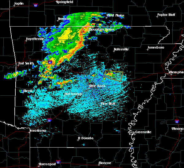 At 1257 pm cdt, a severe thunderstorm was located near higginson, moving east at 15 mph (radar indicated). Hazards include 60 mph wind gusts and quarter size hail. Hail damage to vehicles is expected. expect wind damage to roofs, siding and trees. Locations impacted include, des arc, beebe, higginson, pryor, mcrae, garner, griffithville, walker, vinity corner, sand hill, mcclelland, georgetown, jasmine and hayley. At 1257 pm cdt, a severe thunderstorm was located near higginson, moving east at 15 mph (radar indicated). Hazards include 60 mph wind gusts and quarter size hail. Hail damage to vehicles is expected. expect wind damage to roofs, siding and trees. Locations impacted include, des arc, beebe, higginson, pryor, mcrae, garner, griffithville, walker, vinity corner, sand hill, mcclelland, georgetown, jasmine and hayley.
|
| 8/5/2015 12:36 PM CDT |
 At 1236 pm cdt, a severe thunderstorm was located over mcrae, or 9 miles southwest of searcy, moving east at 25 mph (radar indicated). Hazards include 60 mph wind gusts and half dollar size hail. Hail damage to vehicles is expected. Expect wind damage to roofs, siding and trees. At 1236 pm cdt, a severe thunderstorm was located over mcrae, or 9 miles southwest of searcy, moving east at 25 mph (radar indicated). Hazards include 60 mph wind gusts and half dollar size hail. Hail damage to vehicles is expected. Expect wind damage to roofs, siding and trees.
|
| 6/26/2015 5:01 PM CDT | At 458 pm cdt, severe thunderstorms were located along a line extending from mt vernon to vilonia, and moving east at 30 mph (radar indicated). Hazards include 60 mph wind gusts and quarter size hail. Hail damage to vehicles is expected. Expect wind damage to roofs, siding and trees. |
| 5/25/2015 10:14 PM CDT | At 1013 pm cdt, severe thunderstorms were located along a line extending from 5 miles southwest of batesville to pleasant plains to west point, and moving northeast at 50 mph (radar indicated). Hazards include 60 mph wind gusts and penny size hail. Expect damage to roofs. Siding and trees. |
| 5/25/2015 9:55 PM CDT | At 952 pm cdt, severe thunderstorms were located along a line extending from 7 miles northeast of heber springs to steprock to higginson, and moving northeast at 45 mph (radar indicated). Hazards include 60 mph wind gusts and penny size hail. Expect damage to roofs. Siding and trees. |
| 5/25/2015 9:39 PM CDT | At 935 pm cdt, severe thunderstorms were located along a line extending from 5 miles south of greers ferry lake to gravel hill to mcrae, and moving northeast at 45 mph (radar indicated). Hazards include 60 mph wind gusts and penny size hail. Expect damage to roofs. Siding and trees. |
| 5/24/2015 5:19 PM CDT | At 517 pm cdt, severe thunderstorms were located along a line extending from greers ferry to heber springs to pangburn to mcrae, and moving northeast at 45 mph (radar indicated). Hazards include 70 mph wind gusts. Expect considerable tree damage. Damage is likely to mobile homes, roofs and outbuildings. |
| 5/24/2015 5:04 PM CDT | At 502 pm cdt, severe thunderstorms were located along a line extending from quitman to rose bud to 6 miles southeast of gravel hill to 6 miles southeast of sylvania, and moving northeast at 45 mph (radar indicated). Hazards include 70 mph wind gusts. Expect considerable tree damage. Damage is likely to mobile homes, roofs and outbuildings. |
| 5/24/2015 4:58 PM CDT | At 456 pm cdt, severe thunderstorms were located along a line extending from quitman to 7 miles south of gravel hill to old austin, and moving north at 55 mph (radar indicated). Hazards include 70 mph wind gusts. Expect considerable tree damage. Damage is likely to mobile homes, roofs and outbuildings. |
| 5/24/2015 4:45 PM CDT | At 443 pm cdt, severe thunderstorms were located along a line extending from enola to greystone to meto, and moving north at 60 mph (radar indicated). Hazards include 70 mph wind gusts. Expect considerable tree damage. Damage is likely to mobile homes, roofs and outbuildings. |
| 5/24/2015 4:28 PM CDT | At 424 pm cdt, severe thunderstorms were located along a line extending from morgan to sherwood to mcalmont to scott, and moving northeast at 45 mph (radar indicated). Hazards include 60 mph wind gusts. Expect damage to roofs. Siding and trees. |
| 4/19/2015 7:01 PM CDT | At 659 pm cdt, severe thunderstorms were located along a line extending from pleasant plains to 7 miles east of steprock to judsonia, and moving east at 50 mph (radar indicated). Hazards include 70 mph wind gusts and half dollar size hail. Hail damage to vehicles is expected. expect considerable tree damage. Wind damage is also likely to mobile homes, roofs and outbuildings. |
| 4/19/2015 6:42 PM CDT | The national weather service in little rock has issued a * severe thunderstorm warning for. east central cleburne county in north central arkansas. southern independence county in north central arkansas. jackson county in eastern arkansas. Northeastern white county in central arkansas. |
| 4/19/2015 6:33 PM CDT | A severe thunderstorm warning remains in effect for northwestern white. northeastern faulkner and southern cleburne counties until 700 pm cdt. at 630 pm cdt. severe thunderstorms were located along a line extending from heber springs to 2 miles east of hopewell to rose bud. And moving east at 45 mph. |
| 4/19/2015 6:17 PM CDT | At 551 pm cdt, severe thunderstorms were located along a line extending from choctaw to twin groves, and moving east at 40 mph (radar indicated). Hazards include golf ball size hail and 60 mph wind gusts. People and animals outdoors will be injured. expect hail damage to roofs, siding, windows and vehicles. Expect wind damage to roofs, siding and trees. |
| 4/19/2015 5:58 PM CDT | The national weather service in little rock has issued a * severe thunderstorm warning for. cleburne county in north central arkansas. northeastern faulkner county in central arkansas. southeastern van buren county in north central arkansas. Western white county in central arkansas. |
| 4/9/2015 6:44 PM CDT | A severe thunderstorm warning remains in effect for southern white county until 700 pm cdt. at 642 pm cdt. severe thunderstorms were located along a line extending from mcrae to gravel hill to enola. and moving northeast at 50 mph. hazard. 60 mph wind gusts and quarter size hail. |
| 4/9/2015 6:24 PM CDT | The national weather service in little rock has issued a * severe thunderstorm warning for. faulkner county in central arkansas. northwestern lonoke county in central arkansas. northeastern pulaski county in central arkansas. Southern white county in central arkansas. |
| 4/13/2014 11:20 PM CDT | Many trees were blown down...with several of the trees landing on house in white county AR, 1.1 miles ESE of Searcy, AR |
| 7/31/2013 6:18 PM CDT | Trees reported down on highway 16 in searc in white county AR, 0.7 miles NE of Searcy, AR |
| 9/1/2012 4:35 PM CDT | Trees down on highway 16 north of searc in white county AR, 3.1 miles S of Searcy, AR |
| 6/11/2012 3:08 PM CDT | Storm damage reported in white county AR, 1.1 miles N of Searcy, AR |
| 1/1/0001 12:00 AM | Quarter sized hail reported 7.9 miles S of Searcy, AR |
| 1/1/0001 12:00 AM | Several strees were down in searc in white county AR, 0.7 miles NE of Searcy, AR |
| 1/1/0001 12:00 AM | A large number of tree limbs 12 to 24 inches in diameter were downed across the harding university campu in white county AR, 0.7 miles NE of Searcy, AR |
Hail Maps for Searcy, AR
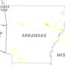
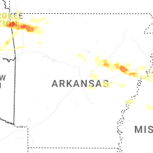
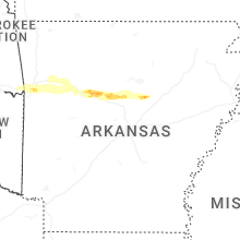
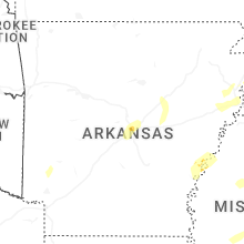
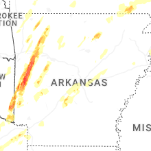


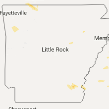


Connect with Interactive Hail Maps