

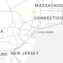
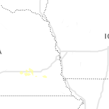
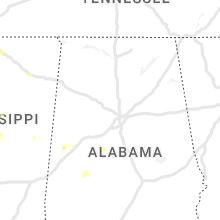
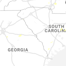
Hail Map for Wednesday, July 13, 2022

Number of Impacted Households on 7/13/2022
0
Impacted by 1" or Larger Hail
0
Impacted by 1.75" or Larger Hail
0
Impacted by 2.5" or Larger Hail
Square Miles of Populated Area Impacted on 7/13/2022
0
Impacted by 1" or Larger Hail
0
Impacted by 1.75" or Larger Hail
0
Impacted by 2.5" or Larger Hail


Cities Most Affected by Hail Storms of 7/13/2022
| Hail Size | Demographics of Zip Codes Affected | ||||||
|---|---|---|---|---|---|---|---|
| City | Count | Average | Largest | Pop Density | House Value | Income | Age |
| Bernice, LA | 1 | 1.75 | 1.75 | 21 | $57k | $26.1k | 38.6 |
Hail and Wind Damage Spotted on 7/13/2022
Filter by Report Type:Hail ReportsWind Reports
States Impacted
Louisiana, Mississippi, South Carolina, Georgia, Alabama, Ohio, Virginia, Montana, Idaho, Oklahoma, New York, Utah, Arkansas, Nevada, Florida, Texas, Kansas, Wyoming, ArizonaLouisiana
| Local Time | Report Details |
|---|---|
| 11:00 AM CDT | Sheriff department reports numerous trees and powerlines down across sabine parish... including the city of man in sabine county LA, 67.1 miles SSE of Shreveport, LA |
| 4:20 PM CDT | Quarter sized hail reported near Oak Grove, LA, 33 miles ENE of Bastrop, LA, quarter size hail fell along philley ln. |
| 4:56 PM CDT | Multiple trees down in pionee in west carroll county LA, 27.8 miles E of Bastrop, LA |
| 4:56 PM CDT | Quarter sized hail reported near Pioneer, LA, 27.8 miles E of Bastrop, LA, nickel to quarter size hail in pioneer. |
| 6:50 PM CDT | Ping Pong Ball sized hail reported near Bernice, LA, 33.5 miles W of Bastrop, LA, corrects previous hail report from 5 w farmerville. public reports hail of very large hail at lake d arbonne state park. |
| 6:50 PM CDT | Golf Ball sized hail reported near Bernice, LA, 33.5 miles W of Bastrop, LA, public reports hail up to golf ball size at lake d arbonne state park. |
| 7:10 PM CDT | Via social media... damage to a home on shackleford road in newellto in tensas county LA, 57.9 miles SE of Bastrop, LA |
| 7:10 PM CDT | Report of a fallen limb on a car in the town of newellto in tensas county LA, 63.1 miles SE of Bastrop, LA |
| 7:56 PM CDT | A picture was posted to social media of a tree that was blown down across ellerbe road south of norris ferry roa in caddo county LA, 9.5 miles SSE of Shreveport, LA |
| 9:25 PM CDT | Reports of large tree down on bucks grocery road... just south of the grand ecore communit in natchitoches county LA, 62.5 miles SE of Shreveport, LA |
| 11:00 PM CDT | Corrects previous tstm wnd dmg report from many. sheriff department reports numerous trees and powerlines down across sabine parish... including the city of man in sabine county LA, 67.1 miles SSE of Shreveport, LA |
Mississippi
| Local Time | Report Details |
|---|---|
| 12:43 PM CDT | A few trees were reported down just north of tomnolen. small hail was also observe in webster county MS, 34.1 miles W of Starkville, MS |
| 12:58 PM CDT | Trees downed on gore springs r in grenada county MS, 49.2 miles WNW of Starkville, MS |
| 1:29 PM CDT | Multiple trees downed in the holcomb are in grenada county MS, 69.7 miles WNW of Starkville, MS |
| 1:50 PM CDT | Via social media... trees down on 404 east between duck hill and alv in montgomery county MS, 48.1 miles WNW of Starkville, MS |
| 2:00 PM CDT | Tree down on the natchez trace parkwa in attala county MS, 39.5 miles WSW of Starkville, MS |
| 2:30 PM CDT | Trees down hw 35 in carroll county MS, 64 miles W of Starkville, MS |
| 2:35 PM CDT | Trees were blown down 4 mi in carroll county MS, 61.2 miles W of Starkville, MS |
| 2:39 PM CDT | Tree down on highway 1 in attala county MS, 44.5 miles WSW of Starkville, MS |
| 3:21 PM CDT | Power lines downed on mars hill r in leake county MS, 53.8 miles SW of Starkville, MS |
| 5:34 PM CDT | Via social media... tree down on a powerline in the backyard of a home in the belhaven heights communit in hinds county MS, 1 miles NE of Jackson, MS |
| 6:15 PM CDT | Via social media... report of several trees fell onto primitive baptist church and a large limb in the yard of the new home church. there are also trees down on high 54 in simpson county MS, 33 miles SE of Jackson, MS |
| 6:51 PM CDT | *** 1 inj *** via social media... tree down on a mobile home in eagle lake with a report of one injur in warren county MS, 48.9 miles WNW of Jackson, MS |
| 6:56 PM CDT | Claborine county sheriff office reported trees down on old port gibson r in claiborne county MS, 36.7 miles WSW of Jackson, MS |
| 6:56 PM CDT | Claborine county sheriff office reported trees down on highway 1 in claiborne county MS, 41.7 miles WSW of Jackson, MS |
| 9:15 PM CDT | Numerous locations in the county reporting trees and power lines dow in pike county MS, 78 miles S of Jackson, MS |
South Carolina
| Local Time | Report Details |
|---|---|
| 1:57 PM EDT | Black river electric cooperative reported trees on power lines along geddings road near pearson roa in sumter county SC, 45.1 miles NNW of Charleston, SC |
| 2:34 PM EDT | Black river electric cooperative reported outages to to trees on power lines along salem road near hwy. 37 in clarendon county SC, 47.2 miles N of Charleston, SC |
| 2:40 PM EDT | Tree downed along hwy 183... location approximat in oconee county SC, 22.2 miles W of Greenville, SC |
| 3:29 PM EDT | Local power company reports nearly 100 outages in lake city due to fallen trees on a power line. outage occurred at the intersection of hwy 341 and south wallace street in florence county SC, 48.4 miles NNE of Charleston, SC |
| 3:43 PM EDT | South carolina highway patrol reported a tree down at red dam road and hurricane alle in jasper county SC, 17.4 miles N of Savannah, GA |
| 3:57 PM EDT | Colleton county warning point reported several trees down between the 4000 and 5000 block of white hall roa in colleton county SC, 49 miles NNE of Savannah, GA |
Georgia
| Local Time | Report Details |
|---|---|
| 2:20 PM EDT | Tree down across power lines at perimeter rd and shoal creek rd in dawson county GA, 49.5 miles NNE of Atlanta, GA |
| 2:24 PM EDT | Large tree down on powerlines and across roadway on ga hwy 9 sout in dawson county GA, 48.8 miles NNE of Atlanta, GA |
Alabama
| Local Time | Report Details |
|---|---|
| 1:42 PM CDT | A few trees were blown dow in bibb county AL, 44.3 miles SSW of Birmingham, AL |
| 1:45 PM CDT | One carport destroyed and a few trees and power lines blown dow in bibb county AL, 45.9 miles SSW of Birmingham, AL |
| 1:55 PM CDT | A few trees were blown down near highway in bibb county AL, 52.7 miles SSW of Birmingham, AL |
Ohio
| Local Time | Report Details |
|---|---|
| 3:27 PM EDT | Several trees down in the city of huron. time estimated from rada in erie county OH, 45.8 miles W of Cleveland, OH |
| 3:52 PM EDT | Tree and multiple power lines down near sperry roa in erie county OH, 35.7 miles WSW of Cleveland, OH |
| 4:54 PM EDT | Tree fell onto a car and power lines reported down. time estimated via rada in medina county OH, 32.1 miles S of Cleveland, OH |
| 5:12 PM EDT | Multiple trees down in franklin township. time estimated via rada in portage county OH, 29.3 miles SE of Cleveland, OH |
| 5:37 PM EDT | Several large tree branches downed. one fell onto house. no damage to house noted in report. time estimated via rada in stark county OH, 50.1 miles S of Cleveland, OH |
Virginia
| Local Time | Report Details |
|---|---|
| 3:30 PM EDT | Trees downed at intersection of taylor ferry rd and lambert rd in boydton. time radar estimate in mecklenburg county VA, 63.3 miles NNE of Raleigh, NC |
| 4:10 PM EDT | Tree downed onto roadway along va-138 south hill rd just south of columbus l in lunenburg county VA, 47.3 miles SSW of Richmond, VA |
| 10:15 PM EDT | There was a report of trees and several large tree limbs blown down northwest of haymarke in prince william county VA, 61.9 miles WSW of Baltimore, MD |
Montana
| Local Time | Report Details |
|---|---|
| 2:00 PM MDT | Estimated 60 mph wind gus in beaverhead county MT, 56.5 miles E of Salmon, ID |
| 3:30 PM MDT | Report sent via social medi in stillwater county MT, 38.2 miles WSW of Billings, MT |
| 4:19 PM MDT | Storm damage reported in wheatland county MT, 86.4 miles NW of Billings, MT |
| 4:26 PM MDT | Storm damage reported in yellowstone county MT, 6.3 miles SE of Billings, MT |
| 5:00 PM MDT | Mesonet station yctim yellowstone club - avalanch in madison county MT, 37.1 miles SSW of Bozeman, MT |
| 7:22 PM MDT | Storm damage reported in garfield county MT, 88.5 miles SSW of Glasgow, MT |
| 7:37 PM MDT | Storm damage reported in garfield county MT, 88.5 miles SSW of Glasgow, MT |
| 8:10 PM MDT | Storm damage reported in garfield county MT, 61.8 miles SSW of Glasgow, MT |
| 8:12 PM MDT | Storm damage reported in garfield county MT, 62.6 miles SSW of Glasgow, MT |
| 8:30 PM MDT | Storm damage reported in garfield county MT, 53.8 miles SSW of Glasgow, MT |
| 8:35 PM MDT | Storm damage reported in garfield county MT, 42.5 miles S of Glasgow, MT |
| 9:03 PM MDT | Storm damage reported in valley county MT, 24.5 miles S of Glasgow, MT |
| 9:11 PM MDT | Storm damage reported in mccone county MT, 40.2 miles SSE of Glasgow, MT |
| 9:15 PM MDT | Storm damage reported in mccone county MT, 38.7 miles SE of Glasgow, MT |
| 9:15 PM MDT | Storm damage reported in mccone county MT, 39.4 miles SE of Glasgow, MT |
Idaho
| Local Time | Report Details |
|---|---|
| 2:44 PM MDT | Corrects previous non-tstm wnd gst report from 5 n owinza. mesonet station roci1 5 n owinz in lincoln county ID, 35.4 miles NE of Twin Falls, ID |
| 3:14 PM MDT | Report of roof damage at a business in tow in lemhi county ID, 0.6 miles SE of Salmon, ID |
| 3:15 PM MDT | Roof blown off a traile in lemhi county ID, 5.3 miles SE of Salmon, ID |
| 3:15 PM MDT | Reports of bleacher damage and damage to one of the modular units on the high school campu in lemhi county ID, 0.6 miles SE of Salmon, ID |
| 3:16 PM MDT | Multiple willow trees... 6 inches in diameter... downed by the wind. the strong wind lasted for a whil in lemhi county ID, 1 miles ESE of Salmon, ID |
| 3:31 PM MDT | Report of several trees and tree limbs down. two reports of trees across power lines... causing outage in lemhi county ID, 0.9 miles ENE of Salmon, ID |
| 3:36 PM MDT | Mesonet station smyi1 salmo in lemhi county ID, 3.2 miles SW of Salmon, ID |
| 3:51 PM MDT | Mesonet station krci1 kriley creek raw in lemhi county ID, 12.7 miles N of Salmon, ID |
| 4:45 PM MDT | Telegraph hill it in bingham county ID, 27.3 miles W of Idaho Falls, ID |
| 4:45 PM MDT | About 52 customers without power in the blackfoot area. it is a weather related outag in bingham county ID, 25.1 miles SW of Idaho Falls, ID |
| 4:56 PM MDT | Kettle butte it in bonneville county ID, 17.9 miles WNW of Idaho Falls, ID |
| 5:00 PM MDT | Rover ar in jefferson county ID, 29.1 miles WNW of Idaho Falls, ID |
| 5:25 PM MDT | Large tree limbs down around south boulevar in bonneville county ID, 1 miles SE of Idaho Falls, ID |
| 5:30 PM MDT | Mesonet station pc141 canyon cree in madison county ID, 38.1 miles NE of Idaho Falls, ID |
| 5:41 PM MDT | Tree fell on power line resulting in wildfir in jefferson county ID, 17.8 miles NE of Idaho Falls, ID |
| 6:00 PM MDT | Mesonet station dvi04057 riri in bonneville county ID, 18.8 miles ENE of Idaho Falls, ID |
| 6:55 PM MDT | Storm damage reported in bear lake county ID, 86.1 miles SSE of Idaho Falls, ID |
Oklahoma
| Local Time | Report Details |
|---|---|
| 4:27 PM CDT | Thunderstorm wind damage... including several trees downed... across the city of broken bo in mccurtain county OK, 51.6 miles W of Nashville, AR |
New York
| Local Time | Report Details |
|---|---|
| 5:44 PM EDT | Tree and wires down on foster rd. tree blocking entire roa in onondaga county NY, 12.6 miles WSW of Syracuse, NY |
| 5:49 PM EDT | A tree down on vehicle and a large tree uprooted in yard around roman ave and cranapple d in onondaga county NY, 10.3 miles WSW of Syracuse, NY |
| 5:50 PM EDT | Numerous trees down. some tree 14 to 16 inches in diameter snapped. nickel sized hai in onondaga county NY, 9.9 miles WSW of Syracuse, NY |
| 5:50 PM EDT | Trained spotter reported multiple trees down or split as well as dime sized hai in onondaga county NY, 10.9 miles WSW of Syracuse, NY |
| 5:51 PM EDT | Multiple trees and power lines down on falls r in onondaga county NY, 9.4 miles WSW of Syracuse, NY |
| 5:52 PM EDT | Multiple downed trees with quarter sized hai in onondaga county NY, 9.9 miles WSW of Syracuse, NY |
| 5:53 PM EDT | Quarter sized hail reported near Marcellus, NY, 9.5 miles WSW of Syracuse, NY, report from mping: quarter (1.00 in.). |
| 5:56 PM EDT | Power lines down on roadwa in onondaga county NY, 8.3 miles SW of Syracuse, NY |
| 6:12 PM EDT | Wires down on roadwa in onondaga county NY, 0.9 miles SW of Syracuse, NY |
| 7:20 PM EDT | State police came across a tree and wires down on roadwa in sullivan county NY, 58.3 miles NE of Scranton, PA |
| 7:20 PM EDT | Tree down on roadwa in sullivan county NY, 56 miles NE of Scranton, PA |
| 8:40 PM EDT | Tree and wires down atwood rd in ulster county NY, 65.3 miles S of Schenectady, NY |
| 8:42 PM EDT | Tree on wires route 209 in ulster county NY, 65.8 miles S of Schenectady, NY |
| 8:43 PM EDT | Route 209 closed at marbletown road due to a fallen tree and wires in ulster county NY, 62.7 miles S of Schenectady, NY |
| 8:48 PM EDT | Tree on house in ulster county NY, 61.2 miles S of Schenectady, NY |
| 8:50 PM EDT | Propane tank stuck by tree... tank leaking... lynette blvd in ulster county NY, 61.8 miles S of Schenectady, NY |
| 8:50 PM EDT | Tree on trailer (spring lake) in ulster county NY, 61.1 miles S of Schenectady, NY |
| 8:55 PM EDT | Tree and wires down broadway in ulster county NY, 63.7 miles S of Schenectady, NY |
Utah
| Local Time | Report Details |
|---|---|
| 4:15 PM MDT | Lakeside mountain mesonet station measured sustained wind of 48 mph with gust to 63 mp in box elder county UT, 56.4 miles WNW of Salt Lake City, UT |
| 4:25 PM MDT | Lakeside mountain mesonet station reported 15 minutess of greater than 58 mph wind gusts... peaking at sustained 69 mph wind gusting to 91 mph at 425p in box elder county UT, 56.4 miles WNW of Salt Lake City, UT |
| 4:40 PM MDT | Gunnison island mesonet station measured a peak sustained with of 66 mph gusting to 75 mph. at least 15 minutes of 58 mph or higher gust in box elder county UT, 63.8 miles NW of Salt Lake City, UT |
Arkansas
| Local Time | Report Details |
|---|---|
| 5:30 PM CDT | Quarter sized hail reported near Kirby, AR, 20.4 miles NNE of Nashville, AR |
| 6:25 PM CDT | Quarter sized hail reported near Lewisville, AR, 37.8 miles SSE of Nashville, AR, arkansas state police reported large limbs across state hwy 29... about 5 miles nnw of lewisville... along with quarter size hail. |
| 6:25 PM CDT | Quarter sized hail reported near Hope, AR, 34.4 miles SSE of Nashville, AR, quarter size hail reported on hwy 29 at the hempstead and lafayette county line. |
| 6:25 PM CDT | Two large trees down at residence on miller county road 481. one tree was uprooted and the other was snappe in miller county AR, 41.4 miles S of Nashville, AR |
| 6:35 PM CDT | Large tree down on miller county road 9... near the pisgah baptist church... south of fouk in miller county AR, 47.7 miles N of Shreveport, LA |
| 7:00 PM CDT | Quarter sized hail reported near Arkadelphia, AR, 44.1 miles ENE of Nashville, AR |
Nevada
| Local Time | Report Details |
|---|---|
| 3:39 PM PDT | Red butte raws (rbtn2). elevation 5026 f in lander county NV, 71.3 miles SSE of Winnemucca, NV |
Florida
| Local Time | Report Details |
|---|---|
| 7:20 PM EDT | Hardee county sheriff office reported downed power lines along state route 64 near zolfo springs. time estimated from rada in hardee county FL, 47.2 miles E of Bradenton, FL |
Texas
| Local Time | Report Details |
|---|---|
| 7:12 PM CDT | Deep east texas electric cooperative reported several powerline poles down near crystal lake... just west of the town of joaqui in shelby county TX, 42 miles SSW of Shreveport, LA |
| 7:12 PM CDT | Shelby county em reports lots of thunderstorm wind damage just west of joaqui in shelby county TX, 42.3 miles SSW of Shreveport, LA |
| 8:00 PM CDT | Numerous trees... powerlines... and power poles down across the city of jefferso in marion county TX, 39 miles WNW of Shreveport, LA |
| 8:01 PM CDT | A picture was posted to social media of a large tree that fell on a boathouse and boats along big cypress bayou at the turning basin riverboat tours facility in the sou in marion county TX, 38.2 miles WNW of Shreveport, LA |
Kansas
| Local Time | Report Details |
|---|---|
| 7:55 PM MDT | Corrects previous tstm wnd gst report from 2 s wallac in wallace county KS, 45.6 miles SW of Colby, KS |
| 7:59 PM MDT | Site kkswalla in wallace county KS, 45.3 miles SW of Colby, KS |
| 8:09 PM MDT | Storm damage reported in wallace county KS, 45.6 miles SW of Colby, KS |
| 9:10 PM MDT | Hail and wind due to thunderstorm possibly knocked out the power in tribune... ks... as reported by the dispatcher. hail size and wind magnitude are unknown. power turn in greeley county KS, 58.9 miles NW of Garden City, KS |
Wyoming
| Local Time | Report Details |
|---|---|
| 8:55 PM MDT | Awos station kpoy powell airpor in park county WY, 64.7 miles SSW of Billings, MT |
| 9:20 PM MDT | Asos station kgey greybull airpor in big horn county WY, 89.7 miles SSE of Billings, MT |
| 10:35 PM MDT | Evanston-uinta county airport burns field in uinta county WY, 57 miles NE of Salt Lake City, UT |
| 10:36 PM MDT | I-80 at coal road in uinta county WY, 72.9 miles ENE of Salt Lake City, UT |
Arizona
| Local Time | Report Details |
|---|---|
| 8:35 PM MST | Trained spotter... law enforcement... and social media report trees down near lindsay & baseline. time estimated based on rada in maricopa county AZ, 18.3 miles ESE of Phoenix, AZ |
| 8:35 PM MST | Photos show medium- to large-sized trees uprooted... street signs... and street light down in the area. time estimated based on rada in maricopa county AZ, 19.5 miles ESE of Phoenix, AZ |
Connect with Interactive Hail Maps