

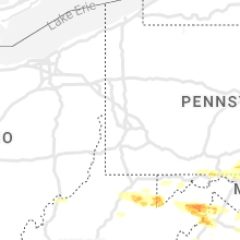
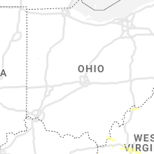
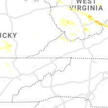
Hail Map for Tuesday, July 12, 2022

Number of Impacted Households on 7/12/2022
0
Impacted by 1" or Larger Hail
0
Impacted by 1.75" or Larger Hail
0
Impacted by 2.5" or Larger Hail
Square Miles of Populated Area Impacted on 7/12/2022
0
Impacted by 1" or Larger Hail
0
Impacted by 1.75" or Larger Hail
0
Impacted by 2.5" or Larger Hail


Cities Most Affected by Hail Storms of 7/12/2022
| Hail Size | Demographics of Zip Codes Affected | ||||||
|---|---|---|---|---|---|---|---|
| City | Count | Average | Largest | Pop Density | House Value | Income | Age |
| Chapel Hill, TN | 2 | 3.50 | 4.00 | 89 | $90k | $43.7k | 36.7 |
| Trinidad, CO | 2 | 1.75 | 1.75 | 20 | $86k | $28.3k | 42.5 |
| Panhandle, TX | 1 | 1.75 | 1.75 | 1 | $58k | $41.5k | 39.8 |
| Lewisburg, WV | 1 | 1.75 | 1.75 | 101 | $116k | $29.3k | 45.0 |
| Benton, AR | 1 | 1.75 | 1.75 | 149 | $0k | $0.0k | 38.9 |
| Nolensville, TN | 1 | 1.75 | 1.75 | 289 | $170k | $63.8k | 36.2 |
| Covington, VA | 1 | 1.75 | 1.75 | 45 | $65k | $35.4k | 44.4 |
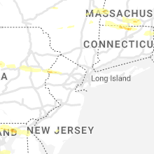
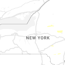
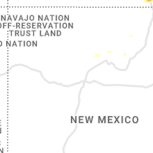
Hail and Wind Damage Spotted on 7/12/2022
Filter by Report Type:Hail ReportsWind Reports
States Impacted
New York, West Virginia, Vermont, Maryland, Pennsylvania, New Hampshire, Virginia, Kentucky, Colorado, Massachusetts, Wyoming, Minnesota, Maine, Connecticut, Delaware, Nevada, New Jersey, Arkansas, District of Columbia, Tennessee, Arizona, Texas, Wisconsin, Oregon, Rhode Island, NebraskaNew York
| Local Time | Report Details |
|---|---|
| 12:10 PM EDT | A tree was knocked down in camden. time and location estimated based on rada in oneida county NY, 28.8 miles NE of Syracuse, NY |
| 12:42 PM EDT | Trees dow in oneida county NY, 51.8 miles ENE of Syracuse, NY |
| 12:44 PM EDT | Multiple trees were knocked down around freeville. one partically fell onto a car. another larger tree fell a small section of a house... causing minor roof damage. rep in tompkins county NY, 38.7 miles SSW of Syracuse, NY |
| 12:45 PM EDT | Trees down in punkeyville state fores in oneida county NY, 54.3 miles ENE of Syracuse, NY |
| 12:50 PM EDT | A tree was knocked down across the driveway and into the yard of a residenc in tompkins county NY, 39.4 miles SSW of Syracuse, NY |
| 1:30 PM EDT | Downed trees. times estimated from rada in hamilton county NY, 51.2 miles NNW of Schenectady, NY |
| 2:00 PM EDT | Downed trees and wires near corinth. time estimated from rada in saratoga county NY, 30.7 miles N of Schenectady, NY |
| 2:05 PM EDT | Downed trees near town of arietta. time estimated from rada in hamilton county NY, 42.1 miles NW of Schenectady, NY |
| 2:05 PM EDT | Downed trees. time estimated from rada in warren county NY, 58.3 miles N of Schenectady, NY |
| 2:15 PM EDT | Trees down. time estimated from rada in warren county NY, 52.1 miles SSW of Burlington, VT |
| 2:16 PM EDT | Box elder tree down in backyard... damaging chain link fenc in otsego county NY, 63.2 miles WSW of Schenectady, NY |
| 2:20 PM EDT | Downed trees. time estimated from rada in hamilton county NY, 36.9 miles NNW of Schenectady, NY |
| 2:21 PM EDT | A tree was snapped and many other large branches were broken from surrounding tree in otsego county NY, 64.1 miles WSW of Schenectady, NY |
| 2:25 PM EDT | Downed trees near fort edward. time estimated from rada in washington county NY, 36.5 miles NNE of Schenectady, NY |
| 2:30 PM EDT | Multiple tree branches down per photos submitted on social media. time approximated from rada in washington county NY, 37.6 miles NE of Schenectady, NY |
| 2:35 PM EDT | Trees and wires down in waddington on james stree in st. lawrence county NY, 18.3 miles NE of Ogdensburg, NY |
| 2:35 PM EDT | Tree down on wires on county road 9 and parks hill r in delaware county NY, 49.6 miles WSW of Schenectady, NY |
| 2:42 PM EDT | A few trees were knocked down around afton including on algerine st... county hwy 39... and e afton r in chenango county NY, 57 miles N of Scranton, PA |
| 2:47 PM EDT | Trees down and power outages in st. lawrence county NY, 27.4 miles ENE of Ogdensburg, NY |
| 3:02 PM EDT | Tree down on state highway 8 near hardwood hills golf cours in delaware county NY, 55.2 miles NNE of Scranton, PA |
| 3:10 PM EDT | *** 1 inj *** a tree snapped and fell onto a home in which a resident was pinned by roof debris inside the partially collapsed area of the residenc in washington county NY, 30.7 miles NE of Schenectady, NY |
| 3:15 PM EDT | Tree limbs down near mc neil rd and lick springs rd near argyle... n in washington county NY, 34 miles NE of Schenectady, NY |
| 3:15 PM EDT | Downed treed north of greenwich. time estimated from rada in washington county NY, 33.8 miles NE of Schenectady, NY |
| 3:18 PM EDT | Downed trees near cossayuna lake in washington county NY, 38.1 miles NE of Schenectady, NY |
| 3:24 PM EDT | Tree down on road near county rd 2 and w terry clove r in delaware county NY, 65.1 miles NNE of Scranton, PA |
| 3:38 PM EDT | Tree down near the intersection of new kingston mountain rd and harold roberts r in delaware county NY, 53.1 miles SW of Schenectady, NY |
| 4:18 PM EDT | Tree and wires down blocking tsatawassa lake rd near central nassau rd in rensselaer county NY, 27.2 miles SE of Schenectady, NY |
| 4:19 PM EDT | Multiple trees down around the village of valatie one of which occurring on county route 28a or upper main stree in columbia county NY, 30.8 miles SSE of Schenectady, NY |
| 4:19 PM EDT | Power lines down on route 28 near maple avenue in the town of kinderhoo in columbia county NY, 29.4 miles SSE of Schenectady, NY |
| 4:25 PM EDT | Multiple trees down throughout greene county. time estimated from rada in greene county NY, 34.8 miles S of Schenectady, NY |
| 4:25 PM EDT | Utlity poles downed along hicks roa in columbia county NY, 32 miles SSE of Schenectady, NY |
| 4:29 PM EDT | Trees down on rock city road as well as county route 13 near spath street in the town of chatha in columbia county NY, 33.3 miles SSE of Schenectady, NY |
| 4:29 PM EDT | Tree down on albany turnpike road near white bridge roa in columbia county NY, 31.4 miles SE of Schenectady, NY |
| 4:30 PM EDT | Tree down on elm street near chatha in columbia county NY, 36.3 miles SSE of Schenectady, NY |
| 4:30 PM EDT | Multiple trees down in the town of chatham including the intersection of route 9 and daley road and loomis roa in columbia county NY, 36.5 miles SE of Schenectady, NY |
| 4:35 PM EDT | Multiple trees down. time estimated from rada in columbia county NY, 30.8 miles SSE of Schenectady, NY |
| 4:37 PM EDT | Tree down on route 20 near stottvill in columbia county NY, 37.3 miles SSE of Schenectady, NY |
| 4:37 PM EDT | Tree down on power lines along white birch road in the town of livingsto in columbia county NY, 43.9 miles S of Schenectady, NY |
| 4:38 PM EDT | Trees and wires were downed on church avenue near lasher avenue in the town of germantow in columbia county NY, 49.3 miles S of Schenectady, NY |
| 4:40 PM EDT | Taconic state parkway sb closed just north of exit 102. time estimated from rada in columbia county NY, 35 miles SSE of Schenectady, NY |
| 4:43 PM EDT | A tree was downed on power lines near the intersection of route 8 and route 9 in the town of clermon in columbia county NY, 48.9 miles S of Schenectady, NY |
| 4:46 PM EDT | Trees down on route 295 near county route 5 in the town of canaa in columbia county NY, 37.4 miles SE of Schenectady, NY |
| 4:48 PM EDT | Multiple trees down in the town of austerlitz including on route 203 near dugway road and beale roa in columbia county NY, 39.7 miles SSE of Schenectady, NY |
| 5:39 PM EDT | Tree down on roadwa in delaware county NY, 50.6 miles NE of Scranton, PA |
| 6:17 PM EDT | A tree down and blocking the roadway near the interesction of claryville and hunter road in sullivan county NY, 64.6 miles ENE of Scranton, PA |
| 6:19 PM EDT | Tree and wires down on roadwa in sullivan county NY, 62.3 miles ENE of Scranton, PA |
| 6:26 PM EDT | A tree was down on the roadway near the intersection of carpenter and mutton hill road in sullivan county NY, 61.3 miles ENE of Scranton, PA |
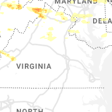
West Virginia
| Local Time | Report Details |
|---|---|
| 2:04 PM EDT | Tree down on laurel run roa in harrison county WV, 41 miles NW of Elkins, WV |
| 2:04 PM EDT | Tree down on laurel run roa in harrison county WV, 41 miles NW of Elkins, WV |
| 2:05 PM EDT | Tree down on beverly pik in taylor county WV, 32.7 miles NNW of Elkins, WV |
| 2:18 PM EDT | Tree down knottsville roa in taylor county WV, 30 miles NNW of Elkins, WV |
| 2:20 PM EDT | Report of trees down throughout the county... including bottom of and crossing route 7 near the cheat rive in preston county WV, 38.4 miles NNE of Elkins, WV |
| 2:30 PM EDT | Report of trees down throughout the county... including several in the area of the route 26 and 5 in preston county WV, 28 miles N of Elkins, WV |
| 2:32 PM EDT | Tree down on w veterans memorial highway in rosemon in taylor county WV, 29.3 miles NW of Elkins, WV |
| 2:37 PM EDT | Tree down on iron town road in thornto in taylor county WV, 29.8 miles N of Elkins, WV |
| 2:37 PM EDT | Tree down on w veterans memorial highway in rosemont. time is radar estimat in taylor county WV, 29.3 miles NW of Elkins, WV |
| 2:46 PM EDT | Tree down on webster pike. time is radar estimat in taylor county WV, 30.2 miles NNW of Elkins, WV |
| 2:50 PM EDT | Trees down in the area of dogwood flats... including one down on a power lin in tucker county WV, 24.4 miles NNE of Elkins, WV |
| 3:02 PM EDT | Multiple trees down in the area just west of mt. stor in grant county WV, 37.4 miles NE of Elkins, WV |
| 3:05 PM EDT | Tree down at hannan trace rd and glenwood r in mason county WV, 33.3 miles WNW of Charleston, WV |
| 3:09 PM EDT | Tree and wires down in fort ashb in mineral county WV, 70 miles NE of Elkins, WV |
| 3:20 PM EDT | A tree blew down near the 4100 block of laurel dale r in grant county WV, 46.9 miles ENE of Elkins, WV |
| 3:22 PM EDT | Multiple trees down along greenland gap roa in grant county WV, 42.3 miles ENE of Elkins, WV |
| 3:24 PM EDT | A tree blew down near knobley rd and buck ridge l in mineral county WV, 50.4 miles ENE of Elkins, WV |
| 3:26 PM EDT | Tree reported down knobley road near buck ridge lan in mineral county WV, 50.4 miles ENE of Elkins, WV |
| 3:28 PM EDT | Tree reported down on greenland gap road near upper patterson creek roa in grant county WV, 44.7 miles ENE of Elkins, WV |
| 3:34 PM EDT | Power line down. possibly struck by lightnin in putnam county WV, 17.5 miles WNW of Charleston, WV |
| 3:34 PM EDT | Tree dow in putnam county WV, 18.2 miles WNW of Charleston, WV |
| 3:34 PM EDT | Local law enforcement reported a tree down on crooked creek rd. time is estimated by rada in putnam county WV, 16.9 miles WNW of Charleston, WV |
| 3:36 PM EDT | Tree down. time is radar estimat in kanawha county WV, 9.3 miles W of Charleston, WV |
| 3:40 PM EDT | Tree dow in kanawha county WV, 12.7 miles WNW of Charleston, WV |
| 3:41 PM EDT | Tree reported down on the 4700 block of jordan run roa in grant county WV, 32.8 miles ENE of Elkins, WV |
| 3:43 PM EDT | A tree blew down near the 12500 block of grassy lick r in hampshire county WV, 63 miles ENE of Elkins, WV |
| 3:46 PM EDT | Tree down along ford hill roa in hampshire county WV, 66.8 miles ENE of Elkins, WV |
| 3:47 PM EDT | A tree blew down near the 730 block of tanager trai in hampshire county WV, 67.5 miles ENE of Elkins, WV |
| 3:47 PM EDT | Numerous trees down in ri in hardy county WV, 64.8 miles ENE of Elkins, WV |
| 3:49 PM EDT | Numerous trees down around augusta near route 50 and ford hill roa in hampshire county WV, 69.7 miles ENE of Elkins, WV |
| 3:49 PM EDT | Downed trees damaging a tin she in hardy county WV, 64.2 miles ENE of Elkins, WV |
| 3:50 PM EDT | A few trees down around the city of petersbur in grant county WV, 38.8 miles E of Elkins, WV |
| 3:52 PM EDT | Tree reported down on upper patterson creek road near seymoursville roa in grant county WV, 40.5 miles ENE of Elkins, WV |
| 3:52 PM EDT | Numerous trees down around delray. trees on roadways shut down multiple roads in the are in hampshire county WV, 69.4 miles ENE of Elkins, WV |
| 3:55 PM EDT | Numerous trees down around capon springs. trees on roadways shut down multiple roads in the are in hampshire county WV, 74.3 miles ENE of Elkins, WV |
| 3:57 PM EDT | Numerous trees down in wardensvill in hardy county WV, 68.4 miles E of Elkins, WV |
| 3:58 PM EDT | Multiple trees and large branches snappe in hardy county WV, 68.4 miles E of Elkins, WV |
| 3:59 PM EDT | A tree blew down near the 8800 block of back creek r in hampshire county WV, 74.4 miles ENE of Elkins, WV |
| 4:00 PM EDT | Quarter sized hail reported near Wardensville, WV, 69.1 miles E of Elkins, WV |
| 4:02 PM EDT | Tree dow in kanawha county WV, 9.9 miles W of Charleston, WV |
| 4:05 PM EDT | Tree down at hannan trace rd and glenwood r in mason county WV, 33.3 miles WNW of Charleston, WV |
| 4:12 PM EDT | 2 trees down on hickory roa in kanawha county WV, 0.9 miles SW of Charleston, WV |
| 4:12 PM EDT | 2 trees down in the are in kanawha county WV, 7.9 miles WNW of Charleston, WV |
| 4:24 PM EDT | Tree dow in kanawha county WV, 2.7 miles N of Charleston, WV |
| 4:45 PM EDT | Numerous trees down including some on structure in fayette county WV, 22.3 miles ESE of Charleston, WV |
| 4:48 PM EDT | Tree down on cane fork r in kanawha county WV, 3.8 miles SSE of Charleston, WV |
| 4:52 PM EDT | 2 trees down on maccorkle avenue in marmet. time is radar estimate in kanawha county WV, 5.1 miles SE of Charleston, WV |
| 5:03 PM EDT | 2 trees down on maccorkle avenue in marme in kanawha county WV, 5.1 miles SE of Charleston, WV |
| 5:05 PM EDT | Tree down at hannan trace rd and glenwood r in mason county WV, 33.3 miles WNW of Charleston, WV |
| 5:10 PM EDT | Tree down at cabin creek rd and creek ln. time is estimated by rada in kanawha county WV, 14.9 miles SE of Charleston, WV |
| 5:10 PM EDT | Tree down at cabin creek rd and wealthy acres rd. time is estimated by rada in kanawha county WV, 14.6 miles SE of Charleston, WV |
| 5:21 PM EDT | Tree down at cabin creek rd and creek l in kanawha county WV, 14.9 miles SE of Charleston, WV |
| 5:21 PM EDT | Tree down at cabin creek rd and wealthy acres r in kanawha county WV, 14.6 miles SE of Charleston, WV |
| 5:28 PM EDT | Multiple trees down in montgomer in fayette county WV, 20.5 miles SE of Charleston, WV |
| 5:39 PM EDT | Tree and power lines down on perry branch rd in chapmanvill in logan county WV, 32 miles SW of Charleston, WV |
| 5:39 PM EDT | Quarter sized hail reported near Lake, WV, 32.3 miles SSW of Charleston, WV |
| 5:47 PM EDT | Multiple trees down in oak hil in fayette county WV, 37.4 miles SE of Charleston, WV |
| 5:51 PM EDT | 2 trees down on rt. 85 in koppersto in wyoming county WV, 40.9 miles S of Charleston, WV |
| 5:55 PM EDT | Multiple trees down in fayettevill in fayette county WV, 35.9 miles SE of Charleston, WV |
| 5:55 PM EDT | Tree down on poplar gap rd. time estimated by rada in wyoming county WV, 46.3 miles S of Charleston, WV |
| 6:08 PM EDT | Quarter sized hail reported near Beckley, WV, 44.3 miles SSE of Charleston, WV |
| 6:15 PM EDT | Quarter sized hail reported near Asbury, WV, 54.2 miles NW of Roanoke, VA, damage to roof and vehicles. |
| 6:18 PM EDT | Multiple trees down near alt in greenbrier county WV, 53 miles NW of Roanoke, VA |
| 6:21 PM EDT | Tree down 4000 block of odd r in raleigh county WV, 55.3 miles SSE of Charleston, WV |
| 6:21 PM EDT | Tree down 800 block of shawnee c in raleigh county WV, 55.1 miles SSE of Charleston, WV |
| 6:21 PM EDT | Multiple trees down on coal city r in raleigh county WV, 54.2 miles SSE of Charleston, WV |
| 6:23 PM EDT | Tree down at whitby rd and coal city r in raleigh county WV, 51.8 miles SSE of Charleston, WV |
| 6:27 PM EDT | Tree down on flat top r in raleigh county WV, 57.7 miles SSE of Charleston, WV |
| 6:28 PM EDT | High voltage power lines were blown down which shutdown i-64 for over an hour. time estimated by rada in greenbrier county WV, 50 miles NW of Roanoke, VA |
| 6:30 PM EDT | Quarter sized hail reported near Lewisburg, WV, 46.3 miles NNW of Roanoke, VA |
| 6:32 PM EDT | Golf Ball sized hail reported near Lewisburg, WV, 46.4 miles NW of Roanoke, VA |
| 6:32 PM EDT | Trees and powerlines down on midland trail east of lewisbur in greenbrier county WV, 47.7 miles NW of Roanoke, VA |
| 6:33 PM EDT | Thunderstorm winds blew many twigs down and also three to four limbs of wrist size diameter. time estimated from rada in greenbrier county WV, 41.9 miles NW of Roanoke, VA |
| 6:34 PM EDT | Trees and powerlines down on a truck along route 219 near the greenbrier county line. no injurie in greenbrier county WV, 40.2 miles NW of Roanoke, VA |
| 6:42 PM EDT | Half Dollar sized hail reported near Cool Ridge, WV, 61.2 miles SSE of Charleston, WV |
| 6:49 PM EDT | Two trees down on i-64 east. location approximate. time based on rada in greenbrier county WV, 41.4 miles NNW of Roanoke, VA |
| 6:52 PM EDT | Quarter sized hail reported near White Sulphur Springs, WV, 38.4 miles NNW of Roanoke, VA, pea to quarter sized hail. time based on radar. |
| 7:06 PM EDT | One tree down on dry fork run. time estimated by rada in summers county WV, 56 miles WNW of Roanoke, VA |
| 7:09 PM EDT | One tree down on indian mills rd. time estimated by rada in summers county WV, 51.6 miles WNW of Roanoke, VA |
| 7:49 PM EDT | Numerous trees down around augusta near route 50 and ford hill roa in hampshire county WV, 69.7 miles ENE of Elkins, WV |
Vermont
| Local Time | Report Details |
|---|---|
| 2:29 PM EDT | Trees down on wires in rutland county VT, 52.5 miles S of Burlington, VT |
| 2:40 PM EDT | Trees down on wires240 in rutland county VT, 52.2 miles S of Burlington, VT |
| 2:54 PM EDT | Trees and powerlines down in danb in rutland county VT, 60.4 miles NE of Schenectady, NY |
| 2:58 PM EDT | 4 trees down on pittsford road in rutland county VT, 58.9 miles SSE of Burlington, VT |
| 3:01 PM EDT | Trees on wires in rutland county VT, 58.7 miles SSE of Burlington, VT |
| 3:08 PM EDT | 4 trees and large limbs dow in rutland county VT, 62.9 miles S of Burlington, VT |
| 3:15 PM EDT | Trees down in rutland county VT, 59.9 miles SSE of Burlington, VT |
| 3:32 PM EDT | Several big trees down on powerlines. one by howe hill in pomfret and the other about a mile southeast of ther in windsor county VT, 63.7 miles SSE of Burlington, VT |
| 3:33 PM EDT | Numerous trees down in windsor county VT, 67.8 miles SSE of Burlington, VT |
| 3:36 PM EDT | Numerous trees dow in windsor county VT, 67.8 miles SSE of Burlington, VT |
| 3:40 PM EDT | Extensive utility damage in chester. multiple power lines down... power poles snapped... trees on power lines and trees blocking roadway in windsor county VT, 75.1 miles ENE of Schenectady, NY |
| 3:44 PM EDT | At least a dozen trees were knocked over by thunderstorm winds. several power poles were snapped in hal in windsor county VT, 72.3 miles SE of Burlington, VT |
| 3:44 PM EDT | At least a dozen trees were knocked over by thunderstorm winds. several power poles were snapped in hal in windsor county VT, 72.3 miles SE of Burlington, VT |
| 3:45 PM EDT | Trees down in dana l. thompson par in bennington county VT, 51.8 miles ENE of Schenectady, NY |
| 3:45 PM EDT | Multiple trees down and pea sized hail near manchester. time estimated from rada in bennington county VT, 50.2 miles ENE of Schenectady, NY |
| 3:52 PM EDT | Trees and powerlines down across springfield. multiple power outages being reported by utlity companie in windsor county VT, 81 miles ENE of Schenectady, NY |
| 4:30 PM EDT | All lanes of i-91 sb closed north of exit 5 near mm29. time estimated from rada in windham county VT, 78.2 miles ENE of Schenectady, NY |
Maryland
| Local Time | Report Details |
|---|---|
| 2:40 PM EDT | Tree down on a line on twin churches r in garrett county MD, 63 miles NE of Elkins, WV |
| 2:57 PM EDT | Tree and wires down in the 3400 block of western pik in washington county MD, 78.4 miles SSW of State College, PA |
| 2:57 PM EDT | Tree down on a power line at the intersection of kempton rd. and gregory l in garrett county MD, 30.4 miles NE of Elkins, WV |
| 3:02 PM EDT | Half Dollar sized hail reported near Little Orleans, MD, 79 miles SSW of State College, PA |
| 3:22 PM EDT | Large tree dow in washington county MD, 75.8 miles WNW of Baltimore, MD |
| 3:23 PM EDT | Tree and wires down in the 11000 block of orebank roa in washington county MD, 76.1 miles WNW of Baltimore, MD |
| 3:26 PM EDT | Trees down near st. paul road and fairview roa in washington county MD, 73.8 miles WNW of Baltimore, MD |
| 3:28 PM EDT | Tree and wires down in the 14000 block of national pik in washington county MD, 72 miles WNW of Baltimore, MD |
| 3:47 PM EDT | Tree down along us-40 at mt lena roa in washington county MD, 57.7 miles WNW of Baltimore, MD |
| 3:55 PM EDT | Tree down near us-40 and boonsboro mountain roa in washington county MD, 56.2 miles WNW of Baltimore, MD |
| 3:55 PM EDT | Tree and wires down near jimtown road and long roa in frederick county MD, 47.2 miles WNW of Baltimore, MD |
| 3:59 PM EDT | Half Dollar sized hail reported near Emmitsburg, MD, 47.8 miles NW of Baltimore, MD |
| 4:00 PM EDT | Storm damage reported in frederick county MD, 42 miles WNW of Baltimore, MD |
| 4:07 PM EDT | Tree down near taneytown pike and bridgeport roa in frederick county MD, 43.1 miles NW of Baltimore, MD |
| 4:09 PM EDT | Tree down between bullfrog road and baptist roa in carroll county MD, 41.4 miles NW of Baltimore, MD |
| 4:17 PM EDT | Multiple trees... limbs... and telephone poles snappe in carroll county MD, 31.6 miles NNW of Baltimore, MD |
| 4:19 PM EDT | Approximately 10 to 12 trees down and snappe in carroll county MD, 30.2 miles NW of Baltimore, MD |
| 4:19 PM EDT | Large trees and branches snapped in westminste in carroll county MD, 29.6 miles NW of Baltimore, MD |
| 4:19 PM EDT | Large tree branches down along cobbs choice lan in carroll county MD, 29.6 miles NW of Baltimore, MD |
| 4:20 PM EDT | Trees snapped at the intersection of sullivan rd. and route 2 in carroll county MD, 29 miles NW of Baltimore, MD |
| 4:21 PM EDT | Numerous trees down in hampstead are in carroll county MD, 26.4 miles NNW of Baltimore, MD |
| 4:24 PM EDT | Tree reported down on sullivan road near md 2 in carroll county MD, 29 miles NW of Baltimore, MD |
| 4:25 PM EDT | Numerous large trees and branches down in the 1200 block of allview driv in carroll county MD, 26.4 miles NNW of Baltimore, MD |
| 4:25 PM EDT | Roofing partially removed from a bank in upperco in baltimore county MD, 21.2 miles NW of Baltimore, MD |
| 4:36 PM EDT | Tree down along i-83 south past middletown roa in baltimore county MD, 23.6 miles N of Baltimore, MD |
| 4:42 PM EDT | Tree down along md-147 and reckord roa in harford county MD, 17.4 miles NE of Baltimore, MD |
| 4:42 PM EDT | Tree down along md-543 south and foxborough driv in harford county MD, 23.9 miles NE of Baltimore, MD |
| 4:42 PM EDT | Tree down near i-83 south and bunker hill roa in baltimore county MD, 21.5 miles N of Baltimore, MD |
| 4:44 PM EDT | Numerous trees and powerlines down along paper mill roa in baltimore county MD, 15.1 miles N of Baltimore, MD |
| 4:44 PM EDT | Large tree and branches snappe in baltimore county MD, 16.7 miles N of Baltimore, MD |
| 4:44 PM EDT | Approximately 10 trees down along phoenix roa in baltimore county MD, 15.8 miles N of Baltimore, MD |
| 4:44 PM EDT | Numerous trees snapped and uprooted in the monkton... sparks... and hereford areas in baltimore county MD, 19.3 miles N of Baltimore, MD |
| 4:46 PM EDT | Tree down along blenheim road nort in baltimore county MD, 14.1 miles NNE of Baltimore, MD |
| 4:50 PM EDT | Several large trees down in the 11000 block of harford roa in baltimore county MD, 11.6 miles NNE of Baltimore, MD |
| 4:52 PM EDT | Quarter sized hail reported near Forest Hill, MD, 20.9 miles NNE of Baltimore, MD |
| 4:52 PM EDT | Tree down along md-152 at carrs mill roa in harford county MD, 19.1 miles NE of Baltimore, MD |
| 4:56 PM EDT | Trees down and quarter sized hai in harford county MD, 21.2 miles NNE of Baltimore, MD |
| 4:56 PM EDT | Quarter sized hail reported near Forest Hill, MD, 21.2 miles NNE of Baltimore, MD, trees down and quarter sized hail. |
| 4:59 PM EDT | Tree snapped at residence in harford county MD, 20.7 miles NE of Baltimore, MD |
| 5:01 PM EDT | Tree into windshield of a vehicl in harford county MD, 20.7 miles NE of Baltimore, MD |
| 5:03 PM EDT | Tree down in the roadway on md-140 just east of the intersection with dede r in carroll county MD, 20 miles NW of Baltimore, MD |
| 5:05 PM EDT | Several large trees and branches down in the 4700 block of sykesville roa in carroll county MD, 20 miles WNW of Baltimore, MD |
| 5:07 PM EDT | Large tree fell... crushing an outbuilding and impacting a home in harford county MD, 28 miles ENE of Baltimore, MD |
| 5:07 PM EDT | Tree down along md-136 south prior to us- in harford county MD, 30.2 miles NE of Baltimore, MD |
| 5:12 PM EDT | Mddot sensor at hatem bridge in harford county MD, 33.4 miles NE of Baltimore, MD |
| 5:14 PM EDT | Mddot sensor at tydings bridge in cecil county MD, 33.8 miles NE of Baltimore, MD |
| 5:15 PM EDT | Phillips airfield in harford county MD, 26.6 miles ENE of Baltimore, MD |
| 5:15 PM EDT | Tree down along md-222 and clayton stree in cecil county MD, 35.1 miles NE of Baltimore, MD |
| 5:19 PM EDT | Tree down along us-40 prior to red toad roa in cecil county MD, 40.8 miles ENE of Baltimore, MD |
| 5:20 PM EDT | Spesutie island in harford county MD, 31.2 miles ENE of Baltimore, MD |
| 5:21 PM EDT | Large tree limbs dow in cecil county MD, 43.1 miles ENE of Baltimore, MD |
| 5:21 PM EDT | Tree down along us-40 west at sycamore driv in cecil county MD, 42 miles ENE of Baltimore, MD |
| 5:23 PM EDT | Tree down along hunting quarter road... east of hughes roa in montgomery county MD, 44.9 miles WSW of Baltimore, MD |
| 5:25 PM EDT | Deos sensor at north east landfill in cecil county MD, 43.1 miles ENE of Baltimore, MD |
| 5:47 PM EDT | Downed tree blocking eastbound river road at springfield driv in montgomery county MD, 34.8 miles SW of Baltimore, MD |
| 6:00 PM EDT | Dozens of trees snapped... uprooted... and sheared in college park. a structure also sustained damag in prince georges county MD, 26.4 miles SW of Baltimore, MD |
| 6:02 PM EDT | Numerous trees down and branches snappe in montgomery county MD, 27 miles WSW of Baltimore, MD |
| 6:05 PM EDT | Large tree down on garden way in greenbel in prince georges county MD, 24.8 miles SW of Baltimore, MD |
| 6:09 PM EDT | Large tree branches down in the 7900 block of mandan roa in prince georges county MD, 24.1 miles SW of Baltimore, MD |
| 6:15 PM EDT | Multiple trees down in the 200 block of morningstar wa in carroll county MD, 27.5 miles NW of Baltimore, MD |
| 6:16 PM EDT | Multiple trees down blocking the roadway at the intersection of majestic ln. and milan wa in prince georges county MD, 21.9 miles SSW of Baltimore, MD |
| 6:18 PM EDT | Two large trees down near intersection of md 197 and old chapel rd in prince georges county MD, 22.3 miles SSW of Baltimore, MD |
| 6:22 PM EDT | Several trees down around davidsonville. a tree fell onto a hous in anne arundel county MD, 25.6 miles S of Baltimore, MD |
| 6:23 PM EDT | Md-424 south past bell branch road closed due to downed tree in anne arundel county MD, 21 miles S of Baltimore, MD |
| 6:27 PM EDT | Several trees down in hardwoo in anne arundel county MD, 29 miles S of Baltimore, MD |
| 6:39 PM EDT | Md-665 north at chinquapin round road closed due to downed tree in anne arundel county MD, 22.6 miles SSE of Baltimore, MD |
| 6:45 PM EDT | Trees down near highland beac in anne arundel county MD, 26 miles SSE of Baltimore, MD |
| 6:59 PM EDT | Wunderground gauge kmdtilgh14 measured wind gus in talbot county MD, 42.8 miles SSE of Baltimore, MD |
| 6:59 PM EDT | Several power lines down on tilghman island resulting in power outages. utility crews are responding to the area. time estimated from rada in talbot county MD, 42.1 miles SSE of Baltimore, MD |
| 7:00 PM EDT | A tree was down along the george washington parkwa in garrett county MD, 36 miles NE of Elkins, WV |
| 7:24 PM EDT | Large trees down and a limb into a car windshield on pealiquor road. pictures provided via social media. time estimated via rada in caroline county MD, 51.3 miles SE of Baltimore, MD |
| 7:29 PM EDT | Corrects time from previous tstm wnd gst report from 1 ssw denton. wunderground gauge kmddento27 measured wind gus in caroline county MD, 50.5 miles SE of Baltimore, MD |
| 8:29 PM EDT | Tree down near md-234 and us 30 in charles county MD, 63.5 miles SSW of Baltimore, MD |
| 8:29 PM EDT | A few trees blew down near popes creek r in charles county MD, 64.1 miles SSW of Baltimore, MD |
| 8:32 PM EDT | A tree blew down on stonestreet r in charles county MD, 60.2 miles SSW of Baltimore, MD |
| 8:36 PM EDT | A tree blew down on budds creek r in charles county MD, 62.2 miles SSW of Baltimore, MD |
| 8:41 PM EDT | Tree down on beach dr. at colton's poin in st. marys county MD, 69.8 miles NE of Richmond, VA |
| 8:44 PM EDT | Tree down near md-238 at doctor johnson roa in st. marys county MD, 63.1 miles S of Baltimore, MD |
| 8:47 PM EDT | Tree down on md-242 at bachelors rest lan in st. marys county MD, 65.8 miles S of Baltimore, MD |
| 8:48 PM EDT | Numerous trees down in mechanicsville. a tree fell onto a mobile home along riverview roa in st. marys county MD, 59.4 miles S of Baltimore, MD |
| 8:58 PM EDT | Numerous trees down in mechanicsville. a tree fell onto a mobile home along riverview roa in st. marys county MD, 59.4 miles S of Baltimore, MD |
| 9:20 PM EDT | Storm damage reported in anz543 county MD, 62.3 miles W of Ocean City, MD |
| 9:23 PM EDT | Gust to 51 kt at hoopers island weatherflo in dorchester county MD, 63.4 miles W of Ocean City, MD |
| 10:17 PM EDT | Corrects previous tstm wnd dmg report from 1 sse lakewood. corrects previous tstm wnd dmg report from 1 sse lakewood. multiple large diameter limbs 7-8 inches knocked d in wicomico county MD, 27.5 miles W of Ocean City, MD |
| 10:25 PM EDT | Trees downed at powell ave off us-13. additional report in the area reported via mpin in wicomico county MD, 28.6 miles W of Ocean City, MD |
| 10:26 PM EDT | Mt hermon rd *md-350* closed at airport road due to downed trees on the roadwa in wicomico county MD, 23.1 miles W of Ocean City, MD |
| 11:30 PM EDT | Wunderground gauge kmddento27 measured wind gus in caroline county MD, 50.5 miles SE of Baltimore, MD |
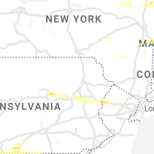
Pennsylvania
| Local Time | Report Details |
|---|---|
| 2:45 PM EDT | Trees down on wires west of mercersbur in franklin county PA, 66.7 miles S of State College, PA |
| 2:45 PM EDT | Trees down blocking buck valley roa in fulton county PA, 75 miles SSW of State College, PA |
| 2:55 PM EDT | Corrects previous tstm wnd dmg report (time) from 2 ese barnes gap. trees down blocking buck valley roa in fulton county PA, 75 miles SSW of State College, PA |
| 3:05 PM EDT | Quarter sized hail reported near Marion, PA, 65 miles S of State College, PA |
| 3:09 PM EDT | Trees down in chambersbur in franklin county PA, 60.5 miles S of State College, PA |
| 3:55 PM EDT | Multiple trees down on route 42 between millville and bloomsbur in columbia county PA, 49.5 miles WSW of Scranton, PA |
| 4:04 PM EDT | Tree down near stillwate in columbia county PA, 41.4 miles WSW of Scranton, PA |
| 4:07 PM EDT | Tree and wires down on west front street (route 11) in berwick... blocking the roadwa in columbia county PA, 39.1 miles SW of Scranton, PA |
| 4:21 PM EDT | Large tree on creek road near rowlands l in luzerne county PA, 28.9 miles SW of Scranton, PA |
| 4:27 PM EDT | Tree down on roadwa in luzerne county PA, 34.8 miles SSW of Scranton, PA |
| 5:26 PM EDT | Trees down across ridge road. pictures provided via social media. time estimated via rada in monroe county PA, 35.2 miles SSE of Scranton, PA |
| 5:30 PM EDT | Trees and wires down along route 209 in hamilton twp. time estimated from rada in monroe county PA, 36.9 miles SSE of Scranton, PA |
| 5:38 PM EDT | Trees down blocking bangor mountain road. time estimated from rada in monroe county PA, 39.8 miles SE of Scranton, PA |
| 5:38 PM EDT | Tree down across route 191 just before the intersection with route 611. pictures provided via social media. time estimated via rada in monroe county PA, 38.5 miles SE of Scranton, PA |
| 5:42 PM EDT | Reports of trees and wires down blocking roadways in delaware water gap twp. time estimated from rada in monroe county PA, 40.2 miles SE of Scranton, PA |
| 5:44 PM EDT | Nj dot reports a tree down on i-80 eastbound east of delaware water gap rest area. time estimated via radar. possible tornad in warren county NJ, 43.3 miles SE of Scranton, PA |
New Hampshire
| Local Time | Report Details |
|---|---|
| 3:52 PM EDT | Numerous branches down across meriden rd (highway 120) just south of lebano in grafton county NH, 77.6 miles SE of Burlington, VT |
| 3:54 PM EDT | Reported by weather spotter hl590: several branches (up to 3 inches in diameter) down along wheeler rd off of hwy 1 in sullivan county NH, 85.2 miles ENE of Schenectady, NY |
| 3:56 PM EDT | Numerous trees down in enfield cente in grafton county NH, 82.2 miles SE of Burlington, VT |
| 4:00 PM EDT | Quarter sized hail reported near Charlestown, NH, 84.2 miles ENE of Schenectady, NY, reported by weather spotter. |
| 4:04 PM EDT | Wires down. time estimated by rada in sullivan county NH, 88.2 miles ENE of Schenectady, NY |
| 4:04 PM EDT | Wires down. time estimated by rada in sullivan county NH, 88.2 miles ENE of Schenectady, NY |
| 4:04 PM EDT | Pole and wires down. time estimated by rada in sullivan county NH, 87.8 miles SSE of Burlington, VT |
| 4:05 PM EDT | Trees down... local fire department on scene. time estimated by rada in sullivan county NH, 85.6 miles SSE of Burlington, VT |
| 4:06 PM EDT | Wires down. time estimated by rada in sullivan county NH, 88.3 miles SSE of Burlington, VT |
| 4:06 PM EDT | Limbs and wires down. time estimated by rada in sullivan county NH, 88.2 miles ENE of Schenectady, NY |
| 4:06 PM EDT | Reported by amateur radio: numerous branches and trees down on lovejoy rd and nh hwy 10 north of marlow junctio in sullivan county NH, 92.2 miles ENE of Schenectady, NY |
| 4:15 PM EDT | Wires... and a tree down. time estimated by rada in sullivan county NH, 92.4 miles SE of Burlington, VT |
| 4:20 PM EDT | Half Dollar sized hail reported near Lempster, NH, 93.5 miles ENE of Schenectady, NY, reported by weather spotter. |
| 4:24 PM EDT | Tree down on wires across road... mayhew turnpike close in grafton county NH, 74.3 miles W of Portland, ME |
| 4:24 PM EDT | Tree and wires down... sinclair road is close in belknap county NH, 68.9 miles W of Portland, ME |
| 4:24 PM EDT | Wires and a couple poles down on the side of the road. time estimated by rada in grafton county NH, 76.8 miles W of Portland, ME |
| 4:24 PM EDT | Several branches and a few trees down on route 31 north of washington near pillsbury state par in sullivan county NH, 96.8 miles ENE of Schenectady, NY |
| 4:30 PM EDT | Tree dow in grafton county NH, 72.1 miles W of Portland, ME |
| 4:35 PM EDT | Half Dollar sized hail reported near Walpole, NH, 78.8 miles ENE of Schenectady, NY |
| 4:42 PM EDT | Delayed report...branches and trees down east of henniker. time estimated by rada in merrimack county NH, 81.2 miles WSW of Portland, ME |
| 4:43 PM EDT | Half Dollar sized hail reported near Bradford, NH, 89.5 miles WSW of Portland, ME, reported by amateur radio. |
| 4:55 PM EDT | Tree and wires down... time estimated by rada in belknap county NH, 62 miles W of Portland, ME |
| 5:00 PM EDT | Half Dollar sized hail reported near Gilsum, NH, 86.8 miles ENE of Schenectady, NY, reported by weather spotter. |
| 5:02 PM EDT | Half Dollar sized hail reported near Henniker, NH, 85.3 miles WSW of Portland, ME, reported by weather spotter. |
| 5:10 PM EDT | Tree down... approximately 8 inch diamete in merrimack county NH, 76.3 miles WSW of Portland, ME |
| 5:12 PM EDT | Multiple trees down... one on wires. time estimated by rada in merrimack county NH, 71.9 miles WSW of Portland, ME |
| 5:12 PM EDT | Approximately 10 inch tree down on wires... lower wires broke in merrimack county NH, 73.7 miles WSW of Portland, ME |
| 5:28 PM EDT | Delayed report...several trees down across roads in the milton are in strafford county NH, 41.3 miles WSW of Portland, ME |
| 5:30 PM EDT | Quarter sized hail reported near Westmoreland, NH, 76.5 miles E of Schenectady, NY, reported by weather spotter. |
| 5:32 PM EDT | Reported by amateur radi in hillsborough county NH, 82.4 miles NNW of Providence, RI |
Virginia
| Local Time | Report Details |
|---|---|
| 4:14 PM EDT | Storm damage reported in frederick county VA, 87.1 miles E of Elkins, WV |
| 4:15 PM EDT | Tree down at the intersection of capon dr. and john marshall wa in shenandoah county VA, 80.1 miles E of Elkins, WV |
| 4:15 PM EDT | Tree down on battlefield r in shenandoah county VA, 76.9 miles E of Elkins, WV |
| 4:16 PM EDT | Storm damage reported in shenandoah county VA, 78.7 miles E of Elkins, WV |
| 4:22 PM EDT | Tree down in the 3100 block of river view d in shenandoah county VA, 77.8 miles E of Elkins, WV |
| 4:22 PM EDT | Multiple trees down on funk road. mobile camper heavily damaged with sides blown of in shenandoah county VA, 78.9 miles E of Elkins, WV |
| 4:24 PM EDT | Multiple trees reported down on funk road southeast of strasbur in shenandoah county VA, 79 miles E of Elkins, WV |
| 4:24 PM EDT | Quarter sized hail reported near Edinburg, VA, 65 miles E of Elkins, WV, quarter sized hail and 8 inch tree limbs down. |
| 4:25 PM EDT | Tree down near intersection of old winchester and page brook ln in clarke county VA, 80 miles W of Baltimore, MD |
| 4:25 PM EDT | Tree down in 5300 blk of senseny rd in clarke county VA, 79.5 miles W of Baltimore, MD |
| 4:30 PM EDT | Tree down in 600 blk of white post rd in clarke county VA, 82.3 miles W of Baltimore, MD |
| 5:01 PM EDT | Quarter sized hail reported near Marshall, VA, 72.7 miles WSW of Baltimore, MD |
| 5:01 PM EDT | Half Dollar sized hail reported near Marshall, VA, 72.7 miles WSW of Baltimore, MD |
| 5:05 PM EDT | Tree down on route 651 near us-1 in loudoun county VA, 55.6 miles WSW of Baltimore, MD |
| 5:07 PM EDT | Tree reported down on bunker hill road near featherstone lan in fauquier county VA, 70.6 miles WSW of Baltimore, MD |
| 5:09 PM EDT | Quarter sized hail reported near Leesburg, VA, 53.9 miles WSW of Baltimore, MD |
| 5:09 PM EDT | Storm damage reported in loudoun county VA, 53.1 miles WSW of Baltimore, MD |
| 5:12 PM EDT | Numerous trees down in the plain in fauquier county VA, 69.1 miles WSW of Baltimore, MD |
| 5:15 PM EDT | Riley road from oakmont drive to lakeview drive is closed due to downed powerline in fauquier county VA, 70.4 miles WSW of Baltimore, MD |
| 5:18 PM EDT | Numerous branches down around claiborne parkway and waxpool roa in loudoun county VA, 51.8 miles WSW of Baltimore, MD |
| 5:23 PM EDT | Quarter sized hail reported near Chantilly, VA, 56 miles WSW of Baltimore, MD, trees down |
| 5:23 PM EDT | Trees down in loudoun county VA, 56 miles WSW of Baltimore, MD |
| 5:23 PM EDT | Tree down along route 50 near pleasant valley roa in loudoun county VA, 53.6 miles WSW of Baltimore, MD |
| 5:27 PM EDT | Several large tree limbs down in loudoun county VA, 44.1 miles WSW of Baltimore, MD |
| 5:28 PM EDT | Storm damage reported in loudoun county VA, 51.2 miles WSW of Baltimore, MD |
| 5:29 PM EDT | Tree down along hamburg roa in shenandoah county VA, 66 miles E of Elkins, WV |
| 5:29 PM EDT | Tree down near lawyers road and blue spruce roa in fairfax county VA, 47.8 miles WSW of Baltimore, MD |
| 5:29 PM EDT | Storm damage reported in fairfax county VA, 55.3 miles SW of Baltimore, MD |
| 5:29 PM EDT | Half Dollar sized hail reported near Warrenton, VA, 70 miles WSW of Baltimore, MD |
| 5:29 PM EDT | Large tree down on an occupied vehicl in fauquier county VA, 70 miles WSW of Baltimore, MD |
| 5:31 PM EDT | Several trees down at residence in fairfax county VA, 50.4 miles WSW of Baltimore, MD |
| 5:33 PM EDT | A tree blew down near hamburg rd and us-211 in page county VA, 74.3 miles ESE of Elkins, WV |
| 5:34 PM EDT | Tree down blocking roadway on piedmont av in rappahannock county VA, 87.9 miles NNW of Richmond, VA |
| 5:36 PM EDT | Tree down along twin lakes drive near twin lakes cour in fairfax county VA, 53.9 miles SW of Baltimore, MD |
| 5:42 PM EDT | Tree down on west page street in page county VA, 76.9 miles ESE of Elkins, WV |
| 5:44 PM EDT | Tree down along hamburg road and us 21 in page county VA, 74.3 miles ESE of Elkins, WV |
| 5:48 PM EDT | Tree down at hayfield rd. and manchester blv in fairfax county VA, 46.7 miles SW of Baltimore, MD |
| 5:53 PM EDT | Tree down near the intersection of hayfield road and manchester boulevar in fairfax county VA, 46.7 miles SW of Baltimore, MD |
| 6:09 PM EDT | Old mill road at black alder drive is closed due to tree dow in fairfax county VA, 48 miles SW of Baltimore, MD |
| 6:21 PM EDT | Lines down near the intersection of frank lane road and bowbender lan in rockingham county VA, 55.6 miles ESE of Elkins, WV |
| 6:41 PM EDT | Tree down 100 block of w page stree in page county VA, 76.9 miles ESE of Elkins, WV |
| 6:43 PM EDT | Tree down in 1300 blk of big oak rd in page county VA, 74.5 miles ESE of Elkins, WV |
| 6:53 PM EDT | Quarter sized hail reported near Buchanan, VA, 22.9 miles NE of Roanoke, VA |
| 6:56 PM EDT | Golf Ball sized hail reported near Covington, VA, 35.3 miles NNW of Roanoke, VA |
| 6:57 PM EDT | One tree and limbs down. time estimated by rada in carroll county VA, 64.6 miles WSW of Roanoke, VA |
| 7:20 PM EDT | Quarter sized hail reported near Covington, VA, 31.4 miles N of Roanoke, VA, pea to shooter marble size hail covering the ground. |
| 7:25 PM EDT | Trees were down along mount zion church roa in culpeper county VA, 74.3 miles N of Richmond, VA |
| 7:31 PM EDT | Several trees down along thoroughfare roa in madison county VA, 68.2 miles NNW of Richmond, VA |
| 7:31 PM EDT | Trees down along route 29 by bradford roa in culpeper county VA, 70.2 miles NNW of Richmond, VA |
| 7:32 PM EDT | Quarter sized hail reported near Madison, VA, 66.5 miles NNW of Richmond, VA |
| 7:35 PM EDT | Quarter sized hail reported near Brightwood, VA, 69.7 miles NNW of Richmond, VA |
| 7:37 PM EDT | Numerous trees were down in bealto in fauquier county VA, 73.8 miles N of Richmond, VA |
| 7:39 PM EDT | Tree down near the intersection of ford road and rutherford driv in spotsylvania county VA, 53.9 miles N of Richmond, VA |
| 7:41 PM EDT | Summerduck road closed from snake castle road to rogers ford road due to downed powerline in fauquier county VA, 65.4 miles N of Richmond, VA |
| 7:41 PM EDT | Numerous trees down in sumerduc in fauquier county VA, 66.1 miles N of Richmond, VA |
| 7:41 PM EDT | Tree down on leffel lan in botetourt county VA, 24.5 miles NNE of Roanoke, VA |
| 7:44 PM EDT | Tree on wires near fitzwater drive and morla lan in prince william county VA, 60.3 miles SW of Baltimore, MD |
| 7:45 PM EDT | Storm damage reported in madison county VA, 64 miles NNW of Richmond, VA |
| 7:47 PM EDT | Tree down on davis ru in botetourt county VA, 20.1 miles NNE of Roanoke, VA |
| 7:49 PM EDT | Trees down around hartwood and meadows road in stafford county VA, 65.3 miles N of Richmond, VA |
| 7:51 PM EDT | Tree down on narrow passage r in botetourt county VA, 21.9 miles NE of Roanoke, VA |
| 7:51 PM EDT | Tree down on catawba valley driv in roanoke county VA, 11.5 miles NW of Roanoke, VA |
| 7:53 PM EDT | Trees were down along holly corner road and country manor driv in stafford county VA, 64.7 miles NNE of Richmond, VA |
| 7:53 PM EDT | Quarter sized hail reported near Buchanan, VA, 22.9 miles NE of Roanoke, VA, corrects previous hail report from 1 nne buchanan. |
| 7:53 PM EDT | Powerlines reported dow in botetourt county VA, 21.9 miles NE of Roanoke, VA |
| 7:55 PM EDT | Tree down near the intersection of 16th street and culpepper avenu in botetourt county VA, 22.3 miles NE of Roanoke, VA |
| 7:55 PM EDT | Tree down on old catawba r in roanoke county VA, 10.7 miles NW of Roanoke, VA |
| 7:55 PM EDT | Few trees down along edgebrook r in roanoke county VA, 7.4 miles WNW of Roanoke, VA |
| 7:59 PM EDT | Several trees down along orange road and radiant wa in madison county VA, 63.2 miles NNW of Richmond, VA |
| 7:59 PM EDT | Tree down on lock haven driv in roanoke county VA, 5.7 miles NW of Roanoke, VA |
| 7:59 PM EDT | Tree down on wipledale avenu in roanoke county VA, 5.5 miles NW of Roanoke, VA |
| 7:59 PM EDT | Multiple trees down near ridgewood farms. time estimated by rada in roanoke county VA, 5.5 miles W of Roanoke, VA |
| 8:00 PM EDT | 4 trees reported down near the intersection of lee highway and arcadia roa in botetourt county VA, 25.2 miles NE of Roanoke, VA |
| 8:01 PM EDT | Trees were down along telegraph road and midway roa in stafford county VA, 68.2 miles SW of Baltimore, MD |
| 8:01 PM EDT | Tree down on woodlawn r in city of roanoke county VA, 4.8 miles WNW of Roanoke, VA |
| 8:03 PM EDT | Tree down along decatur roa in stafford county VA, 68.8 miles NNE of Richmond, VA |
| 8:05 PM EDT | Corrects previous tstm wnd gst report from 1 s blue ridg in botetourt county VA, 8.8 miles NE of Roanoke, VA |
| 8:05 PM EDT | Storm damage reported in botetourt county VA, 9.5 miles NE of Roanoke, VA |
| 8:07 PM EDT | Tree down on grandin r in city of roanoke county VA, 3.6 miles WSW of Roanoke, VA |
| 8:07 PM EDT | Tree down on wendover r in roanoke county VA, 5 miles NNW of Roanoke, VA |
| 8:07 PM EDT | Tree down on darby r in roanoke county VA, 4.2 miles NNW of Roanoke, VA |
| 8:10 PM EDT | Storm damage reported in prince william county VA, 65.5 miles SW of Baltimore, MD |
| 8:19 PM EDT | Storm damage reported in orange county VA, 55.9 miles NNW of Richmond, VA |
| 8:22 PM EDT | Dozens of trees and wires down on tower roa in orange county VA, 52.9 miles NNW of Richmond, VA |
| 8:23 PM EDT | Tree down on yellow mountain r in roanoke county VA, 4.4 miles SSE of Roanoke, VA |
| 8:26 PM EDT | Multiple trees down and powerline snapped near the intersection of winterhill drive and edwardsville r in franklin county VA, 8.7 miles SE of Roanoke, VA |
| 8:32 PM EDT | Storm damage reported in anz536 county VA, 68.1 miles NNE of Richmond, VA |
| 8:32 PM EDT | Storm damage reported in anz536 county VA, 68.1 miles NNE of Richmond, VA |
| 8:35 PM EDT | Multiple trees down along route 2 in king george county VA, 59.9 miles NNE of Richmond, VA |
| 8:35 PM EDT | Multiple trees down along route 2 in orange county VA, 55.7 miles NNW of Richmond, VA |
| 8:53 PM EDT | Numerous trees down near pratt in madison county VA, 67.5 miles NNW of Richmond, VA |
| 8:59 PM EDT | Tree down on early drive in madison heights... va. time based on rada in amherst county VA, 45.8 miles ENE of Roanoke, VA |
| 9:41 PM EDT | Tree down on owl road. time based on rada in campbell county VA, 59.5 miles ESE of Roanoke, VA |
| 9:49 PM EDT | Tree down on scuffletown roa in orange county VA, 63.1 miles NW of Richmond, VA |
| 12:03 AM EDT | Trees knocked down across northern and central parts of the county. time estimated from rada in caroline county VA, 51.9 miles NNE of Richmond, VA |
| 12:22 AM EDT | Storm damage reported in anz536 county VA, 68.1 miles NNE of Richmond, VA |
Kentucky
| Local Time | Report Details |
|---|---|
| 3:25 PM CDT | Public report relayed by wbko. downed trees on a property along dripping springs church road near wisdo in metcalfe county KY, 68.1 miles S of Louisville, KY |
| 3:30 PM CDT | Trees being removed from b. bertram roa in barren county KY, 66.8 miles NE of Nashville, TN |
| 4:59 PM EDT | Reports of several trees and powerlines down. time estimated by rada in pulaski county KY, 50.7 miles SSW of Irvine, KY |
| 5:25 PM EDT | Reports of several trees down. time estimated by rada in pulaski county KY, 59.3 miles SW of Irvine, KY |
| 6:00 PM EDT | Trained spotter reports numerous trees down on propert in mccreary county KY, 53.2 miles NNW of Knoxville, TN |
| 6:10 PM EDT | 911 call center reports that a tree was down near mile marker 7 on ky-700. time estimated from rada in mccreary county KY, 61.9 miles NNW of Knoxville, TN |
| 6:10 PM EDT | 911 call center reports that a tree was down near mile marker4 on ky-90. time estimated from rada in mccreary county KY, 63.3 miles SSW of Irvine, KY |
| 6:10 PM EDT | 911 call center reports that a tree was down near pine knot middle school near the intersection of ky-2792 and us 27. time estimated from rada in mccreary county KY, 56.3 miles NNW of Knoxville, TN |
| 6:19 PM EDT | 911 call center reports that a tree was down on east appletree rd about .4 miles from the intersection with ky-1651. time estimated from rada in mccreary county KY, 58.6 miles NNW of Knoxville, TN |
| 6:22 PM EDT | Tree blown down along catalpa stree in bell county KY, 56.5 miles NNE of Knoxville, TN |
| 6:22 PM EDT | Tree blown down along catalpa stree in bell county KY, 56.5 miles NNE of Knoxville, TN |
| 6:22 PM EDT | Tree blown down along catalpa stree in bell county KY, 56.5 miles NNE of Knoxville, TN |
| 6:29 PM EDT | Tree blown down along little clear creek road near ky route 19 in bell county KY, 53.6 miles NNE of Knoxville, TN |
| 6:37 PM EDT | Pictures posted by wril show multiple trees and branches had fallen onto a home along 43rd street... leading to extensive roof interior ceiling damag in bell county KY, 45.1 miles NNE of Knoxville, TN |
| 6:42 PM EDT | Pictures on social media show a large portion of a yard pine tree snapped off along west chester avenue in middlesbor in bell county KY, 46.2 miles NNE of Knoxville, TN |
| 6:42 PM EDT | Pictures on social media show a large tree blown across dorchester avenue near the west end school. another large tree was snapped and leaning on power line in bell county KY, 46 miles NNE of Knoxville, TN |
Colorado
| Local Time | Report Details |
|---|---|
| 2:30 PM MDT | Quarter sized hail reported near Victor, CO, 42 miles NW of Pueblo, CO, report of quarter-size hail in victor. |
| 2:59 PM MDT | Quarter sized hail reported near Trinidad, CO, 74.1 miles S of Pueblo, CO, trained spotter measured 1-inch hail with severe thunderstorm just southeast of boncarbo. |
| 3:19 PM MDT | Quarter sized hail reported near Trinidad, CO, 75.6 miles S of Pueblo, CO, report from mping: quarter (1.00 in.). |
| 3:20 PM MDT | Ping Pong Ball sized hail reported near Trinidad, CO, 75.6 miles S of Pueblo, CO |
| 3:20 PM MDT | Golf Ball sized hail reported near Trinidad, CO, 75 miles S of Pueblo, CO |
| 3:25 PM MDT | Golf Ball sized hail reported near Trinidad, CO, 73 miles S of Pueblo, CO, report of a mix of quarter to golfball size hail with severe thunderstorm in northern part of trinidad area just east of interstate 25. |
| 3:25 PM MDT | Ping Pong Ball sized hail reported near Trinidad, CO, 74.4 miles S of Pueblo, CO |
| 6:05 PM MDT | Quarter sized hail reported near Brush, CO, 51.5 miles WNW of Yuma, CO, report via facebook. time and location estimated by radar. |
| 6:17 PM MDT | Quarter sized hail reported near Brush, CO, 47.4 miles WNW of Yuma, CO |
| 6:17 PM MDT | Ping Pong Ball sized hail reported near Iliff, CO, 47.9 miles NNW of Yuma, CO, most hail near quarter size or smaller... but a few ping pong ball sized hailstones confirmed by trained spotter. |
| 6:22 PM MDT | Quarter sized hail reported near Brush, CO, 44.7 miles WNW of Yuma, CO, delayed report. time estimated by radar. |
Massachusetts
| Local Time | Report Details |
|---|---|
| 4:48 PM EDT | Power lines and half inch diameter hail in berkshire county MA, 42.9 miles SE of Schenectady, NY |
| 4:50 PM EDT | Tree down on east stree in berkshire county MA, 48.7 miles SE of Schenectady, NY |
| 4:58 PM EDT | Multiple trees down at tanglewood music cente in berkshire county MA, 45.3 miles SE of Schenectady, NY |
| 4:58 PM EDT | Large tree down blocking the fox hollow roa in berkshire county MA, 47 miles SE of Schenectady, NY |
| 5:04 PM EDT | Car stuck between multiple fallen tree in berkshire county MA, 47.2 miles SE of Schenectady, NY |
| 5:33 PM EDT | Tree down on wire in berkshire county MA, 63.5 miles SE of Schenectady, NY |
| 5:33 PM EDT | Unknown equipment used to measur in berkshire county MA, 61.4 miles SE of Schenectady, NY |
| 5:33 PM EDT | Tree down across west shore roa in berkshire county MA, 63.1 miles SE of Schenectady, NY |
| 5:42 PM EDT | Trees down on mountain view street. relayed by amateur radi in hampshire county MA, 67 miles SE of Schenectady, NY |
| 5:42 PM EDT | Trees down on blair road. relayed by amateur radi in hampden county MA, 65.2 miles SE of Schenectady, NY |
| 5:50 PM EDT | Tree down across mine road. relayed by amateur radi in hampshire county MA, 71.5 miles ESE of Schenectady, NY |
| 5:55 PM EDT | Tree down on wires at butternut hollow rd and greystone av in hampden county MA, 64.5 miles WNW of Providence, RI |
| 5:55 PM EDT | Two trees down on parker street. relayed by amateur radi in hampden county MA, 72.1 miles WNW of Providence, RI |
| 5:55 PM EDT | Large tree on wires on clark street. relayed by amateur radi in hampshire county MA, 73.1 miles WNW of Providence, RI |
| 5:55 PM EDT | Small trees down off union street. related by amateur radi in hampden county MA, 71.1 miles WNW of Providence, RI |
| 5:56 PM EDT | Tree down on wires near 50 block of college highway south. relayed by amateur radi in hampden county MA, 72.2 miles W of Providence, RI |
| 6:02 PM EDT | One panel of a wooden fence blown down in the fairview section of chicopee. relayed by amateur radi in hampden county MA, 64.5 miles WNW of Providence, RI |
| 6:02 PM EDT | Large tree on wires between 77 and 88 watson stree in hampden county MA, 63.7 miles WNW of Providence, RI |
| 6:02 PM EDT | 10-12 inch diameter branch down on a house on newbury stree in hampden county MA, 64.9 miles WNW of Providence, RI |
| 6:02 PM EDT | Tree on car on chicopee street. relayed by amateur radi in hampden county MA, 65.7 miles WNW of Providence, RI |
| 6:03 PM EDT | Tree down on dwight road. relayed by amateur radi in hampden county MA, 60.4 miles WNW of Providence, RI |
| 6:05 PM EDT | Multiple trees down on railroad tracks - amtrack rail service between springfield and windsor locks shutdown per amateur radi in hampden county MA, 61.7 miles WNW of Providence, RI |
| 6:05 PM EDT | Tree down blocking tennyson drive. relayed by amateur radi in hampden county MA, 62.2 miles WNW of Providence, RI |
| 6:05 PM EDT | Tree down at 80 block of parker street. relayed by amateur radi in hampden county MA, 56.7 miles WNW of Providence, RI |
| 6:05 PM EDT | Tree down on viscount road. related by amateur radi in hampden county MA, 61.2 miles WNW of Providence, RI |
| 6:05 PM EDT | Large tree down on cars on brookdale road. photo shared on twitte in hampden county MA, 61.6 miles WNW of Providence, RI |
| 6:16 PM EDT | Large tree down on bailey roa in hampden county MA, 61.7 miles WNW of Providence, RI |
Wyoming
| Local Time | Report Details |
|---|---|
| 3:10 PM MDT | Quarter sized hail reported near Cheyenne, WY, 32.7 miles ESE of Laramie, WY |
Minnesota
| Local Time | Report Details |
|---|---|
| 4:10 PM CDT | Quarter sized hail reported near Bemidji, MN, 0.5 miles N of Bemidji, MN, picture relayed via social media. |
| 4:10 PM CDT | Reports of trees snapped via social media. time estimated via rada in beltrami county MN, 0.5 miles N of Bemidji, MN |
| 4:45 PM CDT | Quarter sized hail reported near Staples, MN, 78.7 miles S of Bemidji, MN, report relayed from social media. |
| 6:02 PM CDT | Storm chaser posted video on twitter of very strong winds and driving rain along a country roa in kanabec county MN, 55.3 miles N of Minneapolis, MN |
| 8:08 PM CDT | Tree snapped with 12 inch diameter base. photos provided via social medi in wright county MN, 37.9 miles WNW of Minneapolis, MN |
| 8:17 PM CDT | Trees uprooted 3 miles ne of buffalo. report via mping. time approximated by rada in wright county MN, 32 miles WNW of Minneapolis, MN |
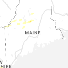
Maine
| Local Time | Report Details |
|---|---|
| 5:15 PM EDT | Multiple trees down on rt 11 in cumberland county ME, 18.1 miles WNW of Portland, ME |
| 5:46 PM EDT | Large tree down... with wires down as well. reported by spotter yo188. time estimated by rada in york county ME, 22.1 miles WNW of Portland, ME |
| 5:55 PM EDT | Tree down on hous in cumberland county ME, 21.6 miles NW of Portland, ME |
| 5:55 PM EDT | Several trees fell onto powerlines. time estimated by rada in cumberland county ME, 18 miles WNW of Portland, ME |
| 5:55 PM EDT | Tree into a house with structural damage. time estimated by rada in cumberland county ME, 17.6 miles WNW of Portland, ME |
| 5:55 PM EDT | Corrects previous tstm wnd dmg report from 4 e steep falls. multiple trees down on rt 114. time corrected based on rada in cumberland county ME, 18.1 miles WNW of Portland, ME |
| 6:00 PM EDT | Tree across dale lane on power lines. road impassable. time estimated by rada in cumberland county ME, 13.6 miles NW of Portland, ME |
| 7:30 PM EDT | Multiple midsized trees down or snapped midway. fishing shack destroye in aroostook county ME, 29.2 miles NNW of Caribou, ME |
Connecticut
| Local Time | Report Details |
|---|---|
| 5:34 PM EDT | Trees and wires down blocking road in litchfield county CT, 71.3 miles SE of Schenectady, NY |
| 5:35 PM EDT | Trees and wires blocking us-4 in litchfield county CT, 66.2 miles SSE of Schenectady, NY |
| 6:14 PM EDT | Tree down blocking mathewson ave. relayed via amateur radi in hartford county CT, 60.6 miles W of Providence, RI |
| 7:25 PM EDT | Tree and wires down on holcomb terrace. relayed by amateur radi in hartford county CT, 62.7 miles W of Providence, RI |
| 7:35 PM EDT | Tree on power lines at slater rd in tolland... ct. relayed by amateur radi in tolland county CT, 48.2 miles W of Providence, RI |
| 7:35 PM EDT | Tree and wires down at old stafford rd and curtis drive in tolland. relayed by amateur radi in tolland county CT, 48.7 miles W of Providence, RI |
| 7:35 PM EDT | Tree down on wires on pilgrim drive. confirmed by fd. relayed by amateur radi in tolland county CT, 50.6 miles W of Providence, RI |
| 8:25 PM EDT | Route 101 at upper maple street and route 101 at otis street - two trees down... one blocking half of the roadwa in windham county CT, 24.7 miles W of Providence, RI |
Delaware
| Local Time | Report Details |
|---|---|
| 5:37 PM EDT | Amateur radio operator reports multiple trees down on cazier drive. pictures provided. time estimated via rada in new castle county DE, 47.4 miles ENE of Baltimore, MD |
| 5:37 PM EDT | Small tree downed onto power lines... numerous large branches down in the area. time estimated via rada in new castle county DE, 48.9 miles ENE of Baltimore, MD |
| 5:39 PM EDT | Report from mping: trees uprooted or snapped; roof blown of in new castle county DE, 53.6 miles ENE of Baltimore, MD |
| 5:40 PM EDT | Mesonet station fw7093 middletown reported a thunderstorm wind gust of 87 mp in new castle county DE, 47.4 miles ENE of Baltimore, MD |
| 5:40 PM EDT | Quarter sized hail reported near Middletown, DE, 51.3 miles ENE of Baltimore, MD, report of quarter size hail. time estimated via radar. |
| 5:48 PM EDT | Report of multiple trees down on adams street. pictures provided on social media. time estimated via rada in new castle county DE, 58.1 miles ENE of Baltimore, MD |
| 7:34 PM EDT | Caller reports widespread damage including numerous large trees down. time estimated via rada in kent county DE, 49.7 miles NW of Ocean City, MD |
| 7:38 PM EDT | Report of roof blown off of a house along cattail branch road. radar indicates this was from a microburst with winds potentially in excess of 80 mph. time estimated fro in kent county DE, 48.5 miles NW of Ocean City, MD |
| 7:42 PM EDT | Numerous trees down making andrewville road impassible west of farmington. time estimated from rada in kent county DE, 46.4 miles NW of Ocean City, MD |
| 7:44 PM EDT | Social media report of large trees uprooted and multiple large branches down on prospect church road. time estimated via rada in kent county DE, 48.7 miles NW of Ocean City, MD |
| 7:44 PM EDT | Reports of a structure collapse and roofs blown off of chicken houses on prospect church road. time estimated via rada in kent county DE, 47.8 miles NW of Ocean City, MD |
| 8:07 PM EDT | Power poles and power lines down on horseshoe road west of seaford. time estimated from rada in sussex county DE, 39.8 miles NW of Ocean City, MD |
| 8:13 PM EDT | Power lines down near magnolia drive and cherry blossom lane in seaford. time estimated from rada in sussex county DE, 36.7 miles NW of Ocean City, MD |
| 8:13 PM EDT | Report of a tree and wires fallen onto a vehicle on n broadford street in seaford. time estimated from rada in sussex county DE, 36.3 miles NW of Ocean City, MD |
Nevada
| Local Time | Report Details |
|---|---|
| 2:38 PM PDT | Awos station kp68 eureka airport asos station elevation: 5952 f in eureka county NV, 63.9 miles WNW of Ely, NV |
New Jersey
| Local Time | Report Details |
|---|---|
| 5:44 PM EDT | Nj dot reports a downed tree on i-80 eastbound just east of exit 4. time estimated via rada in warren county NJ, 44.9 miles SE of Scranton, PA |
| 5:44 PM EDT | Nj dot reports debris and downed tree on i-80 in both directions east of exit 2. time estimated via radar. possible tornad in warren county NJ, 41.4 miles SE of Scranton, PA |
| 5:50 PM EDT | Njnet lower alloways creek station reported a marine thunderstorm wind gust of 82 mp in salem county NJ, 58.7 miles ENE of Baltimore, MD |
| 5:57 PM EDT | Multiple trees down. pictures provided via social media. time estimated via rada in salem county NJ, 64.2 miles ENE of Baltimore, MD |
| 6:05 PM EDT | Report of a tree down blocking all lanes of johnsonburg road in allamuchy. time estimated from rada in warren county NJ, 46 miles WNW of Brooklyn, NY |
| 6:07 PM EDT | Report of a downed tree and utility pole fire in bryam. time estimated from rada in sussex county NJ, 41.6 miles WNW of Brooklyn, NY |
| 6:08 PM EDT | Report of a couple trees down between stow creek and hopewell townships. time estimated from rada in cumberland county NJ, 70.6 miles E of Baltimore, MD |
| 6:19 PM EDT | Reports of trees down blocking roadways in mount arlington... wharton... and dover boroughs. time estimated from rada in morris county NJ, 34.1 miles WNW of Brooklyn, NY |
Arkansas
| Local Time | Report Details |
|---|---|
| 4:47 PM CDT | Quarter sized hail reported near Pangburn, AR, 53 miles NNE of Little Rock, AR |
| 5:50 PM CDT | Storm damage reported in faulkner county AR, 21.5 miles N of Little Rock, AR |
| 6:05 PM CDT | A tree was blown down on west wicker street in viloni in faulkner county AR, 23.1 miles N of Little Rock, AR |
| 6:15 PM CDT | A tree was blown down on rooster road. time based on radar dat in faulkner county AR, 25.6 miles NNW of Little Rock, AR |
| 6:45 PM CDT | Quarter sized hail reported near Conway, AR, 18.4 miles NNW of Little Rock, AR, quarter sized hail fell on molly drive near conway. |
| 6:55 PM CDT | Trees were blown down at lake maumell in pulaski county AR, 18.6 miles WNW of Little Rock, AR |
| 6:55 PM CDT | Ping Pong Ball sized hail reported near Conway, AR, 20.6 miles NNW of Little Rock, AR |
| 7:13 PM CDT | Quarter sized hail reported near Little Rock, AR, 19.9 miles W of Little Rock, AR, **delayed** several social media videos of quarter sized hail falling between ferndale and paron near the pulaski/saline co line. |
| 7:15 PM CDT | A tree was blown dow in pulaski county AR, 6.8 miles NNW of Little Rock, AR |
| 7:30 PM CDT | Trees were blown down in several locations in west little rock with a few roads blocke in pulaski county AR, 4.7 miles WSW of Little Rock, AR |
| 7:40 PM CDT | Golf Ball sized hail reported near Benton, AR, 27.7 miles W of Little Rock, AR, golfball sized hail fell at paron. some car windows were broken. |
| 7:48 PM CDT | Quarter sized hail reported near Benton, AR, 27.7 miles W of Little Rock, AR, **delayed** social media video of quarter sized hail falling in paron. |
| 8:30 PM CDT | Several trees were blown down in the are in hot spring county AR, 38.2 miles WSW of Little Rock, AR |
| 8:49 PM CDT | A tree was blown down which blocked portions of highway 27 in garland county AR, 46.6 miles WSW of Little Rock, AR |
District of Columbia
| Local Time | Report Details |
|---|---|
| 5:55 PM EDT | Multiple trees down in washington dc... some onto vehicles in district of columb county DC, 33.8 miles SW of Baltimore, MD |
Tennessee
| Local Time | Report Details |
|---|---|
| 4:57 PM CDT | Facebook report of numerous trees down on highway 53 between gainesboro and celin in jackson county TN, 69.7 miles ENE of Nashville, TN |
| 6:30 PM EDT | Corrects previous report and is for multiple trees down on roadway in campbell county TN, 44.3 miles NNW of Knoxville, TN |
| 5:35 PM CDT | Facebook photos showed trees uprooted in jackson count in jackson county TN, 64.4 miles ENE of Nashville, TN |
| 5:37 PM CDT | Reports of trees down and power outages in the defeated creek area and across the northern part of the count in smith county TN, 49.6 miles ENE of Nashville, TN |
| 6:40 PM EDT | Trees and powerlines down... time estimated from rada in campbell county TN, 30.6 miles NNW of Knoxville, TN |
| 6:55 PM EDT | Several trees down over roadways with time estimated from rada in claiborne county TN, 45.5 miles NNE of Knoxville, TN |
| 7:05 PM EDT | Several trees down on roadways with time estimated from rada in claiborne county TN, 39.4 miles NNE of Knoxville, TN |
| 6:28 PM CDT | Quarter sized hail reported near Nolensville, TN, 16.9 miles SSE of Nashville, TN, nickel to quarter size hail reported on carmine street. |
| 6:34 PM CDT | Ping Pong Ball sized hail reported near Smyrna, TN, 22.1 miles SSE of Nashville, TN, report from twitter. |
| 7:40 PM EDT | Numerous trees down with time estimated from rada in union county TN, 26.9 miles NNE of Knoxville, TN |
| 6:45 PM CDT | Golf Ball sized hail reported near Nolensville, TN, 16.9 miles SSE of Nashville, TN, facebook report of golfball size hail on grand street. |
| 6:50 PM CDT | Hail up to quarter size in the 3300 block of cripple creek r in rutherford county TN, 41.6 miles SE of Nashville, TN |
| 6:50 PM CDT | Hail up to quarter size in the 3300 block of cripple creek r in rutherford county TN, 41.6 miles SE of Nashville, TN |
| 6:54 PM CDT | Quarter sized hail reported near Murfreesboro, TN, 30 miles SE of Nashville, TN, twitter picture of 1 inch hail. time estimated via radar. |
| 7:55 PM EDT | Several trees down with time estimated from rada in union county TN, 18.6 miles N of Knoxville, TN |
| 7:55 PM EDT | Report of a tree down on a house with time estimated from rada in anderson county TN, 21.7 miles NW of Knoxville, TN |
| 7:02 PM CDT | Quarter sized hail reported near Bradyville, TN, 45.1 miles SE of Nashville, TN, dime to quarter size hail reported in bradyville near bradyville rd at hwy 99. |
| 7:36 PM CDT | Scattered trees down across southern rutherford count in rutherford county TN, 40.9 miles SE of Nashville, TN |
| 8:40 PM EDT | Several trees and powerlines dow in knox county TN, 1.7 miles NW of Knoxville, TN |
| 7:42 PM CDT | Quarter sized hail reported near College Grove, TN, 31 miles S of Nashville, TN, twitter picture of 1: hail. time estimated by radar. |
| 7:44 PM CDT | Quarter sized hail reported near Chapel Hill, TN, 36.4 miles SSE of Nashville, TN, 1 inch hail in rover (twitter report). |
| 7:48 PM CDT | Quarter sized hail reported near College Grove, TN, 32.6 miles S of Nashville, TN, twitter report of quarter size hail. time estimated via radar. |
| 7:52 PM CDT | Ping Pong Ball sized hail reported near Rockvale, TN, 35.1 miles SSE of Nashville, TN, quarter to ping pong ball hail in rover (twitter). |
| 8:58 PM EDT | Numerous branches down with diameters to 2 inches. relayed via amateur radi in blount county TN, 12.7 miles SSW of Knoxville, TN |
| 8:19 PM CDT | Tea Cup sized hail reported near Chapel Hill, TN, 37.3 miles S of Nashville, TN, twitter report of 3 hail. |
| 8:25 PM CDT | Grapefruit sized hail reported near Chapel Hill, TN, 37.3 miles S of Nashville, TN, numerous social media photos showed hail ranging from baseball to softball size fell in chapel hill. one photo showed a hailstone 4 inches long by 2.8 inches wide. |
| 8:42 PM CDT | Twitter report... large tree down on minkslide road. time estimated via rada in bedford county TN, 46.7 miles SSE of Nashville, TN |
| 9:12 PM CDT | Quarter sized hail reported near Franklin, TN, 17.8 miles SSW of Nashville, TN, 1 inch hail downtown franklin (twitter). |
| 9:55 PM CDT | Corrects previous tstm wnd dmg report from 1 w lynnville. trees down across columbia hwy north of lynnville at the maury county lin in maury county TN, 52.9 miles SSW of Nashville, TN |
| 10:58 PM CDT | Trees and power lines down on byrd road with road blocke in lawrence county TN, 40.6 miles NE of Florence, AL |
| 11:05 PM CDT | Trees down near gimlet road and weakley creek roa in lawrence county TN, 39.8 miles NE of Florence, AL |
Arizona
| Local Time | Report Details |
|---|---|
| 3:43 PM MST | 58mph wind gusts from kfhu libby army air fiel in cochise county AZ, 47 miles WNW of Douglas, AZ |
Texas
| Local Time | Report Details |
|---|---|
| 6:10 PM CDT | Emergency manager and storm spotters reported downed power lines... debris in the road... and missing roofs just east of tow along lake buchanan from straight-line wind in llano county TX, 45.3 miles WSW of Killeen, TX |
| 9:05 PM CDT | West texas mesonet in castro county TX, 51 miles SSW of Amarillo, TX |
| 9:50 PM CDT | Golf Ball sized hail reported near Panhandle, TX, 13.4 miles ENE of Amarillo, TX |
| 11:08 PM CDT | Windows blown out... hotel roof blown onto parking lot... major damage to vehicles due to the destroyed roof. time estimated from rada in hutchinson county TX, 39.7 miles NE of Amarillo, TX |
| 11:11 PM CDT | Half Dollar sized hail reported near Borger, TX, 39.7 miles NE of Amarillo, TX, reports of nickel to half dollar size hail in borger. |
Wisconsin
| Local Time | Report Details |
|---|---|
| 6:47 PM CDT | Storm damage reported in brown county WI, 0.5 miles ESE of Green Bay, WI |
Oregon
| Local Time | Report Details |
|---|---|
| 4:57 PM PDT | Corrected...sustained southeast wind 40 mph with peak gust 56 mp in harney county OR, 0.4 miles NW of Burns, OR |
Rhode Island
| Local Time | Report Details |
|---|---|
| 8:35 PM EDT | Tree down on foster center road near rt 102. relayed by amateur radi in providence county RI, 18.6 miles W of Providence, RI |
| 8:35 PM EDT | Cranberry ridge rd - tree down blocking the road... big enough to need a chainsaw to cut it from dpw. relayed by amateur radi in providence county RI, 14.9 miles WNW of Providence, RI |
| 8:35 PM EDT | Cranberry ridge rd - tree down blocking the road... big enough to need a chainsaw to cut it from dpw. relayed by amateur radi in providence county RI, 14.9 miles WNW of Providence, RI |
| 8:35 PM EDT | Cranberry ridge rd - tree down blocking the road... big enough to need a chainsaw to cut it from dpw. relayed by amateur radi in providence county RI, 14.9 miles WNW of Providence, RI |
| 8:45 PM EDT | Multiple trees down; rt 44... arthur street... and maple crest drive. relayed by amateur radi in providence county RI, 8.1 miles WNW of Providence, RI |
Nebraska
| Local Time | Report Details |
|---|---|
| 6:50 PM MDT | Ping Pong Ball sized hail reported near Whitman, NE, 62.9 miles SW of Valentine, NE |
Connect with Interactive Hail Maps