

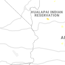
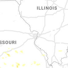
Hail Map for Sunday, July 17, 2022

Number of Impacted Households on 7/17/2022
0
Impacted by 1" or Larger Hail
0
Impacted by 1.75" or Larger Hail
0
Impacted by 2.5" or Larger Hail
Square Miles of Populated Area Impacted on 7/17/2022
0
Impacted by 1" or Larger Hail
0
Impacted by 1.75" or Larger Hail
0
Impacted by 2.5" or Larger Hail


Cities Most Affected by Hail Storms of 7/17/2022
| Hail Size | Demographics of Zip Codes Affected | ||||||
|---|---|---|---|---|---|---|---|
| City | Count | Average | Largest | Pop Density | House Value | Income | Age |
Hail and Wind Damage Spotted on 7/17/2022
Filter by Report Type:Hail ReportsWind Reports
States Impacted
Missouri, New Hampshire, Virginia, West Virginia, Arkansas, Pennsylvania, Florida, Arizona, Ohio, Kentucky, Utah, Maryland, Montana, New York, North Dakota, Illinois, California, MinnesotaMissouri
| Local Time | Report Details |
|---|---|
| 8:53 AM CDT | Six inch diameter branch blocking parking lot at kvfs-12. relayed by kfvs-12. time estimated by rada in cape girardeau county MO, 1.4 miles ENE of Cape Girardeau, MO |
| 4:40 PM CDT | Via social media...trees down estimated around 2140z. photos provide in texas county MO, 28.1 miles SW of Salem, MO |
| 6:36 PM CDT | Tree was downed near winona as the thunderstorms moved through that locatio in shannon county MO, 42.5 miles SSE of Salem, MO |
| 6:46 PM CDT | Power line dow in howell county MO, 64.5 miles SSW of Salem, MO |
| 7:00 PM CDT | Multiple trees down along route m nw of van bure in carter county MO, 48.5 miles SSE of Salem, MO |
| 7:02 PM CDT | Roof damage to a business in van bure in carter county MO, 52.6 miles SSE of Salem, MO |
| 7:12 PM CDT | Larger tree uprooted in grandin. report relayed by kvfs -1 in carter county MO, 67.6 miles SE of Salem, MO |
| 7:14 PM CDT | Tree down on a garage at viewers residence. report relayed courtesy of kfvs12. time estimated by rada in iron county MO, 49.7 miles E of Salem, MO |
| 7:46 PM CDT | Downed tree at a viewers residence. time estimated by radar. report relayed courtesy of kfvs1 in madison county MO, 44.7 miles WNW of Cape Girardeau, MO |
| 7:59 PM CDT | Madison county dispatch stated that trees were downed in multiple areas of eastern madison county. modot crews were in route to hwy m to clear trees from the roadway. t in madison county MO, 36.4 miles WNW of Cape Girardeau, MO |
| 8:23 PM CDT | Large tree down on a garage in zalma. report relayed by kfvs 12. time estimated by rada in bollinger county MO, 31.4 miles WSW of Cape Girardeau, MO |
| 8:27 PM CDT | Trained spotter in oak ridge... mo walking through property found broken off 2 limbs from hickory tree laying in yard. smaller limbs scattered throughout his yard. repo in cape girardeau county MO, 17 miles NW of Cape Girardeau, MO |
| 8:36 PM CDT | Quarter sized hail reported near Puxico, MO, 41.8 miles SW of Cape Girardeau, MO |
| 8:53 PM CDT | Storm damage reported in scott county MO, 5.2 miles SSW of Cape Girardeau, MO |
| 8:54 PM CDT | Power pole was snapped in red star by wind. report relayed by kfvs-12. time estimated by rada in cape girardeau county MO, 1.8 miles NE of Cape Girardeau, MO |
| 8:56 PM CDT | Power lines down in the red star district in cape. also tree down across cape rock rd. report relayed by kfvs-12. time estimated by rada in cape girardeau county MO, 3.8 miles NNE of Cape Girardeau, MO |
New Hampshire
| Local Time | Report Details |
|---|---|
| 1:43 PM EDT | Downed tree blocking roadwa in merrimack county NH, 74.2 miles SW of Portland, ME |
| 2:15 PM EDT | Quarter sized hail reported near Auburn, NH, 73.6 miles SW of Portland, ME, quarter-size hail fell for about 3 minutes on the east side of massabesic lake. hail was accompanied by violent winds from the nw which knocked down numerous branches. |
| 2:30 PM EDT | A few trees down on pingree hill rd north of derry villag in rockingham county NH, 73.5 miles SW of Portland, ME |
Virginia
| Local Time | Report Details |
|---|---|
| 1:57 PM EDT | Trees and power lines downed in the mt. zion are in montgomery county VA, 29.3 miles W of Roanoke, VA |
| 2:02 PM EDT | One tree down due to thunderstorm winds at the intersection of glade road and meadowbrook roa in montgomery county VA, 29.3 miles W of Roanoke, VA |
| 2:19 PM EDT | A tree blew down on tranquility l in rockingham county VA, 53.4 miles ESE of Elkins, WV |
| 2:57 PM EDT | A tree blew down near the 1200 block of waterloo mill l in rockingham county VA, 73.2 miles ESE of Elkins, WV |
| 3:04 PM EDT | A tree blew down in the area of turkey run rd and cedar creek r in shenandoah county VA, 76.7 miles E of Elkins, WV |
| 3:06 PM EDT | One large tree down along the 3100 block of powell drive due to thunderstorm wind in roanoke county VA, 8.3 miles W of Roanoke, VA |
| 3:10 PM EDT | One tree down at the intersection of upland drive and franklin drive due to thunderstorm wind in city of salem county VA, 6.6 miles W of Roanoke, VA |
| 3:11 PM EDT | One tree down due to thunderstorm winds along the 600 block of front avenu in city of salem county VA, 6.6 miles W of Roanoke, VA |
| 3:31 PM EDT | Numerous power outages likely caused by storm near hunts game preserve. time estimate in sussex county VA, 44.2 miles S of Richmond, VA |
| 3:40 PM EDT | Tree down in jarrat in sussex county VA, 49.5 miles SSE of Richmond, VA |
| 4:20 PM EDT | Several trees dow in sussex county VA, 46.5 miles SSE of Richmond, VA |
| 5:11 PM EDT | Several trees and lines blew down along ridgeview r in madison county VA, 70.7 miles NNW of Richmond, VA |
| 5:15 PM EDT | Multiple trees down on kings hwy near the county border. time estimated from rada in westmoreland county VA, 57.7 miles NE of Richmond, VA |
| 5:52 PM EDT | Several trees blew down on caledon rd near caledon state par in king george county VA, 61.3 miles NNE of Richmond, VA |
| 6:29 PM EDT | A tree blew down naer the 2100 block of frays mill r in albemarle county VA, 63.7 miles NW of Richmond, VA |
West Virginia
| Local Time | Report Details |
|---|---|
| 2:15 PM EDT | Several trees blew down in the area of pine ridge rd and pine ridge extensio in hardy county WV, 64.5 miles ENE of Elkins, WV |
Arkansas
| Local Time | Report Details |
|---|---|
| 2:11 PM CDT | A tree was blown down along highway in fulton county AR, 84.5 miles S of Salem, MO |
| 2:45 PM CDT | Several limbs and small trees down across county roads parallel to highway 63... south of the highway 63/highway 9 intersectio in fulton county AR, 79.1 miles S of Salem, MO |
| 7:52 PM CDT | Observed by kfyv aso in washington county AR, 46.2 miles NNE of Fort Smith, AR |
| 10:00 PM CDT | A storm spotter reported a 63 mph wind gust about 3 miles northeast of mintur in lawrence county AR, 79.5 miles NW of Memphis, TN |
| 10:04 PM CDT | Asos site at walnut ridge... ar measured a 62 mph wind gust. this is a corrected storm report to the previous report that had the incorrect magnitud in lawrence county AR, 81.6 miles NW of Memphis, TN |
| 10:32 PM CDT | A tree was snapped a couple feet above ground leve in independence county AR, 79.5 miles NNE of Little Rock, AR |
| 10:45 PM CDT | A measured wind gust of 63 mph northwest of oil trough... ar. this is a correction to the previous storm report that was sent and did not have the correct magnitud in independence county AR, 77.2 miles NE of Little Rock, AR |
| 11:25 PM CDT | Damage to poultry houses and large tree limb down near compressor road and ar highway 2 in franklin county AR, 32.3 miles E of Fort Smith, AR |
| 11:54 PM CDT | Trees and powerlines reported down across the western portion of pari in logan county AR, 40.1 miles E of Fort Smith, AR |
Pennsylvania
| Local Time | Report Details |
|---|---|
| 3:24 PM EDT | Trees down around home on wiestertown rd in export... pa. time approx from rada in westmoreland county PA, 18.8 miles E of Pittsburgh, PA |
Florida
| Local Time | Report Details |
|---|---|
| 3:30 PM EDT | Member of the public reports green... healthy tree limbs knocked down as severe thunderstorm moved over palm beach gardens community around 3:30 pm ed in palm beach county FL, 34 miles SSE of Port Saint Lucie, FL |
| 5:06 PM EDT | A large tree fell onto a home ripping a hole in the roof. time estimated from rada in lake county FL, 27.2 miles WNW of Orlando, FL |
Arizona
| Local Time | Report Details |
|---|---|
| 12:55 PM MST | Quarter sized hail reported near Lakeside, AZ, 4.8 miles SSE of Show Low, AZ, mix of dime to quarter size hail. |
| 4:05 PM MST | Downed tree limbs reported. time radar estimate in yavapai county AZ, 42.1 miles SSW of Flagstaff, AZ |
| 6:58 PM MST | Quarter sized hail reported near Benson, AZ, 30.7 miles NE of Tucson, AZ, corrects previous hail report from 8 sse san manuel. social media report of one inch hail. |
| 7:35 PM MST | At 0735 pm the kazc awos recorded a gust of 58 mph from the ese as a thunderstorm moved over the are in mohave county AZ, 34 miles ESE of Saint George, UT |
| 8:12 PM MST | Awos station at falcon field - mes in maricopa county AZ, 20.6 miles E of Phoenix, AZ |
| 8:40 PM MST | Spotter measured 62 mph wind gusts with handheld anemomete in maricopa county AZ, 9.7 miles ESE of Phoenix, AZ |
| 8:45 PM MST | 4 inch diameter tree dow in maricopa county AZ, 14.7 miles ESE of Phoenix, AZ |
| 8:57 PM MST | 61 mph gust at sky harbor int in maricopa county AZ, 3.5 miles ESE of Phoenix, AZ |
| 9:47 PM MST | Awos wind gust from luke af in maricopa county AZ, 17.7 miles WNW of Phoenix, AZ |
| 10:00 PM MST | Mesonet station srp25 4.3 n surprise (srp in maricopa county AZ, 22.9 miles NW of Phoenix, AZ |
Ohio
| Local Time | Report Details |
|---|---|
| 4:04 PM EDT | *** 1 inj *** roof blown off home. camper tipped over injuring somebody inside. possible tornado. time estimated from radar - one minute before call came i in pickaway county OH, 29.4 miles S of Columbus, OH |
| 4:28 PM EDT | A few trees down on 16th road sw. time estimated from rada in fairfield county OH, 28.1 miles SSE of Columbus, OH |
Kentucky
| Local Time | Report Details |
|---|---|
| 5:06 PM EDT | Tree reported down on barnes mountain road. time estimated via rada in estill county KY, 5.1 miles SE of Irvine, KY |
Utah
| Local Time | Report Details |
|---|---|
| 4:00 PM MDT | Wind gust reported from dugway mesonet sit in tooele county UT, 83 miles W of Salt Lake City, UT |
| 4:00 PM MDT | Wind gust recorded at utah department of transportion mesonet sit in tooele county UT, 84.6 miles W of Salt Lake City, UT |
| 4:05 PM MDT | Wind gust recorded at camel back mountain mesonet sit in tooele county UT, 71.3 miles SW of Salt Lake City, UT |
| 4:05 PM MDT | Dugway mesonet station simpson spring in tooele county UT, 80.2 miles SW of Salt Lake City, UT |
| 4:40 PM MDT | Udot mesonet station i80 at grassey in tooele county UT, 58.9 miles W of Salt Lake City, UT |
| 4:55 PM MDT | Dugway mesonet english village in tooele county UT, 57.5 miles SW of Salt Lake City, UT |
| 5:35 PM MDT | Tooele valley airport in tooele county UT, 26.4 miles WSW of Salt Lake City, UT |
| 5:45 PM MDT | Wind gust recorded at hat island mesonet sit in box elder county UT, 42.5 miles WNW of Salt Lake City, UT |
| 5:55 PM MDT | Wind gust recorded at kennecott mesonet sit in salt lake county UT, 12.7 miles W of Salt Lake City, UT |
| 6:14 PM MDT | Wind gust recorded at mount aire canyon mesonet sit in salt lake county UT, 7.9 miles E of Salt Lake City, UT |
| 6:14 PM MDT | Wind gust recorded at kslc aso in salt lake county UT, 3.8 miles W of Salt Lake City, UT |
| 6:30 PM MDT | Wind gust recorded at point of the mountain north side mesonet sit in salt lake county UT, 20 miles S of Salt Lake City, UT |
| 6:30 PM MDT | Wind gust recorded at s-turns mesonet site in big cottonwood canyo in salt lake county UT, 12.6 miles SE of Salt Lake City, UT |
| 6:30 PM MDT | Wind gust recorded at provo canyon mesonet sit in utah county UT, 32.7 miles SSE of Salt Lake City, UT |
| 6:45 PM MDT | Wind gust recorded at snowbasin mesonet sit in weber county UT, 31.9 miles N of Salt Lake City, UT |
Maryland
| Local Time | Report Details |
|---|---|
| 6:13 PM EDT | A tree blew down near tayloes neck rd and port tobacco r in charles county MD, 67.2 miles SSW of Baltimore, MD |
Montana
| Local Time | Report Details |
|---|---|
| 4:17 PM MDT | Storm damage reported in park county MT, 28.3 miles E of Bozeman, MT |
| 7:00 PM MDT | Storm damage reported in rosebud county MT, 32 miles NW of Miles City, MT |
| 1:35 AM MDT | Storm damage reported in yellowstone county MT, 6.3 miles SE of Billings, MT |
| 2:36 AM MDT | Reports of broken windows in the town of browning per social medi in glacier county MT, 61.8 miles E of Whitefish, MT |
| 2:36 AM MDT | Ping Pong Ball sized hail reported near Browning, MT, 61.8 miles E of Whitefish, MT, report relayed via social media. multiple reports of broken windows in the city of browning. |
| 3:00 AM MDT | Corrects previous tstm wnd gst report from 15 w cut bank. ambient weather statio in glacier county MT, 79.3 miles ENE of Whitefish, MT |
| 3:05 AM MDT | Storm damage reported in glacier county MT, 90.4 miles NNW of Great Falls, MT |
| 3:08 AM MDT | Ambient weather statio in glacier county MT, 91.2 miles NNW of Great Falls, MT |
| 3:12 AM MDT | Storm damage reported in glacier county MT, 90.4 miles NNW of Great Falls, MT |
| 3:19 AM MDT | Ambient weather statio in glacier county MT, 79.3 miles ENE of Whitefish, MT |
| 3:30 AM MDT | Mesonet station dw0975 kevi in toole county MT, 90.6 miles NNW of Great Falls, MT |
New York
| Local Time | Report Details |
|---|---|
| 7:35 PM EDT | Tree down blocking the roadway at the intersection of county route 98 and saunders road. time estimated from rada in steuben county NY, 84.1 miles SE of Buffalo, NY |
| 8:20 PM EDT | Tree down on powerline in steuben county NY, 68.5 miles SW of Syracuse, NY |
| 8:35 PM EDT | Tree down blocking half of roadwa in steuben county NY, 73.8 miles SW of Syracuse, NY |
North Dakota
| Local Time | Report Details |
|---|---|
| 7:22 PM CDT | 60 mph winds estimated with the initial thunderstorm push. some pea size hail also. time estimated from rada in divide county ND, 59 miles N of Williston, ND |
Illinois
| Local Time | Report Details |
|---|---|
| 8:06 PM CDT | Ten inch twenty foot long limb blown on a garage in wolf lake. report relayed by kfvs-1 in union county IL, 15 miles NNE of Cape Girardeau, MO |
California
| Local Time | Report Details |
|---|---|
| 2:03 AM PDT | Needles airport asos measured 58 mph gusts at 0203 this morning from a nearby thunderstor in san bernardino county CA, 25.7 miles NW of Lake Havasu City, AZ |
Minnesota
| Local Time | Report Details |
|---|---|
| 5:42 AM CDT | Ping Pong Ball sized hail reported near Roseau, MN, 3.8 miles N of Roseau, MN |
| 5:48 AM CDT | Ping Pong Ball sized hail reported near Roseau, MN, 2.7 miles E of Roseau, MN |
Connect with Interactive Hail Maps