

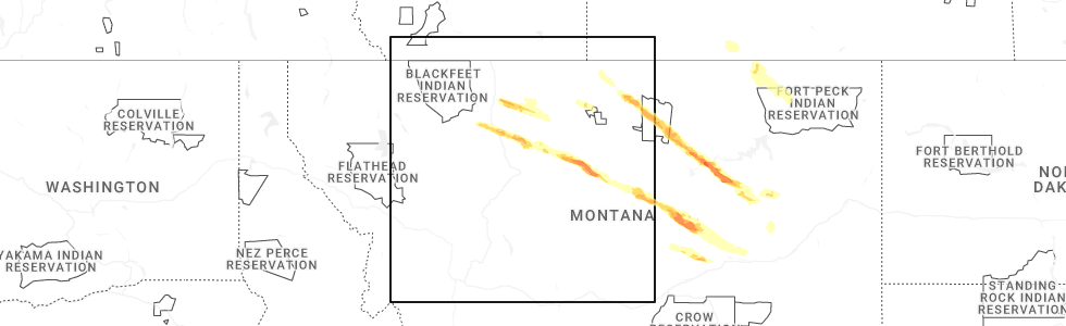
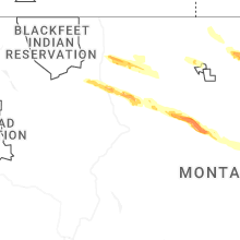
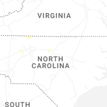
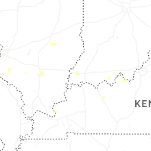
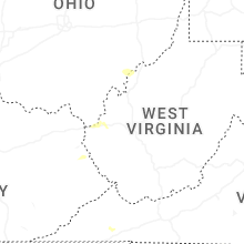
Hail Map for Thursday, July 17, 2025
Number of Impacted Households on 7/17/2025
0
Impacted by 1" or Larger Hail
0
Impacted by 1.75" or Larger Hail
0
Impacted by 2.5" or Larger Hail
Square Miles of Populated Area Impacted on 7/17/2025
0
Impacted by 1" or Larger Hail
0
Impacted by 1.75" or Larger Hail
0
Impacted by 2.5" or Larger Hail


Cities Most Affected by Hail Storms of 7/17/2025
| Hail Size | Demographics of Zip Codes Affected | ||||||
|---|---|---|---|---|---|---|---|
| City | Count | Average | Largest | Pop Density | House Value | Income | Age |
Hail and Wind Damage Spotted on 7/17/2025
Filter by Report Type:Hail ReportsWind Reports
States Impacted
Virginia, West Virginia, North Carolina, New Hampshire, Kentucky, Maine, Ohio, Vermont, Montana, Utah, TennesseeVirginia
| Local Time | Report Details |
|---|---|
| 2:25 PM EDT | Tree is down across the road near the intersection of axton road and irisburg road near axton... v in henry county VA, 48 miles SSE of Roanoke, VA |
| 3:05 PM EDT | Tree is down blocking both lanes of axton road near ridgeway... v in henry county VA, 50.4 miles SSE of Roanoke, VA |
| 4:30 PM EDT | Social media report of a tree and power lines down on blue ridge avenue near bedford... v in bedford county VA, 22.6 miles ENE of Roanoke, VA |
West Virginia
| Local Time | Report Details |
|---|---|
| 2:35 PM EDT | Tree dow in lincoln county WV, 34 miles WSW of Charleston, WV |
| 5:22 PM EDT | Tree down hanging on lin in wood county WV, 62.1 miles N of Charleston, WV |
| 5:27 PM EDT | Several reports of multiple trees dow in wood county WV, 61.4 miles N of Charleston, WV |
| 5:36 PM EDT | Corrects previous tstm wnd dmg report from 3 nw mineral wells. power lines dow in wood county WV, 59.5 miles N of Charleston, WV |
| 5:41 PM EDT | Tree down across roa in wood county WV, 62.2 miles N of Charleston, WV |
| 5:42 PM EDT | Transformer blew with three power poles dow in wood county WV, 63.5 miles NNE of Charleston, WV |
| 5:58 PM EDT | Power lines dow in wood county WV, 59.5 miles N of Charleston, WV |
North Carolina
| Local Time | Report Details |
|---|---|
| 2:45 PM EDT | Tree down across the railroad track near the intersection of old rockford road and rockford road in rockford... n in surry county NC, 73 miles N of Charlotte, NC |
| 3:05 PM EDT | Tree down near stony ridge road near pinnacle... n in surry county NC, 73.8 miles SSW of Roanoke, VA |
| 3:15 PM EDT | Tree down near the intersection of belthrop road and taylor road near stoneville... n in rockingham county NC, 54.7 miles S of Roanoke, VA |
| 3:20 PM EDT | Tree down in front of douglass elementary school on price street in eden... n in rockingham county NC, 54.6 miles S of Roanoke, VA |
| 3:30 PM EDT | Tree is down near the exit at the intersection of us-158 and us-29 near reidsville... n in rockingham county NC, 65.2 miles SSE of Roanoke, VA |
| 4:10 PM EDT | Rescue squad reports a tree blown down on sprinkle r in iredell county NC, 53.2 miles N of Charlotte, NC |
| 4:12 PM EDT | Downed tree on riverside roa in randolph county NC, 56.4 miles WSW of Raleigh, NC |
| 4:18 PM EDT | One tree down on 1000 block of pleasant hill church r in chatham county NC, 38.8 miles W of Raleigh, NC |
| 4:20 PM EDT | Rescue squad reported a tree blown down at liberty hill rd and pisgah church r in iredell county NC, 47.5 miles N of Charlotte, NC |
| 4:20 PM EDT | Rescue squad reports a tree down on hams grove r in iredell county NC, 49.1 miles N of Charlotte, NC |
| 4:25 PM EDT | Rescue squad reports a tree blown down at midway rd and caroldon l in iredell county NC, 44.8 miles N of Charlotte, NC |
| 4:28 PM EDT | Tree debris on shoulder of 6700 block of goldston carbonton roa in chatham county NC, 46.4 miles WSW of Raleigh, NC |
| 4:45 PM EDT | Rescue squad reports a tree blown down on old wilkesboro r in iredell county NC, 41.5 miles N of Charlotte, NC |
| 5:16 PM EDT | Tree down near hickory tree road and north payne roa in davidson county NC, 62.4 miles NNE of Charlotte, NC |
| 5:40 PM EDT | Power outages caused by fallen trees damaging equipment near cheryl avenue and north roxboro s in durham county NC, 25.8 miles NW of Raleigh, NC |
New Hampshire
| Local Time | Report Details |
|---|---|
| 3:05 PM EDT | Tree down on nh 113a... road closed at time of observation. time estimated by rada in carroll county NH, 59.2 miles WNW of Portland, ME |
| 3:05 PM EDT | Reported by weather spotter. tree down on n. sandwich rd partially blocking southbound lane just south of bearcamp river. tree aprox 16 inch diamete in carroll county NH, 58.4 miles WNW of Portland, ME |
Kentucky
| Local Time | Report Details |
|---|---|
| 2:31 PM CDT | Power lines down at 460 s. green street. time estimated from rada in henderson county KY, 10.3 miles S of Evansville, IN |
| 3:40 PM EDT | Tree down near the intersection of morehead road and james roa in fleming county KY, 50.1 miles NNE of Irvine, KY |
| 3:54 PM EDT | Tree down along n cedar point rd - info from 911 call cente in oldham county KY, 31.1 miles NNE of Louisville, KY |
| 3:59 PM EDT | Tree down - reported by 911 call center... near ky 1793 and north rose island r in oldham county KY, 29.7 miles N of Louisville, KY |
| 5:14 PM EDT | Multiple trees down along clay lane... madison count in madison county KY, 22.7 miles WNW of Irvine, KY |
Maine
| Local Time | Report Details |
|---|---|
| 3:53 PM EDT | Canton fire reporting a tree took powerlines down across school street in canton. time estimated by rada in oxford county ME, 57.4 miles N of Portland, ME |
| 3:58 PM EDT | Large tree down on me-133. time estimated by rada in franklin county ME, 61.6 miles N of Portland, ME |
| 6:35 PM EDT | Tree down on powerline in aroostook county ME, 2.8 miles W of Caribou, ME |
Ohio
| Local Time | Report Details |
|---|---|
| 4:33 PM EDT | Tree down. localized event and estimated based on rada in vinton county OH, 57 miles SSE of Columbus, OH |
| 4:59 PM EDT | Lines down. time estimated based on rada in athens county OH, 64.8 miles SE of Columbus, OH |
| 5:04 PM EDT | Lines down. several trees/lines down around albany. time estimated based on rada in athens county OH, 64.8 miles SE of Columbus, OH |
| 5:31 PM EDT | Tree down into powerlines. time estimated based on rada in lawrence county OH, 39.3 miles WNW of Charleston, WV |
Vermont
| Local Time | Report Details |
|---|---|
| 4:43 PM EDT | Tree... wire... and minor structural damage to a home in franklin county VT, 31 miles N of Burlington, VT |
| 6:24 PM EDT | Tree down on bridge street in royalton village in windsor county VT, 56.6 miles SE of Burlington, VT |
Montana
| Local Time | Report Details |
|---|---|
| 3:30 PM MDT | Storm damage reported in hill county MT, 44.9 miles W of Havre, MT |
| 4:13 PM MDT | Peak wind gust of 52 mph resulted in a tree branch of 6 to 12 inches in diameter breaking off. hail was the size of nickel in pondera county MT, 50.6 miles NW of Great Falls, MT |
| 4:28 PM MDT | Ambient weather statio in pondera county MT, 40.9 miles NNW of Great Falls, MT |
| 6:02 PM MDT | Ambient weather station stone windmil measured a 63 mph gus in chouteau county MT, 44.7 miles ENE of Great Falls, MT |
Utah
| Local Time | Report Details |
|---|---|
| 4:50 PM MDT | Mesonet station utlak sr-68 at mp 15 mosid in utah county UT, 40 miles S of Salt Lake City, UT |
Tennessee
| Local Time | Report Details |
|---|---|
| 6:55 PM CDT | Reported powerlines down near the intersection of e shelby dr and getwell rd. exact time estimated on rada in shelby county TN, 10.9 miles SE of Memphis, TN |
Connect with Interactive Hail Maps