

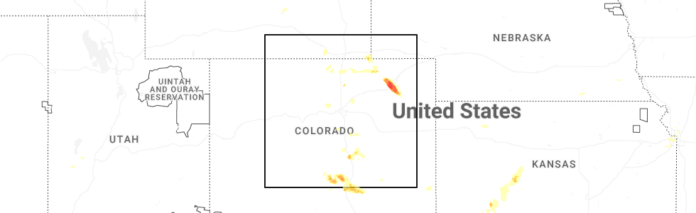
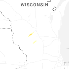
Hail Map for Wednesday, July 16, 2025
Number of Impacted Households on 7/16/2025
0
Impacted by 1" or Larger Hail
0
Impacted by 1.75" or Larger Hail
0
Impacted by 2.5" or Larger Hail
Square Miles of Populated Area Impacted on 7/16/2025
0
Impacted by 1" or Larger Hail
0
Impacted by 1.75" or Larger Hail
0
Impacted by 2.5" or Larger Hail

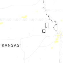
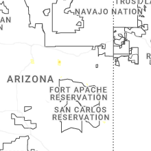
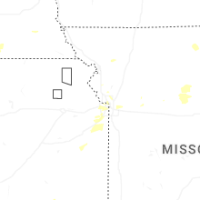
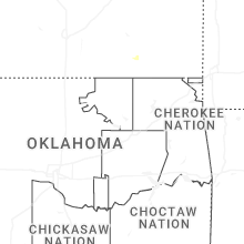

Cities Most Affected by Hail Storms of 7/16/2025
| Hail Size | Demographics of Zip Codes Affected | ||||||
|---|---|---|---|---|---|---|---|
| City | Count | Average | Largest | Pop Density | House Value | Income | Age |
| Snyder, CO | 1 | 2.00 | 2.00 | 2 | $81k | $41.2k | 40.6 |
| Merino, CO | 1 | 2.00 | 2.00 | 3 | $90k | $36.2k | 40.8 |
| Hillrose, CO | 1 | 2.00 | 2.00 | 13 | $81k | $30.0k | 42.5 |
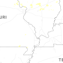
Hail and Wind Damage Spotted on 7/16/2025
Filter by Report Type:Hail ReportsWind Reports
States Impacted
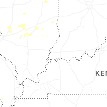
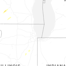
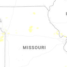
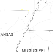
Wisconsin, Illinois, Missouri, West Virginia, Pennsylvania, North Carolina, Indiana, Florida, Ohio, Virginia, New Mexico, Colorado, Wyoming, Kansas, New York, DelawareWisconsin
| Local Time | Report Details |
|---|---|
| 12:40 PM CDT | Delayed report: tree damage near intersection of griffiths road and co hwy zz. possible tornado damage pending surve in iowa county WI, 33.2 miles W of Madison, WI |
| 2:55 PM CDT | Corrects previous tstm wnd dmg report from richford. multiple trees down. the time of this report is an estimate based on radar dat in waushara county WI, 65.4 miles N of Madison, WI |
| 3:16 PM CDT | Two large branches broken off a 10 year old tre in dane county WI, 13.7 miles NNE of Madison, WI |
| 3:19 PM CDT | Public report & photographs of tree damage off wi-78 in the wi dnr black hawk ridge unit. time estimated via radar dat in dane county WI, 21.3 miles WNW of Madison, WI |
| 3:26 PM CDT | Multiple trees dow in waushara county WI, 65.4 miles N of Madison, WI |
| 3:52 PM CDT | Power is out in the are in dane county WI, 18.9 miles E of Madison, WI |
| 4:00 PM CDT | Trees down and uprooted. garbage bins blown 75 yards. pea size hail. estimated winds of 60 mp in fond du lac county WI, 51.2 miles SSW of Green Bay, WI |
| 5:37 PM CDT | Multiple reports of trees and large branches down as well as a power pole on fir in sheboygan county WI, 54.6 miles SSE of Green Bay, WI |
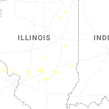
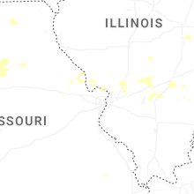
Illinois
| Local Time | Report Details |
|---|---|
| 1:07 PM CDT | Corrects time of previous tstm wnd dmg report from tiskilwa. 3 foot diameter tree branches broken off. time estimated by rada in bureau county IL, 41.5 miles N of Peoria, IL |
| 1:17 PM CDT | 3 foot diameter tree branches broken off. time estimated by rada in bureau county IL, 41.5 miles N of Peoria, IL |
| 1:28 PM CDT | Report of a down power line by the roa in ogle county IL, 80.7 miles S of Madison, WI |
| 1:52 PM CDT | Trees down blocking portions of the roadwa in kendall county IL, 39.7 miles WSW of Chicago, IL |
| 1:54 PM CDT | Estimated 60-70 mph wind in la salle county IL, 50.1 miles NNE of Peoria, IL |
| 2:15 PM CDT | Pk58 kt wind gust - awos station kpnt pontiac airpor in livingston county IL, 53.1 miles ENE of Peoria, IL |
| 2:19 PM CDT | Trees and powerlines dow in de kalb county IL, 52.2 miles WNW of Chicago, IL |
| 2:20 PM CDT | Power poles snapped around leland. relayed via la salle county so. time estimated based on rada in la salle county IL, 63 miles WSW of Chicago, IL |
| 2:43 PM CDT | Trees fell on powerlines along meadowview lan in kendall county IL, 44.7 miles WSW of Chicago, IL |
| 2:43 PM CDT | Received picture showing portion of a 4 to 5 inch diameter tree snapped along with a large limb down. time estimated via rada in kendall county IL, 46.9 miles WSW of Chicago, IL |
| 2:47 PM CDT | Photo showed on social media showed a 6 to 8 inch diameter hardwood tree snapped in half. time estimated by rada in kendall county IL, 42.6 miles WSW of Chicago, IL |
| 2:49 PM CDT | Photo of a large branch... 15 inches in diameter... snappe in kendall county IL, 40.4 miles WSW of Chicago, IL |
| 2:52 PM CDT | Trees down and blocking long beach driv in kendall county IL, 37.5 miles WSW of Chicago, IL |
| 2:52 PM CDT | Corrects previous tstm wnd dmg report from oswego. trees down blocking portions of the roadwa in kendall county IL, 39.7 miles WSW of Chicago, IL |
| 2:54 PM CDT | Tree branches down on car in kendall county IL, 38.5 miles WSW of Chicago, IL |
| 2:54 PM CDT | Photos shared of large tree limbs snapped on at least two trees in island lake. time estimated from rada in lake county IL, 39.6 miles NW of Chicago, IL |
| 2:55 PM CDT | Large tree limbs blown down at corner of west mulberry st and north catherine st. two photos showing tree branches down with one branch blocking a stree in mclean county IL, 34.7 miles ESE of Peoria, IL |
| 2:56 PM CDT | Tree blown down over north western ave near west seminary ave. blocking cul-de-sac to nicole court. photo on faceboo in mclean county IL, 33.4 miles ESE of Peoria, IL |
| 2:58 PM CDT | Large spruce tree snapped off on center street in norma in mclean county IL, 34.3 miles ESE of Peoria, IL |
| 2:59 PM CDT | Large tree blown over on emerson street in bloomington. photo on faceboo in mclean county IL, 34.4 miles ESE of Peoria, IL |
| 3:00 PM CDT | Large tree branch blown down on townley drive in stevenson subdivision and blocking road. photo on faceboo in mclean county IL, 36.3 miles ESE of Peoria, IL |
| 3:00 PM CDT | Some tree branches blown down at il wesleyan universit in mclean county IL, 34.4 miles ESE of Peoria, IL |
| 3:00 PM CDT | Tree branches blown down on north mason st in bloomingto in mclean county IL, 33.9 miles ESE of Peoria, IL |
| 3:00 PM CDT | Heavy tree damage in towanda. county highway 29 in towanda was blocked off from tree debri in mclean county IL, 37.3 miles ESE of Peoria, IL |
| 3:02 PM CDT | Large tree branch down blocking roadwa in kane county IL, 37.2 miles W of Chicago, IL |
| 3:04 PM CDT | Powerlines dow in will county IL, 34.5 miles WSW of Chicago, IL |
| 3:04 PM CDT | Personal weather statio in kane county IL, 33.2 miles W of Chicago, IL |
| 3:05 PM CDT | Received picture of part of a 6 to 8 inch diameter tree snapped. time estimated from rada in dupage county IL, 29.4 miles WSW of Chicago, IL |
| 3:05 PM CDT | Nws employee reports large 6 to 12 inch diameter tree limb down. time estimated from rada in dupage county IL, 27.1 miles WSW of Chicago, IL |
| 3:05 PM CDT | Corrects previous tstm wnd dmg report from 1 s naperville. received picture of a large 8 to 10 inch diameter tree limb down. time estimated from rada in dupage county IL, 28.3 miles WSW of Chicago, IL |
| 3:07 PM CDT | Storm damage reported in dupage county IL, 27.3 miles WSW of Chicago, IL |
| 3:08 PM CDT | Powerlines dow in will county IL, 25 miles WSW of Chicago, IL |
| 3:09 PM CDT | 6 inch tree limb dow in dupage county IL, 27.3 miles WSW of Chicago, IL |
| 3:12 PM CDT | Trees and powerlines dow in kane county IL, 36.9 miles WSW of Chicago, IL |
| 3:12 PM CDT | Powerlines dow in kane county IL, 36.4 miles WSW of Chicago, IL |
| 3:18 PM CDT | Storm damage reported in mclean county IL, 34.4 miles ESE of Peoria, IL |
| 3:19 PM CDT | Tree branches down with the largest at 6 inches in diamete in dupage county IL, 22.6 miles W of Chicago, IL |
| 3:21 PM CDT | Received pictures of a roughly 4 to 5 inch diameter tree limb down. time estimated from rada in dupage county IL, 20.5 miles W of Chicago, IL |
| 3:22 PM CDT | Picture shows a large tree limb snapped from trunk. limb appears to be about 7 to 8 inches in diameter. time estimated from rada in dupage county IL, 23.4 miles W of Chicago, IL |
| 3:24 PM CDT | Two areas of concentrated tree damage occurred surrounding north avenue in glendale heights and glen ellyn. photos depicted numerous hardwood and softwood trees snapped in dupage county IL, 22.6 miles W of Chicago, IL |
| 3:24 PM CDT | Corrects previous tstm wnd gst report from 2 sw orland par in cook county IL, 23.4 miles SSW of Chicago, IL |
| 3:25 PM CDT | Multiple public reports of downed trees and large tree limbs from a downburst on the west side of addison. time estimated from rada in dupage county IL, 21.2 miles W of Chicago, IL |
| 3:27 PM CDT | Estimated 60 mph wind in dupage county IL, 19.6 miles W of Chicago, IL |
| 3:28 PM CDT | Multiple downed tree branches up to 6 inch in diameter. relayed through social media and the time estimated through rada in dupage county IL, 18.7 miles WNW of Chicago, IL |
| 3:33 PM CDT | Photo shared on social media depicting several 6 inch diameter tree limbs downed in garfield ridge. time estimated by rada in cook county IL, 9.6 miles SW of Chicago, IL |
| 3:36 PM CDT | Photo shared on social media showing a roughly 8 inch in diameter tree branch snapped in proska park. time estimated by rada in cook county IL, 9.2 miles WSW of Chicago, IL |
| 3:38 PM CDT | Photo relayed on social media of a 1 foot in diameter tree uprooted near linden and prospect in des plaines. a portion of sidewalk was damaged by the uprooted tree... a in cook county IL, 15.8 miles NW of Chicago, IL |
| 3:38 PM CDT | Corrects previous non-tstm wnd gst report from ohare airport. peak gust of 58 kt at itws runway senso in cook county IL, 15.3 miles WNW of Chicago, IL |
| 3:41 PM CDT | Photo relayed via social media of a 4 to 6 inch diameter tree branch downed. time estimated by rada in cook county IL, 13.8 miles NW of Chicago, IL |
| 3:43 PM CDT | Multiple reports of downed trees and tree limbs across the jefferson park neighborhood of chicago. data collected from 311 requests. time estimated by rada in cook county IL, 8.9 miles NW of Chicago, IL |
| 3:43 PM CDT | Report of a 6 inch diameter tree branch down on a street sign. time estimated from rada in cook county IL, 3.1 miles S of Chicago, IL |
| 3:43 PM CDT | Received picture of a large tree limb approximately 10 to 12 inches in diameter downed onto a bus bench awning. time estimated from rada in cook county IL, 5.3 miles N of Chicago, IL |
| 3:46 PM CDT | Tree and powerlines dow in kane county IL, 36.2 miles WSW of Chicago, IL |
| 3:52 PM CDT | A piece of a roof blew into the gangway between two building in cook county IL, 5.3 miles N of Chicago, IL |
| 3:53 PM CDT | Mesonet station xmtb montrose beach ligh in lmz741 county IL, 5.9 miles N of Chicago, IL |
| 3:58 PM CDT | Storm damage reported in cook county IL, 23.4 miles SSW of Chicago, IL |
| 3:58 PM CDT | Five minutes of gusts in excess of 60 kt with peak gust of 64 k in lmz741 county IL, 4.1 miles NE of Chicago, IL |
| 3:58 PM CDT | Photo showing approximately 1 foot diameter tree limb downed onto a mobile home/trailer in blue island... causing damage to its roof. time estimated from rada in cook county IL, 17 miles S of Chicago, IL |
| 4:03 PM CDT | Ham radio relayed a report of 60 mph wind gusts and 8 inch tree limbs down near bluebird lane and il route 109. time estimated by rada in jersey county IL, 33.2 miles N of Saint Louis, MO |
| 4:05 PM CDT | Received picture of a large 8 to 10 inch diameter tree limb down. time estimated from rada in dupage county IL, 28.3 miles WSW of Chicago, IL |
| 4:06 PM CDT | 6 inch limb snapped one half mile south of us 24 on il 11 in ford county IL, 74 miles E of Peoria, IL |
| 4:21 PM CDT | Photo shared of a large... rotted tree snapped a few feet up from its base... partially landing on the roof of a house and an adjacent garage building in ashkum. time e in iroquois county IL, 71.2 miles SSW of Chicago, IL |
| 5:28 PM CDT | Tree down at the ramsey substation. time estimated from rada in fayette county IL, 40.4 miles WSW of Mattoon, IL |
| 5:45 PM CDT | Limbs up to 4 inches in diameter snapped in st. elmo. time estimated from rada in fayette county IL, 40.2 miles SW of Mattoon, IL |
| 6:30 PM CDT | Tree down in this general location. time estimated from rada in marion county IL, 62.1 miles SSW of Mattoon, IL |
Missouri
| Local Time | Report Details |
|---|---|
| 3:06 PM CDT | Per lincoln county central dispatch... a power pole was down near elsberry. time estimated by rada in lincoln county MO, 50.2 miles NW of Saint Louis, MO |
| 4:00 PM CDT | Electric lines down at fox run road and vee valley farms. time estimated by rada in lincoln county MO, 44.5 miles NW of Saint Louis, MO |
| 5:41 PM CDT | Downed tree and wires near railroad street. time estimated from rada in randolph county MO, 25.8 miles NNW of Columbia, MO |
| 6:08 PM CDT | Downed tree on wires near route nn. time estimated from rada in randolph county MO, 27.5 miles N of Columbia, MO |
| 6:11 PM CDT | Downed tree and wires near county road 190. time estimated from rada in randolph county MO, 27.5 miles N of Columbia, MO |
| 7:20 PM CDT | Downed wires near tom watson parkway. time estimated from rada in platte county MO, 9.7 miles NW of Kansas City, MO |
| 7:24 PM CDT | Quarter sized hail reported near Riverside, MO, 6.1 miles NNW of Kansas City, MO, minor dents to a vehicle. time estimated from radar. |
| 7:43 PM CDT | Downed wires near hardesty avenue. time estimated from rada in jackson county MO, 3.7 miles ESE of Kansas City, MO |
| 7:54 PM CDT | Mping report of three inch limbs down at this location. time estimated from rada in jackson county MO, 6.7 miles E of Kansas City, MO |
| 7:56 PM CDT | Trees and limbs down at a residence. time estimated from rada in jackson county MO, 8.7 miles ESE of Kansas City, MO |
| 8:00 PM CDT | Downed tree limb and wires near 10th street. time estimated from rada in jackson county MO, 7.2 miles E of Kansas City, MO |
| 8:21 PM CDT | Mping report of trees down herndon street. time estimated from rada in howard county MO, 23.5 miles NW of Columbia, MO |
| 9:02 PM CDT | 68 mph wind gust measured by personal weather statio in clay county MO, 21.2 miles N of Kansas City, MO |
| 11:56 PM CDT | Downed power poles closed mm hwy between 250 rd and ne 951 rd. time estimated from rada in johnson county MO, 58.9 miles ESE of Kansas City, MO |
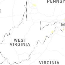
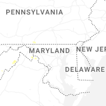
West Virginia
| Local Time | Report Details |
|---|---|
| 4:11 PM EDT | Two trees reported down on carpers pike near capon lake/yellow sprin in hampshire county WV, 72.6 miles ENE of Elkins, WV |
| 6:20 PM EDT | Tree and power lines dow in wirt county WV, 48.6 miles N of Charleston, WV |
| 6:22 PM EDT | Quarter sized hail reported near Charles Town, WV, 67 miles W of Baltimore, MD, quarter size hail |
| 6:25 PM EDT | Structural damage to 151 augustine ave in jefferson county WV, 67 miles W of Baltimore, MD |
| 7:01 PM EDT | Numerous trees down in mckinleyvill in brooke county WV, 34.6 miles WSW of Pittsburgh, PA |
| 7:05 PM EDT | Numerous trees down in wellsbur in brooke county WV, 34.4 miles WSW of Pittsburgh, PA |
| 7:17 PM EDT | Tree and power lines dow in wood county WV, 60.1 miles N of Charleston, WV |
| 7:30 PM EDT | Tree dow in kanawha county WV, 21.7 miles ENE of Charleston, WV |
| 7:30 PM EDT | Tree dow in lincoln county WV, 14.6 miles SW of Charleston, WV |
| 8:30 PM EDT | Tree dow in kanawha county WV, 18.8 miles ENE of Charleston, WV |
| 10:15 PM EDT | Structural damage to 151 augustine ave in jefferson county WV, 67 miles W of Baltimore, MD |
| 10:34 PM EDT | Tree down near ellens ln & blazers rd. time estimated based off rada in preston county WV, 33.5 miles NNE of Elkins, WV |
| 10:37 PM EDT | Report of large tree blocking river road near pringle run. time estimated based on rada in preston county WV, 35.2 miles NNE of Elkins, WV |
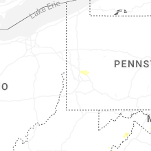
Pennsylvania
| Local Time | Report Details |
|---|---|
| 4:27 PM EDT | A tree was reported down near us-2 in westmoreland county PA, 34.2 miles E of Pittsburgh, PA |
| 6:20 PM EDT | A tree was reported down in wexfor in allegheny county PA, 13.5 miles NNW of Pittsburgh, PA |
| 6:20 PM EDT | Half Dollar sized hail reported near Gibsonia, PA, 15.4 miles N of Pittsburgh, PA |
| 6:30 PM EDT | Half Dollar sized hail reported near Gibsonia, PA, 13.3 miles N of Pittsburgh, PA |
| 7:01 PM EDT | Corrects previous tstm wnd dmg report from 2 sse lower burrell. a tree was reported down on mcintyre lan in westmoreland county PA, 17.5 miles ENE of Pittsburgh, PA |
| 7:23 PM EDT | Corrects previous tstm wnd dmg report from 1 wnw mars. tree resting on wires. no specific location on forsythe road was give in butler county PA, 18.1 miles N of Pittsburgh, PA |
| 7:30 PM EDT | A tree was reported down on mcintyre lan in westmoreland county PA, 17.5 miles ENE of Pittsburgh, PA |
| 7:36 PM EDT | Tree blocking roa in butler county PA, 23.2 miles NE of Pittsburgh, PA |
| 7:54 PM EDT | Large limbs snapped and damage to car on haines av in allegheny county PA, 5.7 miles WNW of Pittsburgh, PA |
| 9:47 PM EDT | Tree resting on wires. no specific location on forsythe road was give in butler county PA, 18.1 miles N of Pittsburgh, PA |
North Carolina
| Local Time | Report Details |
|---|---|
| 5:03 PM EDT | Nearly 2000 customers without power due to trees falling on equipmen in lee county NC, 36.9 miles WSW of Raleigh, NC |
Indiana
| Local Time | Report Details |
|---|---|
| 4:11 PM CDT | Received picture of approximately 8 inch diameter tree snapped. time estimated from rada in lake county IN, 29 miles SSE of Chicago, IL |
| 4:40 PM CDT | Storm damage reported in lake county IN, 31.7 miles SE of Chicago, IL |
| 6:43 PM EDT | A few trees down. time estimated by rada in marshall county IN, 71.6 miles ESE of Chicago, IL |
Florida
| Local Time | Report Details |
|---|---|
| 5:50 PM EDT | Citrus county so reports multiple trees down in beverly hills. time estimated from rada in citrus county FL, 71.3 miles WNW of Orlando, FL |
| 5:57 PM EDT | Citrus county sherriffs office reports trees down near the intersection of west citrus springs blvd and n deltona blv in citrus county FL, 71 miles WNW of Orlando, FL |
Ohio
| Local Time | Report Details |
|---|---|
| 6:20 PM EDT | Tree down. time estimated from rada in vinton county OH, 60.8 miles NW of Charleston, WV |
Virginia
| Local Time | Report Details |
|---|---|
| 6:35 PM EDT | Large tree down on zachary taylor hwy and willis chapel in rappahannock county VA, 87 miles WSW of Baltimore, MD |
| 6:41 PM EDT | Reports of several trees down west of lovettsville near the wv lin in loudoun county VA, 57.4 miles W of Baltimore, MD |
| 6:59 PM EDT | Two trees reported down on zachary taylor highway near huntl in rappahannock county VA, 87.2 miles WSW of Baltimore, MD |
| 7:13 PM EDT | Numerous calls for trees down near luckett in loudoun county VA, 49.6 miles W of Baltimore, MD |
| 7:13 PM EDT | 8 different calls for trees down near waterfor in loudoun county VA, 52.9 miles WSW of Baltimore, MD |
| 7:14 PM EDT | Multiple trees reported down in waterfor in loudoun county VA, 54.1 miles W of Baltimore, MD |
| 7:34 PM EDT | Large tree down on holsinger rd in rockingham county VA, 61.7 miles ESE of Elkins, WV |
| 7:35 PM EDT | Large tree down near intersection of stoneburner rd and grover rd in shenandoah county VA, 66.6 miles E of Elkins, WV |
| 7:37 PM EDT | Tree down near intersection of readus rd and stoneburner rd in shenandoah county VA, 67.8 miles E of Elkins, WV |
| 7:55 PM EDT | Three calls of trees down south of the plains near old tavern road and james madison highwa in fauquier county VA, 69.1 miles WSW of Baltimore, MD |
| 8:00 PM EDT | Multiple trees down on piney hill road in lura in page county VA, 76.8 miles ESE of Elkins, WV |
| 8:02 PM EDT | Tree down between stanley and lura in page county VA, 76.4 miles ESE of Elkins, WV |
| 8:10 PM EDT | Large tree down at 500 mill creek rd in page county VA, 76.6 miles ESE of Elkins, WV |
| 8:10 PM EDT | Multiple trees down in the forest hills subdivision in page county VA, 76.4 miles ESE of Elkins, WV |
| 8:10 PM EDT | Tree down on south court st near mill creek rd in page county VA, 76.4 miles ESE of Elkins, WV |
| 8:13 PM EDT | Large tree knocked down onto a fence near luray ave and 4th st in page county VA, 77.5 miles ESE of Elkins, WV |
| 8:36 PM EDT | Two calls for trees down near bull ru in prince william county VA, 60.3 miles SW of Baltimore, MD |
| 8:36 PM EDT | Numerous trees down in and around midlan in fauquier county VA, 75.6 miles SW of Baltimore, MD |
| 8:40 PM EDT | Tree down at 6184 cooper ln in fauquier county VA, 70.7 miles WSW of Baltimore, MD |
| 8:40 PM EDT | Numerous trees down in and around auburn in fauquier county VA, 70.5 miles SW of Baltimore, MD |
| 8:53 PM EDT | Several calls for downed trees and wires near manassa in prince william county VA, 60.3 miles SW of Baltimore, MD |
| 9:02 PM EDT | Large tree down at intersection of rectortown rd and frogtown rd in fauquier county VA, 71.7 miles WSW of Baltimore, MD |
| 9:27 PM EDT | Tree down on mt. carmel rd at mill creek rd in page county VA, 75.9 miles ESE of Elkins, WV |
| 9:47 PM EDT | Multiple trees down along lakewood rd near business us 340 in page county VA, 76.6 miles ESE of Elkins, WV |
| 9:51 PM EDT | Power poles down on mill creed rd in page county VA, 75.7 miles ESE of Elkins, WV |
| 9:54 PM EDT | Trees down along piney woods rd in page county VA, 75.2 miles ESE of Elkins, WV |
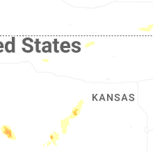
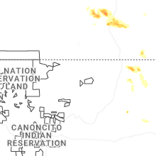
New Mexico
| Local Time | Report Details |
|---|---|
| 4:40 PM MDT | Ping Pong Ball sized hail reported near Des Moines, NM, 95.4 miles ENE of Taos, NM, quarter to ping pong ball size hail. accumulation of dime to nickel size hail on roadways. location estimated via radar. |
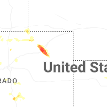
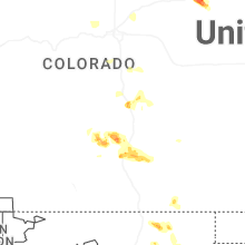
Colorado
| Local Time | Report Details |
|---|---|
| 4:41 PM MDT | Ping Pong Ball sized hail reported near Fountain, CO, 31.8 miles N of Pueblo, CO |
| 4:48 PM MDT | Quarter sized hail reported near Colorado Springs, CO, 29.8 miles NNW of Pueblo, CO |
| 5:35 PM MDT | Hen Egg sized hail reported near Merino, CO, 41.2 miles WNW of Yuma, CO |
| 5:36 PM MDT | Quarter sized hail reported near Snyder, CO, 44.3 miles WNW of Yuma, CO, report from mping: quarter (1.00 in.). |
| 5:40 PM MDT | Hen Egg sized hail reported near Hillrose, CO, 41.3 miles WNW of Yuma, CO, picked up an hour and a half after the event. largest measured stone was 2.1 inches. report via x. |
| 5:41 PM MDT | Hen Egg sized hail reported near Snyder, CO, 44.3 miles WNW of Yuma, CO, report from mping: hen egg (2.00 in.). |
| 5:50 PM MDT | Mesonet station co183 i-76 merino exi in washington county CO, 41.1 miles WNW of Yuma, CO |
Wyoming
| Local Time | Report Details |
|---|---|
| 5:28 PM MDT | Nws employee estimates 60mph gusts in cheyenn in laramie county WY, 42.4 miles ESE of Laramie, WY |
| 5:58 PM MDT | Nws employee reporting several 2 to 3 inch thick branches snapped off of live tre in laramie county WY, 42.4 miles ESE of Laramie, WY |
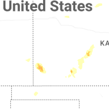
Kansas
| Local Time | Report Details |
|---|---|
| 6:30 PM CDT | Wind estimated to be gusting from 50 to 60 mph. time estimated from rada in hodgeman county KS, 49.4 miles SSW of Hays, KS |
| 6:39 PM CDT | Report was from the b-hart farm awn weather statio in hodgeman county KS, 62.3 miles SSW of Hays, KS |
| 6:42 PM CDT | Report received from an awn weather statio in hodgeman county KS, 64.9 miles SSW of Hays, KS |
| 7:21 PM CDT | Report received from wxrfs weather statio in ford county KS, 48.8 miles ESE of Garden City, KS |
| 7:22 PM CDT | Downed tree and wires near 51st street. time estimated from rada in wyandotte county KS, 7.4 miles WNW of Kansas City, MO |
| 7:40 PM CDT | Downed tree limbs and wires near 30th street. time estimated from rada in wyandotte county KS, 4.5 miles WNW of Kansas City, MO |
| 7:55 PM CDT | Dodge city asos reported 77 mph wind in ford county KS, 51.4 miles ESE of Garden City, KS |
| 7:56 PM CDT | 3 inch diameter tree was blown down in chilton par in ford county KS, 48.1 miles ESE of Garden City, KS |
| 7:58 PM CDT | Mping report of tree limbs down at this location. time confirmed from rada in wyandotte county KS, 6.3 miles WNW of Kansas City, MO |
| 8:02 PM CDT | Report received from the dodge city american implement awn weather statio in ford county KS, 51.1 miles ESE of Garden City, KS |
| 8:04 PM CDT | Report received from the asos station kddc dodge city regional airpor in ford county KS, 51.2 miles ESE of Garden City, KS |
| 8:10 PM CDT | Tree blown down across the roa in ford county KS, 49 miles ESE of Garden City, KS |
| 8:10 PM CDT | Quarter sized hail reported near Dodge City, KS, 49.9 miles ESE of Garden City, KS |
| 8:15 PM CDT | Roof blown off a trailer house located on the 2700 block of east trail stree in ford county KS, 50.6 miles ESE of Garden City, KS |
| 8:15 PM CDT | Report received from kksbloom2 weather statio in ford county KS, 59.9 miles ESE of Garden City, KS |
| 8:25 PM CDT | Two telephone poles blown down on highway 283 near the expo center south of dodge cit in ford county KS, 49.7 miles ESE of Garden City, KS |
| 8:30 PM CDT | Several 14-to-16-inch tree limbs blown dow in ford county KS, 54.4 miles ESE of Garden City, KS |
| 9:12 PM CDT | Mesonet station up367 4.9 ne meade (upr in meade county KS, 55.1 miles SE of Garden City, KS |
| 10:55 PM CDT | Storm damage reported in johnson county KS, 25.1 miles SW of Kansas City, MO |
| 11:02 PM CDT | Storm damage reported in johnson county KS, 25.1 miles SW of Kansas City, MO |
| 11:35 PM CDT | Storm damage reported in stanton county KS, 54.1 miles WSW of Garden City, KS |
| 2:35 AM CDT | Storm damage reported in wabaunsee county KS, 34.4 miles ESE of Manhattan, KS |
| 3:04 AM CDT | Time estimated. 5 inch diameter tree branch dow in jefferson county KS, 43.4 miles W of Kansas City, MO |
| 3:53 AM CDT | Storm damage reported in franklin county KS, 47.5 miles SW of Kansas City, MO |
New York
| Local Time | Report Details |
|---|---|
| 9:56 PM EDT | Delayed report... time estimated based on radar. trees and wires down in the town of wolcot in wayne county NY, 35.5 miles WNW of Syracuse, NY |
| 10:05 PM EDT | Delayed report... time estimated based on radar. trees and wired down around the town of red cree in wayne county NY, 32.1 miles WNW of Syracuse, NY |
| 10:14 PM EDT | Delayed report... time estimated based on radar. trees and wires down in the town of fair have in cayuga county NY, 34.3 miles NW of Syracuse, NY |
Delaware
| Local Time | Report Details |
|---|---|
| 10:59 PM EDT | Report of a tree into a house near theodora court and south woodmill drive in the marshallton area of wilmington. time estimated from rada in new castle county DE, 58.3 miles ENE of Baltimore, MD |
Connect with Interactive Hail Maps