

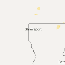
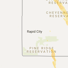
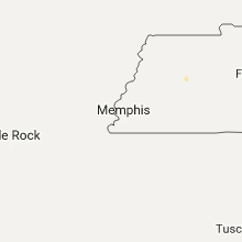
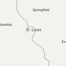
Hail Map for Wednesday, July 5, 2017

Number of Impacted Households on 7/5/2017
0
Impacted by 1" or Larger Hail
0
Impacted by 1.75" or Larger Hail
0
Impacted by 2.5" or Larger Hail
Square Miles of Populated Area Impacted on 7/5/2017
0
Impacted by 1" or Larger Hail
0
Impacted by 1.75" or Larger Hail
0
Impacted by 2.5" or Larger Hail


Cities Most Affected by Hail Storms of 7/5/2017
| Hail Size | Demographics of Zip Codes Affected | ||||||
|---|---|---|---|---|---|---|---|
| City | Count | Average | Largest | Pop Density | House Value | Income | Age |
| Westhope, ND | 2 | 1.75 | 1.75 | 2 | $24k | $28.1k | 49.5 |
| Bath, SD | 1 | 1.75 | 1.75 | 9 | $88k | $38.0k | 38.2 |
Hail and Wind Damage Spotted on 7/5/2017
Filter by Report Type:Hail ReportsWind Reports
States Impacted
Tennessee, North Carolina, Alabama, Florida, South Carolina, Illinois, New Mexico, North Dakota, Georgia, Utah, Montana, Texas, South Dakota, Wisconsin, Iowa, Nebraska, MinnesotaTennessee
| Local Time | Report Details |
|---|---|
| 2:05 PM CDT | A tree was blown down on morton driv in lincoln county TN, 68.2 miles ENE of Florence, AL |
| 2:06 PM CDT | Trees were reported down on kelso-smithland roa in lincoln county TN, 64.3 miles W of Chattanooga, TN |
| 2:08 PM CDT | Numerous trees were reported down on kelso-mulberry road and providence roa in lincoln county TN, 66.4 miles W of Chattanooga, TN |
| 2:08 PM CDT | At this location on kelso-mulberry road... an old house was heavily damaged. winds ripped numerous shingles off of this house. also... winds snapped porch columns and b in lincoln county TN, 66.3 miles W of Chattanooga, TN |
| 2:10 PM CDT | Power lines down in the twin oaks subdivisio in lincoln county TN, 68.8 miles ENE of Florence, AL |
| 2:12 PM CDT | A tree was blown down on cooper branch roa in lincoln county TN, 64.2 miles W of Chattanooga, TN |
| 2:25 PM CDT | Power lines downed. reported by medi in lincoln county TN, 68.1 miles W of Chattanooga, TN |
| 2:57 PM CDT | Tree blown down at 165 farris creek bridge r in franklin county TN, 55.9 miles W of Chattanooga, TN |
| 3:02 PM CDT | Trees blown down on beth page r in franklin county TN, 48.4 miles WNW of Chattanooga, TN |
| 3:07 PM CDT | Tree blown down on guard rail adjacent to the golf cours in franklin county TN, 46.3 miles WNW of Chattanooga, TN |
| 3:11 PM CDT | Two trees blown down at the intersection of morris ferry bridge rd. and beth page r in franklin county TN, 48.6 miles WNW of Chattanooga, TN |
| 3:12 PM CDT | Two trees blown down on power lines along hillwood d in franklin county TN, 49.8 miles WNW of Chattanooga, TN |
| 3:16 PM CDT | Power lines blown down in the 1700 block of beth page r in franklin county TN, 48.4 miles WNW of Chattanooga, TN |
| 4:15 PM CDT | Several trees down across eastern bledsoe count in bledsoe county TN, 42.6 miles NNE of Chattanooga, TN |
| 7:00 PM CDT | Several trees down.some trees fell on houses and are blocking roads. highway 70 between flat bottom rd and 424 has the most damage. trees down along highway 70 between in carroll county TN, 22 miles SSW of Mc Kenzie, TN |
| 7:00 PM CDT | Several trees down.some trees fell on houses and are blocking roads. highway 70 between flat bottom rd and 424 has the most damage. trees down along highway 70 between in carroll county TN, 22 miles SSW of Mc Kenzie, TN |
| 7:15 PM CDT | The sonic fast food drive through awning torn partially of in carroll county TN, 10.5 miles SE of Mc Kenzie, TN |
| 8:45 PM CDT | 4 trees down in waverly in humphreys county TN, 40.9 miles E of Mc Kenzie, TN |
| 8:59 PM CDT | Tree down on power lines and house north of mcewen in humphreys county TN, 48.6 miles E of Mc Kenzie, TN |
North Carolina
| Local Time | Report Details |
|---|---|
| 3:20 PM EDT | Trees down off of hwy 321 at n highland av in caldwell county NC, 52.9 miles NW of Charlotte, NC |
| 3:20 PM EDT | 911 call center reported two mobile homes destroyed by falling trees on pibs lane. also a garage damaged in the same area. numerous trees blown dow in caldwell county NC, 53.6 miles NW of Charlotte, NC |
| 3:30 PM EDT | 2 trees down on houses on n highland av in caldwell county NC, 52.9 miles NW of Charlotte, NC |
| 3:35 PM EDT | Tree down on a mobile home on providence st in granite fall in caldwell county NC, 52.9 miles NW of Charlotte, NC |
| 3:38 PM EDT | Trees and powerlines down 1 mile north of granite falls in caldwell county NC, 53 miles NW of Charlotte, NC |
| 3:45 PM EDT | Tree down on granite falls middle school. time estimated from rada in caldwell county NC, 52.3 miles NW of Charlotte, NC |
| 3:48 PM EDT | Large tree uprooted on icard dam rd at addison ln. time estimated from rada in caldwell county NC, 49.7 miles NW of Charlotte, NC |
| 4:00 PM EDT | Trees and powerlines down on the 1200 block of deacon d in mcdowell county NC, 66.2 miles SSE of Bristol, TN |
| 4:24 PM EDT | Power lines down on roadway on burma rd e in mcdowell county NC, 65.5 miles SSE of Bristol, TN |
| 4:25 PM EDT | Tree down across harmony grove rd in mcdowell county NC, 65.2 miles SSE of Bristol, TN |
| 4:36 PM EDT | Numerous large limbs down at nc hwy 126 and la foret d in burke county NC, 63 miles NW of Charlotte, NC |
| 4:39 PM EDT | Trees down on nc hwy 226 s and ag services r in mcdowell county NC, 63.9 miles SSE of Bristol, TN |
| 4:45 PM EDT | Power lines down on deer park r in mcdowell county NC, 66.6 miles WNW of Charlotte, NC |
| 4:45 PM EDT | Power lines down on deer park r in mcdowell county NC, 66.6 miles WNW of Charlotte, NC |
| 4:58 PM EDT | Tree on house at piney rd and greenlee d in burke county NC, 59.4 miles SSE of Bristol, TN |
| 4:58 PM EDT | Tree down on hopewell church r in catawba county NC, 30.1 miles NNW of Charlotte, NC |
| 4:58 PM EDT | Tree down on miller farm r in iredell county NC, 41.5 miles N of Charlotte, NC |
| 5:05 PM EDT | Law enforcement reported a tree down on power lines at hovis rd and green road in gaston county NC, 18.5 miles WNW of Charlotte, NC |
| 5:35 PM EDT | 2 trees down and fence blown over on austin ridge ln in mecklenburg county NC, 8.4 miles NW of Charlotte, NC |
| 5:42 PM EDT | Few trees and limbs down west of asheville in buncombe county NC, 51.7 miles N of Greenville, SC |
| 5:45 PM EDT | Numerous large trees down on mt. holly-huntersville rd at kennewick rd. time estimated from rada in mecklenburg county NC, 9.6 miles NNW of Charlotte, NC |
| 5:50 PM EDT | Numerous tree limbs and power lines down on beatties ford rd between charlotte and huntersville. time estimated from rada in mecklenburg county NC, 6.2 miles NNW of Charlotte, NC |
| 5:54 PM EDT | Tree down on power lines on miranda rd. time estimated from rada in mecklenburg county NC, 8 miles NNW of Charlotte, NC |
| 6:00 PM EDT | Tree down on car on 4800 block of sherborne d in cabarrus county NC, 11.9 miles ENE of Charlotte, NC |
| 6:39 PM EDT | A couple of trees reported down on old sandbar rd. at 653 pm. time of occurrence estimated by radar at 639 p in stanly county NC, 28.9 miles E of Charlotte, NC |
| 6:45 PM EDT | Tree and power lines down on elizabeth av in union county NC, 24.1 miles SE of Charlotte, NC |
| 6:47 PM EDT | Trees reported down on thomas rd. at 705 pm. time of occurrence estimated by radar at 647 p in anson county NC, 32.3 miles E of Charlotte, NC |
| 7:09 PM EDT | Trees down on powerlines in marshville causing numerous power outage in union county NC, 31 miles ESE of Charlotte, NC |
| 7:45 PM EDT | A couple of trees dow in richmond county NC, 59.3 miles ESE of Charlotte, NC |
| 7:50 PM EDT | A couple of trees down at us 220 and crestview d in richmond county NC, 62 miles ESE of Charlotte, NC |
| 8:32 PM EDT | Tree reported down at 3547 union ridge rd at 839 pm. time of occurrence estimated by rada in alamance county NC, 50.5 miles WNW of Raleigh, NC |
| 8:35 PM EDT | Trees and power lines reported down on ridge rd. near lake cammack at 848 pm. time of occurrence of 835 pm estimated by rada in alamance county NC, 51.2 miles NW of Raleigh, NC |
| 9:11 PM EDT | A tree was blown down along park spring roa in caswell county NC, 61.9 miles SSE of Roanoke, VA |
| 9:11 PM EDT | A tree was blown down along mountain hill roa in caswell county NC, 61.3 miles SE of Roanoke, VA |
| 9:19 PM EDT | Three trees down in the 1500 block of mt. willing r in orange county NC, 35.6 miles WNW of Raleigh, NC |
| 9:20 PM EDT | A tree was blown down along culver road near the intersection with highway 6 in caswell county NC, 60.4 miles NNW of Raleigh, NC |
Alabama
| Local Time | Report Details |
|---|---|
| 2:55 PM CDT | Several reports of trees and power lines down throughout the city of gadsden. gadsden airport awos reported a 44mph gust as the storms moved throug in etowah county AL, 57.2 miles NE of Birmingham, AL |
| 3:00 PM CDT | Tree on house and power lines down at sims street in glenco in etowah county AL, 59.1 miles ENE of Birmingham, AL |
| 3:00 PM CDT | Trees down on houses at main street... sims st... nancy carol rd... pineview ave... and sam nabors rd. all in glencoe. in addition... trees have been reported down acro in etowah county AL, 58.8 miles ENE of Birmingham, AL |
| 3:05 PM CDT | 800 block of covington avenue in e bham... bfr has a tree on house with lines down. time estimated from radar. corrected street locatio in jefferson county AL, 8.1 miles ENE of Birmingham, AL |
| 3:05 PM CDT | Trees down at rutherford circle in birmingham (roebuck springs). via social medi in jefferson county AL, 7.3 miles ENE of Birmingham, AL |
Florida
| Local Time | Report Details |
|---|---|
| 4:40 PM EDT | Emergency manager reported several trees down along county road 18 on both sides of u.s. highway 301 in the hampton area. a few of trees took down some power lines as w in bradford county FL, 43.9 miles SW of Jacksonville, FL |
| 5:00 PM EDT | County dispatch reported a couple trees and power lines down along hwy 5 in lafayette county FL, 62.9 miles ESE of Tallahassee, FL |
| 6:00 PM EDT | Power line down at 5144 louvinia dr in leon county FL, 9.9 miles ESE of Tallahassee, FL |
| 6:05 PM EDT | Tree down near intersection of maclay road and bobbin mill road in leon county FL, 5.6 miles N of Tallahassee, FL |
| 7:35 PM EDT | *** 2 inj *** a large tree fell onto a van trapping one person and injuring 2 peopl in hillsborough county FL, 33.5 miles NNE of Bradenton, FL |
South Carolina
| Local Time | Report Details |
|---|---|
| 4:50 PM EDT | Multiple trees down on w union rd in the town of west union. time estimated from rada in oconee county SC, 25.8 miles WSW of Greenville, SC |
| 5:10 PM EDT | Tree iblocking the road at the intersection of s charleston rd and piano r in darlington county SC, 75.1 miles N of Charleston, SC |
| 6:40 PM EDT | Public reported a tree fell on and destroyed a shed on cumberland driv in greenville county SC, 20.8 miles ENE of Greenville, SC |
| 7:00 PM EDT | Broadcast media reported snapped trees and power outages near intersection of south spencer street and woods chapel roa in spartanburg county SC, 26.5 miles ENE of Greenville, SC |
Illinois
| Local Time | Report Details |
|---|---|
| 4:02 PM CDT | 8 inch diamter willow tree blown over. time estimated from radar. near i-39 and us 2 in winnebago county IL, 57.9 miles SSE of Madison, WI |
| 4:44 PM CDT | Quarter sized hail reported near Mount Morris, IL, 70.6 miles S of Madison, WI, report from mount morris fire department relayed by ogle co. emergency manager. |
New Mexico
| Local Time | Report Details |
|---|---|
| 3:25 PM MDT | White sands missile range - phillips hil in lincoln county NM, 92.9 miles W of Roswell, NM |
North Dakota
| Local Time | Report Details |
|---|---|
| 3:30 PM MDT | Quarter sized hail reported near Mott, ND, 79.7 miles WSW of Bismarck, ND |
| 4:10 PM MDT | Relayed through faceboo in grant county ND, 59.2 miles WSW of Bismarck, ND |
| 4:20 PM MDT | Quarter sized hail reported near Elgin, ND, 57.8 miles WSW of Bismarck, ND |
| 7:05 PM CDT | Deputy estimated wind at least 60 mph. heavy rainfall. pea to some nickel sized hai in emmons county ND, 54.6 miles SSE of Bismarck, ND |
| 10:36 PM CDT | Quarter sized hail reported near Pettibone, ND, 61.4 miles ENE of Bismarck, ND |
| 11:42 PM CDT | Quarter sized hail reported near Westhope, ND, 48.9 miles NNE of Minot, ND, quarter size hail. public report relayed by local broadcast media. |
| 11:45 PM CDT | Half Dollar sized hail reported near Westhope, ND, 48.3 miles NNE of Minot, ND, a few hailstones up to half dollar size in westhope. |
| 11:45 PM CDT | Ping Pong Ball sized hail reported near Westhope, ND, 48.3 miles NNE of Minot, ND |
| 11:50 PM CDT | Golf Ball sized hail reported near Westhope, ND, 48.3 miles NNE of Minot, ND |
| 12:11 AM CDT | Quarter sized hail reported near Northwood, ND, 61.8 miles ESE of Devils Lake, ND |
| 12:20 AM CDT | Golf Ball sized hail reported near Westhope, ND, 48.3 miles NNE of Minot, ND |
| 12:25 AM CDT | Storm damage reported in cavalier county ND, 50 miles NNE of Devils Lake, ND |
| 12:28 AM CDT | Quarter sized hail reported near Souris, ND, 44.6 miles NE of Minot, ND |
| 12:30 AM CDT | Half Dollar sized hail reported near Aneta, ND, 50.2 miles SE of Devils Lake, ND, relayed via social media |
| 12:30 AM CDT | Half Dollar sized hail reported near Aneta, ND, 49.7 miles SE of Devils Lake, ND, relayed via social media |
| 1:12 AM CDT | Quarter sized hail reported near Towner, ND, 49 miles E of Minot, ND, relayed through broadcast media from facebook. |
| 1:24 AM CDT | Quarter sized hail reported near Towner, ND, 41.9 miles ENE of Minot, ND, relayed through broadcast media from facebook. |
| 1:30 AM CDT | Quarter sized hail reported near Towner, ND, 43.7 miles ENE of Minot, ND, hailed for roughly 20 min. winds est. 40 mph. |
Georgia
| Local Time | Report Details |
|---|---|
| 5:32 PM EDT | Tree reported down at the intersection of gene nix rd and ashbury mill r in white county GA, 64.5 miles NNE of Atlanta, GA |
| 5:32 PM EDT | Power lines reported down at the intersection of peaceful valley rd and ashbury mill r in white county GA, 63.6 miles NNE of Atlanta, GA |
| 5:41 PM EDT | Power lines reported down at the intersection of ridge rd and hwy 7 in white county GA, 65.9 miles W of Greenville, SC |
| 5:45 PM EDT | Multiple trees reported down near fish creek community... trees down in the 800 block of bethlehem r in polk county GA, 46.2 miles WNW of Atlanta, GA |
| 5:45 PM EDT | Multiple trees reported down near fish creek community... trees down in the 1100 block of stringer r in polk county GA, 45.6 miles WNW of Atlanta, GA |
| 5:45 PM EDT | Multiple trees reported down near fish creek community... trees down in the 200 block of knight r in polk county GA, 46.7 miles WNW of Atlanta, GA |
| 5:45 PM EDT | Tree reported down near the intersection of lanier valley drive and hwy 53 in hall county GA, 48.7 miles NE of Atlanta, GA |
| 6:11 PM EDT | Reported damage to a transformer on hwy 51 near jacks d in banks county GA, 62 miles NE of Atlanta, GA |
| 6:24 PM EDT | Tree reported down near the intersection of n mangum bridge road and w ridgeway rd in banks county GA, 61.2 miles NE of Atlanta, GA |
| 6:28 PM EDT | Tree reported down near the intersection of chambers rd and hwy 5 in banks county GA, 62.4 miles SW of Greenville, SC |
| 6:30 PM EDT | Trees and power lines reported down at the intersection of dallas acworth hwy and homestead d in paulding county GA, 27.4 miles NW of Atlanta, GA |
| 7:30 PM EDT | 911 call center reported several trees down east of nahunta. time is estimated based on radar imager in brantley county GA, 58.1 miles ESE of Douglas, GA |
| 8:34 PM EDT | The awos at fort stewart /klhw/ reported a 50 knot wind gust in a thunderstor in liberty county GA, 32.1 miles WSW of Savannah, GA |
| 9:31 PM EDT | Public reported a 15 inch diameter tree snapped off in his yard. small hail also occurrin in chatham county GA, 9.7 miles WNW of Savannah, GA |
| 9:32 PM EDT | Storm damage reported in chatham county GA, 7.3 miles WNW of Savannah, GA |
Utah
| Local Time | Report Details |
|---|---|
| 3:43 PM MDT | Udot sensor at kimball junction i80... ut. kij in summit county UT, 18.4 miles E of Salt Lake City, UT |
Montana
| Local Time | Report Details |
|---|---|
| 4:56 PM MDT | Peak wind gust at the bozeman airport (kbzn in gallatin county MT, 9.8 miles NW of Bozeman, MT |
| 5:11 PM MDT | Kbzk reported an irrigation wheel line blew into traffic and caused vehicle damage on valley center west of bozeman. time estimate in gallatin county MT, 7.5 miles NW of Bozeman, MT |
| 5:11 PM MDT | Kbzk reported tree and property damage in the four corners area south of bozeman from thunderstorm winds. nw energy reported power outages. possibly caused by strong co in gallatin county MT, 6.9 miles S of Bozeman, MT |
| 5:36 PM MDT | Ktvm relayed report of a tree down in the basin area. the tree landed on a truck and damaged a carport. time estimated from rada in jefferson county MT, 71.8 miles NW of Bozeman, MT |
| 6:08 PM MDT | Outbuilding thrown off foundation. probable microburst. time estimated from rada in stillwater county MT, 21.1 miles WNW of Billings, MT |
| 7:00 PM MDT | Outflow wind from thunderstorm caused branches to be knocked off trees near the town of townsend...which fell on nearby power lines and knocked some lines down. no hail in broadwater county MT, 50.1 miles NNW of Bozeman, MT |
| 8:19 PM MDT | Storm damage reported in wheatland county MT, 86.4 miles NW of Billings, MT |
Texas
| Local Time | Report Details |
|---|---|
| 6:06 PM CDT | Ftw reported 50 kt wind gust in tarrant county TX, 33.5 miles W of Dallas, TX |
South Dakota
| Local Time | Report Details |
|---|---|
| 6:16 PM CDT | Storm damage reported in brown county SD, 9.3 miles NW of Aberdeen, SD |
| 6:21 PM CDT | Quarter sized hail reported near Aberdeen, SD, 2.7 miles NW of Aberdeen, SD, just north of wylie park. |
| 6:32 PM CDT | Two trees down. winds estimated to be 60 to 70 mp in edmunds county SD, 13.3 miles W of Aberdeen, SD |
| 6:48 PM CDT | Quarter sized hail reported near Bath, SD, 8.2 miles E of Aberdeen, SD |
| 6:48 PM CDT | Golf Ball sized hail reported near Bath, SD, 8.4 miles ENE of Aberdeen, SD |
| 6:22 PM MDT | Storm damage reported in dewey county SD, 63.8 miles NW of Pierre, SD |
| 7:55 PM CDT | Quarter sized hail reported near Ashton, SD, 31.7 miles S of Aberdeen, SD |
| 8:48 PM CDT | Ping Pong Ball sized hail reported near Frederick, SD, 25.1 miles N of Aberdeen, SD, time estimated by radar - report received via facebook - size estimated. |
| 8:49 PM CDT | Storm damage reported in hughes county SD, 3.1 miles ENE of Pierre, SD |
| 9:00 PM CDT | Storm damage reported in hughes county SD, 32.2 miles ENE of Pierre, SD |
| 9:00 PM CDT | Storm damage reported in hughes county SD, 17.3 miles NE of Pierre, SD |
| 9:07 PM CDT | Storm damage reported in hyde county SD, 46.4 miles ENE of Pierre, SD |
| 9:10 PM CDT | Storm damage reported in hughes county SD, 18.4 miles ESE of Pierre, SD |
| 9:20 PM CDT | Time estimated by rada in lyman county SD, 17.4 miles S of Pierre, SD |
| 9:28 PM CDT | Storm damage reported in lyman county SD, 34.8 miles SSE of Pierre, SD |
| 9:35 PM CDT | Storm damage reported in lyman county SD, 34.8 miles SSE of Pierre, SD |
| 9:36 PM CDT | Storm damage reported in lyman county SD, 35.2 miles SSE of Pierre, SD |
| 10:12 PM CDT | Storm damage reported in lyman county SD, 53.2 miles SE of Pierre, SD |
| 10:27 PM CDT | Storm damage reported in sanborn county SD, 84.7 miles WNW of Sioux Falls, SD |
| 10:55 PM CDT | Via sdsu mesonet sit in aurora county SD, 87.9 miles N of Oneill, NE |
| 11:14 PM CDT | Storm damage reported in aurora county SD, 87.3 miles N of Oneill, NE |
| 11:20 PM CDT | Via geddes raws. 60 minute max gust. time estimated from rada in charles mix county SD, 55.7 miles N of Oneill, NE |
Wisconsin
| Local Time | Report Details |
|---|---|
| 6:53 PM CDT | Law enforcement reported power lines and trees down near tomah in monroe county WI, 40.9 miles ENE of La Crosse, WI |
Iowa
| Local Time | Report Details |
|---|---|
| 7:25 PM CDT | Time of the event was estimated using rada in des moines county IA, 41.4 miles NE of Kahoka, MO |
| 8:04 PM CDT | Quarter sized hail reported near Dundee, IA, 42.1 miles N of Cedar Rapids, IA, 0.50 to 1.0 inch. relayed by the emergency manager |
| 8:05 PM CDT | 20 to 30 trees down across town. estimated winds of 50 to 60mph.rain was very heavy at the time. report was relayed by the emergency manage in dubuque county IA, 46.7 miles NE of Cedar Rapids, IA |
| 8:55 PM CDT | Storm damage reported in jones county IA, 31.3 miles NE of Cedar Rapids, IA |
| 9:22 PM CDT | Multiple trees and limbs down on the north side of anamosa. some came down on power lines. time estimated using radar. also reported pea to dime sized hai in jones county IA, 22.3 miles ENE of Cedar Rapids, IA |
| 9:23 PM CDT | Widespread trees... limbs... and power lines down in anamosa. three homes have damage from trees falling on them. time of the report was estimated using rada in jones county IA, 22.3 miles ENE of Cedar Rapids, IA |
| 10:00 PM CDT | Large tree branches down on power lines near the intersection of covington road and lone tree road. time estimated from rada in linn county IA, 6.6 miles NW of Cedar Rapids, IA |
Nebraska
| Local Time | Report Details |
|---|---|
| 12:40 AM CDT | Storm damage reported in holt county NE, 0.2 miles NNW of Oneill, NE |
Minnesota
| Local Time | Report Details |
|---|---|
| 1:30 AM CDT | Quarter sized hail reported near Moose Lake, MN, 39.5 miles SW of Duluth, MN, photo sent into local media station and relayed. |
| 2:50 AM CDT | Quarter sized hail reported near Laporte, MN, 19.1 miles SW of Bemidji, MN |
| 2:55 AM CDT | Quarter sized hail reported near Laporte, MN, 18.1 miles SSW of Bemidji, MN |
| 4:23 AM CDT | Tree reported down on highway 200. time estimated from rada in aitkin county MN, 69.8 miles WNW of Duluth, MN |
| 4:32 AM CDT | Quarter sized hail reported near Finlayson, MN, 59.1 miles SW of Duluth, MN |
| 4:45 AM CDT | Quarter sized hail reported near Hinckley, MN, 68 miles SW of Duluth, MN |
| 4:52 AM CDT | Large double spruce tree uprooted. tree damaged northwest side of the home it fell on. time estimated from rada in itasca county MN, 59.9 miles ENE of Bemidji, MN |
Connect with Interactive Hail Maps