

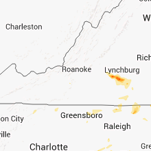
Hail Map for Monday, July 9, 2012

Number of Impacted Households on 7/9/2012
0
Impacted by 1" or Larger Hail
0
Impacted by 1.75" or Larger Hail
0
Impacted by 2.5" or Larger Hail
Square Miles of Populated Area Impacted on 7/9/2012
0
Impacted by 1" or Larger Hail
0
Impacted by 1.75" or Larger Hail
0
Impacted by 2.5" or Larger Hail


Cities Most Affected by Hail Storms of 7/9/2012
| Hail Size | Demographics of Zip Codes Affected | ||||||
|---|---|---|---|---|---|---|---|
| City | Count | Average | Largest | Pop Density | House Value | Income | Age |
Hail and Wind Damage Spotted on 7/9/2012
Filter by Report Type:Hail ReportsWind Reports
States Impacted
Washington, North Carolina, South Carolina, Tennessee, Virginia, Michigan, Oklahoma, Texas, Georgia, Wisconsin, Iowa, Idaho, AlabamaWashington
| Local Time | Report Details |
|---|---|
| 7:15 AM PDT | Numerous trees down and damage to barn and shed at a family farm near colfa in whitman county WA, 54.1 miles S of Spokane, WA |
| 7:15 AM PDT | Roof torn off barn in whitman county WA, 49.3 miles S of Spokane, WA |
North Carolina
| Local Time | Report Details |
|---|---|
| 2:40 PM EDT | Multiple trees down on hwy 401 in harnett county NC, 33.7 miles SSW of Raleigh, NC |
| 2:41 PM EDT | Tree on power line - camp easter road. tree down on jupiter creek rd in moore county NC, 59.7 miles SW of Raleigh, NC |
| 2:42 PM EDT | 1 tree down on bunn level road in harnett county NC, 33.7 miles SSW of Raleigh, NC |
| 2:50 PM EDT | 2 trees down in moore county NC, 62.5 miles SW of Raleigh, NC |
| 2:51 PM EDT | Tree on a powerline in fuquay-varina in wake county NC, 15.8 miles SSW of Raleigh, NC |
| 3:00 PM EDT | 2 trees snapped and 2 large limbs down along i-26 between mile markers 69 and 7 in polk county NC, 35 miles NE of Greenville, SC |
| 3:02 PM EDT | Roof blown off a wooden barn... several trees down in cumberland county NC, 38.9 miles SSW of Raleigh, NC |
| 3:14 PM EDT | Multiple trees down on south point and reese wilson road in mecklenburg county NC, 12.9 miles SW of Charlotte, NC |
| 3:14 PM EDT | Multiple trees down on south point and reese wilson road in gaston county NC, 11.5 miles WSW of Charlotte, NC |
| 3:16 PM EDT | 1 tree and 2 power poles down along highway 211 2 miles west of raeford in hoke county NC, 65 miles SSW of Raleigh, NC |
| 3:30 PM EDT | 1 tree down in cumberland county NC, 41.4 miles SSW of Raleigh, NC |
| 3:35 PM EDT | Large limb on power line - blown transformer in wake county NC, 14.1 miles SW of Raleigh, NC |
| 3:35 PM EDT | Trees down on west arrowood road near south tryon street. time estimated by rada in mecklenburg county NC, 7.2 miles SW of Charlotte, NC |
| 3:45 PM EDT | A tree down on power line on lakeside dr and multiple power lines down on high ridge roa in mecklenburg county NC, 6.4 miles S of Charlotte, NC |
| 3:57 PM EDT | Tree down on commanche lan in union county NC, 12.9 miles SE of Charlotte, NC |
| 4:02 PM EDT | Public report of 65 mph gusts measured on weather senso in union county NC, 16.1 miles SE of Charlotte, NC |
| 4:24 PM EDT | Several reports of trees down in the monroe and wingate areas. time estimated with rada in union county NC, 27.2 miles SE of Charlotte, NC |
| 4:25 PM EDT | Quarter sized hail reported near Belvidere, NC, 40.7 miles SW of Virginia Beach, VA |
| 4:40 PM EDT | Lots of large tree limbs down in pitt county NC, 73.1 miles ESE of Raleigh, NC |
| 4:40 PM EDT | Public reported a tree down along gum swamp road in pitt county NC, 75.5 miles ESE of Raleigh, NC |
| 4:40 PM EDT | Quarter sized hail reported near Ayden, NC, 77.1 miles ESE of Raleigh, NC, public reported dime to quarter size hail to the se of ayden along gum swamp road |
| 4:50 PM EDT | Quarter sized hail reported near Belvidere, NC, 42.8 miles SW of Virginia Beach, VA, several small limbs downed. |
| 4:50 PM EDT | Several large trees down in anson county NC, 35 miles ESE of Charlotte, NC |
| 4:50 PM EDT | Several power lines down on ansonville roa in union county NC, 29.3 miles ESE of Charlotte, NC |
| 5:03 PM EDT | Numerous trees and power lines down and some carport damage in lilesville. time estimated by radar. location is estimated at this tim in anson county NC, 51.1 miles ESE of Charlotte, NC |
| 5:15 PM EDT | Powerlines down on yates hill road in richmond county NC, 62.5 miles ESE of Charlotte, NC |
| 5:20 PM EDT | Several large tree limbs down on market street. time estimated by rada in beaufort county NC, 90.9 miles E of Raleigh, NC |
| 5:30 PM EDT | Dot reported two trees blown down in vicinity of mt. gilead. time estimate in montgomery county NC, 47.4 miles E of Charlotte, NC |
| 5:40 PM EDT | Several large tree limbs down on hwy 32. time estimated by rada in beaufort county NC, 90.1 miles SSW of Virginia Beach, VA |
| 6:09 PM EDT | Tree down on powerlines causing power outages in new london and badin. time estimated by rada in stanly county NC, 41.9 miles ENE of Charlotte, NC |
| 6:30 PM EDT | Tree down off route 86 in caswell county NC, 54.9 miles NW of Raleigh, NC |
| 6:55 PM EDT | Tree down off route 62 south in caswell county NC, 55.6 miles NW of Raleigh, NC |
| 7:10 PM EDT | Power lines blown down along martin road. time estimate in warren county NC, 53.5 miles NNE of Raleigh, NC |
| 7:30 PM EDT | Large limbs blown down near parktown road. time estimate in warren county NC, 45 miles NE of Raleigh, NC |
| 7:39 PM EDT | Tree blown down near highway 158 and airport road. time estimate in warren county NC, 55.8 miles NE of Raleigh, NC |
South Carolina
| Local Time | Report Details |
|---|---|
| 2:50 PM EDT | Tree and power line blocking both lanes of holly springs school road. another tree was blown down on meece mill rd near gravley r in pickens county SC, 12.7 miles NW of Greenville, SC |
| 3:44 PM EDT | Van wyck post office reported trees down on van wyck road 2 miles north of town. time estimated based on rada in lancaster county SC, 23.6 miles S of Charlotte, NC |
| 4:05 PM EDT | Schp reported trees down on angelus rd at black creek bridge. time estimated based on rada in chesterfield county SC, 52.7 miles SE of Charlotte, NC |
| 4:08 PM EDT | A couple of trees down on huey road near mt gallant roa in york county SC, 20.3 miles SSW of Charlotte, NC |
| 4:10 PM EDT | Sheriffs office reported powerlines and trees down in the town of chesterfield in chesterfield county SC, 53.9 miles SE of Charlotte, NC |
| 4:23 PM EDT | Tree down in rd on ross dye rd in chester county SC, 43.7 miles S of Charlotte, NC |
| 4:31 PM EDT | Trees down in road on strough rd in chester county SC, 42.8 miles S of Charlotte, NC |
| 4:31 PM EDT | Tree down in roadway off of highway 97 in chester county SC, 43.6 miles S of Charlotte, NC |
| 4:56 PM EDT | Downburst visually observed and measured wind gust to 61 mph in florence county SC, 71.2 miles N of Charleston, SC |
| 5:09 PM EDT | Large branches down in florence county SC, 68.7 miles N of Charleston, SC |
| 5:13 PM EDT | Large tree down on power line... plenty of large and moderate size limbs down from other trees and dime to nickel size hail in florence county SC, 68.5 miles N of Charleston, SC |
| 8:18 PM EDT | A couple of trees down on us hwy 221 s near callison roa in greenwood county SC, 42.6 miles NNW of Augusta, GA |
Tennessee
| Local Time | Report Details |
|---|---|
| 4:00 PM EDT | A couple of trees dow in sevier county TN, 13.7 miles E of Knoxville, TN |
Virginia
| Local Time | Report Details |
|---|---|
| 4:15 PM EDT | Trees down on red house road in appomattox county VA, 61.8 miles E of Roanoke, VA |
| 4:21 PM EDT | Quarter sized hail reported near Phenix, VA, 63.2 miles E of Roanoke, VA |
| 4:30 PM EDT | Quarter sized hail reported near Appomattox, VA, 63.3 miles WSW of Richmond, VA, broadcast media out of lynchburg relayed a report of quarter-sized hail near the charlotte county line. |
| 4:42 PM EDT | Quarter sized hail reported near Cullen, VA, 58.8 miles WSW of Richmond, VA |
| 5:15 PM EDT | Tree down in prince edward county VA, 56.3 miles WSW of Richmond, VA |
| 5:15 PM EDT | Numerous trees down vicinity of county roads 667 and 668 in prince edward county VA, 54.8 miles WSW of Richmond, VA |
| 6:00 PM EDT | Trees down in victori in lunenburg county VA, 47.3 miles SW of Richmond, VA |
Michigan
| Local Time | Report Details |
|---|---|
| 3:25 PM CDT | Delayed report. extensive tree damage at the riverside golf club. many trees greater than two feet in diameter were uprooted across the course. very strong winds observ in menominee county MI, 45.1 miles NNE of Green Bay, WI |
| 3:25 PM CDT | Delayed report. dozens of snapped branches and several large trees greater than 18 inches in diameter fell onto grave markers at riverside cemeter in menominee county MI, 44.9 miles NNE of Green Bay, WI |
| 6:55 PM CDT | A few 8 inch diameter trees were snapped. trees fell on power lines causing a power outage. pea size hail and heavy rain were also reporte in menominee county MI, 70.2 miles SSW of Marquette, MI |
Oklahoma
| Local Time | Report Details |
|---|---|
| 4:00 PM CDT | Storm damage reported in mcclain county OK, 33.9 miles S of Oklahoma City, OK |
| 5:30 PM CDT | Storm damage reported in grady county OK, 27.8 miles WSW of Oklahoma City, OK |
Texas
| Local Time | Report Details |
|---|---|
| 5:18 PM CDT | Large limbs down at airport...68 mph wind at aso in tom green county TX, 87.3 miles SSW of Abilene, TX |
| 5:18 PM CDT | Two hangers damaged with their doors torn off and thrown 30 fee in tom green county TX, 86.7 miles SSW of Abilene, TX |
| 6:05 PM CDT | Storm damage reported in williamson county TX, 44 miles S of Killeen, TX |
| 6:05 PM CDT | Wind gusts broke 2-3 inch branches from several trees in williamson county TX, 41.3 miles S of Killeen, TX |
| 6:20 PM CDT | Pea size hail reported along with wind gusts in williamson county TX, 43.9 miles S of Killeen, TX |
| 6:25 PM CDT | Ping Pong Ball sized hail reported near Austin, TX, 46 miles S of Killeen, TX, wind gusts 60-70mph also reported |
| 7:15 PM CDT | Roof blew off the mustang inn in reagan county TX, 70.6 miles SE of Odessa, TX |
| 7:30 PM CDT | Trees blown down throughout the western half of the county in rains county TX, 57.1 miles E of Dallas, TX |
| 7:58 PM CDT | Quarter sized hail reported near Wills Point, TX, 46.6 miles E of Dallas, TX, spotter for local station reported quarter sized hail |
| 8:15 PM CDT | Trees down just north of wills point in van zandt county TX, 46.6 miles E of Dallas, TX |
| 10:10 PM CDT | Several trees down in wilson county TX, 30.8 miles ESE of San Antonio, TX |
Georgia
| Local Time | Report Details |
|---|---|
| 6:30 PM EDT | 17 trees down in the northern part of morgan county in morgan county GA, 50.7 miles E of Atlanta, GA |
| 6:35 PM EDT | Morgan county ema relayed a report of several trees...more than 6 down in the are in morgan county GA, 51.2 miles ESE of Atlanta, GA |
| 7:35 PM EDT | Half Dollar sized hail reported near Augusta, GA, 7.2 miles WNW of Augusta, GA, nws charleston relayed a report from a trained spotter of quarter to half dollar sized hail in martinez |
| 8:59 PM EDT | Quarter sized hail reported near Stone Mountain, GA, 16.3 miles ENE of Atlanta, GA, public relayed a report of quarter sized hail in the mountain park area. |
| 11:00 PM EDT | 6 to 8 trees down in fulton county GA, 0.1 miles NNE of Atlanta, GA |
Wisconsin
| Local Time | Report Details |
|---|---|
| 5:30 PM CDT | Tree down in pulaski in brown county WI, 14.9 miles NW of Green Bay, WI |
| 5:42 PM CDT | Half dozen trees either snapped off or uprooted. also hail up to 3/4 inch diameter covering the ground. location 1 mile northeast of pittsfield on hwy 3 in brown county WI, 12 miles WNW of Green Bay, WI |
Iowa
| Local Time | Report Details |
|---|---|
| 5:34 PM CDT | Large tree limb down on fence. heard transformer blow out and lost powe in polk county IA, 13.6 miles NNW of Des Moines, IA |
Idaho
| Local Time | Report Details |
|---|---|
| 4:51 PM MDT | Skull gulch raws at 5878 ft in lemhi county ID, 31.5 miles WNW of Salmon, ID |
| 5:15 PM MDT | The asos at the burly airport recorded a 78 mph peak wind gust at 515 pm in cassia county ID, 34.7 miles E of Twin Falls, ID |
| 5:36 PM MDT | Salmon raws at 5100 ft in lemhi county ID, 3.2 miles SW of Salmon, ID |
Alabama
| Local Time | Report Details |
|---|---|
| 6:30 PM CDT | A tree fell on a trailer near autaugaville. people may have been briefly trapped inside. winds estimated at 40 to 45 mp in autauga county AL, 47.7 miles NE of Camden, AL |
| 8:24 PM CDT | Tree downed as well as a live power line on martin luther king drive in talladega. estimated 40mph gus in talladega county AL, 41.6 miles E of Birmingham, AL |
| 8:55 PM CDT | A few trees down in separate locations that are blocking roadways on the east side of birmingham. winds estimated at 40 to 45 mp in jefferson county AL, 3.6 miles E of Birmingham, AL |
| 10:08 PM CDT | One power line down on ewing avenue. wind estimated around 35 mp in etowah county AL, 57.2 miles NE of Birmingham, AL |
Connect with Interactive Hail Maps