

Hail Map for Monday, June 27, 2011

Number of Impacted Households on 6/27/2011
0
Impacted by 1" or Larger Hail
0
Impacted by 1.75" or Larger Hail
0
Impacted by 2.5" or Larger Hail
Square Miles of Populated Area Impacted on 6/27/2011
0
Impacted by 1" or Larger Hail
0
Impacted by 1.75" or Larger Hail
0
Impacted by 2.5" or Larger Hail


Cities Most Affected by Hail Storms of 6/27/2011
| Hail Size | Demographics of Zip Codes Affected | ||||||
|---|---|---|---|---|---|---|---|
| City | Count | Average | Largest | Pop Density | House Value | Income | Age |
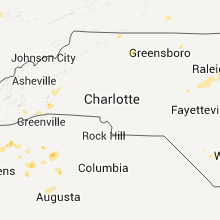
| Birmingham, AL | 2 | 1.75 | 1.75 | 1593 | $200k | $63.0k | 38.4 |
| Sunbury, NC | 2 | 1.75 | 1.75 | 18 | $72k | $32.6k | 44.5 |
| Elbert, CO | 1 | 2.50 | 2.50 | 23 | $220k | $76.4k | 45.1 |
| Fountain, FL | 1 | 1.75 | 1.75 | 60 | $43k | $25.5k | 40.6 |
Hail and Wind Damage Spotted on 6/27/2011
Filter by Report Type:Hail ReportsWind Reports
States Impacted
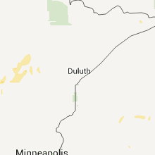
Minnesota, Georgia, Kentucky, Illinois, Indiana, North Carolina, Alabama, Florida, Tennessee, Virginia, Wisconsin, Ohio, Colorado, New Mexico, Texas, Missouri, Oklahoma, ArkansasMinnesota
| Local Time | Report Details |
|---|---|
| 1:40 PM UTC | Trees down in the grand rapids are in itasca county MN, 66 miles ESE of Bemidji, MN |
| 1:58 PM UTC | Trees blown down on county roads 8 and 56 near nashwauk. time estimated. a few trees on power lines and power outages in the grand rapids area and to the east near nash in itasca county MN, 65 miles NW of Duluth, MN |
Georgia
| Local Time | Report Details |
|---|---|
| 3:15 PM UTC | Quarter sized hail reported near Woodland, GA, 55.2 miles ENE of Auburn, AL, upson emc crew member reports nickle and quarter size hail in woodland. |
| 3:16 PM UTC | Upson emc reported over half a dozen lines down in the area of hwy 36...harvey ingram road...and mountain valley roa in talbot county GA, 58.1 miles ENE of Auburn, AL |
| 5:04 PM UTC | Douglas county emergency management relayed a report of a downed tree on dorsett bridge roa in douglas county GA, 24.7 miles WSW of Atlanta, GA |
| 9:20 PM UTC | 4 trees down at hwy 145 and hwy 10 in franklin county GA, 45.3 miles SW of Greenville, SC |
| 11:15 PM UTC | Preliminary reports of numerous trees down east of quitma in brooks county GA, 52.9 miles ENE of Tallahassee, FL |
| 10:30 AM UTC | Sheriff dispatch reported wires down along doug barnard pkw in richmond county GA, 4.8 miles S of Augusta, GA |
| 11:45 AM UTC | Sheriff dispatch reported a tree blocking wire roa in mcduffie county GA, 27.7 miles W of Augusta, GA |
Kentucky
| Local Time | Report Details |
|---|---|
| 4:56 PM UTC | 2 trees down on stratford road between la center and kevi in ballard county KY, 35.5 miles ESE of Cape Girardeau, MO |
| 5:02 PM UTC | Wind gust reported along highway 60 just west of paduca in mccracken county KY, 52.4 miles ESE of Cape Girardeau, MO |
| 5:10 PM UTC | Large limbs down on south side...widespread power outages...some limbs down on cars and power lines down on trimple stree in mccracken county KY, 52.4 miles ESE of Cape Girardeau, MO |
| 5:10 PM UTC | Large tree down on roadway on mayfield-metropolis roa in mccracken county KY, 52.4 miles ESE of Cape Girardeau, MO |
| 5:10 PM UTC | Tree on home on jefferson stree in mccracken county KY, 52.4 miles ESE of Cape Girardeau, MO |
| 5:27 PM UTC | Large limbs down. siding blown off of a hous in livingston county KY, 64.1 miles E of Cape Girardeau, MO |
| 5:37 PM UTC | Estimated winds 60 to 70 mph. numerous large tree limbs dow in lyon county KY, 68 miles SSW of Evansville, IN |
| 5:50 PM UTC | Time estimated. numerous large tree limbs down on the west side of tow in daviess county KY, 28.5 miles ESE of Evansville, IN |
| 5:52 PM UTC | Measured on west side of tow in daviess county KY, 28.5 miles ESE of Evansville, IN |
| 5:59 PM UTC | Measured in downtown owensboro along parrish stree in daviess county KY, 28.5 miles ESE of Evansville, IN |
| 6:32 PM UTC | Two trees down on route 973 at elm street in dunmor kentucky. time of damage radar-estimate in muhlenberg county KY, 64.3 miles NNW of Nashville, TN |
| 8:50 PM UTC | Trees down along hatcher road. one tree on mobile hom in laurel county KY, 39.5 miles S of Irvine, KY |
| 8:53 PM UTC | Trees damaged and down on copley road and copley lane off of echo valle in laurel county KY, 47.9 miles S of Irvine, KY |
| 10:15 PM UTC | Trees down approximately 3 inch in diameter in yards and branches down in the roads. espotter repor in harlan county KY, 50.3 miles WNW of Bristol, TN |
| 10:21 PM UTC | Multiple large tree limbs and branches down in yard and in roadway. 0.90 inches of rainfall also measure in harlan county KY, 46.2 miles NW of Bristol, TN |
| 6:50 AM UTC | Trees down on scottsville roa in warren county KY, 56.2 miles NNE of Nashville, TN |
| 6:50 AM UTC | Trees down in plum springs and trees down on glasgow road and moreman lan in warren county KY, 64.3 miles NNE of Nashville, TN |
| 7:38 AM UTC | Two trees down in the city of frankli in simpson county KY, 40.5 miles NNE of Nashville, TN |
Illinois
| Local Time | Report Details |
|---|---|
| 5:37 PM UTC | Estimated winds 60 to 70 mph. numerous large tree limbs down. /corrected location from eddyville ky to unionville il in massac county IL, 56.3 miles ESE of Cape Girardeau, MO |
Indiana
| Local Time | Report Details |
|---|---|
| 5:40 PM UTC | Large building nearly leveled. at least one other smaller building destroyed. several tree limbs down. minor damage to a couple of homes...including the loss of a few s in vanderburgh county IN, 6.3 miles NE of Evansville, IN |
North Carolina
| Local Time | Report Details |
|---|---|
| 5:50 PM UTC | Tree down in lee county NC, 31.2 miles WSW of Raleigh, NC |
| 6:05 PM UTC | Tree down on trent rd. time estimated by rada in pamlico county NC, 92.3 miles NE of Wilmington, NC |
| 6:09 PM UTC | Skywarn spotter observed estimated wind gust 62 mph and penny size hai in wake county NC, 4.7 miles SW of Raleigh, NC |
| 6:11 PM UTC | Wect reports multiple trees down about three quarters of a mile from the intersection of highway 210 and 53 near kelly. some trees were uprooted and some were snappe in bladen county NC, 26.8 miles NW of Wilmington, NC |
| 6:16 PM UTC | Several limbs up to 10 inch diameter and small trees down near manor ridge dr in wake county NC, 7.7 miles SSW of Raleigh, NC |
| 6:17 PM UTC | Multiple trees down in downtown new bern near main and chatman rd in craven county NC, 78.4 miles NE of Wilmington, NC |
| 6:18 PM UTC | One tree down on lake wheeler road in wake county NC, 5.2 miles SSW of Raleigh, NC |
| 6:18 PM UTC | Several trees down near mid pines road... time estimated by radar in wake county NC, 5 miles SW of Raleigh, NC |
| 6:20 PM UTC | Tree down near buffaloe lanes on highway 40 in wake county NC, 7.6 miles SSW of Raleigh, NC |
| 6:27 PM UTC | Quarter sized hail reported near Raleigh, NC, 3.4 miles NE of Raleigh, NC, nws employee reported quarter size hail |
| 6:30 PM UTC | Tree down blocking hwy 55 in stonewall in pamlico county NC, 92.8 miles NE of Wilmington, NC |
| 6:35 PM UTC | Wind gust to 48 mph during thunderstorm at the nws office on ncsu centennial campus. numerous limbs dow in wake county NC, 1.4 miles SW of Raleigh, NC |
| 6:35 PM UTC | Quarter sized hail reported near Lake Waccamaw, NC, 36.4 miles WNW of Wilmington, NC |
| 6:40 PM UTC | One tree down near the intersection of wendell road and salem church road in johnston county NC, 16.5 miles ESE of Raleigh, NC |
| 6:50 PM UTC | Tree down on squirrel den road in nash county NC, 30.7 miles E of Raleigh, NC |
| 6:51 PM UTC | Powerline down on hanes avenue in nash county NC, 24.9 miles E of Raleigh, NC |
| 6:55 PM UTC | Lee co 911 reported tree down at 2551 buckhorn r in lee county NC, 28.1 miles SW of Raleigh, NC |
| 7:00 PM UTC | Three trees down near the intersection of nc-181 and frank whisnant road in the oak hill communit in burke county NC, 61 miles SSE of Bristol, TN |
| 7:01 PM UTC | Tree down near bailey in nash county NC, 29.4 miles E of Raleigh, NC |
| 7:01 PM UTC | Tree down on powerline in nash county NC, 26.2 miles ENE of Raleigh, NC |
| 7:01 PM UTC | Tree down on powerlines on old nash road in nash county NC, 28.3 miles ENE of Raleigh, NC |
| 7:16 PM UTC | Tree down on webbs mill roa in nash county NC, 31.2 miles ENE of Raleigh, NC |
| 7:16 PM UTC | Tree down on seven paths roa in nash county NC, 30.7 miles ENE of Raleigh, NC |
| 7:18 PM UTC | One tree across road near intersection of boykin bridge road and peterson road in sampson county NC, 53.7 miles NNW of Wilmington, NC |
| 7:31 PM UTC | Tree down on house in wilson county NC, 39 miles E of Raleigh, NC |
| 7:36 PM UTC | Tree down on west castalia roa in nash county NC, 41.9 miles ENE of Raleigh, NC |
| 7:43 PM UTC | Tree down on a house on benton pond road in freemont... people still in the house in wayne county NC, 44.1 miles ESE of Raleigh, NC |
| 7:50 PM UTC | Golf Ball sized hail reported near Sunbury, NC, 33.2 miles SW of Virginia Beach, VA, golfball size hail along rte 158 in the great dismal swamp |
| 8:01 PM UTC | Multiple trees and powerlines down near kingsboro road and us 64 alt in edgecombe county NC, 55.4 miles E of Raleigh, NC |
| 8:15 PM UTC | Numerous trees down on indian woods road...just west of windsor in bertie county NC, 73.5 miles SW of Virginia Beach, VA |
| 8:27 PM UTC | Tree down on nc 125 near scotland nec in halifax county NC, 72.1 miles ENE of Raleigh, NC |
| 8:28 PM UTC | Large branches dow in columbus county NC, 45.1 miles WNW of Wilmington, NC |
| 8:35 PM UTC | Storm damage reported in martin county NC, 76.3 miles E of Raleigh, NC |
| 8:44 PM UTC | Trees down near county home rd and nc hwy 102 in pitt county NC, 74.5 miles ESE of Raleigh, NC |
| 8:45 PM UTC | Multiple trees down along us-117 and in calypso in duplin county NC, 53.9 miles SSE of Raleigh, NC |
| 8:50 PM UTC | Golf Ball sized hail reported near Sunbury, NC, 33.2 miles SW of Virginia Beach, VA, golfball size hail along rte 158 in the dismal swamp. |
| 8:50 PM UTC | Numerous trees down just off of lewiston road in bertie county NC, 79.7 miles SW of Virginia Beach, VA |
| 9:07 PM UTC | Multiple trees down along harry arys road in martin county NC, 85 miles E of Raleigh, NC |
| 12:34 AM UTC | Tree down on foxpark drive in forsyth county NC, 58.4 miles NNE of Charlotte, NC |
| 12:35 AM UTC | Trees down in the city of king in stokes county NC, 72.2 miles SSW of Roanoke, VA |
| 12:54 AM UTC | Tree down on us 52 near winston-sale in forsyth county NC, 69.2 miles NNE of Charlotte, NC |
| 12:54 AM UTC | Tree down on business 40 near winston-sale in forsyth county NC, 68.9 miles NNE of Charlotte, NC |
| 12:57 AM UTC | Trees down on trogden stree in rockingham county NC, 55.3 miles S of Roanoke, VA |
| 12:57 AM UTC | Roof off of a house on 1033 klyce stree in rockingham county NC, 55.3 miles S of Roanoke, VA |
| 1:00 AM UTC | Trees down at the intersection of reynolds st/harris st in rockingham county NC, 53.7 miles SSE of Roanoke, VA |
| 1:10 AM UTC | Tree down along friendly road in rockingham county NC, 52.4 miles SSE of Roanoke, VA |
| 1:31 AM UTC | Several trees down across city of danbury in stokes county NC, 61.3 miles SSW of Roanoke, VA |
| 1:31 AM UTC | Several trees down in stokes county NC, 72.2 miles SSW of Roanoke, VA |
| 1:31 AM UTC | Tree down on house in stokes county NC, 72.7 miles SSW of Roanoke, VA |
| 2:10 AM UTC | Tree down along hatchett road in caswell county NC, 58.4 miles NW of Raleigh, NC |
| 2:10 AM UTC | Tree down along oak level church road in rockingham county NC, 69.2 miles S of Roanoke, VA |
| 2:27 AM UTC | Two trees down along burton chapel road in caswell county NC, 53.2 miles NW of Raleigh, NC |
| 2:52 AM UTC | Tree down along corbett ridge road in caswell county NC, 47.9 miles NW of Raleigh, NC |
| 9:57 AM UTC | 5 trees down at a residence on powell farm rd near anderson cree in harnett county NC, 36.8 miles SSW of Raleigh, NC |
Alabama
| Local Time | Report Details |
|---|---|
| 7:39 PM UTC | Treesdown across highway 7 in houston county AL, 71.6 miles NW of Tallahassee, FL |
| 7:39 PM UTC | Quarter sized hail reported near Pansey, AL, 71.6 miles NW of Tallahassee, FL, hail lasted 10 min. |
| 8:47 PM UTC | Quarter sized hail reported near Vestavia Hills, AL, 7 miles ESE of Birmingham, AL, at liberty |
| 9:23 PM UTC | Trees down across blue lake driv in jefferson county AL, 7.2 miles SE of Birmingham, AL |
| 9:27 PM UTC | Quarter sized hail reported near Birmingham, AL, 7.7 miles SE of Birmingham, AL, quarter size hail reported at the collonnade on us highway 280. |
| 9:32 PM UTC | Half Dollar sized hail reported near Birmingham, AL, 7.7 miles SE of Birmingham, AL, half dollar size hail reported at the intersection of collonade blvd and highway 280. |
| 9:32 PM UTC | Golf Ball sized hail reported near Birmingham, AL, 7.3 miles SE of Birmingham, AL, golf ball size hail reported at the intersection of interstate 459 and highway 280. |
| 9:34 PM UTC | Golf Ball sized hail reported near Vestavia Hills, AL, 6.3 miles SE of Birmingham, AL, golf ball size hail reported in cahaba heights. |
Florida
| Local Time | Report Details |
|---|---|
| 8:44 PM UTC | Trees down. 3 pine trees snapped and 1 sycamore top twisted off. trees landed on powerlines.power is ou in jefferson county FL, 15.6 miles E of Tallahassee, FL |
| 8:50 PM UTC | Golf Ball sized hail reported near Fountain, FL, 56.5 miles E of Miramar Beach, FL |
| 9:06 PM UTC | Multiple trees down in the town of chaire in leon county FL, 9.7 miles E of Tallahassee, FL |
| 9:40 PM UTC | The sheriffs office reported two trees blown down that were blocking the roads. one was on bay road and the other was on georgia stree in nassau county FL, 29.3 miles NNW of Jacksonville, FL |
| 9:40 PM UTC | The sheriffs office reported two trees blown down that were blocking the roads. one was on bay road and the other was on georgia street. the time given was based on rad in nassau county FL, 29.3 miles NNW of Jacksonville, FL |
| 9:40 PM UTC | The sheriffs office reported two trees down that were blocking the roads. one was on georgia street and the other was on bay road. the time given was based on rada in nassau county FL, 29.3 miles NNW of Jacksonville, FL |
Tennessee
| Local Time | Report Details |
|---|---|
| 9:00 PM UTC | Several trees down on demory road in campbell county TN, 30.6 miles NNW of Knoxville, TN |
| 9:10 PM UTC | Few trees dow in roane county TN, 35.9 miles W of Knoxville, TN |
| 9:55 PM UTC | Numerous trees down across the count in claiborne county TN, 36.1 miles NNE of Knoxville, TN |
| 7:50 AM UTC | Tree down 4 miles north of lafayett in macon county TN, 50.5 miles NE of Nashville, TN |
| 8:05 AM UTC | Delayed report. fort campbell weather observer reported several trees were blown down with damage to siding of homes in the tylertown subdivisio in montgomery county TN, 42.8 miles NW of Nashville, TN |
| 8:15 AM UTC | Several trees were split in two with some shingles off an apartment complex near henersonville close to the intersection of vietnam veterans blvd and center point roa in sumner county TN, 18.3 miles NE of Nashville, TN |
| 8:25 AM UTC | Storm damage reported in robertson county TN, 23.6 miles NNW of Nashville, TN |
| 8:45 AM UTC | A tree was reported downed near the intersection of highway 25 and highway 7 in sumner county TN, 23.5 miles NE of Nashville, TN |
| 9:00 AM UTC | A large tree limb was blocking the road near the intersection of firefly and lebanon dirt roa in davidson county TN, 11.7 miles E of Nashville, TN |
| 9:00 AM UTC | A large tree limb was downed and was also blocking the road near the intersection of firefly and lebanon dirt roa in davidson county TN, 11.7 miles E of Nashville, TN |
| 9:05 AM UTC | A large tree limb was downed and was blocking tulip grove roa in wilson county TN, 13.6 miles ENE of Nashville, TN |
| 10:40 AM UTC | Tree limbs down in the southern portion of the count in coffee county TN, 40.4 miles NW of Chattanooga, TN |
| 10:45 AM UTC | Storm damage reported in coffee county TN, 52.4 miles NW of Chattanooga, TN |
| 10:45 AM UTC | A few trees were downed in and around columbi in maury county TN, 40.7 miles SSW of Nashville, TN |
| 10:50 AM UTC | One tree down on hwy 10 in bledsoe county TN, 43.2 miles N of Chattanooga, TN |
| 11:02 AM UTC | Several trees were downed across the count in bedford county TN, 50.2 miles SSE of Nashville, TN |
| 11:02 AM UTC | Tree was downed just southwest of the marshall county lin in giles county TN, 50.6 miles NE of Florence, AL |
| 11:02 AM UTC | Tree was downed just southwest of the marshall county line. tree fell on power line near in giles county TN, 50.6 miles NE of Florence, AL |
| 11:03 AM UTC | A few trees were downed in and around lewisbur in marshall county TN, 49.5 miles S of Nashville, TN |
| 11:07 AM UTC | A tree was downed near ethridg in lawrence county TN, 41.1 miles NNE of Florence, AL |
Virginia
| Local Time | Report Details |
|---|---|
| 11:19 PM UTC | Several trees and power lines down in the rye cove are in scott county VA, 27.5 miles WNW of Bristol, TN |
Wisconsin
| Local Time | Report Details |
|---|---|
| 11:30 PM UTC | Pole barn blown down on white clover road in manawa. also some trees dow in waupaca county WI, 44.6 miles W of Green Bay, WI |
Ohio
| Local Time | Report Details |
|---|---|
| 11:54 PM UTC | Possible tornado. trees and wires down near us 68/sr 125 and day hill-arnheim rd. time estimated from rada in brown county OH, 37.9 miles ESE of Cincinnati, OH |
| 1:49 AM UTC | Possible tornado. couple of trees down on horns mill rd. time estimated from rada in fairfield county OH, 32.3 miles SE of Columbus, OH |
Colorado
| Local Time | Report Details |
|---|---|
| 1:50 AM UTC | Quarter sized hail reported near Larkspur, CO, 39.6 miles S of Denver, CO |
| 1:57 AM UTC | Quarter sized hail reported near Franktown, CO, 38.3 miles SSE of Denver, CO |
| 2:00 AM UTC | Quarter sized hail reported near Fowler, CO, 37.7 miles SE of Pueblo, CO |
| 2:09 AM UTC | Quarter sized hail reported near Castle Rock, CO, 29.6 miles SSE of Denver, CO |
| 2:09 AM UTC | Quarter sized hail reported near Franktown, CO, 37 miles SSE of Denver, CO |
| 2:13 AM UTC | Ping Pong Ball sized hail reported near Franktown, CO, 37.5 miles SSE of Denver, CO |
| 2:15 AM UTC | Ping Pong Ball sized hail reported near Fowler, CO, 37.9 miles SE of Pueblo, CO |
| 2:20 AM UTC | Tennis Ball sized hail reported near Elbert, CO, 42.4 miles SSE of Denver, CO |
| 2:25 AM UTC | Quarter sized hail reported near Elbert, CO, 41.2 miles SSE of Denver, CO |
| 2:47 AM UTC | Half Dollar sized hail reported near Kiowa, CO, 43.6 miles SE of Denver, CO |
New Mexico
| Local Time | Report Details |
|---|---|
| 1:51 AM UTC | Krow aso in chaves county NM, 5.3 miles SSE of Roswell, NM |
| 1:51 AM UTC | Roof ripped off house in chaves county NM, 1.8 miles SSW of Roswell, NM |
Texas
| Local Time | Report Details |
|---|---|
| 3:00 AM UTC | Storm damage reported in parmer county TX, 69.3 miles SE of Tucumcari, NM |
| 3:45 AM UTC | Wind estimated at 70 mph or greater in combination with hail caused damage to corn fields in parmer county TX, 56.3 miles SE of Tucumcari, NM |
| 3:45 AM UTC | Quarter sized hail reported near Friona, TX, 56.3 miles SE of Tucumcari, NM, wind estimated at 70 mph or greater in combination with hail caused damage to corn fields |
| 4:18 AM UTC | Storm damage reported in deaf smith county TX, 54.6 miles ESE of Tucumcari, NM |
| 7:41 AM UTC | Storm damage reported in randall county TX, 2.7 miles SSE of Amarillo, TX |
| 7:53 AM UTC | Storm damage reported in potter county TX, 6.5 miles E of Amarillo, TX |
| 8:07 AM UTC | Part of a roof blown off a vacant house...lead to broken windows in neighboring homes. delayed report in potter county TX, 6.8 miles NNE of Amarillo, TX |
| 8:15 AM UTC | Metal out building blown over a fence on the south side of highway 60 in potter county TX, 6.8 miles ENE of Amarillo, TX |
| 8:31 AM UTC | Storm damage reported in potter county TX, 6.5 miles E of Amarillo, TX |
| 8:50 AM UTC | Storm damage reported in potter county TX, 6.5 miles E of Amarillo, TX |
Missouri
| Local Time | Report Details |
|---|---|
| 8:45 AM UTC | A few trees reported down near hartville. time of event estimate in wright county MO, 43.2 miles E of Springfield, MO |
Oklahoma
| Local Time | Report Details |
|---|---|
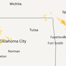
| 9:32 AM UTC | Quarter sized hail reported near Laverne, OK, 43.2 miles WNW of Woodward, OK |
| 9:45 AM UTC | Quarter sized hail reported near Fairview, OK, 52.5 miles ESE of Woodward, OK, fairview police department reported nickel to quarter sized hail. time estimated based on radar. |
Arkansas
| Local Time | Report Details |
|---|---|
| 9:48 AM UTC | A tree was downed along lassiter road in smithvill in lawrence county AR, 95.3 miles NW of Memphis, TN |
| 10:20 AM UTC | Quarter sized hail reported near Omaha, AR, 52 miles S of Springfield, MO |
| 10:25 AM UTC | Large tree limbs and branches have fallen. wind speed was measured at 61 mph and penny sized hail fell. some minor property damage was note in baxter county AR, 77.1 miles SE of Springfield, MO |
| 10:37 AM UTC | Multiple trees were down south and east of mountain hom in baxter county AR, 78.4 miles SE of Springfield, MO |
| 10:45 AM UTC | Quarter sized hail reported near Gassville, AR, 78.6 miles SE of Springfield, MO |
| 10:58 AM UTC | Trees and powerlines were dow in sharp county AR, 90.9 miles S of Salem, MO |
| 10:58 AM UTC | Large limbs were blown dow in sharp county AR, 94.9 miles S of Salem, MO |
| 11:02 AM UTC | Multiple large oak trees were uprooted and displaced. several firework stands were completely destroyed. several buildings had minor damage including roof and siding be in sharp county AR, 97.1 miles S of Salem, MO |
| 11:28 AM UTC | Tree limbs greater than six inches in diamter have fallen. hail up to the size of quarters was also reporte in independence county AR, 79.5 miles NNE of Little Rock, AR |
| 11:30 AM UTC | Several trees down and power lines down. large tree fell on hom in lawrence county AR, 96.4 miles NW of Memphis, TN |
| 11:30 AM UTC | Quarter sized hail reported near Sulphur Rock, AR, 81.7 miles NNE of Little Rock, AR |
| 11:36 AM UTC | Multiple trees are dow in independence county AR, 81.4 miles NE of Little Rock, AR |
| 11:40 AM UTC | Multiple trees were down along hwy 14 east of mountain view and hwy 5 north of mountain vie in stone county AR, 77.9 miles N of Little Rock, AR |
| 11:43 AM UTC | Several trees down and power lines down. large tree fell on hom in lawrence county AR, 96.4 miles NW of Memphis, TN |
| 11:43 AM UTC | Several trees down and power lines dow in lawrence county AR, 96.4 miles NW of Memphis, TN |
| 11:45 AM UTC | Tree down on observers house on 8th street and main street. trees down around neighborhoo in lawrence county AR, 89.2 miles NW of Memphis, TN |
| 11:45 AM UTC | Several trees down and a 6 foot fence blown ove in randolph county AR, 92.4 miles NNW of Memphis, TN |
| 11:45 AM UTC | Quarter sized hail reported near Pocahontas, AR, 92.4 miles NNW of Memphis, TN, quarter sized hail in pocahontas |
| 11:53 AM UTC | Half Dollar sized hail reported near Marshall, AR, 85.1 miles NNW of Little Rock, AR |
| 11:56 AM UTC | Trees fallen over hwy 63 north of imbode in randolph county AR, 97.4 miles NW of Memphis, TN |
Connect with Interactive Hail Maps