

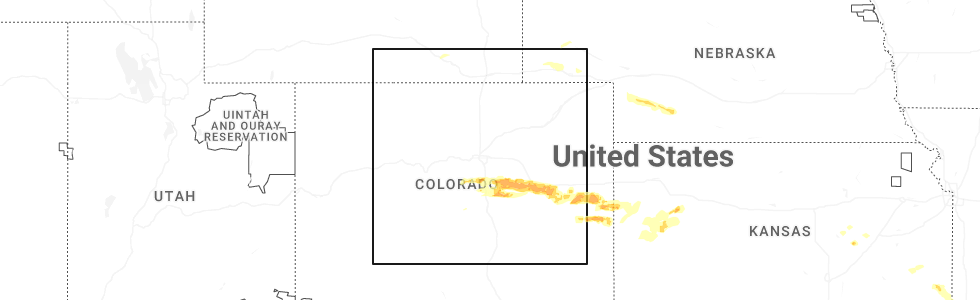
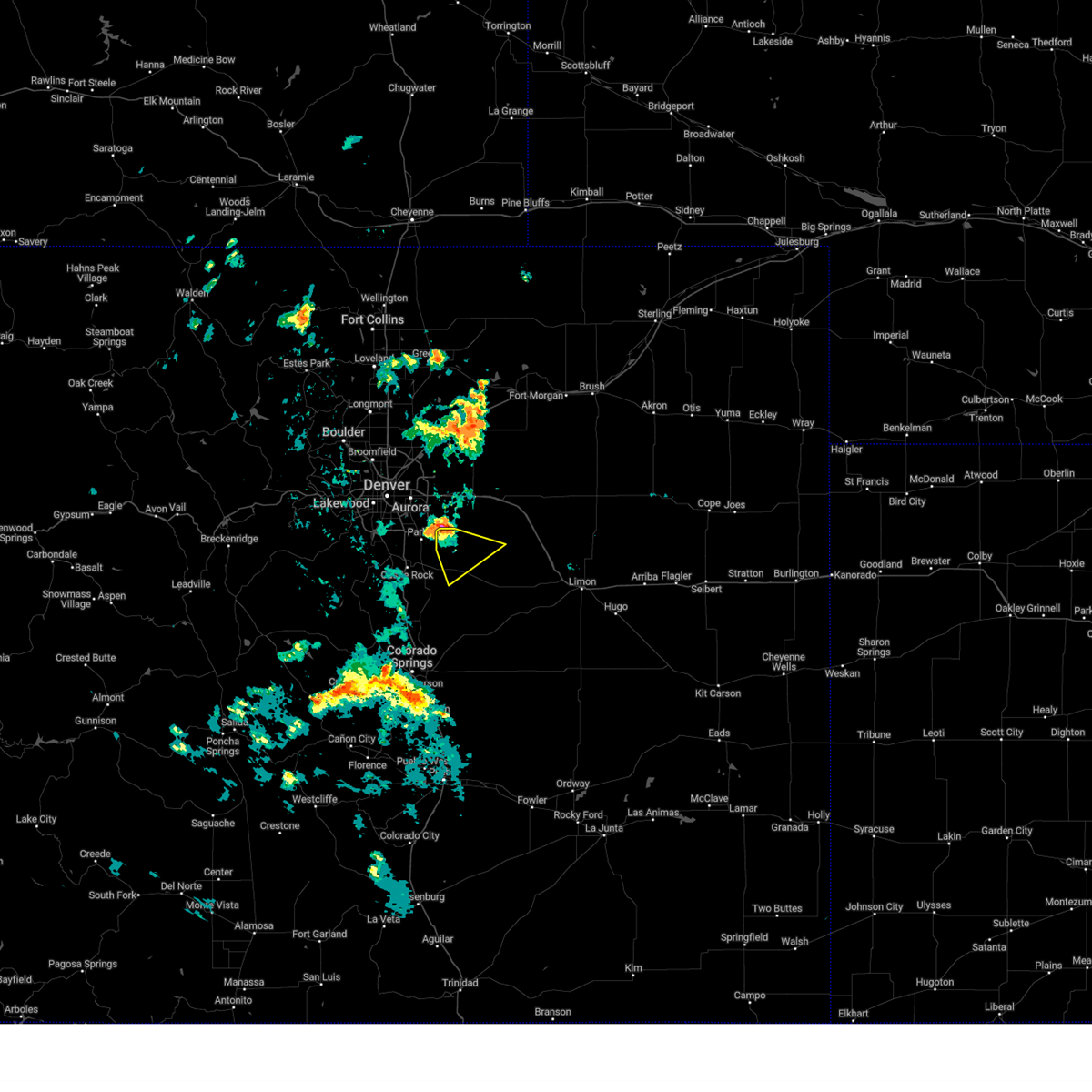
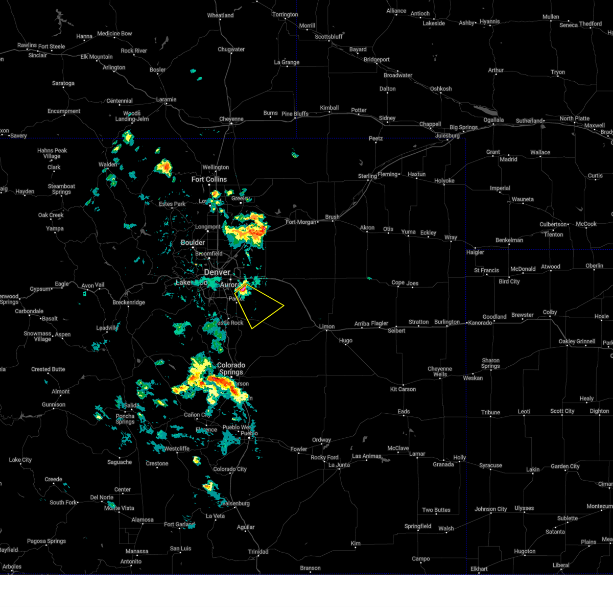
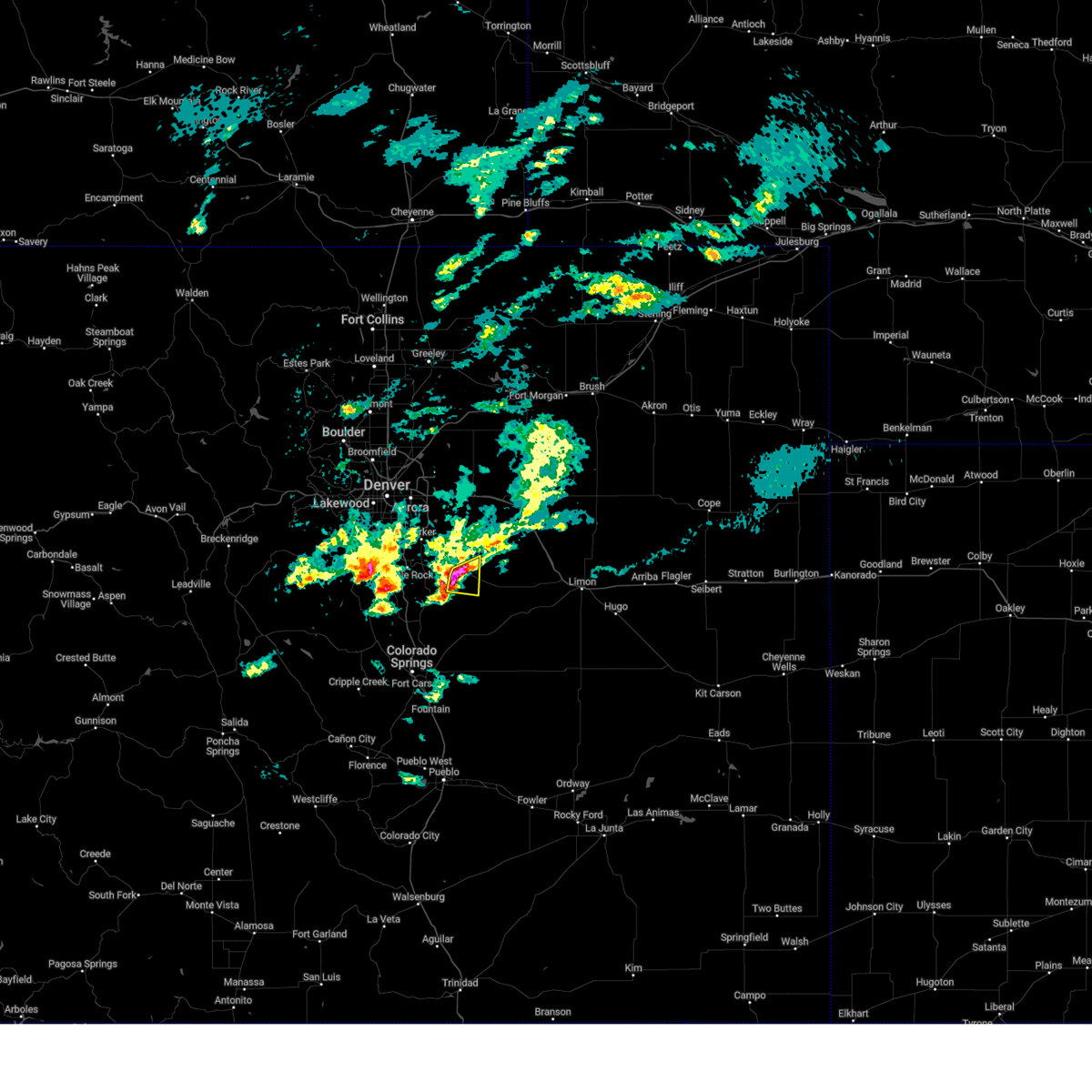
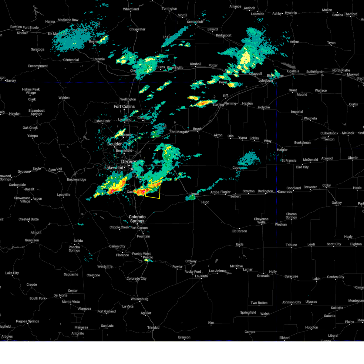
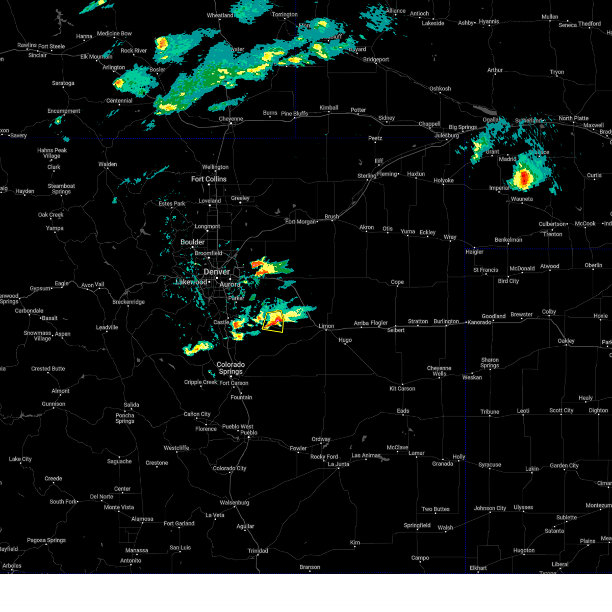
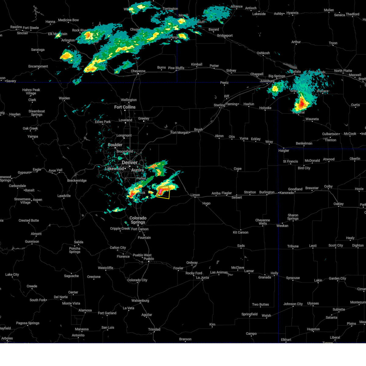
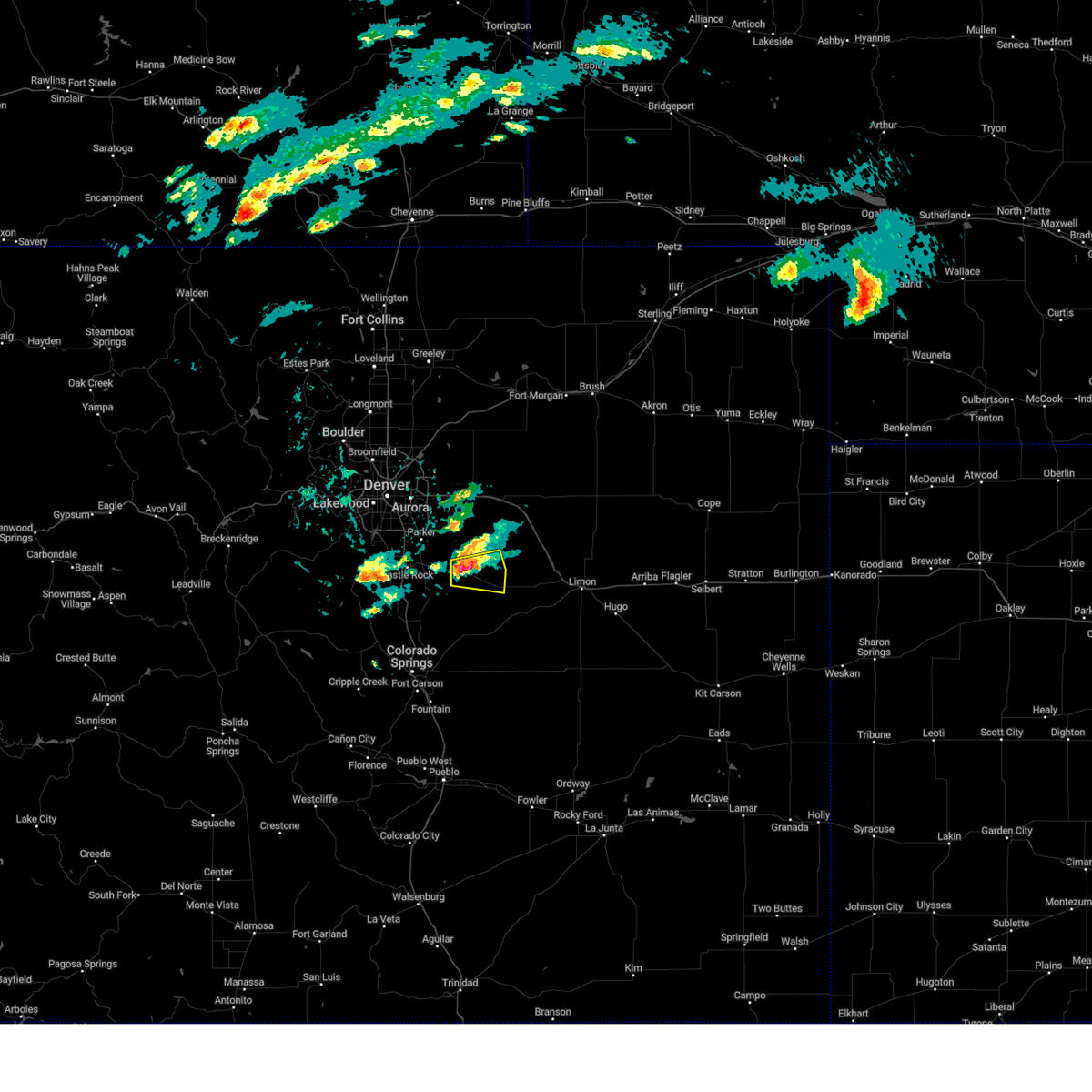
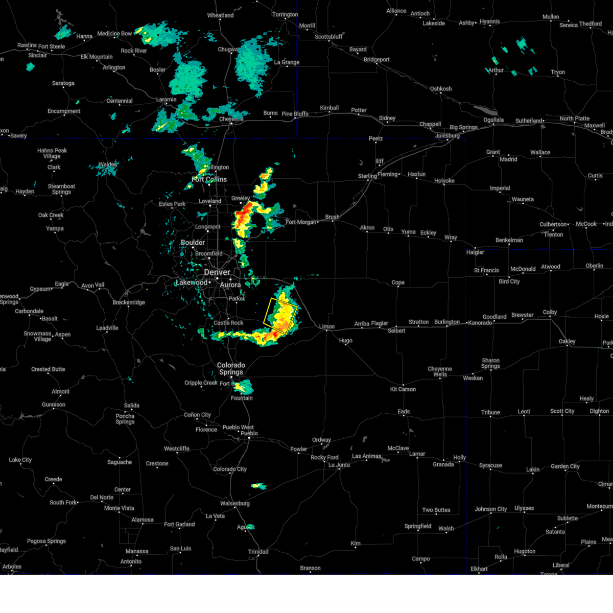
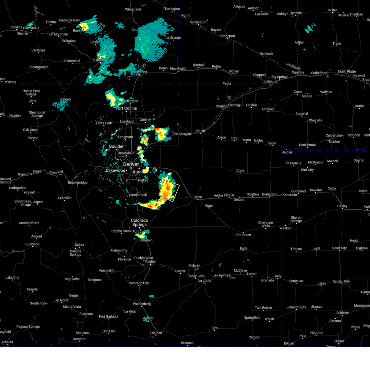
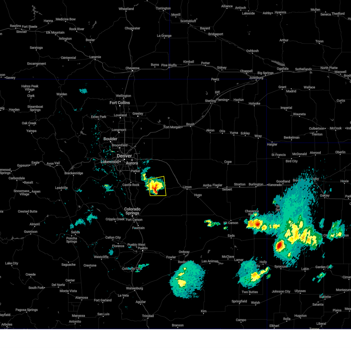
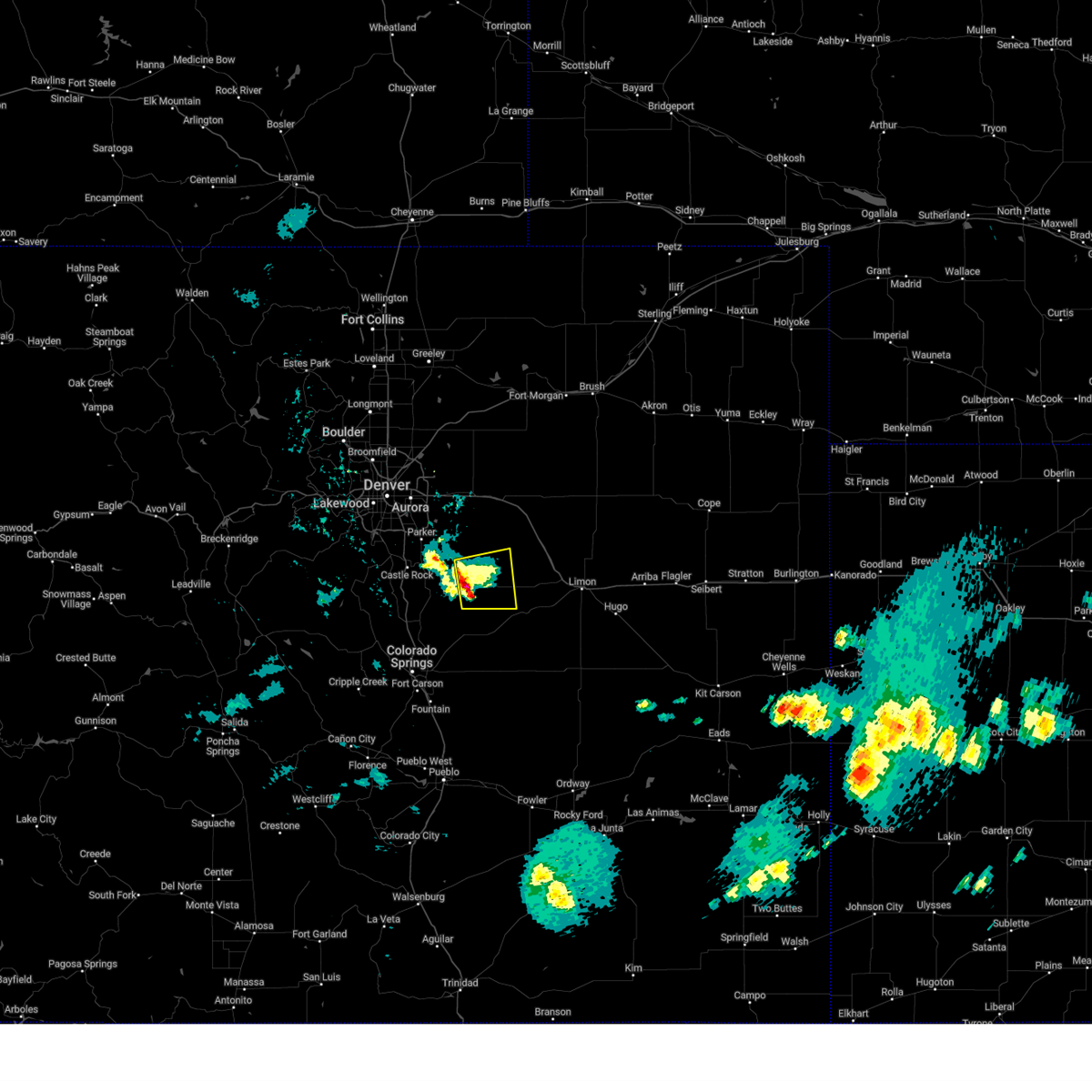
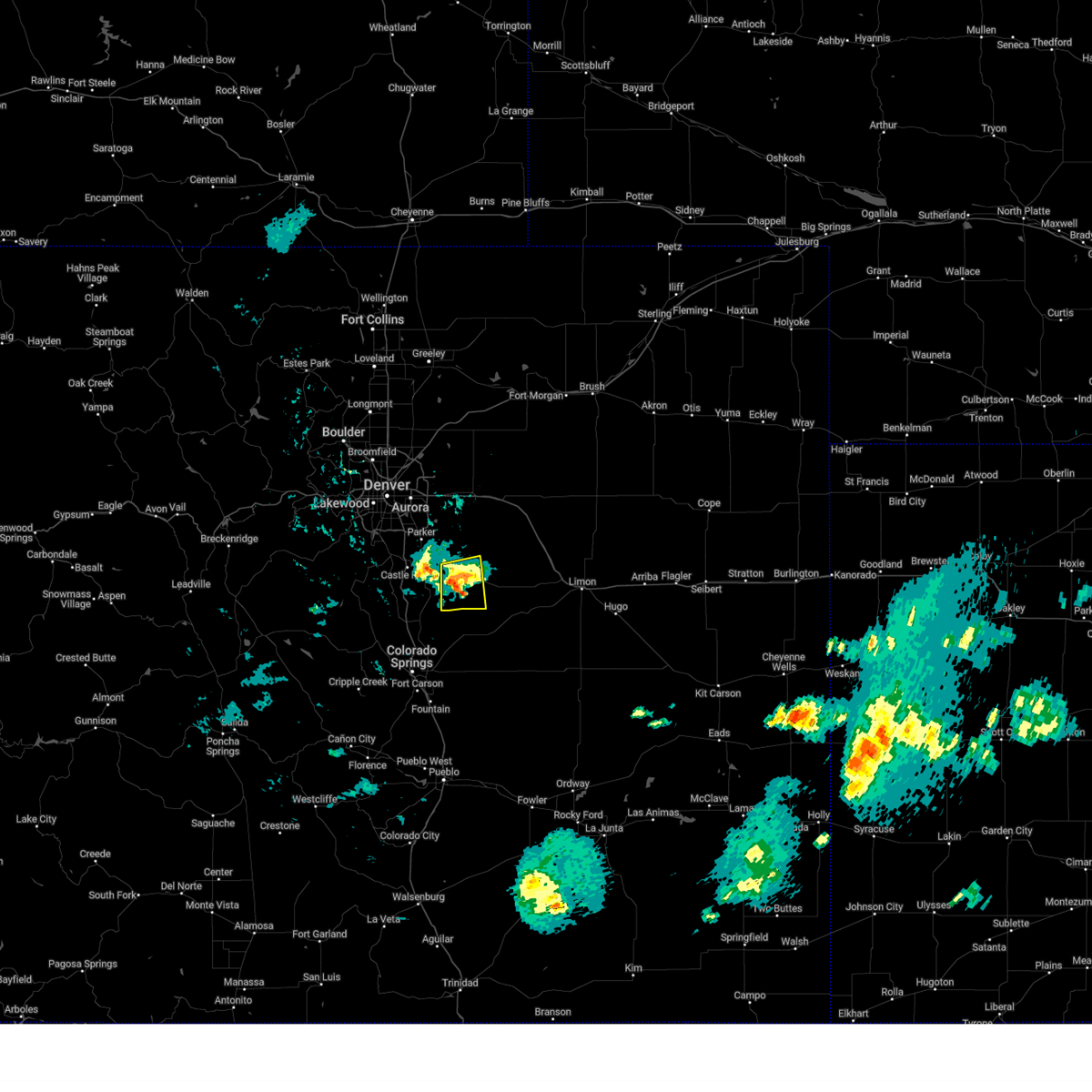
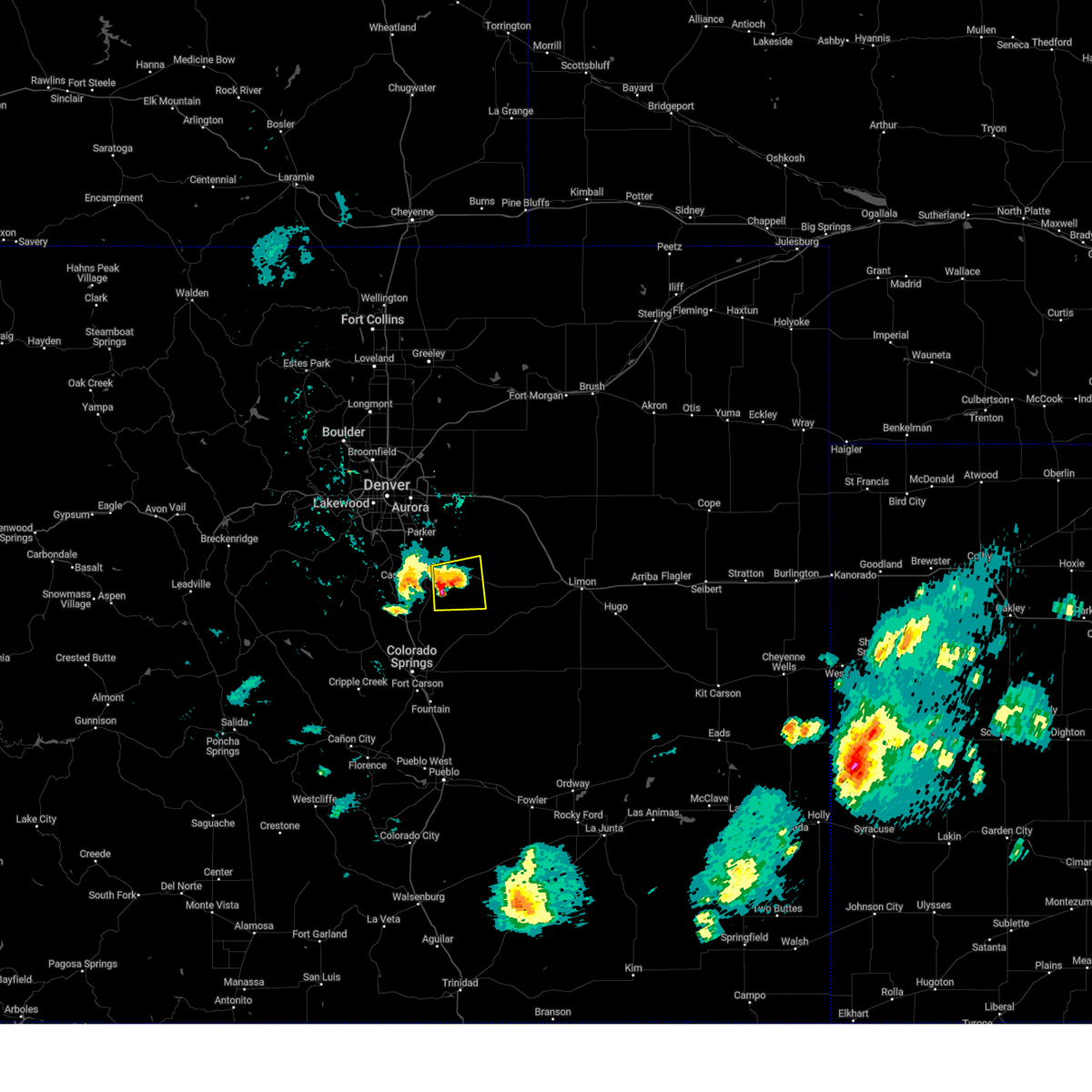
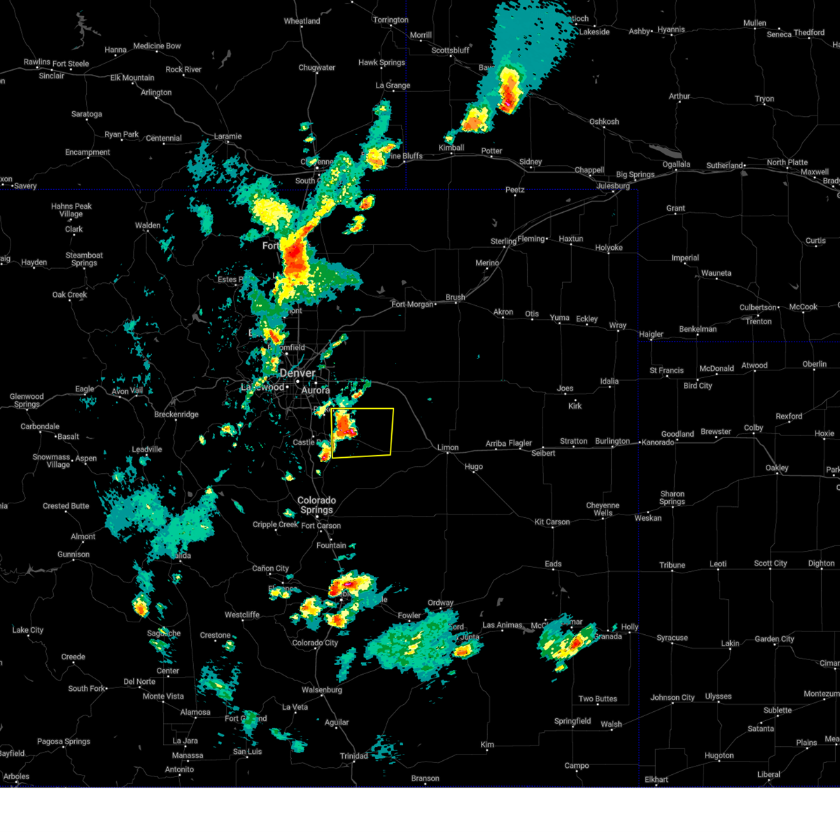
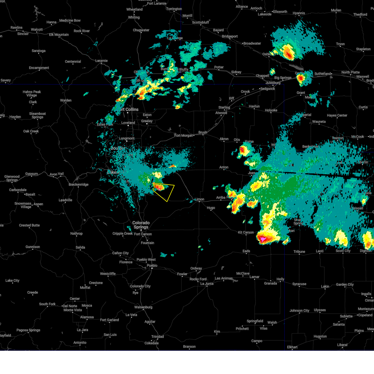
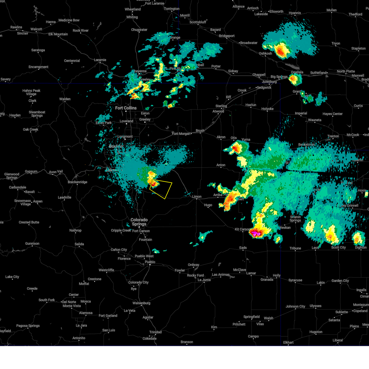
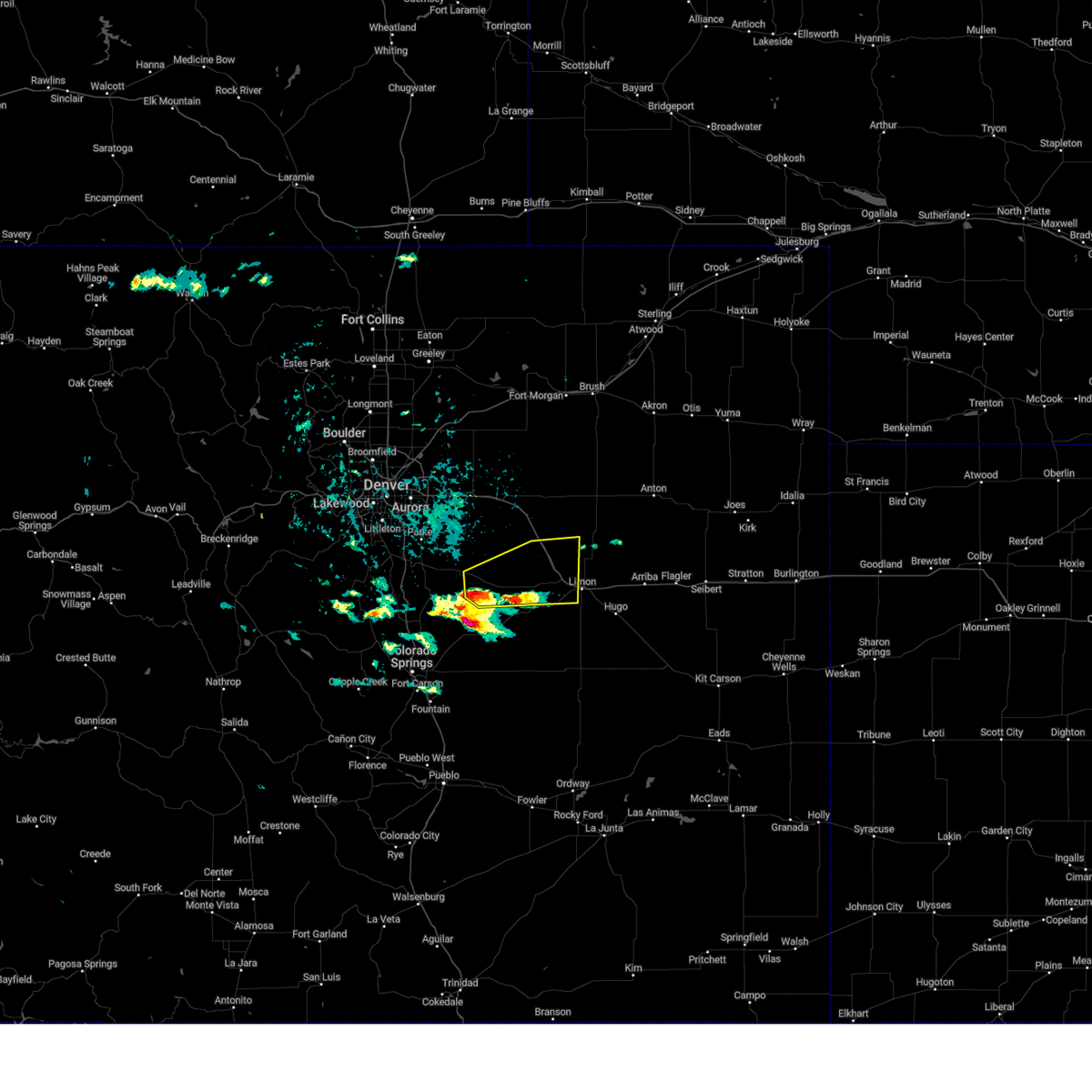
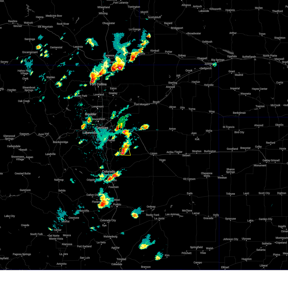
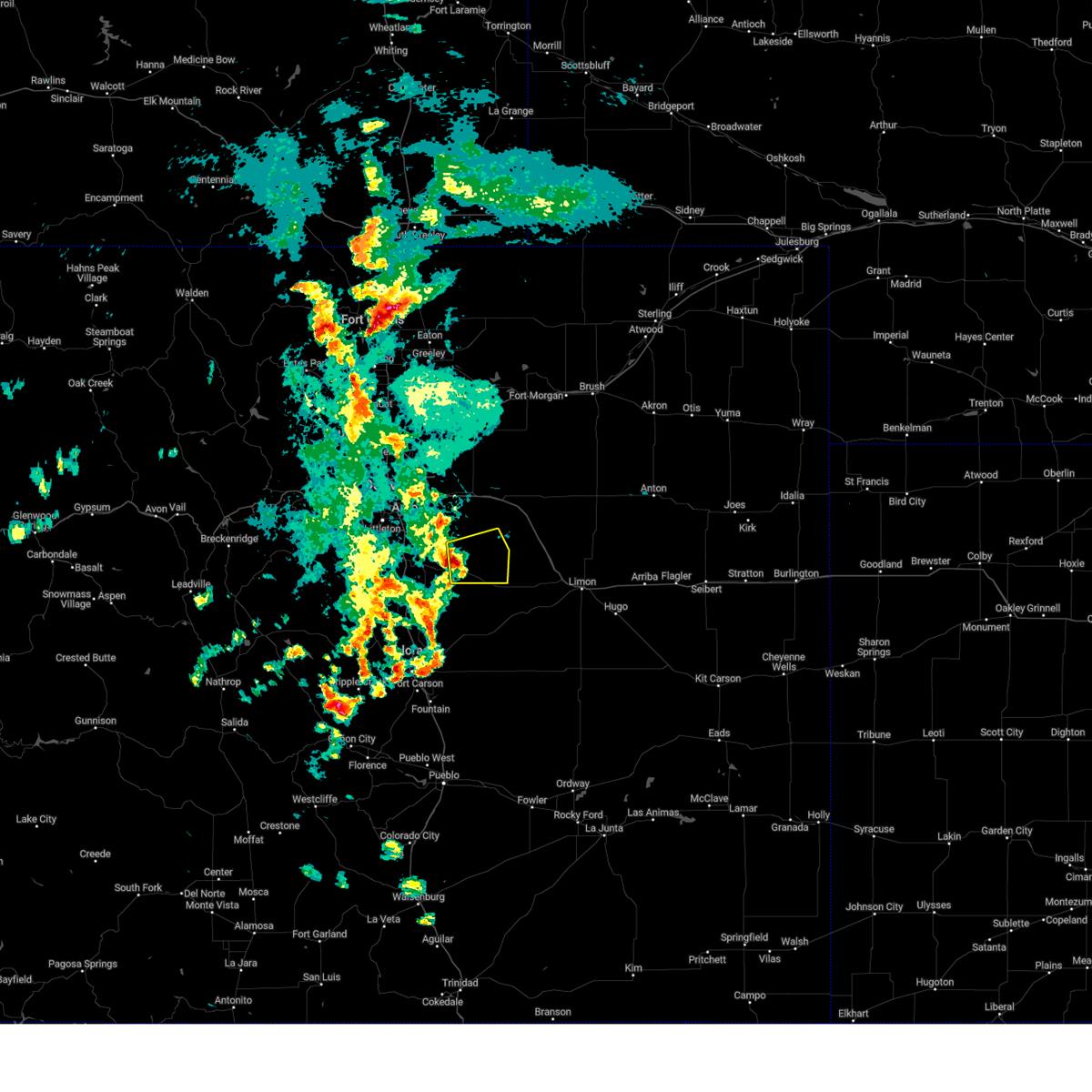
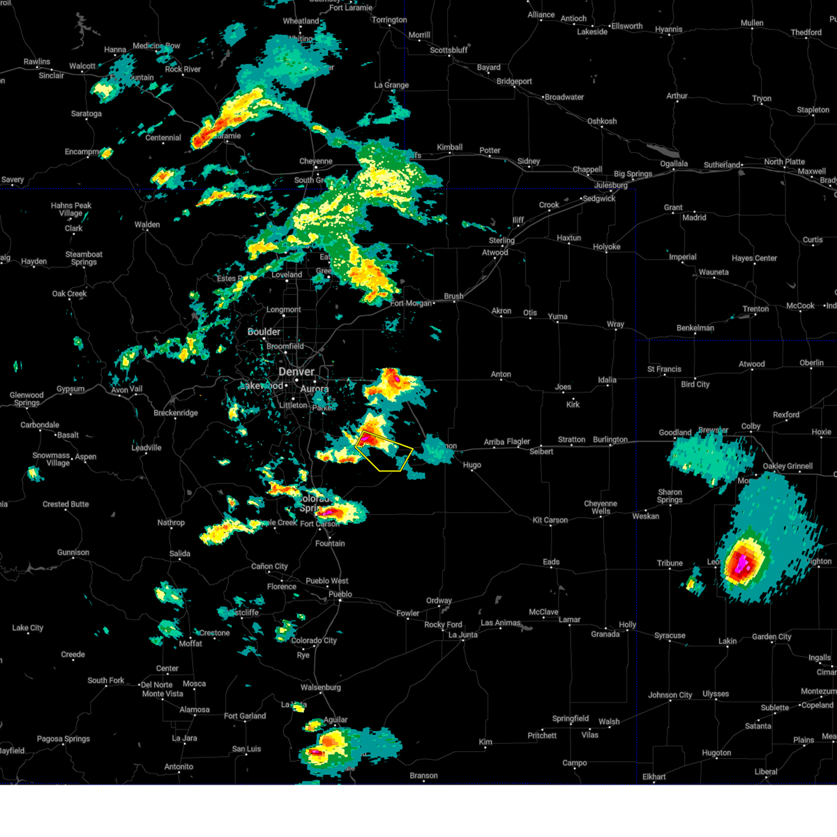
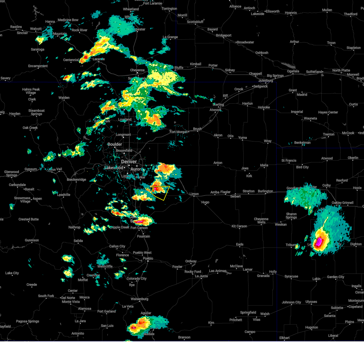
Hail Map for Kiowa, CO
The Kiowa, CO area has had 21 reports of on-the-ground hail by trained spotters, and has been under severe weather warnings 27 times during the past 12 months. Doppler radar has detected hail at or near Kiowa, CO on 96 occasions, including 7 occasions during the past year.
| Name: | Kiowa, CO |
| Where Located: | 39.4 miles SE of Denver, CO |
| Map: | Google Map for Kiowa, CO |
| Population: | 723 |
| Housing Units: | 322 |
| More Info: | Search Google for Kiowa, CO |
3
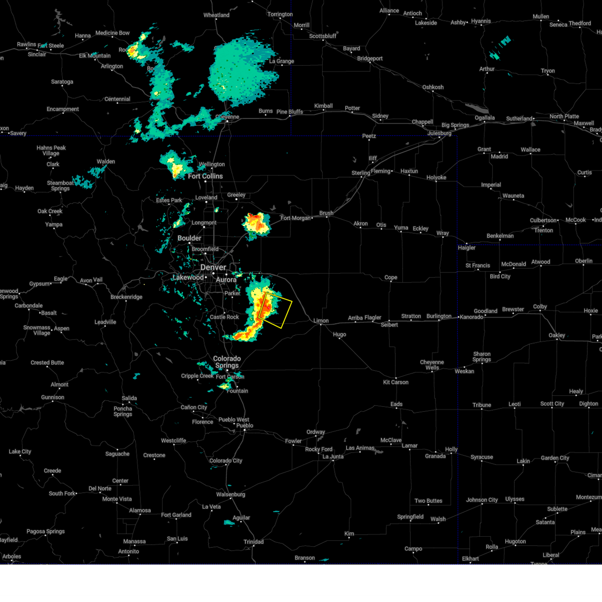
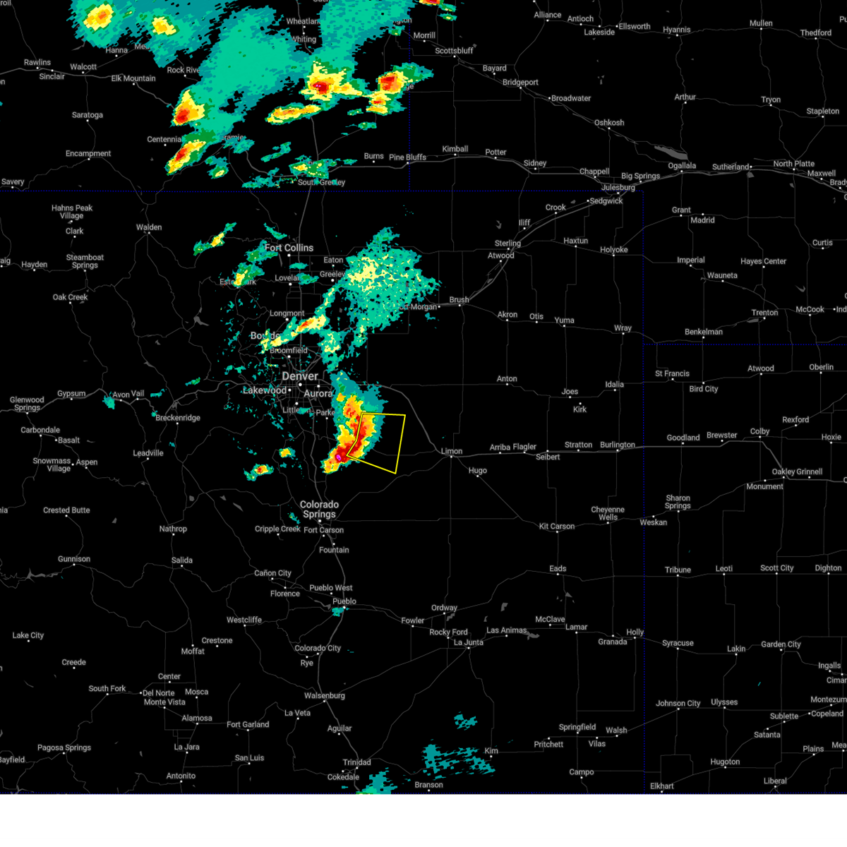
The Top Recent Hail Date for Kiowa, CO is Saturday, May 24, 2025 (4th out of 96)
Hail and Wind Damage Spotted near Kiowa, CO
| Date / Time | Report Details |
|---|---|
| 6/17/2025 12:50 PM MDT |
 the severe thunderstorm warning has been cancelled and is no longer in effect the severe thunderstorm warning has been cancelled and is no longer in effect
|
| 6/17/2025 12:31 PM MDT |
 Svrbou the national weather service in denver has issued a * severe thunderstorm warning for, northwestern elbert county in east central colorado, * until 100 pm mdt. * at 1231 pm mdt, a severe thunderstorm was located over elizabeth, or 31 miles southeast of denver, moving east at 15 mph (radar indicated). Hazards include quarter size hail. damage to vehicles is expected Svrbou the national weather service in denver has issued a * severe thunderstorm warning for, northwestern elbert county in east central colorado, * until 100 pm mdt. * at 1231 pm mdt, a severe thunderstorm was located over elizabeth, or 31 miles southeast of denver, moving east at 15 mph (radar indicated). Hazards include quarter size hail. damage to vehicles is expected
|
| 5/30/2025 6:20 PM MDT |
 the severe thunderstorm warning has been cancelled and is no longer in effect the severe thunderstorm warning has been cancelled and is no longer in effect
|
| 5/30/2025 6:00 PM MDT |
 the severe thunderstorm warning has been cancelled and is no longer in effect the severe thunderstorm warning has been cancelled and is no longer in effect
|
| 5/30/2025 6:00 PM MDT |
 At 600 pm mdt, a severe thunderstorm was located 11 miles northeast of ponderosa park, or 25 miles southeast of denver, moving southeast at 25 mph (radar indicated). Hazards include 60 mph wind gusts and small hail. Expect damage to roofs, siding, and trees. Locations impacted include, elizabeth, kiowa and ponderosa park. At 600 pm mdt, a severe thunderstorm was located 11 miles northeast of ponderosa park, or 25 miles southeast of denver, moving southeast at 25 mph (radar indicated). Hazards include 60 mph wind gusts and small hail. Expect damage to roofs, siding, and trees. Locations impacted include, elizabeth, kiowa and ponderosa park.
|
| 5/30/2025 5:42 PM MDT |
 Svrbou the national weather service in denver has issued a * severe thunderstorm warning for, northwestern elbert county in east central colorado, southwestern arapahoe county in northeastern colorado, northeastern douglas county in northeastern colorado, * until 630 pm mdt. * at 542 pm mdt, a severe thunderstorm was located near arapahoe park, or 18 miles southeast of denver, moving southeast at 25 mph (radar indicated). Hazards include 60 mph wind gusts and quarter size hail. Hail damage to vehicles is expected. Expect wind damage to roofs, siding, and trees. Svrbou the national weather service in denver has issued a * severe thunderstorm warning for, northwestern elbert county in east central colorado, southwestern arapahoe county in northeastern colorado, northeastern douglas county in northeastern colorado, * until 630 pm mdt. * at 542 pm mdt, a severe thunderstorm was located near arapahoe park, or 18 miles southeast of denver, moving southeast at 25 mph (radar indicated). Hazards include 60 mph wind gusts and quarter size hail. Hail damage to vehicles is expected. Expect wind damage to roofs, siding, and trees.
|
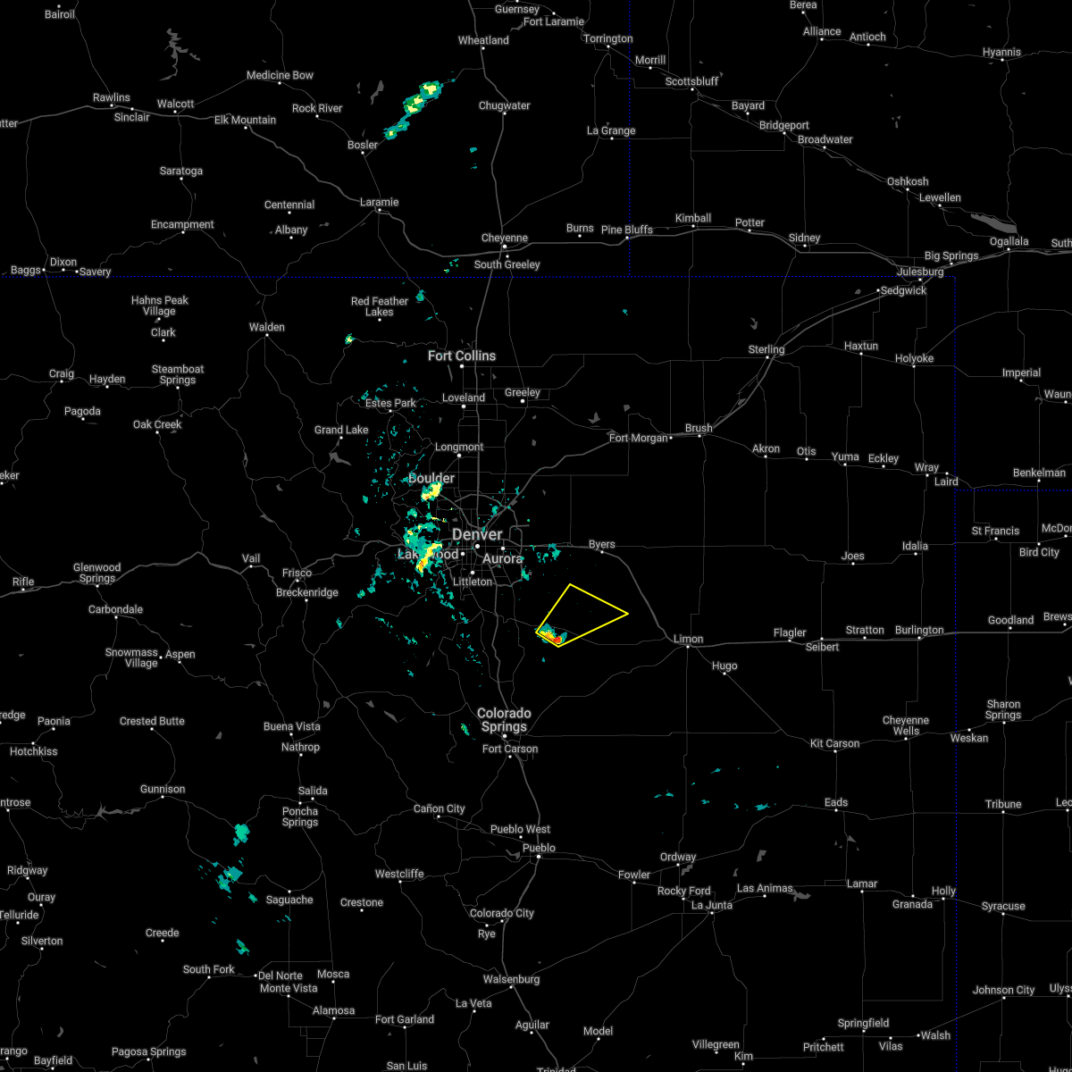
| 5/24/2025 7:16 PM MDT |
 At 716 pm mdt, a severe thunderstorm was located near elizabeth, or 35 miles southeast of denver, moving east at 20 mph (radar indicated). Hazards include two inch hail. People and animals outdoors will be injured. expect damage to roofs, siding, windows, and vehicles. Locations impacted include, kiowa. At 716 pm mdt, a severe thunderstorm was located near elizabeth, or 35 miles southeast of denver, moving east at 20 mph (radar indicated). Hazards include two inch hail. People and animals outdoors will be injured. expect damage to roofs, siding, windows, and vehicles. Locations impacted include, kiowa.
|
| 5/24/2025 7:02 PM MDT |
 Svrbou the national weather service in denver has issued a * severe thunderstorm warning for, northwestern elbert county in east central colorado, * until 730 pm mdt. * at 702 pm mdt, a severe thunderstorm was located over elizabeth, or 32 miles southeast of denver, moving east at 20 mph (radar indicated). Hazards include quarter size hail. damage to vehicles is expected Svrbou the national weather service in denver has issued a * severe thunderstorm warning for, northwestern elbert county in east central colorado, * until 730 pm mdt. * at 702 pm mdt, a severe thunderstorm was located over elizabeth, or 32 miles southeast of denver, moving east at 20 mph (radar indicated). Hazards include quarter size hail. damage to vehicles is expected
|
| 5/24/2025 3:15 PM MDT |
 The storm which prompted the warning has weakened below severe limits, and no longer poses an immediate threat to life or property. therefore, the warning has been allowed to expire. however, small hail and gusty winds are still possible with this thunderstorm. a severe thunderstorm watch remains in effect until 800 pm mdt saturday for a portion of east central colorado. The storm which prompted the warning has weakened below severe limits, and no longer poses an immediate threat to life or property. therefore, the warning has been allowed to expire. however, small hail and gusty winds are still possible with this thunderstorm. a severe thunderstorm watch remains in effect until 800 pm mdt saturday for a portion of east central colorado.
|
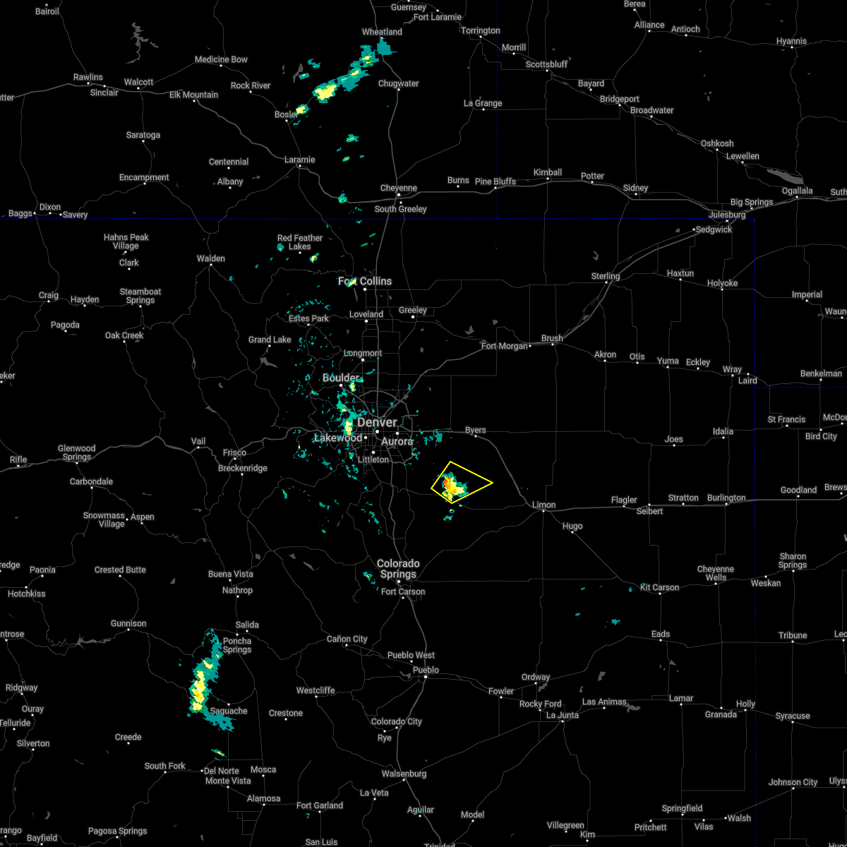
| 5/24/2025 2:53 PM MDT |
 At 253 pm mdt, a severe thunderstorm was located near kiowa, or 37 miles west of limon, moving east at 15 mph (at 241 pm, spotters reported hail 2 inches in diameter 1 miles east of kiowa). Hazards include two inch hail and 60 mph wind gusts. People and animals outdoors will be injured. expect hail damage to roofs, siding, windows, and vehicles. expect wind damage to roofs, siding, and trees. hail may accumulate on roadways causing hazardous travel. Locations impacted include, mainly rural areas of north central elbert county. At 253 pm mdt, a severe thunderstorm was located near kiowa, or 37 miles west of limon, moving east at 15 mph (at 241 pm, spotters reported hail 2 inches in diameter 1 miles east of kiowa). Hazards include two inch hail and 60 mph wind gusts. People and animals outdoors will be injured. expect hail damage to roofs, siding, windows, and vehicles. expect wind damage to roofs, siding, and trees. hail may accumulate on roadways causing hazardous travel. Locations impacted include, mainly rural areas of north central elbert county.
|
| 5/24/2025 2:41 PM MDT | Hen Egg sized hail reported 1.1 miles WNW of Kiowa, CO, report from mping: hen egg (2.00 in.). |
| 5/24/2025 2:29 PM MDT |
 Svrbou the national weather service in denver has issued a * severe thunderstorm warning for, northwestern elbert county in east central colorado, * until 315 pm mdt. * at 229 pm mdt, a severe thunderstorm was located near kiowa, or 35 miles southeast of denver, moving east at 15 mph (at 223 pm, spotters reported hail 1.25 inches in diameter 2 miles east of elizabeth). Hazards include 60 mph wind gusts and half dollar size hail. Hail damage to vehicles is expected. expect wind damage to roofs, siding, and trees. Hail may accumulate on roadways causing hazardous travel. Svrbou the national weather service in denver has issued a * severe thunderstorm warning for, northwestern elbert county in east central colorado, * until 315 pm mdt. * at 229 pm mdt, a severe thunderstorm was located near kiowa, or 35 miles southeast of denver, moving east at 15 mph (at 223 pm, spotters reported hail 1.25 inches in diameter 2 miles east of elizabeth). Hazards include 60 mph wind gusts and half dollar size hail. Hail damage to vehicles is expected. expect wind damage to roofs, siding, and trees. Hail may accumulate on roadways causing hazardous travel.
|
| 4/24/2025 4:10 PM MDT |
 The storm which prompted the warning has weakened below severe limits, and no longer poses an immediate threat to life or property. therefore, the warning will be allowed to expire. however, small hail, gusty winds, and heavy rain are still possible with this thunderstorm. a severe thunderstorm watch remains in effect until 1000 pm mdt thursday for a portion of east central colorado. The storm which prompted the warning has weakened below severe limits, and no longer poses an immediate threat to life or property. therefore, the warning will be allowed to expire. however, small hail, gusty winds, and heavy rain are still possible with this thunderstorm. a severe thunderstorm watch remains in effect until 1000 pm mdt thursday for a portion of east central colorado.
|
| 4/24/2025 3:53 PM MDT |
 At 353 pm mdt, a severe thunderstorm was located 10 miles east of kiowa, or 33 miles west of limon, moving east at 20 mph (radar indicated). Hazards include 60 mph wind gusts and quarter size hail. Hail damage to vehicles is expected. expect wind damage to roofs, siding, and trees. Locations impacted include, mainly rural areas of north central elbert county. At 353 pm mdt, a severe thunderstorm was located 10 miles east of kiowa, or 33 miles west of limon, moving east at 20 mph (radar indicated). Hazards include 60 mph wind gusts and quarter size hail. Hail damage to vehicles is expected. expect wind damage to roofs, siding, and trees. Locations impacted include, mainly rural areas of north central elbert county.
|
| 4/24/2025 3:42 PM MDT |
 Svrbou the national weather service in denver has issued a * severe thunderstorm warning for, north central elbert county in east central colorado, * until 415 pm mdt. * at 342 pm mdt, a severe thunderstorm was located 8 miles northeast of kiowa, or 36 miles west of limon, moving southeast at 15 mph (radar indicated). Hazards include 60 mph wind gusts and quarter size hail. Hail damage to vehicles is expected. Expect wind damage to roofs, siding, and trees. Svrbou the national weather service in denver has issued a * severe thunderstorm warning for, north central elbert county in east central colorado, * until 415 pm mdt. * at 342 pm mdt, a severe thunderstorm was located 8 miles northeast of kiowa, or 36 miles west of limon, moving southeast at 15 mph (radar indicated). Hazards include 60 mph wind gusts and quarter size hail. Hail damage to vehicles is expected. Expect wind damage to roofs, siding, and trees.
|
| 4/24/2025 3:29 PM MDT |
 At 329 pm mdt, a severe thunderstorm was located over kiowa, or 35 miles southeast of denver, moving southeast at 15 mph (radar indicated). Hazards include 60 mph wind gusts and quarter size hail. Hail damage to vehicles is expected. expect wind damage to roofs, siding, and trees. Locations impacted include, elizabeth, kiowa and ponderosa park. At 329 pm mdt, a severe thunderstorm was located over kiowa, or 35 miles southeast of denver, moving southeast at 15 mph (radar indicated). Hazards include 60 mph wind gusts and quarter size hail. Hail damage to vehicles is expected. expect wind damage to roofs, siding, and trees. Locations impacted include, elizabeth, kiowa and ponderosa park.
|
| 4/24/2025 3:18 PM MDT |
 Svrbou the national weather service in denver has issued a * severe thunderstorm warning for, northwestern elbert county in east central colorado, * until 345 pm mdt. * at 318 pm mdt, a severe thunderstorm was located near kiowa, or 32 miles southeast of denver, moving southeast at 15 mph (radar indicated). Hazards include quarter size hail. damage to vehicles is expected Svrbou the national weather service in denver has issued a * severe thunderstorm warning for, northwestern elbert county in east central colorado, * until 345 pm mdt. * at 318 pm mdt, a severe thunderstorm was located near kiowa, or 32 miles southeast of denver, moving southeast at 15 mph (radar indicated). Hazards include quarter size hail. damage to vehicles is expected
|
| 4/23/2025 5:54 PM MDT |
 At 554 pm mdt, a severe thunderstorm was located 7 miles southeast of kiowa, or 37 miles west of limon, moving east at 15 mph (radar indicated). Hazards include half dollar size hail. Damage to vehicles is expected. Locations impacted include, kiowa and fondis. At 554 pm mdt, a severe thunderstorm was located 7 miles southeast of kiowa, or 37 miles west of limon, moving east at 15 mph (radar indicated). Hazards include half dollar size hail. Damage to vehicles is expected. Locations impacted include, kiowa and fondis.
|
| 4/23/2025 5:41 PM MDT |
 Svrbou the national weather service in denver has issued a * severe thunderstorm warning for, northwestern elbert county in east central colorado, * until 615 pm mdt. * at 541 pm mdt, a severe thunderstorm was located 5 miles south of kiowa, or 39 miles west of limon, moving east at 15 mph (radar indicated). Hazards include quarter size hail. damage to vehicles is expected Svrbou the national weather service in denver has issued a * severe thunderstorm warning for, northwestern elbert county in east central colorado, * until 615 pm mdt. * at 541 pm mdt, a severe thunderstorm was located 5 miles south of kiowa, or 39 miles west of limon, moving east at 15 mph (radar indicated). Hazards include quarter size hail. damage to vehicles is expected
|
| 4/23/2025 5:32 PM MDT |
 At 532 pm mdt, a severe thunderstorm was located over elbert, or 39 miles southeast of denver, moving east at 15 mph (radar indicated). Hazards include quarter size hail. Damage to vehicles is expected. Locations impacted include, elbert, elizabeth, kiowa, ponderosa park and fondis. At 532 pm mdt, a severe thunderstorm was located over elbert, or 39 miles southeast of denver, moving east at 15 mph (radar indicated). Hazards include quarter size hail. Damage to vehicles is expected. Locations impacted include, elbert, elizabeth, kiowa, ponderosa park and fondis.
|
| 4/23/2025 5:32 PM MDT |
 the severe thunderstorm warning has been cancelled and is no longer in effect the severe thunderstorm warning has been cancelled and is no longer in effect
|
| 4/23/2025 5:13 PM MDT |
 Svrbou the national weather service in denver has issued a * severe thunderstorm warning for, northwestern elbert county in east central colorado, east central douglas county in northeastern colorado, * until 545 pm mdt. * at 513 pm mdt, a severe thunderstorm was located near elbert, or 37 miles southeast of denver, moving east at 15 mph (radar indicated). Hazards include quarter size hail. damage to vehicles is expected Svrbou the national weather service in denver has issued a * severe thunderstorm warning for, northwestern elbert county in east central colorado, east central douglas county in northeastern colorado, * until 545 pm mdt. * at 513 pm mdt, a severe thunderstorm was located near elbert, or 37 miles southeast of denver, moving east at 15 mph (radar indicated). Hazards include quarter size hail. damage to vehicles is expected
|
| 9/17/2024 3:48 PM MDT |
 At 348 pm mdt, severe thunderstorms were located along a line extending from 9 miles northeast of kiowa to 10 miles northwest of simla to 7 miles northwest of kutch, or along a line extending from 34 miles southeast of denver to 25 miles west of limon to 45 miles east of colorado springs, moving northeast at 60 mph (radar indicated). Hazards include 60 mph wind gusts. Expect damage to roofs, siding, and trees. Locations impacted include, kiowa, simla, agate, and matheson. At 348 pm mdt, severe thunderstorms were located along a line extending from 9 miles northeast of kiowa to 10 miles northwest of simla to 7 miles northwest of kutch, or along a line extending from 34 miles southeast of denver to 25 miles west of limon to 45 miles east of colorado springs, moving northeast at 60 mph (radar indicated). Hazards include 60 mph wind gusts. Expect damage to roofs, siding, and trees. Locations impacted include, kiowa, simla, agate, and matheson.
|
| 9/17/2024 3:23 PM MDT |
 Svrbou the national weather service in denver colorado has issued a * severe thunderstorm warning for, elbert county in east central colorado, * until 415 pm mdt. * at 323 pm mdt, severe thunderstorms were located along a line extending from 7 miles northeast of black forest to 4 miles southeast of peyton to 5 miles west of truckton, or along a line extending from 21 miles northeast of colorado springs to 42 miles southwest of limon to 31 miles northeast of pueblo airport, moving northeast at 45 mph (radar indicated). Hazards include 60 mph wind gusts. expect damage to roofs, siding, and trees Svrbou the national weather service in denver colorado has issued a * severe thunderstorm warning for, elbert county in east central colorado, * until 415 pm mdt. * at 323 pm mdt, severe thunderstorms were located along a line extending from 7 miles northeast of black forest to 4 miles southeast of peyton to 5 miles west of truckton, or along a line extending from 21 miles northeast of colorado springs to 42 miles southwest of limon to 31 miles northeast of pueblo airport, moving northeast at 45 mph (radar indicated). Hazards include 60 mph wind gusts. expect damage to roofs, siding, and trees
|
| 8/13/2024 4:30 PM MDT |
 The storm which prompted the warning has moved out of the area. therefore, the warning has been allowed to expire. The storm which prompted the warning has moved out of the area. therefore, the warning has been allowed to expire.
|
| 8/13/2024 3:58 PM MDT |
 the severe thunderstorm warning has been cancelled and is no longer in effect the severe thunderstorm warning has been cancelled and is no longer in effect
|
| 8/13/2024 3:58 PM MDT |
 At 357 pm mdt, a severe thunderstorm was located 6 miles northwest of kiowa, or 30 miles southeast of denver, moving east at 20 mph (radar indicated). Hazards include 60 mph wind gusts and quarter size hail. Expect damage to roofs, siding, and trees. hail damage to vehicles is expected. Locations impacted include, kiowa. At 357 pm mdt, a severe thunderstorm was located 6 miles northwest of kiowa, or 30 miles southeast of denver, moving east at 20 mph (radar indicated). Hazards include 60 mph wind gusts and quarter size hail. Expect damage to roofs, siding, and trees. hail damage to vehicles is expected. Locations impacted include, kiowa.
|
| 8/13/2024 3:46 PM MDT |
 Svrbou the national weather service in denver colorado has issued a * severe thunderstorm warning for, northeastern douglas county in northeastern colorado, northwestern elbert county in east central colorado, * until 430 pm mdt. * at 346 pm mdt, a severe thunderstorm was located near ponderosa park, or 28 miles southeast of denver, moving east at 20 mph (radar indicated). Hazards include 60 mph wind gusts and quarter size hail. Expect damage to roofs, siding, and trees. Hail damage to vehicles is expected. Svrbou the national weather service in denver colorado has issued a * severe thunderstorm warning for, northeastern douglas county in northeastern colorado, northwestern elbert county in east central colorado, * until 430 pm mdt. * at 346 pm mdt, a severe thunderstorm was located near ponderosa park, or 28 miles southeast of denver, moving east at 20 mph (radar indicated). Hazards include 60 mph wind gusts and quarter size hail. Expect damage to roofs, siding, and trees. Hail damage to vehicles is expected.
|
| 6/8/2024 1:34 PM MDT |
 Svrbou the national weather service in denver colorado has issued a * severe thunderstorm warning for, northern elbert county in east central colorado, eastern arapahoe county in northeastern colorado, southeastern adams county in northeastern colorado, * until 215 pm mdt. * at 134 pm mdt, severe thunderstorms were located along a line extending from 5 miles south of byers to near ponderosa park, or along a line extending from 36 miles northwest of limon to 28 miles southeast of denver, moving east at 45 mph (radar indicated). Hazards include 60 mph wind gusts and quarter size hail. Expect damage to roofs, siding, and trees. Hail damage to vehicles is expected. Svrbou the national weather service in denver colorado has issued a * severe thunderstorm warning for, northern elbert county in east central colorado, eastern arapahoe county in northeastern colorado, southeastern adams county in northeastern colorado, * until 215 pm mdt. * at 134 pm mdt, severe thunderstorms were located along a line extending from 5 miles south of byers to near ponderosa park, or along a line extending from 36 miles northwest of limon to 28 miles southeast of denver, moving east at 45 mph (radar indicated). Hazards include 60 mph wind gusts and quarter size hail. Expect damage to roofs, siding, and trees. Hail damage to vehicles is expected.
|
| 8/8/2023 11:54 PM MDT |
 At 1154 pm mdt, a severe thunderstorm was located 7 miles north of kiowa, or 32 miles southeast of denver, moving east at 20 mph (radar indicated). Hazards include golf ball size hail and 60 mph wind gusts. Expect damage to roofs, siding, and trees. people and animals outdoors will be injured. expect hail damage to roofs, siding, windows, and vehicles. this severe thunderstorm will remain over mainly rural areas of northwestern elbert county. thunderstorm damage threat, considerable hail threat, radar indicated max hail size, 1. 75 in wind threat, radar indicated max wind gust, 60 mph. At 1154 pm mdt, a severe thunderstorm was located 7 miles north of kiowa, or 32 miles southeast of denver, moving east at 20 mph (radar indicated). Hazards include golf ball size hail and 60 mph wind gusts. Expect damage to roofs, siding, and trees. people and animals outdoors will be injured. expect hail damage to roofs, siding, windows, and vehicles. this severe thunderstorm will remain over mainly rural areas of northwestern elbert county. thunderstorm damage threat, considerable hail threat, radar indicated max hail size, 1. 75 in wind threat, radar indicated max wind gust, 60 mph.
|
| 8/8/2023 11:42 PM MDT |
 At 1142 pm mdt, a severe thunderstorm was located 7 miles northeast of ponderosa park, or 28 miles southeast of denver, moving east at 20 mph (radar indicated). Hazards include quarter size hail. Damage to vehicles is expected. this severe thunderstorm will be near, kiowa around 1200 am mdt. hail threat, radar indicated max hail size, 1. 00 in wind threat, radar indicated max wind gust, <50 mph. At 1142 pm mdt, a severe thunderstorm was located 7 miles northeast of ponderosa park, or 28 miles southeast of denver, moving east at 20 mph (radar indicated). Hazards include quarter size hail. Damage to vehicles is expected. this severe thunderstorm will be near, kiowa around 1200 am mdt. hail threat, radar indicated max hail size, 1. 00 in wind threat, radar indicated max wind gust, <50 mph.
|
| 8/6/2023 5:17 PM MDT |
 At 517 pm mdt, a severe thunderstorm was located 7 miles south of franktown, or 29 miles north of colorado springs, moving east at 35 mph (radar indicated). Hazards include quarter size hail. damage to vehicles is expected At 517 pm mdt, a severe thunderstorm was located 7 miles south of franktown, or 29 miles north of colorado springs, moving east at 35 mph (radar indicated). Hazards include quarter size hail. damage to vehicles is expected
|
| 8/6/2023 4:22 PM MDT |
 The severe thunderstorm warning for southeastern douglas and west central elbert counties will expire at 430 pm mdt, the severe thunderstorm which prompted the warning has weakened. therefore, the warning will be allowed to expire. The severe thunderstorm warning for southeastern douglas and west central elbert counties will expire at 430 pm mdt, the severe thunderstorm which prompted the warning has weakened. therefore, the warning will be allowed to expire.
|
| 8/6/2023 4:05 PM MDT |
 At 405 pm mdt, a severe thunderstorm was located 4 miles south of castle rock, or 29 miles south of denver, moving east at 40 mph (radar indicated). Hazards include quarter size hail. Damage to vehicles is expected. this severe thunderstorm will be near, franktown around 410 pm mdt. elizabeth around 420 pm mdt. other locations in the path of this severe thunderstorm include elbert and kiowa. hail threat, radar indicated max hail size, 1. 00 in wind threat, radar indicated max wind gust, <50 mph. At 405 pm mdt, a severe thunderstorm was located 4 miles south of castle rock, or 29 miles south of denver, moving east at 40 mph (radar indicated). Hazards include quarter size hail. Damage to vehicles is expected. this severe thunderstorm will be near, franktown around 410 pm mdt. elizabeth around 420 pm mdt. other locations in the path of this severe thunderstorm include elbert and kiowa. hail threat, radar indicated max hail size, 1. 00 in wind threat, radar indicated max wind gust, <50 mph.
|
| 8/5/2023 2:00 PM MDT | Quarter sized hail reported 13.7 miles WNW of Kiowa, CO |
| 8/5/2023 1:35 PM MDT |
 At 135 pm mdt, a severe thunderstorm was located 6 miles east of elbert, or 32 miles northeast of colorado springs, moving northeast at 30 mph (radar indicated). Hazards include ping pong ball size hail and 60 mph wind gusts. Expect damage to roofs, siding, and trees. people and animals outdoors will be injured. Expect hail damage to roofs, siding, windows, and vehicles. At 135 pm mdt, a severe thunderstorm was located 6 miles east of elbert, or 32 miles northeast of colorado springs, moving northeast at 30 mph (radar indicated). Hazards include ping pong ball size hail and 60 mph wind gusts. Expect damage to roofs, siding, and trees. people and animals outdoors will be injured. Expect hail damage to roofs, siding, windows, and vehicles.
|
| 8/3/2023 4:31 PM MDT |
 At 431 pm mdt, a severe thunderstorm was located over kiowa, or 35 miles northeast of colorado springs, moving east at 15 mph (radar indicated). Hazards include 60 mph wind gusts and quarter size hail. Expect damage to roofs, siding, and trees. hail damage to vehicles is expected. hail may accumulate on roadways causing hazardous travel. locations impacted include, kiowa. hail threat, radar indicated max hail size, 1. 00 in wind threat, radar indicated max wind gust, 60 mph. At 431 pm mdt, a severe thunderstorm was located over kiowa, or 35 miles northeast of colorado springs, moving east at 15 mph (radar indicated). Hazards include 60 mph wind gusts and quarter size hail. Expect damage to roofs, siding, and trees. hail damage to vehicles is expected. hail may accumulate on roadways causing hazardous travel. locations impacted include, kiowa. hail threat, radar indicated max hail size, 1. 00 in wind threat, radar indicated max wind gust, 60 mph.
|
| 8/3/2023 4:02 PM MDT |
 At 402 pm mdt, a severe thunderstorm was located near elizabeth, or 32 miles southeast of denver, moving east at 10 mph (radar indicated). Hazards include 60 mph wind gusts and half dollar size hail. Expect damage to roofs, siding, and trees. Hail damage to vehicles is expected. At 402 pm mdt, a severe thunderstorm was located near elizabeth, or 32 miles southeast of denver, moving east at 10 mph (radar indicated). Hazards include 60 mph wind gusts and half dollar size hail. Expect damage to roofs, siding, and trees. Hail damage to vehicles is expected.
|
| 8/2/2023 8:34 PM MDT |
 At 834 pm mdt, a severe thunderstorm was located 6 miles east of greenland, or 20 miles north of colorado springs, moving northeast at 25 mph (radar indicated). Hazards include 60 mph wind gusts and quarter size hail. Expect damage to roofs, siding, and trees. Hail damage to vehicles is expected. At 834 pm mdt, a severe thunderstorm was located 6 miles east of greenland, or 20 miles north of colorado springs, moving northeast at 25 mph (radar indicated). Hazards include 60 mph wind gusts and quarter size hail. Expect damage to roofs, siding, and trees. Hail damage to vehicles is expected.
|
| 7/31/2023 7:55 PM MDT | Half Dollar sized hail reported 6.5 miles SSE of Kiowa, CO |
| 7/31/2023 7:52 PM MDT |
 At 751 pm mdt, a severe thunderstorm was located 4 miles north of kiowa, or 32 miles southeast of denver, moving east at 15 mph (radar indicated. nickel size hail was reported in elizabeth as this storm passed). Hazards include half dollar size hail. damage to vehicles is expected At 751 pm mdt, a severe thunderstorm was located 4 miles north of kiowa, or 32 miles southeast of denver, moving east at 15 mph (radar indicated. nickel size hail was reported in elizabeth as this storm passed). Hazards include half dollar size hail. damage to vehicles is expected
|
| 7/28/2023 3:12 PM MDT |
 The severe thunderstorm warning for west central elbert county will expire at 315 pm mdt, the storm which prompted the warning has weakened below severe limits, and no longer poses an immediate threat to life or property. therefore, the warning will be allowed to expire. The severe thunderstorm warning for west central elbert county will expire at 315 pm mdt, the storm which prompted the warning has weakened below severe limits, and no longer poses an immediate threat to life or property. therefore, the warning will be allowed to expire.
|
| 7/28/2023 2:41 PM MDT |
 At 241 pm mdt, a severe thunderstorm was located near elbert, or 29 miles northeast of colorado springs, moving east at 15 mph (radar indicated). Hazards include 60 mph wind gusts and quarter size hail. Expect damage to roofs, siding, and trees. hail damage to vehicles is expected. this severe thunderstorm will be near, kiowa around 300 pm mdt. hail threat, radar indicated max hail size, 1. 00 in wind threat, radar indicated max wind gust, 60 mph. At 241 pm mdt, a severe thunderstorm was located near elbert, or 29 miles northeast of colorado springs, moving east at 15 mph (radar indicated). Hazards include 60 mph wind gusts and quarter size hail. Expect damage to roofs, siding, and trees. hail damage to vehicles is expected. this severe thunderstorm will be near, kiowa around 300 pm mdt. hail threat, radar indicated max hail size, 1. 00 in wind threat, radar indicated max wind gust, 60 mph.
|
| 7/20/2023 2:50 PM MDT | Golf Ball sized hail reported 4.3 miles WNW of Kiowa, CO |
| 7/20/2023 2:40 PM MDT |
 At 240 pm mdt, a severe thunderstorm was located 4 miles southeast of kiowa, or 36 miles west of limon, moving southeast at 25 mph (radar indicated). Hazards include tennis ball size hail and 70 mph wind gusts. Expect considerable tree damage. damage is likely to mobile homes, roofs, and outbuildings. people and animals outdoors will be injured. Expect hail damage to roofs, siding, windows, and vehicles. At 240 pm mdt, a severe thunderstorm was located 4 miles southeast of kiowa, or 36 miles west of limon, moving southeast at 25 mph (radar indicated). Hazards include tennis ball size hail and 70 mph wind gusts. Expect considerable tree damage. damage is likely to mobile homes, roofs, and outbuildings. people and animals outdoors will be injured. Expect hail damage to roofs, siding, windows, and vehicles.
|
| 7/20/2023 2:30 PM MDT |
 At 230 pm mdt, a severe thunderstorm was located over kiowa, or 36 miles southeast of denver, moving southeast at 20 mph (radar indicated). Hazards include two inch hail and 60 mph wind gusts. Expect damage to roofs, siding, and trees. people and animals outdoors will be injured. expect hail damage to roofs, siding, windows, and vehicles. locations impacted include, kiowa. thunderstorm damage threat, considerable hail threat, radar indicated max hail size, 2. 00 in wind threat, radar indicated max wind gust, 60 mph. At 230 pm mdt, a severe thunderstorm was located over kiowa, or 36 miles southeast of denver, moving southeast at 20 mph (radar indicated). Hazards include two inch hail and 60 mph wind gusts. Expect damage to roofs, siding, and trees. people and animals outdoors will be injured. expect hail damage to roofs, siding, windows, and vehicles. locations impacted include, kiowa. thunderstorm damage threat, considerable hail threat, radar indicated max hail size, 2. 00 in wind threat, radar indicated max wind gust, 60 mph.
|
| 7/20/2023 2:15 PM MDT |
 At 215 pm mdt, a severe thunderstorm was located near elizabeth, or 30 miles southeast of denver, moving east at 20 mph (radar indicated. at 213 pm, quarter size hail was reported 4 miles northeast of elizabeth). Hazards include golf ball size hail and 60 mph wind gusts. Expect damage to roofs, siding, and trees. people and animals outdoors will be injured. expect hail damage to roofs, siding, windows, and vehicles. locations impacted include, elizabeth, kiowa and ponderosa park. thunderstorm damage threat, considerable hail threat, radar indicated max hail size, 1. 75 in wind threat, radar indicated max wind gust, 60 mph. At 215 pm mdt, a severe thunderstorm was located near elizabeth, or 30 miles southeast of denver, moving east at 20 mph (radar indicated. at 213 pm, quarter size hail was reported 4 miles northeast of elizabeth). Hazards include golf ball size hail and 60 mph wind gusts. Expect damage to roofs, siding, and trees. people and animals outdoors will be injured. expect hail damage to roofs, siding, windows, and vehicles. locations impacted include, elizabeth, kiowa and ponderosa park. thunderstorm damage threat, considerable hail threat, radar indicated max hail size, 1. 75 in wind threat, radar indicated max wind gust, 60 mph.
|
| 7/20/2023 2:05 PM MDT |
 At 205 pm mdt, a severe thunderstorm was located over ponderosa park, or 28 miles southeast of denver, moving east at 20 mph (radar indicated). Hazards include ping pong ball size hail and 60 mph wind gusts. Expect damage to roofs, siding, and trees. people and animals outdoors will be injured. Expect hail damage to roofs, siding, windows, and vehicles. At 205 pm mdt, a severe thunderstorm was located over ponderosa park, or 28 miles southeast of denver, moving east at 20 mph (radar indicated). Hazards include ping pong ball size hail and 60 mph wind gusts. Expect damage to roofs, siding, and trees. people and animals outdoors will be injured. Expect hail damage to roofs, siding, windows, and vehicles.
|
| 7/8/2023 4:28 PM MDT |
 At 427 pm mdt, a severe thunderstorm was located near kiowa, or 34 miles north of colorado springs, moving southeast at 30 mph (radar indicated). Hazards include 60 mph wind gusts and half dollar size hail. Expect damage to roofs, siding, and trees. hail damage to vehicles is expected. this severe thunderstorm will remain over mainly rural areas of west central elbert county, including the following locations, fondis. hail threat, radar indicated max hail size, 1. 25 in wind threat, radar indicated max wind gust, 60 mph. At 427 pm mdt, a severe thunderstorm was located near kiowa, or 34 miles north of colorado springs, moving southeast at 30 mph (radar indicated). Hazards include 60 mph wind gusts and half dollar size hail. Expect damage to roofs, siding, and trees. hail damage to vehicles is expected. this severe thunderstorm will remain over mainly rural areas of west central elbert county, including the following locations, fondis. hail threat, radar indicated max hail size, 1. 25 in wind threat, radar indicated max wind gust, 60 mph.
|
| 6/22/2023 4:50 PM MDT |
 At 450 pm mdt, a severe thunderstorm was located over kiowa, or 37 miles northeast of colorado springs, moving southeast at 30 mph (radar indicated). Hazards include golf ball size hail. People and animals outdoors will be injured. expect damage to roofs, siding, windows, and vehicles. This severe thunderstorm will remain over mainly rural areas of northwestern elbert county. At 450 pm mdt, a severe thunderstorm was located over kiowa, or 37 miles northeast of colorado springs, moving southeast at 30 mph (radar indicated). Hazards include golf ball size hail. People and animals outdoors will be injured. expect damage to roofs, siding, windows, and vehicles. This severe thunderstorm will remain over mainly rural areas of northwestern elbert county.
|
| 6/22/2023 4:29 PM MDT |
 At 429 pm mdt, a severe thunderstorm was located near elizabeth, or 30 miles southeast of denver, moving southeast at 25 mph (trained weather spotters). Hazards include ping pong ball size hail. People and animals outdoors will be injured. expect damage to roofs, siding, windows, and vehicles. locations impacted include, kiowa. hail threat, radar indicated max hail size, 1. 50 in wind threat, radar indicated max wind gust, <50 mph. At 429 pm mdt, a severe thunderstorm was located near elizabeth, or 30 miles southeast of denver, moving southeast at 25 mph (trained weather spotters). Hazards include ping pong ball size hail. People and animals outdoors will be injured. expect damage to roofs, siding, windows, and vehicles. locations impacted include, kiowa. hail threat, radar indicated max hail size, 1. 50 in wind threat, radar indicated max wind gust, <50 mph.
|
| 6/22/2023 4:04 PM MDT |
 At 404 pm mdt, a severe thunderstorm was located near the pinery, or 22 miles southeast of denver, moving east at 30 mph (radar indicated). Hazards include two inch hail. People and animals outdoors will be injured. expect damage to roofs, siding, windows, and vehicles. this severe thunderstorm will be near, ponderosa park around 415 pm mdt. elizabeth around 420 pm mdt. other locations in the path of this severe thunderstorm include kiowa. thunderstorm damage threat, considerable hail threat, radar indicated max hail size, 2. 00 in wind threat, radar indicated max wind gust, <50 mph. At 404 pm mdt, a severe thunderstorm was located near the pinery, or 22 miles southeast of denver, moving east at 30 mph (radar indicated). Hazards include two inch hail. People and animals outdoors will be injured. expect damage to roofs, siding, windows, and vehicles. this severe thunderstorm will be near, ponderosa park around 415 pm mdt. elizabeth around 420 pm mdt. other locations in the path of this severe thunderstorm include kiowa. thunderstorm damage threat, considerable hail threat, radar indicated max hail size, 2. 00 in wind threat, radar indicated max wind gust, <50 mph.
|
| 6/21/2023 10:26 PM MDT |
 The severe thunderstorm warning for east central douglas and northwestern elbert counties will expire at 1030 pm mdt, the storm which prompted the warning has weakened below severe limits, and no longer poses an immediate threat to life or property. therefore, the warning will be allowed to expire. however heavy rain is still possible with this thunderstorm. a severe thunderstorm watch remains in effect until 400 am mdt for northeastern and east central colorado. The severe thunderstorm warning for east central douglas and northwestern elbert counties will expire at 1030 pm mdt, the storm which prompted the warning has weakened below severe limits, and no longer poses an immediate threat to life or property. therefore, the warning will be allowed to expire. however heavy rain is still possible with this thunderstorm. a severe thunderstorm watch remains in effect until 400 am mdt for northeastern and east central colorado.
|
| 6/21/2023 10:15 PM MDT |
 At 1015 pm mdt, a severe thunderstorm was located near ponderosa park, or 24 miles southeast of denver, moving northeast at 10 mph (trained weather spotters). Hazards include ping pong ball size hail and 60 mph wind gusts. Expect damage to roofs, siding, and trees. people and animals outdoors will be injured. expect hail damage to roofs, siding, windows, and vehicles. this severe thunderstorm will remain over mainly rural areas of east central douglas and northwestern elbert counties, including the following locations, castlewood canyon. hail threat, radar indicated max hail size, 1. 50 in wind threat, radar indicated max wind gust, 60 mph. At 1015 pm mdt, a severe thunderstorm was located near ponderosa park, or 24 miles southeast of denver, moving northeast at 10 mph (trained weather spotters). Hazards include ping pong ball size hail and 60 mph wind gusts. Expect damage to roofs, siding, and trees. people and animals outdoors will be injured. expect hail damage to roofs, siding, windows, and vehicles. this severe thunderstorm will remain over mainly rural areas of east central douglas and northwestern elbert counties, including the following locations, castlewood canyon. hail threat, radar indicated max hail size, 1. 50 in wind threat, radar indicated max wind gust, 60 mph.
|
| 6/21/2023 9:44 PM MDT |
 At 944 pm mdt, a severe thunderstorm was located near franktown, or 28 miles southeast of denver, moving northeast at 10 mph (trained weather spotters reported quarter sized hail 6 miles south of franktown). Hazards include 60 mph wind gusts and quarter size hail. Expect damage to roofs, siding, and trees. hail damage to vehicles is expected. this severe thunderstorm will be near, franktown around 955 pm mdt. other locations in the path of this severe thunderstorm include elizabeth, the pinery and ponderosa park. hail threat, radar indicated max hail size, 1. 00 in wind threat, radar indicated max wind gust, 60 mph. At 944 pm mdt, a severe thunderstorm was located near franktown, or 28 miles southeast of denver, moving northeast at 10 mph (trained weather spotters reported quarter sized hail 6 miles south of franktown). Hazards include 60 mph wind gusts and quarter size hail. Expect damage to roofs, siding, and trees. hail damage to vehicles is expected. this severe thunderstorm will be near, franktown around 955 pm mdt. other locations in the path of this severe thunderstorm include elizabeth, the pinery and ponderosa park. hail threat, radar indicated max hail size, 1. 00 in wind threat, radar indicated max wind gust, 60 mph.
|
| 6/1/2023 2:30 PM MDT | Quarter sized hail reported 6 miles N of Kiowa, CO, photos and video of hail falling south of kiowa. most stones were smaller than penny size... but the largest stones were roughly 1 inch in diameter. time estimated by r |
| 6/1/2023 2:27 PM MDT |
 At 226 pm mdt, a severe thunderstorm was located 4 miles south of kiowa, or 33 miles northeast of colorado springs, moving east at 15 mph (radar indicated). Hazards include 60 mph wind gusts and half dollar size hail. Expect damage to roofs, siding, and trees. hail damage to vehicles is expected. this severe thunderstorm will remain over mainly rural areas of central elbert county, including the following locations, fondis and simla. hail threat, radar indicated max hail size, 1. 25 in wind threat, radar indicated max wind gust, 60 mph. At 226 pm mdt, a severe thunderstorm was located 4 miles south of kiowa, or 33 miles northeast of colorado springs, moving east at 15 mph (radar indicated). Hazards include 60 mph wind gusts and half dollar size hail. Expect damage to roofs, siding, and trees. hail damage to vehicles is expected. this severe thunderstorm will remain over mainly rural areas of central elbert county, including the following locations, fondis and simla. hail threat, radar indicated max hail size, 1. 25 in wind threat, radar indicated max wind gust, 60 mph.
|
| 5/27/2023 9:25 PM MDT |
 At 925 pm mdt, a severe thunderstorm was located near kiowa, or 33 miles southeast of denver, moving northeast at 25 mph (radar indicated). Hazards include quarter size hail. Damage to vehicles is expected. this severe thunderstorm will remain over mainly rural areas of northwestern elbert county. hail threat, radar indicated max hail size, 1. 00 in wind threat, radar indicated max wind gust, <50 mph. At 925 pm mdt, a severe thunderstorm was located near kiowa, or 33 miles southeast of denver, moving northeast at 25 mph (radar indicated). Hazards include quarter size hail. Damage to vehicles is expected. this severe thunderstorm will remain over mainly rural areas of northwestern elbert county. hail threat, radar indicated max hail size, 1. 00 in wind threat, radar indicated max wind gust, <50 mph.
|
| 5/27/2023 9:11 PM MDT |
 At 911 pm mdt, a severe thunderstorm was located near elizabeth, or 33 miles north of colorado springs, moving northeast at 25 mph (radar indicated). Hazards include quarter size hail. Damage to vehicles is expected. This severe thunderstorm will be near, kiowa around 925 pm mdt. At 911 pm mdt, a severe thunderstorm was located near elizabeth, or 33 miles north of colorado springs, moving northeast at 25 mph (radar indicated). Hazards include quarter size hail. Damage to vehicles is expected. This severe thunderstorm will be near, kiowa around 925 pm mdt.
|
| 5/26/2023 4:49 PM MDT |
 At 448 pm mdt, a severe thunderstorm was located 9 miles northeast of kiowa, or 35 miles west of limon, moving northeast at 25 mph (radar indicated). Hazards include 60 mph wind gusts and half dollar size hail. Expect damage to roofs, siding, and trees. hail damage to vehicles is expected. locations impacted include, kiowa. hail threat, radar indicated max hail size, 1. 25 in wind threat, radar indicated max wind gust, 60 mph. At 448 pm mdt, a severe thunderstorm was located 9 miles northeast of kiowa, or 35 miles west of limon, moving northeast at 25 mph (radar indicated). Hazards include 60 mph wind gusts and half dollar size hail. Expect damage to roofs, siding, and trees. hail damage to vehicles is expected. locations impacted include, kiowa. hail threat, radar indicated max hail size, 1. 25 in wind threat, radar indicated max wind gust, 60 mph.
|
| 5/26/2023 4:32 PM MDT |
 At 432 pm mdt, a severe thunderstorm was located 4 miles south of kiowa, or 34 miles northeast of colorado springs, moving east at 25 mph (radar indicated). Hazards include 60 mph wind gusts and half dollar size hail. Expect damage to roofs, siding, and trees. hail damage to vehicles is expected. this severe thunderstorm will remain over mainly rural areas of northwestern elbert county, including the following locations, fondis. hail threat, radar indicated max hail size, 1. 25 in wind threat, radar indicated max wind gust, 60 mph. At 432 pm mdt, a severe thunderstorm was located 4 miles south of kiowa, or 34 miles northeast of colorado springs, moving east at 25 mph (radar indicated). Hazards include 60 mph wind gusts and half dollar size hail. Expect damage to roofs, siding, and trees. hail damage to vehicles is expected. this severe thunderstorm will remain over mainly rural areas of northwestern elbert county, including the following locations, fondis. hail threat, radar indicated max hail size, 1. 25 in wind threat, radar indicated max wind gust, 60 mph.
|
| 5/10/2023 4:57 PM MDT |
 The severe thunderstorm warning for northeastern douglas and northwestern elbert counties will expire at 500 pm mdt, the storm which prompted the warning has moved out of the area. therefore, the warning will be allowed to expire. a tornado watch remains in effect until 900 pm mdt for northeastern and east central colorado. remember, a severe thunderstorm warning still remains in effect for northwestern elbert county until 545 pm mdt. The severe thunderstorm warning for northeastern douglas and northwestern elbert counties will expire at 500 pm mdt, the storm which prompted the warning has moved out of the area. therefore, the warning will be allowed to expire. a tornado watch remains in effect until 900 pm mdt for northeastern and east central colorado. remember, a severe thunderstorm warning still remains in effect for northwestern elbert county until 545 pm mdt.
|
| 5/10/2023 4:56 PM MDT |
 At 455 pm mdt, a severe thunderstorm was located near kiowa, or 35 miles southeast of denver, moving north at 15 mph (radar indicated). Hazards include 60 mph wind gusts and quarter size hail. Expect damage to roofs, siding, and trees. hail damage to vehicles is expected. This severe thunderstorm will remain over mainly rural areas of northwestern elbert and south central arapahoe counties. At 455 pm mdt, a severe thunderstorm was located near kiowa, or 35 miles southeast of denver, moving north at 15 mph (radar indicated). Hazards include 60 mph wind gusts and quarter size hail. Expect damage to roofs, siding, and trees. hail damage to vehicles is expected. This severe thunderstorm will remain over mainly rural areas of northwestern elbert and south central arapahoe counties.
|
| 5/10/2023 4:28 PM MDT |
 At 427 pm mdt, a severe thunderstorm was located near elizabeth, or 33 miles north of colorado springs, moving north at 25 mph (radar indicated). Hazards include 60 mph wind gusts and quarter size hail. Expect damage to roofs, siding, and trees. hail damage to vehicles is expected. this severe thunderstorm will be near, ponderosa park around 445 pm mdt. other locations in the path of this severe thunderstorm include the pinery. hail threat, radar indicated max hail size, 1. 00 in wind threat, radar indicated max wind gust, 60 mph. At 427 pm mdt, a severe thunderstorm was located near elizabeth, or 33 miles north of colorado springs, moving north at 25 mph (radar indicated). Hazards include 60 mph wind gusts and quarter size hail. Expect damage to roofs, siding, and trees. hail damage to vehicles is expected. this severe thunderstorm will be near, ponderosa park around 445 pm mdt. other locations in the path of this severe thunderstorm include the pinery. hail threat, radar indicated max hail size, 1. 00 in wind threat, radar indicated max wind gust, 60 mph.
|
| 7/6/2022 2:43 PM MDT | Quarter sized hail reported 10.7 miles S of Kiowa, CO |
| 7/6/2022 2:40 PM MDT | Quarter sized hail reported 10 miles S of Kiowa, CO |
| 7/6/2022 2:35 PM MDT |
 At 235 pm mdt, a severe thunderstorm was located 7 miles northeast of kiowa, or 35 miles southeast of denver, moving north at 20 mph (radar indicated). Hazards include golf ball size hail and 60 mph wind gusts. Expect damage to roofs, siding, and trees. people and animals outdoors will be injured. expect hail damage to roofs, siding, windows, and vehicles. Locations impacted include, kiowa. At 235 pm mdt, a severe thunderstorm was located 7 miles northeast of kiowa, or 35 miles southeast of denver, moving north at 20 mph (radar indicated). Hazards include golf ball size hail and 60 mph wind gusts. Expect damage to roofs, siding, and trees. people and animals outdoors will be injured. expect hail damage to roofs, siding, windows, and vehicles. Locations impacted include, kiowa.
|
| 7/6/2022 2:23 PM MDT |
 At 223 pm mdt, a severe thunderstorm was located near kiowa, or 36 miles southeast of denver, moving north at 20 mph (radar indicated). Hazards include 60 mph wind gusts and half dollar size hail. Expect damage to roofs, siding, and trees. hail damage to vehicles is expected. Locations impacted include, kiowa. At 223 pm mdt, a severe thunderstorm was located near kiowa, or 36 miles southeast of denver, moving north at 20 mph (radar indicated). Hazards include 60 mph wind gusts and half dollar size hail. Expect damage to roofs, siding, and trees. hail damage to vehicles is expected. Locations impacted include, kiowa.
|
| 7/6/2022 2:20 PM MDT | Quarter sized hail reported 2.6 miles SSW of Kiowa, CO |
| 7/6/2022 2:09 PM MDT |
 At 209 pm mdt, a severe thunderstorm was located near kiowa, or 35 miles northeast of colorado springs, moving north at 20 mph (radar indicated). Hazards include 60 mph wind gusts and quarter size hail. Expect damage to roofs, siding, and trees. hail damage to vehicles is expected. this severe thunderstorm will remain over mainly rural areas of northwestern elbert county. hail threat, radar indicated max hail size, 1. 00 in wind threat, radar indicated max wind gust, 60 mph. At 209 pm mdt, a severe thunderstorm was located near kiowa, or 35 miles northeast of colorado springs, moving north at 20 mph (radar indicated). Hazards include 60 mph wind gusts and quarter size hail. Expect damage to roofs, siding, and trees. hail damage to vehicles is expected. this severe thunderstorm will remain over mainly rural areas of northwestern elbert county. hail threat, radar indicated max hail size, 1. 00 in wind threat, radar indicated max wind gust, 60 mph.
|
| 6/12/2022 1:13 PM MDT |
 The severe thunderstorm warning for northwestern elbert county will expire at 115 pm mdt, the storm which prompted the warning has weakened below severe limits, and no longer poses an immediate threat to life or property. therefore, the warning will be allowed to expire. another storm was developing to the southeast of this first weakening storm. stay tuned to further possible warnings. The severe thunderstorm warning for northwestern elbert county will expire at 115 pm mdt, the storm which prompted the warning has weakened below severe limits, and no longer poses an immediate threat to life or property. therefore, the warning will be allowed to expire. another storm was developing to the southeast of this first weakening storm. stay tuned to further possible warnings.
|
| 6/12/2022 12:58 PM MDT |
 At 1258 pm mdt, a severe thunderstorm was located over kiowa, or 36 miles southeast of denver, moving northeast at 15 mph (radar indicated). Hazards include 60 mph wind gusts and penny size hail. Expect damage to roofs, siding, and trees. this severe thunderstorm will remain over mainly rural areas of northwestern elbert county. hail threat, radar indicated max hail size, 0. 75 in wind threat, radar indicated max wind gust, 60 mph. At 1258 pm mdt, a severe thunderstorm was located over kiowa, or 36 miles southeast of denver, moving northeast at 15 mph (radar indicated). Hazards include 60 mph wind gusts and penny size hail. Expect damage to roofs, siding, and trees. this severe thunderstorm will remain over mainly rural areas of northwestern elbert county. hail threat, radar indicated max hail size, 0. 75 in wind threat, radar indicated max wind gust, 60 mph.
|
| 6/12/2022 12:36 PM MDT |
 At 1236 pm mdt, a severe thunderstorm was located near kiowa, or 33 miles northeast of colorado springs, moving northeast at 20 mph (radar indicated). Hazards include 60 mph wind gusts and penny size hail. Expect damage to roofs, siding, and trees. this severe thunderstorm will be near, kiowa around 1245 pm mdt. hail threat, radar indicated max hail size, 0. 75 in wind threat, radar indicated max wind gust, 60 mph. At 1236 pm mdt, a severe thunderstorm was located near kiowa, or 33 miles northeast of colorado springs, moving northeast at 20 mph (radar indicated). Hazards include 60 mph wind gusts and penny size hail. Expect damage to roofs, siding, and trees. this severe thunderstorm will be near, kiowa around 1245 pm mdt. hail threat, radar indicated max hail size, 0. 75 in wind threat, radar indicated max wind gust, 60 mph.
|
| 9/14/2021 2:55 PM MDT |
 The severe thunderstorm warning for west central elbert county will expire at 300 pm mdt, the storm which prompted the warning has weakened below severe limits, and no longer poses an immediate threat to life or property. therefore, the warning will be allowed to expire. there was a report of pea to marble sized hail 2 inches deep on highway 83 & county road 76, 5 miles northwest of the town of elbert at 2:14 pm mdt. a severe thunderstorm watch remains in effect until 900 pm mdt for east central colorado. The severe thunderstorm warning for west central elbert county will expire at 300 pm mdt, the storm which prompted the warning has weakened below severe limits, and no longer poses an immediate threat to life or property. therefore, the warning will be allowed to expire. there was a report of pea to marble sized hail 2 inches deep on highway 83 & county road 76, 5 miles northwest of the town of elbert at 2:14 pm mdt. a severe thunderstorm watch remains in effect until 900 pm mdt for east central colorado.
|
| 9/14/2021 2:25 PM MDT |
 At 222 pm mdt, a severe thunderstorm was located near elbert, or 30 miles northeast of colorado springs, moving east at 20 mph. there was a report of pea to marble sized hail 2 inches deep on highway 83 & county road 76, 5 miles northwest of the town of elbert at 2:14 pm mdt (trained weather spotters). Hazards include 60 mph wind gusts and quarter size hail. Expect damage to roofs, siding, and trees. hail damage to vehicles is expected. locations impacted include, kiowa. hail threat, radar indicated max hail size, 1. 00 in wind threat, radar indicated max wind gust, 60 mph. At 222 pm mdt, a severe thunderstorm was located near elbert, or 30 miles northeast of colorado springs, moving east at 20 mph. there was a report of pea to marble sized hail 2 inches deep on highway 83 & county road 76, 5 miles northwest of the town of elbert at 2:14 pm mdt (trained weather spotters). Hazards include 60 mph wind gusts and quarter size hail. Expect damage to roofs, siding, and trees. hail damage to vehicles is expected. locations impacted include, kiowa. hail threat, radar indicated max hail size, 1. 00 in wind threat, radar indicated max wind gust, 60 mph.
|
| 9/14/2021 2:08 PM MDT |
 At 207 pm mdt, a severe thunderstorm was located 4 miles northwest of elbert, or 28 miles north of colorado springs, moving east at 20 mph (radar indicated). Hazards include 60 mph wind gusts and quarter size hail. Expect damage to roofs, siding, and trees. hail damage to vehicles is expected. this severe thunderstorm will be near, elbert around 220 pm mdt. other locations in the path of this severe thunderstorm include kiowa. hail threat, radar indicated max hail size, 1. 00 in wind threat, radar indicated max wind gust, 60 mph. At 207 pm mdt, a severe thunderstorm was located 4 miles northwest of elbert, or 28 miles north of colorado springs, moving east at 20 mph (radar indicated). Hazards include 60 mph wind gusts and quarter size hail. Expect damage to roofs, siding, and trees. hail damage to vehicles is expected. this severe thunderstorm will be near, elbert around 220 pm mdt. other locations in the path of this severe thunderstorm include kiowa. hail threat, radar indicated max hail size, 1. 00 in wind threat, radar indicated max wind gust, 60 mph.
|
| 5/29/2021 1:55 PM MDT |
 At 155 pm mdt, a severe thunderstorm was located 5 miles southwest of elbert, or 23 miles north of colorado springs, moving northeast at 15 mph (radar indicated). Hazards include quarter size hail. damage to vehicles is expected At 155 pm mdt, a severe thunderstorm was located 5 miles southwest of elbert, or 23 miles north of colorado springs, moving northeast at 15 mph (radar indicated). Hazards include quarter size hail. damage to vehicles is expected
|
| 8/3/2020 5:15 PM MDT |
 At 514 pm mdt, a severe thunderstorm was located 10 miles northeast of ponderosa park, or 24 miles southeast of denver, moving southeast at 15 mph (radar indicated). Hazards include ping pong ball size hail and 60 mph wind gusts. Expect damage to roofs, siding, and trees. people and animals outdoors will be injured. Expect hail damage to roofs, siding, windows, and vehicles. At 514 pm mdt, a severe thunderstorm was located 10 miles northeast of ponderosa park, or 24 miles southeast of denver, moving southeast at 15 mph (radar indicated). Hazards include ping pong ball size hail and 60 mph wind gusts. Expect damage to roofs, siding, and trees. people and animals outdoors will be injured. Expect hail damage to roofs, siding, windows, and vehicles.
|
| 8/3/2020 5:09 PM MDT |
 At 509 pm mdt, a severe thunderstorm was located 4 miles north of kiowa, or 33 miles southeast of denver, moving southeast at 15 mph (radar indicated). Hazards include 60 mph wind gusts and half dollar size hail. Expect damage to roofs, siding, and trees. Hail damage to vehicles is expected. At 509 pm mdt, a severe thunderstorm was located 4 miles north of kiowa, or 33 miles southeast of denver, moving southeast at 15 mph (radar indicated). Hazards include 60 mph wind gusts and half dollar size hail. Expect damage to roofs, siding, and trees. Hail damage to vehicles is expected.
|
| 7/15/2020 4:56 PM MDT |
 The severe thunderstorm warning for northwestern elbert county will expire at 500 pm mdt, the storm which prompted the warning has weakened below severe limits, and has exited the warned area. therefore, the warning will be allowed to expire. a severe thunderstorm watch remains in effect until 900 pm mdt for east central colorado. The severe thunderstorm warning for northwestern elbert county will expire at 500 pm mdt, the storm which prompted the warning has weakened below severe limits, and has exited the warned area. therefore, the warning will be allowed to expire. a severe thunderstorm watch remains in effect until 900 pm mdt for east central colorado.
|
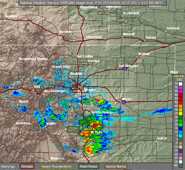
| 7/15/2020 4:35 PM MDT |
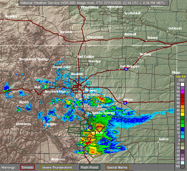 At 435 pm mdt, a severe thunderstorm was located 4 miles northeast of kiowa, or 37 miles west of limon, moving northeast at 20 mph (radar indicated). Hazards include ping pong ball size hail and 60 mph wind gusts. Expect damage to roofs, siding, and trees. people and animals outdoors will be injured. expect hail damage to roofs, siding, windows, and vehicles. This severe thunderstorm will remain over mainly rural areas of northwestern elbert county. At 435 pm mdt, a severe thunderstorm was located 4 miles northeast of kiowa, or 37 miles west of limon, moving northeast at 20 mph (radar indicated). Hazards include ping pong ball size hail and 60 mph wind gusts. Expect damage to roofs, siding, and trees. people and animals outdoors will be injured. expect hail damage to roofs, siding, windows, and vehicles. This severe thunderstorm will remain over mainly rural areas of northwestern elbert county.
|
| 7/15/2020 4:21 PM MDT |
 At 421 pm mdt, a severe thunderstorm was located over kiowa, or 36 miles northeast of colorado springs, moving north at 15 mph (radar indicated). Hazards include ping pong ball size hail and 60 mph wind gusts. Expect damage to roofs, siding, and trees. people and animals outdoors will be injured. expect hail damage to roofs, siding, windows, and vehicles. Locations impacted include, kiowa. At 421 pm mdt, a severe thunderstorm was located over kiowa, or 36 miles northeast of colorado springs, moving north at 15 mph (radar indicated). Hazards include ping pong ball size hail and 60 mph wind gusts. Expect damage to roofs, siding, and trees. people and animals outdoors will be injured. expect hail damage to roofs, siding, windows, and vehicles. Locations impacted include, kiowa.
|
| 7/15/2020 4:09 PM MDT |
 At 409 pm mdt, a severe thunderstorm was located 4 miles south of kiowa, or 33 miles northeast of colorado springs, moving north at 15 mph (radar indicated). Hazards include golf ball size hail and 60 mph wind gusts. Expect damage to roofs, siding, and trees. people and animals outdoors will be injured. Expect hail damage to roofs, siding, windows, and vehicles. At 409 pm mdt, a severe thunderstorm was located 4 miles south of kiowa, or 33 miles northeast of colorado springs, moving north at 15 mph (radar indicated). Hazards include golf ball size hail and 60 mph wind gusts. Expect damage to roofs, siding, and trees. people and animals outdoors will be injured. Expect hail damage to roofs, siding, windows, and vehicles.
|
| 6/6/2020 4:50 PM MDT |
 At 449 pm mdt, severe thunderstorms were located along a line extending from 10 miles northeast of ponderosa park to 8 miles northwest of calhan, or along a line extending from 26 miles southeast of denver to 28 miles northeast of colorado springs, moving northeast at 60 mph. these are very dangerous storms (radar indicated). Hazards include 80 mph wind gusts. Flying debris will be dangerous to those caught without shelter. mobile homes will be heavily damaged. expect considerable damage to roofs, windows, and vehicles. Extensive tree damage and power outages are likely. At 449 pm mdt, severe thunderstorms were located along a line extending from 10 miles northeast of ponderosa park to 8 miles northwest of calhan, or along a line extending from 26 miles southeast of denver to 28 miles northeast of colorado springs, moving northeast at 60 mph. these are very dangerous storms (radar indicated). Hazards include 80 mph wind gusts. Flying debris will be dangerous to those caught without shelter. mobile homes will be heavily damaged. expect considerable damage to roofs, windows, and vehicles. Extensive tree damage and power outages are likely.
|
| 6/6/2020 4:44 PM MDT |
 At 444 pm mdt, severe thunderstorms were located along a line extending from 8 miles south of grover to near orchard to 5 miles southwest of leader to 3 miles east of elbert, or along a line extending from 40 miles southeast of cheyenne to 20 miles west of fort morgan to 43 miles east of denver to 27 miles northeast of colorado springs, moving east at 35 mph. these are very dangerous storms (radar indicated). Hazards include 80 mph wind gusts. Flying debris will be dangerous to those caught without shelter. mobile homes will be heavily damaged. expect considerable damage to roofs, windows, and vehicles. extensive tree damage and power outages are likely. locations impacted include, eastern denver, southeastern greeley, aurora, eastern centennial, southeastern highlands ranch, castle rock, eastern commerce city, parker, elbert, greenwood village, lone tree, denver international airport, d. i. A terminal and concourses, lochbuie, hudson, bennett, kersey, elizabeth, keenesburg and kiowa. At 444 pm mdt, severe thunderstorms were located along a line extending from 8 miles south of grover to near orchard to 5 miles southwest of leader to 3 miles east of elbert, or along a line extending from 40 miles southeast of cheyenne to 20 miles west of fort morgan to 43 miles east of denver to 27 miles northeast of colorado springs, moving east at 35 mph. these are very dangerous storms (radar indicated). Hazards include 80 mph wind gusts. Flying debris will be dangerous to those caught without shelter. mobile homes will be heavily damaged. expect considerable damage to roofs, windows, and vehicles. extensive tree damage and power outages are likely. locations impacted include, eastern denver, southeastern greeley, aurora, eastern centennial, southeastern highlands ranch, castle rock, eastern commerce city, parker, elbert, greenwood village, lone tree, denver international airport, d. i. A terminal and concourses, lochbuie, hudson, bennett, kersey, elizabeth, keenesburg and kiowa.
|
| 6/6/2020 3:56 PM MDT |
 At 355 pm mdt, severe thunderstorms were located along a line extending from 6 miles south of carr to 3 miles east of dacono to aurora to 5 miles east of greenland, or along a line extending from 21 miles northeast of fort collins to 24 miles south of greeley to 10 miles east of denver to 22 miles north of colorado springs, moving northeast at 60 mph. these are very dangerous storms (radar indicated). Hazards include 80 mph wind gusts. Flying debris will be dangerous to those caught without shelter. mobile homes will be heavily damaged. expect considerable damage to roofs, windows, and vehicles. Extensive tree damage and power outages are likely. At 355 pm mdt, severe thunderstorms were located along a line extending from 6 miles south of carr to 3 miles east of dacono to aurora to 5 miles east of greenland, or along a line extending from 21 miles northeast of fort collins to 24 miles south of greeley to 10 miles east of denver to 22 miles north of colorado springs, moving northeast at 60 mph. these are very dangerous storms (radar indicated). Hazards include 80 mph wind gusts. Flying debris will be dangerous to those caught without shelter. mobile homes will be heavily damaged. expect considerable damage to roofs, windows, and vehicles. Extensive tree damage and power outages are likely.
|
| 5/3/2020 11:32 PM MDT |
 At 1132 pm mdt, a severe thunderstorm was located 6 miles northeast of kiowa, or 34 miles southeast of denver, moving east at 30 mph (radar indicated). Hazards include 60 mph wind gusts and quarter size hail. Expect damage to roofs, siding, and trees. hail damage to vehicles is expected. This severe thunderstorm will remain over mainly rural areas of northwestern elbert county. At 1132 pm mdt, a severe thunderstorm was located 6 miles northeast of kiowa, or 34 miles southeast of denver, moving east at 30 mph (radar indicated). Hazards include 60 mph wind gusts and quarter size hail. Expect damage to roofs, siding, and trees. hail damage to vehicles is expected. This severe thunderstorm will remain over mainly rural areas of northwestern elbert county.
|
| 5/3/2020 11:14 PM MDT |
 At 1114 pm mdt, a severe thunderstorm was located near ponderosa park, or 27 miles southeast of denver, moving east at 30 mph (radar indicated). Hazards include 60 mph wind gusts and quarter size hail. Expect damage to roofs, siding, and trees. Hail damage to vehicles is expected. At 1114 pm mdt, a severe thunderstorm was located near ponderosa park, or 27 miles southeast of denver, moving east at 30 mph (radar indicated). Hazards include 60 mph wind gusts and quarter size hail. Expect damage to roofs, siding, and trees. Hail damage to vehicles is expected.
|
| 8/11/2019 2:28 PM MDT |
 At 214 pm mdt, a severe thunderstorm capable of producing a tornado was located 10 miles northeast of kiowa, or 37 miles west of limon, moving east at 20 mph (radar indicated rotation). Hazards include tornado and ping pong ball size hail. Expect damage to mobile homes, roofs, and vehicles. Locations impacted include, kiowa. At 214 pm mdt, a severe thunderstorm capable of producing a tornado was located 10 miles northeast of kiowa, or 37 miles west of limon, moving east at 20 mph (radar indicated rotation). Hazards include tornado and ping pong ball size hail. Expect damage to mobile homes, roofs, and vehicles. Locations impacted include, kiowa.
|
| 8/11/2019 2:14 PM MDT |
 At 214 pm mdt, a severe thunderstorm capable of producing a tornado was located 10 miles northeast of kiowa, or 37 miles west of limon, moving east at 20 mph (radar indicated rotation). Hazards include tornado and ping pong ball size hail. Expect damage to mobile homes, roofs, and vehicles. Locations impacted include, kiowa. At 214 pm mdt, a severe thunderstorm capable of producing a tornado was located 10 miles northeast of kiowa, or 37 miles west of limon, moving east at 20 mph (radar indicated rotation). Hazards include tornado and ping pong ball size hail. Expect damage to mobile homes, roofs, and vehicles. Locations impacted include, kiowa.
|
| 8/11/2019 1:59 PM MDT |
 At 159 pm mdt, a severe thunderstorm capable of producing a tornado was located 7 miles north of kiowa, or 35 miles southeast of denver, moving east at 20 mph (radar indicated rotation). Hazards include tornado and ping pong ball size hail. expect damage to mobile homes, roofs, and vehicles At 159 pm mdt, a severe thunderstorm capable of producing a tornado was located 7 miles north of kiowa, or 35 miles southeast of denver, moving east at 20 mph (radar indicated rotation). Hazards include tornado and ping pong ball size hail. expect damage to mobile homes, roofs, and vehicles
|
| 8/11/2019 1:51 PM MDT |
 At 151 pm mdt, a severe thunderstorm was located 6 miles northeast of elizabeth, or 33 miles southeast of denver, moving east at 20 mph (radar indicated). Hazards include golf ball size hail and 60 mph wind gusts. Expect damage to roofs, siding, and trees. people and animals outdoors will be injured. expect hail damage to roofs, siding, windows, and vehicles. Locations impacted include, kiowa. At 151 pm mdt, a severe thunderstorm was located 6 miles northeast of elizabeth, or 33 miles southeast of denver, moving east at 20 mph (radar indicated). Hazards include golf ball size hail and 60 mph wind gusts. Expect damage to roofs, siding, and trees. people and animals outdoors will be injured. expect hail damage to roofs, siding, windows, and vehicles. Locations impacted include, kiowa.
|
| 8/11/2019 1:38 PM MDT |
 At 138 pm mdt, a severe thunderstorm was located near ponderosa park, or 30 miles southeast of denver, moving east at 20 mph (radar indicated). Hazards include 60 mph wind gusts and quarter size hail. Expect damage to roofs, siding, and trees. Hail damage to vehicles is expected. At 138 pm mdt, a severe thunderstorm was located near ponderosa park, or 30 miles southeast of denver, moving east at 20 mph (radar indicated). Hazards include 60 mph wind gusts and quarter size hail. Expect damage to roofs, siding, and trees. Hail damage to vehicles is expected.
|
| 7/15/2019 4:37 PM MDT |
 The severe thunderstorm warning for west central elbert county will expire at 445 pm mdt, the storm which prompted the warning has weakened below severe limits, therefore, the warning will be allowed to expire. however heavy rain is still occuring north of elbert and south of elizabeth. there is a small stream flood advisory in effect for this part of elbert county until 6 pm. don`t drive across flooded roadways. The severe thunderstorm warning for west central elbert county will expire at 445 pm mdt, the storm which prompted the warning has weakened below severe limits, therefore, the warning will be allowed to expire. however heavy rain is still occuring north of elbert and south of elizabeth. there is a small stream flood advisory in effect for this part of elbert county until 6 pm. don`t drive across flooded roadways.
|
| 7/15/2019 4:16 PM MDT |
 At 415 pm mdt, a severe thunderstorm was located 4 miles north of elbert, or 34 miles northeast of colorado springs, moving east at 20 mph (radar indicated). Hazards include quarter size hail. Damage to vehicles is expected. Locations impacted include, elbert, elizabeth, kiowa and ponderosa park. At 415 pm mdt, a severe thunderstorm was located 4 miles north of elbert, or 34 miles northeast of colorado springs, moving east at 20 mph (radar indicated). Hazards include quarter size hail. Damage to vehicles is expected. Locations impacted include, elbert, elizabeth, kiowa and ponderosa park.
|
| 7/15/2019 4:00 PM MDT |
 At 400 pm mdt, a severe thunderstorm was located 8 miles south of franktown, or 31 miles north of colorado springs, moving east at 10 mph. trained weather spotters recently reported half dollar size hail with this storm south of franktown (trained weather spotters). Hazards include half dollar size hail. damage to vehicles is expected At 400 pm mdt, a severe thunderstorm was located 8 miles south of franktown, or 31 miles north of colorado springs, moving east at 10 mph. trained weather spotters recently reported half dollar size hail with this storm south of franktown (trained weather spotters). Hazards include half dollar size hail. damage to vehicles is expected
|
| 7/5/2019 4:28 PM MDT |
 At 428 pm mdt, a severe thunderstorm was located 6 miles southeast of kiowa, or 37 miles west of limon, moving southeast at 15 mph (radar indicated). Hazards include ping pong ball size hail. People and animals outdoors will be injured. expect damage to roofs, siding, windows, and vehicles. This severe thunderstorm will remain over mainly rural areas of central elbert county. At 428 pm mdt, a severe thunderstorm was located 6 miles southeast of kiowa, or 37 miles west of limon, moving southeast at 15 mph (radar indicated). Hazards include ping pong ball size hail. People and animals outdoors will be injured. expect damage to roofs, siding, windows, and vehicles. This severe thunderstorm will remain over mainly rural areas of central elbert county.
|
| 7/5/2019 4:15 PM MDT | Golf Ball sized hail reported 6.2 miles NW of Kiowa, CO, e558 1 to 1.5 inch accumulation. |
| 7/5/2019 4:02 PM MDT |
 At 401 pm mdt, a severe thunderstorm was located near kiowa, or 38 miles northeast of colorado springs, moving east at 25 mph (radar indicated). Hazards include ping pong ball size hail. People and animals outdoors will be injured. Expect damage to roofs, siding, windows, and vehicles. At 401 pm mdt, a severe thunderstorm was located near kiowa, or 38 miles northeast of colorado springs, moving east at 25 mph (radar indicated). Hazards include ping pong ball size hail. People and animals outdoors will be injured. Expect damage to roofs, siding, windows, and vehicles.
|
| 6/21/2019 3:33 PM MDT | Quarter sized hail reported 6.9 miles W of Kiowa, CO |
| 6/21/2019 3:27 PM MDT |
 At 326 pm mdt, a severe thunderstorm capable of producing a tornado was located 9 miles northwest of ramah, or 32 miles west of limon, moving east at 30 mph. at 325 pm storm chasers are reporting rapid rotation at the cloud base (radar indicated rotation). Hazards include tornado and quarter size hail. Flying debris will be dangerous to those caught without shelter. mobile homes will be damaged or destroyed. damage to roofs, windows, and vehicles will occur. Tree damage is likely. At 326 pm mdt, a severe thunderstorm capable of producing a tornado was located 9 miles northwest of ramah, or 32 miles west of limon, moving east at 30 mph. at 325 pm storm chasers are reporting rapid rotation at the cloud base (radar indicated rotation). Hazards include tornado and quarter size hail. Flying debris will be dangerous to those caught without shelter. mobile homes will be damaged or destroyed. damage to roofs, windows, and vehicles will occur. Tree damage is likely.
|
| 6/21/2019 3:00 PM MDT |
 At 259 pm mdt, a severe thunderstorm was located 5 miles southwest of elizabeth, or 32 miles north of colorado springs, moving east at 20 mph (radar indicated). Hazards include half dollar size hail. damage to vehicles is expected At 259 pm mdt, a severe thunderstorm was located 5 miles southwest of elizabeth, or 32 miles north of colorado springs, moving east at 20 mph (radar indicated). Hazards include half dollar size hail. damage to vehicles is expected
|
| 6/13/2019 5:34 PM MDT |
 At 534 pm mdt, a severe thunderstorm was located 4 miles southeast of kiowa, or 38 miles west of limon, moving southeast at 20 mph (radar indicated). Hazards include 60 mph wind gusts and quarter size hail. Expect damage to roofs, siding, and trees. Hail damage to vehicles is expected. At 534 pm mdt, a severe thunderstorm was located 4 miles southeast of kiowa, or 38 miles west of limon, moving southeast at 20 mph (radar indicated). Hazards include 60 mph wind gusts and quarter size hail. Expect damage to roofs, siding, and trees. Hail damage to vehicles is expected.
|
| 6/8/2019 6:30 PM MDT | Storm damage reported in elbert county CO, 12.5 miles WSW of Kiowa, CO |
| 6/8/2019 6:11 PM MDT |
 At 611 pm mdt, a severe thunderstorm was located near elizabeth, or 32 miles southeast of denver, moving east at 30 mph (radar indicated). Hazards include 60 mph wind gusts and half dollar size hail. Expect damage to roofs, siding, and trees. Hail damage to vehicles is expected. At 611 pm mdt, a severe thunderstorm was located near elizabeth, or 32 miles southeast of denver, moving east at 30 mph (radar indicated). Hazards include 60 mph wind gusts and half dollar size hail. Expect damage to roofs, siding, and trees. Hail damage to vehicles is expected.
|
| 6/3/2019 1:52 PM MDT |
 The severe thunderstorm warning for northwestern elbert county will expire at 200 pm mdt, the storm which prompted the warning has weakened below severe limits, and no longer poses an immediate threat to life or property. therefore, the warning will be allowed to expire. The severe thunderstorm warning for northwestern elbert county will expire at 200 pm mdt, the storm which prompted the warning has weakened below severe limits, and no longer poses an immediate threat to life or property. therefore, the warning will be allowed to expire.
|
| 6/3/2019 1:30 PM MDT |
 At 129 pm mdt, a severe thunderstorm was located near kiowa, or 36 miles northeast of colorado springs, moving northeast at 15 mph (radar indicated). Hazards include quarter size hail. damage to vehicles is expected At 129 pm mdt, a severe thunderstorm was located near kiowa, or 36 miles northeast of colorado springs, moving northeast at 15 mph (radar indicated). Hazards include quarter size hail. damage to vehicles is expected
|
| 6/1/2019 3:29 PM MDT |
 At 329 pm mdt, a severe thunderstorm was located 8 miles northeast of kiowa, or 38 miles west of limon, moving east at 15 mph (radar indicated). Hazards include ping pong ball size hail and 60 mph wind gusts. Expect damage to roofs, siding, and trees. people and animals outdoors will be injured. Expect hail damage to roofs, siding, windows, and vehicles. At 329 pm mdt, a severe thunderstorm was located 8 miles northeast of kiowa, or 38 miles west of limon, moving east at 15 mph (radar indicated). Hazards include ping pong ball size hail and 60 mph wind gusts. Expect damage to roofs, siding, and trees. people and animals outdoors will be injured. Expect hail damage to roofs, siding, windows, and vehicles.
|
| 8/6/2018 9:10 PM MDT | Half Dollar sized hail reported 12.3 miles WSW of Kiowa, CO, hail covering the ground. |
| 7/29/2018 8:46 PM MDT |
 At 845 pm mdt, severe thunderstorms were located along a line extending from 10 miles southeast of leader to 4 miles east of deer trail to 12 miles west of agate, or along a line extending from 34 miles south of fort morgan to 27 miles northwest of limon to 44 miles southeast of denver, moving southeast at 40 mph (trained weather spotters). Hazards include tennis ball size hail and 70 mph wind gusts. Expect considerable tree damage. damage is likely to mobile homes, roofs, and outbuildings. people and animals outdoors will be injured. expect hail damage to roofs, siding, windows, and vehicles. locations impacted include, agate and cottonwood valley. A tornado watch remains in effect until 900 pm mdt for northeastern and east central colorado. At 845 pm mdt, severe thunderstorms were located along a line extending from 10 miles southeast of leader to 4 miles east of deer trail to 12 miles west of agate, or along a line extending from 34 miles south of fort morgan to 27 miles northwest of limon to 44 miles southeast of denver, moving southeast at 40 mph (trained weather spotters). Hazards include tennis ball size hail and 70 mph wind gusts. Expect considerable tree damage. damage is likely to mobile homes, roofs, and outbuildings. people and animals outdoors will be injured. expect hail damage to roofs, siding, windows, and vehicles. locations impacted include, agate and cottonwood valley. A tornado watch remains in effect until 900 pm mdt for northeastern and east central colorado.
|
| 7/29/2018 8:45 PM MDT | Hen Egg sized hail reported 7.9 miles SSW of Kiowa, CO |
| 7/29/2018 8:27 PM MDT |
 At 826 pm mdt, severe thunderstorms were located along a line extending from 4 miles west of leader to 3 miles east of byers to 11 miles south of strasburg, or along a line extending from 31 miles southwest of fort morgan to 39 miles northwest of limon to 32 miles east of denver, moving southeast at 40 mph (radar indicated). Hazards include two inch hail and 60 mph wind gusts. Expect damage to roofs, siding, and trees. people and animals outdoors will be injured. Expect hail damage to roofs, siding, windows, and vehicles. At 826 pm mdt, severe thunderstorms were located along a line extending from 4 miles west of leader to 3 miles east of byers to 11 miles south of strasburg, or along a line extending from 31 miles southwest of fort morgan to 39 miles northwest of limon to 32 miles east of denver, moving southeast at 40 mph (radar indicated). Hazards include two inch hail and 60 mph wind gusts. Expect damage to roofs, siding, and trees. people and animals outdoors will be injured. Expect hail damage to roofs, siding, windows, and vehicles.
|
| 7/29/2018 7:40 PM MDT | Quarter sized hail reported 12.5 miles WSW of Kiowa, CO |
| 7/26/2018 10:38 PM MDT |
 At 1037 pm mdt, a severe thunderstorm was located 4 miles northeast of kiowa, or 37 miles west of limon, moving south at 25 mph (radar indicated). Hazards include 60 mph wind gusts. expect damage to roofs, siding, and trees At 1037 pm mdt, a severe thunderstorm was located 4 miles northeast of kiowa, or 37 miles west of limon, moving south at 25 mph (radar indicated). Hazards include 60 mph wind gusts. expect damage to roofs, siding, and trees
|
| 6/30/2018 6:08 PM MDT |
 The national weather service in denver colorado has issued a * severe thunderstorm warning for. northern elbert county in east central colorado. until 700 pm mdt. At 608 pm mdt, a severe thunderstorm was located 7 miles north of kiowa, or 32 miles southeast of denver, moving east at 30 mph. The national weather service in denver colorado has issued a * severe thunderstorm warning for. northern elbert county in east central colorado. until 700 pm mdt. At 608 pm mdt, a severe thunderstorm was located 7 miles north of kiowa, or 32 miles southeast of denver, moving east at 30 mph.
|
| 6/13/2018 1:26 AM MDT |
 The severe thunderstorm warning for northwestern elbert county will expire at 130 am mdt. the storm which prompted the warning has weakened below severe limits, and no longer poses an immediate threat to life or property. therefore, the warning will be allowed to expire. Small hail is still expected with this storm. The severe thunderstorm warning for northwestern elbert county will expire at 130 am mdt. the storm which prompted the warning has weakened below severe limits, and no longer poses an immediate threat to life or property. therefore, the warning will be allowed to expire. Small hail is still expected with this storm.
|
| 6/13/2018 1:01 AM MDT |
 At 101 am mdt, a severe thunderstorm was located over elbert, or 29 miles northeast of colorado springs, moving northeast at 35 mph (radar indicated). Hazards include half dollar size hail. Damage to vehicles is expected. Locations impacted include, elbert, elizabeth, kiowa and ponderosa park. At 101 am mdt, a severe thunderstorm was located over elbert, or 29 miles northeast of colorado springs, moving northeast at 35 mph (radar indicated). Hazards include half dollar size hail. Damage to vehicles is expected. Locations impacted include, elbert, elizabeth, kiowa and ponderosa park.
|
| 6/13/2018 12:47 AM MDT |
 The national weather service in denver colorado has issued a * severe thunderstorm warning for. southeastern douglas county in northeastern colorado. northwestern elbert county in east central colorado. until 130 am mdt. At 1247 am mdt, a severe thunderstorm was located 7 miles northeast. The national weather service in denver colorado has issued a * severe thunderstorm warning for. southeastern douglas county in northeastern colorado. northwestern elbert county in east central colorado. until 130 am mdt. At 1247 am mdt, a severe thunderstorm was located 7 miles northeast.
|
| 5/30/2018 1:56 PM MDT |
 At 155 pm mdt, a severe thunderstorm was located over elizabeth, or 33 miles southeast of denver, moving east at 25 mph (radar indicated). Hazards include quarter size hail. damage to vehicles is expected At 155 pm mdt, a severe thunderstorm was located over elizabeth, or 33 miles southeast of denver, moving east at 25 mph (radar indicated). Hazards include quarter size hail. damage to vehicles is expected
|
| 5/14/2018 2:54 PM MDT |
 The severe thunderstorm warning for northwestern elbert county will expire at 300 pm mdt, the storm which prompted the warning has weakened below severe limits, and no longer poses an immediate threat to life or property. therefore, the warning will be allowed to expire. there is a severe thunderstorm warning for northeast of agate in effect until 330 pm. The severe thunderstorm warning for northwestern elbert county will expire at 300 pm mdt, the storm which prompted the warning has weakened below severe limits, and no longer poses an immediate threat to life or property. therefore, the warning will be allowed to expire. there is a severe thunderstorm warning for northeast of agate in effect until 330 pm.
|
| 5/14/2018 2:26 PM MDT |
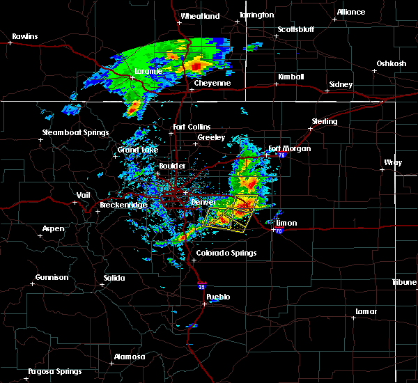 At 224 pm mdt, a severe thunderstorm was located 4 miles northeast of kiowa, or 37 miles southeast of denver, moving southeast at 15 mph. there is another severe thunderstorm 10 miles northwest of agate (radar indicated). Hazards include 60 mph wind gusts and quarter size hail. Hail damage to vehicles is expected. Expect wind damage to roofs, siding, and trees. At 224 pm mdt, a severe thunderstorm was located 4 miles northeast of kiowa, or 37 miles southeast of denver, moving southeast at 15 mph. there is another severe thunderstorm 10 miles northwest of agate (radar indicated). Hazards include 60 mph wind gusts and quarter size hail. Hail damage to vehicles is expected. Expect wind damage to roofs, siding, and trees.
|
| 5/14/2018 1:58 PM MDT |
 At 157 pm mdt, a severe thunderstorm was located 5 miles northwest of kiowa, or 32 miles southeast of denver, moving east at 20 mph (radar indicated). Hazards include 60 mph wind gusts and quarter size hail. Hail damage to vehicles is expected. Expect wind damage to roofs, siding, and trees. At 157 pm mdt, a severe thunderstorm was located 5 miles northwest of kiowa, or 32 miles southeast of denver, moving east at 20 mph (radar indicated). Hazards include 60 mph wind gusts and quarter size hail. Hail damage to vehicles is expected. Expect wind damage to roofs, siding, and trees.
|
| 5/14/2018 1:42 PM MDT |
 At 140 pm mdt, a severe thunderstorm was located near ponderosa park, or 26 miles southeast of denver, moving east at 15 mph (radar indicated). Hazards include half dollar size hail. Damage to vehicles is possible. Locations impacted include, elizabeth, kiowa and ponderosa park. At 140 pm mdt, a severe thunderstorm was located near ponderosa park, or 26 miles southeast of denver, moving east at 15 mph (radar indicated). Hazards include half dollar size hail. Damage to vehicles is possible. Locations impacted include, elizabeth, kiowa and ponderosa park.
|
| 5/14/2018 1:22 PM MDT |
 At 121 pm mdt, a severe thunderstorm was located over the pinery, or 24 miles southeast of denver, moving east at 15 mph (doppler radar indicated). Hazards include golf ball size hail. People and animals outdoors will be injured. Expect damage to roofs, siding, windows, and vehicles. At 121 pm mdt, a severe thunderstorm was located over the pinery, or 24 miles southeast of denver, moving east at 15 mph (doppler radar indicated). Hazards include golf ball size hail. People and animals outdoors will be injured. Expect damage to roofs, siding, windows, and vehicles.
|
| 5/13/2018 7:40 PM MDT |
 At 740 pm mdt, a severe thunderstorm was located 9 miles east of kiowa, or 32 miles west of limon, moving east at 25 mph (radar indicated). Hazards include quarter size hail. Damage to vehicles is expected. This severe thunderstorm will remain over mainly rural areas of northern elbert and south central arapahoe counties. At 740 pm mdt, a severe thunderstorm was located 9 miles east of kiowa, or 32 miles west of limon, moving east at 25 mph (radar indicated). Hazards include quarter size hail. Damage to vehicles is expected. This severe thunderstorm will remain over mainly rural areas of northern elbert and south central arapahoe counties.
|
| 6/29/2017 9:20 AM MDT |
 At 319 pm mdt, a severe thunderstorm was located over elbert, or 32 miles northeast of colorado springs, moving east at 25 mph (radar indicated). Hazards include 60 mph wind gusts and quarter size hail. Hail damage to vehicles is expected. expect wind damage to roofs, siding, and trees. Locations impacted include, elbert and kiowa. At 319 pm mdt, a severe thunderstorm was located over elbert, or 32 miles northeast of colorado springs, moving east at 25 mph (radar indicated). Hazards include 60 mph wind gusts and quarter size hail. Hail damage to vehicles is expected. expect wind damage to roofs, siding, and trees. Locations impacted include, elbert and kiowa.
|
| 6/29/2017 9:02 AM MDT |
 At 302 pm mdt, a severe thunderstorm was located 5 miles south of elizabeth, or 33 miles north of colorado springs, moving east at 30 mph (radar indicated). Hazards include 60 mph wind gusts and half dollar size hail. Hail damage to vehicles is expected. Expect wind damage to roofs, siding, and trees. At 302 pm mdt, a severe thunderstorm was located 5 miles south of elizabeth, or 33 miles north of colorado springs, moving east at 30 mph (radar indicated). Hazards include 60 mph wind gusts and half dollar size hail. Hail damage to vehicles is expected. Expect wind damage to roofs, siding, and trees.
|
| 6/29/2017 7:22 AM MDT |
 At 121 pm mdt, a severe thunderstorm was located 9 miles northwest of ramah, or 34 miles west of limon, moving north at 15 mph (radar indicated). Hazards include half dollar size hail. Damage to vehicles is expected. This severe thunderstorm will remain over mainly rural areas of central elbert county, which includes fondis. At 121 pm mdt, a severe thunderstorm was located 9 miles northwest of ramah, or 34 miles west of limon, moving north at 15 mph (radar indicated). Hazards include half dollar size hail. Damage to vehicles is expected. This severe thunderstorm will remain over mainly rural areas of central elbert county, which includes fondis.
|
| 7/24/2016 3:34 PM MDT |
 At 334 pm mdt, a severe thunderstorm was located 7 miles north of kiowa, or 31 miles southeast of denver, moving east at 30 mph (radar indicated). Hazards include 60 mph wind gusts and nickel size hail. Expect damage to roofs. siding. And trees. At 334 pm mdt, a severe thunderstorm was located 7 miles north of kiowa, or 31 miles southeast of denver, moving east at 30 mph (radar indicated). Hazards include 60 mph wind gusts and nickel size hail. Expect damage to roofs. siding. And trees.
|
| 6/19/2016 9:11 PM MDT |
 At 910 pm mdt, a severe thunderstorm was located 5 miles southeast of kiowa, or 37 miles northeast of colorado springs, moving southeast at 25 mph (radar indicated. this storm produced hail up to the size of quarters in the elizabeth area). Hazards include 60 mph wind gusts and quarter size hail. Hail damage to vehicles is expected. Expect wind damage to roofs, siding, and trees. At 910 pm mdt, a severe thunderstorm was located 5 miles southeast of kiowa, or 37 miles northeast of colorado springs, moving southeast at 25 mph (radar indicated. this storm produced hail up to the size of quarters in the elizabeth area). Hazards include 60 mph wind gusts and quarter size hail. Hail damage to vehicles is expected. Expect wind damage to roofs, siding, and trees.
|
| 6/19/2016 8:53 PM MDT |
 At 852 pm mdt, a severe thunderstorm was located near elbert, or 33 miles northeast of colorado springs, moving east at 20 mph (radar indicated). Hazards include quarter size hail. Damage to vehicles is expected. Locations impacted include, elbert, elizabeth, kiowa and ponderosa park. At 852 pm mdt, a severe thunderstorm was located near elbert, or 33 miles northeast of colorado springs, moving east at 20 mph (radar indicated). Hazards include quarter size hail. Damage to vehicles is expected. Locations impacted include, elbert, elizabeth, kiowa and ponderosa park.
|
| 6/19/2016 8:32 PM MDT |
 At 831 pm mdt, a severe thunderstorm was located 4 miles southwest of elizabeth, or 33 miles southeast of denver, moving southeast at 15 mph (radar indicated. spotters earlier reported quarter sized hail with this storm). Hazards include ping pong ball size hail. People and animals outdoors will be injured. Expect damage to roofs, siding, windows, and vehicles. At 831 pm mdt, a severe thunderstorm was located 4 miles southwest of elizabeth, or 33 miles southeast of denver, moving southeast at 15 mph (radar indicated. spotters earlier reported quarter sized hail with this storm). Hazards include ping pong ball size hail. People and animals outdoors will be injured. Expect damage to roofs, siding, windows, and vehicles.
|
| 5/7/2016 1:41 PM MDT |
 The severe thunderstorm warning for south central arapahoe and northwestern elbert counties will expire at 145 pm mdt, the storm which prompted the warning has moved out of the area. therefore the warning will be allowed to expire. a tornado watch remains in effect until 700 pm mdt for northeastern colorado. The severe thunderstorm warning for south central arapahoe and northwestern elbert counties will expire at 145 pm mdt, the storm which prompted the warning has moved out of the area. therefore the warning will be allowed to expire. a tornado watch remains in effect until 700 pm mdt for northeastern colorado.
|
| 5/7/2016 1:24 PM MDT |
 At 123 pm mdt, a severe thunderstorm was located 10 miles north of kiowa, or 31 miles southeast of denver, moving northeast at 35 mph (radar indicated). Hazards include quarter size hail and 60 mph wind gusts. Hail damage to vehicles is expected. expect wind damage to roofs, siding and trees. locations impacted include, kiowa and ponderosa park. A tornado watch remains in effect until 700 pm mdt for northeastern colorado. At 123 pm mdt, a severe thunderstorm was located 10 miles north of kiowa, or 31 miles southeast of denver, moving northeast at 35 mph (radar indicated). Hazards include quarter size hail and 60 mph wind gusts. Hail damage to vehicles is expected. expect wind damage to roofs, siding and trees. locations impacted include, kiowa and ponderosa park. A tornado watch remains in effect until 700 pm mdt for northeastern colorado.
|
| 5/7/2016 1:14 PM MDT |
 At 114 pm mdt, a severe thunderstorm was located 6 miles northeast of elizabeth, or 31 miles southeast of denver, moving northeast at 35 mph (radar indicated). Hazards include 60 mph wind gusts and half dollar size hail. Hail damage to vehicles is expected. Expect wind damage to roofs, siding and trees. At 114 pm mdt, a severe thunderstorm was located 6 miles northeast of elizabeth, or 31 miles southeast of denver, moving northeast at 35 mph (radar indicated). Hazards include 60 mph wind gusts and half dollar size hail. Hail damage to vehicles is expected. Expect wind damage to roofs, siding and trees.
|
| 5/7/2016 1:09 PM MDT | Quarter sized hail reported 3.3 miles E of Kiowa, CO |
| 5/7/2016 1:04 PM MDT |
 At 103 pm mdt, a severe thunderstorm capable of producing a tornado was located near kiowa, or 37 miles northeast of colorado springs, moving northeast at 30 mph (radar indicated rotation). Hazards include tornado and quarter size hail. Flying debris will be dangerous to those caught without shelter. mobile homes will be damaged or destroyed. damage to roofs, windows and vehicles will occur. tree damage is likely. Locations impacted include, elbert, elizabeth and kiowa. At 103 pm mdt, a severe thunderstorm capable of producing a tornado was located near kiowa, or 37 miles northeast of colorado springs, moving northeast at 30 mph (radar indicated rotation). Hazards include tornado and quarter size hail. Flying debris will be dangerous to those caught without shelter. mobile homes will be damaged or destroyed. damage to roofs, windows and vehicles will occur. tree damage is likely. Locations impacted include, elbert, elizabeth and kiowa.
|
| 5/7/2016 12:55 PM MDT |
 At 1254 pm mdt, a severe thunderstorm capable of producing a tornado was located near elbert, or 32 miles northeast of colorado springs, moving northeast at 30 mph (radar indicated rotation). Hazards include tornado and quarter size hail. Flying debris will be dangerous to those caught without shelter. mobile homes will be damaged or destroyed. damage to roofs, windows and vehicles will occur. Tree damage is likely. At 1254 pm mdt, a severe thunderstorm capable of producing a tornado was located near elbert, or 32 miles northeast of colorado springs, moving northeast at 30 mph (radar indicated rotation). Hazards include tornado and quarter size hail. Flying debris will be dangerous to those caught without shelter. mobile homes will be damaged or destroyed. damage to roofs, windows and vehicles will occur. Tree damage is likely.
|
| 10/6/2015 2:06 PM MDT |
 At 206 pm mdt, a severe thunderstorm was located near kiowa, or 35 miles southeast of denver, moving northeast at 15 mph (radar indicated). Hazards include half dollar size hail and 60 mph wind gusts. Hail damage to vehicles is expected. expect wind damage to roofs, siding and trees. Locations impacted include, kiowa. At 206 pm mdt, a severe thunderstorm was located near kiowa, or 35 miles southeast of denver, moving northeast at 15 mph (radar indicated). Hazards include half dollar size hail and 60 mph wind gusts. Hail damage to vehicles is expected. expect wind damage to roofs, siding and trees. Locations impacted include, kiowa.
|
| 10/6/2015 1:47 PM MDT |
 At 147 pm mdt, a severe thunderstorm was located near elizabeth, or 35 miles southeast of denver, moving northeast at 15 mph (radar indicated). Hazards include 60 mph wind gusts and half dollar size hail. Hail damage to vehicles is expected. Expect wind damage to roofs, siding and trees. At 147 pm mdt, a severe thunderstorm was located near elizabeth, or 35 miles southeast of denver, moving northeast at 15 mph (radar indicated). Hazards include 60 mph wind gusts and half dollar size hail. Hail damage to vehicles is expected. Expect wind damage to roofs, siding and trees.
|
| 8/17/2015 3:34 PM MDT |
 At 334 pm mdt, a severe thunderstorm was located near elizabeth, or 31 miles southeast of denver, moving east at 20 mph (radar indicated). Hazards include 60 mph wind gusts and quarter size hail. Hail damage to vehicles is expected. Expect wind damage to roofs, siding and trees. At 334 pm mdt, a severe thunderstorm was located near elizabeth, or 31 miles southeast of denver, moving east at 20 mph (radar indicated). Hazards include 60 mph wind gusts and quarter size hail. Hail damage to vehicles is expected. Expect wind damage to roofs, siding and trees.
|
| 6/28/2015 8:22 PM MDT |
 The severe thunderstorm warning for west central elbert county will expire at 830 pm mdt, the storm which prompted the warning has weakened below severe limits and exited the warned area. therefore the warning will be allowed to expire. however heavy rain is still possible with this thunderstorm. The severe thunderstorm warning for west central elbert county will expire at 830 pm mdt, the storm which prompted the warning has weakened below severe limits and exited the warned area. therefore the warning will be allowed to expire. however heavy rain is still possible with this thunderstorm.
|
| 6/28/2015 8:03 PM MDT |
 At 803 pm mdt, a severe thunderstorm was located near elbert, or 28 miles northeast of colorado springs, moving south at 25 mph (radar indicated). Hazards include 60 mph wind gusts and half dollar size hail. Hail damage to vehicles is expected. Expect wind damage to roofs, siding and trees. At 803 pm mdt, a severe thunderstorm was located near elbert, or 28 miles northeast of colorado springs, moving south at 25 mph (radar indicated). Hazards include 60 mph wind gusts and half dollar size hail. Hail damage to vehicles is expected. Expect wind damage to roofs, siding and trees.
|
| 6/28/2015 7:34 PM MDT |
 At 733 pm mdt, a severe thunderstorm was located 5 miles northeast of ponderosa park, or 29 miles southeast of denver, moving southeast at 25 mph (trained weather spotters). Hazards include quarter size hail. damage to vehicles is expected At 733 pm mdt, a severe thunderstorm was located 5 miles northeast of ponderosa park, or 29 miles southeast of denver, moving southeast at 25 mph (trained weather spotters). Hazards include quarter size hail. damage to vehicles is expected
|
| 6/25/2015 5:05 PM MDT |
 At 505 pm mdt, a severe thunderstorm was located near the pinery, or 23 miles southeast of denver, moving southeast at 20 mph (radar indicated). Hazards include 60 mph wind gusts and half dollar size hail. Hail damage to vehicles is expected. Expect wind damage to roofs, siding and trees. At 505 pm mdt, a severe thunderstorm was located near the pinery, or 23 miles southeast of denver, moving southeast at 20 mph (radar indicated). Hazards include 60 mph wind gusts and half dollar size hail. Hail damage to vehicles is expected. Expect wind damage to roofs, siding and trees.
|
| 6/3/2015 7:21 PM MDT | At 721 pm mdt, a severe thunderstorm was located 9 miles east of kiowa, or 32 miles west of limon, moving east at 20 mph (trained weather spotters). Hazards include two inch hail. People and animals outdoors will be injured. expect damage to roofs, siding, windows and vehicles. this severe thunderstorm will remain over mainly rural areas of north central elbert county. A tornado watch remains in effect until 900 pm mdt for east central colorado. |
| 6/3/2015 7:03 PM MDT | At 703 pm mdt, a severe thunderstorm was located 4 miles east of kiowa, or 37 miles west of limon, moving east at 20 mph (trained weather spotters). Hazards include two inch hail. People and animals outdoors will be injured. expect damage to roofs, siding, windows and vehicles. locations impacted include, kiowa. A tornado watch remains in effect until 900 pm mdt for east central colorado. |
| 6/3/2015 6:48 PM MDT | Ping Pong Ball sized hail reported 1.7 miles S of Kiowa, CO |
| 6/3/2015 6:41 PM MDT | At 639 pm mdt, a severe thunderstorm was located 4 miles northwest of kiowa, or 33 miles southeast of denver, moving east at 20 mph (trained weather spotters). Hazards include two inch hail. People and animals outdoors will be injured. Expect damage to roofs, siding, windows and vehicles. |
| 6/3/2015 5:45 PM MDT | At 545 pm mdt, a severe thunderstorm was located near kiowa, or 36 miles southeast of denver, moving east at 10 mph (radar indicated). Hazards include quarter size hail. Damage to vehicles is expected. locations impacted include, kiowa. A tornado watch remains in effect until 900 pm mdt for east central colorado. |
| 6/3/2015 5:03 PM MDT | At 503 pm mdt, a severe thunderstorm was located over elizabeth, or 32 miles southeast of denver, moving east at 15 mph (radar indicated). Hazards include half dollar size hail. damage to vehicles is expected |
| 5/28/2015 2:42 PM MDT | At 242 pm mdt, a severe thunderstorm was located 5 miles north of kiowa, or 35 miles southeast of denver, moving east at 15 mph (radar indicated). Hazards include ping pong ball size hail and 60 mph wind gusts. People and animals outdoors will be injured. expect hail damage to roofs, siding, windows and vehicles. Expect wind damage to roofs, siding and trees. |
| 5/28/2015 2:31 PM MDT | At 229 pm mdt, a severe thunderstorm was located 4 miles northwest of kiowa, or 33 miles southeast of denver, and is moving east at 5 mph (trained weather spotters). Hazards include quarter size hail and 60 mph wind gusts. Hail damage to vehicles is expected. expect wind damage to roofs, siding and trees. Locations impacted include, kiowa. |
| 5/28/2015 2:14 PM MDT | At 214 pm mdt, a severe thunderstorm was located near elizabeth, or 30 miles southeast of denver, moving east at 15 mph (radar indicated). Hazards include 60 mph wind gusts and quarter size hail. Hail damage to vehicles is expected. Expect wind damage to roofs, siding and trees. |
| 6/5/2014 3:00 PM MDT | Quarter sized hail reported 7.9 miles S of Kiowa, CO |
| 7/20/2013 7:53 PM MDT | Quarter sized hail reported 0.3 miles SSE of Kiowa, CO |
| 1/1/0001 12:00 AM | Quarter sized hail reported 3.3 miles E of Kiowa, CO |
| 1/1/0001 12:00 AM | Storm damage reported in elbert county CO, 6.6 miles S of Kiowa, CO |
| 1/1/0001 12:00 AM | Quarter sized hail reported 2.6 miles W of Kiowa, CO |
| 1/1/0001 12:00 AM | Golf Ball sized hail reported 0.3 miles SSE of Kiowa, CO |
| 1/1/0001 12:00 AM | Half Dollar sized hail reported 5.9 miles N of Kiowa, CO |
Hail Maps for Kiowa, CO


Connect with Interactive Hail Maps