

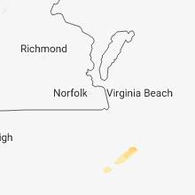
Hail Map for Saturday, November 24, 2018

Number of Impacted Households on 11/24/2018
0
Impacted by 1" or Larger Hail
0
Impacted by 1.75" or Larger Hail
0
Impacted by 2.5" or Larger Hail
Square Miles of Populated Area Impacted on 11/24/2018
0
Impacted by 1" or Larger Hail
0
Impacted by 1.75" or Larger Hail
0
Impacted by 2.5" or Larger Hail

Cities Most Affected by Hail Storms of 11/24/2018
| Hail Size | Demographics of Zip Codes Affected | ||||||
|---|---|---|---|---|---|---|---|
| City | Count | Average | Largest | Pop Density | House Value | Income | Age |
Hail and Wind Damage Spotted on 11/24/2018
Filter by Report Type:Hail ReportsWind Reports
States Impacted
North CarolinaNorth Carolina
| Local Time | Report Details |
|---|---|
| 2:02 PM EST | Damage sustained to 6 or 7 homes with one home having its roof blown off. people trapped in their car underneath power lines. possible tornado. time estimated by rada in carteret county NC, 66.1 miles ENE of Wilmington, NC |
| 2:09 PM EST | Damage to signs in the cit in carteret county NC, 77.3 miles ENE of Wilmington, NC |
| 2:50 PM EST | Corrects previous tstm wnd gst report from 1 n cedar island. peak wind of 70 mph at cedar island ferry terminal before equipment faile in amz135 county NC, 107.3 miles ENE of Wilmington, NC |
| 2:50 PM EST | Corrects previous tstm wnd gst report from 1 n cedar island. peak wind of 70 mph at cedar island ferry terminal before equipment faile in amz135 county NC, 107.3 miles ENE of Wilmington, NC |
Connect with Interactive Hail Maps