

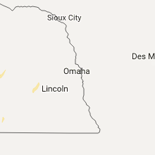
Hail Map for Sunday, November 27, 2016

Number of Impacted Households on 11/27/2016
0
Impacted by 1" or Larger Hail
0
Impacted by 1.75" or Larger Hail
0
Impacted by 2.5" or Larger Hail
Square Miles of Populated Area Impacted on 11/27/2016
0
Impacted by 1" or Larger Hail
0
Impacted by 1.75" or Larger Hail
0
Impacted by 2.5" or Larger Hail


Cities Most Affected by Hail Storms of 11/27/2016
| Hail Size | Demographics of Zip Codes Affected | ||||||
|---|---|---|---|---|---|---|---|
| City | Count | Average | Largest | Pop Density | House Value | Income | Age |
Hail and Wind Damage Spotted on 11/27/2016
Filter by Report Type:Hail ReportsWind Reports
New Mexico
| Local Time | Report Details |
|---|---|
| 7:47 AM MST | Tree down over highway 37 ... multiple trees down over highway 532 in lincoln county NM, 66.9 miles W of Roswell, NM |
| 8:18 AM MST | Klvs aso in san miguel county NM, 57.2 miles SSE of Taos, NM |
Arizona
| Local Time | Report Details |
|---|---|
| 2:20 PM MST | A metal shed was blown into power lines... snapping a power pole and knocking out electricity to 2000 customers in bullhead city. rain showers and a gust front were ind in mohave county AZ, 46.5 miles NNW of Lake Havasu City, AZ |
Nebraska
| Local Time | Report Details |
|---|---|
| 4:25 PM CST | Quarter sized hail reported near Red Cloud, NE, 58.4 miles S of Grand Island, NE, photo received via social media. |
Oklahoma
| Local Time | Report Details |
|---|---|
| 2:35 AM CST | Damage to outbuilding and trees blown dow in bryan county OK, 28.8 miles SSW of Atoka, OK |
Connect with Interactive Hail Maps