

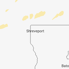
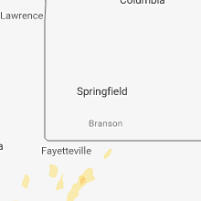
Hail Map for Friday, November 30, 2018

Number of Impacted Households on 11/30/2018
0
Impacted by 1" or Larger Hail
0
Impacted by 1.75" or Larger Hail
0
Impacted by 2.5" or Larger Hail
Square Miles of Populated Area Impacted on 11/30/2018
0
Impacted by 1" or Larger Hail
0
Impacted by 1.75" or Larger Hail
0
Impacted by 2.5" or Larger Hail


Cities Most Affected by Hail Storms of 11/30/2018
| Hail Size | Demographics of Zip Codes Affected | ||||||
|---|---|---|---|---|---|---|---|
| City | Count | Average | Largest | Pop Density | House Value | Income | Age |
Hail and Wind Damage Spotted on 11/30/2018
Filter by Report Type:Hail ReportsWind Reports
Texas
| Local Time | Report Details |
|---|---|
| 11:40 AM CST | Law enforcement reports 4 power lines broken in half on the road hwy 37 north of i-30 mount vernon isd schoo in franklin county TX, 95.2 miles ENE of Dallas, TX |
| 6:09 PM CST | One dead tree fell on a parked car in breckenridge in stephens county TX, 53.3 miles ENE of Abilene, TX |
| 7:34 PM CST | Quarter sized hail reported near Bridgeport, TX, 62.6 miles SE of Wichita Falls, TX |
| 9:19 PM CST | Quarter sized hail reported near Aubrey, TX, 33.1 miles NNW of Dallas, TX, spotter reported quarter size hail |
| 9:34 PM CST | Half Dollar sized hail reported near Prosper, TX, 31.2 miles N of Dallas, TX, spotter reported half dollar size hail |
| 9:45 PM CST | Quarter sized hail reported near Anna, TX, 42 miles NNE of Dallas, TX, spotter reported quarter size hail. |
| 11:07 PM CST | Half Dollar sized hail reported near Lone Oak, TX, 51 miles ENE of Dallas, TX, report of half dollar sized hail near route 69 and fm 513. |
| 11:12 PM CST | Mobile spotter estimates 60 mph wind in hunt county TX, 39.1 miles E of Dallas, TX |
| 11:13 PM CST | 60 mph wind gust near fm 751 and fm 276 east of quinlan relayed by e in hunt county TX, 40.7 miles ENE of Dallas, TX |
| 11:17 PM CST | Estimated 50-60 mph in miller grove in hopkins county TX, 61 miles ENE of Dallas, TX |
| 11:18 PM CST | 54 kts measured at the terrell asos in kaufman county TX, 30.2 miles E of Dallas, TX |
| 11:20 PM CST | 62 mph wind gust reported at bucees in terrell relayed by medi in kaufman county TX, 28.2 miles E of Dallas, TX |
| 11:33 PM CST | Quarter sized hail reported near Sulphur Springs, TX, 73.3 miles ENE of Dallas, TX, reported on the south side of sulphur springs |
| 11:40 PM CST | Corrects previous tstm wnd dmg report from 1 nnw mount vernon. law enforcement reports 4 power lines broken in half on the road hwy 37 north of i-30 mount vernon isd sc in franklin county TX, 95.2 miles ENE of Dallas, TX |
| 12:00 AM CST | Reports of powerlines down near mount pleasant is in titus county TX, 84.5 miles SW of Nashville, AR |
| 12:34 AM CST | Power lines down in new boston... including one falling on a vehicl in bowie county TX, 47.1 miles SW of Nashville, AR |
| 12:42 AM CST | Fallen tree blocking a road in hook in bowie county TX, 41.7 miles SW of Nashville, AR |
Oklahoma
| Local Time | Report Details |
|---|---|
| 7:35 PM CST | Quarter sized hail reported near Cache, OK, 45.4 miles N of Wichita Falls, TX, 1 inch hail was reported 5 miles south of cache... ok at 0135z. |
| 9:02 PM CST | Quarter sized hail reported near Oklahoma City, OK, 7.5 miles E of Oklahoma City, OK, quarter size hail in midwest city near ne 23rd and midwest blvd. |
| 9:09 PM CST | Tishomingo fire paged to multiple trees and powerlines down near broadway and 6th street in tishoming in johnston county OK, 32.6 miles WSW of Atoka, OK |
| 9:15 PM CST | Quarter sized hail reported near Seminole, OK, 54.7 miles ESE of Oklahoma City, OK, quarter size hail 5 miles se of seminole by trained spotter. |
| 9:26 PM CST | Storm damage reported in tulsa county OK, 7.1 miles WSW of Tulsa, OK |
| 9:36 PM CST | Possible roof collapse... flooding... powerlines down on 105 w kentucky in tishoming in johnston county OK, 33.4 miles WSW of Atoka, OK |
| 9:38 PM CST | Tree damage at the gore exit on i-40 in sequoyah county OK, 40.7 miles WNW of Fort Smith, AR |
| 9:40 PM CST | Storm damage reported in atoka county OK, 9 miles SE of Atoka, OK |
| 9:48 PM CST | Power lines down on highway 64 west of vian in sequoyah county OK, 33.1 miles WNW of Fort Smith, AR |
| 10:00 PM CST | Oklahoma highway patrol reported that state highway 2 approximately 4 miles south of clayton had downed powerlines and trees blocking the road and had to be closed. tim in pushmataha county OK, 45.5 miles ENE of Atoka, OK |
| 10:30 PM CST | Storm damage reported in haskell county OK, 43 miles W of Fort Smith, AR |
| 10:40 PM CST | Storm damage reported in muskogee county OK, 40.5 miles W of Fort Smith, AR |
| 10:40 PM CST | 3 homes damaged... 2 heavil in sequoyah county OK, 38 miles WNW of Fort Smith, AR |
| 10:49 PM CST | Storm damage reported in sequoyah county OK, 21.6 miles W of Fort Smith, AR |
| 11:12 PM CST | Reports of a tree down blocking a road in the smithville are in mccurtain county OK, 58.4 miles NW of Nashville, AR |
| 11:27 PM CST | Reported through social media at 360 road at 690 roa in delaware county OK, 73.9 miles ENE of Tulsa, OK |
| 11:52 PM CST | Roof blown off house. multiple trees dow in le flore county OK, 35.6 miles SSW of Fort Smith, AR |
Kansas
| Local Time | Report Details |
|---|---|
| 9:55 PM CST | Storm damage reported in chautauqua county KS, 55.3 miles SW of Chanute, KS |
| 10:00 PM CST | Quarter sized hail reported near Sedan, KS, 50.7 miles SW of Chanute, KS, strong winds were shaking around the spotters truck. |
| 10:03 PM CST | Storm damage reported in montgomery county KS, 53.3 miles SSW of Chanute, KS |
| 10:17 PM CST | 1100 people reported without power in independenc in montgomery county KS, 34.3 miles SSW of Chanute, KS |
| 10:17 PM CST | 1100 people reported without power in independenc in montgomery county KS, 34.3 miles SSW of Chanute, KS |
| 10:29 PM CST | Trailer destroyed with people trapped inside. the 911 center is without powe in montgomery county KS, 34.3 miles SSW of Chanute, KS |
| 11:31 PM CST | Grain bin blown down and a portion of a roof blown off a structur in crawford county KS, 32.8 miles ESE of Chanute, KS |
| 11:32 PM CST | Three power poles down seven miles north of columbus along nw40th scammon road in cherokee county KS, 45.8 miles SE of Chanute, KS |
Arkansas
| Local Time | Report Details |
|---|---|
| 10:49 PM CST | Storm damage reported in benton county AR, 55.9 miles N of Fort Smith, AR |
| 11:10 PM CST | Several arkansas state troopers reported damage to homes near van buren on old union town road and bond special road. one house was reported on fire. time estimated fro in crawford county AR, 5.5 miles NE of Fort Smith, AR |
| 11:12 PM CST | Large trees down on old uniontown roa in crawford county AR, 6 miles NE of Fort Smith, AR |
| 11:30 PM CST | Washington county emergency manager reported multiple trees down blocking highways and county roads. multiple confirmed reports of damaged buildings from dutch mills/ca in washington county AR, 36.2 miles N of Fort Smith, AR |
| 11:37 PM CST | Storm damage reported in benton county AR, 55.9 miles N of Fort Smith, AR |
| 11:40 PM CST | A few trees were blown dow in polk county AR, 49 miles NNW of Nashville, AR |
| 11:52 PM CST | Trees down in a line from alma to mountainburg in crawford county AR, 13.1 miles ENE of Fort Smith, AR |
| 11:58 PM CST | Some telephone lines down in the town of subiac in logan county AR, 44.5 miles E of Fort Smith, AR |
| 12:10 AM CST | Reports of a tree down on a car on highway 103 about 12 miles north of clarksville... a in johnson county AR, 56.2 miles ENE of Fort Smith, AR |
| 12:15 AM CST | Several homes damaged. at least one severel in crawford county AR, 5.5 miles NE of Fort Smith, AR |
| 12:15 AM CST | Sporadic tree damage with associated power outages in eastern logan count in logan county AR, 57 miles E of Fort Smith, AR |
| 12:35 AM CST | A tree was blown down at hecto in pope county AR, 63.8 miles NW of Little Rock, AR |
| 12:35 AM CST | Winds ripped the back door of a home off of its hinges on union roa in boone county AR, 69.1 miles S of Springfield, MO |
| 12:35 AM CST | Trees and power lines blown down in harriso in boone county AR, 67.5 miles S of Springfield, MO |
| 12:45 AM CST | Trees and power lines were blown down in several places throughout the count in searcy county AR, 82.7 miles NNW of Little Rock, AR |
| 12:56 AM CST | A tree was blown down in the ralph-caney are in marion county AR, 80.6 miles SSE of Springfield, MO |
| 1:02 AM CST | Reports of a fallen tree blocking a road near millwood lak in little river county AR, 20.7 miles SSW of Nashville, AR |
| 1:04 AM CST | A 67 mph wind gust occurred at the flippin-marion county regional airpor in marion county AR, 75 miles SSE of Springfield, MO |
| 1:20 AM CST | Corrects previous tstm wnd dmg report from hope. numerous trees and power lines down reported across the county. trees down on house in hempstead county AR, 24.2 miles SE of Nashville, AR |
| 2:00 AM CST | Reports of roofs blown off buildings... and trailers thrown across the parking lot and in ditche in sharp county AR, 97.1 miles S of Salem, MO |
Missouri
| Local Time | Report Details |
|---|---|
| 12:35 AM CST | Top 2 floors of d monaco resort sustained significant damag in taney county MO, 46.8 miles S of Springfield, MO |
| 12:35 AM CST | Sutherlands home improvement and mayse auto dealership sustained damage. possible tornad in lawrence county MO, 29.7 miles SW of Springfield, MO |
| 12:35 AM CST | Measured on davis weather station in branson hills 1.5 miles west of highway 76. time estimated via rada in taney county MO, 38.8 miles S of Springfield, MO |
| 12:43 AM CST | Reports of numerous tree limbs down and debris near highway 60 and washington ave. time estimated via rada in christian county MO, 17.2 miles SW of Springfield, MO |
| 12:50 AM CST | Trees down and shingles off roof in greene county MO, 13 miles WSW of Springfield, MO |
| 12:50 AM CST | Roof damage to home. time estimated via rada in greene county MO, 10 miles WSW of Springfield, MO |
| 12:50 AM CST | Large tree down at first baptist church partially blocking roa in greene county MO, 12.1 miles WSW of Springfield, MO |
| 12:51 AM CST | Roof damage to meeks building supply company. time estimated via rada in greene county MO, 10.8 miles WSW of Springfield, MO |
| 12:52 AM CST | Shingles missing from nearby house roo in greene county MO, 13 miles WSW of Springfield, MO |
| 12:53 AM CST | Corrects previous tstm wnd gst report from 1 ne republic. emd republic: 74 mph wind at 701 us 60 in republic. numerous 2 to 3 inch limmbs down with some large diameter in greene county MO, 10.8 miles WSW of Springfield, MO |
| 12:55 AM CST | Storm damage reported in christian county MO, 19.9 miles S of Springfield, MO |
| 12:59 AM CST | Storm damage reported in christian county MO, 11 miles S of Springfield, MO |
| 1:05 AM CST | Reports of power poles down in springfield. numerous power outage in greene county MO, 5.8 miles WNW of Springfield, MO |
| 1:07 AM CST | Power lines dow in webster county MO, 14.2 miles ESE of Springfield, MO |
| 1:16 AM CST | Emd republic: 74 mph wind at 701 us 60 in republic. numerous 2 to 3 inch limmbs down with some large diameter trees in 400 block of n mai in greene county MO, 10.8 miles WSW of Springfield, MO |
| 1:18 AM CST | Power lines dow in webster county MO, 29.6 miles E of Springfield, MO |
| 1:20 AM CST | Power lines down marshfiel in webster county MO, 23.2 miles ENE of Springfield, MO |
| 1:24 AM CST | Power lines dow in webster county MO, 21.5 miles NE of Springfield, MO |
| 1:34 AM CST | Tree limbs down. highway 65 south of buffal in dallas county MO, 28.6 miles NNE of Springfield, MO |
| 1:39 AM CST | Fire department reports estimated 70 mph winds at highway 76 and ee. power outages reporte in douglas county MO, 58.4 miles SW of Salem, MO |
| 1:50 AM CST | Semi blown off interstate 44 at mile marker 10 in webster county MO, 26.1 miles ENE of Springfield, MO |
| 2:00 AM CST | Power lines down and a tree down near y highway. time estimated from rada in howell county MO, 45 miles SSW of Salem, MO |
| 2:50 AM CST | Trees blown dow in reynolds county MO, 41.4 miles SE of Salem, MO |
| 2:52 AM CST | Storm damage reported in reynolds county MO, 41.4 miles SE of Salem, MO |
| 2:55 AM CST | Trees blown dow in reynolds county MO, 34.4 miles ESE of Salem, MO |
| 3:00 AM CST | Trees blown dow in reynolds county MO, 40.6 miles ESE of Salem, MO |
| 3:38 AM CST | Storm damage reported in dunklin county MO, 54.4 miles SSW of Cape Girardeau, MO |
Connect with Interactive Hail Maps