

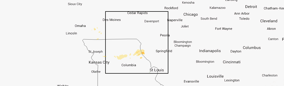
Hail Map for Sunday, October 21, 2012
Number of Impacted Households on 10/21/2012
0
Impacted by 1" or Larger Hail
0
Impacted by 1.75" or Larger Hail
0
Impacted by 2.5" or Larger Hail
Square Miles of Populated Area Impacted on 10/21/2012
0
Impacted by 1" or Larger Hail
0
Impacted by 1.75" or Larger Hail
0
Impacted by 2.5" or Larger Hail


Cities Most Affected by Hail Storms of 10/21/2012
| Hail Size | Demographics of Zip Codes Affected | ||||||
|---|---|---|---|---|---|---|---|
| City | Count | Average | Largest | Pop Density | House Value | Income | Age |
Hail and Wind Damage Spotted on 10/21/2012
Filter by Report Type:Hail ReportsWind Reports
Texas
| Local Time | Report Details |
|---|---|
| 2:15 AM CDT | Local law enforcement reported several trees and power lines downed in andrews county TX, 34 miles NNW of Odessa, TX |
Missouri
| Local Time | Report Details |
|---|---|
| 6:25 AM CDT | Quarter sized hail reported near La Grange, MO, 28.1 miles SSE of Kahoka, MO |
Connect with Interactive Hail Maps