

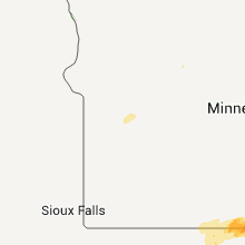
Hail Map for Thursday, September 1, 2011

Number of Impacted Households on 9/1/2011
0
Impacted by 1" or Larger Hail
0
Impacted by 1.75" or Larger Hail
0
Impacted by 2.5" or Larger Hail
Square Miles of Populated Area Impacted on 9/1/2011
0
Impacted by 1" or Larger Hail
0
Impacted by 1.75" or Larger Hail
0
Impacted by 2.5" or Larger Hail


Cities Most Affected by Hail Storms of 9/1/2011
| Hail Size | Demographics of Zip Codes Affected | ||||||
|---|---|---|---|---|---|---|---|
| City | Count | Average | Largest | Pop Density | House Value | Income | Age |
Hail and Wind Damage Spotted on 9/1/2011
Filter by Report Type:Hail ReportsWind Reports
Ohio
| Local Time | Report Details |
|---|---|
| 4:30 PM UTC | Thunderstorm winds downed several large tree in ashland county OH, 59.3 miles SSW of Cleveland, OH |
Virginia
| Local Time | Report Details |
|---|---|
| 7:40 PM UTC | Several trees were blown down near the intersection of highways 29 and 15 in amherst county VA, 56.5 miles ENE of Roanoke, VA |
| 7:55 PM UTC | A tree was blown down and was blocking highway 13 in amherst county VA, 42.1 miles ENE of Roanoke, VA |
| 7:55 PM UTC | A tree was blown down and was blocking wagon trail roa in amherst county VA, 43.7 miles ENE of Roanoke, VA |
| 8:05 PM UTC | Lynchburg city police reported a tree blown down on the north end of tow in city of lynchburg county VA, 39.4 miles ENE of Roanoke, VA |
| 4:45 PM EDT | Quarter sized hail reported near Boones Mill, VA, 10.5 miles S of Roanoke, VA |
| 8:55 PM UTC | Several trees down in and around the city in bedford county VA, 18.5 miles ESE of Roanoke, VA |
North Carolina
| Local Time | Report Details |
|---|---|
| 9:55 PM UTC | The wilkes county sheriffs office reported several trees blown down along the 8700 block of boone trai in wilkes county NC, 58.7 miles ESE of Bristol, TN |
| 10:08 PM UTC | Power line down on pinnacle hotel road in surry county NC, 72.1 miles SSW of Roanoke, VA |
| 10:10 PM UTC | The surry county sheriffs office reported about a dozen trees blown down across the community of elkin. power was also out across portions of the tow in surry county NC, 71.5 miles N of Charlotte, NC |
| 10:15 PM UTC | The yadkin county sheriffs office reported several trees blown down in jonesville. one tree fell on top of an automobil in yadkin county NC, 69.5 miles N of Charlotte, NC |
| 11:30 PM UTC | Trees and/or powerlines down along mineral springs mtn rd in burke county NC, 52.4 miles NW of Charlotte, NC |
South Dakota
| Local Time | Report Details |
|---|---|
| 8:10 PM MDT | Quarter sized hail reported near Rapid City, SD, 0.1 miles SSE of Rapid City, SD |
| 8:11 PM MDT | Quarter sized hail reported near Rapid City, SD, 3.5 miles SE of Rapid City, SD |
Iowa
| Local Time | Report Details |
|---|---|
| 2:55 AM CDT | Quarter sized hail reported near Brunsville, IA, 55.5 miles WNW of Storm Lake, IA |
| 7:55 AM UTC | Sustained winds of 40 mph and nickel sized hail in plymouth county IA, 55.5 miles WNW of Storm Lake, IA |
| 8:15 AM UTC | Strong wind drove rain under shingles by 50 to 60 mph thunderstorm winds in o'brien county IA, 35.5 miles NW of Storm Lake, IA |
| 8:18 AM UTC | Several small branches down. winds were accompanied by quarter size hai in cherokee county IA, 33.4 miles WNW of Storm Lake, IA |
| 3:18 AM CDT | Quarter sized hail reported near Marcus, IA, 33.4 miles WNW of Storm Lake, IA, very few hailstones but they were at least quarter size. hail was accompanied by damaging winds. |
| 3:45 AM CDT | Quarter sized hail reported near Primghar, IA, 34.2 miles NW of Storm Lake, IA |
| 8:45 AM UTC | Small branches down and corn leaning after storm. winds accompanied by pea size hai in clay county IA, 23 miles N of Storm Lake, IA |
| 4:31 AM CDT | Ping Pong Ball sized hail reported near Mallard, IA, 32.5 miles NE of Storm Lake, IA, trained spotter reports quarter to ping pong ball sized hail. |
| 10:24 AM UTC | A street sign was blown over...a large trampoline was flipped and several large limbs were downe in winnebago county IA, 23.5 miles WNW of Mason City, IA |
| 10:25 AM UTC | Forest city awos measured a wind gust of 61 mph at 525 a in hancock county IA, 22.3 miles WNW of Mason City, IA |
| 10:44 AM UTC | Trees and powerlines down. winds estimated at 60 mph. penny sized hail also observe in worth county IA, 22.5 miles N of Mason City, IA |
| 10:45 AM UTC | Spotter estimated 50 mph plus wind gust. several small branches 2-3 inches in diameter down throughout the town of grafton. an 8-inch and a 12-inch diameter tree were r in worth county IA, 14.3 miles NNE of Mason City, IA |
| 10:47 AM UTC | Two seperate wind mills damaged...one had a propeller bent in half and the second had a propeller with the tip snapped off. in addition...numerous trees and a power pol in worth county IA, 19.8 miles NNE of Mason City, IA |
| 10:58 AM UTC | Tree down on hous in mitchell county IA, 21.8 miles ENE of Mason City, IA |
| 10:58 AM UTC | 8-10 inch branches down. above ground pool flipped ove in mitchell county IA, 21.5 miles NE of Mason City, IA |
| 11:24 AM UTC | Several power lines down in howard county IA, 48.6 miles ENE of Mason City, IA |
| 11:30 AM UTC | Powerlines down southside of cheste in howard county IA, 48.6 miles ENE of Mason City, IA |
| 11:35 AM UTC | Semi truck blown over on highway 9. reported via kcrg television. time estimate in howard county IA, 53.2 miles SW of La Crosse, WI |
Minnesota
| Local Time | Report Details |
|---|---|
| 11:35 AM UTC | Large branches down in town and one tree down over county road in fillmore county MN, 55.4 miles NE of Mason City, IA |
Connect with Interactive Hail Maps