

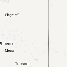
Hail Map for Wednesday, August 31, 2011

Number of Impacted Households on 8/31/2011
0
Impacted by 1" or Larger Hail
0
Impacted by 1.75" or Larger Hail
0
Impacted by 2.5" or Larger Hail
Square Miles of Populated Area Impacted on 8/31/2011
0
Impacted by 1" or Larger Hail
0
Impacted by 1.75" or Larger Hail
0
Impacted by 2.5" or Larger Hail


Cities Most Affected by Hail Storms of 8/31/2011
| Hail Size | Demographics of Zip Codes Affected | ||||||
|---|---|---|---|---|---|---|---|
| City | Count | Average | Largest | Pop Density | House Value | Income | Age |
| Rhame, ND | 1 | 1.75 | 1.75 | 0 | $31k | $22.9k | 47.0 |
| Baker, MT | 1 | 1.75 | 1.75 | 0 | $49k | $30.7k | 42.1 |
| Marmarth, ND | 1 | 1.75 | 1.75 | 0 | $12k | $28.6k | 42.8 |
Hail and Wind Damage Spotted on 8/31/2011
Filter by Report Type:Hail ReportsWind Reports
Arizona
| Local Time | Report Details |
|---|---|
| 9:45 PM UTC | Downed trees and some power lines down in rio rico between km markers 17 and 22 on i-1 in santa cruz county AZ, 51.8 miles S of Tucson, AZ |
| 12:45 AM UTC | Tree uprooted near mcgee and la canada in pima county AZ, 13.7 miles N of Tucson, AZ |
| 12:45 AM UTC | Tree uprooted near w. magee rd and n. la canada d in pima county AZ, 13.7 miles N of Tucson, AZ |
Montana
| Local Time | Report Details |
|---|---|
| 12:41 AM UTC | Sustained 45 mph with 61 mph gust in valley county MT, 0.4 miles NNW of Glasgow, MT |
| 12:51 AM UTC | 52 mph winds with 66 mph gust in mccone county MT, 16.8 miles SE of Glasgow, MT |
| 1:00 AM UTC | Winds were sustained between 40 to 60 mp in valley county MT, 38 miles NNE of Glasgow, MT |
| 1:13 AM UTC | Dime and nickel hail with a 71 mph wind gust in valley county MT, 32.9 miles E of Glasgow, MT |
| 1:20 AM UTC | Estimated 55 to 60 mph wind gust with pea hai in richland county MT, 67.6 miles WSW of Williston, ND |
| 1:30 AM UTC | Estimated 70 to 80 mph wind gust with slushy dime hai in mccone county MT, 59.3 miles E of Glasgow, MT |
| 1:35 AM UTC | Estimated 70 mph wind gust with a little penny hai in roosevelt county MT, 63.7 miles WNW of Williston, ND |
| 1:53 AM UTC | 44 mph winds with 58 mph gust in roosevelt county MT, 46.7 miles E of Glasgow, MT |
| 1:55 AM UTC | 31 mph winds with 63 mph gus in daniels county MT, 69.5 miles NE of Glasgow, MT |
| 2:05 AM UTC | Storm damage reported in fallon county MT, 88.2 miles ESE of Miles City, MT |
| 8:14 PM MDT | Quarter sized hail reported near Reserve, MT, 49.4 miles NW of Williston, ND, spotter travelling near the brush lake turn-off observed hail mixed with heavy rain. |
| 8:25 PM MDT | Quarter sized hail reported near Fairview, MT, 25.1 miles SW of Williston, ND, late report. very brief hail...lasted a few minutes at most. |
| 8:25 PM MDT | Golf Ball sized hail reported near Baker, MT, 85.5 miles E of Miles City, MT, hail broke a bedroom window. lots of quarter-sized hail as well. |
North Dakota
| Local Time | Report Details |
|---|---|
| 8:22 PM MDT | Golf Ball sized hail reported near Marmarth, ND, 87.4 miles E of Miles City, MT, hail broke windows |
| 8:40 PM MDT | Golf Ball sized hail reported near Rhame, ND, 105.5 miles E of Miles City, MT, relayed by emergency manager. also golfball hail in the city of rhame. |
| 2:43 AM UTC | Report relayed by wso willisto in williams county ND, 0.4 miles WNW of Williston, ND |
| 2:43 AM UTC | 1 to 2 inch diameter tree branches broken off. wooden fences blown dow in williams county ND, 0.4 miles WNW of Williston, ND |
| 2:43 AM UTC | New hangar door ripped and destroyed at the williston airpor in williams county ND, 0.4 miles WNW of Williston, ND |
| 2:51 AM UTC | State agency in bowman county ND, 118.8 miles E of Miles City, MT |
| 3:04 AM UTC | Storm damage reported in stark county ND, 95.4 miles W of Bismarck, ND |
| 3:07 AM UTC | Mesonet relayed by emergency manager in bowman county ND, 121.4 miles WSW of Bismarck, ND |
| 9:20 PM MDT | Quarter sized hail reported near New England, ND, 101.1 miles W of Bismarck, ND, hail lasted until 925 pm cdt. also had 40 mph winds. |
| 3:26 AM UTC | Storm damage reported in stark county ND, 78.5 miles W of Bismarck, ND |
| 9:35 PM MDT | Ping Pong Ball sized hail reported near Mott, ND, 77 miles WSW of Bismarck, ND, hail lasted 2 minutes. |
| 3:55 AM UTC | Estimated winds at 60 mph...trees bent over but not snapped. in mountrail county ND, 52.5 miles W of Minot, ND |
| 4:00 AM UTC | Also had pea size hail. event lasted a few minute in stark county ND, 69.3 miles W of Bismarck, ND |
| 4:10 AM UTC | Public estimates 60 to 65 mp in mountrail county ND, 49.6 miles WNW of Minot, ND |
| 4:20 AM UTC | Sustained winds of 46 mp in mercer county ND, 51.2 miles NW of Bismarck, ND |
| 4:20 AM UTC | Near exit 120 i-94 barn roof torn off. auger tipped over. 2 x 4 embedded in house. straight line wind damag in morton county ND, 37.2 miles W of Bismarck, ND |
| 4:50 AM UTC | 64 mph gust from a weather statio in mclean county ND, 48.3 miles S of Minot, ND |
| 4:51 AM UTC | Storm damage reported in morton county ND, 15.4 miles WNW of Bismarck, ND |
| 4:55 AM UTC | Estimated winds at 60 mph...trees bent over but not snapped. in mountrail county ND, 52.5 miles W of Minot, ND |
| 5:00 AM UTC | Late report. several trees snapped and others uprooted. barn damaged. wind speed and times are estimated. damage also in the town of mercer...mclean count in mclean county ND, 48.8 miles N of Bismarck, ND |
| 5:13 AM UTC | Winds lasted for 10 minutes. brief power outages were reported. rain gutters were blown off of a buildin in sheridan county ND, 49.9 miles NNE of Bismarck, ND |
| 5:54 AM UTC | Media reported multiple small tree limbs down after estimated 60 mph wind gust in wells county ND, 55.5 miles WSW of Devils Lake, ND |
| 6:05 AM UTC | Large tree branch down in benson county ND, 32.9 miles WSW of Devils Lake, ND |
| 1:30 AM CDT | Quarter sized hail reported near Rocklake, ND, 47.6 miles NNW of Devils Lake, ND, hail size was a mixture of quarters and nickels. |
| 6:45 AM UTC | Storm damage reported in ramsey county ND, 29.6 miles N of Devils Lake, ND |
| 7:05 AM UTC | Numerous large trees in excess of 18 inch diameter were broken down in a farm shelter bel in walsh county ND, 28.1 miles ENE of Devils Lake, ND |
| 7:15 AM UTC | Shed destroyed and 2 grain bins blown off slab. power poles down. relayed via off duty park river volunteer fire dept personnel. peak winds estimated to 105 mp in walsh county ND, 41.6 miles ENE of Devils Lake, ND |
| 7:15 AM UTC | Shed destroyed and 2 grain bins blown off slab. power poles down. relayed via off duty park river volunteer fire dept personne in walsh county ND, 40.9 miles ENE of Devils Lake, ND |
| 7:39 AM UTC | Several large tree branches and tree limbs were snapped off in shelter belts along u.s. highway 8 in walsh county ND, 72.8 miles ENE of Devils Lake, ND |
| 7:40 AM UTC | Several large tree branches were broken down in shelter belts along nd highway 6 in pembina county ND, 73.8 miles ENE of Devils Lake, ND |
| 7:42 AM UTC | Extensive damage in grafton. more than 50 large trees down...including some 60 to 70 foot tall evergreens. five houses and multiple vehicles damaged by trees falling on in walsh county ND, 70.5 miles ENE of Devils Lake, ND |
| 7:44 AM UTC | Storm damage reported in walsh county ND, 70.5 miles ENE of Devils Lake, ND |
| 7:44 AM UTC | Storm damage reported in walsh county ND, 71.9 miles ENE of Devils Lake, ND |
| 7:45 AM UTC | Extensive damage in grafton. more than 50 large trees down...including some 60 to 70 foot tall evergreens. five houses and multiple vehicles damaged by trees falling on in walsh county ND, 70.5 miles ENE of Devils Lake, ND |
Wyoming
| Local Time | Report Details |
|---|---|
| 3:34 AM UTC | Storm damage reported in natrona county WY, 7.5 miles WNW of Casper, WY |
Nebraska
| Local Time | Report Details |
|---|---|
| 6:06 AM UTC | This appeared to be a downburst associated with a thunderstorm south of valentine. temperature went up with the gust from 72f to 82 in cherry county NE, 1 miles S of Valentine, NE |
| 6:51 AM UTC | This appeared to be a downburst associated with a thunderstorm south of valentine. temperature went up with the gust from 72f to 82 in cherry county NE, 1 miles S of Valentine, NE |
Minnesota
| Local Time | Report Details |
|---|---|
| 8:03 AM UTC | Peak westerly winds to 121 mph were measured at the rwis site located along highway 11 and were reported from 303 am cdt to 314 am cdt. damage to downwind fields...farm in kittson county MN, 56 miles WSW of Roseau, MN |
| 8:03 AM UTC | Four grain bins blown down. trees down in beet fiel in kittson county MN, 55.1 miles WSW of Roseau, MN |
| 8:03 AM UTC | Four grain bins blown down. trees down in beet fiel in kittson county MN, 54.3 miles WSW of Roseau, MN |
| 8:04 AM UTC | Two large commercial grade steel bins and their horizontal tranfer system were torn out from the city grain elevator facility and were splayed to the east... partially in kittson county MN, 55.1 miles WSW of Roseau, MN |
| 8:05 AM UTC | Three farm grade steel grain bins were torn off their foundations and blown out into a field. three more steel bins at the farm yard were severely dented in and partial in kittson county MN, 54.3 miles WSW of Roseau, MN |
| 8:07 AM UTC | Several large tree branches were broken down in shelter belts along u.s. highway 75. intermittent tree damage continued into and north of stephen... from northern tamar in marshall county MN, 59.2 miles WSW of Roseau, MN |
| 8:11 AM UTC | Storm damage reported in kittson county MN, 53.7 miles W of Roseau, MN |
| 8:15 AM UTC | Numerous large tree branches were broken down and several large trees... both oak and poplar... were snapped off in shelter belts and groves near highway 11 through por in kittson county MN, 43 miles WSW of Roseau, MN |
| 8:25 AM UTC | Numerous large tree branches were broken down and several large trees... both oak and poplar... were snapped off in shelter belts and groves across portions of central in marshall county MN, 39.7 miles SW of Roseau, MN |
| 8:26 AM UTC | Numerous large tree branches were broken down and several large trees... both oak and poplar... were snapped off in shelter belts and groves across portions of arveson in kittson county MN, 32.7 miles WSW of Roseau, MN |
| 8:33 AM UTC | Peak wind measured at the ndawn site west of greenbush on cr in roseau county MN, 27.9 miles WSW of Roseau, MN |
| 8:43 AM UTC | Numerous large tree branches were broken down and several large trees...both oak and poplar... were snapped off in shelter belts and groves across portions of deer and in roseau county MN, 27.4 miles SW of Roseau, MN |
| 8:50 AM UTC | Large tree branches down in marshall county MN, 33.2 miles SSW of Roseau, MN |
| 4:50 AM CDT | Quarter sized hail reported near Brooks, MN, 50.8 miles WNW of Bemidji, MN, numerous nickle to quarter sized hail fell during very heavy rains and strong winds. |
Connect with Interactive Hail Maps