

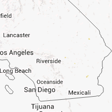
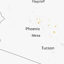
Hail Map for Tuesday, September 4, 2012

Number of Impacted Households on 9/4/2012
0
Impacted by 1" or Larger Hail
0
Impacted by 1.75" or Larger Hail
0
Impacted by 2.5" or Larger Hail
Square Miles of Populated Area Impacted on 9/4/2012
0
Impacted by 1" or Larger Hail
0
Impacted by 1.75" or Larger Hail
0
Impacted by 2.5" or Larger Hail


Cities Most Affected by Hail Storms of 9/4/2012
| Hail Size | Demographics of Zip Codes Affected | ||||||
|---|---|---|---|---|---|---|---|
| City | Count | Average | Largest | Pop Density | House Value | Income | Age |
| Saint Charles, MN | 2 | 1.88 | 2.00 | 59 | $98k | $43.7k | 36.0 |
| New Albin, IA | 2 | 1.75 | 1.75 | 9 | $54k | $36.3k | 44.2 |
| Canton, MN | 1 | 2.50 | 2.50 | 13 | $51k | $28.4k | 30.8 |
| Dorchester, IA | 1 | 2.00 | 2.00 | 7 | $47k | $37.6k | 47.8 |
| Fall Creek, WI | 1 | 2.00 | 2.00 | 39 | $90k | $46.1k | 41.5 |
| Chetek, WI | 1 | 2.00 | 2.00 | 47 | $85k | $36.1k | 47.1 |
| Houston, MN | 1 | 2.00 | 2.00 | 15 | $73k | $37.1k | 44.3 |
| Spencer, SD | 1 | 1.75 | 1.75 | 3 | $33k | $34.7k | 44.0 |
| Winona, MN | 1 | 1.75 | 1.75 | 203 | $94k | $35.8k | 30.4 |
| Marquette, IA | 1 | 1.75 | 1.75 | 0 | $72k | $30.4k | 47.3 |
Hail and Wind Damage Spotted on 9/4/2012
Filter by Report Type:Hail ReportsWind Reports
States Impacted
Arizona, Minnesota, Oklahoma, Mississippi, Wisconsin, Kansas, Nebraska, Iowa, New Jersey, South Dakota, Texas, California, Michigan, Illinois, MissouriArizona
| Local Time | Report Details |
|---|---|
| 5:20 AM MST | *** 1 inj *** front windows broken out of retail business. minor injuries with one person hospitalized. other reports of trees and 4 power poles down across mohave vall in mohave county AZ, 30.3 miles NNW of Lake Havasu City, AZ |
| 5:03 PM MST | Trained spotter in mohave valley estimated wind gust at 80 mp in mohave county AZ, 35.6 miles NNW of Lake Havasu City, AZ |
| 5:20 PM MST | *** 1 inj *** front windows broken out of retail business. minor injuries with one person hospitalized. other reports of trees and 4 power poles down across mohave vall in mohave county AZ, 30.3 miles NNW of Lake Havasu City, AZ |
Minnesota
| Local Time | Report Details |
|---|---|
| 11:26 AM CDT | Storm damage reported in faribault county MN, 58.7 miles NW of Mason City, IA |
| 4:01 PM CDT | Golf Ball sized hail reported near St Charles, MN, 39.6 miles WNW of La Crosse, WI, reported 1 mile south of st. charles |
| 4:10 PM CDT | Hen Egg sized hail reported near St Charles, MN, 37.9 miles W of La Crosse, WI, reported 4 miles nw of clyde |
| 4:15 PM CDT | Power was out to 2500 customers from cook to ely as thunderstorms with high winds toppled trees and branches onto power line in st. louis county MN, 61.6 miles SSE of International Falls, MN |
| 4:21 PM CDT | Quarter sized hail reported near Cook, MN, 61.1 miles SE of International Falls, MN |
| 4:21 PM CDT | Quarter sized hail reported near Cook, MN, 60.3 miles SE of International Falls, MN |
| 4:25 PM CDT | Quarter sized hail reported near Winona, MN, 28.9 miles NW of La Crosse, WI |
| 4:26 PM CDT | Quarter sized hail reported near Winona, MN, 26.1 miles NW of La Crosse, WI, relayed from kttc-tv |
| 4:26 PM CDT | Golf Ball sized hail reported near Winona, MN, 29.9 miles WNW of La Crosse, WI |
| 4:47 PM CDT | Quarter sized hail reported near Winona, MN, 26.1 miles NW of La Crosse, WI |
| 5:23 PM CDT | Tennis Ball sized hail reported near Canton, MN, 37 miles WSW of La Crosse, WI |
| 5:50 PM CDT | Quarter sized hail reported near Houston, MN, 10.2 miles WSW of La Crosse, WI |
| 5:57 PM CDT | Storm damage reported in fillmore county MN, 29.6 miles SW of La Crosse, WI |
| 5:58 PM CDT | Hen Egg sized hail reported near Houston, MN, 10.2 miles WSW of La Crosse, WI |
| 6:00 PM CDT | Tennis Ball sized hail reported near Spring Grove, MN, 26.1 miles SW of La Crosse, WI |
| 6:05 PM CDT | Quarter sized hail reported near Spring Grove, MN, 26.1 miles SW of La Crosse, WI |
| 10:02 PM CDT | Storm damage reported in murray county MN, 57.9 miles ENE of Sioux Falls, SD |
| 10:06 PM CDT | Storm damage reported in murray county MN, 57.9 miles ENE of Sioux Falls, SD |
| 10:15 PM CDT | Storm damage reported in nobles county MN, 57.1 miles E of Sioux Falls, SD |
| 11:26 PM CDT | Storm damage reported in faribault county MN, 58.7 miles NW of Mason City, IA |
| 11:50 PM CDT | Some trees down. power outages also note in faribault county MN, 48.8 miles NNW of Mason City, IA |
| 12:06 AM CDT | Tree down on a house. also reported widespread tree damage across freeborn county...some power lines down as well. time of report estimate in freeborn county MN, 36.4 miles NNW of Mason City, IA |
| 12:10 AM CDT | Numerous trees and powerlines were blocking roadways. a branch of a maple tree fell onto two automobiles. courtesy of albert lea tribune. time estimate in freeborn county MN, 36.4 miles NNW of Mason City, IA |
| 12:15 AM CDT | Storm damage reported in steele county MN, 58.2 miles N of Mason City, IA |
| 12:20 AM CDT | Trees down. time estimate in freeborn county MN, 39 miles N of Mason City, IA |
| 12:46 AM CDT | Storm damage reported in dodge county MN, 63.5 miles NNE of Mason City, IA |
| 1:06 AM CDT | Storm damage reported in olmsted county MN, 62 miles W of La Crosse, WI |
| 1:10 AM CDT | Storm damage reported in olmsted county MN, 62.8 miles WNW of La Crosse, WI |
| 1:10 AM CDT | Trees down and power outages in northwest part of tow in olmsted county MN, 62.8 miles WNW of La Crosse, WI |
| 1:10 AM CDT | Trees down blocking 16th st sw between hwy 63 and apache mall. via facebook. time estimated by radar and local observation in olmsted county MN, 62.8 miles WNW of La Crosse, WI |
| 1:30 AM CDT | 80 foot tall burr oak tree fell on a garage and 4 vehicles near 1st and main st. relayed by wkb in houston county MN, 17.7 miles SW of La Crosse, WI |
Oklahoma
| Local Time | Report Details |
|---|---|
| 3:45 PM CDT | School net site at okla panhandle state universit in texas county OK, 96 miles N of Amarillo, TX |
| 5:44 PM CDT | Storm damage reported in ellis county OK, 21.6 miles WSW of Woodward, OK |
| 5:49 PM CDT | Storm damage reported in ellis county OK, 21.6 miles WSW of Woodward, OK |
| 5:50 PM CDT | Out bldgs da in ellis county OK, 21.6 miles WSW of Woodward, OK |
| 7:20 PM CDT | 6 pwr transmission poles down.co rds e/w in custer county OK, 62.8 miles SSE of Woodward, OK |
Mississippi
| Local Time | Report Details |
|---|---|
| 3:55 PM CDT | Trees downed and quarter size hail reported at the same location in jones county MS, 83.4 miles NW of Mobile, AL |
| 5:00 PM CDT | Perry ema reported trees down across 198 west of beaumon in perry county MS, 62.3 miles WNW of Mobile, AL |
| 5:45 PM CDT | Trees and limbs down in jones county MS, 74.1 miles SE of Jackson, MS |
| 5:45 PM CDT | Reports of two to three trees down near macedoni in forrest county MS, 81.7 miles NW of Mobile, AL |
| 7:15 PM CDT | Quarter sized hail reported near Magee, MS, 37.1 miles SE of Jackson, MS, reported along cooper road |
| 7:30 PM CDT | A tree was down across the rd at old hwy 11 and baker rd in lamar county MS, 83 miles WNW of Mobile, AL |
Wisconsin
| Local Time | Report Details |
|---|---|
| 3:56 PM CDT | Quarter sized hail reported near Chetek, WI, 81.3 miles ENE of Minneapolis, MN |
| 4:02 PM CDT | Hen Egg sized hail reported near Chetek, WI, 82.3 miles ENE of Minneapolis, MN, numerous large hailstones noted between one inch and two inches in diameter. time estimated from radar. |
| 4:12 PM CDT | Ping Pong Ball sized hail reported near Chetek, WI, 83.4 miles ENE of Minneapolis, MN, some minor leaf damage noted. |
| 5:30 PM CDT | Tree estimated at 70 feet tall and 2.5 feet in diameter topple in chippewa county WI, 80.7 miles N of La Crosse, WI |
| 5:46 PM CDT | Hen Egg sized hail reported near Fall Creek, WI, 62.7 miles N of La Crosse, WI |
| 6:09 PM CDT | Tree down near the post office in greenwoo in clark county WI, 73.6 miles NNE of La Crosse, WI |
| 6:13 PM CDT | 4 inch diameter branches down around the campground. several small branches down als in la crosse county WI, 5.3 miles SSE of La Crosse, WI |
| 6:13 PM CDT | Several small trees down around tow in clark county WI, 74.1 miles NNE of La Crosse, WI |
| 6:17 PM CDT | Storm damage reported in clark county WI, 74.7 miles NE of La Crosse, WI |
| 6:17 PM CDT | Wind gusts between 617 and 635 pm time estimated blew down large trees and power lines along highline road in clark county WI, 75.9 miles SW of Rhinelander, WI |
| 6:30 PM CDT | Winds sustained near 40 mph gust to 60 mp in marathon county WI, 74 miles SW of Rhinelander, WI |
| 6:45 PM CDT | Numerous trees down from genoa to desoto and points east in vernon county WI, 26.5 miles S of La Crosse, WI |
| 6:45 PM CDT | A few trees blown down...up to 8 inches in diameter. reported by wsaw-t in wood county WI, 77.8 miles SSW of Rhinelander, WI |
| 6:46 PM CDT | Half Dollar sized hail reported near Prairie Du Chien, WI, 53.6 miles S of La Crosse, WI |
| 6:50 PM CDT | Glass window blown in at gas station. also power lines down south of stratfor in marathon county WI, 67.1 miles SSW of Rhinelander, WI |
| 6:51 PM CDT | Town of wheatland had many trees down along with power outages. barn was blown dow in vernon county WI, 24.9 miles SSE of La Crosse, WI |
| 6:56 PM CDT | Storm damage reported in vernon county WI, 24.9 miles SSE of La Crosse, WI |
| 6:56 PM CDT | Quarter sized hail reported near Bagley, WI, 60.3 miles S of La Crosse, WI |
| 7:29 PM CDT | Trees down on north edge of richland center in richland county WI, 53.4 miles WNW of Madison, WI |
| 7:30 PM CDT | Large tree fell onto and damaged deck. wind estimated near 60 mp in marathon county WI, 60.8 miles SSW of Rhinelander, WI |
| 7:30 PM CDT | Highway sign at hwy 29 and 51 interchange bent over to ground at base...steel posts. wind estimated over 60 mp in marathon county WI, 53.3 miles S of Rhinelander, WI |
| 7:35 PM CDT | Storm damage reported in portage county WI, 75.3 miles W of Green Bay, WI |
| 7:35 PM CDT | Several trees snapped and uprooted in town of kronenwette in marathon county WI, 57.3 miles S of Rhinelander, WI |
| 7:40 PM CDT | Ping Pong Ball sized hail reported near Richland Center, WI, 51.3 miles SE of La Crosse, WI, in the community of lime ridge |
| 7:42 PM CDT | Large tree limb down in town. exact location not availabl in sauk county WI, 32.7 miles NNW of Madison, WI |
| 7:43 PM CDT | 21 inch diameter tree branch down. time estimate in sauk county WI, 30.1 miles NW of Madison, WI |
| 7:46 PM CDT | Multiple powerlines and large trees down across the area. time estimate in sauk county WI, 27.9 miles NNW of Madison, WI |
| 7:49 PM CDT | Multiple powerlines and large trees down across the area. time estimate in sauk county WI, 23.9 miles NNW of Madison, WI |
| 7:56 PM CDT | Trees and powerlines down across the county...mainly in dodgeville...edmund...and linden. time estimate in iowa county WI, 38.4 miles WSW of Madison, WI |
| 8:05 PM CDT | Several reports of 70 mph gusts across northern and western grant county. communities include glen haven...bagley...bloomington in grant county WI, 66.5 miles NNE of Cedar Rapids, IA |
| 8:10 PM CDT | Trees and powerlines down across the entire county. time estimate in columbia county WI, 33.2 miles N of Madison, WI |
| 8:11 PM CDT | Storm damage reported in iowa county WI, 44.6 miles WSW of Madison, WI |
| 8:12 PM CDT | Storm damage reported in dane county WI, 0.8 miles NW of Madison, WI |
| 8:14 PM CDT | Storm damage reported in dane county WI, 5.4 miles NNE of Madison, WI |
| 8:21 PM CDT | Tree down in fayette township. time estimate in lafayette county WI, 39.1 miles SW of Madison, WI |
| 8:24 PM CDT | Nine trees down across the county...mainly in north. time estimate in green county WI, 21.9 miles SW of Madison, WI |
| 8:24 PM CDT | Estimated 2 foot tree limb down. blocking south bound lane of cty hwy a. time estimate in dane county WI, 14.7 miles SSE of Madison, WI |
| 8:27 PM CDT | Storm damage reported in waupaca county WI, 37.1 miles W of Green Bay, WI |
| 8:30 PM CDT | Quarter sized hail reported near Lancaster, WI, 70.4 miles SSE of La Crosse, WI |
| 8:31 PM CDT | Trees down across the county...particularly in lake mills. time estimate in jefferson county WI, 29.5 miles E of Madison, WI |
| 8:35 PM CDT | Storm damage reported in grant county WI, 66.5 miles NNE of Cedar Rapids, IA |
| 8:35 PM CDT | Loss of powe in dodge county WI, 34 miles ENE of Madison, WI |
| 8:35 PM CDT | Large tree blocking washington street in edgerton. time is estimate in rock county WI, 22.7 miles SE of Madison, WI |
| 8:39 PM CDT | Storm damage reported in dane county WI, 13.3 miles SE of Madison, WI |
| 8:48 PM CDT | Trees down across the county...mainly in the northern half. time estimate in rock county WI, 32.9 miles SE of Madison, WI |
| 8:53 PM CDT | Storm damage reported in jefferson county WI, 30.4 miles ESE of Madison, WI |
| 9:05 PM CDT | Trees down in southwest waukesha county. near eagle and ottawa. time estimate in waukesha county WI, 48.3 miles ESE of Madison, WI |
| 9:10 PM CDT | Tree down in new diggings township. time estimate in lafayette county WI, 60.8 miles SW of Madison, WI |
| 9:14 PM CDT | Trees down across the county...mainly in the western half. time estimate in walworth county WI, 51.2 miles ESE of Madison, WI |
| 9:20 PM CDT | Trees down across road in potosi. time estimated from rada in grant county WI, 69.7 miles NE of Cedar Rapids, IA |
| 9:29 PM CDT | Trees and powerlines down in waterford...tichigan...and burlington. time estimate in racine county WI, 63 miles ESE of Madison, WI |
| 9:39 PM CDT | Tree down in wheatland. time estimate in kenosha county WI, 56.2 miles NNW of Chicago, IL |
| 9:42 PM CDT | Tree and several branches down in fredoni in ozaukee county WI, 72.1 miles S of Green Bay, WI |
| 9:42 PM CDT | Tree and several branches down in fredonia. time estimate in ozaukee county WI, 72.1 miles S of Green Bay, WI |
| 9:48 PM CDT | Tree down in paris at 156th block of hwy n. time estimate in kenosha county WI, 55.6 miles NNW of Chicago, IL |
| 9:52 PM CDT | Large tree down on 209 and highway v. time estimate in kenosha county WI, 51.3 miles NNW of Chicago, IL |
| 2:00 AM CDT | Large trees down in far west end of county in vernon county WI, 23 miles S of La Crosse, WI |
Kansas
| Local Time | Report Details |
|---|---|
| 4:04 PM CDT | Also dime sized hail in sheridan county KS, 23.8 miles SE of Colby, KS |
| 4:48 PM CDT | Storm damage reported in gove county KS, 49.2 miles ESE of Colby, KS |
| 4:48 PM CDT | Several one inch diameter tree limbs had been broken across the tow in gove county KS, 49.2 miles ESE of Colby, KS |
| 5:19 PM CDT | Storm damage reported in graham county KS, 44.3 miles NW of Hays, KS |
| 5:42 PM CDT | 60mph wind gust reported at aiport awos at 542p in phillips county KS, 60.6 miles N of Hays, KS |
| 5:50 PM CDT | Garage roof ripped off. shed knocked over. trees uprooted. all events occured in tow in rooks county KS, 39.4 miles N of Hays, KS |
| 5:50 PM CDT | Trees uprooted in town in rooks county KS, 25.3 miles NNW of Hays, KS |
| 6:01 PM CDT | Power lines snapped and power knocked out to parts of tow in rooks county KS, 41.8 miles NNE of Hays, KS |
| 6:01 PM CDT | Power lines snapped and power knocked to parts of tow in rooks county KS, 41.8 miles NNE of Hays, KS |
| 6:20 PM CDT | Storm damage reported in ellis county KS, 9.5 miles ENE of Hays, KS |
| 6:20 PM CDT | Storm damage reported in ellis county KS, 14.8 miles E of Hays, KS |
| 6:22 PM CDT | Shingles were blown off of the roof of a hom in russell county KS, 27.6 miles NE of Hays, KS |
| 6:24 PM CDT | Storm damage reported in osborne county KS, 47.2 miles NE of Hays, KS |
| 6:30 PM CDT | Estimated 70 mph winds in osborne county KS, 47.4 miles ENE of Hays, KS |
| 6:37 PM CDT | Shed roof blown off. grain bin heavily damage in osborne county KS, 54.1 miles NE of Hays, KS |
| 6:38 PM CDT | Storm damage reported in russell county KS, 26 miles E of Hays, KS |
| 6:38 PM CDT | Large tree limbs were downed in russel in russell county KS, 26 miles E of Hays, KS |
| 6:43 PM CDT | Power poles snappe in osborne county KS, 55.9 miles NE of Hays, KS |
| 6:46 PM CDT | Wind gust est 60mph knock over 12 inch diameter locus tree into house. 2 inches of rain fell during the even in mitchell county KS, 65.5 miles NE of Hays, KS |
| 6:46 PM CDT | Severe wind gusts up to 68 mph occurred for past 8 minute in russell county KS, 26 miles E of Hays, KS |
| 6:48 PM CDT | Carport blown over in osborne county KS, 60.4 miles NE of Hays, KS |
| 6:52 PM CDT | Pea to nickle sized hail covered yard. small branches knocked down. 6 inch thick branches from dead tree knocked dow in jewell county KS, 83.6 miles NE of Hays, KS |
| 7:05 PM CDT | Thunderstorm wind gusts blew down about 40 power poles and blew 15 to 20 large hay bales across the roa in rooks county KS, 45.2 miles NNE of Hays, KS |
| 7:10 PM CDT | Wind gust knocked tree down onto power lines which started a house fire in formos in jewell county KS, 81.1 miles SSE of Grand Island, NE |
| 7:35 PM CDT | Thunderstorm wind gusts took off the second story of a new house under construction on highway 24. several fences were flattened. several 6 to 8 inch diameter trees wer in osborne county KS, 60.5 miles NE of Hays, KS |
| 10:15 PM CDT | Wind damage to a few hangers at the newton airport. this was likely due to a microburs in harvey county KS, 24.5 miles N of Wichita, KS |
| 5:45 AM CDT | Emergency management reports power lines/polls down in wei in cherokee county KS, 45.4 miles SE of Chanute, KS |
| 5:56 AM CDT | Numerous trees damaged from weir to near cheroke in cherokee county KS, 45.4 miles SE of Chanute, KS |
Nebraska
| Local Time | Report Details |
|---|---|
| 5:30 PM CDT | Quarter sized hail reported near Lincoln, NE, 48.1 miles SW of Omaha, NE, 70th and old post road |
| 5:40 PM CDT | Ping Pong Ball sized hail reported near Lincoln, NE, 49.6 miles SW of Omaha, NE, 70th and a street |
| 5:54 PM CDT | Quarter sized hail reported near Lincoln, NE, 53.6 miles SW of Omaha, NE, nickel to dime with some quarters hwy2 and 94 st |
| 6:25 PM CDT | Public estimated 40-50 knot wind in holt county NE, 21.8 miles NE of Oneill, NE |
| 6:28 PM CDT | Quarter sized hail reported near Palmyra, NE, 48.1 miles SSW of Omaha, NE |
| 7:00 PM CDT | Thunderstorm outflow caused severe wind gusts to blow the roof off a 2-story apartment building in downtown superior. this is an update from original repor in nuckolls county NE, 64 miles SSE of Grand Island, NE |
| 7:00 PM CDT | Thunderstorm outflow caused severe wind gusts to blow the roof off of a hous in nuckolls county NE, 64 miles SSE of Grand Island, NE |
| 7:30 PM CDT | Sides blown off a golf cart shed that was under construction. outflow winds from the sout in thayer county NE, 65.3 miles SE of Grand Island, NE |
| 7:33 PM CDT | Estimated 50-60 mph winds along highway 81 in thayer county NE, 71.3 miles SSE of Grand Island, NE |
Iowa
| Local Time | Report Details |
|---|---|
| 5:40 PM CDT | Golf Ball sized hail reported near New Albin, IA, 21.7 miles S of La Crosse, WI, relayed by kwwl |
| 5:44 PM CDT | Golf Ball sized hail reported near New Albin, IA, 21.7 miles S of La Crosse, WI |
| 6:31 PM CDT | Golf Ball sized hail reported near Marquette, IA, 53.5 miles S of La Crosse, WI |
| 6:36 PM CDT | Hen Egg sized hail reported near Dorchester, IA, 27.2 miles SSW of La Crosse, WI |
| 7:11 PM CDT | Debris on the highway on the east side of town in allamakee county IA, 39.2 miles SSW of La Crosse, WI |
| 7:13 PM CDT | Tree down on north side of town in allamakee county IA, 31.3 miles S of La Crosse, WI |
| 7:25 PM CDT | Half Dollar sized hail reported near Harpers Ferry, IA, 42.6 miles S of La Crosse, WI |
| 9:21 PM CDT | Storm damage reported in o'brien county IA, 49 miles NW of Storm Lake, IA |
| 9:30 PM CDT | Near remsen. wind blew out a house window. tree limbs dow in plymouth county IA, 40.7 miles WNW of Storm Lake, IA |
| 9:40 PM CDT | Trees dow in cherokee county IA, 33.2 miles WNW of Storm Lake, IA |
| 9:42 PM CDT | Power out in plymouth county IA, 36.9 miles W of Storm Lake, IA |
| 9:58 PM CDT | Quarter sized hail reported near Clermont, IA, 59.6 miles SSW of La Crosse, WI |
| 10:00 PM CDT | Storm damage reported in dickinson county IA, 53.5 miles N of Storm Lake, IA |
| 10:07 PM CDT | Power lines dow in cherokee county IA, 19.1 miles WNW of Storm Lake, IA |
| 10:13 PM CDT | Storm damage reported in dickinson county IA, 53.3 miles N of Storm Lake, IA |
| 10:15 PM CDT | Storm damage reported in dickinson county IA, 52 miles N of Storm Lake, IA |
| 10:18 PM CDT | Quarter sized hail reported near Calmar, IA, 53.6 miles SW of La Crosse, WI |
| 10:25 PM CDT | Branches dow in plymouth county IA, 52.4 miles SSE of Sioux Falls, SD |
| 10:30 PM CDT | Trees dow in plymouth county IA, 55.5 miles WNW of Storm Lake, IA |
| 10:37 PM CDT | Ping Pong Ball sized hail reported near Calmar, IA, 53.6 miles SW of La Crosse, WI |
| 10:42 PM CDT | Quarter sized hail reported near Ossian, IA, 53.1 miles SSW of La Crosse, WI |
| 10:57 PM CDT | Large tree snappe in palo alto county IA, 40.8 miles ENE of Storm Lake, IA |
| 11:00 PM CDT | 8 inch diameter branch down across the driveway. time estimated from rada in kossuth county IA, 58.2 miles WNW of Mason City, IA |
| 11:01 PM CDT | Large tree snappe in palo alto county IA, 42.5 miles ENE of Storm Lake, IA |
| 11:02 PM CDT | A large tree fell and toppled power lines in the town of rolf in pocahontas county IA, 36 miles ENE of Storm Lake, IA |
| 11:30 PM CDT | Quarter sized hail reported near Kingsley, IA, 39.4 miles W of Storm Lake, IA |
| 11:37 PM CDT | A large metal shed which was bolted to a concrete pad was twisted and ripped from the foundation. delayed report. time estimated from rada in hancock county IA, 21.3 miles W of Mason City, IA |
| 11:45 PM CDT | Storm damage reported in hancock county IA, 21.9 miles WNW of Mason City, IA |
| 12:01 AM CDT | Storm damage reported in cerro gordo county IA, 6.6 miles W of Mason City, IA |
| 12:04 AM CDT | Large tree toppled across power lines along state street in downtown mason city. time estimated from rada in cerro gordo county IA, 0.2 miles NNE of Mason City, IA |
| 12:05 AM CDT | Several 6 inch diameter limbs down. time estimated from rada in cerro gordo county IA, 1.1 miles ENE of Mason City, IA |
| 12:08 AM CDT | Storm damage reported in cerro gordo county IA, 6.6 miles W of Mason City, IA |
| 12:15 AM CDT | Storm damage reported in floyd county IA, 14.3 miles ESE of Mason City, IA |
| 12:33 AM CDT | A large linden tree was split in half due to strong winds. delayed report. time estimated from rada in black hawk county IA, 53.2 miles NW of Cedar Rapids, IA |
| 12:42 AM CDT | Several six inch diameter limbs down in downtown fort dodge. delayed report. time estimated from rada in webster county IA, 53 miles E of Storm Lake, IA |
| 1:30 AM CDT | A tree was blown down in the city of decorah. size of the tree is unknown. relayed by winneshiek county sherif in winneshiek county IA, 44 miles SW of La Crosse, WI |
| 1:33 AM CDT | A large linden tree was split in half due to strong winds. delayed report. time estimated from rada in black hawk county IA, 53.2 miles NW of Cedar Rapids, IA |
| 3:15 AM CDT | Tree blown down. delayed report. time estimate in linn county IA, 13.6 miles ESE of Cedar Rapids, IA |
| 3:22 AM CDT | Observed win in johnson county IA, 24.7 miles SSE of Cedar Rapids, IA |
| 3:22 AM CDT | Several tree limbs reported down. 12 inch diameter on larges in johnson county IA, 22.9 miles SSE of Cedar Rapids, IA |
| 3:30 AM CDT | 4700 block of chandler ct. iowa city ia - 8-10 inch tree split in half with half falling to the west on top of car in driveway and across garage roof. also 200 block of in johnson county IA, 22.9 miles SSE of Cedar Rapids, IA |
| 3:54 AM CDT | Delayed repor in muscatine county IA, 47.9 miles SE of Cedar Rapids, IA |
| 4:00 AM CDT | Wind gusts estimated to be 65 to 70 mp in muscatine county IA, 49.4 miles SE of Cedar Rapids, IA |
| 4:15 AM CDT | Wind gust measured on north side of muscatine on iowa hwy 3 in muscatine county IA, 49.5 miles SE of Cedar Rapids, IA |
| 4:50 AM CDT | Large tree limb blown down. delayed report. time estimate in des moines county IA, 50.2 miles NE of Kahoka, MO |
| 5:02 AM CDT | Power pole broken off in town near bee/s baseball park. relayed by emergency management from law enforcemen in des moines county IA, 41.4 miles NE of Kahoka, MO |
| 5:02 AM CDT | 4 to 5 inch diameter live and dead tree limbs down. near 200 block of leffle in des moines county IA, 39.5 miles NE of Kahoka, MO |
| 5:34 AM CDT | 6 inch diamter top of tree topped by storm wind gust at librar in lee county IA, 17.5 miles ENE of Kahoka, MO |
New Jersey
| Local Time | Report Details |
|---|---|
| 6:43 PM EDT | Kings highway and jefferson avenue. numerous trees down and some roof damage and wires pulled from homes. supplements earlier report. nws will send a survey team wednes in camden county NJ, 80.7 miles SW of Brooklyn, NY |
| 6:43 PM EDT | Kings highway and jefferson avenue. numerous trees down and some roof damage and wires pulled from homes. supplements earlier repor in camden county NJ, 80.7 miles SW of Brooklyn, NY |
| 6:43 PM EDT | Numerous trees down in this area. numerous funnel cloud reports blackhorse pike and kings highwa in camden county NJ, 80.7 miles SW of Brooklyn, NY |
South Dakota
| Local Time | Report Details |
|---|---|
| 6:08 PM CDT | Quarter sized hail reported near Harrold, SD, 29.9 miles ESE of Pierre, SD, hail lasted about 5 minutes |
| 6:21 PM CDT | Quarter sized hail reported near Harrold, SD, 29.9 miles ESE of Pierre, SD, hail lasted about 5 minutes |
| 6:47 PM CDT | Quarter sized hail reported near White Lake, SD, 91.2 miles ESE of Pierre, SD, a few stones up to quarter |
| 6:50 PM CDT | Quarter sized hail reported near Delmont, SD, 61.3 miles NNE of Oneill, NE, quarter size hail and wind gusts of at least 60 mph. minor damage to a metal barn. |
| 6:57 PM CDT | Quarter sized hail reported near Fort Thompson, SD, 59 miles ESE of Pierre, SD, hail was brief but covered the ground white |
| 7:15 PM CDT | Quarter sized hail reported near Fort Thompson, SD, 63.8 miles ESE of Pierre, SD |
| 7:17 PM CDT | Tree in aurora county SD, 84.3 miles N of Oneill, NE |
| 7:30 PM CDT | Quarter sized hail reported near Gann Valley, SD, 70.9 miles ESE of Pierre, SD |
| 7:55 PM CDT | Golf Ball sized hail reported near Spencer, SD, 44.4 miles WNW of Sioux Falls, SD |
| 8:00 PM CDT | Estimated 40 to 60 mph wind in davison county SD, 64.9 miles W of Sioux Falls, SD |
| 8:00 PM CDT | Quarter sized hail reported near Salem, SD, 40.1 miles WNW of Sioux Falls, SD |
| 8:25 PM CDT | Storm damage reported in lake county SD, 36.8 miles NNW of Sioux Falls, SD |
| 8:30 PM CDT | Quarter sized hail reported near Spencer, SD, 44.4 miles WNW of Sioux Falls, SD, marble to quarter size hail |
| 8:55 PM CDT | Several trees and numerous branches up to 4 inches in diameter dow in lake county SD, 37 miles NNW of Sioux Falls, SD |
| 9:05 PM CDT | Storm damage reported in moody county SD, 35.5 miles N of Sioux Falls, SD |
| 9:20 PM CDT | Storm damage reported in minnehaha county SD, 9.6 miles NE of Sioux Falls, SD |
Texas
| Local Time | Report Details |
|---|---|
| 6:14 PM CDT | Storm damage reported in oldham county TX, 33.2 miles W of Amarillo, TX |
California
| Local Time | Report Details |
|---|---|
| 5:00 PM PDT | Blowing dust...heavy rain in imperial county CA, 51.7 miles N of Yuma, AZ |
| 5:15 PM PDT | Trained spotter in needles reported several large pine trees and several power poles blown down by the wind. spotter also stated that the roof of the needles movie thea in san bernardino county CA, 29.1 miles NNW of Lake Havasu City, AZ |
| 5:28 PM PDT | A trained spotter reported wind gusts up to 60 mph causing the roof to become separated from at least 1 home and downing 3 power poles. the spotter also reported heavy in san bernardino county CA, 29.4 miles NNW of Lake Havasu City, AZ |
Michigan
| Local Time | Report Details |
|---|---|
| 9:44 PM EDT | Pea size hail was also reporte in ontonagon county MI, 75.7 miles NNE of Rhinelander, WI |
Illinois
| Local Time | Report Details |
|---|---|
| 9:42 PM CDT | Storm damage reported in ogle county IL, 66.7 miles SSE of Madison, WI |
| 9:42 PM CDT | Windows blown out of building. report relayed by wrex tv in boone county IL, 63 miles SSE of Madison, WI |
| 9:50 PM CDT | Tree down - partially blocking banford in mchenry county IL, 50.9 miles NW of Chicago, IL |
| 10:20 PM CDT | Small branches dow in kane county IL, 35.5 miles WNW of Chicago, IL |
| 10:20 PM CDT | Along interstate 88. estimated 50-60 mph wind lasted about 5 minute in dekalb county IL, 54 miles W of Chicago, IL |
| 10:26 PM CDT | Storm damage reported in cook county IL, 29.1 miles NW of Chicago, IL |
| 10:45 PM CDT | Estimated gust to 60 mph near palatine and barrington road in cook county IL, 28.8 miles WNW of Chicago, IL |
| 10:54 PM CDT | 3 inch diameter tree branch down with winds estimated at 50 to 60 mp in cook county IL, 29.2 miles WNW of Chicago, IL |
| 11:06 PM CDT | Estimated 50-60 mph wind gust. some small branches blown dow in la salle county IL, 64 miles NNE of Peoria, IL |
| 6:12 AM CDT | Alluminum flag pole snappe in adams county IL, 24.5 miles SE of Kahoka, MO |
| 6:26 AM CDT | Storm damage reported in adams county IL, 43.1 miles SE of Kahoka, MO |
| 6:30 AM CDT | Storm damage reported in adams county IL, 43.1 miles SE of Kahoka, MO |
Missouri
| Local Time | Report Details |
|---|---|
| 3:05 AM CDT | St. clair county sheriff reports roof removed from barn and severe damage to a grain bi in st. clair county MO, 71.1 miles NNW of Springfield, MO |
| 5:58 AM CDT | 911 reports power lines/polls down in waco at intersection of collins and depot stree in jasper county MO, 55.5 miles ESE of Chanute, KS |
| 6:18 AM CDT | Minor roof damage to courthouse...roof construction was rolled roof over styrofoam insulatio in jasper county MO, 66.4 miles SE of Chanute, KS |
| 6:20 AM CDT | Outside wall of a car dealership was destroyed by thunderstorm wind gust in jasper county MO, 66.4 miles SE of Chanute, KS |
| 6:25 AM CDT | Small tree on house on north miller street in joplin in jasper county MO, 66.4 miles SE of Chanute, KS |
Connect with Interactive Hail Maps