

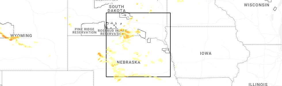
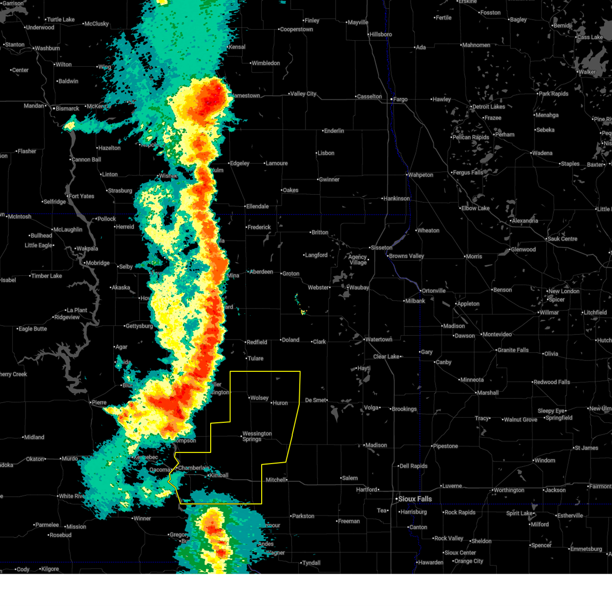
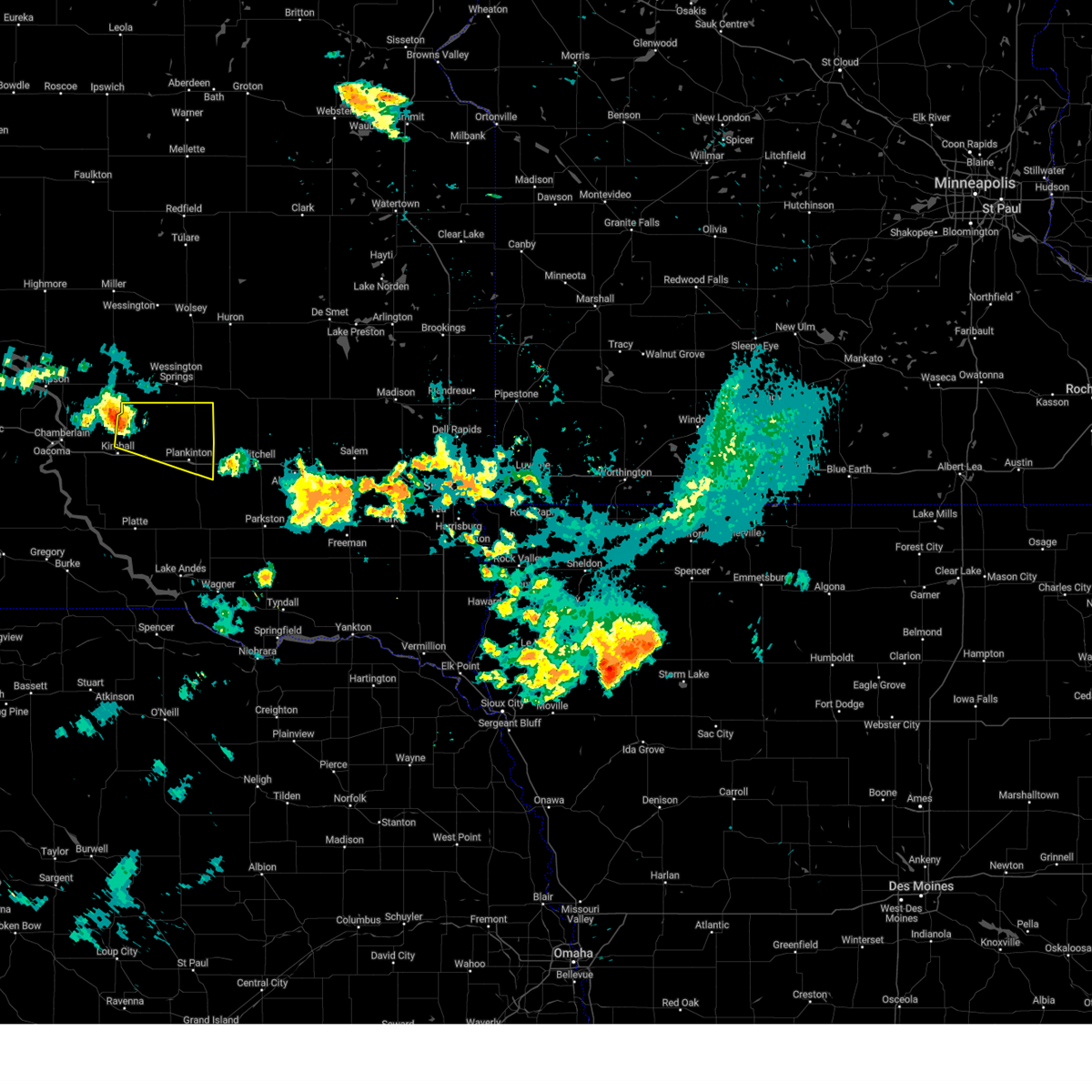
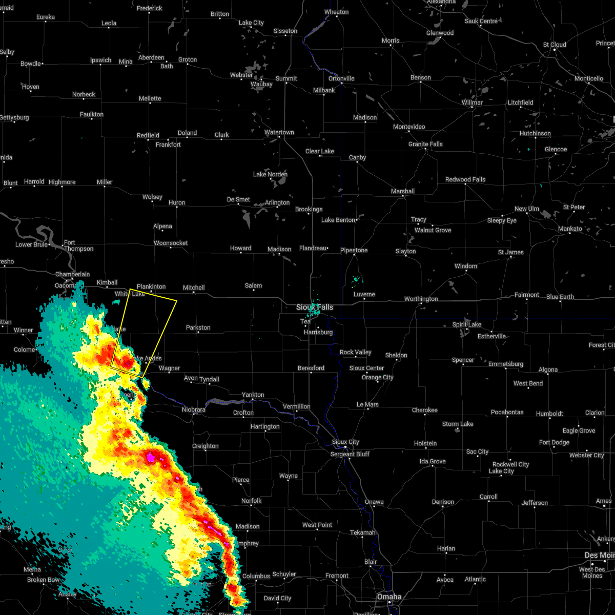
Hail Map for White Lake, SD
The White Lake, SD area has had 14 reports of on-the-ground hail by trained spotters, and has been under severe weather warnings 12 times during the past 12 months. Doppler radar has detected hail at or near White Lake, SD on 46 occasions, including 5 occasions during the past year.
| Name: | White Lake, SD |
| Where Located: | 87.8 miles N of Oneill, NE |
| Map: | Google Map for White Lake, SD |
| Population: | 372 |
| Housing Units: | 192 |
| More Info: | Search Google for White Lake, SD |
0
The Top Recent Hail Date for White Lake, SD is Tuesday, July 15, 2025 (46th out of 46)
Hail and Wind Damage Spotted near White Lake, SD
| Date / Time | Report Details |
|---|---|
| 7/15/2025 6:18 PM CDT |
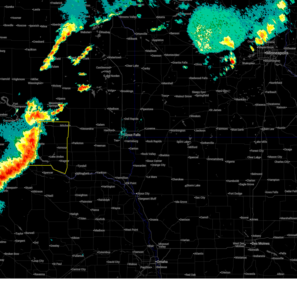
 At 617 pm cdt, severe thunderstorms were located along a line extending from near stickney to near armour to near marty to near gross, moving east at 40 mph (public. at 605 pm, a 58 mph wind gust was reported 3 miles north of lake andes, south dakota!). Hazards include 70 mph wind gusts and ping pong ball size hail. People and animals outdoors will be injured. expect hail damage to roofs, siding, windows, and vehicles. expect considerable tree damage. wind damage is also likely to mobile homes, roofs, and outbuildings. these severe storms will be near, wagner, marty, stickney, delmont, and dante around 625 pm cdt. Other locations impacted by these severe thunderstorms include fairfax and yankton sioux tribal nation. At 617 pm cdt, severe thunderstorms were located along a line extending from near stickney to near armour to near marty to near gross, moving east at 40 mph (public. at 605 pm, a 58 mph wind gust was reported 3 miles north of lake andes, south dakota!). Hazards include 70 mph wind gusts and ping pong ball size hail. People and animals outdoors will be injured. expect hail damage to roofs, siding, windows, and vehicles. expect considerable tree damage. wind damage is also likely to mobile homes, roofs, and outbuildings. these severe storms will be near, wagner, marty, stickney, delmont, and dante around 625 pm cdt. Other locations impacted by these severe thunderstorms include fairfax and yankton sioux tribal nation.
|
| 7/15/2025 6:00 PM CDT |
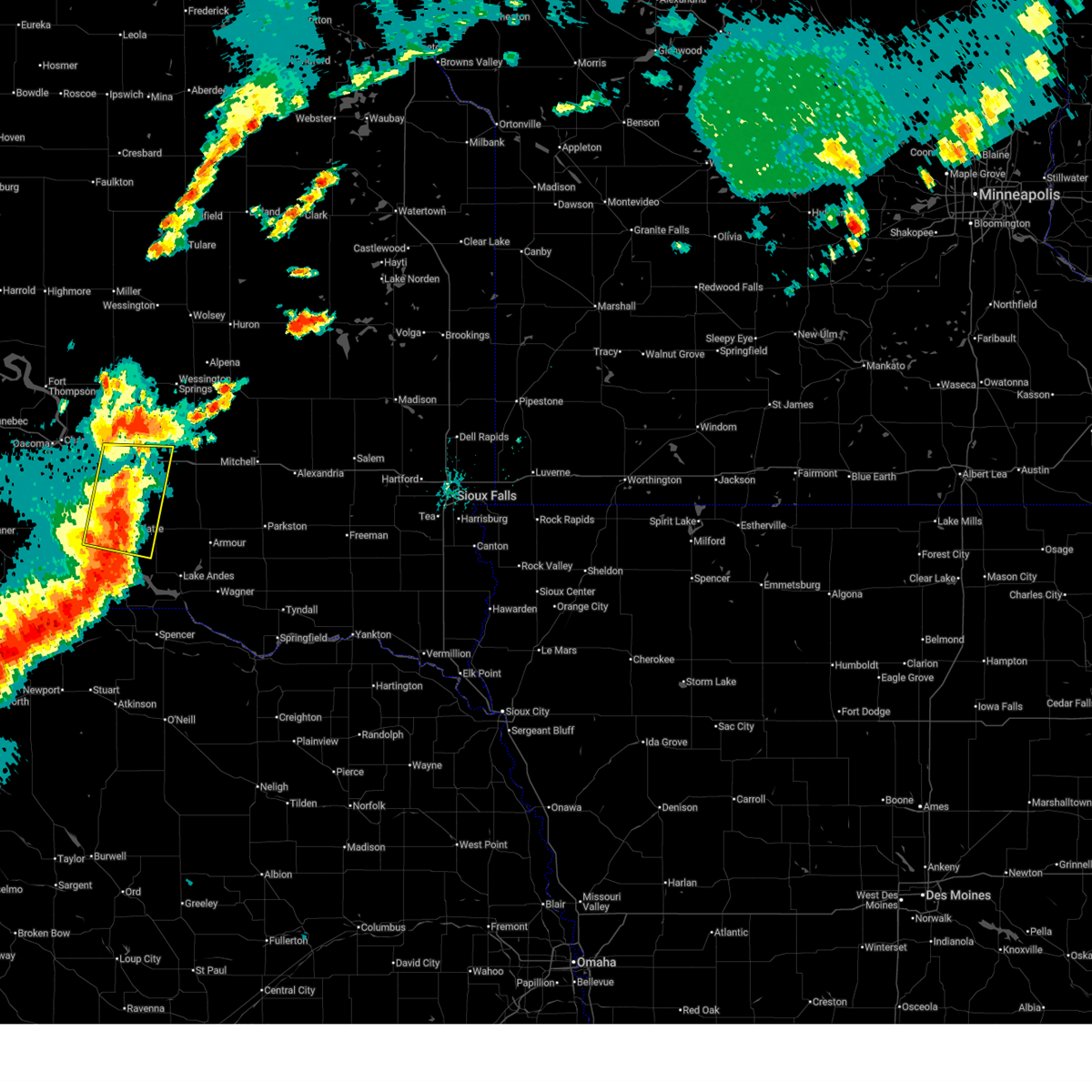
 At 600 pm cdt, severe thunderstorms were located along a line extending from near aurora center to near new holland to 6 miles west of pickstown to near butte, moving east at 35 mph (radar indicated). Hazards include 70 mph wind gusts and ping pong ball size hail. People and animals outdoors will be injured. expect hail damage to roofs, siding, windows, and vehicles. expect considerable tree damage. wind damage is also likely to mobile homes, roofs, and outbuildings. these severe storms will be near, lake andes, pickstown, corsica, stickney, and harrison around 605 pm cdt. ravinia around 610 pm cdt. armour and marty around 615 pm cdt. wagner around 620 pm cdt. delmont around 630 pm cdt. dante around 635 pm cdt. Other locations impacted by these severe thunderstorms include fairfax and yankton sioux tribal nation. At 600 pm cdt, severe thunderstorms were located along a line extending from near aurora center to near new holland to 6 miles west of pickstown to near butte, moving east at 35 mph (radar indicated). Hazards include 70 mph wind gusts and ping pong ball size hail. People and animals outdoors will be injured. expect hail damage to roofs, siding, windows, and vehicles. expect considerable tree damage. wind damage is also likely to mobile homes, roofs, and outbuildings. these severe storms will be near, lake andes, pickstown, corsica, stickney, and harrison around 605 pm cdt. ravinia around 610 pm cdt. armour and marty around 615 pm cdt. wagner around 620 pm cdt. delmont around 630 pm cdt. dante around 635 pm cdt. Other locations impacted by these severe thunderstorms include fairfax and yankton sioux tribal nation.
|
| 7/15/2025 6:00 PM CDT |
 The storms which prompted the warning have moved out of the area. therefore, the warning will be allowed to expire. however, small hail and gusty winds are still possible with these thunderstorms. a severe thunderstorm watch remains in effect until 1100 pm cdt for south central south dakota. remember, a severe thunderstorm warning still remains in effect for portions of aurora, charles mix, and gregory counties until 645 pm. The storms which prompted the warning have moved out of the area. therefore, the warning will be allowed to expire. however, small hail and gusty winds are still possible with these thunderstorms. a severe thunderstorm watch remains in effect until 1100 pm cdt for south central south dakota. remember, a severe thunderstorm warning still remains in effect for portions of aurora, charles mix, and gregory counties until 645 pm.
|
| 7/15/2025 5:46 PM CDT |
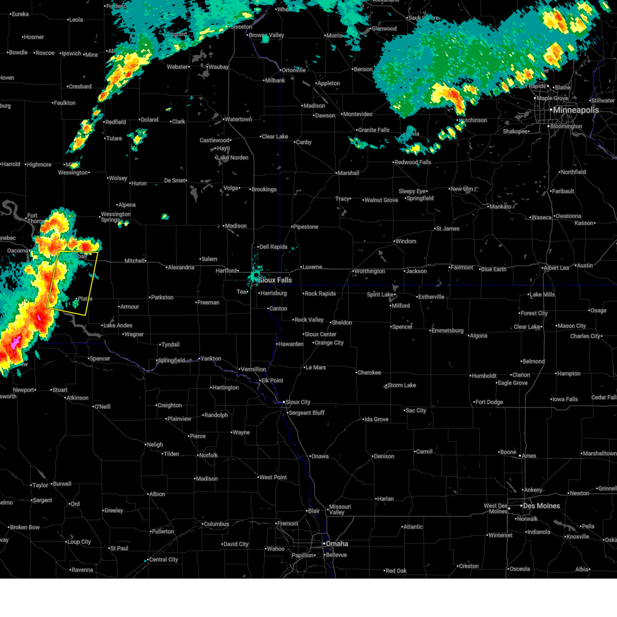
 Svrfsd the national weather service in sioux falls has issued a * severe thunderstorm warning for, southern davison county in southeastern south dakota, southern aurora county in south central south dakota, charles mix county in south central south dakota, southeastern gregory county in south central south dakota, douglas county in south central south dakota, west central hutchinson county in southeastern south dakota, * until 645 pm cdt. * at 546 pm cdt, severe thunderstorms were located along a line extending from 7 miles south of white lake to near new holland to 7 miles east of bonesteel to 6 miles east of naper, moving east at 35 mph (radar indicated). Hazards include 70 mph wind gusts and quarter size hail. Hail damage to vehicles is expected. expect considerable tree damage. wind damage is also likely to mobile homes, roofs, and outbuildings. severe thunderstorms will be near, geddes, new holland, and aurora center around 550 pm cdt. harrison around 555 pm cdt. lake andes, pickstown, and stickney around 600 pm cdt. corsica around 605 pm cdt. armour and ravinia around 610 pm cdt. marty around 615 pm cdt. wagner around 620 pm cdt. delmont around 630 pm cdt. Other locations impacted by these severe thunderstorms include fairfax and yankton sioux tribal nation. Svrfsd the national weather service in sioux falls has issued a * severe thunderstorm warning for, southern davison county in southeastern south dakota, southern aurora county in south central south dakota, charles mix county in south central south dakota, southeastern gregory county in south central south dakota, douglas county in south central south dakota, west central hutchinson county in southeastern south dakota, * until 645 pm cdt. * at 546 pm cdt, severe thunderstorms were located along a line extending from 7 miles south of white lake to near new holland to 7 miles east of bonesteel to 6 miles east of naper, moving east at 35 mph (radar indicated). Hazards include 70 mph wind gusts and quarter size hail. Hail damage to vehicles is expected. expect considerable tree damage. wind damage is also likely to mobile homes, roofs, and outbuildings. severe thunderstorms will be near, geddes, new holland, and aurora center around 550 pm cdt. harrison around 555 pm cdt. lake andes, pickstown, and stickney around 600 pm cdt. corsica around 605 pm cdt. armour and ravinia around 610 pm cdt. marty around 615 pm cdt. wagner around 620 pm cdt. delmont around 630 pm cdt. Other locations impacted by these severe thunderstorms include fairfax and yankton sioux tribal nation.
|
| 7/15/2025 5:45 PM CDT |
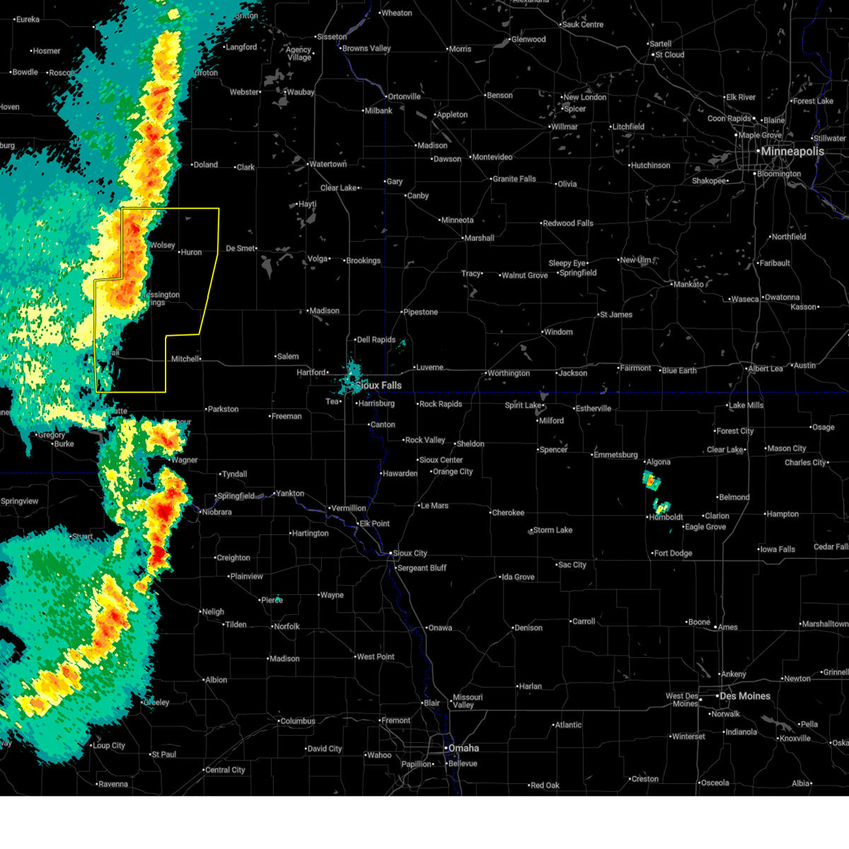
 At 545 pm cdt, severe thunderstorms were located along a line extending from near grass ranch colony to near platte to 7 miles west of geddes, moving east at 25 mph (radar indicated). Hazards include 70 mph wind gusts and quarter size hail. Hail damage to vehicles is expected. expect considerable tree damage. wind damage is also likely to mobile homes, roofs, and outbuildings. These severe thunderstorms will remain over mainly rural areas of southwestern aurora, northwestern charles mix, north central gregory, northwestern douglas and southeastern brule counties. At 545 pm cdt, severe thunderstorms were located along a line extending from near grass ranch colony to near platte to 7 miles west of geddes, moving east at 25 mph (radar indicated). Hazards include 70 mph wind gusts and quarter size hail. Hail damage to vehicles is expected. expect considerable tree damage. wind damage is also likely to mobile homes, roofs, and outbuildings. These severe thunderstorms will remain over mainly rural areas of southwestern aurora, northwestern charles mix, north central gregory, northwestern douglas and southeastern brule counties.
|
| 7/15/2025 5:23 PM CDT |
 Svrfsd the national weather service in sioux falls has issued a * severe thunderstorm warning for, southwestern aurora county in south central south dakota, northwestern charles mix county in south central south dakota, north central gregory county in south central south dakota, northwestern douglas county in south central south dakota, southeastern brule county in south central south dakota, * until 600 pm cdt. * at 523 pm cdt, severe thunderstorms were located along a line extending from near kimball to 10 miles southwest of grass ranch colony to 14 miles west of platte, moving southeast at 30 mph (radar indicated). Hazards include 60 mph wind gusts and quarter size hail. Hail damage to vehicles is expected. expect wind damage to roofs, siding, and trees. severe thunderstorms will be near, kimball and grass ranch colony around 530 pm cdt. Platte around 540 pm cdt. Svrfsd the national weather service in sioux falls has issued a * severe thunderstorm warning for, southwestern aurora county in south central south dakota, northwestern charles mix county in south central south dakota, north central gregory county in south central south dakota, northwestern douglas county in south central south dakota, southeastern brule county in south central south dakota, * until 600 pm cdt. * at 523 pm cdt, severe thunderstorms were located along a line extending from near kimball to 10 miles southwest of grass ranch colony to 14 miles west of platte, moving southeast at 30 mph (radar indicated). Hazards include 60 mph wind gusts and quarter size hail. Hail damage to vehicles is expected. expect wind damage to roofs, siding, and trees. severe thunderstorms will be near, kimball and grass ranch colony around 530 pm cdt. Platte around 540 pm cdt.
|
| 7/9/2025 10:21 PM CDT |
 At 1021 pm cdt, severe thunderstorms were located along a line extending from near frankfort to near hitchcock to near alpena to 11 miles south of wessington springs, moving east at 30 mph (trained weather spotters. at 1010 pm, a 60 mph wind gusts was recorded at the sdsu mesonet site in wessington). Hazards include 60 mph wind gusts and penny size hail. Expect damage to roofs, siding, and trees. these severe storms will be near, alpena, lane, and virgil around 1025 pm cdt. huron around 1030 pm cdt. woonsocket around 1035 pm cdt. storla around 1040 pm cdt. cavour around 1050 pm cdt. letcher, yale, and forestburg around 1055 pm cdt. Other locations impacted by these severe thunderstorms include broadland. At 1021 pm cdt, severe thunderstorms were located along a line extending from near frankfort to near hitchcock to near alpena to 11 miles south of wessington springs, moving east at 30 mph (trained weather spotters. at 1010 pm, a 60 mph wind gusts was recorded at the sdsu mesonet site in wessington). Hazards include 60 mph wind gusts and penny size hail. Expect damage to roofs, siding, and trees. these severe storms will be near, alpena, lane, and virgil around 1025 pm cdt. huron around 1030 pm cdt. woonsocket around 1035 pm cdt. storla around 1040 pm cdt. cavour around 1050 pm cdt. letcher, yale, and forestburg around 1055 pm cdt. Other locations impacted by these severe thunderstorms include broadland.
|
| 7/9/2025 9:30 PM CDT |
 Svrfsd the national weather service in sioux falls has issued a * severe thunderstorm warning for, sanborn county in east central south dakota, beadle county in east central south dakota, aurora county in south central south dakota, jerauld county in central south dakota, brule county in south central south dakota, * until 1100 pm cdt. * at 929 pm cdt, severe thunderstorms were located along a line extending from near zell to 6 miles northeast of vayland to pleasant valley country church to 6 miles west of crow creek housing, moving east at 25 mph (radar indicated). Hazards include 60 mph wind gusts and quarter size hail. Hail damage to vehicles is expected. expect wind damage to roofs, siding, and trees. severe thunderstorms will be near, wessington around 935 pm cdt. Other locations in the path of these severe thunderstorms include wolsey, hitchcock, virgil, wessington springs, huron, alpena, lane, white lake and cavour. Svrfsd the national weather service in sioux falls has issued a * severe thunderstorm warning for, sanborn county in east central south dakota, beadle county in east central south dakota, aurora county in south central south dakota, jerauld county in central south dakota, brule county in south central south dakota, * until 1100 pm cdt. * at 929 pm cdt, severe thunderstorms were located along a line extending from near zell to 6 miles northeast of vayland to pleasant valley country church to 6 miles west of crow creek housing, moving east at 25 mph (radar indicated). Hazards include 60 mph wind gusts and quarter size hail. Hail damage to vehicles is expected. expect wind damage to roofs, siding, and trees. severe thunderstorms will be near, wessington around 935 pm cdt. Other locations in the path of these severe thunderstorms include wolsey, hitchcock, virgil, wessington springs, huron, alpena, lane, white lake and cavour.
|
| 6/27/2025 9:11 PM CDT |
 Svrfsd the national weather service in sioux falls has issued a * severe thunderstorm warning for, western davison county in southeastern south dakota, southern aurora county in south central south dakota, * until 1000 pm cdt. * at 910 pm cdt, a severe thunderstorm was located near white lake, or 9 miles west of plankinton, moving east at 30 mph (radar indicated). Hazards include 70 mph wind gusts. Expect considerable tree damage. damage is likely to mobile homes, roofs, and outbuildings. this severe thunderstorm will be near, plankinton around 915 pm cdt. stickney around 925 pm cdt. Other locations in the path of this severe thunderstorm include mount vernon. Svrfsd the national weather service in sioux falls has issued a * severe thunderstorm warning for, western davison county in southeastern south dakota, southern aurora county in south central south dakota, * until 1000 pm cdt. * at 910 pm cdt, a severe thunderstorm was located near white lake, or 9 miles west of plankinton, moving east at 30 mph (radar indicated). Hazards include 70 mph wind gusts. Expect considerable tree damage. damage is likely to mobile homes, roofs, and outbuildings. this severe thunderstorm will be near, plankinton around 915 pm cdt. stickney around 925 pm cdt. Other locations in the path of this severe thunderstorm include mount vernon.
|
| 6/22/2025 9:25 PM CDT |
 the severe thunderstorm warning has been cancelled and is no longer in effect the severe thunderstorm warning has been cancelled and is no longer in effect
|
| 6/22/2025 9:10 PM CDT |
 Svrfsd the national weather service in sioux falls has issued a * severe thunderstorm warning for, aurora county in south central south dakota, east central brule county in south central south dakota, * until 1000 pm cdt. * at 909 pm cdt, a severe thunderstorm was located near grass ranch colony, or 11 miles southeast of kimball, moving northeast at 50 mph (radar indicated). Hazards include quarter size hail. Damage to vehicles is expected. this severe thunderstorm will be near, white lake around 915 pm cdt. plankinton around 925 pm cdt. Other locations in the path of this severe thunderstorm include storla. Svrfsd the national weather service in sioux falls has issued a * severe thunderstorm warning for, aurora county in south central south dakota, east central brule county in south central south dakota, * until 1000 pm cdt. * at 909 pm cdt, a severe thunderstorm was located near grass ranch colony, or 11 miles southeast of kimball, moving northeast at 50 mph (radar indicated). Hazards include quarter size hail. Damage to vehicles is expected. this severe thunderstorm will be near, white lake around 915 pm cdt. plankinton around 925 pm cdt. Other locations in the path of this severe thunderstorm include storla.
|
| 6/16/2025 1:10 PM CDT | Quarter sized hail reported 12.3 miles N of White Lake, SD |
| 7/30/2024 7:12 AM CDT | Quarter sized hail reported 7.4 miles SSW of White Lake, SD, hail started out like ice cubes... but then got smaller as the rain got heavier. rainfall up to 710 am was 0.14 inch... but it was still raining. |
| 7/30/2024 6:48 AM CDT |
 Svrfsd the national weather service in sioux falls has issued a * severe thunderstorm warning for, northern aurora county in south central south dakota, southern jerauld county in central south dakota, northeastern brule county in south central south dakota, * until 730 am cdt. * at 648 am cdt, a severe thunderstorm was located 11 miles southeast of gann valley, or 11 miles northeast of kimball, moving east at 40 mph (radar indicated). Hazards include 60 mph wind gusts and quarter size hail. Hail damage to vehicles is expected. Expect wind damage to roofs, siding, and trees. Svrfsd the national weather service in sioux falls has issued a * severe thunderstorm warning for, northern aurora county in south central south dakota, southern jerauld county in central south dakota, northeastern brule county in south central south dakota, * until 730 am cdt. * at 648 am cdt, a severe thunderstorm was located 11 miles southeast of gann valley, or 11 miles northeast of kimball, moving east at 40 mph (radar indicated). Hazards include 60 mph wind gusts and quarter size hail. Hail damage to vehicles is expected. Expect wind damage to roofs, siding, and trees.
|
| 7/29/2024 8:29 PM CDT | Large cottonwood tree fell on pickup and numerous large branches down around the yard. time estimated based on rada in aurora county SD, 11.7 miles N of White Lake, SD |
| 7/14/2024 4:14 AM CDT |
 The storms which prompted the warning have weakened below severe limits, and no longer pose an immediate threat to life or property. therefore, the warning will be allowed to expire. however, gusty winds and heavy rain are still possible with these thunderstorms. a severe thunderstorm watch remains in effect until 800 am cdt for south central, central, southeastern and east central south dakota. The storms which prompted the warning have weakened below severe limits, and no longer pose an immediate threat to life or property. therefore, the warning will be allowed to expire. however, gusty winds and heavy rain are still possible with these thunderstorms. a severe thunderstorm watch remains in effect until 800 am cdt for south central, central, southeastern and east central south dakota.
|
| 7/14/2024 3:50 AM CDT |
 At 348 am cdt, severe thunderstorms were located along a line extending from de smet to canova to 6 miles south of clayton, moving east at 50 mph (trained weather spotters. at 336 am, the huron regional airport asos recorded a 62 mph wind gust). Hazards include 70 mph wind gusts. Expect considerable tree damage. damage is likely to mobile homes, roofs, and outbuildings. Locations impacted include, mitchell, huron, chamberlain, plankinton, kimball, lake vermillion state recreation area, lake thompson state recreation area, salem, de smet, wessington springs, arlington, howard, canistota, woonsocket, alexandria, lake preston, bridgewater, montrose, mount vernon, and emery. At 348 am cdt, severe thunderstorms were located along a line extending from de smet to canova to 6 miles south of clayton, moving east at 50 mph (trained weather spotters. at 336 am, the huron regional airport asos recorded a 62 mph wind gust). Hazards include 70 mph wind gusts. Expect considerable tree damage. damage is likely to mobile homes, roofs, and outbuildings. Locations impacted include, mitchell, huron, chamberlain, plankinton, kimball, lake vermillion state recreation area, lake thompson state recreation area, salem, de smet, wessington springs, arlington, howard, canistota, woonsocket, alexandria, lake preston, bridgewater, montrose, mount vernon, and emery.
|
| 7/14/2024 3:19 AM CDT |
 At 318 am cdt, severe thunderstorms were located along a line extending from near yale to near artesian to near parkston, moving east at 50 mph (trained weather spotters. at 257 am, an sddot site 3 nnw of wolsey recorded a 70 mph wind gust). Hazards include 70 mph wind gusts. Expect considerable tree damage. damage is likely to mobile homes, roofs, and outbuildings. Locations impacted include, alexandria, ethan, iroquois, fulton, fedora, carthage, roswell, farmer, emery, vilas, de smet, howard, spencer in mccook county, canova, lake thompson state recreation area, bridgewater, salem, lake preston, canistota, oldham, montrose and hetland. At 318 am cdt, severe thunderstorms were located along a line extending from near yale to near artesian to near parkston, moving east at 50 mph (trained weather spotters. at 257 am, an sddot site 3 nnw of wolsey recorded a 70 mph wind gust). Hazards include 70 mph wind gusts. Expect considerable tree damage. damage is likely to mobile homes, roofs, and outbuildings. Locations impacted include, alexandria, ethan, iroquois, fulton, fedora, carthage, roswell, farmer, emery, vilas, de smet, howard, spencer in mccook county, canova, lake thompson state recreation area, bridgewater, salem, lake preston, canistota, oldham, montrose and hetland.
|
| 7/14/2024 3:02 AM CDT |
 Svrfsd the national weather service in sioux falls has issued a * severe thunderstorm warning for, davison county in southeastern south dakota, kingsbury county in east central south dakota, sanborn county in east central south dakota, beadle county in east central south dakota, aurora county in south central south dakota, jerauld county in central south dakota, miner county in east central south dakota, mccook county in southeastern south dakota, hanson county in southeastern south dakota, brule county in south central south dakota, * until 415 am cdt. * at 301 am cdt, severe thunderstorms were located along a line extending from 9 miles northwest of huron to near woonsocket to near corsica, moving east at 50 mph (radar indicated). Hazards include 70 mph wind gusts. Expect considerable tree damage. damage is likely to mobile homes, roofs, and outbuildings. severe thunderstorms will be near, huron, woonsocket, mount vernon, letcher, forestburg, and loomis around 305 am cdt. mitchell and cavour around 310 am cdt. ethan, artesian, and yale around 315 am cdt. iroquois around 320 am cdt. Other locations in the path of these severe thunderstorms include fulton, fedora, alexandria, carthage, roswell, vilas, farmer, de smet, howard, emery, spencer in mccook county and canova. Svrfsd the national weather service in sioux falls has issued a * severe thunderstorm warning for, davison county in southeastern south dakota, kingsbury county in east central south dakota, sanborn county in east central south dakota, beadle county in east central south dakota, aurora county in south central south dakota, jerauld county in central south dakota, miner county in east central south dakota, mccook county in southeastern south dakota, hanson county in southeastern south dakota, brule county in south central south dakota, * until 415 am cdt. * at 301 am cdt, severe thunderstorms were located along a line extending from 9 miles northwest of huron to near woonsocket to near corsica, moving east at 50 mph (radar indicated). Hazards include 70 mph wind gusts. Expect considerable tree damage. damage is likely to mobile homes, roofs, and outbuildings. severe thunderstorms will be near, huron, woonsocket, mount vernon, letcher, forestburg, and loomis around 305 am cdt. mitchell and cavour around 310 am cdt. ethan, artesian, and yale around 315 am cdt. iroquois around 320 am cdt. Other locations in the path of these severe thunderstorms include fulton, fedora, alexandria, carthage, roswell, vilas, farmer, de smet, howard, emery, spencer in mccook county and canova.
|
| 7/14/2024 2:44 AM CDT |
 At 242 am cdt, severe thunderstorms were located along a line extending from near burdette to 7 miles northwest of wessington springs to 10 miles southwest of grass ranch colony, moving southeast at 60 mph (radar indicated. at 235 pm, the chamberlain asos recorded a 60 mph wind gust). Hazards include 70 mph wind gusts. Expect considerable tree damage. damage is likely to mobile homes, roofs, and outbuildings. Locations impacted include, wessington springs, white lake, wessington, lane, plankinton, wolsey, alpena, virgil, aurora center, woonsocket, stickney, storla, hitchcock, huron, mount vernon, letcher, forestburg, mitchell and loomis. At 242 am cdt, severe thunderstorms were located along a line extending from near burdette to 7 miles northwest of wessington springs to 10 miles southwest of grass ranch colony, moving southeast at 60 mph (radar indicated. at 235 pm, the chamberlain asos recorded a 60 mph wind gust). Hazards include 70 mph wind gusts. Expect considerable tree damage. damage is likely to mobile homes, roofs, and outbuildings. Locations impacted include, wessington springs, white lake, wessington, lane, plankinton, wolsey, alpena, virgil, aurora center, woonsocket, stickney, storla, hitchcock, huron, mount vernon, letcher, forestburg, mitchell and loomis.
|
| 7/14/2024 2:06 AM CDT |
 Svrfsd the national weather service in sioux falls has issued a * severe thunderstorm warning for, davison county in southeastern south dakota, western kingsbury county in east central south dakota, sanborn county in east central south dakota, beadle county in east central south dakota, aurora county in south central south dakota, jerauld county in central south dakota, brule county in south central south dakota, * until 300 am cdt. * at 206 am cdt, severe thunderstorms were located along a line extending from 9 miles east of stone lake to 7 miles northeast of stephan to 9 miles north of hamill, moving southeast at 60 mph (radar indicated). Hazards include 70 mph wind gusts. Expect considerable tree damage. damage is likely to mobile homes, roofs, and outbuildings. severe thunderstorms will be near, lake francis case around 210 am cdt. chamberlain around 215 am cdt. Other locations in the path of these severe thunderstorms include kimball, wessington, grass ranch colony, wessington springs, white lake and lane. Svrfsd the national weather service in sioux falls has issued a * severe thunderstorm warning for, davison county in southeastern south dakota, western kingsbury county in east central south dakota, sanborn county in east central south dakota, beadle county in east central south dakota, aurora county in south central south dakota, jerauld county in central south dakota, brule county in south central south dakota, * until 300 am cdt. * at 206 am cdt, severe thunderstorms were located along a line extending from 9 miles east of stone lake to 7 miles northeast of stephan to 9 miles north of hamill, moving southeast at 60 mph (radar indicated). Hazards include 70 mph wind gusts. Expect considerable tree damage. damage is likely to mobile homes, roofs, and outbuildings. severe thunderstorms will be near, lake francis case around 210 am cdt. chamberlain around 215 am cdt. Other locations in the path of these severe thunderstorms include kimball, wessington, grass ranch colony, wessington springs, white lake and lane.
|
| 7/18/2023 9:26 PM CDT |
 The severe thunderstorm warning for southwestern aurora and brule counties will expire at 930 pm cdt, the storms which prompted the warning have moved out of the area. therefore, the warning will be allowed to expire. a severe thunderstorm watch remains in effect until 200 am cdt for south central and central south dakota. to report severe weather, contact your nearest law enforcement agency. they will relay your report to the national weather service sioux falls. The severe thunderstorm warning for southwestern aurora and brule counties will expire at 930 pm cdt, the storms which prompted the warning have moved out of the area. therefore, the warning will be allowed to expire. a severe thunderstorm watch remains in effect until 200 am cdt for south central and central south dakota. to report severe weather, contact your nearest law enforcement agency. they will relay your report to the national weather service sioux falls.
|
| 7/18/2023 9:02 PM CDT |
 At 901 pm cdt, severe thunderstorms were located along a line extending from near white lake to 11 miles southwest of grass ranch colony to iona, moving southeast at 35 mph (radar indicated). Hazards include 60 mph wind gusts and nickel size hail. Expect damage to roofs, siding, and trees. locations impacted include, white lake and grass ranch colony. hail threat, radar indicated max hail size, 0. 88 in wind threat, radar indicated max wind gust, 60 mph. At 901 pm cdt, severe thunderstorms were located along a line extending from near white lake to 11 miles southwest of grass ranch colony to iona, moving southeast at 35 mph (radar indicated). Hazards include 60 mph wind gusts and nickel size hail. Expect damage to roofs, siding, and trees. locations impacted include, white lake and grass ranch colony. hail threat, radar indicated max hail size, 0. 88 in wind threat, radar indicated max wind gust, 60 mph.
|
| 7/18/2023 8:29 PM CDT |
 At 828 pm cdt, severe thunderstorms were located along a line extending from 7 miles northwest of kimball to 7 miles south of chamberlain to 10 miles northwest of hamill, moving southeast at 35 mph (chamberlain asos reported a gust of 61 mph around 827 pm cdt). Hazards include 60 mph wind gusts and nickel size hail. Expect damage to roofs, siding, and trees. severe thunderstorms will be near, kimball around 840 pm cdt. other locations in the path of these severe thunderstorms include white lake and grass ranch colony. hail threat, radar indicated max hail size, 0. 88 in wind threat, observed max wind gust, 60 mph. At 828 pm cdt, severe thunderstorms were located along a line extending from 7 miles northwest of kimball to 7 miles south of chamberlain to 10 miles northwest of hamill, moving southeast at 35 mph (chamberlain asos reported a gust of 61 mph around 827 pm cdt). Hazards include 60 mph wind gusts and nickel size hail. Expect damage to roofs, siding, and trees. severe thunderstorms will be near, kimball around 840 pm cdt. other locations in the path of these severe thunderstorms include white lake and grass ranch colony. hail threat, radar indicated max hail size, 0. 88 in wind threat, observed max wind gust, 60 mph.
|
| 7/18/2023 8:03 PM CDT |
 At 801 pm cdt, severe thunderstorms were located along a line extending from near crow creek housing to near oacoma to near earling hill, moving southeast at 35 mph (radar indicated). Hazards include ping pong ball size hail and 60 mph wind gusts. People and animals outdoors will be injured. expect hail damage to roofs, siding, windows, and vehicles. expect wind damage to roofs, siding, and trees. severe thunderstorms will be near, lake francis case around 810 pm cdt. chamberlain around 815 pm cdt. other locations in the path of these severe thunderstorms include kimball, white lake and grass ranch colony. hail threat, radar indicated max hail size, 1. 50 in wind threat, radar indicated max wind gust, 60 mph. At 801 pm cdt, severe thunderstorms were located along a line extending from near crow creek housing to near oacoma to near earling hill, moving southeast at 35 mph (radar indicated). Hazards include ping pong ball size hail and 60 mph wind gusts. People and animals outdoors will be injured. expect hail damage to roofs, siding, windows, and vehicles. expect wind damage to roofs, siding, and trees. severe thunderstorms will be near, lake francis case around 810 pm cdt. chamberlain around 815 pm cdt. other locations in the path of these severe thunderstorms include kimball, white lake and grass ranch colony. hail threat, radar indicated max hail size, 1. 50 in wind threat, radar indicated max wind gust, 60 mph.
|
| 6/24/2023 1:46 AM CDT |
 At 146 am cdt, severe thunderstorms were located along a line extending from near pleasant valley country church to 8 miles southwest of grass ranch colony, moving east at 55 mph (radar indicated). Hazards include 60 mph wind gusts. Expect damage to roofs, siding, and trees. locations impacted include, white lake. hail threat, radar indicated max hail size, <. 75 in wind threat, radar indicated max wind gust, 60 mph. At 146 am cdt, severe thunderstorms were located along a line extending from near pleasant valley country church to 8 miles southwest of grass ranch colony, moving east at 55 mph (radar indicated). Hazards include 60 mph wind gusts. Expect damage to roofs, siding, and trees. locations impacted include, white lake. hail threat, radar indicated max hail size, <. 75 in wind threat, radar indicated max wind gust, 60 mph.
|
| 6/24/2023 1:33 AM CDT |
 At 133 am cdt, severe thunderstorms were located along a line extending from near etbauer hill to 10 miles east of iona, moving east at 55 mph (radar indicated). Hazards include 60 mph wind gusts. Expect damage to roofs, siding, and trees. severe thunderstorms will be near, kimball around 150 am cdt. other locations in the path of these severe thunderstorms include grass ranch colony and white lake. hail threat, radar indicated max hail size, <. 75 in wind threat, radar indicated max wind gust, 60 mph. At 133 am cdt, severe thunderstorms were located along a line extending from near etbauer hill to 10 miles east of iona, moving east at 55 mph (radar indicated). Hazards include 60 mph wind gusts. Expect damage to roofs, siding, and trees. severe thunderstorms will be near, kimball around 150 am cdt. other locations in the path of these severe thunderstorms include grass ranch colony and white lake. hail threat, radar indicated max hail size, <. 75 in wind threat, radar indicated max wind gust, 60 mph.
|
| 8/2/2022 7:23 PM CDT |
 At 723 pm cdt, severe thunderstorms were located along a line extending from 10 miles northeast of gann valley to 13 miles southwest of wessington springs to 6 miles south of white lake, moving northeast at 40 mph (radar indicated). Hazards include 60 mph wind gusts. the strongest winds may be occurring ahead of the rainfall. Expect damage to roofs, siding, and trees. severe thunderstorms will be near, wessington springs around 740 pm cdt. plankinton around 745 pm cdt. lane around 750 pm cdt. alpena around 755 pm cdt. woonsocket, mount vernon, virgil and storla around 800 pm cdt. hail threat, radar indicated max hail size, <. 75 in wind threat, radar indicated max wind gust, 60 mph. At 723 pm cdt, severe thunderstorms were located along a line extending from 10 miles northeast of gann valley to 13 miles southwest of wessington springs to 6 miles south of white lake, moving northeast at 40 mph (radar indicated). Hazards include 60 mph wind gusts. the strongest winds may be occurring ahead of the rainfall. Expect damage to roofs, siding, and trees. severe thunderstorms will be near, wessington springs around 740 pm cdt. plankinton around 745 pm cdt. lane around 750 pm cdt. alpena around 755 pm cdt. woonsocket, mount vernon, virgil and storla around 800 pm cdt. hail threat, radar indicated max hail size, <. 75 in wind threat, radar indicated max wind gust, 60 mph.
|
| 8/2/2022 7:12 PM CDT |
 At 712 pm cdt, a severe thunderstorm was located 9 miles northeast of kimball, moving northeast at 50 mph (radar indicated). Hazards include 60 mph wind gusts. Expect damage to roofs, siding, and trees. this severe thunderstorm will remain over mainly rural areas of western aurora, western jerauld and eastern brule counties. hail threat, radar indicated max hail size, <. 75 in wind threat, radar indicated max wind gust, 60 mph. At 712 pm cdt, a severe thunderstorm was located 9 miles northeast of kimball, moving northeast at 50 mph (radar indicated). Hazards include 60 mph wind gusts. Expect damage to roofs, siding, and trees. this severe thunderstorm will remain over mainly rural areas of western aurora, western jerauld and eastern brule counties. hail threat, radar indicated max hail size, <. 75 in wind threat, radar indicated max wind gust, 60 mph.
|
| 8/2/2022 6:56 PM CDT |
 At 655 pm cdt, a severe thunderstorm was located 9 miles east of chamberlain, moving northeast at 35 mph (radar indicated). Hazards include 60 mph wind gusts. Expect damage to roofs, siding, and trees. this severe thunderstorm will be near, grass ranch colony around 705 pm cdt. kimball around 710 pm cdt. white lake around 725 pm cdt. other locations impacted by this severe thunderstorm include pukwana. hail threat, radar indicated max hail size, <. 75 in wind threat, radar indicated max wind gust, 60 mph. At 655 pm cdt, a severe thunderstorm was located 9 miles east of chamberlain, moving northeast at 35 mph (radar indicated). Hazards include 60 mph wind gusts. Expect damage to roofs, siding, and trees. this severe thunderstorm will be near, grass ranch colony around 705 pm cdt. kimball around 710 pm cdt. white lake around 725 pm cdt. other locations impacted by this severe thunderstorm include pukwana. hail threat, radar indicated max hail size, <. 75 in wind threat, radar indicated max wind gust, 60 mph.
|
| 7/5/2022 2:15 PM CDT |
 At 214 pm cdt, severe thunderstorms were located along a line extending from 6 miles south of artesian to 6 miles north of ethan to near armour, moving southeast at 55 mph (emergency management. at 2:10 pm, an 80 mph wind gust was reported in woonsocket). Hazards include 70 mph wind gusts and quarter size hail. Hail damage to vehicles is expected. expect considerable tree damage. wind damage is also likely to mobile homes, roofs, and outbuildings. these severe storms will be near, alexandria, dimock and fulton around 220 pm cdt. delmont around 225 pm cdt. parkston, emery, milltown and farmer around 230 pm cdt. thunderstorm damage threat, considerable hail threat, radar indicated max hail size, 1. 00 in wind threat, radar indicated max wind gust, 70 mph. At 214 pm cdt, severe thunderstorms were located along a line extending from 6 miles south of artesian to 6 miles north of ethan to near armour, moving southeast at 55 mph (emergency management. at 2:10 pm, an 80 mph wind gust was reported in woonsocket). Hazards include 70 mph wind gusts and quarter size hail. Hail damage to vehicles is expected. expect considerable tree damage. wind damage is also likely to mobile homes, roofs, and outbuildings. these severe storms will be near, alexandria, dimock and fulton around 220 pm cdt. delmont around 225 pm cdt. parkston, emery, milltown and farmer around 230 pm cdt. thunderstorm damage threat, considerable hail threat, radar indicated max hail size, 1. 00 in wind threat, radar indicated max wind gust, 70 mph.
|
| 7/5/2022 1:58 PM CDT |
 At 156 pm cdt, severe thunderstorms were located along a line extending from forestburg to near mount vernon to near aurora center, moving southeast at 50 mph (emergency management. at 135 pm cdt, a 65 mph wind gust was reported 8 miles north of plankinton). Hazards include 70 mph wind gusts and half dollar size hail. Hail damage to vehicles is expected. expect considerable tree damage. wind damage is also likely to mobile homes, roofs, and outbuildings. these severe storms will be near, mitchell and loomis around 200 pm cdt. corsica and artesian around 205 pm cdt. armour around 215 pm cdt. ethan and dimock around 220 pm cdt. parkston, delmont and fulton around 225 pm cdt. alexandria, milltown and farmer around 230 pm cdt. emery around 240 pm cdt. thunderstorm damage threat, considerable hail threat, radar indicated max hail size, 1. 25 in wind threat, radar indicated max wind gust, 70 mph. At 156 pm cdt, severe thunderstorms were located along a line extending from forestburg to near mount vernon to near aurora center, moving southeast at 50 mph (emergency management. at 135 pm cdt, a 65 mph wind gust was reported 8 miles north of plankinton). Hazards include 70 mph wind gusts and half dollar size hail. Hail damage to vehicles is expected. expect considerable tree damage. wind damage is also likely to mobile homes, roofs, and outbuildings. these severe storms will be near, mitchell and loomis around 200 pm cdt. corsica and artesian around 205 pm cdt. armour around 215 pm cdt. ethan and dimock around 220 pm cdt. parkston, delmont and fulton around 225 pm cdt. alexandria, milltown and farmer around 230 pm cdt. emery around 240 pm cdt. thunderstorm damage threat, considerable hail threat, radar indicated max hail size, 1. 25 in wind threat, radar indicated max wind gust, 70 mph.
|
| 7/5/2022 1:29 PM CDT |
 At 128 pm cdt, severe thunderstorms were located along a line extending from near alpena to 8 miles northwest of storla to near grass ranch colony, moving southeast at 55 mph (radar indicated). Hazards include 70 mph wind gusts and ping pong ball size hail. People and animals outdoors will be injured. expect hail damage to roofs, siding, windows, and vehicles. expect considerable tree damage. wind damage is also likely to mobile homes, roofs, and outbuildings. severe thunderstorms will be near, woonsocket around 135 pm cdt. plankinton and storla around 140 pm cdt. forestburg around 145 pm cdt. mount vernon, letcher and aurora center around 150 pm cdt. mitchell, stickney, artesian, new holland and loomis around 155 pm cdt. harrison around 200 pm cdt. corsica around 205 pm cdt. armour, ethan, dimock and fulton around 210 pm cdt. thunderstorm damage threat, considerable hail threat, radar indicated max hail size, 1. 50 in wind threat, radar indicated max wind gust, 70 mph. At 128 pm cdt, severe thunderstorms were located along a line extending from near alpena to 8 miles northwest of storla to near grass ranch colony, moving southeast at 55 mph (radar indicated). Hazards include 70 mph wind gusts and ping pong ball size hail. People and animals outdoors will be injured. expect hail damage to roofs, siding, windows, and vehicles. expect considerable tree damage. wind damage is also likely to mobile homes, roofs, and outbuildings. severe thunderstorms will be near, woonsocket around 135 pm cdt. plankinton and storla around 140 pm cdt. forestburg around 145 pm cdt. mount vernon, letcher and aurora center around 150 pm cdt. mitchell, stickney, artesian, new holland and loomis around 155 pm cdt. harrison around 200 pm cdt. corsica around 205 pm cdt. armour, ethan, dimock and fulton around 210 pm cdt. thunderstorm damage threat, considerable hail threat, radar indicated max hail size, 1. 50 in wind threat, radar indicated max wind gust, 70 mph.
|
| 7/4/2022 2:42 AM CDT |
 The severe thunderstorm warning for aurora, southern jerauld, northwestern charles mix, northern gregory and brule counties will expire at 245 am cdt, the storms which prompted the warning have weakened below severe limits, and no longer pose an immediate threat to life or property. therefore, the warning will be allowed to expire. however gusty winds are still possible with these thunderstorms. a severe thunderstorm watch remains in effect until 800 am cdt for south central and central south dakota. The severe thunderstorm warning for aurora, southern jerauld, northwestern charles mix, northern gregory and brule counties will expire at 245 am cdt, the storms which prompted the warning have weakened below severe limits, and no longer pose an immediate threat to life or property. therefore, the warning will be allowed to expire. however gusty winds are still possible with these thunderstorms. a severe thunderstorm watch remains in effect until 800 am cdt for south central and central south dakota.
|
| 7/4/2022 2:26 AM CDT |
 At 226 am cdt, severe thunderstorms were located along a line extending from 8 miles east of gann valley to near white lake to 11 miles southwest of grass ranch colony, moving east at 40 mph (radar indicated). Hazards include 60 mph wind gusts and penny size hail. Expect damage to roofs, siding, and trees. locations impacted include, white lake, wessington springs and plankinton. hail threat, radar indicated max hail size, 0. 75 in wind threat, radar indicated max wind gust, 60 mph. At 226 am cdt, severe thunderstorms were located along a line extending from 8 miles east of gann valley to near white lake to 11 miles southwest of grass ranch colony, moving east at 40 mph (radar indicated). Hazards include 60 mph wind gusts and penny size hail. Expect damage to roofs, siding, and trees. locations impacted include, white lake, wessington springs and plankinton. hail threat, radar indicated max hail size, 0. 75 in wind threat, radar indicated max wind gust, 60 mph.
|
| 7/4/2022 2:03 AM CDT |
 At 203 am cdt, severe thunderstorms were located along a line extending from near etbauer hill to 6 miles west of kimball to 7 miles east of iona, moving east at 40 mph (radar indicated). Hazards include 60 mph wind gusts and penny size hail. Expect damage to roofs, siding, and trees. severe thunderstorms will be near, kimball around 215 am cdt. grass ranch colony around 220 am cdt. other locations in the path of these severe thunderstorms include white lake, wessington springs and plankinton. hail threat, radar indicated max hail size, 0. 75 in wind threat, radar indicated max wind gust, 60 mph. At 203 am cdt, severe thunderstorms were located along a line extending from near etbauer hill to 6 miles west of kimball to 7 miles east of iona, moving east at 40 mph (radar indicated). Hazards include 60 mph wind gusts and penny size hail. Expect damage to roofs, siding, and trees. severe thunderstorms will be near, kimball around 215 am cdt. grass ranch colony around 220 am cdt. other locations in the path of these severe thunderstorms include white lake, wessington springs and plankinton. hail threat, radar indicated max hail size, 0. 75 in wind threat, radar indicated max wind gust, 60 mph.
|
| 7/3/2022 12:18 PM CDT | In addition to strong winds... heavy rain was also reported but not measured ye in aurora county SD, 11.2 miles S of White Lake, SD |
| 6/29/2022 8:27 PM CDT |
 At 826 pm cdt, severe thunderstorms were located along a line extending from 9 miles north of white lake to near plankinton, moving northeast at 60 mph (radar indicated). Hazards include 60 mph wind gusts and penny size hail. Expect damage to roofs, siding, and trees. locations impacted include, plankinton, white lake, stickney, storla and aurora center. hail threat, radar indicated max hail size, 0. 75 in wind threat, radar indicated max wind gust, 60 mph. At 826 pm cdt, severe thunderstorms were located along a line extending from 9 miles north of white lake to near plankinton, moving northeast at 60 mph (radar indicated). Hazards include 60 mph wind gusts and penny size hail. Expect damage to roofs, siding, and trees. locations impacted include, plankinton, white lake, stickney, storla and aurora center. hail threat, radar indicated max hail size, 0. 75 in wind threat, radar indicated max wind gust, 60 mph.
|
| 6/29/2022 8:19 PM CDT |
 At 819 pm cdt, severe thunderstorms were located along a line extending from 6 miles north of white lake to 7 miles northwest of aurora center, moving northeast at 50 mph (radar indicated). Hazards include 60 mph wind gusts and penny size hail. Expect damage to roofs, siding, and trees. locations impacted include, stickney, plankinton and storla. hail threat, radar indicated max hail size, 0. 75 in wind threat, radar indicated max wind gust, 60 mph. At 819 pm cdt, severe thunderstorms were located along a line extending from 6 miles north of white lake to 7 miles northwest of aurora center, moving northeast at 50 mph (radar indicated). Hazards include 60 mph wind gusts and penny size hail. Expect damage to roofs, siding, and trees. locations impacted include, stickney, plankinton and storla. hail threat, radar indicated max hail size, 0. 75 in wind threat, radar indicated max wind gust, 60 mph.
|
| 6/29/2022 8:08 PM CDT |
 At 807 pm cdt, severe thunderstorms were located along a line extending from near kimball to 6 miles southeast of grass ranch colony, moving northeast at 60 mph (radar indicated). Hazards include 60 mph wind gusts. Expect damage to roofs, siding, and trees. severe thunderstorms will be near, white lake around 820 pm cdt. stickney around 825 pm cdt. other locations in the path of these severe thunderstorms include plankinton and storla. hail threat, radar indicated max hail size, <. 75 in wind threat, radar indicated max wind gust, 60 mph. At 807 pm cdt, severe thunderstorms were located along a line extending from near kimball to 6 miles southeast of grass ranch colony, moving northeast at 60 mph (radar indicated). Hazards include 60 mph wind gusts. Expect damage to roofs, siding, and trees. severe thunderstorms will be near, white lake around 820 pm cdt. stickney around 825 pm cdt. other locations in the path of these severe thunderstorms include plankinton and storla. hail threat, radar indicated max hail size, <. 75 in wind threat, radar indicated max wind gust, 60 mph.
|
| 6/13/2022 1:04 AM CDT |
 At 104 am cdt, severe thunderstorms were located along a line extending from 10 miles southwest of virgil to near wessington springs to storla, moving east at 45 mph (radar indicated). Hazards include 60 mph wind gusts and nickel size hail. Expect damage to roofs, siding, and trees. Locations impacted include, huron, wessington springs, woonsocket, white lake, alpena, letcher, forestburg, lane, virgil and storla. At 104 am cdt, severe thunderstorms were located along a line extending from 10 miles southwest of virgil to near wessington springs to storla, moving east at 45 mph (radar indicated). Hazards include 60 mph wind gusts and nickel size hail. Expect damage to roofs, siding, and trees. Locations impacted include, huron, wessington springs, woonsocket, white lake, alpena, letcher, forestburg, lane, virgil and storla.
|
| 6/13/2022 12:34 AM CDT |
 At 1233 am cdt, severe thunderstorms were located along a line extending from 7 miles northeast of etbauer hill to near gann valley to near kimball, moving east at 45 mph (trained weather spotters. this storm has had a history of producing winds around 70 mph west of chamberlain). Hazards include 70 mph wind gusts and nickel size hail. Expect considerable tree damage. Damage is likely to mobile homes, roofs, and outbuildings. At 1233 am cdt, severe thunderstorms were located along a line extending from 7 miles northeast of etbauer hill to near gann valley to near kimball, moving east at 45 mph (trained weather spotters. this storm has had a history of producing winds around 70 mph west of chamberlain). Hazards include 70 mph wind gusts and nickel size hail. Expect considerable tree damage. Damage is likely to mobile homes, roofs, and outbuildings.
|
| 5/30/2022 11:31 AM CDT |
 At 1131 am cdt, a severe thunderstorm was located over corsica, or 19 miles north of lake andes, moving northwest at 40 mph (radar indicated). Hazards include quarter size hail. Damage to vehicles is expected. this severe thunderstorm will be near, harrison around 1135 am cdt. stickney and aurora center around 1150 am cdt. other locations in the path of this severe thunderstorm include plankinton and white lake. hail threat, radar indicated max hail size, 1. 00 in wind threat, radar indicated max wind gust, <50 mph. At 1131 am cdt, a severe thunderstorm was located over corsica, or 19 miles north of lake andes, moving northwest at 40 mph (radar indicated). Hazards include quarter size hail. Damage to vehicles is expected. this severe thunderstorm will be near, harrison around 1135 am cdt. stickney and aurora center around 1150 am cdt. other locations in the path of this severe thunderstorm include plankinton and white lake. hail threat, radar indicated max hail size, 1. 00 in wind threat, radar indicated max wind gust, <50 mph.
|
| 5/12/2022 4:15 PM CDT | Mesonet station wtes2 white lake (sd mesonet in aurora county SD, 1.1 miles W of White Lake, SD |
| 5/12/2022 4:15 PM CDT |
 At 414 pm cdt, severe thunderstorms were located along a line extending from 7 miles north of aurora center to near stickney to near armour, moving northeast at 50 mph. these are destructive storms for stickney, armour and surrounding areas (radar indicated). Hazards include 80 mph wind gusts and golf ball size hail. Flying debris will be dangerous to those caught without shelter. mobile homes will be heavily damaged. expect considerable damage to roofs, windows, and vehicles. extensive tree damage and power outages are likely. these severe storms will be near, white lake and stickney around 420 pm cdt. plankinton around 425 pm cdt. mount vernon around 430 pm cdt. Other locations in the path of these severe thunderstorms include storla, wessington springs, letcher, mitchell, woonsocket, lane, loomis and forestburg. At 414 pm cdt, severe thunderstorms were located along a line extending from 7 miles north of aurora center to near stickney to near armour, moving northeast at 50 mph. these are destructive storms for stickney, armour and surrounding areas (radar indicated). Hazards include 80 mph wind gusts and golf ball size hail. Flying debris will be dangerous to those caught without shelter. mobile homes will be heavily damaged. expect considerable damage to roofs, windows, and vehicles. extensive tree damage and power outages are likely. these severe storms will be near, white lake and stickney around 420 pm cdt. plankinton around 425 pm cdt. mount vernon around 430 pm cdt. Other locations in the path of these severe thunderstorms include storla, wessington springs, letcher, mitchell, woonsocket, lane, loomis and forestburg.
|
| 5/12/2022 4:11 PM CDT |
 At 411 pm cdt, severe thunderstorms were located along a line extending from 6 miles northwest of aurora center to near stickney to near armour, moving northeast at 50 mph (radar indicated). Hazards include golf ball size hail and 70 mph wind gusts. People and animals outdoors will be injured. expect hail damage to roofs, siding, windows, and vehicles. expect considerable tree damage. wind damage is also likely to mobile homes, roofs, and outbuildings. severe thunderstorms will be near, stickney around 415 pm cdt. white lake around 420 pm cdt. plankinton around 425 pm cdt. mount vernon around 430 pm cdt. storla around 440 pm cdt. wessington springs and letcher around 450 pm cdt. mitchell, woonsocket, lane and loomis around 455 pm cdt. Forestburg around 500 pm cdt. At 411 pm cdt, severe thunderstorms were located along a line extending from 6 miles northwest of aurora center to near stickney to near armour, moving northeast at 50 mph (radar indicated). Hazards include golf ball size hail and 70 mph wind gusts. People and animals outdoors will be injured. expect hail damage to roofs, siding, windows, and vehicles. expect considerable tree damage. wind damage is also likely to mobile homes, roofs, and outbuildings. severe thunderstorms will be near, stickney around 415 pm cdt. white lake around 420 pm cdt. plankinton around 425 pm cdt. mount vernon around 430 pm cdt. storla around 440 pm cdt. wessington springs and letcher around 450 pm cdt. mitchell, woonsocket, lane and loomis around 455 pm cdt. Forestburg around 500 pm cdt.
|
| 5/12/2022 4:01 PM CDT |
 At 401 pm cdt, a severe thunderstorm was located over aurora center, or 14 miles southwest of plankinton, moving north at 60 mph (radar indicated). Hazards include golf ball size hail and 70 mph wind gusts. People and animals outdoors will be injured. expect hail damage to roofs, siding, windows, and vehicles. expect considerable tree damage. wind damage is also likely to mobile homes, roofs, and outbuildings. Locations impacted include, corsica, white lake, stickney, new holland, harrison, aurora center and northwestern yankton sioux tribal nation. At 401 pm cdt, a severe thunderstorm was located over aurora center, or 14 miles southwest of plankinton, moving north at 60 mph (radar indicated). Hazards include golf ball size hail and 70 mph wind gusts. People and animals outdoors will be injured. expect hail damage to roofs, siding, windows, and vehicles. expect considerable tree damage. wind damage is also likely to mobile homes, roofs, and outbuildings. Locations impacted include, corsica, white lake, stickney, new holland, harrison, aurora center and northwestern yankton sioux tribal nation.
|
| 5/12/2022 3:50 PM CDT |
 At 350 pm cdt, a severe thunderstorm was located near geddes, or 14 miles northwest of lake andes, moving north at 55 mph (radar indicated). Hazards include golf ball size hail and 70 mph wind gusts. People and animals outdoors will be injured. expect hail damage to roofs, siding, windows, and vehicles. expect considerable tree damage. wind damage is also likely to mobile homes, roofs, and outbuildings. locations impacted include, corsica, white lake, stickney, geddes, new holland, harrison, aurora center and northwestern yankton sioux tribal nation. thunderstorm damage threat, considerable hail threat, radar indicated max hail size, 1. 75 in wind threat, radar indicated max wind gust, 70 mph. At 350 pm cdt, a severe thunderstorm was located near geddes, or 14 miles northwest of lake andes, moving north at 55 mph (radar indicated). Hazards include golf ball size hail and 70 mph wind gusts. People and animals outdoors will be injured. expect hail damage to roofs, siding, windows, and vehicles. expect considerable tree damage. wind damage is also likely to mobile homes, roofs, and outbuildings. locations impacted include, corsica, white lake, stickney, geddes, new holland, harrison, aurora center and northwestern yankton sioux tribal nation. thunderstorm damage threat, considerable hail threat, radar indicated max hail size, 1. 75 in wind threat, radar indicated max wind gust, 70 mph.
|
| 5/12/2022 3:46 PM CDT |
 At 346 pm cdt, a severe thunderstorm was located over platte, or 23 miles northwest of lake andes, moving north at 50 mph (radar indicated). Hazards include 70 mph wind gusts and quarter size hail. Hail damage to vehicles is expected. expect considerable tree damage. wind damage is also likely to mobile homes, roofs, and outbuildings. this severe thunderstorm will be near, grass ranch colony around 405 pm cdt. kimball and white lake around 415 pm cdt. thunderstorm damage threat, considerable hail threat, radar indicated max hail size, 1. 00 in wind threat, radar indicated max wind gust, 70 mph. At 346 pm cdt, a severe thunderstorm was located over platte, or 23 miles northwest of lake andes, moving north at 50 mph (radar indicated). Hazards include 70 mph wind gusts and quarter size hail. Hail damage to vehicles is expected. expect considerable tree damage. wind damage is also likely to mobile homes, roofs, and outbuildings. this severe thunderstorm will be near, grass ranch colony around 405 pm cdt. kimball and white lake around 415 pm cdt. thunderstorm damage threat, considerable hail threat, radar indicated max hail size, 1. 00 in wind threat, radar indicated max wind gust, 70 mph.
|
| 5/12/2022 3:40 PM CDT |
 At 339 pm cdt, a severe thunderstorm was located near geddes, or 9 miles west of lake andes, moving northeast at 55 mph (radar indicated). Hazards include 70 mph wind gusts and ping pong ball size hail. People and animals outdoors will be injured. expect hail damage to roofs, siding, windows, and vehicles. expect considerable tree damage. Wind damage is also likely to mobile homes, roofs, and outbuildings. At 339 pm cdt, a severe thunderstorm was located near geddes, or 9 miles west of lake andes, moving northeast at 55 mph (radar indicated). Hazards include 70 mph wind gusts and ping pong ball size hail. People and animals outdoors will be injured. expect hail damage to roofs, siding, windows, and vehicles. expect considerable tree damage. Wind damage is also likely to mobile homes, roofs, and outbuildings.
|
| 5/9/2022 4:53 AM CDT |
 The severe thunderstorm warning for southwestern aurora and northeastern brule counties will expire at 500 am cdt, the storm which prompted the warning has weakened below severe limits, and has exited the warned area. therefore, the warning will be allowed to expire. a severe thunderstorm watch remains in effect until 600 am cdt for south central south dakota. to report severe weather, contact your nearest law enforcement agency. they will relay your report to the national weather service sioux falls. The severe thunderstorm warning for southwestern aurora and northeastern brule counties will expire at 500 am cdt, the storm which prompted the warning has weakened below severe limits, and has exited the warned area. therefore, the warning will be allowed to expire. a severe thunderstorm watch remains in effect until 600 am cdt for south central south dakota. to report severe weather, contact your nearest law enforcement agency. they will relay your report to the national weather service sioux falls.
|
| 5/9/2022 4:42 AM CDT |
 At 442 am cdt, a severe thunderstorm was located over grass ranch colony, or near kimball, moving northeast at 45 mph (radar indicated). Hazards include 60 mph wind gusts and penny size hail. Expect damage to roofs, siding, and trees. locations impacted include, kimball, white lake, grass ranch colony and pukwana. hail threat, radar indicated max hail size, 0. 75 in wind threat, radar indicated max wind gust, 60 mph. At 442 am cdt, a severe thunderstorm was located over grass ranch colony, or near kimball, moving northeast at 45 mph (radar indicated). Hazards include 60 mph wind gusts and penny size hail. Expect damage to roofs, siding, and trees. locations impacted include, kimball, white lake, grass ranch colony and pukwana. hail threat, radar indicated max hail size, 0. 75 in wind threat, radar indicated max wind gust, 60 mph.
|
| 5/9/2022 4:27 AM CDT |
 At 427 am cdt, a severe thunderstorm was located 8 miles southwest of grass ranch colony, or 13 miles south of kimball, moving northeast at 45 mph (radar indicated). Hazards include 60 mph wind gusts and penny size hail. Expect damage to roofs, siding, and trees. locations impacted include, grass ranch colony, kimball and white lake. hail threat, radar indicated max hail size, 0. 75 in wind threat, radar indicated max wind gust, 60 mph. At 427 am cdt, a severe thunderstorm was located 8 miles southwest of grass ranch colony, or 13 miles south of kimball, moving northeast at 45 mph (radar indicated). Hazards include 60 mph wind gusts and penny size hail. Expect damage to roofs, siding, and trees. locations impacted include, grass ranch colony, kimball and white lake. hail threat, radar indicated max hail size, 0. 75 in wind threat, radar indicated max wind gust, 60 mph.
|
| 5/9/2022 4:16 AM CDT |
 At 416 am cdt, a severe thunderstorm was located 11 miles west of platte, or 22 miles south of kimball, moving northeast at 45 mph (radar indicated). Hazards include 60 mph wind gusts. Expect damage to roofs, siding, and trees. this severe thunderstorm will be near, platte around 420 am cdt. other locations in the path of this severe thunderstorm include grass ranch colony, kimball and white lake. hail threat, radar indicated max hail size, <. 75 in wind threat, radar indicated max wind gust, 60 mph. At 416 am cdt, a severe thunderstorm was located 11 miles west of platte, or 22 miles south of kimball, moving northeast at 45 mph (radar indicated). Hazards include 60 mph wind gusts. Expect damage to roofs, siding, and trees. this severe thunderstorm will be near, platte around 420 am cdt. other locations in the path of this severe thunderstorm include grass ranch colony, kimball and white lake. hail threat, radar indicated max hail size, <. 75 in wind threat, radar indicated max wind gust, 60 mph.
|
| 4/22/2022 5:43 PM CDT | Half Dollar sized hail reported 5.5 miles ENE of White Lake, SD |
| 4/22/2022 5:41 PM CDT |
 At 540 pm cdt, a severe thunderstorm was located near kimball, moving north at 40 mph (radar indicated. at 5:29 pm cdt, quarter size hail was reported 8 miles south southeast of kimball, sd). Hazards include 60 mph wind gusts and half dollar size hail. Hail damage to vehicles is expected. expect wind damage to roofs, siding, and trees. this severe thunderstorm will remain over mainly rural areas of northwestern aurora, southwestern jerauld and northeastern brule counties. hail threat, radar indicated max hail size, 1. 25 in wind threat, radar indicated max wind gust, 60 mph. At 540 pm cdt, a severe thunderstorm was located near kimball, moving north at 40 mph (radar indicated. at 5:29 pm cdt, quarter size hail was reported 8 miles south southeast of kimball, sd). Hazards include 60 mph wind gusts and half dollar size hail. Hail damage to vehicles is expected. expect wind damage to roofs, siding, and trees. this severe thunderstorm will remain over mainly rural areas of northwestern aurora, southwestern jerauld and northeastern brule counties. hail threat, radar indicated max hail size, 1. 25 in wind threat, radar indicated max wind gust, 60 mph.
|
| 4/22/2022 5:26 PM CDT |
 At 526 pm cdt, a severe thunderstorm was located over grass ranch colony, or 9 miles southeast of kimball, moving north at 40 mph (radar indicated). Hazards include 60 mph wind gusts and half dollar size hail. Hail damage to vehicles is expected. expect wind damage to roofs, siding, and trees. this severe thunderstorm will be near, kimball and white lake around 540 pm cdt. hail threat, radar indicated max hail size, 1. 25 in wind threat, radar indicated max wind gust, 60 mph. At 526 pm cdt, a severe thunderstorm was located over grass ranch colony, or 9 miles southeast of kimball, moving north at 40 mph (radar indicated). Hazards include 60 mph wind gusts and half dollar size hail. Hail damage to vehicles is expected. expect wind damage to roofs, siding, and trees. this severe thunderstorm will be near, kimball and white lake around 540 pm cdt. hail threat, radar indicated max hail size, 1. 25 in wind threat, radar indicated max wind gust, 60 mph.
|
| 6/11/2021 4:27 AM CDT |
 The severe thunderstorm warning for aurora, central charles mix, southeastern gregory and northwestern douglas counties will expire at 430 am cdt, the storms which prompted the warning have weakened below severe limits, and have exited the warned area. therefore, the warning will be allowed to expire. a severe thunderstorm watch remains in effect until 700 am cdt for south central, central, southeastern and east central south dakota. The severe thunderstorm warning for aurora, central charles mix, southeastern gregory and northwestern douglas counties will expire at 430 am cdt, the storms which prompted the warning have weakened below severe limits, and have exited the warned area. therefore, the warning will be allowed to expire. a severe thunderstorm watch remains in effect until 700 am cdt for south central, central, southeastern and east central south dakota.
|
| 6/11/2021 4:15 AM CDT |
 At 414 am cdt, severe thunderstorms were located along a line extending from near storla to 6 miles northeast of geddes to bonesteel, moving east at 50 mph (radar indicated). Hazards include 60 mph wind gusts. Expect damage to roofs, siding, and trees. these severe storms will be near, harrison and storla around 420 am cdt. corsica around 430 am cdt. lake andes and pickstown around 440 am cdt. Other locations impacted by these severe thunderstorms include fairfax and northwestern yankton sioux tribal nation. At 414 am cdt, severe thunderstorms were located along a line extending from near storla to 6 miles northeast of geddes to bonesteel, moving east at 50 mph (radar indicated). Hazards include 60 mph wind gusts. Expect damage to roofs, siding, and trees. these severe storms will be near, harrison and storla around 420 am cdt. corsica around 430 am cdt. lake andes and pickstown around 440 am cdt. Other locations impacted by these severe thunderstorms include fairfax and northwestern yankton sioux tribal nation.
|
| 6/11/2021 3:39 AM CDT |
 At 339 am cdt, severe thunderstorms were located along a line extending from 8 miles southeast of gann valley to near kimball to near gregory, moving east at 45 mph (radar indicated). Hazards include 60 mph wind gusts. Expect damage to roofs, siding, and trees. severe thunderstorms will be near, white lake around 355 am cdt. plankinton around 410 am cdt. bonesteel and storla around 415 am cdt. Other locations impacted by these severe thunderstorms include fairfax and northwestern yankton sioux tribal nation. At 339 am cdt, severe thunderstorms were located along a line extending from 8 miles southeast of gann valley to near kimball to near gregory, moving east at 45 mph (radar indicated). Hazards include 60 mph wind gusts. Expect damage to roofs, siding, and trees. severe thunderstorms will be near, white lake around 355 am cdt. plankinton around 410 am cdt. bonesteel and storla around 415 am cdt. Other locations impacted by these severe thunderstorms include fairfax and northwestern yankton sioux tribal nation.
|
| 8/28/2020 1:05 AM CDT |
 At 105 am cdt, severe thunderstorms were located along a line extending from near wessington springs to 10 miles northeast of white lake to near grass ranch colony, moving east at 55 mph (radar indicated). Hazards include 60 mph wind gusts. Expect damage to roofs, siding, and trees. severe thunderstorms will be near, storla around 120 am cdt. plankinton around 125 am cdt. Mitchell, stickney, letcher and loomis around 130 am cdt. At 105 am cdt, severe thunderstorms were located along a line extending from near wessington springs to 10 miles northeast of white lake to near grass ranch colony, moving east at 55 mph (radar indicated). Hazards include 60 mph wind gusts. Expect damage to roofs, siding, and trees. severe thunderstorms will be near, storla around 120 am cdt. plankinton around 125 am cdt. Mitchell, stickney, letcher and loomis around 130 am cdt.
|
| 8/10/2020 2:47 AM CDT |
 At 247 am cdt, a severe thunderstorm was located over plankinton, moving east at 25 mph (radar indicated). Hazards include 60 mph wind gusts and quarter size hail. Hail damage to vehicles is expected. expect wind damage to roofs, siding, and trees. this severe thunderstorm will be near, plankinton around 250 am cdt. Mount vernon around 315 am cdt. At 247 am cdt, a severe thunderstorm was located over plankinton, moving east at 25 mph (radar indicated). Hazards include 60 mph wind gusts and quarter size hail. Hail damage to vehicles is expected. expect wind damage to roofs, siding, and trees. this severe thunderstorm will be near, plankinton around 250 am cdt. Mount vernon around 315 am cdt.
|
| 8/9/2020 12:37 AM CDT |
 At 1237 am cdt, severe thunderstorms were located along a line extending from near white lake to 7 miles northeast of armour to near avon, moving east at 55 mph (radar indicated). Hazards include 60 mph wind gusts and penny size hail. Expect damage to roofs, siding, and trees. these severe storms will be near, avon around 1240 am cdt. springfield around 1245 am cdt. parkston, tyndall, plankinton and dimock around 1250 am cdt. storla around 1255 am cdt. Mount vernon around 100 am cdt. At 1237 am cdt, severe thunderstorms were located along a line extending from near white lake to 7 miles northeast of armour to near avon, moving east at 55 mph (radar indicated). Hazards include 60 mph wind gusts and penny size hail. Expect damage to roofs, siding, and trees. these severe storms will be near, avon around 1240 am cdt. springfield around 1245 am cdt. parkston, tyndall, plankinton and dimock around 1250 am cdt. storla around 1255 am cdt. Mount vernon around 100 am cdt.
|
| 8/9/2020 12:19 AM CDT |
 At 1218 am cdt, severe thunderstorms were located along a line extending from near kimball to near harrison to 6 miles southeast of marty, moving east at 55 mph (radar indicated). Hazards include 60 mph wind gusts and penny size hail. Expect damage to roofs, siding, and trees. severe thunderstorms will be near, corsica around 1225 am cdt. armour and dante around 1230 am cdt. avon and white lake around 1235 am cdt. tyndall, plankinton and springfield around 1245 am cdt. parkston and dimock around 1250 am cdt. storla around 1255 am cdt. Mount vernon around 100 am cdt. At 1218 am cdt, severe thunderstorms were located along a line extending from near kimball to near harrison to 6 miles southeast of marty, moving east at 55 mph (radar indicated). Hazards include 60 mph wind gusts and penny size hail. Expect damage to roofs, siding, and trees. severe thunderstorms will be near, corsica around 1225 am cdt. armour and dante around 1230 am cdt. avon and white lake around 1235 am cdt. tyndall, plankinton and springfield around 1245 am cdt. parkston and dimock around 1250 am cdt. storla around 1255 am cdt. Mount vernon around 100 am cdt.
|
| 7/7/2020 1:34 AM CDT |
 At 131 am cdt, severe thunderstorms were located along a line extending from near white lake to 8 miles south of geddes to 12 miles southwest of butte, moving southeast at 45 mph (radar indicated). Hazards include 70 mph wind gusts. Expect considerable tree damage. damage is likely to mobile homes, roofs, and outbuildings. these severe storms will be near, lake andes around 140 am cdt. pickstown around 145 am cdt. stickney around 155 am cdt. mount vernon and marty around 200 am cdt. other locations impacted by these severe thunderstorms include fairfax. Two areas of potentially enhanced wind damage will be likely through 145 am, between platte and geddes, and between pickstown and lake andes. At 131 am cdt, severe thunderstorms were located along a line extending from near white lake to 8 miles south of geddes to 12 miles southwest of butte, moving southeast at 45 mph (radar indicated). Hazards include 70 mph wind gusts. Expect considerable tree damage. damage is likely to mobile homes, roofs, and outbuildings. these severe storms will be near, lake andes around 140 am cdt. pickstown around 145 am cdt. stickney around 155 am cdt. mount vernon and marty around 200 am cdt. other locations impacted by these severe thunderstorms include fairfax. Two areas of potentially enhanced wind damage will be likely through 145 am, between platte and geddes, and between pickstown and lake andes.
|
| 7/7/2020 1:06 AM CDT |
 At 104 am cdt, severe thunderstorms were located along a line extending from 8 miles north of kimball to 7 miles southwest of platte to 12 miles southwest of naper, moving east at 50 mph (radar indicated). Hazards include 70 mph wind gusts. Expect considerable tree damage. damage is likely to mobile homes, roofs, and outbuildings. severe thunderstorms will be near, platte around 110 am cdt. white lake around 120 am cdt. geddes around 125 am cdt. lake andes and plankinton around 135 am cdt. ravinia around 140 am cdt. wagner and mount vernon around 145 am cdt. other locations impacted by these severe thunderstorms include fairfax. This extends the previous warning in effect across portions of brule, gregory and charles mix counties. At 104 am cdt, severe thunderstorms were located along a line extending from 8 miles north of kimball to 7 miles southwest of platte to 12 miles southwest of naper, moving east at 50 mph (radar indicated). Hazards include 70 mph wind gusts. Expect considerable tree damage. damage is likely to mobile homes, roofs, and outbuildings. severe thunderstorms will be near, platte around 110 am cdt. white lake around 120 am cdt. geddes around 125 am cdt. lake andes and plankinton around 135 am cdt. ravinia around 140 am cdt. wagner and mount vernon around 145 am cdt. other locations impacted by these severe thunderstorms include fairfax. This extends the previous warning in effect across portions of brule, gregory and charles mix counties.
|
| 7/6/2020 11:55 PM CDT |
 The severe thunderstorm warning for western aurora and southern brule counties will expire at midnight cdt, the storm which prompted the warning has weakened below severe limits, and no longer poses an immediate threat to life or property. therefore, the warning will be allowed to expire. however, heavy rain and small hail is still likely with this thunderstorm. a severe thunderstorm watch remains in effect until 500 am cdt for south central south dakota. The severe thunderstorm warning for western aurora and southern brule counties will expire at midnight cdt, the storm which prompted the warning has weakened below severe limits, and no longer poses an immediate threat to life or property. therefore, the warning will be allowed to expire. however, heavy rain and small hail is still likely with this thunderstorm. a severe thunderstorm watch remains in effect until 500 am cdt for south central south dakota.
|
| 7/6/2020 11:47 PM CDT |
 At 1147 pm cdt, a severe thunderstorm was located near grass ranch colony, or 8 miles southeast of kimball, moving east at 30 mph (radar indicated). Hazards include quarter size hail. Damage to vehicles is expected. This severe storm will be near, white lake around 1200 am cdt. At 1147 pm cdt, a severe thunderstorm was located near grass ranch colony, or 8 miles southeast of kimball, moving east at 30 mph (radar indicated). Hazards include quarter size hail. Damage to vehicles is expected. This severe storm will be near, white lake around 1200 am cdt.
|
| 7/6/2020 11:35 PM CDT |
 At 1134 pm cdt, a severe thunderstorm was located near grass ranch colony, or near kimball, moving east at 30 mph (radar indicated). Hazards include half dollar size hail. Damage to vehicles is expected. this severe thunderstorm will be near, grass ranch colony around 1140 pm cdt. White lake around 1200 am cdt. At 1134 pm cdt, a severe thunderstorm was located near grass ranch colony, or near kimball, moving east at 30 mph (radar indicated). Hazards include half dollar size hail. Damage to vehicles is expected. this severe thunderstorm will be near, grass ranch colony around 1140 pm cdt. White lake around 1200 am cdt.
|
| 7/6/2020 11:08 PM CDT |
 At 1108 pm cdt, a severe thunderstorm was located near white lake, or 11 miles east of kimball, moving east at 15 mph (radar indicated). Hazards include quarter size hail. Damage to vehicles is expected. This severe thunderstorm will remain over mainly rural areas of west central aurora county. At 1108 pm cdt, a severe thunderstorm was located near white lake, or 11 miles east of kimball, moving east at 15 mph (radar indicated). Hazards include quarter size hail. Damage to vehicles is expected. This severe thunderstorm will remain over mainly rural areas of west central aurora county.
|
| 7/6/2020 10:59 PM CDT |
 At 1058 pm cdt, a severe thunderstorm was located near grass ranch colony moving southeast at 20 mph (radar indicated). Hazards include ping pong ball size hail. People and animals outdoors will be injured. expect damage to roofs, siding, windows, and vehicles. This severe storm will be near, white lake around 1110 pm cdt. At 1058 pm cdt, a severe thunderstorm was located near grass ranch colony moving southeast at 20 mph (radar indicated). Hazards include ping pong ball size hail. People and animals outdoors will be injured. expect damage to roofs, siding, windows, and vehicles. This severe storm will be near, white lake around 1110 pm cdt.
|
| 7/6/2020 10:42 PM CDT |
 At 1042 pm cdt, a severe thunderstorm was located near kimball, moving east at 10 mph (radar indicated). Hazards include half dollar size hail. Damage to vehicles is expected. This severe thunderstorm will be near, white lake around 1130 pm cdt. At 1042 pm cdt, a severe thunderstorm was located near kimball, moving east at 10 mph (radar indicated). Hazards include half dollar size hail. Damage to vehicles is expected. This severe thunderstorm will be near, white lake around 1130 pm cdt.
|
| 7/5/2020 8:43 PM CDT |
 The severe thunderstorm warning for aurora, jerauld and northeastern brule counties will expire at 845 pm cdt, the storms which prompted the warning have weakened below severe limits, and no longer pose an immediate threat to life or property. therefore, the warning will be allowed to expire. however gusty winds 45 to 55 mph are still possible with these thunderstorms as they slowly weaken and move eastward. The severe thunderstorm warning for aurora, jerauld and northeastern brule counties will expire at 845 pm cdt, the storms which prompted the warning have weakened below severe limits, and no longer pose an immediate threat to life or property. therefore, the warning will be allowed to expire. however gusty winds 45 to 55 mph are still possible with these thunderstorms as they slowly weaken and move eastward.
|
| 7/5/2020 8:36 PM CDT |
 At 836 pm cdt, severe thunderstorms were located along a line extending from near alpena to 6 miles west of storla to 6 miles southeast of white lake, moving east at 35 mph (radar indicated). Hazards include 60 mph wind gusts and penny size hail. Expect damage to roofs, siding, and trees. these severe storms will be near, alpena around 840 pm cdt. Storla around 845 pm cdt. At 836 pm cdt, severe thunderstorms were located along a line extending from near alpena to 6 miles west of storla to 6 miles southeast of white lake, moving east at 35 mph (radar indicated). Hazards include 60 mph wind gusts and penny size hail. Expect damage to roofs, siding, and trees. these severe storms will be near, alpena around 840 pm cdt. Storla around 845 pm cdt.
|
| 7/5/2020 8:16 PM CDT |
 At 816 pm cdt, severe thunderstorms were located along a line extending from near wessington springs to 7 miles north of white lake to near grass ranch colony, moving east at 25 mph (surface observation station). Hazards include 60 mph wind gusts and penny size hail. Expect damage to roofs, siding, and trees. these severe storms will be near, wessington springs and white lake around 825 pm cdt. lane around 840 pm cdt. alpena around 845 pm cdt. plankinton around 850 pm cdt. Storla around 900 pm cdt. At 816 pm cdt, severe thunderstorms were located along a line extending from near wessington springs to 7 miles north of white lake to near grass ranch colony, moving east at 25 mph (surface observation station). Hazards include 60 mph wind gusts and penny size hail. Expect damage to roofs, siding, and trees. these severe storms will be near, wessington springs and white lake around 825 pm cdt. lane around 840 pm cdt. alpena around 845 pm cdt. plankinton around 850 pm cdt. Storla around 900 pm cdt.
|
| 7/5/2020 7:50 PM CDT |
 At 749 pm cdt, severe thunderstorms were located along a line extending from 8 miles south of pleasant valley country church to 8 miles south of gann valley to 9 miles southwest of kimball, moving east at 30 mph (surface observation station). Hazards include 60 mph wind gusts and nickel size hail. Expect damage to roofs, siding, and trees. severe thunderstorms will be near, kimball around 810 pm cdt. grass ranch colony around 815 pm cdt. wessington springs around 825 pm cdt. white lake around 830 pm cdt. lane around 840 pm cdt. Plankinton, alpena and storla around 845 pm cdt. At 749 pm cdt, severe thunderstorms were located along a line extending from 8 miles south of pleasant valley country church to 8 miles south of gann valley to 9 miles southwest of kimball, moving east at 30 mph (surface observation station). Hazards include 60 mph wind gusts and nickel size hail. Expect damage to roofs, siding, and trees. severe thunderstorms will be near, kimball around 810 pm cdt. grass ranch colony around 815 pm cdt. wessington springs around 825 pm cdt. white lake around 830 pm cdt. lane around 840 pm cdt. Plankinton, alpena and storla around 845 pm cdt.
|
| 6/25/2020 5:11 PM CDT |
 The severe thunderstorm warning for northern aurora and southeastern jerauld counties will expire at 515 pm cdt, the storm which prompted the warning has weakened below severe limits, and no longer poses an immediate threat to life or property. therefore, the warning will be allowed to expire. however gusty winds are still possible with this thunderstorm. a severe thunderstorm watch remains in effect until 1100 pm cdt for south central, central and east central south dakota. The severe thunderstorm warning for northern aurora and southeastern jerauld counties will expire at 515 pm cdt, the storm which prompted the warning has weakened below severe limits, and no longer poses an immediate threat to life or property. therefore, the warning will be allowed to expire. however gusty winds are still possible with this thunderstorm. a severe thunderstorm watch remains in effect until 1100 pm cdt for south central, central and east central south dakota.
|
| 6/25/2020 4:57 PM CDT |
 At 445 pm cdt, a severe thunderstorm was located 8 miles north of white lake, or 13 miles northwest of plankinton, moving east at 35 mph (radar indicated). Hazards include 60 mph wind gusts and quarter size hail. Hail damage to vehicles is expected. expect wind damage to roofs, siding, and trees. This severe thunderstorm will be near, storla around 515 pm cdt. At 445 pm cdt, a severe thunderstorm was located 8 miles north of white lake, or 13 miles northwest of plankinton, moving east at 35 mph (radar indicated). Hazards include 60 mph wind gusts and quarter size hail. Hail damage to vehicles is expected. expect wind damage to roofs, siding, and trees. This severe thunderstorm will be near, storla around 515 pm cdt.
|
| 6/25/2020 4:49 PM CDT | Quarter sized hail reported 11.2 miles S of White Lake, SD, just a couple hail stones. |
| 6/25/2020 4:45 PM CDT |
 At 445 pm cdt, a severe thunderstorm was located 8 miles north of white lake, or 13 miles northwest of plankinton, moving east at 35 mph (radar indicated). Hazards include 60 mph wind gusts and quarter size hail. Hail damage to vehicles is expected. expect wind damage to roofs, siding, and trees. This severe thunderstorm will be near, storla around 515 pm cdt. At 445 pm cdt, a severe thunderstorm was located 8 miles north of white lake, or 13 miles northwest of plankinton, moving east at 35 mph (radar indicated). Hazards include 60 mph wind gusts and quarter size hail. Hail damage to vehicles is expected. expect wind damage to roofs, siding, and trees. This severe thunderstorm will be near, storla around 515 pm cdt.
|
| 6/6/2020 11:41 PM CDT |
 The severe thunderstorm warning for western aurora, northwestern charles mix, western jerauld, gregory and brule counties will expire at 1145 pm cdt, the storms which prompted the warning have weakened below severe limits, and no longer pose an immediate threat to life or property. therefore, the warning will be allowed to expire. however small hail and gusty winds are still possible with these thunderstorms. a severe thunderstorm watch remains in effect until 100 am cdt for south central south dakota. a severe thunderstorm watch also remains in effect until 400 am cdt for central and east central south dakota. to report severe weather, contact your nearest law enforcement agency. they will relay your report to the national weather service sioux falls. The severe thunderstorm warning for western aurora, northwestern charles mix, western jerauld, gregory and brule counties will expire at 1145 pm cdt, the storms which prompted the warning have weakened below severe limits, and no longer pose an immediate threat to life or property. therefore, the warning will be allowed to expire. however small hail and gusty winds are still possible with these thunderstorms. a severe thunderstorm watch remains in effect until 100 am cdt for south central south dakota. a severe thunderstorm watch also remains in effect until 400 am cdt for central and east central south dakota. to report severe weather, contact your nearest law enforcement agency. they will relay your report to the national weather service sioux falls.
|
| 6/6/2020 11:35 PM CDT |
 At 1134 pm cdt, severe thunderstorms were located along a line extending from near etbauer hill to 10 miles east of iona to 15 miles southwest of naper, moving northeast at 55 mph (radar indicated). Hazards include 60 mph wind gusts and penny size hail. Expect damage to roofs, siding, and trees. locations impacted include, chamberlain, kimball, gregory, platte, burke, white lake, bonesteel, dallas, herrick, st. Charles, grass ranch colony, lake francis case, pukwana, fairfax and dixon in gregory county. At 1134 pm cdt, severe thunderstorms were located along a line extending from near etbauer hill to 10 miles east of iona to 15 miles southwest of naper, moving northeast at 55 mph (radar indicated). Hazards include 60 mph wind gusts and penny size hail. Expect damage to roofs, siding, and trees. locations impacted include, chamberlain, kimball, gregory, platte, burke, white lake, bonesteel, dallas, herrick, st. Charles, grass ranch colony, lake francis case, pukwana, fairfax and dixon in gregory county.
|
| 6/6/2020 10:46 PM CDT |
 At 1046 pm cdt, severe thunderstorms were located along a line extending from lower brule to near hamill to near wewela, moving northeast at 70 mph (radar indicated). Hazards include 60 mph wind gusts and penny size hail. Expect damage to roofs, siding, and trees. severe thunderstorms will be near, lake francis case around 1055 pm cdt. chamberlain and dallas around 1100 pm cdt. gregory and burke around 1105 pm cdt. grass ranch colony around 1135 pm cdt. kimball around 1140 pm cdt. white lake around 1145 pm cdt. Other locations impacted by these severe thunderstorms include dixon in gregory county, fairfax and pukwana. At 1046 pm cdt, severe thunderstorms were located along a line extending from lower brule to near hamill to near wewela, moving northeast at 70 mph (radar indicated). Hazards include 60 mph wind gusts and penny size hail. Expect damage to roofs, siding, and trees. severe thunderstorms will be near, lake francis case around 1055 pm cdt. chamberlain and dallas around 1100 pm cdt. gregory and burke around 1105 pm cdt. grass ranch colony around 1135 pm cdt. kimball around 1140 pm cdt. white lake around 1145 pm cdt. Other locations impacted by these severe thunderstorms include dixon in gregory county, fairfax and pukwana.
|
| 9/10/2019 8:21 PM CDT |
 At 821 pm cdt, severe thunderstorms were located along a line extending from near white lake to aurora center to near geddes, moving east at 30 mph (radar indicated). Hazards include 60 mph wind gusts and half dollar size hail. Hail damage to vehicles is expected. expect wind damage to roofs, siding, and trees. these severe storms will be near, aurora center around 825 pm cdt. plankinton and stickney around 835 pm cdt. new holland around 840 pm cdt. Corsica, harrison and storla around 845 pm cdt. At 821 pm cdt, severe thunderstorms were located along a line extending from near white lake to aurora center to near geddes, moving east at 30 mph (radar indicated). Hazards include 60 mph wind gusts and half dollar size hail. Hail damage to vehicles is expected. expect wind damage to roofs, siding, and trees. these severe storms will be near, aurora center around 825 pm cdt. plankinton and stickney around 835 pm cdt. new holland around 840 pm cdt. Corsica, harrison and storla around 845 pm cdt.
|
| 9/10/2019 8:01 PM CDT |
 At 801 pm cdt, severe thunderstorms were located along a line extending from near white lake to 8 miles west of aurora center to 9 miles south of platte, moving east at 30 mph (radar indicated). Hazards include golf ball size hail and 60 mph wind gusts. People and animals outdoors will be injured. expect hail damage to roofs, siding, windows, and vehicles. expect wind damage to roofs, siding, and trees. severe thunderstorms will be near, white lake and new holland around 810 pm cdt. aurora center around 815 pm cdt. geddes around 820 pm cdt. plankinton around 830 pm cdt. stickney around 835 pm cdt. Corsica, harrison and storla around 845 pm cdt. At 801 pm cdt, severe thunderstorms were located along a line extending from near white lake to 8 miles west of aurora center to 9 miles south of platte, moving east at 30 mph (radar indicated). Hazards include golf ball size hail and 60 mph wind gusts. People and animals outdoors will be injured. expect hail damage to roofs, siding, windows, and vehicles. expect wind damage to roofs, siding, and trees. severe thunderstorms will be near, white lake and new holland around 810 pm cdt. aurora center around 815 pm cdt. geddes around 820 pm cdt. plankinton around 830 pm cdt. stickney around 835 pm cdt. Corsica, harrison and storla around 845 pm cdt.
|
| 9/10/2019 7:43 PM CDT |
 At 743 pm cdt, severe thunderstorms were located along a line extending from near kimball to 6 miles north of platte to 6 miles north of st. charles, moving east at 25 mph (radar indicated). Hazards include golf ball size hail and 60 mph wind gusts. People and animals outdoors will be injured. expect hail damage to roofs, siding, windows, and vehicles. expect wind damage to roofs, siding, and trees. these severe storms will be near, grass ranch colony around 750 pm cdt. White lake and aurora center around 800 pm cdt. At 743 pm cdt, severe thunderstorms were located along a line extending from near kimball to 6 miles north of platte to 6 miles north of st. charles, moving east at 25 mph (radar indicated). Hazards include golf ball size hail and 60 mph wind gusts. People and animals outdoors will be injured. expect hail damage to roofs, siding, windows, and vehicles. expect wind damage to roofs, siding, and trees. these severe storms will be near, grass ranch colony around 750 pm cdt. White lake and aurora center around 800 pm cdt.
|
| 9/10/2019 7:24 PM CDT |
 At 724 pm cdt, severe thunderstorms were located along a line extending from near kimball to 9 miles northwest of platte to near herrick, moving east at 25 mph (radar indicated). Hazards include golf ball size hail and 60 mph wind gusts. People and animals outdoors will be injured. expect hail damage to roofs, siding, windows, and vehicles. expect wind damage to roofs, siding, and trees. severe thunderstorms will be near, kimball and grass ranch colony around 735 pm cdt. platte around 740 pm cdt. White lake and aurora center around 800 pm cdt. At 724 pm cdt, severe thunderstorms were located along a line extending from near kimball to 9 miles northwest of platte to near herrick, moving east at 25 mph (radar indicated). Hazards include golf ball size hail and 60 mph wind gusts. People and animals outdoors will be injured. expect hail damage to roofs, siding, windows, and vehicles. expect wind damage to roofs, siding, and trees. severe thunderstorms will be near, kimball and grass ranch colony around 735 pm cdt. platte around 740 pm cdt. White lake and aurora center around 800 pm cdt.
|
| 8/17/2019 8:01 PM CDT |
 At 801 pm cdt, severe thunderstorms were located along a line extending from near wessington springs to 8 miles west of platte, moving east at 30 mph (radar indicated). Hazards include 70 mph wind gusts and ping pong ball size hail. People and animals outdoors will be injured. expect hail damage to roofs, siding, windows, and vehicles. expect considerable tree damage. wind damage is also likely to mobile homes, roofs, and outbuildings. these severe storms will be near, wessington springs around 815 pm cdt. Lane around 830 pm cdt. At 801 pm cdt, severe thunderstorms were located along a line extending from near wessington springs to 8 miles west of platte, moving east at 30 mph (radar indicated). Hazards include 70 mph wind gusts and ping pong ball size hail. People and animals outdoors will be injured. expect hail damage to roofs, siding, windows, and vehicles. expect considerable tree damage. wind damage is also likely to mobile homes, roofs, and outbuildings. these severe storms will be near, wessington springs around 815 pm cdt. Lane around 830 pm cdt.
|
| 8/17/2019 7:46 PM CDT | Sdsu statio in aurora county SD, 0.2 miles SW of White Lake, SD |
| 8/17/2019 7:43 PM CDT |
 At 743 pm cdt, severe thunderstorms were located along a line extending from 8 miles east of gann valley to 16 miles north of burke, moving east at 30 mph (radar indicated). Hazards include 70 mph wind gusts and ping pong ball size hail. People and animals outdoors will be injured. expect hail damage to roofs, siding, windows, and vehicles. expect considerable tree damage. wind damage is also likely to mobile homes, roofs, and outbuildings. severe thunderstorms will be near, wessington springs around 810 pm cdt. platte around 815 pm cdt. Lane around 825 pm cdt. At 743 pm cdt, severe thunderstorms were located along a line extending from 8 miles east of gann valley to 16 miles north of burke, moving east at 30 mph (radar indicated). Hazards include 70 mph wind gusts and ping pong ball size hail. People and animals outdoors will be injured. expect hail damage to roofs, siding, windows, and vehicles. expect considerable tree damage. wind damage is also likely to mobile homes, roofs, and outbuildings. severe thunderstorms will be near, wessington springs around 810 pm cdt. platte around 815 pm cdt. Lane around 825 pm cdt.
|
| 8/17/2019 7:34 PM CDT |
 At 732 pm cdt, a severe thunderstorm was located near white lake, or 11 miles northwest of plankinton, moving east at 15 mph (radar indicated). Hazards include 60 mph wind gusts and half dollar size hail. Hail damage to vehicles is expected. expect wind damage to roofs, siding, and trees. This severe thunderstorm will remain over mainly rural areas of northwestern aurora and east central brule counties. At 732 pm cdt, a severe thunderstorm was located near white lake, or 11 miles northwest of plankinton, moving east at 15 mph (radar indicated). Hazards include 60 mph wind gusts and half dollar size hail. Hail damage to vehicles is expected. expect wind damage to roofs, siding, and trees. This severe thunderstorm will remain over mainly rural areas of northwestern aurora and east central brule counties.
|
| 8/17/2019 7:16 PM CDT |
 At 715 pm cdt, a severe thunderstorm was located near white lake, or 9 miles east of kimball, moving east at 15 mph (radar indicated). Hazards include 60 mph wind gusts and half dollar size hail. Hail damage to vehicles is expected. expect wind damage to roofs, siding, and trees. This severe thunderstorm will be near, white lake around 730 pm cdt. At 715 pm cdt, a severe thunderstorm was located near white lake, or 9 miles east of kimball, moving east at 15 mph (radar indicated). Hazards include 60 mph wind gusts and half dollar size hail. Hail damage to vehicles is expected. expect wind damage to roofs, siding, and trees. This severe thunderstorm will be near, white lake around 730 pm cdt.
|
| 7/28/2019 7:49 PM CDT |
 At 748 pm cdt, a severe thunderstorm was located near white lake, or 11 miles east of kimball, moving southeast at 40 mph (radar indicated). Hazards include 60 mph wind gusts and quarter size hail. Hail damage to vehicles is expected. expect wind damage to roofs, siding, and trees. this severe storm will be near, white lake around 755 pm cdt. Plankinton around 810 pm cdt. At 748 pm cdt, a severe thunderstorm was located near white lake, or 11 miles east of kimball, moving southeast at 40 mph (radar indicated). Hazards include 60 mph wind gusts and quarter size hail. Hail damage to vehicles is expected. expect wind damage to roofs, siding, and trees. this severe storm will be near, white lake around 755 pm cdt. Plankinton around 810 pm cdt.
|
| 7/28/2019 7:31 PM CDT |
 At 731 pm cdt, a severe thunderstorm was located 7 miles southeast of gann valley, or 13 miles north of kimball, moving southeast at 40 mph (radar indicated). Hazards include 60 mph wind gusts and quarter size hail. Hail damage to vehicles is expected. expect wind damage to roofs, siding, and trees. this severe thunderstorm will be near, white lake around 755 pm cdt. Plankinton around 810 pm cdt. At 731 pm cdt, a severe thunderstorm was located 7 miles southeast of gann valley, or 13 miles north of kimball, moving southeast at 40 mph (radar indicated). Hazards include 60 mph wind gusts and quarter size hail. Hail damage to vehicles is expected. expect wind damage to roofs, siding, and trees. this severe thunderstorm will be near, white lake around 755 pm cdt. Plankinton around 810 pm cdt.
|
| 7/20/2019 7:23 AM CDT |
 The severe thunderstorm warning for southwestern davison, aurora, jerauld and northwestern douglas counties will expire at 730 am cdt, the storms which prompted the warning have weakened below severe limits, and no longer pose an immediate threat to life or property. therefore, the warning will be allowed to expire. however gusty winds and heavy rain are still possible with these thunderstorms. a severe thunderstorm watch remains in effect until 1100 am cdt for south central, central, southeastern and east central south dakota. The severe thunderstorm warning for southwestern davison, aurora, jerauld and northwestern douglas counties will expire at 730 am cdt, the storms which prompted the warning have weakened below severe limits, and no longer pose an immediate threat to life or property. therefore, the warning will be allowed to expire. however gusty winds and heavy rain are still possible with these thunderstorms. a severe thunderstorm watch remains in effect until 1100 am cdt for south central, central, southeastern and east central south dakota.
|
| 7/20/2019 7:09 AM CDT |
 At 708 am cdt, severe thunderstorms were located along a line extending from 9 miles west of wessington springs to near white lake to aurora center, moving east at 35 mph (radar indicated). Hazards include 60 mph wind gusts. Expect damage to roofs, siding, and trees. these severe storms will be near, plankinton around 720 am cdt. Wessington springs and stickney around 725 am cdt. At 708 am cdt, severe thunderstorms were located along a line extending from 9 miles west of wessington springs to near white lake to aurora center, moving east at 35 mph (radar indicated). Hazards include 60 mph wind gusts. Expect damage to roofs, siding, and trees. these severe storms will be near, plankinton around 720 am cdt. Wessington springs and stickney around 725 am cdt.
|
| 7/20/2019 6:52 AM CDT |
 At 652 am cdt, severe thunderstorms were located along a line extending from near gann valley to near white lake to 9 miles west of aurora center, moving east at 35 mph (radar indicated). Hazards include 60 mph wind gusts. Expect damage to roofs, siding, and trees. severe thunderstorms will be near, white lake around 700 am cdt. aurora center around 710 am cdt. Plankinton, wessington springs and stickney around 720 am cdt. At 652 am cdt, severe thunderstorms were located along a line extending from near gann valley to near white lake to 9 miles west of aurora center, moving east at 35 mph (radar indicated). Hazards include 60 mph wind gusts. Expect damage to roofs, siding, and trees. severe thunderstorms will be near, white lake around 700 am cdt. aurora center around 710 am cdt. Plankinton, wessington springs and stickney around 720 am cdt.
|
| 7/20/2019 6:42 AM CDT |
 The severe thunderstorm warning for northwestern davison, western kingsbury, sanborn, beadle, aurora, jerauld, northwestern miner and brule counties will expire at 645 am cdt, the storms which prompted the warning have moved out of the area. therefore, the warning will be allowed to expire. a severe thunderstorm watch remains in effect until 1100 am cdt for south central, central, southeastern and east central south dakota. remember, a severe thunderstorm warning still remains in effect for portions of davison, kingsbury, sanborn, beadle, aurora, and miner counties until 715 am cdt. The severe thunderstorm warning for northwestern davison, western kingsbury, sanborn, beadle, aurora, jerauld, northwestern miner and brule counties will expire at 645 am cdt, the storms which prompted the warning have moved out of the area. therefore, the warning will be allowed to expire. a severe thunderstorm watch remains in effect until 1100 am cdt for south central, central, southeastern and east central south dakota. remember, a severe thunderstorm warning still remains in effect for portions of davison, kingsbury, sanborn, beadle, aurora, and miner counties until 715 am cdt.
|
| 7/20/2019 6:12 AM CDT |
 At 611 am cdt, severe thunderstorms were located along a line extending from near carpenter to 9 miles south of cavour to near kimball, moving east at 35 mph (radar indicated. at 604 am, huron airport reported a wind gust of 62 mph). Hazards include 70 mph wind gusts and quarter size hail. Hail damage to vehicles is expected. expect considerable tree damage. wind damage is also likely to mobile homes, roofs, and outbuildings. these severe storms will be near, white lake around 635 am cdt. plankinton and carthage around 645 am cdt. Other locations impacted by these severe thunderstorms include bancroft, broadland and pukwana. At 611 am cdt, severe thunderstorms were located along a line extending from near carpenter to 9 miles south of cavour to near kimball, moving east at 35 mph (radar indicated. at 604 am, huron airport reported a wind gust of 62 mph). Hazards include 70 mph wind gusts and quarter size hail. Hail damage to vehicles is expected. expect considerable tree damage. wind damage is also likely to mobile homes, roofs, and outbuildings. these severe storms will be near, white lake around 635 am cdt. plankinton and carthage around 645 am cdt. Other locations impacted by these severe thunderstorms include bancroft, broadland and pukwana.
|
| 7/20/2019 5:55 AM CDT |
 At 555 am cdt, severe thunderstorms were located along a line extending from 7 miles west of carpenter to near alpena to 8 miles east of chamberlain, moving east at 35 mph (radar indicated). Hazards include 60 mph wind gusts and penny size hail. Expect damage to roofs, siding, and trees. severe thunderstorms will be near, alpena around 600 am cdt. white lake around 630 am cdt. plankinton and carthage around 645 am cdt. Other locations impacted by these severe thunderstorms include bancroft, broadland and pukwana. At 555 am cdt, severe thunderstorms were located along a line extending from 7 miles west of carpenter to near alpena to 8 miles east of chamberlain, moving east at 35 mph (radar indicated). Hazards include 60 mph wind gusts and penny size hail. Expect damage to roofs, siding, and trees. severe thunderstorms will be near, alpena around 600 am cdt. white lake around 630 am cdt. plankinton and carthage around 645 am cdt. Other locations impacted by these severe thunderstorms include bancroft, broadland and pukwana.
|
| 7/17/2019 4:53 AM CDT |
 The severe thunderstorm warning for southwestern aurora, northwestern charles mix, central gregory and southeastern brule counties will expire at 500 am cdt, the storms which prompted the warning have moved out of the area. therefore, the warning will be allowed to expire. however gusty winds are still possible with these thunderstorms. a severe thunderstorm watch remains in effect until 1000 am cdt for south central south dakota. The severe thunderstorm warning for southwestern aurora, northwestern charles mix, central gregory and southeastern brule counties will expire at 500 am cdt, the storms which prompted the warning have moved out of the area. therefore, the warning will be allowed to expire. however gusty winds are still possible with these thunderstorms. a severe thunderstorm watch remains in effect until 1000 am cdt for south central south dakota.
|
| 7/17/2019 4:40 AM CDT |
 At 440 am cdt, severe thunderstorms were located along a line extending from near white lake to near platte, moving east at 20 mph (radar indicated). Hazards include 70 mph wind gusts and quarter size hail. Hail damage to vehicles is expected. expect considerable tree damage. wind damage is also likely to mobile homes, roofs, and outbuildings. These severe storms will be near, white lake around 445 am cdt. At 440 am cdt, severe thunderstorms were located along a line extending from near white lake to near platte, moving east at 20 mph (radar indicated). Hazards include 70 mph wind gusts and quarter size hail. Hail damage to vehicles is expected. expect considerable tree damage. wind damage is also likely to mobile homes, roofs, and outbuildings. These severe storms will be near, white lake around 445 am cdt.
|
| 7/17/2019 4:19 AM CDT |
 At 419 am cdt, severe thunderstorms were located along a line extending from near grass ranch colony to 10 miles west of platte, moving east at 50 mph (radar indicated). Hazards include 70 mph wind gusts and ping pong ball size hail. People and animals outdoors will be injured. expect hail damage to roofs, siding, windows, and vehicles. expect considerable tree damage. wind damage is also likely to mobile homes, roofs, and outbuildings. these severe storms will be near, white lake around 425 am cdt. platte around 430 am cdt. Other locations impacted by these severe thunderstorms include pukwana. At 419 am cdt, severe thunderstorms were located along a line extending from near grass ranch colony to 10 miles west of platte, moving east at 50 mph (radar indicated). Hazards include 70 mph wind gusts and ping pong ball size hail. People and animals outdoors will be injured. expect hail damage to roofs, siding, windows, and vehicles. expect considerable tree damage. wind damage is also likely to mobile homes, roofs, and outbuildings. these severe storms will be near, white lake around 425 am cdt. platte around 430 am cdt. Other locations impacted by these severe thunderstorms include pukwana.
|
| 7/17/2019 4:09 AM CDT |
 At 408 am cdt, severe thunderstorms were located along a line extending from 8 miles southwest of kimball to 10 miles southeast of iona, moving east at 20 mph (radar indicated). Hazards include ping pong ball size hail and 60 mph wind gusts. People and animals outdoors will be injured. expect hail damage to roofs, siding, windows, and vehicles. expect wind damage to roofs, siding, and trees. severe thunderstorms will be near, kimball around 435 am cdt. grass ranch colony around 440 am cdt. platte and white lake around 500 am cdt. Other locations impacted by these severe thunderstorms include pukwana. At 408 am cdt, severe thunderstorms were located along a line extending from 8 miles southwest of kimball to 10 miles southeast of iona, moving east at 20 mph (radar indicated). Hazards include ping pong ball size hail and 60 mph wind gusts. People and animals outdoors will be injured. expect hail damage to roofs, siding, windows, and vehicles. expect wind damage to roofs, siding, and trees. severe thunderstorms will be near, kimball around 435 am cdt. grass ranch colony around 440 am cdt. platte and white lake around 500 am cdt. Other locations impacted by these severe thunderstorms include pukwana.
|
| 6/30/2019 10:23 PM CDT |
 At 1023 pm cdt, a severe thunderstorm was located near kimball, moving east at 20 mph (radar indicated). Hazards include 60 mph wind gusts. Expect damage to roofs, siding, and trees. this severe thunderstorm will be near, kimball around 1035 pm cdt. grass ranch colony around 1040 pm cdt. White lake around 1110 pm cdt. At 1023 pm cdt, a severe thunderstorm was located near kimball, moving east at 20 mph (radar indicated). Hazards include 60 mph wind gusts. Expect damage to roofs, siding, and trees. this severe thunderstorm will be near, kimball around 1035 pm cdt. grass ranch colony around 1040 pm cdt. White lake around 1110 pm cdt.
|
| 8/5/2018 12:49 AM CDT |
 At 1248 am cdt, a severe thunderstorm capable of producing a tornado was located near white lake, or 8 miles west of plankinton, moving southeast at 25 mph (radar indicated rotation). Hazards include tornado and quarter size hail. Flying debris will be dangerous to those caught without shelter. mobile homes will be damaged or destroyed. damage to roofs, windows, and vehicles will occur. tree damage is likely. This dangerous storm will be near, plankinton around 100 am cdt. At 1248 am cdt, a severe thunderstorm capable of producing a tornado was located near white lake, or 8 miles west of plankinton, moving southeast at 25 mph (radar indicated rotation). Hazards include tornado and quarter size hail. Flying debris will be dangerous to those caught without shelter. mobile homes will be damaged or destroyed. damage to roofs, windows, and vehicles will occur. tree damage is likely. This dangerous storm will be near, plankinton around 100 am cdt.
|
| 8/5/2018 12:48 AM CDT |
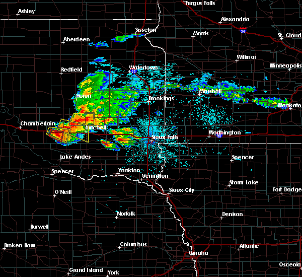 At 1248 am cdt, a severe thunderstorm was located near plankinton, moving southeast at 25 mph (radar indicated). Hazards include 70 mph wind gusts and half dollar size hail. Hail damage to vehicles is expected. expect considerable tree damage. wind damage is also likely to mobile homes, roofs, and outbuildings. This severe storm will be near, stickney around 100 am cdt. At 1248 am cdt, a severe thunderstorm was located near plankinton, moving southeast at 25 mph (radar indicated). Hazards include 70 mph wind gusts and half dollar size hail. Hail damage to vehicles is expected. expect considerable tree damage. wind damage is also likely to mobile homes, roofs, and outbuildings. This severe storm will be near, stickney around 100 am cdt.
|
| 8/5/2018 12:36 AM CDT |
 At 1236 am cdt, a severe thunderstorm capable of producing a tornado was located over white lake, or 10 miles east of kimball, moving southeast at 30 mph (radar indicated rotation). Hazards include tornado. Flying debris will be dangerous to those caught without shelter. mobile homes will be damaged or destroyed. damage to roofs, windows, and vehicles will occur. tree damage is likely. This dangerous storm will be near, plankinton around 100 am cdt. At 1236 am cdt, a severe thunderstorm capable of producing a tornado was located over white lake, or 10 miles east of kimball, moving southeast at 30 mph (radar indicated rotation). Hazards include tornado. Flying debris will be dangerous to those caught without shelter. mobile homes will be damaged or destroyed. damage to roofs, windows, and vehicles will occur. tree damage is likely. This dangerous storm will be near, plankinton around 100 am cdt.
|
| 8/5/2018 12:25 AM CDT |
 At 1225 am cdt, a severe thunderstorm was located over white lake, or 10 miles west of plankinton, moving southeast at 50 mph (radar indicated). Hazards include 70 mph wind gusts and half dollar size hail. Hail damage to vehicles is expected. expect considerable tree damage. wind damage is also likely to mobile homes, roofs, and outbuildings. this severe thunderstorm will be near, plankinton around 1235 am cdt. Stickney around 1245 am cdt. At 1225 am cdt, a severe thunderstorm was located over white lake, or 10 miles west of plankinton, moving southeast at 50 mph (radar indicated). Hazards include 70 mph wind gusts and half dollar size hail. Hail damage to vehicles is expected. expect considerable tree damage. wind damage is also likely to mobile homes, roofs, and outbuildings. this severe thunderstorm will be near, plankinton around 1235 am cdt. Stickney around 1245 am cdt.
|
| 6/27/2018 8:57 AM CDT |
 At 856 am cdt, a severe thunderstorm was located near grass ranch colony, or 9 miles south of kimball, moving east at 35 mph (radar indicated). Hazards include 60 mph wind gusts and quarter size hail. Hail damage to vehicles is expected. expect wind damage to roofs, siding, and trees. This severe storm will be near, grass ranch colony around 905 am cdt. At 856 am cdt, a severe thunderstorm was located near grass ranch colony, or 9 miles south of kimball, moving east at 35 mph (radar indicated). Hazards include 60 mph wind gusts and quarter size hail. Hail damage to vehicles is expected. expect wind damage to roofs, siding, and trees. This severe storm will be near, grass ranch colony around 905 am cdt.
|
| 6/27/2018 8:42 AM CDT |
 The national weather service in sioux falls has issued a * severe thunderstorm warning for. southwestern aurora county in south central south dakota. northwestern charles mix county in south central south dakota. brule county in south central south dakota. Until 930 am cdt. The national weather service in sioux falls has issued a * severe thunderstorm warning for. southwestern aurora county in south central south dakota. northwestern charles mix county in south central south dakota. brule county in south central south dakota. Until 930 am cdt.
|
| 6/27/2018 6:39 AM CDT |
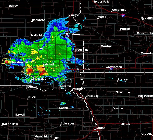 At 639 am cdt, a severe thunderstorm was located near aurora center, or 15 miles south of plankinton, moving southeast at 45 mph (radar indicated). Hazards include ping pong ball size hail and 60 mph wind gusts. People and animals outdoors will be injured. expect hail damage to roofs, siding, windows, and vehicles. expect wind damage to roofs, siding, and trees. this severe storm will be near, corsica around 650 am cdt. Armour around 700 am cdt. At 639 am cdt, a severe thunderstorm was located near aurora center, or 15 miles south of plankinton, moving southeast at 45 mph (radar indicated). Hazards include ping pong ball size hail and 60 mph wind gusts. People and animals outdoors will be injured. expect hail damage to roofs, siding, windows, and vehicles. expect wind damage to roofs, siding, and trees. this severe storm will be near, corsica around 650 am cdt. Armour around 700 am cdt.
|
| 6/27/2018 6:25 AM CDT |
 At 625 am cdt, a severe thunderstorm was located 8 miles northwest of aurora center, or 15 miles southwest of plankinton, moving southeast at 45 mph (radar indicated). Hazards include 60 mph wind gusts and half dollar size hail. Hail damage to vehicles is expected. expect wind damage to roofs, siding, and trees. this severe thunderstorm will be near, aurora center around 635 am cdt. new holland around 640 am cdt. harrison around 645 am cdt. corsica around 650 am cdt. Armour around 700 am cdt. At 625 am cdt, a severe thunderstorm was located 8 miles northwest of aurora center, or 15 miles southwest of plankinton, moving southeast at 45 mph (radar indicated). Hazards include 60 mph wind gusts and half dollar size hail. Hail damage to vehicles is expected. expect wind damage to roofs, siding, and trees. this severe thunderstorm will be near, aurora center around 635 am cdt. new holland around 640 am cdt. harrison around 645 am cdt. corsica around 650 am cdt. Armour around 700 am cdt.
|
| 6/27/2018 6:11 AM CDT |
 At 611 am cdt, a severe thunderstorm was located near grass ranch colony, or near kimball, moving southeast at 50 mph (radar indicated). Hazards include 60 mph wind gusts and half dollar size hail. Hail damage to vehicles is expected. expect wind damage to roofs, siding, and trees. this severe storm will be near, white lake around 615 am cdt. Other locations impacted by this severe thunderstorm include pukwana. At 611 am cdt, a severe thunderstorm was located near grass ranch colony, or near kimball, moving southeast at 50 mph (radar indicated). Hazards include 60 mph wind gusts and half dollar size hail. Hail damage to vehicles is expected. expect wind damage to roofs, siding, and trees. this severe storm will be near, white lake around 615 am cdt. Other locations impacted by this severe thunderstorm include pukwana.
|
| 6/27/2018 5:45 AM CDT |
 At 544 am cdt, a severe thunderstorm was located near chamberlain, moving southeast at 50 mph (radar indicated). Hazards include 60 mph wind gusts and half dollar size hail. Hail damage to vehicles is expected. expect wind damage to roofs, siding, and trees. this severe thunderstorm will be near, kimball around 605 am cdt. grass ranch colony around 610 am cdt. white lake around 615 am cdt. Other locations impacted by this severe thunderstorm include pukwana. At 544 am cdt, a severe thunderstorm was located near chamberlain, moving southeast at 50 mph (radar indicated). Hazards include 60 mph wind gusts and half dollar size hail. Hail damage to vehicles is expected. expect wind damage to roofs, siding, and trees. this severe thunderstorm will be near, kimball around 605 am cdt. grass ranch colony around 610 am cdt. white lake around 615 am cdt. Other locations impacted by this severe thunderstorm include pukwana.
|
| 6/27/2018 5:40 AM CDT |
 The severe thunderstorm warning for central aurora, southern jerauld and northeastern brule counties will expire at 545 am cdt, the storm which prompted the warning has weakened below severe limits, and no longer poses an immediate threat to life or property. therefore, the warning will be allowed to expire. however small hail is still possible with this thunderstorm. a severe thunderstorm watch remains in effect until 1000 am cdt for south central and central south dakota. The severe thunderstorm warning for central aurora, southern jerauld and northeastern brule counties will expire at 545 am cdt, the storm which prompted the warning has weakened below severe limits, and no longer poses an immediate threat to life or property. therefore, the warning will be allowed to expire. however small hail is still possible with this thunderstorm. a severe thunderstorm watch remains in effect until 1000 am cdt for south central and central south dakota.
|
| 6/27/2018 5:25 AM CDT |
 At 525 am cdt, a severe thunderstorm was located 10 miles northeast of kimball, moving southeast at 60 mph (radar indicated). Hazards include ping pong ball size hail and 60 mph wind gusts. People and animals outdoors will be injured. expect hail damage to roofs, siding, windows, and vehicles. expect wind damage to roofs, siding, and trees. this severe storm will be near, white lake around 535 am cdt. plankinton around 545 am cdt. Other locations impacted by this severe thunderstorm include pukwana. At 525 am cdt, a severe thunderstorm was located 10 miles northeast of kimball, moving southeast at 60 mph (radar indicated). Hazards include ping pong ball size hail and 60 mph wind gusts. People and animals outdoors will be injured. expect hail damage to roofs, siding, windows, and vehicles. expect wind damage to roofs, siding, and trees. this severe storm will be near, white lake around 535 am cdt. plankinton around 545 am cdt. Other locations impacted by this severe thunderstorm include pukwana.
|
| 6/27/2018 5:10 AM CDT |
 The national weather service in sioux falls has issued a * severe thunderstorm warning for. central aurora county in south central south dakota. southern jerauld county in central south dakota. northeastern brule county in south central south dakota. Until 545 am cdt. The national weather service in sioux falls has issued a * severe thunderstorm warning for. central aurora county in south central south dakota. southern jerauld county in central south dakota. northeastern brule county in south central south dakota. Until 545 am cdt.
|
| 6/8/2018 10:37 PM CDT |
 At 1037 pm cdt, severe thunderstorms were located along a line extending from 8 miles northeast of gann valley to 9 miles southwest of wessington springs to near white lake to 7 miles northwest of aurora center, moving east at 30 mph (radar indicated). Hazards include 60 mph wind gusts. Expect damage to roofs, siding, and trees. these severe storms will be near, plankinton and wessington springs around 1050 pm cdt. Lane and storla around 1100 pm cdt. At 1037 pm cdt, severe thunderstorms were located along a line extending from 8 miles northeast of gann valley to 9 miles southwest of wessington springs to near white lake to 7 miles northwest of aurora center, moving east at 30 mph (radar indicated). Hazards include 60 mph wind gusts. Expect damage to roofs, siding, and trees. these severe storms will be near, plankinton and wessington springs around 1050 pm cdt. Lane and storla around 1100 pm cdt.
|
| 6/8/2018 10:09 PM CDT |
 The national weather service in sioux falls has issued a * severe thunderstorm warning for. aurora county in south central south dakota. jerauld county in central south dakota. eastern brule county in south central south dakota. Until 1100 pm cdt. The national weather service in sioux falls has issued a * severe thunderstorm warning for. aurora county in south central south dakota. jerauld county in central south dakota. eastern brule county in south central south dakota. Until 1100 pm cdt.
|
| 6/1/2018 7:04 PM CDT |
 At 703 pm cdt, severe thunderstorms were located along a line extending from 6 miles northeast of white lake to near geddes, moving east at 45 mph. these are very dangerous storms (trained weather spotters. spotters have reported trees down in gregory and flattened crops near academy with winds estimated near 70 to 80 mph). Hazards include 80 mph wind gusts and penny size hail. severe winds will precede the rain. Flying debris will be dangerous to those caught without shelter. mobile homes will be heavily damaged. expect considerable damage to roofs, windows, and vehicles. extensive tree damage and power outages are likely. these severe storms will be near, armour and corsica around 720 pm cdt. storla around 725 pm cdt. Other locations impacted by these severe thunderstorms include fairfax and pukwana. At 703 pm cdt, severe thunderstorms were located along a line extending from 6 miles northeast of white lake to near geddes, moving east at 45 mph. these are very dangerous storms (trained weather spotters. spotters have reported trees down in gregory and flattened crops near academy with winds estimated near 70 to 80 mph). Hazards include 80 mph wind gusts and penny size hail. severe winds will precede the rain. Flying debris will be dangerous to those caught without shelter. mobile homes will be heavily damaged. expect considerable damage to roofs, windows, and vehicles. extensive tree damage and power outages are likely. these severe storms will be near, armour and corsica around 720 pm cdt. storla around 725 pm cdt. Other locations impacted by these severe thunderstorms include fairfax and pukwana.
|
| 6/1/2018 6:47 PM CDT |
 At 645 pm cdt, severe thunderstorms were located along a line extending from near kimball to 9 miles west of geddes, moving east at 45 mph (radar indicated). Hazards include 60 mph wind gusts and penny size hail. Expect damage to roofs, siding, and trees. severe thunderstorms will be near, white lake and geddes around 655 pm cdt. new holland around 710 pm cdt. harrison around 715 pm cdt. armour and corsica around 720 pm cdt. storla around 725 pm cdt. Other locations impacted by these severe thunderstorms include fairfax and pukwana. At 645 pm cdt, severe thunderstorms were located along a line extending from near kimball to 9 miles west of geddes, moving east at 45 mph (radar indicated). Hazards include 60 mph wind gusts and penny size hail. Expect damage to roofs, siding, and trees. severe thunderstorms will be near, white lake and geddes around 655 pm cdt. new holland around 710 pm cdt. harrison around 715 pm cdt. armour and corsica around 720 pm cdt. storla around 725 pm cdt. Other locations impacted by these severe thunderstorms include fairfax and pukwana.
|
| 9/19/2017 9:43 PM CDT |
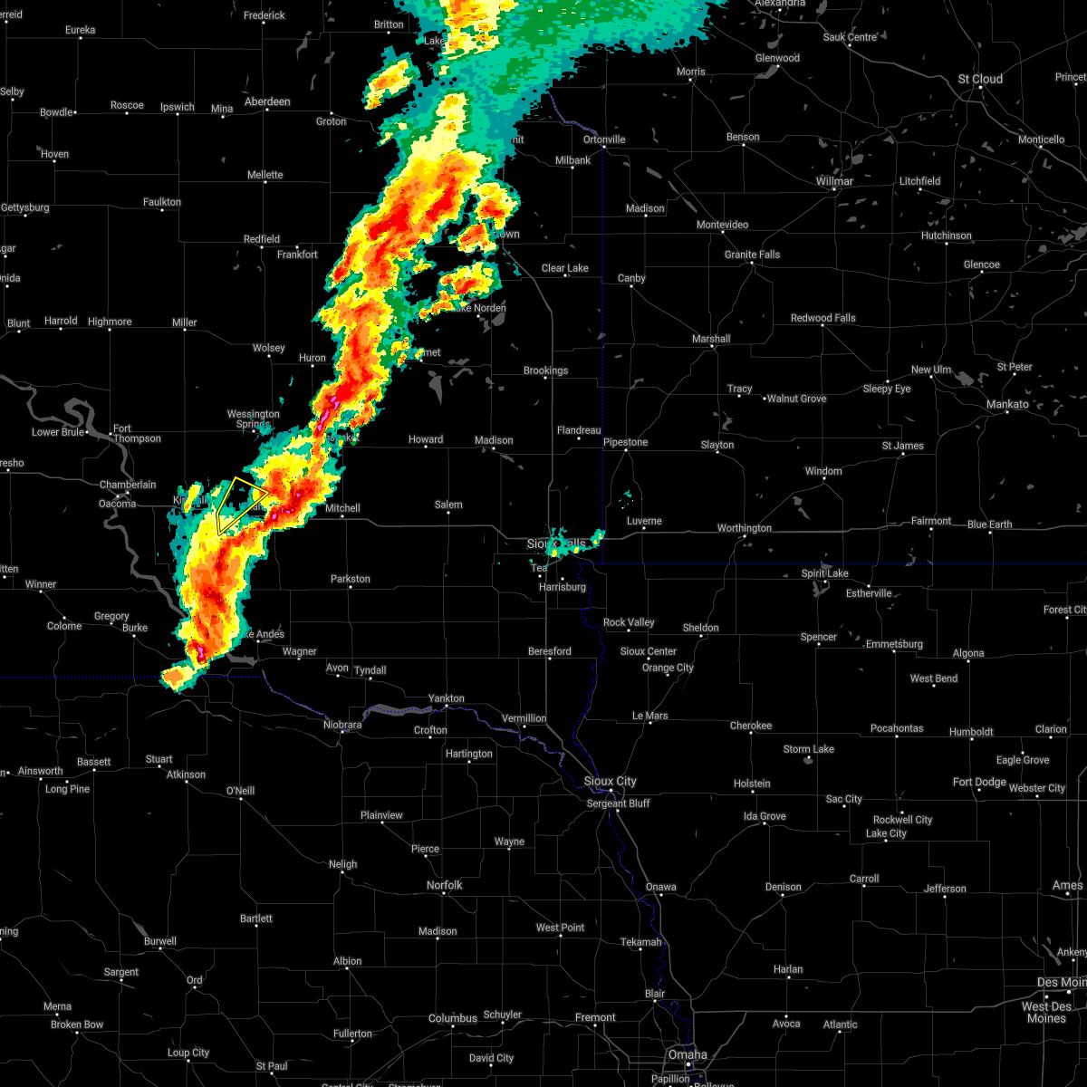 The severe thunderstorm warning for northwestern aurora county will expire at 945 pm cdt, the storm which prompted the warning has moved out of the area. therefore the warning will be allowed to expire. a tornado watch remains in effect until midnight cdt for south central south dakota. to report severe weather, contact your nearest law enforcement agency. they will relay your report to the national weather service sioux falls. The severe thunderstorm warning for northwestern aurora county will expire at 945 pm cdt, the storm which prompted the warning has moved out of the area. therefore the warning will be allowed to expire. a tornado watch remains in effect until midnight cdt for south central south dakota. to report severe weather, contact your nearest law enforcement agency. they will relay your report to the national weather service sioux falls.
|
| 9/19/2017 9:42 PM CDT |
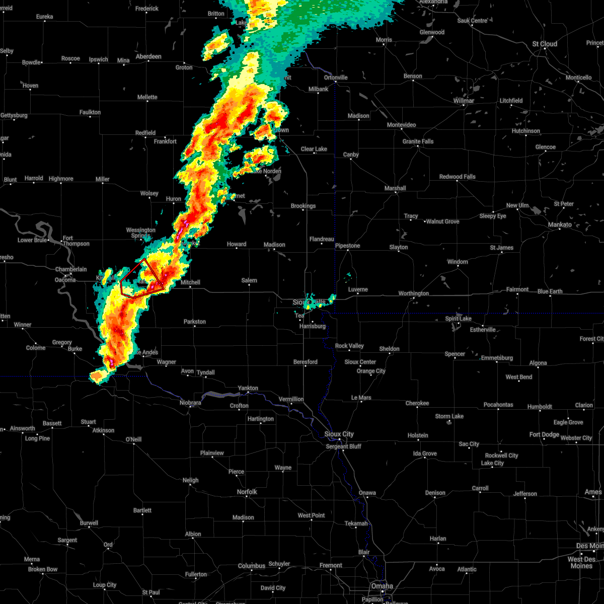 The tornado warning for central aurora county will expire at 945 pm cdt. the tornado threat has diminished and the tornado warning has been cancelled. however, large hail and damaging winds remain likely and a severe thunderstorm warning remains in effect for the area. A tornado watch remains in effect until midnight cdt for south. The tornado warning for central aurora county will expire at 945 pm cdt. the tornado threat has diminished and the tornado warning has been cancelled. however, large hail and damaging winds remain likely and a severe thunderstorm warning remains in effect for the area. A tornado watch remains in effect until midnight cdt for south.
|
| 9/19/2017 9:25 PM CDT |
 At 925 pm cdt, a severe thunderstorm capable of producing a tornado was located near white lake, or 10 miles west of plankinton, moving east at 30 mph (radar indicated rotation). Hazards include tornado and half dollar size hail. Flying debris will be dangerous to those caught without shelter. mobile homes will be damaged or destroyed. damage to roofs, windows, and vehicles will occur. tree damage is likely. This dangerous storm will be near, plankinton around 945 pm cdt. At 925 pm cdt, a severe thunderstorm capable of producing a tornado was located near white lake, or 10 miles west of plankinton, moving east at 30 mph (radar indicated rotation). Hazards include tornado and half dollar size hail. Flying debris will be dangerous to those caught without shelter. mobile homes will be damaged or destroyed. damage to roofs, windows, and vehicles will occur. tree damage is likely. This dangerous storm will be near, plankinton around 945 pm cdt.
|
| 9/19/2017 9:23 PM CDT |
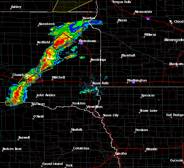 At 923 pm cdt, a severe thunderstorm was located over white lake, or 10 miles west of plankinton, moving northeast at 60 mph (radar indicated). Hazards include 60 mph wind gusts and half dollar size hail. Hail damage to vehicles is expected. expect wind damage to roofs, siding, and trees. this severe thunderstorm will remain over mainly rural areas of northwestern aurora county. A tornado watch remains in effect until midnight cdt for south central south dakota. At 923 pm cdt, a severe thunderstorm was located over white lake, or 10 miles west of plankinton, moving northeast at 60 mph (radar indicated). Hazards include 60 mph wind gusts and half dollar size hail. Hail damage to vehicles is expected. expect wind damage to roofs, siding, and trees. this severe thunderstorm will remain over mainly rural areas of northwestern aurora county. A tornado watch remains in effect until midnight cdt for south central south dakota.
|
| 9/19/2017 9:20 PM CDT | Ping Pong Ball sized hail reported 0.2 miles SW of White Lake, SD |
| 9/19/2017 9:17 PM CDT |
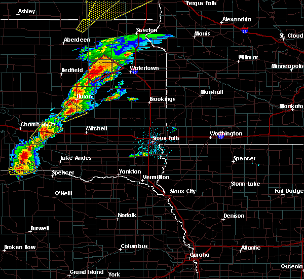 At 917 pm cdt, a severe thunderstorm capable of producing a tornado was located near white lake, or 11 miles southeast of kimball, moving northeast at 35 mph (radar indicated rotation). Hazards include tornado and half dollar size hail. Flying debris will be dangerous to those caught without shelter. mobile homes will be damaged or destroyed. damage to roofs, windows, and vehicles will occur. tree damage is likely. this dangerous storm will be near, white lake around 925 pm cdt. Plankinton around 940 pm cdt. At 917 pm cdt, a severe thunderstorm capable of producing a tornado was located near white lake, or 11 miles southeast of kimball, moving northeast at 35 mph (radar indicated rotation). Hazards include tornado and half dollar size hail. Flying debris will be dangerous to those caught without shelter. mobile homes will be damaged or destroyed. damage to roofs, windows, and vehicles will occur. tree damage is likely. this dangerous storm will be near, white lake around 925 pm cdt. Plankinton around 940 pm cdt.
|
| 9/19/2017 9:01 PM CDT |
 At 901 pm cdt, a severe thunderstorm was located 7 miles west of grass ranch colony, or 8 miles southwest of kimball, moving northeast at 35 mph (radar indicated). Hazards include two inch hail and 60 mph wind gusts. People and animals outdoors will be injured. expect hail damage to roofs, siding, windows, and vehicles. expect wind damage to roofs, siding, and trees. this severe storm will be near, grass ranch colony around 910 pm cdt. kimball around 915 pm cdt. white lake around 930 pm cdt. A tornado watch remains in effect until midnight cdt for south central and central south dakota. At 901 pm cdt, a severe thunderstorm was located 7 miles west of grass ranch colony, or 8 miles southwest of kimball, moving northeast at 35 mph (radar indicated). Hazards include two inch hail and 60 mph wind gusts. People and animals outdoors will be injured. expect hail damage to roofs, siding, windows, and vehicles. expect wind damage to roofs, siding, and trees. this severe storm will be near, grass ranch colony around 910 pm cdt. kimball around 915 pm cdt. white lake around 930 pm cdt. A tornado watch remains in effect until midnight cdt for south central and central south dakota.
|
| 9/19/2017 8:53 PM CDT |
 At 853 pm cdt, a severe thunderstorm was located 11 miles west of grass ranch colony, or 12 miles southwest of kimball, moving northeast at 35 mph (radar indicated). Hazards include 60 mph wind gusts and half dollar size hail. Hail damage to vehicles is expected. expect wind damage to roofs, siding, and trees. this severe thunderstorm will be near, grass ranch colony around 910 pm cdt. kimball around 920 pm cdt. white lake around 930 pm cdt. A tornado watch remains in effect until midnight cdt for south central and central south dakota. At 853 pm cdt, a severe thunderstorm was located 11 miles west of grass ranch colony, or 12 miles southwest of kimball, moving northeast at 35 mph (radar indicated). Hazards include 60 mph wind gusts and half dollar size hail. Hail damage to vehicles is expected. expect wind damage to roofs, siding, and trees. this severe thunderstorm will be near, grass ranch colony around 910 pm cdt. kimball around 920 pm cdt. white lake around 930 pm cdt. A tornado watch remains in effect until midnight cdt for south central and central south dakota.
|
| 8/12/2017 4:39 PM CDT |
 The severe thunderstorm warning for west central aurora and southeastern brule counties will expire at 445 pm cdt, the storm which prompted the warning has weakened below severe limits, and no longer poses an immediate threat to life or property. therefore the warning will be allowed to expire. however small hail and heavy rain are still possible with this thunderstorm. a severe thunderstorm watch remains in effect until midnight cdt for south central south dakota. The severe thunderstorm warning for west central aurora and southeastern brule counties will expire at 445 pm cdt, the storm which prompted the warning has weakened below severe limits, and no longer poses an immediate threat to life or property. therefore the warning will be allowed to expire. however small hail and heavy rain are still possible with this thunderstorm. a severe thunderstorm watch remains in effect until midnight cdt for south central south dakota.
|
| 8/12/2017 4:19 PM CDT |
 At 418 pm cdt, a severe thunderstorm was located 8 miles southwest of kimball, moving east at 10 mph (radar indicated). Hazards include 60 mph wind gusts and quarter size hail. Hail damage to vehicles is expected. expect wind damage to roofs, siding, and trees. This severe storm will be near, kimball and grass ranch colony around 445 pm cdt. At 418 pm cdt, a severe thunderstorm was located 8 miles southwest of kimball, moving east at 10 mph (radar indicated). Hazards include 60 mph wind gusts and quarter size hail. Hail damage to vehicles is expected. expect wind damage to roofs, siding, and trees. This severe storm will be near, kimball and grass ranch colony around 445 pm cdt.
|
| 8/12/2017 4:05 PM CDT |
 At 405 pm cdt, a severe thunderstorm was located 9 miles southwest of kimball, moving northeast at 25 mph (radar indicated). Hazards include ping pong ball size hail and 60 mph wind gusts. People and animals outdoors will be injured. expect hail damage to roofs, siding, windows, and vehicles. expect wind damage to roofs, siding, and trees. this severe thunderstorm will be near, grass ranch colony around 430 pm cdt. kimball around 435 pm cdt. white lake around 445 pm cdt. Other locations impacted by this severe thunderstorm include pukwana. At 405 pm cdt, a severe thunderstorm was located 9 miles southwest of kimball, moving northeast at 25 mph (radar indicated). Hazards include ping pong ball size hail and 60 mph wind gusts. People and animals outdoors will be injured. expect hail damage to roofs, siding, windows, and vehicles. expect wind damage to roofs, siding, and trees. this severe thunderstorm will be near, grass ranch colony around 430 pm cdt. kimball around 435 pm cdt. white lake around 445 pm cdt. Other locations impacted by this severe thunderstorm include pukwana.
|
| 7/25/2017 5:52 PM CDT |
 The severe thunderstorm warning for northwestern davison, southwestern sanborn and central aurora counties will expire at 600 pm cdt, the storm which prompted the warning has weakened below severe limits, and no longer poses an immediate threat to life or property. therefore the warning will be allowed to expire. however small hail, gusty winds, and heavy rain are still possible with this thunderstorm. a severe thunderstorm watch remains in effect until 1100 pm cdt for south central, southeastern and east central south dakota. The severe thunderstorm warning for northwestern davison, southwestern sanborn and central aurora counties will expire at 600 pm cdt, the storm which prompted the warning has weakened below severe limits, and no longer poses an immediate threat to life or property. therefore the warning will be allowed to expire. however small hail, gusty winds, and heavy rain are still possible with this thunderstorm. a severe thunderstorm watch remains in effect until 1100 pm cdt for south central, southeastern and east central south dakota.
|
| 7/25/2017 5:40 PM CDT |
 At 540 pm cdt, a severe thunderstorm was located near plankinton, moving east at 35 mph (radar indicated). Hazards include 60 mph wind gusts and half dollar size hail. Hail damage to vehicles is expected. expect wind damage to roofs, siding, and trees. This severe storm will be near, mount vernon around 555 pm cdt. At 540 pm cdt, a severe thunderstorm was located near plankinton, moving east at 35 mph (radar indicated). Hazards include 60 mph wind gusts and half dollar size hail. Hail damage to vehicles is expected. expect wind damage to roofs, siding, and trees. This severe storm will be near, mount vernon around 555 pm cdt.
|
| 7/25/2017 5:21 PM CDT |
 At 520 pm cdt, a severe thunderstorm was located near kimball, moving east at 30 mph (radar indicated). Hazards include ping pong ball size hail and 60 mph wind gusts. People and animals outdoors will be injured. expect hail damage to roofs, siding, windows, and vehicles. expect wind damage to roofs, siding, and trees. this severe thunderstorm will be near, white lake around 535 pm cdt. Storla around 600 pm cdt. At 520 pm cdt, a severe thunderstorm was located near kimball, moving east at 30 mph (radar indicated). Hazards include ping pong ball size hail and 60 mph wind gusts. People and animals outdoors will be injured. expect hail damage to roofs, siding, windows, and vehicles. expect wind damage to roofs, siding, and trees. this severe thunderstorm will be near, white lake around 535 pm cdt. Storla around 600 pm cdt.
|
| 7/25/2017 4:34 PM CDT |
 At 433 pm cdt, a severe thunderstorm was located near plankinton, moving northeast at 35 mph (radar indicated). Hazards include ping pong ball size hail and 60 mph wind gusts. People and animals outdoors will be injured. expect hail damage to roofs, siding, windows, and vehicles. expect wind damage to roofs, siding, and trees. this severe thunderstorm will be near, mount vernon and storla around 445 pm cdt. letcher and loomis around 500 pm cdt. Artesian around 515 pm cdt. At 433 pm cdt, a severe thunderstorm was located near plankinton, moving northeast at 35 mph (radar indicated). Hazards include ping pong ball size hail and 60 mph wind gusts. People and animals outdoors will be injured. expect hail damage to roofs, siding, windows, and vehicles. expect wind damage to roofs, siding, and trees. this severe thunderstorm will be near, mount vernon and storla around 445 pm cdt. letcher and loomis around 500 pm cdt. Artesian around 515 pm cdt.
|
| 7/5/2017 10:57 PM CDT |
 At 1031 pm cdt, severe thunderstorms were located along a line extending from 12 miles north of white lake to iona, moving southeast at 45 mph (radar indicated). Hazards include 60 mph wind gusts and nickel size hail. Expect damage to roofs, siding, and trees. these severe storms will be near, white lake around 1045 pm cdt. other locations impacted by these severe thunderstorms include pukwana. At 1025 pm, the chamberlain airport was gusting to 52 mph. At 1031 pm cdt, severe thunderstorms were located along a line extending from 12 miles north of white lake to iona, moving southeast at 45 mph (radar indicated). Hazards include 60 mph wind gusts and nickel size hail. Expect damage to roofs, siding, and trees. these severe storms will be near, white lake around 1045 pm cdt. other locations impacted by these severe thunderstorms include pukwana. At 1025 pm, the chamberlain airport was gusting to 52 mph.
|
| 7/5/2017 10:55 PM CDT | Via sdsu mesonet sit in aurora county SD, 1.1 miles W of White Lake, SD |
| 7/5/2017 10:33 PM CDT |
 At 1031 pm cdt, severe thunderstorms were located along a line extending from 12 miles north of white lake to iona, moving southeast at 45 mph (radar indicated). Hazards include 60 mph wind gusts and nickel size hail. Expect damage to roofs, siding, and trees. these severe storms will be near, white lake around 1045 pm cdt. other locations impacted by these severe thunderstorms include pukwana. At 1025 pm, the chamberlain airport was gusting to 52 mph. At 1031 pm cdt, severe thunderstorms were located along a line extending from 12 miles north of white lake to iona, moving southeast at 45 mph (radar indicated). Hazards include 60 mph wind gusts and nickel size hail. Expect damage to roofs, siding, and trees. these severe storms will be near, white lake around 1045 pm cdt. other locations impacted by these severe thunderstorms include pukwana. At 1025 pm, the chamberlain airport was gusting to 52 mph.
|
| 7/5/2017 10:16 PM CDT |
 At 1016 pm cdt, severe thunderstorms were located along a line extending from near gann valley to near hamill, moving southeast at 45 mph (radar indicated). Hazards include 60 mph wind gusts and nickel size hail. Expect damage to roofs, siding, and trees. severe thunderstorms will be near, white lake around 1045 pm cdt. Other locations impacted by these severe thunderstorms include pukwana. At 1016 pm cdt, severe thunderstorms were located along a line extending from near gann valley to near hamill, moving southeast at 45 mph (radar indicated). Hazards include 60 mph wind gusts and nickel size hail. Expect damage to roofs, siding, and trees. severe thunderstorms will be near, white lake around 1045 pm cdt. Other locations impacted by these severe thunderstorms include pukwana.
|
| 6/21/2017 3:45 AM CDT |
 At 344 am cdt, severe thunderstorms were located along a line extending from 6 miles north of gann valley to 9 miles east of shelby to 8 miles west of kimball, moving east at 45 mph (radar indicated). Hazards include 60 mph wind gusts. Expect damage to roofs, siding, and trees. These severe thunderstorms will remain over mainly rural areas of northwestern aurora, western jerauld and central brule counties, including the following locations: pukwana. At 344 am cdt, severe thunderstorms were located along a line extending from 6 miles north of gann valley to 9 miles east of shelby to 8 miles west of kimball, moving east at 45 mph (radar indicated). Hazards include 60 mph wind gusts. Expect damage to roofs, siding, and trees. These severe thunderstorms will remain over mainly rural areas of northwestern aurora, western jerauld and central brule counties, including the following locations: pukwana.
|
| 6/21/2017 3:22 AM CDT |
 At 322 am cdt, severe thunderstorms were located along a line extending from lees corner to near chamberlain to near lake francis case, moving east at 45 mph (radar indicated). Hazards include 60 mph wind gusts. Expect damage to roofs, siding, and trees. severe thunderstorms will be near, kimball around 355 am cdt. Other locations impacted by these severe thunderstorms include pukwana. At 322 am cdt, severe thunderstorms were located along a line extending from lees corner to near chamberlain to near lake francis case, moving east at 45 mph (radar indicated). Hazards include 60 mph wind gusts. Expect damage to roofs, siding, and trees. severe thunderstorms will be near, kimball around 355 am cdt. Other locations impacted by these severe thunderstorms include pukwana.
|
| 6/13/2017 5:28 PM CDT |
 At 528 pm cdt, a severe thunderstorm was located near new holland, or 20 miles southwest of plankinton, moving northeast at 50 mph. this is a very dangerous storm (law enforcement). Hazards include 80 mph wind gusts and two inch hail. Flying debris will be dangerous to those caught without shelter. mobile homes will be heavily damaged. expect considerable damage to roofs, windows, and vehicles. extensive tree damage and power outages are likely. this severe storm will be near, harrison and storla around 535 pm cdt. stickney around 545 pm cdt. A tornado watch remains in effect until 1000 pm cdt for south central and southeastern south dakota. At 528 pm cdt, a severe thunderstorm was located near new holland, or 20 miles southwest of plankinton, moving northeast at 50 mph. this is a very dangerous storm (law enforcement). Hazards include 80 mph wind gusts and two inch hail. Flying debris will be dangerous to those caught without shelter. mobile homes will be heavily damaged. expect considerable damage to roofs, windows, and vehicles. extensive tree damage and power outages are likely. this severe storm will be near, harrison and storla around 535 pm cdt. stickney around 545 pm cdt. A tornado watch remains in effect until 1000 pm cdt for south central and southeastern south dakota.
|
| 6/13/2017 5:22 PM CDT |
 The tornado warning for northwestern aurora and east central brule counties will expire at 530 pm cdt, the storm which prompted the warning has moved out of the area. therefore the warning will be allowed to expire. a tornado watch remains in effect until 1000 pm cdt for south central south dakota. to report severe weather, contact your nearest law enforcement agency. they will relay your report to the national weather service sioux falls. The tornado warning for northwestern aurora and east central brule counties will expire at 530 pm cdt, the storm which prompted the warning has moved out of the area. therefore the warning will be allowed to expire. a tornado watch remains in effect until 1000 pm cdt for south central south dakota. to report severe weather, contact your nearest law enforcement agency. they will relay your report to the national weather service sioux falls.
|
| 6/13/2017 5:20 PM CDT |
 At 519 pm cdt, a severe thunderstorm was located over platte, or 21 miles northwest of lake andes, moving northeast at 65 mph (law enforcement. at 5:18 pm cdt, law enforcement reported ping pong ball size hail in platte). Hazards include two inch hail and 70 mph wind gusts. People and animals outdoors will be injured. expect hail damage to roofs, siding, windows, and vehicles. expect considerable tree damage. wind damage is also likely to mobile homes, roofs, and outbuildings. this severe thunderstorm will be near, new holland around 525 pm cdt. storla around 535 pm cdt. stickney around 540 pm cdt. plankinton around 545 pm cdt. A tornado watch remains in effect until 1000 pm cdt for south central and southeastern south dakota. At 519 pm cdt, a severe thunderstorm was located over platte, or 21 miles northwest of lake andes, moving northeast at 65 mph (law enforcement. at 5:18 pm cdt, law enforcement reported ping pong ball size hail in platte). Hazards include two inch hail and 70 mph wind gusts. People and animals outdoors will be injured. expect hail damage to roofs, siding, windows, and vehicles. expect considerable tree damage. wind damage is also likely to mobile homes, roofs, and outbuildings. this severe thunderstorm will be near, new holland around 525 pm cdt. storla around 535 pm cdt. stickney around 540 pm cdt. plankinton around 545 pm cdt. A tornado watch remains in effect until 1000 pm cdt for south central and southeastern south dakota.
|
| 6/13/2017 5:11 PM CDT |
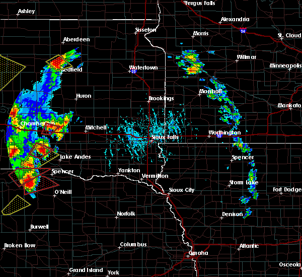 At 511 pm cdt, a confirmed tornado was located over white lake, or 10 miles east of kimball, moving north at 35 mph. at 507 pm local fire department reported a very brief tornado touchdown near white lake (law enforcement confirmed tornado). Hazards include damaging tornado and two inch hail. Flying debris will be dangerous to those caught without shelter. mobile homes will be damaged or destroyed. damage to roofs, windows, and vehicles will occur. tree damage is likely. This tornadic thunderstorm will remain over mainly rural areas of northwestern aurora and east central brule counties. At 511 pm cdt, a confirmed tornado was located over white lake, or 10 miles east of kimball, moving north at 35 mph. at 507 pm local fire department reported a very brief tornado touchdown near white lake (law enforcement confirmed tornado). Hazards include damaging tornado and two inch hail. Flying debris will be dangerous to those caught without shelter. mobile homes will be damaged or destroyed. damage to roofs, windows, and vehicles will occur. tree damage is likely. This tornadic thunderstorm will remain over mainly rural areas of northwestern aurora and east central brule counties.
|
| 6/13/2017 5:06 PM CDT |
 At 506 pm cdt, a severe thunderstorm capable of producing a tornado was located near grass ranch colony, or 9 miles southeast of kimball, moving north at 35 mph. rotation within this storm has weakened, but a tornado remains possible (radar indicated rotation). Hazards include tornado and two inch hail. Flying debris will be dangerous to those caught without shelter. mobile homes will be damaged or destroyed. damage to roofs, windows, and vehicles will occur. tree damage is likely. This dangerous storm will be near, white lake around 520 pm cdt. At 506 pm cdt, a severe thunderstorm capable of producing a tornado was located near grass ranch colony, or 9 miles southeast of kimball, moving north at 35 mph. rotation within this storm has weakened, but a tornado remains possible (radar indicated rotation). Hazards include tornado and two inch hail. Flying debris will be dangerous to those caught without shelter. mobile homes will be damaged or destroyed. damage to roofs, windows, and vehicles will occur. tree damage is likely. This dangerous storm will be near, white lake around 520 pm cdt.
|
| 6/13/2017 4:54 PM CDT |
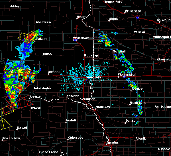 At 454 pm cdt, a confirmed tornado was located near grass ranch colony, or 13 miles southeast of kimball, moving north at 35 mph (emergency management confirmed tornado). Hazards include damaging tornado. Flying debris will be dangerous to those caught without shelter. mobile homes will be damaged or destroyed. damage to roofs, windows, and vehicles will occur. tree damage is likely. the tornado will be near, grass ranch colony around 505 pm cdt. White lake around 520 pm cdt. At 454 pm cdt, a confirmed tornado was located near grass ranch colony, or 13 miles southeast of kimball, moving north at 35 mph (emergency management confirmed tornado). Hazards include damaging tornado. Flying debris will be dangerous to those caught without shelter. mobile homes will be damaged or destroyed. damage to roofs, windows, and vehicles will occur. tree damage is likely. the tornado will be near, grass ranch colony around 505 pm cdt. White lake around 520 pm cdt.
|
| 6/13/2017 4:44 PM CDT |
 At 444 pm cdt, a severe thunderstorm was located near grass ranch colony, or 10 miles south of kimball, moving northeast at 40 mph (radar indicated). Hazards include two inch hail and 60 mph wind gusts. People and animals outdoors will be injured. expect hail damage to roofs, siding, windows, and vehicles. expect wind damage to roofs, siding, and trees. this severe storm will be near, grass ranch colony around 450 pm cdt. kimball and white lake around 500 pm cdt. A tornado watch remains in effect until 1000 pm cdt for south central south dakota. At 444 pm cdt, a severe thunderstorm was located near grass ranch colony, or 10 miles south of kimball, moving northeast at 40 mph (radar indicated). Hazards include two inch hail and 60 mph wind gusts. People and animals outdoors will be injured. expect hail damage to roofs, siding, windows, and vehicles. expect wind damage to roofs, siding, and trees. this severe storm will be near, grass ranch colony around 450 pm cdt. kimball and white lake around 500 pm cdt. A tornado watch remains in effect until 1000 pm cdt for south central south dakota.
|
| 6/13/2017 4:33 PM CDT |
 At 433 pm cdt, a severe thunderstorm was located 10 miles southwest of grass ranch colony, or 15 miles south of kimball, moving northeast at 45 mph (radar indicated). Hazards include two inch hail and 60 mph wind gusts. People and animals outdoors will be injured. expect hail damage to roofs, siding, windows, and vehicles. expect wind damage to roofs, siding, and trees. this severe storm will be near, grass ranch colony around 445 pm cdt. kimball around 455 pm cdt. white lake around 500 pm cdt. A tornado watch remains in effect until 1000 pm cdt for south central south dakota. At 433 pm cdt, a severe thunderstorm was located 10 miles southwest of grass ranch colony, or 15 miles south of kimball, moving northeast at 45 mph (radar indicated). Hazards include two inch hail and 60 mph wind gusts. People and animals outdoors will be injured. expect hail damage to roofs, siding, windows, and vehicles. expect wind damage to roofs, siding, and trees. this severe storm will be near, grass ranch colony around 445 pm cdt. kimball around 455 pm cdt. white lake around 500 pm cdt. A tornado watch remains in effect until 1000 pm cdt for south central south dakota.
|
| 6/13/2017 4:25 PM CDT |
 At 425 pm cdt, a severe thunderstorm was located 11 miles northwest of platte, or 19 miles south of kimball, moving north at 40 mph (radar indicated). Hazards include two inch hail and 60 mph wind gusts. People and animals outdoors will be injured. expect hail damage to roofs, siding, windows, and vehicles. expect wind damage to roofs, siding, and trees. this severe thunderstorm will be near, grass ranch colony around 450 pm cdt. kimball around 455 pm cdt. white lake around 500 pm cdt. A tornado watch remains in effect until 1000 pm cdt for south central south dakota. At 425 pm cdt, a severe thunderstorm was located 11 miles northwest of platte, or 19 miles south of kimball, moving north at 40 mph (radar indicated). Hazards include two inch hail and 60 mph wind gusts. People and animals outdoors will be injured. expect hail damage to roofs, siding, windows, and vehicles. expect wind damage to roofs, siding, and trees. this severe thunderstorm will be near, grass ranch colony around 450 pm cdt. kimball around 455 pm cdt. white lake around 500 pm cdt. A tornado watch remains in effect until 1000 pm cdt for south central south dakota.
|
| 8/14/2016 11:53 PM CDT |
 The severe thunderstorm warning for western sanborn, northern aurora, beadle, northern brule and jerauld counties will expire at midnight cdt, the storms which prompted the warning have weakened below severe limits, and no longer pose an immediate threat to life or property. therefore, the warning will be allowed to expire. however gusty winds are still possible with these thunderstorms. a severe thunderstorm watch remains in effect until 100 am cdt for south central and central south dakota. The severe thunderstorm warning for western sanborn, northern aurora, beadle, northern brule and jerauld counties will expire at midnight cdt, the storms which prompted the warning have weakened below severe limits, and no longer pose an immediate threat to life or property. therefore, the warning will be allowed to expire. however gusty winds are still possible with these thunderstorms. a severe thunderstorm watch remains in effect until 100 am cdt for south central and central south dakota.
|
| 8/14/2016 11:39 PM CDT |
 At 1139 pm cdt, severe thunderstorms were located along a line extending from near tulare to 8 miles northeast of gann valley to 6 miles southeast of chamberlain, moving east at 60 mph (radar indicated). Hazards include 60 mph wind gusts. Expect damage to roofs. siding. and trees. these severe storms will be near, hitchcock around 1145 pm cdt. wessington springs around 1155 pm cdt. woonsocket, white lake and lane around 1200 am cdt. Other locations impacted by these severe thunderstorms include broadland and pukwana. At 1139 pm cdt, severe thunderstorms were located along a line extending from near tulare to 8 miles northeast of gann valley to 6 miles southeast of chamberlain, moving east at 60 mph (radar indicated). Hazards include 60 mph wind gusts. Expect damage to roofs. siding. and trees. these severe storms will be near, hitchcock around 1145 pm cdt. wessington springs around 1155 pm cdt. woonsocket, white lake and lane around 1200 am cdt. Other locations impacted by these severe thunderstorms include broadland and pukwana.
|
| 8/14/2016 11:09 PM CDT |
 At 1108 pm cdt, severe thunderstorms were located along a line extending from cottonwood lake to 6 miles southwest of pleasant valley country church to near oacoma, moving east at 65 mph (radar indicated). Hazards include 60 mph wind gusts. Expect damage to roofs. siding. and trees. severe thunderstorms will be near, kimball and wessington springs around 1130 pm cdt. white lake, alpena and lane around 1140 pm cdt. woonsocket around 1145 pm cdt. plankinton around 1155 pm cdt. aurora center around 1200 am cdt. Other locations impacted by these severe thunderstorms include broadland and pukwana. At 1108 pm cdt, severe thunderstorms were located along a line extending from cottonwood lake to 6 miles southwest of pleasant valley country church to near oacoma, moving east at 65 mph (radar indicated). Hazards include 60 mph wind gusts. Expect damage to roofs. siding. and trees. severe thunderstorms will be near, kimball and wessington springs around 1130 pm cdt. white lake, alpena and lane around 1140 pm cdt. woonsocket around 1145 pm cdt. plankinton around 1155 pm cdt. aurora center around 1200 am cdt. Other locations impacted by these severe thunderstorms include broadland and pukwana.
|
| 5/22/2016 10:23 PM CDT |
 At 1036 pm cdt, severe thunderstorms were located along a line extending from 12 miles northeast of kimball to 7 miles north of white lake to 6 miles northwest of plankinton to 8 miles northwest of stickney to near storla, moving northeast at 40 mph (radar indicated). Hazards include 60 mph wind gusts and quarter size hail. Hail damage to vehicles is expected. expect wind damage to roofs, siding, and trees. these severe storms will be near, plankinton around 1050 pm cdt. stickney and aurora center around 1055 pm cdt. mount vernon around 1110 pm cdt. Mitchell, letcher and loomis around 1115 pm cdt. At 1036 pm cdt, severe thunderstorms were located along a line extending from 12 miles northeast of kimball to 7 miles north of white lake to 6 miles northwest of plankinton to 8 miles northwest of stickney to near storla, moving northeast at 40 mph (radar indicated). Hazards include 60 mph wind gusts and quarter size hail. Hail damage to vehicles is expected. expect wind damage to roofs, siding, and trees. these severe storms will be near, plankinton around 1050 pm cdt. stickney and aurora center around 1055 pm cdt. mount vernon around 1110 pm cdt. Mitchell, letcher and loomis around 1115 pm cdt.
|
| 5/22/2016 10:21 PM CDT | Ping Pong Ball sized hail reported 3.9 miles E of White Lake, SD |
| 5/22/2016 10:20 PM CDT | Ping Pong Ball sized hail reported 4.2 miles NNE of White Lake, SD |
| 5/22/2016 10:16 PM CDT | Quarter sized hail reported 6.1 miles N of White Lake, SD, hail was accompanied by 55 mph wind gust. |
| 5/22/2016 9:51 PM CDT |
 At 950 pm cdt, a severe thunderstorm was located 10 miles southwest of grass ranch colony, or 15 miles south of kimball, moving northeast at 50 mph (trained weather spotters. at 940 pm cdt quarter size hail was reported 15 miles east northeast of dixon). Hazards include 60 mph wind gusts and quarter size hail. Hail damage to vehicles is expected. expect wind damage to roofs, siding, and trees. this severe thunderstorm will be near, grass ranch colony around 1000 pm cdt. white lake around 1015 pm cdt. plankinton around 1025 pm cdt. Aurora center around 1030 pm cdt. At 950 pm cdt, a severe thunderstorm was located 10 miles southwest of grass ranch colony, or 15 miles south of kimball, moving northeast at 50 mph (trained weather spotters. at 940 pm cdt quarter size hail was reported 15 miles east northeast of dixon). Hazards include 60 mph wind gusts and quarter size hail. Hail damage to vehicles is expected. expect wind damage to roofs, siding, and trees. this severe thunderstorm will be near, grass ranch colony around 1000 pm cdt. white lake around 1015 pm cdt. plankinton around 1025 pm cdt. Aurora center around 1030 pm cdt.
|
| 7/28/2015 1:26 AM CDT |
 The severe thunderstorm warning for northeastern brule, jerauld, western beadle and western aurora counties will expire at 130 am cdt, the storms which prompted the warning are weakening below severe limits, and no longer pose an immediate threat to life or property. therefore the warning will be allowed to expire. a severe thunderstorm watch remains in effect until 500 am cdt for southeastern south dakota. The severe thunderstorm warning for northeastern brule, jerauld, western beadle and western aurora counties will expire at 130 am cdt, the storms which prompted the warning are weakening below severe limits, and no longer pose an immediate threat to life or property. therefore the warning will be allowed to expire. a severe thunderstorm watch remains in effect until 500 am cdt for southeastern south dakota.
|
| 7/28/2015 1:09 AM CDT |
 At 108 am cdt, severe thunderstorms were located along a line extending from near wolsey to near grass ranch colony, moving east at 35 mph (radar indicated). Hazards include 60 mph wind gusts and penny size hail. Expect damage to roofs. siding and trees. these severe storms will be near, wolsey around 115 am cdt. huron around 125 am cdt. Other locations impacted by these severe thunderstorms include broadland and pukwana. At 108 am cdt, severe thunderstorms were located along a line extending from near wolsey to near grass ranch colony, moving east at 35 mph (radar indicated). Hazards include 60 mph wind gusts and penny size hail. Expect damage to roofs. siding and trees. these severe storms will be near, wolsey around 115 am cdt. huron around 125 am cdt. Other locations impacted by these severe thunderstorms include broadland and pukwana.
|
| 7/28/2015 12:40 AM CDT |
 At 1240 am cdt, severe thunderstorms were located along a line extending from near vayland to 8 miles west of kimball, moving east at 35 mph (radar indicated). Hazards include 60 mph wind gusts and penny size hail. Expect damage to roofs. siding and trees. severe thunderstorms will be near, wessington around 1245 am cdt. grass ranch colony around 100 am cdt. wolsey around 105 am cdt. white lake around 115 am cdt. huron around 125 am cdt. Other locations impacted by these severe thunderstorms include broadland and pukwana. At 1240 am cdt, severe thunderstorms were located along a line extending from near vayland to 8 miles west of kimball, moving east at 35 mph (radar indicated). Hazards include 60 mph wind gusts and penny size hail. Expect damage to roofs. siding and trees. severe thunderstorms will be near, wessington around 1245 am cdt. grass ranch colony around 100 am cdt. wolsey around 105 am cdt. white lake around 115 am cdt. huron around 125 am cdt. Other locations impacted by these severe thunderstorms include broadland and pukwana.
|
| 6/22/2015 3:12 AM CDT | The severe thunderstorm warning for brule and western aurora counties will expire at 315 am cdt, the storm which prompted the warning has weakened below severe limits, and no longer pose an immediate threat to life or property. therefore the warning will be allowed to expire. however small hail and gusty winds are still possible with this thunderstorm. a severe thunderstorm watch remains in effect until 900 am cdt for south central south dakota. |
| 6/22/2015 2:53 AM CDT |
 At 252 am cdt, a severe thunderstorm was located 8 miles northeast of hamill, or 14 miles southwest of chamberlain, moving east at 55 mph (radar indicated). Hazards include 60 mph wind gusts and quarter size hail. Hail damage to vehicles is expected. expect wind damage to roofs, siding and trees. This severe thunderstorm will remain over mainly rural areas of brule and western aurora counties, including the following locations, pukwana. At 252 am cdt, a severe thunderstorm was located 8 miles northeast of hamill, or 14 miles southwest of chamberlain, moving east at 55 mph (radar indicated). Hazards include 60 mph wind gusts and quarter size hail. Hail damage to vehicles is expected. expect wind damage to roofs, siding and trees. This severe thunderstorm will remain over mainly rural areas of brule and western aurora counties, including the following locations, pukwana.
|
| 6/22/2015 2:23 AM CDT |
 At 223 am cdt, a severe thunderstorm was located over dude ranch, or 8 miles southwest of chamberlain, moving east at 55 mph (radar indicated). Hazards include 60 mph wind gusts and quarter size hail. Hail damage to vehicles is expected. expect wind damage to roofs, siding and trees. this severe thunderstorm will be near, chamberlain around 230 am cdt. kimball around 250 am cdt. grass ranch colony around 255 am cdt. white lake around 305 am cdt. Other locations impacted by this severe thunderstorm include pukwana. At 223 am cdt, a severe thunderstorm was located over dude ranch, or 8 miles southwest of chamberlain, moving east at 55 mph (radar indicated). Hazards include 60 mph wind gusts and quarter size hail. Hail damage to vehicles is expected. expect wind damage to roofs, siding and trees. this severe thunderstorm will be near, chamberlain around 230 am cdt. kimball around 250 am cdt. grass ranch colony around 255 am cdt. white lake around 305 am cdt. Other locations impacted by this severe thunderstorm include pukwana.
|
| 6/20/2015 1:59 AM CDT |
 At 158 am cdt, severe thunderstorms were located along a line extending from near alpena to platte, moving east at 55 mph. these are very dangerous storms (radar indicated). Hazards include 80 mph wind gusts and penny size hail. Flying debris will be dangerous to those caught without shelter. mobile homes will be heavily damaged. expect considerable damage to roofs, windows and vehicles. extensive tree damage and power outages are likely. These severe thunderstorms will remain over mainly rural areas of eastern brule, jerauld, davison, sanborn, aurora and north central charles mix counties. At 158 am cdt, severe thunderstorms were located along a line extending from near alpena to platte, moving east at 55 mph. these are very dangerous storms (radar indicated). Hazards include 80 mph wind gusts and penny size hail. Flying debris will be dangerous to those caught without shelter. mobile homes will be heavily damaged. expect considerable damage to roofs, windows and vehicles. extensive tree damage and power outages are likely. These severe thunderstorms will remain over mainly rural areas of eastern brule, jerauld, davison, sanborn, aurora and north central charles mix counties.
|
| 6/20/2015 1:31 AM CDT |
 At 128 am cdt, severe thunderstorms were located along a line extending from 7 miles north of gann valley to near iona, moving east at 60 mph (radar indicated). Hazards include 70 mph wind gusts and nickel size hail. Expect considerable tree damage. damage is likely to mobile homes, roofs and outbuildings. these severe storms will be near, grass ranch colony around 155 am cdt. at 128 am, chamberlain awos measured a wind gust to 60 mph. Other locations impacted by these severe thunderstorms include pukwana. At 128 am cdt, severe thunderstorms were located along a line extending from 7 miles north of gann valley to near iona, moving east at 60 mph (radar indicated). Hazards include 70 mph wind gusts and nickel size hail. Expect considerable tree damage. damage is likely to mobile homes, roofs and outbuildings. these severe storms will be near, grass ranch colony around 155 am cdt. at 128 am, chamberlain awos measured a wind gust to 60 mph. Other locations impacted by these severe thunderstorms include pukwana.
|
| 6/20/2015 1:21 AM CDT |
 At 119 am cdt, severe thunderstorms were located along a line extending from 6 miles north of fort thompson to near iona, moving east at 60 mph (radar indicated). Hazards include 70 mph wind gusts and nickel size hail. Expect considerable tree damage. damage is likely to mobile homes, roofs and outbuildings. severe thunderstorms will be near, grass ranch colony around 150 am cdt. white lake around 200 am cdt. Other locations impacted by these severe thunderstorms include pukwana. At 119 am cdt, severe thunderstorms were located along a line extending from 6 miles north of fort thompson to near iona, moving east at 60 mph (radar indicated). Hazards include 70 mph wind gusts and nickel size hail. Expect considerable tree damage. damage is likely to mobile homes, roofs and outbuildings. severe thunderstorms will be near, grass ranch colony around 150 am cdt. white lake around 200 am cdt. Other locations impacted by these severe thunderstorms include pukwana.
|
| 7/26/2014 9:45 AM CDT | Quarter sized hail reported 3.4 miles NW of White Lake, SD, also had 70 mph winds |
| 7/26/2014 9:42 AM CDT | Also had nickel size hail in aurora county SD, 7.3 miles NNW of White Lake, SD |
| 7/26/2014 9:20 AM CDT | Sdsu awdn site in aurora county SD, 0.2 miles SW of White Lake, SD |
| 7/26/2014 9:20 AM CDT | Also had nickel size hail in aurora county SD, 7.3 miles NNW of White Lake, SD |
| 5/27/2014 8:10 PM CDT | Quarter sized hail reported 4.8 miles NNW of White Lake, SD |
| 6/22/2013 11:55 PM CDT | Storm damage reported in aurora county SD, 0.2 miles SW of White Lake, SD |
| 6/22/2013 10:20 PM CDT | A few trees knocked over near white lake including a 6 inch in diameter cottonwood tre in aurora county SD, 1.8 miles WSW of White Lake, SD |
| 9/4/2012 6:47 PM CDT | Quarter sized hail reported 3.6 miles S of White Lake, SD, a few stones up to quarter |
| 5/5/2012 8:40 AM CDT | Quarter sized hail reported 3.6 miles S of White Lake, SD, pea to quarter size hail covering the road |
| 5/5/2012 7:50 AM CDT | Golf Ball sized hail reported 0.8 miles NW of White Lake, SD, golf ball sized hail and estimated 60 mph winds |
| 8/28/2011 4:35 AM CDT | Quarter sized hail reported 11.8 miles N of White Lake, SD, some hailstones to quarter size with many smaller stones. |
| 1/1/0001 12:00 AM | House shakin in aurora county SD, 6.4 miles NNW of White Lake, SD |
Hail Maps for White Lake, SD
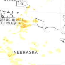
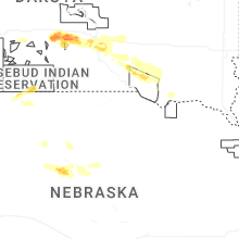
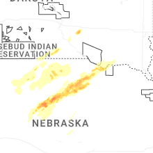
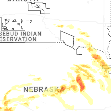


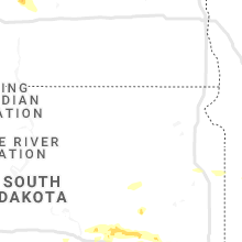


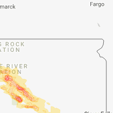


Connect with Interactive Hail Maps