

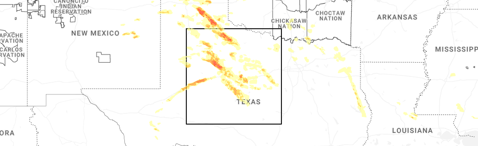
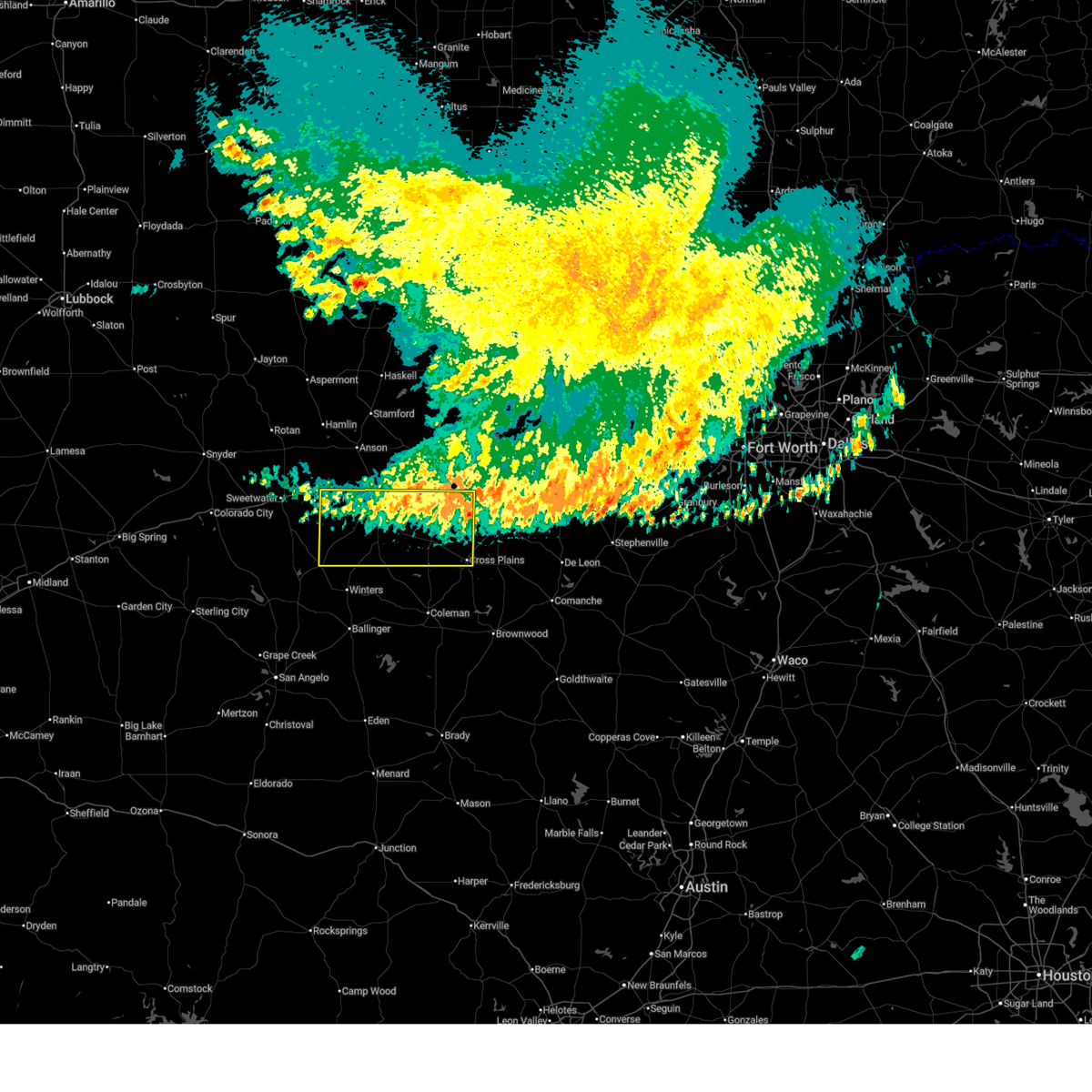
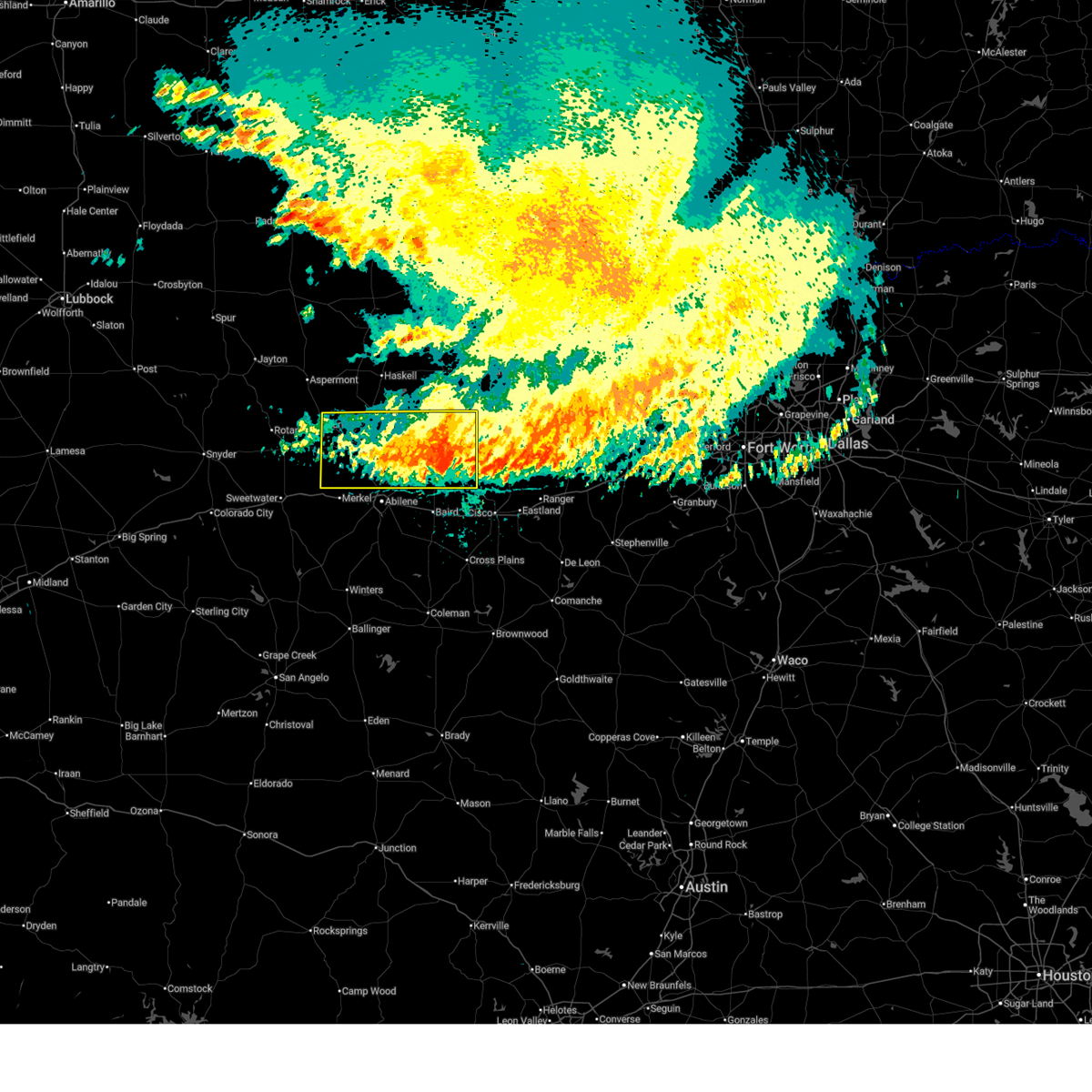
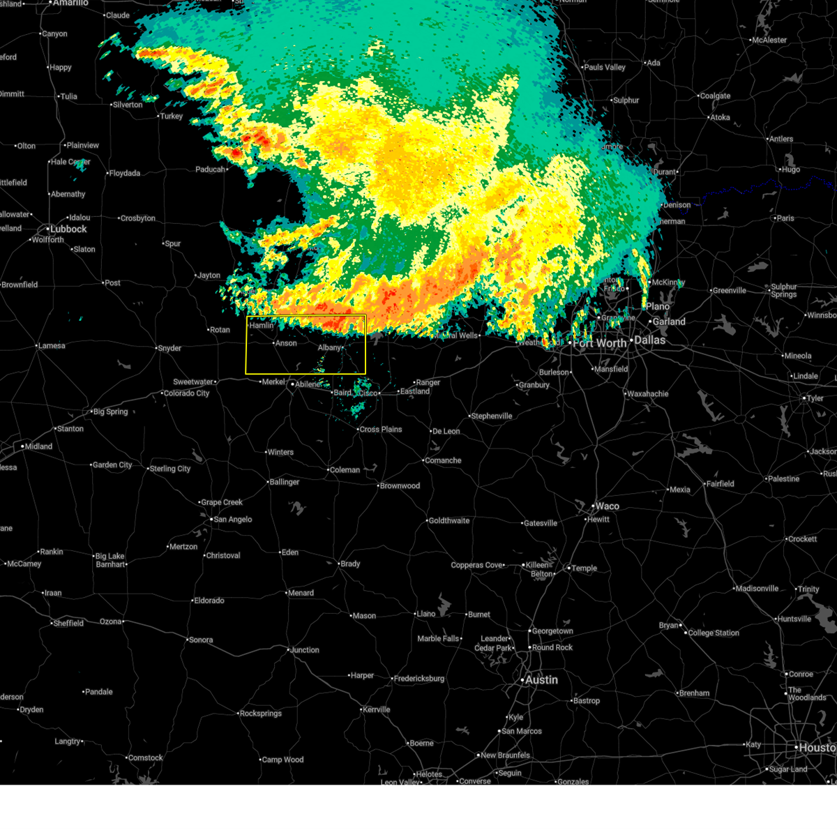
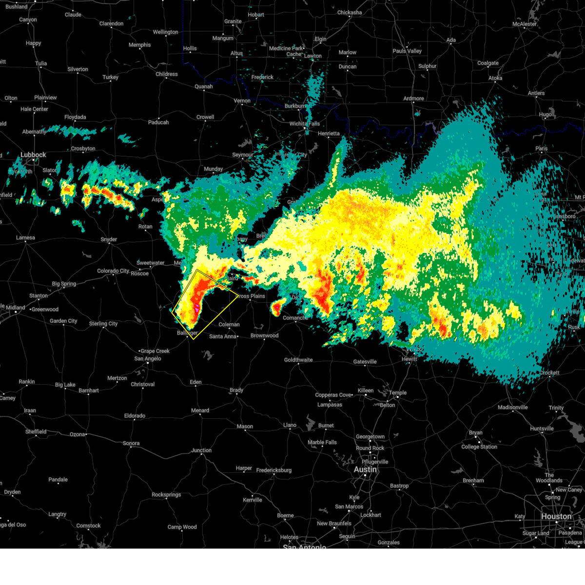
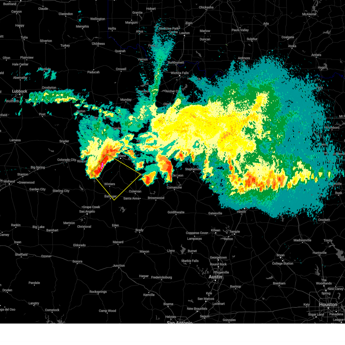
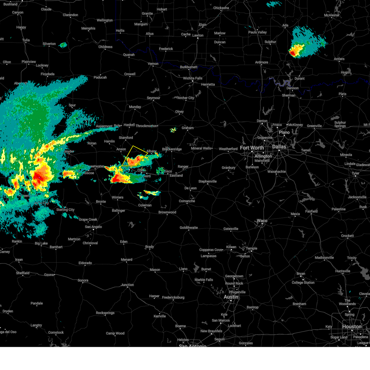
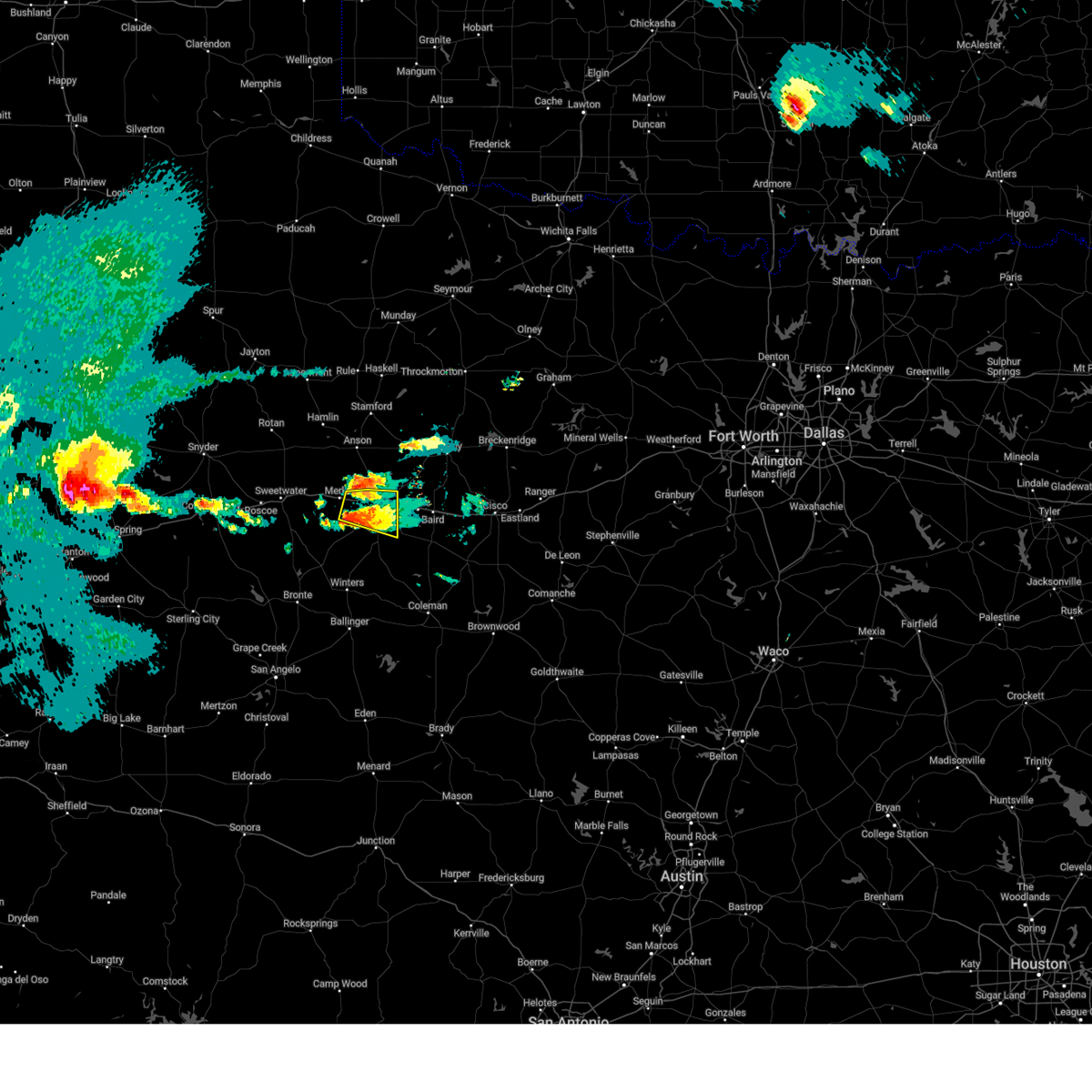
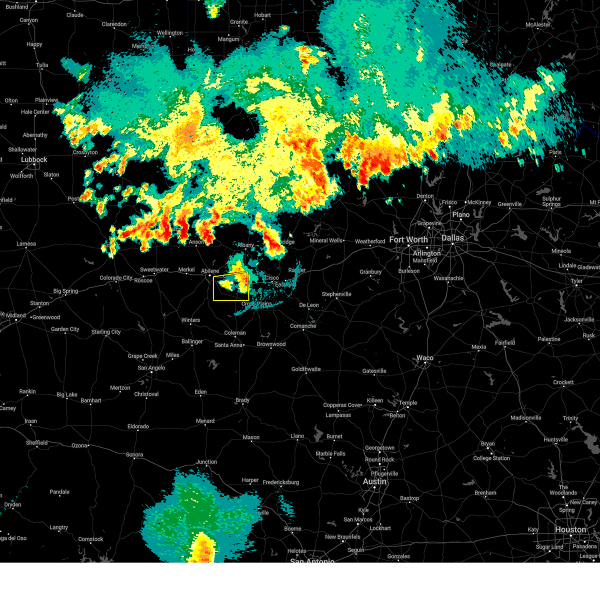
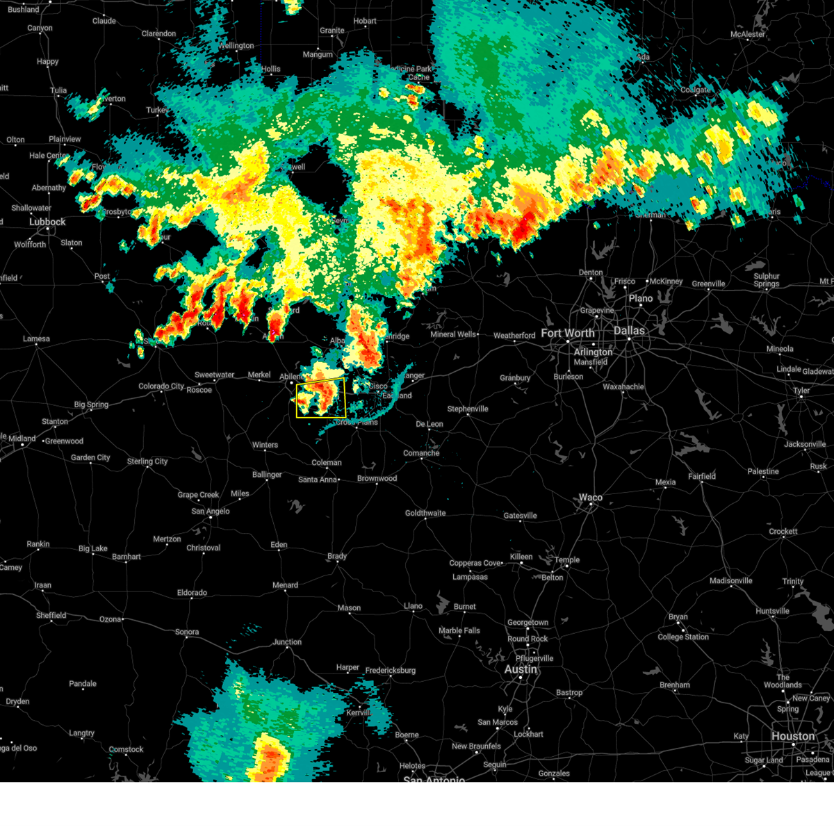
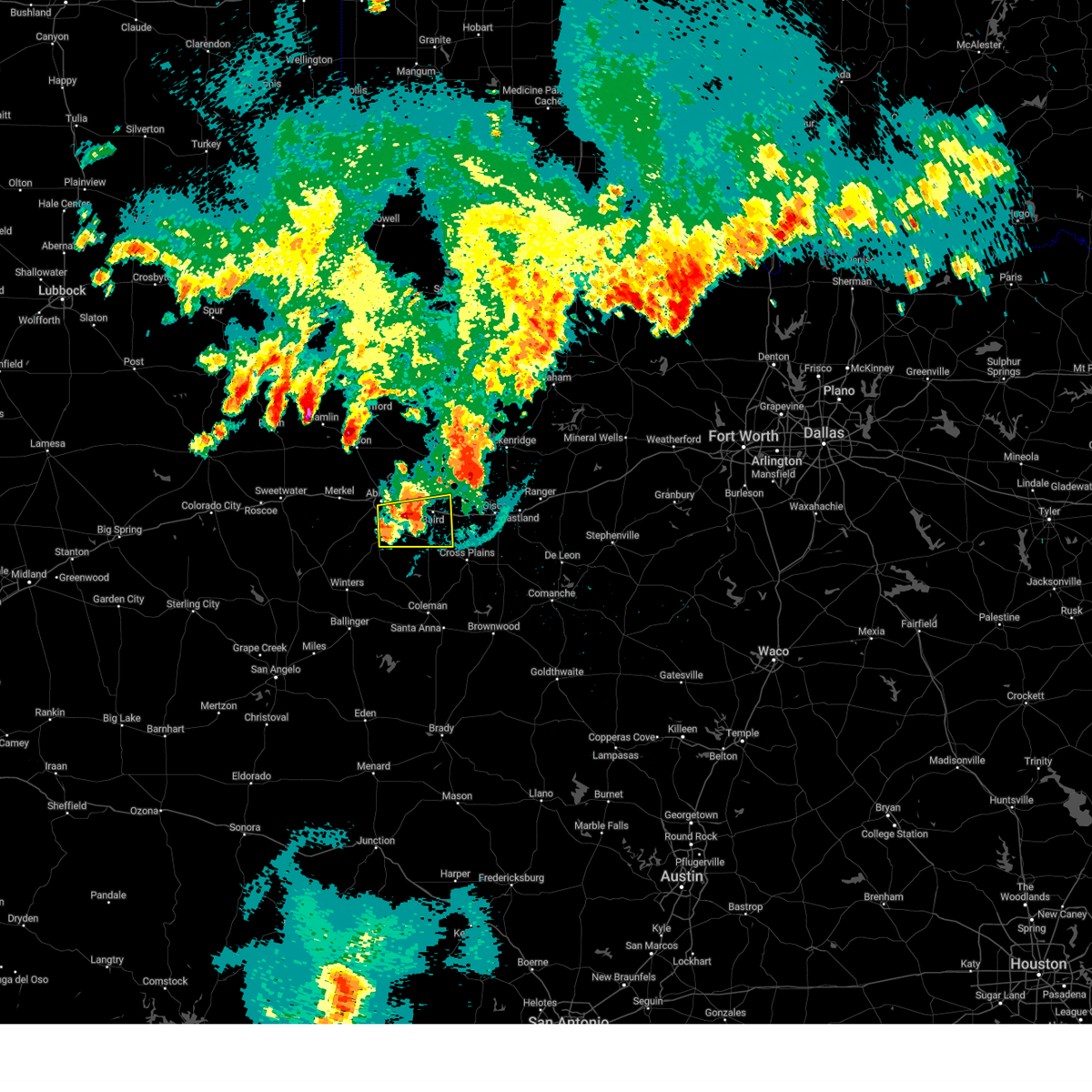
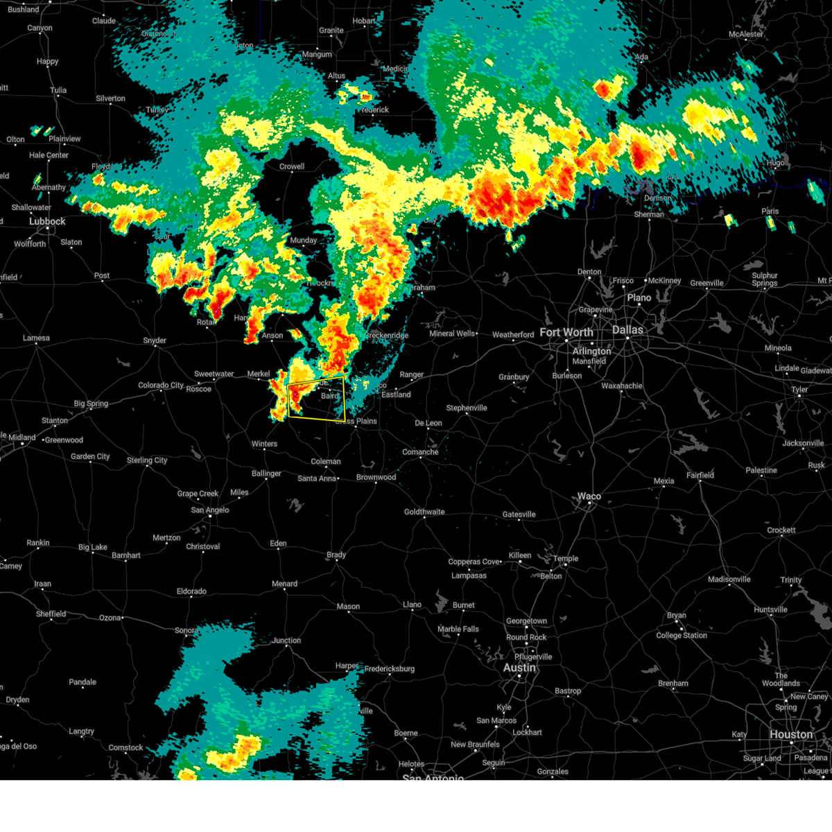
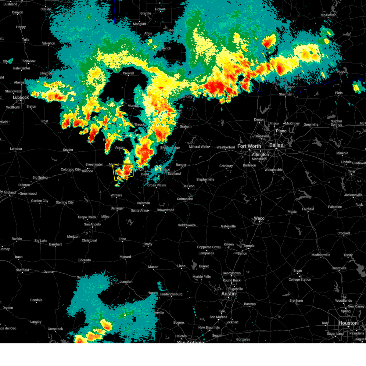
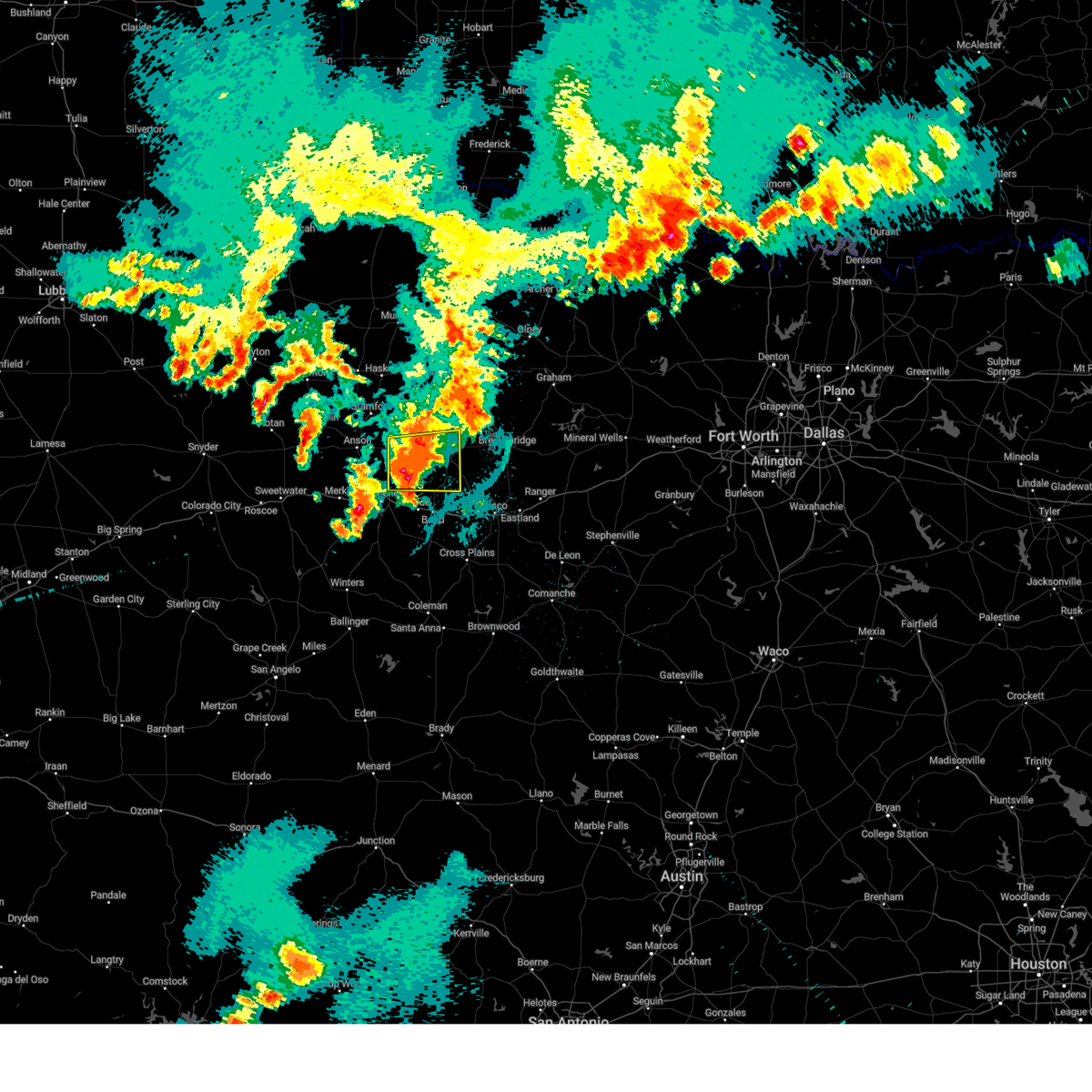
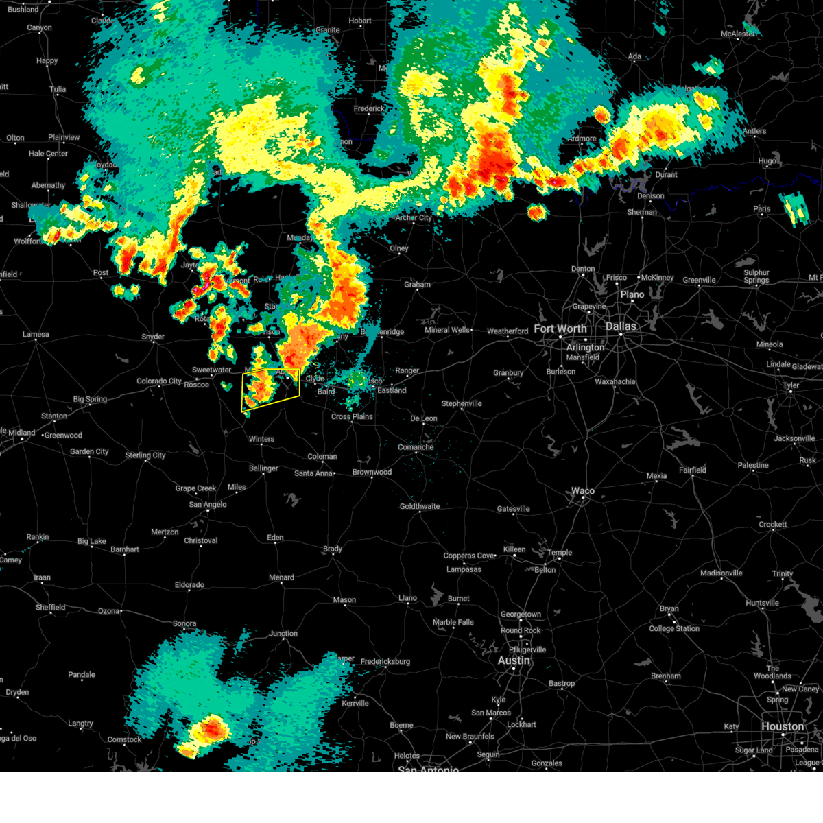
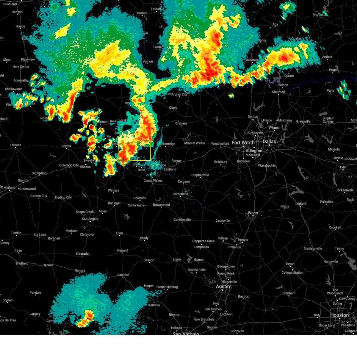
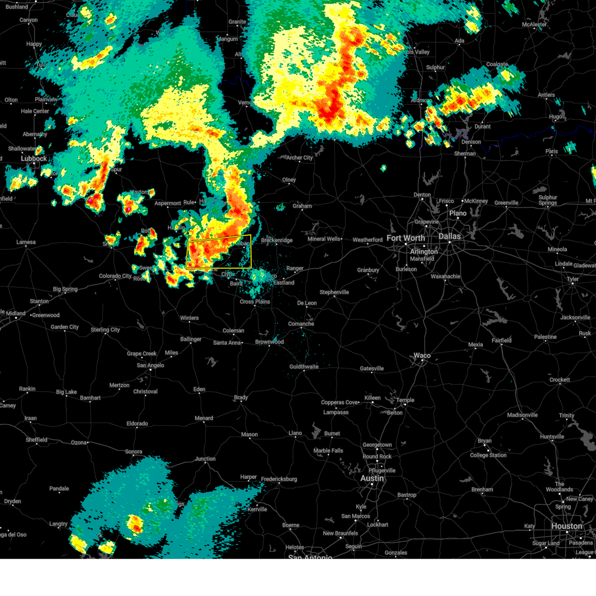
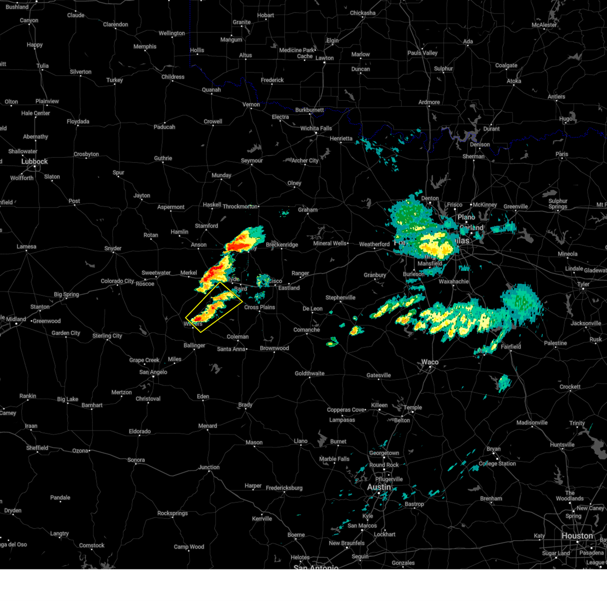
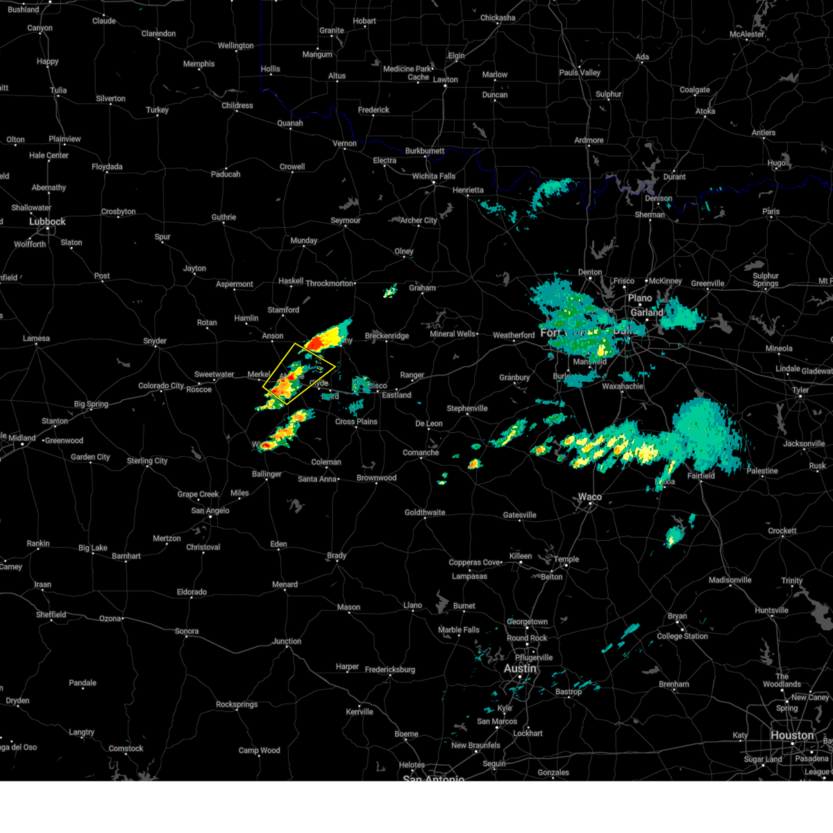
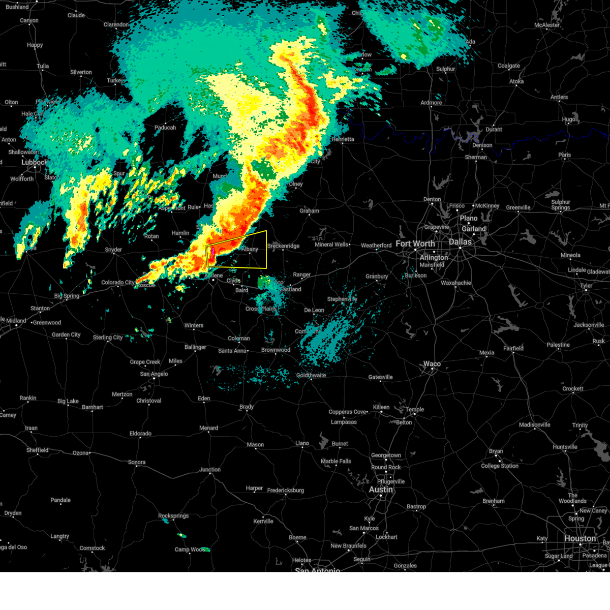
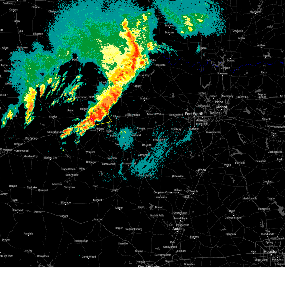
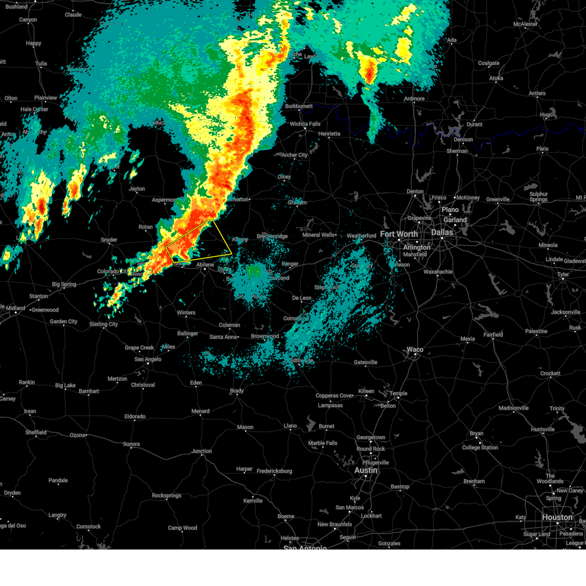
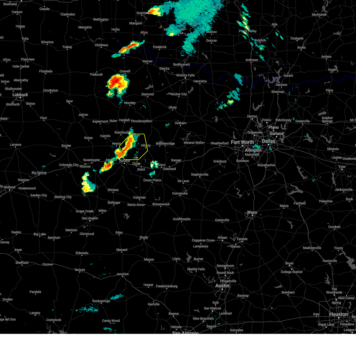
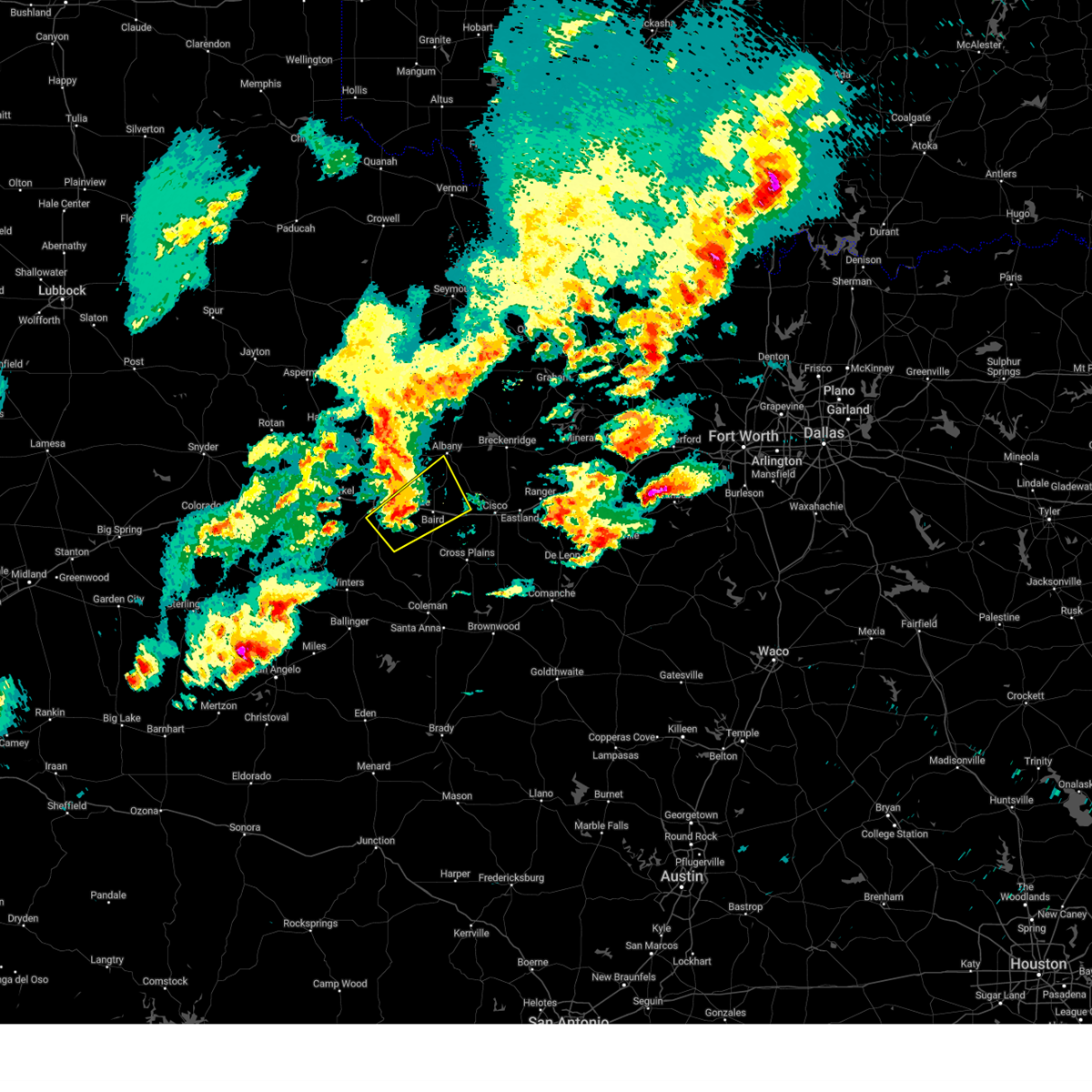
Hail Map for Abilene, TX
The Abilene, TX area has had 98 reports of on-the-ground hail by trained spotters, and has been under severe weather warnings 82 times during the past 12 months. Doppler radar has detected hail at or near Abilene, TX on 187 occasions, including 17 occasions during the past year.
| Name: | Abilene, TX |
| Where Located: | 3.2 miles NNE of Abilene, TX |
| Map: | Google Map for Abilene, TX |
| Population: | 117063 |
| Housing Units: | 47783 |
| More Info: | Search Google for Abilene, TX |
1
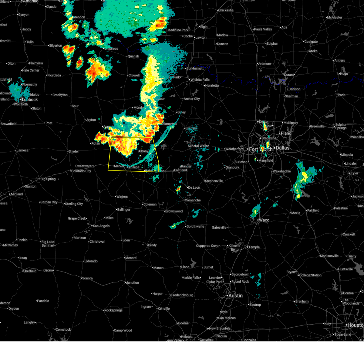
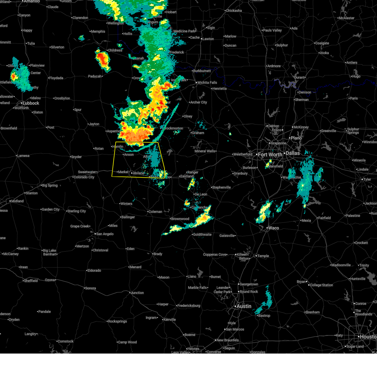
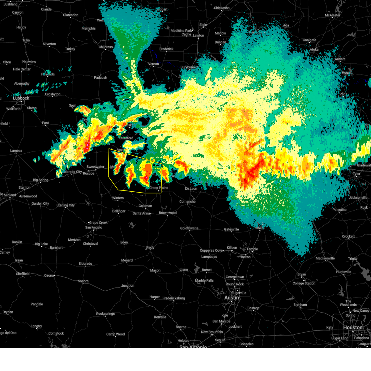
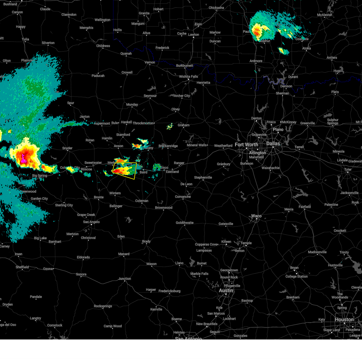
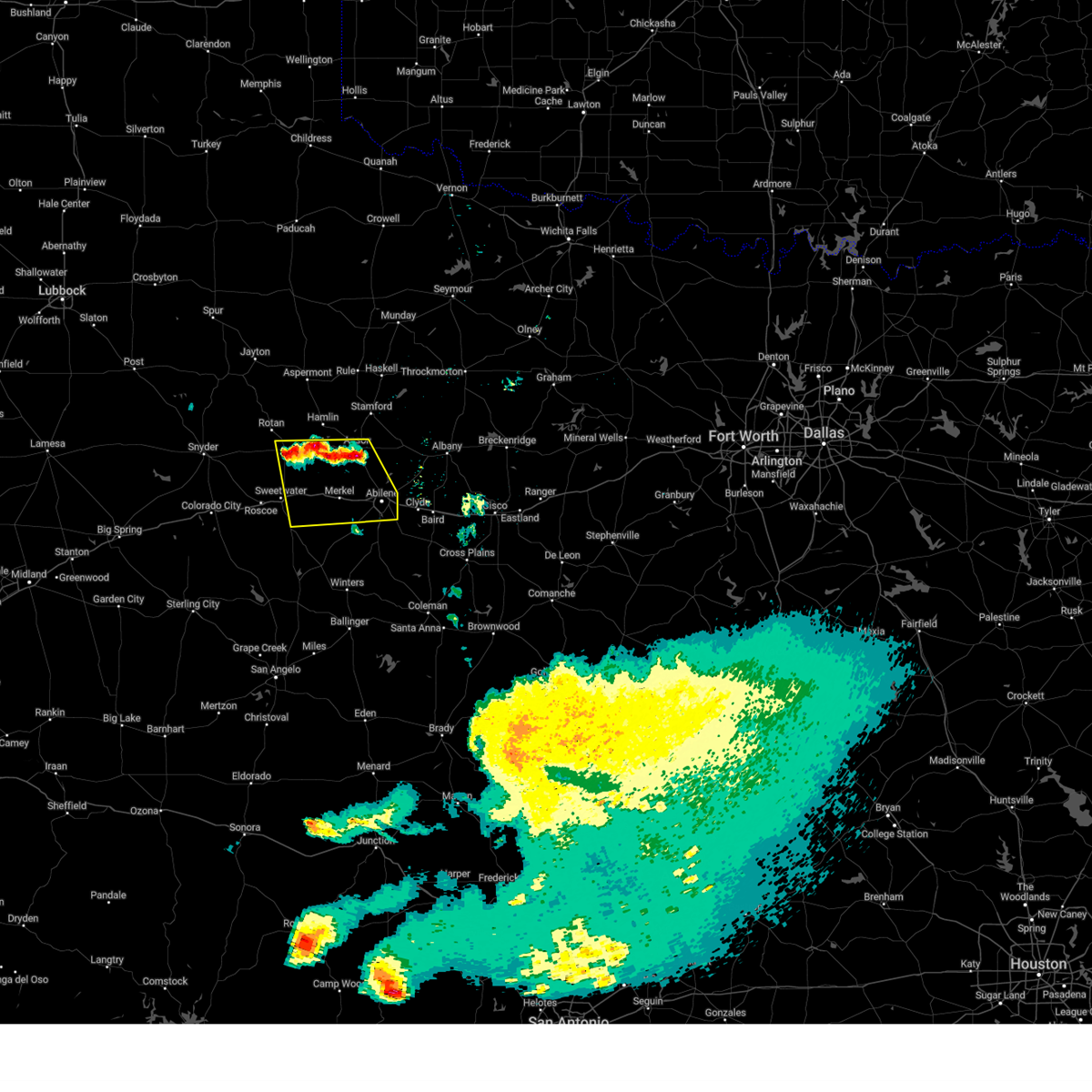
The Top Recent Hail Date for Abilene, TX is Sunday, June 8, 2025 (17th out of 187)
Hail and Wind Damage Spotted near Abilene, TX
| Date / Time | Report Details |
|---|---|
| 7/9/2025 12:32 AM CDT |
 At 1232 am cdt, a severe thunderstorm was located near nugent, moving south at 25 mph (radar indicated). Hazards include 60 mph wind gusts. Expect damage to roofs, siding, and trees. this severe storm will be near, abilene and hawley around 1240 am cdt. tye and hamby around 1250 am cdt. dyess afb around 1255 am cdt. Other locations impacted by this severe thunderstorm include hodges, funston, impact, mccarty lake, tuxedo, big country baptist assembly, lake fort phantom hill, us-283 near the callahan- shackelford county line, truby, and stith. At 1232 am cdt, a severe thunderstorm was located near nugent, moving south at 25 mph (radar indicated). Hazards include 60 mph wind gusts. Expect damage to roofs, siding, and trees. this severe storm will be near, abilene and hawley around 1240 am cdt. tye and hamby around 1250 am cdt. dyess afb around 1255 am cdt. Other locations impacted by this severe thunderstorm include hodges, funston, impact, mccarty lake, tuxedo, big country baptist assembly, lake fort phantom hill, us-283 near the callahan- shackelford county line, truby, and stith.
|
| 7/8/2025 11:59 PM CDT |
 Svrsjt the national weather service in san angelo has issued a * severe thunderstorm warning for, northern callahan county in west central texas, jones county in west central texas, shackelford county in west central texas, northern taylor county in west central texas, * until 100 am cdt. * at 1159 pm cdt, a severe thunderstorm was located over avoca, moving south at 25 mph (radar indicated). Hazards include 60 mph wind gusts. Expect damage to roofs, siding, and trees. this severe thunderstorm will be near, lueders around 1205 am cdt. nugent around 1210 am cdt. abilene around 1220 am cdt. hamby around 1240 am cdt. Other locations impacted by this severe thunderstorm include hodges, funston, impact, mccarty lake, tuxedo, big country baptist assembly, lake fort phantom hill, us-283 near the callahan- shackelford county line, truby, and stith. Svrsjt the national weather service in san angelo has issued a * severe thunderstorm warning for, northern callahan county in west central texas, jones county in west central texas, shackelford county in west central texas, northern taylor county in west central texas, * until 100 am cdt. * at 1159 pm cdt, a severe thunderstorm was located over avoca, moving south at 25 mph (radar indicated). Hazards include 60 mph wind gusts. Expect damage to roofs, siding, and trees. this severe thunderstorm will be near, lueders around 1205 am cdt. nugent around 1210 am cdt. abilene around 1220 am cdt. hamby around 1240 am cdt. Other locations impacted by this severe thunderstorm include hodges, funston, impact, mccarty lake, tuxedo, big country baptist assembly, lake fort phantom hill, us-283 near the callahan- shackelford county line, truby, and stith.
|
| 6/15/2025 11:39 AM CDT |
 At 1138 am cdt, severe thunderstorms were located along a line extending from near drasco to near cross plains, moving south at 40 mph (radar indicated). Hazards include 60 mph wind gusts. Expect damage to roofs, siding, and trees. these severe storms will be near, cross plains, lawn, happy valley, bradshaw, and oplin around 1145 am cdt. Other locations impacted by these severe thunderstorms include impact, lake abilene, camp tonkawa, admiral, shep, camp butman, kirby lake, and ovalo. At 1138 am cdt, severe thunderstorms were located along a line extending from near drasco to near cross plains, moving south at 40 mph (radar indicated). Hazards include 60 mph wind gusts. Expect damage to roofs, siding, and trees. these severe storms will be near, cross plains, lawn, happy valley, bradshaw, and oplin around 1145 am cdt. Other locations impacted by these severe thunderstorms include impact, lake abilene, camp tonkawa, admiral, shep, camp butman, kirby lake, and ovalo.
|
| 6/15/2025 11:25 AM CDT | Billboard completely destroyed and wrapped around a telephone pol in taylor county TX, 6.2 miles NW of Abilene, TX |
| 6/15/2025 11:22 AM CDT |
 Svrsjt the national weather service in san angelo has issued a * severe thunderstorm warning for, callahan county in west central texas, taylor county in west central texas, * until noon cdt. * at 1122 am cdt, severe thunderstorms were located along a line extending from coronados camp to near admiral, moving south at 40 mph (radar indicated). Hazards include 60 mph wind gusts. Expect damage to roofs, siding, and trees. severe thunderstorms will be near, cross plains, tuscola, lawn, coronados camp, happy valley, bradshaw, rowden, and oplin around 1125 am cdt. Other locations impacted by these severe thunderstorms include impact, lake abilene, camp tonkawa, admiral, shep, camp butman, kirby lake, and ovalo. Svrsjt the national weather service in san angelo has issued a * severe thunderstorm warning for, callahan county in west central texas, taylor county in west central texas, * until noon cdt. * at 1122 am cdt, severe thunderstorms were located along a line extending from coronados camp to near admiral, moving south at 40 mph (radar indicated). Hazards include 60 mph wind gusts. Expect damage to roofs, siding, and trees. severe thunderstorms will be near, cross plains, tuscola, lawn, coronados camp, happy valley, bradshaw, rowden, and oplin around 1125 am cdt. Other locations impacted by these severe thunderstorms include impact, lake abilene, camp tonkawa, admiral, shep, camp butman, kirby lake, and ovalo.
|
| 6/15/2025 11:16 AM CDT | Hangar door blown off track at freeman jet center-abilene regional airpor in taylor county TX, 6.3 miles NNW of Abilene, TX |
| 6/15/2025 11:13 AM CDT | Asos station kabi abilen in taylor county TX, 5.7 miles NNW of Abilene, TX |
| 6/15/2025 11:12 AM CDT | Metal roof blown off a small building across from the abilene livestock auctio in taylor county TX, 1 miles WNW of Abilene, TX |
| 6/15/2025 10:50 AM CDT |
 The storms which prompted the warning have weakened below severe limits, and no longer pose an immediate threat to life or property. therefore, the warning will be allowed to expire. The storms which prompted the warning have weakened below severe limits, and no longer pose an immediate threat to life or property. therefore, the warning will be allowed to expire.
|
| 6/15/2025 10:20 AM CDT |
 Svrsjt the national weather service in san angelo has issued a * severe thunderstorm warning for, jones county in west central texas, shackelford county in west central texas, * until 1100 am cdt. * at 1019 am cdt, severe thunderstorms were located along a line extending from near tuxedo to 7 miles east of big country baptist assembly to near crystal falls, moving south at 40 mph (radar indicated). Hazards include 70 mph wind gusts and penny size hail. Expect considerable tree damage. damage is likely to mobile homes, roofs, and outbuildings. severe thunderstorms will be near, northeastern abilene, anson, albany, lueders, avoca, ibex, nugent, and neinda around 1025 am cdt. hawley around 1030 am cdt. moran around 1035 am cdt. noodle around 1040 am cdt. Other locations impacted by these severe thunderstorms include hodges, funston, the intersection of us- 180 and ranch road 126, mccarty lake, tuxedo, big country baptist assembly, lake fort phantom hill, stith, truby, and the intersection of us-180 and farm road 600. Svrsjt the national weather service in san angelo has issued a * severe thunderstorm warning for, jones county in west central texas, shackelford county in west central texas, * until 1100 am cdt. * at 1019 am cdt, severe thunderstorms were located along a line extending from near tuxedo to 7 miles east of big country baptist assembly to near crystal falls, moving south at 40 mph (radar indicated). Hazards include 70 mph wind gusts and penny size hail. Expect considerable tree damage. damage is likely to mobile homes, roofs, and outbuildings. severe thunderstorms will be near, northeastern abilene, anson, albany, lueders, avoca, ibex, nugent, and neinda around 1025 am cdt. hawley around 1030 am cdt. moran around 1035 am cdt. noodle around 1040 am cdt. Other locations impacted by these severe thunderstorms include hodges, funston, the intersection of us- 180 and ranch road 126, mccarty lake, tuxedo, big country baptist assembly, lake fort phantom hill, stith, truby, and the intersection of us-180 and farm road 600.
|
| 6/9/2025 1:29 AM CDT |
 the severe thunderstorm warning has been cancelled and is no longer in effect the severe thunderstorm warning has been cancelled and is no longer in effect
|
| 6/9/2025 1:29 AM CDT |
 At 128 am cdt, a severe thunderstorm was located near bradshaw, moving southeast at 40 mph (radar indicated). Hazards include 60 mph wind gusts and half dollar size hail. Hail damage to vehicles is expected. expect wind damage to roofs, siding, and trees. this severe storm will be near, winters and crews around 135 am cdt. novice around 140 am cdt. Other locations impacted by this severe thunderstorm include lake abilene, drasco, camp tonkawa, pumphrey, goldsboro, wilmeth, lake winters lake, kirby lake, lake coleman, and ovalo. At 128 am cdt, a severe thunderstorm was located near bradshaw, moving southeast at 40 mph (radar indicated). Hazards include 60 mph wind gusts and half dollar size hail. Hail damage to vehicles is expected. expect wind damage to roofs, siding, and trees. this severe storm will be near, winters and crews around 135 am cdt. novice around 140 am cdt. Other locations impacted by this severe thunderstorm include lake abilene, drasco, camp tonkawa, pumphrey, goldsboro, wilmeth, lake winters lake, kirby lake, lake coleman, and ovalo.
|
| 6/9/2025 12:59 AM CDT |
 Svrsjt the national weather service in san angelo has issued a * severe thunderstorm warning for, southwestern callahan county in west central texas, northwestern coleman county in west central texas, southeastern nolan county in west central texas, taylor county in west central texas, northern runnels county in west central texas, * until 145 am cdt. * at 1259 am cdt, a severe thunderstorm was located near coronados camp, moving southeast at 40 mph (radar indicated). Hazards include 60 mph wind gusts and half dollar size hail. Hail damage to vehicles is expected. expect wind damage to roofs, siding, and trees. this severe thunderstorm will be near, coronados camp and happy valley around 105 am cdt. bradshaw around 110 am cdt. winters around 120 am cdt. lawn around 125 am cdt. crews around 130 am cdt. other locations impacted by this severe thunderstorm include lake abilene, camp tonkawa, shep, wilmeth, lake coleman, ovalo, drasco, pumphrey, goldsboro, and lake winters lake. This includes interstate 20 between mile markers 266 and 276. Svrsjt the national weather service in san angelo has issued a * severe thunderstorm warning for, southwestern callahan county in west central texas, northwestern coleman county in west central texas, southeastern nolan county in west central texas, taylor county in west central texas, northern runnels county in west central texas, * until 145 am cdt. * at 1259 am cdt, a severe thunderstorm was located near coronados camp, moving southeast at 40 mph (radar indicated). Hazards include 60 mph wind gusts and half dollar size hail. Hail damage to vehicles is expected. expect wind damage to roofs, siding, and trees. this severe thunderstorm will be near, coronados camp and happy valley around 105 am cdt. bradshaw around 110 am cdt. winters around 120 am cdt. lawn around 125 am cdt. crews around 130 am cdt. other locations impacted by this severe thunderstorm include lake abilene, camp tonkawa, shep, wilmeth, lake coleman, ovalo, drasco, pumphrey, goldsboro, and lake winters lake. This includes interstate 20 between mile markers 266 and 276.
|
| 6/9/2025 12:30 AM CDT | At 1230 am cdt, a severe thunderstorm was located over baird, moving east at 30 mph (radar indicated). Hazards include golf ball size hail and 60 mph wind gusts. People and animals outdoors will be injured. expect hail damage to roofs, siding, windows, and vehicles. expect wind damage to roofs, siding, and trees. this severe storm will be near, baird around 1235 am cdt. putnam around 1240 am cdt. atwell around 100 am cdt. other locations impacted by this severe thunderstorm include impact, the intersection of us- 180 and ranch road 126, lake abilene, camp tonkawa, lake fort phantom hill, us-283 near the callahan-shackelford county line, i- 20 near the callahan- eastland county line, ovalo, hodges, and admiral. This includes interstate 20 between mile markers 261 and 323. |
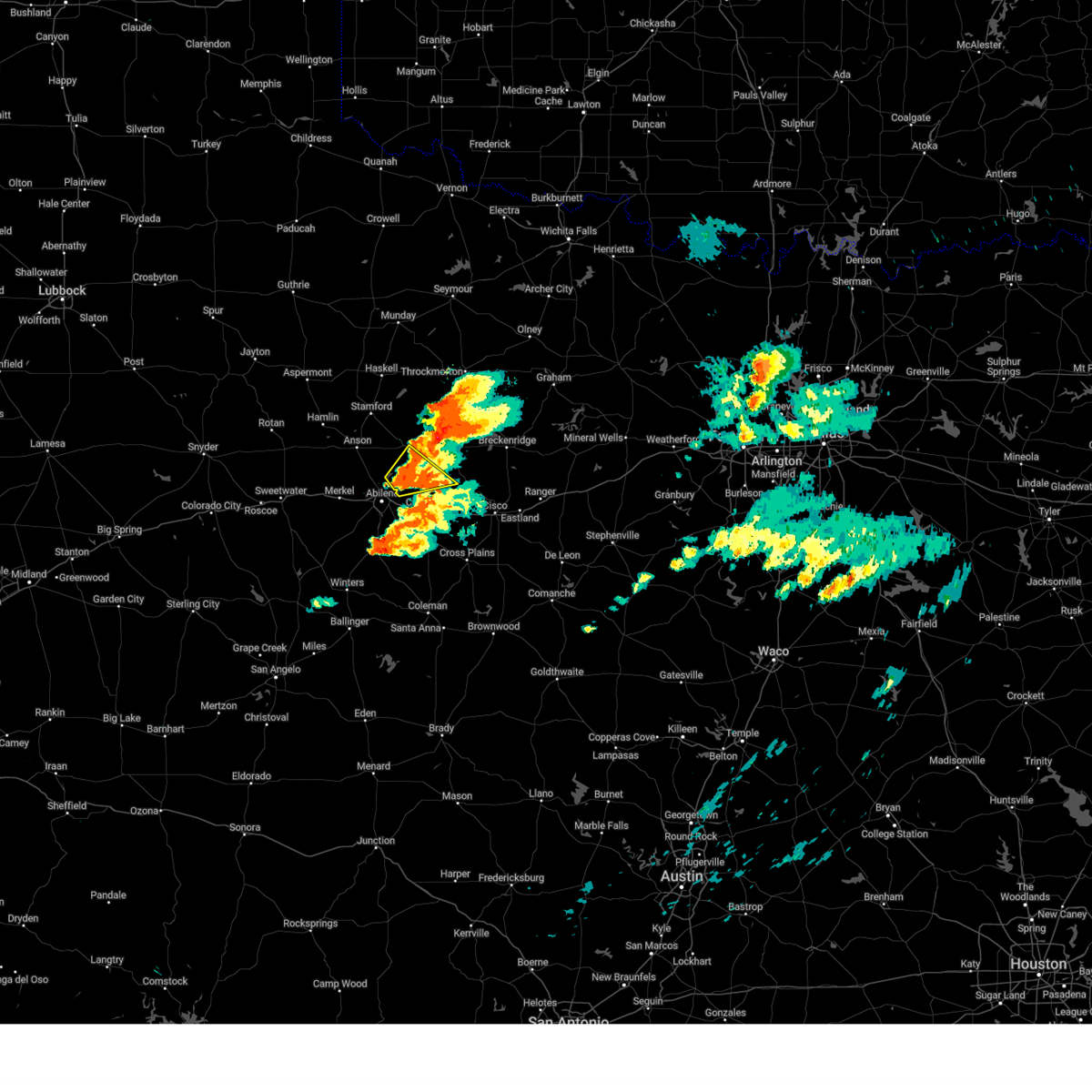
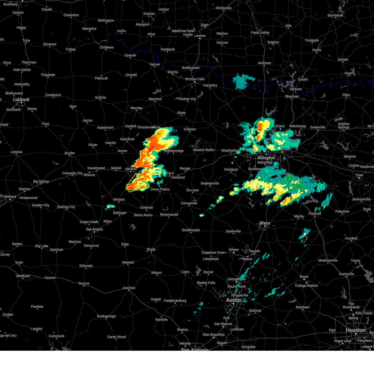
| 6/8/2025 11:57 PM CDT |
 Svrsjt the national weather service in san angelo has issued a * severe thunderstorm warning for, callahan county in west central texas, southern jones county in west central texas, taylor county in west central texas, southern shackelford county in west central texas, * until 100 am cdt. * at 1154 pm cdt, a severe thunderstorm was located over kirby lake, or near potosi, moving east at 30 mph. these are destructive storms for abilene, clyde, putnam, and baird (public). Hazards include 80 mph wind gusts and tennis ball size hail. Flying debris will be dangerous to those caught without shelter. mobile homes will be heavily damaged. expect considerable damage to roofs, windows, and vehicles. extensive tree damage and power outages are likely. this severe thunderstorm will be near, southeastern abilene, clyde, potosi, and eula around 1200 am cdt. baird around 1215 am cdt. putnam around 1240 am cdt. other locations impacted by this severe thunderstorm include impact, the intersection of us- 180 and ranch road 126, lake abilene, camp tonkawa, lake fort phantom hill, us-283 near the callahan-shackelford county line, i- 20 near the callahan- eastland county line, ovalo, hodges, and admiral. This includes interstate 20 between mile markers 261 and 323. Svrsjt the national weather service in san angelo has issued a * severe thunderstorm warning for, callahan county in west central texas, southern jones county in west central texas, taylor county in west central texas, southern shackelford county in west central texas, * until 100 am cdt. * at 1154 pm cdt, a severe thunderstorm was located over kirby lake, or near potosi, moving east at 30 mph. these are destructive storms for abilene, clyde, putnam, and baird (public). Hazards include 80 mph wind gusts and tennis ball size hail. Flying debris will be dangerous to those caught without shelter. mobile homes will be heavily damaged. expect considerable damage to roofs, windows, and vehicles. extensive tree damage and power outages are likely. this severe thunderstorm will be near, southeastern abilene, clyde, potosi, and eula around 1200 am cdt. baird around 1215 am cdt. putnam around 1240 am cdt. other locations impacted by this severe thunderstorm include impact, the intersection of us- 180 and ranch road 126, lake abilene, camp tonkawa, lake fort phantom hill, us-283 near the callahan-shackelford county line, i- 20 near the callahan- eastland county line, ovalo, hodges, and admiral. This includes interstate 20 between mile markers 261 and 323.
|
| 6/8/2025 11:47 PM CDT | Tennis Ball sized hail reported 9 miles NE of Abilene, TX |
| 6/8/2025 11:33 PM CDT | At 1132 pm cdt, a severe thunderstorm was located near hamby, moving southeast at 35 mph. this is a destructive storm for the city of abilene (radar indicated). Hazards include 80 mph wind gusts and tennis ball size hail. Flying debris will be dangerous to those caught without shelter. mobile homes will be heavily damaged. expect considerable damage to roofs, windows, and vehicles. extensive tree damage and power outages are likely. this severe storm will be near, clyde, potosi, and eula around 1135 pm cdt. baird around 1140 pm cdt. rowden around 1200 am cdt. cross plains and atwell around 1215 am cdt. other locations impacted by this severe thunderstorm include impact, the intersection of us- 180 and ranch road 126, lake abilene, camp tonkawa, lake fort phantom hill, us-283 near the callahan-shackelford county line, i- 20 near the callahan- eastland county line, ovalo, hodges, and admiral. This includes interstate 20 between mile markers 261 and 323. |
| 6/8/2025 11:29 PM CDT | At 1128 pm cdt, a severe thunderstorm was located over southeastern abilene, moving southeast at 35 mph. this is a destructive storm for the city of abilene (radar indicated). Hazards include 80 mph wind gusts and golf ball size hail. Flying debris will be dangerous to those caught without shelter. mobile homes will be heavily damaged. expect considerable damage to roofs, windows, and vehicles. extensive tree damage and power outages are likely. this severe storm will be near, clyde, potosi, and eula around 1135 pm cdt. baird around 1140 pm cdt. rowden around 1200 am cdt. atwell around 1215 am cdt. other locations impacted by this severe thunderstorm include impact, the intersection of us- 180 and ranch road 126, lake abilene, camp tonkawa, lake fort phantom hill, us-283 near the callahan-shackelford county line, i- 20 near the callahan- eastland county line, ovalo, hodges, and admiral. This includes interstate 20 between mile markers 261 and 323. |
| 6/8/2025 11:19 PM CDT | 78 mph wind gust at the west texas mesonet location on the acu campu in taylor county TX, 1.8 miles WNW of Abilene, TX |
| 6/8/2025 11:17 PM CDT | Multiple branches down. fence knocked dow in taylor county TX, 2.2 miles NW of Abilene, TX |
| 6/8/2025 11:05 PM CDT |
 Svrsjt the national weather service in san angelo has issued a * severe thunderstorm warning for, callahan county in west central texas, southern jones county in west central texas, taylor county in west central texas, southern shackelford county in west central texas, * until midnight cdt. * at 1104 pm cdt, a severe thunderstorm was located over hodges, or near hawley, moving southeast at 35 mph (radar indicated). Hazards include golf ball size hail and 60 mph wind gusts. People and animals outdoors will be injured. expect hail damage to roofs, siding, windows, and vehicles. expect wind damage to roofs, siding, and trees. this severe thunderstorm will be near, abilene, tye, and dyess afb around 1110 pm cdt. hamby around 1115 pm cdt. potosi around 1120 pm cdt. clyde and eula around 1130 pm cdt. baird around 1140 pm cdt. other locations impacted by this severe thunderstorm include impact, the intersection of us- 180 and ranch road 126, lake abilene, camp tonkawa, lake fort phantom hill, us-283 near the callahan-shackelford county line, i- 20 near the callahan- eastland county line, ovalo, hodges, and admiral. This includes interstate 20 between mile markers 261 and 323. Svrsjt the national weather service in san angelo has issued a * severe thunderstorm warning for, callahan county in west central texas, southern jones county in west central texas, taylor county in west central texas, southern shackelford county in west central texas, * until midnight cdt. * at 1104 pm cdt, a severe thunderstorm was located over hodges, or near hawley, moving southeast at 35 mph (radar indicated). Hazards include golf ball size hail and 60 mph wind gusts. People and animals outdoors will be injured. expect hail damage to roofs, siding, windows, and vehicles. expect wind damage to roofs, siding, and trees. this severe thunderstorm will be near, abilene, tye, and dyess afb around 1110 pm cdt. hamby around 1115 pm cdt. potosi around 1120 pm cdt. clyde and eula around 1130 pm cdt. baird around 1140 pm cdt. other locations impacted by this severe thunderstorm include impact, the intersection of us- 180 and ranch road 126, lake abilene, camp tonkawa, lake fort phantom hill, us-283 near the callahan-shackelford county line, i- 20 near the callahan- eastland county line, ovalo, hodges, and admiral. This includes interstate 20 between mile markers 261 and 323.
|
| 6/8/2025 10:32 PM CDT | At 1031 pm cdt, a severe thunderstorm was located over the intersection of us-180 and ranch road 126, or over neinda, moving east at 40 mph (radar indicated). Hazards include golf ball size hail and 60 mph wind gusts. People and animals outdoors will be injured. expect hail damage to roofs, siding, windows, and vehicles. expect wind damage to roofs, siding, and trees. this severe storm will be near, anson around 1035 pm cdt. hawley around 1055 pm cdt. nugent around 1105 pm cdt. northeastern abilene around 1110 pm cdt. lueders around 1120 pm cdt. Other locations impacted by this severe thunderstorm include hodges, funston, the intersection of us- 180 and ranch road 126, hitson, tuxedo, lake fort phantom hill, truby, and the intersection of us-180 and farm road 600. |
| 6/8/2025 10:29 PM CDT | At 1028 pm cdt, a severe thunderstorm was located over southern abilene, moving east at 35 mph (radar indicated). Hazards include golf ball size hail and 60 mph wind gusts. People and animals outdoors will be injured. expect hail damage to roofs, siding, windows, and vehicles. expect wind damage to roofs, siding, and trees. this severe storm will be near, eastern abilene, clyde, potosi, and hamby around 1035 pm cdt. baird around 1050 pm cdt. other locations impacted by this severe thunderstorm include impact and kirby lake. This includes interstate 20 between mile markers 274 and 310. |
| 6/8/2025 10:15 PM CDT | Svrsjt the national weather service in san angelo has issued a * severe thunderstorm warning for, south central haskell county in west central texas, jones county in west central texas, fisher county in west central texas, * until 1115 pm cdt. * at 1014 pm cdt, a severe thunderstorm was located over mccaulley, moving east at 40 mph (radar indicated). Hazards include golf ball size hail and 60 mph wind gusts. People and animals outdoors will be injured. expect hail damage to roofs, siding, windows, and vehicles. expect wind damage to roofs, siding, and trees. this severe thunderstorm will be near, hamlin, neinda, and mccaulley around 1020 pm cdt. anson around 1040 pm cdt. hawley around 1055 pm cdt. Other locations impacted by this severe thunderstorm include hodges, funston, the intersection of us- 180 and ranch road 126, hitson, tuxedo, lake fort phantom hill, truby, and the intersection of us-180 and farm road 600. |
| 6/8/2025 10:08 PM CDT | Svrsjt the national weather service in san angelo has issued a * severe thunderstorm warning for, western callahan county in west central texas, southeastern jones county in west central texas, northern taylor county in west central texas, * until 1115 pm cdt. * at 1008 pm cdt, a severe thunderstorm was located over merkel, moving southeast at 35 mph (radar indicated). Hazards include two inch hail and 60 mph wind gusts. People and animals outdoors will be injured. expect hail damage to roofs, siding, windows, and vehicles. expect wind damage to roofs, siding, and trees. this severe thunderstorm will be near, abilene, tye, caps, view, and dyess afb around 1015 pm cdt. buffalo gap around 1020 pm cdt. potosi around 1025 pm cdt. eula and dudley around 1040 pm cdt. clyde around 1050 pm cdt. other locations impacted by this severe thunderstorm include impact, kirby lake, and stith. This includes interstate 20 between mile markers 266 and 310. |
| 6/8/2025 9:53 PM CDT | At 953 pm cdt, a severe thunderstorm was located near noodle, moving southeast at 35 mph (radar indicated). Hazards include two inch hail and 60 mph wind gusts. People and animals outdoors will be injured. expect hail damage to roofs, siding, windows, and vehicles. expect wind damage to roofs, siding, and trees. this severe storm will be near, merkel and tye around 1000 pm cdt. abilene around 1005 pm cdt. other locations impacted by this severe thunderstorm include impact, hodges, funston, the intersection of us- 180 and ranch road 126, lake fort phantom hill, truby, stith, and the intersection of us-180 and farm road 600. This includes interstate 20 between mile markers 254 and 296. |
| 6/8/2025 9:34 PM CDT | Svrsjt the national weather service in san angelo has issued a * severe thunderstorm warning for, northwestern callahan county in west central texas, southern jones county in west central texas, northeastern nolan county in west central texas, southeastern fisher county in west central texas, northern taylor county in west central texas, southwestern shackelford county in west central texas, * until 1015 pm cdt. * at 932 pm cdt, a severe thunderstorm was located over longworth, moving east at 25 mph. also, another severe storm near abilene (radar indicated). Hazards include ping pong ball size hail and 60 mph wind gusts. People and animals outdoors will be injured. expect hail damage to roofs, siding, windows, and vehicles. expect wind damage to roofs, siding, and trees. this severe thunderstorm will be near, sylvester around 940 pm cdt. other locations impacted by this severe thunderstorm include impact, hodges, funston, the intersection of us- 180 and ranch road 126, lake fort phantom hill, truby, stith, and the intersection of us-180 and farm road 600. This includes interstate 20 between mile markers 249 and 296. |
| 6/8/2025 9:03 PM CDT | At 902 pm cdt, a severe thunderstorm was located over truby, or near anson, moving east at 35 mph (radar indicated). Hazards include 70 mph wind gusts and half dollar size hail. Hail damage to vehicles is expected. expect considerable tree damage. wind damage is also likely to mobile homes, roofs, and outbuildings. this severe storm will be near, hawley around 905 pm cdt. abilene around 910 pm cdt. nugent around 915 pm cdt. hamby around 925 pm cdt. other locations impacted by this severe thunderstorm include impact, hodges, funston, the intersection of us- 180 and ranch road 126, lake fort phantom hill, kirby lake, truby, stith, and the intersection of us-180 and farm road 600. This includes interstate 20 between mile markers 253 and 300. |
| 6/8/2025 8:34 PM CDT |
 Svrsjt the national weather service in san angelo has issued a * severe thunderstorm warning for, northwestern callahan county in west central texas, jones county in west central texas, northeastern nolan county in west central texas, southeastern fisher county in west central texas, northern taylor county in west central texas, southwestern shackelford county in west central texas, * until 930 pm cdt. * at 834 pm cdt, a severe thunderstorm was located 7 miles southeast of sylvester, moving southeast at 40 mph. this is a destructive storm for abilene (radar indicated). Hazards include 80 mph wind gusts and golf ball size hail. Flying debris will be dangerous to those caught without shelter. mobile homes will be heavily damaged. expect considerable damage to roofs, windows, and vehicles. extensive tree damage and power outages are likely. this severe thunderstorm will be near, noodle around 840 pm cdt. hawley around 855 pm cdt. abilene and tye around 900 pm cdt. hamby around 915 pm cdt. potosi around 925 pm cdt. other locations impacted by this severe thunderstorm include impact, hodges, funston, the intersection of us- 180 and ranch road 126, lake fort phantom hill, kirby lake, truby, stith, and the intersection of us-180 and farm road 600. This includes interstate 20 between mile markers 253 and 300. Svrsjt the national weather service in san angelo has issued a * severe thunderstorm warning for, northwestern callahan county in west central texas, jones county in west central texas, northeastern nolan county in west central texas, southeastern fisher county in west central texas, northern taylor county in west central texas, southwestern shackelford county in west central texas, * until 930 pm cdt. * at 834 pm cdt, a severe thunderstorm was located 7 miles southeast of sylvester, moving southeast at 40 mph. this is a destructive storm for abilene (radar indicated). Hazards include 80 mph wind gusts and golf ball size hail. Flying debris will be dangerous to those caught without shelter. mobile homes will be heavily damaged. expect considerable damage to roofs, windows, and vehicles. extensive tree damage and power outages are likely. this severe thunderstorm will be near, noodle around 840 pm cdt. hawley around 855 pm cdt. abilene and tye around 900 pm cdt. hamby around 915 pm cdt. potosi around 925 pm cdt. other locations impacted by this severe thunderstorm include impact, hodges, funston, the intersection of us- 180 and ranch road 126, lake fort phantom hill, kirby lake, truby, stith, and the intersection of us-180 and farm road 600. This includes interstate 20 between mile markers 253 and 300.
|
| 5/29/2025 7:50 PM CDT |
 At 750 pm cdt, a severe thunderstorm was located over lake fort phantom hill, or near hamby, moving northeast at 15 mph (radar indicated). Hazards include 60 mph wind gusts and quarter size hail. Hail damage to vehicles is expected. expect wind damage to roofs, siding, and trees. this severe storm will be near, nugent around 755 pm cdt. lueders around 820 pm cdt. Other locations impacted by this severe thunderstorm include big country baptist assembly, the intersection of us- 180 and farm road 600, and lake fort phantom hill. At 750 pm cdt, a severe thunderstorm was located over lake fort phantom hill, or near hamby, moving northeast at 15 mph (radar indicated). Hazards include 60 mph wind gusts and quarter size hail. Hail damage to vehicles is expected. expect wind damage to roofs, siding, and trees. this severe storm will be near, nugent around 755 pm cdt. lueders around 820 pm cdt. Other locations impacted by this severe thunderstorm include big country baptist assembly, the intersection of us- 180 and farm road 600, and lake fort phantom hill.
|
| 5/29/2025 7:47 PM CDT |
 the severe thunderstorm warning has been cancelled and is no longer in effect the severe thunderstorm warning has been cancelled and is no longer in effect
|
| 5/29/2025 7:47 PM CDT |
 At 746 pm cdt, a severe thunderstorm was located over lake abilene, or near buffalo gap, moving east at 30 mph (radar indicated). Hazards include ping pong ball size hail and 60 mph wind gusts. People and animals outdoors will be injured. expect hail damage to roofs, siding, windows, and vehicles. expect wind damage to roofs, siding, and trees. this severe storm will be near, southern abilene, tuscola, buffalo gap, caps, and potosi around 750 pm cdt. lawn around 755 pm cdt. Other locations impacted by this severe thunderstorm include lake abilene, ovalo, and camp tonkawa. At 746 pm cdt, a severe thunderstorm was located over lake abilene, or near buffalo gap, moving east at 30 mph (radar indicated). Hazards include ping pong ball size hail and 60 mph wind gusts. People and animals outdoors will be injured. expect hail damage to roofs, siding, windows, and vehicles. expect wind damage to roofs, siding, and trees. this severe storm will be near, southern abilene, tuscola, buffalo gap, caps, and potosi around 750 pm cdt. lawn around 755 pm cdt. Other locations impacted by this severe thunderstorm include lake abilene, ovalo, and camp tonkawa.
|
| 5/29/2025 7:22 PM CDT |
 Svrsjt the national weather service in san angelo has issued a * severe thunderstorm warning for, eastern jones county in west central texas, southwestern shackelford county in west central texas, * until 830 pm cdt. * at 722 pm cdt, a severe thunderstorm was located over lake fort phantom hill, or near hawley, moving northeast at 20 mph (radar indicated). Hazards include 60 mph wind gusts and quarter size hail. Hail damage to vehicles is expected. expect wind damage to roofs, siding, and trees. this severe thunderstorm will be near, northeastern abilene and nugent around 730 pm cdt. lueders around 745 pm cdt. Other locations impacted by this severe thunderstorm include hodges, funston, big country baptist assembly, lake fort phantom hill, and the intersection of us-180 and farm road 600. Svrsjt the national weather service in san angelo has issued a * severe thunderstorm warning for, eastern jones county in west central texas, southwestern shackelford county in west central texas, * until 830 pm cdt. * at 722 pm cdt, a severe thunderstorm was located over lake fort phantom hill, or near hawley, moving northeast at 20 mph (radar indicated). Hazards include 60 mph wind gusts and quarter size hail. Hail damage to vehicles is expected. expect wind damage to roofs, siding, and trees. this severe thunderstorm will be near, northeastern abilene and nugent around 730 pm cdt. lueders around 745 pm cdt. Other locations impacted by this severe thunderstorm include hodges, funston, big country baptist assembly, lake fort phantom hill, and the intersection of us-180 and farm road 600.
|
| 5/29/2025 7:12 PM CDT |
 Svrsjt the national weather service in san angelo has issued a * severe thunderstorm warning for, southwestern callahan county in west central texas, taylor county in west central texas, * until 815 pm cdt. * at 711 pm cdt, a severe thunderstorm was located over view, moving southeast at 25 mph (radar indicated). Hazards include ping pong ball size hail and 60 mph wind gusts. People and animals outdoors will be injured. expect hail damage to roofs, siding, windows, and vehicles. expect wind damage to roofs, siding, and trees. this severe thunderstorm will be near, southern abilene, tuscola, buffalo gap, and caps around 715 pm cdt. potosi around 725 pm cdt. lawn around 730 pm cdt. dudley around 750 pm cdt. oplin around 755 pm cdt. Other locations impacted by this severe thunderstorm include lake abilene, ovalo, and camp tonkawa. Svrsjt the national weather service in san angelo has issued a * severe thunderstorm warning for, southwestern callahan county in west central texas, taylor county in west central texas, * until 815 pm cdt. * at 711 pm cdt, a severe thunderstorm was located over view, moving southeast at 25 mph (radar indicated). Hazards include ping pong ball size hail and 60 mph wind gusts. People and animals outdoors will be injured. expect hail damage to roofs, siding, windows, and vehicles. expect wind damage to roofs, siding, and trees. this severe thunderstorm will be near, southern abilene, tuscola, buffalo gap, and caps around 715 pm cdt. potosi around 725 pm cdt. lawn around 730 pm cdt. dudley around 750 pm cdt. oplin around 755 pm cdt. Other locations impacted by this severe thunderstorm include lake abilene, ovalo, and camp tonkawa.
|
| 5/29/2025 7:06 PM CDT |
 At 706 pm cdt, a severe thunderstorm was located over view, moving east at 10 mph (radar indicated). Hazards include 60 mph wind gusts and half dollar size hail. Hail damage to vehicles is expected. expect wind damage to roofs, siding, and trees. this severe storm will be near, southwestern abilene, tye, buffalo gap, caps, view, and dyess afb around 710 pm cdt. other locations impacted by this severe thunderstorm include impact and kirby lake. This includes interstate 20 between mile markers 271 and 292. At 706 pm cdt, a severe thunderstorm was located over view, moving east at 10 mph (radar indicated). Hazards include 60 mph wind gusts and half dollar size hail. Hail damage to vehicles is expected. expect wind damage to roofs, siding, and trees. this severe storm will be near, southwestern abilene, tye, buffalo gap, caps, view, and dyess afb around 710 pm cdt. other locations impacted by this severe thunderstorm include impact and kirby lake. This includes interstate 20 between mile markers 271 and 292.
|
| 5/29/2025 7:06 PM CDT |
 the severe thunderstorm warning has been cancelled and is no longer in effect the severe thunderstorm warning has been cancelled and is no longer in effect
|
| 5/29/2025 6:56 PM CDT |
 At 656 pm cdt, a severe thunderstorm was located over view, moving southeast at 25 mph (radar indicated). Hazards include 60 mph wind gusts and half dollar size hail. Hail damage to vehicles is expected. expect wind damage to roofs, siding, and trees. this severe storm will be near, southern abilene, buffalo gap, caps, and view around 700 pm cdt. potosi around 705 pm cdt. other locations impacted by this severe thunderstorm include impact and kirby lake. This includes interstate 20 between mile markers 271 and 297. At 656 pm cdt, a severe thunderstorm was located over view, moving southeast at 25 mph (radar indicated). Hazards include 60 mph wind gusts and half dollar size hail. Hail damage to vehicles is expected. expect wind damage to roofs, siding, and trees. this severe storm will be near, southern abilene, buffalo gap, caps, and view around 700 pm cdt. potosi around 705 pm cdt. other locations impacted by this severe thunderstorm include impact and kirby lake. This includes interstate 20 between mile markers 271 and 297.
|
| 5/29/2025 6:25 PM CDT |
 Svrsjt the national weather service in san angelo has issued a * severe thunderstorm warning for, northwestern callahan county in west central texas, northeastern taylor county in west central texas, * until 730 pm cdt. * at 624 pm cdt, a severe thunderstorm was located over dyess afb, moving east at 15 mph (radar indicated). Hazards include 60 mph wind gusts and quarter size hail. Hail damage to vehicles is expected. expect wind damage to roofs, siding, and trees. this severe thunderstorm will be near, abilene, tye, caps, view, and dyess afb around 630 pm cdt. buffalo gap and potosi around 640 pm cdt. other locations impacted by this severe thunderstorm include impact and kirby lake. This includes interstate 20 between mile markers 271 and 299. Svrsjt the national weather service in san angelo has issued a * severe thunderstorm warning for, northwestern callahan county in west central texas, northeastern taylor county in west central texas, * until 730 pm cdt. * at 624 pm cdt, a severe thunderstorm was located over dyess afb, moving east at 15 mph (radar indicated). Hazards include 60 mph wind gusts and quarter size hail. Hail damage to vehicles is expected. expect wind damage to roofs, siding, and trees. this severe thunderstorm will be near, abilene, tye, caps, view, and dyess afb around 630 pm cdt. buffalo gap and potosi around 640 pm cdt. other locations impacted by this severe thunderstorm include impact and kirby lake. This includes interstate 20 between mile markers 271 and 299.
|
| 5/26/2025 1:26 AM CDT |
 Svrsjt the national weather service in san angelo has issued a * severe thunderstorm warning for, jones county in west central texas, * until 215 am cdt. * at 123 am cdt, a severe thunderstorm was located near truby, or near anson, moving east at 30 mph (radar indicated). Hazards include 60 mph wind gusts and quarter size hail. Hail damage to vehicles is expected. expect wind damage to roofs, siding, and trees. this severe thunderstorm will be near, anson and hawley around 130 am cdt. nugent around 140 am cdt. northeastern abilene around 145 am cdt. lueders around 150 am cdt. Other locations impacted by this severe thunderstorm include hodges, funston, lake fort phantom hill, truby, stith, and the intersection of us-180 and farm road 600. Svrsjt the national weather service in san angelo has issued a * severe thunderstorm warning for, jones county in west central texas, * until 215 am cdt. * at 123 am cdt, a severe thunderstorm was located near truby, or near anson, moving east at 30 mph (radar indicated). Hazards include 60 mph wind gusts and quarter size hail. Hail damage to vehicles is expected. expect wind damage to roofs, siding, and trees. this severe thunderstorm will be near, anson and hawley around 130 am cdt. nugent around 140 am cdt. northeastern abilene around 145 am cdt. lueders around 150 am cdt. Other locations impacted by this severe thunderstorm include hodges, funston, lake fort phantom hill, truby, stith, and the intersection of us-180 and farm road 600.
|
| 5/26/2025 12:18 AM CDT |
 the severe thunderstorm warning has been cancelled and is no longer in effect the severe thunderstorm warning has been cancelled and is no longer in effect
|
| 5/26/2025 12:06 AM CDT |
 At 1205 am cdt, a severe thunderstorm was located near baird, moving east at 35 mph (radar indicated). Hazards include 60 mph wind gusts and half dollar size hail. Hail damage to vehicles is expected. expect wind damage to roofs, siding, and trees. this severe thunderstorm will remain over mainly rural areas of northwestern callahan and east central taylor counties, including the following locations, admiral. This includes interstate 20 between mile markers 292 and 313. At 1205 am cdt, a severe thunderstorm was located near baird, moving east at 35 mph (radar indicated). Hazards include 60 mph wind gusts and half dollar size hail. Hail damage to vehicles is expected. expect wind damage to roofs, siding, and trees. this severe thunderstorm will remain over mainly rural areas of northwestern callahan and east central taylor counties, including the following locations, admiral. This includes interstate 20 between mile markers 292 and 313.
|
| 5/26/2025 12:00 AM CDT | Received picture of metal roof on home peeled up and displace in taylor county TX, 11.3 miles N of Abilene, TX |
| 5/25/2025 11:49 PM CDT |
 At 1149 pm cdt, a severe thunderstorm was located over clyde, moving east at 20 mph (radar indicated). Hazards include two inch hail and 60 mph wind gusts. People and animals outdoors will be injured. expect hail damage to roofs, siding, windows, and vehicles. expect wind damage to roofs, siding, and trees. this severe storm will be near, clyde and baird around 1155 pm cdt. other locations impacted by this severe thunderstorm include admiral and kirby lake. This includes interstate 20 between mile markers 292 and 313. At 1149 pm cdt, a severe thunderstorm was located over clyde, moving east at 20 mph (radar indicated). Hazards include two inch hail and 60 mph wind gusts. People and animals outdoors will be injured. expect hail damage to roofs, siding, windows, and vehicles. expect wind damage to roofs, siding, and trees. this severe storm will be near, clyde and baird around 1155 pm cdt. other locations impacted by this severe thunderstorm include admiral and kirby lake. This includes interstate 20 between mile markers 292 and 313.
|
| 5/25/2025 11:24 PM CDT |
 Svrsjt the national weather service in san angelo has issued a * severe thunderstorm warning for, western callahan county in west central texas, northeastern taylor county in west central texas, * until 1230 am cdt. * at 1123 pm cdt, a severe thunderstorm was located over potosi, moving east at 20 mph (radar indicated). Hazards include tennis ball size hail and 60 mph wind gusts. People and animals outdoors will be injured. expect hail damage to roofs, siding, windows, and vehicles. expect wind damage to roofs, siding, and trees. this severe thunderstorm will be near, southeastern abilene, clyde, potosi, eula, and dudley around 1130 pm cdt. baird around 1145 pm cdt. other locations impacted by this severe thunderstorm include admiral and kirby lake. This includes interstate 20 between mile markers 292 and 313. Svrsjt the national weather service in san angelo has issued a * severe thunderstorm warning for, western callahan county in west central texas, northeastern taylor county in west central texas, * until 1230 am cdt. * at 1123 pm cdt, a severe thunderstorm was located over potosi, moving east at 20 mph (radar indicated). Hazards include tennis ball size hail and 60 mph wind gusts. People and animals outdoors will be injured. expect hail damage to roofs, siding, windows, and vehicles. expect wind damage to roofs, siding, and trees. this severe thunderstorm will be near, southeastern abilene, clyde, potosi, eula, and dudley around 1130 pm cdt. baird around 1145 pm cdt. other locations impacted by this severe thunderstorm include admiral and kirby lake. This includes interstate 20 between mile markers 292 and 313.
|
| 5/25/2025 11:17 PM CDT | Quarter sized hail reported 9.1 miles NNE of Abilene, TX |
| 5/25/2025 11:13 PM CDT |
 At 1112 pm cdt, a severe thunderstorm was located over southern abilene, moving east at 25 mph (radar indicated). Hazards include two inch hail and 60 mph wind gusts. People and animals outdoors will be injured. expect hail damage to roofs, siding, windows, and vehicles. expect wind damage to roofs, siding, and trees. this severe storm will be near, eastern abilene and potosi around 1120 pm cdt. other locations impacted by this severe thunderstorm include impact and kirby lake. This includes interstate 20 between mile markers 268 and 292. At 1112 pm cdt, a severe thunderstorm was located over southern abilene, moving east at 25 mph (radar indicated). Hazards include two inch hail and 60 mph wind gusts. People and animals outdoors will be injured. expect hail damage to roofs, siding, windows, and vehicles. expect wind damage to roofs, siding, and trees. this severe storm will be near, eastern abilene and potosi around 1120 pm cdt. other locations impacted by this severe thunderstorm include impact and kirby lake. This includes interstate 20 between mile markers 268 and 292.
|
| 5/25/2025 11:12 PM CDT | Quarter sized hail reported 9.1 miles NNE of Abilene, TX |
| 5/25/2025 11:00 PM CDT |
 At 1100 pm cdt, a severe thunderstorm was located 9 miles west of mccarty lake, or 9 miles northeast of hamby, moving east at 30 mph (radar indicated). Hazards include 70 mph wind gusts and ping pong ball size hail. People and animals outdoors will be injured. expect hail damage to roofs, siding, windows, and vehicles. expect considerable tree damage. wind damage is also likely to mobile homes, roofs, and outbuildings. this severe storm will be near, albany around 1115 pm cdt. Other locations impacted by this severe thunderstorm include big country baptist assembly, mccarty lake, us-283 near the callahan- shackelford county line, and lake fort phantom hill. At 1100 pm cdt, a severe thunderstorm was located 9 miles west of mccarty lake, or 9 miles northeast of hamby, moving east at 30 mph (radar indicated). Hazards include 70 mph wind gusts and ping pong ball size hail. People and animals outdoors will be injured. expect hail damage to roofs, siding, windows, and vehicles. expect considerable tree damage. wind damage is also likely to mobile homes, roofs, and outbuildings. this severe storm will be near, albany around 1115 pm cdt. Other locations impacted by this severe thunderstorm include big country baptist assembly, mccarty lake, us-283 near the callahan- shackelford county line, and lake fort phantom hill.
|
| 5/25/2025 10:42 PM CDT |
 Svrsjt the national weather service in san angelo has issued a * severe thunderstorm warning for, northern taylor county in west central texas, * until 1145 pm cdt. * at 1041 pm cdt, a severe thunderstorm was located near view, moving northeast at 25 mph (radar indicated). Hazards include 60 mph wind gusts and quarter size hail. Hail damage to vehicles is expected. expect wind damage to roofs, siding, and trees. this severe thunderstorm will be near, abilene, tye, buffalo gap, caps, view, and dyess afb around 1045 pm cdt. potosi around 1055 pm cdt. hamby around 1110 pm cdt. other locations impacted by this severe thunderstorm include impact, camp butman, and kirby lake. This includes interstate 20 between mile markers 264 and 292. Svrsjt the national weather service in san angelo has issued a * severe thunderstorm warning for, northern taylor county in west central texas, * until 1145 pm cdt. * at 1041 pm cdt, a severe thunderstorm was located near view, moving northeast at 25 mph (radar indicated). Hazards include 60 mph wind gusts and quarter size hail. Hail damage to vehicles is expected. expect wind damage to roofs, siding, and trees. this severe thunderstorm will be near, abilene, tye, buffalo gap, caps, view, and dyess afb around 1045 pm cdt. potosi around 1055 pm cdt. hamby around 1110 pm cdt. other locations impacted by this severe thunderstorm include impact, camp butman, and kirby lake. This includes interstate 20 between mile markers 264 and 292.
|
| 5/25/2025 10:37 PM CDT |
 At 1036 pm cdt, a severe thunderstorm was located over northeastern abilene, moving northeast at 20 mph (radar indicated). Hazards include 70 mph wind gusts and ping pong ball size hail. People and animals outdoors will be injured. expect hail damage to roofs, siding, windows, and vehicles. expect considerable tree damage. wind damage is also likely to mobile homes, roofs, and outbuildings. this severe storm will be near, northeastern abilene, nugent, and hamby around 1040 pm cdt. albany around 1125 pm cdt. Other locations impacted by this severe thunderstorm include hodges, funston, mccarty lake, big country baptist assembly, lake fort phantom hill, us-283 near the callahan- shackelford county line, and the intersection of us- 180 and farm road 600. At 1036 pm cdt, a severe thunderstorm was located over northeastern abilene, moving northeast at 20 mph (radar indicated). Hazards include 70 mph wind gusts and ping pong ball size hail. People and animals outdoors will be injured. expect hail damage to roofs, siding, windows, and vehicles. expect considerable tree damage. wind damage is also likely to mobile homes, roofs, and outbuildings. this severe storm will be near, northeastern abilene, nugent, and hamby around 1040 pm cdt. albany around 1125 pm cdt. Other locations impacted by this severe thunderstorm include hodges, funston, mccarty lake, big country baptist assembly, lake fort phantom hill, us-283 near the callahan- shackelford county line, and the intersection of us- 180 and farm road 600.
|
| 5/25/2025 10:37 PM CDT |
 the severe thunderstorm warning has been cancelled and is no longer in effect the severe thunderstorm warning has been cancelled and is no longer in effect
|
| 5/25/2025 10:09 PM CDT |
 Svrsjt the national weather service in san angelo has issued a * severe thunderstorm warning for, southeastern jones county in west central texas, northeastern taylor county in west central texas, southwestern shackelford county in west central texas, * until 1115 pm cdt. * at 1009 pm cdt, a severe thunderstorm was located over hawley, moving east at 30 mph (radar indicated). Hazards include 70 mph wind gusts and quarter size hail. Hail damage to vehicles is expected. expect considerable tree damage. wind damage is also likely to mobile homes, roofs, and outbuildings. this severe thunderstorm will be near, northeastern abilene and nugent around 1015 pm cdt. albany around 1055 pm cdt. Other locations impacted by this severe thunderstorm include hodges, funston, mccarty lake, big country baptist assembly, lake fort phantom hill, us-283 near the callahan- shackelford county line, truby, stith, and the intersection of us- 180 and farm road 600. Svrsjt the national weather service in san angelo has issued a * severe thunderstorm warning for, southeastern jones county in west central texas, northeastern taylor county in west central texas, southwestern shackelford county in west central texas, * until 1115 pm cdt. * at 1009 pm cdt, a severe thunderstorm was located over hawley, moving east at 30 mph (radar indicated). Hazards include 70 mph wind gusts and quarter size hail. Hail damage to vehicles is expected. expect considerable tree damage. wind damage is also likely to mobile homes, roofs, and outbuildings. this severe thunderstorm will be near, northeastern abilene and nugent around 1015 pm cdt. albany around 1055 pm cdt. Other locations impacted by this severe thunderstorm include hodges, funston, mccarty lake, big country baptist assembly, lake fort phantom hill, us-283 near the callahan- shackelford county line, truby, stith, and the intersection of us- 180 and farm road 600.
|
| 5/25/2025 9:50 PM CDT | At 949 pm cdt, a severe thunderstorm was located near nugent, moving east at 20 mph. this is a destructive storm 80 mph winds and ping pong size hail (radar indicated). Hazards include 80 mph wind gusts and ping pong ball size hail. Flying debris will be dangerous to those caught without shelter. mobile homes will be heavily damaged. expect considerable damage to roofs, windows, and vehicles. extensive tree damage and power outages are likely. This severe thunderstorm will remain over mainly rural areas of eastern jones and southwestern shackelford counties, including the following locations, funston, big country baptist assembly, lake fort phantom hill, and the intersection of us-180 and farm road 600. |
| 5/25/2025 9:25 PM CDT | Svrsjt the national weather service in san angelo has issued a * severe thunderstorm warning for, eastern jones county in west central texas, southwestern shackelford county in west central texas, * until 1015 pm cdt. * at 925 pm cdt, a severe thunderstorm was located over the intersection of us-180 and farm road 600, or near nugent, moving east at 20 mph. this is a destructive storm for 80 mph wind gusts and ping pong sized hail (radar indicated). Hazards include 80 mph wind gusts and ping pong ball size hail. Flying debris will be dangerous to those caught without shelter. mobile homes will be heavily damaged. expect considerable damage to roofs, windows, and vehicles. extensive tree damage and power outages are likely. this severe thunderstorm will be near, northeastern abilene, lueders, and nugent around 930 pm cdt. Other locations impacted by this severe thunderstorm include funston, big country baptist assembly, lake fort phantom hill, and the intersection of us-180 and farm road 600. |
| 5/23/2025 2:50 AM CDT |
 Svrsjt the national weather service in san angelo has issued a * severe thunderstorm warning for, southern jones county in west central texas, northeastern nolan county in west central texas, southeastern fisher county in west central texas, northern taylor county in west central texas, * until 330 am cdt. * at 249 am cdt, a severe thunderstorm was located near noodle, moving southeast at 25 mph (radar indicated). Hazards include 60 mph wind gusts and half dollar size hail. Hail damage to vehicles is expected. expect wind damage to roofs, siding, and trees. this severe thunderstorm will be near, noodle around 255 am cdt. trent around 300 am cdt. merkel around 305 am cdt. other locations impacted by this severe thunderstorm include impact, hodges, funston, the intersection of us- 180 and ranch road 126, lake fort phantom hill, kirby lake, truby, stith, and lake sweetwater. This includes interstate 20 between mile markers 247 and 292. Svrsjt the national weather service in san angelo has issued a * severe thunderstorm warning for, southern jones county in west central texas, northeastern nolan county in west central texas, southeastern fisher county in west central texas, northern taylor county in west central texas, * until 330 am cdt. * at 249 am cdt, a severe thunderstorm was located near noodle, moving southeast at 25 mph (radar indicated). Hazards include 60 mph wind gusts and half dollar size hail. Hail damage to vehicles is expected. expect wind damage to roofs, siding, and trees. this severe thunderstorm will be near, noodle around 255 am cdt. trent around 300 am cdt. merkel around 305 am cdt. other locations impacted by this severe thunderstorm include impact, hodges, funston, the intersection of us- 180 and ranch road 126, lake fort phantom hill, kirby lake, truby, stith, and lake sweetwater. This includes interstate 20 between mile markers 247 and 292.
|
| 5/18/2025 5:05 PM CDT |
 Svrsjt the national weather service in san angelo has issued a * severe thunderstorm warning for, northwestern callahan county in west central texas, southeastern jones county in west central texas, southwestern shackelford county in west central texas, * until 545 pm cdt. * at 505 pm cdt, a severe thunderstorm was located near hamby, moving northeast at 30 mph (radar indicated). Hazards include 60 mph wind gusts and half dollar size hail. Hail damage to vehicles is expected. expect wind damage to roofs, siding, and trees. This severe thunderstorm will remain over mainly rural areas of northwestern callahan, sou25 theastern jones and southwestern shackelford counties, including the following locations, lake fort phantom hill. Svrsjt the national weather service in san angelo has issued a * severe thunderstorm warning for, northwestern callahan county in west central texas, southeastern jones county in west central texas, southwestern shackelford county in west central texas, * until 545 pm cdt. * at 505 pm cdt, a severe thunderstorm was located near hamby, moving northeast at 30 mph (radar indicated). Hazards include 60 mph wind gusts and half dollar size hail. Hail damage to vehicles is expected. expect wind damage to roofs, siding, and trees. This severe thunderstorm will remain over mainly rural areas of northwestern callahan, sou25 theastern jones and southwestern shackelford counties, including the following locations, lake fort phantom hill.
|
| 5/18/2025 5:03 PM CDT |
 the severe thunderstorm warning has been cancelled and is no longer in effect the severe thunderstorm warning has been cancelled and is no longer in effect
|
| 5/18/2025 5:03 PM CDT |
 At 502 pm cdt, a severe thunderstorm was located near dudley, moving northeast at 30 mph (radar indicated). Hazards include 60 mph wind gusts and half dollar size hail. Hail damage to vehicles is expected. expect wind damage to roofs, siding, and trees. this severe storm will be near, potosi, eula, and dudley around 505 pm cdt. Other locations impacted by this severe thunderstorm include ovalo. At 502 pm cdt, a severe thunderstorm was located near dudley, moving northeast at 30 mph (radar indicated). Hazards include 60 mph wind gusts and half dollar size hail. Hail damage to vehicles is expected. expect wind damage to roofs, siding, and trees. this severe storm will be near, potosi, eula, and dudley around 505 pm cdt. Other locations impacted by this severe thunderstorm include ovalo.
|
| 5/18/2025 4:42 PM CDT | At 441 pm cdt, a severe thunderstorm was located near ovalo, or near lawn, moving northeast at 40 mph (radar indicated). Hazards include 60 mph wind gusts and half dollar size hail. Hail damage to vehicles is expected. expect wind damage to roofs, siding, and trees. this severe storm will be near, tuscola and lawn around 445 pm cdt. potosi and dudley around 455 pm cdt. eula around 500 pm cdt. Other locations impacted by this severe thunderstorm include goldsboro and ovalo. |
| 5/18/2025 4:40 PM CDT | At 439 pm cdt, a severe thunderstorm was located near lake fort phantom hill, or near hamby, moving northeast at 30 mph (radar indicated). Hazards include 60 mph wind gusts. Expect damage to roofs, siding, and trees. this severe storm will be near, nugent around 445 pm cdt. other locations impacted by this severe thunderstorm include impact and lake fort phantom hill. This includes interstate 20 between mile markers 280 and 293. |
| 5/18/2025 4:30 PM CDT |
 Svrsjt the national weather service in san angelo has issued a * severe thunderstorm warning for, southwestern callahan county in west central texas, northwestern coleman county in west central texas, southeastern taylor county in west central texas, northeastern runnels county in west central texas, * until 515 pm cdt. * at 430 pm cdt, a severe thunderstorm was located near bradshaw, moving northeast at 40 mph (radar indicated). Hazards include 60 mph wind gusts and half dollar size hail. Hail damage to vehicles is expected. expect wind damage to roofs, siding, and trees. this severe thunderstorm will be near, tuscola, lawn, and bradshaw around 435 pm cdt. potosi and dudley around 455 pm cdt. eula around 500 pm cdt. Other locations impacted by this severe thunderstorm include goldsboro, drasco, lake winters lake, and ovalo. Svrsjt the national weather service in san angelo has issued a * severe thunderstorm warning for, southwestern callahan county in west central texas, northwestern coleman county in west central texas, southeastern taylor county in west central texas, northeastern runnels county in west central texas, * until 515 pm cdt. * at 430 pm cdt, a severe thunderstorm was located near bradshaw, moving northeast at 40 mph (radar indicated). Hazards include 60 mph wind gusts and half dollar size hail. Hail damage to vehicles is expected. expect wind damage to roofs, siding, and trees. this severe thunderstorm will be near, tuscola, lawn, and bradshaw around 435 pm cdt. potosi and dudley around 455 pm cdt. eula around 500 pm cdt. Other locations impacted by this severe thunderstorm include goldsboro, drasco, lake winters lake, and ovalo.
|
| 5/18/2025 4:20 PM CDT |
 Svrsjt the national weather service in san angelo has issued a * severe thunderstorm warning for, northwestern callahan county in west central texas, southeastern jones county in west central texas, northeastern taylor county in west central texas, southwestern shackelford county in west central texas, * until 500 pm cdt. * at 420 pm cdt, a severe thunderstorm was located over southwestern abilene, moving northeast at 40 mph (radar indicated). Hazards include 60 mph wind gusts and quarter size hail. Hail damage to vehicles is expected. expect wind damage to roofs, siding, and trees. this severe thunderstorm will be near, northeastern abilene, hawley, and hamby around 425 pm cdt. nugent around 440 pm cdt. other locations impacted by this severe thunderstorm include impact, lake fort phantom hill, and kirby lake. This includes interstate 20 between mile markers 273 and 296. Svrsjt the national weather service in san angelo has issued a * severe thunderstorm warning for, northwestern callahan county in west central texas, southeastern jones county in west central texas, northeastern taylor county in west central texas, southwestern shackelford county in west central texas, * until 500 pm cdt. * at 420 pm cdt, a severe thunderstorm was located over southwestern abilene, moving northeast at 40 mph (radar indicated). Hazards include 60 mph wind gusts and quarter size hail. Hail damage to vehicles is expected. expect wind damage to roofs, siding, and trees. this severe thunderstorm will be near, northeastern abilene, hawley, and hamby around 425 pm cdt. nugent around 440 pm cdt. other locations impacted by this severe thunderstorm include impact, lake fort phantom hill, and kirby lake. This includes interstate 20 between mile markers 273 and 296.
|
| 4/30/2025 5:39 AM CDT |
 Svrsjt the national weather service in san angelo has issued a * severe thunderstorm warning for, southeastern jones county in west central texas, shackelford county in west central texas, * until 645 am cdt. * at 539 am cdt, a severe thunderstorm was located over the intersection of us-180 and farm road 600, or near nugent, moving east at 40 mph (radar indicated). Hazards include 60 mph wind gusts and half dollar size hail. Hail damage to vehicles is expected. expect wind damage to roofs, siding, and trees. this severe thunderstorm will be near, lueders around 545 am cdt. albany around 605 am cdt. Other locations impacted by this severe thunderstorm include funston, big country baptist assembly, lake fort phantom hill, mccarty lake, the intersection of us-180 and farm road 600, and us- 180 near the shackelford-stephens county line. Svrsjt the national weather service in san angelo has issued a * severe thunderstorm warning for, southeastern jones county in west central texas, shackelford county in west central texas, * until 645 am cdt. * at 539 am cdt, a severe thunderstorm was located over the intersection of us-180 and farm road 600, or near nugent, moving east at 40 mph (radar indicated). Hazards include 60 mph wind gusts and half dollar size hail. Hail damage to vehicles is expected. expect wind damage to roofs, siding, and trees. this severe thunderstorm will be near, lueders around 545 am cdt. albany around 605 am cdt. Other locations impacted by this severe thunderstorm include funston, big country baptist assembly, lake fort phantom hill, mccarty lake, the intersection of us-180 and farm road 600, and us- 180 near the shackelford-stephens county line.
|
| 4/30/2025 5:22 AM CDT |
 the severe thunderstorm warning has been cancelled and is no longer in effect the severe thunderstorm warning has been cancelled and is no longer in effect
|
| 4/30/2025 5:22 AM CDT |
 At 521 am cdt, a severe thunderstorm was located near anson, moving east at 40 mph (radar indicated). Hazards include golf ball size hail and 60 mph wind gusts. People and animals outdoors will be injured. expect hail damage to roofs, siding, windows, and vehicles. expect wind damage to roofs, siding, and trees. this severe storm will be near, anson and hawley around 525 am cdt. nugent, avoca, and lueders around 535 am cdt. Other locations impacted by this severe thunderstorm include funston, hodges, big country baptist assembly, truby, and the intersection of us-180 and farm road 600. At 521 am cdt, a severe thunderstorm was located near anson, moving east at 40 mph (radar indicated). Hazards include golf ball size hail and 60 mph wind gusts. People and animals outdoors will be injured. expect hail damage to roofs, siding, windows, and vehicles. expect wind damage to roofs, siding, and trees. this severe storm will be near, anson and hawley around 525 am cdt. nugent, avoca, and lueders around 535 am cdt. Other locations impacted by this severe thunderstorm include funston, hodges, big country baptist assembly, truby, and the intersection of us-180 and farm road 600.
|
| 4/30/2025 5:05 AM CDT |
 Svrsjt the national weather service in san angelo has issued a * severe thunderstorm warning for, jones county in west central texas, east central fisher county in west central texas, southwestern shackelford county in west central texas, * until 545 am cdt. * at 504 am cdt, a severe thunderstorm was located near noodle, moving northeast at 40 mph (radar indicated). Hazards include 60 mph wind gusts and half dollar size hail. Hail damage to vehicles is expected. expect wind damage to roofs, siding, and trees. this severe thunderstorm will be near, anson around 510 am cdt. nugent around 540 am cdt. Other locations impacted by this severe thunderstorm include funston, hodges, big country baptist assembly, lake fort phantom hill, stith, truby, and the intersection of us-180 and farm road 600. Svrsjt the national weather service in san angelo has issued a * severe thunderstorm warning for, jones county in west central texas, east central fisher county in west central texas, southwestern shackelford county in west central texas, * until 545 am cdt. * at 504 am cdt, a severe thunderstorm was located near noodle, moving northeast at 40 mph (radar indicated). Hazards include 60 mph wind gusts and half dollar size hail. Hail damage to vehicles is expected. expect wind damage to roofs, siding, and trees. this severe thunderstorm will be near, anson around 510 am cdt. nugent around 540 am cdt. Other locations impacted by this severe thunderstorm include funston, hodges, big country baptist assembly, lake fort phantom hill, stith, truby, and the intersection of us-180 and farm road 600.
|
| 4/30/2025 1:29 AM CDT |
 At 129 am cdt, a severe thunderstorm was located near lake fort phantom hill, or near nugent, moving east at 30 mph (radar indicated). Hazards include 60 mph wind gusts and half dollar size hail. Hail damage to vehicles is expected. expect wind damage to roofs, siding, and trees. this severe thunderstorm will remain over mainly rural areas of northwestern callahan, southeastern jones, northeastern taylor and southwestern shackelford counties, including the following locations, funston, hodges, impact, lake fort phantom hill, truby, and the intersection of us-180 and farm road 600. This includes interstate 20 between mile markers 280 and 288. At 129 am cdt, a severe thunderstorm was located near lake fort phantom hill, or near nugent, moving east at 30 mph (radar indicated). Hazards include 60 mph wind gusts and half dollar size hail. Hail damage to vehicles is expected. expect wind damage to roofs, siding, and trees. this severe thunderstorm will remain over mainly rural areas of northwestern callahan, southeastern jones, northeastern taylor and southwestern shackelford counties, including the following locations, funston, hodges, impact, lake fort phantom hill, truby, and the intersection of us-180 and farm road 600. This includes interstate 20 between mile markers 280 and 288.
|
| 4/30/2025 12:56 AM CDT |
 Svrsjt the national weather service in san angelo has issued a * severe thunderstorm warning for, northwestern callahan county in west central texas, southern jones county in west central texas, northern taylor county in west central texas, southwestern shackelford county in west central texas, * until 145 am cdt. * at 1256 am cdt, a severe thunderstorm was located over stith, or near noodle, moving east at 30 mph (radar indicated). Hazards include 60 mph wind gusts and half dollar size hail. Hail damage to vehicles is expected. expect wind damage to roofs, siding, and trees. this severe thunderstorm will be near, hawley around 100 am cdt. abilene around 110 am cdt. nugent around 120 am cdt. other locations impacted by this severe thunderstorm include funston, hodges, impact, lake fort phantom hill, stith, truby, and the intersection of us-180 and farm road 600. This includes interstate 20 between mile markers 266 and 288. Svrsjt the national weather service in san angelo has issued a * severe thunderstorm warning for, northwestern callahan county in west central texas, southern jones county in west central texas, northern taylor county in west central texas, southwestern shackelford county in west central texas, * until 145 am cdt. * at 1256 am cdt, a severe thunderstorm was located over stith, or near noodle, moving east at 30 mph (radar indicated). Hazards include 60 mph wind gusts and half dollar size hail. Hail damage to vehicles is expected. expect wind damage to roofs, siding, and trees. this severe thunderstorm will be near, hawley around 100 am cdt. abilene around 110 am cdt. nugent around 120 am cdt. other locations impacted by this severe thunderstorm include funston, hodges, impact, lake fort phantom hill, stith, truby, and the intersection of us-180 and farm road 600. This includes interstate 20 between mile markers 266 and 288.
|
| 4/28/2025 7:42 PM CDT |
 At 741 pm cdt, a severe thunderstorm was located over nugent, moving northeast at 30 mph (radar indicated). Hazards include 60 mph wind gusts and penny size hail. Expect damage to roofs, siding, and trees. this severe storm will be near, lueders around 745 pm cdt. albany around 805 pm cdt. Other locations impacted by this severe thunderstorm include big country baptist assembly, the intersection of us- 180 and farm road 600, and mccarty lake. At 741 pm cdt, a severe thunderstorm was located over nugent, moving northeast at 30 mph (radar indicated). Hazards include 60 mph wind gusts and penny size hail. Expect damage to roofs, siding, and trees. this severe storm will be near, lueders around 745 pm cdt. albany around 805 pm cdt. Other locations impacted by this severe thunderstorm include big country baptist assembly, the intersection of us- 180 and farm road 600, and mccarty lake.
|
| 4/28/2025 7:15 PM CDT |
 Svrsjt the national weather service in san angelo has issued a * severe thunderstorm warning for, southeastern jones county in west central texas, western shackelford county in west central texas, * until 800 pm cdt. * at 715 pm cdt, a severe thunderstorm was located over nugent, moving east at 25 mph (radar indicated). Hazards include 60 mph wind gusts and quarter size hail. Hail damage to vehicles is expected. expect wind damage to roofs, siding, and trees. this severe thunderstorm will be near, nugent and lueders around 720 pm cdt. Other locations impacted by this severe thunderstorm include funston, big country baptist assembly, lake fort phantom hill, mccarty lake, and the intersection of us-180 and farm road 600. Svrsjt the national weather service in san angelo has issued a * severe thunderstorm warning for, southeastern jones county in west central texas, western shackelford county in west central texas, * until 800 pm cdt. * at 715 pm cdt, a severe thunderstorm was located over nugent, moving east at 25 mph (radar indicated). Hazards include 60 mph wind gusts and quarter size hail. Hail damage to vehicles is expected. expect wind damage to roofs, siding, and trees. this severe thunderstorm will be near, nugent and lueders around 720 pm cdt. Other locations impacted by this severe thunderstorm include funston, big country baptist assembly, lake fort phantom hill, mccarty lake, and the intersection of us-180 and farm road 600.
|
| 4/22/2025 9:54 PM CDT |
 At 954 pm cdt, a severe thunderstorm was located over hamby, moving north at 25 mph (trained weather spotters). Hazards include 60 mph wind gusts and quarter size hail. Hail damage to vehicles is expected. expect wind damage to roofs, siding, and trees. this severe storm will be near, hamby and abilene around 1000 pm cdt. other locations impacted by this severe thunderstorm include lake fort phantom hill. This includes interstate 20 between mile markers 286 and 298. At 954 pm cdt, a severe thunderstorm was located over hamby, moving north at 25 mph (trained weather spotters). Hazards include 60 mph wind gusts and quarter size hail. Hail damage to vehicles is expected. expect wind damage to roofs, siding, and trees. this severe storm will be near, hamby and abilene around 1000 pm cdt. other locations impacted by this severe thunderstorm include lake fort phantom hill. This includes interstate 20 between mile markers 286 and 298.
|
| 4/22/2025 9:42 PM CDT |
 At 942 pm cdt, a severe thunderstorm was located near potosi, moving north at 30 mph. trained spotters reported quarter size hail with this storm (trained weather spotters). Hazards include 60 mph wind gusts and quarter size hail. Hail damage to vehicles is expected. expect wind damage to roofs, siding, and trees. this severe storm will be near, hamby, clyde, and abilene around 945 pm cdt. other locations impacted by this severe thunderstorm include impact, lake fort phantom hill, and kirby lake. This includes interstate 20 between mile markers 285 and 300. At 942 pm cdt, a severe thunderstorm was located near potosi, moving north at 30 mph. trained spotters reported quarter size hail with this storm (trained weather spotters). Hazards include 60 mph wind gusts and quarter size hail. Hail damage to vehicles is expected. expect wind damage to roofs, siding, and trees. this severe storm will be near, hamby, clyde, and abilene around 945 pm cdt. other locations impacted by this severe thunderstorm include impact, lake fort phantom hill, and kirby lake. This includes interstate 20 between mile markers 285 and 300.
|
| 4/22/2025 9:39 PM CDT | Quarter sized hail reported 5.3 miles NNW of Abilene, TX, quarter size hail was reported at lytle lake in abilene. |
| 4/22/2025 9:34 PM CDT |
 Svrsjt the national weather service in san angelo has issued a * severe thunderstorm warning for, northwestern callahan county in west central texas, southeastern jones county in west central texas, northeastern taylor county in west central texas, southwestern shackelford county in west central texas, * until 1000 pm cdt. * at 934 pm cdt, a severe thunderstorm was located over potosi, moving north at 25 mph (radar indicated). Hazards include 60 mph wind gusts and quarter size hail. Hail damage to vehicles is expected. expect wind damage to roofs, siding, and trees. this severe thunderstorm will be near, abilene, potosi, and eula around 940 pm cdt. clyde around 945 pm cdt. other locations impacted by this severe thunderstorm include impact, lake fort phantom hill, and kirby lake. This includes interstate 20 between mile markers 285 and 300. Svrsjt the national weather service in san angelo has issued a * severe thunderstorm warning for, northwestern callahan county in west central texas, southeastern jones county in west central texas, northeastern taylor county in west central texas, southwestern shackelford county in west central texas, * until 1000 pm cdt. * at 934 pm cdt, a severe thunderstorm was located over potosi, moving north at 25 mph (radar indicated). Hazards include 60 mph wind gusts and quarter size hail. Hail damage to vehicles is expected. expect wind damage to roofs, siding, and trees. this severe thunderstorm will be near, abilene, potosi, and eula around 940 pm cdt. clyde around 945 pm cdt. other locations impacted by this severe thunderstorm include impact, lake fort phantom hill, and kirby lake. This includes interstate 20 between mile markers 285 and 300.
|
| 4/19/2025 9:24 PM CDT |
 At 924 pm cdt, a severe thunderstorm was located near hamby, moving northeast at 40 mph (radar indicated). Hazards include 60 mph wind gusts and quarter size hail. Hail damage to vehicles is expected. expect wind damage to roofs, siding, and trees. this severe storm will be near, clyde around 930 pm cdt. other locations impacted by this severe thunderstorm include mccarty lake, us-283 near the callahan- shackelford county line, and kirby lake. This includes interstate 20 between mile markers 289 and 316. At 924 pm cdt, a severe thunderstorm was located near hamby, moving northeast at 40 mph (radar indicated). Hazards include 60 mph wind gusts and quarter size hail. Hail damage to vehicles is expected. expect wind damage to roofs, siding, and trees. this severe storm will be near, clyde around 930 pm cdt. other locations impacted by this severe thunderstorm include mccarty lake, us-283 near the callahan- shackelford county line, and kirby lake. This includes interstate 20 between mile markers 289 and 316.
|
| 4/19/2025 9:05 PM CDT |
 At 905 pm cdt, a severe thunderstorm was located over hawley, moving northeast at 30 mph (radar indicated). Hazards include 60 mph wind gusts and quarter size hail. Hail damage to vehicles is expected. expect wind damage to roofs, siding, and trees. this severe storm will be near, abilene, hawley, and nugent around 910 pm cdt. lueders around 925 pm cdt. other locations impacted by this severe thunderstorm include funston, hodges, impact, big country baptist assembly, lake fort phantom hill, the intersection of us-180 and farm road 600, and kirby lake. This includes interstate 20 between mile markers 279 and 292. At 905 pm cdt, a severe thunderstorm was located over hawley, moving northeast at 30 mph (radar indicated). Hazards include 60 mph wind gusts and quarter size hail. Hail damage to vehicles is expected. expect wind damage to roofs, siding, and trees. this severe storm will be near, abilene, hawley, and nugent around 910 pm cdt. lueders around 925 pm cdt. other locations impacted by this severe thunderstorm include funston, hodges, impact, big country baptist assembly, lake fort phantom hill, the intersection of us-180 and farm road 600, and kirby lake. This includes interstate 20 between mile markers 279 and 292.
|
| 4/19/2025 9:02 PM CDT |
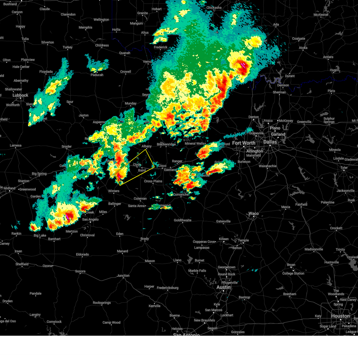 At 902 pm cdt, a severe thunderstorm was located near buffalo gap, moving northeast at 40 mph (radar indicated). Hazards include 60 mph wind gusts and quarter size hail. Hail damage to vehicles is expected. expect wind damage to roofs, siding, and trees. this severe storm will be near, abilene and potosi around 905 pm cdt. clyde around 920 pm cdt. other locations impacted by this severe thunderstorm include lake abilene, mccarty lake, camp tonkawa, us-283 near the callahan- shackelford county line, kirby lake, and ovalo. This includes interstate 20 between mile markers 289 and 316. At 902 pm cdt, a severe thunderstorm was located near buffalo gap, moving northeast at 40 mph (radar indicated). Hazards include 60 mph wind gusts and quarter size hail. Hail damage to vehicles is expected. expect wind damage to roofs, siding, and trees. this severe storm will be near, abilene and potosi around 905 pm cdt. clyde around 920 pm cdt. other locations impacted by this severe thunderstorm include lake abilene, mccarty lake, camp tonkawa, us-283 near the callahan- shackelford county line, kirby lake, and ovalo. This includes interstate 20 between mile markers 289 and 316.
|
| 4/19/2025 8:47 PM CDT | Svrsjt the national weather service in san angelo has issued a * severe thunderstorm warning for, northern callahan county in west central texas, southern taylor county in west central texas, south central shackelford county in west central texas, * until 945 pm cdt. * at 846 pm cdt, a severe thunderstorm was located over lake abilene, or near coronados camp, moving northeast at 40 mph (radar indicated). Hazards include 60 mph wind gusts and quarter size hail. Hail damage to vehicles is expected. expect wind damage to roofs, siding, and trees. this severe thunderstorm will be near, abilene, tuscola, and buffalo gap around 850 pm cdt. potosi around 855 pm cdt. eula around 915 pm cdt. clyde around 920 pm cdt. other locations impacted by this severe thunderstorm include lake abilene, mccarty lake, camp tonkawa, us-283 near the callahan- shackelford county line, kirby lake, and ovalo. This includes interstate 20 between mile markers 289 and 316. |
| 4/19/2025 8:41 PM CDT |
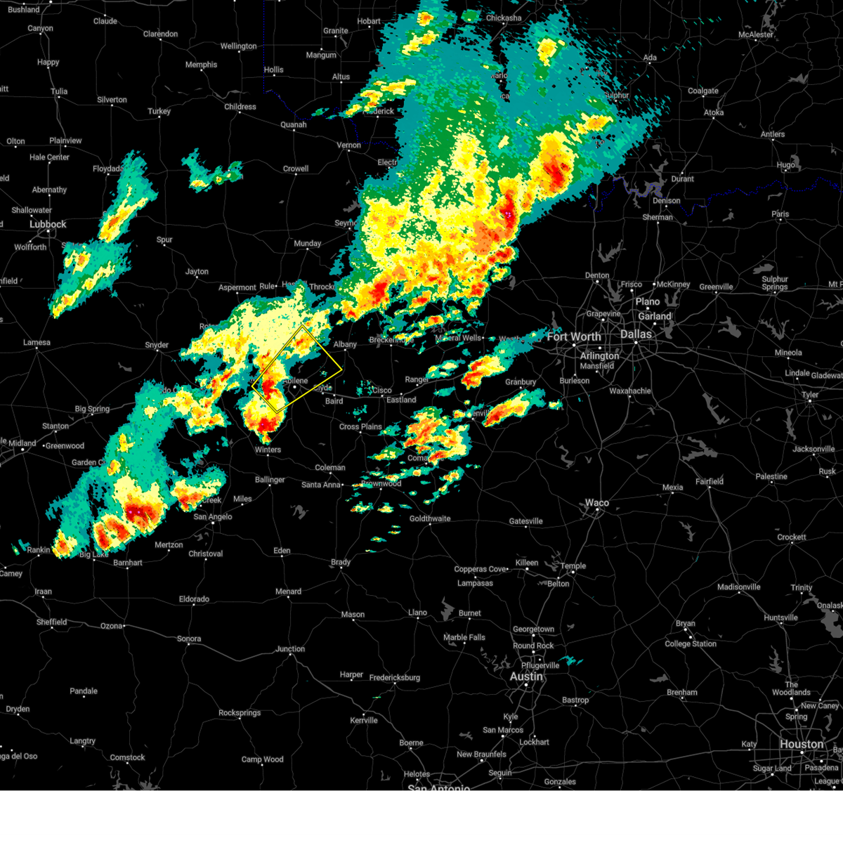 Svrsjt the national weather service in san angelo has issued a * severe thunderstorm warning for, northwestern callahan county in west central texas, southeastern jones county in west central texas, northern taylor county in west central texas, southwestern shackelford county in west central texas, * until 945 pm cdt. * at 839 pm cdt, a severe thunderstorm was located over merkel, moving northeast at 30 mph (radar indicated). Hazards include 60 mph wind gusts and quarter size hail. Hail damage to vehicles is expected. expect wind damage to roofs, siding, and trees. this severe thunderstorm will be near, abilene, tye, and dyess afb around 845 pm cdt. hawley around 850 pm cdt. nugent around 915 pm cdt. lueders around 930 pm cdt. other locations impacted by this severe thunderstorm include funston, hodges, impact, big country baptist assembly, lake fort phantom hill, stith, kirby lake, and the intersection of us-180 and farm road 600. This includes interstate 20 between mile markers 265 and 294. Svrsjt the national weather service in san angelo has issued a * severe thunderstorm warning for, northwestern callahan county in west central texas, southeastern jones county in west central texas, northern taylor county in west central texas, southwestern shackelford county in west central texas, * until 945 pm cdt. * at 839 pm cdt, a severe thunderstorm was located over merkel, moving northeast at 30 mph (radar indicated). Hazards include 60 mph wind gusts and quarter size hail. Hail damage to vehicles is expected. expect wind damage to roofs, siding, and trees. this severe thunderstorm will be near, abilene, tye, and dyess afb around 845 pm cdt. hawley around 850 pm cdt. nugent around 915 pm cdt. lueders around 930 pm cdt. other locations impacted by this severe thunderstorm include funston, hodges, impact, big country baptist assembly, lake fort phantom hill, stith, kirby lake, and the intersection of us-180 and farm road 600. This includes interstate 20 between mile markers 265 and 294.
|
| 4/19/2025 6:59 PM CDT |
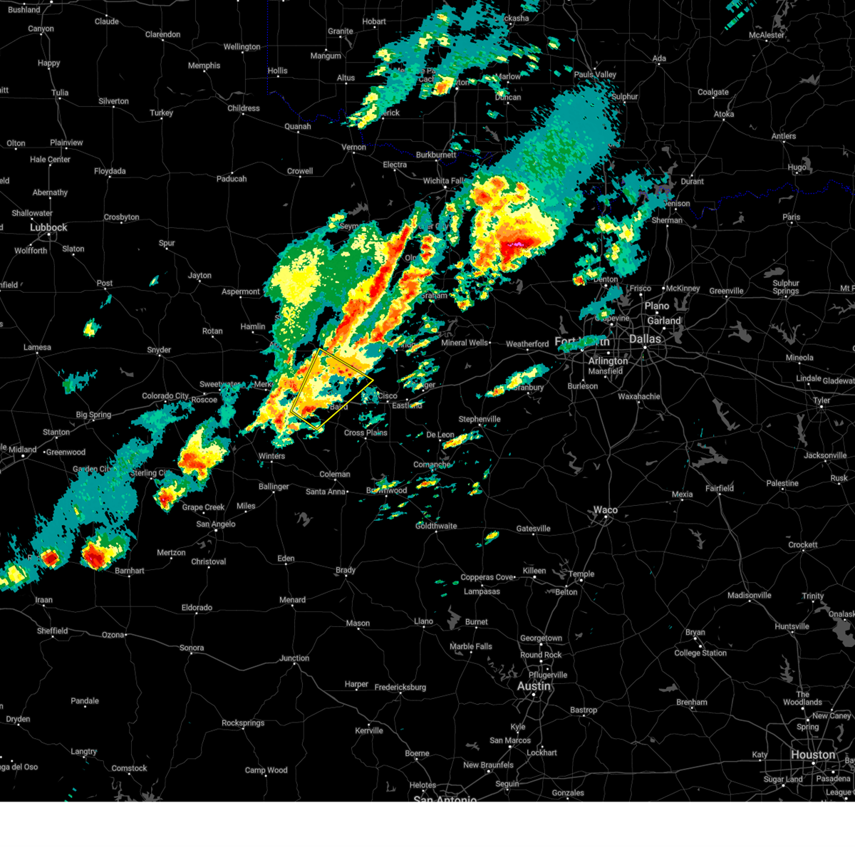 At 659 pm cdt, a severe thunderstorm was located near eula, moving northeast at 30 mph (radar indicated). Hazards include 60 mph wind gusts and nickel size hail. Expect damage to roofs, siding, and trees. this severe storm will be near, hamby, clyde, and abilene around 705 pm cdt. other locations impacted by this severe thunderstorm include mccarty lake, us-283 near the callahan- shackelford county line, and kirby lake. This includes interstate 20 between mile markers 287 and 311. At 659 pm cdt, a severe thunderstorm was located near eula, moving northeast at 30 mph (radar indicated). Hazards include 60 mph wind gusts and nickel size hail. Expect damage to roofs, siding, and trees. this severe storm will be near, hamby, clyde, and abilene around 705 pm cdt. other locations impacted by this severe thunderstorm include mccarty lake, us-283 near the callahan- shackelford county line, and kirby lake. This includes interstate 20 between mile markers 287 and 311.
|
| 4/19/2025 6:33 PM CDT |
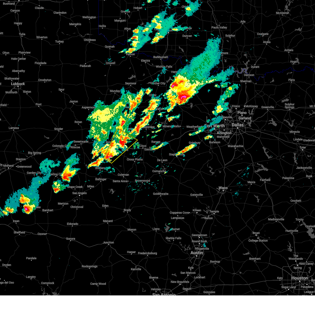 Svrsjt the national weather service in san angelo has issued a * severe thunderstorm warning for, northwestern callahan county in west central texas, southeastern jones county in west central texas, eastern taylor county in west central texas, southern shackelford county in west central texas, * until 730 pm cdt. * at 632 pm cdt, a severe thunderstorm was located near tuscola, moving northeast at 35 mph (radar indicated). Hazards include 60 mph wind gusts and half dollar size hail. Hail damage to vehicles is expected. expect wind damage to roofs, siding, and trees. this severe thunderstorm will be near, abilene, buffalo gap, potosi, and dudley around 635 pm cdt. eula around 640 pm cdt. clyde around 650 pm cdt. hamby around 700 pm cdt. baird around 705 pm cdt. other locations impacted by this severe thunderstorm include mccarty lake, us-283 near the callahan- shackelford county line, kirby lake, and ovalo. This includes interstate 20 between mile markers 287 and 312. Svrsjt the national weather service in san angelo has issued a * severe thunderstorm warning for, northwestern callahan county in west central texas, southeastern jones county in west central texas, eastern taylor county in west central texas, southern shackelford county in west central texas, * until 730 pm cdt. * at 632 pm cdt, a severe thunderstorm was located near tuscola, moving northeast at 35 mph (radar indicated). Hazards include 60 mph wind gusts and half dollar size hail. Hail damage to vehicles is expected. expect wind damage to roofs, siding, and trees. this severe thunderstorm will be near, abilene, buffalo gap, potosi, and dudley around 635 pm cdt. eula around 640 pm cdt. clyde around 650 pm cdt. hamby around 700 pm cdt. baird around 705 pm cdt. other locations impacted by this severe thunderstorm include mccarty lake, us-283 near the callahan- shackelford county line, kirby lake, and ovalo. This includes interstate 20 between mile markers 287 and 312.
|
| 4/4/2025 1:05 AM CDT |
 At 105 am cdt, a severe thunderstorm was located near the intersection of us-180 and ranch road 126, or near neinda, moving northeast at 40 mph (radar indicated). Hazards include 60 mph wind gusts and half dollar size hail. Hail damage to vehicles is expected. expect wind damage to roofs, siding, and trees. this severe storm will be near, anson around 110 am cdt. stamford around 120 am cdt. avoca around 125 am cdt. Other locations impacted by this severe thunderstorm include funston, the intersection of us- 180 and ranch road 126, truby, the intersection of us- 180 and farm road 600, and tuxedo. At 105 am cdt, a severe thunderstorm was located near the intersection of us-180 and ranch road 126, or near neinda, moving northeast at 40 mph (radar indicated). Hazards include 60 mph wind gusts and half dollar size hail. Hail damage to vehicles is expected. expect wind damage to roofs, siding, and trees. this severe storm will be near, anson around 110 am cdt. stamford around 120 am cdt. avoca around 125 am cdt. Other locations impacted by this severe thunderstorm include funston, the intersection of us- 180 and ranch road 126, truby, the intersection of us- 180 and farm road 600, and tuxedo.
|
| 4/4/2025 1:05 AM CDT |
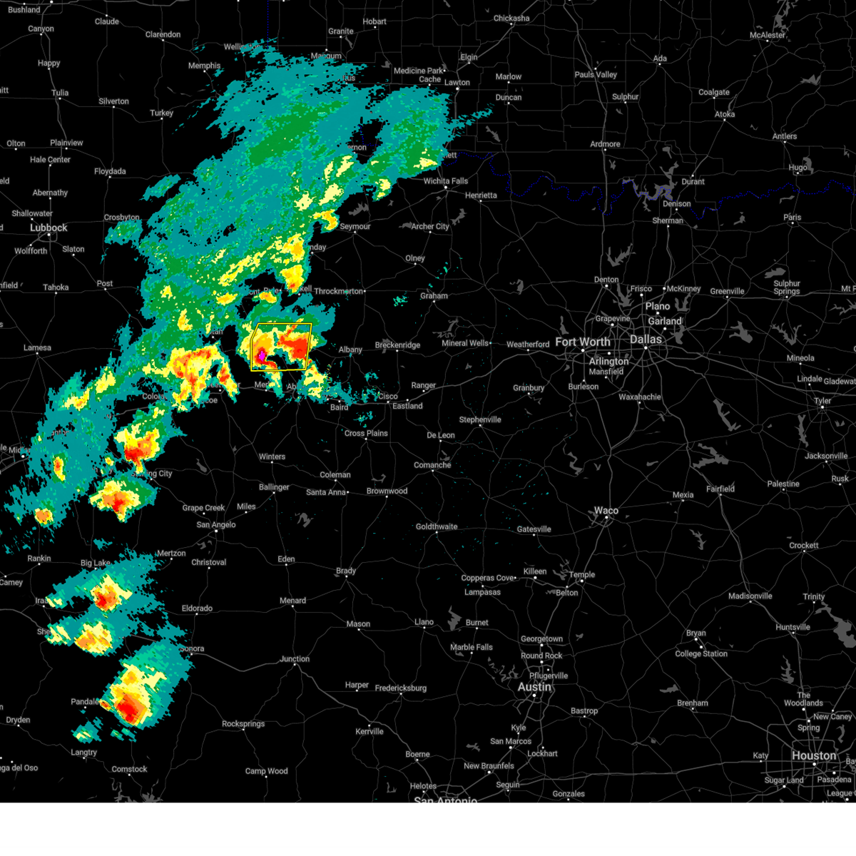 the severe thunderstorm warning has been cancelled and is no longer in effect the severe thunderstorm warning has been cancelled and is no longer in effect
|
| 4/4/2025 12:56 AM CDT |
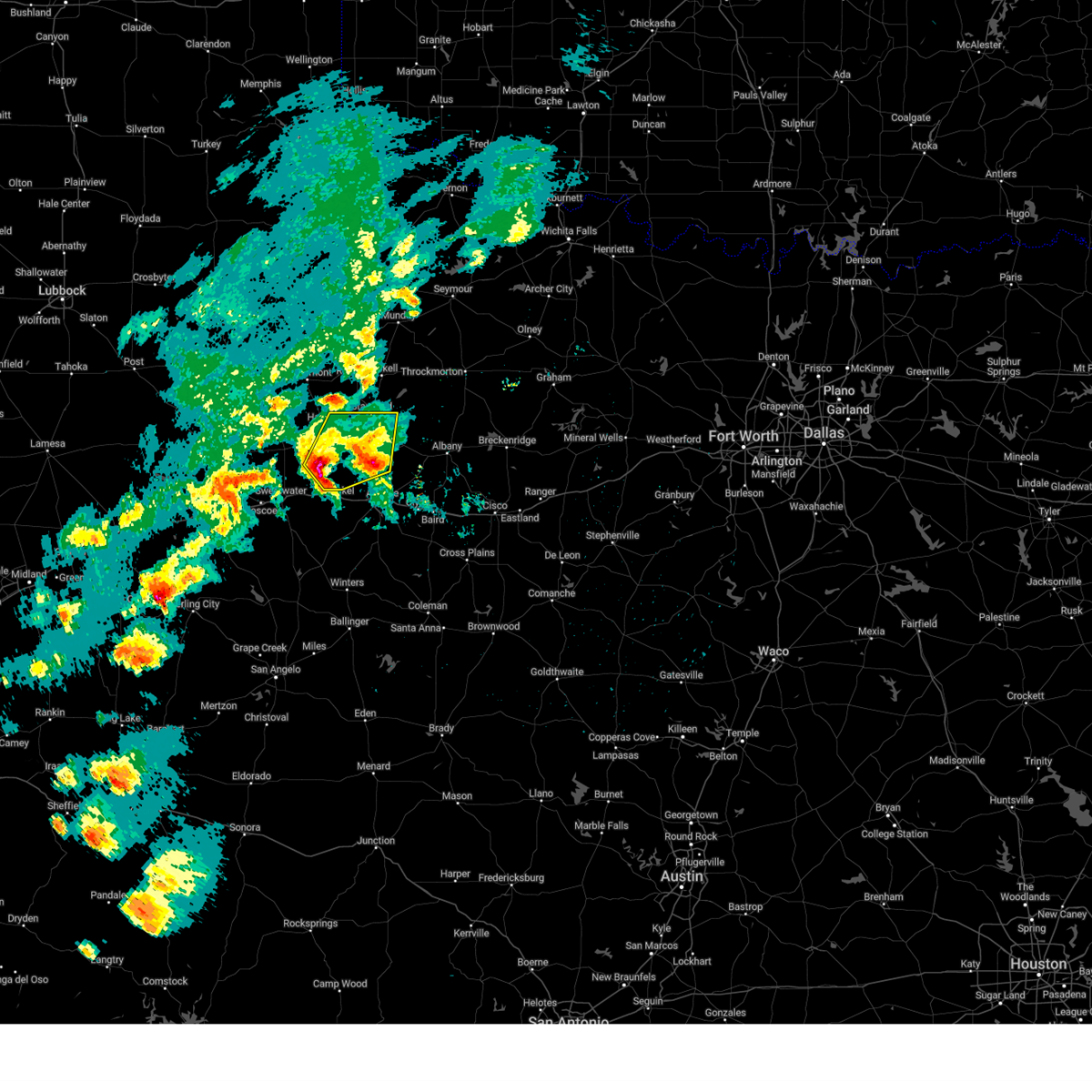 Svrsjt the national weather service in san angelo has issued a * severe thunderstorm warning for, jones county in west central texas, eastern fisher county in west central texas, * until 145 am cdt. * at 1255 am cdt, a severe thunderstorm was located near noodle, moving northeast at 45 mph (radar indicated). Hazards include 60 mph wind gusts and quarter size hail. Hail damage to vehicles is expected. expect wind damage to roofs, siding, and trees. this severe thunderstorm will be near, neinda around 100 am cdt. anson around 105 am cdt. stamford around 120 am cdt. avoca around 125 am cdt. Other locations impacted by this severe thunderstorm include funston, hodges, the intersection of us- 180 and ranch road 126, tuxedo, stith, truby, and the intersection of us-180 and farm road 600. Svrsjt the national weather service in san angelo has issued a * severe thunderstorm warning for, jones county in west central texas, eastern fisher county in west central texas, * until 145 am cdt. * at 1255 am cdt, a severe thunderstorm was located near noodle, moving northeast at 45 mph (radar indicated). Hazards include 60 mph wind gusts and quarter size hail. Hail damage to vehicles is expected. expect wind damage to roofs, siding, and trees. this severe thunderstorm will be near, neinda around 100 am cdt. anson around 105 am cdt. stamford around 120 am cdt. avoca around 125 am cdt. Other locations impacted by this severe thunderstorm include funston, hodges, the intersection of us- 180 and ranch road 126, tuxedo, stith, truby, and the intersection of us-180 and farm road 600.
|
| 4/3/2025 5:11 AM CDT |
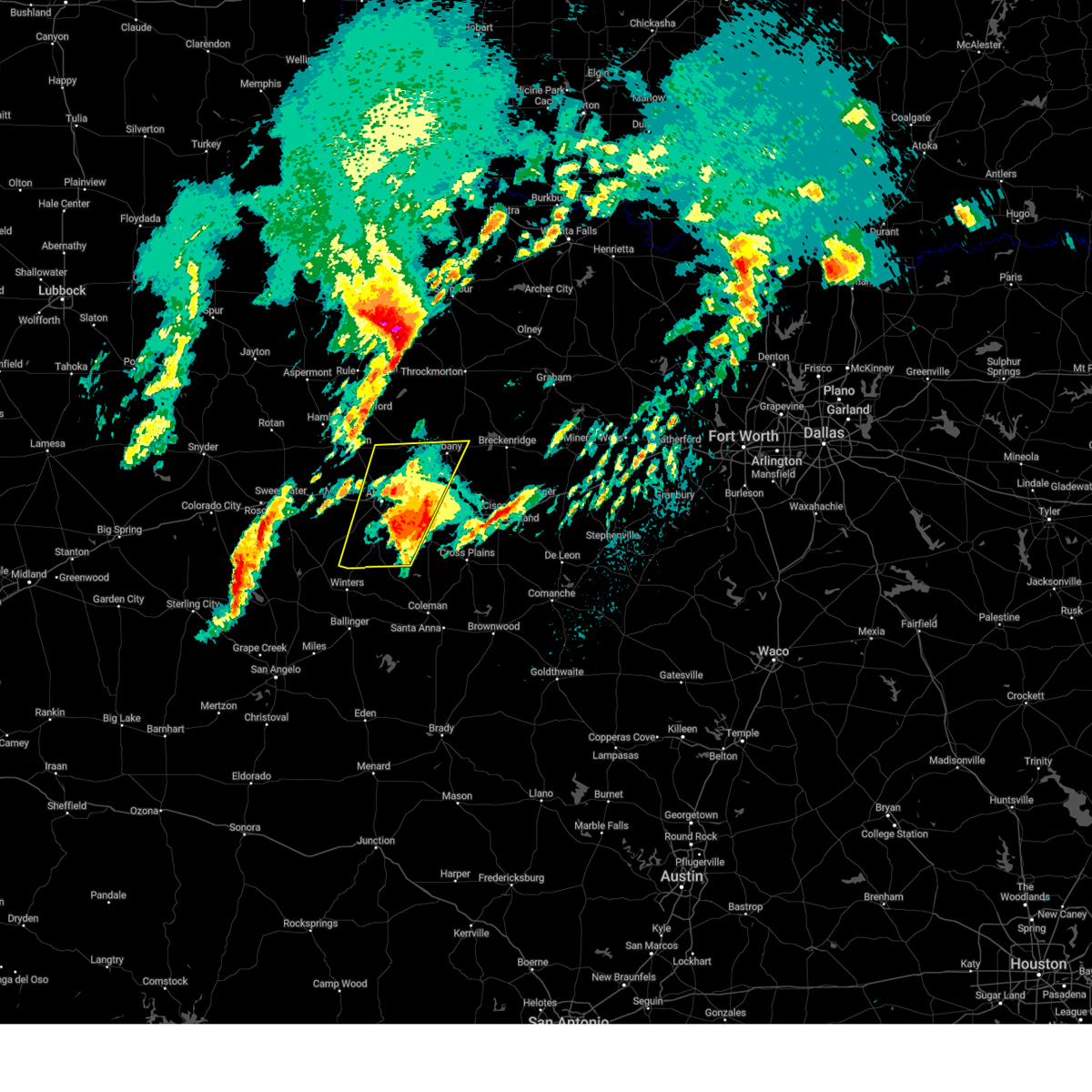 At 511 am cdt, a severe thunderstorm was located over baird, moving northeast at 30 mph (radar indicated). Hazards include golf ball size hail. People and animals outdoors will be injured. expect damage to roofs, siding, windows, and vehicles. this severe storm will be near, baird around 515 am cdt. other locations impacted by this severe thunderstorm include impact, lake abilene, mccarty lake, camp tonkawa, lake fort phantom hill, us- 283 near the callahan- shackelford county line, kirby lake, ovalo, and the intersection of us-180 and farm road 600. This includes interstate 20 between mile markers 276 and 308. At 511 am cdt, a severe thunderstorm was located over baird, moving northeast at 30 mph (radar indicated). Hazards include golf ball size hail. People and animals outdoors will be injured. expect damage to roofs, siding, windows, and vehicles. this severe storm will be near, baird around 515 am cdt. other locations impacted by this severe thunderstorm include impact, lake abilene, mccarty lake, camp tonkawa, lake fort phantom hill, us- 283 near the callahan- shackelford county line, kirby lake, ovalo, and the intersection of us-180 and farm road 600. This includes interstate 20 between mile markers 276 and 308.
|
| 4/3/2025 4:37 AM CDT |
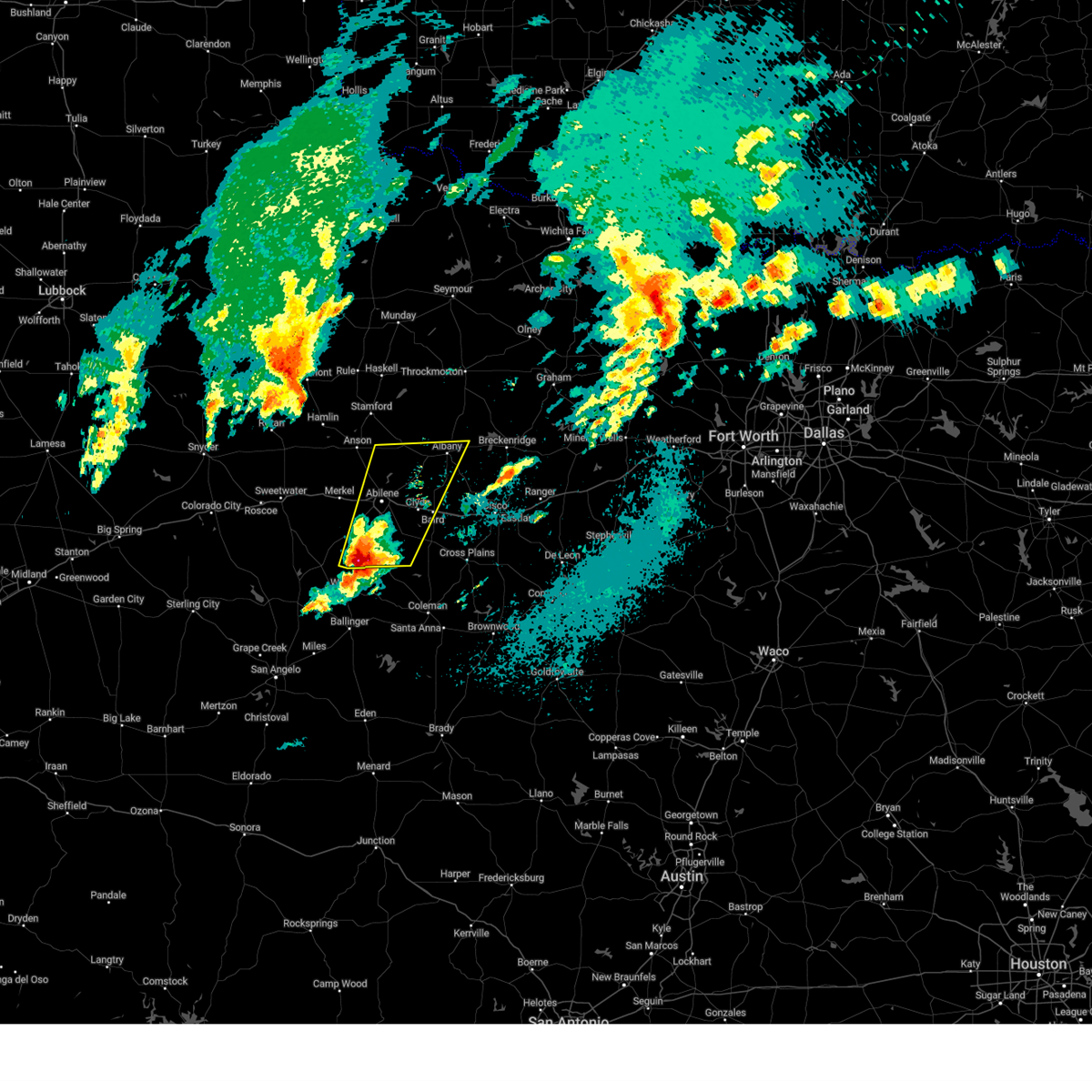 Svrsjt the national weather service in san angelo has issued a * severe thunderstorm warning for, western callahan county in west central texas, southeastern jones county in west central texas, taylor county in west central texas, southern shackelford county in west central texas, * until 530 am cdt. * at 437 am cdt, a severe thunderstorm was located over tuscola, moving northeast at 55 mph (radar indicated). Hazards include golf ball size hail and 70 mph wind gusts. People and animals outdoors will be injured. expect hail damage to roofs, siding, windows, and vehicles. expect considerable tree damage. wind damage is also likely to mobile homes, roofs, and outbuildings. this severe thunderstorm will be near, caps, abilene, buffalo gap, potosi, and view around 440 am cdt. clyde and eula around 450 am cdt. hamby around 455 am cdt. albany around 515 am cdt. other locations impacted by this severe thunderstorm include impact, lake abilene, mccarty lake, camp tonkawa, lake fort phantom hill, us- 283 near the callahan- shackelford county line, kirby lake, ovalo, and the intersection of us-180 and farm road 600. This includes interstate 20 between mile markers 276 and 308. Svrsjt the national weather service in san angelo has issued a * severe thunderstorm warning for, western callahan county in west central texas, southeastern jones county in west central texas, taylor county in west central texas, southern shackelford county in west central texas, * until 530 am cdt. * at 437 am cdt, a severe thunderstorm was located over tuscola, moving northeast at 55 mph (radar indicated). Hazards include golf ball size hail and 70 mph wind gusts. People and animals outdoors will be injured. expect hail damage to roofs, siding, windows, and vehicles. expect considerable tree damage. wind damage is also likely to mobile homes, roofs, and outbuildings. this severe thunderstorm will be near, caps, abilene, buffalo gap, potosi, and view around 440 am cdt. clyde and eula around 450 am cdt. hamby around 455 am cdt. albany around 515 am cdt. other locations impacted by this severe thunderstorm include impact, lake abilene, mccarty lake, camp tonkawa, lake fort phantom hill, us- 283 near the callahan- shackelford county line, kirby lake, ovalo, and the intersection of us-180 and farm road 600. This includes interstate 20 between mile markers 276 and 308.
|
| 3/4/2025 3:05 AM CST | Report from mping: 1-inch tree limbs broken; shingles blown of in taylor county TX, 1.3 miles NW of Abilene, TX |
| 3/4/2025 2:58 AM CST |
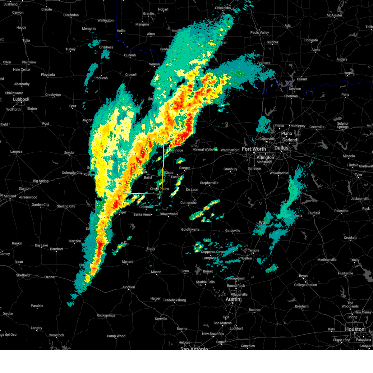 Svrsjt the national weather service in san angelo has issued a * severe thunderstorm warning for, callahan county in west central texas, southeastern taylor county in west central texas, shackelford county in west central texas, * until 400 am cst. * at 257 am cst, a line of severe thunderstorms from just north of albany to near lawn, was moving east at 30 mph (radar indicated). Hazards include 60 mph wind gusts and quarter size hail. Hail damage to vehicles is expected. expect wind damage to roofs, siding, and trees. severe thunderstorms will be near, baird, fort griffin, clyde, albany, lawn, potosi, oplin, eula, and dudley around 300 am cst. ibex around 305 am cst. moran around 310 am cst. rowden and putnam around 315 am cst. atwell around 335 am cst. other locations impacted by these severe thunderstorms include mccarty lake, admiral, us-283 near the callahan- shackelford county line, us-180 near the shackelford- stephens county line, ovalo, i-20 near the callahan- eastland county line, and scranton. This includes interstate 20 between mile markers 291 and 323. Svrsjt the national weather service in san angelo has issued a * severe thunderstorm warning for, callahan county in west central texas, southeastern taylor county in west central texas, shackelford county in west central texas, * until 400 am cst. * at 257 am cst, a line of severe thunderstorms from just north of albany to near lawn, was moving east at 30 mph (radar indicated). Hazards include 60 mph wind gusts and quarter size hail. Hail damage to vehicles is expected. expect wind damage to roofs, siding, and trees. severe thunderstorms will be near, baird, fort griffin, clyde, albany, lawn, potosi, oplin, eula, and dudley around 300 am cst. ibex around 305 am cst. moran around 310 am cst. rowden and putnam around 315 am cst. atwell around 335 am cst. other locations impacted by these severe thunderstorms include mccarty lake, admiral, us-283 near the callahan- shackelford county line, us-180 near the shackelford- stephens county line, ovalo, i-20 near the callahan- eastland county line, and scranton. This includes interstate 20 between mile markers 291 and 323.
|
| 3/4/2025 2:42 AM CST | Storm damage reported in taylor county TX, 5.7 miles NNW of Abilene, TX |
| 3/4/2025 1:19 AM CST | Svrsjt the national weather service in san angelo has issued a * severe thunderstorm warning for, northwestern callahan county in west central texas, southeastern jones county in west central texas, southwestern shackelford county in west central texas, northeastern taylor county in west central texas, * until 145 am cst. * at 118 am cst, a severe thunderstorm was located near abilene, moving northeast at 60 mph (radar indicated). Hazards include 60 mph wind gusts and quarter size hail. Hail damage to vehicles is expected. expect wind damage to roofs, siding, and trees. this severe thunderstorm will be near, abilene and hamby around 125 am cst. other locations impacted by this severe thunderstorm include impact, lake abilene, lake fort phantom hill, mccarty lake, camp tonkawa, and kirby lake. This includes interstate 20 between mile markers 276 and 305. |
| 11/3/2024 12:58 PM CST |
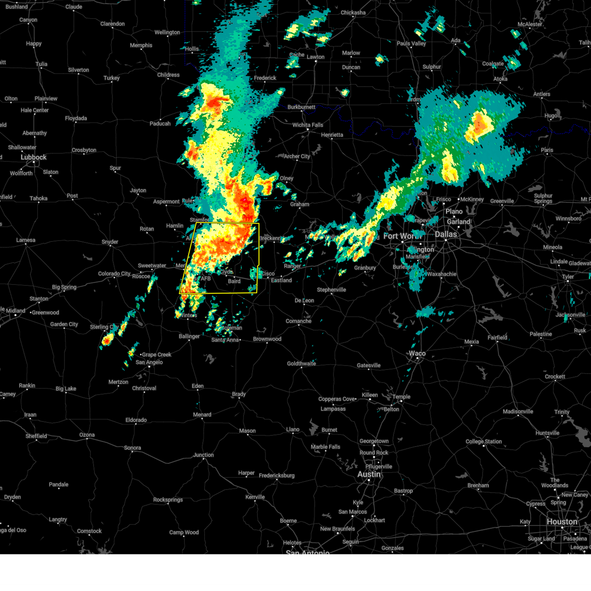 At 1257 pm cst, a severe thunderstorm was located over us- 283 near the callahan- shackelford county line, or near baird, and is nearly stationary (radar indicated). Hazards include 60 mph wind gusts and nickel size hail. Expect damage to roofs, siding, and trees. this severe storm will be near, moran and putnam around 105 pm cst. other locations impacted by this severe thunderstorm include funston, impact, lake abilene, mccarty lake, camp tonkawa, lake fort phantom hill, us-283 near the callahan-shackelford county line, us- 180 near the shackelford- stephens county line, the intersection of us- 180 and farm road 600, and i-20 near the callahan- eastland county line. This includes interstate 20 between mile markers 270 and 323. At 1257 pm cst, a severe thunderstorm was located over us- 283 near the callahan- shackelford county line, or near baird, and is nearly stationary (radar indicated). Hazards include 60 mph wind gusts and nickel size hail. Expect damage to roofs, siding, and trees. this severe storm will be near, moran and putnam around 105 pm cst. other locations impacted by this severe thunderstorm include funston, impact, lake abilene, mccarty lake, camp tonkawa, lake fort phantom hill, us-283 near the callahan-shackelford county line, us- 180 near the shackelford- stephens county line, the intersection of us- 180 and farm road 600, and i-20 near the callahan- eastland county line. This includes interstate 20 between mile markers 270 and 323.
|
| 11/3/2024 12:19 PM CST |
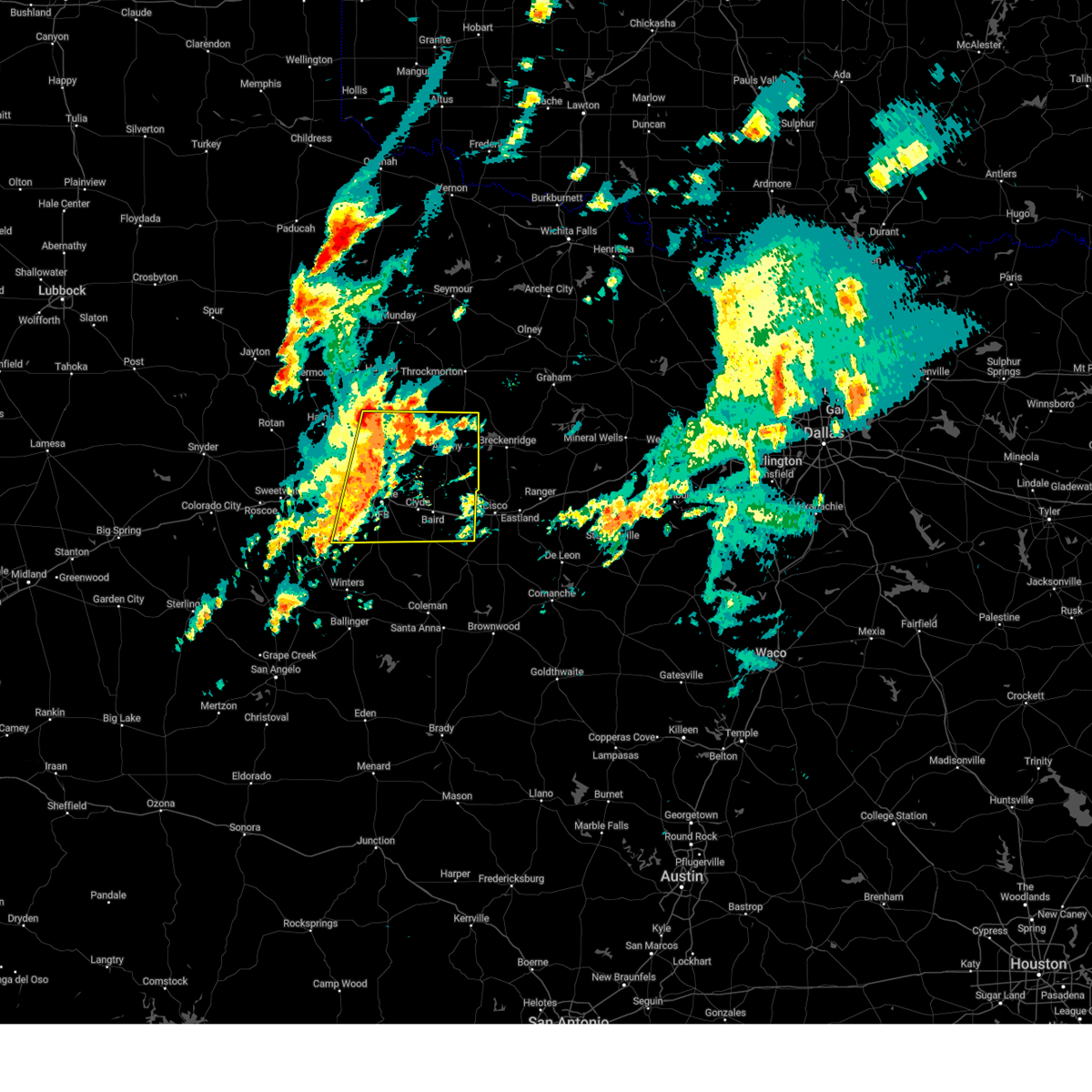 Svrsjt the national weather service in san angelo has issued a * severe thunderstorm warning for, callahan county in west central texas, eastern jones county in west central texas, northern taylor county in west central texas, shackelford county in west central texas, * until 115 pm cst. * at 1219 pm cst, a severe thunderstorm was located over southwestern abilene, moving east at 35 mph (radar indicated). Hazards include 60 mph wind gusts and nickel size hail. Expect damage to roofs, siding, and trees. this severe thunderstorm will be near, eastern abilene, hamby, and potosi around 1225 pm cst. clyde around 1230 pm cst. baird around 1240 pm cst. putnam around 110 pm cst. other locations impacted by this severe thunderstorm include funston, impact, lake abilene, mccarty lake, camp tonkawa, lake fort phantom hill, us-283 near the callahan-shackelford county line, us- 180 near the shackelford- stephens county line, the intersection of us- 180 and farm road 600, and i-20 near the callahan- eastland county line. This includes interstate 20 between mile markers 270 and 323. Svrsjt the national weather service in san angelo has issued a * severe thunderstorm warning for, callahan county in west central texas, eastern jones county in west central texas, northern taylor county in west central texas, shackelford county in west central texas, * until 115 pm cst. * at 1219 pm cst, a severe thunderstorm was located over southwestern abilene, moving east at 35 mph (radar indicated). Hazards include 60 mph wind gusts and nickel size hail. Expect damage to roofs, siding, and trees. this severe thunderstorm will be near, eastern abilene, hamby, and potosi around 1225 pm cst. clyde around 1230 pm cst. baird around 1240 pm cst. putnam around 110 pm cst. other locations impacted by this severe thunderstorm include funston, impact, lake abilene, mccarty lake, camp tonkawa, lake fort phantom hill, us-283 near the callahan-shackelford county line, us- 180 near the shackelford- stephens county line, the intersection of us- 180 and farm road 600, and i-20 near the callahan- eastland county line. This includes interstate 20 between mile markers 270 and 323.
|
| 8/23/2024 7:00 PM CDT |
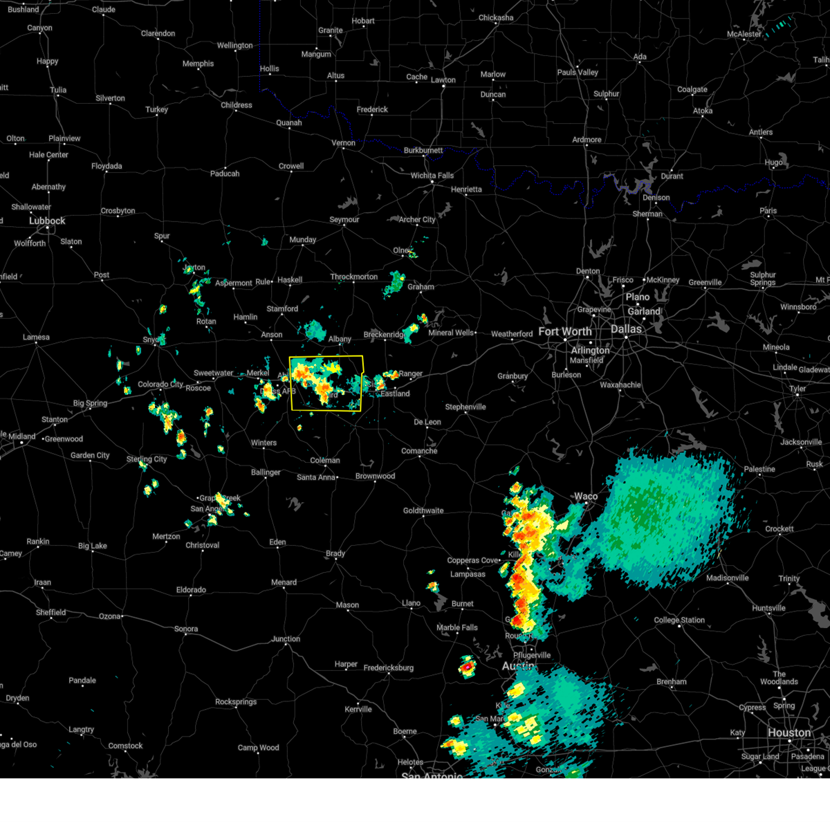 Svrsjt the national weather service in san angelo has issued a * severe thunderstorm warning for, callahan county in west central texas, southeastern jones county in west central texas, northeastern taylor county in west central texas, southern shackelford county in west central texas, * until 745 pm cdt. * at 658 pm cdt, a severe thunderstorm was located over baird, and is nearly stationary (radar indicated). Hazards include 60 mph wind gusts and pea size hail. Expect damage to roofs, siding, and trees. this severe thunderstorm will be near, baird around 705 pm cdt. other locations impacted by this severe thunderstorm include lake fort phantom hill, us-283 near the callahan- shackelford county line, admiral, and i-20 near the callahan- eastland county line. This includes interstate 20 between mile markers 286 and 323. Svrsjt the national weather service in san angelo has issued a * severe thunderstorm warning for, callahan county in west central texas, southeastern jones county in west central texas, northeastern taylor county in west central texas, southern shackelford county in west central texas, * until 745 pm cdt. * at 658 pm cdt, a severe thunderstorm was located over baird, and is nearly stationary (radar indicated). Hazards include 60 mph wind gusts and pea size hail. Expect damage to roofs, siding, and trees. this severe thunderstorm will be near, baird around 705 pm cdt. other locations impacted by this severe thunderstorm include lake fort phantom hill, us-283 near the callahan- shackelford county line, admiral, and i-20 near the callahan- eastland county line. This includes interstate 20 between mile markers 286 and 323.
|
| 8/23/2024 6:34 PM CDT | Portion of metal roof peeled of in taylor county TX, 3.9 miles W of Abilene, TX |
| 8/23/2024 6:31 PM CDT |
 At 630 pm cdt, a severe thunderstorm was located over clyde, and is nearly stationary. pea sized hail was reported in clyde (radar indicated). Hazards include 60 mph wind gusts and pea size hail. Expect damage to roofs, siding, and trees. this severe thunderstorm will remain over mainly rural areas of northwestern callahan, southeastern jones, northeastern taylor and southwestern shackelford counties, including the following locations, us-283 near the callahan- shackelford county line and kirby lake. This includes interstate 20 between mile markers 286 and 308. At 630 pm cdt, a severe thunderstorm was located over clyde, and is nearly stationary. pea sized hail was reported in clyde (radar indicated). Hazards include 60 mph wind gusts and pea size hail. Expect damage to roofs, siding, and trees. this severe thunderstorm will remain over mainly rural areas of northwestern callahan, southeastern jones, northeastern taylor and southwestern shackelford counties, including the following locations, us-283 near the callahan- shackelford county line and kirby lake. This includes interstate 20 between mile markers 286 and 308.
|
| 8/23/2024 6:30 PM CDT | Large tree limbs down. time approximate in taylor county TX, 3.8 miles NNE of Abilene, TX |
| 8/23/2024 6:13 PM CDT |
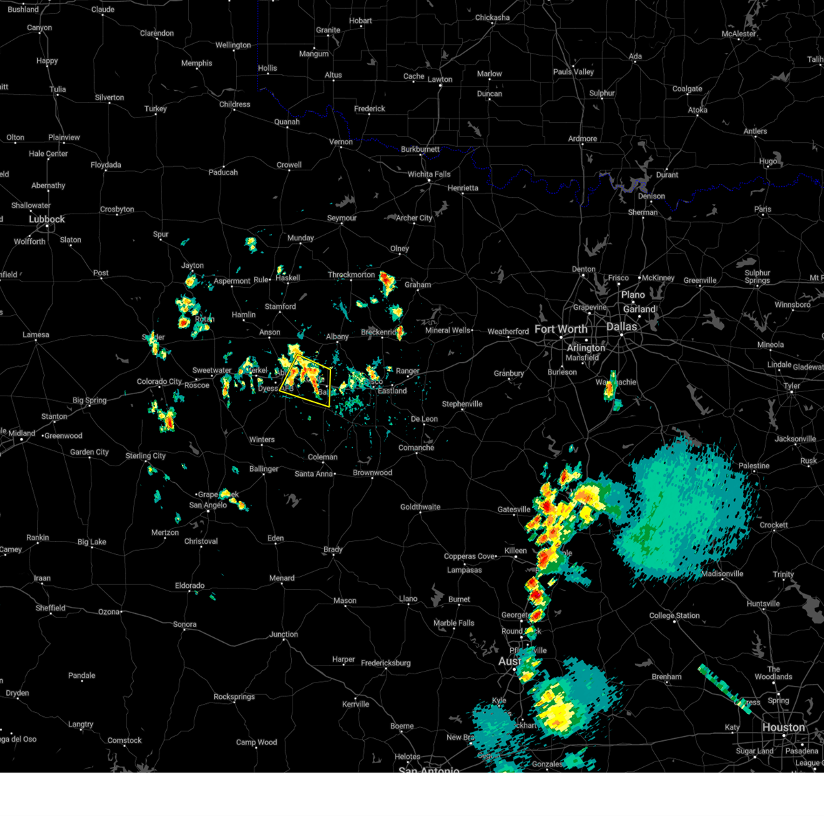 Svrsjt the national weather service in san angelo has issued a * severe thunderstorm warning for, northwestern callahan county in west central texas, southeastern jones county in west central texas, northeastern taylor county in west central texas, southwestern shackelford county in west central texas, * until 700 pm cdt. * at 612 pm cdt, a severe thunderstorm was located over clyde, and is nearly stationary (radar indicated). Hazards include 60 mph wind gusts. Expect damage to roofs, siding, and trees. this severe thunderstorm will be near, clyde around 620 pm cdt. other locations impacted by this severe thunderstorm include us- 283 near the callahan-shackelford county line and kirby lake. This includes interstate 20 between mile markers 286 and 308. Svrsjt the national weather service in san angelo has issued a * severe thunderstorm warning for, northwestern callahan county in west central texas, southeastern jones county in west central texas, northeastern taylor county in west central texas, southwestern shackelford county in west central texas, * until 700 pm cdt. * at 612 pm cdt, a severe thunderstorm was located over clyde, and is nearly stationary (radar indicated). Hazards include 60 mph wind gusts. Expect damage to roofs, siding, and trees. this severe thunderstorm will be near, clyde around 620 pm cdt. other locations impacted by this severe thunderstorm include us- 283 near the callahan-shackelford county line and kirby lake. This includes interstate 20 between mile markers 286 and 308.
|
| 5/31/2024 12:13 AM CDT |
 the severe thunderstorm warning has been cancelled and is no longer in effect the severe thunderstorm warning has been cancelled and is no longer in effect
|
| 5/30/2024 11:53 PM CDT |
 At 1152 pm cdt, a severe thunderstorm was located over stith, or near tye, moving east at 30 mph (radar indicated). Hazards include 60 mph wind gusts and quarter size hail. Hail damage to vehicles is expected. expect wind damage to roofs, siding, and trees. this severe storm will be near, abilene, tye, and hawley around 1200 am cdt. hamby around 1210 am cdt. other locations impacted by this severe thunderstorm include hodges, funston, impact, lake fort phantom hill, truby, stith, and the intersection of us-180 and farm road 600. This includes interstate 20 between mile markers 261 and 287. At 1152 pm cdt, a severe thunderstorm was located over stith, or near tye, moving east at 30 mph (radar indicated). Hazards include 60 mph wind gusts and quarter size hail. Hail damage to vehicles is expected. expect wind damage to roofs, siding, and trees. this severe storm will be near, abilene, tye, and hawley around 1200 am cdt. hamby around 1210 am cdt. other locations impacted by this severe thunderstorm include hodges, funston, impact, lake fort phantom hill, truby, stith, and the intersection of us-180 and farm road 600. This includes interstate 20 between mile markers 261 and 287.
|
| 5/30/2024 11:44 PM CDT |
 The storm which prompted the warning has moved out of the area. therefore, the warning will be allowed to expire. however, small hail and gusty winds are still possible with this thunderstorm. remember, a severe thunderstorm warning still remains in effect for northern taylor and southern jones county until 1230 am. The storm which prompted the warning has moved out of the area. therefore, the warning will be allowed to expire. however, small hail and gusty winds are still possible with this thunderstorm. remember, a severe thunderstorm warning still remains in effect for northern taylor and southern jones county until 1230 am.
|
| 5/30/2024 11:42 PM CDT |
 Svrsjt the national weather service in san angelo has issued a * severe thunderstorm warning for, jones county in west central texas, northern taylor county in west central texas, southwestern shackelford county in west central texas, * until 1230 am cdt. * at 1142 pm cdt, a severe thunderstorm was located over merkel, moving north at 35 mph (radar indicated). Hazards include 60 mph wind gusts and half dollar size hail. Hail damage to vehicles is expected. expect wind damage to roofs, siding, and trees. this severe thunderstorm will be near, western abilene, merkel, and tye around 1145 pm cdt. noodle around 1150 pm cdt. hawley around 1155 pm cdt. anson around 1205 am cdt. other locations impacted by this severe thunderstorm include hodges, funston, impact, lake fort phantom hill, truby, stith, and the intersection of us-180 and farm road 600. This includes interstate 20 between mile markers 261 and 287. Svrsjt the national weather service in san angelo has issued a * severe thunderstorm warning for, jones county in west central texas, northern taylor county in west central texas, southwestern shackelford county in west central texas, * until 1230 am cdt. * at 1142 pm cdt, a severe thunderstorm was located over merkel, moving north at 35 mph (radar indicated). Hazards include 60 mph wind gusts and half dollar size hail. Hail damage to vehicles is expected. expect wind damage to roofs, siding, and trees. this severe thunderstorm will be near, western abilene, merkel, and tye around 1145 pm cdt. noodle around 1150 pm cdt. hawley around 1155 pm cdt. anson around 1205 am cdt. other locations impacted by this severe thunderstorm include hodges, funston, impact, lake fort phantom hill, truby, stith, and the intersection of us-180 and farm road 600. This includes interstate 20 between mile markers 261 and 287.
|
| 5/30/2024 11:23 PM CDT |
 Svrsjt the national weather service in san angelo has issued a * severe thunderstorm warning for, west central callahan county in west central texas, southeastern jones county in west central texas, taylor county in west central texas, * until midnight cdt. * at 1122 pm cdt, a severe thunderstorm was located over coronados camp, moving northeast at 35 mph (radar indicated). Hazards include 60 mph wind gusts and half dollar size hail. Hail damage to vehicles is expected. expect wind damage to roofs, siding, and trees. this severe thunderstorm will be near, buffalo gap, coronados camp, and view around 1125 pm cdt. abilene and caps around 1130 pm cdt. tye and dyess afb around 1135 pm cdt. potosi around 1140 pm cdt. other locations impacted by this severe thunderstorm include impact, lake abilene, camp tonkawa, camp butman, and kirby lake. This includes interstate 20 between mile markers 273 and 296. Svrsjt the national weather service in san angelo has issued a * severe thunderstorm warning for, west central callahan county in west central texas, southeastern jones county in west central texas, taylor county in west central texas, * until midnight cdt. * at 1122 pm cdt, a severe thunderstorm was located over coronados camp, moving northeast at 35 mph (radar indicated). Hazards include 60 mph wind gusts and half dollar size hail. Hail damage to vehicles is expected. expect wind damage to roofs, siding, and trees. this severe thunderstorm will be near, buffalo gap, coronados camp, and view around 1125 pm cdt. abilene and caps around 1130 pm cdt. tye and dyess afb around 1135 pm cdt. potosi around 1140 pm cdt. other locations impacted by this severe thunderstorm include impact, lake abilene, camp tonkawa, camp butman, and kirby lake. This includes interstate 20 between mile markers 273 and 296.
|
| 5/30/2024 11:13 PM CDT |
 At 1112 pm cdt, a severe thunderstorm was located near trent, moving northeast at 25 mph (radar indicated). Hazards include ping pong ball size hail and 60 mph wind gusts. People and animals outdoors will be injured. expect hail damage to roofs, siding, windows, and vehicles. expect wind damage to roofs, siding, and trees. this severe storm will be near, noodle around 1120 pm cdt. hawley around 1140 pm cdt. other locations impacted by this severe thunderstorm include hodges, truby, stith, and lake sweetwater. This includes interstate 20 between mile markers 242 and 276. At 1112 pm cdt, a severe thunderstorm was located near trent, moving northeast at 25 mph (radar indicated). Hazards include ping pong ball size hail and 60 mph wind gusts. People and animals outdoors will be injured. expect hail damage to roofs, siding, windows, and vehicles. expect wind damage to roofs, siding, and trees. this severe storm will be near, noodle around 1120 pm cdt. hawley around 1140 pm cdt. other locations impacted by this severe thunderstorm include hodges, truby, stith, and lake sweetwater. This includes interstate 20 between mile markers 242 and 276.
|
| 5/30/2024 10:56 PM CDT |
 Svrsjt the national weather service in san angelo has issued a * severe thunderstorm warning for, southwestern jones county in west central texas, northeastern nolan county in west central texas, southeastern fisher county in west central texas, northwestern taylor county in west central texas, * until 1145 pm cdt. * at 1055 pm cdt, a severe thunderstorm was located near trent, moving northeast at 25 mph (radar indicated). Hazards include 60 mph wind gusts and half dollar size hail. Hail damage to vehicles is expected. expect wind damage to roofs, siding, and trees. this severe thunderstorm will be near, merkel and trent around 1100 pm cdt. noodle around 1105 pm cdt. hawley around 1140 pm cdt. other locations impacted by this severe thunderstorm include hodges, truby, stith, and lake sweetwater. This includes interstate 20 between mile markers 242 and 276. Svrsjt the national weather service in san angelo has issued a * severe thunderstorm warning for, southwestern jones county in west central texas, northeastern nolan county in west central texas, southeastern fisher county in west central texas, northwestern taylor county in west central texas, * until 1145 pm cdt. * at 1055 pm cdt, a severe thunderstorm was located near trent, moving northeast at 25 mph (radar indicated). Hazards include 60 mph wind gusts and half dollar size hail. Hail damage to vehicles is expected. expect wind damage to roofs, siding, and trees. this severe thunderstorm will be near, merkel and trent around 1100 pm cdt. noodle around 1105 pm cdt. hawley around 1140 pm cdt. other locations impacted by this severe thunderstorm include hodges, truby, stith, and lake sweetwater. This includes interstate 20 between mile markers 242 and 276.
|
| 5/30/2024 8:34 PM CDT | Asos station kabi abilen in taylor county TX, 5.7 miles NNW of Abilene, TX |
| 5/30/2024 8:16 PM CDT |
 Svrsjt the national weather service in san angelo has issued a * severe thunderstorm warning for, callahan county in west central texas, brown county in west central texas, coleman county in west central texas, eastern taylor county in west central texas, eastern runnels county in west central texas, * until 915 pm cdt. * at 816 pm cdt, severe thunderstorms were located along a line extending from near eula to near silver valley to near hords creek reservoir to 7 miles south of talpa, moving east at 50 mph (radar indicated). Hazards include 60 mph wind gusts and half dollar size hail. Hail damage to vehicles is expected. expect wind damage to roofs, siding, and trees. severe thunderstorms will be near, coleman, clyde, baird, santa anna, rowden, voss, valera, gouldbusk, and burkett around 820 pm cdt. cross plains and putnam around 825 pm cdt. cross cut, grosvenor, atwell, and lake brownwood around 830 pm cdt. bangs, lake brownwood near thrifty, trickham, and byrds around 835 pm cdt. brownwood and lake brownwood state park around 840 pm cdt. early, may, and brookesmith around 845 pm cdt. camp bowie around 850 pm cdt. blanket around 855 pm cdt. other locations impacted by these severe thunderstorms include echo, mozelle, lake coleman, owens, admiral, goldsboro, fisk, kirby lake, thrifty, and indian creek. This includes interstate 20 between mile markers 292 and 323. Svrsjt the national weather service in san angelo has issued a * severe thunderstorm warning for, callahan county in west central texas, brown county in west central texas, coleman county in west central texas, eastern taylor county in west central texas, eastern runnels county in west central texas, * until 915 pm cdt. * at 816 pm cdt, severe thunderstorms were located along a line extending from near eula to near silver valley to near hords creek reservoir to 7 miles south of talpa, moving east at 50 mph (radar indicated). Hazards include 60 mph wind gusts and half dollar size hail. Hail damage to vehicles is expected. expect wind damage to roofs, siding, and trees. severe thunderstorms will be near, coleman, clyde, baird, santa anna, rowden, voss, valera, gouldbusk, and burkett around 820 pm cdt. cross plains and putnam around 825 pm cdt. cross cut, grosvenor, atwell, and lake brownwood around 830 pm cdt. bangs, lake brownwood near thrifty, trickham, and byrds around 835 pm cdt. brownwood and lake brownwood state park around 840 pm cdt. early, may, and brookesmith around 845 pm cdt. camp bowie around 850 pm cdt. blanket around 855 pm cdt. other locations impacted by these severe thunderstorms include echo, mozelle, lake coleman, owens, admiral, goldsboro, fisk, kirby lake, thrifty, and indian creek. This includes interstate 20 between mile markers 292 and 323.
|
| 5/30/2024 8:05 PM CDT | Quarter sized hail reported 6.9 miles NNE of Abilene, TX, report from mping: quarter (1.00 in.). |
| 5/30/2024 8:04 PM CDT | Report from mping: 1-inch tree limbs broken; shingles blown of in taylor county TX, 8.7 miles NNE of Abilene, TX |
| 5/30/2024 8:03 PM CDT |
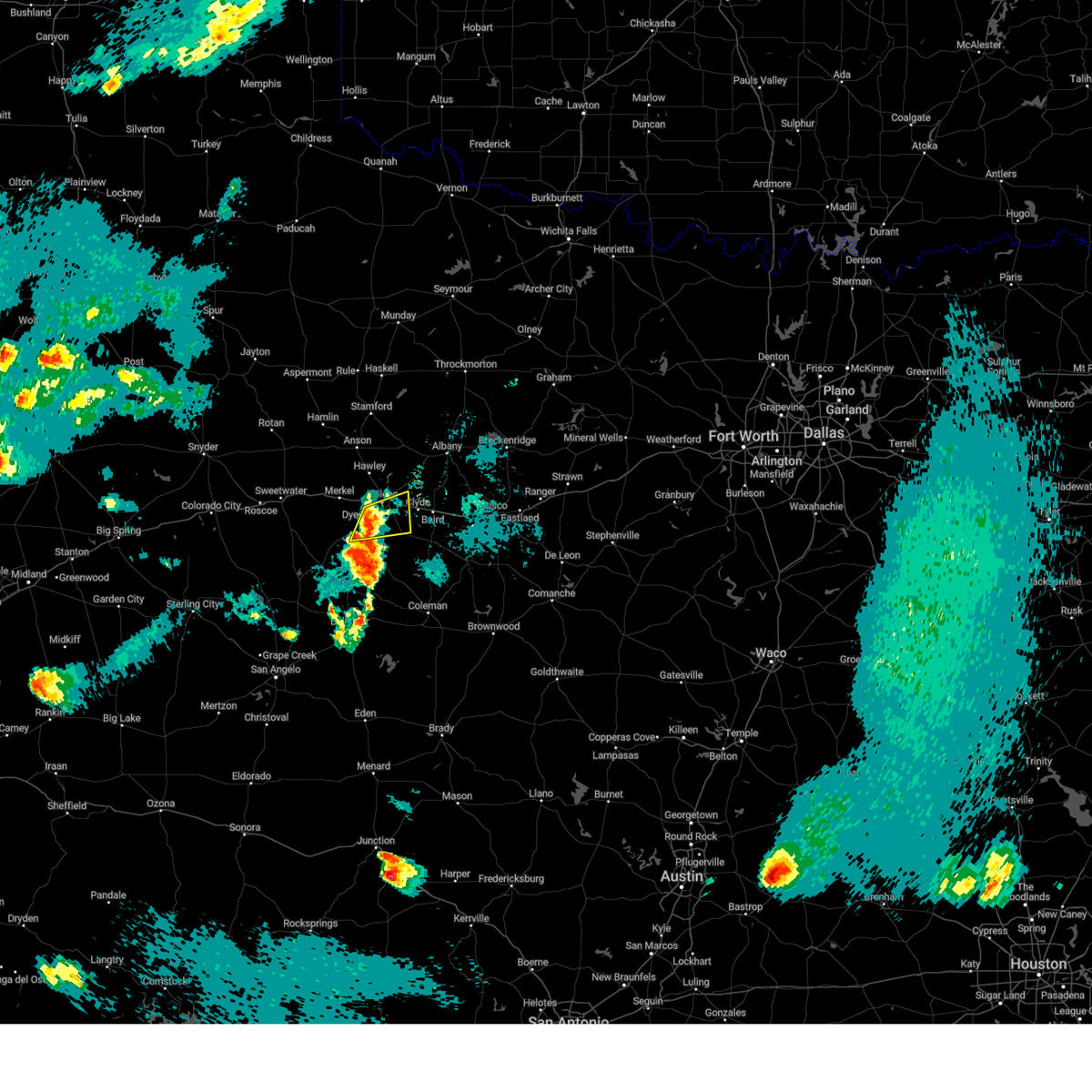 At 802 pm cdt, a severe thunderstorm was located over southern abilene, moving east at 35 mph (radar indicated). Hazards include 60 mph wind gusts and half dollar size hail. Hail damage to vehicles is expected. expect wind damage to roofs, siding, and trees. this severe storm will be near, southeastern abilene and potosi around 810 pm cdt. eula around 815 pm cdt. other locations impacted by this severe thunderstorm include lake abilene, camp tonkawa, and kirby lake. This includes interstate 20 between mile markers 289 and 297. At 802 pm cdt, a severe thunderstorm was located over southern abilene, moving east at 35 mph (radar indicated). Hazards include 60 mph wind gusts and half dollar size hail. Hail damage to vehicles is expected. expect wind damage to roofs, siding, and trees. this severe storm will be near, southeastern abilene and potosi around 810 pm cdt. eula around 815 pm cdt. other locations impacted by this severe thunderstorm include lake abilene, camp tonkawa, and kirby lake. This includes interstate 20 between mile markers 289 and 297.
|
| 5/30/2024 7:49 PM CDT |
 Svrsjt the national weather service in san angelo has issued a * severe thunderstorm warning for, northwestern callahan county in west central texas, central taylor county in west central texas, * until 830 pm cdt. * at 748 pm cdt, a severe thunderstorm was located over view, moving east at 35 mph (radar indicated). Hazards include 60 mph wind gusts and quarter size hail. Hail damage to vehicles is expected. expect wind damage to roofs, siding, and trees. this severe thunderstorm will be near, abilene, tye, potosi, and dyess afb around 755 pm cdt. hamby around 810 pm cdt. eula around 815 pm cdt. other locations impacted by this severe thunderstorm include impact, lake abilene, camp tonkawa, and kirby lake. This includes interstate 20 between mile markers 274 and 297. Svrsjt the national weather service in san angelo has issued a * severe thunderstorm warning for, northwestern callahan county in west central texas, central taylor county in west central texas, * until 830 pm cdt. * at 748 pm cdt, a severe thunderstorm was located over view, moving east at 35 mph (radar indicated). Hazards include 60 mph wind gusts and quarter size hail. Hail damage to vehicles is expected. expect wind damage to roofs, siding, and trees. this severe thunderstorm will be near, abilene, tye, potosi, and dyess afb around 755 pm cdt. hamby around 810 pm cdt. eula around 815 pm cdt. other locations impacted by this severe thunderstorm include impact, lake abilene, camp tonkawa, and kirby lake. This includes interstate 20 between mile markers 274 and 297.
|
| 5/28/2024 9:36 PM CDT |
 Svrsjt the national weather service in san angelo has issued a * severe thunderstorm warning for, northern callahan county in west central texas, southeastern jones county in west central texas, southern shackelford county in west central texas, * until 1030 pm cdt. * at 935 pm cdt, a severe thunderstorm was located over northern abilene in southeastern jones county, moving southeast at 25 mph (radar indicated). Hazards include golf ball size hail and 70 mph wind gusts. People and animals outdoors will be injured. expect hail damage to roofs, siding, windows, and vehicles. expect considerable tree damage. wind damage is also likely to mobile homes, roofs, and outbuildings. this severe thunderstorm will be near, northeastern abilene and hamby around 940 pm cdt. clyde around 955 pm cdt. baird around 1005 pm cdt. other locations impacted by this severe thunderstorm include lake fort phantom hill and us-283 near the callahan- shackelford county line. This includes interstate 20 between mile markers 295 and 315. Svrsjt the national weather service in san angelo has issued a * severe thunderstorm warning for, northern callahan county in west central texas, southeastern jones county in west central texas, southern shackelford county in west central texas, * until 1030 pm cdt. * at 935 pm cdt, a severe thunderstorm was located over northern abilene in southeastern jones county, moving southeast at 25 mph (radar indicated). Hazards include golf ball size hail and 70 mph wind gusts. People and animals outdoors will be injured. expect hail damage to roofs, siding, windows, and vehicles. expect considerable tree damage. wind damage is also likely to mobile homes, roofs, and outbuildings. this severe thunderstorm will be near, northeastern abilene and hamby around 940 pm cdt. clyde around 955 pm cdt. baird around 1005 pm cdt. other locations impacted by this severe thunderstorm include lake fort phantom hill and us-283 near the callahan- shackelford county line. This includes interstate 20 between mile markers 295 and 315.
|
| 5/28/2024 9:24 PM CDT |
 At 923 pm cdt, a severe thunderstorm was located between funston and hawley, moving southeast at 15 mph (radar indicated). Hazards include 70 mph wind gusts and quarter size hail. Hail damage to vehicles is expected. expect considerable tree damage. wind damage is also likely to mobile homes, roofs, and outbuildings. this severe storm will be near, northeastern abilene, hawley, and nugent around 930 pm cdt. Other locations impacted by this severe thunderstorm include funston, the intersection of us- 180 and farm road 600, and lake fort phantom hill. At 923 pm cdt, a severe thunderstorm was located between funston and hawley, moving southeast at 15 mph (radar indicated). Hazards include 70 mph wind gusts and quarter size hail. Hail damage to vehicles is expected. expect considerable tree damage. wind damage is also likely to mobile homes, roofs, and outbuildings. this severe storm will be near, northeastern abilene, hawley, and nugent around 930 pm cdt. Other locations impacted by this severe thunderstorm include funston, the intersection of us- 180 and farm road 600, and lake fort phantom hill.
|
| 5/28/2024 9:01 PM CDT |
 Svrsjt the national weather service in san angelo has issued a * severe thunderstorm warning for, southeastern jones county in west central texas, * until 1000 pm cdt. * at 901 pm cdt, a severe thunderstorm was located over anson, moving southeast at 15 mph (radar indicated). Hazards include 70 mph wind gusts and ping pong ball size hail. People and animals outdoors will be injured. expect hail damage to roofs, siding, windows, and vehicles. expect considerable tree damage. wind damage is also likely to mobile homes, roofs, and outbuildings. this severe thunderstorm will be near, hawley around 910 pm cdt. northeastern abilene and nugent around 920 pm cdt. Other locations impacted by this severe thunderstorm include funston, the intersection of us- 180 and farm road 600, and lake fort phantom hill. Svrsjt the national weather service in san angelo has issued a * severe thunderstorm warning for, southeastern jones county in west central texas, * until 1000 pm cdt. * at 901 pm cdt, a severe thunderstorm was located over anson, moving southeast at 15 mph (radar indicated). Hazards include 70 mph wind gusts and ping pong ball size hail. People and animals outdoors will be injured. expect hail damage to roofs, siding, windows, and vehicles. expect considerable tree damage. wind damage is also likely to mobile homes, roofs, and outbuildings. this severe thunderstorm will be near, hawley around 910 pm cdt. northeastern abilene and nugent around 920 pm cdt. Other locations impacted by this severe thunderstorm include funston, the intersection of us- 180 and farm road 600, and lake fort phantom hill.
|
| 5/28/2024 9:00 AM CDT | Large broken tree limbs fell onto parked truc in taylor county TX, 3.9 miles NNE of Abilene, TX |
| 5/25/2024 2:38 PM CDT |
 At 238 pm cdt, a severe thunderstorm was located near shep, or near hylton, moving east at 40 mph (radar indicated). Hazards include tennis ball size hail and 60 mph wind gusts. People and animals outdoors will be injured. expect hail damage to roofs, siding, windows, and vehicles. expect wind damage to roofs, siding, and trees. this severe storm will be near, coronados camp and happy valley around 245 pm cdt. bradshaw around 250 pm cdt. tuscola and buffalo gap around 255 pm cdt. lawn around 300 pm cdt. potosi, oplin, and dudley around 315 pm cdt. other locations impacted by this severe thunderstorm include lake abilene, drasco, camp tonkawa, shep, camp butman, kirby lake, and ovalo. This includes interstate 20 between mile markers 290 and 293. At 238 pm cdt, a severe thunderstorm was located near shep, or near hylton, moving east at 40 mph (radar indicated). Hazards include tennis ball size hail and 60 mph wind gusts. People and animals outdoors will be injured. expect hail damage to roofs, siding, windows, and vehicles. expect wind damage to roofs, siding, and trees. this severe storm will be near, coronados camp and happy valley around 245 pm cdt. bradshaw around 250 pm cdt. tuscola and buffalo gap around 255 pm cdt. lawn around 300 pm cdt. potosi, oplin, and dudley around 315 pm cdt. other locations impacted by this severe thunderstorm include lake abilene, drasco, camp tonkawa, shep, camp butman, kirby lake, and ovalo. This includes interstate 20 between mile markers 290 and 293.
|
| 5/25/2024 2:27 PM CDT |
 At 225 pm cdt, a severe thunderstorm was located near hylton, moving east at 35 mph. at 212 pm cdt, the public reported 2 inch diameter hail 7 miles southeast maryneal (radar indicated). Hazards include two inch hail and 60 mph wind gusts. People and animals outdoors will be injured. expect hail damage to roofs, siding, windows, and vehicles. expect wind damage to roofs, siding, and trees. this severe storm will be near, nolan, hylton, and happy valley around 230 pm cdt. coronados camp around 240 pm cdt. buffalo gap and view around 255 pm cdt. caps around 300 pm cdt. western abilene and tuscola around 305 pm cdt. dyess afb around 310 pm cdt. other locations impacted by this severe thunderstorm include lake abilene, drasco, camp tonkawa, shep, camp butman, kirby lake, and ovalo. This includes interstate 20 between mile markers 287 and 293. At 225 pm cdt, a severe thunderstorm was located near hylton, moving east at 35 mph. at 212 pm cdt, the public reported 2 inch diameter hail 7 miles southeast maryneal (radar indicated). Hazards include two inch hail and 60 mph wind gusts. People and animals outdoors will be injured. expect hail damage to roofs, siding, windows, and vehicles. expect wind damage to roofs, siding, and trees. this severe storm will be near, nolan, hylton, and happy valley around 230 pm cdt. coronados camp around 240 pm cdt. buffalo gap and view around 255 pm cdt. caps around 300 pm cdt. western abilene and tuscola around 305 pm cdt. dyess afb around 310 pm cdt. other locations impacted by this severe thunderstorm include lake abilene, drasco, camp tonkawa, shep, camp butman, kirby lake, and ovalo. This includes interstate 20 between mile markers 287 and 293.
|
| 5/25/2024 2:13 PM CDT |
 Svrsjt the national weather service in san angelo has issued a * severe thunderstorm warning for, southwestern callahan county in west central texas, southeastern nolan county in west central texas, taylor county in west central texas, northern runnels county in west central texas, * until 300 pm cdt. * at 212 pm cdt, a severe thunderstorm was located near nolan, moving east at 60 mph (radar indicated). Hazards include 60 mph wind gusts and half dollar size hail. Hail damage to vehicles is expected. expect wind damage to roofs, siding, and trees. this severe thunderstorm will be near, happy valley around 220 pm cdt. coronados camp around 225 pm cdt. buffalo gap and view around 230 pm cdt. southern abilene, tuscola, and caps around 235 pm cdt. potosi and dyess afb around 240 pm cdt. dudley around 250 pm cdt. other locations impacted by this severe thunderstorm include lake abilene, drasco, camp tonkawa, shep, camp butman, kirby lake, the intersection of highway 70 and ranch road 53, and ovalo. This includes interstate 20 between mile markers 278 and 293. Svrsjt the national weather service in san angelo has issued a * severe thunderstorm warning for, southwestern callahan county in west central texas, southeastern nolan county in west central texas, taylor county in west central texas, northern runnels county in west central texas, * until 300 pm cdt. * at 212 pm cdt, a severe thunderstorm was located near nolan, moving east at 60 mph (radar indicated). Hazards include 60 mph wind gusts and half dollar size hail. Hail damage to vehicles is expected. expect wind damage to roofs, siding, and trees. this severe thunderstorm will be near, happy valley around 220 pm cdt. coronados camp around 225 pm cdt. buffalo gap and view around 230 pm cdt. southern abilene, tuscola, and caps around 235 pm cdt. potosi and dyess afb around 240 pm cdt. dudley around 250 pm cdt. other locations impacted by this severe thunderstorm include lake abilene, drasco, camp tonkawa, shep, camp butman, kirby lake, the intersection of highway 70 and ranch road 53, and ovalo. This includes interstate 20 between mile markers 278 and 293.
|
| 5/23/2024 6:29 PM CDT |
 Svrsjt the national weather service in san angelo has issued a * severe thunderstorm warning for, northeastern jones county in west central texas, western shackelford county in west central texas, * until 715 pm cdt. * at 628 pm cdt, a severe thunderstorm was located near funston, or near avoca, moving east at 30 mph (radar indicated). Hazards include 70 mph wind gusts and half dollar size hail. Hail damage to vehicles is expected. expect considerable tree damage. wind damage is also likely to mobile homes, roofs, and outbuildings. this severe thunderstorm will be near, lueders, nugent, and avoca around 635 pm cdt. Other locations impacted by this severe thunderstorm include funston, big country baptist assembly, and the intersection of us- 180 and farm road 600. Svrsjt the national weather service in san angelo has issued a * severe thunderstorm warning for, northeastern jones county in west central texas, western shackelford county in west central texas, * until 715 pm cdt. * at 628 pm cdt, a severe thunderstorm was located near funston, or near avoca, moving east at 30 mph (radar indicated). Hazards include 70 mph wind gusts and half dollar size hail. Hail damage to vehicles is expected. expect considerable tree damage. wind damage is also likely to mobile homes, roofs, and outbuildings. this severe thunderstorm will be near, lueders, nugent, and avoca around 635 pm cdt. Other locations impacted by this severe thunderstorm include funston, big country baptist assembly, and the intersection of us- 180 and farm road 600.
|
| 5/16/2024 10:49 AM CDT |
 the severe thunderstorm warning has been cancelled and is no longer in effect the severe thunderstorm warning has been cancelled and is no longer in effect
|
| 5/16/2024 10:49 AM CDT |
 At 1048 am cdt, a severe thunderstorm was located near camp butman, or 7 miles northwest of coronados camp, moving northeast at 30 mph (radar indicated). Hazards include 60 mph wind gusts and half dollar size hail. Hail damage to vehicles is expected. expect wind damage to roofs, siding, and trees. this severe storm will be near, merkel around 1055 am cdt. other locations impacted by this severe thunderstorm include camp butman. This includes interstate 20 between mile markers 265 and 271. At 1048 am cdt, a severe thunderstorm was located near camp butman, or 7 miles northwest of coronados camp, moving northeast at 30 mph (radar indicated). Hazards include 60 mph wind gusts and half dollar size hail. Hail damage to vehicles is expected. expect wind damage to roofs, siding, and trees. this severe storm will be near, merkel around 1055 am cdt. other locations impacted by this severe thunderstorm include camp butman. This includes interstate 20 between mile markers 265 and 271.
|
| 5/16/2024 10:30 AM CDT |
 Svrsjt the national weather service in san angelo has issued a * severe thunderstorm warning for, southeastern nolan county in west central texas, taylor county in west central texas, * until 1115 am cdt. * at 1029 am cdt, a severe thunderstorm was located near shep, or near nolan, moving northeast at 25 mph (radar indicated). Hazards include ping pong ball size hail and 60 mph wind gusts. People and animals outdoors will be injured. expect hail damage to roofs, siding, windows, and vehicles. expect wind damage to roofs, siding, and trees. this severe thunderstorm will be near, coronados camp around 1035 am cdt. merkel around 1055 am cdt. view around 1100 am cdt. other locations impacted by this severe thunderstorm include lake abilene, camp tonkawa, camp butman, and shep. This includes interstate 20 between mile markers 265 and 271. Svrsjt the national weather service in san angelo has issued a * severe thunderstorm warning for, southeastern nolan county in west central texas, taylor county in west central texas, * until 1115 am cdt. * at 1029 am cdt, a severe thunderstorm was located near shep, or near nolan, moving northeast at 25 mph (radar indicated). Hazards include ping pong ball size hail and 60 mph wind gusts. People and animals outdoors will be injured. expect hail damage to roofs, siding, windows, and vehicles. expect wind damage to roofs, siding, and trees. this severe thunderstorm will be near, coronados camp around 1035 am cdt. merkel around 1055 am cdt. view around 1100 am cdt. other locations impacted by this severe thunderstorm include lake abilene, camp tonkawa, camp butman, and shep. This includes interstate 20 between mile markers 265 and 271.
|
| 5/11/2024 7:22 PM CDT | Storm damage reported in taylor county TX, 9.3 miles ENE of Abilene, TX |
| 5/9/2024 10:10 AM CDT | Quarter sized hail reported 12.9 miles NNW of Abilene, TX |
| 5/4/2024 4:22 PM CDT |
 At 419 pm cdt, a severe thunderstorm was located over tuscola, moving northeast at 15 mph (trained weather spotters. at 417 pm cdt, we received reports of golf ball size hail in tuscola). Hazards include golf ball size hail and 60 mph wind gusts. People and animals outdoors will be injured. expect hail damage to roofs, siding, windows, and vehicles. expect wind damage to roofs, siding, and trees. this severe storm will be near, southern abilene, buffalo gap, potosi, and dudley around 425 pm cdt. wylie around 430 pm cdt. Other locations impacted by this severe thunderstorm include lake abilene, ovalo, and camp tonkawa. At 419 pm cdt, a severe thunderstorm was located over tuscola, moving northeast at 15 mph (trained weather spotters. at 417 pm cdt, we received reports of golf ball size hail in tuscola). Hazards include golf ball size hail and 60 mph wind gusts. People and animals outdoors will be injured. expect hail damage to roofs, siding, windows, and vehicles. expect wind damage to roofs, siding, and trees. this severe storm will be near, southern abilene, buffalo gap, potosi, and dudley around 425 pm cdt. wylie around 430 pm cdt. Other locations impacted by this severe thunderstorm include lake abilene, ovalo, and camp tonkawa.
|
| 5/4/2024 4:09 PM CDT |
 Svrsjt the national weather service in san angelo has issued a * severe thunderstorm warning for, west central callahan county in west central texas, southeastern taylor county in west central texas, * until 445 pm cdt. * at 408 pm cdt, a severe thunderstorm was located over tuscola, moving northeast at 20 mph (radar indicated). Hazards include golf ball size hail and 60 mph wind gusts. People and animals outdoors will be injured. expect hail damage to roofs, siding, windows, and vehicles. expect wind damage to roofs, siding, and trees. this severe thunderstorm will be near, tuscola, buffalo gap, and potosi around 415 pm cdt. southern abilene around 420 pm cdt. dudley around 425 pm cdt. Other locations impacted by this severe thunderstorm include lake abilene, ovalo, and camp tonkawa. Svrsjt the national weather service in san angelo has issued a * severe thunderstorm warning for, west central callahan county in west central texas, southeastern taylor county in west central texas, * until 445 pm cdt. * at 408 pm cdt, a severe thunderstorm was located over tuscola, moving northeast at 20 mph (radar indicated). Hazards include golf ball size hail and 60 mph wind gusts. People and animals outdoors will be injured. expect hail damage to roofs, siding, windows, and vehicles. expect wind damage to roofs, siding, and trees. this severe thunderstorm will be near, tuscola, buffalo gap, and potosi around 415 pm cdt. southern abilene around 420 pm cdt. dudley around 425 pm cdt. Other locations impacted by this severe thunderstorm include lake abilene, ovalo, and camp tonkawa.
|
| 5/4/2024 3:31 PM CDT |
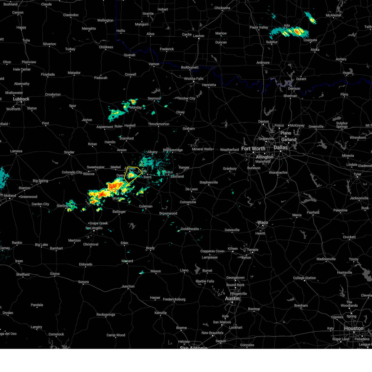 the severe thunderstorm warning has been cancelled and is no longer in effect the severe thunderstorm warning has been cancelled and is no longer in effect
|
| 5/4/2024 3:15 PM CDT |
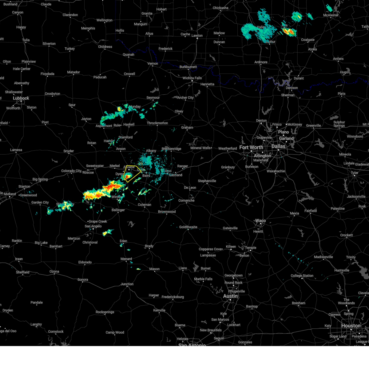 Svrsjt the national weather service in san angelo has issued a * severe thunderstorm warning for, northwestern callahan county in west central texas, northeastern taylor county in west central texas, * until 400 pm cdt. * at 313 pm cdt, a severe thunderstorm was located over wylie, moving northeast at 15 mph (radar indicated). Hazards include ping pong ball size hail and 60 mph wind gusts. People and animals outdoors will be injured. expect hail damage to roofs, siding, windows, and vehicles. expect wind damage to roofs, siding, and trees. this severe thunderstorm will be near, abilene, wylie, and potosi around 320 pm cdt. other locations impacted by this severe thunderstorm include impact and kirby lake. This includes interstate 20 between mile markers 282 and 300. Svrsjt the national weather service in san angelo has issued a * severe thunderstorm warning for, northwestern callahan county in west central texas, northeastern taylor county in west central texas, * until 400 pm cdt. * at 313 pm cdt, a severe thunderstorm was located over wylie, moving northeast at 15 mph (radar indicated). Hazards include ping pong ball size hail and 60 mph wind gusts. People and animals outdoors will be injured. expect hail damage to roofs, siding, windows, and vehicles. expect wind damage to roofs, siding, and trees. this severe thunderstorm will be near, abilene, wylie, and potosi around 320 pm cdt. other locations impacted by this severe thunderstorm include impact and kirby lake. This includes interstate 20 between mile markers 282 and 300.
|
| 5/2/2024 8:56 PM CDT |
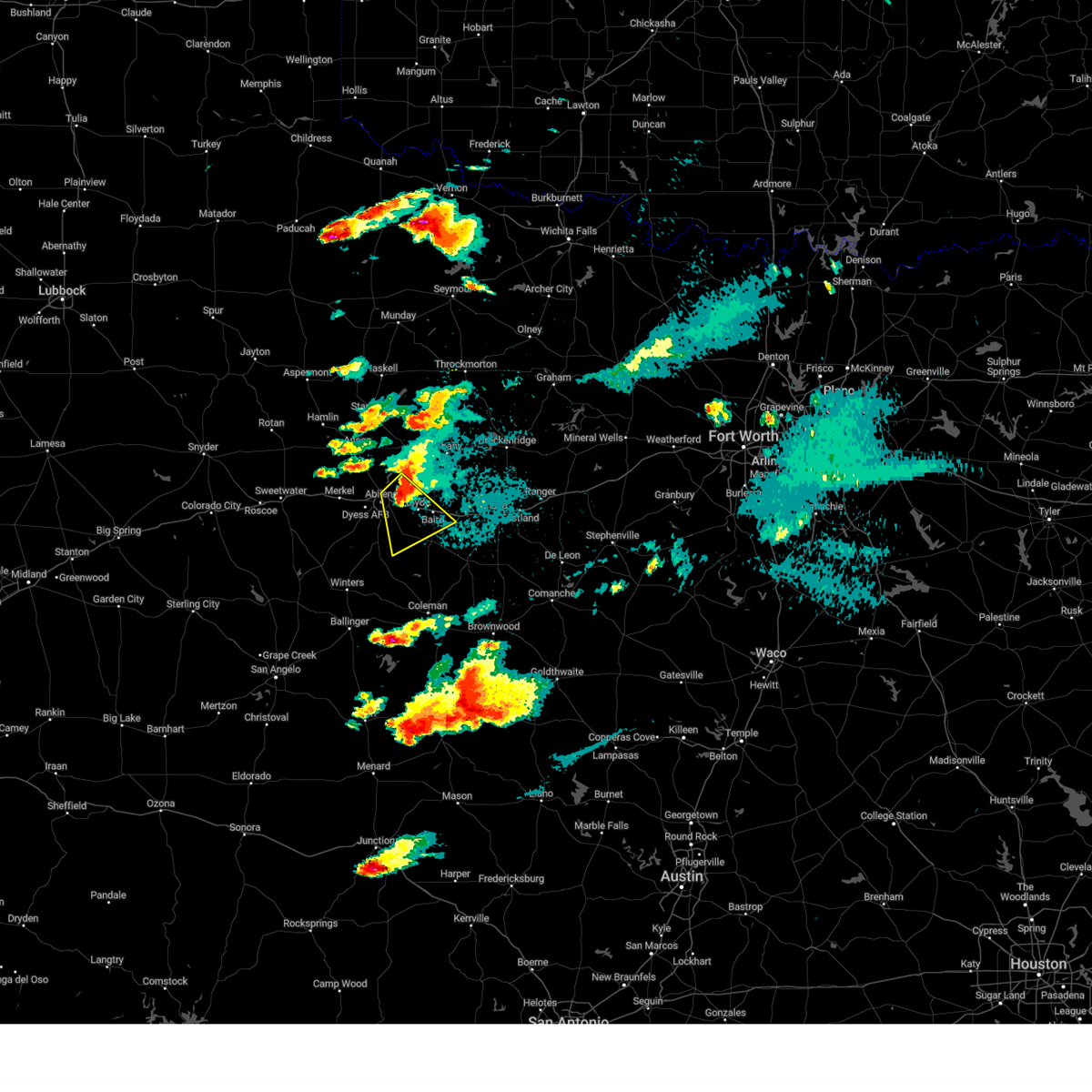 At 854 pm cdt, a severe thunderstorm was located near clyde, moving southeast at 20 mph (radar indicated). Hazards include golf ball size hail and 70 mph wind gusts. People and animals outdoors will be injured. expect hail damage to roofs, siding, windows, and vehicles. expect considerable tree damage. wind damage is also likely to mobile homes, roofs, and outbuildings. this severe storm will be near, clyde, potosi, and eula around 900 pm cdt. baird around 905 pm cdt. This includes interstate 20 between mile markers 286 and 312. At 854 pm cdt, a severe thunderstorm was located near clyde, moving southeast at 20 mph (radar indicated). Hazards include golf ball size hail and 70 mph wind gusts. People and animals outdoors will be injured. expect hail damage to roofs, siding, windows, and vehicles. expect considerable tree damage. wind damage is also likely to mobile homes, roofs, and outbuildings. this severe storm will be near, clyde, potosi, and eula around 900 pm cdt. baird around 905 pm cdt. This includes interstate 20 between mile markers 286 and 312.
|
| 5/2/2024 8:45 PM CDT |
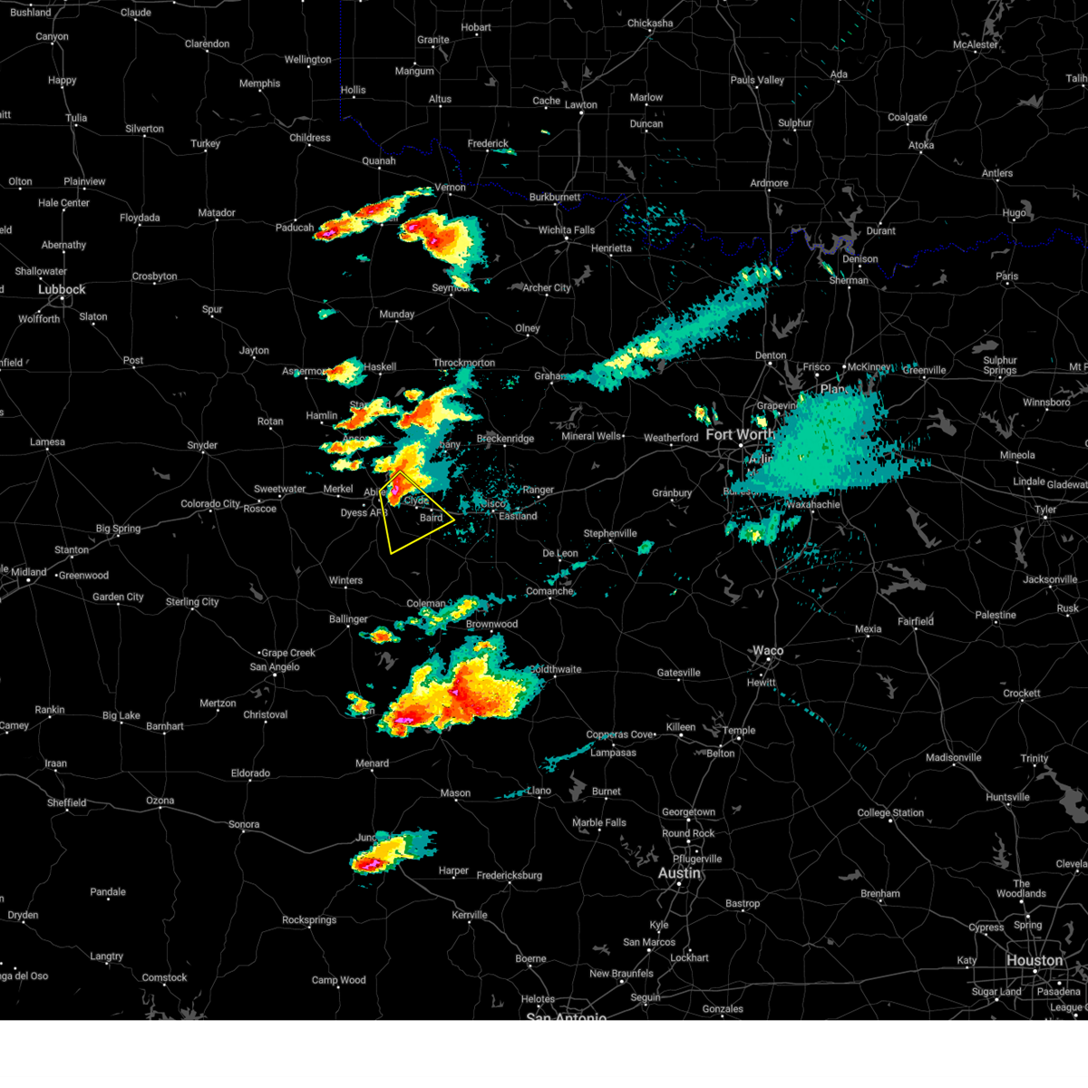 Svrsjt the national weather service in san angelo has issued a * severe thunderstorm warning for, northwestern callahan county in west central texas, southeastern jones county in west central texas, northeastern taylor county in west central texas, southwestern shackelford county in west central texas, * until 945 pm cdt. * at 840 pm cdt, a severe thunderstorm was located over eastern abilene, moving southeast at 15 mph (radar indicated). Hazards include two inch hail and 60 mph wind gusts. People and animals outdoors will be injured. expect hail damage to roofs, siding, windows, and vehicles. expect wind damage to roofs, siding, and trees. this severe thunderstorm will be near, southeastern abilene, clyde, and potosi around 845 pm cdt. eula around 850 pm cdt. baird around 905 pm cdt. This includes interstate 20 between mile markers 286 and 312. Svrsjt the national weather service in san angelo has issued a * severe thunderstorm warning for, northwestern callahan county in west central texas, southeastern jones county in west central texas, northeastern taylor county in west central texas, southwestern shackelford county in west central texas, * until 945 pm cdt. * at 840 pm cdt, a severe thunderstorm was located over eastern abilene, moving southeast at 15 mph (radar indicated). Hazards include two inch hail and 60 mph wind gusts. People and animals outdoors will be injured. expect hail damage to roofs, siding, windows, and vehicles. expect wind damage to roofs, siding, and trees. this severe thunderstorm will be near, southeastern abilene, clyde, and potosi around 845 pm cdt. eula around 850 pm cdt. baird around 905 pm cdt. This includes interstate 20 between mile markers 286 and 312.
|
| 5/2/2024 8:37 PM CDT | Asos station kabi abilen in taylor county TX, 5.7 miles NNW of Abilene, TX |
| 5/2/2024 8:33 PM CDT |
 At 832 pm cdt, a severe thunderstorm capable of producing a tornado was located over western abilene, moving southeast at 10 mph. this storm has a history of producing tornadoes (radar indicated rotation). Hazards include tornado and baseball size hail. Flying debris will be dangerous to those caught without shelter. mobile homes will be damaged or destroyed. damage to roofs, windows, and vehicles will occur. tree damage is likely. this dangerous storm will be near, abilene around 835 pm cdt. other locations impacted by this tornadic thunderstorm include impact, lake fort phantom hill, and kirby lake. This includes interstate 20 between mile markers 278 and 304. At 832 pm cdt, a severe thunderstorm capable of producing a tornado was located over western abilene, moving southeast at 10 mph. this storm has a history of producing tornadoes (radar indicated rotation). Hazards include tornado and baseball size hail. Flying debris will be dangerous to those caught without shelter. mobile homes will be damaged or destroyed. damage to roofs, windows, and vehicles will occur. tree damage is likely. this dangerous storm will be near, abilene around 835 pm cdt. other locations impacted by this tornadic thunderstorm include impact, lake fort phantom hill, and kirby lake. This includes interstate 20 between mile markers 278 and 304.
|
| 5/2/2024 8:12 PM CDT |
 At 809 pm cdt, a severe thunderstorm with a history of producing tornadoes was located near impact, or near abilene, moving southeast at 10 mph (radar indicated rotation). Hazards include tornado and baseball size hail. Flying debris will be dangerous to those caught without shelter. mobile homes will be damaged or destroyed. damage to roofs, windows, and vehicles will occur. tree damage is likely. this dangerous storm will be near, abilene, tye, and dyess afb around 815 pm cdt. other locations impacted by this tornadic thunderstorm include impact, lake fort phantom hill, and kirby lake. This includes interstate 20 between mile markers 274 and 304. At 809 pm cdt, a severe thunderstorm with a history of producing tornadoes was located near impact, or near abilene, moving southeast at 10 mph (radar indicated rotation). Hazards include tornado and baseball size hail. Flying debris will be dangerous to those caught without shelter. mobile homes will be damaged or destroyed. damage to roofs, windows, and vehicles will occur. tree damage is likely. this dangerous storm will be near, abilene, tye, and dyess afb around 815 pm cdt. other locations impacted by this tornadic thunderstorm include impact, lake fort phantom hill, and kirby lake. This includes interstate 20 between mile markers 274 and 304.
|
| 5/2/2024 7:58 PM CDT |
 Torsjt the national weather service in san angelo has issued a * tornado warning for, northwestern callahan county in west central texas, southeastern jones county in west central texas, northeastern taylor county in west central texas, southwestern shackelford county in west central texas, * until 845 pm cdt. * at 756 pm cdt, a severe thunderstorm capable of producing a tornado was located near hodges, or near hawley, moving southeast at 10 mph (radar indicated rotation). Hazards include tornado and baseball size hail. Flying debris will be dangerous to those caught without shelter. mobile homes will be damaged or destroyed. damage to roofs, windows, and vehicles will occur. tree damage is likely. this dangerous storm will be near, abilene, tye, and dyess afb around 800 pm cdt. other locations impacted by this tornadic thunderstorm include impact, lake fort phantom hill, kirby lake, and stith. This includes interstate 20 between mile markers 274 and 304. Torsjt the national weather service in san angelo has issued a * tornado warning for, northwestern callahan county in west central texas, southeastern jones county in west central texas, northeastern taylor county in west central texas, southwestern shackelford county in west central texas, * until 845 pm cdt. * at 756 pm cdt, a severe thunderstorm capable of producing a tornado was located near hodges, or near hawley, moving southeast at 10 mph (radar indicated rotation). Hazards include tornado and baseball size hail. Flying debris will be dangerous to those caught without shelter. mobile homes will be damaged or destroyed. damage to roofs, windows, and vehicles will occur. tree damage is likely. this dangerous storm will be near, abilene, tye, and dyess afb around 800 pm cdt. other locations impacted by this tornadic thunderstorm include impact, lake fort phantom hill, kirby lake, and stith. This includes interstate 20 between mile markers 274 and 304.
|
| 5/2/2024 7:37 PM CDT |
 At 735 pm cdt, a severe thunderstorm that has a history of producing tornadoes was located over hawley, moving southeast at 10 mph (radar indicated rotation). Hazards include tornado and half dollar size hail. Flying debris will be dangerous to those caught without shelter. mobile homes will be damaged or destroyed. damage to roofs, windows, and vehicles will occur. tree damage is likely. this dangerous storm will be near, northern abilene and tye around 740 pm cdt. other locations impacted by this tornadic thunderstorm include hodges, impact, lake fort phantom hill, and kirby lake. This includes interstate 20 between mile markers 275 and 294. At 735 pm cdt, a severe thunderstorm that has a history of producing tornadoes was located over hawley, moving southeast at 10 mph (radar indicated rotation). Hazards include tornado and half dollar size hail. Flying debris will be dangerous to those caught without shelter. mobile homes will be damaged or destroyed. damage to roofs, windows, and vehicles will occur. tree damage is likely. this dangerous storm will be near, northern abilene and tye around 740 pm cdt. other locations impacted by this tornadic thunderstorm include hodges, impact, lake fort phantom hill, and kirby lake. This includes interstate 20 between mile markers 275 and 294.
|
| 5/2/2024 7:14 PM CDT |
 Torsjt the national weather service in san angelo has issued a * tornado warning for, northwestern callahan county in west central texas, southeastern jones county in west central texas, northeastern taylor county in west central texas, * until 800 pm cdt. * at 712 pm cdt, a confirmed large and extremely dangerous tornado was located over hodges, or over hawley, moving southeast at 15 mph. this is a particularly dangerous situation. take cover now! (weather spotters confirmed tornado). Hazards include damaging tornado. You are in a life-threatening situation. flying debris may be deadly to those caught without shelter. mobile homes will be destroyed. considerable damage to homes, businesses, and vehicles is likely and complete destruction is possible. the tornado will be near, abilene, tye, and hawley around 720 pm cdt. dyess afb around 740 pm cdt. hamby around 745 pm cdt. other locations impacted by this tornadic thunderstorm include hodges, impact, lake fort phantom hill, and kirby lake. This includes interstate 20 between mile markers 275 and 294. Torsjt the national weather service in san angelo has issued a * tornado warning for, northwestern callahan county in west central texas, southeastern jones county in west central texas, northeastern taylor county in west central texas, * until 800 pm cdt. * at 712 pm cdt, a confirmed large and extremely dangerous tornado was located over hodges, or over hawley, moving southeast at 15 mph. this is a particularly dangerous situation. take cover now! (weather spotters confirmed tornado). Hazards include damaging tornado. You are in a life-threatening situation. flying debris may be deadly to those caught without shelter. mobile homes will be destroyed. considerable damage to homes, businesses, and vehicles is likely and complete destruction is possible. the tornado will be near, abilene, tye, and hawley around 720 pm cdt. dyess afb around 740 pm cdt. hamby around 745 pm cdt. other locations impacted by this tornadic thunderstorm include hodges, impact, lake fort phantom hill, and kirby lake. This includes interstate 20 between mile markers 275 and 294.
|
| 4/28/2024 12:12 AM CDT |
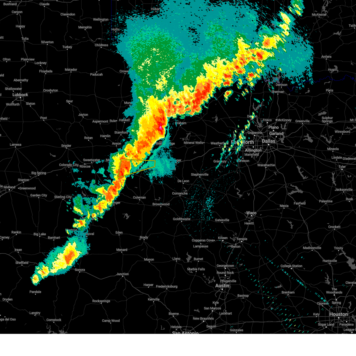 Svrsjt the national weather service in san angelo has issued a * severe thunderstorm warning for, northern callahan county in west central texas, northeastern taylor county in west central texas, * until 100 am cdt. * at 1211 am cdt, severe thunderstorms were located along a line extending from abilene to ovalo, moving northeast at 60 mph (radar indicated). Hazards include 60 mph wind gusts and penny size hail. Expect damage to roofs, siding, and trees. severe thunderstorms will be near, abilene, clyde, wylie, potosi, and eula around 1215 am cdt. baird around 1220 am cdt. other locations impacted by these severe thunderstorms include impact and kirby lake. This includes interstate 20 between mile markers 281 and 316. Svrsjt the national weather service in san angelo has issued a * severe thunderstorm warning for, northern callahan county in west central texas, northeastern taylor county in west central texas, * until 100 am cdt. * at 1211 am cdt, severe thunderstorms were located along a line extending from abilene to ovalo, moving northeast at 60 mph (radar indicated). Hazards include 60 mph wind gusts and penny size hail. Expect damage to roofs, siding, and trees. severe thunderstorms will be near, abilene, clyde, wylie, potosi, and eula around 1215 am cdt. baird around 1220 am cdt. other locations impacted by these severe thunderstorms include impact and kirby lake. This includes interstate 20 between mile markers 281 and 316.
|
| 4/27/2024 11:55 PM CDT |
 At 1155 pm cdt, severe thunderstorms were located along a line extending from near camp butman to near bradshaw, moving east at 60 mph (radar indicated). Hazards include 60 mph wind gusts and penny size hail. Expect damage to roofs, siding, and trees. these severe storms will be near, abilene, wylie, merkel, tye, tuscola, buffalo gap, lawn, caps, potosi, and view around 1200 am cdt. hawley and dudley around 1205 am cdt. oplin and eula around 1210 am cdt. clyde around 1215 am cdt. other locations impacted by these severe thunderstorms include hodges, impact, lake abilene, camp tonkawa, camp butman, kirby lake, stith, and ovalo. This includes interstate 20 between mile markers 261 and 303. At 1155 pm cdt, severe thunderstorms were located along a line extending from near camp butman to near bradshaw, moving east at 60 mph (radar indicated). Hazards include 60 mph wind gusts and penny size hail. Expect damage to roofs, siding, and trees. these severe storms will be near, abilene, wylie, merkel, tye, tuscola, buffalo gap, lawn, caps, potosi, and view around 1200 am cdt. hawley and dudley around 1205 am cdt. oplin and eula around 1210 am cdt. clyde around 1215 am cdt. other locations impacted by these severe thunderstorms include hodges, impact, lake abilene, camp tonkawa, camp butman, kirby lake, stith, and ovalo. This includes interstate 20 between mile markers 261 and 303.
|
| 4/27/2024 11:46 PM CDT |
 At 1144 pm cdt, a line of severe thunderstorms were located just west of a ft griffin to albany to moran line moving east at 45 mph (radar indicated). Hazards include 60 mph wind gusts and penny size hail. Expect damage to roofs, siding, and trees. this severe storm will be near, albany around 1150 pm cdt. ibex around 1200 am cdt. Other locations impacted by this severe thunderstorm include hodges, funston, mccarty lake, tuxedo, big country baptist assembly, lake fort phantom hill, truby, and the intersection of us- 180 and farm road 600. At 1144 pm cdt, a line of severe thunderstorms were located just west of a ft griffin to albany to moran line moving east at 45 mph (radar indicated). Hazards include 60 mph wind gusts and penny size hail. Expect damage to roofs, siding, and trees. this severe storm will be near, albany around 1150 pm cdt. ibex around 1200 am cdt. Other locations impacted by this severe thunderstorm include hodges, funston, mccarty lake, tuxedo, big country baptist assembly, lake fort phantom hill, truby, and the intersection of us- 180 and farm road 600.
|
| 4/27/2024 11:38 PM CDT |
 At 1137 pm cdt, severe thunderstorms were located along a line extending hawley to abilene, moving southeast at 40 mph (radar indicated). Hazards include 60 mph wind gusts and penny size hail. Expect damage to roofs, siding, and trees. these severe storms will be near, clyde, lawn, oplin, eula, and dudley around 1140 pm cdt. other locations impacted by these severe thunderstorms include hodges, impact, lake abilene, camp tonkawa, camp butman, kirby lake, stith, and ovalo. This includes interstate 20 between mile markers 261 and 303. At 1137 pm cdt, severe thunderstorms were located along a line extending hawley to abilene, moving southeast at 40 mph (radar indicated). Hazards include 60 mph wind gusts and penny size hail. Expect damage to roofs, siding, and trees. these severe storms will be near, clyde, lawn, oplin, eula, and dudley around 1140 pm cdt. other locations impacted by these severe thunderstorms include hodges, impact, lake abilene, camp tonkawa, camp butman, kirby lake, stith, and ovalo. This includes interstate 20 between mile markers 261 and 303.
|
| 4/27/2024 11:34 PM CDT | Corrected non thunderstorm wind gust to thunderstorm wind gus in taylor county TX, 7.9 miles NE of Abilene, TX |
| 4/27/2024 11:19 PM CDT |
 Svrsjt the national weather service in san angelo has issued a * severe thunderstorm warning for, jones county in west central texas, shackelford county in west central texas, * until 1215 am cdt. * at 1119 pm cdt, a severe thunderstorm was located over the intersection of us-180 and farm road 600, or near nugent, moving east at 50 mph (radar indicated). Hazards include 60 mph wind gusts and quarter size hail. Hail damage to vehicles is expected. expect wind damage to2 roofs, siding, and trees. this severe thunderstorm will be near, lueders, nugent, and avoca around 1125 pm cdt. albany around 1145 pm cdt. fort griffin around 1150 pm cdt. Other locations impacted by this severe thunderstorm include hodges, funston, mccarty lake, tuxedo, big country baptist assembly, lake fort phantom hill, truby, and the intersection of us- 180 and farm road 600. Svrsjt the national weather service in san angelo has issued a * severe thunderstorm warning for, jones county in west central texas, shackelford county in west central texas, * until 1215 am cdt. * at 1119 pm cdt, a severe thunderstorm was located over the intersection of us-180 and farm road 600, or near nugent, moving east at 50 mph (radar indicated). Hazards include 60 mph wind gusts and quarter size hail. Hail damage to vehicles is expected. expect wind damage to2 roofs, siding, and trees. this severe thunderstorm will be near, lueders, nugent, and avoca around 1125 pm cdt. albany around 1145 pm cdt. fort griffin around 1150 pm cdt. Other locations impacted by this severe thunderstorm include hodges, funston, mccarty lake, tuxedo, big country baptist assembly, lake fort phantom hill, truby, and the intersection of us- 180 and farm road 600.
|
| 4/27/2024 11:09 PM CDT |
 Svrsjt the national weather service in san angelo has issued a * severe thunderstorm warning for, western callahan county in west central texas, southwestern jones county in west central texas, taylor county in west central texas, * until 1215 am cdt. * at 1109 pm cdt, severe thunderstorms were located along a line extending from near hodges to near merkel to near camp butman, moving southeast at 40 mph (radar indicated). Hazards include 60 mph wind gusts and quarter size hail. Hail damage to vehicles is expected. expect wind damage to roofs, siding, and trees. severe thunderstorms will be near, abilene, wylie, tye, hawley, buffalo gap, caps, coronados camp, potosi, view, and dyess afb around 1115 pm cdt. tuscola around 1120 pm cdt. clyde, lawn, eula, and dudley around 1130 pm cdt. oplin around 1145 pm cdt. other locations impacted by these severe thunderstorms include hodges, impact, lake abilene, camp tonkawa, camp butman, kirby lake, stith, and ovalo. This includes interstate 20 between mile markers 261 and 303. Svrsjt the national weather service in san angelo has issued a * severe thunderstorm warning for, western callahan county in west central texas, southwestern jones county in west central texas, taylor county in west central texas, * until 1215 am cdt. * at 1109 pm cdt, severe thunderstorms were located along a line extending from near hodges to near merkel to near camp butman, moving southeast at 40 mph (radar indicated). Hazards include 60 mph wind gusts and quarter size hail. Hail damage to vehicles is expected. expect wind damage to roofs, siding, and trees. severe thunderstorms will be near, abilene, wylie, tye, hawley, buffalo gap, caps, coronados camp, potosi, view, and dyess afb around 1115 pm cdt. tuscola around 1120 pm cdt. clyde, lawn, eula, and dudley around 1130 pm cdt. oplin around 1145 pm cdt. other locations impacted by these severe thunderstorms include hodges, impact, lake abilene, camp tonkawa, camp butman, kirby lake, stith, and ovalo. This includes interstate 20 between mile markers 261 and 303.
|
| 4/23/2024 8:36 PM CDT |
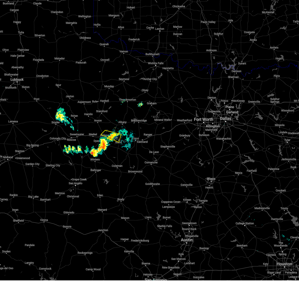 the severe thunderstorm warning has been cancelled and is no longer in effect the severe thunderstorm warning has been cancelled and is no longer in effect
|
| 4/23/2024 8:26 PM CDT | 58 mph wind gust measured at the abilene airpor in taylor county TX, 6.3 miles NNW of Abilene, TX |
| 4/23/2024 8:15 PM CDT |
 At 815 pm cdt, a severe thunderstorm was located near coronados camp, moving southeast at 35 mph (radar indicated). Hazards include 60 mph wind gusts and quarter size hail. Hail damage to vehicles is expected. expect wind damage to roofs, siding, and trees. this severe storm will be near, tuscola and bradshaw around 820 pm cdt. lawn around 825 pm cdt. other locations impacted by this severe thunderstorm include lake abilene, drasco, camp tonkawa, pumphrey, shep, wilmeth, kirby lake, and ovalo. This includes interstate 20 between mile markers 276 and 283, and between mile markers 291 and 293. At 815 pm cdt, a severe thunderstorm was located near coronados camp, moving southeast at 35 mph (radar indicated). Hazards include 60 mph wind gusts and quarter size hail. Hail damage to vehicles is expected. expect wind damage to roofs, siding, and trees. this severe storm will be near, tuscola and bradshaw around 820 pm cdt. lawn around 825 pm cdt. other locations impacted by this severe thunderstorm include lake abilene, drasco, camp tonkawa, pumphrey, shep, wilmeth, kirby lake, and ovalo. This includes interstate 20 between mile markers 276 and 283, and between mile markers 291 and 293.
|
| 4/23/2024 8:14 PM CDT |
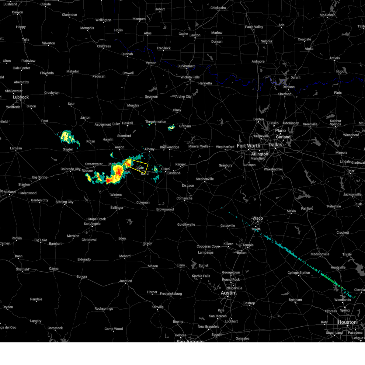 Svrsjt the national weather service in san angelo has issued a * severe thunderstorm warning for, northwestern callahan county in west central texas, southeastern jones county in west central texas, northeastern taylor county in west central texas, southwestern shackelford county in west central texas, * until 900 pm cdt. * at 813 pm cdt, a severe thunderstorm was located near hamby, moving southeast at 35 mph (radar indicated). Hazards include 60 mph wind gusts and quarter size hail. Hail damage to vehicles is expected. expect wind damage to roofs, siding, and trees. this severe thunderstorm will be near, eastern abilene, clyde, and hamby around 820 pm cdt. baird around 830 pm cdt. other locations impacted by this severe thunderstorm include impact, lake fort phantom hill, and us-283 near the callahan- shackelford county line. This includes interstate 20 between mile markers 284 and 290, and between mile markers 294 and 308. Svrsjt the national weather service in san angelo has issued a * severe thunderstorm warning for, northwestern callahan county in west central texas, southeastern jones county in west central texas, northeastern taylor county in west central texas, southwestern shackelford county in west central texas, * until 900 pm cdt. * at 813 pm cdt, a severe thunderstorm was located near hamby, moving southeast at 35 mph (radar indicated). Hazards include 60 mph wind gusts and quarter size hail. Hail damage to vehicles is expected. expect wind damage to roofs, siding, and trees. this severe thunderstorm will be near, eastern abilene, clyde, and hamby around 820 pm cdt. baird around 830 pm cdt. other locations impacted by this severe thunderstorm include impact, lake fort phantom hill, and us-283 near the callahan- shackelford county line. This includes interstate 20 between mile markers 284 and 290, and between mile markers 294 and 308.
|
| 4/23/2024 7:56 PM CDT |
 Svrsjt the national weather service in san angelo has issued a * severe thunderstorm warning for, west central callahan county in west central texas, southeastern nolan county in west central texas, taylor county in west central texas, northwestern runnels county in west central texas, * until 830 pm cdt. * at 754 pm cdt, a severe thunderstorm was located near camp butman, or 8 miles southwest of merkel, moving southeast at 35 mph (radar indicated). Hazards include 60 mph wind gusts and quarter size hail. Hail damage to vehicles is expected. expect wind damage to roofs, siding, and trees. this severe thunderstorm will be near, coronados camp around 800 pm cdt. buffalo gap around 815 pm cdt. tuscola around 820 pm cdt. other locations impacted by this severe thunderstorm include lake abilene, drasco, camp tonkawa, pumphrey, shep, wilmeth, camp butman, kirby lake, and ovalo. This includes interstate 20 between mile markers 264 and 283, and between mile markers 291 and 293. Svrsjt the national weather service in san angelo has issued a * severe thunderstorm warning for, west central callahan county in west central texas, southeastern nolan county in west central texas, taylor county in west central texas, northwestern runnels county in west central texas, * until 830 pm cdt. * at 754 pm cdt, a severe thunderstorm was located near camp butman, or 8 miles southwest of merkel, moving southeast at 35 mph (radar indicated). Hazards include 60 mph wind gusts and quarter size hail. Hail damage to vehicles is expected. expect wind damage to roofs, siding, and trees. this severe thunderstorm will be near, coronados camp around 800 pm cdt. buffalo gap around 815 pm cdt. tuscola around 820 pm cdt. other locations impacted by this severe thunderstorm include lake abilene, drasco, camp tonkawa, pumphrey, shep, wilmeth, camp butman, kirby lake, and ovalo. This includes interstate 20 between mile markers 264 and 283, and between mile markers 291 and 293.
|
| 4/1/2024 4:37 PM CDT |
 Svrsjt the national weather service in san angelo has issued a * severe thunderstorm warning for, callahan county in west central texas, northwestern coleman county in west central texas, southeastern taylor county in west central texas, northeastern runnels county in west central texas, * until 545 pm cdt. * at 437 pm cdt, a severe thunderstorm was located over dudley, moving northeast at 55 mph (radar indicated). Hazards include 60 mph wind gusts and quarter size hail. Hail damage to vehicles is expected. expect wind damage to roofs, siding, and trees. this severe thunderstorm will be near, clyde and baird around 445 pm cdt. putnam around 455 pm cdt. other locations impacted by this severe thunderstorm include goldsboro, admiral, ovalo, and i-20 near the callahan-eastland county line. This includes interstate 20 between mile markers 295 and 323. Svrsjt the national weather service in san angelo has issued a * severe thunderstorm warning for, callahan county in west central texas, northwestern coleman county in west central texas, southeastern taylor county in west central texas, northeastern runnels county in west central texas, * until 545 pm cdt. * at 437 pm cdt, a severe thunderstorm was located over dudley, moving northeast at 55 mph (radar indicated). Hazards include 60 mph wind gusts and quarter size hail. Hail damage to vehicles is expected. expect wind damage to roofs, siding, and trees. this severe thunderstorm will be near, clyde and baird around 445 pm cdt. putnam around 455 pm cdt. other locations impacted by this severe thunderstorm include goldsboro, admiral, ovalo, and i-20 near the callahan-eastland county line. This includes interstate 20 between mile markers 295 and 323.
|
| 4/1/2024 4:06 PM CDT |
 At 400 pm cdt, a severe thunderstorm was located east of nugent and north of fort phantom , moving east at 40 mph. this is a destructive storm for areas between nugent and albany (trained weather spotters). Hazards include baseball size hail. People and animals outdoors will be severely injured. expect shattered windows, extensive damage to roofs, siding, and vehicles. this severe storm will be near, albany around 415 pm cdt. Other locations impacted by this severneare thunderstorm include hodges, funston, mccarty lake, big country baptist assembly, lake fort phantom hill, truby, stith, and the intersection of us-180 and farm road 600. At 400 pm cdt, a severe thunderstorm was located east of nugent and north of fort phantom , moving east at 40 mph. this is a destructive storm for areas between nugent and albany (trained weather spotters). Hazards include baseball size hail. People and animals outdoors will be severely injured. expect shattered windows, extensive damage to roofs, siding, and vehicles. this severe storm will be near, albany around 415 pm cdt. Other locations impacted by this severneare thunderstorm include hodges, funston, mccarty lake, big country baptist assembly, lake fort phantom hill, truby, stith, and the intersection of us-180 and farm road 600.
|
| 4/1/2024 4:02 PM CDT |
 At 401 pm cdt, a severe thunderstorm was located near view, moving northeast at 45 mph (radar indicated). Hazards include 60 mph wind gusts and quarter size hail. Hail damage to vehicles is expected. expect wind damage to roofs, siding, and trees. this severe storm will be near, abilene, wylie, tye, buffalo gap, caps, view, and dyess afb around 405 pm cdt. potosi around 410 pm cdt. hamby around 415 pm cdt. other locations impacted by this severe thunderstorm include impact, lake abilene, camp tonkawa, shep, lake fort phantom hill, camp butman, kirby lake, stith, and ovalo. This includes interstate 20 between mile markers 264 and 292. At 401 pm cdt, a severe thunderstorm was located near view, moving northeast at 45 mph (radar indicated). Hazards include 60 mph wind gusts and quarter size hail. Hail damage to vehicles is expected. expect wind damage to roofs, siding, and trees. this severe storm will be near, abilene, wylie, tye, buffalo gap, caps, view, and dyess afb around 405 pm cdt. potosi around 410 pm cdt. hamby around 415 pm cdt. other locations impacted by this severe thunderstorm include impact, lake abilene, camp tonkawa, shep, lake fort phantom hill, camp butman, kirby lake, stith, and ovalo. This includes interstate 20 between mile markers 264 and 292.
|
| 4/1/2024 4:02 PM CDT |
 the severe thunderstorm warning has been cancelled and is no longer in effect the severe thunderstorm warning has been cancelled and is no longer in effect
|
| 4/1/2024 3:59 PM CDT | Baseball sized hail reported 11.1 miles SSW of Abilene, TX, trained spotter reported baseball sized hail north of lake phantom hill on fm 600. |
| 4/1/2024 3:54 PM CDT |
 At 353 pm cdt, a severe thunderstorm was located over nugent, moving east at 45 mph. this is a destructive storm for nugent (radar indicated). Hazards include baseball size hail and 70 mph wind gusts. People and animals outdoors will be severely injured. expect shattered windows, extensive damage to roofs, siding, and vehicles. this severe storm will be near, lueders around 400 pm cdt. albany around 410 pm cdt. Other locations impacted by this severe thunderstorm include hodges, funston, mccarty lake, big country baptist assembly, lake fort phantom hill, truby, stith, and the intersection of us- 180 and farm road 600. At 353 pm cdt, a severe thunderstorm was located over nugent, moving east at 45 mph. this is a destructive storm for nugent (radar indicated). Hazards include baseball size hail and 70 mph wind gusts. People and animals outdoors will be severely injured. expect shattered windows, extensive damage to roofs, siding, and vehicles. this severe storm will be near, lueders around 400 pm cdt. albany around 410 pm cdt. Other locations impacted by this severe thunderstorm include hodges, funston, mccarty lake, big country baptist assembly, lake fort phantom hill, truby, stith, and the intersection of us- 180 and farm road 600.
|
| 4/1/2024 3:49 PM CDT |
 At 349 pm cdt, a severe thunderstorm was located over nugent, moving east at 55 mph (radar indicated). Hazards include golf ball size hail and 70 mph wind gusts. People and animals outdoors will be injured. expect hail damage to roofs, siding, windows, and vehicles. expect considerable tree damage. wind damage is also likely to mobile homes, roofs, and outbuildings. this severe storm will be near, lueders around 355 pm cdt. albany around 405 pm cdt. Other locations impacted by this severe thunderstorm include hodges, funston, mccarty lake, big country baptist assembly, lake fort phantom hill, truby, stith, and the intersection of us- 180 and farm road 600. At 349 pm cdt, a severe thunderstorm was located over nugent, moving east at 55 mph (radar indicated). Hazards include golf ball size hail and 70 mph wind gusts. People and animals outdoors will be injured. expect hail damage to roofs, siding, windows, and vehicles. expect considerable tree damage. wind damage is also likely to mobile homes, roofs, and outbuildings. this severe storm will be near, lueders around 355 pm cdt. albany around 405 pm cdt. Other locations impacted by this severe thunderstorm include hodges, funston, mccarty lake, big country baptist assembly, lake fort phantom hill, truby, stith, and the intersection of us- 180 and farm road 600.
|
| 4/1/2024 3:39 PM CDT |
 Svrsjt the national weather service in san angelo has issued a * severe thunderstorm warning for, jones county in west central texas, shackelford county in west central texas, * until 415 pm cdt. * at 339 pm cdt, a severe thunderstorm was located over hawley, moving east at 55 mph (radar indicated). Hazards include 60 mph wind gusts and quarter size hail. Hail damage to vehicles is expected. expect wind damage to roofs, siding, and trees. this severe thunderstorm will be near, northeastern abilene and nugent around 345 pm cdt. lueders around 350 pm cdt. albany around 405 pm cdt. Other locations impacted by this severe thunderstorm include hodges, funston, mccarty lake, big country baptist assembly, lake fort phantom hill, truby, stith, and the intersection of us- 180 and farm road 600. Svrsjt the national weather service in san angelo has issued a * severe thunderstorm warning for, jones county in west central texas, shackelford county in west central texas, * until 415 pm cdt. * at 339 pm cdt, a severe thunderstorm was located over hawley, moving east at 55 mph (radar indicated). Hazards include 60 mph wind gusts and quarter size hail. Hail damage to vehicles is expected. expect wind damage to roofs, siding, and trees. this severe thunderstorm will be near, northeastern abilene and nugent around 345 pm cdt. lueders around 350 pm cdt. albany around 405 pm cdt. Other locations impacted by this severe thunderstorm include hodges, funston, mccarty lake, big country baptist assembly, lake fort phantom hill, truby, stith, and the intersection of us- 180 and farm road 600.
|
| 4/1/2024 3:37 PM CDT |
 Svrsjt the national weather service in san angelo has issued a * severe thunderstorm warning for, southeastern jones county in west central texas, southeastern nolan county in west central texas, taylor county in west central texas, * until 430 pm cdt. * at 337 pm cdt, a severe thunderstorm was located over nolan, moving northeast at 45 mph (radar indicated). Hazards include 60 mph wind gusts and quarter size hail. Hail damage to vehicles is expected. expect wind damage to roofs, siding, and trees. this severe thunderstorm will be near, nolan around 340 pm cdt. merkel and coronados camp around 355 pm cdt. abilene, tye, and view around 400 pm cdt. caps and dyess afb around 405 pm cdt. wylie around 410 pm cdt. hawley around 420 pm cdt. other locations impacted by this severe thunderstorm include impact, lake abilene, camp tonkawa, shep, lake fort phantom hill, camp butman, kirby lake, stith, the intersection of highway 70 and ranch road 53, and ovalo. This includes interstate 20 between mile markers 264 and 292. Svrsjt the national weather service in san angelo has issued a * severe thunderstorm warning for, southeastern jones county in west central texas, southeastern nolan county in west central texas, taylor county in west central texas, * until 430 pm cdt. * at 337 pm cdt, a severe thunderstorm was located over nolan, moving northeast at 45 mph (radar indicated). Hazards include 60 mph wind gusts and quarter size hail. Hail damage to vehicles is expected. expect wind damage to roofs, siding, and trees. this severe thunderstorm will be near, nolan around 340 pm cdt. merkel and coronados camp around 355 pm cdt. abilene, tye, and view around 400 pm cdt. caps and dyess afb around 405 pm cdt. wylie around 410 pm cdt. hawley around 420 pm cdt. other locations impacted by this severe thunderstorm include impact, lake abilene, camp tonkawa, shep, lake fort phantom hill, camp butman, kirby lake, stith, the intersection of highway 70 and ranch road 53, and ovalo. This includes interstate 20 between mile markers 264 and 292.
|
| 8/10/2023 7:34 PM CDT |
 At 733 pm cdt, severe thunderstorms were located along a line extending from near potosi to near bradshaw to ballinger lake, moving southeast at 25 mph (radar indicated). Hazards include 60 mph wind gusts. Expect damage to roofs, siding, and trees. severe thunderstorms will be near, clyde and hatchel around 740 pm cdt. ballinger and eula around 745 pm cdt. dudley around 750 pm cdt. crews and benoit around 755 pm cdt. baird around 800 pm cdt. novice around 805 pm cdt. oplin around 810 pm cdt. cross plains, putnam, glen cove, silver valley, talpa, rowden, valera and atwell around 815 pm cdt. other locations impacted by these severe thunderstorms include camp tonkawa, us-283 near the callahan- shackelford county line, lake coleman, ovalo, i-20 near the callahan- eastland county line, drasco, pumphrey, admiral, goldsboro and lake winters lake. this includes interstate 20 between mile markers 290 and 323. hail threat, radar indicated max hail size, <. 75 in wind threat, radar indicated max wind gust, 60 mph. At 733 pm cdt, severe thunderstorms were located along a line extending from near potosi to near bradshaw to ballinger lake, moving southeast at 25 mph (radar indicated). Hazards include 60 mph wind gusts. Expect damage to roofs, siding, and trees. severe thunderstorms will be near, clyde and hatchel around 740 pm cdt. ballinger and eula around 745 pm cdt. dudley around 750 pm cdt. crews and benoit around 755 pm cdt. baird around 800 pm cdt. novice around 805 pm cdt. oplin around 810 pm cdt. cross plains, putnam, glen cove, silver valley, talpa, rowden, valera and atwell around 815 pm cdt. other locations impacted by these severe thunderstorms include camp tonkawa, us-283 near the callahan- shackelford county line, lake coleman, ovalo, i-20 near the callahan- eastland county line, drasco, pumphrey, admiral, goldsboro and lake winters lake. this includes interstate 20 between mile markers 290 and 323. hail threat, radar indicated max hail size, <. 75 in wind threat, radar indicated max wind gust, 60 mph.
|
| 6/24/2023 8:58 PM CDT |
 At 858 pm cdt, a severe thunderstorm was located over dyess afb, moving east at 25 mph (radar indicated). Hazards include 60 mph wind gusts and nickel size hail. Expect damage to roofs, siding, and trees. this severe storm will be near, abilene and wylie around 910 pm cdt. other locations impacted by this severe thunderstorm include kirby lake. this includes interstate 20 between mile markers 271 and 276. hail threat, radar indicated max hail size, 0. 88 in wind threat, radar indicated max wind gust, 60 mph. At 858 pm cdt, a severe thunderstorm was located over dyess afb, moving east at 25 mph (radar indicated). Hazards include 60 mph wind gusts and nickel size hail. Expect damage to roofs, siding, and trees. this severe storm will be near, abilene and wylie around 910 pm cdt. other locations impacted by this severe thunderstorm include kirby lake. this includes interstate 20 between mile markers 271 and 276. hail threat, radar indicated max hail size, 0. 88 in wind threat, radar indicated max wind gust, 60 mph.
|
| 6/24/2023 8:54 PM CDT | Report from mping: 1-inch tree limbs broken; shingles blown of in taylor county TX, 1.3 miles NW of Abilene, TX |
| 6/24/2023 8:50 PM CDT | Power poles down in the city of tye. time estimated on rada in taylor county TX, 8.7 miles ENE of Abilene, TX |
| 6/24/2023 8:50 PM CDT | Power lines down near hamby. time estimated on rada in taylor county TX, 5.9 miles WSW of Abilene, TX |
| 6/24/2023 8:46 PM CDT |
 At 845 pm cdt, a severe thunderstorm was located near tye, moving east at 25 mph (radar indicated). Hazards include 60 mph wind gusts and quarter size hail. Hail damage to vehicles is expected. expect wind damage to roofs, siding, and trees. this severe storm will be near, tye, dyess afb and view around 855 pm cdt. caps around 900 pm cdt. buffalo gap around 905 pm cdt. abilene and wylie around 910 pm cdt. other locations impacted by this severe thunderstorm include kirby lake. this includes interstate 20 between mile markers 266 and 276. hail threat, radar indicated max hail size, 1. 00 in wind threat, radar indicated max wind gust, 60 mph. At 845 pm cdt, a severe thunderstorm was located near tye, moving east at 25 mph (radar indicated). Hazards include 60 mph wind gusts and quarter size hail. Hail damage to vehicles is expected. expect wind damage to roofs, siding, and trees. this severe storm will be near, tye, dyess afb and view around 855 pm cdt. caps around 900 pm cdt. buffalo gap around 905 pm cdt. abilene and wylie around 910 pm cdt. other locations impacted by this severe thunderstorm include kirby lake. this includes interstate 20 between mile markers 266 and 276. hail threat, radar indicated max hail size, 1. 00 in wind threat, radar indicated max wind gust, 60 mph.
|
| 6/24/2023 8:45 PM CDT |
 At 844 pm cdt, a severe thunderstorm was located over hamby, moving east at 25 mph (radar indicated). Hazards include 60 mph wind gusts and nickel size hail. Expect damage to roofs, siding, and trees. this severe thunderstorm will remain over mainly rural areas of southeastern jones and northeastern taylor counties, including the following locations, impact, hodges, lake fort phantom hill and stith. this includes interstate 20 between mile markers 276 and 288. hail threat, radar indicated max hail size, 0. 88 in wind threat, radar indicated max wind gust, 60 mph. At 844 pm cdt, a severe thunderstorm was located over hamby, moving east at 25 mph (radar indicated). Hazards include 60 mph wind gusts and nickel size hail. Expect damage to roofs, siding, and trees. this severe thunderstorm will remain over mainly rural areas of southeastern jones and northeastern taylor counties, including the following locations, impact, hodges, lake fort phantom hill and stith. this includes interstate 20 between mile markers 276 and 288. hail threat, radar indicated max hail size, 0. 88 in wind threat, radar indicated max wind gust, 60 mph.
|
| 6/24/2023 8:37 PM CDT |
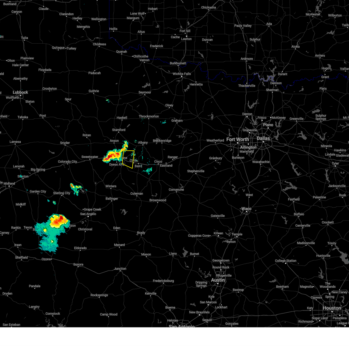 At 835 pm cdt, a severe thunderstorm was located over impact, or near abilene, moving east at 25 mph (radar indicated). Hazards include 60 mph wind gusts. Expect damage to roofs, siding, and trees. this severe thunderstorm will be near, hamby around 850 pm cdt. potosi around 855 pm cdt. clyde and eula around 915 pm cdt. other locations impacted by this severe thunderstorm include lake fort phantom hill. this includes interstate 20 between mile markers 287 and 300. hail threat, radar indicated max hail size, <. 75 in wind threat, radar indicated max wind gust, 60 mph. At 835 pm cdt, a severe thunderstorm was located over impact, or near abilene, moving east at 25 mph (radar indicated). Hazards include 60 mph wind gusts. Expect damage to roofs, siding, and trees. this severe thunderstorm will be near, hamby around 850 pm cdt. potosi around 855 pm cdt. clyde and eula around 915 pm cdt. other locations impacted by this severe thunderstorm include lake fort phantom hill. this includes interstate 20 between mile markers 287 and 300. hail threat, radar indicated max hail size, <. 75 in wind threat, radar indicated max wind gust, 60 mph.
|
| 6/24/2023 8:31 PM CDT |
 At 831 pm cdt, a severe thunderstorm was located over merkel, moving east at 25 mph (radar indicated). Hazards include 60 mph wind gusts and quarter size hail. Hail damage to vehicles is expected. expect wind damage to roofs, siding, and trees. this severe thunderstorm will be near, tye, dyess afb and view around 855 pm cdt. caps around 900 pm cdt. buffalo gap around 905 pm cdt. abilene and wylie around 910 pm cdt. other locations impacted by this severe thunderstorm include kirby lake. this includes interstate 20 between mile markers 263 and 278. hail threat, radar indicated max hail size, 1. 00 in wind threat, radar indicated max wind gust, 60 mph. At 831 pm cdt, a severe thunderstorm was located over merkel, moving east at 25 mph (radar indicated). Hazards include 60 mph wind gusts and quarter size hail. Hail damage to vehicles is expected. expect wind damage to roofs, siding, and trees. this severe thunderstorm will be near, tye, dyess afb and view around 855 pm cdt. caps around 900 pm cdt. buffalo gap around 905 pm cdt. abilene and wylie around 910 pm cdt. other locations impacted by this severe thunderstorm include kirby lake. this includes interstate 20 between mile markers 263 and 278. hail threat, radar indicated max hail size, 1. 00 in wind threat, radar indicated max wind gust, 60 mph.
|
| 6/24/2023 8:27 PM CDT |
 At 826 pm cdt, a severe thunderstorm was located near impact, or near hawley, moving east at 35 mph (radar indicated). Hazards include 70 mph wind gusts and quarter size hail. Hail damage to vehicles is expected. expect considerable tree damage. wind damage is also likely to mobile homes, roofs, and outbuildings. this severe storm will be near, abilene and nugent around 835 pm cdt. other locations impacted by this severe thunderstorm include impact, hodges, lake fort phantom hill, stith and truby. this includes interstate 20 between mile markers 275 and 288. thunderstorm damage threat, considerable hail threat, radar indicated max hail size, 1. 00 in wind threat, radar indicated max wind gust, 70 mph. At 826 pm cdt, a severe thunderstorm was located near impact, or near hawley, moving east at 35 mph (radar indicated). Hazards include 70 mph wind gusts and quarter size hail. Hail damage to vehicles is expected. expect considerable tree damage. wind damage is also likely to mobile homes, roofs, and outbuildings. this severe storm will be near, abilene and nugent around 835 pm cdt. other locations impacted by this severe thunderstorm include impact, hodges, lake fort phantom hill, stith and truby. this includes interstate 20 between mile markers 275 and 288. thunderstorm damage threat, considerable hail threat, radar indicated max hail size, 1. 00 in wind threat, radar indicated max wind gust, 70 mph.
|
| 6/24/2023 8:16 PM CDT |
 At 815 pm cdt, a severe thunderstorm was located over stith, or 7 miles southwest of hawley, moving east at 25 mph (radar indicated). Hazards include 70 mph wind gusts and quarter size hail. Hail damage to vehicles is expected. expect considerable tree damage. wind damage is also likely to mobile homes, roofs, and outbuildings. this severe storm will be near, tye and hawley around 830 pm cdt. abilene and nugent around 845 pm cdt. other locations impacted by this severe thunderstorm include impact, hodges, lake fort phantom hill, stith and truby. this includes interstate 20 between mile markers 275 and 288. thunderstorm damage threat, considerable hail threat, radar indicated max hail size, 1. 00 in wind threat, radar indicated max wind gust, 70 mph. At 815 pm cdt, a severe thunderstorm was located over stith, or 7 miles southwest of hawley, moving east at 25 mph (radar indicated). Hazards include 70 mph wind gusts and quarter size hail. Hail damage to vehicles is expected. expect considerable tree damage. wind damage is also likely to mobile homes, roofs, and outbuildings. this severe storm will be near, tye and hawley around 830 pm cdt. abilene and nugent around 845 pm cdt. other locations impacted by this severe thunderstorm include impact, hodges, lake fort phantom hill, stith and truby. this includes interstate 20 between mile markers 275 and 288. thunderstorm damage threat, considerable hail threat, radar indicated max hail size, 1. 00 in wind threat, radar indicated max wind gust, 70 mph.
|
| 6/24/2023 8:09 PM CDT |
 At 809 pm cdt, a severe thunderstorm was located over stith, or near noodle, moving east at 25 mph (radar indicated). Hazards include 60 mph wind gusts and quarter size hail. Hail damage to vehicles is expected. expect wind damage to roofs, siding, and trees. this severe thunderstorm will be near, tye around 825 pm cdt. hawley around 830 pm cdt. abilene and nugent around 845 pm cdt. other locations impacted by this severe thunderstorm include impact, hodges, lake fort phantom hill, stith and truby. this includes interstate 20 between mile markers 275 and 288. hail threat, radar indicated max hail size, 1. 00 in wind threat, radar indicated max wind gust, 60 mph. At 809 pm cdt, a severe thunderstorm was located over stith, or near noodle, moving east at 25 mph (radar indicated). Hazards include 60 mph wind gusts and quarter size hail. Hail damage to vehicles is expected. expect wind damage to roofs, siding, and trees. this severe thunderstorm will be near, tye around 825 pm cdt. hawley around 830 pm cdt. abilene and nugent around 845 pm cdt. other locations impacted by this severe thunderstorm include impact, hodges, lake fort phantom hill, stith and truby. this includes interstate 20 between mile markers 275 and 288. hail threat, radar indicated max hail size, 1. 00 in wind threat, radar indicated max wind gust, 60 mph.
|
| 6/22/2023 12:52 AM CDT | Hamby fd responding to power poles and lines down near intersection of hwy 351 and fm 108 in taylor county TX, 3.9 miles W of Abilene, TX |
| 6/22/2023 12:34 AM CDT | Continued severe winds lasting about 20 minutes from last lsr at dyess af in taylor county TX, 7.5 miles NE of Abilene, TX |
| 6/22/2023 12:29 AM CDT |
 At 1229 am cdt, a severe thunderstorm was located over clyde, moving southeast at 45 mph (radar indicated). Hazards include 60 mph wind gusts and nickel size hail. Expect damage to roofs, siding, and trees. this severe storm will be near, baird around 1240 am cdt. moran and oplin around 1245 am cdt. putnam around 1250 am cdt. rowden around 1255 am cdt. atwell around 105 am cdt. other locations impacted by this severe thunderstorm include impact, admiral, lake fort phantom hill, us-283 near the callahan- shackelford county line, kirby lake, i-20 near the callahan- eastland county line and us-283 near the coleman- callahan county line. this includes interstate 20 between mile markers 278 and 323. hail threat, radar indicated max hail size, 0. 88 in wind threat, radar indicated max wind gust, 60 mph. At 1229 am cdt, a severe thunderstorm was located over clyde, moving southeast at 45 mph (radar indicated). Hazards include 60 mph wind gusts and nickel size hail. Expect damage to roofs, siding, and trees. this severe storm will be near, baird around 1240 am cdt. moran and oplin around 1245 am cdt. putnam around 1250 am cdt. rowden around 1255 am cdt. atwell around 105 am cdt. other locations impacted by this severe thunderstorm include impact, admiral, lake fort phantom hill, us-283 near the callahan- shackelford county line, kirby lake, i-20 near the callahan- eastland county line and us-283 near the coleman- callahan county line. this includes interstate 20 between mile markers 278 and 323. hail threat, radar indicated max hail size, 0. 88 in wind threat, radar indicated max wind gust, 60 mph.
|
| 6/22/2023 12:25 AM CDT | Kabi asos reported 64 kt gus in taylor county TX, 5.7 miles NNW of Abilene, TX |
| 6/22/2023 12:19 AM CDT | Kdys asos at dyess afb reported gust to 58 mp in taylor county TX, 7.5 miles NE of Abilene, TX |
| 6/22/2023 12:18 AM CDT | Report from mping: 3-inch tree limbs broken; power poles broke in taylor county TX, 1 miles NNE of Abilene, TX |
| 6/22/2023 12:14 AM CDT |
 At 1214 am cdt, a severe thunderstorm was located over hamby, moving southeast at 50 mph. this is a destructive storm for very strong winds (radar indicated). Hazards include 80 mph wind gusts and nickel size hail. Flying debris will be dangerous to those caught without shelter. mobile homes will be heavily damaged. expect considerable damage to roofs, windows, and vehicles. extensive tree damage and power outages are likely. this severe thunderstorm will be near, potosi around 1220 am cdt. clyde around 1225 am cdt. eula and dudley around 1230 am cdt. baird around 1235 am cdt. moran and oplin around 1240 am cdt. putnam around 1245 am cdt. rowden around 1250 am cdt. atwell around 1255 am cdt. other locations impacted by this severe thunderstorm include impact, admiral, lake fort phantom hill, us-283 near the callahan- shackelford county line, kirby lake, i-20 near the callahan- eastland county line and us-283 near the coleman- callahan county line. this includes interstate 20 between mile markers 278 and 323. thunderstorm damage threat, destructive hail threat, radar indicated max hail size, 0. 88 in wind threat, radar indicated max wind gust, 80 mph. At 1214 am cdt, a severe thunderstorm was located over hamby, moving southeast at 50 mph. this is a destructive storm for very strong winds (radar indicated). Hazards include 80 mph wind gusts and nickel size hail. Flying debris will be dangerous to those caught without shelter. mobile homes will be heavily damaged. expect considerable damage to roofs, windows, and vehicles. extensive tree damage and power outages are likely. this severe thunderstorm will be near, potosi around 1220 am cdt. clyde around 1225 am cdt. eula and dudley around 1230 am cdt. baird around 1235 am cdt. moran and oplin around 1240 am cdt. putnam around 1245 am cdt. rowden around 1250 am cdt. atwell around 1255 am cdt. other locations impacted by this severe thunderstorm include impact, admiral, lake fort phantom hill, us-283 near the callahan- shackelford county line, kirby lake, i-20 near the callahan- eastland county line and us-283 near the coleman- callahan county line. this includes interstate 20 between mile markers 278 and 323. thunderstorm damage threat, destructive hail threat, radar indicated max hail size, 0. 88 in wind threat, radar indicated max wind gust, 80 mph.
|
| 6/22/2023 12:09 AM CDT |
 At 1209 am cdt, a severe thunderstorm was located near hodges, or near tye, moving south at 30 mph. this is a destructive storm for very strong winds (radar indicated). Hazards include 90 mph wind gusts and nickel size hail. You are in a life-threatening situation. flying debris may be deadly to those caught without shelter. mobile homes will be heavily damaged or destroyed. homes and businesses will have substantial roof and window damage. expect extensive tree damage and power outages. this severe storm will be near, abilene and tye around 1215 am cdt. dyess afb around 1220 am cdt. wylie, caps and view around 1230 am cdt. buffalo gap and potosi around 1235 am cdt. coronados camp around 1240 am cdt. tuscola around 1250 am cdt. other locations impacted by this severe thunderstorm include funston, impact, lake abilene, camp tonkawa, shep, lake fort phantom hill, lake sweetwater, ovalo, busby and hodges. this includes interstate 20 between mile markers 240 and 290. thunderstorm damage threat, destructive hail threat, radar indicated max hail size, 0. 88 in wind threat, radar indicated max wind gust, 90 mph. At 1209 am cdt, a severe thunderstorm was located near hodges, or near tye, moving south at 30 mph. this is a destructive storm for very strong winds (radar indicated). Hazards include 90 mph wind gusts and nickel size hail. You are in a life-threatening situation. flying debris may be deadly to those caught without shelter. mobile homes will be heavily damaged or destroyed. homes and businesses will have substantial roof and window damage. expect extensive tree damage and power outages. this severe storm will be near, abilene and tye around 1215 am cdt. dyess afb around 1220 am cdt. wylie, caps and view around 1230 am cdt. buffalo gap and potosi around 1235 am cdt. coronados camp around 1240 am cdt. tuscola around 1250 am cdt. other locations impacted by this severe thunderstorm include funston, impact, lake abilene, camp tonkawa, shep, lake fort phantom hill, lake sweetwater, ovalo, busby and hodges. this includes interstate 20 between mile markers 240 and 290. thunderstorm damage threat, destructive hail threat, radar indicated max hail size, 0. 88 in wind threat, radar indicated max wind gust, 90 mph.
|
| 6/22/2023 12:01 AM CDT |
 At 1200 am cdt, a severe thunderstorm was located over hodges, or near hawley, moving southeast at 45 mph. this is a destructive storm for strong winds up to 80 mph (radar indicated). Hazards include 80 mph wind gusts and nickel size hail. Flying debris will be dangerous to those caught without shelter. mobile homes will be heavily damaged. expect considerable damage to roofs, windows, and vehicles. extensive tree damage and power outages are likely. this severe storm will be near, abilene and merkel around 1205 am cdt. tye around 1210 am cdt. dyess afb around 1215 am cdt. wylie, caps and view around 1220 am cdt. buffalo gap, potosi and coronados camp around 1225 am cdt. tuscola around 1235 am cdt. other locations impacted by this severe thunderstorm include funston, impact, the intersection of us- 180 and ranch road 126, lake abilene, camp tonkawa, shep, lake fort phantom hill, gannon, lake sweetwater and ovalo. this includes interstate 20 between mile markers 229 and 290. thunderstorm damage threat, destructive hail threat, radar indicated max hail size, 0. 88 in wind threat, radar indicated max wind gust, 80 mph. At 1200 am cdt, a severe thunderstorm was located over hodges, or near hawley, moving southeast at 45 mph. this is a destructive storm for strong winds up to 80 mph (radar indicated). Hazards include 80 mph wind gusts and nickel size hail. Flying debris will be dangerous to those caught without shelter. mobile homes will be heavily damaged. expect considerable damage to roofs, windows, and vehicles. extensive tree damage and power outages are likely. this severe storm will be near, abilene and merkel around 1205 am cdt. tye around 1210 am cdt. dyess afb around 1215 am cdt. wylie, caps and view around 1220 am cdt. buffalo gap, potosi and coronados camp around 1225 am cdt. tuscola around 1235 am cdt. other locations impacted by this severe thunderstorm include funston, impact, the intersection of us- 180 and ranch road 126, lake abilene, camp tonkawa, shep, lake fort phantom hill, gannon, lake sweetwater and ovalo. this includes interstate 20 between mile markers 229 and 290. thunderstorm damage threat, destructive hail threat, radar indicated max hail size, 0. 88 in wind threat, radar indicated max wind gust, 80 mph.
|
| 6/21/2023 11:54 PM CDT |
 At 1153 pm cdt, a severe thunderstorm was located over trent, moving south at 30 mph (radar indicated). Hazards include 70 mph wind gusts and quarter size hail. Hail damage to vehicles is expected. expect considerable tree damage. wind damage is also likely to mobile homes, roofs, and outbuildings. this severe storm will be near, merkel around 1200 am cdt. tye around 1205 am cdt. dyess afb around 1210 am cdt. nolan and maryneal around 1215 am cdt. wylie, view and caps around 1220 am cdt. buffalo gap and potosi around 1225 am cdt. coronados camp around 1230 am cdt. tuscola around 1240 am cdt. other locations impacted by this severe thunderstorm include funston, impact, the intersection of us- 180 and ranch road 126, lake abilene, camp tonkawa, shep, lake fort phantom hill, gannon, lake sweetwater and ovalo. this includes interstate 20 between mile markers 229 and 290. thunderstorm damage threat, considerable hail threat, radar indicated max hail size, 1. 00 in wind threat, radar indicated max wind gust, 70 mph. At 1153 pm cdt, a severe thunderstorm was located over trent, moving south at 30 mph (radar indicated). Hazards include 70 mph wind gusts and quarter size hail. Hail damage to vehicles is expected. expect considerable tree damage. wind damage is also likely to mobile homes, roofs, and outbuildings. this severe storm will be near, merkel around 1200 am cdt. tye around 1205 am cdt. dyess afb around 1210 am cdt. nolan and maryneal around 1215 am cdt. wylie, view and caps around 1220 am cdt. buffalo gap and potosi around 1225 am cdt. coronados camp around 1230 am cdt. tuscola around 1240 am cdt. other locations impacted by this severe thunderstorm include funston, impact, the intersection of us- 180 and ranch road 126, lake abilene, camp tonkawa, shep, lake fort phantom hill, gannon, lake sweetwater and ovalo. this includes interstate 20 between mile markers 229 and 290. thunderstorm damage threat, considerable hail threat, radar indicated max hail size, 1. 00 in wind threat, radar indicated max wind gust, 70 mph.
|
| 6/21/2023 11:41 PM CDT |
 At 1141 pm cdt, a severe thunderstorm was located near noodle, moving south at 30 mph (radar indicated). Hazards include 70 mph wind gusts and quarter size hail. Hail damage to vehicles is expected. expect considerable tree damage. wind damage is also likely to mobile homes, roofs, and outbuildings. this severe thunderstorm will be near, sweetwater and roscoe around 1145 pm cdt. hawley around 1150 pm cdt. trent around 1155 pm cdt. merkel around 1200 am cdt. tye around 1205 am cdt. dyess afb around 1210 am cdt. maryneal around 1215 am cdt. wylie, nolan, view and caps around 1220 am cdt. other locations impacted by this severe thunderstorm include funston, impact, the intersection of us- 180 and ranch road 126, lake abilene, camp tonkawa, shep, lake fort phantom hill, gannon, lake sweetwater and ovalo. this includes interstate 20 between mile markers 229 and 290. thunderstorm damage threat, considerable hail threat, radar indicated max hail size, 1. 00 in wind threat, radar indicated max wind gust, 70 mph. At 1141 pm cdt, a severe thunderstorm was located near noodle, moving south at 30 mph (radar indicated). Hazards include 70 mph wind gusts and quarter size hail. Hail damage to vehicles is expected. expect considerable tree damage. wind damage is also likely to mobile homes, roofs, and outbuildings. this severe thunderstorm will be near, sweetwater and roscoe around 1145 pm cdt. hawley around 1150 pm cdt. trent around 1155 pm cdt. merkel around 1200 am cdt. tye around 1205 am cdt. dyess afb around 1210 am cdt. maryneal around 1215 am cdt. wylie, nolan, view and caps around 1220 am cdt. other locations impacted by this severe thunderstorm include funston, impact, the intersection of us- 180 and ranch road 126, lake abilene, camp tonkawa, shep, lake fort phantom hill, gannon, lake sweetwater and ovalo. this includes interstate 20 between mile markers 229 and 290. thunderstorm damage threat, considerable hail threat, radar indicated max hail size, 1. 00 in wind threat, radar indicated max wind gust, 70 mph.
|
| 6/17/2023 6:39 PM CDT |
 At 638 pm cdt, a severe thunderstorm was located over truby, or near noodle, moving northeast at 45 mph (radar indicated). Hazards include 60 mph wind gusts and half dollar size hail. Hail damage to vehicles is expected. expect wind damage to roofs, siding, and trees. this severe storm will be near, hawley and potosi around 650 pm cdt. abilene and hamby around 655 pm cdt. nugent around 700 pm cdt. other locations impacted by this severe thunderstorm include impact, hodges, lake fort phantom hill, kirby lake, stith and truby. this includes interstate 20 between mile markers 261 and 293. hail threat, radar indicated max hail size, 1. 25 in wind threat, radar indicated max wind gust, 60 mph. At 638 pm cdt, a severe thunderstorm was located over truby, or near noodle, moving northeast at 45 mph (radar indicated). Hazards include 60 mph wind gusts and half dollar size hail. Hail damage to vehicles is expected. expect wind damage to roofs, siding, and trees. this severe storm will be near, hawley and potosi around 650 pm cdt. abilene and hamby around 655 pm cdt. nugent around 700 pm cdt. other locations impacted by this severe thunderstorm include impact, hodges, lake fort phantom hill, kirby lake, stith and truby. this includes interstate 20 between mile markers 261 and 293. hail threat, radar indicated max hail size, 1. 25 in wind threat, radar indicated max wind gust, 60 mph.
|
| 6/17/2023 6:28 PM CDT |
 At 626 pm cdt, new severe thunderstorms were developing near merkel, moving east at 30 mph. these storms will also be capable or producing quarter size hail and 60 mph winds as they track east along the interstate towards abilene (radar indicated). Hazards include 60 mph wind gusts and quarter size hail. Hail damage to vehicles is expected. expect wind damage to roofs, siding, and trees. this severe thunderstorm will be near, view around 635 pm cdt. tye, dyess afb and caps around 640 pm cdt. wylie around 645 pm cdt. hawley around 650 pm cdt. abilene and potosi around 655 pm cdt. hamby and nugent around 700 pm cdt. other locations impacted by this severe thunderstorm include impact, hodges, lake fort phantom hill, kirby lake, stith and truby. this includes interstate 20 between mile markers 261 and 293. hail threat, radar indicated max hail size, 1. 00 in wind threat, radar indicated max wind gust, 60 mph. At 626 pm cdt, new severe thunderstorms were developing near merkel, moving east at 30 mph. these storms will also be capable or producing quarter size hail and 60 mph winds as they track east along the interstate towards abilene (radar indicated). Hazards include 60 mph wind gusts and quarter size hail. Hail damage to vehicles is expected. expect wind damage to roofs, siding, and trees. this severe thunderstorm will be near, view around 635 pm cdt. tye, dyess afb and caps around 640 pm cdt. wylie around 645 pm cdt. hawley around 650 pm cdt. abilene and potosi around 655 pm cdt. hamby and nugent around 700 pm cdt. other locations impacted by this severe thunderstorm include impact, hodges, lake fort phantom hill, kirby lake, stith and truby. this includes interstate 20 between mile markers 261 and 293. hail threat, radar indicated max hail size, 1. 00 in wind threat, radar indicated max wind gust, 60 mph.
|
| 6/17/2023 6:09 PM CDT |
 At 608 pm cdt, a severe thunderstorm was located over abilene, moving east at 30 mph (radar indicated). Hazards include 60 mph wind gusts and half dollar size hail. Hail damage to vehicles is expected. expect wind damage to roofs, siding, and trees. this severe storm will be near, hamby around 625 pm cdt. other locations impacted by this severe thunderstorm include impact, kirby lake and stith. this includes interstate 20 between mile markers 261 and 292. hail threat, radar indicated max hail size, 1. 25 in wind threat, radar indicated max wind gust, 60 mph. At 608 pm cdt, a severe thunderstorm was located over abilene, moving east at 30 mph (radar indicated). Hazards include 60 mph wind gusts and half dollar size hail. Hail damage to vehicles is expected. expect wind damage to roofs, siding, and trees. this severe storm will be near, hamby around 625 pm cdt. other locations impacted by this severe thunderstorm include impact, kirby lake and stith. this includes interstate 20 between mile markers 261 and 292. hail threat, radar indicated max hail size, 1. 25 in wind threat, radar indicated max wind gust, 60 mph.
|
| 6/17/2023 5:52 PM CDT |
 At 551 pm cdt, a severe thunderstorm was located over dyess afb, moving east at 30 mph. golf ball size is now capable with this storm! (radar indicated). Hazards include golf ball size hail and 60 mph wind gusts. People and animals outdoors will be injured. expect hail damage to roofs, siding, windows, and vehicles. expect wind damage to roofs, siding, and trees. this severe storm will be near, caps around 555 pm cdt. wylie around 605 pm cdt. potosi around 615 pm cdt. abilene and hamby around 620 pm cdt. other locations impacted by this severe thunderstorm include impact, kirby lake and stith. this includes interstate 20 between mile markers 261 and 292. thunderstorm damage threat, considerable hail threat, radar indicated max hail size, 1. 75 in wind threat, radar indicated max wind gust, 60 mph. At 551 pm cdt, a severe thunderstorm was located over dyess afb, moving east at 30 mph. golf ball size is now capable with this storm! (radar indicated). Hazards include golf ball size hail and 60 mph wind gusts. People and animals outdoors will be injured. expect hail damage to roofs, siding, windows, and vehicles. expect wind damage to roofs, siding, and trees. this severe storm will be near, caps around 555 pm cdt. wylie around 605 pm cdt. potosi around 615 pm cdt. abilene and hamby around 620 pm cdt. other locations impacted by this severe thunderstorm include impact, kirby lake and stith. this includes interstate 20 between mile markers 261 and 292. thunderstorm damage threat, considerable hail threat, radar indicated max hail size, 1. 75 in wind threat, radar indicated max wind gust, 60 mph.
|
| 6/17/2023 5:50 PM CDT |
 At 550 pm cdt, a severe thunderstorm was located over hodges, or near hawley, moving northeast at 35 mph (radar indicated). Hazards include 60 mph wind gusts and half dollar size hail. Hail damage to vehicles is expected. expect wind damage to roofs, siding, and trees. this severe thunderstorm will be near, nugent around 605 pm cdt. lueders around 615 pm cdt. other locations impacted by this severe thunderstorm include funston, hodges, lake fort phantom hill, truby and the intersection of us- 180 and farm road 600. hail threat, radar indicated max hail size, 1. 25 in wind threat, radar indicated max wind gust, 60 mph. At 550 pm cdt, a severe thunderstorm was located over hodges, or near hawley, moving northeast at 35 mph (radar indicated). Hazards include 60 mph wind gusts and half dollar size hail. Hail damage to vehicles is expected. expect wind damage to roofs, siding, and trees. this severe thunderstorm will be near, nugent around 605 pm cdt. lueders around 615 pm cdt. other locations impacted by this severe thunderstorm include funston, hodges, lake fort phantom hill, truby and the intersection of us- 180 and farm road 600. hail threat, radar indicated max hail size, 1. 25 in wind threat, radar indicated max wind gust, 60 mph.
|
| 6/17/2023 5:45 PM CDT |
 At 544 pm cdt, a severe thunderstorm was located near merkel, moving east at 30 mph. storm continues to strengthen and is now capable of ping pong ball size hail (radar indicated). Hazards include ping pong ball size hail and 60 mph wind gusts. People and animals outdoors will be injured. expect hail damage to roofs, siding, windows, and vehicles. expect wind damage to roofs, siding, and trees. this severe storm will be near, view around 550 pm cdt. tye, dyess afb and caps around 555 pm cdt. wylie around 605 pm cdt. potosi around 615 pm cdt. abilene and hamby around 620 pm cdt. other locations impacted by this severe thunderstorm include impact, kirby lake and stith. this includes interstate 20 between mile markers 261 and 292. hail threat, radar indicated max hail size, 1. 50 in wind threat, radar indicated max wind gust, 60 mph. At 544 pm cdt, a severe thunderstorm was located near merkel, moving east at 30 mph. storm continues to strengthen and is now capable of ping pong ball size hail (radar indicated). Hazards include ping pong ball size hail and 60 mph wind gusts. People and animals outdoors will be injured. expect hail damage to roofs, siding, windows, and vehicles. expect wind damage to roofs, siding, and trees. this severe storm will be near, view around 550 pm cdt. tye, dyess afb and caps around 555 pm cdt. wylie around 605 pm cdt. potosi around 615 pm cdt. abilene and hamby around 620 pm cdt. other locations impacted by this severe thunderstorm include impact, kirby lake and stith. this includes interstate 20 between mile markers 261 and 292. hail threat, radar indicated max hail size, 1. 50 in wind threat, radar indicated max wind gust, 60 mph.
|
| 6/17/2023 5:38 PM CDT |
 At 538 pm cdt, a severe thunderstorm was located near merkel, moving east at 30 mph (radar indicated). Hazards include 60 mph wind gusts and quarter size hail. Hail damage to vehicles is expected. expect wind damage to roofs, siding, and trees. this severe thunderstorm will be near, view around 550 pm cdt. tye, dyess afb and caps around 555 pm cdt. wylie around 605 pm cdt. potosi around 615 pm cdt. abilene and hamby around 620 pm cdt. other locations impacted by this severe thunderstorm include impact, kirby lake and stith. this includes interstate 20 between mile markers 261 and 292. hail threat, radar indicated max hail size, 1. 00 in wind threat, radar indicated max wind gust, 60 mph. At 538 pm cdt, a severe thunderstorm was located near merkel, moving east at 30 mph (radar indicated). Hazards include 60 mph wind gusts and quarter size hail. Hail damage to vehicles is expected. expect wind damage to roofs, siding, and trees. this severe thunderstorm will be near, view around 550 pm cdt. tye, dyess afb and caps around 555 pm cdt. wylie around 605 pm cdt. potosi around 615 pm cdt. abilene and hamby around 620 pm cdt. other locations impacted by this severe thunderstorm include impact, kirby lake and stith. this includes interstate 20 between mile markers 261 and 292. hail threat, radar indicated max hail size, 1. 00 in wind threat, radar indicated max wind gust, 60 mph.
|
| 6/11/2023 7:44 PM CDT |
 At 744 pm cdt, a severe thunderstorm was located over nugent, moving northeast at 20 mph (radar indicated). Hazards include ping pong ball size hail and 60 mph wind gusts. People and animals outdoors will be injured. expect hail damage to roofs, siding, windows, and vehicles. expect wind damage to roofs, siding, and trees. this severe thunderstorm will be near, albany around 840 pm cdt. fort griffin around 845 pm cdt. other locations impacted by this severe thunderstorm include us- 180 near the shackelford-stephens county line. hail threat, radar indicated max hail size, 1. 50 in wind threat, radar indicated max wind gust, 60 mph. At 744 pm cdt, a severe thunderstorm was located over nugent, moving northeast at 20 mph (radar indicated). Hazards include ping pong ball size hail and 60 mph wind gusts. People and animals outdoors will be injured. expect hail damage to roofs, siding, windows, and vehicles. expect wind damage to roofs, siding, and trees. this severe thunderstorm will be near, albany around 840 pm cdt. fort griffin around 845 pm cdt. other locations impacted by this severe thunderstorm include us- 180 near the shackelford-stephens county line. hail threat, radar indicated max hail size, 1. 50 in wind threat, radar indicated max wind gust, 60 mph.
|
| 6/11/2023 7:19 PM CDT |
 At 718 pm cdt, a severe thunderstorm was located over hawley, moving northeast at 20 mph (radar indicated). Hazards include 60 mph wind gusts and quarter size hail. Hail damage to vehicles is expected. expect wind damage to roofs, siding, and trees. this severe storm will be near, nugent around 740 pm cdt. other locations impacted by this severe thunderstorm include hodges and lake fort phantom hill. hail threat, radar indicated max hail size, 1. 00 in wind threat, radar indicated max wind gust, 60 mph. At 718 pm cdt, a severe thunderstorm was located over hawley, moving northeast at 20 mph (radar indicated). Hazards include 60 mph wind gusts and quarter size hail. Hail damage to vehicles is expected. expect wind damage to roofs, siding, and trees. this severe storm will be near, nugent around 740 pm cdt. other locations impacted by this severe thunderstorm include hodges and lake fort phantom hill. hail threat, radar indicated max hail size, 1. 00 in wind threat, radar indicated max wind gust, 60 mph.
|
| 6/11/2023 6:47 PM CDT |
 At 647 pm cdt, a severe thunderstorm was located near stith, or near tye, moving northeast at 25 mph (radar indicated). Hazards include golf ball size hail and 60 mph wind gusts. People and animals outdoors will be injured. expect hail damage to roofs, siding, windows, and vehicles. expect wind damage to roofs, siding, and trees. this severe thunderstorm will be near, hawley around 710 pm cdt. abilene and hamby around 725 pm cdt. nugent around 735 pm cdt. other locations impacted by this severe thunderstorm include impact, hodges, lake fort phantom hill and stith. this includes interstate 20 between mile markers 268 and 292. thunderstorm damage threat, considerable hail threat, radar indicated max hail size, 1. 75 in wind threat, radar indicated max wind gust, 60 mph. At 647 pm cdt, a severe thunderstorm was located near stith, or near tye, moving northeast at 25 mph (radar indicated). Hazards include golf ball size hail and 60 mph wind gusts. People and animals outdoors will be injured. expect hail damage to roofs, siding, windows, and vehicles. expect wind damage to roofs, siding, and trees. this severe thunderstorm will be near, hawley around 710 pm cdt. abilene and hamby around 725 pm cdt. nugent around 735 pm cdt. other locations impacted by this severe thunderstorm include impact, hodges, lake fort phantom hill and stith. this includes interstate 20 between mile markers 268 and 292. thunderstorm damage threat, considerable hail threat, radar indicated max hail size, 1. 75 in wind threat, radar indicated max wind gust, 60 mph.
|
| 6/11/2023 6:45 PM CDT | Ping Pong Ball sized hail reported 10.6 miles NNE of Abilene, TX, a picture of ping pong ball sized hail was posted on facebook. |
| 6/11/2023 6:14 PM CDT |
 At 614 pm cdt, a severe thunderstorm was located near hamby, moving northeast at 25 mph (radar indicated). Hazards include 60 mph wind gusts and half dollar size hail. Hail damage to vehicles is expected. expect wind damage to roofs, siding, and trees. this severe thunderstorm will be near, baird around 630 pm cdt. moran around 710 pm cdt. albany and ibex around 715 pm cdt. other locations impacted by this severe thunderstorm include mccarty lake, us-283 near the callahan-shackelford county line and us- 180 near the shackelford-stephens county line. this includes interstate 20 between mile markers 290 and 309. hail threat, radar indicated max hail size, 1. 25 in wind threat, radar indicated max wind gust, 60 mph. At 614 pm cdt, a severe thunderstorm was located near hamby, moving northeast at 25 mph (radar indicated). Hazards include 60 mph wind gusts and half dollar size hail. Hail damage to vehicles is expected. expect wind damage to roofs, siding, and trees. this severe thunderstorm will be near, baird around 630 pm cdt. moran around 710 pm cdt. albany and ibex around 715 pm cdt. other locations impacted by this severe thunderstorm include mccarty lake, us-283 near the callahan-shackelford county line and us- 180 near the shackelford-stephens county line. this includes interstate 20 between mile markers 290 and 309. hail threat, radar indicated max hail size, 1. 25 in wind threat, radar indicated max wind gust, 60 mph.
|
| 6/11/2023 6:01 PM CDT | Ping Pong Ball sized hail reported 11.7 miles NNW of Abilene, TX |
| 6/11/2023 5:45 PM CDT | Ping Pong Ball sized hail reported 3 miles N of Abilene, TX |
| 6/11/2023 5:45 PM CDT | Golf Ball sized hail reported 10.6 miles NNE of Abilene, TX |
| 6/11/2023 5:44 PM CDT | Half Dollar sized hail reported 9.9 miles NNE of Abilene, TX |
| 6/11/2023 5:41 PM CDT |
 At 541 pm cdt, a severe thunderstorm was located near wylie, moving northeast at 15 mph (radar indicated). Hazards include 60 mph wind gusts and half dollar size hail. Hail damage to vehicles is expected. expect wind damage to roofs, siding, and trees. this severe storm will be near, wylie around 550 pm cdt. dudley around 615 pm cdt. potosi around 620 pm cdt. eula around 635 pm cdt. hamby around 640 pm cdt. abilene, clyde, baird and nugent around 645 pm cdt. other locations impacted by this severe thunderstorm include impact, lake fort phantom hill, us-283 near the callahan- shackelford county line and kirby lake. this includes interstate 20 between mile markers 279 and 310. hail threat, radar indicated max hail size, 1. 25 in wind threat, radar indicated max wind gust, 60 mph. At 541 pm cdt, a severe thunderstorm was located near wylie, moving northeast at 15 mph (radar indicated). Hazards include 60 mph wind gusts and half dollar size hail. Hail damage to vehicles is expected. expect wind damage to roofs, siding, and trees. this severe storm will be near, wylie around 550 pm cdt. dudley around 615 pm cdt. potosi around 620 pm cdt. eula around 635 pm cdt. hamby around 640 pm cdt. abilene, clyde, baird and nugent around 645 pm cdt. other locations impacted by this severe thunderstorm include impact, lake fort phantom hill, us-283 near the callahan- shackelford county line and kirby lake. this includes interstate 20 between mile markers 279 and 310. hail threat, radar indicated max hail size, 1. 25 in wind threat, radar indicated max wind gust, 60 mph.
|
| 6/11/2023 5:28 PM CDT | Quarter sized hail reported 11.3 miles N of Abilene, TX |
| 6/11/2023 5:13 PM CDT |
 At 513 pm cdt, a severe thunderstorm was located over buffalo gap, moving northeast at 25 mph (radar indicated). Hazards include 60 mph wind gusts and half dollar size hail. Hail damage to vehicles is expected. expect wind damage to roofs, siding, and trees. this severe thunderstorm will be near, dyess afb around 520 pm cdt. wylie and tye around 525 pm cdt. potosi and dudley around 540 pm cdt. hawley around 545 pm cdt. eula around 550 pm cdt. hamby around 555 pm cdt. abilene and clyde around 600 pm cdt. nugent around 605 pm cdt. other locations impacted by this severe thunderstorm include impact, lake fort phantom hill, us-283 near the callahan- shackelford county line and kirby lake. this includes interstate 20 between mile markers 276 and 310. hail threat, radar indicated max hail size, 1. 25 in wind threat, radar indicated max wind gust, 60 mph. At 513 pm cdt, a severe thunderstorm was located over buffalo gap, moving northeast at 25 mph (radar indicated). Hazards include 60 mph wind gusts and half dollar size hail. Hail damage to vehicles is expected. expect wind damage to roofs, siding, and trees. this severe thunderstorm will be near, dyess afb around 520 pm cdt. wylie and tye around 525 pm cdt. potosi and dudley around 540 pm cdt. hawley around 545 pm cdt. eula around 550 pm cdt. hamby around 555 pm cdt. abilene and clyde around 600 pm cdt. nugent around 605 pm cdt. other locations impacted by this severe thunderstorm include impact, lake fort phantom hill, us-283 near the callahan- shackelford county line and kirby lake. this includes interstate 20 between mile markers 276 and 310. hail threat, radar indicated max hail size, 1. 25 in wind threat, radar indicated max wind gust, 60 mph.
|
| 6/1/2023 6:53 PM CDT | Golf Ball sized hail reported 9.8 miles NW of Abilene, TX, time estimated from radar |
| 6/1/2023 6:11 PM CDT |
 At 610 pm cdt, a severe thunderstorm was located over nugent, moving northeast at 30 mph (radar indicated). Hazards include quarter size hail. Damage to vehicles is expected. this severe thunderstorm will be near, lueders around 630 pm cdt. other locations impacted by this severe thunderstorm include big country baptist assembly and lake fort phantom hill. hail threat, radar indicated max hail size, 1. 00 in wind threat, radar indicated max wind gust, <50 mph. At 610 pm cdt, a severe thunderstorm was located over nugent, moving northeast at 30 mph (radar indicated). Hazards include quarter size hail. Damage to vehicles is expected. this severe thunderstorm will be near, lueders around 630 pm cdt. other locations impacted by this severe thunderstorm include big country baptist assembly and lake fort phantom hill. hail threat, radar indicated max hail size, 1. 00 in wind threat, radar indicated max wind gust, <50 mph.
|
| 6/1/2023 5:41 PM CDT |
 At 540 pm cdt, a severe thunderstorm was located over nugent, moving east at 20 mph (radar indicated). Hazards include two inch hail and 70 mph wind gusts. People and animals outdoors will be injured. expect hail damage to roofs, siding, windows, and vehicles. expect considerable tree damage. wind damage is also likely to mobile homes, roofs, and outbuildings. this severe thunderstorm will remain over mainly rural areas of southeastern jones and southwestern shackelford counties, including the following locations, lake fort phantom hill. thunderstorm damage threat, considerable hail threat, radar indicated max hail size, 2. 00 in wind threat, radar indicated max wind gust, 70 mph. At 540 pm cdt, a severe thunderstorm was located over nugent, moving east at 20 mph (radar indicated). Hazards include two inch hail and 70 mph wind gusts. People and animals outdoors will be injured. expect hail damage to roofs, siding, windows, and vehicles. expect considerable tree damage. wind damage is also likely to mobile homes, roofs, and outbuildings. this severe thunderstorm will remain over mainly rural areas of southeastern jones and southwestern shackelford counties, including the following locations, lake fort phantom hill. thunderstorm damage threat, considerable hail threat, radar indicated max hail size, 2. 00 in wind threat, radar indicated max wind gust, 70 mph.
|
| 6/1/2023 5:31 PM CDT |
 At 531 pm cdt, a severe thunderstorm was located over nugent, moving east at 20 mph (radar indicated). Hazards include two inch hail and 70 mph wind gusts. People and animals outdoors will be injured. expect hail damage to roofs, siding, windows, and vehicles. expect considerable tree damage. wind damage is also likely to mobile homes, roofs, and outbuildings. This severe thunderstorm will remain over mainly rural areas of southeastern jones and southwestern shackelford counties, including the following locations, lake fort phantom hill. At 531 pm cdt, a severe thunderstorm was located over nugent, moving east at 20 mph (radar indicated). Hazards include two inch hail and 70 mph wind gusts. People and animals outdoors will be injured. expect hail damage to roofs, siding, windows, and vehicles. expect considerable tree damage. wind damage is also likely to mobile homes, roofs, and outbuildings. This severe thunderstorm will remain over mainly rural areas of southeastern jones and southwestern shackelford counties, including the following locations, lake fort phantom hill.
|
| 6/1/2023 5:30 PM CDT | Minor damage to roof resulting in water leaking into house. a horse trailer was blown over and rolled approx 60 f in jones county TX, 15.3 miles SSW of Abilene, TX |
| 6/1/2023 5:21 PM CDT |
 At 521 pm cdt, a severe thunderstorm was located near nugent, moving east at 20 mph (radar indicated). Hazards include 70 mph wind gusts and quarter size hail. Hail damage to vehicles is expected. expect considerable tree damage. wind damage is also likely to mobile homes, roofs, and outbuildings. this severe thunderstorm will be near, nugent around 530 pm cdt. Other locations impacted by this severe thunderstorm include lake fort phantom hill. At 521 pm cdt, a severe thunderstorm was located near nugent, moving east at 20 mph (radar indicated). Hazards include 70 mph wind gusts and quarter size hail. Hail damage to vehicles is expected. expect considerable tree damage. wind damage is also likely to mobile homes, roofs, and outbuildings. this severe thunderstorm will be near, nugent around 530 pm cdt. Other locations impacted by this severe thunderstorm include lake fort phantom hill.
|
| 5/23/2023 10:14 PM CDT |
 At 1014 pm cdt, severe thunderstorms were located along a line extending from albany to near tuscola, moving east at 50 mph (radar indicated). Hazards include 60 mph wind gusts and nickel size hail. Expect damage to roofs, siding, and trees. these severe storms will be near, albany around 1020 pm cdt. ibex and eula around 1025 pm cdt. rowden around 1040 pm cdt. cross plains and atwell around 1055 pm cdt. other locations impacted by these severe thunderstorms include funston, impact, lake abilene, mccarty lake, camp tonkawa, lake fort phantom hill, us-283 near the callahan- shackelford county line, the intersection of us- 180 and farm road 600, ovalo and i-20 near the callahan- eastland county line. this includes interstate 20 between mile markers 269 and 323. hail threat, radar indicated max hail size, 0. 88 in wind threat, radar indicated max wind gust, 60 mph. At 1014 pm cdt, severe thunderstorms were located along a line extending from albany to near tuscola, moving east at 50 mph (radar indicated). Hazards include 60 mph wind gusts and nickel size hail. Expect damage to roofs, siding, and trees. these severe storms will be near, albany around 1020 pm cdt. ibex and eula around 1025 pm cdt. rowden around 1040 pm cdt. cross plains and atwell around 1055 pm cdt. other locations impacted by these severe thunderstorms include funston, impact, lake abilene, mccarty lake, camp tonkawa, lake fort phantom hill, us-283 near the callahan- shackelford county line, the intersection of us- 180 and farm road 600, ovalo and i-20 near the callahan- eastland county line. this includes interstate 20 between mile markers 269 and 323. hail threat, radar indicated max hail size, 0. 88 in wind threat, radar indicated max wind gust, 60 mph.
|
| 5/23/2023 9:59 PM CDT |
 At 959 pm cdt, severe thunderstorms were located along a line extending from 8 miles northwest of mccarty lake to camp tonkawa, moving east at 50 mph (radar indicated). Hazards include 60 mph wind gusts and quarter size hail. Hail damage to vehicles is expected. expect wind damage to roofs, siding, and trees. severe thunderstorms will be near, albany around 1010 pm cdt. dudley and eula around 1020 pm cdt. ibex and oplin around 1025 pm cdt. rowden around 1040 pm cdt. cross plains around 1050 pm cdt. atwell around 1055 pm cdt. other locations impacted by these severe thunderstorms include funston, impact, lake abilene, mccarty lake, camp tonkawa, lake fort phantom hill, us-283 near the callahan- shackelford county line, the intersection of us- 180 and farm road 600, ovalo and i-20 near the callahan- eastland county line. this includes interstate 20 between mile markers 265 and 323. hail threat, radar indicated max hail size, 1. 00 in wind threat, radar indicated max wind gust, 60 mph. At 959 pm cdt, severe thunderstorms were located along a line extending from 8 miles northwest of mccarty lake to camp tonkawa, moving east at 50 mph (radar indicated). Hazards include 60 mph wind gusts and quarter size hail. Hail damage to vehicles is expected. expect wind damage to roofs, siding, and trees. severe thunderstorms will be near, albany around 1010 pm cdt. dudley and eula around 1020 pm cdt. ibex and oplin around 1025 pm cdt. rowden around 1040 pm cdt. cross plains around 1050 pm cdt. atwell around 1055 pm cdt. other locations impacted by these severe thunderstorms include funston, impact, lake abilene, mccarty lake, camp tonkawa, lake fort phantom hill, us-283 near the callahan- shackelford county line, the intersection of us- 180 and farm road 600, ovalo and i-20 near the callahan- eastland county line. this includes interstate 20 between mile markers 265 and 323. hail threat, radar indicated max hail size, 1. 00 in wind threat, radar indicated max wind gust, 60 mph.
|
| 5/23/2023 9:50 PM CDT | Power lines down along highway 180 roughly 1/2 mile east of fm60 in jones county TX, 17.7 miles S of Abilene, TX |
| 5/23/2023 9:37 PM CDT |
 At 936 pm cdt, severe thunderstorms were located along a line extending from stith to nolan, moving southeast at 35 mph (radar indicated). Hazards include 70 mph wind gusts and quarter size hail. Hail damage to vehicles is expected. expect considerable tree damage. wind damage is also likely to mobile homes, roofs, and outbuildings. these severe storms will be near, tye and hylton around 945 pm cdt. dyess afb around 950 pm cdt. happy valley, caps and coronados camp around 955 pm cdt. wylie around 1000 pm cdt. potosi around 1010 pm cdt. other locations impacted by these severe thunderstorms include funston, impact, the intersection of us- 180 and ranch road 126, lake abilene, camp tonkawa, hitson, shep, lake fort phantom hill, gannon and lake sweetwater. this includes interstate 20 between mile markers 229 and 296. thunderstorm damage threat, considerable hail threat, radar indicated max hail size, 1. 00 in wind threat, radar indicated max wind gust, 70 mph. At 936 pm cdt, severe thunderstorms were located along a line extending from stith to nolan, moving southeast at 35 mph (radar indicated). Hazards include 70 mph wind gusts and quarter size hail. Hail damage to vehicles is expected. expect considerable tree damage. wind damage is also likely to mobile homes, roofs, and outbuildings. these severe storms will be near, tye and hylton around 945 pm cdt. dyess afb around 950 pm cdt. happy valley, caps and coronados camp around 955 pm cdt. wylie around 1000 pm cdt. potosi around 1010 pm cdt. other locations impacted by these severe thunderstorms include funston, impact, the intersection of us- 180 and ranch road 126, lake abilene, camp tonkawa, hitson, shep, lake fort phantom hill, gannon and lake sweetwater. this includes interstate 20 between mile markers 229 and 296. thunderstorm damage threat, considerable hail threat, radar indicated max hail size, 1. 00 in wind threat, radar indicated max wind gust, 70 mph.
|
| 5/23/2023 9:29 PM CDT |
 At 929 pm cdt, a severe thunderstorm capable of producing a tornado was located near funston, or near hawley, moving southwest at 15 mph (radar indicated rotation). Hazards include tornado and quarter size hail. Flying debris will be dangerous to those caught without shelter. mobile homes will be damaged or destroyed. damage to roofs, windows, and vehicles will occur. tree damage is likely. this dangerous storm will be near, abilene around 935 pm cdt. hawley around 955 pm cdt. Other locations impacted by this tornadic thunderstorm include hodges and lake fort phantom hill. At 929 pm cdt, a severe thunderstorm capable of producing a tornado was located near funston, or near hawley, moving southwest at 15 mph (radar indicated rotation). Hazards include tornado and quarter size hail. Flying debris will be dangerous to those caught without shelter. mobile homes will be damaged or destroyed. damage to roofs, windows, and vehicles will occur. tree damage is likely. this dangerous storm will be near, abilene around 935 pm cdt. hawley around 955 pm cdt. Other locations impacted by this tornadic thunderstorm include hodges and lake fort phantom hill.
|
| 5/23/2023 9:24 PM CDT |
 At 924 pm cdt, a confirmed tornado was located over the intersection of us-180 and farm road 600, or near nugent, moving south at 10 mph (public confirmed tornado). Hazards include damaging tornado and quarter size hail. Flying debris will be dangerous to those caught without shelter. mobile homes will be damaged or destroyed. damage to roofs, windows, and vehicles will occur. tree damage is likely. the tornado will be near, abilene and hawley around 1000 pm cdt. Other locations impacted by this tornadic thunderstorm include hodges and lake fort phantom hill. At 924 pm cdt, a confirmed tornado was located over the intersection of us-180 and farm road 600, or near nugent, moving south at 10 mph (public confirmed tornado). Hazards include damaging tornado and quarter size hail. Flying debris will be dangerous to those caught without shelter. mobile homes will be damaged or destroyed. damage to roofs, windows, and vehicles will occur. tree damage is likely. the tornado will be near, abilene and hawley around 1000 pm cdt. Other locations impacted by this tornadic thunderstorm include hodges and lake fort phantom hill.
|
| 5/23/2023 9:20 PM CDT | Tennis Ball sized hail reported 15.8 miles S of Abilene, TX |
| 5/23/2023 9:12 PM CDT |
 At 912 pm cdt, a severe thunderstorm was located near the intersection of us-180 and farm road 600, or near nugent, moving south at 15 mph (radar indicated). Hazards include 60 mph wind gusts and quarter size hail. Hail damage to vehicles is expected. expect wind damage to roofs, siding, and trees. this severe thunderstorm will be near, nugent around 925 pm cdt. abilene around 945 pm cdt. hamby around 1015 pm cdt. other locations impacted by this severe thunderstorm include funston, impact, hodges, mccarty lake, tuxedo, big country baptist assembly, lake fort phantom hill, us-283 near the callahan- shackelford county line, kirby lake and the intersection of us- 180 and farm road 600. This includes interstate 20 between mile markers 281 and 300. At 912 pm cdt, a severe thunderstorm was located near the intersection of us-180 and farm road 600, or near nugent, moving south at 15 mph (radar indicated). Hazards include 60 mph wind gusts and quarter size hail. Hail damage to vehicles is expected. expect wind damage to roofs, siding, and trees. this severe thunderstorm will be near, nugent around 925 pm cdt. abilene around 945 pm cdt. hamby around 1015 pm cdt. other locations impacted by this severe thunderstorm include funston, impact, hodges, mccarty lake, tuxedo, big country baptist assembly, lake fort phantom hill, us-283 near the callahan- shackelford county line, kirby lake and the intersection of us- 180 and farm road 600. This includes interstate 20 between mile markers 281 and 300.
|
| 5/23/2023 8:59 PM CDT |
 At 858 pm cdt, severe thunderstorms were located along a line extending from near sylvester to near roscoe, moving southeast at 35 mph (radar indicated). Hazards include 60 mph wind gusts and quarter size hail. Hail damage to vehicles is expected. expect wind damage to roofs, siding, and trees. severe thunderstorms will be near, sweetwater and neinda around 905 pm cdt. noodle around 920 pm cdt. nolan and merkel around 935 pm cdt. tye and hylton around 945 pm cdt. dyess afb around 950 pm cdt. happy valley, caps and coronados camp around 955 pm cdt. wylie and potosi around 1000 pm cdt. other locations impacted by these severe thunderstorms include funston, impact, the intersection of us- 180 and ranch road 126, lake abilene, camp tonkawa, hitson, shep, lake fort phantom hill, gannon and lake sweetwater. this includes interstate 20 between mile markers 229 and 296. hail threat, radar indicated max hail size, 1. 00 in wind threat, radar indicated max wind gust, 60 mph. At 858 pm cdt, severe thunderstorms were located along a line extending from near sylvester to near roscoe, moving southeast at 35 mph (radar indicated). Hazards include 60 mph wind gusts and quarter size hail. Hail damage to vehicles is expected. expect wind damage to roofs, siding, and trees. severe thunderstorms will be near, sweetwater and neinda around 905 pm cdt. noodle around 920 pm cdt. nolan and merkel around 935 pm cdt. tye and hylton around 945 pm cdt. dyess afb around 950 pm cdt. happy valley, caps and coronados camp around 955 pm cdt. wylie and potosi around 1000 pm cdt. other locations impacted by these severe thunderstorms include funston, impact, the intersection of us- 180 and ranch road 126, lake abilene, camp tonkawa, hitson, shep, lake fort phantom hill, gannon and lake sweetwater. this includes interstate 20 between mile markers 229 and 296. hail threat, radar indicated max hail size, 1. 00 in wind threat, radar indicated max wind gust, 60 mph.
|
| 5/22/2023 9:01 PM CDT |
 At 901 pm cdt, a severe thunderstorm was located near stamford, moving southeast at 45 mph (radar indicated). Hazards include 70 mph wind gusts and nickel size hail. Expect considerable tree damage. damage is likely to mobile homes, roofs, and outbuildings. this severe storm will be near, paint creek around 910 pm cdt. stamford, avoca and lake stamford marina around 915 pm cdt. lueders around 925 pm cdt. Other locations impacted by this severe thunderstorm include funston, hitson, tuxedo, jud, big country baptist assembly, lake fort phantom hill, us-380 near the haskell- stonewall county line and the intersection of us- 180 and farm road 600. At 901 pm cdt, a severe thunderstorm was located near stamford, moving southeast at 45 mph (radar indicated). Hazards include 70 mph wind gusts and nickel size hail. Expect considerable tree damage. damage is likely to mobile homes, roofs, and outbuildings. this severe storm will be near, paint creek around 910 pm cdt. stamford, avoca and lake stamford marina around 915 pm cdt. lueders around 925 pm cdt. Other locations impacted by this severe thunderstorm include funston, hitson, tuxedo, jud, big country baptist assembly, lake fort phantom hill, us-380 near the haskell- stonewall county line and the intersection of us- 180 and farm road 600.
|
| 5/22/2023 8:57 PM CDT |
 At 857 pm cdt, a severe thunderstorm was located near sagerton, moving southeast at 35 mph (radar indicated). Hazards include 70 mph wind gusts and nickel size hail. Expect considerable tree damage. damage is likely to mobile homes, roofs, and outbuildings. this severe storm will be near, paint creek around 910 pm cdt. lake stamford marina around 915 pm cdt. stamford around 920 pm cdt. avoca around 925 pm cdt. lueders around 935 pm cdt. other locations impacted by this severe thunderstorm include funston, hitson, tuxedo, jud, big country baptist assembly, lake fort phantom hill, us-380 near the haskell- stonewall county line and the intersection of us- 180 and farm road 600. thunderstorm damage threat, considerable hail threat, radar indicated max hail size, 0. 88 in wind threat, radar indicated max wind gust, 70 mph. At 857 pm cdt, a severe thunderstorm was located near sagerton, moving southeast at 35 mph (radar indicated). Hazards include 70 mph wind gusts and nickel size hail. Expect considerable tree damage. damage is likely to mobile homes, roofs, and outbuildings. this severe storm will be near, paint creek around 910 pm cdt. lake stamford marina around 915 pm cdt. stamford around 920 pm cdt. avoca around 925 pm cdt. lueders around 935 pm cdt. other locations impacted by this severe thunderstorm include funston, hitson, tuxedo, jud, big country baptist assembly, lake fort phantom hill, us-380 near the haskell- stonewall county line and the intersection of us- 180 and farm road 600. thunderstorm damage threat, considerable hail threat, radar indicated max hail size, 0. 88 in wind threat, radar indicated max wind gust, 70 mph.
|
| 5/22/2023 8:33 PM CDT |
 At 832 pm cdt, a severe thunderstorm was located over us-380 near the haskell-stonewall county line, or near old glory, moving southeast at 45 mph (radar indicated). Hazards include 70 mph wind gusts and quarter size hail. Hail damage to vehicles is expected. expect considerable tree damage. wind damage is also likely to mobile homes, roofs, and outbuildings. this severe thunderstorm will be near, rule around 840 pm cdt. sagerton around 845 pm cdt. paint creek around 905 pm cdt. stamford, lake stamford marina and avoca around 910 pm cdt. lueders around 920 pm cdt. other locations impacted by this severe thunderstorm include funston, hitson, tuxedo, jud, big country baptist assembly, lake fort phantom hill, us-380 near the haskell- stonewall county line and the intersection of us- 180 and farm road 600. thunderstorm damage threat, considerable hail threat, radar indicated max hail size, 1. 00 in wind threat, radar indicated max wind gust, 70 mph. At 832 pm cdt, a severe thunderstorm was located over us-380 near the haskell-stonewall county line, or near old glory, moving southeast at 45 mph (radar indicated). Hazards include 70 mph wind gusts and quarter size hail. Hail damage to vehicles is expected. expect considerable tree damage. wind damage is also likely to mobile homes, roofs, and outbuildings. this severe thunderstorm will be near, rule around 840 pm cdt. sagerton around 845 pm cdt. paint creek around 905 pm cdt. stamford, lake stamford marina and avoca around 910 pm cdt. lueders around 920 pm cdt. other locations impacted by this severe thunderstorm include funston, hitson, tuxedo, jud, big country baptist assembly, lake fort phantom hill, us-380 near the haskell- stonewall county line and the intersection of us- 180 and farm road 600. thunderstorm damage threat, considerable hail threat, radar indicated max hail size, 1. 00 in wind threat, radar indicated max wind gust, 70 mph.
|
| 5/12/2023 6:55 PM CDT |
 At 655 pm cdt, a severe thunderstorm was located over tye, moving east at 40 mph (radar indicated). Hazards include 60 mph wind gusts and quarter size hail. Hail damage to vehicles is expected. expect wind damage to roofs, siding, and trees. this severe thunderstorm will be near, wylie around 705 pm cdt. potosi around 715 pm cdt. hamby around 720 pm cdt. clyde around 725 pm cdt. baird around 735 pm cdt. moran and putnam around 755 pm cdt. other locations impacted by this severe thunderstorm include funston, impact, the intersection of us- 180 and ranch road 126, mccarty lake, lake fort phantom hill, us- 283 near the callahan-shackelford county line, i- 20 near the callahan- eastland county line, hodges, admiral and camp butman. this includes interstate 20 between mile markers 261 and 323. hail threat, radar indicated max hail size, 1. 00 in wind threat, radar indicated max wind gust, 60 mph. At 655 pm cdt, a severe thunderstorm was located over tye, moving east at 40 mph (radar indicated). Hazards include 60 mph wind gusts and quarter size hail. Hail damage to vehicles is expected. expect wind damage to roofs, siding, and trees. this severe thunderstorm will be near, wylie around 705 pm cdt. potosi around 715 pm cdt. hamby around 720 pm cdt. clyde around 725 pm cdt. baird around 735 pm cdt. moran and putnam around 755 pm cdt. other locations impacted by this severe thunderstorm include funston, impact, the intersection of us- 180 and ranch road 126, mccarty lake, lake fort phantom hill, us- 283 near the callahan-shackelford county line, i- 20 near the callahan- eastland county line, hodges, admiral and camp butman. this includes interstate 20 between mile markers 261 and 323. hail threat, radar indicated max hail size, 1. 00 in wind threat, radar indicated max wind gust, 60 mph.
|
| 5/8/2023 7:12 PM CDT |
 At 711 pm cdt, a severe thunderstorm was located from eula to dudley, moving southeast at 15 mph (radar indicated). Hazards include 60 mph wind gusts and quarter size hail. Hail damage to vehicles is expected. expect wind damage to roofs, siding, and trees. this severe storm will be near, oplin around 725 pm cdt. other locations impacted by this severe thunderstorm include kirby lake. hail threat, radar indicated max hail size, 1. 00 in wind threat, radar indicated max wind gust, 60 mph. At 711 pm cdt, a severe thunderstorm was located from eula to dudley, moving southeast at 15 mph (radar indicated). Hazards include 60 mph wind gusts and quarter size hail. Hail damage to vehicles is expected. expect wind damage to roofs, siding, and trees. this severe storm will be near, oplin around 725 pm cdt. other locations impacted by this severe thunderstorm include kirby lake. hail threat, radar indicated max hail size, 1. 00 in wind threat, radar indicated max wind gust, 60 mph.
|
| 5/8/2023 6:48 PM CDT |
 At 647 pm cdt, a severe thunderstorm was located from tuscola to potosi, moving southeast at 10 mph (radar indicated). Hazards include 60 mph wind gusts and quarter size hail. Hail damage to vehicles is expected. expect wind damage to roofs, siding, and trees. this severe thunderstorm will be near, lawn around 705 pm cdt. dudley around 720 pm cdt. oplin around 730 pm cdt. other locations impacted by this severe thunderstorm include kirby lake. hail threat, radar indicated max hail size, 1. 00 in wind threat, radar indicated max wind gust, 60 mph. At 647 pm cdt, a severe thunderstorm was located from tuscola to potosi, moving southeast at 10 mph (radar indicated). Hazards include 60 mph wind gusts and quarter size hail. Hail damage to vehicles is expected. expect wind damage to roofs, siding, and trees. this severe thunderstorm will be near, lawn around 705 pm cdt. dudley around 720 pm cdt. oplin around 730 pm cdt. other locations impacted by this severe thunderstorm include kirby lake. hail threat, radar indicated max hail size, 1. 00 in wind threat, radar indicated max wind gust, 60 mph.
|
| 5/8/2023 6:27 PM CDT |
 At 627 pm cdt, a severe thunderstorm was located over lake fort phantom hill, or near hamby, moving east at 15 mph (public). Hazards include 60 mph wind gusts and quarter size hail. Hail damage to vehicles is expected. expect wind damage to roofs, siding, and trees. this severe storm will be near, hamby around 630 pm cdt. other locations impacted by this severe thunderstorm include impact and lake fort phantom hill. this includes interstate 20 between mile markers 285 and 287. hail threat, radar indicated max hail size, 1. 00 in wind threat, radar indicated max wind gust, 60 mph. At 627 pm cdt, a severe thunderstorm was located over lake fort phantom hill, or near hamby, moving east at 15 mph (public). Hazards include 60 mph wind gusts and quarter size hail. Hail damage to vehicles is expected. expect wind damage to roofs, siding, and trees. this severe storm will be near, hamby around 630 pm cdt. other locations impacted by this severe thunderstorm include impact and lake fort phantom hill. this includes interstate 20 between mile markers 285 and 287. hail threat, radar indicated max hail size, 1. 00 in wind threat, radar indicated max wind gust, 60 mph.
|
| 5/8/2023 6:01 PM CDT |
 At 559 pm cdt, a severe thunderstorm was located near hawley, moving east at 10 mph (public). Hazards include 60 mph wind gusts and quarter size hail. Hail damage to vehicles is expected. expect wind damage to roofs, siding, and trees. this severe thunderstorm will be near, abilene around 625 pm cdt. hamby around 650 pm cdt. other locations impacted by this severe thunderstorm include impact and lake fort phantom hill. this includes interstate 20 between mile markers 285 and 287. hail threat, radar indicated max hail size, 1. 00 in wind threat, radar indicated max wind gust, 60 mph. At 559 pm cdt, a severe thunderstorm was located near hawley, moving east at 10 mph (public). Hazards include 60 mph wind gusts and quarter size hail. Hail damage to vehicles is expected. expect wind damage to roofs, siding, and trees. this severe thunderstorm will be near, abilene around 625 pm cdt. hamby around 650 pm cdt. other locations impacted by this severe thunderstorm include impact and lake fort phantom hill. this includes interstate 20 between mile markers 285 and 287. hail threat, radar indicated max hail size, 1. 00 in wind threat, radar indicated max wind gust, 60 mph.
|
| 5/8/2023 1:22 AM CDT |
 At 120 am cdt, a severe thunderstorm was located over abilene, moving east at 15 mph (trained weather spotters). Hazards include golf ball size hail and 60 mph wind gusts. People and animals outdoors will be injured. expect hail damage to roofs, siding, windows, and vehicles. expect wind damage to roofs, siding, and trees. this severe storm will be near, potosi around 135 am cdt. eula around 200 am cdt. other locations impacted by this severe thunderstorm include impact and kirby lake. this includes interstate 20 between mile markers 282 and 297. thunderstorm damage threat, considerable hail threat, radar indicated max hail size, 1. 75 in wind threat, radar indicated max wind gust, 60 mph. At 120 am cdt, a severe thunderstorm was located over abilene, moving east at 15 mph (trained weather spotters). Hazards include golf ball size hail and 60 mph wind gusts. People and animals outdoors will be injured. expect hail damage to roofs, siding, windows, and vehicles. expect wind damage to roofs, siding, and trees. this severe storm will be near, potosi around 135 am cdt. eula around 200 am cdt. other locations impacted by this severe thunderstorm include impact and kirby lake. this includes interstate 20 between mile markers 282 and 297. thunderstorm damage threat, considerable hail threat, radar indicated max hail size, 1. 75 in wind threat, radar indicated max wind gust, 60 mph.
|
| 5/8/2023 1:15 AM CDT | Golf Ball sized hail reported 4.6 miles NNE of Abilene, TX, posted to twitter. golf ball sided hail with some larger stones on the ground at mcmurray university. |
| 5/8/2023 1:15 AM CDT |
 At 113 am cdt, a severe thunderstorm was located over abilene, moving east at 15 mph (trained weather spotters). Hazards include golf ball size hail and 60 mph wind gusts. People and animals outdoors will be injured. expect hail damage to roofs, siding, windows, and vehicles. expect wind damage to roofs, siding, and trees. this severe storm will be near, potosi around 135 am cdt. hamby around 145 am cdt. eula around 200 am cdt. other locations impacted by this severe thunderstorm include impact and kirby lake. this includes interstate 20 between mile markers 277 and 297. thunderstorm damage threat, considerable hail threat, radar indicated max hail size, 1. 75 in wind threat, radar indicated max wind gust, 60 mph. At 113 am cdt, a severe thunderstorm was located over abilene, moving east at 15 mph (trained weather spotters). Hazards include golf ball size hail and 60 mph wind gusts. People and animals outdoors will be injured. expect hail damage to roofs, siding, windows, and vehicles. expect wind damage to roofs, siding, and trees. this severe storm will be near, potosi around 135 am cdt. hamby around 145 am cdt. eula around 200 am cdt. other locations impacted by this severe thunderstorm include impact and kirby lake. this includes interstate 20 between mile markers 277 and 297. thunderstorm damage threat, considerable hail threat, radar indicated max hail size, 1. 75 in wind threat, radar indicated max wind gust, 60 mph.
|
| 5/8/2023 1:10 AM CDT | Golf Ball sized hail reported 6.6 miles NNE of Abilene, TX, video posted to twitter showed golf ball size hail hitting cars and cracking windshields. |
| 5/8/2023 1:08 AM CDT | Golf Ball sized hail reported 6.3 miles NE of Abilene, TX |
| 5/8/2023 1:07 AM CDT |
 At 106 am cdt, a severe thunderstorm was located near abilene, moving east at 15 mph (radar indicated). Hazards include 60 mph wind gusts and quarter size hail. Hail damage to vehicles is expected. expect wind damage to roofs, siding, and trees. this severe storm will be near, potosi around 135 am cdt. hamby around 145 am cdt. eula around 200 am cdt. other locations impacted by this severe thunderstorm include impact and kirby lake. this includes interstate 20 between mile markers 277 and 297. hail threat, radar indicated max hail size, 1. 00 in wind threat, radar indicated max wind gust, 60 mph. At 106 am cdt, a severe thunderstorm was located near abilene, moving east at 15 mph (radar indicated). Hazards include 60 mph wind gusts and quarter size hail. Hail damage to vehicles is expected. expect wind damage to roofs, siding, and trees. this severe storm will be near, potosi around 135 am cdt. hamby around 145 am cdt. eula around 200 am cdt. other locations impacted by this severe thunderstorm include impact and kirby lake. this includes interstate 20 between mile markers 277 and 297. hail threat, radar indicated max hail size, 1. 00 in wind threat, radar indicated max wind gust, 60 mph.
|
| 5/8/2023 1:00 AM CDT | Ping Pong Ball sized hail reported 6.3 miles NE of Abilene, TX, quarter to ping pong ball sized hail fell for 15 minutes nonstop. |
| 5/8/2023 1:00 AM CDT | Golf Ball sized hail reported 8.4 miles NE of Abilene, TX |
| 5/8/2023 12:45 AM CDT |
 At 1244 am cdt, a severe thunderstorm was located over dyess afb, moving east at 15 mph (radar indicated). Hazards include 60 mph wind gusts and quarter size hail. Hail damage to vehicles is expected. expect wind damage to roofs, siding, and trees. this severe thunderstorm will be near, abilene around 1250 am cdt. caps around 1250 am cdt. buffalo gap around 1255 am cdt. wylie around 110 am cdt. potosi around 135 am cdt. hamby and eula around 145 am cdt. other locations impacted by this severe thunderstorm include impact, lake fort phantom hill and kirby lake. this includes interstate 20 between mile markers 274 and 297. hail threat, radar indicated max hail size, 1. 00 in wind threat, radar indicated max wind gust, 60 mph. At 1244 am cdt, a severe thunderstorm was located over dyess afb, moving east at 15 mph (radar indicated). Hazards include 60 mph wind gusts and quarter size hail. Hail damage to vehicles is expected. expect wind damage to roofs, siding, and trees. this severe thunderstorm will be near, abilene around 1250 am cdt. caps around 1250 am cdt. buffalo gap around 1255 am cdt. wylie around 110 am cdt. potosi around 135 am cdt. hamby and eula around 145 am cdt. other locations impacted by this severe thunderstorm include impact, lake fort phantom hill and kirby lake. this includes interstate 20 between mile markers 274 and 297. hail threat, radar indicated max hail size, 1. 00 in wind threat, radar indicated max wind gust, 60 mph.
|
| 5/8/2023 12:36 AM CDT |
 At 1235 am cdt, a severe thunderstorm was located near impact, or near hawley, moving east at 15 mph (radar indicated). Hazards include 60 mph wind gusts and quarter size hail. Hail damage to vehicles is expected. expect wind damage to roofs, siding, and trees. this severe storm will be near, abilene around 100 am cdt. hamby around 115 am cdt. other locations impacted by this severe thunderstorm include impact, lake fort phantom hill and kirby lake. this includes interstate 20 between mile markers 271 and 292. hail threat, radar indicated max hail size, 1. 00 in wind threat, radar indicated max wind gust, 60 mph. At 1235 am cdt, a severe thunderstorm was located near impact, or near hawley, moving east at 15 mph (radar indicated). Hazards include 60 mph wind gusts and quarter size hail. Hail damage to vehicles is expected. expect wind damage to roofs, siding, and trees. this severe storm will be near, abilene around 100 am cdt. hamby around 115 am cdt. other locations impacted by this severe thunderstorm include impact, lake fort phantom hill and kirby lake. this includes interstate 20 between mile markers 271 and 292. hail threat, radar indicated max hail size, 1. 00 in wind threat, radar indicated max wind gust, 60 mph.
|
| 5/8/2023 12:09 AM CDT |
 At 1205 am cdt, a severe thunderstorm was located over stith, or near tye, moving east at 15 mph (radar indicated). Hazards include 60 mph wind gusts and quarter size hail. Hail damage to vehicles is expected. expect wind damage to roofs, siding, and trees. this severe storm will be near, abilene around 1230 am cdt. tye and dyess afb around 1220 am cdt. hawley around 1230 am cdt. hamby around 1245 am cdt. other locations impacted by this severe thunderstorm include abilene, impact, hodges, lake fort phantom hill, kirby lake, stith and truby. this includes interstate 20 between mile markers 268 and 292. hail threat, radar indicated max hail size, 1. 00 in wind threat, radar indicated max wind gust, 60 mph. At 1205 am cdt, a severe thunderstorm was located over stith, or near tye, moving east at 15 mph (radar indicated). Hazards include 60 mph wind gusts and quarter size hail. Hail damage to vehicles is expected. expect wind damage to roofs, siding, and trees. this severe storm will be near, abilene around 1230 am cdt. tye and dyess afb around 1220 am cdt. hawley around 1230 am cdt. hamby around 1245 am cdt. other locations impacted by this severe thunderstorm include abilene, impact, hodges, lake fort phantom hill, kirby lake, stith and truby. this includes interstate 20 between mile markers 268 and 292. hail threat, radar indicated max hail size, 1. 00 in wind threat, radar indicated max wind gust, 60 mph.
|
| 5/8/2023 12:03 AM CDT |
 At 1201 am cdt, a severe thunderstorm was located over stith, or near merkel, moving east at 15 mph (radar indicated). Hazards include 60 mph wind gusts and quarter size hail. Hail damage to vehicles is expected. expect wind damage to roofs, siding, and trees. this severe thunderstorm will be near, tye around 1220 am cdt. dyess afb around 1225 am cdt. hawley around 1230 am cdt. hamby around 1245 am cdt. other locations impacted by this severe thunderstorm include impact, hodges, lake fort phantom hill, kirby lake, stith and truby. this includes interstate 20 between mile markers 268 and 292. hail threat, radar indicated max hail size, 1. 00 in wind threat, radar indicated max wind gust, 60 mph. At 1201 am cdt, a severe thunderstorm was located over stith, or near merkel, moving east at 15 mph (radar indicated). Hazards include 60 mph wind gusts and quarter size hail. Hail damage to vehicles is expected. expect wind damage to roofs, siding, and trees. this severe thunderstorm will be near, tye around 1220 am cdt. dyess afb around 1225 am cdt. hawley around 1230 am cdt. hamby around 1245 am cdt. other locations impacted by this severe thunderstorm include impact, hodges, lake fort phantom hill, kirby lake, stith and truby. this includes interstate 20 between mile markers 268 and 292. hail threat, radar indicated max hail size, 1. 00 in wind threat, radar indicated max wind gust, 60 mph.
|
| 5/7/2023 10:28 PM CDT | Golf Ball sized hail reported 10.9 miles NNW of Abilene, TX, gold ball size hail reported via a video on facebook. |
| 5/7/2023 10:24 PM CDT | Quarter sized hail reported 5.2 miles NNE of Abilene, TX, quarter size hail at s. 27th and buffalo gap rd. in abilene... tx. |
| 5/7/2023 10:24 PM CDT |
 At 1024 pm cdt, a severe thunderstorm was located over abilene, moving east at 20 mph (radar indicated). Hazards include 60 mph wind gusts and quarter size hail. Hail damage to vehicles is expected. expect wind damage to roofs, siding, and trees. this severe thunderstorm will be near, clyde around 1055 pm cdt. other locations impacted by this severe thunderstorm include impact and kirby lake. this includes interstate 20 between mile markers 284 and 301. hail threat, radar indicated max hail size, 1. 00 in wind threat, radar indicated max wind gust, 60 mph. At 1024 pm cdt, a severe thunderstorm was located over abilene, moving east at 20 mph (radar indicated). Hazards include 60 mph wind gusts and quarter size hail. Hail damage to vehicles is expected. expect wind damage to roofs, siding, and trees. this severe thunderstorm will be near, clyde around 1055 pm cdt. other locations impacted by this severe thunderstorm include impact and kirby lake. this includes interstate 20 between mile markers 284 and 301. hail threat, radar indicated max hail size, 1. 00 in wind threat, radar indicated max wind gust, 60 mph.
|
| 5/7/2023 10:11 PM CDT |
 At 1009 pm cdt, a severe thunderstorm was located over abilene, moving east at 15 mph (radar indicated). Hazards include 60 mph wind gusts and quarter size hail. Hail damage to vehicles is expected. expect wind damage to roofs, siding, and trees. this severe thunderstorm will affect abilene in northeastern taylor county. this includes interstate 20 between mile markers 277 and 286. hail threat, radar indicated max hail size, 1. 00 in wind threat, radar indicated max wind gust, 60 mph. At 1009 pm cdt, a severe thunderstorm was located over abilene, moving east at 15 mph (radar indicated). Hazards include 60 mph wind gusts and quarter size hail. Hail damage to vehicles is expected. expect wind damage to roofs, siding, and trees. this severe thunderstorm will affect abilene in northeastern taylor county. this includes interstate 20 between mile markers 277 and 286. hail threat, radar indicated max hail size, 1. 00 in wind threat, radar indicated max wind gust, 60 mph.
|
| 5/7/2023 10:04 PM CDT | Quarter sized hail reported 9.3 miles ENE of Abilene, TX, quarter size hail. |
| 5/7/2023 10:00 PM CDT |
 At 959 pm cdt, a severe thunderstorm was located over dyess afb, moving east at 20 mph (radar indicated). Hazards include 60 mph wind gusts and half dollar size hail. Hail damage to vehicles is expected. expect wind damage to roofs, siding, and trees. this severe storm will be near, wylie around 1010 pm cdt. other locations impacted by this severe thunderstorm include impact and kirby lake. this includes interstate 20 between mile markers 275 and 286. hail threat, radar indicated max hail size, 1. 25 in wind threat, radar indicated max wind gust, 60 mph. At 959 pm cdt, a severe thunderstorm was located over dyess afb, moving east at 20 mph (radar indicated). Hazards include 60 mph wind gusts and half dollar size hail. Hail damage to vehicles is expected. expect wind damage to roofs, siding, and trees. this severe storm will be near, wylie around 1010 pm cdt. other locations impacted by this severe thunderstorm include impact and kirby lake. this includes interstate 20 between mile markers 275 and 286. hail threat, radar indicated max hail size, 1. 25 in wind threat, radar indicated max wind gust, 60 mph.
|
| 5/7/2023 9:49 PM CDT |
 At 948 pm cdt, a severe thunderstorm was located near dudley, moving east at 25 mph. this is a destructive storm for for the town of dudley (radar indicated). Hazards include baseball size hail and 60 mph wind gusts. People and animals outdoors will be severely injured. expect shattered windows, extensive damage to roofs, siding, and vehicles. this severe storm will be near, rowden around 1020 pm cdt. this includes interstate 20 between mile markers 301 and 308. thunderstorm damage threat, destructive hail threat, radar indicated max hail size, 2. 75 in wind threat, radar indicated max wind gust, 60 mph. At 948 pm cdt, a severe thunderstorm was located near dudley, moving east at 25 mph. this is a destructive storm for for the town of dudley (radar indicated). Hazards include baseball size hail and 60 mph wind gusts. People and animals outdoors will be severely injured. expect shattered windows, extensive damage to roofs, siding, and vehicles. this severe storm will be near, rowden around 1020 pm cdt. this includes interstate 20 between mile markers 301 and 308. thunderstorm damage threat, destructive hail threat, radar indicated max hail size, 2. 75 in wind threat, radar indicated max wind gust, 60 mph.
|
| 5/7/2023 9:47 PM CDT |
 At 947 pm cdt, a severe thunderstorm was located over tye, moving east at 20 mph (radar indicated). Hazards include 60 mph wind gusts and quarter size hail. Hail damage to vehicles is expected. expect wind damage to roofs, siding, and trees. this severe thunderstorm will be near, tye and view around 950 pm cdt. dyess afb and caps around 955 pm cdt. wylie around 1015 pm cdt. other locations impacted by this severe thunderstorm include impact and kirby lake. this includes interstate 20 between mile markers 271 and 286. hail threat, radar indicated max hail size, 1. 00 in wind threat, radar indicated max wind gust, 60 mph. At 947 pm cdt, a severe thunderstorm was located over tye, moving east at 20 mph (radar indicated). Hazards include 60 mph wind gusts and quarter size hail. Hail damage to vehicles is expected. expect wind damage to roofs, siding, and trees. this severe thunderstorm will be near, tye and view around 950 pm cdt. dyess afb and caps around 955 pm cdt. wylie around 1015 pm cdt. other locations impacted by this severe thunderstorm include impact and kirby lake. this includes interstate 20 between mile markers 271 and 286. hail threat, radar indicated max hail size, 1. 00 in wind threat, radar indicated max wind gust, 60 mph.
|
| 5/7/2023 9:38 PM CDT |
 At 937 pm cdt, a severe thunderstorm was located over dudley, moving east at 25 mph (radar indicated). Hazards include tennis ball size hail and 60 mph wind gusts. People and animals outdoors will be injured. expect hail damage to roofs, siding, windows, and vehicles. expect wind damage to roofs, siding, and trees. this severe thunderstorm will be near, eula around 950 pm cdt. rowden around 1020 pm cdt. this includes interstate 20 between mile markers 301 and 308. thunderstorm damage threat, considerable hail threat, radar indicated max hail size, 2. 50 in wind threat, radar indicated max wind gust, 60 mph. At 937 pm cdt, a severe thunderstorm was located over dudley, moving east at 25 mph (radar indicated). Hazards include tennis ball size hail and 60 mph wind gusts. People and animals outdoors will be injured. expect hail damage to roofs, siding, windows, and vehicles. expect wind damage to roofs, siding, and trees. this severe thunderstorm will be near, eula around 950 pm cdt. rowden around 1020 pm cdt. this includes interstate 20 between mile markers 301 and 308. thunderstorm damage threat, considerable hail threat, radar indicated max hail size, 2. 50 in wind threat, radar indicated max wind gust, 60 mph.
|
| 5/7/2023 9:33 PM CDT |
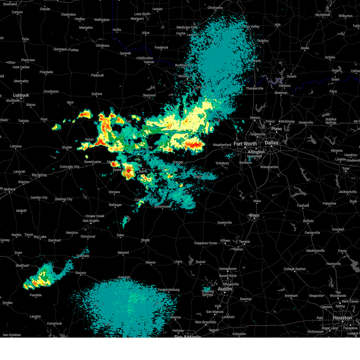 At 933 pm cdt, a severe thunderstorm was located over potosi, moving east at 25 mph (radar indicated). Hazards include 60 mph wind gusts. Expect damage to roofs, siding, and trees. this severe thunderstorm will remain over mainly rural areas of west central callahan and east central taylor counties, including the following locations, kirby lake. hail threat, radar indicated max hail size, <. 75 in wind threat, radar indicated max wind gust, 60 mph. At 933 pm cdt, a severe thunderstorm was located over potosi, moving east at 25 mph (radar indicated). Hazards include 60 mph wind gusts. Expect damage to roofs, siding, and trees. this severe thunderstorm will remain over mainly rural areas of west central callahan and east central taylor counties, including the following locations, kirby lake. hail threat, radar indicated max hail size, <. 75 in wind threat, radar indicated max wind gust, 60 mph.
|
| 5/7/2023 9:22 PM CDT |
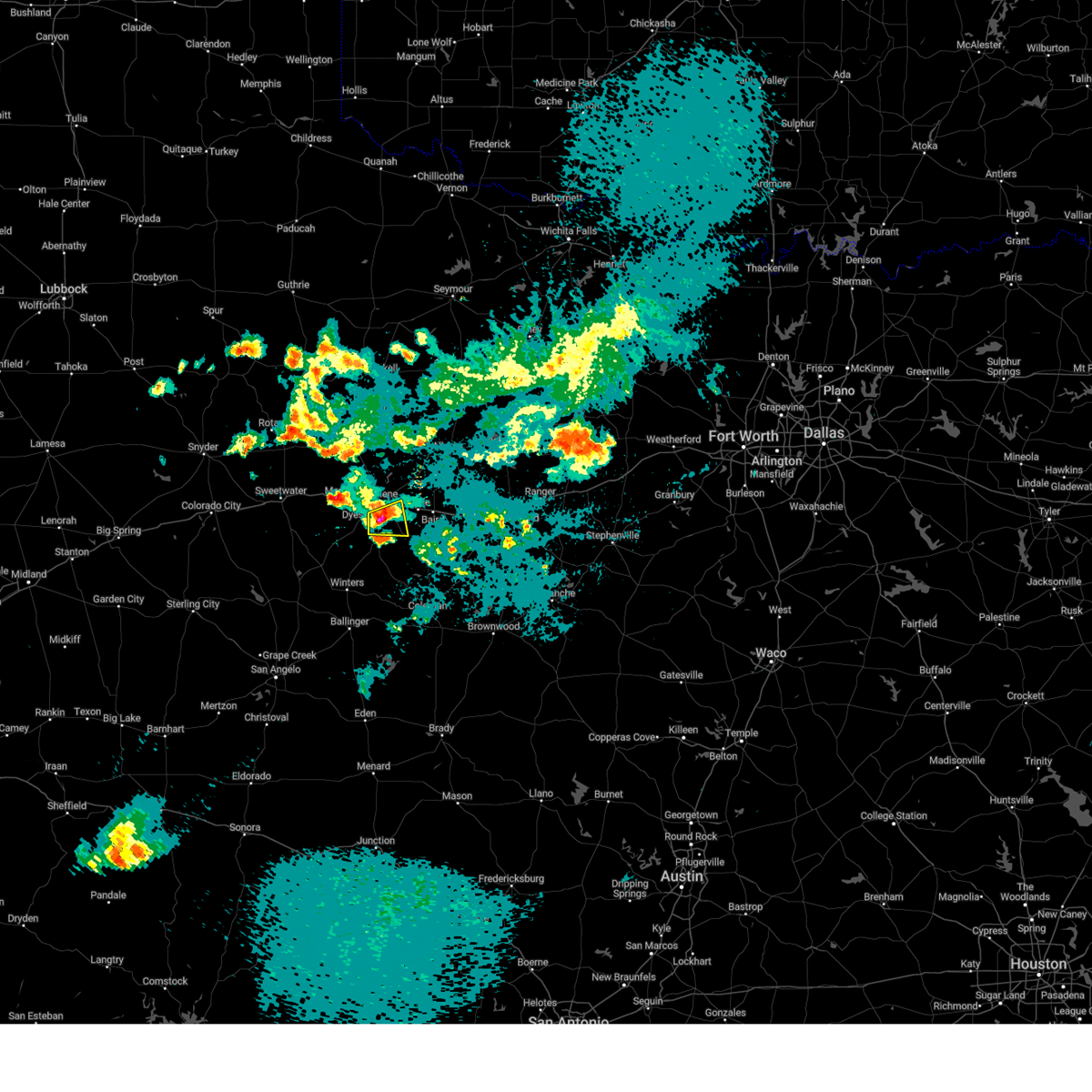 At 922 pm cdt, a severe thunderstorm was located over kirby lake, or over potosi, moving east at 15 mph (radar indicated). Hazards include two inch hail and 60 mph wind gusts. People and animals outdoors will be injured. expect hail damage to roofs, siding, windows, and vehicles. expect wind damage to roofs, siding, and trees. this severe storm will be near, potosi around 935 pm cdt. other locations impacted by this severe thunderstorm include kirby lake. this includes interstate 20 between mile markers 292 and 294. thunderstorm damage threat, considerable hail threat, radar indicated max hail size, 2. 00 in wind threat, radar indicated max wind gust, 60 mph. At 922 pm cdt, a severe thunderstorm was located over kirby lake, or over potosi, moving east at 15 mph (radar indicated). Hazards include two inch hail and 60 mph wind gusts. People and animals outdoors will be injured. expect hail damage to roofs, siding, windows, and vehicles. expect wind damage to roofs, siding, and trees. this severe storm will be near, potosi around 935 pm cdt. other locations impacted by this severe thunderstorm include kirby lake. this includes interstate 20 between mile markers 292 and 294. thunderstorm damage threat, considerable hail threat, radar indicated max hail size, 2. 00 in wind threat, radar indicated max wind gust, 60 mph.
|
| 5/7/2023 9:14 PM CDT |
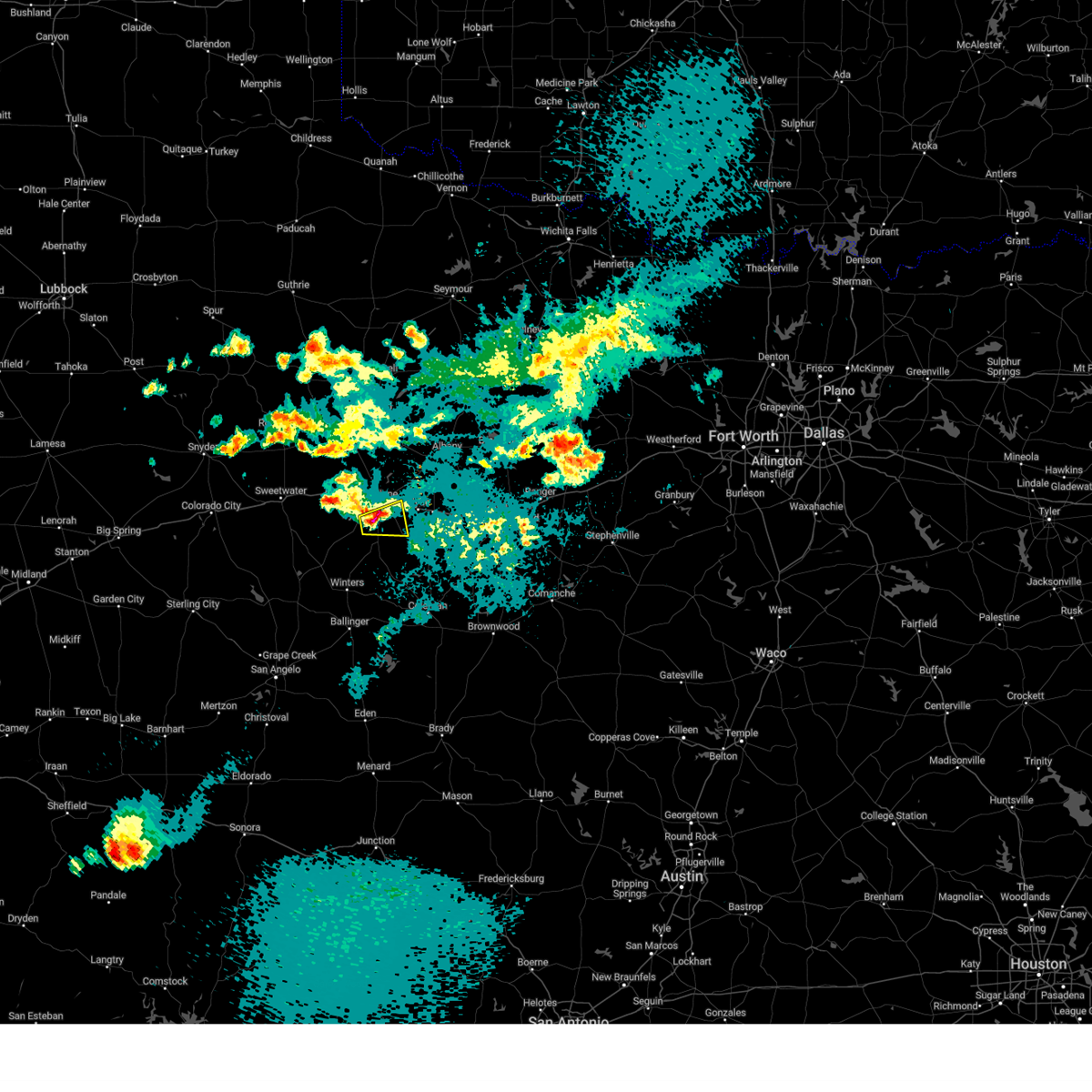 At 913 pm cdt, a severe thunderstorm was located over wylie, moving east at 15 mph (radar indicated). Hazards include golf ball size hail and 60 mph wind gusts. People and animals outdoors will be injured. expect hail damage to roofs, siding, windows, and vehicles. expect wind damage to roofs, siding, and trees. this severe storm will be near, potosi around 935 pm cdt. other locations impacted by this severe thunderstorm include kirby lake. this includes interstate 20 between mile markers 292 and 294. thunderstorm damage threat, considerable hail threat, radar indicated max hail size, 1. 75 in wind threat, radar indicated max wind gust, 60 mph. At 913 pm cdt, a severe thunderstorm was located over wylie, moving east at 15 mph (radar indicated). Hazards include golf ball size hail and 60 mph wind gusts. People and animals outdoors will be injured. expect hail damage to roofs, siding, windows, and vehicles. expect wind damage to roofs, siding, and trees. this severe storm will be near, potosi around 935 pm cdt. other locations impacted by this severe thunderstorm include kirby lake. this includes interstate 20 between mile markers 292 and 294. thunderstorm damage threat, considerable hail threat, radar indicated max hail size, 1. 75 in wind threat, radar indicated max wind gust, 60 mph.
|
| 5/7/2023 9:05 PM CDT |
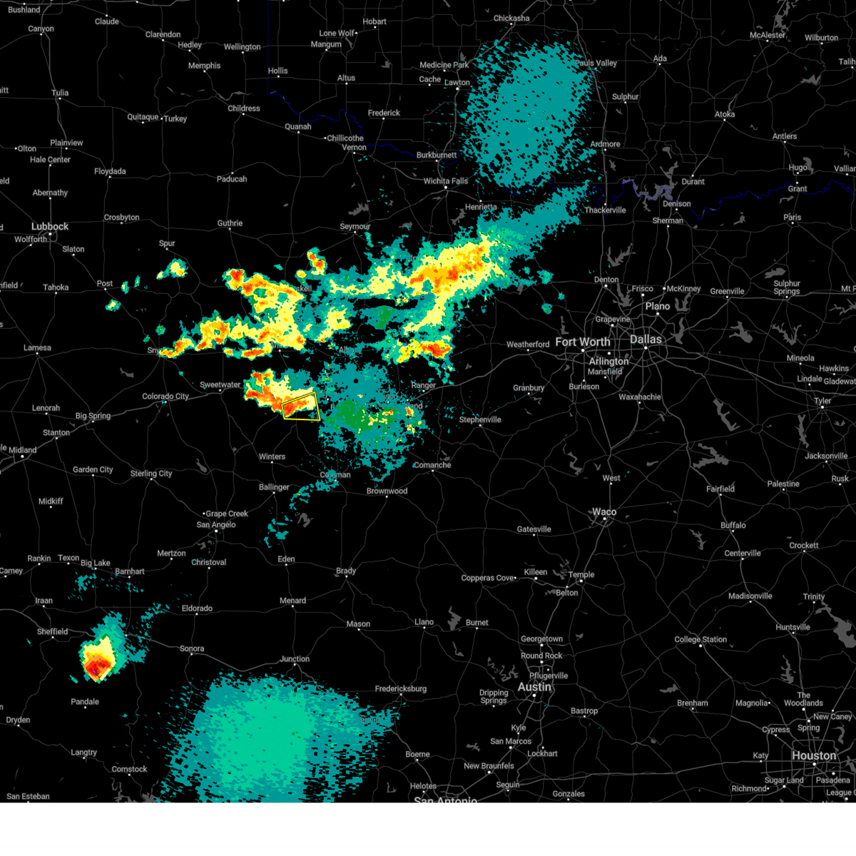 At 905 pm cdt, a severe thunderstorm was located over wylie, moving east at 15 mph (radar indicated). Hazards include 60 mph wind gusts and quarter size hail. Hail damage to vehicles is expected. expect wind damage to roofs, siding, and trees. this severe thunderstorm will be near, wylie around 910 pm cdt. potosi around 940 pm cdt. other locations impacted by this severe thunderstorm include kirby lake. this includes interstate 20 between mile markers 292 and 294. hail threat, radar indicated max hail size, 1. 00 in wind threat, radar indicated max wind gust, 60 mph. At 905 pm cdt, a severe thunderstorm was located over wylie, moving east at 15 mph (radar indicated). Hazards include 60 mph wind gusts and quarter size hail. Hail damage to vehicles is expected. expect wind damage to roofs, siding, and trees. this severe thunderstorm will be near, wylie around 910 pm cdt. potosi around 940 pm cdt. other locations impacted by this severe thunderstorm include kirby lake. this includes interstate 20 between mile markers 292 and 294. hail threat, radar indicated max hail size, 1. 00 in wind threat, radar indicated max wind gust, 60 mph.
|
| 5/7/2023 8:12 PM CDT |
 At 812 pm cdt, a severe thunderstorm was located near merkel, moving east at 30 mph (radar indicated). Hazards include 60 mph wind gusts and quarter size hail. Hail damage to vehicles is expected. expect wind damage to roofs, siding, and trees. this severe thunderstorm will be near, tye, dyess afb and view around 820 pm cdt. caps around 825 pm cdt. wylie around 830 pm cdt. this includes interstate 20 between mile markers 261 and 283. hail threat, radar indicated max hail size, 1. 00 in wind threat, radar indicated max wind gust, 60 mph. At 812 pm cdt, a severe thunderstorm was located near merkel, moving east at 30 mph (radar indicated). Hazards include 60 mph wind gusts and quarter size hail. Hail damage to vehicles is expected. expect wind damage to roofs, siding, and trees. this severe thunderstorm will be near, tye, dyess afb and view around 820 pm cdt. caps around 825 pm cdt. wylie around 830 pm cdt. this includes interstate 20 between mile markers 261 and 283. hail threat, radar indicated max hail size, 1. 00 in wind threat, radar indicated max wind gust, 60 mph.
|
| 5/7/2023 6:05 PM CDT |
 At 604 pm cdt, a severe thunderstorm was located over hodges, or over hawley, moving north at 30 mph (radar indicated). Hazards include golf ball size hail and 60 mph wind gusts. People and animals outdoors will be injured. expect hail damage to roofs, siding, windows, and vehicles. expect wind damage to roofs, siding, and trees. this severe storm will be near, anson around 620 pm cdt. other locations impacted by this severe thunderstorm include funston, impact, hodges, lake fort phantom hill, stith, truby and the intersection of us-180 and farm road 600. thunderstorm damage threat, considerable hail threat, radar indicated max hail size, 1. 75 in wind threat, radar indicated max wind gust, 60 mph. At 604 pm cdt, a severe thunderstorm was located over hodges, or over hawley, moving north at 30 mph (radar indicated). Hazards include golf ball size hail and 60 mph wind gusts. People and animals outdoors will be injured. expect hail damage to roofs, siding, windows, and vehicles. expect wind damage to roofs, siding, and trees. this severe storm will be near, anson around 620 pm cdt. other locations impacted by this severe thunderstorm include funston, impact, hodges, lake fort phantom hill, stith, truby and the intersection of us-180 and farm road 600. thunderstorm damage threat, considerable hail threat, radar indicated max hail size, 1. 75 in wind threat, radar indicated max wind gust, 60 mph.
|
| 5/7/2023 5:41 PM CDT |
 At 540 pm cdt, a severe thunderstorm was located near tye, moving north at 35 mph (radar indicated). Hazards include golf ball size hail and 60 mph wind gusts. People and animals outdoors will be injured. expect hail damage to roofs, siding, windows, and vehicles. expect wind damage to roofs, siding, and trees. this severe thunderstorm will be near, hawley around 605 pm cdt. anson and nugent around 615 pm cdt. other locations impacted by this severe thunderstorm include funston, impact, hodges, lake fort phantom hill, stith, truby and the intersection of us-180 and farm road 600. this includes interstate 20 between mile markers 267 and 285. thunderstorm damage threat, considerable hail threat, radar indicated max hail size, 1. 75 in wind threat, radar indicated max wind gust, 60 mph. At 540 pm cdt, a severe thunderstorm was located near tye, moving north at 35 mph (radar indicated). Hazards include golf ball size hail and 60 mph wind gusts. People and animals outdoors will be injured. expect hail damage to roofs, siding, windows, and vehicles. expect wind damage to roofs, siding, and trees. this severe thunderstorm will be near, hawley around 605 pm cdt. anson and nugent around 615 pm cdt. other locations impacted by this severe thunderstorm include funston, impact, hodges, lake fort phantom hill, stith, truby and the intersection of us-180 and farm road 600. this includes interstate 20 between mile markers 267 and 285. thunderstorm damage threat, considerable hail threat, radar indicated max hail size, 1. 75 in wind threat, radar indicated max wind gust, 60 mph.
|
| 5/7/2023 5:28 PM CDT |
 At 528 pm cdt, a severe thunderstorm was located near view, moving north at 30 mph (radar indicated). Hazards include 60 mph wind gusts. Expect damage to roofs, siding, and trees. this severe storm will be near, caps around 540 pm cdt. merkel and dyess afb around 545 pm cdt. tye around 550 pm cdt. other locations impacted by this severe thunderstorm include camp butman. this includes interstate 20 between mile markers 263 and 273. hail threat, observed max hail size, <. 75 in wind threat, radar indicated max wind gust, 60 mph. At 528 pm cdt, a severe thunderstorm was located near view, moving north at 30 mph (radar indicated). Hazards include 60 mph wind gusts. Expect damage to roofs, siding, and trees. this severe storm will be near, caps around 540 pm cdt. merkel and dyess afb around 545 pm cdt. tye around 550 pm cdt. other locations impacted by this severe thunderstorm include camp butman. this includes interstate 20 between mile markers 263 and 273. hail threat, observed max hail size, <. 75 in wind threat, radar indicated max wind gust, 60 mph.
|
| 5/7/2023 5:24 PM CDT |
 At 523 pm cdt, a severe thunderstorm was located over ovalo, or over tuscola, moving northeast at 25 mph (radar indicated). Hazards include 60 mph wind gusts and half dollar size hail. Hail damage to vehicles is expected. expect wind damage to roofs, siding, and trees. this severe storm will be near, buffalo gap around 540 pm cdt. wylie and dudley around 550 pm cdt. potosi around 600 pm cdt. other locations impacted by this severe thunderstorm include lake abilene, ovalo and camp tonkawa. hail threat, radar indicated max hail size, 1. 25 in wind threat, radar indicated max wind gust, 60 mph. At 523 pm cdt, a severe thunderstorm was located over ovalo, or over tuscola, moving northeast at 25 mph (radar indicated). Hazards include 60 mph wind gusts and half dollar size hail. Hail damage to vehicles is expected. expect wind damage to roofs, siding, and trees. this severe storm will be near, buffalo gap around 540 pm cdt. wylie and dudley around 550 pm cdt. potosi around 600 pm cdt. other locations impacted by this severe thunderstorm include lake abilene, ovalo and camp tonkawa. hail threat, radar indicated max hail size, 1. 25 in wind threat, radar indicated max wind gust, 60 mph.
|
| 5/7/2023 5:19 PM CDT |
 At 518 pm cdt, a severe thunderstorm was located over coronados camp, moving north at 40 mph (radar indicated). Hazards include golf ball size hail and 60 mph wind gusts. People and animals outdoors will be injured. expect hail damage to roofs, siding, windows, and vehicles. expect wind damage to roofs, siding, and trees. this severe storm will be near, view around 530 pm cdt. merkel, dyess afb and caps around 535 pm cdt. tye around 540 pm cdt. other locations impacted by this severe thunderstorm include camp butman. this includes interstate 20 between mile markers 263 and 273. thunderstorm damage threat, considerable hail threat, observed max hail size, 1. 75 in wind threat, radar indicated max wind gust, 60 mph. At 518 pm cdt, a severe thunderstorm was located over coronados camp, moving north at 40 mph (radar indicated). Hazards include golf ball size hail and 60 mph wind gusts. People and animals outdoors will be injured. expect hail damage to roofs, siding, windows, and vehicles. expect wind damage to roofs, siding, and trees. this severe storm will be near, view around 530 pm cdt. merkel, dyess afb and caps around 535 pm cdt. tye around 540 pm cdt. other locations impacted by this severe thunderstorm include camp butman. this includes interstate 20 between mile markers 263 and 273. thunderstorm damage threat, considerable hail threat, observed max hail size, 1. 75 in wind threat, radar indicated max wind gust, 60 mph.
|
| 5/7/2023 5:13 PM CDT |
 At 513 pm cdt, a severe thunderstorm was located near bradshaw, moving northeast at 25 mph (radar indicated). Hazards include 60 mph wind gusts and nickel size hail. Expect damage to roofs, siding, and trees. this severe storm will be near, lawn around 520 pm cdt. tuscola around 530 pm cdt. buffalo gap around 540 pm cdt. wylie and dudley around 550 pm cdt. potosi around 600 pm cdt. other locations impacted by this severe thunderstorm include lake abilene, drasco, camp tonkawa, pumphrey and ovalo. hail threat, radar indicated max hail size, 0. 88 in wind threat, radar indicated max wind gust, 60 mph. At 513 pm cdt, a severe thunderstorm was located near bradshaw, moving northeast at 25 mph (radar indicated). Hazards include 60 mph wind gusts and nickel size hail. Expect damage to roofs, siding, and trees. this severe storm will be near, lawn around 520 pm cdt. tuscola around 530 pm cdt. buffalo gap around 540 pm cdt. wylie and dudley around 550 pm cdt. potosi around 600 pm cdt. other locations impacted by this severe thunderstorm include lake abilene, drasco, camp tonkawa, pumphrey and ovalo. hail threat, radar indicated max hail size, 0. 88 in wind threat, radar indicated max wind gust, 60 mph.
|
| 5/7/2023 5:00 PM CDT |
 At 459 pm cdt, a severe thunderstorm was located over wingate, moving north at 30 mph (radar indicated). Hazards include golf ball size hail and 60 mph wind gusts. People and animals outdoors will be injured. expect hail damage to roofs, siding, windows, and vehicles. expect wind damage to roofs, siding, and trees. this severe thunderstorm will be near, happy valley around 510 pm cdt. coronados camp around 530 pm cdt. view around 545 pm cdt. caps around 550 pm cdt. merkel and dyess afb around 555 pm cdt. tye around 600 pm cdt. other locations impacted by this severe thunderstorm include camp butman and shep. this includes interstate 20 between mile markers 263 and 273. thunderstorm damage threat, considerable hail threat, observed max hail size, 1. 75 in wind threat, radar indicated max wind gust, 60 mph. At 459 pm cdt, a severe thunderstorm was located over wingate, moving north at 30 mph (radar indicated). Hazards include golf ball size hail and 60 mph wind gusts. People and animals outdoors will be injured. expect hail damage to roofs, siding, windows, and vehicles. expect wind damage to roofs, siding, and trees. this severe thunderstorm will be near, happy valley around 510 pm cdt. coronados camp around 530 pm cdt. view around 545 pm cdt. caps around 550 pm cdt. merkel and dyess afb around 555 pm cdt. tye around 600 pm cdt. other locations impacted by this severe thunderstorm include camp butman and shep. this includes interstate 20 between mile markers 263 and 273. thunderstorm damage threat, considerable hail threat, observed max hail size, 1. 75 in wind threat, radar indicated max wind gust, 60 mph.
|
| 5/7/2023 4:51 PM CDT |
 At 449 pm cdt, a severe thunderstorm was located near winters, moving northeast at 25 mph (radar indicated). Hazards include 60 mph wind gusts and half dollar size hail. Hail damage to vehicles is expected. expect wind damage to roofs, siding, and trees. this severe thunderstorm will be near, bradshaw around 505 pm cdt. lawn around 520 pm cdt. tuscola around 530 pm cdt. buffalo gap around 535 pm cdt. wylie, potosi and dudley around 545 pm cdt. Other locations impacted by this severe thunderstorm include lake abilene, drasco, camp tonkawa, pumphrey and ovalo. At 449 pm cdt, a severe thunderstorm was located near winters, moving northeast at 25 mph (radar indicated). Hazards include 60 mph wind gusts and half dollar size hail. Hail damage to vehicles is expected. expect wind damage to roofs, siding, and trees. this severe thunderstorm will be near, bradshaw around 505 pm cdt. lawn around 520 pm cdt. tuscola around 530 pm cdt. buffalo gap around 535 pm cdt. wylie, potosi and dudley around 545 pm cdt. Other locations impacted by this severe thunderstorm include lake abilene, drasco, camp tonkawa, pumphrey and ovalo.
|
| 5/6/2023 8:19 PM CDT |
 At 818 pm cdt, a severe thunderstorm was located near mccarty lake, or near albany, moving northeast at 30 mph (radar indicated). Hazards include 60 mph wind gusts and quarter size hail. Hail damage to vehicles is expected. expect wind damage to roofs, siding, and trees. this severe storm will be near, albany around 830 pm cdt. ibex around 845 pm cdt. other locations impacted by this severe thunderstorm include mccarty lake. hail threat, radar indicated max hail size, 1. 00 in wind threat, radar indicated max wind gust, 60 mph. At 818 pm cdt, a severe thunderstorm was located near mccarty lake, or near albany, moving northeast at 30 mph (radar indicated). Hazards include 60 mph wind gusts and quarter size hail. Hail damage to vehicles is expected. expect wind damage to roofs, siding, and trees. this severe storm will be near, albany around 830 pm cdt. ibex around 845 pm cdt. other locations impacted by this severe thunderstorm include mccarty lake. hail threat, radar indicated max hail size, 1. 00 in wind threat, radar indicated max wind gust, 60 mph.
|
| 5/6/2023 7:44 PM CDT | Quarter sized hail reported 8.9 miles SSW of Abilene, TX, report from mping: quarter (1.00 in.). |
| 5/6/2023 7:40 PM CDT |
 At 740 pm cdt, a severe thunderstorm was located over lake fort phantom hill, or near nugent, moving east at 30 mph (radar indicated). Hazards include 60 mph wind gusts and quarter size hail. Hail damage to vehicles is expected. expect wind damage to roofs, siding, and trees. this severe thunderstorm will be near, nugent around 745 pm cdt. albany around 830 pm cdt. ibex around 845 pm cdt. other locations impacted by this severe thunderstorm include lake fort phantom hill and mccarty lake. hail threat, radar indicated max hail size, 1. 00 in wind threat, radar indicated max wind gust, 60 mph. At 740 pm cdt, a severe thunderstorm was located over lake fort phantom hill, or near nugent, moving east at 30 mph (radar indicated). Hazards include 60 mph wind gusts and quarter size hail. Hail damage to vehicles is expected. expect wind damage to roofs, siding, and trees. this severe thunderstorm will be near, nugent around 745 pm cdt. albany around 830 pm cdt. ibex around 845 pm cdt. other locations impacted by this severe thunderstorm include lake fort phantom hill and mccarty lake. hail threat, radar indicated max hail size, 1. 00 in wind threat, radar indicated max wind gust, 60 mph.
|
| 5/6/2023 7:28 PM CDT |
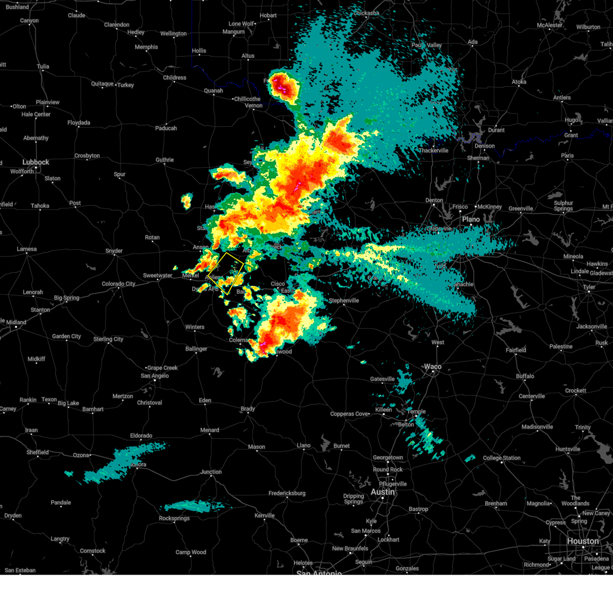 The severe thunderstorm warning for northwestern callahan, southeastern jones, southwestern shackelford and northeastern taylor counties will expire at 730 pm cdt, the storm which prompted the warning has weakened below severe limits, and has exited the warned area. therefore, the warning will be allowed to expire. a severe thunderstorm watch remains in effect until 1100 pm cdt for west central texas. The severe thunderstorm warning for northwestern callahan, southeastern jones, southwestern shackelford and northeastern taylor counties will expire at 730 pm cdt, the storm which prompted the warning has weakened below severe limits, and has exited the warned area. therefore, the warning will be allowed to expire. a severe thunderstorm watch remains in effect until 1100 pm cdt for west central texas.
|
| 5/6/2023 6:43 PM CDT |
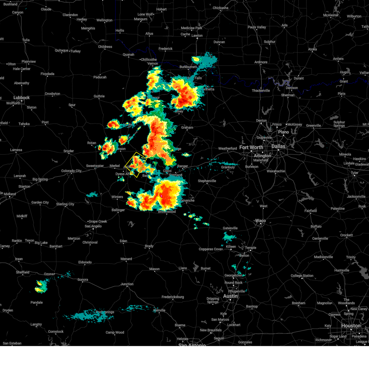 At 641 pm cdt, a severe thunderstorm was located near hamby, moving northeast at 25 mph. Hazards include 60 mph wind gusts and quarter size hail. Hail damage to vehicles is expected. expect wind damage to roofs, siding, and trees. this severe thunderstorm will be near, hamby around 650 pm cdt. other locations impacted by this severe thunderstorm include impact and lake fort phantom hill. this includes interstate 20 between mile markers 283 and 299. hail threat, radar indicated max hail size, 1. 00 in wind threat, radar indicated max wind gust, 60 mph. At 641 pm cdt, a severe thunderstorm was located near hamby, moving northeast at 25 mph. Hazards include 60 mph wind gusts and quarter size hail. Hail damage to vehicles is expected. expect wind damage to roofs, siding, and trees. this severe thunderstorm will be near, hamby around 650 pm cdt. other locations impacted by this severe thunderstorm include impact and lake fort phantom hill. this includes interstate 20 between mile markers 283 and 299. hail threat, radar indicated max hail size, 1. 00 in wind threat, radar indicated max wind gust, 60 mph.
|
| 5/5/2023 3:55 PM CDT |
 At 355 pm cdt, a severe thunderstorm was located over abilene, moving northeast at 25 mph (radar indicated). Hazards include 60 mph wind gusts and quarter size hail. Hail damage to vehicles is expected. expect wind damage to roofs, siding, and trees. this severe thunderstorm will be near, hamby around 405 pm cdt. other locations impacted by this severe thunderstorm include impact, mccarty lake and us-283 near the callahan-shackelford county line. this includes interstate 20 between mile markers 283 and 298. hail threat, radar indicated max hail size, 1. 00 in wind threat, radar indicated max wind gust, 60 mph. At 355 pm cdt, a severe thunderstorm was located over abilene, moving northeast at 25 mph (radar indicated). Hazards include 60 mph wind gusts and quarter size hail. Hail damage to vehicles is expected. expect wind damage to roofs, siding, and trees. this severe thunderstorm will be near, hamby around 405 pm cdt. other locations impacted by this severe thunderstorm include impact, mccarty lake and us-283 near the callahan-shackelford county line. this includes interstate 20 between mile markers 283 and 298. hail threat, radar indicated max hail size, 1. 00 in wind threat, radar indicated max wind gust, 60 mph.
|
| 4/26/2023 2:55 PM CDT | Quarter sized hail reported 11.4 miles N of Abilene, TX |
| 4/26/2023 2:41 PM CDT |
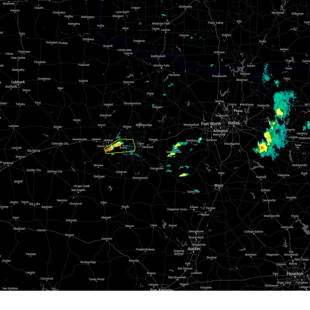 At 240 pm cdt, two severe thunderstorms were located near potosi, moving east at 15 mph (radar indicated). Hazards include 60 mph wind gusts and quarter size hail. Hail damage to vehicles is expected. expect wind damage to roofs, siding, and trees. severe thunderstorms will be near, dudley around 300 pm cdt. eula around 310 pm cdt. clyde around 320 pm cdt. baird around 345 pm cdt. other locations impacted by this severe thunderstorm include admiral, i-20 near the callahan-eastland county line and kirby lake. this includes interstate 20 between mile markers 293 and 323. hail threat, radar indicated max hail size, 1. 00 in wind threat, radar indicated max wind gust, 60 mph. At 240 pm cdt, two severe thunderstorms were located near potosi, moving east at 15 mph (radar indicated). Hazards include 60 mph wind gusts and quarter size hail. Hail damage to vehicles is expected. expect wind damage to roofs, siding, and trees. severe thunderstorms will be near, dudley around 300 pm cdt. eula around 310 pm cdt. clyde around 320 pm cdt. baird around 345 pm cdt. other locations impacted by this severe thunderstorm include admiral, i-20 near the callahan-eastland county line and kirby lake. this includes interstate 20 between mile markers 293 and 323. hail threat, radar indicated max hail size, 1. 00 in wind threat, radar indicated max wind gust, 60 mph.
|
| 4/25/2023 9:09 PM CDT |
 The severe thunderstorm warning for southern taylor and northeastern runnels counties will expire at 915 pm cdt, the storm which prompted the warning has moved out of the area. therefore, the warning will be allowed to expire. however hail and gusty winds are still possible with this thunderstorm. a severe thunderstorm watch remains in effect until 1100 pm cdt for west central texas. remember, a severe thunderstorm warning still remains in effect for southern taylor county, coleman county, and runnels county. The severe thunderstorm warning for southern taylor and northeastern runnels counties will expire at 915 pm cdt, the storm which prompted the warning has moved out of the area. therefore, the warning will be allowed to expire. however hail and gusty winds are still possible with this thunderstorm. a severe thunderstorm watch remains in effect until 1100 pm cdt for west central texas. remember, a severe thunderstorm warning still remains in effect for southern taylor county, coleman county, and runnels county.
|
| 4/25/2023 8:45 PM CDT |
 At 844 pm cdt, a severe thunderstorm was located over bradshaw, moving southeast at 25 mph. this is a destructive storm for southern taylor county south of lake abilene (radar indicated). Hazards include baseball size hail and 60 mph wind gusts. People and animals outdoors will be severely injured. expect shattered windows, extensive damage to roofs, siding, and vehicles. this severe storm will be near, bradshaw around 850 pm cdt. Other locations impacted by this severe thunderstorm include lake abilene, drasco, camp tonkawa, pumphrey and ovalo. At 844 pm cdt, a severe thunderstorm was located over bradshaw, moving southeast at 25 mph. this is a destructive storm for southern taylor county south of lake abilene (radar indicated). Hazards include baseball size hail and 60 mph wind gusts. People and animals outdoors will be severely injured. expect shattered windows, extensive damage to roofs, siding, and vehicles. this severe storm will be near, bradshaw around 850 pm cdt. Other locations impacted by this severe thunderstorm include lake abilene, drasco, camp tonkawa, pumphrey and ovalo.
|
| 4/25/2023 8:32 PM CDT |
 At 830 pm cdt, a severe thunderstorm was located near coronados camp, moving southeast at 25 mph (public. at 821 pm 2 inch hail was reported 15 miles south of trent). Hazards include tennis ball size hail and 60 mph wind gusts. People and animals outdoors will be injured. expect hail damage to roofs, siding, windows, and vehicles. expect wind damage to roofs, siding, and trees. this severe storm will be near, tuscola and bradshaw around 850 pm cdt. lawn around 905 pm cdt. Other locations impacted by this severe thunderstorm include lake abilene, drasco, camp tonkawa, pumphrey, shep, camp butman, kirby lake and ovalo. At 830 pm cdt, a severe thunderstorm was located near coronados camp, moving southeast at 25 mph (public. at 821 pm 2 inch hail was reported 15 miles south of trent). Hazards include tennis ball size hail and 60 mph wind gusts. People and animals outdoors will be injured. expect hail damage to roofs, siding, windows, and vehicles. expect wind damage to roofs, siding, and trees. this severe storm will be near, tuscola and bradshaw around 850 pm cdt. lawn around 905 pm cdt. Other locations impacted by this severe thunderstorm include lake abilene, drasco, camp tonkawa, pumphrey, shep, camp butman, kirby lake and ovalo.
|
| 4/25/2023 8:15 PM CDT |
 At 813 pm cdt, a severe thunderstorm was located near coronados camp, moving southeast at 25 mph (radar indicated). Hazards include tennis ball size hail and 60 mph wind gusts. People and animals outdoors will be injured. expect hail damage to roofs, siding, windows, and vehicles. expect wind damage to roofs, siding, and trees. this severe thunderstorm will be near, coronados camp around 825 pm cdt. tuscola around 850 pm cdt. bradshaw around 855 pm cdt. lawn around 905 pm cdt. Other locations impacted by this severe thunderstorm include lake abilene, drasco, camp tonkawa, pumphrey, shep, camp butman, kirby lake and ovalo. At 813 pm cdt, a severe thunderstorm was located near coronados camp, moving southeast at 25 mph (radar indicated). Hazards include tennis ball size hail and 60 mph wind gusts. People and animals outdoors will be injured. expect hail damage to roofs, siding, windows, and vehicles. expect wind damage to roofs, siding, and trees. this severe thunderstorm will be near, coronados camp around 825 pm cdt. tuscola around 850 pm cdt. bradshaw around 855 pm cdt. lawn around 905 pm cdt. Other locations impacted by this severe thunderstorm include lake abilene, drasco, camp tonkawa, pumphrey, shep, camp butman, kirby lake and ovalo.
|
| 4/19/2023 9:02 PM CDT |
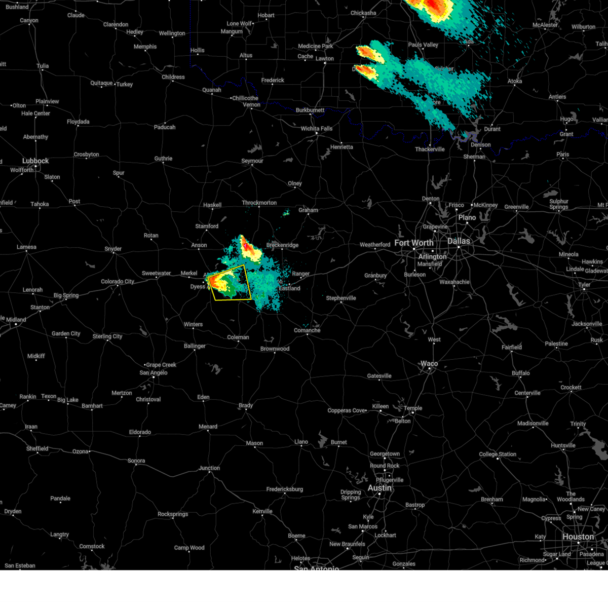 At 901 pm cdt, a severe thunderstorm was located over kirby lake, or over potosi, moving east at 25 mph (law enforcement). Hazards include 60 mph wind gusts and half dollar size hail. Hail damage to vehicles is expected. expect wind damage to roofs, siding, and trees. this severe thunderstorm will be near, eula around 920 pm cdt. clyde around 925 pm cdt. baird around 945 pm cdt. other locations impacted by this severe thunderstorm include admiral, us-283 near the callahan-shackelford county line and kirby lake. This includes interstate 20 between mile markers 286 and 311. At 901 pm cdt, a severe thunderstorm was located over kirby lake, or over potosi, moving east at 25 mph (law enforcement). Hazards include 60 mph wind gusts and half dollar size hail. Hail damage to vehicles is expected. expect wind damage to roofs, siding, and trees. this severe thunderstorm will be near, eula around 920 pm cdt. clyde around 925 pm cdt. baird around 945 pm cdt. other locations impacted by this severe thunderstorm include admiral, us-283 near the callahan-shackelford county line and kirby lake. This includes interstate 20 between mile markers 286 and 311.
|
| 4/19/2023 8:58 PM CDT | Tennis Ball sized hail reported 8.5 miles N of Abilene, TX |
| 4/19/2023 8:42 PM CDT |
 At 841 pm cdt, a severe thunderstorm capable of producing a tornado was located just south of dyess afb, moving northeast at 20 mph (radar indicated rotation). Hazards include tornado and half dollar size hail. Flying debris will be dangerous to those caught without shelter. mobile homes will be damaged or destroyed. damage to roofs, windows, and vehicles will occur. Tree damage is likely. At 841 pm cdt, a severe thunderstorm capable of producing a tornado was located just south of dyess afb, moving northeast at 20 mph (radar indicated rotation). Hazards include tornado and half dollar size hail. Flying debris will be dangerous to those caught without shelter. mobile homes will be damaged or destroyed. damage to roofs, windows, and vehicles will occur. Tree damage is likely.
|
| 4/19/2023 8:23 PM CDT |
 At 822 pm cdt, a severe thunderstorm was located over hamby, moving rapidly northeast at 50 mph (radar indicated). Hazards include 60 mph wind gusts and half dollar size hail. Hail damage to vehicles is expected. expect wind damage to roofs, siding, and trees. this severe thunderstorm will be near, albany around 850 pm cdt. other locations impacted by this severe thunderstorm include big country baptist assembly, lake fort phantom hill, mccarty lake and the intersection of us-180 and farm road 600. hail threat, radar indicated max hail size, 1. 25 in wind threat, radar indicated max wind gust, 60 mph. At 822 pm cdt, a severe thunderstorm was located over hamby, moving rapidly northeast at 50 mph (radar indicated). Hazards include 60 mph wind gusts and half dollar size hail. Hail damage to vehicles is expected. expect wind damage to roofs, siding, and trees. this severe thunderstorm will be near, albany around 850 pm cdt. other locations impacted by this severe thunderstorm include big country baptist assembly, lake fort phantom hill, mccarty lake and the intersection of us-180 and farm road 600. hail threat, radar indicated max hail size, 1. 25 in wind threat, radar indicated max wind gust, 60 mph.
|
| 4/19/2023 8:08 PM CDT |
 At 807 pm cdt, a severe thunderstorm was located over tye, with another severe storm 2 miles northwest of view. the storms were moving northeast at 35 mph (radar indicated). Hazards include 60 mph wind gusts and half dollar size hail. Hail damage to vehicles is expected. expect wind damage to roofs, siding, and trees. this severe thunderstorm will be near, hawley around 825 pm cdt. abilene and hamby around 830 pm cdt. other locations impacted by this severe thunderstorm include impact, hodges, kirby lake and stith. this includes interstate 20 between mile markers 268 and 297. hail threat, radar indicated max hail size, 1. 25 in wind threat, radar indicated max wind gust, 60 mph. At 807 pm cdt, a severe thunderstorm was located over tye, with another severe storm 2 miles northwest of view. the storms were moving northeast at 35 mph (radar indicated). Hazards include 60 mph wind gusts and half dollar size hail. Hail damage to vehicles is expected. expect wind damage to roofs, siding, and trees. this severe thunderstorm will be near, hawley around 825 pm cdt. abilene and hamby around 830 pm cdt. other locations impacted by this severe thunderstorm include impact, hodges, kirby lake and stith. this includes interstate 20 between mile markers 268 and 297. hail threat, radar indicated max hail size, 1. 25 in wind threat, radar indicated max wind gust, 60 mph.
|
| 4/19/2023 7:56 PM CDT |
 At 755 pm cdt, a severe thunderstorm was located near view, moving northeast at 35 mph (radar indicated). Hazards include ping pong ball to golf ball size hail and 60 mph wind gusts. People and animals outdoors will be injured. expect hail damage to roofs, siding, windows, and vehicles. expect wind damage to roofs, siding, and trees. this severe storm will be near, view around 800 pm cdt. dyess afb and caps around 805 pm cdt. wylie and tye around 810 pm cdt. 5 miles southwest of abilene around 830 pm cdt. other locations impacted by this severe thunderstorm include camp tonkawa. this includes interstate 20 between mile markers 270 and 278. thunderstorm damage threat, considerable hail threat, radar indicated max hail size, 1. 75 in wind threat, radar indicated max wind gust, 60 mph. At 755 pm cdt, a severe thunderstorm was located near view, moving northeast at 35 mph (radar indicated). Hazards include ping pong ball to golf ball size hail and 60 mph wind gusts. People and animals outdoors will be injured. expect hail damage to roofs, siding, windows, and vehicles. expect wind damage to roofs, siding, and trees. this severe storm will be near, view around 800 pm cdt. dyess afb and caps around 805 pm cdt. wylie and tye around 810 pm cdt. 5 miles southwest of abilene around 830 pm cdt. other locations impacted by this severe thunderstorm include camp tonkawa. this includes interstate 20 between mile markers 270 and 278. thunderstorm damage threat, considerable hail threat, radar indicated max hail size, 1. 75 in wind threat, radar indicated max wind gust, 60 mph.
|
| 4/19/2023 7:41 PM CDT |
 At 741 pm cdt, a severe thunderstorm in western taylor county was located over camp butman, or near coronados camp, and moving northeast at 35 mph (radar indicated). Hazards include 60 mph wind gusts and quarter size hail. Hail damage to vehicles is expected. expect wind damage to roofs, siding, and trees. this severe thunderstorm will be near, coronados camp around 745 pm cdt. view around 800 pm cdt. dyess afb and caps around 805 pm cdt. wylie and tye around 810 pm cdt. other locations impacted by this severe thunderstorm include lake abilene, camp tonkawa and camp butman. this includes interstate 20 between mile markers 270 and 278. hail threat, radar indicated max hail size, 1. 00 in wind threat, radar indicated max wind gust, 60 mph. At 741 pm cdt, a severe thunderstorm in western taylor county was located over camp butman, or near coronados camp, and moving northeast at 35 mph (radar indicated). Hazards include 60 mph wind gusts and quarter size hail. Hail damage to vehicles is expected. expect wind damage to roofs, siding, and trees. this severe thunderstorm will be near, coronados camp around 745 pm cdt. view around 800 pm cdt. dyess afb and caps around 805 pm cdt. wylie and tye around 810 pm cdt. other locations impacted by this severe thunderstorm include lake abilene, camp tonkawa and camp butman. this includes interstate 20 between mile markers 270 and 278. hail threat, radar indicated max hail size, 1. 00 in wind threat, radar indicated max wind gust, 60 mph.
|
| 3/2/2023 4:03 PM CST | Raws in hamby reported 64 mph gust with passing storm in callahan county TX, 6.2 miles W of Abilene, TX |
| 3/2/2023 3:20 PM CST | Skywarn spotter reported trees blown over onto power lines in abilene near the intersection of north treadway ave. and i-20. this caused a power outag in taylor county TX, 3 miles N of Abilene, TX |
| 3/2/2023 3:12 PM CST |
 At 312 pm cst, a severe thunderstorm was located near lake fort phantom hill, or near hamby, moving east at 45 mph (radar indicated). Hazards include 70 mph wind gusts and quarter size hail. Hail damage to vehicles is expected. expect considerable tree damage. wind damage is also likely to mobile homes, roofs, and outbuildings. this severe thunderstorm will be near, hamby around 315 pm cst. moran around 350 pm cst. ibex around 355 pm cst. other locations impacted by this severe thunderstorm include impact, mccarty lake, big country baptist assembly, lake fort phantom hill, us-283 near the callahan-shackelford county line, kirby lake, us- 180 near the shackelford- stephens county line, the intersection of us- 180 and farm road 600 and i-20 near the callahan- eastland county line. this includes interstate 20 between mile markers 284 and 323. thunderstorm damage threat, considerable hail threat, radar indicated max hail size, 1. 00 in wind threat, radar indicated max wind gust, 70 mph. At 312 pm cst, a severe thunderstorm was located near lake fort phantom hill, or near hamby, moving east at 45 mph (radar indicated). Hazards include 70 mph wind gusts and quarter size hail. Hail damage to vehicles is expected. expect considerable tree damage. wind damage is also likely to mobile homes, roofs, and outbuildings. this severe thunderstorm will be near, hamby around 315 pm cst. moran around 350 pm cst. ibex around 355 pm cst. other locations impacted by this severe thunderstorm include impact, mccarty lake, big country baptist assembly, lake fort phantom hill, us-283 near the callahan-shackelford county line, kirby lake, us- 180 near the shackelford- stephens county line, the intersection of us- 180 and farm road 600 and i-20 near the callahan- eastland county line. this includes interstate 20 between mile markers 284 and 323. thunderstorm damage threat, considerable hail threat, radar indicated max hail size, 1. 00 in wind threat, radar indicated max wind gust, 70 mph.
|
| 3/2/2023 3:04 PM CST |
 At 303 pm cst, a severe thunderstorm was located over tye, moving east at 45 mph (radar indicated). Hazards include 70 mph wind gusts and quarter size hail. Hail damage to vehicles is expected. expect considerable tree damage. wind damage is also likely to mobile homes, roofs, and outbuildings. this severe storm will be near, hamby around 320 pm cst. other locations impacted by this severe thunderstorm include impact, hodges, lake fort phantom hill, camp butman, kirby lake, stith and truby. this includes interstate 20 between mile markers 261 and 292. thunderstorm damage threat, considerable hail threat, radar indicated max hail size, 1. 00 in wind threat, radar indicated max wind gust, 70 mph. At 303 pm cst, a severe thunderstorm was located over tye, moving east at 45 mph (radar indicated). Hazards include 70 mph wind gusts and quarter size hail. Hail damage to vehicles is expected. expect considerable tree damage. wind damage is also likely to mobile homes, roofs, and outbuildings. this severe storm will be near, hamby around 320 pm cst. other locations impacted by this severe thunderstorm include impact, hodges, lake fort phantom hill, camp butman, kirby lake, stith and truby. this includes interstate 20 between mile markers 261 and 292. thunderstorm damage threat, considerable hail threat, radar indicated max hail size, 1. 00 in wind threat, radar indicated max wind gust, 70 mph.
|
| 3/2/2023 3:00 PM CST | An 18-wheeler tipped over onto a pickup truck from high winds on highway 277. time estimated from rada in taylor county TX, 2 miles ESE of Abilene, TX |
| 3/2/2023 2:47 PM CST |
 At 247 pm cst, a severe thunderstorm was located over merkel, moving east at 45 mph (radar indicated). Hazards include 60 mph wind gusts and quarter size hail. Hail damage to vehicles is expected. expect wind damage to roofs, siding, and trees. this severe thunderstorm will be near, merkel around 250 pm cst. tye, dyess afb and caps around 300 pm cst. wylie around 305 pm cst. hamby around 320 pm cst. other locations impacted by this severe thunderstorm include impact, hodges, lake fort phantom hill, camp butman, kirby lake, stith and truby. this includes interstate 20 between mile markers 255 and 292. hail threat, radar indicated max hail size, 1. 00 in wind threat, radar indicated max wind gust, 60 mph. At 247 pm cst, a severe thunderstorm was located over merkel, moving east at 45 mph (radar indicated). Hazards include 60 mph wind gusts and quarter size hail. Hail damage to vehicles is expected. expect wind damage to roofs, siding, and trees. this severe thunderstorm will be near, merkel around 250 pm cst. tye, dyess afb and caps around 300 pm cst. wylie around 305 pm cst. hamby around 320 pm cst. other locations impacted by this severe thunderstorm include impact, hodges, lake fort phantom hill, camp butman, kirby lake, stith and truby. this includes interstate 20 between mile markers 255 and 292. hail threat, radar indicated max hail size, 1. 00 in wind threat, radar indicated max wind gust, 60 mph.
|
| 9/5/2022 3:28 PM CDT |
 At 328 pm cdt, a severe thunderstorm was located over caps, moving south at 20 mph (radar indicated). Hazards include 60 mph wind gusts and quarter size hail. Hail damage to vehicles is expected. expect wind damage to roofs, siding, and trees. this severe storm will be near, view around 335 pm cdt. buffalo gap around 345 pm cdt. tuscola around 400 pm cdt. lawn around 420 pm cdt. other locations impacted by this severe thunderstorm include lake abilene, camp tonkawa, kirby lake and ovalo. this includes interstate 20 between mile markers 290 and 292. hail threat, radar indicated max hail size, 1. 00 in wind threat, radar indicated max wind gust, 60 mph. At 328 pm cdt, a severe thunderstorm was located over caps, moving south at 20 mph (radar indicated). Hazards include 60 mph wind gusts and quarter size hail. Hail damage to vehicles is expected. expect wind damage to roofs, siding, and trees. this severe storm will be near, view around 335 pm cdt. buffalo gap around 345 pm cdt. tuscola around 400 pm cdt. lawn around 420 pm cdt. other locations impacted by this severe thunderstorm include lake abilene, camp tonkawa, kirby lake and ovalo. this includes interstate 20 between mile markers 290 and 292. hail threat, radar indicated max hail size, 1. 00 in wind threat, radar indicated max wind gust, 60 mph.
|
| 9/5/2022 2:55 PM CDT |
 At 255 pm cdt, a severe thunderstorm was located over dyess afb, moving south at 10 mph (radar indicated). Hazards include 60 mph wind gusts and quarter size hail. Hail damage to vehicles is expected. expect wind damage to roofs, siding, and trees. this severe thunderstorm will be near, wylie and caps around 315 pm cdt. view around 330 pm cdt. buffalo gap around 340 pm cdt. tuscola and coronados camp around 400 pm cdt. other locations impacted by this severe thunderstorm include impact, lake abilene, camp tonkawa, kirby lake and ovalo. this includes interstate 20 between mile markers 269 and 292. hail threat, radar indicated max hail size, 1. 00 in wind threat, radar indicated max wind gust, 60 mph. At 255 pm cdt, a severe thunderstorm was located over dyess afb, moving south at 10 mph (radar indicated). Hazards include 60 mph wind gusts and quarter size hail. Hail damage to vehicles is expected. expect wind damage to roofs, siding, and trees. this severe thunderstorm will be near, wylie and caps around 315 pm cdt. view around 330 pm cdt. buffalo gap around 340 pm cdt. tuscola and coronados camp around 400 pm cdt. other locations impacted by this severe thunderstorm include impact, lake abilene, camp tonkawa, kirby lake and ovalo. this includes interstate 20 between mile markers 269 and 292. hail threat, radar indicated max hail size, 1. 00 in wind threat, radar indicated max wind gust, 60 mph.
|
| 6/8/2022 10:35 AM CDT |
 At 1034 am cdt, strong thunderstorm outflow winds were located along a line extending from 9 miles west of graham to near fort griffin to near trent, moving southeast at 50 mph (radar indicated). Hazards include 60 mph wind gusts. Expect damage to roofs, siding, and trees. severe thunderstorms will be near, merkel around 1045 am cdt. ibex around 1050 am cdt. coronados camp around 1100 am cdt. other locations impacted by these severe thunderstorms include funston, admiral, jud, big country baptist assembly, impact, lake abilene, mccarty lake, camp tonkawa, hitson and lusk. this includes interstate 20 between mile markers 264 and 323. hail threat, radar indicated max hail size, <. 75 in wind threat, radar indicated max wind gust, 60 mph. At 1034 am cdt, strong thunderstorm outflow winds were located along a line extending from 9 miles west of graham to near fort griffin to near trent, moving southeast at 50 mph (radar indicated). Hazards include 60 mph wind gusts. Expect damage to roofs, siding, and trees. severe thunderstorms will be near, merkel around 1045 am cdt. ibex around 1050 am cdt. coronados camp around 1100 am cdt. other locations impacted by these severe thunderstorms include funston, admiral, jud, big country baptist assembly, impact, lake abilene, mccarty lake, camp tonkawa, hitson and lusk. this includes interstate 20 between mile markers 264 and 323. hail threat, radar indicated max hail size, <. 75 in wind threat, radar indicated max wind gust, 60 mph.
|
| 5/13/2022 7:27 PM CDT |
 At 726 pm cdt, a severe thunderstorm was located over shep, or over happy valley, moving northeast at 20 mph (radar indicated). Hazards include ping pong ball size hail. People and animals outdoors will be injured. expect damage to roofs, siding, windows, and vehicles. this severe thunderstorm will be near, coronados camp around 755 pm cdt. view around 820 pm cdt. other locations impacted by this severe thunderstorm include lake abilene, drasco, camp tonkawa, camp butman, pumphrey and shep. hail threat, radar indicated max hail size, 1. 50 in wind threat, radar indicated max wind gust, <50 mph. At 726 pm cdt, a severe thunderstorm was located over shep, or over happy valley, moving northeast at 20 mph (radar indicated). Hazards include ping pong ball size hail. People and animals outdoors will be injured. expect damage to roofs, siding, windows, and vehicles. this severe thunderstorm will be near, coronados camp around 755 pm cdt. view around 820 pm cdt. other locations impacted by this severe thunderstorm include lake abilene, drasco, camp tonkawa, camp butman, pumphrey and shep. hail threat, radar indicated max hail size, 1. 50 in wind threat, radar indicated max wind gust, <50 mph.
|
| 5/13/2022 7:08 PM CDT |
 At 707 pm cdt, a severe thunderstorm was located near hamby, moving east at 20 mph (radar indicated). Hazards include tennis ball size hail and 60 mph wind gusts. People and animals outdoors will be injured. expect hail damage to roofs, siding, windows, and vehicles. expect wind damage to roofs, siding, and trees. this severe storm will be near, clyde around 725 pm cdt. other locations impacted by this severe thunderstorm include impact and lake fort phantom hill. this includes interstate 20 between mile markers 283 and 302. thunderstorm damage threat, considerable hail threat, radar indicated max hail size, 2. 50 in wind threat, radar indicated max wind gust, 60 mph. At 707 pm cdt, a severe thunderstorm was located near hamby, moving east at 20 mph (radar indicated). Hazards include tennis ball size hail and 60 mph wind gusts. People and animals outdoors will be injured. expect hail damage to roofs, siding, windows, and vehicles. expect wind damage to roofs, siding, and trees. this severe storm will be near, clyde around 725 pm cdt. other locations impacted by this severe thunderstorm include impact and lake fort phantom hill. this includes interstate 20 between mile markers 283 and 302. thunderstorm damage threat, considerable hail threat, radar indicated max hail size, 2. 50 in wind threat, radar indicated max wind gust, 60 mph.
|
| 5/13/2022 6:58 PM CDT | Golf Ball sized hail reported 5.9 miles WSW of Abilene, TX |
| 5/13/2022 6:57 PM CDT |
 At 656 pm cdt, a severe thunderstorm was located near hamby, moving east at 25 mph. this is a destructive storm for hamby (radar indicated). Hazards include baseball size hail and 60 mph wind gusts. People and animals outdoors will be severely injured. expect shattered windows, extensive damage to roofs, siding, and vehicles. this severe storm will be near, clyde around 710 pm cdt. other locations impacted by this severe thunderstorm include impact and lake fort phantom hill. this includes interstate 20 between mile markers 279 and 302. thunderstorm damage threat, destructive hail threat, radar indicated max hail size, 2. 75 in wind threat, radar indicated max wind gust, 60 mph. At 656 pm cdt, a severe thunderstorm was located near hamby, moving east at 25 mph. this is a destructive storm for hamby (radar indicated). Hazards include baseball size hail and 60 mph wind gusts. People and animals outdoors will be severely injured. expect shattered windows, extensive damage to roofs, siding, and vehicles. this severe storm will be near, clyde around 710 pm cdt. other locations impacted by this severe thunderstorm include impact and lake fort phantom hill. this includes interstate 20 between mile markers 279 and 302. thunderstorm damage threat, destructive hail threat, radar indicated max hail size, 2. 75 in wind threat, radar indicated max wind gust, 60 mph.
|
| 5/13/2022 6:53 PM CDT |
 At 653 pm cdt, a severe thunderstorm was located over hamby, moving east at 25 mph (radar indicated). Hazards include tennis ball size hail. People and animals outdoors will be injured. expect damage to roofs, siding, windows, and vehicles. this severe storm will be near, clyde around 710 pm cdt. other locations impacted by this severe thunderstorm include impact and lake fort phantom hill. this includes interstate 20 between mile markers 279 and 302. thunderstorm damage threat, considerable hail threat, radar indicated max hail size, 2. 50 in wind threat, radar indicated max wind gust, <50 mph. At 653 pm cdt, a severe thunderstorm was located over hamby, moving east at 25 mph (radar indicated). Hazards include tennis ball size hail. People and animals outdoors will be injured. expect damage to roofs, siding, windows, and vehicles. this severe storm will be near, clyde around 710 pm cdt. other locations impacted by this severe thunderstorm include impact and lake fort phantom hill. this includes interstate 20 between mile markers 279 and 302. thunderstorm damage threat, considerable hail threat, radar indicated max hail size, 2. 50 in wind threat, radar indicated max wind gust, <50 mph.
|
| 5/13/2022 6:43 PM CDT |
 At 643 pm cdt, a severe thunderstorm was located near lake fort phantom hill, or near hawley, moving southeast at 15 mph (radar indicated). Hazards include golf ball size hail. People and animals outdoors will be injured. expect damage to roofs, siding, windows, and vehicles. this severe thunderstorm will be near, abilene around 650 pm cdt. hamby around 720 pm cdt. clyde around 745 pm cdt. other locations impacted by this severe thunderstorm include impact and lake fort phantom hill. this includes interstate 20 between mile markers 278 and 302. thunderstorm damage threat, considerable hail threat, radar indicated max hail size, 1. 75 in wind threat, radar indicated max wind gust, <50 mph. At 643 pm cdt, a severe thunderstorm was located near lake fort phantom hill, or near hawley, moving southeast at 15 mph (radar indicated). Hazards include golf ball size hail. People and animals outdoors will be injured. expect damage to roofs, siding, windows, and vehicles. this severe thunderstorm will be near, abilene around 650 pm cdt. hamby around 720 pm cdt. clyde around 745 pm cdt. other locations impacted by this severe thunderstorm include impact and lake fort phantom hill. this includes interstate 20 between mile markers 278 and 302. thunderstorm damage threat, considerable hail threat, radar indicated max hail size, 1. 75 in wind threat, radar indicated max wind gust, <50 mph.
|
| 5/13/2022 6:24 PM CDT |
 At 623 pm cdt, a severe thunderstorm was located over view, and is nearly stationary (law enforcement). Hazards include golf ball size hail reported in view. People and animals outdoors will be injured. expect damage to roofs, siding, windows, and vehicles. this severe storm will be near, view around 640 pm cdt. caps around 655 pm cdt. other locations impacted by this severe thunderstorm include lake abilene and camp tonkawa. thunderstorm damage threat, considerable hail threat, radar indicated max hail size, 1. 75 in wind threat, radar indicated max wind gust, <50 mph. At 623 pm cdt, a severe thunderstorm was located over view, and is nearly stationary (law enforcement). Hazards include golf ball size hail reported in view. People and animals outdoors will be injured. expect damage to roofs, siding, windows, and vehicles. this severe storm will be near, view around 640 pm cdt. caps around 655 pm cdt. other locations impacted by this severe thunderstorm include lake abilene and camp tonkawa. thunderstorm damage threat, considerable hail threat, radar indicated max hail size, 1. 75 in wind threat, radar indicated max wind gust, <50 mph.
|
| 5/13/2022 6:22 PM CDT |
 At 621 pm cdt, a severe thunderstorm was located near lake fort phantom hill, or near nugent, moving southeast at 15 mph (radar indicated). Hazards include ping pong ball size hail. People and animals outdoors will be injured. expect damage to roofs, siding, windows, and vehicles. this severe thunderstorm will be near, hamby around 630 pm cdt. other locations impacted by this severe thunderstorm include lake fort phantom hill and us-283 near the callahan- shackelford county line. this includes interstate 20 near mile marker 304. hail threat, radar indicated max hail size, 1. 50 in wind threat, radar indicated max wind gust, <50 mph. At 621 pm cdt, a severe thunderstorm was located near lake fort phantom hill, or near nugent, moving southeast at 15 mph (radar indicated). Hazards include ping pong ball size hail. People and animals outdoors will be injured. expect damage to roofs, siding, windows, and vehicles. this severe thunderstorm will be near, hamby around 630 pm cdt. other locations impacted by this severe thunderstorm include lake fort phantom hill and us-283 near the callahan- shackelford county line. this includes interstate 20 near mile marker 304. hail threat, radar indicated max hail size, 1. 50 in wind threat, radar indicated max wind gust, <50 mph.
|
| 5/13/2022 6:21 PM CDT | Golf Ball sized hail reported 13.9 miles NE of Abilene, TX |
| 5/13/2022 6:19 PM CDT |
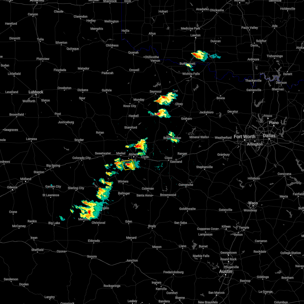 At 619 pm cdt, a severe thunderstorm was located over view, and is nearly stationary (radar indicated). Hazards include quarter size hail. Damage to vehicles is expected. this severe thunderstorm will be near, view around 645 pm cdt. caps around 655 pm cdt. other locations impacted by this severe thunderstorm include lake abilene and camp tonkawa. hail threat, radar indicated max hail size, 1. 00 in wind threat, radar indicated max wind gust, <50 mph. At 619 pm cdt, a severe thunderstorm was located over view, and is nearly stationary (radar indicated). Hazards include quarter size hail. Damage to vehicles is expected. this severe thunderstorm will be near, view around 645 pm cdt. caps around 655 pm cdt. other locations impacted by this severe thunderstorm include lake abilene and camp tonkawa. hail threat, radar indicated max hail size, 1. 00 in wind threat, radar indicated max wind gust, <50 mph.
|
| 5/1/2022 9:10 PM CDT |
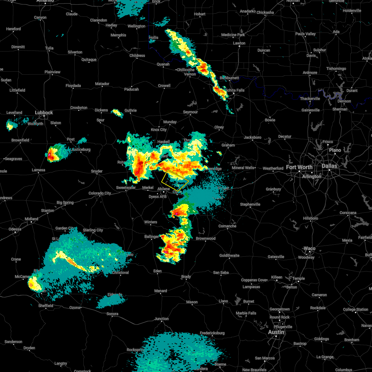 The severe thunderstorm warning for north central callahan, southeastern jones and southwestern shackelford counties will expire at 915 pm cdt, the severe thunderstorm which prompted the warning has moved out of the warned area. therefore, the warning will be allowed to expire. a tornado watch remains in effect until 1000 pm cdt for west central texas. a severe thunderstorm watch remains in effect until 200 am cdt for west central texas. The severe thunderstorm warning for north central callahan, southeastern jones and southwestern shackelford counties will expire at 915 pm cdt, the severe thunderstorm which prompted the warning has moved out of the warned area. therefore, the warning will be allowed to expire. a tornado watch remains in effect until 1000 pm cdt for west central texas. a severe thunderstorm watch remains in effect until 200 am cdt for west central texas.
|
| 5/1/2022 8:57 PM CDT |
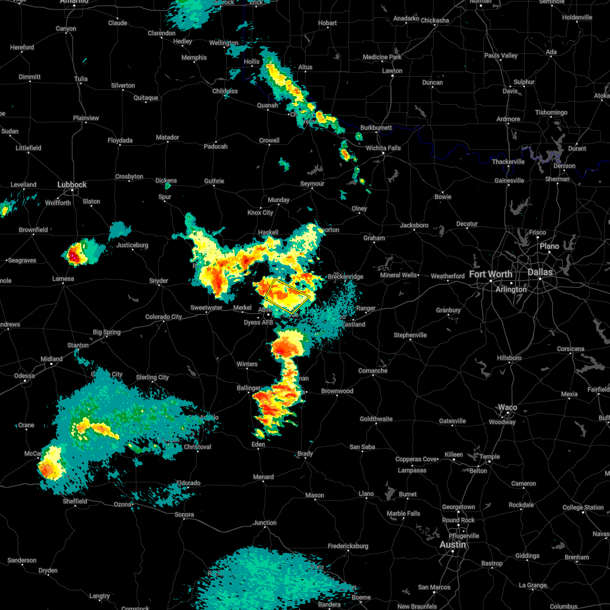 At 856 pm cdt, a severe thunderstorm was located 9 miles northeast of hamby, moving northeast at 30 mph (radar indicated). Hazards include 60 mph wind gusts and quarter size hail. Hail damage to vehicles is expected. expect wind damage to roofs, siding, and trees. locations impacted include, abilene, nugent and lake fort phantom hill. hail threat, radar indicated max hail size, 1. 00 in wind threat, radar indicated max wind gust, 60 mph. At 856 pm cdt, a severe thunderstorm was located 9 miles northeast of hamby, moving northeast at 30 mph (radar indicated). Hazards include 60 mph wind gusts and quarter size hail. Hail damage to vehicles is expected. expect wind damage to roofs, siding, and trees. locations impacted include, abilene, nugent and lake fort phantom hill. hail threat, radar indicated max hail size, 1. 00 in wind threat, radar indicated max wind gust, 60 mph.
|
| 5/1/2022 8:44 PM CDT |
 At 843 pm cdt, a severe thunderstorm was located over hamby, moving northeast at 25 mph (radar indicated). Hazards include 60 mph wind gusts and quarter size hail. Hail damage to vehicles is expected. expect wind damage to roofs, siding, and trees. this severe thunderstorm will remain over mainly rural areas of northwestern callahan, southeastern jones, southwestern shackelford and northeastern taylor counties, including the following locations, impact and lake fort phantom hill. this includes interstate 20 between mile markers 280 and 298. hail threat, radar indicated max hail size, 1. 00 in wind threat, radar indicated max wind gust, 60 mph. At 843 pm cdt, a severe thunderstorm was located over hamby, moving northeast at 25 mph (radar indicated). Hazards include 60 mph wind gusts and quarter size hail. Hail damage to vehicles is expected. expect wind damage to roofs, siding, and trees. this severe thunderstorm will remain over mainly rural areas of northwestern callahan, southeastern jones, southwestern shackelford and northeastern taylor counties, including the following locations, impact and lake fort phantom hill. this includes interstate 20 between mile markers 280 and 298. hail threat, radar indicated max hail size, 1. 00 in wind threat, radar indicated max wind gust, 60 mph.
|
| 5/1/2022 8:42 PM CDT | Quarter sized hail reported 1.8 miles WNW of Abilene, TX, video posted on social media. |
| 5/1/2022 8:30 PM CDT |
 At 829 pm cdt, a severe thunderstorm was located near abilene, moving northeast at 25 mph (radar indicated). Hazards include 60 mph wind gusts and quarter size hail. Hail damage to vehicles is expected. expect wind damage to roofs, siding, and trees. this severe thunderstorm will be near, hamby around 845 pm cdt. other locations impacted by this severe thunderstorm include impact, lake fort phantom hill and kirby lake. this includes interstate 20 between mile markers 278 and 298. hail threat, radar indicated max hail size, 1. 00 in wind threat, radar indicated max wind gust, 60 mph. At 829 pm cdt, a severe thunderstorm was located near abilene, moving northeast at 25 mph (radar indicated). Hazards include 60 mph wind gusts and quarter size hail. Hail damage to vehicles is expected. expect wind damage to roofs, siding, and trees. this severe thunderstorm will be near, hamby around 845 pm cdt. other locations impacted by this severe thunderstorm include impact, lake fort phantom hill and kirby lake. this includes interstate 20 between mile markers 278 and 298. hail threat, radar indicated max hail size, 1. 00 in wind threat, radar indicated max wind gust, 60 mph.
|
| 5/1/2022 8:25 PM CDT | Quarter sized hail reported 4.6 miles NNE of Abilene, TX, reported on social media. |
| 4/3/2022 8:33 PM CDT |
 At 832 pm cdt, a severe thunderstorm was located over wylie, moving east at 25 mph (radar indicated). Hazards include 60 mph wind gusts and quarter size hail. Hail damage to vehicles is expected. expect wind damage to roofs, siding, and trees. this severe thunderstorm will be near, potosi around 855 pm cdt. other locations impacted by this severe thunderstorm include kirby lake. this includes interstate 20 between mile markers 276 and 279, and between mile markers 289 and 292. hail threat, radar indicated max hail size, 1. 00 in wind threat, radar indicated max wind gust, 60 mph. At 832 pm cdt, a severe thunderstorm was located over wylie, moving east at 25 mph (radar indicated). Hazards include 60 mph wind gusts and quarter size hail. Hail damage to vehicles is expected. expect wind damage to roofs, siding, and trees. this severe thunderstorm will be near, potosi around 855 pm cdt. other locations impacted by this severe thunderstorm include kirby lake. this includes interstate 20 between mile markers 276 and 279, and between mile markers 289 and 292. hail threat, radar indicated max hail size, 1. 00 in wind threat, radar indicated max wind gust, 60 mph.
|
| 2/21/2022 9:49 PM CST |
 At 949 pm cst, severe thunderstorms were located along a line extending from near lake fort phantom hill to near dudley, moving northeast at 60 mph (radar indicated). Hazards include 60 mph wind gusts and nickel size hail. Expect damage to roofs, siding, and trees. locations impacted include, abilene, clyde, albany, baird, moran, putnam, eula, dudley, hamby, potosi, impact, mccarty lake, lake fort phantom hill, admiral, us- 283 near the callahan-shackelford county line and i- 20 near the callahan-eastland county line. this includes interstate 20 between mile markers 284 and 323. hail threat, radar indicated max hail size, 0. 88 in wind threat, radar indicated max wind gust, 60 mph. At 949 pm cst, severe thunderstorms were located along a line extending from near lake fort phantom hill to near dudley, moving northeast at 60 mph (radar indicated). Hazards include 60 mph wind gusts and nickel size hail. Expect damage to roofs, siding, and trees. locations impacted include, abilene, clyde, albany, baird, moran, putnam, eula, dudley, hamby, potosi, impact, mccarty lake, lake fort phantom hill, admiral, us- 283 near the callahan-shackelford county line and i- 20 near the callahan-eastland county line. this includes interstate 20 between mile markers 284 and 323. hail threat, radar indicated max hail size, 0. 88 in wind threat, radar indicated max wind gust, 60 mph.
|
| 2/21/2022 9:40 PM CST |
 At 939 pm cst, severe thunderstorms were located along a line extending from near tye to near lawn, moving northeast at 60 mph (radar indicated). Hazards include 60 mph wind gusts and nickel size hail. expect damage to roofs, siding, and trees At 939 pm cst, severe thunderstorms were located along a line extending from near tye to near lawn, moving northeast at 60 mph (radar indicated). Hazards include 60 mph wind gusts and nickel size hail. expect damage to roofs, siding, and trees
|
| 2/17/2022 12:23 AM CST |
 At 1221 am cst, a severe thunderstorm was located just north of abilene near impact moving east at 45 mph (radar indicated). Hazards include 60 mph wind gusts. Expect damage to roofs, siding, and trees. this severe storm will be near, abilene and fort phantom around 1230 am cst. hamby around 1235 am cst. other locations impacted by this severe thunderstorm include funston, impact, hodges, tuxedo, big country baptist assembly, lake fort phantom hill, camp butman, kirby lake, stith and truby. this includes interstate 20 between mile markers 261 and 294. hail threat, radar indicated max hail size, <. 75 in wind threat, radar indicated max wind gust, 60 mph. At 1221 am cst, a severe thunderstorm was located just north of abilene near impact moving east at 45 mph (radar indicated). Hazards include 60 mph wind gusts. Expect damage to roofs, siding, and trees. this severe storm will be near, abilene and fort phantom around 1230 am cst. hamby around 1235 am cst. other locations impacted by this severe thunderstorm include funston, impact, hodges, tuxedo, big country baptist assembly, lake fort phantom hill, camp butman, kirby lake, stith and truby. this includes interstate 20 between mile markers 261 and 294. hail threat, radar indicated max hail size, <. 75 in wind threat, radar indicated max wind gust, 60 mph.
|
| 2/17/2022 12:00 AM CST |
 At 1200 am cst, a severe thunderstorm was located over anson, moving east at 65 mph (radar indicated). Hazards include 70 mph wind gusts. Expect considerable tree damage. damage is likely to mobile homes, roofs, and outbuildings. this severe storm will be near, lueders and avoca around 1215 am cst. other locations impacted by this severe thunderstorm include funston, impact, hodges, tuxedo, big country baptist assembly, lake fort phantom hill, camp butman, kirby lake, stith and truby. this includes interstate 20 between mile markers 261 and 294. thunderstorm damage threat, considerable hail threat, radar indicated max hail size, <. 75 in wind threat, radar indicated max wind gust, 70 mph. At 1200 am cst, a severe thunderstorm was located over anson, moving east at 65 mph (radar indicated). Hazards include 70 mph wind gusts. Expect considerable tree damage. damage is likely to mobile homes, roofs, and outbuildings. this severe storm will be near, lueders and avoca around 1215 am cst. other locations impacted by this severe thunderstorm include funston, impact, hodges, tuxedo, big country baptist assembly, lake fort phantom hill, camp butman, kirby lake, stith and truby. this includes interstate 20 between mile markers 261 and 294. thunderstorm damage threat, considerable hail threat, radar indicated max hail size, <. 75 in wind threat, radar indicated max wind gust, 70 mph.
|
| 2/16/2022 11:46 PM CST |
 At 1144 pm cst, a severe thunderstorm was located over trent, moving east at 60 mph (radar indicated). Hazards include 70 mph wind gusts. Expect considerable tree damage. damage is likely to mobile homes, roofs, and outbuildings. this severe thunderstorm will be near, merkel around 1150 pm cst. tye, hawley and dyess afb around 1200 am cst. abilene and hamby around 1210 am cst. other locations impacted by this severe thunderstorm include funston, impact, hodges, tuxedo, big country baptist assembly, lake fort phantom hill, camp butman, kirby lake, stith and truby. this includes interstate 20 between mile markers 261 and 294. thunderstorm damage threat, considerable hail threat, radar indicated max hail size, <. 75 in wind threat, radar indicated max wind gust, 70 mph. At 1144 pm cst, a severe thunderstorm was located over trent, moving east at 60 mph (radar indicated). Hazards include 70 mph wind gusts. Expect considerable tree damage. damage is likely to mobile homes, roofs, and outbuildings. this severe thunderstorm will be near, merkel around 1150 pm cst. tye, hawley and dyess afb around 1200 am cst. abilene and hamby around 1210 am cst. other locations impacted by this severe thunderstorm include funston, impact, hodges, tuxedo, big country baptist assembly, lake fort phantom hill, camp butman, kirby lake, stith and truby. this includes interstate 20 between mile markers 261 and 294. thunderstorm damage threat, considerable hail threat, radar indicated max hail size, <. 75 in wind threat, radar indicated max wind gust, 70 mph.
|
| 10/27/2021 12:17 AM CDT |
 At 1216 am cdt, severe thunderstorms were located along a line extending from near dudley to near goldsboro to near rowena, moving east at 30 mph (radar indicated). Hazards include 60 mph wind gusts and penny size hail. expect damage to roofs, siding, and trees At 1216 am cdt, severe thunderstorms were located along a line extending from near dudley to near goldsboro to near rowena, moving east at 30 mph (radar indicated). Hazards include 60 mph wind gusts and penny size hail. expect damage to roofs, siding, and trees
|
| 10/26/2021 11:57 PM CDT | Storm damage reported in taylor county TX, 6.3 miles NNW of Abilene, TX |
| 10/26/2021 11:36 PM CDT |
 At 1133 pm cdt, severe thunderstorms were located along a line extending from near funston to near camp butman, moving east at 35 mph (radar indicated). Hazards include 60 mph wind gusts and penny size hail. expect damage to roofs, siding, and trees At 1133 pm cdt, severe thunderstorms were located along a line extending from near funston to near camp butman, moving east at 35 mph (radar indicated). Hazards include 60 mph wind gusts and penny size hail. expect damage to roofs, siding, and trees
|
| 10/10/2021 6:13 PM CDT | A 61 mph wind gust was recorded by asos at the abilene regional airpor in taylor county TX, 5.5 miles NNW of Abilene, TX |
| 7/11/2021 7:01 AM CDT |
 At 701 am cdt, a severe thunderstorm was located over dyess afb, moving south at 20 mph (radar indicated). Hazards include 70 mph wind gusts and quarter size hail. Hail damage to vehicles is expected. expect considerable tree damage. wind damage is also likely to mobile homes, roofs, and outbuildings. this severe thunderstorm will be near, view around 710 am cdt. buffalo gap around 720 am cdt. tuscola around 735 am cdt. lawn around 745 am cdt. other locations impacted by this severe thunderstorm include lake abilene, ovalo and camp tonkawa. This includes interstate 20 between mile markers 276 and 280. At 701 am cdt, a severe thunderstorm was located over dyess afb, moving south at 20 mph (radar indicated). Hazards include 70 mph wind gusts and quarter size hail. Hail damage to vehicles is expected. expect considerable tree damage. wind damage is also likely to mobile homes, roofs, and outbuildings. this severe thunderstorm will be near, view around 710 am cdt. buffalo gap around 720 am cdt. tuscola around 735 am cdt. lawn around 745 am cdt. other locations impacted by this severe thunderstorm include lake abilene, ovalo and camp tonkawa. This includes interstate 20 between mile markers 276 and 280.
|
| 5/25/2021 10:40 PM CDT |
 The severe thunderstorm warning for west central callahan and southeastern taylor counties will expire at 1045 pm cdt, the severe thunderstorm which prompted the warning has weakened. therefore, the warning will be allowed to expire. a severe thunderstorm watch remains in effect until 1100 pm cdt for west central texas. The severe thunderstorm warning for west central callahan and southeastern taylor counties will expire at 1045 pm cdt, the severe thunderstorm which prompted the warning has weakened. therefore, the warning will be allowed to expire. a severe thunderstorm watch remains in effect until 1100 pm cdt for west central texas.
|
| 5/25/2021 9:59 PM CDT |
 At 958 pm cdt, a severe thunderstorm was located over camp tonkawa, or near buffalo gap, moving east at 10 mph (radar indicated). Hazards include 60 mph wind gusts and quarter size hail. Hail damage to vehicles is expected. expect wind damage to roofs, siding, and trees. this severe thunderstorm will be near, buffalo gap around 1020 pm cdt. tuscola around 1025 pm cdt. wylie around 1040 pm cdt. other locations impacted by this severe thunderstorm include lake abilene, camp tonkawa and kirby lake. This includes interstate 20 between mile markers 294 and 297. At 958 pm cdt, a severe thunderstorm was located over camp tonkawa, or near buffalo gap, moving east at 10 mph (radar indicated). Hazards include 60 mph wind gusts and quarter size hail. Hail damage to vehicles is expected. expect wind damage to roofs, siding, and trees. this severe thunderstorm will be near, buffalo gap around 1020 pm cdt. tuscola around 1025 pm cdt. wylie around 1040 pm cdt. other locations impacted by this severe thunderstorm include lake abilene, camp tonkawa and kirby lake. This includes interstate 20 between mile markers 294 and 297.
|
| 5/17/2021 9:24 PM CDT |
 At 924 pm cdt, a severe thunderstorm was located over hamby, moving northeast at 35 mph (radar indicated). Hazards include 60 mph wind gusts and quarter size hail. Hail damage to vehicles is expected. expect wind damage to roofs, siding, and trees. this severe thunderstorm will be near, albany around 955 pm cdt. ibex around 1005 pm cdt. other locations impacted by this severe thunderstorm include mccarty lake and us-283 near the callahan-shackelford county line. This includes interstate 20 between mile markers 289 and 296. At 924 pm cdt, a severe thunderstorm was located over hamby, moving northeast at 35 mph (radar indicated). Hazards include 60 mph wind gusts and quarter size hail. Hail damage to vehicles is expected. expect wind damage to roofs, siding, and trees. this severe thunderstorm will be near, albany around 955 pm cdt. ibex around 1005 pm cdt. other locations impacted by this severe thunderstorm include mccarty lake and us-283 near the callahan-shackelford county line. This includes interstate 20 between mile markers 289 and 296.
|
| 5/17/2021 9:21 PM CDT | Quarter sized hail reported 1.9 miles NNW of Abilene, TX, a member of the public on social media measured 1 inch hail on the northeast side of abilene. |
| 5/3/2021 7:51 PM CDT |
 At 751 pm cdt, a severe thunderstorm was located over trent, or 15 miles east of sweetwater, moving east at 40 mph (radar indicated). Hazards include 60 mph wind gusts and quarter size hail. Hail damage to vehicles is expected. expect wind damage to roofs, siding, and trees. this severe storm will be near, merkel around 800 pm cdt. dyess afb around 810 pm cdt. tye around 815 pm cdt. Abilene around 830 pm cdt. At 751 pm cdt, a severe thunderstorm was located over trent, or 15 miles east of sweetwater, moving east at 40 mph (radar indicated). Hazards include 60 mph wind gusts and quarter size hail. Hail damage to vehicles is expected. expect wind damage to roofs, siding, and trees. this severe storm will be near, merkel around 800 pm cdt. dyess afb around 810 pm cdt. tye around 815 pm cdt. Abilene around 830 pm cdt.
|
| 5/3/2021 7:47 PM CDT |
 At 746 pm cdt, a severe thunderstorm was located near merkel, or 13 miles northwest of abilene, moving east at 40 mph (radar indicated). Hazards include 60 mph wind gusts and penny size hail. Expect damage to roofs, siding, and trees. this severe storm will be near, tye around 755 pm cdt. hawley around 800 pm cdt. abilene around 810 pm cdt. hamby around 815 pm cdt. other locations impacted by this severe thunderstorm include impact, hodges, lake fort phantom hill, stith and truby. This includes interstate 20 between mile markers 253 and 292. At 746 pm cdt, a severe thunderstorm was located near merkel, or 13 miles northwest of abilene, moving east at 40 mph (radar indicated). Hazards include 60 mph wind gusts and penny size hail. Expect damage to roofs, siding, and trees. this severe storm will be near, tye around 755 pm cdt. hawley around 800 pm cdt. abilene around 810 pm cdt. hamby around 815 pm cdt. other locations impacted by this severe thunderstorm include impact, hodges, lake fort phantom hill, stith and truby. This includes interstate 20 between mile markers 253 and 292.
|
| 5/3/2021 7:28 PM CDT |
 At 727 pm cdt, a severe thunderstorm was located near sweetwater, moving east at 40 mph (radar indicated). Hazards include ping pong ball size hail and 60 mph wind gusts. People and animals outdoors will be injured. expect hail damage to roofs, siding, windows, and vehicles. expect wind damage to roofs, siding, and trees. this severe thunderstorm will be near, sweetwater around 730 pm cdt. merkel around 800 pm cdt. view around 810 pm cdt. tye, caps and dyess afb around 815 pm cdt. other locations impacted by this severe thunderstorm include lake abilene, camp tonkawa, camp butman, the intersection of highway 70 and ranch road 53, lake sweetwater, the intersection of ranch road 608 and highway 147 and camp boothe oaks. This includes interstate 20 between mile markers 235 and 248. At 727 pm cdt, a severe thunderstorm was located near sweetwater, moving east at 40 mph (radar indicated). Hazards include ping pong ball size hail and 60 mph wind gusts. People and animals outdoors will be injured. expect hail damage to roofs, siding, windows, and vehicles. expect wind damage to roofs, siding, and trees. this severe thunderstorm will be near, sweetwater around 730 pm cdt. merkel around 800 pm cdt. view around 810 pm cdt. tye, caps and dyess afb around 815 pm cdt. other locations impacted by this severe thunderstorm include lake abilene, camp tonkawa, camp butman, the intersection of highway 70 and ranch road 53, lake sweetwater, the intersection of ranch road 608 and highway 147 and camp boothe oaks. This includes interstate 20 between mile markers 235 and 248.
|
| 5/3/2021 7:24 PM CDT |
 At 723 pm cdt, a severe thunderstorm was located near trent, or 14 miles east of sweetwater, moving east at 45 mph (radar indicated). Hazards include golf ball size hail and 60 mph wind gusts. People and animals outdoors will be injured. expect hail damage to roofs, siding, windows, and vehicles. expect wind damage to roofs, siding, and trees. this severe thunderstorm will be near, merkel and noodle around 735 pm cdt. tye around 745 pm cdt. hawley around 750 pm cdt. abilene around 800 pm cdt. hamby around 805 pm cdt. other locations impacted by this severe thunderstorm include funston, impact, hodges, lake fort phantom hill, stith, truby and the intersection of us-180 and farm road 600. This includes interstate 20 between mile markers 252 and 292. At 723 pm cdt, a severe thunderstorm was located near trent, or 14 miles east of sweetwater, moving east at 45 mph (radar indicated). Hazards include golf ball size hail and 60 mph wind gusts. People and animals outdoors will be injured. expect hail damage to roofs, siding, windows, and vehicles. expect wind damage to roofs, siding, and trees. this severe thunderstorm will be near, merkel and noodle around 735 pm cdt. tye around 745 pm cdt. hawley around 750 pm cdt. abilene around 800 pm cdt. hamby around 805 pm cdt. other locations impacted by this severe thunderstorm include funston, impact, hodges, lake fort phantom hill, stith, truby and the intersection of us-180 and farm road 600. This includes interstate 20 between mile markers 252 and 292.
|
| 4/28/2021 2:57 AM CDT |
 The national weather service in san angelo has issued a * severe thunderstorm warning for. southeastern jones county in west central texas. southern shackelford county in west central texas. until 400 am cdt. At 256 am cdt, a severe thunderstorm was located near hawley, or 10. The national weather service in san angelo has issued a * severe thunderstorm warning for. southeastern jones county in west central texas. southern shackelford county in west central texas. until 400 am cdt. At 256 am cdt, a severe thunderstorm was located near hawley, or 10.
|
| 4/28/2021 2:49 AM CDT |
 At 248 am cdt, a severe thunderstorm was located over hawley, or 10 miles northwest of abilene, moving northeast at 30 mph (radar indicated). Hazards include 70 mph wind gusts. Expect considerable tree damage. damage is likely to mobile homes, roofs, and outbuildings. This severe thunderstorm will remain over mainly rural areas of southeastern jones county, including the following locations, lake fort phantom hill. At 248 am cdt, a severe thunderstorm was located over hawley, or 10 miles northwest of abilene, moving northeast at 30 mph (radar indicated). Hazards include 70 mph wind gusts. Expect considerable tree damage. damage is likely to mobile homes, roofs, and outbuildings. This severe thunderstorm will remain over mainly rural areas of southeastern jones county, including the following locations, lake fort phantom hill.
|
| 4/28/2021 2:28 AM CDT |
 At 228 am cdt, a severe thunderstorm was located near tye, or 9 miles northwest of abilene, moving east at 35 mph (radar indicated). Hazards include 60 mph wind gusts. Expect damage to roofs, siding, and trees. this severe storm will be near, hawley around 240 am cdt. abilene and hamby around 250 am cdt. other locations impacted by this severe thunderstorm include impact, hodges, lake fort phantom hill and stith. This includes interstate 20 between mile markers 268 and 290. At 228 am cdt, a severe thunderstorm was located near tye, or 9 miles northwest of abilene, moving east at 35 mph (radar indicated). Hazards include 60 mph wind gusts. Expect damage to roofs, siding, and trees. this severe storm will be near, hawley around 240 am cdt. abilene and hamby around 250 am cdt. other locations impacted by this severe thunderstorm include impact, hodges, lake fort phantom hill and stith. This includes interstate 20 between mile markers 268 and 290.
|
| 4/28/2021 2:13 AM CDT |
 At 211 am cdt, a severe thunderstorm was located over merkel, or 18 miles west of abilene, moving east at 35 mph (radar indicated). Hazards include 70 mph wind gusts. Expect considerable tree damage. damage is likely to mobile homes, roofs, and outbuildings. this severe storm will be near, dyess afb around 225 am cdt. tye around 230 am cdt. hawley around 235 am cdt. abilene and hamby around 250 am cdt. other locations impacted by this severe thunderstorm include impact, hodges, lake fort phantom hill, stith and truby. This includes interstate 20 between mile markers 261 and 290. At 211 am cdt, a severe thunderstorm was located over merkel, or 18 miles west of abilene, moving east at 35 mph (radar indicated). Hazards include 70 mph wind gusts. Expect considerable tree damage. damage is likely to mobile homes, roofs, and outbuildings. this severe storm will be near, dyess afb around 225 am cdt. tye around 230 am cdt. hawley around 235 am cdt. abilene and hamby around 250 am cdt. other locations impacted by this severe thunderstorm include impact, hodges, lake fort phantom hill, stith and truby. This includes interstate 20 between mile markers 261 and 290.
|
| 4/28/2021 1:59 AM CDT |
 The national weather service in san angelo has issued a * severe thunderstorm warning for. southern jones county in west central texas. northeastern nolan county in west central texas. southeastern fisher county in west central texas. Northern taylor county in west central texas. The national weather service in san angelo has issued a * severe thunderstorm warning for. southern jones county in west central texas. northeastern nolan county in west central texas. southeastern fisher county in west central texas. Northern taylor county in west central texas.
|
| 4/27/2021 9:12 PM CDT |
 At 911 pm cdt, a severe thunderstorm capable of producing a tornado was located 7 miles east of sweetwater, moving east at 40 mph (radar indicated rotation). Hazards include tornado and quarter size hail. Flying debris will be dangerous to those caught without shelter. mobile homes will be damaged or destroyed. damage to roofs, windows, and vehicles will occur. tree damage is likely. this dangerous storm will be near, trent around 925 pm cdt. merkel and noodle around 935 pm cdt. tye around 945 pm cdt. hawley around 955 pm cdt. abilene around 1000 pm cdt. other locations impacted by this tornadic thunderstorm include impact, hodges, stith, truby and lake sweetwater. This includes interstate 20 between mile markers 247 and 285. At 911 pm cdt, a severe thunderstorm capable of producing a tornado was located 7 miles east of sweetwater, moving east at 40 mph (radar indicated rotation). Hazards include tornado and quarter size hail. Flying debris will be dangerous to those caught without shelter. mobile homes will be damaged or destroyed. damage to roofs, windows, and vehicles will occur. tree damage is likely. this dangerous storm will be near, trent around 925 pm cdt. merkel and noodle around 935 pm cdt. tye around 945 pm cdt. hawley around 955 pm cdt. abilene around 1000 pm cdt. other locations impacted by this tornadic thunderstorm include impact, hodges, stith, truby and lake sweetwater. This includes interstate 20 between mile markers 247 and 285.
|
| 4/27/2021 8:54 PM CDT |
 At 853 pm cdt, a severe thunderstorm was located near trent, or 10 miles east of sweetwater, moving east at 40 mph (radar indicated). Hazards include 60 mph wind gusts and half dollar size hail. Hail damage to vehicles is expected. expect wind damage to roofs, siding, and trees. this severe thunderstorm will be near, trent around 905 pm cdt. merkel and noodle around 910 pm cdt. tye around 925 pm cdt. hawley around 935 pm cdt. abilene around 945 pm cdt. other locations impacted by this severe thunderstorm include hodges, stith, truby and lake sweetwater. This includes interstate 20 between mile markers 250 and 281. At 853 pm cdt, a severe thunderstorm was located near trent, or 10 miles east of sweetwater, moving east at 40 mph (radar indicated). Hazards include 60 mph wind gusts and half dollar size hail. Hail damage to vehicles is expected. expect wind damage to roofs, siding, and trees. this severe thunderstorm will be near, trent around 905 pm cdt. merkel and noodle around 910 pm cdt. tye around 925 pm cdt. hawley around 935 pm cdt. abilene around 945 pm cdt. other locations impacted by this severe thunderstorm include hodges, stith, truby and lake sweetwater. This includes interstate 20 between mile markers 250 and 281.
|
| 4/14/2021 5:12 PM CDT |
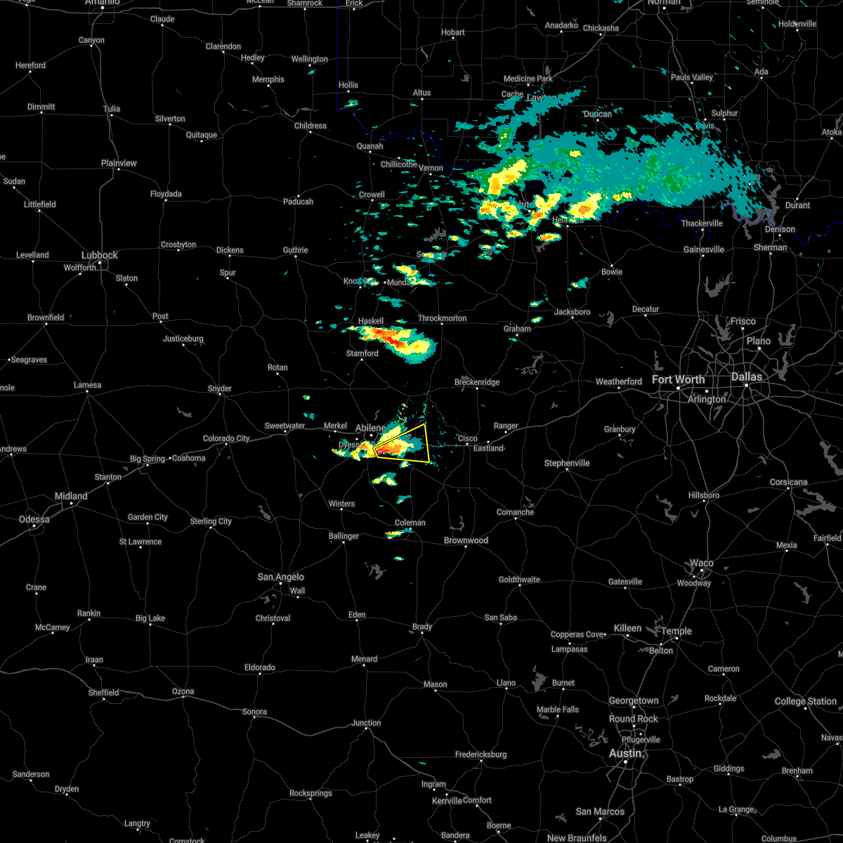 At 512 pm cdt, a severe thunderstorm was located near buffalo gap, or 9 miles south of abilene, moving east at 25 mph (radar indicated). Hazards include quarter size hail. Damage to vehicles is expected. this severe thunderstorm will be near, potosi around 530 pm cdt. eula around 545 pm cdt. clyde around 550 pm cdt. baird around 600 pm cdt. other locations impacted by this severe thunderstorm include admiral. This includes interstate 20 between mile markers 298 and 312. At 512 pm cdt, a severe thunderstorm was located near buffalo gap, or 9 miles south of abilene, moving east at 25 mph (radar indicated). Hazards include quarter size hail. Damage to vehicles is expected. this severe thunderstorm will be near, potosi around 530 pm cdt. eula around 545 pm cdt. clyde around 550 pm cdt. baird around 600 pm cdt. other locations impacted by this severe thunderstorm include admiral. This includes interstate 20 between mile markers 298 and 312.
|
| 4/14/2021 5:02 PM CDT |
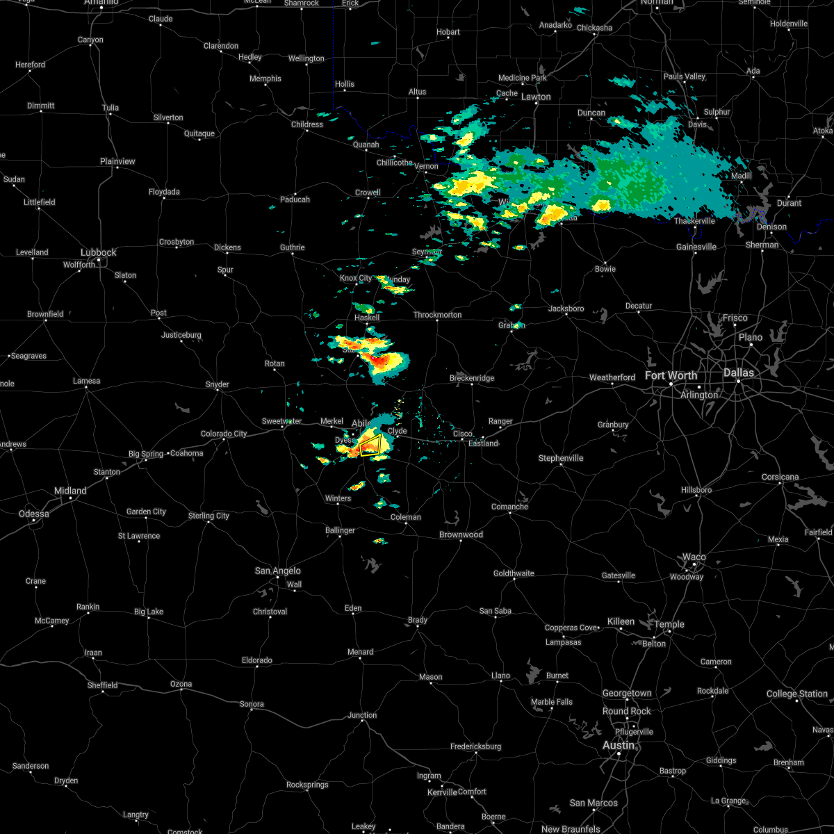 At 502 pm cdt, a severe thunderstorm was located over potosi, or 8 miles south of abilene, moving east at 30 mph (radar indicated). Hazards include quarter size hail. Damage to vehicles is expected. This severe thunderstorm will remain over mainly rural areas of east central taylor county. At 502 pm cdt, a severe thunderstorm was located over potosi, or 8 miles south of abilene, moving east at 30 mph (radar indicated). Hazards include quarter size hail. Damage to vehicles is expected. This severe thunderstorm will remain over mainly rural areas of east central taylor county.
|
| 4/14/2021 5:00 PM CDT | Half Dollar sized hail reported 8.5 miles N of Abilene, TX, report from twitter with photo of hail size. |
| 4/14/2021 4:55 PM CDT |
 At 455 pm cdt, a severe thunderstorm was located near buffalo gap, or 10 miles south of abilene, moving east at 30 mph (radar indicated). Hazards include quarter size hail. Damage to vehicles is expected. this severe storm will be near, potosi around 515 pm cdt. Other locations impacted by this severe thunderstorm include kirby lake. At 455 pm cdt, a severe thunderstorm was located near buffalo gap, or 10 miles south of abilene, moving east at 30 mph (radar indicated). Hazards include quarter size hail. Damage to vehicles is expected. this severe storm will be near, potosi around 515 pm cdt. Other locations impacted by this severe thunderstorm include kirby lake.
|
| 4/14/2021 4:53 PM CDT | Quarter sized hail reported 12 miles N of Abilene, TX, from twitter. intersection of clark and county road 83/84. time estimated on radar. |
| 4/14/2021 4:52 PM CDT | Quarter sized hail reported 10.4 miles NNE of Abilene, TX, report from mping: quarter (1.00 in.). |
| 4/14/2021 4:50 PM CDT | Ping Pong Ball sized hail reported 9.2 miles N of Abilene, TX, report from facebook. |
| 4/14/2021 4:46 PM CDT |
 At 446 pm cdt, a severe thunderstorm was located near coronados camp, or 15 miles southwest of abilene, moving east at 30 mph (radar indicated). Hazards include half dollar size hail. Damage to vehicles is expected. this severe storm will be near, view around 455 pm cdt. buffalo gap and caps around 500 pm cdt. wylie around 505 pm cdt. potosi around 520 pm cdt. other locations impacted by this severe thunderstorm include kirby lake. This includes interstate 20 between mile markers 290 and 292. At 446 pm cdt, a severe thunderstorm was located near coronados camp, or 15 miles southwest of abilene, moving east at 30 mph (radar indicated). Hazards include half dollar size hail. Damage to vehicles is expected. this severe storm will be near, view around 455 pm cdt. buffalo gap and caps around 500 pm cdt. wylie around 505 pm cdt. potosi around 520 pm cdt. other locations impacted by this severe thunderstorm include kirby lake. This includes interstate 20 between mile markers 290 and 292.
|
| 4/14/2021 4:39 PM CDT |
 At 439 pm cdt, a severe thunderstorm was located over view, or 13 miles southwest of abilene, moving east at 25 mph (radar indicated). Hazards include golf ball size hail. People and animals outdoors will be injured. expect damage to roofs, siding, windows, and vehicles. this severe storm will be near, buffalo gap and caps around 445 pm cdt. wylie around 455 pm cdt. potosi around 510 pm cdt. other locations impacted by this severe thunderstorm include kirby lake and camp tonkawa. This includes interstate 20 between mile markers 287 and 292. At 439 pm cdt, a severe thunderstorm was located over view, or 13 miles southwest of abilene, moving east at 25 mph (radar indicated). Hazards include golf ball size hail. People and animals outdoors will be injured. expect damage to roofs, siding, windows, and vehicles. this severe storm will be near, buffalo gap and caps around 445 pm cdt. wylie around 455 pm cdt. potosi around 510 pm cdt. other locations impacted by this severe thunderstorm include kirby lake and camp tonkawa. This includes interstate 20 between mile markers 287 and 292.
|
| 4/14/2021 4:33 PM CDT |
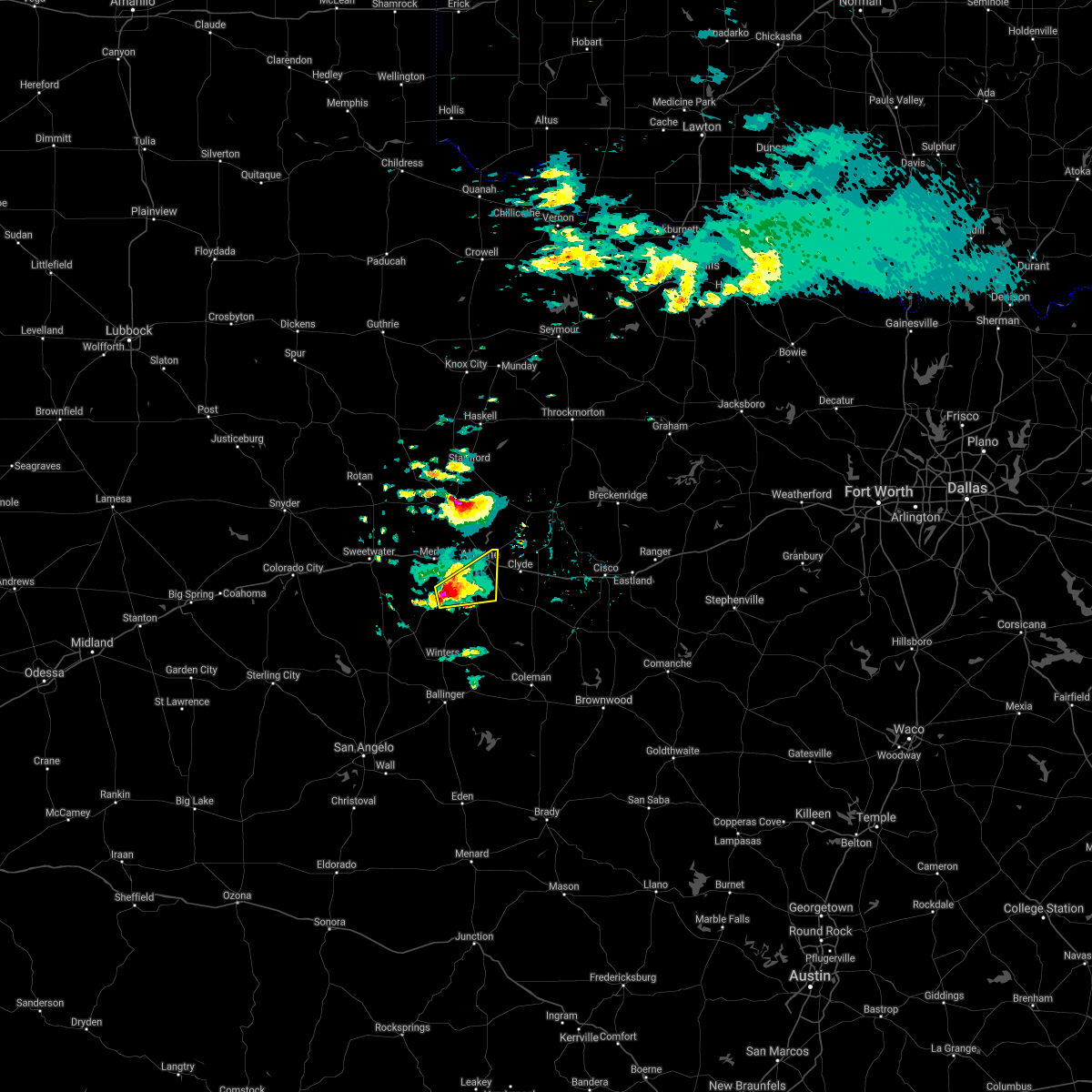 At 432 pm cdt, a severe thunderstorm was located near view, or 15 miles southwest of abilene, moving northeast at 30 mph (radar indicated). Hazards include two inch hail. People and animals outdoors will be injured. expect damage to roofs, siding, windows, and vehicles. this severe storm will be near, view around 440 pm cdt. buffalo gap and caps around 445 pm cdt. wylie around 455 pm cdt. potosi around 505 pm cdt. hamby around 515 pm cdt. other locations impacted by this severe thunderstorm include lake abilene, camp tonkawa and kirby lake. This includes interstate 20 between mile markers 287 and 292. At 432 pm cdt, a severe thunderstorm was located near view, or 15 miles southwest of abilene, moving northeast at 30 mph (radar indicated). Hazards include two inch hail. People and animals outdoors will be injured. expect damage to roofs, siding, windows, and vehicles. this severe storm will be near, view around 440 pm cdt. buffalo gap and caps around 445 pm cdt. wylie around 455 pm cdt. potosi around 505 pm cdt. hamby around 515 pm cdt. other locations impacted by this severe thunderstorm include lake abilene, camp tonkawa and kirby lake. This includes interstate 20 between mile markers 287 and 292.
|
| 4/14/2021 4:24 PM CDT |
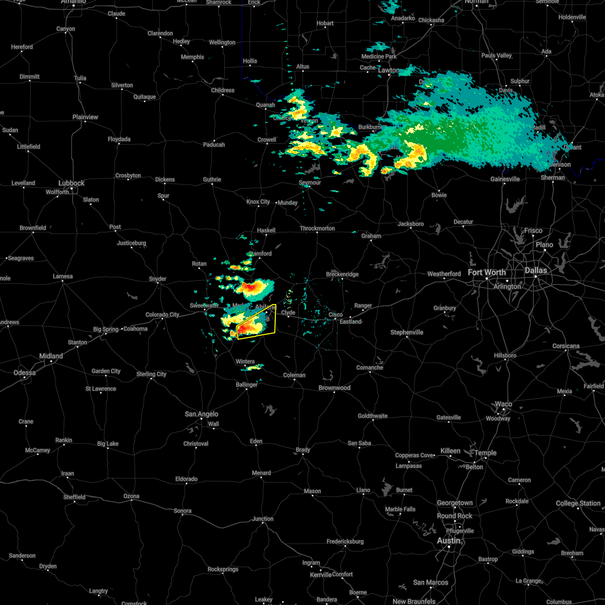 At 423 pm cdt, a severe thunderstorm was located over coronados camp, or 21 miles southwest of abilene, moving northeast at 30 mph (radar indicated). Hazards include half dollar size hail. Damage to vehicles is expected. this severe thunderstorm will be near, view around 440 pm cdt. buffalo gap and caps around 445 pm cdt. wylie around 455 pm cdt. potosi around 505 pm cdt. hamby around 515 pm cdt. other locations impacted by this severe thunderstorm include lake abilene, camp tonkawa and kirby lake. This includes interstate 20 between mile markers 287 and 292. At 423 pm cdt, a severe thunderstorm was located over coronados camp, or 21 miles southwest of abilene, moving northeast at 30 mph (radar indicated). Hazards include half dollar size hail. Damage to vehicles is expected. this severe thunderstorm will be near, view around 440 pm cdt. buffalo gap and caps around 445 pm cdt. wylie around 455 pm cdt. potosi around 505 pm cdt. hamby around 515 pm cdt. other locations impacted by this severe thunderstorm include lake abilene, camp tonkawa and kirby lake. This includes interstate 20 between mile markers 287 and 292.
|
| 4/12/2021 10:57 PM CDT |
 At 1057 pm cdt, a severe thunderstorm was located over nugent, or 13 miles east of anson, moving northeast at 35 mph (radar indicated). Hazards include 60 mph wind gusts and quarter size hail. Hail damage to vehicles is expected. expect wind damage to roofs, siding, and trees. this severe storm will be near, lueders around 1105 pm cdt. avoca around 1110 pm cdt. Other locations impacted by this severe thunderstorm include big country baptist assembly, the intersection of us- 180 and farm road 600 and lake fort phantom hill. At 1057 pm cdt, a severe thunderstorm was located over nugent, or 13 miles east of anson, moving northeast at 35 mph (radar indicated). Hazards include 60 mph wind gusts and quarter size hail. Hail damage to vehicles is expected. expect wind damage to roofs, siding, and trees. this severe storm will be near, lueders around 1105 pm cdt. avoca around 1110 pm cdt. Other locations impacted by this severe thunderstorm include big country baptist assembly, the intersection of us- 180 and farm road 600 and lake fort phantom hill.
|
| 4/12/2021 10:44 PM CDT |
 At 1044 pm cdt, a severe thunderstorm was located near hawley, or 12 miles north of abilene, moving northeast at 35 mph (radar indicated). Hazards include 60 mph wind gusts and quarter size hail. Hail damage to vehicles is expected. expect wind damage to roofs, siding, and trees. this severe storm will be near, nugent around 1055 pm cdt. lueders around 1105 pm cdt. avoca around 1110 pm cdt. Other locations impacted by this severe thunderstorm include big country baptist assembly, the intersection of us- 180 and farm road 600 and lake fort phantom hill. At 1044 pm cdt, a severe thunderstorm was located near hawley, or 12 miles north of abilene, moving northeast at 35 mph (radar indicated). Hazards include 60 mph wind gusts and quarter size hail. Hail damage to vehicles is expected. expect wind damage to roofs, siding, and trees. this severe storm will be near, nugent around 1055 pm cdt. lueders around 1105 pm cdt. avoca around 1110 pm cdt. Other locations impacted by this severe thunderstorm include big country baptist assembly, the intersection of us- 180 and farm road 600 and lake fort phantom hill.
|
| 4/12/2021 10:35 PM CDT | Quarter sized hail reported 0.9 miles ESE of Abilene, TX |
| 4/12/2021 10:33 PM CDT | Quarter sized hail reported 1.8 miles SE of Abilene, TX |
| 4/12/2021 10:33 PM CDT |
 At 1033 pm cdt, a severe thunderstorm was located near hawley, or 7 miles north of abilene, moving northeast at 35 mph (radar indicated). Hazards include 60 mph wind gusts and quarter size hail. Hail damage to vehicles is expected. expect wind damage to roofs, siding, and trees. this severe storm will be near, nugent around 1055 pm cdt. lueders around 1105 pm cdt. avoca around 1110 pm cdt. other locations impacted by this severe thunderstorm include impact, big country baptist assembly, lake fort phantom hill and the intersection of us-180 and farm road 600. This includes interstate 20 between mile markers 281 and 287. At 1033 pm cdt, a severe thunderstorm was located near hawley, or 7 miles north of abilene, moving northeast at 35 mph (radar indicated). Hazards include 60 mph wind gusts and quarter size hail. Hail damage to vehicles is expected. expect wind damage to roofs, siding, and trees. this severe storm will be near, nugent around 1055 pm cdt. lueders around 1105 pm cdt. avoca around 1110 pm cdt. other locations impacted by this severe thunderstorm include impact, big country baptist assembly, lake fort phantom hill and the intersection of us-180 and farm road 600. This includes interstate 20 between mile markers 281 and 287.
|
| 4/12/2021 10:26 PM CDT |
 At 1026 pm cdt, a severe thunderstorm was located near tye, or near abilene, moving northeast at 35 mph (radar indicated). Hazards include 60 mph wind gusts and half dollar size hail. Hail damage to vehicles is expected. expect wind damage to roofs, siding, and trees. this severe thunderstorm will be near, hawley around 1040 pm cdt. abilene around 1045 pm cdt. nugent around 1055 pm cdt. lueders and avoca around 1110 pm cdt. other locations impacted by this severe thunderstorm include impact, hodges, big country baptist assembly, lake fort phantom hill and the intersection of us-180 and farm road 600. This includes interstate 20 between mile markers 275 and 287. At 1026 pm cdt, a severe thunderstorm was located near tye, or near abilene, moving northeast at 35 mph (radar indicated). Hazards include 60 mph wind gusts and half dollar size hail. Hail damage to vehicles is expected. expect wind damage to roofs, siding, and trees. this severe thunderstorm will be near, hawley around 1040 pm cdt. abilene around 1045 pm cdt. nugent around 1055 pm cdt. lueders and avoca around 1110 pm cdt. other locations impacted by this severe thunderstorm include impact, hodges, big country baptist assembly, lake fort phantom hill and the intersection of us-180 and farm road 600. This includes interstate 20 between mile markers 275 and 287.
|
| 4/12/2021 10:20 PM CDT | Hen Egg sized hail reported 8.7 miles ENE of Abilene, TX |
| 9/1/2020 3:50 PM CDT |
 The severe thunderstorm warning for southeastern jones and southwestern shackelford counties will expire at 400 pm cdt, the storm which prompted the warning has weakened below severe limits, and no longer poses an immediate threat to life or property. therefore, the warning will be allowed to expire. The severe thunderstorm warning for southeastern jones and southwestern shackelford counties will expire at 400 pm cdt, the storm which prompted the warning has weakened below severe limits, and no longer poses an immediate threat to life or property. therefore, the warning will be allowed to expire.
|
| 9/1/2020 3:29 PM CDT |
 At 329 pm cdt, a severe thunderstorm was located near nugent, or 13 miles north of abilene, moving east at 25 mph (radar indicated). Hazards include 60 mph wind gusts and quarter size hail. Hail damage to vehicles is expected. expect wind damage to roofs, siding, and trees. This severe thunderstorm will remain over mainly rural areas of southeastern jones and southwestern shackelford counties, including the following locations, the intersection of us- 180 and farm road 600 and lake fort phantom hill. At 329 pm cdt, a severe thunderstorm was located near nugent, or 13 miles north of abilene, moving east at 25 mph (radar indicated). Hazards include 60 mph wind gusts and quarter size hail. Hail damage to vehicles is expected. expect wind damage to roofs, siding, and trees. This severe thunderstorm will remain over mainly rural areas of southeastern jones and southwestern shackelford counties, including the following locations, the intersection of us- 180 and farm road 600 and lake fort phantom hill.
|
| 9/1/2020 3:11 PM CDT |
 At 311 pm cdt, a severe thunderstorm was located over hawley, or 11 miles south of anson, moving northeast at 15 mph (radar indicated). Hazards include 60 mph wind gusts and quarter size hail. Hail damage to vehicles is expected. expect wind damage to roofs, siding, and trees. this severe thunderstorm will be near, hawley around 320 pm cdt. abilene around 350 pm cdt. nugent around 400 pm cdt. Other locations impacted by this severe thunderstorm include funston, hodges, lake fort phantom hill, truby and the intersection of us- 180 and farm road 600. At 311 pm cdt, a severe thunderstorm was located over hawley, or 11 miles south of anson, moving northeast at 15 mph (radar indicated). Hazards include 60 mph wind gusts and quarter size hail. Hail damage to vehicles is expected. expect wind damage to roofs, siding, and trees. this severe thunderstorm will be near, hawley around 320 pm cdt. abilene around 350 pm cdt. nugent around 400 pm cdt. Other locations impacted by this severe thunderstorm include funston, hodges, lake fort phantom hill, truby and the intersection of us- 180 and farm road 600.
|
| 6/23/2020 2:42 AM CDT |
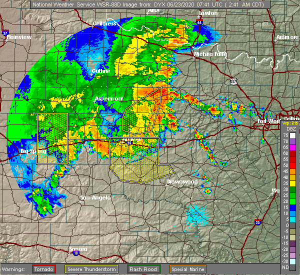 At 242 am cdt, a severe thunderstorm was located over abilene, moving east at 20 mph (radar indicated). Hazards include 60 mph wind gusts and penny size hail. Expect damage to roofs, siding, and trees. this severe thunderstorm will be near, potosi around 255 am cdt. hamby around 300 am cdt. eula around 310 am cdt. clyde around 315 am cdt. baird around 335 am cdt. other locations impacted by this severe thunderstorm include impact, lake abilene, camp tonkawa, echo, us-283 near the callahan- shackelford county line, lake coleman, ovalo, i-20 near the callahan- eastland county line, admiral and goldsboro. This includes interstate 20 between mile markers 273 and 323. At 242 am cdt, a severe thunderstorm was located over abilene, moving east at 20 mph (radar indicated). Hazards include 60 mph wind gusts and penny size hail. Expect damage to roofs, siding, and trees. this severe thunderstorm will be near, potosi around 255 am cdt. hamby around 300 am cdt. eula around 310 am cdt. clyde around 315 am cdt. baird around 335 am cdt. other locations impacted by this severe thunderstorm include impact, lake abilene, camp tonkawa, echo, us-283 near the callahan- shackelford county line, lake coleman, ovalo, i-20 near the callahan- eastland county line, admiral and goldsboro. This includes interstate 20 between mile markers 273 and 323.
|
| 6/23/2020 1:45 AM CDT |
 At 145 am cdt, a severe thunderstorm was located near haskell, moving east at 30 mph (radar indicated). Hazards include 60 mph wind gusts and penny size hail. Expect damage to roofs, siding, and trees. this severe thunderstorm will be near, lake stamford marina around 155 am cdt. irby around 200 am cdt. fort griffin around 240 am cdt. Other locations impacted by this severe thunderstorm include funston, the intersection of us-180 and ranch road 126, mccarty lake, us- 183 near the throckmorton- baylor county line, tuxedo, lake fort phantom hill, the intersection of us-283 and ranch road 209, the intersection of us- 180 and farm road 600, hodges and the intersection of us-183 and us- 283. At 145 am cdt, a severe thunderstorm was located near haskell, moving east at 30 mph (radar indicated). Hazards include 60 mph wind gusts and penny size hail. Expect damage to roofs, siding, and trees. this severe thunderstorm will be near, lake stamford marina around 155 am cdt. irby around 200 am cdt. fort griffin around 240 am cdt. Other locations impacted by this severe thunderstorm include funston, the intersection of us-180 and ranch road 126, mccarty lake, us- 183 near the throckmorton- baylor county line, tuxedo, lake fort phantom hill, the intersection of us-283 and ranch road 209, the intersection of us- 180 and farm road 600, hodges and the intersection of us-183 and us- 283.
|
| 6/19/2020 9:54 PM CDT |
 At 953 pm cdt, a severe thunderstorm was located near abilene, moving east at 45 mph (radar indicated). Hazards include 60 mph wind gusts and nickel size hail. Expect damage to roofs, siding, and trees. this severe storm will be near, eula around 1000 pm cdt. clyde around 1005 pm cdt. other locations impacted by this severe thunderstorm include impact, hodges, lake fort phantom hill, kirby lake and stith. This includes interstate 20 between mile markers 269 and 303. At 953 pm cdt, a severe thunderstorm was located near abilene, moving east at 45 mph (radar indicated). Hazards include 60 mph wind gusts and nickel size hail. Expect damage to roofs, siding, and trees. this severe storm will be near, eula around 1000 pm cdt. clyde around 1005 pm cdt. other locations impacted by this severe thunderstorm include impact, hodges, lake fort phantom hill, kirby lake and stith. This includes interstate 20 between mile markers 269 and 303.
|
| 6/19/2020 9:48 PM CDT | Winds were estimated in to be in the 50 to 60 mph range by a trained spotte in taylor county TX, 3.1 miles NNE of Abilene, TX |
| 6/19/2020 9:29 PM CDT |
 At 929 pm cdt, a severe thunderstorm was located over merkel, or 14 miles west of abilene, moving east at 45 mph (radar indicated). Hazards include 60 mph wind gusts. Expect damage to roofs, siding, and trees. this severe thunderstorm will be near, tye, dyess afb and caps around 940 pm cdt. wylie around 945 pm cdt. potosi and hamby around 955 pm cdt. eula around 1000 pm cdt. clyde around 1005 pm cdt. other locations impacted by this severe thunderstorm include impact, hodges, lake fort phantom hill, kirby lake and stith. This includes interstate 20 between mile markers 258 and 303. At 929 pm cdt, a severe thunderstorm was located over merkel, or 14 miles west of abilene, moving east at 45 mph (radar indicated). Hazards include 60 mph wind gusts. Expect damage to roofs, siding, and trees. this severe thunderstorm will be near, tye, dyess afb and caps around 940 pm cdt. wylie around 945 pm cdt. potosi and hamby around 955 pm cdt. eula around 1000 pm cdt. clyde around 1005 pm cdt. other locations impacted by this severe thunderstorm include impact, hodges, lake fort phantom hill, kirby lake and stith. This includes interstate 20 between mile markers 258 and 303.
|
| 6/4/2020 9:41 PM CDT |
 At 940 pm cdt, a severe thunderstorm was located 8 miles west of albany, moving southeast at 40 mph (radar indicated). Hazards include 60 mph wind gusts. Expect damage to roofs, siding, and trees. this severe storm will be near, albany around 950 pm cdt. Other locations impacted by this severe thunderstorm include big country baptist assembly, mccarty lake and the intersection of us- 180 and farm road 600. At 940 pm cdt, a severe thunderstorm was located 8 miles west of albany, moving southeast at 40 mph (radar indicated). Hazards include 60 mph wind gusts. Expect damage to roofs, siding, and trees. this severe storm will be near, albany around 950 pm cdt. Other locations impacted by this severe thunderstorm include big country baptist assembly, mccarty lake and the intersection of us- 180 and farm road 600.
|
| 6/4/2020 9:18 PM CDT |
 At 917 pm cdt, a severe thunderstorm was located near avoca, or 9 miles southeast of stamford, moving southeast at 40 mph (radar indicated). Hazards include 60 mph wind gusts. Expect damage to roofs, siding, and trees. this severe thunderstorm will be near, lueders around 925 pm cdt. Other locations impacted by this severe thunderstorm include big country baptist assembly, the intersection of us- 180 and farm road 600 and mccarty lake. At 917 pm cdt, a severe thunderstorm was located near avoca, or 9 miles southeast of stamford, moving southeast at 40 mph (radar indicated). Hazards include 60 mph wind gusts. Expect damage to roofs, siding, and trees. this severe thunderstorm will be near, lueders around 925 pm cdt. Other locations impacted by this severe thunderstorm include big country baptist assembly, the intersection of us- 180 and farm road 600 and mccarty lake.
|
| 5/24/2020 8:28 PM CDT |
 At 828 pm cdt, a severe thunderstorm was located near tye, or near abilene, moving northeast at 30 mph (radar indicated). Hazards include 60 mph wind gusts. Expect damage to roofs, siding, and trees. this severe storm will be near, hawley and hamby around 845 pm cdt. abilene around 855 pm cdt. other locations impacted by this severe thunderstorm include impact, hodges, lake abilene, camp tonkawa, shep, lake fort phantom hill, kirby lake, stith, truby and ovalo. This includes interstate 20 between mile markers 267 and 292. At 828 pm cdt, a severe thunderstorm was located near tye, or near abilene, moving northeast at 30 mph (radar indicated). Hazards include 60 mph wind gusts. Expect damage to roofs, siding, and trees. this severe storm will be near, hawley and hamby around 845 pm cdt. abilene around 855 pm cdt. other locations impacted by this severe thunderstorm include impact, hodges, lake abilene, camp tonkawa, shep, lake fort phantom hill, kirby lake, stith, truby and ovalo. This includes interstate 20 between mile markers 267 and 292.
|
| 5/24/2020 8:13 PM CDT |
 At 813 pm cdt, a severe thunderstorm was located over view, or 10 miles southwest of abilene, moving northeast at 30 mph (radar indicated). Hazards include 60 mph wind gusts and penny size hail. Expect damage to roofs, siding, and trees. this severe thunderstorm will be near, wylie and dyess afb around 820 pm cdt. tye around 825 pm cdt. hawley and hamby around 845 pm cdt. abilene around 855 pm cdt. other locations impacted by this severe thunderstorm include impact, hodges, lake abilene, camp tonkawa, shep, lake fort phantom hill, kirby lake, stith, truby and ovalo. This includes interstate 20 between mile markers 267 and 292. At 813 pm cdt, a severe thunderstorm was located over view, or 10 miles southwest of abilene, moving northeast at 30 mph (radar indicated). Hazards include 60 mph wind gusts and penny size hail. Expect damage to roofs, siding, and trees. this severe thunderstorm will be near, wylie and dyess afb around 820 pm cdt. tye around 825 pm cdt. hawley and hamby around 845 pm cdt. abilene around 855 pm cdt. other locations impacted by this severe thunderstorm include impact, hodges, lake abilene, camp tonkawa, shep, lake fort phantom hill, kirby lake, stith, truby and ovalo. This includes interstate 20 between mile markers 267 and 292.
|
| 5/21/2020 11:00 PM CDT |
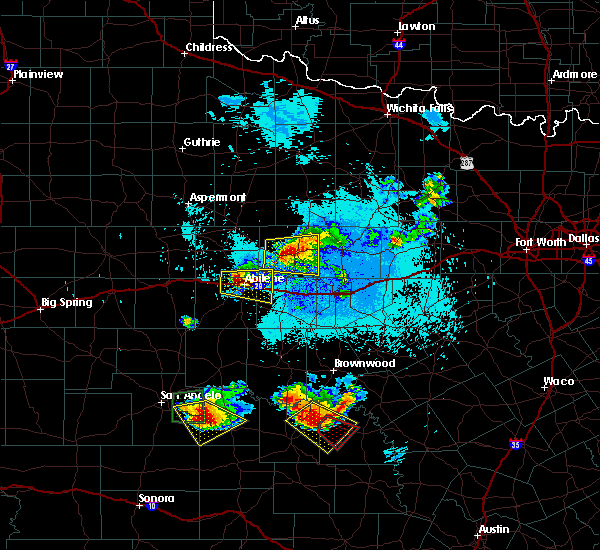 At 1059 pm cdt, a severe thunderstorm was located near abilene, moving east at 20 mph (radar indicated). Hazards include ping pong ball size hail and 60 mph wind gusts. People and animals outdoors will be injured. expect hail damage to roofs, siding, windows, and vehicles. expect wind damage to roofs, siding, and trees. this severe storm will be near, hamby around 1115 pm cdt. other locations impacted by this severe thunderstorm include impact and kirby lake. This includes interstate 20 between mile markers 279 and 300. At 1059 pm cdt, a severe thunderstorm was located near abilene, moving east at 20 mph (radar indicated). Hazards include ping pong ball size hail and 60 mph wind gusts. People and animals outdoors will be injured. expect hail damage to roofs, siding, windows, and vehicles. expect wind damage to roofs, siding, and trees. this severe storm will be near, hamby around 1115 pm cdt. other locations impacted by this severe thunderstorm include impact and kirby lake. This includes interstate 20 between mile markers 279 and 300.
|
| 5/21/2020 10:47 PM CDT |
 At 1046 pm cdt, a severe thunderstorm was located near tye, or near abilene, moving east at 20 mph. the city of abilene is in the path of the tennis ball size hail (radar indicated). Hazards include tennis ball size hail and 60 mph wind gusts. People and animals outdoors will be injured. expect hail damage to roofs, siding, windows, and vehicles. expect wind damage to roofs, siding, and trees. this severe storm will be near, wylie around 1055 pm cdt. potosi around 1115 pm cdt. hamby around 1120 pm cdt. eula around 1135 pm cdt. clyde around 1140 pm cdt. other locations impacted by this severe thunderstorm include impact and kirby lake. This includes interstate 20 between mile markers 274 and 300. At 1046 pm cdt, a severe thunderstorm was located near tye, or near abilene, moving east at 20 mph. the city of abilene is in the path of the tennis ball size hail (radar indicated). Hazards include tennis ball size hail and 60 mph wind gusts. People and animals outdoors will be injured. expect hail damage to roofs, siding, windows, and vehicles. expect wind damage to roofs, siding, and trees. this severe storm will be near, wylie around 1055 pm cdt. potosi around 1115 pm cdt. hamby around 1120 pm cdt. eula around 1135 pm cdt. clyde around 1140 pm cdt. other locations impacted by this severe thunderstorm include impact and kirby lake. This includes interstate 20 between mile markers 274 and 300.
|
| 5/21/2020 10:41 PM CDT |
 At 1032 pm cdt, a severe thunderstorm was located over tye, or 7 miles west of abilene, moving east at 20 mph (radar indicated). Hazards include ping pong ball size hail and 60 mph wind gusts. People and animals outdoors will be injured. expect hail damage to roofs, siding, windows, and vehicles. expect wind damage to roofs, siding, and trees. this severe thunderstorm will be near, wylie around 1050 pm cdt. potosi around 1110 pm cdt. hamby around 1115 pm cdt. clyde and eula around 1130 pm cdt. other locations impacted by this severe thunderstorm include impact, kirby lake and stith. This includes interstate 20 between mile markers 273 and 300. At 1032 pm cdt, a severe thunderstorm was located over tye, or 7 miles west of abilene, moving east at 20 mph (radar indicated). Hazards include ping pong ball size hail and 60 mph wind gusts. People and animals outdoors will be injured. expect hail damage to roofs, siding, windows, and vehicles. expect wind damage to roofs, siding, and trees. this severe thunderstorm will be near, wylie around 1050 pm cdt. potosi around 1110 pm cdt. hamby around 1115 pm cdt. clyde and eula around 1130 pm cdt. other locations impacted by this severe thunderstorm include impact, kirby lake and stith. This includes interstate 20 between mile markers 273 and 300.
|
| 5/21/2020 10:40 PM CDT | Hen Egg sized hail reported 8.7 miles ENE of Abilene, TX, picture from public posted on facebook. time estimated by radar. |
| 5/21/2020 10:38 PM CDT | Ping Pong Ball sized hail reported 8.7 miles ENE of Abilene, TX |
| 5/21/2020 10:33 PM CDT |
 At 1032 pm cdt, a severe thunderstorm was located over tye, or 7 miles west of abilene, moving east at 20 mph (radar indicated). Hazards include ping pong ball size hail and 60 mph wind gusts. People and animals outdoors will be injured. expect hail damage to roofs, siding, windows, and vehicles. expect wind damage to roofs, siding, and trees. this severe thunderstorm will be near, wylie around 1050 pm cdt. potosi around 1110 pm cdt. hamby around 1115 pm cdt. clyde and eula around 1130 pm cdt. other locations impacted by this severe thunderstorm include impact, kirby lake and stith. This includes interstate 20 between mile markers 273 and 300. At 1032 pm cdt, a severe thunderstorm was located over tye, or 7 miles west of abilene, moving east at 20 mph (radar indicated). Hazards include ping pong ball size hail and 60 mph wind gusts. People and animals outdoors will be injured. expect hail damage to roofs, siding, windows, and vehicles. expect wind damage to roofs, siding, and trees. this severe thunderstorm will be near, wylie around 1050 pm cdt. potosi around 1110 pm cdt. hamby around 1115 pm cdt. clyde and eula around 1130 pm cdt. other locations impacted by this severe thunderstorm include impact, kirby lake and stith. This includes interstate 20 between mile markers 273 and 300.
|
| 5/21/2020 10:30 PM CDT | Quarter sized hail reported 8.7 miles ENE of Abilene, TX |
| 5/21/2020 10:09 PM CDT |
 At 1008 pm cdt, a severe thunderstorm was located near merkel, or 13 miles west of abilene, moving southeast at 20 mph (radar indicated). Hazards include golf ball size hail and 60 mph wind gusts. People and animals outdoors will be injured. expect hail damage to roofs, siding, windows, and vehicles. expect wind damage to roofs, siding, and trees. this severe storm will be near, tye around 1025 pm cdt. dyess afb around 1030 pm cdt. caps and view around 1035 pm cdt. wylie around 1050 pm cdt. other locations impacted by this severe thunderstorm include impact, hodges, lake fort phantom hill and stith. This includes interstate 20 between mile markers 263 and 286. At 1008 pm cdt, a severe thunderstorm was located near merkel, or 13 miles west of abilene, moving southeast at 20 mph (radar indicated). Hazards include golf ball size hail and 60 mph wind gusts. People and animals outdoors will be injured. expect hail damage to roofs, siding, windows, and vehicles. expect wind damage to roofs, siding, and trees. this severe storm will be near, tye around 1025 pm cdt. dyess afb around 1030 pm cdt. caps and view around 1035 pm cdt. wylie around 1050 pm cdt. other locations impacted by this severe thunderstorm include impact, hodges, lake fort phantom hill and stith. This includes interstate 20 between mile markers 263 and 286.
|
| 5/21/2020 9:52 PM CDT |
 At 952 pm cdt, a severe thunderstorm was located near noodle, or 18 miles southwest of anson, moving east at 15 mph (radar indicated). Hazards include 60 mph wind gusts and half dollar size hail. Hail damage to vehicles is expected. expect wind damage to roofs, siding, and trees. this severe thunderstorm will be near, merkel around 1010 pm cdt. tye, dyess afb and caps around 1045 pm cdt. other locations impacted by this severe thunderstorm include impact, hodges, lake fort phantom hill and stith. This includes interstate 20 between mile markers 261 and 286. At 952 pm cdt, a severe thunderstorm was located near noodle, or 18 miles southwest of anson, moving east at 15 mph (radar indicated). Hazards include 60 mph wind gusts and half dollar size hail. Hail damage to vehicles is expected. expect wind damage to roofs, siding, and trees. this severe thunderstorm will be near, merkel around 1010 pm cdt. tye, dyess afb and caps around 1045 pm cdt. other locations impacted by this severe thunderstorm include impact, hodges, lake fort phantom hill and stith. This includes interstate 20 between mile markers 261 and 286.
|
| 5/21/2020 9:49 PM CDT |
 At 949 pm cdt, a severe thunderstorm was located near lueders, or 14 miles west of albany, moving northeast at 20 mph (radar indicated). Hazards include 60 mph wind gusts and half dollar size hail. Hail damage to vehicles is expected. expect wind damage to roofs, siding, and trees. this severe thunderstorm will be near, fort griffin around 1030 pm cdt. Other locations impacted by this severe thunderstorm include mccarty lake, the intersection of us-183 and us- 283, lusk, big country baptist assembly, the intersection of us- 283 and ranch road 209, us-180 near the shackelford- stephens county line and the intersection of us- 180 and farm road 600. At 949 pm cdt, a severe thunderstorm was located near lueders, or 14 miles west of albany, moving northeast at 20 mph (radar indicated). Hazards include 60 mph wind gusts and half dollar size hail. Hail damage to vehicles is expected. expect wind damage to roofs, siding, and trees. this severe thunderstorm will be near, fort griffin around 1030 pm cdt. Other locations impacted by this severe thunderstorm include mccarty lake, the intersection of us-183 and us- 283, lusk, big country baptist assembly, the intersection of us- 283 and ranch road 209, us-180 near the shackelford- stephens county line and the intersection of us- 180 and farm road 600.
|
| 5/15/2020 8:08 PM CDT |
 The severe thunderstorm warning for jones and taylor counties will expire at 815 pm cdt, the storm which prompted the warning has moved out of the area. therefore, the warning will be allowed to expire. however gusty winds and heavy rain are still possible with this thunderstorm. a severe thunderstorm watch remains in effect until 1000 pm cdt for west central texas. The severe thunderstorm warning for jones and taylor counties will expire at 815 pm cdt, the storm which prompted the warning has moved out of the area. therefore, the warning will be allowed to expire. however gusty winds and heavy rain are still possible with this thunderstorm. a severe thunderstorm watch remains in effect until 1000 pm cdt for west central texas.
|
| 5/15/2020 7:44 PM CDT |
 At 742 pm cdt, a severe thunderstorm was located near abilene, moving east at 25 mph (radar indicated). Hazards include 60 mph wind gusts. Expect damage to roofs, siding, and trees. this severe storm will be near, dyess afb by 745 pm cdt abilene by 750 pm cdt potosi around 800 pm cdt. hamby around 810 pm cdt. other locations impacted by this severe thunderstorm include funston, impact, lake abilene, camp tonkawa, shep, lake fort phantom hill, the intersection of us- 180 and farm road 600, ovalo, hodges and camp butman. This includes interstate 20 between mile markers 261 and 292. At 742 pm cdt, a severe thunderstorm was located near abilene, moving east at 25 mph (radar indicated). Hazards include 60 mph wind gusts. Expect damage to roofs, siding, and trees. this severe storm will be near, dyess afb by 745 pm cdt abilene by 750 pm cdt potosi around 800 pm cdt. hamby around 810 pm cdt. other locations impacted by this severe thunderstorm include funston, impact, lake abilene, camp tonkawa, shep, lake fort phantom hill, the intersection of us- 180 and farm road 600, ovalo, hodges and camp butman. This includes interstate 20 between mile markers 261 and 292.
|
| 5/15/2020 7:32 PM CDT | Storm damage reported in taylor county TX, 9.2 miles NE of Abilene, TX |
| 5/15/2020 7:10 PM CDT |
 At 709 pm cdt, a severe thunderstorm was located near trent, or 13 miles east of sweetwater, moving northeast at 45 mph (radar indicated). Hazards include 60 mph wind gusts. Expect damage to roofs, siding, and trees. this severe thunderstorm will be near, trent around 720 pm cdt. merkel around 725 pm cdt. noodle around 730 pm cdt. hawley around 745 pm cdt. abilene around 750 pm cdt. nugent around 755 pm cdt. lueders around 805 pm cdt. other locations impacted by this severe thunderstorm include funston, impact, lake abilene, camp tonkawa, shep, lake fort phantom hill, lake sweetwater, the intersection of us- 180 and farm road 600, ovalo and hodges. This includes interstate 20 between mile markers 242 and 292. At 709 pm cdt, a severe thunderstorm was located near trent, or 13 miles east of sweetwater, moving northeast at 45 mph (radar indicated). Hazards include 60 mph wind gusts. Expect damage to roofs, siding, and trees. this severe thunderstorm will be near, trent around 720 pm cdt. merkel around 725 pm cdt. noodle around 730 pm cdt. hawley around 745 pm cdt. abilene around 750 pm cdt. nugent around 755 pm cdt. lueders around 805 pm cdt. other locations impacted by this severe thunderstorm include funston, impact, lake abilene, camp tonkawa, shep, lake fort phantom hill, lake sweetwater, the intersection of us- 180 and farm road 600, ovalo and hodges. This includes interstate 20 between mile markers 242 and 292.
|
| 5/3/2020 7:40 PM CDT |
 At 738 pm cdt, a severe thunderstorm was located over buffalo gap, or 13 miles southwest of abilene, moving east at 10 mph (radar indicated). Hazards include 70 mph wind gusts and quarter size hail. Hail damage to vehicles is expected. expect considerable tree damage. wind damage is also likely to mobile homes, roofs, and outbuildings. this severe storm will be near, wylie and tuscola around 750 pm cdt. potosi around 815 pm cdt. other locations impacted by this severe thunderstorm include impact, lake abilene, camp tonkawa, kirby lake and ovalo. This includes interstate 20 between mile markers 273 and 292. At 738 pm cdt, a severe thunderstorm was located over buffalo gap, or 13 miles southwest of abilene, moving east at 10 mph (radar indicated). Hazards include 70 mph wind gusts and quarter size hail. Hail damage to vehicles is expected. expect considerable tree damage. wind damage is also likely to mobile homes, roofs, and outbuildings. this severe storm will be near, wylie and tuscola around 750 pm cdt. potosi around 815 pm cdt. other locations impacted by this severe thunderstorm include impact, lake abilene, camp tonkawa, kirby lake and ovalo. This includes interstate 20 between mile markers 273 and 292.
|
| 5/3/2020 7:30 PM CDT |
 At 729 pm cdt, a severe thunderstorm was located near buffalo gap, or 14 miles southwest of abilene, moving east at 15 mph (radar indicated). Hazards include 60 mph wind gusts and penny size hail. Expect damage to roofs, siding, and trees. this severe storm will be near, caps around 735 pm cdt. buffalo gap around 740 pm cdt. wylie and tuscola around 750 pm cdt. potosi around 815 pm cdt. other locations impacted by this severe thunderstorm include impact, lake abilene, camp tonkawa, kirby lake and ovalo. This includes interstate 20 between mile markers 273 and 292. At 729 pm cdt, a severe thunderstorm was located near buffalo gap, or 14 miles southwest of abilene, moving east at 15 mph (radar indicated). Hazards include 60 mph wind gusts and penny size hail. Expect damage to roofs, siding, and trees. this severe storm will be near, caps around 735 pm cdt. buffalo gap around 740 pm cdt. wylie and tuscola around 750 pm cdt. potosi around 815 pm cdt. other locations impacted by this severe thunderstorm include impact, lake abilene, camp tonkawa, kirby lake and ovalo. This includes interstate 20 between mile markers 273 and 292.
|
| 5/3/2020 7:16 PM CDT |
 At 715 pm cdt, a severe thunderstorm was located near coronados camp, or 17 miles southwest of abilene, moving east at 15 mph (radar indicated). Hazards include 60 mph wind gusts and penny size hail. Expect damage to roofs, siding, and trees. this severe thunderstorm will be near, view around 730 pm cdt. caps around 735 pm cdt. buffalo gap around 740 pm cdt. wylie and tuscola around 750 pm cdt. other locations impacted by this severe thunderstorm include impact, lake abilene, camp tonkawa, kirby lake and ovalo. This includes interstate 20 between mile markers 273 and 292. At 715 pm cdt, a severe thunderstorm was located near coronados camp, or 17 miles southwest of abilene, moving east at 15 mph (radar indicated). Hazards include 60 mph wind gusts and penny size hail. Expect damage to roofs, siding, and trees. this severe thunderstorm will be near, view around 730 pm cdt. caps around 735 pm cdt. buffalo gap around 740 pm cdt. wylie and tuscola around 750 pm cdt. other locations impacted by this severe thunderstorm include impact, lake abilene, camp tonkawa, kirby lake and ovalo. This includes interstate 20 between mile markers 273 and 292.
|
| 3/19/2020 1:45 AM CDT |
 At 144 am cdt, a severe thunderstorm capable of producing a tornado was located near hamby, or 10 miles northeast of abilene, moving northeast at 65 mph (radar indicated rotation). Hazards include tornado and half dollar size hail. Flying debris will be dangerous to those caught without shelter. mobile homes will be damaged or destroyed. damage to roofs, windows, and vehicles will occur. tree damage is likely. This tornadic thunderstorm will remain over mainly rural areas of southeastern jones and southwestern shackelford counties, including the following locations, lake fort phantom hill. At 144 am cdt, a severe thunderstorm capable of producing a tornado was located near hamby, or 10 miles northeast of abilene, moving northeast at 65 mph (radar indicated rotation). Hazards include tornado and half dollar size hail. Flying debris will be dangerous to those caught without shelter. mobile homes will be damaged or destroyed. damage to roofs, windows, and vehicles will occur. tree damage is likely. This tornadic thunderstorm will remain over mainly rural areas of southeastern jones and southwestern shackelford counties, including the following locations, lake fort phantom hill.
|
| 3/19/2020 1:36 AM CDT |
 At 135 am cdt, a confirmed tornado was located near tye, or near abilene, moving northeast at 45 mph (law enforcement confirmed tornado near tye). Hazards include damaging tornado and half dollar size hail. Flying debris will be dangerous to those caught without shelter. mobile homes will be damaged or destroyed. damage to roofs, windows, and vehicles will occur. tree damage is likely. this tornado will be near, hamby around 150 am cdt abilene and impact around 140 am cdt. other locations impacted by this tornadic thunderstorm include impact and lake fort phantom hill. This includes interstate 20 between mile markers 272 and 295. At 135 am cdt, a confirmed tornado was located near tye, or near abilene, moving northeast at 45 mph (law enforcement confirmed tornado near tye). Hazards include damaging tornado and half dollar size hail. Flying debris will be dangerous to those caught without shelter. mobile homes will be damaged or destroyed. damage to roofs, windows, and vehicles will occur. tree damage is likely. this tornado will be near, hamby around 150 am cdt abilene and impact around 140 am cdt. other locations impacted by this tornadic thunderstorm include impact and lake fort phantom hill. This includes interstate 20 between mile markers 272 and 295.
|
| 3/19/2020 1:24 AM CDT | Hen Egg sized hail reported 8.6 miles E of Abilene, TX, picture on ktxs facebook page. |
| 3/19/2020 1:17 AM CDT |
 At 117 am cdt, a severe thunderstorm capable of producing a tornado was located near merkel, or 17 miles west of abilene, moving northeast at 50 mph (radar indicated rotation). Hazards include tornado and quarter size hail. Flying debris will be dangerous to those caught without shelter. mobile homes will be damaged or destroyed. damage to roofs, windows, and vehicles will occur. tree damage is likely. this dangerous storm will be near, tye and dyess afb around 130 am cdt. hawley around 140 am cdt. abilene and hamby around 150 am cdt. other locations impacted by this tornadic thunderstorm include impact and lake fort phantom hill. This includes interstate 20 between mile markers 272 and 295. At 117 am cdt, a severe thunderstorm capable of producing a tornado was located near merkel, or 17 miles west of abilene, moving northeast at 50 mph (radar indicated rotation). Hazards include tornado and quarter size hail. Flying debris will be dangerous to those caught without shelter. mobile homes will be damaged or destroyed. damage to roofs, windows, and vehicles will occur. tree damage is likely. this dangerous storm will be near, tye and dyess afb around 130 am cdt. hawley around 140 am cdt. abilene and hamby around 150 am cdt. other locations impacted by this tornadic thunderstorm include impact and lake fort phantom hill. This includes interstate 20 between mile markers 272 and 295.
|
| 3/18/2020 8:01 PM CDT |
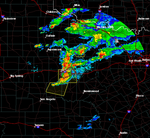 At 800 pm cdt, a severe thunderstorm capable of producing a tornado was located over eula, or near clyde, moving northeast at 40 mph (radar indicated rotation). Hazards include tornado and 70 mph winds. Flying debris will be dangerous to those caught without shelter. mobile homes will be damaged or destroyed. damage to roofs, windows, and vehicles will occur. tree damage is likely. this dangerous storm will be near, clyde around 805 pm cdt. baird around 815 pm cdt. other locations impacted by this tornadic thunderstorm include us- 283 near the callahan-shackelford county line and kirby lake. This includes interstate 20 between mile markers 291 and 312. At 800 pm cdt, a severe thunderstorm capable of producing a tornado was located over eula, or near clyde, moving northeast at 40 mph (radar indicated rotation). Hazards include tornado and 70 mph winds. Flying debris will be dangerous to those caught without shelter. mobile homes will be damaged or destroyed. damage to roofs, windows, and vehicles will occur. tree damage is likely. this dangerous storm will be near, clyde around 805 pm cdt. baird around 815 pm cdt. other locations impacted by this tornadic thunderstorm include us- 283 near the callahan-shackelford county line and kirby lake. This includes interstate 20 between mile markers 291 and 312.
|
| 3/18/2020 7:52 PM CDT |
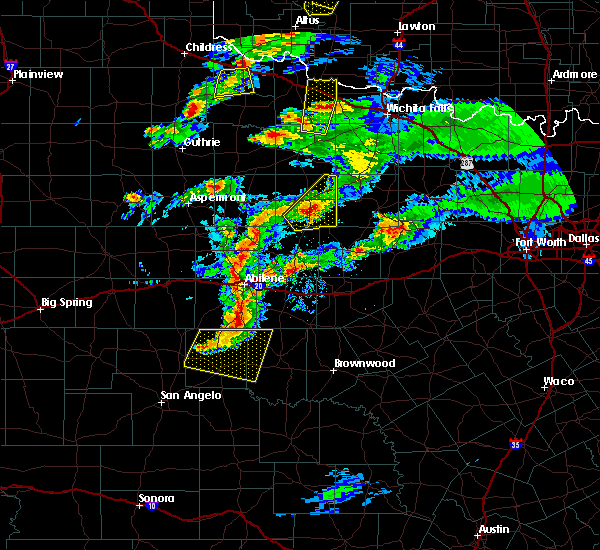 At 751 pm cdt, a severe thunderstorm capable of producing a tornado was located over potosi, or 8 miles southeast of abilene, moving northeast at 45 mph (radar indicated rotation). Hazards include tornado and quarter size hail. Flying debris will be dangerous to those caught without shelter. mobile homes will be damaged or destroyed. damage to roofs, windows, and vehicles will occur. tree damage is likely. this dangerous storm will be near, eula around 755 pm cdt. clyde around 805 pm cdt. baird around 810 pm cdt. other locations impacted by this tornadic thunderstorm include us- 283 near the callahan-shackelford county line and kirby lake. This includes interstate 20 between mile markers 291 and 312. At 751 pm cdt, a severe thunderstorm capable of producing a tornado was located over potosi, or 8 miles southeast of abilene, moving northeast at 45 mph (radar indicated rotation). Hazards include tornado and quarter size hail. Flying debris will be dangerous to those caught without shelter. mobile homes will be damaged or destroyed. damage to roofs, windows, and vehicles will occur. tree damage is likely. this dangerous storm will be near, eula around 755 pm cdt. clyde around 805 pm cdt. baird around 810 pm cdt. other locations impacted by this tornadic thunderstorm include us- 283 near the callahan-shackelford county line and kirby lake. This includes interstate 20 between mile markers 291 and 312.
|
| 3/18/2020 7:42 PM CDT |
 At 742 pm cdt, severe thunderstorms were located along a line extending from 6 miles northeast of tye to near buffalo gap to near lawn, moving east at 40 mph (radar indicated). Hazards include 60 mph wind gusts and quarter size hail. Hail damage to vehicles is expected. expect wind damage to roofs, siding, and trees. severe thunderstorms will be near, lawn around 745 pm cdt. abilene and potosi around 750 pm cdt. dudley around 755 pm cdt. eula around 800 pm cdt. clyde and oplin around 805 pm cdt. baird around 815 pm cdt. rowden around 820 pm cdt. other locations impacted by these severe thunderstorms include impact, kirby lake, admiral, ovalo and us-283 near the coleman- callahan county line. This includes interstate 20 between mile markers 280 and 316. At 742 pm cdt, severe thunderstorms were located along a line extending from 6 miles northeast of tye to near buffalo gap to near lawn, moving east at 40 mph (radar indicated). Hazards include 60 mph wind gusts and quarter size hail. Hail damage to vehicles is expected. expect wind damage to roofs, siding, and trees. severe thunderstorms will be near, lawn around 745 pm cdt. abilene and potosi around 750 pm cdt. dudley around 755 pm cdt. eula around 800 pm cdt. clyde and oplin around 805 pm cdt. baird around 815 pm cdt. rowden around 820 pm cdt. other locations impacted by these severe thunderstorms include impact, kirby lake, admiral, ovalo and us-283 near the coleman- callahan county line. This includes interstate 20 between mile markers 280 and 316.
|
| 3/18/2020 6:01 PM CDT |
 At 559 pm cdt, a severe thunderstorm was located near nugent, or 16 miles northeast of abilene, moving north at 40 mph (radar indicated). Hazards include 60 mph wind gusts and half dollar size hail. Hail damage to vehicles is expected. expect wind damage to roofs, siding, and trees. this severe storm will be near, lueders around 615 pm cdt. Other locations impacted by this severe thunderstorm include funston, big country baptist assembly, lake fort phantom hill and the intersection of us-180 and farm road 600. At 559 pm cdt, a severe thunderstorm was located near nugent, or 16 miles northeast of abilene, moving north at 40 mph (radar indicated). Hazards include 60 mph wind gusts and half dollar size hail. Hail damage to vehicles is expected. expect wind damage to roofs, siding, and trees. this severe storm will be near, lueders around 615 pm cdt. Other locations impacted by this severe thunderstorm include funston, big country baptist assembly, lake fort phantom hill and the intersection of us-180 and farm road 600.
|
| 3/18/2020 5:45 PM CDT |
 At 543 pm cdt, a severe thunderstorm was located over hamby, or 7 miles east of abilene, moving north at 40 mph. at 536 pm, a wind gust of 62 mph was reported at the abilene regional airport (radar indicated. also,). Hazards include ping pong ball size hail and 60 mph wind gusts. People and animals outdoors will be injured. expect hail damage to roofs, siding, windows, and vehicles. expect wind damage to roofs, siding, and trees. this severe storm will be near, nugent around 605 pm cdt. lueders around 615 pm cdt. other locations impacted by this severe thunderstorm include funston, impact, big country baptist assembly, lake fort phantom hill, kirby lake and the intersection of us-180 and farm road 600. This includes interstate 20 between mile markers 284 and 302. At 543 pm cdt, a severe thunderstorm was located over hamby, or 7 miles east of abilene, moving north at 40 mph. at 536 pm, a wind gust of 62 mph was reported at the abilene regional airport (radar indicated. also,). Hazards include ping pong ball size hail and 60 mph wind gusts. People and animals outdoors will be injured. expect hail damage to roofs, siding, windows, and vehicles. expect wind damage to roofs, siding, and trees. this severe storm will be near, nugent around 605 pm cdt. lueders around 615 pm cdt. other locations impacted by this severe thunderstorm include funston, impact, big country baptist assembly, lake fort phantom hill, kirby lake and the intersection of us-180 and farm road 600. This includes interstate 20 between mile markers 284 and 302.
|
| 3/18/2020 5:38 PM CDT | Asos station kabi abilen in taylor county TX, 5.7 miles NNW of Abilene, TX |
| 3/18/2020 5:33 PM CDT |
 At 532 pm cdt, a severe thunderstorm was located near potosi, or 7 miles southeast of abilene, moving north at 40 mph (radar indicated). Hazards include ping pong ball size hail and 60 mph wind gusts. People and animals outdoors will be injured. expect hail damage to roofs, siding, windows, and vehicles. expect wind damage to roofs, siding, and trees. this severe thunderstorm will be near, hamby around 545 pm cdt. abilene around 555 pm cdt. nugent around 605 pm cdt. lueders around 615 pm cdt. other locations impacted by this severe thunderstorm include funston, impact, big country baptist assembly, lake fort phantom hill, kirby lake and the intersection of us-180 and farm road 600. This includes interstate 20 between mile markers 284 and 302. At 532 pm cdt, a severe thunderstorm was located near potosi, or 7 miles southeast of abilene, moving north at 40 mph (radar indicated). Hazards include ping pong ball size hail and 60 mph wind gusts. People and animals outdoors will be injured. expect hail damage to roofs, siding, windows, and vehicles. expect wind damage to roofs, siding, and trees. this severe thunderstorm will be near, hamby around 545 pm cdt. abilene around 555 pm cdt. nugent around 605 pm cdt. lueders around 615 pm cdt. other locations impacted by this severe thunderstorm include funston, impact, big country baptist assembly, lake fort phantom hill, kirby lake and the intersection of us-180 and farm road 600. This includes interstate 20 between mile markers 284 and 302.
|
| 3/18/2020 5:22 PM CDT |
 At 521 pm cdt, a severe thunderstorm was located over oplin, or 19 miles south of clyde, moving northeast at 30 mph (radar indicated). Hazards include tennis ball size hail and 60 mph wind gusts. People and animals outdoors will be injured. expect hail damage to roofs, siding, windows, and vehicles. expect wind damage to roofs, siding, and trees. this severe storm will be near, dudley around 535 pm cdt. rowden around 545 pm cdt. Other locations impacted by this severe thunderstorm include goldsboro, us-283 near the coleman- callahan county line, admiral and lake coleman. At 521 pm cdt, a severe thunderstorm was located over oplin, or 19 miles south of clyde, moving northeast at 30 mph (radar indicated). Hazards include tennis ball size hail and 60 mph wind gusts. People and animals outdoors will be injured. expect hail damage to roofs, siding, windows, and vehicles. expect wind damage to roofs, siding, and trees. this severe storm will be near, dudley around 535 pm cdt. rowden around 545 pm cdt. Other locations impacted by this severe thunderstorm include goldsboro, us-283 near the coleman- callahan county line, admiral and lake coleman.
|
| 3/18/2020 5:16 PM CDT |
 At 514 pm cdt, a severe thunderstorm was located near oplin, or 20 miles northwest of coleman, moving northeast at 30 mph (radar indicated). Hazards include golf ball size hail and 60 mph wind gusts. People and animals outdoors will be injured. expect hail damage to roofs, siding, windows, and vehicles. expect wind damage to roofs, siding, and trees. this severe storm will be near, oplin around 525 pm cdt. dudley around 535 pm cdt. rowden around 545 pm cdt. Other locations impacted by this severe thunderstorm include goldsboro, us-283 near the coleman- callahan county line, admiral and lake coleman. At 514 pm cdt, a severe thunderstorm was located near oplin, or 20 miles northwest of coleman, moving northeast at 30 mph (radar indicated). Hazards include golf ball size hail and 60 mph wind gusts. People and animals outdoors will be injured. expect hail damage to roofs, siding, windows, and vehicles. expect wind damage to roofs, siding, and trees. this severe storm will be near, oplin around 525 pm cdt. dudley around 535 pm cdt. rowden around 545 pm cdt. Other locations impacted by this severe thunderstorm include goldsboro, us-283 near the coleman- callahan county line, admiral and lake coleman.
|
| 3/18/2020 5:04 PM CDT |
 At 503 pm cdt, a severe thunderstorm was located near novice, or 17 miles east of winters, moving northeast at 30 mph (radar indicated). Hazards include 60 mph wind gusts and half dollar size hail. Hail damage to vehicles is expected. expect wind damage to roofs, siding, and trees. this severe thunderstorm will be near, oplin around 525 pm cdt. dudley around 535 pm cdt. rowden around 545 pm cdt. Other locations impacted by this severe thunderstorm include goldsboro, us-283 near the coleman- callahan county line, admiral and lake coleman. At 503 pm cdt, a severe thunderstorm was located near novice, or 17 miles east of winters, moving northeast at 30 mph (radar indicated). Hazards include 60 mph wind gusts and half dollar size hail. Hail damage to vehicles is expected. expect wind damage to roofs, siding, and trees. this severe thunderstorm will be near, oplin around 525 pm cdt. dudley around 535 pm cdt. rowden around 545 pm cdt. Other locations impacted by this severe thunderstorm include goldsboro, us-283 near the coleman- callahan county line, admiral and lake coleman.
|
| 3/17/2020 8:23 PM CDT |
 At 822 pm cdt, a severe thunderstorm was located 7 miles east of lueders, or 12 miles west of albany, moving east at 35 mph (radar indicated). Hazards include 60 mph wind gusts and quarter size hail. Hail damage to vehicles is expected. expect wind damage to roofs, siding, and trees. this severe storm will be near, albany around 845 pm cdt. fort griffin around 850 pm cdt. Other locations impacted by this severe thunderstorm include funston, hodges, mccarty lake, tuxedo, big country baptist assembly, lake fort phantom hill, stith, the intersection of us- 283 and ranch road 209, truby and us-180 near the shackelford- stephens county line. At 822 pm cdt, a severe thunderstorm was located 7 miles east of lueders, or 12 miles west of albany, moving east at 35 mph (radar indicated). Hazards include 60 mph wind gusts and quarter size hail. Hail damage to vehicles is expected. expect wind damage to roofs, siding, and trees. this severe storm will be near, albany around 845 pm cdt. fort griffin around 850 pm cdt. Other locations impacted by this severe thunderstorm include funston, hodges, mccarty lake, tuxedo, big country baptist assembly, lake fort phantom hill, stith, the intersection of us- 283 and ranch road 209, truby and us-180 near the shackelford- stephens county line.
|
| 3/17/2020 8:10 PM CDT |
 At 810 pm cdt, a severe thunderstorm was located over lueders, or 15 miles southeast of stamford, moving east at 35 mph (radar indicated). Hazards include 60 mph wind gusts and quarter size hail. Hail damage to vehicles is expected. expect wind damage to roofs, siding, and trees. this severe storm will be near, albany around 840 pm cdt. fort griffin around 845 pm cdt. Other locations impacted by this severe thunderstorm include funston, hodges, mccarty lake, tuxedo, big country baptist assembly, lake fort phantom hill, stith, the intersection of us- 283 and ranch road 209, truby and us-180 near the shackelford- stephens county line. At 810 pm cdt, a severe thunderstorm was located over lueders, or 15 miles southeast of stamford, moving east at 35 mph (radar indicated). Hazards include 60 mph wind gusts and quarter size hail. Hail damage to vehicles is expected. expect wind damage to roofs, siding, and trees. this severe storm will be near, albany around 840 pm cdt. fort griffin around 845 pm cdt. Other locations impacted by this severe thunderstorm include funston, hodges, mccarty lake, tuxedo, big country baptist assembly, lake fort phantom hill, stith, the intersection of us- 283 and ranch road 209, truby and us-180 near the shackelford- stephens county line.
|
| 3/17/2020 7:49 PM CDT |
 At 749 pm cdt, a severe thunderstorm was located near anson, moving east at 35 mph (radar indicated). Hazards include 60 mph wind gusts and quarter size hail. Hail damage to vehicles is expected. expect wind damage to roofs, siding, and trees. this severe thunderstorm will be near, nugent and avoca around 805 pm cdt. lueders around 810 pm cdt. albany around 840 pm cdt. fort griffin around 845 pm cdt. Other locations impacted by this severe thunderstorm include funston, hodges, mccarty lake, tuxedo, big country baptist assembly, lake fort phantom hill, stith, the intersection of us- 283 and ranch road 209, truby and us-180 near the shackelford- stephens county line. At 749 pm cdt, a severe thunderstorm was located near anson, moving east at 35 mph (radar indicated). Hazards include 60 mph wind gusts and quarter size hail. Hail damage to vehicles is expected. expect wind damage to roofs, siding, and trees. this severe thunderstorm will be near, nugent and avoca around 805 pm cdt. lueders around 810 pm cdt. albany around 840 pm cdt. fort griffin around 845 pm cdt. Other locations impacted by this severe thunderstorm include funston, hodges, mccarty lake, tuxedo, big country baptist assembly, lake fort phantom hill, stith, the intersection of us- 283 and ranch road 209, truby and us-180 near the shackelford- stephens county line.
|
| 6/23/2019 7:27 PM CDT |
 At 726 pm cdt, a severe thunderstorm was located near cisco, moving east at 35 mph (radar indicated). Hazards include ping pong ball size hail and 60 mph wind gusts. People and animals outdoors will be injured. expect hail damage to roofs, siding, windows, and vehicles. expect wind damage to roofs, siding, and trees. locations impacted include, clyde, baird, cross plains, putnam, rowden, atwell, eula, dudley, potosi, admiral and i-20 near the callahan-eastland county line. This includes interstate 20 between mile markers 295 and 323. At 726 pm cdt, a severe thunderstorm was located near cisco, moving east at 35 mph (radar indicated). Hazards include ping pong ball size hail and 60 mph wind gusts. People and animals outdoors will be injured. expect hail damage to roofs, siding, windows, and vehicles. expect wind damage to roofs, siding, and trees. locations impacted include, clyde, baird, cross plains, putnam, rowden, atwell, eula, dudley, potosi, admiral and i-20 near the callahan-eastland county line. This includes interstate 20 between mile markers 295 and 323.
|
| 6/23/2019 7:14 PM CDT |
 At 713 pm cdt, a severe thunderstorm was located near cisco, moving east at 35 mph (radar indicated). Hazards include 60 mph wind gusts and quarter size hail. Hail damage to vehicles is expected. expect wind damage to roofs, siding, and trees. this severe thunderstorm will remain over mainly rural areas of callahan, southeastern shackelford and east central taylor counties, including the following locations, mccarty lake, us- 283 near the callahan-shackelford county line, us- 180 near the shackelford-stephens county line, admiral and i- 20 near the callahan-eastland county line. This includes interstate 20 between mile markers 294 and 323. At 713 pm cdt, a severe thunderstorm was located near cisco, moving east at 35 mph (radar indicated). Hazards include 60 mph wind gusts and quarter size hail. Hail damage to vehicles is expected. expect wind damage to roofs, siding, and trees. this severe thunderstorm will remain over mainly rural areas of callahan, southeastern shackelford and east central taylor counties, including the following locations, mccarty lake, us- 283 near the callahan-shackelford county line, us- 180 near the shackelford-stephens county line, admiral and i- 20 near the callahan-eastland county line. This includes interstate 20 between mile markers 294 and 323.
|
| 6/23/2019 6:57 PM CDT |
 The national weather service in san angelo has issued a * severe thunderstorm warning for. callahan county in west central texas. southeastern shackelford county in west central texas. east central taylor county in west central texas. Until 745 pm cdt. The national weather service in san angelo has issued a * severe thunderstorm warning for. callahan county in west central texas. southeastern shackelford county in west central texas. east central taylor county in west central texas. Until 745 pm cdt.
|
| 6/23/2019 6:31 PM CDT |
 At 631 pm cdt, a severe thunderstorm was located over buffalo gap, or 12 miles southwest of abilene, moving east at 20 mph (radar indicated). Hazards include 60 mph wind gusts and half dollar size hail. Hail damage to vehicles is expected. expect wind damage to roofs, siding, and trees. this severe storm will be near, buffalo gap around 635 pm cdt. tuscola around 640 pm cdt. wylie around 645 pm cdt. dudley and potosi around 700 pm cdt. Other locations impacted by this severe thunderstorm include lake abilene, camp tonkawa, camp butman, kirby lake and ovalo. At 631 pm cdt, a severe thunderstorm was located over buffalo gap, or 12 miles southwest of abilene, moving east at 20 mph (radar indicated). Hazards include 60 mph wind gusts and half dollar size hail. Hail damage to vehicles is expected. expect wind damage to roofs, siding, and trees. this severe storm will be near, buffalo gap around 635 pm cdt. tuscola around 640 pm cdt. wylie around 645 pm cdt. dudley and potosi around 700 pm cdt. Other locations impacted by this severe thunderstorm include lake abilene, camp tonkawa, camp butman, kirby lake and ovalo.
|
| 6/23/2019 6:18 PM CDT | Quarter sized hail reported 7.2 miles N of Abilene, TX, broadcast media passed along a report of quarter size hail in south abilene on social media. |
| 6/23/2019 6:14 PM CDT |
 At 614 pm cdt, a severe thunderstorm was located near coronados camp, or 16 miles southwest of abilene, moving east at 20 mph (radar indicated). Hazards include 60 mph wind gusts and half dollar size hail. Hail damage to vehicles is expected. expect wind damage to roofs, siding, and trees. this severe thunderstorm will be near, view around 625 pm cdt. caps around 630 pm cdt. buffalo gap around 635 pm cdt. tuscola around 640 pm cdt. wylie around 645 pm cdt. dudley and potosi around 700 pm cdt. Other locations impacted by this severe thunderstorm include lake abilene, camp tonkawa, camp butman, kirby lake and ovalo. At 614 pm cdt, a severe thunderstorm was located near coronados camp, or 16 miles southwest of abilene, moving east at 20 mph (radar indicated). Hazards include 60 mph wind gusts and half dollar size hail. Hail damage to vehicles is expected. expect wind damage to roofs, siding, and trees. this severe thunderstorm will be near, view around 625 pm cdt. caps around 630 pm cdt. buffalo gap around 635 pm cdt. tuscola around 640 pm cdt. wylie around 645 pm cdt. dudley and potosi around 700 pm cdt. Other locations impacted by this severe thunderstorm include lake abilene, camp tonkawa, camp butman, kirby lake and ovalo.
|
| 6/23/2019 6:09 PM CDT | The kabi asos recorded a 61 mph wind gust at 609 p in taylor county TX, 6.3 miles NNW of Abilene, TX |
| 6/23/2019 6:07 PM CDT |
 At 605 pm cdt, a severe thunderstorm was located near abilene, moving east at 20 mph. a trained spotter estimated 60 mph winds at acu in abilene (radar indicated). Hazards include ping pong ball size hail and 60 mph wind gusts. People and animals outdoors will be injured. expect hail damage to roofs, siding, windows, and vehicles. expect wind damage to roofs, siding, and trees. this severe storm will be near, hamby around 625 pm cdt. other locations impacted by this severe thunderstorm include impact, hodges, lake fort phantom hill, stith and truby. This includes interstate 20 between mile markers 272 and 299. At 605 pm cdt, a severe thunderstorm was located near abilene, moving east at 20 mph. a trained spotter estimated 60 mph winds at acu in abilene (radar indicated). Hazards include ping pong ball size hail and 60 mph wind gusts. People and animals outdoors will be injured. expect hail damage to roofs, siding, windows, and vehicles. expect wind damage to roofs, siding, and trees. this severe storm will be near, hamby around 625 pm cdt. other locations impacted by this severe thunderstorm include impact, hodges, lake fort phantom hill, stith and truby. This includes interstate 20 between mile markers 272 and 299.
|
| 6/23/2019 6:03 PM CDT | 1 to 3 inch tree limbs down at interstate 20 and old anson road. there were also reports of some power outages at winters freeway and north 1s in taylor county TX, 1.8 miles SE of Abilene, TX |
| 6/23/2019 6:02 PM CDT | Several large tree limbs were knocked down by damaging thunderstorm winds as seen on photo in social medi in taylor county TX, 5.9 miles NNE of Abilene, TX |
| 6/23/2019 5:59 PM CDT | The 60 mph wind was reported at abilene christian universit in taylor county TX, 3 miles N of Abilene, TX |
| 6/23/2019 5:58 PM CDT |
 At 558 pm cdt, a severe thunderstorm was located near hawley, or 7 miles northwest of abilene, moving east at 20 mph (radar indicated). Hazards include ping pong ball size hail and 60 mph wind gusts. People and animals outdoors will be injured. expect hail damage to roofs, siding, windows, and vehicles. expect wind damage to roofs, siding, and trees. this severe storm will be near, abilene around 615 pm cdt. hamby around 625 pm cdt. other locations impacted by this severe thunderstorm include impact, hodges, lake fort phantom hill, stith and truby. This includes interstate 20 between mile markers 272 and 299. At 558 pm cdt, a severe thunderstorm was located near hawley, or 7 miles northwest of abilene, moving east at 20 mph (radar indicated). Hazards include ping pong ball size hail and 60 mph wind gusts. People and animals outdoors will be injured. expect hail damage to roofs, siding, windows, and vehicles. expect wind damage to roofs, siding, and trees. this severe storm will be near, abilene around 615 pm cdt. hamby around 625 pm cdt. other locations impacted by this severe thunderstorm include impact, hodges, lake fort phantom hill, stith and truby. This includes interstate 20 between mile markers 272 and 299.
|
| 6/23/2019 5:54 PM CDT |
 At 554 pm cdt, a severe thunderstorm was located 7 miles southwest of merkel, or 20 miles west of abilene, moving northeast at 20 mph (radar indicated). Hazards include 60 mph wind gusts and quarter size hail. Hail damage to vehicles is expected. expect wind damage to roofs, siding, and trees. this severe storm will be near, merkel around 610 pm cdt. tye, dyess afb, view and caps around 615 pm cdt. other locations impacted by this severe thunderstorm include lake sweetwater and camp butman. This includes interstate 20 between mile markers 261 and 278. At 554 pm cdt, a severe thunderstorm was located 7 miles southwest of merkel, or 20 miles west of abilene, moving northeast at 20 mph (radar indicated). Hazards include 60 mph wind gusts and quarter size hail. Hail damage to vehicles is expected. expect wind damage to roofs, siding, and trees. this severe storm will be near, merkel around 610 pm cdt. tye, dyess afb, view and caps around 615 pm cdt. other locations impacted by this severe thunderstorm include lake sweetwater and camp butman. This includes interstate 20 between mile markers 261 and 278.
|
| 6/23/2019 5:43 PM CDT |
 At 542 pm cdt, a severe thunderstorm was located near hawley, or 10 miles northwest of abilene, moving east at 20 mph (radar indicated). Hazards include ping pong ball size hail and 60 mph wind gusts. People and animals outdoors will be injured. expect hail damage to roofs, siding, windows, and vehicles. expect wind damage to roofs, siding, and trees. this severe thunderstorm will be near, hawley around 555 pm cdt. abilene around 615 pm cdt. hamby around 625 pm cdt. other locations impacted by this severe thunderstorm include impact, hodges, lake fort phantom hill, stith and truby. This includes interstate 20 between mile markers 272 and 299. At 542 pm cdt, a severe thunderstorm was located near hawley, or 10 miles northwest of abilene, moving east at 20 mph (radar indicated). Hazards include ping pong ball size hail and 60 mph wind gusts. People and animals outdoors will be injured. expect hail damage to roofs, siding, windows, and vehicles. expect wind damage to roofs, siding, and trees. this severe thunderstorm will be near, hawley around 555 pm cdt. abilene around 615 pm cdt. hamby around 625 pm cdt. other locations impacted by this severe thunderstorm include impact, hodges, lake fort phantom hill, stith and truby. This includes interstate 20 between mile markers 272 and 299.
|
| 6/23/2019 5:29 PM CDT |
 At 529 pm cdt, a severe thunderstorm was located near nolan, or 15 miles southeast of sweetwater, moving northeast at 20 mph (radar indicated). Hazards include 60 mph wind gusts and quarter size hail. Hail damage to vehicles is expected. expect wind damage to roofs, siding, and trees. this severe thunderstorm will be near, merkel around 610 pm cdt. tye, dyess afb, view and caps around 615 pm cdt. other locations impacted by this severe thunderstorm include lake sweetwater and camp butman. This includes interstate 20 between mile markers 261 and 278. At 529 pm cdt, a severe thunderstorm was located near nolan, or 15 miles southeast of sweetwater, moving northeast at 20 mph (radar indicated). Hazards include 60 mph wind gusts and quarter size hail. Hail damage to vehicles is expected. expect wind damage to roofs, siding, and trees. this severe thunderstorm will be near, merkel around 610 pm cdt. tye, dyess afb, view and caps around 615 pm cdt. other locations impacted by this severe thunderstorm include lake sweetwater and camp butman. This includes interstate 20 between mile markers 261 and 278.
|
| 6/23/2019 4:58 PM CDT |
 At 458 pm cdt, a severe thunderstorm was located near trent, or 16 miles northeast of sweetwater, moving east at 25 mph (radar indicated). Hazards include 60 mph wind gusts and half dollar size hail. Hail damage to vehicles is expected. expect wind damage to roofs, siding, and trees. this severe thunderstorm will be near, noodle around 510 pm cdt. hawley around 545 pm cdt. Other locations impacted by this severe thunderstorm include funston, hodges, lake fort phantom hill, stith and truby. At 458 pm cdt, a severe thunderstorm was located near trent, or 16 miles northeast of sweetwater, moving east at 25 mph (radar indicated). Hazards include 60 mph wind gusts and half dollar size hail. Hail damage to vehicles is expected. expect wind damage to roofs, siding, and trees. this severe thunderstorm will be near, noodle around 510 pm cdt. hawley around 545 pm cdt. Other locations impacted by this severe thunderstorm include funston, hodges, lake fort phantom hill, stith and truby.
|
| 6/5/2019 10:48 PM CDT |
 At 1047 pm cdt, severe thunderstorms were located along a line extending from near nugent to near eula to near novice, moving east at 50 mph (radar indicated). Hazards include 60 mph wind gusts and quarter size hail. Hail damage to vehicles is expected. expect wind damage to roofs, siding, and trees. severe thunderstorms will be near, baird around 1055 pm cdt. rowden around 1100 pm cdt. putnam around 1105 pm cdt. atwell around 1110 pm cdt. moran around 1120 pm cdt. other locations impacted by these severe thunderstorms include lake fort phantom hill, mccarty lake, us-283 near the callahan- shackelford county line, admiral and i-20 near the callahan- eastland county line. This includes interstate 20 between mile markers 291 and 323. At 1047 pm cdt, severe thunderstorms were located along a line extending from near nugent to near eula to near novice, moving east at 50 mph (radar indicated). Hazards include 60 mph wind gusts and quarter size hail. Hail damage to vehicles is expected. expect wind damage to roofs, siding, and trees. severe thunderstorms will be near, baird around 1055 pm cdt. rowden around 1100 pm cdt. putnam around 1105 pm cdt. atwell around 1110 pm cdt. moran around 1120 pm cdt. other locations impacted by these severe thunderstorms include lake fort phantom hill, mccarty lake, us-283 near the callahan- shackelford county line, admiral and i-20 near the callahan- eastland county line. This includes interstate 20 between mile markers 291 and 323.
|
| 6/5/2019 10:36 PM CDT |
 At 1034 pm cdt, severe thunderstorms were located along a line extending from 6 miles north of abilene to dudley to near lawn, moving east at 55 mph (radar indicated). Hazards include 70 mph wind gusts and half dollar size hail. Hail damage to vehicles is expected. expect considerable tree damage. wind damage is also likely to mobile homes, roofs, and outbuildings. these severe storms will be near, eula around 1040 pm cdt. oplin around 1050 pm cdt. other locations impacted by these severe thunderstorms include funston, impact, lake abilene, camp tonkawa, lake fort phantom hill, lake coleman, the intersection of us- 180 and farm road 600, ovalo, hodges and drasco. This includes interstate 20 between mile markers 272 and 305. At 1034 pm cdt, severe thunderstorms were located along a line extending from 6 miles north of abilene to dudley to near lawn, moving east at 55 mph (radar indicated). Hazards include 70 mph wind gusts and half dollar size hail. Hail damage to vehicles is expected. expect considerable tree damage. wind damage is also likely to mobile homes, roofs, and outbuildings. these severe storms will be near, eula around 1040 pm cdt. oplin around 1050 pm cdt. other locations impacted by these severe thunderstorms include funston, impact, lake abilene, camp tonkawa, lake fort phantom hill, lake coleman, the intersection of us- 180 and farm road 600, ovalo, hodges and drasco. This includes interstate 20 between mile markers 272 and 305.
|
| 6/5/2019 10:15 PM CDT |
 At 1013 pm cdt, severe thunderstorms were located along a line extending from near stamford to near coronados camp to near maverick, moving east at 50 mph (radar indicated). Hazards include 60 mph wind gusts significant blowing dust. Expect damage to roofs, siding, and trees. these severe storms will be near, tuscola, buffalo gap and avoca around 1020 pm cdt. lueders and lawn around 1025 pm cdt. benoit, dudley and oplin around 1035 pm cdt. talpa around 1040 pm cdt. glen cove around 1045 pm cdt. valera around 1050 pm cdt. other locations impacted by these severe thunderstorms include funston, shep, wilmeth, lake coleman, the intersection of us- 180 and farm road 600, goldsboro, big country baptist assembly, ballinger lake, camp butman and impact. This includes interstate 20 between mile markers 258 and 305. At 1013 pm cdt, severe thunderstorms were located along a line extending from near stamford to near coronados camp to near maverick, moving east at 50 mph (radar indicated). Hazards include 60 mph wind gusts significant blowing dust. Expect damage to roofs, siding, and trees. these severe storms will be near, tuscola, buffalo gap and avoca around 1020 pm cdt. lueders and lawn around 1025 pm cdt. benoit, dudley and oplin around 1035 pm cdt. talpa around 1040 pm cdt. glen cove around 1045 pm cdt. valera around 1050 pm cdt. other locations impacted by these severe thunderstorms include funston, shep, wilmeth, lake coleman, the intersection of us- 180 and farm road 600, goldsboro, big country baptist assembly, ballinger lake, camp butman and impact. This includes interstate 20 between mile markers 258 and 305.
|
| 6/5/2019 9:55 PM CDT |
 At 954 pm cdt, severe thunderstorms were located along a line extending from hamlin to near nolan to 6 miles south of robert lee, moving east at 55 mph (radar indicated). Hazards include 60 mph wind gusts and significant blowing dust. Expect damage to roofs, siding, and trees. severe thunderstorms will be near, hamlin and neinda around 1000 pm cdt. bronte and happy valley around 1005 pm cdt. anson, maverick and coronados camp around 1010 pm cdt. norton around 1015 pm cdt. buffalo gap, avoca and bradshaw around 1020 pm cdt. tuscola, lueders and lawn around 1025 pm cdt. ballinger and hatchel around 1030 pm cdt. benoit and dudley around 1035 pm cdt. other locations impacted by these severe thunderstorms include funston, shep, wilmeth, lake coleman, lake sweetwater, the intersection of us- 180 and farm road 600, the intersection of highway 208 and ranch road 2662, goldsboro, big country baptist assembly and ballinger lake. This includes interstate 20 between mile markers 244 and 305. At 954 pm cdt, severe thunderstorms were located along a line extending from hamlin to near nolan to 6 miles south of robert lee, moving east at 55 mph (radar indicated). Hazards include 60 mph wind gusts and significant blowing dust. Expect damage to roofs, siding, and trees. severe thunderstorms will be near, hamlin and neinda around 1000 pm cdt. bronte and happy valley around 1005 pm cdt. anson, maverick and coronados camp around 1010 pm cdt. norton around 1015 pm cdt. buffalo gap, avoca and bradshaw around 1020 pm cdt. tuscola, lueders and lawn around 1025 pm cdt. ballinger and hatchel around 1030 pm cdt. benoit and dudley around 1035 pm cdt. other locations impacted by these severe thunderstorms include funston, shep, wilmeth, lake coleman, lake sweetwater, the intersection of us- 180 and farm road 600, the intersection of highway 208 and ranch road 2662, goldsboro, big country baptist assembly and ballinger lake. This includes interstate 20 between mile markers 244 and 305.
|
| 6/5/2019 5:02 PM CDT |
 At 502 pm cdt, a severe thunderstorm was located near potosi, or near abilene, moving east-southeast at 35 mph (radar indicated). Hazards include 60 mph wind gusts and quarter size hail. Hail damage to vehicles is expected. expect wind damage to roofs, siding, and trees. this severe storm will be near, clyde and eula around 515 pm cdt. other locations impacted by this severe thunderstorm include kirby lake. This includes interstate 20 between mile markers 288 and 302. At 502 pm cdt, a severe thunderstorm was located near potosi, or near abilene, moving east-southeast at 35 mph (radar indicated). Hazards include 60 mph wind gusts and quarter size hail. Hail damage to vehicles is expected. expect wind damage to roofs, siding, and trees. this severe storm will be near, clyde and eula around 515 pm cdt. other locations impacted by this severe thunderstorm include kirby lake. This includes interstate 20 between mile markers 288 and 302.
|
| 6/5/2019 4:56 PM CDT | Abilene pd reported power lines down... power lines arcing and signal light debris on the roadway in abilen in taylor county TX, 3.7 miles N of Abilene, TX |
| 6/5/2019 4:56 PM CDT | Media reports broken tree limbs and a leaning power pole in abilen in taylor county TX, 3.8 miles NNE of Abilene, TX |
| 6/5/2019 4:53 PM CDT |
 At 452 pm cdt, a severe thunderstorm was located near potosi, or near abilene, moving southeast at 30 mph (radar indicated). Hazards include 60 mph wind gusts and quarter size hail. Hail damage to vehicles is expected. expect wind damage to roofs, siding, and trees. this severe storm will be near, clyde, eula and dudley around 510 pm cdt. other locations impacted by this severe thunderstorm include kirby lake. This includes interstate 20 between mile markers 284 and 301. At 452 pm cdt, a severe thunderstorm was located near potosi, or near abilene, moving southeast at 30 mph (radar indicated). Hazards include 60 mph wind gusts and quarter size hail. Hail damage to vehicles is expected. expect wind damage to roofs, siding, and trees. this severe storm will be near, clyde, eula and dudley around 510 pm cdt. other locations impacted by this severe thunderstorm include kirby lake. This includes interstate 20 between mile markers 284 and 301.
|
| 6/5/2019 4:41 PM CDT |
 At 440 pm cdt, a severe thunderstorm was located near dyess airforce base, or near abilene, moving southeast at 30 mph (radar indicated). Hazards include 60 mph wind gusts and quarter size hail. Hail damage to vehicles is expected. expect wind damage to roofs, siding, and trees. this severe thunderstorm will be near, wylie around 445 pm cdt. potosi around 500 pm cdt. clyde and eula around 510 pm cdt. dudley around 515 pm cdt. other locations impacted by this severe thunderstorm include impact and kirby lake. This includes interstate 20 between mile markers 277 and 301. At 440 pm cdt, a severe thunderstorm was located near dyess airforce base, or near abilene, moving southeast at 30 mph (radar indicated). Hazards include 60 mph wind gusts and quarter size hail. Hail damage to vehicles is expected. expect wind damage to roofs, siding, and trees. this severe thunderstorm will be near, wylie around 445 pm cdt. potosi around 500 pm cdt. clyde and eula around 510 pm cdt. dudley around 515 pm cdt. other locations impacted by this severe thunderstorm include impact and kirby lake. This includes interstate 20 between mile markers 277 and 301.
|
| 6/2/2019 2:50 AM CDT |
 At 249 am cdt, a severe thunderstorm was located near neinda, or 7 miles southeast of hamlin, moving east at 15 mph (radar indicated). Hazards include 60 mph wind gusts. Expect damage to roofs, siding, and trees. this severe storm will be near, anson around 310 am cdt. Other locations impacted by this severe thunderstorm include funston, hodges, the intersection of us- 180 and ranch road 126, hitson, tuxedo, lake fort phantom hill, stith, gannon, truby and the intersection of us- 180 and farm road 600. At 249 am cdt, a severe thunderstorm was located near neinda, or 7 miles southeast of hamlin, moving east at 15 mph (radar indicated). Hazards include 60 mph wind gusts. Expect damage to roofs, siding, and trees. this severe storm will be near, anson around 310 am cdt. Other locations impacted by this severe thunderstorm include funston, hodges, the intersection of us- 180 and ranch road 126, hitson, tuxedo, lake fort phantom hill, stith, gannon, truby and the intersection of us- 180 and farm road 600.
|
| 6/2/2019 2:14 AM CDT |
 At 214 am cdt, a severe thunderstorm was located near hamlin, moving southeast at 40 mph (radar indicated). Hazards include 60 mph wind gusts and quarter size hail. Hail damage to vehicles is expected. expect wind damage to roofs, siding, and trees. this severe thunderstorm will be near, hamlin around 220 am cdt. neinda around 230 am cdt. anson around 245 am cdt. hawley around 300 am cdt. abilene and nugent around 305 am cdt. Other locations impacted by this severe thunderstorm include funston, hodges, the intersection of us- 180 and ranch road 126, hitson, tuxedo, lake fort phantom hill, stith, gannon, truby and the intersection of us- 180 and farm road 600. At 214 am cdt, a severe thunderstorm was located near hamlin, moving southeast at 40 mph (radar indicated). Hazards include 60 mph wind gusts and quarter size hail. Hail damage to vehicles is expected. expect wind damage to roofs, siding, and trees. this severe thunderstorm will be near, hamlin around 220 am cdt. neinda around 230 am cdt. anson around 245 am cdt. hawley around 300 am cdt. abilene and nugent around 305 am cdt. Other locations impacted by this severe thunderstorm include funston, hodges, the intersection of us- 180 and ranch road 126, hitson, tuxedo, lake fort phantom hill, stith, gannon, truby and the intersection of us- 180 and farm road 600.
|
| 5/31/2019 4:41 AM CDT |
 At 440 am cdt, a severe thunderstorm was located near view, or 15 miles southwest of abilene, moving east at 35 mph (radar indicated). Hazards include 60 mph wind gusts. Expect damage to roofs, siding, and trees. this severe thunderstorm will be near, caps around 445 am cdt. wylie and buffalo gap around 450 am cdt. tuscola around 455 am cdt. dudley around 510 am cdt. eula around 515 am cdt. oplin around 520 am cdt. other locations impacted by this severe thunderstorm include lake abilene, camp tonkawa, kirby lake and ovalo. This includes interstate 20 between mile markers 271 and 296. At 440 am cdt, a severe thunderstorm was located near view, or 15 miles southwest of abilene, moving east at 35 mph (radar indicated). Hazards include 60 mph wind gusts. Expect damage to roofs, siding, and trees. this severe thunderstorm will be near, caps around 445 am cdt. wylie and buffalo gap around 450 am cdt. tuscola around 455 am cdt. dudley around 510 am cdt. eula around 515 am cdt. oplin around 520 am cdt. other locations impacted by this severe thunderstorm include lake abilene, camp tonkawa, kirby lake and ovalo. This includes interstate 20 between mile markers 271 and 296.
|
| 5/31/2019 4:33 AM CDT |
 At 432 am cdt, a severe thunderstorm was located 7 miles south of merkel, or 19 miles west of abilene, moving east at 35 mph (radar indicated). Hazards include 60 mph wind gusts and quarter size hail. Hail damage to vehicles is expected. expect wind damage to roofs, siding, and trees. this severe storm will be near, coronados camp around 440 am cdt. buffalo gap, view, caps and dyess afb around 445 am cdt. other locations impacted by this severe thunderstorm include lake abilene, camp tonkawa, camp butman, ovalo and stith. This includes interstate 20 between mile markers 261 and 283. At 432 am cdt, a severe thunderstorm was located 7 miles south of merkel, or 19 miles west of abilene, moving east at 35 mph (radar indicated). Hazards include 60 mph wind gusts and quarter size hail. Hail damage to vehicles is expected. expect wind damage to roofs, siding, and trees. this severe storm will be near, coronados camp around 440 am cdt. buffalo gap, view, caps and dyess afb around 445 am cdt. other locations impacted by this severe thunderstorm include lake abilene, camp tonkawa, camp butman, ovalo and stith. This includes interstate 20 between mile markers 261 and 283.
|
| 5/31/2019 4:21 AM CDT |
 At 419 am cdt, a severe thunderstorm was located 8 miles south of trent, or 17 miles southeast of sweetwater, moving east at 40 mph (radar indicated). Hazards include 60 mph wind gusts and quarter size hail. Hail damage to vehicles is expected. expect wind damage to roofs, siding, and trees. this severe storm will be near, coronados camp around 435 am cdt. view around 440 am cdt. wylie, tuscola, buffalo gap and caps around 445 am cdt. other locations impacted by this severe thunderstorm include hodges, lake abilene, camp tonkawa, camp butman, stith and ovalo. This includes interstate 20 between mile markers 252 and 283. At 419 am cdt, a severe thunderstorm was located 8 miles south of trent, or 17 miles southeast of sweetwater, moving east at 40 mph (radar indicated). Hazards include 60 mph wind gusts and quarter size hail. Hail damage to vehicles is expected. expect wind damage to roofs, siding, and trees. this severe storm will be near, coronados camp around 435 am cdt. view around 440 am cdt. wylie, tuscola, buffalo gap and caps around 445 am cdt. other locations impacted by this severe thunderstorm include hodges, lake abilene, camp tonkawa, camp butman, stith and ovalo. This includes interstate 20 between mile markers 252 and 283.
|
| 5/31/2019 4:06 AM CDT |
 At 405 am cdt, a severe thunderstorm was located near trent, or 11 miles east of sweetwater, moving east at 45 mph (radar indicated). Hazards include 60 to 65 mph wind gusts. Expect damage to roofs, siding, and trees. this severe thunderstorm will be near, trent around 410 am cdt. merkel around 420 am cdt. tye and view around 430 am cdt. buffalo gap, caps and dyess afb around 435 am cdt. wylie around 440 am cdt. other locations impacted by this severe thunderstorm include hodges, lake abilene, camp tonkawa, camp butman, stith, truby, the intersection of highway 70 and ranch road 53, lake sweetwater and ovalo. This includes interstate 20 between mile markers 245 and 283. At 405 am cdt, a severe thunderstorm was located near trent, or 11 miles east of sweetwater, moving east at 45 mph (radar indicated). Hazards include 60 to 65 mph wind gusts. Expect damage to roofs, siding, and trees. this severe thunderstorm will be near, trent around 410 am cdt. merkel around 420 am cdt. tye and view around 430 am cdt. buffalo gap, caps and dyess afb around 435 am cdt. wylie around 440 am cdt. other locations impacted by this severe thunderstorm include hodges, lake abilene, camp tonkawa, camp butman, stith, truby, the intersection of highway 70 and ranch road 53, lake sweetwater and ovalo. This includes interstate 20 between mile markers 245 and 283.
|
| 5/29/2019 7:58 AM CDT |
 At 757 am cdt, a severe thunderstorm was located 9 miles northeast of hamby, or 11 miles north of clyde, moving east at 50 mph (radar indicated). Hazards include 60 mph wind gusts. Expect damage to roofs, siding, and trees. this severe storm will be near, moran around 820 am cdt. ibex around 825 am cdt. other locations impacted by this severe thunderstorm include impact, lake fort phantom hill, mccarty lake, us-283 near the callahan- shackelford county line, us-180 near the shackelford- stephens county line and i-20 near the callahan-eastland county line. This includes interstate 20 between mile markers 280 and 323. At 757 am cdt, a severe thunderstorm was located 9 miles northeast of hamby, or 11 miles north of clyde, moving east at 50 mph (radar indicated). Hazards include 60 mph wind gusts. Expect damage to roofs, siding, and trees. this severe storm will be near, moran around 820 am cdt. ibex around 825 am cdt. other locations impacted by this severe thunderstorm include impact, lake fort phantom hill, mccarty lake, us-283 near the callahan- shackelford county line, us-180 near the shackelford- stephens county line and i-20 near the callahan-eastland county line. This includes interstate 20 between mile markers 280 and 323.
|
| 5/29/2019 7:45 AM CDT | Tree snapped in half in front of abilene city hall. picture submitted on twitter by city governmen in taylor county TX, 2.3 miles N of Abilene, TX |
| 5/29/2019 7:38 AM CDT |
 At 737 am cdt, a severe thunderstorm was located over hawley, or 10 miles north of abilene, moving east at 45 mph (radar indicated). Hazards include 60 mph wind gusts and nickel size hail. Expect damage to roofs, siding, and trees. this severe thunderstorm will be near, nugent and hamby around 750 am cdt. albany around 815 am cdt. ibex around 830 am cdt. other locations impacted by this severe thunderstorm include impact, hodges, mccarty lake, lake fort phantom hill, us- 283 near the callahan-shackelford county line, us- 180 near the shackelford-stephens county line and i- 20 near the callahan-eastland county line. This includes interstate 20 between mile markers 275 and 323. At 737 am cdt, a severe thunderstorm was located over hawley, or 10 miles north of abilene, moving east at 45 mph (radar indicated). Hazards include 60 mph wind gusts and nickel size hail. Expect damage to roofs, siding, and trees. this severe thunderstorm will be near, nugent and hamby around 750 am cdt. albany around 815 am cdt. ibex around 830 am cdt. other locations impacted by this severe thunderstorm include impact, hodges, mccarty lake, lake fort phantom hill, us- 283 near the callahan-shackelford county line, us- 180 near the shackelford-stephens county line and i- 20 near the callahan-eastland county line. This includes interstate 20 between mile markers 275 and 323.
|
| 5/29/2019 7:27 AM CDT |
 At 724 am cdt, a severe thunderstorm was located near merkel, or 13 miles northwest of abilene, moving east at 50 mph (radar indicated). Hazards include 60 mph wind gusts and quarter size hail. Hail damage to vehicles is expected. expect wind damage to roofs, siding, and trees. this severe storm will be near, hawley around 735 am cdt. abilene and nugent around 745 am cdt. other locations impacted by this severe thunderstorm include funston, impact, hodges, lake fort phantom hill, kirby lake, stith, truby and the intersection of us-180 and farm road 600. This includes interstate 20 between mile markers 261 and 292. At 724 am cdt, a severe thunderstorm was located near merkel, or 13 miles northwest of abilene, moving east at 50 mph (radar indicated). Hazards include 60 mph wind gusts and quarter size hail. Hail damage to vehicles is expected. expect wind damage to roofs, siding, and trees. this severe storm will be near, hawley around 735 am cdt. abilene and nugent around 745 am cdt. other locations impacted by this severe thunderstorm include funston, impact, hodges, lake fort phantom hill, kirby lake, stith, truby and the intersection of us-180 and farm road 600. This includes interstate 20 between mile markers 261 and 292.
|
| 5/29/2019 7:15 AM CDT |
 At 714 am cdt, a severe thunderstorm was located near trent, or 18 miles southwest of anson, moving east at 45 mph (radar indicated). Hazards include 60 mph wind gusts and quarter size hail. Hail damage to vehicles is expected. expect wind damage to roofs, siding, and trees. this severe storm will be near, tye around 730 am cdt. hawley around 735 am cdt. abilene and nugent around 740 am cdt. other locations impacted by this severe thunderstorm include funston, impact, hodges, lake fort phantom hill, kirby lake, stith, truby and the intersection of us-180 and farm road 600. This includes interstate 20 between mile markers 254 and 292. At 714 am cdt, a severe thunderstorm was located near trent, or 18 miles southwest of anson, moving east at 45 mph (radar indicated). Hazards include 60 mph wind gusts and quarter size hail. Hail damage to vehicles is expected. expect wind damage to roofs, siding, and trees. this severe storm will be near, tye around 730 am cdt. hawley around 735 am cdt. abilene and nugent around 740 am cdt. other locations impacted by this severe thunderstorm include funston, impact, hodges, lake fort phantom hill, kirby lake, stith, truby and the intersection of us-180 and farm road 600. This includes interstate 20 between mile markers 254 and 292.
|
| 5/29/2019 7:04 AM CDT |
 At 703 am cdt, a severe thunderstorm was located near trent, or 11 miles east of sweetwater, moving east at 45 mph (radar indicated). Hazards include 60 mph wind gusts and quarter size hail. Hail damage to vehicles is expected. expect wind damage to roofs, siding, and trees. this severe thunderstorm will be near, trent around 710 am cdt. merkel and noodle around 715 am cdt. tye around 730 am cdt. hawley around 735 am cdt. abilene around 745 am cdt. other locations impacted by this severe thunderstorm include funston, impact, hodges, lake fort phantom hill, kirby lake, stith, truby, lake sweetwater, the intersection of us- 180 and farm road 600 and busby. This includes interstate 20 between mile markers 244 and 292. At 703 am cdt, a severe thunderstorm was located near trent, or 11 miles east of sweetwater, moving east at 45 mph (radar indicated). Hazards include 60 mph wind gusts and quarter size hail. Hail damage to vehicles is expected. expect wind damage to roofs, siding, and trees. this severe thunderstorm will be near, trent around 710 am cdt. merkel and noodle around 715 am cdt. tye around 730 am cdt. hawley around 735 am cdt. abilene around 745 am cdt. other locations impacted by this severe thunderstorm include funston, impact, hodges, lake fort phantom hill, kirby lake, stith, truby, lake sweetwater, the intersection of us- 180 and farm road 600 and busby. This includes interstate 20 between mile markers 244 and 292.
|
| 5/18/2019 6:22 AM CDT |
 At 622 am cdt, a severe thunderstorm was located over nugent, or 15 miles east of anson, moving northeast at 30 mph (radar indicated). Hazards include 70 mph wind gusts and quarter size hail. Hail damage to vehicles is expected. expect considerable tree damage. wind damage is also likely to mobile homes, roofs, and outbuildings. This severe thunderstorm will remain over mainly rural areas of southeastern jones and southwestern shackelford counties, including the following locations, lake fort phantom hill. At 622 am cdt, a severe thunderstorm was located over nugent, or 15 miles east of anson, moving northeast at 30 mph (radar indicated). Hazards include 70 mph wind gusts and quarter size hail. Hail damage to vehicles is expected. expect considerable tree damage. wind damage is also likely to mobile homes, roofs, and outbuildings. This severe thunderstorm will remain over mainly rural areas of southeastern jones and southwestern shackelford counties, including the following locations, lake fort phantom hill.
|
| 5/18/2019 6:15 AM CDT |
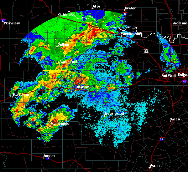 At 615 am cdt, a severe thunderstorm capable of producing a tornado was located near nugent, or 11 miles north of abilene, moving north at 25 mph (radar indicated rotation). Hazards include tornado and quarter size hail. Flying debris will be dangerous to those caught without shelter. mobile homes will be damaged or destroyed. damage to roofs, windows, and vehicles will occur. tree damage is likely. this dangerous storm will be near, nugent around 630 am cdt. Other locations impacted by this tornadic thunderstorm include the intersection of us-180 and farm road 600 and lake fort phantom hill. At 615 am cdt, a severe thunderstorm capable of producing a tornado was located near nugent, or 11 miles north of abilene, moving north at 25 mph (radar indicated rotation). Hazards include tornado and quarter size hail. Flying debris will be dangerous to those caught without shelter. mobile homes will be damaged or destroyed. damage to roofs, windows, and vehicles will occur. tree damage is likely. this dangerous storm will be near, nugent around 630 am cdt. Other locations impacted by this tornadic thunderstorm include the intersection of us-180 and farm road 600 and lake fort phantom hill.
|
| 5/18/2019 6:06 AM CDT |
 At 606 am cdt, a severe thunderstorm capable of producing a tornado was located near abilene, moving northeast at 30 mph (radar indicated rotation). Hazards include tornado and quarter size hail. Flying debris will be dangerous to those caught without shelter. mobile homes will be damaged or destroyed. damage to roofs, windows, and vehicles will occur. tree damage is likely. this tornadic thunderstorm will remain over mainly rural areas of southeastern jones and northeastern taylor counties, including the following locations, impact and lake fort phantom hill. This includes interstate 20 between mile markers 281 and 290. At 606 am cdt, a severe thunderstorm capable of producing a tornado was located near abilene, moving northeast at 30 mph (radar indicated rotation). Hazards include tornado and quarter size hail. Flying debris will be dangerous to those caught without shelter. mobile homes will be damaged or destroyed. damage to roofs, windows, and vehicles will occur. tree damage is likely. this tornadic thunderstorm will remain over mainly rural areas of southeastern jones and northeastern taylor counties, including the following locations, impact and lake fort phantom hill. This includes interstate 20 between mile markers 281 and 290.
|
| 5/18/2019 5:55 AM CDT |
 At 555 am cdt, a severe thunderstorm was located over abilene, moving northeast at 25 mph (radar indicated). Hazards include 70 mph wind gusts and quarter size hail. Hail damage to vehicles is expected. expect considerable tree damage. wind damage is also likely to mobile homes, roofs, and outbuildings. this severe storm will be near, hamby around 620 am cdt. other locations impacted by this severe thunderstorm include impact, lake fort phantom hill, us-283 near the callahan- shackelford county line and the intersection of us- 180 and farm road 600. This includes interstate 20 between mile markers 277 and 292. At 555 am cdt, a severe thunderstorm was located over abilene, moving northeast at 25 mph (radar indicated). Hazards include 70 mph wind gusts and quarter size hail. Hail damage to vehicles is expected. expect considerable tree damage. wind damage is also likely to mobile homes, roofs, and outbuildings. this severe storm will be near, hamby around 620 am cdt. other locations impacted by this severe thunderstorm include impact, lake fort phantom hill, us-283 near the callahan- shackelford county line and the intersection of us- 180 and farm road 600. This includes interstate 20 between mile markers 277 and 292.
|
| 5/18/2019 5:45 AM CDT |
 At 545 am cdt, a severe thunderstorm capable of producing a tornado was located over dyess afb, or near abilene, moving northeast at 30 mph (radar indicated rotation). Hazards include tornado and quarter size hail. Flying debris will be dangerous to those caught without shelter. mobile homes will be damaged or destroyed. damage to roofs, windows, and vehicles will occur. tree damage is likely. this dangerous storm will be near, hamby around 610 am cdt. abilene around 615 am cdt. other locations impacted by this tornadic thunderstorm include impact and lake fort phantom hill. This includes interstate 20 between mile markers 276 and 292. At 545 am cdt, a severe thunderstorm capable of producing a tornado was located over dyess afb, or near abilene, moving northeast at 30 mph (radar indicated rotation). Hazards include tornado and quarter size hail. Flying debris will be dangerous to those caught without shelter. mobile homes will be damaged or destroyed. damage to roofs, windows, and vehicles will occur. tree damage is likely. this dangerous storm will be near, hamby around 610 am cdt. abilene around 615 am cdt. other locations impacted by this tornadic thunderstorm include impact and lake fort phantom hill. This includes interstate 20 between mile markers 276 and 292.
|
| 5/18/2019 5:40 AM CDT |
 At 539 am cdt, a severe thunderstorm was located over caps, or 8 miles southwest of abilene, moving northeast at 25 mph (radar indicated). Hazards include 70 mph wind gusts and quarter size hail. Hail damage to vehicles is expected. expect considerable tree damage. wind damage is also likely to mobile homes, roofs, and outbuildings. this severe thunderstorm will be near, wylie around 550 am cdt. hamby around 620 am cdt. other locations impacted by this severe thunderstorm include impact, hodges, lake fort phantom hill, us-283 near the callahan- shackelford county line, kirby lake and the intersection of us- 180 and farm road 600. This includes interstate 20 between mile markers 271 and 296. At 539 am cdt, a severe thunderstorm was located over caps, or 8 miles southwest of abilene, moving northeast at 25 mph (radar indicated). Hazards include 70 mph wind gusts and quarter size hail. Hail damage to vehicles is expected. expect considerable tree damage. wind damage is also likely to mobile homes, roofs, and outbuildings. this severe thunderstorm will be near, wylie around 550 am cdt. hamby around 620 am cdt. other locations impacted by this severe thunderstorm include impact, hodges, lake fort phantom hill, us-283 near the callahan- shackelford county line, kirby lake and the intersection of us- 180 and farm road 600. This includes interstate 20 between mile markers 271 and 296.
|
| 5/8/2019 12:45 AM CDT |
 At 1244 am cdt, a severe thunderstorm was located near hamby, or near abilene, moving northeast at 50 mph (radar indicated). Hazards include 60 mph wind gusts and nickel size hail. Expect damage to roofs, siding, and trees. this severe thunderstorm will be near, clyde around 1250 am cdt. baird around 100 am cdt. moran around 120 am cdt. ibex around 125 am cdt. other locations impacted by this severe thunderstorm include mccarty lake, us-283 near the callahan-shackelford county line and us- 180 near the shackelford-stephens county line. This includes interstate 20 between mile markers 286 and 307. At 1244 am cdt, a severe thunderstorm was located near hamby, or near abilene, moving northeast at 50 mph (radar indicated). Hazards include 60 mph wind gusts and nickel size hail. Expect damage to roofs, siding, and trees. this severe thunderstorm will be near, clyde around 1250 am cdt. baird around 100 am cdt. moran around 120 am cdt. ibex around 125 am cdt. other locations impacted by this severe thunderstorm include mccarty lake, us-283 near the callahan-shackelford county line and us- 180 near the shackelford-stephens county line. This includes interstate 20 between mile markers 286 and 307.
|
| 5/8/2019 12:29 AM CDT |
 At 1229 am cdt, a severe thunderstorm was located near hamby, or 7 miles north of abilene, moving northeast at 55 mph (radar indicated). Hazards include 60 mph wind gusts and nickel size hail. Expect damage to roofs, siding, and trees. this severe thunderstorm will remain over mainly rural areas of taylor county, including the following locations, impact, lake abilene, camp tonkawa, shep, camp butman, kirby lake and ovalo. This includes interstate 20 between mile markers 262 and 287. At 1229 am cdt, a severe thunderstorm was located near hamby, or 7 miles north of abilene, moving northeast at 55 mph (radar indicated). Hazards include 60 mph wind gusts and nickel size hail. Expect damage to roofs, siding, and trees. this severe thunderstorm will remain over mainly rural areas of taylor county, including the following locations, impact, lake abilene, camp tonkawa, shep, camp butman, kirby lake and ovalo. This includes interstate 20 between mile markers 262 and 287.
|
| 5/8/2019 12:00 AM CDT |
 At 1200 am cdt, a severe thunderstorm was located near coronados camp, or 20 miles southwest of abilene, moving northeast at 55 mph (radar indicated). Hazards include 70 mph wind gusts and nickel size hail. Expect considerable tree damage. damage is likely to mobile homes, roofs, and outbuildings. this severe thunderstorm will be near, merkel and view around 1210 am cdt. wylie, tye, dyess afb and caps around 1215 am cdt. abilene around 1235 am cdt. other locations impacted by this severe thunderstorm include impact, lake abilene, camp tonkawa, shep, camp butman, kirby lake and ovalo. This includes interstate 20 between mile markers 258 and 287. At 1200 am cdt, a severe thunderstorm was located near coronados camp, or 20 miles southwest of abilene, moving northeast at 55 mph (radar indicated). Hazards include 70 mph wind gusts and nickel size hail. Expect considerable tree damage. damage is likely to mobile homes, roofs, and outbuildings. this severe thunderstorm will be near, merkel and view around 1210 am cdt. wylie, tye, dyess afb and caps around 1215 am cdt. abilene around 1235 am cdt. other locations impacted by this severe thunderstorm include impact, lake abilene, camp tonkawa, shep, camp butman, kirby lake and ovalo. This includes interstate 20 between mile markers 258 and 287.
|
| 5/1/2019 11:43 PM CDT |
 At 1142 pm cdt, a severe thunderstorm was located near hamby, or near clyde, moving east at 25 mph (radar indicated). Hazards include 60 mph wind gusts and quarter size hail. Hail damage to vehicles is expected. expect wind damage to roofs, siding, and trees. This severe storm will be near, clyde and eula around 1150 pm cdt. At 1142 pm cdt, a severe thunderstorm was located near hamby, or near clyde, moving east at 25 mph (radar indicated). Hazards include 60 mph wind gusts and quarter size hail. Hail damage to vehicles is expected. expect wind damage to roofs, siding, and trees. This severe storm will be near, clyde and eula around 1150 pm cdt.
|
| 5/1/2019 11:23 PM CDT |
 At 1122 pm cdt, a severe thunderstorm was located near abilene, moving east at 25 mph (radar indicated). Hazards include 60 mph wind gusts and quarter size hail. Hail damage to vehicles is expected. expect wind damage to roofs, siding, and trees. this severe thunderstorm will be near, hamby around 1130 pm cdt. potosi around 1140 pm cdt. clyde and eula around 1155 pm cdt. other locations impacted by this severe thunderstorm include impact, lake fort phantom hill and kirby lake. This includes interstate 20 between mile markers 281 and 302. At 1122 pm cdt, a severe thunderstorm was located near abilene, moving east at 25 mph (radar indicated). Hazards include 60 mph wind gusts and quarter size hail. Hail damage to vehicles is expected. expect wind damage to roofs, siding, and trees. this severe thunderstorm will be near, hamby around 1130 pm cdt. potosi around 1140 pm cdt. clyde and eula around 1155 pm cdt. other locations impacted by this severe thunderstorm include impact, lake fort phantom hill and kirby lake. This includes interstate 20 between mile markers 281 and 302.
|
| 5/1/2019 10:55 PM CDT |
 At 1054 pm cdt, a severe thunderstorm was located over hawley, or 10 miles north of abilene, moving east at 25 mph (radar indicated). Hazards include 60 mph wind gusts and quarter size hail. Hail damage to vehicles is expected. expect wind damage to roofs, siding, and trees. this severe storm will be near, abilene around 1110 pm cdt. Other locations impacted by this severe thunderstorm include impact, hodges, stith and truby. At 1054 pm cdt, a severe thunderstorm was located over hawley, or 10 miles north of abilene, moving east at 25 mph (radar indicated). Hazards include 60 mph wind gusts and quarter size hail. Hail damage to vehicles is expected. expect wind damage to roofs, siding, and trees. this severe storm will be near, abilene around 1110 pm cdt. Other locations impacted by this severe thunderstorm include impact, hodges, stith and truby.
|
| 5/1/2019 10:30 PM CDT |
 At 1030 pm cdt, a severe thunderstorm was located near noodle, or 9 miles south of anson, moving east at 35 mph (radar indicated). Hazards include 60 mph wind gusts and half dollar size hail. Hail damage to vehicles is expected. expect wind damage to roofs, siding, and trees. this severe thunderstorm will be near, hawley around 1045 pm cdt. abilene around 1100 pm cdt. other locations impacted by this severe thunderstorm include impact, hodges, stith and truby. This includes interstate 20 between mile markers 282 and 285. At 1030 pm cdt, a severe thunderstorm was located near noodle, or 9 miles south of anson, moving east at 35 mph (radar indicated). Hazards include 60 mph wind gusts and half dollar size hail. Hail damage to vehicles is expected. expect wind damage to roofs, siding, and trees. this severe thunderstorm will be near, hawley around 1045 pm cdt. abilene around 1100 pm cdt. other locations impacted by this severe thunderstorm include impact, hodges, stith and truby. This includes interstate 20 between mile markers 282 and 285.
|
| 4/27/2019 8:34 PM CDT |
 At 833 pm cdt, a severe thunderstorm was located 8 miles northeast of hamby, or 14 miles north of clyde, moving southeast at 35 mph (radar indicated). Hazards include 70 mph wind gusts and half dollar size hail. Hail damage to vehicles is expected. expect considerable tree damage. wind damage is also likely to mobile homes, roofs, and outbuildings. this severe thunderstorm will remain over mainly rural areas of northwestern callahan, southeastern jones and southern shackelford counties, including the following locations, mccarty lake and us-283 near the callahan-shackelford county line. This includes interstate 20 between mile markers 299 and 314. At 833 pm cdt, a severe thunderstorm was located 8 miles northeast of hamby, or 14 miles north of clyde, moving southeast at 35 mph (radar indicated). Hazards include 70 mph wind gusts and half dollar size hail. Hail damage to vehicles is expected. expect considerable tree damage. wind damage is also likely to mobile homes, roofs, and outbuildings. this severe thunderstorm will remain over mainly rural areas of northwestern callahan, southeastern jones and southern shackelford counties, including the following locations, mccarty lake and us-283 near the callahan-shackelford county line. This includes interstate 20 between mile markers 299 and 314.
|
| 4/27/2019 8:27 PM CDT |
 At 827 pm cdt, a severe thunderstorm was located near nugent, or 15 miles northeast of abilene, moving east at 35 mph (radar indicated). Hazards include 70 mph wind gusts and half dollar size hail. Hail damage to vehicles is expected. expect considerable tree damage. wind damage is also likely to mobile homes, roofs, and outbuildings. This severe thunderstorm will remain over mainly rural areas of eastern jones, west central shackelford and north central taylor counties, including the following locations, funston, impact, hodges, lake fort phantom hill, truby and the intersection of us-180 and farm road 600. At 827 pm cdt, a severe thunderstorm was located near nugent, or 15 miles northeast of abilene, moving east at 35 mph (radar indicated). Hazards include 70 mph wind gusts and half dollar size hail. Hail damage to vehicles is expected. expect considerable tree damage. wind damage is also likely to mobile homes, roofs, and outbuildings. This severe thunderstorm will remain over mainly rural areas of eastern jones, west central shackelford and north central taylor counties, including the following locations, funston, impact, hodges, lake fort phantom hill, truby and the intersection of us-180 and farm road 600.
|
| 4/27/2019 8:08 PM CDT |
 At 808 pm cdt, a severe thunderstorm was located near anson, moving southeast at 30 mph (radar indicated). Hazards include two inch hail and 70 mph wind gusts. People and animals outdoors will be injured. expect hail damage to roofs, siding, windows, and vehicles. expect considerable tree damage. wind damage is also likely to mobile homes, roofs, and outbuildings. this severe thunderstorm will be near, hawley around 820 pm cdt. nugent around 825 pm cdt. abilene around 830 pm cdt. other locations impacted by this severe thunderstorm include funston, impact, hodges, lake fort phantom hill, truby and the intersection of us-180 and farm road 600. This includes interstate 20 between mile markers 280 and 284. At 808 pm cdt, a severe thunderstorm was located near anson, moving southeast at 30 mph (radar indicated). Hazards include two inch hail and 70 mph wind gusts. People and animals outdoors will be injured. expect hail damage to roofs, siding, windows, and vehicles. expect considerable tree damage. wind damage is also likely to mobile homes, roofs, and outbuildings. this severe thunderstorm will be near, hawley around 820 pm cdt. nugent around 825 pm cdt. abilene around 830 pm cdt. other locations impacted by this severe thunderstorm include funston, impact, hodges, lake fort phantom hill, truby and the intersection of us-180 and farm road 600. This includes interstate 20 between mile markers 280 and 284.
|
| 4/23/2019 5:28 PM CDT |
 At 528 pm cdt, a severe thunderstorm was located near wylie, or 8 miles south of abilene, moving northeast at 15 mph (radar indicated). Hazards include 60 mph wind gusts and quarter size hail. Hail damage to vehicles is expected. Expect wind damage to roofs, siding, and trees. At 528 pm cdt, a severe thunderstorm was located near wylie, or 8 miles south of abilene, moving northeast at 15 mph (radar indicated). Hazards include 60 mph wind gusts and quarter size hail. Hail damage to vehicles is expected. Expect wind damage to roofs, siding, and trees.
|
| 4/23/2019 4:59 PM CDT |
 At 457 pm cdt, a severe thunderstorm was located near coronados camp, or 17 miles southwest of abilene, moving east at 35 mph. this storm has a history of producing golf ball size hail. this is a very dangerous storm (radar indicated). Hazards include baseball size hail and 60 mph wind gusts. People and animals outdoors will be severely injured. expect shattered windows, extensive damage to roofs, siding, and vehicles. Locations impacted include, abilene, wylie, tye, buffalo gap, potosi, view, hamby, coronados camp, caps, dyess afb, impact, lake abilene, camp tonkawa, lake fort phantom hill and kirby lake. At 457 pm cdt, a severe thunderstorm was located near coronados camp, or 17 miles southwest of abilene, moving east at 35 mph. this storm has a history of producing golf ball size hail. this is a very dangerous storm (radar indicated). Hazards include baseball size hail and 60 mph wind gusts. People and animals outdoors will be severely injured. expect shattered windows, extensive damage to roofs, siding, and vehicles. Locations impacted include, abilene, wylie, tye, buffalo gap, potosi, view, hamby, coronados camp, caps, dyess afb, impact, lake abilene, camp tonkawa, lake fort phantom hill and kirby lake.
|
| 4/23/2019 4:42 PM CDT |
 At 442 pm cdt, a severe thunderstorm was located 7 miles east of nolan, or 18 miles northeast of blackwell, moving east at 25 mph. this storm has a history of producing golf ball size hail. this is a very dangerous storm (radar indicated). Hazards include baseball size hail and 60 mph wind gusts. People and animals outdoors will be severely injured. expect shattered windows, extensive damage to roofs, siding, and vehicles. this severe thunderstorm will be near, coronados camp around 455 pm cdt. view around 515 pm cdt. buffalo gap, caps and dyess afb around 520 pm cdt. tye around 525 pm cdt. wylie around 530 pm cdt. hamby and potosi around 545 pm cdt. other locations impacted by this severe thunderstorm include impact, lake abilene, camp tonkawa, shep, lake fort phantom hill, camp butman and kirby lake. This includes interstate 20 between mile markers 269 and 292. At 442 pm cdt, a severe thunderstorm was located 7 miles east of nolan, or 18 miles northeast of blackwell, moving east at 25 mph. this storm has a history of producing golf ball size hail. this is a very dangerous storm (radar indicated). Hazards include baseball size hail and 60 mph wind gusts. People and animals outdoors will be severely injured. expect shattered windows, extensive damage to roofs, siding, and vehicles. this severe thunderstorm will be near, coronados camp around 455 pm cdt. view around 515 pm cdt. buffalo gap, caps and dyess afb around 520 pm cdt. tye around 525 pm cdt. wylie around 530 pm cdt. hamby and potosi around 545 pm cdt. other locations impacted by this severe thunderstorm include impact, lake abilene, camp tonkawa, shep, lake fort phantom hill, camp butman and kirby lake. This includes interstate 20 between mile markers 269 and 292.
|
| 4/23/2019 1:24 PM CDT |
 At 123 pm cdt, a severe thunderstorm was located near nugent, or 16 miles east of anson, moving northeast at 35 mph (radar indicated). Hazards include 60 mph wind gusts and half dollar size hail. Hail damage to vehicles is expected. expect wind damage to roofs, siding, and trees. this severe thunderstorm will be near, albany around 155 pm cdt. Other locations impacted by this severe thunderstorm include big country baptist assembly and the intersection of us- 180 and farm road 600. At 123 pm cdt, a severe thunderstorm was located near nugent, or 16 miles east of anson, moving northeast at 35 mph (radar indicated). Hazards include 60 mph wind gusts and half dollar size hail. Hail damage to vehicles is expected. expect wind damage to roofs, siding, and trees. this severe thunderstorm will be near, albany around 155 pm cdt. Other locations impacted by this severe thunderstorm include big country baptist assembly and the intersection of us- 180 and farm road 600.
|
| 4/6/2019 6:05 AM CDT |
 At 605 am cdt, a severe thunderstorm was located over caps, or 8 miles southwest of abilene, moving northeast at 45 mph (radar indicated). Hazards include 60 mph wind gusts. expect damage to roofs, siding, and trees At 605 am cdt, a severe thunderstorm was located over caps, or 8 miles southwest of abilene, moving northeast at 45 mph (radar indicated). Hazards include 60 mph wind gusts. expect damage to roofs, siding, and trees
|
| 3/13/2019 1:53 AM CDT |
 At 152 am cdt, severe thunderstorms were located along a line extending from 8 miles west of fort griffin to near albany to near lawn, moving east at 55 mph (radar indicated). Hazards include 60 mph wind gusts. Expect damage to roofs, siding, and trees. these severe storms will be near, albany and fort griffin around 200 am cdt. ibex around 205 am cdt. rowden around 215 am cdt. other locations impacted by these severe thunderstorms include impact, mccarty lake, admiral, big country baptist assembly, lake fort phantom hill, us-283 near the callahan- shackelford county line, kirby lake, the intersection of us- 180 and farm road 600, ovalo and i-20 near the callahan- eastland county line. A tornado watch remains in effect until 500 am cdt for west central texas. At 152 am cdt, severe thunderstorms were located along a line extending from 8 miles west of fort griffin to near albany to near lawn, moving east at 55 mph (radar indicated). Hazards include 60 mph wind gusts. Expect damage to roofs, siding, and trees. these severe storms will be near, albany and fort griffin around 200 am cdt. ibex around 205 am cdt. rowden around 215 am cdt. other locations impacted by these severe thunderstorms include impact, mccarty lake, admiral, big country baptist assembly, lake fort phantom hill, us-283 near the callahan- shackelford county line, kirby lake, the intersection of us- 180 and farm road 600, ovalo and i-20 near the callahan- eastland county line. A tornado watch remains in effect until 500 am cdt for west central texas.
|
| 3/13/2019 1:34 AM CDT |
 At 133 am cdt, severe thunderstorms were located along a line extending from near lake stamford marina to near nugent to near happy valley, moving east at 60 mph (radar indicated). Hazards include 60 mph wind gusts. Expect damage to roofs, siding, and trees. severe thunderstorms will be near, tuscola around 145 am cdt. albany and lawn around 150 am cdt. fort griffin around 155 am cdt. oplin, ibex and dudley around 200 am cdt. rowden around 215 am cdt. other locations impacted by these severe thunderstorms include funston, impact, lake abilene, mccarty lake, camp tonkawa, lake fort phantom hill, us-283 near the callahan- shackelford county line, the intersection of us- 180 and farm road 600, ovalo and i-20 near the callahan- eastland county line. this includes interstate 20 between mile markers 271 and 323. A tornado watch remains in effect until 500 am cdt for west central texas. At 133 am cdt, severe thunderstorms were located along a line extending from near lake stamford marina to near nugent to near happy valley, moving east at 60 mph (radar indicated). Hazards include 60 mph wind gusts. Expect damage to roofs, siding, and trees. severe thunderstorms will be near, tuscola around 145 am cdt. albany and lawn around 150 am cdt. fort griffin around 155 am cdt. oplin, ibex and dudley around 200 am cdt. rowden around 215 am cdt. other locations impacted by these severe thunderstorms include funston, impact, lake abilene, mccarty lake, camp tonkawa, lake fort phantom hill, us-283 near the callahan- shackelford county line, the intersection of us- 180 and farm road 600, ovalo and i-20 near the callahan- eastland county line. this includes interstate 20 between mile markers 271 and 323. A tornado watch remains in effect until 500 am cdt for west central texas.
|
| 3/13/2019 1:21 AM CDT |
 At 120 am cdt, severe thunderstorms were located along a line extending from 8 miles south of sagerton to near tye to near hylton, moving east at 65 mph (radar indicated). Hazards include 70 mph wind gusts. Expect considerable tree damage. damage is likely to mobile homes, roofs, and outbuildings. these severe storms will be near, tye and hawley around 125 am cdt. abilene around 130 am cdt. hamby and avoca around 135 am cdt. stamford and bradshaw around 140 am cdt. lawn around 145 am cdt. other locations impacted by these severe thunderstorms include funston, impact, the intersection of us- 180 and ranch road 126, lake abilene, camp tonkawa, tuxedo, shep, lake fort phantom hill, lake sweetwater and the intersection of us- 180 and farm road 600. A tornado watch remains in effect until 500 am cdt for west central texas. At 120 am cdt, severe thunderstorms were located along a line extending from 8 miles south of sagerton to near tye to near hylton, moving east at 65 mph (radar indicated). Hazards include 70 mph wind gusts. Expect considerable tree damage. damage is likely to mobile homes, roofs, and outbuildings. these severe storms will be near, tye and hawley around 125 am cdt. abilene around 130 am cdt. hamby and avoca around 135 am cdt. stamford and bradshaw around 140 am cdt. lawn around 145 am cdt. other locations impacted by these severe thunderstorms include funston, impact, the intersection of us- 180 and ranch road 126, lake abilene, camp tonkawa, tuxedo, shep, lake fort phantom hill, lake sweetwater and the intersection of us- 180 and farm road 600. A tornado watch remains in effect until 500 am cdt for west central texas.
|
| 3/13/2019 1:08 AM CDT |
 At 107 am cdt, severe thunderstorms were located along a line extending from 6 miles northeast of hamlin to near merkel to blackwell, moving east at 55 mph (radar indicated). Hazards include 70 mph wind gusts. Expect considerable tree damage. damage is likely to mobile homes, roofs, and outbuildings. these severe storms will be near, tye around 110 am cdt. hawley around 115 am cdt. abilene and happy valley around 125 am cdt. hamby and avoca around 125 am cdt. stamford and bradshaw around 130 am cdt. lawn around 135 am cdt. other locations impacted by these severe thunderstorms include funston, impact, the intersection of us- 180 and ranch road 126, lake abilene, camp tonkawa, hitson, tuxedo, shep, lake fort phantom hill and lake sweetwater. A tornado watch remains in effect until 500 am cdt for west central texas. At 107 am cdt, severe thunderstorms were located along a line extending from 6 miles northeast of hamlin to near merkel to blackwell, moving east at 55 mph (radar indicated). Hazards include 70 mph wind gusts. Expect considerable tree damage. damage is likely to mobile homes, roofs, and outbuildings. these severe storms will be near, tye around 110 am cdt. hawley around 115 am cdt. abilene and happy valley around 125 am cdt. hamby and avoca around 125 am cdt. stamford and bradshaw around 130 am cdt. lawn around 135 am cdt. other locations impacted by these severe thunderstorms include funston, impact, the intersection of us- 180 and ranch road 126, lake abilene, camp tonkawa, hitson, tuxedo, shep, lake fort phantom hill and lake sweetwater. A tornado watch remains in effect until 500 am cdt for west central texas.
|
| 3/13/2019 12:55 AM CDT |
 At 1254 am cdt, severe thunderstorms were located along a line extending from 10 miles west of hamlin to near trent to 6 miles northwest of blackwell, moving east at 50 mph (radar indicated). Hazards include 60 mph wind gusts. Expect damage to roofs, siding, and trees. severe thunderstorms will be near, trent and noodle around 100 am cdt. merkel around 105 am cdt. tye, happy valley and dyess afb around 115 am cdt. wylie around 115 am cdt. bradshaw around 120 am cdt. avoca, hamby and potosi around 125 am cdt. lawn around 130 am cdt. other locations impacted by these severe thunderstorms include funston, impact, the intersection of us- 180 and ranch road 126, lake abilene, camp tonkawa, hitson, tuxedo, shep, lake fort phantom hill and lake sweetwater. this includes interstate 20 between mile markers 251 and 293. A tornado watch remains in effect until 500 am cdt for west central texas. At 1254 am cdt, severe thunderstorms were located along a line extending from 10 miles west of hamlin to near trent to 6 miles northwest of blackwell, moving east at 50 mph (radar indicated). Hazards include 60 mph wind gusts. Expect damage to roofs, siding, and trees. severe thunderstorms will be near, trent and noodle around 100 am cdt. merkel around 105 am cdt. tye, happy valley and dyess afb around 115 am cdt. wylie around 115 am cdt. bradshaw around 120 am cdt. avoca, hamby and potosi around 125 am cdt. lawn around 130 am cdt. other locations impacted by these severe thunderstorms include funston, impact, the intersection of us- 180 and ranch road 126, lake abilene, camp tonkawa, hitson, tuxedo, shep, lake fort phantom hill and lake sweetwater. this includes interstate 20 between mile markers 251 and 293. A tornado watch remains in effect until 500 am cdt for west central texas.
|
| 12/26/2018 4:41 PM CST |
 At 440 pm cst, severe thunderstorms were located along a line extending from near lake stamford marina to 6 miles southeast of lawn, moving east at 35 mph (radar indicated). Hazards include 60 to 65 mph wind gusts. Expect damage to roofs, siding, and trees. severe thunderstorms will be near, oplin around 450 pm cst. rowden around 510 pm cst. fort griffin around 520 pm cst. cross plains around 530 pm cst. other locations impacted by these severe thunderstorms include impact, mccarty lake, admiral, big country baptist assembly, lake fort phantom hill, us-283 near the callahan- shackelford county line, kirby lake, us-180 near the shackelford- stephens county line, the intersection of us- 180 and farm road 600 and i-20 near the callahan- eastland county line. this includes interstate 20 between mile markers 283 and 323. A tornado watch remains in effect until 1000 pm cst for west central texas. At 440 pm cst, severe thunderstorms were located along a line extending from near lake stamford marina to 6 miles southeast of lawn, moving east at 35 mph (radar indicated). Hazards include 60 to 65 mph wind gusts. Expect damage to roofs, siding, and trees. severe thunderstorms will be near, oplin around 450 pm cst. rowden around 510 pm cst. fort griffin around 520 pm cst. cross plains around 530 pm cst. other locations impacted by these severe thunderstorms include impact, mccarty lake, admiral, big country baptist assembly, lake fort phantom hill, us-283 near the callahan- shackelford county line, kirby lake, us-180 near the shackelford- stephens county line, the intersection of us- 180 and farm road 600 and i-20 near the callahan- eastland county line. this includes interstate 20 between mile markers 283 and 323. A tornado watch remains in effect until 1000 pm cst for west central texas.
|
| 12/26/2018 4:34 PM CST |
 At 432 pm cst, severe thunderstorms were located along a line extending from near avoca to 6 miles west of novice, moving east at 35 mph. expect wind gusts of 60 to 65 mph in abilene (radar indicated). Hazards include 60 mph wind gusts. Expect damage to roofs, siding, and trees. these severe storms will be near, stamford around 445 pm cst. oplin around 450 pm cst. other locations impacted by these severe thunderstorms include funston, impact, the intersection of us- 180 and ranch road 126, lake abilene, camp tonkawa, tuxedo, shep, lake fort phantom hill, the intersection of us- 180 and farm road 600 and ovalo. A tornado watch remains in effect until 1000 pm cst for west central texas. At 432 pm cst, severe thunderstorms were located along a line extending from near avoca to 6 miles west of novice, moving east at 35 mph. expect wind gusts of 60 to 65 mph in abilene (radar indicated). Hazards include 60 mph wind gusts. Expect damage to roofs, siding, and trees. these severe storms will be near, stamford around 445 pm cst. oplin around 450 pm cst. other locations impacted by these severe thunderstorms include funston, impact, the intersection of us- 180 and ranch road 126, lake abilene, camp tonkawa, tuxedo, shep, lake fort phantom hill, the intersection of us- 180 and farm road 600 and ovalo. A tornado watch remains in effect until 1000 pm cst for west central texas.
|
| 12/26/2018 4:32 PM CST | Strong thunderstorm winds damaged a fence at a residence in abilen in taylor county TX, 3 miles N of Abilene, TX |
| 12/26/2018 4:20 PM CST |
 At 419 pm cst, severe thunderstorms were located along a line extending from near stamford to 6 miles southeast of bradshaw, moving east at 35 mph (radar indicated). Hazards include 60 mph wind gusts. Expect damage to roofs, siding, and trees. severe thunderstorms will be near, avoca around 435 pm cst. stamford around 445 pm cst abilene around 440 pm cst other locations impacted by these severe thunderstorms include funston, impact, the intersection of us- 180 and ranch road 126, lake abilene, camp tonkawa, tuxedo, shep, lake fort phantom hill, the intersection of us- 180 and farm road 600 and ovalo. this includes interstate 20 between mile markers 261 and 302. A tornado watch remains in effect until 1000 pm cst for west central texas. At 419 pm cst, severe thunderstorms were located along a line extending from near stamford to 6 miles southeast of bradshaw, moving east at 35 mph (radar indicated). Hazards include 60 mph wind gusts. Expect damage to roofs, siding, and trees. severe thunderstorms will be near, avoca around 435 pm cst. stamford around 445 pm cst abilene around 440 pm cst other locations impacted by these severe thunderstorms include funston, impact, the intersection of us- 180 and ranch road 126, lake abilene, camp tonkawa, tuxedo, shep, lake fort phantom hill, the intersection of us- 180 and farm road 600 and ovalo. this includes interstate 20 between mile markers 261 and 302. A tornado watch remains in effect until 1000 pm cst for west central texas.
|
| 7/30/2018 7:12 AM CDT |
 The severe thunderstorm warning for callahan, southern jones, nolan, southern shackelford, southeastern fisher and taylor counties will expire at 715 am cdt, the storms which prompted the warning have weakened below severe limits, and no longer pose an immediate threat to life or property. therefore, the warning will be allowed to expire. however gusty winds are still possible with these thunderstorms. The severe thunderstorm warning for callahan, southern jones, nolan, southern shackelford, southeastern fisher and taylor counties will expire at 715 am cdt, the storms which prompted the warning have weakened below severe limits, and no longer pose an immediate threat to life or property. therefore, the warning will be allowed to expire. however gusty winds are still possible with these thunderstorms.
|
| 7/30/2018 6:52 AM CDT |
 At 650 am cdt, a severe thunderstorm was located 8 miles southwest of merkel, or 20 miles east of sweetwater, moving south at 20 mph (radar indicated). Hazards include 60 mph wind gusts. Expect damage to roofs, siding, and trees. this severe storm will be near, coronados camp around 705 am cdt. happy valley around 715 am cdt. Other locations impacted by this severe thunderstorm include funston, shep, lake sweetwater, the intersection of us- 180 and farm road 600, admiral, camp butman, the intersection of ranch road 608 and highway 147, camp boothe oaks, impact and the intersection of us-180 and ranch road 126. At 650 am cdt, a severe thunderstorm was located 8 miles southwest of merkel, or 20 miles east of sweetwater, moving south at 20 mph (radar indicated). Hazards include 60 mph wind gusts. Expect damage to roofs, siding, and trees. this severe storm will be near, coronados camp around 705 am cdt. happy valley around 715 am cdt. Other locations impacted by this severe thunderstorm include funston, shep, lake sweetwater, the intersection of us- 180 and farm road 600, admiral, camp butman, the intersection of ranch road 608 and highway 147, camp boothe oaks, impact and the intersection of us-180 and ranch road 126.
|
| 7/30/2018 6:27 AM CDT |
 At 622 am cdt, a severe thunderstorm was located 8 miles northwest of trent, or 12 miles northeast of sweetwater, moving south at 20 mph (radar indicated). Hazards include 60 mph wind gusts. Expect damage to roofs, siding, and trees. this severe thunderstorm will be near, abilene around 630 am cdt. trent around 630 am cdt. nolan around 645 am cdt. coronados camp around 650 am cdt. happy valley around 700 am cdt. bradshaw around 705 am cdt. This includes interstate 20 between mile markers 229 and 323. At 622 am cdt, a severe thunderstorm was located 8 miles northwest of trent, or 12 miles northeast of sweetwater, moving south at 20 mph (radar indicated). Hazards include 60 mph wind gusts. Expect damage to roofs, siding, and trees. this severe thunderstorm will be near, abilene around 630 am cdt. trent around 630 am cdt. nolan around 645 am cdt. coronados camp around 650 am cdt. happy valley around 700 am cdt. bradshaw around 705 am cdt. This includes interstate 20 between mile markers 229 and 323.
|
| 6/30/2018 10:51 PM CDT |
 At 1051 pm cdt, a severe thunderstorm was located over wylie, or 8 miles southwest of abilene, moving northeast at 15 mph (radar indicated). Hazards include 60 mph wind gusts. Expect damage to roofs, siding, and trees. this severe thunderstorm will be near, wylie and dyess afb around 1100 pm cdt. tye around 1110 pm cdt. potosi around 1115 pm cdt. hamby around 1130 pm cdt. other locations impacted by this severe thunderstorm include impact and kirby lake. This includes interstate 20 between mile markers 278 and 301. At 1051 pm cdt, a severe thunderstorm was located over wylie, or 8 miles southwest of abilene, moving northeast at 15 mph (radar indicated). Hazards include 60 mph wind gusts. Expect damage to roofs, siding, and trees. this severe thunderstorm will be near, wylie and dyess afb around 1100 pm cdt. tye around 1110 pm cdt. potosi around 1115 pm cdt. hamby around 1130 pm cdt. other locations impacted by this severe thunderstorm include impact and kirby lake. This includes interstate 20 between mile markers 278 and 301.
|
| 6/7/2018 10:41 PM CDT |
 At 1040 pm cdt, a severe thunderstorm was located over lawn, or 17 miles northeast of winters, moving south at 25 mph. although storms across the warned area have weakened, wind gusts to near 60 mph or hail up to quarter size are still possible in the stronger storms (radar indicated). Hazards include 60 mph wind gusts and quarter size hail. Hail damage to vehicles is expected. expect wind damage to roofs, siding, and trees. this severe storm will be near, novice and crews around 1100 pm cdt. Other locations impacted by this severe thunderstorm include impact, lake abilene, camp tonkawa, shep, wilmeth, lake fort phantom hill, ovalo, hodges, drasco and pumphrey. At 1040 pm cdt, a severe thunderstorm was located over lawn, or 17 miles northeast of winters, moving south at 25 mph. although storms across the warned area have weakened, wind gusts to near 60 mph or hail up to quarter size are still possible in the stronger storms (radar indicated). Hazards include 60 mph wind gusts and quarter size hail. Hail damage to vehicles is expected. expect wind damage to roofs, siding, and trees. this severe storm will be near, novice and crews around 1100 pm cdt. Other locations impacted by this severe thunderstorm include impact, lake abilene, camp tonkawa, shep, wilmeth, lake fort phantom hill, ovalo, hodges, drasco and pumphrey.
|
| 6/7/2018 9:59 PM CDT |
 The national weather service in san angelo has issued a * severe thunderstorm warning for. northeastern coke county in west central texas. western callahan county in west central texas. southern jones county in west central texas. Northwestern coleman county in west central texas. The national weather service in san angelo has issued a * severe thunderstorm warning for. northeastern coke county in west central texas. western callahan county in west central texas. southern jones county in west central texas. Northwestern coleman county in west central texas.
|
| 6/7/2018 9:49 PM CDT |
 At 948 pm cdt, a severe thunderstorm was located over dyess afb, or 7 miles west of abilene, moving south at 25 mph. the dyess asos reported a wind gust to 82 mph at 9:39 mph. this is a very dangerous storm (radar indicated). Hazards include 80 mph wind gusts and ping pong ball size hail. Flying debris will be dangerous to those caught without shelter. mobile homes will be heavily damaged. expect considerable damage to roofs, windows, and vehicles. extensive tree damage and power outages are likely. this severe storm will be near, wylie around 955 pm cdt. buffalo gap and view around 1000 pm cdt. Other locations impacted by this severe thunderstorm include funston, impact, hodges, the intersection of us- 180 and ranch road 126, lake abilene, camp tonkawa, lake fort phantom hill, camp butman, kirby lake and stith. At 948 pm cdt, a severe thunderstorm was located over dyess afb, or 7 miles west of abilene, moving south at 25 mph. the dyess asos reported a wind gust to 82 mph at 9:39 mph. this is a very dangerous storm (radar indicated). Hazards include 80 mph wind gusts and ping pong ball size hail. Flying debris will be dangerous to those caught without shelter. mobile homes will be heavily damaged. expect considerable damage to roofs, windows, and vehicles. extensive tree damage and power outages are likely. this severe storm will be near, wylie around 955 pm cdt. buffalo gap and view around 1000 pm cdt. Other locations impacted by this severe thunderstorm include funston, impact, hodges, the intersection of us- 180 and ranch road 126, lake abilene, camp tonkawa, lake fort phantom hill, camp butman, kirby lake and stith.
|
| 6/7/2018 9:45 PM CDT |
 At 944 pm cdt, a severe thunderstorm was located 7 miles west of moran, or 10 miles northeast of baird, moving south at 25 mph (radar indicated). Hazards include 70 mph wind gusts and quarter size hail. Hail damage to vehicles is expected. expect considerable tree damage. wind damage is also likely to mobile homes, roofs, and outbuildings. this severe thunderstorm will be near, baird around 1000 pm cdt. putnam around 1010 pm cdt. atwell and rowden around 1030 pm cdt. other locations impacted by this severe thunderstorm include mccarty lake, us-283 near the callahan-shackelford county line, us- 180 near the shackelford-stephens county line, admiral and i- 20 near the callahan-eastland county line. This includes interstate 20 between mile markers 293 and 323. At 944 pm cdt, a severe thunderstorm was located 7 miles west of moran, or 10 miles northeast of baird, moving south at 25 mph (radar indicated). Hazards include 70 mph wind gusts and quarter size hail. Hail damage to vehicles is expected. expect considerable tree damage. wind damage is also likely to mobile homes, roofs, and outbuildings. this severe thunderstorm will be near, baird around 1000 pm cdt. putnam around 1010 pm cdt. atwell and rowden around 1030 pm cdt. other locations impacted by this severe thunderstorm include mccarty lake, us-283 near the callahan-shackelford county line, us- 180 near the shackelford-stephens county line, admiral and i- 20 near the callahan-eastland county line. This includes interstate 20 between mile markers 293 and 323.
|
| 6/7/2018 9:43 PM CDT | Storm damage reported in taylor county TX, 8.8 miles NE of Abilene, TX |
| 6/7/2018 9:31 PM CDT |
 A severe thunderstorm warning remains in effect until 1000 pm cdt for jones. east central nolan and taylor counties. at 929 pm cdt, a severe thunderstorm was located near abilene, moving south at 30 mph. hazard. 70 mph wind gusts and ping pong ball size hail. source. Radar indicated. A severe thunderstorm warning remains in effect until 1000 pm cdt for jones. east central nolan and taylor counties. at 929 pm cdt, a severe thunderstorm was located near abilene, moving south at 30 mph. hazard. 70 mph wind gusts and ping pong ball size hail. source. Radar indicated.
|
| 6/7/2018 9:20 PM CDT |
 At 917 pm cdt, a severe thunderstorm was located near hawley, or 7 miles northwest of abilene, moving south at 30 mph. the public reported quarter size hail and estimated 70 mph winds in hawley at 910 pm cdt. the city of abilene is also in the path of this storm, with the western portions of the city most likely to see the strongest winds and largest hail (radar indicated). Hazards include 70 mph wind gusts and quarter size hail. Hail damage to vehicles is expected. expect considerable tree damage. wind damage is also likely to mobile homes, roofs, and outbuildings. this severe storm will be near, tye around 925 pm cdt. dyess afb around 930 pm cdt. wylie, caps and view around 940 pm cdt. potosi around 945 pm cdt. buffalo gap around 950 pm cdt. tuscola around 1000 pm cdt. Other locations impacted by this severe thunderstorm include funston, impact, the intersection of us- 180 and ranch road 126, lake abilene, camp tonkawa, lake fort phantom hill, the intersection of us- 180 and farm road 600, hodges, big country baptist assembly and camp butman. At 917 pm cdt, a severe thunderstorm was located near hawley, or 7 miles northwest of abilene, moving south at 30 mph. the public reported quarter size hail and estimated 70 mph winds in hawley at 910 pm cdt. the city of abilene is also in the path of this storm, with the western portions of the city most likely to see the strongest winds and largest hail (radar indicated). Hazards include 70 mph wind gusts and quarter size hail. Hail damage to vehicles is expected. expect considerable tree damage. wind damage is also likely to mobile homes, roofs, and outbuildings. this severe storm will be near, tye around 925 pm cdt. dyess afb around 930 pm cdt. wylie, caps and view around 940 pm cdt. potosi around 945 pm cdt. buffalo gap around 950 pm cdt. tuscola around 1000 pm cdt. Other locations impacted by this severe thunderstorm include funston, impact, the intersection of us- 180 and ranch road 126, lake abilene, camp tonkawa, lake fort phantom hill, the intersection of us- 180 and farm road 600, hodges, big country baptist assembly and camp butman.
|
| 6/7/2018 9:07 PM CDT |
 At 907 pm cdt, a severe thunderstorm was located over hawley, or 11 miles northwest of abilene, moving south at 30 mph (radar indicated). Hazards include 60 mph wind gusts and quarter size hail. Hail damage to vehicles is expected. expect wind damage to roofs, siding, and trees. this severe thunderstorm will be near, tye around 925 pm cdt. dyess afb around 930 pm cdt. wylie and caps around 940 pm cdt. view and potosi around 945 pm cdt. buffalo gap around 950 pm cdt. tuscola around 1000 pm cdt. other locations impacted by this severe thunderstorm include funston, impact, the intersection of us- 180 and ranch road 126, lake abilene, camp tonkawa, lake fort phantom hill, the intersection of us- 180 and farm road 600, hodges, big country baptist assembly and camp butman. This includes interstate 20 between mile markers 261 and 293. At 907 pm cdt, a severe thunderstorm was located over hawley, or 11 miles northwest of abilene, moving south at 30 mph (radar indicated). Hazards include 60 mph wind gusts and quarter size hail. Hail damage to vehicles is expected. expect wind damage to roofs, siding, and trees. this severe thunderstorm will be near, tye around 925 pm cdt. dyess afb around 930 pm cdt. wylie and caps around 940 pm cdt. view and potosi around 945 pm cdt. buffalo gap around 950 pm cdt. tuscola around 1000 pm cdt. other locations impacted by this severe thunderstorm include funston, impact, the intersection of us- 180 and ranch road 126, lake abilene, camp tonkawa, lake fort phantom hill, the intersection of us- 180 and farm road 600, hodges, big country baptist assembly and camp butman. This includes interstate 20 between mile markers 261 and 293.
|
| 6/7/2018 8:21 PM CDT |
 At 821 pm cdt, severe thunderstorms were located along a line extending from mccaulley to near albany, moving south at 35 mph. a trained spotter reported half dollar size hail in stamford at 820 pm (radar indicated). Hazards include 70 mph wind gusts and half dollar size hail. Hail damage to vehicles is expected. expect considerable tree damage. wind damage is also likely to mobile homes, roofs, and outbuildings. these severe storms will be near, albany around 830 pm cdt. ibex around 835 pm cdt. noodle around 845 pm cdt. moran around 850 pm cdt. trent around 855 pm cdt. merkel and putnam around 900 pm cdt. Other locations impacted by these severe thunderstorms include funston, impact, the intersection of us- 180 and ranch road 126, lake abilene, mccarty lake, camp tonkawa, hitson, lusk, tuxedo and lake fort phantom hill. At 821 pm cdt, severe thunderstorms were located along a line extending from mccaulley to near albany, moving south at 35 mph. a trained spotter reported half dollar size hail in stamford at 820 pm (radar indicated). Hazards include 70 mph wind gusts and half dollar size hail. Hail damage to vehicles is expected. expect considerable tree damage. wind damage is also likely to mobile homes, roofs, and outbuildings. these severe storms will be near, albany around 830 pm cdt. ibex around 835 pm cdt. noodle around 845 pm cdt. moran around 850 pm cdt. trent around 855 pm cdt. merkel and putnam around 900 pm cdt. Other locations impacted by these severe thunderstorms include funston, impact, the intersection of us- 180 and ranch road 126, lake abilene, mccarty lake, camp tonkawa, hitson, lusk, tuxedo and lake fort phantom hill.
|
| 6/7/2018 8:00 PM CDT |
 At 759 pm cdt, severe thunderstorms were located along a line extending from 7 miles northwest of hamlin to near fort griffin, moving south at 35 mph. an outflow boundary ahead of the thunderstorms will move approach abilene in the next 15 to 30 minutes, with wind gusts between 60 and 70 mph possible (radar indicated). Hazards include 70 mph wind gusts and quarter size hail. Hail damage to vehicles is expected. expect considerable tree damage. wind damage is also likely to mobile homes, roofs, and outbuildings. severe thunderstorms will be near, hamlin and fort griffin around 805 pm cdt. mccaulley and neinda around 820 pm cdt. albany and sylvester around 825 pm cdt. ibex around 835 pm cdt. noodle around 845 pm cdt. moran around 850 pm cdt. trent around 855 pm cdt. putnam around 900 pm cdt. other locations impacted by these severe thunderstorms include funston, impact, the intersection of us- 180 and ranch road 126, lake abilene, mccarty lake, camp tonkawa, hitson, lusk, tuxedo and lake fort phantom hill. This includes interstate 20 between mile markers 254 and 323. At 759 pm cdt, severe thunderstorms were located along a line extending from 7 miles northwest of hamlin to near fort griffin, moving south at 35 mph. an outflow boundary ahead of the thunderstorms will move approach abilene in the next 15 to 30 minutes, with wind gusts between 60 and 70 mph possible (radar indicated). Hazards include 70 mph wind gusts and quarter size hail. Hail damage to vehicles is expected. expect considerable tree damage. wind damage is also likely to mobile homes, roofs, and outbuildings. severe thunderstorms will be near, hamlin and fort griffin around 805 pm cdt. mccaulley and neinda around 820 pm cdt. albany and sylvester around 825 pm cdt. ibex around 835 pm cdt. noodle around 845 pm cdt. moran around 850 pm cdt. trent around 855 pm cdt. putnam around 900 pm cdt. other locations impacted by these severe thunderstorms include funston, impact, the intersection of us- 180 and ranch road 126, lake abilene, mccarty lake, camp tonkawa, hitson, lusk, tuxedo and lake fort phantom hill. This includes interstate 20 between mile markers 254 and 323.
|
| 6/7/2018 7:28 PM CDT |
 At 726 pm cdt, severe thunderstorms were located along a line extending from near irby to 6 miles northeast of aspermont, moving south at 35 mph. a trained spotter estimated a 65 mph wind gust in weinert at 715 pm cdt (trained weather spotters). Hazards include 70 mph wind gusts and quarter size hail. Hail damage to vehicles is expected. expect considerable tree damage. wind damage is also likely to mobile homes, roofs, and outbuildings. these severe storms will be near, stamford, lake stamford marina and paint creek around 750 pm cdt. hamlin around 800 pm cdt. Other locations impacted by these severe thunderstorms include funston, the intersection of us- 180 and ranch road 126, mccarty lake, us-183 near the throckmorton- baylor county line, hitson, lusk, tuxedo, the intersection of us- 283 and ranch road 209, us-180 near the shackelford- stephens county line and the intersection of us- 180 and farm road 600. At 726 pm cdt, severe thunderstorms were located along a line extending from near irby to 6 miles northeast of aspermont, moving south at 35 mph. a trained spotter estimated a 65 mph wind gust in weinert at 715 pm cdt (trained weather spotters). Hazards include 70 mph wind gusts and quarter size hail. Hail damage to vehicles is expected. expect considerable tree damage. wind damage is also likely to mobile homes, roofs, and outbuildings. these severe storms will be near, stamford, lake stamford marina and paint creek around 750 pm cdt. hamlin around 800 pm cdt. Other locations impacted by these severe thunderstorms include funston, the intersection of us- 180 and ranch road 126, mccarty lake, us-183 near the throckmorton- baylor county line, hitson, lusk, tuxedo, the intersection of us- 283 and ranch road 209, us-180 near the shackelford- stephens county line and the intersection of us- 180 and farm road 600.
|
| 6/7/2018 7:12 PM CDT |
 At 710 pm cdt, severe thunderstorms were located along a line extending from near millers creek reservoir to 13 miles northeast of swenson, moving south at 35 mph. in addition, an outflow boundary is moving into northern jones and shackelford counties, with wind gusts to near 70 mph possible (radar indicated). Hazards include 70 mph wind gusts and quarter size hail. Hail damage to vehicles is expected. expect considerable tree damage. wind damage is also likely to mobile homes, roofs, and outbuildings. severe thunderstorms will be near, irby around 730 pm cdt. stamford, lake stamford marina and paint creek around 750 pm cdt. hamlin around 800 pm cdt. Other locations impacted by these severe thunderstorms include funston, the intersection of us- 180 and ranch road 126, mccarty lake, us-183 near the throckmorton- baylor county line, hitson, lusk, tuxedo, the intersection of us- 283 and ranch road 209, us-180 near the shackelford- stephens county line and the intersection of us- 180 and farm road 600. At 710 pm cdt, severe thunderstorms were located along a line extending from near millers creek reservoir to 13 miles northeast of swenson, moving south at 35 mph. in addition, an outflow boundary is moving into northern jones and shackelford counties, with wind gusts to near 70 mph possible (radar indicated). Hazards include 70 mph wind gusts and quarter size hail. Hail damage to vehicles is expected. expect considerable tree damage. wind damage is also likely to mobile homes, roofs, and outbuildings. severe thunderstorms will be near, irby around 730 pm cdt. stamford, lake stamford marina and paint creek around 750 pm cdt. hamlin around 800 pm cdt. Other locations impacted by these severe thunderstorms include funston, the intersection of us- 180 and ranch road 126, mccarty lake, us-183 near the throckmorton- baylor county line, hitson, lusk, tuxedo, the intersection of us- 283 and ranch road 209, us-180 near the shackelford- stephens county line and the intersection of us- 180 and farm road 600.
|
| 6/5/2018 11:38 PM CDT |
 At 1137 pm cdt, a severe thunderstorm was located 8 miles north of baird, moving southeast at 45 mph (radar indicated). Hazards include 70 mph wind gusts and penny size hail. Expect considerable tree damage. damage is likely to mobile homes, roofs, and outbuildings. this severe storm will be near, baird around 1145 pm cdt. putnam around 1200 am cdt. Other locations impacted by this severe thunderstorm include funston, mccarty lake, admiral, big country baptist assembly, us- 283 near the callahan-shackelford county line, us- 180 near the shackelford- stephens county line, the intersection of us- 180 and farm road 600 and i-20 near the callahan- eastland county line. At 1137 pm cdt, a severe thunderstorm was located 8 miles north of baird, moving southeast at 45 mph (radar indicated). Hazards include 70 mph wind gusts and penny size hail. Expect considerable tree damage. damage is likely to mobile homes, roofs, and outbuildings. this severe storm will be near, baird around 1145 pm cdt. putnam around 1200 am cdt. Other locations impacted by this severe thunderstorm include funston, mccarty lake, admiral, big country baptist assembly, us- 283 near the callahan-shackelford county line, us- 180 near the shackelford- stephens county line, the intersection of us- 180 and farm road 600 and i-20 near the callahan- eastland county line.
|
| 6/5/2018 11:15 PM CDT |
 At 1112 pm cdt, a severe thunderstorm was located over nugent, or 15 miles east of anson, moving southeast at 45 mph (radar indicated). Hazards include 60 mph wind gusts and penny size hail. Expect damage to roofs, siding, and trees. this severe thunderstorm will be near, abilene around 1120 pm cdt. baird around 1145 pm cdt. putnam around 1200 am cdt. other locations impacted by this severe thunderstorm include funston, impact, mccarty lake, admiral, tuxedo, big country baptist assembly, lake fort phantom hill, us-283 near the callahan- shackelford county line, us-180 near the shackelford- stephens county line and the intersection of us- 180 and farm road 600. This includes interstate 20 between mile markers 284 and 323. At 1112 pm cdt, a severe thunderstorm was located over nugent, or 15 miles east of anson, moving southeast at 45 mph (radar indicated). Hazards include 60 mph wind gusts and penny size hail. Expect damage to roofs, siding, and trees. this severe thunderstorm will be near, abilene around 1120 pm cdt. baird around 1145 pm cdt. putnam around 1200 am cdt. other locations impacted by this severe thunderstorm include funston, impact, mccarty lake, admiral, tuxedo, big country baptist assembly, lake fort phantom hill, us-283 near the callahan- shackelford county line, us-180 near the shackelford- stephens county line and the intersection of us- 180 and farm road 600. This includes interstate 20 between mile markers 284 and 323.
|
| 6/4/2018 3:20 AM CDT | Storm damage reported in taylor county TX, 8.5 miles ENE of Abilene, TX |
| 5/25/2018 10:00 PM CDT |
 At 956 pm cdt, the leading edge of a band of a severe thunderstorm extended from abilene to 5 miles south of moran, and was moving south at 40 mph. the strongest thunderstorm with hail to ping pong ball size was along the border of southeastern jones and southwestern shackelford counties. the storm was moving southeast at 40 mph and will affect southwestern shackelford and northern callahan county (radar indicated). Hazards include 60 mph wind gusts and half dollar size hail. Hail damage to vehicles is expected. expect wind damage to roofs, siding, and trees. this severe storm will be near, clyde and potosi around 1005 pm cdt. eula around 1015 pm cdt. dudley around 1020 pm cdt. rowden around 1030 pm cdt. Other locations impacted by this severe thunderstorm include impact, hodges, lake abilene, mccarty lake, camp tonkawa, admiral, lake fort phantom hill, us-283 near the callahan- shackelford county line, kirby lake and us-180 near the shackelford- stephens county line. At 956 pm cdt, the leading edge of a band of a severe thunderstorm extended from abilene to 5 miles south of moran, and was moving south at 40 mph. the strongest thunderstorm with hail to ping pong ball size was along the border of southeastern jones and southwestern shackelford counties. the storm was moving southeast at 40 mph and will affect southwestern shackelford and northern callahan county (radar indicated). Hazards include 60 mph wind gusts and half dollar size hail. Hail damage to vehicles is expected. expect wind damage to roofs, siding, and trees. this severe storm will be near, clyde and potosi around 1005 pm cdt. eula around 1015 pm cdt. dudley around 1020 pm cdt. rowden around 1030 pm cdt. Other locations impacted by this severe thunderstorm include impact, hodges, lake abilene, mccarty lake, camp tonkawa, admiral, lake fort phantom hill, us-283 near the callahan- shackelford county line, kirby lake and us-180 near the shackelford- stephens county line.
|
| 5/25/2018 9:43 PM CDT |
 At 938 pm cdt, the leading edge of a band of a severe thunderstorm extended from just northwest of abilene to near moran, and was moving southeast at 40 mph. the thunderstorms with hail and rain were located about 10 miles behind the leading edge outflow (radar indicated). Hazards include 60 mph wind gusts and quarter size hail. Hail damage to vehicles is expected. expect wind damage to roofs, siding, and trees. this severe thunderstorm will be near, abilene around 945 pm cdt. hamby around 950 pm cdt. clyde and potosi around 1000 pm cdt. eula around 1010 pm cdt. dudley around 1015 pm cdt. oplin around 1030 pm cdt. other locations impacted by this severe thunderstorm include funston, impact, lake abilene, mccarty lake, camp tonkawa, lake fort phantom hill, us-283 near the callahan-shackelford county line, us- 180 near the shackelford- stephens county line, the intersection of us- 180 and farm road 600 and ovalo. This includes interstate 20 between mile markers 277 and 323. At 938 pm cdt, the leading edge of a band of a severe thunderstorm extended from just northwest of abilene to near moran, and was moving southeast at 40 mph. the thunderstorms with hail and rain were located about 10 miles behind the leading edge outflow (radar indicated). Hazards include 60 mph wind gusts and quarter size hail. Hail damage to vehicles is expected. expect wind damage to roofs, siding, and trees. this severe thunderstorm will be near, abilene around 945 pm cdt. hamby around 950 pm cdt. clyde and potosi around 1000 pm cdt. eula around 1010 pm cdt. dudley around 1015 pm cdt. oplin around 1030 pm cdt. other locations impacted by this severe thunderstorm include funston, impact, lake abilene, mccarty lake, camp tonkawa, lake fort phantom hill, us-283 near the callahan-shackelford county line, us- 180 near the shackelford- stephens county line, the intersection of us- 180 and farm road 600 and ovalo. This includes interstate 20 between mile markers 277 and 323.
|
| 5/24/2018 9:06 PM CDT | The abilene police dept. reported a utility pole down... in the buttonwillow area of abilen in taylor county TX, 3 miles N of Abilene, TX |
| 4/24/2018 7:50 PM CDT |
 At 750 pm cdt, a severe thunderstorm was located near hamby, or 12 miles northeast of abilene, moving east at 45 mph (radar indicated). Hazards include 60 mph wind gusts. Expect damage to roofs, siding, and trees. this severe thunderstorm will be near, moran around 830 pm cdt. other locations impacted by this severe thunderstorm include lake fort phantom hill, mccarty lake, us-283 near the callahan- shackelford county line and us-180 near the shackelford- stephens county line. This includes interstate 20 between mile markers 286 and 287. At 750 pm cdt, a severe thunderstorm was located near hamby, or 12 miles northeast of abilene, moving east at 45 mph (radar indicated). Hazards include 60 mph wind gusts. Expect damage to roofs, siding, and trees. this severe thunderstorm will be near, moran around 830 pm cdt. other locations impacted by this severe thunderstorm include lake fort phantom hill, mccarty lake, us-283 near the callahan- shackelford county line and us-180 near the shackelford- stephens county line. This includes interstate 20 between mile markers 286 and 287.
|
| 3/27/2018 12:35 AM CDT |
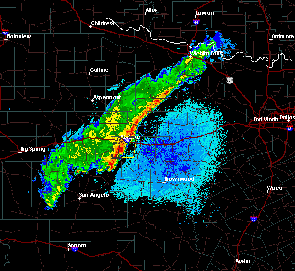 At 1234 am cdt, a severe thunderstorm was located over potosi, or 9 miles south of abilene, moving east at 30 mph (radar indicated). Hazards include 60 mph wind gusts and penny size hail. Expect damage to roofs, siding, and trees. this severe storm will be near, dudley around 1245 am cdt. eula around 1250 am cdt. clyde around 100 am cdt. Other locations impacted by this severe thunderstorm include ovalo and kirby lake. At 1234 am cdt, a severe thunderstorm was located over potosi, or 9 miles south of abilene, moving east at 30 mph (radar indicated). Hazards include 60 mph wind gusts and penny size hail. Expect damage to roofs, siding, and trees. this severe storm will be near, dudley around 1245 am cdt. eula around 1250 am cdt. clyde around 100 am cdt. Other locations impacted by this severe thunderstorm include ovalo and kirby lake.
|
| 3/27/2018 12:12 AM CDT |
 At 1211 am cdt, a severe thunderstorm was located near buffalo gap, or 15 miles southwest of abilene, moving east at 25 mph (radar indicated). Hazards include 60 mph wind gusts and half dollar size hail. Hail damage to vehicles is expected. expect wind damage to roofs, siding, and trees. this severe thunderstorm will be near, view around 1215 am cdt. tuscola and buffalo gap around 1220 am cdt. potosi and dudley around 1250 am cdt. clyde and eula around 100 am cdt. other locations impacted by this severe thunderstorm include lake abilene, camp tonkawa, kirby lake and ovalo. This includes interstate 20 between mile markers 286 and 302. At 1211 am cdt, a severe thunderstorm was located near buffalo gap, or 15 miles southwest of abilene, moving east at 25 mph (radar indicated). Hazards include 60 mph wind gusts and half dollar size hail. Hail damage to vehicles is expected. expect wind damage to roofs, siding, and trees. this severe thunderstorm will be near, view around 1215 am cdt. tuscola and buffalo gap around 1220 am cdt. potosi and dudley around 1250 am cdt. clyde and eula around 100 am cdt. other locations impacted by this severe thunderstorm include lake abilene, camp tonkawa, kirby lake and ovalo. This includes interstate 20 between mile markers 286 and 302.
|
| 10/21/2017 11:10 PM CDT |
 At 1109 pm cdt, a severe thunderstorm was located 7 miles southwest of albany, moving east at 30 mph. a trained spotter reported quarter size hail in abilene at 1108 pm (trained weather spotters). Hazards include 60 mph wind gusts and quarter size hail. Hail damage to vehicles is expected. expect wind damage to roofs, siding, and trees. this severe storm will be near, albany around 1125 pm cdt. ibex around 1140 pm cdt. Other locations impacted by this severe thunderstorm include impact, us-283 near the callahan- shackelford county line, lake fort phantom hill, kirby lake, mccarty lake and us-180 near the shackelford-stephens county line. At 1109 pm cdt, a severe thunderstorm was located 7 miles southwest of albany, moving east at 30 mph. a trained spotter reported quarter size hail in abilene at 1108 pm (trained weather spotters). Hazards include 60 mph wind gusts and quarter size hail. Hail damage to vehicles is expected. expect wind damage to roofs, siding, and trees. this severe storm will be near, albany around 1125 pm cdt. ibex around 1140 pm cdt. Other locations impacted by this severe thunderstorm include impact, us-283 near the callahan- shackelford county line, lake fort phantom hill, kirby lake, mccarty lake and us-180 near the shackelford-stephens county line.
|
| 10/21/2017 11:08 PM CDT | Quarter sized hail reported 3 miles N of Abilene, TX, quarter size hail in south abilene. |
| 10/21/2017 10:59 PM CDT |
 At 1059 pm cdt, a severe thunderstorm was located 11 miles east of nugent, or 12 miles southwest of albany, moving east at 30 mph (radar indicated). Hazards include 60 mph wind gusts and quarter size hail. Hail damage to vehicles is expected. expect wind damage to roofs, siding, and trees. this severe thunderstorm will be near, albany around 1125 pm cdt. ibex around 1140 pm cdt. other locations impacted by this severe thunderstorm include impact, us-283 near the callahan- shackelford county line, lake fort phantom hill, kirby lake, mccarty lake and us-180 near the shackelford-stephens county line. This includes interstate 20 between mile markers 278 and 310. At 1059 pm cdt, a severe thunderstorm was located 11 miles east of nugent, or 12 miles southwest of albany, moving east at 30 mph (radar indicated). Hazards include 60 mph wind gusts and quarter size hail. Hail damage to vehicles is expected. expect wind damage to roofs, siding, and trees. this severe thunderstorm will be near, albany around 1125 pm cdt. ibex around 1140 pm cdt. other locations impacted by this severe thunderstorm include impact, us-283 near the callahan- shackelford county line, lake fort phantom hill, kirby lake, mccarty lake and us-180 near the shackelford-stephens county line. This includes interstate 20 between mile markers 278 and 310.
|
| 10/21/2017 7:55 PM CDT |
 At 754 pm cdt, a severe thunderstorm was located near trent, or 18 miles east of sweetwater, moving east at 35 mph (law enforcement). Hazards include golf ball size hail and 60 mph wind gusts. People and animals outdoors will be injured. expect hail damage to roofs, siding, windows, and vehicles. expect wind damage to roofs, siding, and trees. this severe storm will be near, noodle around 800 pm cdt. tye around 815 pm cdt. Other locations impacted by this severe thunderstorm include hodges, truby and stith. At 754 pm cdt, a severe thunderstorm was located near trent, or 18 miles east of sweetwater, moving east at 35 mph (law enforcement). Hazards include golf ball size hail and 60 mph wind gusts. People and animals outdoors will be injured. expect hail damage to roofs, siding, windows, and vehicles. expect wind damage to roofs, siding, and trees. this severe storm will be near, noodle around 800 pm cdt. tye around 815 pm cdt. Other locations impacted by this severe thunderstorm include hodges, truby and stith.
|
| 10/21/2017 7:32 PM CDT |
 At 732 pm cdt, a severe thunderstorm was located near sweetwater, moving east at 35 mph. law enforcement reported golf ball size hail in sweetwater at 625 pm (law enforcement). Hazards include golf ball size hail and 60 mph wind gusts. People and animals outdoors will be injured. expect hail damage to roofs, siding, windows, and vehicles. expect wind damage to roofs, siding, and trees. this severe storm will be near, trent around 750 pm cdt. merkel and noodle around 800 pm cdt. Other locations impacted by this severe thunderstorm include hodges, truby, stith and lake sweetwater. At 732 pm cdt, a severe thunderstorm was located near sweetwater, moving east at 35 mph. law enforcement reported golf ball size hail in sweetwater at 625 pm (law enforcement). Hazards include golf ball size hail and 60 mph wind gusts. People and animals outdoors will be injured. expect hail damage to roofs, siding, windows, and vehicles. expect wind damage to roofs, siding, and trees. this severe storm will be near, trent around 750 pm cdt. merkel and noodle around 800 pm cdt. Other locations impacted by this severe thunderstorm include hodges, truby, stith and lake sweetwater.
|
| 10/21/2017 7:24 PM CDT |
 At 724 pm cdt, a severe thunderstorm was located over sweetwater, moving east at 35 mph (radar indicated). Hazards include 60 mph wind gusts and quarter size hail. Hail damage to vehicles is expected. expect wind damage to roofs, siding, and trees. this severe thunderstorm will be near, trent around 750 pm cdt. merkel and noodle around 800 pm cdt. tye around 815 pm cdt. other locations impacted by this severe thunderstorm include hodges, truby, stith, lake sweetwater and camp boothe oaks. This includes interstate 20 between mile markers 239 and 281. At 724 pm cdt, a severe thunderstorm was located over sweetwater, moving east at 35 mph (radar indicated). Hazards include 60 mph wind gusts and quarter size hail. Hail damage to vehicles is expected. expect wind damage to roofs, siding, and trees. this severe thunderstorm will be near, trent around 750 pm cdt. merkel and noodle around 800 pm cdt. tye around 815 pm cdt. other locations impacted by this severe thunderstorm include hodges, truby, stith, lake sweetwater and camp boothe oaks. This includes interstate 20 between mile markers 239 and 281.
|
| 9/20/2017 8:02 PM CDT |
 At 801 pm cdt, a severe thunderstorm was located near bradshaw, or 10 miles northeast of winters, moving northeast at 10 mph. a trained spotter estimated a wind gust of 60 mph in lawn, at 751 pm (radar indicated). Hazards include 60 mph wind gusts and quarter size hail. Hail damage to vehicles is expected. expect wind damage to roofs, siding, and trees. this severe storm will be near, lawn around 815 pm cdt. Other locations impacted by this severe thunderstorm include lake abilene, drasco, camp tonkawa, winters little elm lake, pumphrey, wilmeth and ovalo. At 801 pm cdt, a severe thunderstorm was located near bradshaw, or 10 miles northeast of winters, moving northeast at 10 mph. a trained spotter estimated a wind gust of 60 mph in lawn, at 751 pm (radar indicated). Hazards include 60 mph wind gusts and quarter size hail. Hail damage to vehicles is expected. expect wind damage to roofs, siding, and trees. this severe storm will be near, lawn around 815 pm cdt. Other locations impacted by this severe thunderstorm include lake abilene, drasco, camp tonkawa, winters little elm lake, pumphrey, wilmeth and ovalo.
|
| 9/20/2017 7:50 PM CDT |
 At 750 pm cdt, a severe thunderstorm was located near bradshaw, or 12 miles northeast of winters, moving north at 5 mph (radar indicated). Hazards include 60 mph wind gusts and quarter size hail. Hail damage to vehicles is expected. expect wind damage to roofs, siding, and trees. this severe storm will be near, tuscola and lawn around 815 pm cdt. Other locations impacted by this severe thunderstorm include lake abilene, drasco, camp tonkawa, winters little elm lake, pumphrey, wilmeth, camp butman and ovalo. At 750 pm cdt, a severe thunderstorm was located near bradshaw, or 12 miles northeast of winters, moving north at 5 mph (radar indicated). Hazards include 60 mph wind gusts and quarter size hail. Hail damage to vehicles is expected. expect wind damage to roofs, siding, and trees. this severe storm will be near, tuscola and lawn around 815 pm cdt. Other locations impacted by this severe thunderstorm include lake abilene, drasco, camp tonkawa, winters little elm lake, pumphrey, wilmeth, camp butman and ovalo.
|
| 9/20/2017 7:24 PM CDT |
 At 723 pm cdt, a severe thunderstorm was located over bradshaw, or 10 miles northeast of winters, moving north at 5 mph (radar indicated). Hazards include 70 mph wind gusts and quarter size hail. Hail damage to vehicles is expected. expect considerable tree damage. wind damage is also likely to mobile homes, roofs, and outbuildings. this severe thunderstorm will be near, tuscola and lawn around 815 pm cdt. Other locations impacted by this severe thunderstorm include lake abilene, drasco, camp tonkawa, winters little elm lake, pumphrey, wilmeth, camp butman and ovalo. At 723 pm cdt, a severe thunderstorm was located over bradshaw, or 10 miles northeast of winters, moving north at 5 mph (radar indicated). Hazards include 70 mph wind gusts and quarter size hail. Hail damage to vehicles is expected. expect considerable tree damage. wind damage is also likely to mobile homes, roofs, and outbuildings. this severe thunderstorm will be near, tuscola and lawn around 815 pm cdt. Other locations impacted by this severe thunderstorm include lake abilene, drasco, camp tonkawa, winters little elm lake, pumphrey, wilmeth, camp butman and ovalo.
|
| 9/2/2017 8:15 PM CDT |
 At 814 pm cdt, a severe thunderstorm was located near buffalo gap, or 12 miles south of abilene, moving southeast at 25 mph (radar indicated). Hazards include 60 mph wind gusts and quarter size hail. Hail damage to vehicles is expected. expect wind damage to roofs, siding, and trees. this severe storm will be near, tuscola around 820 pm cdt. dudley around 825 pm cdt. lawn around 835 pm cdt. oplin around 845 pm cdt. Other locations impacted by this severe thunderstorm include impact, lake abilene, camp tonkawa, kirby lake and ovalo. At 814 pm cdt, a severe thunderstorm was located near buffalo gap, or 12 miles south of abilene, moving southeast at 25 mph (radar indicated). Hazards include 60 mph wind gusts and quarter size hail. Hail damage to vehicles is expected. expect wind damage to roofs, siding, and trees. this severe storm will be near, tuscola around 820 pm cdt. dudley around 825 pm cdt. lawn around 835 pm cdt. oplin around 845 pm cdt. Other locations impacted by this severe thunderstorm include impact, lake abilene, camp tonkawa, kirby lake and ovalo.
|
| 9/2/2017 7:51 PM CDT |
 At 750 pm cdt, a severe thunderstorm was located over dyess afb, or near abilene, moving southeast at 25 mph (radar indicated). Hazards include 60 mph wind gusts and quarter size hail. Hail damage to vehicles is expected. expect wind damage to roofs, siding, and trees. this severe thunderstorm will be near, view around 755 pm cdt. buffalo gap around 805 pm cdt. tuscola around 820 pm cdt. lawn around 840 pm cdt. oplin around 845 pm cdt. other locations impacted by this severe thunderstorm include impact, lake abilene, camp tonkawa, kirby lake and ovalo. This includes interstate 20 between mile markers 267 and 296. At 750 pm cdt, a severe thunderstorm was located over dyess afb, or near abilene, moving southeast at 25 mph (radar indicated). Hazards include 60 mph wind gusts and quarter size hail. Hail damage to vehicles is expected. expect wind damage to roofs, siding, and trees. this severe thunderstorm will be near, view around 755 pm cdt. buffalo gap around 805 pm cdt. tuscola around 820 pm cdt. lawn around 840 pm cdt. oplin around 845 pm cdt. other locations impacted by this severe thunderstorm include impact, lake abilene, camp tonkawa, kirby lake and ovalo. This includes interstate 20 between mile markers 267 and 296.
|
| 9/2/2017 7:49 PM CDT | Restaurant sign blown onto vehicle in southwestern abilene near the intersection of southwest drive and clack street in taylor county TX, 3 miles N of Abilene, TX |
| 9/2/2017 7:43 PM CDT | Storm damage reported in taylor county TX, 9.3 miles ENE of Abilene, TX |
| 7/1/2017 5:39 AM CDT |
 At 539 am cdt, severe thunderstorms were located along a line extending from 11 miles southeast of lake stamford marina to near hamby to lawn, moving east at 25 mph (radar indicated). Hazards include 60 mph wind gusts. Expect damage to roofs, siding, and trees. severe thunderstorms will be near, clyde around 545 am cdt. baird around 600 am cdt. oplin around 605 am cdt. fort griffin around 610 am cdt. moran and putnam around 630 am cdt. other locations impacted by these severe thunderstorms include us- 283 near the callahan- shackelford county line, mccarty lake, admiral, the intersection of us-283 and highway 36, us-180 near the shackelford- stephens county line and us-283 near the coleman- callahan county line. This includes interstate 20 between mile markers 292 and 319. At 539 am cdt, severe thunderstorms were located along a line extending from 11 miles southeast of lake stamford marina to near hamby to lawn, moving east at 25 mph (radar indicated). Hazards include 60 mph wind gusts. Expect damage to roofs, siding, and trees. severe thunderstorms will be near, clyde around 545 am cdt. baird around 600 am cdt. oplin around 605 am cdt. fort griffin around 610 am cdt. moran and putnam around 630 am cdt. other locations impacted by these severe thunderstorms include us- 283 near the callahan- shackelford county line, mccarty lake, admiral, the intersection of us-283 and highway 36, us-180 near the shackelford- stephens county line and us-283 near the coleman- callahan county line. This includes interstate 20 between mile markers 292 and 319.
|
| 7/1/2017 5:27 AM CDT | Storm damage reported in taylor county TX, 5.1 miles NNW of Abilene, TX |
| 6/15/2017 9:41 PM CDT |
 At 939 pm cdt, a cluster of severe thunderstorms was located along a line from abilene to tuscola, moving east at 20 mph (radar indicated). Hazards include 60 mph wind gusts and penny size hail. Expect damage to roofs, siding, and trees. this severe storm will be near, dudley around 950 pm cdt. oplin around 1000 pm cdt. Other locations impacted by this severe thunderstorm include funston, impact, lake abilene, camp tonkawa, lake fort phantom hill, mccarty lake, ovalo, the intersection of us- 283 and highway 36, hodges and us-283 near the callahan- shackelford county line. At 939 pm cdt, a cluster of severe thunderstorms was located along a line from abilene to tuscola, moving east at 20 mph (radar indicated). Hazards include 60 mph wind gusts and penny size hail. Expect damage to roofs, siding, and trees. this severe storm will be near, dudley around 950 pm cdt. oplin around 1000 pm cdt. Other locations impacted by this severe thunderstorm include funston, impact, lake abilene, camp tonkawa, lake fort phantom hill, mccarty lake, ovalo, the intersection of us- 283 and highway 36, hodges and us-283 near the callahan- shackelford county line.
|
| 6/15/2017 9:12 PM CDT |
 At 910 pm cdt, a severe thunderstorm was located over abilene, moving southeast at 25 mph (radar indicated). Hazards include 60 mph wind gusts and penny size hail. Expect damage to roofs, siding, and trees. this severe thunderstorm will be near, potosi around 920 pm cdt. tuscola around 920 pm cdt. clyde around 930 pm cdt. eula around 935 pm cdt. baird around 940 pm cdt. dudley around 940 pm cdt. other locations impacted by this severe thunderstorm include funston, impact, lake abilene, camp tonkawa, lake fort phantom hill, mccarty lake, ovalo, the intersection of us- 283 and highway 36, hodges and us-283 near the callahan- shackelford county line. This includes interstate 20 between mile markers 263 and 317. At 910 pm cdt, a severe thunderstorm was located over abilene, moving southeast at 25 mph (radar indicated). Hazards include 60 mph wind gusts and penny size hail. Expect damage to roofs, siding, and trees. this severe thunderstorm will be near, potosi around 920 pm cdt. tuscola around 920 pm cdt. clyde around 930 pm cdt. eula around 935 pm cdt. baird around 940 pm cdt. dudley around 940 pm cdt. other locations impacted by this severe thunderstorm include funston, impact, lake abilene, camp tonkawa, lake fort phantom hill, mccarty lake, ovalo, the intersection of us- 283 and highway 36, hodges and us-283 near the callahan- shackelford county line. This includes interstate 20 between mile markers 263 and 317.
|
| 6/15/2017 9:10 PM CDT | Storm damage reported in taylor county TX, 9.3 miles ENE of Abilene, TX |
| 6/15/2017 8:56 PM CDT | Storm damage reported in taylor county TX, 9.3 miles ENE of Abilene, TX |
| 6/15/2017 8:54 PM CDT |
 At 852 pm cdt, a cluster of severe thunderstorms were located along a line from avoca to abilene to happy valley , moving southeast at 40 mph (radar indicated). Hazards include 60 mph wind gusts and quarter size hail. Hail damage to vehicles is expected. expect wind damage to roofs, siding, and trees. this severe storm will be near, potosi around 905 pm cdt. Other locations impacted by this severe thunderstorm include funston, impact, lake abilene, camp tonkawa, lake fort phantom hill, gannon, lake sweetwater, ovalo, busby and hodges. At 852 pm cdt, a cluster of severe thunderstorms were located along a line from avoca to abilene to happy valley , moving southeast at 40 mph (radar indicated). Hazards include 60 mph wind gusts and quarter size hail. Hail damage to vehicles is expected. expect wind damage to roofs, siding, and trees. this severe storm will be near, potosi around 905 pm cdt. Other locations impacted by this severe thunderstorm include funston, impact, lake abilene, camp tonkawa, lake fort phantom hill, gannon, lake sweetwater, ovalo, busby and hodges.
|
| 6/15/2017 8:33 PM CDT |
 At 830 pm cdt, a cluster of severe thunderstorms from sweetwater to merkel to stamford was moving southeast at 40 mph (radar indicated). Hazards include 60 mph wind gusts and quarter size hail. Hail damage to vehicles is expected. expect wind damage to roofs, siding, and trees. this severe thunderstorm will be near, tye, abilene, and dyess afb around 845 pm cdt. view around 850 pm cdt. buffalo gap around 855 pm cdt. potosi around 905 pm cdt. other locations impacted by this severe thunderstorm include funston, impact, lake abilene, camp tonkawa, lake fort phantom hill, gannon, lake sweetwater, ovalo, busby and hodges. This includes interstate 20 between mile markers 230 and 292. At 830 pm cdt, a cluster of severe thunderstorms from sweetwater to merkel to stamford was moving southeast at 40 mph (radar indicated). Hazards include 60 mph wind gusts and quarter size hail. Hail damage to vehicles is expected. expect wind damage to roofs, siding, and trees. this severe thunderstorm will be near, tye, abilene, and dyess afb around 845 pm cdt. view around 850 pm cdt. buffalo gap around 855 pm cdt. potosi around 905 pm cdt. other locations impacted by this severe thunderstorm include funston, impact, lake abilene, camp tonkawa, lake fort phantom hill, gannon, lake sweetwater, ovalo, busby and hodges. This includes interstate 20 between mile markers 230 and 292.
|
| 6/2/2017 8:11 PM CDT |
 At 810 pm cdt, a severe thunderstorm was located near merkel, or 19 miles east of sweetwater, moving east at 25 mph (radar indicated). Hazards include 60 mph wind gusts and quarter size hail. Hail damage to vehicles is expected. expect wind damage to roofs, siding, and trees. this severe storm will be near, merkel around 820 pm cdt. tye, dyess afb and view around 830 pm cdt. Other locations impacted by this severe thunderstorm include lake abilene, camp tonkawa, camp butman and lake sweetwater. At 810 pm cdt, a severe thunderstorm was located near merkel, or 19 miles east of sweetwater, moving east at 25 mph (radar indicated). Hazards include 60 mph wind gusts and quarter size hail. Hail damage to vehicles is expected. expect wind damage to roofs, siding, and trees. this severe storm will be near, merkel around 820 pm cdt. tye, dyess afb and view around 830 pm cdt. Other locations impacted by this severe thunderstorm include lake abilene, camp tonkawa, camp butman and lake sweetwater.
|
| 6/2/2017 7:30 PM CDT |
 At 729 pm cdt, a severe thunderstorm was located near sweetwater, moving east at 30 mph (radar indicated). Hazards include 60 mph wind gusts and quarter size hail. Hail damage to vehicles is expected. expect wind damage to roofs, siding, and trees. this severe thunderstorm will be near, nolan around 745 pm cdt. trent around 805 pm cdt. merkel around 815 pm cdt. tye, dyess afb and view around 830 pm cdt. other locations impacted by this severe thunderstorm include lake abilene, camp tonkawa, camp butman, the intersection of highway 70 and ranch road 53, lake sweetwater and camp boothe oaks. This includes interstate 20 between mile markers 240 and 280. At 729 pm cdt, a severe thunderstorm was located near sweetwater, moving east at 30 mph (radar indicated). Hazards include 60 mph wind gusts and quarter size hail. Hail damage to vehicles is expected. expect wind damage to roofs, siding, and trees. this severe thunderstorm will be near, nolan around 745 pm cdt. trent around 805 pm cdt. merkel around 815 pm cdt. tye, dyess afb and view around 830 pm cdt. other locations impacted by this severe thunderstorm include lake abilene, camp tonkawa, camp butman, the intersection of highway 70 and ranch road 53, lake sweetwater and camp boothe oaks. This includes interstate 20 between mile markers 240 and 280.
|
| 5/22/2017 9:07 PM CDT |
 At 905 pm cdt, a severe thunderstorm was located near dudley, or 8 miles southwest of clyde, moving southeast at 20 mph (radar indicated). Hazards include 60 mph wind gusts and quarter size hail. Hail damage to vehicles is expected. expect wind damage to roofs, siding, and trees. this severe storm will be near, oplin around 930 pm cdt. Other locations impacted by this severe thunderstorm include kirby lake, admiral, lake coleman and the intersection of us- 283 and highway 36. At 905 pm cdt, a severe thunderstorm was located near dudley, or 8 miles southwest of clyde, moving southeast at 20 mph (radar indicated). Hazards include 60 mph wind gusts and quarter size hail. Hail damage to vehicles is expected. expect wind damage to roofs, siding, and trees. this severe storm will be near, oplin around 930 pm cdt. Other locations impacted by this severe thunderstorm include kirby lake, admiral, lake coleman and the intersection of us- 283 and highway 36.
|
| 5/22/2017 8:50 PM CDT |
 At 848 pm cdt, a severe thunderstorm was located near eula, or 7 miles west of clyde, moving southeast at 20 mph (radar indicated). Hazards include 60 mph wind gusts and quarter size hail. Hail damage to vehicles is expected. expect wind damage to roofs, siding, and trees. this severe thunderstorm will be near, eula around 855 pm cdt. dudley around 910 pm cdt. oplin around 930 pm cdt. other locations impacted by this severe thunderstorm include kirby lake, admiral, lake coleman and the intersection of us- 283 and highway 36. This includes interstate 20 between mile markers 293 and 306. At 848 pm cdt, a severe thunderstorm was located near eula, or 7 miles west of clyde, moving southeast at 20 mph (radar indicated). Hazards include 60 mph wind gusts and quarter size hail. Hail damage to vehicles is expected. expect wind damage to roofs, siding, and trees. this severe thunderstorm will be near, eula around 855 pm cdt. dudley around 910 pm cdt. oplin around 930 pm cdt. other locations impacted by this severe thunderstorm include kirby lake, admiral, lake coleman and the intersection of us- 283 and highway 36. This includes interstate 20 between mile markers 293 and 306.
|
| 5/22/2017 8:45 PM CDT |
 At 843 pm cdt, a severe thunderstorm was located near potosi, or 7 miles southeast of abilene, moving southeast at 25 mph (at 836 pm abilene regional airport reported a wind gust of 62 mph). Hazards include 60 mph wind gusts and half dollar size hail. Hail damage to vehicles is expected. expect wind damage to roofs, siding, and trees. this severe storm will be near, clyde around 850 pm cdt. eula around 855 pm cdt. dudley around 900 pm cdt. Other locations impacted by this severe thunderstorm include impact, lake fort phantom hill, us-283 near the callahan- shackelford county line and kirby lake. At 843 pm cdt, a severe thunderstorm was located near potosi, or 7 miles southeast of abilene, moving southeast at 25 mph (at 836 pm abilene regional airport reported a wind gust of 62 mph). Hazards include 60 mph wind gusts and half dollar size hail. Hail damage to vehicles is expected. expect wind damage to roofs, siding, and trees. this severe storm will be near, clyde around 850 pm cdt. eula around 855 pm cdt. dudley around 900 pm cdt. Other locations impacted by this severe thunderstorm include impact, lake fort phantom hill, us-283 near the callahan- shackelford county line and kirby lake.
|
| 5/22/2017 8:41 PM CDT | 62 mph wind gust measured by abilene regional airport asos in taylor county TX, 3 miles N of Abilene, TX |
| 5/22/2017 8:35 PM CDT | Quarter sized hail reported 3 miles N of Abilene, TX |
| 5/22/2017 8:34 PM CDT |
 At 833 pm cdt, a severe thunderstorm was located near abilene, moving southeast at 25 mph (radar indicated). Hazards include ping pong ball size hail and 60 mph wind gusts. People and animals outdoors will be injured. expect hail damage to roofs, siding, windows, and vehicles. expect wind damage to roofs, siding, and trees. this severe storm will be near, potosi around 840 pm cdt. clyde around 845 pm cdt. eula around 850 pm cdt. dudley around 855 pm cdt. Other locations impacted by this severe thunderstorm include impact, lake fort phantom hill, us-283 near the callahan- shackelford county line and kirby lake. At 833 pm cdt, a severe thunderstorm was located near abilene, moving southeast at 25 mph (radar indicated). Hazards include ping pong ball size hail and 60 mph wind gusts. People and animals outdoors will be injured. expect hail damage to roofs, siding, windows, and vehicles. expect wind damage to roofs, siding, and trees. this severe storm will be near, potosi around 840 pm cdt. clyde around 845 pm cdt. eula around 850 pm cdt. dudley around 855 pm cdt. Other locations impacted by this severe thunderstorm include impact, lake fort phantom hill, us-283 near the callahan- shackelford county line and kirby lake.
|
| 5/22/2017 8:23 PM CDT | Quarter sized hail reported 3 miles N of Abilene, TX, quarter size hail and estimated wind gusts to 60 mph near the acu campus |
| 5/22/2017 8:21 PM CDT |
 At 818 pm cdt, a severe thunderstorm was located over abilene moving southeast at 25 mph (radar indicated). Hazards include ping pong ball size hail and 60 mph wind gusts. People and animals outdoors will be injured. expect hail damage to roofs, siding, windows, and vehicles. expect wind damage to roofs, siding, and trees. this severe thunderstorm will be near, hamby around 825 pm cdt. potosi around 840 pm cdt. clyde and eula around 850 pm cdt. baird around 900 pm cdt. other locations impacted by this severe thunderstorm include impact, lake fort phantom hill, us-283 near the callahan- shackelford county line and kirby lake. This includes interstate 20 between mile markers 279 and 314. At 818 pm cdt, a severe thunderstorm was located over abilene moving southeast at 25 mph (radar indicated). Hazards include ping pong ball size hail and 60 mph wind gusts. People and animals outdoors will be injured. expect hail damage to roofs, siding, windows, and vehicles. expect wind damage to roofs, siding, and trees. this severe thunderstorm will be near, hamby around 825 pm cdt. potosi around 840 pm cdt. clyde and eula around 850 pm cdt. baird around 900 pm cdt. other locations impacted by this severe thunderstorm include impact, lake fort phantom hill, us-283 near the callahan- shackelford county line and kirby lake. This includes interstate 20 between mile markers 279 and 314.
|
| 5/22/2017 8:13 PM CDT |
 At 812 pm cdt, a severe thunderstorm was located near hawley, or near abilene, moving southeast at 25 mph (radar indicated). Hazards include ping pong ball size hail and 60 mph wind gusts. People and animals outdoors will be injured. expect hail damage to roofs, siding, windows, and vehicles. expect wind damage to roofs, siding, and trees. this severe storm will be near, abilene around 815 pm cdt. hamby around 825 pm cdt. potosi around 830 pm cdt. Other locations impacted by this severe thunderstorm include funston, hodges, impact, lake fort phantom hill, truby, stith, kirby lake and the intersection of us-180 and farm road 600. At 812 pm cdt, a severe thunderstorm was located near hawley, or near abilene, moving southeast at 25 mph (radar indicated). Hazards include ping pong ball size hail and 60 mph wind gusts. People and animals outdoors will be injured. expect hail damage to roofs, siding, windows, and vehicles. expect wind damage to roofs, siding, and trees. this severe storm will be near, abilene around 815 pm cdt. hamby around 825 pm cdt. potosi around 830 pm cdt. Other locations impacted by this severe thunderstorm include funston, hodges, impact, lake fort phantom hill, truby, stith, kirby lake and the intersection of us-180 and farm road 600.
|
| 5/22/2017 8:02 PM CDT |
 At 800 pm cdt, a severe thunderstorm was located over hawley, or 10 miles north of abilene, moving southeast at 25 mph (radar indicated). Hazards include ping pong ball size hail and 60 mph wind gusts. People and animals outdoors will be injured. expect hail damage to roofs, siding, windows, and vehicles. expect wind damage to roofs, siding, and trees. this severe storm will be near, abilene around 810 pm cdt. hamby around 825 pm cdt. Other locations impacted by this severe thunderstorm include funston, hodges, impact, lake fort phantom hill, truby, stith, kirby lake and the intersection of us-180 and farm road 600. At 800 pm cdt, a severe thunderstorm was located over hawley, or 10 miles north of abilene, moving southeast at 25 mph (radar indicated). Hazards include ping pong ball size hail and 60 mph wind gusts. People and animals outdoors will be injured. expect hail damage to roofs, siding, windows, and vehicles. expect wind damage to roofs, siding, and trees. this severe storm will be near, abilene around 810 pm cdt. hamby around 825 pm cdt. Other locations impacted by this severe thunderstorm include funston, hodges, impact, lake fort phantom hill, truby, stith, kirby lake and the intersection of us-180 and farm road 600.
|
| 5/22/2017 7:48 PM CDT |
 At 747 pm cdt, a severe thunderstorm was located near hawley, or 7 miles south of anson, moving southeast at 25 mph (radar indicated). Hazards include ping pong ball size hail and 60 mph wind gusts. People and animals outdoors will be injured. expect hail damage to roofs, siding, windows, and vehicles. expect wind damage to roofs, siding, and trees. this severe thunderstorm will be near, hawley around 800 pm cdt. abilene around 810 pm cdt. hamby around 825 pm cdt. potosi around 830 pm cdt. other locations impacted by this severe thunderstorm include funston, hodges, impact, lake fort phantom hill, truby, stith, kirby lake and the intersection of us-180 and farm road 600. This includes interstate 20 between mile markers 274 and 297. At 747 pm cdt, a severe thunderstorm was located near hawley, or 7 miles south of anson, moving southeast at 25 mph (radar indicated). Hazards include ping pong ball size hail and 60 mph wind gusts. People and animals outdoors will be injured. expect hail damage to roofs, siding, windows, and vehicles. expect wind damage to roofs, siding, and trees. this severe thunderstorm will be near, hawley around 800 pm cdt. abilene around 810 pm cdt. hamby around 825 pm cdt. potosi around 830 pm cdt. other locations impacted by this severe thunderstorm include funston, hodges, impact, lake fort phantom hill, truby, stith, kirby lake and the intersection of us-180 and farm road 600. This includes interstate 20 between mile markers 274 and 297.
|
| 5/19/2017 4:47 PM CDT |
 At 447 pm cdt, a severe thunderstorm was located over tuscola, or 17 miles northeast of winters, moving northeast at 35 mph (radar indicated). Hazards include ping pong ball size hail and 60 mph wind gusts. People and animals outdoors will be injured. expect hail damage to roofs, siding, windows, and vehicles. expect wind damage to roofs, siding, and trees. this severe thunderstorm will be near, tuscola around 450 pm cdt. buffalo gap around 455 pm cdt. dudley around 510 pm cdt. potosi around 515 pm cdt. eula around 520 pm cdt. other locations impacted by this severe thunderstorm include ovalo, camp tonkawa and kirby lake. this includes interstate 20 between mile markers 290 and 291. A tornado watch remains in effect until 800 pm cdt for west central texas. At 447 pm cdt, a severe thunderstorm was located over tuscola, or 17 miles northeast of winters, moving northeast at 35 mph (radar indicated). Hazards include ping pong ball size hail and 60 mph wind gusts. People and animals outdoors will be injured. expect hail damage to roofs, siding, windows, and vehicles. expect wind damage to roofs, siding, and trees. this severe thunderstorm will be near, tuscola around 450 pm cdt. buffalo gap around 455 pm cdt. dudley around 510 pm cdt. potosi around 515 pm cdt. eula around 520 pm cdt. other locations impacted by this severe thunderstorm include ovalo, camp tonkawa and kirby lake. this includes interstate 20 between mile markers 290 and 291. A tornado watch remains in effect until 800 pm cdt for west central texas.
|
| 5/19/2017 4:40 PM CDT |
 At 439 pm cdt, a severe thunderstorm was located near bradshaw, or 13 miles north of winters, moving northeast at 35 mph (radar indicated). Hazards include 60 mph wind gusts and quarter size hail. Hail damage to vehicles is expected. expect wind damage to roofs, siding, and trees. this severe thunderstorm will be near, tuscola and lawn around 450 pm cdt. buffalo gap around 455 pm cdt. dudley around 510 pm cdt. potosi around 515 pm cdt. eula around 520 pm cdt. other locations impacted by this severe thunderstorm include ovalo, camp tonkawa and kirby lake. this includes interstate 20 between mile markers 290 and 291. A tornado watch remains in effect until 800 pm cdt for west central texas. At 439 pm cdt, a severe thunderstorm was located near bradshaw, or 13 miles north of winters, moving northeast at 35 mph (radar indicated). Hazards include 60 mph wind gusts and quarter size hail. Hail damage to vehicles is expected. expect wind damage to roofs, siding, and trees. this severe thunderstorm will be near, tuscola and lawn around 450 pm cdt. buffalo gap around 455 pm cdt. dudley around 510 pm cdt. potosi around 515 pm cdt. eula around 520 pm cdt. other locations impacted by this severe thunderstorm include ovalo, camp tonkawa and kirby lake. this includes interstate 20 between mile markers 290 and 291. A tornado watch remains in effect until 800 pm cdt for west central texas.
|
| 5/19/2017 1:31 PM CDT |
 At 131 pm cdt, a severe thunderstorm capable of producing a tornado was located over abilene, moving northeast at 35 mph (weather spotters reported a funnel cloud). Hazards include tornado and quarter size hail. Flying debris will be dangerous to those caught without shelter. mobile homes will be damaged or destroyed. damage to roofs, windows, and vehicles will occur. tree damage is likely. This tornadic thunderstorm will remain over mainly rural areas of southeastern jones and northeastern taylor counties, including the following locations: impact and kirby lake. At 131 pm cdt, a severe thunderstorm capable of producing a tornado was located over abilene, moving northeast at 35 mph (weather spotters reported a funnel cloud). Hazards include tornado and quarter size hail. Flying debris will be dangerous to those caught without shelter. mobile homes will be damaged or destroyed. damage to roofs, windows, and vehicles will occur. tree damage is likely. This tornadic thunderstorm will remain over mainly rural areas of southeastern jones and northeastern taylor counties, including the following locations: impact and kirby lake.
|
| 5/19/2017 1:17 PM CDT |
 At 116 pm cdt, a confirmed tornado was located south of dyess air force base , or 9 miles southwest of abilene, moving northeast at 35 mph (public confirmed tornado). Hazards include damaging tornado and quarter size hail. Flying debris will be dangerous to those caught without shelter. mobile homes will be damaged or destroyed. damage to roofs, windows, and vehicles will occur. tree damage is likely. the tornado will be near, tye around 125 pm cdt. potosi around 130 pm cdt. other locations impacted by this tornadic thunderstorm include impact and kirby lake. This includes interstate 20 between mile markers 275 and 291. At 116 pm cdt, a confirmed tornado was located south of dyess air force base , or 9 miles southwest of abilene, moving northeast at 35 mph (public confirmed tornado). Hazards include damaging tornado and quarter size hail. Flying debris will be dangerous to those caught without shelter. mobile homes will be damaged or destroyed. damage to roofs, windows, and vehicles will occur. tree damage is likely. the tornado will be near, tye around 125 pm cdt. potosi around 130 pm cdt. other locations impacted by this tornadic thunderstorm include impact and kirby lake. This includes interstate 20 between mile markers 275 and 291.
|
| 5/19/2017 12:54 PM CDT |
 At 1253 pm cdt, a severe thunderstorm was located near view, or 13 miles southwest of abilene, moving northeast at 45 mph (radar indicated). Hazards include 60 mph wind gusts and quarter size hail. Hail damage to vehicles is expected. expect wind damage to roofs, siding, and trees. this severe thunderstorm will be near, tye and dyess afb around 105 pm cdt. hawley and hamby around 120 pm cdt. abilene around 125 pm cdt. other locations impacted by this severe thunderstorm include impact, lake abilene, lake fort phantom hill, camp tonkawa and kirby lake. this includes interstate 20 between mile markers 273 and 295. A tornado watch remains in effect until 800 pm cdt for west central texas. At 1253 pm cdt, a severe thunderstorm was located near view, or 13 miles southwest of abilene, moving northeast at 45 mph (radar indicated). Hazards include 60 mph wind gusts and quarter size hail. Hail damage to vehicles is expected. expect wind damage to roofs, siding, and trees. this severe thunderstorm will be near, tye and dyess afb around 105 pm cdt. hawley and hamby around 120 pm cdt. abilene around 125 pm cdt. other locations impacted by this severe thunderstorm include impact, lake abilene, lake fort phantom hill, camp tonkawa and kirby lake. this includes interstate 20 between mile markers 273 and 295. A tornado watch remains in effect until 800 pm cdt for west central texas.
|
| 5/19/2017 8:44 AM CDT |
 At 844 am cdt, a severe thunderstorm was located near longworth, or 13 miles northeast of sweetwater, moving northeast at 50 mph (radar indicated). Hazards include 60 mph wind gusts and quarter size hail. Hail damage to vehicles is expected. expect wind damage to roofs, siding, and trees. this severe thunderstorm will be near, mccaulley around 855 am cdt. neinda around 905 am cdt. other locations impacted by this severe thunderstorm include hodges, the intersection of us- 180 and ranch road 126, gannon, truby, stith, lake sweetwater, busby, camp boothe oaks and capitola. This includes interstate 20 between mile markers 235 and 275. At 844 am cdt, a severe thunderstorm was located near longworth, or 13 miles northeast of sweetwater, moving northeast at 50 mph (radar indicated). Hazards include 60 mph wind gusts and quarter size hail. Hail damage to vehicles is expected. expect wind damage to roofs, siding, and trees. this severe thunderstorm will be near, mccaulley around 855 am cdt. neinda around 905 am cdt. other locations impacted by this severe thunderstorm include hodges, the intersection of us- 180 and ranch road 126, gannon, truby, stith, lake sweetwater, busby, camp boothe oaks and capitola. This includes interstate 20 between mile markers 235 and 275.
|
| 5/19/2017 6:11 AM CDT |
 At 610 am cdt, a severe thunderstorm was located 7 miles east of hamby, or 10 miles north of clyde, moving east at 40 mph (radar indicated). Hazards include 60 mph wind gusts and quarter size hail. Hail damage to vehicles is expected. expect wind damage to roofs, siding, and trees. This severe thunderstorm will remain over mainly rural areas of northern callahan, southeastern jones, southern shackelford and northeastern taylor counties, including the following locations: impact, lake fort phantom hill, us-283 near the callahan-shackelford county line and mccarty lake. At 610 am cdt, a severe thunderstorm was located 7 miles east of hamby, or 10 miles north of clyde, moving east at 40 mph (radar indicated). Hazards include 60 mph wind gusts and quarter size hail. Hail damage to vehicles is expected. expect wind damage to roofs, siding, and trees. This severe thunderstorm will remain over mainly rural areas of northern callahan, southeastern jones, southern shackelford and northeastern taylor counties, including the following locations: impact, lake fort phantom hill, us-283 near the callahan-shackelford county line and mccarty lake.
|
| 5/19/2017 5:49 AM CDT |
 At 549 am cdt, a severe thunderstorm was located near abilene, moving east at 40 mph (radar indicated). Hazards include 70 mph wind gusts and quarter size hail. Hail damage to vehicles is expected. expect considerable tree damage. wind damage is also likely to mobile homes, roofs, and outbuildings. this severe thunderstorm will be near, hamby around 600 am cdt. other locations impacted by this severe thunderstorm include hodges, impact, lake fort phantom hill, us-283 near the callahan- shackelford county line and mccarty lake. This includes interstate 20 between mile markers 278 and 302. At 549 am cdt, a severe thunderstorm was located near abilene, moving east at 40 mph (radar indicated). Hazards include 70 mph wind gusts and quarter size hail. Hail damage to vehicles is expected. expect considerable tree damage. wind damage is also likely to mobile homes, roofs, and outbuildings. this severe thunderstorm will be near, hamby around 600 am cdt. other locations impacted by this severe thunderstorm include hodges, impact, lake fort phantom hill, us-283 near the callahan- shackelford county line and mccarty lake. This includes interstate 20 between mile markers 278 and 302.
|
| 5/18/2017 11:15 PM CDT |
 At 1114 pm cdt, a severe thunderstorm was located near potosi, or 11 miles south of abilene, moving northeast at 25 mph (radar indicated). Hazards include 60 mph wind gusts and half dollar size hail. Hail damage to vehicles is expected. expect wind damage to roofs, siding, and trees. this severe thunderstorm will be near, dudley around 1120 pm cdt. potosi and eula around 1130 pm cdt. clyde around 1140 pm cdt. other locations impacted by this severe thunderstorm include ovalo. this includes interstate 20 between mile markers 292 and 309. A tornado watch remains in effect until midnight cdt for west central texas. At 1114 pm cdt, a severe thunderstorm was located near potosi, or 11 miles south of abilene, moving northeast at 25 mph (radar indicated). Hazards include 60 mph wind gusts and half dollar size hail. Hail damage to vehicles is expected. expect wind damage to roofs, siding, and trees. this severe thunderstorm will be near, dudley around 1120 pm cdt. potosi and eula around 1130 pm cdt. clyde around 1140 pm cdt. other locations impacted by this severe thunderstorm include ovalo. this includes interstate 20 between mile markers 292 and 309. A tornado watch remains in effect until midnight cdt for west central texas.
|
| 5/18/2017 5:31 PM CDT | Golf Ball sized hail reported 9.9 miles WSW of Abilene, TX |
| 5/18/2017 5:26 PM CDT |
 At 526 pm cdt, a severe thunderstorm was located near baird, moving northeast at 50 mph (radar indicated). Hazards include golf ball size hail and 60 mph wind gusts. People and animals outdoors will be injured. expect hail damage to roofs, siding, windows, and vehicles. expect wind damage to roofs, siding, and trees. this severe thunderstorm will remain over mainly rural areas of callahan, north central coleman, southern shackelford and eastern taylor counties, including the following locations: us-283 near the callahan-shackelford county line, mccarty lake, admiral, i-20 near the callahan-eastland county line and the intersection of us-283 and highway 36. A tornado watch remains in effect until 1000 pm cdt for west central texas. At 526 pm cdt, a severe thunderstorm was located near baird, moving northeast at 50 mph (radar indicated). Hazards include golf ball size hail and 60 mph wind gusts. People and animals outdoors will be injured. expect hail damage to roofs, siding, windows, and vehicles. expect wind damage to roofs, siding, and trees. this severe thunderstorm will remain over mainly rural areas of callahan, north central coleman, southern shackelford and eastern taylor counties, including the following locations: us-283 near the callahan-shackelford county line, mccarty lake, admiral, i-20 near the callahan-eastland county line and the intersection of us-283 and highway 36. A tornado watch remains in effect until 1000 pm cdt for west central texas.
|
| 5/18/2017 5:14 PM CDT |
 At 514 pm cdt, a severe thunderstorm was located near eula, or 8 miles south of clyde, moving northeast at 50 mph (radar indicated). Hazards include ping pong ball size hail and 60 mph wind gusts. People and animals outdoors will be injured. expect hail damage to roofs, siding, windows, and vehicles. expect wind damage to roofs, siding, and trees. this severe thunderstorm will be near, clyde around 525 pm cdt. baird around 530 pm cdt. other locations impacted by this severe thunderstorm include us- 283 near the callahan- shackelford county line, mccarty lake, admiral, i- 20 near the callahan-eastland county line and the intersection of us- 283 and highway 36. this includes interstate 20 between mile markers 291 and 323. A tornado watch remains in effect until 1000 pm cdt for west central texas. At 514 pm cdt, a severe thunderstorm was located near eula, or 8 miles south of clyde, moving northeast at 50 mph (radar indicated). Hazards include ping pong ball size hail and 60 mph wind gusts. People and animals outdoors will be injured. expect hail damage to roofs, siding, windows, and vehicles. expect wind damage to roofs, siding, and trees. this severe thunderstorm will be near, clyde around 525 pm cdt. baird around 530 pm cdt. other locations impacted by this severe thunderstorm include us- 283 near the callahan- shackelford county line, mccarty lake, admiral, i- 20 near the callahan-eastland county line and the intersection of us- 283 and highway 36. this includes interstate 20 between mile markers 291 and 323. A tornado watch remains in effect until 1000 pm cdt for west central texas.
|
| 5/18/2017 4:35 PM CDT |
 At 434 pm cdt, a severe thunderstorm was located over dudley, or 14 miles southwest of clyde, moving northeast at 40 mph (radar indicated). Hazards include 60 mph wind gusts and quarter size hail. Hail damage to vehicles is expected. expect wind damage to roofs, siding, and trees. this severe storm will be near, potosi around 445 pm cdt. eula around 450 pm cdt. clyde around 455 pm cdt. A tornado watch remains in effect until 1000 pm cdt for west central texas. At 434 pm cdt, a severe thunderstorm was located over dudley, or 14 miles southwest of clyde, moving northeast at 40 mph (radar indicated). Hazards include 60 mph wind gusts and quarter size hail. Hail damage to vehicles is expected. expect wind damage to roofs, siding, and trees. this severe storm will be near, potosi around 445 pm cdt. eula around 450 pm cdt. clyde around 455 pm cdt. A tornado watch remains in effect until 1000 pm cdt for west central texas.
|
| 5/18/2017 4:18 PM CDT |
 At 418 pm cdt, a severe thunderstorm was located near lawn, or 16 miles northeast of winters, moving northeast at 40 mph (radar indicated). Hazards include 60 mph wind gusts and quarter size hail. Hail damage to vehicles is expected. expect wind damage to roofs, siding, and trees. this severe thunderstorm will be near, oplin around 430 pm cdt. dudley around 440 pm cdt. potosi around 445 pm cdt. eula around 450 pm cdt. clyde around 455 pm cdt. other locations impacted by this severe thunderstorm include goldsboro. A tornado watch remains in effect until 1000 pm cdt for west central texas. At 418 pm cdt, a severe thunderstorm was located near lawn, or 16 miles northeast of winters, moving northeast at 40 mph (radar indicated). Hazards include 60 mph wind gusts and quarter size hail. Hail damage to vehicles is expected. expect wind damage to roofs, siding, and trees. this severe thunderstorm will be near, oplin around 430 pm cdt. dudley around 440 pm cdt. potosi around 445 pm cdt. eula around 450 pm cdt. clyde around 455 pm cdt. other locations impacted by this severe thunderstorm include goldsboro. A tornado watch remains in effect until 1000 pm cdt for west central texas.
|
| 5/10/2017 10:13 PM CDT |
 At 1012 pm cdt, a severe thunderstorm was located near happy valley, or 14 miles north of winters, moving northeast at 35 mph (radar indicated). Hazards include 60 mph wind gusts and quarter size hail. Hail damage to vehicles is expected. expect wind damage to roofs, siding, and trees. Locations impacted include, abilene, clyde, albany, baird, tye, tuscola, buffalo gap, moran, eula, potosi, view, ibex, happy valley, hamby, dyess afb, impact, lake abilene, camp tonkawa, us-283 near the callahan- shackelford county line and mccarty lake. At 1012 pm cdt, a severe thunderstorm was located near happy valley, or 14 miles north of winters, moving northeast at 35 mph (radar indicated). Hazards include 60 mph wind gusts and quarter size hail. Hail damage to vehicles is expected. expect wind damage to roofs, siding, and trees. Locations impacted include, abilene, clyde, albany, baird, tye, tuscola, buffalo gap, moran, eula, potosi, view, ibex, happy valley, hamby, dyess afb, impact, lake abilene, camp tonkawa, us-283 near the callahan- shackelford county line and mccarty lake.
|
| 5/10/2017 9:45 PM CDT |
 At 944 pm cdt, a severe thunderstorm was located near clyde, moving northeast at 25 mph (radar indicated). Hazards include 60 mph wind gusts and quarter size hail. Hail damage to vehicles is expected. Expect wind damage to roofs, siding, and trees. At 944 pm cdt, a severe thunderstorm was located near clyde, moving northeast at 25 mph (radar indicated). Hazards include 60 mph wind gusts and quarter size hail. Hail damage to vehicles is expected. Expect wind damage to roofs, siding, and trees.
|
| 5/10/2017 9:11 PM CDT |
 At 910 pm cdt, a severe thunderstorm was located near buffalo gap, or 15 miles southwest of abilene, moving northeast at 20 mph (radar indicated). Hazards include 60 mph wind gusts and quarter size hail. Hail damage to vehicles is expected. expect wind damage to roofs, siding, and trees. Locations impacted include, abilene, tye, tuscola, buffalo gap, potosi, view, happy valley, hamby, dyess afb, impact, lake abilene, camp tonkawa, camp butman and kirby lake. At 910 pm cdt, a severe thunderstorm was located near buffalo gap, or 15 miles southwest of abilene, moving northeast at 20 mph (radar indicated). Hazards include 60 mph wind gusts and quarter size hail. Hail damage to vehicles is expected. expect wind damage to roofs, siding, and trees. Locations impacted include, abilene, tye, tuscola, buffalo gap, potosi, view, happy valley, hamby, dyess afb, impact, lake abilene, camp tonkawa, camp butman and kirby lake.
|
| 5/10/2017 8:46 PM CDT |
 At 846 pm cdt, a severe thunderstorm was located near abilene, moving northeast at 35 mph (radar indicated). Hazards include 60 mph wind gusts and quarter size hail. Hail damage to vehicles is expected. expect wind damage to roofs, siding, and trees. Locations impacted include, abilene, hawley, lueders, nugent, hodges, big country baptist assembly and lake fort phantom hill. At 846 pm cdt, a severe thunderstorm was located near abilene, moving northeast at 35 mph (radar indicated). Hazards include 60 mph wind gusts and quarter size hail. Hail damage to vehicles is expected. expect wind damage to roofs, siding, and trees. Locations impacted include, abilene, hawley, lueders, nugent, hodges, big country baptist assembly and lake fort phantom hill.
|
| 5/10/2017 8:44 PM CDT |
 At 844 pm cdt, a severe thunderstorm was located near happy valley, or 15 miles east of blackwell, moving northeast at 15 mph (radar indicated). Hazards include 60 mph wind gusts and quarter size hail. Hail damage to vehicles is expected. Expect wind damage to roofs, siding, and trees. At 844 pm cdt, a severe thunderstorm was located near happy valley, or 15 miles east of blackwell, moving northeast at 15 mph (radar indicated). Hazards include 60 mph wind gusts and quarter size hail. Hail damage to vehicles is expected. Expect wind damage to roofs, siding, and trees.
|
| 5/10/2017 8:37 PM CDT | Quarter sized hail reported 8.2 miles ENE of Abilene, TX |
| 5/10/2017 8:15 PM CDT |
 At 814 pm cdt, a severe thunderstorm was located near view, or 16 miles southwest of abilene, moving northeast at 35 mph (radar indicated). Hazards include 60 mph wind gusts and quarter size hail. Hail damage to vehicles is expected. Expect wind damage to roofs, siding, and trees. At 814 pm cdt, a severe thunderstorm was located near view, or 16 miles southwest of abilene, moving northeast at 35 mph (radar indicated). Hazards include 60 mph wind gusts and quarter size hail. Hail damage to vehicles is expected. Expect wind damage to roofs, siding, and trees.
|
| 3/28/2017 10:36 PM CDT |
 At 1035 pm cdt, severe thunderstorms were located along a line extending from near weinert to near lueders to hamby to oplin, moving east at 25 mph (radar indicated). Hazards include 60 mph wind gusts and penny size hail. Expect damage to roofs, siding, and trees. these severe storms will be near, clyde, eula, oplin and dudley around 1040 pm cdt. baird around 1100 pm cdt. Albany and putnam around 1115 pm cdt. At 1035 pm cdt, severe thunderstorms were located along a line extending from near weinert to near lueders to hamby to oplin, moving east at 25 mph (radar indicated). Hazards include 60 mph wind gusts and penny size hail. Expect damage to roofs, siding, and trees. these severe storms will be near, clyde, eula, oplin and dudley around 1040 pm cdt. baird around 1100 pm cdt. Albany and putnam around 1115 pm cdt.
|
| 3/28/2017 10:14 PM CDT |
 At 1013 pm cdt, severe thunderstorms were located along a line extending from near weinert to near stamford to near hawley to near dyess afb to near lawn, moving east at 45 mph (radar indicated). Hazards include 60 to 70 mph wind gusts and penny size hail. Expect considerable tree damage. damage is likely to mobile homes, roofs, and outbuildings. severe thunderstorms will be near, oplin, hamby and nugent around 1020 pm cdt. lueders, potosi and dudley around 1025 pm cdt. clyde and eula around 1030 pm cdt. baird around 1040 pm cdt. albany, throckmorton, cross plains, moran and fort griffin around 1050 pm cdt. putnam around 1055 pm cdt. atwell around 1100 pm cdt. elbert around 1105 pm cdt. other locations impacted by these severe thunderstorms include funston, us-180 near the shackelford-stephens county line, us- 183 near the throckmorton- stephens county line, admiral, big country baptist assembly, the intersection of us- 180 and farm road 600, impact, lake abilene, camp tonkawa and tuxedo. This includes interstate 20 between mile markers 265 and 323. At 1013 pm cdt, severe thunderstorms were located along a line extending from near weinert to near stamford to near hawley to near dyess afb to near lawn, moving east at 45 mph (radar indicated). Hazards include 60 to 70 mph wind gusts and penny size hail. Expect considerable tree damage. damage is likely to mobile homes, roofs, and outbuildings. severe thunderstorms will be near, oplin, hamby and nugent around 1020 pm cdt. lueders, potosi and dudley around 1025 pm cdt. clyde and eula around 1030 pm cdt. baird around 1040 pm cdt. albany, throckmorton, cross plains, moran and fort griffin around 1050 pm cdt. putnam around 1055 pm cdt. atwell around 1100 pm cdt. elbert around 1105 pm cdt. other locations impacted by these severe thunderstorms include funston, us-180 near the shackelford-stephens county line, us- 183 near the throckmorton- stephens county line, admiral, big country baptist assembly, the intersection of us- 180 and farm road 600, impact, lake abilene, camp tonkawa and tuxedo. This includes interstate 20 between mile markers 265 and 323.
|
| 3/28/2017 10:00 PM CDT |
 At 1000 pm cdt, severe thunderstorms were located along a line extending from neinda to 6 miles northeast of noodle to near tye to near view to near bradshaw, moving east at 50 mph (radar indicated). Hazards include 60 mph wind gusts and penny size hail. Expect damage to roofs, siding, and trees. these severe storms will be near, anson, tye, tuscola and dyess afb around 1005 pm cdt. hawley and lawn around 1010 pm cdt. abilene, nugent and potosi around 1020 pm cdt. avoca around 1025 pm cdt. Other locations impacted by these severe thunderstorms include funston, impact, lake abilene, camp tonkawa, hitson, lake fort phantom hill, lake sweetwater, ovalo, hodges and the intersection of us-180 and ranch road 126. At 1000 pm cdt, severe thunderstorms were located along a line extending from neinda to 6 miles northeast of noodle to near tye to near view to near bradshaw, moving east at 50 mph (radar indicated). Hazards include 60 mph wind gusts and penny size hail. Expect damage to roofs, siding, and trees. these severe storms will be near, anson, tye, tuscola and dyess afb around 1005 pm cdt. hawley and lawn around 1010 pm cdt. abilene, nugent and potosi around 1020 pm cdt. avoca around 1025 pm cdt. Other locations impacted by these severe thunderstorms include funston, impact, lake abilene, camp tonkawa, hitson, lake fort phantom hill, lake sweetwater, ovalo, hodges and the intersection of us-180 and ranch road 126.
|
| 3/28/2017 9:41 PM CDT |
 At 940 pm cdt, severe thunderstorms were located along a line extending from near rotan to 7 miles southwest of trent to blackwell, moving east at 35 mph (radar indicated). Hazards include 70 mph wind gusts and quarter size hail. Hail damage to vehicles is expected. expect considerable tree damage. wind damage is also likely to mobile homes, roofs, and outbuildings. severe thunderstorms will be near, trent and hylton around 955 pm cdt. merkel and sylvester around 1000 pm cdt. mccaulley and happy valley around 1005 pm cdt. hamlin, neinda, dyess afb and view around 1015 pm cdt. tye around 1020 pm cdt. bradshaw and abilene around 1025 pm cdt. anson, tuscola and potosi around 1035 pm cdt. lawn around 1040 pm cdt. other locations impacted by these severe thunderstorms include funston, impact, lake abilene, camp tonkawa, hitson, lake fort phantom hill, gannon, lake sweetwater, ovalo and busby. This includes interstate 20 between mile markers 236 and 291. At 940 pm cdt, severe thunderstorms were located along a line extending from near rotan to 7 miles southwest of trent to blackwell, moving east at 35 mph (radar indicated). Hazards include 70 mph wind gusts and quarter size hail. Hail damage to vehicles is expected. expect considerable tree damage. wind damage is also likely to mobile homes, roofs, and outbuildings. severe thunderstorms will be near, trent and hylton around 955 pm cdt. merkel and sylvester around 1000 pm cdt. mccaulley and happy valley around 1005 pm cdt. hamlin, neinda, dyess afb and view around 1015 pm cdt. tye around 1020 pm cdt. bradshaw and abilene around 1025 pm cdt. anson, tuscola and potosi around 1035 pm cdt. lawn around 1040 pm cdt. other locations impacted by these severe thunderstorms include funston, impact, lake abilene, camp tonkawa, hitson, lake fort phantom hill, gannon, lake sweetwater, ovalo and busby. This includes interstate 20 between mile markers 236 and 291.
|
| 3/28/2017 5:15 PM CDT |
 At 515 pm cdt, a severe thunderstorm capable of producing a tornado was located near hawley, or 7 miles southeast of anson, moving northeast at 35 mph. this storm has a history of producting a tornado (radar indicated rotation). Hazards include tornado and golf ball size hail. Flying debris will be dangerous to those caught without shelter. mobile homes will be damaged or destroyed. damage to roofs, windows, and vehicles will occur. tree damage is likely. this dangerous storm will be near, lueders and avoca around 525 pm cdt. stamford around 540 pm cdt. Other locations impacted by this tornadic thunderstorm include funston, hodges, big country baptist assembly, lake fort phantom hill, truby and the intersection of us-180 and farm road 600. At 515 pm cdt, a severe thunderstorm capable of producing a tornado was located near hawley, or 7 miles southeast of anson, moving northeast at 35 mph. this storm has a history of producting a tornado (radar indicated rotation). Hazards include tornado and golf ball size hail. Flying debris will be dangerous to those caught without shelter. mobile homes will be damaged or destroyed. damage to roofs, windows, and vehicles will occur. tree damage is likely. this dangerous storm will be near, lueders and avoca around 525 pm cdt. stamford around 540 pm cdt. Other locations impacted by this tornadic thunderstorm include funston, hodges, big country baptist assembly, lake fort phantom hill, truby and the intersection of us-180 and farm road 600.
|
| 3/28/2017 4:56 PM CDT |
 At 454 pm cdt, a confirmed tornado was located over hawley, or 10 miles west of abilene, and is moving northeast at 35 mph (weather spotters confirmed tornado. at 450 pm trained spotters reported a tornado 5 miles west of dyess afb). Hazards include damaging tornado and golf ball size hail. Flying debris will be dangerous to those caught without shelter. mobile homes will be damaged or destroyed. damage to roofs, windows, and vehicles will occur. tree damage is likely. this tornado will be near, nugent around 505 pm cdt. Other locations impacted by this tornadic thunderstorm include funston, hodges, impact, lake fort phantom hill, truby and stith. At 454 pm cdt, a confirmed tornado was located over hawley, or 10 miles west of abilene, and is moving northeast at 35 mph (weather spotters confirmed tornado. at 450 pm trained spotters reported a tornado 5 miles west of dyess afb). Hazards include damaging tornado and golf ball size hail. Flying debris will be dangerous to those caught without shelter. mobile homes will be damaged or destroyed. damage to roofs, windows, and vehicles will occur. tree damage is likely. this tornado will be near, nugent around 505 pm cdt. Other locations impacted by this tornadic thunderstorm include funston, hodges, impact, lake fort phantom hill, truby and stith.
|
| 3/28/2017 4:48 PM CDT |
 At 447 pm cdt, a funnel cloud was located near tye, or 9 miles northwest of abilene, and is nearly stationary (weather spotters confirmed a funnel cloud). Hazards include golf ball size hail. Flying debris will be dangerous to those caught without shelter. mobile homes will be damaged or destroyed. damage to roofs, windows, and vehicles will occur. tree damage is likely. this tornado will be near, hawley around 455 pm cdt. abilene around 500 pm cdt. nugent around 505 pm cdt. Other locations impacted by this tornadic thunderstorm include funston, hodges, impact, lake fort phantom hill, truby and stith. At 447 pm cdt, a funnel cloud was located near tye, or 9 miles northwest of abilene, and is nearly stationary (weather spotters confirmed a funnel cloud). Hazards include golf ball size hail. Flying debris will be dangerous to those caught without shelter. mobile homes will be damaged or destroyed. damage to roofs, windows, and vehicles will occur. tree damage is likely. this tornado will be near, hawley around 455 pm cdt. abilene around 500 pm cdt. nugent around 505 pm cdt. Other locations impacted by this tornadic thunderstorm include funston, hodges, impact, lake fort phantom hill, truby and stith.
|
| 3/28/2017 4:38 PM CDT |
 At 438 pm cdt, a severe thunderstorm capable of producing a tornado was located near dyess afb, or 12 miles west of abilene, moving northeast at 50 mph (radar indicated rotation). Hazards include tornado and golf ball size hail. Flying debris will be dangerous to those caught without shelter. mobile homes will be damaged or destroyed. damage to roofs, windows, and vehicles will occur. tree damage is likely. this dangerous storm will be near, hawley around 455 pm cdt. abilene around 500 pm cdt. nugent around 505 pm cdt. other locations impacted by this tornadic thunderstorm include funston, hodges, impact, lake fort phantom hill, truby and stith. This includes interstate 20 between mile markers 265 and 285. At 438 pm cdt, a severe thunderstorm capable of producing a tornado was located near dyess afb, or 12 miles west of abilene, moving northeast at 50 mph (radar indicated rotation). Hazards include tornado and golf ball size hail. Flying debris will be dangerous to those caught without shelter. mobile homes will be damaged or destroyed. damage to roofs, windows, and vehicles will occur. tree damage is likely. this dangerous storm will be near, hawley around 455 pm cdt. abilene around 500 pm cdt. nugent around 505 pm cdt. other locations impacted by this tornadic thunderstorm include funston, hodges, impact, lake fort phantom hill, truby and stith. This includes interstate 20 between mile markers 265 and 285.
|
| 3/28/2017 4:27 PM CDT |
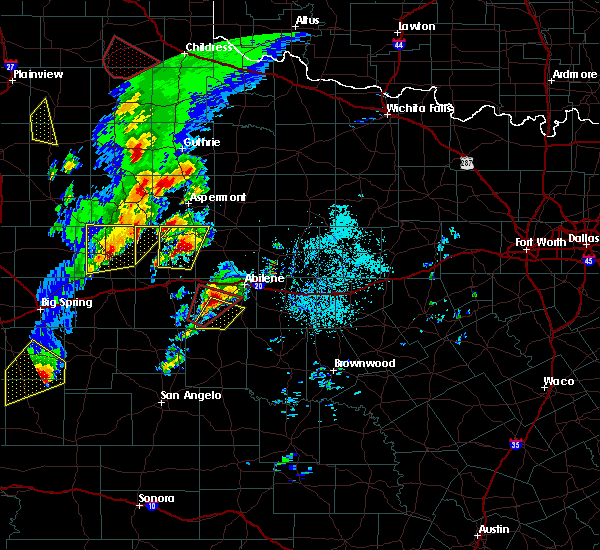 At 426 pm cdt, a severe thunderstorm capable of producing a tornado was located near view, or 16 miles southwest of abilene, moving northeast at 35 mph (radar indicated rotation). Hazards include tornado and golf ball size hail. Flying debris will be dangerous to those caught without shelter. mobile homes will be damaged or destroyed. damage to roofs, windows, and vehicles will occur. tree damage is likely. this dangerous storm will be near, buffalo gap and view around 435 pm cdt. Other locations impacted by this tornadic thunderstorm include camp butman. At 426 pm cdt, a severe thunderstorm capable of producing a tornado was located near view, or 16 miles southwest of abilene, moving northeast at 35 mph (radar indicated rotation). Hazards include tornado and golf ball size hail. Flying debris will be dangerous to those caught without shelter. mobile homes will be damaged or destroyed. damage to roofs, windows, and vehicles will occur. tree damage is likely. this dangerous storm will be near, buffalo gap and view around 435 pm cdt. Other locations impacted by this tornadic thunderstorm include camp butman.
|
| 3/28/2017 4:10 PM CDT |
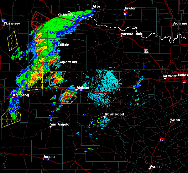 At 409 pm cdt, a severe thunderstorm capable of producing a tornado was located near happy valley, or 16 miles north of winters, moving northeast at 35 mph (radar indicated rotation). Hazards include tornado and golf ball size hail. Flying debris will be dangerous to those caught without shelter. mobile homes will be damaged or destroyed. damage to roofs, windows, and vehicles will occur. tree damage is likely. this dangerous storm will be near, buffalo gap and view around 435 pm cdt. Other locations impacted by this tornadic thunderstorm include lake abilene and camp butman. At 409 pm cdt, a severe thunderstorm capable of producing a tornado was located near happy valley, or 16 miles north of winters, moving northeast at 35 mph (radar indicated rotation). Hazards include tornado and golf ball size hail. Flying debris will be dangerous to those caught without shelter. mobile homes will be damaged or destroyed. damage to roofs, windows, and vehicles will occur. tree damage is likely. this dangerous storm will be near, buffalo gap and view around 435 pm cdt. Other locations impacted by this tornadic thunderstorm include lake abilene and camp butman.
|
| 9/16/2016 6:55 PM CDT | Abilene corrections dept. reported 58 mph wind using hand held anemometer in jones county TX, 7.2 miles SW of Abilene, TX |
| 9/16/2016 6:54 PM CDT |
 At 654 pm cdt, a severe thunderstorm was located near hamby, or 8 miles northeast of abilene, moving east at 20 mph (radar indicated). Hazards include 60 mph wind gusts and half dollar size hail. Hail damage to vehicles is expected. expect wind damage to roofs, siding, and trees. this severe storm will be near, hamby around 700 pm cdt. Other locations impacted by this severe thunderstorm include impact and lake fort phantom hill. At 654 pm cdt, a severe thunderstorm was located near hamby, or 8 miles northeast of abilene, moving east at 20 mph (radar indicated). Hazards include 60 mph wind gusts and half dollar size hail. Hail damage to vehicles is expected. expect wind damage to roofs, siding, and trees. this severe storm will be near, hamby around 700 pm cdt. Other locations impacted by this severe thunderstorm include impact and lake fort phantom hill.
|
| 9/16/2016 6:29 PM CDT |
 At 628 pm cdt, a severe thunderstorm was located over hawley, or 11 miles northwest of abilene, moving east at 20 mph (radar indicated). Hazards include golf ball size hail and 60 mph wind gusts. People and animals outdoors will be injured. expect hail damage to roofs, siding, windows, and vehicles. expect wind damage to roofs, siding, and trees. this severe thunderstorm will be near, abilene around 650 pm cdt. hamby around 700 pm cdt. clyde around 715 pm cdt. Other locations impacted by this severe thunderstorm include. At 628 pm cdt, a severe thunderstorm was located over hawley, or 11 miles northwest of abilene, moving east at 20 mph (radar indicated). Hazards include golf ball size hail and 60 mph wind gusts. People and animals outdoors will be injured. expect hail damage to roofs, siding, windows, and vehicles. expect wind damage to roofs, siding, and trees. this severe thunderstorm will be near, abilene around 650 pm cdt. hamby around 700 pm cdt. clyde around 715 pm cdt. Other locations impacted by this severe thunderstorm include.
|
| 9/16/2016 6:07 PM CDT |
 At 607 pm cdt, a severe thunderstorm was located near noodle, or 10 miles south of anson, moving east at 20 mph (radar indicated). Hazards include ping pong ball size hail and 60 mph wind gusts. People and animals outdoors will be injured. expect hail damage to roofs, siding, windows, and vehicles. expect wind damage to roofs, siding, and trees. this severe storm will be near, hawley around 630 pm cdt. Other locations impacted by this severe thunderstorm include hodges, truby and stith. At 607 pm cdt, a severe thunderstorm was located near noodle, or 10 miles south of anson, moving east at 20 mph (radar indicated). Hazards include ping pong ball size hail and 60 mph wind gusts. People and animals outdoors will be injured. expect hail damage to roofs, siding, windows, and vehicles. expect wind damage to roofs, siding, and trees. this severe storm will be near, hawley around 630 pm cdt. Other locations impacted by this severe thunderstorm include hodges, truby and stith.
|
| 9/16/2016 5:58 PM CDT |
 At 557 pm cdt, a severe thunderstorm was located over noodle, or 11 miles southwest of anson, moving east at 20 mph (radar indicated). Hazards include ping pong ball size hail and 60 mph wind gusts. People and animals outdoors will be injured. expect hail damage to roofs, siding, windows, and vehicles. expect wind damage to roofs, siding, and trees. this severe storm will be near, hawley around 630 pm cdt. Other locations impacted by this severe thunderstorm include hodges, truby and stith. At 557 pm cdt, a severe thunderstorm was located over noodle, or 11 miles southwest of anson, moving east at 20 mph (radar indicated). Hazards include ping pong ball size hail and 60 mph wind gusts. People and animals outdoors will be injured. expect hail damage to roofs, siding, windows, and vehicles. expect wind damage to roofs, siding, and trees. this severe storm will be near, hawley around 630 pm cdt. Other locations impacted by this severe thunderstorm include hodges, truby and stith.
|
| 9/16/2016 5:43 PM CDT |
 At 542 pm cdt, a severe thunderstorm was located near noodle, or 14 miles southwest of anson, moving east at 20 mph (radar indicated). Hazards include 60 mph wind gusts and half dollar size hail. Hail damage to vehicles is expected. expect wind damage to roofs, siding, and trees. this severe thunderstorm will be near, noodle around 550 pm cdt. hawley around 630 pm cdt. other locations impacted by this severe thunderstorm include hodges, truby and stith. This includes interstate 20 between mile markers 281 and 283. At 542 pm cdt, a severe thunderstorm was located near noodle, or 14 miles southwest of anson, moving east at 20 mph (radar indicated). Hazards include 60 mph wind gusts and half dollar size hail. Hail damage to vehicles is expected. expect wind damage to roofs, siding, and trees. this severe thunderstorm will be near, noodle around 550 pm cdt. hawley around 630 pm cdt. other locations impacted by this severe thunderstorm include hodges, truby and stith. This includes interstate 20 between mile markers 281 and 283.
|
| 7/9/2016 8:37 PM CDT | Small shed overturned and a section of fence down at the intersection of fm 1082 and cr 327 in jones county TX, 8.1 miles S of Abilene, TX |
| 7/9/2016 8:30 PM CDT |
 At 829 pm cdt, a severe thunderstorm was located near hawley, or 7 miles north of abilene, moving southwest at 5 mph (radar indicated). Hazards include 60 mph wind gusts and nickel size hail. Expect damage to roofs. siding. and trees. this severe storm will be near, abilene and hawley around 835 pm cdt. tye around 845 pm cdt. other locations impacted by this severe thunderstorm include impact and lake fort phantom hill. This includes interstate 20 between mile markers 275 and 292. At 829 pm cdt, a severe thunderstorm was located near hawley, or 7 miles north of abilene, moving southwest at 5 mph (radar indicated). Hazards include 60 mph wind gusts and nickel size hail. Expect damage to roofs. siding. and trees. this severe storm will be near, abilene and hawley around 835 pm cdt. tye around 845 pm cdt. other locations impacted by this severe thunderstorm include impact and lake fort phantom hill. This includes interstate 20 between mile markers 275 and 292.
|
| 7/9/2016 8:05 PM CDT |
 At 804 pm cdt, a severe thunderstorm was located near nugent, or 11 miles north of abilene, moving south at 10 mph (radar indicated). Hazards include ping pong ball size hail and 60 mph wind gusts. People and animals outdoors will be injured. expect hail damage to roofs, siding, windows, and vehicles. expect wind damage to roofs, siding, and trees. this severe thunderstorm will be near, nugent around 845 pm cdt. other locations impacted by this severe thunderstorm include impact and lake fort phantom hill. This includes interstate 20 between mile markers 275 and 292. At 804 pm cdt, a severe thunderstorm was located near nugent, or 11 miles north of abilene, moving south at 10 mph (radar indicated). Hazards include ping pong ball size hail and 60 mph wind gusts. People and animals outdoors will be injured. expect hail damage to roofs, siding, windows, and vehicles. expect wind damage to roofs, siding, and trees. this severe thunderstorm will be near, nugent around 845 pm cdt. other locations impacted by this severe thunderstorm include impact and lake fort phantom hill. This includes interstate 20 between mile markers 275 and 292.
|
| 7/4/2016 9:22 PM CDT | Storm damage reported in taylor county TX, 9.3 miles ENE of Abilene, TX |
| 7/4/2016 7:30 PM CDT |
 At 729 pm cdt, a severe thunderstorm was located near hawley, or 10 miles south of anson, moving east at 20 mph (radar indicated). Hazards include 60 mph wind gusts and quarter size hail. Hail damage to vehicles is expected. expect wind damage to roofs, siding, and trees. this severe storm will be near, hawley around 740 pm cdt. abilene around 745 pm cdt. Other locations impacted by this severe thunderstorm include lake fort phantom hill, funston, hodges, truby and stith. At 729 pm cdt, a severe thunderstorm was located near hawley, or 10 miles south of anson, moving east at 20 mph (radar indicated). Hazards include 60 mph wind gusts and quarter size hail. Hail damage to vehicles is expected. expect wind damage to roofs, siding, and trees. this severe storm will be near, hawley around 740 pm cdt. abilene around 745 pm cdt. Other locations impacted by this severe thunderstorm include lake fort phantom hill, funston, hodges, truby and stith.
|
| 7/4/2016 7:09 PM CDT |
 At 708 pm cdt, a severe thunderstorm was located near noodle, or 15 miles southwest of anson, moving east at 20 mph (radar indicated). Hazards include 60 mph wind gusts and quarter size hail. Hail damage to vehicles is expected. expect wind damage to roofs, siding, and trees. this severe thunderstorm will be near, hawley around 740 pm cdt. abilene around 745 pm cdt. Other locations impacted by this severe thunderstorm include lake fort phantom hill, funston, hodges, truby and stith. At 708 pm cdt, a severe thunderstorm was located near noodle, or 15 miles southwest of anson, moving east at 20 mph (radar indicated). Hazards include 60 mph wind gusts and quarter size hail. Hail damage to vehicles is expected. expect wind damage to roofs, siding, and trees. this severe thunderstorm will be near, hawley around 740 pm cdt. abilene around 745 pm cdt. Other locations impacted by this severe thunderstorm include lake fort phantom hill, funston, hodges, truby and stith.
|
| 7/3/2016 7:16 PM CDT |
 At 715 pm cdt, a severe thunderstorm was located near nugent, or 12 miles southeast of anson, moving east at 20 mph (radar indicated). Hazards include 60 mph wind gusts and quarter size hail. Hail damage to vehicles is expected. expect wind damage to roofs, siding, and trees. this severe storm will be near, nugent around 725 pm cdt. Other locations impacted by this severe thunderstorm include the intersection of us-180 and farm road 600 and lake fort phantom hill. At 715 pm cdt, a severe thunderstorm was located near nugent, or 12 miles southeast of anson, moving east at 20 mph (radar indicated). Hazards include 60 mph wind gusts and quarter size hail. Hail damage to vehicles is expected. expect wind damage to roofs, siding, and trees. this severe storm will be near, nugent around 725 pm cdt. Other locations impacted by this severe thunderstorm include the intersection of us-180 and farm road 600 and lake fort phantom hill.
|
| 7/3/2016 6:57 PM CDT |
 At 657 pm cdt, a severe thunderstorm was located near hawley, or 7 miles southeast of anson, moving east at 20 mph (radar indicated). Hazards include 60 mph wind gusts and quarter size hail. Hail damage to vehicles is expected. expect wind damage to roofs, siding, and trees. this severe thunderstorm will be near, hawley around 705 pm cdt. abilene and nugent around 725 pm cdt. Other locations impacted by this severe thunderstorm include lake fort phantom hill, funston and the intersection of us- 180 and farm road 600. At 657 pm cdt, a severe thunderstorm was located near hawley, or 7 miles southeast of anson, moving east at 20 mph (radar indicated). Hazards include 60 mph wind gusts and quarter size hail. Hail damage to vehicles is expected. expect wind damage to roofs, siding, and trees. this severe thunderstorm will be near, hawley around 705 pm cdt. abilene and nugent around 725 pm cdt. Other locations impacted by this severe thunderstorm include lake fort phantom hill, funston and the intersection of us- 180 and farm road 600.
|
| 5/29/2016 9:39 PM CDT |
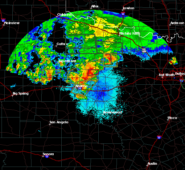 At 938 pm cdt, a severe thunderstorm located near hamby, or just north of the abilene regional airport, moving northeast at 25 mph. trained spotters reported hail of tennis ball size (trained weather spotters). Hazards include tennis ball size hail and 60 mph wind gusts. People and animals outdoors will be injured. expect hail damage to roofs, siding, windows, and vehicles. expect wind damage to roofs, siding, and trees. This severe thunderstorm will remain over mainly rural areas of northwestern callahan, northeastern taylor, southern shackelford and southeastern jones counties, including the following locations:. At 938 pm cdt, a severe thunderstorm located near hamby, or just north of the abilene regional airport, moving northeast at 25 mph. trained spotters reported hail of tennis ball size (trained weather spotters). Hazards include tennis ball size hail and 60 mph wind gusts. People and animals outdoors will be injured. expect hail damage to roofs, siding, windows, and vehicles. expect wind damage to roofs, siding, and trees. This severe thunderstorm will remain over mainly rural areas of northwestern callahan, northeastern taylor, southern shackelford and southeastern jones counties, including the following locations:.
|
| 5/29/2016 9:34 PM CDT | Tennis Ball sized hail reported 5.4 miles NW of Abilene, TX, it hailed from 924 til 934 pm. lots of hail covering the ground. largest was tennis ball size hail. |
| 5/29/2016 9:23 PM CDT |
 At 923 pm cdt, a severe thunderstorm was located in abilene, moving northeast at 25 mph (radar indicated). Hazards include 60 mph wind gusts and quarter size hail. Hail damage to vehicles is expected. expect wind damage to roofs, siding, and trees. this severe storm will be near, clyde around 935 pm cdt. hamby around 940 pm cdt. Other locations impacted by this severe thunderstorm include. At 923 pm cdt, a severe thunderstorm was located in abilene, moving northeast at 25 mph (radar indicated). Hazards include 60 mph wind gusts and quarter size hail. Hail damage to vehicles is expected. expect wind damage to roofs, siding, and trees. this severe storm will be near, clyde around 935 pm cdt. hamby around 940 pm cdt. Other locations impacted by this severe thunderstorm include.
|
| 5/29/2016 9:12 PM CDT |
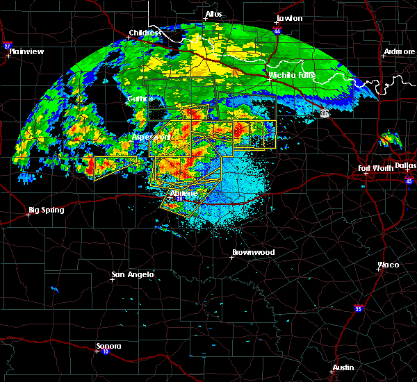 At 912 pm cdt, a severe thunderstorm was located over potosi, or near abilene, moving northeast at 25 mph (radar indicated). Hazards include golf ball size hail and 60 mph wind gusts. People and animals outdoors will be injured. expect hail damage to roofs, siding, windows, and vehicles. expect wind damage to roofs, siding, and trees. this severe thunderstorm will be near, clyde around 935 pm cdt. hamby around 940 pm cdt. abilene around 955 pm cdt. Other locations impacted by this severe thunderstorm include. At 912 pm cdt, a severe thunderstorm was located over potosi, or near abilene, moving northeast at 25 mph (radar indicated). Hazards include golf ball size hail and 60 mph wind gusts. People and animals outdoors will be injured. expect hail damage to roofs, siding, windows, and vehicles. expect wind damage to roofs, siding, and trees. this severe thunderstorm will be near, clyde around 935 pm cdt. hamby around 940 pm cdt. abilene around 955 pm cdt. Other locations impacted by this severe thunderstorm include.
|
| 5/29/2016 9:10 PM CDT |
 At 910 pm cdt, a severe thunderstorm was located near lueders, or 15 miles west of albany, moving northeast at 30 mph (radar indicated). Hazards include 60 mph wind gusts and quarter size hail. Hail damage to vehicles is expected. expect wind damage to roofs, siding, and trees. this severe thunderstorm will be near, fort griffin around 955 pm cdt. woodson around 1015 pm cdt. Other locations impacted by this severe thunderstorm include hodges, the intersection of us-283 and ranch road 209, truby, funston, lake fort phantom hill, the intersection of us-180 and farm road 600, the intersection of us-183 and us- 283, the intersection of us-380 and highway 222, big country baptist assembly and us-183 near the throckmorton-stephens county line. At 910 pm cdt, a severe thunderstorm was located near lueders, or 15 miles west of albany, moving northeast at 30 mph (radar indicated). Hazards include 60 mph wind gusts and quarter size hail. Hail damage to vehicles is expected. expect wind damage to roofs, siding, and trees. this severe thunderstorm will be near, fort griffin around 955 pm cdt. woodson around 1015 pm cdt. Other locations impacted by this severe thunderstorm include hodges, the intersection of us-283 and ranch road 209, truby, funston, lake fort phantom hill, the intersection of us-180 and farm road 600, the intersection of us-183 and us- 283, the intersection of us-380 and highway 222, big country baptist assembly and us-183 near the throckmorton-stephens county line.
|
| 5/29/2016 9:01 PM CDT |
 At 901 pm cdt, a severe thunderstorm was located 11 miles southeast of lake stamford marina, or 18 miles northwest of albany, moving northeast at 15 mph (radar indicated). Hazards include 60 mph wind gusts and quarter size hail. Hail damage to vehicles is expected. expect wind damage to roofs, siding, and trees. Locations impacted include, stamford, anson, albany, lueders, fort griffin, ibex, avoca, nugent, the intersection of us-180 and farm road 600, the intersection of us-380 and highway 222, mccarty lake, the intersection of us-283 and ranch road 209, funston, big country baptist assembly and us-180 near the shackelford-stephens county line. At 901 pm cdt, a severe thunderstorm was located 11 miles southeast of lake stamford marina, or 18 miles northwest of albany, moving northeast at 15 mph (radar indicated). Hazards include 60 mph wind gusts and quarter size hail. Hail damage to vehicles is expected. expect wind damage to roofs, siding, and trees. Locations impacted include, stamford, anson, albany, lueders, fort griffin, ibex, avoca, nugent, the intersection of us-180 and farm road 600, the intersection of us-380 and highway 222, mccarty lake, the intersection of us-283 and ranch road 209, funston, big country baptist assembly and us-180 near the shackelford-stephens county line.
|
| 5/29/2016 8:35 PM CDT |
 At 834 pm cdt, a severe thunderstorm was located near lueders, or 12 miles east of stamford, moving northeast at 30 mph (radar indicated). Hazards include 60 mph wind gusts and quarter size hail. Hail damage to vehicles is expected. expect wind damage to roofs, siding, and trees. This severe thunderstorm will remain over mainly rural areas of southwestern throckmorton, shackelford and eastern jones counties, including the following locations: hodges, mccarty lake, lake fort phantom hill, the intersection of us-380 and highway 222, big country baptist assembly and us-180 near the shackelford-stephens county line. At 834 pm cdt, a severe thunderstorm was located near lueders, or 12 miles east of stamford, moving northeast at 30 mph (radar indicated). Hazards include 60 mph wind gusts and quarter size hail. Hail damage to vehicles is expected. expect wind damage to roofs, siding, and trees. This severe thunderstorm will remain over mainly rural areas of southwestern throckmorton, shackelford and eastern jones counties, including the following locations: hodges, mccarty lake, lake fort phantom hill, the intersection of us-380 and highway 222, big country baptist assembly and us-180 near the shackelford-stephens county line.
|
| 5/29/2016 1:15 AM CDT |
 At 114 am cdt, a severe thunderstorm was located near hamby, or 11 miles northwest of clyde, moving east at 40 mph (radar indicated). Hazards include 70 mph wind gusts and quarter size hail. Hail damage to vehicles is expected. expect considerable tree damage. wind damage is also likely to mobile homes, roofs, and outbuildings. this severe thunderstorm will remain over mainly rural areas of northwestern callahan, northeastern taylor, southwestern shackelford and southeastern jones counties, including the following locations: impact, admiral, hodges, mccarty lake, truby, stith, us-283 near the callahan-shackelford county line, lake fort phantom hill, funston and kirby lake. This includes interstate 20 between mile markers 271 and 314. At 114 am cdt, a severe thunderstorm was located near hamby, or 11 miles northwest of clyde, moving east at 40 mph (radar indicated). Hazards include 70 mph wind gusts and quarter size hail. Hail damage to vehicles is expected. expect considerable tree damage. wind damage is also likely to mobile homes, roofs, and outbuildings. this severe thunderstorm will remain over mainly rural areas of northwestern callahan, northeastern taylor, southwestern shackelford and southeastern jones counties, including the following locations: impact, admiral, hodges, mccarty lake, truby, stith, us-283 near the callahan-shackelford county line, lake fort phantom hill, funston and kirby lake. This includes interstate 20 between mile markers 271 and 314.
|
| 5/29/2016 12:41 AM CDT |
 At 1240 am cdt, a severe thunderstorm was located near tye, or 12 miles west of abilene, moving east at 35 mph (radar indicated). Hazards include 70 mph wind gusts and quarter size hail. Hail damage to vehicles is expected. expect considerable tree damage. wind damage is also likely to mobile homes, roofs, and outbuildings. this severe thunderstorm will be near, tye and dyess afb around 1250 am cdt. hamby around 110 am cdt. clyde around 120 am cdt. baird around 135 am cdt. Other locations impacted by this severe thunderstorm include. At 1240 am cdt, a severe thunderstorm was located near tye, or 12 miles west of abilene, moving east at 35 mph (radar indicated). Hazards include 70 mph wind gusts and quarter size hail. Hail damage to vehicles is expected. expect considerable tree damage. wind damage is also likely to mobile homes, roofs, and outbuildings. this severe thunderstorm will be near, tye and dyess afb around 1250 am cdt. hamby around 110 am cdt. clyde around 120 am cdt. baird around 135 am cdt. Other locations impacted by this severe thunderstorm include.
|
| 5/28/2016 8:36 PM CDT |
 At 836 pm cdt, a severe thunderstorm was located near tye, or 11 miles west of abilene, moving east at 15 mph (radar indicated). Hazards include 60 mph wind gusts and nickel size hail. Expect damage to roofs. siding. and trees. this severe storm will be near, dyess afb around 850 pm cdt. tye around 855 pm cdt. other locations impacted by this severe thunderstorm include impact and kirby lake. This includes interstate 20 between mile markers 271 and 292. At 836 pm cdt, a severe thunderstorm was located near tye, or 11 miles west of abilene, moving east at 15 mph (radar indicated). Hazards include 60 mph wind gusts and nickel size hail. Expect damage to roofs. siding. and trees. this severe storm will be near, dyess afb around 850 pm cdt. tye around 855 pm cdt. other locations impacted by this severe thunderstorm include impact and kirby lake. This includes interstate 20 between mile markers 271 and 292.
|
| 5/28/2016 8:12 PM CDT |
 At 812 pm cdt, a severe thunderstorm was located near merkel, or 16 miles west of abilene, moving east at 25 mph (radar indicated). Hazards include 60 mph wind gusts and quarter size hail. Hail damage to vehicles is expected. expect wind damage to roofs, siding, and trees. this severe thunderstorm will be near, tye and dyess afb around 835 pm cdt. potosi around 900 pm cdt. other locations impacted by this severe thunderstorm include impact and kirby lake. This includes interstate 20 between mile markers 264 and 292. At 812 pm cdt, a severe thunderstorm was located near merkel, or 16 miles west of abilene, moving east at 25 mph (radar indicated). Hazards include 60 mph wind gusts and quarter size hail. Hail damage to vehicles is expected. expect wind damage to roofs, siding, and trees. this severe thunderstorm will be near, tye and dyess afb around 835 pm cdt. potosi around 900 pm cdt. other locations impacted by this severe thunderstorm include impact and kirby lake. This includes interstate 20 between mile markers 264 and 292.
|
| 5/27/2016 1:53 AM CDT |
 At 153 am cdt, severe thunderstorms were located along a line extending from near hawley to potosi to bradshaw, moving northeast at 50 mph (radar indicated). Hazards include 60 mph wind gusts and penny size hail. Expect damage to roofs. siding. and trees. severe thunderstorms will be near, abilene around 200 am cdt. dudley around 215 am cdt. eula around 225 am cdt. clyde around 230 am cdt. baird around 235 am cdt. Other locations impacted by these severe thunderstorms include. At 153 am cdt, severe thunderstorms were located along a line extending from near hawley to potosi to bradshaw, moving northeast at 50 mph (radar indicated). Hazards include 60 mph wind gusts and penny size hail. Expect damage to roofs. siding. and trees. severe thunderstorms will be near, abilene around 200 am cdt. dudley around 215 am cdt. eula around 225 am cdt. clyde around 230 am cdt. baird around 235 am cdt. Other locations impacted by these severe thunderstorms include.
|
| 5/27/2016 1:13 AM CDT |
 At 113 am cdt, severe thunderstorms were located along a line extending from near trent to near nolan to near hylton, moving northeast at 40 mph (radar indicated). Hazards include 60 mph wind gusts and penny size hail. Expect damage to roofs. siding. and trees. severe thunderstorms will be near, trent around 120 am cdt. noodle around 130 am cdt. merkel around 135 am cdt. tye, view and dyess afb around 145 am cdt. other locations impacted by these severe thunderstorms include hodges, camp butman, truby and stith. This includes interstate 20 between mile markers 253 and 278. At 113 am cdt, severe thunderstorms were located along a line extending from near trent to near nolan to near hylton, moving northeast at 40 mph (radar indicated). Hazards include 60 mph wind gusts and penny size hail. Expect damage to roofs. siding. and trees. severe thunderstorms will be near, trent around 120 am cdt. noodle around 130 am cdt. merkel around 135 am cdt. tye, view and dyess afb around 145 am cdt. other locations impacted by these severe thunderstorms include hodges, camp butman, truby and stith. This includes interstate 20 between mile markers 253 and 278.
|
| 5/26/2016 6:42 PM CDT |
 At 641 pm cdt, a severe thunderstorm was located near hamby, or near clyde, moving east at 25 mph (radar indicated). Hazards include 60 mph wind gusts and quarter size hail. Hail damage to vehicles is expected. expect wind damage to roofs, siding, and trees. this severe storm will be near, clyde around 645 pm cdt. Other locations impacted by this severe thunderstorm include. At 641 pm cdt, a severe thunderstorm was located near hamby, or near clyde, moving east at 25 mph (radar indicated). Hazards include 60 mph wind gusts and quarter size hail. Hail damage to vehicles is expected. expect wind damage to roofs, siding, and trees. this severe storm will be near, clyde around 645 pm cdt. Other locations impacted by this severe thunderstorm include.
|
| 5/26/2016 6:14 PM CDT |
 At 613 pm cdt, a severe thunderstorm was located over abilene, moving northeast at 40 mph (radar indicated). Hazards include 60 mph wind gusts and quarter size hail. Hail damage to vehicles is expected. expect wind damage to roofs, siding, and trees. this severe thunderstorm will be near, hamby around 625 pm cdt. Other locations impacted by this severe thunderstorm include. At 613 pm cdt, a severe thunderstorm was located over abilene, moving northeast at 40 mph (radar indicated). Hazards include 60 mph wind gusts and quarter size hail. Hail damage to vehicles is expected. expect wind damage to roofs, siding, and trees. this severe thunderstorm will be near, hamby around 625 pm cdt. Other locations impacted by this severe thunderstorm include.
|
| 5/13/2016 11:09 PM CDT |
 At 1108 pm cdt, a severe thunderstorm was located near anson, moving southeast at 35 mph (radar indicated). Hazards include 60 mph wind gusts and quarter size hail. Hail damage to vehicles is expected. expect wind damage to roofs, siding, and trees. This severe thunderstorm will remain over mainly rural areas of jones county, including the following locations: funston, hodges, the intersection of us-180 and farm road 600, the intersection of us-180 and ranch road 126 and truby. At 1108 pm cdt, a severe thunderstorm was located near anson, moving southeast at 35 mph (radar indicated). Hazards include 60 mph wind gusts and quarter size hail. Hail damage to vehicles is expected. expect wind damage to roofs, siding, and trees. This severe thunderstorm will remain over mainly rural areas of jones county, including the following locations: funston, hodges, the intersection of us-180 and farm road 600, the intersection of us-180 and ranch road 126 and truby.
|
| 5/13/2016 10:43 PM CDT |
 At 1043 pm cdt, a severe thunderstorm was located 7 miles southwest of stamford, moving southeast at 35 mph (radar indicated). Hazards include 60 mph wind gusts and quarter size hail. Hail damage to vehicles is expected. expect wind damage to roofs, siding, and trees. this severe storm will be near, anson around 1100 pm cdt. abilene, hawley and nugent around 1115 pm cdt. Other locations impacted by this severe thunderstorm include hodges, tuxedo, truby, funston, the intersection of us- 180 and farm road 600, the intersection of us- 180 and ranch road 126 and us-380 near the haskell- stonewall county line. At 1043 pm cdt, a severe thunderstorm was located 7 miles southwest of stamford, moving southeast at 35 mph (radar indicated). Hazards include 60 mph wind gusts and quarter size hail. Hail damage to vehicles is expected. expect wind damage to roofs, siding, and trees. this severe storm will be near, anson around 1100 pm cdt. abilene, hawley and nugent around 1115 pm cdt. Other locations impacted by this severe thunderstorm include hodges, tuxedo, truby, funston, the intersection of us- 180 and farm road 600, the intersection of us- 180 and ranch road 126 and us-380 near the haskell- stonewall county line.
|
| 5/13/2016 10:32 PM CDT |
 At 1032 pm cdt, a severe thunderstorm was located near sagerton, or 9 miles west of stamford, moving southeast at 35 mph (radar indicated). Hazards include 60 mph wind gusts and quarter size hail. Hail damage to vehicles is expected. expect wind damage to roofs, siding, and trees. this severe thunderstorm will be near, anson around 1100 pm cdt. abilene, hawley and nugent around 1115 pm cdt. Other locations impacted by this severe thunderstorm include hodges, tuxedo, truby, funston. At 1032 pm cdt, a severe thunderstorm was located near sagerton, or 9 miles west of stamford, moving southeast at 35 mph (radar indicated). Hazards include 60 mph wind gusts and quarter size hail. Hail damage to vehicles is expected. expect wind damage to roofs, siding, and trees. this severe thunderstorm will be near, anson around 1100 pm cdt. abilene, hawley and nugent around 1115 pm cdt. Other locations impacted by this severe thunderstorm include hodges, tuxedo, truby, funston.
|
| 5/12/2016 5:02 AM CDT | 60 mph wind gust reported at abilene airport in taylor county TX, 5.1 miles NNW of Abilene, TX |
| 5/12/2016 4:06 AM CDT |
 At 406 am cdt, a severe thunderstorm was located near anson, moving southeast at 15 mph (radar indicated). Hazards include 60 mph wind gusts and quarter size hail. Hail damage to vehicles is expected. expect wind damage to roofs, siding, and trees. this severe storm will be near, hawley around 430 am cdt. Other locations impacted by this severe thunderstorm include lake fort phantom hill, funston, the intersection of us- 180 and farm road 600 and truby. At 406 am cdt, a severe thunderstorm was located near anson, moving southeast at 15 mph (radar indicated). Hazards include 60 mph wind gusts and quarter size hail. Hail damage to vehicles is expected. expect wind damage to roofs, siding, and trees. this severe storm will be near, hawley around 430 am cdt. Other locations impacted by this severe thunderstorm include lake fort phantom hill, funston, the intersection of us- 180 and farm road 600 and truby.
|
| 5/12/2016 3:47 AM CDT |
 At 345 am cdt, a severe thunderstorm was located just west of anson, moving southeast at 15 mph (radar indicated). Hazards include 60 mph wind gusts and quarter size hail. Hail damage to vehicles is expected. expect wind damage to roofs, siding, and trees. this severe thunderstorm will be near, anson around 350 am cdt. hawley around 415 am cdt. Other locations impacted by this severe thunderstorm include the intersection of us-180 and farm road 600 and truby. At 345 am cdt, a severe thunderstorm was located just west of anson, moving southeast at 15 mph (radar indicated). Hazards include 60 mph wind gusts and quarter size hail. Hail damage to vehicles is expected. expect wind damage to roofs, siding, and trees. this severe thunderstorm will be near, anson around 350 am cdt. hawley around 415 am cdt. Other locations impacted by this severe thunderstorm include the intersection of us-180 and farm road 600 and truby.
|
| 5/12/2016 1:53 AM CDT |
 At 152 am cdt, a severe thunderstorm was located near potosi, or 7 miles south of abilene, moving east at 15 mph (radar indicated). Hazards include 60 mph wind gusts and quarter size hail. Hail damage to vehicles is expected. expect wind damage to roofs, siding, and trees. this severe storm will be near, potosi around 210 am cdt. other locations impacted by this severe thunderstorm include kirby lake. This includes interstate 20 between mile markers 274 and 283, and between mile markers 289 and 292. At 152 am cdt, a severe thunderstorm was located near potosi, or 7 miles south of abilene, moving east at 15 mph (radar indicated). Hazards include 60 mph wind gusts and quarter size hail. Hail damage to vehicles is expected. expect wind damage to roofs, siding, and trees. this severe storm will be near, potosi around 210 am cdt. other locations impacted by this severe thunderstorm include kirby lake. This includes interstate 20 between mile markers 274 and 283, and between mile markers 289 and 292.
|
| 5/12/2016 1:37 AM CDT |
 At 136 am cdt, a severe thunderstorm was located near buffalo gap, or 7 miles southwest of abilene, moving east at 20 mph. another severe thunderstorm was located near merkel, moving southeast at 20 mph (radar indicated). Hazards include golf ball size hail and 60 mph wind gusts. People and animals outdoors will be injured. expect hail damage to roofs, siding, windows, and vehicles. expect wind damage to roofs, siding, and trees. this severe thunderstorm will be near, potosi around 210 am cdt. view around 215 am cdt. other locations impacted by this severe thunderstorm include impact and kirby lake. This includes interstate 20 between mile markers 263 and 292. At 136 am cdt, a severe thunderstorm was located near buffalo gap, or 7 miles southwest of abilene, moving east at 20 mph. another severe thunderstorm was located near merkel, moving southeast at 20 mph (radar indicated). Hazards include golf ball size hail and 60 mph wind gusts. People and animals outdoors will be injured. expect hail damage to roofs, siding, windows, and vehicles. expect wind damage to roofs, siding, and trees. this severe thunderstorm will be near, potosi around 210 am cdt. view around 215 am cdt. other locations impacted by this severe thunderstorm include impact and kirby lake. This includes interstate 20 between mile markers 263 and 292.
|
| 5/12/2016 1:21 AM CDT |
 At 120 am cdt, a severe thunderstorm was located near buffalo gap, or 8 miles southwest of abilene, moving southeast at 30 mph (radar indicated). Hazards include 60 mph wind gusts and half dollar size hail. Hail damage to vehicles is expected. expect wind damage to roofs, siding, and trees. this severe storm will be near, tuscola and potosi around 130 am cdt. other locations impacted by this severe thunderstorm include impact, kirby lake, lake abilene and camp tonkawa. This includes interstate 20 between mile markers 263 and 292. At 120 am cdt, a severe thunderstorm was located near buffalo gap, or 8 miles southwest of abilene, moving southeast at 30 mph (radar indicated). Hazards include 60 mph wind gusts and half dollar size hail. Hail damage to vehicles is expected. expect wind damage to roofs, siding, and trees. this severe storm will be near, tuscola and potosi around 130 am cdt. other locations impacted by this severe thunderstorm include impact, kirby lake, lake abilene and camp tonkawa. This includes interstate 20 between mile markers 263 and 292.
|
| 5/12/2016 1:12 AM CDT | Ping Pong Ball sized hail reported 13.9 miles NE of Abilene, TX |
| 5/12/2016 1:02 AM CDT |
 At 101 am cdt, a severe thunderstorm was located over abilene, moving southeast at 30 mph. another severe thunderstorm was located 3 miles east of merkel, moving southeast at 30 mph (radar indicated). Hazards include golf ball size hail and 60 mph wind gusts. People and animals outdoors will be injured. expect hail damage to roofs, siding, windows, and vehicles. expect wind damage to roofs, siding, and trees. this severe thunderstorm will be near, potosi and view around 105 am cdt. other locations impacted by this severe thunderstorm include impact, kirby lake, lake abilene and camp tonkawa. This includes interstate 20 between mile markers 263 and 292. At 101 am cdt, a severe thunderstorm was located over abilene, moving southeast at 30 mph. another severe thunderstorm was located 3 miles east of merkel, moving southeast at 30 mph (radar indicated). Hazards include golf ball size hail and 60 mph wind gusts. People and animals outdoors will be injured. expect hail damage to roofs, siding, windows, and vehicles. expect wind damage to roofs, siding, and trees. this severe thunderstorm will be near, potosi and view around 105 am cdt. other locations impacted by this severe thunderstorm include impact, kirby lake, lake abilene and camp tonkawa. This includes interstate 20 between mile markers 263 and 292.
|
| 5/12/2016 1:00 AM CDT | Quarter sized hail reported 6.7 miles NE of Abilene, TX |
| 5/12/2016 12:51 AM CDT | Golf Ball sized hail reported 5.4 miles NE of Abilene, TX, at krbc studio |
| 5/12/2016 12:47 AM CDT |
 At 1242 am cdt, a severe thunderstorm was located over clyde, moving southeast at 30 mph. another severe thunderstorm was located over merkel, moving southeast at 30 mph (radar indicated). Hazards include ping pong ball size hail and 60 mph wind gusts. People and animals outdoors will be injured. expect hail damage to roofs, siding, windows, and vehicles. expect wind damage to roofs, siding, and trees. These severe thunderstorms will be near clyde and baird through 100am cdt, tye and merkel through 115 am cdt, abilene by 115 am cdt, this includes interstate 20 between mile markers 267 and 314. At 1242 am cdt, a severe thunderstorm was located over clyde, moving southeast at 30 mph. another severe thunderstorm was located over merkel, moving southeast at 30 mph (radar indicated). Hazards include ping pong ball size hail and 60 mph wind gusts. People and animals outdoors will be injured. expect hail damage to roofs, siding, windows, and vehicles. expect wind damage to roofs, siding, and trees. These severe thunderstorms will be near clyde and baird through 100am cdt, tye and merkel through 115 am cdt, abilene by 115 am cdt, this includes interstate 20 between mile markers 267 and 314.
|
| 5/12/2016 12:19 AM CDT |
 At 1217 am cdt, a severe thunderstorm was located near abilene, moving east at 30 mph. another severe thunderstorm was located over merkel, moving southeast at 30 mph (radar indicated). Hazards include ping pong ball size hail. People and animals outdoors will be injured. expect damage to roofs, siding, windows, and vehicles. this severe thunderstorm will be near, clyde and eula around 1230 am cdt. baird around 1240 am cdt. other locations impacted by this severe thunderstorm include impact, hodges, the intersection of us-283 and highway 36, stith, us-283 near the callahan-shackelford county line, lake fort phantom hill and kirby lake. This includes interstate 20 between mile markers 267 and 314. At 1217 am cdt, a severe thunderstorm was located near abilene, moving east at 30 mph. another severe thunderstorm was located over merkel, moving southeast at 30 mph (radar indicated). Hazards include ping pong ball size hail. People and animals outdoors will be injured. expect damage to roofs, siding, windows, and vehicles. this severe thunderstorm will be near, clyde and eula around 1230 am cdt. baird around 1240 am cdt. other locations impacted by this severe thunderstorm include impact, hodges, the intersection of us-283 and highway 36, stith, us-283 near the callahan-shackelford county line, lake fort phantom hill and kirby lake. This includes interstate 20 between mile markers 267 and 314.
|
| 5/12/2016 12:17 AM CDT | Golf Ball sized hail reported 8.4 miles NE of Abilene, TX |
| 5/12/2016 12:10 AM CDT | Ping Pong Ball sized hail reported 2.6 miles NE of Abilene, TX, n 14th and willis |
| 5/12/2016 12:10 AM CDT |
 At 1208 am cdt, a severe thunderstorm was located over abilene, moving east at 30 mph. another severe thunderstorm was located just north of merkel, moving east at 30 mph (radar indicated). Hazards include golf ball size hail and 60 mph wind gusts. People and animals outdoors will be injured. expect hail damage to roofs, siding, windows, and vehicles. expect wind damage to roofs, siding, and trees. this severe storm will be near, hamby around 1215 am cdt. potosi around 1220 am cdt. other locations impacted by this severe thunderstorm include impact, lake fort phantom hill, hodges, kirby lake, truby and stith. This includes interstate 20 between mile markers 262 and 292. At 1208 am cdt, a severe thunderstorm was located over abilene, moving east at 30 mph. another severe thunderstorm was located just north of merkel, moving east at 30 mph (radar indicated). Hazards include golf ball size hail and 60 mph wind gusts. People and animals outdoors will be injured. expect hail damage to roofs, siding, windows, and vehicles. expect wind damage to roofs, siding, and trees. this severe storm will be near, hamby around 1215 am cdt. potosi around 1220 am cdt. other locations impacted by this severe thunderstorm include impact, lake fort phantom hill, hodges, kirby lake, truby and stith. This includes interstate 20 between mile markers 262 and 292.
|
| 5/12/2016 12:09 AM CDT | Quarter sized hail reported 6.6 miles NNE of Abilene, TX |
| 5/11/2016 11:55 PM CDT |
 At 1155 pm cdt, a severe thunderstorm was located over tye, or 7 miles west of abilene, moving east at 15 mph (radar indicated). Hazards include golf ball size hail and 60 mph wind gusts. People and animals outdoors will be injured. expect hail damage to roofs, siding, windows, and vehicles. expect wind damage to roofs, siding, and trees. this severe storm will be near, potosi and hamby around 1230 am cdt. other locations impacted by this severe thunderstorm include impact, lake fort phantom hill, hodges, kirby lake, truby and stith. This includes interstate 20 between mile markers 262 and 292. At 1155 pm cdt, a severe thunderstorm was located over tye, or 7 miles west of abilene, moving east at 15 mph (radar indicated). Hazards include golf ball size hail and 60 mph wind gusts. People and animals outdoors will be injured. expect hail damage to roofs, siding, windows, and vehicles. expect wind damage to roofs, siding, and trees. this severe storm will be near, potosi and hamby around 1230 am cdt. other locations impacted by this severe thunderstorm include impact, lake fort phantom hill, hodges, kirby lake, truby and stith. This includes interstate 20 between mile markers 262 and 292.
|
| 5/11/2016 11:39 PM CDT |
 At 1138 pm cdt, a severe thunderstorm was located near tye, or 11 miles northwest of abilene, moving east at 30 mph (radar indicated). Hazards include 60 mph wind gusts and half dollar size hail. Hail damage to vehicles is expected. expect wind damage to roofs, siding, and trees. this severe thunderstorm will be near, hawley and dyess afb around 1145 pm cdt. hamby and potosi around 1210 am cdt. other locations impacted by this severe thunderstorm include impact, lake fort phantom hill, hodges, kirby lake, truby and stith. This includes interstate 20 between mile markers 262 and 292. At 1138 pm cdt, a severe thunderstorm was located near tye, or 11 miles northwest of abilene, moving east at 30 mph (radar indicated). Hazards include 60 mph wind gusts and half dollar size hail. Hail damage to vehicles is expected. expect wind damage to roofs, siding, and trees. this severe thunderstorm will be near, hawley and dyess afb around 1145 pm cdt. hamby and potosi around 1210 am cdt. other locations impacted by this severe thunderstorm include impact, lake fort phantom hill, hodges, kirby lake, truby and stith. This includes interstate 20 between mile markers 262 and 292.
|
| 5/11/2016 11:27 PM CDT |
 At 1127 pm cdt, a severe thunderstorm was located near noodle, or 14 miles south of anson, moving southeast at 15 mph (radar indicated). Hazards include 60 mph wind gusts and half dollar size hail. Hail damage to vehicles is expected. expect wind damage to roofs, siding, and trees. this severe storm will be near, tye around 1145 pm cdt. other locations impacted by this severe thunderstorm include impact, lake fort phantom hill, hodges, kirby lake, truby and stith. This includes interstate 20 between mile markers 276 and 298. At 1127 pm cdt, a severe thunderstorm was located near noodle, or 14 miles south of anson, moving southeast at 15 mph (radar indicated). Hazards include 60 mph wind gusts and half dollar size hail. Hail damage to vehicles is expected. expect wind damage to roofs, siding, and trees. this severe storm will be near, tye around 1145 pm cdt. other locations impacted by this severe thunderstorm include impact, lake fort phantom hill, hodges, kirby lake, truby and stith. This includes interstate 20 between mile markers 276 and 298.
|
| 5/11/2016 11:00 PM CDT |
 At 1059 pm cdt, a severe thunderstorm was located near hawley, or 11 miles south of anson, moving southeast at 20 mph (radar indicated). Hazards include 60 mph wind gusts and half dollar size hail. Hail damage to vehicles is expected. expect wind damage to roofs, siding, and trees. this severe thunderstorm will be near, hawley around 1110 pm cdt. tye around 1115 pm cdt. abilene around 1125 pm cdt. hamby around 1140 pm cdt. potosi around 1145 pm cdt. other locations impacted by this severe thunderstorm include impact, lake fort phantom hill, hodges, kirby lake, truby and stith. This includes interstate 20 between mile markers 276 and 298. At 1059 pm cdt, a severe thunderstorm was located near hawley, or 11 miles south of anson, moving southeast at 20 mph (radar indicated). Hazards include 60 mph wind gusts and half dollar size hail. Hail damage to vehicles is expected. expect wind damage to roofs, siding, and trees. this severe thunderstorm will be near, hawley around 1110 pm cdt. tye around 1115 pm cdt. abilene around 1125 pm cdt. hamby around 1140 pm cdt. potosi around 1145 pm cdt. other locations impacted by this severe thunderstorm include impact, lake fort phantom hill, hodges, kirby lake, truby and stith. This includes interstate 20 between mile markers 276 and 298.
|
| 5/11/2016 10:51 PM CDT |
 At 1050 pm cdt, a severe thunderstorm was located near hawley, or 7 miles south of anson, moving east at 20 mph (radar indicated). Hazards include 60 mph wind gusts and half dollar size hail. Hail damage to vehicles is expected. expect wind damage to roofs, siding, and trees. this severe storm will be near, hawley around 1105 pm cdt. abilene and nugent around 1115 pm cdt. Other locations impacted by this severe thunderstorm include funston, the intersection of us- 180 and farm road 600, truby and big country baptist assembly. At 1050 pm cdt, a severe thunderstorm was located near hawley, or 7 miles south of anson, moving east at 20 mph (radar indicated). Hazards include 60 mph wind gusts and half dollar size hail. Hail damage to vehicles is expected. expect wind damage to roofs, siding, and trees. this severe storm will be near, hawley around 1105 pm cdt. abilene and nugent around 1115 pm cdt. Other locations impacted by this severe thunderstorm include funston, the intersection of us- 180 and farm road 600, truby and big country baptist assembly.
|
| 5/11/2016 10:27 PM CDT |
 At 1026 pm cdt, a severe thunderstorm was located over anson, moving east at 35 mph (radar indicated). Hazards include 60 mph wind gusts and half dollar size hail. Hail damage to vehicles is expected. expect wind damage to roofs, siding, and trees. this severe thunderstorm will be near, avoca around 1045 pm cdt. nugent around 1050 pm cdt. lueders around 1055 pm cdt. Other locations impacted by this severe thunderstorm include funston, the intersection of us- 180 and farm road 600, truby and big country baptist assembly. At 1026 pm cdt, a severe thunderstorm was located over anson, moving east at 35 mph (radar indicated). Hazards include 60 mph wind gusts and half dollar size hail. Hail damage to vehicles is expected. expect wind damage to roofs, siding, and trees. this severe thunderstorm will be near, avoca around 1045 pm cdt. nugent around 1050 pm cdt. lueders around 1055 pm cdt. Other locations impacted by this severe thunderstorm include funston, the intersection of us- 180 and farm road 600, truby and big country baptist assembly.
|
| 5/11/2016 7:44 PM CDT |
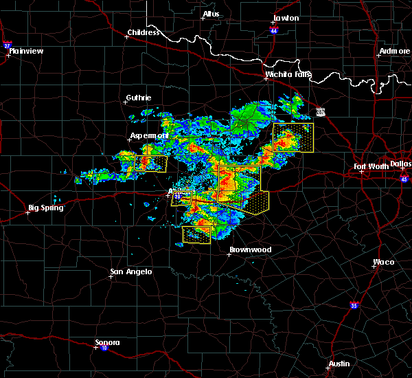 At 743 pm cdt, a severe thunderstorm was located over clyde, moving east at 15 mph (public reported quarter size hail in clyde at 734 pm). Hazards include golf ball size hail and 60 mph wind gusts. People and animals outdoors will be injured. expect hail damage to roofs, siding, windows, and vehicles. expect wind damage to roofs, siding, and trees. this severe thunderstorm will remain over mainly rural areas of northwestern callahan and east central taylor counties. This includes interstate 20 between mile markers 291 and 303. At 743 pm cdt, a severe thunderstorm was located over clyde, moving east at 15 mph (public reported quarter size hail in clyde at 734 pm). Hazards include golf ball size hail and 60 mph wind gusts. People and animals outdoors will be injured. expect hail damage to roofs, siding, windows, and vehicles. expect wind damage to roofs, siding, and trees. this severe thunderstorm will remain over mainly rural areas of northwestern callahan and east central taylor counties. This includes interstate 20 between mile markers 291 and 303.
|
| 5/11/2016 7:31 PM CDT |
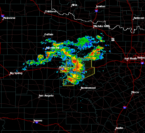 At 730 pm cdt, a severe thunderstorm was located over clyde, moving east at 10 mph (radar indicated). Hazards include golf ball size hail and 60 mph wind gusts. People and animals outdoors will be injured. expect hail damage to roofs, siding, windows, and vehicles. expect wind damage to roofs, siding, and trees. this severe storm will be near, clyde around 735 pm cdt. This includes interstate 20 between mile markers 291 and 303. At 730 pm cdt, a severe thunderstorm was located over clyde, moving east at 10 mph (radar indicated). Hazards include golf ball size hail and 60 mph wind gusts. People and animals outdoors will be injured. expect hail damage to roofs, siding, windows, and vehicles. expect wind damage to roofs, siding, and trees. this severe storm will be near, clyde around 735 pm cdt. This includes interstate 20 between mile markers 291 and 303.
|
| 5/11/2016 7:17 PM CDT |
 At 716 pm cdt, a severe thunderstorm was located near hamby, or 7 miles northwest of clyde, moving east at 15 mph (radar indicated). Hazards include 60 mph wind gusts and quarter size hail. Hail damage to vehicles is expected. expect wind damage to roofs, siding, and trees. this severe thunderstorm will be near, clyde around 730 pm cdt. This includes interstate 20 between mile markers 291 and 303. At 716 pm cdt, a severe thunderstorm was located near hamby, or 7 miles northwest of clyde, moving east at 15 mph (radar indicated). Hazards include 60 mph wind gusts and quarter size hail. Hail damage to vehicles is expected. expect wind damage to roofs, siding, and trees. this severe thunderstorm will be near, clyde around 730 pm cdt. This includes interstate 20 between mile markers 291 and 303.
|
| 5/11/2016 6:49 PM CDT | Storm damage reported in shackelford county TX, 17.6 miles SW of Abilene, TX |
| 5/11/2016 6:32 PM CDT |
 At 627 pm cdt, a severe thunderstorm was located near nugent northward to lueders, or 15 miles west of albany, moving east at 45 mph. this is a very dangerous storm (radar indicated. powerline were also reported down at 6 miles southwest of stamford at 625 pm and 1 mile north of anson at 618 pm). Hazards include 80 mph wind gusts and baseball size hail. Flying debris will be dangerous to those caught without shelter. mobile homes will be heavily damaged. expect considerable damage to roofs, windows, and vehicles. extensive tree damage and power outages are likely. this severe storm will be near, moran around 700 pm cdt. Other locations impacted by this severe thunderstorm include hodges, us-180 near the shackelford-stephens county line, mccarty lake, us- 283 near the callahan- shackelford county line, lake fort phantom hill, funston, the intersection of us- 180 and farm road 600 and big country baptist assembly. At 627 pm cdt, a severe thunderstorm was located near nugent northward to lueders, or 15 miles west of albany, moving east at 45 mph. this is a very dangerous storm (radar indicated. powerline were also reported down at 6 miles southwest of stamford at 625 pm and 1 mile north of anson at 618 pm). Hazards include 80 mph wind gusts and baseball size hail. Flying debris will be dangerous to those caught without shelter. mobile homes will be heavily damaged. expect considerable damage to roofs, windows, and vehicles. extensive tree damage and power outages are likely. this severe storm will be near, moran around 700 pm cdt. Other locations impacted by this severe thunderstorm include hodges, us-180 near the shackelford-stephens county line, mccarty lake, us- 283 near the callahan- shackelford county line, lake fort phantom hill, funston, the intersection of us- 180 and farm road 600 and big country baptist assembly.
|
| 5/11/2016 6:15 PM CDT |
 At 614 pm cdt, a severe thunderstorm was located over nugent, or 12 miles east of anson, moving southeast at 55 mph. this is a very dangerous storm (radar indicated). Hazards include 80 mph wind gusts and baseball size hail. Flying debris will be dangerous to those caught without shelter. mobile homes will be heavily damaged. expect considerable damage to roofs, windows, and vehicles. extensive tree damage and power outages are likely. this severe thunderstorm will be near, abilene around 620 pm cdt. moran around 650 pm cdt. Other locations impacted by this severe thunderstorm include hodges, us-180 near the shackelford-stephens county line, mccarty lake, us- 283 near the callahan- shackelford county line, lake fort phantom hill, funston, the intersection of us- 180 and farm road 600 and big country baptist assembly. At 614 pm cdt, a severe thunderstorm was located over nugent, or 12 miles east of anson, moving southeast at 55 mph. this is a very dangerous storm (radar indicated). Hazards include 80 mph wind gusts and baseball size hail. Flying debris will be dangerous to those caught without shelter. mobile homes will be heavily damaged. expect considerable damage to roofs, windows, and vehicles. extensive tree damage and power outages are likely. this severe thunderstorm will be near, abilene around 620 pm cdt. moran around 650 pm cdt. Other locations impacted by this severe thunderstorm include hodges, us-180 near the shackelford-stephens county line, mccarty lake, us- 283 near the callahan- shackelford county line, lake fort phantom hill, funston, the intersection of us- 180 and farm road 600 and big country baptist assembly.
|
| 5/9/2016 6:19 AM CDT | At 618 am cdt, a severe thunderstorm was located 7 miles northwest of albany, moving northeast at 50 mph (radar indicated). Hazards include 60 mph wind gusts and quarter size hail. Hail damage to vehicles is expected. expect wind damage to roofs, siding, and trees. this severe storm will be near, fort griffin around 630 am cdt. Other locations impacted by this severe thunderstorm include hodges, mccarty lake, tuxedo, truby, stith, lake fort phantom hill, funston, the intersection of us- 180 and farm road 600, big country baptist assembly and us- 283 near the callahan-shackelford county line. |
| 5/9/2016 6:04 AM CDT | At 603 am cdt, a severe thunderstorm was located near lueders, or 16 miles west of albany, moving northeast at 50 mph (radar indicated). Hazards include ping pong ball size hail and 60 mph wind gusts. People and animals outdoors will be injured. expect hail damage to roofs, siding, windows, and vehicles. expect wind damage to roofs, siding, and trees. this severe storm will be near, albany around 620 am cdt. fort griffin around 630 am cdt. Other locations impacted by this severe thunderstorm include hodges, mccarty lake, tuxedo, truby, stith, lake fort phantom hill, funston, the intersection of us- 180 and farm road 600, big country baptist assembly and us- 283 near the callahan-shackelford county line. |
| 5/9/2016 5:45 AM CDT | At 544 am cdt, a severe thunderstorm was located near hawley, or 7 miles south of anson, moving east at 50 mph (radar indicated). Hazards include 60 mph wind gusts and quarter size hail. Hail damage to vehicles is expected. expect wind damage to roofs, siding, and trees. this severe thunderstorm will be near, nugent around 600 am cdt. lueders around 605 am cdt. albany around 625 am cdt. fort griffin around 630 am cdt. Other locations impacted by this severe thunderstorm include hodges, mccarty lake, tuxedo, truby, stith, lake fort phantom hill, funston, the intersection of us- 180 and farm road 600, big country baptist assembly and us- 283 near the callahan-shackelford county line. |
| 5/8/2016 5:25 PM CDT | Quarter sized hail reported 3 miles N of Abilene, TX, lake kirby |
| 5/8/2016 5:22 PM CDT |
 At 522 pm cdt, a severe thunderstorm was located near abilene, moving east at 45 mph (radar indicated). Hazards include 60 mph wind gusts and half dollar size hail. Hail damage to vehicles is expected. expect wind damage to roofs, siding, and trees. this severe storm will be near, clyde around 530 pm cdt. baird around 535 pm cdt. other locations impacted by this severe thunderstorm include impact, lake fort phantom hill, kirby lake, the intersection of us- 283 and highway 36, us-283 near the callahan- shackelford county line and ovalo. This includes interstate 20 between mile markers 276 and 310. At 522 pm cdt, a severe thunderstorm was located near abilene, moving east at 45 mph (radar indicated). Hazards include 60 mph wind gusts and half dollar size hail. Hail damage to vehicles is expected. expect wind damage to roofs, siding, and trees. this severe storm will be near, clyde around 530 pm cdt. baird around 535 pm cdt. other locations impacted by this severe thunderstorm include impact, lake fort phantom hill, kirby lake, the intersection of us- 283 and highway 36, us-283 near the callahan- shackelford county line and ovalo. This includes interstate 20 between mile markers 276 and 310.
|
| 5/8/2016 5:17 PM CDT | Storm damage reported in taylor county TX, 3 miles N of Abilene, TX |
| 5/8/2016 5:17 PM CDT | Storm damage reported in taylor county TX, 3 miles N of Abilene, TX |
| 5/8/2016 5:13 PM CDT |
 At 513 pm cdt, a severe thunderstorm was located near abilene, moving east at 45 mph (radar indicated). Hazards include 70 mph wind gusts and half dollar size hail. Hail damage to vehicles is expected. expect considerable tree damage. wind damage is also likely to mobile homes, roofs, and outbuildings. this severe storm will be near, hamby and eula around 525 pm cdt. clyde around 530 pm cdt. baird around 540 pm cdt. other locations impacted by this severe thunderstorm include impact, the intersection of us- 283 and highway 36, lake abilene, camp tonkawa, us- 283 near the callahan- shackelford county line, ovalo, lake fort phantom hill and kirby lake. This includes interstate 20 between mile markers 271 and 310. At 513 pm cdt, a severe thunderstorm was located near abilene, moving east at 45 mph (radar indicated). Hazards include 70 mph wind gusts and half dollar size hail. Hail damage to vehicles is expected. expect considerable tree damage. wind damage is also likely to mobile homes, roofs, and outbuildings. this severe storm will be near, hamby and eula around 525 pm cdt. clyde around 530 pm cdt. baird around 540 pm cdt. other locations impacted by this severe thunderstorm include impact, the intersection of us- 283 and highway 36, lake abilene, camp tonkawa, us- 283 near the callahan- shackelford county line, ovalo, lake fort phantom hill and kirby lake. This includes interstate 20 between mile markers 271 and 310.
|
| 5/8/2016 5:08 PM CDT | Storm damage reported in taylor county TX, 9.3 miles ENE of Abilene, TX |
| 5/8/2016 5:04 PM CDT |
 At 504 pm cdt, a severe thunderstorm was located over view, or 9 miles southwest of abilene, moving east at 45 mph. this is a very dangerous storm (radar indicated). Hazards include 80 mph wind gusts and ping pong ball size hail. Flying debris will be dangerous to those caught without shelter. mobile homes will be heavily damaged. expect considerable damage to roofs, windows, and vehicles. extensive tree damage and power outages are likely. this severe thunderstorm will be near, potosi around 520 pm cdt. hamby and eula around 525 pm cdt. clyde around 530 pm cdt. baird around 540 pm cdt. other locations impacted by this severe thunderstorm include impact, the intersection of us- 283 and highway 36, lake abilene, camp tonkawa, us- 283 near the callahan- shackelford county line, ovalo, lake fort phantom hill and kirby lake. This includes interstate 20 between mile markers 271 and 310. At 504 pm cdt, a severe thunderstorm was located over view, or 9 miles southwest of abilene, moving east at 45 mph. this is a very dangerous storm (radar indicated). Hazards include 80 mph wind gusts and ping pong ball size hail. Flying debris will be dangerous to those caught without shelter. mobile homes will be heavily damaged. expect considerable damage to roofs, windows, and vehicles. extensive tree damage and power outages are likely. this severe thunderstorm will be near, potosi around 520 pm cdt. hamby and eula around 525 pm cdt. clyde around 530 pm cdt. baird around 540 pm cdt. other locations impacted by this severe thunderstorm include impact, the intersection of us- 283 and highway 36, lake abilene, camp tonkawa, us- 283 near the callahan- shackelford county line, ovalo, lake fort phantom hill and kirby lake. This includes interstate 20 between mile markers 271 and 310.
|
| 5/8/2016 5:01 PM CDT |
 At 500 pm cdt, a severe thunderstorm was located near view, or 14 miles southwest of abilene, moving northeast at 45 mph. this is a very dangerous storm (radar indicated). Hazards include 80 mph wind gusts and ping pong ball size hail. Flying debris will be dangerous to those caught without shelter. mobile homes will be heavily damaged. expect considerable damage to roofs, windows, and vehicles. extensive tree damage and power outages are likely. this severe storm will be near, buffalo gap around 505 pm cdt. dyess afb around 510 pm cdt. potosi around 515 pm cdt. other locations impacted by this severe thunderstorm include impact, ovalo, kirby lake, lake abilene and camp tonkawa. This includes interstate 20 between mile markers 272 and 291. At 500 pm cdt, a severe thunderstorm was located near view, or 14 miles southwest of abilene, moving northeast at 45 mph. this is a very dangerous storm (radar indicated). Hazards include 80 mph wind gusts and ping pong ball size hail. Flying debris will be dangerous to those caught without shelter. mobile homes will be heavily damaged. expect considerable damage to roofs, windows, and vehicles. extensive tree damage and power outages are likely. this severe storm will be near, buffalo gap around 505 pm cdt. dyess afb around 510 pm cdt. potosi around 515 pm cdt. other locations impacted by this severe thunderstorm include impact, ovalo, kirby lake, lake abilene and camp tonkawa. This includes interstate 20 between mile markers 272 and 291.
|
| 5/8/2016 5:00 PM CDT | 60-70 mphm winds reporte in taylor county TX, 11.2 miles NE of Abilene, TX |
| 5/8/2016 4:51 PM CDT |
 At 450 pm cdt, a severe thunderstorm was located 9 miles north of happy valley, or 19 miles northeast of blackwell, moving east at 45 mph (radar indicated). Hazards include 70 mph wind gusts and ping pong ball size hail. People and animals outdoors will be injured. expect hail damage to roofs, siding, windows, and vehicles. expect considerable tree damage. wind damage is also likely to mobile homes, roofs, and outbuildings. this severe storm will be near, view around 505 pm cdt. tuscola, buffalo gap and dyess afb around 510 pm cdt. potosi around 515 pm cdt. other locations impacted by this severe thunderstorm include impact, lake abilene, camp tonkawa, drasco, ovalo, kirby lake, camp butman and us-277 near the runnels-nolan-taylor county intersection. This includes interstate 20 between mile markers 263 and 291. At 450 pm cdt, a severe thunderstorm was located 9 miles north of happy valley, or 19 miles northeast of blackwell, moving east at 45 mph (radar indicated). Hazards include 70 mph wind gusts and ping pong ball size hail. People and animals outdoors will be injured. expect hail damage to roofs, siding, windows, and vehicles. expect considerable tree damage. wind damage is also likely to mobile homes, roofs, and outbuildings. this severe storm will be near, view around 505 pm cdt. tuscola, buffalo gap and dyess afb around 510 pm cdt. potosi around 515 pm cdt. other locations impacted by this severe thunderstorm include impact, lake abilene, camp tonkawa, drasco, ovalo, kirby lake, camp butman and us-277 near the runnels-nolan-taylor county intersection. This includes interstate 20 between mile markers 263 and 291.
|
| 5/8/2016 4:32 PM CDT |
 At 432 pm cdt, a severe thunderstorm was located near lueders, or 12 miles east of anson, moving northeast at 45 mph (trained weather spotters). Hazards include two inch hail and 70 mph wind gusts. People and animals outdoors will be injured. expect hail damage to roofs, siding, windows, and vehicles. expect considerable tree damage. wind damage is also likely to mobile homes, roofs, and outbuildings. this severe storm will be near, lueders and avoca around 435 pm cdt. stamford and lake stamford marina around 455 pm cdt. Other locations impacted by this severe thunderstorm include lake fort phantom hill, funston, hodges and the intersection of us- 180 and farm road 600. At 432 pm cdt, a severe thunderstorm was located near lueders, or 12 miles east of anson, moving northeast at 45 mph (trained weather spotters). Hazards include two inch hail and 70 mph wind gusts. People and animals outdoors will be injured. expect hail damage to roofs, siding, windows, and vehicles. expect considerable tree damage. wind damage is also likely to mobile homes, roofs, and outbuildings. this severe storm will be near, lueders and avoca around 435 pm cdt. stamford and lake stamford marina around 455 pm cdt. Other locations impacted by this severe thunderstorm include lake fort phantom hill, funston, hodges and the intersection of us- 180 and farm road 600.
|
| 5/8/2016 4:29 PM CDT |
 At 429 pm cdt, a severe thunderstorm was located over blackwell, moving northeast at 45 mph (radar indicated). Hazards include 70 mph wind gusts and ping pong ball size hail. People and animals outdoors will be injured. expect hail damage to roofs, siding, windows, and vehicles. expect considerable tree damage. wind damage is also likely to mobile homes, roofs, and outbuildings. this severe thunderstorm will be near, hylton and wingate around 440 pm cdt. happy valley around 445 pm cdt. view around 505 pm cdt. tuscola and buffalo gap around 510 pm cdt. potosi around 515 pm cdt. other locations impacted by this severe thunderstorm include impact, lake abilene, camp tonkawa, pumphrey, drasco, ovalo, kirby lake, camp butman and us-277 near the runnels-nolan-taylor county intersection. This includes interstate 20 between mile markers 263 and 291. At 429 pm cdt, a severe thunderstorm was located over blackwell, moving northeast at 45 mph (radar indicated). Hazards include 70 mph wind gusts and ping pong ball size hail. People and animals outdoors will be injured. expect hail damage to roofs, siding, windows, and vehicles. expect considerable tree damage. wind damage is also likely to mobile homes, roofs, and outbuildings. this severe thunderstorm will be near, hylton and wingate around 440 pm cdt. happy valley around 445 pm cdt. view around 505 pm cdt. tuscola and buffalo gap around 510 pm cdt. potosi around 515 pm cdt. other locations impacted by this severe thunderstorm include impact, lake abilene, camp tonkawa, pumphrey, drasco, ovalo, kirby lake, camp butman and us-277 near the runnels-nolan-taylor county intersection. This includes interstate 20 between mile markers 263 and 291.
|
| 5/8/2016 4:22 PM CDT |
 At 422 pm cdt, a severe thunderstorm was located near nugent, or 9 miles southeast of anson, moving northeast at 45 mph (radar indicated). Hazards include two inch hail and 70 mph wind gusts. People and animals outdoors will be injured. expect hail damage to roofs, siding, windows, and vehicles. expect considerable tree damage. wind damage is also likely to mobile homes, roofs, and outbuildings. this severe thunderstorm will be near, lueders and avoca around 435 pm cdt. stamford and lake stamford marina around 455 pm cdt. Other locations impacted by this severe thunderstorm include lake fort phantom hill, funston, hodges and the intersection of us- 180 and farm road 600. At 422 pm cdt, a severe thunderstorm was located near nugent, or 9 miles southeast of anson, moving northeast at 45 mph (radar indicated). Hazards include two inch hail and 70 mph wind gusts. People and animals outdoors will be injured. expect hail damage to roofs, siding, windows, and vehicles. expect considerable tree damage. wind damage is also likely to mobile homes, roofs, and outbuildings. this severe thunderstorm will be near, lueders and avoca around 435 pm cdt. stamford and lake stamford marina around 455 pm cdt. Other locations impacted by this severe thunderstorm include lake fort phantom hill, funston, hodges and the intersection of us- 180 and farm road 600.
|
| 5/8/2016 4:03 PM CDT |
 At 403 pm cdt, a severe thunderstorm was located near view, or 15 miles southwest of abilene, moving northeast at 30 mph (radar indicated). Hazards include 60 mph wind gusts and quarter size hail. Hail damage to vehicles is expected. expect wind damage to roofs, siding, and trees. this severe storm will be near, tye and dyess afb around 415 pm cdt. This includes interstate 20 between mile markers 274 and 280. At 403 pm cdt, a severe thunderstorm was located near view, or 15 miles southwest of abilene, moving northeast at 30 mph (radar indicated). Hazards include 60 mph wind gusts and quarter size hail. Hail damage to vehicles is expected. expect wind damage to roofs, siding, and trees. this severe storm will be near, tye and dyess afb around 415 pm cdt. This includes interstate 20 between mile markers 274 and 280.
|
| 5/8/2016 3:59 PM CDT |
 At 359 pm cdt, a severe thunderstorm was located near tye, or 9 miles west of abilene, moving northeast at 40 mph (radar indicated). Hazards include tennis ball size hail and 60 mph wind gusts. People and animals outdoors will be injured. expect hail damage to roofs, siding, windows, and vehicles. expect wind damage to roofs, siding, and trees. this severe storm will be near, hawley around 415 pm cdt. abilene around 420 pm cdt. nugent around 430 pm cdt. other locations impacted by this severe thunderstorm include impact, hodges, truby, stith, lake fort phantom hill, funston and the intersection of us-180 and farm road 600. This includes interstate 20 between mile markers 267 and 284. At 359 pm cdt, a severe thunderstorm was located near tye, or 9 miles west of abilene, moving northeast at 40 mph (radar indicated). Hazards include tennis ball size hail and 60 mph wind gusts. People and animals outdoors will be injured. expect hail damage to roofs, siding, windows, and vehicles. expect wind damage to roofs, siding, and trees. this severe storm will be near, hawley around 415 pm cdt. abilene around 420 pm cdt. nugent around 430 pm cdt. other locations impacted by this severe thunderstorm include impact, hodges, truby, stith, lake fort phantom hill, funston and the intersection of us-180 and farm road 600. This includes interstate 20 between mile markers 267 and 284.
|
| 5/8/2016 3:57 PM CDT |
 At 357 pm cdt, a severe thunderstorm was located over hamby, or 7 miles northeast of abilene, moving northeast at 25 mph (radar indicated). Hazards include 60 mph wind gusts and quarter size hail. Hail damage to vehicles is expected. expect wind damage to roofs, siding, and trees. this severe thunderstorm will remain over mainly rural areas of northwestern callahan, northeastern taylor, southwestern shackelford and southeastern jones counties, including the following locations: impact, lake fort phantom hill, kirby lake and big country baptist assembly. This includes interstate 20 between mile markers 280 and 294. At 357 pm cdt, a severe thunderstorm was located over hamby, or 7 miles northeast of abilene, moving northeast at 25 mph (radar indicated). Hazards include 60 mph wind gusts and quarter size hail. Hail damage to vehicles is expected. expect wind damage to roofs, siding, and trees. this severe thunderstorm will remain over mainly rural areas of northwestern callahan, northeastern taylor, southwestern shackelford and southeastern jones counties, including the following locations: impact, lake fort phantom hill, kirby lake and big country baptist assembly. This includes interstate 20 between mile markers 280 and 294.
|
| 5/8/2016 3:53 PM CDT |
 At 352 pm cdt, a severe thunderstorm was located near tye, or 11 miles west of abilene, moving northeast at 40 mph (radar indicated). Hazards include ping pong ball size hail and 60 mph wind gusts. People and animals outdoors will be injured. expect hail damage to roofs, siding, windows, and vehicles. expect wind damage to roofs, siding, and trees. this severe thunderstorm will be near, hawley around 415 pm cdt. abilene around 420 pm cdt. nugent around 430 pm cdt. other locations impacted by this severe thunderstorm include impact, hodges, truby, stith, lake fort phantom hill, funston and the intersection of us-180 and farm road 600. This includes interstate 20 between mile markers 267 and 284. At 352 pm cdt, a severe thunderstorm was located near tye, or 11 miles west of abilene, moving northeast at 40 mph (radar indicated). Hazards include ping pong ball size hail and 60 mph wind gusts. People and animals outdoors will be injured. expect hail damage to roofs, siding, windows, and vehicles. expect wind damage to roofs, siding, and trees. this severe thunderstorm will be near, hawley around 415 pm cdt. abilene around 420 pm cdt. nugent around 430 pm cdt. other locations impacted by this severe thunderstorm include impact, hodges, truby, stith, lake fort phantom hill, funston and the intersection of us-180 and farm road 600. This includes interstate 20 between mile markers 267 and 284.
|
| 5/8/2016 3:50 PM CDT | Quarter sized hail reported 3 miles N of Abilene, TX |
| 5/8/2016 3:47 PM CDT |
 At 347 pm cdt, a severe thunderstorm was located near view, or 13 miles southwest of abilene, moving northeast at 30 mph (radar indicated). Hazards include ping pong ball size hail and 60 mph wind gusts. People and animals outdoors will be injured. expect hail damage to roofs, siding, windows, and vehicles. expect wind damage to roofs, siding, and trees. this severe storm will be near, view around 350 pm cdt. dyess afb around 400 pm cdt. tye around 405 pm cdt. other locations impacted by this severe thunderstorm include camp tonkawa and lake abilene. This includes interstate 20 between mile markers 274 and 280. At 347 pm cdt, a severe thunderstorm was located near view, or 13 miles southwest of abilene, moving northeast at 30 mph (radar indicated). Hazards include ping pong ball size hail and 60 mph wind gusts. People and animals outdoors will be injured. expect hail damage to roofs, siding, windows, and vehicles. expect wind damage to roofs, siding, and trees. this severe storm will be near, view around 350 pm cdt. dyess afb around 400 pm cdt. tye around 405 pm cdt. other locations impacted by this severe thunderstorm include camp tonkawa and lake abilene. This includes interstate 20 between mile markers 274 and 280.
|
| 5/8/2016 3:41 PM CDT |
 At 341 pm cdt, a severe thunderstorm was located over abilene, moving northeast at 25 mph (radar indicated). Hazards include 60 mph wind gusts and half dollar size hail. Hail damage to vehicles is expected. expect wind damage to roofs, siding, and trees. this severe thunderstorm will be near, hamby around 400 pm cdt. abilene around 410 pm cdt. other locations impacted by this severe thunderstorm include impact, lake fort phantom hill, kirby lake, big country baptist assembly and us-283 near the callahan-shackelford county line. This includes interstate 20 between mile markers 280 and 298. At 341 pm cdt, a severe thunderstorm was located over abilene, moving northeast at 25 mph (radar indicated). Hazards include 60 mph wind gusts and half dollar size hail. Hail damage to vehicles is expected. expect wind damage to roofs, siding, and trees. this severe thunderstorm will be near, hamby around 400 pm cdt. abilene around 410 pm cdt. other locations impacted by this severe thunderstorm include impact, lake fort phantom hill, kirby lake, big country baptist assembly and us-283 near the callahan-shackelford county line. This includes interstate 20 between mile markers 280 and 298.
|
| 5/8/2016 3:29 PM CDT |
 At 329 pm cdt, a severe thunderstorm was located near happy valley, or 17 miles north of winters, moving northeast at 30 mph (radar indicated). Hazards include ping pong ball size hail and 60 mph wind gusts. People and animals outdoors will be injured. expect hail damage to roofs, siding, windows, and vehicles. expect wind damage to roofs, siding, and trees. this severe thunderstorm will be near, tuscola and view around 355 pm cdt. buffalo gap around 400 pm cdt. dyess afb around 405 pm cdt. potosi around 415 pm cdt. other locations impacted by this severe thunderstorm include camp tonkawa and lake abilene. This includes interstate 20 between mile markers 274 and 280. At 329 pm cdt, a severe thunderstorm was located near happy valley, or 17 miles north of winters, moving northeast at 30 mph (radar indicated). Hazards include ping pong ball size hail and 60 mph wind gusts. People and animals outdoors will be injured. expect hail damage to roofs, siding, windows, and vehicles. expect wind damage to roofs, siding, and trees. this severe thunderstorm will be near, tuscola and view around 355 pm cdt. buffalo gap around 400 pm cdt. dyess afb around 405 pm cdt. potosi around 415 pm cdt. other locations impacted by this severe thunderstorm include camp tonkawa and lake abilene. This includes interstate 20 between mile markers 274 and 280.
|
| 4/26/2016 6:51 PM CDT |
 At 650 pm cdt, a severe thunderstorm was located near clyde, moving east at 40 mph (radar indicated). Hazards include 70 mph wind gusts and quarter size hail. Hail damage to vehicles is expected. expect considerable tree damage. wind damage is also likely to mobile homes, roofs, and outbuildings. this severe thunderstorm will be near, clyde around 655 pm cdt. baird around 705 pm cdt. moran around 730 pm cdt. other locations impacted by this severe thunderstorm include admiral, the intersection of us-283 and highway 36, i-20 near the callahan- eastland county line and us-283 near the callahan- shackelford county line. this includes interstate 20 between mile markers 289 and 323. A tornado watch remains in effect until midnight cdt for west central texas. At 650 pm cdt, a severe thunderstorm was located near clyde, moving east at 40 mph (radar indicated). Hazards include 70 mph wind gusts and quarter size hail. Hail damage to vehicles is expected. expect considerable tree damage. wind damage is also likely to mobile homes, roofs, and outbuildings. this severe thunderstorm will be near, clyde around 655 pm cdt. baird around 705 pm cdt. moran around 730 pm cdt. other locations impacted by this severe thunderstorm include admiral, the intersection of us-283 and highway 36, i-20 near the callahan- eastland county line and us-283 near the callahan- shackelford county line. this includes interstate 20 between mile markers 289 and 323. A tornado watch remains in effect until midnight cdt for west central texas.
|
| 4/26/2016 6:50 PM CDT | Quarter sized hail reported 3 miles N of Abilene, TX |
| 4/26/2016 6:43 PM CDT | The abilene regional airport asos recorded a 55 knot wind gust...64 mph in taylor county TX, 5.1 miles NNW of Abilene, TX |
| 4/26/2016 6:40 PM CDT |
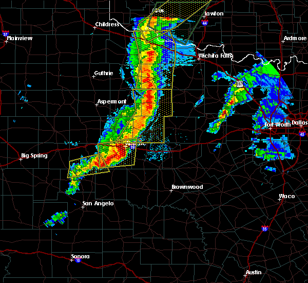 At 639 pm cdt, severe thunderstorms were located along a line extending from near seymour to near throckmorton to 7 miles southeast of nugent, moving east at 35 mph (radar indicated). Hazards include 60 mph wind gusts and quarter size hail. Hail damage to vehicles is expected. expect wind damage to roofs, siding, and trees. these severe storms will be near, throckmorton around 645 pm cdt. albany and elbert around 700 pm cdt. other locations impacted by these severe thunderstorms include mccarty lake, us-180 near the shackelford- stephens county line, the intersection of us- 283 and ranch road 209, us-183 near the throckmorton- stephens county line, lake fort phantom hill, the intersection of us- 183 and us-283 and the intersection of us-380 and highway 222. A tornado watch remains in effect until midnight cdt for west central texas. At 639 pm cdt, severe thunderstorms were located along a line extending from near seymour to near throckmorton to 7 miles southeast of nugent, moving east at 35 mph (radar indicated). Hazards include 60 mph wind gusts and quarter size hail. Hail damage to vehicles is expected. expect wind damage to roofs, siding, and trees. these severe storms will be near, throckmorton around 645 pm cdt. albany and elbert around 700 pm cdt. other locations impacted by these severe thunderstorms include mccarty lake, us-180 near the shackelford- stephens county line, the intersection of us- 283 and ranch road 209, us-183 near the throckmorton- stephens county line, lake fort phantom hill, the intersection of us- 183 and us-283 and the intersection of us-380 and highway 222. A tornado watch remains in effect until midnight cdt for west central texas.
|
| 4/26/2016 6:26 PM CDT |
 At 625 pm cdt, a severe thunderstorm was located over view, or 12 miles southwest of abilene, moving east at 40 mph. this storm will approach abilene in the next 20 to 30 minutes (radar indicated). Hazards include 60 mph wind gusts and half dollar size hail. Hail damage to vehicles is expected. expect wind damage to roofs, siding, and trees. this severe storm will be near, buffalo gap and dyess afb around 630 pm cdt. tye around 635 pm cdt. potosi around 650 pm cdt. hamby around 655 pm cdt. other locations impacted by this severe thunderstorm include impact, ovalo, kirby lake, lake abilene, camp tonkawa and camp butman. this includes interstate 20 between mile markers 258 and 297. A tornado watch remains in effect until midnight cdt for west central texas. At 625 pm cdt, a severe thunderstorm was located over view, or 12 miles southwest of abilene, moving east at 40 mph. this storm will approach abilene in the next 20 to 30 minutes (radar indicated). Hazards include 60 mph wind gusts and half dollar size hail. Hail damage to vehicles is expected. expect wind damage to roofs, siding, and trees. this severe storm will be near, buffalo gap and dyess afb around 630 pm cdt. tye around 635 pm cdt. potosi around 650 pm cdt. hamby around 655 pm cdt. other locations impacted by this severe thunderstorm include impact, ovalo, kirby lake, lake abilene, camp tonkawa and camp butman. this includes interstate 20 between mile markers 258 and 297. A tornado watch remains in effect until midnight cdt for west central texas.
|
| 4/26/2016 6:15 PM CDT |
 At 615 pm cdt, severe thunderstorms were located along a line extending from goree to 6 miles southeast of irby to near hawley, moving northeast at 75 mph (radar indicated). Hazards include 60 mph wind gusts and half dollar size hail. Hail damage to vehicles is expected. expect wind damage to roofs, siding, and trees. severe thunderstorms will be near, millers creek reservoir around 620 pm cdt. nugent around 625 pm cdt. throckmorton around 630 pm cdt. albany and elbert around 640 pm cdt. other locations impacted by these severe thunderstorms include mccarty lake, us-180 near the shackelford- stephens county line, the intersection of us- 283 and ranch road 209, us-183 near the throckmorton- stephens county line, lake fort phantom hill, the intersection of us- 180 and farm road 600, the intersection of us-183 and us- 283, the intersection of us- 380 and highway 222, big country baptist assembly and us- 283 near the callahan-shackelford county line. A tornado watch remains in effect until midnight cdt for west central texas. At 615 pm cdt, severe thunderstorms were located along a line extending from goree to 6 miles southeast of irby to near hawley, moving northeast at 75 mph (radar indicated). Hazards include 60 mph wind gusts and half dollar size hail. Hail damage to vehicles is expected. expect wind damage to roofs, siding, and trees. severe thunderstorms will be near, millers creek reservoir around 620 pm cdt. nugent around 625 pm cdt. throckmorton around 630 pm cdt. albany and elbert around 640 pm cdt. other locations impacted by these severe thunderstorms include mccarty lake, us-180 near the shackelford- stephens county line, the intersection of us- 283 and ranch road 209, us-183 near the throckmorton- stephens county line, lake fort phantom hill, the intersection of us- 180 and farm road 600, the intersection of us-183 and us- 283, the intersection of us- 380 and highway 222, big country baptist assembly and us- 283 near the callahan-shackelford county line. A tornado watch remains in effect until midnight cdt for west central texas.
|
| 4/26/2016 6:13 PM CDT |
 At 613 pm cdt, a severe thunderstorm was located 9 miles west of view, or 19 miles southwest of abilene, moving east at 50 mph (radar indicated). Hazards include 60 mph wind gusts and half dollar size hail. Hail damage to vehicles is expected. expect wind damage to roofs, siding, and trees. this severe thunderstorm will be near, view and dyess afb around 625 pm cdt. tye and buffalo gap around 630 pm cdt. potosi around 640 pm cdt. hamby around 645 pm cdt. other locations impacted by this severe thunderstorm include impact, ovalo, kirby lake, lake abilene, camp tonkawa and camp butman. this includes interstate 20 between mile markers 258 and 297. A tornado watch remains in effect until midnight cdt for west central texas. At 613 pm cdt, a severe thunderstorm was located 9 miles west of view, or 19 miles southwest of abilene, moving east at 50 mph (radar indicated). Hazards include 60 mph wind gusts and half dollar size hail. Hail damage to vehicles is expected. expect wind damage to roofs, siding, and trees. this severe thunderstorm will be near, view and dyess afb around 625 pm cdt. tye and buffalo gap around 630 pm cdt. potosi around 640 pm cdt. hamby around 645 pm cdt. other locations impacted by this severe thunderstorm include impact, ovalo, kirby lake, lake abilene, camp tonkawa and camp butman. this includes interstate 20 between mile markers 258 and 297. A tornado watch remains in effect until midnight cdt for west central texas.
|
| 4/19/2016 11:16 PM CDT |
 At 1116 pm cdt, a severe thunderstorm was located over hawley, or 11 miles northwest of abilene, moving southeast at 30 mph (radar indicated). Hazards include 60 mph wind gusts and quarter size hail. Hail damage to vehicles is expected. expect wind damage to roofs, siding, and trees. this severe storm will be near, north abilene around 1130 pm cdt. hamby around 1140 pm cdt. other locations impacted by this severe thunderstorm include impact, lake fort phantom hill and hodges. This includes interstate 20 between mile markers 285 and 288. At 1116 pm cdt, a severe thunderstorm was located over hawley, or 11 miles northwest of abilene, moving southeast at 30 mph (radar indicated). Hazards include 60 mph wind gusts and quarter size hail. Hail damage to vehicles is expected. expect wind damage to roofs, siding, and trees. this severe storm will be near, north abilene around 1130 pm cdt. hamby around 1140 pm cdt. other locations impacted by this severe thunderstorm include impact, lake fort phantom hill and hodges. This includes interstate 20 between mile markers 285 and 288.
|
| 4/19/2016 11:05 PM CDT |
 At 1105 pm cdt, a severe thunderstorm was located 5 miles northwest of hawley, moving southeast at 30 mph (radar indicated). Hazards include 60 mph wind gusts and quarter size hail. Hail damage to vehicles is expected. expect wind damage to roofs, siding, and trees. this severe thunderstorm will be near, hawley around 1115 pm cdt. north abilene around 1130 pm cdt. hamby around 1140 pm cdt. other locations impacted by this severe thunderstorm include impact, lake fort phantom hill, hodges and truby. This includes interstate 20 between mile markers 285 and 288. At 1105 pm cdt, a severe thunderstorm was located 5 miles northwest of hawley, moving southeast at 30 mph (radar indicated). Hazards include 60 mph wind gusts and quarter size hail. Hail damage to vehicles is expected. expect wind damage to roofs, siding, and trees. this severe thunderstorm will be near, hawley around 1115 pm cdt. north abilene around 1130 pm cdt. hamby around 1140 pm cdt. other locations impacted by this severe thunderstorm include impact, lake fort phantom hill, hodges and truby. This includes interstate 20 between mile markers 285 and 288.
|
| 4/17/2016 12:10 AM CDT |
 At 1209 am cdt, a severe thunderstorm was located near hamby, or 9 miles northeast of abilene, moving northeast at 45 mph (radar indicated). Hazards include 60 mph wind gusts and quarter size hail. Hail damage to vehicles is expected. expect wind damage to roofs, siding, and trees. This severe thunderstorm will remain over mainly rural areas of northern callahan, northeastern taylor, western shackelford and southeastern jones counties, including the following locations:. At 1209 am cdt, a severe thunderstorm was located near hamby, or 9 miles northeast of abilene, moving northeast at 45 mph (radar indicated). Hazards include 60 mph wind gusts and quarter size hail. Hail damage to vehicles is expected. expect wind damage to roofs, siding, and trees. This severe thunderstorm will remain over mainly rural areas of northern callahan, northeastern taylor, western shackelford and southeastern jones counties, including the following locations:.
|
| 4/17/2016 12:00 AM CDT |
 At 1159 pm cdt, a severe thunderstorm was located over abilene, moving northeast at 55 mph. this thunderstorms is moving into the city of abilene and has the potential of producing wind gusts to near 60 mph and quarter size hail (radar indicated). Hazards include 60 mph wind gusts and quarter size hail. Hail damage to vehicles is expected. expect wind damage to roofs, siding, and trees. this severe thunderstorm will be near, hamby around 1205 am cdt. other locations impacted by this severe thunderstorm include impact, hodges, mccarty lake, i-20 near the callahan- eastland county line, us-283 near the callahan- shackelford county line, lake fort phantom hill, kirby lake, the intersection of us- 180 and farm road 600 and big country baptist assembly. This includes interstate 20 between mile markers 278 and 323. At 1159 pm cdt, a severe thunderstorm was located over abilene, moving northeast at 55 mph. this thunderstorms is moving into the city of abilene and has the potential of producing wind gusts to near 60 mph and quarter size hail (radar indicated). Hazards include 60 mph wind gusts and quarter size hail. Hail damage to vehicles is expected. expect wind damage to roofs, siding, and trees. this severe thunderstorm will be near, hamby around 1205 am cdt. other locations impacted by this severe thunderstorm include impact, hodges, mccarty lake, i-20 near the callahan- eastland county line, us-283 near the callahan- shackelford county line, lake fort phantom hill, kirby lake, the intersection of us- 180 and farm road 600 and big country baptist assembly. This includes interstate 20 between mile markers 278 and 323.
|
| 3/8/2016 8:13 PM CST |
 At 812 pm cst, a severe thunderstorm was located over potosi, or 9 miles southeast of abilene, moving northeast at 50 mph (radar indicated). Hazards include 60 mph wind gusts and nickel size hail. Expect damage to roofs. siding. and trees. this severe storm will be near, clyde around 825 pm cst. other locations impacted by this severe thunderstorm include the intersection of us-283 and highway 36. This includes interstate 20 between mile markers 291 and 304. At 812 pm cst, a severe thunderstorm was located over potosi, or 9 miles southeast of abilene, moving northeast at 50 mph (radar indicated). Hazards include 60 mph wind gusts and nickel size hail. Expect damage to roofs. siding. and trees. this severe storm will be near, clyde around 825 pm cst. other locations impacted by this severe thunderstorm include the intersection of us-283 and highway 36. This includes interstate 20 between mile markers 291 and 304.
|
| 3/8/2016 7:55 PM CST |
 At 754 pm cst, a severe thunderstorm was located near lawn, or 18 miles south of abilene, moving northeast at 50 mph (radar indicated). Hazards include 60 mph wind gusts and quarter size hail. Hail damage to vehicles is expected. expect wind damage to roofs, siding, and trees. this severe thunderstorm will be near, dudley around 800 pm cst. eula around 810 pm cst. clyde around 815 pm cst. other locations impacted by this severe thunderstorm include ovalo, kirby lake, the intersection of us- 283 and highway 36 and camp tonkawa. This includes interstate 20 between mile markers 291 and 304. At 754 pm cst, a severe thunderstorm was located near lawn, or 18 miles south of abilene, moving northeast at 50 mph (radar indicated). Hazards include 60 mph wind gusts and quarter size hail. Hail damage to vehicles is expected. expect wind damage to roofs, siding, and trees. this severe thunderstorm will be near, dudley around 800 pm cst. eula around 810 pm cst. clyde around 815 pm cst. other locations impacted by this severe thunderstorm include ovalo, kirby lake, the intersection of us- 283 and highway 36 and camp tonkawa. This includes interstate 20 between mile markers 291 and 304.
|
| 12/27/2015 1:03 AM CST | Storm damage reported in callahan county TX, 6.2 miles W of Abilene, TX |
| 12/27/2015 12:27 AM CST |
 At 1225 am cst, a severe thunderstorm was located near hamby, or near abilene, moving northeast at 50 mph (measured by asos). Hazards include 60 mph wind gusts and penny size hail. Expect damage to roofs. siding and trees. this severe thunderstorm will be near, nugent around 1240 am cst. Other locations impacted by this severe thunderstorm include. At 1225 am cst, a severe thunderstorm was located near hamby, or near abilene, moving northeast at 50 mph (measured by asos). Hazards include 60 mph wind gusts and penny size hail. Expect damage to roofs. siding and trees. this severe thunderstorm will be near, nugent around 1240 am cst. Other locations impacted by this severe thunderstorm include.
|
| 12/27/2015 12:19 AM CST | Storm damage reported in taylor county TX, 5.1 miles NNW of Abilene, TX |
| 12/26/2015 7:44 PM CST |
 At 743 pm cst, a severe thunderstorm was located near hawley, or 8 miles northwest of abilene, moving north at 25 mph (radar indicated). Hazards include quarter size hail. Damage to vehicles is expected. this severe storm will be near, hawley around 755 pm cst. abilene around 800 pm cst. other locations impacted by this severe thunderstorm include hodges. This includes interstate 20 near mile marker 283. At 743 pm cst, a severe thunderstorm was located near hawley, or 8 miles northwest of abilene, moving north at 25 mph (radar indicated). Hazards include quarter size hail. Damage to vehicles is expected. this severe storm will be near, hawley around 755 pm cst. abilene around 800 pm cst. other locations impacted by this severe thunderstorm include hodges. This includes interstate 20 near mile marker 283.
|
| 12/26/2015 7:30 PM CST |
 At 730 pm cst, a severe thunderstorm was located over dyess afb, or near abilene, moving north at 35 mph (radar indicated). Hazards include quarter size hail. Damage to vehicles is expected. this severe storm will be near, hawley around 755 pm cst. Other locations impacted by this severe thunderstorm include. At 730 pm cst, a severe thunderstorm was located over dyess afb, or near abilene, moving north at 35 mph (radar indicated). Hazards include quarter size hail. Damage to vehicles is expected. this severe storm will be near, hawley around 755 pm cst. Other locations impacted by this severe thunderstorm include.
|
| 12/26/2015 7:15 PM CST |
 At 714 pm cst, a severe thunderstorm was located over buffalo gap, or 10 miles south of abilene, moving north at 30 mph (radar indicated). Hazards include quarter size hail. Damage to vehicles is expected. this severe thunderstorm will be near, potosi around 725 pm cst. dyess afb around 730 pm cst. tye around 735 pm cst. hawley around 755 pm cst. abilene around 800 pm cst. Other locations impacted by this severe thunderstorm include. At 714 pm cst, a severe thunderstorm was located over buffalo gap, or 10 miles south of abilene, moving north at 30 mph (radar indicated). Hazards include quarter size hail. Damage to vehicles is expected. this severe thunderstorm will be near, potosi around 725 pm cst. dyess afb around 730 pm cst. tye around 735 pm cst. hawley around 755 pm cst. abilene around 800 pm cst. Other locations impacted by this severe thunderstorm include.
|
| 12/12/2015 9:29 PM CST |
 At 928 pm cst, severe thunderstorms were located along a line extending from near nugent, to abilene, to near lawn, moving east at 30 mph (radar indicated). Hazards include 60 mph wind gusts. Expect damage to roofs. siding and trees. these severe storms will be near, nugent around 935 pm cst. clyde and lueders around 940 pm cst. dudley around 945 pm cst. Other locations impacted by these severe thunderstorms include. At 928 pm cst, severe thunderstorms were located along a line extending from near nugent, to abilene, to near lawn, moving east at 30 mph (radar indicated). Hazards include 60 mph wind gusts. Expect damage to roofs. siding and trees. these severe storms will be near, nugent around 935 pm cst. clyde and lueders around 940 pm cst. dudley around 945 pm cst. Other locations impacted by these severe thunderstorms include.
|
| 12/12/2015 9:11 PM CST |
 At 911 pm cst, severe thunderstorms were located along a line extending from near hawley to near bradshaw, moving northeast at 30 mph (radar indicated). Hazards include 60 mph wind gusts. Expect damage to roofs. siding and trees. severe thunderstorms will be near, hawley around 915 pm cst. abilene around 920 pm cst. nugent around 930 pm cst. lueders and dudley around 940 pm cst. potosi around 945 pm cst. eula around 950 pm cst. clyde around 1000 pm cst. Other locations impacted by these severe thunderstorms include. At 911 pm cst, severe thunderstorms were located along a line extending from near hawley to near bradshaw, moving northeast at 30 mph (radar indicated). Hazards include 60 mph wind gusts. Expect damage to roofs. siding and trees. severe thunderstorms will be near, hawley around 915 pm cst. abilene around 920 pm cst. nugent around 930 pm cst. lueders and dudley around 940 pm cst. potosi around 945 pm cst. eula around 950 pm cst. clyde around 1000 pm cst. Other locations impacted by these severe thunderstorms include.
|
| 11/17/2015 12:02 AM CST | Storm damage reported in taylor county TX, 6.3 miles NNW of Abilene, TX |
| 11/16/2015 11:54 PM CST |
 At 1153 pm cst, severe thunderstorms were located along a line extending from stamford to hawley to near bradshaw, moving east at 50 mph. these severe thunderstorms will be moving across abilene through 1215 am (radar indicated). Hazards include 60 mph wind gusts and penny size hail. Expect damage to roofs. siding and trees. these severe storms will be near, abilene, avoca and nugent around 1200 am cst. stamford and hamby around 1205 am cst. oplin around 1215 am cst. Other locations impacted by these severe thunderstorms include. At 1153 pm cst, severe thunderstorms were located along a line extending from stamford to hawley to near bradshaw, moving east at 50 mph. these severe thunderstorms will be moving across abilene through 1215 am (radar indicated). Hazards include 60 mph wind gusts and penny size hail. Expect damage to roofs. siding and trees. these severe storms will be near, abilene, avoca and nugent around 1200 am cst. stamford and hamby around 1205 am cst. oplin around 1215 am cst. Other locations impacted by these severe thunderstorms include.
|
| 11/16/2015 11:40 PM CST |
 At 1139 pm cst, severe thunderstorms were located along a line extending from 9 miles west of stamford to near noodle to near happy valley, moving east at 50 mph (radar indicated). Hazards include 60 mph wind gusts and penny size hail. Expect damage to roofs. siding and trees. severe thunderstorms will be near, hawley around 1150 pm cst. bradshaw and avoca around 1155 pm cst. abilene and nugent around 1200 am cst. stamford, lawn and hamby around 1205 am cst. oplin around 1215 am cst. Other locations impacted by these severe thunderstorms include. At 1139 pm cst, severe thunderstorms were located along a line extending from 9 miles west of stamford to near noodle to near happy valley, moving east at 50 mph (radar indicated). Hazards include 60 mph wind gusts and penny size hail. Expect damage to roofs. siding and trees. severe thunderstorms will be near, hawley around 1150 pm cst. bradshaw and avoca around 1155 pm cst. abilene and nugent around 1200 am cst. stamford, lawn and hamby around 1205 am cst. oplin around 1215 am cst. Other locations impacted by these severe thunderstorms include.
|
| 11/16/2015 11:09 PM CST |
 At 1108 pm cst, severe thunderstorms were located along a line extending from near roby to near longworth to near maryneal, moving northeast at 50 mph (radar indicated). Hazards include 70 mph wind gusts and penny size hail. Expect considerable tree damage. damage is likely to mobile homes, roofs and outbuildings. these severe storms will be near, longworth around 1115 pm cst. sylvester around 1120 pm cst. mccaulley around 1125 pm cst. other locations impacted by these severe thunderstorms include lake sweetwater, capitola, the intersection of highway 70 and ranch road 53, hitson, stith, gannon, busby, camp boothe oaks, the intersection of us- 180 and ranch road 126 and camp butman. this includes interstate 20 between mile markers 231 and 278. a tornado watch remains in effect until 200 am cst for west central texas. A tornado watch also remains in effect until 300 am cst for west central texas. At 1108 pm cst, severe thunderstorms were located along a line extending from near roby to near longworth to near maryneal, moving northeast at 50 mph (radar indicated). Hazards include 70 mph wind gusts and penny size hail. Expect considerable tree damage. damage is likely to mobile homes, roofs and outbuildings. these severe storms will be near, longworth around 1115 pm cst. sylvester around 1120 pm cst. mccaulley around 1125 pm cst. other locations impacted by these severe thunderstorms include lake sweetwater, capitola, the intersection of highway 70 and ranch road 53, hitson, stith, gannon, busby, camp boothe oaks, the intersection of us- 180 and ranch road 126 and camp butman. this includes interstate 20 between mile markers 231 and 278. a tornado watch remains in effect until 200 am cst for west central texas. A tornado watch also remains in effect until 300 am cst for west central texas.
|
| 11/16/2015 10:53 PM CST |
 At 1052 pm cst, a severe thunderstorm was located near sweetwater, moving northeast at 70 mph (radar indicated). Hazards include 70 mph wind gusts and penny size hail. Expect considerable tree damage. damage is likely to mobile homes, roofs and outbuildings. this severe storm will be near, longworth around 1100 pm cst. roby around 1105 pm cst. sylvester around 1110 pm cst. mccaulley around 1115 pm cst. other locations impacted by this severe thunderstorm include lake sweetwater, capitola, the intersection of highway 70 and ranch road 53, hitson, us-84 near the nolan-fisher county line, stith, i-20 near the nolan-mitchell county line, gannon, busby and camp boothe oaks. this includes interstate 20 between mile markers 229 and 278. a tornado watch remains in effect until 200 am cst for west central texas. A tornado watch also remains in effect until 300 am cst for west central texas. At 1052 pm cst, a severe thunderstorm was located near sweetwater, moving northeast at 70 mph (radar indicated). Hazards include 70 mph wind gusts and penny size hail. Expect considerable tree damage. damage is likely to mobile homes, roofs and outbuildings. this severe storm will be near, longworth around 1100 pm cst. roby around 1105 pm cst. sylvester around 1110 pm cst. mccaulley around 1115 pm cst. other locations impacted by this severe thunderstorm include lake sweetwater, capitola, the intersection of highway 70 and ranch road 53, hitson, us-84 near the nolan-fisher county line, stith, i-20 near the nolan-mitchell county line, gannon, busby and camp boothe oaks. this includes interstate 20 between mile markers 229 and 278. a tornado watch remains in effect until 200 am cst for west central texas. A tornado watch also remains in effect until 300 am cst for west central texas.
|
| 11/16/2015 10:40 PM CST |
 At 1039 pm cst, a severe thunderstorm was located near loraine, or 9 miles southwest of roscoe, moving northeast at 60 mph (radar indicated). Hazards include 70 mph wind gusts and penny size hail. Expect considerable tree damage. damage is likely to mobile homes, roofs and outbuildings. this severe thunderstorm will be near, wastella around 1045 pm cst. roscoe around 1050 pm cst. sweetwater around 1055 pm cst. longworth around 1105 pm cst. sylvester around 1110 pm cst. mccaulley around 1115 pm cst. other locations impacted by this severe thunderstorm include lake sweetwater, capitola, the intersection of highway 70 and ranch road 53, hitson, us-84 near the nolan-fisher county line, stith, i-20 near the nolan-mitchell county line, gannon, busby and camp boothe oaks. this includes interstate 20 between mile markers 229 and 278. A tornado watch remains in effect until 200 am cst for west central texas. At 1039 pm cst, a severe thunderstorm was located near loraine, or 9 miles southwest of roscoe, moving northeast at 60 mph (radar indicated). Hazards include 70 mph wind gusts and penny size hail. Expect considerable tree damage. damage is likely to mobile homes, roofs and outbuildings. this severe thunderstorm will be near, wastella around 1045 pm cst. roscoe around 1050 pm cst. sweetwater around 1055 pm cst. longworth around 1105 pm cst. sylvester around 1110 pm cst. mccaulley around 1115 pm cst. other locations impacted by this severe thunderstorm include lake sweetwater, capitola, the intersection of highway 70 and ranch road 53, hitson, us-84 near the nolan-fisher county line, stith, i-20 near the nolan-mitchell county line, gannon, busby and camp boothe oaks. this includes interstate 20 between mile markers 229 and 278. A tornado watch remains in effect until 200 am cst for west central texas.
|
| 5/30/2015 2:04 AM CDT | At 159 am cdt, severe thunderstorms were located along a line extending from clyde to 7 miles northwest of rowena, and moving east at 35 mph (radar indicated). Hazards include 60 mph wind gusts. Expect damage to roofs. siding and trees. severe thunderstorms will be near, rowena and ballinger around 210 am cdt. crews and baird around 215 am cdt. oplin and benoit around 220 am cdt. novice around 225 am cdt. glen cove and rowden around 230 am cdt. other locations in the warning include goldsboro, lake coleman, us-283 near the coleman-callahan county line and hords creek reservoir. This includes interstate 20 between mile markers 259 and 307. |
| 5/30/2015 1:42 AM CDT | At 139 am cdt, severe thunderstorms were located along a line extending from abilene to tennyson, moving east at 35 mph (radar indicated). Hazards include 60 mph wind gusts. Expect damage to roofs. siding and trees. severe thunderstorms will be near, norton and bradshaw around 150 am cdt. winters and tuscola around 155 am cdt. lawn around 200 am cdt. hatchel and eula around 205 am cdt. rowena and ballinger around 210 am cdt. crews and baird around 215 am cdt. other locations in the warning include ovalo, ballinger lake, lake winters lake, goldsboro, lake coleman, us-283 near the coleman-callahan county line and hords creek reservoir. This includes interstate 20 between mile markers 252 and 307. |
| 5/30/2015 1:34 AM CDT | At 132 am cdt, severe thunderstorms were located along a line extending from tye to tennyson to 11 miles southwest of broome, and moving southeast at 40 mph (radar indicated). Hazards include 60 mph wind gusts and nickel size hail. Expect damage to roofs. siding and trees. severe thunderstorms will be near, caps and maverick around 140 am cdt. wylie and norton around 145 am cdt. tuscola and bradshaw around 150 am cdt. other locations in the warning include lake abilene, wilmeth, pumphrey, camp tonkawa, drasco and ovalo. This includes interstate 20 between mile markers 240 and 279. |
| 5/30/2015 1:15 AM CDT | At 114 am cdt, severe thunderstorms were located along a line extending from nolan to robert lee to 10 miles southwest of sterling city, moving east-southeast at 40 mph (radar indicated). Hazards include 60 mph wind gusts and quarter size hail. Hail damage to vehicles is expected. expect wind damage to roofs, siding and trees. severe thunderstorms will be near, fort chadbourne and hylton around 120 am cdt. coronados camp and water valley around 125 am cdt. wingate and tennyson around 130 am cdt. norton and maverick around 135 am cdt. bradshaw and winters around 140 am cdt. other locations in the warning include shep, the intersection of highway 208 and ranch road 2662, us-87 near the coke-tom green county line, wilmeth, pumphrey and drasco. This includes interstate 20 between mile markers 240 and 280. |
| 5/28/2015 7:18 PM CDT | At 715 pm cdt, a severe thunderstorm was located near putnam, and moving north at 25 mph. the line of storms continues to build south (radar indicated). Hazards include 60 mph wind gusts and quarter size hail. Hail damage to vehicles is expected. expect wind damage to roofs, siding and trees. the severe thunderstorm will be near, moran around 735 pm cdt. This includes interstate 20 between mile markers 288 and 316. |
| 5/28/2015 7:07 PM CDT | At 705 pm cdt, a severe thunderstorm was located 9 miles east of sweetwater, and moving north at 35 mph (radar indicated). Hazards include 60 mph wind gusts and quarter size hail. Hail damage to vehicles is expected. expect wind damage to roofs, siding and trees. Locations impacted include, this includes interstate 20 between mile markers 227 and 231. |
| 5/28/2015 6:54 PM CDT | At 652 pm cdt, a severe thunderstorm was located 6 miles southwest of putnam, moving north at 25 mph. although individual storms are moving north the line of storms is propagating south (radar indicated). Hazards include 60 mph wind gusts and quarter size hail. Hail damage to vehicles is expected. expect wind damage to roofs, siding and trees. the severe thunderstorm will be near, putnam around 705 pm cdt. moran around 735 pm cdt. other locations in the warning include i-20 near the callahan-eastland county line. This includes interstate 20 between mile markers 288 and 316. |
| 5/28/2015 6:44 PM CDT | At 642 pm cdt, a severe thunderstorm was located near nolan, moving north at 35 mph. although the individual storms are moving north, the line will continue to propagate south (radar indicated). Hazards include 60 mph wind gusts and quarter size hail. Hail damage to vehicles is expected. expect wind damage to roofs, siding and trees. the severe thunderstorm will affect mainly rural areas of nolan, northeastern sterling, northern coke, northern runnels and western taylor counties. This includes interstate 20 between mile markers 227 and 231. |
| 5/28/2015 5:50 PM CDT | At 547 pm cdt, a severe thunderstorm was located 10 miles southwest of throckmorton, and moving northeast at 40 mph. at 540 pm the woodson sheriffs office estimated wind gusts to near 60 mph in woodson (law enforcement). Hazards include 60 mph wind gusts and quarter size hail. Hail damage to vehicles is expected. expect wind damage to roofs, siding and trees. The severe thunderstorm will be near, throckmorton around 600 pm cdt. |
| 5/28/2015 5:46 PM CDT | At 544 pm cdt, a severe thunderstorm was located 11 miles northwest of fort griffin, and moving northeast at 40 mph (radar indicated). Hazards include 60 mph wind gusts and quarter size hail. Hail damage to vehicles is expected. expect wind damage to roofs, siding and trees. the severe thunderstorm will be near, throckmorton around 605 pm cdt. Other locations in the warning include the intersection of us-380 and highway 222. |
| 5/28/2015 5:27 PM CDT | At 524 pm cdt, a severe thunderstorm was located 11 miles northeast of lueders, moving northeast at 35 mph (radar indicated). Hazards include 60 mph wind gusts and quarter size hail. Hail damage to vehicles is expected. expect wind damage to roofs, siding and trees. the severe thunderstorm will be near, throckmorton around 605 pm cdt. Other locations in the warning include the intersection of us-380 and highway 222. |
| 5/26/2015 8:31 PM CDT | At 828 pm cdt, a severe thunderstorm was located near dudley, moving east at 40 mph (radar indicated). Hazards include golf ball size hail and 60 mph wind gusts. People and pets outdoors will be injured. expect hail damage to roofs, siding, windows and vehicles. expect wind damage to roofs, siding and trees. the severe thunderstorm will be near, rowden around 850 pm cdt. putnam and atwell around 910 pm cdt. other locations in the warning include admiral and i-20 near the callahan-eastland county line. This includes interstate 20 between mile markers 301 and 316. |
| 5/26/2015 8:08 PM CDT | Ping Pong Ball sized hail reported 5.9 miles NNW of Abilene, TX |
| 5/25/2015 11:17 AM CDT | At 1112 am cdt, severe thunderstorms were located along a line extending from haskell to just west of albany to oplin, moving northeast at 40 mph. the highest winds will likely approach albany (radar indicated). Hazards include 70 mph wind gusts. Expect considerable tree damage. damage is likely to mobile homes, roofs and outbuildings. severe thunderstorms will be near, cross plains around 1120 am cdt. irby and cottonwood around 1125 am cdt. atwell and putnam around 1130 am cdt. albany around 1135 am cdt. moran around 1140 am cdt. ibex and fort griffin around 1145 am cdt. other locations in the warning include us-283 near the callahan-shackelford county line, mccarty lake, i-20 near the callahan-eastland county line, the intersection of us-380 and highway 222, the intersection of us-283 and ranch road 209, us-180 near the shackelford-stephens county line, the intersection of us-183 and us-283, lusk and us-380 near the throckmorton-young county line. This includes interstate 20 between mile markers 287 and 316. |
| 5/25/2015 11:05 AM CDT | At 1101 am cdt, severe thunderstorms were located along a line extending from paint creek to abilene to oplin, and moving east at 40 mph (radar indicated). Hazards include 70 mph wind gusts and nickel size hail. Expect considerable tree damage. damage is likely to mobile homes, roofs and outbuildings. severe thunderstorms will be near, paint creek and lake stamford marina around 1110 am cdt. clyde around 1115 am cdt. baird around 1125 am cdt. other locations in the warning include big country baptist assembly, mccarty lake and us-283 near the callahan-shackelford county line. This includes interstate 20 between mile markers 272 and 303. |
| 5/25/2015 10:51 AM CDT | At 1048 am cdt, severe thunderstorms were located along a line extending from 6 miles north of stamford to lawn, and moving east at 40 mph (radar indicated). Hazards include 70 mph wind gusts. Expect considerable tree damage. damage is likely to mobile homes, roofs and outbuildings. severe thunderstorms will be near, paint creek and potosi around 1100 am cdt. dudley and lake stamford marina around 1105 am cdt. oplin and eula around 1110 am cdt. clyde around 1115 am cdt. irby around 1120 am cdt. baird around 1125 am cdt. other locations in the warning include lake fort phantom hill, the intersection of us-180 and farm road 600, big country baptist assembly, us-283 near the callahan-shackelford county line, mccarty lake and the intersection of us-380 and highway 222. This includes interstate 20 between mile markers 259 and 303. |
| 5/25/2015 10:45 AM CDT | Measured at ktxs studio on the north side of abilen in taylor county TX, 2.3 miles ESE of Abilene, TX |
| 5/25/2015 10:38 AM CDT | Storm damage reported in taylor county TX, 9.3 miles ENE of Abilene, TX |
| 5/25/2015 10:38 AM CDT | At 1033 am cdt, severe thunderstorms were located along a line extending from 6 miles west of stamford to maverick, moving northeast at 40 mph (radar indicated). Hazards include 60 mph wind gusts. Expect damage to roofs. siding and trees. severe thunderstorms will be near, coronados camp and stamford around 1045 am cdt. abilene around 1050 am cdt. tye around 1050 am cdt. paint creek and caps around 1055 am cdt. lake stamford marina and buffalo gap around 1100 am cdt. wylie and tuscola around 1105 am cdt. lawn around 1110 am cdt. other locations in the warning include hodges, funston, camp tonkawa, lake abilene, the intersection of us-180 and farm road 600, impact, lake fort phantom hill, kirby lake, ovalo and big country baptist assembly. This includes interstate 20 between mile markers 259 and 304. |
| 5/23/2015 7:54 PM CDT | At 752 pm cdt, severe thunderstorms were located along a line extending from weinert to merkel, and moving east at 30 mph (radar indicated). Hazards include 60 mph wind gusts. Expect damage to roofs. siding and trees. severe thunderstorms will be near, weinert and haskell around 800 pm cdt. paint creek and hawley around 805 pm cdt. avoca around 810 pm cdt. lake stamford marina around 815 pm cdt. nugent and lueders around 820 pm cdt. Other locations in the warning include hodges, funston, us-277 near the haskell-knox county line, the intersection of us-180 and farm road 600 and lake fort phantom hill. |
| 5/23/2015 7:38 PM CDT | At 735 pm cdt, severe thunderstorms were located along a line extending from o`brien to trent, moving east at 35 mph (radar indicated). Hazards include 60 mph wind gusts. Expect damage to roofs. siding and trees. severe thunderstorms will be near, anson around 750 pm cdt. stamford around 755 pm cdt. weinert and haskell around 800 pm cdt. hawley around 805 pm cdt. paint creek and avoca around 810 pm cdt. lake stamford marina around 815 pm cdt. Other locations in the warning include truby, stith, hodges, us-277 near the haskell-knox county line, funston, the intersection of us-180 and farm road 600 and lake fort phantom hill. |
| 5/19/2015 5:38 PM CDT | At 536 pm cdt, a severe thunderstorm was located near lawn, moving northeast at 30 mph (radar indicated). Hazards include 60 mph wind gusts and quarter size hail. Hail damage to vehicles is expected. expect wind damage to roofs, siding and trees. the severe thunderstorm will be near, lawn around 540 pm cdt. dudley around 600 pm cdt. This includes interstate 20 between mile markers 286 and 296. |
| 5/16/2015 9:06 PM CDT | At 904 pm cdt, a severe thunderstorm was located near abilene, and moving east at 25 mph (radar indicated). Hazards include 60 mph wind gusts and half dollar size hail. Hail damage to vehicles is expected. expect wind damage to roofs, siding and trees. the severe thunderstorm will be near, hamby around 915 pm cdt. this includes interstate 20 between mile markers 273 and 287. 1. 25in. |
| 5/16/2015 9:05 PM CDT | Quarter sized hail reported 6.9 miles NNE of Abilene, TX, quarter size hail at john knox and ridgemont |
| 5/16/2015 8:44 PM CDT | At 843 pm cdt, a severe thunderstorm was located near caps, moving northeast at 35 mph (radar indicated). Hazards include ping pong ball size hail and 60 mph wind gusts. People and pets outdoors will be injured. expect hail damage to roofs, siding, windows and vehicles. expect wind damage to roofs, siding and trees. the severe thunderstorm will be near, abilene around 855 pm cdt. hamby around 910 pm cdt. other locations in the warning include kirby lake and impact. this includes interstate 20 between mile markers 272 and 287. 1. 50in. |
| 5/16/2015 8:38 PM CDT | Hen Egg sized hail reported 8.9 miles SSW of Abilene, TX |
| 5/16/2015 8:31 PM CDT | At 829 pm cdt, a severe thunderstorm was located near hamby, and moving east at 30 mph (trained weather spotters). Hazards include ping pong ball size hail and 60 mph wind gusts. People and pets outdoors will be injured. expect hail damage to roofs, siding, windows and vehicles. expect wind damage to roofs, siding and trees. the severe thunderstorm will affect mainly rural areas of northeastern taylor, northwestern callahan, southeastern jones and southwestern shackelford counties. this includes interstate 20 between mile markers 273 and 296. Possible. |
| 5/16/2015 8:25 PM CDT | Quarter sized hail reported 1.3 miles NW of Abilene, TX |
| 5/16/2015 8:24 PM CDT | Ping Pong Ball sized hail reported 1.3 miles NW of Abilene, TX, interstate 20 and campus court |
| 5/16/2015 8:19 PM CDT | At 817 pm cdt, a severe thunderstorm was located near abilene, and moving northeast at 30 mph (radar indicated). Hazards include 60 mph wind gusts and quarter size hail. Hail damage to vehicles is expected. expect wind damage to roofs, siding and trees. the severe thunderstorm will be near, hamby around 825 pm cdt. other locations in the warning include lake fort phantom hill. this includes interstate 20 between mile markers 271 and 296. Possible. |
| 5/16/2015 8:09 PM CDT | At 806 pm cdt, a severe thunderstorm was located near abilene, moving northeast at 30 mph (radar indicated). Hazards include 60 mph wind gusts and half dollar size hail. Hail damage to vehicles is expected. expect wind damage to roofs, siding and trees. the severe thunderstorm will be near, hamby around 825 pm cdt. other locations in the warning include lake fort phantom hill. this includes interstate 20 between mile markers 270 and 296. 1. 25in. |
| 5/16/2015 7:39 PM CDT | At 735 pm cdt, a severe thunderstorm was located near hamby, moving east at 30 mph (radar indicated). Hazards include tennis ball size hail and 60 mph wind gusts. People and pets outdoors will be injured. expect hail damage to roofs, siding, windows and vehicles. expect wind damage to roofs, siding and trees. the severe thunderstorm will affect mainly rural areas of northeastern taylor, northern callahan, shackelford and southeastern jones counties, including the following locations, us-283 near the callahan-shackelford county line. this includes interstate 20 between mile markers 281 and 313. 2. 50in. |
| 5/16/2015 7:30 PM CDT | Ping Pong Ball sized hail reported 8.2 miles SW of Abilene, TX |
| 5/16/2015 7:30 PM CDT | Tea Cup sized hail reported 5.3 miles SSW of Abilene, TX, south end of lake fort phantom hill |
| 5/16/2015 7:25 PM CDT | Quarter sized hail reported 5.9 miles SSW of Abilene, TX, east side of lake fort phantom hill |
| 5/16/2015 7:25 PM CDT | Ping Pong Ball sized hail reported 6.5 miles SW of Abilene, TX |
| 5/16/2015 7:24 PM CDT | At 721 pm cdt, a severe thunderstorm was located 6 miles south of nugent, and moving east at 30 mph. this is a very dangerous storm (radar indicated). Hazards include baseball size hail and 60 mph wind gusts. People and pets outdoors will be severely injured. expect shattered windows, extensive damage to roofs, siding and vehicles. locations impacted include, albany, hamby, lueders, big country baptist assembly, mccarty lake and us-283 near the callahan-shackelford county line. this includes interstate 20 between mile markers 276 and 307. 2. 75in. |
| 5/16/2015 7:09 PM CDT | At 706 pm cdt, a severe thunderstorm was located near nugent, moving east at 30 mph (radar indicated). Hazards include golf ball size hail and 60 mph wind gusts. People and pets outdoors will be injured. expect hail damage to roofs, siding, windows and vehicles. expect wind damage to roofs, siding and trees. the severe thunderstorm will affect the northern parts of abilene, along with mccarty lake. this includes interstate 20 between mile markers 270 and 307. 1. 75in. |
| 5/16/2015 7:00 PM CDT | Tree limbs down in jones county TX, 8.3 miles SSW of Abilene, TX |
| 5/16/2015 6:59 PM CDT | At 656 pm cdt, a severe thunderstorm was located near hawley, and moving east at 30 mph (radar indicated). Hazards include hen egg size hail and 60 mph wind gusts. People and pets outdoors will be injured. expect hail damage to roofs, siding, windows and vehicles. expect wind damage to roofs, siding and trees. the severe thunderstorm will be near, nugent around 715 pm cdt. other locations in the warning include lake fort phantom hill. this includes interstate 20 between mile markers 265 and 302. 2. 00in. |
| 5/16/2015 6:48 PM CDT | At 645 pm cdt, a severe thunderstorm was located near hawley, and moving east at 35 mph (radar indicated). Hazards include ping pong ball size hail and 60 mph wind gusts. People and pets outdoors will be injured. expect hail damage to roofs, siding, windows and vehicles. expect wind damage to roofs, siding and trees. the severe thunderstorm will be near, nugent around 705 pm cdt. other locations in the warning include lake fort phantom hill. this includes interstate 20 between mile markers 265 and 302. 1. 50in. |
| 5/16/2015 6:36 PM CDT | At 634 pm cdt, a severe thunderstorm was located 6 miles east of noodle, moving east at 40 mph (radar indicated). Hazards include ping pong ball size hail and 60 mph wind gusts. People and pets outdoors will be injured. expect hail damage to roofs, siding, windows and vehicles. expect wind damage to roofs, siding and trees. the severe thunderstorm will be near, hawley around 650 pm cdt. nugent around 705 pm cdt. other locations in the warning include hodges and lake fort phantom hill. this includes interstate 20 between mile markers 261 and 302. 1. 50in. |
| 5/10/2015 3:47 AM CDT | At 344 am cdt, a severe thunderstorm was located 6 miles east of hamby, moving northeast at 30 mph (radar indicated). Hazards include 60 mph wind gusts and quarter size hail. Hail damage to vehicles is expected. expect wind damage to roofs, siding and trees. the severe thunderstorm will be near, albany around 425 am cdt. ibex around 435 am cdt. other locations in the warning include us-283 near the callahan-shackelford county line, mccarty lake and us-180 near the shackelford-stephens county line. this includes interstate 20 between mile markers 284 and 316. 1. 00in. |
| 5/8/2015 9:05 PM CDT | At 903 pm cdt, a severe thunderstorm was located near nugent, and moving northeast at 25 mph (radar indicated). Hazards include half dollar size hail. Damage to vehicles is expected. the severe thunderstorm will affect mainly rural areas of southeastern jones and western shackelford counties. 1. 25in. |
| 5/8/2015 8:46 PM CDT | At 843 pm cdt, a severe thunderstorm was located near hawley, moving northeast at 35 mph (radar indicated). Hazards include half dollar size hail. Damage to vehicles is expected. the severe thunderstorm will be near, nugent around 855 pm cdt. lueders around 905 pm cdt. other locations in the warning include big country baptist assembly. 1. 25in. |
| 5/7/2015 6:44 PM CDT | At 641 pm cdt, a severe thunderstorm was located near anson, moving east at 35 mph. this storm has the potential of producing large hail and damaging winds to near 60 mph (radar indicated). Hazards include 60 mph wind gusts and half dollar size hail. Hail damage to vehicles is expected. expect wind damage to roofs, siding and trees. the severe thunderstorm will be near, nugent around 700 pm cdt. lueders around 705 pm cdt. other locations in the warning include the intersection of us-180 and farm road 600, big country baptist assembly and mccarty lake. this includes interstate 20 between mile markers 282 and 288. 1. 25in. |
| 5/6/2015 4:22 PM CDT | At 420 pm cdt, a severe thunderstorm was located near silver valley, moving northeast at 40 mph (trained weather spotters). Hazards include tennis ball size hail and 70 mph wind gusts. People and pets outdoors will be injured. expect hail damage to roofs, siding, windows and vehicles. expect considerable tree damage. wind damage is also likely to mobile homes, roofs and outbuildings. the severe thunderstorm will be near, oplin around 430 pm cdt. rowden around 450 pm cdt. other locations in the warning include us-283 near the coleman-callahan county line and admiral. this includes interstate 20 between mile markers 286 and 308. 2. 50in. |
| 4/26/2015 7:11 PM CDT | The severe thunderstorm warning for southeastern jones county will expire at 715 pm cdt, the storm which prompted the warning has weakened below severe limits, and no longer poses an immediate threat to life or property. |
| 4/26/2015 6:59 PM CDT | At 656 pm cdt, a severe thunderstorm was located 6 miles northwest of hamby, and moving northeast at 20 mph (radar indicated). Hazards include 60 mph wind gusts and quarter size hail. Hail damage to vehicles is expected. expect wind damage to roofs, siding and trees. the severe thunderstorm will affect mainly rural areas of southeastern jones county. 1. 00in. |
| 4/26/2015 6:55 PM CDT | Quarter sized hail reported 6.8 miles SSW of Abilene, TX |
| 4/26/2015 6:54 PM CDT | Quarter sized hail reported 5.3 miles S of Abilene, TX, near lake fort phantom hill |
| 4/26/2015 6:47 PM CDT | At 644 pm cdt, a severe thunderstorm was located 6 miles south of hawley, and moving east at 20 mph (radar indicated). Hazards include 60 mph wind gusts and quarter size hail. Hail damage to vehicles is expected. expect wind damage to roofs, siding and trees. the severe thunderstorm will be near, hamby around 705 pm cdt. other locations in the warning include lake fort phantom hill. 1. 00in. |
| 4/26/2015 6:34 PM CDT | At 632 pm cdt, a severe thunderstorm was located near tye, moving east at 25 mph (radar indicated). Hazards include 60 mph wind gusts and quarter size hail. Hail damage to vehicles is expected. expect wind damage to roofs, siding and trees. the severe thunderstorm will be near, hawley around 645 pm cdt. abilene around 650 pm cdt. hamby around 705 pm cdt. other locations in the warning include impact and lake fort phantom hill. this includes interstate 20 between mile markers 258 and 285. 1. 00in. |
| 4/26/2015 6:22 PM CDT | At 621 pm cdt, a severe thunderstorm was located near merkel, and moving northeast at 25 mph (radar indicated). Hazards include 60 mph wind gusts and quarter size hail. Hail damage to vehicles is expected. expect wind damage to roofs, siding and trees. locations impacted include, tye. this includes interstate 20 between mile markers 242 and 274. 1. 00in. |
| 4/26/2015 6:04 PM CDT | At 602 pm cdt, a severe thunderstorm was located 11 miles southeast of irby, and moving northeast at 35 mph (radar indicated). Hazards include ping pong ball size hail and 60 mph wind gusts. People and pets outdoors will be injured. expect hail damage to roofs, siding, windows and vehicles. expect wind damage to roofs, siding and trees. the severe thunderstorm will be near, throckmorton around 630 pm cdt. other locations in the warning include the intersection of us-380 and highway 222. 1. 50in. |
| 4/26/2015 5:57 PM CDT | At 554 pm cdt, a severe thunderstorm was located near merkel, and moving northeast at 40 mph (radar indicated). Hazards include golf ball size hail and 60 mph wind gusts. People and pets outdoors will be injured. expect hail damage to roofs, siding, windows and vehicles. expect wind damage to roofs, siding and trees. the severe thunderstorm will affect mainly rural areas of nolan and northwestern taylor counties. this includes interstate 20 between mile markers 241 and 274. 1. 75in. |
| 4/26/2015 5:49 PM CDT | At 548 pm cdt, a severe thunderstorm was located 8 miles south of trent, moving northeast at 45 mph (radar indicated). Hazards include 60 mph wind gusts and half dollar size hail. Hail damage to vehicles is expected. expect wind damage to roofs, siding and trees. the severe thunderstorm will be near, trent around 600 pm cdt. merkel around 605 pm cdt. this includes interstate 20 between mile markers 241 and 274. 1. 25in. |
| 4/26/2015 5:38 PM CDT | At 534 pm cdt, a severe thunderstorm was located 7 miles northeast of avoca, moving northeast at 35 mph (radar indicated). Hazards include ping pong ball size hail and 60 mph wind gusts. People and pets outdoors will be injured. expect hail damage to roofs, siding, windows and vehicles. expect wind damage to roofs, siding and trees. the severe thunderstorm will be near, throckmorton around 625 pm cdt. other locations in the warning include the intersection of us-380 and highway 222 and the intersection of us-183 and us-283. 1. 50in. |
| 4/26/2015 5:11 PM CDT | At 509 pm cdt, a severe thunderstorm was located near anson, and moving northeast at 30 mph (radar indicated). Hazards include golf ball size hail and 60 mph wind gusts. People and pets outdoors will be injured. expect hail damage to roofs, siding, windows and vehicles. expect wind damage to roofs, siding and trees. the severe thunderstorm will be near, avoca around 530 pm cdt. stamford around 535 pm cdt. lake stamford marina and paint creek around 545 pm cdt. 1. 75in. |
| 4/26/2015 4:47 PM CDT | At 446 pm cdt, a severe thunderstorm was located near noodle, moving northeast at 30 mph (radar indicated). Hazards include golf ball size hail and 70 mph wind gusts. People and pets outdoors will be injured. expect hail damage to roofs, siding, windows and vehicles. expect considerable tree damage. wind damage is also likely to mobile homes, roofs and outbuildings. the severe thunderstorm will be near, anson around 505 pm cdt. avoca around 530 pm cdt. stamford around 535 pm cdt. other locations in the warning include funston. 1. 75in. |
| 4/26/2015 1:54 PM CDT | At 150 pm cdt, a severe thunderstorm was located near novice, and moving northeast at 25 mph (radar indicated). Hazards include tennis ball size hail and 60 mph wind gusts. People and pets outdoors will be injured. expect hail damage to roofs, siding, windows and vehicles. expect wind damage to roofs, siding and trees. the severe thunderstorm will be near, oplin around 200 pm cdt. rowden around 225 pm cdt. other locations in the warning include us-283 near the coleman-callahan county line and admiral. Possible. |
| 4/26/2015 1:46 PM CDT | At 144 pm cdt, a severe thunderstorm was located near novice, and moving northeast at 25 mph (radar indicated). Hazards include tennis ball size hail and 60 mph wind gusts. People and pets outdoors will be injured. expect hail damage to roofs, siding, windows and vehicles. expect wind damage to roofs, siding and trees. the severe thunderstorm will be near, oplin around 200 pm cdt. rowden around 230 pm cdt. other locations in the warning include lake coleman, us-283 near the coleman-callahan county line and admiral. 2. 50in. |
| 4/26/2015 1:41 PM CDT | At 139 pm cdt, a severe thunderstorm was located near novice, moving northeast at 25 mph (radar indicated). Hazards include ping pong ball size hail and 60 mph wind gusts. People and pets outdoors will be injured. expect hail damage to roofs, siding, windows and vehicles. expect wind damage to roofs, siding and trees. the severe thunderstorm will be near, oplin around 200 pm cdt. rowden around 225 pm cdt. other locations in the warning include lake coleman, us-283 near the coleman-callahan county line and admiral. 1. 50in. |
| 4/22/2015 8:34 PM CDT | At 831 pm cdt, a severe thunderstorm was located near buffalo gap, and moving southeast at 30 mph (radar indicated). Hazards include 60 mph wind gusts and quarter size hail. Hail damage to vehicles is expected. expect wind damage to roofs, siding and trees. the severe thunderstorm will be near, lawn around 845 pm cdt. dudley around 855 pm cdt. Possible. |
| 4/22/2015 8:22 PM CDT | At 820 pm cdt, a severe thunderstorm was located near buffalo gap, and moving southeast at 30 mph (radar indicated). Hazards include golf ball size hail and 60 mph wind gusts. People and pets outdoors will be injured. expect hail damage to roofs, siding, windows and vehicles. expect wind damage to roofs, siding and trees. the severe thunderstorm will be near, tuscola around 835 pm cdt. lawn around 845 pm cdt. dudley around 855 pm cdt. other locations in the warning include ovalo. Possible. |
| 4/22/2015 8:13 PM CDT | At 811 pm cdt, a severe thunderstorm was located near view, moving southeast at 35 mph (radar indicated). Hazards include golf ball size hail and 60 mph wind gusts. People and pets outdoors will be injured. expect hail damage to roofs, siding, windows and vehicles. expect wind damage to roofs, siding and trees. the severe thunderstorm will be near, buffalo gap around 820 pm cdt. tuscola around 825 pm cdt. lawn around 835 pm cdt. other locations in the warning include ovalo. 1. 75in. |
| 4/22/2015 2:43 PM CDT | At 240 pm cdt, a severe thunderstorm was located near tuscola, moving northeast at 30 mph (radar indicated). Hazards include 60 mph wind gusts and quarter size hail. Hail damage to vehicles is expected. expect wind damage to roofs, siding and trees. the severe thunderstorm will be near, potosi and wylie around 300 pm cdt. eula around 305 pm cdt. abilene around 310 pm cdt. other locations in the warning include kirby lake. this includes interstate 20 between mile markers 268 and 296. 1. 00in. |
| 4/18/2015 5:18 PM CDT | At 515 pm cdt, severe thunderstorms were located along a line extending from 8 miles southeast of fort griffin to hamby, and moving east at 20 mph (radar indicated). Hazards include 60 mph wind gusts and quarter size hail. Hail damage to vehicles is expected. expect wind damage to roofs, siding and trees. severe thunderstorms will affect mainly rural areas of northeastern callahan, shackelford and southeastern jones counties, including the following locations, mccarty lake. 1. 00in. |
| 4/18/2015 4:52 PM CDT | At 450 pm cdt, severe thunderstorms were located along a line extending from 6 miles west of fort griffin to 10 miles northeast of hamby, moving east at 30 mph (radar indicated). Hazards include 60 mph wind gusts and quarter size hail. Hail damage to vehicles is expected. expect wind damage to roofs, siding and trees. severe thunderstorms will be near, fort griffin around 500 pm cdt. albany around 505 pm cdt. moran and ibex around 525 pm cdt. other locations in the warning include mccarty lake, us-283 near the callahan-shackelford county line and us-180 near the shackelford-stephens county line. 1. 00in. |
| 4/17/2015 1:27 PM CDT | At 126 pm cdt, a severe thunderstorm was located near wylie, and moving northeast at 20 mph (radar indicated). Hazards include 60 mph wind gusts and quarter size hail. Hail damage to vehicles is expected. expect wind damage to roofs, siding and trees. the severe thunderstorm will be near, hamby around 145 pm cdt. other locations in the warning include impact. this includes interstate 20 between mile markers 264 and 285. 1. 00in. |
| 4/17/2015 1:09 PM CDT | Golf Ball sized hail reported 12.1 miles NE of Abilene, TX |
| 4/17/2015 1:07 PM CDT | At 104 pm cdt, a severe thunderstorm was located near buffalo gap, and moving northeast at 20 mph (radar indicated). Hazards include golf ball size hail and 60 mph wind gusts. People and pets outdoors will be injured. expect hail damage to roofs, siding, windows and vehicles. expect wind damage to roofs, siding and trees. the severe thunderstorm will be near, wylie around 115 pm cdt. potosi around 125 pm cdt. abilene around 130 pm cdt. hamby around 145 pm cdt. other locations in the warning include kirby lake. this includes interstate 20 between mile markers 264 and 285. 1. 75in. |
| 4/17/2015 1:04 PM CDT | At 102 pm cdt, a severe thunderstorm was located near buffalo gap, moving northeast at 20 mph (radar indicated). Hazards include 60 mph wind gusts and quarter size hail. Hail damage to vehicles is expected. expect wind damage to roofs, siding and trees. the severe thunderstorm will be near, caps around 110 pm cdt. wylie and dyess afb around 115 pm cdt. potosi around 125 pm cdt. abilene around 135 pm cdt. hamby around 145 pm cdt. other locations in the warning include kirby lake and impact. this includes interstate 20 between mile markers 264 and 285. 1. 00in. |
| 4/16/2015 7:22 PM CDT | At 719 pm cdt, a severe thunderstorm was located near dyess afb, and moving northeast at 20 mph. this storm has the potential to produce large hail and damaging winds (radar indicated). Hazards include 60 mph wind gusts and quarter size hail. Hail damage to vehicles is expected. expect wind damage to roofs, siding and trees. the severe thunderstorm will be near, tye around 730 pm cdt. hawley around 800 pm cdt. other locations in the warning include hodges. this includes interstate 20 between mile markers 261 and 276. 1. 00in. |
| 4/16/2015 7:11 PM CDT | At 710 pm cdt, a severe thunderstorm was located near view, moving northeast at 20 mph. interstate 20 is in the path of this storm (radar indicated). Hazards include 60 mph wind gusts and quarter size hail. Hail damage to vehicles is expected. expect wind damage to roofs, siding and trees. the severe thunderstorm will be near, dyess afb around 725 pm cdt. tye around 730 pm cdt. hawley around 800 pm cdt. other locations in the warning include hodges. this includes interstate 20 between mile markers 260 and 277. 1. 00in. |
| 6/12/2014 6:20 PM CDT | Golf Ball sized hail reported 10 miles N of Abilene, TX, cocorahs report |
| 6/12/2014 6:20 PM CDT | Golf Ball sized hail reported 10.9 miles NNW of Abilene, TX |
| 6/12/2014 6:11 PM CDT | Storm damage reported in taylor county TX, 5.1 miles NNW of Abilene, TX |
| 6/12/2014 6:06 PM CDT | Tennis Ball sized hail reported 4.5 miles NNW of Abilene, TX |
| 6/12/2014 5:57 PM CDT | Baseball sized hail reported 1.9 miles NNW of Abilene, TX, baseball size hail near abilene christian university campus |
| 6/12/2014 5:55 PM CDT | Softball sized hail reported 3.9 miles W of Abilene, TX |
| 6/12/2014 5:50 PM CDT | Baseball sized hail reported 1.8 miles WNW of Abilene, TX, shave report of baseball hail |
| 6/12/2014 5:46 PM CDT | Baseball sized hail reported 2 miles E of Abilene, TX, 58 mph wind measured at ktxs studio with hail up to the size of baseballs. |
| 6/12/2014 5:46 PM CDT | 58 mph wind measured at ktxs studio with hail up to the size of baseball in taylor county TX, 2 miles E of Abilene, TX |
| 6/12/2014 5:36 PM CDT | Quarter sized hail reported 6.7 miles SSE of Abilene, TX, ground covered in quarter sized hail |
| 5/7/2014 9:48 PM CDT | 8 inch tree limb across vehicle in abilene...s 27th and lugustrum in taylor county TX, 3 miles N of Abilene, TX |
| 5/7/2014 9:40 PM CDT | 6 inch tree limbs down i-20 and spinks rd. nw abilene in taylor county TX, 3.8 miles E of Abilene, TX |
| 5/7/2014 9:34 PM CDT | 14th and sw street 4 inch tree limbs down in taylor county TX, 3 miles N of Abilene, TX |
| 5/7/2014 9:27 PM CDT | Dyess afb asos... abilene in taylor county TX, 9.3 miles ENE of Abilene, TX |
| 5/7/2014 9:25 PM CDT | Storm damage reported in taylor county TX, 9.3 miles ENE of Abilene, TX |
| 4/23/2014 9:57 PM CDT | Storm damage reported in taylor county TX, 5.1 miles NNW of Abilene, TX |
| 4/13/2014 2:26 PM CDT | Quarter sized hail reported 3 miles N of Abilene, TX, at the intersection of rebecca lane and kala drive in abilene |
| 3/15/2014 4:20 PM CDT | Spotter also reported a wall cloud 2 miles to the sout in taylor county TX, 9.6 miles NNW of Abilene, TX |
| 3/15/2014 4:07 PM CDT | Quarter sized hail reported 4.8 miles NNE of Abilene, TX |
| 6/17/2013 6:30 PM CDT | Numerous trees and power lines down through out the south side of abilene. freeway sign also dow in taylor county TX, 3.7 miles N of Abilene, TX |
| 6/17/2013 6:20 PM CDT | Storm damage reported in jones county TX, 5.9 miles WSW of Abilene, TX |
| 6/17/2013 6:19 PM CDT | Storm damage reported in taylor county TX, 5.1 miles NNW of Abilene, TX |
| 6/17/2013 6:19 PM CDT | Skywarn spotters in abilene reported power poles blown down and large trees dow in taylor county TX, 3 miles N of Abilene, TX |
| 6/17/2013 6:18 PM CDT | Two oak trees uprooted. the trees are 24 feet in lengt in jones county TX, 5.9 miles WSW of Abilene, TX |
| 6/17/2013 6:15 PM CDT | Storm damage reported in callahan county TX, 6.2 miles W of Abilene, TX |
| 6/17/2013 6:14 PM CDT | Measured wind gust from asos equipment at the abilene regional airpor in taylor county TX, 5.1 miles NNW of Abilene, TX |
| 6/17/2013 6:11 PM CDT | Measured wind gust from asos equipment at the abilene regional airpor in taylor county TX, 5.1 miles NNW of Abilene, TX |
| 6/17/2013 6:05 PM CDT | Roof shingle damage to an apartment complex in abilen in taylor county TX, 3 miles N of Abilene, TX |
| 6/17/2013 6:00 PM CDT | Quarter sized hail reported 6.7 miles SSE of Abilene, TX |
| 6/17/2013 5:55 PM CDT | Wind gust measured at the ktxs studio offic in taylor county TX, 0.3 miles NE of Abilene, TX |
| 6/6/2013 1:21 AM CDT | Storm damage reported in taylor county TX, 5.1 miles NNW of Abilene, TX |
| 5/23/2013 10:11 PM CDT | Roofs blown off houses near dyess afb...at 202 arnold s in taylor county TX, 3 miles N of Abilene, TX |
| 5/23/2013 9:30 PM CDT | Several large freeway road signs blown down along interstate 2 in taylor county TX, 3.2 miles E of Abilene, TX |
| 5/23/2013 8:40 PM CDT | Storm damage reported in taylor county TX, 5.1 miles NNW of Abilene, TX |
| 5/23/2013 8:36 PM CDT | Storm damage reported in taylor county TX, 5.1 miles NNW of Abilene, TX |
| 5/23/2013 8:28 PM CDT | Part of roof ripped off of mobile home at 161 south pioneer s in taylor county TX, 3 miles N of Abilene, TX |
| 5/23/2013 8:26 PM CDT | Numerous power poles down along elmdale r in taylor county TX, 3 miles N of Abilene, TX |
| 5/23/2013 8:26 PM CDT | Local shop had all walls blown inward on elmdale r in taylor county TX, 7.1 miles N of Abilene, TX |
| 5/23/2013 8:25 PM CDT | Numerous trees down throughout the cit in taylor county TX, 3 miles N of Abilene, TX |
| 5/23/2013 8:23 PM CDT | Roofs blown off houses near dyess afb...at 202 arnold s in taylor county TX, 3 miles N of Abilene, TX |
| 5/23/2013 8:20 PM CDT | Power poles down. fireworks stand blown over at hwy 351 and interstate 2 in taylor county TX, 1.9 miles NNW of Abilene, TX |
| 5/23/2013 8:00 PM CDT | Storm damage reported in taylor county TX, 5.1 miles NNW of Abilene, TX |
| 5/23/2013 7:55 PM CDT | 70 mph reported at hamby vfd in jones county TX, 5.9 miles WSW of Abilene, TX |
| 5/23/2013 7:48 PM CDT | Large freeway road signs down. time estimated in taylor county TX, 3 miles N of Abilene, TX |
| 5/23/2013 7:21 PM CDT | Storm damage reported in taylor county TX, 9.3 miles ENE of Abilene, TX |
| 5/1/2013 8:32 PM CDT | Quarter sized hail reported 3.4 miles NNW of Abilene, TX |
| 4/10/2013 2:55 AM CDT | Quarter sized hail reported 10.9 miles NNW of Abilene, TX, dime to quarter size hail |
| 3/23/2013 4:55 AM CDT | Quarter sized hail reported 3 miles N of Abilene, TX |
| 10/13/2012 6:29 PM CDT | Quarter sized hail reported 6.6 miles NNE of Abilene, TX, report from a certified weather observer from dyess afb |
| 10/13/2012 6:29 PM CDT | Report from a certified weather observer from dyess afb in taylor county TX, 6.6 miles NNE of Abilene, TX |
| 10/13/2012 6:23 PM CDT | Quarter sized hail reported 4.4 miles N of Abilene, TX, quarter size hail on the south side of abilene |
| 10/13/2012 6:06 PM CDT | Several power poles were knocked down in the view area where highway 277 intersects county road 209 and fm 1235 in taylor county TX, 13 miles NE of Abilene, TX |
| 6/16/2012 7:56 PM CDT | Storm damage reported in taylor county TX, 9.3 miles ENE of Abilene, TX |
| 6/11/2012 7:35 PM CDT | 60 mph winds at dyess afb in taylor county TX, 3 miles N of Abilene, TX |
| 6/11/2012 7:35 PM CDT | 60 mph winds at dyess afb in taylor county TX, 9.3 miles ENE of Abilene, TX |
| 6/11/2012 7:26 PM CDT | 60 mph winds at dyess afb in taylor county TX, 3 miles N of Abilene, TX |
| 5/28/2012 8:00 PM CDT | Storm damage reported in taylor county TX, 9.9 miles N of Abilene, TX |
| 5/28/2012 7:36 PM CDT | Storm damage reported in taylor county TX, 5.1 miles NNW of Abilene, TX |
| 5/28/2012 7:30 PM CDT | Storm damage reported in callahan county TX, 6.2 miles W of Abilene, TX |
| 5/28/2012 7:30 PM CDT | Many reports of large tree limbs downed across the city. many power lines also down. one power pole knocked dow in taylor county TX, 3 miles N of Abilene, TX |
| 5/28/2012 7:25 PM CDT | Power lines down along highway 351 between abilene and hamby in jones county TX, 5.9 miles WSW of Abilene, TX |
| 5/28/2012 7:25 PM CDT | Carport awning was blow off and onto vehicle at warwick apartments near us 83 and arrowhead dr in taylor county TX, 7.3 miles N of Abilene, TX |
| 5/28/2012 7:24 PM CDT | Large tree down at quail hollow apartments in taylor county TX, 5.4 miles NE of Abilene, TX |
| 5/28/2012 7:22 PM CDT | Storm damage reported in taylor county TX, 9.3 miles ENE of Abilene, TX |
| 4/3/2012 7:50 AM CDT | Quarter sized hail reported 5.5 miles NW of Abilene, TX, dime to quarter size hail reported near the airport |
| 1/1/0001 12:00 AM | From dyess observation at 1210 am cd in taylor county TX, 3 miles N of Abilene, TX |
| 1/1/0001 12:00 AM | From dyess observation at 1212 pm cd in taylor county TX, 3 miles N of Abilene, TX |
| 1/1/0001 12:00 AM | Satellite dishes were damaged by thunderstorm winds at kean radi in taylor county TX, 4.3 miles NE of Abilene, TX |
| 1/1/0001 12:00 AM | Sign toppled by thunderstorm winds at firestone near south 1st and pioneer. the west to go store on south 1st and leggett had its roof blown off with debris scattered a in taylor county TX, 4.3 miles NE of Abilene, TX |
| 1/1/0001 12:00 AM | 78 mph wind gust measured by dyess afb awos at 1212 a in taylor county TX, 9.3 miles ENE of Abilene, TX |
| 1/1/0001 12:00 AM | 78 mph wind gust measured by dyess afb awos at 1212 a in taylor county TX, 9.3 miles ENE of Abilene, TX |
| 1/1/0001 12:00 AM | Storm damage reported in taylor county TX, 9.3 miles ENE of Abilene, TX |
| 1/1/0001 12:00 AM | Winds estimated to be around 70 mph on the east side of abilene. large diameter trees were snapped...power poles snapped at the intersection of east highway 80 and judg in taylor county TX, 3 miles N of Abilene, TX |
| 4/24/2011 5:13 PM CDT | Golf Ball sized hail reported 3 miles N of Abilene, TX, at 27th and willis in abilene |
| 4/24/2011 4:57 PM CDT | Tea Cup sized hail reported 5.1 miles N of Abilene, TX, fire department measured 3.5 inch hail 2 miles south of abilene. |
| 4/24/2011 4:57 PM CDT | Tea Cup sized hail reported 5.1 miles NNW of Abilene, TX, 3 to 4 inch hail at the abilene airport reported by atct observer |
| 4/24/2011 4:50 PM CDT | Baseball sized hail reported 3 miles N of Abilene, TX |
| 4/24/2011 4:45 PM CDT | Softball sized hail reported 4.4 miles N of Abilene, TX, reports of shattered windows in dozens of vehicles near the abilene mall. |
| 4/24/2011 4:40 PM CDT | Baseball sized hail reported 3 miles N of Abilene, TX |
| 1/1/0001 12:00 AM | Hen Egg sized hail reported 9.3 miles ENE of Abilene, TX |
| 4/24/2011 4:30 PM CDT | Ping Pong Ball sized hail reported 1.8 miles WNW of Abilene, TX, near acu campus |
| 1/1/0001 12:00 AM | Golf Ball sized hail reported 10.7 miles NE of Abilene, TX |
| 1/1/0001 12:00 AM | Ping Pong Ball sized hail reported 13 miles NE of Abilene, TX |
| 1/1/0001 12:00 AM | Ktxs called with a report of possible tornado damage. a gooseneck trailer was thrown approx 100 yrds at the intersection of county road 433 and county road 45 in taylor county TX, 3 miles N of Abilene, TX |
| 1/1/0001 12:00 AM | Golf Ball sized hail reported 3 miles N of Abilene, TX, golfball size hail reported on texas avenue. |
Hail Maps for Abilene, TX

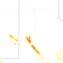
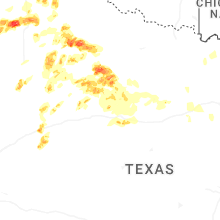


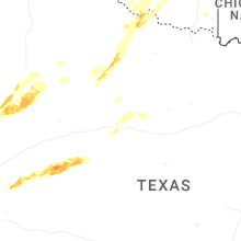


Connect with Interactive Hail Maps