

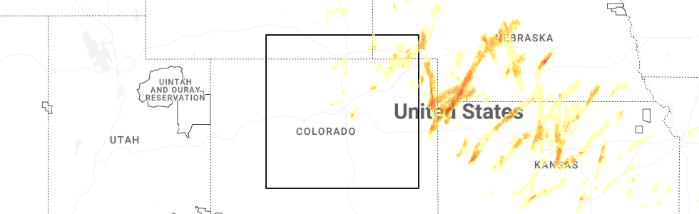
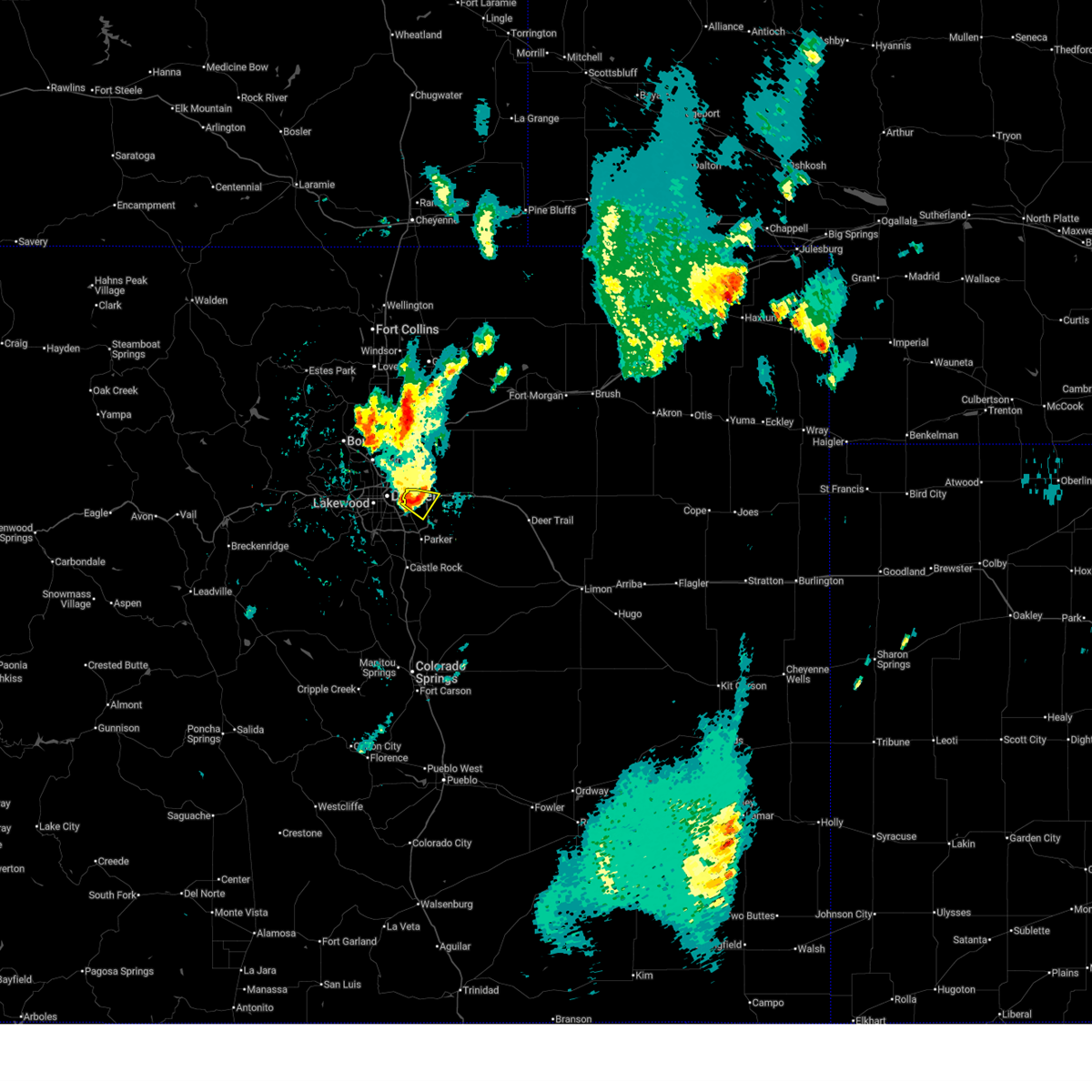
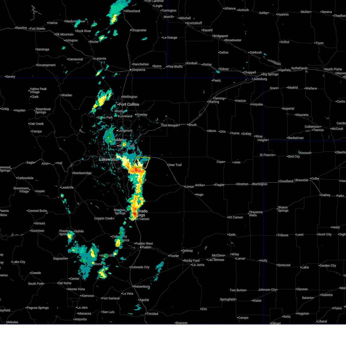
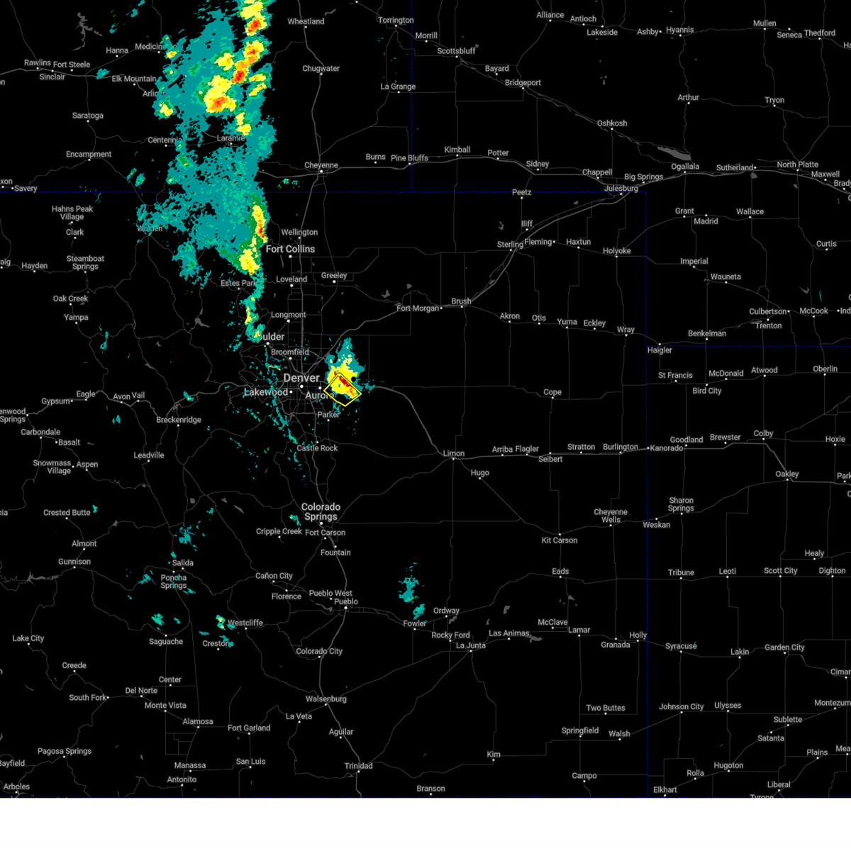
Hail Map for Aetna Estates, CO
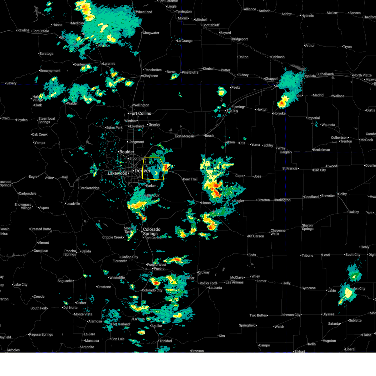
The Aetna Estates, CO area has had 0 reports of on-the-ground hail by trained spotters, and has been under severe weather warnings 21 times during the past 12 months. Doppler radar has detected hail at or near Aetna Estates, CO on 78 occasions, including 4 occasions during the past year.
| Name: | Aetna Estates, CO |
| Where Located: | 17 miles E of Denver, CO |
| Map: | Google Map for Aetna Estates, CO |
| Population: | 834 |
| Housing Units: | 340 |
| More Info: | Search Google for Aetna Estates, CO |
2
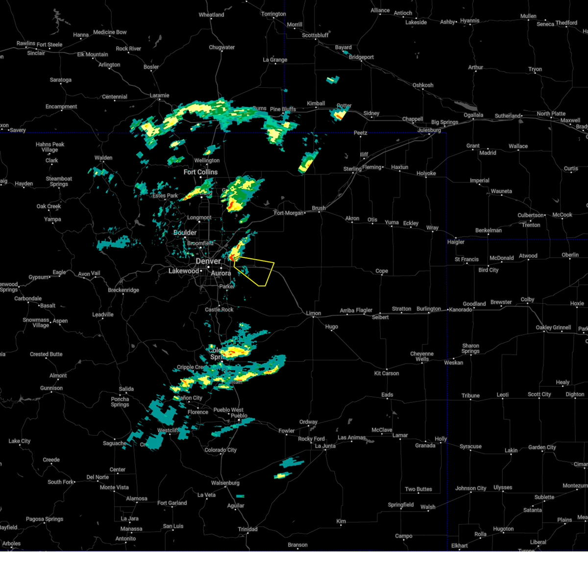
The Top Recent Hail Date for Aetna Estates, CO is Sunday, May 18, 2025 (19th out of 78)
Hail and Wind Damage Spotted near Aetna Estates, CO
| Date / Time | Report Details |
|---|---|
| 7/10/2025 3:05 PM MDT |
 The severe thunderstorm warning that was previously in effect has been reissued for adams and arapahoe counties and is in effect until 345 pm mdt. please refer to that bulletin for the latest severe weather information. a severe thunderstorm watch remains in effect until 900 pm mdt thursday for a portion of northeast colorado. The severe thunderstorm warning that was previously in effect has been reissued for adams and arapahoe counties and is in effect until 345 pm mdt. please refer to that bulletin for the latest severe weather information. a severe thunderstorm watch remains in effect until 900 pm mdt thursday for a portion of northeast colorado.
|
| 7/10/2025 2:48 PM MDT |
 At 248 pm mdt, a severe thunderstorm was located near aurora, or 15 miles east of denver, moving east at 25 mph (denver international airport reported a 58 mph wind gust at 242 pm). Hazards include 60 mph wind gusts. Expect damage to roofs, siding, and trees. locations impacted include, northeastern denver, aurora, northeastern centennial, northeastern commerce city, denver international airport, d. i. A terminal and concourses, bennett, watkins, manila village, arapahoe park and buckley sfb. At 248 pm mdt, a severe thunderstorm was located near aurora, or 15 miles east of denver, moving east at 25 mph (denver international airport reported a 58 mph wind gust at 242 pm). Hazards include 60 mph wind gusts. Expect damage to roofs, siding, and trees. locations impacted include, northeastern denver, aurora, northeastern centennial, northeastern commerce city, denver international airport, d. i. A terminal and concourses, bennett, watkins, manila village, arapahoe park and buckley sfb.
|
| 7/10/2025 2:28 PM MDT |
 Svrbou the national weather service in denver has issued a * severe thunderstorm warning for, southwestern adams county in northeastern colorado, western arapahoe county in northeastern colorado, denver county in northeastern colorado, * until 315 pm mdt. * at 228 pm mdt, a severe thunderstorm was located 5 miles south of commerce city, or 7 miles northeast of denver, moving east at 25 mph (multiple weather stations reported 59 mph wind gusts along i-70 in northern denver). Hazards include 60 mph wind gusts. expect damage to roofs, siding, and trees Svrbou the national weather service in denver has issued a * severe thunderstorm warning for, southwestern adams county in northeastern colorado, western arapahoe county in northeastern colorado, denver county in northeastern colorado, * until 315 pm mdt. * at 228 pm mdt, a severe thunderstorm was located 5 miles south of commerce city, or 7 miles northeast of denver, moving east at 25 mph (multiple weather stations reported 59 mph wind gusts along i-70 in northern denver). Hazards include 60 mph wind gusts. expect damage to roofs, siding, and trees
|
| 6/25/2025 8:44 PM MDT |
 The storm which prompted the warning has weakened below severe limits, and no longer poses an immediate threat to life or property. therefore, the warning will be allowed to expire. however, heavy rain is still possible with this thunderstorm. The storm which prompted the warning has weakened below severe limits, and no longer poses an immediate threat to life or property. therefore, the warning will be allowed to expire. however, heavy rain is still possible with this thunderstorm.
|
| 6/25/2025 8:21 PM MDT |
 Svrbou the national weather service in denver has issued a * severe thunderstorm warning for, southwestern adams county in northeastern colorado, northwestern arapahoe county in northeastern colorado, * until 845 pm mdt. * at 821 pm mdt, a severe thunderstorm was located over northwest aurora, or about 8 miles east of denver, moving southeast at 10 mph (radar indicated). Hazards include quarter size hail. damage to vehicles is expected Svrbou the national weather service in denver has issued a * severe thunderstorm warning for, southwestern adams county in northeastern colorado, northwestern arapahoe county in northeastern colorado, * until 845 pm mdt. * at 821 pm mdt, a severe thunderstorm was located over northwest aurora, or about 8 miles east of denver, moving southeast at 10 mph (radar indicated). Hazards include quarter size hail. damage to vehicles is expected
|
| 6/24/2025 2:37 PM MDT |
 the severe thunderstorm warning has been cancelled and is no longer in effect the severe thunderstorm warning has been cancelled and is no longer in effect
|
| 6/24/2025 2:21 PM MDT |
 At 221 pm mdt, a severe thunderstorm was located over arapahoe park, or 18 miles east of denver, moving northeast at 20 mph (automated weather station reported. at 215 pm, a 61 mph wind gust was reported by an automated weather station southwest of arapahoe park). Hazards include 60 mph wind gusts and small hail. Expect damage to roofs, siding, and trees. Locations impacted include, aurora, northeastern centennial and arapahoe park. At 221 pm mdt, a severe thunderstorm was located over arapahoe park, or 18 miles east of denver, moving northeast at 20 mph (automated weather station reported. at 215 pm, a 61 mph wind gust was reported by an automated weather station southwest of arapahoe park). Hazards include 60 mph wind gusts and small hail. Expect damage to roofs, siding, and trees. Locations impacted include, aurora, northeastern centennial and arapahoe park.
|
| 6/24/2025 2:07 PM MDT |
 Svrbou the national weather service in denver has issued a * severe thunderstorm warning for, western arapahoe county in northeastern colorado, * until 245 pm mdt. * at 207 pm mdt, a severe thunderstorm was located over arapahoe park, or 17 miles southeast of denver, moving northeast at 20 mph (radar indicated). Hazards include 60 mph wind gusts and small hail. expect damage to roofs, siding, and trees Svrbou the national weather service in denver has issued a * severe thunderstorm warning for, western arapahoe county in northeastern colorado, * until 245 pm mdt. * at 207 pm mdt, a severe thunderstorm was located over arapahoe park, or 17 miles southeast of denver, moving northeast at 20 mph (radar indicated). Hazards include 60 mph wind gusts and small hail. expect damage to roofs, siding, and trees
|
| 6/5/2025 2:49 PM MDT |
 Svrbou the national weather service in denver has issued a * severe thunderstorm warning for, south central adams county in northeastern colorado, central arapahoe county in northeastern colorado, * until 330 pm mdt. * at 249 pm mdt, a severe thunderstorm was located over watkins, or 20 miles east of denver, moving southeast at 30 mph (radar indicated). Hazards include 60 mph wind gusts and small hail. expect damage to roofs, siding, and trees Svrbou the national weather service in denver has issued a * severe thunderstorm warning for, south central adams county in northeastern colorado, central arapahoe county in northeastern colorado, * until 330 pm mdt. * at 249 pm mdt, a severe thunderstorm was located over watkins, or 20 miles east of denver, moving southeast at 30 mph (radar indicated). Hazards include 60 mph wind gusts and small hail. expect damage to roofs, siding, and trees
|
| 6/1/2025 5:25 PM MDT |
 The storm which prompted the warning has weakened below severe limits, and no longer poses an immediate threat to life or property. therefore, the warning will be allowed to expire. however, heavy rain is still possible with this thunderstorm. The storm which prompted the warning has weakened below severe limits, and no longer poses an immediate threat to life or property. therefore, the warning will be allowed to expire. however, heavy rain is still possible with this thunderstorm.
|
| 6/1/2025 5:01 PM MDT |
 Svrbou the national weather service in denver has issued a * severe thunderstorm warning for, southwestern adams county in northeastern colorado, western arapahoe county in northeastern colorado, central denver county in northeastern colorado, * until 530 pm mdt. * at 501 pm mdt, a severe thunderstorm was located over buckley sfb, or 11 miles east of denver, moving east at 20 mph (radar indicated). Hazards include 60 mph wind gusts and small hail. expect damage to roofs, siding, and trees Svrbou the national weather service in denver has issued a * severe thunderstorm warning for, southwestern adams county in northeastern colorado, western arapahoe county in northeastern colorado, central denver county in northeastern colorado, * until 530 pm mdt. * at 501 pm mdt, a severe thunderstorm was located over buckley sfb, or 11 miles east of denver, moving east at 20 mph (radar indicated). Hazards include 60 mph wind gusts and small hail. expect damage to roofs, siding, and trees
|
| 5/18/2025 1:40 PM MDT |
 The storm which prompted the warning has moved out of the area. therefore, the warning will be allowed to expire. The storm which prompted the warning has moved out of the area. therefore, the warning will be allowed to expire.
|
| 5/18/2025 1:27 PM MDT |
 the severe thunderstorm warning has been cancelled and is no longer in effect the severe thunderstorm warning has been cancelled and is no longer in effect
|
| 5/18/2025 1:27 PM MDT |
 At 127 pm mdt, a severe thunderstorm was located near watkins, or 16 miles east of denver, moving northeast at 20 mph (radar indicated). Hazards include 60 mph wind gusts and half dollar size hail. Hail damage to vehicles is expected. expect wind damage to roofs, siding, and trees. Locations impacted include, aurora, southern denver international airport, watkins and buckley sfb. At 127 pm mdt, a severe thunderstorm was located near watkins, or 16 miles east of denver, moving northeast at 20 mph (radar indicated). Hazards include 60 mph wind gusts and half dollar size hail. Hail damage to vehicles is expected. expect wind damage to roofs, siding, and trees. Locations impacted include, aurora, southern denver international airport, watkins and buckley sfb.
|
| 5/18/2025 1:09 PM MDT |
 Svrbou the national weather service in denver has issued a * severe thunderstorm warning for, south central adams county in northeastern colorado, western arapahoe county in northeastern colorado, northeastern douglas county in northeastern colorado, * until 145 pm mdt. * at 109 pm mdt, a severe thunderstorm was located over arapahoe park, or 14 miles southeast of denver, moving northeast at 15 mph (radar indicated). Hazards include 60 mph wind gusts and half dollar size hail. Hail damage to vehicles is expected. Expect wind damage to roofs, siding, and trees. Svrbou the national weather service in denver has issued a * severe thunderstorm warning for, south central adams county in northeastern colorado, western arapahoe county in northeastern colorado, northeastern douglas county in northeastern colorado, * until 145 pm mdt. * at 109 pm mdt, a severe thunderstorm was located over arapahoe park, or 14 miles southeast of denver, moving northeast at 15 mph (radar indicated). Hazards include 60 mph wind gusts and half dollar size hail. Hail damage to vehicles is expected. Expect wind damage to roofs, siding, and trees.
|
| 9/17/2024 3:06 PM MDT |
 The storms which prompted the warning have weakened below severe limits, and no longer pose an immediate threat to life or property. therefore, the warning will be allowed to expire. however, gusty winds are still possible with these thunderstorms. a severe thunderstorm watch remains in effect until 900 pm mdt for northeastern colorado. The storms which prompted the warning have weakened below severe limits, and no longer pose an immediate threat to life or property. therefore, the warning will be allowed to expire. however, gusty winds are still possible with these thunderstorms. a severe thunderstorm watch remains in effect until 900 pm mdt for northeastern colorado.
|
| 9/17/2024 2:59 PM MDT |
 At 258 pm mdt, severe thunderstorms were located along a line extending from 3 miles southwest of fort lupton to 3 miles east of barr lake to aurora, or along a line extending from 26 miles south of greeley to 53 miles southwest of fort morgan to 14 miles east of denver, moving northeast at 40 mph (radar indicated). Hazards include 60 mph wind gusts. Expect damage to roofs, siding, and trees. locations impacted include, aurora, northeastern commerce city, brighton, denver international airport, d. i. A terminal and concourses, fort lupton, lochbuie, dacono, platteville, hudson, manila village, arapahoe park, watkins, barr lake, and todd creek. At 258 pm mdt, severe thunderstorms were located along a line extending from 3 miles southwest of fort lupton to 3 miles east of barr lake to aurora, or along a line extending from 26 miles south of greeley to 53 miles southwest of fort morgan to 14 miles east of denver, moving northeast at 40 mph (radar indicated). Hazards include 60 mph wind gusts. Expect damage to roofs, siding, and trees. locations impacted include, aurora, northeastern commerce city, brighton, denver international airport, d. i. A terminal and concourses, fort lupton, lochbuie, dacono, platteville, hudson, manila village, arapahoe park, watkins, barr lake, and todd creek.
|
| 9/17/2024 2:59 PM MDT |
 the severe thunderstorm warning has been cancelled and is no longer in effect the severe thunderstorm warning has been cancelled and is no longer in effect
|
| 9/17/2024 2:36 PM MDT |
 Svrbou the national weather service in denver colorado has issued a * severe thunderstorm warning for, northeastern douglas county in northeastern colorado, southwestern weld county in northeastern colorado, western arapahoe county in northeastern colorado, denver county in northeastern colorado, western adams county in northeastern colorado, * until 315 pm mdt. * at 234 pm mdt, severe thunderstorms were located along a line extending from thornton to denver to 3 miles west of parker, or along a line extending from 40 miles south of greeley to 65 miles southwest of fort morgan to 45 miles north of colorado springs, moving northeast at 30 mph (radar indicated. at 215 pm mdt, an automated sensor reported a 60 mph wind gust was reported near chatfield state park). Hazards include 60 mph wind gusts. expect damage to roofs, siding, and trees Svrbou the national weather service in denver colorado has issued a * severe thunderstorm warning for, northeastern douglas county in northeastern colorado, southwestern weld county in northeastern colorado, western arapahoe county in northeastern colorado, denver county in northeastern colorado, western adams county in northeastern colorado, * until 315 pm mdt. * at 234 pm mdt, severe thunderstorms were located along a line extending from thornton to denver to 3 miles west of parker, or along a line extending from 40 miles south of greeley to 65 miles southwest of fort morgan to 45 miles north of colorado springs, moving northeast at 30 mph (radar indicated. at 215 pm mdt, an automated sensor reported a 60 mph wind gust was reported near chatfield state park). Hazards include 60 mph wind gusts. expect damage to roofs, siding, and trees
|
| 8/11/2024 6:27 PM MDT |
 The storms which prompted the warning have weakened below severe limits, and no longer pose an immediate threat to life or property. therefore, the warning will be allowed to expire. however, gusty winds are still possible with these thunderstorms. The storms which prompted the warning have weakened below severe limits, and no longer pose an immediate threat to life or property. therefore, the warning will be allowed to expire. however, gusty winds are still possible with these thunderstorms.
|
| 8/11/2024 6:06 PM MDT |
 Svrbou the national weather service in denver colorado has issued a * severe thunderstorm warning for, northwestern arapahoe county in northeastern colorado, denver county in northeastern colorado, western adams county in northeastern colorado, * until 630 pm mdt. * at 606 pm mdt, severe and damaging winds were located along a line extending from 4 miles southwest of barr lake to 3 miles west of commerce city to 4 miles east of wheat ridge, or along a line extending from 35 miles south of greeley to 92 miles west of akron to 6 miles northwest of denver, moving southeast at 25 mph (radar indicated). Hazards include 60 mph wind gusts. expect damage to roofs, siding, and trees Svrbou the national weather service in denver colorado has issued a * severe thunderstorm warning for, northwestern arapahoe county in northeastern colorado, denver county in northeastern colorado, western adams county in northeastern colorado, * until 630 pm mdt. * at 606 pm mdt, severe and damaging winds were located along a line extending from 4 miles southwest of barr lake to 3 miles west of commerce city to 4 miles east of wheat ridge, or along a line extending from 35 miles south of greeley to 92 miles west of akron to 6 miles northwest of denver, moving southeast at 25 mph (radar indicated). Hazards include 60 mph wind gusts. expect damage to roofs, siding, and trees
|
| 6/9/2024 3:42 PM MDT |
 Svrbou the national weather service in denver colorado has issued a * severe thunderstorm warning for, north central arapahoe county in northeastern colorado, east central denver county in northeastern colorado, southwestern adams county in northeastern colorado, * until 415 pm mdt. * at 341 pm mdt, a severe thunderstorm was located 4 miles southwest of manila village, or 21 miles east of denver, moving southeast at 5 mph (radar indicated). Hazards include 60 mph wind gusts and quarter size hail. Expect damage to roofs, siding, and trees. Hail damage to vehicles is expected. Svrbou the national weather service in denver colorado has issued a * severe thunderstorm warning for, north central arapahoe county in northeastern colorado, east central denver county in northeastern colorado, southwestern adams county in northeastern colorado, * until 415 pm mdt. * at 341 pm mdt, a severe thunderstorm was located 4 miles southwest of manila village, or 21 miles east of denver, moving southeast at 5 mph (radar indicated). Hazards include 60 mph wind gusts and quarter size hail. Expect damage to roofs, siding, and trees. Hail damage to vehicles is expected.
|
| 6/9/2024 3:18 PM MDT |
 At 317 pm mdt, a severe thunderstorm was located near manila village, or 21 miles east of denver, and is nearly stationary (radar indicated). Hazards include golf ball size hail and 60 mph wind gusts. Expect damage to roofs, siding, and trees. people and animals outdoors will be injured. expect hail damage to roofs, siding, windows, and vehicles. Locations impacted include, northeastern aurora, bennett, watkins, strasburg, and manila village. At 317 pm mdt, a severe thunderstorm was located near manila village, or 21 miles east of denver, and is nearly stationary (radar indicated). Hazards include golf ball size hail and 60 mph wind gusts. Expect damage to roofs, siding, and trees. people and animals outdoors will be injured. expect hail damage to roofs, siding, windows, and vehicles. Locations impacted include, northeastern aurora, bennett, watkins, strasburg, and manila village.
|
| 6/9/2024 3:08 PM MDT |
 Svrbou the national weather service in denver colorado has issued a * severe thunderstorm warning for, central arapahoe county in northeastern colorado, south central adams county in northeastern colorado, * until 345 pm mdt. * at 307 pm mdt, a severe thunderstorm was located 4 miles south of manila village, or 23 miles east of denver, moving southeast at 10 mph (radar indicated). Hazards include quarter size hail. damage to vehicles is expected Svrbou the national weather service in denver colorado has issued a * severe thunderstorm warning for, central arapahoe county in northeastern colorado, south central adams county in northeastern colorado, * until 345 pm mdt. * at 307 pm mdt, a severe thunderstorm was located 4 miles south of manila village, or 23 miles east of denver, moving southeast at 10 mph (radar indicated). Hazards include quarter size hail. damage to vehicles is expected
|
| 6/7/2024 8:23 PM MDT |
 The strong winds which prompted the warning have weakened below severe limits, and no longer poses an immediate threat to life or property. therefore, the warning will be allowed to expire. however, gusty winds to 50 mph are still possible. The strong winds which prompted the warning have weakened below severe limits, and no longer poses an immediate threat to life or property. therefore, the warning will be allowed to expire. however, gusty winds to 50 mph are still possible.
|
| 6/7/2024 7:54 PM MDT |
 Svrbou the national weather service in denver colorado has issued a * severe thunderstorm warning for, central arapahoe county in northeastern colorado, northeastern denver county in northeastern colorado, western adams county in northeastern colorado, * until 830 pm mdt. * at 754 pm mdt, strong winds from a decaying thunderstorm were located 6 miles northeast of d.i.a terminal and concourses, or 23 miles northeast of denver, moving south at 55 mph (radar indicated). Hazards include 60 mph wind gusts. Expect damage to roofs, siding, and trees. This severe thunderstorm will be near, northeastern aurora, eastern denver international airport, watkins, and manila village around 800 pm mdt. Svrbou the national weather service in denver colorado has issued a * severe thunderstorm warning for, central arapahoe county in northeastern colorado, northeastern denver county in northeastern colorado, western adams county in northeastern colorado, * until 830 pm mdt. * at 754 pm mdt, strong winds from a decaying thunderstorm were located 6 miles northeast of d.i.a terminal and concourses, or 23 miles northeast of denver, moving south at 55 mph (radar indicated). Hazards include 60 mph wind gusts. Expect damage to roofs, siding, and trees. This severe thunderstorm will be near, northeastern aurora, eastern denver international airport, watkins, and manila village around 800 pm mdt.
|
| 5/30/2024 10:57 PM MDT |
 Svrbou the national weather service in denver colorado has issued a * severe thunderstorm warning for, northwestern elbert county in east central colorado, central arapahoe county in northeastern colorado, south central adams county in northeastern colorado, * until 1145 pm mdt. * at 1056 pm mdt, severe thunderstorms were located along a line extending from 5 miles north of bennett to near arapahoe park, or along a line extending from 44 miles southwest of fort morgan to 13 miles east of denver, moving southeast at 15 mph (trained weather spotters). Hazards include golf ball size hail and 60 mph wind gusts. Expect damage to roofs, siding, and trees. people and animals outdoors will be injured. Expect hail damage to roofs, siding, windows, and vehicles. Svrbou the national weather service in denver colorado has issued a * severe thunderstorm warning for, northwestern elbert county in east central colorado, central arapahoe county in northeastern colorado, south central adams county in northeastern colorado, * until 1145 pm mdt. * at 1056 pm mdt, severe thunderstorms were located along a line extending from 5 miles north of bennett to near arapahoe park, or along a line extending from 44 miles southwest of fort morgan to 13 miles east of denver, moving southeast at 15 mph (trained weather spotters). Hazards include golf ball size hail and 60 mph wind gusts. Expect damage to roofs, siding, and trees. people and animals outdoors will be injured. Expect hail damage to roofs, siding, windows, and vehicles.
|
| 5/30/2024 10:49 PM MDT |
 At 1048 pm mdt, a severe thunderstorm was located near watkins, or 15 miles east of denver, moving southeast at 15 mph (radar indicated). Hazards include golf ball size hail. People and animals outdoors will be injured. expect damage to roofs, siding, windows, and vehicles. locations impacted include, northeastern denver, aurora, denver international airport, d. i. A terminal and concourses, watkins, manila village, buckley sfb, and arapahoe park. At 1048 pm mdt, a severe thunderstorm was located near watkins, or 15 miles east of denver, moving southeast at 15 mph (radar indicated). Hazards include golf ball size hail. People and animals outdoors will be injured. expect damage to roofs, siding, windows, and vehicles. locations impacted include, northeastern denver, aurora, denver international airport, d. i. A terminal and concourses, watkins, manila village, buckley sfb, and arapahoe park.
|
| 5/30/2024 10:26 PM MDT |
 At 1024 pm mdt, a severe thunderstorm was located over northeastern denver, moving southeast at 20 mph. this is a destructive storm for green valley ranch and watkins (public reported. at 1019 pm baseball size hail was reported near northfield and central park). Hazards include baseball size hail. People and animals outdoors will be severely injured. expect shattered windows, extensive damage to roofs, siding, and vehicles. locations impacted include, northeastern denver, aurora, eastern commerce city, denver international airport, d. i. A terminal and concourses, watkins, manila village, buckley sfb, and arapahoe park. At 1024 pm mdt, a severe thunderstorm was located over northeastern denver, moving southeast at 20 mph. this is a destructive storm for green valley ranch and watkins (public reported. at 1019 pm baseball size hail was reported near northfield and central park). Hazards include baseball size hail. People and animals outdoors will be severely injured. expect shattered windows, extensive damage to roofs, siding, and vehicles. locations impacted include, northeastern denver, aurora, eastern commerce city, denver international airport, d. i. A terminal and concourses, watkins, manila village, buckley sfb, and arapahoe park.
|
| 5/30/2024 10:12 PM MDT |
 Svrbou the national weather service in denver colorado has issued a * severe thunderstorm warning for, western arapahoe county in northeastern colorado, northeastern denver county in northeastern colorado, southwestern adams county in northeastern colorado, * until 1100 pm mdt. * at 1011 pm mdt, a severe thunderstorm was located near commerce city, or 10 miles northeast of denver, moving east at 15 mph. this is a destructive storm for green valley ranch and northeast denver (radar indicated). Hazards include baseball size hail. People and animals outdoors will be severely injured. Expect shattered windows, extensive damage to roofs, siding, and vehicles. Svrbou the national weather service in denver colorado has issued a * severe thunderstorm warning for, western arapahoe county in northeastern colorado, northeastern denver county in northeastern colorado, southwestern adams county in northeastern colorado, * until 1100 pm mdt. * at 1011 pm mdt, a severe thunderstorm was located near commerce city, or 10 miles northeast of denver, moving east at 15 mph. this is a destructive storm for green valley ranch and northeast denver (radar indicated). Hazards include baseball size hail. People and animals outdoors will be severely injured. Expect shattered windows, extensive damage to roofs, siding, and vehicles.
|
| 5/30/2024 9:43 PM MDT |
 Svrbou the national weather service in denver colorado has issued a * severe thunderstorm warning for, northwestern arapahoe county in northeastern colorado, northeastern denver county in northeastern colorado, western adams county in northeastern colorado, * until 1030 pm mdt. * at 942 pm mdt, a severe thunderstorm was located over southern thornton, or 11 miles north of denver, moving southeast at 15 mph (radar indicated). Hazards include two inch hail and 60 mph wind gusts. Expect damage to roofs, siding, and trees. people and animals outdoors will be injured. expect hail damage to roofs, siding, windows, and vehicles. this severe thunderstorm will be near, southeastern thornton, commerce city, and brighton around 950 pm mdt. northeastern denver around 955 pm mdt. Other locations in the path of this severe thunderstorm include southwestern denver international airport. Svrbou the national weather service in denver colorado has issued a * severe thunderstorm warning for, northwestern arapahoe county in northeastern colorado, northeastern denver county in northeastern colorado, western adams county in northeastern colorado, * until 1030 pm mdt. * at 942 pm mdt, a severe thunderstorm was located over southern thornton, or 11 miles north of denver, moving southeast at 15 mph (radar indicated). Hazards include two inch hail and 60 mph wind gusts. Expect damage to roofs, siding, and trees. people and animals outdoors will be injured. expect hail damage to roofs, siding, windows, and vehicles. this severe thunderstorm will be near, southeastern thornton, commerce city, and brighton around 950 pm mdt. northeastern denver around 955 pm mdt. Other locations in the path of this severe thunderstorm include southwestern denver international airport.
|
| 8/3/2023 5:05 PM MDT |
 The severe thunderstorm warning for central arapahoe and south central adams counties will expire at 515 pm mdt, the storm which prompted the warning has weakened below severe limits, and no longer poses an immediate threat to life or property. therefore, the warning will be allowed to expire. however gusty winds are still possible with this thunderstorm. a severe thunderstorm watch remains in effect until 900 pm mdt for northeastern and east central colorado. to report severe weather, contact your nearest law enforcement agency. they will relay your report to the national weather service denver colorado. The severe thunderstorm warning for central arapahoe and south central adams counties will expire at 515 pm mdt, the storm which prompted the warning has weakened below severe limits, and no longer poses an immediate threat to life or property. therefore, the warning will be allowed to expire. however gusty winds are still possible with this thunderstorm. a severe thunderstorm watch remains in effect until 900 pm mdt for northeastern and east central colorado. to report severe weather, contact your nearest law enforcement agency. they will relay your report to the national weather service denver colorado.
|
| 8/3/2023 4:40 PM MDT |
 At 440 pm mdt, a severe thunderstorm was located over manila village, or 24 miles east of denver, moving southeast at 15 mph (radar indicated. at 428 pm mdt, a 66 mph wind gust was reported by an automated sensor in bennett). Hazards include 70 mph wind gusts and ping pong ball size hail. Expect considerable tree damage. damage is likely to mobile homes, roofs, and outbuildings. people and animals outdoors will be injured. expect hail damage to roofs, siding, windows, and vehicles. locations impacted include, northeastern aurora, bennett, watkins, strasburg and manila village. thunderstorm damage threat, considerable hail threat, radar indicated max hail size, 1. 50 in wind threat, observed max wind gust, 70 mph. At 440 pm mdt, a severe thunderstorm was located over manila village, or 24 miles east of denver, moving southeast at 15 mph (radar indicated. at 428 pm mdt, a 66 mph wind gust was reported by an automated sensor in bennett). Hazards include 70 mph wind gusts and ping pong ball size hail. Expect considerable tree damage. damage is likely to mobile homes, roofs, and outbuildings. people and animals outdoors will be injured. expect hail damage to roofs, siding, windows, and vehicles. locations impacted include, northeastern aurora, bennett, watkins, strasburg and manila village. thunderstorm damage threat, considerable hail threat, radar indicated max hail size, 1. 50 in wind threat, observed max wind gust, 70 mph.
|
| 8/3/2023 4:24 PM MDT |
 At 423 pm mdt, a severe thunderstorm was located near manila village, or 21 miles east of denver, moving southeast at 15 mph. a second severe thunderstorm was located south of bennett, moving north at 15 mph (radar indicated). Hazards include 60 mph wind gusts and quarter size hail. Expect damage to roofs, siding, and trees. Hail damage to vehicles is expected. At 423 pm mdt, a severe thunderstorm was located near manila village, or 21 miles east of denver, moving southeast at 15 mph. a second severe thunderstorm was located south of bennett, moving north at 15 mph (radar indicated). Hazards include 60 mph wind gusts and quarter size hail. Expect damage to roofs, siding, and trees. Hail damage to vehicles is expected.
|
| 8/2/2023 8:56 PM MDT |
 At 855 pm mdt, severe thunderstorms were located along a line extending from westminster to aurora to near ponderosa park, or along a line extending from 9 miles northwest of denver to 61 miles southwest of fort morgan to 37 miles north of colorado springs, moving northeast at 35 mph (radar indicated). Hazards include 60 mph wind gusts. Expect damage to roofs, siding, and trees. severe thunderstorms will be near, watkins around 905 pm mdt. d. i. a terminal and concourses and manila village around 910 pm mdt. brighton around 915 pm mdt. other locations in the path of these severe thunderstorms include northeastern commerce city, denver international airport, todd creek, barr lake, lochbuie, hudson, strasburg, byers and prospect valley. hail threat, radar indicated max hail size, <. 75 in wind threat, radar indicated max wind gust, 60 mph. At 855 pm mdt, severe thunderstorms were located along a line extending from westminster to aurora to near ponderosa park, or along a line extending from 9 miles northwest of denver to 61 miles southwest of fort morgan to 37 miles north of colorado springs, moving northeast at 35 mph (radar indicated). Hazards include 60 mph wind gusts. Expect damage to roofs, siding, and trees. severe thunderstorms will be near, watkins around 905 pm mdt. d. i. a terminal and concourses and manila village around 910 pm mdt. brighton around 915 pm mdt. other locations in the path of these severe thunderstorms include northeastern commerce city, denver international airport, todd creek, barr lake, lochbuie, hudson, strasburg, byers and prospect valley. hail threat, radar indicated max hail size, <. 75 in wind threat, radar indicated max wind gust, 60 mph.
|
| 7/21/2023 8:16 PM MDT |
 At 815 pm mdt, severe thunderstorms were located along a line extending from 7 miles east of d.i.a terminal and concourses to near watkins to aurora, or along a line extending from 38 miles south of greeley to 58 miles northwest of limon to 14 miles east of denver, moving southeast at 30 mph (radar indicated). Hazards include 60 mph wind gusts and penny size hail. Expect damage to roofs, siding, and trees. locations impacted include, aurora, southeastern denver international airport, bennett, watkins, manila village and strasburg. hail threat, radar indicated max hail size, 0. 75 in wind threat, radar indicated max wind gust, 60 mph. At 815 pm mdt, severe thunderstorms were located along a line extending from 7 miles east of d.i.a terminal and concourses to near watkins to aurora, or along a line extending from 38 miles south of greeley to 58 miles northwest of limon to 14 miles east of denver, moving southeast at 30 mph (radar indicated). Hazards include 60 mph wind gusts and penny size hail. Expect damage to roofs, siding, and trees. locations impacted include, aurora, southeastern denver international airport, bennett, watkins, manila village and strasburg. hail threat, radar indicated max hail size, 0. 75 in wind threat, radar indicated max wind gust, 60 mph.
|
| 7/21/2023 8:15 PM MDT |
 At 815 pm mdt, severe thunderstorms were located along a line extending from 8 miles north of manila village to aurora to 4 miles southwest of watkins, or along a line extending from 39 miles south of greeley to 57 miles northwest of limon to 15 miles east of denver, moving southeast at 35 mph (radar indicated). Hazards include 60 mph wind gusts and penny size hail. Expect damage to roofs, siding, and trees. locations impacted include, manila village, bennett and strasburg. hail threat, radar indicated max hail size, 0. 75 in wind threat, radar indicated max wind gust, 60 mph. At 815 pm mdt, severe thunderstorms were located along a line extending from 8 miles north of manila village to aurora to 4 miles southwest of watkins, or along a line extending from 39 miles south of greeley to 57 miles northwest of limon to 15 miles east of denver, moving southeast at 35 mph (radar indicated). Hazards include 60 mph wind gusts and penny size hail. Expect damage to roofs, siding, and trees. locations impacted include, manila village, bennett and strasburg. hail threat, radar indicated max hail size, 0. 75 in wind threat, radar indicated max wind gust, 60 mph.
|
| 7/21/2023 7:56 PM MDT |
 At 755 pm mdt, severe thunderstorms were located along a line extending from 3 miles east of barr lake to denver international airport to 4 miles south of commerce city, or along a line extending from 31 miles south of greeley to 68 miles northwest of limon to 8 miles northeast of denver, moving southeast at 30 mph (radar indicated). Hazards include 60 mph wind gusts. Expect damage to roofs, siding, and trees. severe thunderstorms will be near, d. i. a terminal and concourses around 800 pm mdt. denver international airport around 805 pm mdt. watkins around 815 pm mdt. other locations in the path of these severe thunderstorms include manila village and bennett. hail threat, radar indicated max hail size, <. 75 in wind threat, radar indicated max wind gust, 60 mph. At 755 pm mdt, severe thunderstorms were located along a line extending from 3 miles east of barr lake to denver international airport to 4 miles south of commerce city, or along a line extending from 31 miles south of greeley to 68 miles northwest of limon to 8 miles northeast of denver, moving southeast at 30 mph (radar indicated). Hazards include 60 mph wind gusts. Expect damage to roofs, siding, and trees. severe thunderstorms will be near, d. i. a terminal and concourses around 800 pm mdt. denver international airport around 805 pm mdt. watkins around 815 pm mdt. other locations in the path of these severe thunderstorms include manila village and bennett. hail threat, radar indicated max hail size, <. 75 in wind threat, radar indicated max wind gust, 60 mph.
|
| 7/4/2023 8:20 PM MDT |
 At 820 pm mdt, a severe thunderstorm was located over northeastern denver, moving east at 15 mph (radar indicated). Hazards include 70 mph wind gusts and penny size hail. Expect considerable tree damage. damage is likely to mobile homes, roofs, and outbuildings. locations impacted include, northeastern denver, aurora, southern denver international airport and buckley sfb. thunderstorm damage threat, considerable hail threat, radar indicated max hail size, 0. 75 in wind threat, radar indicated max wind gust, 70 mph. At 820 pm mdt, a severe thunderstorm was located over northeastern denver, moving east at 15 mph (radar indicated). Hazards include 70 mph wind gusts and penny size hail. Expect considerable tree damage. damage is likely to mobile homes, roofs, and outbuildings. locations impacted include, northeastern denver, aurora, southern denver international airport and buckley sfb. thunderstorm damage threat, considerable hail threat, radar indicated max hail size, 0. 75 in wind threat, radar indicated max wind gust, 70 mph.
|
| 7/4/2023 8:15 PM MDT |
 At 815 pm mdt, a severe thunderstorm was located over northeastern denver, moving east at 15 mph (radar indicated). Hazards include 60 mph wind gusts and penny size hail. Expect damage to roofs, siding, and trees. this severe thunderstorm will remain over mainly rural areas of northwestern arapahoe, east central denver and southwestern adams counties. hail threat, radar indicated max hail size, 0. 75 in wind threat, radar indicated max wind gust, 60 mph. At 815 pm mdt, a severe thunderstorm was located over northeastern denver, moving east at 15 mph (radar indicated). Hazards include 60 mph wind gusts and penny size hail. Expect damage to roofs, siding, and trees. this severe thunderstorm will remain over mainly rural areas of northwestern arapahoe, east central denver and southwestern adams counties. hail threat, radar indicated max hail size, 0. 75 in wind threat, radar indicated max wind gust, 60 mph.
|
| 6/29/2023 5:54 PM MDT |
 The severe thunderstorm warning for central arapahoe and south central adams counties will expire at 600 pm mdt, the storm which prompted the warning has moved out of the area. therefore, the warning will be allowed to expire. a tornado watch remains in effect until 900 pm mdt for northeastern and east central colorado. remember, a severe thunderstorm warning still remains in effect for north central arapahoe county. The severe thunderstorm warning for central arapahoe and south central adams counties will expire at 600 pm mdt, the storm which prompted the warning has moved out of the area. therefore, the warning will be allowed to expire. a tornado watch remains in effect until 900 pm mdt for northeastern and east central colorado. remember, a severe thunderstorm warning still remains in effect for north central arapahoe county.
|
| 6/29/2023 5:13 PM MDT |
 At 512 pm mdt, a severe thunderstorm was located near watkins, or 20 miles east of denver, moving southeast at 20 mph. this is a destructive storm for i-70 from watkins to bennett (radar indicated). Hazards include three inch hail and 70 mph wind gusts. People and animals outdoors will be severely injured. Expect shattered windows, extensive damage to roofs, siding, and vehicles. At 512 pm mdt, a severe thunderstorm was located near watkins, or 20 miles east of denver, moving southeast at 20 mph. this is a destructive storm for i-70 from watkins to bennett (radar indicated). Hazards include three inch hail and 70 mph wind gusts. People and animals outdoors will be severely injured. Expect shattered windows, extensive damage to roofs, siding, and vehicles.
|
| 6/29/2023 4:45 PM MDT |
 At 445 pm mdt, a severe thunderstorm was located over northeastern aurora, or 15 miles east of denver, moving east at 25 mph (radar indicated). Hazards include two inch hail. People and animals outdoors will be injured. expect damage to roofs, siding, windows, and vehicles. locations impacted include, northeastern denver, aurora, southern denver international airport, bennett, watkins, manila village, buckley sfb and strasburg. thunderstorm damage threat, considerable hail threat, observed max hail size, 2. 00 in wind threat, radar indicated max wind gust, <50 mph. At 445 pm mdt, a severe thunderstorm was located over northeastern aurora, or 15 miles east of denver, moving east at 25 mph (radar indicated). Hazards include two inch hail. People and animals outdoors will be injured. expect damage to roofs, siding, windows, and vehicles. locations impacted include, northeastern denver, aurora, southern denver international airport, bennett, watkins, manila village, buckley sfb and strasburg. thunderstorm damage threat, considerable hail threat, observed max hail size, 2. 00 in wind threat, radar indicated max wind gust, <50 mph.
|
| 6/29/2023 4:28 PM MDT |
 At 428 pm mdt, a severe thunderstorm was located over northeastern denver, moving east at 20 mph (radar indicated). Hazards include quarter size hail. Damage to vehicles is expected. this severe thunderstorm will be near, d. i. a terminal and concourses around 445 pm mdt. other locations in the path of this severe thunderstorm include denver international airport, watkins, manila village and bennett. hail threat, radar indicated max hail size, 1. 00 in wind threat, radar indicated max wind gust, <50 mph. At 428 pm mdt, a severe thunderstorm was located over northeastern denver, moving east at 20 mph (radar indicated). Hazards include quarter size hail. Damage to vehicles is expected. this severe thunderstorm will be near, d. i. a terminal and concourses around 445 pm mdt. other locations in the path of this severe thunderstorm include denver international airport, watkins, manila village and bennett. hail threat, radar indicated max hail size, 1. 00 in wind threat, radar indicated max wind gust, <50 mph.
|
| 6/21/2023 10:23 PM MDT |
 The severe thunderstorm warning for western arapahoe county will expire at 1030 pm mdt, the severe thunderstorm which prompted the warning has moved out of the warned area. therefore, the warning will be allowed to expire. however heavy rain is still possible with this thunderstorm. a severe thunderstorm watch remains in effect until 400 am mdt for northeastern colorado. The severe thunderstorm warning for western arapahoe county will expire at 1030 pm mdt, the severe thunderstorm which prompted the warning has moved out of the warned area. therefore, the warning will be allowed to expire. however heavy rain is still possible with this thunderstorm. a severe thunderstorm watch remains in effect until 400 am mdt for northeastern colorado.
|
| 6/21/2023 9:59 PM MDT |
 At 959 pm mdt, a severe thunderstorm was located over arapahoe park, or 14 miles east of denver, moving east at 10 mph (radar indicated). Hazards include half dollar size hail. Damage to vehicles is expected. this severe thunderstorm will remain over mainly rural areas of western arapahoe county. hail threat, radar indicated max hail size, 1. 25 in wind threat, radar indicated max wind gust, <50 mph. At 959 pm mdt, a severe thunderstorm was located over arapahoe park, or 14 miles east of denver, moving east at 10 mph (radar indicated). Hazards include half dollar size hail. Damage to vehicles is expected. this severe thunderstorm will remain over mainly rural areas of western arapahoe county. hail threat, radar indicated max hail size, 1. 25 in wind threat, radar indicated max wind gust, <50 mph.
|
| 6/21/2023 9:27 PM MDT |
 At 926 pm mdt, a severe thunderstorm was located over northwestern aurora, or 12 miles east of denver, moving east at 10 mph (radar indicated). Hazards include golf ball size hail. People and animals outdoors will be injured. Expect damage to roofs, siding, windows, and vehicles. At 926 pm mdt, a severe thunderstorm was located over northwestern aurora, or 12 miles east of denver, moving east at 10 mph (radar indicated). Hazards include golf ball size hail. People and animals outdoors will be injured. Expect damage to roofs, siding, windows, and vehicles.
|
| 6/8/2023 9:09 PM MDT |
 At 908 pm mdt, a severe thunderstorm was located over western aurora, or 10 miles east of denver, moving northeast at 20 mph (radar indicated. large amounts of pea to marble size hail have been reported in southern aurora and eastern centennial). Hazards include 60 mph wind gusts and quarter size hail. Expect damage to roofs, siding, and trees. hail damage to vehicles is expected. hail may accumulate on roadways causing hazardous travel. locations impacted include, eastern denver, aurora, eastern centennial, greenwood village, watkins, buckley sfb and arapahoe park. hail threat, radar indicated max hail size, 1. 00 in wind threat, radar indicated max wind gust, 60 mph. At 908 pm mdt, a severe thunderstorm was located over western aurora, or 10 miles east of denver, moving northeast at 20 mph (radar indicated. large amounts of pea to marble size hail have been reported in southern aurora and eastern centennial). Hazards include 60 mph wind gusts and quarter size hail. Expect damage to roofs, siding, and trees. hail damage to vehicles is expected. hail may accumulate on roadways causing hazardous travel. locations impacted include, eastern denver, aurora, eastern centennial, greenwood village, watkins, buckley sfb and arapahoe park. hail threat, radar indicated max hail size, 1. 00 in wind threat, radar indicated max wind gust, 60 mph.
|
| 6/8/2023 8:48 PM MDT |
 At 847 pm mdt, a severe thunderstorm was located over southwestern aurora, or 6 miles southeast of denver, moving northeast at 20 mph (radar indicated). Hazards include large amounts of hail up to half dollar size. Damage to vehicles is expected. Hail may accumulate on roadways causing hazardous travel. At 847 pm mdt, a severe thunderstorm was located over southwestern aurora, or 6 miles southeast of denver, moving northeast at 20 mph (radar indicated). Hazards include large amounts of hail up to half dollar size. Damage to vehicles is expected. Hail may accumulate on roadways causing hazardous travel.
|
| 6/6/2023 5:24 PM MDT |
 The severe thunderstorm warning for northeastern douglas, western arapahoe, eastern denver and western adams counties will expire at 530 pm mdt, the storms have moved northward and a new warning is in effect for areas from aurora across denver international airport to brighton. The severe thunderstorm warning for northeastern douglas, western arapahoe, eastern denver and western adams counties will expire at 530 pm mdt, the storms have moved northward and a new warning is in effect for areas from aurora across denver international airport to brighton.
|
| 6/6/2023 5:22 PM MDT |
 At 521 pm mdt, severe thunderstorms were located along a line extending from 3 miles southeast of fort lupton to 5 miles southwest of arapahoe park, or along a line extending from 24 miles south of greeley to 13 miles southeast of denver, moving north at 15 mph (trained weather spotters). Hazards include half dollar size hail. Damage to vehicles is expected. Hail may accumulate on roadways causing hazardous travel. At 521 pm mdt, severe thunderstorms were located along a line extending from 3 miles southeast of fort lupton to 5 miles southwest of arapahoe park, or along a line extending from 24 miles south of greeley to 13 miles southeast of denver, moving north at 15 mph (trained weather spotters). Hazards include half dollar size hail. Damage to vehicles is expected. Hail may accumulate on roadways causing hazardous travel.
|
| 6/6/2023 5:04 PM MDT |
 At 503 pm mdt, severe thunderstorms were located along a line extending from near barr lake to 3 miles northeast of castle rock, or along a line extending from 17 miles northeast of denver to 20 miles southeast of denver, moving north at 5 mph (trained weather spotters). Hazards include half dollar size hail. these storms are producing large amounts of hail. Damage to vehicles is expected. hail may accumulate on roadways causing hazardous travel. locations impacted include, eastern denver, aurora, eastern centennial, northern castle rock, northeastern commerce city, parker, brighton, greenwood village, lone tree, denver international airport, d. i. a terminal and concourses, the pinery, arapahoe park, buckley sfb, barr lake and eastern castle pines. hail threat, observed max hail size, 1. 25 in wind threat, radar indicated max wind gust, <50 mph. At 503 pm mdt, severe thunderstorms were located along a line extending from near barr lake to 3 miles northeast of castle rock, or along a line extending from 17 miles northeast of denver to 20 miles southeast of denver, moving north at 5 mph (trained weather spotters). Hazards include half dollar size hail. these storms are producing large amounts of hail. Damage to vehicles is expected. hail may accumulate on roadways causing hazardous travel. locations impacted include, eastern denver, aurora, eastern centennial, northern castle rock, northeastern commerce city, parker, brighton, greenwood village, lone tree, denver international airport, d. i. a terminal and concourses, the pinery, arapahoe park, buckley sfb, barr lake and eastern castle pines. hail threat, observed max hail size, 1. 25 in wind threat, radar indicated max wind gust, <50 mph.
|
| 6/6/2023 4:35 PM MDT |
 At 434 pm mdt, severe thunderstorms were developing along a line extending from 4 miles south of barr lake to castle rock, or along a line extending from 14 miles northeast of denver to 35 miles north of colorado springs, and are nearly stationary (radar indicated). Hazards include half dollar size hail. Damage to vehicles is expected. Hail may accumulate on roadways causing hazardous travel. At 434 pm mdt, severe thunderstorms were developing along a line extending from 4 miles south of barr lake to castle rock, or along a line extending from 14 miles northeast of denver to 35 miles north of colorado springs, and are nearly stationary (radar indicated). Hazards include half dollar size hail. Damage to vehicles is expected. Hail may accumulate on roadways causing hazardous travel.
|
| 5/30/2023 2:34 PM MDT |
 At 233 pm mdt, a severe thunderstorm was located 4 miles southwest of watkins, or 16 miles east of denver, moving east at 20 mph (radar indicated). Hazards include 60 mph wind gusts and penny size hail. Expect damage to roofs, siding, and trees. this severe thunderstorm will be near, watkins around 240 pm mdt. other locations in the path of this severe thunderstorm include manila village and bennett. hail threat, radar indicated max hail size, 0. 75 in wind threat, radar indicated max wind gust, 60 mph. At 233 pm mdt, a severe thunderstorm was located 4 miles southwest of watkins, or 16 miles east of denver, moving east at 20 mph (radar indicated). Hazards include 60 mph wind gusts and penny size hail. Expect damage to roofs, siding, and trees. this severe thunderstorm will be near, watkins around 240 pm mdt. other locations in the path of this severe thunderstorm include manila village and bennett. hail threat, radar indicated max hail size, 0. 75 in wind threat, radar indicated max wind gust, 60 mph.
|
| 5/26/2023 3:13 PM MDT |
 At 313 pm mdt, a severe thunderstorm was located over northeastern denver, moving northeast at 35 mph (radar indicated). Hazards include 60 mph wind gusts and half dollar size hail. Expect damage to roofs, siding, and trees. hail damage to vehicles is expected. this severe thunderstorm will be near, brighton around 320 pm mdt. d. i. a terminal and concourses around 325 pm mdt. denver international airport and barr lake around 330 pm mdt. other locations in the path of this severe thunderstorm include lochbuie and hudson. hail threat, radar indicated max hail size, 1. 25 in wind threat, radar indicated max wind gust, 60 mph. At 313 pm mdt, a severe thunderstorm was located over northeastern denver, moving northeast at 35 mph (radar indicated). Hazards include 60 mph wind gusts and half dollar size hail. Expect damage to roofs, siding, and trees. hail damage to vehicles is expected. this severe thunderstorm will be near, brighton around 320 pm mdt. d. i. a terminal and concourses around 325 pm mdt. denver international airport and barr lake around 330 pm mdt. other locations in the path of this severe thunderstorm include lochbuie and hudson. hail threat, radar indicated max hail size, 1. 25 in wind threat, radar indicated max wind gust, 60 mph.
|
| 5/10/2023 4:27 PM MDT |
 The tornado warning for northwestern arapahoe and southwestern adams counties will expire at 430 pm mdt, the storm which prompted the warning has moved out of the area. therefore, the warning will be allowed to expire. however hail, gusty winds and heavy rain are still possible with this thunderstorm. a tornado watch remains in effect until 900 pm mdt for northeastern colorado. The tornado warning for northwestern arapahoe and southwestern adams counties will expire at 430 pm mdt, the storm which prompted the warning has moved out of the area. therefore, the warning will be allowed to expire. however hail, gusty winds and heavy rain are still possible with this thunderstorm. a tornado watch remains in effect until 900 pm mdt for northeastern colorado.
|
| 5/10/2023 4:20 PM MDT |
 At 419 pm mdt, a severe thunderstorm capable of producing a tornado was located over northeastern aurora, or 15 miles east of denver, moving northeast at 25 mph (radar indicated rotation). Hazards include tornado and golf ball size hail. Flying debris will be dangerous to those caught without shelter. mobile homes will be damaged or destroyed. damage to roofs, windows, and vehicles will occur. tree damage is likely. Locations impacted include, watkins and manila village. At 419 pm mdt, a severe thunderstorm capable of producing a tornado was located over northeastern aurora, or 15 miles east of denver, moving northeast at 25 mph (radar indicated rotation). Hazards include tornado and golf ball size hail. Flying debris will be dangerous to those caught without shelter. mobile homes will be damaged or destroyed. damage to roofs, windows, and vehicles will occur. tree damage is likely. Locations impacted include, watkins and manila village.
|
| 5/10/2023 3:59 PM MDT |
 At 359 pm mdt, a severe thunderstorm capable of producing a tornado was located over southwestern aurora, or 14 miles southeast of denver, moving northeast at 25 mph (radar indicated rotation). Hazards include tornado and hail up to two inches in diameter. Flying debris will be dangerous to those caught without shelter. mobile homes will be damaged or destroyed. damage to roofs, windows, and vehicles will occur. tree damage is likely. this dangerous storm will be near, aurora around 405 pm mdt. arapahoe park around 410 pm mdt. buckley sfb around 415 pm mdt. Other locations in the path of this tornadic thunderstorm include watkins and manila village. At 359 pm mdt, a severe thunderstorm capable of producing a tornado was located over southwestern aurora, or 14 miles southeast of denver, moving northeast at 25 mph (radar indicated rotation). Hazards include tornado and hail up to two inches in diameter. Flying debris will be dangerous to those caught without shelter. mobile homes will be damaged or destroyed. damage to roofs, windows, and vehicles will occur. tree damage is likely. this dangerous storm will be near, aurora around 405 pm mdt. arapahoe park around 410 pm mdt. buckley sfb around 415 pm mdt. Other locations in the path of this tornadic thunderstorm include watkins and manila village.
|
| 5/4/2023 4:27 PM MDT |
 The severe thunderstorm warning for western arapahoe, eastern denver and central adams counties will expire at 430 pm mdt, the storm which prompted the warning has weakened below severe limits, and has exited the warned area. therefore, the warning will be allowed to expire. however gusty winds are still possible with this thunderstorm. The severe thunderstorm warning for western arapahoe, eastern denver and central adams counties will expire at 430 pm mdt, the storm which prompted the warning has weakened below severe limits, and has exited the warned area. therefore, the warning will be allowed to expire. however gusty winds are still possible with this thunderstorm.
|
| 5/4/2023 4:07 PM MDT |
 At 406 pm mdt, a severe thunderstorm was located over northeastern aurora, or 16 miles east of denver, moving northeast at 30 mph (radar indicated. at centennial airport a 60 mph gust was reported). Hazards include 60 mph wind gusts. Expect damage to roofs, siding, and trees. locations impacted include, denver, aurora, northeastern centennial, southern commerce city, denver international airport, d. i. a terminal and concourses, bennett, watkins, manila village, buckley sfb and arapahoe park. hail threat, radar indicated max hail size, <. 75 in wind threat, observed max wind gust, 60 mph. At 406 pm mdt, a severe thunderstorm was located over northeastern aurora, or 16 miles east of denver, moving northeast at 30 mph (radar indicated. at centennial airport a 60 mph gust was reported). Hazards include 60 mph wind gusts. Expect damage to roofs, siding, and trees. locations impacted include, denver, aurora, northeastern centennial, southern commerce city, denver international airport, d. i. a terminal and concourses, bennett, watkins, manila village, buckley sfb and arapahoe park. hail threat, radar indicated max hail size, <. 75 in wind threat, observed max wind gust, 60 mph.
|
| 5/4/2023 3:46 PM MDT |
 At 345 pm mdt, a severe thunderstorm with little to no lightning was located over western aurora, or 7 miles east of denver, moving northeast at 40 mph (radar indicated). Hazards include 60 mph wind gusts. expect damage to roofs, siding, and trees At 345 pm mdt, a severe thunderstorm with little to no lightning was located over western aurora, or 7 miles east of denver, moving northeast at 40 mph (radar indicated). Hazards include 60 mph wind gusts. expect damage to roofs, siding, and trees
|
| 8/15/2022 3:50 PM MDT |
 At 350 pm mdt, a severe thunderstorm was located 6 miles east of arapahoe park, or 21 miles east of denver, moving northeast at 30 mph (radar indicated). Hazards include 70 mph wind gusts and nickel size hail. Expect considerable tree damage. damage is likely to mobile homes, roofs, and outbuildings. this severe thunderstorm will be near, watkins around 400 pm mdt. manila village around 405 pm mdt. other locations in the path of this severe thunderstorm include bennett. thunderstorm damage threat, considerable hail threat, radar indicated max hail size, 0. 88 in wind threat, radar indicated max wind gust, 70 mph. At 350 pm mdt, a severe thunderstorm was located 6 miles east of arapahoe park, or 21 miles east of denver, moving northeast at 30 mph (radar indicated). Hazards include 70 mph wind gusts and nickel size hail. Expect considerable tree damage. damage is likely to mobile homes, roofs, and outbuildings. this severe thunderstorm will be near, watkins around 400 pm mdt. manila village around 405 pm mdt. other locations in the path of this severe thunderstorm include bennett. thunderstorm damage threat, considerable hail threat, radar indicated max hail size, 0. 88 in wind threat, radar indicated max wind gust, 70 mph.
|
| 7/29/2022 4:30 PM MDT |
 At 429 pm mdt, a confirmed tornado was located over northwestern aurora, or 9 miles east of denver, moving west at 10 mph (weather spotters confirmed tornado). Hazards include tornado. Expect damage to mobile homes, roofs, and vehicles. This tornadic thunderstorm will remain near buckley air force base and nearby surrounding locations in northwestern arapahoe and southern adams counties. At 429 pm mdt, a confirmed tornado was located over northwestern aurora, or 9 miles east of denver, moving west at 10 mph (weather spotters confirmed tornado). Hazards include tornado. Expect damage to mobile homes, roofs, and vehicles. This tornadic thunderstorm will remain near buckley air force base and nearby surrounding locations in northwestern arapahoe and southern adams counties.
|
| 7/26/2022 5:06 PM MDT |
 At 506 pm mdt, a severe thunderstorm was located over aurora, or 10 miles southeast of denver, moving southeast at 20 mph (radar indicated). Hazards include 60 mph wind gusts and quarter size hail. Expect damage to roofs, siding, and trees. hail damage to vehicles is expected. this severe thunderstorm will be near, parker and arapahoe park around 510 pm mdt. hail threat, radar indicated max hail size, 1. 00 in wind threat, radar indicated max wind gust, 60 mph. At 506 pm mdt, a severe thunderstorm was located over aurora, or 10 miles southeast of denver, moving southeast at 20 mph (radar indicated). Hazards include 60 mph wind gusts and quarter size hail. Expect damage to roofs, siding, and trees. hail damage to vehicles is expected. this severe thunderstorm will be near, parker and arapahoe park around 510 pm mdt. hail threat, radar indicated max hail size, 1. 00 in wind threat, radar indicated max wind gust, 60 mph.
|
| 6/13/2021 5:23 PM MDT |
 The severe thunderstorm warning for northwestern arapahoe and south central adams counties will expire at 530 pm mdt, the storm which prompted the warning has weakened below severe limits, and no longer poses an immediate threat to life or property. therefore, the warning will be allowed to expire. there is still a severe thunderstorm warning in effect for western arapahoe county until 5:30 pm. The severe thunderstorm warning for northwestern arapahoe and south central adams counties will expire at 530 pm mdt, the storm which prompted the warning has weakened below severe limits, and no longer poses an immediate threat to life or property. therefore, the warning will be allowed to expire. there is still a severe thunderstorm warning in effect for western arapahoe county until 5:30 pm.
|
| 6/13/2021 5:15 PM MDT |
 At 515 pm mdt, a severe thunderstorm was located over northwestern aurora, or 11 miles east of denver, moving east at 15 mph (radar indicated). Hazards include quarter size hail. Damage to vehicles is expected. Locations impacted include, aurora and buckley afb. At 515 pm mdt, a severe thunderstorm was located over northwestern aurora, or 11 miles east of denver, moving east at 15 mph (radar indicated). Hazards include quarter size hail. Damage to vehicles is expected. Locations impacted include, aurora and buckley afb.
|
| 6/13/2021 4:59 PM MDT |
 At 458 pm mdt, a severe thunderstorm was located over northwestern aurora, or 7 miles east of denver, moving east at 15 mph (radar indicated). Hazards include 60 mph wind gusts and quarter size hail. Expect damage to roofs, siding, and trees. Hail damage to vehicles is expected. At 458 pm mdt, a severe thunderstorm was located over northwestern aurora, or 7 miles east of denver, moving east at 15 mph (radar indicated). Hazards include 60 mph wind gusts and quarter size hail. Expect damage to roofs, siding, and trees. Hail damage to vehicles is expected.
|
| 5/2/2021 12:21 PM MDT |
 The severe thunderstorm warning for western arapahoe, northeastern denver and western adams counties will expire at 1230 pm mdt, the storm which prompted the warning has weakened below severe limits, and no longer poses an immediate threat to life or property. therefore, the warning will be allowed to expire. however gusty winds to 50 mph are still possible. a severe thunderstorm watch remains in effect until 700 pm mdt for northeastern colorado. The severe thunderstorm warning for western arapahoe, northeastern denver and western adams counties will expire at 1230 pm mdt, the storm which prompted the warning has weakened below severe limits, and no longer poses an immediate threat to life or property. therefore, the warning will be allowed to expire. however gusty winds to 50 mph are still possible. a severe thunderstorm watch remains in effect until 700 pm mdt for northeastern colorado.
|
| 5/2/2021 11:40 AM MDT |
 At 1140 am mdt, a severe thunderstorm was located 4 miles southwest of barr lake, or 14 miles north of denver, moving east at 25 mph (radar indicated). Hazards include 60 mph wind gusts and nickel size hail. expect damage to roofs, siding, and trees At 1140 am mdt, a severe thunderstorm was located 4 miles southwest of barr lake, or 14 miles north of denver, moving east at 25 mph (radar indicated). Hazards include 60 mph wind gusts and nickel size hail. expect damage to roofs, siding, and trees
|
| 7/19/2020 2:56 PM MDT |
 The severe thunderstorm warning for central arapahoe, northeastern denver and central adams counties will expire at 300 pm mdt, the storm which prompted the warning has weakened below severe limits, and no longer poses an immediate threat to life or property. therefore, the warning will be allowed to expire. The severe thunderstorm warning for central arapahoe, northeastern denver and central adams counties will expire at 300 pm mdt, the storm which prompted the warning has weakened below severe limits, and no longer poses an immediate threat to life or property. therefore, the warning will be allowed to expire.
|
| 7/19/2020 2:35 PM MDT |
 At 235 pm mdt, a severe thunderstorm was located 4 miles southeast of manila village, or 24 miles east of denver, moving north at 10 mph (radar indicated). Hazards include 60 mph outflow wind gusts. expect damage to roofs, siding, and trees At 235 pm mdt, a severe thunderstorm was located 4 miles southeast of manila village, or 24 miles east of denver, moving north at 10 mph (radar indicated). Hazards include 60 mph outflow wind gusts. expect damage to roofs, siding, and trees
|
| 7/9/2020 9:40 PM MDT |
 At 939 pm mdt, a severe thunderstorm was located near watkins, or 18 miles east of denver, moving southeast at 30 mph (radar indicated). Hazards include 60 mph wind gusts and quarter size hail. Expect damage to roofs, siding, and trees. Hail damage to vehicles is expected. At 939 pm mdt, a severe thunderstorm was located near watkins, or 18 miles east of denver, moving southeast at 30 mph (radar indicated). Hazards include 60 mph wind gusts and quarter size hail. Expect damage to roofs, siding, and trees. Hail damage to vehicles is expected.
|
| 6/26/2020 6:22 PM MDT |
 The severe thunderstorm warning for northwestern arapahoe and southwestern adams counties will expire at 630 pm mdt, the storm which prompted the warning has weakened below severe limits, and no longer poses an immediate threat to life or property. therefore, the warning will be allowed to expire. however heavy rain is still possible with this thunderstorm. a severe thunderstorm watch remains in effect until 900 pm mdt for northeastern colorado. The severe thunderstorm warning for northwestern arapahoe and southwestern adams counties will expire at 630 pm mdt, the storm which prompted the warning has weakened below severe limits, and no longer poses an immediate threat to life or property. therefore, the warning will be allowed to expire. however heavy rain is still possible with this thunderstorm. a severe thunderstorm watch remains in effect until 900 pm mdt for northeastern colorado.
|
| 6/26/2020 5:55 PM MDT |
 The national weather service in denver colorado has issued a * severe thunderstorm warning for. northwestern arapahoe county in northeastern colorado. southwestern adams county in northeastern colorado. until 630 pm mdt. At 555 pm mdt, a severe thunderstorm was located over northwestern. The national weather service in denver colorado has issued a * severe thunderstorm warning for. northwestern arapahoe county in northeastern colorado. southwestern adams county in northeastern colorado. until 630 pm mdt. At 555 pm mdt, a severe thunderstorm was located over northwestern.
|
| 6/6/2020 4:44 PM MDT |
 At 444 pm mdt, severe thunderstorms were located along a line extending from 8 miles south of grover to near orchard to 5 miles southwest of leader to 3 miles east of elbert, or along a line extending from 40 miles southeast of cheyenne to 20 miles west of fort morgan to 43 miles east of denver to 27 miles northeast of colorado springs, moving east at 35 mph. these are very dangerous storms (radar indicated). Hazards include 80 mph wind gusts. Flying debris will be dangerous to those caught without shelter. mobile homes will be heavily damaged. expect considerable damage to roofs, windows, and vehicles. extensive tree damage and power outages are likely. locations impacted include, eastern denver, southeastern greeley, aurora, eastern centennial, southeastern highlands ranch, castle rock, eastern commerce city, parker, elbert, greenwood village, lone tree, denver international airport, d. i. A terminal and concourses, lochbuie, hudson, bennett, kersey, elizabeth, keenesburg and kiowa. At 444 pm mdt, severe thunderstorms were located along a line extending from 8 miles south of grover to near orchard to 5 miles southwest of leader to 3 miles east of elbert, or along a line extending from 40 miles southeast of cheyenne to 20 miles west of fort morgan to 43 miles east of denver to 27 miles northeast of colorado springs, moving east at 35 mph. these are very dangerous storms (radar indicated). Hazards include 80 mph wind gusts. Flying debris will be dangerous to those caught without shelter. mobile homes will be heavily damaged. expect considerable damage to roofs, windows, and vehicles. extensive tree damage and power outages are likely. locations impacted include, eastern denver, southeastern greeley, aurora, eastern centennial, southeastern highlands ranch, castle rock, eastern commerce city, parker, elbert, greenwood village, lone tree, denver international airport, d. i. A terminal and concourses, lochbuie, hudson, bennett, kersey, elizabeth, keenesburg and kiowa.
|
| 6/6/2020 3:56 PM MDT |
 At 355 pm mdt, severe thunderstorms were located along a line extending from 6 miles south of carr to 3 miles east of dacono to aurora to 5 miles east of greenland, or along a line extending from 21 miles northeast of fort collins to 24 miles south of greeley to 10 miles east of denver to 22 miles north of colorado springs, moving northeast at 60 mph. these are very dangerous storms (radar indicated). Hazards include 80 mph wind gusts. Flying debris will be dangerous to those caught without shelter. mobile homes will be heavily damaged. expect considerable damage to roofs, windows, and vehicles. Extensive tree damage and power outages are likely. At 355 pm mdt, severe thunderstorms were located along a line extending from 6 miles south of carr to 3 miles east of dacono to aurora to 5 miles east of greenland, or along a line extending from 21 miles northeast of fort collins to 24 miles south of greeley to 10 miles east of denver to 22 miles north of colorado springs, moving northeast at 60 mph. these are very dangerous storms (radar indicated). Hazards include 80 mph wind gusts. Flying debris will be dangerous to those caught without shelter. mobile homes will be heavily damaged. expect considerable damage to roofs, windows, and vehicles. Extensive tree damage and power outages are likely.
|
| 6/6/2020 3:46 PM MDT |
 At 342 pm mdt, severe thunderstorms were located along a line extending from 3 miles north of drake to near aspen springs to 7 miles west of elevenmile canyon reservoir, or along a line extending from 15 miles west of fort collins to 28 miles west of denver to 39 miles north of hayden pass burn scar, the storms are moving northeast at 60 mph. these are very dangerous storms (an automated weather station in lakewood recorded a peak wind gust to 70 mph at bear creek golf club in southwest lakewood). Hazards include 75 mph wind gusts. Flying debris will be dangerous to those caught without shelter. mobile homes will be heavily damaged. expect considerable damage to roofs, windows, and vehicles. extensive tree damage and power outages are likely. Locations impacted include, denver, fort collins, greeley, aurora, lakewood, thornton, arvada, westminster, centennial, boulder, longmont, loveland, broomfield, highlands ranch, castle rock, commerce city, parker, littleton, northglenn and brighton. At 342 pm mdt, severe thunderstorms were located along a line extending from 3 miles north of drake to near aspen springs to 7 miles west of elevenmile canyon reservoir, or along a line extending from 15 miles west of fort collins to 28 miles west of denver to 39 miles north of hayden pass burn scar, the storms are moving northeast at 60 mph. these are very dangerous storms (an automated weather station in lakewood recorded a peak wind gust to 70 mph at bear creek golf club in southwest lakewood). Hazards include 75 mph wind gusts. Flying debris will be dangerous to those caught without shelter. mobile homes will be heavily damaged. expect considerable damage to roofs, windows, and vehicles. extensive tree damage and power outages are likely. Locations impacted include, denver, fort collins, greeley, aurora, lakewood, thornton, arvada, westminster, centennial, boulder, longmont, loveland, broomfield, highlands ranch, castle rock, commerce city, parker, littleton, northglenn and brighton.
|
| 6/6/2020 3:03 PM MDT |
 At 303 pm mdt, severe thunderstorms were located along a line extending from 3 miles north of drake to near aspen springs to 8 miles west of elevenmile canyon reservoir, or along a line extending from 15 miles west of fort collins to 28 miles west of denver to 39 miles north of hayden pass burn scar, moving northeast at 65 mph. these are very dangerous storms (radar indicated). Hazards include 80 mph wind gusts. Flying debris will be dangerous to those caught without shelter. mobile homes will be heavily damaged. expect considerable damage to roofs, windows, and vehicles. Extensive tree damage and power outages are likely. At 303 pm mdt, severe thunderstorms were located along a line extending from 3 miles north of drake to near aspen springs to 8 miles west of elevenmile canyon reservoir, or along a line extending from 15 miles west of fort collins to 28 miles west of denver to 39 miles north of hayden pass burn scar, moving northeast at 65 mph. these are very dangerous storms (radar indicated). Hazards include 80 mph wind gusts. Flying debris will be dangerous to those caught without shelter. mobile homes will be heavily damaged. expect considerable damage to roofs, windows, and vehicles. Extensive tree damage and power outages are likely.
|
| 6/4/2020 2:08 PM MDT |
 At 206 pm mdt, the leading edge of strong winds from a severe thunderstorm were located along a line extending from 6 miles southwest of prospect valley to 6 miles north of manila village to 3 miles southwest of watkins, or along a line extending from 32 miles southeast of greeley to 58 miles northwest of limon to 16 miles east of denver, moving east at 40 mph (radar indicated). Hazards include 60 mph wind gusts. Expect damage to roofs, siding, and trees. locations impacted include, northeastern denver, northern aurora, thornton, southeastern westminster, commerce city, northglenn, brighton, federal heights, denver international airport, d. i. A terminal and concourses, frederick, fort lupton, lochbuie, dacono, hudson, bennett, manila village, strasburg, watkins and byers. At 206 pm mdt, the leading edge of strong winds from a severe thunderstorm were located along a line extending from 6 miles southwest of prospect valley to 6 miles north of manila village to 3 miles southwest of watkins, or along a line extending from 32 miles southeast of greeley to 58 miles northwest of limon to 16 miles east of denver, moving east at 40 mph (radar indicated). Hazards include 60 mph wind gusts. Expect damage to roofs, siding, and trees. locations impacted include, northeastern denver, northern aurora, thornton, southeastern westminster, commerce city, northglenn, brighton, federal heights, denver international airport, d. i. A terminal and concourses, frederick, fort lupton, lochbuie, dacono, hudson, bennett, manila village, strasburg, watkins and byers.
|
| 6/4/2020 1:43 PM MDT |
 At 141 pm mdt, strong winds from a severe thunderstorm were located along a line extending from 3 miles southeast of fort lupton to 4 miles south of barr lake to denver, or along a line extending from 26 miles south of greeley to 71 miles northwest of limon to 61 miles north of colorado springs, moving east at 40 mph (radar indicated). Hazards include 60 mph wind gusts. expect damage to roofs, siding, and trees At 141 pm mdt, strong winds from a severe thunderstorm were located along a line extending from 3 miles southeast of fort lupton to 4 miles south of barr lake to denver, or along a line extending from 26 miles south of greeley to 71 miles northwest of limon to 61 miles north of colorado springs, moving east at 40 mph (radar indicated). Hazards include 60 mph wind gusts. expect damage to roofs, siding, and trees
|
| 9/6/2019 4:10 PM MDT |
 At 410 pm mdt, a severe thunderstorm capable of producing a tornado was located over southwestern aurora, or 15 miles southeast of denver, moving northeast at 25 mph (radar indicated rotation). Hazards include tornado and quarter size hail. expect damage to mobile homes, roofs, and vehicles At 410 pm mdt, a severe thunderstorm capable of producing a tornado was located over southwestern aurora, or 15 miles southeast of denver, moving northeast at 25 mph (radar indicated rotation). Hazards include tornado and quarter size hail. expect damage to mobile homes, roofs, and vehicles
|
| 9/6/2019 3:59 PM MDT |
 The national weather service in denver colorado has issued a * severe thunderstorm warning for. eastern douglas county in northeastern colorado. western arapahoe county in northeastern colorado. south central denver county in northeastern colorado. Until 445 pm mdt. The national weather service in denver colorado has issued a * severe thunderstorm warning for. eastern douglas county in northeastern colorado. western arapahoe county in northeastern colorado. south central denver county in northeastern colorado. Until 445 pm mdt.
|
| 7/30/2019 5:58 PM MDT |
 The severe thunderstorm warning for central arapahoe, northeastern denver and western adams counties will expire at 600 pm mdt, the storm which prompted the warning has weakened below severe limits, and has exited the warned area. therefore, the warning will be allowed to expire. The severe thunderstorm warning for central arapahoe, northeastern denver and western adams counties will expire at 600 pm mdt, the storm which prompted the warning has weakened below severe limits, and has exited the warned area. therefore, the warning will be allowed to expire.
|
| 7/30/2019 5:31 PM MDT |
 At 531 pm mdt, a severe thunderstorm was located near watkins, or 20 miles east of denver, moving east at 20 mph (radar indicated). Hazards include 60 mph wind gusts. expect damage to roofs, siding, and trees At 531 pm mdt, a severe thunderstorm was located near watkins, or 20 miles east of denver, moving east at 20 mph (radar indicated). Hazards include 60 mph wind gusts. expect damage to roofs, siding, and trees
|
| 7/5/2019 6:42 PM MDT |
 At 641 pm mdt, a severe thunderstorm was located over northwestern aurora, or 13 miles east of denver, moving northeast at 25 mph (trained spotters). Hazards include ping pong ball size hail. People and animals outdoors will be injured. expect damage to roofs, siding, windows, and vehicles. hail may accumulate on roadways causing hazardous travel. Locations impacted include, southeastern denver, aurora, northeastern centennial, greenwood village, arapahoe park and buckley afb. At 641 pm mdt, a severe thunderstorm was located over northwestern aurora, or 13 miles east of denver, moving northeast at 25 mph (trained spotters). Hazards include ping pong ball size hail. People and animals outdoors will be injured. expect damage to roofs, siding, windows, and vehicles. hail may accumulate on roadways causing hazardous travel. Locations impacted include, southeastern denver, aurora, northeastern centennial, greenwood village, arapahoe park and buckley afb.
|
| 7/5/2019 6:20 PM MDT |
 At 620 pm mdt, a severe thunderstorm was located near aurora, or 6 miles southeast of denver, moving northeast at 15 mph (radar indicated). Hazards include two inch hail. People and animals outdoors will be injured. expect damage to roofs, siding, windows, and vehicles. Locations impacted include, southeastern denver, aurora, northeastern centennial, eastern englewood, greenwood village, arapahoe park and buckley afb. At 620 pm mdt, a severe thunderstorm was located near aurora, or 6 miles southeast of denver, moving northeast at 15 mph (radar indicated). Hazards include two inch hail. People and animals outdoors will be injured. expect damage to roofs, siding, windows, and vehicles. Locations impacted include, southeastern denver, aurora, northeastern centennial, eastern englewood, greenwood village, arapahoe park and buckley afb.
|
| 7/5/2019 6:10 PM MDT |
 At 610 pm mdt, a severe thunderstorm was located over southeastern denver, moving northeast at 25 mph (radar indicated). Hazards include ping pong ball size hail. People and animals outdoors will be injured. Expect damage to roofs, siding, windows, and vehicles. At 610 pm mdt, a severe thunderstorm was located over southeastern denver, moving northeast at 25 mph (radar indicated). Hazards include ping pong ball size hail. People and animals outdoors will be injured. Expect damage to roofs, siding, windows, and vehicles.
|
| 6/20/2019 2:47 PM MDT |
 At 246 pm mdt, a severe thunderstorm was located over southwestern denver international airport, or 13 miles northeast of denver, moving east at 35 mph. this storm will pass over denver international airport (radar indicated). Hazards include 60 mph wind gusts and quarter size hail. Expect damage to roofs, siding, and trees. Hail damage to vehicles is expected. At 246 pm mdt, a severe thunderstorm was located over southwestern denver international airport, or 13 miles northeast of denver, moving east at 35 mph. this storm will pass over denver international airport (radar indicated). Hazards include 60 mph wind gusts and quarter size hail. Expect damage to roofs, siding, and trees. Hail damage to vehicles is expected.
|
| 6/8/2019 5:45 PM MDT |
 At 545 pm mdt, a severe thunderstorm was located over southern denver, moving northeast at 35 mph (radar indicated). Hazards include 60 mph wind gusts and quarter size hail. Expect damage to roofs, siding, and trees. Hail damage to vehicles is expected. At 545 pm mdt, a severe thunderstorm was located over southern denver, moving northeast at 35 mph (radar indicated). Hazards include 60 mph wind gusts and quarter size hail. Expect damage to roofs, siding, and trees. Hail damage to vehicles is expected.
|
| 6/1/2019 2:24 PM MDT |
 At 223 pm mdt, a severe thunderstorm was located near centennial, or 10 miles southeast of denver, moving east at 10 mph (radar indicated). Hazards include golf ball size hail and 60 mph wind gusts. Expect damage to roofs, siding, and trees. people and animals outdoors will be injured. expect hail damage to roofs, siding, windows, and vehicles. Locations impacted include, aurora, eastern centennial, greenwood village, arapahoe park and buckley afb. At 223 pm mdt, a severe thunderstorm was located near centennial, or 10 miles southeast of denver, moving east at 10 mph (radar indicated). Hazards include golf ball size hail and 60 mph wind gusts. Expect damage to roofs, siding, and trees. people and animals outdoors will be injured. expect hail damage to roofs, siding, windows, and vehicles. Locations impacted include, aurora, eastern centennial, greenwood village, arapahoe park and buckley afb.
|
| 6/1/2019 2:12 PM MDT |
 At 211 pm mdt, a severe thunderstorm was located near greenwood village, or 9 miles southeast of denver, moving east at 10 mph (radar indicated). Hazards include 60 mph wind gusts and quarter size hail. Expect damage to roofs, siding, and trees. Hail damage to vehicles is expected. At 211 pm mdt, a severe thunderstorm was located near greenwood village, or 9 miles southeast of denver, moving east at 10 mph (radar indicated). Hazards include 60 mph wind gusts and quarter size hail. Expect damage to roofs, siding, and trees. Hail damage to vehicles is expected.
|
| 5/26/2019 5:23 PM MDT |
 At 523 pm mdt, a severe thunderstorm was located 4 miles north of buckley afb, or 13 miles east of denver, moving northeast at 15 mph (radar indicated). Hazards include 60 mph wind gusts and half dollar size hail. Expect damage to roofs, siding, and trees. Hail damage to vehicles is expected. At 523 pm mdt, a severe thunderstorm was located 4 miles north of buckley afb, or 13 miles east of denver, moving northeast at 15 mph (radar indicated). Hazards include 60 mph wind gusts and half dollar size hail. Expect damage to roofs, siding, and trees. Hail damage to vehicles is expected.
|
| 5/26/2019 4:54 PM MDT |
 The tornado warning for central arapahoe and south central adams counties will expire at 500 pm mdt, the storm which prompted the warning has weakened below severe limits, and has exited the warned area. therefore, the warning will be allowed to expire. a tornado watch remains in effect until 900 pm mdt for northeastern colorado. The tornado warning for central arapahoe and south central adams counties will expire at 500 pm mdt, the storm which prompted the warning has weakened below severe limits, and has exited the warned area. therefore, the warning will be allowed to expire. a tornado watch remains in effect until 900 pm mdt for northeastern colorado.
|
| 5/26/2019 4:34 PM MDT |
 At 434 pm mdt, a severe thunderstorm capable of producing a tornado was located 4 miles southeast of arapahoe park, or 20 miles southeast of denver, moving north at 20 mph (radar indicated rotation). Hazards include tornado and ping pong ball size hail. Flying debris will be dangerous to those caught without shelter. mobile homes will be damaged or destroyed. damage to roofs, windows, and vehicles will occur. tree damage is likely. this dangerous storm will be near, arapahoe park around 445 pm mdt. Watkins and manila village around 500 pm mdt. At 434 pm mdt, a severe thunderstorm capable of producing a tornado was located 4 miles southeast of arapahoe park, or 20 miles southeast of denver, moving north at 20 mph (radar indicated rotation). Hazards include tornado and ping pong ball size hail. Flying debris will be dangerous to those caught without shelter. mobile homes will be damaged or destroyed. damage to roofs, windows, and vehicles will occur. tree damage is likely. this dangerous storm will be near, arapahoe park around 445 pm mdt. Watkins and manila village around 500 pm mdt.
|
| 11/2/2018 10:53 PM MDT |
 At 1050 pm mdt, a strong storm was located near federal heights, or 7 miles north of denver, moving southeast at 35 mph. denver international airport reported a wind gust of 58 mph (radar indicated). Hazards include 60 mph wind gusts. Expect damage to roofs, siding, and trees. Locations impacted include, denver, aurora, thornton, arvada, westminster, northeastern centennial, boulder, broomfield, commerce city, northglenn, brighton, wheat ridge, lafayette, louisville, erie, superior, federal heights, denver international airport, rocky flats and eldorado springs. At 1050 pm mdt, a strong storm was located near federal heights, or 7 miles north of denver, moving southeast at 35 mph. denver international airport reported a wind gust of 58 mph (radar indicated). Hazards include 60 mph wind gusts. Expect damage to roofs, siding, and trees. Locations impacted include, denver, aurora, thornton, arvada, westminster, northeastern centennial, boulder, broomfield, commerce city, northglenn, brighton, wheat ridge, lafayette, louisville, erie, superior, federal heights, denver international airport, rocky flats and eldorado springs.
|
| 11/2/2018 10:35 PM MDT |
 At 1034 pm mdt, a strong strom was located over southwestern broomfield, or 16 miles northwest of denver, moving southeast at 35 mph (radar indicated). Hazards include 70 mph wind gusts. Expect considerable tree damage. Damage is likely to mobile homes, roofs, and outbuildings. At 1034 pm mdt, a strong strom was located over southwestern broomfield, or 16 miles northwest of denver, moving southeast at 35 mph (radar indicated). Hazards include 70 mph wind gusts. Expect considerable tree damage. Damage is likely to mobile homes, roofs, and outbuildings.
|
| 8/14/2018 6:57 PM MDT |
 The severe thunderstorm warning for central arapahoe, northeastern denver and southwestern adams counties will expire at 700 pm mdt, the storm which prompted the warning has weakened below severe limits, and no longer poses an immediate threat to life or property. therefore, the warning will be allowed to expire. however gusty winds are still possible with this thunderstorm. The severe thunderstorm warning for central arapahoe, northeastern denver and southwestern adams counties will expire at 700 pm mdt, the storm which prompted the warning has weakened below severe limits, and no longer poses an immediate threat to life or property. therefore, the warning will be allowed to expire. however gusty winds are still possible with this thunderstorm.
|
| 8/14/2018 6:52 PM MDT |
 At 651 pm mdt, a severe thunderstorm was located near manila village, or 22 miles east of denver, moving southeast at 25 mph (radar indicated). Hazards include 60 mph wind gusts. Expect damage to roofs, siding, and trees. locations impacted include, eastern aurora, eastern commerce city, denver international airport, bennett, watkins, manila village, d. i. A terminal and concourses and strasburg. At 651 pm mdt, a severe thunderstorm was located near manila village, or 22 miles east of denver, moving southeast at 25 mph (radar indicated). Hazards include 60 mph wind gusts. Expect damage to roofs, siding, and trees. locations impacted include, eastern aurora, eastern commerce city, denver international airport, bennett, watkins, manila village, d. i. A terminal and concourses and strasburg.
|
| 8/14/2018 6:13 PM MDT |
 At 612 pm mdt, a severe thunderstorm was located over barr lake, or 18 miles northeast of denver, moving southeast at 25 mph (radar indicated). Hazards include quarter size hail. Damage to vehicles is expected. Hail may accumulate on roadways causing hazardous travel. At 612 pm mdt, a severe thunderstorm was located over barr lake, or 18 miles northeast of denver, moving southeast at 25 mph (radar indicated). Hazards include quarter size hail. Damage to vehicles is expected. Hail may accumulate on roadways causing hazardous travel.
|
| 7/25/2018 7:25 PM MDT |
 At 723 pm mdt, a severe thunderstorm was located 6 miles east of commerce city, or 10 miles northeast of denver, moving southeast at 30 mph (radar indicated). Hazards include 60 mph wind gusts and half dollar size hail. Expect damage to roofs, siding, and trees. hail damage to vehicles is expected. Hail may accumulate on roadways causing hazardous travel. At 723 pm mdt, a severe thunderstorm was located 6 miles east of commerce city, or 10 miles northeast of denver, moving southeast at 30 mph (radar indicated). Hazards include 60 mph wind gusts and half dollar size hail. Expect damage to roofs, siding, and trees. hail damage to vehicles is expected. Hail may accumulate on roadways causing hazardous travel.
|
| 7/24/2018 6:28 PM MDT |
 At 628 pm mdt, a severe thunderstorm was located over englewood, or 5 miles south of denver, moving east at 20 mph (radar indicated). Hazards include 70 mph wind gusts and ping pong ball size hail. Expect considerable tree damage. damage is likely to mobile homes, roofs, and outbuildings. people and animals outdoors will be injured. Expect hail damage to roofs, siding, windows, and vehicles. At 628 pm mdt, a severe thunderstorm was located over englewood, or 5 miles south of denver, moving east at 20 mph (radar indicated). Hazards include 70 mph wind gusts and ping pong ball size hail. Expect considerable tree damage. damage is likely to mobile homes, roofs, and outbuildings. people and animals outdoors will be injured. Expect hail damage to roofs, siding, windows, and vehicles.
|
| 6/19/2018 1:29 PM MDT |
 At 128 pm mdt, a severe thunderstorm was located over southwestern aurora, or 12 miles southeast of denver, moving east at 25 mph. this stom has a history of giant hail (radar indicated). Hazards include two inch hail. People and animals outdoors will be injured. Expect damage to roofs, siding, windows, and vehicles. At 128 pm mdt, a severe thunderstorm was located over southwestern aurora, or 12 miles southeast of denver, moving east at 25 mph. this stom has a history of giant hail (radar indicated). Hazards include two inch hail. People and animals outdoors will be injured. Expect damage to roofs, siding, windows, and vehicles.
|
| 6/15/2018 3:11 PM MDT |
 The severe thunderstorm warning for north central arapahoe and south central adams counties will expire at 315 pm mdt, the storm which prompted the warning has weakened below severe limits, and no longer poses an immediate threat to life or property. therefore, the warning will be allowed to expire. however gusty winds are still possible with this thunderstorm. The severe thunderstorm warning for north central arapahoe and south central adams counties will expire at 315 pm mdt, the storm which prompted the warning has weakened below severe limits, and no longer poses an immediate threat to life or property. therefore, the warning will be allowed to expire. however gusty winds are still possible with this thunderstorm.
|
| 6/15/2018 2:59 PM MDT |
 At 259 pm mdt, a severe thunderstorm was located over northeastern aurora, or 15 miles east of denver, moving northeast at 10 mph (radar indicated). Hazards include 60 mph wind gusts. Expect damage to roofs, siding, and trees. Locations impacted include, aurora and watkins. At 259 pm mdt, a severe thunderstorm was located over northeastern aurora, or 15 miles east of denver, moving northeast at 10 mph (radar indicated). Hazards include 60 mph wind gusts. Expect damage to roofs, siding, and trees. Locations impacted include, aurora and watkins.
|
| 6/15/2018 2:46 PM MDT |
 At 245 pm mdt, a severe thunderstorm was located over northwestern aurora, or 13 miles east of denver, moving northeast at 10 mph (radar indicated). Hazards include 60 mph wind gusts. expect damage to roofs, siding, and trees At 245 pm mdt, a severe thunderstorm was located over northwestern aurora, or 13 miles east of denver, moving northeast at 10 mph (radar indicated). Hazards include 60 mph wind gusts. expect damage to roofs, siding, and trees
|
| 7/4/2017 4:45 PM MDT |
 At 439 pm mdt, very strong microburst winds were being produced by a weakening high based thunderstorm over northeastern aurora, or 18 miles east of denver. this storm was moving south at 15 mph (radar and wind sensor indicated). Hazards include 60 mph wind gusts. expect damage to roofs, siding, and trees At 439 pm mdt, very strong microburst winds were being produced by a weakening high based thunderstorm over northeastern aurora, or 18 miles east of denver. this storm was moving south at 15 mph (radar and wind sensor indicated). Hazards include 60 mph wind gusts. expect damage to roofs, siding, and trees
|
| 5/7/2017 4:12 PM MDT |
 The severe thunderstorm warning for northwestern arapahoe, eastern denver and western adams counties will expire at 415 pm mdt, the storm which prompted the warning has weakened below severe limits, and no longer poses an immediate threat to life or property. therefore the warning will be allowed to expire. however gusty winds up to 50 mph are still possible with this thunderstorm. The severe thunderstorm warning for northwestern arapahoe, eastern denver and western adams counties will expire at 415 pm mdt, the storm which prompted the warning has weakened below severe limits, and no longer poses an immediate threat to life or property. therefore the warning will be allowed to expire. however gusty winds up to 50 mph are still possible with this thunderstorm.
|
| 5/7/2017 3:56 PM MDT |
 At 355 pm mdt, a severe thunderstorm was located over eastern commerce city, or 13 miles northeast of denver, moving northeast at 35 mph (radar indicated). Hazards include 60 mph wind gusts. Expect damage to roofs, siding, and trees. locations impacted include, eastern denver, aurora, eastern thornton, commerce city, brighton, denver international airport, bennett, watkins, manila village, d. i. A terminal and concourses, barr lake and buckley afb. At 355 pm mdt, a severe thunderstorm was located over eastern commerce city, or 13 miles northeast of denver, moving northeast at 35 mph (radar indicated). Hazards include 60 mph wind gusts. Expect damage to roofs, siding, and trees. locations impacted include, eastern denver, aurora, eastern thornton, commerce city, brighton, denver international airport, bennett, watkins, manila village, d. i. A terminal and concourses, barr lake and buckley afb.
|
| 5/7/2017 3:41 PM MDT |
 At 340 pm mdt, a severe thunderstorm was located over northeastern denver, moving northeast at 35 mph (radar indicated). Hazards include 60 mph wind gusts. expect damage to roofs, siding, and trees At 340 pm mdt, a severe thunderstorm was located over northeastern denver, moving northeast at 35 mph (radar indicated). Hazards include 60 mph wind gusts. expect damage to roofs, siding, and trees
|
| 6/6/2016 6:08 PM MDT |
 The severe thunderstorm warning for western arapahoe county will expire at 615 pm mdt, the storm which prompted the warning has weakened below severe limits, and no longer pose an immediate threat to life or property. therefore the warning will be allowed to expire. however small hail, gusty winds and heavy rain are still possible with this thunderstorm. The severe thunderstorm warning for western arapahoe county will expire at 615 pm mdt, the storm which prompted the warning has weakened below severe limits, and no longer pose an immediate threat to life or property. therefore the warning will be allowed to expire. however small hail, gusty winds and heavy rain are still possible with this thunderstorm.
|
| 6/6/2016 5:44 PM MDT |
 At 543 pm mdt, a severe thunderstorm was located over greenwood village, or 7 miles south of denver, moving east at 5 mph (radar indicated). Hazards include 60 mph wind gusts. Expect damage to roofs. siding. And trees. At 543 pm mdt, a severe thunderstorm was located over greenwood village, or 7 miles south of denver, moving east at 5 mph (radar indicated). Hazards include 60 mph wind gusts. Expect damage to roofs. siding. And trees.
|
| 5/26/2016 2:14 PM MDT |
 At 214 pm mdt, a severe thunderstorm was located over northwestern aurora, or 13 miles east of denver, moving east at 10 mph (radar indicated). Hazards include quarter size hail. damage to vehicles is expected At 214 pm mdt, a severe thunderstorm was located over northwestern aurora, or 13 miles east of denver, moving east at 10 mph (radar indicated). Hazards include quarter size hail. damage to vehicles is expected
|
| 5/26/2016 1:48 PM MDT |
 At 147 pm mdt, a severe thunderstorm was located over eastern denver international airport, or 19 miles northeast of denver, moving east at 25 mph (radar indicated). Hazards include quarter size hail. Damage to vehicles is expected. locations impacted include, northeastern denver, aurora, northeastern centennial, northeastern commerce city, denver international airport, d. i. A terminal and concourses, arapahoe park and buckley afb. At 147 pm mdt, a severe thunderstorm was located over eastern denver international airport, or 19 miles northeast of denver, moving east at 25 mph (radar indicated). Hazards include quarter size hail. Damage to vehicles is expected. locations impacted include, northeastern denver, aurora, northeastern centennial, northeastern commerce city, denver international airport, d. i. A terminal and concourses, arapahoe park and buckley afb.
|
| 5/26/2016 1:26 PM MDT |
 At 126 pm mdt, a severe thunderstorm was located over northwestern aurora, or 11 miles east of denver, moving east at 15 mph (radar indicated). Hazards include half dollar size hail. damage to vehicles is expected At 126 pm mdt, a severe thunderstorm was located over northwestern aurora, or 11 miles east of denver, moving east at 15 mph (radar indicated). Hazards include half dollar size hail. damage to vehicles is expected
|
| 5/24/2016 8:17 AM MDT | A severe thunderstorm warning remains in effect until 230 pm mdt for western arapahoe and southwestern denver counties. at 215 pm mdt. a severe thunderstorm was located over southern denver. moving northeast at 20 mph. hazard. half dollar size hail. source. Spotters have been reporting dime sized hail near the. |
| 4/25/2016 8:26 PM MDT |
 At 825 pm mdt, a severe thunderstorm was located over northern castle rock, or 24 miles south of denver, moving north at 30 mph (radar indicated). Hazards include 60 mph wind gusts and quarter size hail. Hail damage to vehicles is expected. Expect wind damage to roofs, siding and trees. At 825 pm mdt, a severe thunderstorm was located over northern castle rock, or 24 miles south of denver, moving north at 30 mph (radar indicated). Hazards include 60 mph wind gusts and quarter size hail. Hail damage to vehicles is expected. Expect wind damage to roofs, siding and trees.
|
| 6/24/2015 5:00 PM MDT |
 At 500 pm mdt, a severe thunderstorm capable of producing a tornado was located over southern denver, moving east at 15 mph (weather spotters reported funnel cloud). Hazards include tornado and quarter size hail. Flying debris will be dangerous to those caught without shelter. mobile homes will be damaged or destroyed. damage to roofs, windows and vehicles will occur. Tree damage is likely. At 500 pm mdt, a severe thunderstorm capable of producing a tornado was located over southern denver, moving east at 15 mph (weather spotters reported funnel cloud). Hazards include tornado and quarter size hail. Flying debris will be dangerous to those caught without shelter. mobile homes will be damaged or destroyed. damage to roofs, windows and vehicles will occur. Tree damage is likely.
|
| 6/24/2015 4:45 PM MDT |
 At 445 pm mdt, a severe thunderstorm was located over northern denver, moving east at 15 mph (radar indicated). Hazards include 60 mph wind gusts and half dollar size hail. Hail damage to vehicles is expected. Expect wind damage to roofs, siding and trees. At 445 pm mdt, a severe thunderstorm was located over northern denver, moving east at 15 mph (radar indicated). Hazards include 60 mph wind gusts and half dollar size hail. Hail damage to vehicles is expected. Expect wind damage to roofs, siding and trees.
|
| 6/5/2015 2:48 PM MDT | At 246 pm mdt, a severe thunderstorm capable of producing a tornado was located 8 miles southeast of arapahoe park, or 24 miles southeast of denver, moving northeast at 25 mph (radar indicated rotation). Hazards include tornado and half dollar size hail. Flying debris will be dangerous to those caught without shelter. mobile homes will be damaged or destroyed. damage to roofs, windows and vehicles will occur. tree damage is likely. Locations impacted include, southeastern parker, elizabeth, the pinery, franktown, arapahoe park and ponderosa park. |
| 6/5/2015 2:17 PM MDT | At 215 pm mdt, a severe thunderstorm capable of producing a tornado was located near ponderosa park, or 26 miles southeast of denver, moving northeast at 25 mph. this is a new thunderstorm which has developed over east-central douglas county (radar indicated rotation). Hazards include tornado and half dollar size hail. Flying debris will be dangerous to those caught without shelter. mobile homes will be damaged or destroyed. damage to roofs, windows and vehicles will occur. Tree damage is likely. |
| 6/4/2015 9:19 PM MDT | At 918 pm mdt, a severe thunderstorm was located over northwestern aurora, or 6 miles east of denver, moving northeast at 15 mph (radar indicated). Hazards include ping pong ball size hail. People and animals outdoors will be injured. Expect damage to roofs, siding, windows and vehicles. |
| 6/3/2015 8:29 PM MDT | At 829 pm mdt, a severe thunderstorm was located near arapahoe park, or 18 miles east of denver, moving northeast at 20 mph (radar indicated). Hazards include two inch hail. People and animals outdoors will be injured. Expect damage to roofs, siding, windows and vehicles. |
| 6/3/2015 8:22 PM MDT | At 822 pm mdt, a severe thunderstorm was located near bennett, or 27 miles east of denver, moving east at 30 mph (radar indicated). Hazards include quarter size hail. Damage to vehicles is expected. locations impacted include, aurora, eastern centennial, northwestern parker, arapahoe park, manila village, watkins and buckley afb. A tornado watch remains in effect until 900 pm mdt for northeastern colorado. |
| 6/3/2015 7:45 PM MDT | At 745 pm mdt, a severe thunderstorm was located over southwestern aurora, or 12 miles southeast of denver, moving east at 30 mph (radar indicated). Hazards include quarter size hail. damage to vehicles is expected |
| 6/3/2015 5:24 PM MDT | At 523 pm mdt, a severe thunderstorm was located near lone tree, or 15 miles southeast of denver, moving east at 30 mph (radar indicated). Hazards include 60 mph wind gusts and half dollar size hail. Hail damage to vehicles is expected. Expect wind damage to roofs, siding and trees. |
| 5/28/2015 8:06 PM MDT | At 805 pm mdt, a severe thunderstorm was located over northern aurora, or 11 miles east of denver, moving east at 15 mph (trained weather spotters). Hazards include quarter size hail. Damage to vehicles is expected. Locations impacted include, aurora and buckley afb. |
| 5/28/2015 7:50 PM MDT | At 749 pm mdt, a severe thunderstorm was located over western aurora, or 6 miles east of denver, moving east at 20 mph (radar indicated). Hazards include quarter size hail. damage to vehicles is expected |
| 5/15/2015 1:15 PM MDT | At 114 pm mdt, a severe thunderstorm was located near watkins, or 19 miles east of denver, moving northeast at 25 mph (radar indicated. spotters have reported hail up to 1.25 inches in diameter with this storm). Hazards include ping pong ball size hail and 60 mph wind gusts. People and animals outdoors will be injured. expect hail damage to roofs, siding, windows and vehicles. expect wind damage to roofs, siding and trees. locations impacted include, aurora, manila village, watkins and arapahoe park. 1. 50in. |
| 5/15/2015 1:02 PM MDT | At 101 pm mdt, a severe thunderstorm was located over southern aurora, or 15 miles east of denver, moving northeast at 25 mph (radar indicated. spotters have reported hail up to 1.25 inches in diameter with this storm). Hazards include ping pong ball size hail and 60 mph wind gusts. People and animals outdoors will be injured. expect hail damage to roofs, siding, windows and vehicles. expect wind damage to roofs, siding and trees. locations impacted include, aurora, eastern centennial, manila village, watkins, arapahoe park and buckley afb. 1. 50in. |
| 5/15/2015 12:49 PM MDT | At 1248 pm mdt, a severe thunderstorm was located over southwestern aurora, or 15 miles southeast of denver, moving northeast at 25 mph (radar indicated). Hazards include 60 mph wind gusts and quarter size hail. Hail damage to vehicles is expected. Expect wind damage to roofs, siding and trees. |
Hail Maps for Aetna Estates, CO

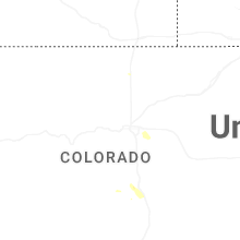
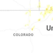


Connect with Interactive Hail Maps