

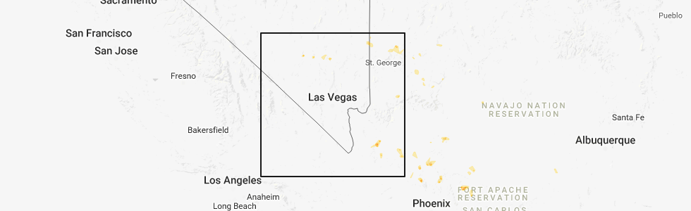
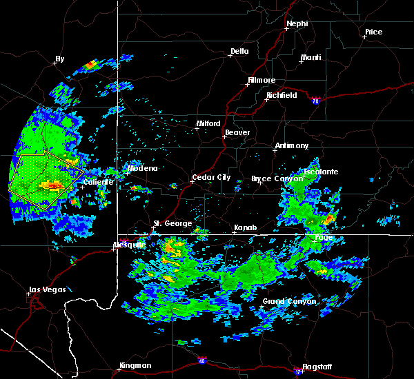
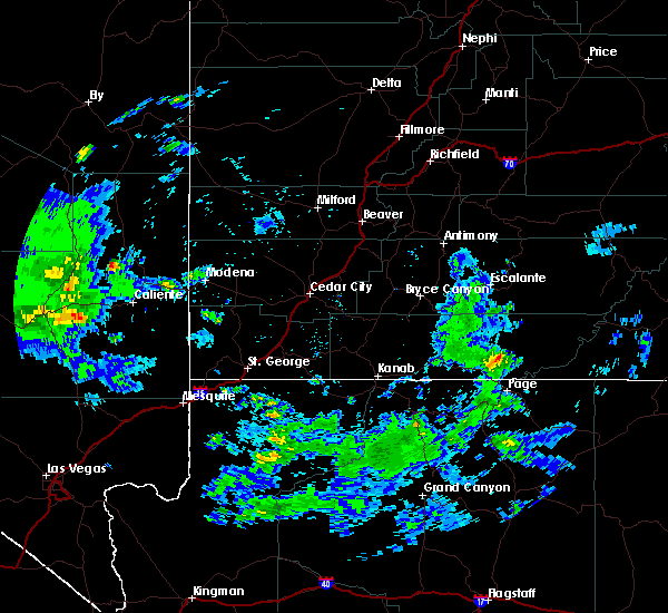
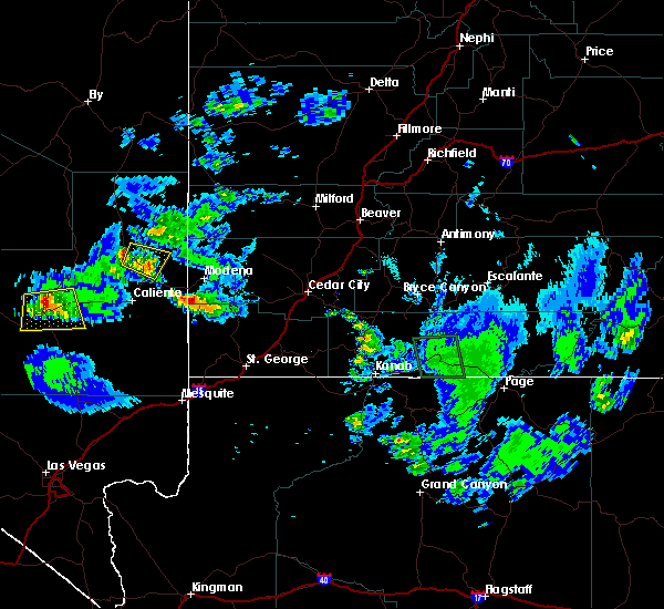
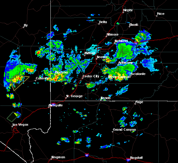
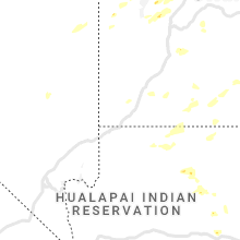
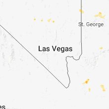
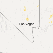
Hail Map for Alamo, NV
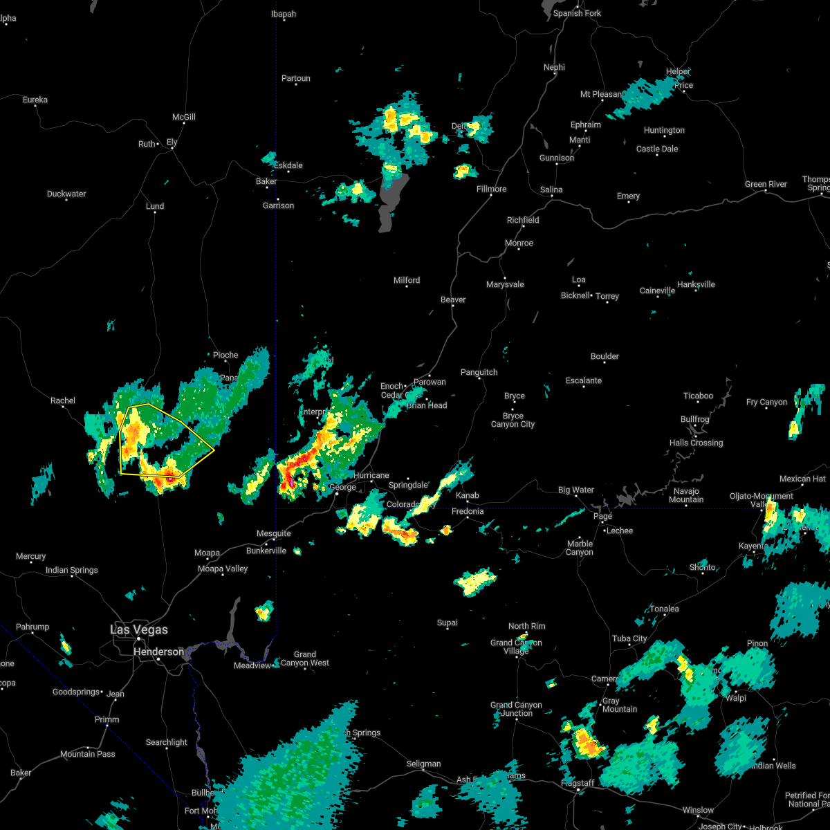
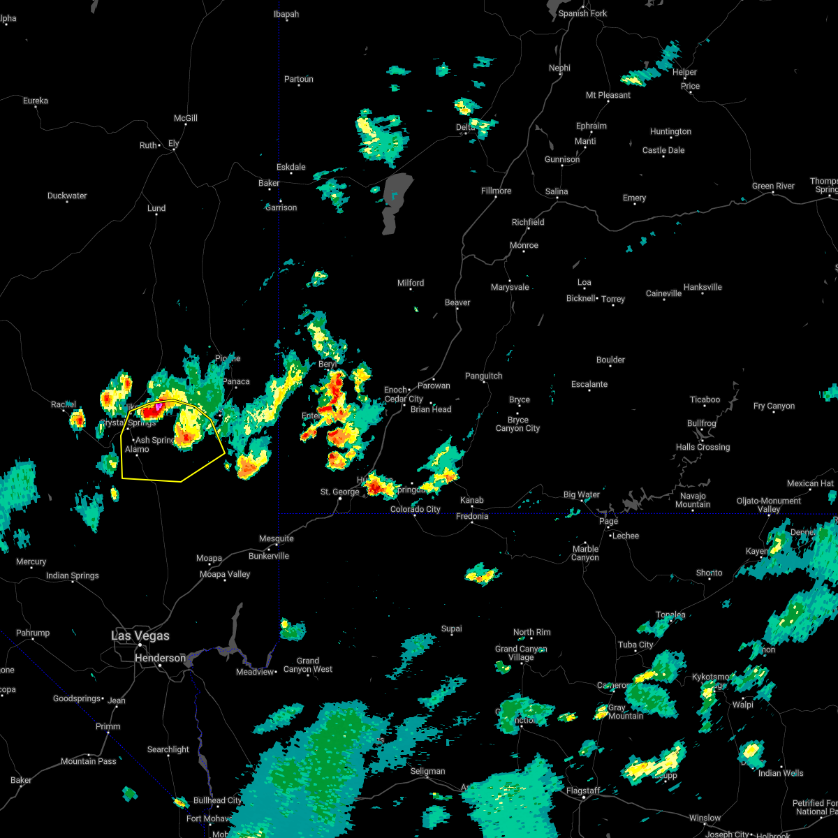
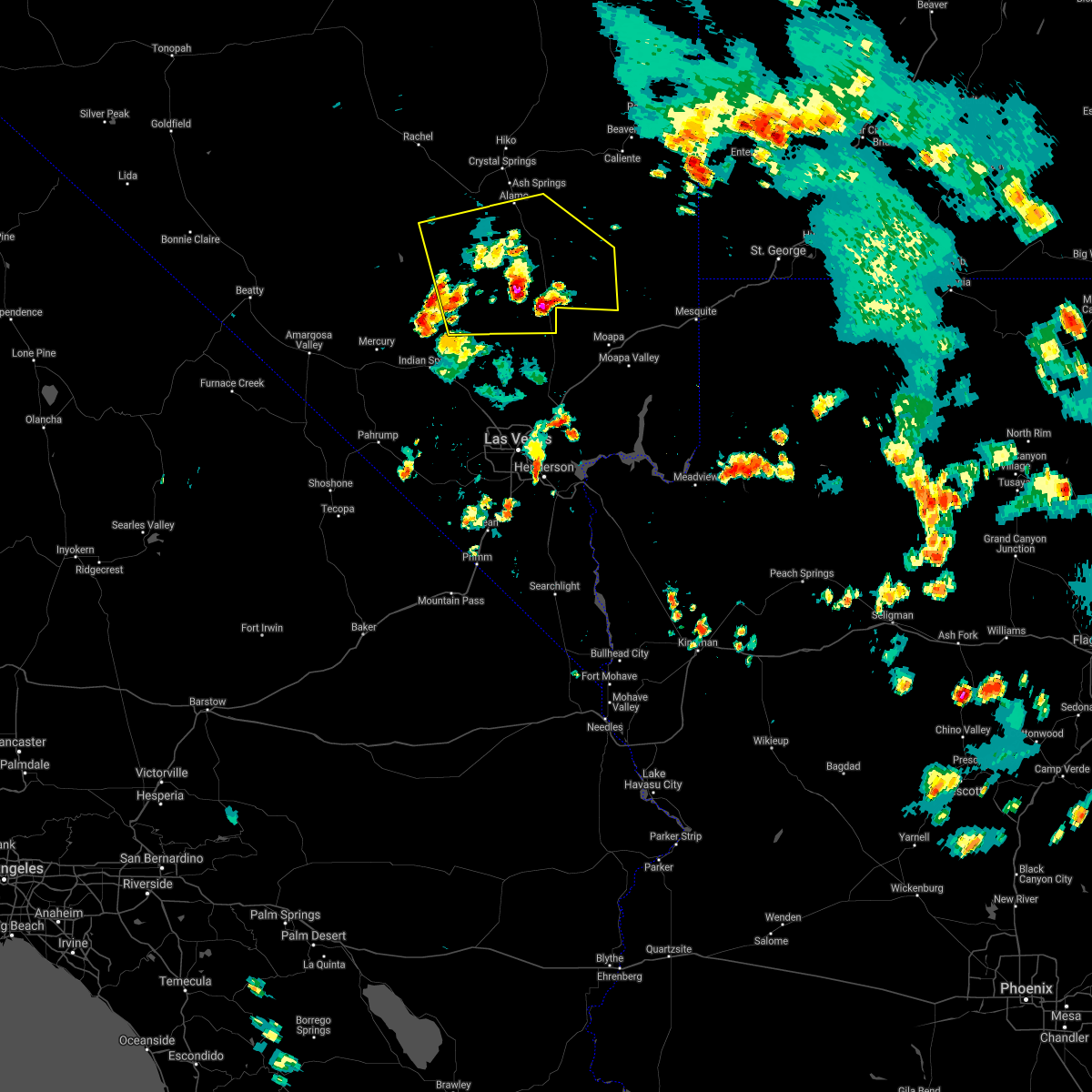
The Alamo, NV area has had 0 reports of on-the-ground hail by trained spotters, and has been under severe weather warnings 0 times during the past 12 months. Doppler radar has detected hail at or near Alamo, NV on 9 occasions.
| Name: | Alamo, NV |
| Where Located: | 82.6 miles N of Las Vegas, NV |
| Map: | Google Map for Alamo, NV |
| Population: | 1080 |
| Housing Units: | 457 |
| More Info: | Search Google for Alamo, NV |
5
The Top Recent Hail Date for Alamo, NV is Wednesday, July 18, 2018 (1st out of 9)
Hail and Wind Damage Spotted near Alamo, NV
| Date / Time | Report Details |
|---|---|
| 7/28/2022 6:28 PM PDT |
 The severe thunderstorm warning for south central lincoln county will expire at 630 pm pdt, the storm which prompted the warning has weakened below severe limits, and has exited the warned area. therefore, the warning will be allowed to expire. however gusty winds and heavy rain are still possible with this thunderstorm. The severe thunderstorm warning for south central lincoln county will expire at 630 pm pdt, the storm which prompted the warning has weakened below severe limits, and has exited the warned area. therefore, the warning will be allowed to expire. however gusty winds and heavy rain are still possible with this thunderstorm.
|
| 7/28/2022 6:07 PM PDT |
 At 607 pm pdt, a severe thunderstorm was located 14 miles northeast of alamo, moving south at 15 mph (radar indicated). Hazards include 60 mph wind gusts and quarter size hail. Hail damage to vehicles is expected. expect wind damage to roofs and trees. locations impacted include, alamo and hiko. hail threat, radar indicated max hail size, 1. 00 in wind threat, radar indicated max wind gust, 60 mph. At 607 pm pdt, a severe thunderstorm was located 14 miles northeast of alamo, moving south at 15 mph (radar indicated). Hazards include 60 mph wind gusts and quarter size hail. Hail damage to vehicles is expected. expect wind damage to roofs and trees. locations impacted include, alamo and hiko. hail threat, radar indicated max hail size, 1. 00 in wind threat, radar indicated max wind gust, 60 mph.
|
| 7/28/2022 5:28 PM PDT |
 At 527 pm pdt, a severe thunderstorm was located 13 miles east of hiko, moving south at 15 mph (radar indicated). Hazards include 60 mph wind gusts and quarter size hail. Hail damage to vehicles is expected. Expect wind damage to roofs and trees. At 527 pm pdt, a severe thunderstorm was located 13 miles east of hiko, moving south at 15 mph (radar indicated). Hazards include 60 mph wind gusts and quarter size hail. Hail damage to vehicles is expected. Expect wind damage to roofs and trees.
|
| 7/22/2021 3:03 PM PDT |
 At 302 pm pdt, a cluster of severe thunderstorms located 16 miles northwest of coyote springs, or 23 miles south of alamo, are moving northeast at 10 mph (radar indicated). Hazards include 70 mph wind gusts. Expect considerable tree damage. Damage is likely to mobile homes, roofs, and outbuildings. At 302 pm pdt, a cluster of severe thunderstorms located 16 miles northwest of coyote springs, or 23 miles south of alamo, are moving northeast at 10 mph (radar indicated). Hazards include 70 mph wind gusts. Expect considerable tree damage. Damage is likely to mobile homes, roofs, and outbuildings.
|
| 6/16/2019 4:23 PM PDT |
 At 422 pm pdt, a severe thunderstorm was located 13 miles northeast of hiko, moving northeast at 25 mph. heavy rain and hail is likely affecting highway 93 west of caliente (radar indicated). Hazards include 60 mph wind gusts and quarter size hail. Hail damage to vehicles is expected. expect wind damage to roofs and trees. Locations impacted include, hiko. At 422 pm pdt, a severe thunderstorm was located 13 miles northeast of hiko, moving northeast at 25 mph. heavy rain and hail is likely affecting highway 93 west of caliente (radar indicated). Hazards include 60 mph wind gusts and quarter size hail. Hail damage to vehicles is expected. expect wind damage to roofs and trees. Locations impacted include, hiko.
|
| 6/16/2019 3:54 PM PDT |
 At 352 pm pdt, a severe thunderstorm was located near hiko, moving northeast at 25 mph. this this storm will affect highway 318 north of crystal springs (radar indicated). Hazards include 60 mph wind gusts and quarter size hail. Hail damage to vehicles is expected. Expect wind damage to roofs and trees. At 352 pm pdt, a severe thunderstorm was located near hiko, moving northeast at 25 mph. this this storm will affect highway 318 north of crystal springs (radar indicated). Hazards include 60 mph wind gusts and quarter size hail. Hail damage to vehicles is expected. Expect wind damage to roofs and trees.
|
| 8/10/2018 9:06 PM PDT |
 The severe thunderstorm warning for southwestern lincoln and northeastern nye counties will expire at 915 pm pdt, the storm which prompted the warning has weakened below severe limits, and no longer poses an immediate threat to life or property. therefore, the warning will be allowed to expire. however gusty winds are still possible with this thunderstorm. The severe thunderstorm warning for southwestern lincoln and northeastern nye counties will expire at 915 pm pdt, the storm which prompted the warning has weakened below severe limits, and no longer poses an immediate threat to life or property. therefore, the warning will be allowed to expire. however gusty winds are still possible with this thunderstorm.
|
| 8/10/2018 8:15 PM PDT |
 The national weather service in las vegas has issued a * severe thunderstorm warning for. southwestern lincoln county in south central nevada. northeastern nye county in south central nevada. until 915 pm pdt. At 814 pm pdt, a severe thunderstorm was located 31 miles north of. The national weather service in las vegas has issued a * severe thunderstorm warning for. southwestern lincoln county in south central nevada. northeastern nye county in south central nevada. until 915 pm pdt. At 814 pm pdt, a severe thunderstorm was located 31 miles north of.
|
| 8/23/2016 5:21 PM PDT |
 At 521 pm pdt, doppler radar indicated a severe thunderstorm capable of producing quarter size hail and damaging winds in excess of 60 mph. this storm was located over hiko, moving south at 10 mph. locations impacted include, hiko. At 521 pm pdt, doppler radar indicated a severe thunderstorm capable of producing quarter size hail and damaging winds in excess of 60 mph. this storm was located over hiko, moving south at 10 mph. locations impacted include, hiko.
|
| 8/23/2016 4:56 PM PDT |
 At 456 pm pdt, doppler radar indicated a severe thunderstorm capable of producing quarter size hail and damaging winds in excess of 60 mph. this storm was located over hiko, and moving south at 10 mph. At 456 pm pdt, doppler radar indicated a severe thunderstorm capable of producing quarter size hail and damaging winds in excess of 60 mph. this storm was located over hiko, and moving south at 10 mph.
|
| 7/31/2016 5:46 PM PDT |
 At 543 pm pdt, doppler radar continues to indicate thunderstorms capable of producing damaging winds in excess of 60 mph and heavy rain. this storm was located 10 miles southeast of hiko, moving southeast at 20 mph. locations impacted include, hiko and alamo. At 543 pm pdt, doppler radar continues to indicate thunderstorms capable of producing damaging winds in excess of 60 mph and heavy rain. this storm was located 10 miles southeast of hiko, moving southeast at 20 mph. locations impacted include, hiko and alamo.
|
| 7/31/2016 5:19 PM PDT |
 At 518 pm pdt, doppler radar indicated a severe thunderstorm capable of producing damaging winds in excess of 60 mph. this storm was located near hiko, and moving southeast at 15 mph. small hail and heavy rain are also likely. At 518 pm pdt, doppler radar indicated a severe thunderstorm capable of producing damaging winds in excess of 60 mph. this storm was located near hiko, and moving southeast at 15 mph. small hail and heavy rain are also likely.
|
| 7/28/2016 3:10 PM PDT | An automated weather sensor in alamo reported a wind gust from a thunderstorm of 76 mph. there was also a report of a small tree down near the intersection of highway 9 in lincoln county NV, 0.6 miles N of Alamo, NV |
| 7/1/2015 7:50 PM PDT | Tikaboo peak measured a 62 mph thunderstorm wind gus in lincoln county NV, 11.2 miles E of Alamo, NV |
| 8/9/2012 8:10 PM PDT | Tikaboo peak mesonet site measured a 59 mph thunderstorm wind gus in lincoln county NV, 11.2 miles E of Alamo, NV |
Hail Maps for Alamo, NV


Connect with Interactive Hail Maps