

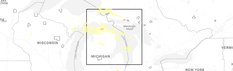
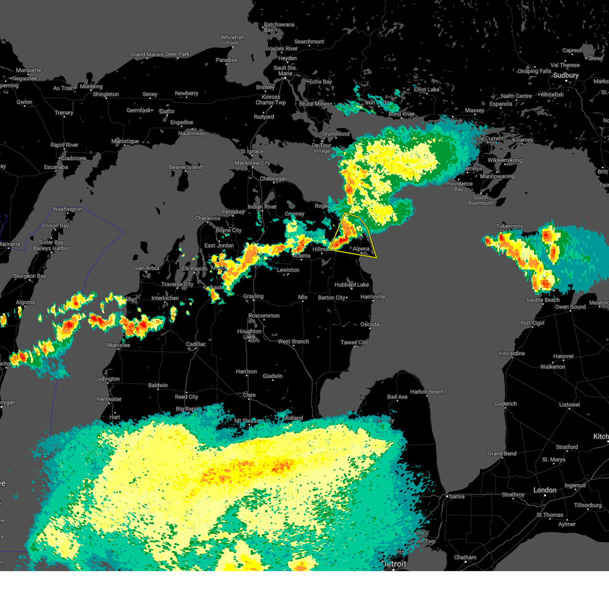
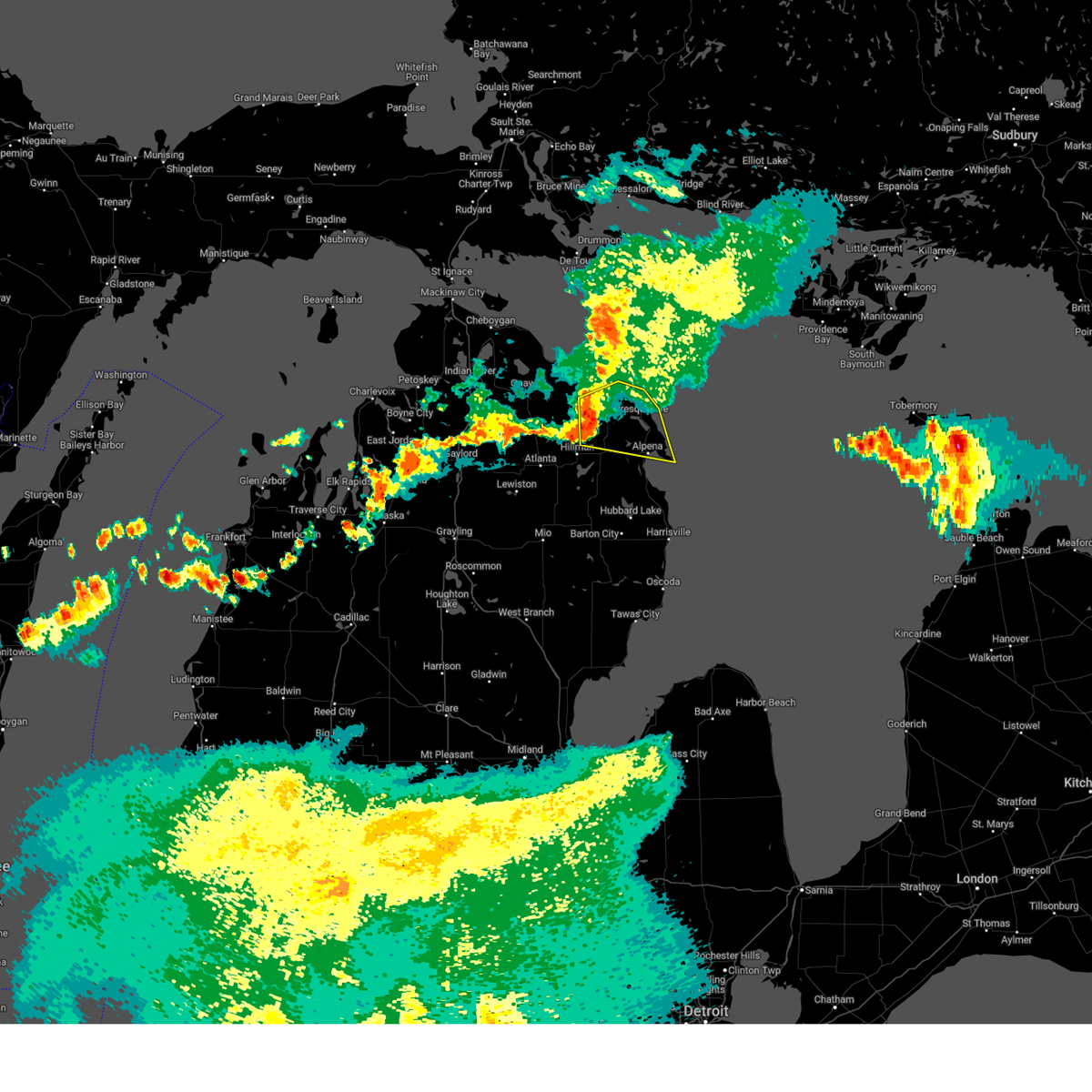
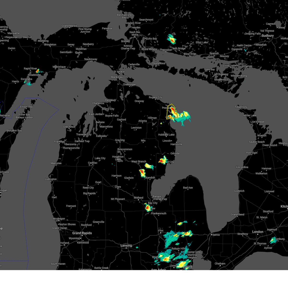
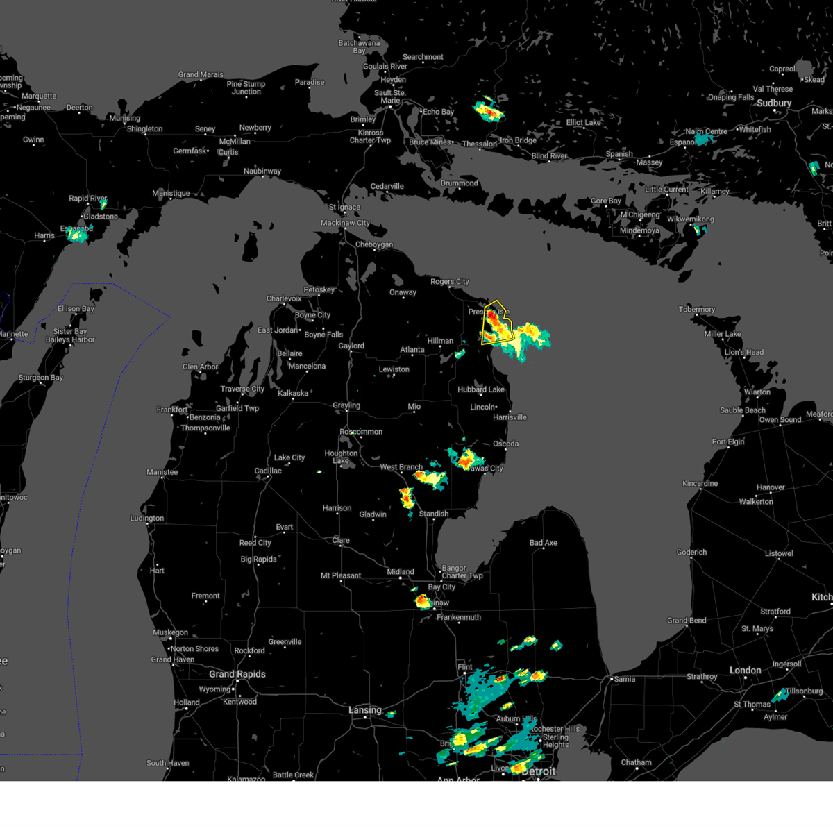
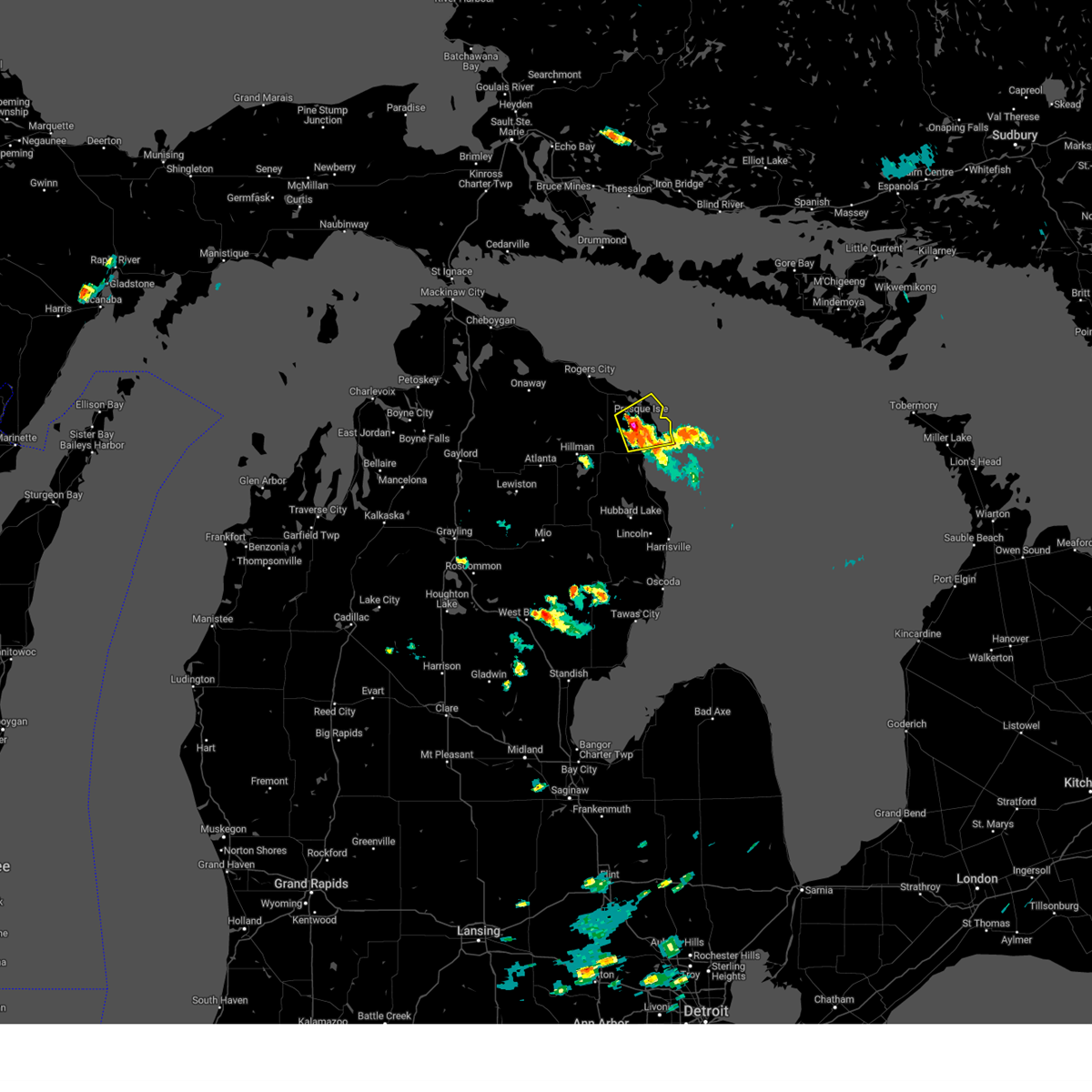
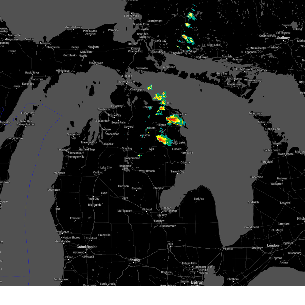
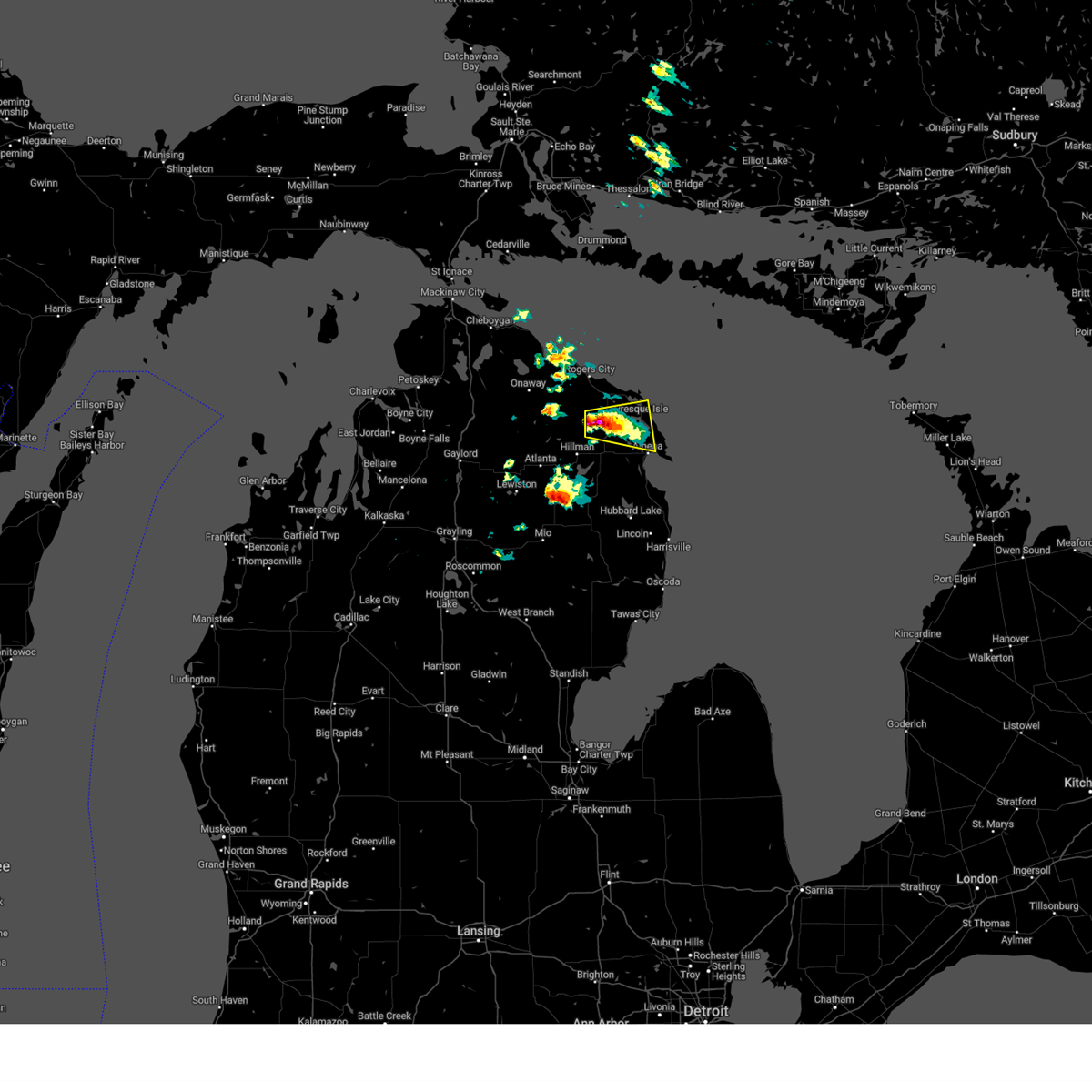
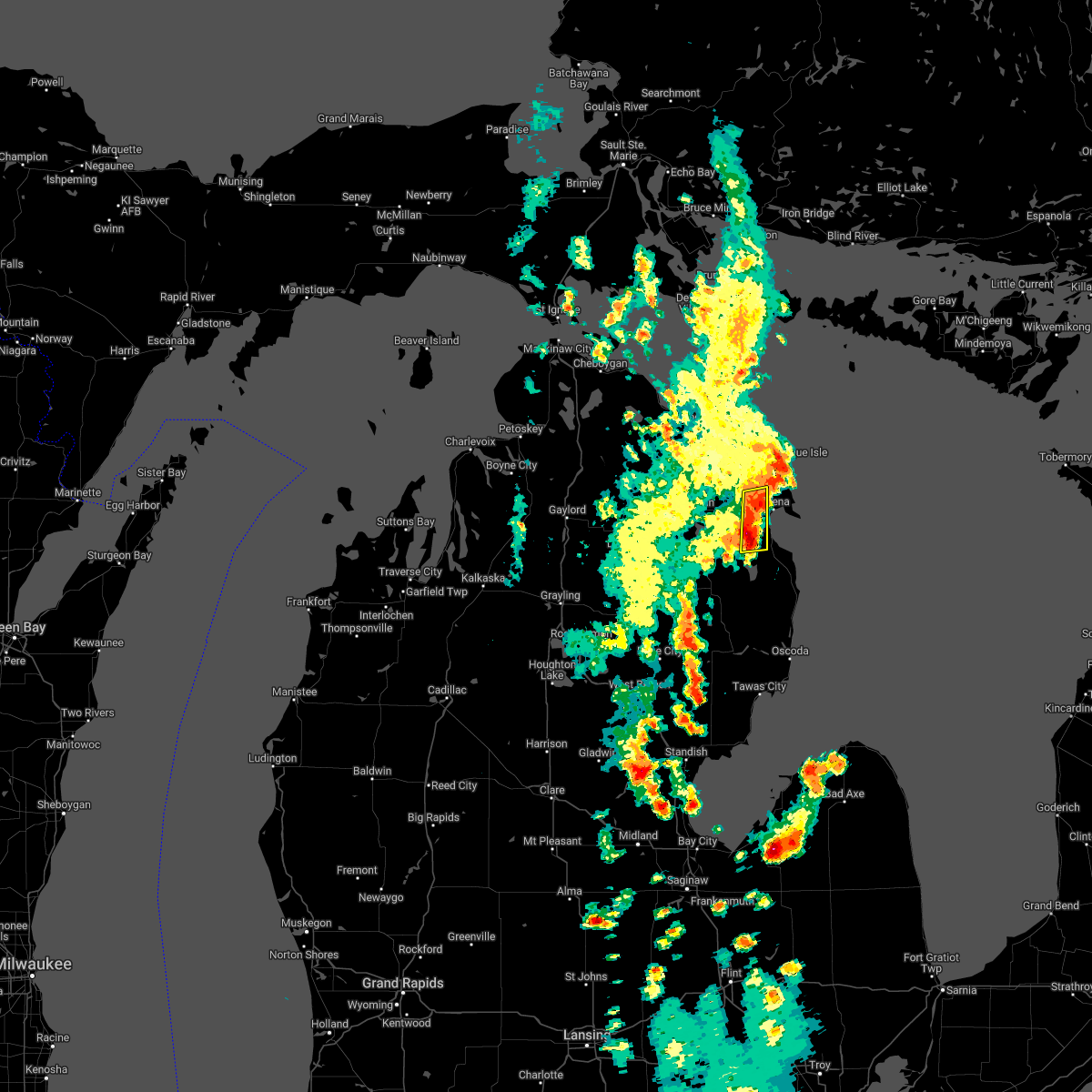
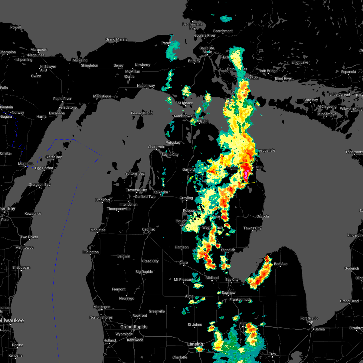
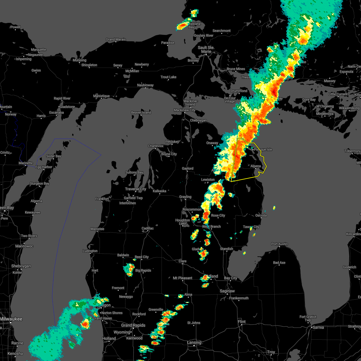
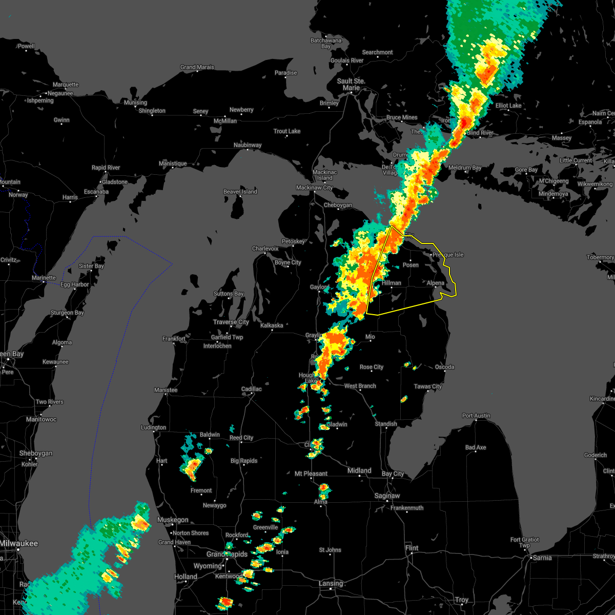
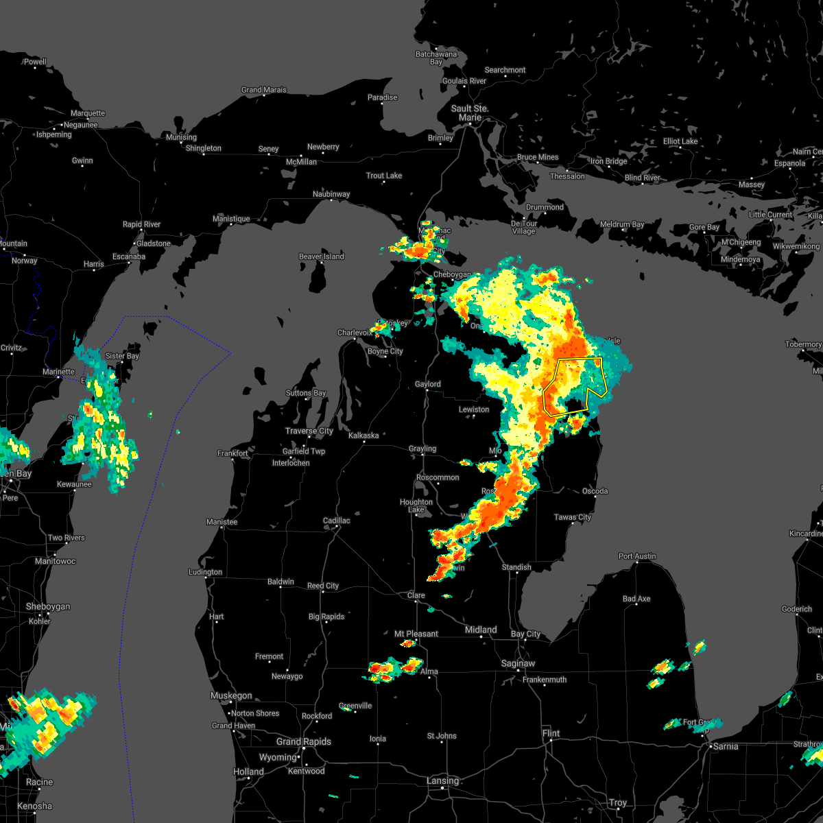
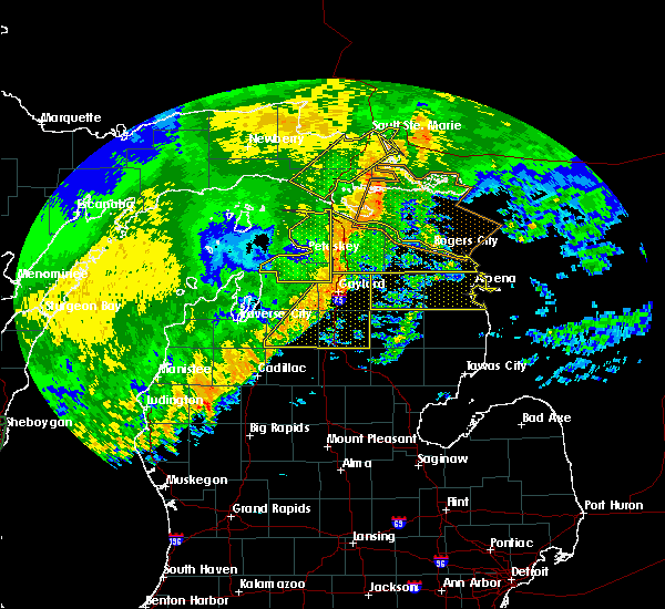
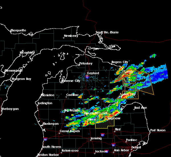
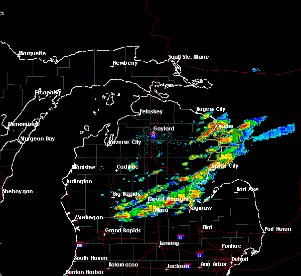
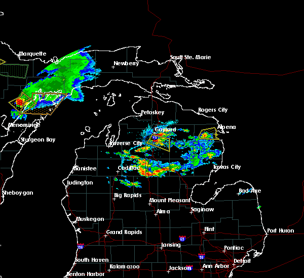
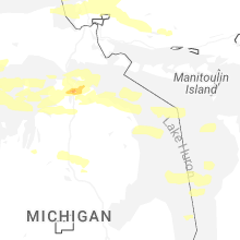
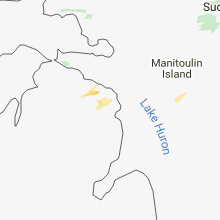
Hail Map for Alpena, MI
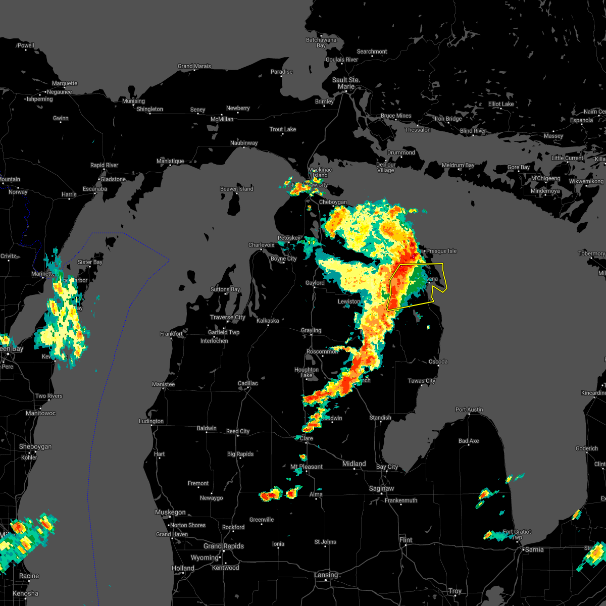
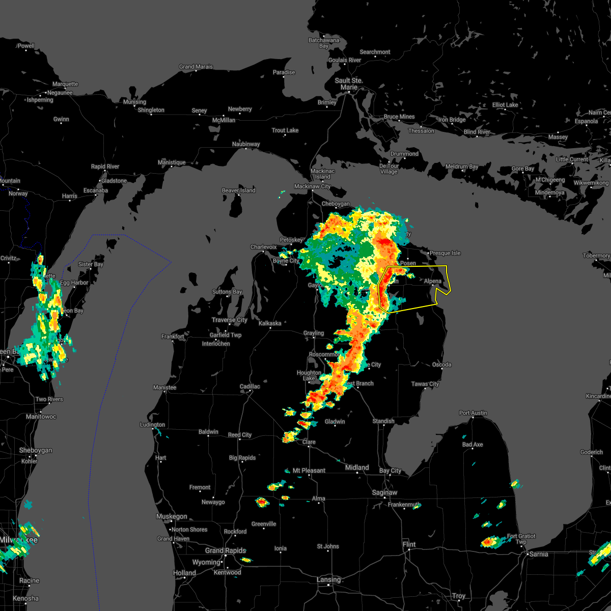
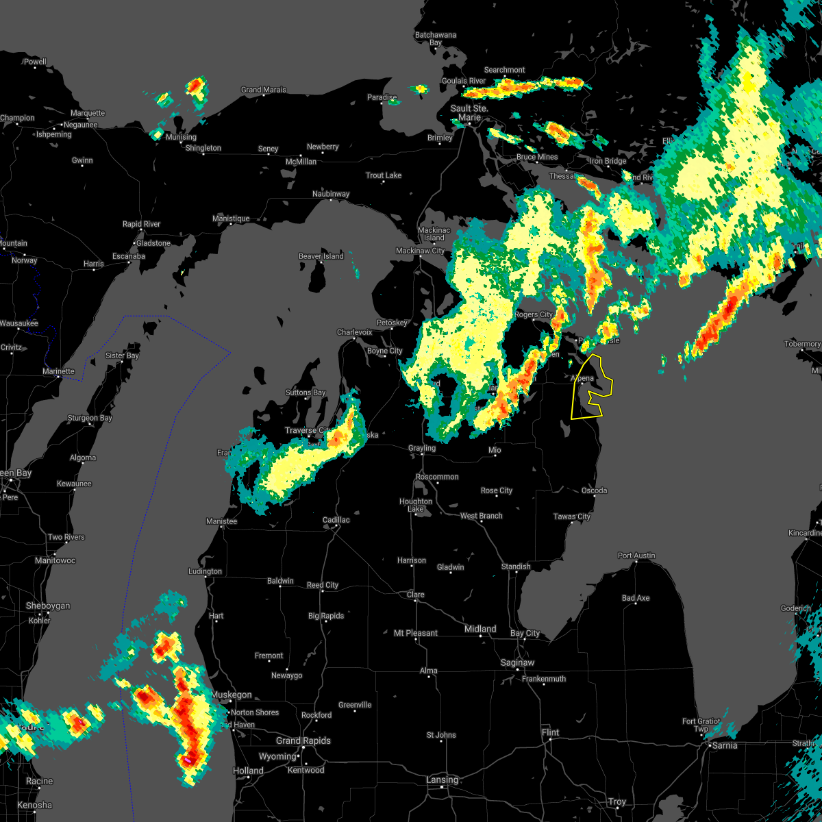
The Alpena, MI area has had 1 report of on-the-ground hail by trained spotters, and has been under severe weather warnings 2 times during the past 12 months. Doppler radar has detected hail at or near Alpena, MI on 11 occasions, including 1 occasion during the past year.
| Name: | Alpena, MI |
| Where Located: | 1.2 miles ENE of Alpena, MI |
| Map: | Google Map for Alpena, MI |
| Population: | 10483 |
| Housing Units: | 5278 |
| More Info: | Search Google for Alpena, MI |
1
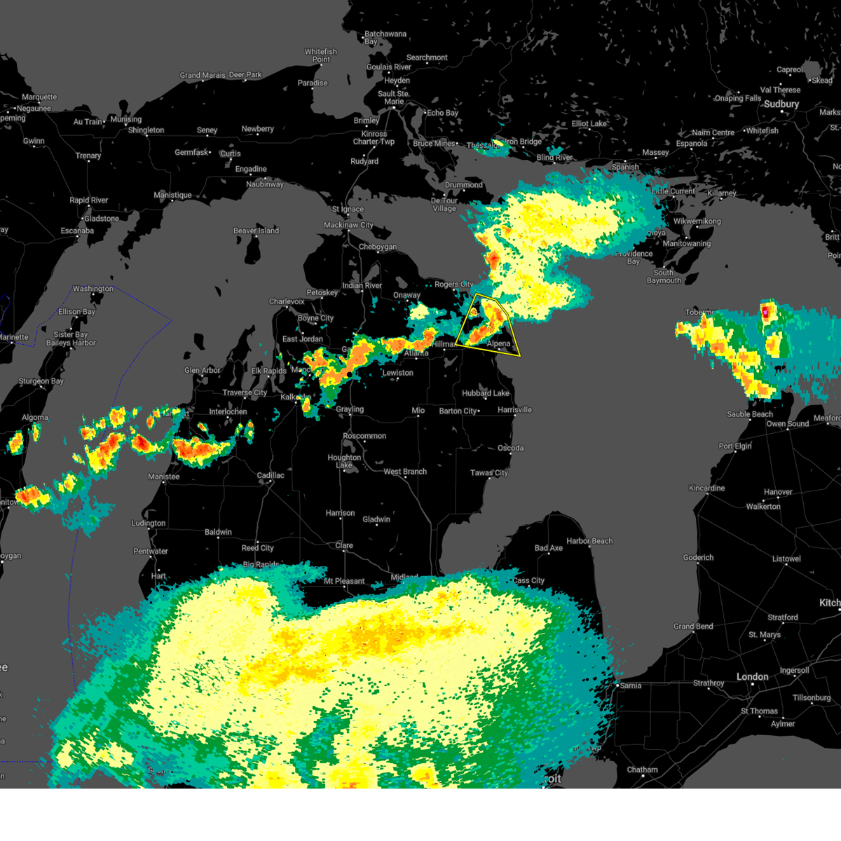
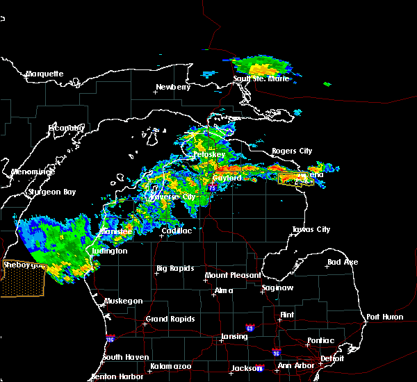
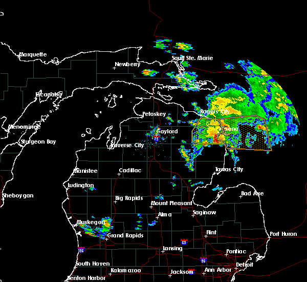
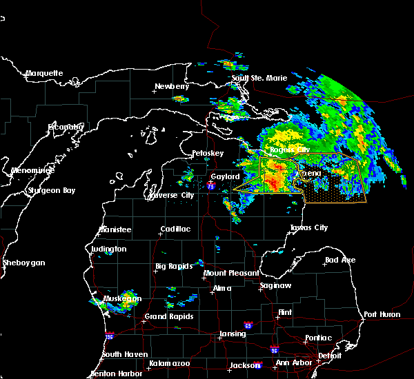
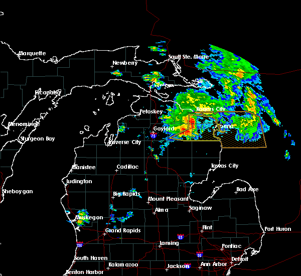
The Top Recent Hail Date for Alpena, MI is Saturday, June 21, 2025 (6th out of 11)
Hail and Wind Damage Spotted near Alpena, MI
| Date / Time | Report Details |
|---|---|
| 4/29/2025 12:02 PM EDT |
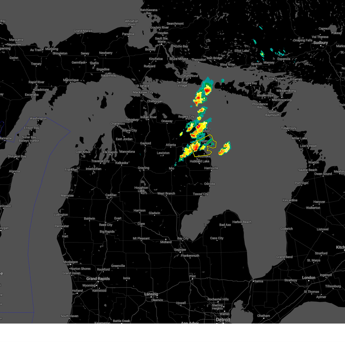 At 1202 pm edt, severe thunderstorms were located along a line extending from near alpena to near ossineke to near ossineke township, moving east at 55 mph (radar indicated). Hazards include 60 mph wind gusts and penny size hail. Expect damage to roofs, siding, and trees. these severe storms will be near, alpena, the town of hubbard lake, and ossineke around 1210 pm edt. Other locations impacted by these severe thunderstorms include devils lake. At 1202 pm edt, severe thunderstorms were located along a line extending from near alpena to near ossineke to near ossineke township, moving east at 55 mph (radar indicated). Hazards include 60 mph wind gusts and penny size hail. Expect damage to roofs, siding, and trees. these severe storms will be near, alpena, the town of hubbard lake, and ossineke around 1210 pm edt. Other locations impacted by these severe thunderstorms include devils lake.
|
| 4/29/2025 11:49 AM EDT |
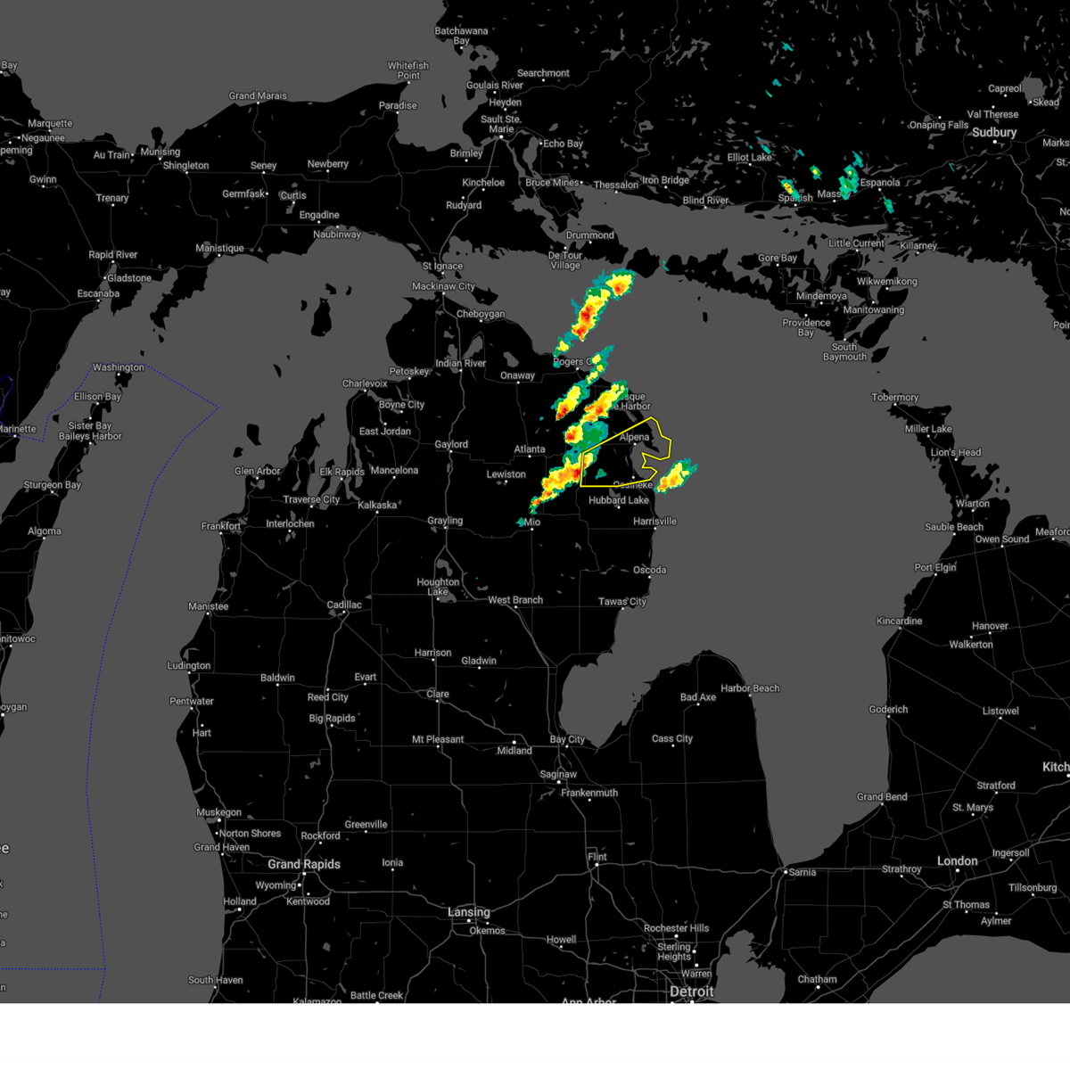 Svrapx the national weather service in gaylord has issued a * severe thunderstorm warning for, alpena county in northern michigan, * until 1215 pm edt. * at 1149 am edt, severe thunderstorms were located along a line extending from near lachine to near ossineke township to 8 miles northwest of curran, moving east at 40 mph (radar indicated). Hazards include 60 mph wind gusts. Expect damage to roofs, siding, and trees. severe thunderstorms will be near, alpena, the town of hubbard lake, ossineke, and ossineke township around 1155 am edt. Other locations impacted by these severe thunderstorms include devils lake. Svrapx the national weather service in gaylord has issued a * severe thunderstorm warning for, alpena county in northern michigan, * until 1215 pm edt. * at 1149 am edt, severe thunderstorms were located along a line extending from near lachine to near ossineke township to 8 miles northwest of curran, moving east at 40 mph (radar indicated). Hazards include 60 mph wind gusts. Expect damage to roofs, siding, and trees. severe thunderstorms will be near, alpena, the town of hubbard lake, ossineke, and ossineke township around 1155 am edt. Other locations impacted by these severe thunderstorms include devils lake.
|
| 7/16/2024 1:40 AM EDT |
 The storm which prompted the warning has moved out of the area. therefore, the warning will be allowed to expire. The storm which prompted the warning has moved out of the area. therefore, the warning will be allowed to expire.
|
| 7/16/2024 1:28 AM EDT |
 At 127 am edt, a severe thunderstorm was located over cathro, or 8 miles northwest of alpena, moving east at 30 mph (radar indicated). Hazards include 60 mph wind gusts. Expect damage to roofs, siding, and trees. This severe storm will be near, alpena and lakewood around 130 am edt. At 127 am edt, a severe thunderstorm was located over cathro, or 8 miles northwest of alpena, moving east at 30 mph (radar indicated). Hazards include 60 mph wind gusts. Expect damage to roofs, siding, and trees. This severe storm will be near, alpena and lakewood around 130 am edt.
|
| 7/16/2024 1:06 AM EDT |
 Svrapx the national weather service in gaylord has issued a * severe thunderstorm warning for, northern alpena county in northern michigan, southeastern presque isle county in northern michigan, * until 145 am edt. * at 106 am edt, a severe thunderstorm was located near posen, or 9 miles north of lachine, moving east at 40 mph (radar indicated). Hazards include 60 mph wind gusts. Expect damage to roofs, siding, and trees. this severe thunderstorm will be near, posen and cathro around 110 am edt. presque isle and lakewood around 115 am edt. Presque isle light and thompsons harbor state park around 120 am edt. Svrapx the national weather service in gaylord has issued a * severe thunderstorm warning for, northern alpena county in northern michigan, southeastern presque isle county in northern michigan, * until 145 am edt. * at 106 am edt, a severe thunderstorm was located near posen, or 9 miles north of lachine, moving east at 40 mph (radar indicated). Hazards include 60 mph wind gusts. Expect damage to roofs, siding, and trees. this severe thunderstorm will be near, posen and cathro around 110 am edt. presque isle and lakewood around 115 am edt. Presque isle light and thompsons harbor state park around 120 am edt.
|
| 7/8/2024 8:25 PM EDT | Tree snapped at base downing wires and power pole. facebook report relayed by wfo gr in alpena county MI, 0.8 miles E of Alpena, MI |
| 7/24/2023 6:09 PM EDT |
 The severe thunderstorm warning for northeastern alpena and southeastern presque isle counties will expire at 615 pm edt, the storm which prompted the warning has moved out onto lake huron. therefore, the warning will be allowed to expire. The severe thunderstorm warning for northeastern alpena and southeastern presque isle counties will expire at 615 pm edt, the storm which prompted the warning has moved out onto lake huron. therefore, the warning will be allowed to expire.
|
| 7/24/2023 5:58 PM EDT |
 At 558 pm edt, a severe thunderstorm was located over lakewood, or 7 miles south of presque isle light, moving northeast at 15 mph (radar indicated). Hazards include half dollar size hail. Damage to vehicles is expected. this severe thunderstorm will remain over mainly rural areas of northeastern alpena and southeastern presque isle counties. hail threat, radar indicated max hail size, 1. 25 in wind threat, radar indicated max wind gust, <50 mph. At 558 pm edt, a severe thunderstorm was located over lakewood, or 7 miles south of presque isle light, moving northeast at 15 mph (radar indicated). Hazards include half dollar size hail. Damage to vehicles is expected. this severe thunderstorm will remain over mainly rural areas of northeastern alpena and southeastern presque isle counties. hail threat, radar indicated max hail size, 1. 25 in wind threat, radar indicated max wind gust, <50 mph.
|
| 7/24/2023 5:40 PM EDT |
 At 540 pm edt, a severe thunderstorm was located near lakewood, or 8 miles northwest of alpena, moving east at 10 mph (radar indicated). Hazards include half dollar size hail. Damage to vehicles is expected. this severe thunderstorm will be near, alpena around 545 pm edt. lakewood around 600 pm edt. other locations in the path of this severe thunderstorm include presque isle. hail threat, radar indicated max hail size, 1. 25 in wind threat, radar indicated max wind gust, <50 mph. At 540 pm edt, a severe thunderstorm was located near lakewood, or 8 miles northwest of alpena, moving east at 10 mph (radar indicated). Hazards include half dollar size hail. Damage to vehicles is expected. this severe thunderstorm will be near, alpena around 545 pm edt. lakewood around 600 pm edt. other locations in the path of this severe thunderstorm include presque isle. hail threat, radar indicated max hail size, 1. 25 in wind threat, radar indicated max wind gust, <50 mph.
|
| 6/30/2023 2:09 PM EDT |
 At 208 pm edt, a severe thunderstorm was located near long rapids, or 7 miles northeast of lachine, moving east at 20 mph (radar indicated). Hazards include quarter size hail. Damage to vehicles is expected. locations impacted include, alpena, cathro and lakewood. hail threat, radar indicated max hail size, 1. 00 in wind threat, radar indicated max wind gust, <50 mph. At 208 pm edt, a severe thunderstorm was located near long rapids, or 7 miles northeast of lachine, moving east at 20 mph (radar indicated). Hazards include quarter size hail. Damage to vehicles is expected. locations impacted include, alpena, cathro and lakewood. hail threat, radar indicated max hail size, 1. 00 in wind threat, radar indicated max wind gust, <50 mph.
|
| 6/30/2023 1:54 PM EDT |
 At 153 pm edt, a severe thunderstorm was located near long rapids, or 8 miles north of lachine, moving east at 20 mph (radar indicated). Hazards include quarter size hail. damage to vehicles is expected At 153 pm edt, a severe thunderstorm was located near long rapids, or 8 miles north of lachine, moving east at 20 mph (radar indicated). Hazards include quarter size hail. damage to vehicles is expected
|
| 5/14/2022 4:01 PM EDT |
 At 400 pm edt, a severe thunderstorm was located near alpena, moving east at 15 mph. this storm has a history of producing half-inch diameter hail (radar indicated). Hazards include quarter size hail. Damage to vehicles is expected. locations impacted include, alpena, the town of hubbard lake and devils lake. hail threat, observed max hail size, 1. 00 in wind threat, radar indicated max wind gust, <50 mph. At 400 pm edt, a severe thunderstorm was located near alpena, moving east at 15 mph. this storm has a history of producing half-inch diameter hail (radar indicated). Hazards include quarter size hail. Damage to vehicles is expected. locations impacted include, alpena, the town of hubbard lake and devils lake. hail threat, observed max hail size, 1. 00 in wind threat, radar indicated max wind gust, <50 mph.
|
| 5/14/2022 3:34 PM EDT |
 At 334 pm edt, a severe thunderstorm was located 8 miles east of spratt, or 8 miles southwest of alpena, moving east at 15 mph (radar indicated). Hazards include quarter size hail. damage to vehicles is expected At 334 pm edt, a severe thunderstorm was located 8 miles east of spratt, or 8 miles southwest of alpena, moving east at 15 mph (radar indicated). Hazards include quarter size hail. damage to vehicles is expected
|
| 8/29/2021 3:47 PM EDT |
 At 347 pm edt, severe thunderstorms were located along a line extending from 14 miles northeast of rogers city to posen to near lockwood lake, moving east at 50 mph (radar indicated). Hazards include 60 mph wind gusts. Expect damage to roofs, siding, and trees. locations impacted include, posen, presque isle light, presque isle, spratt, thompsons harbor state park, lachine and alpena. hail threat, radar indicated max hail size, <. 75 in wind threat, radar indicated max wind gust, 60 mph. At 347 pm edt, severe thunderstorms were located along a line extending from 14 miles northeast of rogers city to posen to near lockwood lake, moving east at 50 mph (radar indicated). Hazards include 60 mph wind gusts. Expect damage to roofs, siding, and trees. locations impacted include, posen, presque isle light, presque isle, spratt, thompsons harbor state park, lachine and alpena. hail threat, radar indicated max hail size, <. 75 in wind threat, radar indicated max wind gust, 60 mph.
|
| 8/29/2021 3:22 PM EDT |
 At 322 pm edt, severe thunderstorms were located along a line extending from near forty mile point to 6 miles southwest of bisma township to garland, moving northeast at 35 mph (radar indicated). Hazards include 60 mph wind gusts. Expect damage to roofs, siding, and trees. severe thunderstorms will be near, p h hoeft state park around 325 pm edt. royston around 330 pm edt. bisma township around 335 pm edt. loud township and hawks around 340 pm edt. other locations in the path of these severe thunderstorms include atlanta, metz, lockwood lake, posen, hagensville, rogers city and fletcher pond. hail threat, radar indicated max hail size, <. 75 in wind threat, radar indicated max wind gust, 60 mph. At 322 pm edt, severe thunderstorms were located along a line extending from near forty mile point to 6 miles southwest of bisma township to garland, moving northeast at 35 mph (radar indicated). Hazards include 60 mph wind gusts. Expect damage to roofs, siding, and trees. severe thunderstorms will be near, p h hoeft state park around 325 pm edt. royston around 330 pm edt. bisma township around 335 pm edt. loud township and hawks around 340 pm edt. other locations in the path of these severe thunderstorms include atlanta, metz, lockwood lake, posen, hagensville, rogers city and fletcher pond. hail threat, radar indicated max hail size, <. 75 in wind threat, radar indicated max wind gust, 60 mph.
|
| 8/28/2021 4:37 PM EDT |
 At 437 pm edt, severe thunderstorms were located along a line extending from near long lake to 7 miles south of cathro to near ossineke township, moving east at 25 mph (radar indicated). Hazards include 60 mph wind gusts and nickel size hail. Expect damage to roofs, siding, and trees. locations impacted include, alpena, ossineke, ossineke township, cathro, lakewood and devils lake. hail threat, radar indicated max hail size, 0. 88 in wind threat, radar indicated max wind gust, 60 mph. At 437 pm edt, severe thunderstorms were located along a line extending from near long lake to 7 miles south of cathro to near ossineke township, moving east at 25 mph (radar indicated). Hazards include 60 mph wind gusts and nickel size hail. Expect damage to roofs, siding, and trees. locations impacted include, alpena, ossineke, ossineke township, cathro, lakewood and devils lake. hail threat, radar indicated max hail size, 0. 88 in wind threat, radar indicated max wind gust, 60 mph.
|
| 8/28/2021 4:20 PM EDT |
 At 420 pm edt, severe thunderstorms were located along a line extending from near cathro to near spratt to near ossineke township, moving east at 30 mph (radar indicated). Hazards include 60 mph wind gusts and nickel size hail. Expect damage to roofs, siding, and trees. locations impacted include, cathro, lakewood, alpena and ossineke. hail threat, radar indicated max hail size, 0. 88 in wind threat, radar indicated max wind gust, 60 mph. At 420 pm edt, severe thunderstorms were located along a line extending from near cathro to near spratt to near ossineke township, moving east at 30 mph (radar indicated). Hazards include 60 mph wind gusts and nickel size hail. Expect damage to roofs, siding, and trees. locations impacted include, cathro, lakewood, alpena and ossineke. hail threat, radar indicated max hail size, 0. 88 in wind threat, radar indicated max wind gust, 60 mph.
|
| 8/28/2021 4:01 PM EDT |
 At 400 pm edt, severe thunderstorms were located along a line extending from near royston to near fletcher pond to near lockwood lake, moving east at 25 mph (radar indicated). Hazards include 60 mph wind gusts and nickel size hail. Expect damage to roofs, siding, and trees. severe thunderstorms will be near, royston around 405 pm edt. long rapids around 415 pm edt. other locations in the path of these severe thunderstorms include ossineke township, spratt, lachine, cathro, lakewood, alpena and ossineke. hail threat, radar indicated max hail size, 0. 88 in wind threat, radar indicated max wind gust, 60 mph. At 400 pm edt, severe thunderstorms were located along a line extending from near royston to near fletcher pond to near lockwood lake, moving east at 25 mph (radar indicated). Hazards include 60 mph wind gusts and nickel size hail. Expect damage to roofs, siding, and trees. severe thunderstorms will be near, royston around 405 pm edt. long rapids around 415 pm edt. other locations in the path of these severe thunderstorms include ossineke township, spratt, lachine, cathro, lakewood, alpena and ossineke. hail threat, radar indicated max hail size, 0. 88 in wind threat, radar indicated max wind gust, 60 mph.
|
| 8/11/2021 7:36 PM EDT |
 The severe thunderstorm warning for eastern alpena county will expire at 745 pm edt, the storms which prompted the warning have moved out of the area. therefore, the warning will be allowed to expire. a severe thunderstorm watch remains in effect until 1100 pm edt for northern michigan. The severe thunderstorm warning for eastern alpena county will expire at 745 pm edt, the storms which prompted the warning have moved out of the area. therefore, the warning will be allowed to expire. a severe thunderstorm watch remains in effect until 1100 pm edt for northern michigan.
|
| 8/11/2021 7:25 PM EDT |
 At 725 pm edt, severe thunderstorms were located along a line extending from 14 miles east of presque isle to 6 miles southeast of lakewood to near the town of hubbard lake, moving east at 65 mph (radar indicated). Hazards include 60 mph wind gusts. Expect damage to roofs, siding, and trees. these severe thunderstorms will remain over mainly rural areas of eastern alpena county, including the following locations, devils lake. hail threat, radar indicated max hail size, <. 75 in wind threat, radar indicated max wind gust, 60 mph. At 725 pm edt, severe thunderstorms were located along a line extending from 14 miles east of presque isle to 6 miles southeast of lakewood to near the town of hubbard lake, moving east at 65 mph (radar indicated). Hazards include 60 mph wind gusts. Expect damage to roofs, siding, and trees. these severe thunderstorms will remain over mainly rural areas of eastern alpena county, including the following locations, devils lake. hail threat, radar indicated max hail size, <. 75 in wind threat, radar indicated max wind gust, 60 mph.
|
| 8/11/2021 7:15 PM EDT | Social media report w/ pictures of multiple trees down on indian reserve rd south of kap in alpena county MI, 7 miles ENE of Alpena, MI |
| 8/11/2021 6:58 PM EDT |
 At 658 pm edt, severe thunderstorms were located along a line extending from near posen to near fletcher pond to near comins, moving east at 65 mph (radar indicated). Hazards include 60 mph wind gusts. Expect damage to roofs, siding, and trees. severe thunderstorms will be near, lachine and long rapids around 705 pm edt. presque isle and fletcher pond around 710 pm edt. alpena, ossineke township and cathro around 715 pm edt. other locations in the path of these severe thunderstorms include the town of hubbard lake, lakewood, hubbard lake and ossineke. hail threat, radar indicated max hail size, <. 75 in wind threat, radar indicated max wind gust, 60 mph. At 658 pm edt, severe thunderstorms were located along a line extending from near posen to near fletcher pond to near comins, moving east at 65 mph (radar indicated). Hazards include 60 mph wind gusts. Expect damage to roofs, siding, and trees. severe thunderstorms will be near, lachine and long rapids around 705 pm edt. presque isle and fletcher pond around 710 pm edt. alpena, ossineke township and cathro around 715 pm edt. other locations in the path of these severe thunderstorms include the town of hubbard lake, lakewood, hubbard lake and ossineke. hail threat, radar indicated max hail size, <. 75 in wind threat, radar indicated max wind gust, 60 mph.
|
| 8/11/2021 1:04 AM EDT |
 At 104 am edt, severe thunderstorms were located along a line extending from near lachine to near barton city, moving east at 35 mph (radar indicated). Hazards include 60 mph wind gusts. Expect damage to roofs, siding, and trees. locations impacted include, alpena, ossineke, the town of hubbard lake, spruce, ossineke township, hubbard lake, spratt, negwegon state park, cathro, lakewood, black river, lost lake woods and devils lake. hail threat, radar indicated max hail size, <. 75 in wind threat, radar indicated max wind gust, 60 mph. At 104 am edt, severe thunderstorms were located along a line extending from near lachine to near barton city, moving east at 35 mph (radar indicated). Hazards include 60 mph wind gusts. Expect damage to roofs, siding, and trees. locations impacted include, alpena, ossineke, the town of hubbard lake, spruce, ossineke township, hubbard lake, spratt, negwegon state park, cathro, lakewood, black river, lost lake woods and devils lake. hail threat, radar indicated max hail size, <. 75 in wind threat, radar indicated max wind gust, 60 mph.
|
| 8/11/2021 12:50 AM EDT |
 At 1250 am edt, severe thunderstorms were located along a line extending from near hillman to near curran, moving northeast at 40 mph (radar indicated). Hazards include 60 mph wind gusts and penny size hail. Expect damage to roofs, siding, and trees. locations impacted include, lachine, the town of hubbard lake, long rapids, hubbard lake, lost lake woods, spruce, ossineke, posen, cathro, negwegon state park, black river, lakewood, thompsons harbor state park, presque isle light and presque isle. hail threat, radar indicated max hail size, 0. 75 in wind threat, radar indicated max wind gust, 60 mph. At 1250 am edt, severe thunderstorms were located along a line extending from near hillman to near curran, moving northeast at 40 mph (radar indicated). Hazards include 60 mph wind gusts and penny size hail. Expect damage to roofs, siding, and trees. locations impacted include, lachine, the town of hubbard lake, long rapids, hubbard lake, lost lake woods, spruce, ossineke, posen, cathro, negwegon state park, black river, lakewood, thompsons harbor state park, presque isle light and presque isle. hail threat, radar indicated max hail size, 0. 75 in wind threat, radar indicated max wind gust, 60 mph.
|
| 8/11/2021 12:31 AM EDT |
 At 1231 am edt, severe thunderstorms were located along a line extending from near atlanta to near mckinley, moving northeast at 40 mph (radar indicated). Hazards include 60 mph wind gusts and penny size hail. Expect damage to roofs, siding, and trees. severe thunderstorms will be near, curran around 1240 am edt. hillman around 1250 am edt. other locations in the path of these severe thunderstorms include royston, bisma township, ossineke township, hubbard lake, the town of hubbard lake, metz, spruce, posen, hagensville, ossineke and thompsons harbor state park. hail threat, radar indicated max hail size, 0. 75 in wind threat, radar indicated max wind gust, 60 mph. At 1231 am edt, severe thunderstorms were located along a line extending from near atlanta to near mckinley, moving northeast at 40 mph (radar indicated). Hazards include 60 mph wind gusts and penny size hail. Expect damage to roofs, siding, and trees. severe thunderstorms will be near, curran around 1240 am edt. hillman around 1250 am edt. other locations in the path of these severe thunderstorms include royston, bisma township, ossineke township, hubbard lake, the town of hubbard lake, metz, spruce, posen, hagensville, ossineke and thompsons harbor state park. hail threat, radar indicated max hail size, 0. 75 in wind threat, radar indicated max wind gust, 60 mph.
|
| 7/26/2020 7:08 PM EDT |
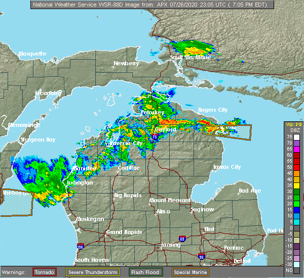 At 708 pm edt, a severe thunderstorm was located over alpena, moving east at 35 mph (radar indicated). Hazards include 60 mph wind gusts and penny size hail. Expect damage to roofs, siding, and trees. Locations impacted include, alpena and devils lake. At 708 pm edt, a severe thunderstorm was located over alpena, moving east at 35 mph (radar indicated). Hazards include 60 mph wind gusts and penny size hail. Expect damage to roofs, siding, and trees. Locations impacted include, alpena and devils lake.
|
| 7/26/2020 6:55 PM EDT |
 At 654 pm edt, a severe thunderstorm was located near lachine, moving east at 25 mph (radar indicated). Hazards include 60 mph wind gusts and penny size hail. expect damage to roofs, siding, and trees At 654 pm edt, a severe thunderstorm was located near lachine, moving east at 25 mph (radar indicated). Hazards include 60 mph wind gusts and penny size hail. expect damage to roofs, siding, and trees
|
| 7/18/2020 12:15 PM EDT |
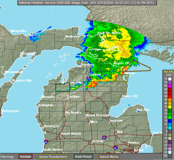 At 1215 pm edt, a severe thunderstorm was located near the town of hubbard lake, moving east at 50 mph (radar indicated). Hazards include 60 mph wind gusts. expect damage to roofs, siding, and trees At 1215 pm edt, a severe thunderstorm was located near the town of hubbard lake, moving east at 50 mph (radar indicated). Hazards include 60 mph wind gusts. expect damage to roofs, siding, and trees
|
| 10/4/2018 2:52 AM EDT |
 At 252 am edt, severe thunderstorms were located along a line extending from near alpena to near the town of hubbard lake to near ossineke township, moving east at 60 mph (radar indicated). Hazards include 60 mph wind gusts. expect damage to roofs, siding, and trees At 252 am edt, severe thunderstorms were located along a line extending from near alpena to near the town of hubbard lake to near ossineke township, moving east at 60 mph (radar indicated). Hazards include 60 mph wind gusts. expect damage to roofs, siding, and trees
|
| 8/28/2018 3:11 AM EDT |
 The severe thunderstorm warning for alpena county will expire at 315 am edt, the storms which prompted the warning have weakened below severe limits, and no longer pose an immediate threat to life or property. therefore, the warning will be allowed to expire. however, gusty winds are still possible with these thunderstorms. The severe thunderstorm warning for alpena county will expire at 315 am edt, the storms which prompted the warning have weakened below severe limits, and no longer pose an immediate threat to life or property. therefore, the warning will be allowed to expire. however, gusty winds are still possible with these thunderstorms.
|
| 8/28/2018 3:03 AM EDT |
 At 302 am edt, severe thunderstorms were located along a line extending from near posen to 7 miles east of spratt to near mack lake, moving southeast at 40 mph (radar indicated). Hazards include 60 mph wind gusts. Expect damage to roofs, siding, and trees. Locations impacted include, alpena, ossineke, the town of hubbard lake, lachine, long rapids, ossineke township, spratt, cathro, lakewood and devils lake. At 302 am edt, severe thunderstorms were located along a line extending from near posen to 7 miles east of spratt to near mack lake, moving southeast at 40 mph (radar indicated). Hazards include 60 mph wind gusts. Expect damage to roofs, siding, and trees. Locations impacted include, alpena, ossineke, the town of hubbard lake, lachine, long rapids, ossineke township, spratt, cathro, lakewood and devils lake.
|
| 8/28/2018 2:10 AM EDT |
 At 210 am edt, severe thunderstorms were located along a line extending from near wolverine to sparr to near sharon, moving east at 80 mph (radar indicated). Hazards include 70 mph wind gusts. Expect considerable tree damage. Damage is likely to mobile homes, roofs, and outbuildings. At 210 am edt, severe thunderstorms were located along a line extending from near wolverine to sparr to near sharon, moving east at 80 mph (radar indicated). Hazards include 70 mph wind gusts. Expect considerable tree damage. Damage is likely to mobile homes, roofs, and outbuildings.
|
| 7/16/2018 2:39 PM EDT |
 At 239 pm edt, severe thunderstorms were located along a line extending from 13 miles east of lakewood to near ossineke, moving east at 25 mph (radar indicated). Hazards include 60 mph wind gusts and quarter size hail. Hail damage to vehicles is expected. expect wind damage to roofs, siding, and trees. Locations impacted include, alpena, ossineke and devils lake. At 239 pm edt, severe thunderstorms were located along a line extending from 13 miles east of lakewood to near ossineke, moving east at 25 mph (radar indicated). Hazards include 60 mph wind gusts and quarter size hail. Hail damage to vehicles is expected. expect wind damage to roofs, siding, and trees. Locations impacted include, alpena, ossineke and devils lake.
|
| 7/16/2018 2:22 PM EDT |
 At 221 pm edt, severe thunderstorms were located along a line extending from 6 miles east of lakewood to near the town of hubbard lake, moving east at 25 mph (radar indicated). Hazards include 60 mph wind gusts and quarter size hail. Hail damage to vehicles is expected. Expect wind damage to roofs, siding, and trees. At 221 pm edt, severe thunderstorms were located along a line extending from 6 miles east of lakewood to near the town of hubbard lake, moving east at 25 mph (radar indicated). Hazards include 60 mph wind gusts and quarter size hail. Hail damage to vehicles is expected. Expect wind damage to roofs, siding, and trees.
|
| 5/26/2018 5:04 PM EDT |
 At 504 pm edt, a severe thunderstorm was located near spratt, or 7 miles south of lachine, moving east at 15 mph (radar indicated). Hazards include quarter size hail. Damage to vehicles is expected. Locations impacted include, alpena, ossineke, ossineke township, spratt and devils lake. At 504 pm edt, a severe thunderstorm was located near spratt, or 7 miles south of lachine, moving east at 15 mph (radar indicated). Hazards include quarter size hail. Damage to vehicles is expected. Locations impacted include, alpena, ossineke, ossineke township, spratt and devils lake.
|
| 5/26/2018 4:47 PM EDT |
 At 447 pm edt, a severe thunderstorm was located over spratt, or 8 miles south of lachine, moving east at 15 mph (radar indicated). Hazards include ping pong ball size hail. People and animals outdoors will be injured. Expect damage to roofs, siding, windows, and vehicles. At 447 pm edt, a severe thunderstorm was located over spratt, or 8 miles south of lachine, moving east at 15 mph (radar indicated). Hazards include ping pong ball size hail. People and animals outdoors will be injured. Expect damage to roofs, siding, windows, and vehicles.
|
| 6/16/2017 5:27 PM EDT |
 At 526 pm edt, a severe thunderstorm was located near alpena, moving east at 20 mph (radar indicated). Hazards include 60 mph wind gusts and quarter size hail. Hail damage to vehicles is expected. expect wind damage to roofs, siding, and trees. Locations impacted include, alpena, ossineke and devils lake. At 526 pm edt, a severe thunderstorm was located near alpena, moving east at 20 mph (radar indicated). Hazards include 60 mph wind gusts and quarter size hail. Hail damage to vehicles is expected. expect wind damage to roofs, siding, and trees. Locations impacted include, alpena, ossineke and devils lake.
|
| 6/16/2017 5:06 PM EDT |
 At 505 pm edt, a severe thunderstorm was located 7 miles north of the town of hubbard lake, moving east at 30 mph (radar indicated). Hazards include 60 mph wind gusts and quarter size hail. Hail damage to vehicles is expected. expect wind damage to roofs, siding, and trees. Locations impacted include, alpena, ossineke, ossineke township and devils lake. At 505 pm edt, a severe thunderstorm was located 7 miles north of the town of hubbard lake, moving east at 30 mph (radar indicated). Hazards include 60 mph wind gusts and quarter size hail. Hail damage to vehicles is expected. expect wind damage to roofs, siding, and trees. Locations impacted include, alpena, ossineke, ossineke township and devils lake.
|
| 6/16/2017 4:49 PM EDT |
 At 448 pm edt, a severe thunderstorm was located over spratt, or near lachine, moving east at 25 mph (radar indicated). Hazards include 60 mph wind gusts and quarter size hail. Hail damage to vehicles is expected. Expect wind damage to roofs, siding, and trees. At 448 pm edt, a severe thunderstorm was located over spratt, or near lachine, moving east at 25 mph (radar indicated). Hazards include 60 mph wind gusts and quarter size hail. Hail damage to vehicles is expected. Expect wind damage to roofs, siding, and trees.
|
| 7/8/2016 2:55 PM EDT |
 At 254 pm edt, severe thunderstorms were located along a line extending from near cathro to near hubbard lake to near mckinley, moving east at 40 mph (radar indicated). Hazards include two inch hail and 60 mph wind gusts. People and animals outdoors will be injured. expect hail damage to roofs, siding, windows, and vehicles. expect wind damage to roofs, siding, and trees. Locations impacted include, alpena, ossineke, harrisville, the town of hubbard lake, lachine, mckinley, long rapids, lincoln, fletcher pond, curran, lost lake woods, black river, lakewood, spruce, cathro, harrisville state park, hubbard lake, ossineke township, spratt and barton city. At 254 pm edt, severe thunderstorms were located along a line extending from near cathro to near hubbard lake to near mckinley, moving east at 40 mph (radar indicated). Hazards include two inch hail and 60 mph wind gusts. People and animals outdoors will be injured. expect hail damage to roofs, siding, windows, and vehicles. expect wind damage to roofs, siding, and trees. Locations impacted include, alpena, ossineke, harrisville, the town of hubbard lake, lachine, mckinley, long rapids, lincoln, fletcher pond, curran, lost lake woods, black river, lakewood, spruce, cathro, harrisville state park, hubbard lake, ossineke township, spratt and barton city.
|
| 7/8/2016 2:41 PM EDT | Trees down in alpena county MI, 0.8 miles E of Alpena, MI |
| 7/8/2016 2:27 PM EDT | Hen Egg sized hail reported 0.8 miles E of Alpena, MI |
| 7/8/2016 2:20 PM EDT | Damage to farm buildings in alpena county MI, 10.3 miles NE of Alpena, MI |
| 7/8/2016 2:17 PM EDT |
 At 217 pm edt, a severe thunderstorm was located near atlanta, moving east at 35 mph (radar indicated). Hazards include two inch hail and 60 mph wind gusts. People and animals outdoors will be injured. expect hail damage to roofs, siding, windows, and vehicles. Expect wind damage to roofs, siding, and trees. At 217 pm edt, a severe thunderstorm was located near atlanta, moving east at 35 mph (radar indicated). Hazards include two inch hail and 60 mph wind gusts. People and animals outdoors will be injured. expect hail damage to roofs, siding, windows, and vehicles. Expect wind damage to roofs, siding, and trees.
|
| 7/8/2016 1:56 PM EDT |
 At 153 pm edt, a severe thunderstorm was located near spratt, or 8 miles northwest of the town of hubbard lake, moving east at 30 mph (radar indicated. at 144 pm edt...ping pong ball size hail was reported 5 miles south of hillman). Hazards include two inch hail and 60 mph wind gusts. People and animals outdoors will be injured. expect hail damage to roofs, siding, windows, and vehicles. expect wind damage to roofs, siding, and trees. Locations impacted include, alpena, ossineke, the town of hubbard lake, lachine, hubbard lake, ossineke township, lost lake woods, spratt, lakewood, spruce, cathro and devils lake. At 153 pm edt, a severe thunderstorm was located near spratt, or 8 miles northwest of the town of hubbard lake, moving east at 30 mph (radar indicated. at 144 pm edt...ping pong ball size hail was reported 5 miles south of hillman). Hazards include two inch hail and 60 mph wind gusts. People and animals outdoors will be injured. expect hail damage to roofs, siding, windows, and vehicles. expect wind damage to roofs, siding, and trees. Locations impacted include, alpena, ossineke, the town of hubbard lake, lachine, hubbard lake, ossineke township, lost lake woods, spratt, lakewood, spruce, cathro and devils lake.
|
| 7/8/2016 1:28 PM EDT |
 At 127 pm edt, a severe thunderstorm was located near lockwood lake, or near atlanta, moving east at 25 mph (radar indicated). Hazards include two inch hail and 70 mph wind gusts. People and animals outdoors will be injured. expect hail damage to roofs, siding, windows, and vehicles. expect considerable tree damage. Wind damage is also likely to mobile homes, roofs, and outbuildings. At 127 pm edt, a severe thunderstorm was located near lockwood lake, or near atlanta, moving east at 25 mph (radar indicated). Hazards include two inch hail and 70 mph wind gusts. People and animals outdoors will be injured. expect hail damage to roofs, siding, windows, and vehicles. expect considerable tree damage. Wind damage is also likely to mobile homes, roofs, and outbuildings.
|
| 8/2/2015 1:19 PM EDT |
 At 119 pm edt, severe thunderstorms were located along a line extending from bisma township to near fletcher pond to near fairview, moving east at 55 mph (radar indicated). Hazards include 60 mph wind gusts and quarter size hail. Hail damage to vehicles is expected. Expect wind damage to roofs, siding and trees. At 119 pm edt, severe thunderstorms were located along a line extending from bisma township to near fletcher pond to near fairview, moving east at 55 mph (radar indicated). Hazards include 60 mph wind gusts and quarter size hail. Hail damage to vehicles is expected. Expect wind damage to roofs, siding and trees.
|
| 6/10/2015 7:12 AM EDT |
 At 711 am edt, severe thunderstorms were located along a line extending from near cathro to near ossineke, moving east at 50 mph (radar indicated). Hazards include 60 mph wind gusts. Expect damage to roofs. siding and trees. Locations impacted include, alpena and ossineke. At 711 am edt, severe thunderstorms were located along a line extending from near cathro to near ossineke, moving east at 50 mph (radar indicated). Hazards include 60 mph wind gusts. Expect damage to roofs. siding and trees. Locations impacted include, alpena and ossineke.
|
| 6/10/2015 7:00 AM EDT |
 At 658 am edt, severe thunderstorms were located along a line extending from near polaski to 5 miles west of the town of hubbard lake, moving east at 45 mph (radar indicated). Hazards include 60 mph wind gusts and penny size hail. Expect damage to roofs. siding and trees. Locations impacted include, alpena, ossineke, and presque isle light. At 658 am edt, severe thunderstorms were located along a line extending from near polaski to 5 miles west of the town of hubbard lake, moving east at 45 mph (radar indicated). Hazards include 60 mph wind gusts and penny size hail. Expect damage to roofs. siding and trees. Locations impacted include, alpena, ossineke, and presque isle light.
|
| 6/10/2015 6:45 AM EDT |
 At 644 am edt, severe thunderstorms were located along a line extending from metz to near hillman to loud township, moving east at 45 mph (radar indicated). Hazards include 60 mph wind gusts and nickel size hail. Expect damage to roofs. Siding and trees. At 644 am edt, severe thunderstorms were located along a line extending from metz to near hillman to loud township, moving east at 45 mph (radar indicated). Hazards include 60 mph wind gusts and nickel size hail. Expect damage to roofs. Siding and trees.
|
| 1/1/0001 12:00 AM | Trees down countywide. no details att in alpena county MI, 0.8 miles E of Alpena, MI |
| 1/1/0001 12:00 AM | Storm damage reported in alpena county MI, 6.7 miles E of Alpena, MI |
Hail Maps for Alpena, MI


Connect with Interactive Hail Maps