

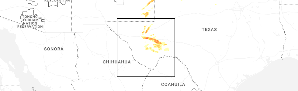
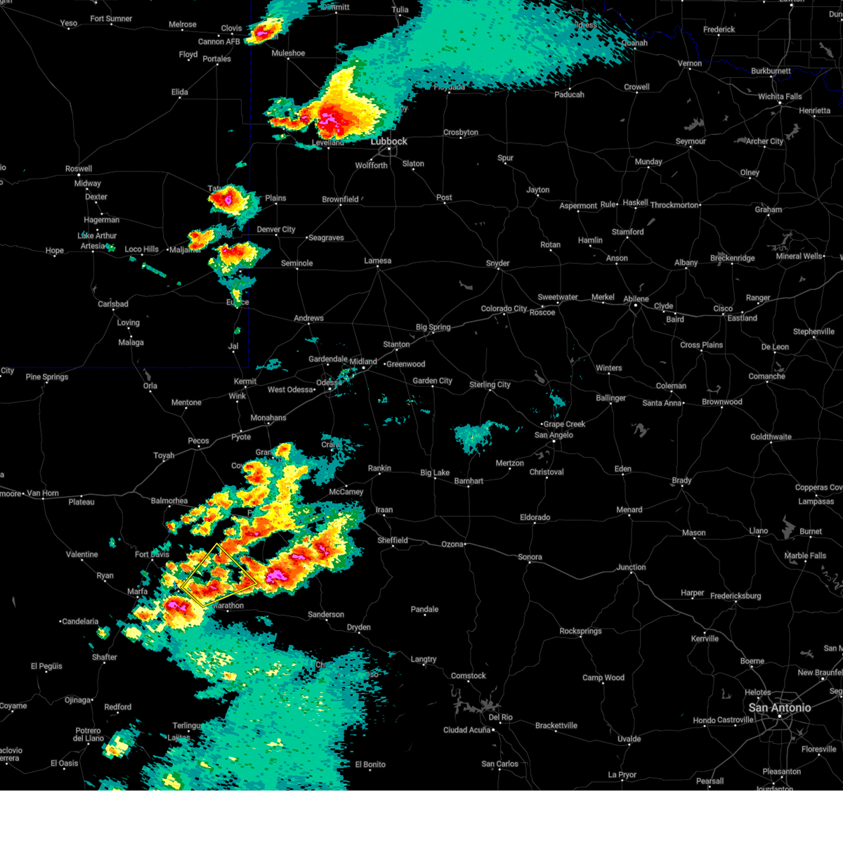
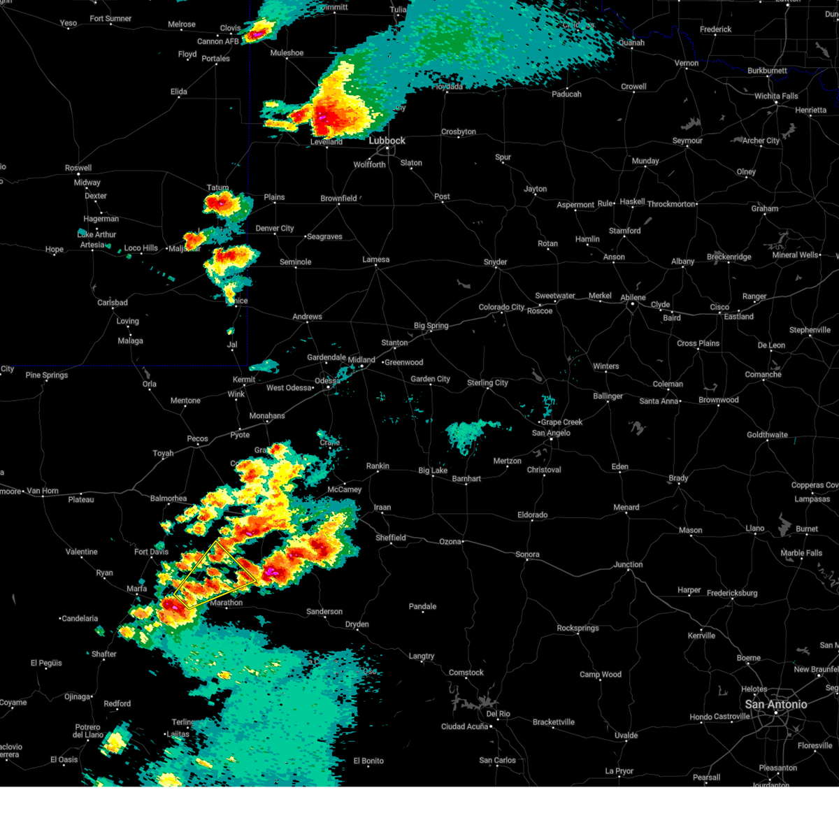
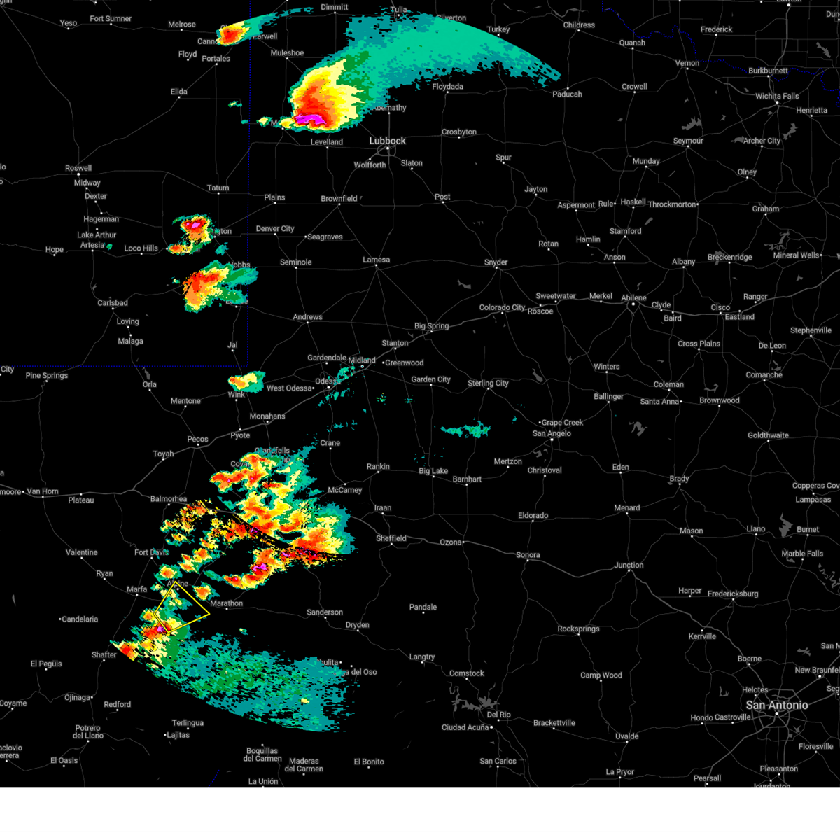
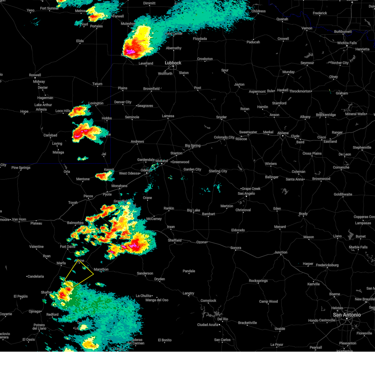
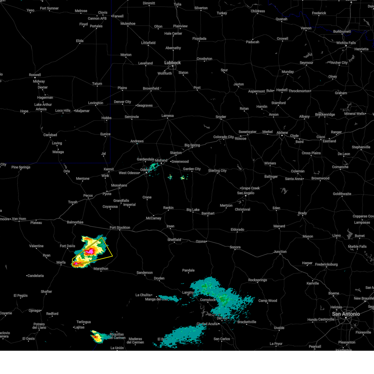
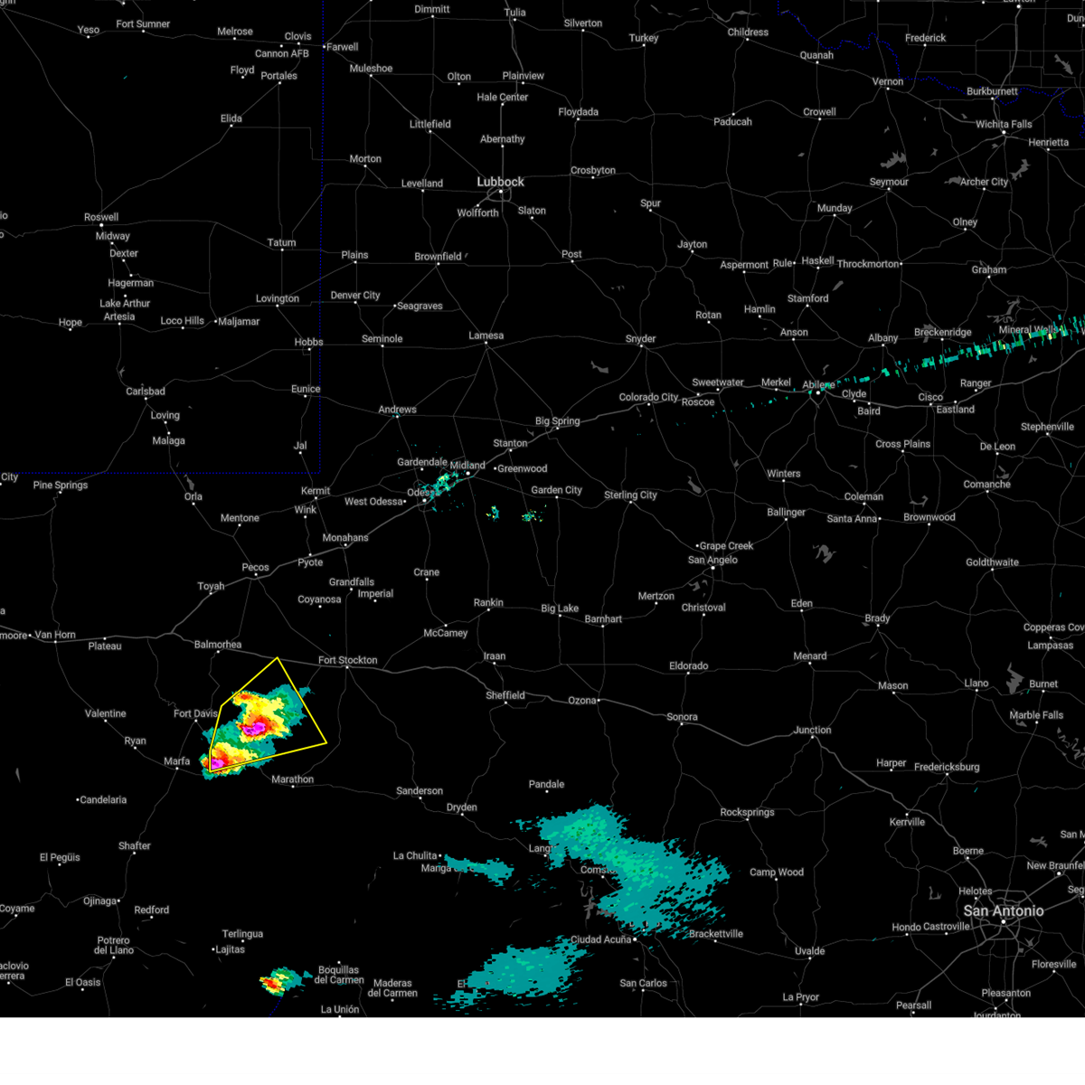
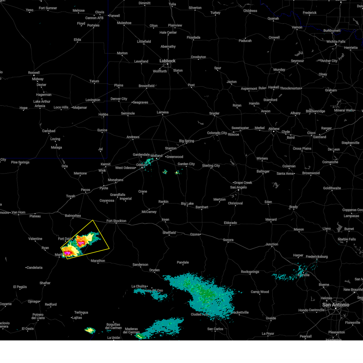
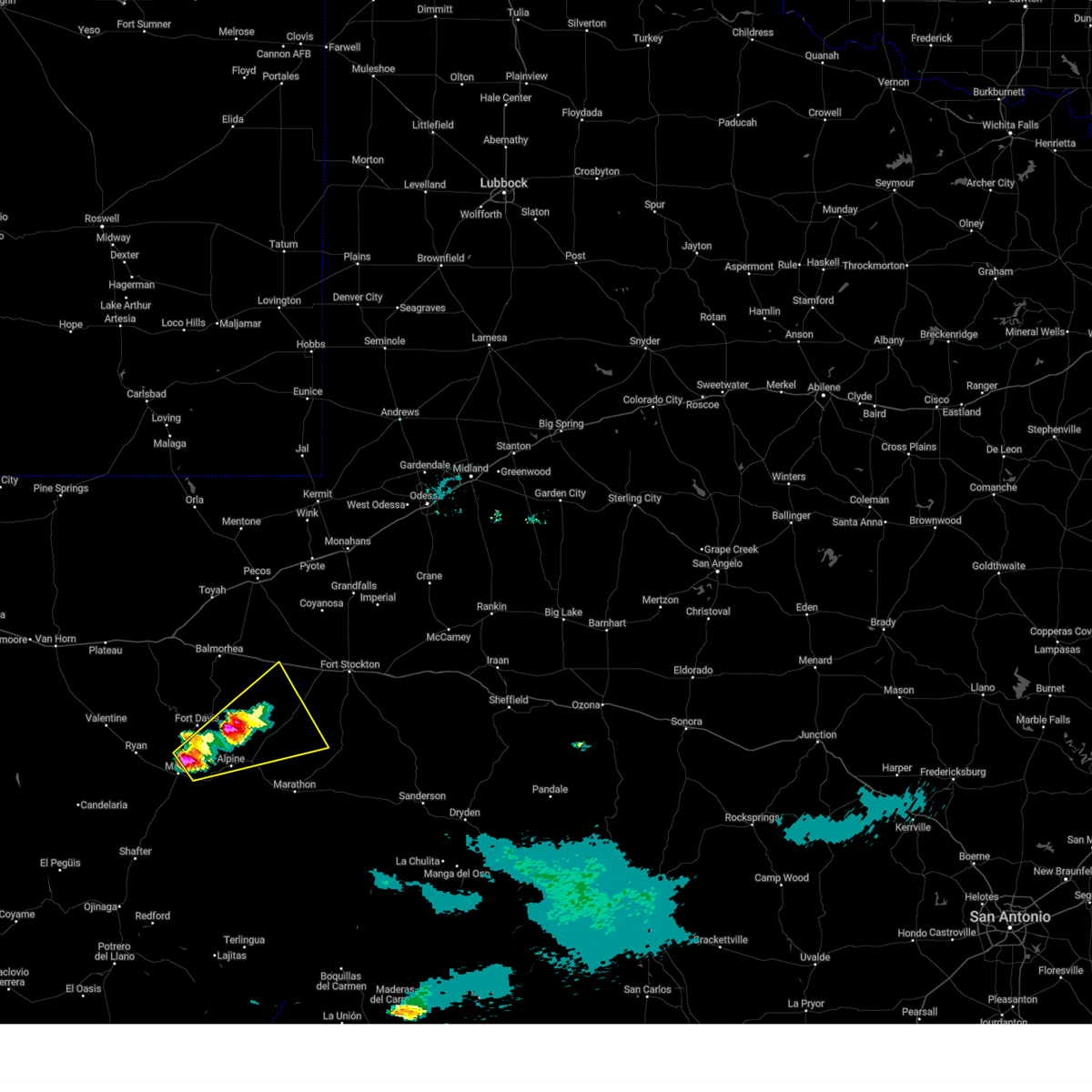
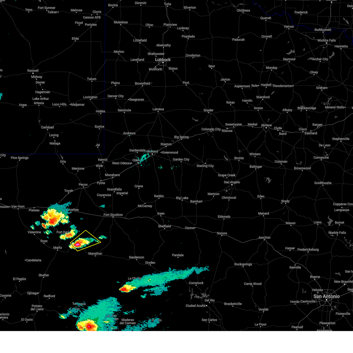
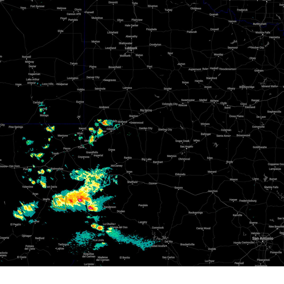
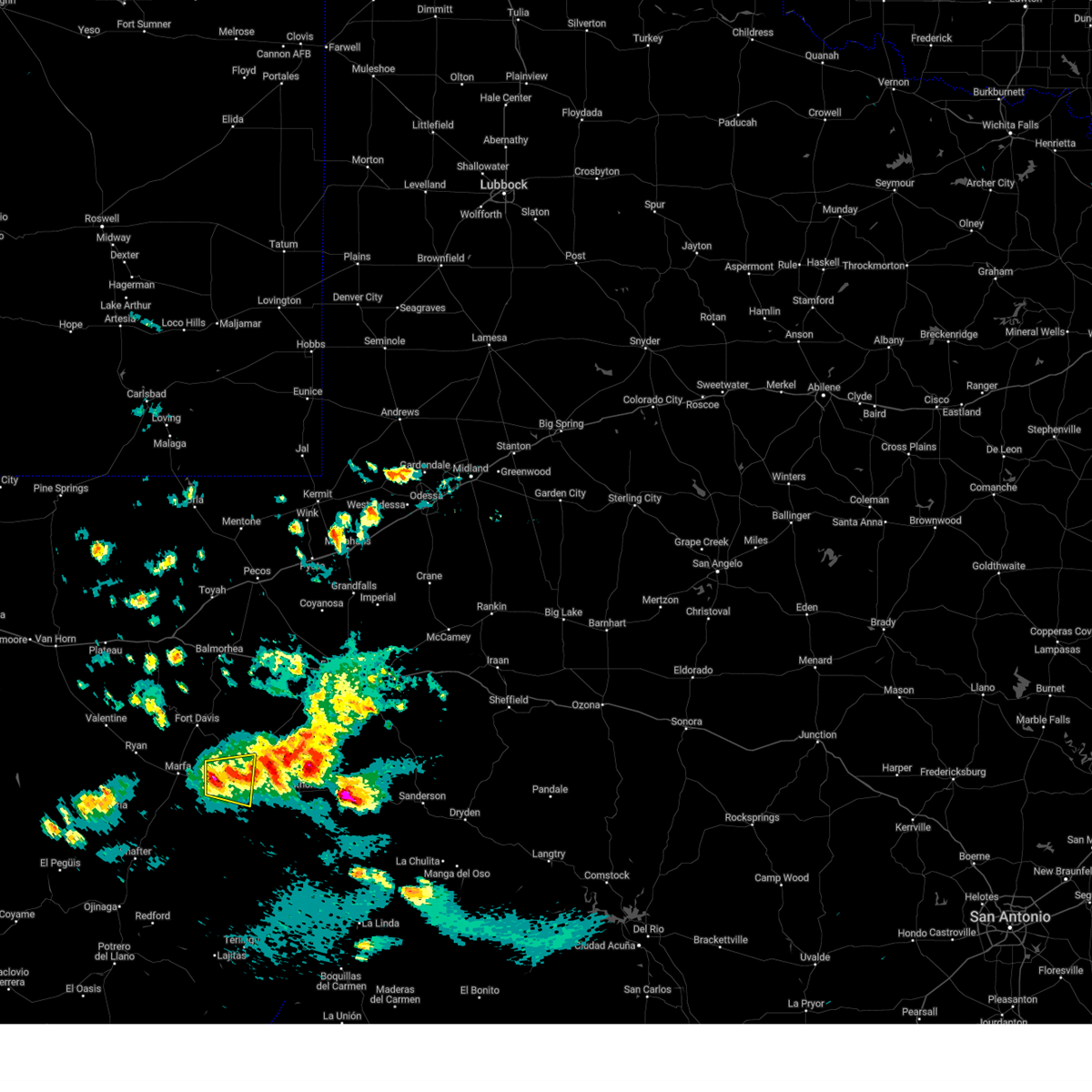
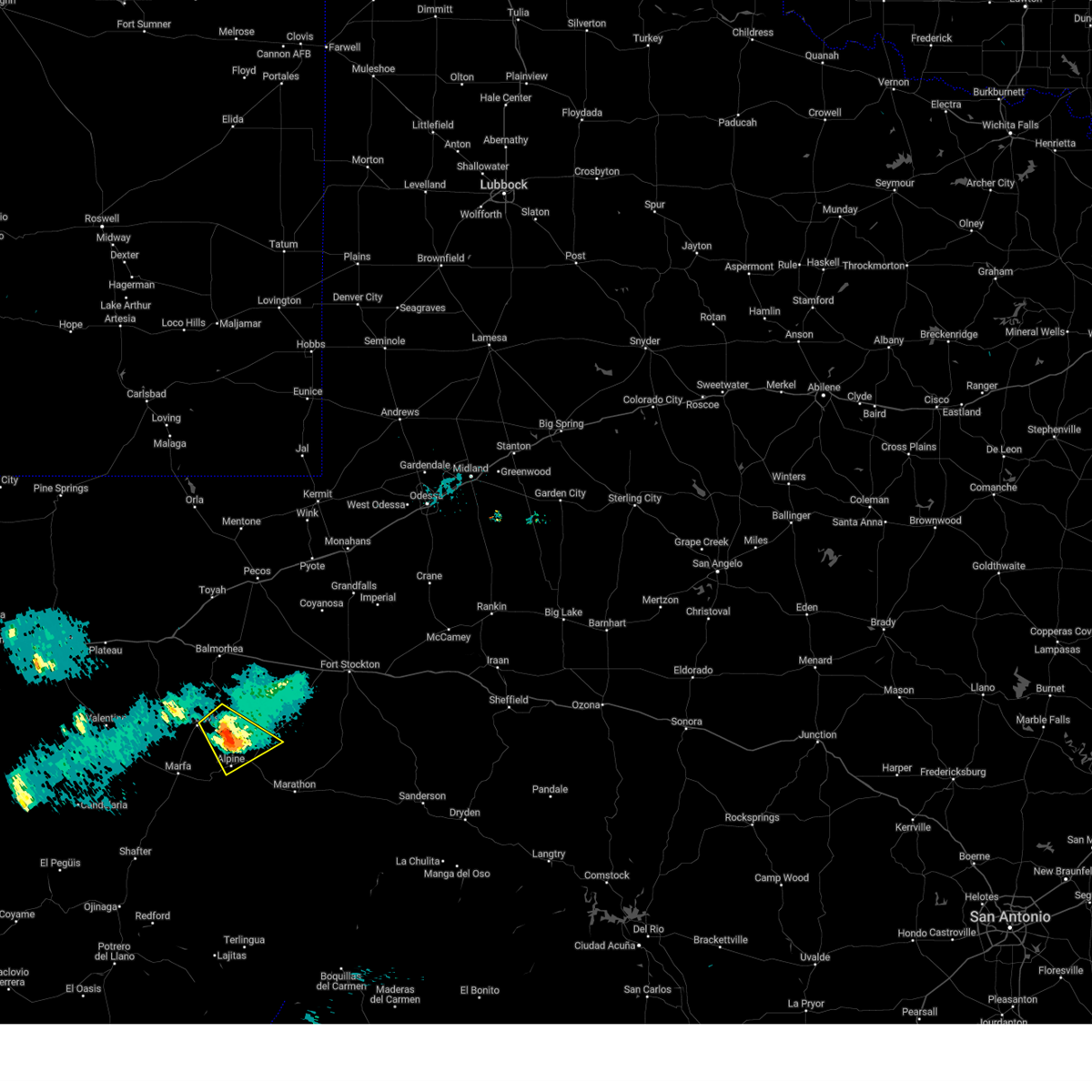
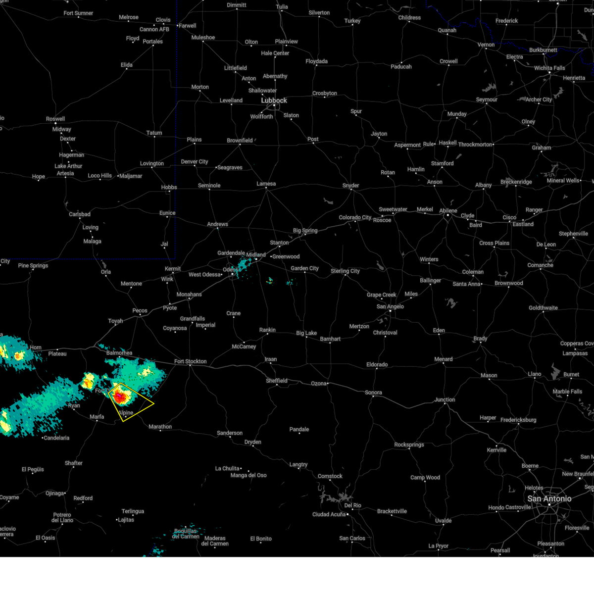
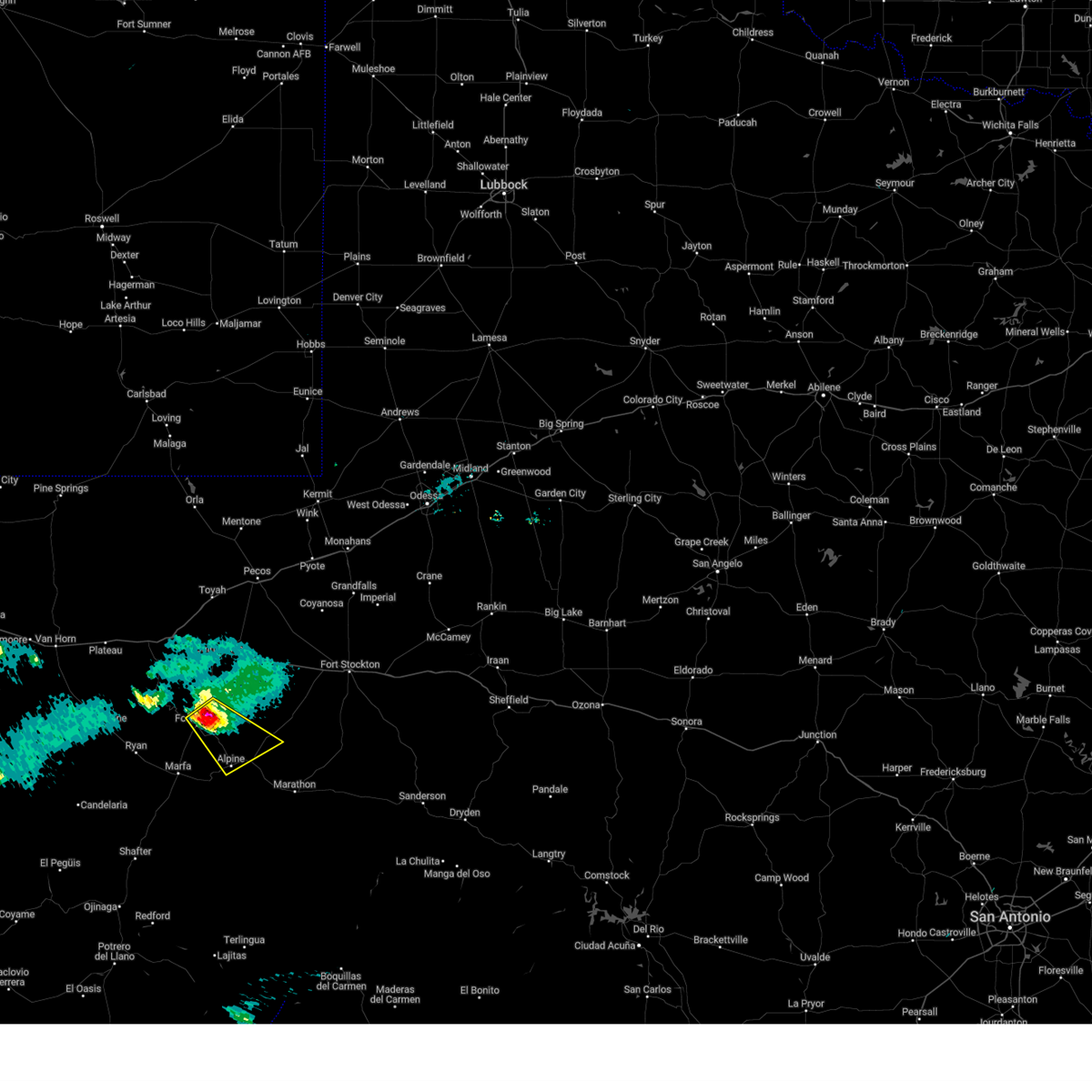
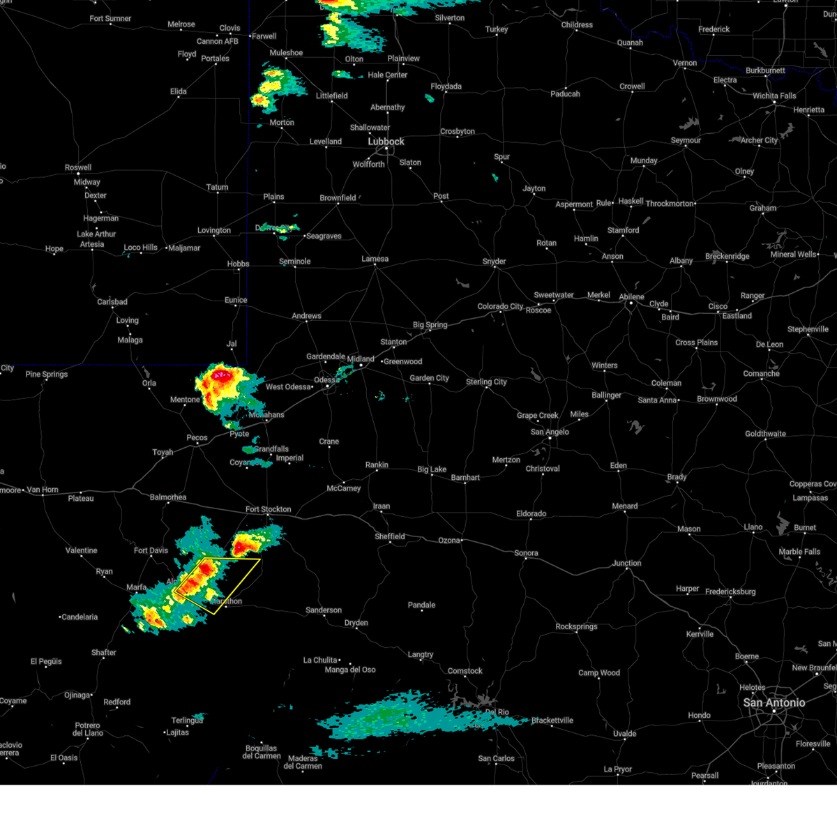
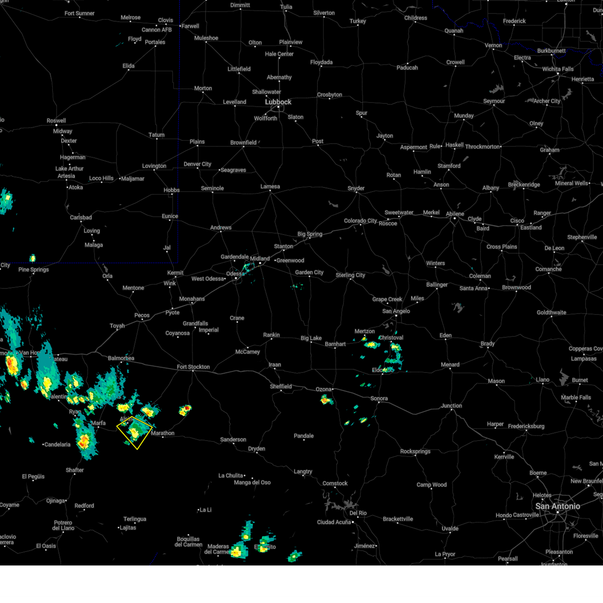
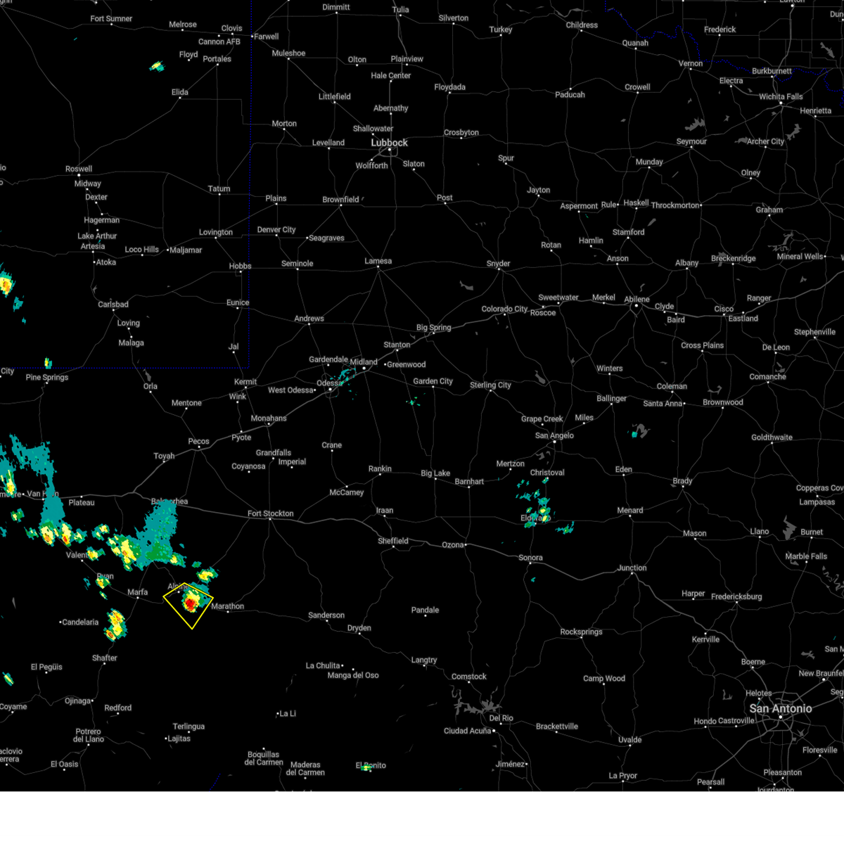
Hail Map for Alpine, TX
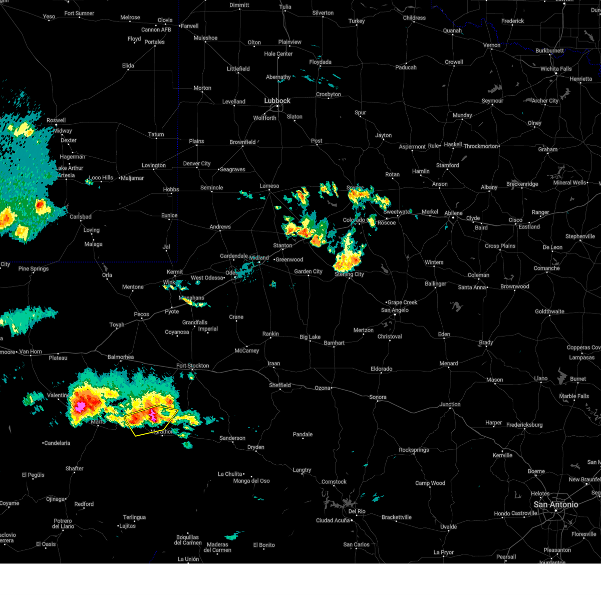
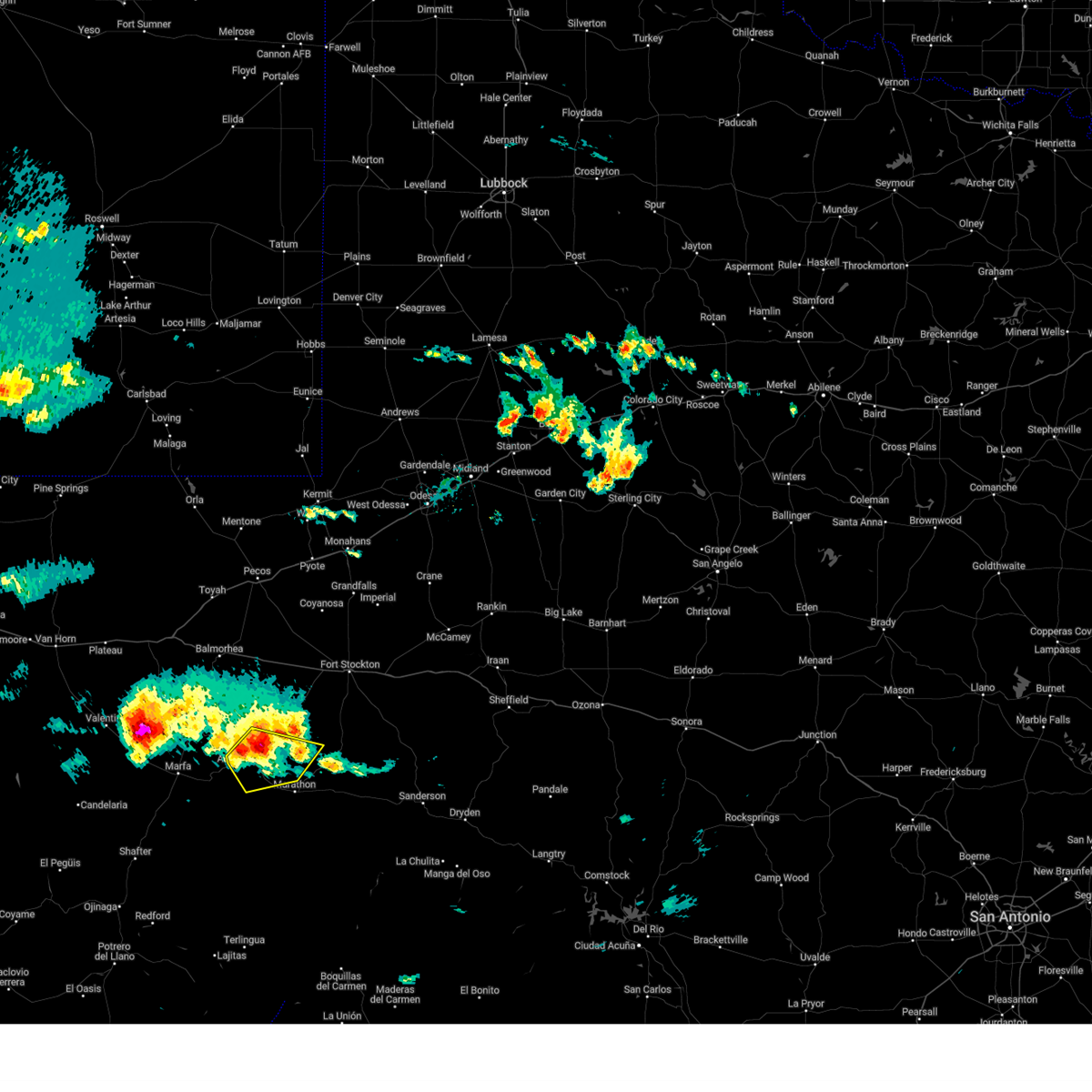
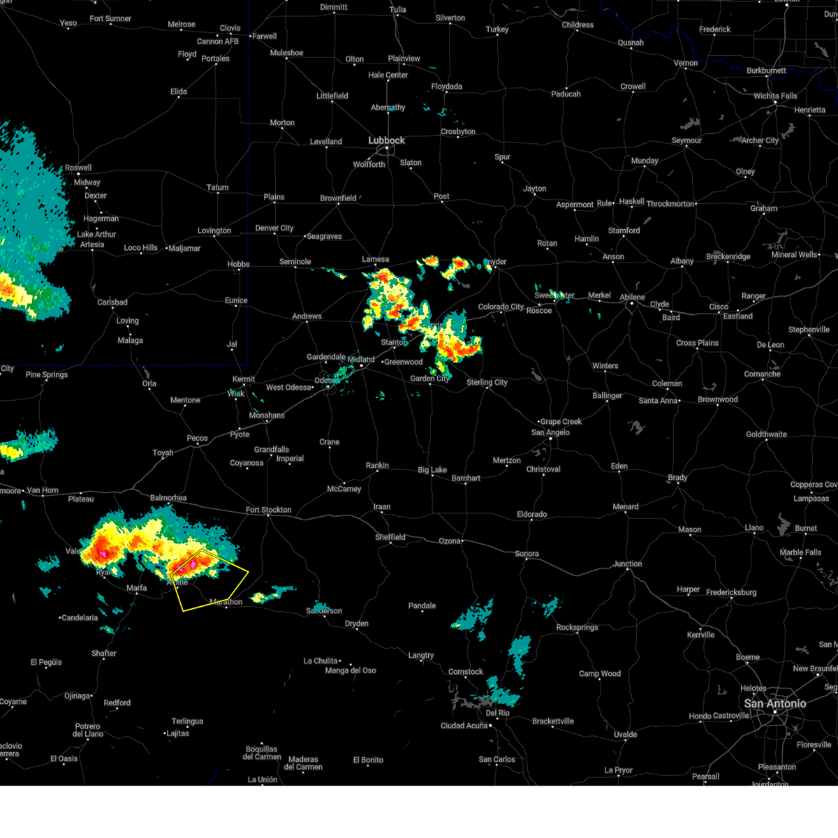
The Alpine, TX area has had 26 reports of on-the-ground hail by trained spotters, and has been under severe weather warnings 22 times during the past 12 months. Doppler radar has detected hail at or near Alpine, TX on 50 occasions, including 5 occasions during the past year.
| Name: | Alpine, TX |
| Where Located: | 0.6 miles N of Alpine, TX |
| Map: | Google Map for Alpine, TX |
| Population: | 5905 |
| Housing Units: | 3033 |
| More Info: | Search Google for Alpine, TX |
1
The Top Recent Hail Date for Alpine, TX is Thursday, June 5, 2025 (13th out of 50)
Hail and Wind Damage Spotted near Alpine, TX
| Date / Time | Report Details |
|---|---|
| 6/10/2025 4:22 PM CDT | Storm damage reported in brewster county TX, 56.7 miles NNW of Alpine, TX |
| 6/10/2025 2:43 PM CDT |
 At 243 pm cdt, a severe thunderstorm was located 13 miles northwest of marathon, or 18 miles east of alpine, moving southeast at 20 mph (radar indicated). Hazards include 60 mph wind gusts and quarter size hail. Hail damage to vehicles is expected. expect wind damage to roofs, siding, and trees. Locations impacted include, alpine and alpine-casparis municipal airport. At 243 pm cdt, a severe thunderstorm was located 13 miles northwest of marathon, or 18 miles east of alpine, moving southeast at 20 mph (radar indicated). Hazards include 60 mph wind gusts and quarter size hail. Hail damage to vehicles is expected. expect wind damage to roofs, siding, and trees. Locations impacted include, alpine and alpine-casparis municipal airport.
|
| 6/10/2025 2:30 PM CDT |
 At 230 pm cdt, a severe thunderstorm was located 13 miles northeast of alpine, moving east at 20 mph (radar indicated). Hazards include 60 mph wind gusts and quarter size hail. Hail damage to vehicles is expected. expect wind damage to roofs, siding, and trees. Locations impacted include, alpine and alpine-casparis municipal airport. At 230 pm cdt, a severe thunderstorm was located 13 miles northeast of alpine, moving east at 20 mph (radar indicated). Hazards include 60 mph wind gusts and quarter size hail. Hail damage to vehicles is expected. expect wind damage to roofs, siding, and trees. Locations impacted include, alpine and alpine-casparis municipal airport.
|
| 6/10/2025 2:12 PM CDT |
 Svrmaf the national weather service in midland has issued a * severe thunderstorm warning for, west central pecos county in southwestern texas, northwestern brewster county in southwestern texas, * until 300 pm cdt. * at 212 pm cdt, a severe thunderstorm was located 9 miles northeast of alpine-casparis municipal airport, or 9 miles northeast of alpine, moving east at 15 mph (radar indicated). Hazards include 70 mph wind gusts and ping pong ball size hail. People and animals outdoors will be injured. expect hail damage to roofs, siding, windows, and vehicles. expect considerable tree damage. Wind damage is also likely to mobile homes, roofs, and outbuildings. Svrmaf the national weather service in midland has issued a * severe thunderstorm warning for, west central pecos county in southwestern texas, northwestern brewster county in southwestern texas, * until 300 pm cdt. * at 212 pm cdt, a severe thunderstorm was located 9 miles northeast of alpine-casparis municipal airport, or 9 miles northeast of alpine, moving east at 15 mph (radar indicated). Hazards include 70 mph wind gusts and ping pong ball size hail. People and animals outdoors will be injured. expect hail damage to roofs, siding, windows, and vehicles. expect considerable tree damage. Wind damage is also likely to mobile homes, roofs, and outbuildings.
|
| 6/8/2025 8:05 PM CDT | Storm damage reported in brewster county TX, 56.7 miles NNW of Alpine, TX |
| 6/5/2025 6:52 PM CDT |
 At 652 pm cdt, a severe thunderstorm was located 10 miles east of alpine, moving northeast at 35 mph (radar indicated). Hazards include two inch hail and 60 mph wind gusts. People and animals outdoors will be injured. expect hail damage to roofs, siding, windows, and vehicles. expect wind damage to roofs, siding, and trees. Locations impacted include, alpine. At 652 pm cdt, a severe thunderstorm was located 10 miles east of alpine, moving northeast at 35 mph (radar indicated). Hazards include two inch hail and 60 mph wind gusts. People and animals outdoors will be injured. expect hail damage to roofs, siding, windows, and vehicles. expect wind damage to roofs, siding, and trees. Locations impacted include, alpine.
|
| 6/5/2025 6:42 PM CDT |
 Svrmaf the national weather service in midland has issued a * severe thunderstorm warning for, west central pecos county in southwestern texas, northwestern brewster county in southwestern texas, * until 715 pm cdt. * at 641 pm cdt, a severe thunderstorm was located near alpine, moving northeast at 35 mph (radar indicated). Hazards include ping pong ball size hail and 60 mph wind gusts. People and animals outdoors will be injured. expect hail damage to roofs, siding, windows, and vehicles. Expect wind damage to roofs, siding, and trees. Svrmaf the national weather service in midland has issued a * severe thunderstorm warning for, west central pecos county in southwestern texas, northwestern brewster county in southwestern texas, * until 715 pm cdt. * at 641 pm cdt, a severe thunderstorm was located near alpine, moving northeast at 35 mph (radar indicated). Hazards include ping pong ball size hail and 60 mph wind gusts. People and animals outdoors will be injured. expect hail damage to roofs, siding, windows, and vehicles. Expect wind damage to roofs, siding, and trees.
|
| 6/5/2025 6:20 PM CDT |
 At 620 pm cdt, a severe thunderstorm was located 13 miles south of alpine, moving northeast at 25 mph (radar indicated). Hazards include 60 mph wind gusts and quarter size hail. Hail damage to vehicles is expected. expect wind damage to roofs, siding, and trees. Locations impacted include, alpine and alpine-casparis municipal airport. At 620 pm cdt, a severe thunderstorm was located 13 miles south of alpine, moving northeast at 25 mph (radar indicated). Hazards include 60 mph wind gusts and quarter size hail. Hail damage to vehicles is expected. expect wind damage to roofs, siding, and trees. Locations impacted include, alpine and alpine-casparis municipal airport.
|
| 6/5/2025 6:04 PM CDT |
 Svrmaf the national weather service in midland has issued a * severe thunderstorm warning for, west central brewster county in southwestern texas, northeastern presidio county in southwestern texas, * until 645 pm cdt. * at 604 pm cdt, a severe thunderstorm was located 21 miles southeast of marfa, moving northeast at 20 mph (radar indicated). Hazards include 60 mph wind gusts and quarter size hail. Hail damage to vehicles is expected. Expect wind damage to roofs, siding, and trees. Svrmaf the national weather service in midland has issued a * severe thunderstorm warning for, west central brewster county in southwestern texas, northeastern presidio county in southwestern texas, * until 645 pm cdt. * at 604 pm cdt, a severe thunderstorm was located 21 miles southeast of marfa, moving northeast at 20 mph (radar indicated). Hazards include 60 mph wind gusts and quarter size hail. Hail damage to vehicles is expected. Expect wind damage to roofs, siding, and trees.
|
| 6/4/2025 8:04 PM CDT |
 At 804 pm cdt, a severe thunderstorm was located over alpine, moving northeast at 15 mph (radar indicated). Hazards include two inch hail and 70 mph wind gusts. People and animals outdoors will be injured. expect hail damage to roofs, siding, windows, and vehicles. expect considerable tree damage. wind damage is also likely to mobile homes, roofs, and outbuildings. Locations impacted include, alpine and alpine-casparis municipal airport. At 804 pm cdt, a severe thunderstorm was located over alpine, moving northeast at 15 mph (radar indicated). Hazards include two inch hail and 70 mph wind gusts. People and animals outdoors will be injured. expect hail damage to roofs, siding, windows, and vehicles. expect considerable tree damage. wind damage is also likely to mobile homes, roofs, and outbuildings. Locations impacted include, alpine and alpine-casparis municipal airport.
|
| 6/4/2025 8:04 PM CDT |
 the severe thunderstorm warning has been cancelled and is no longer in effect the severe thunderstorm warning has been cancelled and is no longer in effect
|
| 6/4/2025 7:57 PM CDT |
 At 757 pm cdt, a severe thunderstorm was located near alpine, moving southeast at 35 mph (radar indicated). Hazards include two inch hail and 70 mph wind gusts. People and animals outdoors will be injured. expect hail damage to roofs, siding, windows, and vehicles. expect considerable tree damage. wind damage is also likely to mobile homes, roofs, and outbuildings. locations impacted include, alpine and alpine-casparis municipal airport. This includes interstate 10 near mile marker 231. At 757 pm cdt, a severe thunderstorm was located near alpine, moving southeast at 35 mph (radar indicated). Hazards include two inch hail and 70 mph wind gusts. People and animals outdoors will be injured. expect hail damage to roofs, siding, windows, and vehicles. expect considerable tree damage. wind damage is also likely to mobile homes, roofs, and outbuildings. locations impacted include, alpine and alpine-casparis municipal airport. This includes interstate 10 near mile marker 231.
|
| 6/4/2025 7:57 PM CDT |
 the severe thunderstorm warning has been cancelled and is no longer in effect the severe thunderstorm warning has been cancelled and is no longer in effect
|
| 6/4/2025 7:42 PM CDT |
 At 742 pm cdt, a severe thunderstorm was located 7 miles southwest of camp mitre peak, or 10 miles west of alpine, moving east at 15 mph (radar indicated). Hazards include two inch hail and 60 mph wind gusts. People and animals outdoors will be injured. expect hail damage to roofs, siding, windows, and vehicles. expect wind damage to roofs, siding, and trees. locations impacted include, alpine, alpine-casparis municipal airport, and camp mitre peak. This includes interstate 10 near mile marker 231. At 742 pm cdt, a severe thunderstorm was located 7 miles southwest of camp mitre peak, or 10 miles west of alpine, moving east at 15 mph (radar indicated). Hazards include two inch hail and 60 mph wind gusts. People and animals outdoors will be injured. expect hail damage to roofs, siding, windows, and vehicles. expect wind damage to roofs, siding, and trees. locations impacted include, alpine, alpine-casparis municipal airport, and camp mitre peak. This includes interstate 10 near mile marker 231.
|
| 6/4/2025 7:29 PM CDT |
 Svrmaf the national weather service in midland has issued a * severe thunderstorm warning for, west central pecos county in southwestern texas, northwestern brewster county in southwestern texas, southeastern jeff davis county in southwestern texas, northeastern presidio county in southwestern texas, * until 815 pm cdt. * at 729 pm cdt, a severe thunderstorm was located near marfa municipal airport, or 9 miles northeast of marfa, moving northeast at 15 mph (radar indicated). Hazards include ping pong ball size hail and 60 mph wind gusts. People and animals outdoors will be injured. expect hail damage to roofs, siding, windows, and vehicles. Expect wind damage to roofs, siding, and trees. Svrmaf the national weather service in midland has issued a * severe thunderstorm warning for, west central pecos county in southwestern texas, northwestern brewster county in southwestern texas, southeastern jeff davis county in southwestern texas, northeastern presidio county in southwestern texas, * until 815 pm cdt. * at 729 pm cdt, a severe thunderstorm was located near marfa municipal airport, or 9 miles northeast of marfa, moving northeast at 15 mph (radar indicated). Hazards include ping pong ball size hail and 60 mph wind gusts. People and animals outdoors will be injured. expect hail damage to roofs, siding, windows, and vehicles. Expect wind damage to roofs, siding, and trees.
|
| 5/27/2025 3:54 PM CDT |
 Svrmaf the national weather service in midland has issued a * severe thunderstorm warning for, northwestern brewster county in southwestern texas, * until 445 pm cdt. * at 354 pm cdt, a severe thunderstorm was located near alpine, moving northeast at 15 mph (radar indicated). Hazards include 60 mph wind gusts and quarter size hail. Hail damage to vehicles is expected. Expect wind damage to roofs, siding, and trees. Svrmaf the national weather service in midland has issued a * severe thunderstorm warning for, northwestern brewster county in southwestern texas, * until 445 pm cdt. * at 354 pm cdt, a severe thunderstorm was located near alpine, moving northeast at 15 mph (radar indicated). Hazards include 60 mph wind gusts and quarter size hail. Hail damage to vehicles is expected. Expect wind damage to roofs, siding, and trees.
|
| 5/23/2025 6:23 PM CDT |
 the severe thunderstorm warning has been cancelled and is no longer in effect the severe thunderstorm warning has been cancelled and is no longer in effect
|
| 5/23/2025 6:08 PM CDT |
 Svrmaf the national weather service in midland has issued a * severe thunderstorm warning for, northwestern brewster county in southwestern texas, northeastern presidio county in southwestern texas, * until 700 pm cdt. * at 608 pm cdt, a severe thunderstorm was located 7 miles southwest of alpine, moving east at 5 mph (radar indicated). Hazards include 60 mph wind gusts and quarter size hail. Hail damage to vehicles is expected. Expect wind damage to roofs, siding, and trees. Svrmaf the national weather service in midland has issued a * severe thunderstorm warning for, northwestern brewster county in southwestern texas, northeastern presidio county in southwestern texas, * until 700 pm cdt. * at 608 pm cdt, a severe thunderstorm was located 7 miles southwest of alpine, moving east at 5 mph (radar indicated). Hazards include 60 mph wind gusts and quarter size hail. Hail damage to vehicles is expected. Expect wind damage to roofs, siding, and trees.
|
| 5/3/2025 7:29 PM CDT |
 The storm which prompted the warning has weakened below severe limits, and no longer poses an immediate threat to life or property. therefore, the warning will be allowed to expire. however, small hail and gusty winds are still possible with this thunderstorm. The storm which prompted the warning has weakened below severe limits, and no longer poses an immediate threat to life or property. therefore, the warning will be allowed to expire. however, small hail and gusty winds are still possible with this thunderstorm.
|
| 5/3/2025 7:07 PM CDT |
 At 707 pm cdt, a severe thunderstorm was located near camp mitre peak, or 9 miles east of fort davis, moving southeast at 20 mph (radar indicated). Hazards include 60 mph wind gusts and half dollar size hail. Hail damage to vehicles is expected. expect wind damage to roofs, siding, and trees. Locations impacted include, alpine, fort davis, camp mitre peak, and alpine-casparis municipal airport. At 707 pm cdt, a severe thunderstorm was located near camp mitre peak, or 9 miles east of fort davis, moving southeast at 20 mph (radar indicated). Hazards include 60 mph wind gusts and half dollar size hail. Hail damage to vehicles is expected. expect wind damage to roofs, siding, and trees. Locations impacted include, alpine, fort davis, camp mitre peak, and alpine-casparis municipal airport.
|
| 5/3/2025 6:42 PM CDT |
 Svrmaf the national weather service in midland has issued a * severe thunderstorm warning for, northwestern brewster county in southwestern texas, southeastern jeff davis county in southwestern texas, * until 730 pm cdt. * at 642 pm cdt, a severe thunderstorm was located near fort davis, moving southeast at 25 mph (radar indicated). Hazards include 60 mph wind gusts and quarter size hail. Hail damage to vehicles is expected. Expect wind damage to roofs, siding, and trees. Svrmaf the national weather service in midland has issued a * severe thunderstorm warning for, northwestern brewster county in southwestern texas, southeastern jeff davis county in southwestern texas, * until 730 pm cdt. * at 642 pm cdt, a severe thunderstorm was located near fort davis, moving southeast at 25 mph (radar indicated). Hazards include 60 mph wind gusts and quarter size hail. Hail damage to vehicles is expected. Expect wind damage to roofs, siding, and trees.
|
| 4/23/2025 6:21 PM CDT |
 Svrmaf the national weather service in midland has issued a * severe thunderstorm warning for, west central pecos county in southwestern texas, northwestern brewster county in southwestern texas, * until 700 pm cdt. * at 620 pm cdt, a severe thunderstorm was located 17 miles north of marathon, or 20 miles east of alpine, moving east at 20 mph (radar indicated). Hazards include 60 mph wind gusts and quarter size hail. Hail damage to vehicles is expected. Expect wind damage to roofs, siding, and trees. Svrmaf the national weather service in midland has issued a * severe thunderstorm warning for, west central pecos county in southwestern texas, northwestern brewster county in southwestern texas, * until 700 pm cdt. * at 620 pm cdt, a severe thunderstorm was located 17 miles north of marathon, or 20 miles east of alpine, moving east at 20 mph (radar indicated). Hazards include 60 mph wind gusts and quarter size hail. Hail damage to vehicles is expected. Expect wind damage to roofs, siding, and trees.
|
| 3/27/2025 4:15 PM CDT |
 the severe thunderstorm warning has been cancelled and is no longer in effect the severe thunderstorm warning has been cancelled and is no longer in effect
|
| 3/27/2025 3:52 PM CDT | Quarter sized hail reported 7.5 miles NW of Alpine, TX, phone call of quarter size hail 8 miles south of alpine along state highway 118. time is estimated from radar. |
| 3/27/2025 3:48 PM CDT |
 Svrmaf the national weather service in midland has issued a * severe thunderstorm warning for, northwestern brewster county in southwestern texas, * until 430 pm cdt. * at 347 pm cdt, a severe thunderstorm was located 8 miles southeast of alpine, and is nearly stationary (radar indicated). Hazards include 60 mph wind gusts and quarter size hail. Hail damage to vehicles is expected. Expect wind damage to roofs, siding, and trees. Svrmaf the national weather service in midland has issued a * severe thunderstorm warning for, northwestern brewster county in southwestern texas, * until 430 pm cdt. * at 347 pm cdt, a severe thunderstorm was located 8 miles southeast of alpine, and is nearly stationary (radar indicated). Hazards include 60 mph wind gusts and quarter size hail. Hail damage to vehicles is expected. Expect wind damage to roofs, siding, and trees.
|
| 6/1/2024 8:49 PM CDT | This was likely caused by an outflow boundary ahead of severe thunderstorms to the north. mesonet station emnt2 elephant mtn wma raw in brewster county TX, 26 miles NNW of Alpine, TX |
| 5/29/2024 6:14 PM CDT | Quarter sized hail reported 13.2 miles WSW of Alpine, TX, report from mping: quarter (1.00 in.). time adjusted based on radar. |
| 6/7/2023 9:06 PM CDT | Mesonet station 72 big bend np/brewster count in brewster county TX, 56.7 miles NNW of Alpine, TX |
| 5/26/2023 7:32 PM CDT | Wind driven hail damage at big bend regional medical center with broken winds. hail size ranging from 3/4" to 1 1/4" in brewster county TX, 1.6 miles SSE of Alpine, TX |
| 5/26/2023 7:22 PM CDT |
 At 722 pm cdt, a severe thunderstorm was located 10 miles southeast of alpine, moving southeast at 45 mph (public reported). Hazards include ping pong ball size hail and 60 mph wind gusts. People and animals outdoors will be injured. expect hail damage to roofs, siding, windows, and vehicles. expect wind damage to roofs, siding, and trees. locations impacted include, alpine, alpine-casparis municipal airport, elephant mountain wildlife management area and elephant mountain. hail threat, radar indicated max hail size, 1. 50 in wind threat, radar indicated max wind gust, 60 mph. At 722 pm cdt, a severe thunderstorm was located 10 miles southeast of alpine, moving southeast at 45 mph (public reported). Hazards include ping pong ball size hail and 60 mph wind gusts. People and animals outdoors will be injured. expect hail damage to roofs, siding, windows, and vehicles. expect wind damage to roofs, siding, and trees. locations impacted include, alpine, alpine-casparis municipal airport, elephant mountain wildlife management area and elephant mountain. hail threat, radar indicated max hail size, 1. 50 in wind threat, radar indicated max wind gust, 60 mph.
|
| 5/26/2023 7:20 PM CDT | Golf Ball sized hail reported 0.6 miles NE of Alpine, TX, ping pong to golf ball sized hail observed in alpine. |
| 5/26/2023 7:16 PM CDT | Corrects previous tstm wnd dmg report from 2 n alpine. corrects previous tstm wnd dmg report from 2 n alpine. wind driven hail damage at big bend regional medical cente in brewster county TX, 1.6 miles SSE of Alpine, TX |
| 5/26/2023 7:01 PM CDT |
 At 700 pm cdt, a severe thunderstorm was located near alpine-casparis municipal airport, or near alpine, moving southeast at 45 mph (radar indicated). Hazards include ping pong ball size hail and 60 mph wind gusts. People and animals outdoors will be injured. expect hail damage to roofs, siding, windows, and vehicles. Expect wind damage to roofs, siding, and trees. At 700 pm cdt, a severe thunderstorm was located near alpine-casparis municipal airport, or near alpine, moving southeast at 45 mph (radar indicated). Hazards include ping pong ball size hail and 60 mph wind gusts. People and animals outdoors will be injured. expect hail damage to roofs, siding, windows, and vehicles. Expect wind damage to roofs, siding, and trees.
|
| 5/26/2023 5:21 PM CDT |
 At 520 pm cdt, a severe thunderstorm was located near camp mitre peak, or near fort davis, moving southeast at 25 mph (radar indicated). Hazards include 60 mph wind gusts and quarter size hail. Hail damage to vehicles is expected. Expect wind damage to roofs, siding, and trees. At 520 pm cdt, a severe thunderstorm was located near camp mitre peak, or near fort davis, moving southeast at 25 mph (radar indicated). Hazards include 60 mph wind gusts and quarter size hail. Hail damage to vehicles is expected. Expect wind damage to roofs, siding, and trees.
|
| 5/9/2023 6:54 PM CDT | Mesonet station 72 big bend np/brewster count in brewster county TX, 56.7 miles NNW of Alpine, TX |
| 6/14/2022 8:24 PM CDT | Storm damage reported in brewster county TX, 56.7 miles NNW of Alpine, TX |
| 6/1/2022 5:39 PM CDT |
 At 539 pm cdt, a severe thunderstorm was located 7 miles east of alpine, moving south at 20 mph (public. half dollar size hail was reported in alpine at 530 pm cdt). Hazards include 60 mph wind gusts and half dollar size hail. Hail damage to vehicles is expected. expect wind damage to roofs, siding, and trees. locations impacted include, alpine. hail threat, observed max hail size, 1. 25 in wind threat, radar indicated max wind gust, 60 mph. At 539 pm cdt, a severe thunderstorm was located 7 miles east of alpine, moving south at 20 mph (public. half dollar size hail was reported in alpine at 530 pm cdt). Hazards include 60 mph wind gusts and half dollar size hail. Hail damage to vehicles is expected. expect wind damage to roofs, siding, and trees. locations impacted include, alpine. hail threat, observed max hail size, 1. 25 in wind threat, radar indicated max wind gust, 60 mph.
|
| 6/1/2022 5:35 PM CDT | Half Dollar sized hail reported 2.1 miles WNW of Alpine, TX |
| 6/1/2022 5:20 PM CDT |
 At 520 pm cdt, a severe thunderstorm was located 7 miles northeast of alpine, moving south at 20 mph (radar indicated). Hazards include golf ball size hail and 70 mph wind gusts. People and animals outdoors will be injured. expect hail damage to roofs, siding, windows, and vehicles. expect considerable tree damage. wind damage is also likely to mobile homes, roofs, and outbuildings. Locations impacted include, alpine and alpine-casparis municipal airport. At 520 pm cdt, a severe thunderstorm was located 7 miles northeast of alpine, moving south at 20 mph (radar indicated). Hazards include golf ball size hail and 70 mph wind gusts. People and animals outdoors will be injured. expect hail damage to roofs, siding, windows, and vehicles. expect considerable tree damage. wind damage is also likely to mobile homes, roofs, and outbuildings. Locations impacted include, alpine and alpine-casparis municipal airport.
|
| 6/1/2022 5:09 PM CDT |
 At 509 pm cdt, a severe thunderstorm was located 9 miles northeast of alpine, moving south at 20 mph (radar indicated). Hazards include golf ball size hail and 70 mph wind gusts. People and animals outdoors will be injured. expect hail damage to roofs, siding, windows, and vehicles. expect considerable tree damage. Wind damage is also likely to mobile homes, roofs, and outbuildings. At 509 pm cdt, a severe thunderstorm was located 9 miles northeast of alpine, moving south at 20 mph (radar indicated). Hazards include golf ball size hail and 70 mph wind gusts. People and animals outdoors will be injured. expect hail damage to roofs, siding, windows, and vehicles. expect considerable tree damage. Wind damage is also likely to mobile homes, roofs, and outbuildings.
|
| 5/10/2022 4:38 PM CDT | Quarter sized hail reported 9.9 miles W of Alpine, TX, a lot of small hail covering the ground with a few stones around quarter size. |
| 10/21/2021 3:50 PM CDT |
 At 350 pm cdt, a severe thunderstorm was located near camp mitre peak, or 9 miles northwest of alpine, moving east at 15 mph (radar indicated). Hazards include 60 mph wind gusts and quarter size hail. Hail damage to vehicles is expected. expect wind damage to roofs, siding, and trees. locations impacted include, alpine, camp mitre peak, alpine-casparis municipal airport and paisano pass. hail threat, radar indicated max hail size, 1. 00 in wind threat, radar indicated max wind gust, 60 mph. At 350 pm cdt, a severe thunderstorm was located near camp mitre peak, or 9 miles northwest of alpine, moving east at 15 mph (radar indicated). Hazards include 60 mph wind gusts and quarter size hail. Hail damage to vehicles is expected. expect wind damage to roofs, siding, and trees. locations impacted include, alpine, camp mitre peak, alpine-casparis municipal airport and paisano pass. hail threat, radar indicated max hail size, 1. 00 in wind threat, radar indicated max wind gust, 60 mph.
|
| 10/21/2021 3:36 PM CDT |
 At 335 pm cdt, a severe thunderstorm was located over camp mitre peak, or 7 miles southeast of fort davis, moving southeast at 15 mph (radar indicated). Hazards include 60 mph wind gusts and quarter size hail. Hail damage to vehicles is expected. Expect wind damage to roofs, siding, and trees. At 335 pm cdt, a severe thunderstorm was located over camp mitre peak, or 7 miles southeast of fort davis, moving southeast at 15 mph (radar indicated). Hazards include 60 mph wind gusts and quarter size hail. Hail damage to vehicles is expected. Expect wind damage to roofs, siding, and trees.
|
| 6/25/2021 6:01 PM CDT | Persimmon gap mesonet measured a wind gust of 65 mp in brewster county TX, 56.7 miles NNW of Alpine, TX |
| 5/29/2021 5:28 PM CDT |
 At 527 pm cdt, a severe thunderstorm was located over alpine, moving southeast at 15 mph (radar indicated). Hazards include 60 mph wind gusts and quarter size hail. Hail damage to vehicles is expected. expect wind damage to roofs, siding, and trees. Locations impacted include, alpine and alpine-casparis municipal airport. At 527 pm cdt, a severe thunderstorm was located over alpine, moving southeast at 15 mph (radar indicated). Hazards include 60 mph wind gusts and quarter size hail. Hail damage to vehicles is expected. expect wind damage to roofs, siding, and trees. Locations impacted include, alpine and alpine-casparis municipal airport.
|
| 5/29/2021 5:02 PM CDT |
 At 502 pm cdt, a severe thunderstorm was located over alpine-casparis municipal airport, or near alpine, moving southeast at 15 mph (radar indicated). Hazards include 60 mph wind gusts and quarter size hail. Hail damage to vehicles is expected. Expect wind damage to roofs, siding, and trees. At 502 pm cdt, a severe thunderstorm was located over alpine-casparis municipal airport, or near alpine, moving southeast at 15 mph (radar indicated). Hazards include 60 mph wind gusts and quarter size hail. Hail damage to vehicles is expected. Expect wind damage to roofs, siding, and trees.
|
| 5/29/2021 2:50 AM CDT |
 The severe thunderstorm warning for west central pecos, northwestern brewster and southeastern jeff davis counties will expire at 300 am cdt, the storm which prompted the warning has weakened below severe limits, and no longer poses an immediate threat to life or property. therefore, the warning will be allowed to expire. however gusty winds are still possible with this thunderstorm. The severe thunderstorm warning for west central pecos, northwestern brewster and southeastern jeff davis counties will expire at 300 am cdt, the storm which prompted the warning has weakened below severe limits, and no longer poses an immediate threat to life or property. therefore, the warning will be allowed to expire. however gusty winds are still possible with this thunderstorm.
|
| 5/29/2021 2:28 AM CDT |
 At 228 am cdt, a severe thunderstorm was located 14 miles northeast of camp mitre peak, or 17 miles east of fort davis, moving south at 35 mph (radar indicated). Hazards include 60 mph wind gusts and quarter size hail. Hail damage to vehicles is expected. expect wind damage to roofs, siding, and trees. Locations impacted include, alpine, alpine-casparis municipal airport and camp mitre peak. At 228 am cdt, a severe thunderstorm was located 14 miles northeast of camp mitre peak, or 17 miles east of fort davis, moving south at 35 mph (radar indicated). Hazards include 60 mph wind gusts and quarter size hail. Hail damage to vehicles is expected. expect wind damage to roofs, siding, and trees. Locations impacted include, alpine, alpine-casparis municipal airport and camp mitre peak.
|
| 5/29/2021 2:09 AM CDT |
 At 208 am cdt, a severe thunderstorm was located 13 miles south of balmorhea lake, or 19 miles northeast of fort davis, moving south at 35 mph (radar indicated). Hazards include ping pong ball size hail and 60 mph wind gusts. People and animals outdoors will be injured. expect hail damage to roofs, siding, windows, and vehicles. Expect wind damage to roofs, siding, and trees. At 208 am cdt, a severe thunderstorm was located 13 miles south of balmorhea lake, or 19 miles northeast of fort davis, moving south at 35 mph (radar indicated). Hazards include ping pong ball size hail and 60 mph wind gusts. People and animals outdoors will be injured. expect hail damage to roofs, siding, windows, and vehicles. Expect wind damage to roofs, siding, and trees.
|
| 5/28/2021 4:53 PM CDT |
 At 453 pm cdt, a severe thunderstorm was located 8 miles southeast of alpine, moving east at 15 mph (radar indicated). Hazards include 60 mph wind gusts and half dollar size hail. Hail damage to vehicles is expected. expect wind damage to roofs, siding, and trees. Locations impacted include, alpine. At 453 pm cdt, a severe thunderstorm was located 8 miles southeast of alpine, moving east at 15 mph (radar indicated). Hazards include 60 mph wind gusts and half dollar size hail. Hail damage to vehicles is expected. expect wind damage to roofs, siding, and trees. Locations impacted include, alpine.
|
| 5/28/2021 4:46 PM CDT | Quarter sized hail reported 0.6 miles NE of Alpine, TX, social media report of pea sized hail with quarter size hail mixed in. |
| 5/28/2021 4:38 PM CDT |
 At 437 pm cdt, a severe thunderstorm was located near alpine, moving east at 15 mph (radar indicated). Hazards include 60 mph wind gusts and half dollar size hail. Hail damage to vehicles is expected. Expect wind damage to roofs, siding, and trees. At 437 pm cdt, a severe thunderstorm was located near alpine, moving east at 15 mph (radar indicated). Hazards include 60 mph wind gusts and half dollar size hail. Hail damage to vehicles is expected. Expect wind damage to roofs, siding, and trees.
|
| 8/10/2020 3:10 PM CDT |
 At 310 pm cdt, a severe thunderstorm was located near alpine, moving south at 15 mph (radar indicated). Hazards include 60 mph wind gusts and quarter size hail. Hail damage to vehicles is expected. Expect wind damage to roofs, siding, and trees. At 310 pm cdt, a severe thunderstorm was located near alpine, moving south at 15 mph (radar indicated). Hazards include 60 mph wind gusts and quarter size hail. Hail damage to vehicles is expected. Expect wind damage to roofs, siding, and trees.
|
| 5/28/2020 6:41 PM CDT |
 At 641 pm cdt, a severe thunderstorm was located 15 miles northeast of alpine, moving south at 10 mph (radar indicated). Hazards include 60 mph wind gusts and quarter size hail. Hail damage to vehicles is expected. expect wind damage to roofs, siding, and trees. Locations impacted include, alpine. At 641 pm cdt, a severe thunderstorm was located 15 miles northeast of alpine, moving south at 10 mph (radar indicated). Hazards include 60 mph wind gusts and quarter size hail. Hail damage to vehicles is expected. expect wind damage to roofs, siding, and trees. Locations impacted include, alpine.
|
| 5/28/2020 6:21 PM CDT |
 At 621 pm cdt, a severe thunderstorm was located 18 miles northeast of alpine, moving south at 5 mph (radar indicated). Hazards include 60 mph wind gusts and quarter size hail. Hail damage to vehicles is expected. Expect wind damage to roofs, siding, and trees. At 621 pm cdt, a severe thunderstorm was located 18 miles northeast of alpine, moving south at 5 mph (radar indicated). Hazards include 60 mph wind gusts and quarter size hail. Hail damage to vehicles is expected. Expect wind damage to roofs, siding, and trees.
|
| 5/23/2020 2:13 PM CDT | Quarter sized hail reported 3.3 miles W of Alpine, TX |
| 5/23/2020 2:11 PM CDT |
 At 210 pm cdt, a severe thunderstorm was located 11 miles northeast of alpine, moving northeast at 20 mph (trained weather spotters reported quarter size hail 3 miles east of alpine ). Hazards include 60 mph wind gusts and half dollar size hail. Hail damage to vehicles is expected. expect wind damage to roofs, siding, and trees. Locations impacted include, alpine. At 210 pm cdt, a severe thunderstorm was located 11 miles northeast of alpine, moving northeast at 20 mph (trained weather spotters reported quarter size hail 3 miles east of alpine ). Hazards include 60 mph wind gusts and half dollar size hail. Hail damage to vehicles is expected. expect wind damage to roofs, siding, and trees. Locations impacted include, alpine.
|
| 5/23/2020 1:48 PM CDT | Quarter sized hail reported 3.3 miles W of Alpine, TX |
| 5/23/2020 1:47 PM CDT |
 At 146 pm cdt, a severe thunderstorm was located near alpine, moving northeast at 20 mph (radar indicated). Hazards include 60 mph wind gusts and half dollar size hail. Hail damage to vehicles is expected. Expect wind damage to roofs, siding, and trees. At 146 pm cdt, a severe thunderstorm was located near alpine, moving northeast at 20 mph (radar indicated). Hazards include 60 mph wind gusts and half dollar size hail. Hail damage to vehicles is expected. Expect wind damage to roofs, siding, and trees.
|
| 7/17/2019 4:25 PM CDT | Quarter sized hail reported 0.6 miles NE of Alpine, TX, estimated hail size from picture on social media. |
| 7/17/2019 4:16 PM CDT |
 At 416 pm cdt, a severe thunderstorm was located 8 miles south of alpine, and is nearly stationary (radar indicated). Hazards include 60 mph wind gusts and quarter size hail. Hail damage to vehicles is expected. expect wind damage to roofs, siding, and trees. Locations impacted include, alpine and alpine-casparis municipal airport. At 416 pm cdt, a severe thunderstorm was located 8 miles south of alpine, and is nearly stationary (radar indicated). Hazards include 60 mph wind gusts and quarter size hail. Hail damage to vehicles is expected. expect wind damage to roofs, siding, and trees. Locations impacted include, alpine and alpine-casparis municipal airport.
|
| 7/17/2019 3:55 PM CDT |
 At 355 pm cdt, a severe thunderstorm was located near alpine, and is nearly stationary (radar indicated). Hazards include 60 mph wind gusts and quarter size hail. Hail damage to vehicles is expected. Expect wind damage to roofs, siding, and trees. At 355 pm cdt, a severe thunderstorm was located near alpine, and is nearly stationary (radar indicated). Hazards include 60 mph wind gusts and quarter size hail. Hail damage to vehicles is expected. Expect wind damage to roofs, siding, and trees.
|
| 6/18/2019 7:45 PM CDT | Quarter sized hail reported 1.1 miles ENE of Alpine, TX |
| 6/18/2019 7:37 PM CDT | Ping Pong Ball sized hail reported 8.2 miles NW of Alpine, TX, largest hailstone was just over 1.5 inches in length. most were around a half inch... with some quarter and half dollar size |
| 6/18/2019 3:26 PM CDT |
 At 325 pm cdt, a severe thunderstorm was located 9 miles southeast of marfa, moving east at 20 mph (radar indicated). Hazards include 60 mph wind gusts and quarter size hail. Hail damage to vehicles is expected. expect wind damage to roofs, siding, and trees. Locations impacted include, alpine and paisano pass. At 325 pm cdt, a severe thunderstorm was located 9 miles southeast of marfa, moving east at 20 mph (radar indicated). Hazards include 60 mph wind gusts and quarter size hail. Hail damage to vehicles is expected. expect wind damage to roofs, siding, and trees. Locations impacted include, alpine and paisano pass.
|
| 6/18/2019 3:11 PM CDT |
 At 311 pm cdt, a severe thunderstorm was located near marfa, moving east at 15 mph (radar indicated). Hazards include 60 mph wind gusts and half dollar size hail. Hail damage to vehicles is expected. Expect wind damage to roofs, siding, and trees. At 311 pm cdt, a severe thunderstorm was located near marfa, moving east at 15 mph (radar indicated). Hazards include 60 mph wind gusts and half dollar size hail. Hail damage to vehicles is expected. Expect wind damage to roofs, siding, and trees.
|
| 6/17/2019 5:08 PM CDT |
 At 508 pm cdt, a severe thunderstorm was located 9 miles southwest of alpine, moving southeast at 15 mph (radar indicated). Hazards include ping pong ball size hail and 60 mph wind gusts. People and animals outdoors will be injured. expect hail damage to roofs, siding, windows, and vehicles. expect wind damage to roofs, siding, and trees. Locations impacted include, alpine and paisano pass. At 508 pm cdt, a severe thunderstorm was located 9 miles southwest of alpine, moving southeast at 15 mph (radar indicated). Hazards include ping pong ball size hail and 60 mph wind gusts. People and animals outdoors will be injured. expect hail damage to roofs, siding, windows, and vehicles. expect wind damage to roofs, siding, and trees. Locations impacted include, alpine and paisano pass.
|
| 6/17/2019 4:51 PM CDT |
 At 451 pm cdt, a severe thunderstorm was located 9 miles southwest of alpine-casparis municipal airport, or 10 miles southwest of alpine, moving southeast at 15 mph (radar indicated). Hazards include ping pong ball size hail and 60 mph wind gusts. People and animals outdoors will be injured. expect hail damage to roofs, siding, windows, and vehicles. expect wind damage to roofs, siding, and trees. Locations impacted include, alpine and paisano pass. At 451 pm cdt, a severe thunderstorm was located 9 miles southwest of alpine-casparis municipal airport, or 10 miles southwest of alpine, moving southeast at 15 mph (radar indicated). Hazards include ping pong ball size hail and 60 mph wind gusts. People and animals outdoors will be injured. expect hail damage to roofs, siding, windows, and vehicles. expect wind damage to roofs, siding, and trees. Locations impacted include, alpine and paisano pass.
|
| 6/17/2019 4:27 PM CDT |
 At 427 pm cdt, a severe thunderstorm was located near marfa, moving east at 15 mph (radar indicated). Hazards include ping pong ball size hail and 60 mph wind gusts. People and animals outdoors will be injured. expect hail damage to roofs, siding, windows, and vehicles. Expect wind damage to roofs, siding, and trees. At 427 pm cdt, a severe thunderstorm was located near marfa, moving east at 15 mph (radar indicated). Hazards include ping pong ball size hail and 60 mph wind gusts. People and animals outdoors will be injured. expect hail damage to roofs, siding, windows, and vehicles. Expect wind damage to roofs, siding, and trees.
|
| 6/17/2019 4:16 PM CDT |
 At 415 pm cdt, a severe thunderstorm was located 7 miles northeast of alpine-casparis municipal airport, or 8 miles north of alpine, moving east at 15 mph (radar indicated). Hazards include two inch hail and 60 mph wind gusts. People and animals outdoors will be injured. expect hail damage to roofs, siding, windows, and vehicles. expect wind damage to roofs, siding, and trees. Locations impacted include, alpine, alpine-casparis municipal airport and camp mitre peak. At 415 pm cdt, a severe thunderstorm was located 7 miles northeast of alpine-casparis municipal airport, or 8 miles north of alpine, moving east at 15 mph (radar indicated). Hazards include two inch hail and 60 mph wind gusts. People and animals outdoors will be injured. expect hail damage to roofs, siding, windows, and vehicles. expect wind damage to roofs, siding, and trees. Locations impacted include, alpine, alpine-casparis municipal airport and camp mitre peak.
|
| 6/17/2019 3:47 PM CDT |
 At 347 pm cdt, a severe thunderstorm was located near camp mitre peak, or 8 miles northwest of alpine, moving southeast at 15 mph (radar indicated). Hazards include tennis ball size hail and 60 mph wind gusts. People and animals outdoors will be injured. expect hail damage to roofs, siding, windows, and vehicles. expect wind damage to roofs, siding, and trees. Locations impacted include, alpine, alpine-casparis municipal airport and camp mitre peak. At 347 pm cdt, a severe thunderstorm was located near camp mitre peak, or 8 miles northwest of alpine, moving southeast at 15 mph (radar indicated). Hazards include tennis ball size hail and 60 mph wind gusts. People and animals outdoors will be injured. expect hail damage to roofs, siding, windows, and vehicles. expect wind damage to roofs, siding, and trees. Locations impacted include, alpine, alpine-casparis municipal airport and camp mitre peak.
|
| 6/17/2019 3:42 PM CDT |
 At 342 pm cdt, a severe thunderstorm was located over camp mitre peak, or 9 miles northwest of alpine, moving southeast at 10 mph (radar indicated). Hazards include two inch hail and 60 mph wind gusts. People and animals outdoors will be injured. expect hail damage to roofs, siding, windows, and vehicles. Expect wind damage to roofs, siding, and trees. At 342 pm cdt, a severe thunderstorm was located over camp mitre peak, or 9 miles northwest of alpine, moving southeast at 10 mph (radar indicated). Hazards include two inch hail and 60 mph wind gusts. People and animals outdoors will be injured. expect hail damage to roofs, siding, windows, and vehicles. Expect wind damage to roofs, siding, and trees.
|
| 6/14/2019 9:46 PM CDT | Storm damage reported in brewster county TX, 56.7 miles NNW of Alpine, TX |
| 6/2/2019 7:47 PM CDT |
 At 747 pm cdt, a severe thunderstorm was located 7 miles north of marfa municipal airport, or 9 miles southwest of fort davis, and is nearly stationary (radar indicated). Hazards include 60 mph wind gusts and quarter size hail. Hail damage to vehicles is expected. expect wind damage to roofs, siding, and trees. Locations impacted include, alpine, marfa, fort davis, camp mitre peak, alpine-casparis municipal airport, davis mountains state park, marfa municipal airport, paisano pass, indian lodge and fort davis national historical site. At 747 pm cdt, a severe thunderstorm was located 7 miles north of marfa municipal airport, or 9 miles southwest of fort davis, and is nearly stationary (radar indicated). Hazards include 60 mph wind gusts and quarter size hail. Hail damage to vehicles is expected. expect wind damage to roofs, siding, and trees. Locations impacted include, alpine, marfa, fort davis, camp mitre peak, alpine-casparis municipal airport, davis mountains state park, marfa municipal airport, paisano pass, indian lodge and fort davis national historical site.
|
| 6/2/2019 7:11 PM CDT |
 At 711 pm cdt, a severe thunderstorm was located near bloys camp, or 11 miles north of marfa, moving east at 20 mph (radar indicated). Hazards include ping pong ball size hail and 60 mph wind gusts. People and animals outdoors will be injured. expect hail damage to roofs, siding, windows, and vehicles. Expect wind damage to roofs, siding, and trees. At 711 pm cdt, a severe thunderstorm was located near bloys camp, or 11 miles north of marfa, moving east at 20 mph (radar indicated). Hazards include ping pong ball size hail and 60 mph wind gusts. People and animals outdoors will be injured. expect hail damage to roofs, siding, windows, and vehicles. Expect wind damage to roofs, siding, and trees.
|
| 5/31/2019 6:30 PM CDT |
 At 630 pm cdt, a severe thunderstorm was located over camp mitre peak, or 7 miles southeast of fort davis, moving northeast at 35 mph (radar indicated). Hazards include 60 mph wind gusts and quarter size hail. Hail damage to vehicles is expected. expect wind damage to roofs, siding, and trees. Locations impacted include, alpine, fort davis, camp mitre peak, alpine-casparis municipal airport and paisano pass. At 630 pm cdt, a severe thunderstorm was located over camp mitre peak, or 7 miles southeast of fort davis, moving northeast at 35 mph (radar indicated). Hazards include 60 mph wind gusts and quarter size hail. Hail damage to vehicles is expected. expect wind damage to roofs, siding, and trees. Locations impacted include, alpine, fort davis, camp mitre peak, alpine-casparis municipal airport and paisano pass.
|
| 5/31/2019 5:56 PM CDT |
 At 555 pm cdt, a severe thunderstorm was located near marfa, moving north at 40 mph (radar indicated). Hazards include golf ball size hail and 60 mph wind gusts. People and animals outdoors will be injured. expect hail damage to roofs, siding, windows, and vehicles. expect wind damage to roofs, siding, and trees. Locations impacted include, alpine, marfa, highway 67 east of marfa, camp mitre peak, alpine-casparis municipal airport, marfa municipal airport and paisano pass. At 555 pm cdt, a severe thunderstorm was located near marfa, moving north at 40 mph (radar indicated). Hazards include golf ball size hail and 60 mph wind gusts. People and animals outdoors will be injured. expect hail damage to roofs, siding, windows, and vehicles. expect wind damage to roofs, siding, and trees. Locations impacted include, alpine, marfa, highway 67 east of marfa, camp mitre peak, alpine-casparis municipal airport, marfa municipal airport and paisano pass.
|
| 5/31/2019 5:40 PM CDT |
 At 540 pm cdt, a severe thunderstorm was located 19 miles south of marfa, moving northeast at 35 mph (radar indicated). Hazards include ping pong ball size hail and 60 mph wind gusts. People and animals outdoors will be injured. expect hail damage to roofs, siding, windows, and vehicles. Expect wind damage to roofs, siding, and trees. At 540 pm cdt, a severe thunderstorm was located 19 miles south of marfa, moving northeast at 35 mph (radar indicated). Hazards include ping pong ball size hail and 60 mph wind gusts. People and animals outdoors will be injured. expect hail damage to roofs, siding, windows, and vehicles. Expect wind damage to roofs, siding, and trees.
|
| 5/30/2019 6:20 PM CDT |
 At 620 pm cdt, a severe thunderstorm was located near alpine, moving east at 15 mph (radar indicated). Hazards include quarter size hail. Damage to vehicles is expected. Locations impacted include, alpine. At 620 pm cdt, a severe thunderstorm was located near alpine, moving east at 15 mph (radar indicated). Hazards include quarter size hail. Damage to vehicles is expected. Locations impacted include, alpine.
|
| 5/30/2019 6:00 PM CDT |
 At 600 pm cdt, a severe thunderstorm was located near alpine-casparis municipal airport, or near alpine, moving east at 15 mph (radar indicated). Hazards include quarter size hail. damage to vehicles is expected At 600 pm cdt, a severe thunderstorm was located near alpine-casparis municipal airport, or near alpine, moving east at 15 mph (radar indicated). Hazards include quarter size hail. damage to vehicles is expected
|
| 5/30/2019 5:45 PM CDT |
 At 545 pm cdt, a severe thunderstorm was located over camp mitre peak, or 8 miles southeast of fort davis, moving east at 15 mph (radar indicated). Hazards include 60 mph wind gusts and quarter size hail. Hail damage to vehicles is expected. expect wind damage to roofs, siding, and trees. Locations impacted include, alpine, alpine-casparis municipal airport and camp mitre peak. At 545 pm cdt, a severe thunderstorm was located over camp mitre peak, or 8 miles southeast of fort davis, moving east at 15 mph (radar indicated). Hazards include 60 mph wind gusts and quarter size hail. Hail damage to vehicles is expected. expect wind damage to roofs, siding, and trees. Locations impacted include, alpine, alpine-casparis municipal airport and camp mitre peak.
|
| 5/30/2019 5:38 PM CDT |
 At 538 pm cdt, a severe thunderstorm was located near camp mitre peak, or 7 miles south of fort davis, moving east at 15 mph (radar indicated). Hazards include 60 mph wind gusts and quarter size hail. Hail damage to vehicles is expected. expect wind damage to roofs, siding, and trees. Locations impacted include, alpine, fort davis, camp mitre peak, alpine-casparis municipal airport, davis mountains state park, indian lodge and fort davis national historical site. At 538 pm cdt, a severe thunderstorm was located near camp mitre peak, or 7 miles south of fort davis, moving east at 15 mph (radar indicated). Hazards include 60 mph wind gusts and quarter size hail. Hail damage to vehicles is expected. expect wind damage to roofs, siding, and trees. Locations impacted include, alpine, fort davis, camp mitre peak, alpine-casparis municipal airport, davis mountains state park, indian lodge and fort davis national historical site.
|
| 5/30/2019 5:01 PM CDT |
 At 500 pm cdt, a severe thunderstorm was located near bloys camp, or 11 miles southwest of fort davis, moving east at 15 mph (radar indicated). Hazards include 60 mph wind gusts and quarter size hail. Hail damage to vehicles is expected. Expect wind damage to roofs, siding, and trees. At 500 pm cdt, a severe thunderstorm was located near bloys camp, or 11 miles southwest of fort davis, moving east at 15 mph (radar indicated). Hazards include 60 mph wind gusts and quarter size hail. Hail damage to vehicles is expected. Expect wind damage to roofs, siding, and trees.
|
| 5/5/2019 5:58 PM CDT |
 At 558 pm cdt, a severe thunderstorm was located 7 miles southeast of alpine, moving northeast at 15 mph (radar indicated). Hazards include 60 mph wind gusts and half dollar size hail. Hail damage to vehicles is expected. expect wind damage to roofs, siding, and trees. Locations impacted include, alpine, alpine-casparis municipal airport and camp mitre peak. At 558 pm cdt, a severe thunderstorm was located 7 miles southeast of alpine, moving northeast at 15 mph (radar indicated). Hazards include 60 mph wind gusts and half dollar size hail. Hail damage to vehicles is expected. expect wind damage to roofs, siding, and trees. Locations impacted include, alpine, alpine-casparis municipal airport and camp mitre peak.
|
| 5/5/2019 5:23 PM CDT |
 At 523 pm cdt, a severe thunderstorm was located over alpine-casparis municipal airport, or near alpine, moving northeast at 30 mph (radar indicated). Hazards include 60 mph wind gusts and quarter size hail. Hail damage to vehicles is expected. Expect wind damage to roofs, siding, and trees. At 523 pm cdt, a severe thunderstorm was located over alpine-casparis municipal airport, or near alpine, moving northeast at 30 mph (radar indicated). Hazards include 60 mph wind gusts and quarter size hail. Hail damage to vehicles is expected. Expect wind damage to roofs, siding, and trees.
|
| 5/4/2019 7:10 PM CDT | Hen Egg sized hail reported 71.1 miles NW of Alpine, TX |
| 10/5/2018 10:45 PM CDT |
 At 1042 pm cdt, a severe thunderstorm was located 9 miles southeast of alpine along state highway 118, moving northeast at 30 mph (radar indicated). Hazards include 60 mph wind gusts and quarter size hail. Hail damage to vehicles is expected. expect wind damage to roofs, siding, and trees. Locations impacted include, altuda. At 1042 pm cdt, a severe thunderstorm was located 9 miles southeast of alpine along state highway 118, moving northeast at 30 mph (radar indicated). Hazards include 60 mph wind gusts and quarter size hail. Hail damage to vehicles is expected. expect wind damage to roofs, siding, and trees. Locations impacted include, altuda.
|
| 10/5/2018 10:26 PM CDT |
 At 1025 pm cdt, a severe thunderstorm was located near alpine, moving northeast at 25 mph (radar indicated). Hazards include 60 mph wind gusts and quarter size hail. Hail damage to vehicles is expected. Expect wind damage to roofs, siding, and trees. At 1025 pm cdt, a severe thunderstorm was located near alpine, moving northeast at 25 mph (radar indicated). Hazards include 60 mph wind gusts and quarter size hail. Hail damage to vehicles is expected. Expect wind damage to roofs, siding, and trees.
|
| 10/5/2018 10:18 PM CDT | Quarter sized hail reported 0.6 miles NE of Alpine, TX, quarter size hail in alpine from 1018 pm to 1223 pm cdt. |
| 6/3/2018 10:47 PM CDT |
 At 1046 pm cdt, severe thunderstorms were located along a line extending from 14 miles southeast of balmorhea state park to 12 miles south of alpine to 16 miles east of big bend ranch state park, moving east at 25 mph (radar indicated). Hazards include 70 mph wind gusts and half dollar size hail. Hail damage to vehicles is expected. expect considerable tree damage. wind damage is also likely to mobile homes, roofs, and outbuildings. Locations impacted include, alpine, marfa, fort davis, alpine-casparis municipal airport, davis mountains state park, mcdonald observatory, camp mitre peak, marfa municipal airport, black mountain, star mountain, paisano pass, indian lodge, casa piedra, fort davis national historical site and elephant mountain wildlife management area. At 1046 pm cdt, severe thunderstorms were located along a line extending from 14 miles southeast of balmorhea state park to 12 miles south of alpine to 16 miles east of big bend ranch state park, moving east at 25 mph (radar indicated). Hazards include 70 mph wind gusts and half dollar size hail. Hail damage to vehicles is expected. expect considerable tree damage. wind damage is also likely to mobile homes, roofs, and outbuildings. Locations impacted include, alpine, marfa, fort davis, alpine-casparis municipal airport, davis mountains state park, mcdonald observatory, camp mitre peak, marfa municipal airport, black mountain, star mountain, paisano pass, indian lodge, casa piedra, fort davis national historical site and elephant mountain wildlife management area.
|
| 6/3/2018 10:27 PM CDT |
 At 1027 pm cdt, severe thunderstorms were located along a line extending from 10 miles north of fort davis to 14 miles southwest of alpine to 7 miles northeast of big bend ranch state park, moving east at 20 mph (radar indicated). Hazards include 70 mph wind gusts and quarter size hail. Hail damage to vehicles is expected. expect considerable tree damage. Wind damage is also likely to mobile homes, roofs, and outbuildings. At 1027 pm cdt, severe thunderstorms were located along a line extending from 10 miles north of fort davis to 14 miles southwest of alpine to 7 miles northeast of big bend ranch state park, moving east at 20 mph (radar indicated). Hazards include 70 mph wind gusts and quarter size hail. Hail damage to vehicles is expected. expect considerable tree damage. Wind damage is also likely to mobile homes, roofs, and outbuildings.
|
| 6/3/2018 10:20 PM CDT |
 At 1020 pm cdt, severe thunderstorms were located along a line extending from 6 miles south of balmorhea state park to 17 miles south of balmorhea lake to 8 miles southwest of alpine-casparis municipal airport to 21 miles northeast of big bend ranch state park, moving northeast at 45 mph (radar indicated). Hazards include 60 mph wind gusts and quarter size hail. Hail damage to vehicles is expected. expect wind damage to roofs, siding, and trees. Locations impacted include, alpine, marfa, fort davis, bloys camp, adobes, alpine-casparis municipal airport, davis mountains state park, mcdonald observatory, camp mitre peak, marfa municipal airport, chinati mountains, black mountain, shafter, star mountain, paisano pass, buffalo trail scout camp, indian lodge, casa piedra and fort davis national historical site. At 1020 pm cdt, severe thunderstorms were located along a line extending from 6 miles south of balmorhea state park to 17 miles south of balmorhea lake to 8 miles southwest of alpine-casparis municipal airport to 21 miles northeast of big bend ranch state park, moving northeast at 45 mph (radar indicated). Hazards include 60 mph wind gusts and quarter size hail. Hail damage to vehicles is expected. expect wind damage to roofs, siding, and trees. Locations impacted include, alpine, marfa, fort davis, bloys camp, adobes, alpine-casparis municipal airport, davis mountains state park, mcdonald observatory, camp mitre peak, marfa municipal airport, chinati mountains, black mountain, shafter, star mountain, paisano pass, buffalo trail scout camp, indian lodge, casa piedra and fort davis national historical site.
|
| 6/3/2018 9:51 PM CDT |
 At 951 pm cdt, severe thunderstorms were located along a line extending from 15 miles north of bloys camp to near mcdonald observatory to 8 miles southwest of marfa to 11 miles north of presidio, moving east at 25 mph (radar indicated). Hazards include 60 mph wind gusts and quarter size hail. Hail damage to vehicles is expected. Expect wind damage to roofs, siding, and trees. At 951 pm cdt, severe thunderstorms were located along a line extending from 15 miles north of bloys camp to near mcdonald observatory to 8 miles southwest of marfa to 11 miles north of presidio, moving east at 25 mph (radar indicated). Hazards include 60 mph wind gusts and quarter size hail. Hail damage to vehicles is expected. Expect wind damage to roofs, siding, and trees.
|
| 5/24/2018 6:26 PM CDT |
 The severe thunderstorm warning for northwestern brewster and southeastern jeff davis counties will expire at 630 pm cdt, the storm which prompted the warning has weakened below severe limits, and no longer poses an immediate threat to life or property. therefore, the warning will be allowed to expire. The severe thunderstorm warning for northwestern brewster and southeastern jeff davis counties will expire at 630 pm cdt, the storm which prompted the warning has weakened below severe limits, and no longer poses an immediate threat to life or property. therefore, the warning will be allowed to expire.
|
| 5/24/2018 6:11 PM CDT |
 At 610 pm cdt, a severe thunderstorm was located over the east side of alpine, moving southeast at 30 mph (radar indicated). Hazards include ping pong ball size hail and 60 mph wind gusts. People and animals outdoors will be injured. expect hail damage to roofs, siding, windows, and vehicles. expect wind damage to roofs, siding, and trees. Locations impacted include, alpine and alpine-casparis municipal airport. At 610 pm cdt, a severe thunderstorm was located over the east side of alpine, moving southeast at 30 mph (radar indicated). Hazards include ping pong ball size hail and 60 mph wind gusts. People and animals outdoors will be injured. expect hail damage to roofs, siding, windows, and vehicles. expect wind damage to roofs, siding, and trees. Locations impacted include, alpine and alpine-casparis municipal airport.
|
| 5/24/2018 6:00 PM CDT | Power pole blown down... and signs shattered and blown down due to strong winds and hai in brewster county TX, 0.6 miles NE of Alpine, TX |
| 5/24/2018 5:48 PM CDT |
 At 547 pm cdt, a severe thunderstorm was located near camp mitre peak, or 10 miles north of alpine, moving southeast at 30 mph (radar indicated). Hazards include ping pong ball size hail and 60 mph wind gusts. People and animals outdoors will be injured. expect hail damage to roofs, siding, windows, and vehicles. Expect wind damage to roofs, siding, and trees. At 547 pm cdt, a severe thunderstorm was located near camp mitre peak, or 10 miles north of alpine, moving southeast at 30 mph (radar indicated). Hazards include ping pong ball size hail and 60 mph wind gusts. People and animals outdoors will be injured. expect hail damage to roofs, siding, windows, and vehicles. Expect wind damage to roofs, siding, and trees.
|
| 5/23/2018 6:27 PM CDT |
 At 627 pm cdt, a severe thunderstorm was located 10 miles east of alpine, moving east at 10 mph (radar indicated). Hazards include 60 mph wind gusts and quarter size hail. Hail damage to vehicles is expected. expect wind damage to roofs, siding, and trees. Locations impacted include, alpine, alpine-casparis municipal airport and marathon. At 627 pm cdt, a severe thunderstorm was located 10 miles east of alpine, moving east at 10 mph (radar indicated). Hazards include 60 mph wind gusts and quarter size hail. Hail damage to vehicles is expected. expect wind damage to roofs, siding, and trees. Locations impacted include, alpine, alpine-casparis municipal airport and marathon.
|
| 5/23/2018 6:20 PM CDT | Quarter sized hail reported 0.9 miles SSE of Alpine, TX, located 1 mile south of the alpine airport |
| 5/23/2018 6:12 PM CDT |
 At 611 pm cdt, a severe thunderstorm was located 7 miles northeast of alpine, moving east at 10 mph (radar indicated). Hazards include 60 mph wind gusts and quarter size hail. Hail damage to vehicles is expected. Expect wind damage to roofs, siding, and trees. At 611 pm cdt, a severe thunderstorm was located 7 miles northeast of alpine, moving east at 10 mph (radar indicated). Hazards include 60 mph wind gusts and quarter size hail. Hail damage to vehicles is expected. Expect wind damage to roofs, siding, and trees.
|
| 5/22/2018 9:29 PM CDT |
 At 928 pm cdt, a severe thunderstorm was located 4 miles west of alpine, moving southeast at 10 mph. another severe thunderstorm was located 3 miles northeast of alpine, moving south at 5 mph (trained weather spotters). Hazards include golf ball size hail. People and animals outdoors will be injured. expect damage to roofs, siding, windows, and vehicles. Locations impacted include, alpine, alpine-casparis municipal airport and paisano pass. At 928 pm cdt, a severe thunderstorm was located 4 miles west of alpine, moving southeast at 10 mph. another severe thunderstorm was located 3 miles northeast of alpine, moving south at 5 mph (trained weather spotters). Hazards include golf ball size hail. People and animals outdoors will be injured. expect damage to roofs, siding, windows, and vehicles. Locations impacted include, alpine, alpine-casparis municipal airport and paisano pass.
|
| 5/22/2018 9:26 PM CDT | Golf Ball sized hail reported 4 miles E of Alpine, TX |
| 5/22/2018 9:20 PM CDT |
 At 920 pm cdt, a severe thunderstorm was located near alpine-casparis municipal airport, or near alpine, moving south at 10 mph (radar indicated). Hazards include ping pong ball size hail and 60 mph wind gusts. People and animals outdoors will be injured. expect hail damage to roofs, siding, windows, and vehicles. Expect wind damage to roofs, siding, and trees. At 920 pm cdt, a severe thunderstorm was located near alpine-casparis municipal airport, or near alpine, moving south at 10 mph (radar indicated). Hazards include ping pong ball size hail and 60 mph wind gusts. People and animals outdoors will be injured. expect hail damage to roofs, siding, windows, and vehicles. Expect wind damage to roofs, siding, and trees.
|
| 5/22/2018 9:09 PM CDT |
 At 904 pm cdt, a funnel cloud was reported near the alpine airport, however radar indicated the circulation within the thunderstorm has weakened. at 907 pm cdt, the storm was 4 miles northeast of the alpine airport and moving south at 10 mph and capable of producing golf ball size hail (weather spotters reported a funnel cloud). Hazards include tornado and golf ball size hail. Flying debris will be dangerous to those caught without shelter. mobile homes will be damaged or destroyed. damage to roofs, windows, and vehicles will occur. tree damage is likely. Locations impacted include, alpine and alpine-casparis municipal airport. At 904 pm cdt, a funnel cloud was reported near the alpine airport, however radar indicated the circulation within the thunderstorm has weakened. at 907 pm cdt, the storm was 4 miles northeast of the alpine airport and moving south at 10 mph and capable of producing golf ball size hail (weather spotters reported a funnel cloud). Hazards include tornado and golf ball size hail. Flying debris will be dangerous to those caught without shelter. mobile homes will be damaged or destroyed. damage to roofs, windows, and vehicles will occur. tree damage is likely. Locations impacted include, alpine and alpine-casparis municipal airport.
|
| 5/22/2018 8:46 PM CDT |
 At 845 pm cdt, a severe thunderstorm capable of producing a tornado was located near alpine-casparis municipal airport, or near alpine, moving south at 10 mph (radar indicated rotation). Hazards include tornado, golf ball size hail, and 60 mph wind gusts. Flying debris will be dangerous to those caught without shelter. mobile homes will be damaged or destroyed. damage to roofs, windows, and vehicles will occur. Tree damage is likely. At 845 pm cdt, a severe thunderstorm capable of producing a tornado was located near alpine-casparis municipal airport, or near alpine, moving south at 10 mph (radar indicated rotation). Hazards include tornado, golf ball size hail, and 60 mph wind gusts. Flying debris will be dangerous to those caught without shelter. mobile homes will be damaged or destroyed. damage to roofs, windows, and vehicles will occur. Tree damage is likely.
|
| 5/22/2018 8:39 PM CDT |
 At 838 pm cdt, a severe thunderstorm was located near alpine-casparis municipal airport, or near alpine, moving southeast at 10 mph (radar indicated). Hazards include golf ball size hail and 60 mph wind gusts. People and animals outdoors will be injured. expect hail damage to roofs, siding, windows, and vehicles. Expect wind damage to roofs, siding, and trees. At 838 pm cdt, a severe thunderstorm was located near alpine-casparis municipal airport, or near alpine, moving southeast at 10 mph (radar indicated). Hazards include golf ball size hail and 60 mph wind gusts. People and animals outdoors will be injured. expect hail damage to roofs, siding, windows, and vehicles. Expect wind damage to roofs, siding, and trees.
|
| 4/29/2018 7:45 PM CDT | Golf Ball sized hail reported 1.8 miles SSW of Alpine, TX |
| 4/29/2018 7:43 PM CDT |
 At 743 pm cdt, a severe thunderstorm was located near alpine, moving east at 15 mph (radar indicated). Hazards include 60 mph wind gusts and quarter size hail. Hail damage to vehicles is expected. Expect wind damage to roofs, siding, and trees. At 743 pm cdt, a severe thunderstorm was located near alpine, moving east at 15 mph (radar indicated). Hazards include 60 mph wind gusts and quarter size hail. Hail damage to vehicles is expected. Expect wind damage to roofs, siding, and trees.
|
| 4/29/2018 7:35 PM CDT | Ping Pong Ball sized hail reported 0.9 miles WSW of Alpine, TX |
| 4/29/2018 5:57 PM CDT |
 At 557 pm cdt, a severe thunderstorm was located over marathon, or 24 miles east of alpine, moving southeast at 15 mph (radar indicated). Hazards include tennis ball size hail and 70 mph wind gusts. People and animals outdoors will be injured. expect hail damage to roofs, siding, windows, and vehicles. expect considerable tree damage. wind damage is also likely to mobile homes, roofs, and outbuildings. Locations impacted include, alpine, alpine-casparis municipal airport and marathon. At 557 pm cdt, a severe thunderstorm was located over marathon, or 24 miles east of alpine, moving southeast at 15 mph (radar indicated). Hazards include tennis ball size hail and 70 mph wind gusts. People and animals outdoors will be injured. expect hail damage to roofs, siding, windows, and vehicles. expect considerable tree damage. wind damage is also likely to mobile homes, roofs, and outbuildings. Locations impacted include, alpine, alpine-casparis municipal airport and marathon.
|
| 4/29/2018 5:44 PM CDT |
 At 543 pm cdt, a severe thunderstorm was located near marathon, or 22 miles east of alpine, moving southeast at 15 mph (radar indicated). Hazards include two inch hail and 70 mph wind gusts. People and animals outdoors will be injured. expect hail damage to roofs, siding, windows, and vehicles. expect considerable tree damage. wind damage is also likely to mobile homes, roofs, and outbuildings. Locations impacted include, alpine, alpine-casparis municipal airport and marathon. At 543 pm cdt, a severe thunderstorm was located near marathon, or 22 miles east of alpine, moving southeast at 15 mph (radar indicated). Hazards include two inch hail and 70 mph wind gusts. People and animals outdoors will be injured. expect hail damage to roofs, siding, windows, and vehicles. expect considerable tree damage. wind damage is also likely to mobile homes, roofs, and outbuildings. Locations impacted include, alpine, alpine-casparis municipal airport and marathon.
|
| 4/29/2018 5:33 PM CDT |
 At 532 pm cdt, a cluster of severe thunderstorms were located 9 miles north of marathon, or 21 miles east of alpine, moving southeast at 10 mph (radar indicated). Hazards include 60 mph wind gusts and quarter size hail. Hail damage to vehicles is expected. Expect wind damage to roofs, siding, and trees. At 532 pm cdt, a cluster of severe thunderstorms were located 9 miles north of marathon, or 21 miles east of alpine, moving southeast at 10 mph (radar indicated). Hazards include 60 mph wind gusts and quarter size hail. Hail damage to vehicles is expected. Expect wind damage to roofs, siding, and trees.
|
| 6/19/2017 7:22 PM CDT |
 The severe thunderstorm warning for northwestern brewster county will expire at 730 pm cdt, the storms which prompted the warning have weakened below severe limits, and no longer pose an immediate threat to life or property. therefore the warning will be allowed to expire. The severe thunderstorm warning for northwestern brewster county will expire at 730 pm cdt, the storms which prompted the warning have weakened below severe limits, and no longer pose an immediate threat to life or property. therefore the warning will be allowed to expire.
|
| 6/19/2017 7:00 PM CDT |
 At 700 pm cdt, severe thunderstorms were located along a line extending from near altuda to 10 miles northwest of elephant mountain wildlife management area, moving southwest at 50 mph (radar indicated). Hazards include 60 mph wind gusts and quarter size hail. Hail damage to vehicles is expected. expect wind damage to roofs, siding, and trees. Locations impacted include, alpine and altuda. At 700 pm cdt, severe thunderstorms were located along a line extending from near altuda to 10 miles northwest of elephant mountain wildlife management area, moving southwest at 50 mph (radar indicated). Hazards include 60 mph wind gusts and quarter size hail. Hail damage to vehicles is expected. expect wind damage to roofs, siding, and trees. Locations impacted include, alpine and altuda.
|
| 6/19/2017 6:39 PM CDT |
 At 638 pm cdt, severe thunderstorms were located along a line extending from near hovey to near altuda, moving southwest at 10 mph (radar indicated). Hazards include 60 mph wind gusts and quarter size hail. Hail damage to vehicles is expected. Expect wind damage to roofs, siding, and trees. At 638 pm cdt, severe thunderstorms were located along a line extending from near hovey to near altuda, moving southwest at 10 mph (radar indicated). Hazards include 60 mph wind gusts and quarter size hail. Hail damage to vehicles is expected. Expect wind damage to roofs, siding, and trees.
|
| 4/16/2017 5:24 PM CDT | Storm damage reported in brewster county TX, 56.7 miles NNW of Alpine, TX |
| 4/16/2017 2:32 PM CDT |
 At 231 pm cdt, a severe thunderstorm was located near alpine- casparis municipal airport, or near alpine, moving northeast at 5 mph. a second severe storm was 4 miles east of alpine. om highway 67 (radar indicated). Hazards include 60 mph wind gusts and quarter size hail. Hail damage to vehicles is expected. expect wind damage to roofs, siding, and trees. Locations impacted include, alpine, altuda and sierra madera. At 231 pm cdt, a severe thunderstorm was located near alpine- casparis municipal airport, or near alpine, moving northeast at 5 mph. a second severe storm was 4 miles east of alpine. om highway 67 (radar indicated). Hazards include 60 mph wind gusts and quarter size hail. Hail damage to vehicles is expected. expect wind damage to roofs, siding, and trees. Locations impacted include, alpine, altuda and sierra madera.
|
| 4/16/2017 1:57 PM CDT |
 At 155 pm cdt, a severe thunderstorm was located 21 miles northeast of marathon. a second severe storm was located 5 miles east of alpine. storms were moving east at 15 mph (radar indicated). Hazards include 60 mph wind gusts and quarter size hail. Hail damage to vehicles is expected. Expect wind damage to roofs, siding, and trees. At 155 pm cdt, a severe thunderstorm was located 21 miles northeast of marathon. a second severe storm was located 5 miles east of alpine. storms were moving east at 15 mph (radar indicated). Hazards include 60 mph wind gusts and quarter size hail. Hail damage to vehicles is expected. Expect wind damage to roofs, siding, and trees.
|
| 1/15/2017 2:47 PM CST | Storm damage reported in brewster county TX, 56.7 miles NNW of Alpine, TX |
| 8/1/2016 5:06 PM CDT |
 The severe thunderstorm warning for northwestern brewster county will expire at 515 pm cdt, the storm which prompted the warning has weakened below severe limits, and no longer pose an immediate threat to life or property. therefore the warning will be allowed to expire. however heavy rain is still possible with this thunderstorm. The severe thunderstorm warning for northwestern brewster county will expire at 515 pm cdt, the storm which prompted the warning has weakened below severe limits, and no longer pose an immediate threat to life or property. therefore the warning will be allowed to expire. however heavy rain is still possible with this thunderstorm.
|
| 8/1/2016 4:36 PM CDT |
 At 436 pm cdt, a severe thunderstorm was located over alpine-casparis municipal airport, or over alpine, and is nearly stationary (radar indicated). Hazards include 70 mph wind gusts and nickel size hail. Expect considerable tree damage. Damage is likely to mobile homes, roofs, and outbuildings. At 436 pm cdt, a severe thunderstorm was located over alpine-casparis municipal airport, or over alpine, and is nearly stationary (radar indicated). Hazards include 70 mph wind gusts and nickel size hail. Expect considerable tree damage. Damage is likely to mobile homes, roofs, and outbuildings.
|
| 8/1/2016 4:35 PM CDT | Storm damage reported in brewster county TX, 1.8 miles SSE of Alpine, TX |
| 6/26/2016 5:28 PM CDT | Storm damage reported in brewster county TX, 56.7 miles NNW of Alpine, TX |
| 6/1/2016 3:14 PM CDT |
 At 313 pm cdt, a severe thunderstorm was located 7 miles northeast of camp mitre peak, or 12 miles north of alpine, moving southeast at 20 mph (trained weather spotters). Hazards include 60 mph wind gusts and quarter size hail. Hail damage to vehicles is expected. Expect wind damage to roofs, siding, and trees. At 313 pm cdt, a severe thunderstorm was located 7 miles northeast of camp mitre peak, or 12 miles north of alpine, moving southeast at 20 mph (trained weather spotters). Hazards include 60 mph wind gusts and quarter size hail. Hail damage to vehicles is expected. Expect wind damage to roofs, siding, and trees.
|
| 5/30/2016 8:56 PM CDT |
 At 856 pm cdt, a severe thunderstorm was located near camp mitre peak, or 8 miles northwest of alpine, moving northeast at 25 mph (radar indicated). Hazards include 60 mph wind gusts and quarter size hail. Hail damage to vehicles is expected. expect wind damage to roofs, siding, and trees. Locations impacted include, alpine, alpine-casparis municipal airport and camp mitre peak. At 856 pm cdt, a severe thunderstorm was located near camp mitre peak, or 8 miles northwest of alpine, moving northeast at 25 mph (radar indicated). Hazards include 60 mph wind gusts and quarter size hail. Hail damage to vehicles is expected. expect wind damage to roofs, siding, and trees. Locations impacted include, alpine, alpine-casparis municipal airport and camp mitre peak.
|
| 5/30/2016 8:29 PM CDT |
 At 828 pm cdt, a severe thunderstorm was located near paisano pass, or 10 miles east of marfa, moving northeast at 25 mph (radar indicated). Hazards include 60 mph wind gusts and quarter size hail. Hail damage to vehicles is expected. Expect wind damage to roofs, siding, and trees. At 828 pm cdt, a severe thunderstorm was located near paisano pass, or 10 miles east of marfa, moving northeast at 25 mph (radar indicated). Hazards include 60 mph wind gusts and quarter size hail. Hail damage to vehicles is expected. Expect wind damage to roofs, siding, and trees.
|
| 5/30/2016 8:12 PM CDT |
 At 811 pm cdt, a severe thunderstorm was located near paisano pass, or 9 miles west of alpine, moving northeast at 35 mph (radar indicated). Hazards include 60 mph wind gusts and quarter size hail. Hail damage to vehicles is expected. expect wind damage to roofs, siding, and trees. Locations impacted include, alpine, marfa, alpine-casparis municipal airport, paisano pass and marfa municipal airport. At 811 pm cdt, a severe thunderstorm was located near paisano pass, or 9 miles west of alpine, moving northeast at 35 mph (radar indicated). Hazards include 60 mph wind gusts and quarter size hail. Hail damage to vehicles is expected. expect wind damage to roofs, siding, and trees. Locations impacted include, alpine, marfa, alpine-casparis municipal airport, paisano pass and marfa municipal airport.
|
| 5/30/2016 7:42 PM CDT |
 At 742 pm cdt, a severe thunderstorm was located 10 miles south of marfa, moving northeast at 35 mph (radar indicated). Hazards include 60 mph wind gusts and quarter size hail. Hail damage to vehicles is expected. Expect wind damage to roofs, siding, and trees. At 742 pm cdt, a severe thunderstorm was located 10 miles south of marfa, moving northeast at 35 mph (radar indicated). Hazards include 60 mph wind gusts and quarter size hail. Hail damage to vehicles is expected. Expect wind damage to roofs, siding, and trees.
|
| 10/8/2015 1:37 AM CDT |
 At 137 am cdt, a severe thunderstorm was located near fort davis, moving east at 35 mph (radar indicated). Hazards include 60 mph wind gusts and half dollar size hail. Hail damage to vehicles is expected. expect wind damage to roofs, siding and trees. Locations impacted include, fort davis, camp mitre peak, indian lodge state park, davis mountains state park, alpine-casparis municipal airport, mcdonald observatory and fort davis national historical site. At 137 am cdt, a severe thunderstorm was located near fort davis, moving east at 35 mph (radar indicated). Hazards include 60 mph wind gusts and half dollar size hail. Hail damage to vehicles is expected. expect wind damage to roofs, siding and trees. Locations impacted include, fort davis, camp mitre peak, indian lodge state park, davis mountains state park, alpine-casparis municipal airport, mcdonald observatory and fort davis national historical site.
|
| 10/8/2015 1:19 AM CDT |
 At 119 am cdt, a severe thunderstorm was located near bloys camp, or 9 miles west of fort davis, moving east at 35 mph (radar indicated). Hazards include 60 mph wind gusts and half dollar size hail. Hail damage to vehicles is expected. Expect wind damage to roofs, siding and trees. At 119 am cdt, a severe thunderstorm was located near bloys camp, or 9 miles west of fort davis, moving east at 35 mph (radar indicated). Hazards include 60 mph wind gusts and half dollar size hail. Hail damage to vehicles is expected. Expect wind damage to roofs, siding and trees.
|
| 6/13/2015 5:51 PM CDT |
 At 548 pm cdt, a severe thunderstorm was located near altuda, and moving east at 20 mph. at 547 pm cdt, half dollar size hail was reported in alpine (trained spotter). Hazards include 60 mph wind gusts and half dollar size hail. Hail damage to vehicles is expected. expect wind damage to roofs, siding and trees. Locations impacted include, altuda. At 548 pm cdt, a severe thunderstorm was located near altuda, and moving east at 20 mph. at 547 pm cdt, half dollar size hail was reported in alpine (trained spotter). Hazards include 60 mph wind gusts and half dollar size hail. Hail damage to vehicles is expected. expect wind damage to roofs, siding and trees. Locations impacted include, altuda.
|
| 6/13/2015 5:47 PM CDT | Half Dollar sized hail reported 0.6 miles NE of Alpine, TX, wall cloud earlier... no funnels. |
| 6/13/2015 5:43 PM CDT |
 At 540 pm cdt, a severe thunderstorm was located 5 miles southeast of alpine, and moving east at 20 mph (radar indicated). Hazards include 60 mph wind gusts and half dollar size hail. Hail damage to vehicles is expected. expect wind damage to roofs, siding and trees. Locations impacted include, altuda. At 540 pm cdt, a severe thunderstorm was located 5 miles southeast of alpine, and moving east at 20 mph (radar indicated). Hazards include 60 mph wind gusts and half dollar size hail. Hail damage to vehicles is expected. expect wind damage to roofs, siding and trees. Locations impacted include, altuda.
|
| 6/13/2015 5:21 PM CDT |
 At 517 pm cdt, a severe thunderstorm was located near alpine-casparis municipal airport, and moving east at 15 mph (radar indicated). Hazards include 60 mph wind gusts and half dollar size hail. Hail damage to vehicles is expected. Expect wind damage to roofs, siding and trees. At 517 pm cdt, a severe thunderstorm was located near alpine-casparis municipal airport, and moving east at 15 mph (radar indicated). Hazards include 60 mph wind gusts and half dollar size hail. Hail damage to vehicles is expected. Expect wind damage to roofs, siding and trees.
|
| 8/10/2014 5:35 PM CDT | Storm damage reported in brewster county TX, 0.6 miles NE of Alpine, TX |
| 6/7/2014 5:27 PM CDT | Half Dollar sized hail reported 0.6 miles NE of Alpine, TX, half dollar size hail reported. currently quarter size hail. |
| 6/7/2014 4:45 PM CDT | Golf Ball sized hail reported 0.6 miles NE of Alpine, TX, at the university |
| 6/21/2013 7:05 PM CDT | Quarter sized hail reported 0.6 miles NE of Alpine, TX |
| 6/21/2013 6:45 PM CDT | Ping Pong Ball sized hail reported 0.6 miles NE of Alpine, TX |
| 6/21/2013 6:37 PM CDT | Quarter sized hail reported 0.6 miles NE of Alpine, TX |
| 6/21/2013 6:30 PM CDT | Tree fell on vehicle. size of tree and damage to vehicle un in brewster county TX, 0.6 miles NE of Alpine, TX |
| 4/13/2013 3:00 PM CDT | Quarter sized hail reported 0.6 miles NE of Alpine, TX |
| 6/15/2012 6:53 PM CDT | Quarter sized hail reported 8.1 miles NNW of Alpine, TX, mostly nickel size but a few quarter size. |
| 5/31/2012 7:50 PM CDT | Quarter sized hail reported 0.6 miles NE of Alpine, TX |
Hail Maps for Alpine, TX
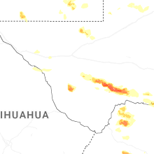
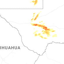
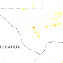
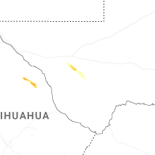


Connect with Interactive Hail Maps