

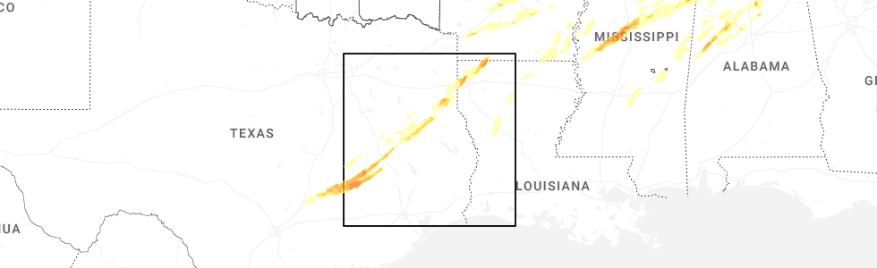
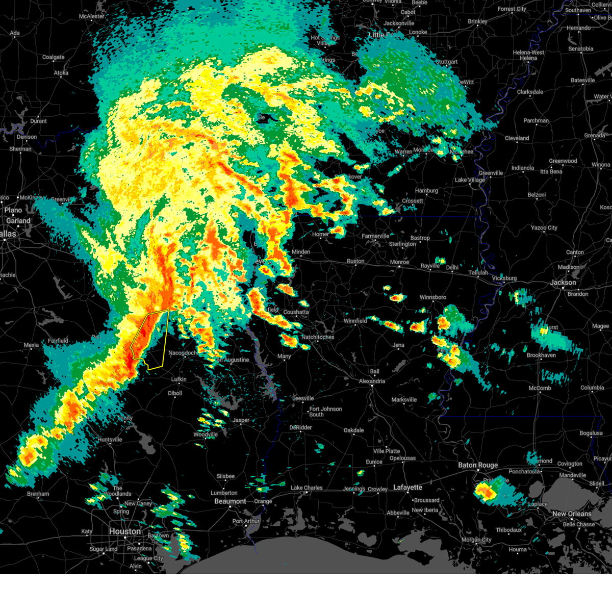
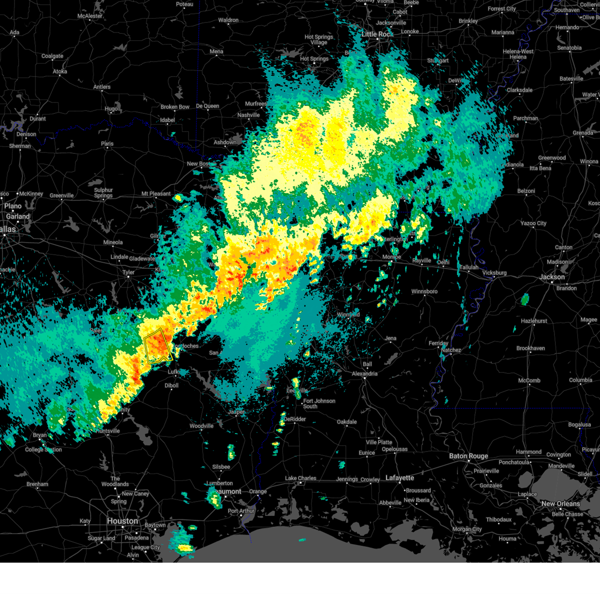
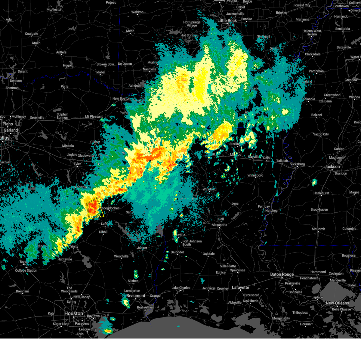
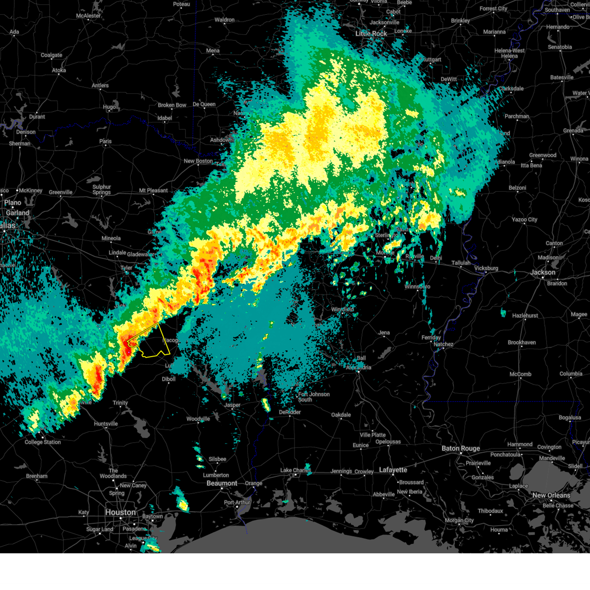
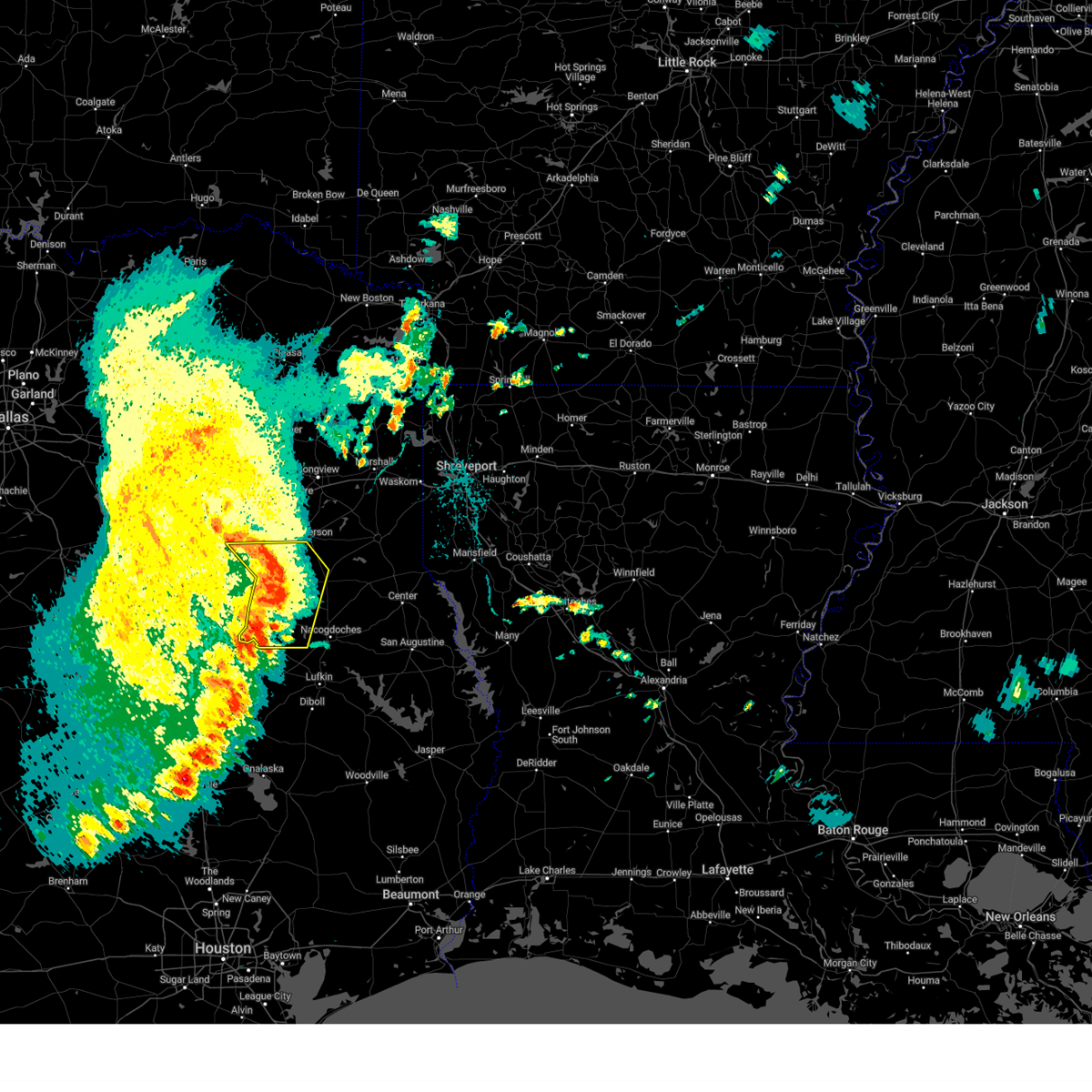
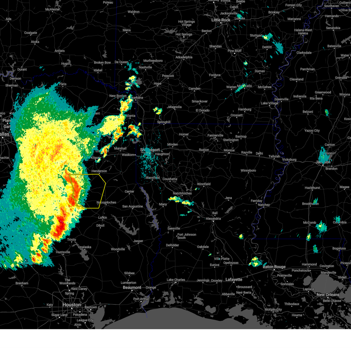
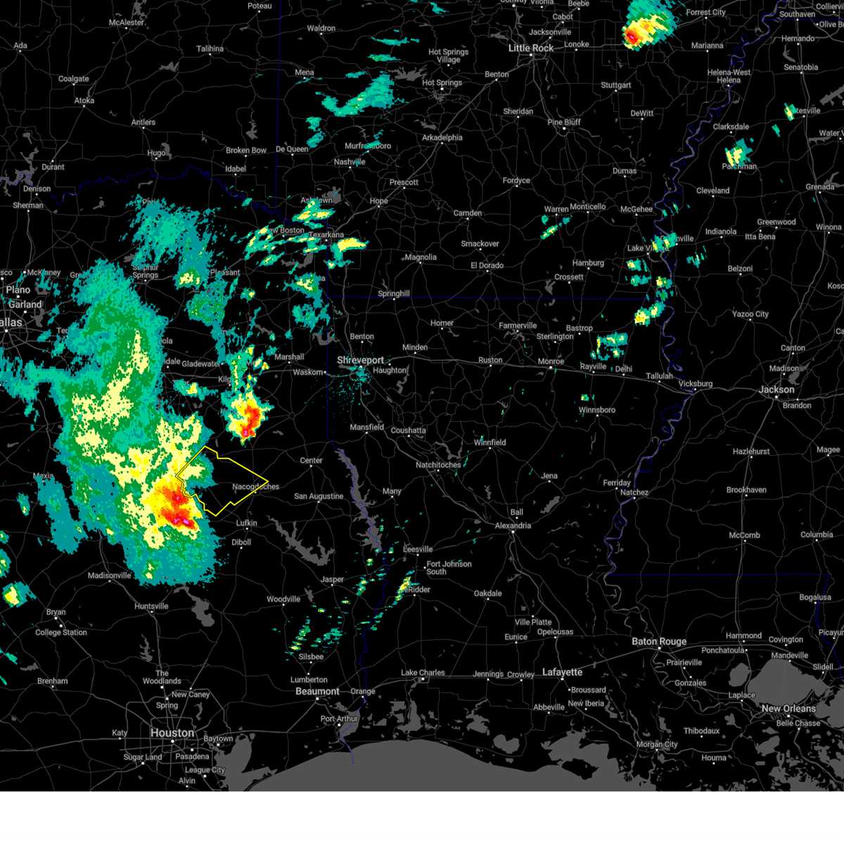
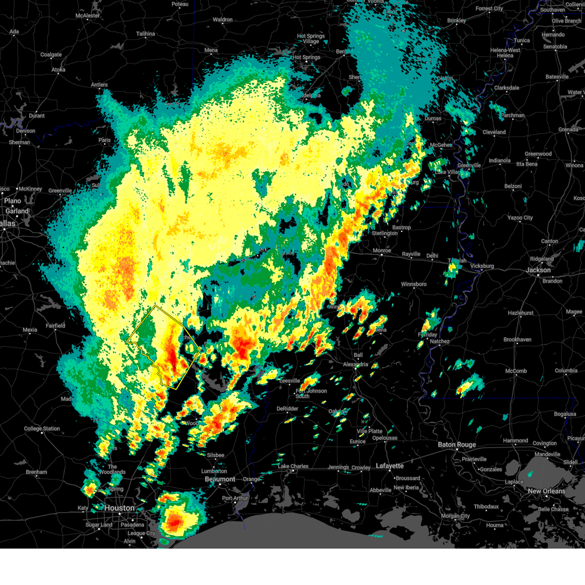
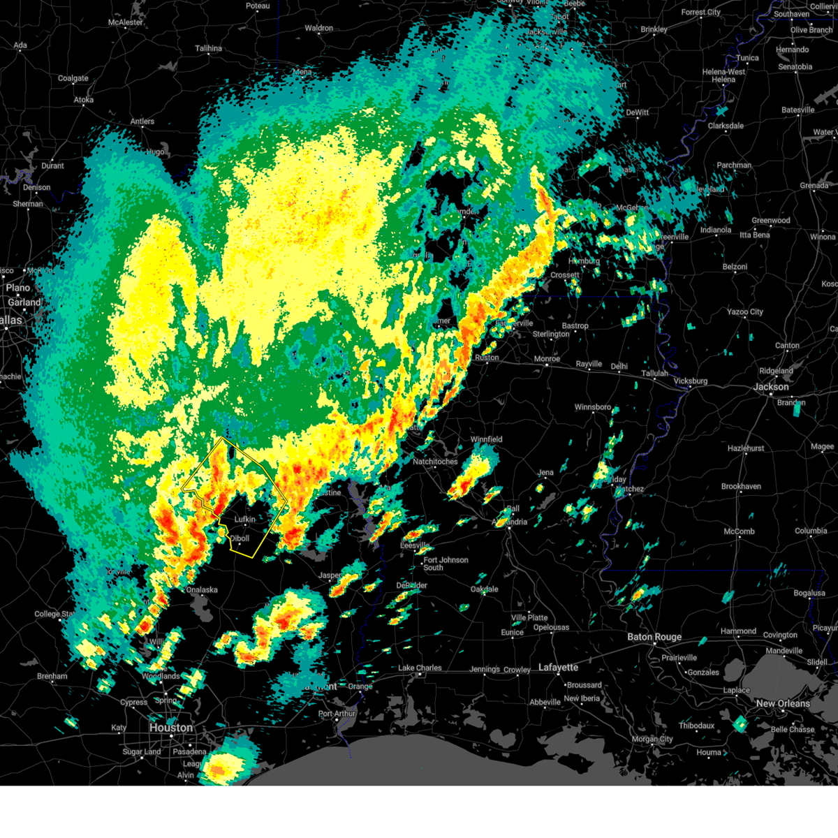
Hail Map for Alto, TX
The Alto, TX area has had 6 reports of on-the-ground hail by trained spotters, and has been under severe weather warnings 19 times during the past 12 months. Doppler radar has detected hail at or near Alto, TX on 56 occasions, including 4 occasions during the past year.
| Name: | Alto, TX |
| Where Located: | 29.9 miles NW of Lufkin, TX |
| Map: | Google Map for Alto, TX |
| Population: | 1225 |
| Housing Units: | 546 |
| More Info: | Search Google for Alto, TX |
2
The Top Recent Hail Date for Alto, TX is Friday, March 14, 2025 (7th out of 56)
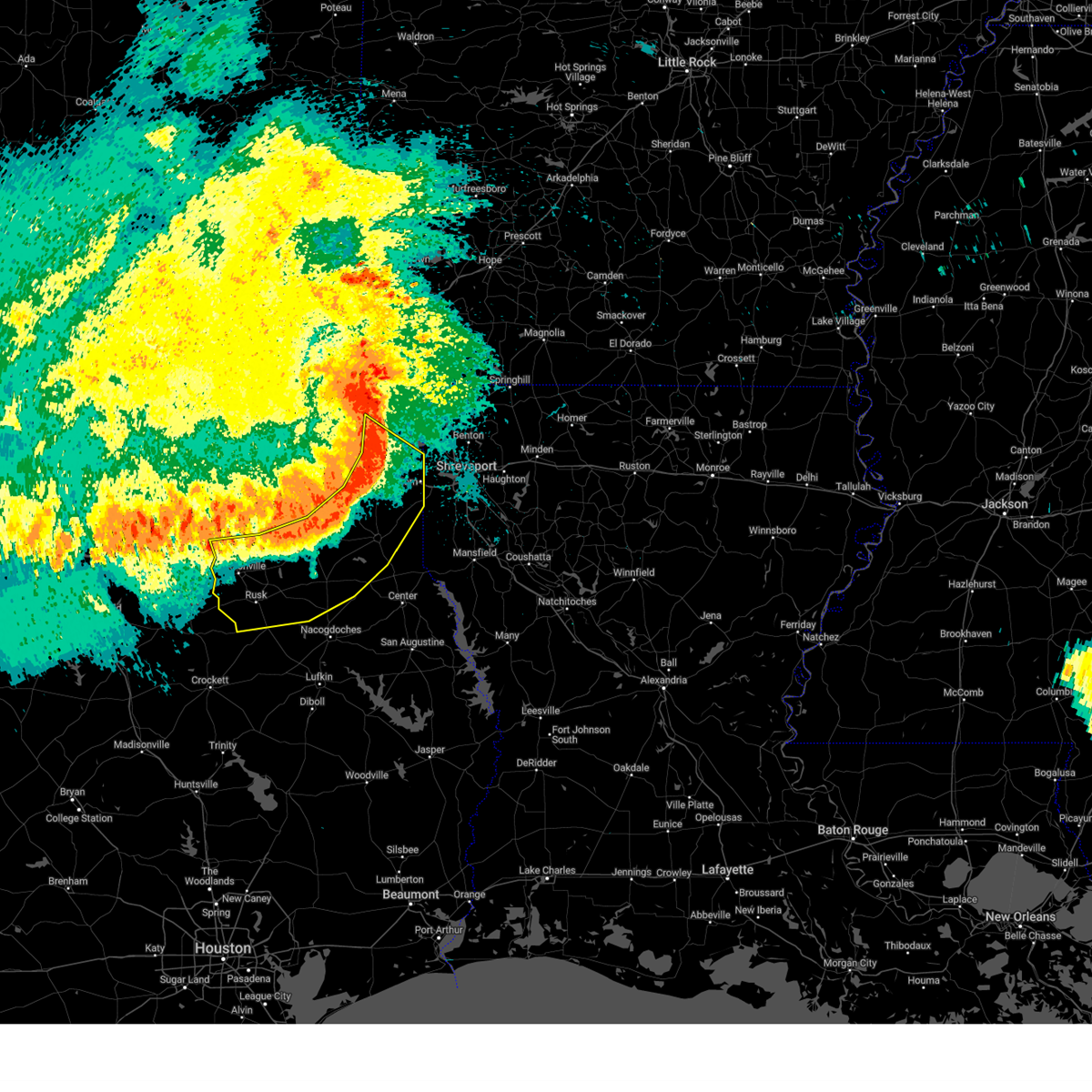
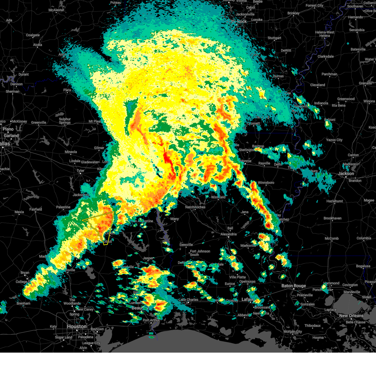
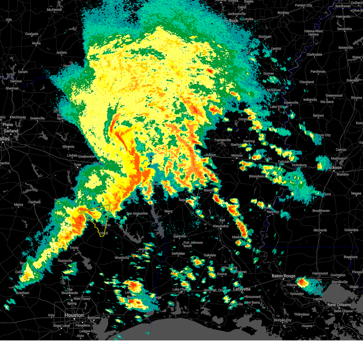
Hail and Wind Damage Spotted near Alto, TX
| Date / Time | Report Details |
|---|---|
| 6/9/2025 12:44 AM CDT |
 the severe thunderstorm warning has been cancelled and is no longer in effect the severe thunderstorm warning has been cancelled and is no longer in effect
|
| 6/9/2025 12:44 AM CDT |
 At 1243 am cdt, severe thunderstorms were located along a line extending from near woodlawn to 7 miles south of hallsville to near henderson to near troup to reese, moving southeast at 40 mph (radar indicated). Hazards include 70 mph wind gusts and quarter size hail. Hail damage to vehicles is expected. expect considerable tree damage. wind damage is also likely to mobile homes, roofs, and outbuildings. Locations impacted include, marshall, jacksonville, henderson, carthage, rusk, bullard, waskom, jefferson, troup, tatum, alto, timpson, new london, garrison, beckville, deberry, elysian fields, pinehill, berea, and trawick. At 1243 am cdt, severe thunderstorms were located along a line extending from near woodlawn to 7 miles south of hallsville to near henderson to near troup to reese, moving southeast at 40 mph (radar indicated). Hazards include 70 mph wind gusts and quarter size hail. Hail damage to vehicles is expected. expect considerable tree damage. wind damage is also likely to mobile homes, roofs, and outbuildings. Locations impacted include, marshall, jacksonville, henderson, carthage, rusk, bullard, waskom, jefferson, troup, tatum, alto, timpson, new london, garrison, beckville, deberry, elysian fields, pinehill, berea, and trawick.
|
| 6/9/2025 12:41 AM CDT |
 At 1240 am cdt, severe thunderstorms were located along a line extending from near woodlawn to 7 miles northwest of tatum to near henderson to near troup to reese, moving southeast at 40 mph (radar indicated). Hazards include 70 mph wind gusts and quarter size hail. Hail damage to vehicles is expected. expect considerable tree damage. wind damage is also likely to mobile homes, roofs, and outbuildings. Locations impacted include, tyler, longview, marshall, jacksonville, henderson, kilgore, whitehouse, carthage, white oak, gladewater, rusk, gilmer, lindale, hallsville, daingerfield, overton, bullard, waskom, jefferson, and troup. At 1240 am cdt, severe thunderstorms were located along a line extending from near woodlawn to 7 miles northwest of tatum to near henderson to near troup to reese, moving southeast at 40 mph (radar indicated). Hazards include 70 mph wind gusts and quarter size hail. Hail damage to vehicles is expected. expect considerable tree damage. wind damage is also likely to mobile homes, roofs, and outbuildings. Locations impacted include, tyler, longview, marshall, jacksonville, henderson, kilgore, whitehouse, carthage, white oak, gladewater, rusk, gilmer, lindale, hallsville, daingerfield, overton, bullard, waskom, jefferson, and troup.
|
| 6/9/2025 12:06 AM CDT | Svrshv the national weather service in shreveport has issued a * severe thunderstorm warning for, western marion county in northeastern texas, rusk county in northeastern texas, northwestern shelby county in eastern texas, upshur county in northeastern texas, southeastern titus county in northeastern texas, smith county in northeastern texas, southwestern cass county in northeastern texas, harrison county in northeastern texas, panola county in northeastern texas, northwestern nacogdoches county in eastern texas, southeastern wood county in northeastern texas, southern morris county in northeastern texas, southeastern camp county in northeastern texas, gregg county in northeastern texas, cherokee county in northeastern texas, * until 115 am cdt. * at 1203 am cdt, severe thunderstorms were located along a line extending from near jenkins to near east mountain to 7 miles west of liberty city to near tyler to brownsboro, moving southeast at 40 mph. these are destructive storms for the city of longview, tx and surrounding areas (emergency management). Hazards include 80 mph wind gusts and quarter size hail. Flying debris will be dangerous to those caught without shelter. mobile homes will be heavily damaged. expect considerable damage to roofs, windows, and vehicles. Extensive tree damage and power outages are likely. |
| 5/6/2025 4:02 PM CDT |
 the severe thunderstorm warning has been cancelled and is no longer in effect the severe thunderstorm warning has been cancelled and is no longer in effect
|
| 5/6/2025 3:21 PM CDT |
 Svrshv the national weather service in shreveport has issued a * severe thunderstorm warning for, northwestern nacogdoches county in eastern texas, northwestern angelina county in eastern texas, southeastern cherokee county in northeastern texas, * until 415 pm cdt. * at 321 pm cdt, severe thunderstorms were located along a line extending from 10 miles west of morrill to near lovelady, moving east at 40 mph (radar indicated). Hazards include 70 mph wind gusts and quarter size hail. Hail damage to vehicles is expected. expect considerable tree damage. Wind damage is also likely to mobile homes, roofs, and outbuildings. Svrshv the national weather service in shreveport has issued a * severe thunderstorm warning for, northwestern nacogdoches county in eastern texas, northwestern angelina county in eastern texas, southeastern cherokee county in northeastern texas, * until 415 pm cdt. * at 321 pm cdt, severe thunderstorms were located along a line extending from 10 miles west of morrill to near lovelady, moving east at 40 mph (radar indicated). Hazards include 70 mph wind gusts and quarter size hail. Hail damage to vehicles is expected. expect considerable tree damage. Wind damage is also likely to mobile homes, roofs, and outbuildings.
|
| 5/6/2025 2:37 PM CDT | Svrshv the national weather service in shreveport has issued a * severe thunderstorm warning for, southwestern panola county in northeastern texas, southern rusk county in northeastern texas, nacogdoches county in eastern texas, northwestern shelby county in eastern texas, northwestern angelina county in eastern texas, southeastern cherokee county in northeastern texas, * until 330 pm cdt. * at 236 pm cdt, severe thunderstorms were located along a line extending from 8 miles south of turnertown to 6 miles north of kennard, moving east at 45 mph (radar indicated). Hazards include 70 mph wind gusts and nickel size hail. Expect considerable tree damage. Damage is likely to mobile homes, roofs, and outbuildings. |
| 5/6/2025 2:32 PM CDT |
 At 232 pm cdt, severe thunderstorms were located along a line extending from 7 miles north of new salem to near morrill, moving east at 55 mph (radar indicated). Hazards include 70 mph wind gusts and quarter size hail. Hail damage to vehicles is expected. expect considerable tree damage. wind damage is also likely to mobile homes, roofs, and outbuildings. Locations impacted include, morrill, lilbert, linwood, sacul, reklaw, new summerfield, new salem, ponta, alto, gallatin, forest, and rusk. At 232 pm cdt, severe thunderstorms were located along a line extending from 7 miles north of new salem to near morrill, moving east at 55 mph (radar indicated). Hazards include 70 mph wind gusts and quarter size hail. Hail damage to vehicles is expected. expect considerable tree damage. wind damage is also likely to mobile homes, roofs, and outbuildings. Locations impacted include, morrill, lilbert, linwood, sacul, reklaw, new summerfield, new salem, ponta, alto, gallatin, forest, and rusk.
|
| 5/6/2025 2:00 PM CDT | Svrshv the national weather service in shreveport has issued a * severe thunderstorm warning for, southwestern rusk county in northeastern texas, northwestern nacogdoches county in eastern texas, cherokee county in northeastern texas, * until 300 pm cdt. * at 200 pm cdt, severe thunderstorms were located along a line extending from 11 miles southwest of reese to 8 miles southwest of grapeland, moving east at 45 mph (radar indicated). Hazards include 70 mph wind gusts and quarter size hail. Hail damage to vehicles is expected. expect considerable tree damage. Wind damage is also likely to mobile homes, roofs, and outbuildings. |
| 4/30/2025 10:59 PM CDT |
 the severe thunderstorm warning has been cancelled and is no longer in effect the severe thunderstorm warning has been cancelled and is no longer in effect
|
| 4/30/2025 10:47 PM CDT |
 At 1047 pm cdt, a severe thunderstorm was located 5 miles east of morrill, or 16 miles southeast of rusk, moving east at 40 mph (radar indicated). Hazards include 60 mph wind gusts and quarter size hail. Hail damage to vehicles is expected. expect wind damage to roofs, siding, and trees. Locations impacted include, alto, wells, douglass, morrill, forest, linwood and lilbert. At 1047 pm cdt, a severe thunderstorm was located 5 miles east of morrill, or 16 miles southeast of rusk, moving east at 40 mph (radar indicated). Hazards include 60 mph wind gusts and quarter size hail. Hail damage to vehicles is expected. expect wind damage to roofs, siding, and trees. Locations impacted include, alto, wells, douglass, morrill, forest, linwood and lilbert.
|
| 4/30/2025 10:23 PM CDT |
 Svrshv the national weather service in shreveport has issued a * severe thunderstorm warning for, northwestern nacogdoches county in eastern texas, southeastern cherokee county in northeastern texas, * until 1115 pm cdt. * at 1023 pm cdt, a severe thunderstorm was located 11 miles southwest of morrill, or 19 miles south of rusk, moving east at 35 mph (radar indicated). Hazards include 60 mph wind gusts and half dollar size hail. Hail damage to vehicles is expected. Expect wind damage to roofs, siding, and trees. Svrshv the national weather service in shreveport has issued a * severe thunderstorm warning for, northwestern nacogdoches county in eastern texas, southeastern cherokee county in northeastern texas, * until 1115 pm cdt. * at 1023 pm cdt, a severe thunderstorm was located 11 miles southwest of morrill, or 19 miles south of rusk, moving east at 35 mph (radar indicated). Hazards include 60 mph wind gusts and half dollar size hail. Hail damage to vehicles is expected. Expect wind damage to roofs, siding, and trees.
|
| 4/24/2025 5:33 PM CDT |
 At 533 pm cdt, severe thunderstorms were located along a line extending from near troup to near new salem to near morrill, moving east at 25 mph (radar indicated). Hazards include 60 mph wind gusts. Expect damage to roofs, siding, and trees. Locations impacted include, morrill, mount selman, reklaw, ponta, concord, gallatin, glenfawn, brachfield, lilbert, linwood, sacul, mixon, new summerfield, looneyville, new salem, cushing, alto, douglass, rusk, and laneville. At 533 pm cdt, severe thunderstorms were located along a line extending from near troup to near new salem to near morrill, moving east at 25 mph (radar indicated). Hazards include 60 mph wind gusts. Expect damage to roofs, siding, and trees. Locations impacted include, morrill, mount selman, reklaw, ponta, concord, gallatin, glenfawn, brachfield, lilbert, linwood, sacul, mixon, new summerfield, looneyville, new salem, cushing, alto, douglass, rusk, and laneville.
|
| 4/24/2025 5:05 PM CDT |
 Svrshv the national weather service in shreveport has issued a * severe thunderstorm warning for, southwestern rusk county in northeastern texas, northwestern nacogdoches county in eastern texas, cherokee county in northeastern texas, * until 600 pm cdt. * at 504 pm cdt, severe thunderstorms were located along a line extending from mixon to near ponta to 9 miles west of morrill, moving east at 25 mph (radar indicated). Hazards include 60 mph wind gusts and penny size hail. expect damage to roofs, siding, and trees Svrshv the national weather service in shreveport has issued a * severe thunderstorm warning for, southwestern rusk county in northeastern texas, northwestern nacogdoches county in eastern texas, cherokee county in northeastern texas, * until 600 pm cdt. * at 504 pm cdt, severe thunderstorms were located along a line extending from mixon to near ponta to 9 miles west of morrill, moving east at 25 mph (radar indicated). Hazards include 60 mph wind gusts and penny size hail. expect damage to roofs, siding, and trees
|
| 3/15/2025 5:11 AM CDT | At 511 am cdt, a severe thunderstorm was located over alto, or 10 miles south of rusk, moving northeast at 50 mph (radar indicated). Hazards include two inch hail and 60 mph wind gusts. People and animals outdoors will be injured. expect hail damage to roofs, siding, windows, and vehicles. expect wind damage to roofs, siding, and trees. Locations impacted include, nacogdoches, rusk, alto, wells, douglass, morrill, sacul, forest, ponta, trawick, cushing, appleby, gallatin, reklaw, linwood, lilbert and looneyville. |
| 3/15/2025 4:54 AM CDT |
 Svrshv the national weather service in shreveport has issued a * severe thunderstorm warning for, northwestern nacogdoches county in eastern texas, southern cherokee county in northeastern texas, * until 530 am cdt. * at 454 am cdt, a severe thunderstorm was located 13 miles southwest of morrill, or 20 miles south of rusk, moving northeast at 50 mph (radar indicated). Hazards include 60 mph wind gusts and quarter size hail. Hail damage to vehicles is expected. Expect wind damage to roofs, siding, and trees. Svrshv the national weather service in shreveport has issued a * severe thunderstorm warning for, northwestern nacogdoches county in eastern texas, southern cherokee county in northeastern texas, * until 530 am cdt. * at 454 am cdt, a severe thunderstorm was located 13 miles southwest of morrill, or 20 miles south of rusk, moving northeast at 50 mph (radar indicated). Hazards include 60 mph wind gusts and quarter size hail. Hail damage to vehicles is expected. Expect wind damage to roofs, siding, and trees.
|
| 3/4/2025 8:45 AM CST |
 Svrshv the national weather service in shreveport has issued a * severe thunderstorm warning for, southwestern caddo parish in northwestern louisiana, western de soto parish in northwestern louisiana, angelina county in eastern texas, nacogdoches county in eastern texas, northwestern san augustine county in eastern texas, shelby county in eastern texas, southeastern cherokee county in northeastern texas, southern panola county in northeastern texas, southeastern rusk county in northeastern texas, * until 945 am cst. * at 845 am cst, severe thunderstorms were located along a line from 7 miles east of new salem to 5 miles southwest of wells, or along a line from 16 miles south of henderson to 18 miles northwest of lufkin, moving east at 40 mph (radar indicated). Hazards include 60 mph wind gusts and small hail. expect damage to roofs, siding, and trees Svrshv the national weather service in shreveport has issued a * severe thunderstorm warning for, southwestern caddo parish in northwestern louisiana, western de soto parish in northwestern louisiana, angelina county in eastern texas, nacogdoches county in eastern texas, northwestern san augustine county in eastern texas, shelby county in eastern texas, southeastern cherokee county in northeastern texas, southern panola county in northeastern texas, southeastern rusk county in northeastern texas, * until 945 am cst. * at 845 am cst, severe thunderstorms were located along a line from 7 miles east of new salem to 5 miles southwest of wells, or along a line from 16 miles south of henderson to 18 miles northwest of lufkin, moving east at 40 mph (radar indicated). Hazards include 60 mph wind gusts and small hail. expect damage to roofs, siding, and trees
|
| 12/28/2024 2:25 PM CST |
 The storm which prompted the warning has weakened below severe limits, and no longer poses an immediate threat to life or property. therefore, the warning will be allowed to expire. however, small hail is still possible with this thunderstorm. to report severe weather, contact your nearest law enforcement agency. they will send your report to the national weather service office. The storm which prompted the warning has weakened below severe limits, and no longer poses an immediate threat to life or property. therefore, the warning will be allowed to expire. however, small hail is still possible with this thunderstorm. to report severe weather, contact your nearest law enforcement agency. they will send your report to the national weather service office.
|
| 12/28/2024 1:40 PM CST |
 Svrshv the national weather service in shreveport has issued a * severe thunderstorm warning for, western angelina county in eastern texas, nacogdoches county in eastern texas, southeastern cherokee county in northeastern texas, southwestern rusk county in northeastern texas, * until 230 pm cst. * at 140 pm cst, a severe thunderstorm was located 6 miles southwest of wells, or 18 miles west of lufkin, moving northeast at 40 mph (radar indicated). Hazards include 60 mph wind gusts and quarter size hail. Hail damage to vehicles is expected. Expect wind damage to roofs, siding, and trees. Svrshv the national weather service in shreveport has issued a * severe thunderstorm warning for, western angelina county in eastern texas, nacogdoches county in eastern texas, southeastern cherokee county in northeastern texas, southwestern rusk county in northeastern texas, * until 230 pm cst. * at 140 pm cst, a severe thunderstorm was located 6 miles southwest of wells, or 18 miles west of lufkin, moving northeast at 40 mph (radar indicated). Hazards include 60 mph wind gusts and quarter size hail. Hail damage to vehicles is expected. Expect wind damage to roofs, siding, and trees.
|
| 6/26/2024 2:04 PM CDT |
 At 204 pm cdt, severe thunderstorms were located along a line extending from 11 miles northeast of coon creek lake to sacul to near garrison, moving south at 45 mph (radar indicated). Hazards include 60 mph wind gusts. Expect damage to roofs, siding, and trees. Locations impacted include, tyler, nacogdoches, jacksonville, whitehouse, rusk, bullard, troup, alto, timpson, berryville, garrison, ponta, new salem, martinsville, trawick, mount selman, sacul, mixon, reese, and douglass. At 204 pm cdt, severe thunderstorms were located along a line extending from 11 miles northeast of coon creek lake to sacul to near garrison, moving south at 45 mph (radar indicated). Hazards include 60 mph wind gusts. Expect damage to roofs, siding, and trees. Locations impacted include, tyler, nacogdoches, jacksonville, whitehouse, rusk, bullard, troup, alto, timpson, berryville, garrison, ponta, new salem, martinsville, trawick, mount selman, sacul, mixon, reese, and douglass.
|
| 6/26/2024 2:04 PM CDT |
 the severe thunderstorm warning has been cancelled and is no longer in effect the severe thunderstorm warning has been cancelled and is no longer in effect
|
| 6/26/2024 1:29 PM CDT |
 Svrshv the national weather service in shreveport has issued a * severe thunderstorm warning for, southern smith county in northeastern texas, southwestern panola county in northeastern texas, southern rusk county in northeastern texas, northern nacogdoches county in eastern texas, western shelby county in eastern texas, northwestern san augustine county in eastern texas, cherokee county in northeastern texas, * until 230 pm cdt. * at 129 pm cdt, severe thunderstorms were located along a line extending from near van to joinerville to near carthage, moving south at 45 mph (radar indicated). Hazards include 60 mph wind gusts. expect damage to roofs, siding, and trees Svrshv the national weather service in shreveport has issued a * severe thunderstorm warning for, southern smith county in northeastern texas, southwestern panola county in northeastern texas, southern rusk county in northeastern texas, northern nacogdoches county in eastern texas, western shelby county in eastern texas, northwestern san augustine county in eastern texas, cherokee county in northeastern texas, * until 230 pm cdt. * at 129 pm cdt, severe thunderstorms were located along a line extending from near van to joinerville to near carthage, moving south at 45 mph (radar indicated). Hazards include 60 mph wind gusts. expect damage to roofs, siding, and trees
|
| 6/1/2024 5:43 PM CDT |
 Svrshv the national weather service in shreveport has issued a * severe thunderstorm warning for, western nacogdoches county in eastern texas, southern cherokee county in northeastern texas, * until 630 pm cdt. * at 543 pm cdt, a severe thunderstorm was located near maydelle, or 10 miles southwest of rusk, moving east at 20 mph (radar indicated). Hazards include 60 mph wind gusts and half dollar size hail. Hail damage to vehicles is expected. Expect wind damage to roofs, siding, and trees. Svrshv the national weather service in shreveport has issued a * severe thunderstorm warning for, western nacogdoches county in eastern texas, southern cherokee county in northeastern texas, * until 630 pm cdt. * at 543 pm cdt, a severe thunderstorm was located near maydelle, or 10 miles southwest of rusk, moving east at 20 mph (radar indicated). Hazards include 60 mph wind gusts and half dollar size hail. Hail damage to vehicles is expected. Expect wind damage to roofs, siding, and trees.
|
| 5/30/2024 6:09 PM CDT |
 Svrshv the national weather service in shreveport has issued a * severe thunderstorm warning for, southwestern rusk county in northeastern texas, northwestern nacogdoches county in eastern texas, northwestern angelina county in eastern texas, central cherokee county in northeastern texas, * until 700 pm cdt. * at 608 pm cdt, severe thunderstorms were located along a line extending from near minden to near sacul to 12 miles northeast of grapeland, moving southeast at 30 mph (radar indicated). Hazards include 60 mph wind gusts and penny size hail. expect damage to roofs, siding, and trees Svrshv the national weather service in shreveport has issued a * severe thunderstorm warning for, southwestern rusk county in northeastern texas, northwestern nacogdoches county in eastern texas, northwestern angelina county in eastern texas, central cherokee county in northeastern texas, * until 700 pm cdt. * at 608 pm cdt, severe thunderstorms were located along a line extending from near minden to near sacul to 12 miles northeast of grapeland, moving southeast at 30 mph (radar indicated). Hazards include 60 mph wind gusts and penny size hail. expect damage to roofs, siding, and trees
|
| 5/28/2024 11:14 AM CDT |
 Svrshv the national weather service in shreveport has issued a * severe thunderstorm warning for, northwestern nacogdoches county in eastern texas, central cherokee county in northeastern texas, * until noon cdt. * at 1114 am cdt, a severe thunderstorm was located 8 miles northeast of elkhart, or 12 miles east of palestine, moving southeast at 45 mph (radar indicated). Hazards include 60 mph wind gusts and quarter size hail. Hail damage to vehicles is expected. Expect wind damage to roofs, siding, and trees. Svrshv the national weather service in shreveport has issued a * severe thunderstorm warning for, northwestern nacogdoches county in eastern texas, central cherokee county in northeastern texas, * until noon cdt. * at 1114 am cdt, a severe thunderstorm was located 8 miles northeast of elkhart, or 12 miles east of palestine, moving southeast at 45 mph (radar indicated). Hazards include 60 mph wind gusts and quarter size hail. Hail damage to vehicles is expected. Expect wind damage to roofs, siding, and trees.
|
| 5/28/2024 9:11 AM CDT |
 Svrshv the national weather service in shreveport has issued a * severe thunderstorm warning for, nacogdoches county in eastern texas, northwestern angelina county in eastern texas, southeastern cherokee county in northeastern texas, * until 1000 am cdt. * at 911 am cdt, severe thunderstorms were located along a line extending from near sacul to near alto to near morrill, moving east at 50 mph (radar indicated). Hazards include 70 mph wind gusts and half dollar size hail. Hail damage to vehicles is expected. expect considerable tree damage. Wind damage is also likely to mobile homes, roofs, and outbuildings. Svrshv the national weather service in shreveport has issued a * severe thunderstorm warning for, nacogdoches county in eastern texas, northwestern angelina county in eastern texas, southeastern cherokee county in northeastern texas, * until 1000 am cdt. * at 911 am cdt, severe thunderstorms were located along a line extending from near sacul to near alto to near morrill, moving east at 50 mph (radar indicated). Hazards include 70 mph wind gusts and half dollar size hail. Hail damage to vehicles is expected. expect considerable tree damage. Wind damage is also likely to mobile homes, roofs, and outbuildings.
|
| 5/22/2024 9:15 PM CDT |
 At 914 pm cdt, severe thunderstorms were located along a line extending from near ponta to 6 miles southwest of sacul to near alto to 8 miles southwest of morrill, moving northeast at 55 mph. these are destructive storms for central cherokee, southern rusk, and nacogdoches counties (radar indicated). Hazards include 80 mph wind gusts and quarter size hail. Flying debris will be dangerous to those caught without shelter. mobile homes will be heavily damaged. expect considerable damage to roofs, windows, and vehicles. extensive tree damage and power outages are likely. Locations impacted include, rusk, alto, wells, morrill, ponta, sacul, new salem, forest, douglass, minden, maydelle, trawick, cushing, mount enterprise, gallatin, reklaw, glenfawn, brachfield, lilbert, and linwood. At 914 pm cdt, severe thunderstorms were located along a line extending from near ponta to 6 miles southwest of sacul to near alto to 8 miles southwest of morrill, moving northeast at 55 mph. these are destructive storms for central cherokee, southern rusk, and nacogdoches counties (radar indicated). Hazards include 80 mph wind gusts and quarter size hail. Flying debris will be dangerous to those caught without shelter. mobile homes will be heavily damaged. expect considerable damage to roofs, windows, and vehicles. extensive tree damage and power outages are likely. Locations impacted include, rusk, alto, wells, morrill, ponta, sacul, new salem, forest, douglass, minden, maydelle, trawick, cushing, mount enterprise, gallatin, reklaw, glenfawn, brachfield, lilbert, and linwood.
|
| 5/22/2024 8:44 PM CDT |
 Svrshv the national weather service in shreveport has issued a * severe thunderstorm warning for, southwestern rusk county in northeastern texas, northwestern nacogdoches county in eastern texas, cherokee county in northeastern texas, * until 945 pm cdt. * at 844 pm cdt, severe thunderstorms were located along a line extending from 9 miles northeast of elkhart to near grapeland to 7 miles southwest of latexo, moving northeast at 55 mph (radar indicated). Hazards include 70 mph wind gusts and quarter size hail. Hail damage to vehicles is expected. expect considerable tree damage. Wind damage is also likely to mobile homes, roofs, and outbuildings. Svrshv the national weather service in shreveport has issued a * severe thunderstorm warning for, southwestern rusk county in northeastern texas, northwestern nacogdoches county in eastern texas, cherokee county in northeastern texas, * until 945 pm cdt. * at 844 pm cdt, severe thunderstorms were located along a line extending from 9 miles northeast of elkhart to near grapeland to 7 miles southwest of latexo, moving northeast at 55 mph (radar indicated). Hazards include 70 mph wind gusts and quarter size hail. Hail damage to vehicles is expected. expect considerable tree damage. Wind damage is also likely to mobile homes, roofs, and outbuildings.
|
| 4/28/2024 7:15 PM CDT |
 Torshv the national weather service in shreveport has issued a * tornado warning for, northwestern nacogdoches county in eastern texas, southeastern cherokee county in northeastern texas, * until 745 pm cdt. * at 715 pm cdt, a severe thunderstorm capable of producing a tornado was located over morrill, or 14 miles southeast of rusk, moving east at 35 mph (radar indicated rotation). Hazards include tornado and quarter size hail. Flying debris will be dangerous to those caught without shelter. mobile homes will be damaged or destroyed. damage to roofs, windows, and vehicles will occur. tree damage is likely. this dangerous storm will be near, douglass around 725 pm cdt. Other locations impacted by this tornadic thunderstorm include looneyville, lilbert, and linwood. Torshv the national weather service in shreveport has issued a * tornado warning for, northwestern nacogdoches county in eastern texas, southeastern cherokee county in northeastern texas, * until 745 pm cdt. * at 715 pm cdt, a severe thunderstorm capable of producing a tornado was located over morrill, or 14 miles southeast of rusk, moving east at 35 mph (radar indicated rotation). Hazards include tornado and quarter size hail. Flying debris will be dangerous to those caught without shelter. mobile homes will be damaged or destroyed. damage to roofs, windows, and vehicles will occur. tree damage is likely. this dangerous storm will be near, douglass around 725 pm cdt. Other locations impacted by this tornadic thunderstorm include looneyville, lilbert, and linwood.
|
| 4/28/2024 6:58 PM CDT |
 Torshv the national weather service in shreveport has issued a * tornado warning for, southeastern cherokee county in northeastern texas, * until 730 pm cdt. * at 657 pm cdt, a severe thunderstorm capable of producing a tornado was located 9 miles west of alto, or 12 miles south of rusk, moving northeast at 30 mph (radar indicated rotation). Hazards include tornado and quarter size hail. Flying debris will be dangerous to those caught without shelter. mobile homes will be damaged or destroyed. damage to roofs, windows, and vehicles will occur. tree damage is likely. this dangerous storm will be near, alto around 705 pm cdt. Other locations impacted by this tornadic thunderstorm include linwood. Torshv the national weather service in shreveport has issued a * tornado warning for, southeastern cherokee county in northeastern texas, * until 730 pm cdt. * at 657 pm cdt, a severe thunderstorm capable of producing a tornado was located 9 miles west of alto, or 12 miles south of rusk, moving northeast at 30 mph (radar indicated rotation). Hazards include tornado and quarter size hail. Flying debris will be dangerous to those caught without shelter. mobile homes will be damaged or destroyed. damage to roofs, windows, and vehicles will occur. tree damage is likely. this dangerous storm will be near, alto around 705 pm cdt. Other locations impacted by this tornadic thunderstorm include linwood.
|
| 4/28/2024 6:15 PM CDT |
 Svrshv the national weather service in shreveport has issued a * severe thunderstorm warning for, northwestern nacogdoches county in eastern texas, northwestern angelina county in eastern texas, cherokee county in northeastern texas, * until 715 pm cdt. * at 614 pm cdt, a severe thunderstorm was located near elkhart, or 14 miles southeast of palestine, moving northeast at 30 mph (radar indicated). Hazards include 60 mph wind gusts and quarter size hail. Hail damage to vehicles is expected. Expect wind damage to roofs, siding, and trees. Svrshv the national weather service in shreveport has issued a * severe thunderstorm warning for, northwestern nacogdoches county in eastern texas, northwestern angelina county in eastern texas, cherokee county in northeastern texas, * until 715 pm cdt. * at 614 pm cdt, a severe thunderstorm was located near elkhart, or 14 miles southeast of palestine, moving northeast at 30 mph (radar indicated). Hazards include 60 mph wind gusts and quarter size hail. Hail damage to vehicles is expected. Expect wind damage to roofs, siding, and trees.
|
| 2/11/2024 8:26 AM CST |
 At 824 am cst, a severe thunderstorm was located near sacul, or 10 miles east of rusk, moving east at 50 mph (radar indicated. at 824 am cst, media reported quarter sized hail seven miles south of rusk). Hazards include 60 mph wind gusts and quarter size hail. Hail damage to vehicles is expected. expect wind damage to roofs, siding, and trees. locations impacted include, nacogdoches, rusk, alto, morrill, ponta, sacul, new salem, douglass, trawick, cushing, appleby, mount enterprise, gallatin, reklaw, glenfawn, lilbert, linwood, looneyville, and laneville. hail threat, observed max hail size, 1. 00 in wind threat, radar indicated max wind gust, 60 mph. At 824 am cst, a severe thunderstorm was located near sacul, or 10 miles east of rusk, moving east at 50 mph (radar indicated. at 824 am cst, media reported quarter sized hail seven miles south of rusk). Hazards include 60 mph wind gusts and quarter size hail. Hail damage to vehicles is expected. expect wind damage to roofs, siding, and trees. locations impacted include, nacogdoches, rusk, alto, morrill, ponta, sacul, new salem, douglass, trawick, cushing, appleby, mount enterprise, gallatin, reklaw, glenfawn, lilbert, linwood, looneyville, and laneville. hail threat, observed max hail size, 1. 00 in wind threat, radar indicated max wind gust, 60 mph.
|
| 2/11/2024 8:22 AM CST | Quarter sized hail reported 6 miles ESE of Alto, TX, reports of quarter sized hail 7 miles to the south of rusk. |
| 2/11/2024 7:52 AM CST |
 At 751 am cst, a severe thunderstorm was located 8 miles east of elkhart, or 13 miles southeast of palestine, moving east at 50 mph (radar indicated). Hazards include 60 mph wind gusts and half dollar size hail. Hail damage to vehicles is expected. Expect wind damage to roofs, siding, and trees. At 751 am cst, a severe thunderstorm was located 8 miles east of elkhart, or 13 miles southeast of palestine, moving east at 50 mph (radar indicated). Hazards include 60 mph wind gusts and half dollar size hail. Hail damage to vehicles is expected. Expect wind damage to roofs, siding, and trees.
|
| 10/5/2023 2:16 AM CDT |
 At 216 am cdt, severe thunderstorms were located along a line extending from near sacul to douglass to near wells to near kennard, moving east at 45 mph (radar indicated). Hazards include 60 mph wind gusts and penny size hail. Expect damage to roofs, siding, and trees. locations impacted include, rusk, alto, wells, morrill, sacul, forest, douglass, cushing, lilbert, linwood, and looneyville. hail threat, radar indicated max hail size, 0. 75 in wind threat, radar indicated max wind gust, 60 mph. At 216 am cdt, severe thunderstorms were located along a line extending from near sacul to douglass to near wells to near kennard, moving east at 45 mph (radar indicated). Hazards include 60 mph wind gusts and penny size hail. Expect damage to roofs, siding, and trees. locations impacted include, rusk, alto, wells, morrill, sacul, forest, douglass, cushing, lilbert, linwood, and looneyville. hail threat, radar indicated max hail size, 0. 75 in wind threat, radar indicated max wind gust, 60 mph.
|
| 10/5/2023 1:39 AM CDT |
 At 138 am cdt, severe thunderstorms were located along a line extending from near maydelle to 11 miles west of rusk to 10 miles east of elkhart to near grapeland, moving east at 45 mph (radar indicated). Hazards include 60 mph wind gusts and penny size hail. expect damage to roofs, siding, and trees At 138 am cdt, severe thunderstorms were located along a line extending from near maydelle to 11 miles west of rusk to 10 miles east of elkhart to near grapeland, moving east at 45 mph (radar indicated). Hazards include 60 mph wind gusts and penny size hail. expect damage to roofs, siding, and trees
|
| 9/24/2023 11:45 PM CDT |
 At 1145 pm cdt, a severe thunderstorm was located 8 miles north of nacogdoches, moving southeast at 55 mph (radar indicated). Hazards include 60 mph wind gusts and quarter size hail. Hail damage to vehicles is expected. expect wind damage to roofs, siding, and trees. locations impacted include, nacogdoches, henderson, rusk, hudson, alto, timpson, garrison, wells, morrill, ponta, pinehill, new salem, trawick, pollok, sacul, forest, douglass, minden, maydelle, and new summerfield. hail threat, radar indicated max hail size, 1. 00 in wind threat, radar indicated max wind gust, 60 mph. At 1145 pm cdt, a severe thunderstorm was located 8 miles north of nacogdoches, moving southeast at 55 mph (radar indicated). Hazards include 60 mph wind gusts and quarter size hail. Hail damage to vehicles is expected. expect wind damage to roofs, siding, and trees. locations impacted include, nacogdoches, henderson, rusk, hudson, alto, timpson, garrison, wells, morrill, ponta, pinehill, new salem, trawick, pollok, sacul, forest, douglass, minden, maydelle, and new summerfield. hail threat, radar indicated max hail size, 1. 00 in wind threat, radar indicated max wind gust, 60 mph.
|
| 9/24/2023 11:14 PM CDT |
 At 1114 pm cdt, a severe thunderstorm was located near new salem, or 11 miles northeast of rusk, moving southeast at 55 mph (radar indicated). Hazards include 60 mph wind gusts and quarter size hail. Hail damage to vehicles is expected. Expect wind damage to roofs, siding, and trees. At 1114 pm cdt, a severe thunderstorm was located near new salem, or 11 miles northeast of rusk, moving southeast at 55 mph (radar indicated). Hazards include 60 mph wind gusts and quarter size hail. Hail damage to vehicles is expected. Expect wind damage to roofs, siding, and trees.
|
| 9/9/2023 2:33 AM CDT |
 At 233 am cdt, a severe thunderstorm was located over maydelle, or 10 miles west of rusk, moving southeast at 35 mph (radar indicated). Hazards include 60 mph wind gusts and quarter size hail. Hail damage to vehicles is expected. Expect wind damage to roofs, siding, and trees. At 233 am cdt, a severe thunderstorm was located over maydelle, or 10 miles west of rusk, moving southeast at 35 mph (radar indicated). Hazards include 60 mph wind gusts and quarter size hail. Hail damage to vehicles is expected. Expect wind damage to roofs, siding, and trees.
|
| 6/16/2023 5:32 AM CDT |
 At 532 am cdt, a severe thunderstorm was located near alto, or 13 miles southeast of rusk, moving southeast at 45 mph. this is a destructive storm for areas near and east of alto (radar indicated). Hazards include three inch hail and 60 mph wind gusts. People and animals outdoors will be severely injured. expect shattered windows, extensive damage to roofs, siding, and vehicles. locations impacted include, lufkin, nacogdoches, hudson, alto, wells, morrill, woden, pollok, forest, douglass, clawson, central, redland, lilbert and linwood. thunderstorm damage threat, destructive hail threat, observed max hail size, 3. 00 in wind threat, radar indicated max wind gust, 60 mph. At 532 am cdt, a severe thunderstorm was located near alto, or 13 miles southeast of rusk, moving southeast at 45 mph. this is a destructive storm for areas near and east of alto (radar indicated). Hazards include three inch hail and 60 mph wind gusts. People and animals outdoors will be severely injured. expect shattered windows, extensive damage to roofs, siding, and vehicles. locations impacted include, lufkin, nacogdoches, hudson, alto, wells, morrill, woden, pollok, forest, douglass, clawson, central, redland, lilbert and linwood. thunderstorm damage threat, destructive hail threat, observed max hail size, 3. 00 in wind threat, radar indicated max wind gust, 60 mph.
|
| 6/16/2023 5:25 AM CDT |
 At 524 am cdt, a severe thunderstorm was located near alto, or 10 miles southeast of rusk, moving southeast at 45 mph (radar indicated. hen egg size hail fell near jacksonville with this storm). Hazards include two inch hail and 60 mph wind gusts. People and animals outdoors will be injured. expect hail damage to roofs, siding, windows, and vehicles. expect wind damage to roofs, siding, and trees. locations impacted include, lufkin, nacogdoches, rusk, hudson, alto, wells, morrill, woden, pollok, sacul, forest, douglass, maydelle, trawick, cushing, clawson, central, redland, lilbert and linwood. thunderstorm damage threat, considerable hail threat, observed max hail size, 2. 00 in wind threat, radar indicated max wind gust, 60 mph. At 524 am cdt, a severe thunderstorm was located near alto, or 10 miles southeast of rusk, moving southeast at 45 mph (radar indicated. hen egg size hail fell near jacksonville with this storm). Hazards include two inch hail and 60 mph wind gusts. People and animals outdoors will be injured. expect hail damage to roofs, siding, windows, and vehicles. expect wind damage to roofs, siding, and trees. locations impacted include, lufkin, nacogdoches, rusk, hudson, alto, wells, morrill, woden, pollok, sacul, forest, douglass, maydelle, trawick, cushing, clawson, central, redland, lilbert and linwood. thunderstorm damage threat, considerable hail threat, observed max hail size, 2. 00 in wind threat, radar indicated max wind gust, 60 mph.
|
| 6/16/2023 5:02 AM CDT |
 At 502 am cdt, a severe thunderstorm was located near galatin, or 10 miles northwest of rusk, moving southeast at 45 mph (radar indicated). Hazards include golf ball size hail and 60 mph wind gusts. People and animals outdoors will be injured. expect hail damage to roofs, siding, windows, and vehicles. Expect wind damage to roofs, siding, and trees. At 502 am cdt, a severe thunderstorm was located near galatin, or 10 miles northwest of rusk, moving southeast at 45 mph (radar indicated). Hazards include golf ball size hail and 60 mph wind gusts. People and animals outdoors will be injured. expect hail damage to roofs, siding, windows, and vehicles. Expect wind damage to roofs, siding, and trees.
|
| 6/10/2023 6:04 PM CDT |
 At 603 pm cdt, a severe thunderstorm was located 7 miles southeast of douglass, or 10 miles west of nacogdoches, moving southeast at 10 mph (radar indicated). Hazards include 60 mph wind gusts and quarter size hail. Hail damage to vehicles is expected. expect wind damage to roofs, siding, and trees. locations impacted include, lufkin, nacogdoches, alto, morrill, pollok, douglass, redland and linwood. hail threat, radar indicated max hail size, 1. 00 in wind threat, radar indicated max wind gust, 60 mph. At 603 pm cdt, a severe thunderstorm was located 7 miles southeast of douglass, or 10 miles west of nacogdoches, moving southeast at 10 mph (radar indicated). Hazards include 60 mph wind gusts and quarter size hail. Hail damage to vehicles is expected. expect wind damage to roofs, siding, and trees. locations impacted include, lufkin, nacogdoches, alto, morrill, pollok, douglass, redland and linwood. hail threat, radar indicated max hail size, 1. 00 in wind threat, radar indicated max wind gust, 60 mph.
|
| 6/10/2023 5:43 PM CDT |
 At 543 pm cdt, a severe thunderstorm was located near douglass, or 7 miles west of nacogdoches, moving east at 15 mph (radar indicated). Hazards include 60 mph wind gusts and quarter size hail. Hail damage to vehicles is expected. expect wind damage to roofs, siding, and trees. locations impacted include, lufkin, nacogdoches, alto, morrill, pollok, douglass, redland, lilbert and linwood. hail threat, radar indicated max hail size, 1. 00 in wind threat, radar indicated max wind gust, 60 mph. At 543 pm cdt, a severe thunderstorm was located near douglass, or 7 miles west of nacogdoches, moving east at 15 mph (radar indicated). Hazards include 60 mph wind gusts and quarter size hail. Hail damage to vehicles is expected. expect wind damage to roofs, siding, and trees. locations impacted include, lufkin, nacogdoches, alto, morrill, pollok, douglass, redland, lilbert and linwood. hail threat, radar indicated max hail size, 1. 00 in wind threat, radar indicated max wind gust, 60 mph.
|
| 6/10/2023 5:22 PM CDT |
 At 522 pm cdt, a severe thunderstorm was located near douglass, or 15 miles west of nacogdoches, moving east at 10 mph (radar indicated). Hazards include 60 mph wind gusts and half dollar size hail. Hail damage to vehicles is expected. expect wind damage to roofs, siding, and trees. locations impacted include, lufkin, nacogdoches, alto, morrill, pollok, douglass, redland, lilbert and linwood. hail threat, radar indicated max hail size, 1. 25 in wind threat, radar indicated max wind gust, 60 mph. At 522 pm cdt, a severe thunderstorm was located near douglass, or 15 miles west of nacogdoches, moving east at 10 mph (radar indicated). Hazards include 60 mph wind gusts and half dollar size hail. Hail damage to vehicles is expected. expect wind damage to roofs, siding, and trees. locations impacted include, lufkin, nacogdoches, alto, morrill, pollok, douglass, redland, lilbert and linwood. hail threat, radar indicated max hail size, 1. 25 in wind threat, radar indicated max wind gust, 60 mph.
|
| 6/10/2023 5:15 PM CDT |
 At 515 pm cdt, a severe thunderstorm was located near douglass, or 16 miles west of nacogdoches, moving east at 15 mph (radar indicated). Hazards include 60 mph wind gusts and quarter size hail. Hail damage to vehicles is expected. Expect wind damage to roofs, siding, and trees. At 515 pm cdt, a severe thunderstorm was located near douglass, or 16 miles west of nacogdoches, moving east at 15 mph (radar indicated). Hazards include 60 mph wind gusts and quarter size hail. Hail damage to vehicles is expected. Expect wind damage to roofs, siding, and trees.
|
| 6/3/2023 1:28 PM CDT | Several trees snapped and uprooted south of alto... texas along cr 270 in cherokee county TX, 3.2 miles NNW of Alto, TX |
| 5/5/2023 12:42 AM CDT |
 At 1242 am cdt, severe thunderstorms were located along a line extending from near joinerville to minden to near trawick to near forest, moving east at 50 mph (radar indicated). Hazards include 60 mph wind gusts and penny size hail. expect damage to roofs, siding, and trees At 1242 am cdt, severe thunderstorms were located along a line extending from near joinerville to minden to near trawick to near forest, moving east at 50 mph (radar indicated). Hazards include 60 mph wind gusts and penny size hail. expect damage to roofs, siding, and trees
|
| 5/5/2023 12:23 AM CDT |
 At 1222 am cdt, severe thunderstorms were located along a line extending from near arp to near turnertown to near new salem to 7 miles west of alto, moving east at 45 mph. a 51 mph wind gust was measured at the cherokee county airport south of jacksonville at 1215 am with these storms (radar indicated). Hazards include 60 mph wind gusts and penny size hail. Expect damage to roofs, siding, and trees. locations impacted include, jacksonville, henderson, whitehouse, rusk, overton, troup, alto, new london, arp, morrill, ponta, new salem, joinerville, sacul, turnertown, minden, maydelle, new summerfield, cushing and gallatin. hail threat, radar indicated max hail size, 0. 75 in wind threat, observed max wind gust, 60 mph. At 1222 am cdt, severe thunderstorms were located along a line extending from near arp to near turnertown to near new salem to 7 miles west of alto, moving east at 45 mph. a 51 mph wind gust was measured at the cherokee county airport south of jacksonville at 1215 am with these storms (radar indicated). Hazards include 60 mph wind gusts and penny size hail. Expect damage to roofs, siding, and trees. locations impacted include, jacksonville, henderson, whitehouse, rusk, overton, troup, alto, new london, arp, morrill, ponta, new salem, joinerville, sacul, turnertown, minden, maydelle, new summerfield, cushing and gallatin. hail threat, radar indicated max hail size, 0. 75 in wind threat, observed max wind gust, 60 mph.
|
| 5/4/2023 11:43 PM CDT |
 At 1143 pm cdt, severe thunderstorms were located along a line extending from near brownsboro to lake palestine to near frankston to near palestine, moving east at 40 mph (radar indicated). Hazards include 60 mph wind gusts and penny size hail. expect damage to roofs, siding, and trees At 1143 pm cdt, severe thunderstorms were located along a line extending from near brownsboro to lake palestine to near frankston to near palestine, moving east at 40 mph (radar indicated). Hazards include 60 mph wind gusts and penny size hail. expect damage to roofs, siding, and trees
|
| 4/26/2023 10:25 PM CDT | At 1023 pm cdt, severe thunderstorms were located along a line extending from near morrill to near forest to near hudson to near apple springs, moving northeast at 45 mph. these are destructive storms for angelina and cherokee counties (radar indicated). Hazards include baseball size hail and 60 mph wind gusts. People and animals outdoors will be severely injured. Expect shattered windows, extensive damage to roofs, siding, and vehicles. |
| 4/5/2023 6:00 PM CDT |
 At 559 pm cdt, a severe thunderstorm was located near sacul, or 9 miles east of rusk, moving northeast at 55 mph. hail to the size of quarters was reported earlier near the alto community with this storm (radar indicated). Hazards include 60 mph wind gusts and quarter size hail. Hail damage to vehicles is expected. expect wind damage to roofs, siding, and trees. locations impacted include, alto, sacul, ponta, reklaw, lilbert, linwood and looneyville. hail threat, radar indicated max hail size, 1. 00 in wind threat, radar indicated max wind gust, 60 mph. At 559 pm cdt, a severe thunderstorm was located near sacul, or 9 miles east of rusk, moving northeast at 55 mph. hail to the size of quarters was reported earlier near the alto community with this storm (radar indicated). Hazards include 60 mph wind gusts and quarter size hail. Hail damage to vehicles is expected. expect wind damage to roofs, siding, and trees. locations impacted include, alto, sacul, ponta, reklaw, lilbert, linwood and looneyville. hail threat, radar indicated max hail size, 1. 00 in wind threat, radar indicated max wind gust, 60 mph.
|
| 4/5/2023 5:48 PM CDT | Quarter sized hail reported 0.9 miles NNE of Alto, TX, hail up to the size of quarters reported at a local eating establishment on the southwest side of alto... texas. |
| 4/5/2023 5:39 PM CDT |
 At 539 pm cdt, a severe thunderstorm was located 7 miles southwest of morrill, or 18 miles south of rusk, moving northeast at 55 mph (radar indicated). Hazards include 60 mph wind gusts and half dollar size hail. Hail damage to vehicles is expected. Expect wind damage to roofs, siding, and trees. At 539 pm cdt, a severe thunderstorm was located 7 miles southwest of morrill, or 18 miles south of rusk, moving northeast at 55 mph (radar indicated). Hazards include 60 mph wind gusts and half dollar size hail. Hail damage to vehicles is expected. Expect wind damage to roofs, siding, and trees.
|
| 4/2/2023 8:22 PM CDT |
 The severe thunderstorm warning for southwestern rusk, northwestern nacogdoches and central cherokee counties will expire at 830 pm cdt, the storm which prompted the warning has weakened below severe limits, and no longer poses an immediate threat to life or property. therefore, the warning will be allowed to expire. a tornado watch remains in effect until 100 am cdt for eastern and northeastern texas. The severe thunderstorm warning for southwestern rusk, northwestern nacogdoches and central cherokee counties will expire at 830 pm cdt, the storm which prompted the warning has weakened below severe limits, and no longer poses an immediate threat to life or property. therefore, the warning will be allowed to expire. a tornado watch remains in effect until 100 am cdt for eastern and northeastern texas.
|
| 4/2/2023 7:33 PM CDT |
 At 732 pm cdt, a severe thunderstorm was located 7 miles east of elkhart, or 12 miles southeast of palestine, moving northeast at 40 mph (trained storm spotter). Hazards include 60 mph wind gusts and quarter size hail. Hail damage to vehicles is expected. Expect wind damage to roofs, siding, and trees. At 732 pm cdt, a severe thunderstorm was located 7 miles east of elkhart, or 12 miles southeast of palestine, moving northeast at 40 mph (trained storm spotter). Hazards include 60 mph wind gusts and quarter size hail. Hail damage to vehicles is expected. Expect wind damage to roofs, siding, and trees.
|
| 3/2/2023 10:34 PM CST |
 At 1033 pm cst, a severe thunderstorm capable of producing a tornado was located near morrill, or 16 miles southeast of rusk, moving east at 45 mph (radar indicated rotation). Hazards include tornado and quarter size hail. Flying debris will be dangerous to those caught without shelter. mobile homes will be damaged or destroyed. damage to roofs, windows, and vehicles will occur. tree damage is likely. this dangerous storm will be near, douglass around 1045 pm cst. trawick around 1055 pm cst. nacogdoches around 1100 pm cst. Other locations impacted by this tornadic thunderstorm include appleby, looneyville and linwood. At 1033 pm cst, a severe thunderstorm capable of producing a tornado was located near morrill, or 16 miles southeast of rusk, moving east at 45 mph (radar indicated rotation). Hazards include tornado and quarter size hail. Flying debris will be dangerous to those caught without shelter. mobile homes will be damaged or destroyed. damage to roofs, windows, and vehicles will occur. tree damage is likely. this dangerous storm will be near, douglass around 1045 pm cst. trawick around 1055 pm cst. nacogdoches around 1100 pm cst. Other locations impacted by this tornadic thunderstorm include appleby, looneyville and linwood.
|
| 3/2/2023 10:24 PM CST | Numerous trees and powerlines downed across the entire count in cherokee county TX, 0.3 miles WNW of Alto, TX |
| 3/2/2023 9:54 PM CST |
 At 953 pm cst, a severe thunderstorm was located near grapeland, or 9 miles northwest of crockett, moving east at 55 mph (radar indicated). Hazards include 60 mph wind gusts and quarter size hail. Hail damage to vehicles is expected. Expect wind damage to roofs, siding, and trees. At 953 pm cst, a severe thunderstorm was located near grapeland, or 9 miles northwest of crockett, moving east at 55 mph (radar indicated). Hazards include 60 mph wind gusts and quarter size hail. Hail damage to vehicles is expected. Expect wind damage to roofs, siding, and trees.
|
| 12/13/2022 2:43 PM CST |
 At 243 pm cst, a severe thunderstorm was located over forest, or 20 miles south of rusk, moving northeast at 45 mph (radar indicated). Hazards include 60 mph wind gusts and quarter size hail. Hail damage to vehicles is expected. Expect wind damage to roofs, siding, and trees. At 243 pm cst, a severe thunderstorm was located over forest, or 20 miles south of rusk, moving northeast at 45 mph (radar indicated). Hazards include 60 mph wind gusts and quarter size hail. Hail damage to vehicles is expected. Expect wind damage to roofs, siding, and trees.
|
| 11/4/2022 7:39 PM CDT |
 At 739 pm cdt, a severe thunderstorm capable of producing a tornado was located near alto, or 9 miles south of rusk, moving northeast at 40 mph (radar indicated rotation). Hazards include tornado. Flying debris will be dangerous to those caught without shelter. mobile homes will be damaged or destroyed. damage to roofs, windows, and vehicles will occur. Tree damage is likely. At 739 pm cdt, a severe thunderstorm capable of producing a tornado was located near alto, or 9 miles south of rusk, moving northeast at 40 mph (radar indicated rotation). Hazards include tornado. Flying debris will be dangerous to those caught without shelter. mobile homes will be damaged or destroyed. damage to roofs, windows, and vehicles will occur. Tree damage is likely.
|
| 10/24/2022 11:51 PM CDT |
 At 1150 pm cdt, severe thunderstorms were located along a line extending from 8 miles north of arp to near new salem to 8 miles northwest of kennard, moving northeast at 60 mph (radar indicated). Hazards include 60 mph wind gusts and penny size hail. expect damage to roofs, siding, and trees At 1150 pm cdt, severe thunderstorms were located along a line extending from 8 miles north of arp to near new salem to 8 miles northwest of kennard, moving northeast at 60 mph (radar indicated). Hazards include 60 mph wind gusts and penny size hail. expect damage to roofs, siding, and trees
|
| 8/17/2022 5:12 PM CDT |
 At 511 pm cdt, severe thunderstorms were located along a line extending from near trawick to 9 miles west of alto, moving southeast at 15 mph (radar indicated). Hazards include 60 mph wind gusts and quarter size hail. Hail damage to vehicles is expected. expect wind damage to roofs, siding, and trees. locations impacted include, nacogdoches, rusk, alto, morrill, forest, douglass, trawick, appleby, linwood, lilbert and looneyville. hail threat, radar indicated max hail size, 1. 00 in wind threat, radar indicated max wind gust, 60 mph. At 511 pm cdt, severe thunderstorms were located along a line extending from near trawick to 9 miles west of alto, moving southeast at 15 mph (radar indicated). Hazards include 60 mph wind gusts and quarter size hail. Hail damage to vehicles is expected. expect wind damage to roofs, siding, and trees. locations impacted include, nacogdoches, rusk, alto, morrill, forest, douglass, trawick, appleby, linwood, lilbert and looneyville. hail threat, radar indicated max hail size, 1. 00 in wind threat, radar indicated max wind gust, 60 mph.
|
| 8/17/2022 4:40 PM CDT |
 At 439 pm cdt, severe thunderstorms were located along a line extending from near trawick to near maydelle, moving southeast at 15 mph (radar indicated). Hazards include 60 mph wind gusts and quarter size hail. Hail damage to vehicles is expected. Expect wind damage to roofs, siding, and trees. At 439 pm cdt, severe thunderstorms were located along a line extending from near trawick to near maydelle, moving southeast at 15 mph (radar indicated). Hazards include 60 mph wind gusts and quarter size hail. Hail damage to vehicles is expected. Expect wind damage to roofs, siding, and trees.
|
| 5/21/2022 9:43 PM CDT |
 At 942 pm cdt, severe thunderstorms were located along a line extending from 8 miles southeast of athens to 8 miles west of maydelle to near elkhart, moving east at 40 mph (radar indicated. numerous reports of wind damage have been reported across anderson county with these storms, with measured wind gusts of 60 mph in palestine). Hazards include 60 mph wind gusts and penny size hail. expect damage to roofs, siding, and trees At 942 pm cdt, severe thunderstorms were located along a line extending from 8 miles southeast of athens to 8 miles west of maydelle to near elkhart, moving east at 40 mph (radar indicated. numerous reports of wind damage have been reported across anderson county with these storms, with measured wind gusts of 60 mph in palestine). Hazards include 60 mph wind gusts and penny size hail. expect damage to roofs, siding, and trees
|
| 4/12/2022 8:58 PM CDT |
 At 857 pm cdt, severe thunderstorms were located along a line extending from near pinehill to 7 miles east of grapeland, moving east at 55 mph (radar indicated). Hazards include 70 mph wind gusts and penny size hail. Expect considerable tree damage. damage is likely to mobile homes, roofs, and outbuildings. Locations impacted include, rusk, alto, beckville, morrill, pinehill, sacul, new salem, forest, douglass, minden, trawick, cushing, mount enterprise, reklaw, chapman, glenfawn, fairplay, brachfield, linwood and lilbert. At 857 pm cdt, severe thunderstorms were located along a line extending from near pinehill to 7 miles east of grapeland, moving east at 55 mph (radar indicated). Hazards include 70 mph wind gusts and penny size hail. Expect considerable tree damage. damage is likely to mobile homes, roofs, and outbuildings. Locations impacted include, rusk, alto, beckville, morrill, pinehill, sacul, new salem, forest, douglass, minden, trawick, cushing, mount enterprise, reklaw, chapman, glenfawn, fairplay, brachfield, linwood and lilbert.
|
| 4/12/2022 8:48 PM CDT |
 At 848 pm cdt, severe thunderstorms were located along a line extending from 8 miles east of kilgore to 11 miles northwest of kennard, moving east at 50 mph (radar indicated). Hazards include 70 mph wind gusts and penny size hail. Expect considerable tree damage. Damage is likely to mobile homes, roofs, and outbuildings. At 848 pm cdt, severe thunderstorms were located along a line extending from 8 miles east of kilgore to 11 miles northwest of kennard, moving east at 50 mph (radar indicated). Hazards include 70 mph wind gusts and penny size hail. Expect considerable tree damage. Damage is likely to mobile homes, roofs, and outbuildings.
|
| 4/12/2022 8:20 PM CDT |
 At 819 pm cdt, severe thunderstorms were located along a line extending from near mixon to 10 miles east of buffalo, moving east at 55 mph (radar indicated). Hazards include 70 mph wind gusts and penny size hail. Expect considerable tree damage. Damage is likely to mobile homes, roofs, and outbuildings. At 819 pm cdt, severe thunderstorms were located along a line extending from near mixon to 10 miles east of buffalo, moving east at 55 mph (radar indicated). Hazards include 70 mph wind gusts and penny size hail. Expect considerable tree damage. Damage is likely to mobile homes, roofs, and outbuildings.
|
| 3/21/2022 10:54 PM CDT |
 At 1053 pm cdt, a severe thunderstorm capable of producing a tornado was located 9 miles west of morrill, or 17 miles south of rusk, moving northeast at 45 mph. this storm has had a history of producing tornadoes (radar indicated rotation). Hazards include tornado and quarter size hail. Flying debris will be dangerous to those caught without shelter. mobile homes will be damaged or destroyed. damage to roofs, windows, and vehicles will occur. tree damage is likely. this dangerous storm will be near, morrill around 1105 pm cdt. alto around 1110 pm cdt. douglass around 1120 pm cdt. sacul around 1125 pm cdt. trawick around 1135 pm cdt. Other locations impacted by this tornadic thunderstorm include linwood, lilbert, reklaw, looneyville, cushing, gallatin and new summerfield. At 1053 pm cdt, a severe thunderstorm capable of producing a tornado was located 9 miles west of morrill, or 17 miles south of rusk, moving northeast at 45 mph. this storm has had a history of producing tornadoes (radar indicated rotation). Hazards include tornado and quarter size hail. Flying debris will be dangerous to those caught without shelter. mobile homes will be damaged or destroyed. damage to roofs, windows, and vehicles will occur. tree damage is likely. this dangerous storm will be near, morrill around 1105 pm cdt. alto around 1110 pm cdt. douglass around 1120 pm cdt. sacul around 1125 pm cdt. trawick around 1135 pm cdt. Other locations impacted by this tornadic thunderstorm include linwood, lilbert, reklaw, looneyville, cushing, gallatin and new summerfield.
|
| 6/8/2021 10:30 AM CDT |
 At 1029 am cdt, severe thunderstorms were located along a line extending from near troup to near rusk to 7 miles southwest of morrill, moving east at 45 mph (radar indicated). Hazards include 60 mph wind gusts and penny size hail. expect damage to roofs, siding, and trees At 1029 am cdt, severe thunderstorms were located along a line extending from near troup to near rusk to 7 miles southwest of morrill, moving east at 45 mph (radar indicated). Hazards include 60 mph wind gusts and penny size hail. expect damage to roofs, siding, and trees
|
| 6/7/2021 12:37 PM CDT |
 At 1236 pm cdt, severe thunderstorms were located along a line extending from near mineola to 7 miles east of palestine, moving east at 55 mph (radar indicated). Hazards include 60 mph wind gusts. expect damage to roofs, siding, and trees At 1236 pm cdt, severe thunderstorms were located along a line extending from near mineola to 7 miles east of palestine, moving east at 55 mph (radar indicated). Hazards include 60 mph wind gusts. expect damage to roofs, siding, and trees
|
| 4/9/2021 10:45 PM CDT |
 At 1045 pm cdt, a severe thunderstorm was located over sacul, or 10 miles east of rusk, moving east at 30 mph (radar indicated). Hazards include 60 mph wind gusts and quarter size hail. Hail damage to vehicles is expected. expect wind damage to roofs, siding, and trees. Locations impacted include, rusk, alto, ponta, sacul, new salem, douglass, cushing, gallatin, reklaw, glenfawn, linwood, lilbert and looneyville. At 1045 pm cdt, a severe thunderstorm was located over sacul, or 10 miles east of rusk, moving east at 30 mph (radar indicated). Hazards include 60 mph wind gusts and quarter size hail. Hail damage to vehicles is expected. expect wind damage to roofs, siding, and trees. Locations impacted include, rusk, alto, ponta, sacul, new salem, douglass, cushing, gallatin, reklaw, glenfawn, linwood, lilbert and looneyville.
|
| 4/9/2021 10:33 PM CDT |
 At 1033 pm cdt, a severe thunderstorm was located over ponta, or 7 miles northeast of rusk, moving east at 30 mph (radar indicated). Hazards include 60 mph wind gusts and quarter size hail. Hail damage to vehicles is expected. expect wind damage to roofs, siding, and trees. Locations impacted include, jacksonville, rusk, alto, ponta, sacul, new salem, douglass, maydelle, cushing, gallatin, reklaw, glenfawn, linwood, lilbert and looneyville. At 1033 pm cdt, a severe thunderstorm was located over ponta, or 7 miles northeast of rusk, moving east at 30 mph (radar indicated). Hazards include 60 mph wind gusts and quarter size hail. Hail damage to vehicles is expected. expect wind damage to roofs, siding, and trees. Locations impacted include, jacksonville, rusk, alto, ponta, sacul, new salem, douglass, maydelle, cushing, gallatin, reklaw, glenfawn, linwood, lilbert and looneyville.
|
| 4/9/2021 10:25 PM CDT |
 At 1025 pm cdt, a severe thunderstorm was located near ponta, or near rusk, moving east at 30 mph (radar indicated). Hazards include 60 mph wind gusts and quarter size hail. Hail damage to vehicles is expected. expect wind damage to roofs, siding, and trees. Locations impacted include, jacksonville, rusk, alto, ponta, sacul, new salem, douglass, maydelle, new summerfield, cushing, gallatin, reklaw, glenfawn, linwood, lilbert and looneyville. At 1025 pm cdt, a severe thunderstorm was located near ponta, or near rusk, moving east at 30 mph (radar indicated). Hazards include 60 mph wind gusts and quarter size hail. Hail damage to vehicles is expected. expect wind damage to roofs, siding, and trees. Locations impacted include, jacksonville, rusk, alto, ponta, sacul, new salem, douglass, maydelle, new summerfield, cushing, gallatin, reklaw, glenfawn, linwood, lilbert and looneyville.
|
| 4/9/2021 10:02 PM CDT |
 At 1002 pm cdt, a severe thunderstorm was located near jacksonville, moving east at 30 mph (radar indicated). Hazards include 60 mph wind gusts and quarter size hail. Hail damage to vehicles is expected. Expect wind damage to roofs, siding, and trees. At 1002 pm cdt, a severe thunderstorm was located near jacksonville, moving east at 30 mph (radar indicated). Hazards include 60 mph wind gusts and quarter size hail. Hail damage to vehicles is expected. Expect wind damage to roofs, siding, and trees.
|
| 4/9/2021 4:51 PM CDT |
 At 451 pm cdt, a severe thunderstorm was located near trawick, or 13 miles north of nacogdoches, moving east at 45 mph (radar indicated). Hazards include ping pong ball size hail and 60 mph wind gusts. People and animals outdoors will be injured. expect hail damage to roofs, siding, windows, and vehicles. expect wind damage to roofs, siding, and trees. Locations impacted include, nacogdoches, alto, timpson, garrison, sacul, douglass, trawick, cushing, appleby, mount enterprise, reklaw, gary city, stockman, lawsonville, glenfawn, linwood, lilbert, arcadia, dotson and looneyville. At 451 pm cdt, a severe thunderstorm was located near trawick, or 13 miles north of nacogdoches, moving east at 45 mph (radar indicated). Hazards include ping pong ball size hail and 60 mph wind gusts. People and animals outdoors will be injured. expect hail damage to roofs, siding, windows, and vehicles. expect wind damage to roofs, siding, and trees. Locations impacted include, nacogdoches, alto, timpson, garrison, sacul, douglass, trawick, cushing, appleby, mount enterprise, reklaw, gary city, stockman, lawsonville, glenfawn, linwood, lilbert, arcadia, dotson and looneyville.
|
| 4/9/2021 4:31 PM CDT |
 At 431 pm cdt, a severe thunderstorm was located near sacul, or 13 miles east of rusk, moving east at 45 mph (radar indicated). Hazards include 60 mph wind gusts and quarter size hail. Hail damage to vehicles is expected. Expect wind damage to roofs, siding, and trees. At 431 pm cdt, a severe thunderstorm was located near sacul, or 13 miles east of rusk, moving east at 45 mph (radar indicated). Hazards include 60 mph wind gusts and quarter size hail. Hail damage to vehicles is expected. Expect wind damage to roofs, siding, and trees.
|
| 3/17/2021 8:27 AM CDT |
 The national weather service in shreveport has issued a * severe thunderstorm warning for. southeastern rusk county in northeastern texas. nacogdoches county in eastern texas. northwestern shelby county in eastern texas. Northwestern angelina county in eastern texas. The national weather service in shreveport has issued a * severe thunderstorm warning for. southeastern rusk county in northeastern texas. nacogdoches county in eastern texas. northwestern shelby county in eastern texas. Northwestern angelina county in eastern texas.
|
| 8/17/2020 12:20 AM CDT | Large tree down just west of the douglass community near the intersection of texas highway 21 and county road in nacogdoches county TX, 10.3 miles W of Alto, TX |
| 4/29/2020 2:37 AM CDT |
 At 237 am cdt, severe thunderstorms were located along a line extending from near apple springs to 6 miles northeast of pollok to woden, moving southeast at 45 mph (radar indicated). Hazards include 60 mph wind gusts and quarter size hail. Hail damage to vehicles is expected. expect wind damage to roofs, siding, and trees. Locations impacted include, lufkin, nacogdoches, diboll, hudson, huntington, alto, wells, morrill, pollok, forest, douglass, trawick, burke, shawnee, clawson, central, redland, linwood, lilbert and looneyville. At 237 am cdt, severe thunderstorms were located along a line extending from near apple springs to 6 miles northeast of pollok to woden, moving southeast at 45 mph (radar indicated). Hazards include 60 mph wind gusts and quarter size hail. Hail damage to vehicles is expected. expect wind damage to roofs, siding, and trees. Locations impacted include, lufkin, nacogdoches, diboll, hudson, huntington, alto, wells, morrill, pollok, forest, douglass, trawick, burke, shawnee, clawson, central, redland, linwood, lilbert and looneyville.
|
| 4/29/2020 2:14 AM CDT |
 At 214 am cdt, severe thunderstorms were located along a line extending from 7 miles north of kennard to near sacul to 6 miles north of nacogdoches, moving southeast at 45 mph (radar indicated. trees have been downed across southern rusk county near mount enterprise with these storms). Hazards include 60 mph wind gusts and quarter size hail. Hail damage to vehicles is expected. Expect wind damage to roofs, siding, and trees. At 214 am cdt, severe thunderstorms were located along a line extending from 7 miles north of kennard to near sacul to 6 miles north of nacogdoches, moving southeast at 45 mph (radar indicated. trees have been downed across southern rusk county near mount enterprise with these storms). Hazards include 60 mph wind gusts and quarter size hail. Hail damage to vehicles is expected. Expect wind damage to roofs, siding, and trees.
|
| 4/29/2020 1:56 AM CDT |
 At 156 am cdt, severe thunderstorms were located along a line extending from 9 miles northeast of grapeland to near ponta to 7 miles north of trawick, moving southeast at 35 mph (radar indicated). Hazards include 60 mph wind gusts and half dollar size hail. Hail damage to vehicles is expected. expect wind damage to roofs, siding, and trees. Locations impacted include, nacogdoches, jacksonville, henderson, rusk, alto, wells, morrill, ponta, new salem, trawick, sacul, forest, douglass, maydelle, new summerfield, cushing, gallatin, reklaw, linwood and lilbert. At 156 am cdt, severe thunderstorms were located along a line extending from 9 miles northeast of grapeland to near ponta to 7 miles north of trawick, moving southeast at 35 mph (radar indicated). Hazards include 60 mph wind gusts and half dollar size hail. Hail damage to vehicles is expected. expect wind damage to roofs, siding, and trees. Locations impacted include, nacogdoches, jacksonville, henderson, rusk, alto, wells, morrill, ponta, new salem, trawick, sacul, forest, douglass, maydelle, new summerfield, cushing, gallatin, reklaw, linwood and lilbert.
|
| 4/29/2020 1:36 AM CDT |
 At 136 am cdt, severe thunderstorms were located along a line extending from 7 miles east of elkhart to jacksonville to near henderson, moving south at 55 mph (radar indicated. at 101 am, a 59 mph wind gust was measured at tyler pounds field. in addition, half dollar size hail fell over north tyler as well). Hazards include 60 mph wind gusts and half dollar size hail. Hail damage to vehicles is expected. Expect wind damage to roofs, siding, and trees. At 136 am cdt, severe thunderstorms were located along a line extending from 7 miles east of elkhart to jacksonville to near henderson, moving south at 55 mph (radar indicated. at 101 am, a 59 mph wind gust was measured at tyler pounds field. in addition, half dollar size hail fell over north tyler as well). Hazards include 60 mph wind gusts and half dollar size hail. Hail damage to vehicles is expected. Expect wind damage to roofs, siding, and trees.
|
| 4/22/2020 3:25 PM CDT |
 At 325 pm cdt, a severe thunderstorm capable of producing a tornado was located over wells, or 18 miles west of nacogdoches, moving east at 50 mph (radar indicated rotation). Hazards include tornado and tennis ball size hail. Flying debris will be dangerous to those caught without shelter. mobile homes will be damaged or destroyed. damage to roofs, windows, and vehicles will occur. tree damage is likely. this dangerous storm will be near, nacogdoches around 345 pm cdt. melrose and woden around 355 pm cdt. martinsville around 400 pm cdt. Other locations impacted by this tornadic thunderstorm include appleby and chireno. At 325 pm cdt, a severe thunderstorm capable of producing a tornado was located over wells, or 18 miles west of nacogdoches, moving east at 50 mph (radar indicated rotation). Hazards include tornado and tennis ball size hail. Flying debris will be dangerous to those caught without shelter. mobile homes will be damaged or destroyed. damage to roofs, windows, and vehicles will occur. tree damage is likely. this dangerous storm will be near, nacogdoches around 345 pm cdt. melrose and woden around 355 pm cdt. martinsville around 400 pm cdt. Other locations impacted by this tornadic thunderstorm include appleby and chireno.
|
| 4/22/2020 3:22 PM CDT |
 At 321 pm cdt, a severe thunderstorm was located near trawick, or 11 miles northwest of nacogdoches, moving east at 55 mph (radar indicated). Hazards include tennis ball size hail and 70 mph wind gusts. People and animals outdoors will be injured. expect hail damage to roofs, siding, windows, and vehicles. expect wind damage to roofs, siding, and trees. Locations impacted include, nacogdoches, alto, wells, morrill, melrose, sacul, forest, douglass, trawick, cushing, appleby, linwood, lilbert and looneyville. At 321 pm cdt, a severe thunderstorm was located near trawick, or 11 miles northwest of nacogdoches, moving east at 55 mph (radar indicated). Hazards include tennis ball size hail and 70 mph wind gusts. People and animals outdoors will be injured. expect hail damage to roofs, siding, windows, and vehicles. expect wind damage to roofs, siding, and trees. Locations impacted include, nacogdoches, alto, wells, morrill, melrose, sacul, forest, douglass, trawick, cushing, appleby, linwood, lilbert and looneyville.
|
| 4/22/2020 3:04 PM CDT |
 At 304 pm cdt, a severe thunderstorm capable of producing a tornado was located near morrill, or 16 miles south of rusk, moving east at 65 mph (radar indicated rotation). Hazards include tornado and half dollar size hail. Flying debris will be dangerous to those caught without shelter. mobile homes will be damaged or destroyed. damage to roofs, windows, and vehicles will occur. tree damage is likely. this dangerous storm will be near, forest around 310 pm cdt. wells around 315 pm cdt. douglass around 320 pm cdt. nacogdoches around 330 pm cdt. melrose around 340 pm cdt. martinsville around 345 pm cdt. Other locations impacted by this tornadic thunderstorm include appleby, linwood, lilbert and chireno. At 304 pm cdt, a severe thunderstorm capable of producing a tornado was located near morrill, or 16 miles south of rusk, moving east at 65 mph (radar indicated rotation). Hazards include tornado and half dollar size hail. Flying debris will be dangerous to those caught without shelter. mobile homes will be damaged or destroyed. damage to roofs, windows, and vehicles will occur. tree damage is likely. this dangerous storm will be near, forest around 310 pm cdt. wells around 315 pm cdt. douglass around 320 pm cdt. nacogdoches around 330 pm cdt. melrose around 340 pm cdt. martinsville around 345 pm cdt. Other locations impacted by this tornadic thunderstorm include appleby, linwood, lilbert and chireno.
|
| 4/22/2020 2:37 PM CDT |
 At 237 pm cdt, a severe thunderstorm was located near grapeland, or 15 miles north of crockett, moving east at 55 mph (radar indicated). Hazards include 60 mph wind gusts and quarter size hail. Hail damage to vehicles is expected. Expect wind damage to roofs, siding, and trees. At 237 pm cdt, a severe thunderstorm was located near grapeland, or 15 miles north of crockett, moving east at 55 mph (radar indicated). Hazards include 60 mph wind gusts and quarter size hail. Hail damage to vehicles is expected. Expect wind damage to roofs, siding, and trees.
|
| 4/19/2020 10:45 AM CDT | Large tree blocking the road 5 miles east of alto on hwy 2 in cherokee county TX, 5 miles W of Alto, TX |
| 4/19/2020 10:42 AM CDT |
 At 1042 am cdt, severe thunderstorms were located along a line extending from ponta to 6 miles northwest of douglass to near morrill, moving east at 60 mph (radar indicated). Hazards include 60 mph wind gusts and half dollar size hail. Hail damage to vehicles is expected. expect wind damage to roofs, siding, and trees. Locations impacted include, nacogdoches, rusk, alto, morrill, ponta, sacul, new salem, douglass, trawick, cushing, appleby, mount enterprise, gallatin, reklaw, lawsonville, glenfawn, linwood, lilbert, looneyville and laneville. At 1042 am cdt, severe thunderstorms were located along a line extending from ponta to 6 miles northwest of douglass to near morrill, moving east at 60 mph (radar indicated). Hazards include 60 mph wind gusts and half dollar size hail. Hail damage to vehicles is expected. expect wind damage to roofs, siding, and trees. Locations impacted include, nacogdoches, rusk, alto, morrill, ponta, sacul, new salem, douglass, trawick, cushing, appleby, mount enterprise, gallatin, reklaw, lawsonville, glenfawn, linwood, lilbert, looneyville and laneville.
|
| 4/19/2020 10:13 AM CDT |
 At 1013 am cdt, a severe thunderstorm was located 9 miles southwest of maydelle, or 11 miles east of palestine, moving east at 55 mph (radar indicated). Hazards include 60 mph wind gusts and half dollar size hail. Hail damage to vehicles is expected. Expect wind damage to roofs, siding, and trees. At 1013 am cdt, a severe thunderstorm was located 9 miles southwest of maydelle, or 11 miles east of palestine, moving east at 55 mph (radar indicated). Hazards include 60 mph wind gusts and half dollar size hail. Hail damage to vehicles is expected. Expect wind damage to roofs, siding, and trees.
|
| 4/18/2020 7:50 PM CDT |
 At 750 pm cdt, a severe thunderstorm was located near alto, or near rusk, moving northeast at 40 mph (radar indicated). Hazards include quarter size hail. Damage to vehicles is expected. Locations impacted include, rusk, alto, reklaw and lilbert. At 750 pm cdt, a severe thunderstorm was located near alto, or near rusk, moving northeast at 40 mph (radar indicated). Hazards include quarter size hail. Damage to vehicles is expected. Locations impacted include, rusk, alto, reklaw and lilbert.
|
| 4/18/2020 7:39 PM CDT |
 At 739 pm cdt, a severe thunderstorm was located 8 miles west of alto, or 10 miles south of rusk, moving northeast at 45 mph (radar indicated). Hazards include quarter size hail. Damage to vehicles is expected. Locations impacted include, rusk, alto, morrill, douglass, reklaw, linwood and lilbert. At 739 pm cdt, a severe thunderstorm was located 8 miles west of alto, or 10 miles south of rusk, moving northeast at 45 mph (radar indicated). Hazards include quarter size hail. Damage to vehicles is expected. Locations impacted include, rusk, alto, morrill, douglass, reklaw, linwood and lilbert.
|
| 4/18/2020 7:28 PM CDT |
 At 728 pm cdt, a severe thunderstorm was located 11 miles northeast of grapeland, or 17 miles southwest of rusk, moving northeast at 45 mph (radar indicated). Hazards include quarter size hail. damage to vehicles is expected At 728 pm cdt, a severe thunderstorm was located 11 miles northeast of grapeland, or 17 miles southwest of rusk, moving northeast at 45 mph (radar indicated). Hazards include quarter size hail. damage to vehicles is expected
|
| 4/12/2020 8:31 AM CDT |
 At 830 am cdt, severe thunderstorms were located along a line extending from near new salem to 6 miles southwest of sacul to near morrill to near forest, moving east at 60 mph. these are very dangerous storms (radar indicated). Hazards include 80 mph wind gusts and quarter size hail. Flying debris will be dangerous to those caught without shelter. mobile homes will be heavily damaged. expect considerable damage to roofs, windows, and vehicles. Extensive tree damage and power outages are likely. At 830 am cdt, severe thunderstorms were located along a line extending from near new salem to 6 miles southwest of sacul to near morrill to near forest, moving east at 60 mph. these are very dangerous storms (radar indicated). Hazards include 80 mph wind gusts and quarter size hail. Flying debris will be dangerous to those caught without shelter. mobile homes will be heavily damaged. expect considerable damage to roofs, windows, and vehicles. Extensive tree damage and power outages are likely.
|
| 4/12/2020 8:01 AM CDT |
 At 800 am cdt, severe thunderstorms were located along a line extending from near arp to 7 miles south of troup to near ponta to near maydelle to 12 miles east of palestine to 14 miles north of grapeland to near elkhart, moving northeast at 40 mph. these are very dangerous storms (radar indicated). Hazards include 80 mph wind gusts and quarter size hail. Flying debris will be dangerous to those caught without shelter. mobile homes will be heavily damaged. expect considerable damage to roofs, windows, and vehicles. extensive tree damage and power outages are likely. Locations impacted include, jacksonville, whitehouse, rusk, overton, bullard, troup, alto, new london, arp, mount selman, ponta, joinerville, mixon, turnertown, reese, new salem, maydelle, new summerfield, gallatin and reklaw. At 800 am cdt, severe thunderstorms were located along a line extending from near arp to 7 miles south of troup to near ponta to near maydelle to 12 miles east of palestine to 14 miles north of grapeland to near elkhart, moving northeast at 40 mph. these are very dangerous storms (radar indicated). Hazards include 80 mph wind gusts and quarter size hail. Flying debris will be dangerous to those caught without shelter. mobile homes will be heavily damaged. expect considerable damage to roofs, windows, and vehicles. extensive tree damage and power outages are likely. Locations impacted include, jacksonville, whitehouse, rusk, overton, bullard, troup, alto, new london, arp, mount selman, ponta, joinerville, mixon, turnertown, reese, new salem, maydelle, new summerfield, gallatin and reklaw.
|
| 4/12/2020 7:32 AM CDT |
 At 732 am cdt, severe thunderstorms were located along a line extending from coffee city to 8 miles southwest of reese to near palestine, moving northeast at 30 mph. these are very dangerous storms (radar indicated). Hazards include 80 mph wind gusts and quarter size hail. Flying debris will be dangerous to those caught without shelter. mobile homes will be heavily damaged. expect considerable damage to roofs, windows, and vehicles. Extensive tree damage and power outages are likely. At 732 am cdt, severe thunderstorms were located along a line extending from coffee city to 8 miles southwest of reese to near palestine, moving northeast at 30 mph. these are very dangerous storms (radar indicated). Hazards include 80 mph wind gusts and quarter size hail. Flying debris will be dangerous to those caught without shelter. mobile homes will be heavily damaged. expect considerable damage to roofs, windows, and vehicles. Extensive tree damage and power outages are likely.
|
| 1/10/2020 11:36 PM CST |
 At 1136 pm cst, severe thunderstorms were located along a line extending from 8 miles west of liberty city to near rusk, moving northeast at 45 mph (radar indicated). Hazards include 60 mph wind gusts. Expect damage to roofs, siding, and trees. Locations impacted include, jacksonville, whitehouse, rusk, troup, alto, arp, morrill, ponta, mixon, forest, new summerfield, new chapel hill, winona, gallatin, reklaw and concord. At 1136 pm cst, severe thunderstorms were located along a line extending from 8 miles west of liberty city to near rusk, moving northeast at 45 mph (radar indicated). Hazards include 60 mph wind gusts. Expect damage to roofs, siding, and trees. Locations impacted include, jacksonville, whitehouse, rusk, troup, alto, arp, morrill, ponta, mixon, forest, new summerfield, new chapel hill, winona, gallatin, reklaw and concord.
|
| 1/10/2020 11:28 PM CST |
 At 1126 pm cst, severe thunderstorms were located along a line extending from 6 miles west of hawkins to near grapeland, moving northeast at 45 mph (radar indicated). Hazards include 60 mph wind gusts. expect damage to roofs, siding, and trees At 1126 pm cst, severe thunderstorms were located along a line extending from 6 miles west of hawkins to near grapeland, moving northeast at 45 mph (radar indicated). Hazards include 60 mph wind gusts. expect damage to roofs, siding, and trees
|
| 1/10/2020 10:49 PM CST |
 At 1049 pm cst, severe thunderstorms were located along a line extending from 6 miles northwest of coffee city to 8 miles west of grapeland, moving northeast at 45 mph (radar indicated). Hazards include 60 mph wind gusts. expect damage to roofs, siding, and trees At 1049 pm cst, severe thunderstorms were located along a line extending from 6 miles northwest of coffee city to 8 miles west of grapeland, moving northeast at 45 mph (radar indicated). Hazards include 60 mph wind gusts. expect damage to roofs, siding, and trees
|
| 10/3/2019 6:11 PM CDT | Tree and power line down reported on fm 1911s about 3 miles south of alt in cherokee county TX, 4.4 miles N of Alto, TX |
| 10/3/2019 6:06 PM CDT |
 At 605 pm cdt, severe thunderstorms were located along a line extending from 6 miles northeast of alto to near pollok, moving southwest at 30 mph (radar indicated). Hazards include 60 mph wind gusts and penny size hail. Expect damage to roofs, siding, and trees. Locations impacted include, alto, wells, morrill, pollok, forest, douglass, trawick, cushing, linwood, lilbert, looneyville and central. At 605 pm cdt, severe thunderstorms were located along a line extending from 6 miles northeast of alto to near pollok, moving southwest at 30 mph (radar indicated). Hazards include 60 mph wind gusts and penny size hail. Expect damage to roofs, siding, and trees. Locations impacted include, alto, wells, morrill, pollok, forest, douglass, trawick, cushing, linwood, lilbert, looneyville and central.
|
| 10/3/2019 5:40 PM CDT |
 At 539 pm cdt, severe thunderstorms were located along a line extending from near sacul to near nacogdoches, moving southwest at 25 mph (radar indicated). Hazards include 60 mph wind gusts and penny size hail. expect damage to roofs, siding, and trees At 539 pm cdt, severe thunderstorms were located along a line extending from near sacul to near nacogdoches, moving southwest at 25 mph (radar indicated). Hazards include 60 mph wind gusts and penny size hail. expect damage to roofs, siding, and trees
|
| 5/18/2019 10:33 PM CDT |
 At 956 pm cdt, a severe thunderstorm was located near sacul, or 9 miles east of rusk, moving east at 25 mph (radar indicated). Hazards include 60 mph wind gusts and quarter size hail. Hail damage to vehicles is expected. Expect wind damage to roofs, siding, and trees. At 956 pm cdt, a severe thunderstorm was located near sacul, or 9 miles east of rusk, moving east at 25 mph (radar indicated). Hazards include 60 mph wind gusts and quarter size hail. Hail damage to vehicles is expected. Expect wind damage to roofs, siding, and trees.
|
| 5/18/2019 9:56 PM CDT |
 At 956 pm cdt, a severe thunderstorm was located near sacul, or 9 miles east of rusk, moving east at 25 mph (radar indicated). Hazards include 60 mph wind gusts and quarter size hail. Hail damage to vehicles is expected. Expect wind damage to roofs, siding, and trees. At 956 pm cdt, a severe thunderstorm was located near sacul, or 9 miles east of rusk, moving east at 25 mph (radar indicated). Hazards include 60 mph wind gusts and quarter size hail. Hail damage to vehicles is expected. Expect wind damage to roofs, siding, and trees.
|
| 5/18/2019 9:45 PM CDT |
 At 945 pm cdt, a severe thunderstorm was located 3 miles north of alto, or 7 miles southeast of rusk, moving east at 25 mph (radar indicated). Hazards include 60 mph wind gusts and half dollar size hail. Hail damage to vehicles is expected. expect wind damage to roofs, siding, and trees. Locations impacted include, rusk, alto, morrill, reklaw and linwood. At 945 pm cdt, a severe thunderstorm was located 3 miles north of alto, or 7 miles southeast of rusk, moving east at 25 mph (radar indicated). Hazards include 60 mph wind gusts and half dollar size hail. Hail damage to vehicles is expected. expect wind damage to roofs, siding, and trees. Locations impacted include, rusk, alto, morrill, reklaw and linwood.
|
| 5/18/2019 9:11 PM CDT |
 The national weather service in shreveport has issued a * severe thunderstorm warning for. central cherokee county in northeastern texas. until 1000 pm cdt. At 911 pm cdt, a severe thunderstorm was located 9 miles south of maydelle, or 12 miles southwest of rusk, moving east at 30 mph. The national weather service in shreveport has issued a * severe thunderstorm warning for. central cherokee county in northeastern texas. until 1000 pm cdt. At 911 pm cdt, a severe thunderstorm was located 9 miles south of maydelle, or 12 miles southwest of rusk, moving east at 30 mph.
|
| 5/18/2019 8:03 PM CDT |
 At 803 pm cdt, severe thunderstorms were located along a line extending from 8 miles southeast of troup to near ponta to 8 miles southwest of rusk, moving northeast at 20 mph (radar indicated). Hazards include golf ball size hail and 70 mph wind gusts. People and animals outdoors will be injured. expect hail damage to roofs, siding, windows, and vehicles. expect considerable tree damage. Wind damage is also likely to mobile homes, roofs, and outbuildings. At 803 pm cdt, severe thunderstorms were located along a line extending from 8 miles southeast of troup to near ponta to 8 miles southwest of rusk, moving northeast at 20 mph (radar indicated). Hazards include golf ball size hail and 70 mph wind gusts. People and animals outdoors will be injured. expect hail damage to roofs, siding, windows, and vehicles. expect considerable tree damage. Wind damage is also likely to mobile homes, roofs, and outbuildings.
|
| 5/18/2019 7:37 PM CDT |
 At 737 pm cdt, severe thunderstorms were located along a line extending from near mount selman to near jacksonville to near maydelle, moving east at 40 mph (radar indicated). Hazards include golf ball size hail and 70 mph wind gusts. People and animals outdoors will be injured. expect hail damage to roofs, siding, windows, and vehicles. expect considerable tree damage. wind damage is also likely to mobile homes, roofs, and outbuildings. Locations impacted include, jacksonville, rusk, bullard, troup, alto, arp, mount selman, ponta, mixon, reese, maydelle, new summerfield, gallatin, reklaw and concord. At 737 pm cdt, severe thunderstorms were located along a line extending from near mount selman to near jacksonville to near maydelle, moving east at 40 mph (radar indicated). Hazards include golf ball size hail and 70 mph wind gusts. People and animals outdoors will be injured. expect hail damage to roofs, siding, windows, and vehicles. expect considerable tree damage. wind damage is also likely to mobile homes, roofs, and outbuildings. Locations impacted include, jacksonville, rusk, bullard, troup, alto, arp, mount selman, ponta, mixon, reese, maydelle, new summerfield, gallatin, reklaw and concord.
|
| 5/18/2019 7:08 PM CDT |
 At 708 pm cdt, severe thunderstorms were located along a line extending from 7 miles southwest of frankston to 9 miles west of maydelle to near elkhart, moving northeast at 35 mph (radar indicated). Hazards include 70 mph wind gusts and half dollar size hail. Hail damage to vehicles is expected. expect considerable tree damage. Wind damage is also likely to mobile homes, roofs, and outbuildings. At 708 pm cdt, severe thunderstorms were located along a line extending from 7 miles southwest of frankston to 9 miles west of maydelle to near elkhart, moving northeast at 35 mph (radar indicated). Hazards include 70 mph wind gusts and half dollar size hail. Hail damage to vehicles is expected. expect considerable tree damage. Wind damage is also likely to mobile homes, roofs, and outbuildings.
|
| 5/2/2019 4:38 AM CDT |
 At 438 am cdt, severe thunderstorms were located along a line extending from near sacul to near wells to 7 miles northwest of apple springs, moving east at 30 mph (radar indicated). Hazards include 60 mph wind gusts and penny size hail. Expect damage to roofs, siding, and trees. Locations impacted include, lufkin, nacogdoches, rusk, hudson, alto, wells, morrill, melrose, woden, pollok, sacul, forest, douglass, trawick, cushing, appleby, clawson, central, redland and linwood. At 438 am cdt, severe thunderstorms were located along a line extending from near sacul to near wells to 7 miles northwest of apple springs, moving east at 30 mph (radar indicated). Hazards include 60 mph wind gusts and penny size hail. Expect damage to roofs, siding, and trees. Locations impacted include, lufkin, nacogdoches, rusk, hudson, alto, wells, morrill, melrose, woden, pollok, sacul, forest, douglass, trawick, cushing, appleby, clawson, central, redland and linwood.
|
| 5/2/2019 4:22 AM CDT |
 At 422 am cdt, severe thunderstorms were located along a line extending from 6 miles southeast of rusk to near forest to near kennard, moving east at 35 mph (radar indicated). Hazards include 60 mph wind gusts and penny size hail. expect damage to roofs, siding, and trees At 422 am cdt, severe thunderstorms were located along a line extending from 6 miles southeast of rusk to near forest to near kennard, moving east at 35 mph (radar indicated). Hazards include 60 mph wind gusts and penny size hail. expect damage to roofs, siding, and trees
|
| 4/18/2019 3:22 AM CDT |
 At 322 am cdt, severe thunderstorms were located along a line extending from near arp to near new salem to forest, moving northeast at 55 mph (radar indicated). Hazards include 70 mph wind gusts and penny size hail. Expect considerable tree damage. damage is likely to mobile homes, roofs, and outbuildings. Locations impacted include, henderson, whitehouse, rusk, overton, troup, alto, new london, arp, wells, morrill, ponta, new salem, joinerville, sacul, mixon, turnertown, forest, douglass, new summerfield and cushing. At 322 am cdt, severe thunderstorms were located along a line extending from near arp to near new salem to forest, moving northeast at 55 mph (radar indicated). Hazards include 70 mph wind gusts and penny size hail. Expect considerable tree damage. damage is likely to mobile homes, roofs, and outbuildings. Locations impacted include, henderson, whitehouse, rusk, overton, troup, alto, new london, arp, wells, morrill, ponta, new salem, joinerville, sacul, mixon, turnertown, forest, douglass, new summerfield and cushing.
|
| 4/18/2019 3:09 AM CDT |
 At 309 am cdt, severe thunderstorms were located along a line extending from bullard to near ponta to near morrill, moving northeast at 45 mph (radar indicated). Hazards include 70 mph wind gusts and quarter size hail. Hail damage to vehicles is expected. expect considerable tree damage. wind damage is also likely to mobile homes, roofs, and outbuildings. Locations impacted include, nacogdoches, jacksonville, henderson, whitehouse, rusk, overton, bullard, troup, alto, new london, arp, wells, morrill, ponta, pinehill, new salem, trawick, mount selman, joinerville and sacul. At 309 am cdt, severe thunderstorms were located along a line extending from bullard to near ponta to near morrill, moving northeast at 45 mph (radar indicated). Hazards include 70 mph wind gusts and quarter size hail. Hail damage to vehicles is expected. expect considerable tree damage. wind damage is also likely to mobile homes, roofs, and outbuildings. Locations impacted include, nacogdoches, jacksonville, henderson, whitehouse, rusk, overton, bullard, troup, alto, new london, arp, wells, morrill, ponta, pinehill, new salem, trawick, mount selman, joinerville and sacul.
|
| 4/18/2019 2:37 AM CDT |
 At 237 am cdt, severe thunderstorms were located along a line extending from 12 miles southwest of frankston to 10 miles east of elkhart to near crockett, moving northeast at 60 mph (radar indicated. numerous trees were downed from these storms across leon county at 125 am). Hazards include 70 mph wind gusts and quarter size hail. Hail damage to vehicles is expected. expect considerable tree damage. Wind damage is also likely to mobile homes, roofs, and outbuildings. At 237 am cdt, severe thunderstorms were located along a line extending from 12 miles southwest of frankston to 10 miles east of elkhart to near crockett, moving northeast at 60 mph (radar indicated. numerous trees were downed from these storms across leon county at 125 am). Hazards include 70 mph wind gusts and quarter size hail. Hail damage to vehicles is expected. expect considerable tree damage. Wind damage is also likely to mobile homes, roofs, and outbuildings.
|
| 4/13/2019 2:20 PM CDT | Tree down across route 22 in nacogdoches county TX, 10.9 miles W of Alto, TX |
| 4/13/2019 2:01 PM CDT |
 At 201 pm cdt, severe thunderstorms were located along a line extending from alto to diboll, moving northeast at 60 mph (radar indicated). Hazards include 60 mph wind gusts and quarter size hail. Hail damage to vehicles is expected. Expect wind damage to roofs, siding, and trees. At 201 pm cdt, severe thunderstorms were located along a line extending from alto to diboll, moving northeast at 60 mph (radar indicated). Hazards include 60 mph wind gusts and quarter size hail. Hail damage to vehicles is expected. Expect wind damage to roofs, siding, and trees.
|
| 4/13/2019 1:30 PM CDT |
 At 130 pm cdt, a severe thunderstorm capable of producing a tornado was located over alto, or 9 miles south of rusk, moving northeast at 40 mph (radar indicated rotation). Hazards include tornado and quarter size hail. Flying debris will be dangerous to those caught without shelter. mobile homes will be damaged or destroyed. damage to roofs, windows, and vehicles will occur. tree damage is likely. This tornadic thunderstorm will remain over mainly rural areas of western nacogdoches and east central cherokee counties, including the following locations, linwood and lilbert. At 130 pm cdt, a severe thunderstorm capable of producing a tornado was located over alto, or 9 miles south of rusk, moving northeast at 40 mph (radar indicated rotation). Hazards include tornado and quarter size hail. Flying debris will be dangerous to those caught without shelter. mobile homes will be damaged or destroyed. damage to roofs, windows, and vehicles will occur. tree damage is likely. This tornadic thunderstorm will remain over mainly rural areas of western nacogdoches and east central cherokee counties, including the following locations, linwood and lilbert.
|
| 4/13/2019 1:25 PM CDT |
 At 124 pm cdt, a severe thunderstorm capable of producing a tornado was located over morrill, or 12 miles south of rusk, moving northeast at 35 mph (radar indicated rotation). Hazards include tornado and quarter size hail. Flying debris will be dangerous to those caught without shelter. mobile homes will be damaged or destroyed. damage to roofs, windows, and vehicles will occur. tree damage is likely. this dangerous storm will be near, alto around 130 pm cdt. douglass around 145 pm cdt. Other locations impacted by this tornadic thunderstorm include linwood and lilbert. At 124 pm cdt, a severe thunderstorm capable of producing a tornado was located over morrill, or 12 miles south of rusk, moving northeast at 35 mph (radar indicated rotation). Hazards include tornado and quarter size hail. Flying debris will be dangerous to those caught without shelter. mobile homes will be damaged or destroyed. damage to roofs, windows, and vehicles will occur. tree damage is likely. this dangerous storm will be near, alto around 130 pm cdt. douglass around 145 pm cdt. Other locations impacted by this tornadic thunderstorm include linwood and lilbert.
|
| 4/13/2019 1:05 PM CDT |
 At 105 pm cdt, a severe thunderstorm capable of producing a tornado was located 8 miles northwest of kennard, or 15 miles northeast of crockett, moving northeast at 45 mph (radar indicated rotation). Hazards include tornado and golf ball size hail. Flying debris will be dangerous to those caught without shelter. mobile homes will be damaged or destroyed. damage to roofs, windows, and vehicles will occur. tree damage is likely. this dangerous storm will be near, morrill and forest around 125 pm cdt. alto around 130 pm cdt. douglass around 140 pm cdt. Other locations impacted by this tornadic thunderstorm include linwood and lilbert. At 105 pm cdt, a severe thunderstorm capable of producing a tornado was located 8 miles northwest of kennard, or 15 miles northeast of crockett, moving northeast at 45 mph (radar indicated rotation). Hazards include tornado and golf ball size hail. Flying debris will be dangerous to those caught without shelter. mobile homes will be damaged or destroyed. damage to roofs, windows, and vehicles will occur. tree damage is likely. this dangerous storm will be near, morrill and forest around 125 pm cdt. alto around 130 pm cdt. douglass around 140 pm cdt. Other locations impacted by this tornadic thunderstorm include linwood and lilbert.
|
| 4/13/2019 12:05 PM CDT | Tree damage and trees dow in cherokee county TX, 0.3 miles WNW of Alto, TX |
| 4/13/2019 11:57 AM CDT | 2 homes damaged in downtown alt in cherokee county TX, 0.3 miles WNW of Alto, TX |
| 4/13/2019 11:55 AM CDT |
 At 1155 am cdt, a severe thunderstorm was located over alto, or 10 miles south of rusk, moving northeast at 35 mph (radar indicated). Hazards include 60 mph wind gusts and quarter size hail. Hail damage to vehicles is expected. expect wind damage to roofs, siding, and trees. Locations impacted include, rusk, alto, morrill, linwood and lilbert. At 1155 am cdt, a severe thunderstorm was located over alto, or 10 miles south of rusk, moving northeast at 35 mph (radar indicated). Hazards include 60 mph wind gusts and quarter size hail. Hail damage to vehicles is expected. expect wind damage to roofs, siding, and trees. Locations impacted include, rusk, alto, morrill, linwood and lilbert.
|
| 4/13/2019 11:54 AM CDT |
 At 1154 am cdt, a severe thunderstorm capable of producing a tornado was located over morrill, or 12 miles south of rusk, moving northeast at 30 mph (radar indicated rotation). Hazards include tornado and quarter size hail. Flying debris will be dangerous to those caught without shelter. mobile homes will be damaged or destroyed. damage to roofs, windows, and vehicles will occur. tree damage is likely. This tornadic thunderstorm will remain over mainly rural areas of west central nacogdoches and southeastern cherokee counties, including the following locations, linwood and lilbert. At 1154 am cdt, a severe thunderstorm capable of producing a tornado was located over morrill, or 12 miles south of rusk, moving northeast at 30 mph (radar indicated rotation). Hazards include tornado and quarter size hail. Flying debris will be dangerous to those caught without shelter. mobile homes will be damaged or destroyed. damage to roofs, windows, and vehicles will occur. tree damage is likely. This tornadic thunderstorm will remain over mainly rural areas of west central nacogdoches and southeastern cherokee counties, including the following locations, linwood and lilbert.
|
| 4/13/2019 11:38 AM CDT |
 At 1138 am cdt, a severe thunderstorm capable of producing a tornado was located 7 miles west of forest, or 20 miles south of rusk, moving northeast at 30 mph (radar indicated rotation). Hazards include tornado and quarter size hail. Flying debris will be dangerous to those caught without shelter. mobile homes will be damaged or destroyed. damage to roofs, windows, and vehicles will occur. tree damage is likely. this dangerous storm will be near, forest around 1150 am cdt. morrill around 1155 am cdt. alto around 1200 pm cdt. douglass around 1215 pm cdt. Other locations impacted by this tornadic thunderstorm include linwood and lilbert. At 1138 am cdt, a severe thunderstorm capable of producing a tornado was located 7 miles west of forest, or 20 miles south of rusk, moving northeast at 30 mph (radar indicated rotation). Hazards include tornado and quarter size hail. Flying debris will be dangerous to those caught without shelter. mobile homes will be damaged or destroyed. damage to roofs, windows, and vehicles will occur. tree damage is likely. this dangerous storm will be near, forest around 1150 am cdt. morrill around 1155 am cdt. alto around 1200 pm cdt. douglass around 1215 pm cdt. Other locations impacted by this tornadic thunderstorm include linwood and lilbert.
|
| 4/13/2019 11:35 AM CDT |
 At 1134 am cdt, a severe thunderstorm was located 9 miles southwest of morrill, or 20 miles northeast of crockett, moving northeast at 35 mph (radar indicated). Hazards include 60 mph wind gusts and quarter size hail. Hail damage to vehicles is expected. Expect wind damage to roofs, siding, and trees. At 1134 am cdt, a severe thunderstorm was located 9 miles southwest of morrill, or 20 miles northeast of crockett, moving northeast at 35 mph (radar indicated). Hazards include 60 mph wind gusts and quarter size hail. Hail damage to vehicles is expected. Expect wind damage to roofs, siding, and trees.
|
| 4/7/2019 3:32 PM CDT |
 At 332 pm cdt, severe thunderstorms were located along a line extending from near maydelle to near rosevine, moving north at 45 mph (radar indicated). Hazards include 60 mph wind gusts and penny size hail. Expect damage to roofs, siding, and trees. Locations impacted include, nacogdoches, milam, san augustine, alto, hemphill, morrill, melrose, woden, rosevine, macune, douglass, maydelle, chireno, denning, bronson, linwood, yellowpine, columbus and chinaquapin. At 332 pm cdt, severe thunderstorms were located along a line extending from near maydelle to near rosevine, moving north at 45 mph (radar indicated). Hazards include 60 mph wind gusts and penny size hail. Expect damage to roofs, siding, and trees. Locations impacted include, nacogdoches, milam, san augustine, alto, hemphill, morrill, melrose, woden, rosevine, macune, douglass, maydelle, chireno, denning, bronson, linwood, yellowpine, columbus and chinaquapin.
|
| 4/7/2019 2:45 PM CDT |
 At 245 pm cdt, severe thunderstorms were located along a line extending from 7 miles southeast of kennard to near jamestown, moving north at 45 mph (radar indicated). Hazards include 60 mph wind gusts and quarter size hail. Hail damage to vehicles is expected. Expect wind damage to roofs, siding, and trees. At 245 pm cdt, severe thunderstorms were located along a line extending from 7 miles southeast of kennard to near jamestown, moving north at 45 mph (radar indicated). Hazards include 60 mph wind gusts and quarter size hail. Hail damage to vehicles is expected. Expect wind damage to roofs, siding, and trees.
|
| 4/6/2019 6:51 PM CDT |
 At 648 pm cdt, a severe thunderstorm was located near alto, or 9 miles southeast of rusk, moving northeast at 35 mph (radar indicated. at 644 pm cdt, ping pong ball size hail was reported 2 miles south of alto). Hazards include two inch hail and 60 mph wind gusts. People and animals outdoors will be injured. expect hail damage to roofs, siding, windows, and vehicles. expect wind damage to roofs, siding, and trees. Locations impacted include, rusk, alto, morrill, sacul, douglass, trawick, cushing, reklaw, linwood, lilbert, looneyville and glenfawn. At 648 pm cdt, a severe thunderstorm was located near alto, or 9 miles southeast of rusk, moving northeast at 35 mph (radar indicated. at 644 pm cdt, ping pong ball size hail was reported 2 miles south of alto). Hazards include two inch hail and 60 mph wind gusts. People and animals outdoors will be injured. expect hail damage to roofs, siding, windows, and vehicles. expect wind damage to roofs, siding, and trees. Locations impacted include, rusk, alto, morrill, sacul, douglass, trawick, cushing, reklaw, linwood, lilbert, looneyville and glenfawn.
|
| 4/6/2019 6:46 PM CDT |
 At 645 pm cdt, a severe thunderstorm capable of producing a tornado was located over alto, or 12 miles southeast of rusk, moving east at 40 mph (radar indicated rotation). Hazards include tornado and two inch hail. Flying debris will be dangerous to those caught without shelter. mobile homes will be damaged or destroyed. damage to roofs, windows, and vehicles will occur. tree damage is likely. ping pong ball size hail was reported 2 miles south of alto with this storm. this dangerous storm will be near, douglass around 700 pm cdt. nacogdoches and trawick around 715 pm cdt. Other locations impacted by this tornadic thunderstorm include linwood, lilbert, looneyville and cushing. At 645 pm cdt, a severe thunderstorm capable of producing a tornado was located over alto, or 12 miles southeast of rusk, moving east at 40 mph (radar indicated rotation). Hazards include tornado and two inch hail. Flying debris will be dangerous to those caught without shelter. mobile homes will be damaged or destroyed. damage to roofs, windows, and vehicles will occur. tree damage is likely. ping pong ball size hail was reported 2 miles south of alto with this storm. this dangerous storm will be near, douglass around 700 pm cdt. nacogdoches and trawick around 715 pm cdt. Other locations impacted by this tornadic thunderstorm include linwood, lilbert, looneyville and cushing.
|
| 4/6/2019 6:44 PM CDT | Ping Pong Ball sized hail reported 1.7 miles NNW of Alto, TX, hail reported 2 miles south of alto on hwy 69. |
| 4/6/2019 6:43 PM CDT | Tennis Ball sized hail reported 0.3 miles WNW of Alto, TX, public report of tennis ball size hail via social media in alto...tx. |
| 4/6/2019 6:43 PM CDT | Grapefruit sized hail reported 0.3 miles WNW of Alto, TX, picture of softball size hail in alto via social media. |
| 4/6/2019 6:31 PM CDT |
 At 630 pm cdt, a severe thunderstorm was located 7 miles west of alto, or 11 miles south of rusk, moving northeast at 35 mph. this is a very dangerous storm. this storm has a history or producing hail up to the size of softballs (radar indicated). Hazards include softball size hail and 60 mph wind gusts. People and animals outdoors will be severely injured. expect shattered windows, extensive damage to roofs, siding, and vehicles. Locations impacted include, rusk, alto, morrill, ponta, sacul, new salem, douglass, maydelle, trawick, cushing, gallatin, reklaw, glenfawn, linwood, lilbert and looneyville. At 630 pm cdt, a severe thunderstorm was located 7 miles west of alto, or 11 miles south of rusk, moving northeast at 35 mph. this is a very dangerous storm. this storm has a history or producing hail up to the size of softballs (radar indicated). Hazards include softball size hail and 60 mph wind gusts. People and animals outdoors will be severely injured. expect shattered windows, extensive damage to roofs, siding, and vehicles. Locations impacted include, rusk, alto, morrill, ponta, sacul, new salem, douglass, maydelle, trawick, cushing, gallatin, reklaw, glenfawn, linwood, lilbert and looneyville.
|
| 4/6/2019 6:23 PM CDT |
 At 622 pm cdt, a severe thunderstorm capable of producing a tornado was located 10 miles west of morrill, or 17 miles south of rusk, moving east at 35 mph (radar indicated rotation). Hazards include tornado and softball size hail. Flying debris will be dangerous to those caught without shelter. mobile homes will be damaged or destroyed. damage to roofs, windows, and vehicles will occur. tree damage is likely. this storm has a history of producing softball sized hail near grapeland, texas. this dangerous storm will be near, alto, morrill and forest around 640 pm cdt. douglass around 700 pm cdt. nacogdoches and trawick around 715 pm cdt. Other locations impacted by this tornadic thunderstorm include linwood, lilbert, looneyville and cushing. At 622 pm cdt, a severe thunderstorm capable of producing a tornado was located 10 miles west of morrill, or 17 miles south of rusk, moving east at 35 mph (radar indicated rotation). Hazards include tornado and softball size hail. Flying debris will be dangerous to those caught without shelter. mobile homes will be damaged or destroyed. damage to roofs, windows, and vehicles will occur. tree damage is likely. this storm has a history of producing softball sized hail near grapeland, texas. this dangerous storm will be near, alto, morrill and forest around 640 pm cdt. douglass around 700 pm cdt. nacogdoches and trawick around 715 pm cdt. Other locations impacted by this tornadic thunderstorm include linwood, lilbert, looneyville and cushing.
|
| 4/6/2019 6:10 PM CDT |
 At 609 pm cdt, a severe thunderstorm was located near grapeland, or 17 miles southeast of palestine, moving northeast at 35 mph (radar indicated). Hazards include 60 mph wind gusts and half dollar size hail. Hail damage to vehicles is expected. Expect wind damage to roofs, siding, and trees. At 609 pm cdt, a severe thunderstorm was located near grapeland, or 17 miles southeast of palestine, moving northeast at 35 mph (radar indicated). Hazards include 60 mph wind gusts and half dollar size hail. Hail damage to vehicles is expected. Expect wind damage to roofs, siding, and trees.
|
| 3/14/2019 4:01 AM CDT |
 At 401 am cdt, severe thunderstorms were located along a line extending from near elysian fields to near alto, moving east at 35 mph (radar indicated). Hazards include 60 mph wind gusts and penny size hail. Expect damage to roofs, siding, and trees. Locations impacted include, carthage, alto, beckville, morrill, elysian fields, pinehill, sacul, douglass, minden, trawick, cushing, mount enterprise, chapman, lawsonville, glenfawn, fairplay, linwood, lilbert, dotson and looneyville. At 401 am cdt, severe thunderstorms were located along a line extending from near elysian fields to near alto, moving east at 35 mph (radar indicated). Hazards include 60 mph wind gusts and penny size hail. Expect damage to roofs, siding, and trees. Locations impacted include, carthage, alto, beckville, morrill, elysian fields, pinehill, sacul, douglass, minden, trawick, cushing, mount enterprise, chapman, lawsonville, glenfawn, fairplay, linwood, lilbert, dotson and looneyville.
|
| 3/14/2019 3:43 AM CDT |
 At 343 am cdt, severe thunderstorms were located along a line extending from 6 miles northeast of tatum to near alto, moving east at 35 mph (radar indicated). Hazards include 60 mph wind gusts and penny size hail. Expect damage to roofs, siding, and trees. Locations impacted include, henderson, carthage, rusk, tatum, alto, beckville, morrill, elysian fields, ponta, pinehill, new salem, trawick, sacul, douglass, minden, cushing, easton, mount enterprise, gallatin and reklaw. At 343 am cdt, severe thunderstorms were located along a line extending from 6 miles northeast of tatum to near alto, moving east at 35 mph (radar indicated). Hazards include 60 mph wind gusts and penny size hail. Expect damage to roofs, siding, and trees. Locations impacted include, henderson, carthage, rusk, tatum, alto, beckville, morrill, elysian fields, ponta, pinehill, new salem, trawick, sacul, douglass, minden, cushing, easton, mount enterprise, gallatin and reklaw.
|
| 3/14/2019 3:16 AM CDT |
 At 315 am cdt, severe thunderstorms were located along a line extending from 9 miles east of kilgore to 7 miles east of elkhart, moving east at 35 mph (radar indicated). Hazards include 60 mph wind gusts and penny size hail. expect damage to roofs, siding, and trees At 315 am cdt, severe thunderstorms were located along a line extending from 9 miles east of kilgore to 7 miles east of elkhart, moving east at 35 mph (radar indicated). Hazards include 60 mph wind gusts and penny size hail. expect damage to roofs, siding, and trees
|
| 12/26/2018 9:56 PM CST |
 At 955 pm cst, a severe thunderstorm was located near apple springs, moving north at 60 mph (radar indicated). Hazards include 60 mph wind gusts and quarter size hail. Hail damage to vehicles is expected. Expect wind damage to roofs, siding, and trees. At 955 pm cst, a severe thunderstorm was located near apple springs, moving north at 60 mph (radar indicated). Hazards include 60 mph wind gusts and quarter size hail. Hail damage to vehicles is expected. Expect wind damage to roofs, siding, and trees.
|
| 8/12/2018 3:16 PM CDT |
 At 316 pm cdt, a severe thunderstorm was located near douglass, or 12 miles west of nacogdoches, moving northeast at 50 mph (radar indicated). Hazards include 60 mph wind gusts. expect damage to roofs, siding, and trees At 316 pm cdt, a severe thunderstorm was located near douglass, or 12 miles west of nacogdoches, moving northeast at 50 mph (radar indicated). Hazards include 60 mph wind gusts. expect damage to roofs, siding, and trees
|
| 4/13/2018 10:40 PM CDT |
 At 1039 pm cdt, severe thunderstorms were located along a line extending from scroggins to 6 miles southwest of liberty city to near turnertown to near maydelle, moving northeast at 45 mph (trained weather spotters). Hazards include golf ball size hail and 60 mph wind gusts. People and animals outdoors will be injured. expect hail damage to roofs, siding, windows, and vehicles. expect wind damage to roofs, siding, and trees. locations impacted include, tyler, longview, nacogdoches, jacksonville, henderson, kilgore, whitehouse, white oak, gladewater, rusk, gilmer, mineola, winnsboro, lindale, chandler, overton, bullard, troup, quitman and big sandy. A tornado watch remains in effect until 600 am cdt for eastern and northeastern texas. At 1039 pm cdt, severe thunderstorms were located along a line extending from scroggins to 6 miles southwest of liberty city to near turnertown to near maydelle, moving northeast at 45 mph (trained weather spotters). Hazards include golf ball size hail and 60 mph wind gusts. People and animals outdoors will be injured. expect hail damage to roofs, siding, windows, and vehicles. expect wind damage to roofs, siding, and trees. locations impacted include, tyler, longview, nacogdoches, jacksonville, henderson, kilgore, whitehouse, white oak, gladewater, rusk, gilmer, mineola, winnsboro, lindale, chandler, overton, bullard, troup, quitman and big sandy. A tornado watch remains in effect until 600 am cdt for eastern and northeastern texas.
|
| 4/13/2018 10:24 PM CDT |
 At 1023 pm cdt, severe thunderstorms were located along a line extending from near quitman to near tyler to near elkhart, moving east at 50 mph (trained weather spotters). Hazards include 60 mph wind gusts and quarter size hail. Hail damage to vehicles is expected. expect wind damage to roofs, siding, and trees. locations impacted include, tyler, longview, nacogdoches, jacksonville, henderson, kilgore, whitehouse, white oak, gladewater, rusk, gilmer, mineola, winnsboro, lindale, chandler, overton, bullard, troup, quitman and big sandy. A tornado watch remains in effect until 600 am cdt for eastern and northeastern texas. At 1023 pm cdt, severe thunderstorms were located along a line extending from near quitman to near tyler to near elkhart, moving east at 50 mph (trained weather spotters). Hazards include 60 mph wind gusts and quarter size hail. Hail damage to vehicles is expected. expect wind damage to roofs, siding, and trees. locations impacted include, tyler, longview, nacogdoches, jacksonville, henderson, kilgore, whitehouse, white oak, gladewater, rusk, gilmer, mineola, winnsboro, lindale, chandler, overton, bullard, troup, quitman and big sandy. A tornado watch remains in effect until 600 am cdt for eastern and northeastern texas.
|
| 4/13/2018 10:00 PM CDT |
 At 959 pm cdt, severe thunderstorms were located along a line extending from near grand saline to near chandler to 13 miles northeast of buffalo, moving east at 65 mph (radar indicated). Hazards include 60 mph wind gusts and quarter size hail. Hail damage to vehicles is expected. Expect wind damage to roofs, siding, and trees. At 959 pm cdt, severe thunderstorms were located along a line extending from near grand saline to near chandler to 13 miles northeast of buffalo, moving east at 65 mph (radar indicated). Hazards include 60 mph wind gusts and quarter size hail. Hail damage to vehicles is expected. Expect wind damage to roofs, siding, and trees.
|
| 4/6/2018 11:00 PM CDT |
 At 1059 pm cdt, severe thunderstorms were located along a line extending from near etoile to macune to 7 miles south of patroon, moving southeast at 15 mph. other strong to severe thunderstorms were indicated along a line from appleby to alto, moving south at 20 mph (radar indicated). Hazards include 60 mph wind gusts and quarter size hail. Hail damage to vehicles is expected. Expect wind damage to roofs, siding, and trees. At 1059 pm cdt, severe thunderstorms were located along a line extending from near etoile to macune to 7 miles south of patroon, moving southeast at 15 mph. other strong to severe thunderstorms were indicated along a line from appleby to alto, moving south at 20 mph (radar indicated). Hazards include 60 mph wind gusts and quarter size hail. Hail damage to vehicles is expected. Expect wind damage to roofs, siding, and trees.
|
| 4/3/2018 2:48 PM CDT |
 At 247 pm cdt, a severe thunderstorm was located near maydelle, or near rusk, moving northeast at 60 mph (radar indicated). Hazards include 60 mph wind gusts and quarter size hail. Hail damage to vehicles is expected. Expect wind damage to roofs, siding, and trees. At 247 pm cdt, a severe thunderstorm was located near maydelle, or near rusk, moving northeast at 60 mph (radar indicated). Hazards include 60 mph wind gusts and quarter size hail. Hail damage to vehicles is expected. Expect wind damage to roofs, siding, and trees.
|
| 12/19/2017 7:56 PM CST |
 At 755 pm cst, a severe thunderstorm was located over minden, or 9 miles southeast of henderson, and another thunderstorm near rusk moving northeast at 50 mph (radar indicated). Hazards include 60 mph wind gusts. expect damage to roofs, siding, and trees At 755 pm cst, a severe thunderstorm was located over minden, or 9 miles southeast of henderson, and another thunderstorm near rusk moving northeast at 50 mph (radar indicated). Hazards include 60 mph wind gusts. expect damage to roofs, siding, and trees
|
| 12/19/2017 6:57 PM CST |
 At 656 pm cst, a severe thunderstorm was located over rusk, moving northeast at 55 mph (radar indicated). Hazards include 60 mph wind gusts. expect damage to roofs, siding, and trees At 656 pm cst, a severe thunderstorm was located over rusk, moving northeast at 55 mph (radar indicated). Hazards include 60 mph wind gusts. expect damage to roofs, siding, and trees
|
| 5/28/2017 6:52 PM CDT |
 At 652 pm cdt, a severe thunderstorm was located over morrill, or 14 miles southeast of rusk, moving northeast at 25 mph (radar indicated). Hazards include 60 mph wind gusts and quarter size hail. Hail damage to vehicles is expected. Expect wind damage to roofs, siding, and trees. At 652 pm cdt, a severe thunderstorm was located over morrill, or 14 miles southeast of rusk, moving northeast at 25 mph (radar indicated). Hazards include 60 mph wind gusts and quarter size hail. Hail damage to vehicles is expected. Expect wind damage to roofs, siding, and trees.
|
| 5/28/2017 6:40 PM CDT | Half Dollar sized hail reported 7 miles N of Alto, TX |
| 5/28/2017 5:37 PM CDT |
 At 537 pm cdt, a severe thunderstorm was located near rusk, moving east at 30 mph (radar indicated). Hazards include 60 mph wind gusts and quarter size hail. Hail damage to vehicles is expected. Expect wind damage to roofs, siding, and trees. At 537 pm cdt, a severe thunderstorm was located near rusk, moving east at 30 mph (radar indicated). Hazards include 60 mph wind gusts and quarter size hail. Hail damage to vehicles is expected. Expect wind damage to roofs, siding, and trees.
|
| 5/21/2017 6:25 AM CDT |
 At 614 am cdt, a severe thunderstorm was located near maydelle, or near rusk, moving northeast at 30 mph (radar indicated). Hazards include 60 mph wind gusts and half dollar size hail. Hail damage to vehicles is expected. Expect wind damage to roofs, siding, and trees. At 614 am cdt, a severe thunderstorm was located near maydelle, or near rusk, moving northeast at 30 mph (radar indicated). Hazards include 60 mph wind gusts and half dollar size hail. Hail damage to vehicles is expected. Expect wind damage to roofs, siding, and trees.
|
| 5/21/2017 6:14 AM CDT |
 At 614 am cdt, a severe thunderstorm was located near maydelle, or near rusk, moving northeast at 30 mph (radar indicated). Hazards include 60 mph wind gusts and half dollar size hail. Hail damage to vehicles is expected. Expect wind damage to roofs, siding, and trees. At 614 am cdt, a severe thunderstorm was located near maydelle, or near rusk, moving northeast at 30 mph (radar indicated). Hazards include 60 mph wind gusts and half dollar size hail. Hail damage to vehicles is expected. Expect wind damage to roofs, siding, and trees.
|
| 5/11/2017 8:05 PM CDT | Sheriff reports trees down near st. thomas church on texas hwy 2 in cherokee county TX, 4.4 miles NE of Alto, TX |
| 5/11/2017 7:40 PM CDT |
 At 740 pm cdt, severe thunderstorms were located along a line extending from near rusk to 9 miles north of kennard to near crockett, moving east at 45 mph (radar indicated). Hazards include 60 mph wind gusts and penny size hail. expect damage to roofs, siding, and trees At 740 pm cdt, severe thunderstorms were located along a line extending from near rusk to 9 miles north of kennard to near crockett, moving east at 45 mph (radar indicated). Hazards include 60 mph wind gusts and penny size hail. expect damage to roofs, siding, and trees
|
| 5/11/2017 7:05 PM CDT | Sheriff reports trees down across fm road 851 near alto schoo in cherokee county TX, 0.6 miles SSW of Alto, TX |
| 5/11/2017 6:58 PM CDT |
 At 658 pm cdt, a severe thunderstorm was located over alto, or 12 miles southeast of rusk, moving northeast at 30 mph (radar indicated). Hazards include 60 mph wind gusts and nickel size hail. expect damage to roofs, siding, and trees At 658 pm cdt, a severe thunderstorm was located over alto, or 12 miles southeast of rusk, moving northeast at 30 mph (radar indicated). Hazards include 60 mph wind gusts and nickel size hail. expect damage to roofs, siding, and trees
|
| 5/3/2017 5:04 PM CDT |
 At 504 pm cdt, a severe thunderstorm was located over pollok, or 14 miles northwest of lufkin, moving east at 35 mph (radar indicated). Hazards include 60 mph wind gusts and half dollar size hail. Hail damage to vehicles is expected. Expect wind damage to roofs, siding, and trees. At 504 pm cdt, a severe thunderstorm was located over pollok, or 14 miles northwest of lufkin, moving east at 35 mph (radar indicated). Hazards include 60 mph wind gusts and half dollar size hail. Hail damage to vehicles is expected. Expect wind damage to roofs, siding, and trees.
|
| 5/3/2017 4:49 PM CDT |
 At 448 pm cdt, severe thunderstorms were located 10 miles west northwest of alto, 10 miles southwest of alto and 10 miles south of alto, texas. this activity was moving to the east northeast near 30 mph (radar indicated). Hazards include 60 mph wind gusts and quarter size hail. Hail damage to vehicles is expected. expect wind damage to roofs, siding, and trees. locations impacted include, alto, morrill, sacul, douglass, cushing, mount enterprise, lilbert, linwood and looneyville. A tornado watch remains in effect until 500 pm cdt for eastern texas. At 448 pm cdt, severe thunderstorms were located 10 miles west northwest of alto, 10 miles southwest of alto and 10 miles south of alto, texas. this activity was moving to the east northeast near 30 mph (radar indicated). Hazards include 60 mph wind gusts and quarter size hail. Hail damage to vehicles is expected. expect wind damage to roofs, siding, and trees. locations impacted include, alto, morrill, sacul, douglass, cushing, mount enterprise, lilbert, linwood and looneyville. A tornado watch remains in effect until 500 pm cdt for eastern texas.
|
| 5/3/2017 4:27 PM CDT |
 At 426 pm cdt, severe thunderstorms were located along a line extending from near minden to near forest, moving east near 30 mph (radar indicated). Hazards include 60 mph wind gusts and half dollar size hail will be possible with this line of storms. Hail damage to vehicles is expected. expect wind damage to roofs, siding, and trees. locations impacted include, rusk, alto, morrill, sacul, new salem, douglass, cushing, mount enterprise, reklaw, glenfawn, lilbert, linwood, looneyville and laneville. A tornado watch remains in effect until 500 pm cdt for eastern texas. At 426 pm cdt, severe thunderstorms were located along a line extending from near minden to near forest, moving east near 30 mph (radar indicated). Hazards include 60 mph wind gusts and half dollar size hail will be possible with this line of storms. Hail damage to vehicles is expected. expect wind damage to roofs, siding, and trees. locations impacted include, rusk, alto, morrill, sacul, new salem, douglass, cushing, mount enterprise, reklaw, glenfawn, lilbert, linwood, looneyville and laneville. A tornado watch remains in effect until 500 pm cdt for eastern texas.
|
| 5/3/2017 4:00 PM CDT |
 At 358 pm cdt, severe thunderstorms were located along a line extending from joinerville to 7 miles south of maydelle, moving southeast at 25 mph (radar indicated). Hazards include 60 mph wind gusts and half dollar size hail. Hail damage to vehicles is expected. Expect wind damage to roofs, siding, and trees. At 358 pm cdt, severe thunderstorms were located along a line extending from joinerville to 7 miles south of maydelle, moving southeast at 25 mph (radar indicated). Hazards include 60 mph wind gusts and half dollar size hail. Hail damage to vehicles is expected. Expect wind damage to roofs, siding, and trees.
|
| 4/2/2017 1:09 PM CDT |
 At 108 pm cdt, a severe thunderstorm was located over forest, or 19 miles north of apple springs, moving northeast at 50 mph (radar indicated). Hazards include 60 mph wind gusts and quarter size hail. Hail damage to vehicles is expected. Expect wind damage to roofs, siding, and trees. At 108 pm cdt, a severe thunderstorm was located over forest, or 19 miles north of apple springs, moving northeast at 50 mph (radar indicated). Hazards include 60 mph wind gusts and quarter size hail. Hail damage to vehicles is expected. Expect wind damage to roofs, siding, and trees.
|
| 2/20/2017 3:58 AM CST |
 At 357 am cst, a line of severe thunderstorms extended from near gladewater southward to alto, moving northeast at 50 mph (radar indicated). Hazards include 60 mph wind gusts and penny size hail. Expect damage to roofs, siding, and trees. Locations impacted include, jacksonville, henderson, kilgore, whitehouse, gladewater, rusk, overton, troup, alto, new london, arp, ponta, new salem, liberty city, joinerville, sacul, mixon, turnertown, new summerfield and cushing. At 357 am cst, a line of severe thunderstorms extended from near gladewater southward to alto, moving northeast at 50 mph (radar indicated). Hazards include 60 mph wind gusts and penny size hail. Expect damage to roofs, siding, and trees. Locations impacted include, jacksonville, henderson, kilgore, whitehouse, gladewater, rusk, overton, troup, alto, new london, arp, ponta, new salem, liberty city, joinerville, sacul, mixon, turnertown, new summerfield and cushing.
|
| 2/20/2017 3:26 AM CST |
 At 325 am cst, a severe thunderstorm was located near tyler, moving northeast at 50 mph (radar indicated). Hazards include 60 mph wind gusts and penny size hail. expect damage to roofs, siding, and trees At 325 am cst, a severe thunderstorm was located near tyler, moving northeast at 50 mph (radar indicated). Hazards include 60 mph wind gusts and penny size hail. expect damage to roofs, siding, and trees
|
| 1/2/2017 6:31 AM CST |
 At 631 am cst, severe thunderstorms were located along a line extending from near campbell to near fruitvale to 7 miles west of edom to 11 miles west of frankston to 10 miles west of elkhart, moving east at 60 mph (radar indicated). Hazards include 60 mph wind gusts and quarter size hail. Hail damage to vehicles is expected. Expect wind damage to roofs, siding, and trees. At 631 am cst, severe thunderstorms were located along a line extending from near campbell to near fruitvale to 7 miles west of edom to 11 miles west of frankston to 10 miles west of elkhart, moving east at 60 mph (radar indicated). Hazards include 60 mph wind gusts and quarter size hail. Hail damage to vehicles is expected. Expect wind damage to roofs, siding, and trees.
|
| 4/29/2016 7:42 PM CDT | Reports of extensive damage has been received near alto. a barn was blown ove in cherokee county TX, 0.3 miles WNW of Alto, TX |
| 4/29/2016 7:35 PM CDT |
 At 735 pm cdt, a severe thunderstorm capable of producing a tornado was located near morrill, or 12 miles south of rusk, moving northeast at 35 mph (radar indicated rotation). Hazards include tornado. Flying debris will be dangerous to those caught without shelter. mobile homes will be damaged or destroyed. damage to roofs, windows, and vehicles will occur. tree damage is likely. this dangerous storm will be near, alto around 740 pm cdt. sacul around 805 pm cdt. new salem around 815 pm cdt. Other locations impacted by this tornadic thunderstorm include reklaw, lilbert, cushing and linwood. At 735 pm cdt, a severe thunderstorm capable of producing a tornado was located near morrill, or 12 miles south of rusk, moving northeast at 35 mph (radar indicated rotation). Hazards include tornado. Flying debris will be dangerous to those caught without shelter. mobile homes will be damaged or destroyed. damage to roofs, windows, and vehicles will occur. tree damage is likely. this dangerous storm will be near, alto around 740 pm cdt. sacul around 805 pm cdt. new salem around 815 pm cdt. Other locations impacted by this tornadic thunderstorm include reklaw, lilbert, cushing and linwood.
|
| 4/27/2016 3:53 AM CDT |
 At 351 am cdt, a line of severe thunderstorms was located near forest, or 18 miles south of rusk, moving east at 60 mph (radar indicated). Hazards include 60 mph wind gusts and quarter size hail. Hail damage to vehicles is expected. Expect wind damage to roofs, siding, and trees. At 351 am cdt, a line of severe thunderstorms was located near forest, or 18 miles south of rusk, moving east at 60 mph (radar indicated). Hazards include 60 mph wind gusts and quarter size hail. Hail damage to vehicles is expected. Expect wind damage to roofs, siding, and trees.
|
| 8/25/2015 8:38 AM CDT |
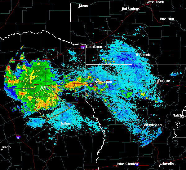 At 837 am cdt, severe thunderstorms were located along a line extending from near minden to 10 miles north of trawick to near sacul to near rusk to near maydelle, moving southeast at 35 mph (radar indicated). Hazards include 60 mph wind gusts. Expect damage to roofs. siding and trees. Locations impacted include, jacksonville, henderson, rusk, alto, garrison, trawick, maydelle, ponta, douglass, morrill, joinerville, minden, sacul, new salem, new summerfield, cushing, mount enterprise, gallatin, reklaw and concord. At 837 am cdt, severe thunderstorms were located along a line extending from near minden to 10 miles north of trawick to near sacul to near rusk to near maydelle, moving southeast at 35 mph (radar indicated). Hazards include 60 mph wind gusts. Expect damage to roofs. siding and trees. Locations impacted include, jacksonville, henderson, rusk, alto, garrison, trawick, maydelle, ponta, douglass, morrill, joinerville, minden, sacul, new salem, new summerfield, cushing, mount enterprise, gallatin, reklaw and concord.
|
| 8/25/2015 7:56 AM CDT |
 At 755 am cdt, a severe thunderstorm was located near whitehouse, moving southeast at 45 mph (radar indicated). Hazards include 60 mph wind gusts. Expect damage to roofs. Siding and trees. At 755 am cdt, a severe thunderstorm was located near whitehouse, moving southeast at 45 mph (radar indicated). Hazards include 60 mph wind gusts. Expect damage to roofs. Siding and trees.
|
| 5/25/2015 8:30 PM CDT | Downed trees reported in weche in houston county TX, 12 miles NE of Alto, TX |
| 5/25/2015 6:36 PM CDT | At 636 pm cdt, severe thunderstorms were located along a line extending from near lindale to near troup to near sacul to near kennard, moving east at 60 mph (radar indicated). Hazards include 70 mph wind gusts and quarter size hail. Hail damage to vehicles is expected. expect considerable tree damage. Wind damage is also likely to mobile homes, roofs and outbuildings. |
| 5/25/2015 6:05 PM CDT | At 605 pm cdt, severe thunderstorms were located along a line extending from 6 miles northeast of athens to 8 miles southwest of frankston to near elkhart to near austonio, moving northeast at 40 mph (radar indicated). Hazards include 70 mph wind gusts and quarter size hail. Hail damage to vehicles is expected. expect considerable tree damage. Wind damage is also likely to mobile homes, roofs and outbuildings. |
| 5/11/2015 3:05 AM CDT | At 305 am cdt, a severe thunderstorm was located near rusk, moving northeast at 40 mph (radar indicated). Hazards include 60 mph wind gusts and quarter size hail. Hail damage to vehicles is expected. expect wind damage to roofs, siding and trees. this severe thunderstorm will be near, sacul around 320 am cdt. new salem around 325 am cdt. minden around 350 am cdt. other locations impacted by this severe thunderstorm include cushing, lilbert, looneyville, laneville, reklaw, glenfawn, chapman and mount enterprise. a tornado watch remains in effect until 500 am cdt for northeastern texas. 1. 00in. |
| 4/27/2015 4:53 AM CDT | At 452 am cdt, severe thunderstorms were located along a line extending from near alto to near wells to near hudson, moving east at 40 mph (radar indicated). Hazards include 60 mph wind gusts and quarter size hail. Hail damage to vehicles is expected. expect wind damage to roofs, siding and trees. locations impacted include, lufkin, nacogdoches, hudson, huntington, alto, wells, pollok, woden, forest, douglass, morrill, appleby, oak ridge, central, linwood, clawson and redland. a tornado watch remains in effect until 900 am cdt for northeastern texas. 1. 00in. |
| 4/27/2015 4:50 AM CDT | At 449 am cdt, severe thunderstorms were located along a line extending from near rusk to near ponta to near sacul to near douglass, moving east at 35 mph (radar indicated). Hazards include 60 mph wind gusts and quarter size hail. Hail damage to vehicles is expected. Expect wind damage to roofs, siding and trees. |
| 4/27/2015 4:32 AM CDT | At 432 am cdt, severe thunderstorms were located along a line extending from near alto to near forest to 7 miles northeast of kennard, moving east at 40 mph (radar indicated). Hazards include 60 mph wind gusts and quarter size hail. Hail damage to vehicles is expected. Expect wind damage to roofs, siding and trees. |
| 4/27/2015 4:16 AM CDT | At 416 am cdt, severe thunderstorms were located along a line extending from near jacksonville to near rusk to 9 miles west of morrill, moving east at 25 mph (radar indicated). Hazards include 60 mph wind gusts and quarter size hail. Hail damage to vehicles is expected. expect wind damage to roofs, siding and trees. locations impacted include, rusk, alto, ponta, douglass, morrill, sacul, new salem, maydelle, gallatin, reklaw, lilbert and linwood. a tornado watch remains in effect until 900 am cdt for northeastern texas. 1. 00in. |
| 4/27/2015 3:49 AM CDT | At 348 am cdt, a severe thunderstorm capable of producing a tornado was located 11 miles south of maydelle, or 15 miles southwest of rusk, moving southeast at 30 mph (radar indicated rotation). Hazards include tornado and quarter size hail. Flying debris will be dangerous to those caught without shelter. mobile homes will be damaged or destroyed. damage to roofs, windows and vehicles will occur. tree damage is likely. this dangerous storm will be near, morrill around 415 am cdt. Radar indicated. |
| 4/27/2015 3:38 AM CDT | At 338 am cdt, a severe thunderstorm was located 9 miles southwest of maydelle, or 13 miles east of palestine, moving east at 30 mph (radar indicated). Hazards include 60 mph wind gusts and quarter size hail. Hail damage to vehicles is expected. Expect wind damage to roofs, siding and trees. |
| 4/24/2015 10:34 PM CDT | At 1034 pm cdt, severe thunderstorms were located along a line extending from near overton to near turnertown to 7 miles south of troup to near jacksonville to near rusk to near maydelle, moving east at 50 mph (radar indicated). Hazards include 70 mph wind gusts and nickel size hail. Expect considerable tree damage. damage is likely to mobile homes, roofs and outbuildings. severe thunderstorms will be near, overton, new london, arp and turnertown around 1040 pm cdt. joinerville around 1045 pm cdt. henderson, alto and new salem around 1050 pm cdt. sacul around 1100 pm cdt. minden around 1105 pm cdt. tatum, pinehill and trawick around 1110 pm cdt. beckville around 1115 pm cdt. other locations impacted by these severe thunderstorms include oak hill, fairplay, new summerfield, chapman, stewart, gallatin, lawsonville, concord, church hill and cushing. a tornado watch remains in effect until 400 am cdt for northeastern texas. Possible. |
| 5/21/2013 8:07 PM CDT | Trees down in alto in cherokee county TX, 0.3 miles WNW of Alto, TX |
| 7/21/2012 8:50 PM CDT | Multiple trees down across the southern end of the count in cherokee county TX, 0.3 miles WNW of Alto, TX |
Hail Maps for Alto, TX
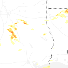
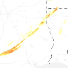


Connect with Interactive Hail Maps