

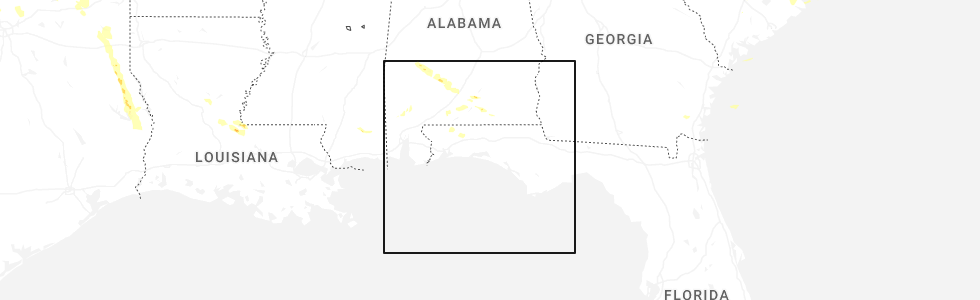
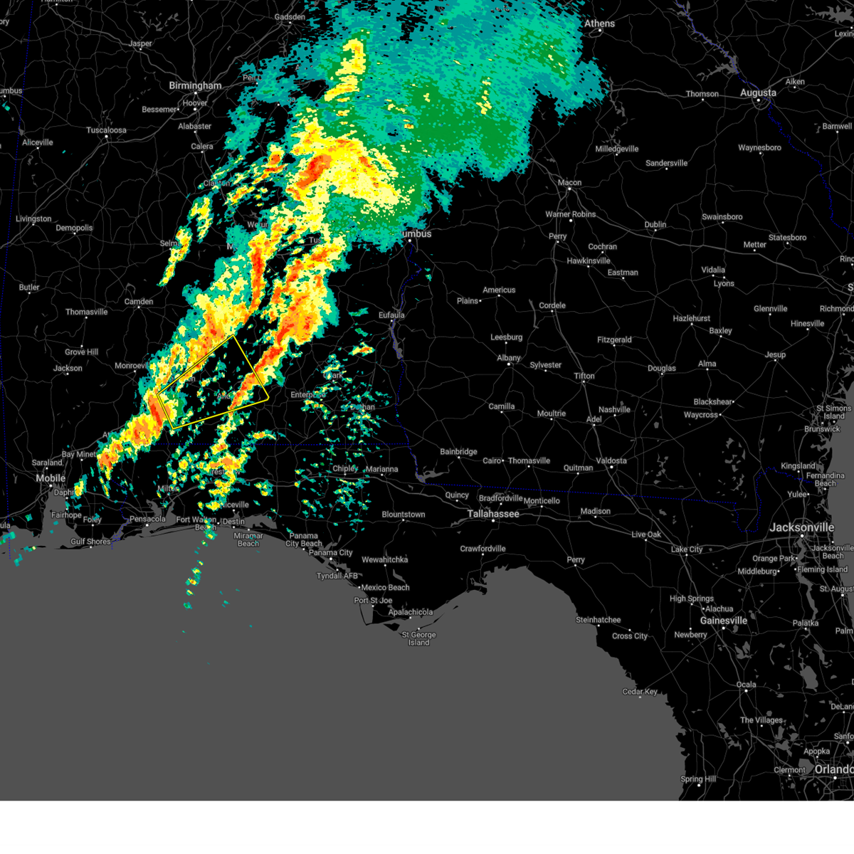
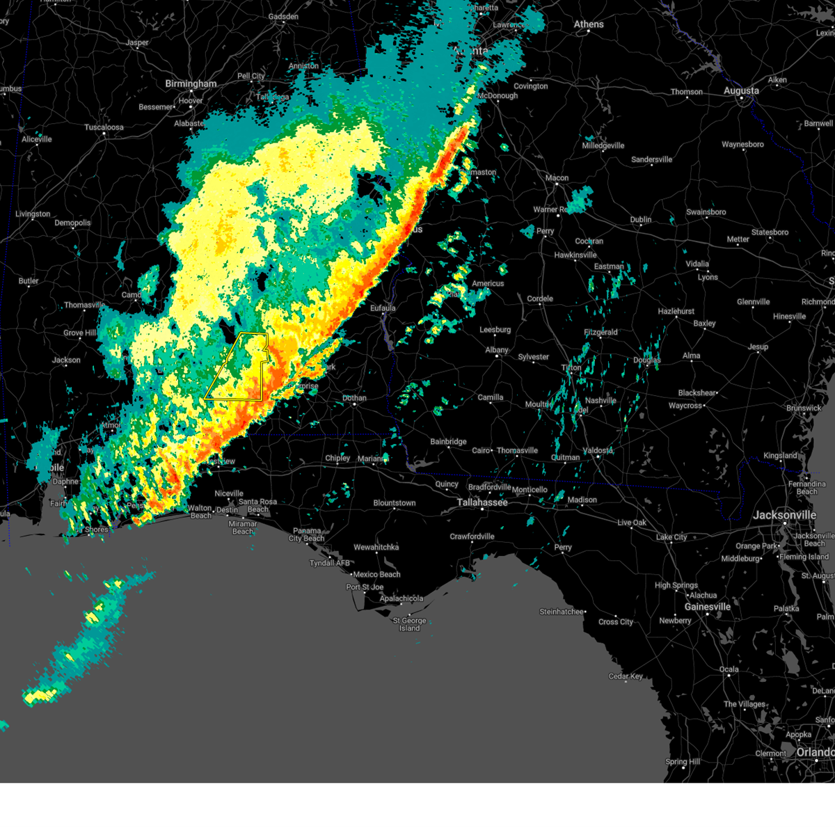
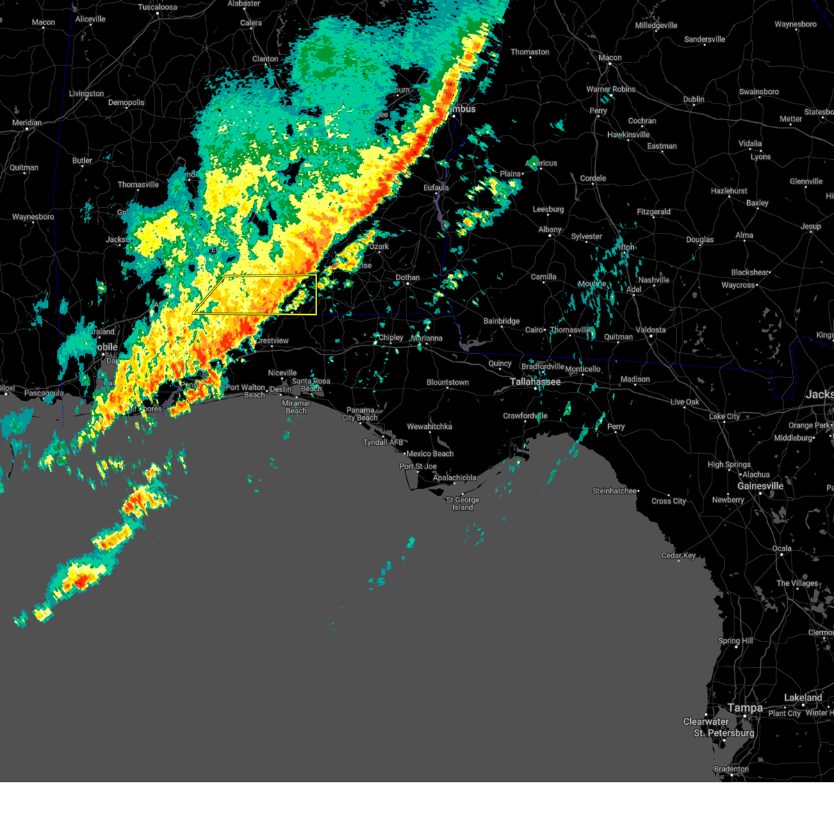
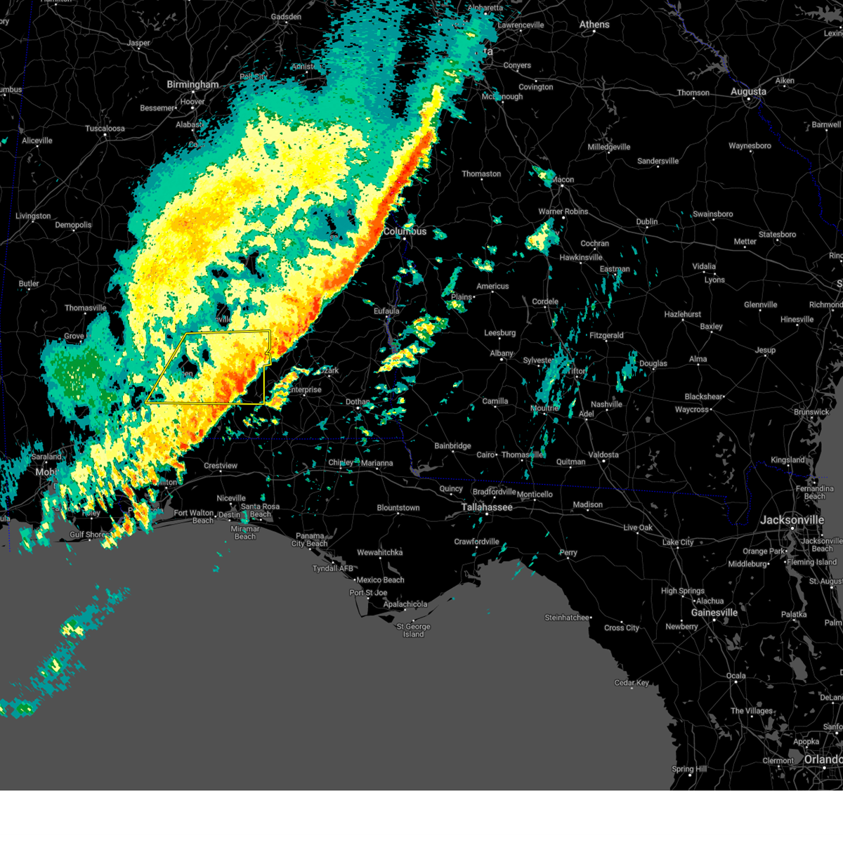
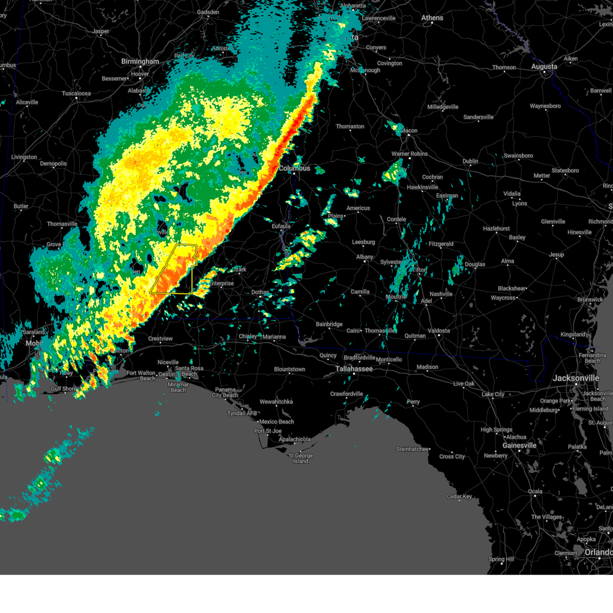
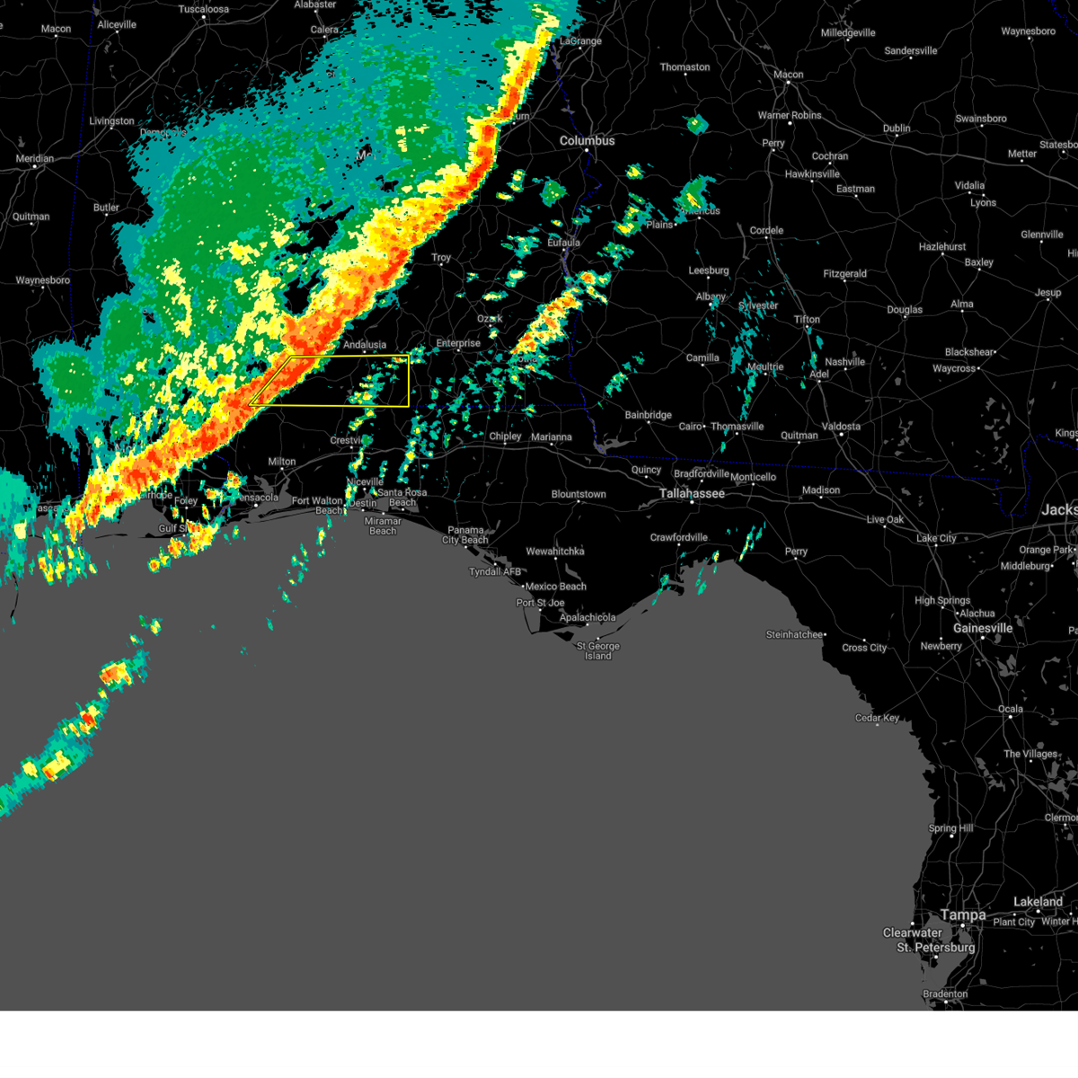
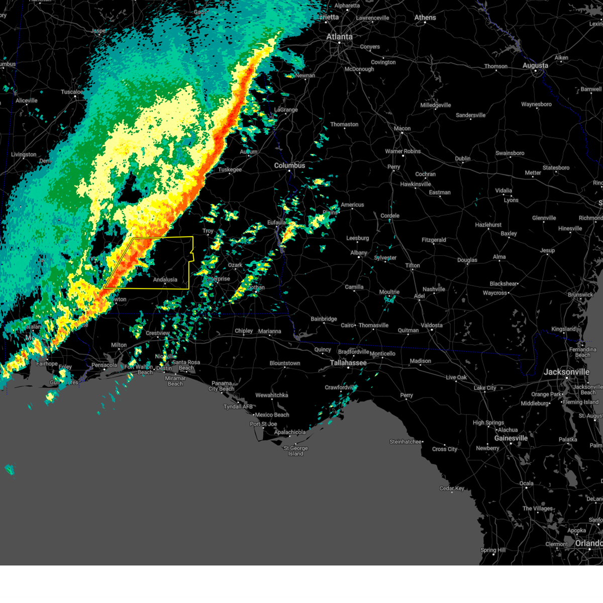
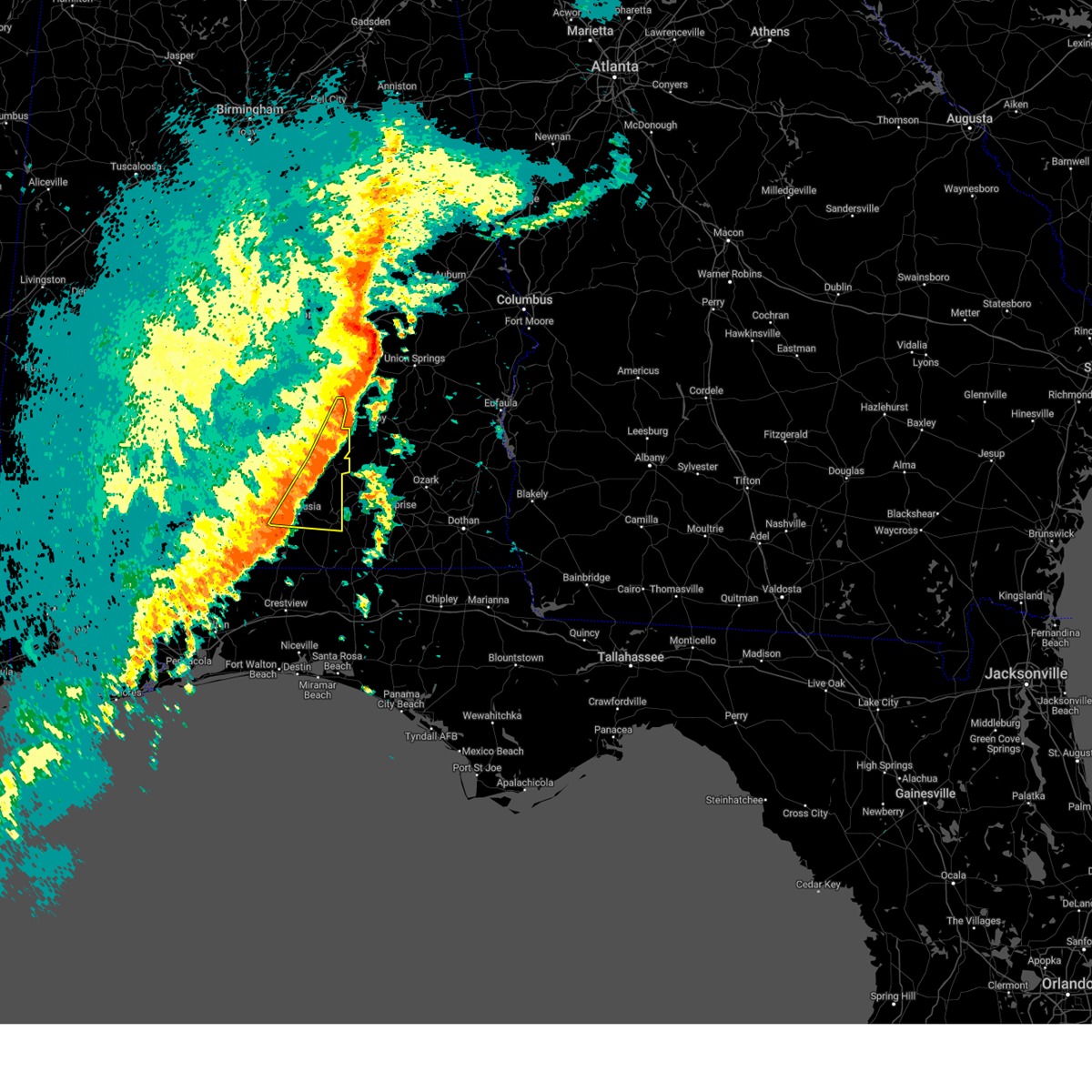
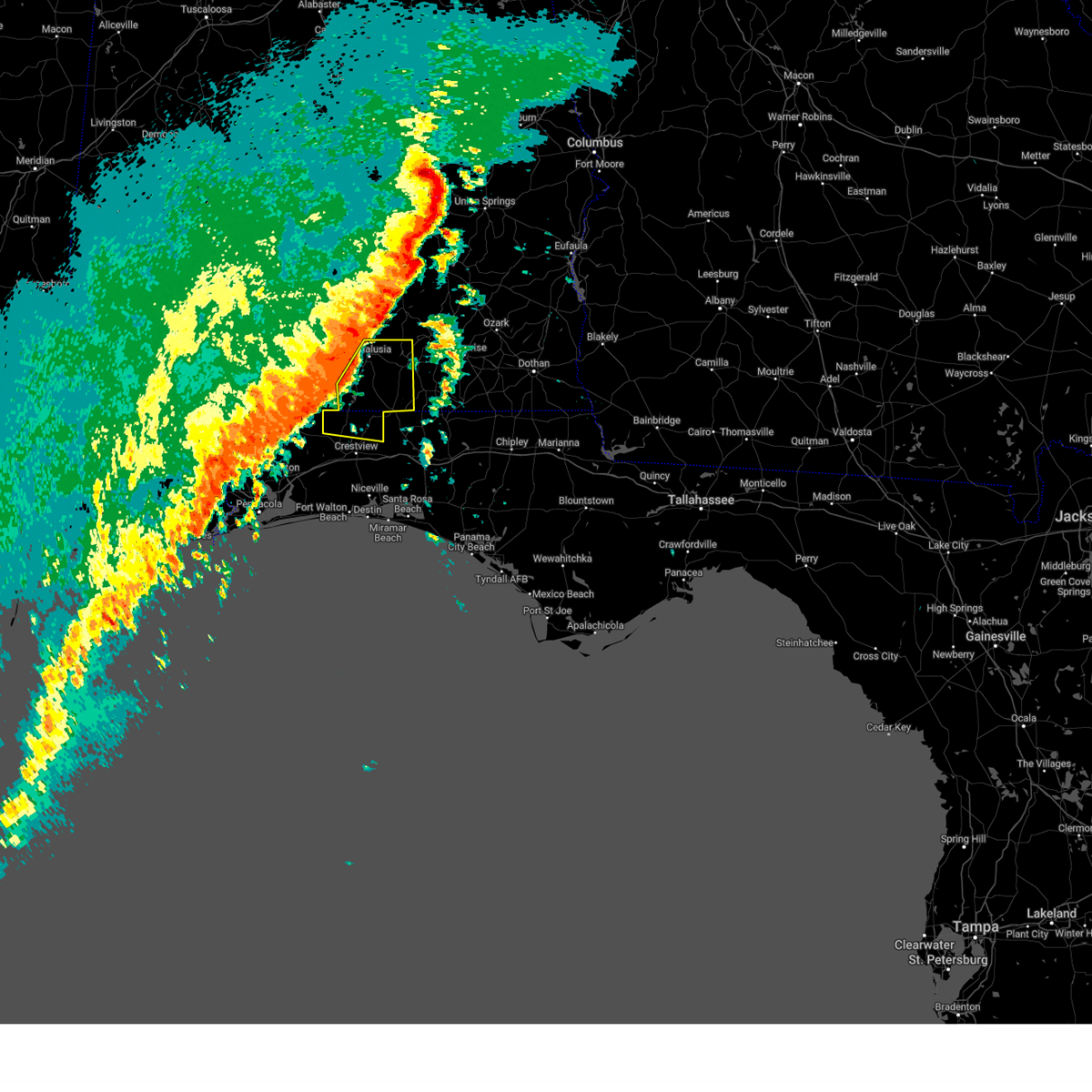
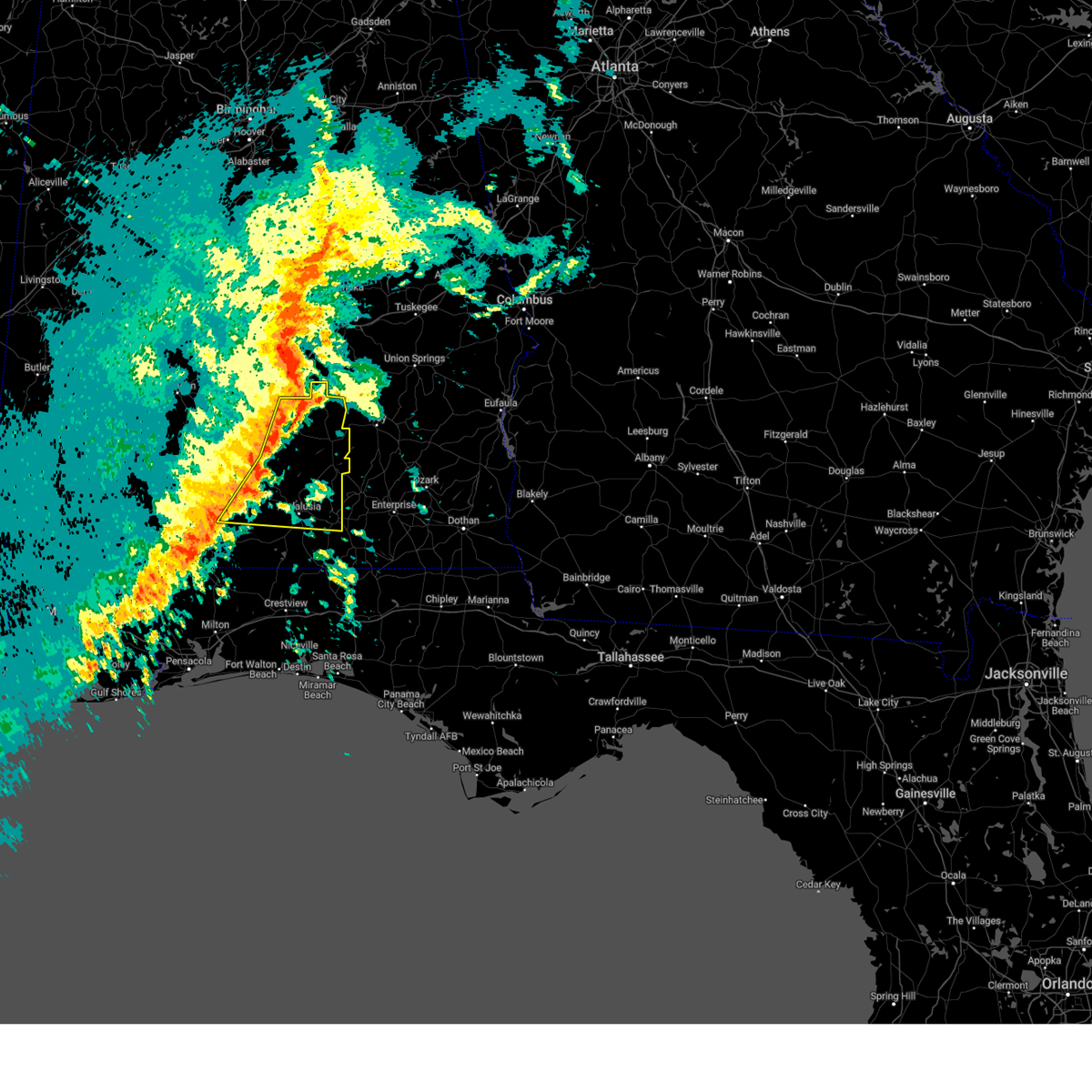
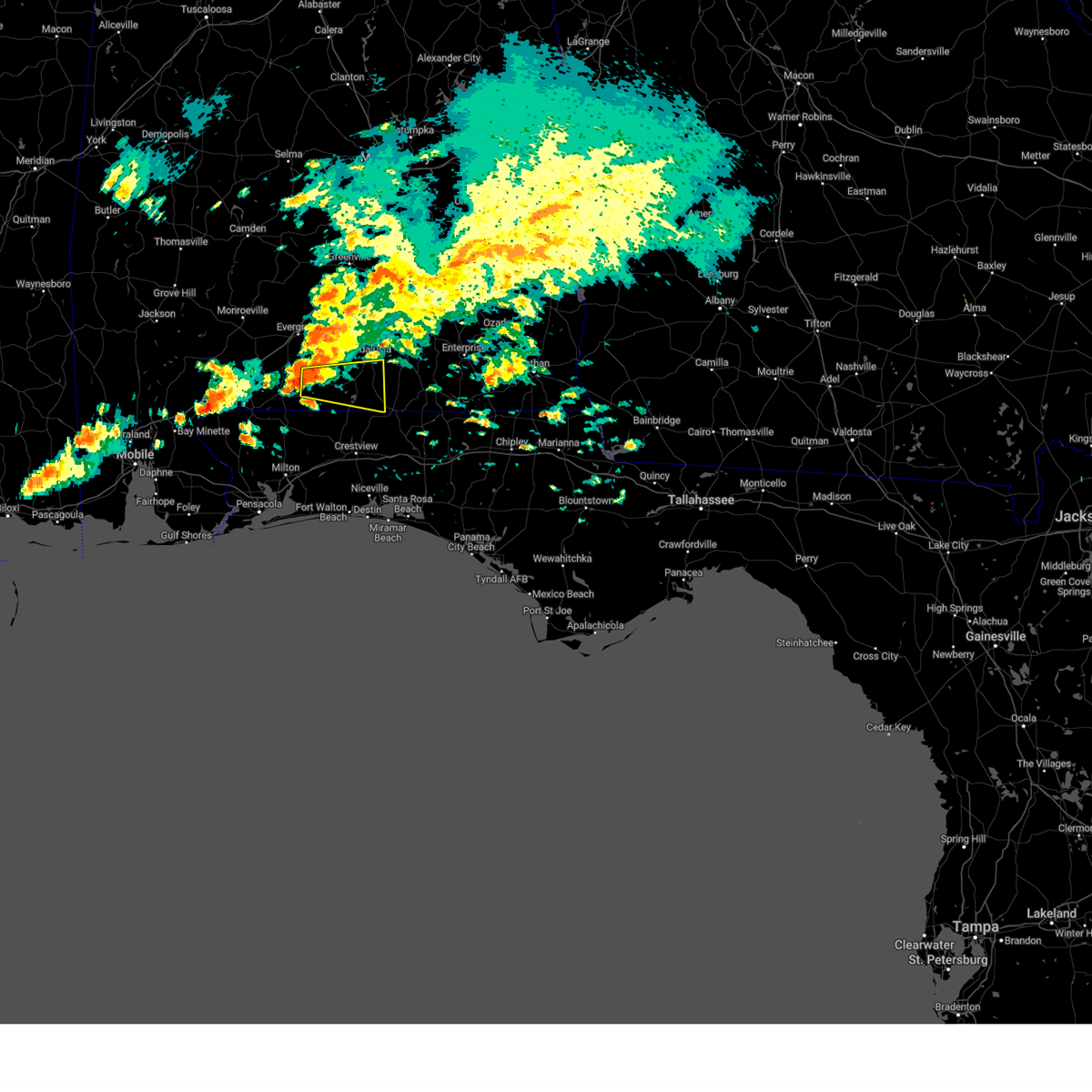
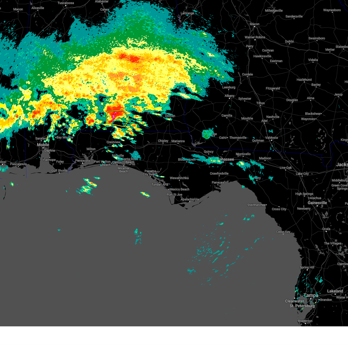
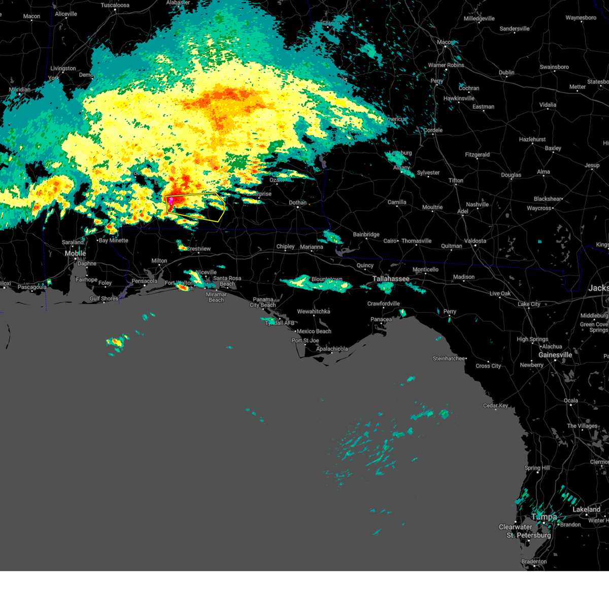
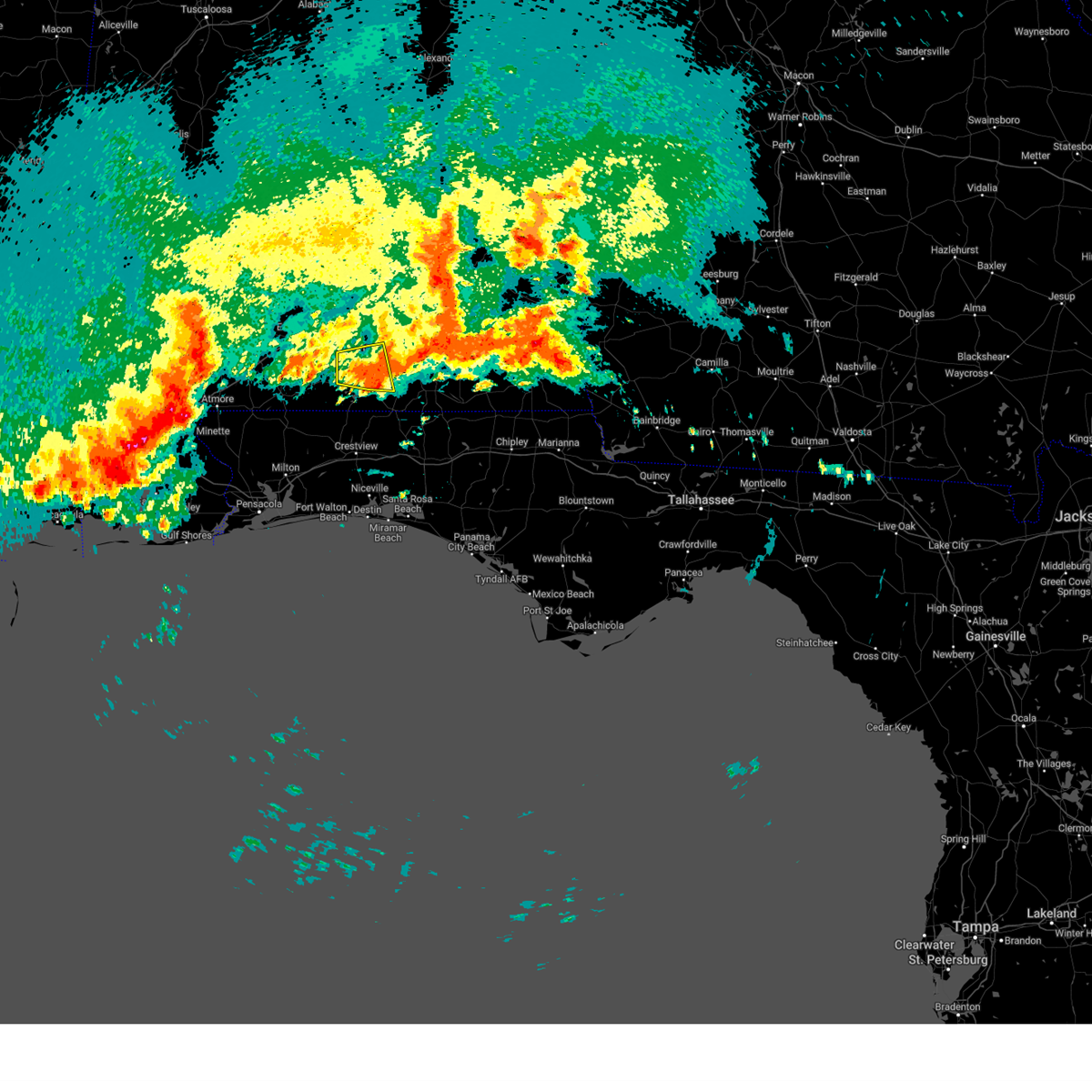
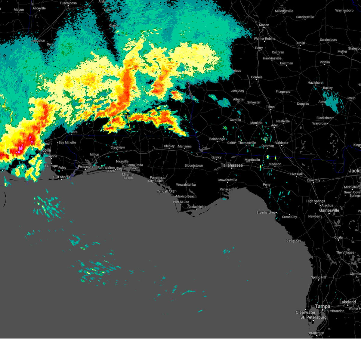
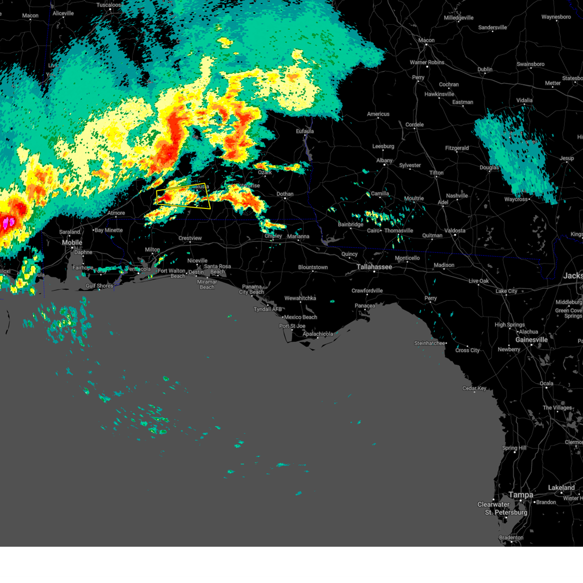
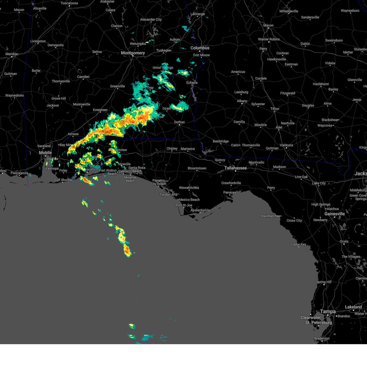
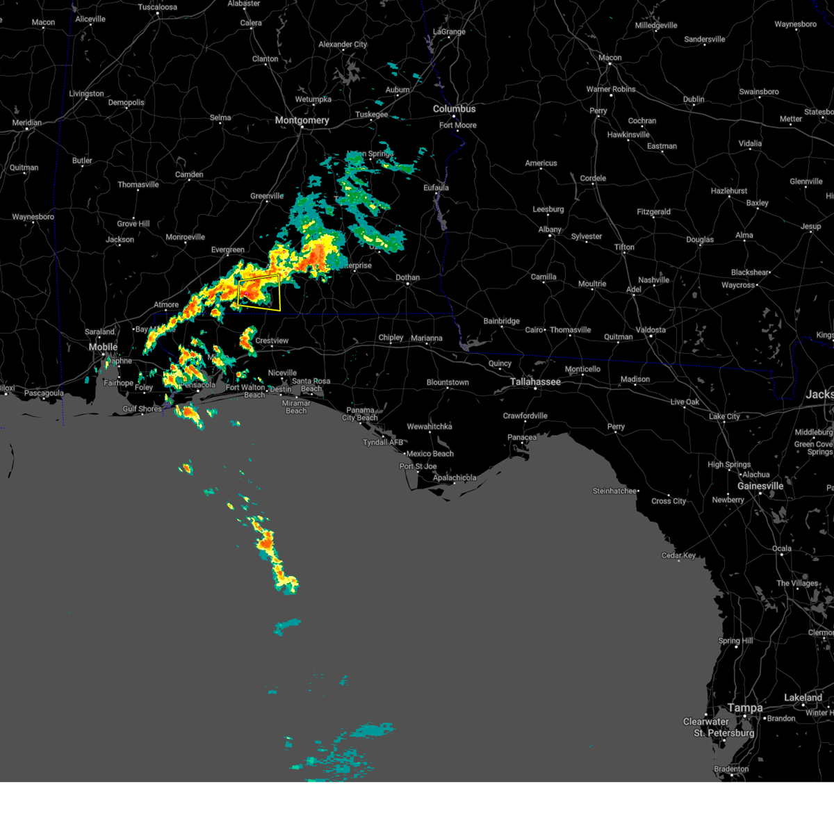
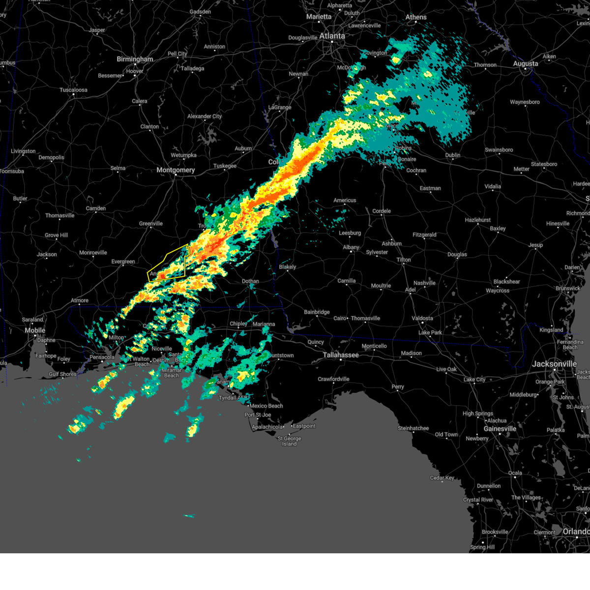
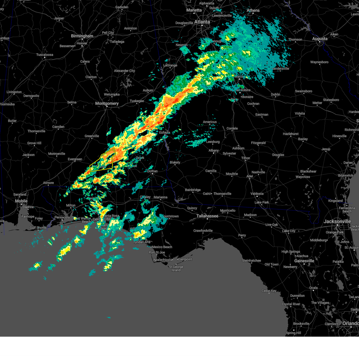
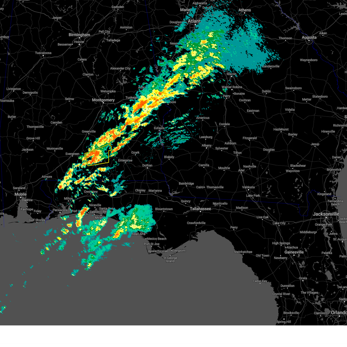
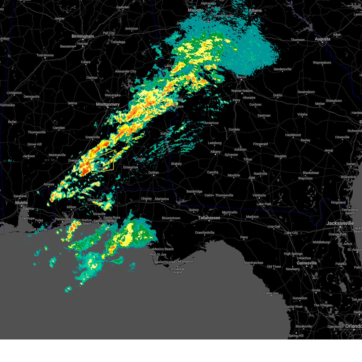
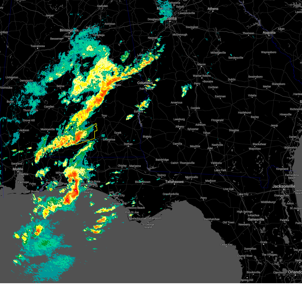
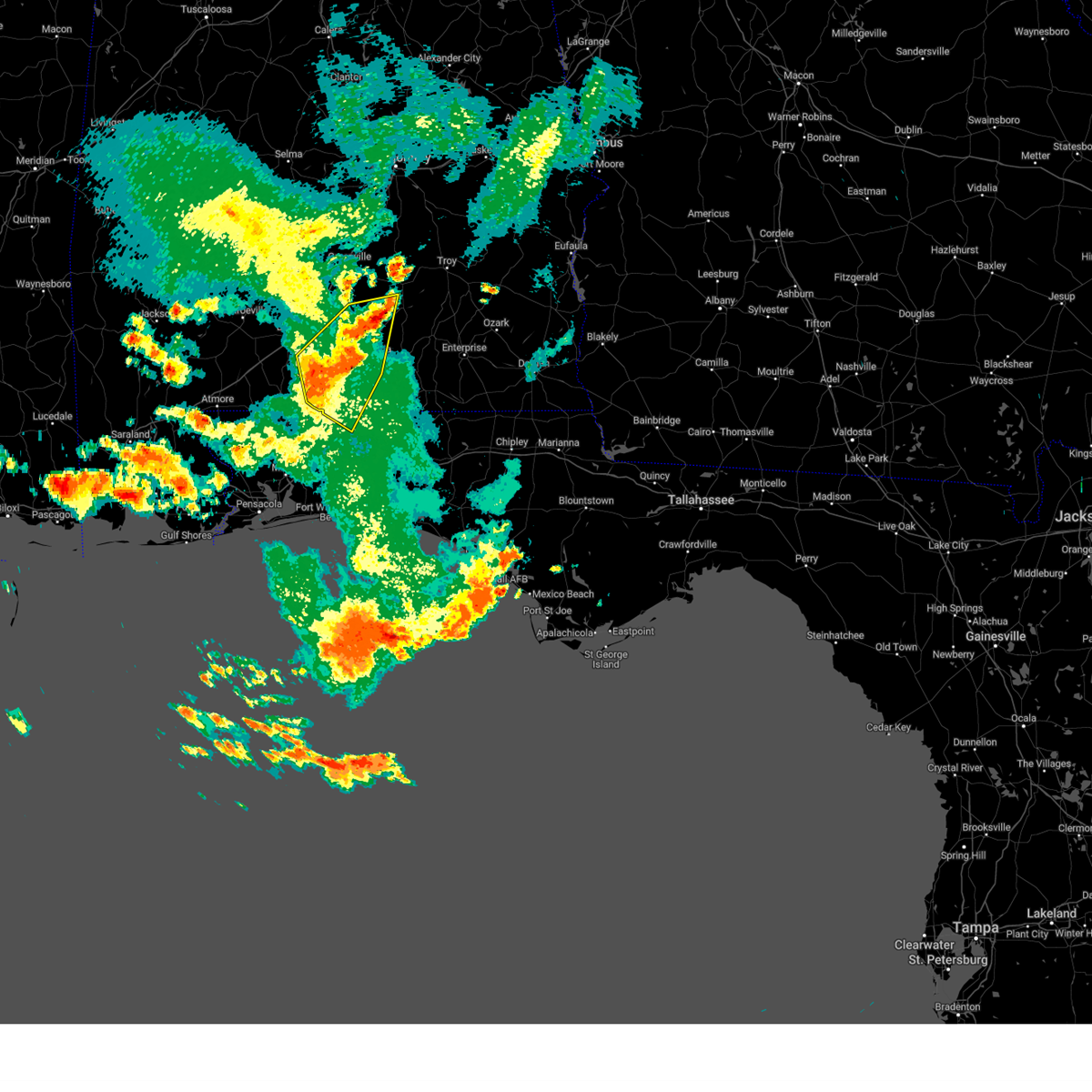
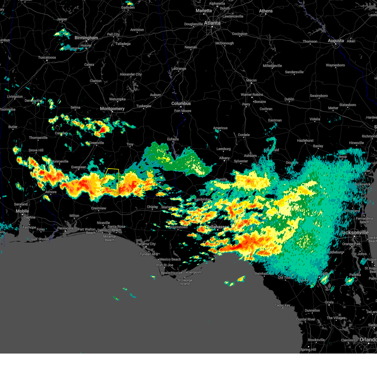
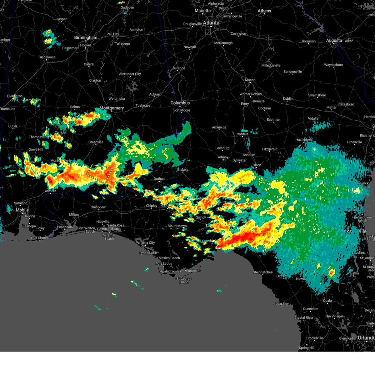
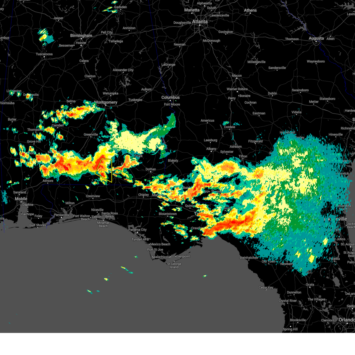
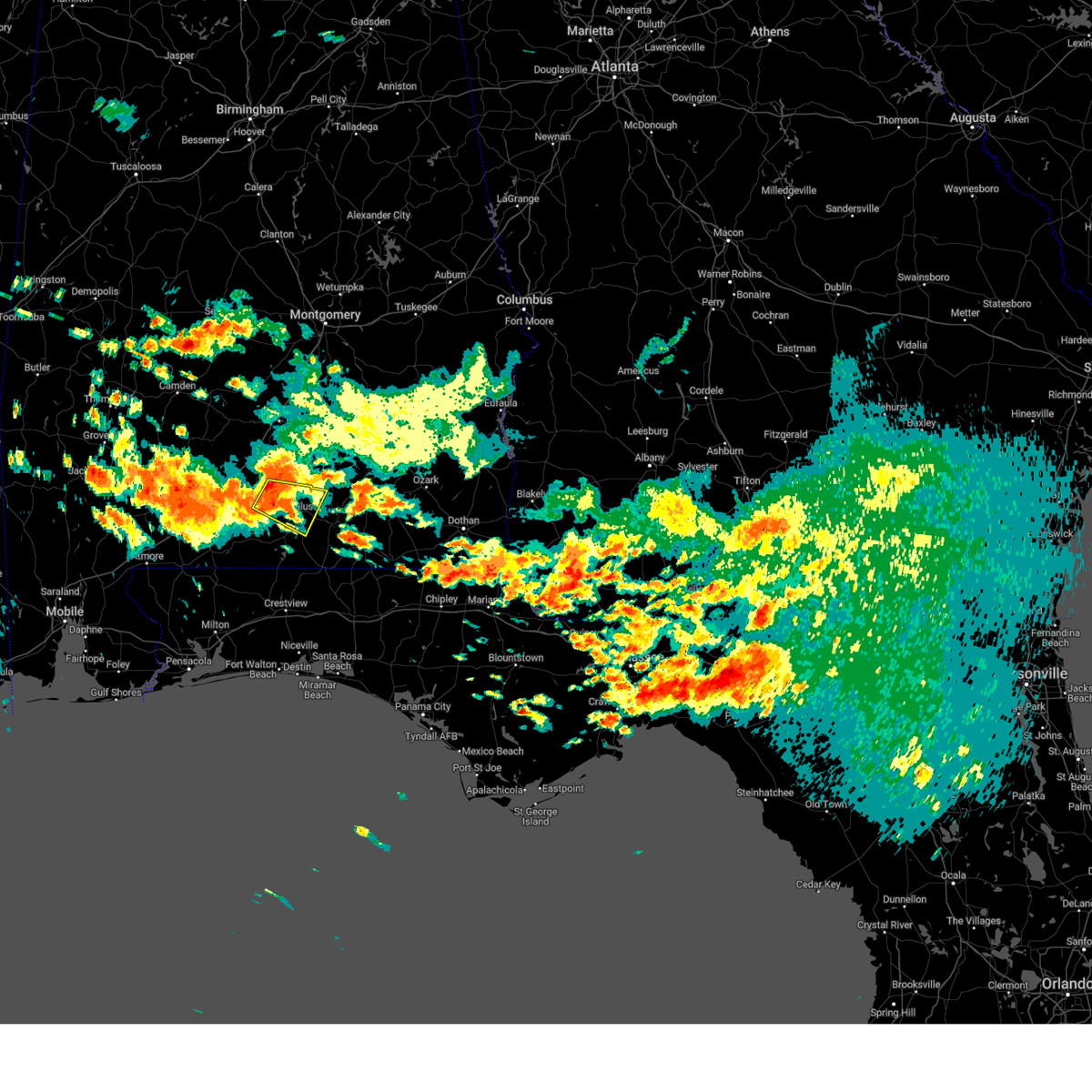
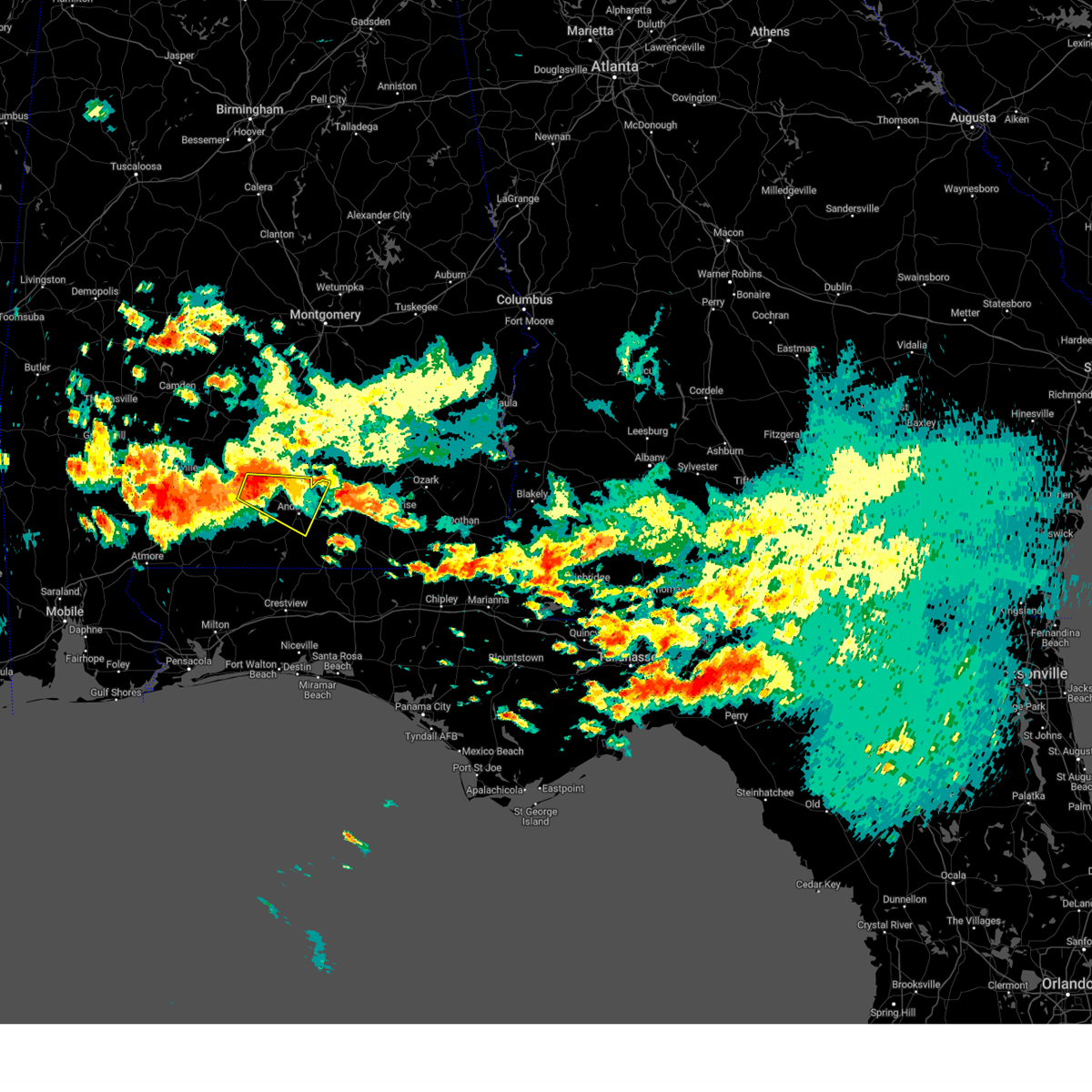
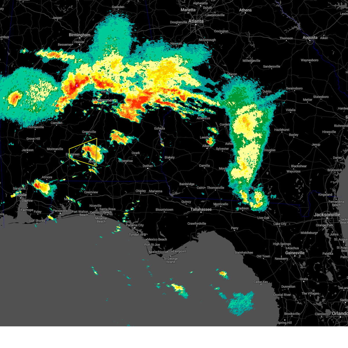
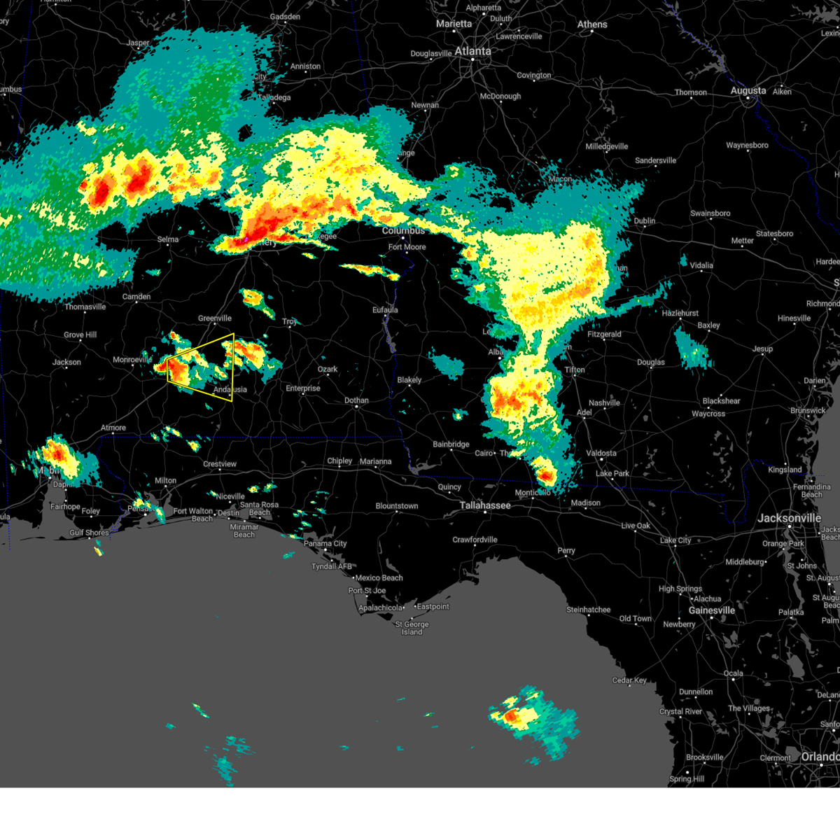
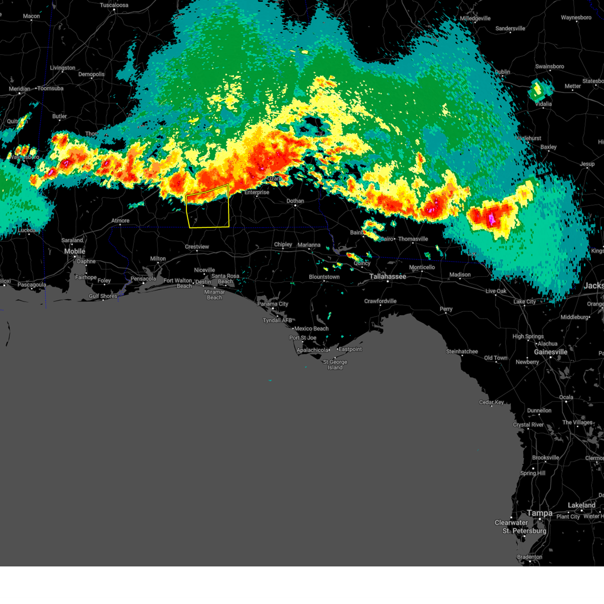
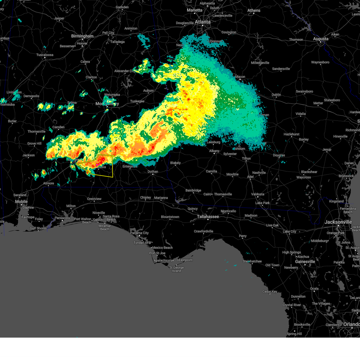
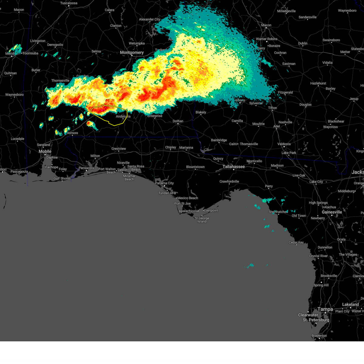
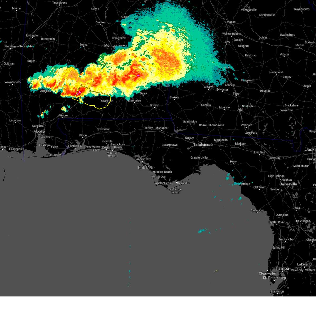
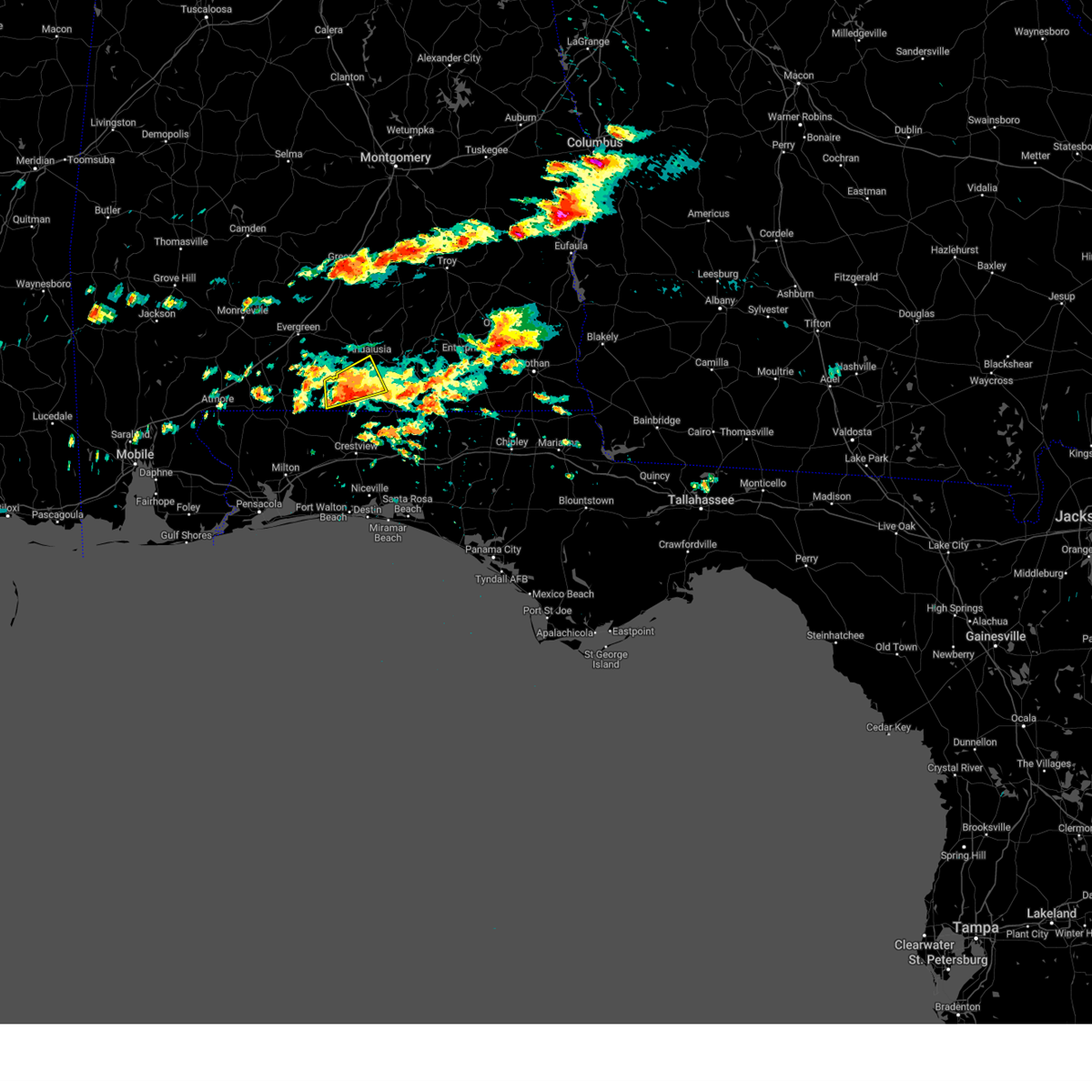
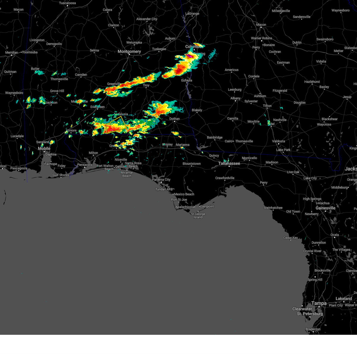
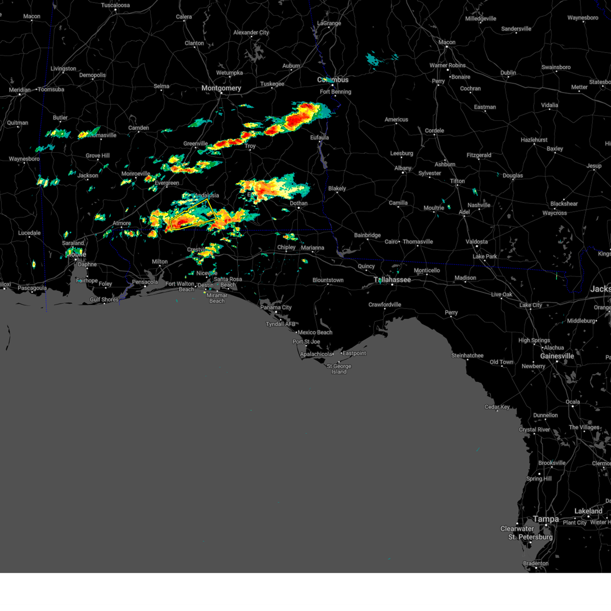
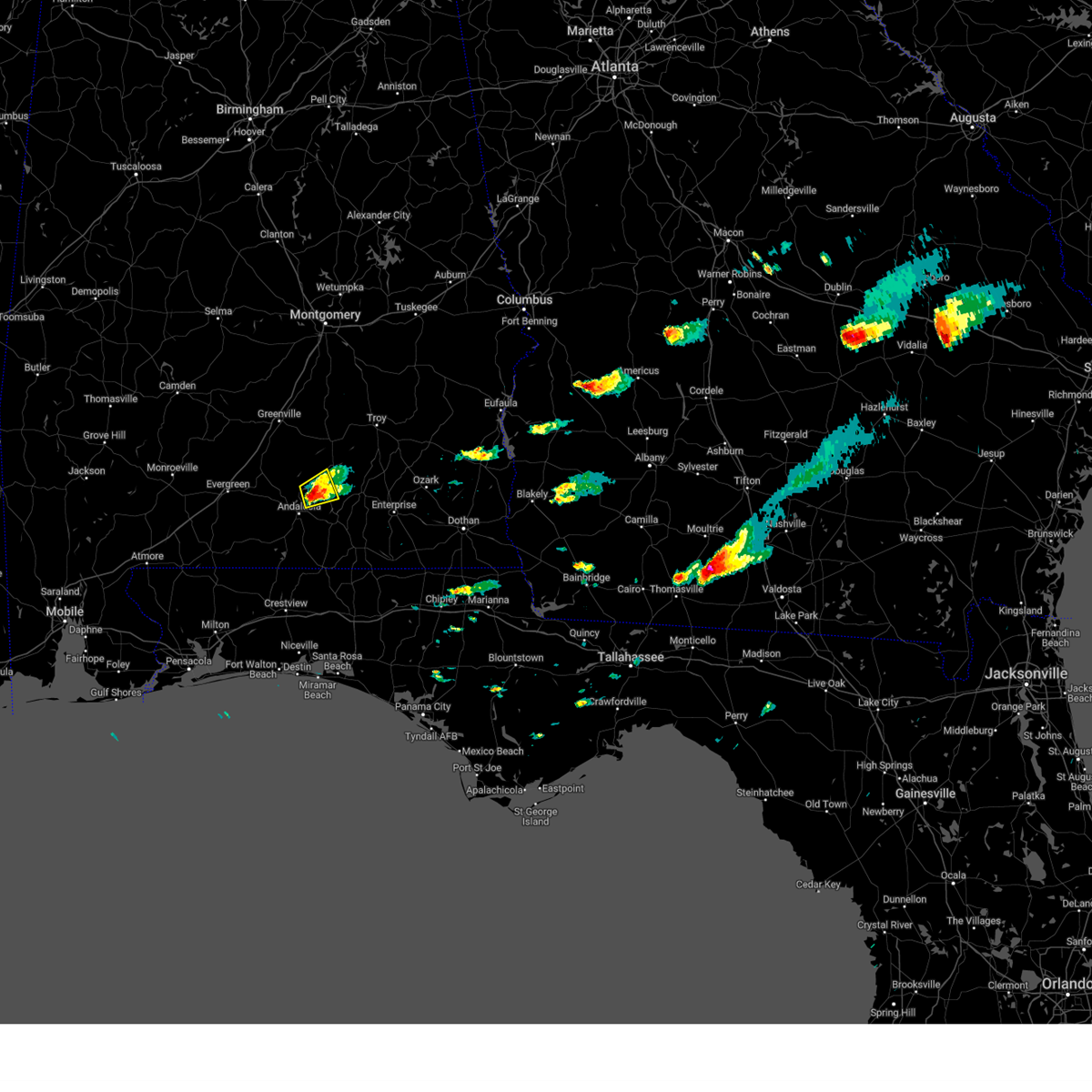
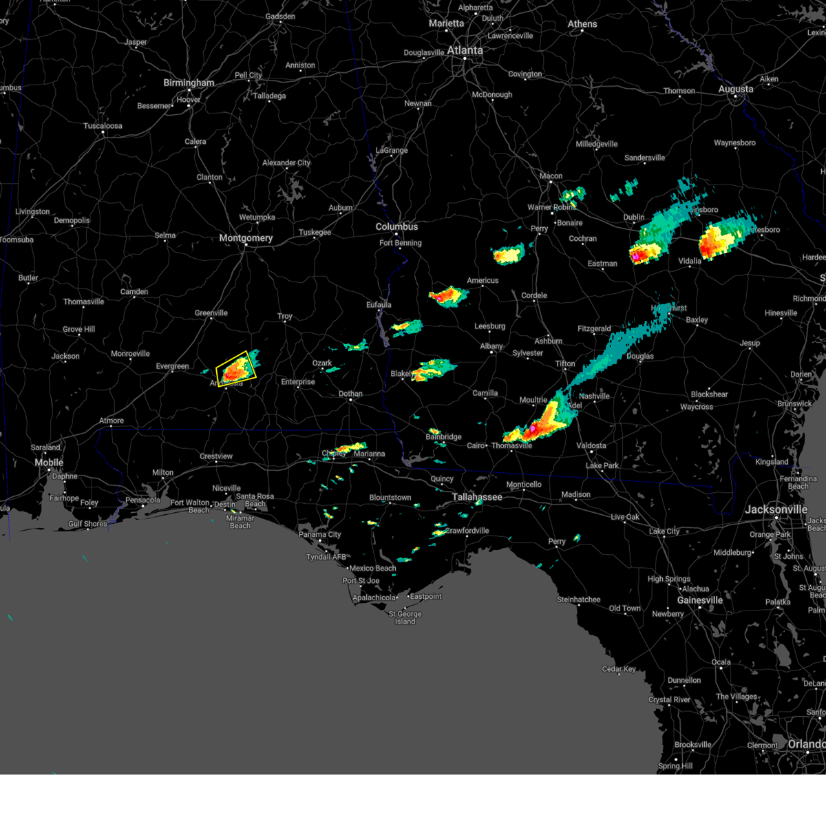
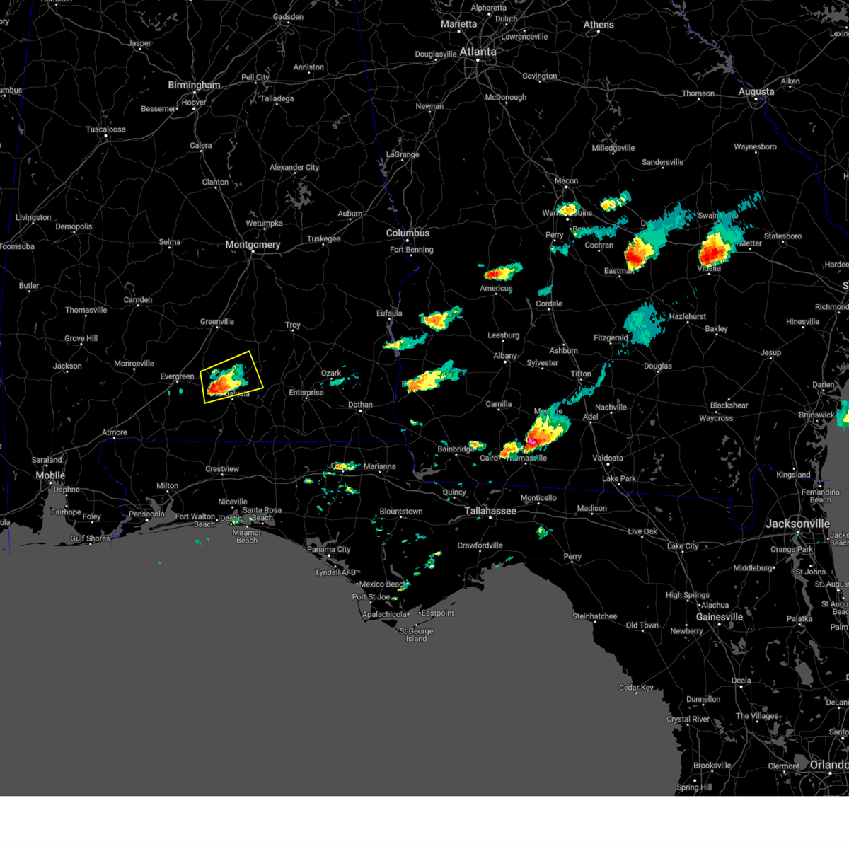
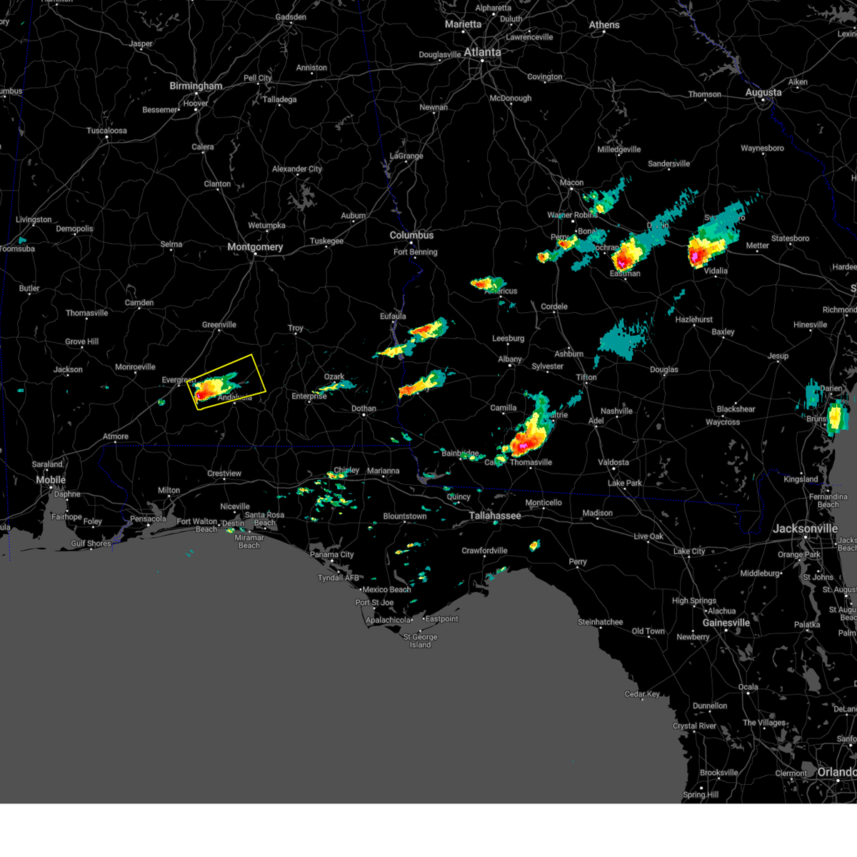
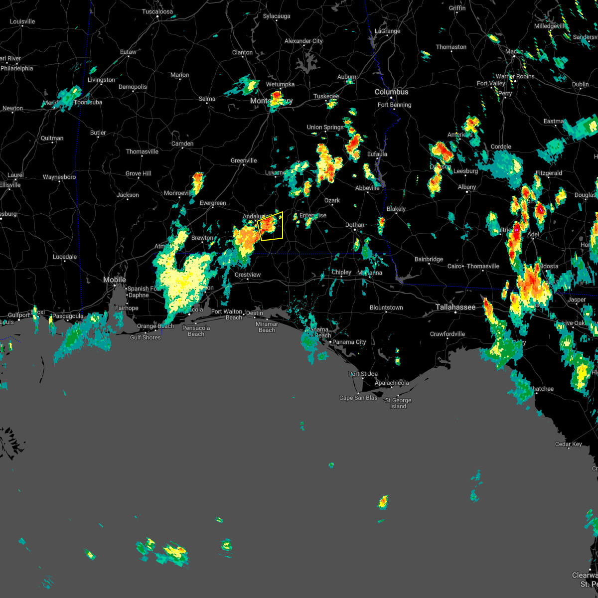
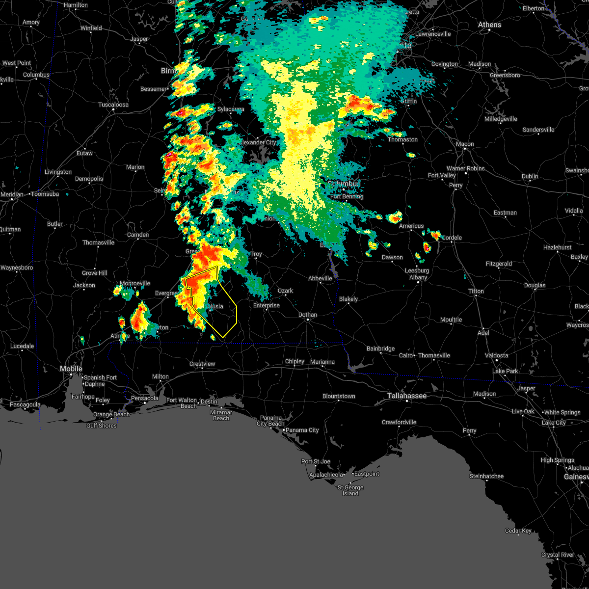
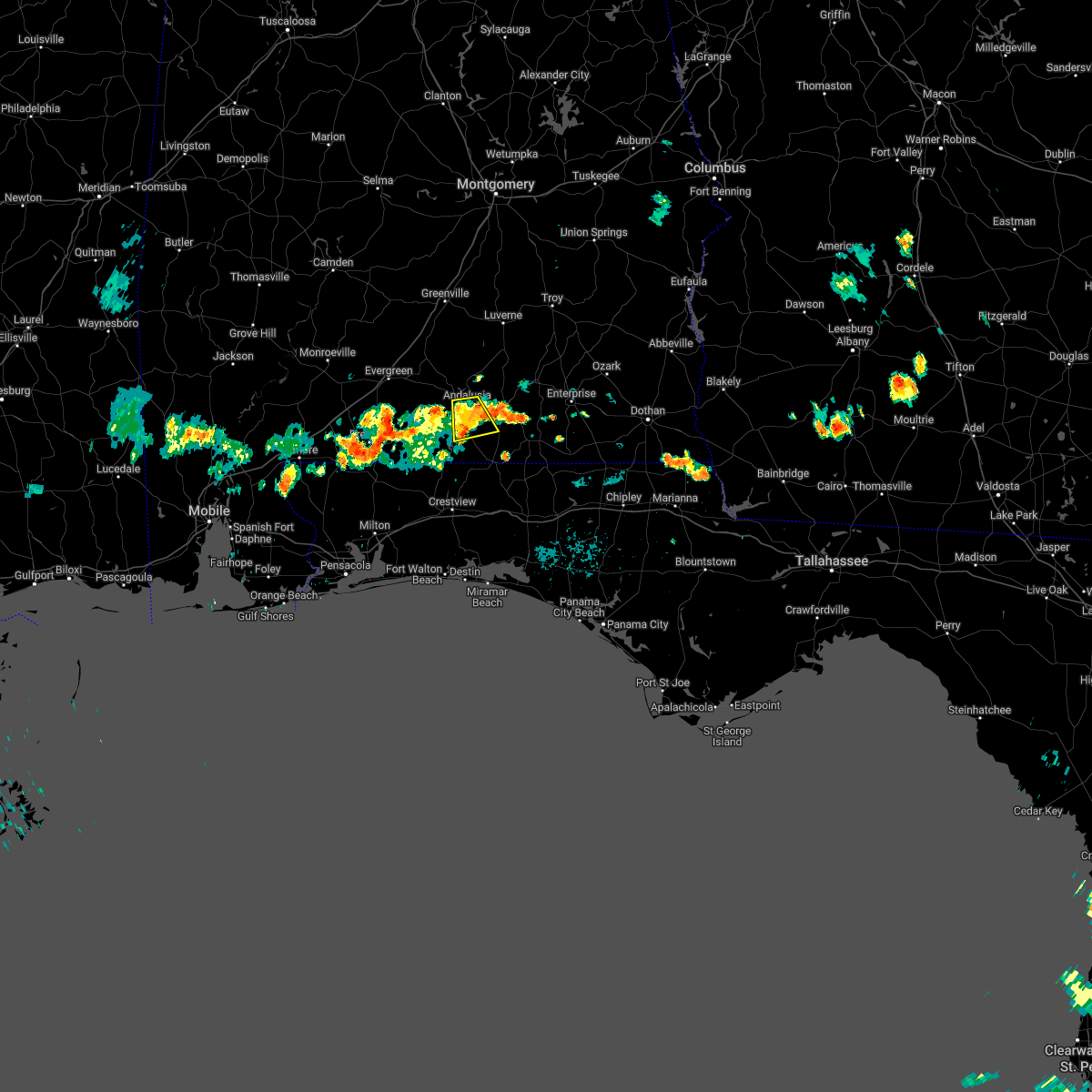
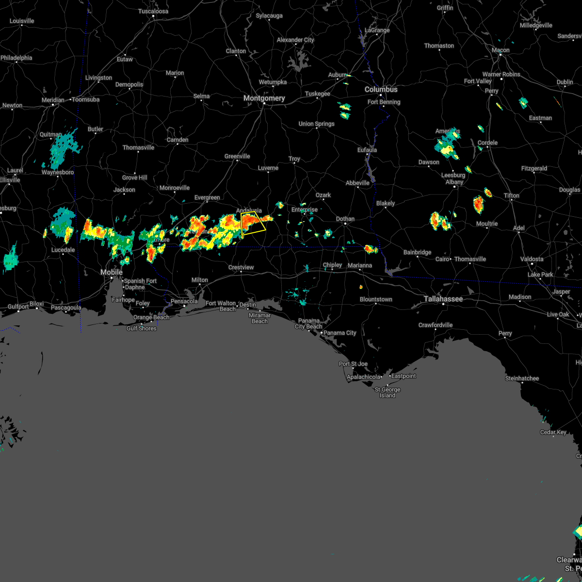
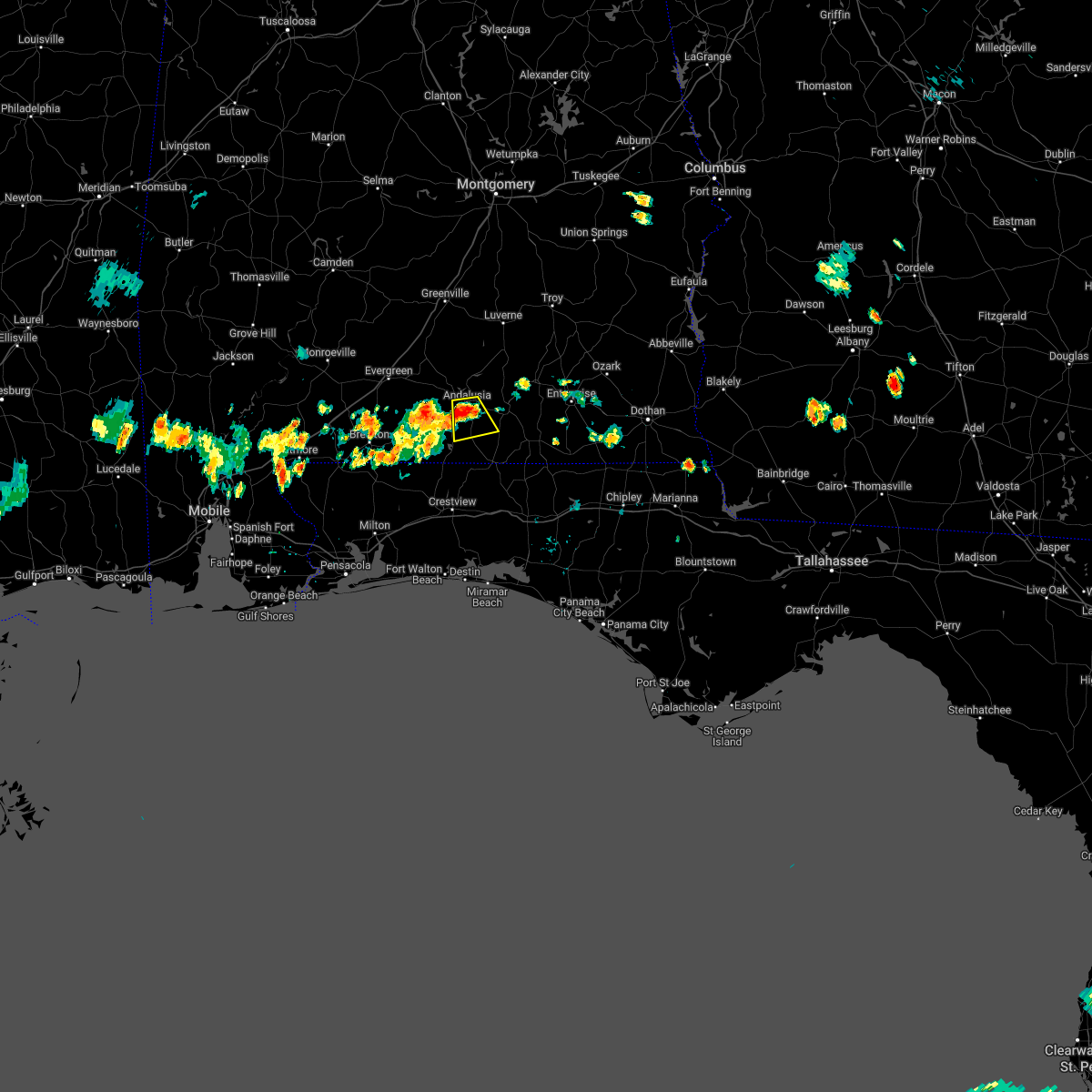
Hail Map for Andalusia, AL
The Andalusia, AL area has had 13 reports of on-the-ground hail by trained spotters, and has been under severe weather warnings 18 times during the past 12 months. Doppler radar has detected hail at or near Andalusia, AL on 59 occasions, including 4 occasions during the past year.
| Name: | Andalusia, AL |
| Where Located: | 64.6 miles N of Miramar Beach, FL |
| Map: | Google Map for Andalusia, AL |
| Population: | 9015 |
| Housing Units: | 4356 |
| More Info: | Search Google for Andalusia, AL |
1
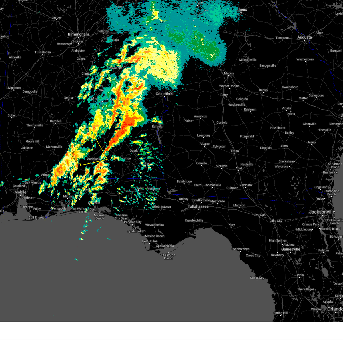
The Top Recent Hail Date for Andalusia, AL is Sunday, June 8, 2025 (26th out of 59)
Hail and Wind Damage Spotted near Andalusia, AL
| Date / Time | Report Details |
|---|---|
| 6/9/2025 3:35 PM CDT | Ping Pong Ball sized hail reported 2.7 miles N of Andalusia, AL, public reports ping pong ball sized hail just south of andalusia... al. |
| 6/8/2025 3:08 PM CDT |
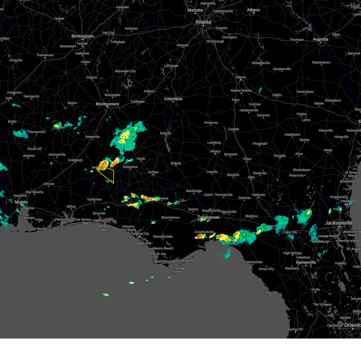 At 308 pm cdt, a severe thunderstorm was located 5 miles east of andalusia, moving southeast at 30 mph (radar indicated). Hazards include 60 mph wind gusts and half dollar size hail. Hail damage to vehicles is expected. expect wind damage to roofs, siding, and trees. Locations impacted include, opp. At 308 pm cdt, a severe thunderstorm was located 5 miles east of andalusia, moving southeast at 30 mph (radar indicated). Hazards include 60 mph wind gusts and half dollar size hail. Hail damage to vehicles is expected. expect wind damage to roofs, siding, and trees. Locations impacted include, opp.
|
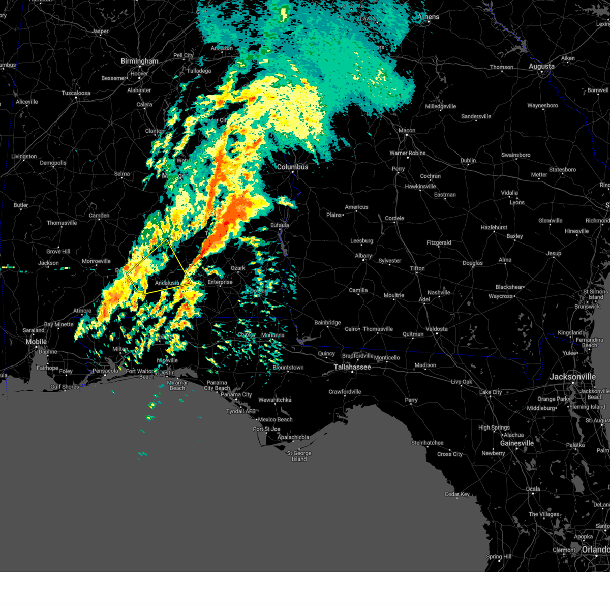
| 6/8/2025 2:58 PM CDT |
 Svrmob the national weather service in mobile has issued a * severe thunderstorm warning for, east central covington county in south central alabama, * until 345 pm cdt. * at 258 pm cdt, a severe thunderstorm was located over andalusia, moving southeast at 30 mph (radar indicated). Hazards include 60 mph wind gusts and quarter size hail. Hail damage to vehicles is expected. Expect wind damage to roofs, siding, and trees. Svrmob the national weather service in mobile has issued a * severe thunderstorm warning for, east central covington county in south central alabama, * until 345 pm cdt. * at 258 pm cdt, a severe thunderstorm was located over andalusia, moving southeast at 30 mph (radar indicated). Hazards include 60 mph wind gusts and quarter size hail. Hail damage to vehicles is expected. Expect wind damage to roofs, siding, and trees.
|
| 5/27/2025 2:21 PM CDT | Trees down on mill creek... grider mock... and salem church roads. some of the trees fell on power line in covington county AL, 7.5 miles ENE of Andalusia, AL |
| 5/8/2025 6:36 PM CDT | The storm which prompted the warning has weakened below severe limits, and no longer poses an immediate threat to life or property. therefore, the warning will be allowed to expire. however, small hail and gusty winds are still possible with this thunderstorm. |
| 5/8/2025 6:03 PM CDT | Svrmob the national weather service in mobile has issued a * severe thunderstorm warning for, eastern covington county in south central alabama, northeastern okaloosa county in northwestern florida, * until 645 pm cdt. * at 603 pm cdt, a severe thunderstorm was located 10 miles southeast of andalusia, moving northeast at 15 mph (radar indicated). Hazards include 60 mph wind gusts and quarter size hail. Hail damage to vehicles is expected. Expect wind damage to roofs, siding, and trees. |
| 3/15/2025 11:27 PM CDT |
 the severe thunderstorm warning has been cancelled and is no longer in effect the severe thunderstorm warning has been cancelled and is no longer in effect
|
| 3/15/2025 11:20 PM CDT |
 the severe thunderstorm warning has been cancelled and is no longer in effect the severe thunderstorm warning has been cancelled and is no longer in effect
|
| 3/15/2025 11:20 PM CDT |
 At 1120 pm cdt, a severe thunderstorm was located 10 miles southwest of red level, or 12 miles southeast of evergreen, moving northeast at 55 mph (radar indicated). Hazards include 60 mph wind gusts. Expect damage to roofs, siding, and trees. Locations impacted include, gantt, andalusia, river falls, dozier, mckenzie, red level, heath, and evergreen. At 1120 pm cdt, a severe thunderstorm was located 10 miles southwest of red level, or 12 miles southeast of evergreen, moving northeast at 55 mph (radar indicated). Hazards include 60 mph wind gusts. Expect damage to roofs, siding, and trees. Locations impacted include, gantt, andalusia, river falls, dozier, mckenzie, red level, heath, and evergreen.
|
| 3/15/2025 11:05 PM CDT |
 Svrmob the national weather service in mobile has issued a * severe thunderstorm warning for, southeastern butler county in south central alabama, southwestern crenshaw county in south central alabama, northeastern escambia county in south central alabama, southeastern conecuh county in south central alabama, northern covington county in south central alabama, * until 1145 pm cdt. * at 1104 pm cdt, a severe thunderstorm was located 4 miles southeast of castleberry, or 10 miles northeast of brewton, moving northeast at 55 mph (radar indicated). Hazards include 60 mph wind gusts. expect damage to roofs, siding, and trees Svrmob the national weather service in mobile has issued a * severe thunderstorm warning for, southeastern butler county in south central alabama, southwestern crenshaw county in south central alabama, northeastern escambia county in south central alabama, southeastern conecuh county in south central alabama, northern covington county in south central alabama, * until 1145 pm cdt. * at 1104 pm cdt, a severe thunderstorm was located 4 miles southeast of castleberry, or 10 miles northeast of brewton, moving northeast at 55 mph (radar indicated). Hazards include 60 mph wind gusts. expect damage to roofs, siding, and trees
|
| 2/16/2025 3:46 AM CST |
 The storms which prompted the warning have moved out of the area. therefore, the warning has been allowed to expire. a tornado watch remains in effect until 600 am cst for south central alabama. The storms which prompted the warning have moved out of the area. therefore, the warning has been allowed to expire. a tornado watch remains in effect until 600 am cst for south central alabama.
|
| 2/16/2025 3:42 AM CST |
 The storms which prompted the warning have moved out of eastern escambia and southeastern conecuh counties. therefore, the warning will be allowed to expire. a tornado watch remains in effect until 600 am cst for south central alabama, and northwestern florida. remember, a severe thunderstorm warning still remains in effect for southern covington county until 430 am cst. The storms which prompted the warning have moved out of eastern escambia and southeastern conecuh counties. therefore, the warning will be allowed to expire. a tornado watch remains in effect until 600 am cst for south central alabama, and northwestern florida. remember, a severe thunderstorm warning still remains in effect for southern covington county until 430 am cst.
|
| 2/16/2025 3:33 AM CST | 58 mph gust measured at k79 in covington county AL, 4.2 miles W of Andalusia, AL |
| 2/16/2025 3:27 AM CST |
 The storms which prompted the warning have moved out of the area. therefore, the warning will be allowed to expire. a tornado watch remains in effect until 600 am cst for south central alabama. remember, a severe thunderstorm warning still remains in effect for southern crenshaw and southern covington counties until 345 am. The storms which prompted the warning have moved out of the area. therefore, the warning will be allowed to expire. a tornado watch remains in effect until 600 am cst for south central alabama. remember, a severe thunderstorm warning still remains in effect for southern crenshaw and southern covington counties until 345 am.
|
| 2/16/2025 3:25 AM CST | Downed trees blocking both lanes of us hwy 29 near pecan loo in covington county AL, 4.8 miles NE of Andalusia, AL |
| 2/16/2025 3:25 AM CST |
 Svrmob the national weather service in mobile has issued a * severe thunderstorm warning for, southern crenshaw county in south central alabama, northern covington county in south central alabama, * until 345 am cst. * at 325 am cst, severe thunderstorms were located along a line extending from near goshen to near andalusia, moving east at 60 mph (radar indicated). Hazards include 60 mph wind gusts. expect damage to roofs, siding, and trees Svrmob the national weather service in mobile has issued a * severe thunderstorm warning for, southern crenshaw county in south central alabama, northern covington county in south central alabama, * until 345 am cst. * at 325 am cst, severe thunderstorms were located along a line extending from near goshen to near andalusia, moving east at 60 mph (radar indicated). Hazards include 60 mph wind gusts. expect damage to roofs, siding, and trees
|
| 2/16/2025 3:07 AM CST |
 Svrmob the national weather service in mobile has issued a * severe thunderstorm warning for, eastern escambia county in south central alabama, southeastern conecuh county in south central alabama, southern covington county in south central alabama, * until 345 am cst. * at 306 am cst, severe thunderstorms were located along a line extending from 12 miles southwest of red level to near riverview, moving east at 60 mph (radar indicated). Hazards include 60 mph wind gusts. expect damage to roofs, siding, and trees Svrmob the national weather service in mobile has issued a * severe thunderstorm warning for, eastern escambia county in south central alabama, southeastern conecuh county in south central alabama, southern covington county in south central alabama, * until 345 am cst. * at 306 am cst, severe thunderstorms were located along a line extending from 12 miles southwest of red level to near riverview, moving east at 60 mph (radar indicated). Hazards include 60 mph wind gusts. expect damage to roofs, siding, and trees
|
| 2/16/2025 2:41 AM CST |
 Svrmob the national weather service in mobile has issued a * severe thunderstorm warning for, southern butler county in south central alabama, crenshaw county in south central alabama, northern escambia county in south central alabama, conecuh county in south central alabama, northern covington county in south central alabama, * until 330 am cst. * at 241 am cst, severe thunderstorms were located along a line extending from 5 miles southwest of greenville to 5 miles northwest of castleberry, moving east at 55 mph (radar indicated). Hazards include 60 mph wind gusts. expect damage to roofs, siding, and trees Svrmob the national weather service in mobile has issued a * severe thunderstorm warning for, southern butler county in south central alabama, crenshaw county in south central alabama, northern escambia county in south central alabama, conecuh county in south central alabama, northern covington county in south central alabama, * until 330 am cst. * at 241 am cst, severe thunderstorms were located along a line extending from 5 miles southwest of greenville to 5 miles northwest of castleberry, moving east at 55 mph (radar indicated). Hazards include 60 mph wind gusts. expect damage to roofs, siding, and trees
|
| 12/29/2024 1:21 AM CST |
 At 120 am cst, severe thunderstorms were located along a line extending from 3 miles north of troy municipal airport to brantley to 4 miles south of andalusia, moving east at 35 mph (radar indicated). Hazards include 60 mph wind gusts. Expect damage to roofs, siding, and trees. Locations impacted include, gantt, rutledge, brantley, andalusia, river falls, glenwood, dozier, luverne, petrey, heath, and opp. At 120 am cst, severe thunderstorms were located along a line extending from 3 miles north of troy municipal airport to brantley to 4 miles south of andalusia, moving east at 35 mph (radar indicated). Hazards include 60 mph wind gusts. Expect damage to roofs, siding, and trees. Locations impacted include, gantt, rutledge, brantley, andalusia, river falls, glenwood, dozier, luverne, petrey, heath, and opp.
|
| 12/29/2024 1:21 AM CST |
 the severe thunderstorm warning has been cancelled and is no longer in effect the severe thunderstorm warning has been cancelled and is no longer in effect
|
| 12/29/2024 1:13 AM CST |
 Svrmob the national weather service in mobile has issued a * severe thunderstorm warning for, covington county in south central alabama, northern okaloosa county in northwestern florida, * until 215 am cst. * at 113 am cst, severe thunderstorms were located along a line extending from heath to 15 miles northwest of laurel hill to 12 miles northwest of baker, moving east at 40 mph (radar indicated). Hazards include 60 mph wind gusts. expect damage to roofs, siding, and trees Svrmob the national weather service in mobile has issued a * severe thunderstorm warning for, covington county in south central alabama, northern okaloosa county in northwestern florida, * until 215 am cst. * at 113 am cst, severe thunderstorms were located along a line extending from heath to 15 miles northwest of laurel hill to 12 miles northwest of baker, moving east at 40 mph (radar indicated). Hazards include 60 mph wind gusts. expect damage to roofs, siding, and trees
|
| 12/29/2024 12:30 AM CST |
 Svrmob the national weather service in mobile has issued a * severe thunderstorm warning for, eastern butler county in south central alabama, crenshaw county in south central alabama, northern escambia county in south central alabama, southeastern conecuh county in south central alabama, northern covington county in south central alabama, * until 130 am cst. * at 1229 am cst, severe thunderstorms were located along a line extending from logan to 6 miles east of georgiana to 4 miles south of castleberry, moving east at 45 mph (radar indicated). Hazards include 60 mph wind gusts. expect damage to roofs, siding, and trees Svrmob the national weather service in mobile has issued a * severe thunderstorm warning for, eastern butler county in south central alabama, crenshaw county in south central alabama, northern escambia county in south central alabama, southeastern conecuh county in south central alabama, northern covington county in south central alabama, * until 130 am cst. * at 1229 am cst, severe thunderstorms were located along a line extending from logan to 6 miles east of georgiana to 4 miles south of castleberry, moving east at 45 mph (radar indicated). Hazards include 60 mph wind gusts. expect damage to roofs, siding, and trees
|
| 5/17/2024 3:39 PM CDT | Trees down on tower road. time estimated on rada in covington county AL, 15.8 miles NNE of Andalusia, AL |
| 5/17/2024 3:02 PM CDT |
 Svrmob the national weather service in mobile has issued a * severe thunderstorm warning for, northeastern escambia county in south central alabama, southeastern conecuh county in south central alabama, southwestern covington county in south central alabama, * until 345 pm cdt. * at 302 pm cdt, a severe thunderstorm was located 14 miles east of east brewton, or 14 miles east of brewton, moving east at 45 mph (radar indicated). Hazards include 60 mph wind gusts and quarter size hail. Hail damage to vehicles is expected. expect wind damage to roofs, siding, and trees. This severe thunderstorm will remain over mainly rural areas of northeastern escambia, southeastern conecuh and southwestern covington counties. Svrmob the national weather service in mobile has issued a * severe thunderstorm warning for, northeastern escambia county in south central alabama, southeastern conecuh county in south central alabama, southwestern covington county in south central alabama, * until 345 pm cdt. * at 302 pm cdt, a severe thunderstorm was located 14 miles east of east brewton, or 14 miles east of brewton, moving east at 45 mph (radar indicated). Hazards include 60 mph wind gusts and quarter size hail. Hail damage to vehicles is expected. expect wind damage to roofs, siding, and trees. This severe thunderstorm will remain over mainly rural areas of northeastern escambia, southeastern conecuh and southwestern covington counties.
|
| 5/13/2024 7:54 AM CDT | Law enforcement reports trees and power lines down on al hwy 55 south of andalusia. time estimated on rada in covington county AL, 2.6 miles NE of Andalusia, AL |
| 5/13/2024 7:51 AM CDT |
 At 751 am cdt, a severe thunderstorm was located 7 miles southwest of andalusia, moving east at 45 mph (radar indicated). Hazards include 60 mph wind gusts and nickel size hail. Expect damage to roofs, siding, and trees. Locations impacted include, andalusia, river falls, and heath. At 751 am cdt, a severe thunderstorm was located 7 miles southwest of andalusia, moving east at 45 mph (radar indicated). Hazards include 60 mph wind gusts and nickel size hail. Expect damage to roofs, siding, and trees. Locations impacted include, andalusia, river falls, and heath.
|
| 5/13/2024 7:50 AM CDT | Law enforcement reports multiple trees and power lines down on us 29 south in the carolina community south of andalusia... a in covington county AL, 6.2 miles NE of Andalusia, AL |
| 5/13/2024 7:34 AM CDT |
 Svrmob the national weather service in mobile has issued a * severe thunderstorm warning for, northeastern escambia county in south central alabama, southeastern conecuh county in south central alabama, central covington county in south central alabama, * until 815 am cdt. * at 733 am cdt, a severe thunderstorm was located 13 miles east of castleberry, or 15 miles southeast of evergreen, moving east at 45 mph (radar indicated). Hazards include 60 mph wind gusts and nickel size hail. expect damage to roofs, siding, and trees Svrmob the national weather service in mobile has issued a * severe thunderstorm warning for, northeastern escambia county in south central alabama, southeastern conecuh county in south central alabama, central covington county in south central alabama, * until 815 am cdt. * at 733 am cdt, a severe thunderstorm was located 13 miles east of castleberry, or 15 miles southeast of evergreen, moving east at 45 mph (radar indicated). Hazards include 60 mph wind gusts and nickel size hail. expect damage to roofs, siding, and trees
|
| 5/10/2024 3:09 AM CDT |
 The storm which prompted the warning has weakened below severe limits, and no longer poses an immediate threat to life or property. therefore, the warning will be allowed to expire. a severe thunderstorm watch remains in effect until 500 am cdt for south central alabama. The storm which prompted the warning has weakened below severe limits, and no longer poses an immediate threat to life or property. therefore, the warning will be allowed to expire. a severe thunderstorm watch remains in effect until 500 am cdt for south central alabama.
|
| 5/10/2024 2:46 AM CDT |
 the severe thunderstorm warning has been cancelled and is no longer in effect the severe thunderstorm warning has been cancelled and is no longer in effect
|
| 5/10/2024 2:46 AM CDT |
 At 246 am cdt, a severe thunderstorm was located 10 miles southwest of river falls, or 10 miles southwest of andalusia, moving east at 35 mph (radar indicated). Hazards include 60 mph wind gusts and half dollar size hail. Hail damage to vehicles is expected. expect wind damage to roofs, siding, and trees. Locations impacted include, andalusia, river falls, and heath. At 246 am cdt, a severe thunderstorm was located 10 miles southwest of river falls, or 10 miles southwest of andalusia, moving east at 35 mph (radar indicated). Hazards include 60 mph wind gusts and half dollar size hail. Hail damage to vehicles is expected. expect wind damage to roofs, siding, and trees. Locations impacted include, andalusia, river falls, and heath.
|
| 5/10/2024 2:24 AM CDT |
 Svrmob the national weather service in mobile has issued a * severe thunderstorm warning for, northeastern escambia county in south central alabama, southeastern conecuh county in south central alabama, southwestern covington county in south central alabama, * until 315 am cdt. * at 223 am cdt, a severe thunderstorm was located 9 miles southeast of castleberry, or 13 miles northeast of brewton, moving east at 35 mph (radar indicated). Hazards include 60 mph wind gusts and half dollar size hail. Hail damage to vehicles is expected. Expect wind damage to roofs, siding, and trees. Svrmob the national weather service in mobile has issued a * severe thunderstorm warning for, northeastern escambia county in south central alabama, southeastern conecuh county in south central alabama, southwestern covington county in south central alabama, * until 315 am cdt. * at 223 am cdt, a severe thunderstorm was located 9 miles southeast of castleberry, or 13 miles northeast of brewton, moving east at 35 mph (radar indicated). Hazards include 60 mph wind gusts and half dollar size hail. Hail damage to vehicles is expected. Expect wind damage to roofs, siding, and trees.
|
| 4/30/2024 11:11 AM CDT |
 the severe thunderstorm warning has been cancelled and is no longer in effect the severe thunderstorm warning has been cancelled and is no longer in effect
|
| 4/30/2024 10:48 AM CDT |
 Svrmob the national weather service in mobile has issued a * severe thunderstorm warning for, northeastern escambia county in south central alabama, southeastern conecuh county in south central alabama, southwestern covington county in south central alabama, * until 1130 am cdt. * at 1048 am cdt, a severe thunderstorm was located 15 miles east of east brewton, or 16 miles east of brewton, moving east at 15 mph (radar indicated). Hazards include 60 mph wind gusts and quarter size hail. Hail damage to vehicles is expected. expect wind damage to roofs, siding, and trees. This severe thunderstorm will remain over mainly rural areas of northeastern escambia, southeastern conecuh and southwestern covington counties. Svrmob the national weather service in mobile has issued a * severe thunderstorm warning for, northeastern escambia county in south central alabama, southeastern conecuh county in south central alabama, southwestern covington county in south central alabama, * until 1130 am cdt. * at 1048 am cdt, a severe thunderstorm was located 15 miles east of east brewton, or 16 miles east of brewton, moving east at 15 mph (radar indicated). Hazards include 60 mph wind gusts and quarter size hail. Hail damage to vehicles is expected. expect wind damage to roofs, siding, and trees. This severe thunderstorm will remain over mainly rural areas of northeastern escambia, southeastern conecuh and southwestern covington counties.
|
| 4/3/2024 1:45 AM CDT |
 The storm which prompted the warning has moved out of the area. therefore, the warning will be allowed to expire. however, gusty winds are still possible with storms in the area. The storm which prompted the warning has moved out of the area. therefore, the warning will be allowed to expire. however, gusty winds are still possible with storms in the area.
|
| 4/3/2024 1:33 AM CDT |
 At 132 am cdt, a severe thunderstorm was located 7 miles west of elba, moving northeast at 55 mph (radar indicated). Hazards include 60 mph wind gusts. Expect damage to roofs, siding, and trees. Locations impacted include, andalusia, brantley, river falls, dozier, heath, and gantt. At 132 am cdt, a severe thunderstorm was located 7 miles west of elba, moving northeast at 55 mph (radar indicated). Hazards include 60 mph wind gusts. Expect damage to roofs, siding, and trees. Locations impacted include, andalusia, brantley, river falls, dozier, heath, and gantt.
|
| 4/3/2024 1:13 AM CDT |
 At 112 am cdt, a severe thunderstorm was located over heath, or 4 miles north of andalusia, moving east at 65 mph (radar indicated). Hazards include 60 mph wind gusts and quarter size hail. Hail damage to vehicles is expected. expect wind damage to roofs, siding, and trees. Locations impacted include, andalusia, brantley, river falls, red level, dozier, heath, and gantt. At 112 am cdt, a severe thunderstorm was located over heath, or 4 miles north of andalusia, moving east at 65 mph (radar indicated). Hazards include 60 mph wind gusts and quarter size hail. Hail damage to vehicles is expected. expect wind damage to roofs, siding, and trees. Locations impacted include, andalusia, brantley, river falls, red level, dozier, heath, and gantt.
|
| 4/3/2024 1:08 AM CDT |
 Svrmob the national weather service in mobile has issued a * severe thunderstorm warning for, southern crenshaw county in south central alabama, northern covington county in south central alabama, * until 145 am cdt. * at 108 am cdt, a severe thunderstorm was located over river falls, or near andalusia, moving east at 65 mph (radar indicated). Hazards include 60 mph wind gusts and nickel size hail. expect damage to roofs, siding, and trees Svrmob the national weather service in mobile has issued a * severe thunderstorm warning for, southern crenshaw county in south central alabama, northern covington county in south central alabama, * until 145 am cdt. * at 108 am cdt, a severe thunderstorm was located over river falls, or near andalusia, moving east at 65 mph (radar indicated). Hazards include 60 mph wind gusts and nickel size hail. expect damage to roofs, siding, and trees
|
| 1/9/2024 6:17 AM CST |
 At 617 am cst, severe thunderstorms were located along a line extending from 14 miles northwest of laurel hill to 5 miles south of navarre beach, moving northeast at 40 mph (radar indicated). Hazards include 60 mph wind gusts. Expect damage to roofs, siding, and trees. Locations impacted include, wright, fort walton beach, crestview, niceville, destin, eglin afb, opp, valparaiso, mary esther, florala, ocean city, lake lorraine, baker, navarre, shalimar, laurel hill, lockhart, cinco bayou, and navarre beach. At 617 am cst, severe thunderstorms were located along a line extending from 14 miles northwest of laurel hill to 5 miles south of navarre beach, moving northeast at 40 mph (radar indicated). Hazards include 60 mph wind gusts. Expect damage to roofs, siding, and trees. Locations impacted include, wright, fort walton beach, crestview, niceville, destin, eglin afb, opp, valparaiso, mary esther, florala, ocean city, lake lorraine, baker, navarre, shalimar, laurel hill, lockhart, cinco bayou, and navarre beach.
|
| 1/9/2024 6:05 AM CST | Major structural damage to a home with several trees and power lines down nearb in covington county AL, 8.4 miles S of Andalusia, AL |
| 1/9/2024 6:05 AM CST |
 At 605 am cst, severe thunderstorms were located along a line extending from 7 miles southwest of rutledge to andalusia, moving northeast at 55 mph (radar indicated). Hazards include 60 mph wind gusts. expect damage to roofs, siding, and trees At 605 am cst, severe thunderstorms were located along a line extending from 7 miles southwest of rutledge to andalusia, moving northeast at 55 mph (radar indicated). Hazards include 60 mph wind gusts. expect damage to roofs, siding, and trees
|
| 1/9/2024 6:01 AM CST | At 601 am cst, severe thunderstorms were located along a line extending from 14 miles southeast of riverview to 9 miles southeast of pensacola beach, moving northeast at 40 mph (radar indicated). Hazards include 60 mph wind gusts. expect damage to roofs, siding, and trees |
| 1/9/2024 6:01 AM CST | At 601 am cst, severe thunderstorms were located along a line extending from 14 miles southeast of riverview to 9 miles southeast of pensacola beach, moving northeast at 40 mph (radar indicated). Hazards include 60 mph wind gusts. expect damage to roofs, siding, and trees |
| 1/9/2024 5:26 AM CST |
 At 525 am cst, severe thunderstorms were located along a line extending from 4 miles south of castleberry to 4 miles east of perdido beach, moving east at 40 mph (radar indicated). Hazards include 60 mph wind gusts. expect damage to roofs, siding, and trees At 525 am cst, severe thunderstorms were located along a line extending from 4 miles south of castleberry to 4 miles east of perdido beach, moving east at 40 mph (radar indicated). Hazards include 60 mph wind gusts. expect damage to roofs, siding, and trees
|
| 1/9/2024 5:26 AM CST |
 The national weather service in mobile has issued a * severe thunderstorm warning for. eastern escambia county in south central alabama. southeastern conecuh county in south central alabama. southern covington county in south central alabama. Western okaloosa county in northwestern florida. The national weather service in mobile has issued a * severe thunderstorm warning for. eastern escambia county in south central alabama. southeastern conecuh county in south central alabama. southern covington county in south central alabama. Western okaloosa county in northwestern florida.
|
| 12/10/2023 4:03 AM CST |
 At 402 am cst, a severe thunderstorm was located over gantt, or 6 miles north of andalusia, moving northeast at 30 mph (radar indicated). Hazards include 60 mph wind gusts and quarter size hail. Hail damage to vehicles is expected. Expect wind damage to roofs, siding, and trees. At 402 am cst, a severe thunderstorm was located over gantt, or 6 miles north of andalusia, moving northeast at 30 mph (radar indicated). Hazards include 60 mph wind gusts and quarter size hail. Hail damage to vehicles is expected. Expect wind damage to roofs, siding, and trees.
|
| 12/10/2023 3:20 AM CST |
 At 319 am cst, a severe thunderstorm was located 4 miles southeast of castleberry, or 11 miles northeast of brewton, moving northeast at 30 mph (radar indicated). Hazards include ping pong ball size hail and 60 mph wind gusts. People and animals outdoors will be injured. expect hail damage to roofs, siding, windows, and vehicles. expect wind damage to roofs, siding, and trees. locations impacted include, river falls, castleberry, and red level. hail threat, radar indicated max hail size, 1. 50 in wind threat, radar indicated max wind gust, 60 mph. At 319 am cst, a severe thunderstorm was located 4 miles southeast of castleberry, or 11 miles northeast of brewton, moving northeast at 30 mph (radar indicated). Hazards include ping pong ball size hail and 60 mph wind gusts. People and animals outdoors will be injured. expect hail damage to roofs, siding, windows, and vehicles. expect wind damage to roofs, siding, and trees. locations impacted include, river falls, castleberry, and red level. hail threat, radar indicated max hail size, 1. 50 in wind threat, radar indicated max wind gust, 60 mph.
|
| 12/10/2023 3:14 AM CST |
 At 313 am cst, a severe thunderstorm was located 4 miles south of castleberry, or 8 miles north of brewton, moving northeast at 30 mph (radar indicated). Hazards include 60 mph wind gusts and quarter size hail. Hail damage to vehicles is expected. Expect wind damage to roofs, siding, and trees. At 313 am cst, a severe thunderstorm was located 4 miles south of castleberry, or 8 miles north of brewton, moving northeast at 30 mph (radar indicated). Hazards include 60 mph wind gusts and quarter size hail. Hail damage to vehicles is expected. Expect wind damage to roofs, siding, and trees.
|
| 8/4/2023 5:34 PM CDT |
 At 534 pm cdt, a severe thunderstorm was located 4 miles southwest of opp, moving southeast at 35 mph (radar indicated). Hazards include 60 mph wind gusts. expect damage to roofs, siding, and trees At 534 pm cdt, a severe thunderstorm was located 4 miles southwest of opp, moving southeast at 35 mph (radar indicated). Hazards include 60 mph wind gusts. expect damage to roofs, siding, and trees
|
| 6/18/2023 1:30 PM CDT |
 At 129 pm cdt, severe thunderstorms were located along a line extending from 8 miles east of mckenzie to 7 miles southwest of river falls to 16 miles east of riverview, moving southeast at 45 mph (radar indicated). Hazards include 70 mph wind gusts. Expect considerable tree damage. Damage is likely to mobile homes, roofs, and outbuildings. At 129 pm cdt, severe thunderstorms were located along a line extending from 8 miles east of mckenzie to 7 miles southwest of river falls to 16 miles east of riverview, moving southeast at 45 mph (radar indicated). Hazards include 70 mph wind gusts. Expect considerable tree damage. Damage is likely to mobile homes, roofs, and outbuildings.
|
| 6/18/2023 1:25 PM CDT |
 At 125 pm cdt, severe thunderstorms were located along a line extending from 8 miles east of mckenzie to 7 miles southwest of river falls to 16 miles east of riverview, moving southeast at 45 mph (emergency management). Hazards include 70 mph wind gusts and quarter size hail. Hail damage to vehicles is expected. expect considerable tree damage. wind damage is also likely to mobile homes, roofs, and outbuildings. locations impacted include, andalusia, river falls, red level, dozier, heath and gantt. thunderstorm damage threat, considerable hail threat, radar indicated max hail size, 1. 00 in wind threat, radar indicated max wind gust, 70 mph. At 125 pm cdt, severe thunderstorms were located along a line extending from 8 miles east of mckenzie to 7 miles southwest of river falls to 16 miles east of riverview, moving southeast at 45 mph (emergency management). Hazards include 70 mph wind gusts and quarter size hail. Hail damage to vehicles is expected. expect considerable tree damage. wind damage is also likely to mobile homes, roofs, and outbuildings. locations impacted include, andalusia, river falls, red level, dozier, heath and gantt. thunderstorm damage threat, considerable hail threat, radar indicated max hail size, 1. 00 in wind threat, radar indicated max wind gust, 70 mph.
|
| 6/18/2023 12:55 PM CDT |
 At 1254 pm cdt, severe thunderstorms were located along a line extending from 6 miles south of pine apple to 3 miles northwest of evergreen to 8 miles west of castleberry, moving southeast at 40 mph (radar indicated). Hazards include 70 mph wind gusts and quarter size hail. Hail damage to vehicles is expected. expect considerable tree damage. Wind damage is also likely to mobile homes, roofs, and outbuildings. At 1254 pm cdt, severe thunderstorms were located along a line extending from 6 miles south of pine apple to 3 miles northwest of evergreen to 8 miles west of castleberry, moving southeast at 40 mph (radar indicated). Hazards include 70 mph wind gusts and quarter size hail. Hail damage to vehicles is expected. expect considerable tree damage. Wind damage is also likely to mobile homes, roofs, and outbuildings.
|
| 6/16/2023 9:16 AM CDT | Public report with photo of a snapped pine tree on highway 84 between opp and andalusia. time estimated by rada in covington county AL, 5 miles WNW of Andalusia, AL |
| 6/16/2023 9:11 AM CDT | Report from em of tree falling onto a couple of car in covington county AL, 1.8 miles ENE of Andalusia, AL |
| 6/16/2023 8:28 AM CDT |
 At 827 am cdt, severe thunderstorms were located along a line extending from near pine apple to 6 miles west of i65 and us 84 to 8 miles southwest of bratt, moving east at 65 mph (radar indicated). Hazards include 70 mph wind gusts and penny size hail. Expect considerable tree damage. Damage is likely to mobile homes, roofs, and outbuildings. At 827 am cdt, severe thunderstorms were located along a line extending from near pine apple to 6 miles west of i65 and us 84 to 8 miles southwest of bratt, moving east at 65 mph (radar indicated). Hazards include 70 mph wind gusts and penny size hail. Expect considerable tree damage. Damage is likely to mobile homes, roofs, and outbuildings.
|
| 6/15/2023 3:10 PM CDT |
 The severe thunderstorm warning for eastern covington county will expire at 315 pm cdt, the storms which prompted the warning have moved out of the area. therefore, the warning will be allowed to expire. a severe thunderstorm watch remains in effect until 900 pm cdt for south central alabama. The severe thunderstorm warning for eastern covington county will expire at 315 pm cdt, the storms which prompted the warning have moved out of the area. therefore, the warning will be allowed to expire. a severe thunderstorm watch remains in effect until 900 pm cdt for south central alabama.
|
| 6/15/2023 2:37 PM CDT |
 The severe thunderstorm warning for east central conecuh and northwestern covington counties will expire at 245 pm cdt, the storm which prompted the warning has moved out of the area. therefore, the warning will be allowed to expire. a tornado watch remains in effect until 300 pm cdt for south central alabama. The severe thunderstorm warning for east central conecuh and northwestern covington counties will expire at 245 pm cdt, the storm which prompted the warning has moved out of the area. therefore, the warning will be allowed to expire. a tornado watch remains in effect until 300 pm cdt for south central alabama.
|
| 6/15/2023 2:32 PM CDT | Ping Pong Ball sized hail reported 6.2 miles NE of Andalusia, AL, report from mping: ping pong ball (1.50 in.). |
| 6/15/2023 2:28 PM CDT |
 At 228 pm cdt, severe thunderstorms were located along a line extending from 5 miles south of dozier to 5 miles south of andalusia, moving east at 35 mph (radar indicated). Hazards include 60 mph wind gusts and quarter size hail. Hail damage to vehicles is expected. Expect wind damage to roofs, siding, and trees. At 228 pm cdt, severe thunderstorms were located along a line extending from 5 miles south of dozier to 5 miles south of andalusia, moving east at 35 mph (radar indicated). Hazards include 60 mph wind gusts and quarter size hail. Hail damage to vehicles is expected. Expect wind damage to roofs, siding, and trees.
|
| 6/15/2023 2:11 PM CDT |
 At 210 pm cdt, a severe thunderstorm was located over red level, or 9 miles northwest of andalusia, moving southeast at 35 mph (radar indicated). Hazards include 70 mph wind gusts and quarter size hail. Hail damage to vehicles is expected. expect considerable tree damage. wind damage is also likely to mobile homes, roofs, and outbuildings. Locations impacted include, andalusia, river falls, red level, heath and gantt. At 210 pm cdt, a severe thunderstorm was located over red level, or 9 miles northwest of andalusia, moving southeast at 35 mph (radar indicated). Hazards include 70 mph wind gusts and quarter size hail. Hail damage to vehicles is expected. expect considerable tree damage. wind damage is also likely to mobile homes, roofs, and outbuildings. Locations impacted include, andalusia, river falls, red level, heath and gantt.
|
| 6/15/2023 1:59 PM CDT |
 At 158 pm cdt, a severe thunderstorm was located 6 miles southwest of mckenzie, or 11 miles east of evergreen, moving east at 25 mph (radar indicated). Hazards include 60 mph wind gusts and quarter size hail. Hail damage to vehicles is expected. Expect wind damage to roofs, siding, and trees. At 158 pm cdt, a severe thunderstorm was located 6 miles southwest of mckenzie, or 11 miles east of evergreen, moving east at 25 mph (radar indicated). Hazards include 60 mph wind gusts and quarter size hail. Hail damage to vehicles is expected. Expect wind damage to roofs, siding, and trees.
|
| 6/15/2023 6:36 AM CDT |
 The severe thunderstorm warning for southern butler, southwestern crenshaw, east central conecuh and northwestern covington counties will expire at 645 am cdt, the storm which prompted the warning has weakened below severe limits. therefore, the warning will be allowed to expire. however gusty winds, frequent lightning strikes, and very heavy downpours are still possible with this thunderstorm. a tornado watch remains in effect until 300 pm cdt for south central alabama. The severe thunderstorm warning for southern butler, southwestern crenshaw, east central conecuh and northwestern covington counties will expire at 645 am cdt, the storm which prompted the warning has weakened below severe limits. therefore, the warning will be allowed to expire. however gusty winds, frequent lightning strikes, and very heavy downpours are still possible with this thunderstorm. a tornado watch remains in effect until 300 pm cdt for south central alabama.
|
| 6/15/2023 6:06 AM CDT |
 At 605 am cdt, a severe thunderstorm was located 4 miles north of evergreen, moving east at 40 mph (radar indicated). Hazards include 60 mph wind gusts and quarter size hail. Hail damage to vehicles is expected. Expect wind damage to roofs, siding, and trees. At 605 am cdt, a severe thunderstorm was located 4 miles north of evergreen, moving east at 40 mph (radar indicated). Hazards include 60 mph wind gusts and quarter size hail. Hail damage to vehicles is expected. Expect wind damage to roofs, siding, and trees.
|
| 6/14/2023 6:26 PM CDT | 911 call center reports numerous trees down around the river falls area and other surrounding locations. time using rada in covington county AL, 4.6 miles ESE of Andalusia, AL |
| 6/14/2023 6:20 PM CDT |
 At 619 pm cdt, severe thunderstorms were located along a line extending from 8 miles east of castleberry to andalusia to elba to 8 miles southwest of brundidge, moving southeast at 55 mph (radar indicated). Hazards include 70 mph wind gusts and penny size hail. Expect considerable tree damage. Damage is likely to mobile homes, roofs, and outbuildings. At 619 pm cdt, severe thunderstorms were located along a line extending from 8 miles east of castleberry to andalusia to elba to 8 miles southwest of brundidge, moving southeast at 55 mph (radar indicated). Hazards include 70 mph wind gusts and penny size hail. Expect considerable tree damage. Damage is likely to mobile homes, roofs, and outbuildings.
|
| 6/14/2023 6:18 PM CDT | Numerous reports of widespread tree and power line damage from from river falls up through dozier between the hours of 6-7pm. em and 911 center reports. time using rada in covington county AL, 7.9 miles SSW of Andalusia, AL |
| 6/14/2023 5:57 PM CDT |
 At 556 pm cdt, severe thunderstorms were located along a line extending from 4 miles northwest of ansley to goshen to 8 miles northwest of dozier to 7 miles northeast of evergreen, moving southeast at 60 mph (radar indicated). Hazards include 70 mph wind gusts and penny size hail. Expect considerable tree damage. Damage is likely to mobile homes, roofs, and outbuildings. At 556 pm cdt, severe thunderstorms were located along a line extending from 4 miles northwest of ansley to goshen to 8 miles northwest of dozier to 7 miles northeast of evergreen, moving southeast at 60 mph (radar indicated). Hazards include 70 mph wind gusts and penny size hail. Expect considerable tree damage. Damage is likely to mobile homes, roofs, and outbuildings.
|
| 4/15/2023 4:42 PM CDT |
 At 441 pm cdt, severe thunderstorms were located along a line extending from 4 miles south of andalusia to near lockhart to 12 miles southeast of laurel hill, moving east at 65 mph (radar indicated). Hazards include 60 mph wind gusts. expect damage to roofs, siding, and trees At 441 pm cdt, severe thunderstorms were located along a line extending from 4 miles south of andalusia to near lockhart to 12 miles southeast of laurel hill, moving east at 65 mph (radar indicated). Hazards include 60 mph wind gusts. expect damage to roofs, siding, and trees
|
| 4/15/2023 4:13 PM CDT |
 At 412 pm cdt, severe thunderstorms were located along a line extending from 7 miles southeast of castleberry to 11 miles east of riverview to 10 miles west of baker, moving east at 55 mph (radar indicated). Hazards include 60 mph wind gusts and penny size hail. Expect damage to roofs, siding, and trees. locations impacted include, andalusia, laurel hill and lockhart. hail threat, radar indicated max hail size, 0. 75 in wind threat, radar indicated max wind gust, 60 mph. At 412 pm cdt, severe thunderstorms were located along a line extending from 7 miles southeast of castleberry to 11 miles east of riverview to 10 miles west of baker, moving east at 55 mph (radar indicated). Hazards include 60 mph wind gusts and penny size hail. Expect damage to roofs, siding, and trees. locations impacted include, andalusia, laurel hill and lockhart. hail threat, radar indicated max hail size, 0. 75 in wind threat, radar indicated max wind gust, 60 mph.
|
| 4/15/2023 3:52 PM CDT |
 At 351 pm cdt, severe thunderstorms were located along a line extending from 7 miles east of i65 and al 113 to pollard to 9 miles south of jay, moving northeast at 50 mph (radar indicated). Hazards include 60 mph wind gusts and penny size hail. expect damage to roofs, siding, and trees At 351 pm cdt, severe thunderstorms were located along a line extending from 7 miles east of i65 and al 113 to pollard to 9 miles south of jay, moving northeast at 50 mph (radar indicated). Hazards include 60 mph wind gusts and penny size hail. expect damage to roofs, siding, and trees
|
| 4/3/2023 10:20 AM CDT | Emergency management reports a tree down on a home in the babbie community. time estimated by rada in covington county AL, 7.9 miles W of Andalusia, AL |
| 4/3/2023 9:46 AM CDT | Report of trees down in the straughn community. time estimated on rada in covington county AL, 6.1 miles SSW of Andalusia, AL |
| 4/3/2023 9:45 AM CDT | Tree down on structure near haygood road. report relayed via emergency managemen in covington county AL, 6.3 miles S of Andalusia, AL |
| 4/3/2023 9:45 AM CDT |
 At 945 am cdt, severe thunderstorms were located along a line extending from 4 miles northeast of dozier to gantt to 3 miles southwest of river falls to 8 miles southeast of evergreen, moving east at 35 mph (radar indicated). Hazards include 60 mph wind gusts and half dollar size hail. Hail damage to vehicles is expected. expect wind damage to roofs, siding, and trees. Locations impacted include, andalusia, opp, river falls, red level, dozier, heath and gantt. At 945 am cdt, severe thunderstorms were located along a line extending from 4 miles northeast of dozier to gantt to 3 miles southwest of river falls to 8 miles southeast of evergreen, moving east at 35 mph (radar indicated). Hazards include 60 mph wind gusts and half dollar size hail. Hail damage to vehicles is expected. expect wind damage to roofs, siding, and trees. Locations impacted include, andalusia, opp, river falls, red level, dozier, heath and gantt.
|
| 4/3/2023 9:28 AM CDT |
 At 928 am cdt, severe thunderstorms were located along a line extending from 10 miles northwest of dozier to near red level to 11 miles south of mckenzie to i65 and us 84, moving east at 35 mph (radar indicated). Hazards include 60 mph wind gusts and nickel size hail. expect damage to roofs, siding, and trees At 928 am cdt, severe thunderstorms were located along a line extending from 10 miles northwest of dozier to near red level to 11 miles south of mckenzie to i65 and us 84, moving east at 35 mph (radar indicated). Hazards include 60 mph wind gusts and nickel size hail. expect damage to roofs, siding, and trees
|
| 4/3/2023 9:11 AM CDT |
 At 911 am cdt, a severe thunderstorm was located 9 miles southwest of mckenzie, or 9 miles east of evergreen, moving east at 40 mph (radar indicated). Hazards include 60 mph wind gusts and nickel size hail. Expect damage to roofs, siding, and trees. Locations impacted include, andalusia, evergreen, river falls, red level, heath, gantt and i65 and us 84. At 911 am cdt, a severe thunderstorm was located 9 miles southwest of mckenzie, or 9 miles east of evergreen, moving east at 40 mph (radar indicated). Hazards include 60 mph wind gusts and nickel size hail. Expect damage to roofs, siding, and trees. Locations impacted include, andalusia, evergreen, river falls, red level, heath, gantt and i65 and us 84.
|
| 4/3/2023 8:46 AM CDT |
 At 846 am cdt, a severe thunderstorm was located 4 miles northwest of i65 and us 84, or 6 miles northwest of evergreen, moving east at 40 mph (radar indicated). Hazards include 60 mph wind gusts and nickel size hail. expect damage to roofs, siding, and trees At 846 am cdt, a severe thunderstorm was located 4 miles northwest of i65 and us 84, or 6 miles northwest of evergreen, moving east at 40 mph (radar indicated). Hazards include 60 mph wind gusts and nickel size hail. expect damage to roofs, siding, and trees
|
| 3/26/2023 3:52 PM CDT |
 The severe thunderstorm warning for southeastern escambia and southwestern covington counties will expire at 400 pm cdt, the storm which prompted the warning has weakened below severe limits. therefore, the warning will be allowed to expire. however heavy rain, winds, and frequent lightning are still possible with this thunderstorm. a severe thunderstorm watch remains in effect until 600 pm cdt for south central alabama. The severe thunderstorm warning for southeastern escambia and southwestern covington counties will expire at 400 pm cdt, the storm which prompted the warning has weakened below severe limits. therefore, the warning will be allowed to expire. however heavy rain, winds, and frequent lightning are still possible with this thunderstorm. a severe thunderstorm watch remains in effect until 600 pm cdt for south central alabama.
|
| 3/26/2023 3:40 PM CDT |
 At 339 pm cdt, a severe thunderstorm was located 14 miles northwest of laurel hill, or 18 miles southwest of andalusia, moving east at 25 mph (radar indicated). Hazards include 60 mph wind gusts and quarter size hail. Hail damage to vehicles is expected. expect wind damage to roofs, siding, and trees. Locations impacted include, andalusia. At 339 pm cdt, a severe thunderstorm was located 14 miles northwest of laurel hill, or 18 miles southwest of andalusia, moving east at 25 mph (radar indicated). Hazards include 60 mph wind gusts and quarter size hail. Hail damage to vehicles is expected. expect wind damage to roofs, siding, and trees. Locations impacted include, andalusia.
|
| 3/26/2023 3:19 PM CDT |
 At 318 pm cdt, a severe thunderstorm was located 16 miles east of riverview, or 16 miles east of brewton, moving northeast at 30 mph (radar indicated). Hazards include 60 mph wind gusts and quarter size hail. Hail damage to vehicles is expected. Expect wind damage to roofs, siding, and trees. At 318 pm cdt, a severe thunderstorm was located 16 miles east of riverview, or 16 miles east of brewton, moving northeast at 30 mph (radar indicated). Hazards include 60 mph wind gusts and quarter size hail. Hail damage to vehicles is expected. Expect wind damage to roofs, siding, and trees.
|
| 3/25/2023 4:36 PM CDT |
 At 435 pm cdt, a severe thunderstorm was located 5 miles south of dozier, or 9 miles northeast of andalusia, moving east at 40 mph (radar indicated). Hazards include golf ball size hail and 60 mph wind gusts. People and animals outdoors will be injured. expect hail damage to roofs, siding, windows, and vehicles. expect wind damage to roofs, siding, and trees. locations impacted include, dozier. thunderstorm damage threat, considerable hail threat, observed max hail size, 1. 75 in wind threat, radar indicated max wind gust, 60 mph. At 435 pm cdt, a severe thunderstorm was located 5 miles south of dozier, or 9 miles northeast of andalusia, moving east at 40 mph (radar indicated). Hazards include golf ball size hail and 60 mph wind gusts. People and animals outdoors will be injured. expect hail damage to roofs, siding, windows, and vehicles. expect wind damage to roofs, siding, and trees. locations impacted include, dozier. thunderstorm damage threat, considerable hail threat, observed max hail size, 1. 75 in wind threat, radar indicated max wind gust, 60 mph.
|
| 3/25/2023 4:29 PM CDT | Hen Egg sized hail reported 6.4 miles SSW of Andalusia, AL, social media report of hen egg size hail (photo provided double size of a quarter). time estimated using radar. |
| 3/25/2023 4:28 PM CDT |
 At 427 pm cdt, a severe thunderstorm was located over gantt, or 6 miles north of andalusia, moving east at 35 mph (radar indicated). Hazards include ping pong ball size hail and 60 mph wind gusts. People and animals outdoors will be injured. expect hail damage to roofs, siding, windows, and vehicles. expect wind damage to roofs, siding, and trees. locations impacted include, river falls, dozier, heath and gantt. hail threat, radar indicated max hail size, 1. 50 in wind threat, radar indicated max wind gust, 60 mph. At 427 pm cdt, a severe thunderstorm was located over gantt, or 6 miles north of andalusia, moving east at 35 mph (radar indicated). Hazards include ping pong ball size hail and 60 mph wind gusts. People and animals outdoors will be injured. expect hail damage to roofs, siding, windows, and vehicles. expect wind damage to roofs, siding, and trees. locations impacted include, river falls, dozier, heath and gantt. hail threat, radar indicated max hail size, 1. 50 in wind threat, radar indicated max wind gust, 60 mph.
|
| 3/25/2023 4:17 PM CDT | Golf Ball sized hail reported 7.1 miles S of Andalusia, AL, public report of hail at gantt. this is a correction to a previous report. |
| 3/25/2023 4:11 PM CDT |
 At 410 pm cdt, a severe thunderstorm was located over red level, or 10 miles northwest of andalusia, moving east at 35 mph (radar indicated). Hazards include ping pong ball size hail and 60 mph wind gusts. People and animals outdoors will be injured. expect hail damage to roofs, siding, windows, and vehicles. expect wind damage to roofs, siding, and trees. locations impacted include, river falls, red level, dozier, heath and gantt. hail threat, radar indicated max hail size, 1. 50 in wind threat, radar indicated max wind gust, 60 mph. At 410 pm cdt, a severe thunderstorm was located over red level, or 10 miles northwest of andalusia, moving east at 35 mph (radar indicated). Hazards include ping pong ball size hail and 60 mph wind gusts. People and animals outdoors will be injured. expect hail damage to roofs, siding, windows, and vehicles. expect wind damage to roofs, siding, and trees. locations impacted include, river falls, red level, dozier, heath and gantt. hail threat, radar indicated max hail size, 1. 50 in wind threat, radar indicated max wind gust, 60 mph.
|
| 3/25/2023 3:59 PM CDT |
 At 359 pm cdt, a severe thunderstorm was located 8 miles west of red level, or 12 miles east of evergreen, moving east at 35 mph (radar indicated). Hazards include ping pong ball size hail and 60 mph wind gusts. People and animals outdoors will be injured. expect hail damage to roofs, siding, windows, and vehicles. Expect wind damage to roofs, siding, and trees. At 359 pm cdt, a severe thunderstorm was located 8 miles west of red level, or 12 miles east of evergreen, moving east at 35 mph (radar indicated). Hazards include ping pong ball size hail and 60 mph wind gusts. People and animals outdoors will be injured. expect hail damage to roofs, siding, windows, and vehicles. Expect wind damage to roofs, siding, and trees.
|
| 1/12/2023 2:06 PM CST |
 At 206 pm cst, a severe thunderstorm was located 8 miles west of red level, or 12 miles east of evergreen, moving east at 50 mph (radar indicated). Hazards include 70 mph wind gusts and ping pong ball size hail. People and animals outdoors will be injured. expect hail damage to roofs, siding, windows, and vehicles. expect considerable tree damage. Wind damage is also likely to mobile homes, roofs, and outbuildings. At 206 pm cst, a severe thunderstorm was located 8 miles west of red level, or 12 miles east of evergreen, moving east at 50 mph (radar indicated). Hazards include 70 mph wind gusts and ping pong ball size hail. People and animals outdoors will be injured. expect hail damage to roofs, siding, windows, and vehicles. expect considerable tree damage. Wind damage is also likely to mobile homes, roofs, and outbuildings.
|
| 12/14/2022 5:08 PM CST |
 At 508 pm cst, a severe thunderstorm capable of producing a tornado was located over heath, or over andalusia, moving northeast at 25 mph (radar indicated rotation). Hazards include tornado. Flying debris will be dangerous to those caught without shelter. mobile homes will be damaged or destroyed. damage to roofs, windows, and vehicles will occur. tree damage is likely. this dangerous storm will be near, gantt around 515 pm cst. dozier around 535 pm cst. Brantley around 600 pm cst. At 508 pm cst, a severe thunderstorm capable of producing a tornado was located over heath, or over andalusia, moving northeast at 25 mph (radar indicated rotation). Hazards include tornado. Flying debris will be dangerous to those caught without shelter. mobile homes will be damaged or destroyed. damage to roofs, windows, and vehicles will occur. tree damage is likely. this dangerous storm will be near, gantt around 515 pm cst. dozier around 535 pm cst. Brantley around 600 pm cst.
|
| 12/14/2022 5:05 PM CST |
 At 505 pm cst, a severe thunderstorm was located over andalusia, moving northeast at 30 mph (radar indicated). Hazards include 60 mph wind gusts. expect damage to roofs, siding, and trees At 505 pm cst, a severe thunderstorm was located over andalusia, moving northeast at 30 mph (radar indicated). Hazards include 60 mph wind gusts. expect damage to roofs, siding, and trees
|
| 11/30/2022 5:17 AM CST |
 At 516 am cst, severe thunderstorms were located along a line extending from 5 miles northwest of rutledge to 6 miles southwest of red level to 5 miles northeast of mccullough, moving east at 60 mph (radar indicated). Hazards include 70 mph wind gusts. Expect considerable tree damage. damage is likely to mobile homes, roofs, and outbuildings. Locations impacted include, andalusia, opp, evergreen, luverne, brantley, river falls, castleberry, red level, rutledge, dozier, heath, gantt, glenwood, petrey, i65 and us 84 and i65 and al 113. At 516 am cst, severe thunderstorms were located along a line extending from 5 miles northwest of rutledge to 6 miles southwest of red level to 5 miles northeast of mccullough, moving east at 60 mph (radar indicated). Hazards include 70 mph wind gusts. Expect considerable tree damage. damage is likely to mobile homes, roofs, and outbuildings. Locations impacted include, andalusia, opp, evergreen, luverne, brantley, river falls, castleberry, red level, rutledge, dozier, heath, gantt, glenwood, petrey, i65 and us 84 and i65 and al 113.
|
| 11/30/2022 4:48 AM CST |
 At 448 am cst, severe thunderstorms were located along a line extending from 7 miles southeast of greenville to 9 miles southeast of evergreen to 3 miles northwest of mccullough, moving east at 60 mph (radar indicated). Hazards include 70 mph wind gusts. Expect considerable tree damage. damage is likely to mobile homes, roofs, and outbuildings. Locations impacted include, andalusia, greenville, opp, evergreen, luverne, frisco city, mccullough, georgiana, uriah, brantley, mckenzie, river falls, castleberry, excel, red level, rutledge, dozier, repton, heath and gantt. At 448 am cst, severe thunderstorms were located along a line extending from 7 miles southeast of greenville to 9 miles southeast of evergreen to 3 miles northwest of mccullough, moving east at 60 mph (radar indicated). Hazards include 70 mph wind gusts. Expect considerable tree damage. damage is likely to mobile homes, roofs, and outbuildings. Locations impacted include, andalusia, greenville, opp, evergreen, luverne, frisco city, mccullough, georgiana, uriah, brantley, mckenzie, river falls, castleberry, excel, red level, rutledge, dozier, repton, heath and gantt.
|
| 11/30/2022 4:37 AM CST | At 436 am cst, severe thunderstorms were located along a line extending from 5 miles southwest of greenville to 3 miles northeast of castleberry to 12 miles northwest of poarch creek reservation, moving east at 55 mph (radar indicated). Hazards include 60 mph wind gusts. expect damage to roofs, siding, and trees |
| 7/24/2022 5:46 PM CDT |
 At 546 pm cdt, a severe thunderstorm was located near opp, moving east at 5 mph (radar indicated). Hazards include 60 mph wind gusts and quarter size hail. Hail damage to vehicles is expected. Expect wind damage to roofs, siding, and trees. At 546 pm cdt, a severe thunderstorm was located near opp, moving east at 5 mph (radar indicated). Hazards include 60 mph wind gusts and quarter size hail. Hail damage to vehicles is expected. Expect wind damage to roofs, siding, and trees.
|
| 7/21/2022 9:32 PM CDT |
 At 932 pm cdt, severe thunderstorms were located along a line extending from 5 miles southeast of yellow bluff to 7 miles west of mckenzie to 9 miles northwest of dozier, moving south at 35 mph (radar indicated). Hazards include 60 mph wind gusts. expect damage to roofs, siding, and trees At 932 pm cdt, severe thunderstorms were located along a line extending from 5 miles southeast of yellow bluff to 7 miles west of mckenzie to 9 miles northwest of dozier, moving south at 35 mph (radar indicated). Hazards include 60 mph wind gusts. expect damage to roofs, siding, and trees
|
| 6/15/2022 10:27 PM CDT |
 The severe thunderstorm warning for southeastern butler, southwestern crenshaw and covington counties will expire at 1030 pm cdt, the storms which prompted the warning have weakened below severe limits, and have exited the warned area. therefore, the warning will be allowed to expire. however gusty winds are still possible with these thunderstorms. a severe thunderstorm watch remains in effect until 200 am cdt for south central alabama. The severe thunderstorm warning for southeastern butler, southwestern crenshaw and covington counties will expire at 1030 pm cdt, the storms which prompted the warning have weakened below severe limits, and have exited the warned area. therefore, the warning will be allowed to expire. however gusty winds are still possible with these thunderstorms. a severe thunderstorm watch remains in effect until 200 am cdt for south central alabama.
|
| 6/15/2022 9:46 PM CDT |
 At 946 pm cdt, severe thunderstorms were located along a line extending from 11 miles southwest of rutledge to 12 miles north of gantt to 3 miles northwest of dozier to opp, moving southwest at 20 mph (radar indicated). Hazards include 60 mph wind gusts and penny size hail. expect damage to roofs, siding, and trees At 946 pm cdt, severe thunderstorms were located along a line extending from 11 miles southwest of rutledge to 12 miles north of gantt to 3 miles northwest of dozier to opp, moving southwest at 20 mph (radar indicated). Hazards include 60 mph wind gusts and penny size hail. expect damage to roofs, siding, and trees
|
| 6/2/2022 8:53 PM CDT |
 The severe thunderstorm warning for central covington county will expire at 900 pm cdt, the storm which prompted the warning has weakened below severe limits. therefore, the warning will be allowed to expire. however gusty winds and heavy rain are still possible with this thunderstorm. The severe thunderstorm warning for central covington county will expire at 900 pm cdt, the storm which prompted the warning has weakened below severe limits. therefore, the warning will be allowed to expire. however gusty winds and heavy rain are still possible with this thunderstorm.
|
| 6/2/2022 8:27 PM CDT |
 At 826 pm cdt, a severe thunderstorm was located 4 miles southeast of andalusia, moving southeast at 5 mph (radar indicated). Hazards include 60 mph wind gusts and quarter size hail. Hail damage to vehicles is expected. expect wind damage to roofs, siding, and trees. locations impacted include, rural locations south of andalusia, including near highway 55. hail threat, radar indicated max hail size, 1. 00 in wind threat, radar indicated max wind gust, 60 mph. At 826 pm cdt, a severe thunderstorm was located 4 miles southeast of andalusia, moving southeast at 5 mph (radar indicated). Hazards include 60 mph wind gusts and quarter size hail. Hail damage to vehicles is expected. expect wind damage to roofs, siding, and trees. locations impacted include, rural locations south of andalusia, including near highway 55. hail threat, radar indicated max hail size, 1. 00 in wind threat, radar indicated max wind gust, 60 mph.
|
| 6/2/2022 8:15 PM CDT |
 At 815 pm cdt, a severe thunderstorm was located near andalusia, moving southeast at 5 mph (radar indicated). Hazards include 60 mph wind gusts and quarter size hail. Hail damage to vehicles is expected. Expect wind damage to roofs, siding, and trees. At 815 pm cdt, a severe thunderstorm was located near andalusia, moving southeast at 5 mph (radar indicated). Hazards include 60 mph wind gusts and quarter size hail. Hail damage to vehicles is expected. Expect wind damage to roofs, siding, and trees.
|
| 5/6/2022 5:46 AM CDT |
 At 546 am cdt, severe thunderstorms were located along a line extending from 8 miles southwest of rutledge to 3 miles northeast of dozier to 11 miles east of heath to 4 miles west of opp, moving east at 50 mph (radar indicated). Hazards include 60 mph wind gusts. Expect damage to roofs, siding, and trees. Locations impacted include, opp, luverne, brantley, rutledge, dozier, heath and glenwood. At 546 am cdt, severe thunderstorms were located along a line extending from 8 miles southwest of rutledge to 3 miles northeast of dozier to 11 miles east of heath to 4 miles west of opp, moving east at 50 mph (radar indicated). Hazards include 60 mph wind gusts. Expect damage to roofs, siding, and trees. Locations impacted include, opp, luverne, brantley, rutledge, dozier, heath and glenwood.
|
| 5/6/2022 5:14 AM CDT |
 At 513 am cdt, severe thunderstorms were located along a line extending from 19 miles northwest of laurel hill to 11 miles northwest of crestview to 3 miles west of baker, moving northeast at 60 mph (radar indicated). Hazards include 70 mph wind gusts. Expect considerable tree damage. damage is likely to mobile homes, roofs, and outbuildings. Locations impacted include, crestview, florala, baker, laurel hill and lockhart. At 513 am cdt, severe thunderstorms were located along a line extending from 19 miles northwest of laurel hill to 11 miles northwest of crestview to 3 miles west of baker, moving northeast at 60 mph (radar indicated). Hazards include 70 mph wind gusts. Expect considerable tree damage. damage is likely to mobile homes, roofs, and outbuildings. Locations impacted include, crestview, florala, baker, laurel hill and lockhart.
|
| 5/6/2022 5:12 AM CDT |
 At 512 am cdt, severe thunderstorms were located along a line extending from 6 miles west of mckenzie to 10 miles east of evergreen to 9 miles southwest of red level to 17 miles southeast of castleberry, moving east at 50 mph (radar indicated). Hazards include 60 mph wind gusts. expect damage to roofs, siding, and trees At 512 am cdt, severe thunderstorms were located along a line extending from 6 miles west of mckenzie to 10 miles east of evergreen to 9 miles southwest of red level to 17 miles southeast of castleberry, moving east at 50 mph (radar indicated). Hazards include 60 mph wind gusts. expect damage to roofs, siding, and trees
|
| 5/6/2022 4:50 AM CDT |
 At 449 am cdt, severe thunderstorms were located along a line extending from 5 miles east of jay to 12 miles north of roeville to point baker, moving northeast at 60 mph. these are destructive storms for locations in northern santa rosa and northern okaloosa counties in florida and southern escambia and southern covington counties in alabama (radar indicated). Hazards include 80 mph wind gusts. Flying debris will be dangerous to those caught without shelter. mobile homes will be heavily damaged. expect considerable damage to roofs, windows, and vehicles. Extensive tree damage and power outages are likely. At 449 am cdt, severe thunderstorms were located along a line extending from 5 miles east of jay to 12 miles north of roeville to point baker, moving northeast at 60 mph. these are destructive storms for locations in northern santa rosa and northern okaloosa counties in florida and southern escambia and southern covington counties in alabama (radar indicated). Hazards include 80 mph wind gusts. Flying debris will be dangerous to those caught without shelter. mobile homes will be heavily damaged. expect considerable damage to roofs, windows, and vehicles. Extensive tree damage and power outages are likely.
|
| 5/6/2022 4:37 AM CDT |
 At 436 am cdt, severe thunderstorms were located along a line extending from 3 miles southwest of repton to 10 miles southeast of excel to 8 miles east of i65 and al 113 to 3 miles north of flomaton, moving northeast at 60 mph (radar indicated). Hazards include 60 mph wind gusts. expect damage to roofs, siding, and trees At 436 am cdt, severe thunderstorms were located along a line extending from 3 miles southwest of repton to 10 miles southeast of excel to 8 miles east of i65 and al 113 to 3 miles north of flomaton, moving northeast at 60 mph (radar indicated). Hazards include 60 mph wind gusts. expect damage to roofs, siding, and trees
|
| 4/5/2022 12:41 PM CDT |
 At 1241 pm cdt, severe thunderstorms were located along a line extending from 8 miles southeast of andalusia to 11 miles north of baker, moving east at 50 mph (radar indicated). Hazards include 60 mph wind gusts. expect damage to roofs, siding, and trees At 1241 pm cdt, severe thunderstorms were located along a line extending from 8 miles southeast of andalusia to 11 miles north of baker, moving east at 50 mph (radar indicated). Hazards include 60 mph wind gusts. expect damage to roofs, siding, and trees
|
| 4/5/2022 11:56 AM CDT |
 At 1156 am cdt, severe thunderstorms were located along a line extending from near brantley to 5 miles west of flomaton, moving east at 55 mph (radar indicated). Hazards include 60 mph wind gusts. expect damage to roofs, siding, and trees At 1156 am cdt, severe thunderstorms were located along a line extending from near brantley to 5 miles west of flomaton, moving east at 55 mph (radar indicated). Hazards include 60 mph wind gusts. expect damage to roofs, siding, and trees
|
| 4/5/2022 11:48 AM CDT |
 At 1148 am cdt, severe thunderstorms were located along a line extending from dozier to bratt, moving east at 40 mph (radar indicated). Hazards include 60 mph wind gusts and quarter size hail. Hail damage to vehicles is expected. expect wind damage to roofs, siding, and trees. Locations impacted include, andalusia, atmore, brewton, evergreen, east brewton, brantley, mckenzie, river falls, castleberry, red level, dozier, heath, gantt, pollard, riverview, i65 and us 84, i65 and cr 1, i65 and al 113 and i65 and al 21. At 1148 am cdt, severe thunderstorms were located along a line extending from dozier to bratt, moving east at 40 mph (radar indicated). Hazards include 60 mph wind gusts and quarter size hail. Hail damage to vehicles is expected. expect wind damage to roofs, siding, and trees. Locations impacted include, andalusia, atmore, brewton, evergreen, east brewton, brantley, mckenzie, river falls, castleberry, red level, dozier, heath, gantt, pollard, riverview, i65 and us 84, i65 and cr 1, i65 and al 113 and i65 and al 21.
|
| 4/5/2022 11:15 AM CDT |
 At 1114 am cdt, severe thunderstorms were located along a line extending from near mckenzie to 7 miles northeast of stockton, moving east at 40 mph (radar indicated). Hazards include 60 mph wind gusts and quarter size hail. Hail damage to vehicles is expected. Expect wind damage to roofs, siding, and trees. At 1114 am cdt, severe thunderstorms were located along a line extending from near mckenzie to 7 miles northeast of stockton, moving east at 40 mph (radar indicated). Hazards include 60 mph wind gusts and quarter size hail. Hail damage to vehicles is expected. Expect wind damage to roofs, siding, and trees.
|
| 3/31/2022 2:25 AM CDT |
 The severe thunderstorm warning for eastern crenshaw and covington counties will expire at 230 am cdt, the storms which prompted the warning have weakened below severe limits, and have exited the warned area. therefore, the warning will be allowed to expire. a tornado watch remains in effect until 400 am cdt for south central alabama, and northwestern florida. The severe thunderstorm warning for eastern crenshaw and covington counties will expire at 230 am cdt, the storms which prompted the warning have weakened below severe limits, and have exited the warned area. therefore, the warning will be allowed to expire. a tornado watch remains in effect until 400 am cdt for south central alabama, and northwestern florida.
|
| 3/31/2022 1:53 AM CDT |
 At 153 am cdt, severe thunderstorms were located along a line extending from near grady to 4 miles northwest of laurel hill, moving east at 30 mph (radar indicated). Hazards include 60 mph wind gusts. Expect damage to roofs, siding, and trees. Locations impacted include, andalusia, opp, luverne, florala, brantley, lockhart, rutledge, dozier, heath, glenwood and petrey. At 153 am cdt, severe thunderstorms were located along a line extending from near grady to 4 miles northwest of laurel hill, moving east at 30 mph (radar indicated). Hazards include 60 mph wind gusts. Expect damage to roofs, siding, and trees. Locations impacted include, andalusia, opp, luverne, florala, brantley, lockhart, rutledge, dozier, heath, glenwood and petrey.
|
| 3/31/2022 1:29 AM CDT |
 At 128 am cdt, severe thunderstorms were located along a line extending from near highland home to 14 miles north of baker, moving east at 30 mph (radar indicated). Hazards include 60 mph wind gusts. expect damage to roofs, siding, and trees At 128 am cdt, severe thunderstorms were located along a line extending from near highland home to 14 miles north of baker, moving east at 30 mph (radar indicated). Hazards include 60 mph wind gusts. expect damage to roofs, siding, and trees
|
| 3/31/2022 1:16 AM CDT |
 At 116 am cdt, severe thunderstorms were located along a line extending from 3 miles northwest of highland home to 15 miles northwest of baker, moving east at 35 mph (radar indicated). Hazards include 70 mph wind gusts. Expect considerable tree damage. damage is likely to mobile homes, roofs, and outbuildings. Locations impacted include, andalusia, luverne, brantley, river falls, red level, rutledge, dozier, heath, gantt, glenwood, petrey and highland home. At 116 am cdt, severe thunderstorms were located along a line extending from 3 miles northwest of highland home to 15 miles northwest of baker, moving east at 35 mph (radar indicated). Hazards include 70 mph wind gusts. Expect considerable tree damage. damage is likely to mobile homes, roofs, and outbuildings. Locations impacted include, andalusia, luverne, brantley, river falls, red level, rutledge, dozier, heath, gantt, glenwood, petrey and highland home.
|
| 3/31/2022 12:58 AM CDT |
 At 1258 am cdt, severe thunderstorms were located along a line extending from near logan to 6 miles southeast of riverview, moving east at 25 mph (radar indicated). Hazards include 70 mph wind gusts. Expect considerable tree damage. damage is likely to mobile homes, roofs, and outbuildings. Locations impacted include, andalusia, greenville, brewton, luverne, east brewton, georgiana, brantley, mckenzie, river falls, red level, rutledge, dozier, heath, gantt, glenwood, riverview, petrey and highland home. At 1258 am cdt, severe thunderstorms were located along a line extending from near logan to 6 miles southeast of riverview, moving east at 25 mph (radar indicated). Hazards include 70 mph wind gusts. Expect considerable tree damage. damage is likely to mobile homes, roofs, and outbuildings. Locations impacted include, andalusia, greenville, brewton, luverne, east brewton, georgiana, brantley, mckenzie, river falls, red level, rutledge, dozier, heath, gantt, glenwood, riverview, petrey and highland home.
|
| 3/31/2022 12:23 AM CDT |
 At 1223 am cdt, severe thunderstorms were located along a line extending from 11 miles west of lowndes county airport to near pollard, moving east at 35 mph (radar indicated). Hazards include 60 mph wind gusts. expect damage to roofs, siding, and trees At 1223 am cdt, severe thunderstorms were located along a line extending from 11 miles west of lowndes county airport to near pollard, moving east at 35 mph (radar indicated). Hazards include 60 mph wind gusts. expect damage to roofs, siding, and trees
|
| 3/23/2022 3:23 AM CDT |
 The severe thunderstorm warning for western covington county will expire at 330 am cdt, the severe thunderstorm which prompted the warning has weakened. moved out of the warned area. therefore, the warning will be allowed to expire. a tornado watch remains in effect until 600 am cdt for south central alabama. The severe thunderstorm warning for western covington county will expire at 330 am cdt, the severe thunderstorm which prompted the warning has weakened. moved out of the warned area. therefore, the warning will be allowed to expire. a tornado watch remains in effect until 600 am cdt for south central alabama.
|
| 3/23/2022 3:10 AM CDT |
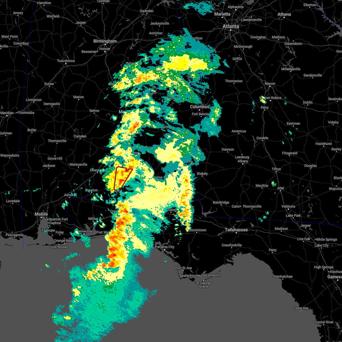 At 308 am cdt, a severe thunderstorm capable of producing a tornado was located near carolina and andalusia, moving northeast at 50 mph (radar indicated rotation). Hazards include tornado. Flying debris will be dangerous to those caught without shelter. mobile homes will be damaged or destroyed. damage to roofs, windows, and vehicles will occur. tree damage is likely. this dangerous storm will be near, heath around 315 am cdt. Gantt around 320 am cdt. At 308 am cdt, a severe thunderstorm capable of producing a tornado was located near carolina and andalusia, moving northeast at 50 mph (radar indicated rotation). Hazards include tornado. Flying debris will be dangerous to those caught without shelter. mobile homes will be damaged or destroyed. damage to roofs, windows, and vehicles will occur. tree damage is likely. this dangerous storm will be near, heath around 315 am cdt. Gantt around 320 am cdt.
|
| 3/23/2022 3:02 AM CDT |
 At 301 am cdt, a severe thunderstorm was located 12 miles southwest of andalusia, moving northeast at 40 mph (radar indicated). Hazards include 60 mph wind gusts. Expect damage to roofs, siding, and trees. Locations impacted include, andalusia, river falls, red level and heath. At 301 am cdt, a severe thunderstorm was located 12 miles southwest of andalusia, moving northeast at 40 mph (radar indicated). Hazards include 60 mph wind gusts. Expect damage to roofs, siding, and trees. Locations impacted include, andalusia, river falls, red level and heath.
|
| 3/23/2022 2:55 AM CDT |
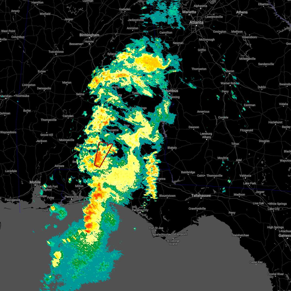 At 255 am cdt, a severe thunderstorm capable of producing a tornado was located 13 miles northwest of laurel hill, or 16 miles southwest of andalusia, moving north at 40 mph (radar indicated rotation). Hazards include tornado. Flying debris will be dangerous to those caught without shelter. mobile homes will be damaged or destroyed. damage to roofs, windows, and vehicles will occur. tree damage is likely. this dangerous storm will be near, andalusia around 320 am cdt. river falls, red level and heath around 325 am cdt. Gantt around 330 am cdt. At 255 am cdt, a severe thunderstorm capable of producing a tornado was located 13 miles northwest of laurel hill, or 16 miles southwest of andalusia, moving north at 40 mph (radar indicated rotation). Hazards include tornado. Flying debris will be dangerous to those caught without shelter. mobile homes will be damaged or destroyed. damage to roofs, windows, and vehicles will occur. tree damage is likely. this dangerous storm will be near, andalusia around 320 am cdt. river falls, red level and heath around 325 am cdt. Gantt around 330 am cdt.
|
| 3/23/2022 2:39 AM CDT |
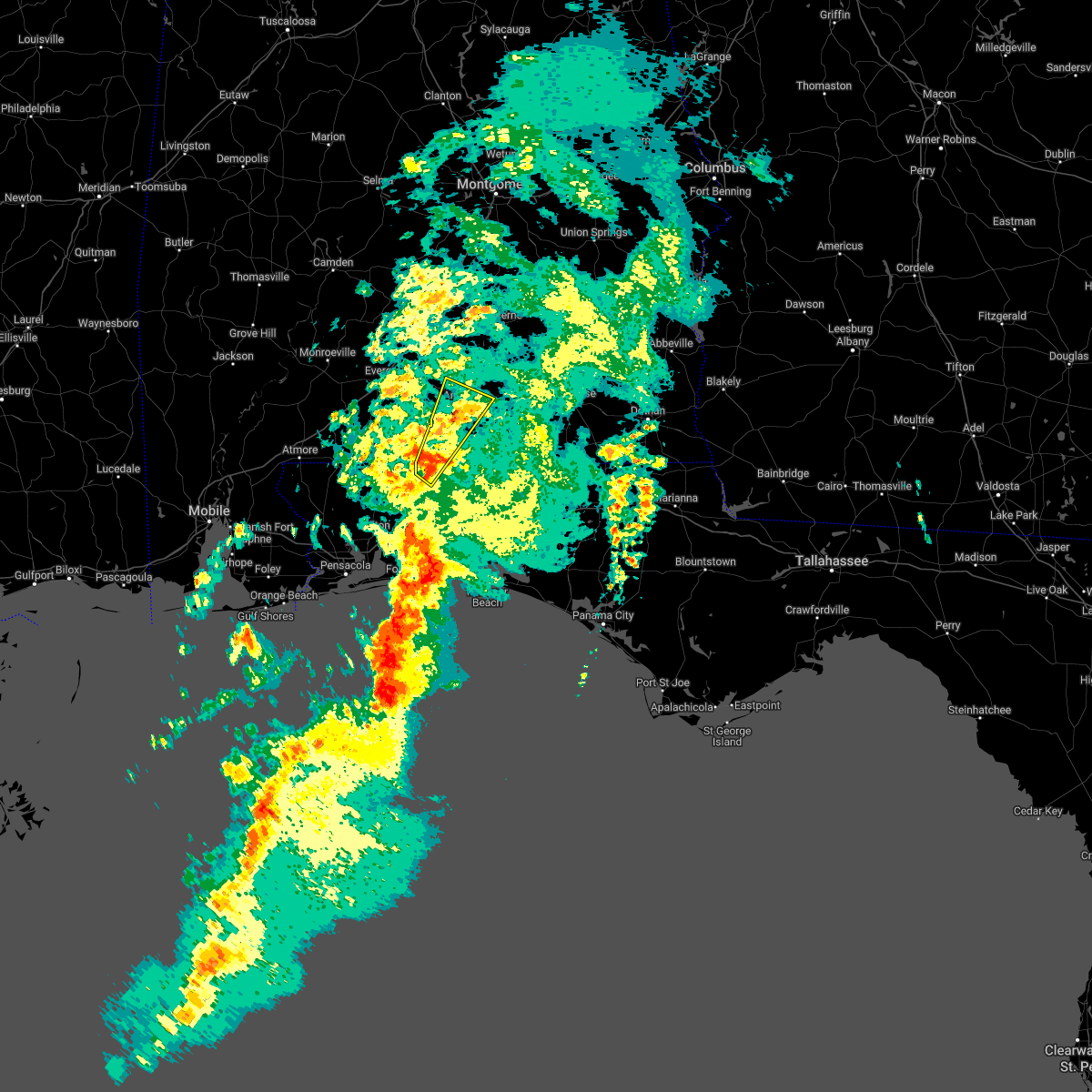 At 239 am cdt, a severe thunderstorm was located 11 miles north of baker, or 16 miles northwest of crestview, moving northeast at 45 mph (radar indicated). Hazards include 60 mph wind gusts. expect damage to roofs, siding, and trees At 239 am cdt, a severe thunderstorm was located 11 miles north of baker, or 16 miles northwest of crestview, moving northeast at 45 mph (radar indicated). Hazards include 60 mph wind gusts. expect damage to roofs, siding, and trees
|
| 3/18/2022 11:40 AM CDT |
 At 1139 am cdt, severe thunderstorms were located along a line extending from near opp to 8 miles north of point baker, moving southeast at 35 mph (radar indicated). Hazards include 60 mph wind gusts and quarter size hail. Hail damage to vehicles is expected. Expect wind damage to roofs, siding, and trees. At 1139 am cdt, severe thunderstorms were located along a line extending from near opp to 8 miles north of point baker, moving southeast at 35 mph (radar indicated). Hazards include 60 mph wind gusts and quarter size hail. Hail damage to vehicles is expected. Expect wind damage to roofs, siding, and trees.
|
| 3/18/2022 11:00 AM CDT |
 At 1100 am cdt, severe thunderstorms were located 5 miles south of andalusia, moving east at 45 mph (radar indicated). Hazards include 70 mph wind gusts and quarter size hail. Hail damage to vehicles is expected. expect considerable tree damage. Wind damage is also likely to mobile homes, roofs, and outbuildings. At 1100 am cdt, severe thunderstorms were located 5 miles south of andalusia, moving east at 45 mph (radar indicated). Hazards include 70 mph wind gusts and quarter size hail. Hail damage to vehicles is expected. expect considerable tree damage. Wind damage is also likely to mobile homes, roofs, and outbuildings.
|
| 3/18/2022 10:45 AM CDT |
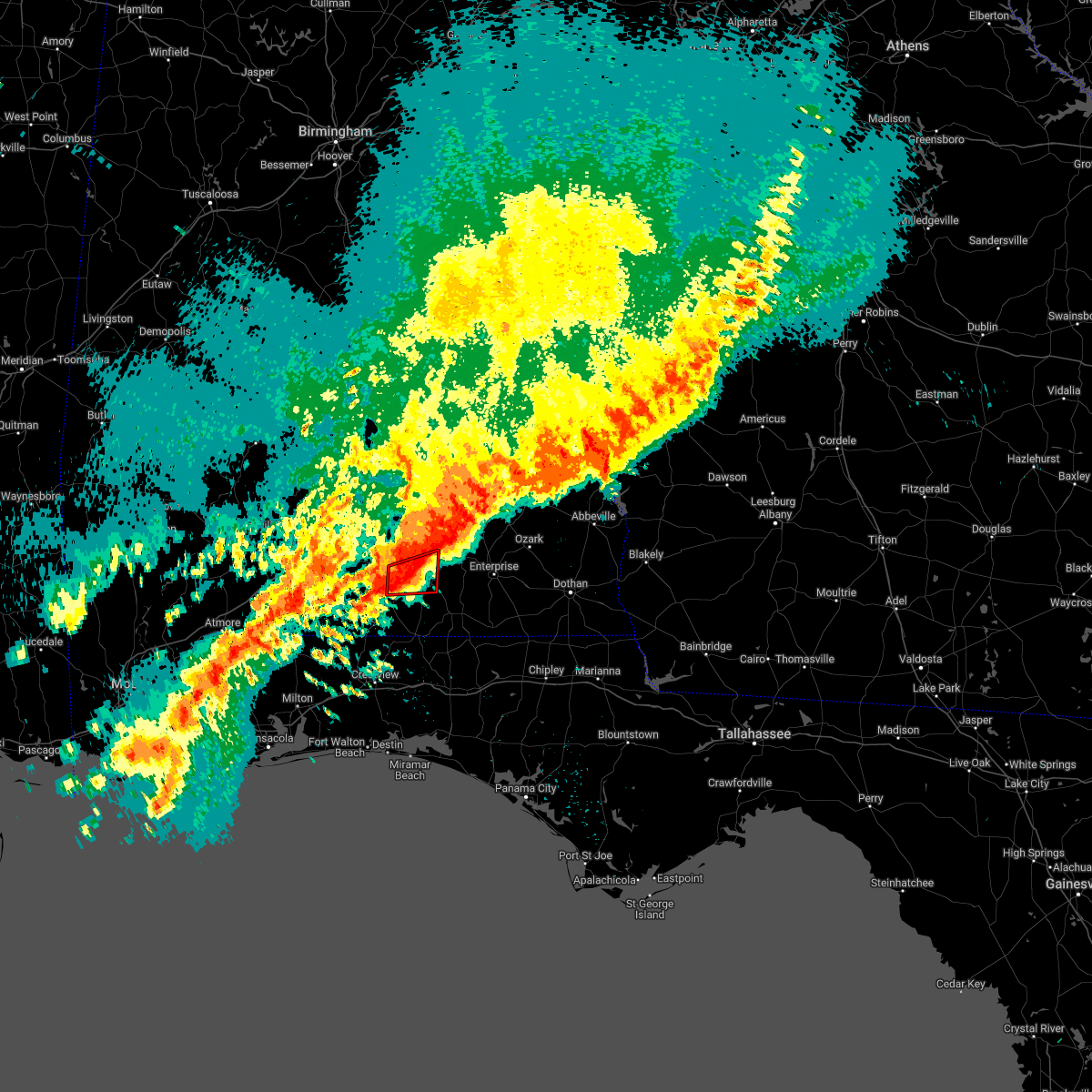 At 1044 am cdt, a severe thunderstorm capable of producing a tornado was located 6 miles north of opp, moving northeast at 45 mph (radar indicated rotation). Hazards include tornado and quarter size hail. Flying debris will be dangerous to those caught without shelter. mobile homes will be damaged or destroyed. damage to roofs, windows, and vehicles will occur. tree damage is likely. This tornadic thunderstorm will remain over mainly rural areas of northeastern covington county. At 1044 am cdt, a severe thunderstorm capable of producing a tornado was located 6 miles north of opp, moving northeast at 45 mph (radar indicated rotation). Hazards include tornado and quarter size hail. Flying debris will be dangerous to those caught without shelter. mobile homes will be damaged or destroyed. damage to roofs, windows, and vehicles will occur. tree damage is likely. This tornadic thunderstorm will remain over mainly rural areas of northeastern covington county.
|
| 3/18/2022 10:33 AM CDT |
 At 1032 am cdt, a severe thunderstorm capable of producing a tornado was located over heath, or near andalusia, moving northeast at 45 mph (radar indicated rotation). Hazards include tornado and quarter size hail. Flying debris will be dangerous to those caught without shelter. mobile homes will be damaged or destroyed. damage to roofs, windows, and vehicles will occur. tree damage is likely. This dangerous storm will be near, dozier around 1050 am cdt. At 1032 am cdt, a severe thunderstorm capable of producing a tornado was located over heath, or near andalusia, moving northeast at 45 mph (radar indicated rotation). Hazards include tornado and quarter size hail. Flying debris will be dangerous to those caught without shelter. mobile homes will be damaged or destroyed. damage to roofs, windows, and vehicles will occur. tree damage is likely. This dangerous storm will be near, dozier around 1050 am cdt.
|
| 3/18/2022 10:23 AM CDT |
 At 1023 am cdt, a severe thunderstorm capable of producing a tornado was located 7 miles southwest of river falls, or 7 miles southwest of andalusia, moving northeast at 45 mph (radar indicated rotation). Hazards include tornado and quarter size hail. Flying debris will be dangerous to those caught without shelter. mobile homes will be damaged or destroyed. damage to roofs, windows, and vehicles will occur. tree damage is likely. this dangerous storm will be near, andalusia around 1030 am cdt. heath around 1035 am cdt. Opp around 1045 am cdt. At 1023 am cdt, a severe thunderstorm capable of producing a tornado was located 7 miles southwest of river falls, or 7 miles southwest of andalusia, moving northeast at 45 mph (radar indicated rotation). Hazards include tornado and quarter size hail. Flying debris will be dangerous to those caught without shelter. mobile homes will be damaged or destroyed. damage to roofs, windows, and vehicles will occur. tree damage is likely. this dangerous storm will be near, andalusia around 1030 am cdt. heath around 1035 am cdt. Opp around 1045 am cdt.
|
| 3/18/2022 10:16 AM CDT |
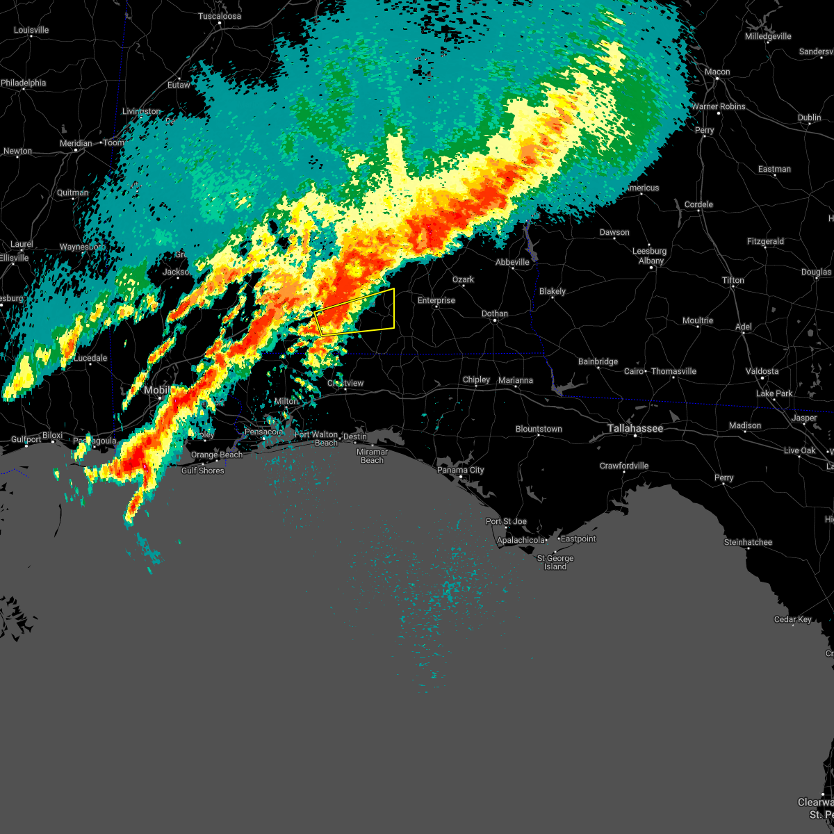 At 1015 am cdt, a severe thunderstorm was located 9 miles southwest of river falls, or 9 miles west of andalusia, moving east at 45 mph (radar indicated). Hazards include 60 mph wind gusts and quarter size hail. Hail damage to vehicles is expected. Expect wind damage to roofs, siding, and trees. At 1015 am cdt, a severe thunderstorm was located 9 miles southwest of river falls, or 9 miles west of andalusia, moving east at 45 mph (radar indicated). Hazards include 60 mph wind gusts and quarter size hail. Hail damage to vehicles is expected. Expect wind damage to roofs, siding, and trees.
|
| 3/18/2022 9:58 AM CDT |
 At 958 am cdt, a severe thunderstorm was located 8 miles east of evergreen, moving northeast at 45 mph (radar indicated). Hazards include 60 mph wind gusts and quarter size hail. Hail damage to vehicles is expected. Expect wind damage to roofs, siding, and trees. At 958 am cdt, a severe thunderstorm was located 8 miles east of evergreen, moving northeast at 45 mph (radar indicated). Hazards include 60 mph wind gusts and quarter size hail. Hail damage to vehicles is expected. Expect wind damage to roofs, siding, and trees.
|
| 7/15/2021 4:40 PM CDT |
 At 440 pm cdt, a severe thunderstorm was located 12 miles northwest of laurel hill, or 18 miles west of florala, moving northeast at 20 mph (radar indicated). Hazards include 60 mph wind gusts and nickel size hail. expect damage to roofs, siding, and trees At 440 pm cdt, a severe thunderstorm was located 12 miles northwest of laurel hill, or 18 miles west of florala, moving northeast at 20 mph (radar indicated). Hazards include 60 mph wind gusts and nickel size hail. expect damage to roofs, siding, and trees
|
| 6/23/2021 8:02 PM CDT |
 At 801 pm cdt, a severe thunderstorm was located over gantt, or 6 miles north of andalusia, moving east at 15 mph (radar indicated). Hazards include 60 mph wind gusts and quarter size hail. Hail damage to vehicles is expected. Expect wind damage to roofs, siding, and trees. At 801 pm cdt, a severe thunderstorm was located over gantt, or 6 miles north of andalusia, moving east at 15 mph (radar indicated). Hazards include 60 mph wind gusts and quarter size hail. Hail damage to vehicles is expected. Expect wind damage to roofs, siding, and trees.
|
| 6/23/2021 7:51 PM CDT |
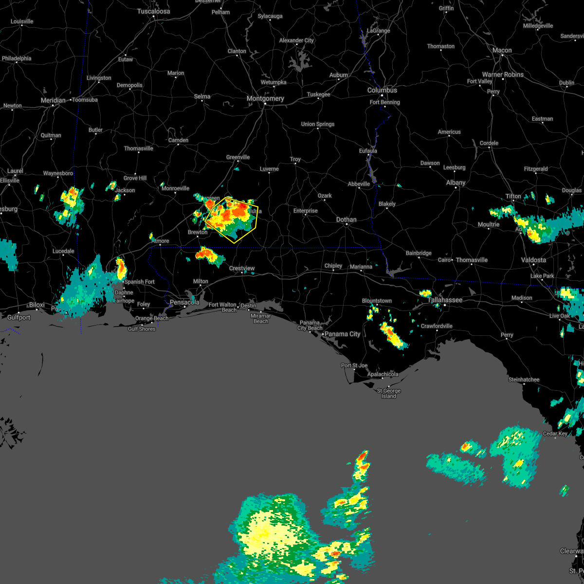 At 750 pm cdt, severe thunderstorms were located along a line extending from 3 miles northwest of river falls to 6 miles southwest of red level to 9 miles east of castleberry, moving east at 20 mph (radar indicated). Hazards include 60 mph wind gusts and quarter size hail. Hail damage to vehicles is expected. expect wind damage to roofs, siding, and trees. Locations impacted include, andalusia, river falls, red level, heath and gantt. At 750 pm cdt, severe thunderstorms were located along a line extending from 3 miles northwest of river falls to 6 miles southwest of red level to 9 miles east of castleberry, moving east at 20 mph (radar indicated). Hazards include 60 mph wind gusts and quarter size hail. Hail damage to vehicles is expected. expect wind damage to roofs, siding, and trees. Locations impacted include, andalusia, river falls, red level, heath and gantt.
|
| 6/23/2021 7:35 PM CDT |
 At 733 pm cdt, a severe thunderstorm was located 4 miles southwest of red level, or 10 miles west of andalusia, moving southeast at 10 mph. another severe thunderstorm was located 5 miles northwest of brooklyn and was moving southeast at 10 mph (radar indicated). Hazards include 60 mph wind gusts and nickel size hail. expect damage to roofs, siding, and trees At 733 pm cdt, a severe thunderstorm was located 4 miles southwest of red level, or 10 miles west of andalusia, moving southeast at 10 mph. another severe thunderstorm was located 5 miles northwest of brooklyn and was moving southeast at 10 mph (radar indicated). Hazards include 60 mph wind gusts and nickel size hail. expect damage to roofs, siding, and trees
|
| 6/19/2021 9:11 AM CDT |
 At 911 am cdt, a severe thunderstorm capable of producing a tornado was located near andalusia, moving north at 35 mph (radar indicated rotation). Hazards include tornado. Flying debris will be dangerous to those caught without shelter. mobile homes will be damaged or destroyed. damage to roofs, windows, and vehicles will occur. tree damage is likely. This dangerous storm will be near, dozier around 930 am cdt. At 911 am cdt, a severe thunderstorm capable of producing a tornado was located near andalusia, moving north at 35 mph (radar indicated rotation). Hazards include tornado. Flying debris will be dangerous to those caught without shelter. mobile homes will be damaged or destroyed. damage to roofs, windows, and vehicles will occur. tree damage is likely. This dangerous storm will be near, dozier around 930 am cdt.
|
| 5/12/2021 6:56 AM CDT |
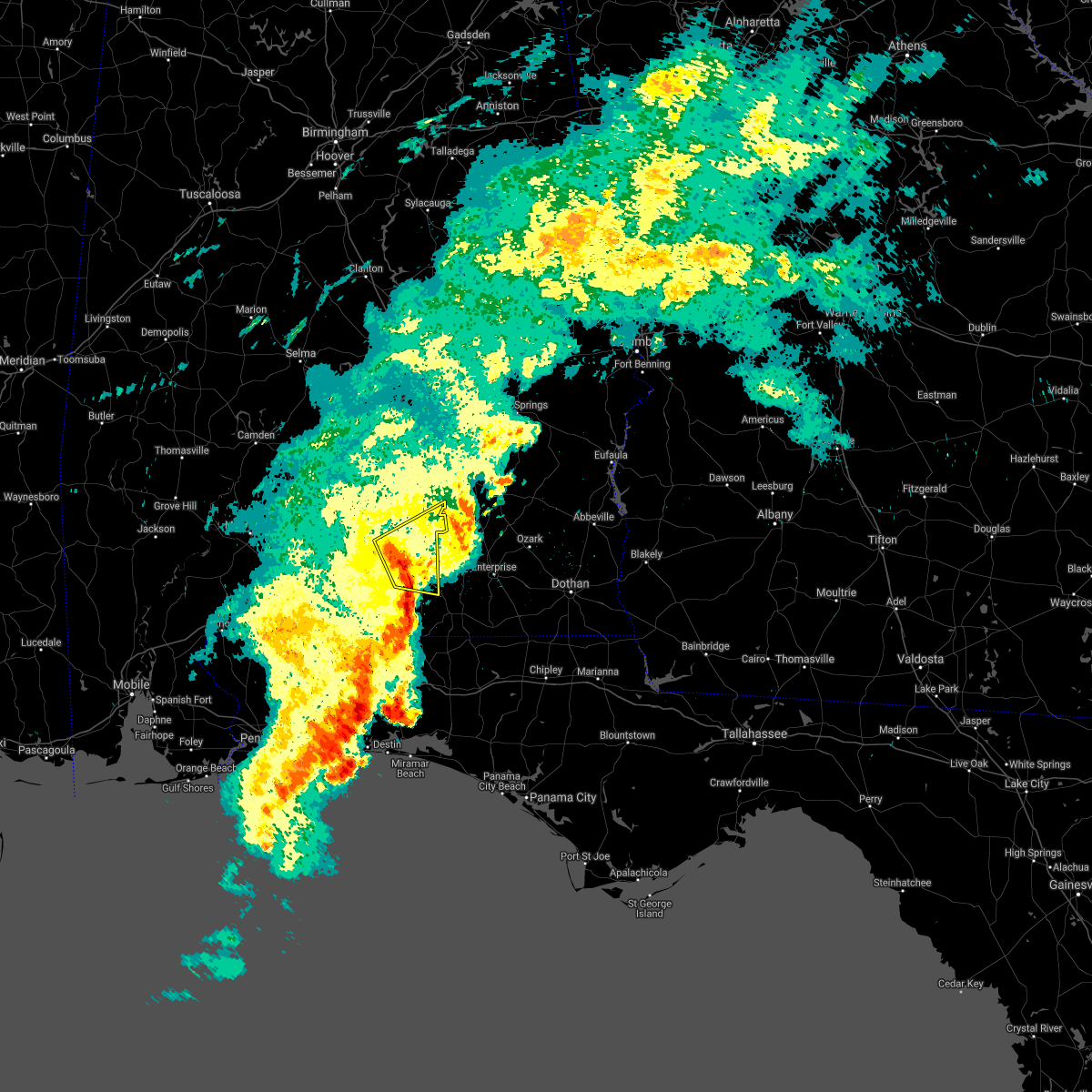 At 655 am cdt, a severe thunderstorm was located 7 miles southeast of dozier, or 8 miles north of opp, moving northeast at 70 mph (radar indicated). Hazards include 60 mph wind gusts. expect damage to roofs, siding, and trees At 655 am cdt, a severe thunderstorm was located 7 miles southeast of dozier, or 8 miles north of opp, moving northeast at 70 mph (radar indicated). Hazards include 60 mph wind gusts. expect damage to roofs, siding, and trees
|
| 5/12/2021 6:29 AM CDT |
 At 628 am cdt, severe thunderstorms were located along a line extending from 14 miles northwest of laurel hill to near baker, moving east at 70 mph (radar indicated). Hazards include 60 mph wind gusts. expect damage to roofs, siding, and trees At 628 am cdt, severe thunderstorms were located along a line extending from 14 miles northwest of laurel hill to near baker, moving east at 70 mph (radar indicated). Hazards include 60 mph wind gusts. expect damage to roofs, siding, and trees
|
| 5/4/2021 7:53 PM CDT |
 A severe thunderstorm warning remains in effect until 830 pm cdt for central covington county. at 752 pm cdt, severe thunderstorms were located along a line extending from 7 miles east of goshen to 6 miles northeast of opp to 10 miles south of andalusia, moving east at 35 mph. hazard. 60 mph wind gusts. A severe thunderstorm warning remains in effect until 830 pm cdt for central covington county. at 752 pm cdt, severe thunderstorms were located along a line extending from 7 miles east of goshen to 6 miles northeast of opp to 10 miles south of andalusia, moving east at 35 mph. hazard. 60 mph wind gusts.
|
| 5/4/2021 7:44 PM CDT |
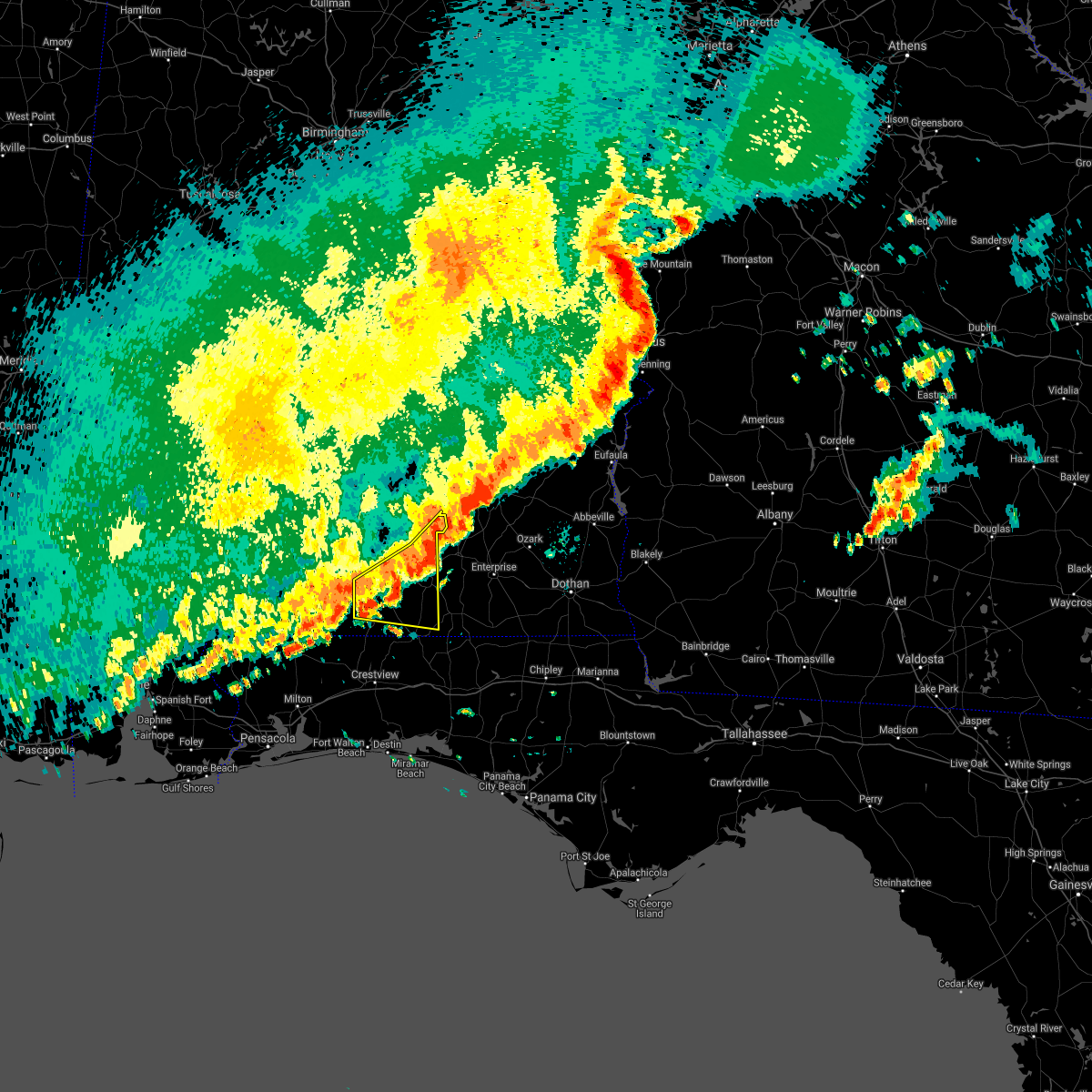 At 743 pm cdt, severe thunderstorms were located along a line extending from 3 miles southeast of goshen to 5 miles north of opp to 12 miles northwest of laurel hill, moving east at 35 mph (radar indicated). Hazards include 60 mph wind gusts. expect damage to roofs, siding, and trees At 743 pm cdt, severe thunderstorms were located along a line extending from 3 miles southeast of goshen to 5 miles north of opp to 12 miles northwest of laurel hill, moving east at 35 mph (radar indicated). Hazards include 60 mph wind gusts. expect damage to roofs, siding, and trees
|
| 5/4/2021 7:20 PM CDT | At least 15-20 trees down and structural damage to a barn and a mobile home in the gantt community. reports and photos via social medi in covington county AL, 7.2 miles SSE of Andalusia, AL |
| 4/24/2021 7:35 PM CDT |
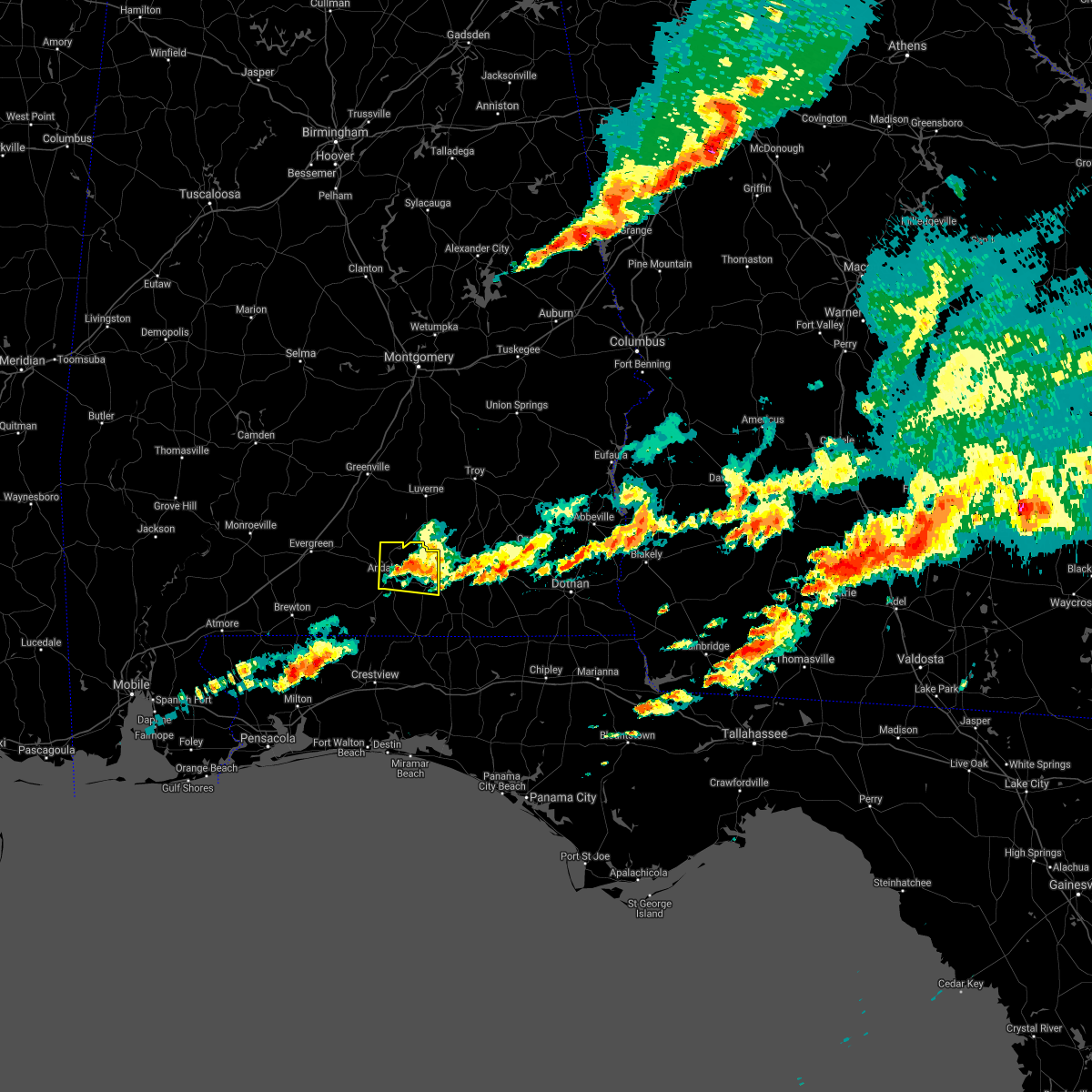 At 735 pm cdt, a severe thunderstorm was located near heath, or near andalusia, moving east at 50 mph (radar indicated). Hazards include 60 mph wind gusts and quarter size hail. Hail damage to vehicles is expected. expect wind damage to roofs, siding, and trees. Locations impacted include, andalusia, opp, river falls, heath and gantt. At 735 pm cdt, a severe thunderstorm was located near heath, or near andalusia, moving east at 50 mph (radar indicated). Hazards include 60 mph wind gusts and quarter size hail. Hail damage to vehicles is expected. expect wind damage to roofs, siding, and trees. Locations impacted include, andalusia, opp, river falls, heath and gantt.
|
| 4/24/2021 7:26 PM CDT |
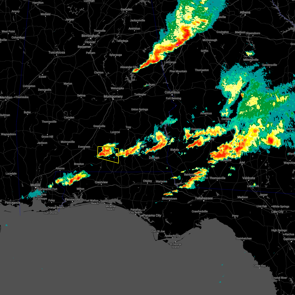 At 725 pm cdt, a severe thunderstorm was located near new brockton, or 6 miles west of enterprise, moving east at 50 mph (radar indicated). Hazards include 70 mph wind gusts and ping pong ball size hail. People and animals outdoors will be injured. expect hail damage to roofs, siding, windows, and vehicles. expect considerable tree damage. wind damage is also likely to mobile homes, roofs, and outbuildings. Locations impacted include, andalusia, opp, river falls, red level, heath and gantt. At 725 pm cdt, a severe thunderstorm was located near new brockton, or 6 miles west of enterprise, moving east at 50 mph (radar indicated). Hazards include 70 mph wind gusts and ping pong ball size hail. People and animals outdoors will be injured. expect hail damage to roofs, siding, windows, and vehicles. expect considerable tree damage. wind damage is also likely to mobile homes, roofs, and outbuildings. Locations impacted include, andalusia, opp, river falls, red level, heath and gantt.
|
| 4/24/2021 7:13 PM CDT |
 At 713 pm cdt, a severe thunderstorm was located 5 miles southwest of elba, moving east at 50 mph (radar indicated). Hazards include 70 mph wind gusts and ping pong ball size hail. People and animals outdoors will be injured. expect hail damage to roofs, siding, windows, and vehicles. expect considerable tree damage. wind damage is also likely to mobile homes, roofs, and outbuildings. Locations impacted include, andalusia, opp, river falls, red level, heath and gantt. At 713 pm cdt, a severe thunderstorm was located 5 miles southwest of elba, moving east at 50 mph (radar indicated). Hazards include 70 mph wind gusts and ping pong ball size hail. People and animals outdoors will be injured. expect hail damage to roofs, siding, windows, and vehicles. expect considerable tree damage. wind damage is also likely to mobile homes, roofs, and outbuildings. Locations impacted include, andalusia, opp, river falls, red level, heath and gantt.
|
| 4/24/2021 7:03 PM CDT |
 At 703 pm cdt, a severe thunderstorm was located 4 miles north of opp, moving east at 50 mph (radar indicated). Hazards include 70 mph wind gusts and ping pong ball size hail. People and animals outdoors will be injured. expect hail damage to roofs, siding, windows, and vehicles. expect considerable tree damage. wind damage is also likely to mobile homes, roofs, and outbuildings. Locations impacted include, andalusia, opp, river falls, red level, heath and gantt. At 703 pm cdt, a severe thunderstorm was located 4 miles north of opp, moving east at 50 mph (radar indicated). Hazards include 70 mph wind gusts and ping pong ball size hail. People and animals outdoors will be injured. expect hail damage to roofs, siding, windows, and vehicles. expect considerable tree damage. wind damage is also likely to mobile homes, roofs, and outbuildings. Locations impacted include, andalusia, opp, river falls, red level, heath and gantt.
|
| 4/24/2021 7:00 PM CDT |
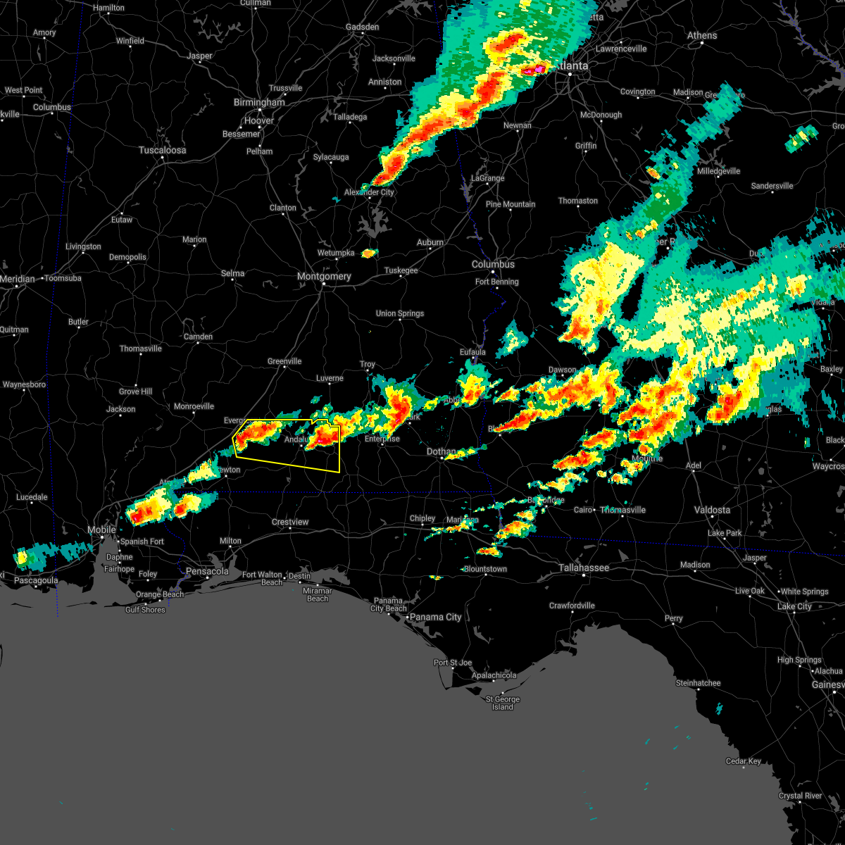 At 659 pm cdt, a severe thunderstorm was located 6 miles northwest of opp, moving east at 50 mph (radar indicated). Hazards include 70 mph wind gusts and quarter size hail. Hail damage to vehicles is expected. expect considerable tree damage. Wind damage is also likely to mobile homes, roofs, and outbuildings. At 659 pm cdt, a severe thunderstorm was located 6 miles northwest of opp, moving east at 50 mph (radar indicated). Hazards include 70 mph wind gusts and quarter size hail. Hail damage to vehicles is expected. expect considerable tree damage. Wind damage is also likely to mobile homes, roofs, and outbuildings.
|
| 4/24/2021 6:45 PM CDT |
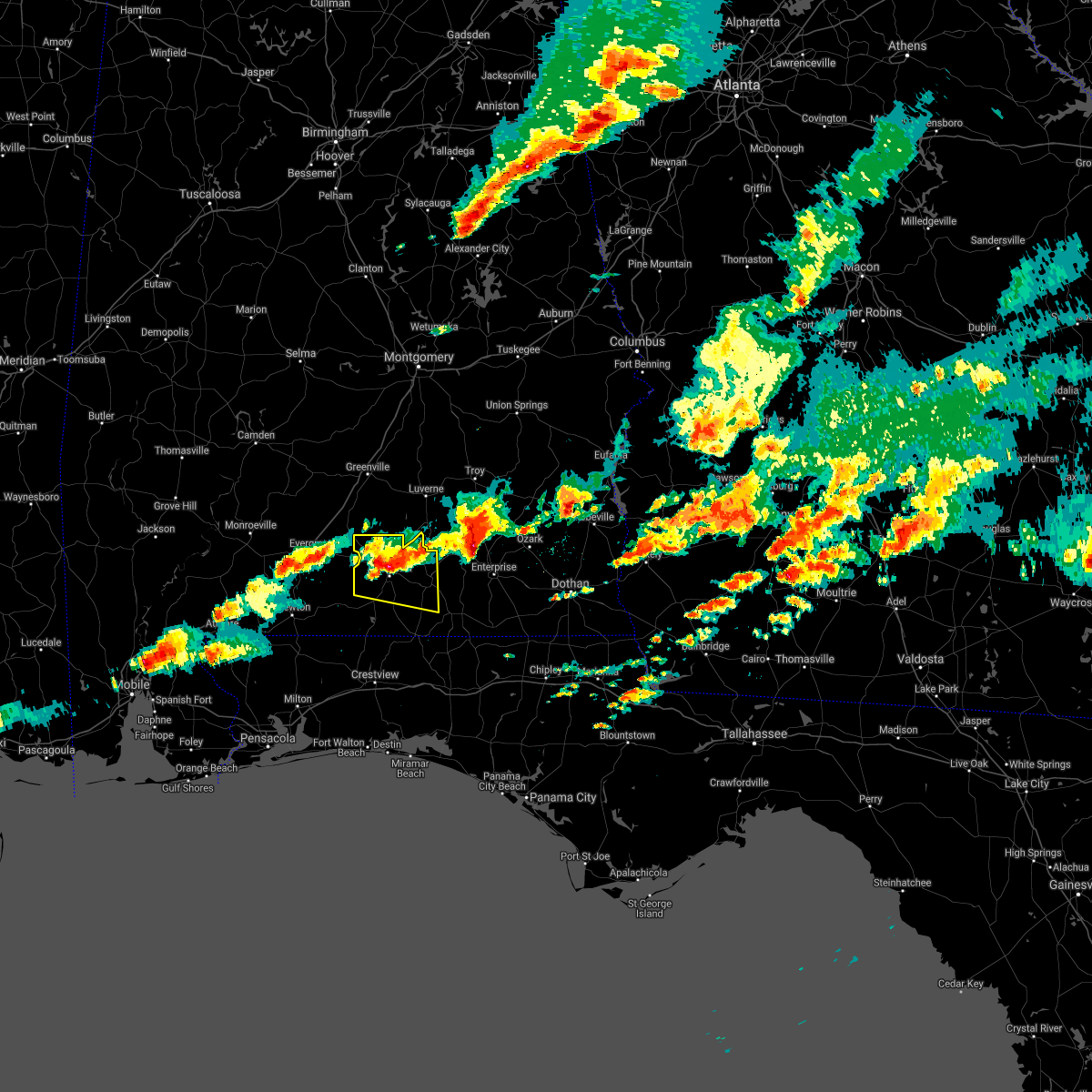 At 645 pm cdt, a severe thunderstorm was located near elba, moving east at 45 mph (radar indicated). Hazards include golf ball size hail and 70 mph wind gusts. People and animals outdoors will be injured. expect hail damage to roofs, siding, windows, and vehicles. expect considerable tree damage. wind damage is also likely to mobile homes, roofs, and outbuildings. Locations impacted include, andalusia, opp, river falls, red level, heath and gantt. At 645 pm cdt, a severe thunderstorm was located near elba, moving east at 45 mph (radar indicated). Hazards include golf ball size hail and 70 mph wind gusts. People and animals outdoors will be injured. expect hail damage to roofs, siding, windows, and vehicles. expect considerable tree damage. wind damage is also likely to mobile homes, roofs, and outbuildings. Locations impacted include, andalusia, opp, river falls, red level, heath and gantt.
|
| 4/24/2021 6:27 PM CDT |
 At 624 pm cdt, a severe thunderstorm was located near dozier, or 14 miles north of opp, moving east at 50 mph (radar indicated). Hazards include half dollar size hail and 70 mph wind gusts with storms currently in southern crenshaw and northern covington counties. another severe storm with golfball size hail will move into west central covington county in the next several minutes. these are dangerous storms with a history of golfball size hail and wind damage. People and animals outdoors will be injured. expect hail damage to roofs, siding, windows, and vehicles. expect considerable tree damage. wind damage is also likely to mobile homes, roofs, and outbuildings. Locations impacted include, andalusia, opp, brantley, river falls, red level, dozier, heath and gantt. At 624 pm cdt, a severe thunderstorm was located near dozier, or 14 miles north of opp, moving east at 50 mph (radar indicated). Hazards include half dollar size hail and 70 mph wind gusts with storms currently in southern crenshaw and northern covington counties. another severe storm with golfball size hail will move into west central covington county in the next several minutes. these are dangerous storms with a history of golfball size hail and wind damage. People and animals outdoors will be injured. expect hail damage to roofs, siding, windows, and vehicles. expect considerable tree damage. wind damage is also likely to mobile homes, roofs, and outbuildings. Locations impacted include, andalusia, opp, brantley, river falls, red level, dozier, heath and gantt.
|
| 4/24/2021 5:56 PM CDT |
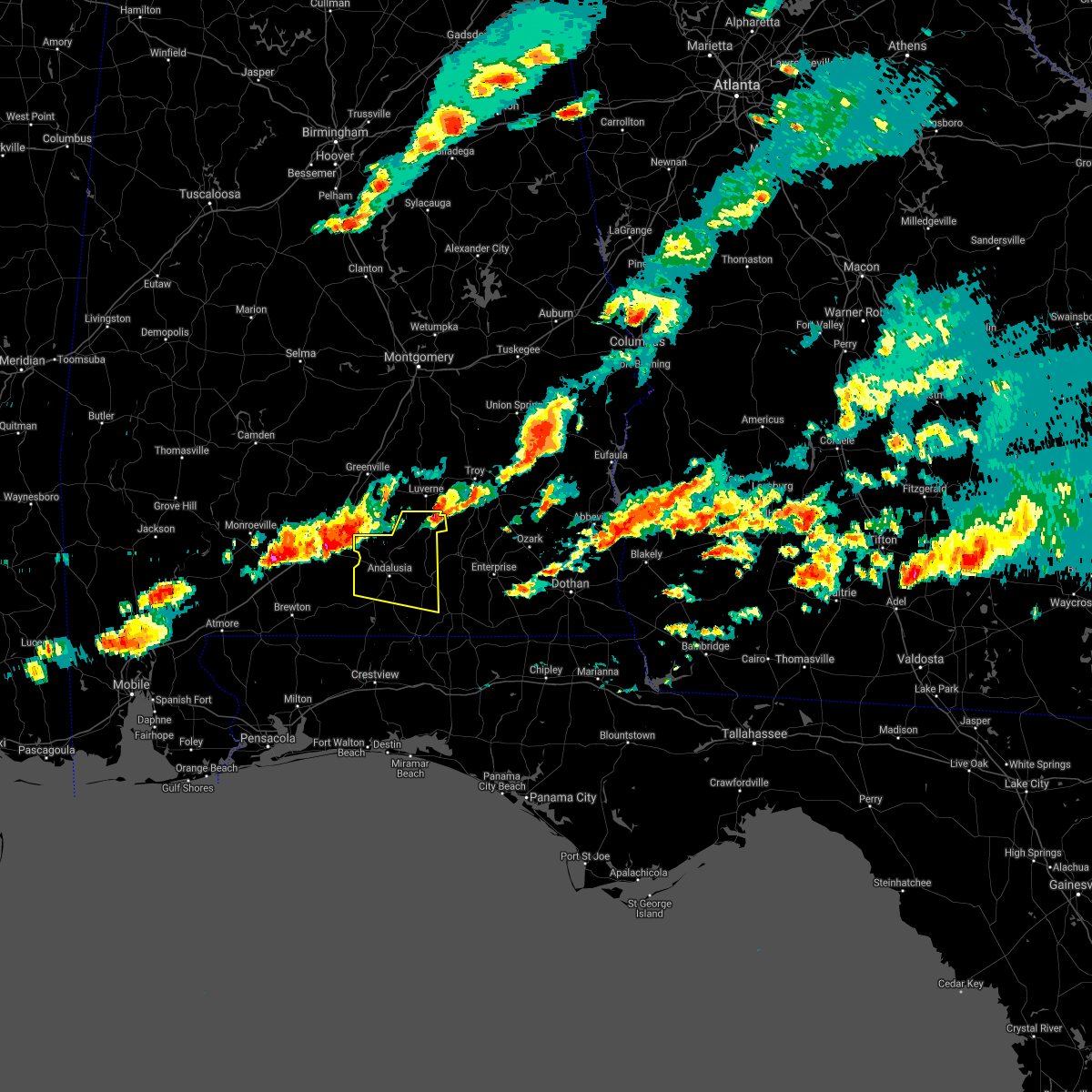 At 555 pm cdt, a severe thunderstorm was located 4 miles east of evergreen, moving east at 45 mph (radar indicated). Hazards include golf ball size hail and 60 mph wind gusts. People and animals outdoors will be injured. expect hail damage to roofs, siding, windows, and vehicles. Expect wind damage to roofs, siding, and trees. At 555 pm cdt, a severe thunderstorm was located 4 miles east of evergreen, moving east at 45 mph (radar indicated). Hazards include golf ball size hail and 60 mph wind gusts. People and animals outdoors will be injured. expect hail damage to roofs, siding, windows, and vehicles. Expect wind damage to roofs, siding, and trees.
|
| 4/24/2021 1:55 PM CDT |
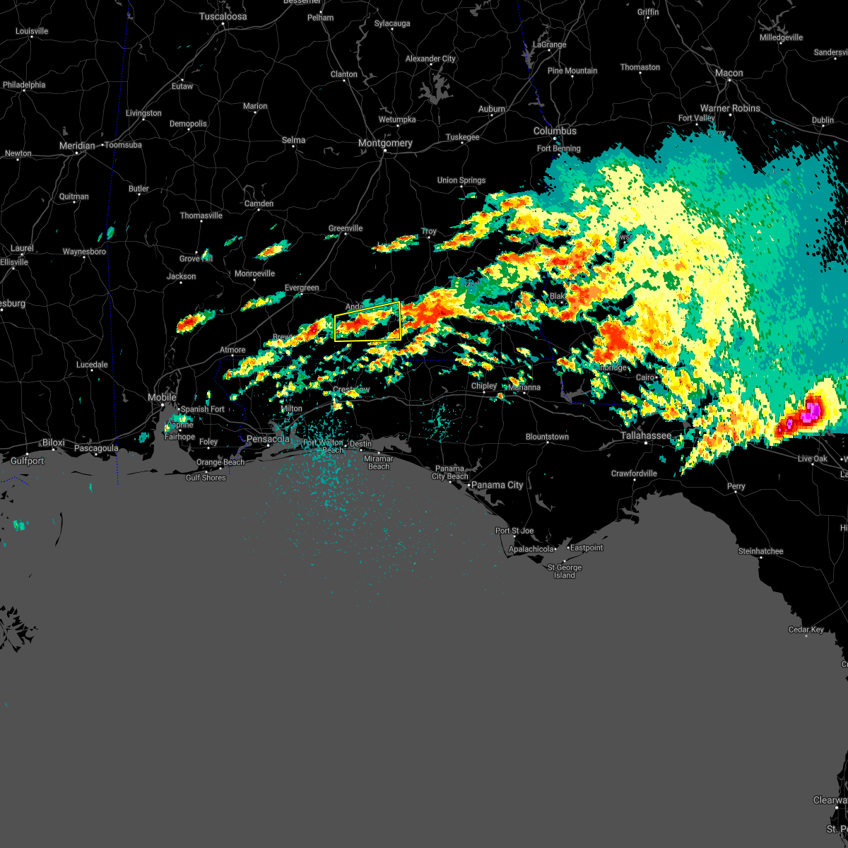 At 155 pm cdt, a severe thunderstorm was located 7 miles south of andalusia, moving east at 55 mph (radar indicated). Hazards include 60 mph wind gusts and nickel size hail. expect damage to roofs, siding, and trees At 155 pm cdt, a severe thunderstorm was located 7 miles south of andalusia, moving east at 55 mph (radar indicated). Hazards include 60 mph wind gusts and nickel size hail. expect damage to roofs, siding, and trees
|
| 4/24/2021 7:01 AM CDT |
 At 641 am cdt, severe thunderstorms were located along a line extending from 6 miles north of opp to 9 miles north of lockhart to 14 miles southeast of riverview, moving east at 80 mph (radar indicated). Hazards include 70 mph wind gusts. Expect considerable tree damage. Damage is likely to mobile homes, roofs, and outbuildings. At 641 am cdt, severe thunderstorms were located along a line extending from 6 miles north of opp to 9 miles north of lockhart to 14 miles southeast of riverview, moving east at 80 mph (radar indicated). Hazards include 70 mph wind gusts. Expect considerable tree damage. Damage is likely to mobile homes, roofs, and outbuildings.
|
| 4/24/2021 7:01 AM CDT |
 At 701 am cdt, severe thunderstorms were located along a line extending from 6 miles northwest of fort rucker to 9 miles northeast of samson to laurel hill, moving east at 80 mph (radar indicated). Hazards include 60 mph wind gusts. Expect damage to roofs, siding, and trees. Locations impacted include, opp, florala, jay, laurel hill and lockhart. At 701 am cdt, severe thunderstorms were located along a line extending from 6 miles northwest of fort rucker to 9 miles northeast of samson to laurel hill, moving east at 80 mph (radar indicated). Hazards include 60 mph wind gusts. Expect damage to roofs, siding, and trees. Locations impacted include, opp, florala, jay, laurel hill and lockhart.
|
| 4/24/2021 6:42 AM CDT |
 At 641 am cdt, severe thunderstorms were located along a line extending from 6 miles north of opp to 9 miles north of lockhart to 14 miles southeast of riverview, moving east at 80 mph (radar indicated). Hazards include 70 mph wind gusts. Expect considerable tree damage. Damage is likely to mobile homes, roofs, and outbuildings. At 641 am cdt, severe thunderstorms were located along a line extending from 6 miles north of opp to 9 miles north of lockhart to 14 miles southeast of riverview, moving east at 80 mph (radar indicated). Hazards include 70 mph wind gusts. Expect considerable tree damage. Damage is likely to mobile homes, roofs, and outbuildings.
|
| 4/24/2021 5:51 AM CDT |
 At 551 am cdt, severe thunderstorms were located along a line extending from 9 miles northwest of georgiana to 3 miles southeast of castleberry to 4 miles west of flomaton, moving east at 45 mph (radar indicated). Hazards include 70 mph wind gusts. Expect considerable tree damage. Damage is likely to mobile homes, roofs, and outbuildings. At 551 am cdt, severe thunderstorms were located along a line extending from 9 miles northwest of georgiana to 3 miles southeast of castleberry to 4 miles west of flomaton, moving east at 45 mph (radar indicated). Hazards include 70 mph wind gusts. Expect considerable tree damage. Damage is likely to mobile homes, roofs, and outbuildings.
|
| 4/10/2021 4:33 AM CDT |
 At 432 am cdt, severe thunderstorms were located along a line extending from 3 miles southwest of logan to 5 miles north of red level to 15 miles southeast of castleberry, moving east at 50 mph (radar indicated). Hazards include 60 mph wind gusts and penny size hail. expect damage to roofs, siding, and trees At 432 am cdt, severe thunderstorms were located along a line extending from 3 miles southwest of logan to 5 miles north of red level to 15 miles southeast of castleberry, moving east at 50 mph (radar indicated). Hazards include 60 mph wind gusts and penny size hail. expect damage to roofs, siding, and trees
|
| 3/31/2021 4:40 PM CDT |
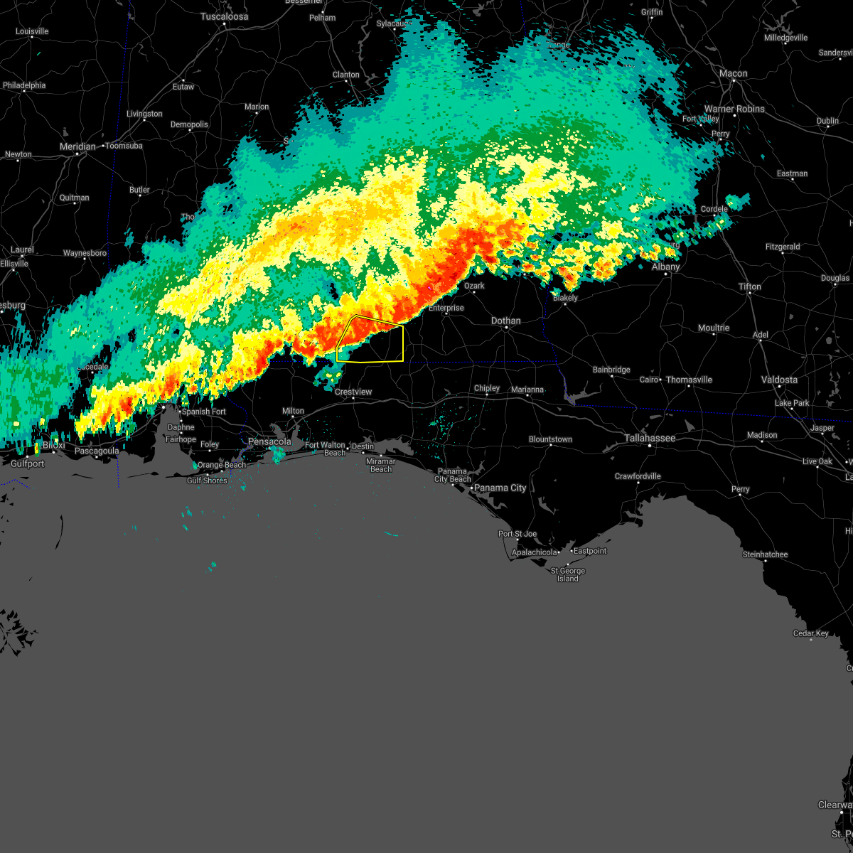 At 440 pm cdt, severe thunderstorms were located along a line extending from river falls to 10 miles southwest of andalusia to 14 miles southeast of castleberry, moving east at 40 mph (radar indicated). Hazards include 60 mph wind gusts and penny size hail. expect damage to roofs, siding, and trees At 440 pm cdt, severe thunderstorms were located along a line extending from river falls to 10 miles southwest of andalusia to 14 miles southeast of castleberry, moving east at 40 mph (radar indicated). Hazards include 60 mph wind gusts and penny size hail. expect damage to roofs, siding, and trees
|
| 3/31/2021 4:13 PM CDT |
 At 412 pm cdt, severe thunderstorms were located along a line extending from 6 miles northwest of dozier to gantt to 4 miles south of red level, moving east at 55 mph (radar indicated). Hazards include 60 mph wind gusts and penny size hail. expect damage to roofs, siding, and trees At 412 pm cdt, severe thunderstorms were located along a line extending from 6 miles northwest of dozier to gantt to 4 miles south of red level, moving east at 55 mph (radar indicated). Hazards include 60 mph wind gusts and penny size hail. expect damage to roofs, siding, and trees
|
| 7/23/2020 1:57 PM CDT |
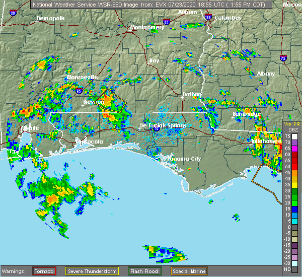 At 156 pm cdt, a severe thunderstorm was located 11 miles southwest of river falls, or 12 miles southwest of andalusia, moving northwest at 30 mph (radar indicated). Hazards include 60 mph wind gusts and penny size hail. Expect damage to roofs, siding, and trees. This severe thunderstorm will remain over mainly rural areas of northeastern escambia, southeastern conecuh and west central covington counties. At 156 pm cdt, a severe thunderstorm was located 11 miles southwest of river falls, or 12 miles southwest of andalusia, moving northwest at 30 mph (radar indicated). Hazards include 60 mph wind gusts and penny size hail. Expect damage to roofs, siding, and trees. This severe thunderstorm will remain over mainly rural areas of northeastern escambia, southeastern conecuh and west central covington counties.
|
| 7/23/2020 1:33 PM CDT |
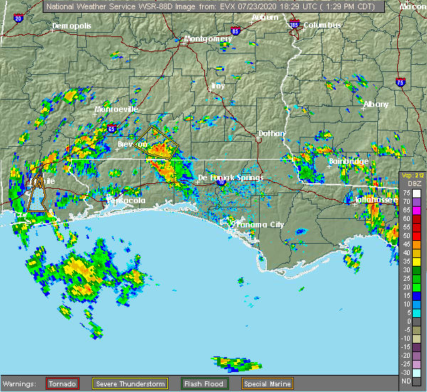 At 132 pm cdt, a severe thunderstorm was located 11 miles south of andalusia, moving northwest at 25 mph (radar indicated). Hazards include 60 mph wind gusts and penny size hail. Expect damage to roofs, siding, and trees. This severe thunderstorm will remain over mainly rural areas of northeastern escambia, southeastern conecuh and southwestern covington counties. At 132 pm cdt, a severe thunderstorm was located 11 miles south of andalusia, moving northwest at 25 mph (radar indicated). Hazards include 60 mph wind gusts and penny size hail. Expect damage to roofs, siding, and trees. This severe thunderstorm will remain over mainly rural areas of northeastern escambia, southeastern conecuh and southwestern covington counties.
|
| 7/12/2020 5:57 PM CDT |
 At 556 pm cdt, a cluster of severe thunderstorms was located along a line extending from elba to near andalusia to near castleberry, moving southeast at 45 mph (radar indicated). Hazards include 60 mph wind gusts. expect damage to roofs, siding, and trees At 556 pm cdt, a cluster of severe thunderstorms was located along a line extending from elba to near andalusia to near castleberry, moving southeast at 45 mph (radar indicated). Hazards include 60 mph wind gusts. expect damage to roofs, siding, and trees
|
| 7/1/2020 4:37 PM CDT |
 At 436 pm cdt, a severe thunderstorm was located over river falls, or near andalusia, moving southeast at 25 mph (radar indicated). Hazards include 60 mph wind gusts. expect damage to roofs, siding, and trees At 436 pm cdt, a severe thunderstorm was located over river falls, or near andalusia, moving southeast at 25 mph (radar indicated). Hazards include 60 mph wind gusts. expect damage to roofs, siding, and trees
|
| 7/1/2020 3:56 PM CDT |
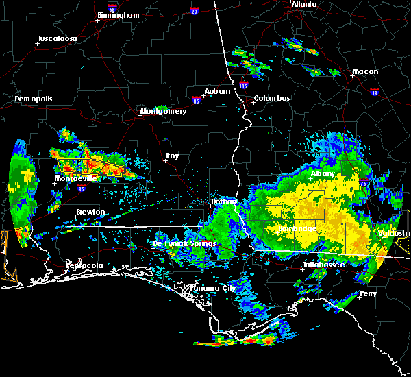 At 356 pm cdt, a severe thunderstorm was located 11 miles east of georgiana, or 13 miles south of greenville, moving southeast at 20 mph (radar indicated). Hazards include 60 mph wind gusts. expect damage to roofs, siding, and trees At 356 pm cdt, a severe thunderstorm was located 11 miles east of georgiana, or 13 miles south of greenville, moving southeast at 20 mph (radar indicated). Hazards include 60 mph wind gusts. expect damage to roofs, siding, and trees
|
| 6/24/2020 5:09 PM CDT |
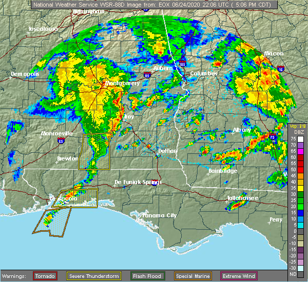 The severe thunderstorm warning for south central butler, southern crenshaw and covington counties will expire at 515 pm cdt, the storms which prompted the warning have weakened below severe limits, and have exited the warned area. therefore, the warning will be allowed to expire. a severe thunderstorm watch remains in effect until 900 pm cdt for south central alabama. The severe thunderstorm warning for south central butler, southern crenshaw and covington counties will expire at 515 pm cdt, the storms which prompted the warning have weakened below severe limits, and have exited the warned area. therefore, the warning will be allowed to expire. a severe thunderstorm watch remains in effect until 900 pm cdt for south central alabama.
|
| 6/24/2020 4:22 PM CDT |
 At 421 pm cdt, severe thunderstorms were located along a line extending from 10 miles east of mckenzie to 3 miles southwest of river falls to 15 miles northwest of laurel hill, moving east at 35 mph (radar indicated). Hazards include 60 mph wind gusts. expect damage to roofs, siding, and trees At 421 pm cdt, severe thunderstorms were located along a line extending from 10 miles east of mckenzie to 3 miles southwest of river falls to 15 miles northwest of laurel hill, moving east at 35 mph (radar indicated). Hazards include 60 mph wind gusts. expect damage to roofs, siding, and trees
|
| 6/24/2020 3:59 PM CDT |
 At 358 pm cdt, a severe thunderstorm was located 11 miles southeast of evergreen, moving east at 40 mph (radar indicated). Hazards include 60 mph wind gusts. Expect damage to roofs, siding, and trees. Locations impacted include, river falls and red level. At 358 pm cdt, a severe thunderstorm was located 11 miles southeast of evergreen, moving east at 40 mph (radar indicated). Hazards include 60 mph wind gusts. Expect damage to roofs, siding, and trees. Locations impacted include, river falls and red level.
|
| 6/24/2020 3:44 PM CDT |
 At 344 pm cdt, a severe thunderstorm was located near castleberry, or 11 miles south of evergreen, moving northeast at 25 mph (radar indicated). Hazards include 60 mph wind gusts. expect damage to roofs, siding, and trees At 344 pm cdt, a severe thunderstorm was located near castleberry, or 11 miles south of evergreen, moving northeast at 25 mph (radar indicated). Hazards include 60 mph wind gusts. expect damage to roofs, siding, and trees
|
| 4/23/2020 10:27 AM CDT |
 At 1027 am cdt, severe thunderstorms were located along a line extending from 12 miles east of castleberry to 5 miles southeast of jay, moving east at 35 mph (radar indicated). Hazards include 60 mph wind gusts. expect damage to roofs, siding, and trees At 1027 am cdt, severe thunderstorms were located along a line extending from 12 miles east of castleberry to 5 miles southeast of jay, moving east at 35 mph (radar indicated). Hazards include 60 mph wind gusts. expect damage to roofs, siding, and trees
|
| 4/23/2020 8:43 AM CDT |
 At 843 am cdt, severe thunderstorms were located along a line extending from 5 miles south of brantley to 8 miles northwest of lockhart to 8 miles north of baker, moving east at 45 mph (radar indicated). Hazards include 60 mph wind gusts and penny size hail. Expect damage to roofs, siding, and trees. Locations impacted include, andalusia, opp, florala, laurel hill, lockhart and dozier. At 843 am cdt, severe thunderstorms were located along a line extending from 5 miles south of brantley to 8 miles northwest of lockhart to 8 miles north of baker, moving east at 45 mph (radar indicated). Hazards include 60 mph wind gusts and penny size hail. Expect damage to roofs, siding, and trees. Locations impacted include, andalusia, opp, florala, laurel hill, lockhart and dozier.
|
| 4/23/2020 8:31 AM CDT |
 At 831 am cdt, severe thunderstorms were located along a line extending from near dozier to 11 miles northwest of laurel hill to 10 miles northwest of baker, moving east at 55 mph (radar indicated). Hazards include 60 mph wind gusts and penny size hail. Expect damage to roofs, siding, and trees. Locations impacted include, andalusia, opp, florala, river falls, laurel hill, lockhart, dozier, heath and gantt. At 831 am cdt, severe thunderstorms were located along a line extending from near dozier to 11 miles northwest of laurel hill to 10 miles northwest of baker, moving east at 55 mph (radar indicated). Hazards include 60 mph wind gusts and penny size hail. Expect damage to roofs, siding, and trees. Locations impacted include, andalusia, opp, florala, river falls, laurel hill, lockhart, dozier, heath and gantt.
|
| 4/23/2020 8:30 AM CDT | Trees and power lines down on al-137 at mile marker 7 (open pond road in covington county AL, 15.7 miles NNE of Andalusia, AL |
| 4/23/2020 8:12 AM CDT |
 At 812 am cdt, severe thunderstorms were located along a line extending from near mckenzie to 16 miles east of east brewton to 4 miles south of jay, moving east at 45 mph (radar indicated). Hazards include 60 mph wind gusts and penny size hail. expect damage to roofs, siding, and trees At 812 am cdt, severe thunderstorms were located along a line extending from near mckenzie to 16 miles east of east brewton to 4 miles south of jay, moving east at 45 mph (radar indicated). Hazards include 60 mph wind gusts and penny size hail. expect damage to roofs, siding, and trees
|
| 4/20/2020 12:05 AM CDT |
 At 1204 am cdt, severe thunderstorms were located along a line extending from 3 miles north of brewton to 7 miles southeast of jay to 3 miles southwest of molino, moving east at 80 mph (radar indicated). Hazards include 70 mph wind gusts. Expect considerable tree damage. Damage is likely to mobile homes, roofs, and outbuildings. At 1204 am cdt, severe thunderstorms were located along a line extending from 3 miles north of brewton to 7 miles southeast of jay to 3 miles southwest of molino, moving east at 80 mph (radar indicated). Hazards include 70 mph wind gusts. Expect considerable tree damage. Damage is likely to mobile homes, roofs, and outbuildings.
|
| 4/19/2020 11:09 PM CDT |
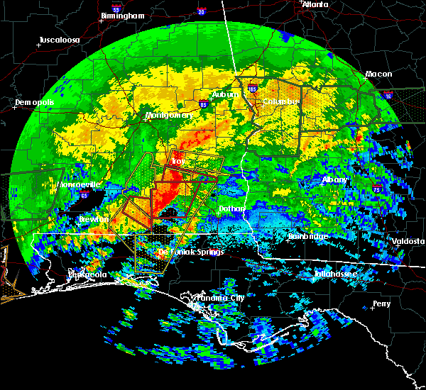 The tornado warning for northeastern covington county will expire at 1115 pm cdt, the storms which prompted the warning have moved out of the area. therefore, the warning will be allowed to expire. a tornado watch remains in effect until 400 am cdt for south central alabama. The tornado warning for northeastern covington county will expire at 1115 pm cdt, the storms which prompted the warning have moved out of the area. therefore, the warning will be allowed to expire. a tornado watch remains in effect until 400 am cdt for south central alabama.
|
| 4/19/2020 10:54 PM CDT | Awos station k79j at the andalusia opp airport measured a wind gust of 60 mp in covington county AL, 3.7 miles WSW of Andalusia, AL |
| 4/19/2020 10:54 PM CDT |
 At 1054 pm cdt, a severe thunderstorm was located 11 miles northwest of lockhart, or 11 miles south of andalusia, moving southeast at 55 mph (radar indicated). Hazards include 60 mph wind gusts. expect damage to roofs, siding, and trees At 1054 pm cdt, a severe thunderstorm was located 11 miles northwest of lockhart, or 11 miles south of andalusia, moving southeast at 55 mph (radar indicated). Hazards include 60 mph wind gusts. expect damage to roofs, siding, and trees
|
| 4/19/2020 10:52 PM CDT |
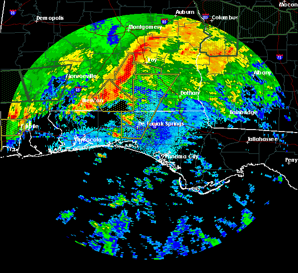 At 1052 pm cdt, a severe thunderstorm was located 4 miles northwest of lockhart, or 5 miles northwest of florala, moving southeast at 80 mph (radar indicated). Hazards include 60 mph wind gusts. Expect damage to roofs, siding, and trees. Locations impacted include, andalusia, florala, river falls, lockhart, heath and gantt. At 1052 pm cdt, a severe thunderstorm was located 4 miles northwest of lockhart, or 5 miles northwest of florala, moving southeast at 80 mph (radar indicated). Hazards include 60 mph wind gusts. Expect damage to roofs, siding, and trees. Locations impacted include, andalusia, florala, river falls, lockhart, heath and gantt.
|
| 4/19/2020 10:47 PM CDT |
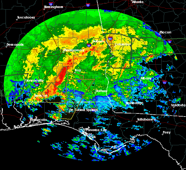 At 1047 pm cdt, severe thunderstorms capable of producing a tornado were located along a line extending from 3 miles east of heath to 3 miles south of andalusia, moving southeast at 60 mph (radar indicated rotation). Hazards include tornado. Flying debris will be dangerous to those caught without shelter. mobile homes will be damaged or destroyed. damage to roofs, windows, and vehicles will occur. tree damage is likely. These dangerous storms will be near, opp around 1100 pm cdt. At 1047 pm cdt, severe thunderstorms capable of producing a tornado were located along a line extending from 3 miles east of heath to 3 miles south of andalusia, moving southeast at 60 mph (radar indicated rotation). Hazards include tornado. Flying debris will be dangerous to those caught without shelter. mobile homes will be damaged or destroyed. damage to roofs, windows, and vehicles will occur. tree damage is likely. These dangerous storms will be near, opp around 1100 pm cdt.
|
| 4/19/2020 10:43 PM CDT | Multiple trees down near andalusi in covington county AL, 0.9 miles SSE of Andalusia, AL |
| 4/19/2020 10:42 PM CDT | Tree through a house and numerous tress down in the gantt communit in covington county AL, 7.1 miles S of Andalusia, AL |
| 4/19/2020 10:35 PM CDT |
 At 1035 pm cdt, a severe thunderstorm was located 11 miles southwest of river falls, or 12 miles west of andalusia, moving southeast at 80 mph (radar indicated). Hazards include 60 mph wind gusts. expect damage to roofs, siding, and trees At 1035 pm cdt, a severe thunderstorm was located 11 miles southwest of river falls, or 12 miles west of andalusia, moving southeast at 80 mph (radar indicated). Hazards include 60 mph wind gusts. expect damage to roofs, siding, and trees
|
| 3/31/2020 10:58 AM CDT |
 The national weather service in mobile has issued a * severe thunderstorm warning for. eastern escambia county in south central alabama. southeastern conecuh county in south central alabama. covington county in south central alabama. Northern okaloosa county in northwestern florida. The national weather service in mobile has issued a * severe thunderstorm warning for. eastern escambia county in south central alabama. southeastern conecuh county in south central alabama. covington county in south central alabama. Northern okaloosa county in northwestern florida.
|
| 3/31/2020 10:47 AM CDT |
 At 1046 am cdt, severe thunderstorms were located along a line extending from 3 miles southwest of brundidge to heath to 12 miles southeast of castleberry to atmore, moving east at 50 mph (radar indicated). Hazards include 60 mph wind gusts and quarter size hail. Hail damage to vehicles is expected. expect wind damage to roofs, siding, and trees. Locations impacted include, andalusia, atmore, opp, brewton, century, flomaton, east brewton, brantley, river falls, castleberry, jay, red level, dozier, heath, gantt, pollard, riverview, bratt, i65 and cr 1 and i65 and al 113. At 1046 am cdt, severe thunderstorms were located along a line extending from 3 miles southwest of brundidge to heath to 12 miles southeast of castleberry to atmore, moving east at 50 mph (radar indicated). Hazards include 60 mph wind gusts and quarter size hail. Hail damage to vehicles is expected. expect wind damage to roofs, siding, and trees. Locations impacted include, andalusia, atmore, opp, brewton, century, flomaton, east brewton, brantley, river falls, castleberry, jay, red level, dozier, heath, gantt, pollard, riverview, bratt, i65 and cr 1 and i65 and al 113.
|
| 3/31/2020 10:07 AM CDT |
 At 1007 am cdt, severe thunderstorms were located along a line extending from 6 miles northwest of rutledge to 9 miles east of mckenzie to 7 miles southeast of evergreen to mccullough, moving east at 40 mph (radar indicated). Hazards include 70 mph wind gusts and quarter size hail. Hail damage to vehicles is expected. expect considerable tree damage. Wind damage is also likely to mobile homes, roofs, and outbuildings. At 1007 am cdt, severe thunderstorms were located along a line extending from 6 miles northwest of rutledge to 9 miles east of mckenzie to 7 miles southeast of evergreen to mccullough, moving east at 40 mph (radar indicated). Hazards include 70 mph wind gusts and quarter size hail. Hail damage to vehicles is expected. expect considerable tree damage. Wind damage is also likely to mobile homes, roofs, and outbuildings.
|
| 3/4/2020 9:10 AM CST |
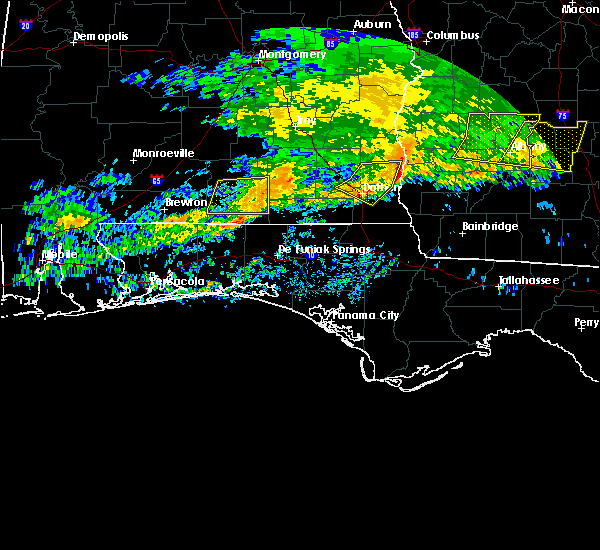 The severe thunderstorm warning for central covington county will expire at 915 am cst, the storms which prompted the warning have weakened below severe limits. therefore, the warning will be allowed to expire. however heavy rain is still possible with these thunderstorms. a tornado watch remains in effect until 1000 am cst for south central alabama. The severe thunderstorm warning for central covington county will expire at 915 am cst, the storms which prompted the warning have weakened below severe limits. therefore, the warning will be allowed to expire. however heavy rain is still possible with these thunderstorms. a tornado watch remains in effect until 1000 am cst for south central alabama.
|
| 3/4/2020 8:36 AM CST |
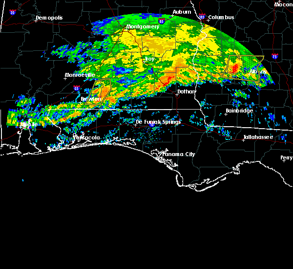 At 836 am cst, severe thunderstorms were located along a line extending from 6 miles southwest of river falls to 13 miles southwest of andalusia to 18 miles east of east brewton, moving east at 45 mph (radar indicated). Hazards include 60 mph wind gusts. expect damage to roofs, siding, and trees At 836 am cst, severe thunderstorms were located along a line extending from 6 miles southwest of river falls to 13 miles southwest of andalusia to 18 miles east of east brewton, moving east at 45 mph (radar indicated). Hazards include 60 mph wind gusts. expect damage to roofs, siding, and trees
|
| 1/11/2020 3:19 PM CST |
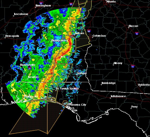 At 319 pm cst, severe thunderstorms were located along a line extending from troy municipal airport to 6 miles north of opp, moving northeast at 45 mph (radar indicated). Hazards include 60 mph wind gusts. Expect damage to roofs, siding, and trees. Locations impacted include, opp, brantley and glenwood. At 319 pm cst, severe thunderstorms were located along a line extending from troy municipal airport to 6 miles north of opp, moving northeast at 45 mph (radar indicated). Hazards include 60 mph wind gusts. Expect damage to roofs, siding, and trees. Locations impacted include, opp, brantley and glenwood.
|
| 1/11/2020 3:01 PM CST |
 At 300 pm cst, severe thunderstorms were located along a line extending from 4 miles northeast of luverne to near andalusia, moving east at 35 mph (radar indicated). Hazards include 60 mph wind gusts. Expect damage to roofs, siding, and trees. Locations impacted include, andalusia, opp, luverne, brantley, river falls, rutledge, dozier, heath, gantt, glenwood and petrey. At 300 pm cst, severe thunderstorms were located along a line extending from 4 miles northeast of luverne to near andalusia, moving east at 35 mph (radar indicated). Hazards include 60 mph wind gusts. Expect damage to roofs, siding, and trees. Locations impacted include, andalusia, opp, luverne, brantley, river falls, rutledge, dozier, heath, gantt, glenwood and petrey.
|
| 1/11/2020 2:55 PM CST |
 At 255 pm cst, severe thunderstorms were located along a line extending from 3 miles southwest of andalusia to 4 miles southwest of navarre, moving east at 15 mph (radar indicated). Hazards include 60 mph wind gusts. expect damage to roofs, siding, and trees At 255 pm cst, severe thunderstorms were located along a line extending from 3 miles southwest of andalusia to 4 miles southwest of navarre, moving east at 15 mph (radar indicated). Hazards include 60 mph wind gusts. expect damage to roofs, siding, and trees
|
| 1/11/2020 2:39 PM CST |
 At 239 pm cst, severe thunderstorms were located along a line extending from near grady to 7 miles south of red level, moving northeast at 40 mph (radar indicated). Hazards include 60 mph wind gusts. expect damage to roofs, siding, and trees At 239 pm cst, severe thunderstorms were located along a line extending from near grady to 7 miles south of red level, moving northeast at 40 mph (radar indicated). Hazards include 60 mph wind gusts. expect damage to roofs, siding, and trees
|
| 4/14/2019 6:52 AM CDT |
 The severe thunderstorm warning for northeastern covington county will expire at 700 am cdt, the storms which prompted the warning have moved out of the area. therefore, the warning will be allowed to expire. a tornado watch remains in effect until 1000 am cdt for south central alabama. The severe thunderstorm warning for northeastern covington county will expire at 700 am cdt, the storms which prompted the warning have moved out of the area. therefore, the warning will be allowed to expire. a tornado watch remains in effect until 1000 am cdt for south central alabama.
|
| 4/14/2019 6:24 AM CDT |
 At 624 am cdt, severe thunderstorms were located along a line extending from 12 miles east of georgiana to 9 miles west of brantley to dozier to 7 miles northeast of heath to gantt, moving east at 40 mph (radar indicated). Hazards include 60 mph wind gusts. expect damage to roofs, siding, and trees At 624 am cdt, severe thunderstorms were located along a line extending from 12 miles east of georgiana to 9 miles west of brantley to dozier to 7 miles northeast of heath to gantt, moving east at 40 mph (radar indicated). Hazards include 60 mph wind gusts. expect damage to roofs, siding, and trees
|
| 4/14/2019 5:37 AM CDT |
 At 537 am cdt, severe thunderstorms were located along a line extending from 5 miles southwest of mckenzie to 8 miles west of red level to 12 miles east of castleberry, moving northeast at 60 mph (radar indicated). Hazards include 60 mph wind gusts. expect damage to roofs, siding, and trees At 537 am cdt, severe thunderstorms were located along a line extending from 5 miles southwest of mckenzie to 8 miles west of red level to 12 miles east of castleberry, moving northeast at 60 mph (radar indicated). Hazards include 60 mph wind gusts. expect damage to roofs, siding, and trees
|
| 3/3/2019 3:49 PM CST |
 At 349 pm cst, a severe thunderstorm was located over opp, moving east at 55 mph (radar indicated). Hazards include 60 mph wind gusts and penny size hail. Expect damage to roofs, siding, and trees. locations impacted include, opp. A tornado watch remains in effect until 600 pm cst for south central alabama. At 349 pm cst, a severe thunderstorm was located over opp, moving east at 55 mph (radar indicated). Hazards include 60 mph wind gusts and penny size hail. Expect damage to roofs, siding, and trees. locations impacted include, opp. A tornado watch remains in effect until 600 pm cst for south central alabama.
|
| 3/3/2019 3:35 PM CST | Several trees down along open pond rd with one falling on a car. time estimated by rada in covington county AL, 14.1 miles NNE of Andalusia, AL |
| 3/3/2019 3:29 PM CST |
 At 329 pm cst, a severe thunderstorm was located 7 miles southwest of river falls, or 8 miles west of andalusia, moving east at 55 mph (radar indicated). Hazards include 60 mph wind gusts and penny size hail. expect damage to roofs, siding, and trees At 329 pm cst, a severe thunderstorm was located 7 miles southwest of river falls, or 8 miles west of andalusia, moving east at 55 mph (radar indicated). Hazards include 60 mph wind gusts and penny size hail. expect damage to roofs, siding, and trees
|
| 1/23/2019 5:55 PM CST |
 At 555 pm cst, a severe thunderstorm capable of producing a tornado was located over heath, or over andalusia, moving northeast at 45 mph (radar indicated rotation). Hazards include tornado. Flying debris will be dangerous to those caught without shelter. mobile homes will be damaged or destroyed. damage to roofs, windows, and vehicles will occur. tree damage is likely. This tornadic thunderstorm will remain over mainly rural areas of northeastern covington county. At 555 pm cst, a severe thunderstorm capable of producing a tornado was located over heath, or over andalusia, moving northeast at 45 mph (radar indicated rotation). Hazards include tornado. Flying debris will be dangerous to those caught without shelter. mobile homes will be damaged or destroyed. damage to roofs, windows, and vehicles will occur. tree damage is likely. This tornadic thunderstorm will remain over mainly rural areas of northeastern covington county.
|
| 1/23/2019 5:39 PM CST |
 At 539 pm cst, a severe thunderstorm capable of producing a tornado was located 8 miles southwest of river falls, or 9 miles west of andalusia, moving east at 60 mph (radar indicated rotation). Hazards include tornado. Flying debris will be dangerous to those caught without shelter. mobile homes will be damaged or destroyed. damage to roofs, windows, and vehicles will occur. tree damage is likely. this dangerous storm will be near, andalusia and heath around 550 pm cst. Opp around 600 pm cst. At 539 pm cst, a severe thunderstorm capable of producing a tornado was located 8 miles southwest of river falls, or 9 miles west of andalusia, moving east at 60 mph (radar indicated rotation). Hazards include tornado. Flying debris will be dangerous to those caught without shelter. mobile homes will be damaged or destroyed. damage to roofs, windows, and vehicles will occur. tree damage is likely. this dangerous storm will be near, andalusia and heath around 550 pm cst. Opp around 600 pm cst.
|
| 11/1/2018 9:55 AM CDT |
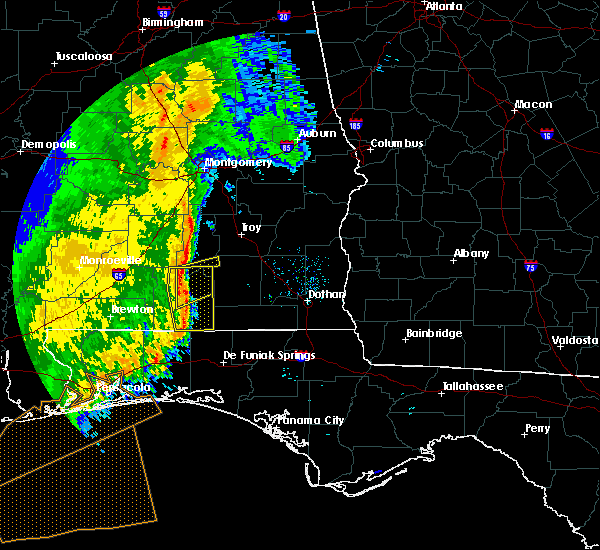 At 955 am cdt, a severe thunderstorm was located near andalusia, moving northeast at 40 mph (radar indicated). Hazards include 60 mph wind gusts. expect damage to roofs, siding, and trees At 955 am cdt, a severe thunderstorm was located near andalusia, moving northeast at 40 mph (radar indicated). Hazards include 60 mph wind gusts. expect damage to roofs, siding, and trees
|
| 11/1/2018 9:52 AM CDT |
 At 951 am cdt, severe thunderstorms were located along a line extending from heath to 6 miles northwest of lockhart to 5 miles north of crestview, moving east at 40 mph (radar indicated). Hazards include 60 mph wind gusts. Expect damage to roofs, siding, and trees. locations impacted include, andalusia, opp, florala, river falls, lockhart, dozier, heath and gantt. A tornado watch remains in effect until 100 pm cdt for south central alabama, and northwestern florida. At 951 am cdt, severe thunderstorms were located along a line extending from heath to 6 miles northwest of lockhart to 5 miles north of crestview, moving east at 40 mph (radar indicated). Hazards include 60 mph wind gusts. Expect damage to roofs, siding, and trees. locations impacted include, andalusia, opp, florala, river falls, lockhart, dozier, heath and gantt. A tornado watch remains in effect until 100 pm cdt for south central alabama, and northwestern florida.
|
| 11/1/2018 9:20 AM CDT |
 At 919 am cdt, severe thunderstorms were located along a line extending from 11 miles southeast of evergreen to 16 miles north of baker to 8 miles northeast of roeville, moving east at 40 mph (radar indicated). Hazards include 60 mph wind gusts. expect damage to roofs, siding, and trees At 919 am cdt, severe thunderstorms were located along a line extending from 11 miles southeast of evergreen to 16 miles north of baker to 8 miles northeast of roeville, moving east at 40 mph (radar indicated). Hazards include 60 mph wind gusts. expect damage to roofs, siding, and trees
|
| 9/2/2018 8:12 PM CDT |
 At 812 pm cdt, a severe thunderstorm was located 10 miles northwest of lockhart, or 11 miles northwest of florala, moving northwest at 25 mph (radar indicated). Hazards include 60 mph wind gusts. Expect damage to roofs, siding, and trees. Locations impacted include, florala and lockhart. At 812 pm cdt, a severe thunderstorm was located 10 miles northwest of lockhart, or 11 miles northwest of florala, moving northwest at 25 mph (radar indicated). Hazards include 60 mph wind gusts. Expect damage to roofs, siding, and trees. Locations impacted include, florala and lockhart.
|
| 9/2/2018 7:48 PM CDT |
 At 747 pm cdt, a severe thunderstorm was located over florala, moving northwest at 25 mph (radar indicated). Hazards include 60 mph wind gusts. expect damage to roofs, siding, and trees At 747 pm cdt, a severe thunderstorm was located over florala, moving northwest at 25 mph (radar indicated). Hazards include 60 mph wind gusts. expect damage to roofs, siding, and trees
|
| 8/10/2018 5:26 PM CDT |
 At 525 pm cdt, a severe thunderstorm was located 14 miles southwest of andalusia, moving northeast at 20 mph (radar indicated). Hazards include 60 mph wind gusts. expect damage to roofs, siding, and trees At 525 pm cdt, a severe thunderstorm was located 14 miles southwest of andalusia, moving northeast at 20 mph (radar indicated). Hazards include 60 mph wind gusts. expect damage to roofs, siding, and trees
|
| 7/22/2018 2:02 PM CDT |
 At 202 pm cdt, a severe thunderstorm was located 10 miles north of lockhart, or 10 miles north of florala, moving southeast at 25 mph (radar indicated). Hazards include 70 mph wind gusts. Expect considerable tree damage. Damage is likely to mobile homes, roofs, and outbuildings. At 202 pm cdt, a severe thunderstorm was located 10 miles north of lockhart, or 10 miles north of florala, moving southeast at 25 mph (radar indicated). Hazards include 70 mph wind gusts. Expect considerable tree damage. Damage is likely to mobile homes, roofs, and outbuildings.
|
| 7/22/2018 1:45 PM CDT |
 At 144 pm cdt, a severe thunderstorm was located 9 miles north of lockhart, or 9 miles north of florala, moving southeast at 40 mph (radar indicated). Hazards include two inch hail and 70 mph wind gusts. People and animals outdoors will be injured. expect hail damage to roofs, siding, windows, and vehicles. expect considerable tree damage. wind damage is also likely to mobile homes, roofs, and outbuildings. Locations impacted include, andalusia, opp, florala, lockhart and heath. At 144 pm cdt, a severe thunderstorm was located 9 miles north of lockhart, or 9 miles north of florala, moving southeast at 40 mph (radar indicated). Hazards include two inch hail and 70 mph wind gusts. People and animals outdoors will be injured. expect hail damage to roofs, siding, windows, and vehicles. expect considerable tree damage. wind damage is also likely to mobile homes, roofs, and outbuildings. Locations impacted include, andalusia, opp, florala, lockhart and heath.
|
| 7/22/2018 1:41 PM CDT |
 At 141 pm cdt, a severe thunderstorm was located 8 miles southwest of opp, moving southeast at 25 mph (radar indicated). Hazards include two inch hail and 70 mph wind gusts. People and animals outdoors will be injured. expect hail damage to roofs, siding, windows, and vehicles. expect considerable tree damage. wind damage is also likely to mobile homes, roofs, and outbuildings. Locations impacted include, andalusia, opp, florala, lockhart and heath. At 141 pm cdt, a severe thunderstorm was located 8 miles southwest of opp, moving southeast at 25 mph (radar indicated). Hazards include two inch hail and 70 mph wind gusts. People and animals outdoors will be injured. expect hail damage to roofs, siding, windows, and vehicles. expect considerable tree damage. wind damage is also likely to mobile homes, roofs, and outbuildings. Locations impacted include, andalusia, opp, florala, lockhart and heath.
|
| 7/22/2018 1:25 PM CDT | Tennis Ball sized hail reported 0.8 miles S of Andalusia, AL, several reports and pictures of at least tennis ball size hail near andalusia... al. pictures and reports via social media. |
| 7/22/2018 1:21 PM CDT |
 At 120 pm cdt, a severe thunderstorm was located 4 miles east of andalusia, moving southeast at 40 mph (radar indicated). Hazards include 60 mph wind gusts and quarter size hail. Hail damage to vehicles is expected. Expect wind damage to roofs, siding, and trees. At 120 pm cdt, a severe thunderstorm was located 4 miles east of andalusia, moving southeast at 40 mph (radar indicated). Hazards include 60 mph wind gusts and quarter size hail. Hail damage to vehicles is expected. Expect wind damage to roofs, siding, and trees.
|
| 7/22/2018 1:20 PM CDT | Grapefruit sized hail reported 3.7 miles WSW of Andalusia, AL, picture on social media of 4 inch+ hailstone near sanford... al. time estimated from radar. |
| 7/22/2018 1:20 PM CDT | Hen Egg sized hail reported 1.9 miles SW of Andalusia, AL, pictures of 2" hail (measured with a ruler) just east of andalusia. pictures via social media. |
| 7/22/2018 1:15 PM CDT | Golf Ball sized hail reported 6.1 miles SSW of Andalusia, AL, golf ball size hail and hail covering the ground (resulting in hail fog) in the straughn area. pictures via social media. |
| 7/22/2018 12:47 PM CDT |
 At 1246 pm cdt, a severe thunderstorm was located 5 miles east of mckenzie, or 16 miles northwest of andalusia, now moving east southeast at 25 mph (radar indicated). Hazards include 60 mph wind gusts. expect damage to roofs, siding, and trees At 1246 pm cdt, a severe thunderstorm was located 5 miles east of mckenzie, or 16 miles northwest of andalusia, now moving east southeast at 25 mph (radar indicated). Hazards include 60 mph wind gusts. expect damage to roofs, siding, and trees
|
| 7/22/2018 12:35 PM CDT |
 At 1235 pm cdt, a severe thunderstorm was located over mckenzie, or 15 miles east of evergreen, moving southeast at 25 mph (radar indicated). Hazards include 60 mph wind gusts. expect damage to roofs, siding, and trees At 1235 pm cdt, a severe thunderstorm was located over mckenzie, or 15 miles east of evergreen, moving southeast at 25 mph (radar indicated). Hazards include 60 mph wind gusts. expect damage to roofs, siding, and trees
|
| 7/21/2018 11:27 PM CDT |
 At 1127 pm cdt, a severe thunderstorm was located 4 miles east of mckenzie, or 17 miles northwest of andalusia, moving southeast at 45 mph (radar indicated). Hazards include 60 mph wind gusts and quarter size hail. Hail damage to vehicles is expected. expect wind damage to roofs, siding, and trees. Locations impacted include, mckenzie, river falls, red level, heath and gantt. At 1127 pm cdt, a severe thunderstorm was located 4 miles east of mckenzie, or 17 miles northwest of andalusia, moving southeast at 45 mph (radar indicated). Hazards include 60 mph wind gusts and quarter size hail. Hail damage to vehicles is expected. expect wind damage to roofs, siding, and trees. Locations impacted include, mckenzie, river falls, red level, heath and gantt.
|
| 7/21/2018 11:17 PM CDT |
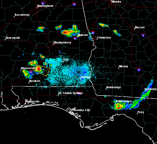 At 1117 pm cdt, a severe thunderstorm was located 4 miles southwest of georgiana, or 14 miles northeast of evergreen, moving southeast at 30 mph (radar indicated). Hazards include 60 mph wind gusts and quarter size hail. Hail damage to vehicles is expected. expect wind damage to roofs, siding, and trees. Locations impacted include, georgiana, mckenzie, river falls, red level, heath and gantt. At 1117 pm cdt, a severe thunderstorm was located 4 miles southwest of georgiana, or 14 miles northeast of evergreen, moving southeast at 30 mph (radar indicated). Hazards include 60 mph wind gusts and quarter size hail. Hail damage to vehicles is expected. expect wind damage to roofs, siding, and trees. Locations impacted include, georgiana, mckenzie, river falls, red level, heath and gantt.
|
| 7/21/2018 11:05 PM CDT |
 At 1105 pm cdt, a severe thunderstorm was located 9 miles west of georgiana, or 13 miles north of evergreen, moving southeast at 30 mph (radar indicated). Hazards include 60 mph wind gusts and quarter size hail. Hail damage to vehicles is expected. Expect wind damage to roofs, siding, and trees. At 1105 pm cdt, a severe thunderstorm was located 9 miles west of georgiana, or 13 miles north of evergreen, moving southeast at 30 mph (radar indicated). Hazards include 60 mph wind gusts and quarter size hail. Hail damage to vehicles is expected. Expect wind damage to roofs, siding, and trees.
|
| 6/28/2018 6:30 PM CDT |
 At 628 pm cdt, severe thunderstorms were located along a line extending from 5 miles west of mckenzie to near andalusia to 7 miles south of elba, moving southeast at 30 mph (radar indicated). Hazards include 60 mph wind gusts. Expect damage to roofs, siding, and trees. Locations impacted include, andalusia, opp, georgiana, mckenzie, river falls, red level, dozier, heath and gantt. At 628 pm cdt, severe thunderstorms were located along a line extending from 5 miles west of mckenzie to near andalusia to 7 miles south of elba, moving southeast at 30 mph (radar indicated). Hazards include 60 mph wind gusts. Expect damage to roofs, siding, and trees. Locations impacted include, andalusia, opp, georgiana, mckenzie, river falls, red level, dozier, heath and gantt.
|
| 6/28/2018 6:17 PM CDT |
 At 616 pm cdt, severe thunderstorms were located along a line extending from 4 miles south of i65 and us 84 to 5 miles south of andalusia to 8 miles north of geneva, moving south at 30 mph (radar indicated). Hazards include 60 mph wind gusts. expect damage to roofs, siding, and trees At 616 pm cdt, severe thunderstorms were located along a line extending from 4 miles south of i65 and us 84 to 5 miles south of andalusia to 8 miles north of geneva, moving south at 30 mph (radar indicated). Hazards include 60 mph wind gusts. expect damage to roofs, siding, and trees
|
| 6/28/2018 6:09 PM CDT |
 At 542 pm cdt, severe thunderstorms were located along a line extending from georgiana to 4 miles northwest of dozier to 6 miles northwest of fort rucker, moving southeast at 35 mph (radar indicated). Hazards include 60 mph wind gusts. expect damage to roofs, siding, and trees At 542 pm cdt, severe thunderstorms were located along a line extending from georgiana to 4 miles northwest of dozier to 6 miles northwest of fort rucker, moving southeast at 35 mph (radar indicated). Hazards include 60 mph wind gusts. expect damage to roofs, siding, and trees
|
| 6/28/2018 6:00 PM CDT | Tree damage and other structural damage around and near the high schoo in covington county AL, 0.9 miles SSE of Andalusia, AL |
| 6/28/2018 6:00 PM CDT | Numerous trees down in the andalusia and opp communities. more reports of widespread damage and trees down across the entire county. sporadic roof damag in covington county AL, 1.1 miles E of Andalusia, AL |
| 6/28/2018 5:43 PM CDT |
 At 542 pm cdt, severe thunderstorms were located along a line extending from georgiana to 4 miles northwest of dozier to 6 miles northwest of fort rucker, moving southeast at 35 mph (radar indicated). Hazards include 60 mph wind gusts. expect damage to roofs, siding, and trees At 542 pm cdt, severe thunderstorms were located along a line extending from georgiana to 4 miles northwest of dozier to 6 miles northwest of fort rucker, moving southeast at 35 mph (radar indicated). Hazards include 60 mph wind gusts. expect damage to roofs, siding, and trees
|
| 6/21/2017 9:10 PM CDT |
 The tornado warning for southwestern covington county will expire at 915 pm cdt, the storm which prompted the warning has weakened, and no longer appears capable of producing a tornado. therefore, the warning will be allowed to expire at 915 pm. a tornado watch remains in effect until 300 am cdt for south central alabama. additional statements will be issued as conditions warrant. The tornado warning for southwestern covington county will expire at 915 pm cdt, the storm which prompted the warning has weakened, and no longer appears capable of producing a tornado. therefore, the warning will be allowed to expire at 915 pm. a tornado watch remains in effect until 300 am cdt for south central alabama. additional statements will be issued as conditions warrant.
|
| 6/21/2017 9:04 PM CDT |
 At 902 pm cdt, a severe thunderstorm capable of producing a tornado was located 12 miles northwest of laurel hill, or 14 miles southwest of andalusia, moving north at 25 mph (radar indicated rotation). Hazards include tornado. Flying debris will be dangerous to those caught without shelter. mobile homes will be damaged or destroyed. damage to roofs, windows, and vehicles will occur. tree damage is likely. Locations impacted include, river falls. At 902 pm cdt, a severe thunderstorm capable of producing a tornado was located 12 miles northwest of laurel hill, or 14 miles southwest of andalusia, moving north at 25 mph (radar indicated rotation). Hazards include tornado. Flying debris will be dangerous to those caught without shelter. mobile homes will be damaged or destroyed. damage to roofs, windows, and vehicles will occur. tree damage is likely. Locations impacted include, river falls.
|
| 6/21/2017 8:51 PM CDT |
 At 850 pm cdt, a severe thunderstorm capable of producing a tornado was located 8 miles northwest of laurel hill, or 15 miles west of florala, moving north at 30 mph (radar indicated rotation). Hazards include tornado. Flying debris will be dangerous to those caught without shelter. mobile homes will be damaged or destroyed. damage to roofs, windows, and vehicles will occur. tree damage is likely. This tornadic thunderstorm will remain over mainly rural areas of southwestern covington county and west of the city of andalusia. At 850 pm cdt, a severe thunderstorm capable of producing a tornado was located 8 miles northwest of laurel hill, or 15 miles west of florala, moving north at 30 mph (radar indicated rotation). Hazards include tornado. Flying debris will be dangerous to those caught without shelter. mobile homes will be damaged or destroyed. damage to roofs, windows, and vehicles will occur. tree damage is likely. This tornadic thunderstorm will remain over mainly rural areas of southwestern covington county and west of the city of andalusia.
|
| 6/21/2017 7:12 PM CDT |
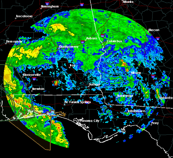 At 711 pm cdt, a confirmed tornado was located near sanford and babbie, moving north at 30 mph (radar confirmed tornado). Hazards include damaging tornado. Flying debris will be dangerous to those caught without shelter. mobile homes will be damaged or destroyed. damage to roofs, windows, and vehicles will occur. tree damage is likely. This tornadic thunderstorm will remain over mainly rural areas of northeastern covington county. At 711 pm cdt, a confirmed tornado was located near sanford and babbie, moving north at 30 mph (radar confirmed tornado). Hazards include damaging tornado. Flying debris will be dangerous to those caught without shelter. mobile homes will be damaged or destroyed. damage to roofs, windows, and vehicles will occur. tree damage is likely. This tornadic thunderstorm will remain over mainly rural areas of northeastern covington county.
|
| 6/21/2017 7:05 PM CDT |
 At 703 pm cdt, law enforcement reported a tornado on highway 84 east near onycha. the tornado is now located near horn hill, moving north at 30 mph (law enforcement confirmed tornado). Hazards include damaging tornado. Flying debris will be dangerous to those caught without shelter. mobile homes will be damaged or destroyed. damage to roofs, windows, and vehicles will occur. tree damage is likely. this tornado will be near, sanford around 715 pm cdt. Heath around 725 pm cdt. At 703 pm cdt, law enforcement reported a tornado on highway 84 east near onycha. the tornado is now located near horn hill, moving north at 30 mph (law enforcement confirmed tornado). Hazards include damaging tornado. Flying debris will be dangerous to those caught without shelter. mobile homes will be damaged or destroyed. damage to roofs, windows, and vehicles will occur. tree damage is likely. this tornado will be near, sanford around 715 pm cdt. Heath around 725 pm cdt.
|
| 6/21/2017 6:56 PM CDT |
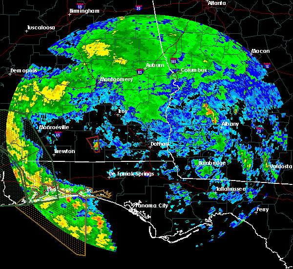 At 654 pm cdt, a severe thunderstorm capable of producing a tornado was located 7 miles southwest of opp, moving north at 25 mph (radar indicated rotation). Hazards include tornado. Flying debris will be dangerous to those caught without shelter. mobile homes will be damaged or destroyed. damage to roofs, windows, and vehicles will occur. tree damage is likely. this dangerous storm will be near, sandford around 720 pm cdt. Heath around 725 pm cdt. At 654 pm cdt, a severe thunderstorm capable of producing a tornado was located 7 miles southwest of opp, moving north at 25 mph (radar indicated rotation). Hazards include tornado. Flying debris will be dangerous to those caught without shelter. mobile homes will be damaged or destroyed. damage to roofs, windows, and vehicles will occur. tree damage is likely. this dangerous storm will be near, sandford around 720 pm cdt. Heath around 725 pm cdt.
|
| 6/21/2017 6:45 PM CDT |
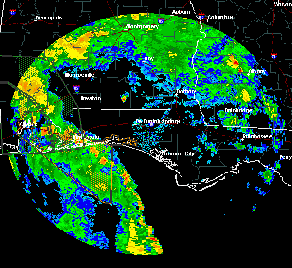 At 644 pm cdt, a severe thunderstorm capable of producing a tornado was located 8 miles north of florala, moving north at 30 mph (radar indicated rotation). Hazards include tornado. Flying debris will be dangerous to those caught without shelter. mobile homes will be damaged or destroyed. damage to roofs, windows, and vehicles will occur. tree damage is likely. this dangerous storm will be near, opp around 700 pm cdt. andalusia around 720 pm cdt. Heath around 725 pm cdt. At 644 pm cdt, a severe thunderstorm capable of producing a tornado was located 8 miles north of florala, moving north at 30 mph (radar indicated rotation). Hazards include tornado. Flying debris will be dangerous to those caught without shelter. mobile homes will be damaged or destroyed. damage to roofs, windows, and vehicles will occur. tree damage is likely. this dangerous storm will be near, opp around 700 pm cdt. andalusia around 720 pm cdt. Heath around 725 pm cdt.
|
| 5/12/2017 3:28 PM CDT |
 At 328 pm cdt, severe thunderstorms were located along a line extending from 10 miles southwest of opp to florala to 9 miles north of wright, moving east at 40 mph (radar indicated). Hazards include 60 mph wind gusts and penny size hail. Expect damage to roofs, siding, and trees. Locations impacted include, crestview, opp, florala, baker, laurel hill and lockhart. At 328 pm cdt, severe thunderstorms were located along a line extending from 10 miles southwest of opp to florala to 9 miles north of wright, moving east at 40 mph (radar indicated). Hazards include 60 mph wind gusts and penny size hail. Expect damage to roofs, siding, and trees. Locations impacted include, crestview, opp, florala, baker, laurel hill and lockhart.
|
| 5/12/2017 3:20 PM CDT |
 At 320 pm cdt, severe thunderstorms were located along a line extending from 6 miles east of andalusia to near laurel hill to 13 miles northwest of wright, moving northeast at 90 mph (radar indicated). Hazards include 60 mph wind gusts and penny size hail. Expect damage to roofs, siding, and trees. Locations impacted include, crestview, opp, florala, baker, laurel hill and lockhart. At 320 pm cdt, severe thunderstorms were located along a line extending from 6 miles east of andalusia to near laurel hill to 13 miles northwest of wright, moving northeast at 90 mph (radar indicated). Hazards include 60 mph wind gusts and penny size hail. Expect damage to roofs, siding, and trees. Locations impacted include, crestview, opp, florala, baker, laurel hill and lockhart.
|
| 5/12/2017 3:00 PM CDT |
 At 300 pm cdt, severe thunderstorms were located along a line extending from 16 miles southwest of river falls to near baker to bagdad, moving east at 45 mph (radar indicated). Hazards include 60 mph wind gusts and penny size hail. expect damage to roofs, siding, and trees At 300 pm cdt, severe thunderstorms were located along a line extending from 16 miles southwest of river falls to near baker to bagdad, moving east at 45 mph (radar indicated). Hazards include 60 mph wind gusts and penny size hail. expect damage to roofs, siding, and trees
|
| 5/12/2017 3:00 PM CDT |
 The national weather service in mobile has issued a * severe thunderstorm warning for. southern covington county in south central alabama. central okaloosa county in northwestern florida. east central santa rosa county in northwestern florida. Until 400 pm cdt. The national weather service in mobile has issued a * severe thunderstorm warning for. southern covington county in south central alabama. central okaloosa county in northwestern florida. east central santa rosa county in northwestern florida. Until 400 pm cdt.
|
| 5/1/2017 6:01 AM CDT |
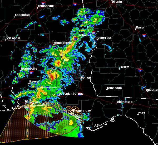 At 601 am cdt, a severe thunderstorm was located near opp, moving northeast at 35 mph (radar indicated). Hazards include 60 mph wind gusts and penny size hail. expect damage to roofs, siding, and trees At 601 am cdt, a severe thunderstorm was located near opp, moving northeast at 35 mph (radar indicated). Hazards include 60 mph wind gusts and penny size hail. expect damage to roofs, siding, and trees
|
| 4/5/2017 10:08 AM CDT |
 The severe thunderstorm warning for southern crenshaw and northeastern covington counties will expire at 1015 am cdt, the storm which prompted the warning has moved out of the area. therefore the warning will be allowed to expire. a tornado watch remains in effect until noon cdt for south central alabama. The severe thunderstorm warning for southern crenshaw and northeastern covington counties will expire at 1015 am cdt, the storm which prompted the warning has moved out of the area. therefore the warning will be allowed to expire. a tornado watch remains in effect until noon cdt for south central alabama.
|
| 4/5/2017 10:06 AM CDT |
 At 1006 am cdt, a severe thunderstorm was located over evergreen, moving east at 60 mph (radar indicated). Hazards include 70 mph wind gusts and half dollar size hail. Hail damage to vehicles is expected. expect considerable tree damage. wind damage is also likely to mobile homes, roofs, and outbuildings. locations impacted include, evergreen, georgiana, mckenzie, river falls, castleberry, red level and i65 and us 84. A tornado watch remains in effect until noon cdt for south central alabama. At 1006 am cdt, a severe thunderstorm was located over evergreen, moving east at 60 mph (radar indicated). Hazards include 70 mph wind gusts and half dollar size hail. Hail damage to vehicles is expected. expect considerable tree damage. wind damage is also likely to mobile homes, roofs, and outbuildings. locations impacted include, evergreen, georgiana, mckenzie, river falls, castleberry, red level and i65 and us 84. A tornado watch remains in effect until noon cdt for south central alabama.
|
| 4/5/2017 9:58 AM CDT |
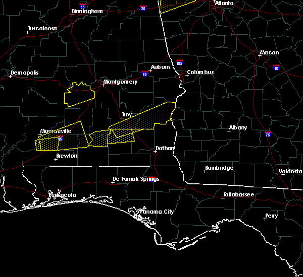 At 958 am cdt, a severe thunderstorm was located near brantley, or 9 miles northwest of elba, moving east at 45 mph (radar indicated). Hazards include 60 mph wind gusts and quarter size hail. Hail damage to vehicles is expected. expect wind damage to roofs, siding, and trees. locations impacted include, andalusia, brantley, dozier and heath. A tornado watch remains in effect until noon cdt for south central alabama. At 958 am cdt, a severe thunderstorm was located near brantley, or 9 miles northwest of elba, moving east at 45 mph (radar indicated). Hazards include 60 mph wind gusts and quarter size hail. Hail damage to vehicles is expected. expect wind damage to roofs, siding, and trees. locations impacted include, andalusia, brantley, dozier and heath. A tornado watch remains in effect until noon cdt for south central alabama.
|
| 4/5/2017 9:54 AM CDT |
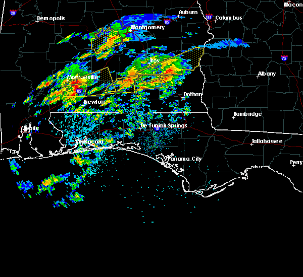 At 954 am cdt, a severe thunderstorm was located near repton, or 12 miles southeast of monroeville, moving east at 60 mph (radar indicated). Hazards include 60 mph wind gusts and half dollar size hail. Hail damage to vehicles is expected. Expect wind damage to roofs, siding, and trees. At 954 am cdt, a severe thunderstorm was located near repton, or 12 miles southeast of monroeville, moving east at 60 mph (radar indicated). Hazards include 60 mph wind gusts and half dollar size hail. Hail damage to vehicles is expected. Expect wind damage to roofs, siding, and trees.
|
| 4/5/2017 9:46 AM CDT |
 At 945 am cdt, a severe thunderstorm was located over dozier, or 11 miles northeast of andalusia, moving east at 30 mph (radar indicated). Hazards include 60 to 70 mph wind gusts and quarter size hail. Hail damage to vehicles is expected. expect wind damage to roofs, siding, and trees. locations impacted include, andalusia, brantley, river falls, red level, dozier, heath and gantt. A tornado watch remains in effect until noon cdt for south central alabama. At 945 am cdt, a severe thunderstorm was located over dozier, or 11 miles northeast of andalusia, moving east at 30 mph (radar indicated). Hazards include 60 to 70 mph wind gusts and quarter size hail. Hail damage to vehicles is expected. expect wind damage to roofs, siding, and trees. locations impacted include, andalusia, brantley, river falls, red level, dozier, heath and gantt. A tornado watch remains in effect until noon cdt for south central alabama.
|
| 4/5/2017 9:40 AM CDT |
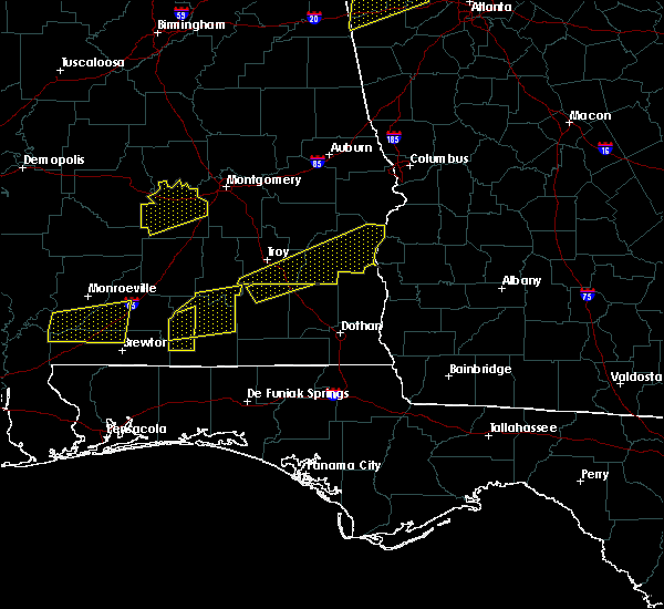 At 939 am cdt, a severe thunderstorm was located near gantt, or 8 miles northeast of andalusia, moving east at 50 mph (radar indicated). Hazards include 60 mph wind gusts and quarter size hail. Hail damage to vehicles is expected. expect wind damage to roofs, siding, and trees. locations impacted include, andalusia, opp, brantley, river falls, red level, dozier, heath and gantt. A tornado watch remains in effect until noon cdt for south central alabama. At 939 am cdt, a severe thunderstorm was located near gantt, or 8 miles northeast of andalusia, moving east at 50 mph (radar indicated). Hazards include 60 mph wind gusts and quarter size hail. Hail damage to vehicles is expected. expect wind damage to roofs, siding, and trees. locations impacted include, andalusia, opp, brantley, river falls, red level, dozier, heath and gantt. A tornado watch remains in effect until noon cdt for south central alabama.
|
| 4/5/2017 9:26 AM CDT |
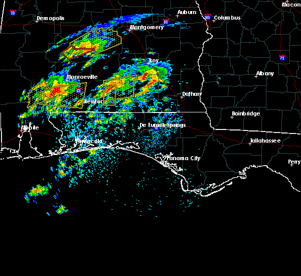 At 926 am cdt, a severe thunderstorm was located over river falls, or near andalusia, moving east at 50 mph (radar indicated). Hazards include 60 mph wind gusts and half dollar size hail. Hail damage to vehicles is expected. expect wind damage to roofs, siding, and trees. locations impacted include, andalusia, river falls and red level. A tornado watch remains in effect until noon cdt for south central alabama. At 926 am cdt, a severe thunderstorm was located over river falls, or near andalusia, moving east at 50 mph (radar indicated). Hazards include 60 mph wind gusts and half dollar size hail. Hail damage to vehicles is expected. expect wind damage to roofs, siding, and trees. locations impacted include, andalusia, river falls and red level. A tornado watch remains in effect until noon cdt for south central alabama.
|
| 4/5/2017 9:25 AM CDT |
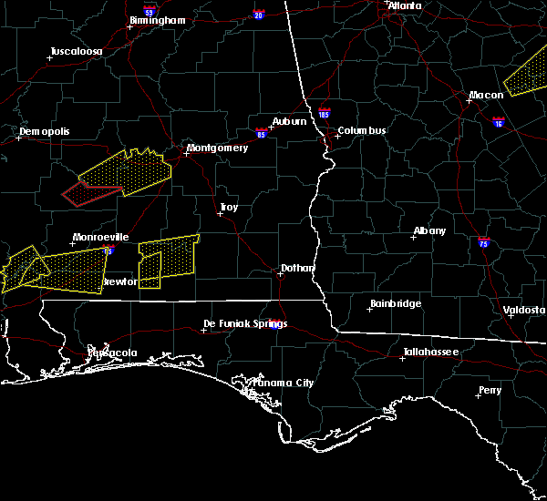 At 925 am cdt, a severe thunderstorm was located near river falls, or 7 miles northwest of andalusia, moving east at 30 mph (radar indicated). Hazards include 60 mph wind gusts and quarter size hail. Hail damage to vehicles is expected. Expect wind damage to roofs, siding, and trees. At 925 am cdt, a severe thunderstorm was located near river falls, or 7 miles northwest of andalusia, moving east at 30 mph (radar indicated). Hazards include 60 mph wind gusts and quarter size hail. Hail damage to vehicles is expected. Expect wind damage to roofs, siding, and trees.
|
| 4/5/2017 9:09 AM CDT |
 At 909 am cdt, a severe thunderstorm was located 14 miles southwest of red level, or 16 miles southeast of evergreen, moving northeast at 35 mph (radar indicated). Hazards include 60 mph wind gusts and half dollar size hail. Hail damage to vehicles is expected. expect wind damage to roofs, siding, and trees. locations impacted include, andalusia, river falls and red level. A tornado watch remains in effect until noon cdt for south central alabama. At 909 am cdt, a severe thunderstorm was located 14 miles southwest of red level, or 16 miles southeast of evergreen, moving northeast at 35 mph (radar indicated). Hazards include 60 mph wind gusts and half dollar size hail. Hail damage to vehicles is expected. expect wind damage to roofs, siding, and trees. locations impacted include, andalusia, river falls and red level. A tornado watch remains in effect until noon cdt for south central alabama.
|
| 4/5/2017 8:55 AM CDT |
 At 855 am cdt, a severe thunderstorm was located 9 miles southeast of castleberry, or 10 miles northeast of brewton, moving east at 40 mph (radar indicated). Hazards include 60 mph wind gusts and half dollar size hail. Hail damage to vehicles is expected. Expect wind damage to roofs, siding, and trees. At 855 am cdt, a severe thunderstorm was located 9 miles southeast of castleberry, or 10 miles northeast of brewton, moving east at 40 mph (radar indicated). Hazards include 60 mph wind gusts and half dollar size hail. Hail damage to vehicles is expected. Expect wind damage to roofs, siding, and trees.
|
| 4/5/2017 8:50 AM CDT |
 At 850 am cdt, a severe thunderstorm capable of producing a tornado was located near heath, or near andalusia, moving northeast at 20 mph (radar indicated rotation). Hazards include tornado and half dollar size hail. Flying debris will be dangerous to those caught without shelter. mobile homes will be damaged or destroyed. damage to roofs, windows, and vehicles will occur. tree damage is likely. Locations impacted include, andalusia, opp and heath. At 850 am cdt, a severe thunderstorm capable of producing a tornado was located near heath, or near andalusia, moving northeast at 20 mph (radar indicated rotation). Hazards include tornado and half dollar size hail. Flying debris will be dangerous to those caught without shelter. mobile homes will be damaged or destroyed. damage to roofs, windows, and vehicles will occur. tree damage is likely. Locations impacted include, andalusia, opp and heath.
|
| 4/5/2017 8:44 AM CDT |
 At 843 am cdt, a severe thunderstorm capable of producing a tornado was located over heath, or near andalusia, moving northeast at 30 mph (radar indicated rotation). Hazards include tornado and half dollar size hail. Flying debris will be dangerous to those caught without shelter. mobile homes will be damaged or destroyed. damage to roofs, windows, and vehicles will occur. tree damage is likely. This tornadic thunderstorm will remain over mainly rural areas of northeastern covington county. At 843 am cdt, a severe thunderstorm capable of producing a tornado was located over heath, or near andalusia, moving northeast at 30 mph (radar indicated rotation). Hazards include tornado and half dollar size hail. Flying debris will be dangerous to those caught without shelter. mobile homes will be damaged or destroyed. damage to roofs, windows, and vehicles will occur. tree damage is likely. This tornadic thunderstorm will remain over mainly rural areas of northeastern covington county.
|
| 4/5/2017 8:34 AM CDT |
 At 834 am cdt, a severe thunderstorm capable of producing a tornado was located over andalusia, moving northeast at 40 mph (radar indicated rotation). Hazards include tornado and half dollar size hail. Flying debris will be dangerous to those caught without shelter. mobile homes will be damaged or destroyed. damage to roofs, windows, and vehicles will occur. tree damage is likely. This dangerous storm will be near, heath around 840 am cdt. At 834 am cdt, a severe thunderstorm capable of producing a tornado was located over andalusia, moving northeast at 40 mph (radar indicated rotation). Hazards include tornado and half dollar size hail. Flying debris will be dangerous to those caught without shelter. mobile homes will be damaged or destroyed. damage to roofs, windows, and vehicles will occur. tree damage is likely. This dangerous storm will be near, heath around 840 am cdt.
|
| 4/5/2017 8:20 AM CDT |
 At 819 am cdt, a severe thunderstorm was located 7 miles southwest of andalusia, moving northeast at 50 mph (radar indicated). Hazards include 60 mph wind gusts and quarter size hail. Hail damage to vehicles is expected. expect wind damage to roofs, siding, and trees. locations impacted include, andalusia, opp, river falls, heath and gantt. A tornado watch remains in effect until noon cdt for south central alabama. At 819 am cdt, a severe thunderstorm was located 7 miles southwest of andalusia, moving northeast at 50 mph (radar indicated). Hazards include 60 mph wind gusts and quarter size hail. Hail damage to vehicles is expected. expect wind damage to roofs, siding, and trees. locations impacted include, andalusia, opp, river falls, heath and gantt. A tornado watch remains in effect until noon cdt for south central alabama.
|
| 4/5/2017 7:59 AM CDT |
 At 758 am cdt, a severe thunderstorm was located 19 miles east of east brewton, or 19 miles east of brewton, moving northeast at 50 mph (radar indicated). Hazards include 60 mph wind gusts and quarter size hail. Hail damage to vehicles is expected. Expect wind damage to roofs, siding, and trees. At 758 am cdt, a severe thunderstorm was located 19 miles east of east brewton, or 19 miles east of brewton, moving northeast at 50 mph (radar indicated). Hazards include 60 mph wind gusts and quarter size hail. Hail damage to vehicles is expected. Expect wind damage to roofs, siding, and trees.
|
| 4/3/2017 9:52 AM CDT |
 At 951 am cdt, severe thunderstorms were located along a line extending from 9 miles west of samson to near laurel hill to 7 miles northwest of valparaiso, moving east at 40 mph (radar indicated). Hazards include 60 mph wind gusts. Expect damage to roofs, siding, and trees. locations impacted include, wright, fort walton beach, crestview, niceville, destin, andalusia, eglin afb, opp, valparaiso, mary esther, florala, ocean city, lake lorraine, baker, shalimar, river falls, laurel hill, lockhart, cinco bayou and heath. A tornado watch remains in effect until 100 pm cdt for south central alabama, and northwestern florida. At 951 am cdt, severe thunderstorms were located along a line extending from 9 miles west of samson to near laurel hill to 7 miles northwest of valparaiso, moving east at 40 mph (radar indicated). Hazards include 60 mph wind gusts. Expect damage to roofs, siding, and trees. locations impacted include, wright, fort walton beach, crestview, niceville, destin, andalusia, eglin afb, opp, valparaiso, mary esther, florala, ocean city, lake lorraine, baker, shalimar, river falls, laurel hill, lockhart, cinco bayou and heath. A tornado watch remains in effect until 100 pm cdt for south central alabama, and northwestern florida.
|
| 4/3/2017 9:36 AM CDT |
 At 935 am cdt, severe thunderstorms were located along a line extending from 8 miles southeast of andalusia to near baker to 12 miles northwest of wright, moving east at 30 mph (radar indicated). Hazards include 60 mph wind gusts. expect damage to roofs, siding, and trees At 935 am cdt, severe thunderstorms were located along a line extending from 8 miles southeast of andalusia to near baker to 12 miles northwest of wright, moving east at 30 mph (radar indicated). Hazards include 60 mph wind gusts. expect damage to roofs, siding, and trees
|
| 4/3/2017 9:22 AM CDT |
 The severe thunderstorm warning for eastern butler, crenshaw, eastern escambia, southeastern conecuh, covington, northern okaloosa and northeastern santa rosa counties will expire at 930 am cdt, the storms which prompted the warning have have weakened and will moved out of the warned area. it is possible a new warnign may be issued across northern okaloosa and covington counties however. a tornado watch remains in effect until 100 pm cdt for south central alabama, and northwestern florida. The severe thunderstorm warning for eastern butler, crenshaw, eastern escambia, southeastern conecuh, covington, northern okaloosa and northeastern santa rosa counties will expire at 930 am cdt, the storms which prompted the warning have have weakened and will moved out of the warned area. it is possible a new warnign may be issued across northern okaloosa and covington counties however. a tornado watch remains in effect until 100 pm cdt for south central alabama, and northwestern florida.
|
| 4/3/2017 9:09 AM CDT |
 At 909 am cdt, severe thunderstorms were located along a line extending from near ansley to near opp to 6 miles northwest of lockhart, moving southeast at 30 mph (radar indicated). Hazards include 60 mph wind gusts and quarter size hail. Hail damage to vehicles is expected. expect wind damage to roofs, siding, and trees. locations impacted include, andalusia, greenville, opp, luverne, florala, brantley, mckenzie, river falls, red level, laurel hill, lockhart, rutledge, dozier, heath, gantt, glenwood and petrey. A tornado watch remains in effect until 100 pm cdt for south central alabama, and northwestern florida. At 909 am cdt, severe thunderstorms were located along a line extending from near ansley to near opp to 6 miles northwest of lockhart, moving southeast at 30 mph (radar indicated). Hazards include 60 mph wind gusts and quarter size hail. Hail damage to vehicles is expected. expect wind damage to roofs, siding, and trees. locations impacted include, andalusia, greenville, opp, luverne, florala, brantley, mckenzie, river falls, red level, laurel hill, lockhart, rutledge, dozier, heath, gantt, glenwood and petrey. A tornado watch remains in effect until 100 pm cdt for south central alabama, and northwestern florida.
|
| 4/3/2017 8:45 AM CDT |
 At 845 am cdt, severe thunderstorms were located along a line extending from near highland home to gantt to 14 miles west of laurel hill, moving northeast at 40 mph (radar indicated). Hazards include 60 mph wind gusts and quarter size hail. Hail damage to vehicles is expected. expect wind damage to roofs, siding, and trees. locations impacted include, andalusia, greenville, opp, luverne, florala, georgiana, brantley, mckenzie, river falls, red level, laurel hill, lockhart, rutledge, dozier, heath, gantt, glenwood and petrey. A tornado watch remains in effect until 100 pm cdt for south central alabama, and northwestern florida. At 845 am cdt, severe thunderstorms were located along a line extending from near highland home to gantt to 14 miles west of laurel hill, moving northeast at 40 mph (radar indicated). Hazards include 60 mph wind gusts and quarter size hail. Hail damage to vehicles is expected. expect wind damage to roofs, siding, and trees. locations impacted include, andalusia, greenville, opp, luverne, florala, georgiana, brantley, mckenzie, river falls, red level, laurel hill, lockhart, rutledge, dozier, heath, gantt, glenwood and petrey. A tornado watch remains in effect until 100 pm cdt for south central alabama, and northwestern florida.
|
| 4/3/2017 8:26 AM CDT |
 At 825 am cdt, severe thunderstorms were located along a line extending from near greenville to 7 miles south of red level to 12 miles southeast of riverview, moving northeast at 40 mph (radar indicated). Hazards include 60 mph wind gusts and quarter size hail. Hail damage to vehicles is expected. Expect wind damage to roofs, siding, and trees. At 825 am cdt, severe thunderstorms were located along a line extending from near greenville to 7 miles south of red level to 12 miles southeast of riverview, moving northeast at 40 mph (radar indicated). Hazards include 60 mph wind gusts and quarter size hail. Hail damage to vehicles is expected. Expect wind damage to roofs, siding, and trees.
|
| 2/7/2017 3:26 PM CST | Damage to houses and a campground. also damage to fencing at a baseball field along with tree damag in covington county AL, 1.1 miles E of Andalusia, AL |
| 1/22/2017 10:29 AM CST |
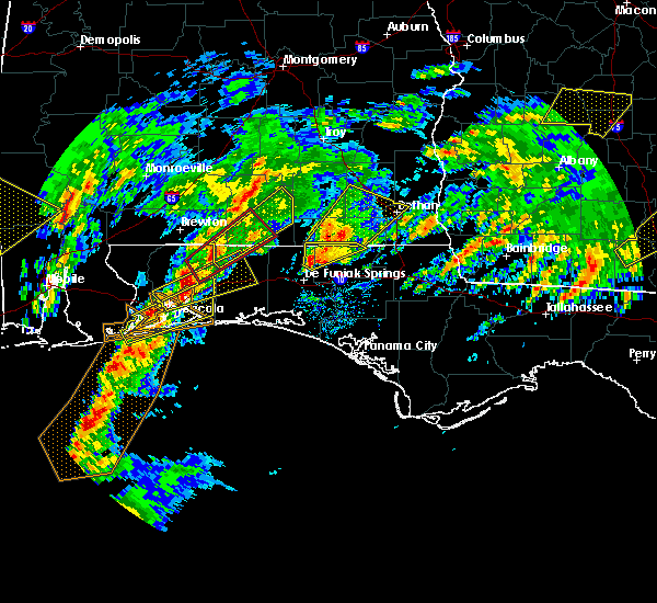 At 1029 am cst, a severe thunderstorm was located 11 miles north of baker, or 16 miles northwest of crestview, moving northeast at 50 mph (radar indicated). Hazards include 60 mph wind gusts. expect damage to roofs, siding, and trees At 1029 am cst, a severe thunderstorm was located 11 miles north of baker, or 16 miles northwest of crestview, moving northeast at 50 mph (radar indicated). Hazards include 60 mph wind gusts. expect damage to roofs, siding, and trees
|
| 1/21/2017 10:00 PM CST |
 At 959 pm cst, severe thunderstorms were located along a line extending from 9 miles northeast of georgiana to 8 miles north of gantt to near river falls, moving northeast at 60 mph (radar indicated). Hazards include 60 mph wind gusts and half dollar size hail. Hail damage to vehicles is expected. expect wind damage to roofs, siding, and trees. locations impacted include, andalusia, opp, luverne, brantley, river falls, red level, dozier, heath, gantt and glenwood. A tornado watch remains in effect until 300 am cst for south central alabama. At 959 pm cst, severe thunderstorms were located along a line extending from 9 miles northeast of georgiana to 8 miles north of gantt to near river falls, moving northeast at 60 mph (radar indicated). Hazards include 60 mph wind gusts and half dollar size hail. Hail damage to vehicles is expected. expect wind damage to roofs, siding, and trees. locations impacted include, andalusia, opp, luverne, brantley, river falls, red level, dozier, heath, gantt and glenwood. A tornado watch remains in effect until 300 am cst for south central alabama.
|
| 1/21/2017 9:37 PM CST |
 The tornado warning for northeastern covington county will expire at 945 pm cst, the storm which prompted the warning has weakened below severe limits, and no longer appears capable of producing a tornado. therefore the warning will be allowed to expire. however small hail is still possible with this thunderstorm. a tornado watch remains in effect until 300 am cst for south central alabama. The tornado warning for northeastern covington county will expire at 945 pm cst, the storm which prompted the warning has weakened below severe limits, and no longer appears capable of producing a tornado. therefore the warning will be allowed to expire. however small hail is still possible with this thunderstorm. a tornado watch remains in effect until 300 am cst for south central alabama.
|
| 1/21/2017 9:31 PM CST |
 At 931 pm cst, severe thunderstorms were located along a line extending from 11 miles north of i65 and us 84 to near evergreen to castleberry, moving east at 55 mph (radar indicated). Hazards include 60 mph wind gusts and half dollar size hail. Hail damage to vehicles is expected. Expect wind damage to roofs, siding, and trees. At 931 pm cst, severe thunderstorms were located along a line extending from 11 miles north of i65 and us 84 to near evergreen to castleberry, moving east at 55 mph (radar indicated). Hazards include 60 mph wind gusts and half dollar size hail. Hail damage to vehicles is expected. Expect wind damage to roofs, siding, and trees.
|
| 1/21/2017 9:22 PM CST |
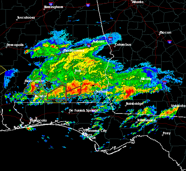 At 920 pm cst, a severe thunderstorm capable of producing a tornado was located 7 miles southeast of opp, moving northeast at 50 mph. another severe thunderstorm capable of producing a tornado was located 6 southwest of andalusia moving northeast at 50 mph (radar indicated rotation). Hazards include tornado and quarter size hail. Flying debris will be dangerous to those caught without shelter. mobile homes will be damaged or destroyed. damage to roofs, windows, and vehicles will occur. tree damage is likely. Andalusia and opp are in the path of these tornadic storms. At 920 pm cst, a severe thunderstorm capable of producing a tornado was located 7 miles southeast of opp, moving northeast at 50 mph. another severe thunderstorm capable of producing a tornado was located 6 southwest of andalusia moving northeast at 50 mph (radar indicated rotation). Hazards include tornado and quarter size hail. Flying debris will be dangerous to those caught without shelter. mobile homes will be damaged or destroyed. damage to roofs, windows, and vehicles will occur. tree damage is likely. Andalusia and opp are in the path of these tornadic storms.
|
| 1/21/2017 9:11 PM CST |
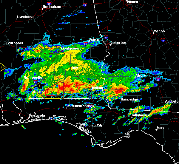 At 910 pm cst, a severe thunderstorm capable of producing a tornado was located 11 miles southwest of andalusia, moving northeast at 45 mph. another severe thunderstorm capable of producing a tornado was located 13 miles southeast of andalusia also moving northeast at 45 mph (radar indicated rotation). Hazards include tornado and quarter size hail. Flying debris will be dangerous to those caught without shelter. mobile homes will be damaged or destroyed. damage to roofs, windows, and vehicles will occur. tree damage is likely. this dangerous storm will be near, andalusia around 925 pm cst. Opp around 940 pm cst. At 910 pm cst, a severe thunderstorm capable of producing a tornado was located 11 miles southwest of andalusia, moving northeast at 45 mph. another severe thunderstorm capable of producing a tornado was located 13 miles southeast of andalusia also moving northeast at 45 mph (radar indicated rotation). Hazards include tornado and quarter size hail. Flying debris will be dangerous to those caught without shelter. mobile homes will be damaged or destroyed. damage to roofs, windows, and vehicles will occur. tree damage is likely. this dangerous storm will be near, andalusia around 925 pm cst. Opp around 940 pm cst.
|
| 1/21/2017 8:52 PM CST |
 At 851 pm cst, a severe thunderstorm was located near red level, or 10 miles north of andalusia, moving northeast at 65 mph (radar indicated). Hazards include 60 mph wind gusts and quarter size hail. Hail damage to vehicles is expected. expect wind damage to roofs, siding, and trees. locations impacted include, andalusia, opp, florala, mckenzie, river falls, castleberry, red level, lockhart, dozier, heath and gantt. A tornado watch remains in effect until 300 am cst for south central alabama, and northwestern florida. At 851 pm cst, a severe thunderstorm was located near red level, or 10 miles north of andalusia, moving northeast at 65 mph (radar indicated). Hazards include 60 mph wind gusts and quarter size hail. Hail damage to vehicles is expected. expect wind damage to roofs, siding, and trees. locations impacted include, andalusia, opp, florala, mckenzie, river falls, castleberry, red level, lockhart, dozier, heath and gantt. A tornado watch remains in effect until 300 am cst for south central alabama, and northwestern florida.
|
| 1/21/2017 8:28 PM CST |
 At 826 pm cst, a cluster of developing severe thunderstorms was located from over eastern escambia alabama to northern okaloosa county and was moving to the northeast 60 to 65 mph (radar indicated). Hazards include ping pong ball size hail and 60 mph wind gusts. People and animals outdoors will be injured. expect hail damage to roofs, siding, windows, and vehicles. Expect wind damage to roofs, siding, and trees. At 826 pm cst, a cluster of developing severe thunderstorms was located from over eastern escambia alabama to northern okaloosa county and was moving to the northeast 60 to 65 mph (radar indicated). Hazards include ping pong ball size hail and 60 mph wind gusts. People and animals outdoors will be injured. expect hail damage to roofs, siding, windows, and vehicles. Expect wind damage to roofs, siding, and trees.
|
| 1/21/2017 7:51 PM CST |
 At 751 pm cst, a severe thunderstorm was located near pollard, or near flomaton, moving northeast at 50 mph (radar indicated). Hazards include 60 mph wind gusts and half dollar size hail. Hail damage to vehicles is expected. Expect wind damage to roofs, siding, and trees. At 751 pm cst, a severe thunderstorm was located near pollard, or near flomaton, moving northeast at 50 mph (radar indicated). Hazards include 60 mph wind gusts and half dollar size hail. Hail damage to vehicles is expected. Expect wind damage to roofs, siding, and trees.
|
| 1/2/2017 6:29 PM CST |
 At 628 pm cst, severe thunderstorms were located along a line extending from red level, to 7 miles south of andalusia, to near laurel hill, to near crestview, to near pensacola beach, moving east at 45 mph (radar indicated). Hazards include 60 mph wind gusts and nickel size hail. Expect damage to roofs, siding, and trees. locations impacted include, pensacola, ferry pass, brent, west pensacola, wright, fort walton beach, ensley, warrington, crestview, niceville, gonzalez, destin, gulf shores, andalusia, eglin afb, foley, pace, milton, opp and valparaiso. A tornado watch remains in effect until 800 pm cst for south central and southwestern alabama, and northwestern florida. At 628 pm cst, severe thunderstorms were located along a line extending from red level, to 7 miles south of andalusia, to near laurel hill, to near crestview, to near pensacola beach, moving east at 45 mph (radar indicated). Hazards include 60 mph wind gusts and nickel size hail. Expect damage to roofs, siding, and trees. locations impacted include, pensacola, ferry pass, brent, west pensacola, wright, fort walton beach, ensley, warrington, crestview, niceville, gonzalez, destin, gulf shores, andalusia, eglin afb, foley, pace, milton, opp and valparaiso. A tornado watch remains in effect until 800 pm cst for south central and southwestern alabama, and northwestern florida.
|
| 1/2/2017 6:13 PM CST |
 At 612 pm cst, severe thunderstorms were located along a line extending from 8 miles east of evergreen, to 13 miles southwest of river falls, to 10 miles north of baker, to 9 miles east of roeville, to 9 miles south of warrington, moving east at 45 mph (radar indicated). Hazards include 60 mph wind gusts and nickel size hail. Expect damage to roofs, siding, and trees. locations impacted include, pensacola, ferry pass, brent, west pensacola, wright, fort walton beach, ensley, warrington, crestview, niceville, gonzalez, destin, gulf shores, andalusia, eglin afb, foley, pace, milton, opp and valparaiso. A tornado watch remains in effect until 800 pm cst for south central and southwestern alabama, and northwestern florida. At 612 pm cst, severe thunderstorms were located along a line extending from 8 miles east of evergreen, to 13 miles southwest of river falls, to 10 miles north of baker, to 9 miles east of roeville, to 9 miles south of warrington, moving east at 45 mph (radar indicated). Hazards include 60 mph wind gusts and nickel size hail. Expect damage to roofs, siding, and trees. locations impacted include, pensacola, ferry pass, brent, west pensacola, wright, fort walton beach, ensley, warrington, crestview, niceville, gonzalez, destin, gulf shores, andalusia, eglin afb, foley, pace, milton, opp and valparaiso. A tornado watch remains in effect until 800 pm cst for south central and southwestern alabama, and northwestern florida.
|
| 1/2/2017 5:42 PM CST |
 At 541 pm cst, severe thunderstorms were located along a line extending from near repton to near brewton to 8 miles east of jay to gulf shores, moving east at 45 mph (radar indicated). Hazards include 60 mph wind gusts and up to quarter size hail. expect damage to roofs, siding, and trees At 541 pm cst, severe thunderstorms were located along a line extending from near repton to near brewton to 8 miles east of jay to gulf shores, moving east at 45 mph (radar indicated). Hazards include 60 mph wind gusts and up to quarter size hail. expect damage to roofs, siding, and trees
|
| 1/2/2017 2:20 PM CST |
 At 219 pm cst, severe thunderstorms were located along a line extending from 6 miles southeast of beatrice to 8 miles southeast of peterman to 6 miles south of excel to near uriah, moving east at 40 mph (radar indicated). Hazards include 60 mph wind gusts and penny size hail. expect damage to roofs, siding, and trees At 219 pm cst, severe thunderstorms were located along a line extending from 6 miles southeast of beatrice to 8 miles southeast of peterman to 6 miles south of excel to near uriah, moving east at 40 mph (radar indicated). Hazards include 60 mph wind gusts and penny size hail. expect damage to roofs, siding, and trees
|
| 11/30/2016 1:25 PM CST |
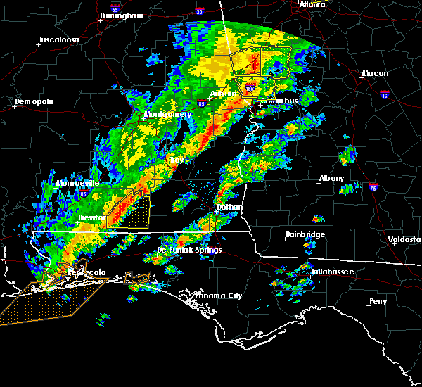 At 125 pm cst, severe thunderstorms were located along a line extending from 7 miles east of dozier to 6 miles east of andalusia to 10 miles northwest of laurel hill, moving east at 50 mph (radar indicated). Hazards include 60 mph wind gusts. Expect damage to roofs. siding. and trees. locations impacted include, andalusia, opp, river falls, heath and gantt. A tornado watch remains in effect until 500 pm cst for south central alabama. At 125 pm cst, severe thunderstorms were located along a line extending from 7 miles east of dozier to 6 miles east of andalusia to 10 miles northwest of laurel hill, moving east at 50 mph (radar indicated). Hazards include 60 mph wind gusts. Expect damage to roofs. siding. and trees. locations impacted include, andalusia, opp, river falls, heath and gantt. A tornado watch remains in effect until 500 pm cst for south central alabama.
|
| 11/30/2016 1:09 PM CST |
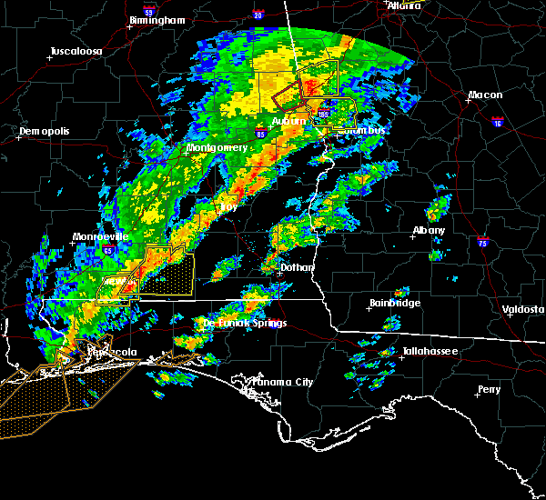 At 109 pm cst, severe thunderstorms were located along a line extending from 7 miles north of red level to river falls to 18 miles east of riverview, moving east at 60 mph (radar indicated). Hazards include 60 mph wind gusts. Expect damage to roofs. siding. and trees. locations impacted include, andalusia, opp, river falls, red level, heath and gantt. A tornado watch remains in effect until 500 pm cst for south central alabama. At 109 pm cst, severe thunderstorms were located along a line extending from 7 miles north of red level to river falls to 18 miles east of riverview, moving east at 60 mph (radar indicated). Hazards include 60 mph wind gusts. Expect damage to roofs. siding. and trees. locations impacted include, andalusia, opp, river falls, red level, heath and gantt. A tornado watch remains in effect until 500 pm cst for south central alabama.
|
| 11/30/2016 1:01 PM CST |
 At 101 pm cst, severe thunderstorms were located along a line extending from near mckenzie to near river falls to 13 miles east of riverview, moving east at 50 mph (radar indicated). Hazards include 60 mph wind gusts. Expect damage to roofs. siding. and trees. locations impacted include, andalusia, opp, brewton, east brewton, river falls, red level, heath, gantt and riverview. A tornado watch remains in effect until 500 pm cst for south central alabama. At 101 pm cst, severe thunderstorms were located along a line extending from near mckenzie to near river falls to 13 miles east of riverview, moving east at 50 mph (radar indicated). Hazards include 60 mph wind gusts. Expect damage to roofs. siding. and trees. locations impacted include, andalusia, opp, brewton, east brewton, river falls, red level, heath, gantt and riverview. A tornado watch remains in effect until 500 pm cst for south central alabama.
|
| 11/30/2016 12:40 PM CST |
 At 1240 pm cst, severe thunderstorms were located along a line extending from i65 and us 84 to 6 miles southeast of castleberry to riverview, moving east at 60 mph (radar indicated). Hazards include 60 mph wind gusts. Expect damage to roofs. siding. And trees. At 1240 pm cst, severe thunderstorms were located along a line extending from i65 and us 84 to 6 miles southeast of castleberry to riverview, moving east at 60 mph (radar indicated). Hazards include 60 mph wind gusts. Expect damage to roofs. siding. And trees.
|
| 7/9/2016 4:24 PM CDT |
 At 424 pm cdt, a severe thunderstorm was located over andalusia, moving east at 15 mph (radar indicated). Hazards include 60 mph wind gusts. Expect damage to roofs. siding. And trees. At 424 pm cdt, a severe thunderstorm was located over andalusia, moving east at 15 mph (radar indicated). Hazards include 60 mph wind gusts. Expect damage to roofs. siding. And trees.
|
| 6/17/2016 6:50 PM CDT | Trees down across much of the county. a tree also fell on a hous in covington county AL, 1.1 miles E of Andalusia, AL |
| 6/17/2016 6:46 PM CDT | A 50 knot gust was reported by k79j asos site in andalusi in covington county AL, 1.1 miles E of Andalusia, AL |
| 6/17/2016 6:46 PM CDT |
 At 645 pm cdt, severe thunderstorms were located along a line extending from near macedonia to near citronelle to 16 miles north of baker to 9 miles north of new brockton, moving southeast at 45 mph (radar indicated). Hazards include 60 mph wind gusts and nickel size hail. Expect damage to roofs. siding. and trees. Locations impacted include, andalusia, atmore, opp, brewton, citronelle, florala, richton, leakesville, mccullough, deer park, east brewton, uriah, beaumont, brantley, mount vernon, calvert, new augusta, river falls, mclain and castleberry. At 645 pm cdt, severe thunderstorms were located along a line extending from near macedonia to near citronelle to 16 miles north of baker to 9 miles north of new brockton, moving southeast at 45 mph (radar indicated). Hazards include 60 mph wind gusts and nickel size hail. Expect damage to roofs. siding. and trees. Locations impacted include, andalusia, atmore, opp, brewton, citronelle, florala, richton, leakesville, mccullough, deer park, east brewton, uriah, beaumont, brantley, mount vernon, calvert, new augusta, river falls, mclain and castleberry.
|
| 6/17/2016 6:11 PM CDT |
 At 610 pm cdt, severe thunderstorms were located along a line extending from near moss to 6 miles southwest of state line to near castleberry to near goshen, moving southeast at 50 mph (radar indicated). Hazards include 60 mph wind gusts and quarter size hail. Hail damage to vehicles is expected. expect wind damage to roofs, siding, and trees. Locations impacted include, andalusia, atmore, greenville, monroeville, opp, brewton, jackson, waynesboro, citronelle, evergreen, luverne, florala, frisco city, chatom, richton, leakesville, mccullough, peterman, saint stephens and wagarville. At 610 pm cdt, severe thunderstorms were located along a line extending from near moss to 6 miles southwest of state line to near castleberry to near goshen, moving southeast at 50 mph (radar indicated). Hazards include 60 mph wind gusts and quarter size hail. Hail damage to vehicles is expected. expect wind damage to roofs, siding, and trees. Locations impacted include, andalusia, atmore, greenville, monroeville, opp, brewton, jackson, waynesboro, citronelle, evergreen, luverne, florala, frisco city, chatom, richton, leakesville, mccullough, peterman, saint stephens and wagarville.
|
| 6/17/2016 6:00 PM CDT |
 At 559 pm cdt, severe thunderstorms were located along a line extending from bay springs to near buckatunna to near i65 and us 84 to near lapine, moving southeast at 50 mph (radar indicated). Hazards include 60 mph wind gusts and nickel size hail. Expect damage to roofs. siding. And trees. At 559 pm cdt, severe thunderstorms were located along a line extending from bay springs to near buckatunna to near i65 and us 84 to near lapine, moving southeast at 50 mph (radar indicated). Hazards include 60 mph wind gusts and nickel size hail. Expect damage to roofs. siding. And trees.
|
| 5/18/2016 8:23 PM CDT |
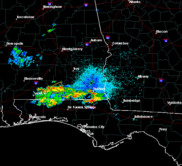 The severe thunderstorm warning for central covington county will expire at 830 pm cdt, the storm which prompted the warning has weakened below severe limits, and no longer pose an immediate threat to life or property. therefore the warning will be allowed to expire. The severe thunderstorm warning for central covington county will expire at 830 pm cdt, the storm which prompted the warning has weakened below severe limits, and no longer pose an immediate threat to life or property. therefore the warning will be allowed to expire.
|
| 5/18/2016 7:53 PM CDT |
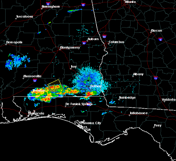 At 752 pm cdt, a severe thunderstorm was located over andalusia, moving east at 15 mph (radar indicated). Hazards include 60 mph wind gusts and quarter size hail. Hail damage to vehicles is expected. Expect wind damage to roofs, siding, and trees. At 752 pm cdt, a severe thunderstorm was located over andalusia, moving east at 15 mph (radar indicated). Hazards include 60 mph wind gusts and quarter size hail. Hail damage to vehicles is expected. Expect wind damage to roofs, siding, and trees.
|
| 5/18/2016 7:32 PM CDT |
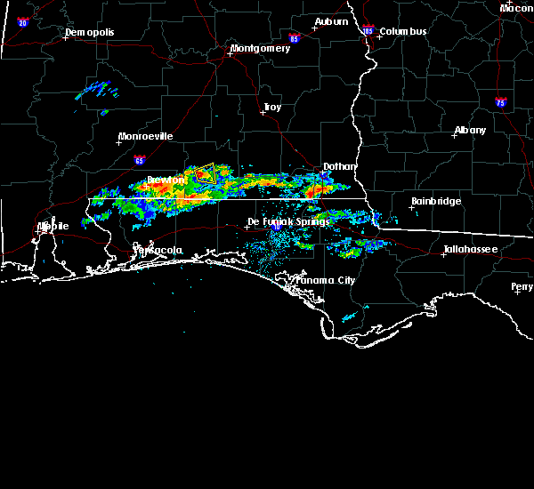 At 731 pm cdt, a severe thunderstorm was located near andalusia, moving east at 15 mph (radar indicated). Hazards include 60 mph wind gusts and quarter size hail. Hail damage to vehicles is expected. Expect wind damage to roofs, siding, and trees. At 731 pm cdt, a severe thunderstorm was located near andalusia, moving east at 15 mph (radar indicated). Hazards include 60 mph wind gusts and quarter size hail. Hail damage to vehicles is expected. Expect wind damage to roofs, siding, and trees.
|
| 4/1/2016 6:05 AM CDT |
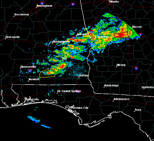 At 605 am cdt, a severe thunderstorm was located near rose hill, or 7 miles northeast of andalusia, moving east at 45 mph (radar indicated). Hazards include 60 mph wind gusts and quarter size hail. Hail damage to vehicles is expected. expect wind damage to roofs, siding, and trees. Locations impacted include, andalusia, opp, babbie, river falls, red level, carolina, heath, sanford, gantt, libertyville and rose hill. At 605 am cdt, a severe thunderstorm was located near rose hill, or 7 miles northeast of andalusia, moving east at 45 mph (radar indicated). Hazards include 60 mph wind gusts and quarter size hail. Hail damage to vehicles is expected. expect wind damage to roofs, siding, and trees. Locations impacted include, andalusia, opp, babbie, river falls, red level, carolina, heath, sanford, gantt, libertyville and rose hill.
|
| 4/1/2016 5:41 AM CDT |
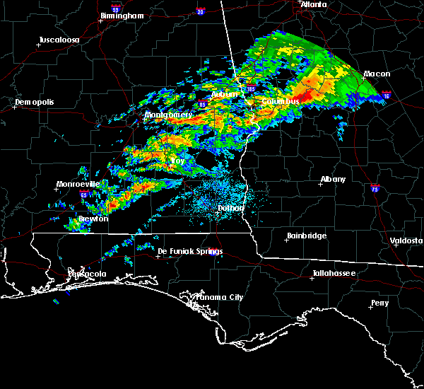 At 541 am cdt, a severe thunderstorm was located near river falls, or 7 miles west of andalusia, moving east at 50 mph (radar indicated). Hazards include 60 mph wind gusts and quarter size hail. Hail damage to vehicles is expected. Expect wind damage to roofs, siding, and trees. At 541 am cdt, a severe thunderstorm was located near river falls, or 7 miles west of andalusia, moving east at 50 mph (radar indicated). Hazards include 60 mph wind gusts and quarter size hail. Hail damage to vehicles is expected. Expect wind damage to roofs, siding, and trees.
|
| 3/31/2016 1:37 PM CDT |
 At 136 pm cdt, a severe thunderstorm was located 7 miles south of libertyville, or 10 miles northwest of florala, moving east at 30 mph (radar indicated). Hazards include 60 mph wind gusts and quarter size hail. Hail damage to vehicles is expected. expect wind damage to roofs, siding, and trees. locations impacted include, andalusia, opp, florala, babbie, lockhart, carolina, sanford, horn hill, onycha and libertyville. A tornado watch remains in effect until 200 pm cdt for south central alabama. At 136 pm cdt, a severe thunderstorm was located 7 miles south of libertyville, or 10 miles northwest of florala, moving east at 30 mph (radar indicated). Hazards include 60 mph wind gusts and quarter size hail. Hail damage to vehicles is expected. expect wind damage to roofs, siding, and trees. locations impacted include, andalusia, opp, florala, babbie, lockhart, carolina, sanford, horn hill, onycha and libertyville. A tornado watch remains in effect until 200 pm cdt for south central alabama.
|
| 3/31/2016 1:20 PM CDT |
 At 118 pm cdt, a severe thunderstorm was located 8 miles southwest of carolina, or 14 miles southwest of andalusia, moving east at 30 mph (radar indicated). Hazards include 60 mph wind gusts and quarter size hail. Hail damage to vehicles is expected. expect wind damage to roofs, siding, and trees. locations impacted include, andalusia, opp, florala, babbie, river falls, lockhart, carolina, heath, sanford, horn hill, onycha, libertyville and us 29 and cr 43. A tornado watch remains in effect until 200 pm cdt for south central alabama. At 118 pm cdt, a severe thunderstorm was located 8 miles southwest of carolina, or 14 miles southwest of andalusia, moving east at 30 mph (radar indicated). Hazards include 60 mph wind gusts and quarter size hail. Hail damage to vehicles is expected. expect wind damage to roofs, siding, and trees. locations impacted include, andalusia, opp, florala, babbie, river falls, lockhart, carolina, heath, sanford, horn hill, onycha, libertyville and us 29 and cr 43. A tornado watch remains in effect until 200 pm cdt for south central alabama.
|
| 3/31/2016 12:59 PM CDT |
 At 1258 pm cdt, a severe thunderstorm was located over us 29 and cr 43, or 17 miles east of east brewton, moving east at 30 mph (radar indicated). Hazards include 60 mph wind gusts and quarter size hail. Hail damage to vehicles is expected. Expect wind damage to roofs, siding, and trees. At 1258 pm cdt, a severe thunderstorm was located over us 29 and cr 43, or 17 miles east of east brewton, moving east at 30 mph (radar indicated). Hazards include 60 mph wind gusts and quarter size hail. Hail damage to vehicles is expected. Expect wind damage to roofs, siding, and trees.
|
| 3/24/2016 2:53 PM CDT |
 At 253 pm cdt, severe thunderstorms were located along a line extending from near greenville to 6 miles southeast of rose hill to babbie to near laurel hill, moving east at 50 mph (radar indicated). Hazards include 70 mph wind gusts and penny size hail. Expect considerable tree damage. damage is likely to mobile homes, roofs, and outbuildings. locations impacted include, andalusia, greenville, opp, luverne, florala, brantley, babbie, river falls, lockhart, red level, rutledge, dozier, carolina, heath, sanford, horn hill, gantt, glenwood, onycha and libertyville. A tornado watch remains in effect until 700 pm cdt for south central alabama. At 253 pm cdt, severe thunderstorms were located along a line extending from near greenville to 6 miles southeast of rose hill to babbie to near laurel hill, moving east at 50 mph (radar indicated). Hazards include 70 mph wind gusts and penny size hail. Expect considerable tree damage. damage is likely to mobile homes, roofs, and outbuildings. locations impacted include, andalusia, greenville, opp, luverne, florala, brantley, babbie, river falls, lockhart, red level, rutledge, dozier, carolina, heath, sanford, horn hill, gantt, glenwood, onycha and libertyville. A tornado watch remains in effect until 700 pm cdt for south central alabama.
|
| 3/24/2016 2:46 PM CDT | Trees reported down on power lines on lindsey bridge rd. time estimated via rada in covington county AL, 3.6 miles NW of Andalusia, AL |
| 3/24/2016 2:33 PM CDT | Public reports tree down in river falls and minor damage to gas stattion awning. time estimated from rada in covington county AL, 5.5 miles ESE of Andalusia, AL |
| 3/24/2016 2:31 PM CDT |
 At 231 pm cdt, severe thunderstorms were located along a line extending from near i65 and al 10 to near river falls to 8 miles southwest of carolina to 11 miles south of us 29 and cr 43, moving east at 55 mph (radar indicated). Hazards include 70 mph wind gusts and penny size hail. Expect considerable tree damage. Damage is likely to mobile homes, roofs, and outbuildings. At 231 pm cdt, severe thunderstorms were located along a line extending from near i65 and al 10 to near river falls to 8 miles southwest of carolina to 11 miles south of us 29 and cr 43, moving east at 55 mph (radar indicated). Hazards include 70 mph wind gusts and penny size hail. Expect considerable tree damage. Damage is likely to mobile homes, roofs, and outbuildings.
|
| 3/24/2016 2:14 PM CDT |
 At 212 pm cdt, severe thunderstorms were located along a line extending from near i65 and cr 7 to 7 miles south of us 29 and cr 43 to near gonzalez, moving east at 60 mph (radar indicated). Hazards include 70 mph wind gusts and penny size hail. Expect considerable tree damage. damage is likely to mobile homes, roofs, and outbuildings. locations impacted include, andalusia, milton, brewton, evergreen, east brewton, century, flomaton, pace, bagdad, molino, georgiana, castleberry, jay, mckenzie, river falls, red level, carolina, heath, gantt and riverview. A tornado watch remains in effect until 700 pm cdt for southwestern alabama, and northwestern florida. At 212 pm cdt, severe thunderstorms were located along a line extending from near i65 and cr 7 to 7 miles south of us 29 and cr 43 to near gonzalez, moving east at 60 mph (radar indicated). Hazards include 70 mph wind gusts and penny size hail. Expect considerable tree damage. damage is likely to mobile homes, roofs, and outbuildings. locations impacted include, andalusia, milton, brewton, evergreen, east brewton, century, flomaton, pace, bagdad, molino, georgiana, castleberry, jay, mckenzie, river falls, red level, carolina, heath, gantt and riverview. A tornado watch remains in effect until 700 pm cdt for southwestern alabama, and northwestern florida.
|
| 3/24/2016 1:46 PM CDT |
 At 145 pm cdt, severe thunderstorms were located along a line extending from near peterman to 7 miles southwest of century to near silverhill, moving east at 50 mph (radar indicated). Hazards include 70 mph wind gusts and penny size hail. Expect considerable tree damage. Damage is likely to mobile homes, roofs, and outbuildings. At 145 pm cdt, severe thunderstorms were located along a line extending from near peterman to 7 miles southwest of century to near silverhill, moving east at 50 mph (radar indicated). Hazards include 70 mph wind gusts and penny size hail. Expect considerable tree damage. Damage is likely to mobile homes, roofs, and outbuildings.
|
| 2/15/2016 5:49 PM CST |
 At 548 pm cst, a severe thunderstorm was located near rose hill, or 9 miles north of opp, moving east at 65 mph (radar indicated). Hazards include 60 mph wind gusts and quarter size hail. Hail damage to vehicles is expected. expect wind damage to roofs, siding, and trees. locations impacted include, andalusia, opp, babbie, dozier, heath, sanford, gantt and rose hill. A tornado watch remains in effect until 900 pm cst for south central alabama. At 548 pm cst, a severe thunderstorm was located near rose hill, or 9 miles north of opp, moving east at 65 mph (radar indicated). Hazards include 60 mph wind gusts and quarter size hail. Hail damage to vehicles is expected. expect wind damage to roofs, siding, and trees. locations impacted include, andalusia, opp, babbie, dozier, heath, sanford, gantt and rose hill. A tornado watch remains in effect until 900 pm cst for south central alabama.
|
| 2/15/2016 5:37 PM CST |
 At 536 pm cst, a severe thunderstorm was located over heath, or near andalusia, moving east at 65 mph (radar indicated). Hazards include 60 mph wind gusts and quarter size hail. Hail damage to vehicles is expected. Expect wind damage to roofs, siding, and trees. At 536 pm cst, a severe thunderstorm was located over heath, or near andalusia, moving east at 65 mph (radar indicated). Hazards include 60 mph wind gusts and quarter size hail. Hail damage to vehicles is expected. Expect wind damage to roofs, siding, and trees.
|
| 2/15/2016 5:06 PM CST |
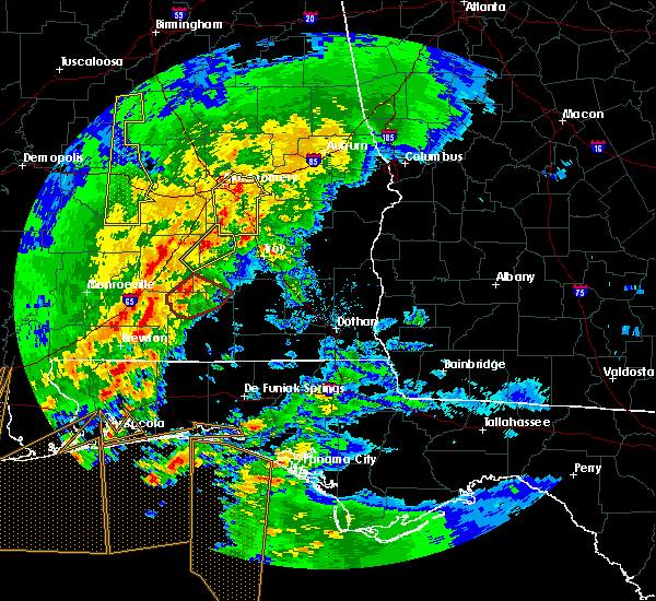 At 505 pm cst, a confirmed tornado was located 8 miles east of mckenzie, or 16 miles north of andalusia, moving northeast at 55 mph (weather spotters confirmed tornado). Hazards include damaging tornado and quarter size hail. Flying debris will be dangerous to those caught without shelter. mobile homes will be damaged or destroyed. damage to roofs, windows, and vehicles will occur. tree damage is likely. This tornadic thunderstorm will remain over mainly rural areas of southwestern crenshaw, northern covington and southeastern butler counties. At 505 pm cst, a confirmed tornado was located 8 miles east of mckenzie, or 16 miles north of andalusia, moving northeast at 55 mph (weather spotters confirmed tornado). Hazards include damaging tornado and quarter size hail. Flying debris will be dangerous to those caught without shelter. mobile homes will be damaged or destroyed. damage to roofs, windows, and vehicles will occur. tree damage is likely. This tornadic thunderstorm will remain over mainly rural areas of southwestern crenshaw, northern covington and southeastern butler counties.
|
| 2/15/2016 5:01 PM CST |
 At 500 pm cst, a severe thunderstorm capable of producing a tornado was located near red level, or 12 miles northwest of andalusia, moving northeast at 45 mph (radar indicated rotation). Hazards include tornado and quarter size hail. Flying debris will be dangerous to those caught without shelter. mobile homes will be damaged or destroyed. damage to roofs, windows, and vehicles will occur. tree damage is likely. this dangerous storm will be near, gantt around 505 pm cst. Dozier around 515 pm cst. At 500 pm cst, a severe thunderstorm capable of producing a tornado was located near red level, or 12 miles northwest of andalusia, moving northeast at 45 mph (radar indicated rotation). Hazards include tornado and quarter size hail. Flying debris will be dangerous to those caught without shelter. mobile homes will be damaged or destroyed. damage to roofs, windows, and vehicles will occur. tree damage is likely. this dangerous storm will be near, gantt around 505 pm cst. Dozier around 515 pm cst.
|
| 2/15/2016 4:47 PM CST |
 At 446 pm cst, a confirmed tornado was located 7 miles southwest of red level, or 14 miles west of andalusia, moving northeast at 50 mph (radar confirmed tornado). Hazards include damaging tornado and quarter size hail. Flying debris will be dangerous to those caught without shelter. mobile homes will be damaged or destroyed. damage to roofs, windows, and vehicles will occur. tree damage is likely. this tornado will be near, river falls and red level around 455 pm cst. heath around 500 pm cst. gantt around 505 pm cst. rose hill around 510 pm cst. Dozier around 515 pm cst. At 446 pm cst, a confirmed tornado was located 7 miles southwest of red level, or 14 miles west of andalusia, moving northeast at 50 mph (radar confirmed tornado). Hazards include damaging tornado and quarter size hail. Flying debris will be dangerous to those caught without shelter. mobile homes will be damaged or destroyed. damage to roofs, windows, and vehicles will occur. tree damage is likely. this tornado will be near, river falls and red level around 455 pm cst. heath around 500 pm cst. gantt around 505 pm cst. rose hill around 510 pm cst. Dozier around 515 pm cst.
|
| 2/15/2016 4:41 PM CST |
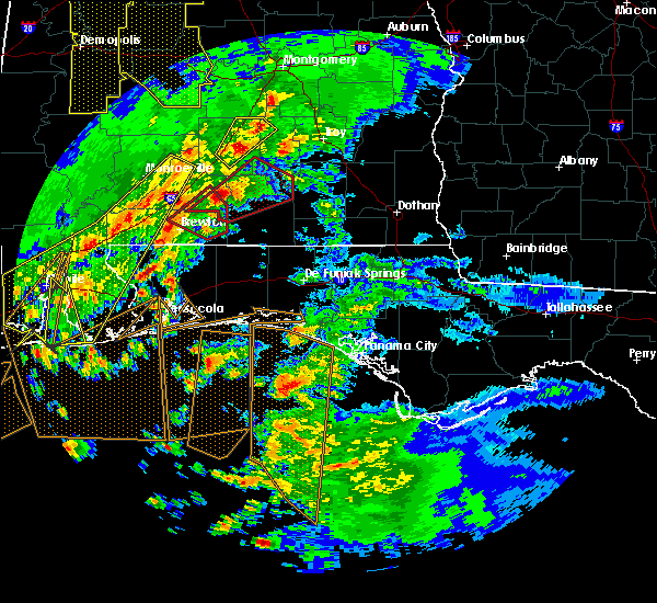 At 440 pm cst, a severe thunderstorm capable of producing a tornado was located 11 miles southeast of evergreen, moving northeast at 40 mph (radar indicated rotation). Hazards include tornado and quarter size hail. Flying debris will be dangerous to those caught without shelter. mobile homes will be damaged or destroyed. damage to roofs, windows, and vehicles will occur. tree damage is likely. This dangerous storm will be near, red level around 455 pm cst. At 440 pm cst, a severe thunderstorm capable of producing a tornado was located 11 miles southeast of evergreen, moving northeast at 40 mph (radar indicated rotation). Hazards include tornado and quarter size hail. Flying debris will be dangerous to those caught without shelter. mobile homes will be damaged or destroyed. damage to roofs, windows, and vehicles will occur. tree damage is likely. This dangerous storm will be near, red level around 455 pm cst.
|
| 2/15/2016 4:31 PM CST |
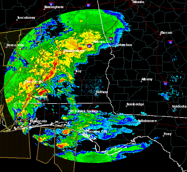 At 430 pm cst, a severe thunderstorm capable of producing a tornado was located 7 miles northwest of us 29 and cr 43, or 13 miles south of evergreen, moving northeast at 40 mph (radar indicated rotation). Hazards include tornado and quarter size hail. Flying debris will be dangerous to those caught without shelter. mobile homes will be damaged or destroyed. damage to roofs, windows, and vehicles will occur. tree damage is likely. this dangerous storm will be near, river falls and red level around 500 pm cst. gantt around 505 pm cst. Dozier and rose hill around 515 pm cst. At 430 pm cst, a severe thunderstorm capable of producing a tornado was located 7 miles northwest of us 29 and cr 43, or 13 miles south of evergreen, moving northeast at 40 mph (radar indicated rotation). Hazards include tornado and quarter size hail. Flying debris will be dangerous to those caught without shelter. mobile homes will be damaged or destroyed. damage to roofs, windows, and vehicles will occur. tree damage is likely. this dangerous storm will be near, river falls and red level around 500 pm cst. gantt around 505 pm cst. Dozier and rose hill around 515 pm cst.
|
| 1/22/2016 12:35 AM CST | At 1234 am cst, severe thunderstorms were located along a line extending from 5 miles northwest of dozier to near rose hill to libertyville to 11 miles south of carolina, moving east at 40 mph (radar indicated). Hazards include 60 mph wind gusts. Expect damage to roofs. siding and trees. locations impacted include, andalusia, opp, brantley, babbie, river falls, dozier, carolina, heath, sanford, horn hill, gantt and onycha. A tornado watch remains in effect until 300 am cst for south central alabama. |
| 1/22/2016 12:11 AM CST | The national weather service in mobile has issued a * severe thunderstorm warning for. southeastern conecuh county in south central alabama. southern crenshaw county in south central alabama. covington county in south central alabama. East central escambia county in south central alabama. |
| 12/23/2015 9:36 AM CST | At 936 am cst, severe thunderstorms were located along a line extending from near brantley to 6 miles east of rose hill to near sanford, moving northeast at 55 mph (radar indicated). Hazards include 60 mph wind gusts and nickel size hail. Expect damage to roofs. siding and trees. Locations impacted include, andalusia, opp, babbie, sanford, horn hill, onycha, libertyville and rose hill. |
| 12/23/2015 9:15 AM CST | At 913 am cst, a severe thunderstorm was located near carolina, or 7 miles southwest of andalusia, moving northeast at 40 mph (radar indicated). Hazards include 60 mph wind gusts and nickel size hail. Expect damage to roofs. siding and trees. Locations impacted include, andalusia, opp, babbie, river falls, red level, carolina, heath, sanford, horn hill, gantt, onycha and libertyville. |
| 12/23/2015 8:56 AM CST | At 855 am cst, a severe thunderstorm was located near us 29 and cr 43, or 18 miles southwest of andalusia, moving northeast at 45 mph (radar indicated). Hazards include 70 mph wind gusts and quarter size hail. Hail damage to vehicles is expected. expect considerable tree damage. wind damage is also likely to mobile homes, roofs and outbuildings. Locations impacted include, andalusia, opp, babbie, river falls, red level, carolina, heath, sanford, horn hill, gantt, onycha and libertyville. |
| 12/23/2015 8:38 AM CST | The national weather service in mobile has issued a * severe thunderstorm warning for. southeastern conecuh county in south central alabama. covington county in south central alabama. eastern escambia county in south central alabama. Until 945 am cst. |
| 8/7/2015 4:04 PM CDT |
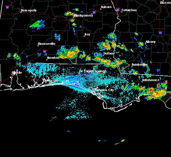 At 403 pm cdt, a severe thunderstorm capable of producing damaging winds over 60 mph was located over babbie, or near opp, moving southeast at 15 mph. At 403 pm cdt, a severe thunderstorm capable of producing damaging winds over 60 mph was located over babbie, or near opp, moving southeast at 15 mph.
|
| 8/7/2015 3:49 PM CDT |
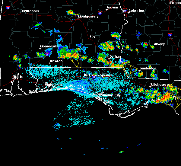 At 349 pm cdt, a severe thunderstorm capable of producing damaging winds over 60 mph was located over sanford, or near opp, and moving southeast at 10 mph. At 349 pm cdt, a severe thunderstorm capable of producing damaging winds over 60 mph was located over sanford, or near opp, and moving southeast at 10 mph.
|
| 6/30/2015 1:41 PM CDT |
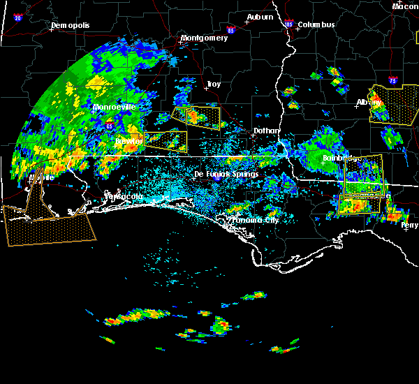 At 141 pm cdt, a severe thunderstorm capable of producing damaging winds over 60 mph was located 7 miles northeast of us 29 and cr 43, or 14 miles southwest of andalusia, and moving east at 45 mph. At 141 pm cdt, a severe thunderstorm capable of producing damaging winds over 60 mph was located 7 miles northeast of us 29 and cr 43, or 14 miles southwest of andalusia, and moving east at 45 mph.
|
| 4/25/2015 4:43 PM CDT | At 442 pm cdt, a line of severe thunderstorms capable of producing damaging winds over 60 mph was located along a line extending from near mckenzie to near crestview, and moving east at 25 mph. |
| 4/25/2015 4:43 PM CDT | At 442 pm cdt, a line of severe thunderstorms capable of producing damaging winds over 60 mph was located along a line extending from near mckenzie to near crestview, and moving east at 25 mph. |
| 4/25/2015 4:35 PM CDT | Asos at andalusia airforce base recorded a 61mph wind gus in covington county AL, 1.1 miles E of Andalusia, AL |
| 4/25/2015 4:15 PM CDT | At 414 pm cdt, a line of severe thunderstorms capable of producing quarter size hail and damaging winds over 60 mph were located along a line extending from 8 miles northwest of dozier to 6 miles east of us 29 and cr 43 to 11 miles northwest of baker, moving east at 30 mph. |
| 4/25/2015 4:15 PM CDT | At 414 pm cdt, a line of severe thunderstorms capable of producing quarter size hail and damaging winds over 60 mph were located along a line extending from 8 miles northwest of dozier to 6 miles east of us 29 and cr 43 to 11 miles northwest of baker, moving east at 30 mph. |
| 4/25/2015 3:48 PM CDT | At 346 pm cdt, a line of severe thunderstorms capable of producing quarter size hail and damaging winds over 60 mph was located along a line extending from near i65 and cr 29 to 6 miles south of castleberry to jay, and moving east at 20 mph. |
| 4/25/2015 3:48 PM CDT | At 346 pm cdt, a line of severe thunderstorms capable of producing quarter size hail and damaging winds over 60 mph was located along a line extending from near i65 and cr 29 to 6 miles south of castleberry to jay, and moving east at 20 mph. |
| 4/19/2015 6:05 AM CDT | At 604 am cdt, a severe thunderstorm capable of producing quarter size hail and damaging winds over 60 mph was located over us 29 and cr 43, or 17 miles east of east brewton, and moving northeast at 55 mph. |
| 8/18/2014 5:30 PM CDT | 5 large oak trees down. damage to a shed and roof of a hous in covington county AL, 2.9 miles NNW of Andalusia, AL |
| 3/16/2014 9:06 AM CDT | Trees down in the sanford communit in covington county AL, 7 miles SW of Andalusia, AL |
| 7/23/2013 4:53 PM CDT | Wind damage and trees down at wkni radio in andalusi in covington county AL, 1.1 miles E of Andalusia, AL |
| 6/28/2013 2:30 PM CDT | Quarter sized hail reported 1.1 miles E of Andalusia, AL, quarter size hal |
| 12/20/2012 9:55 AM CST | Trees down along 55 sout in covington county AL, 1.1 miles E of Andalusia, AL |
| 7/30/2012 7:59 PM CDT | Quarter sized hail reported 3.6 miles S of Andalusia, AL, numerous reports of quarter size hail in the area. |
| 7/30/2012 6:49 PM CDT | Golf Ball sized hail reported 6.4 miles NNE of Andalusia, AL, quarter to golf ball size hail reported covering ground. |
| 1/1/0001 12:00 AM | Numerous trees down in andalusia...kiwanis bldg damaged on s. end of tow in covington county AL, 1.1 miles E of Andalusia, AL |
| 1/1/0001 12:00 AM | Quarter sized hail reported 1.1 miles E of Andalusia, AL, one inch hail reported on lindsey bridge rd. in andalusia. |
| 1/1/0001 12:00 AM | Quarter sized hail reported 1.1 miles E of Andalusia, AL, large hail report by spotter. |
| 1/1/0001 12:00 AM | Trees and power lines down near airport road and south bypas in covington county AL, 1.1 miles E of Andalusia, AL |
| 1/1/0001 12:00 AM | Tree down on highway 55 south near guardian ange in covington county AL, 2 miles NNE of Andalusia, AL |
| 1/1/0001 12:00 AM | Power line down near south bypas in covington county AL, 0.8 miles S of Andalusia, AL |
| 1/1/0001 12:00 AM | Damage to metal awning at andalusia elementary school on highway 29 sout in covington county AL, 3.5 miles E of Andalusia, AL |
| 1/1/0001 12:00 AM | A few trees down around the city of andalusi in covington county AL, 1.1 miles E of Andalusia, AL |
Hail Maps for Andalusia, AL
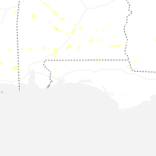
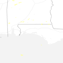
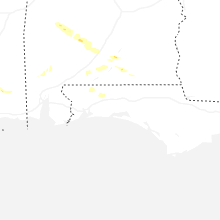
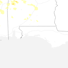


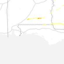
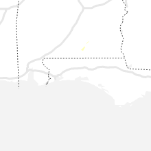
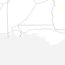
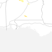


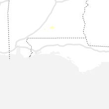


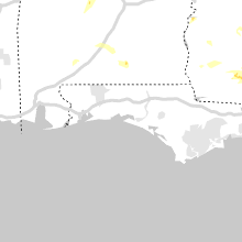


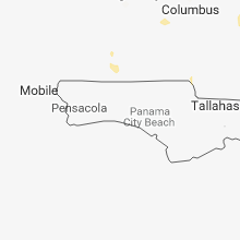
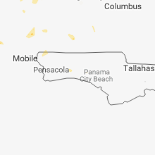


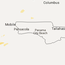


Connect with Interactive Hail Maps