

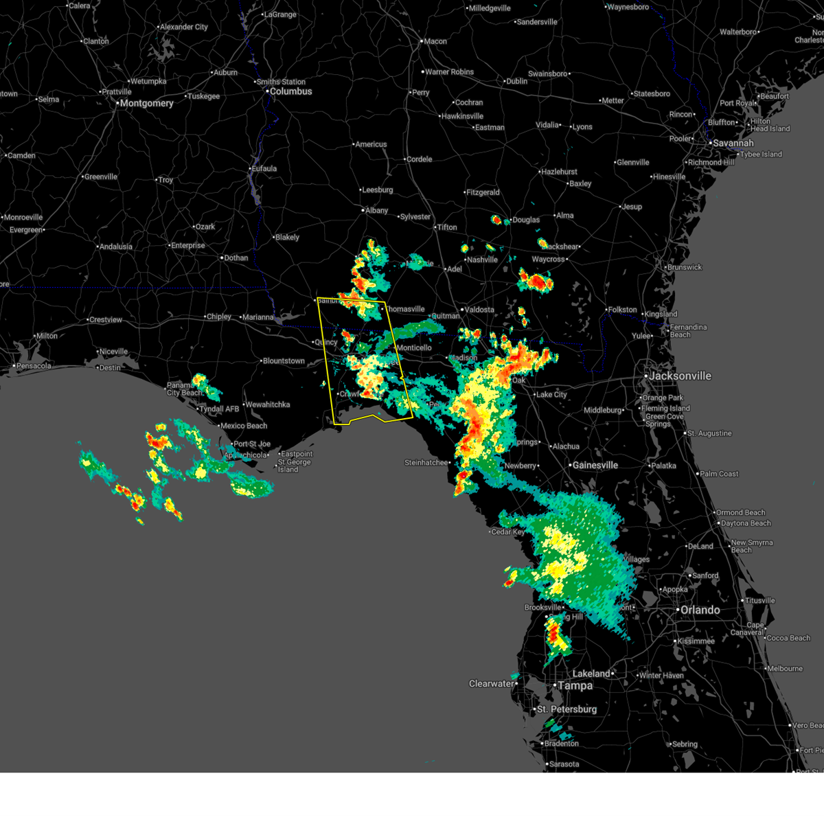
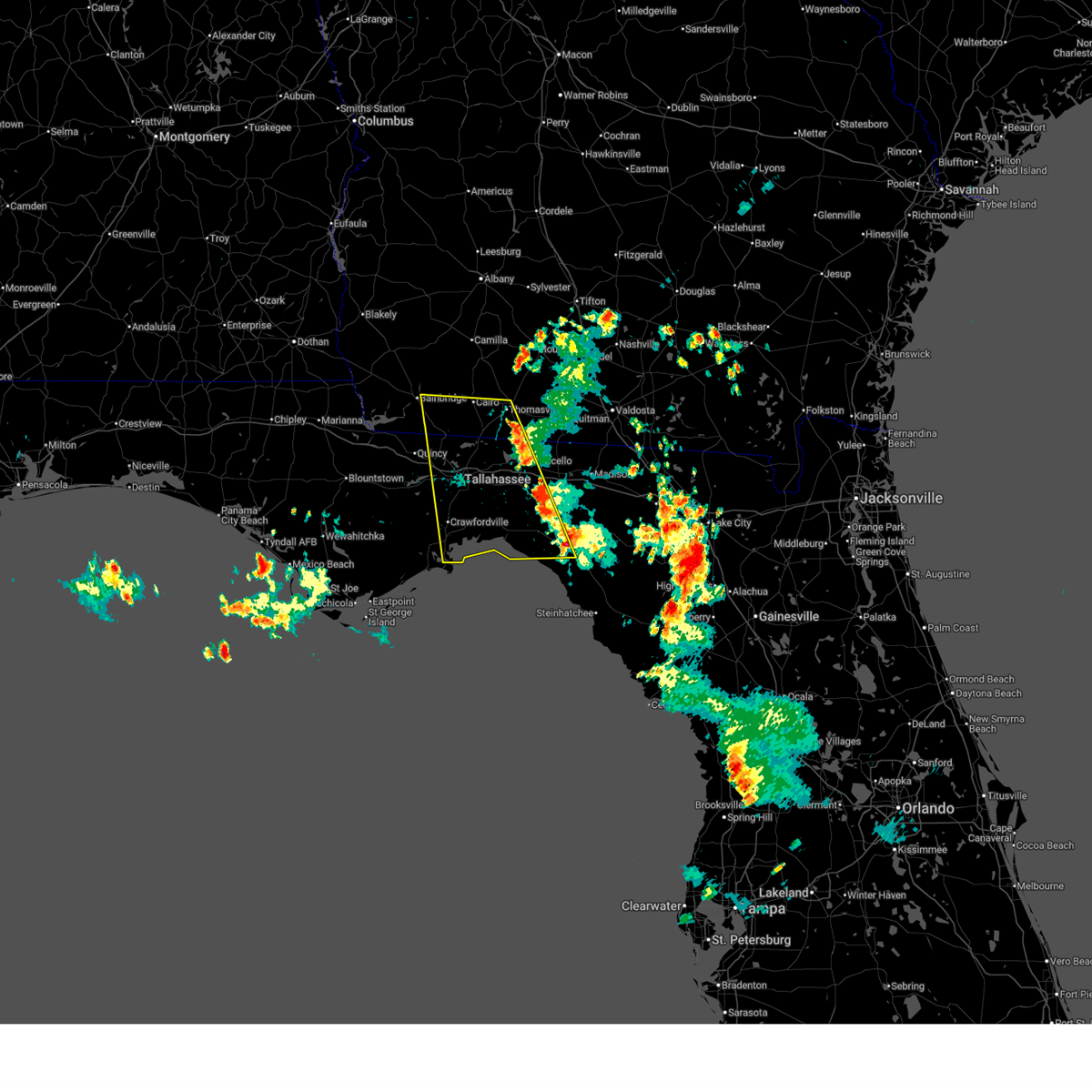
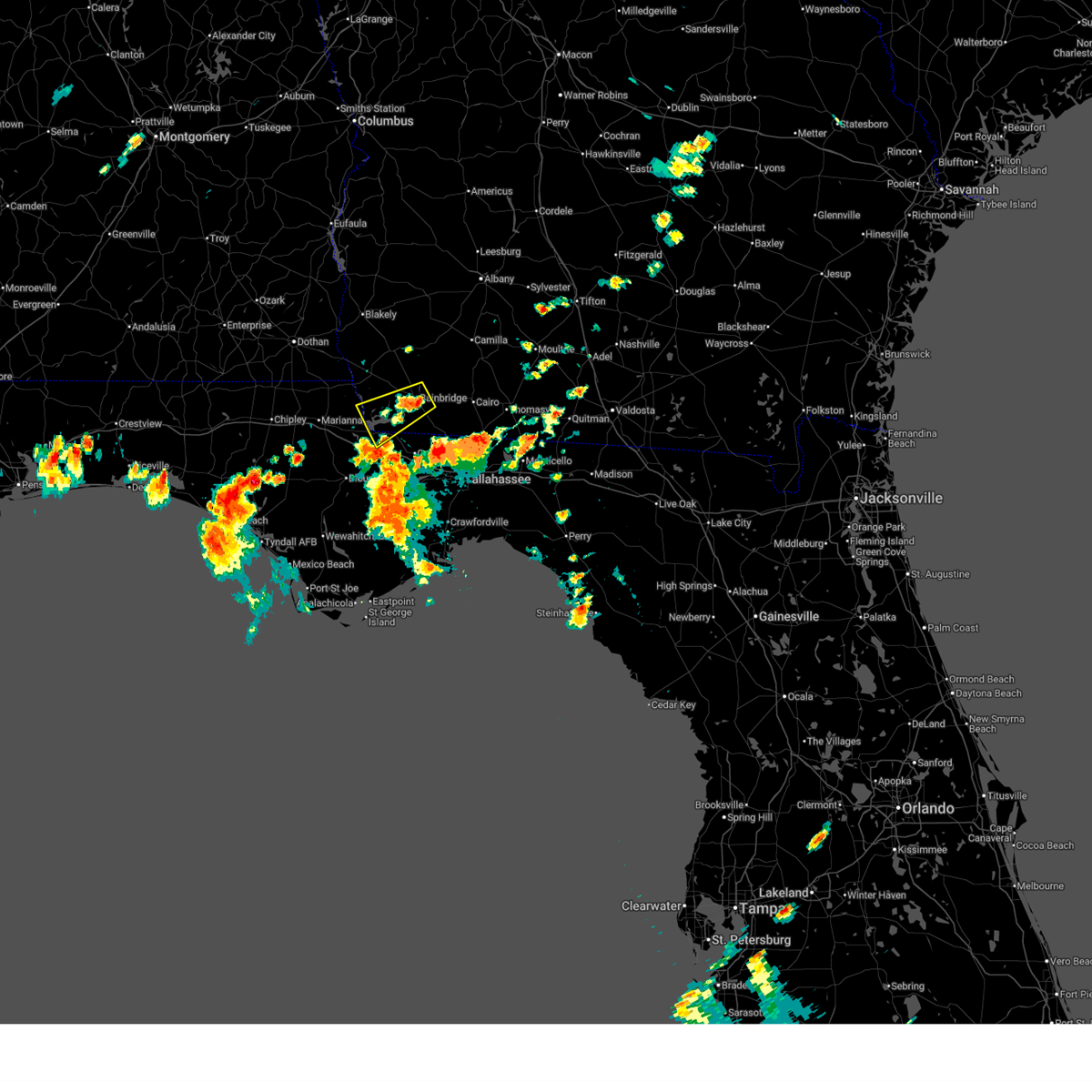
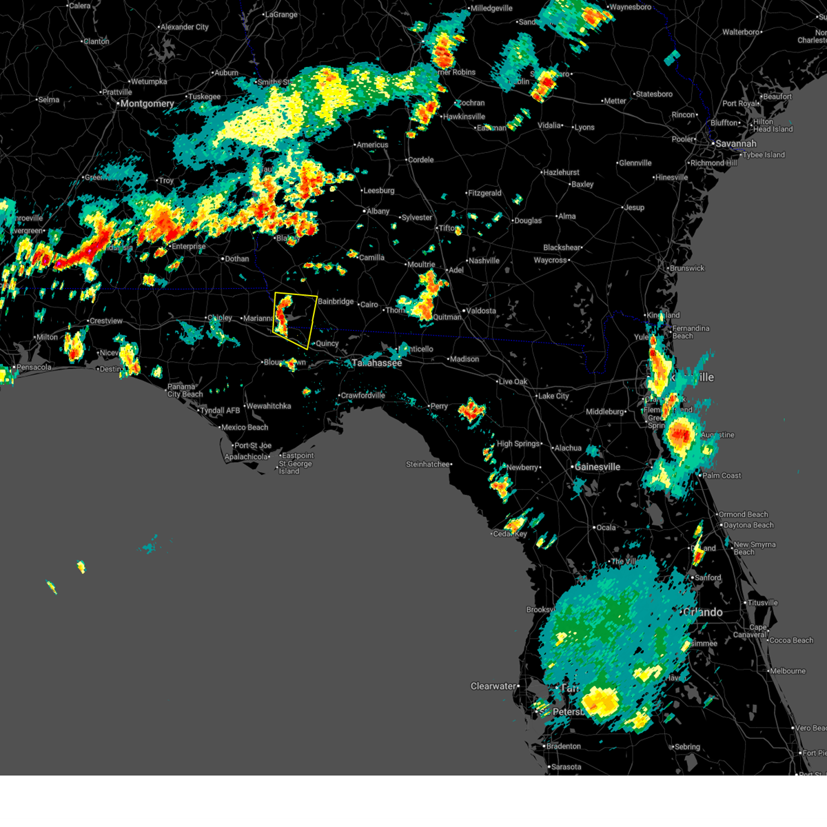
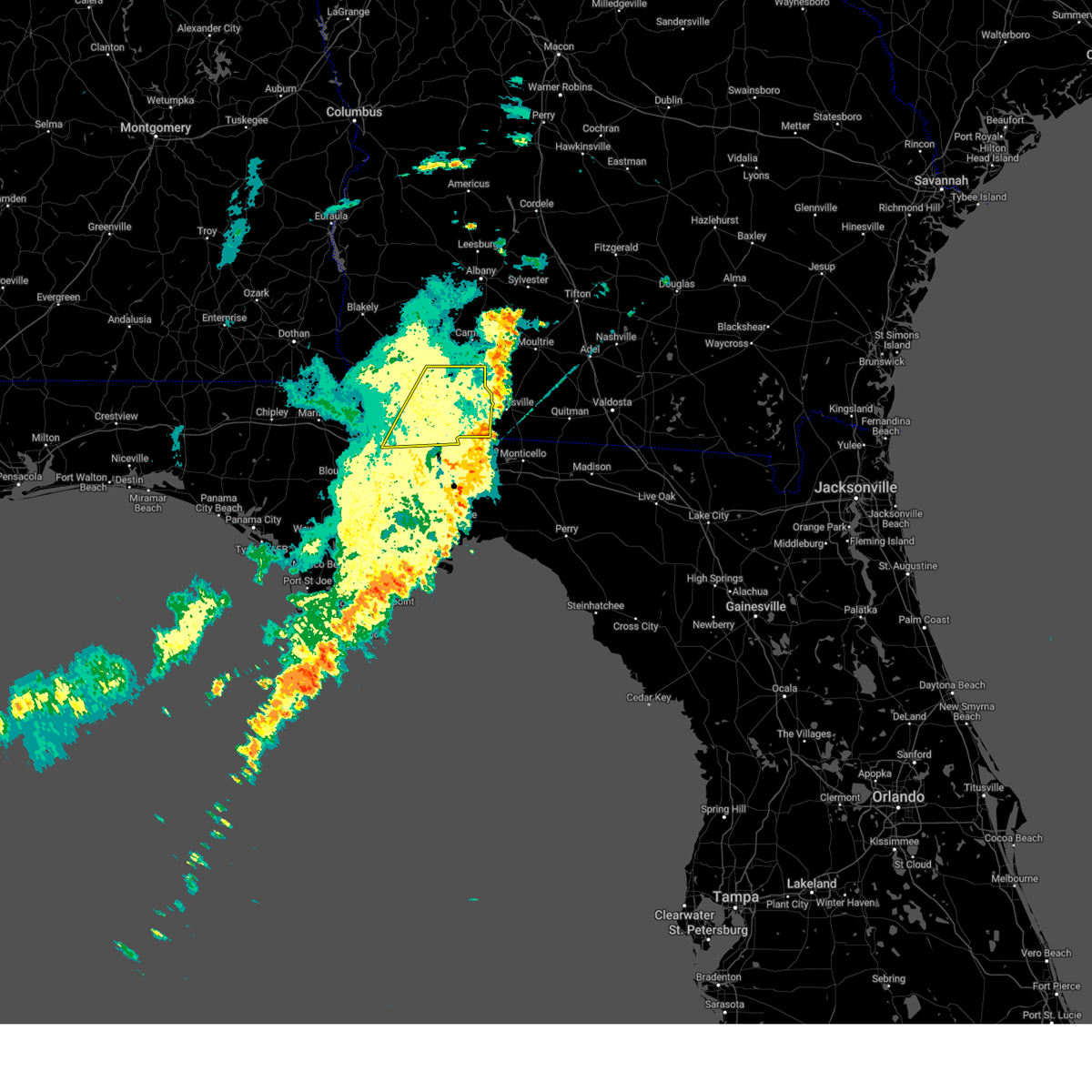
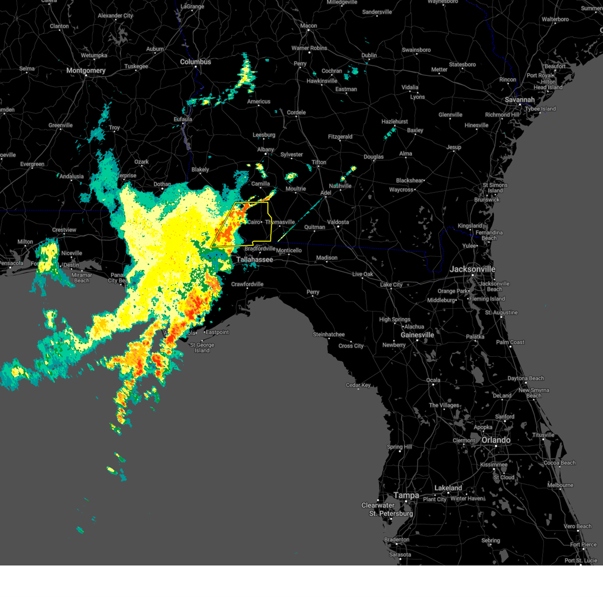
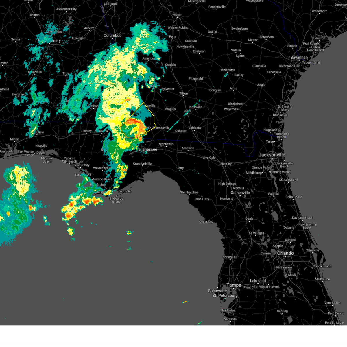
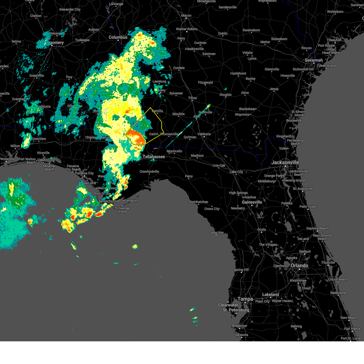
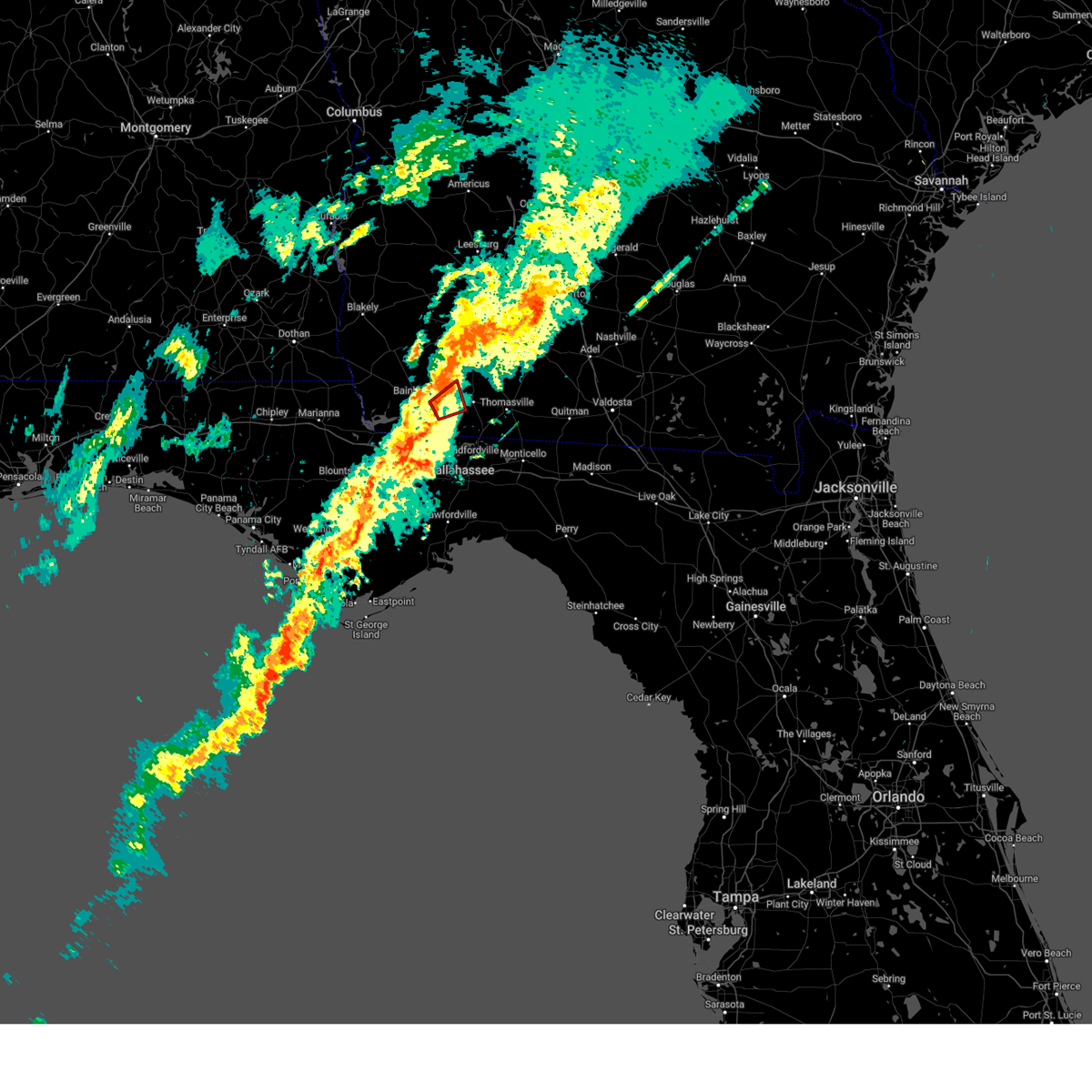
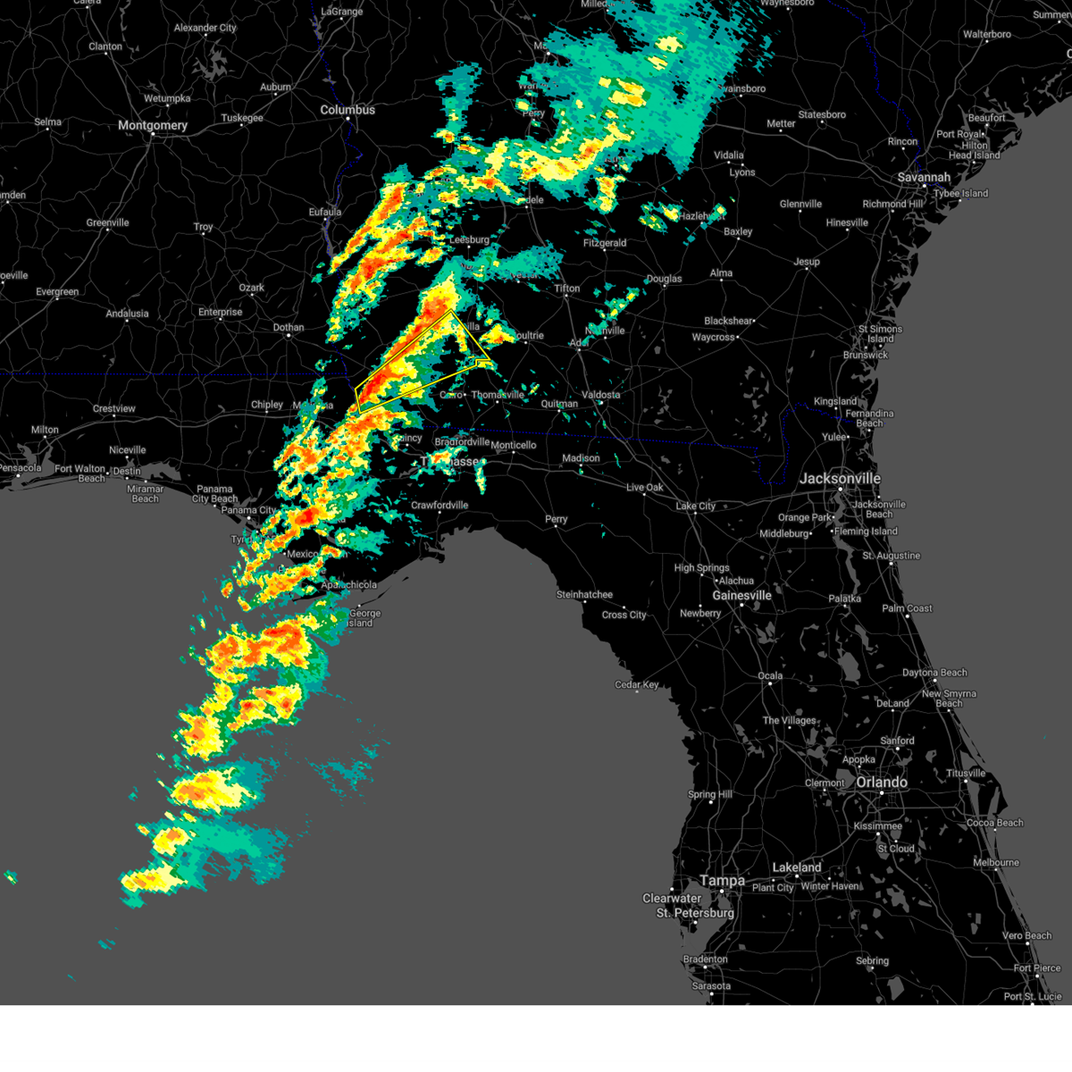
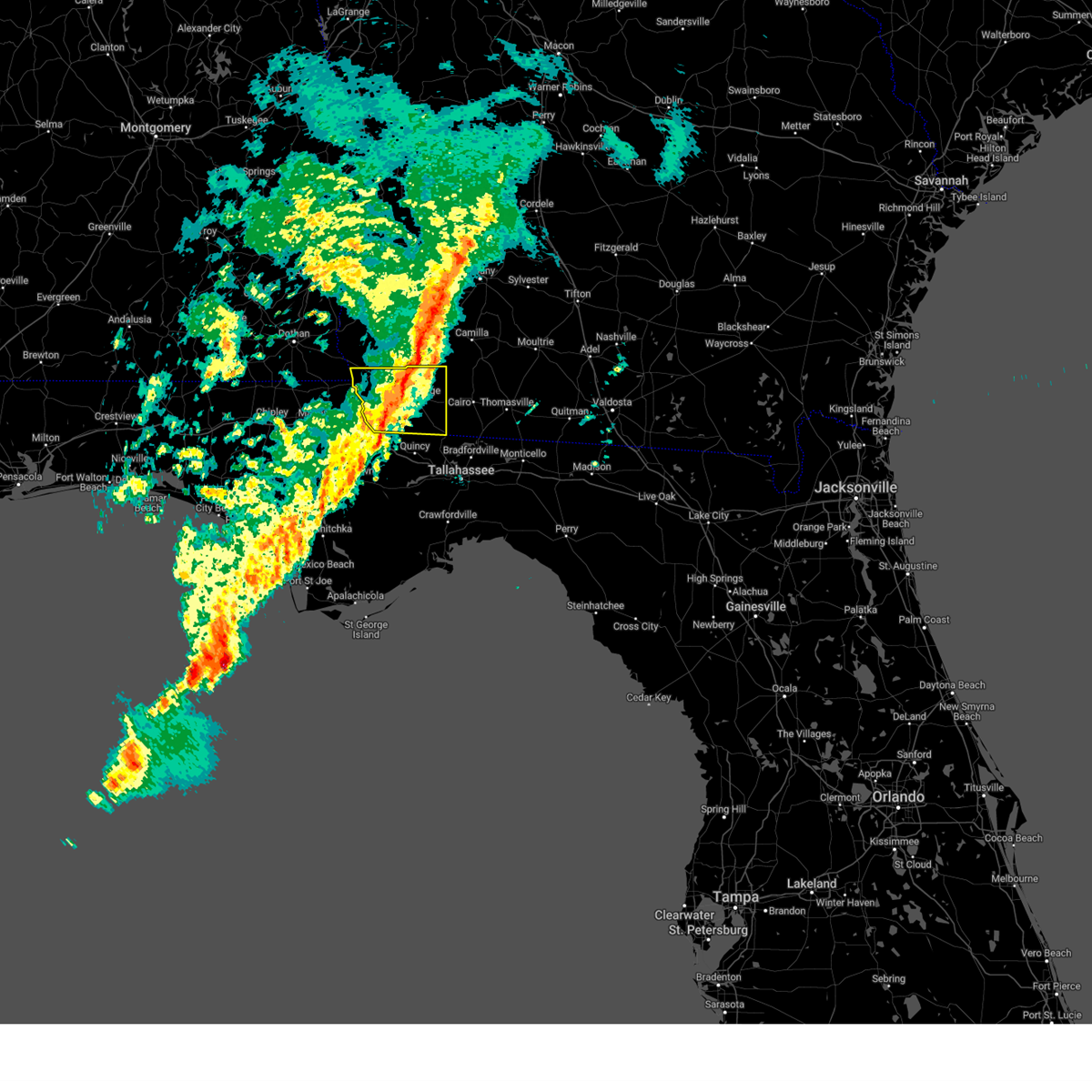
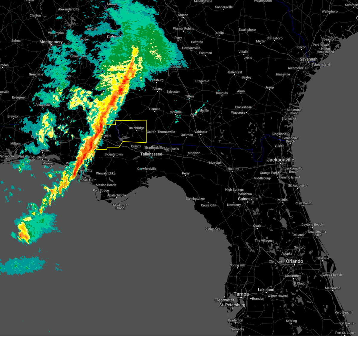
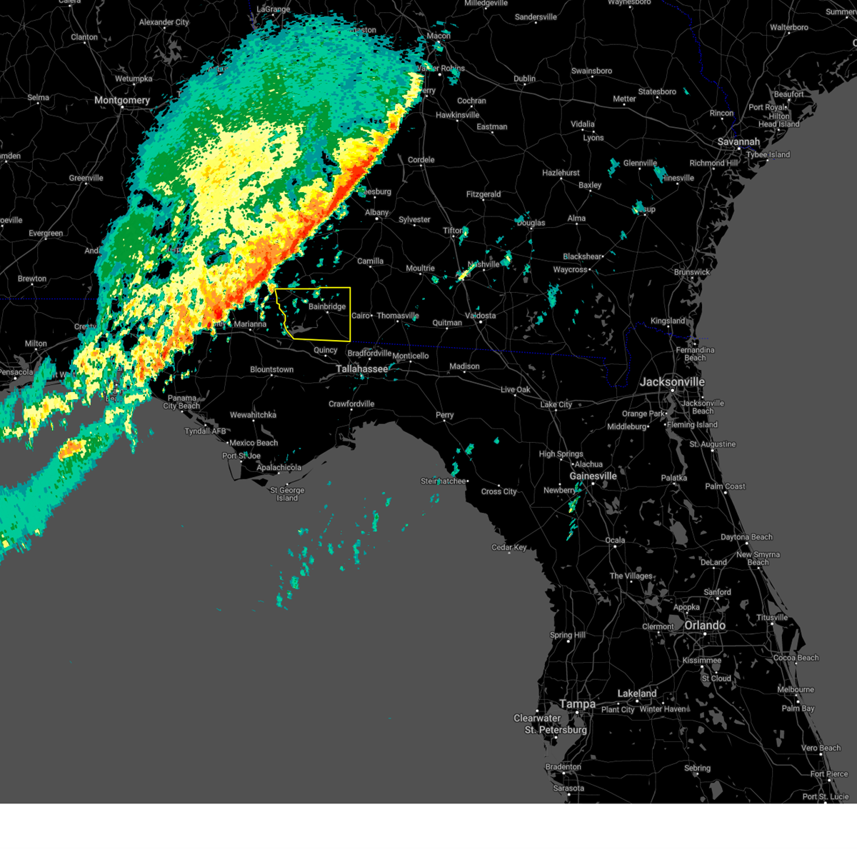
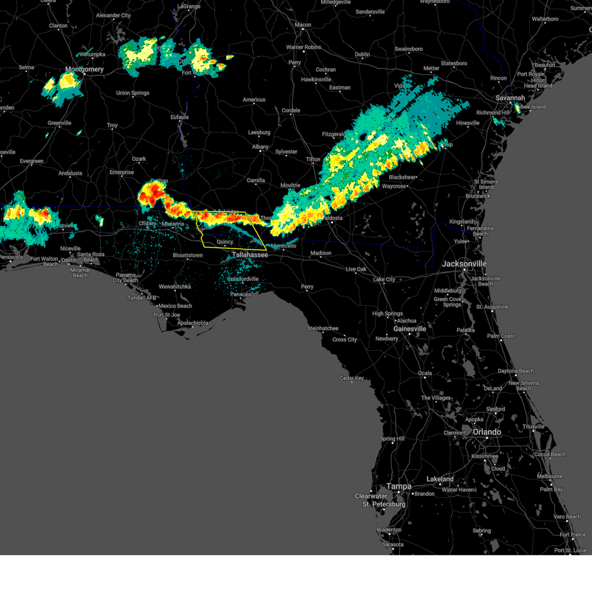
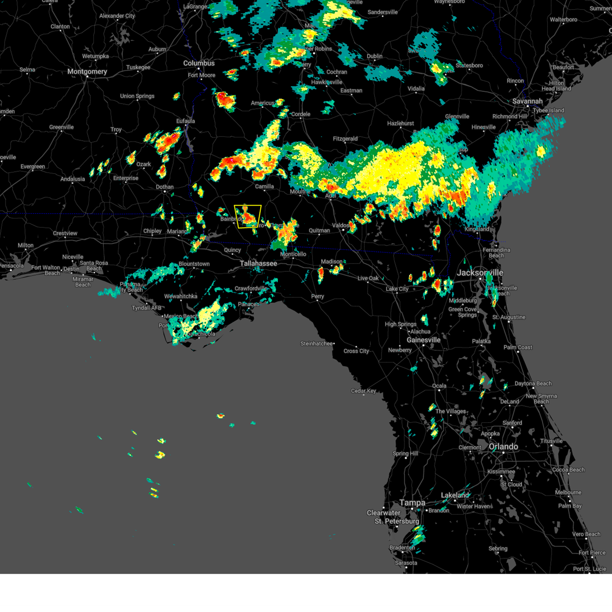
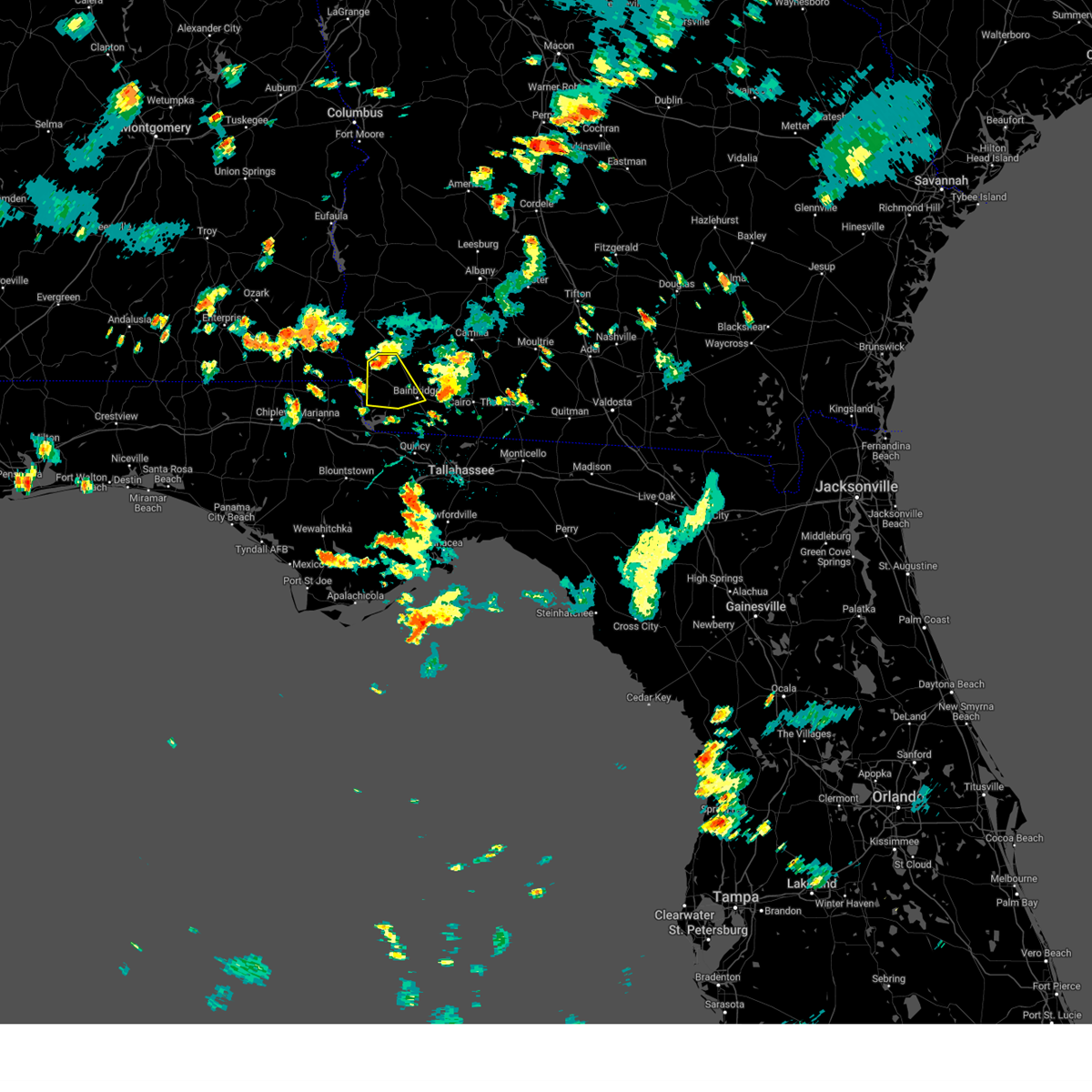
Hail Map for Bainbridge, GA
The Bainbridge, GA area has had 3 reports of on-the-ground hail by trained spotters, and has been under severe weather warnings 36 times during the past 12 months. Doppler radar has detected hail at or near Bainbridge, GA on 65 occasions, including 2 occasions during the past year.
| Name: | Bainbridge, GA |
| Where Located: | 35.6 miles NNW of Tallahassee, FL |
| Map: | Google Map for Bainbridge, GA |
| Population: | 12697 |
| Housing Units: | 5495 |
| More Info: | Search Google for Bainbridge, GA |
2
The Top Recent Hail Date for Bainbridge, GA is Wednesday, June 25, 2025 (8th out of 65)

Hail and Wind Damage Spotted near Bainbridge, GA
| Date / Time | Report Details |
|---|---|
| 6/26/2025 7:05 PM EDT |
 the severe thunderstorm warning has been cancelled and is no longer in effect the severe thunderstorm warning has been cancelled and is no longer in effect
|
| 6/26/2025 6:19 PM EDT | the severe thunderstorm warning has been cancelled and is no longer in effect |
| 6/26/2025 6:19 PM EDT | At 619 pm edt, severe thunderstorms were located along a line extending from 6 miles southeast of cairo to 16 miles west of perry, moving west at 25 mph (radar indicated). Hazards include 60 mph wind gusts. Expect damage to roofs, siding, and trees. locations impacted include, tallahassee, woodville, monticello, tallahassee state college, florida state university, thomasville, havana, st. Marks, midway, crawfordville, florida a and m, cairo, bainbridge, whigham, doak campbell stadium, wakulla, attapulgus, climax, lake bradford, and alma. |
| 6/26/2025 5:52 PM EDT |
 Svrtae the national weather service in tallahassee has issued a * severe thunderstorm warning for, eastern wakulla county in big bend florida, eastern gadsden county in big bend florida, jefferson county in big bend florida, northwestern taylor county in big bend florida, leon county in big bend florida, southwestern madison county in big bend florida, southeastern decatur county in southwestern georgia, southern grady county in southwestern georgia, southwestern thomas county in south central georgia, * until 730 pm edt. * at 552 pm edt, severe thunderstorms were located along a line extending from 6 miles south of thomasville to near perry, moving west at 30 mph (radar indicated). Hazards include 60 mph wind gusts. expect damage to roofs, siding, and trees Svrtae the national weather service in tallahassee has issued a * severe thunderstorm warning for, eastern wakulla county in big bend florida, eastern gadsden county in big bend florida, jefferson county in big bend florida, northwestern taylor county in big bend florida, leon county in big bend florida, southwestern madison county in big bend florida, southeastern decatur county in southwestern georgia, southern grady county in southwestern georgia, southwestern thomas county in south central georgia, * until 730 pm edt. * at 552 pm edt, severe thunderstorms were located along a line extending from 6 miles south of thomasville to near perry, moving west at 30 mph (radar indicated). Hazards include 60 mph wind gusts. expect damage to roofs, siding, and trees
|
| 6/25/2025 7:05 PM EDT | Svrtae the national weather service in tallahassee has issued a * severe thunderstorm warning for, decatur county in southwestern georgia, seminole county in southwestern georgia, * until 830 pm edt. * at 705 pm edt, severe thunderstorms were located along a line extending from 7 miles southwest of pelham to 11 miles northeast of havana, moving west at 25 mph (radar indicated). Hazards include 60 mph wind gusts. expect damage to roofs, siding, and trees |
| 6/25/2025 5:35 PM EDT |
 Svrtae the national weather service in tallahassee has issued a * severe thunderstorm warning for, east central jackson county in the panhandle of florida, northwestern gadsden county in big bend florida, southern decatur county in southwestern georgia, southeastern seminole county in southwestern georgia, * until 630 pm edt/530 pm cdt/. * at 535 pm edt/435 pm cdt/, a severe thunderstorm was located near west bainbridge, or near bainbridge, moving southwest at 15 mph (radar indicated). Hazards include ping pong ball size hail and 60 mph wind gusts. People and animals outdoors will be injured. expect hail damage to roofs, siding, windows, and vehicles. Expect wind damage to roofs, siding, and trees. Svrtae the national weather service in tallahassee has issued a * severe thunderstorm warning for, east central jackson county in the panhandle of florida, northwestern gadsden county in big bend florida, southern decatur county in southwestern georgia, southeastern seminole county in southwestern georgia, * until 630 pm edt/530 pm cdt/. * at 535 pm edt/435 pm cdt/, a severe thunderstorm was located near west bainbridge, or near bainbridge, moving southwest at 15 mph (radar indicated). Hazards include ping pong ball size hail and 60 mph wind gusts. People and animals outdoors will be injured. expect hail damage to roofs, siding, windows, and vehicles. Expect wind damage to roofs, siding, and trees.
|
| 6/19/2025 4:18 PM EDT |
 Svrtae the national weather service in tallahassee has issued a * severe thunderstorm warning for, east central jackson county in the panhandle of florida, northwestern gadsden county in big bend florida, southwestern decatur county in southwestern georgia, central seminole county in southwestern georgia, * until 445 pm edt/345 pm cdt/. * at 417 pm edt/317 pm cdt/, severe thunderstorms were located along a line extending from 11 miles south of donalsonville to near chattahoochee, moving southeast at 15 mph (radar indicated). Hazards include quarter size hail. damage to vehicles is expected Svrtae the national weather service in tallahassee has issued a * severe thunderstorm warning for, east central jackson county in the panhandle of florida, northwestern gadsden county in big bend florida, southwestern decatur county in southwestern georgia, central seminole county in southwestern georgia, * until 445 pm edt/345 pm cdt/. * at 417 pm edt/317 pm cdt/, severe thunderstorms were located along a line extending from 11 miles south of donalsonville to near chattahoochee, moving southeast at 15 mph (radar indicated). Hazards include quarter size hail. damage to vehicles is expected
|
| 6/10/2025 4:38 AM EDT |
 The storms which prompted the warning have moved out of the area. therefore, the warning will be allowed to expire. to report severe weather, contact your nearest law enforcement agency. they will relay your report to the national weather service tallahassee. The storms which prompted the warning have moved out of the area. therefore, the warning will be allowed to expire. to report severe weather, contact your nearest law enforcement agency. they will relay your report to the national weather service tallahassee.
|
| 6/10/2025 3:36 AM EDT |
 Svrtae the national weather service in tallahassee has issued a * severe thunderstorm warning for, northern gadsden county in big bend florida, decatur county in southwestern georgia, grady county in southwestern georgia, * until 445 am edt. * at 336 am edt, severe thunderstorms were located along a line extending from 12 miles northwest of whigham to 6 miles east of chattahoochee, moving northeast at 55 mph (radar indicated). Hazards include 60 mph wind gusts. expect damage to roofs, siding, and trees Svrtae the national weather service in tallahassee has issued a * severe thunderstorm warning for, northern gadsden county in big bend florida, decatur county in southwestern georgia, grady county in southwestern georgia, * until 445 am edt. * at 336 am edt, severe thunderstorms were located along a line extending from 12 miles northwest of whigham to 6 miles east of chattahoochee, moving northeast at 55 mph (radar indicated). Hazards include 60 mph wind gusts. expect damage to roofs, siding, and trees
|
| 5/29/2025 10:07 AM EDT |
 the severe thunderstorm warning has been cancelled and is no longer in effect the severe thunderstorm warning has been cancelled and is no longer in effect
|
| 5/29/2025 9:43 AM EDT |
 Svrtae the national weather service in tallahassee has issued a * severe thunderstorm warning for, decatur county in southwestern georgia, southeastern miller county in southwestern georgia, grady county in southwestern georgia, southwestern mitchell county in southwestern georgia, southwestern baker county in southwestern georgia, east central seminole county in southwestern georgia, * until 1030 am edt. * at 943 am edt, a severe thunderstorm was located over bainbridge, moving northeast at 40 mph (radar indicated). Hazards include 60 mph wind gusts. expect damage to roofs, siding, and trees Svrtae the national weather service in tallahassee has issued a * severe thunderstorm warning for, decatur county in southwestern georgia, southeastern miller county in southwestern georgia, grady county in southwestern georgia, southwestern mitchell county in southwestern georgia, southwestern baker county in southwestern georgia, east central seminole county in southwestern georgia, * until 1030 am edt. * at 943 am edt, a severe thunderstorm was located over bainbridge, moving northeast at 40 mph (radar indicated). Hazards include 60 mph wind gusts. expect damage to roofs, siding, and trees
|
| 4/7/2025 10:33 AM EDT |
 At 1032 am edt, a severe thunderstorm capable of producing a tornado was located near whigham, or 9 miles east of bainbridge, moving northeast at 35 mph (radar indicated rotation). Hazards include tornado. Flying debris will be dangerous to those caught without shelter. mobile homes will be damaged or destroyed. damage to roofs, windows, and vehicles will occur. tree damage is likely. this dangerous storm will be near, whigham around 1040 am edt. Other locations impacted by this tornadic thunderstorm include peoples still and climax. At 1032 am edt, a severe thunderstorm capable of producing a tornado was located near whigham, or 9 miles east of bainbridge, moving northeast at 35 mph (radar indicated rotation). Hazards include tornado. Flying debris will be dangerous to those caught without shelter. mobile homes will be damaged or destroyed. damage to roofs, windows, and vehicles will occur. tree damage is likely. this dangerous storm will be near, whigham around 1040 am edt. Other locations impacted by this tornadic thunderstorm include peoples still and climax.
|
| 4/7/2025 10:21 AM EDT |
 Tortae the national weather service in tallahassee has issued a * tornado warning for, southeastern decatur county in southwestern georgia, northwestern grady county in southwestern georgia, * until 1100 am edt. * at 1021 am edt, a severe thunderstorm capable of producing a tornado was located 8 miles southeast of bainbridge, moving northeast at 30 mph (radar indicated rotation). Hazards include tornado. Flying debris will be dangerous to those caught without shelter. mobile homes will be damaged or destroyed. damage to roofs, windows, and vehicles will occur. tree damage is likely. this dangerous storm will be near, whigham around 1035 am edt. Other locations impacted by this tornadic thunderstorm include attapulgus, reno, fowlstown, climax, princes still, peoples still, and nickleville. Tortae the national weather service in tallahassee has issued a * tornado warning for, southeastern decatur county in southwestern georgia, northwestern grady county in southwestern georgia, * until 1100 am edt. * at 1021 am edt, a severe thunderstorm capable of producing a tornado was located 8 miles southeast of bainbridge, moving northeast at 30 mph (radar indicated rotation). Hazards include tornado. Flying debris will be dangerous to those caught without shelter. mobile homes will be damaged or destroyed. damage to roofs, windows, and vehicles will occur. tree damage is likely. this dangerous storm will be near, whigham around 1035 am edt. Other locations impacted by this tornadic thunderstorm include attapulgus, reno, fowlstown, climax, princes still, peoples still, and nickleville.
|
| 4/7/2025 10:04 AM EDT |
 Svrtae the national weather service in tallahassee has issued a * severe thunderstorm warning for, decatur county in southwestern georgia, * until 1045 am edt. * at 1003 am edt, a severe thunderstorm was located 8 miles northeast of chattahoochee, or 13 miles southwest of bainbridge, moving northeast at 35 mph (radar indicated). Hazards include 60 mph wind gusts and penny size hail. expect damage to roofs, siding, and trees Svrtae the national weather service in tallahassee has issued a * severe thunderstorm warning for, decatur county in southwestern georgia, * until 1045 am edt. * at 1003 am edt, a severe thunderstorm was located 8 miles northeast of chattahoochee, or 13 miles southwest of bainbridge, moving northeast at 35 mph (radar indicated). Hazards include 60 mph wind gusts and penny size hail. expect damage to roofs, siding, and trees
|
| 3/31/2025 2:54 PM EDT | Svrtae the national weather service in tallahassee has issued a * severe thunderstorm warning for, northwestern gulf county in the panhandle of florida, southeastern calhoun county in the panhandle of florida, wakulla county in big bend florida, gadsden county in big bend florida, liberty county in big bend florida, leon county in big bend florida, southeastern decatur county in southwestern georgia, grady county in southwestern georgia, southwestern thomas county in south central georgia, * until 400 pm edt/300 pm cdt/. * at 254 pm edt/154 pm cdt/, severe thunderstorms were located along a line extending from near whigham to 6 miles south of greensboro to near wewahitchka to near mexico beach, moving east at 35 mph (radar indicated). Hazards include 60 mph wind gusts. expect damage to roofs, siding, and trees |
| 3/31/2025 2:43 PM EDT | At 243 pm edt/143 pm cdt/, severe thunderstorms were located along a line extending from 7 miles northwest of west bainbridge to 8 miles west of greensboro to near stonemill creek, moving east at 45 mph (radar indicated). Hazards include 60 mph wind gusts. Expect damage to roofs, siding, and trees. Locations impacted include, rock bluff, greensboro, clarksville, ocheesee, juniper, douglas city, selman, abe springs, vilas, jamieson, central city, orange, recovery, chipola, harrells still, laingkat, scotts ferry, kennys mill, climax, and kern. |
| 3/31/2025 2:43 PM EDT | the severe thunderstorm warning has been cancelled and is no longer in effect |
| 3/31/2025 1:23 PM CDT |
 At 223 pm edt/123 pm cdt/, severe thunderstorms were located along a line extending from near donalsonville to 11 miles north of blountstown to 7 miles northeast of callaway, moving east at 45 mph (radar indicated). Hazards include 60 mph wind gusts. Expect damage to roofs, siding, and trees. Locations impacted include, rock bluff, clarksville, brinson, vilas, orange, laingkat, climax, dellwood, kern, donaldsonville a/p, quincy airport, lowry, nixon garden, sawdust, buena vista, red oak, eldorendo, wilma, two egg, and torreya state park. At 223 pm edt/123 pm cdt/, severe thunderstorms were located along a line extending from near donalsonville to 11 miles north of blountstown to 7 miles northeast of callaway, moving east at 45 mph (radar indicated). Hazards include 60 mph wind gusts. Expect damage to roofs, siding, and trees. Locations impacted include, rock bluff, clarksville, brinson, vilas, orange, laingkat, climax, dellwood, kern, donaldsonville a/p, quincy airport, lowry, nixon garden, sawdust, buena vista, red oak, eldorendo, wilma, two egg, and torreya state park.
|
| 3/31/2025 1:23 PM CDT |
 the severe thunderstorm warning has been cancelled and is no longer in effect the severe thunderstorm warning has been cancelled and is no longer in effect
|
| 3/31/2025 12:58 PM CDT |
 Svrtae the national weather service in tallahassee has issued a * severe thunderstorm warning for, jackson county in the panhandle of florida, north central gulf county in the panhandle of florida, bay county in the panhandle of florida, calhoun county in the panhandle of florida, gadsden county in big bend florida, central liberty county in big bend florida, southeastern washington county in the panhandle of florida, decatur county in southwestern georgia, northwestern grady county in southwestern georgia, seminole county in southwestern georgia, * until 300 pm edt/200 pm cdt/. * at 158 pm edt/1258 pm cdt/, severe thunderstorms were located along a line extending from 7 miles east of cottonwood to 13 miles southwest of marianna to 6 miles east of panama city beach, moving east at 40 mph (radar indicated). Hazards include 60 mph wind gusts. expect damage to roofs, siding, and trees Svrtae the national weather service in tallahassee has issued a * severe thunderstorm warning for, jackson county in the panhandle of florida, north central gulf county in the panhandle of florida, bay county in the panhandle of florida, calhoun county in the panhandle of florida, gadsden county in big bend florida, central liberty county in big bend florida, southeastern washington county in the panhandle of florida, decatur county in southwestern georgia, northwestern grady county in southwestern georgia, seminole county in southwestern georgia, * until 300 pm edt/200 pm cdt/. * at 158 pm edt/1258 pm cdt/, severe thunderstorms were located along a line extending from 7 miles east of cottonwood to 13 miles southwest of marianna to 6 miles east of panama city beach, moving east at 40 mph (radar indicated). Hazards include 60 mph wind gusts. expect damage to roofs, siding, and trees
|
| 3/16/2025 6:13 AM EDT | Svrtae the national weather service in tallahassee has issued a * severe thunderstorm warning for, northeastern decatur county in southwestern georgia, southeastern miller county in southwestern georgia, northern grady county in southwestern georgia, mitchell county in southwestern georgia, southwestern baker county in southwestern georgia, northwestern thomas county in south central georgia, colquitt county in south central georgia, western tift county in south central georgia, southern worth county in south central georgia, * until 715 am edt. * at 612 am edt, a severe thunderstorm was located 7 miles west of pelham, moving northeast at 75 mph (radar indicated). Hazards include 60 mph wind gusts and quarter size hail. Hail damage to vehicles is expected. Expect wind damage to roofs, siding, and trees. |
| 3/16/2025 5:11 AM EDT |
 Svrtae the national weather service in tallahassee has issued a * severe thunderstorm warning for, northern decatur county in southwestern georgia, southeastern miller county in southwestern georgia, northwestern grady county in southwestern georgia, southern mitchell county in southwestern georgia, central baker county in southwestern georgia, eastern seminole county in southwestern georgia, * until 615 am edt. * at 510 am edt, a severe thunderstorm was located 8 miles southeast of donalsonville, moving northeast at 40 mph (radar indicated). Hazards include 60 mph wind gusts and quarter size hail. Hail damage to vehicles is expected. Expect wind damage to roofs, siding, and trees. Svrtae the national weather service in tallahassee has issued a * severe thunderstorm warning for, northern decatur county in southwestern georgia, southeastern miller county in southwestern georgia, northwestern grady county in southwestern georgia, southern mitchell county in southwestern georgia, central baker county in southwestern georgia, eastern seminole county in southwestern georgia, * until 615 am edt. * at 510 am edt, a severe thunderstorm was located 8 miles southeast of donalsonville, moving northeast at 40 mph (radar indicated). Hazards include 60 mph wind gusts and quarter size hail. Hail damage to vehicles is expected. Expect wind damage to roofs, siding, and trees.
|
| 3/5/2025 3:43 AM EST |
 Svrtae the national weather service in tallahassee has issued a * severe thunderstorm warning for, eastern decatur county in southwestern georgia, grady county in southwestern georgia, thomas county in south central georgia, * until 515 am est. * at 343 am est, severe thunderstorms were located along a line extending from 12 miles north of whigham to 10 miles north of quincy, moving east at 35 mph (radar indicated). Hazards include 60 mph wind gusts. expect damage to roofs, siding, and trees Svrtae the national weather service in tallahassee has issued a * severe thunderstorm warning for, eastern decatur county in southwestern georgia, grady county in southwestern georgia, thomas county in south central georgia, * until 515 am est. * at 343 am est, severe thunderstorms were located along a line extending from 12 miles north of whigham to 10 miles north of quincy, moving east at 35 mph (radar indicated). Hazards include 60 mph wind gusts. expect damage to roofs, siding, and trees
|
| 3/5/2025 3:28 AM EST |
 the severe thunderstorm warning has been cancelled and is no longer in effect the severe thunderstorm warning has been cancelled and is no longer in effect
|
| 3/5/2025 3:28 AM EST |
 At 328 am est, severe thunderstorms were located along a line extending from 9 miles northeast of west bainbridge to near greensboro, moving east at 50 mph (radar indicated). Hazards include 60 mph wind gusts. Expect damage to roofs, siding, and trees. Locations impacted include, vada, hanover, ausmac, brinson, west bainbridge, eldorendo, recovery, decatur co a/p, steinham store, faceville, laingkat, attapulgus, jinks, fowlstown, cyrene, climax, amsterdam, and bainbridge. At 328 am est, severe thunderstorms were located along a line extending from 9 miles northeast of west bainbridge to near greensboro, moving east at 50 mph (radar indicated). Hazards include 60 mph wind gusts. Expect damage to roofs, siding, and trees. Locations impacted include, vada, hanover, ausmac, brinson, west bainbridge, eldorendo, recovery, decatur co a/p, steinham store, faceville, laingkat, attapulgus, jinks, fowlstown, cyrene, climax, amsterdam, and bainbridge.
|
| 3/5/2025 3:17 AM EST |
 At 317 am est, severe thunderstorms were located along a line extending from 9 miles southeast of colquitt to near chattahoochee, moving east at 35 mph (radar indicated). Hazards include 60 mph wind gusts. Expect damage to roofs, siding, and trees. Locations impacted include, hanover, ausmac, brinson, reynoldsville, little hope, recovery, decatur co a/p, laingkat, jinks, climax, riverturn, amsterdam, bainbridge, sharphagen, donaldsonville a/p, vada, seminole state park, steam mill, desser, and donalsonville. At 317 am est, severe thunderstorms were located along a line extending from 9 miles southeast of colquitt to near chattahoochee, moving east at 35 mph (radar indicated). Hazards include 60 mph wind gusts. Expect damage to roofs, siding, and trees. Locations impacted include, hanover, ausmac, brinson, reynoldsville, little hope, recovery, decatur co a/p, laingkat, jinks, climax, riverturn, amsterdam, bainbridge, sharphagen, donaldsonville a/p, vada, seminole state park, steam mill, desser, and donalsonville.
|
| 3/5/2025 3:17 AM EST |
 the severe thunderstorm warning has been cancelled and is no longer in effect the severe thunderstorm warning has been cancelled and is no longer in effect
|
| 3/5/2025 1:24 AM CST |
 Svrtae the national weather service in tallahassee has issued a * severe thunderstorm warning for, jackson county in the panhandle of florida, decatur county in southwestern georgia, seminole county in southwestern georgia, * until 400 am est/300 am cst/. * at 224 am est/124 am cst/, severe thunderstorms were located along a line extending from 6 miles southeast of cottonwood to 13 miles southeast of chipley, moving east at 50 mph (radar indicated). Hazards include 60 mph wind gusts. expect damage to roofs, siding, and trees Svrtae the national weather service in tallahassee has issued a * severe thunderstorm warning for, jackson county in the panhandle of florida, decatur county in southwestern georgia, seminole county in southwestern georgia, * until 400 am est/300 am cst/. * at 224 am est/124 am cst/, severe thunderstorms were located along a line extending from 6 miles southeast of cottonwood to 13 miles southeast of chipley, moving east at 50 mph (radar indicated). Hazards include 60 mph wind gusts. expect damage to roofs, siding, and trees
|
| 2/16/2025 6:02 AM EST |
 Svrtae the national weather service in tallahassee has issued a * severe thunderstorm warning for, decatur county in southwestern georgia, seminole county in southwestern georgia, * until 730 am est. * at 602 am est, severe thunderstorms were located along a line extending from 6 miles southwest of blakely to near chipley, moving east at 50 mph (radar indicated). Hazards include 60 mph wind gusts. expect damage to roofs, siding, and trees Svrtae the national weather service in tallahassee has issued a * severe thunderstorm warning for, decatur county in southwestern georgia, seminole county in southwestern georgia, * until 730 am est. * at 602 am est, severe thunderstorms were located along a line extending from 6 miles southwest of blakely to near chipley, moving east at 50 mph (radar indicated). Hazards include 60 mph wind gusts. expect damage to roofs, siding, and trees
|
| 8/19/2024 3:18 AM EDT |
 the severe thunderstorm warning has been cancelled and is no longer in effect the severe thunderstorm warning has been cancelled and is no longer in effect
|
| 8/19/2024 2:47 AM EDT |
 At 247 am edt, a severe thunderstorm was located 10 miles southwest of bainbridge, moving southeast at 35 mph (radar indicated). Hazards include 60 mph wind gusts. Expect damage to roofs, siding, and trees. Locations impacted include, chattahoochee, attapulgus, seminole state park, recovery, faceville, laingkat, calvary, reno, jinks, fowlstown, princes still, amsterdam, nickleville, lake seminole, and reynoldsville. At 247 am edt, a severe thunderstorm was located 10 miles southwest of bainbridge, moving southeast at 35 mph (radar indicated). Hazards include 60 mph wind gusts. Expect damage to roofs, siding, and trees. Locations impacted include, chattahoochee, attapulgus, seminole state park, recovery, faceville, laingkat, calvary, reno, jinks, fowlstown, princes still, amsterdam, nickleville, lake seminole, and reynoldsville.
|
| 8/19/2024 2:47 AM EDT |
 the severe thunderstorm warning has been cancelled and is no longer in effect the severe thunderstorm warning has been cancelled and is no longer in effect
|
| 8/19/2024 1:52 AM EDT |
 Svrtae the national weather service in tallahassee has issued a * severe thunderstorm warning for, decatur county in southwestern georgia, grady county in southwestern georgia, eastern miller county in southwestern georgia, southern mitchell county in southwestern georgia, southwestern baker county in southwestern georgia, eastern seminole county in southwestern georgia, * until 330 am edt. * at 152 am edt, severe thunderstorms were located along a line extending from near colquitt to 6 miles southwest of donalsonville, moving east at 40 mph (radar indicated). Hazards include 60 mph wind gusts. expect damage to roofs, siding, and trees Svrtae the national weather service in tallahassee has issued a * severe thunderstorm warning for, decatur county in southwestern georgia, grady county in southwestern georgia, eastern miller county in southwestern georgia, southern mitchell county in southwestern georgia, southwestern baker county in southwestern georgia, eastern seminole county in southwestern georgia, * until 330 am edt. * at 152 am edt, severe thunderstorms were located along a line extending from near colquitt to 6 miles southwest of donalsonville, moving east at 40 mph (radar indicated). Hazards include 60 mph wind gusts. expect damage to roofs, siding, and trees
|
| 8/18/2024 10:29 PM EDT |
 Svrtae the national weather service in tallahassee has issued a * severe thunderstorm warning for, northern gadsden county in big bend florida, northeastern leon county in big bend florida, decatur county in southwestern georgia, southwestern grady county in southwestern georgia, central seminole county in southwestern georgia, * until 1130 pm edt. * at 1029 pm edt, severe thunderstorms were located along a line extending from 8 miles west of west bainbridge to near whigham, moving southeast at 20 mph (radar indicated). Hazards include 60 mph wind gusts and penny size hail. expect damage to roofs, siding, and trees Svrtae the national weather service in tallahassee has issued a * severe thunderstorm warning for, northern gadsden county in big bend florida, northeastern leon county in big bend florida, decatur county in southwestern georgia, southwestern grady county in southwestern georgia, central seminole county in southwestern georgia, * until 1130 pm edt. * at 1029 pm edt, severe thunderstorms were located along a line extending from 8 miles west of west bainbridge to near whigham, moving southeast at 20 mph (radar indicated). Hazards include 60 mph wind gusts and penny size hail. expect damage to roofs, siding, and trees
|
| 7/31/2024 5:56 PM EDT |
 Svrtae the national weather service in tallahassee has issued a * severe thunderstorm warning for, northeastern decatur county in southwestern georgia, northwestern grady county in southwestern georgia, * until 645 pm edt. * at 556 pm edt, a severe thunderstorm was located near whigham, or 9 miles east of bainbridge, moving north at 5 mph (radar indicated). Hazards include 60 mph wind gusts and quarter size hail. Hail damage to vehicles is expected. Expect wind damage to roofs, siding, and trees. Svrtae the national weather service in tallahassee has issued a * severe thunderstorm warning for, northeastern decatur county in southwestern georgia, northwestern grady county in southwestern georgia, * until 645 pm edt. * at 556 pm edt, a severe thunderstorm was located near whigham, or 9 miles east of bainbridge, moving north at 5 mph (radar indicated). Hazards include 60 mph wind gusts and quarter size hail. Hail damage to vehicles is expected. Expect wind damage to roofs, siding, and trees.
|
| 7/29/2024 5:23 PM EDT |
 Svrtae the national weather service in tallahassee has issued a * severe thunderstorm warning for, northwestern decatur county in southwestern georgia, southwestern miller county in southwestern georgia, northeastern seminole county in southwestern georgia, * until 600 pm edt. * at 523 pm edt, a severe thunderstorm was located near donalsonville, moving south at 20 mph (radar indicated). Hazards include 60 mph wind gusts and penny size hail. expect damage to roofs, siding, and trees Svrtae the national weather service in tallahassee has issued a * severe thunderstorm warning for, northwestern decatur county in southwestern georgia, southwestern miller county in southwestern georgia, northeastern seminole county in southwestern georgia, * until 600 pm edt. * at 523 pm edt, a severe thunderstorm was located near donalsonville, moving south at 20 mph (radar indicated). Hazards include 60 mph wind gusts and penny size hail. expect damage to roofs, siding, and trees
|
| 7/8/2024 6:14 PM EDT |
 the severe thunderstorm warning has been cancelled and is no longer in effect the severe thunderstorm warning has been cancelled and is no longer in effect
|
| 7/8/2024 6:14 PM EDT |
 At 613 pm edt, a severe thunderstorm was located over west bainbridge, or over bainbridge, moving north at 25 mph (radar indicated). Hazards include 60 mph wind gusts. Expect damage to roofs, siding, and trees. Locations impacted include, bainbridge, west bainbridge, attapulgus, climax, brinson, hanover, ausmac, eldorendo, decatur co a/p, steinham store, harrells still, fowlstown, and cyrene. At 613 pm edt, a severe thunderstorm was located over west bainbridge, or over bainbridge, moving north at 25 mph (radar indicated). Hazards include 60 mph wind gusts. Expect damage to roofs, siding, and trees. Locations impacted include, bainbridge, west bainbridge, attapulgus, climax, brinson, hanover, ausmac, eldorendo, decatur co a/p, steinham store, harrells still, fowlstown, and cyrene.
|
| 7/8/2024 5:49 PM EDT | Svrtae the national weather service in tallahassee has issued a * severe thunderstorm warning for, north central gadsden county in big bend florida, decatur county in southwestern georgia, northwestern grady county in southwestern georgia, * until 630 pm edt. * at 548 pm edt, a severe thunderstorm was located 10 miles south of bainbridge, moving north at 25 mph (radar indicated). Hazards include 60 mph wind gusts. expect damage to roofs, siding, and trees |
| 6/2/2024 6:48 PM EDT |
 Svrtae the national weather service in tallahassee has issued a * severe thunderstorm warning for, northeastern decatur county in southwestern georgia, * until 730 pm edt. * at 648 pm edt, a severe thunderstorm was located 7 miles north of west bainbridge, or 8 miles northwest of bainbridge, moving east at 15 mph (radar indicated). Hazards include 60 mph wind gusts. expect damage to roofs, siding, and trees Svrtae the national weather service in tallahassee has issued a * severe thunderstorm warning for, northeastern decatur county in southwestern georgia, * until 730 pm edt. * at 648 pm edt, a severe thunderstorm was located 7 miles north of west bainbridge, or 8 miles northwest of bainbridge, moving east at 15 mph (radar indicated). Hazards include 60 mph wind gusts. expect damage to roofs, siding, and trees
|
| 5/18/2024 10:19 AM EDT |
 Svrtae the national weather service in tallahassee has issued a * severe thunderstorm warning for, western gadsden county in big bend florida, decatur county in southwestern georgia, seminole county in southwestern georgia, * until 1100 am edt. * at 1019 am edt, severe thunderstorms were located along a line extending from near donalsonville to 6 miles east of marianna, moving southeast at 30 mph (radar indicated). Hazards include 60 mph wind gusts. expect damage to roofs, siding, and trees Svrtae the national weather service in tallahassee has issued a * severe thunderstorm warning for, western gadsden county in big bend florida, decatur county in southwestern georgia, seminole county in southwestern georgia, * until 1100 am edt. * at 1019 am edt, severe thunderstorms were located along a line extending from near donalsonville to 6 miles east of marianna, moving southeast at 30 mph (radar indicated). Hazards include 60 mph wind gusts. expect damage to roofs, siding, and trees
|
| 5/17/2024 6:22 PM CDT |
 Svrtae the national weather service in tallahassee has issued a * severe thunderstorm warning for, southeastern houston county in southeastern alabama, jackson county in the panhandle of florida, northern calhoun county in the panhandle of florida, gadsden county in big bend florida, northwestern liberty county in big bend florida, northeastern washington county in the panhandle of florida, southern decatur county in southwestern georgia, seminole county in southwestern georgia, * until 830 pm edt/730 pm cdt/. * at 722 pm edt/622 pm cdt/, a severe thunderstorm was located near marianna, moving southeast at 35 mph (radar indicated). Hazards include 60 mph wind gusts and nickel size hail. expect damage to roofs, siding, and trees Svrtae the national weather service in tallahassee has issued a * severe thunderstorm warning for, southeastern houston county in southeastern alabama, jackson county in the panhandle of florida, northern calhoun county in the panhandle of florida, gadsden county in big bend florida, northwestern liberty county in big bend florida, northeastern washington county in the panhandle of florida, southern decatur county in southwestern georgia, seminole county in southwestern georgia, * until 830 pm edt/730 pm cdt/. * at 722 pm edt/622 pm cdt/, a severe thunderstorm was located near marianna, moving southeast at 35 mph (radar indicated). Hazards include 60 mph wind gusts and nickel size hail. expect damage to roofs, siding, and trees
|
| 5/10/2024 5:37 AM EDT |
 Svrtae the national weather service in tallahassee has issued a * severe thunderstorm warning for, decatur county in southwestern georgia, grady county in southwestern georgia, eastern miller county in southwestern georgia, mitchell county in southwestern georgia, baker county in southwestern georgia, thomas county in south central georgia, southeastern seminole county in southwestern georgia, western colquitt county in south central georgia, * until 645 am edt. * at 537 am edt, severe thunderstorms were located along a line extending from 8 miles southwest of leesburg to near colquitt to 8 miles northeast of marianna, moving east at 65 mph (radar indicated). Hazards include 60 mph wind gusts and quarter size hail. Hail damage to vehicles is expected. Expect wind damage to roofs, siding, and trees. Svrtae the national weather service in tallahassee has issued a * severe thunderstorm warning for, decatur county in southwestern georgia, grady county in southwestern georgia, eastern miller county in southwestern georgia, mitchell county in southwestern georgia, baker county in southwestern georgia, thomas county in south central georgia, southeastern seminole county in southwestern georgia, western colquitt county in south central georgia, * until 645 am edt. * at 537 am edt, severe thunderstorms were located along a line extending from 8 miles southwest of leesburg to near colquitt to 8 miles northeast of marianna, moving east at 65 mph (radar indicated). Hazards include 60 mph wind gusts and quarter size hail. Hail damage to vehicles is expected. Expect wind damage to roofs, siding, and trees.
|
| 4/3/2024 7:08 AM EDT |
 the severe thunderstorm warning has been cancelled and is no longer in effect the severe thunderstorm warning has been cancelled and is no longer in effect
|
| 4/3/2024 6:59 AM EDT |
 The storm which prompted the warning has moved out of the area. therefore, the warning will be allowed to expire. however, gusty winds are still possible with this thunderstorm. a tornado watch remains in effect until 800 am edt/700 am cdt/ for southwestern georgia. a tornado watch also remains in effect until 100 pm edt/noon cdt/ for big bend and the panhandle of florida, and southwestern georgia. remember, a severe thunderstorm warning still remains in effect for eastern decatur county until 745 am edt. The storm which prompted the warning has moved out of the area. therefore, the warning will be allowed to expire. however, gusty winds are still possible with this thunderstorm. a tornado watch remains in effect until 800 am edt/700 am cdt/ for southwestern georgia. a tornado watch also remains in effect until 100 pm edt/noon cdt/ for big bend and the panhandle of florida, and southwestern georgia. remember, a severe thunderstorm warning still remains in effect for eastern decatur county until 745 am edt.
|
| 4/3/2024 6:45 AM EDT |
 Svrtae the national weather service in tallahassee has issued a * severe thunderstorm warning for, eastern decatur county in southwestern georgia, grady county in southwestern georgia, * until 745 am edt. * at 645 am edt, severe thunderstorms were located along a line extending from near doerun to 9 miles northeast of chattahoochee, moving southeast at 25 mph (radar indicated). Hazards include 60 mph wind gusts and penny size hail. expect damage to roofs, siding, and trees Svrtae the national weather service in tallahassee has issued a * severe thunderstorm warning for, eastern decatur county in southwestern georgia, grady county in southwestern georgia, * until 745 am edt. * at 645 am edt, severe thunderstorms were located along a line extending from near doerun to 9 miles northeast of chattahoochee, moving southeast at 25 mph (radar indicated). Hazards include 60 mph wind gusts and penny size hail. expect damage to roofs, siding, and trees
|
| 4/3/2024 6:38 AM EDT |
 At 638 am edt/538 am cdt/, a severe thunderstorm was located 11 miles southwest of west bainbridge, or 11 miles west of bainbridge, moving northeast at 60 mph (radar indicated). Hazards include 60 mph wind gusts and penny size hail. Expect damage to roofs, siding, and trees. Locations impacted include, bainbridge, donalsonville, west bainbridge, chattahoochee, sneads, grand ridge, attapulgus, iron city, climax, brinson, hanover, ausmac, reynoldsville, ocheesee, rosedale, recovery, decatur co a/p, lovedale, laingkat, and jinks. At 638 am edt/538 am cdt/, a severe thunderstorm was located 11 miles southwest of west bainbridge, or 11 miles west of bainbridge, moving northeast at 60 mph (radar indicated). Hazards include 60 mph wind gusts and penny size hail. Expect damage to roofs, siding, and trees. Locations impacted include, bainbridge, donalsonville, west bainbridge, chattahoochee, sneads, grand ridge, attapulgus, iron city, climax, brinson, hanover, ausmac, reynoldsville, ocheesee, rosedale, recovery, decatur co a/p, lovedale, laingkat, and jinks.
|
| 4/3/2024 5:07 AM CDT |
 Svrtae the national weather service in tallahassee has issued a * severe thunderstorm warning for, jackson county in the panhandle of florida, northern calhoun county in the panhandle of florida, northwestern gadsden county in big bend florida, northern liberty county in big bend florida, decatur county in southwestern georgia, seminole county in southwestern georgia, * until 700 am edt/600 am cdt/. * at 607 am edt/507 am cdt/, a severe thunderstorm was located near marianna, moving northeast at 60 mph (radar indicated). Hazards include 60 mph wind gusts and penny size hail. expect damage to roofs, siding, and trees Svrtae the national weather service in tallahassee has issued a * severe thunderstorm warning for, jackson county in the panhandle of florida, northern calhoun county in the panhandle of florida, northwestern gadsden county in big bend florida, northern liberty county in big bend florida, decatur county in southwestern georgia, seminole county in southwestern georgia, * until 700 am edt/600 am cdt/. * at 607 am edt/507 am cdt/, a severe thunderstorm was located near marianna, moving northeast at 60 mph (radar indicated). Hazards include 60 mph wind gusts and penny size hail. expect damage to roofs, siding, and trees
|
| 3/9/2024 7:30 AM EST |
 the severe thunderstorm warning has been cancelled and is no longer in effect the severe thunderstorm warning has been cancelled and is no longer in effect
|
| 3/9/2024 7:30 AM EST |
 At 730 am est/630 am cst/, severe thunderstorms were located along a line extending from 6 miles east of doerun to 6 miles southwest of pelham to west bainbridge, moving east at 55 mph (radar indicated). Hazards include 60 mph wind gusts and penny size hail. Expect damage to roofs, siding, and trees. Locations impacted include, newton, bainbridge, donalsonville, pelham, marianna, camilla, west bainbridge, chattahoochee, malone, sneads, cottondale, grand ridge, greenwood, sale city, iron city, brinson, bascom, recovery, lovedale, and harrells still. At 730 am est/630 am cst/, severe thunderstorms were located along a line extending from 6 miles east of doerun to 6 miles southwest of pelham to west bainbridge, moving east at 55 mph (radar indicated). Hazards include 60 mph wind gusts and penny size hail. Expect damage to roofs, siding, and trees. Locations impacted include, newton, bainbridge, donalsonville, pelham, marianna, camilla, west bainbridge, chattahoochee, malone, sneads, cottondale, grand ridge, greenwood, sale city, iron city, brinson, bascom, recovery, lovedale, and harrells still.
|
| 3/9/2024 6:41 AM EST |
 the severe thunderstorm warning has been cancelled and is no longer in effect the severe thunderstorm warning has been cancelled and is no longer in effect
|
| 3/9/2024 6:41 AM EST |
 At 640 am est/540 am cst/, severe thunderstorms were located along a line extending from 11 miles west of newton to 6 miles northwest of marianna, moving east at 45 mph (radar indicated). Hazards include 60 mph wind gusts. Expect damage to roofs, siding, and trees. Locations impacted include, colquitt, newton, bainbridge, donalsonville, pelham, marianna, camilla, west bainbridge, chattahoochee, malone, sneads, cottondale, grand ridge, greenwood, sale city, iron city, damascus, brinson, jakin, and bascom. At 640 am est/540 am cst/, severe thunderstorms were located along a line extending from 11 miles west of newton to 6 miles northwest of marianna, moving east at 45 mph (radar indicated). Hazards include 60 mph wind gusts. Expect damage to roofs, siding, and trees. Locations impacted include, colquitt, newton, bainbridge, donalsonville, pelham, marianna, camilla, west bainbridge, chattahoochee, malone, sneads, cottondale, grand ridge, greenwood, sale city, iron city, damascus, brinson, jakin, and bascom.
|
| 3/9/2024 5:14 AM CST |
 Svrtae the national weather service in tallahassee has issued a * severe thunderstorm warning for, southeastern houston county in southeastern alabama, jackson county in the panhandle of florida, decatur county in southwestern georgia, northwestern grady county in southwestern georgia, miller county in southwestern georgia, mitchell county in southwestern georgia, southwestern baker county in southwestern georgia, southern early county in southwestern georgia, seminole county in southwestern georgia, * until 745 am est/645 am cst/. * at 614 am est/514 am cst/, severe thunderstorms were located along a line extending from 8 miles southeast of blakely to 6 miles south of graceville, moving east at 50 mph (radar indicated). Hazards include 60 mph wind gusts. expect damage to roofs, siding, and trees Svrtae the national weather service in tallahassee has issued a * severe thunderstorm warning for, southeastern houston county in southeastern alabama, jackson county in the panhandle of florida, decatur county in southwestern georgia, northwestern grady county in southwestern georgia, miller county in southwestern georgia, mitchell county in southwestern georgia, southwestern baker county in southwestern georgia, southern early county in southwestern georgia, seminole county in southwestern georgia, * until 745 am est/645 am cst/. * at 614 am est/514 am cst/, severe thunderstorms were located along a line extending from 8 miles southeast of blakely to 6 miles south of graceville, moving east at 50 mph (radar indicated). Hazards include 60 mph wind gusts. expect damage to roofs, siding, and trees
|
| 1/9/2024 10:37 AM EST |
 The tornado warning for northwestern decatur county will expire at 1045 am est, the storm which prompted the warning has weakened below severe limits, and no longer appears capable of producing a tornado. therefore, the warning will be allowed to expire. a tornado watch remains in effect until 200 pm est for southwestern georgia. to report severe weather, contact your nearest law enforcement agency. they will relay your report to the national weather service tallahassee. The tornado warning for northwestern decatur county will expire at 1045 am est, the storm which prompted the warning has weakened below severe limits, and no longer appears capable of producing a tornado. therefore, the warning will be allowed to expire. a tornado watch remains in effect until 200 pm est for southwestern georgia. to report severe weather, contact your nearest law enforcement agency. they will relay your report to the national weather service tallahassee.
|
| 1/9/2024 10:09 AM EST | One mobile home tilted over about a 30 degree angle off its block in decatur county GA, 5.4 miles ESE of Bainbridge, GA |
| 1/9/2024 10:04 AM EST |
 At 1004 am est, a severe thunderstorm capable of producing a tornado was located near west bainbridge, or 7 miles west of bainbridge, moving northeast at 50 mph (radar indicated rotation). Hazards include tornado. Flying debris will be dangerous to those caught without shelter. mobile homes will be damaged or destroyed. damage to roofs, windows, and vehicles will occur. tree damage is likely. this dangerous storm will be near, bainbridge and west bainbridge around 1010 am est. Other locations impacted by this tornadic thunderstorm include vada, hanover, ausmac, brinson, cyrene, eldorendo, decatur co a/p, and steinham store. At 1004 am est, a severe thunderstorm capable of producing a tornado was located near west bainbridge, or 7 miles west of bainbridge, moving northeast at 50 mph (radar indicated rotation). Hazards include tornado. Flying debris will be dangerous to those caught without shelter. mobile homes will be damaged or destroyed. damage to roofs, windows, and vehicles will occur. tree damage is likely. this dangerous storm will be near, bainbridge and west bainbridge around 1010 am est. Other locations impacted by this tornadic thunderstorm include vada, hanover, ausmac, brinson, cyrene, eldorendo, decatur co a/p, and steinham store.
|
| 1/9/2024 9:53 AM EST |
 At 953 am est, severe thunderstorms were located along a line extending from 8 miles west of west bainbridge to 12 miles south of port st. joe, moving northeast at 50 mph (radar indicated). Hazards include 70 mph wind gusts and quarter size hail. Hail damage to vehicles is expected. expect considerable tree damage. Wind damage is also likely to mobile homes, roofs, and outbuildings. At 953 am est, severe thunderstorms were located along a line extending from 8 miles west of west bainbridge to 12 miles south of port st. joe, moving northeast at 50 mph (radar indicated). Hazards include 70 mph wind gusts and quarter size hail. Hail damage to vehicles is expected. expect considerable tree damage. Wind damage is also likely to mobile homes, roofs, and outbuildings.
|
| 1/9/2024 9:05 AM EST |
 At 905 am est/805 am cst/, severe thunderstorms were located along a line extending from 6 miles south of cottonwood to 22 miles southwest of tyndall air force base, moving northeast at 70 mph (radar indicated). Hazards include 70 mph wind gusts and quarter size hail. Hail damage to vehicles is expected. expect considerable tree damage. Wind damage is also likely to mobile homes, roofs, and outbuildings. At 905 am est/805 am cst/, severe thunderstorms were located along a line extending from 6 miles south of cottonwood to 22 miles southwest of tyndall air force base, moving northeast at 70 mph (radar indicated). Hazards include 70 mph wind gusts and quarter size hail. Hail damage to vehicles is expected. expect considerable tree damage. Wind damage is also likely to mobile homes, roofs, and outbuildings.
|
| 8/15/2023 4:45 PM EDT |
 At 445 pm edt/345 pm cdt/, severe thunderstorms were located along a line extending from 9 miles southeast of ashford to near marianna, moving east at 25 mph. at 341pm cdt, the marianna municipal airport gusted to 59 mph (radar indicated). Hazards include 60 mph wind gusts and penny size hail. expect damage to roofs, siding, and trees At 445 pm edt/345 pm cdt/, severe thunderstorms were located along a line extending from 9 miles southeast of ashford to near marianna, moving east at 25 mph. at 341pm cdt, the marianna municipal airport gusted to 59 mph (radar indicated). Hazards include 60 mph wind gusts and penny size hail. expect damage to roofs, siding, and trees
|
| 8/11/2023 7:20 PM EDT |
 The severe thunderstorm warning for decatur and grady counties will expire at 730 pm edt, the storm which prompted the warning has weakened below severe limits, and no longer poses an immediate threat to life or property. therefore, the warning will be allowed to expire. however gusty winds are still possible with this thunderstorm. a severe thunderstorm watch remains in effect until 800 pm edt for southwestern georgia. The severe thunderstorm warning for decatur and grady counties will expire at 730 pm edt, the storm which prompted the warning has weakened below severe limits, and no longer poses an immediate threat to life or property. therefore, the warning will be allowed to expire. however gusty winds are still possible with this thunderstorm. a severe thunderstorm watch remains in effect until 800 pm edt for southwestern georgia.
|
| 8/11/2023 7:05 PM EDT |
 At 704 pm edt, a severe thunderstorm was located 7 miles east of bainbridge, moving southeast at 40 mph (radar indicated). Hazards include 60 mph wind gusts. Expect damage to roofs, siding, and trees. locations impacted include, bainbridge, cairo, whigham, west bainbridge, attapulgus, climax, hanover, ausmac, capel, recovery, decatur co a/p, harrells still, laingkat, calvary, princes still, peoples still, amsterdam, nickleville, vada and akridge. hail threat, radar indicated max hail size, <. 75 in wind threat, radar indicated max wind gust, 60 mph. At 704 pm edt, a severe thunderstorm was located 7 miles east of bainbridge, moving southeast at 40 mph (radar indicated). Hazards include 60 mph wind gusts. Expect damage to roofs, siding, and trees. locations impacted include, bainbridge, cairo, whigham, west bainbridge, attapulgus, climax, hanover, ausmac, capel, recovery, decatur co a/p, harrells still, laingkat, calvary, princes still, peoples still, amsterdam, nickleville, vada and akridge. hail threat, radar indicated max hail size, <. 75 in wind threat, radar indicated max wind gust, 60 mph.
|
| 8/11/2023 6:44 PM EDT |
 At 643 pm edt, a severe thunderstorm was located 10 miles southeast of colquitt, moving southeast at 40 mph (radar indicated). Hazards include 60 mph wind gusts. expect damage to roofs, siding, and trees At 643 pm edt, a severe thunderstorm was located 10 miles southeast of colquitt, moving southeast at 40 mph (radar indicated). Hazards include 60 mph wind gusts. expect damage to roofs, siding, and trees
|
| 8/4/2023 8:47 PM EDT |
 At 847 pm edt, a severe thunderstorm was located near west bainbridge, or near bainbridge, moving east at 40 mph (radar indicated). Hazards include 60 mph wind gusts. expect damage to roofs, siding, and trees At 847 pm edt, a severe thunderstorm was located near west bainbridge, or near bainbridge, moving east at 40 mph (radar indicated). Hazards include 60 mph wind gusts. expect damage to roofs, siding, and trees
|
| 8/4/2023 8:43 PM EDT |
 At 843 pm edt, a severe thunderstorm was located near west bainbridge, or 7 miles northwest of bainbridge, moving east at 40 mph (radar indicated). Hazards include 60 mph wind gusts. Expect damage to roofs, siding, and trees. locations impacted include, bainbridge, west bainbridge, climax, brinson, vada, hanover, ausmac, babcock, hopeful, eldorendo, decatur co a/p, steinham store, boykin, cyrene and bellview. hail threat, radar indicated max hail size, <. 75 in wind threat, radar indicated max wind gust, 60 mph. At 843 pm edt, a severe thunderstorm was located near west bainbridge, or 7 miles northwest of bainbridge, moving east at 40 mph (radar indicated). Hazards include 60 mph wind gusts. Expect damage to roofs, siding, and trees. locations impacted include, bainbridge, west bainbridge, climax, brinson, vada, hanover, ausmac, babcock, hopeful, eldorendo, decatur co a/p, steinham store, boykin, cyrene and bellview. hail threat, radar indicated max hail size, <. 75 in wind threat, radar indicated max wind gust, 60 mph.
|
| 8/4/2023 8:31 PM EDT |
 At 831 pm edt, a severe thunderstorm was located 7 miles east of donalsonville, moving east at 40 mph (radar indicated). Hazards include 70 mph wind gusts. Expect considerable tree damage. damage is likely to mobile homes, roofs, and outbuildings. locations impacted include, colquitt, bainbridge, donalsonville, west bainbridge, iron city, climax, brinson, hanover, ausmac, babcock, decatur co a/p, boykin, sharphagen, donaldsonville a/p, bellview, vada, hopeful, davis park, hoggard mill and lela. thunderstorm damage threat, considerable hail threat, radar indicated max hail size, <. 75 in wind threat, radar indicated max wind gust, 70 mph. At 831 pm edt, a severe thunderstorm was located 7 miles east of donalsonville, moving east at 40 mph (radar indicated). Hazards include 70 mph wind gusts. Expect considerable tree damage. damage is likely to mobile homes, roofs, and outbuildings. locations impacted include, colquitt, bainbridge, donalsonville, west bainbridge, iron city, climax, brinson, hanover, ausmac, babcock, decatur co a/p, boykin, sharphagen, donaldsonville a/p, bellview, vada, hopeful, davis park, hoggard mill and lela. thunderstorm damage threat, considerable hail threat, radar indicated max hail size, <. 75 in wind threat, radar indicated max wind gust, 70 mph.
|
| 8/4/2023 8:20 PM EDT |
 At 820 pm edt, a severe thunderstorm was located near donalsonville, moving east at 40 mph (mesonet. an ambient weather station near donalsonville measured a wind gust of 68 mph). Hazards include 70 mph wind gusts. Expect considerable tree damage. damage is likely to mobile homes, roofs, and outbuildings. locations impacted include, colquitt, bainbridge, donalsonville, west bainbridge, centerville, iron city, climax, brinson, jakin, hanover, ausmac, babcock, little hope, mayhaw, decatur co a/p, boykin, riverturn, mimsville, sharphagen and donaldsonville a/p. thunderstorm damage threat, considerable hail threat, radar indicated max hail size, <. 75 in wind threat, radar indicated max wind gust, 70 mph. At 820 pm edt, a severe thunderstorm was located near donalsonville, moving east at 40 mph (mesonet. an ambient weather station near donalsonville measured a wind gust of 68 mph). Hazards include 70 mph wind gusts. Expect considerable tree damage. damage is likely to mobile homes, roofs, and outbuildings. locations impacted include, colquitt, bainbridge, donalsonville, west bainbridge, centerville, iron city, climax, brinson, jakin, hanover, ausmac, babcock, little hope, mayhaw, decatur co a/p, boykin, riverturn, mimsville, sharphagen and donaldsonville a/p. thunderstorm damage threat, considerable hail threat, radar indicated max hail size, <. 75 in wind threat, radar indicated max wind gust, 70 mph.
|
| 8/4/2023 8:08 PM EDT |
 At 808 pm edt, a severe thunderstorm was located 8 miles northwest of donalsonville, moving east at 40 mph (radar indicated). Hazards include 60 mph wind gusts. expect damage to roofs, siding, and trees At 808 pm edt, a severe thunderstorm was located 8 miles northwest of donalsonville, moving east at 40 mph (radar indicated). Hazards include 60 mph wind gusts. expect damage to roofs, siding, and trees
|
| 7/22/2023 1:45 PM CDT |
 At 244 pm edt/144 pm cdt/, severe thunderstorms were located along a line extending from 12 miles northeast of west bainbridge to 8 miles south of donalsonville to near marianna, moving east at 40 mph (radar indicated). Hazards include 60 mph wind gusts and penny size hail. Expect damage to roofs, siding, and trees. locations impacted include, donalsonville, marianna, bainbridge, malone, cottondale, greenwood, alford, iron city, brinson, bascom, hanover, ausmac, little hope, blue spring, decatur co a/p, lovedale, dellwood, riverturn, sharphagen and hornsville. hail threat, radar indicated max hail size, 0. 75 in wind threat, radar indicated max wind gust, 60 mph. At 244 pm edt/144 pm cdt/, severe thunderstorms were located along a line extending from 12 miles northeast of west bainbridge to 8 miles south of donalsonville to near marianna, moving east at 40 mph (radar indicated). Hazards include 60 mph wind gusts and penny size hail. Expect damage to roofs, siding, and trees. locations impacted include, donalsonville, marianna, bainbridge, malone, cottondale, greenwood, alford, iron city, brinson, bascom, hanover, ausmac, little hope, blue spring, decatur co a/p, lovedale, dellwood, riverturn, sharphagen and hornsville. hail threat, radar indicated max hail size, 0. 75 in wind threat, radar indicated max wind gust, 60 mph.
|
| 7/22/2023 1:22 PM CDT |
 At 222 pm edt/122 pm cdt/, severe thunderstorms were located along a line extending from near colquitt to 12 miles southeast of cottonwood to 6 miles north of chipley, moving south at 15 mph (radar indicated). Hazards include 60 mph wind gusts and penny size hail. Expect damage to roofs, siding, and trees. locations impacted include, colquitt, cottonwood, chipley, graceville, donalsonville, marianna, bainbridge, malone, cottondale, greenwood, alford, madrid, gordon, iron city, campbellton, brinson, noma, jakin, bascom and crosby. hail threat, radar indicated max hail size, 0. 75 in wind threat, radar indicated max wind gust, 60 mph. At 222 pm edt/122 pm cdt/, severe thunderstorms were located along a line extending from near colquitt to 12 miles southeast of cottonwood to 6 miles north of chipley, moving south at 15 mph (radar indicated). Hazards include 60 mph wind gusts and penny size hail. Expect damage to roofs, siding, and trees. locations impacted include, colquitt, cottonwood, chipley, graceville, donalsonville, marianna, bainbridge, malone, cottondale, greenwood, alford, madrid, gordon, iron city, campbellton, brinson, noma, jakin, bascom and crosby. hail threat, radar indicated max hail size, 0. 75 in wind threat, radar indicated max wind gust, 60 mph.
|
| 7/22/2023 1:09 PM CDT |
 At 209 pm edt/109 pm cdt/, severe thunderstorms were located along a line extending from 6 miles northeast of donalsonville to near taylor, moving east at 40 mph (radar indicated). Hazards include 60 mph wind gusts and penny size hail. expect damage to roofs, siding, and trees At 209 pm edt/109 pm cdt/, severe thunderstorms were located along a line extending from 6 miles northeast of donalsonville to near taylor, moving east at 40 mph (radar indicated). Hazards include 60 mph wind gusts and penny size hail. expect damage to roofs, siding, and trees
|
| 7/22/2023 1:58 PM EDT |
 At 158 pm edt, a severe thunderstorm was located 9 miles northeast of chattahoochee, or 12 miles southwest of bainbridge, moving northeast at 20 mph (radar indicated). Hazards include 60 mph wind gusts and penny size hail. expect damage to roofs, siding, and trees At 158 pm edt, a severe thunderstorm was located 9 miles northeast of chattahoochee, or 12 miles southwest of bainbridge, moving northeast at 20 mph (radar indicated). Hazards include 60 mph wind gusts and penny size hail. expect damage to roofs, siding, and trees
|
| 7/22/2023 1:21 PM EDT |
 At 121 pm edt, severe thunderstorms were located along a line extending from near newton to 9 miles north of donalsonville, moving southeast at 45 mph (radar indicated). Hazards include 60 mph wind gusts and penny size hail. expect damage to roofs, siding, and trees At 121 pm edt, severe thunderstorms were located along a line extending from near newton to 9 miles north of donalsonville, moving southeast at 45 mph (radar indicated). Hazards include 60 mph wind gusts and penny size hail. expect damage to roofs, siding, and trees
|
| 7/16/2023 4:06 PM EDT |
 The severe thunderstorm warning for eastern gadsden, leon, southeastern decatur and grady counties will expire at 415 pm edt, the storms which prompted the warning have moved out of the area. therefore, the warning will be allowed to expire. to report severe weather, contact your nearest law enforcement agency. they will relay your report to the national weather service tallahassee. The severe thunderstorm warning for eastern gadsden, leon, southeastern decatur and grady counties will expire at 415 pm edt, the storms which prompted the warning have moved out of the area. therefore, the warning will be allowed to expire. to report severe weather, contact your nearest law enforcement agency. they will relay your report to the national weather service tallahassee.
|
| 7/16/2023 4:05 PM EDT |
 At 405 pm edt, a severe thunderstorm was located 7 miles north of colquitt, moving southeast at 25 mph (radar indicated). Hazards include 60 mph wind gusts. expect damage to roofs, siding, and trees At 405 pm edt, a severe thunderstorm was located 7 miles north of colquitt, moving southeast at 25 mph (radar indicated). Hazards include 60 mph wind gusts. expect damage to roofs, siding, and trees
|
| 7/16/2023 3:48 PM EDT |
 At 348 pm edt, severe thunderstorms were located along a line extending from near whigham to 9 miles southwest of tallahassee community college, moving east at 30 mph (radar indicated). Hazards include 60 mph wind gusts. Expect damage to roofs, siding, and trees. locations impacted include, tallahassee, woodville, florida state university, midway, tallahassee community college, havana, florida a and m, cairo, whigham, doak campbell stadium, attapulgus, climax, lake bradford, leon sinks, gaither community center, tallahassee memorial hosp, florence, walker ford community center, jamieson and rocky hill. hail threat, radar indicated max hail size, <. 75 in wind threat, radar indicated max wind gust, 60 mph. At 348 pm edt, severe thunderstorms were located along a line extending from near whigham to 9 miles southwest of tallahassee community college, moving east at 30 mph (radar indicated). Hazards include 60 mph wind gusts. Expect damage to roofs, siding, and trees. locations impacted include, tallahassee, woodville, florida state university, midway, tallahassee community college, havana, florida a and m, cairo, whigham, doak campbell stadium, attapulgus, climax, lake bradford, leon sinks, gaither community center, tallahassee memorial hosp, florence, walker ford community center, jamieson and rocky hill. hail threat, radar indicated max hail size, <. 75 in wind threat, radar indicated max wind gust, 60 mph.
|
| 7/16/2023 3:25 PM EDT |
 At 324 pm edt, severe thunderstorms were located along a line extending from bainbridge to 14 miles south of greensboro, moving east at 25 mph (radar indicated). Hazards include 60 mph wind gusts. Expect damage to roofs, siding, and trees. locations impacted include, tallahassee, woodville, florida state university, tallahassee community college, quincy, havana, bainbridge, midway, florida a and m, cairo, whigham, doak campbell stadium, greensboro, west bainbridge, gretna, attapulgus, climax, lake bradford, florence and south city. hail threat, radar indicated max hail size, <. 75 in wind threat, radar indicated max wind gust, 60 mph. At 324 pm edt, severe thunderstorms were located along a line extending from bainbridge to 14 miles south of greensboro, moving east at 25 mph (radar indicated). Hazards include 60 mph wind gusts. Expect damage to roofs, siding, and trees. locations impacted include, tallahassee, woodville, florida state university, tallahassee community college, quincy, havana, bainbridge, midway, florida a and m, cairo, whigham, doak campbell stadium, greensboro, west bainbridge, gretna, attapulgus, climax, lake bradford, florence and south city. hail threat, radar indicated max hail size, <. 75 in wind threat, radar indicated max wind gust, 60 mph.
|
| 7/16/2023 3:12 PM EDT |
 At 312 pm edt/212 pm cdt/, a severe thunderstorm was located over greensboro, or 7 miles west of quincy, moving east at 30 mph (radar indicated). Hazards include 60 mph wind gusts. Expect damage to roofs, siding, and trees. locations impacted include, tallahassee, woodville, florida state university, tallahassee community college, quincy, havana, bainbridge, midway, florida a and m, cairo, whigham, doak campbell stadium, chattahoochee, greensboro, west bainbridge, gretna, bristol, attapulgus, climax and lake bradford. hail threat, radar indicated max hail size, <. 75 in wind threat, radar indicated max wind gust, 60 mph. At 312 pm edt/212 pm cdt/, a severe thunderstorm was located over greensboro, or 7 miles west of quincy, moving east at 30 mph (radar indicated). Hazards include 60 mph wind gusts. Expect damage to roofs, siding, and trees. locations impacted include, tallahassee, woodville, florida state university, tallahassee community college, quincy, havana, bainbridge, midway, florida a and m, cairo, whigham, doak campbell stadium, chattahoochee, greensboro, west bainbridge, gretna, bristol, attapulgus, climax and lake bradford. hail threat, radar indicated max hail size, <. 75 in wind threat, radar indicated max wind gust, 60 mph.
|
| 7/16/2023 2:37 PM EDT |
 At 237 pm edt/137 pm cdt/, a severe thunderstorm was located 11 miles north of blountstown, moving east at 25 mph (radar indicated). Hazards include 60 mph wind gusts. expect damage to roofs, siding, and trees At 237 pm edt/137 pm cdt/, a severe thunderstorm was located 11 miles north of blountstown, moving east at 25 mph (radar indicated). Hazards include 60 mph wind gusts. expect damage to roofs, siding, and trees
|
| 7/15/2023 7:36 PM EDT |
 At 736 pm edt, severe thunderstorms were located along a line extending from near putney to 9 miles north of quincy, moving east at 30 mph (radar indicated). Hazards include 60 mph wind gusts. Expect damage to roofs, siding, and trees. locations impacted include, newton, bainbridge, cairo, pelham, putney, camilla, baconton, doerun, ochlocknee, whigham, attapulgus, sale city, climax, capel, anderson city, parkerville, rocky hill, harrells still, laingkat and calvary. hail threat, radar indicated max hail size, <. 75 in wind threat, radar indicated max wind gust, 60 mph. At 736 pm edt, severe thunderstorms were located along a line extending from near putney to 9 miles north of quincy, moving east at 30 mph (radar indicated). Hazards include 60 mph wind gusts. Expect damage to roofs, siding, and trees. locations impacted include, newton, bainbridge, cairo, pelham, putney, camilla, baconton, doerun, ochlocknee, whigham, attapulgus, sale city, climax, capel, anderson city, parkerville, rocky hill, harrells still, laingkat and calvary. hail threat, radar indicated max hail size, <. 75 in wind threat, radar indicated max wind gust, 60 mph.
|
| 7/15/2023 7:03 PM EDT |
 At 702 pm edt, severe thunderstorms were located along a line extending from 7 miles southeast of leary to 9 miles north of chattahoochee, moving east at 30 mph (radar indicated). Hazards include 60 mph wind gusts. expect damage to roofs, siding, and trees At 702 pm edt, severe thunderstorms were located along a line extending from 7 miles southeast of leary to 9 miles north of chattahoochee, moving east at 30 mph (radar indicated). Hazards include 60 mph wind gusts. expect damage to roofs, siding, and trees
|
| 7/9/2023 2:45 PM EDT |
 At 245 pm edt, severe thunderstorms were located along a line extending from 6 miles northwest of whigham to 9 miles southwest of cairo to 7 miles northwest of woodville, moving east at 40 mph (radar indicated). Hazards include 60 mph wind gusts. Expect damage to roofs, siding, and trees. locations impacted include, tallahassee, florida state university, midway, tallahassee community college, havana, florida a and m, bainbridge, whigham, doak campbell stadium, attapulgus, climax, lake bradford, leon sinks, gaither community center, tallahassee memorial hosp, florence, walker ford community center, jamieson, south city and eight mile pond. hail threat, radar indicated max hail size, <. 75 in wind threat, radar indicated max wind gust, 60 mph. At 245 pm edt, severe thunderstorms were located along a line extending from 6 miles northwest of whigham to 9 miles southwest of cairo to 7 miles northwest of woodville, moving east at 40 mph (radar indicated). Hazards include 60 mph wind gusts. Expect damage to roofs, siding, and trees. locations impacted include, tallahassee, florida state university, midway, tallahassee community college, havana, florida a and m, bainbridge, whigham, doak campbell stadium, attapulgus, climax, lake bradford, leon sinks, gaither community center, tallahassee memorial hosp, florence, walker ford community center, jamieson, south city and eight mile pond. hail threat, radar indicated max hail size, <. 75 in wind threat, radar indicated max wind gust, 60 mph.
|
| 7/9/2023 2:32 PM EDT |
 At 231 pm edt, severe thunderstorms were located along a line extending from bainbridge to 10 miles north of havana to 10 miles southwest of tallahassee community college, moving east at 40 mph (radar indicated). Hazards include 60 mph wind gusts. Expect damage to roofs, siding, and trees. locations impacted include, tallahassee, florida state university, bainbridge, midway, tallahassee community college, quincy, havana, florida a and m, whigham, west bainbridge, doak campbell stadium, gretna, attapulgus, climax, lake bradford, leon sinks, douglas city, gaither community center, tallahassee memorial hosp and florence. hail threat, radar indicated max hail size, <. 75 in wind threat, radar indicated max wind gust, 60 mph. At 231 pm edt, severe thunderstorms were located along a line extending from bainbridge to 10 miles north of havana to 10 miles southwest of tallahassee community college, moving east at 40 mph (radar indicated). Hazards include 60 mph wind gusts. Expect damage to roofs, siding, and trees. locations impacted include, tallahassee, florida state university, bainbridge, midway, tallahassee community college, quincy, havana, florida a and m, whigham, west bainbridge, doak campbell stadium, gretna, attapulgus, climax, lake bradford, leon sinks, douglas city, gaither community center, tallahassee memorial hosp and florence. hail threat, radar indicated max hail size, <. 75 in wind threat, radar indicated max wind gust, 60 mph.
|
| 7/9/2023 2:05 PM EDT |
 At 204 pm edt, severe thunderstorms were located along a line extending from 7 miles south of donalsonville to 8 miles northeast of chattahoochee to 17 miles south of greensboro, moving east at 40 mph (radar indicated). Hazards include 60 mph wind gusts. expect damage to roofs, siding, and trees At 204 pm edt, severe thunderstorms were located along a line extending from 7 miles south of donalsonville to 8 miles northeast of chattahoochee to 17 miles south of greensboro, moving east at 40 mph (radar indicated). Hazards include 60 mph wind gusts. expect damage to roofs, siding, and trees
|
| 7/8/2023 7:47 PM EDT |
 At 747 pm edt, severe thunderstorms were located along a line extending from west bainbridge to quincy to 16 miles south of greensboro, moving east at 25 mph (radar indicated). Hazards include 60 mph wind gusts. expect damage to roofs, siding, and trees At 747 pm edt, severe thunderstorms were located along a line extending from west bainbridge to quincy to 16 miles south of greensboro, moving east at 25 mph (radar indicated). Hazards include 60 mph wind gusts. expect damage to roofs, siding, and trees
|
| 7/1/2023 10:15 PM EDT | Awos station kbge bainbridg in decatur county GA, 6.6 miles SE of Bainbridge, GA |
| 7/1/2023 9:55 PM EDT |
 At 955 pm edt, a severe thunderstorm was located 8 miles north of west bainbridge, or 9 miles north of bainbridge, moving southwest at 10 mph (radar indicated). Hazards include 60 mph wind gusts and nickel size hail. expect damage to roofs, siding, and trees At 955 pm edt, a severe thunderstorm was located 8 miles north of west bainbridge, or 9 miles north of bainbridge, moving southwest at 10 mph (radar indicated). Hazards include 60 mph wind gusts and nickel size hail. expect damage to roofs, siding, and trees
|
| 6/19/2023 8:53 AM EDT |
 At 853 am edt/753 am cdt/, severe thunderstorms were located along a line extending from 8 miles southwest of doerun to near cairo to near whigham to 11 miles south of bainbridge, moving east at 60 mph (radar indicated). Hazards include 60 mph wind gusts. Expect damage to roofs, siding, and trees. locations impacted include, moultrie, thomasville, cairo, quitman, pelham, camilla, bainbridge, boston, norman park, ochlocknee, pavo, coolidge, whigham, riverside, chattahoochee, schley, berlin, funston, attapulgus and barwick. hail threat, radar indicated max hail size, <. 75 in wind threat, radar indicated max wind gust, 60 mph. At 853 am edt/753 am cdt/, severe thunderstorms were located along a line extending from 8 miles southwest of doerun to near cairo to near whigham to 11 miles south of bainbridge, moving east at 60 mph (radar indicated). Hazards include 60 mph wind gusts. Expect damage to roofs, siding, and trees. locations impacted include, moultrie, thomasville, cairo, quitman, pelham, camilla, bainbridge, boston, norman park, ochlocknee, pavo, coolidge, whigham, riverside, chattahoochee, schley, berlin, funston, attapulgus and barwick. hail threat, radar indicated max hail size, <. 75 in wind threat, radar indicated max wind gust, 60 mph.
|
| 6/19/2023 8:35 AM EDT | Storm damage reported in decatur county GA, 6.6 miles SE of Bainbridge, GA |
| 6/19/2023 8:35 AM EDT | Reports of many trees down across decatur count in decatur county GA, 1.6 miles ESE of Bainbridge, GA |
| 6/19/2023 8:17 AM EDT |
 At 817 am edt/717 am cdt/, severe thunderstorms were located along a line extending from 11 miles northeast of colquitt to 6 miles southeast of donalsonville to 13 miles northwest of chattahoochee to marianna, moving east at 55 mph (radar indicated). Hazards include 60 mph wind gusts. expect damage to roofs, siding, and trees At 817 am edt/717 am cdt/, severe thunderstorms were located along a line extending from 11 miles northeast of colquitt to 6 miles southeast of donalsonville to 13 miles northwest of chattahoochee to marianna, moving east at 55 mph (radar indicated). Hazards include 60 mph wind gusts. expect damage to roofs, siding, and trees
|
| 6/18/2023 5:28 PM EDT |
 The severe thunderstorm warning for southeastern decatur county will expire at 530 pm edt, the storms which prompted the warning have weakened below severe limits, and no longer pose an immediate threat to life or property. therefore, the warning will be allowed to expire. however gusty winds are still possible with these thunderstorms. a severe thunderstorm watch remains in effect until 600 pm edt for big bend of florida, and southwestern georgia. The severe thunderstorm warning for southeastern decatur county will expire at 530 pm edt, the storms which prompted the warning have weakened below severe limits, and no longer pose an immediate threat to life or property. therefore, the warning will be allowed to expire. however gusty winds are still possible with these thunderstorms. a severe thunderstorm watch remains in effect until 600 pm edt for big bend of florida, and southwestern georgia.
|
| 6/18/2023 5:19 PM EDT |
 At 519 pm edt, severe thunderstorms were located along a line extending from 6 miles east of bainbridge to 11 miles southeast of west bainbridge to 8 miles north of quincy, moving east at 45 mph (radar indicated). Hazards include 60 mph wind gusts. Expect damage to roofs, siding, and trees. locations impacted include, bainbridge, attapulgus, climax, laingkat, fowlstown, amsterdam and faceville. hail threat, radar indicated max hail size, <. 75 in wind threat, radar indicated max wind gust, 60 mph. At 519 pm edt, severe thunderstorms were located along a line extending from 6 miles east of bainbridge to 11 miles southeast of west bainbridge to 8 miles north of quincy, moving east at 45 mph (radar indicated). Hazards include 60 mph wind gusts. Expect damage to roofs, siding, and trees. locations impacted include, bainbridge, attapulgus, climax, laingkat, fowlstown, amsterdam and faceville. hail threat, radar indicated max hail size, <. 75 in wind threat, radar indicated max wind gust, 60 mph.
|
| 6/18/2023 5:07 PM EDT |
 At 507 pm edt, a severe thunderstorm was located over donalsonville, moving southeast at 40 mph (radar indicated). Hazards include 60 mph wind gusts. expect damage to roofs, siding, and trees At 507 pm edt, a severe thunderstorm was located over donalsonville, moving southeast at 40 mph (radar indicated). Hazards include 60 mph wind gusts. expect damage to roofs, siding, and trees
|
| 6/18/2023 5:05 PM EDT |
 At 505 pm edt, severe thunderstorms were located along a line extending from near west bainbridge to 8 miles northwest of quincy to near greensboro, moving east at 45 mph (radar indicated). Hazards include 60 mph wind gusts. Expect damage to roofs, siding, and trees. locations impacted include, quincy, bainbridge, midway, havana, greensboro, west bainbridge, chattahoochee, gretna, attapulgus, climax, freemont, littman, douglas city, darsey, florence, scotland, rosedale, jamieson, recovery and laingkat. hail threat, radar indicated max hail size, <. 75 in wind threat, radar indicated max wind gust, 60 mph. At 505 pm edt, severe thunderstorms were located along a line extending from near west bainbridge to 8 miles northwest of quincy to near greensboro, moving east at 45 mph (radar indicated). Hazards include 60 mph wind gusts. Expect damage to roofs, siding, and trees. locations impacted include, quincy, bainbridge, midway, havana, greensboro, west bainbridge, chattahoochee, gretna, attapulgus, climax, freemont, littman, douglas city, darsey, florence, scotland, rosedale, jamieson, recovery and laingkat. hail threat, radar indicated max hail size, <. 75 in wind threat, radar indicated max wind gust, 60 mph.
|
| 6/18/2023 4:58 PM EDT | Some trees down along faceville highway near the county lin in decatur county GA, 16.7 miles NE of Bainbridge, GA |
| 6/18/2023 4:50 PM EDT |
 At 450 pm edt/350 pm cdt/, severe thunderstorms were located along a line extending from 8 miles south of donalsonville to near chattahoochee to 12 miles west of greensboro, moving east at 45 mph (radar indicated). Hazards include 60 mph wind gusts. Expect damage to roofs, siding, and trees. locations impacted include, bainbridge, midway, quincy, havana, greensboro, west bainbridge, chattahoochee, sneads, gretna, grand ridge, attapulgus, climax, juniper, douglas city, florence, jamieson, recovery, laingkat, quincy airport and sawdust. hail threat, radar indicated max hail size, <. 75 in wind threat, radar indicated max wind gust, 60 mph. At 450 pm edt/350 pm cdt/, severe thunderstorms were located along a line extending from 8 miles south of donalsonville to near chattahoochee to 12 miles west of greensboro, moving east at 45 mph (radar indicated). Hazards include 60 mph wind gusts. Expect damage to roofs, siding, and trees. locations impacted include, bainbridge, midway, quincy, havana, greensboro, west bainbridge, chattahoochee, sneads, gretna, grand ridge, attapulgus, climax, juniper, douglas city, florence, jamieson, recovery, laingkat, quincy airport and sawdust. hail threat, radar indicated max hail size, <. 75 in wind threat, radar indicated max wind gust, 60 mph.
|
| 6/18/2023 4:24 PM EDT |
 At 423 pm edt/323 pm cdt/, severe thunderstorms were located along a line extending from 10 miles east of cottonwood to near marianna, moving east at 45 mph (radar indicated. at 421 pm cdt, the marianna municipal airport weatherstem gusted to 56 mph). Hazards include 60 mph wind gusts. expect damage to roofs, siding, and trees At 423 pm edt/323 pm cdt/, severe thunderstorms were located along a line extending from 10 miles east of cottonwood to near marianna, moving east at 45 mph (radar indicated. at 421 pm cdt, the marianna municipal airport weatherstem gusted to 56 mph). Hazards include 60 mph wind gusts. expect damage to roofs, siding, and trees
|
| 6/16/2023 11:24 AM EDT |
 At 1122 am edt/1022 am cdt/, severe thunderstorms were located along a line extending from 11 miles west of donalsonville to near blountstown to 6 miles northwest of stonemill creek to 7 miles south of tyndall air force base, moving east at 65 mph (radar indicated). Hazards include 70 mph wind gusts. Expect considerable tree damage. Damage is likely to mobile homes, roofs, and outbuildings. At 1122 am edt/1022 am cdt/, severe thunderstorms were located along a line extending from 11 miles west of donalsonville to near blountstown to 6 miles northwest of stonemill creek to 7 miles south of tyndall air force base, moving east at 65 mph (radar indicated). Hazards include 70 mph wind gusts. Expect considerable tree damage. Damage is likely to mobile homes, roofs, and outbuildings.
|
| 6/15/2023 5:50 PM EDT |
 At 550 pm edt, a severe thunderstorm was located 8 miles southwest of west bainbridge, or 8 miles west of bainbridge, moving east at 35 mph (radar indicated). Hazards include 60 mph wind gusts. Expect damage to roofs, siding, and trees. locations impacted include, bainbridge, quincy, west bainbridge, chattahoochee, greensboro, gretna, brinson, vada, hanover, ausmac, douglas city, mount pleasant, hardin heights, rosedale, eldorendo, recovery, decatur co a/p, steinham store, faceville and hardaway. hail threat, radar indicated max hail size, <. 75 in wind threat, radar indicated max wind gust, 60 mph. At 550 pm edt, a severe thunderstorm was located 8 miles southwest of west bainbridge, or 8 miles west of bainbridge, moving east at 35 mph (radar indicated). Hazards include 60 mph wind gusts. Expect damage to roofs, siding, and trees. locations impacted include, bainbridge, quincy, west bainbridge, chattahoochee, greensboro, gretna, brinson, vada, hanover, ausmac, douglas city, mount pleasant, hardin heights, rosedale, eldorendo, recovery, decatur co a/p, steinham store, faceville and hardaway. hail threat, radar indicated max hail size, <. 75 in wind threat, radar indicated max wind gust, 60 mph.
|
| 6/15/2023 5:08 PM EDT |
 At 508 pm edt/408 pm cdt/, a severe thunderstorm was located 12 miles southeast of cottonwood, moving east at 35 mph (radar indicated). Hazards include 60 mph wind gusts. expect damage to roofs, siding, and trees At 508 pm edt/408 pm cdt/, a severe thunderstorm was located 12 miles southeast of cottonwood, moving east at 35 mph (radar indicated). Hazards include 60 mph wind gusts. expect damage to roofs, siding, and trees
|
| 6/15/2023 10:54 AM EDT |
 At 1053 am edt, a severe thunderstorm was located near bainbridge, moving northeast at 40 mph (radar indicated). Hazards include 60 mph wind gusts and quarter size hail. Hail damage to vehicles is expected. Expect wind damage to roofs, siding, and trees. At 1053 am edt, a severe thunderstorm was located near bainbridge, moving northeast at 40 mph (radar indicated). Hazards include 60 mph wind gusts and quarter size hail. Hail damage to vehicles is expected. Expect wind damage to roofs, siding, and trees.
|
| 6/15/2023 12:30 AM EDT |
 At 1230 am edt, a severe thunderstorm was located 8 miles northeast of chattahoochee, or 13 miles southwest of bainbridge, moving east at 55 mph (radar indicated). Hazards include 60 mph wind gusts and penny size hail. Expect damage to roofs, siding, and trees. locations impacted include, bainbridge, donalsonville, west bainbridge, chattahoochee, attapulgus, iron city, brinson, hanover, ausmac, reynoldsville, recovery, decatur co a/p, laingkat, jinks, riverturn, sharphagen, donaldsonville a/p, seminole state park, steam mill and desser. hail threat, radar indicated max hail size, 0. 75 in wind threat, radar indicated max wind gust, 60 mph. At 1230 am edt, a severe thunderstorm was located 8 miles northeast of chattahoochee, or 13 miles southwest of bainbridge, moving east at 55 mph (radar indicated). Hazards include 60 mph wind gusts and penny size hail. Expect damage to roofs, siding, and trees. locations impacted include, bainbridge, donalsonville, west bainbridge, chattahoochee, attapulgus, iron city, brinson, hanover, ausmac, reynoldsville, recovery, decatur co a/p, laingkat, jinks, riverturn, sharphagen, donaldsonville a/p, seminole state park, steam mill and desser. hail threat, radar indicated max hail size, 0. 75 in wind threat, radar indicated max wind gust, 60 mph.
|
| 6/15/2023 12:13 AM EDT |
 At 1213 am edt, a severe thunderstorm was located 11 miles northwest of chattahoochee, or 13 miles east of marianna, moving east at 50 mph (radar indicated). Hazards include 60 mph wind gusts and penny size hail. expect damage to roofs, siding, and trees At 1213 am edt, a severe thunderstorm was located 11 miles northwest of chattahoochee, or 13 miles east of marianna, moving east at 50 mph (radar indicated). Hazards include 60 mph wind gusts and penny size hail. expect damage to roofs, siding, and trees
|
| 6/14/2023 8:49 PM EDT |
 At 849 pm edt, severe thunderstorms were located along a line extending from 7 miles southeast of putney to 10 miles south of bainbridge, moving east at 65 mph (radar indicated). Hazards include 70 mph wind gusts. Expect considerable tree damage. damage is likely to mobile homes, roofs, and outbuildings. locations impacted include, newton, bainbridge, moultrie, thomasville, cairo, pelham, camilla, boston, norman park, baconton, doerun, ochlocknee, coolidge, whigham, west bainbridge, riverside, schley, funston, attapulgus and sale city. thunderstorm damage threat, considerable hail threat, radar indicated max hail size, <. 75 in wind threat, radar indicated max wind gust, 70 mph. At 849 pm edt, severe thunderstorms were located along a line extending from 7 miles southeast of putney to 10 miles south of bainbridge, moving east at 65 mph (radar indicated). Hazards include 70 mph wind gusts. Expect considerable tree damage. damage is likely to mobile homes, roofs, and outbuildings. locations impacted include, newton, bainbridge, moultrie, thomasville, cairo, pelham, camilla, boston, norman park, baconton, doerun, ochlocknee, coolidge, whigham, west bainbridge, riverside, schley, funston, attapulgus and sale city. thunderstorm damage threat, considerable hail threat, radar indicated max hail size, <. 75 in wind threat, radar indicated max wind gust, 70 mph.
|
| 6/14/2023 8:45 PM EDT |
 At 844 pm edt/744 pm cdt/, a severe thunderstorm was located over bainbridge, moving southeast at 50 mph. this is a destructive storm for the city of bainbridge ga (radar indicated). Hazards include 80 mph wind gusts and ping pong ball size hail. Flying debris will be dangerous to those caught without shelter. mobile homes will be heavily damaged. expect considerable damage to roofs, windows, and vehicles. extensive tree damage and power outages are likely. locations impacted include, colquitt, bainbridge, quincy, whigham, greensboro, west bainbridge, chattahoochee, sneads, gretna, greenwood, attapulgus, climax, brinson, bascom, juniper, douglas city, jamieson, recovery, lovedale and harrells still. thunderstorm damage threat, destructive hail threat, radar indicated max hail size, 1. 50 in wind threat, radar indicated max wind gust, 80 mph. At 844 pm edt/744 pm cdt/, a severe thunderstorm was located over bainbridge, moving southeast at 50 mph. this is a destructive storm for the city of bainbridge ga (radar indicated). Hazards include 80 mph wind gusts and ping pong ball size hail. Flying debris will be dangerous to those caught without shelter. mobile homes will be heavily damaged. expect considerable damage to roofs, windows, and vehicles. extensive tree damage and power outages are likely. locations impacted include, colquitt, bainbridge, quincy, whigham, greensboro, west bainbridge, chattahoochee, sneads, gretna, greenwood, attapulgus, climax, brinson, bascom, juniper, douglas city, jamieson, recovery, lovedale and harrells still. thunderstorm damage threat, destructive hail threat, radar indicated max hail size, 1. 50 in wind threat, radar indicated max wind gust, 80 mph.
|
| 6/14/2023 8:40 PM EDT | Mesonet station tt665 bainbridge near the decatur county airpor in decatur county GA, 6.6 miles SE of Bainbridge, GA |
| 6/14/2023 8:39 PM EDT | City of bainbridge boat basin weatherstem gusted to 71 mp in decatur county GA, 1.9 miles E of Bainbridge, GA |
| 6/14/2023 8:35 PM EDT | Awos station kbge bainbridg in decatur county GA, 6.6 miles SE of Bainbridge, GA |
| 6/14/2023 8:31 PM EDT |
 At 831 pm edt, severe thunderstorms were located along a line extending from 6 miles north of newton to 8 miles southeast of donalsonville, moving east at 65 mph (radar indicated). Hazards include 60 mph wind gusts. expect damage to roofs, siding, and trees At 831 pm edt, severe thunderstorms were located along a line extending from 6 miles north of newton to 8 miles southeast of donalsonville, moving east at 65 mph (radar indicated). Hazards include 60 mph wind gusts. expect damage to roofs, siding, and trees
|
| 6/14/2023 8:13 PM EDT |
 At 812 pm edt/712 pm cdt/, a severe thunderstorm was located near donalsonville, moving southeast at 50 mph. this is a destructive storm for western miller and northern seminole counties (radar indicated). Hazards include 80 mph wind gusts and ping pong ball size hail. Flying debris will be dangerous to those caught without shelter. mobile homes will be heavily damaged. expect considerable damage to roofs, windows, and vehicles. Extensive tree damage and power outages are likely. At 812 pm edt/712 pm cdt/, a severe thunderstorm was located near donalsonville, moving southeast at 50 mph. this is a destructive storm for western miller and northern seminole counties (radar indicated). Hazards include 80 mph wind gusts and ping pong ball size hail. Flying debris will be dangerous to those caught without shelter. mobile homes will be heavily damaged. expect considerable damage to roofs, windows, and vehicles. Extensive tree damage and power outages are likely.
|
| 6/14/2023 7:02 PM EDT |
 At 702 pm edt, severe thunderstorms were located along a line extending from near blakely to 7 miles east of camilla, moving southeast at 40 mph (radar indicated). Hazards include 60 mph wind gusts. expect damage to roofs, siding, and trees At 702 pm edt, severe thunderstorms were located along a line extending from near blakely to 7 miles east of camilla, moving southeast at 40 mph (radar indicated). Hazards include 60 mph wind gusts. expect damage to roofs, siding, and trees
|
| 6/13/2023 4:43 PM EDT |
 The severe thunderstorm warning for decatur and northwestern grady counties will expire at 445 pm edt, the storm which prompted the warning has moved out of the area. therefore, the warning will be allowed to expire. a severe thunderstorm watch remains in effect until 800 pm edt for southwestern georgia. to report severe weather, contact your nearest law enforcement agency. they will relay your report to the national weather service tallahassee. The severe thunderstorm warning for decatur and northwestern grady counties will expire at 445 pm edt, the storm which prompted the warning has moved out of the area. therefore, the warning will be allowed to expire. a severe thunderstorm watch remains in effect until 800 pm edt for southwestern georgia. to report severe weather, contact your nearest law enforcement agency. they will relay your report to the national weather service tallahassee.
|
| 6/13/2023 3:58 PM EDT | Mesonet station tt665 bainbridg in decatur county GA, 6.6 miles SE of Bainbridge, GA |
| 6/13/2023 3:52 PM EDT | Tree reported down near miller ave and lake d in decatur county GA, 2.9 miles SE of Bainbridge, GA |
| 6/13/2023 3:52 PM EDT | Tree reported down near copeland st and martin s in decatur county GA, 2.5 miles SE of Bainbridge, GA |
| 6/13/2023 3:33 PM EDT |
 At 333 pm edt, a severe thunderstorm was located near west bainbridge, or 7 miles west of bainbridge, moving east at 30 mph (radar indicated). Hazards include 60 mph wind gusts and quarter size hail. Hail damage to vehicles is expected. Expect wind damage to roofs, siding, and trees. At 333 pm edt, a severe thunderstorm was located near west bainbridge, or 7 miles west of bainbridge, moving east at 30 mph (radar indicated). Hazards include 60 mph wind gusts and quarter size hail. Hail damage to vehicles is expected. Expect wind damage to roofs, siding, and trees.
|
| 6/12/2023 4:01 PM EDT |
 At 401 pm edt/301 pm cdt/, severe thunderstorms were located along a line extending from 12 miles north of chattahoochee to near greensboro, moving east at 30 mph (radar indicated). Hazards include 60 mph wind gusts. Expect damage to roofs, siding, and trees. locations impacted include, quincy, bainbridge, greensboro, west bainbridge, chattahoochee, gretna, attapulgus, brinson, hanover, ausmac, littman, reynoldsville, juniper, douglas city, florence, rosedale, recovery, decatur co a/p, laingkat and santa clara. hail threat, radar indicated max hail size, <. 75 in wind threat, radar indicated max wind gust, 60 mph. At 401 pm edt/301 pm cdt/, severe thunderstorms were located along a line extending from 12 miles north of chattahoochee to near greensboro, moving east at 30 mph (radar indicated). Hazards include 60 mph wind gusts. Expect damage to roofs, siding, and trees. locations impacted include, quincy, bainbridge, greensboro, west bainbridge, chattahoochee, gretna, attapulgus, brinson, hanover, ausmac, littman, reynoldsville, juniper, douglas city, florence, rosedale, recovery, decatur co a/p, laingkat and santa clara. hail threat, radar indicated max hail size, <. 75 in wind threat, radar indicated max wind gust, 60 mph.
|
| 6/12/2023 3:43 PM EDT |
 At 343 pm edt/243 pm cdt/, severe thunderstorms were located along a line extending from 14 miles south of donalsonville to 10 miles southwest of chattahoochee, moving east at 35 mph (radar indicated). Hazards include 60 mph wind gusts and penny size hail. Expect damage to roofs, siding, and trees. locations impacted include, bainbridge, quincy, greensboro, west bainbridge, chattahoochee, sneads, gretna, grand ridge, attapulgus, brinson, rock bluff, ocheesee, juniper, douglas city, selman, florence, recovery, laingkat, quincy airport and sawdust. hail threat, radar indicated max hail size, 0. 75 in wind threat, radar indicated max wind gust, 60 mph. At 343 pm edt/243 pm cdt/, severe thunderstorms were located along a line extending from 14 miles south of donalsonville to 10 miles southwest of chattahoochee, moving east at 35 mph (radar indicated). Hazards include 60 mph wind gusts and penny size hail. Expect damage to roofs, siding, and trees. locations impacted include, bainbridge, quincy, greensboro, west bainbridge, chattahoochee, sneads, gretna, grand ridge, attapulgus, brinson, rock bluff, ocheesee, juniper, douglas city, selman, florence, recovery, laingkat, quincy airport and sawdust. hail threat, radar indicated max hail size, 0. 75 in wind threat, radar indicated max wind gust, 60 mph.
|
| 6/12/2023 3:33 PM EDT |
 At 333 pm edt/233 pm cdt/, severe thunderstorms were located along a line extending from 11 miles northeast of marianna to 11 miles north of blountstown, moving east at 35 mph (radar indicated). Hazards include 60 mph wind gusts and penny size hail. expect damage to roofs, siding, and trees At 333 pm edt/233 pm cdt/, severe thunderstorms were located along a line extending from 11 miles northeast of marianna to 11 miles north of blountstown, moving east at 35 mph (radar indicated). Hazards include 60 mph wind gusts and penny size hail. expect damage to roofs, siding, and trees
|
| 5/12/2023 3:43 PM EDT |
 The severe thunderstorm warning for southeastern decatur and southwestern grady counties will expire at 345 pm edt, the storm which prompted the warning has weakened below severe limits, and no longer poses an immediate threat to life or property. therefore, the warning will be allowed to expire. however small hail and gusty winds are still expected with this thunderstorm. The severe thunderstorm warning for southeastern decatur and southwestern grady counties will expire at 345 pm edt, the storm which prompted the warning has weakened below severe limits, and no longer poses an immediate threat to life or property. therefore, the warning will be allowed to expire. however small hail and gusty winds are still expected with this thunderstorm.
|
| 5/12/2023 3:30 PM EDT | A downed tree has resulted in a power outage across the are in decatur county GA, 4.9 miles NNW of Bainbridge, GA |
| 5/12/2023 3:27 PM EDT |
 At 327 pm edt, a severe thunderstorm was located near whigham, or 11 miles west of cairo, moving northwest at 10 mph (radar indicated). Hazards include two inch hail and 60 mph wind gusts. People and animals outdoors will be injured. expect hail damage to roofs, siding, windows, and vehicles. expect wind damage to roofs, siding, and trees. locations impacted include, bainbridge, whigham, attapulgus, climax, nickleville and fowlstown. thunderstorm damage threat, considerable hail threat, radar indicated max hail size, 2. 00 in wind threat, radar indicated max wind gust, 60 mph. At 327 pm edt, a severe thunderstorm was located near whigham, or 11 miles west of cairo, moving northwest at 10 mph (radar indicated). Hazards include two inch hail and 60 mph wind gusts. People and animals outdoors will be injured. expect hail damage to roofs, siding, windows, and vehicles. expect wind damage to roofs, siding, and trees. locations impacted include, bainbridge, whigham, attapulgus, climax, nickleville and fowlstown. thunderstorm damage threat, considerable hail threat, radar indicated max hail size, 2. 00 in wind threat, radar indicated max wind gust, 60 mph.
|
| 5/12/2023 3:22 PM EDT |
 At 322 pm edt, a severe thunderstorm was located near whigham, or 10 miles west of cairo, moving northwest at 10 mph (radar indicated). Hazards include 60 mph wind gusts and quarter size hail. Hail damage to vehicles is expected. Expect wind damage to roofs, siding, and trees. At 322 pm edt, a severe thunderstorm was located near whigham, or 10 miles west of cairo, moving northwest at 10 mph (radar indicated). Hazards include 60 mph wind gusts and quarter size hail. Hail damage to vehicles is expected. Expect wind damage to roofs, siding, and trees.
|
| 5/12/2023 3:05 PM EDT |
 At 304 pm edt, a severe thunderstorm was located 9 miles south of bainbridge, moving northeast at 15 mph (radar indicated). Hazards include 60 mph wind gusts and quarter size hail. Hail damage to vehicles is expected. expect wind damage to roofs, siding, and trees. locations impacted include, bainbridge, west bainbridge, attapulgus, climax, fowlstown, recovery and faceville. hail threat, radar indicated max hail size, 1. 00 in wind threat, radar indicated max wind gust, 60 mph. At 304 pm edt, a severe thunderstorm was located 9 miles south of bainbridge, moving northeast at 15 mph (radar indicated). Hazards include 60 mph wind gusts and quarter size hail. Hail damage to vehicles is expected. expect wind damage to roofs, siding, and trees. locations impacted include, bainbridge, west bainbridge, attapulgus, climax, fowlstown, recovery and faceville. hail threat, radar indicated max hail size, 1. 00 in wind threat, radar indicated max wind gust, 60 mph.
|
| 5/12/2023 2:37 PM EDT |
 At 237 pm edt, a severe thunderstorm was located 9 miles south of bainbridge, moving northeast at 30 mph (radar indicated). Hazards include 60 mph wind gusts and quarter size hail. Hail damage to vehicles is expected. Expect wind damage to roofs, siding, and trees. At 237 pm edt, a severe thunderstorm was located 9 miles south of bainbridge, moving northeast at 30 mph (radar indicated). Hazards include 60 mph wind gusts and quarter size hail. Hail damage to vehicles is expected. Expect wind damage to roofs, siding, and trees.
|
| 4/15/2023 8:32 PM EDT | Tree down on martin luther king jr roa in decatur county GA, 1 miles SSW of Bainbridge, GA |
| 4/15/2023 8:32 PM EDT |
 At 832 pm edt, severe thunderstorms were located along a line extending from 7 miles southeast of colquitt to near bainbridge to 8 miles southeast of west bainbridge to near midway to 12 miles southwest of tallahassee community college, moving east at 40 mph (radar indicated). Hazards include 60 mph wind gusts. Expect damage to roofs, siding, and trees. locations impacted include, tallahassee, quincy, bainbridge, midway, havana, donalsonville, west bainbridge, gretna, attapulgus, iron city, climax, brinson, hanover, freemont, ausmac, littman, reynoldsville, douglas city, darsey and florence. hail threat, radar indicated max hail size, <. 75 in wind threat, radar indicated max wind gust, 60 mph. At 832 pm edt, severe thunderstorms were located along a line extending from 7 miles southeast of colquitt to near bainbridge to 8 miles southeast of west bainbridge to near midway to 12 miles southwest of tallahassee community college, moving east at 40 mph (radar indicated). Hazards include 60 mph wind gusts. Expect damage to roofs, siding, and trees. locations impacted include, tallahassee, quincy, bainbridge, midway, havana, donalsonville, west bainbridge, gretna, attapulgus, iron city, climax, brinson, hanover, freemont, ausmac, littman, reynoldsville, douglas city, darsey and florence. hail threat, radar indicated max hail size, <. 75 in wind threat, radar indicated max wind gust, 60 mph.
|
| 4/15/2023 7:40 PM EDT |
 At 740 pm edt, severe thunderstorms were located along a line extending from 6 miles southeast of cottonwood to 11 miles east of marianna to 11 miles west of chattahoochee to near blountstown to 10 miles northeast of stonemill creek, moving east at 40 mph (radar indicated). Hazards include 60 mph wind gusts. expect damage to roofs, siding, and trees At 740 pm edt, severe thunderstorms were located along a line extending from 6 miles southeast of cottonwood to 11 miles east of marianna to 11 miles west of chattahoochee to near blountstown to 10 miles northeast of stonemill creek, moving east at 40 mph (radar indicated). Hazards include 60 mph wind gusts. expect damage to roofs, siding, and trees
|
| 4/3/2023 1:50 PM EDT |
 At 149 pm edt, severe thunderstorms were located along a line extending from 7 miles northwest of whigham to 8 miles south of bainbridge to 6 miles north of chattahoochee, moving southeast at 45 mph (radar indicated). Hazards include golf ball size hail and 60 mph wind gusts. People and animals outdoors will be injured. expect hail damage to roofs, siding, windows, and vehicles. expect wind damage to roofs, siding, and trees. Locations impacted include, bainbridge, donalsonville, quincy, havana, cairo, whigham, greensboro, west bainbridge, chattahoochee, gretna, attapulgus, iron city, climax, brinson, juniper, douglas city, florence, jamieson, recovery and harrells still. At 149 pm edt, severe thunderstorms were located along a line extending from 7 miles northwest of whigham to 8 miles south of bainbridge to 6 miles north of chattahoochee, moving southeast at 45 mph (radar indicated). Hazards include golf ball size hail and 60 mph wind gusts. People and animals outdoors will be injured. expect hail damage to roofs, siding, windows, and vehicles. expect wind damage to roofs, siding, and trees. Locations impacted include, bainbridge, donalsonville, quincy, havana, cairo, whigham, greensboro, west bainbridge, chattahoochee, gretna, attapulgus, iron city, climax, brinson, juniper, douglas city, florence, jamieson, recovery and harrells still.
|
| 4/3/2023 1:49 PM EDT | Nws employee reports several trees down near us-84 over a 1 mile stretc in decatur county GA, 4.7 miles W of Bainbridge, GA |
| 4/3/2023 1:45 PM EDT | Tree down at 141 nebo church roa in decatur county GA, 2.9 miles W of Bainbridge, GA |
| 4/3/2023 1:40 PM EDT |
 At 140 pm edt, a severe thunderstorm capable of producing a tornado was located near bainbridge, moving east at 40 mph (radar indicated rotation). Hazards include tornado. Flying debris will be dangerous to those caught without shelter. mobile homes will be damaged or destroyed. damage to roofs, windows, and vehicles will occur. tree damage is likely. This tornadic thunderstorm will remain over mainly rural areas of northeastern decatur county, including the following locations, fowlstown and climax. At 140 pm edt, a severe thunderstorm capable of producing a tornado was located near bainbridge, moving east at 40 mph (radar indicated rotation). Hazards include tornado. Flying debris will be dangerous to those caught without shelter. mobile homes will be damaged or destroyed. damage to roofs, windows, and vehicles will occur. tree damage is likely. This tornadic thunderstorm will remain over mainly rural areas of northeastern decatur county, including the following locations, fowlstown and climax.
|
| 4/3/2023 1:39 PM EDT | Tree down on a house on boxwood driv in decatur county GA, 1.2 miles N of Bainbridge, GA |
| 4/3/2023 1:39 PM EDT |
 At 139 pm edt/1239 pm cdt/, severe thunderstorms were located along a line extending from 7 miles northeast of west bainbridge to 6 miles southwest of bainbridge to 11 miles northwest of chattahoochee, moving southeast at 45 mph (radar indicated). Hazards include golf ball size hail and 60 mph wind gusts. People and animals outdoors will be injured. expect hail damage to roofs, siding, windows, and vehicles. expect wind damage to roofs, siding, and trees. Locations impacted include, bainbridge, donalsonville, quincy, havana, cairo, marianna, whigham, greensboro, west bainbridge, chattahoochee, malone, sneads, gretna, grand ridge, greenwood, attapulgus, iron city, climax, campbellton and brinson. At 139 pm edt/1239 pm cdt/, severe thunderstorms were located along a line extending from 7 miles northeast of west bainbridge to 6 miles southwest of bainbridge to 11 miles northwest of chattahoochee, moving southeast at 45 mph (radar indicated). Hazards include golf ball size hail and 60 mph wind gusts. People and animals outdoors will be injured. expect hail damage to roofs, siding, windows, and vehicles. expect wind damage to roofs, siding, and trees. Locations impacted include, bainbridge, donalsonville, quincy, havana, cairo, marianna, whigham, greensboro, west bainbridge, chattahoochee, malone, sneads, gretna, grand ridge, greenwood, attapulgus, iron city, climax, campbellton and brinson.
|
| 4/3/2023 1:32 PM EDT |
 At 132 pm edt, a severe thunderstorm capable of producing a tornado was located near west bainbridge, or near bainbridge, moving east at 40 mph (radar indicated rotation). Hazards include tornado. Flying debris will be dangerous to those caught without shelter. mobile homes will be damaged or destroyed. damage to roofs, windows, and vehicles will occur. tree damage is likely. this dangerous storm will be near, bainbridge and west bainbridge around 135 pm edt. Other locations impacted by this tornadic thunderstorm include hanover, ausmac, fowlstown, cyrene, climax and decatur co a/p. At 132 pm edt, a severe thunderstorm capable of producing a tornado was located near west bainbridge, or near bainbridge, moving east at 40 mph (radar indicated rotation). Hazards include tornado. Flying debris will be dangerous to those caught without shelter. mobile homes will be damaged or destroyed. damage to roofs, windows, and vehicles will occur. tree damage is likely. this dangerous storm will be near, bainbridge and west bainbridge around 135 pm edt. Other locations impacted by this tornadic thunderstorm include hanover, ausmac, fowlstown, cyrene, climax and decatur co a/p.
|
| 4/3/2023 1:31 PM EDT | Quarter sized hail reported 3.3 miles SE of Bainbridge, GA, multiple reports west of bainbridge of hail falling. sizes ranged from pea to quarter size. |
| 4/3/2023 1:30 PM EDT | Bainbridge airport reported wind gust of 64 mph or 56 knot in decatur county GA, 6.6 miles SE of Bainbridge, GA |
| 4/3/2023 1:30 PM EDT | Several trees and powerlines down west of bainbridge. in the industrial park two shops had doors blown i in decatur county GA, 3.5 miles ESE of Bainbridge, GA |
| 4/3/2023 1:27 PM EDT | Nws employee relayed photo of downed tree blocking highway 253 sw of bainbridge. also some minor roof damage to a structure in the are in decatur county GA, 7.4 miles E of Bainbridge, GA |
| 4/3/2023 1:27 PM EDT |
 At 126 pm edt/1226 pm cdt/, severe thunderstorms were located along a line extending from 9 miles north of west bainbridge to 11 miles west of bainbridge to 11 miles northeast of marianna, moving east at 40 mph (radar indicated). Hazards include ping pong ball size hail and 60 mph wind gusts. People and animals outdoors will be injured. expect hail damage to roofs, siding, windows, and vehicles. expect wind damage to roofs, siding, and trees. Locations impacted include, colquitt, bainbridge, donalsonville, quincy, havana, cairo, marianna, whigham, greensboro, west bainbridge, chattahoochee, malone, sneads, gretna, grand ridge, greenwood, attapulgus, iron city, climax and campbellton. At 126 pm edt/1226 pm cdt/, severe thunderstorms were located along a line extending from 9 miles north of west bainbridge to 11 miles west of bainbridge to 11 miles northeast of marianna, moving east at 40 mph (radar indicated). Hazards include ping pong ball size hail and 60 mph wind gusts. People and animals outdoors will be injured. expect hail damage to roofs, siding, windows, and vehicles. expect wind damage to roofs, siding, and trees. Locations impacted include, colquitt, bainbridge, donalsonville, quincy, havana, cairo, marianna, whigham, greensboro, west bainbridge, chattahoochee, malone, sneads, gretna, grand ridge, greenwood, attapulgus, iron city, climax and campbellton.
|
| 4/3/2023 1:01 PM EDT |
 At 101 pm edt/1201 pm cdt/, severe thunderstorms were located along a line extending from 8 miles west of colquitt to 8 miles west of donalsonville to 9 miles south of cottonwood, moving southeast at 45 mph (radar indicated). Hazards include 60 mph wind gusts and quarter size hail. Hail damage to vehicles is expected. Expect wind damage to roofs, siding, and trees. At 101 pm edt/1201 pm cdt/, severe thunderstorms were located along a line extending from 8 miles west of colquitt to 8 miles west of donalsonville to 9 miles south of cottonwood, moving southeast at 45 mph (radar indicated). Hazards include 60 mph wind gusts and quarter size hail. Hail damage to vehicles is expected. Expect wind damage to roofs, siding, and trees.
|
| 3/25/2023 4:07 PM EDT |
 At 407 pm edt, a severe thunderstorm was located 8 miles north of west bainbridge, or 9 miles north of bainbridge, moving east at 45 mph (radar indicated). Hazards include ping pong ball size hail and 60 mph wind gusts. People and animals outdoors will be injured. expect hail damage to roofs, siding, windows, and vehicles. Expect wind damage to roofs, siding, and trees. At 407 pm edt, a severe thunderstorm was located 8 miles north of west bainbridge, or 9 miles north of bainbridge, moving east at 45 mph (radar indicated). Hazards include ping pong ball size hail and 60 mph wind gusts. People and animals outdoors will be injured. expect hail damage to roofs, siding, windows, and vehicles. Expect wind damage to roofs, siding, and trees.
|
| 3/12/2023 2:14 PM CDT |
 At 313 pm edt/213 pm cdt/, severe thunderstorms were located along a line extending from 8 miles southwest of whigham to 7 miles north of quincy to 9 miles southwest of chattahoochee, moving east at 45 mph (radar indicated). Hazards include 60 mph wind gusts and penny size hail. Expect damage to roofs, siding, and trees. locations impacted include, bainbridge, quincy, cairo, havana, whigham, greensboro, chattahoochee, sneads, gretna, grand ridge, altha, attapulgus, climax, rock bluff, ocheesee, juniper, douglas city, selman, jamieson and recovery. hail threat, radar indicated max hail size, 0. 75 in wind threat, radar indicated max wind gust, 60 mph. At 313 pm edt/213 pm cdt/, severe thunderstorms were located along a line extending from 8 miles southwest of whigham to 7 miles north of quincy to 9 miles southwest of chattahoochee, moving east at 45 mph (radar indicated). Hazards include 60 mph wind gusts and penny size hail. Expect damage to roofs, siding, and trees. locations impacted include, bainbridge, quincy, cairo, havana, whigham, greensboro, chattahoochee, sneads, gretna, grand ridge, altha, attapulgus, climax, rock bluff, ocheesee, juniper, douglas city, selman, jamieson and recovery. hail threat, radar indicated max hail size, 0. 75 in wind threat, radar indicated max wind gust, 60 mph.
|
| 3/12/2023 1:27 PM CDT |
 At 227 pm edt/127 pm cdt/, severe thunderstorms were located along a line extending from 10 miles northwest of chattahoochee to near marianna to 12 miles south of chipley, moving east at 40 to 45 mph (radar indicated). Hazards include 60 mph wind gusts and nickel size hail. expect damage to roofs, siding, and trees At 227 pm edt/127 pm cdt/, severe thunderstorms were located along a line extending from 10 miles northwest of chattahoochee to near marianna to 12 miles south of chipley, moving east at 40 to 45 mph (radar indicated). Hazards include 60 mph wind gusts and nickel size hail. expect damage to roofs, siding, and trees
|
| 3/12/2023 1:38 PM EDT |
 At 138 pm edt, a severe thunderstorm was located 8 miles southeast of donalsonville, moving east at 40 mph (radar indicated). Hazards include 60 mph wind gusts and quarter size hail. Hail damage to vehicles is expected. Expect wind damage to roofs, siding, and trees. At 138 pm edt, a severe thunderstorm was located 8 miles southeast of donalsonville, moving east at 40 mph (radar indicated). Hazards include 60 mph wind gusts and quarter size hail. Hail damage to vehicles is expected. Expect wind damage to roofs, siding, and trees.
|
| 1/25/2023 9:35 AM EST |
 At 934 am est, severe thunderstorms were located along a line extending from 7 miles southwest of pelham to 19 miles north of carrabelle, moving east at 20 mph (radar indicated). Hazards include 60 mph wind gusts. Expect damage to roofs, siding, and trees. Locations impacted include, midway, quincy, tallahassee, havana, cairo, bainbridge, ochlocknee, whigham, florida state university, florida a and m, tallahassee comm college, doak campbell stadium, attapulgus, climax, lake bradford, jewel fire tower, douglas city, capel, gaither community center and tallahassee memorial hosp. At 934 am est, severe thunderstorms were located along a line extending from 7 miles southwest of pelham to 19 miles north of carrabelle, moving east at 20 mph (radar indicated). Hazards include 60 mph wind gusts. Expect damage to roofs, siding, and trees. Locations impacted include, midway, quincy, tallahassee, havana, cairo, bainbridge, ochlocknee, whigham, florida state university, florida a and m, tallahassee comm college, doak campbell stadium, attapulgus, climax, lake bradford, jewel fire tower, douglas city, capel, gaither community center and tallahassee memorial hosp.
|
| 1/25/2023 8:46 AM EST |
 The national weather service in tallahassee has issued a * severe thunderstorm warning for. northwestern wakulla county in big bend of florida. gadsden county in big bend of florida. central liberty county in big bend of florida. Leon county in big bend of florida. The national weather service in tallahassee has issued a * severe thunderstorm warning for. northwestern wakulla county in big bend of florida. gadsden county in big bend of florida. central liberty county in big bend of florida. Leon county in big bend of florida.
|
| 1/25/2023 8:46 AM EST |
 At 845 am est, severe thunderstorms were located along a line extending from 9 miles north of west bainbridge to 10 miles east of stonemill creek, moving east at 20 mph (radar indicated). Hazards include 60 mph wind gusts. expect damage to roofs, siding, and trees At 845 am est, severe thunderstorms were located along a line extending from 9 miles north of west bainbridge to 10 miles east of stonemill creek, moving east at 20 mph (radar indicated). Hazards include 60 mph wind gusts. expect damage to roofs, siding, and trees
|
| 1/25/2023 7:46 AM EST |
 At 745 am est/645 am cst/, severe thunderstorms were located along a line extending from 6 miles south of donalsonville to near mexico beach, moving northeast at 55 mph (radar indicated). Hazards include 60 mph wind gusts. expect damage to roofs, siding, and trees At 745 am est/645 am cst/, severe thunderstorms were located along a line extending from 6 miles south of donalsonville to near mexico beach, moving northeast at 55 mph (radar indicated). Hazards include 60 mph wind gusts. expect damage to roofs, siding, and trees
|
| 1/12/2023 7:54 PM EST |
 At 753 pm est/653 pm cst/, severe thunderstorms were located along a line extending from near marine corps logistics base to 9 miles south of cottonwood, moving east at 25 mph (radar indicated). Hazards include 60 mph wind gusts and quarter size hail. Hail damage to vehicles is expected. Expect wind damage to roofs, siding, and trees. At 753 pm est/653 pm cst/, severe thunderstorms were located along a line extending from near marine corps logistics base to 9 miles south of cottonwood, moving east at 25 mph (radar indicated). Hazards include 60 mph wind gusts and quarter size hail. Hail damage to vehicles is expected. Expect wind damage to roofs, siding, and trees.
|
| 1/4/2023 9:45 AM EST |
 At 944 am est, severe thunderstorms were located along a line extending from 9 miles northwest of west bainbridge to 11 miles southwest of bainbridge to 8 miles south of greensboro, moving east at 25 mph (radar indicated). Hazards include 60 mph wind gusts. Expect damage to roofs, siding, and trees. locations impacted include, bainbridge, midway, quincy, havana, greensboro, west bainbridge, chattahoochee, gretna, bristol, attapulgus, climax, brinson, rock bluff, juniper, douglas city, florence, jamieson, recovery, laingkat and quincy airport. hail threat, radar indicated max hail size, <. 75 in wind threat, radar indicated max wind gust, 60 mph. At 944 am est, severe thunderstorms were located along a line extending from 9 miles northwest of west bainbridge to 11 miles southwest of bainbridge to 8 miles south of greensboro, moving east at 25 mph (radar indicated). Hazards include 60 mph wind gusts. Expect damage to roofs, siding, and trees. locations impacted include, bainbridge, midway, quincy, havana, greensboro, west bainbridge, chattahoochee, gretna, bristol, attapulgus, climax, brinson, rock bluff, juniper, douglas city, florence, jamieson, recovery, laingkat and quincy airport. hail threat, radar indicated max hail size, <. 75 in wind threat, radar indicated max wind gust, 60 mph.
|
| 1/4/2023 9:07 AM EST |
 At 907 am est/807 am cst/, severe thunderstorms were located along a line extending from near donalsonville to near chattahoochee to near blountstown, moving east at 25 mph (radar indicated). Hazards include 60 mph wind gusts. expect damage to roofs, siding, and trees At 907 am est/807 am cst/, severe thunderstorms were located along a line extending from near donalsonville to near chattahoochee to near blountstown, moving east at 25 mph (radar indicated). Hazards include 60 mph wind gusts. expect damage to roofs, siding, and trees
|
| 11/30/2022 9:23 AM EST |
 At 922 am est/822 am cst/, severe thunderstorms were located along a line extending from ochlocknee to cairo to 10 miles north of havana to 9 miles northeast of greensboro to 10 miles southwest of chattahoochee to 6 miles north of blountstown, moving southeast at 40 mph (radar indicated). Hazards include 60 mph wind gusts. Expect damage to roofs, siding, and trees. Locations impacted include, bainbridge, cairo, pelham, camilla, whigham, west bainbridge, chattahoochee, sneads, grand ridge, attapulgus, climax, capel, cotton, rocky hill, recovery, harrells still, laingkat, calvary, jinks and princes still. At 922 am est/822 am cst/, severe thunderstorms were located along a line extending from ochlocknee to cairo to 10 miles north of havana to 9 miles northeast of greensboro to 10 miles southwest of chattahoochee to 6 miles north of blountstown, moving southeast at 40 mph (radar indicated). Hazards include 60 mph wind gusts. Expect damage to roofs, siding, and trees. Locations impacted include, bainbridge, cairo, pelham, camilla, whigham, west bainbridge, chattahoochee, sneads, grand ridge, attapulgus, climax, capel, cotton, rocky hill, recovery, harrells still, laingkat, calvary, jinks and princes still.
|
| 11/30/2022 8:44 AM EST |
 At 844 am est/744 am cst/, severe thunderstorms were located along a line extending from 10 miles southwest of newton to 10 miles north of west bainbridge to 6 miles southeast of donalsonville to 17 miles northwest of chattahoochee to near marianna to 8 miles east of chipley, moving southeast at 40 mph (radar indicated). Hazards include 60 mph wind gusts. expect damage to roofs, siding, and trees At 844 am est/744 am cst/, severe thunderstorms were located along a line extending from 10 miles southwest of newton to 10 miles north of west bainbridge to 6 miles southeast of donalsonville to 17 miles northwest of chattahoochee to near marianna to 8 miles east of chipley, moving southeast at 40 mph (radar indicated). Hazards include 60 mph wind gusts. expect damage to roofs, siding, and trees
|
| 11/30/2022 6:45 AM CST |
 At 745 am est/645 am cst/, severe thunderstorms were located along a line extending from 8 miles southeast of fort gaines to columbia to near slocomb to 8 miles south of geneva, moving southeast at 40 mph (radar indicated). Hazards include 60 mph wind gusts. expect damage to roofs, siding, and trees At 745 am est/645 am cst/, severe thunderstorms were located along a line extending from 8 miles southeast of fort gaines to columbia to near slocomb to 8 miles south of geneva, moving southeast at 40 mph (radar indicated). Hazards include 60 mph wind gusts. expect damage to roofs, siding, and trees
|
| 8/10/2022 5:09 PM EDT |
 At 509 pm edt, severe thunderstorms were located along a line extending from near bainbridge to near thomasville, moving north at 35 mph (radar indicated). Hazards include 60 mph wind gusts. Expect damage to roofs, siding, and trees. locations impacted include, cairo, thomasville, ochlocknee, coolidge, whigham, climax, thomasville municipal a/p, capel, dillon, enon, merrillville, chastain, harrells still, peoples still, quality, vada, akridge, grady co a/p, elpino and patten. hail threat, radar indicated max hail size, <. 75 in wind threat, radar indicated max wind gust, 60 mph. At 509 pm edt, severe thunderstorms were located along a line extending from near bainbridge to near thomasville, moving north at 35 mph (radar indicated). Hazards include 60 mph wind gusts. Expect damage to roofs, siding, and trees. locations impacted include, cairo, thomasville, ochlocknee, coolidge, whigham, climax, thomasville municipal a/p, capel, dillon, enon, merrillville, chastain, harrells still, peoples still, quality, vada, akridge, grady co a/p, elpino and patten. hail threat, radar indicated max hail size, <. 75 in wind threat, radar indicated max wind gust, 60 mph.
|
| 8/10/2022 4:41 PM EDT |
 At 441 pm edt, severe thunderstorms were located along a line extending from 6 miles northwest of havana to 11 miles northwest of monticello, moving northeast at 40 mph (radar indicated). Hazards include 60 mph wind gusts. expect damage to roofs, siding, and trees At 441 pm edt, severe thunderstorms were located along a line extending from 6 miles northwest of havana to 11 miles northwest of monticello, moving northeast at 40 mph (radar indicated). Hazards include 60 mph wind gusts. expect damage to roofs, siding, and trees
|
| 8/10/2022 4:40 PM EDT | Several trees and power lines down across the count in decatur county GA, 1.6 miles ESE of Bainbridge, GA |
| 8/10/2022 4:33 PM EDT |
 At 433 pm edt, a severe thunderstorm was located near bainbridge, moving north at 25 mph (radar indicated). Hazards include 60 mph wind gusts. expect damage to roofs, siding, and trees At 433 pm edt, a severe thunderstorm was located near bainbridge, moving north at 25 mph (radar indicated). Hazards include 60 mph wind gusts. expect damage to roofs, siding, and trees
|
| 6/29/2022 4:12 PM EDT |
 At 412 pm edt, a severe thunderstorm was located near whigham, or 10 miles east of bainbridge, moving east at 20 mph (radar indicated). Hazards include 60 mph wind gusts. expect damage to roofs, siding, and trees At 412 pm edt, a severe thunderstorm was located near whigham, or 10 miles east of bainbridge, moving east at 20 mph (radar indicated). Hazards include 60 mph wind gusts. expect damage to roofs, siding, and trees
|
| 6/14/2022 5:46 PM EDT | Multiple trees and power poles down across the count in decatur county GA, 1.4 miles NNE of Bainbridge, GA |
| 6/14/2022 5:15 PM EDT | Corrects previous tstm wnd dmg report from 2 s bainbridge. multiple trees and power poles down across the count in decatur county GA, 1.4 miles NNE of Bainbridge, GA |
| 6/14/2022 4:24 PM EDT |
 At 423 pm edt, a severe thunderstorm was located over camilla, moving southwest at 30 mph (radar indicated). Hazards include 60 mph wind gusts. expect damage to roofs, siding, and trees At 423 pm edt, a severe thunderstorm was located over camilla, moving southwest at 30 mph (radar indicated). Hazards include 60 mph wind gusts. expect damage to roofs, siding, and trees
|
| 6/10/2022 7:08 PM EDT |
 At 708 pm edt, a severe thunderstorm was located 10 miles south of donalsonville, moving east at 20 mph (radar indicated). Hazards include 60 mph wind gusts and quarter size hail. Hail damage to vehicles is expected. Expect wind damage to roofs, siding, and trees. At 708 pm edt, a severe thunderstorm was located 10 miles south of donalsonville, moving east at 20 mph (radar indicated). Hazards include 60 mph wind gusts and quarter size hail. Hail damage to vehicles is expected. Expect wind damage to roofs, siding, and trees.
|
| 5/23/2022 3:48 PM EDT |
 At 347 pm edt/247 pm cdt/, severe thunderstorms were located along a line extending from 11 miles east of cottonwood to 6 miles southwest of donalsonville to 6 miles north of chattahoochee, moving northeast at 35 mph (radar indicated). Hazards include 60 mph wind gusts. expect damage to roofs, siding, and trees At 347 pm edt/247 pm cdt/, severe thunderstorms were located along a line extending from 11 miles east of cottonwood to 6 miles southwest of donalsonville to 6 miles north of chattahoochee, moving northeast at 35 mph (radar indicated). Hazards include 60 mph wind gusts. expect damage to roofs, siding, and trees
|
| 5/23/2022 3:33 PM EDT |
 At 333 pm edt, a severe thunderstorm was located near west bainbridge, or near bainbridge, moving northeast at 25 mph (radar indicated). Hazards include 60 mph wind gusts. expect damage to roofs, siding, and trees At 333 pm edt, a severe thunderstorm was located near west bainbridge, or near bainbridge, moving northeast at 25 mph (radar indicated). Hazards include 60 mph wind gusts. expect damage to roofs, siding, and trees
|
| 5/15/2022 4:48 PM EDT |
 At 448 pm edt, a severe thunderstorm was located near bainbridge, moving northeast at 15 mph (radar indicated). Hazards include 60 mph wind gusts. Expect damage to roofs, siding, and trees. locations impacted include, bainbridge, attapulgus, climax, laingkat, fowlstown, recovery, faceville and amsterdam. hail threat, radar indicated max hail size, <. 75 in wind threat, radar indicated max wind gust, 60 mph. At 448 pm edt, a severe thunderstorm was located near bainbridge, moving northeast at 15 mph (radar indicated). Hazards include 60 mph wind gusts. Expect damage to roofs, siding, and trees. locations impacted include, bainbridge, attapulgus, climax, laingkat, fowlstown, recovery, faceville and amsterdam. hail threat, radar indicated max hail size, <. 75 in wind threat, radar indicated max wind gust, 60 mph.
|
| 5/15/2022 4:35 PM EDT | Tree down along faceville attapulgus roa in decatur county GA, 10.3 miles N of Bainbridge, GA |
| 5/15/2022 4:25 PM EDT |
 At 424 pm edt, a severe thunderstorm was located 11 miles southwest of bainbridge, moving northeast at 15 mph (radar indicated). Hazards include 60 mph wind gusts and quarter size hail. Hail damage to vehicles is expected. Expect wind damage to roofs, siding, and trees. At 424 pm edt, a severe thunderstorm was located 11 miles southwest of bainbridge, moving northeast at 15 mph (radar indicated). Hazards include 60 mph wind gusts and quarter size hail. Hail damage to vehicles is expected. Expect wind damage to roofs, siding, and trees.
|
| 4/17/2022 6:10 PM EDT |
 At 610 pm edt, a severe thunderstorm was located near west bainbridge, or near bainbridge, moving east at 25 mph (radar indicated). Hazards include 60 mph wind gusts and penny size hail. expect damage to roofs, siding, and trees At 610 pm edt, a severe thunderstorm was located near west bainbridge, or near bainbridge, moving east at 25 mph (radar indicated). Hazards include 60 mph wind gusts and penny size hail. expect damage to roofs, siding, and trees
|
| 4/6/2022 3:38 PM EDT |
 At 338 pm edt, a severe thunderstorm was located near havana, moving east at 35 mph (radar indicated). Hazards include 60 mph wind gusts and quarter size hail. Hail damage to vehicles is expected. expect wind damage to roofs, siding, and trees. Locations impacted include, cairo, havana, whigham, attapulgus, climax, capel, darsey, jamieson, rocky hill, iamonia, laingkat, calvary, princes still, peoples still, amsterdam, branchville, nickleville, hinson, dogtown and akridge. At 338 pm edt, a severe thunderstorm was located near havana, moving east at 35 mph (radar indicated). Hazards include 60 mph wind gusts and quarter size hail. Hail damage to vehicles is expected. expect wind damage to roofs, siding, and trees. Locations impacted include, cairo, havana, whigham, attapulgus, climax, capel, darsey, jamieson, rocky hill, iamonia, laingkat, calvary, princes still, peoples still, amsterdam, branchville, nickleville, hinson, dogtown and akridge.
|
| 4/6/2022 3:19 PM EDT |
 At 319 pm edt, doppler radar indicated a severe thunderstorm capable of producing quarter size hail and damaging winds in excess of 60 mph. this storm was located 8 miles north of quincy, and moving east at 35 mph. At 319 pm edt, doppler radar indicated a severe thunderstorm capable of producing quarter size hail and damaging winds in excess of 60 mph. this storm was located 8 miles north of quincy, and moving east at 35 mph.
|
| 4/5/2022 4:32 PM EDT |
 At 432 pm edt/332 pm cdt/, severe thunderstorms were located along a line extending from near baconton to 10 miles northeast of bainbridge to near chattahoochee, moving east at 35 mph (radar indicated). Hazards include 60 mph wind gusts and penny size hail. Expect damage to roofs, siding, and trees. Locations impacted include, quincy, havana, pelham, bainbridge, cairo, camilla, thomasville, moultrie, baconton, doerun, ochlocknee, whigham, chattahoochee, west bainbridge, riverside, schley, sneads, gretna, grand ridge and funston. At 432 pm edt/332 pm cdt/, severe thunderstorms were located along a line extending from near baconton to 10 miles northeast of bainbridge to near chattahoochee, moving east at 35 mph (radar indicated). Hazards include 60 mph wind gusts and penny size hail. Expect damage to roofs, siding, and trees. Locations impacted include, quincy, havana, pelham, bainbridge, cairo, camilla, thomasville, moultrie, baconton, doerun, ochlocknee, whigham, chattahoochee, west bainbridge, riverside, schley, sneads, gretna, grand ridge and funston.
|
| 4/5/2022 4:22 PM EDT | Tree fell on an occupied vehicle on sharpe street at scott street. power lines down. time estimated by rada in decatur county GA, 1.6 miles ESE of Bainbridge, GA |
| 4/5/2022 3:43 PM EDT |
 At 342 pm edt/242 pm cdt/, severe thunderstorms were located along a line extending from 10 miles southeast of arlington to near donalsonville to 12 miles southwest of marianna, moving east at 35 mph (radar indicated). Hazards include 60 mph wind gusts and penny size hail. expect damage to roofs, siding, and trees At 342 pm edt/242 pm cdt/, severe thunderstorms were located along a line extending from 10 miles southeast of arlington to near donalsonville to 12 miles southwest of marianna, moving east at 35 mph (radar indicated). Hazards include 60 mph wind gusts and penny size hail. expect damage to roofs, siding, and trees
|
| 3/31/2022 6:15 AM CDT |
 At 714 am edt/614 am cdt/, severe thunderstorms were located along a line extending from 8 miles northwest of west bainbridge to 8 miles south of tyndall air force base, moving east at 25 mph (radar indicated). Hazards include 60 mph wind gusts. Expect damage to roofs, siding, and trees. locations impacted include, blountstown, bainbridge, port st. Joe, mexico beach, stonemill creek, chattahoochee, greensboro, tyndall air force base, west bainbridge, orange, wewahitchka, sneads, gretna, bristol, grand ridge, altha, iron city, climax, brinson and rock bluff. At 714 am edt/614 am cdt/, severe thunderstorms were located along a line extending from 8 miles northwest of west bainbridge to 8 miles south of tyndall air force base, moving east at 25 mph (radar indicated). Hazards include 60 mph wind gusts. Expect damage to roofs, siding, and trees. locations impacted include, blountstown, bainbridge, port st. Joe, mexico beach, stonemill creek, chattahoochee, greensboro, tyndall air force base, west bainbridge, orange, wewahitchka, sneads, gretna, bristol, grand ridge, altha, iron city, climax, brinson and rock bluff.
|
| 3/31/2022 5:22 AM CDT |
 At 621 am edt/521 am cdt/, severe thunderstorms were located along a line extending from near donalsonville to 9 miles south of panama city, moving east at 30 mph (radar indicated). Hazards include 60 mph wind gusts. expect damage to roofs, siding, and trees At 621 am edt/521 am cdt/, severe thunderstorms were located along a line extending from near donalsonville to 9 miles south of panama city, moving east at 30 mph (radar indicated). Hazards include 60 mph wind gusts. expect damage to roofs, siding, and trees
|
| 3/18/2022 3:05 PM EDT |
 At 305 pm edt/205 pm cdt/, a severe thunderstorm was located over donalsonville, moving east at 30 mph (radar indicated). Hazards include 60 mph wind gusts. Expect damage to roofs, siding, and trees. Locations impacted include, colquitt, donalsonville, bainbridge, west bainbridge, malone, gordon, iron city, brinson, jakin, bascom, hanover, saffold, ausmac, babcock, reynoldsville, little hope, recovery, mayhaw, decatur co a/p and lovedale. At 305 pm edt/205 pm cdt/, a severe thunderstorm was located over donalsonville, moving east at 30 mph (radar indicated). Hazards include 60 mph wind gusts. Expect damage to roofs, siding, and trees. Locations impacted include, colquitt, donalsonville, bainbridge, west bainbridge, malone, gordon, iron city, brinson, jakin, bascom, hanover, saffold, ausmac, babcock, reynoldsville, little hope, recovery, mayhaw, decatur co a/p and lovedale.
|
| 3/18/2022 2:53 PM EDT |
 At 252 pm edt/152 pm cdt/, severe thunderstorms were located along a line extending from 11 miles southwest of albany to 9 miles southwest of west bainbridge, moving east at 30 mph (radar indicated). Hazards include 60 mph wind gusts. Expect damage to roofs, siding, and trees. Locations impacted include, colquitt, newton, albany, donalsonville, bainbridge, west bainbridge, walker, malone, gordon, iron city, brinson, jakin, bascom, recovery, lovedale, donaldsonville a/p, buena vista, bellview, howards mill and hoggard mill. At 252 pm edt/152 pm cdt/, severe thunderstorms were located along a line extending from 11 miles southwest of albany to 9 miles southwest of west bainbridge, moving east at 30 mph (radar indicated). Hazards include 60 mph wind gusts. Expect damage to roofs, siding, and trees. Locations impacted include, colquitt, newton, albany, donalsonville, bainbridge, west bainbridge, walker, malone, gordon, iron city, brinson, jakin, bascom, recovery, lovedale, donaldsonville a/p, buena vista, bellview, howards mill and hoggard mill.
|
| 3/18/2022 2:37 PM EDT |
 At 236 pm edt, severe thunderstorms were located along a line extending from 10 miles west of albany to 9 miles north of west bainbridge, moving northeast at 40 mph (radar indicated). Hazards include 60 mph wind gusts. expect damage to roofs, siding, and trees At 236 pm edt, severe thunderstorms were located along a line extending from 10 miles west of albany to 9 miles north of west bainbridge, moving northeast at 40 mph (radar indicated). Hazards include 60 mph wind gusts. expect damage to roofs, siding, and trees
|
| 3/18/2022 2:35 PM EDT | Awos station kbge bainbridg in decatur county GA, 6.6 miles SE of Bainbridge, GA |
| 3/18/2022 2:16 PM EDT |
 At 216 pm edt/116 pm cdt/, severe thunderstorms were located along a line extending from near morgan to 8 miles southwest of donalsonville, moving east at 30 mph (radar indicated). Hazards include 60 mph wind gusts. Expect damage to roofs, siding, and trees. Locations impacted include, colquitt, newton, morgan, albany, donalsonville, bainbridge, edison, arlington, leary, west bainbridge, walker, douglasville, centerville, malone, gordon, iron city, damascus, brinson, jakin and bascom. At 216 pm edt/116 pm cdt/, severe thunderstorms were located along a line extending from near morgan to 8 miles southwest of donalsonville, moving east at 30 mph (radar indicated). Hazards include 60 mph wind gusts. Expect damage to roofs, siding, and trees. Locations impacted include, colquitt, newton, morgan, albany, donalsonville, bainbridge, edison, arlington, leary, west bainbridge, walker, douglasville, centerville, malone, gordon, iron city, damascus, brinson, jakin and bascom.
|
| 3/18/2022 2:09 PM EDT |
 At 209 pm edt, a severe thunderstorm capable of producing a tornado was located near donalsonville, moving east at 40 mph (radar indicated rotation). Hazards include tornado. Flying debris will be dangerous to those caught without shelter. mobile homes will be damaged or destroyed. damage to roofs, windows, and vehicles will occur. tree damage is likely. this dangerous storm will be near, bainbridge and west bainbridge around 235 pm edt. Other locations impacted by this tornadic thunderstorm include vada, hanover, ausmac, babcock, brinson, davis park, little hope, lela, eldorendo and decatur co a/p. At 209 pm edt, a severe thunderstorm capable of producing a tornado was located near donalsonville, moving east at 40 mph (radar indicated rotation). Hazards include tornado. Flying debris will be dangerous to those caught without shelter. mobile homes will be damaged or destroyed. damage to roofs, windows, and vehicles will occur. tree damage is likely. this dangerous storm will be near, bainbridge and west bainbridge around 235 pm edt. Other locations impacted by this tornadic thunderstorm include vada, hanover, ausmac, babcock, brinson, davis park, little hope, lela, eldorendo and decatur co a/p.
|
| 3/18/2022 1:53 PM EDT |
 At 153 pm edt/1253 pm cdt/, severe thunderstorms were located along a line extending from 8 miles northwest of edison to 6 miles southeast of cottonwood, moving southeast at 25 mph (radar indicated). Hazards include 60 mph wind gusts. expect damage to roofs, siding, and trees At 153 pm edt/1253 pm cdt/, severe thunderstorms were located along a line extending from 8 miles northwest of edison to 6 miles southeast of cottonwood, moving southeast at 25 mph (radar indicated). Hazards include 60 mph wind gusts. expect damage to roofs, siding, and trees
|
| 1/2/2022 4:44 PM EST |
 At 444 pm est/344 pm cst/, severe thunderstorms were located along a line extending from near east albany to 8 miles west of west bainbridge, moving east at 40 mph (radar indicated). Hazards include 60 mph wind gusts. Expect damage to roofs, siding, and trees. locations impacted include, newton, bainbridge, albany, putney, camilla, baconton, west bainbridge, east albany, marine corps logistics base, turner city, brinson, hanover, ausmac, babcock, reynoldsville, flint, radium springs, lockett crossing, south albany and southwest ga regional a/p. hail threat, radar indicated max hail size, <. 75 in wind threat, radar indicated max wind gust, 60 mph. At 444 pm est/344 pm cst/, severe thunderstorms were located along a line extending from near east albany to 8 miles west of west bainbridge, moving east at 40 mph (radar indicated). Hazards include 60 mph wind gusts. Expect damage to roofs, siding, and trees. locations impacted include, newton, bainbridge, albany, putney, camilla, baconton, west bainbridge, east albany, marine corps logistics base, turner city, brinson, hanover, ausmac, babcock, reynoldsville, flint, radium springs, lockett crossing, south albany and southwest ga regional a/p. hail threat, radar indicated max hail size, <. 75 in wind threat, radar indicated max wind gust, 60 mph.
|
| 1/2/2022 4:00 PM EST |
 At 400 pm est/300 pm cst/, severe thunderstorms were located along a line extending from leary to near donalsonville, moving northeast at 35 mph (radar indicated). Hazards include 60 mph wind gusts. expect damage to roofs, siding, and trees At 400 pm est/300 pm cst/, severe thunderstorms were located along a line extending from leary to near donalsonville, moving northeast at 35 mph (radar indicated). Hazards include 60 mph wind gusts. expect damage to roofs, siding, and trees
|
| 8/27/2021 7:51 PM EDT |
 At 750 pm edt/650 pm cdt/, a severe thunderstorm was located near bainbridge, moving northwest at 40 mph (radar indicated). Hazards include 60 mph wind gusts. expect damage to roofs, siding, and trees At 750 pm edt/650 pm cdt/, a severe thunderstorm was located near bainbridge, moving northwest at 40 mph (radar indicated). Hazards include 60 mph wind gusts. expect damage to roofs, siding, and trees
|
| 8/1/2021 5:17 PM EDT |
 At 517 pm edt, a severe thunderstorm was located 9 miles southwest of whigham, or 10 miles north of havana, moving southeast at 20 mph (radar indicated). Hazards include 60 mph wind gusts and penny size hail. Expect damage to roofs, siding, and trees. Locations impacted include, havana, whigham, attapulgus, climax, freemont, darsey, concord, scotland, jamieson, rocky hill, laingkat, calvary, reno, fowlstown, princes still, amsterdam, branchville, nickleville and hinson. At 517 pm edt, a severe thunderstorm was located 9 miles southwest of whigham, or 10 miles north of havana, moving southeast at 20 mph (radar indicated). Hazards include 60 mph wind gusts and penny size hail. Expect damage to roofs, siding, and trees. Locations impacted include, havana, whigham, attapulgus, climax, freemont, darsey, concord, scotland, jamieson, rocky hill, laingkat, calvary, reno, fowlstown, princes still, amsterdam, branchville, nickleville and hinson.
|
| 8/1/2021 5:01 PM EDT |
 At 500 pm edt, a severe thunderstorm was located 8 miles southeast of bainbridge, moving southeast at 20 mph (radar indicated). Hazards include 60 mph wind gusts. expect damage to roofs, siding, and trees At 500 pm edt, a severe thunderstorm was located 8 miles southeast of bainbridge, moving southeast at 20 mph (radar indicated). Hazards include 60 mph wind gusts. expect damage to roofs, siding, and trees
|
| 7/15/2021 6:08 PM EDT |
 At 608 pm edt, severe thunderstorms were located along a line extending from 7 miles west of donalsonville to 10 miles northeast of west bainbridge, moving southeast at 15 mph (radar indicated). Hazards include 60 mph wind gusts. expect damage to roofs, siding, and trees At 608 pm edt, severe thunderstorms were located along a line extending from 7 miles west of donalsonville to 10 miles northeast of west bainbridge, moving southeast at 15 mph (radar indicated). Hazards include 60 mph wind gusts. expect damage to roofs, siding, and trees
|
| 6/29/2021 6:10 PM EDT |
 At 610 pm edt, a severe thunderstorm was located near west bainbridge, or near bainbridge, moving northwest at 20 mph (radar indicated). Hazards include 60 mph wind gusts. Expect damage to roofs, siding, and trees. Locations impacted include, bainbridge, west bainbridge, climax, brinson, vada, hanover, ausmac, cyrene, eldorendo, decatur co a/p and steinham store. At 610 pm edt, a severe thunderstorm was located near west bainbridge, or near bainbridge, moving northwest at 20 mph (radar indicated). Hazards include 60 mph wind gusts. Expect damage to roofs, siding, and trees. Locations impacted include, bainbridge, west bainbridge, climax, brinson, vada, hanover, ausmac, cyrene, eldorendo, decatur co a/p and steinham store.
|
| 6/29/2021 6:00 PM EDT | Report of several trees down in decatur count in decatur county GA, 0.9 miles S of Bainbridge, GA |
| 6/29/2021 5:40 PM EDT | Tree down resulting in a power outage as reported on the georgia power outage websit in decatur county GA, 6.1 miles N of Bainbridge, GA |
| 6/29/2021 5:37 PM EDT |
 At 537 pm edt, a severe thunderstorm was located 9 miles southeast of bainbridge, moving northwest at 15 mph (radar indicated). Hazards include 60 mph wind gusts. expect damage to roofs, siding, and trees At 537 pm edt, a severe thunderstorm was located 9 miles southeast of bainbridge, moving northwest at 15 mph (radar indicated). Hazards include 60 mph wind gusts. expect damage to roofs, siding, and trees
|
| 5/5/2021 12:05 AM EDT |
 The severe thunderstorm warning for southern decatur, grady and thomas counties will expire at 1215 am edt, the storms which prompted the warning have moved out of the area. therefore, the warning will be allowed to expire. a severe thunderstorm watch remains in effect until 100 am edt for big bend of florida, and south central and southwestern georgia. to report severe weather, contact your nearest law enforcement agency. they will relay your report to the national weather service tallahassee. The severe thunderstorm warning for southern decatur, grady and thomas counties will expire at 1215 am edt, the storms which prompted the warning have moved out of the area. therefore, the warning will be allowed to expire. a severe thunderstorm watch remains in effect until 100 am edt for big bend of florida, and south central and southwestern georgia. to report severe weather, contact your nearest law enforcement agency. they will relay your report to the national weather service tallahassee.
|
| 5/4/2021 11:47 PM EDT |
 At 1147 pm edt, severe thunderstorms were located along a line extending from 10 miles east of chattahoochee to boston, moving south at 15 mph (radar indicated). Hazards include 60 mph wind gusts. Expect damage to roofs, siding, and trees. Locations impacted include, cairo, thomasville, bainbridge, boston, whigham, attapulgus, barwick, climax, thomasville municipal a/p, dillon, everett, rocky hill, recovery, laingkat, calvary, princes still, amsterdam, nickleville, grady co a/p and moncrief. At 1147 pm edt, severe thunderstorms were located along a line extending from 10 miles east of chattahoochee to boston, moving south at 15 mph (radar indicated). Hazards include 60 mph wind gusts. Expect damage to roofs, siding, and trees. Locations impacted include, cairo, thomasville, bainbridge, boston, whigham, attapulgus, barwick, climax, thomasville municipal a/p, dillon, everett, rocky hill, recovery, laingkat, calvary, princes still, amsterdam, nickleville, grady co a/p and moncrief.
|
| 5/4/2021 10:43 PM EDT |
 The national weather service in tallahassee has issued a * severe thunderstorm warning for. decatur county in southwestern georgia. grady county in southwestern georgia. thomas county in south central georgia. Until 1215 am edt. The national weather service in tallahassee has issued a * severe thunderstorm warning for. decatur county in southwestern georgia. grady county in southwestern georgia. thomas county in south central georgia. Until 1215 am edt.
|
| 4/24/2021 12:18 PM EDT | Trees and power lines down after storm passag in decatur county GA, 6.7 miles N of Bainbridge, GA |
| 4/24/2021 12:09 PM EDT |
 At 1208 pm edt, a severe thunderstorm was located 8 miles south of bainbridge, moving northeast at 40 mph (radar indicated). Hazards include two inch hail and 60 mph wind gusts. People and animals outdoors will be injured. expect hail damage to roofs, siding, windows, and vehicles. expect wind damage to roofs, siding, and trees. Locations impacted include, quincy, bainbridge, havana, cairo, whigham, greensboro, gretna, attapulgus, climax, freemont, littman, douglas city, capel, darsey, florence, jamieson, rocky hill, recovery, harrells still and laingkat. At 1208 pm edt, a severe thunderstorm was located 8 miles south of bainbridge, moving northeast at 40 mph (radar indicated). Hazards include two inch hail and 60 mph wind gusts. People and animals outdoors will be injured. expect hail damage to roofs, siding, windows, and vehicles. expect wind damage to roofs, siding, and trees. Locations impacted include, quincy, bainbridge, havana, cairo, whigham, greensboro, gretna, attapulgus, climax, freemont, littman, douglas city, capel, darsey, florence, jamieson, rocky hill, recovery, harrells still and laingkat.
|
| 4/24/2021 11:57 AM EDT |
 The national weather service in tallahassee has issued a * severe thunderstorm warning for. northeastern gadsden county in big bend of florida. southern decatur county in southwestern georgia. grady county in southwestern georgia. Until 1245 pm edt. The national weather service in tallahassee has issued a * severe thunderstorm warning for. northeastern gadsden county in big bend of florida. southern decatur county in southwestern georgia. grady county in southwestern georgia. Until 1245 pm edt.
|
| 4/9/2021 9:02 AM EDT |
 At 901 am edt, a severe thunderstorm was located near chattahoochee, or 18 miles south of donalsonville, moving northeast at 30 mph (radar indicated). Hazards include quarter size hail. Damage to vehicles is expected. Locations impacted include, seminole state park, desser, drakes still, reynoldsville, lela, fairchild and lake seminole. At 901 am edt, a severe thunderstorm was located near chattahoochee, or 18 miles south of donalsonville, moving northeast at 30 mph (radar indicated). Hazards include quarter size hail. Damage to vehicles is expected. Locations impacted include, seminole state park, desser, drakes still, reynoldsville, lela, fairchild and lake seminole.
|
| 4/9/2021 7:35 AM CDT |
 At 835 am edt/735 am cdt/, a severe thunderstorm was located 13 miles southeast of marianna, moving northeast at 30 mph (radar indicated). Hazards include quarter size hail. damage to vehicles is expected At 835 am edt/735 am cdt/, a severe thunderstorm was located 13 miles southeast of marianna, moving northeast at 30 mph (radar indicated). Hazards include quarter size hail. damage to vehicles is expected
|
| 3/31/2021 7:27 PM EDT |
 At 726 pm edt/626 pm cdt/, severe thunderstorms were located along a line extending from near ochlocknee to near bainbridge to 10 miles east of marianna, moving southeast at 30 mph (radar indicated). Hazards include 60 mph wind gusts. Expect damage to roofs, siding, and trees. Locations impacted include, colquitt, newton, bainbridge, donalsonville, pelham, camilla, whigham, west bainbridge, chattahoochee, malone, sneads, grand ridge, greenwood, sale city, iron city, climax, brinson, jakin, bascom and crosby. At 726 pm edt/626 pm cdt/, severe thunderstorms were located along a line extending from near ochlocknee to near bainbridge to 10 miles east of marianna, moving southeast at 30 mph (radar indicated). Hazards include 60 mph wind gusts. Expect damage to roofs, siding, and trees. Locations impacted include, colquitt, newton, bainbridge, donalsonville, pelham, camilla, whigham, west bainbridge, chattahoochee, malone, sneads, grand ridge, greenwood, sale city, iron city, climax, brinson, jakin, bascom and crosby.
|
| 3/31/2021 6:54 PM EDT |
 The national weather service in tallahassee has issued a * severe thunderstorm warning for. southeastern houston county in southeastern alabama. northeastern jackson county in the panhandle of florida. northwestern gadsden county in big bend of florida. Decatur county in southwestern georgia. The national weather service in tallahassee has issued a * severe thunderstorm warning for. southeastern houston county in southeastern alabama. northeastern jackson county in the panhandle of florida. northwestern gadsden county in big bend of florida. Decatur county in southwestern georgia.
|
| 3/31/2021 6:54 PM EDT |
 At 654 pm edt/554 pm cdt/, severe thunderstorms were located along a line extending from near leary to near colquitt to near cottonwood, moving east at 55 mph (radar indicated). Hazards include 60 mph wind gusts. expect damage to roofs, siding, and trees At 654 pm edt/554 pm cdt/, severe thunderstorms were located along a line extending from near leary to near colquitt to near cottonwood, moving east at 55 mph (radar indicated). Hazards include 60 mph wind gusts. expect damage to roofs, siding, and trees
|
| 3/28/2021 5:15 PM EDT |
 At 515 pm edt/415 pm cdt/, severe thunderstorms were located along a line extending from 8 miles north of colquitt to 7 miles south of cottonwood, moving east at 30 mph (radar indicated). Hazards include 60 mph wind gusts. Expect damage to roofs, siding, and trees. Locations impacted include, colquitt, donalsonville, bainbridge, malone, gordon, iron city, damascus, brinson, jakin, bascom, hanover, saffold, ausmac, babcock, crosby, grangeburg, little hope, mayhaw, decatur co a/p and boykin. At 515 pm edt/415 pm cdt/, severe thunderstorms were located along a line extending from 8 miles north of colquitt to 7 miles south of cottonwood, moving east at 30 mph (radar indicated). Hazards include 60 mph wind gusts. Expect damage to roofs, siding, and trees. Locations impacted include, colquitt, donalsonville, bainbridge, malone, gordon, iron city, damascus, brinson, jakin, bascom, hanover, saffold, ausmac, babcock, crosby, grangeburg, little hope, mayhaw, decatur co a/p and boykin.
|
| 3/28/2021 4:57 PM EDT |
 The national weather service in tallahassee has issued a * severe thunderstorm warning for. southeastern houston county in southeastern alabama. northeastern jackson county in the panhandle of florida. north central decatur county in southwestern georgia. Miller county in southwestern georgia. The national weather service in tallahassee has issued a * severe thunderstorm warning for. southeastern houston county in southeastern alabama. northeastern jackson county in the panhandle of florida. north central decatur county in southwestern georgia. Miller county in southwestern georgia.
|
| 3/28/2021 4:57 PM EDT |
 At 457 pm edt/357 pm cdt/, severe thunderstorms were located along a line extending from near columbia to near cottonwood, moving east at 35 mph (radar indicated). Hazards include 60 mph wind gusts. expect damage to roofs, siding, and trees At 457 pm edt/357 pm cdt/, severe thunderstorms were located along a line extending from near columbia to near cottonwood, moving east at 35 mph (radar indicated). Hazards include 60 mph wind gusts. expect damage to roofs, siding, and trees
|
| 3/28/2021 4:57 PM EDT |
 The national weather service in tallahassee has issued a * severe thunderstorm warning for. southeastern houston county in southeastern alabama. northeastern jackson county in the panhandle of florida. north central decatur county in southwestern georgia. Miller county in southwestern georgia. The national weather service in tallahassee has issued a * severe thunderstorm warning for. southeastern houston county in southeastern alabama. northeastern jackson county in the panhandle of florida. north central decatur county in southwestern georgia. Miller county in southwestern georgia.
|
| 3/18/2021 8:24 AM EDT |
 At 823 am edt/723 am cdt/, severe thunderstorms were located along a line extending from near donalsonville to 6 miles northwest of chattahoochee to near blountstown, moving northeast at 35 mph (radar indicated). Hazards include 60 mph wind gusts. expect damage to roofs, siding, and trees At 823 am edt/723 am cdt/, severe thunderstorms were located along a line extending from near donalsonville to 6 miles northwest of chattahoochee to near blountstown, moving northeast at 35 mph (radar indicated). Hazards include 60 mph wind gusts. expect damage to roofs, siding, and trees
|
| 2/15/2021 4:50 PM EST | Tree and power lines down on russ st. the tree landed on a truc in decatur county GA, 0.7 miles ESE of Bainbridge, GA |
| 2/15/2021 4:28 PM EST |
 At 428 pm est, a severe thunderstorm capable of producing a tornado was located 10 miles south of donalsonville, moving northeast at 60 mph (radar indicated rotation). Hazards include tornado. Flying debris will be dangerous to those caught without shelter. mobile homes will be damaged or destroyed. damage to roofs, windows, and vehicles will occur. tree damage is likely. this dangerous storm will be near, bainbridge and west bainbridge around 440 pm est. Other locations impacted by this tornadic thunderstorm include desser, hanover, ausmac, brinson, cyrene, eldorendo, decatur co a/p and steinham store. At 428 pm est, a severe thunderstorm capable of producing a tornado was located 10 miles south of donalsonville, moving northeast at 60 mph (radar indicated rotation). Hazards include tornado. Flying debris will be dangerous to those caught without shelter. mobile homes will be damaged or destroyed. damage to roofs, windows, and vehicles will occur. tree damage is likely. this dangerous storm will be near, bainbridge and west bainbridge around 440 pm est. Other locations impacted by this tornadic thunderstorm include desser, hanover, ausmac, brinson, cyrene, eldorendo, decatur co a/p and steinham store.
|
| 2/15/2021 4:03 PM EST |
 At 403 pm est/303 pm cst/, severe thunderstorms were located along a line extending from 10 miles southeast of cottonwood to 8 miles southwest of blountstown, moving northeast at 35 mph (radar indicated). Hazards include 60 mph wind gusts and quarter size hail. Hail damage to vehicles is expected. Expect wind damage to roofs, siding, and trees. At 403 pm est/303 pm cst/, severe thunderstorms were located along a line extending from 10 miles southeast of cottonwood to 8 miles southwest of blountstown, moving northeast at 35 mph (radar indicated). Hazards include 60 mph wind gusts and quarter size hail. Hail damage to vehicles is expected. Expect wind damage to roofs, siding, and trees.
|
| 2/9/2021 9:06 AM EST |
 The severe thunderstorm warning for northern decatur, southeastern miller, southwestern baker and northeastern seminole counties will expire at 915 am est, the storm which prompted the warning has weakened below severe limits, and no longer poses an immediate threat to life or property. therefore, the warning will be allowed to expire. however small hail is still possible with this thunderstorm. The severe thunderstorm warning for northern decatur, southeastern miller, southwestern baker and northeastern seminole counties will expire at 915 am est, the storm which prompted the warning has weakened below severe limits, and no longer poses an immediate threat to life or property. therefore, the warning will be allowed to expire. however small hail is still possible with this thunderstorm.
|
| 2/9/2021 8:50 AM EST |
 At 850 am est, a severe thunderstorm was located 8 miles southeast of donalsonville, moving east at 40 mph (radar indicated). Hazards include quarter size hail. Damage to vehicles is expected. Locations impacted include, bainbridge, donalsonville, west bainbridge, iron city, brinson, desser, hanover, ausmac, reynoldsville, davis park, lela, eldorendo, decatur co a/p, steinham store, cyrene, sharphagen and donaldsonville a/p. At 850 am est, a severe thunderstorm was located 8 miles southeast of donalsonville, moving east at 40 mph (radar indicated). Hazards include quarter size hail. Damage to vehicles is expected. Locations impacted include, bainbridge, donalsonville, west bainbridge, iron city, brinson, desser, hanover, ausmac, reynoldsville, davis park, lela, eldorendo, decatur co a/p, steinham store, cyrene, sharphagen and donaldsonville a/p.
|
| 2/9/2021 8:28 AM EST |
 At 828 am est/728 am cst/, a severe thunderstorm was located 13 miles southwest of donalsonville, moving east at 35 mph (radar indicated). Hazards include quarter size hail. damage to vehicles is expected At 828 am est/728 am cst/, a severe thunderstorm was located 13 miles southwest of donalsonville, moving east at 35 mph (radar indicated). Hazards include quarter size hail. damage to vehicles is expected
|
| 9/16/2020 12:25 PM EDT |
 At 1225 pm edt, severe thunderstorms were located along a line extending from 9 miles southwest of bainbridge to 16 miles south of crawfordville, moving east at 25 mph (radar indicated). Hazards include 60 mph wind gusts. expect damage to roofs, siding, and trees At 1225 pm edt, severe thunderstorms were located along a line extending from 9 miles southwest of bainbridge to 16 miles south of crawfordville, moving east at 25 mph (radar indicated). Hazards include 60 mph wind gusts. expect damage to roofs, siding, and trees
|
| 8/19/2020 7:53 PM EDT |
 At 753 pm edt/653 pm cdt/, a severe thunderstorm was located 11 miles west of west bainbridge, or 12 miles west of bainbridge, moving southeast at 5 mph (radar indicated). Hazards include 60 mph wind gusts and penny size hail. expect damage to roofs, siding, and trees At 753 pm edt/653 pm cdt/, a severe thunderstorm was located 11 miles west of west bainbridge, or 12 miles west of bainbridge, moving southeast at 5 mph (radar indicated). Hazards include 60 mph wind gusts and penny size hail. expect damage to roofs, siding, and trees
|
| 8/11/2020 1:38 PM EDT | Tree fell on power lin in gadsden county FL, 18.5 miles NE of Bainbridge, GA |
| 8/10/2020 5:19 PM EDT |
 At 518 pm edt, a severe thunderstorm was located 9 miles north of whigham, or 10 miles southwest of pelham, moving southwest at 20 mph (radar indicated). Hazards include 60 mph wind gusts and quarter size hail. Hail damage to vehicles is possible. Expect wind damage to roofs, siding, and trees. At 518 pm edt, a severe thunderstorm was located 9 miles north of whigham, or 10 miles southwest of pelham, moving southwest at 20 mph (radar indicated). Hazards include 60 mph wind gusts and quarter size hail. Hail damage to vehicles is possible. Expect wind damage to roofs, siding, and trees.
|
| 7/22/2020 5:32 PM EDT | Two trees down near faceville road and cypress stree in gadsden county FL, 18.9 miles NE of Bainbridge, GA |
| 7/1/2020 3:01 PM EDT |
 At 301 pm edt, a severe thunderstorm was located over bainbridge, moving southeast at 30 mph (radar indicated). Hazards include 60 mph wind gusts. expect damage to roofs, siding, and trees At 301 pm edt, a severe thunderstorm was located over bainbridge, moving southeast at 30 mph (radar indicated). Hazards include 60 mph wind gusts. expect damage to roofs, siding, and trees
|
| 7/1/2020 2:47 PM EDT | Damage to the coca cola plant on highway 27 north about 3 miles north of west bainbridg in decatur county GA, 6.8 miles SSE of Bainbridge, GA |
| 7/1/2020 2:29 PM EDT |
 The national weather service in tallahassee has issued a * severe thunderstorm warning for. decatur county in southwestern georgia. miller county in southwestern georgia. southwestern mitchell county in southwestern georgia. Southwestern baker county in southwestern georgia. The national weather service in tallahassee has issued a * severe thunderstorm warning for. decatur county in southwestern georgia. miller county in southwestern georgia. southwestern mitchell county in southwestern georgia. Southwestern baker county in southwestern georgia.
|
| 6/23/2020 12:29 PM EDT |
 At 1229 pm edt, severe thunderstorms were located along a line extending from 11 miles southeast of marianna to 7 miles west of greensboro to 17 miles southwest of midway, moving east at 35 mph (radar indicated). Hazards include 60 mph wind gusts. expect damage to roofs, siding, and trees At 1229 pm edt, severe thunderstorms were located along a line extending from 11 miles southeast of marianna to 7 miles west of greensboro to 17 miles southwest of midway, moving east at 35 mph (radar indicated). Hazards include 60 mph wind gusts. expect damage to roofs, siding, and trees
|
| 4/23/2020 5:59 PM EDT |
 A severe thunderstorm warning remains in effect until 645 pm edt/545 pm cdt/ for gulf and southeastern calhoun counties in the panhandle of florida. wakulla. gadsden. liberty. leon and franklin counties in big bend of florida. decatur and grady counties in southwestern georgia. At 558 pm edt/458 pm cdt/, severe thunderstorms were located along a. A severe thunderstorm warning remains in effect until 645 pm edt/545 pm cdt/ for gulf and southeastern calhoun counties in the panhandle of florida. wakulla. gadsden. liberty. leon and franklin counties in big bend of florida. decatur and grady counties in southwestern georgia. At 558 pm edt/458 pm cdt/, severe thunderstorms were located along a.
|
| 4/23/2020 5:45 PM EDT | Several trees down throughout decatur count in decatur county GA, 1.6 miles ESE of Bainbridge, GA |
| 4/23/2020 5:44 PM EDT |
 At 543 pm edt/443 pm cdt/, severe thunderstorms were located along a line extending from 12 miles northwest of whigham to 6 miles northwest of quincy to near blountstown to port st. joe, moving east at 50 mph (radar indicated). Hazards include 60 mph wind gusts. expect damage to roofs, siding, and trees At 543 pm edt/443 pm cdt/, severe thunderstorms were located along a line extending from 12 miles northwest of whigham to 6 miles northwest of quincy to near blountstown to port st. joe, moving east at 50 mph (radar indicated). Hazards include 60 mph wind gusts. expect damage to roofs, siding, and trees
|
| 4/23/2020 4:06 PM CDT |
 At 506 pm edt/406 pm cdt/, severe thunderstorms were located along a line extending from near columbia to near marianna to 11 miles southwest of panama city, moving east at 55 mph (radar indicated). Hazards include 60 mph wind gusts and quarter size hail. Hail damage to vehicles is expected. Expect wind damage to roofs, siding, and trees. At 506 pm edt/406 pm cdt/, severe thunderstorms were located along a line extending from near columbia to near marianna to 11 miles southwest of panama city, moving east at 55 mph (radar indicated). Hazards include 60 mph wind gusts and quarter size hail. Hail damage to vehicles is expected. Expect wind damage to roofs, siding, and trees.
|
| 4/23/2020 3:42 PM EDT |
 At 342 pm edt/242 pm cdt/, severe thunderstorms were located along a line extending from near colquitt to 7 miles southeast of chipley, moving east at 40 mph (radar indicated). Hazards include 60 mph wind gusts and penny size hail. expect damage to roofs, siding, and trees At 342 pm edt/242 pm cdt/, severe thunderstorms were located along a line extending from near colquitt to 7 miles southeast of chipley, moving east at 40 mph (radar indicated). Hazards include 60 mph wind gusts and penny size hail. expect damage to roofs, siding, and trees
|
| 4/23/2020 3:42 PM EDT |
 The national weather service in tallahassee has issued a * severe thunderstorm warning for. southeastern houston county in southeastern alabama. jackson county in the panhandle of florida. northeastern calhoun county in the panhandle of florida. Northern liberty county in big bend of florida. The national weather service in tallahassee has issued a * severe thunderstorm warning for. southeastern houston county in southeastern alabama. jackson county in the panhandle of florida. northeastern calhoun county in the panhandle of florida. Northern liberty county in big bend of florida.
|
| 4/23/2020 11:36 AM EDT |
 At 1135 am edt/1035 am cdt/, severe thunderstorms were located along a line extending from 8 miles southeast of arlington to 7 miles northeast of colquitt to 14 miles east of marianna, moving east at 55 mph (radar indicated). Hazards include 60 mph wind gusts and penny size hail. Expect damage to roofs, siding, and trees. Locations impacted include, colquitt, newton, donalsonville, marianna, bainbridge, arlington, douglasville, centerville, malone, greenwood, iron city, damascus, brinson, jakin, bascom, iveys mill, crosby, lovedale, dellwood and donaldsonville a/p. At 1135 am edt/1035 am cdt/, severe thunderstorms were located along a line extending from 8 miles southeast of arlington to 7 miles northeast of colquitt to 14 miles east of marianna, moving east at 55 mph (radar indicated). Hazards include 60 mph wind gusts and penny size hail. Expect damage to roofs, siding, and trees. Locations impacted include, colquitt, newton, donalsonville, marianna, bainbridge, arlington, douglasville, centerville, malone, greenwood, iron city, damascus, brinson, jakin, bascom, iveys mill, crosby, lovedale, dellwood and donaldsonville a/p.
|
| 4/23/2020 11:19 AM EDT |
 At 1118 am edt/1018 am cdt/, severe thunderstorms were located along a line extending from near blakely to 9 miles northwest of colquitt to 7 miles north of marianna, moving east at 55 mph (radar indicated). Hazards include 60 mph wind gusts and penny size hail. Expect damage to roofs, siding, and trees. Locations impacted include, colquitt, cottonwood, newton, blakely, donalsonville, marianna, bainbridge, ashford, arlington, columbia, douglasville, centerville, malone, greenwood, avon, madrid, gordon, iron city, damascus and campbellton. At 1118 am edt/1018 am cdt/, severe thunderstorms were located along a line extending from near blakely to 9 miles northwest of colquitt to 7 miles north of marianna, moving east at 55 mph (radar indicated). Hazards include 60 mph wind gusts and penny size hail. Expect damage to roofs, siding, and trees. Locations impacted include, colquitt, cottonwood, newton, blakely, donalsonville, marianna, bainbridge, ashford, arlington, columbia, douglasville, centerville, malone, greenwood, avon, madrid, gordon, iron city, damascus and campbellton.
|
| 4/23/2020 10:58 AM EDT |
 At 1057 am edt/957 am cdt/, severe thunderstorms were located along a line extending from 12 miles east of headland to near columbia to near graceville, moving east at 55 mph (radar indicated). Hazards include 60 mph wind gusts and quarter size hail. Hail damage to vehicles is expected. Expect wind damage to roofs, siding, and trees. At 1057 am edt/957 am cdt/, severe thunderstorms were located along a line extending from 12 miles east of headland to near columbia to near graceville, moving east at 55 mph (radar indicated). Hazards include 60 mph wind gusts and quarter size hail. Hail damage to vehicles is expected. Expect wind damage to roofs, siding, and trees.
|
| 4/20/2020 2:48 AM EDT |
 At 248 am edt/148 am cdt/, severe thunderstorms were located along a line extending from 7 miles southeast of norman park to near coolidge to 6 miles southeast of cairo to 7 miles northeast of havana, moving east at 50 mph (radar indicated). Hazards include 70 mph wind gusts. Expect considerable tree damage. damage is likely to mobile homes, roofs, and outbuildings. Locations impacted include, bainbridge, moultrie, thomasville, havana, cairo, pelham, adel, tallahassee, sparks, ochlocknee, pavo, coolidge, whigham, west bainbridge, chattahoochee, riverside, berlin, funston, attapulgus and barwick. At 248 am edt/148 am cdt/, severe thunderstorms were located along a line extending from 7 miles southeast of norman park to near coolidge to 6 miles southeast of cairo to 7 miles northeast of havana, moving east at 50 mph (radar indicated). Hazards include 70 mph wind gusts. Expect considerable tree damage. damage is likely to mobile homes, roofs, and outbuildings. Locations impacted include, bainbridge, moultrie, thomasville, havana, cairo, pelham, adel, tallahassee, sparks, ochlocknee, pavo, coolidge, whigham, west bainbridge, chattahoochee, riverside, berlin, funston, attapulgus and barwick.
|
| 4/20/2020 1:52 AM EDT |
 At 152 am edt/1252 am cdt/, severe thunderstorms were located along a line extending from 8 miles south of newton to near west bainbridge to 9 miles north of chattahoochee to 12 miles east of marianna, moving east at 50 mph (radar indicated). Hazards include 70 mph wind gusts. Expect considerable tree damage. Damage is likely to mobile homes, roofs, and outbuildings. At 152 am edt/1252 am cdt/, severe thunderstorms were located along a line extending from 8 miles south of newton to near west bainbridge to 9 miles north of chattahoochee to 12 miles east of marianna, moving east at 50 mph (radar indicated). Hazards include 70 mph wind gusts. Expect considerable tree damage. Damage is likely to mobile homes, roofs, and outbuildings.
|
| 4/20/2020 1:26 AM EDT |
 At 126 am edt/1226 am cdt/, severe thunderstorms were located along a line extending from near colquitt to 9 miles west of donalsonville to near marianna to 6 miles southeast of chipley, moving east at 35 mph (radar indicated). Hazards include 70 mph wind gusts. Expect considerable tree damage. Damage is likely to mobile homes, roofs, and outbuildings. At 126 am edt/1226 am cdt/, severe thunderstorms were located along a line extending from near colquitt to 9 miles west of donalsonville to near marianna to 6 miles southeast of chipley, moving east at 35 mph (radar indicated). Hazards include 70 mph wind gusts. Expect considerable tree damage. Damage is likely to mobile homes, roofs, and outbuildings.
|
| 4/13/2020 6:27 AM EDT |
 At 627 am edt/527 am cdt/, severe thunderstorms were located along a line extending from near norman park to 13 miles northeast of stonemill creek, moving east at 50 mph (radar indicated). Hazards include 70 mph wind gusts and penny size hail. Expect considerable tree damage. damage is likely to mobile homes, roofs, and outbuildings. locations impacted include, quincy, blountstown, havana, midway, cairo, port st. Joe, tallahassee, mexico beach, ochlocknee, coolidge, whigham, stonemill creek, greensboro, tyndall air force base, orange, wewahitchka, gretna, bristol, attapulgus and climax. At 627 am edt/527 am cdt/, severe thunderstorms were located along a line extending from near norman park to 13 miles northeast of stonemill creek, moving east at 50 mph (radar indicated). Hazards include 70 mph wind gusts and penny size hail. Expect considerable tree damage. damage is likely to mobile homes, roofs, and outbuildings. locations impacted include, quincy, blountstown, havana, midway, cairo, port st. Joe, tallahassee, mexico beach, ochlocknee, coolidge, whigham, stonemill creek, greensboro, tyndall air force base, orange, wewahitchka, gretna, bristol, attapulgus and climax.
|
| 4/13/2020 5:52 AM EDT |
 At 551 am edt/451 am cdt/, severe thunderstorms were located along a line extending from near pelham to 7 miles northeast of tyndall air force base, moving east at 50 mph (radar indicated). Hazards include 70 mph wind gusts and penny size hail. Expect considerable tree damage. Damage is likely to mobile homes, roofs, and outbuildings. At 551 am edt/451 am cdt/, severe thunderstorms were located along a line extending from near pelham to 7 miles northeast of tyndall air force base, moving east at 50 mph (radar indicated). Hazards include 70 mph wind gusts and penny size hail. Expect considerable tree damage. Damage is likely to mobile homes, roofs, and outbuildings.
|
| 4/13/2020 4:43 AM CDT |
 At 542 am edt/442 am cdt/, a severe thunderstorm was located near west bainbridge, or near bainbridge, moving east at 50 mph (radar indicated). Hazards include 60 mph wind gusts and penny size hail. Expect damage to roofs, siding, and trees. Locations impacted include, panama city, lynn haven, callaway, blountstown, bainbridge, springfield, mexico beach, whigham, hiland park, stonemill creek, chattahoochee, greensboro, tyndall air force base, west bainbridge, orange, parker, wewahitchka, sneads, gretna and bristol. At 542 am edt/442 am cdt/, a severe thunderstorm was located near west bainbridge, or near bainbridge, moving east at 50 mph (radar indicated). Hazards include 60 mph wind gusts and penny size hail. Expect damage to roofs, siding, and trees. Locations impacted include, panama city, lynn haven, callaway, blountstown, bainbridge, springfield, mexico beach, whigham, hiland park, stonemill creek, chattahoochee, greensboro, tyndall air force base, west bainbridge, orange, parker, wewahitchka, sneads, gretna and bristol.
|
| 4/13/2020 4:04 AM CDT |
 At 504 am edt/404 am cdt/, a severe thunderstorm was located near marianna, moving east at 50 mph (radar indicated). Hazards include 60 mph wind gusts and penny size hail. expect damage to roofs, siding, and trees At 504 am edt/404 am cdt/, a severe thunderstorm was located near marianna, moving east at 50 mph (radar indicated). Hazards include 60 mph wind gusts and penny size hail. expect damage to roofs, siding, and trees
|
| 3/31/2020 2:20 PM EDT |
 At 219 pm edt, severe thunderstorms were located along a line extending from 6 miles southeast of pineview to 6 miles northwest of doerun to 10 miles southwest of newton, moving east at 70 mph (radar indicated). Hazards include 60 mph wind gusts. Expect damage to roofs, siding, and trees. Locations impacted include, newton, bainbridge, cairo, pelham, putney, camilla, sylvester, albany, baconton, doerun, whigham, west bainbridge, east albany, marine corps logistics base, turner city, attapulgus, warwick, sale city, climax and brinson. At 219 pm edt, severe thunderstorms were located along a line extending from 6 miles southeast of pineview to 6 miles northwest of doerun to 10 miles southwest of newton, moving east at 70 mph (radar indicated). Hazards include 60 mph wind gusts. Expect damage to roofs, siding, and trees. Locations impacted include, newton, bainbridge, cairo, pelham, putney, camilla, sylvester, albany, baconton, doerun, whigham, west bainbridge, east albany, marine corps logistics base, turner city, attapulgus, warwick, sale city, climax and brinson.
|
| 3/31/2020 1:43 PM EDT |
 At 143 pm edt, severe thunderstorms were located along a line extending from leslie to 7 miles north of colquitt to 10 miles southeast of ashford, moving east at 70 mph (radar indicated). Hazards include 60 mph wind gusts. expect damage to roofs, siding, and trees At 143 pm edt, severe thunderstorms were located along a line extending from leslie to 7 miles north of colquitt to 10 miles southeast of ashford, moving east at 70 mph (radar indicated). Hazards include 60 mph wind gusts. expect damage to roofs, siding, and trees
|
| 2/6/2020 3:35 PM EST |
 At 334 pm est/234 pm cst/, severe thunderstorms were located along a line extending from 9 miles south of leary to 9 miles northeast of blountstown, moving east at 25 mph (radar indicated). Hazards include 60 mph wind gusts. Expect damage to roofs, siding, and trees. Locations impacted include, colquitt, newton, bainbridge, camilla, pelham, baconton, greensboro, west bainbridge, chattahoochee, gretna, attapulgus, iron city, climax, brinson, rock bluff, ocheesee, juniper, douglas city, selman and recovery. At 334 pm est/234 pm cst/, severe thunderstorms were located along a line extending from 9 miles south of leary to 9 miles northeast of blountstown, moving east at 25 mph (radar indicated). Hazards include 60 mph wind gusts. Expect damage to roofs, siding, and trees. Locations impacted include, colquitt, newton, bainbridge, camilla, pelham, baconton, greensboro, west bainbridge, chattahoochee, gretna, attapulgus, iron city, climax, brinson, rock bluff, ocheesee, juniper, douglas city, selman and recovery.
|
| 2/6/2020 2:58 PM EST |
 At 258 pm est/158 pm cst/, severe thunderstorms were located along a line extending from 8 miles south of arlington to 11 miles northwest of blountstown, moving east at 25 mph (radar indicated). Hazards include 60 mph wind gusts. expect damage to roofs, siding, and trees At 258 pm est/158 pm cst/, severe thunderstorms were located along a line extending from 8 miles south of arlington to 11 miles northwest of blountstown, moving east at 25 mph (radar indicated). Hazards include 60 mph wind gusts. expect damage to roofs, siding, and trees
|
| 1/11/2020 8:17 PM EST | Dispatch reports a few trees and power lines down near the bainbridge area. also 990 customers without power reported via ga power outage map just west of bainbridg in decatur county GA, 6.6 miles ESE of Bainbridge, GA |
| 1/11/2020 8:13 PM EST |
 At 812 pm est, a severe thunderstorm was located 9 miles south of colquitt, moving northeast at 35 mph (radar indicated). Hazards include 60 mph wind gusts. Expect damage to roofs, siding, and trees. Locations impacted include, colquitt, donalsonville, bainbridge, iron city, brinson, seminole state park, desser, hanover, ausmac, reynoldsville, lela, eldorendo, decatur co a/p, boykin, cyrene, sharphagen, enterprise and davis park. At 812 pm est, a severe thunderstorm was located 9 miles south of colquitt, moving northeast at 35 mph (radar indicated). Hazards include 60 mph wind gusts. Expect damage to roofs, siding, and trees. Locations impacted include, colquitt, donalsonville, bainbridge, iron city, brinson, seminole state park, desser, hanover, ausmac, reynoldsville, lela, eldorendo, decatur co a/p, boykin, cyrene, sharphagen, enterprise and davis park.
|
| 1/11/2020 7:59 PM EST |
 At 758 pm est, a severe thunderstorm was located near donalsonville, moving northeast at 40 mph (radar indicated). Hazards include 60 mph wind gusts. Expect damage to roofs, siding, and trees. Locations impacted include, colquitt, donalsonville, bainbridge, iron city, brinson, jakin, hanover, ausmac, reynoldsville, little hope, mayhaw, decatur co a/p, boykin, riverturn, sharphagen, donaldsonville a/p, seminole state park, desser, davis park and lela. At 758 pm est, a severe thunderstorm was located near donalsonville, moving northeast at 40 mph (radar indicated). Hazards include 60 mph wind gusts. Expect damage to roofs, siding, and trees. Locations impacted include, colquitt, donalsonville, bainbridge, iron city, brinson, jakin, hanover, ausmac, reynoldsville, little hope, mayhaw, decatur co a/p, boykin, riverturn, sharphagen, donaldsonville a/p, seminole state park, desser, davis park and lela.
|
| 1/11/2020 7:43 PM EST |
 At 742 pm est/642 pm cst/, a severe thunderstorm was located 13 miles southwest of donalsonville, moving northeast at 35 mph (radar indicated). Hazards include 60 mph wind gusts. expect damage to roofs, siding, and trees At 742 pm est/642 pm cst/, a severe thunderstorm was located 13 miles southwest of donalsonville, moving northeast at 35 mph (radar indicated). Hazards include 60 mph wind gusts. expect damage to roofs, siding, and trees
|
| 12/17/2019 10:28 AM EST |
 At 1028 am est/928 am cst/, a severe thunderstorm was located 7 miles west of greensboro, or 14 miles northeast of blountstown, moving northeast at 55 mph (radar indicated). Hazards include 60 mph wind gusts. expect damage to roofs, siding, and trees At 1028 am est/928 am cst/, a severe thunderstorm was located 7 miles west of greensboro, or 14 miles northeast of blountstown, moving northeast at 55 mph (radar indicated). Hazards include 60 mph wind gusts. expect damage to roofs, siding, and trees
|
| 7/7/2019 9:17 PM EDT |
 At 916 pm edt, a severe thunderstorm was located 11 miles south of bainbridge, moving east at 10 mph (radar indicated). Hazards include 60 mph wind gusts. Expect damage to roofs, siding, and trees. Locations impacted include, bainbridge, quincy, havana, cairo, tallahassee, ochlocknee, whigham, greensboro, west bainbridge, gretna, attapulgus, climax, douglas city, capel, florence, jamieson, rocky hill, recovery, iamonia and harrells still. At 916 pm edt, a severe thunderstorm was located 11 miles south of bainbridge, moving east at 10 mph (radar indicated). Hazards include 60 mph wind gusts. Expect damage to roofs, siding, and trees. Locations impacted include, bainbridge, quincy, havana, cairo, tallahassee, ochlocknee, whigham, greensboro, west bainbridge, gretna, attapulgus, climax, douglas city, capel, florence, jamieson, rocky hill, recovery, iamonia and harrells still.
|
| 7/7/2019 8:53 PM EDT |
 The national weather service in tallahassee has issued a * severe thunderstorm warning for. southeastern jackson county in the panhandle of florida. northeastern calhoun county in the panhandle of florida. gadsden county in big bend of florida. Northern liberty county in big bend of florida. The national weather service in tallahassee has issued a * severe thunderstorm warning for. southeastern jackson county in the panhandle of florida. northeastern calhoun county in the panhandle of florida. gadsden county in big bend of florida. Northern liberty county in big bend of florida.
|
| 7/7/2019 8:53 PM EDT |
 At 852 pm edt/752 pm cdt/, a severe thunderstorm was located 10 miles north of quincy, moving east at 10 mph (radar indicated). Hazards include 60 mph wind gusts. expect damage to roofs, siding, and trees At 852 pm edt/752 pm cdt/, a severe thunderstorm was located 10 miles north of quincy, moving east at 10 mph (radar indicated). Hazards include 60 mph wind gusts. expect damage to roofs, siding, and trees
|
| 7/7/2019 8:36 PM EDT |
 At 836 pm edt/736 pm cdt/, a severe thunderstorm was located over chattahoochee, or 18 miles northwest of quincy, moving northeast at 15 mph (radar indicated). Hazards include 60 mph wind gusts. expect damage to roofs, siding, and trees At 836 pm edt/736 pm cdt/, a severe thunderstorm was located over chattahoochee, or 18 miles northwest of quincy, moving northeast at 15 mph (radar indicated). Hazards include 60 mph wind gusts. expect damage to roofs, siding, and trees
|
| 6/24/2019 5:57 PM EDT |
 At 557 pm edt, severe thunderstorms were located along a line extending from 9 miles northeast of west bainbridge to near havana, moving east at 40 mph (radar indicated). Hazards include 60 mph wind gusts. expect damage to roofs, siding, and trees At 557 pm edt, severe thunderstorms were located along a line extending from 9 miles northeast of west bainbridge to near havana, moving east at 40 mph (radar indicated). Hazards include 60 mph wind gusts. expect damage to roofs, siding, and trees
|
| 6/24/2019 5:34 PM EDT |
 At 533 pm edt, severe thunderstorms were located along a line extending from 8 miles south of donalsonville to chattahoochee, moving east at 35 mph. these storms have a history of producing a measured wind gust of 60 mph along with reports of trees down (radar indicated). Hazards include 60 mph wind gusts. Expect damage to roofs, siding, and trees. Locations impacted include, bainbridge, havana, donalsonville, west bainbridge, chattahoochee, gretna, attapulgus, iron city, climax, brinson, hanover, freemont, ausmac, reynoldsville, darsey, little hope, rosedale, jamieson, recovery and decatur co a/p. At 533 pm edt, severe thunderstorms were located along a line extending from 8 miles south of donalsonville to chattahoochee, moving east at 35 mph. these storms have a history of producing a measured wind gust of 60 mph along with reports of trees down (radar indicated). Hazards include 60 mph wind gusts. Expect damage to roofs, siding, and trees. Locations impacted include, bainbridge, havana, donalsonville, west bainbridge, chattahoochee, gretna, attapulgus, iron city, climax, brinson, hanover, freemont, ausmac, reynoldsville, darsey, little hope, rosedale, jamieson, recovery and decatur co a/p.
|
| 6/24/2019 5:30 PM EDT | Report of tree damage via facebook in recovery... g in decatur county GA, 13.5 miles NE of Bainbridge, GA |
| 6/24/2019 5:01 PM EDT |
 At 501 pm edt/401 pm cdt/, severe thunderstorms were located along a line extending from 15 miles southeast of cottonwood to 9 miles southeast of marianna, moving east at 35 mph (radar indicated. in addition, a wind gust of 60 mph was measured at the marianna airport). Hazards include 60 mph wind gusts. Expect damage to roofs, siding, and trees. Locations impacted include, bainbridge, donalsonville, havana, west bainbridge, chattahoochee, sneads, gretna, grand ridge, attapulgus, iron city, climax, brinson, jamieson, recovery, lovedale, laingkat, dellwood, donaldsonville a/p, buena vista and vada. At 501 pm edt/401 pm cdt/, severe thunderstorms were located along a line extending from 15 miles southeast of cottonwood to 9 miles southeast of marianna, moving east at 35 mph (radar indicated. in addition, a wind gust of 60 mph was measured at the marianna airport). Hazards include 60 mph wind gusts. Expect damage to roofs, siding, and trees. Locations impacted include, bainbridge, donalsonville, havana, west bainbridge, chattahoochee, sneads, gretna, grand ridge, attapulgus, iron city, climax, brinson, jamieson, recovery, lovedale, laingkat, dellwood, donaldsonville a/p, buena vista and vada.
|
| 6/24/2019 4:51 PM EDT |
 At 451 pm edt/351 pm cdt/, severe thunderstorms were located along a line extending from 11 miles southeast of cottonwood to 6 miles south of marianna, moving east at 35 mph (radar indicated). Hazards include 60 mph wind gusts. expect damage to roofs, siding, and trees At 451 pm edt/351 pm cdt/, severe thunderstorms were located along a line extending from 11 miles southeast of cottonwood to 6 miles south of marianna, moving east at 35 mph (radar indicated). Hazards include 60 mph wind gusts. expect damage to roofs, siding, and trees
|
| 5/12/2019 12:45 PM EDT | Multiple reported trees down across decatur county georgi in decatur county GA, 1.4 miles NNE of Bainbridge, GA |
| 5/12/2019 12:42 PM EDT |
 At 1241 pm edt, severe thunderstorms were located along a line extending from 7 miles south of shellman to 9 miles west of newton to near bainbridge, moving east at 45 mph (radar indicated). Hazards include 60 mph wind gusts and penny size hail. expect damage to roofs, siding, and trees At 1241 pm edt, severe thunderstorms were located along a line extending from 7 miles south of shellman to 9 miles west of newton to near bainbridge, moving east at 45 mph (radar indicated). Hazards include 60 mph wind gusts and penny size hail. expect damage to roofs, siding, and trees
|
| 5/12/2019 12:12 PM EDT |
 At 1212 pm edt/1112 am cdt/, severe thunderstorms were located along a line extending from 9 miles northwest of colquitt to near donalsonville to 11 miles northwest of chattahoochee, moving east at 45 mph (radar indicated). Hazards include 60 mph wind gusts. expect damage to roofs, siding, and trees At 1212 pm edt/1112 am cdt/, severe thunderstorms were located along a line extending from 9 miles northwest of colquitt to near donalsonville to 11 miles northwest of chattahoochee, moving east at 45 mph (radar indicated). Hazards include 60 mph wind gusts. expect damage to roofs, siding, and trees
|
| 5/9/2019 7:35 PM EDT |
 At 735 pm edt, a severe thunderstorm was located 8 miles southwest of west bainbridge, or 8 miles southwest of bainbridge, moving east at 15 mph (radar indicated). Hazards include 60 mph wind gusts and quarter size hail. Hail damage to vehicles is expected. expect wind damage to roofs, siding, and trees. Locations impacted include, bainbridge, fowlstown, recovery and faceville. At 735 pm edt, a severe thunderstorm was located 8 miles southwest of west bainbridge, or 8 miles southwest of bainbridge, moving east at 15 mph (radar indicated). Hazards include 60 mph wind gusts and quarter size hail. Hail damage to vehicles is expected. expect wind damage to roofs, siding, and trees. Locations impacted include, bainbridge, fowlstown, recovery and faceville.
|
| 5/9/2019 7:17 PM EDT |
 At 716 pm edt, a severe thunderstorm was located 10 miles northeast of chattahoochee, or 13 miles west of bainbridge, moving east at 15 mph (radar indicated). Hazards include 60 mph wind gusts and quarter size hail. Hail damage to vehicles is expected. Expect wind damage to roofs, siding, and trees. At 716 pm edt, a severe thunderstorm was located 10 miles northeast of chattahoochee, or 13 miles west of bainbridge, moving east at 15 mph (radar indicated). Hazards include 60 mph wind gusts and quarter size hail. Hail damage to vehicles is expected. Expect wind damage to roofs, siding, and trees.
|
| 4/19/2019 9:07 AM EDT |
 At 906 am edt, severe thunderstorms were located along a line extending from 10 miles west of camilla to near tallahassee, moving northeast at 70 mph (radar indicated). Hazards include 60 mph wind gusts. Expect damage to roofs, siding, and trees. locations impacted include, bainbridge, tallahassee, havana, cairo, pelham, whigham, attapulgus, climax, capel, jamieson, rocky hill, iamonia, harrells still, laingkat, calvary, princes still, tallahassee mall, nickleville, vada and akridge. A tornado watch remains in effect until 1100 am edt for big bend of florida, and south central and southwestern georgia. At 906 am edt, severe thunderstorms were located along a line extending from 10 miles west of camilla to near tallahassee, moving northeast at 70 mph (radar indicated). Hazards include 60 mph wind gusts. Expect damage to roofs, siding, and trees. locations impacted include, bainbridge, tallahassee, havana, cairo, pelham, whigham, attapulgus, climax, capel, jamieson, rocky hill, iamonia, harrells still, laingkat, calvary, princes still, tallahassee mall, nickleville, vada and akridge. A tornado watch remains in effect until 1100 am edt for big bend of florida, and south central and southwestern georgia.
|
| 4/19/2019 8:54 AM EDT | Report of transformer down on fleming and green s in decatur county GA, 0.7 miles ESE of Bainbridge, GA |
| 4/19/2019 8:50 AM EDT |
 At 850 am edt, severe thunderstorms were located along a line extending from 9 miles north of west bainbridge to 6 miles northeast of quincy, moving northeast at 60 mph (radar indicated). Hazards include 60 mph wind gusts. Expect damage to roofs, siding, and trees. locations impacted include, bainbridge, midway, quincy, havana, tallahassee, florida state university, tallahassee comm college, west bainbridge, doak campbell stadium, gretna, attapulgus, lake bradford, leon sinks, douglas city, gaither community center, florence, jamieson, recovery, eight mile pond and laingkat. A tornado watch remains in effect until 1100 am edt for big bend of florida, and southwestern georgia. At 850 am edt, severe thunderstorms were located along a line extending from 9 miles north of west bainbridge to 6 miles northeast of quincy, moving northeast at 60 mph (radar indicated). Hazards include 60 mph wind gusts. Expect damage to roofs, siding, and trees. locations impacted include, bainbridge, midway, quincy, havana, tallahassee, florida state university, tallahassee comm college, west bainbridge, doak campbell stadium, gretna, attapulgus, lake bradford, leon sinks, douglas city, gaither community center, florence, jamieson, recovery, eight mile pond and laingkat. A tornado watch remains in effect until 1100 am edt for big bend of florida, and southwestern georgia.
|
| 4/19/2019 8:49 AM EDT |
 At 849 am edt, doppler radar indicated a line of severe thunderstorms capable of producing damaging winds in excess of 60 mph. these storms were located along a line extending from near bainbridge to 11 miles northwest of crawfordville, and moving northeast at 70 mph. At 849 am edt, doppler radar indicated a line of severe thunderstorms capable of producing damaging winds in excess of 60 mph. these storms were located along a line extending from near bainbridge to 11 miles northwest of crawfordville, and moving northeast at 70 mph.
|
| 4/19/2019 8:42 AM EDT |
 At 842 am edt, severe thunderstorms were located along a line extending from near west bainbridge to quincy, moving northeast at 60 mph (radar indicated). Hazards include 60 mph wind gusts. Expect damage to roofs, siding, and trees. locations impacted include, bainbridge, midway, quincy, havana, tallahassee, greensboro, florida state university, tallahassee comm college, west bainbridge, doak campbell stadium, chattahoochee, gretna, attapulgus, brinson, lake bradford, leon sinks, juniper, douglas city, gaither community center and florence. A tornado watch remains in effect until 1100 am edt for big bend of florida, and southwestern georgia. At 842 am edt, severe thunderstorms were located along a line extending from near west bainbridge to quincy, moving northeast at 60 mph (radar indicated). Hazards include 60 mph wind gusts. Expect damage to roofs, siding, and trees. locations impacted include, bainbridge, midway, quincy, havana, tallahassee, greensboro, florida state university, tallahassee comm college, west bainbridge, doak campbell stadium, chattahoochee, gretna, attapulgus, brinson, lake bradford, leon sinks, juniper, douglas city, gaither community center and florence. A tornado watch remains in effect until 1100 am edt for big bend of florida, and southwestern georgia.
|
| 4/19/2019 8:11 AM EDT |
 At 811 am edt/711 am cdt/, severe thunderstorms were located along a line extending from near chattahoochee to 16 miles southeast of blountstown, moving northeast at 60 mph (radar indicated). Hazards include 60 mph wind gusts. expect damage to roofs, siding, and trees At 811 am edt/711 am cdt/, severe thunderstorms were located along a line extending from near chattahoochee to 16 miles southeast of blountstown, moving northeast at 60 mph (radar indicated). Hazards include 60 mph wind gusts. expect damage to roofs, siding, and trees
|
| 4/19/2019 7:47 AM EDT |
 At 747 am edt, a severe thunderstorm was located near havana, moving north at 55 mph (radar indicated). Hazards include 60 mph wind gusts. expect damage to roofs, siding, and trees At 747 am edt, a severe thunderstorm was located near havana, moving north at 55 mph (radar indicated). Hazards include 60 mph wind gusts. expect damage to roofs, siding, and trees
|
| 4/14/2019 1:10 PM EDT | A few trees reported dow in decatur county GA, 1.1 miles SE of Bainbridge, GA |
| 4/14/2019 12:41 PM EDT |
 The severe thunderstorm warning for east central jackson, northeastern gulf and south central calhoun counties in the panhandle of florida, northwestern wakulla, gadsden, liberty and southwestern leon counties in big bend of florida, southeastern decatur and southeastern seminole counties in southwestern georgia will expire at 1245 pm edt/1145 am cdt/, the storms which prompted the warning have weakened below severe limits, and no longer pose an immediate threat to life or property. therefore, the warning will be allowed to expire. however gusty winds to 40 mph are still possible with these thunderstorms. a tornado watch remains in effect until 400 pm edt/300 pm cdt/ for big bend of and the panhandle of florida, and southwestern georgia. The severe thunderstorm warning for east central jackson, northeastern gulf and south central calhoun counties in the panhandle of florida, northwestern wakulla, gadsden, liberty and southwestern leon counties in big bend of florida, southeastern decatur and southeastern seminole counties in southwestern georgia will expire at 1245 pm edt/1145 am cdt/, the storms which prompted the warning have weakened below severe limits, and no longer pose an immediate threat to life or property. therefore, the warning will be allowed to expire. however gusty winds to 40 mph are still possible with these thunderstorms. a tornado watch remains in effect until 400 pm edt/300 pm cdt/ for big bend of and the panhandle of florida, and southwestern georgia.
|
| 4/14/2019 12:33 PM EDT |
 At 1232 pm edt/1132 am cdt/, severe thunderstorms were located along a line extending from near chattahoochee to 9 miles south of greensboro to 15 miles southeast of blountstown, moving east at 55 mph (radar indicated). Hazards include 60 mph wind gusts. Expect damage to roofs, siding, and trees. locations impacted include, bainbridge, quincy, greensboro, stonemill creek, west bainbridge, chattahoochee, orange, wewahitchka, sneads, gretna, bristol, attapulgus, rock bluff, honeyville, jewel fire tower, juniper, douglas city, vilas, florence and chipola cutoff. A tornado watch remains in effect until 400 pm edt/300 pm cdt/ for big bend of and the panhandle of florida, and southwestern georgia. At 1232 pm edt/1132 am cdt/, severe thunderstorms were located along a line extending from near chattahoochee to 9 miles south of greensboro to 15 miles southeast of blountstown, moving east at 55 mph (radar indicated). Hazards include 60 mph wind gusts. Expect damage to roofs, siding, and trees. locations impacted include, bainbridge, quincy, greensboro, stonemill creek, west bainbridge, chattahoochee, orange, wewahitchka, sneads, gretna, bristol, attapulgus, rock bluff, honeyville, jewel fire tower, juniper, douglas city, vilas, florence and chipola cutoff. A tornado watch remains in effect until 400 pm edt/300 pm cdt/ for big bend of and the panhandle of florida, and southwestern georgia.
|
| 4/14/2019 12:06 PM EDT |
 At 1205 pm edt/1105 am cdt/, severe thunderstorms were located along a line extending from near blountstown to 8 miles northeast of stonemill creek to near wewahitchka, moving northeast at 55 mph (radar indicated). Hazards include 60 mph wind gusts. expect damage to roofs, siding, and trees At 1205 pm edt/1105 am cdt/, severe thunderstorms were located along a line extending from near blountstown to 8 miles northeast of stonemill creek to near wewahitchka, moving northeast at 55 mph (radar indicated). Hazards include 60 mph wind gusts. expect damage to roofs, siding, and trees
|
| 3/3/2019 7:28 PM EST |
 At 727 pm est, severe thunderstorms were located along a line extending from 11 miles southwest of camilla to 8 miles south of bainbridge, moving east at 45 mph (radar indicated). Hazards include 60 mph wind gusts. Expect damage to roofs, siding, and trees. locations impacted include, newton, bainbridge, pelham, camilla, cairo, baconton, whigham, west bainbridge, chattahoochee, attapulgus, climax, hanover, ausmac, flint, capel, recovery, decatur co a/p, harrells still, laingkat and calvary. A tornado watch remains in effect until 1000 pm est for big bend of and the panhandle of florida, and southwestern georgia. At 727 pm est, severe thunderstorms were located along a line extending from 11 miles southwest of camilla to 8 miles south of bainbridge, moving east at 45 mph (radar indicated). Hazards include 60 mph wind gusts. Expect damage to roofs, siding, and trees. locations impacted include, newton, bainbridge, pelham, camilla, cairo, baconton, whigham, west bainbridge, chattahoochee, attapulgus, climax, hanover, ausmac, flint, capel, recovery, decatur co a/p, harrells still, laingkat and calvary. A tornado watch remains in effect until 1000 pm est for big bend of and the panhandle of florida, and southwestern georgia.
|
| 3/3/2019 7:24 PM EST |
 At 723 pm est, a severe thunderstorm capable of producing a tornado was located over bainbridge, moving east at 45 mph (radar indicated rotation). Hazards include tornado. Flying debris will be dangerous to those caught without shelter. mobile homes will be damaged or destroyed. damage to roofs, windows, and vehicles will occur. tree damage is likely. This tornadic thunderstorm will remain over mainly rural areas of northeastern decatur county, including the following locations, hanover, fowlstown and climax. At 723 pm est, a severe thunderstorm capable of producing a tornado was located over bainbridge, moving east at 45 mph (radar indicated rotation). Hazards include tornado. Flying debris will be dangerous to those caught without shelter. mobile homes will be damaged or destroyed. damage to roofs, windows, and vehicles will occur. tree damage is likely. This tornadic thunderstorm will remain over mainly rural areas of northeastern decatur county, including the following locations, hanover, fowlstown and climax.
|
| 3/3/2019 7:20 PM EST | Tree down resulting in a power outage along river oaks driv in decatur county GA, 5.2 miles ENE of Bainbridge, GA |
| 3/3/2019 7:12 PM EST |
 At 712 pm est, a severe thunderstorm capable of producing a tornado was located 9 miles west of west bainbridge, or 10 miles west of bainbridge, moving east at 40 mph (radar indicated rotation). Hazards include tornado. Flying debris will be dangerous to those caught without shelter. mobile homes will be damaged or destroyed. damage to roofs, windows, and vehicles will occur. tree damage is likely. this dangerous storm will be near, bainbridge and west bainbridge around 725 pm est. Other locations impacted by this tornadic thunderstorm include hanover, reynoldsville, fowlstown, cyrene, climax, decatur co a/p and ausmac. At 712 pm est, a severe thunderstorm capable of producing a tornado was located 9 miles west of west bainbridge, or 10 miles west of bainbridge, moving east at 40 mph (radar indicated rotation). Hazards include tornado. Flying debris will be dangerous to those caught without shelter. mobile homes will be damaged or destroyed. damage to roofs, windows, and vehicles will occur. tree damage is likely. this dangerous storm will be near, bainbridge and west bainbridge around 725 pm est. Other locations impacted by this tornadic thunderstorm include hanover, reynoldsville, fowlstown, cyrene, climax, decatur co a/p and ausmac.
|
| 3/3/2019 7:03 PM EST |
 At 703 pm est, severe thunderstorms were located along a line extending from near colquitt to 7 miles northwest of chattahoochee, moving east at 35 mph (radar indicated). Hazards include 60 mph wind gusts. expect damage to roofs, siding, and trees At 703 pm est, severe thunderstorms were located along a line extending from near colquitt to 7 miles northwest of chattahoochee, moving east at 35 mph (radar indicated). Hazards include 60 mph wind gusts. expect damage to roofs, siding, and trees
|
| 3/3/2019 6:49 PM EST |
 At 648 pm est, severe thunderstorms were located along a line extending from 11 miles north of sylvester to 6 miles west of donalsonville, moving east at 30 mph (radar indicated). Hazards include 60 mph wind gusts. Expect damage to roofs, siding, and trees. locations impacted include, colquitt, newton, albany, donalsonville, pelham, putney, camilla, baconton, east albany, marine corps logistics base, turner city, walker, douglasville, centerville, warwick, iron city, damascus, brinson, jakin and iveys mill. A tornado watch remains in effect until 1000 pm est for southeastern alabama, and south central and southwestern georgia. At 648 pm est, severe thunderstorms were located along a line extending from 11 miles north of sylvester to 6 miles west of donalsonville, moving east at 30 mph (radar indicated). Hazards include 60 mph wind gusts. Expect damage to roofs, siding, and trees. locations impacted include, colquitt, newton, albany, donalsonville, pelham, putney, camilla, baconton, east albany, marine corps logistics base, turner city, walker, douglasville, centerville, warwick, iron city, damascus, brinson, jakin and iveys mill. A tornado watch remains in effect until 1000 pm est for southeastern alabama, and south central and southwestern georgia.
|
| 3/3/2019 6:27 PM EST |
 At 627 pm est/527 pm cst/, severe thunderstorms were located along a line extending from near arabi to 11 miles west of donalsonville, moving east at 60 mph (radar indicated). Hazards include 60 mph wind gusts. expect damage to roofs, siding, and trees At 627 pm est/527 pm cst/, severe thunderstorms were located along a line extending from near arabi to 11 miles west of donalsonville, moving east at 60 mph (radar indicated). Hazards include 60 mph wind gusts. expect damage to roofs, siding, and trees
|
| 3/3/2019 5:24 PM CST |
 At 624 pm est/524 pm cst/, severe thunderstorms were located along a line extending from 13 miles northeast of marianna to 11 miles west of panama city beach, moving east at 50 mph (radar indicated). Hazards include 60 mph wind gusts. expect damage to roofs, siding, and trees At 624 pm est/524 pm cst/, severe thunderstorms were located along a line extending from 13 miles northeast of marianna to 11 miles west of panama city beach, moving east at 50 mph (radar indicated). Hazards include 60 mph wind gusts. expect damage to roofs, siding, and trees
|
| 1/19/2019 8:25 PM EST | Several trees down near water stree in decatur county GA, 0.9 miles S of Bainbridge, GA |
| 12/2/2018 9:42 AM EST |
 At 941 am est, severe thunderstorms were located along a line extending from 11 miles southwest of camilla to 10 miles southwest of pelham to near whigham, moving northeast at 75 mph (radar indicated). Hazards include 60 mph wind gusts. Expect damage to roofs, siding, and trees. locations impacted include, bainbridge, climax, vada, peoples still and harrells still. A tornado watch remains in effect until 1100 am est for southwestern georgia. At 941 am est, severe thunderstorms were located along a line extending from 11 miles southwest of camilla to 10 miles southwest of pelham to near whigham, moving northeast at 75 mph (radar indicated). Hazards include 60 mph wind gusts. Expect damage to roofs, siding, and trees. locations impacted include, bainbridge, climax, vada, peoples still and harrells still. A tornado watch remains in effect until 1100 am est for southwestern georgia.
|
| 12/2/2018 9:24 AM EST |
 At 924 am est, doppler radar indicated a line of severe thunderstorms capable of producing damaging winds in excess of 60 mph. these storms were located along a line extending from 6 miles north of bainbridge to near west bainbridge to near chattahoochee, and moving northeast at 35 mph. At 924 am est, doppler radar indicated a line of severe thunderstorms capable of producing damaging winds in excess of 60 mph. these storms were located along a line extending from 6 miles north of bainbridge to near west bainbridge to near chattahoochee, and moving northeast at 35 mph.
|
| 9/3/2018 5:07 PM EDT |
 The severe thunderstorm warning for northeastern gadsden and southeastern decatur counties will expire at 515 pm edt, the storm which prompted the warning has moved out of the area. therefore, the warning will be allowed to expire. remember, a severe thunderstorm warning still remains in effect for northwestern gadsden county until 5:45 pm edt. The severe thunderstorm warning for northeastern gadsden and southeastern decatur counties will expire at 515 pm edt, the storm which prompted the warning has moved out of the area. therefore, the warning will be allowed to expire. remember, a severe thunderstorm warning still remains in effect for northwestern gadsden county until 5:45 pm edt.
|
| 9/3/2018 4:55 PM EDT |
 At 455 pm edt, a severe thunderstorm was located 7 miles southwest of bainbridge, moving west at 40 mph (radar indicated). Hazards include 60 mph wind gusts. Expect damage to roofs, siding, and trees. Locations impacted include, havana, bainbridge, gretna, attapulgus, climax, freemont, darsey, mount pleasant, jamieson, recovery, faceville, laingkat, hardaway, fowlstown, amsterdam, branchville, hinson and dogtown. At 455 pm edt, a severe thunderstorm was located 7 miles southwest of bainbridge, moving west at 40 mph (radar indicated). Hazards include 60 mph wind gusts. Expect damage to roofs, siding, and trees. Locations impacted include, havana, bainbridge, gretna, attapulgus, climax, freemont, darsey, mount pleasant, jamieson, recovery, faceville, laingkat, hardaway, fowlstown, amsterdam, branchville, hinson and dogtown.
|
| 9/3/2018 4:40 PM EDT |
 A severe thunderstorm warning remains in effect until 515 pm edt for northeastern gadsden. decatur and southwestern grady counties. at 440 pm edt, a severe thunderstorm was located 9 miles southwest of whigham, or 9 miles southeast of bainbridge, moving west at 40 mph. hazard. 60 mph wind gusts. source. Radar indicated. A severe thunderstorm warning remains in effect until 515 pm edt for northeastern gadsden. decatur and southwestern grady counties. at 440 pm edt, a severe thunderstorm was located 9 miles southwest of whigham, or 9 miles southeast of bainbridge, moving west at 40 mph. hazard. 60 mph wind gusts. source. Radar indicated.
|
| 9/3/2018 4:40 PM EDT |
 At 440 pm edt, a severe thunderstorm was located 9 miles southwest of whigham, or 9 miles southeast of bainbridge, moving west at 40 mph (radar indicated). Hazards include 60 mph wind gusts. Expect damage to roofs, siding, and trees. Locations impacted include, bainbridge, havana, whigham, west bainbridge, gretna, attapulgus, climax, hanover, freemont, darsey, mount pleasant, concord, jamieson, recovery, faceville, laingkat, calvary, hardaway, fowlstown and amsterdam. At 440 pm edt, a severe thunderstorm was located 9 miles southwest of whigham, or 9 miles southeast of bainbridge, moving west at 40 mph (radar indicated). Hazards include 60 mph wind gusts. Expect damage to roofs, siding, and trees. Locations impacted include, bainbridge, havana, whigham, west bainbridge, gretna, attapulgus, climax, hanover, freemont, darsey, mount pleasant, concord, jamieson, recovery, faceville, laingkat, calvary, hardaway, fowlstown and amsterdam.
|
| 9/3/2018 4:25 PM EDT |
 At 425 pm edt, a severe thunderstorm was located near whigham, or 7 miles southwest of cairo, moving west at 35 mph (radar indicated). Hazards include 60 mph wind gusts. expect damage to roofs, siding, and trees At 425 pm edt, a severe thunderstorm was located near whigham, or 7 miles southwest of cairo, moving west at 35 mph (radar indicated). Hazards include 60 mph wind gusts. expect damage to roofs, siding, and trees
|
| 8/10/2018 8:18 PM EDT |
 The national weather service in tallahassee has issued a * severe thunderstorm warning for. decatur county in southwestern georgia. until 900 pm edt. At 818 pm edt, a severe thunderstorm was located over west bainbridge, or over bainbridge, moving east at 25 mph. The national weather service in tallahassee has issued a * severe thunderstorm warning for. decatur county in southwestern georgia. until 900 pm edt. At 818 pm edt, a severe thunderstorm was located over west bainbridge, or over bainbridge, moving east at 25 mph.
|
| 8/6/2018 9:01 PM EDT |
 At 901 pm edt/801 pm cdt/, severe thunderstorms were located along a line extending from near richards crossroads to near west bainbridge, moving southwest at 20 mph (radar indicated). Hazards include 60 mph wind gusts. Expect damage to roofs, siding, and trees. Locations impacted include, abbeville, colquitt, fort gaines, bainbridge, donalsonville, blakely, columbia, west bainbridge, centerville, gordon, iron city, damascus, brinson, jakin, haleburg, bluffton, shorterville, crosby, hayes and watson crossroads. At 901 pm edt/801 pm cdt/, severe thunderstorms were located along a line extending from near richards crossroads to near west bainbridge, moving southwest at 20 mph (radar indicated). Hazards include 60 mph wind gusts. Expect damage to roofs, siding, and trees. Locations impacted include, abbeville, colquitt, fort gaines, bainbridge, donalsonville, blakely, columbia, west bainbridge, centerville, gordon, iron city, damascus, brinson, jakin, haleburg, bluffton, shorterville, crosby, hayes and watson crossroads.
|
| 8/6/2018 8:32 PM EDT |
 At 832 pm edt/732 pm cdt/, severe thunderstorms were located along a line extending from near georgetown to 15 miles southwest of newton, moving southwest at 10 mph (radar indicated). Hazards include 60 mph wind gusts. expect damage to roofs, siding, and trees At 832 pm edt/732 pm cdt/, severe thunderstorms were located along a line extending from near georgetown to 15 miles southwest of newton, moving southwest at 10 mph (radar indicated). Hazards include 60 mph wind gusts. expect damage to roofs, siding, and trees
|
| 8/6/2018 8:32 PM EDT |
 The national weather service in tallahassee has issued a * severe thunderstorm warning for. eastern henry county in southeastern alabama. eastern houston county in southeastern alabama. northern decatur county in southwestern georgia. Miller county in southwestern georgia. The national weather service in tallahassee has issued a * severe thunderstorm warning for. eastern henry county in southeastern alabama. eastern houston county in southeastern alabama. northern decatur county in southwestern georgia. Miller county in southwestern georgia.
|
| 7/22/2018 5:36 PM EDT |
 At 536 pm edt, a severe thunderstorm was located 10 miles southwest of whigham, or 11 miles north of havana, moving southeast at 45 mph (radar indicated). Hazards include 60 mph wind gusts and quarter size hail. Hail damage to vehicles is expected. Expect wind damage to roofs, siding, and trees. At 536 pm edt, a severe thunderstorm was located 10 miles southwest of whigham, or 11 miles north of havana, moving southeast at 45 mph (radar indicated). Hazards include 60 mph wind gusts and quarter size hail. Hail damage to vehicles is expected. Expect wind damage to roofs, siding, and trees.
|
| 7/21/2018 11:15 PM EDT |
 At 1115 pm edt, a severe thunderstorm was located near whigham, or 8 miles southwest of cairo, moving south at 35 mph (radar indicated). Hazards include 70 mph wind gusts. Expect considerable tree damage. damage is likely to mobile homes, roofs, and outbuildings. Locations impacted include, quincy, havana, cairo, thomasville, bainbridge, tallahassee, whigham, attapulgus, climax, alma, florence, jamieson, rocky hill, miccosukee, iamonia, laingkat, calvary, princes still, quincy airport and nickleville. At 1115 pm edt, a severe thunderstorm was located near whigham, or 8 miles southwest of cairo, moving south at 35 mph (radar indicated). Hazards include 70 mph wind gusts. Expect considerable tree damage. damage is likely to mobile homes, roofs, and outbuildings. Locations impacted include, quincy, havana, cairo, thomasville, bainbridge, tallahassee, whigham, attapulgus, climax, alma, florence, jamieson, rocky hill, miccosukee, iamonia, laingkat, calvary, princes still, quincy airport and nickleville.
|
| 7/21/2018 10:55 PM EDT | Large tree down on power lines highway 31 in decatur county GA, 9.5 miles SSW of Bainbridge, GA |
| 7/21/2018 10:49 PM EDT |
 At 1048 pm edt, a severe thunderstorm was located 10 miles northwest of whigham, or 12 miles northeast of bainbridge, moving south at 35 mph (radar indicated). Hazards include 70 mph wind gusts. Expect considerable tree damage. Damage is likely to mobile homes, roofs, and outbuildings. At 1048 pm edt, a severe thunderstorm was located 10 miles northwest of whigham, or 12 miles northeast of bainbridge, moving south at 35 mph (radar indicated). Hazards include 70 mph wind gusts. Expect considerable tree damage. Damage is likely to mobile homes, roofs, and outbuildings.
|
| 7/21/2018 10:41 PM EDT |
 At 1012 pm edt, doppler radar indicated a severe thunderstorm capable of producing quarter size hail and damaging winds in excess of 60 mph. this storm was located 8 miles northeast of colquitt, and moving southeast at 50 mph. At 1012 pm edt, doppler radar indicated a severe thunderstorm capable of producing quarter size hail and damaging winds in excess of 60 mph. this storm was located 8 miles northeast of colquitt, and moving southeast at 50 mph.
|
| 7/21/2018 10:12 PM EDT |
 At 1012 pm edt, doppler radar indicated a severe thunderstorm capable of producing quarter size hail and damaging winds in excess of 60 mph. this storm was located 8 miles northeast of colquitt, and moving southeast at 50 mph. At 1012 pm edt, doppler radar indicated a severe thunderstorm capable of producing quarter size hail and damaging winds in excess of 60 mph. this storm was located 8 miles northeast of colquitt, and moving southeast at 50 mph.
|
| 7/21/2018 12:45 PM EDT |
 At 1245 pm edt, severe thunderstorms were located along a line extending from near ochlocknee to 10 miles south of bainbridge, moving southeast at 45 mph (radar indicated). Hazards include 60 mph wind gusts. Expect damage to roofs, siding, and trees. Locations impacted include, quincy, bainbridge, havana, cairo, thomasville, whigham, west bainbridge, attapulgus, climax, hanover, freemont, ausmac, littman, reynoldsville, capel, darsey, florence, jamieson, rocky hill and recovery. At 1245 pm edt, severe thunderstorms were located along a line extending from near ochlocknee to 10 miles south of bainbridge, moving southeast at 45 mph (radar indicated). Hazards include 60 mph wind gusts. Expect damage to roofs, siding, and trees. Locations impacted include, quincy, bainbridge, havana, cairo, thomasville, whigham, west bainbridge, attapulgus, climax, hanover, freemont, ausmac, littman, reynoldsville, capel, darsey, florence, jamieson, rocky hill and recovery.
|
| 7/21/2018 12:40 PM EDT | Tree down blocking the road at 2708 twin lakes d in decatur county GA, 1.1 miles W of Bainbridge, GA |
| 7/21/2018 12:35 PM EDT | Tree down on highway 97 nort in decatur county GA, 8.4 miles SSW of Bainbridge, GA |
| 7/21/2018 12:10 PM EDT |
 At 1210 pm edt, severe thunderstorms were located along a line extending from near newton to near donalsonville, moving southeast at 45 mph (radar indicated). Hazards include 60 mph wind gusts. expect damage to roofs, siding, and trees At 1210 pm edt, severe thunderstorms were located along a line extending from near newton to near donalsonville, moving southeast at 45 mph (radar indicated). Hazards include 60 mph wind gusts. expect damage to roofs, siding, and trees
|
| 7/21/2018 12:10 PM EDT |
 The national weather service in tallahassee has issued a * severe thunderstorm warning for. northeastern gadsden county in big bend of florida. decatur county in southwestern georgia. grady county in southwestern georgia. Miller county in southwestern georgia. The national weather service in tallahassee has issued a * severe thunderstorm warning for. northeastern gadsden county in big bend of florida. decatur county in southwestern georgia. grady county in southwestern georgia. Miller county in southwestern georgia.
|
| 7/3/2018 8:53 PM EDT |
 The severe thunderstorm warning for northeastern decatur and northwestern grady counties will expire at 900 pm edt, the storm which prompted the warning has weakened below severe limits, and no longer poses an immediate threat to life or property. therefore, the warning will be allowed to expire. however gusty winds and lightning are still possible with this thunderstorm. The severe thunderstorm warning for northeastern decatur and northwestern grady counties will expire at 900 pm edt, the storm which prompted the warning has weakened below severe limits, and no longer poses an immediate threat to life or property. therefore, the warning will be allowed to expire. however gusty winds and lightning are still possible with this thunderstorm.
|
| 7/3/2018 8:44 PM EDT | Multiple trees down across the northern portion of the county. one tree down on a house and another tree down on a ca in decatur county GA, 11.2 miles SSE of Bainbridge, GA |
| 7/3/2018 8:09 PM EDT |
 At 808 pm edt, a severe thunderstorm was located 7 miles northwest of whigham, or 12 miles northeast of bainbridge, moving west at 20 mph (radar indicated). Hazards include 60 mph wind gusts. expect damage to roofs, siding, and trees At 808 pm edt, a severe thunderstorm was located 7 miles northwest of whigham, or 12 miles northeast of bainbridge, moving west at 20 mph (radar indicated). Hazards include 60 mph wind gusts. expect damage to roofs, siding, and trees
|
| 6/27/2018 11:49 PM EDT |
 At 1148 pm edt, a severe thunderstorm was located over cairo, moving south at 25 mph (radar indicated). Hazards include 60 mph wind gusts. Expect damage to roofs, siding, and trees. Locations impacted include, cairo, thomasville, bainbridge, ochlocknee, whigham, climax, vada, akridge, grady co a/p, capel, elpino, harrells still, princes still, peoples still, spence, dawesville, quality, pine park, pasco and nickleville. At 1148 pm edt, a severe thunderstorm was located over cairo, moving south at 25 mph (radar indicated). Hazards include 60 mph wind gusts. Expect damage to roofs, siding, and trees. Locations impacted include, cairo, thomasville, bainbridge, ochlocknee, whigham, climax, vada, akridge, grady co a/p, capel, elpino, harrells still, princes still, peoples still, spence, dawesville, quality, pine park, pasco and nickleville.
|
| 6/27/2018 11:33 PM EDT |
 At 1133 pm edt, a severe thunderstorm was located 8 miles southwest of pelham, moving southeast at 25 mph (radar indicated). Hazards include 60 mph wind gusts. Expect damage to roofs, siding, and trees. Locations impacted include, bainbridge, cairo, thomasville, pelham, ochlocknee, whigham, west bainbridge, climax, vada, akridge, grady co a/p, capel, elpino, steinham store, harrells still, fowlstown, princes still, peoples still, spence and dawesville. At 1133 pm edt, a severe thunderstorm was located 8 miles southwest of pelham, moving southeast at 25 mph (radar indicated). Hazards include 60 mph wind gusts. Expect damage to roofs, siding, and trees. Locations impacted include, bainbridge, cairo, thomasville, pelham, ochlocknee, whigham, west bainbridge, climax, vada, akridge, grady co a/p, capel, elpino, steinham store, harrells still, fowlstown, princes still, peoples still, spence and dawesville.
|
| 6/27/2018 11:03 PM EDT |
 At 1102 pm edt, a severe thunderstorm was located 9 miles south of newton, moving southeast at 25 mph (radar indicated). Hazards include 60 mph wind gusts. expect damage to roofs, siding, and trees At 1102 pm edt, a severe thunderstorm was located 9 miles south of newton, moving southeast at 25 mph (radar indicated). Hazards include 60 mph wind gusts. expect damage to roofs, siding, and trees
|
| 6/2/2018 6:54 PM EDT | Tree reported down on quincy hwy and bettstown r in decatur county GA, 11.3 miles NNE of Bainbridge, GA |
| 6/2/2018 6:53 PM EDT |
 At 653 pm edt, a severe thunderstorm was located 9 miles south of bainbridge, moving southeast at 55 mph (radar indicated). Hazards include 60 mph wind gusts. expect damage to roofs, siding, and trees At 653 pm edt, a severe thunderstorm was located 9 miles south of bainbridge, moving southeast at 55 mph (radar indicated). Hazards include 60 mph wind gusts. expect damage to roofs, siding, and trees
|
| 6/2/2018 6:33 PM EDT |
 A severe thunderstorm warning remains in effect until 700 pm edt for northern decatur. central miller and seminole counties. at 633 pm edt, a severe thunderstorm was located near west bainbridge, or 8 miles northwest of bainbridge, moving southeast at 35 mph. hazard. 60 mph wind gusts. A severe thunderstorm warning remains in effect until 700 pm edt for northern decatur. central miller and seminole counties. at 633 pm edt, a severe thunderstorm was located near west bainbridge, or 8 miles northwest of bainbridge, moving southeast at 35 mph. hazard. 60 mph wind gusts.
|
| 6/2/2018 6:04 PM EDT |
 At 604 pm edt, a severe thunderstorm was located 8 miles north of donalsonville, moving southeast at 35 mph (radar indicated). Hazards include 60 mph wind gusts. expect damage to roofs, siding, and trees At 604 pm edt, a severe thunderstorm was located 8 miles north of donalsonville, moving southeast at 35 mph (radar indicated). Hazards include 60 mph wind gusts. expect damage to roofs, siding, and trees
|
| 4/15/2018 8:46 AM EDT | Trees and power lines across the county. some locations include orange and barber street in decatur county GA, 5.4 miles ESE of Bainbridge, GA |
| 4/15/2018 8:42 AM EDT |
 At 842 am edt, a severe thunderstorm capable of producing a tornado was located 8 miles southwest of west bainbridge, or 9 miles west of bainbridge, moving northeast at 40 mph (radar indicated rotation). Hazards include tornado. Flying debris will be dangerous to those caught without shelter. mobile homes will be damaged or destroyed. damage to roofs, windows, and vehicles will occur. tree damage is likely. this dangerous storm will be near, bainbridge around 850 am edt. west bainbridge around 855 am edt. Other locations impacted by this tornadic thunderstorm include hanover, ausmac, cyrene, eldorendo, decatur co a/p, steinham store and bellview. At 842 am edt, a severe thunderstorm capable of producing a tornado was located 8 miles southwest of west bainbridge, or 9 miles west of bainbridge, moving northeast at 40 mph (radar indicated rotation). Hazards include tornado. Flying debris will be dangerous to those caught without shelter. mobile homes will be damaged or destroyed. damage to roofs, windows, and vehicles will occur. tree damage is likely. this dangerous storm will be near, bainbridge around 850 am edt. west bainbridge around 855 am edt. Other locations impacted by this tornadic thunderstorm include hanover, ausmac, cyrene, eldorendo, decatur co a/p, steinham store and bellview.
|
| 4/15/2018 8:28 AM EDT |
 At 828 am edt/728 am cdt/, a severe thunderstorm capable of producing a tornado was located near chattahoochee, or 18 miles southwest of bainbridge, moving northeast at 40 mph (radar indicated rotation). Hazards include tornado. Flying debris will be dangerous to those caught without shelter. mobile homes will be damaged or destroyed. damage to roofs, windows, and vehicles will occur. tree damage is likely. this dangerous storm will be near, bainbridge around 850 am edt. west bainbridge around 855 am edt. Other locations impacted by this tornadic thunderstorm include seminole state park, hanover, ausmac, babcock, brinson, reynoldsville, eldorendo, decatur co a/p, steinham store and jinks. At 828 am edt/728 am cdt/, a severe thunderstorm capable of producing a tornado was located near chattahoochee, or 18 miles southwest of bainbridge, moving northeast at 40 mph (radar indicated rotation). Hazards include tornado. Flying debris will be dangerous to those caught without shelter. mobile homes will be damaged or destroyed. damage to roofs, windows, and vehicles will occur. tree damage is likely. this dangerous storm will be near, bainbridge around 850 am edt. west bainbridge around 855 am edt. Other locations impacted by this tornadic thunderstorm include seminole state park, hanover, ausmac, babcock, brinson, reynoldsville, eldorendo, decatur co a/p, steinham store and jinks.
|
| 2/11/2018 9:03 AM EST |
 At 902 am est, a severe thunderstorm capable of producing a tornado was located near bainbridge, moving northeast at 35 mph (radar indicated rotation). Hazards include tornado. Flying debris will be dangerous to those caught without shelter. mobile homes will be damaged or destroyed. damage to roofs, windows, and vehicles will occur. tree damage is likely. This tornadic thunderstorm will remain over mainly rural areas of northeastern decatur, northwestern grady and southwestern mitchell counties, including the following locations: vada, peoples still, steinham store and harrells still. At 902 am est, a severe thunderstorm capable of producing a tornado was located near bainbridge, moving northeast at 35 mph (radar indicated rotation). Hazards include tornado. Flying debris will be dangerous to those caught without shelter. mobile homes will be damaged or destroyed. damage to roofs, windows, and vehicles will occur. tree damage is likely. This tornadic thunderstorm will remain over mainly rural areas of northeastern decatur, northwestern grady and southwestern mitchell counties, including the following locations: vada, peoples still, steinham store and harrells still.
|
| 8/31/2017 6:20 PM EDT | Several trees down in decatur county in decatur county GA, 1.6 miles ESE of Bainbridge, GA |
| 8/31/2017 6:16 PM EDT |
 At 616 pm edt, severe thunderstorms were located along a line extending from 9 miles north of west bainbridge to 10 miles north of quincy, moving northeast at 35 mph (radar indicated). Hazards include 60 mph wind gusts. expect damage to roofs, siding, and trees At 616 pm edt, severe thunderstorms were located along a line extending from 9 miles north of west bainbridge to 10 miles north of quincy, moving northeast at 35 mph (radar indicated). Hazards include 60 mph wind gusts. expect damage to roofs, siding, and trees
|
| 7/15/2017 4:00 PM EDT | Reports of trees and powerlines down throughout bainbridge in decatur county GA, 1.6 miles ESE of Bainbridge, GA |
| 7/15/2017 3:37 PM EDT |
 At 336 pm edt, severe thunderstorms were located along a line extending from 7 miles northeast of greensboro to near whigham, moving north at 20 mph (radar indicated). Hazards include 60 mph wind gusts. Expect damage to roofs, siding, and trees. Locations impacted include, bainbridge, west bainbridge, attapulgus, climax, laingkat, hanover, fowlstown, amsterdam, recovery, faceville and decatur co a/p. At 336 pm edt, severe thunderstorms were located along a line extending from 7 miles northeast of greensboro to near whigham, moving north at 20 mph (radar indicated). Hazards include 60 mph wind gusts. Expect damage to roofs, siding, and trees. Locations impacted include, bainbridge, west bainbridge, attapulgus, climax, laingkat, hanover, fowlstown, amsterdam, recovery, faceville and decatur co a/p.
|
| 7/15/2017 3:20 PM EDT |
 At 319 pm edt, a severe thunderstorm was located near quincy, moving north at 10 mph (radar indicated). Hazards include 60 mph wind gusts. expect damage to roofs, siding, and trees At 319 pm edt, a severe thunderstorm was located near quincy, moving north at 10 mph (radar indicated). Hazards include 60 mph wind gusts. expect damage to roofs, siding, and trees
|
| 5/12/2017 7:02 PM EDT |
 At 702 pm edt, a severe thunderstorm was located 9 miles north of chattahoochee, or 14 miles south of donalsonville, moving east at 55 mph (radar indicated). Hazards include 60 mph wind gusts. expect damage to roofs, siding, and trees At 702 pm edt, a severe thunderstorm was located 9 miles north of chattahoochee, or 14 miles south of donalsonville, moving east at 55 mph (radar indicated). Hazards include 60 mph wind gusts. expect damage to roofs, siding, and trees
|
| 2/7/2017 6:23 PM EST |
 At 622 pm est, severe thunderstorms were located along a line extending from 9 miles northeast of colquitt to 10 miles north of west bainbridge to 6 miles south of bainbridge, moving east at 55 mph (radar indicated). Hazards include 60 mph wind gusts. expect damage to roofs, siding, and trees At 622 pm est, severe thunderstorms were located along a line extending from 9 miles northeast of colquitt to 10 miles north of west bainbridge to 6 miles south of bainbridge, moving east at 55 mph (radar indicated). Hazards include 60 mph wind gusts. expect damage to roofs, siding, and trees
|
| 2/7/2017 6:15 PM EST |
 At 615 pm est/515 pm cst/, severe thunderstorms were located along a line extending from 7 miles north of colquitt to 10 miles north of west bainbridge to 8 miles southwest of bainbridge, moving east at 55 mph (radar indicated). Hazards include 70 mph wind gusts. Expect considerable tree damage. damage is likely to mobile homes, roofs, and outbuildings. Locations impacted include, colquitt, newton, cairo, bainbridge, donalsonville, whigham, west bainbridge, chattahoochee, douglasville, centerville, attapulgus, iron city, climax, damascus, brinson, cuba, sharphagen, vada, branchville and harrells still. At 615 pm est/515 pm cst/, severe thunderstorms were located along a line extending from 7 miles north of colquitt to 10 miles north of west bainbridge to 8 miles southwest of bainbridge, moving east at 55 mph (radar indicated). Hazards include 70 mph wind gusts. Expect considerable tree damage. damage is likely to mobile homes, roofs, and outbuildings. Locations impacted include, colquitt, newton, cairo, bainbridge, donalsonville, whigham, west bainbridge, chattahoochee, douglasville, centerville, attapulgus, iron city, climax, damascus, brinson, cuba, sharphagen, vada, branchville and harrells still.
|
| 2/7/2017 5:46 PM EST |
 At 545 pm est/445 pm cst/, severe thunderstorms were located along a line extending from near columbia to 9 miles west of donalsonville to 11 miles east of marianna, moving east at 55 mph (radar indicated). Hazards include 70 mph wind gusts. Expect considerable tree damage. Damage is likely to mobile homes, roofs, and outbuildings. At 545 pm est/445 pm cst/, severe thunderstorms were located along a line extending from near columbia to 9 miles west of donalsonville to 11 miles east of marianna, moving east at 55 mph (radar indicated). Hazards include 70 mph wind gusts. Expect considerable tree damage. Damage is likely to mobile homes, roofs, and outbuildings.
|
| 1/22/2017 9:53 AM EST |
 At 953 am est, a severe thunderstorm capable of producing a tornado was located near quincy, moving northeast at 55 mph (radar indicated rotation). Hazards include tornado and quarter size hail. Flying debris will be dangerous to those caught without shelter. mobile homes will be damaged or destroyed. damage to roofs, windows, and vehicles will occur. tree damage is likely. this dangerous storm will be near, havana around 1005 am est. whigham around 1020 am est. cairo around 1025 am est. Other locations impacted by this tornadic thunderstorm include attapulgus, quincy airport, jamieson, branchville, harrells still, pine park, amsterdam, calvary, peoples still and fowlstown. At 953 am est, a severe thunderstorm capable of producing a tornado was located near quincy, moving northeast at 55 mph (radar indicated rotation). Hazards include tornado and quarter size hail. Flying debris will be dangerous to those caught without shelter. mobile homes will be damaged or destroyed. damage to roofs, windows, and vehicles will occur. tree damage is likely. this dangerous storm will be near, havana around 1005 am est. whigham around 1020 am est. cairo around 1025 am est. Other locations impacted by this tornadic thunderstorm include attapulgus, quincy airport, jamieson, branchville, harrells still, pine park, amsterdam, calvary, peoples still and fowlstown.
|
| 1/22/2017 9:18 AM EST |
 At 917 am est/817 am cst/, a severe thunderstorm was located near chattahoochee, or 14 miles northwest of quincy, moving northeast at 40 mph (radar indicated). Hazards include 70 mph wind gusts and quarter size hail. Hail damage to vehicles is expected. expect considerable tree damage. wind damage is also likely to mobile homes, roofs, and outbuildings. locations impacted include, cairo, bainbridge, whigham, greensboro, chattahoochee, west bainbridge, sneads, gretna, grand ridge, attapulgus, iron city, climax, brinson, river junction, hardin heights, desser, harrells still, amsterdam, sycamore and juniper. a tornado watch remains in effect until 1000 am est/900 am cst/ for big bend of florida, and south central and southwestern georgia. A tornado watch also remains in effect until 300 pm est/200 pm cst/ for the panhandle of florida. At 917 am est/817 am cst/, a severe thunderstorm was located near chattahoochee, or 14 miles northwest of quincy, moving northeast at 40 mph (radar indicated). Hazards include 70 mph wind gusts and quarter size hail. Hail damage to vehicles is expected. expect considerable tree damage. wind damage is also likely to mobile homes, roofs, and outbuildings. locations impacted include, cairo, bainbridge, whigham, greensboro, chattahoochee, west bainbridge, sneads, gretna, grand ridge, attapulgus, iron city, climax, brinson, river junction, hardin heights, desser, harrells still, amsterdam, sycamore and juniper. a tornado watch remains in effect until 1000 am est/900 am cst/ for big bend of florida, and south central and southwestern georgia. A tornado watch also remains in effect until 300 pm est/200 pm cst/ for the panhandle of florida.
|
| 1/22/2017 9:11 AM EST |
 At 911 am est/811 am cst/, a severe thunderstorm was located over chattahoochee, or 18 miles northwest of quincy, moving northeast at 45 mph (radar indicated). Hazards include 60 mph wind gusts and quarter size hail. Hail damage to vehicles is expected. Expect wind damage to roofs, siding, and trees. At 911 am est/811 am cst/, a severe thunderstorm was located over chattahoochee, or 18 miles northwest of quincy, moving northeast at 45 mph (radar indicated). Hazards include 60 mph wind gusts and quarter size hail. Hail damage to vehicles is expected. Expect wind damage to roofs, siding, and trees.
|
| 1/22/2017 2:25 AM EST |
 At 225 am est, a severe thunderstorm was located 10 miles north of havana, moving east at 55 mph (radar indicated). Hazards include 60 mph wind gusts and quarter size hail. Hail damage to vehicles is expected. Expect wind damage to roofs, siding, and trees. At 225 am est, a severe thunderstorm was located 10 miles north of havana, moving east at 55 mph (radar indicated). Hazards include 60 mph wind gusts and quarter size hail. Hail damage to vehicles is expected. Expect wind damage to roofs, siding, and trees.
|
| 1/2/2017 9:34 PM EST |
 At 933 pm est, severe thunderstorms were located along a line extending from near morgan to 9 miles east of chattahoochee, moving east at 45 mph (radar indicated). Hazards include 70 mph wind gusts. Expect considerable tree damage. Damage is likely to mobile homes, roofs, and outbuildings. At 933 pm est, severe thunderstorms were located along a line extending from near morgan to 9 miles east of chattahoochee, moving east at 45 mph (radar indicated). Hazards include 70 mph wind gusts. Expect considerable tree damage. Damage is likely to mobile homes, roofs, and outbuildings.
|
| 1/2/2017 9:28 PM EST |
 At 927 pm est, a severe thunderstorm capable of producing a tornado was located 7 miles west of west bainbridge, or 8 miles west of bainbridge, moving east at 45 mph (radar indicated rotation). Hazards include tornado. Flying debris will be dangerous to those caught without shelter. mobile homes will be damaged or destroyed. damage to roofs, windows, and vehicles will occur. tree damage is likely. this dangerous storm will be near, bainbridge and west bainbridge around 935 pm est. Other locations impacted by this tornadic thunderstorm include hanover, brinson, vada, ausmac, steinham store, climax, decatur co a/p, eldorendo and cyrene. At 927 pm est, a severe thunderstorm capable of producing a tornado was located 7 miles west of west bainbridge, or 8 miles west of bainbridge, moving east at 45 mph (radar indicated rotation). Hazards include tornado. Flying debris will be dangerous to those caught without shelter. mobile homes will be damaged or destroyed. damage to roofs, windows, and vehicles will occur. tree damage is likely. this dangerous storm will be near, bainbridge and west bainbridge around 935 pm est. Other locations impacted by this tornadic thunderstorm include hanover, brinson, vada, ausmac, steinham store, climax, decatur co a/p, eldorendo and cyrene.
|
| 1/2/2017 8:28 PM CST |
 At 928 pm est/828 pm cst/, severe thunderstorms were located along a line extending from near chattahoochee to 12 miles west of blountstown, moving east at 45 mph (radar indicated). Hazards include 60 mph wind gusts. Expect damage to roofs, siding, and trees. locations impacted include, blountstown, greensboro, chattahoochee, sneads, bristol, grand ridge, altha, cypress, moose pond, white pond, red oak, chason, durham, rock bluff, river junction, nettle ridge, hardin heights, blountstown airport, sink creek and henderson mill. A tornado watch remains in effect until 1100 pm est/1000 pm cst/ for the panhandle of and big bend of florida, and southwestern georgia. At 928 pm est/828 pm cst/, severe thunderstorms were located along a line extending from near chattahoochee to 12 miles west of blountstown, moving east at 45 mph (radar indicated). Hazards include 60 mph wind gusts. Expect damage to roofs, siding, and trees. locations impacted include, blountstown, greensboro, chattahoochee, sneads, bristol, grand ridge, altha, cypress, moose pond, white pond, red oak, chason, durham, rock bluff, river junction, nettle ridge, hardin heights, blountstown airport, sink creek and henderson mill. A tornado watch remains in effect until 1100 pm est/1000 pm cst/ for the panhandle of and big bend of florida, and southwestern georgia.
|
| 1/2/2017 9:23 PM EST |
 At 922 pm est/822 pm cst/, severe thunderstorms were located along a line extending from arlington to near donalsonville, moving northeast at 55 mph (radar indicated). Hazards include 70 mph wind gusts. Expect considerable tree damage. damage is likely to mobile homes, roofs, and outbuildings. locations impacted include, colquitt, morgan, blakely, donalsonville, bainbridge, edison, arlington, columbia, leary, west bainbridge, douglasville, centerville, gordon, iron city, damascus, brinson, jakin, bluffton, cedar springs and cuba. A tornado watch remains in effect until 1100 pm est/1000 pm cst/ for southeastern alabama, the panhandle of florida, and southwestern georgia. At 922 pm est/822 pm cst/, severe thunderstorms were located along a line extending from arlington to near donalsonville, moving northeast at 55 mph (radar indicated). Hazards include 70 mph wind gusts. Expect considerable tree damage. damage is likely to mobile homes, roofs, and outbuildings. locations impacted include, colquitt, morgan, blakely, donalsonville, bainbridge, edison, arlington, columbia, leary, west bainbridge, douglasville, centerville, gordon, iron city, damascus, brinson, jakin, bluffton, cedar springs and cuba. A tornado watch remains in effect until 1100 pm est/1000 pm cst/ for southeastern alabama, the panhandle of florida, and southwestern georgia.
|
| 1/2/2017 7:57 PM CST |
 At 856 pm est/756 pm cst/, severe thunderstorms were located along a line extending from near marianna to 9 miles southeast of vernon, moving east at 45 mph (radar indicated). Hazards include 60 mph wind gusts. expect damage to roofs, siding, and trees At 856 pm est/756 pm cst/, severe thunderstorms were located along a line extending from near marianna to 9 miles southeast of vernon, moving east at 45 mph (radar indicated). Hazards include 60 mph wind gusts. expect damage to roofs, siding, and trees
|
| 1/2/2017 8:45 PM EST |
 At 844 pm est/744 pm cst/, severe thunderstorms were located along a line extending from near webb to near marianna, moving northeast at 65 mph (radar indicated). Hazards include 70 mph wind gusts. Expect considerable tree damage. Damage is likely to mobile homes, roofs, and outbuildings. At 844 pm est/744 pm cst/, severe thunderstorms were located along a line extending from near webb to near marianna, moving northeast at 65 mph (radar indicated). Hazards include 70 mph wind gusts. Expect considerable tree damage. Damage is likely to mobile homes, roofs, and outbuildings.
|
| 12/13/2016 2:51 PM EST |
 The severe thunderstorm warning for central decatur and northeastern seminole counties will expire at 300 pm est, the storm which prompted the warning has weakened below severe limits, and no longer pose an immediate threat to life or property. therefore the warning will be allowed to expire. however gusty winds are still possible with this thunderstorm. The severe thunderstorm warning for central decatur and northeastern seminole counties will expire at 300 pm est, the storm which prompted the warning has weakened below severe limits, and no longer pose an immediate threat to life or property. therefore the warning will be allowed to expire. however gusty winds are still possible with this thunderstorm.
|
| 12/13/2016 2:34 PM EST |
 At 233 pm est, a severe thunderstorm was located 7 miles southeast of donalsonville, moving east at 30 mph (radar indicated). Hazards include 60 mph wind gusts and penny size hail. Expect damage to roofs, siding, and trees. Locations impacted include, bainbridge, west bainbridge, iron city, brinson, hanover, lela, ausmac, desser, decatur co a/p, donaldsonville a/p, cyrene and little hope. At 233 pm est, a severe thunderstorm was located 7 miles southeast of donalsonville, moving east at 30 mph (radar indicated). Hazards include 60 mph wind gusts and penny size hail. Expect damage to roofs, siding, and trees. Locations impacted include, bainbridge, west bainbridge, iron city, brinson, hanover, lela, ausmac, desser, decatur co a/p, donaldsonville a/p, cyrene and little hope.
|
| 12/13/2016 2:24 PM EST |
 At 224 pm est/124 pm cst/, a severe thunderstorm was located near donalsonville, moving east at 30 mph (radar indicated). Hazards include 60 mph wind gusts and quarter size hail. Hail damage to vehicles is expected. Expect wind damage to roofs, siding, and trees. At 224 pm est/124 pm cst/, a severe thunderstorm was located near donalsonville, moving east at 30 mph (radar indicated). Hazards include 60 mph wind gusts and quarter size hail. Hail damage to vehicles is expected. Expect wind damage to roofs, siding, and trees.
|
| 12/5/2016 6:38 PM EST |
 At 637 pm est, a severe thunderstorm capable of producing a tornado was located 8 miles southwest of west bainbridge, or 8 miles west of bainbridge, moving northeast at 45 mph (radar indicated rotation). Hazards include tornado. Flying debris will be dangerous to those caught without shelter. mobile homes will be damaged or destroyed. damage to roofs, windows, and vehicles will occur. tree damage is likely. this dangerous storm will be near, bainbridge and west bainbridge around 650 pm est. Other locations impacted by this tornadic thunderstorm include hanover, vada, peoples still, ausmac, harrells still, steinham store, climax, decatur co a/p, reynoldsville and cyrene. At 637 pm est, a severe thunderstorm capable of producing a tornado was located 8 miles southwest of west bainbridge, or 8 miles west of bainbridge, moving northeast at 45 mph (radar indicated rotation). Hazards include tornado. Flying debris will be dangerous to those caught without shelter. mobile homes will be damaged or destroyed. damage to roofs, windows, and vehicles will occur. tree damage is likely. this dangerous storm will be near, bainbridge and west bainbridge around 650 pm est. Other locations impacted by this tornadic thunderstorm include hanover, vada, peoples still, ausmac, harrells still, steinham store, climax, decatur co a/p, reynoldsville and cyrene.
|
| 7/31/2016 3:45 PM EDT |
 At 344 pm edt, the national weather service has detected a severe thunderstorm capable of producing damaging winds in excess of 60 mph. this storm was located near west bainbridge, or near bainbridge, and moving southeast at 10 mph. At 344 pm edt, the national weather service has detected a severe thunderstorm capable of producing damaging winds in excess of 60 mph. this storm was located near west bainbridge, or near bainbridge, and moving southeast at 10 mph.
|
| 7/9/2016 8:00 PM EDT |
 At 800 pm edt, a severe thunderstorm was located over west bainbridge, or over bainbridge, moving north at 20 mph (radar indicated). Hazards include 60 mph wind gusts and penny size hail. Expect damage to roofs. siding. And trees. At 800 pm edt, a severe thunderstorm was located over west bainbridge, or over bainbridge, moving north at 20 mph (radar indicated). Hazards include 60 mph wind gusts and penny size hail. Expect damage to roofs. siding. And trees.
|
| 6/17/2016 4:47 PM EDT |
 At 447 pm edt, a severe thunderstorm was located near west bainbridge, or 7 miles northwest of bainbridge, moving southeast at 15 mph (radar indicated). Hazards include 60 mph wind gusts and quarter size hail. Hail damage to vehicles is expected. Expect wind damage to roofs, siding, and trees. At 447 pm edt, a severe thunderstorm was located near west bainbridge, or 7 miles northwest of bainbridge, moving southeast at 15 mph (radar indicated). Hazards include 60 mph wind gusts and quarter size hail. Hail damage to vehicles is expected. Expect wind damage to roofs, siding, and trees.
|
| 6/16/2016 3:25 PM EDT | Tree down on power lines resulting in power outage in decatur county GA, 6.7 miles SSW of Bainbridge, GA |
| 6/16/2016 3:02 PM EDT |
 At 301 pm edt, a severe thunderstorm was located near donalsonville, moving southeast at 50 mph (radar indicated). Hazards include 60 mph wind gusts. Expect damage to roofs. siding. And trees. At 301 pm edt, a severe thunderstorm was located near donalsonville, moving southeast at 50 mph (radar indicated). Hazards include 60 mph wind gusts. Expect damage to roofs. siding. And trees.
|
| 3/31/2016 7:39 PM EDT |
 At 739 pm edt, a severe thunderstorm capable of producing a tornado was located near bainbridge, moving east at 25 mph (radar indicated rotation). Hazards include tornado. Flying debris will be dangerous to those caught without shelter. mobile homes will be damaged or destroyed. damage to roofs, windows, and vehicles will occur. tree damage is likely. this dangerous storm will be near, whigham around 800 pm edt. cairo around 820 pm edt. Other locations impacted by this tornadic thunderstorm include peoples still, akridge, grady co a/p, climax, capel and elpino. At 739 pm edt, a severe thunderstorm capable of producing a tornado was located near bainbridge, moving east at 25 mph (radar indicated rotation). Hazards include tornado. Flying debris will be dangerous to those caught without shelter. mobile homes will be damaged or destroyed. damage to roofs, windows, and vehicles will occur. tree damage is likely. this dangerous storm will be near, whigham around 800 pm edt. cairo around 820 pm edt. Other locations impacted by this tornadic thunderstorm include peoples still, akridge, grady co a/p, climax, capel and elpino.
|
| 3/31/2016 7:37 PM EDT |
 At 736 pm edt, a severe thunderstorm was located 7 miles east of bainbridge, moving east at 35 mph (radar indicated). Hazards include 60 mph wind gusts. Expect damage to roofs. siding. And trees. At 736 pm edt, a severe thunderstorm was located 7 miles east of bainbridge, moving east at 35 mph (radar indicated). Hazards include 60 mph wind gusts. Expect damage to roofs. siding. And trees.
|
| 3/31/2016 7:20 PM EDT | Tree down on butler ferry road in decatur county GA, 1.6 miles ESE of Bainbridge, GA |
| 3/31/2016 6:16 PM EDT |
 At 616 pm edt, a severe thunderstorm was located over donalsonville, moving southeast at 45 mph (radar indicated). Hazards include 60 mph wind gusts and quarter size hail. Hail damage to vehicles is expected. Expect wind damage to roofs, siding, and trees. At 616 pm edt, a severe thunderstorm was located over donalsonville, moving southeast at 45 mph (radar indicated). Hazards include 60 mph wind gusts and quarter size hail. Hail damage to vehicles is expected. Expect wind damage to roofs, siding, and trees.
|
| 3/3/2016 10:15 PM EST |
 At 1014 pm est/914 pm cst/, severe thunderstorms were located along a line extending from near whigham to 6 miles northeast of blountstown, moving east at 45 mph (radar indicated). Hazards include 60 mph wind gusts. Expect damage to roofs. siding. and trees. Locations impacted include, bainbridge, greensboro, chattahoochee, torreya state park, mount pleasant, rock bluff, hardin heights, sycamore, selman, faceville, roy, rosedale, macedonia, hardaway and juniper. At 1014 pm est/914 pm cst/, severe thunderstorms were located along a line extending from near whigham to 6 miles northeast of blountstown, moving east at 45 mph (radar indicated). Hazards include 60 mph wind gusts. Expect damage to roofs. siding. and trees. Locations impacted include, bainbridge, greensboro, chattahoochee, torreya state park, mount pleasant, rock bluff, hardin heights, sycamore, selman, faceville, roy, rosedale, macedonia, hardaway and juniper.
|
| 3/3/2016 10:08 PM EST |
 At 1007 pm est/907 pm cst/, severe thunderstorms were located along a line extending from near whigham to 14 miles west of blountstown, moving east at 70 mph (radar indicated). Hazards include 60 mph wind gusts. Expect damage to roofs. siding. And trees. At 1007 pm est/907 pm cst/, severe thunderstorms were located along a line extending from near whigham to 14 miles west of blountstown, moving east at 70 mph (radar indicated). Hazards include 60 mph wind gusts. Expect damage to roofs. siding. And trees.
|
| 3/3/2016 9:59 PM EST |
 At 959 pm est/859 pm cst/, severe thunderstorms were located along a line extending from bainbridge to 10 miles northwest of blountstown, moving east at 60 mph (radar indicated). Hazards include 60 mph wind gusts. Expect damage to roofs. siding. and trees. Locations impacted include, bainbridge, greensboro, chattahoochee, west bainbridge, sneads, grand ridge, altha, cypress, white pond, rock bluff, river junction, hardin heights, sink creek, henderson mill, alliance, sycamore, selman, macedonia, hardaway and lake seminole. At 959 pm est/859 pm cst/, severe thunderstorms were located along a line extending from bainbridge to 10 miles northwest of blountstown, moving east at 60 mph (radar indicated). Hazards include 60 mph wind gusts. Expect damage to roofs. siding. and trees. Locations impacted include, bainbridge, greensboro, chattahoochee, west bainbridge, sneads, grand ridge, altha, cypress, white pond, rock bluff, river junction, hardin heights, sink creek, henderson mill, alliance, sycamore, selman, macedonia, hardaway and lake seminole.
|
| 3/3/2016 8:46 PM CST |
 At 946 pm est/846 pm cst/, severe thunderstorms were located along a line extending from 6 miles south of donalsonville to 14 miles south of marianna, moving east at 55 mph (radar indicated). Hazards include 60 mph wind gusts. Expect damage to roofs. siding. and trees. Locations impacted include, bainbridge, marianna, greensboro, west bainbridge, chattahoochee, sneads, grand ridge, greenwood, altha, brinson, cypress, white pond, rock bluff, hardin heights, simsville, sycamore, selman, macedonia, two egg and haynes. At 946 pm est/846 pm cst/, severe thunderstorms were located along a line extending from 6 miles south of donalsonville to 14 miles south of marianna, moving east at 55 mph (radar indicated). Hazards include 60 mph wind gusts. Expect damage to roofs. siding. and trees. Locations impacted include, bainbridge, marianna, greensboro, west bainbridge, chattahoochee, sneads, grand ridge, greenwood, altha, brinson, cypress, white pond, rock bluff, hardin heights, simsville, sycamore, selman, macedonia, two egg and haynes.
|
| 3/3/2016 8:32 PM CST |
 At 932 pm est/832 pm cst/, severe thunderstorms were located along a line extending from 10 miles southeast of cottonwood to 10 miles east of vernon, moving east at 50 mph (radar indicated). Hazards include 60 mph wind gusts. Expect damage to roofs. siding. And trees. At 932 pm est/832 pm cst/, severe thunderstorms were located along a line extending from 10 miles southeast of cottonwood to 10 miles east of vernon, moving east at 50 mph (radar indicated). Hazards include 60 mph wind gusts. Expect damage to roofs. siding. And trees.
|
| 2/24/2016 2:53 AM EST |
 At 252 am est /152 am cst/, severe thunderstorms were located along a line extending from whigham to 12 miles southeast of port st. joe, moving east at 30 mph (radar indicated). Hazards include 60 mph wind gusts. Expect damage to roofs. siding and trees. locations impacted include, havana, bainbridge, apalachicola, midway, quincy, eastpoint, whigham, greensboro, west bainbridge, franklin, gretna, attapulgus, climax, jewel fire tower, odena, quincy airport, apalachicola airport, branchville, buck siding and central city. A tornado watch remains in effect until 600 am est/500 am cst/ for northwest florida and southwestern georgia. At 252 am est /152 am cst/, severe thunderstorms were located along a line extending from whigham to 12 miles southeast of port st. joe, moving east at 30 mph (radar indicated). Hazards include 60 mph wind gusts. Expect damage to roofs. siding and trees. locations impacted include, havana, bainbridge, apalachicola, midway, quincy, eastpoint, whigham, greensboro, west bainbridge, franklin, gretna, attapulgus, climax, jewel fire tower, odena, quincy airport, apalachicola airport, branchville, buck siding and central city. A tornado watch remains in effect until 600 am est/500 am cst/ for northwest florida and southwestern georgia.
|
| 2/24/2016 2:40 AM EST |
 At 240 am est, severe thunderstorms were located along a line extending from near camilla to near whigham, moving northeast at 55 mph (radar indicated). Hazards include 60 mph wind gusts. Expect damage to roofs. siding and trees. locations impacted include, pelham, camilla, sale city, mitchell co a/p, mount pleasant, spence, vada, peoples still, branchville, harrells still, capel, elpino and hopeful. A tornado watch remains in effect until 600 am est for southwestern georgia. At 240 am est, severe thunderstorms were located along a line extending from near camilla to near whigham, moving northeast at 55 mph (radar indicated). Hazards include 60 mph wind gusts. Expect damage to roofs. siding and trees. locations impacted include, pelham, camilla, sale city, mitchell co a/p, mount pleasant, spence, vada, peoples still, branchville, harrells still, capel, elpino and hopeful. A tornado watch remains in effect until 600 am est for southwestern georgia.
|
| 2/24/2016 1:32 AM CST |
 At 232 am est /132 am cst/, severe thunderstorms were located along a line extending from 7 miles northwest of whigham to near port st. joe, moving east at 60 mph (radar indicated). Hazards include 60 mph wind gusts. Expect damage to roofs. siding and trees. locations impacted include, port st. joe, havana, bainbridge, apalachicola, midway, quincy, eastpoint, whigham, west bainbridge, chattahoochee, greensboro, wewahitchka, orange, franklin, gretna, bristol, attapulgus, climax, brinson and apalachicola airport. A tornado watch remains in effect until 600 am est/500 am cst/ for northwest florida and southwestern georgia. At 232 am est /132 am cst/, severe thunderstorms were located along a line extending from 7 miles northwest of whigham to near port st. joe, moving east at 60 mph (radar indicated). Hazards include 60 mph wind gusts. Expect damage to roofs. siding and trees. locations impacted include, port st. joe, havana, bainbridge, apalachicola, midway, quincy, eastpoint, whigham, west bainbridge, chattahoochee, greensboro, wewahitchka, orange, franklin, gretna, bristol, attapulgus, climax, brinson and apalachicola airport. A tornado watch remains in effect until 600 am est/500 am cst/ for northwest florida and southwestern georgia.
|
| 2/24/2016 2:21 AM EST |
 At 221 am est, severe thunderstorms were located along a line extending from near newton to near bainbridge, moving northeast at 50 mph (radar indicated). Hazards include 60 mph wind gusts. Expect damage to roofs. Siding and trees. At 221 am est, severe thunderstorms were located along a line extending from near newton to near bainbridge, moving northeast at 50 mph (radar indicated). Hazards include 60 mph wind gusts. Expect damage to roofs. Siding and trees.
|
| 2/24/2016 2:16 AM EST |
 At 216 am est, severe thunderstorms were located along a line extending from newton to near bainbridge, moving northeast at 45 mph (radar indicated). Hazards include 60 mph wind gusts. Expect damage to roofs. siding and trees. locations impacted include, newton, camilla, bainbridge, sale city, mitchell co a/p, greenough, mount pleasant, vada, branchville, lynn, bellview, hopeful, babcock, hanover, hoggard mill, hawkinstown, mimsville, cooktown, ausmac and steinham store. A tornado watch remains in effect until 400 am est for southwestern georgia. At 216 am est, severe thunderstorms were located along a line extending from newton to near bainbridge, moving northeast at 45 mph (radar indicated). Hazards include 60 mph wind gusts. Expect damage to roofs. siding and trees. locations impacted include, newton, camilla, bainbridge, sale city, mitchell co a/p, greenough, mount pleasant, vada, branchville, lynn, bellview, hopeful, babcock, hanover, hoggard mill, hawkinstown, mimsville, cooktown, ausmac and steinham store. A tornado watch remains in effect until 400 am est for southwestern georgia.
|
| 2/24/2016 12:51 AM CST |
 At 150 am est /1250 am cst/, severe thunderstorms were located along a line extending from 9 miles northwest of west bainbridge to 9 miles northwest of stonemill creek, moving east at 45 mph (radar indicated). Hazards include 60 mph wind gusts. Expect damage to roofs. siding and trees. locations impacted include, blountstown, bainbridge, mexico beach, west bainbridge, chattahoochee, sneads, bristol, grand ridge, altha, brinson, scotts ferry, cypress, moose pond, white pond, red oak, chason, rock bluff, nettle ridge, hardin heights and blountstown airport. A tornado watch remains in effect until 400 am est/300 am cst/ for northwest florida and southwestern georgia. At 150 am est /1250 am cst/, severe thunderstorms were located along a line extending from 9 miles northwest of west bainbridge to 9 miles northwest of stonemill creek, moving east at 45 mph (radar indicated). Hazards include 60 mph wind gusts. Expect damage to roofs. siding and trees. locations impacted include, blountstown, bainbridge, mexico beach, west bainbridge, chattahoochee, sneads, bristol, grand ridge, altha, brinson, scotts ferry, cypress, moose pond, white pond, red oak, chason, rock bluff, nettle ridge, hardin heights and blountstown airport. A tornado watch remains in effect until 400 am est/300 am cst/ for northwest florida and southwestern georgia.
|
| 2/24/2016 12:49 AM CST |
 At 148 am est /1248 am cst/, severe thunderstorms were located along a line extending from 8 miles southeast of donalsonville to 8 miles south of tyndall air force base, moving northeast at 55 mph (radar indicated). Hazards include 60 mph wind gusts. Expect damage to roofs. Siding and trees. At 148 am est /1248 am cst/, severe thunderstorms were located along a line extending from 8 miles southeast of donalsonville to 8 miles south of tyndall air force base, moving northeast at 55 mph (radar indicated). Hazards include 60 mph wind gusts. Expect damage to roofs. Siding and trees.
|
| 2/24/2016 1:41 AM EST |
 At 140 am est, severe thunderstorms were located along a line extending from 6 miles northeast of newton to 10 miles west of west bainbridge, moving northeast at 70 mph (radar indicated). Hazards include 60 mph wind gusts. Expect damage to roofs. Siding and trees. At 140 am est, severe thunderstorms were located along a line extending from 6 miles northeast of newton to 10 miles west of west bainbridge, moving northeast at 70 mph (radar indicated). Hazards include 60 mph wind gusts. Expect damage to roofs. Siding and trees.
|
| 2/24/2016 12:23 AM CST |
 At 123 am est /1223 am cst/, severe thunderstorms were located along a line extending from 8 miles southwest of donalsonville to near callaway, moving east at 25 mph (radar indicated). Hazards include 60 mph wind gusts. Expect damage to roofs. siding and trees. locations impacted include, panama city, lynn haven, callaway, blountstown, bainbridge, marianna, springfield, mexico beach, west bainbridge, chattahoochee, hiland park, tyndall air force base, malone, sneads, bristol, grand ridge, greenwood, altha, brinson and bascom. A tornado watch remains in effect until 400 am est/300 am cst/ for northwest florida and southwestern georgia. At 123 am est /1223 am cst/, severe thunderstorms were located along a line extending from 8 miles southwest of donalsonville to near callaway, moving east at 25 mph (radar indicated). Hazards include 60 mph wind gusts. Expect damage to roofs. siding and trees. locations impacted include, panama city, lynn haven, callaway, blountstown, bainbridge, marianna, springfield, mexico beach, west bainbridge, chattahoochee, hiland park, tyndall air force base, malone, sneads, bristol, grand ridge, greenwood, altha, brinson and bascom. A tornado watch remains in effect until 400 am est/300 am cst/ for northwest florida and southwestern georgia.
|
| 2/23/2016 11:47 PM CST |
 At 1246 am est /1146 pm cst/, severe thunderstorms were located along a line extending from near cottonwood to 7 miles southwest of panama city beach, moving east at 45 mph (radar indicated). Hazards include 60 mph wind gusts. Expect damage to roofs. Siding and trees. At 1246 am est /1146 pm cst/, severe thunderstorms were located along a line extending from near cottonwood to 7 miles southwest of panama city beach, moving east at 45 mph (radar indicated). Hazards include 60 mph wind gusts. Expect damage to roofs. Siding and trees.
|
| 2/15/2016 9:35 PM EST |
 At 935 pm est, severe thunderstorms were located along a line extending from 11 miles southwest of newton to 8 miles southwest of west bainbridge, moving northeast at 55 mph (radar indicated). Hazards include 60 mph wind gusts. Expect damage to roofs. siding and trees. locations impacted include, newton, bainbridge, baconton, west bainbridge, brinson, patmos, bethany, vada, branchville, lynn, hopeful, macedonia, hoggard mill, red store crossroads, mimsville, elmodel wma, cooktown, boykin, steinham store and cyrene. A tornado watch remains in effect until 100 am est for southwestern georgia. At 935 pm est, severe thunderstorms were located along a line extending from 11 miles southwest of newton to 8 miles southwest of west bainbridge, moving northeast at 55 mph (radar indicated). Hazards include 60 mph wind gusts. Expect damage to roofs. siding and trees. locations impacted include, newton, bainbridge, baconton, west bainbridge, brinson, patmos, bethany, vada, branchville, lynn, hopeful, macedonia, hoggard mill, red store crossroads, mimsville, elmodel wma, cooktown, boykin, steinham store and cyrene. A tornado watch remains in effect until 100 am est for southwestern georgia.
|
| 2/15/2016 9:18 PM EST |
 At 918 pm est /818 pm cst/, severe thunderstorms were located along a line extending from 9 miles northeast of colquitt to 12 miles west of chattahoochee, moving northeast at 50 mph (radar indicated). Hazards include 60 mph wind gusts. Expect damage to roofs. Siding and trees. At 918 pm est /818 pm cst/, severe thunderstorms were located along a line extending from 9 miles northeast of colquitt to 12 miles west of chattahoochee, moving northeast at 50 mph (radar indicated). Hazards include 60 mph wind gusts. Expect damage to roofs. Siding and trees.
|
| 11/18/2015 6:33 PM EST |
 At 631 pm est, a severe thunderstorm capable of producing a tornado was located 8 miles north of quincy, moving northeast at 25 mph. this storm does have a history of producing a tornado (radar indicated rotation). Hazards include tornado. Flying debris will be dangerous to those caught without shelter. mobile homes will be damaged or destroyed. damage to roofs, windows and vehicles will occur. tree damage is likely. Locations impacted include, bainbridge, attapulgus, fowlstown, laingkat, amsterdam and faceville. At 631 pm est, a severe thunderstorm capable of producing a tornado was located 8 miles north of quincy, moving northeast at 25 mph. this storm does have a history of producing a tornado (radar indicated rotation). Hazards include tornado. Flying debris will be dangerous to those caught without shelter. mobile homes will be damaged or destroyed. damage to roofs, windows and vehicles will occur. tree damage is likely. Locations impacted include, bainbridge, attapulgus, fowlstown, laingkat, amsterdam and faceville.
|
| 11/18/2015 6:14 PM EST |
 At 614 pm est, a tornado producing storm was located near quincy, moving northeast at 20 mph (radar confirmed tornado). Hazards include damaging tornado. Flying debris will be dangerous to those caught without shelter. mobile homes will be damaged or destroyed. damage to roofs, windows and vehicles will occur. Tree damage is likely. At 614 pm est, a tornado producing storm was located near quincy, moving northeast at 20 mph (radar confirmed tornado). Hazards include damaging tornado. Flying debris will be dangerous to those caught without shelter. mobile homes will be damaged or destroyed. damage to roofs, windows and vehicles will occur. Tree damage is likely.
|
| 9/10/2015 7:43 PM EDT |
 At 743 pm edt, doppler radar indicated a severe thunderstorm capable of producing damaging winds in excess of 60 mph. this storm was located near donalsonville. this storm was nearly stationary. locations impacted include, donalsonville, bainbridge, west bainbridge, iron city, brinson, sharphagen, lynn, hanover, ausmac, boykin, steinham store, decatur co a/p, eldorendo, davis park and cyrene. At 743 pm edt, doppler radar indicated a severe thunderstorm capable of producing damaging winds in excess of 60 mph. this storm was located near donalsonville. this storm was nearly stationary. locations impacted include, donalsonville, bainbridge, west bainbridge, iron city, brinson, sharphagen, lynn, hanover, ausmac, boykin, steinham store, decatur co a/p, eldorendo, davis park and cyrene.
|
| 9/10/2015 7:28 PM EDT |
 At 728 pm edt, the national weather service has detected a severe thunderstorm capable of producing damaging winds in excess of 60 mph. this storm was located near donalsonville, and moving east at 25 mph. At 728 pm edt, the national weather service has detected a severe thunderstorm capable of producing damaging winds in excess of 60 mph. this storm was located near donalsonville, and moving east at 25 mph.
|
| 9/10/2015 3:55 PM EDT | Quarter sized hail reported 0.9 miles NE of Bainbridge, GA, public report relayed by trained spotter of quarter size hail at walmart in bainbridge. |
| 9/10/2015 3:54 PM EDT | Tree down on powerlines just south of us-84 bypas in decatur county GA, 1.2 miles N of Bainbridge, GA |
| 9/10/2015 3:36 PM EDT |
 At 335 pm edt, the national weather service has detected a severe thunderstorm capable of producing quarter size hail and damaging winds in excess of 60 mph. this storm was located near west bainbridge, and moving east at 15 mph. At 335 pm edt, the national weather service has detected a severe thunderstorm capable of producing quarter size hail and damaging winds in excess of 60 mph. this storm was located near west bainbridge, and moving east at 15 mph.
|
| 8/20/2015 5:40 PM EDT |
 At 540 pm edt, the national weather service has detected a severe thunderstorm capable of producing damaging winds in excess of 60 mph. this storm was located 7 miles west of whigham, or 8 miles southeast of bainbridge, and moving southeast at 10 mph. At 540 pm edt, the national weather service has detected a severe thunderstorm capable of producing damaging winds in excess of 60 mph. this storm was located 7 miles west of whigham, or 8 miles southeast of bainbridge, and moving southeast at 10 mph.
|
| 8/7/2015 5:21 PM EDT |
 At 521 pm edt, doppler radar indicated a severe thunderstorm capable of producing damaging winds in excess of 60 mph. this storm was located 10 miles southeast of donalsonville, and moving southeast at 30 mph. At 521 pm edt, doppler radar indicated a severe thunderstorm capable of producing damaging winds in excess of 60 mph. this storm was located 10 miles southeast of donalsonville, and moving southeast at 30 mph.
|
| 7/30/2015 7:20 PM EDT |
 The severe thunderstorm warning for east central decatur county will expire at 730 pm edt, the storm which prompted the warning has weakened below severe limits, and no longer poses an immediate threat to life or property. therefore the warning will be allowed to expire. The severe thunderstorm warning for east central decatur county will expire at 730 pm edt, the storm which prompted the warning has weakened below severe limits, and no longer poses an immediate threat to life or property. therefore the warning will be allowed to expire.
|
| 7/30/2015 7:01 PM EDT |
 At 701 pm edt, doppler radar indicated a severe thunderstorm capable of producing damaging winds in excess of 60 mph. this storm was located over west bainbridge, or over bainbridge, moving west at 15 mph. locations impacted include, bainbridge, west bainbridge, hanover, ausmac, lynn and decatur co a/p. At 701 pm edt, doppler radar indicated a severe thunderstorm capable of producing damaging winds in excess of 60 mph. this storm was located over west bainbridge, or over bainbridge, moving west at 15 mph. locations impacted include, bainbridge, west bainbridge, hanover, ausmac, lynn and decatur co a/p.
|
| 7/30/2015 6:44 PM EDT |
 At 643 pm edt, doppler radar indicated a severe thunderstorm capable of producing damaging winds in excess of 60 mph. this storm was located near bainbridge, and moving west at 15 mph. At 643 pm edt, doppler radar indicated a severe thunderstorm capable of producing damaging winds in excess of 60 mph. this storm was located near bainbridge, and moving west at 15 mph.
|
| 7/30/2015 6:06 PM EDT |
 At 606 pm edt, the national weather service has detected a severe thunderstorm capable of producing damaging winds in excess of 60 mph. this storm was located near whigham, or 7 miles northwest of cairo, and moving west at 20 mph. At 606 pm edt, the national weather service has detected a severe thunderstorm capable of producing damaging winds in excess of 60 mph. this storm was located near whigham, or 7 miles northwest of cairo, and moving west at 20 mph.
|
| 7/29/2015 7:36 PM EDT | Tree on powerline on faceville highwa in decatur county GA, 9.5 miles NNE of Bainbridge, GA |
| 7/24/2015 6:02 PM EDT |
 At 601 pm edt, the national weather service has detected a line of severe thunderstorms capable of producing damaging winds of 60 mph. these storms were located along a line extending from near whigham to bainbridge, and moving southeast at 45 mph. At 601 pm edt, the national weather service has detected a line of severe thunderstorms capable of producing damaging winds of 60 mph. these storms were located along a line extending from near whigham to bainbridge, and moving southeast at 45 mph.
|
| 7/23/2015 5:29 PM EDT |
 At 529 pm edt, doppler radar indicated a severe thunderstorm capable of producing damaging winds in excess of 60 mph. this storm was located near whigham, or 10 miles west of cairo, moving east at 25 mph. locations impacted include, bainbridge, cairo, whigham, climax, mount pleasant, peoples still, harrells still, capel and elpino. At 529 pm edt, doppler radar indicated a severe thunderstorm capable of producing damaging winds in excess of 60 mph. this storm was located near whigham, or 10 miles west of cairo, moving east at 25 mph. locations impacted include, bainbridge, cairo, whigham, climax, mount pleasant, peoples still, harrells still, capel and elpino.
|
| 7/23/2015 5:15 PM EDT | Tree down on powerlin in decatur county GA, 4.6 miles SW of Bainbridge, GA |
| 7/23/2015 5:07 PM EDT |
 At 507 pm edt, the national weather service has detected a severe thunderstorm capable of producing damaging winds in excess of 60 mph. this storm was located near west bainbridge, or near bainbridge, and moving east at 25 mph. At 507 pm edt, the national weather service has detected a severe thunderstorm capable of producing damaging winds in excess of 60 mph. this storm was located near west bainbridge, or near bainbridge, and moving east at 25 mph.
|
| 7/15/2015 7:40 PM EDT |
 At 740 pm edt, the national weather service has detected a line of severe thunderstorms capable of producing damaging winds in excess of 60 mph. these storms were located along a line extending from 7 miles southeast of bainbridge to near thomasville, and moving southwest at 30 mph. At 740 pm edt, the national weather service has detected a line of severe thunderstorms capable of producing damaging winds in excess of 60 mph. these storms were located along a line extending from 7 miles southeast of bainbridge to near thomasville, and moving southwest at 30 mph.
|
| 7/14/2015 5:55 PM EDT | The severe thunderstorm warning for central decatur, western seminole and southern miller counties will expire at 600 pm edt, the storm which prompted the warning has weakened below severe limits, and no longer poses an immediate threat to life or property. therefore the warning will be allowed to expire. to report severe weather, contact your nearest law enforcement agency. they will relay your report to the national weather service tallahassee. |
| 7/14/2015 5:09 PM EDT |
 At 509 pm edt, the national weather service has detected a severe thunderstorm capable of producing damaging winds in excess of 60 mph. this storm was located near donalsonville, and moving east at 30 mph. At 509 pm edt, the national weather service has detected a severe thunderstorm capable of producing damaging winds in excess of 60 mph. this storm was located near donalsonville, and moving east at 30 mph.
|
| 7/5/2015 11:31 AM EDT |
 At 1130 am edt, doppler radar indicated a line of severe thunderstorms capable of producing damaging winds in excess of 60 mph. these storms were located along a line extending from near turner city to near bainbridge, moving east at 30 mph. locations impacted include, newton, camilla, putney, bainbridge, cairo, albany, sylvester, pelham, leesburg, baconton, whigham, marine corps logistics base, west bainbridge, turner city, east albany, walker, sale city, forrester, sylvester airport and vada. At 1130 am edt, doppler radar indicated a line of severe thunderstorms capable of producing damaging winds in excess of 60 mph. these storms were located along a line extending from near turner city to near bainbridge, moving east at 30 mph. locations impacted include, newton, camilla, putney, bainbridge, cairo, albany, sylvester, pelham, leesburg, baconton, whigham, marine corps logistics base, west bainbridge, turner city, east albany, walker, sale city, forrester, sylvester airport and vada.
|
| 7/5/2015 11:21 AM EDT |
 At 1121 am edt, the national weather service has detected a severe thunderstorm capable of producing damaging winds in excess of 60 mph. this storm was located 8 miles southwest of west bainbridge, or 8 miles southwest of bainbridge, and moving east at 30 mph. At 1121 am edt, the national weather service has detected a severe thunderstorm capable of producing damaging winds in excess of 60 mph. this storm was located 8 miles southwest of west bainbridge, or 8 miles southwest of bainbridge, and moving east at 30 mph.
|
| 7/5/2015 10:54 AM EDT |
 At 1053 am edt, the national weather service has detected a line of severe thunderstorms capable of producing damaging winds in excess of 60 mph. these storms were located along a line extending from near leesburg to near donalsonville, and moving east at 40 mph. At 1053 am edt, the national weather service has detected a line of severe thunderstorms capable of producing damaging winds in excess of 60 mph. these storms were located along a line extending from near leesburg to near donalsonville, and moving east at 40 mph.
|
| 7/2/2015 3:06 PM EDT |
 At 305 pm edt, doppler radar indicated a line of severe thunderstorms capable of producing damaging winds in excess of 60 mph. these storms were located along a line extending from near leary to 8 miles northwest of havana, moving east at 45 mph. locations impacted include, newton, bainbridge, camilla, leary, whigham, west bainbridge, attapulgus, climax, vada, branchville, harrells still, amsterdam, hopeful, hoggard mill, red store crossroads, mimsville, calvary, elmodel wma, peoples still and cooktown. At 305 pm edt, doppler radar indicated a line of severe thunderstorms capable of producing damaging winds in excess of 60 mph. these storms were located along a line extending from near leary to 8 miles northwest of havana, moving east at 45 mph. locations impacted include, newton, bainbridge, camilla, leary, whigham, west bainbridge, attapulgus, climax, vada, branchville, harrells still, amsterdam, hopeful, hoggard mill, red store crossroads, mimsville, calvary, elmodel wma, peoples still and cooktown.
|
| 7/2/2015 2:58 PM EDT | Tree dow in decatur county GA, 1.6 miles ESE of Bainbridge, GA |
| 7/2/2015 2:50 PM EDT | Tree down on hwy 25 in decatur county GA, 5.8 miles SSE of Bainbridge, GA |
| 7/2/2015 2:49 PM EDT |
 At 249 pm edt, doppler radar indicated a line of severe thunderstorms capable of producing damaging winds in excess of 60 mph. these storms were located along a line extending from near morgan to 6 miles east of chattahoochee, moving east at 40 mph. locations impacted include, colquitt, newton, bainbridge, camilla, arlington, leary, whigham, west bainbridge, douglasville, attapulgus, climax, damascus, brinson, vada, branchville, harrells still, lynn, amsterdam, macedonia and hoggard mill. At 249 pm edt, doppler radar indicated a line of severe thunderstorms capable of producing damaging winds in excess of 60 mph. these storms were located along a line extending from near morgan to 6 miles east of chattahoochee, moving east at 40 mph. locations impacted include, colquitt, newton, bainbridge, camilla, arlington, leary, whigham, west bainbridge, douglasville, attapulgus, climax, damascus, brinson, vada, branchville, harrells still, lynn, amsterdam, macedonia and hoggard mill.
|
| 7/2/2015 2:23 PM EDT |
 At 223 pm edt /123 pm cdt/, the national weather service has detected a line of severe thunderstorms capable of producing damaging winds in excess of 60 mph. these storms were located along a line extending from 8 miles north of blakely to 10 miles west of chattahoochee, and moving east at 35 mph. At 223 pm edt /123 pm cdt/, the national weather service has detected a line of severe thunderstorms capable of producing damaging winds in excess of 60 mph. these storms were located along a line extending from 8 miles north of blakely to 10 miles west of chattahoochee, and moving east at 35 mph.
|
| 6/30/2015 5:55 PM EDT | Numerous trees down across southern decatur county. property damage reported along with widespread power lines down. damage from barber rd eastward to greenshade roa in decatur county GA, 9.4 miles ENE of Bainbridge, GA |
| 6/30/2015 5:38 PM EDT |
 At 537 pm edt, the national weather service has detected a line of severe thunderstorms capable of producing destructive winds in excess of 70 mph. these storms were located along a line extending from 6 miles southwest of west bainbridge to near stonemill creek, and moving southeast at 45 mph. these storms have a history of producing significant wind damage. At 537 pm edt, the national weather service has detected a line of severe thunderstorms capable of producing destructive winds in excess of 70 mph. these storms were located along a line extending from 6 miles southwest of west bainbridge to near stonemill creek, and moving southeast at 45 mph. these storms have a history of producing significant wind damage.
|
| 6/30/2015 4:11 PM CDT |
 At 510 pm edt /410 pm cdt/, doppler radar indicated a line of severe thunderstorms capable of producing quarter size hail and destructive winds in excess of 70 mph. these storms were located along a line extending from 8 miles southeast of donalsonville to 8 miles northwest of blountstown to 20 miles north of stonemill creek to near tyndall air force base, and moving east at 50 mph. At 510 pm edt /410 pm cdt/, doppler radar indicated a line of severe thunderstorms capable of producing quarter size hail and destructive winds in excess of 70 mph. these storms were located along a line extending from 8 miles southeast of donalsonville to 8 miles northwest of blountstown to 20 miles north of stonemill creek to near tyndall air force base, and moving east at 50 mph.
|
| 6/30/2015 1:45 PM EDT |
 At 145 pm edt, the national weather service has detected a severe thunderstorm capable of producing damaging winds in excess of 60 mph. this storm was located 7 miles north of quincy, and moving east at 40 mph. At 145 pm edt, the national weather service has detected a severe thunderstorm capable of producing damaging winds in excess of 60 mph. this storm was located 7 miles north of quincy, and moving east at 40 mph.
|
| 6/30/2015 1:40 PM EDT |
 At 139 pm edt, doppler radar indicated a severe thunderstorm capable of producing damaging winds in excess of 60 mph. this storm was located 10 miles east of chattahoochee, or 12 miles northwest of quincy, moving east at 35 mph. locations impacted include, quincy, bainbridge, greensboro, chattahoochee, west bainbridge, gretna, attapulgus, climax, quincy airport, river junction, jamieson, branchville, hardin heights, amsterdam, sycamore, florence, hardaway, fowlstown, laingkat and santa clara. At 139 pm edt, doppler radar indicated a severe thunderstorm capable of producing damaging winds in excess of 60 mph. this storm was located 10 miles east of chattahoochee, or 12 miles northwest of quincy, moving east at 35 mph. locations impacted include, quincy, bainbridge, greensboro, chattahoochee, west bainbridge, gretna, attapulgus, climax, quincy airport, river junction, jamieson, branchville, hardin heights, amsterdam, sycamore, florence, hardaway, fowlstown, laingkat and santa clara.
|
| 6/30/2015 1:35 PM EDT |
 At 135 pm edt, doppler radar indicated a severe thunderstorm capable of producing damaging winds in excess of 60 mph. this storm was located 7 miles northeast of chattahoochee, or 14 miles northwest of quincy, moving east at 35 mph. locations impacted include, quincy, bainbridge, donalsonville, greensboro, chattahoochee, west bainbridge, gretna, attapulgus, iron city, climax, brinson, quincy airport, sharphagen, vada, river junction, lela, jamieson, branchville, hardin heights and desser. At 135 pm edt, doppler radar indicated a severe thunderstorm capable of producing damaging winds in excess of 60 mph. this storm was located 7 miles northeast of chattahoochee, or 14 miles northwest of quincy, moving east at 35 mph. locations impacted include, quincy, bainbridge, donalsonville, greensboro, chattahoochee, west bainbridge, gretna, attapulgus, iron city, climax, brinson, quincy airport, sharphagen, vada, river junction, lela, jamieson, branchville, hardin heights and desser.
|
| 6/30/2015 1:08 PM EDT |
 At 108 pm edt /1208 pm cdt/, the national weather service has detected a line of severe thunderstorms capable of producing damaging winds in excess of 60 mph. these storms were located along a line extending from 11 miles southeast of cottonwood to 13 miles north of blountstown, and moving east at 35 mph. At 108 pm edt /1208 pm cdt/, the national weather service has detected a line of severe thunderstorms capable of producing damaging winds in excess of 60 mph. these storms were located along a line extending from 11 miles southeast of cottonwood to 13 miles north of blountstown, and moving east at 35 mph.
|
| 6/27/2015 2:43 PM EDT |
 At 243 pm edt, doppler radar indicated a line of severe thunderstorms capable of producing damaging winds in excess of 60 mph. these storms were located along a line extending from 7 miles north of west bainbridge to 6 miles north of quincy, moving east at 35 mph. locations impacted include, bainbridge, cairo, havana, whigham, west bainbridge, attapulgus, climax, vada, jamieson, branchville, harrells still, amsterdam, concord, calvary, peoples still, fowlstown, laingkat, steinham store, rocky hill and nickleville. At 243 pm edt, doppler radar indicated a line of severe thunderstorms capable of producing damaging winds in excess of 60 mph. these storms were located along a line extending from 7 miles north of west bainbridge to 6 miles north of quincy, moving east at 35 mph. locations impacted include, bainbridge, cairo, havana, whigham, west bainbridge, attapulgus, climax, vada, jamieson, branchville, harrells still, amsterdam, concord, calvary, peoples still, fowlstown, laingkat, steinham store, rocky hill and nickleville.
|
| 6/27/2015 2:40 PM EDT | Tree down in decatur county GA, 2 miles SE of Bainbridge, GA |
| 6/27/2015 2:30 PM EDT | Tree down in decatur county GA, 8.3 miles ENE of Bainbridge, GA |
| 6/27/2015 2:29 PM EDT |
 At 228 pm edt, doppler radar indicated a line of severe thunderstorms capable of producing damaging winds in excess of 60 mph. these storms were located along a line extending from 9 miles south of colquitt to 8 miles east of chattahoochee, moving east at 35 mph. locations impacted include, bainbridge, cairo, havana, whigham, west bainbridge, gretna, attapulgus, climax, brinson, vada, jamieson, branchville, harrells still, lynn, amsterdam, concord, hardaway, calvary, peoples still and fowlstown. At 228 pm edt, doppler radar indicated a line of severe thunderstorms capable of producing damaging winds in excess of 60 mph. these storms were located along a line extending from 9 miles south of colquitt to 8 miles east of chattahoochee, moving east at 35 mph. locations impacted include, bainbridge, cairo, havana, whigham, west bainbridge, gretna, attapulgus, climax, brinson, vada, jamieson, branchville, harrells still, lynn, amsterdam, concord, hardaway, calvary, peoples still and fowlstown.
|
| 6/27/2015 2:17 PM EDT |
 At 217 pm edt, the national weather service has detected a line of severe thunderstorms capable of producing damaging winds in excess of 60 mph. these storms were located along a line extending from near donalsonville to near chattahoochee, and moving east at 35 mph. At 217 pm edt, the national weather service has detected a line of severe thunderstorms capable of producing damaging winds in excess of 60 mph. these storms were located along a line extending from near donalsonville to near chattahoochee, and moving east at 35 mph.
|
| 6/23/2015 4:44 PM EDT |
 At 443 pm edt, doppler radar indicated a severe thunderstorm capable of producing damaging winds in excess of 60 mph. this storm was located 7 miles north of cairo, moving southeast at 30 mph. severe wind gusts are possible before the rain begins. locations impacted include, cairo, whigham, climax, akridge, mount pleasant, princes still, vada, harrells still, pine park, elpino, spence, peoples still, grady co a/p, capel and nickleville. At 443 pm edt, doppler radar indicated a severe thunderstorm capable of producing damaging winds in excess of 60 mph. this storm was located 7 miles north of cairo, moving southeast at 30 mph. severe wind gusts are possible before the rain begins. locations impacted include, cairo, whigham, climax, akridge, mount pleasant, princes still, vada, harrells still, pine park, elpino, spence, peoples still, grady co a/p, capel and nickleville.
|
| 6/23/2015 4:31 PM EDT | Trees down on highway 253 in decatur count in decatur county GA, 11.3 miles S of Bainbridge, GA |
| 6/23/2015 4:28 PM EDT | Another report of trees down in decatur count in decatur county GA, 11.3 miles SW of Bainbridge, GA |
| 6/23/2015 4:21 PM EDT |
 At 421 pm edt, local law enforcement reported a severe thunderstorm producing damaging winds in excess of 60 mph. this storm was located 9 miles west of pelham, and moving southeast at 35 mph. At 421 pm edt, local law enforcement reported a severe thunderstorm producing damaging winds in excess of 60 mph. this storm was located 9 miles west of pelham, and moving southeast at 35 mph.
|
| 5/18/2015 6:12 PM EDT | The severe thunderstorm warning for east central decatur county will expire at 615 pm edt, the storm which prompted the warning has weakened below severe limits, and no longer poses an immediate threat to life or property. therefore the warning will be allowed to expire. |
| 5/18/2015 6:03 PM EDT | At 601 pm edt, doppler radar indicated a severe thunderstorm capable of producing damaging winds in excess of 60 mph. this storm was located 4 miles north of bainbridge. this storm was nearly stationary. locations impacted include, bainbridge, west bainbridge, brinson, hanover, ausmac, lynn, steinham store, decatur co airport and cyrene. |
| 5/18/2015 5:45 PM EDT | At 544 pm edt, the national weather service has detected a severe thunderstorm capable of producing damaging winds in excess of 60 mph. this storm was located over west bainbridge, or near bainbridge, and moving north at 5 mph. |
| 5/18/2015 5:20 PM EDT | Trees blown down in bainbridge including on belcher lane and alday road...and a very large tree blown down on mlk drive in the cit in decatur county GA, 1.6 miles ESE of Bainbridge, GA |
| 5/18/2015 5:18 PM EDT | A couple trees blown down...relayed by ham radio operator. one near shotwell and monroe in bainbridge. the other near clima in decatur county GA, 1.6 miles ESE of Bainbridge, GA |
| 5/18/2015 5:09 PM EDT | At 509 pm edt, the national weather service has detected a severe thunderstorm capable of producing quarter size hail and damaging winds in excess of 60 mph. this storm was located just southeast of bainbridge, and moving northwest at 10 mph. |
| 4/25/2015 10:11 AM EDT | The severe thunderstorm warning for northeastern calhoun county in the panhandle of florida, northeastern liberty, gadsden counties in the big bend of florida and southern decatur counties in southwestern georgia will expire at 1015 am edt, the storms which prompted the warning have weakened below severe limits, and no longer poses an immediate threat to life or property. therefore the warning will be allowed to expire. a tornado warning remains in effect until 4 pm edt or 3 pm cdt for these counties. |
| 4/25/2015 10:11 AM EDT | The severe thunderstorm warning for northeastern calhoun county in the panhandle of florida, northeastern liberty, gadsden counties in the big bend of florida and southern decatur counties in southwestern georgia will expire at 1015 am edt, the storms which prompted the warning have weakened below severe limits, and no longer poses an immediate threat to life or property. therefore the warning will be allowed to expire. a tornado warning remains in effect until 4 pm edt or 3 pm cdt for these counties. |
| 4/25/2015 9:56 AM EDT | At 954 am edt /854 am cdt/, doppler radar indicated a line of severe thunderstorms capable of producing damaging winds in excess of 60 mph. these storms were located along a line extending from near bainbridge to near greensboro to near blountstown, moving east at 50 mph. locations impacted include, havana, midway, quincy, blountstown, greensboro, chattahoochee, gretna, bristol, attapulgus, climax, quincy airport, rock bluff, nettle ridge, branchville, hardin heights, amsterdam, sycamore, juniper and selman. a tornado watch remains in effect until 400 pm edt/300 pm cdt/ for the eastern florida panhandle and big bend, and southwestern georgia. |
| 4/25/2015 9:56 AM EDT | At 954 am edt /854 am cdt/, doppler radar indicated a line of severe thunderstorms capable of producing damaging winds in excess of 60 mph. these storms were located along a line extending from near bainbridge to near greensboro to near blountstown, moving east at 50 mph. locations impacted include, havana, midway, quincy, blountstown, greensboro, chattahoochee, gretna, bristol, attapulgus, climax, quincy airport, rock bluff, nettle ridge, branchville, hardin heights, amsterdam, sycamore, juniper and selman. a tornado watch remains in effect until 400 pm edt/300 pm cdt/ for the eastern florida panhandle and big bend, and southwestern georgia. |
| 4/25/2015 9:46 AM EDT | At 944 am edt /844 am cdt/, local law enforcement reported a line of severe thunderstorms producing damaging winds in excess of 60 mph. these storms were located along a line extending from 11 miles west of west bainbridge to 10 miles northeast of blountstown to 20 miles north of stonemill creek, moving east at 45 mph. trees have been blown down with this line of storms in washington and jackson counties. locations impacted include, blountstown, havana, midway, quincy, greensboro, chattahoochee, sneads, gretna, bristol, grand ridge, altha, attapulgus, climax, cypress, moose pond, white pond, red oak, chason and rock bluff. a tornado watch remains in effect until 100 pm edt/noon cdt/ for the western florida panhandle. a tornado watch also remains in effect until 400 pm edt/300 pm cdt/ for the eastern florida panhandle and big bend, and southwestern georgia. |
| 4/25/2015 9:46 AM EDT | At 944 am edt /844 am cdt/, local law enforcement reported a line of severe thunderstorms producing damaging winds in excess of 60 mph. these storms were located along a line extending from 11 miles west of west bainbridge to 10 miles northeast of blountstown to 20 miles north of stonemill creek, moving east at 45 mph. trees have been blown down with this line of storms in washington and jackson counties. locations impacted include, blountstown, havana, midway, quincy, greensboro, chattahoochee, sneads, gretna, bristol, grand ridge, altha, attapulgus, climax, cypress, moose pond, white pond, red oak, chason and rock bluff. a tornado watch remains in effect until 100 pm edt/noon cdt/ for the western florida panhandle. a tornado watch also remains in effect until 400 pm edt/300 pm cdt/ for the eastern florida panhandle and big bend, and southwestern georgia. |
| 4/25/2015 9:20 AM EDT | At 919 am edt /819 am cdt/, local law enforcement reported a line of severe thunderstorms producing damaging winds in excess of 60 mph. these storms were located along a line extending from 11 miles southwest of donalsonville to 12 miles south of marianna to 10 miles southeast of vernon, and moving east at 45 mph. |
| 4/25/2015 9:20 AM EDT | At 919 am edt /819 am cdt/, local law enforcement reported a line of severe thunderstorms producing damaging winds in excess of 60 mph. these storms were located along a line extending from 11 miles southwest of donalsonville to 12 miles south of marianna to 10 miles southeast of vernon, and moving east at 45 mph. |
| 6/6/2014 10:45 PM EDT | Numerous trees down across the county in decatur county GA, 1.6 miles ESE of Bainbridge, GA |
| 8/4/2013 7:00 PM EDT | 2 trees reported blown down by thunderstor in decatur county GA, 1.6 miles ESE of Bainbridge, GA |
| 7/23/2013 8:12 PM EDT | Trees down in bainbridge in decatur county GA, 1.6 miles ESE of Bainbridge, GA |
| 1/30/2013 6:18 PM EST | Several trees down around the county in decatur county GA, 1.6 miles ESE of Bainbridge, GA |
| 12/17/2012 1:45 PM EST | Trees down on hwy 97 south in decatur county GA, 10.5 miles NE of Bainbridge, GA |
| 7/26/2012 4:20 PM EDT | Trees down on pondtown road north of bainbridg in decatur county GA, 8 miles SSE of Bainbridge, GA |
| 7/25/2012 3:55 PM EDT | Several trees dow in decatur county GA, 1.4 miles SW of Bainbridge, GA |
| 7/17/2012 2:53 PM EDT | County dispatch reports numerous trees down all over decatur count in decatur county GA, 1.3 miles E of Bainbridge, GA |
| 7/14/2012 7:41 PM EDT | 2 reports of trees down one each on county line road and on county lane road in rural sw part of count in decatur county GA, 12.2 miles SSW of Bainbridge, GA |
| 7/2/2012 12:25 AM EDT | Tree down on spring creek roa in decatur county GA, 5.6 miles ENE of Bainbridge, GA |
| 7/1/2012 11:37 PM EDT | Tree down on county line road in decatur count in decatur county GA, 15.3 miles SW of Bainbridge, GA |
| 5/9/2012 3:57 PM EDT | Reports of multiple trees down around the city of bainbridge. one tree fell on a house and another fell on a car. trees were reported across the road on lord avenue...a in decatur county GA, 1.6 miles ESE of Bainbridge, GA |
| 5/9/2012 3:57 PM EDT | Reports of multiple trees down around the county including city of bainbridg in decatur county GA, 1.6 miles ESE of Bainbridge, GA |
| 5/6/2012 5:00 PM EDT | Trees down countywide in decatur county GA, 1.6 miles ESE of Bainbridge, GA |
| 1/1/0001 12:00 AM | Scattered trees down in the northern part of the count in decatur county GA, 10.2 miles SW of Bainbridge, GA |
| 1/1/0001 12:00 AM | Trees reported down near black jack rd and power lines down around bainbridg in decatur county GA, 2.3 miles W of Bainbridge, GA |
| 1/1/0001 12:00 AM | Multiple trees and power lines down across county in decatur county GA, 1.6 miles ESE of Bainbridge, GA |
| 1/1/0001 12:00 AM | 1 tree down on highway 97 sout in decatur county GA, 8.9 miles NNE of Bainbridge, GA |
| 1/1/0001 12:00 AM | Trees down near 267 n pelham roa in decatur county GA, 4.1 miles SW of Bainbridge, GA |
| 1/1/0001 12:00 AM | Golf Ball sized hail reported 6.7 miles N of Bainbridge, GA, many reports of hail around the county. largest estimated at golfball size. |
| 1/1/0001 12:00 AM | Several telephone poles and traffic signals blown down in bainbridg in decatur county GA, 1.6 miles ESE of Bainbridge, GA |
| 1/1/0001 12:00 AM | Numerous trees down in decatur county GA, 7 miles SW of Bainbridge, GA |
Hail Maps for Bainbridge, GA


Connect with Interactive Hail Maps