

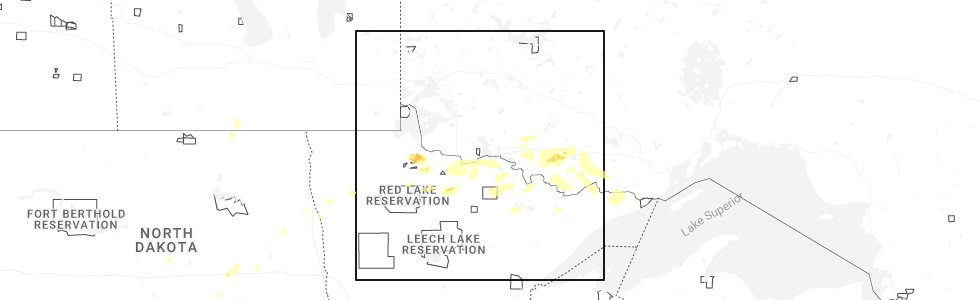
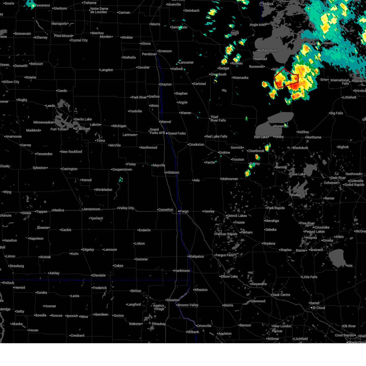
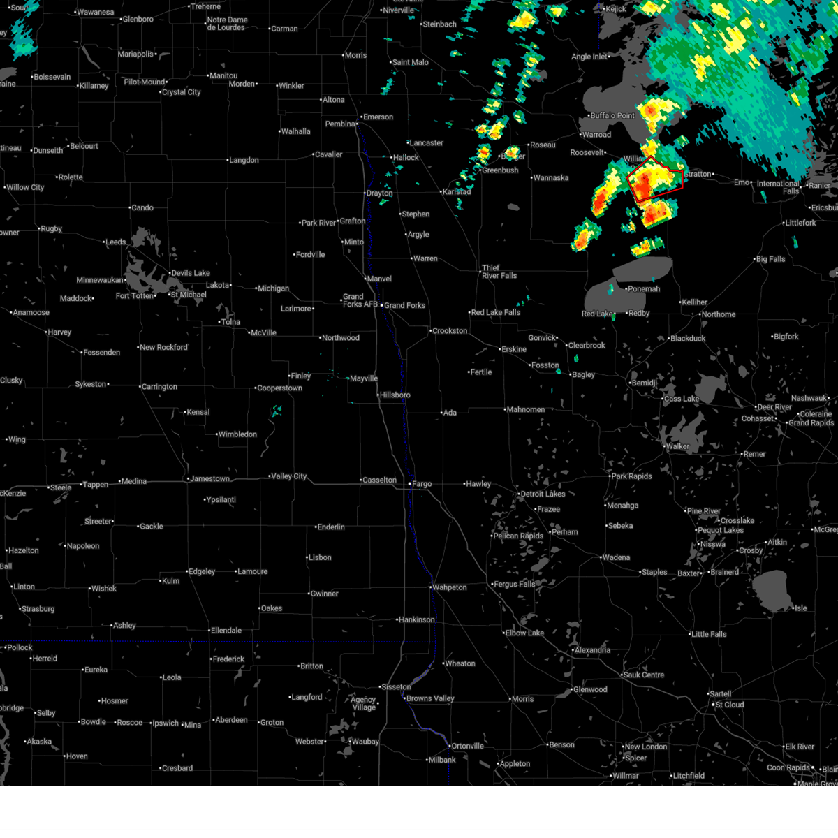
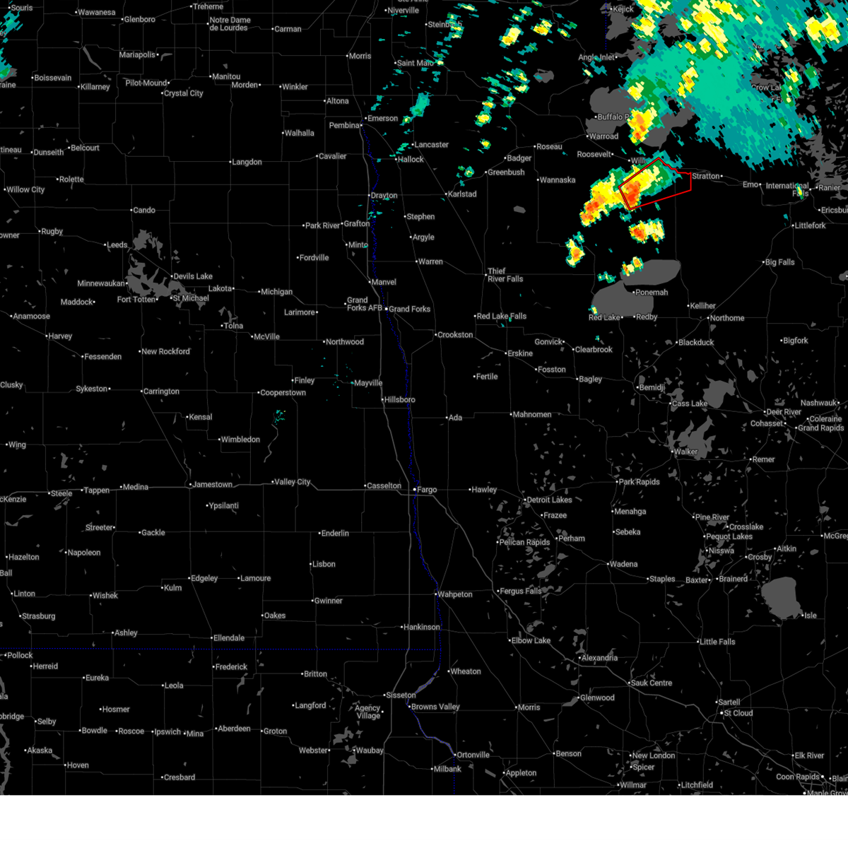
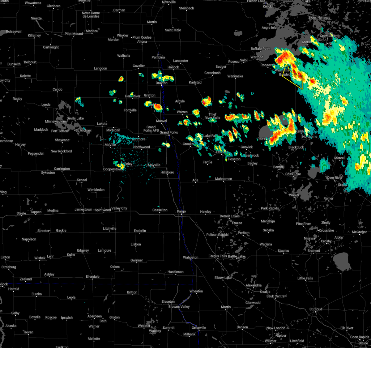
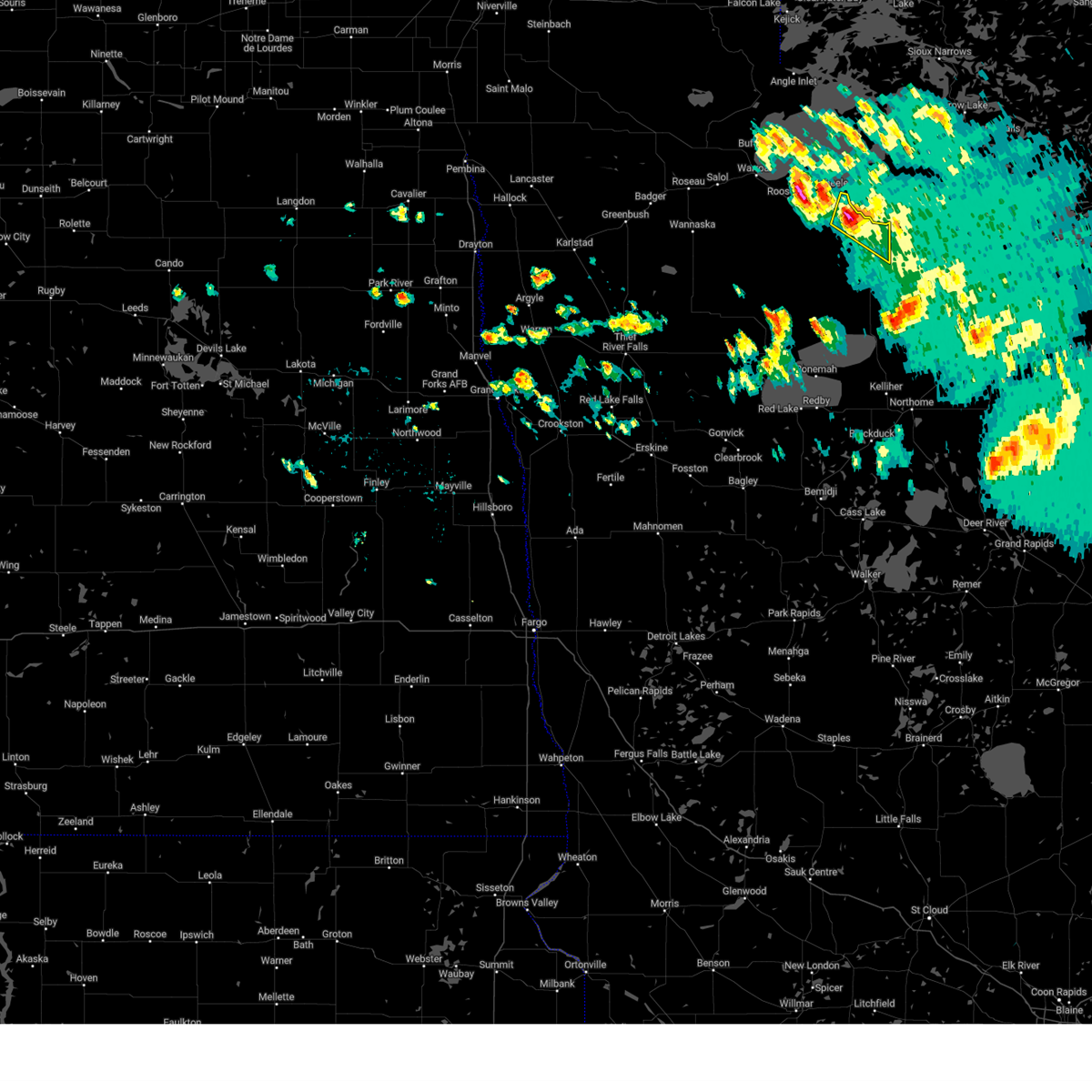
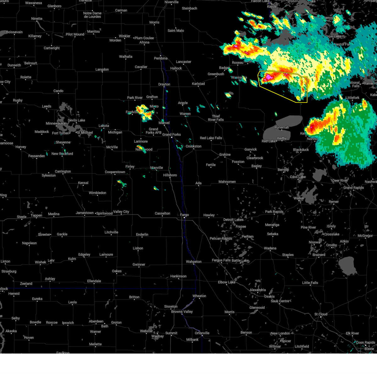
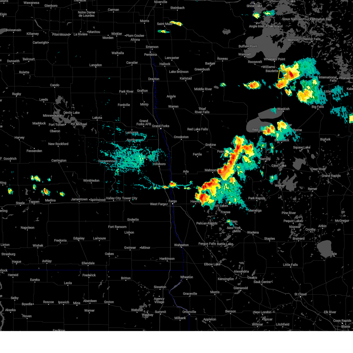
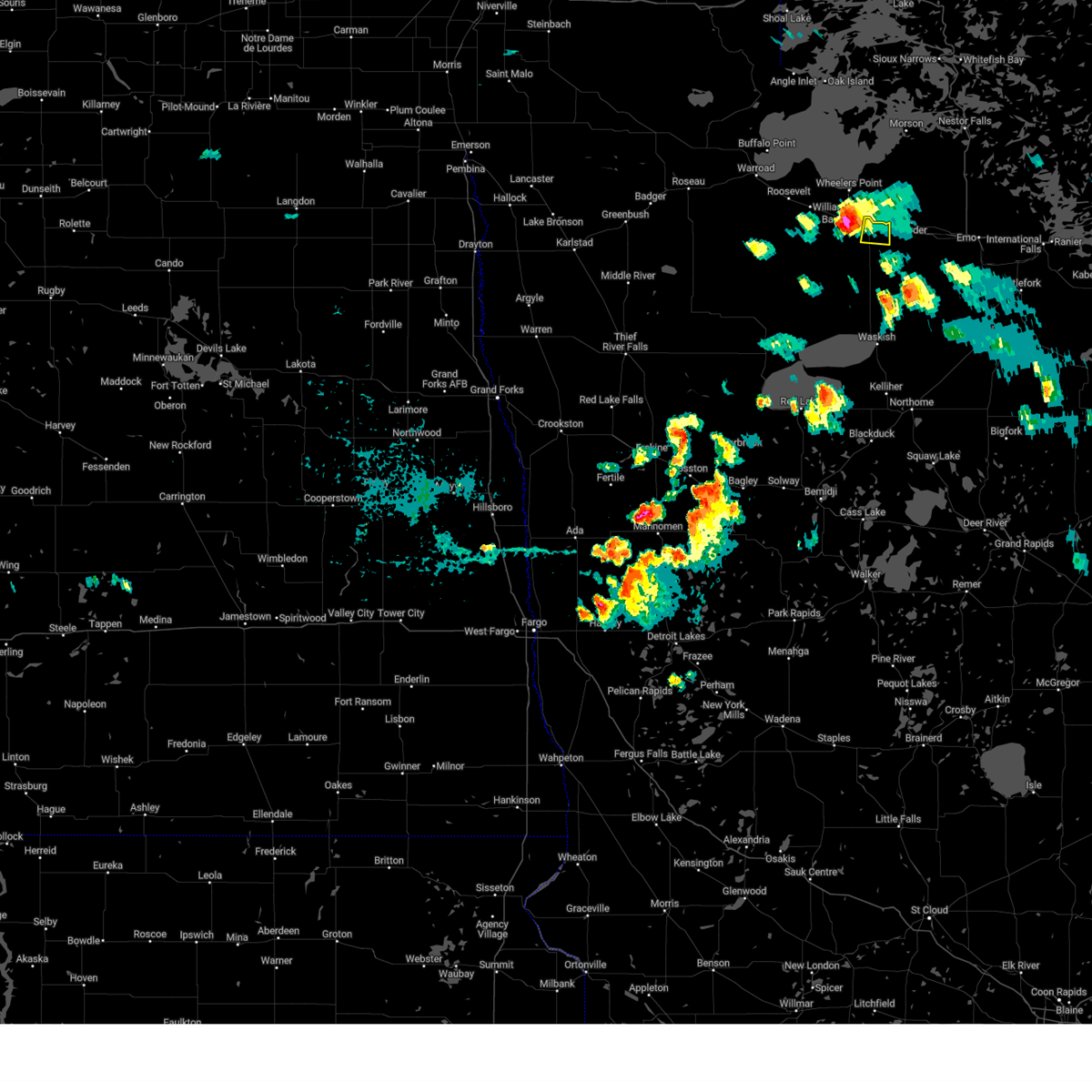
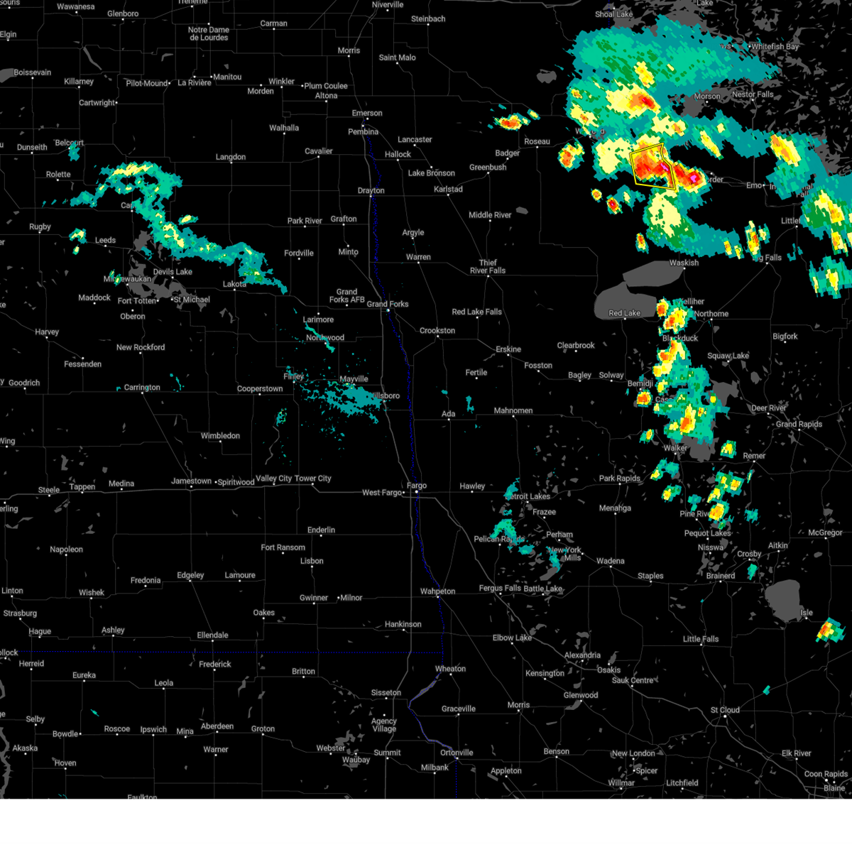
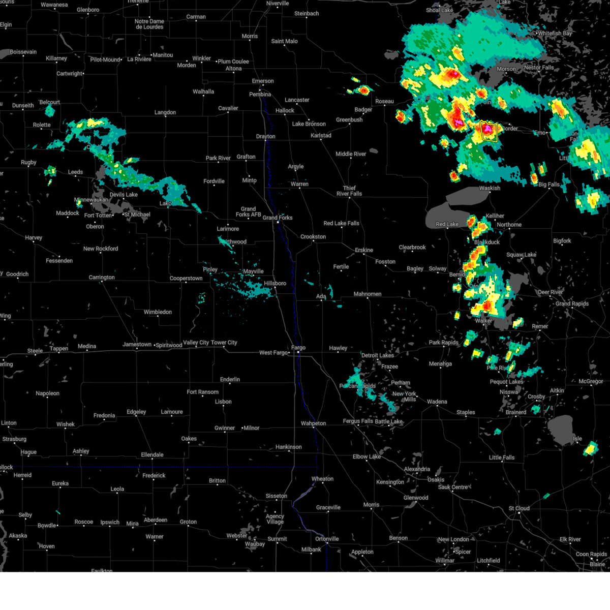
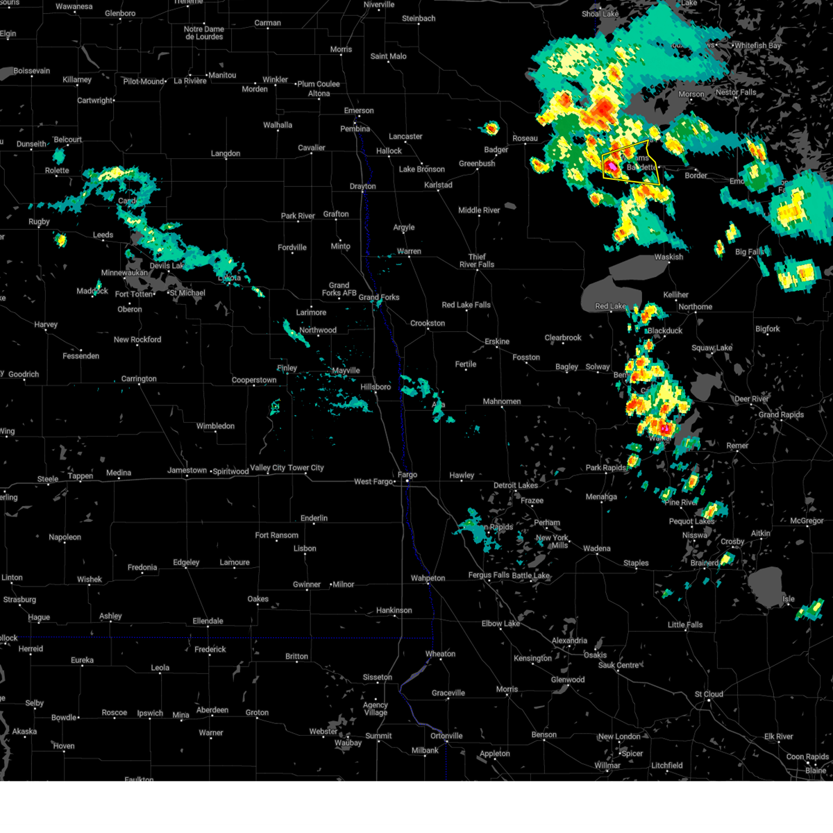
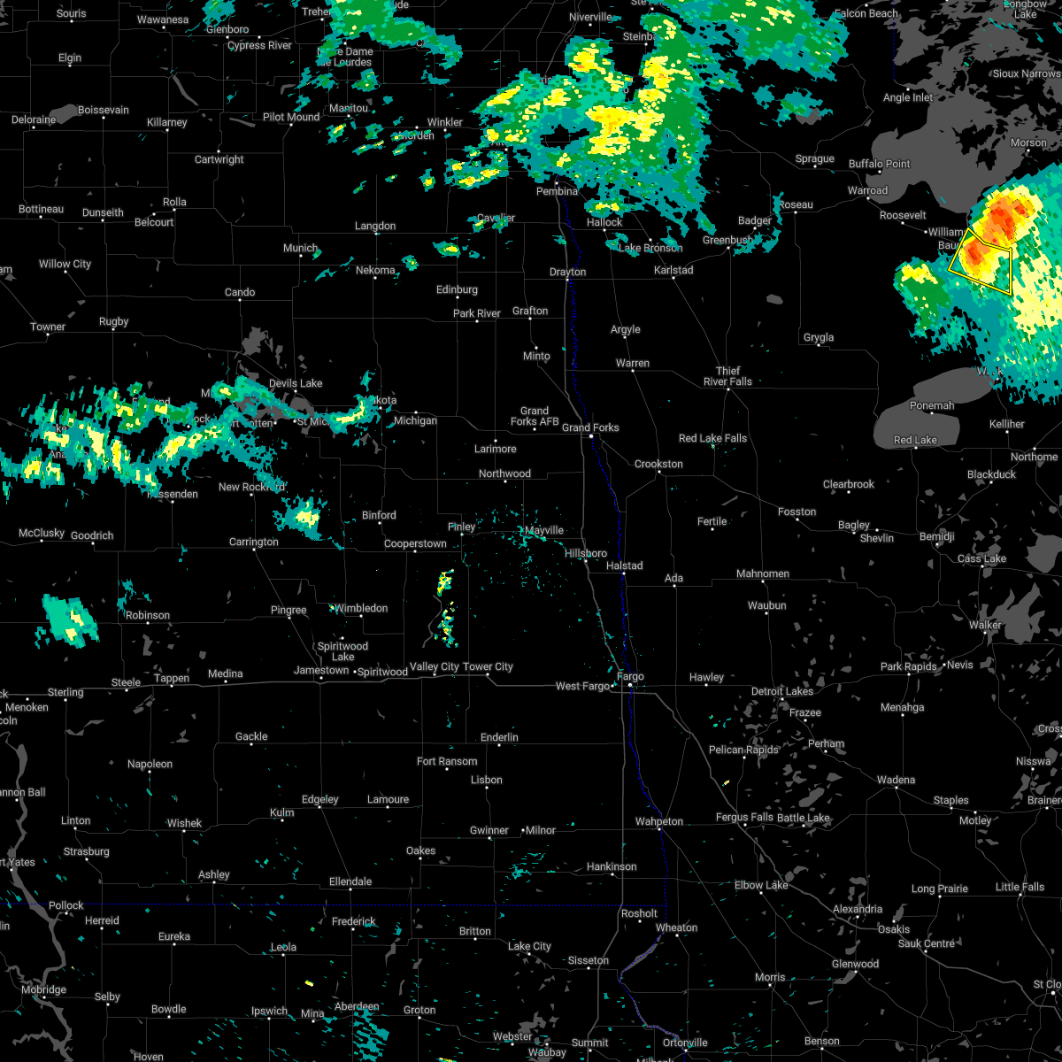
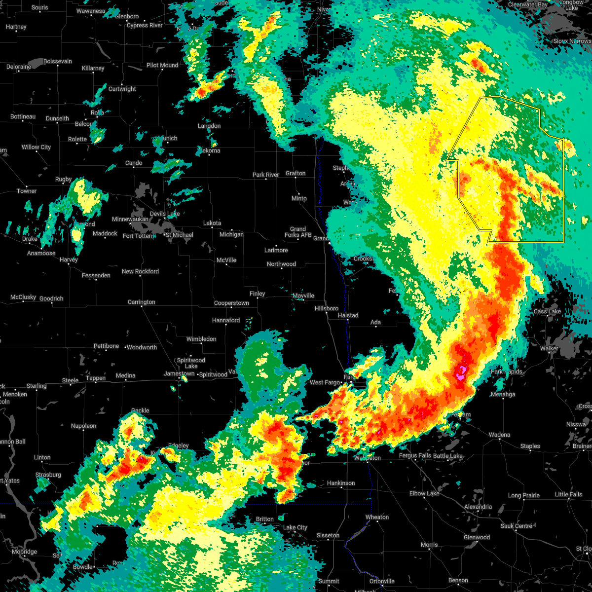
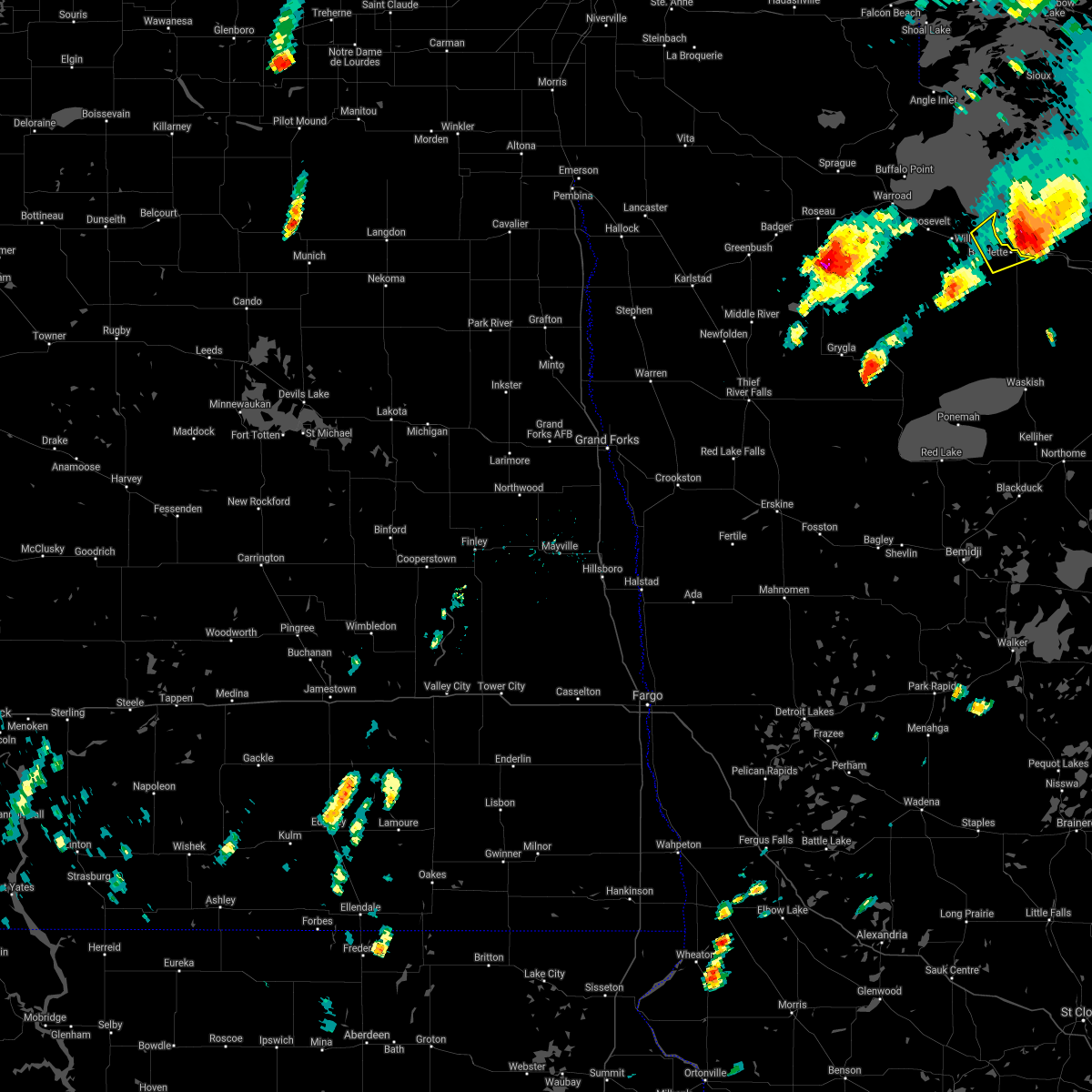
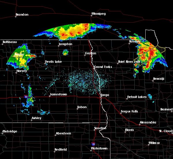
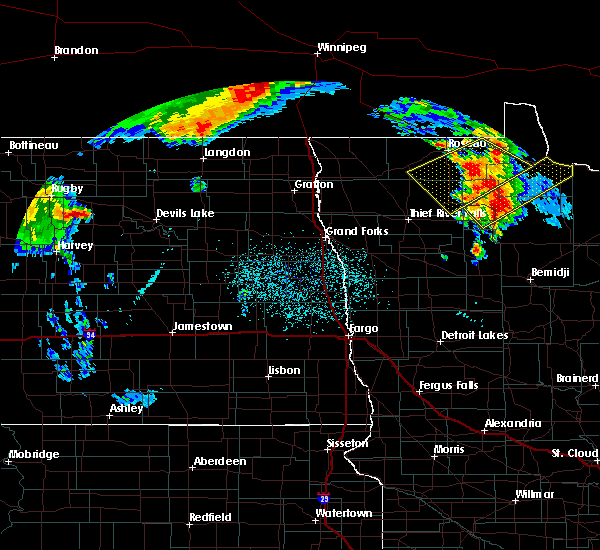
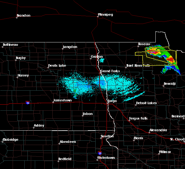
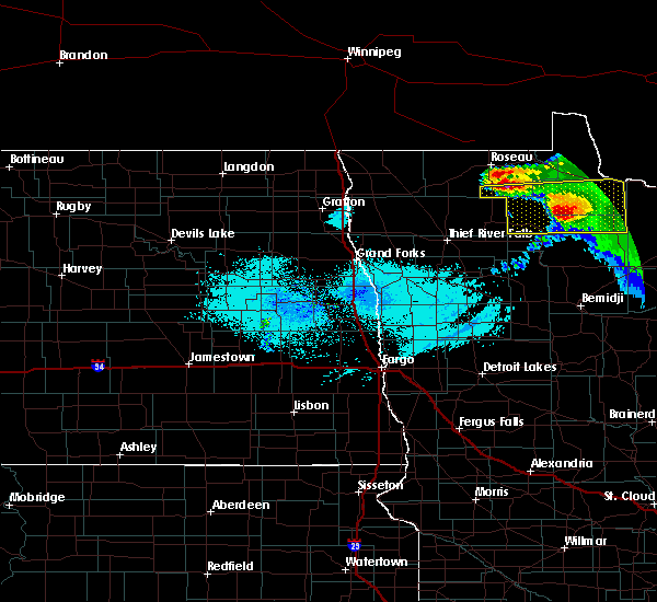
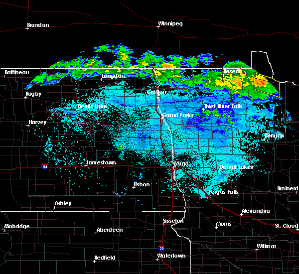
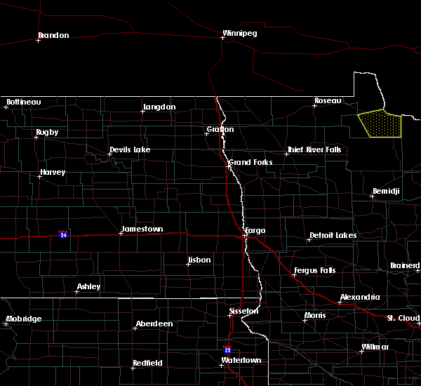
Hail Map for Baudette, MN
The Baudette, MN area has had 11 reports of on-the-ground hail by trained spotters, and has been under severe weather warnings 9 times during the past 12 months. Doppler radar has detected hail at or near Baudette, MN on 11 occasions, including 2 occasions during the past year.
| Name: | Baudette, MN |
| Where Located: | 54.4 miles E of Roseau, MN |
| Map: | Google Map for Baudette, MN |
| Population: | 1106 |
| Housing Units: | 577 |
| More Info: | Search Google for Baudette, MN |
0
The Top Recent Hail Date for Baudette, MN is Friday, July 4, 2025 (11th out of 11)
Hail and Wind Damage Spotted near Baudette, MN
| Date / Time | Report Details |
|---|---|
| 7/4/2025 1:05 PM CDT |
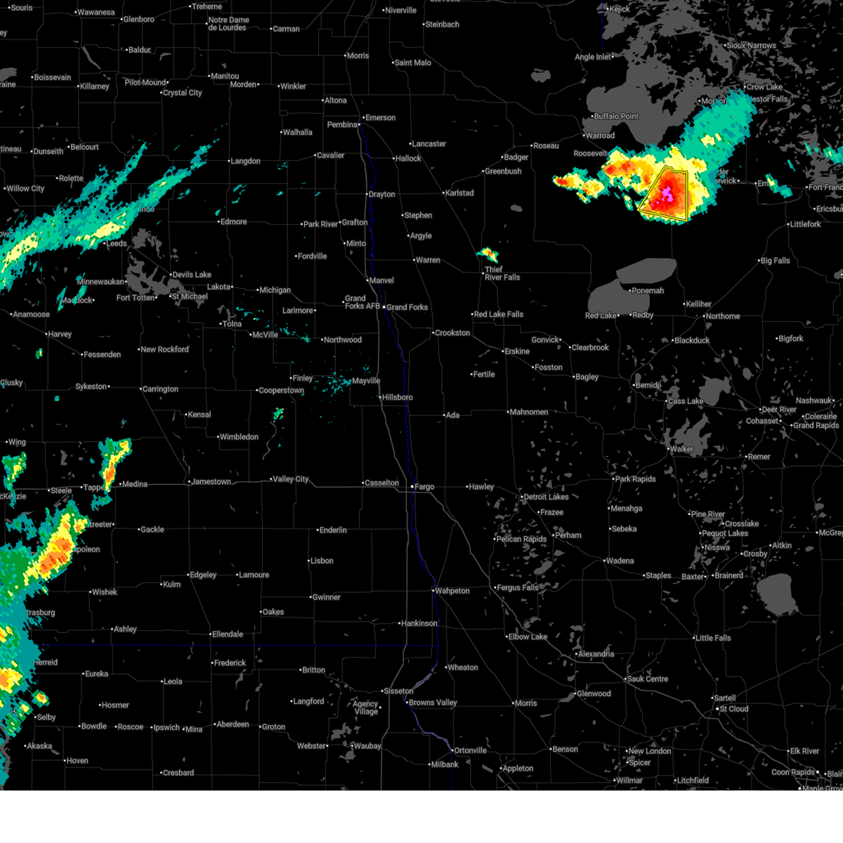 At 105 pm cdt, a severe thunderstorm was located near carp, or 54 miles west of international falls, moving east at 20 mph (radar indicated). Hazards include two inch hail and 70 mph wind gusts. People and animals outdoors will be injured. expect hail damage to roofs, siding, windows, and vehicles. expect considerable tree damage. wind damage is also likely to mobile homes, roofs, and outbuildings. Locations impacted include, baudette, clementson, and carp. At 105 pm cdt, a severe thunderstorm was located near carp, or 54 miles west of international falls, moving east at 20 mph (radar indicated). Hazards include two inch hail and 70 mph wind gusts. People and animals outdoors will be injured. expect hail damage to roofs, siding, windows, and vehicles. expect considerable tree damage. wind damage is also likely to mobile homes, roofs, and outbuildings. Locations impacted include, baudette, clementson, and carp.
|
| 7/4/2025 1:00 PM CDT | Trees and a power line down... location and time estimated from report/radar. also unknown size of hail at time of repor in lake of the woods county MN, 11.2 miles N of Baudette, MN |
| 7/4/2025 12:56 PM CDT |
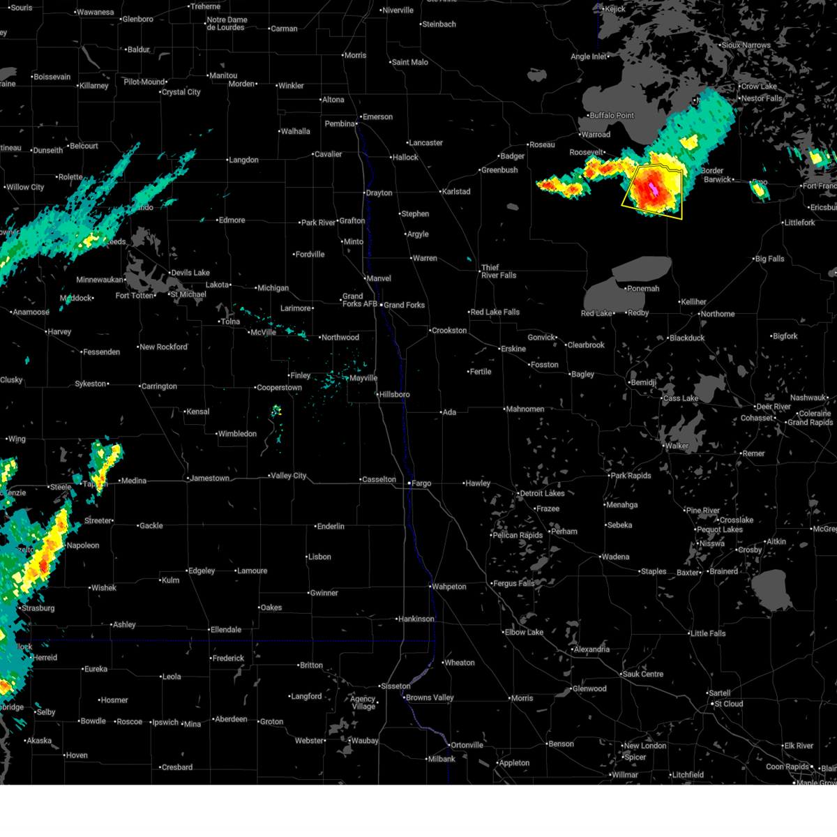 At 1256 pm cdt, a severe thunderstorm was located near carp, or 52 miles east of roseau, moving east at 25 mph (radar indicated). Hazards include 70 mph wind gusts and ping pong ball size hail. People and animals outdoors will be injured. expect hail damage to roofs, siding, windows, and vehicles. expect considerable tree damage. wind damage is also likely to mobile homes, roofs, and outbuildings. Locations impacted include, baudette, clementson, carp, and pitt. At 1256 pm cdt, a severe thunderstorm was located near carp, or 52 miles east of roseau, moving east at 25 mph (radar indicated). Hazards include 70 mph wind gusts and ping pong ball size hail. People and animals outdoors will be injured. expect hail damage to roofs, siding, windows, and vehicles. expect considerable tree damage. wind damage is also likely to mobile homes, roofs, and outbuildings. Locations impacted include, baudette, clementson, carp, and pitt.
|
| 7/4/2025 12:55 PM CDT | Baseball sized hail reported 14.1 miles N of Baudette, MN, facebook report of baseball sized hail. time estimated. |
| 7/4/2025 12:44 PM CDT |
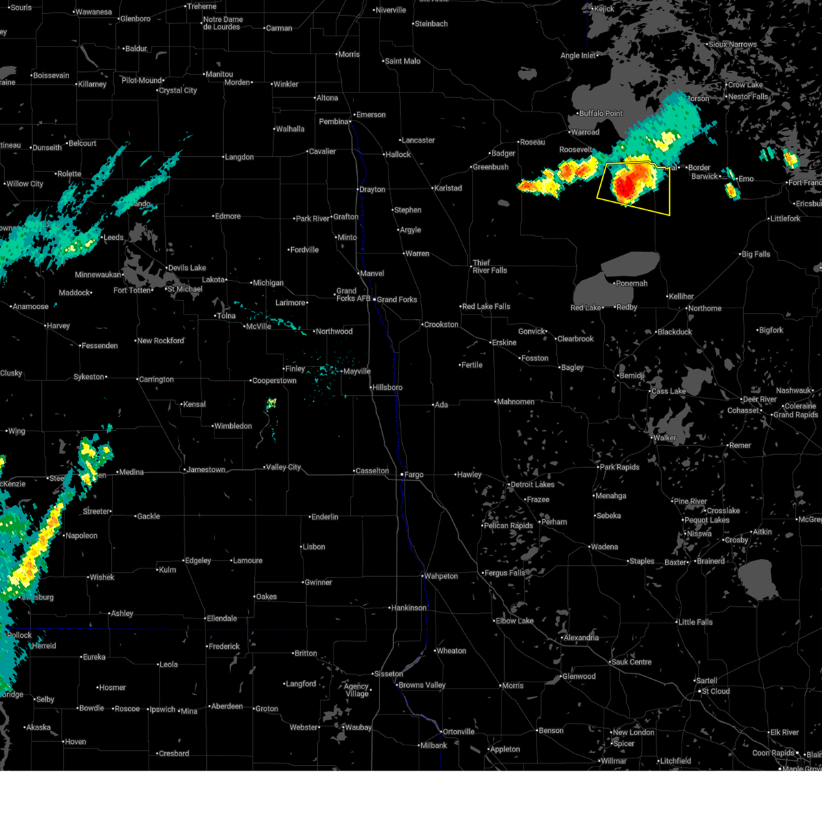 Svrfgf the national weather service in grand forks has issued a * severe thunderstorm warning for, southeastern lake of the woods county in north central minnesota, * until 145 pm cdt. * at 1243 pm cdt, a severe thunderstorm was located near faunce, or 43 miles east of roseau, moving east at 20 mph (radar indicated). Hazards include 60 mph wind gusts and quarter size hail. Hail damage to vehicles is expected. Expect wind damage to roofs, siding, and trees. Svrfgf the national weather service in grand forks has issued a * severe thunderstorm warning for, southeastern lake of the woods county in north central minnesota, * until 145 pm cdt. * at 1243 pm cdt, a severe thunderstorm was located near faunce, or 43 miles east of roseau, moving east at 20 mph (radar indicated). Hazards include 60 mph wind gusts and quarter size hail. Hail damage to vehicles is expected. Expect wind damage to roofs, siding, and trees.
|
| 6/22/2025 8:51 PM CDT |
 The storm which prompted the warning has moved out of the area. therefore, the warning will be allowed to expire. a tornado watch remains in effect until 1000 pm cdt for north central minnesota. The storm which prompted the warning has moved out of the area. therefore, the warning will be allowed to expire. a tornado watch remains in effect until 1000 pm cdt for north central minnesota.
|
| 6/22/2025 8:29 PM CDT |
 At 829 pm cdt, a severe thunderstorm capable of producing a tornado was located near pitt, or 49 miles east of roseau, moving east at 30 mph (radar indicated rotation). Hazards include tornado. Flying debris will be dangerous to those caught without shelter. mobile homes will be damaged or destroyed. damage to roofs, windows, and vehicles will occur. tree damage is likely. Locations impacted include, baudette, clementson, and pitt. At 829 pm cdt, a severe thunderstorm capable of producing a tornado was located near pitt, or 49 miles east of roseau, moving east at 30 mph (radar indicated rotation). Hazards include tornado. Flying debris will be dangerous to those caught without shelter. mobile homes will be damaged or destroyed. damage to roofs, windows, and vehicles will occur. tree damage is likely. Locations impacted include, baudette, clementson, and pitt.
|
| 6/22/2025 8:11 PM CDT |
 Torfgf the national weather service in grand forks has issued a * tornado warning for, southeastern lake of the woods county in north central minnesota, * until 900 pm cdt. * at 811 pm cdt, a severe thunderstorm capable of producing a tornado was located over faunce, or 42 miles southeast of roseau, moving east at 30 mph (radar indicated rotation). Hazards include tornado. Flying debris will be dangerous to those caught without shelter. mobile homes will be damaged or destroyed. damage to roofs, windows, and vehicles will occur. Tree damage is likely. Torfgf the national weather service in grand forks has issued a * tornado warning for, southeastern lake of the woods county in north central minnesota, * until 900 pm cdt. * at 811 pm cdt, a severe thunderstorm capable of producing a tornado was located over faunce, or 42 miles southeast of roseau, moving east at 30 mph (radar indicated rotation). Hazards include tornado. Flying debris will be dangerous to those caught without shelter. mobile homes will be damaged or destroyed. damage to roofs, windows, and vehicles will occur. Tree damage is likely.
|
| 8/3/2024 11:36 AM CDT |
 The storm which prompted the warning has weakened below severe limits, and no longer poses an immediate threat to life or property. therefore, the warning will be allowed to expire. The storm which prompted the warning has weakened below severe limits, and no longer poses an immediate threat to life or property. therefore, the warning will be allowed to expire.
|
| 8/3/2024 11:09 AM CDT |
 Svrfgf the national weather service in grand forks has issued a * severe thunderstorm warning for, east central lake of the woods county in north central minnesota, * until 1145 am cdt. * at 1109 am cdt, a severe thunderstorm was located over pitt, or 50 miles east of roseau, moving southeast at 45 mph (radar indicated). Hazards include 60 mph wind gusts and half dollar size hail. Hail damage to vehicles is expected. Expect wind damage to roofs, siding, and trees. Svrfgf the national weather service in grand forks has issued a * severe thunderstorm warning for, east central lake of the woods county in north central minnesota, * until 1145 am cdt. * at 1109 am cdt, a severe thunderstorm was located over pitt, or 50 miles east of roseau, moving southeast at 45 mph (radar indicated). Hazards include 60 mph wind gusts and half dollar size hail. Hail damage to vehicles is expected. Expect wind damage to roofs, siding, and trees.
|
| 8/3/2024 10:10 AM CDT |
 Svrfgf the national weather service in grand forks has issued a * severe thunderstorm warning for, southeastern roseau county in northwestern minnesota, southern lake of the woods county in north central minnesota, * until 1115 am cdt. * at 1010 am cdt, a severe thunderstorm was located near norris camp, or 30 miles east of roseau, moving southeast at 45 mph (radar indicated). Hazards include 60 mph wind gusts and half dollar size hail. Hail damage to vehicles is expected. Expect wind damage to roofs, siding, and trees. Svrfgf the national weather service in grand forks has issued a * severe thunderstorm warning for, southeastern roseau county in northwestern minnesota, southern lake of the woods county in north central minnesota, * until 1115 am cdt. * at 1010 am cdt, a severe thunderstorm was located near norris camp, or 30 miles east of roseau, moving southeast at 45 mph (radar indicated). Hazards include 60 mph wind gusts and half dollar size hail. Hail damage to vehicles is expected. Expect wind damage to roofs, siding, and trees.
|
| 8/8/2023 3:56 PM CDT |
 The severe thunderstorm warning for southeastern lake of the woods county will expire at 400 pm cdt, the storm which prompted the warning has moved out of the area. therefore, the warning will be allowed to expire. The severe thunderstorm warning for southeastern lake of the woods county will expire at 400 pm cdt, the storm which prompted the warning has moved out of the area. therefore, the warning will be allowed to expire.
|
| 8/8/2023 3:47 PM CDT |
 At 347 pm cdt, a severe thunderstorm was located over clementson, or 60 miles east of roseau, moving east at 40 mph (radar indicated). Hazards include quarter size hail. Damage to vehicles is expected. locations impacted include, baudette and clementson. hail threat, radar indicated max hail size, 1. 00 in wind threat, radar indicated max wind gust, <50 mph. At 347 pm cdt, a severe thunderstorm was located over clementson, or 60 miles east of roseau, moving east at 40 mph (radar indicated). Hazards include quarter size hail. Damage to vehicles is expected. locations impacted include, baudette and clementson. hail threat, radar indicated max hail size, 1. 00 in wind threat, radar indicated max wind gust, <50 mph.
|
| 8/8/2023 3:35 PM CDT |
 At 335 pm cdt, a severe thunderstorm was located over baudette, or 52 miles east of roseau, moving east at 40 mph (radar indicated). Hazards include quarter size hail. damage to vehicles is expected At 335 pm cdt, a severe thunderstorm was located over baudette, or 52 miles east of roseau, moving east at 40 mph (radar indicated). Hazards include quarter size hail. damage to vehicles is expected
|
| 7/19/2023 3:27 PM CDT |
 The severe thunderstorm warning for southeastern lake of the woods county will expire at 330 pm cdt, the storm which prompted the warning has moved out of the area. therefore, the warning will be allowed to expire. however heavy rain is still possible with this thunderstorm. a severe thunderstorm watch remains in effect until 1000 pm cdt for north central minnesota. to report severe weather, contact your nearest law enforcement agency. they will relay your report to the national weather service grand forks. The severe thunderstorm warning for southeastern lake of the woods county will expire at 330 pm cdt, the storm which prompted the warning has moved out of the area. therefore, the warning will be allowed to expire. however heavy rain is still possible with this thunderstorm. a severe thunderstorm watch remains in effect until 1000 pm cdt for north central minnesota. to report severe weather, contact your nearest law enforcement agency. they will relay your report to the national weather service grand forks.
|
| 7/19/2023 3:02 PM CDT | Half Dollar sized hail reported 4.6 miles NE of Baudette, MN, half dollar sized hail reported by the public 5 sw baudette. |
| 7/19/2023 2:56 PM CDT |
 At 256 pm cdt, a severe thunderstorm was located near baudette, or 52 miles east of roseau, moving east at 25 mph (radar indicated). Hazards include quarter size hail. damage to vehicles is expected At 256 pm cdt, a severe thunderstorm was located near baudette, or 52 miles east of roseau, moving east at 25 mph (radar indicated). Hazards include quarter size hail. damage to vehicles is expected
|
| 7/9/2023 8:11 PM CDT |
 At 811 pm cdt, a severe thunderstorm was located near graceton, or 42 miles east of roseau, moving southeast at 45 mph (radar indicated). Hazards include 60 mph wind gusts and quarter size hail. Hail damage to vehicles is expected. expect wind damage to roofs, siding, and trees. locations impacted include, baudette, williams, clementson, zippel bay state park, graceton, pitt and wheelers point. hail threat, radar indicated max hail size, 1. 00 in wind threat, radar indicated max wind gust, 60 mph. At 811 pm cdt, a severe thunderstorm was located near graceton, or 42 miles east of roseau, moving southeast at 45 mph (radar indicated). Hazards include 60 mph wind gusts and quarter size hail. Hail damage to vehicles is expected. expect wind damage to roofs, siding, and trees. locations impacted include, baudette, williams, clementson, zippel bay state park, graceton, pitt and wheelers point. hail threat, radar indicated max hail size, 1. 00 in wind threat, radar indicated max wind gust, 60 mph.
|
| 7/9/2023 7:47 PM CDT |
 At 747 pm cdt, a severe thunderstorm was located near arnesen, or 27 miles east of roseau, moving southeast at 45 mph (radar indicated). Hazards include 60 mph wind gusts and quarter size hail. Hail damage to vehicles is expected. Expect wind damage to roofs, siding, and trees. At 747 pm cdt, a severe thunderstorm was located near arnesen, or 27 miles east of roseau, moving southeast at 45 mph (radar indicated). Hazards include 60 mph wind gusts and quarter size hail. Hail damage to vehicles is expected. Expect wind damage to roofs, siding, and trees.
|
| 6/27/2023 2:38 PM CDT |
 At 238 pm cdt, a severe thunderstorm was located over pitt, or 46 miles east of roseau, moving east at 25 mph (radar indicated). Hazards include 60 mph wind gusts and quarter size hail. Hail damage to vehicles is expected. expect wind damage to roofs, siding, and trees. locations impacted include, wheelers point, williams, graceton and pitt. hail threat, radar indicated max hail size, 1. 00 in wind threat, radar indicated max wind gust, 60 mph. At 238 pm cdt, a severe thunderstorm was located over pitt, or 46 miles east of roseau, moving east at 25 mph (radar indicated). Hazards include 60 mph wind gusts and quarter size hail. Hail damage to vehicles is expected. expect wind damage to roofs, siding, and trees. locations impacted include, wheelers point, williams, graceton and pitt. hail threat, radar indicated max hail size, 1. 00 in wind threat, radar indicated max wind gust, 60 mph.
|
| 6/27/2023 2:35 PM CDT | Quarter sized hail reported 7.4 miles WNW of Baudette, MN, public reports quarter sized hail. |
| 6/27/2023 2:30 PM CDT |
 At 230 pm cdt, a severe thunderstorm was located over clementson, or 59 miles east of roseau, moving east at 30 mph (radar indicated). Hazards include 60 mph wind gusts and quarter size hail. Hail damage to vehicles is expected. Expect wind damage to roofs, siding, and trees. At 230 pm cdt, a severe thunderstorm was located over clementson, or 59 miles east of roseau, moving east at 30 mph (radar indicated). Hazards include 60 mph wind gusts and quarter size hail. Hail damage to vehicles is expected. Expect wind damage to roofs, siding, and trees.
|
| 6/27/2023 2:16 PM CDT |
 At 215 pm cdt, a severe thunderstorm was located over williams, or 37 miles east of roseau, moving east at 30 mph (radar indicated). Hazards include 60 mph wind gusts and quarter size hail. Hail damage to vehicles is expected. Expect wind damage to roofs, siding, and trees. At 215 pm cdt, a severe thunderstorm was located over williams, or 37 miles east of roseau, moving east at 30 mph (radar indicated). Hazards include 60 mph wind gusts and quarter size hail. Hail damage to vehicles is expected. Expect wind damage to roofs, siding, and trees.
|
| 7/18/2022 6:50 AM CDT |
 At 650 am cdt, severe thunderstorms were located along a line extending from 18 miles east of wheelers point to 6 miles north of clementson to 6 miles south of baudette, moving southeast at 45 mph (radar indicated). Hazards include 60 mph wind gusts. Expect damage to roofs, siding, and trees. these severe thunderstorms will remain over mainly rural areas of southeastern lake of the woods county. hail threat, radar indicated max hail size, <. 75 in wind threat, radar indicated max wind gust, 60 mph. At 650 am cdt, severe thunderstorms were located along a line extending from 18 miles east of wheelers point to 6 miles north of clementson to 6 miles south of baudette, moving southeast at 45 mph (radar indicated). Hazards include 60 mph wind gusts. Expect damage to roofs, siding, and trees. these severe thunderstorms will remain over mainly rural areas of southeastern lake of the woods county. hail threat, radar indicated max hail size, <. 75 in wind threat, radar indicated max wind gust, 60 mph.
|
| 7/18/2022 6:12 AM CDT |
 At 611 am cdt, severe thunderstorms were located along a line extending from 9 miles northeast of long point to arnesen to near swift, moving southeast at 35 mph (radar indicated). Hazards include 60 mph wind gusts and quarter size hail. Hail damage to vehicles is expected. expect wind damage to roofs, siding, and trees. severe thunderstorms will be near, birch beach, lude and long point around 620 am cdt. williams around 630 am cdt. other locations in the path of these severe thunderstorms include wheelers point, graceton, pitt and baudette. hail threat, radar indicated max hail size, 1. 00 in wind threat, radar indicated max wind gust, 60 mph. At 611 am cdt, severe thunderstorms were located along a line extending from 9 miles northeast of long point to arnesen to near swift, moving southeast at 35 mph (radar indicated). Hazards include 60 mph wind gusts and quarter size hail. Hail damage to vehicles is expected. expect wind damage to roofs, siding, and trees. severe thunderstorms will be near, birch beach, lude and long point around 620 am cdt. williams around 630 am cdt. other locations in the path of these severe thunderstorms include wheelers point, graceton, pitt and baudette. hail threat, radar indicated max hail size, 1. 00 in wind threat, radar indicated max wind gust, 60 mph.
|
| 7/10/2022 10:50 AM CDT |
 The severe thunderstorm warning for eastern beltrami and southeastern lake of the woods counties will expire at 1100 am cdt, the storms which prompted the warning have moved out of the area. therefore, the warning will be allowed to expire. a severe thunderstorm watch remains in effect until noon cdt for north central minnesota. The severe thunderstorm warning for eastern beltrami and southeastern lake of the woods counties will expire at 1100 am cdt, the storms which prompted the warning have moved out of the area. therefore, the warning will be allowed to expire. a severe thunderstorm watch remains in effect until noon cdt for north central minnesota.
|
| 7/10/2022 10:32 AM CDT |
 At 1031 am cdt, severe thunderstorms were located along a line extending from 6 miles northeast of wheelers point to 11 miles north of waskish to 6 miles southeast of turtle river, moving east at 35 mph (radar indicated). Hazards include 60 mph wind gusts and quarter size hail. Hail damage to vehicles is expected. expect wind damage to roofs, siding, and trees. these severe thunderstorms will remain over mainly rural areas of eastern beltrami and southeastern lake of the woods counties. hail threat, radar indicated max hail size, 1. 00 in wind threat, radar indicated max wind gust, 60 mph. At 1031 am cdt, severe thunderstorms were located along a line extending from 6 miles northeast of wheelers point to 11 miles north of waskish to 6 miles southeast of turtle river, moving east at 35 mph (radar indicated). Hazards include 60 mph wind gusts and quarter size hail. Hail damage to vehicles is expected. expect wind damage to roofs, siding, and trees. these severe thunderstorms will remain over mainly rural areas of eastern beltrami and southeastern lake of the woods counties. hail threat, radar indicated max hail size, 1. 00 in wind threat, radar indicated max wind gust, 60 mph.
|
| 7/10/2022 10:04 AM CDT |
 At 1004 am cdt, severe thunderstorms were located along a line extending from near birch beach to 11 miles southeast of oaks corner to near wilton, moving east at 35 mph (radar indicated). Hazards include 60 mph wind gusts and quarter size hail. Hail damage to vehicles is expected. expect wind damage to roofs, siding, and trees. severe thunderstorms will be near, lavinia around 1015 am cdt. wheelers point around 1020 am cdt. other locations in the path of these severe thunderstorms include turtle river and tenstrike. hail threat, radar indicated max hail size, 1. 00 in wind threat, radar indicated max wind gust, 60 mph. At 1004 am cdt, severe thunderstorms were located along a line extending from near birch beach to 11 miles southeast of oaks corner to near wilton, moving east at 35 mph (radar indicated). Hazards include 60 mph wind gusts and quarter size hail. Hail damage to vehicles is expected. expect wind damage to roofs, siding, and trees. severe thunderstorms will be near, lavinia around 1015 am cdt. wheelers point around 1020 am cdt. other locations in the path of these severe thunderstorms include turtle river and tenstrike. hail threat, radar indicated max hail size, 1. 00 in wind threat, radar indicated max wind gust, 60 mph.
|
| 6/24/2022 10:28 PM CDT |
 At 1028 pm cdt, severe thunderstorms were located along a line extending from near hayes lake state park to near carp to lower red lake, moving northeast at 20 mph (radar indicated). Hazards include 70 mph wind gusts and nickel size hail. Expect considerable tree damage. damage is likely to mobile homes, roofs, and outbuildings. severe thunderstorms will be near, carp around 1030 pm cdt. Other locations in the path of these severe thunderstorms include shotley, otto, norris camp, clementson and waskish. At 1028 pm cdt, severe thunderstorms were located along a line extending from near hayes lake state park to near carp to lower red lake, moving northeast at 20 mph (radar indicated). Hazards include 70 mph wind gusts and nickel size hail. Expect considerable tree damage. damage is likely to mobile homes, roofs, and outbuildings. severe thunderstorms will be near, carp around 1030 pm cdt. Other locations in the path of these severe thunderstorms include shotley, otto, norris camp, clementson and waskish.
|
| 6/24/2022 10:15 PM CDT |
 At 1015 pm cdt, severe thunderstorms were located along a line extending from near hayes lake state park to near faunce to 10 miles north of upper red lake, moving northeast at 40 mph (radar indicated). Hazards include 70 mph wind gusts and nickel size hail. Expect considerable tree damage. damage is likely to mobile homes, roofs, and outbuildings. Locations impacted include, faunce, graceton, pitt, baudette, carp, swift, warroad and springsteel island. At 1015 pm cdt, severe thunderstorms were located along a line extending from near hayes lake state park to near faunce to 10 miles north of upper red lake, moving northeast at 40 mph (radar indicated). Hazards include 70 mph wind gusts and nickel size hail. Expect considerable tree damage. damage is likely to mobile homes, roofs, and outbuildings. Locations impacted include, faunce, graceton, pitt, baudette, carp, swift, warroad and springsteel island.
|
| 6/24/2022 9:34 PM CDT |
 At 933 pm cdt, severe thunderstorms were located along a line extending from 8 miles east of middle river to near malcolm to red lake nation, moving northeast at 60 mph (radar indicated). Hazards include 70 mph wind gusts and nickel size hail. Expect considerable tree damage. damage is likely to mobile homes, roofs, and outbuildings. severe thunderstorms will be near, gates corner and malcolm around 935 pm cdt. thorhult around 940 pm cdt. western upper red lake around 945 pm cdt. wannaska, torfin and casperson around 950 pm cdt. Other locations in the path of these severe thunderstorms include faunce, pencer and hayes lake state park. At 933 pm cdt, severe thunderstorms were located along a line extending from 8 miles east of middle river to near malcolm to red lake nation, moving northeast at 60 mph (radar indicated). Hazards include 70 mph wind gusts and nickel size hail. Expect considerable tree damage. damage is likely to mobile homes, roofs, and outbuildings. severe thunderstorms will be near, gates corner and malcolm around 935 pm cdt. thorhult around 940 pm cdt. western upper red lake around 945 pm cdt. wannaska, torfin and casperson around 950 pm cdt. Other locations in the path of these severe thunderstorms include faunce, pencer and hayes lake state park.
|
| 6/20/2022 6:12 PM CDT |
 At 611 pm cdt, severe thunderstorms were located along a line extending from near carp to 9 miles north of waskish to near saum, moving northeast at 45 mph (radar indicated). Hazards include 70 mph wind gusts and quarter size hail. Hail damage to vehicles is expected. expect considerable tree damage. wind damage is also likely to mobile homes, roofs, and outbuildings. locations impacted include, baudette, redby, red lake, lower red lake, ponemah, kelliher and upper red lake. thunderstorm damage threat, considerable hail threat, radar indicated max hail size, 1. 00 in wind threat, radar indicated max wind gust, 70 mph. At 611 pm cdt, severe thunderstorms were located along a line extending from near carp to 9 miles north of waskish to near saum, moving northeast at 45 mph (radar indicated). Hazards include 70 mph wind gusts and quarter size hail. Hail damage to vehicles is expected. expect considerable tree damage. wind damage is also likely to mobile homes, roofs, and outbuildings. locations impacted include, baudette, redby, red lake, lower red lake, ponemah, kelliher and upper red lake. thunderstorm damage threat, considerable hail threat, radar indicated max hail size, 1. 00 in wind threat, radar indicated max wind gust, 70 mph.
|
| 6/20/2022 5:55 PM CDT |
 At 555 pm cdt, severe thunderstorms were located along a line extending from near oaks corner to red lake nation to redby, moving northeast at 35 mph (radar indicated). Hazards include 70 mph wind gusts and quarter size hail. Hail damage to vehicles is expected. expect considerable tree damage. wind damage is also likely to mobile homes, roofs, and outbuildings. locations impacted include, oaks corner, saum, carp, shotley, otto and kelliher. thunderstorm damage threat, considerable hail threat, radar indicated max hail size, 1. 00 in wind threat, radar indicated max wind gust, 70 mph. At 555 pm cdt, severe thunderstorms were located along a line extending from near oaks corner to red lake nation to redby, moving northeast at 35 mph (radar indicated). Hazards include 70 mph wind gusts and quarter size hail. Hail damage to vehicles is expected. expect considerable tree damage. wind damage is also likely to mobile homes, roofs, and outbuildings. locations impacted include, oaks corner, saum, carp, shotley, otto and kelliher. thunderstorm damage threat, considerable hail threat, radar indicated max hail size, 1. 00 in wind threat, radar indicated max wind gust, 70 mph.
|
| 6/20/2022 5:23 PM CDT |
 At 523 pm cdt, severe thunderstorms were located along a line extending from malcolm to red lake nation to near debs, moving northeast at 35 mph (radar indicated). Hazards include 70 mph wind gusts and quarter size hail. Hail damage to vehicles is expected. expect considerable tree damage. wind damage is also likely to mobile homes, roofs, and outbuildings. severe thunderstorms will be near, malcolm, fourtown and thorhult around 525 pm cdt. lower red lake and gates corner around 530 pm cdt. upper red lake, island lake in beltrami county and little rock around 540 pm cdt. other locations in the path of these severe thunderstorms include red lake, redby and oaks corner. thunderstorm damage threat, considerable hail threat, radar indicated max hail size, 1. 00 in wind threat, radar indicated max wind gust, 70 mph. At 523 pm cdt, severe thunderstorms were located along a line extending from malcolm to red lake nation to near debs, moving northeast at 35 mph (radar indicated). Hazards include 70 mph wind gusts and quarter size hail. Hail damage to vehicles is expected. expect considerable tree damage. wind damage is also likely to mobile homes, roofs, and outbuildings. severe thunderstorms will be near, malcolm, fourtown and thorhult around 525 pm cdt. lower red lake and gates corner around 530 pm cdt. upper red lake, island lake in beltrami county and little rock around 540 pm cdt. other locations in the path of these severe thunderstorms include red lake, redby and oaks corner. thunderstorm damage threat, considerable hail threat, radar indicated max hail size, 1. 00 in wind threat, radar indicated max wind gust, 70 mph.
|
| 6/14/2022 4:27 PM CDT |
 At 426 pm cdt, a severe thunderstorm was located over northern red lake nation, or 45 miles east of thief river falls, moving northeast at 50 mph (radar indicated). Hazards include golf ball size hail and 70 mph wind gusts. People and animals outdoors will be injured. expect hail damage to roofs, siding, windows, and vehicles. expect considerable tree damage. wind damage is also likely to mobile homes, roofs, and outbuildings. this severe thunderstorm will be near, northwestern upper red lake around 435 pm cdt. Other locations in the path of this severe thunderstorm include carp. At 426 pm cdt, a severe thunderstorm was located over northern red lake nation, or 45 miles east of thief river falls, moving northeast at 50 mph (radar indicated). Hazards include golf ball size hail and 70 mph wind gusts. People and animals outdoors will be injured. expect hail damage to roofs, siding, windows, and vehicles. expect considerable tree damage. wind damage is also likely to mobile homes, roofs, and outbuildings. this severe thunderstorm will be near, northwestern upper red lake around 435 pm cdt. Other locations in the path of this severe thunderstorm include carp.
|
| 5/29/2022 8:28 AM CDT |
 At 827 am cdt, a severe thunderstorm was located over northeastern red lake nation, or 45 miles north of bemidji, moving northeast at 55 mph (radar indicated). Hazards include 60 mph wind gusts and quarter size hail. Hail damage to vehicles is expected. Expect wind damage to roofs, siding, and trees. At 827 am cdt, a severe thunderstorm was located over northeastern red lake nation, or 45 miles north of bemidji, moving northeast at 55 mph (radar indicated). Hazards include 60 mph wind gusts and quarter size hail. Hail damage to vehicles is expected. Expect wind damage to roofs, siding, and trees.
|
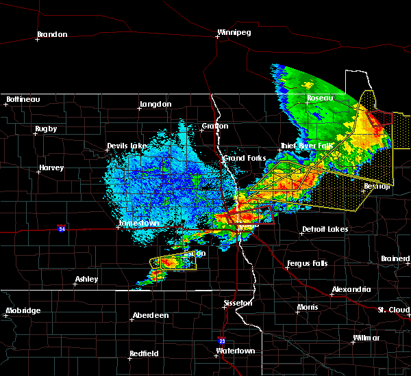
| 8/9/2020 4:07 PM CDT |
 The severe thunderstorm warning for northeastern beltrami and southeastern lake of the woods counties will expire at 415 pm cdt, the storms which prompted the warning have moved out of the area. therefore, the warning will be allowed to expire. a severe thunderstorm watch remains in effect until 700 pm cdt for north central minnesota. The severe thunderstorm warning for northeastern beltrami and southeastern lake of the woods counties will expire at 415 pm cdt, the storms which prompted the warning have moved out of the area. therefore, the warning will be allowed to expire. a severe thunderstorm watch remains in effect until 700 pm cdt for north central minnesota.
|
| 8/9/2020 4:07 PM CDT |
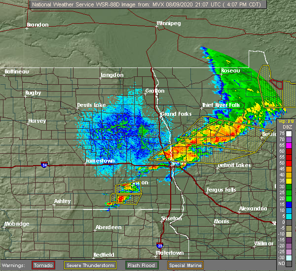 The tornado warning for east central lake of the woods county will expire at 415 pm cdt, the storm which prompted the warning has moved out of the area. therefore, the warning will be allowed to expire. a severe thunderstorm watch remains in effect until 700 pm cdt for north central minnesota. The tornado warning for east central lake of the woods county will expire at 415 pm cdt, the storm which prompted the warning has moved out of the area. therefore, the warning will be allowed to expire. a severe thunderstorm watch remains in effect until 700 pm cdt for north central minnesota.
|
| 8/9/2020 3:56 PM CDT |
 At 356 pm cdt, a severe thunderstorm capable of producing a tornado was located over baudette, or 56 miles east of roseau, moving northeast at 50 mph (weather spotters reported a funnel cloud). Hazards include tornado. Expect damage to mobile homes, roofs, and vehicles. This dangerous storm will be near, clementson around 400 pm cdt. At 356 pm cdt, a severe thunderstorm capable of producing a tornado was located over baudette, or 56 miles east of roseau, moving northeast at 50 mph (weather spotters reported a funnel cloud). Hazards include tornado. Expect damage to mobile homes, roofs, and vehicles. This dangerous storm will be near, clementson around 400 pm cdt.
|
| 8/9/2020 3:55 PM CDT |
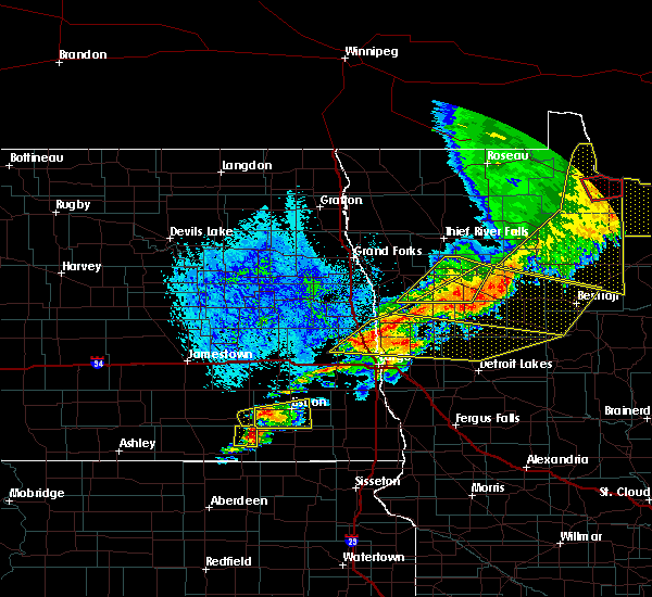 At 354 pm cdt, severe thunderstorms were located along a line extending from near zippel bay state park to 8 miles east of carp to upper red lake, moving east at 60 mph (radar indicated). Hazards include 70 mph wind gusts and nickel size hail. Expect considerable tree damage. damage is likely to mobile homes, roofs, and outbuildings. These severe thunderstorms will remain over mainly rural areas of northeastern beltrami and southeastern lake of the woods counties. At 354 pm cdt, severe thunderstorms were located along a line extending from near zippel bay state park to 8 miles east of carp to upper red lake, moving east at 60 mph (radar indicated). Hazards include 70 mph wind gusts and nickel size hail. Expect considerable tree damage. damage is likely to mobile homes, roofs, and outbuildings. These severe thunderstorms will remain over mainly rural areas of northeastern beltrami and southeastern lake of the woods counties.
|
| 8/9/2020 3:47 PM CDT |
 At 347 pm cdt, a severe thunderstorm capable of producing a tornado was located 7 miles south of pitt, or 51 miles east of roseau, moving east at 55 mph (weather spotters reported funnel cloud). Hazards include tornado. Expect damage to mobile homes, roofs, and vehicles. this dangerous storm will be near, baudette around 355 pm cdt. Clementson around 400 pm cdt. At 347 pm cdt, a severe thunderstorm capable of producing a tornado was located 7 miles south of pitt, or 51 miles east of roseau, moving east at 55 mph (weather spotters reported funnel cloud). Hazards include tornado. Expect damage to mobile homes, roofs, and vehicles. this dangerous storm will be near, baudette around 355 pm cdt. Clementson around 400 pm cdt.
|
| 8/9/2020 3:43 PM CDT |
 At 343 pm cdt, severe thunderstorms were located along a line extending from 8 miles north of wheelers point to 9 miles southwest of carp to near debs, moving east at 50 mph (radar indicated). Hazards include 70 mph wind gusts and nickel size hail. Expect considerable tree damage. damage is likely to mobile homes, roofs, and outbuildings. these severe storms will be near, nebish, puposky and redby around 355 pm cdt. tenstrike around 405 pm cdt. hines around 410 pm cdt. blackduck around 415 pm cdt. Funkley around 420 pm cdt. At 343 pm cdt, severe thunderstorms were located along a line extending from 8 miles north of wheelers point to 9 miles southwest of carp to near debs, moving east at 50 mph (radar indicated). Hazards include 70 mph wind gusts and nickel size hail. Expect considerable tree damage. damage is likely to mobile homes, roofs, and outbuildings. these severe storms will be near, nebish, puposky and redby around 355 pm cdt. tenstrike around 405 pm cdt. hines around 410 pm cdt. blackduck around 415 pm cdt. Funkley around 420 pm cdt.
|
| 8/9/2020 3:18 PM CDT |
 At 317 pm cdt, severe thunderstorms were located along a line extending from near arnesen to near gates corner to near gully, moving east at 50 mph (radar indicated). Hazards include 70 mph wind gusts and nickel size hail. Expect considerable tree damage. damage is likely to mobile homes, roofs, and outbuildings. severe thunderstorms will be near, arnesen around 320 pm cdt. birch beach, lude and long point around 330 pm cdt. lower red lake and zippel bay state park around 335 pm cdt. debs, little rock and red lake around 345 pm cdt. Island lake in beltrami county around 350 pm cdt. At 317 pm cdt, severe thunderstorms were located along a line extending from near arnesen to near gates corner to near gully, moving east at 50 mph (radar indicated). Hazards include 70 mph wind gusts and nickel size hail. Expect considerable tree damage. damage is likely to mobile homes, roofs, and outbuildings. severe thunderstorms will be near, arnesen around 320 pm cdt. birch beach, lude and long point around 330 pm cdt. lower red lake and zippel bay state park around 335 pm cdt. debs, little rock and red lake around 345 pm cdt. Island lake in beltrami county around 350 pm cdt.
|
| 6/8/2020 11:18 PM CDT |
 At 1118 pm cdt, a severe thunderstorm was located near baudette, or 56 miles east of roseau, moving northeast at 30 mph (radar indicated). Hazards include 60 mph wind gusts and half dollar size hail. Hail damage to vehicles is expected. expect wind damage to roofs, siding, and trees. Locations impacted include, baudette, clementson and carp. At 1118 pm cdt, a severe thunderstorm was located near baudette, or 56 miles east of roseau, moving northeast at 30 mph (radar indicated). Hazards include 60 mph wind gusts and half dollar size hail. Hail damage to vehicles is expected. expect wind damage to roofs, siding, and trees. Locations impacted include, baudette, clementson and carp.
|
| 6/8/2020 10:58 PM CDT |
 At 1058 pm cdt, a severe thunderstorm was located near carp, or 50 miles southeast of roseau, moving northeast at 35 mph (radar indicated). Hazards include 60 mph wind gusts and quarter size hail. Hail damage to vehicles is expected. Expect wind damage to roofs, siding, and trees. At 1058 pm cdt, a severe thunderstorm was located near carp, or 50 miles southeast of roseau, moving northeast at 35 mph (radar indicated). Hazards include 60 mph wind gusts and quarter size hail. Hail damage to vehicles is expected. Expect wind damage to roofs, siding, and trees.
|
| 6/8/2020 9:42 PM CDT |
 The severe thunderstorm warning for east central lake of the woods county will expire at 945 pm cdt, the storm which prompted the warning has moved out of the area. therefore, the warning will be allowed to expire. a severe thunderstorm watch remains in effect until 1100 pm cdt for north central minnesota. The severe thunderstorm warning for east central lake of the woods county will expire at 945 pm cdt, the storm which prompted the warning has moved out of the area. therefore, the warning will be allowed to expire. a severe thunderstorm watch remains in effect until 1100 pm cdt for north central minnesota.
|
| 6/8/2020 9:27 PM CDT |
 At 927 pm cdt, a severe thunderstorm was located near pitt, or 49 miles east of roseau, moving northeast at 30 mph (radar indicated). Hazards include golf ball size hail. People and animals outdoors will be injured. expect damage to roofs, siding, windows, and vehicles. This severe thunderstorm will be near, baudette around 935 pm cdt. At 927 pm cdt, a severe thunderstorm was located near pitt, or 49 miles east of roseau, moving northeast at 30 mph (radar indicated). Hazards include golf ball size hail. People and animals outdoors will be injured. expect damage to roofs, siding, windows, and vehicles. This severe thunderstorm will be near, baudette around 935 pm cdt.
|
| 6/7/2020 11:27 PM CDT |
 At 1127 pm cdt, severe thunderstorms were located along a line extending from near roosevelt to norris camp to near malcolm, moving northeast at 40 mph (radar indicated). Hazards include 60 mph wind gusts. Expect damage to roofs, siding, and trees. these severe storms will be near, roosevelt, norris camp and swift around 1130 pm cdt. arnesen around 1140 pm cdt. birch beach, lude and williams around 1150 pm cdt. zippel bay state park and faunce around 1200 am cdt. Graceton around 1215 am cdt. At 1127 pm cdt, severe thunderstorms were located along a line extending from near roosevelt to norris camp to near malcolm, moving northeast at 40 mph (radar indicated). Hazards include 60 mph wind gusts. Expect damage to roofs, siding, and trees. these severe storms will be near, roosevelt, norris camp and swift around 1130 pm cdt. arnesen around 1140 pm cdt. birch beach, lude and williams around 1150 pm cdt. zippel bay state park and faunce around 1200 am cdt. Graceton around 1215 am cdt.
|
| 6/7/2020 10:45 PM CDT |
 At 1045 pm cdt, severe thunderstorms were located along a line extending from near badger to near gatzke to 7 miles southeast of espelie, moving northeast at 55 mph (radar indicated). Hazards include 60 mph wind gusts. Expect damage to roofs, siding, and trees. severe thunderstorms will be near, fox and skime around 1055 pm cdt. jelle, carmel and ross around 1100 pm cdt. roseau, thorhult and fourtown around 1105 pm cdt. salol around 1110 pm cdt. Norris camp around 1115 pm cdt. At 1045 pm cdt, severe thunderstorms were located along a line extending from near badger to near gatzke to 7 miles southeast of espelie, moving northeast at 55 mph (radar indicated). Hazards include 60 mph wind gusts. Expect damage to roofs, siding, and trees. severe thunderstorms will be near, fox and skime around 1055 pm cdt. jelle, carmel and ross around 1100 pm cdt. roseau, thorhult and fourtown around 1105 pm cdt. salol around 1110 pm cdt. Norris camp around 1115 pm cdt.
|
| 9/20/2019 4:00 PM CDT | Storm damage reported in lake of the woods county MN, 0.2 miles W of Baudette, MN |
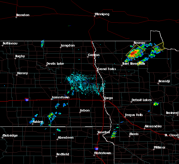
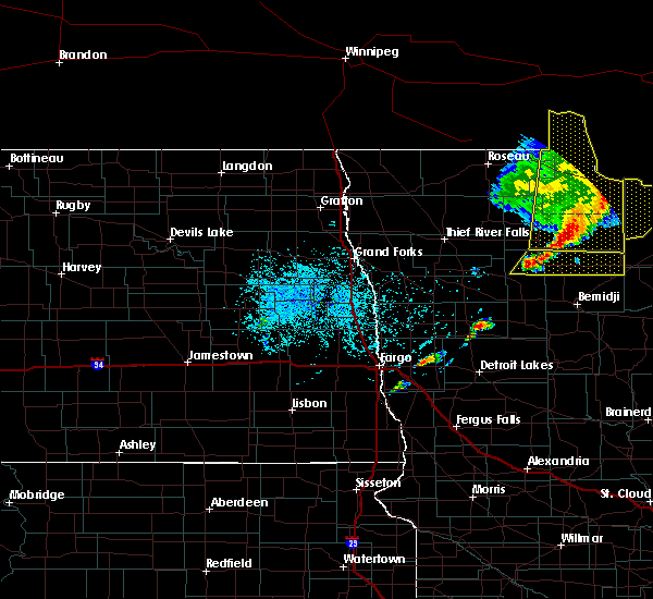
| 7/25/2019 3:10 PM CDT |
 The severe thunderstorm warning for east central roseau and central lake of the woods counties will expire at 315 pm cdt, the storm which prompted the warning has moved out of the area. therefore, the warning will be allowed to expire. The severe thunderstorm warning for east central roseau and central lake of the woods counties will expire at 315 pm cdt, the storm which prompted the warning has moved out of the area. therefore, the warning will be allowed to expire.
|
| 7/25/2019 2:45 PM CDT |
 At 245 pm cdt, a severe thunderstorm was located near roosevelt, or 29 miles east of roseau, moving east at 45 mph (radar indicated). Hazards include 60 mph wind gusts and quarter size hail. Hail damage to vehicles is expected. expect wind damage to roofs, siding, and trees. this severe storm will be near, williams around 255 pm cdt. graceton and zippel bay state park around 305 pm cdt. pitt around 310 pm cdt. Wheelers point around 315 pm cdt. At 245 pm cdt, a severe thunderstorm was located near roosevelt, or 29 miles east of roseau, moving east at 45 mph (radar indicated). Hazards include 60 mph wind gusts and quarter size hail. Hail damage to vehicles is expected. expect wind damage to roofs, siding, and trees. this severe storm will be near, williams around 255 pm cdt. graceton and zippel bay state park around 305 pm cdt. pitt around 310 pm cdt. Wheelers point around 315 pm cdt.
|
| 7/25/2019 2:18 PM CDT |
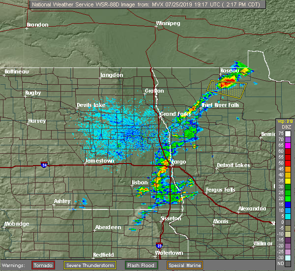 At 218 pm cdt, a severe thunderstorm was located over pencer, or 13 miles southeast of roseau, moving east at 45 mph (radar indicated). Hazards include ping pong ball size hail and 60 mph wind gusts. People and animals outdoors will be injured. expect hail damage to roofs, siding, windows, and vehicles. expect wind damage to roofs, siding, and trees. this severe thunderstorm will be near, swift around 240 pm cdt. roosevelt around 250 pm cdt. williams around 255 pm cdt. graceton and zippel bay state park around 305 pm cdt. Pitt around 310 pm cdt. At 218 pm cdt, a severe thunderstorm was located over pencer, or 13 miles southeast of roseau, moving east at 45 mph (radar indicated). Hazards include ping pong ball size hail and 60 mph wind gusts. People and animals outdoors will be injured. expect hail damage to roofs, siding, windows, and vehicles. expect wind damage to roofs, siding, and trees. this severe thunderstorm will be near, swift around 240 pm cdt. roosevelt around 250 pm cdt. williams around 255 pm cdt. graceton and zippel bay state park around 305 pm cdt. Pitt around 310 pm cdt.
|
| 7/15/2019 12:17 PM CDT |
 At 1217 pm cdt, severe thunderstorms were located along a line extending from 16 miles east of garden island state recreation area to near otto, moving east at 35 mph (radar indicated). Hazards include 60 mph wind gusts and quarter size hail. Hail damage to vehicles is expected. expect wind damage to roofs, siding, and trees. Locations impacted include, baudette, ponemah, upper red lake, waskish, otto, big bog state recreation area and clementson. At 1217 pm cdt, severe thunderstorms were located along a line extending from 16 miles east of garden island state recreation area to near otto, moving east at 35 mph (radar indicated). Hazards include 60 mph wind gusts and quarter size hail. Hail damage to vehicles is expected. expect wind damage to roofs, siding, and trees. Locations impacted include, baudette, ponemah, upper red lake, waskish, otto, big bog state recreation area and clementson.
|
| 7/15/2019 12:10 PM CDT | A few 8 to 12 inch diameter poplar trees snappe in lake of the woods county MN, 0.2 miles W of Baudette, MN |
| 7/15/2019 12:04 PM CDT |
 At 1203 pm cdt, severe thunderstorms were located along a line extending from 10 miles southeast of garden island state recreation area to near shotley, moving east at 40 mph (radar indicated). Hazards include 60 mph wind gusts and quarter size hail. Hail damage to vehicles is expected. expect wind damage to roofs, siding, and trees. Locations impacted include, baudette, wheelers point, ponemah, upper red lake, williams, lude and birch beach. At 1203 pm cdt, severe thunderstorms were located along a line extending from 10 miles southeast of garden island state recreation area to near shotley, moving east at 40 mph (radar indicated). Hazards include 60 mph wind gusts and quarter size hail. Hail damage to vehicles is expected. expect wind damage to roofs, siding, and trees. Locations impacted include, baudette, wheelers point, ponemah, upper red lake, williams, lude and birch beach.
|
| 7/15/2019 11:43 AM CDT |
 At 1142 am cdt, severe thunderstorms were located along a line extending from 7 miles southwest of garden island state recreation area to near ponemah, moving east at 40 mph (radar indicated). Hazards include 60 mph wind gusts and quarter size hail. Hail damage to vehicles is expected. Expect wind damage to roofs, siding, and trees. At 1142 am cdt, severe thunderstorms were located along a line extending from 7 miles southwest of garden island state recreation area to near ponemah, moving east at 40 mph (radar indicated). Hazards include 60 mph wind gusts and quarter size hail. Hail damage to vehicles is expected. Expect wind damage to roofs, siding, and trees.
|
| 7/15/2019 11:22 AM CDT |
 At 1121 am cdt, severe thunderstorms were located along a line extending from 7 miles northeast of springsteel island to 7 miles south of thorhult, moving east at 45 mph (radar indicated). Hazards include 60 mph wind gusts and quarter size hail. Hail damage to vehicles is expected. expect wind damage to roofs, siding, and trees. Locations impacted include, warroad, baudette, arnesen, springsteel island, upper red lake, williams and angle inlet. At 1121 am cdt, severe thunderstorms were located along a line extending from 7 miles northeast of springsteel island to 7 miles south of thorhult, moving east at 45 mph (radar indicated). Hazards include 60 mph wind gusts and quarter size hail. Hail damage to vehicles is expected. expect wind damage to roofs, siding, and trees. Locations impacted include, warroad, baudette, arnesen, springsteel island, upper red lake, williams and angle inlet.
|
| 7/15/2019 11:00 AM CDT |
 At 1100 am cdt, severe thunderstorms were located along a line extending from 8 miles west of longworth to 7 miles south of espelie, moving east at 45 mph (radar indicated). Hazards include 60 mph wind gusts and quarter size hail. Hail damage to vehicles is expected. Expect wind damage to roofs, siding, and trees. At 1100 am cdt, severe thunderstorms were located along a line extending from 8 miles west of longworth to 7 miles south of espelie, moving east at 45 mph (radar indicated). Hazards include 60 mph wind gusts and quarter size hail. Hail damage to vehicles is expected. Expect wind damage to roofs, siding, and trees.
|
| 6/11/2019 1:16 PM CDT |
 At 116 pm cdt, a severe thunderstorm was located over baudette, or 52 miles east of roseau, moving southeast at 30 mph (public). Hazards include quarter size hail. Damage to vehicles is expected. This severe thunderstorm will be near, clementson around 125 pm cdt. At 116 pm cdt, a severe thunderstorm was located over baudette, or 52 miles east of roseau, moving southeast at 30 mph (public). Hazards include quarter size hail. Damage to vehicles is expected. This severe thunderstorm will be near, clementson around 125 pm cdt.
|
| 6/11/2019 1:15 PM CDT | Quarter sized hail reported 0.2 miles W of Baudette, MN |
| 9/12/2018 4:30 PM CDT |
 At 429 pm cdt, a severe thunderstorm was located over williams, or 37 miles east of roseau, moving northeast at 35 mph (radar indicated). Hazards include 60 mph wind gusts and quarter size hail. Hail damage to vehicles is expected. expect wind damage to roofs, siding, and trees. this severe thunderstorm will be near, graceton around 435 pm cdt. zippel bay state park and pitt around 445 pm cdt. Wheelers point around 450 pm cdt. At 429 pm cdt, a severe thunderstorm was located over williams, or 37 miles east of roseau, moving northeast at 35 mph (radar indicated). Hazards include 60 mph wind gusts and quarter size hail. Hail damage to vehicles is expected. expect wind damage to roofs, siding, and trees. this severe thunderstorm will be near, graceton around 435 pm cdt. zippel bay state park and pitt around 445 pm cdt. Wheelers point around 450 pm cdt.
|
| 8/31/2018 2:55 PM CDT | Quarter sized hail reported 9 miles NNW of Baudette, MN, some dime to quarter sized hail fell in very heavy rain across northwest rapid river township. a few large branches were broken down as well. time estimated based on ra |
| 8/31/2018 2:54 PM CDT |
 At 254 pm cdt, a severe thunderstorm was located near baudette, or 55 miles east of roseau, moving northeast at 35 mph (radar indicated). Hazards include 60 mph wind gusts and half dollar size hail. Hail damage to vehicles is expected. expect wind damage to roofs, siding, and trees. this severe storm will be near, baudette around 300 pm cdt. Clementson around 310 pm cdt. At 254 pm cdt, a severe thunderstorm was located near baudette, or 55 miles east of roseau, moving northeast at 35 mph (radar indicated). Hazards include 60 mph wind gusts and half dollar size hail. Hail damage to vehicles is expected. expect wind damage to roofs, siding, and trees. this severe storm will be near, baudette around 300 pm cdt. Clementson around 310 pm cdt.
|
| 8/31/2018 2:31 PM CDT |
 The national weather service in grand forks has issued a * severe thunderstorm warning for. north central beltrami county in north central minnesota. southern lake of the woods county in north central minnesota. until 330 pm cdt. At 230 pm cdt, a severe thunderstorm was located 9 miles southeast. The national weather service in grand forks has issued a * severe thunderstorm warning for. north central beltrami county in north central minnesota. southern lake of the woods county in north central minnesota. until 330 pm cdt. At 230 pm cdt, a severe thunderstorm was located 9 miles southeast.
|
| 8/26/2018 11:45 PM CDT |
 At 1145 pm cdt, severe thunderstorms were located along a line extending from 12 miles north of pinecreek to carmel, moving east at 45 mph (radar indicated). Hazards include 60 mph wind gusts and quarter size hail. Hail damage to vehicles is expected. expect wind damage to roofs, siding, and trees. severe thunderstorms will be near, jelle and carmel around 1150 pm cdt. fourtown and malcolm around 1155 pm cdt. thorhult around 1200 am cdt. Garden island state recreation area around 1245 am cdt. At 1145 pm cdt, severe thunderstorms were located along a line extending from 12 miles north of pinecreek to carmel, moving east at 45 mph (radar indicated). Hazards include 60 mph wind gusts and quarter size hail. Hail damage to vehicles is expected. expect wind damage to roofs, siding, and trees. severe thunderstorms will be near, jelle and carmel around 1150 pm cdt. fourtown and malcolm around 1155 pm cdt. thorhult around 1200 am cdt. Garden island state recreation area around 1245 am cdt.
|
| 7/4/2017 10:36 PM CDT |
 At 1036 pm cdt, severe thunderstorms were located along a line extending from pitt to 7 miles northwest of waskish, moving east at 30 mph (radar indicated). Hazards include golf ball size hail and 60 mph wind gusts. People and animals outdoors will be injured. expect hail damage to roofs, siding, windows, and vehicles. expect wind damage to roofs, siding, and trees. These severe storms will be near, baudette around 1050 pm cdt. At 1036 pm cdt, severe thunderstorms were located along a line extending from pitt to 7 miles northwest of waskish, moving east at 30 mph (radar indicated). Hazards include golf ball size hail and 60 mph wind gusts. People and animals outdoors will be injured. expect hail damage to roofs, siding, windows, and vehicles. expect wind damage to roofs, siding, and trees. These severe storms will be near, baudette around 1050 pm cdt.
|
| 7/4/2017 10:14 PM CDT |
 At 1012 pm cdt, severe thunderstorms were located along a line extending from near graceton to 8 miles northwest of upper red lake, moving east at 15 mph (radar indicated). Hazards include golf ball size hail and 60 mph wind gusts. People and animals outdoors will be injured. expect hail damage to roofs, siding, windows, and vehicles. expect wind damage to roofs, siding, and trees. severe thunderstorms will be near, graceton and baudette around 1030 pm cdt. Carp around 1035 pm cdt. At 1012 pm cdt, severe thunderstorms were located along a line extending from near graceton to 8 miles northwest of upper red lake, moving east at 15 mph (radar indicated). Hazards include golf ball size hail and 60 mph wind gusts. People and animals outdoors will be injured. expect hail damage to roofs, siding, windows, and vehicles. expect wind damage to roofs, siding, and trees. severe thunderstorms will be near, graceton and baudette around 1030 pm cdt. Carp around 1035 pm cdt.
|
| 7/21/2016 12:16 AM CDT |
 At 1216 am cdt, a severe thunderstorm was located 11 miles north of waskish, or 50 miles west of international falls, moving east at 50 mph (radar indicated). Hazards include 60 mph wind gusts and half dollar size hail. Hail damage to vehicles is expected. expect wind damage to roofs, siding, and trees. Locations impacted include, baudette, upper red lake, waskish, clementson and carp. At 1216 am cdt, a severe thunderstorm was located 11 miles north of waskish, or 50 miles west of international falls, moving east at 50 mph (radar indicated). Hazards include 60 mph wind gusts and half dollar size hail. Hail damage to vehicles is expected. expect wind damage to roofs, siding, and trees. Locations impacted include, baudette, upper red lake, waskish, clementson and carp.
|
| 7/20/2016 11:58 PM CDT |
 At 1158 pm cdt, a severe thunderstorm was located near carp, or 58 miles southeast of roseau, moving east at 55 mph (radar indicated). Hazards include 60 mph wind gusts and quarter size hail. Hail damage to vehicles is expected. expect wind damage to roofs, siding, and trees. This severe thunderstorm will remain over mainly rural areas of southeastern lake of the woods and northeastern beltrami counties. At 1158 pm cdt, a severe thunderstorm was located near carp, or 58 miles southeast of roseau, moving east at 55 mph (radar indicated). Hazards include 60 mph wind gusts and quarter size hail. Hail damage to vehicles is expected. expect wind damage to roofs, siding, and trees. This severe thunderstorm will remain over mainly rural areas of southeastern lake of the woods and northeastern beltrami counties.
|
| 6/25/2016 3:24 AM CDT |
 The severe thunderstorm warning for southeastern lake of the woods and northwestern beltrami counties will expire at 330 am cdt, the storm which prompted the warning has weakened below severe limits, and no longer pose an immediate threat to life or property. therefore the warning will be allowed to expire. the warning just issued for parts of northeastern beltrami county will remain in effect. The severe thunderstorm warning for southeastern lake of the woods and northwestern beltrami counties will expire at 330 am cdt, the storm which prompted the warning has weakened below severe limits, and no longer pose an immediate threat to life or property. therefore the warning will be allowed to expire. the warning just issued for parts of northeastern beltrami county will remain in effect.
|
| 6/25/2016 3:01 AM CDT |
 At 301 am cdt, a severe thunderstorm was located over oaks corner, or 46 miles southeast of roseau, moving northeast at 55 mph (radar indicated). Hazards include ping pong ball size hail. People and animals outdoors will be injured. expect damage to roofs, siding, windows, and vehicles. this severe storm will be near, carp around 315 am cdt. pitt around 325 am cdt. Baudette and clementson around 330 am cdt. At 301 am cdt, a severe thunderstorm was located over oaks corner, or 46 miles southeast of roseau, moving northeast at 55 mph (radar indicated). Hazards include ping pong ball size hail. People and animals outdoors will be injured. expect damage to roofs, siding, windows, and vehicles. this severe storm will be near, carp around 315 am cdt. pitt around 325 am cdt. Baudette and clementson around 330 am cdt.
|
| 6/25/2016 2:37 AM CDT |
 At 236 am cdt, a severe thunderstorm was located over thorhult, or 40 miles east of thief river falls, moving northeast at 55 mph (radar indicated). Hazards include ping pong ball size hail. People and animals outdoors will be injured. expect damage to roofs, siding, windows, and vehicles. this severe thunderstorm will be near, oaks corner around 300 am cdt. carp around 315 am cdt. Baudette and clementson around 330 am cdt. At 236 am cdt, a severe thunderstorm was located over thorhult, or 40 miles east of thief river falls, moving northeast at 55 mph (radar indicated). Hazards include ping pong ball size hail. People and animals outdoors will be injured. expect damage to roofs, siding, windows, and vehicles. this severe thunderstorm will be near, oaks corner around 300 am cdt. carp around 315 am cdt. Baudette and clementson around 330 am cdt.
|
| 6/19/2016 8:41 AM CDT | The severe thunderstorm warning for southeastern roseau, southern lake of the woods and northeastern beltrami counties will expire at 845 am cdt, the storm which prompted the warning has moved out of the area. therefore the warning will be allowed to expire. to report severe weather, contact your nearest law enforcement agency. they will relay your report to the national weather service grand forks. |
| 6/19/2016 8:27 AM CDT | Golf Ball sized hail reported 10.2 miles NW of Baudette, MN, nickel to golf ball sized hail covered the ground across northern rapid river township. hail fell from 825 to about 830 am cdt. |
| 6/19/2016 8:27 AM CDT | Golf Ball sized hail reported 8.4 miles NNW of Baudette, MN, nickel to golf ball sized hail covered the ground in northern rapid river township. hail fell from 825 to about 830 am cdt. |
| 6/19/2016 8:18 AM CDT | Tennis Ball sized hail reported 6.7 miles NNE of Baudette, MN, hail from tennis ball size on down across northern boon township. time estimated based on radar. |
| 6/19/2016 8:15 AM CDT | Tennis Ball sized hail reported 8.8 miles NE of Baudette, MN, hail from tennis ball size on down across northern boon township. hail lasted for several minutes. time estimated based on radar. |
| 6/19/2016 7:44 AM CDT |
 At 742 am cdt, a severe thunderstorm was located near norris camp, or 27 miles southeast of roseau, moving east at 45 mph. an additional severe cell was located between carp and waskish also moving east at 45 mph (radar indicated). Hazards include two inch hail and 60 mph wind gusts. People and animals outdoors will be injured. expect hail damage to roofs, siding, windows, and vehicles. expect wind damage to roofs, siding, and trees. this severe thunderstorm will be near, norris camp around 745 am cdt. williams and faunce around 800 am cdt. graceton around 805 am cdt. pitt around 810 am cdt. Baudette around 820 am cdt. At 742 am cdt, a severe thunderstorm was located near norris camp, or 27 miles southeast of roseau, moving east at 45 mph. an additional severe cell was located between carp and waskish also moving east at 45 mph (radar indicated). Hazards include two inch hail and 60 mph wind gusts. People and animals outdoors will be injured. expect hail damage to roofs, siding, windows, and vehicles. expect wind damage to roofs, siding, and trees. this severe thunderstorm will be near, norris camp around 745 am cdt. williams and faunce around 800 am cdt. graceton around 805 am cdt. pitt around 810 am cdt. Baudette around 820 am cdt.
|
| 6/19/2016 7:19 AM CDT |
 At 717 am cdt, a severe thunderstorm was located near gates corner, or 39 miles southeast of roseau, moving east at 50 mph. in addition, another severe cell has developed near torfin and will move along the northern edge of the warning towards hays lake state park (radar indicated). Hazards include quarter size hail. Damage to vehicles is expected. this severe storm will be near, oaks corner around 730 am cdt. Carp around 745 am cdt. At 717 am cdt, a severe thunderstorm was located near gates corner, or 39 miles southeast of roseau, moving east at 50 mph. in addition, another severe cell has developed near torfin and will move along the northern edge of the warning towards hays lake state park (radar indicated). Hazards include quarter size hail. Damage to vehicles is expected. this severe storm will be near, oaks corner around 730 am cdt. Carp around 745 am cdt.
|
| 6/19/2016 6:52 AM CDT |
 At 652 am cdt, a severe thunderstorm was located 7 miles east of gatzke, or 29 miles south of roseau, moving east at 50 mph (radar indicated). Hazards include quarter size hail. Damage to vehicles is expected. this severe thunderstorm will be near, gates corner and malcolm around 710 am cdt. oaks corner around 730 am cdt. Carp around 745 am cdt. At 652 am cdt, a severe thunderstorm was located 7 miles east of gatzke, or 29 miles south of roseau, moving east at 50 mph (radar indicated). Hazards include quarter size hail. Damage to vehicles is expected. this severe thunderstorm will be near, gates corner and malcolm around 710 am cdt. oaks corner around 730 am cdt. Carp around 745 am cdt.
|
| 6/17/2016 10:27 AM CDT | The severe thunderstorm warning for southeastern lake of the woods and beltrami counties will expire at 1030 am cdt, the storms which prompted the warning no longer pose a severe threat to the warned area. therefore the warning will be allowed to expire. however heavy rain is still possible with these thunderstorms. a severe thunderstorm watch remains in effect until 100 pm cdt for northwestern minnesota. |
| 6/17/2016 10:17 AM CDT | A few poplar and pine trees broken down by the wind along hwy 72. time estimated based on rada in lake of the woods county MN, 19.5 miles N of Baudette, MN |
| 6/17/2016 10:08 AM CDT |
 At 1006 am cdt, severe thunderstorms were located along a line extending from graceton to 11 miles southeast of carp to near lavinia, moving northeast at 50 mph (radar indicated). Hazards include 60 mph wind gusts and quarter size hail. Hail damage to vehicles is expected. expect wind damage to roofs, siding, and trees. the highest threat for damaging winds will be between baudette and waskish, including the city of carp. these severe storms will be near, pitt and graceton around 1010 am cdt. baudette and hines around 1020 am cdt. blackduck around 1025 am cdt. Funkley around 1030 am cdt. At 1006 am cdt, severe thunderstorms were located along a line extending from graceton to 11 miles southeast of carp to near lavinia, moving northeast at 50 mph (radar indicated). Hazards include 60 mph wind gusts and quarter size hail. Hail damage to vehicles is expected. expect wind damage to roofs, siding, and trees. the highest threat for damaging winds will be between baudette and waskish, including the city of carp. these severe storms will be near, pitt and graceton around 1010 am cdt. baudette and hines around 1020 am cdt. blackduck around 1025 am cdt. Funkley around 1030 am cdt.
|
| 6/17/2016 9:46 AM CDT |
 At 945 am cdt, severe thunderstorms were located along a line extending from norris camp to 10 miles north of upper red lake to near alida, moving east at 50 mph (radar indicated). Hazards include 60 mph wind gusts and quarter size hail. Hail damage to vehicles is expected. expect wind damage to roofs, siding, and trees. severe thunderstorms will be near, faunce around 955 am cdt. lavinia and graceton around 1005 am cdt. turtle river and pitt around 1010 am cdt. baudette around 1015 am cdt. Clementson and pennington around 1020 am cdt. At 945 am cdt, severe thunderstorms were located along a line extending from norris camp to 10 miles north of upper red lake to near alida, moving east at 50 mph (radar indicated). Hazards include 60 mph wind gusts and quarter size hail. Hail damage to vehicles is expected. expect wind damage to roofs, siding, and trees. severe thunderstorms will be near, faunce around 955 am cdt. lavinia and graceton around 1005 am cdt. turtle river and pitt around 1010 am cdt. baudette around 1015 am cdt. Clementson and pennington around 1020 am cdt.
|
| 8/7/2015 10:02 PM CDT |
 At 1001 pm cdt, severe thunderstorms were located along a line extending from 12 miles southeast of oak island to baudette to 11 miles south of oaks corner to near jelle, moving east at 25 mph (radar indicated). Hazards include quarter size hail. Damage to vehicles is expected. these severe storms will be near, baudette around 1005 pm cdt. Clementson around 1015 pm cdt. At 1001 pm cdt, severe thunderstorms were located along a line extending from 12 miles southeast of oak island to baudette to 11 miles south of oaks corner to near jelle, moving east at 25 mph (radar indicated). Hazards include quarter size hail. Damage to vehicles is expected. these severe storms will be near, baudette around 1005 pm cdt. Clementson around 1015 pm cdt.
|
| 8/7/2015 9:11 PM CDT |
 At 910 pm cdt, severe thunderstorms were located along a line extending from 8 miles south of angle inlet to near roosevelt to near red lake falls, moving east at 20 mph (radar indicated). Hazards include quarter size hail. Damage to vehicles is expected. severe thunderstorms will be near, swift around 915 pm cdt. roosevelt and oak island around 920 pm cdt. williams around 925 pm cdt. graceton around 935 pm cdt. Pitt around 940 pm cdt. At 910 pm cdt, severe thunderstorms were located along a line extending from 8 miles south of angle inlet to near roosevelt to near red lake falls, moving east at 20 mph (radar indicated). Hazards include quarter size hail. Damage to vehicles is expected. severe thunderstorms will be near, swift around 915 pm cdt. roosevelt and oak island around 920 pm cdt. williams around 925 pm cdt. graceton around 935 pm cdt. Pitt around 940 pm cdt.
|
| 8/2/2015 12:27 AM CDT |
 At 1226 am cdt, a severe thunderstorm was located near williams, or 37 miles east of roseau, moving east at 35 mph (radar indicated). Hazards include quarter size hail. Damage to vehicles is expected. this severe storm will be near, graceton around 1230 am cdt. pitt around 1240 am cdt. Baudette around 1245 am cdt. At 1226 am cdt, a severe thunderstorm was located near williams, or 37 miles east of roseau, moving east at 35 mph (radar indicated). Hazards include quarter size hail. Damage to vehicles is expected. this severe storm will be near, graceton around 1230 am cdt. pitt around 1240 am cdt. Baudette around 1245 am cdt.
|
| 8/2/2015 12:01 AM CDT |
 At 1200 am cdt, a severe thunderstorm was located near salol, or 12 miles east of roseau, moving southeast at 35 mph (radar indicated). Hazards include quarter size hail. Damage to vehicles is expected. this severe thunderstorm will be near, swift around 1215 am cdt. roosevelt and norris camp around 1225 am cdt. williams around 1230 am cdt. faunce and graceton around 1240 am cdt. Carp around 100 am cdt. At 1200 am cdt, a severe thunderstorm was located near salol, or 12 miles east of roseau, moving southeast at 35 mph (radar indicated). Hazards include quarter size hail. Damage to vehicles is expected. this severe thunderstorm will be near, swift around 1215 am cdt. roosevelt and norris camp around 1225 am cdt. williams around 1230 am cdt. faunce and graceton around 1240 am cdt. Carp around 100 am cdt.
|
| 7/12/2015 6:48 AM CDT |
 At 647 am cdt, a severe thunderstorm was located near faunce, or 45 miles southeast of roseau, moving northeast at 45 mph (radar indicated). Hazards include quarter size hail. Damage to vehicles is expected. this severe thunderstorm will be near, carp around 655 am cdt. pitt around 700 am cdt. baudette around 710 am cdt. Clementson around 715 am cdt. At 647 am cdt, a severe thunderstorm was located near faunce, or 45 miles southeast of roseau, moving northeast at 45 mph (radar indicated). Hazards include quarter size hail. Damage to vehicles is expected. this severe thunderstorm will be near, carp around 655 am cdt. pitt around 700 am cdt. baudette around 710 am cdt. Clementson around 715 am cdt.
|
| 7/22/2012 2:20 PM CDT | Golf Ball sized hail reported 0.2 miles W of Baudette, MN, hail fell at the lake of the woods campground. |
| 7/22/2012 2:05 PM CDT | Quarter sized hail reported 10.6 miles SE of Baudette, MN, the hail fell at the sportsmans lodge. |
Hail Maps for Baudette, MN


Connect with Interactive Hail Maps