

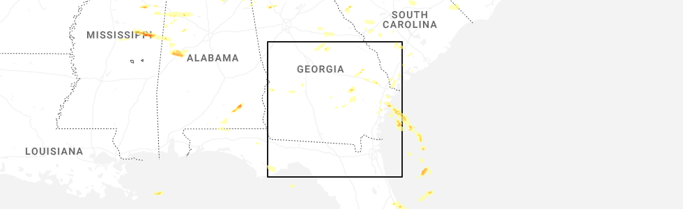
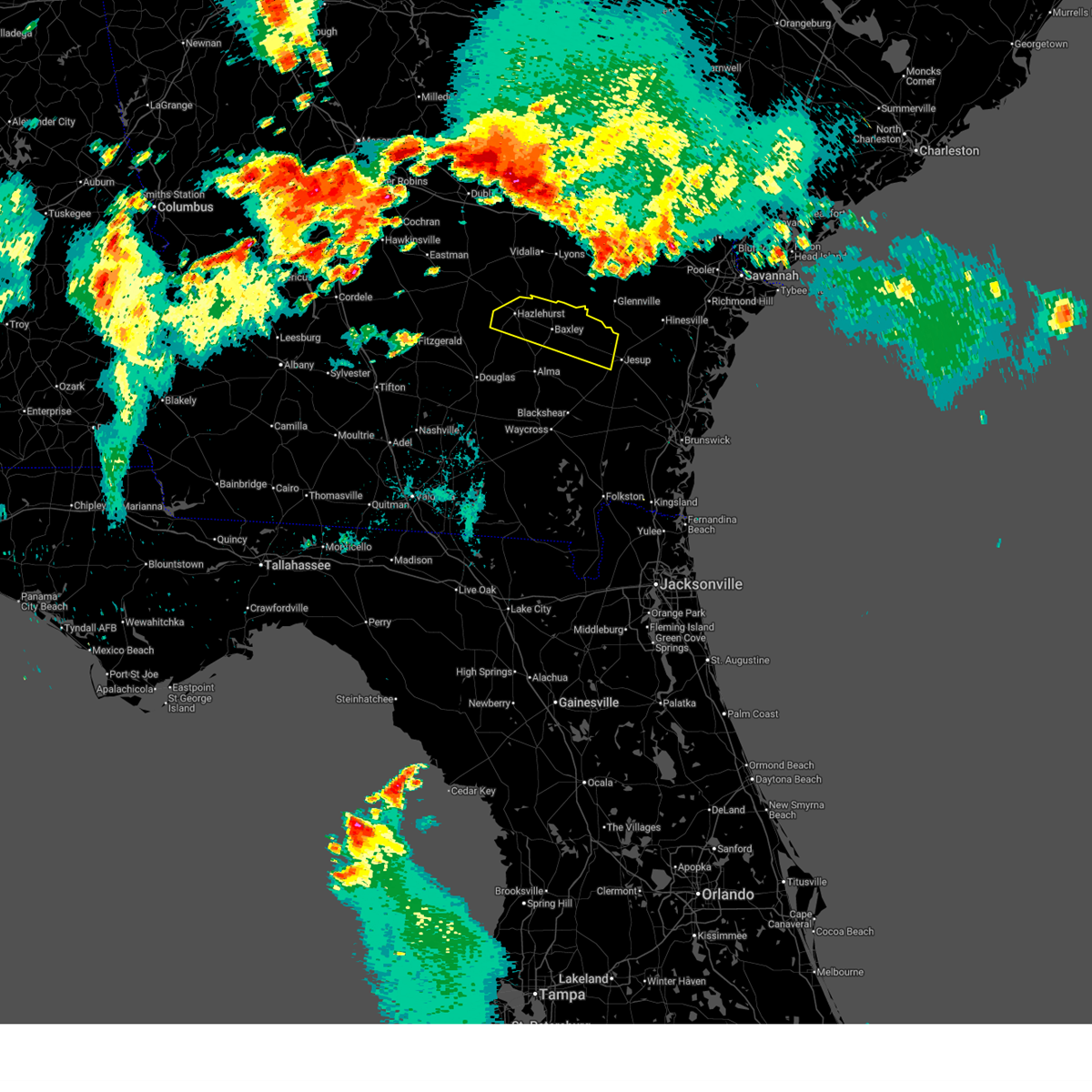
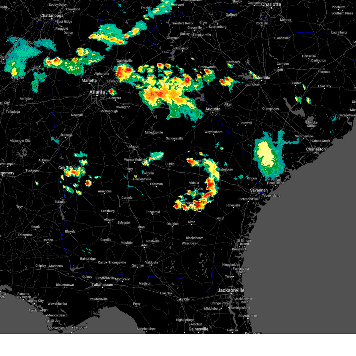
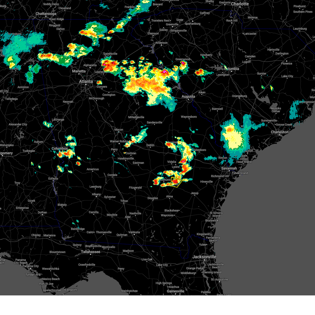
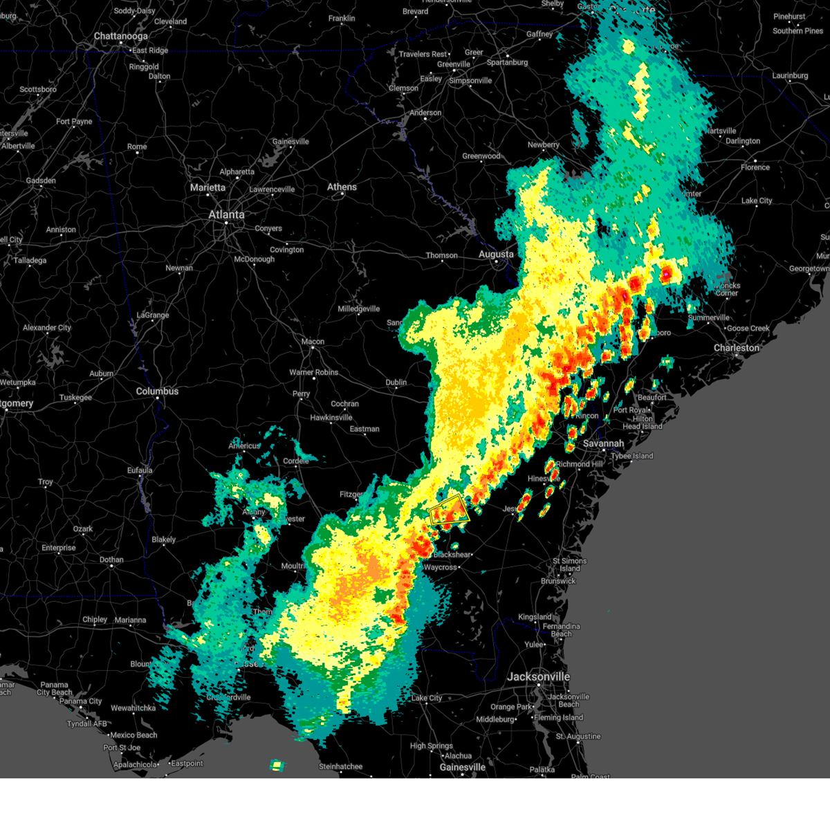
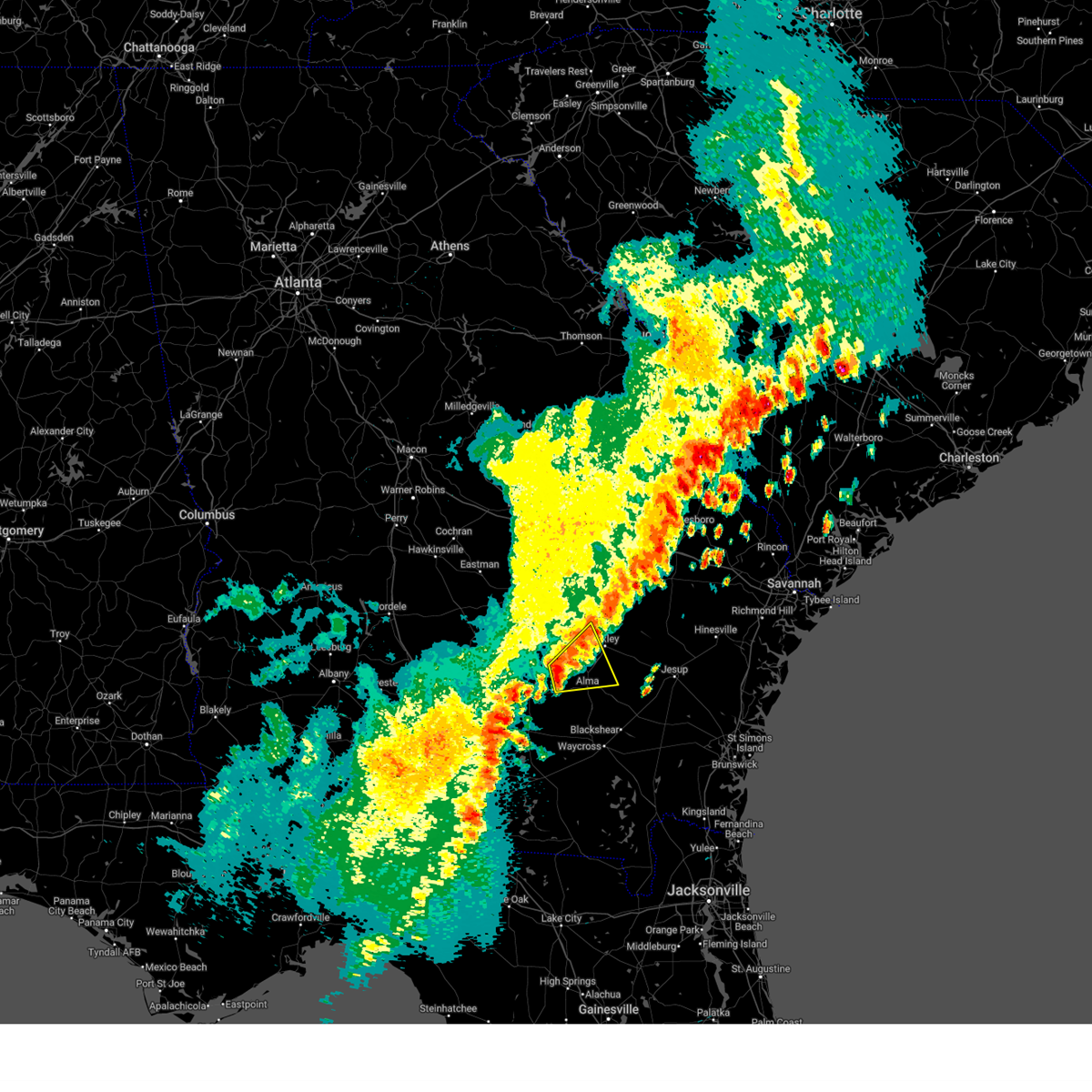
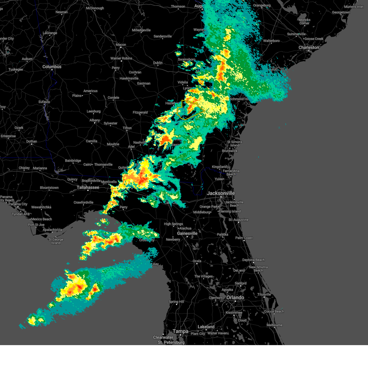
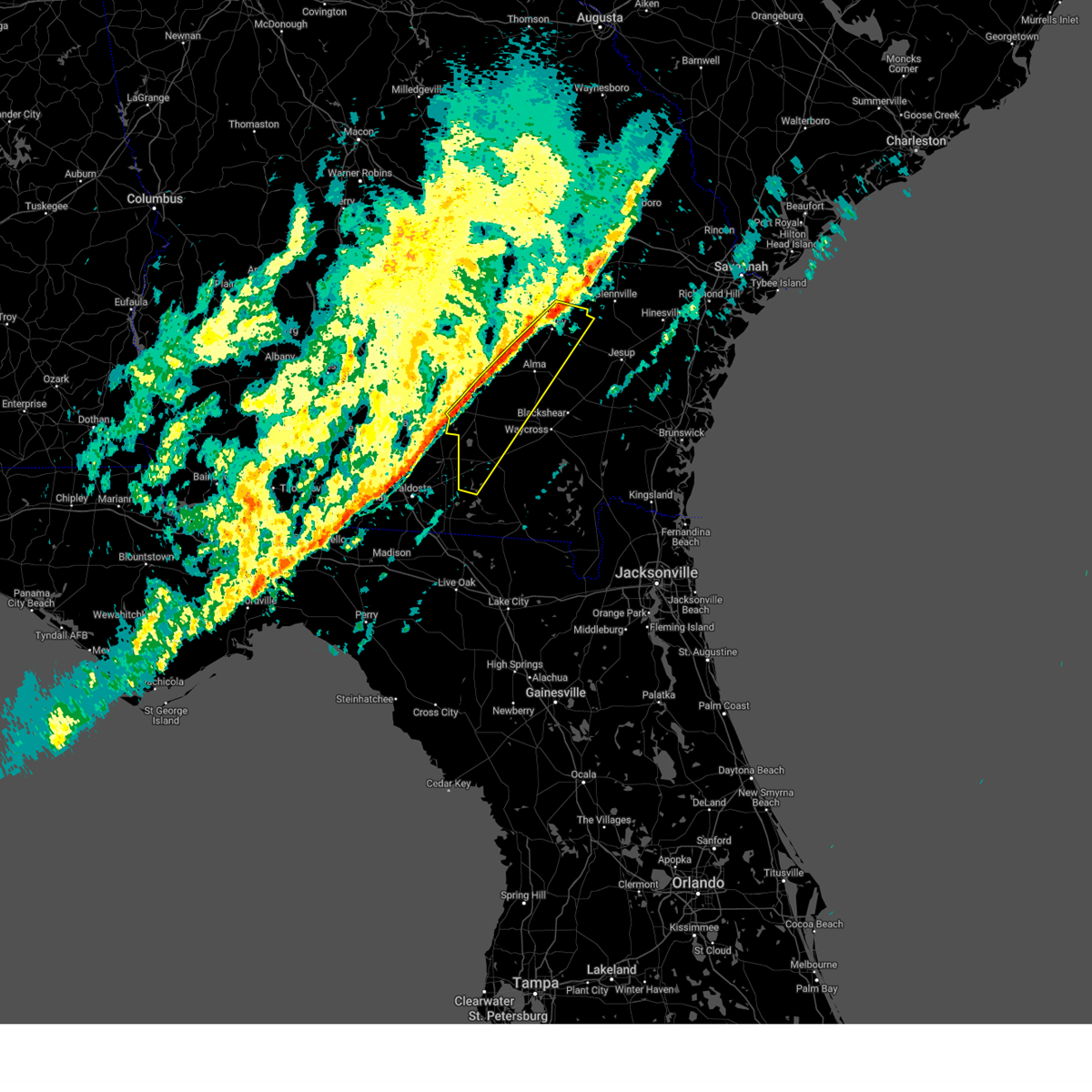
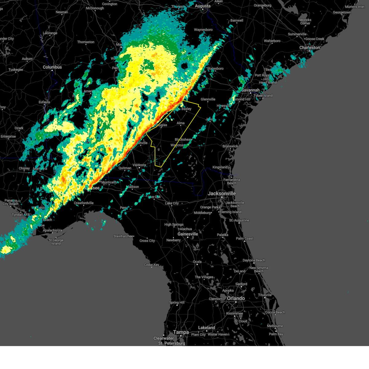
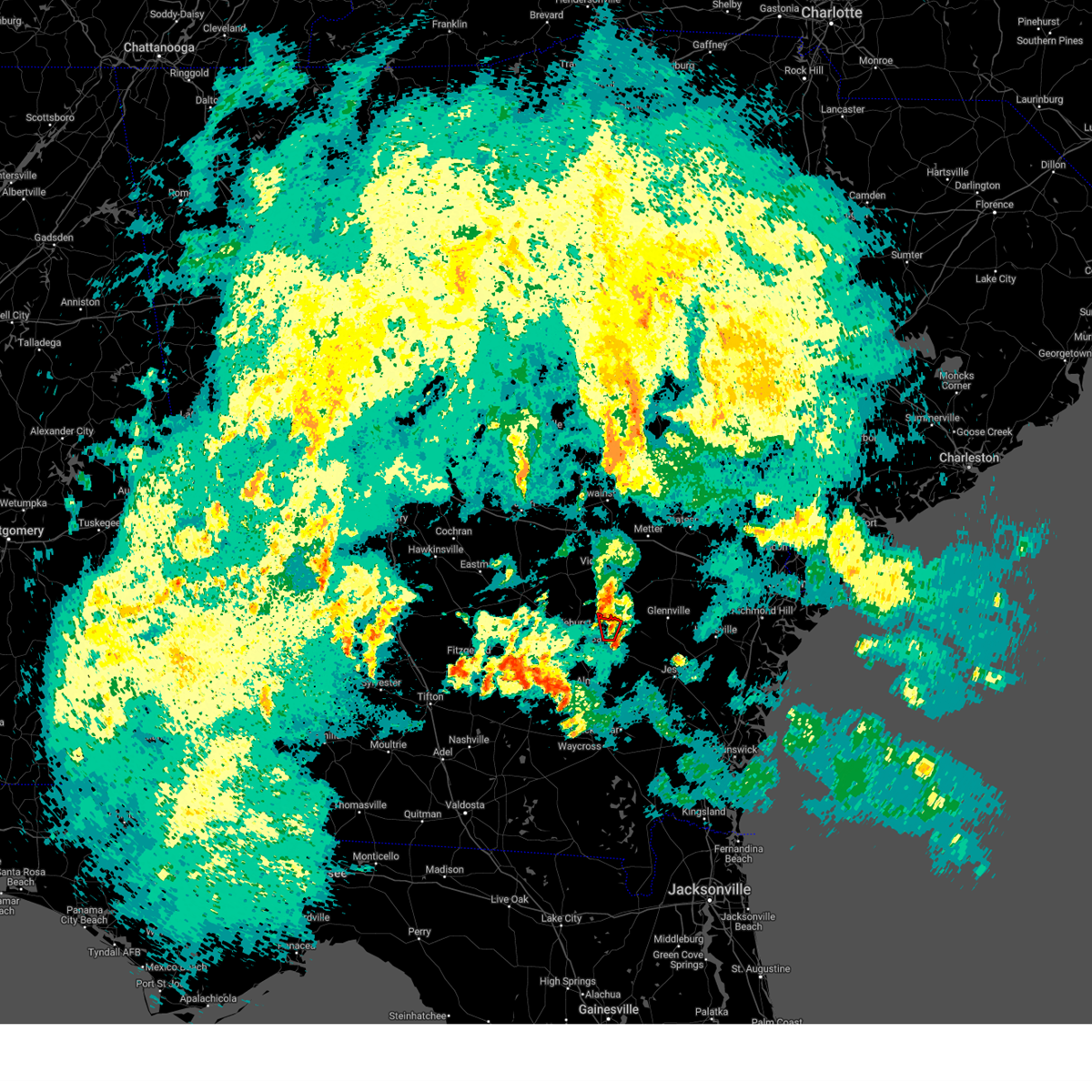
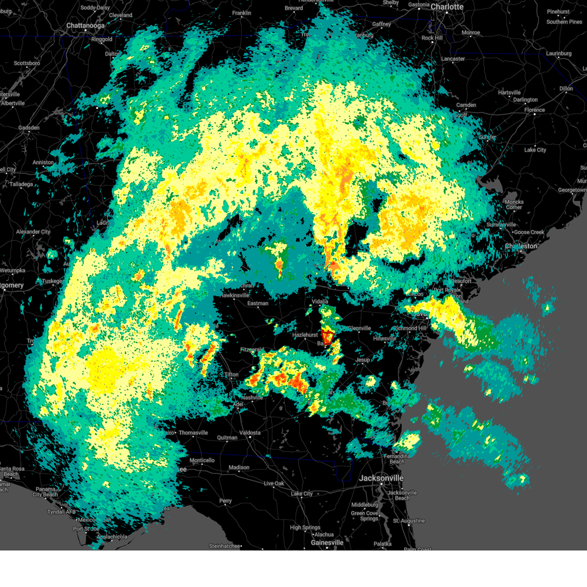
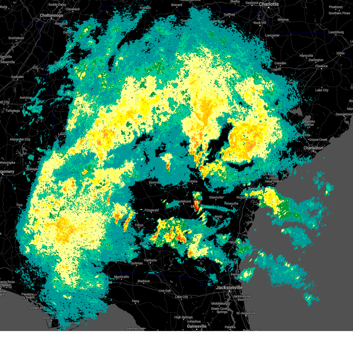
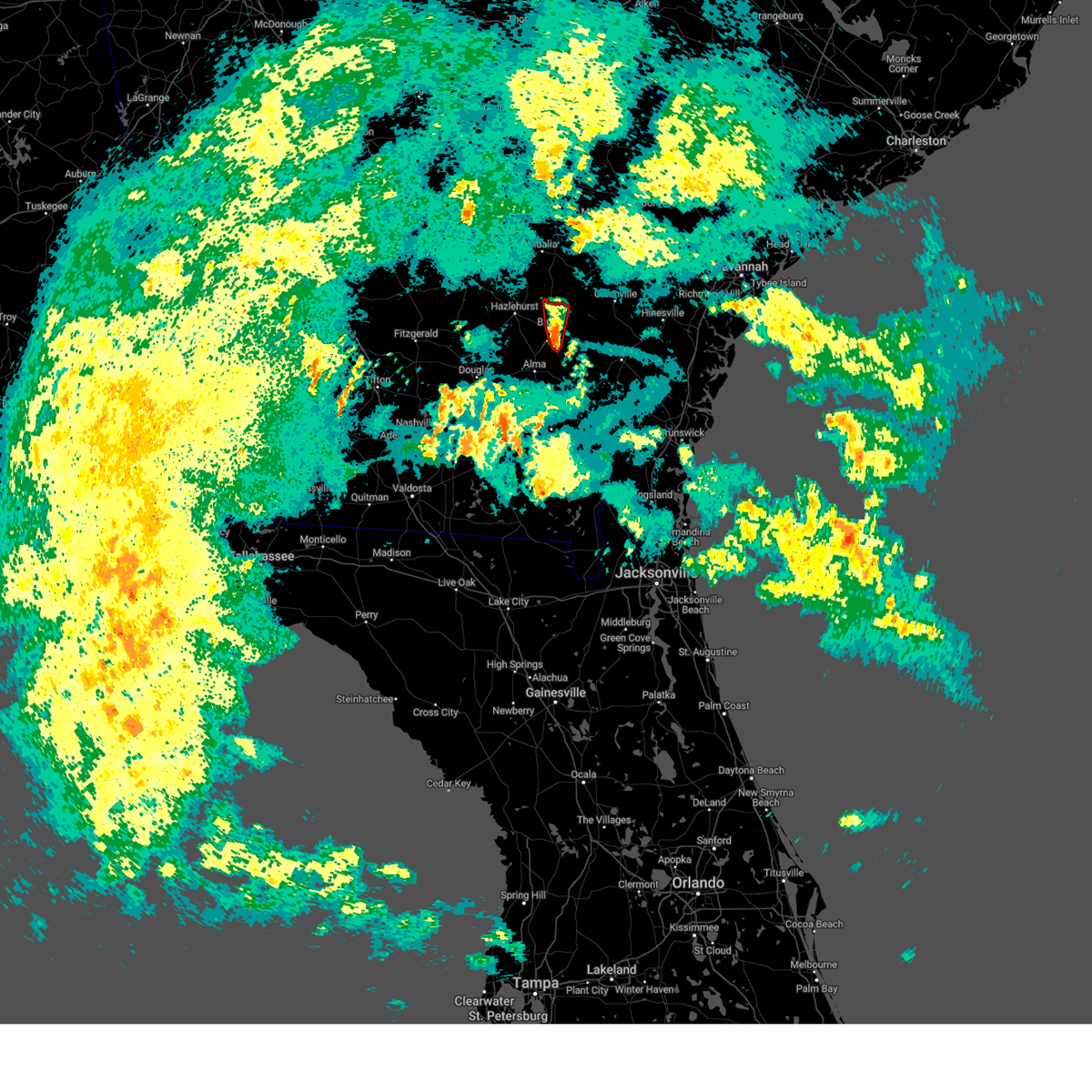
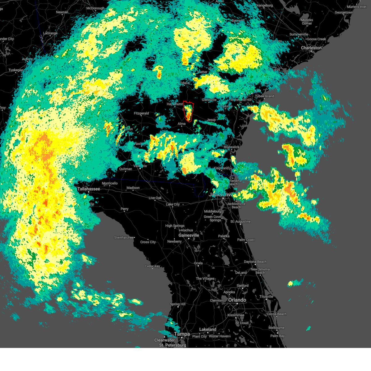
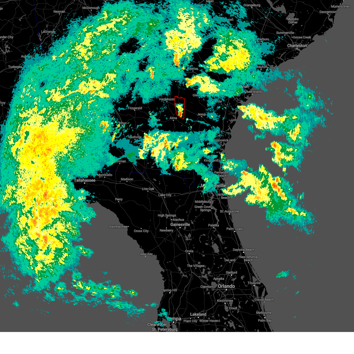
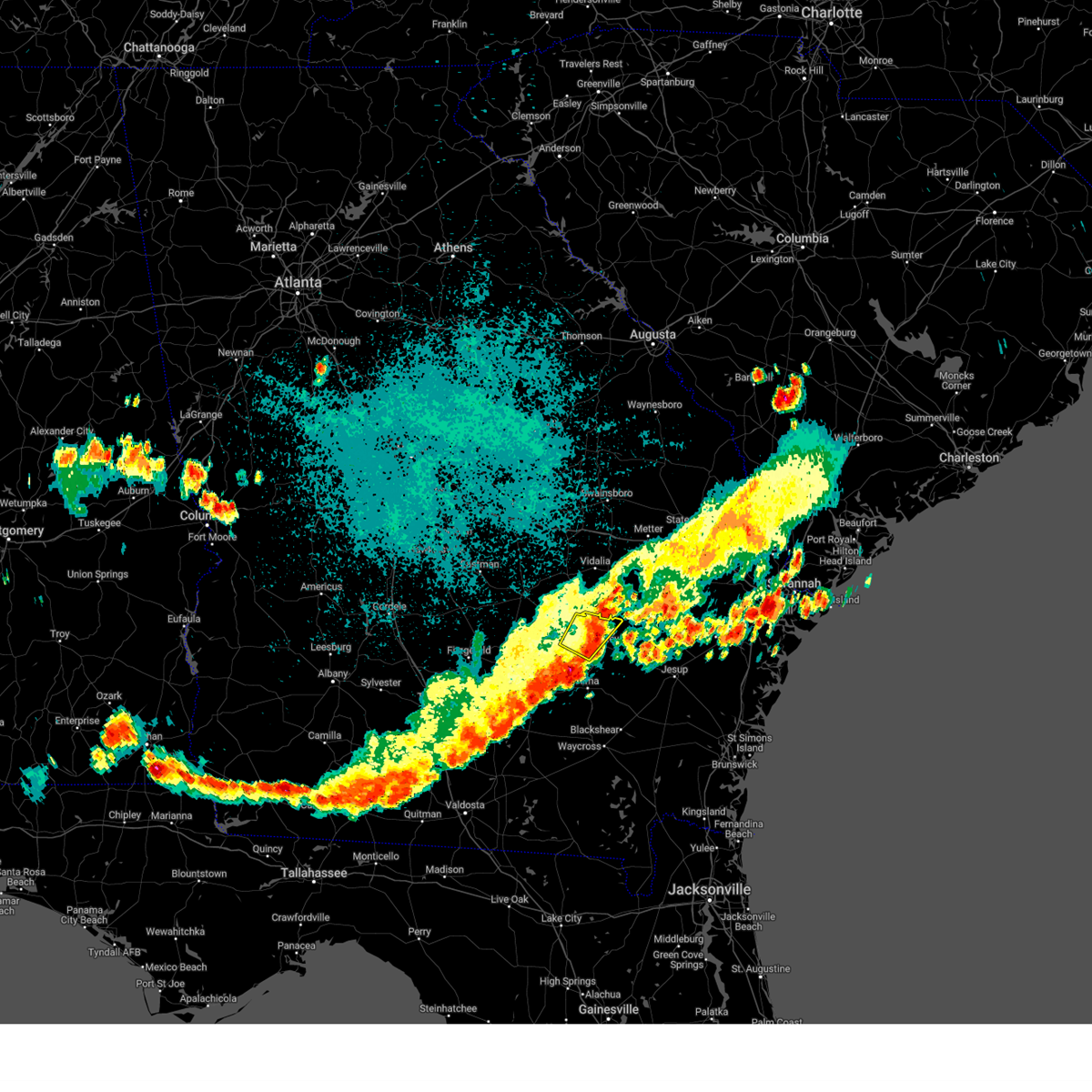
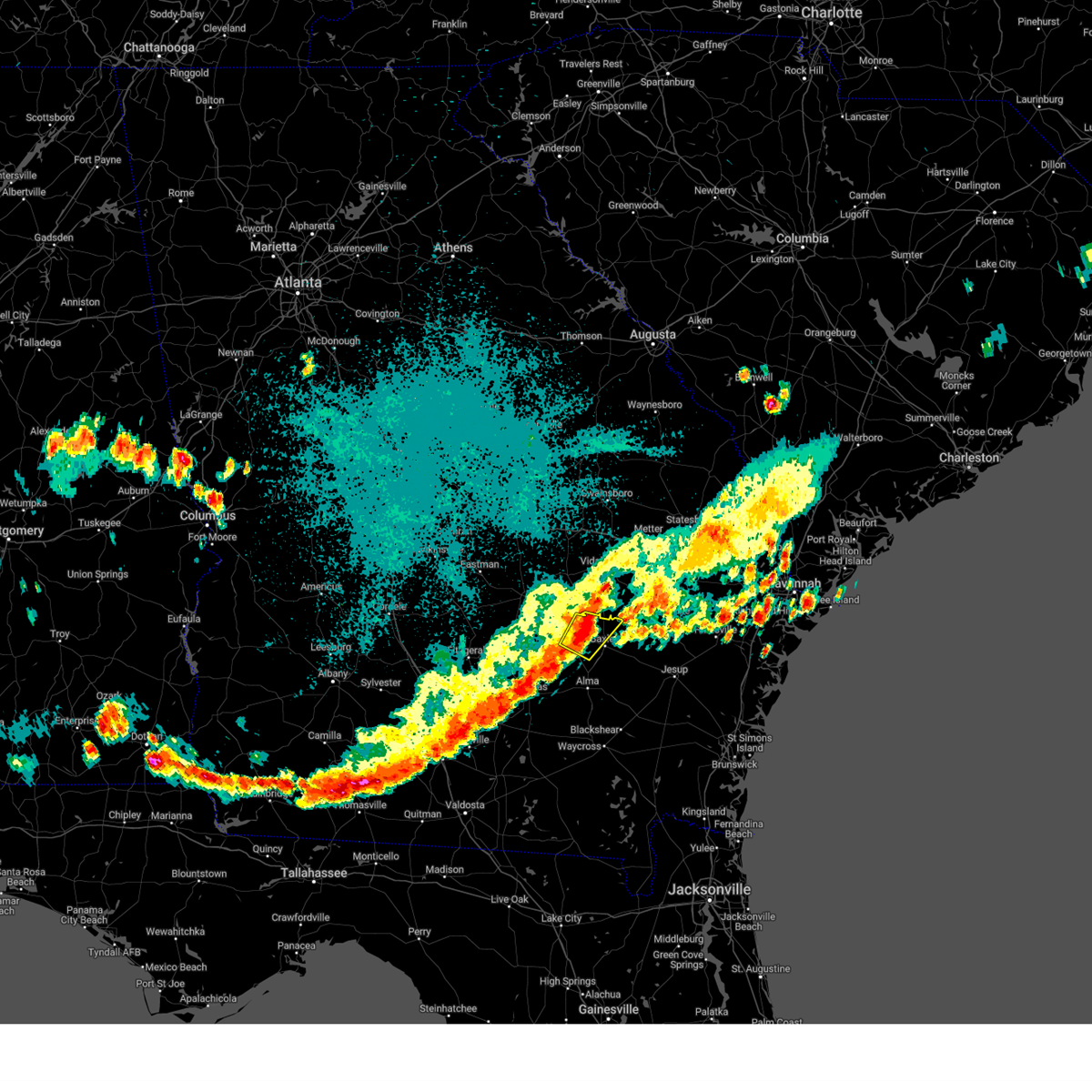
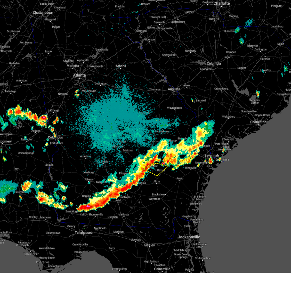
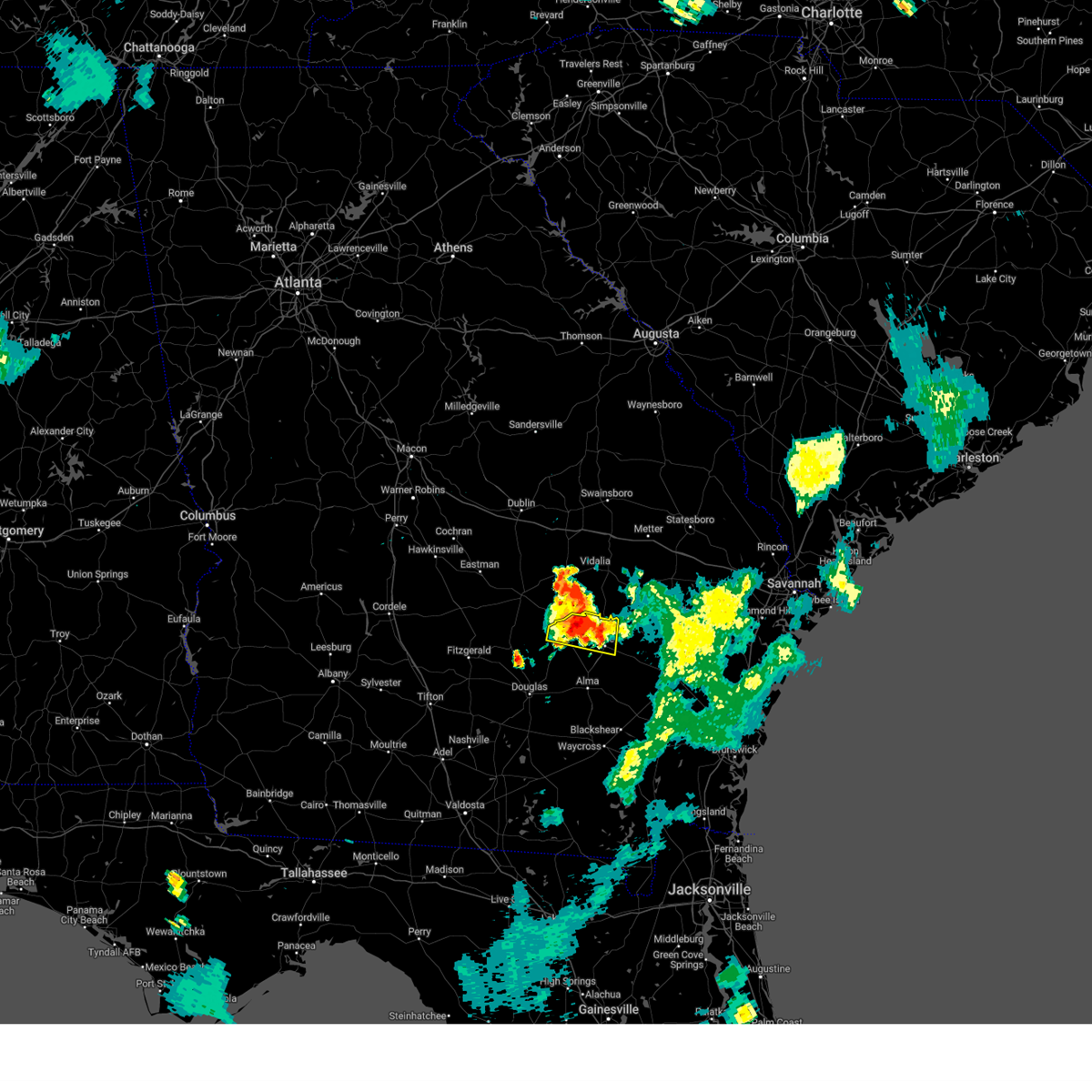
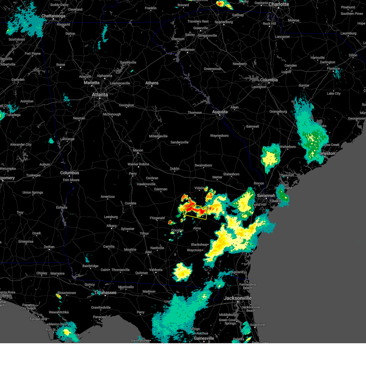
Hail Map for Baxley, GA
The Baxley, GA area has had 9 reports of on-the-ground hail by trained spotters, and has been under severe weather warnings 39 times during the past 12 months. Doppler radar has detected hail at or near Baxley, GA on 75 occasions, including 4 occasions during the past year.
| Name: | Baxley, GA |
| Where Located: | 34.7 miles ENE of Douglas, GA |
| Map: | Google Map for Baxley, GA |
| Population: | 4400 |
| Housing Units: | 2015 |
| More Info: | Search Google for Baxley, GA |
2
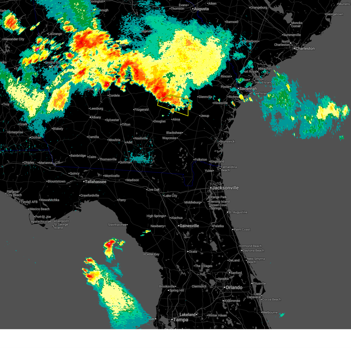
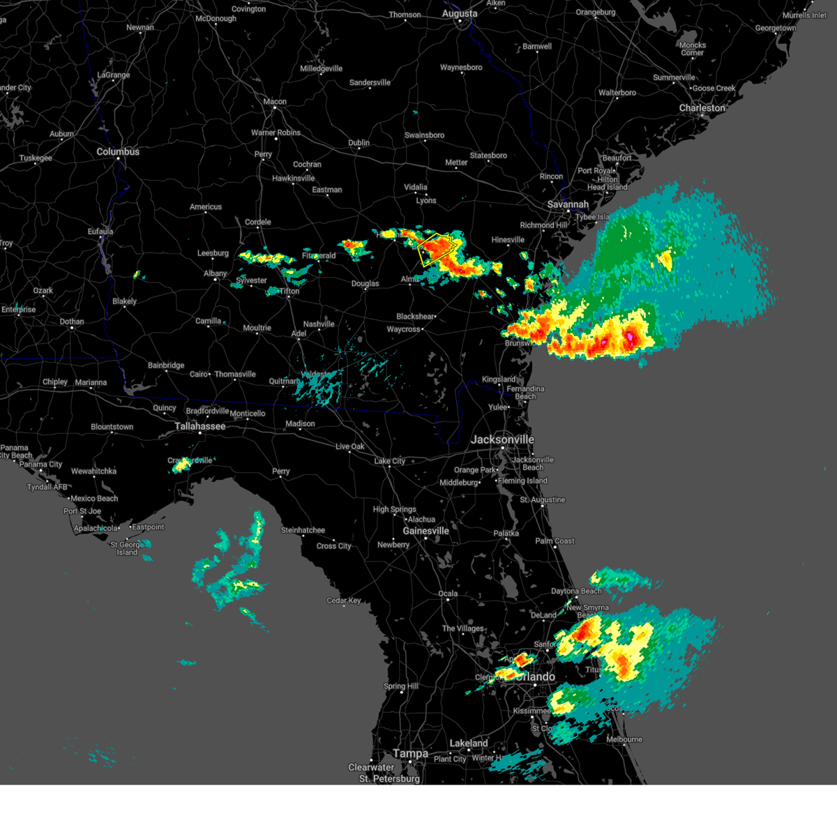
The Top Recent Hail Date for Baxley, GA is Thursday, May 8, 2025 (7th out of 75)
Hail and Wind Damage Spotted near Baxley, GA
| Date / Time | Report Details |
|---|---|
| 6/26/2025 1:14 AM EDT |
 The storm which prompted the warning has weakened below severe limits, and no longer poses an immediate threat to life or property. therefore, the warning will be allowed to expire. a severe thunderstorm watch remains in effect until 400 am edt for southeastern georgia. remember, a severe thunderstorm warning still remains in effect for jeff davis county. The storm which prompted the warning has weakened below severe limits, and no longer poses an immediate threat to life or property. therefore, the warning will be allowed to expire. a severe thunderstorm watch remains in effect until 400 am edt for southeastern georgia. remember, a severe thunderstorm warning still remains in effect for jeff davis county.
|
| 6/26/2025 1:01 AM EDT |
 the severe thunderstorm warning has been cancelled and is no longer in effect the severe thunderstorm warning has been cancelled and is no longer in effect
|
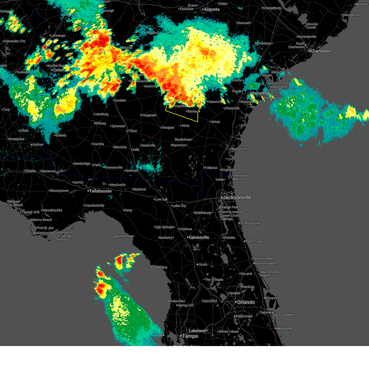
| 6/26/2025 1:01 AM EDT |
 At 101 am edt, a severe thunderstorm was located near uvalda, or 7 miles northeast of hazlehurst, moving southwest at 35 mph (radar indicated). Hazards include 60 mph wind gusts and penny size hail. Expect damage to roofs, siding, and trees. Locations impacted include, baxley, hazlehurst, graham, surrency, plant hatch, and pine grove. At 101 am edt, a severe thunderstorm was located near uvalda, or 7 miles northeast of hazlehurst, moving southwest at 35 mph (radar indicated). Hazards include 60 mph wind gusts and penny size hail. Expect damage to roofs, siding, and trees. Locations impacted include, baxley, hazlehurst, graham, surrency, plant hatch, and pine grove.
|
| 6/26/2025 12:31 AM EDT |
 Svrjax the national weather service in jacksonville has issued a * severe thunderstorm warning for, northwestern wayne county in southeastern georgia, central jeff davis county in southeastern georgia, appling county in southeastern georgia, * until 115 am edt. * at 1230 am edt, a severe thunderstorm was located 8 miles west of mendes, or 8 miles south of reidsville, moving southwest at 35 mph (radar indicated). Hazards include 60 mph wind gusts and quarter size hail. Hail damage to vehicles is expected. Expect wind damage to roofs, siding, and trees. Svrjax the national weather service in jacksonville has issued a * severe thunderstorm warning for, northwestern wayne county in southeastern georgia, central jeff davis county in southeastern georgia, appling county in southeastern georgia, * until 115 am edt. * at 1230 am edt, a severe thunderstorm was located 8 miles west of mendes, or 8 miles south of reidsville, moving southwest at 35 mph (radar indicated). Hazards include 60 mph wind gusts and quarter size hail. Hail damage to vehicles is expected. Expect wind damage to roofs, siding, and trees.
|
| 5/8/2025 6:53 PM EDT |
 the severe thunderstorm warning has been cancelled and is no longer in effect the severe thunderstorm warning has been cancelled and is no longer in effect
|
| 5/8/2025 6:39 PM EDT | Quarter sized hail reported 2.7 miles SW of Baxley, GA, a photo of hail was shared by the appling county em which estimated to be quarter sized. they also reported pea to nickel size hail fell in the baxley area. |
| 5/8/2025 6:39 PM EDT |
 Svrjax the national weather service in jacksonville has issued a * severe thunderstorm warning for, northeastern appling county in southeastern georgia, * until 715 pm edt. * at 639 pm edt, a severe thunderstorm was located over baxley, moving east at 10 mph (radar indicated). Hazards include 60 mph wind gusts and quarter size hail. Hail damage to vehicles is expected. Expect wind damage to roofs, siding, and trees. Svrjax the national weather service in jacksonville has issued a * severe thunderstorm warning for, northeastern appling county in southeastern georgia, * until 715 pm edt. * at 639 pm edt, a severe thunderstorm was located over baxley, moving east at 10 mph (radar indicated). Hazards include 60 mph wind gusts and quarter size hail. Hail damage to vehicles is expected. Expect wind damage to roofs, siding, and trees.
|
| 4/23/2025 7:44 PM EDT | The storm which prompted the warning has weakened below severe limits, and no longer poses an immediate threat to life or property. therefore, the warning will be allowed to expire. however, small hail, gusty winds and heavy rain are still expected with this thunderstorm. to report severe weather, contact your nearest law enforcement agency. they will relay your report to the national weather service jacksonville. |
| 4/23/2025 7:25 PM EDT |
 At 724 pm edt, a severe thunderstorm was located near plant hatch, moving northeast at 5 mph (radar indicated). Hazards include 60 mph wind gusts and quarter size hail. Hail damage to vehicles is expected. expect wind damage to roofs, siding, and trees. Locations impacted include, plant hatch. At 724 pm edt, a severe thunderstorm was located near plant hatch, moving northeast at 5 mph (radar indicated). Hazards include 60 mph wind gusts and quarter size hail. Hail damage to vehicles is expected. expect wind damage to roofs, siding, and trees. Locations impacted include, plant hatch.
|
| 4/23/2025 7:15 PM EDT |
 At 714 pm edt, a severe thunderstorm was located near plant hatch, moving northeast at 5 mph (radar indicated). Hazards include 60 mph wind gusts and half dollar size hail. Hail damage to vehicles is expected. expect wind damage to roofs, siding, and trees. Locations impacted include, plant hatch and baxley. At 714 pm edt, a severe thunderstorm was located near plant hatch, moving northeast at 5 mph (radar indicated). Hazards include 60 mph wind gusts and half dollar size hail. Hail damage to vehicles is expected. expect wind damage to roofs, siding, and trees. Locations impacted include, plant hatch and baxley.
|
| 4/23/2025 7:05 PM EDT |
 Svrjax the national weather service in jacksonville has issued a * severe thunderstorm warning for, north central appling county in southeastern georgia, * until 745 pm edt. * at 705 pm edt, a severe thunderstorm was located near plant hatch, moving north at 5 mph (radar indicated). Hazards include 60 mph wind gusts and half dollar size hail. Hail damage to vehicles is expected. Expect wind damage to roofs, siding, and trees. Svrjax the national weather service in jacksonville has issued a * severe thunderstorm warning for, north central appling county in southeastern georgia, * until 745 pm edt. * at 705 pm edt, a severe thunderstorm was located near plant hatch, moving north at 5 mph (radar indicated). Hazards include 60 mph wind gusts and half dollar size hail. Hail damage to vehicles is expected. Expect wind damage to roofs, siding, and trees.
|
| 4/7/2025 1:45 PM EDT | Damage to outhouses... trees... portion of aluminum siding on house torn off... rolled over outdoor sheds. aluminum roofing partially pealed off roo in appling county GA, 7.7 miles NNE of Baxley, GA |
| 3/31/2025 5:21 PM EDT |
 The storm which prompted the warning has weakened below severe limits, and no longer poses an immediate threat to life or property. therefore, the warning will be allowed to expire. however, gusty winds and heavy rain are still possible with this thunderstorm. a severe thunderstorm watch remains in effect until 900 pm edt for southeastern georgia. The storm which prompted the warning has weakened below severe limits, and no longer poses an immediate threat to life or property. therefore, the warning will be allowed to expire. however, gusty winds and heavy rain are still possible with this thunderstorm. a severe thunderstorm watch remains in effect until 900 pm edt for southeastern georgia.
|
| 3/31/2025 5:15 PM EDT |
 At 514 pm edt, a severe thunderstorm was located near alma, moving east at 35 mph (radar indicated). Hazards include 60 mph wind gusts and nickel size hail. Expect damage to roofs, siding, and trees. Locations impacted include, alma. At 514 pm edt, a severe thunderstorm was located near alma, moving east at 35 mph (radar indicated). Hazards include 60 mph wind gusts and nickel size hail. Expect damage to roofs, siding, and trees. Locations impacted include, alma.
|
| 3/31/2025 5:15 PM EDT |
 the severe thunderstorm warning has been cancelled and is no longer in effect the severe thunderstorm warning has been cancelled and is no longer in effect
|
| 3/31/2025 4:54 PM EDT |
 Svrjax the national weather service in jacksonville has issued a * severe thunderstorm warning for, east central coffee county in southeastern georgia, northern bacon county in southeastern georgia, southeastern jeff davis county in southeastern georgia, western appling county in southeastern georgia, * until 530 pm edt. * at 453 pm edt, a severe thunderstorm was located near nicholls, or 9 miles west of alma, moving east at 35 mph (radar indicated). Hazards include 60 mph wind gusts and nickel size hail. expect damage to roofs, siding, and trees Svrjax the national weather service in jacksonville has issued a * severe thunderstorm warning for, east central coffee county in southeastern georgia, northern bacon county in southeastern georgia, southeastern jeff davis county in southeastern georgia, western appling county in southeastern georgia, * until 530 pm edt. * at 453 pm edt, a severe thunderstorm was located near nicholls, or 9 miles west of alma, moving east at 35 mph (radar indicated). Hazards include 60 mph wind gusts and nickel size hail. expect damage to roofs, siding, and trees
|
| 3/16/2025 9:08 AM EDT |
 The storm which prompted the warning has moved out of the area. therefore, the warning will be allowed to expire. a tornado watch remains in effect until 1000 am edt for southeastern georgia. a tornado watch also remains in effect until 300 pm edt for southeastern georgia. The storm which prompted the warning has moved out of the area. therefore, the warning will be allowed to expire. a tornado watch remains in effect until 1000 am edt for southeastern georgia. a tornado watch also remains in effect until 300 pm edt for southeastern georgia.
|
| 3/16/2025 9:04 AM EDT |
 the tornado warning has been cancelled and is no longer in effect the tornado warning has been cancelled and is no longer in effect
|
| 3/16/2025 9:02 AM EDT |
 At 902 am edt, a severe thunderstorm was located 9 miles east of plant hatch, moving northeast at 60 mph (radar indicated). Hazards include 60 mph wind gusts. Expect damage to roofs, siding, and trees. Locations impacted include, surrency, baxley, graham, plant hatch, and pine grove. At 902 am edt, a severe thunderstorm was located 9 miles east of plant hatch, moving northeast at 60 mph (radar indicated). Hazards include 60 mph wind gusts. Expect damage to roofs, siding, and trees. Locations impacted include, surrency, baxley, graham, plant hatch, and pine grove.
|
| 3/16/2025 9:02 AM EDT |
 the severe thunderstorm warning has been cancelled and is no longer in effect the severe thunderstorm warning has been cancelled and is no longer in effect
|
| 3/16/2025 8:57 AM EDT |
 the tornado warning has been cancelled and is no longer in effect the tornado warning has been cancelled and is no longer in effect
|
| 3/16/2025 8:57 AM EDT |
 At 856 am edt, a severe thunderstorm capable of producing a tornado was located near baxley, moving northeast at 45 mph (radar indicated rotation). Hazards include tornado. Flying debris will be dangerous to those caught without shelter. mobile homes will be damaged or destroyed. damage to roofs, windows, and vehicles will occur. tree damage is likely. this dangerous storm will be near, baxley around 900 am edt. Surrency around 905 am edt. At 856 am edt, a severe thunderstorm capable of producing a tornado was located near baxley, moving northeast at 45 mph (radar indicated rotation). Hazards include tornado. Flying debris will be dangerous to those caught without shelter. mobile homes will be damaged or destroyed. damage to roofs, windows, and vehicles will occur. tree damage is likely. this dangerous storm will be near, baxley around 900 am edt. Surrency around 905 am edt.
|
| 3/16/2025 8:53 AM EDT |
 At 852 am edt, a severe thunderstorm was located near plant hatch, moving northeast at 60 mph (radar indicated). Hazards include 60 mph wind gusts. Expect damage to roofs, siding, and trees. Locations impacted include, surrency, baxley, graham, plant hatch, and pine grove. At 852 am edt, a severe thunderstorm was located near plant hatch, moving northeast at 60 mph (radar indicated). Hazards include 60 mph wind gusts. Expect damage to roofs, siding, and trees. Locations impacted include, surrency, baxley, graham, plant hatch, and pine grove.
|
| 3/16/2025 8:53 AM EDT |
 the severe thunderstorm warning has been cancelled and is no longer in effect the severe thunderstorm warning has been cancelled and is no longer in effect
|
| 3/16/2025 8:43 AM EDT |
 Torjax the national weather service in jacksonville has issued a * tornado warning for, northwestern bacon county in southeastern georgia, central appling county in southeastern georgia, * until 915 am edt. * at 843 am edt, a severe thunderstorm capable of producing a tornado was located 7 miles north of alma, moving northeast at 45 mph (radar indicated rotation). Hazards include tornado. Flying debris will be dangerous to those caught without shelter. mobile homes will be damaged or destroyed. damage to roofs, windows, and vehicles will occur. tree damage is likely. this dangerous storm will be near, baxley around 850 am edt. Surrency around 905 am edt. Torjax the national weather service in jacksonville has issued a * tornado warning for, northwestern bacon county in southeastern georgia, central appling county in southeastern georgia, * until 915 am edt. * at 843 am edt, a severe thunderstorm capable of producing a tornado was located 7 miles north of alma, moving northeast at 45 mph (radar indicated rotation). Hazards include tornado. Flying debris will be dangerous to those caught without shelter. mobile homes will be damaged or destroyed. damage to roofs, windows, and vehicles will occur. tree damage is likely. this dangerous storm will be near, baxley around 850 am edt. Surrency around 905 am edt.
|
| 3/16/2025 8:29 AM EDT |
 Svrjax the national weather service in jacksonville has issued a * severe thunderstorm warning for, east central coffee county in southeastern georgia, northwestern bacon county in southeastern georgia, northwestern wayne county in southeastern georgia, jeff davis county in southeastern georgia, appling county in southeastern georgia, * until 915 am edt. * at 829 am edt, a severe thunderstorm was located near west green, or 13 miles northwest of alma, moving northeast at 60 mph (radar indicated). Hazards include 60 mph wind gusts. expect damage to roofs, siding, and trees Svrjax the national weather service in jacksonville has issued a * severe thunderstorm warning for, east central coffee county in southeastern georgia, northwestern bacon county in southeastern georgia, northwestern wayne county in southeastern georgia, jeff davis county in southeastern georgia, appling county in southeastern georgia, * until 915 am edt. * at 829 am edt, a severe thunderstorm was located near west green, or 13 miles northwest of alma, moving northeast at 60 mph (radar indicated). Hazards include 60 mph wind gusts. expect damage to roofs, siding, and trees
|
| 2/16/2025 8:35 AM EST |
 At 834 am est, severe thunderstorms were located along a line extending from near nevils to 6 miles north of pearson to near hahira, moving east at 60 mph (radar indicated). Hazards include 60 mph wind gusts. Expect damage to roofs, siding, and trees. Locations impacted include, douglas, baxley, alma, homerville, pearson, surrency, nicholls, du pont, cogdell, and dixie union. At 834 am est, severe thunderstorms were located along a line extending from near nevils to 6 miles north of pearson to near hahira, moving east at 60 mph (radar indicated). Hazards include 60 mph wind gusts. Expect damage to roofs, siding, and trees. Locations impacted include, douglas, baxley, alma, homerville, pearson, surrency, nicholls, du pont, cogdell, and dixie union.
|
| 2/16/2025 8:10 AM EST |
 Svrjax the national weather service in jacksonville has issued a * severe thunderstorm warning for, coffee county in southeastern georgia, atkinson county in southeastern georgia, northwestern ware county in southeastern georgia, bacon county in southeastern georgia, northwestern clinch county in southeastern georgia, southeastern jeff davis county in southeastern georgia, appling county in southeastern georgia, * until 900 am est. * at 809 am est, severe thunderstorms were located along a line extending from 6 miles northwest of gordonia altamaha state park to near alapaha to 6 miles northwest of boston, moving east at 60 mph (radar indicated). Hazards include 60 mph wind gusts. expect damage to roofs, siding, and trees Svrjax the national weather service in jacksonville has issued a * severe thunderstorm warning for, coffee county in southeastern georgia, atkinson county in southeastern georgia, northwestern ware county in southeastern georgia, bacon county in southeastern georgia, northwestern clinch county in southeastern georgia, southeastern jeff davis county in southeastern georgia, appling county in southeastern georgia, * until 900 am est. * at 809 am est, severe thunderstorms were located along a line extending from 6 miles northwest of gordonia altamaha state park to near alapaha to 6 miles northwest of boston, moving east at 60 mph (radar indicated). Hazards include 60 mph wind gusts. expect damage to roofs, siding, and trees
|
| 9/26/2024 2:14 PM EDT |
 The storm which prompted the warning has weakened below severe limits, and no longer appears capable of producing a tornado. therefore, the warning will be allowed to expire. however, remain aware of any further warnings as storms may quickly develop this afternoon. a tornado watch remains in effect until 1000 pm edt for southeastern georgia. The storm which prompted the warning has weakened below severe limits, and no longer appears capable of producing a tornado. therefore, the warning will be allowed to expire. however, remain aware of any further warnings as storms may quickly develop this afternoon. a tornado watch remains in effect until 1000 pm edt for southeastern georgia.
|
| 9/26/2024 1:58 PM EDT |
 At 157 pm edt, a severe thunderstorm capable of producing a tornado was located just south of plant hatch, moving north at 25 mph (radar indicated rotation). Hazards include tornado. Flying debris will be dangerous to those caught without shelter. mobile homes will be damaged or destroyed. damage to roofs, windows, and vehicles will occur. tree damage is likely. This dangerous storm will be near, plant hatch around 205 pm edt. At 157 pm edt, a severe thunderstorm capable of producing a tornado was located just south of plant hatch, moving north at 25 mph (radar indicated rotation). Hazards include tornado. Flying debris will be dangerous to those caught without shelter. mobile homes will be damaged or destroyed. damage to roofs, windows, and vehicles will occur. tree damage is likely. This dangerous storm will be near, plant hatch around 205 pm edt.
|
| 9/26/2024 1:45 PM EDT |
 Torjax the national weather service in jacksonville has issued a * tornado warning for, north central appling county in southeastern georgia, * until 215 pm edt. * at 145 pm edt, a severe thunderstorm capable of producing a tornado was located near baxley, moving north at 25 mph (radar indicated rotation). Hazards include tornado. Flying debris will be dangerous to those caught without shelter. mobile homes will be damaged or destroyed. damage to roofs, windows, and vehicles will occur. tree damage is likely. This dangerous storm will be near, plant hatch around 155 pm edt. Torjax the national weather service in jacksonville has issued a * tornado warning for, north central appling county in southeastern georgia, * until 215 pm edt. * at 145 pm edt, a severe thunderstorm capable of producing a tornado was located near baxley, moving north at 25 mph (radar indicated rotation). Hazards include tornado. Flying debris will be dangerous to those caught without shelter. mobile homes will be damaged or destroyed. damage to roofs, windows, and vehicles will occur. tree damage is likely. This dangerous storm will be near, plant hatch around 155 pm edt.
|
| 9/26/2024 1:30 PM EDT |
 At 130 pm edt, a severe thunderstorm capable of producing a tornado was located near baxley, moving north at 25 mph (radar indicated rotation). Hazards include tornado. Flying debris will be dangerous to those caught without shelter. mobile homes will be damaged or destroyed. damage to roofs, windows, and vehicles will occur. tree damage is likely. This dangerous storm will be near, baxley around 135 pm edt. At 130 pm edt, a severe thunderstorm capable of producing a tornado was located near baxley, moving north at 25 mph (radar indicated rotation). Hazards include tornado. Flying debris will be dangerous to those caught without shelter. mobile homes will be damaged or destroyed. damage to roofs, windows, and vehicles will occur. tree damage is likely. This dangerous storm will be near, baxley around 135 pm edt.
|
| 9/26/2024 1:21 PM EDT |
 At 121 pm edt, a severe thunderstorm capable of producing a tornado was located 7 miles south of baxley, moving north at 25 mph (radar indicated rotation). Hazards include tornado. Flying debris will be dangerous to those caught without shelter. mobile homes will be damaged or destroyed. damage to roofs, windows, and vehicles will occur. tree damage is likely. This dangerous storm will be near, baxley around 125 pm edt. At 121 pm edt, a severe thunderstorm capable of producing a tornado was located 7 miles south of baxley, moving north at 25 mph (radar indicated rotation). Hazards include tornado. Flying debris will be dangerous to those caught without shelter. mobile homes will be damaged or destroyed. damage to roofs, windows, and vehicles will occur. tree damage is likely. This dangerous storm will be near, baxley around 125 pm edt.
|
| 9/26/2024 1:15 PM EDT |
 Torjax the national weather service in jacksonville has issued a * tornado warning for, central appling county in southeastern georgia, * until 145 pm edt. * at 114 pm edt, a severe thunderstorm capable of producing a tornado was located 9 miles southwest of surrency, moving north at 25 mph (radar indicated rotation). Hazards include tornado. Flying debris will be dangerous to those caught without shelter. mobile homes will be damaged or destroyed. damage to roofs, windows, and vehicles will occur. tree damage is likely. This dangerous storm will be near, baxley around 120 pm edt. Torjax the national weather service in jacksonville has issued a * tornado warning for, central appling county in southeastern georgia, * until 145 pm edt. * at 114 pm edt, a severe thunderstorm capable of producing a tornado was located 9 miles southwest of surrency, moving north at 25 mph (radar indicated rotation). Hazards include tornado. Flying debris will be dangerous to those caught without shelter. mobile homes will be damaged or destroyed. damage to roofs, windows, and vehicles will occur. tree damage is likely. This dangerous storm will be near, baxley around 120 pm edt.
|
| 9/26/2024 12:56 PM EDT | At 1256 pm edt, a severe thunderstorm capable of producing a tornado was located 8 miles northwest of bristol, or 8 miles east of alma, moving north at 35 mph (radar indicated rotation). Hazards include tornado. Flying debris will be dangerous to those caught without shelter. mobile homes will be damaged or destroyed. damage to roofs, windows, and vehicles will occur. tree damage is likely. Locations impacted include, new lacy. |
| 9/26/2024 12:48 PM EDT | Torjax the national weather service in jacksonville has issued a * tornado warning for, northwestern pierce county in southeastern georgia, central bacon county in southeastern georgia, central appling county in southeastern georgia, * until 115 pm edt. * at 1247 pm edt, a severe thunderstorm capable of producing a tornado was located near bristol, or 10 miles north of blackshear, moving northwest at 35 mph (radar indicated rotation). Hazards include tornado. Flying debris will be dangerous to those caught without shelter. mobile homes will be damaged or destroyed. damage to roofs, windows, and vehicles will occur. tree damage is likely. This tornadic thunderstorm will remain over mainly rural areas of northwestern pierce, central bacon and central appling counties, including the following locations, new lacy. |
| 8/18/2024 10:05 PM EDT |
 The storms which prompted the warning have weakened below severe limits, and no longer pose an immediate threat to life or property. therefore, the warning will be allowed to expire. however, gusty winds and heavy rain are still possible with these thunderstorms. a severe thunderstorm watch remains in effect until 200 am edt for southeastern georgia. The storms which prompted the warning have weakened below severe limits, and no longer pose an immediate threat to life or property. therefore, the warning will be allowed to expire. however, gusty winds and heavy rain are still possible with these thunderstorms. a severe thunderstorm watch remains in effect until 200 am edt for southeastern georgia.
|
| 8/18/2024 9:54 PM EDT |
 At 954 pm edt, severe thunderstorms were located along a line extending from 7 miles west of plant hatch to near graham, moving southeast at 25 mph (radar indicated). Hazards include 60 mph wind gusts. Expect damage to roofs, siding, and trees. Locations impacted include, hazlehurst, graham, plant hatch, and pine grove. At 954 pm edt, severe thunderstorms were located along a line extending from 7 miles west of plant hatch to near graham, moving southeast at 25 mph (radar indicated). Hazards include 60 mph wind gusts. Expect damage to roofs, siding, and trees. Locations impacted include, hazlehurst, graham, plant hatch, and pine grove.
|
| 8/18/2024 9:38 PM EDT |
 Svrjax the national weather service in jacksonville has issued a * severe thunderstorm warning for, central jeff davis county in southeastern georgia, northwestern appling county in southeastern georgia, * until 1015 pm edt. * at 938 pm edt, severe thunderstorms were located along a line extending from near uvalda to near lumber city, moving east at 20 mph (radar indicated). Hazards include 60 mph wind gusts and penny size hail. expect damage to roofs, siding, and trees Svrjax the national weather service in jacksonville has issued a * severe thunderstorm warning for, central jeff davis county in southeastern georgia, northwestern appling county in southeastern georgia, * until 1015 pm edt. * at 938 pm edt, severe thunderstorms were located along a line extending from near uvalda to near lumber city, moving east at 20 mph (radar indicated). Hazards include 60 mph wind gusts and penny size hail. expect damage to roofs, siding, and trees
|
| 8/2/2024 6:41 PM EDT |
 The storm which prompted the warning has weakened below severe limits, and no longer poses an immediate threat to life or property. therefore, the warning will be allowed to expire. however, small hail and gusty winds are still possible with this thunderstorm. The storm which prompted the warning has weakened below severe limits, and no longer poses an immediate threat to life or property. therefore, the warning will be allowed to expire. however, small hail and gusty winds are still possible with this thunderstorm.
|
| 8/2/2024 6:18 PM EDT |
 Svrjax the national weather service in jacksonville has issued a * severe thunderstorm warning for, northeastern jeff davis county in southeastern georgia, northwestern appling county in southeastern georgia, * until 645 pm edt. * at 617 pm edt, a severe thunderstorm was located over hazlehurst, moving east at 10 mph (radar indicated). Hazards include 60 mph wind gusts, quarter size hail and frequent lightning. Hail damage to vehicles is expected. Expect wind damage to roofs, siding, and trees. Svrjax the national weather service in jacksonville has issued a * severe thunderstorm warning for, northeastern jeff davis county in southeastern georgia, northwestern appling county in southeastern georgia, * until 645 pm edt. * at 617 pm edt, a severe thunderstorm was located over hazlehurst, moving east at 10 mph (radar indicated). Hazards include 60 mph wind gusts, quarter size hail and frequent lightning. Hail damage to vehicles is expected. Expect wind damage to roofs, siding, and trees.
|
| 5/14/2024 7:49 AM EDT |
 Svrjax the national weather service in jacksonville has issued a * severe thunderstorm warning for, pierce county in southeastern georgia, north central ware county in southeastern georgia, bacon county in southeastern georgia, northwestern wayne county in southeastern georgia, appling county in southeastern georgia, * until 830 am edt. * at 749 am edt, a severe thunderstorm was located near alma, moving northeast at 45 mph (radar indicated). Hazards include 60 mph wind gusts and penny size hail. expect damage to roofs, siding, and trees Svrjax the national weather service in jacksonville has issued a * severe thunderstorm warning for, pierce county in southeastern georgia, north central ware county in southeastern georgia, bacon county in southeastern georgia, northwestern wayne county in southeastern georgia, appling county in southeastern georgia, * until 830 am edt. * at 749 am edt, a severe thunderstorm was located near alma, moving northeast at 45 mph (radar indicated). Hazards include 60 mph wind gusts and penny size hail. expect damage to roofs, siding, and trees
|
| 5/9/2024 3:13 PM EDT |
 the severe thunderstorm warning has been cancelled and is no longer in effect the severe thunderstorm warning has been cancelled and is no longer in effect
|
| 5/9/2024 3:13 PM EDT |
 At 312 pm edt, severe thunderstorms were located along a line extending from near baxley to 6 miles northeast of alma to nicholls, moving southeast at 45 mph (radar indicated). Hazards include 70 mph wind gusts and quarter size hail. Hail damage to vehicles is expected. expect considerable tree damage. wind damage is also likely to mobile homes, roofs, and outbuildings. Locations impacted include, alma, nicholls, and new lacy. At 312 pm edt, severe thunderstorms were located along a line extending from near baxley to 6 miles northeast of alma to nicholls, moving southeast at 45 mph (radar indicated). Hazards include 70 mph wind gusts and quarter size hail. Hail damage to vehicles is expected. expect considerable tree damage. wind damage is also likely to mobile homes, roofs, and outbuildings. Locations impacted include, alma, nicholls, and new lacy.
|
| 5/9/2024 2:59 PM EDT |
 At 259 pm edt, severe thunderstorms were located along a line extending from near graham to 7 miles east of west green to near douglas, moving east at 55 mph (radar indicated). Hazards include 60 mph wind gusts and quarter size hail. Hail damage to vehicles is expected. expect wind damage to roofs, siding, and trees. Locations impacted include, baxley, west green, and denton. At 259 pm edt, severe thunderstorms were located along a line extending from near graham to 7 miles east of west green to near douglas, moving east at 55 mph (radar indicated). Hazards include 60 mph wind gusts and quarter size hail. Hail damage to vehicles is expected. expect wind damage to roofs, siding, and trees. Locations impacted include, baxley, west green, and denton.
|
| 5/9/2024 2:57 PM EDT |
 Svrjax the national weather service in jacksonville has issued a * severe thunderstorm warning for, east central coffee county in southeastern georgia, northwestern pierce county in southeastern georgia, bacon county in southeastern georgia, southeastern jeff davis county in southeastern georgia, central appling county in southeastern georgia, * until 330 pm edt. * at 257 pm edt, severe thunderstorms were located along a line extending from near baxley to 6 miles north of alma to near west green, moving southeast at 45 mph (radar indicated). Hazards include 60 mph wind gusts and quarter size hail. Hail damage to vehicles is expected. Expect wind damage to roofs, siding, and trees. Svrjax the national weather service in jacksonville has issued a * severe thunderstorm warning for, east central coffee county in southeastern georgia, northwestern pierce county in southeastern georgia, bacon county in southeastern georgia, southeastern jeff davis county in southeastern georgia, central appling county in southeastern georgia, * until 330 pm edt. * at 257 pm edt, severe thunderstorms were located along a line extending from near baxley to 6 miles north of alma to near west green, moving southeast at 45 mph (radar indicated). Hazards include 60 mph wind gusts and quarter size hail. Hail damage to vehicles is expected. Expect wind damage to roofs, siding, and trees.
|
| 5/9/2024 2:51 PM EDT |
 The storms which prompted the warning have moved out of the area. therefore, the warning will be allowed to expire. however, gusty winds and heavy rain are still possible with these thunderstorms. a tornado watch remains in effect until 900 pm edt for southeastern georgia. remember, a severe thunderstorm warning still remains in effect for eastern appling county. The storms which prompted the warning have moved out of the area. therefore, the warning will be allowed to expire. however, gusty winds and heavy rain are still possible with these thunderstorms. a tornado watch remains in effect until 900 pm edt for southeastern georgia. remember, a severe thunderstorm warning still remains in effect for eastern appling county.
|
| 5/9/2024 2:46 PM EDT |
 Svrjax the national weather service in jacksonville has issued a * severe thunderstorm warning for, northwestern wayne county in southeastern georgia, central appling county in southeastern georgia, * until 315 pm edt. * at 246 pm edt, severe thunderstorms were located along a line extending from 10 miles northeast of surrency to 6 miles southwest of baxley, moving east at 25 mph (radar indicated). Hazards include 60 mph wind gusts and quarter size hail. Hail damage to vehicles is expected. Expect wind damage to roofs, siding, and trees. Svrjax the national weather service in jacksonville has issued a * severe thunderstorm warning for, northwestern wayne county in southeastern georgia, central appling county in southeastern georgia, * until 315 pm edt. * at 246 pm edt, severe thunderstorms were located along a line extending from 10 miles northeast of surrency to 6 miles southwest of baxley, moving east at 25 mph (radar indicated). Hazards include 60 mph wind gusts and quarter size hail. Hail damage to vehicles is expected. Expect wind damage to roofs, siding, and trees.
|
| 5/9/2024 2:38 PM EDT |
 At 238 pm edt, severe thunderstorms were located along a line extending from near mendes to 9 miles north of surrency to baxley, moving east at 40 mph (radar indicated). Hazards include 60 mph wind gusts and quarter size hail. Hail damage to vehicles is expected. expect wind damage to roofs, siding, and trees. Locations impacted include, baxley, hazlehurst, graham, plant hatch, and pine grove. At 238 pm edt, severe thunderstorms were located along a line extending from near mendes to 9 miles north of surrency to baxley, moving east at 40 mph (radar indicated). Hazards include 60 mph wind gusts and quarter size hail. Hail damage to vehicles is expected. expect wind damage to roofs, siding, and trees. Locations impacted include, baxley, hazlehurst, graham, plant hatch, and pine grove.
|
| 5/9/2024 2:28 PM EDT |
 Svrjax the national weather service in jacksonville has issued a * severe thunderstorm warning for, central coffee county in southeastern georgia, northwestern bacon county in southeastern georgia, jeff davis county in southeastern georgia, west central appling county in southeastern georgia, * until 315 pm edt. * at 228 pm edt, severe thunderstorms were located along a line extending from near jacksonville to near pridgen to near ocilla, moving east at 55 mph (radar indicated). Hazards include 60 mph wind gusts and quarter size hail. Hail damage to vehicles is expected. Expect wind damage to roofs, siding, and trees. Svrjax the national weather service in jacksonville has issued a * severe thunderstorm warning for, central coffee county in southeastern georgia, northwestern bacon county in southeastern georgia, jeff davis county in southeastern georgia, west central appling county in southeastern georgia, * until 315 pm edt. * at 228 pm edt, severe thunderstorms were located along a line extending from near jacksonville to near pridgen to near ocilla, moving east at 55 mph (radar indicated). Hazards include 60 mph wind gusts and quarter size hail. Hail damage to vehicles is expected. Expect wind damage to roofs, siding, and trees.
|
| 5/9/2024 2:25 PM EDT |
 Svrjax the national weather service in jacksonville has issued a * severe thunderstorm warning for, northwestern wayne county in southeastern georgia, northern jeff davis county in southeastern georgia, northern appling county in southeastern georgia, * until 300 pm edt. * at 225 pm edt, severe thunderstorms were located along a line extending from 8 miles southwest of gordonia altamaha state park to near plant hatch to near graham, moving east at 40 mph (radar indicated). Hazards include 60 mph wind gusts and quarter size hail. Hail damage to vehicles is expected. Expect wind damage to roofs, siding, and trees. Svrjax the national weather service in jacksonville has issued a * severe thunderstorm warning for, northwestern wayne county in southeastern georgia, northern jeff davis county in southeastern georgia, northern appling county in southeastern georgia, * until 300 pm edt. * at 225 pm edt, severe thunderstorms were located along a line extending from 8 miles southwest of gordonia altamaha state park to near plant hatch to near graham, moving east at 40 mph (radar indicated). Hazards include 60 mph wind gusts and quarter size hail. Hail damage to vehicles is expected. Expect wind damage to roofs, siding, and trees.
|
| 5/9/2024 2:11 PM EDT |
 At 211 pm edt, severe thunderstorms were located along a line extending from near reidsville to near graham to near jacksonville, moving east at 40 mph (radar indicated). Hazards include 60 mph wind gusts and quarter size hail. Hail damage to vehicles is expected. expect wind damage to roofs, siding, and trees. Locations impacted include, baxley, hazlehurst, graham, plant hatch, pridgen, snipesville, denton, and pine grove. At 211 pm edt, severe thunderstorms were located along a line extending from near reidsville to near graham to near jacksonville, moving east at 40 mph (radar indicated). Hazards include 60 mph wind gusts and quarter size hail. Hail damage to vehicles is expected. expect wind damage to roofs, siding, and trees. Locations impacted include, baxley, hazlehurst, graham, plant hatch, pridgen, snipesville, denton, and pine grove.
|
| 5/9/2024 1:58 PM EDT |
 Svrjax the national weather service in jacksonville has issued a * severe thunderstorm warning for, northeastern coffee county in southeastern georgia, jeff davis county in southeastern georgia, northern appling county in southeastern georgia, * until 230 pm edt. * at 158 pm edt, severe thunderstorms were located along a line extending from near lyons to near plant hatch to near jacksonville, moving east at 45 mph (radar indicated). Hazards include 60 mph wind gusts and quarter size hail. Hail damage to vehicles is expected. Expect wind damage to roofs, siding, and trees. Svrjax the national weather service in jacksonville has issued a * severe thunderstorm warning for, northeastern coffee county in southeastern georgia, jeff davis county in southeastern georgia, northern appling county in southeastern georgia, * until 230 pm edt. * at 158 pm edt, severe thunderstorms were located along a line extending from near lyons to near plant hatch to near jacksonville, moving east at 45 mph (radar indicated). Hazards include 60 mph wind gusts and quarter size hail. Hail damage to vehicles is expected. Expect wind damage to roofs, siding, and trees.
|
| 3/9/2024 9:01 AM EST |
 The storm which prompted the warning has weakened below severe limits, and no longer appears capable of producing a tornado. therefore, the warning has been allowed to expire. however, small hail, gusty winds and heavy rain are still possible with this thunderstorm. a tornado watch remains in effect until 200 pm est for southeastern georgia. The storm which prompted the warning has weakened below severe limits, and no longer appears capable of producing a tornado. therefore, the warning has been allowed to expire. however, small hail, gusty winds and heavy rain are still possible with this thunderstorm. a tornado watch remains in effect until 200 pm est for southeastern georgia.
|
| 3/9/2024 8:55 AM EST |
 At 854 am est, a severe thunderstorm capable of producing a tornado was located 7 miles southwest of baxley, moving east at 45 mph (radar indicated rotation). Hazards include tornado. Flying debris will be dangerous to those caught without shelter. mobile homes will be damaged or destroyed. damage to roofs, windows, and vehicles will occur. tree damage is likely. This dangerous storm will be near, baxley around 900 am est. At 854 am est, a severe thunderstorm capable of producing a tornado was located 7 miles southwest of baxley, moving east at 45 mph (radar indicated rotation). Hazards include tornado. Flying debris will be dangerous to those caught without shelter. mobile homes will be damaged or destroyed. damage to roofs, windows, and vehicles will occur. tree damage is likely. This dangerous storm will be near, baxley around 900 am est.
|
| 3/9/2024 8:55 AM EST |
 the tornado warning has been cancelled and is no longer in effect the tornado warning has been cancelled and is no longer in effect
|
| 3/9/2024 8:42 AM EST |
 At 842 am est, a severe thunderstorm capable of producing a tornado was located 9 miles northeast of west green, or 11 miles southwest of graham, moving east at 45 mph (radar indicated rotation). Hazards include tornado. Flying debris will be dangerous to those caught without shelter. mobile homes will be damaged or destroyed. damage to roofs, windows, and vehicles will occur. tree damage is likely. this dangerous storm will be near, baxley around 855 am est. Other locations impacted by this tornadic thunderstorm include pine grove. At 842 am est, a severe thunderstorm capable of producing a tornado was located 9 miles northeast of west green, or 11 miles southwest of graham, moving east at 45 mph (radar indicated rotation). Hazards include tornado. Flying debris will be dangerous to those caught without shelter. mobile homes will be damaged or destroyed. damage to roofs, windows, and vehicles will occur. tree damage is likely. this dangerous storm will be near, baxley around 855 am est. Other locations impacted by this tornadic thunderstorm include pine grove.
|
| 3/9/2024 8:35 AM EST |
 Torjax the national weather service in jacksonville has issued a * tornado warning for, east central coffee county in southeastern georgia, northwestern bacon county in southeastern georgia, southeastern jeff davis county in southeastern georgia, northwestern appling county in southeastern georgia, * until 900 am est. * at 835 am est, a severe thunderstorm capable of producing a tornado was located near west green, or 11 miles east of broxton, moving east at 45 mph (radar indicated rotation). Hazards include tornado. Flying debris will be dangerous to those caught without shelter. mobile homes will be damaged or destroyed. damage to roofs, windows, and vehicles will occur. tree damage is likely. this dangerous storm will be near, baxley around 855 am est. Other locations impacted by this tornadic thunderstorm include denton and pine grove. Torjax the national weather service in jacksonville has issued a * tornado warning for, east central coffee county in southeastern georgia, northwestern bacon county in southeastern georgia, southeastern jeff davis county in southeastern georgia, northwestern appling county in southeastern georgia, * until 900 am est. * at 835 am est, a severe thunderstorm capable of producing a tornado was located near west green, or 11 miles east of broxton, moving east at 45 mph (radar indicated rotation). Hazards include tornado. Flying debris will be dangerous to those caught without shelter. mobile homes will be damaged or destroyed. damage to roofs, windows, and vehicles will occur. tree damage is likely. this dangerous storm will be near, baxley around 855 am est. Other locations impacted by this tornadic thunderstorm include denton and pine grove.
|
| 1/12/2024 8:05 PM EST |
 At 804 pm est, a severe thunderstorm was located near baxley, moving northeast at 60 mph (radar indicated). Hazards include 60 mph wind gusts. Expect damage to roofs, siding, and trees. Locations impacted include, baxley and pine grove. At 804 pm est, a severe thunderstorm was located near baxley, moving northeast at 60 mph (radar indicated). Hazards include 60 mph wind gusts. Expect damage to roofs, siding, and trees. Locations impacted include, baxley and pine grove.
|
| 1/12/2024 7:55 PM EST |
 At 754 pm est, a severe thunderstorm was located near baxley, moving northeast at 60 mph (radar indicated). Hazards include 60 mph wind gusts. Expect damage to roofs, siding, and trees. Locations impacted include, baxley and pine grove. At 754 pm est, a severe thunderstorm was located near baxley, moving northeast at 60 mph (radar indicated). Hazards include 60 mph wind gusts. Expect damage to roofs, siding, and trees. Locations impacted include, baxley and pine grove.
|
| 1/12/2024 7:39 PM EST |
 At 739 pm est, a severe thunderstorm was located near west green, or 10 miles west of alma, moving northeast at 55 mph (radar indicated). Hazards include 60 mph wind gusts. expect damage to roofs, siding, and trees At 739 pm est, a severe thunderstorm was located near west green, or 10 miles west of alma, moving northeast at 55 mph (radar indicated). Hazards include 60 mph wind gusts. expect damage to roofs, siding, and trees
|
| 1/9/2024 1:41 PM EST |
 The severe thunderstorm warning for north central bacon, northeastern jeff davis and appling counties will expire at 145 pm est, the storms which prompted the warning have moved out of the area. therefore, the warning will be allowed to expire. a tornado watch remains in effect until 300 pm est for southeastern georgia. a tornado watch also remains in effect until 600 pm est for southeastern georgia. The severe thunderstorm warning for north central bacon, northeastern jeff davis and appling counties will expire at 145 pm est, the storms which prompted the warning have moved out of the area. therefore, the warning will be allowed to expire. a tornado watch remains in effect until 300 pm est for southeastern georgia. a tornado watch also remains in effect until 600 pm est for southeastern georgia.
|
| 1/9/2024 1:12 PM EST |
 At 112 pm est, severe thunderstorms were located along a line extending from plant hatch to 9 miles southwest of baxley, moving northeast at 70 mph (radar indicated). Hazards include 70 mph wind gusts. Expect considerable tree damage. Damage is likely to mobile homes, roofs, and outbuildings. At 112 pm est, severe thunderstorms were located along a line extending from plant hatch to 9 miles southwest of baxley, moving northeast at 70 mph (radar indicated). Hazards include 70 mph wind gusts. Expect considerable tree damage. Damage is likely to mobile homes, roofs, and outbuildings.
|
| 1/9/2024 1:05 PM EST |
 At 105 pm est, severe thunderstorms were located along a line extending from 8 miles south of graham to near alma to 7 miles west of dixie union, moving northeast at 70 mph. these are destructive storms for bacon, ware, jeff davis, appling (radar indicated). Hazards include 80 mph wind gusts and penny size hail. Flying debris will be dangerous to those caught without shelter. mobile homes will be heavily damaged. expect considerable damage to roofs, windows, and vehicles. extensive tree damage and power outages are likely. Locations impacted include, hazlehurst, alma, pearson, graham, nicholls, cogdell, west green, dixie union, denton, and new lacy. At 105 pm est, severe thunderstorms were located along a line extending from 8 miles south of graham to near alma to 7 miles west of dixie union, moving northeast at 70 mph. these are destructive storms for bacon, ware, jeff davis, appling (radar indicated). Hazards include 80 mph wind gusts and penny size hail. Flying debris will be dangerous to those caught without shelter. mobile homes will be heavily damaged. expect considerable damage to roofs, windows, and vehicles. extensive tree damage and power outages are likely. Locations impacted include, hazlehurst, alma, pearson, graham, nicholls, cogdell, west green, dixie union, denton, and new lacy.
|
| 1/9/2024 12:41 PM EST |
 At 1240 pm est, severe thunderstorms were located along a line extending from near douglas to near pearson to 7 miles east of lakeland, moving northeast at 70 mph. these are destructive storms for atkinson, coffee, jeff davis (radar indicated). Hazards include 80 mph wind gusts and penny size hail. Flying debris will be dangerous to those caught without shelter. mobile homes will be heavily damaged. expect considerable damage to roofs, windows, and vehicles. Extensive tree damage and power outages are likely. At 1240 pm est, severe thunderstorms were located along a line extending from near douglas to near pearson to 7 miles east of lakeland, moving northeast at 70 mph. these are destructive storms for atkinson, coffee, jeff davis (radar indicated). Hazards include 80 mph wind gusts and penny size hail. Flying debris will be dangerous to those caught without shelter. mobile homes will be heavily damaged. expect considerable damage to roofs, windows, and vehicles. Extensive tree damage and power outages are likely.
|
| 8/8/2023 7:21 PM EDT |
 At 720 pm edt, severe thunderstorms were located along a line extending from 10 miles southwest of glennville to near lake park, moving east at 15 mph (radar indicated). Hazards include 60 mph wind gusts and quarter size hail. Hail damage to vehicles is expected. expect wind damage to roofs, siding, and trees. locations impacted include, waycross, jesup, baxley, alma, blackshear, homerville, pearson, patterson, fargo, and argyle. hail threat, radar indicated max hail size, 1. 00 in wind threat, radar indicated max wind gust, 60 mph. At 720 pm edt, severe thunderstorms were located along a line extending from 10 miles southwest of glennville to near lake park, moving east at 15 mph (radar indicated). Hazards include 60 mph wind gusts and quarter size hail. Hail damage to vehicles is expected. expect wind damage to roofs, siding, and trees. locations impacted include, waycross, jesup, baxley, alma, blackshear, homerville, pearson, patterson, fargo, and argyle. hail threat, radar indicated max hail size, 1. 00 in wind threat, radar indicated max wind gust, 60 mph.
|
| 8/8/2023 7:08 PM EDT |
 At 708 pm edt, severe thunderstorms were located along a line extending from 10 miles northeast of surrency to 6 miles southwest of lake park, moving east at 15 mph (radar indicated). Hazards include 60 mph wind gusts and quarter size hail. Hail damage to vehicles is expected. Expect wind damage to roofs, siding, and trees. At 708 pm edt, severe thunderstorms were located along a line extending from 10 miles northeast of surrency to 6 miles southwest of lake park, moving east at 15 mph (radar indicated). Hazards include 60 mph wind gusts and quarter size hail. Hail damage to vehicles is expected. Expect wind damage to roofs, siding, and trees.
|
| 8/8/2023 6:21 PM EDT |
 At 621 pm edt, severe thunderstorms were located along a line extending from near lumber city to near nashville, moving southeast at 35 mph (radar indicated). Hazards include 60 mph wind gusts and penny size hail. expect damage to roofs, siding, and trees At 621 pm edt, severe thunderstorms were located along a line extending from near lumber city to near nashville, moving southeast at 35 mph (radar indicated). Hazards include 60 mph wind gusts and penny size hail. expect damage to roofs, siding, and trees
|
| 7/30/2023 6:38 PM EDT |
 At 638 pm edt, severe thunderstorms were located along a line extending from near surrency to pearson, moving southeast at 25 mph (radar indicated). Hazards include 60 mph wind gusts and quarter size hail. Hail damage to vehicles is expected. Expect wind damage to roofs, siding, and trees. At 638 pm edt, severe thunderstorms were located along a line extending from near surrency to pearson, moving southeast at 25 mph (radar indicated). Hazards include 60 mph wind gusts and quarter size hail. Hail damage to vehicles is expected. Expect wind damage to roofs, siding, and trees.
|
| 7/30/2023 6:16 PM EDT |
 At 616 pm edt, severe thunderstorms were located along a line extending from 8 miles north of surrency to near baxley, moving southeast at 10 mph (radar indicated). Hazards include 60 mph wind gusts and penny size hail. expect damage to roofs, siding, and trees At 616 pm edt, severe thunderstorms were located along a line extending from 8 miles north of surrency to near baxley, moving southeast at 10 mph (radar indicated). Hazards include 60 mph wind gusts and penny size hail. expect damage to roofs, siding, and trees
|
| 7/30/2023 5:50 PM EDT | Reported widespread trees down along northside of county...time estimated off rada in appling county GA, 7.7 miles S of Baxley, GA |
| 7/30/2023 5:33 PM EDT |
 At 533 pm edt, a severe thunderstorm was located over plant hatch, moving east at 10 mph (radar indicated). Hazards include 60 mph wind gusts and penny size hail. expect damage to roofs, siding, and trees At 533 pm edt, a severe thunderstorm was located over plant hatch, moving east at 10 mph (radar indicated). Hazards include 60 mph wind gusts and penny size hail. expect damage to roofs, siding, and trees
|
| 6/12/2023 6:58 PM EDT |
 At 658 pm edt, a severe thunderstorm was located near hazlehurst, moving east at 45 mph (radar indicated). Hazards include 60 mph wind gusts and penny size hail. Expect damage to roofs, siding, and trees. locations impacted include, plant hatch. hail threat, radar indicated max hail size, 0. 75 in wind threat, radar indicated max wind gust, 60 mph. At 658 pm edt, a severe thunderstorm was located near hazlehurst, moving east at 45 mph (radar indicated). Hazards include 60 mph wind gusts and penny size hail. Expect damage to roofs, siding, and trees. locations impacted include, plant hatch. hail threat, radar indicated max hail size, 0. 75 in wind threat, radar indicated max wind gust, 60 mph.
|
| 6/12/2023 6:39 PM EDT |
 At 638 pm edt, severe thunderstorms were located along a line extending from near ailey to 7 miles southeast of alamo to 8 miles north of jacksonville, moving east at 45 mph (radar indicated). Hazards include 60 mph wind gusts and quarter size hail. Hail damage to vehicles is expected. Expect wind damage to roofs, siding, and trees. At 638 pm edt, severe thunderstorms were located along a line extending from near ailey to 7 miles southeast of alamo to 8 miles north of jacksonville, moving east at 45 mph (radar indicated). Hazards include 60 mph wind gusts and quarter size hail. Hail damage to vehicles is expected. Expect wind damage to roofs, siding, and trees.
|
| 4/13/2023 4:45 PM EDT | Report from mping: trees uprooted or snappe in appling county GA, 12.8 miles SSE of Baxley, GA |
| 3/12/2023 3:15 PM EDT | Awos station kbhc baxley mun in appling county GA, 4.5 miles NE of Baxley, GA |
| 3/12/2023 3:01 PM EDT |
 At 301 pm edt, a severe thunderstorm was located near graham, moving east at 30 mph (radar indicated). Hazards include 60 mph wind gusts and penny size hail. Expect damage to roofs, siding, and trees. Locations impacted include, baxley, graham, surrency, plant hatch and pine grove. At 301 pm edt, a severe thunderstorm was located near graham, moving east at 30 mph (radar indicated). Hazards include 60 mph wind gusts and penny size hail. Expect damage to roofs, siding, and trees. Locations impacted include, baxley, graham, surrency, plant hatch and pine grove.
|
| 3/12/2023 2:59 PM EDT |
 At 259 pm edt, a severe thunderstorm capable of producing a tornado was located 8 miles southwest of baxley, moving east at 40 mph (radar indicated rotation). Hazards include tornado and quarter size hail. Flying debris will be dangerous to those caught without shelter. mobile homes will be damaged or destroyed. damage to roofs, windows, and vehicles will occur. tree damage is likely. this dangerous storm will be near, baxley around 305 pm edt. Surrency around 320 pm edt. At 259 pm edt, a severe thunderstorm capable of producing a tornado was located 8 miles southwest of baxley, moving east at 40 mph (radar indicated rotation). Hazards include tornado and quarter size hail. Flying debris will be dangerous to those caught without shelter. mobile homes will be damaged or destroyed. damage to roofs, windows, and vehicles will occur. tree damage is likely. this dangerous storm will be near, baxley around 305 pm edt. Surrency around 320 pm edt.
|
| 3/12/2023 2:49 PM EDT |
 At 249 pm edt, a severe thunderstorm capable of producing a tornado was located 10 miles southwest of graham, moving east at 40 mph (radar indicated rotation). Hazards include tornado and quarter size hail. Flying debris will be dangerous to those caught without shelter. mobile homes will be damaged or destroyed. damage to roofs, windows, and vehicles will occur. tree damage is likely. this dangerous storm will be near, baxley around 305 pm edt. Surrency around 315 pm edt. At 249 pm edt, a severe thunderstorm capable of producing a tornado was located 10 miles southwest of graham, moving east at 40 mph (radar indicated rotation). Hazards include tornado and quarter size hail. Flying debris will be dangerous to those caught without shelter. mobile homes will be damaged or destroyed. damage to roofs, windows, and vehicles will occur. tree damage is likely. this dangerous storm will be near, baxley around 305 pm edt. Surrency around 315 pm edt.
|
| 3/12/2023 2:44 PM EDT |
 At 244 pm edt, a severe thunderstorm was located near snipesville, or 11 miles southwest of hazlehurst, moving east at 35 mph (radar indicated). Hazards include 60 mph wind gusts and penny size hail. expect damage to roofs, siding, and trees At 244 pm edt, a severe thunderstorm was located near snipesville, or 11 miles southwest of hazlehurst, moving east at 35 mph (radar indicated). Hazards include 60 mph wind gusts and penny size hail. expect damage to roofs, siding, and trees
|
| 1/22/2023 6:43 PM EST |
 At 642 pm est, a severe thunderstorm was located 9 miles northeast of alma, moving northeast at 45 mph (radar indicated). Hazards include 70 mph wind gusts. Expect considerable tree damage. Damage is likely to mobile homes, roofs, and outbuildings. At 642 pm est, a severe thunderstorm was located 9 miles northeast of alma, moving northeast at 45 mph (radar indicated). Hazards include 70 mph wind gusts. Expect considerable tree damage. Damage is likely to mobile homes, roofs, and outbuildings.
|
| 1/12/2023 9:42 PM EST |
 The severe thunderstorm warning for southeastern coffee, north central ware, bacon, southeastern jeff davis and appling counties will expire at 945 pm est, the storms which prompted the warning have weakened below severe limits, and no longer pose an immediate threat to life or property. therefore, the warning will be allowed to expire. The severe thunderstorm warning for southeastern coffee, north central ware, bacon, southeastern jeff davis and appling counties will expire at 945 pm est, the storms which prompted the warning have weakened below severe limits, and no longer pose an immediate threat to life or property. therefore, the warning will be allowed to expire.
|
| 1/12/2023 9:34 PM EST |
 At 934 pm est, severe thunderstorms were located along a line extending from near baxley to 6 miles northwest of dixie union, moving east at 60 mph (radar indicated). Hazards include 60 mph wind gusts and nickel size hail. Expect damage to roofs, siding, and trees. locations impacted include, baxley, alma, nicholls, new lacy and pine grove. hail threat, radar indicated max hail size, 0. 88 in wind threat, radar indicated max wind gust, 60 mph. At 934 pm est, severe thunderstorms were located along a line extending from near baxley to 6 miles northwest of dixie union, moving east at 60 mph (radar indicated). Hazards include 60 mph wind gusts and nickel size hail. Expect damage to roofs, siding, and trees. locations impacted include, baxley, alma, nicholls, new lacy and pine grove. hail threat, radar indicated max hail size, 0. 88 in wind threat, radar indicated max wind gust, 60 mph.
|
| 1/12/2023 9:20 PM EST |
 At 920 pm est, severe thunderstorms were located along a line extending from near graham to 8 miles northeast of pearson, moving east at 50 mph (radar indicated). Hazards include 60 mph wind gusts and nickel size hail. expect damage to roofs, siding, and trees At 920 pm est, severe thunderstorms were located along a line extending from near graham to 8 miles northeast of pearson, moving east at 50 mph (radar indicated). Hazards include 60 mph wind gusts and nickel size hail. expect damage to roofs, siding, and trees
|
| 8/9/2022 8:24 PM EDT |
 The severe thunderstorm warning for southeastern coffee, northwestern ware, bacon, jeff davis and appling counties will expire at 830 pm edt, the storms which prompted the warning have weakened below severe limits, and no longer pose an immediate threat to life or property. therefore, the warning will be allowed to expire. however gusty winds and heavy rain are still possible with these thunderstorms. The severe thunderstorm warning for southeastern coffee, northwestern ware, bacon, jeff davis and appling counties will expire at 830 pm edt, the storms which prompted the warning have weakened below severe limits, and no longer pose an immediate threat to life or property. therefore, the warning will be allowed to expire. however gusty winds and heavy rain are still possible with these thunderstorms.
|
| 8/9/2022 8:12 PM EDT |
 At 812 pm edt, severe thunderstorms were located along a line extending from 6 miles southwest of lumber city to 8 miles south of nicholls, moving northeast at 30 mph (radar indicated). Hazards include 60 mph wind gusts. Expect damage to roofs, siding, and trees. locations impacted include, baxley, hazlehurst, alma, graham, surrency, plant hatch, nicholls, snipesville, west green and denton. hail threat, radar indicated max hail size, <. 75 in wind threat, radar indicated max wind gust, 60 mph. At 812 pm edt, severe thunderstorms were located along a line extending from 6 miles southwest of lumber city to 8 miles south of nicholls, moving northeast at 30 mph (radar indicated). Hazards include 60 mph wind gusts. Expect damage to roofs, siding, and trees. locations impacted include, baxley, hazlehurst, alma, graham, surrency, plant hatch, nicholls, snipesville, west green and denton. hail threat, radar indicated max hail size, <. 75 in wind threat, radar indicated max wind gust, 60 mph.
|
| 8/9/2022 7:56 PM EDT |
 At 756 pm edt, severe thunderstorms were located along a line extending from near snipesville to 8 miles west of dixie union, moving northeast at 25 mph (radar indicated). Hazards include 60 mph wind gusts. Expect damage to roofs, siding, and trees. locations impacted include, douglas, baxley, hazlehurst, alma, broxton, graham, surrency, plant hatch, nicholls and pridgen. hail threat, radar indicated max hail size, <. 75 in wind threat, radar indicated max wind gust, 60 mph. At 756 pm edt, severe thunderstorms were located along a line extending from near snipesville to 8 miles west of dixie union, moving northeast at 25 mph (radar indicated). Hazards include 60 mph wind gusts. Expect damage to roofs, siding, and trees. locations impacted include, douglas, baxley, hazlehurst, alma, broxton, graham, surrency, plant hatch, nicholls and pridgen. hail threat, radar indicated max hail size, <. 75 in wind threat, radar indicated max wind gust, 60 mph.
|
| 8/9/2022 7:25 PM EDT |
 At 725 pm edt, severe thunderstorms were located along a line extending from near ambrose to 7 miles west of dixie union, moving northeast at 35 mph (radar indicated). Hazards include 70 mph wind gusts. Expect considerable tree damage. Damage is likely to mobile homes, roofs, and outbuildings. At 725 pm edt, severe thunderstorms were located along a line extending from near ambrose to 7 miles west of dixie union, moving northeast at 35 mph (radar indicated). Hazards include 70 mph wind gusts. Expect considerable tree damage. Damage is likely to mobile homes, roofs, and outbuildings.
|
| 7/19/2022 4:03 PM EDT |
 At 403 pm edt, severe thunderstorms were located along a line extending from near baxley to nicholls, moving northeast at 35 mph (radar indicated). Hazards include 60 mph wind gusts. Expect damage to roofs, siding, and trees. locations impacted include, baxley, alma, surrency, nicholls and new lacy. hail threat, radar indicated max hail size, <. 75 in wind threat, radar indicated max wind gust, 60 mph. At 403 pm edt, severe thunderstorms were located along a line extending from near baxley to nicholls, moving northeast at 35 mph (radar indicated). Hazards include 60 mph wind gusts. Expect damage to roofs, siding, and trees. locations impacted include, baxley, alma, surrency, nicholls and new lacy. hail threat, radar indicated max hail size, <. 75 in wind threat, radar indicated max wind gust, 60 mph.
|
| 7/19/2022 3:54 PM EDT | Multiple reports of trees down within the city of baxley along zoar rd... kennedy rd... harvey street and north brobston st. time estimate based on rada in appling county GA, 0.8 miles S of Baxley, GA |
| 7/19/2022 3:44 PM EDT |
 At 343 pm edt, severe thunderstorms were located along a line extending from 6 miles southwest of graham to nicholls, moving northeast at 35 mph (radar indicated). Hazards include 60 mph wind gusts and heavy rainfall. expect damage to roofs, siding, and trees At 343 pm edt, severe thunderstorms were located along a line extending from 6 miles southwest of graham to nicholls, moving northeast at 35 mph (radar indicated). Hazards include 60 mph wind gusts and heavy rainfall. expect damage to roofs, siding, and trees
|
| 6/17/2022 10:12 PM EDT |
 At 1012 pm edt, severe thunderstorms were located along a line extending from near graham to near donald, moving southeast at 25 mph (radar indicated). Hazards include 60 mph wind gusts and penny size hail. expect damage to roofs, siding, and trees At 1012 pm edt, severe thunderstorms were located along a line extending from near graham to near donald, moving southeast at 25 mph (radar indicated). Hazards include 60 mph wind gusts and penny size hail. expect damage to roofs, siding, and trees
|
| 6/5/2022 8:22 PM EDT |
 At 822 pm edt, a severe thunderstorm was located near surrency, moving northeast at 5 mph (radar indicated). Hazards include 60 mph wind gusts and quarter size hail. Hail damage to vehicles is expected. Expect wind damage to roofs, siding, and trees. At 822 pm edt, a severe thunderstorm was located near surrency, moving northeast at 5 mph (radar indicated). Hazards include 60 mph wind gusts and quarter size hail. Hail damage to vehicles is expected. Expect wind damage to roofs, siding, and trees.
|
| 4/6/2022 9:34 PM EDT |
 At 934 pm edt, a severe thunderstorm was located over hazlehurst, moving east at 40 mph (radar indicated). Hazards include 60 mph wind gusts and quarter size hail. Hail damage to vehicles is expected. Expect wind damage to roofs, siding, and trees. At 934 pm edt, a severe thunderstorm was located over hazlehurst, moving east at 40 mph (radar indicated). Hazards include 60 mph wind gusts and quarter size hail. Hail damage to vehicles is expected. Expect wind damage to roofs, siding, and trees.
|
| 4/5/2022 5:53 PM EDT |
 At 552 pm edt, severe thunderstorms were located along a line extending from near plant hatch to near baxley to near pearson, moving east at 65 mph (radar indicated). Hazards include 60 mph wind gusts. Expect damage to roofs, siding, and trees. Locations impacted include, douglas, baxley, alma, willacoochee, graham, surrency, plant hatch, nicholls, west green and pine grove. At 552 pm edt, severe thunderstorms were located along a line extending from near plant hatch to near baxley to near pearson, moving east at 65 mph (radar indicated). Hazards include 60 mph wind gusts. Expect damage to roofs, siding, and trees. Locations impacted include, douglas, baxley, alma, willacoochee, graham, surrency, plant hatch, nicholls, west green and pine grove.
|
| 4/5/2022 5:41 PM EDT |
 At 541 pm edt, severe thunderstorms were located along a line extending from hazlehurst to 8 miles southeast of snipesville to near willacoochee, moving east at 65 mph (radar indicated). Hazards include 70 mph wind gusts. Expect considerable tree damage. damage is likely to mobile homes, roofs, and outbuildings. Locations impacted include, douglas, baxley, hazlehurst, alma, willacoochee, broxton, graham, surrency, plant hatch and nicholls. At 541 pm edt, severe thunderstorms were located along a line extending from hazlehurst to 8 miles southeast of snipesville to near willacoochee, moving east at 65 mph (radar indicated). Hazards include 70 mph wind gusts. Expect considerable tree damage. damage is likely to mobile homes, roofs, and outbuildings. Locations impacted include, douglas, baxley, hazlehurst, alma, willacoochee, broxton, graham, surrency, plant hatch and nicholls.
|
| 4/5/2022 5:30 PM EDT |
 At 530 pm edt, severe thunderstorms were located along a line extending from near snipesville to near west green to 6 miles southwest of alapaha, moving east at 65 mph (radar indicated). Hazards include 70 mph wind gusts. Expect considerable tree damage. Damage is likely to mobile homes, roofs, and outbuildings. At 530 pm edt, severe thunderstorms were located along a line extending from near snipesville to near west green to 6 miles southwest of alapaha, moving east at 65 mph (radar indicated). Hazards include 70 mph wind gusts. Expect considerable tree damage. Damage is likely to mobile homes, roofs, and outbuildings.
|
| 1/2/2022 11:37 PM EST |
 The severe thunderstorm warning for northern appling county will expire at 1145 pm est, the storm which prompted the warning has weakened below severe limits, and has exited the warned area. therefore, the warning will be allowed to expire. however gusty winds and heavy rain are still possible with this thunderstorm. a tornado watch remains in effect until 300 am est for southeastern georgia. The severe thunderstorm warning for northern appling county will expire at 1145 pm est, the storm which prompted the warning has weakened below severe limits, and has exited the warned area. therefore, the warning will be allowed to expire. however gusty winds and heavy rain are still possible with this thunderstorm. a tornado watch remains in effect until 300 am est for southeastern georgia.
|
| 1/2/2022 11:20 PM EST |
 At 1120 pm est, a severe thunderstorm was located near baxley, moving northeast at 40 mph (radar indicated). Hazards include 60 mph wind gusts. expect damage to roofs, siding, and trees At 1120 pm est, a severe thunderstorm was located near baxley, moving northeast at 40 mph (radar indicated). Hazards include 60 mph wind gusts. expect damage to roofs, siding, and trees
|
| 1/2/2022 10:02 PM EST |
 At 1002 pm est, severe thunderstorms were located along a line extending from graham to near douglas, moving east at 25 mph (radar indicated). Hazards include 60 mph wind gusts and penny size hail. Expect damage to roofs, siding, and trees. Locations impacted include, douglas, baxley, alma, pearson, willacoochee, graham, surrency, plant hatch, nicholls and west green. At 1002 pm est, severe thunderstorms were located along a line extending from graham to near douglas, moving east at 25 mph (radar indicated). Hazards include 60 mph wind gusts and penny size hail. Expect damage to roofs, siding, and trees. Locations impacted include, douglas, baxley, alma, pearson, willacoochee, graham, surrency, plant hatch, nicholls and west green.
|
| 1/2/2022 9:38 PM EST |
 At 937 pm est, severe thunderstorms were located along a line extending from near hazlehurst to near douglas, moving east at 25 mph (radar indicated). Hazards include 60 mph wind gusts and penny size hail. expect damage to roofs, siding, and trees At 937 pm est, severe thunderstorms were located along a line extending from near hazlehurst to near douglas, moving east at 25 mph (radar indicated). Hazards include 60 mph wind gusts and penny size hail. expect damage to roofs, siding, and trees
|
| 10/8/2021 8:46 AM EDT |
 At 846 am edt, a severe thunderstorm was located near surrency, moving east at 20 mph (radar indicated). Hazards include 60 mph wind gusts and penny size hail. expect damage to roofs, siding, and trees At 846 am edt, a severe thunderstorm was located near surrency, moving east at 20 mph (radar indicated). Hazards include 60 mph wind gusts and penny size hail. expect damage to roofs, siding, and trees
|
| 10/8/2021 8:30 AM EDT |
 At 829 am edt, severe thunderstorms were located along a line extending from near baxley to near willacoochee, and are nearly stationary (radar indicated). Hazards include 60 mph wind gusts and penny size hail. Expect damage to roofs, siding, and trees. locations impacted include, douglas, baxley, alma, willacoochee and nicholls. hail threat, radar indicated max hail size, 0. 75 in wind threat, radar indicated max wind gust, 60 mph. At 829 am edt, severe thunderstorms were located along a line extending from near baxley to near willacoochee, and are nearly stationary (radar indicated). Hazards include 60 mph wind gusts and penny size hail. Expect damage to roofs, siding, and trees. locations impacted include, douglas, baxley, alma, willacoochee and nicholls. hail threat, radar indicated max hail size, 0. 75 in wind threat, radar indicated max wind gust, 60 mph.
|
| 10/8/2021 7:53 AM EDT |
 At 753 am edt, severe thunderstorms were located along a line extending from 10 miles northeast of west green to 6 miles northeast of alapaha, moving east at 30 mph (radar indicated). Hazards include 60 mph wind gusts and quarter size hail. Hail damage to vehicles is expected. Expect wind damage to roofs, siding, and trees. At 753 am edt, severe thunderstorms were located along a line extending from 10 miles northeast of west green to 6 miles northeast of alapaha, moving east at 30 mph (radar indicated). Hazards include 60 mph wind gusts and quarter size hail. Hail damage to vehicles is expected. Expect wind damage to roofs, siding, and trees.
|
| 7/12/2021 8:50 PM EDT | Trees and power lines down near jekyll rd and poor robin r in appling county GA, 2.5 miles NW of Baxley, GA |
| 6/19/2021 6:54 PM EDT |
 The tornado warning for central appling county will expire at 700 pm edt, the tornadic thunderstorm which prompted the warning has weakened. therefore, the warning will be allowed to expire. The tornado warning for central appling county will expire at 700 pm edt, the tornadic thunderstorm which prompted the warning has weakened. therefore, the warning will be allowed to expire.
|
| 6/19/2021 6:39 PM EDT |
 At 638 pm edt, a severe thunderstorm capable of producing a tornado was located near surrency, moving northeast at 25 mph (radar indicated rotation). Hazards include tornado. Flying debris will be dangerous to those caught without shelter. mobile homes will be damaged or destroyed. damage to roofs, windows, and vehicles will occur. tree damage is likely. This dangerous storm will be near, surrency around 650 pm edt. At 638 pm edt, a severe thunderstorm capable of producing a tornado was located near surrency, moving northeast at 25 mph (radar indicated rotation). Hazards include tornado. Flying debris will be dangerous to those caught without shelter. mobile homes will be damaged or destroyed. damage to roofs, windows, and vehicles will occur. tree damage is likely. This dangerous storm will be near, surrency around 650 pm edt.
|
| 6/19/2021 6:30 PM EDT |
 At 630 pm edt, a severe thunderstorm capable of producing a tornado was located near baxley, moving northeast at 30 mph (radar indicated rotation). Hazards include tornado. Flying debris will be dangerous to those caught without shelter. mobile homes will be damaged or destroyed. damage to roofs, windows, and vehicles will occur. tree damage is likely. This dangerous storm will be near, surrency around 645 pm edt. At 630 pm edt, a severe thunderstorm capable of producing a tornado was located near baxley, moving northeast at 30 mph (radar indicated rotation). Hazards include tornado. Flying debris will be dangerous to those caught without shelter. mobile homes will be damaged or destroyed. damage to roofs, windows, and vehicles will occur. tree damage is likely. This dangerous storm will be near, surrency around 645 pm edt.
|
| 6/12/2021 8:20 PM EDT |
 At 820 pm edt, a severe thunderstorm was located 8 miles northeast of nicholls, or 8 miles northwest of alma, moving south at 25 mph (radar indicated). Hazards include 60 mph wind gusts. Expect damage to roofs, siding, and trees. Locations impacted include, alma, nicholls, west green and new lacy. At 820 pm edt, a severe thunderstorm was located 8 miles northeast of nicholls, or 8 miles northwest of alma, moving south at 25 mph (radar indicated). Hazards include 60 mph wind gusts. Expect damage to roofs, siding, and trees. Locations impacted include, alma, nicholls, west green and new lacy.
|
| 6/12/2021 8:16 PM EDT |
 At 815 pm edt, a severe thunderstorm was located 9 miles east of west green, or 10 miles northwest of alma, moving south at 30 mph (radar indicated). Hazards include 60 mph wind gusts. Expect damage to roofs, siding, and trees. Locations impacted include, douglas, alma, broxton, nicholls, west green, snipesville, denton and new lacy. At 815 pm edt, a severe thunderstorm was located 9 miles east of west green, or 10 miles northwest of alma, moving south at 30 mph (radar indicated). Hazards include 60 mph wind gusts. Expect damage to roofs, siding, and trees. Locations impacted include, douglas, alma, broxton, nicholls, west green, snipesville, denton and new lacy.
|
| 6/12/2021 7:57 PM EDT |
 At 756 pm edt, a severe thunderstorm was located near hazlehurst, moving south at 25 mph (radar indicated). Hazards include 60 mph wind gusts. expect damage to roofs, siding, and trees At 756 pm edt, a severe thunderstorm was located near hazlehurst, moving south at 25 mph (radar indicated). Hazards include 60 mph wind gusts. expect damage to roofs, siding, and trees
|
| 5/5/2021 12:24 AM EDT |
 The severe thunderstorm warning for northwestern pierce, southeastern atkinson, northwestern ware, bacon, northeastern jeff davis and appling counties will expire at 1230 am edt, the storms which prompted the warning have weakened below severe limits, and have exited the warned area. therefore, the warning will be allowed to expire. however gusty winds are still expected with these showers and thunderstorms. The severe thunderstorm warning for northwestern pierce, southeastern atkinson, northwestern ware, bacon, northeastern jeff davis and appling counties will expire at 1230 am edt, the storms which prompted the warning have weakened below severe limits, and have exited the warned area. therefore, the warning will be allowed to expire. however gusty winds are still expected with these showers and thunderstorms.
|
| 5/5/2021 12:09 AM EDT |
 At 1208 am edt, severe thunderstorms were located along a line extending from near cogdell to near alma to near graham, moving east at 35 mph (radar indicated). Hazards include 60 mph wind gusts. Expect damage to roofs, siding, and trees. Locations impacted include, baxley, alma, plant hatch, jamestown, pebble hill, dixie union, new lacy, millwood, axson and pine grove. At 1208 am edt, severe thunderstorms were located along a line extending from near cogdell to near alma to near graham, moving east at 35 mph (radar indicated). Hazards include 60 mph wind gusts. Expect damage to roofs, siding, and trees. Locations impacted include, baxley, alma, plant hatch, jamestown, pebble hill, dixie union, new lacy, millwood, axson and pine grove.
|
| 5/4/2021 11:53 PM EDT |
 At 1153 pm edt, severe thunderstorms were located along a line extending from near pearson to near nicholls to near hazlehurst, moving east at 40 mph (radar indicated). Hazards include 60 mph wind gusts. Expect damage to roofs, siding, and trees. Locations impacted include, baxley, hazlehurst, alma, pearson, graham, plant hatch, nicholls, pebble hill, jamestown and dixie union. At 1153 pm edt, severe thunderstorms were located along a line extending from near pearson to near nicholls to near hazlehurst, moving east at 40 mph (radar indicated). Hazards include 60 mph wind gusts. Expect damage to roofs, siding, and trees. Locations impacted include, baxley, hazlehurst, alma, pearson, graham, plant hatch, nicholls, pebble hill, jamestown and dixie union.
|
| 5/4/2021 11:38 PM EDT |
 At 1138 pm edt, severe thunderstorms were located along a line extending from near willacoochee to near douglas to near lumber city, moving east around 35 mph (radar indicated). Hazards include 60 mph wind gusts. expect damage to roofs, siding, and trees At 1138 pm edt, severe thunderstorms were located along a line extending from near willacoochee to near douglas to near lumber city, moving east around 35 mph (radar indicated). Hazards include 60 mph wind gusts. expect damage to roofs, siding, and trees
|
| 4/24/2021 8:41 PM EDT |
 At 841 pm edt, a severe thunderstorm was located 7 miles east of west green, or 11 miles northwest of alma, moving east at 40 mph (radar indicated). Hazards include half dollar size hail. damage to vehicles is expected At 841 pm edt, a severe thunderstorm was located 7 miles east of west green, or 11 miles northwest of alma, moving east at 40 mph (radar indicated). Hazards include half dollar size hail. damage to vehicles is expected
|
| 3/28/2021 7:22 PM EDT |
 At 721 pm edt, a severe thunderstorm was located near alma, moving east at 45 mph (radar indicated). Hazards include 60 mph wind gusts and quarter size hail. Hail damage to vehicles is expected. expect wind damage to roofs, siding, and trees. Locations impacted include, baxley, alma, graham, surrency, new lacy and pine grove. At 721 pm edt, a severe thunderstorm was located near alma, moving east at 45 mph (radar indicated). Hazards include 60 mph wind gusts and quarter size hail. Hail damage to vehicles is expected. expect wind damage to roofs, siding, and trees. Locations impacted include, baxley, alma, graham, surrency, new lacy and pine grove.
|
| 3/28/2021 7:06 PM EDT |
 At 706 pm edt, a severe thunderstorm was located near west green, or 11 miles northwest of alma, moving east at 45 mph (radar indicated). Hazards include 60 mph wind gusts and penny size hail. expect damage to roofs, siding, and trees At 706 pm edt, a severe thunderstorm was located near west green, or 11 miles northwest of alma, moving east at 45 mph (radar indicated). Hazards include 60 mph wind gusts and penny size hail. expect damage to roofs, siding, and trees
|
| 8/24/2020 12:03 PM EDT | Report of wind damage with photos showing portions of a buildings siding and roofing lifted up and onto the street in downtown baxle in appling county GA, 0.6 miles NNE of Baxley, GA |
| 8/24/2020 12:03 PM EDT |
 At 1203 pm edt, a severe thunderstorm was located near alma, moving north at 25 mph (radar indicated). Hazards include 60 mph wind gusts. Expect damage to roofs, siding, and trees. Locations impacted include, baxley, hazlehurst, alma, graham, new lacy and pine grove. At 1203 pm edt, a severe thunderstorm was located near alma, moving north at 25 mph (radar indicated). Hazards include 60 mph wind gusts. Expect damage to roofs, siding, and trees. Locations impacted include, baxley, hazlehurst, alma, graham, new lacy and pine grove.
|
| 8/24/2020 11:46 AM EDT |
 At 1146 am edt, a severe thunderstorm was located near jamestown, or 10 miles northwest of blackshear, moving north at 25 mph (radar indicated). Hazards include 60 mph wind gusts. expect damage to roofs, siding, and trees At 1146 am edt, a severe thunderstorm was located near jamestown, or 10 miles northwest of blackshear, moving north at 25 mph (radar indicated). Hazards include 60 mph wind gusts. expect damage to roofs, siding, and trees
|
| 8/6/2020 4:42 PM EDT |
 At 441 pm edt, severe thunderstorms were located along a line extending from 8 miles northwest of alma to near surrency, moving north at 20 mph (radar indicated). Hazards include 60 mph wind gusts and penny size hail. Expect damage to roofs, siding, and trees. Locations impacted include, baxley, alma, surrency and pine grove. At 441 pm edt, severe thunderstorms were located along a line extending from 8 miles northwest of alma to near surrency, moving north at 20 mph (radar indicated). Hazards include 60 mph wind gusts and penny size hail. Expect damage to roofs, siding, and trees. Locations impacted include, baxley, alma, surrency and pine grove.
|
| 8/6/2020 4:22 PM EDT |
 At 421 pm edt, severe thunderstorms were located along a line extending from near nicholls to 9 miles north of bristol, moving north at 25 mph (radar indicated). Hazards include 60 mph wind gusts. Expect damage to roofs, siding, and trees. Locations impacted include, baxley, alma, surrency, nicholls, west green, snipesville, denton, new lacy and pine grove. At 421 pm edt, severe thunderstorms were located along a line extending from near nicholls to 9 miles north of bristol, moving north at 25 mph (radar indicated). Hazards include 60 mph wind gusts. Expect damage to roofs, siding, and trees. Locations impacted include, baxley, alma, surrency, nicholls, west green, snipesville, denton, new lacy and pine grove.
|
| 8/6/2020 4:06 PM EDT |
 At 406 pm edt, severe thunderstorms were located along a line extending from 7 miles southwest of nicholls to near bristol, moving north at 20 mph (radar indicated). Hazards include 60 mph wind gusts. expect damage to roofs, siding, and trees At 406 pm edt, severe thunderstorms were located along a line extending from 7 miles southwest of nicholls to near bristol, moving north at 20 mph (radar indicated). Hazards include 60 mph wind gusts. expect damage to roofs, siding, and trees
|
| 8/4/2020 4:34 PM EDT |
 At 434 pm edt, a severe thunderstorm was located 7 miles north of surrency, moving east at 15 mph (radar indicated). Hazards include 60 mph wind gusts and nickel size hail. Expect damage to roofs, siding, and trees. Locations impacted include, baxley. At 434 pm edt, a severe thunderstorm was located 7 miles north of surrency, moving east at 15 mph (radar indicated). Hazards include 60 mph wind gusts and nickel size hail. Expect damage to roofs, siding, and trees. Locations impacted include, baxley.
|
| 8/4/2020 4:30 PM EDT | Quarter sized hail reported 0.8 miles S of Baxley, GA, emergency manager reported pea to quater size hail falling over the city of baxley near the intersection of us1 and highway 341. |
| 8/4/2020 4:30 PM EDT | Emergency manager received severeal reports of trees and power lines down throughout the city of baxle in appling county GA, 0.8 miles S of Baxley, GA |
| 8/4/2020 4:28 PM EDT | Quarter sized hail reported 0.2 miles SE of Baxley, GA, report of quarter size hail faliing near the intersection of pine st and anthony st near baxley... ga. |
| 8/4/2020 4:25 PM EDT | Golf Ball sized hail reported 0.8 miles S of Baxley, GA, social media report of golf ball size hail falling near north main street and ivy st in baxley... ga. |
| 8/4/2020 4:21 PM EDT | Report of large tree branches down near the intersection of pine st and anthony st in baxley... g in appling county GA, 0.2 miles SE of Baxley, GA |
| 8/4/2020 4:16 PM EDT |
 At 416 pm edt, a severe thunderstorm was located near baxley, moving east at 15 mph (radar indicated). Hazards include 60 mph wind gusts and nickel size hail. expect damage to roofs, siding, and trees At 416 pm edt, a severe thunderstorm was located near baxley, moving east at 15 mph (radar indicated). Hazards include 60 mph wind gusts and nickel size hail. expect damage to roofs, siding, and trees
|
| 6/30/2020 5:09 PM EDT |
 At 509 pm edt, a severe thunderstorm was located near baxley, moving southeast at 15 mph (radar indicated). Hazards include 60 mph wind gusts and quarter size hail. Hail damage to vehicles is expected. expect wind damage to roofs, siding, and trees. Locations impacted include, baxley and surrency. At 509 pm edt, a severe thunderstorm was located near baxley, moving southeast at 15 mph (radar indicated). Hazards include 60 mph wind gusts and quarter size hail. Hail damage to vehicles is expected. expect wind damage to roofs, siding, and trees. Locations impacted include, baxley and surrency.
|
| 6/30/2020 5:08 PM EDT | Tree reported down on road at corner of dyal school road and county farm roa in appling county GA, 5 miles ENE of Baxley, GA |
| 6/30/2020 4:57 PM EDT |
 A severe thunderstorm warning remains in effect until 530 pm edt for northeastern bacon and central appling counties. at 457 pm edt, a severe thunderstorm was located over baxley, moving southeast at 15 mph. hazard. 60 mph wind gusts and quarter size hail. source. Radar indicated. A severe thunderstorm warning remains in effect until 530 pm edt for northeastern bacon and central appling counties. at 457 pm edt, a severe thunderstorm was located over baxley, moving southeast at 15 mph. hazard. 60 mph wind gusts and quarter size hail. source. Radar indicated.
|
| 6/30/2020 4:46 PM EDT |
 At 446 pm edt, a severe thunderstorm was located near baxley, moving southeast at 15 mph (radar indicated). Hazards include 60 mph wind gusts and quarter size hail. Hail damage to vehicles is expected. Expect wind damage to roofs, siding, and trees. At 446 pm edt, a severe thunderstorm was located near baxley, moving southeast at 15 mph (radar indicated). Hazards include 60 mph wind gusts and quarter size hail. Hail damage to vehicles is expected. Expect wind damage to roofs, siding, and trees.
|
| 4/20/2020 4:36 AM EDT |
 The severe thunderstorm warning for southeastern coffee, pierce, southeastern atkinson, west central brantley, northern ware, bacon, western wayne, northern clinch, appling and central jeff davis counties will expire at 445 am edt, the storms which prompted the warning have moved out of the area. therefore, the warning will be allowed to expire. a tornado watch remains in effect until 1100 am edt for southeastern georgia. The severe thunderstorm warning for southeastern coffee, pierce, southeastern atkinson, west central brantley, northern ware, bacon, western wayne, northern clinch, appling and central jeff davis counties will expire at 445 am edt, the storms which prompted the warning have moved out of the area. therefore, the warning will be allowed to expire. a tornado watch remains in effect until 1100 am edt for southeastern georgia.
|
| 4/20/2020 3:58 AM EDT |
 At 358 am edt, severe thunderstorms were located along a line extending from near graham to near alma to 7 miles south of nicholls to near cogdell to 9 miles northwest of homerville to near lakeland, moving east at 40 mph (radar indicated). Hazards include quarter size hail. damage to vehicles is expected At 358 am edt, severe thunderstorms were located along a line extending from near graham to near alma to 7 miles south of nicholls to near cogdell to 9 miles northwest of homerville to near lakeland, moving east at 40 mph (radar indicated). Hazards include quarter size hail. damage to vehicles is expected
|
| 4/20/2020 3:17 AM EDT |
 At 317 am edt, severe thunderstorms were located along a line extending from 7 miles north of jacksonville to near ambrose to near alapaha to 7 miles west of willacoochee to nashville to 6 miles northwest of hahira, moving east at 40 mph (radar indicated). Hazards include 60 mph wind gusts. expect damage to roofs, siding, and trees At 317 am edt, severe thunderstorms were located along a line extending from 7 miles north of jacksonville to near ambrose to near alapaha to 7 miles west of willacoochee to nashville to 6 miles northwest of hahira, moving east at 40 mph (radar indicated). Hazards include 60 mph wind gusts. expect damage to roofs, siding, and trees
|
| 4/13/2020 7:09 AM EDT |
 At 709 am edt, severe thunderstorms were located along a line extending from 11 miles east of plant hatch to 9 miles southwest of odum to near dixie union, moving east at 55 mph (radar indicated). Hazards include 70 mph wind gusts. Expect considerable tree damage. Damage is likely to mobile homes, roofs, and outbuildings. At 709 am edt, severe thunderstorms were located along a line extending from 11 miles east of plant hatch to 9 miles southwest of odum to near dixie union, moving east at 55 mph (radar indicated). Hazards include 70 mph wind gusts. Expect considerable tree damage. Damage is likely to mobile homes, roofs, and outbuildings.
|
| 4/13/2020 7:08 AM EDT |
 At 708 am edt, severe thunderstorms were located along a line extending from 7 miles east of plant hatch to near alma to 6 miles south of willacoochee, moving east at 45 mph (radar indicated). Hazards include 60 mph wind gusts. Expect damage to roofs, siding, and trees. Locations impacted include, baxley, alma, pearson, surrency, plant hatch, nicholls, odum, pebble hill, jamestown and bristol. At 708 am edt, severe thunderstorms were located along a line extending from 7 miles east of plant hatch to near alma to 6 miles south of willacoochee, moving east at 45 mph (radar indicated). Hazards include 60 mph wind gusts. Expect damage to roofs, siding, and trees. Locations impacted include, baxley, alma, pearson, surrency, plant hatch, nicholls, odum, pebble hill, jamestown and bristol.
|
| 4/13/2020 6:50 AM EDT |
 At 649 am edt, severe thunderstorms were located along a line extending from near plant hatch to near alma to near willacoochee, moving east at 50 mph (radar indicated). Hazards include 60 mph wind gusts. Expect damage to roofs, siding, and trees. Locations impacted include, douglas, baxley, alma, pearson, willacoochee, graham, surrency, plant hatch, nicholls and odum. At 649 am edt, severe thunderstorms were located along a line extending from near plant hatch to near alma to near willacoochee, moving east at 50 mph (radar indicated). Hazards include 60 mph wind gusts. Expect damage to roofs, siding, and trees. Locations impacted include, douglas, baxley, alma, pearson, willacoochee, graham, surrency, plant hatch, nicholls and odum.
|
| 4/13/2020 6:35 AM EDT |
 At 635 am edt, severe thunderstorms were located along a line extending from near uvalda to near willacoochee, moving east at 50 mph (radar indicated). Hazards include 60 mph wind gusts. expect damage to roofs, siding, and trees At 635 am edt, severe thunderstorms were located along a line extending from near uvalda to near willacoochee, moving east at 50 mph (radar indicated). Hazards include 60 mph wind gusts. expect damage to roofs, siding, and trees
|
| 4/8/2020 8:54 PM EDT |
 The severe thunderstorm warning for northeastern coffee, bacon, northwestern wayne, appling and jeff davis counties will expire at 900 pm edt, the storms which prompted the warning have weakened below severe limits, and no longer pose an immediate threat to life or property. therefore, the warning will be allowed to expire. however small hail, gusty winds and heavy rain are still possible with these thunderstorms. The severe thunderstorm warning for northeastern coffee, bacon, northwestern wayne, appling and jeff davis counties will expire at 900 pm edt, the storms which prompted the warning have weakened below severe limits, and no longer pose an immediate threat to life or property. therefore, the warning will be allowed to expire. however small hail, gusty winds and heavy rain are still possible with these thunderstorms.
|
| 4/8/2020 8:20 PM EDT |
 At 820 pm edt, severe thunderstorms were located along a line extending from near uvalda to near jacksonville, moving southeast at 30 mph (radar indicated). Hazards include 60 mph wind gusts and quarter size hail. Hail damage to vehicles is expected. Expect wind damage to roofs, siding, and trees. At 820 pm edt, severe thunderstorms were located along a line extending from near uvalda to near jacksonville, moving southeast at 30 mph (radar indicated). Hazards include 60 mph wind gusts and quarter size hail. Hail damage to vehicles is expected. Expect wind damage to roofs, siding, and trees.
|
| 3/4/2020 10:42 AM EST | A few trees down south of baxle in appling county GA, 4.7 miles N of Baxley, GA |
| 2/6/2020 8:23 PM EST |
 At 822 pm est, a severe thunderstorm was located 9 miles northeast of alma, moving northeast at 70 mph (radar indicated). Hazards include 70 mph wind gusts. Expect considerable tree damage. damage is likely to mobile homes, roofs, and outbuildings. Locations impacted include, alma, surrency, screven, odum, bristol and new lacy. At 822 pm est, a severe thunderstorm was located 9 miles northeast of alma, moving northeast at 70 mph (radar indicated). Hazards include 70 mph wind gusts. Expect considerable tree damage. damage is likely to mobile homes, roofs, and outbuildings. Locations impacted include, alma, surrency, screven, odum, bristol and new lacy.
|
| 2/6/2020 8:14 PM EST |
 At 813 pm est, a severe thunderstorm was located over alma, moving northeast at 70 mph (radar indicated). Hazards include 70 mph wind gusts. Expect considerable tree damage. damage is likely to mobile homes, roofs, and outbuildings. Locations impacted include, baxley, alma, surrency, nicholls, screven, odum, bristol, dixie union, new lacy and bickley. At 813 pm est, a severe thunderstorm was located over alma, moving northeast at 70 mph (radar indicated). Hazards include 70 mph wind gusts. Expect considerable tree damage. damage is likely to mobile homes, roofs, and outbuildings. Locations impacted include, baxley, alma, surrency, nicholls, screven, odum, bristol, dixie union, new lacy and bickley.
|
| 2/6/2020 7:52 PM EST |
 At 752 pm est, a severe thunderstorm was located near pearson, moving northeast at 70 mph (radar indicated). Hazards include 70 mph wind gusts. Expect considerable tree damage. Damage is likely to mobile homes, roofs, and outbuildings. At 752 pm est, a severe thunderstorm was located near pearson, moving northeast at 70 mph (radar indicated). Hazards include 70 mph wind gusts. Expect considerable tree damage. Damage is likely to mobile homes, roofs, and outbuildings.
|
| 2/6/2020 7:23 PM EST |
 The severe thunderstorm warning for northeastern coffee, northwestern bacon, central appling and southeastern jeff davis counties will expire at 730 pm est, the storm which prompted the warning has moved out of the area. therefore, the warning will be allowed to expire. a tornado watch remains in effect until 800 pm est for southeastern georgia. The severe thunderstorm warning for northeastern coffee, northwestern bacon, central appling and southeastern jeff davis counties will expire at 730 pm est, the storm which prompted the warning has moved out of the area. therefore, the warning will be allowed to expire. a tornado watch remains in effect until 800 pm est for southeastern georgia.
|
| 2/6/2020 7:02 PM EST |
 At 702 pm est, a severe thunderstorm was located 7 miles north of alma, moving northeast at 55 mph (radar indicated). Hazards include 60 mph wind gusts. Expect damage to roofs, siding, and trees. Locations impacted include, baxley, surrency and pine grove. At 702 pm est, a severe thunderstorm was located 7 miles north of alma, moving northeast at 55 mph (radar indicated). Hazards include 60 mph wind gusts. Expect damage to roofs, siding, and trees. Locations impacted include, baxley, surrency and pine grove.
|
| 2/6/2020 6:44 PM EST |
 At 643 pm est, a severe thunderstorm was located near douglas, moving northeast at 55 mph (radar indicated). Hazards include 60 mph wind gusts. expect damage to roofs, siding, and trees At 643 pm est, a severe thunderstorm was located near douglas, moving northeast at 55 mph (radar indicated). Hazards include 60 mph wind gusts. expect damage to roofs, siding, and trees
|
| 8/8/2019 6:10 PM EDT | Photos relayed through social media show trees down and large branches snapped off from trees on dolphus lane near the intersection of bay st. time estimated by rada in appling county GA, 1.6 miles ESE of Baxley, GA |
| 6/20/2019 7:35 PM EDT | Reports of trees and power lines down throughout appling county... with reports of trees having fallen on vehicles... but no structural damage has been observe in appling county GA, 0.6 miles NNE of Baxley, GA |
| 6/20/2019 7:30 PM EDT |
 At 730 pm edt, severe thunderstorms were located along a line extending from near surrency to near lakeland, moving southeast at 45 mph (radar indicated). Hazards include 60 mph wind gusts. Expect damage to roofs, siding, and trees. Locations impacted include, douglas, baxley, alma, homerville, pearson, willacoochee, graham, surrency, plant hatch and nicholls. At 730 pm edt, severe thunderstorms were located along a line extending from near surrency to near lakeland, moving southeast at 45 mph (radar indicated). Hazards include 60 mph wind gusts. Expect damage to roofs, siding, and trees. Locations impacted include, douglas, baxley, alma, homerville, pearson, willacoochee, graham, surrency, plant hatch and nicholls.
|
| 6/20/2019 7:20 PM EDT |
 At 719 pm edt, severe thunderstorms were located along a line extending from near baxley to near lakeland, moving southeast at 45 mph (radar indicated). Hazards include 60 mph wind gusts. Expect damage to roofs, siding, and trees. Locations impacted include, douglas, baxley, alma, homerville, pearson, willacoochee, graham, surrency, plant hatch and nicholls. At 719 pm edt, severe thunderstorms were located along a line extending from near baxley to near lakeland, moving southeast at 45 mph (radar indicated). Hazards include 60 mph wind gusts. Expect damage to roofs, siding, and trees. Locations impacted include, douglas, baxley, alma, homerville, pearson, willacoochee, graham, surrency, plant hatch and nicholls.
|
| 6/20/2019 7:07 PM EDT |
 At 706 pm edt, severe thunderstorms were located along a line extending from near plant hatch to near nashville, moving southeast at 45 mph (radar indicated). Hazards include 60 mph wind gusts. Expect damage to roofs, siding, and trees. Locations impacted include, douglas, baxley, hazlehurst, alma, homerville, pearson, willacoochee, broxton, graham and surrency. At 706 pm edt, severe thunderstorms were located along a line extending from near plant hatch to near nashville, moving southeast at 45 mph (radar indicated). Hazards include 60 mph wind gusts. Expect damage to roofs, siding, and trees. Locations impacted include, douglas, baxley, hazlehurst, alma, homerville, pearson, willacoochee, broxton, graham and surrency.
|
| 6/20/2019 6:49 PM EDT |
 The national weather service in jacksonville has issued a * severe thunderstorm warning for. coffee county in southeastern georgia. north central echols county in southeastern georgia. atkinson county in southeastern georgia. Northwestern ware county in southeastern georgia. The national weather service in jacksonville has issued a * severe thunderstorm warning for. coffee county in southeastern georgia. north central echols county in southeastern georgia. atkinson county in southeastern georgia. Northwestern ware county in southeastern georgia.
|
| 4/19/2019 12:00 PM EDT | Emergency manager reported tree down on spring branch road and king drive and another tree down on spring branch road and carter cemetary roa in appling county GA, 6.4 miles S of Baxley, GA |
| 4/19/2019 11:17 AM EDT |
 At 1116 am edt, severe thunderstorms were located along a line extending from near mendes to 6 miles east of race pond, moving northeast at 55 mph (radar indicated). Hazards include 70 mph wind gusts. Expect considerable tree damage. damage is likely to mobile homes, roofs, and outbuildings. Locations impacted include, waycross, baxley, blackshear, patterson, surrency, plant hatch, offerman, boggy bay, jamestown and bristol. At 1116 am edt, severe thunderstorms were located along a line extending from near mendes to 6 miles east of race pond, moving northeast at 55 mph (radar indicated). Hazards include 70 mph wind gusts. Expect considerable tree damage. damage is likely to mobile homes, roofs, and outbuildings. Locations impacted include, waycross, baxley, blackshear, patterson, surrency, plant hatch, offerman, boggy bay, jamestown and bristol.
|
| 4/19/2019 11:15 AM EDT | Appling county emergency management reports trees and power lines downed along u.s. highway 1 and spring branch road as well as pat lewis road...falcon drive and satill in appling county GA, 5 miles S of Baxley, GA |
| 4/19/2019 10:35 AM EDT |
 At 1034 am edt, severe thunderstorms were located along a line extending from near west green to near needmore, moving northeast at 55 mph (radar indicated). Hazards include 70 mph wind gusts. Expect considerable tree damage. Damage is likely to mobile homes, roofs, and outbuildings. At 1034 am edt, severe thunderstorms were located along a line extending from near west green to near needmore, moving northeast at 55 mph (radar indicated). Hazards include 70 mph wind gusts. Expect considerable tree damage. Damage is likely to mobile homes, roofs, and outbuildings.
|
| 4/14/2019 5:25 PM EDT |
 At 525 pm edt, a severe thunderstorm was located near baxley, moving northeast at 50 mph (radar indicated). Hazards include 60 mph wind gusts and penny size hail. Expect damage to roofs, siding, and trees. Locations impacted include, baxley, plant hatch and pine grove. At 525 pm edt, a severe thunderstorm was located near baxley, moving northeast at 50 mph (radar indicated). Hazards include 60 mph wind gusts and penny size hail. Expect damage to roofs, siding, and trees. Locations impacted include, baxley, plant hatch and pine grove.
|
| 4/14/2019 5:15 PM EDT |
 At 514 pm edt, a severe thunderstorm was located 9 miles northwest of alma, moving northeast at 50 mph (radar indicated). Hazards include 60 mph wind gusts and penny size hail. expect damage to roofs, siding, and trees At 514 pm edt, a severe thunderstorm was located 9 miles northwest of alma, moving northeast at 50 mph (radar indicated). Hazards include 60 mph wind gusts and penny size hail. expect damage to roofs, siding, and trees
|
| 3/3/2019 7:10 PM EST |
 The severe thunderstorm warning for northwestern wayne and east central appling counties will expire at 715 pm est, the storm which prompted the warning has moved out of the area. therefore, the warning will be allowed to expire. a tornado watch remains in effect until 1100 pm est for southeastern georgia. The severe thunderstorm warning for northwestern wayne and east central appling counties will expire at 715 pm est, the storm which prompted the warning has moved out of the area. therefore, the warning will be allowed to expire. a tornado watch remains in effect until 1100 pm est for southeastern georgia.
|
| 3/3/2019 6:48 PM EST |
 At 648 pm est, a severe thunderstorm was located near surrency, moving east at 40 mph (radar indicated). Hazards include 60 mph wind gusts. expect damage to roofs, siding, and trees At 648 pm est, a severe thunderstorm was located near surrency, moving east at 40 mph (radar indicated). Hazards include 60 mph wind gusts. expect damage to roofs, siding, and trees
|
| 3/3/2019 6:35 PM EST |
 At 635 pm est, a severe thunderstorm was located near baxley, moving east at 45 mph (radar indicated). Hazards include 60 mph wind gusts and quarter size hail. Hail damage to vehicles is expected. expect wind damage to roofs, siding, and trees. locations impacted include, baxley, surrency and pine grove. A tornado watch remains in effect until 1100 pm est for southeastern georgia. At 635 pm est, a severe thunderstorm was located near baxley, moving east at 45 mph (radar indicated). Hazards include 60 mph wind gusts and quarter size hail. Hail damage to vehicles is expected. expect wind damage to roofs, siding, and trees. locations impacted include, baxley, surrency and pine grove. A tornado watch remains in effect until 1100 pm est for southeastern georgia.
|
| 3/3/2019 6:11 PM EST | 911 call center reported a tree down on highway 15 by red oak roa in appling county GA, 4.1 miles NNW of Baxley, GA |
| 3/3/2019 6:11 PM EST |
 At 611 pm est, a severe thunderstorm was located near snipesville, or 12 miles northeast of broxton, moving east at 45 mph (radar indicated). Hazards include 60 mph wind gusts. expect damage to roofs, siding, and trees At 611 pm est, a severe thunderstorm was located near snipesville, or 12 miles northeast of broxton, moving east at 45 mph (radar indicated). Hazards include 60 mph wind gusts. expect damage to roofs, siding, and trees
|
| 3/3/2019 5:10 PM EST |
 At 509 pm est, a severe thunderstorm capable of producing a tornado was located near west green, or 13 miles northwest of alma, moving east at 45 mph (radar indicated rotation). Hazards include tornado and half dollar size hail. Flying debris will be dangerous to those caught without shelter. mobile homes will be damaged or destroyed. damage to roofs, windows, and vehicles will occur. tree damage is likely. Locations impacted include, west green and denton. At 509 pm est, a severe thunderstorm capable of producing a tornado was located near west green, or 13 miles northwest of alma, moving east at 45 mph (radar indicated rotation). Hazards include tornado and half dollar size hail. Flying debris will be dangerous to those caught without shelter. mobile homes will be damaged or destroyed. damage to roofs, windows, and vehicles will occur. tree damage is likely. Locations impacted include, west green and denton.
|
| 3/3/2019 4:41 PM EST |
 At 440 pm est, a severe thunderstorm capable of producing a tornado was located over ambrose, moving east at 45 mph (radar indicated rotation). Hazards include tornado and half dollar size hail. Flying debris will be dangerous to those caught without shelter. mobile homes will be damaged or destroyed. damage to roofs, windows, and vehicles will occur. Tree damage is likely. At 440 pm est, a severe thunderstorm capable of producing a tornado was located over ambrose, moving east at 45 mph (radar indicated rotation). Hazards include tornado and half dollar size hail. Flying debris will be dangerous to those caught without shelter. mobile homes will be damaged or destroyed. damage to roofs, windows, and vehicles will occur. Tree damage is likely.
|
| 7/24/2018 7:50 PM EDT | 911 call center reported trees down on crosby chapel church road. time estimated based on rada in appling county GA, 4.2 miles NE of Baxley, GA |
| 6/2/2018 3:56 PM EDT |
 The severe thunderstorm warning for northwestern bacon and appling counties will expire at 400 pm edt, the storms which prompted the warning have weakened below severe limits, and no longer pose an immediate threat to life or property. therefore, the warning will be allowed to expire. however gusty winds and heavy rain are still possible with these thunderstorms. a severe thunderstorm watch remains in effect until 800 pm edt for southeastern georgia. The severe thunderstorm warning for northwestern bacon and appling counties will expire at 400 pm edt, the storms which prompted the warning have weakened below severe limits, and no longer pose an immediate threat to life or property. therefore, the warning will be allowed to expire. however gusty winds and heavy rain are still possible with these thunderstorms. a severe thunderstorm watch remains in effect until 800 pm edt for southeastern georgia.
|
| 6/2/2018 3:45 PM EDT | Report of power lines down on county farm road near baxley... g in appling county GA, 2 miles ENE of Baxley, GA |
| 6/2/2018 3:44 PM EDT |
 At 343 pm edt, severe thunderstorms were located along a line extending from plant hatch to 9 miles southeast of snipesville, moving east at 20 mph (radar indicated). Hazards include 60 mph wind gusts and quarter size hail. Hail damage to vehicles is expected. expect wind damage to roofs, siding, and trees. Locations impacted include, baxley, graham, surrency, plant hatch and pine grove. At 343 pm edt, severe thunderstorms were located along a line extending from plant hatch to 9 miles southeast of snipesville, moving east at 20 mph (radar indicated). Hazards include 60 mph wind gusts and quarter size hail. Hail damage to vehicles is expected. expect wind damage to roofs, siding, and trees. Locations impacted include, baxley, graham, surrency, plant hatch and pine grove.
|
| 6/2/2018 3:33 PM EDT |
 At 332 pm edt, severe thunderstorms were located along a line extending from near plant hatch to 6 miles southeast of snipesville, moving east at 20 mph (radar indicated). Hazards include 60 mph wind gusts and quarter size hail. Hail damage to vehicles is expected. expect wind damage to roofs, siding, and trees. Locations impacted include, baxley, hazlehurst, graham, surrency, plant hatch and pine grove. At 332 pm edt, severe thunderstorms were located along a line extending from near plant hatch to 6 miles southeast of snipesville, moving east at 20 mph (radar indicated). Hazards include 60 mph wind gusts and quarter size hail. Hail damage to vehicles is expected. expect wind damage to roofs, siding, and trees. Locations impacted include, baxley, hazlehurst, graham, surrency, plant hatch and pine grove.
|
| 6/2/2018 3:22 PM EDT |
 At 322 pm edt, severe thunderstorms were located along a line extending from 7 miles west of plant hatch to near snipesville, moving east at 20 mph (radar indicated). Hazards include 60 mph wind gusts and quarter size hail. Hail damage to vehicles is expected. Expect wind damage to roofs, siding, and trees. At 322 pm edt, severe thunderstorms were located along a line extending from 7 miles west of plant hatch to near snipesville, moving east at 20 mph (radar indicated). Hazards include 60 mph wind gusts and quarter size hail. Hail damage to vehicles is expected. Expect wind damage to roofs, siding, and trees.
|
| 4/15/2018 12:14 PM EDT |
 At 1213 pm edt, severe thunderstorms were located along a line extending from near plant hatch to near surrency to near boggy bay, moving northeast at 40 mph (radar indicated). Hazards include 60 mph wind gusts. Expect damage to roofs, siding, and trees. locations impacted include, baxley, blackshear, patterson, surrency, plant hatch, screven, odum, offerman, jamestown and bristol. A tornado watch remains in effect until 600 pm edt for southeastern georgia. At 1213 pm edt, severe thunderstorms were located along a line extending from near plant hatch to near surrency to near boggy bay, moving northeast at 40 mph (radar indicated). Hazards include 60 mph wind gusts. Expect damage to roofs, siding, and trees. locations impacted include, baxley, blackshear, patterson, surrency, plant hatch, screven, odum, offerman, jamestown and bristol. A tornado watch remains in effect until 600 pm edt for southeastern georgia.
|
| 4/15/2018 11:56 AM EDT |
 At 1156 am edt, severe thunderstorms were located along a line extending from near uvalda to near baxley to near pebble hill, moving northeast at 50 mph (radar indicated). Hazards include 60 mph wind gusts. expect damage to roofs, siding, and trees At 1156 am edt, severe thunderstorms were located along a line extending from near uvalda to near baxley to near pebble hill, moving northeast at 50 mph (radar indicated). Hazards include 60 mph wind gusts. expect damage to roofs, siding, and trees
|
| 4/15/2018 11:39 AM EDT |
 At 1139 am edt, severe thunderstorms were located along a line extending from near hazlehurst to 6 miles south of graham to near dixie union, moving northeast at 55 mph (radar indicated). Hazards include 60 mph wind gusts. Expect damage to roofs, siding, and trees. locations impacted include, baxley, hazlehurst, alma, graham, plant hatch, new lacy, pine grove and bickley. A tornado watch remains in effect until 600 pm edt for southeastern georgia. At 1139 am edt, severe thunderstorms were located along a line extending from near hazlehurst to 6 miles south of graham to near dixie union, moving northeast at 55 mph (radar indicated). Hazards include 60 mph wind gusts. Expect damage to roofs, siding, and trees. locations impacted include, baxley, hazlehurst, alma, graham, plant hatch, new lacy, pine grove and bickley. A tornado watch remains in effect until 600 pm edt for southeastern georgia.
|
| 4/15/2018 11:15 AM EDT |
 At 1115 am edt, severe thunderstorms were located along a line extending from 9 miles east of jacksonville to near snipesville to near cogdell, moving northeast at 60 mph (radar indicated). Hazards include 60 mph wind gusts. expect damage to roofs, siding, and trees At 1115 am edt, severe thunderstorms were located along a line extending from 9 miles east of jacksonville to near snipesville to near cogdell, moving northeast at 60 mph (radar indicated). Hazards include 60 mph wind gusts. expect damage to roofs, siding, and trees
|
| 9/1/2017 3:58 PM EDT |
 The severe thunderstorm warning for northeastern appling county will expire at 400 pm edt, the storm which prompted the warning has weakened below severe limits, and no longer poses an immediate threat to life or property. therefore the warning will be allowed to expire. however gusty winds and heavy rain are still possible with this thunderstorm. The severe thunderstorm warning for northeastern appling county will expire at 400 pm edt, the storm which prompted the warning has weakened below severe limits, and no longer poses an immediate threat to life or property. therefore the warning will be allowed to expire. however gusty winds and heavy rain are still possible with this thunderstorm.
|
| 9/1/2017 3:43 PM EDT |
 At 343 pm edt, a severe thunderstorm was located near plant hatch, moving northeast at 40 mph (radar indicated). Hazards include 60 mph wind gusts and quarter size hail. Hail damage to vehicles is expected. expect wind damage to roofs, siding, and trees. This severe thunderstorm will remain over mainly rural areas of northeastern appling county. At 343 pm edt, a severe thunderstorm was located near plant hatch, moving northeast at 40 mph (radar indicated). Hazards include 60 mph wind gusts and quarter size hail. Hail damage to vehicles is expected. expect wind damage to roofs, siding, and trees. This severe thunderstorm will remain over mainly rural areas of northeastern appling county.
|
| 8/30/2017 6:21 PM EDT |
 At 621 pm edt, severe thunderstorms were located along a line extending from 6 miles east of snipesville to 6 miles northwest of alma to near nicholls, moving east at 20 mph (radar indicated). Hazards include 60 mph wind gusts. Expect damage to roofs, siding, and trees. Locations impacted include, alma. At 621 pm edt, severe thunderstorms were located along a line extending from 6 miles east of snipesville to 6 miles northwest of alma to near nicholls, moving east at 20 mph (radar indicated). Hazards include 60 mph wind gusts. Expect damage to roofs, siding, and trees. Locations impacted include, alma.
|
| 8/30/2017 5:58 PM EDT |
 At 558 pm edt, severe thunderstorms were located along a line extending from 6 miles north of snipesville to near west green to 8 miles southeast of douglas, moving northeast at 30 mph (radar indicated). Hazards include 60 mph wind gusts. expect damage to roofs, siding, and trees At 558 pm edt, severe thunderstorms were located along a line extending from 6 miles north of snipesville to near west green to 8 miles southeast of douglas, moving northeast at 30 mph (radar indicated). Hazards include 60 mph wind gusts. expect damage to roofs, siding, and trees
|
| 7/13/2017 5:28 PM EDT |
 At 528 pm edt, severe thunderstorms were located along a line extending from 7 miles northeast of west green to near alapaha, moving west at 25 mph (radar indicated). Hazards include 60 mph wind gusts and nickel size hail. expect damage to roofs, siding, and trees At 528 pm edt, severe thunderstorms were located along a line extending from 7 miles northeast of west green to near alapaha, moving west at 25 mph (radar indicated). Hazards include 60 mph wind gusts and nickel size hail. expect damage to roofs, siding, and trees
|
| 7/11/2017 9:21 PM EDT |
 At 921 pm edt, a severe thunderstorm was located near baxley, moving north at 10 mph (radar indicated). Hazards include 60 mph wind gusts and quarter size hail. Hail damage to vehicles is expected. expect wind damage to roofs, siding, and trees. Locations impacted include, baxley, graham, surrency, plant hatch, pine grove and grays landing. At 921 pm edt, a severe thunderstorm was located near baxley, moving north at 10 mph (radar indicated). Hazards include 60 mph wind gusts and quarter size hail. Hail damage to vehicles is expected. expect wind damage to roofs, siding, and trees. Locations impacted include, baxley, graham, surrency, plant hatch, pine grove and grays landing.
|
| 7/11/2017 9:06 PM EDT |
 A severe thunderstorm warning remains in effect until 945 pm edt for appling county. at 906 pm edt, a severe thunderstorm was located over baxley, moving north at 10 mph. hazard. 60 mph wind gusts and quarter size hail. source. Radar indicated. A severe thunderstorm warning remains in effect until 945 pm edt for appling county. at 906 pm edt, a severe thunderstorm was located over baxley, moving north at 10 mph. hazard. 60 mph wind gusts and quarter size hail. source. Radar indicated.
|
| 5/23/2017 6:58 PM EDT |
 At 657 pm edt, a severe thunderstorm capable of producing a tornado was located just northeast of alma, moving east at 40 mph (radar indicated rotation). Hazards include tornado. Flying debris will be dangerous to those caught without shelter. mobile homes will be damaged or destroyed. damage to roofs, windows, and vehicles will occur. tree damage is likely. this dangerous storm will be near, baxley around 705 pm edt. surrency around 720 pm edt. Odum around 730 pm edt. At 657 pm edt, a severe thunderstorm capable of producing a tornado was located just northeast of alma, moving east at 40 mph (radar indicated rotation). Hazards include tornado. Flying debris will be dangerous to those caught without shelter. mobile homes will be damaged or destroyed. damage to roofs, windows, and vehicles will occur. tree damage is likely. this dangerous storm will be near, baxley around 705 pm edt. surrency around 720 pm edt. Odum around 730 pm edt.
|
| 5/23/2017 6:41 PM EDT |
 At 640 pm edt, a severe thunderstorm capable of producing a tornado was located near alma, moving northeast at 35 mph (radar indicated rotation). Hazards include tornado. Flying debris will be dangerous to those caught without shelter. mobile homes will be damaged or destroyed. damage to roofs, windows, and vehicles will occur. tree damage is likely. this dangerous storm will be near, alma around 650 pm edt. baxley around 700 pm edt. Other locations impacted by this tornadic thunderstorm include new lacy. At 640 pm edt, a severe thunderstorm capable of producing a tornado was located near alma, moving northeast at 35 mph (radar indicated rotation). Hazards include tornado. Flying debris will be dangerous to those caught without shelter. mobile homes will be damaged or destroyed. damage to roofs, windows, and vehicles will occur. tree damage is likely. this dangerous storm will be near, alma around 650 pm edt. baxley around 700 pm edt. Other locations impacted by this tornadic thunderstorm include new lacy.
|
| 5/23/2017 6:32 PM EDT |
 At 631 pm edt, a severe thunderstorm capable of producing a tornado was located over nicholls, or 9 miles west of alma, moving northeast at 30 mph (radar indicated rotation). Hazards include tornado. Flying debris will be dangerous to those caught without shelter. mobile homes will be damaged or destroyed. damage to roofs, windows, and vehicles will occur. tree damage is likely. this dangerous storm will be near, alma around 650 pm edt. baxley around 700 pm edt. Other locations impacted by this tornadic thunderstorm include new lacy. At 631 pm edt, a severe thunderstorm capable of producing a tornado was located over nicholls, or 9 miles west of alma, moving northeast at 30 mph (radar indicated rotation). Hazards include tornado. Flying debris will be dangerous to those caught without shelter. mobile homes will be damaged or destroyed. damage to roofs, windows, and vehicles will occur. tree damage is likely. this dangerous storm will be near, alma around 650 pm edt. baxley around 700 pm edt. Other locations impacted by this tornadic thunderstorm include new lacy.
|
| 5/23/2017 6:26 PM EDT |
 At 626 pm edt, a severe thunderstorm was located near nicholls, or 8 miles east of douglas, moving northeast at 30 mph (radar indicated). Hazards include 60 mph wind gusts. expect damage to roofs, siding, and trees At 626 pm edt, a severe thunderstorm was located near nicholls, or 8 miles east of douglas, moving northeast at 30 mph (radar indicated). Hazards include 60 mph wind gusts. expect damage to roofs, siding, and trees
|
| 5/23/2017 3:40 PM EDT |
 The tornado warning for central appling county will expire at 345 pm edt, the storm which prompted the warning has weakened below severe limits, and no longer appears capable of producing a tornado. therefore the warning will be allowed to expire. however gusty winds and heavy rain are still possible with this thunderstorm. a tornado watch remains in effect until 1100 pm edt for southeastern georgia. The tornado warning for central appling county will expire at 345 pm edt, the storm which prompted the warning has weakened below severe limits, and no longer appears capable of producing a tornado. therefore the warning will be allowed to expire. however gusty winds and heavy rain are still possible with this thunderstorm. a tornado watch remains in effect until 1100 pm edt for southeastern georgia.
|
| 5/23/2017 3:34 PM EDT |
 At 333 pm edt, a severe thunderstorm capable of producing a tornado was located near baxley, moving northeast at 40 mph (radar indicated rotation). Hazards include tornado. Flying debris will be dangerous to those caught without shelter. mobile homes will be damaged or destroyed. damage to roofs, windows, and vehicles will occur. tree damage is likely. This dangerous storm will be near, surrency around 345 pm edt. At 333 pm edt, a severe thunderstorm capable of producing a tornado was located near baxley, moving northeast at 40 mph (radar indicated rotation). Hazards include tornado. Flying debris will be dangerous to those caught without shelter. mobile homes will be damaged or destroyed. damage to roofs, windows, and vehicles will occur. tree damage is likely. This dangerous storm will be near, surrency around 345 pm edt.
|
| 5/23/2017 3:15 PM EDT |
 At 315 pm edt, a severe thunderstorm capable of producing a tornado was located 7 miles northwest of alma, moving northeast at 40 mph (radar indicated rotation). Hazards include tornado. Flying debris will be dangerous to those caught without shelter. mobile homes will be damaged or destroyed. damage to roofs, windows, and vehicles will occur. tree damage is likely. this dangerous storm will be near, baxley around 335 pm edt. surrency around 345 pm edt. Other locations impacted by this tornadic thunderstorm include pine grove. At 315 pm edt, a severe thunderstorm capable of producing a tornado was located 7 miles northwest of alma, moving northeast at 40 mph (radar indicated rotation). Hazards include tornado. Flying debris will be dangerous to those caught without shelter. mobile homes will be damaged or destroyed. damage to roofs, windows, and vehicles will occur. tree damage is likely. this dangerous storm will be near, baxley around 335 pm edt. surrency around 345 pm edt. Other locations impacted by this tornadic thunderstorm include pine grove.
|
| 5/4/2017 2:21 PM EDT |
 At 221 pm edt, a severe thunderstorm was located over baxley, moving north at 25 mph (radar indicated). Hazards include 60 mph wind gusts. Expect damage to roofs, siding, and trees. Locations impacted include, baxley and surrency. At 221 pm edt, a severe thunderstorm was located over baxley, moving north at 25 mph (radar indicated). Hazards include 60 mph wind gusts. Expect damage to roofs, siding, and trees. Locations impacted include, baxley and surrency.
|
| 5/4/2017 2:01 PM EDT |
 At 200 pm edt, a severe thunderstorm was located near alma, moving north at 50 mph (radar indicated). Hazards include 60 mph wind gusts and penny size hail. expect damage to roofs, siding, and trees At 200 pm edt, a severe thunderstorm was located near alma, moving north at 50 mph (radar indicated). Hazards include 60 mph wind gusts and penny size hail. expect damage to roofs, siding, and trees
|
| 4/3/2017 4:37 PM EDT |
 At 437 pm edt, severe thunderstorms were located along a line extending from near plant hatch to 6 miles north of surrency to 9 miles southeast of baxley, moving northeast at 40 mph (radar indicated). Hazards include 60 mph wind gusts and nickel size hail. Expect damage to roofs, siding, and trees. locations impacted include, baxley and surrency. A tornado watch remains in effect until 900 pm edt for southeastern georgia. At 437 pm edt, severe thunderstorms were located along a line extending from near plant hatch to 6 miles north of surrency to 9 miles southeast of baxley, moving northeast at 40 mph (radar indicated). Hazards include 60 mph wind gusts and nickel size hail. Expect damage to roofs, siding, and trees. locations impacted include, baxley and surrency. A tornado watch remains in effect until 900 pm edt for southeastern georgia.
|
| 4/3/2017 4:26 PM EDT |
 At 425 pm edt, a severe thunderstorm was located over baxley, moving northeast at 45 mph (radar indicated). Hazards include 60 mph wind gusts and nickel size hail. expect damage to roofs, siding, and trees At 425 pm edt, a severe thunderstorm was located over baxley, moving northeast at 45 mph (radar indicated). Hazards include 60 mph wind gusts and nickel size hail. expect damage to roofs, siding, and trees
|
| 1/22/2017 5:13 PM EST |
 At 512 pm est, severe thunderstorms were located along a line extending from 7 miles east of west green to 7 miles northeast of mayday, moving east around 55 mph (radar indicated). Hazards include 70 mph wind gusts and penny size hail. Expect considerable tree damage. damage is likely to mobile homes, roofs, and outbuildings. Numerous trees have already fell in coffee county due to these storms. At 512 pm est, severe thunderstorms were located along a line extending from 7 miles east of west green to 7 miles northeast of mayday, moving east around 55 mph (radar indicated). Hazards include 70 mph wind gusts and penny size hail. Expect considerable tree damage. damage is likely to mobile homes, roofs, and outbuildings. Numerous trees have already fell in coffee county due to these storms.
|
| 1/22/2017 6:25 AM EST |
 The tornado warning for bacon and appling counties will expire at 630 am est, the storms which prompted the warning have moved out of the area. therefore the warning will be allowed to expire. however small hail, gusty winds and heavy rain are still possible with these thunderstorms. a tornado watch remains in effect until 1000 am est for southeastern georgia. to report severe weather, contact your nearest law enforcement agency. they will relay your report to the national weather service jacksonville. The tornado warning for bacon and appling counties will expire at 630 am est, the storms which prompted the warning have moved out of the area. therefore the warning will be allowed to expire. however small hail, gusty winds and heavy rain are still possible with these thunderstorms. a tornado watch remains in effect until 1000 am est for southeastern georgia. to report severe weather, contact your nearest law enforcement agency. they will relay your report to the national weather service jacksonville.
|
| 1/22/2017 6:13 AM EST |
 At 613 am est, a severe squall line capable of producing both tornadoes and extensive straight line wind damage was located along a line extending from near plant hatch to 6 miles southwest of nicholls, moving east at 30 mph (radar indicated rotation). Hazards include tornado and quarter size hail. Flying debris will be dangerous to those caught without shelter. mobile homes will be damaged or destroyed. damage to roofs, windows, and vehicles will occur. tree damage is likely. Locations impacted include, baxley, alma, graham, surrency, plant hatch, pine grove and new lacy. At 613 am est, a severe squall line capable of producing both tornadoes and extensive straight line wind damage was located along a line extending from near plant hatch to 6 miles southwest of nicholls, moving east at 30 mph (radar indicated rotation). Hazards include tornado and quarter size hail. Flying debris will be dangerous to those caught without shelter. mobile homes will be damaged or destroyed. damage to roofs, windows, and vehicles will occur. tree damage is likely. Locations impacted include, baxley, alma, graham, surrency, plant hatch, pine grove and new lacy.
|
| 1/22/2017 6:02 AM EST |
 At 601 am est, a severe squall line capable of producing both tornadoes and extensive straight line wind damage was located along a line extending from near plant hatch to near douglas, moving east at 30 mph (radar indicated rotation). Hazards include tornado and quarter size hail. Flying debris will be dangerous to those caught without shelter. mobile homes will be damaged or destroyed. damage to roofs, windows, and vehicles will occur. tree damage is likely. Locations impacted include, baxley, alma, graham, surrency, plant hatch, nicholls, west green, pine grove and new lacy. At 601 am est, a severe squall line capable of producing both tornadoes and extensive straight line wind damage was located along a line extending from near plant hatch to near douglas, moving east at 30 mph (radar indicated rotation). Hazards include tornado and quarter size hail. Flying debris will be dangerous to those caught without shelter. mobile homes will be damaged or destroyed. damage to roofs, windows, and vehicles will occur. tree damage is likely. Locations impacted include, baxley, alma, graham, surrency, plant hatch, nicholls, west green, pine grove and new lacy.
|
| 1/22/2017 5:55 AM EST | Preliminary report- appling county em reported several buildings with signifcant damage north of baxley including the appling county eoc... an ems facility... numerous in appling county GA, 4.3 miles S of Baxley, GA |
| 1/22/2017 5:43 AM EST |
 At 543 am est, severe thunderstorms capable of producing both tornadoes and extensive straight line wind damage were located along a line extending from 6 miles northeast of hazlehurst to near douglas, moving east at 30 mph (radar indicated rotation). Hazards include tornado and quarter size hail. Flying debris will be dangerous to those caught without shelter. mobile homes will be damaged or destroyed. damage to roofs, windows, and vehicles will occur. Tree damage is likely. At 543 am est, severe thunderstorms capable of producing both tornadoes and extensive straight line wind damage were located along a line extending from 6 miles northeast of hazlehurst to near douglas, moving east at 30 mph (radar indicated rotation). Hazards include tornado and quarter size hail. Flying debris will be dangerous to those caught without shelter. mobile homes will be damaged or destroyed. damage to roofs, windows, and vehicles will occur. Tree damage is likely.
|
| 1/22/2017 5:28 AM EST |
 At 527 am est, a severe thunderstorm capable of producing a tornado was located over odum, or 9 miles northwest of jesup, moving northeast at 65 mph (radar indicated rotation). Hazards include tornado and quarter size hail. Flying debris will be dangerous to those caught without shelter. mobile homes will be damaged or destroyed. damage to roofs, windows, and vehicles will occur. tree damage is likely. Locations impacted include, jesup, baxley, surrency, odum and doctortown. At 527 am est, a severe thunderstorm capable of producing a tornado was located over odum, or 9 miles northwest of jesup, moving northeast at 65 mph (radar indicated rotation). Hazards include tornado and quarter size hail. Flying debris will be dangerous to those caught without shelter. mobile homes will be damaged or destroyed. damage to roofs, windows, and vehicles will occur. tree damage is likely. Locations impacted include, jesup, baxley, surrency, odum and doctortown.
|
| 1/22/2017 5:11 AM EST |
 At 511 am est, a severe thunderstorm capable of producing a tornado was located 8 miles northwest of bristol, or 9 miles east of alma, moving northeast at 65 mph (radar indicated rotation). Hazards include tornado and quarter size hail. Flying debris will be dangerous to those caught without shelter. mobile homes will be damaged or destroyed. damage to roofs, windows, and vehicles will occur. Tree damage is likely. At 511 am est, a severe thunderstorm capable of producing a tornado was located 8 miles northwest of bristol, or 9 miles east of alma, moving northeast at 65 mph (radar indicated rotation). Hazards include tornado and quarter size hail. Flying debris will be dangerous to those caught without shelter. mobile homes will be damaged or destroyed. damage to roofs, windows, and vehicles will occur. Tree damage is likely.
|
| 1/22/2017 4:37 AM EST |
 At 437 am est, a large and extremely dangerous tornado was located 9 miles northeast of pearson, moving northeast at 55 mph. this is a particularly dangerous situation. take cover now! (radar indicated rotation). Hazards include damaging tornado. You are in a life-threatening situation. flying debris may be deadly to those caught without shelter. mobile homes will be destroyed. Considerable damage to homes, businesses, and vehicles is likely and complete destruction is possible. At 437 am est, a large and extremely dangerous tornado was located 9 miles northeast of pearson, moving northeast at 55 mph. this is a particularly dangerous situation. take cover now! (radar indicated rotation). Hazards include damaging tornado. You are in a life-threatening situation. flying debris may be deadly to those caught without shelter. mobile homes will be destroyed. Considerable damage to homes, businesses, and vehicles is likely and complete destruction is possible.
|
| 1/22/2017 4:23 AM EST |
 The severe thunderstorm warning for jeff davis and northwestern appling counties will expire at 430 am est, the storm which prompted the warning has weakened below severe limits, and no longer pose an immediate threat to life or property. therefore the warning will be allowed to expire. however gusty winds and heavy rain are still possible with this thunderstorm. a tornado watch remains in effect until 1000 am est for southeastern georgia. to report severe weather, contact your nearest law enforcement agency. they will relay your report to the national weather service jacksonville. The severe thunderstorm warning for jeff davis and northwestern appling counties will expire at 430 am est, the storm which prompted the warning has weakened below severe limits, and no longer pose an immediate threat to life or property. therefore the warning will be allowed to expire. however gusty winds and heavy rain are still possible with this thunderstorm. a tornado watch remains in effect until 1000 am est for southeastern georgia. to report severe weather, contact your nearest law enforcement agency. they will relay your report to the national weather service jacksonville.
|
| 1/22/2017 4:13 AM EST |
 At 413 am est, a severe thunderstorm was located near graham, moving east at 50 mph (radar indicated). Hazards include 60 mph wind gusts and quarter size hail. Hail damage to vehicles is expected. expect wind damage to roofs, siding, and trees. locations impacted include, baxley, hazlehurst, graham, plant hatch, snipesville, denton and pine grove. A tornado watch remains in effect until 1000 am est for southeastern georgia. At 413 am est, a severe thunderstorm was located near graham, moving east at 50 mph (radar indicated). Hazards include 60 mph wind gusts and quarter size hail. Hail damage to vehicles is expected. expect wind damage to roofs, siding, and trees. locations impacted include, baxley, hazlehurst, graham, plant hatch, snipesville, denton and pine grove. A tornado watch remains in effect until 1000 am est for southeastern georgia.
|
| 1/22/2017 4:03 AM EST |
 At 403 am est, a severe thunderstorm was located over snipesville, or 9 miles southwest of hazlehurst, moving east at 50 mph (radar indicated). Hazards include 60 mph wind gusts and quarter size hail. Hail damage to vehicles is expected. expect wind damage to roofs, siding, and trees. locations impacted include, baxley, hazlehurst, graham, plant hatch, snipesville, denton and pine grove. A tornado watch remains in effect until 1000 am est for southeastern georgia. At 403 am est, a severe thunderstorm was located over snipesville, or 9 miles southwest of hazlehurst, moving east at 50 mph (radar indicated). Hazards include 60 mph wind gusts and quarter size hail. Hail damage to vehicles is expected. expect wind damage to roofs, siding, and trees. locations impacted include, baxley, hazlehurst, graham, plant hatch, snipesville, denton and pine grove. A tornado watch remains in effect until 1000 am est for southeastern georgia.
|
| 1/22/2017 3:40 AM EST |
 At 339 am est, a severe thunderstorm was located 7 miles west of pridgen, or 8 miles north of ambrose, moving east at 50 mph (radar indicated). Hazards include 60 mph wind gusts and quarter size hail. Hail damage to vehicles is expected. Expect wind damage to roofs, siding, and trees. At 339 am est, a severe thunderstorm was located 7 miles west of pridgen, or 8 miles north of ambrose, moving east at 50 mph (radar indicated). Hazards include 60 mph wind gusts and quarter size hail. Hail damage to vehicles is expected. Expect wind damage to roofs, siding, and trees.
|
| 1/22/2017 3:24 AM EST |
 The severe thunderstorm warning for northern bacon, jeff davis and appling counties will expire at 330 am est, the storms which prompted the warning have weakened below severe limits, and no longer pose an immediate threat to life or property. therefore the warning will be allowed to expire. however gusty winds and heavy rain are still possible with these thunderstorms. a tornado watch remains in effect until 1000 am est for southeastern georgia. to report severe weather, contact your nearest law enforcement agency. they will relay your report to the national weather service jacksonville. The severe thunderstorm warning for northern bacon, jeff davis and appling counties will expire at 330 am est, the storms which prompted the warning have weakened below severe limits, and no longer pose an immediate threat to life or property. therefore the warning will be allowed to expire. however gusty winds and heavy rain are still possible with these thunderstorms. a tornado watch remains in effect until 1000 am est for southeastern georgia. to report severe weather, contact your nearest law enforcement agency. they will relay your report to the national weather service jacksonville.
|
| 1/22/2017 2:58 AM EST |
 At 257 am est, severe thunderstorms were located along a line extending from near alston to near baxley to west green, moving east at 45 mph (radar indicated). Hazards include 60 mph wind gusts and quarter size hail. Hail damage to vehicles is expected. expect wind damage to roofs, siding, and trees. Locations impacted include, baxley, hazlehurst, graham, surrency, plant hatch, denton and pine grove. At 257 am est, severe thunderstorms were located along a line extending from near alston to near baxley to west green, moving east at 45 mph (radar indicated). Hazards include 60 mph wind gusts and quarter size hail. Hail damage to vehicles is expected. expect wind damage to roofs, siding, and trees. Locations impacted include, baxley, hazlehurst, graham, surrency, plant hatch, denton and pine grove.
|
| 1/22/2017 2:48 AM EST |
 At 248 am est, severe thunderstorms were located along a line extending from near uvalda to near graham to near west green, moving east at 40 mph (radar indicated). Hazards include 60 mph wind gusts and quarter size hail. Hail damage to vehicles is expected. Expect wind damage to roofs, siding, and trees. At 248 am est, severe thunderstorms were located along a line extending from near uvalda to near graham to near west green, moving east at 40 mph (radar indicated). Hazards include 60 mph wind gusts and quarter size hail. Hail damage to vehicles is expected. Expect wind damage to roofs, siding, and trees.
|
| 1/21/2017 3:07 PM EST |
 At 307 pm est, a severe thunderstorm was located near alma, moving east at 50 mph (radar indicated). Hazards include 60 mph wind gusts and quarter size hail. Hail damage to vehicles is expected. expect wind damage to roofs, siding, and trees. locations impacted include, baxley, alma and new lacy. A tornado watch remains in effect until 700 pm est for southeastern georgia. At 307 pm est, a severe thunderstorm was located near alma, moving east at 50 mph (radar indicated). Hazards include 60 mph wind gusts and quarter size hail. Hail damage to vehicles is expected. expect wind damage to roofs, siding, and trees. locations impacted include, baxley, alma and new lacy. A tornado watch remains in effect until 700 pm est for southeastern georgia.
|
| 1/21/2017 3:05 PM EST | Trees and powerlines down near jones street and tollison stree in appling county GA, 0.8 miles E of Baxley, GA |
| 1/21/2017 2:57 PM EST |
 At 257 pm est, a severe thunderstorm was located 7 miles south of douglas, moving northeast at 40 mph (radar indicated). Hazards include 60 mph wind gusts and quarter size hail. Hail damage to vehicles is expected. Expect wind damage to roofs, siding, and trees. At 257 pm est, a severe thunderstorm was located 7 miles south of douglas, moving northeast at 40 mph (radar indicated). Hazards include 60 mph wind gusts and quarter size hail. Hail damage to vehicles is expected. Expect wind damage to roofs, siding, and trees.
|
| 1/21/2017 2:40 PM EST | Trees and powerlines reported down on morris landing road. possible tornado touchdow in appling county GA, 11.2 miles SSW of Baxley, GA |
| 1/21/2017 2:32 PM EST |
 At 232 pm est, a severe thunderstorm capable of producing a tornado was located over baxley, moving northeast at 40 mph (radar indicated rotation). Hazards include tornado and quarter size hail. Flying debris will be dangerous to those caught without shelter. mobile homes will be damaged or destroyed. damage to roofs, windows, and vehicles will occur. tree damage is likely. This tornadic thunderstorm will remain over mainly rural areas of northeastern appling county. At 232 pm est, a severe thunderstorm capable of producing a tornado was located over baxley, moving northeast at 40 mph (radar indicated rotation). Hazards include tornado and quarter size hail. Flying debris will be dangerous to those caught without shelter. mobile homes will be damaged or destroyed. damage to roofs, windows, and vehicles will occur. tree damage is likely. This tornadic thunderstorm will remain over mainly rural areas of northeastern appling county.
|
| 1/21/2017 2:22 PM EST |
 At 222 pm est, a severe thunderstorm was located over baxley, moving northeast at 40 mph (radar indicated). Hazards include 60 mph wind gusts. expect damage to roofs, siding, and trees At 222 pm est, a severe thunderstorm was located over baxley, moving northeast at 40 mph (radar indicated). Hazards include 60 mph wind gusts. expect damage to roofs, siding, and trees
|
| 1/21/2017 2:13 PM EST |
 At 213 pm est, a severe thunderstorm was located near graham, moving northeast at 40 mph (radar indicated). Hazards include 60 mph wind gusts. Expect damage to roofs, siding, and trees. locations impacted include, baxley, graham and pine grove. A tornado watch remains in effect until 700 pm est for southeastern georgia. At 213 pm est, a severe thunderstorm was located near graham, moving northeast at 40 mph (radar indicated). Hazards include 60 mph wind gusts. Expect damage to roofs, siding, and trees. locations impacted include, baxley, graham and pine grove. A tornado watch remains in effect until 700 pm est for southeastern georgia.
|
| 1/21/2017 1:54 PM EST |
 At 154 pm est, a severe thunderstorm was located near west green, or 13 miles northwest of alma, moving northeast at 40 mph (radar indicated). Hazards include 60 mph wind gusts. Expect damage to roofs, siding, and trees. locations impacted include, baxley, hazlehurst, graham, denton and pine grove. A tornado watch remains in effect until 700 pm est for southeastern georgia. At 154 pm est, a severe thunderstorm was located near west green, or 13 miles northwest of alma, moving northeast at 40 mph (radar indicated). Hazards include 60 mph wind gusts. Expect damage to roofs, siding, and trees. locations impacted include, baxley, hazlehurst, graham, denton and pine grove. A tornado watch remains in effect until 700 pm est for southeastern georgia.
|
| 1/21/2017 1:45 PM EST |
 At 145 pm est, a severe thunderstorm was located over west green, or 8 miles east of broxton, moving northeast at 40 mph (radar indicated). Hazards include 60 mph wind gusts. expect damage to roofs, siding, and trees At 145 pm est, a severe thunderstorm was located over west green, or 8 miles east of broxton, moving northeast at 40 mph (radar indicated). Hazards include 60 mph wind gusts. expect damage to roofs, siding, and trees
|
| 1/2/2017 11:51 PM EST |
 At 1150 pm est, severe thunderstorms were located along a line extending from 6 miles north of snipesville to 7 miles southeast of lakeland, moving east at 45 mph (radar indicated). Hazards include 70 mph wind gusts. Expect considerable tree damage. damage is likely to mobile homes, roofs, and outbuildings. locations impacted include, douglas, baxley, hazlehurst, alma, homerville, pearson, willacoochee, broxton, ambrose and graham. A tornado watch remains in effect until 300 am est for southeastern georgia. At 1150 pm est, severe thunderstorms were located along a line extending from 6 miles north of snipesville to 7 miles southeast of lakeland, moving east at 45 mph (radar indicated). Hazards include 70 mph wind gusts. Expect considerable tree damage. damage is likely to mobile homes, roofs, and outbuildings. locations impacted include, douglas, baxley, hazlehurst, alma, homerville, pearson, willacoochee, broxton, ambrose and graham. A tornado watch remains in effect until 300 am est for southeastern georgia.
|
| 1/2/2017 11:15 PM EST |
 At 1113 pm est, severe thunderstorms were located along a line extending from 8 miles north of fitzgerald to 7 miles southwest of hahira, moving east at 45 mph (radar indicated). Hazards include 70 mph wind gusts. Expect considerable tree damage. Damage is likely to mobile homes, roofs, and outbuildings. At 1113 pm est, severe thunderstorms were located along a line extending from 8 miles north of fitzgerald to 7 miles southwest of hahira, moving east at 45 mph (radar indicated). Hazards include 70 mph wind gusts. Expect considerable tree damage. Damage is likely to mobile homes, roofs, and outbuildings.
|
| 7/20/2016 3:55 PM EDT | Emergency management reported several trees down in the southern portion of the county.trees down on jeffery turner rd...homesville rd and highlands rd. baxley weather in appling county GA, 10.2 miles NNW of Baxley, GA |
| 6/25/2016 8:05 PM EDT | The ema director reported trees and powerlines down just south of plant hatch. the time given was based on rada in appling county GA, 9.2 miles S of Baxley, GA |
| 6/17/2016 8:01 PM EDT |
 At 800 pm edt, severe thunderstorms were located along a line extending from near ambrose to near gardi, moving southeast at 35 mph (radar indicated). Hazards include 60 mph wind gusts and penny size hail. Expect damage to roofs. siding. and trees. Locations impacted include, jesup, baxley, alma, broxton, ambrose, surrency, gardi, odum, doctortown, west green, pridgen, denton and new lacy. At 800 pm edt, severe thunderstorms were located along a line extending from near ambrose to near gardi, moving southeast at 35 mph (radar indicated). Hazards include 60 mph wind gusts and penny size hail. Expect damage to roofs. siding. and trees. Locations impacted include, jesup, baxley, alma, broxton, ambrose, surrency, gardi, odum, doctortown, west green, pridgen, denton and new lacy.
|
| 6/17/2016 7:42 PM EDT |
 At 740 pm edt, severe thunderstorms were located along a line extending from near ambrose to near doctortown, moving southeast at 35 mph. the threat is shifting across the southern part of the warning area through 815 pm. gusty winds may continue behind the line of storms across the northern portion of jeff davis and appling counties (radar indicated). Hazards include 60 mph wind gusts and penny size hail. Expect damage to roofs. siding. and trees. Locations impacted include, jesup, baxley, hazlehurst, alma, broxton, ambrose, graham, surrency, gardi, odum, doctortown, west green, snipesville, pridgen, denton, pine grove and new lacy. At 740 pm edt, severe thunderstorms were located along a line extending from near ambrose to near doctortown, moving southeast at 35 mph. the threat is shifting across the southern part of the warning area through 815 pm. gusty winds may continue behind the line of storms across the northern portion of jeff davis and appling counties (radar indicated). Hazards include 60 mph wind gusts and penny size hail. Expect damage to roofs. siding. and trees. Locations impacted include, jesup, baxley, hazlehurst, alma, broxton, ambrose, graham, surrency, gardi, odum, doctortown, west green, snipesville, pridgen, denton, pine grove and new lacy.
|
| 6/17/2016 7:27 PM EDT |
 At 725 pm edt, severe thunderstorms were located along a line extending from near west green to near donald, moving southeast at 25 mph. this band will affect bacon, southern applin and northern wayne counties through 745 pm. other potentially severe storms will affect western jeff davis and northwest coffee counties through 800 pm (radar indicated). Hazards include 60 mph wind gusts and penny size hail. Expect damage to roofs. siding. and trees. Locations impacted include, jesup, baxley, hazlehurst, alma, broxton, ambrose, graham, surrency, gardi, plant hatch, odum, doctortown, west green, snipesville, pridgen, denton, pine grove and new lacy. At 725 pm edt, severe thunderstorms were located along a line extending from near west green to near donald, moving southeast at 25 mph. this band will affect bacon, southern applin and northern wayne counties through 745 pm. other potentially severe storms will affect western jeff davis and northwest coffee counties through 800 pm (radar indicated). Hazards include 60 mph wind gusts and penny size hail. Expect damage to roofs. siding. and trees. Locations impacted include, jesup, baxley, hazlehurst, alma, broxton, ambrose, graham, surrency, gardi, plant hatch, odum, doctortown, west green, snipesville, pridgen, denton, pine grove and new lacy.
|
| 6/17/2016 7:13 PM EDT |
 At 713 pm edt, severe thunderstorms were located along a line extending from 9 miles south of rhine to near allenhurst, moving south at 35 mph (radar indicated). Hazards include 60 mph wind gusts and penny size hail. Expect damage to roofs. siding. And trees. At 713 pm edt, severe thunderstorms were located along a line extending from 9 miles south of rhine to near allenhurst, moving south at 35 mph (radar indicated). Hazards include 60 mph wind gusts and penny size hail. Expect damage to roofs. siding. And trees.
|
| 6/17/2016 6:46 PM EDT |
 At 645 pm edt, severe thunderstorms were located along a line extending from near milan to near mendes, moving southeast at 40 mph. the storms will be entering northern portions of jeff davis, appling, and coffee counties by 700 pm edt (radar indicated). Hazards include 60 mph wind gusts and penny size hail. Expect damage to roofs. siding. and trees. Locations impacted include, baxley, hazlehurst, graham, surrency, plant hatch, snipesville, pridgen, denton and pine grove. At 645 pm edt, severe thunderstorms were located along a line extending from near milan to near mendes, moving southeast at 40 mph. the storms will be entering northern portions of jeff davis, appling, and coffee counties by 700 pm edt (radar indicated). Hazards include 60 mph wind gusts and penny size hail. Expect damage to roofs. siding. and trees. Locations impacted include, baxley, hazlehurst, graham, surrency, plant hatch, snipesville, pridgen, denton and pine grove.
|
| 6/17/2016 6:26 PM EDT |
 At 624 pm edt, severe thunderstorms were located along a line extending from near milan to near groveland, moving southeast at 45 mph (radar indicated). Hazards include 60 mph wind gusts and penny size hail. Expect damage to roofs. siding. And trees. At 624 pm edt, severe thunderstorms were located along a line extending from near milan to near groveland, moving southeast at 45 mph (radar indicated). Hazards include 60 mph wind gusts and penny size hail. Expect damage to roofs. siding. And trees.
|
| 6/2/2016 3:38 PM EDT |
 At 338 pm edt, a severe thunderstorm was located over baxley, moving northeast at 5 mph (radar indicated). Hazards include 60 mph wind gusts and penny size hail. Expect damage to roofs. siding. And trees. At 338 pm edt, a severe thunderstorm was located over baxley, moving northeast at 5 mph (radar indicated). Hazards include 60 mph wind gusts and penny size hail. Expect damage to roofs. siding. And trees.
|
| 6/1/2016 5:56 PM EDT |
 The severe thunderstorm warning for northeastern jeff davis and north central appling counties will expire at 600 pm edt, the storm which prompted the warning has weakened below severe limits, and no longer pose an immediate threat to life or property. therefore the warning will be allowed to expire. however gusty winds and moderate to heavy rain are still expected with this thunderstorm. The severe thunderstorm warning for northeastern jeff davis and north central appling counties will expire at 600 pm edt, the storm which prompted the warning has weakened below severe limits, and no longer pose an immediate threat to life or property. therefore the warning will be allowed to expire. however gusty winds and moderate to heavy rain are still expected with this thunderstorm.
|
| 6/1/2016 5:34 PM EDT |
 At 534 pm edt, a severe thunderstorm was located near plant hatch, moving northeast at 5 mph (radar indicated). Hazards include 60 mph wind gusts. Expect damage to roofs. siding. and trees. Locations impacted include, baxley, plant hatch and grays landing. At 534 pm edt, a severe thunderstorm was located near plant hatch, moving northeast at 5 mph (radar indicated). Hazards include 60 mph wind gusts. Expect damage to roofs. siding. and trees. Locations impacted include, baxley, plant hatch and grays landing.
|
| 6/1/2016 5:19 PM EDT |
 At 519 pm edt, a severe thunderstorm was located near plant hatch, moving northwest at 10 mph (radar indicated). Hazards include 60 mph wind gusts and quarter size hail. Hail damage to vehicles is expected. Expect wind damage to roofs, siding, and trees. At 519 pm edt, a severe thunderstorm was located near plant hatch, moving northwest at 10 mph (radar indicated). Hazards include 60 mph wind gusts and quarter size hail. Hail damage to vehicles is expected. Expect wind damage to roofs, siding, and trees.
|
| 5/31/2016 5:23 PM EDT |
 At 523 pm edt, a severe thunderstorm was located 8 miles southwest of surrency, moving southeast 15 to 20 mph (radar indicated). Hazards include 60 mph wind gusts and penny size hail. Expect damage to roofs. siding. and trees. Locations impacted include, baxley, alma and new lacy. At 523 pm edt, a severe thunderstorm was located 8 miles southwest of surrency, moving southeast 15 to 20 mph (radar indicated). Hazards include 60 mph wind gusts and penny size hail. Expect damage to roofs. siding. and trees. Locations impacted include, baxley, alma and new lacy.
|
| 5/31/2016 5:08 PM EDT |
 At 507 pm edt, a severe thunderstorm was located 8 miles northeast of alma, moving southeast at 15 mph (radar indicated). Hazards include 60 mph wind gusts. Expect damage to roofs. siding. and trees. Locations impacted include, baxley, alma and new lacy. At 507 pm edt, a severe thunderstorm was located 8 miles northeast of alma, moving southeast at 15 mph (radar indicated). Hazards include 60 mph wind gusts. Expect damage to roofs. siding. and trees. Locations impacted include, baxley, alma and new lacy.
|
| 5/31/2016 5:05 PM EDT | *** 1 inj *** emergency manager reported two trees down in western appling county on wilson crapps road and ernest kesler road. 1 of the trees struck a female and she w in appling county GA, 8.6 miles NE of Baxley, GA |
| 5/31/2016 4:57 PM EDT |
 At 457 pm edt, a severe thunderstorm was located 8 miles southwest of baxley, moving southeast at 10 mph (radar indicated). Hazards include 60 mph wind gusts and penny size hail. Expect damage to roofs. siding. And trees. At 457 pm edt, a severe thunderstorm was located 8 miles southwest of baxley, moving southeast at 10 mph (radar indicated). Hazards include 60 mph wind gusts and penny size hail. Expect damage to roofs. siding. And trees.
|
| 2/24/2016 6:53 AM EST |
 The severe thunderstorm warning for southern appling and central bacon counties will expire at 700 am est, the storm which prompted the warning has weakened below severe limits, and no longer pose an immediate threat to life or property. therefore the warning will be allowed to expire. however heavy rain is still possible with this thunderstorm. a tornado watch remains in effect until 1000 am est for southeastern georgia. The severe thunderstorm warning for southern appling and central bacon counties will expire at 700 am est, the storm which prompted the warning has weakened below severe limits, and no longer pose an immediate threat to life or property. therefore the warning will be allowed to expire. however heavy rain is still possible with this thunderstorm. a tornado watch remains in effect until 1000 am est for southeastern georgia.
|
| 2/24/2016 6:46 AM EST |
 At 646 am est, a severe thunderstorm was located over alma, moving northeast at 75 mph (radar indicated). Hazards include 60 mph wind gusts. Expect damage to roofs. siding and trees. locations impacted include, baxley, alma and new lacy. A tornado watch remains in effect until 1000 am est for southeastern georgia. At 646 am est, a severe thunderstorm was located over alma, moving northeast at 75 mph (radar indicated). Hazards include 60 mph wind gusts. Expect damage to roofs. siding and trees. locations impacted include, baxley, alma and new lacy. A tornado watch remains in effect until 1000 am est for southeastern georgia.
|
| 2/24/2016 6:37 AM EST |
 At 636 am est, a severe thunderstorm was located 7 miles south of nicholls, or 13 miles southwest of alma, moving northeast at 60 mph (radar indicated). Hazards include 60 mph wind gusts. Expect damage to roofs. siding and trees. locations impacted include, baxley, alma, nicholls, bickley and new lacy. A tornado watch remains in effect until 1000 am est for southeastern georgia. At 636 am est, a severe thunderstorm was located 7 miles south of nicholls, or 13 miles southwest of alma, moving northeast at 60 mph (radar indicated). Hazards include 60 mph wind gusts. Expect damage to roofs. siding and trees. locations impacted include, baxley, alma, nicholls, bickley and new lacy. A tornado watch remains in effect until 1000 am est for southeastern georgia.
|
| 2/24/2016 6:21 AM EST |
 At 621 am est, a severe thunderstorm was located near pearson, moving northeast at 70 mph (radar indicated). Hazards include 60 mph wind gusts. Expect damage to roofs. Siding and trees. At 621 am est, a severe thunderstorm was located near pearson, moving northeast at 70 mph (radar indicated). Hazards include 60 mph wind gusts. Expect damage to roofs. Siding and trees.
|
| 2/24/2016 5:46 AM EST |
 At 546 am est, a severe thunderstorm was located over west green, or 7 miles east of broxton, moving northeast at 55 mph (radar indicated). Hazards include 60 mph wind gusts. Expect damage to roofs. Siding and trees. At 546 am est, a severe thunderstorm was located over west green, or 7 miles east of broxton, moving northeast at 55 mph (radar indicated). Hazards include 60 mph wind gusts. Expect damage to roofs. Siding and trees.
|
| 2/16/2016 12:54 AM EST | There were reports of trees down and damage to homes. the time given was based on rada in appling county GA, 0.6 miles NNE of Baxley, GA |
| 2/16/2016 12:46 AM EST |
 At 1245 am est, a severe thunderstorm was located 8 miles southwest of baxley, moving northeast at 60 mph (radar indicated). Hazards include 60 mph wind gusts. Expect damage to roofs. Siding and trees. At 1245 am est, a severe thunderstorm was located 8 miles southwest of baxley, moving northeast at 60 mph (radar indicated). Hazards include 60 mph wind gusts. Expect damage to roofs. Siding and trees.
|
| 2/3/2016 5:40 PM EST |
 At 540 pm est, a severe thunderstorm was located near baxley, moving northeast at 40 mph (radar indicated). Hazards include 60 mph wind gusts. Expect damage to roofs. siding and trees. Locations impacted include, baxley and surrency. At 540 pm est, a severe thunderstorm was located near baxley, moving northeast at 40 mph (radar indicated). Hazards include 60 mph wind gusts. Expect damage to roofs. siding and trees. Locations impacted include, baxley and surrency.
|
| 2/3/2016 5:26 PM EST |
 At 525 pm est, a severe thunderstorm was located near alma, moving northeast at 40 mph (radar indicated). Hazards include 60 mph wind gusts. Expect damage to roofs. Siding and trees. At 525 pm est, a severe thunderstorm was located near alma, moving northeast at 40 mph (radar indicated). Hazards include 60 mph wind gusts. Expect damage to roofs. Siding and trees.
|
| 2/3/2016 4:36 PM EST |
 The severe thunderstorm warning for appling county will expire at 445 pm est, the storm which prompted the warning has weakened below severe limits, and no longer pose an immediate threat to life or property. therefore the warning will be allowed to expire. however gusty winds are still possible with this thunderstorm. The severe thunderstorm warning for appling county will expire at 445 pm est, the storm which prompted the warning has weakened below severe limits, and no longer pose an immediate threat to life or property. therefore the warning will be allowed to expire. however gusty winds are still possible with this thunderstorm.
|
| 2/3/2016 4:17 PM EST |
 At 416 pm est, a severe thunderstorm was located over baxley, moving northeast at 40 mph (radar indicated). Hazards include 60 mph wind gusts. Expect damage to roofs. siding and trees. Locations impacted include, baxley and surrency. At 416 pm est, a severe thunderstorm was located over baxley, moving northeast at 40 mph (radar indicated). Hazards include 60 mph wind gusts. Expect damage to roofs. siding and trees. Locations impacted include, baxley and surrency.
|
| 2/3/2016 4:00 PM EST |
 At 400 pm est, a severe thunderstorm was located 7 miles north of alma, moving northeast at 40 mph (radar indicated). Hazards include 60 mph wind gusts. Expect damage to roofs. Siding and trees. At 400 pm est, a severe thunderstorm was located 7 miles north of alma, moving northeast at 40 mph (radar indicated). Hazards include 60 mph wind gusts. Expect damage to roofs. Siding and trees.
|
| 7/21/2015 4:11 PM EDT | Tree down on ten mile rd. time estimated based on rada in appling county GA, 1.8 miles SSW of Baxley, GA |
| 7/21/2015 4:10 PM EDT |
 At 410 pm edt, doppler radar indicated a severe thunderstorm capable of producing quarter size hail and damaging winds in excess of 60 mph. this storm was located 7 miles southeast of plant hatch, and moving east at 30 mph. At 410 pm edt, doppler radar indicated a severe thunderstorm capable of producing quarter size hail and damaging winds in excess of 60 mph. this storm was located 7 miles southeast of plant hatch, and moving east at 30 mph.
|
| 7/21/2015 4:05 PM EDT | Tree was reported down on us 1 north of baxley. time estimated based on rada in appling county GA, 1.5 miles S of Baxley, GA |
| 7/20/2015 6:03 PM EDT |
 At 603 pm edt, doppler radar indicated a severe thunderstorm capable of producing quarter size hail and damaging winds in excess of 60 mph. this storm was located over hazlehurst, and moving southeast at 5 mph. At 603 pm edt, doppler radar indicated a severe thunderstorm capable of producing quarter size hail and damaging winds in excess of 60 mph. this storm was located over hazlehurst, and moving southeast at 5 mph.
|
| 7/14/2015 4:11 PM EDT | The severe thunderstorm warning for northwestern bacon, jeff davis, west central appling and northeastern coffee counties will expire at 415 pm edt, the storm which prompted the warning has weakened below severe limits, and no longer poses an immediate threat to life or property. therefore the warning will be allowed to expire. however gusty winds are still possible with this thunderstorm. to report severe weather, contact your nearest law enforcement agency. they will relay your report to the national weather service jacksonville. |
| 7/14/2015 3:45 PM EDT |
 The national weather service in jacksonville has issued a * severe thunderstorm warning for. northwestern bacon county in southeastern georgia. jeff davis county in southeastern georgia. west central appling county in southeastern georgia. Northeastern coffee county in southeastern georgia. The national weather service in jacksonville has issued a * severe thunderstorm warning for. northwestern bacon county in southeastern georgia. jeff davis county in southeastern georgia. west central appling county in southeastern georgia. Northeastern coffee county in southeastern georgia.
|
| 7/14/2015 3:45 PM EDT |
 At 345 pm edt, doppler radar indicated a severe thunderstorm capable of producing quarter size hail and damaging winds in excess of 60 mph. this storm was located near snipesville, or 8 miles south of hazlehurst, and moving southeast at 20 mph. At 345 pm edt, doppler radar indicated a severe thunderstorm capable of producing quarter size hail and damaging winds in excess of 60 mph. this storm was located near snipesville, or 8 miles south of hazlehurst, and moving southeast at 20 mph.
|
| 7/14/2015 3:39 PM EDT |
 At 339 pm edt, doppler radar indicated a severe thunderstorm capable of producing quarter size hail and damaging winds in excess of 60 mph. this storm was located over snipesville, or 10 miles southwest of hazlehurst, moving east at 10 mph. locations impacted include, baxley, hazlehurst, graham, plant hatch, snipesville, denton and pine grove. At 339 pm edt, doppler radar indicated a severe thunderstorm capable of producing quarter size hail and damaging winds in excess of 60 mph. this storm was located over snipesville, or 10 miles southwest of hazlehurst, moving east at 10 mph. locations impacted include, baxley, hazlehurst, graham, plant hatch, snipesville, denton and pine grove.
|
| 7/14/2015 3:18 PM EDT |
 At 318 pm edt, doppler radar indicated a severe thunderstorm capable of producing damaging winds in excess of 60 mph. this storm was located over hazlehurst, and moving east at 15 mph. penny size hail may also accompany the damaging winds. At 318 pm edt, doppler radar indicated a severe thunderstorm capable of producing damaging winds in excess of 60 mph. this storm was located over hazlehurst, and moving east at 15 mph. penny size hail may also accompany the damaging winds.
|
| 7/2/2015 5:50 PM EDT | Powerlines blown down along red oak roa in appling county GA, 8.3 miles N of Baxley, GA |
| 6/30/2015 3:41 PM EDT |
 At 341 pm edt, doppler radar indicated a severe thunderstorm capable of producing damaging winds in excess of 60 mph. this storm was located near graham, moving east at 25 mph. locations impacted include, baxley, hazlehurst, graham, grays landing and pine grove. At 341 pm edt, doppler radar indicated a severe thunderstorm capable of producing damaging winds in excess of 60 mph. this storm was located near graham, moving east at 25 mph. locations impacted include, baxley, hazlehurst, graham, grays landing and pine grove.
|
| 6/30/2015 3:26 PM EDT |
 At 326 pm edt, doppler radar indicated a severe thunderstorm capable of producing damaging winds in excess of 60 mph. this storm was located over hazlehurst, and moving east at 35 mph. At 326 pm edt, doppler radar indicated a severe thunderstorm capable of producing damaging winds in excess of 60 mph. this storm was located over hazlehurst, and moving east at 35 mph.
|
| 6/22/2015 6:18 PM EDT | Trees were blown down along asbury church roa in appling county GA, 9.1 miles S of Baxley, GA |
| 6/22/2015 6:18 PM EDT | Trees were blown down along altamaha school roa in appling county GA, 7.8 miles S of Baxley, GA |
| 6/17/2015 5:35 PM EDT |
 At 535 pm edt, doppler radar indicated a severe thunderstorm capable of producing damaging winds in excess of 60 mph. this storm was located near alma. this storm was nearly stationary. penny size hail may also accompany the damaging winds. locations impacted include, baxley, alma and new lacy. At 535 pm edt, doppler radar indicated a severe thunderstorm capable of producing damaging winds in excess of 60 mph. this storm was located near alma. this storm was nearly stationary. penny size hail may also accompany the damaging winds. locations impacted include, baxley, alma and new lacy.
|
| 6/17/2015 5:12 PM EDT |
 At 512 pm edt, doppler radar indicated a severe thunderstorm capable of producing damaging winds in excess of 60 mph. this storm was located near baxley, and moving north at 20 mph. nickel size hail may also accompany the damaging winds. At 512 pm edt, doppler radar indicated a severe thunderstorm capable of producing damaging winds in excess of 60 mph. this storm was located near baxley, and moving north at 20 mph. nickel size hail may also accompany the damaging winds.
|
| 6/12/2015 5:11 PM EDT |
 At 510 pm edt, emergency management reported a severe thunderstorm producing quarter size hail and destructive winds in excess of 70 mph. this storm was located 8 miles northeast of alma, and moving northeast at 20 mph. At 510 pm edt, emergency management reported a severe thunderstorm producing quarter size hail and destructive winds in excess of 70 mph. this storm was located 8 miles northeast of alma, and moving northeast at 20 mph.
|
| 4/25/2015 9:23 PM EDT | The severe thunderstorm warning for eastern appling and wayne counties will expire at 930 pm edt, the storms which prompted the warning have moved out of the area. therefore the warning will be allowed to expire. |
| 4/25/2015 8:54 PM EDT | At 853 pm edt, doppler radar indicated a line of severe thunderstorms capable of producing quarter size hail and damaging winds in excess of 60 mph. these storms were located along a line extending from 11 miles southwest of mendes to 7 miles east of alma, and moving east at 55 mph. |
| 4/25/2015 8:40 PM EDT | Appling county 911/dispatch reports a tree down along miles chapel church road. time of damage based on radar dat in appling county GA, 8.3 miles NE of Baxley, GA |
| 4/25/2015 8:00 PM EDT | At 800 pm edt, doppler radar indicated a severe thunderstorm capable of producing quarter size hail and damaging winds in excess of 60 mph. this storm was located 7 miles southwest of jacksonville, or 9 miles north of ambrose, and moving east at 65 mph. |
| 4/19/2015 3:09 PM EDT | At 309 pm edt, doppler radar indicated a line of severe thunderstorms capable of producing destructive winds in excess of 70 mph. these storms were located along a line extending from 7 miles east of plant hatch to 8 miles southwest of surrency to near alma to 7 miles northwest of dixie union, moving east at 25 mph. locations impacted include, jesup, baxley, alma, surrency, screven, odum, bristol, doctortown and new lacy. a tornado watch remains in effect until 800 pm edt for southeastern georgia. |
| 4/19/2015 3:02 PM EDT | this alert has expired |
| 4/19/2015 2:37 PM EDT | At 237 pm edt, doppler radar indicated a line of severe thunderstorms capable of producing destructive winds in excess of 70 mph. these storms were located along a line extending from near lumber city to 6 miles south of nicholls, moving east at 30 mph. nickel size hail may also accompany the damaging winds. locations impacted include, baxley, hazlehurst, alma, graham, surrency, plant hatch, nicholls, west green, snipesville, denton, pine grove and new lacy. a tornado watch remains in effect until 800 pm edt for southeastern georgia. |
| 4/19/2015 2:19 PM EDT | this alert has expired |
| 5/18/2014 9:00 PM EDT | Quarter sized hail reported 7.7 miles S of Baxley, GA, large hail...at least quarter sized...8 miles north of baxley on us highway 1. driver received flat tire running over the large hail. |
| 1/30/2013 8:50 PM EST | Numerous trees and powerlines reported dow in appling county GA, 0.6 miles NNE of Baxley, GA |
| 12/17/2012 2:48 PM EST | Appling county emergency manager reported trees down along ga-15 and us-1s. time is estimated from rada in appling county GA, 0.6 miles NNE of Baxley, GA |
| 12/17/2012 2:42 PM EST | Appling county emergency manager reported a tree down on a house near bud miles road and j.r. harper road. time is estimated from rada in appling county GA, 7.7 miles NNE of Baxley, GA |
| 7/3/2012 9:20 PM EDT | A tree was blown down across post road. the time of damage was based on rada in appling county GA, 4.3 miles ESE of Baxley, GA |
| 7/1/2012 9:20 PM EDT | Appling county 911 dispatch reports a tree down across martin luther king drive in baxley. time of damage approximated by rada in appling county GA, 1.2 miles WNW of Baxley, GA |
| 7/1/2012 9:20 PM EDT | Appling county 911 dispatch reports a power line down near the county farm plant outside of baxley. time of damage approximated by rada in appling county GA, 4.5 miles NE of Baxley, GA |
| 6/5/2012 1:50 PM EDT | Quarter sized hail reported 0.6 miles NNE of Baxley, GA, the ema reported nickle to quarter sized hail in baxley. there was also a report of a tree down. |
| 6/4/2012 1:15 PM EDT | Numerous trees down in baxley. time estimated by rada in appling county GA, 2.9 miles S of Baxley, GA |
| 1/1/0001 12:00 AM | Golf Ball sized hail reported 5.4 miles N of Baxley, GA, emergency management relayed a report of golfball size hail along highway 15. |
| 1/1/0001 12:00 AM | Golf Ball sized hail reported 9.1 miles S of Baxley, GA, golfball size hail reported 9 miles north of baxley |
| 1/1/0001 12:00 AM | Golf Ball sized hail reported 9.5 miles N of Baxley, GA, golfball size hail reported 9 miles south of baxley |
| 1/1/0001 12:00 AM | Toombs county 911 relayed reports of 4-5 downed tree in toombs county GA, 14 miles S of Baxley, GA |
| 1/1/0001 12:00 AM | 911 call center reported 2 trees down across piney bluff road in the northern portion of appling count in appling county GA, 7.2 miles S of Baxley, GA |
| 1/1/0001 12:00 AM | One tree down with other large tree limbs down on appling golf course. half inch size hail also reporte in appling county GA, 3.8 miles NNE of Baxley, GA |
| 1/1/0001 12:00 AM | Numerous trees down near satilla church roa in appling county GA, 4.7 miles N of Baxley, GA |
| 1/1/0001 12:00 AM | Tree down near jesse white road and nail roa in appling county GA, 6.3 miles ENE of Baxley, GA |
| 1/1/0001 12:00 AM | Tree down near ben carter road and george craven roa in appling county GA, 5.2 miles SSW of Baxley, GA |
| 1/1/0001 12:00 AM | Trees reported down. time was estimated by rada in appling county GA, 0.6 miles NNE of Baxley, GA |
| 1/1/0001 12:00 AM | The sheriffs office received reports of trees and powerlines down in an area between baxley and plant hatc in appling county GA, 5.3 miles SW of Baxley, GA |
Hail Maps for Baxley, GA


Connect with Interactive Hail Maps