

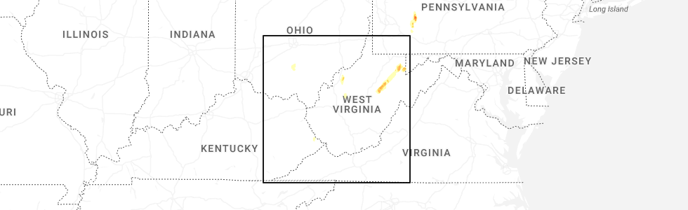
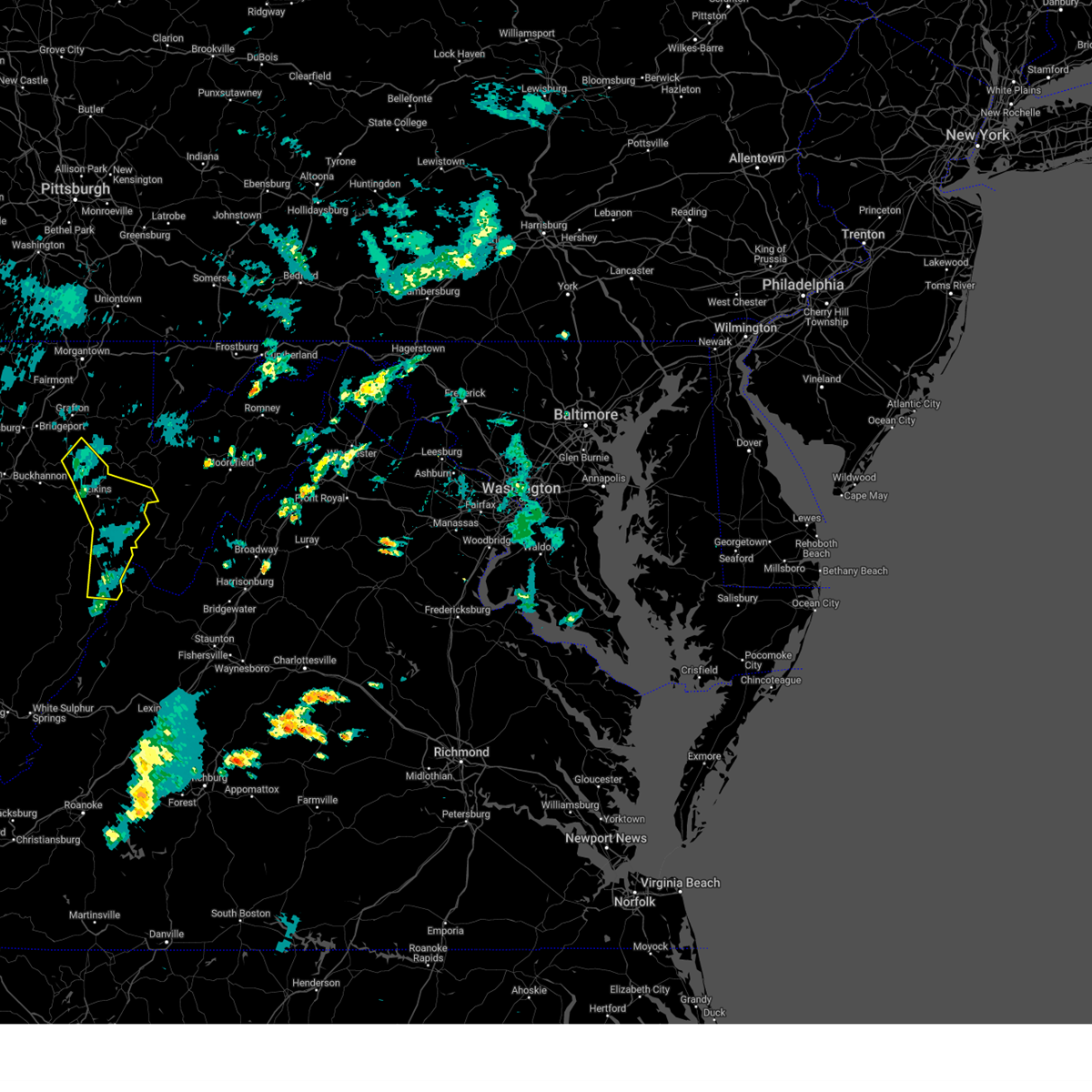
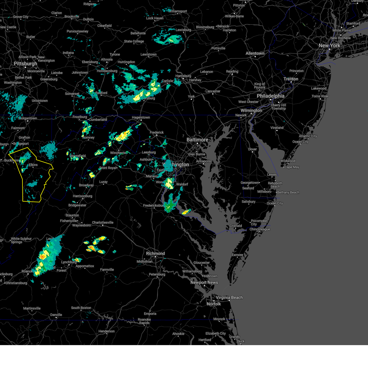
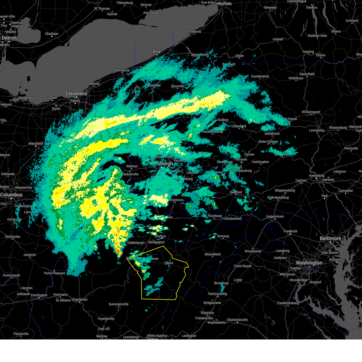
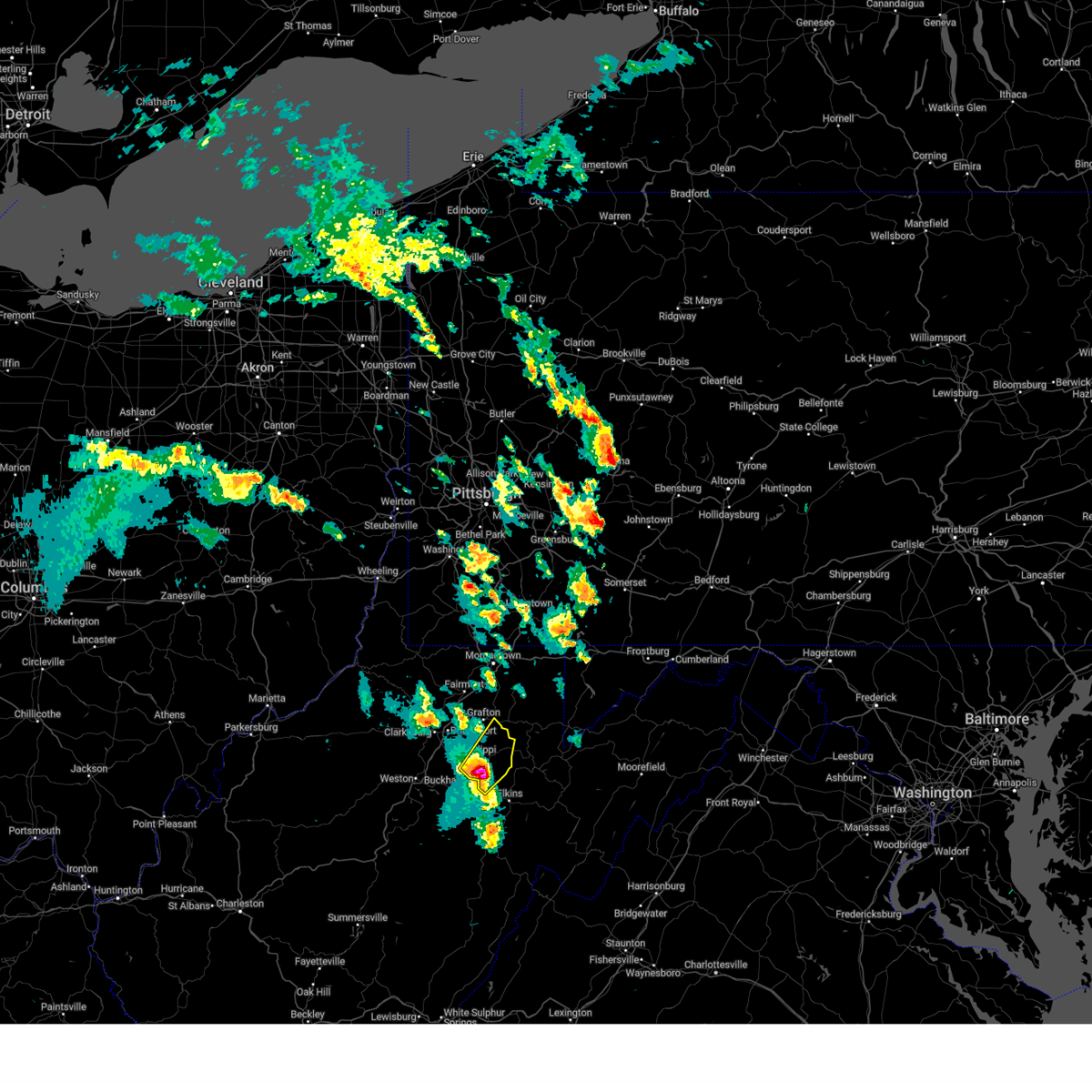
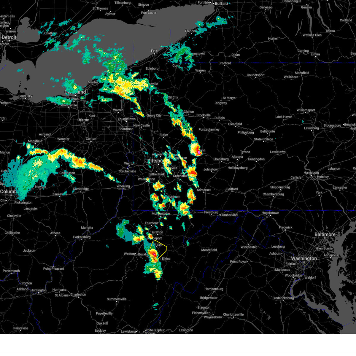
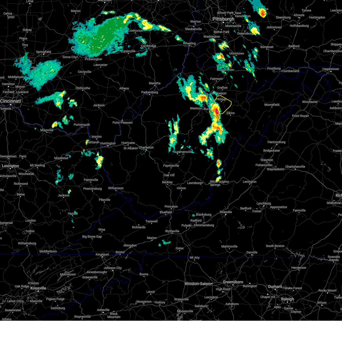
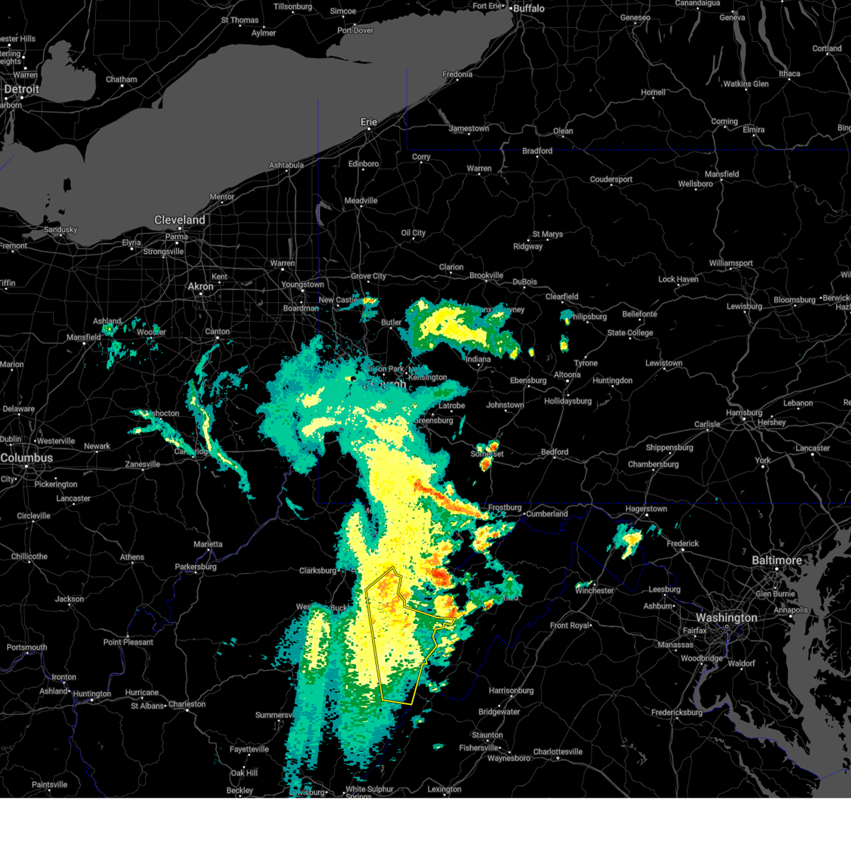
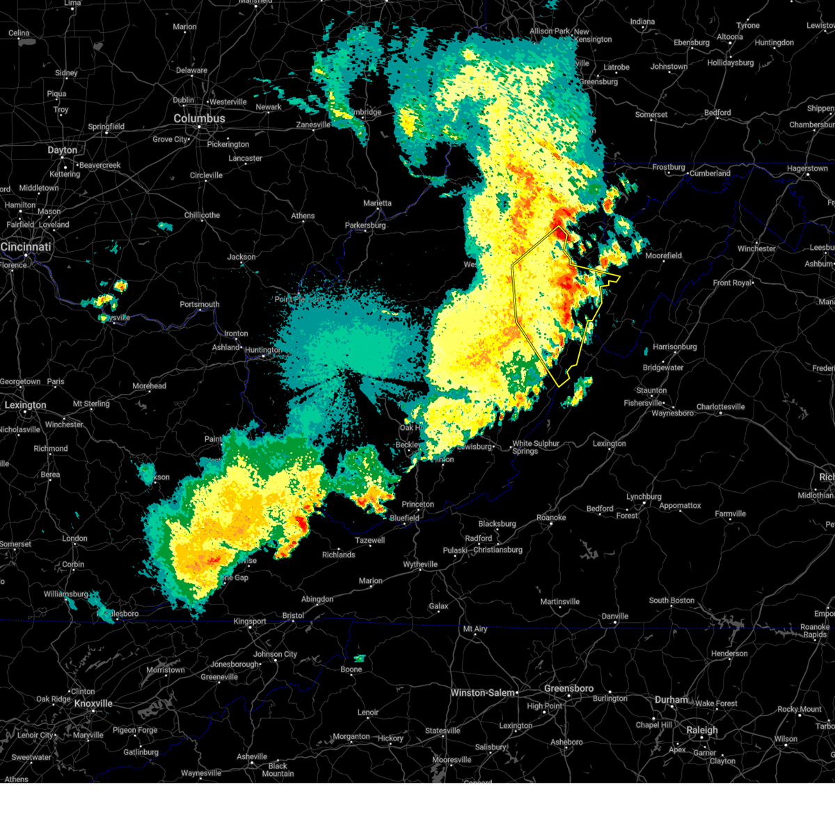
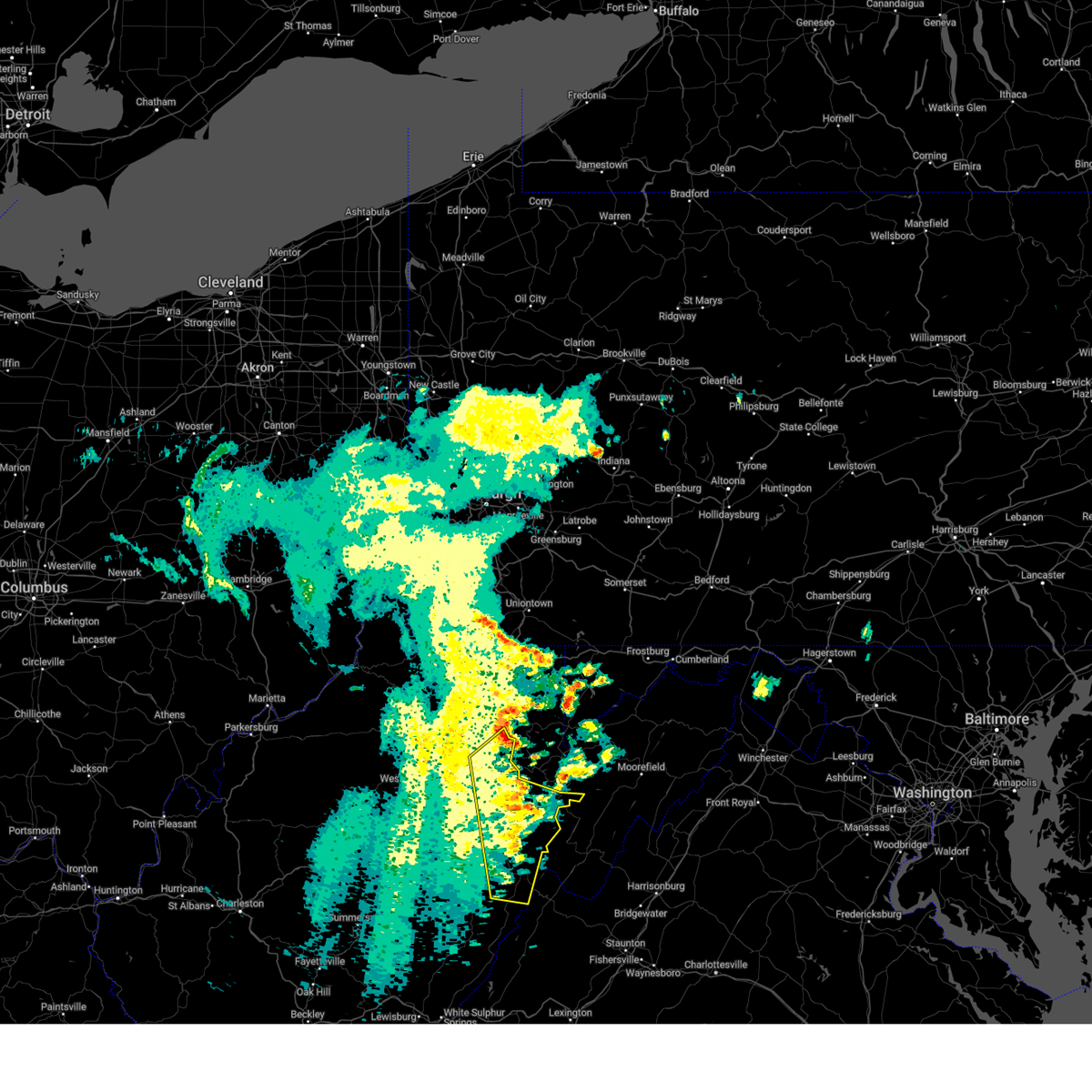
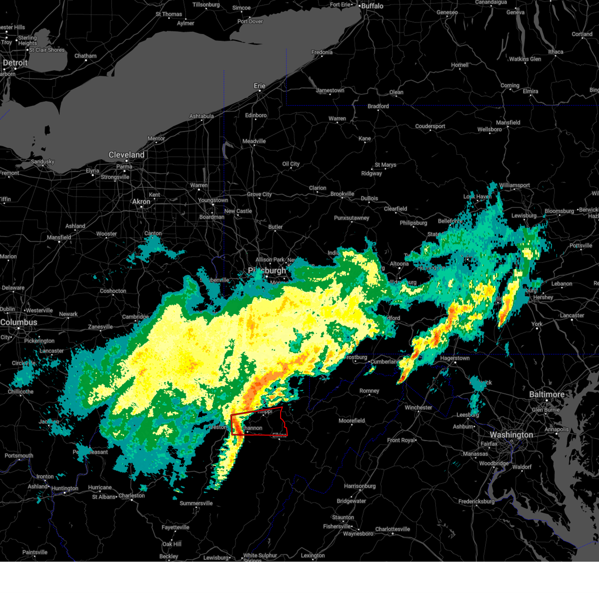
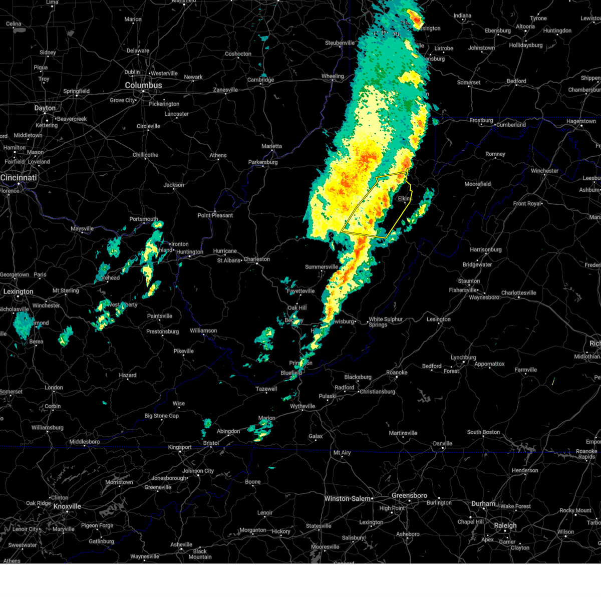
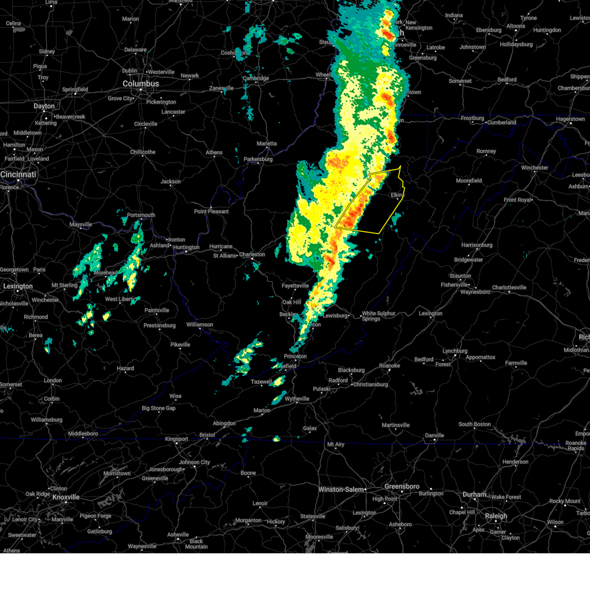
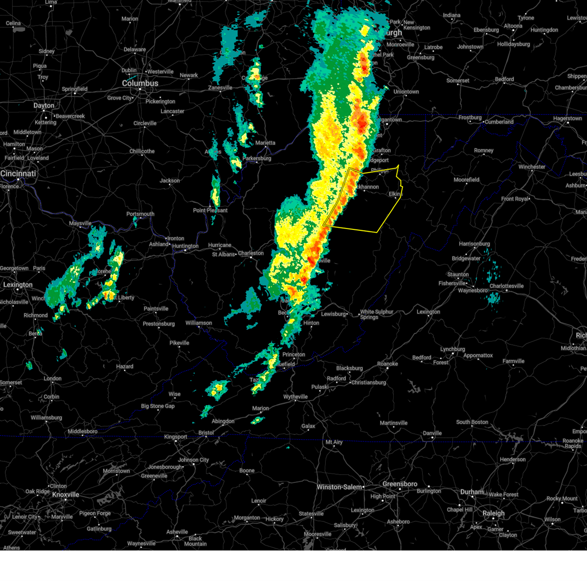
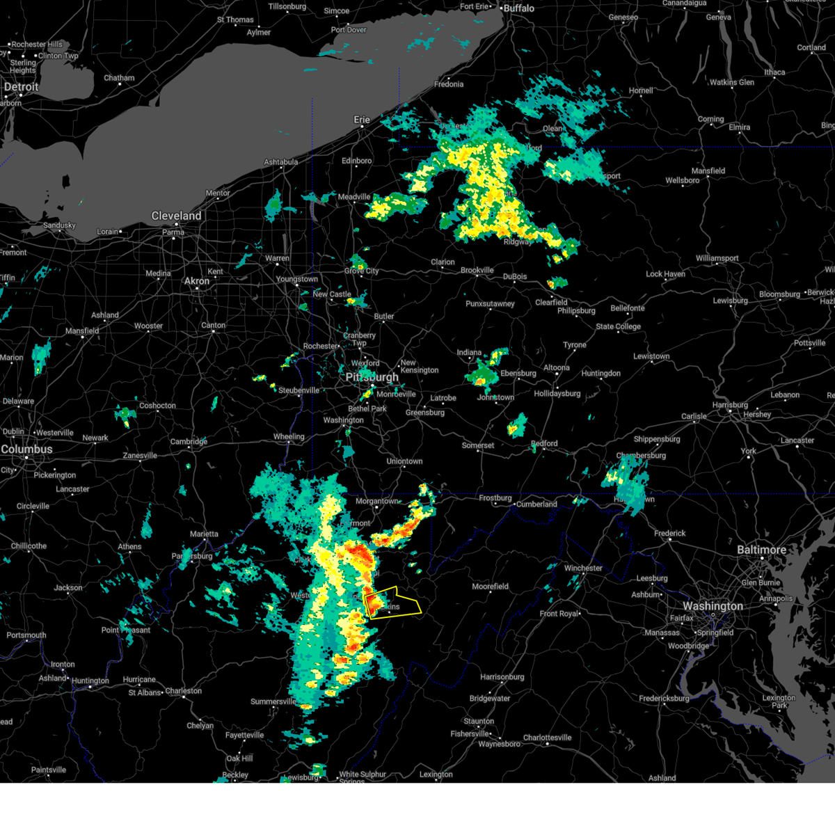
Hail Map for Belington, WV
The Belington, WV area has had 2 reports of on-the-ground hail by trained spotters, and has been under severe weather warnings 39 times during the past 12 months. Doppler radar has detected hail at or near Belington, WV on 19 occasions, including 1 occasion during the past year.
| Name: | Belington, WV |
| Where Located: | 8.2 miles NW of Elkins, WV |
| Map: | Google Map for Belington, WV |
| Population: | 1921 |
| Housing Units: | 878 |
| More Info: | Search Google for Belington, WV |
0
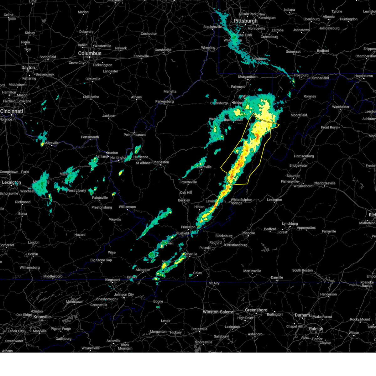
The Top Recent Hail Date for Belington, WV is Sunday, May 4, 2025 (8th out of 19)
Hail and Wind Damage Spotted near Belington, WV
| Date / Time | Report Details |
|---|---|
| 6/25/2025 4:59 PM EDT |
 the severe thunderstorm warning has been cancelled and is no longer in effect the severe thunderstorm warning has been cancelled and is no longer in effect
|
| 6/25/2025 4:59 PM EDT |
 At 459 pm edt, severe thunderstorms were located along a line extending from near parsons to near stonewall jackson, moving east at 15 mph (radar indicated). Hazards include 60 mph wind gusts and quarter size hail. Hail damage to vehicles is expected. expect wind damage to roofs, siding, and trees. Locations impacted include, elkins, buckhannon, philippi, audra state park, belington, junior, montrose, volga, century, kerens, ellamore, tallmansville, overhill, and hodgesville. At 459 pm edt, severe thunderstorms were located along a line extending from near parsons to near stonewall jackson, moving east at 15 mph (radar indicated). Hazards include 60 mph wind gusts and quarter size hail. Hail damage to vehicles is expected. expect wind damage to roofs, siding, and trees. Locations impacted include, elkins, buckhannon, philippi, audra state park, belington, junior, montrose, volga, century, kerens, ellamore, tallmansville, overhill, and hodgesville.
|
| 6/25/2025 4:41 PM EDT | Svrrlx the national weather service in charleston west virginia has issued a * severe thunderstorm warning for, northwestern randolph county in northeastern west virginia, northeastern upshur county in northeastern west virginia, barbour county in northeastern west virginia, southern harrison county in northern west virginia, * until 515 pm edt. * at 440 pm edt, severe thunderstorms were located along a line extending from 8 miles west of parsons to near stonewall jackson, moving southeast at 15 mph (radar indicated). Hazards include 60 mph wind gusts and quarter size hail. Hail damage to vehicles is expected. Expect wind damage to roofs, siding, and trees. |
| 6/25/2025 4:29 PM EDT | At 428 pm edt, a severe thunderstorm was located 7 miles northwest of parsons, moving southeast at 15 mph (radar indicated). Hazards include 60 mph wind gusts and quarter size hail. Hail damage to vehicles is expected. expect wind damage to roofs, siding, and trees. Locations impacted include, philippi, belington, junior, montrose, kerens, and nestorville. |
| 6/25/2025 4:15 PM EDT |
 Svrrlx the national weather service in charleston west virginia has issued a * severe thunderstorm warning for, north central randolph county in northeastern west virginia, eastern barbour county in northeastern west virginia, * until 445 pm edt. * at 415 pm edt, a severe thunderstorm was located 11 miles northwest of parsons, moving southeast at 15 mph (radar indicated). Hazards include 60 mph wind gusts and quarter size hail. Hail damage to vehicles is expected. Expect wind damage to roofs, siding, and trees. Svrrlx the national weather service in charleston west virginia has issued a * severe thunderstorm warning for, north central randolph county in northeastern west virginia, eastern barbour county in northeastern west virginia, * until 445 pm edt. * at 415 pm edt, a severe thunderstorm was located 11 miles northwest of parsons, moving southeast at 15 mph (radar indicated). Hazards include 60 mph wind gusts and quarter size hail. Hail damage to vehicles is expected. Expect wind damage to roofs, siding, and trees.
|
| 5/30/2025 4:26 PM EDT |
 The storms which prompted the warning have weakened below severe limits, and have exited the warned area. therefore, the warning will be allowed to expire. however, gusty winds are still possible with these thunderstorms. a tornado watch remains in effect until 800 pm edt for northeastern west virginia. The storms which prompted the warning have weakened below severe limits, and have exited the warned area. therefore, the warning will be allowed to expire. however, gusty winds are still possible with these thunderstorms. a tornado watch remains in effect until 800 pm edt for northeastern west virginia.
|
| 5/30/2025 4:12 PM EDT |
 At 411 pm edt, severe thunderstorms were located along a line extending from near philippi to near belington to near dailey to near greenbank, moving east at 40 mph (radar indicated). Hazards include 60 mph wind gusts. Expect damage to roofs, siding, and trees. Locations impacted include, elkins, philippi, greenbank, belington, dailey, beverly, junior, durbin, womelsdorf (coalton), montrose, harman, arbovale, cheat bridge, dryfork, bartow, glady, nestorville, boyer, bowden, and kerens. At 411 pm edt, severe thunderstorms were located along a line extending from near philippi to near belington to near dailey to near greenbank, moving east at 40 mph (radar indicated). Hazards include 60 mph wind gusts. Expect damage to roofs, siding, and trees. Locations impacted include, elkins, philippi, greenbank, belington, dailey, beverly, junior, durbin, womelsdorf (coalton), montrose, harman, arbovale, cheat bridge, dryfork, bartow, glady, nestorville, boyer, bowden, and kerens.
|
| 5/30/2025 4:12 PM EDT |
 the severe thunderstorm warning has been cancelled and is no longer in effect the severe thunderstorm warning has been cancelled and is no longer in effect
|
| 5/30/2025 3:58 PM EDT |
 At 358 pm edt, severe thunderstorms were located along a line extending from 6 miles north of buckhannon to near audra state park to near mill creek to near snowshoe, moving east at 40 mph (radar indicated). Hazards include 60 mph wind gusts. Expect damage to roofs, siding, and trees. Locations impacted include, elkins, philippi, audra state park, greenbank, cass scenic railroad, belington, mill creek, snowshoe, dailey, mingo, beverly, junior, durbin, womelsdorf (coalton), huttonsville, montrose, harman, arbovale, cheat bridge, and dryfork. At 358 pm edt, severe thunderstorms were located along a line extending from 6 miles north of buckhannon to near audra state park to near mill creek to near snowshoe, moving east at 40 mph (radar indicated). Hazards include 60 mph wind gusts. Expect damage to roofs, siding, and trees. Locations impacted include, elkins, philippi, audra state park, greenbank, cass scenic railroad, belington, mill creek, snowshoe, dailey, mingo, beverly, junior, durbin, womelsdorf (coalton), huttonsville, montrose, harman, arbovale, cheat bridge, and dryfork.
|
| 5/30/2025 3:58 PM EDT |
 the severe thunderstorm warning has been cancelled and is no longer in effect the severe thunderstorm warning has been cancelled and is no longer in effect
|
| 5/30/2025 3:29 PM EDT |
 Svrrlx the national weather service in charleston west virginia has issued a * severe thunderstorm warning for, randolph county in northeastern west virginia, northern pocahontas county in northeastern west virginia, lewis county in northern west virginia, upshur county in northeastern west virginia, northeastern webster county in northeastern west virginia, barbour county in northeastern west virginia, south central harrison county in northern west virginia, * until 430 pm edt. * at 328 pm edt, severe thunderstorms were located along a line extending from near weston to near holly river state park to 6 miles southeast of addison (webster springs), moving east at 40 mph (radar indicated). Hazards include 60 mph wind gusts. expect damage to roofs, siding, and trees Svrrlx the national weather service in charleston west virginia has issued a * severe thunderstorm warning for, randolph county in northeastern west virginia, northern pocahontas county in northeastern west virginia, lewis county in northern west virginia, upshur county in northeastern west virginia, northeastern webster county in northeastern west virginia, barbour county in northeastern west virginia, south central harrison county in northern west virginia, * until 430 pm edt. * at 328 pm edt, severe thunderstorms were located along a line extending from near weston to near holly river state park to 6 miles southeast of addison (webster springs), moving east at 40 mph (radar indicated). Hazards include 60 mph wind gusts. expect damage to roofs, siding, and trees
|
| 5/4/2025 8:04 PM EDT | Quarter sized hail reported 5.2 miles ESE of Belington, WV, quarter size hail reported with some other sizes covering some spots on the ground at belington. |
| 5/4/2025 7:54 PM EDT |
 Svrrlx the national weather service in charleston west virginia has issued a * severe thunderstorm warning for, southeastern taylor county in northern west virginia, barbour county in northeastern west virginia, * until 830 pm edt. * at 753 pm edt, a severe thunderstorm was located near audra state park, moving northeast at 20 mph (radar indicated). Hazards include golf ball size hail and 60 mph wind gusts. People and animals outdoors will be injured. expect hail damage to roofs, siding, windows, and vehicles. Expect wind damage to roofs, siding, and trees. Svrrlx the national weather service in charleston west virginia has issued a * severe thunderstorm warning for, southeastern taylor county in northern west virginia, barbour county in northeastern west virginia, * until 830 pm edt. * at 753 pm edt, a severe thunderstorm was located near audra state park, moving northeast at 20 mph (radar indicated). Hazards include golf ball size hail and 60 mph wind gusts. People and animals outdoors will be injured. expect hail damage to roofs, siding, windows, and vehicles. Expect wind damage to roofs, siding, and trees.
|
| 5/4/2025 7:49 PM EDT |
 At 744 pm edt, a severe thunderstorm was located over audra state park, moving northeast at 15 mph (radar indicated). Hazards include golf ball size hail and 60 mph wind gusts. People and animals outdoors will be injured. expect hail damage to roofs, siding, windows, and vehicles. expect wind damage to roofs, siding, and trees. Locations impacted include, philippi, audra state park, belington, moatsville, volga, nestorville, and galloway. At 744 pm edt, a severe thunderstorm was located over audra state park, moving northeast at 15 mph (radar indicated). Hazards include golf ball size hail and 60 mph wind gusts. People and animals outdoors will be injured. expect hail damage to roofs, siding, windows, and vehicles. expect wind damage to roofs, siding, and trees. Locations impacted include, philippi, audra state park, belington, moatsville, volga, nestorville, and galloway.
|
| 5/4/2025 7:30 PM EDT |
 Svrrlx the national weather service in charleston west virginia has issued a * severe thunderstorm warning for, northeastern upshur county in northeastern west virginia, barbour county in northeastern west virginia, * until 800 pm edt. * at 728 pm edt, a severe thunderstorm was located near buckhannon, moving northeast at 25 mph (radar indicated). Hazards include 60 mph wind gusts and half dollar size hail. Hail damage to vehicles is expected. Expect wind damage to roofs, siding, and trees. Svrrlx the national weather service in charleston west virginia has issued a * severe thunderstorm warning for, northeastern upshur county in northeastern west virginia, barbour county in northeastern west virginia, * until 800 pm edt. * at 728 pm edt, a severe thunderstorm was located near buckhannon, moving northeast at 25 mph (radar indicated). Hazards include 60 mph wind gusts and half dollar size hail. Hail damage to vehicles is expected. Expect wind damage to roofs, siding, and trees.
|
| 4/30/2025 12:07 AM EDT |
 The storm which prompted the warning has moved out of the area. therefore, the warning will be allowed to expire. however, gusty winds are still possible with this thunderstorm. The storm which prompted the warning has moved out of the area. therefore, the warning will be allowed to expire. however, gusty winds are still possible with this thunderstorm.
|
| 4/29/2025 11:42 PM EDT |
 the severe thunderstorm warning has been cancelled and is no longer in effect the severe thunderstorm warning has been cancelled and is no longer in effect
|
| 4/29/2025 11:40 PM EDT |
 Svrrlx the national weather service in charleston west virginia has issued a * severe thunderstorm warning for, randolph county in northeastern west virginia, northeastern pocahontas county in northeastern west virginia, east central upshur county in northeastern west virginia, barbour county in northeastern west virginia, * until 1215 am edt. * at 1140 pm edt, a severe thunderstorm was located near dailey, or 10 miles south of elkins, moving east at 50 mph (radar indicated). Hazards include 60 mph wind gusts. expect damage to roofs, siding, and trees Svrrlx the national weather service in charleston west virginia has issued a * severe thunderstorm warning for, randolph county in northeastern west virginia, northeastern pocahontas county in northeastern west virginia, east central upshur county in northeastern west virginia, barbour county in northeastern west virginia, * until 1215 am edt. * at 1140 pm edt, a severe thunderstorm was located near dailey, or 10 miles south of elkins, moving east at 50 mph (radar indicated). Hazards include 60 mph wind gusts. expect damage to roofs, siding, and trees
|
| 4/29/2025 11:23 PM EDT |
 the severe thunderstorm warning has been cancelled and is no longer in effect the severe thunderstorm warning has been cancelled and is no longer in effect
|
| 4/29/2025 11:23 PM EDT |
 At 1123 pm edt, a severe thunderstorm was located near mill creek, or 17 miles southwest of elkins, moving east at 50 mph (radar indicated). Hazards include 60 mph wind gusts. Expect damage to roofs, siding, and trees. Locations impacted include, alexander, cass scenic railroad, arbovale, cheat bridge, dryfork, huttonsville, elkins, glady, montrose, helvetia, pickens, beverly, boyer, bowden, womelsdorf (coalton), snowshoe, overhill, belington, moatsville, and dunmore. At 1123 pm edt, a severe thunderstorm was located near mill creek, or 17 miles southwest of elkins, moving east at 50 mph (radar indicated). Hazards include 60 mph wind gusts. Expect damage to roofs, siding, and trees. Locations impacted include, alexander, cass scenic railroad, arbovale, cheat bridge, dryfork, huttonsville, elkins, glady, montrose, helvetia, pickens, beverly, boyer, bowden, womelsdorf (coalton), snowshoe, overhill, belington, moatsville, and dunmore.
|
| 4/29/2025 11:02 PM EDT |
 Svrrlx the national weather service in charleston west virginia has issued a * severe thunderstorm warning for, randolph county in northeastern west virginia, northeastern pocahontas county in northeastern west virginia, southeastern lewis county in northern west virginia, northeastern braxton county in north central west virginia, upshur county in northeastern west virginia, northeastern webster county in northeastern west virginia, barbour county in northeastern west virginia, * until midnight edt. * at 1101 pm edt, a severe thunderstorm was located near holly river state park, or 15 miles east of sutton, moving east at 50 mph (radar indicated). Hazards include 60 mph wind gusts. expect damage to roofs, siding, and trees Svrrlx the national weather service in charleston west virginia has issued a * severe thunderstorm warning for, randolph county in northeastern west virginia, northeastern pocahontas county in northeastern west virginia, southeastern lewis county in northern west virginia, northeastern braxton county in north central west virginia, upshur county in northeastern west virginia, northeastern webster county in northeastern west virginia, barbour county in northeastern west virginia, * until midnight edt. * at 1101 pm edt, a severe thunderstorm was located near holly river state park, or 15 miles east of sutton, moving east at 50 mph (radar indicated). Hazards include 60 mph wind gusts. expect damage to roofs, siding, and trees
|
| 4/4/2025 3:19 AM EDT |
 the tornado warning has been cancelled and is no longer in effect the tornado warning has been cancelled and is no longer in effect
|
| 4/4/2025 3:19 AM EDT |
 At 319 am edt, a severe thunderstorm capable of producing a tornado was located near audra state park, moving east at 50 mph (radar indicated rotation). Hazards include tornado. Flying debris will be dangerous to those caught without shelter. mobile homes will be damaged or destroyed. damage to roofs, windows, and vehicles will occur. tree damage is likely. this dangerous storm will be near, philippi, audra state park, and belington around 325 am edt. Other locations impacted by this tornadic thunderstorm include kerens, volga, junior, montrose, and nestorville. At 319 am edt, a severe thunderstorm capable of producing a tornado was located near audra state park, moving east at 50 mph (radar indicated rotation). Hazards include tornado. Flying debris will be dangerous to those caught without shelter. mobile homes will be damaged or destroyed. damage to roofs, windows, and vehicles will occur. tree damage is likely. this dangerous storm will be near, philippi, audra state park, and belington around 325 am edt. Other locations impacted by this tornadic thunderstorm include kerens, volga, junior, montrose, and nestorville.
|
| 4/4/2025 3:07 AM EDT |
 Torrlx the national weather service in charleston west virginia has issued a * tornado warning for, north central randolph county in northeastern west virginia, northeastern lewis county in northern west virginia, northern upshur county in northeastern west virginia, barbour county in northeastern west virginia, southeastern harrison county in northern west virginia, * until 330 am edt. * at 306 am edt, a severe thunderstorm capable of producing a tornado was located 7 miles northwest of buckhannon, moving east at 50 mph (radar indicated rotation). Hazards include tornado. Flying debris will be dangerous to those caught without shelter. mobile homes will be damaged or destroyed. damage to roofs, windows, and vehicles will occur. tree damage is likely. this dangerous storm will be near, buckhannon around 310 am edt. philippi and audra state park around 315 am edt. belington around 325 am edt. Other locations impacted by this tornadic thunderstorm include kerens, volga, junior, lorentz, century, hodgesville, jane lew, montrose, nestorville, and horner. Torrlx the national weather service in charleston west virginia has issued a * tornado warning for, north central randolph county in northeastern west virginia, northeastern lewis county in northern west virginia, northern upshur county in northeastern west virginia, barbour county in northeastern west virginia, southeastern harrison county in northern west virginia, * until 330 am edt. * at 306 am edt, a severe thunderstorm capable of producing a tornado was located 7 miles northwest of buckhannon, moving east at 50 mph (radar indicated rotation). Hazards include tornado. Flying debris will be dangerous to those caught without shelter. mobile homes will be damaged or destroyed. damage to roofs, windows, and vehicles will occur. tree damage is likely. this dangerous storm will be near, buckhannon around 310 am edt. philippi and audra state park around 315 am edt. belington around 325 am edt. Other locations impacted by this tornadic thunderstorm include kerens, volga, junior, lorentz, century, hodgesville, jane lew, montrose, nestorville, and horner.
|
| 4/3/2025 6:42 AM EDT | Svrrlx the national weather service in charleston west virginia has issued a * severe thunderstorm warning for, randolph county in northeastern west virginia, northeastern pocahontas county in northeastern west virginia, east central braxton county in north central west virginia, southern upshur county in northeastern west virginia, northeastern webster county in northeastern west virginia, eastern barbour county in northeastern west virginia, * until 715 am edt. * at 642 am edt, severe thunderstorms were located along a line extending from 9 miles east of philippi to near belington to holly river state park, moving east at 65 mph (radar indicated). Hazards include 60 mph wind gusts. expect damage to roofs, siding, and trees |
| 4/3/2025 6:42 AM EDT | The storms which prompted the warning have moved out of the area. therefore, the warning will be allowed to expire. however, small hail, gusty winds and heavy rain are still possible with these thunderstorms. |
| 4/3/2025 6:32 AM EDT | At 631 am edt, severe thunderstorms were located along a line extending from newburg to near philippi to 7 miles southeast of buckhannon to 6 miles southeast of sutton, moving east at 65 mph (radar indicated). Hazards include 60 mph wind gusts. Expect damage to roofs, siding, and trees. Locations impacted include, alexander, knottsville, eden, flatwoods, grafton, cleveland, little birch, tygart lake state park, thornton, hacker valley, kanawha head, ireland, overhill, belington, french creek, diana, moatsville, volga, junior, and sutton. |
| 4/3/2025 6:32 AM EDT | the severe thunderstorm warning has been cancelled and is no longer in effect |
| 4/3/2025 6:18 AM EDT | the severe thunderstorm warning has been cancelled and is no longer in effect |
| 4/3/2025 6:18 AM EDT | At 617 am edt, severe thunderstorms were located along a line extending from 6 miles west of grafton to near buckhannon to near rock cave to 7 miles west of birch river, moving east at 60 mph (radar indicated). Hazards include 60 mph wind gusts. Expect damage to roofs, siding, and trees. Locations impacted include, flemington, knottsville, eden, grafton, jane lew, anmoore, meadland, bridgeport, little birch, jackson mill, hacker valley, french creek, moatsville, frametown, volga, junior, clarksburg, rosemont, wilsie, and gassaway. |
| 4/3/2025 5:57 AM EDT | Svrrlx the national weather service in charleston west virginia has issued a * severe thunderstorm warning for, southeastern calhoun county in north central west virginia, northwestern randolph county in northeastern west virginia, northeastern kanawha county in central west virginia, upshur county in northeastern west virginia, southeastern roane county in central west virginia, northwestern webster county in northeastern west virginia, barbour county in northeastern west virginia, harrison county in northern west virginia, southeastern doddridge county in northern west virginia, taylor county in northern west virginia, north central nicholas county in southeastern west virginia, central gilmer county in north central west virginia, lewis county in northern west virginia, braxton county in north central west virginia, northern clay county in north central west virginia, * until 645 am edt. * at 557 am edt, severe thunderstorms were located along a line extending from near salem to 7 miles northwest of gassaway to near amma, moving east at 65 mph (radar indicated). Hazards include 60 mph wind gusts. expect damage to roofs, siding, and trees |
| 3/16/2025 1:58 PM EDT |
 The storms which prompted the warning have weakened below severe limits, and no longer pose an immediate threat to life or property. therefore, the warning will be allowed to expire. however, gusty winds are still possible with these thunderstorms. a tornado watch remains in effect until 400 pm edt for northeastern west virginia. The storms which prompted the warning have weakened below severe limits, and no longer pose an immediate threat to life or property. therefore, the warning will be allowed to expire. however, gusty winds are still possible with these thunderstorms. a tornado watch remains in effect until 400 pm edt for northeastern west virginia.
|
| 3/16/2025 1:28 PM EDT |
 the severe thunderstorm warning has been cancelled and is no longer in effect the severe thunderstorm warning has been cancelled and is no longer in effect
|
| 3/16/2025 1:28 PM EDT |
 At 128 pm edt, severe thunderstorms were located along a line extending from near hendricks to 6 miles east of dailey to 8 miles south of mill creek to 8 miles west of snowshoe to 6 miles north of leonard, moving east at 20 mph (radar indicated). Hazards include 60 mph wind gusts. Expect damage to roofs, siding, and trees. Locations impacted include, cass scenic railroad, arbovale, cheat bridge, dryfork, huttonsville, elkins, glady, minnehaha springs, montrose, waneta, beverly, boyer, bowden, buckeye, womelsdorf (coalton), marlinton, snowshoe, bergoo, dunmore, and monterville. At 128 pm edt, severe thunderstorms were located along a line extending from near hendricks to 6 miles east of dailey to 8 miles south of mill creek to 8 miles west of snowshoe to 6 miles north of leonard, moving east at 20 mph (radar indicated). Hazards include 60 mph wind gusts. Expect damage to roofs, siding, and trees. Locations impacted include, cass scenic railroad, arbovale, cheat bridge, dryfork, huttonsville, elkins, glady, minnehaha springs, montrose, waneta, beverly, boyer, bowden, buckeye, womelsdorf (coalton), marlinton, snowshoe, bergoo, dunmore, and monterville.
|
| 3/16/2025 12:58 PM EDT |
 Svrrlx the national weather service in charleston west virginia has issued a * severe thunderstorm warning for, randolph county in northeastern west virginia, pocahontas county in northeastern west virginia, southeastern nicholas county in southeastern west virginia, southeastern upshur county in northeastern west virginia, eastern webster county in northeastern west virginia, southeastern barbour county in northeastern west virginia, * until 200 pm edt. * at 1257 pm edt, severe thunderstorms were located along a line extending from 10 miles northwest of parsons to 8 miles southwest of belington to 7 miles east of holly river state park to near richwood, moving east at 35 mph (radar indicated). Hazards include 60 mph wind gusts. expect damage to roofs, siding, and trees Svrrlx the national weather service in charleston west virginia has issued a * severe thunderstorm warning for, randolph county in northeastern west virginia, pocahontas county in northeastern west virginia, southeastern nicholas county in southeastern west virginia, southeastern upshur county in northeastern west virginia, eastern webster county in northeastern west virginia, southeastern barbour county in northeastern west virginia, * until 200 pm edt. * at 1257 pm edt, severe thunderstorms were located along a line extending from 10 miles northwest of parsons to 8 miles southwest of belington to 7 miles east of holly river state park to near richwood, moving east at 35 mph (radar indicated). Hazards include 60 mph wind gusts. expect damage to roofs, siding, and trees
|
| 3/16/2025 12:58 PM EDT |
 The storms which prompted the warning have moved out of the area. therefore, the warning will be allowed to expire. however, gusty winds and heavy rain are still possible with these thunderstorms. a tornado watch remains in effect until 400 pm edt for northern, north central and northeastern west virginia. The storms which prompted the warning have moved out of the area. therefore, the warning will be allowed to expire. however, gusty winds and heavy rain are still possible with these thunderstorms. a tornado watch remains in effect until 400 pm edt for northern, north central and northeastern west virginia.
|
| 3/16/2025 12:40 PM EDT |
 the severe thunderstorm warning has been cancelled and is no longer in effect the severe thunderstorm warning has been cancelled and is no longer in effect
|
| 3/16/2025 12:40 PM EDT |
 At 1240 pm edt, severe thunderstorms were located along a line extending from philippi to 6 miles south of buckhannon to near holly river state park, moving east at 35 mph (radar indicated). Hazards include 60 mph wind gusts. Expect damage to roofs, siding, and trees. Locations impacted include, alexander, huttonsville, eden, elkins, montrose, helvetia, pickens, cleveland, beverly, womelsdorf (coalton), hacker valley, kanawha head, ireland, overhill, belington, french creek, volga, junior, century, and nestorville. At 1240 pm edt, severe thunderstorms were located along a line extending from philippi to 6 miles south of buckhannon to near holly river state park, moving east at 35 mph (radar indicated). Hazards include 60 mph wind gusts. Expect damage to roofs, siding, and trees. Locations impacted include, alexander, huttonsville, eden, elkins, montrose, helvetia, pickens, cleveland, beverly, womelsdorf (coalton), hacker valley, kanawha head, ireland, overhill, belington, french creek, volga, junior, century, and nestorville.
|
| 3/16/2025 12:15 PM EDT |
 Svrrlx the national weather service in charleston west virginia has issued a * severe thunderstorm warning for, northwestern randolph county in northeastern west virginia, eastern lewis county in northern west virginia, northeastern braxton county in north central west virginia, upshur county in northeastern west virginia, northeastern webster county in northeastern west virginia, barbour county in northeastern west virginia, southeastern harrison county in northern west virginia, * until 100 pm edt. * at 1215 pm edt, severe thunderstorms were located along a line extending from near stonewood to near rock cave to near sutton, moving east at 30 mph (radar indicated). Hazards include 60 mph wind gusts. expect damage to roofs, siding, and trees Svrrlx the national weather service in charleston west virginia has issued a * severe thunderstorm warning for, northwestern randolph county in northeastern west virginia, eastern lewis county in northern west virginia, northeastern braxton county in north central west virginia, upshur county in northeastern west virginia, northeastern webster county in northeastern west virginia, barbour county in northeastern west virginia, southeastern harrison county in northern west virginia, * until 100 pm edt. * at 1215 pm edt, severe thunderstorms were located along a line extending from near stonewood to near rock cave to near sutton, moving east at 30 mph (radar indicated). Hazards include 60 mph wind gusts. expect damage to roofs, siding, and trees
|
| 9/24/2024 2:23 PM EDT |
 Svrrlx the national weather service in charleston west virginia has issued a * severe thunderstorm warning for, north central randolph county in northeastern west virginia, southeastern barbour county in northeastern west virginia, * until 300 pm edt. * at 223 pm edt, a severe thunderstorm was located near belington, or 7 miles southeast of audra state park, moving east at 20 mph (radar indicated). Hazards include 60 mph wind gusts and quarter size hail. Hail damage to vehicles is expected. Expect wind damage to roofs, siding, and trees. Svrrlx the national weather service in charleston west virginia has issued a * severe thunderstorm warning for, north central randolph county in northeastern west virginia, southeastern barbour county in northeastern west virginia, * until 300 pm edt. * at 223 pm edt, a severe thunderstorm was located near belington, or 7 miles southeast of audra state park, moving east at 20 mph (radar indicated). Hazards include 60 mph wind gusts and quarter size hail. Hail damage to vehicles is expected. Expect wind damage to roofs, siding, and trees.
|
| 5/26/2024 7:57 PM EDT | Tree down across the roa in barbour county WV, 4.2 miles SSE of Belington, WV |
| 5/26/2024 6:57 PM EDT |
 At 657 pm edt, a severe thunderstorm was located near elkins, moving northeast at 55 mph (radar indicated). Hazards include 60 mph wind gusts and penny size hail. Expect damage to roofs, siding, and trees. Locations impacted include, clarksburg, elkins, buckhannon, grafton, philippi, audra state park, bridgeport, belington, stonewood, nutter fort, anmoore, mill creek, dailey, beverly, west milford, junior, lost creek, flemington, durbin, and womelsdorf (coalton). At 657 pm edt, a severe thunderstorm was located near elkins, moving northeast at 55 mph (radar indicated). Hazards include 60 mph wind gusts and penny size hail. Expect damage to roofs, siding, and trees. Locations impacted include, clarksburg, elkins, buckhannon, grafton, philippi, audra state park, bridgeport, belington, stonewood, nutter fort, anmoore, mill creek, dailey, beverly, west milford, junior, lost creek, flemington, durbin, and womelsdorf (coalton).
|
| 5/26/2024 6:39 PM EDT |
 Svrrlx the national weather service in charleston west virginia has issued a * severe thunderstorm warning for, randolph county in northeastern west virginia, northeastern pocahontas county in northeastern west virginia, taylor county in northern west virginia, northeastern lewis county in northern west virginia, northeastern upshur county in northeastern west virginia, barbour county in northeastern west virginia, southeastern harrison county in northern west virginia, * until 730 pm edt. * at 638 pm edt, a severe thunderstorm was located 8 miles southeast of rock cave, or 14 miles south of buckhannon, moving northeast at 45 mph (radar indicated). Hazards include 60 mph wind gusts and penny size hail. expect damage to roofs, siding, and trees Svrrlx the national weather service in charleston west virginia has issued a * severe thunderstorm warning for, randolph county in northeastern west virginia, northeastern pocahontas county in northeastern west virginia, taylor county in northern west virginia, northeastern lewis county in northern west virginia, northeastern upshur county in northeastern west virginia, barbour county in northeastern west virginia, southeastern harrison county in northern west virginia, * until 730 pm edt. * at 638 pm edt, a severe thunderstorm was located 8 miles southeast of rock cave, or 14 miles south of buckhannon, moving northeast at 45 mph (radar indicated). Hazards include 60 mph wind gusts and penny size hail. expect damage to roofs, siding, and trees
|
| 4/2/2024 12:57 PM EDT |
 The storms which prompted the warning have weakened below severe limits, and have exited the warned area. therefore, the warning will be allowed to expire. however, gusty winds are still possible with these thunderstorms. to report severe weather, contact your nearest law enforcement agency. they will relay your report to the national weather service charleston west virginia. The storms which prompted the warning have weakened below severe limits, and have exited the warned area. therefore, the warning will be allowed to expire. however, gusty winds are still possible with these thunderstorms. to report severe weather, contact your nearest law enforcement agency. they will relay your report to the national weather service charleston west virginia.
|
| 4/2/2024 12:26 PM EDT |
 the severe thunderstorm warning has been cancelled and is no longer in effect the severe thunderstorm warning has been cancelled and is no longer in effect
|
| 4/2/2024 12:26 PM EDT |
 At 1224 pm edt, severe thunderstorms were located along a line extending from near buckhannon to near holly river state park to 10 miles east of addison (webster springs) to near leonard, moving east at 70 mph (radar indicated). Hazards include 70 mph wind gusts. Expect considerable tree damage. damage is likely to mobile homes, roofs, and outbuildings. Locations impacted include, elkins, buckhannon, philippi, marlinton, cass scenic railroad, audra state park, greenbank, belington, mill creek, snowshoe, dailey, holly river state park, mingo, beverly, junior, durbin, hillsboro, womelsdorf (coalton), huttonsville, and montrose. At 1224 pm edt, severe thunderstorms were located along a line extending from near buckhannon to near holly river state park to 10 miles east of addison (webster springs) to near leonard, moving east at 70 mph (radar indicated). Hazards include 70 mph wind gusts. Expect considerable tree damage. damage is likely to mobile homes, roofs, and outbuildings. Locations impacted include, elkins, buckhannon, philippi, marlinton, cass scenic railroad, audra state park, greenbank, belington, mill creek, snowshoe, dailey, holly river state park, mingo, beverly, junior, durbin, hillsboro, womelsdorf (coalton), huttonsville, and montrose.
|
| 4/2/2024 12:05 PM EDT |
 the severe thunderstorm warning has been cancelled and is no longer in effect the severe thunderstorm warning has been cancelled and is no longer in effect
|
| 4/2/2024 12:05 PM EDT |
 At 1204 pm edt, severe thunderstorms were located along a line extending from 9 miles west of stonewall jackson to near sutton to 6 miles northeast of camden on gauley to 6 miles north of quinwood, moving east at 70 mph (radar indicated). Hazards include 70 mph wind gusts. Expect considerable tree damage. damage is likely to mobile homes, roofs, and outbuildings. Locations impacted include, elkins, buckhannon, weston, philippi, richwood, marlinton, audra state park, greenbank, webster springs, cass scenic railroad, belington, addison (webster springs), mill creek, camden-on-gauley, snowshoe, dailey, holly river state park, stonewall jackson, camden on gauley, and rock cave. At 1204 pm edt, severe thunderstorms were located along a line extending from 9 miles west of stonewall jackson to near sutton to 6 miles northeast of camden on gauley to 6 miles north of quinwood, moving east at 70 mph (radar indicated). Hazards include 70 mph wind gusts. Expect considerable tree damage. damage is likely to mobile homes, roofs, and outbuildings. Locations impacted include, elkins, buckhannon, weston, philippi, richwood, marlinton, audra state park, greenbank, webster springs, cass scenic railroad, belington, addison (webster springs), mill creek, camden-on-gauley, snowshoe, dailey, holly river state park, stonewall jackson, camden on gauley, and rock cave.
|
| 4/2/2024 11:44 AM EDT |
 Svrrlx the national weather service in charleston west virginia has issued a * severe thunderstorm warning for, southeastern calhoun county in north central west virginia, randolph county in northeastern west virginia, upshur county in northeastern west virginia, webster county in northeastern west virginia, southern barbour county in northeastern west virginia, pocahontas county in northeastern west virginia, southeastern ritchie county in northwestern west virginia, nicholas county in southeastern west virginia, gilmer county in north central west virginia, lewis county in northern west virginia, braxton county in north central west virginia, northeastern clay county in north central west virginia, northeastern fayette county in southeastern west virginia, * until 100 pm edt. * at 1144 am edt, severe thunderstorms were located along a line extending from 9 miles north of grantsville to 6 miles east of arnoldsburg to 8 miles east of clay to near ansted, moving east at 65 mph (radar indicated). Hazards include 70 mph wind gusts. Expect considerable tree damage. Damage is likely to mobile homes, roofs, and outbuildings. Svrrlx the national weather service in charleston west virginia has issued a * severe thunderstorm warning for, southeastern calhoun county in north central west virginia, randolph county in northeastern west virginia, upshur county in northeastern west virginia, webster county in northeastern west virginia, southern barbour county in northeastern west virginia, pocahontas county in northeastern west virginia, southeastern ritchie county in northwestern west virginia, nicholas county in southeastern west virginia, gilmer county in north central west virginia, lewis county in northern west virginia, braxton county in north central west virginia, northeastern clay county in north central west virginia, northeastern fayette county in southeastern west virginia, * until 100 pm edt. * at 1144 am edt, severe thunderstorms were located along a line extending from 9 miles north of grantsville to 6 miles east of arnoldsburg to 8 miles east of clay to near ansted, moving east at 65 mph (radar indicated). Hazards include 70 mph wind gusts. Expect considerable tree damage. Damage is likely to mobile homes, roofs, and outbuildings.
|
| 8/7/2023 2:25 PM EDT |
 The severe thunderstorm warning for central randolph, northern pocahontas, eastern upshur and central barbour counties will expire at 230 pm edt, the storm which prompted the warning has weakened below severe limits, and no longer poses an immediate threat to life or property. therefore, the warning will be allowed to expire. however gusty winds and heavy rain are still possible with this thunderstorm. a tornado watch remains in effect until 600 pm edt for northeastern west virginia. The severe thunderstorm warning for central randolph, northern pocahontas, eastern upshur and central barbour counties will expire at 230 pm edt, the storm which prompted the warning has weakened below severe limits, and no longer poses an immediate threat to life or property. therefore, the warning will be allowed to expire. however gusty winds and heavy rain are still possible with this thunderstorm. a tornado watch remains in effect until 600 pm edt for northeastern west virginia.
|
| 8/7/2023 2:21 PM EDT | Tree down across point pleasant roa in barbour county WV, 0.1 miles SE of Belington, WV |
| 8/7/2023 2:00 PM EDT |
 At 200 pm edt, a severe thunderstorm was located 10 miles east of rock cave, or 11 miles southeast of buckhannon, moving east at 55 mph (radar indicated). Hazards include 60 mph wind gusts and quarter size hail. Hail damage to vehicles is expected. Expect wind damage to roofs, siding, and trees. At 200 pm edt, a severe thunderstorm was located 10 miles east of rock cave, or 11 miles southeast of buckhannon, moving east at 55 mph (radar indicated). Hazards include 60 mph wind gusts and quarter size hail. Hail damage to vehicles is expected. Expect wind damage to roofs, siding, and trees.
|
| 7/28/2023 4:52 PM EDT |
 At 451 pm edt, severe thunderstorms were located along a line extending from near winfield to near newburg to near philippi, moving east at 40 mph (radar indicated). Hazards include 60 mph wind gusts and penny size hail. Expect damage to roofs, siding, and trees. locations impacted include, elkins, grafton, philippi, audra state park, belington, junior, flemington, womelsdorf (coalton), montrose, moatsville, rosemont, knottsville, nestorville, meadland, tygart lake state park, kerens, thornton, ellamore, mcgee, and galloway. hail threat, radar indicated max hail size, 0. 75 in wind threat, radar indicated max wind gust, 60 mph. At 451 pm edt, severe thunderstorms were located along a line extending from near winfield to near newburg to near philippi, moving east at 40 mph (radar indicated). Hazards include 60 mph wind gusts and penny size hail. Expect damage to roofs, siding, and trees. locations impacted include, elkins, grafton, philippi, audra state park, belington, junior, flemington, womelsdorf (coalton), montrose, moatsville, rosemont, knottsville, nestorville, meadland, tygart lake state park, kerens, thornton, ellamore, mcgee, and galloway. hail threat, radar indicated max hail size, 0. 75 in wind threat, radar indicated max wind gust, 60 mph.
|
| 7/28/2023 4:14 PM EDT |
 At 414 pm edt, severe thunderstorms were located along a line extending from 6 miles northwest of lumberport to near nutter fort to near weston, moving east at 40 mph (radar indicated). Hazards include 60 mph wind gusts and nickel size hail. expect damage to roofs, siding, and trees At 414 pm edt, severe thunderstorms were located along a line extending from 6 miles northwest of lumberport to near nutter fort to near weston, moving east at 40 mph (radar indicated). Hazards include 60 mph wind gusts and nickel size hail. expect damage to roofs, siding, and trees
|
| 7/15/2023 6:01 PM EDT | Tree down along morgantown pike. time estimated from rada in barbour county WV, 0.1 miles SE of Belington, WV |
| 7/23/2022 4:18 PM EDT |
 At 417 pm edt, a severe thunderstorm was located over buckhannon, moving southeast at 30 mph (radar indicated). Hazards include 60 mph wind gusts and penny size hail. Expect damage to roofs, siding, and trees. locations impacted include, elkins, buckhannon, grafton, philippi, audra state park, belington, mill creek, dailey, rock cave, beverly, junior, flemington, womelsdorf (coalton), huttonsville, montrose, alexander, knottsville, eden, glady and helvetia. hail threat, radar indicated max hail size, 0. 75 in wind threat, radar indicated max wind gust, 60 mph. At 417 pm edt, a severe thunderstorm was located over buckhannon, moving southeast at 30 mph (radar indicated). Hazards include 60 mph wind gusts and penny size hail. Expect damage to roofs, siding, and trees. locations impacted include, elkins, buckhannon, grafton, philippi, audra state park, belington, mill creek, dailey, rock cave, beverly, junior, flemington, womelsdorf (coalton), huttonsville, montrose, alexander, knottsville, eden, glady and helvetia. hail threat, radar indicated max hail size, 0. 75 in wind threat, radar indicated max wind gust, 60 mph.
|
| 7/23/2022 4:00 PM EDT |
 At 400 pm edt, a severe thunderstorm was located near weston, moving southeast at 30 mph (radar indicated). Hazards include 60 mph wind gusts and penny size hail. expect damage to roofs, siding, and trees At 400 pm edt, a severe thunderstorm was located near weston, moving southeast at 30 mph (radar indicated). Hazards include 60 mph wind gusts and penny size hail. expect damage to roofs, siding, and trees
|
| 6/22/2022 8:23 PM EDT |
 At 823 pm edt, a severe thunderstorm was located over audra state park, moving south at 70 mph (radar indicated). Hazards include 70 mph wind gusts and quarter size hail. Hail damage to vehicles is expected. expect considerable tree damage. wind damage is also likely to mobile homes, roofs, and outbuildings. locations impacted include, grafton, philippi, audra state park, belington, flemington, montrose, moatsville, volga, knottsville, nestorville, tygart lake state park, kerens, galloway and thornton. thunderstorm damage threat, considerable hail threat, radar indicated max hail size, 1. 00 in wind threat, radar indicated max wind gust, 70 mph. At 823 pm edt, a severe thunderstorm was located over audra state park, moving south at 70 mph (radar indicated). Hazards include 70 mph wind gusts and quarter size hail. Hail damage to vehicles is expected. expect considerable tree damage. wind damage is also likely to mobile homes, roofs, and outbuildings. locations impacted include, grafton, philippi, audra state park, belington, flemington, montrose, moatsville, volga, knottsville, nestorville, tygart lake state park, kerens, galloway and thornton. thunderstorm damage threat, considerable hail threat, radar indicated max hail size, 1. 00 in wind threat, radar indicated max wind gust, 70 mph.
|
| 6/22/2022 8:16 PM EDT |
 At 816 pm edt, a severe thunderstorm was located over philippi, moving south at 70 mph (radar indicated). Hazards include 60 mph wind gusts and quarter size hail. Hail damage to vehicles is expected. Expect wind damage to roofs, siding, and trees. At 816 pm edt, a severe thunderstorm was located over philippi, moving south at 70 mph (radar indicated). Hazards include 60 mph wind gusts and quarter size hail. Hail damage to vehicles is expected. Expect wind damage to roofs, siding, and trees.
|
| 9/28/2021 10:37 AM EDT |
 The severe thunderstorm warning for north central randolph and southeastern barbour counties will expire at 1045 am edt, the storm which prompted the warning has weakened below severe limits, and has exited the warned area. therefore, the warning will be allowed to expire. The severe thunderstorm warning for north central randolph and southeastern barbour counties will expire at 1045 am edt, the storm which prompted the warning has weakened below severe limits, and has exited the warned area. therefore, the warning will be allowed to expire.
|
| 9/28/2021 10:31 AM EDT |
 At 1031 am edt, a severe thunderstorm was located near belington, or 8 miles west of parsons, moving east at 35 mph (radar indicated). Hazards include 60 mph wind gusts and quarter size hail. Hail damage to vehicles is expected. expect wind damage to roofs, siding, and trees. locations impacted include, belington, montrose and kerens. hail threat, observed max hail size, 1. 00 in wind threat, radar indicated max wind gust, 60 mph. At 1031 am edt, a severe thunderstorm was located near belington, or 8 miles west of parsons, moving east at 35 mph (radar indicated). Hazards include 60 mph wind gusts and quarter size hail. Hail damage to vehicles is expected. expect wind damage to roofs, siding, and trees. locations impacted include, belington, montrose and kerens. hail threat, observed max hail size, 1. 00 in wind threat, radar indicated max wind gust, 60 mph.
|
| 9/28/2021 10:03 AM EDT |
 At 1003 am edt, a severe thunderstorm was located near philippi, moving east at 35 mph (radar indicated). Hazards include 60 mph wind gusts and quarter size hail. Hail damage to vehicles is expected. Expect wind damage to roofs, siding, and trees. At 1003 am edt, a severe thunderstorm was located near philippi, moving east at 35 mph (radar indicated). Hazards include 60 mph wind gusts and quarter size hail. Hail damage to vehicles is expected. Expect wind damage to roofs, siding, and trees.
|
| 6/21/2021 2:20 PM EDT | Trees down and roof damage at industrial par in barbour county WV, 0.8 miles S of Belington, WV |
| 6/14/2021 8:12 PM EDT |
 The severe thunderstorm warning for north central randolph and eastern barbour counties will expire at 815 pm edt, the storm which prompted the warning has weakened below severe limits, and no longer poses an immediate threat to life or property. therefore, the warning will be allowed to expire. however heavy rain is still possible with this thunderstorm. a severe thunderstorm watch remains in effect until 900 pm edt for northern and northeastern west virginia. The severe thunderstorm warning for north central randolph and eastern barbour counties will expire at 815 pm edt, the storm which prompted the warning has weakened below severe limits, and no longer poses an immediate threat to life or property. therefore, the warning will be allowed to expire. however heavy rain is still possible with this thunderstorm. a severe thunderstorm watch remains in effect until 900 pm edt for northern and northeastern west virginia.
|
| 6/14/2021 8:01 PM EDT |
 At 800 pm edt, a severe thunderstorm was located 7 miles northeast of belington, or 9 miles east of philippi, moving southeast at 35 mph (radar indicated). Hazards include 60 mph wind gusts and quarter size hail. Hail damage to vehicles is expected. expect wind damage to roofs, siding, and trees. Locations impacted include, elkins, philippi, belington, junior, montrose, kerens and nestorville. At 800 pm edt, a severe thunderstorm was located 7 miles northeast of belington, or 9 miles east of philippi, moving southeast at 35 mph (radar indicated). Hazards include 60 mph wind gusts and quarter size hail. Hail damage to vehicles is expected. expect wind damage to roofs, siding, and trees. Locations impacted include, elkins, philippi, belington, junior, montrose, kerens and nestorville.
|
| 6/14/2021 7:43 PM EDT |
 At 743 pm edt, a severe thunderstorm was located near philippi, moving southeast at 45 mph (radar indicated). Hazards include 60 mph wind gusts and quarter size hail. Hail damage to vehicles is expected. Expect wind damage to roofs, siding, and trees. At 743 pm edt, a severe thunderstorm was located near philippi, moving southeast at 45 mph (radar indicated). Hazards include 60 mph wind gusts and quarter size hail. Hail damage to vehicles is expected. Expect wind damage to roofs, siding, and trees.
|
| 4/9/2020 2:41 AM EDT |
 At 240 am edt, severe thunderstorms were located along a line extending from belington to near leonard, moving east at 60 mph (radar indicated). Hazards include 60 mph wind gusts. Expect damage to roofs, siding, and trees. Locations impacted include, elkins, philippi, marlinton, cass scenic railroad, audra state park, greenbank, belington, mill creek, snowshoe, dailey, mingo, beverly, junior, durbin, hillsboro, womelsdorf (coalton), huttonsville, montrose, harman and alexander. At 240 am edt, severe thunderstorms were located along a line extending from belington to near leonard, moving east at 60 mph (radar indicated). Hazards include 60 mph wind gusts. Expect damage to roofs, siding, and trees. Locations impacted include, elkins, philippi, marlinton, cass scenic railroad, audra state park, greenbank, belington, mill creek, snowshoe, dailey, mingo, beverly, junior, durbin, hillsboro, womelsdorf (coalton), huttonsville, montrose, harman and alexander.
|
| 4/9/2020 2:30 AM EDT |
 At 229 am edt, severe thunderstorms were located along a line extending from near buckhannon to near duo, moving east at 60 mph (radar indicated). Hazards include 70 mph wind gusts and quarter size hail. Hail damage to vehicles is expected. expect considerable tree damage. wind damage is also likely to mobile homes, roofs, and outbuildings. Locations impacted include, elkins, buckhannon, weston, philippi, richwood, marlinton, audra state park, greenbank, webster springs, cass scenic railroad, belington, addison (webster springs), mill creek, camden-on-gauley, snowshoe, dailey, craigsville, camden on gauley, rock cave and holly river state. At 229 am edt, severe thunderstorms were located along a line extending from near buckhannon to near duo, moving east at 60 mph (radar indicated). Hazards include 70 mph wind gusts and quarter size hail. Hail damage to vehicles is expected. expect considerable tree damage. wind damage is also likely to mobile homes, roofs, and outbuildings. Locations impacted include, elkins, buckhannon, weston, philippi, richwood, marlinton, audra state park, greenbank, webster springs, cass scenic railroad, belington, addison (webster springs), mill creek, camden-on-gauley, snowshoe, dailey, craigsville, camden on gauley, rock cave and holly river state.
|
| 4/9/2020 2:04 AM EDT |
 At 203 am edt, severe thunderstorms were located along a line extending from 7 miles west of stonewall jackson to 6 miles north of babcock state park, moving east at 60 mph (radar indicated). Hazards include 70 mph wind gusts and quarter size hail. Hail damage to vehicles is expected. expect considerable tree damage. Wind damage is also likely to mobile homes, roofs, and outbuildings. At 203 am edt, severe thunderstorms were located along a line extending from 7 miles west of stonewall jackson to 6 miles north of babcock state park, moving east at 60 mph (radar indicated). Hazards include 70 mph wind gusts and quarter size hail. Hail damage to vehicles is expected. expect considerable tree damage. Wind damage is also likely to mobile homes, roofs, and outbuildings.
|
| 10/31/2019 3:29 PM EDT |
 At 328 pm edt, severe thunderstorms were located along a line extending from near newburg to 9 miles northwest of snowshoe, moving northeast at 60 mph (radar indicated). Hazards include 60 mph wind gusts. Expect damage to roofs, siding, and trees. Locations impacted include, clarksburg, elkins, buckhannon, grafton, philippi, audra state park, cass scenic railroad, greenbank, bridgeport, belington, stonewood, addison (webster springs), anmoore, mill creek, snowshoe, dailey, rock cave, holly river state, mingo and beverly. At 328 pm edt, severe thunderstorms were located along a line extending from near newburg to 9 miles northwest of snowshoe, moving northeast at 60 mph (radar indicated). Hazards include 60 mph wind gusts. Expect damage to roofs, siding, and trees. Locations impacted include, clarksburg, elkins, buckhannon, grafton, philippi, audra state park, cass scenic railroad, greenbank, bridgeport, belington, stonewood, addison (webster springs), anmoore, mill creek, snowshoe, dailey, rock cave, holly river state, mingo and beverly.
|
| 10/31/2019 3:19 PM EDT |
 At 318 pm edt, severe thunderstorms were located along a line extending from fairmont to 8 miles east of addison (webster springs), moving northeast at 60 mph (radar indicated). Hazards include 60 mph wind gusts. Expect damage to roofs, siding, and trees. Locations impacted include, clarksburg, elkins, buckhannon, grafton, weston, philippi, richwood, audra state park, webster springs, cass scenic railroad, greenbank, bridgeport, shinnston, belington, stonewood, nutter fort, lumberport, addison (webster springs), anmoore and mill creek. At 318 pm edt, severe thunderstorms were located along a line extending from fairmont to 8 miles east of addison (webster springs), moving northeast at 60 mph (radar indicated). Hazards include 60 mph wind gusts. Expect damage to roofs, siding, and trees. Locations impacted include, clarksburg, elkins, buckhannon, grafton, weston, philippi, richwood, audra state park, webster springs, cass scenic railroad, greenbank, bridgeport, shinnston, belington, stonewood, nutter fort, lumberport, addison (webster springs), anmoore and mill creek.
|
| 10/31/2019 3:06 PM EDT |
 At 305 pm edt, severe thunderstorms were located along a line extending from lumberport to 8 miles northeast of richwood, moving northeast at 60 mph (radar indicated). Hazards include 60 mph wind gusts. Expect damage to roofs, siding, and trees. Locations impacted include, clarksburg, elkins, buckhannon, grafton, weston, philippi, richwood, audra state park, webster springs, cass scenic railroad, greenbank, bridgeport, shinnston, belington, stonewood, nutter fort, lumberport, addison (webster springs), anmoore and mill creek. At 305 pm edt, severe thunderstorms were located along a line extending from lumberport to 8 miles northeast of richwood, moving northeast at 60 mph (radar indicated). Hazards include 60 mph wind gusts. Expect damage to roofs, siding, and trees. Locations impacted include, clarksburg, elkins, buckhannon, grafton, weston, philippi, richwood, audra state park, webster springs, cass scenic railroad, greenbank, bridgeport, shinnston, belington, stonewood, nutter fort, lumberport, addison (webster springs), anmoore and mill creek.
|
| 10/31/2019 2:43 PM EDT |
 At 242 pm edt, severe thunderstorms were located along a line extending from 7 miles southwest of salem to 6 miles north of quinwood, moving northeast at 60 mph (radar indicated). Hazards include 60 mph wind gusts. expect damage to roofs, siding, and trees At 242 pm edt, severe thunderstorms were located along a line extending from 7 miles southwest of salem to 6 miles north of quinwood, moving northeast at 60 mph (radar indicated). Hazards include 60 mph wind gusts. expect damage to roofs, siding, and trees
|
| 7/14/2019 3:52 PM EDT |
 The severe thunderstorm warning for north central randolph, southeastern taylor and eastern barbour counties will expire at 400 pm edt, the storm which prompted the warning has moved out of the area. therefore, the warning will be allowed to expire. The severe thunderstorm warning for north central randolph, southeastern taylor and eastern barbour counties will expire at 400 pm edt, the storm which prompted the warning has moved out of the area. therefore, the warning will be allowed to expire.
|
| 7/14/2019 3:27 PM EDT |
 At 327 pm edt, a severe thunderstorm was located near grafton, moving southeast at 25 mph (radar indicated). Hazards include 60 mph wind gusts. expect damage to roofs, siding, and trees At 327 pm edt, a severe thunderstorm was located near grafton, moving southeast at 25 mph (radar indicated). Hazards include 60 mph wind gusts. expect damage to roofs, siding, and trees
|
| 6/24/2019 10:11 PM EDT |
 The severe thunderstorm warning for northeastern randolph, taylor and barbour counties will expire at 1015 pm edt, the storms which prompted the warning have weakened below severe limits, and have exited the warned area. therefore, the warning will be allowed to expire. The severe thunderstorm warning for northeastern randolph, taylor and barbour counties will expire at 1015 pm edt, the storms which prompted the warning have weakened below severe limits, and have exited the warned area. therefore, the warning will be allowed to expire.
|
| 6/24/2019 10:05 PM EDT |
 At 1004 pm edt, severe thunderstorms were located along a line extending from loch lynn heights to 9 miles south of davis to 10 miles west of upper tract to 6 miles west of franklin, moving northeast at 40 mph (radar indicated). Hazards include 60 mph wind gusts. Expect damage to roofs, siding, and trees. Locations impacted include, elkins, grafton, philippi, belington, beverly, junior, flemington, montrose, harman, moatsville, rosemont, dryfork, knottsville, glady, nestorville, bowden, tygart lake state park, kerens, thornton and galloway. At 1004 pm edt, severe thunderstorms were located along a line extending from loch lynn heights to 9 miles south of davis to 10 miles west of upper tract to 6 miles west of franklin, moving northeast at 40 mph (radar indicated). Hazards include 60 mph wind gusts. Expect damage to roofs, siding, and trees. Locations impacted include, elkins, grafton, philippi, belington, beverly, junior, flemington, montrose, harman, moatsville, rosemont, dryfork, knottsville, glady, nestorville, bowden, tygart lake state park, kerens, thornton and galloway.
|
| 6/24/2019 9:51 PM EDT |
 At 951 pm edt, severe thunderstorms were located along a line extending from 8 miles east of rowlesburg to 10 miles southeast of hendricks to 16 miles east of dailey to 11 miles north of monterey, moving northeast at 40 mph (radar indicated). Hazards include 60 mph wind gusts. Expect damage to roofs, siding, and trees. Locations impacted include, elkins, grafton, philippi, audra state park, belington, dailey, beverly, junior, flemington, durbin, womelsdorf (coalton), montrose, harman, cheat bridge, dryfork, knottsville, glady, boyer, bowden and tygart lake state park. At 951 pm edt, severe thunderstorms were located along a line extending from 8 miles east of rowlesburg to 10 miles southeast of hendricks to 16 miles east of dailey to 11 miles north of monterey, moving northeast at 40 mph (radar indicated). Hazards include 60 mph wind gusts. Expect damage to roofs, siding, and trees. Locations impacted include, elkins, grafton, philippi, audra state park, belington, dailey, beverly, junior, flemington, durbin, womelsdorf (coalton), montrose, harman, cheat bridge, dryfork, knottsville, glady, boyer, bowden and tygart lake state park.
|
| 6/24/2019 9:11 PM EDT |
 At 911 pm edt, severe thunderstorms were located along a line extending from near philippi to mill creek to 9 miles northwest of cass scenic railroad to snowshoe, moving northeast at 40 mph (radar indicated). Hazards include 60 mph wind gusts. expect damage to roofs, siding, and trees At 911 pm edt, severe thunderstorms were located along a line extending from near philippi to mill creek to 9 miles northwest of cass scenic railroad to snowshoe, moving northeast at 40 mph (radar indicated). Hazards include 60 mph wind gusts. expect damage to roofs, siding, and trees
|
| 6/24/2019 7:20 PM EDT |
 At 719 pm edt, severe thunderstorms were located along a line extending from audra state park to 6 miles northwest of dailey, moving northeast at 35 mph (radar indicated). Hazards include 60 mph wind gusts. Expect damage to roofs, siding, and trees. Locations impacted include, elkins, philippi, belington, dailey, beverly, junior, womelsdorf (coalton), montrose, bowden, kerens and nestorville. At 719 pm edt, severe thunderstorms were located along a line extending from audra state park to 6 miles northwest of dailey, moving northeast at 35 mph (radar indicated). Hazards include 60 mph wind gusts. Expect damage to roofs, siding, and trees. Locations impacted include, elkins, philippi, belington, dailey, beverly, junior, womelsdorf (coalton), montrose, bowden, kerens and nestorville.
|
| 6/24/2019 7:05 PM EDT |
 At 703 pm edt, severe thunderstorms were located along a line extending from near buckhannon to 9 miles northwest of mill creek, moving east at 35 mph (radar indicated). Hazards include 60 mph wind gusts. Expect damage to roofs, siding, and trees. Locations impacted include, elkins, buckhannon, philippi, audra state park, belington, dailey, beverly, junior, womelsdorf (coalton), montrose, volga, nestorville, bowden, kerens, ellamore, tallmansville, overhill and hodgesville. At 703 pm edt, severe thunderstorms were located along a line extending from near buckhannon to 9 miles northwest of mill creek, moving east at 35 mph (radar indicated). Hazards include 60 mph wind gusts. Expect damage to roofs, siding, and trees. Locations impacted include, elkins, buckhannon, philippi, audra state park, belington, dailey, beverly, junior, womelsdorf (coalton), montrose, volga, nestorville, bowden, kerens, ellamore, tallmansville, overhill and hodgesville.
|
| 6/24/2019 6:46 PM EDT |
 At 646 pm edt, severe thunderstorms were located along a line extending from 6 miles southwest of buckhannon to near holly river state, moving northeast at 35 mph (radar indicated). Hazards include 60 mph wind gusts. expect damage to roofs, siding, and trees At 646 pm edt, severe thunderstorms were located along a line extending from 6 miles southwest of buckhannon to near holly river state, moving northeast at 35 mph (radar indicated). Hazards include 60 mph wind gusts. expect damage to roofs, siding, and trees
|
| 5/25/2019 7:42 PM EDT |
 The severe thunderstorm warning for north central randolph and eastern barbour counties will expire at 745 pm edt, the storm which prompted the warning has moved out of the area. therefore, the warning will be allowed to expire. a severe thunderstorm watch remains in effect until 1000 pm edt for northeastern west virginia. The severe thunderstorm warning for north central randolph and eastern barbour counties will expire at 745 pm edt, the storm which prompted the warning has moved out of the area. therefore, the warning will be allowed to expire. a severe thunderstorm watch remains in effect until 1000 pm edt for northeastern west virginia.
|
| 5/25/2019 7:26 PM EDT |
 At 726 pm edt, a severe thunderstorm was located near philippi, moving east at 35 mph (radar indicated). Hazards include 60 mph wind gusts and quarter size hail. Hail damage to vehicles is expected. expect wind damage to roofs, siding, and trees. Locations impacted include, philippi, belington, montrose, moatsville, kerens and nestorville. At 726 pm edt, a severe thunderstorm was located near philippi, moving east at 35 mph (radar indicated). Hazards include 60 mph wind gusts and quarter size hail. Hail damage to vehicles is expected. expect wind damage to roofs, siding, and trees. Locations impacted include, philippi, belington, montrose, moatsville, kerens and nestorville.
|
| 5/25/2019 7:10 PM EDT |
 At 710 pm edt, a severe thunderstorm was located near philippi, moving east at 35 mph (radar indicated). Hazards include 60 mph wind gusts and quarter size hail. Hail damage to vehicles is expected. Expect wind damage to roofs, siding, and trees. At 710 pm edt, a severe thunderstorm was located near philippi, moving east at 35 mph (radar indicated). Hazards include 60 mph wind gusts and quarter size hail. Hail damage to vehicles is expected. Expect wind damage to roofs, siding, and trees.
|
| 5/17/2019 6:50 PM EDT |
 The severe thunderstorm warning for central randolph, northeastern pocahontas, northeastern upshur and southern barbour counties will expire at 700 pm edt, the storm which prompted the warning has weakened below severe limits, and no longer poses an immediate threat to life or property. therefore, the warning will be allowed to expire. a severe thunderstorm watch remains in effect until 1100 pm edt for northeastern west virginia. The severe thunderstorm warning for central randolph, northeastern pocahontas, northeastern upshur and southern barbour counties will expire at 700 pm edt, the storm which prompted the warning has weakened below severe limits, and no longer poses an immediate threat to life or property. therefore, the warning will be allowed to expire. a severe thunderstorm watch remains in effect until 1100 pm edt for northeastern west virginia.
|
| 5/17/2019 6:02 PM EDT |
 At 601 pm edt, a severe thunderstorm was located over audra state park, moving southeast at 30 mph (radar indicated). Hazards include 60 mph wind gusts and quarter size hail. Hail damage to vehicles is expected. Expect wind damage to roofs, siding, and trees. At 601 pm edt, a severe thunderstorm was located over audra state park, moving southeast at 30 mph (radar indicated). Hazards include 60 mph wind gusts and quarter size hail. Hail damage to vehicles is expected. Expect wind damage to roofs, siding, and trees.
|
| 5/3/2019 5:21 PM EDT |
 At 521 pm edt, a severe thunderstorm was located near elkins, moving northeast at 40 mph (radar indicated). Hazards include 60 mph wind gusts and quarter size hail. Hail damage to vehicles is expected. expect wind damage to roofs, siding, and trees. Locations impacted include, elkins, philippi, audra state park, belington, dailey, beverly, junior, womelsdorf (coalton), montrose, glady, nestorville, bowden, kerens and ellamore. At 521 pm edt, a severe thunderstorm was located near elkins, moving northeast at 40 mph (radar indicated). Hazards include 60 mph wind gusts and quarter size hail. Hail damage to vehicles is expected. expect wind damage to roofs, siding, and trees. Locations impacted include, elkins, philippi, audra state park, belington, dailey, beverly, junior, womelsdorf (coalton), montrose, glady, nestorville, bowden, kerens and ellamore.
|
| 5/3/2019 5:06 PM EDT |
 At 506 pm edt, a severe thunderstorm was located near elkins, moving northeast at 40 mph (radar indicated). Hazards include 60 mph wind gusts and quarter size hail. Hail damage to vehicles is expected. Expect wind damage to roofs, siding, and trees. At 506 pm edt, a severe thunderstorm was located near elkins, moving northeast at 40 mph (radar indicated). Hazards include 60 mph wind gusts and quarter size hail. Hail damage to vehicles is expected. Expect wind damage to roofs, siding, and trees.
|
| 4/14/2019 9:42 PM EDT |
 At 942 pm edt, severe thunderstorms were located along a line extending from 6 miles south of brookhaven to 9 miles northwest of dailey, moving northeast at 60 mph (radar indicated). Hazards include 60 mph wind gusts. expect damage to roofs, siding, and trees At 942 pm edt, severe thunderstorms were located along a line extending from 6 miles south of brookhaven to 9 miles northwest of dailey, moving northeast at 60 mph (radar indicated). Hazards include 60 mph wind gusts. expect damage to roofs, siding, and trees
|
| 4/14/2019 9:35 PM EDT |
 At 935 pm edt, severe thunderstorms were located along a line extending from near kingwood to near elkins, moving northeast at 50 mph (radar indicated). Hazards include 70 mph wind gusts. Expect considerable tree damage. damage is likely to mobile homes, roofs, and outbuildings. Locations impacted include, elkins, philippi, audra state park, belington, beverly, junior, womelsdorf (coalton), montrose, harman, volga, dryfork, bowden, kerens and ellamore. At 935 pm edt, severe thunderstorms were located along a line extending from near kingwood to near elkins, moving northeast at 50 mph (radar indicated). Hazards include 70 mph wind gusts. Expect considerable tree damage. damage is likely to mobile homes, roofs, and outbuildings. Locations impacted include, elkins, philippi, audra state park, belington, beverly, junior, womelsdorf (coalton), montrose, harman, volga, dryfork, bowden, kerens and ellamore.
|
| 4/14/2019 9:17 PM EDT |
 At 917 pm edt, severe thunderstorms were located along a line extending from near winfield to 7 miles west of dailey, moving northeast at 50 mph (radar indicated). Hazards include 70 mph wind gusts. Expect considerable tree damage. Damage is likely to mobile homes, roofs, and outbuildings. At 917 pm edt, severe thunderstorms were located along a line extending from near winfield to 7 miles west of dailey, moving northeast at 50 mph (radar indicated). Hazards include 70 mph wind gusts. Expect considerable tree damage. Damage is likely to mobile homes, roofs, and outbuildings.
|
| 4/14/2019 8:52 PM EDT |
 At 852 pm edt, a severe thunderstorm was located near buckhannon, moving northeast at 65 mph (radar indicated). Hazards include 70 mph wind gusts. Expect considerable tree damage. Damage is likely to mobile homes, roofs, and outbuildings. At 852 pm edt, a severe thunderstorm was located near buckhannon, moving northeast at 65 mph (radar indicated). Hazards include 70 mph wind gusts. Expect considerable tree damage. Damage is likely to mobile homes, roofs, and outbuildings.
|
| 7/22/2017 3:59 PM EDT |
 At 359 pm edt, a severe thunderstorm was located near belington, or 9 miles north of elkins, moving east at 20 mph (radar indicated). Hazards include 60 mph wind gusts and quarter size hail. Hail damage to vehicles is expected. expect wind damage to roofs, siding, and trees. locations impacted include, belington, montrose, pheasant run and kerens. At 359 pm edt, a severe thunderstorm was located near belington, or 9 miles north of elkins, moving east at 20 mph (radar indicated). Hazards include 60 mph wind gusts and quarter size hail. Hail damage to vehicles is expected. expect wind damage to roofs, siding, and trees. locations impacted include, belington, montrose, pheasant run and kerens.
|
| 7/22/2017 3:24 PM EDT |
 At 323 pm edt, a severe thunderstorm was located near audra state park, moving east at 30 mph (radar indicated). Hazards include 60 mph wind gusts and quarter size hail. Hail damage to vehicles is expected. Expect wind damage to roofs, siding, and trees. At 323 pm edt, a severe thunderstorm was located near audra state park, moving east at 30 mph (radar indicated). Hazards include 60 mph wind gusts and quarter size hail. Hail damage to vehicles is expected. Expect wind damage to roofs, siding, and trees.
|
| 7/7/2017 5:47 PM EDT |
 The national weather service in charleston west virginia has issued a * severe thunderstorm warning for. randolph county in northeastern west virginia. northeastern pocahontas county in northeastern west virginia. southeastern upshur county in northeastern west virginia. Southeastern barbour county in northeastern west virginia. The national weather service in charleston west virginia has issued a * severe thunderstorm warning for. randolph county in northeastern west virginia. northeastern pocahontas county in northeastern west virginia. southeastern upshur county in northeastern west virginia. Southeastern barbour county in northeastern west virginia.
|
| 3/1/2017 11:20 AM EST | Trees down... power lines down... and structure damage in barbour county WV, 0.5 miles WSW of Belington, WV |
| 6/16/2016 6:25 PM EDT |
 The severe thunderstorm warning for randolph, southern upshur and southeastern barbour counties will expire at 630 pm edt, the storm which prompted the warning has moved out of the area. therefore, the warning will be allowed to expire. however gusty winds are still possible with other weaker thunderstorms in the area. a severe thunderstorm watch remains in effect until 1000 pm edt for northeastern west virginia. The severe thunderstorm warning for randolph, southern upshur and southeastern barbour counties will expire at 630 pm edt, the storm which prompted the warning has moved out of the area. therefore, the warning will be allowed to expire. however gusty winds are still possible with other weaker thunderstorms in the area. a severe thunderstorm watch remains in effect until 1000 pm edt for northeastern west virginia.
|
| 6/16/2016 6:10 PM EDT |
 At 609 pm edt, a severe thunderstorm was located over dailey, or 10 miles south of elkins, moving southeast at 50 mph. this is a very dangerous storm (radar indicated). Hazards include 80 mph wind gusts and quarter size hail. Flying debris will be dangerous to those caught without shelter. mobile homes will be heavily damaged. expect considerable damage to roofs, windows, and vehicles. extensive tree damage and power outages are likely. Locations impacted include, elkins, belington, mill creek, dailey, beverly, junior, womelsdorf (coalton), huttonsville, harman, cheat bridge, bowden, glady, kanawha head, alton, ellamore and alexander. At 609 pm edt, a severe thunderstorm was located over dailey, or 10 miles south of elkins, moving southeast at 50 mph. this is a very dangerous storm (radar indicated). Hazards include 80 mph wind gusts and quarter size hail. Flying debris will be dangerous to those caught without shelter. mobile homes will be heavily damaged. expect considerable damage to roofs, windows, and vehicles. extensive tree damage and power outages are likely. Locations impacted include, elkins, belington, mill creek, dailey, beverly, junior, womelsdorf (coalton), huttonsville, harman, cheat bridge, bowden, glady, kanawha head, alton, ellamore and alexander.
|
| 6/16/2016 6:03 PM EDT |
 At 601 pm edt, a severe thunderstorm was located 8 miles southeast of buckhannon, moving southeast at 60 mph (radar indicated). Hazards include 75 mph wind gusts and quarter size hail. Hail damage to vehicles is expected. expect considerable tree damage. wind damage is also likely to mobile homes, roofs, and outbuildings. Locations impacted include, elkins, audra state park, belington, mill creek, rock cave, dailey, beverly, junior, womelsdorf (coalton), huttonsville, harman, cheat bridge, ireland, tallmansville, bowden, glady, kanawha head, french creek, overhill and alton. At 601 pm edt, a severe thunderstorm was located 8 miles southeast of buckhannon, moving southeast at 60 mph (radar indicated). Hazards include 75 mph wind gusts and quarter size hail. Hail damage to vehicles is expected. expect considerable tree damage. wind damage is also likely to mobile homes, roofs, and outbuildings. Locations impacted include, elkins, audra state park, belington, mill creek, rock cave, dailey, beverly, junior, womelsdorf (coalton), huttonsville, harman, cheat bridge, ireland, tallmansville, bowden, glady, kanawha head, french creek, overhill and alton.
|
| 6/16/2016 5:45 PM EDT |
 At 544 pm edt, a severe thunderstorm was located near buckhannon, moving east at 65 mph (radar indicated). Hazards include 60 mph wind gusts. Expect damage to roofs. siding. And trees. At 544 pm edt, a severe thunderstorm was located near buckhannon, moving east at 65 mph (radar indicated). Hazards include 60 mph wind gusts. Expect damage to roofs. siding. And trees.
|
| 4/9/2015 7:09 PM EDT | The national weather service in charleston has issued a * severe thunderstorm warning for. southern barbour county in west virginia. this includes the city of audra state park. northeastern braxton county in west virginia. East central gilmer county in west virginia. |
| 7/27/2014 9:11 PM EDT | Trees down on audra park state rd. 911 center said trees down all over barbour count in barbour county WV, 1 miles W of Belington, WV |
| 7/8/2014 3:59 PM EDT | Branches and trees down. power outage in barbour county WV, 5.5 miles E of Belington, WV |
| 4/25/2014 6:45 PM EDT | Media reports some trees down and roof damage in belington in barbour county WV, 0.5 miles WSW of Belington, WV |
| 4/25/2014 6:45 PM EDT | Media reports some trees down and roof damage in belington in barbour county WV, 0.5 miles WSW of Belington, WV |
| 12/22/2013 3:30 AM EST | Power lines and trees down throughout county. tree across terry hill rd.... large signage blown down in belingto in barbour county WV, 1 miles W of Belington, WV |
| 6/13/2013 12:20 PM EDT | Trees down in barbour county WV, 0.8 miles S of Belington, WV |
| 10/18/2012 5:13 PM EDT | Quarter sized hail reported 3.6 miles SE of Belington, WV, 1 inch hail reported near barbour county fairgrounds |
| 7/26/2012 8:00 PM EDT | 2 trees down on top of power lines...trees are on fire in barbour county WV, 0.5 miles WSW of Belington, WV |
Hail Maps for Belington, WV
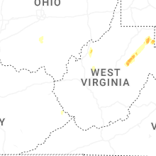


Connect with Interactive Hail Maps