

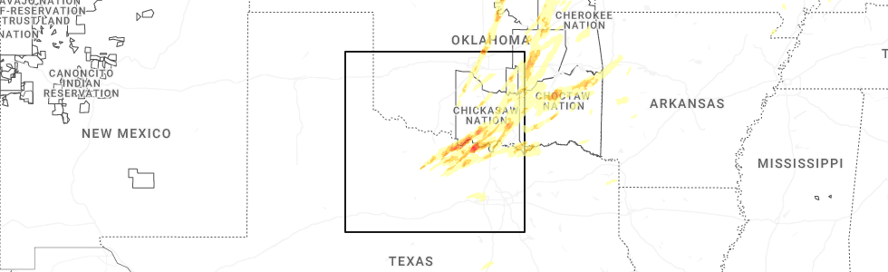
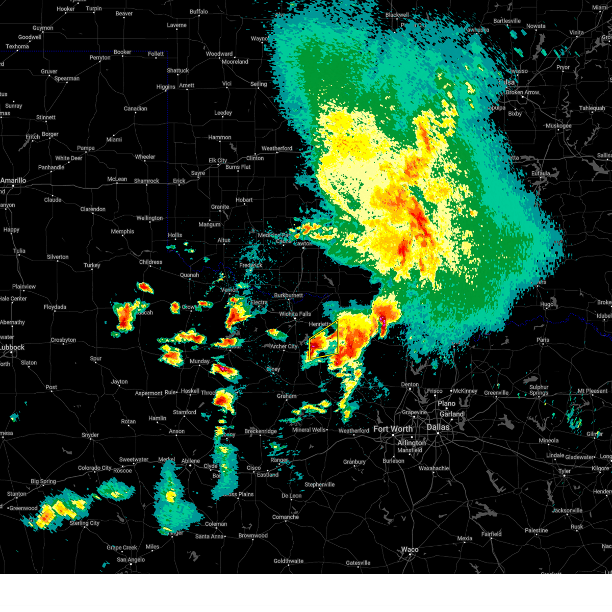
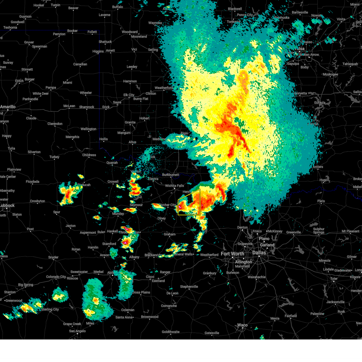
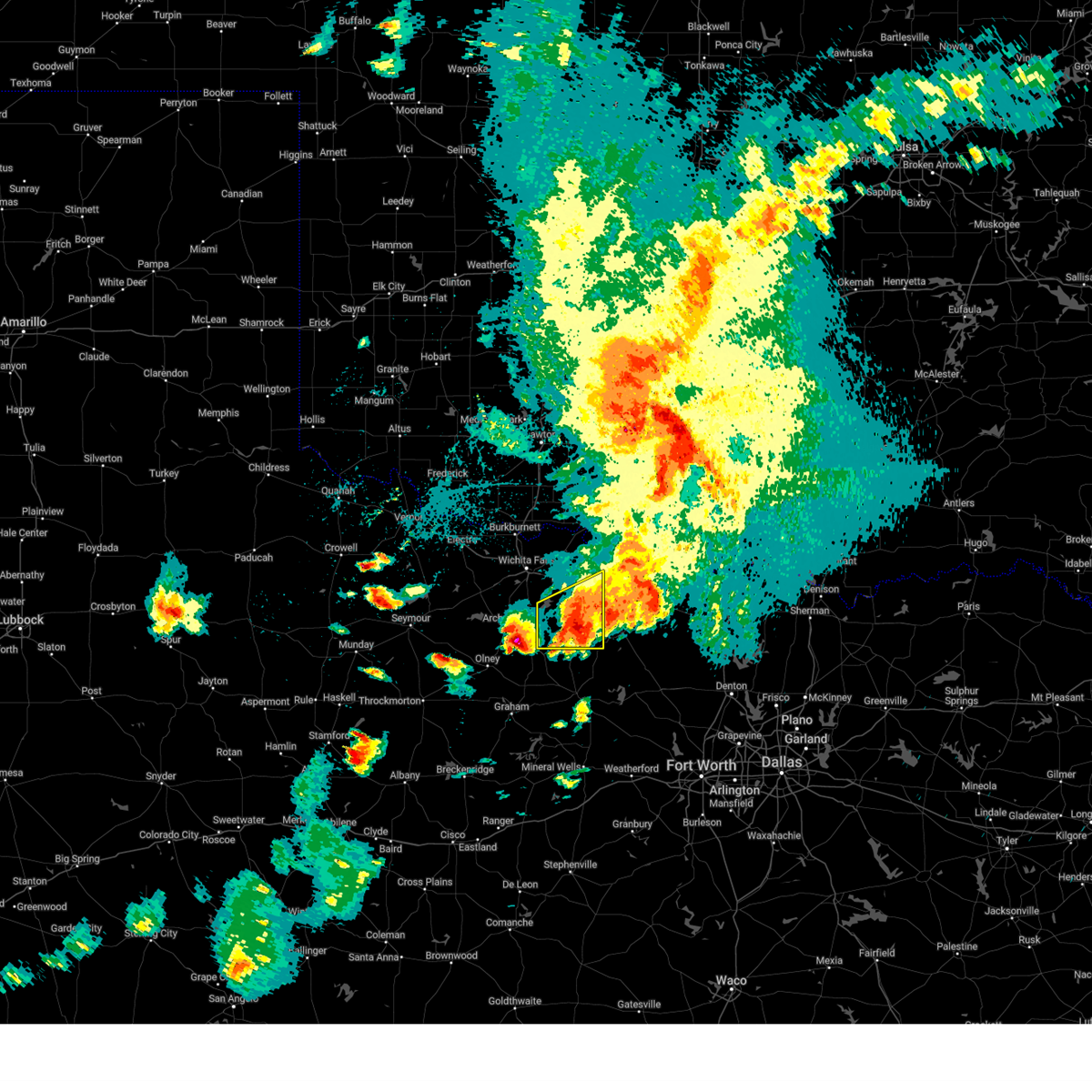
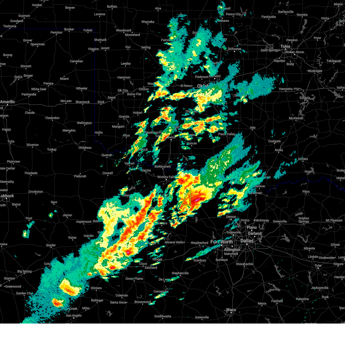
Hail Map for Bellevue, TX
The Bellevue, TX area has had 17 reports of on-the-ground hail by trained spotters, and has been under severe weather warnings 53 times during the past 12 months. Doppler radar has detected hail at or near Bellevue, TX on 105 occasions, including 8 occasions during the past year.
| Name: | Bellevue, TX |
| Where Located: | 33.7 miles SE of Wichita Falls, TX |
| Map: | Google Map for Bellevue, TX |
| Population: | 362 |
| Housing Units: | 161 |
| More Info: | Search Google for Bellevue, TX |
3
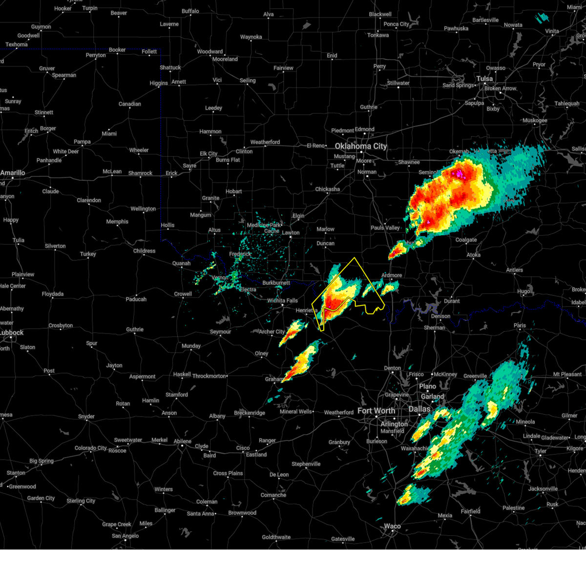
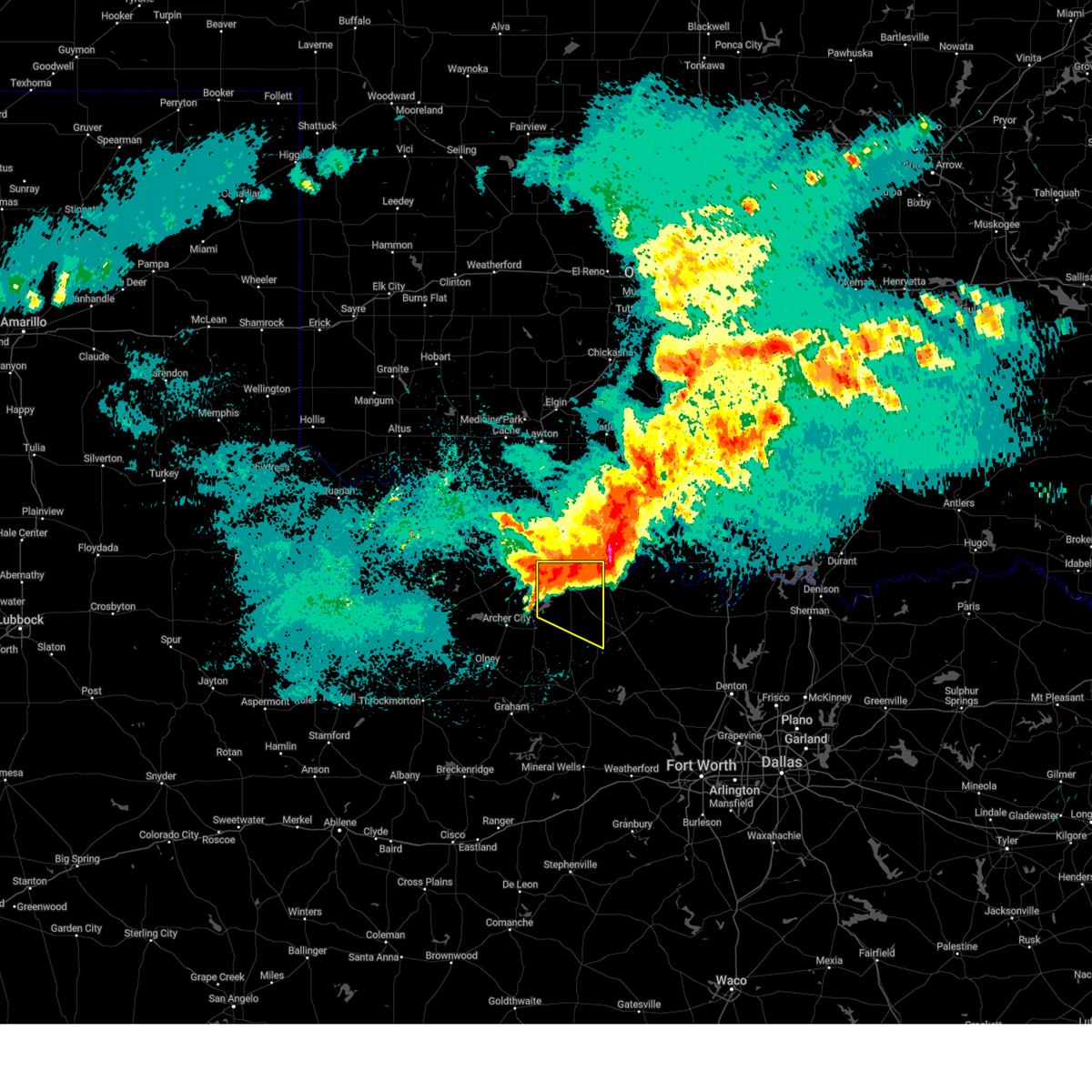
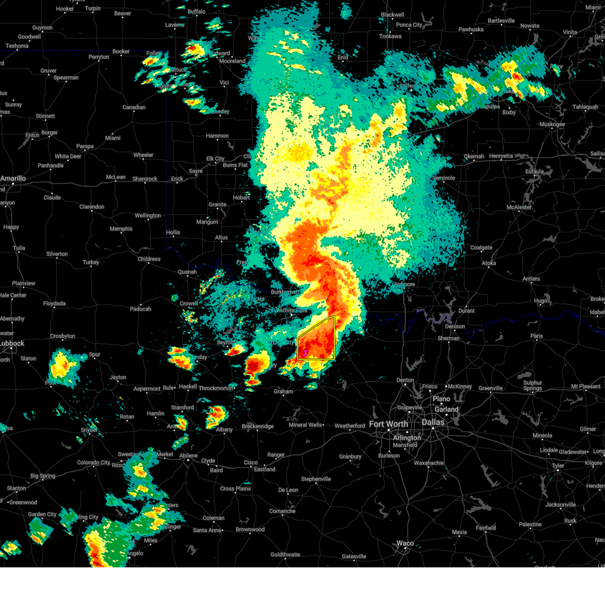
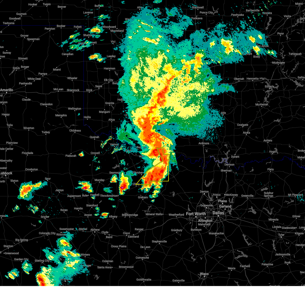
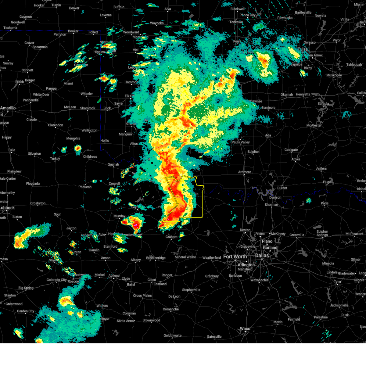
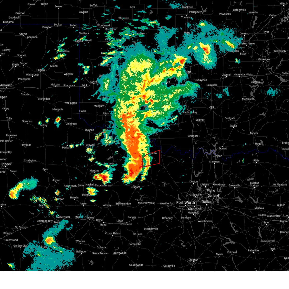
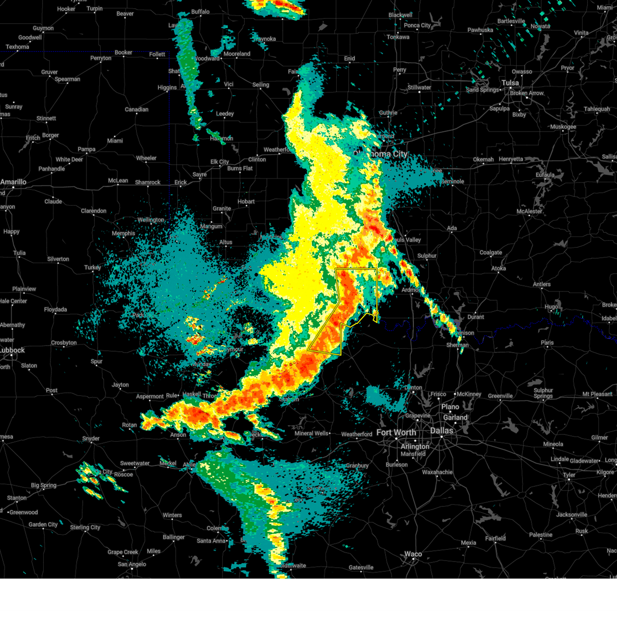
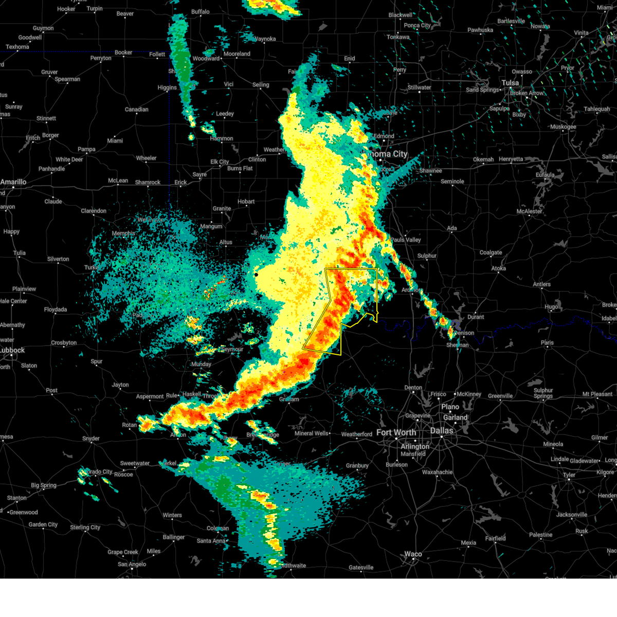
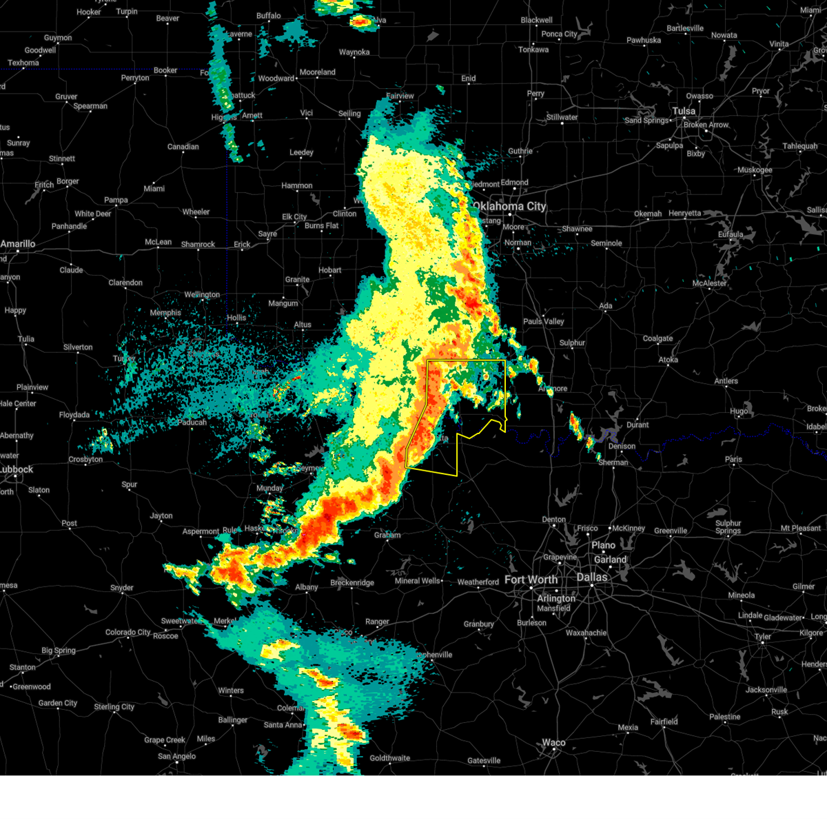
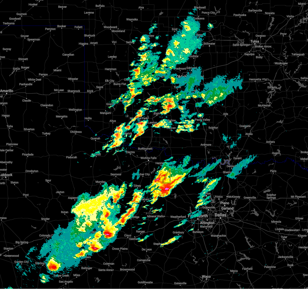
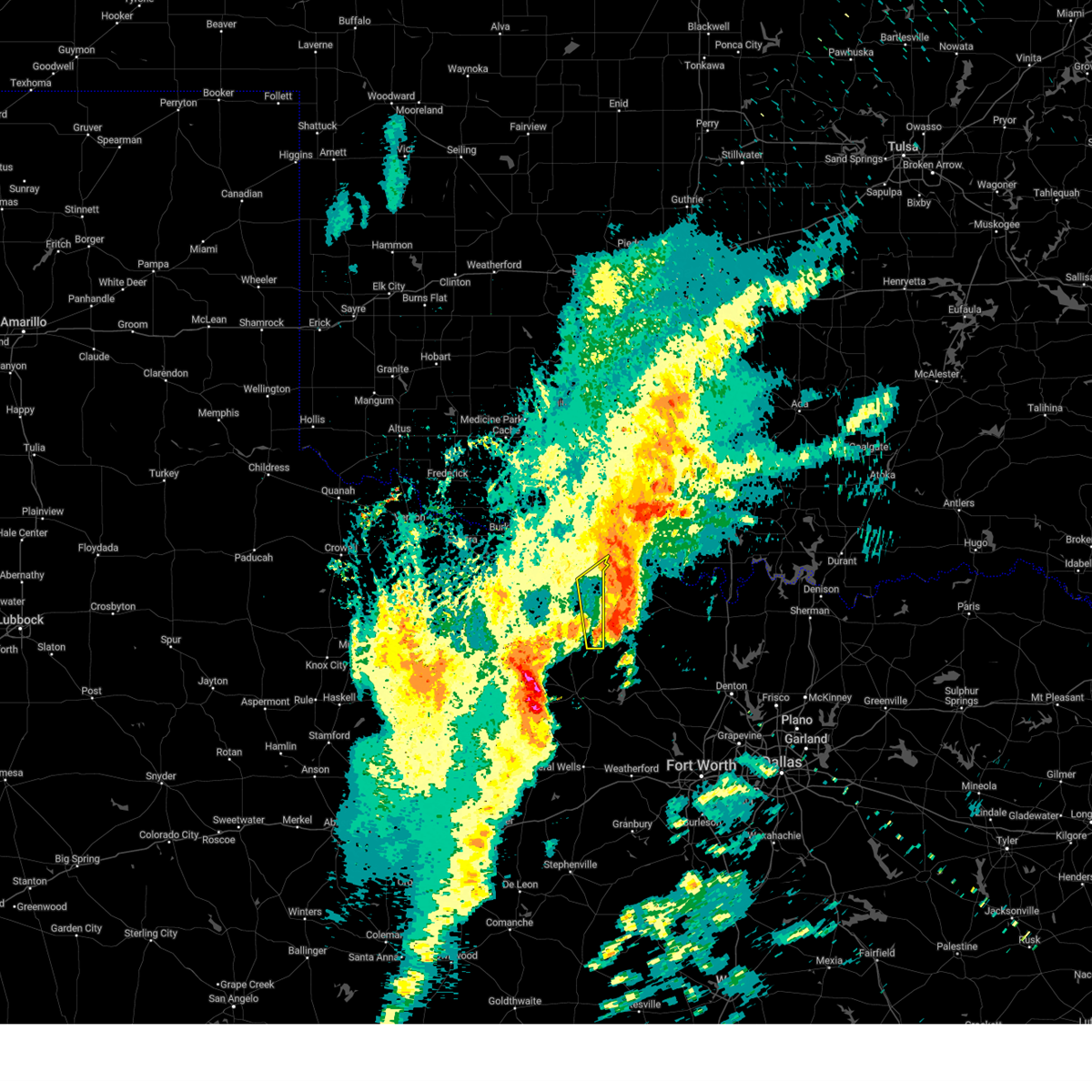
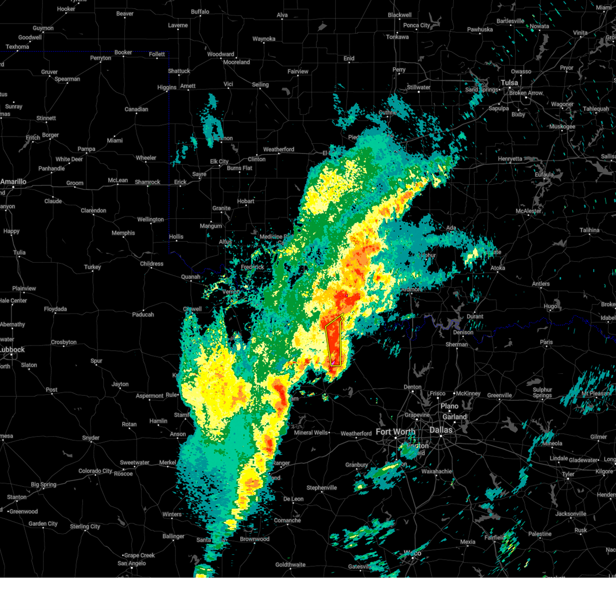
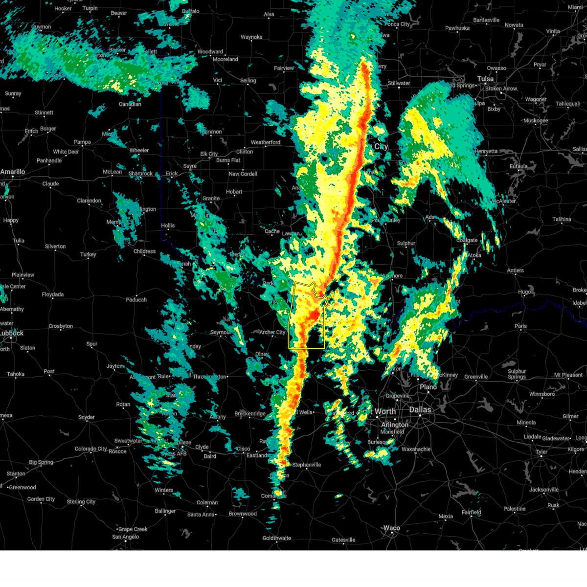
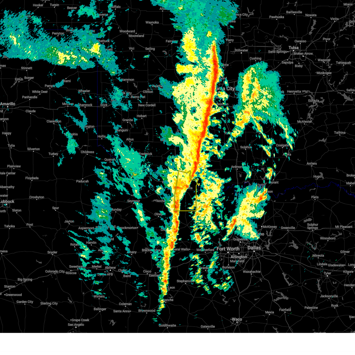
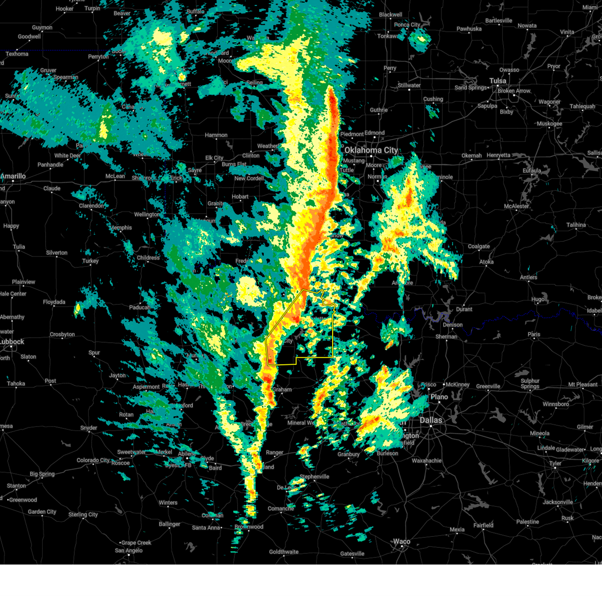
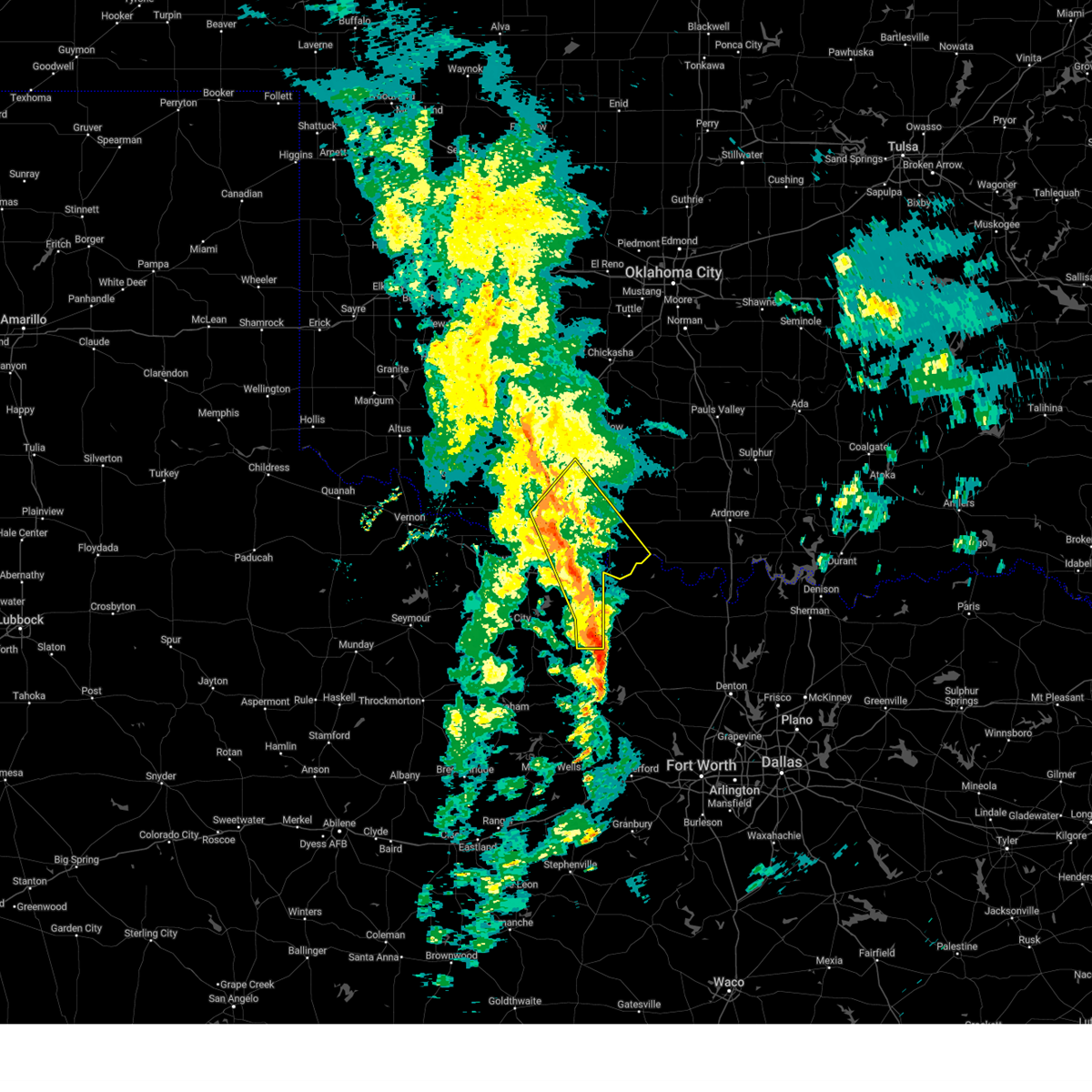
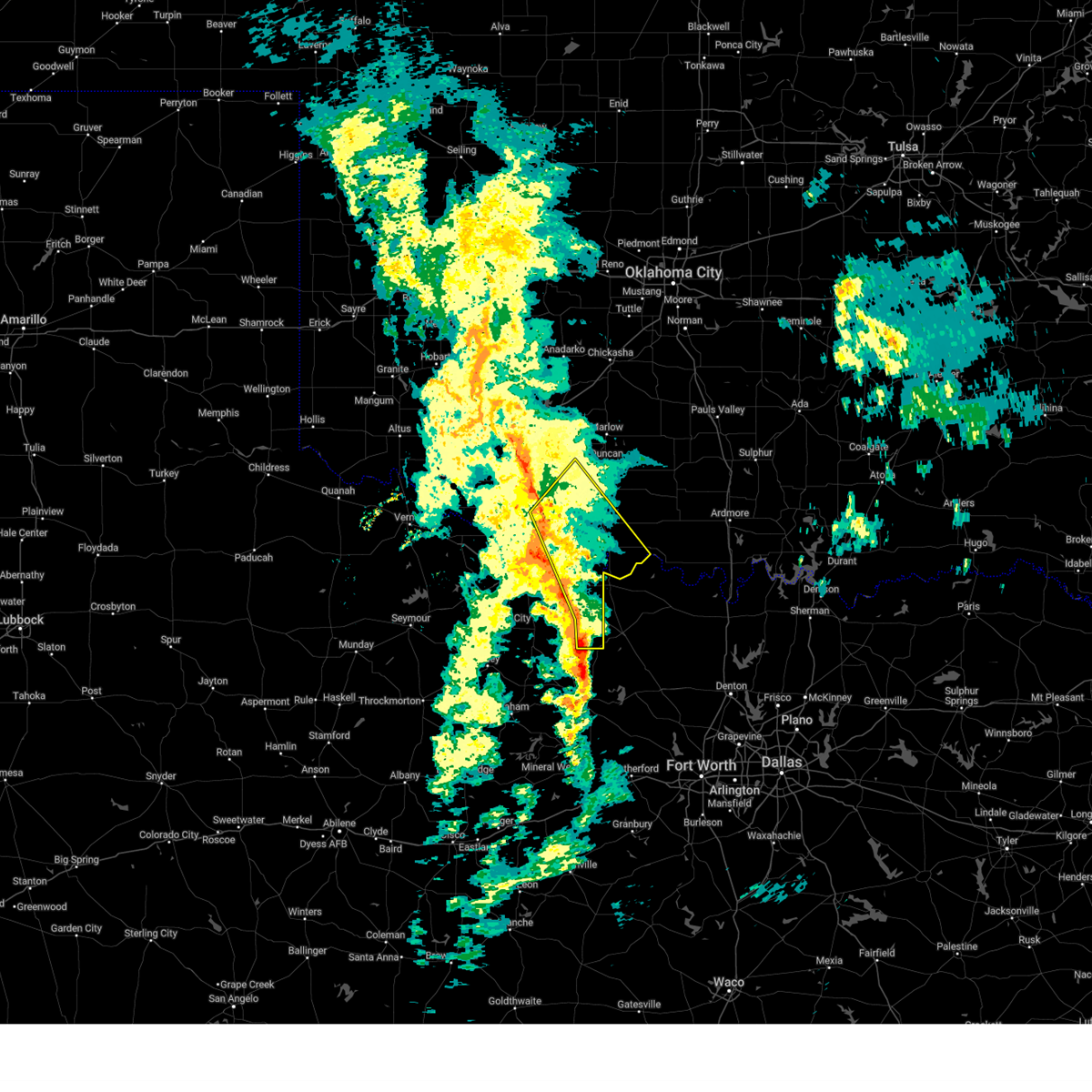
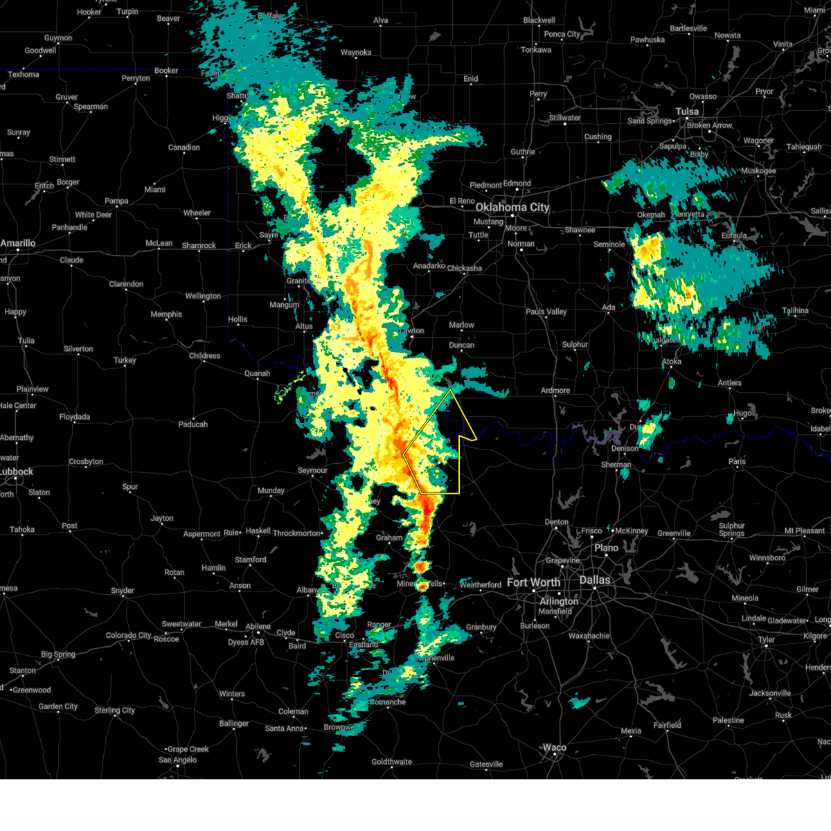
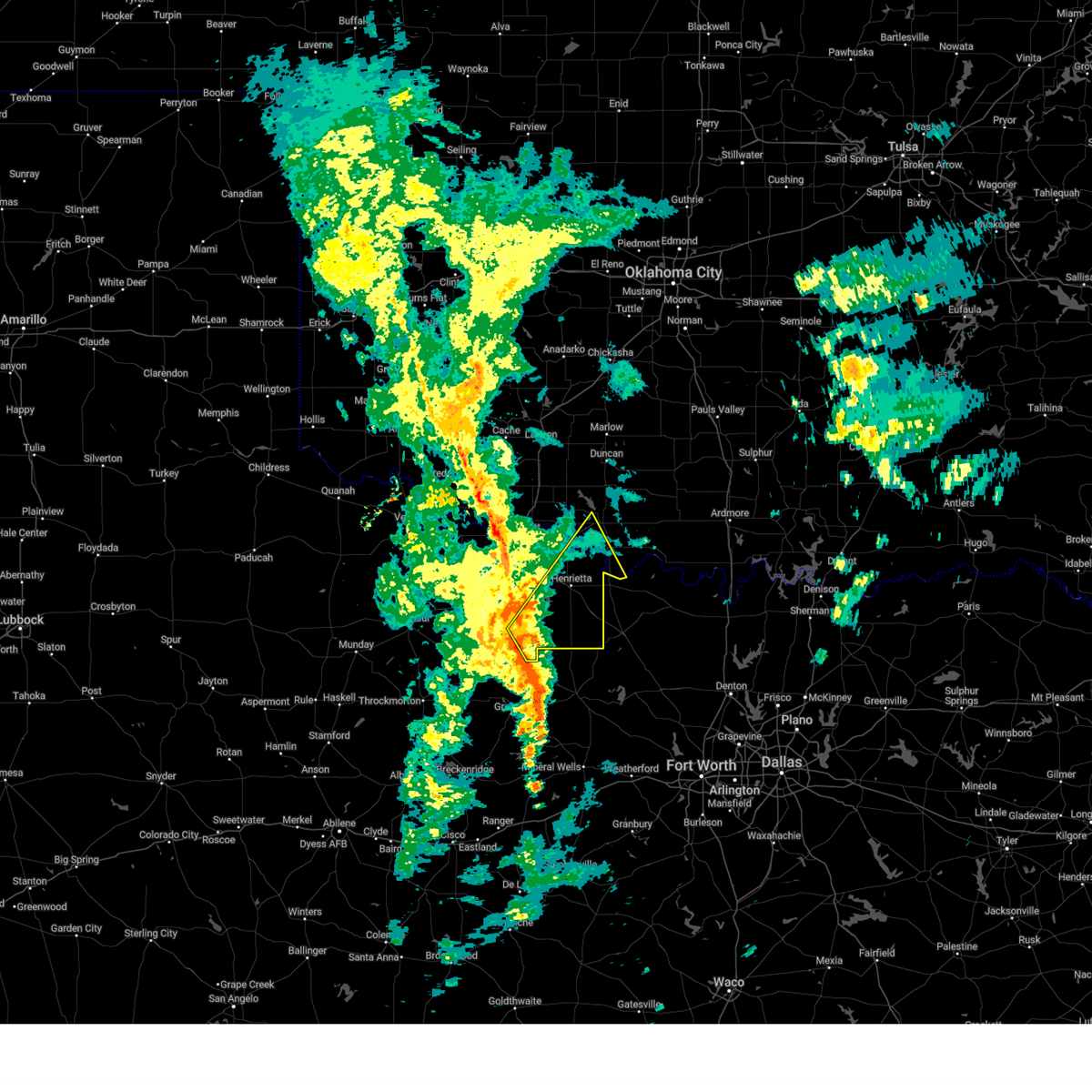
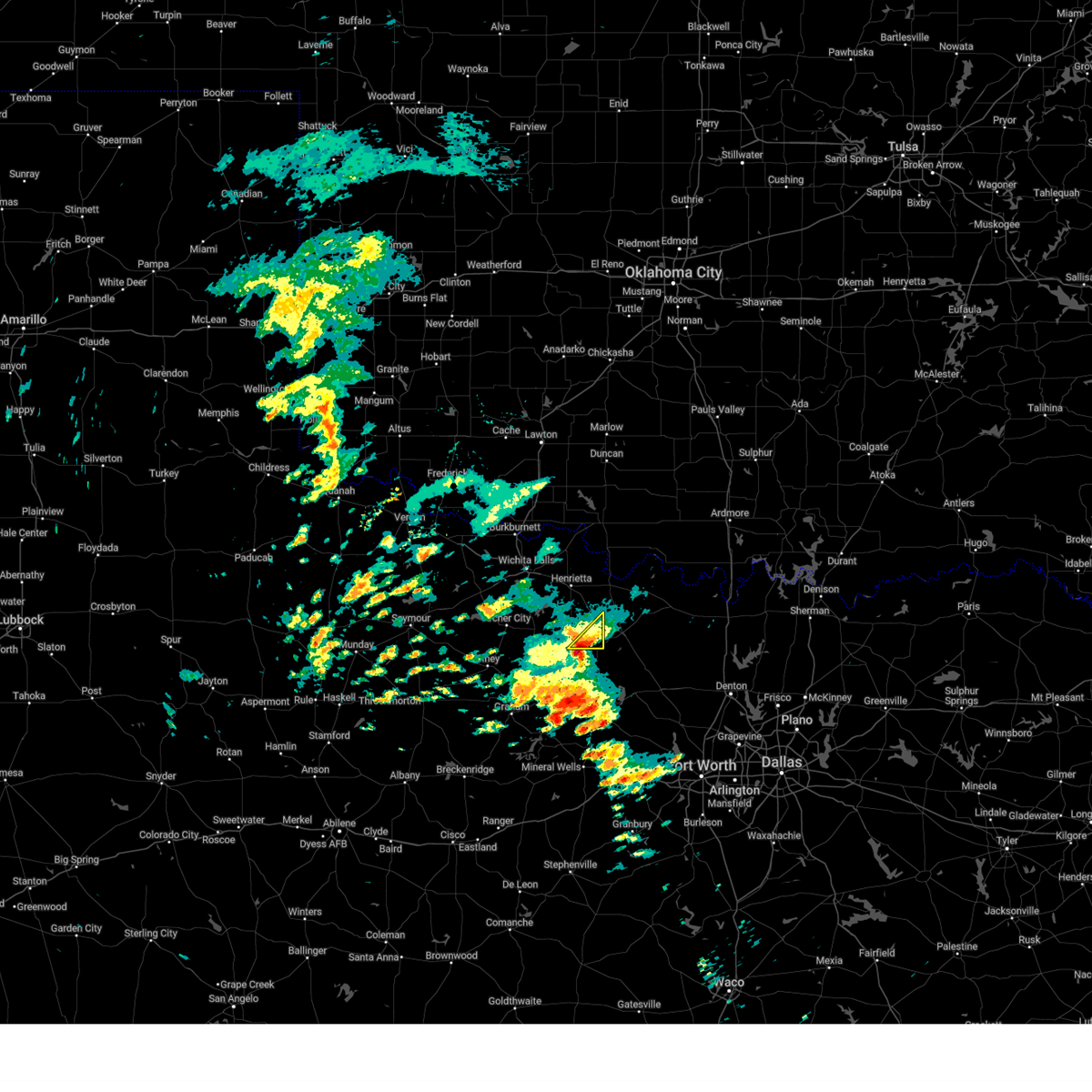
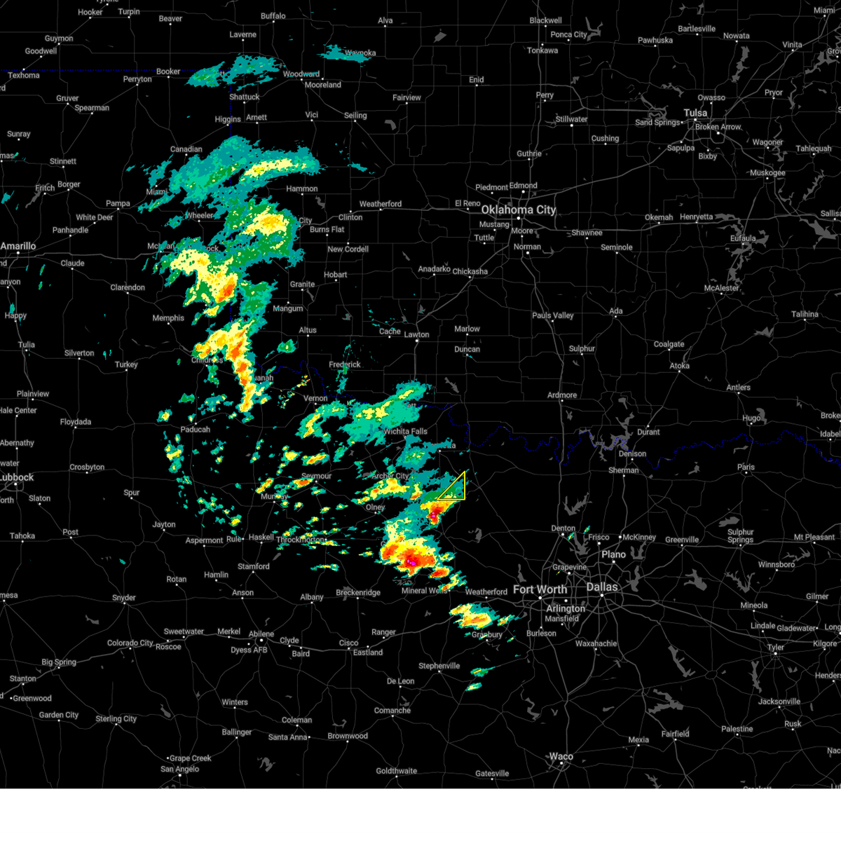
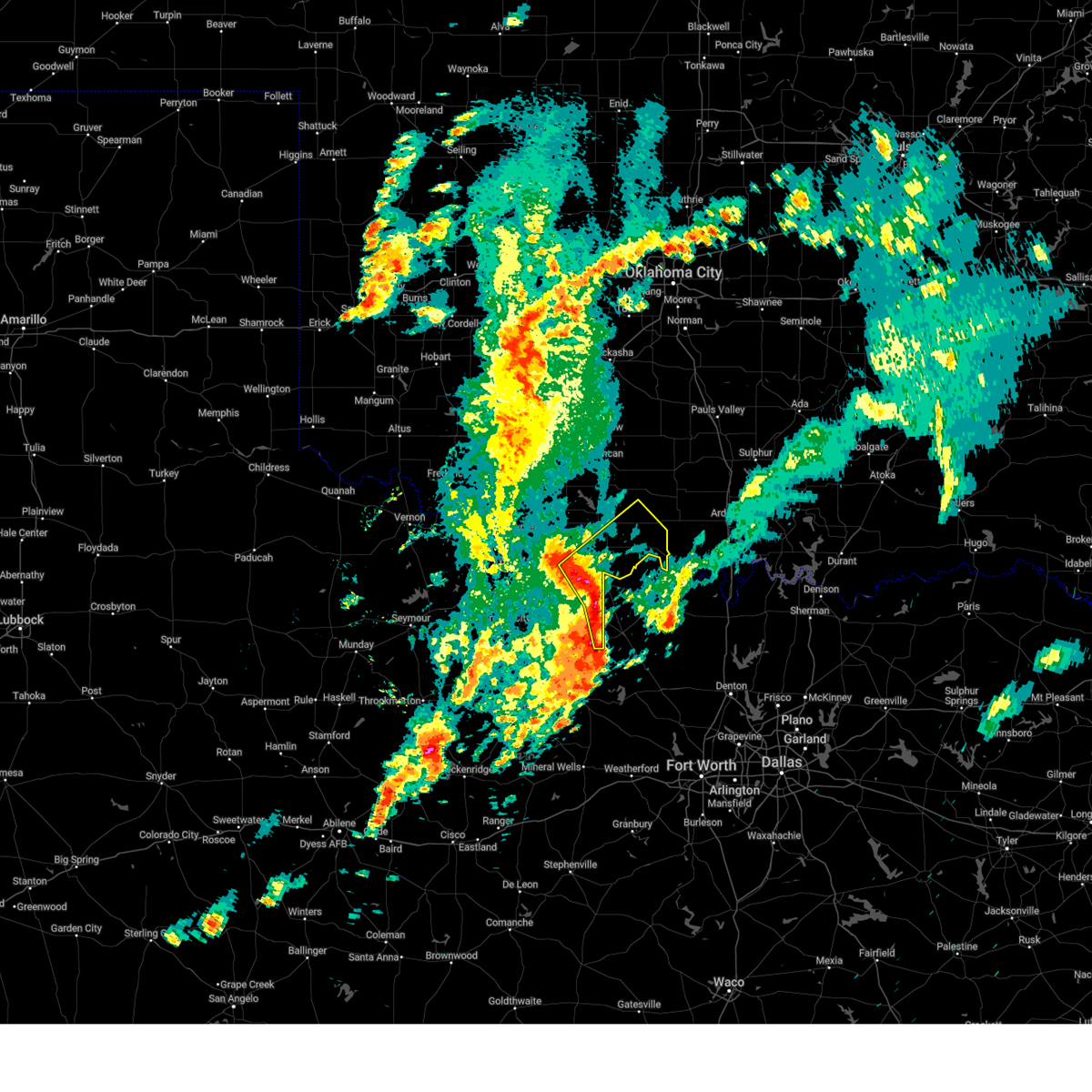
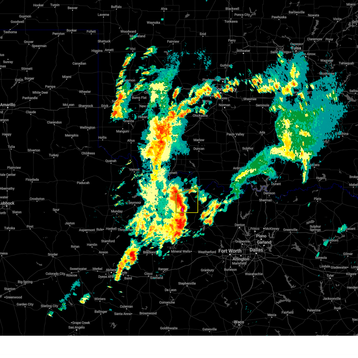
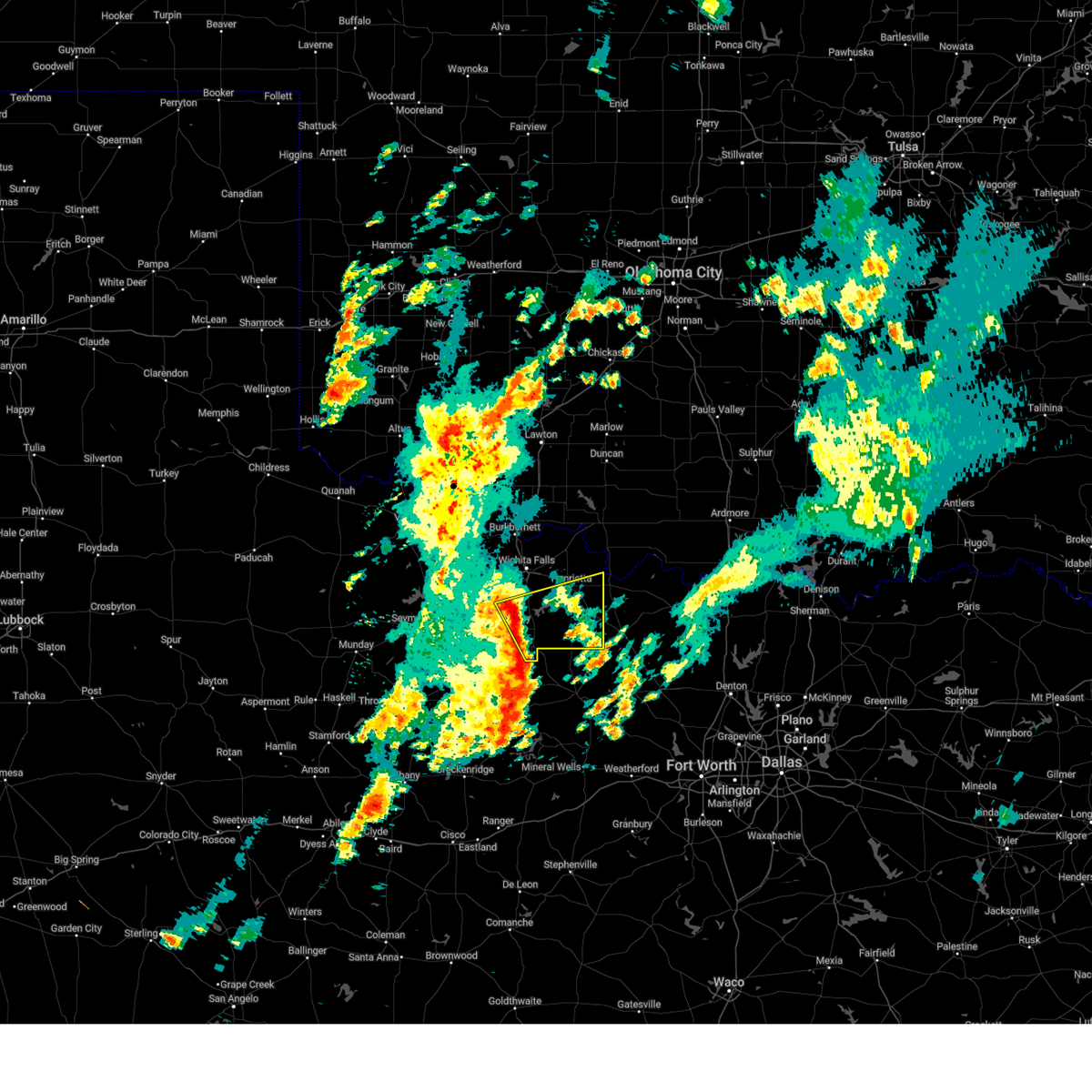
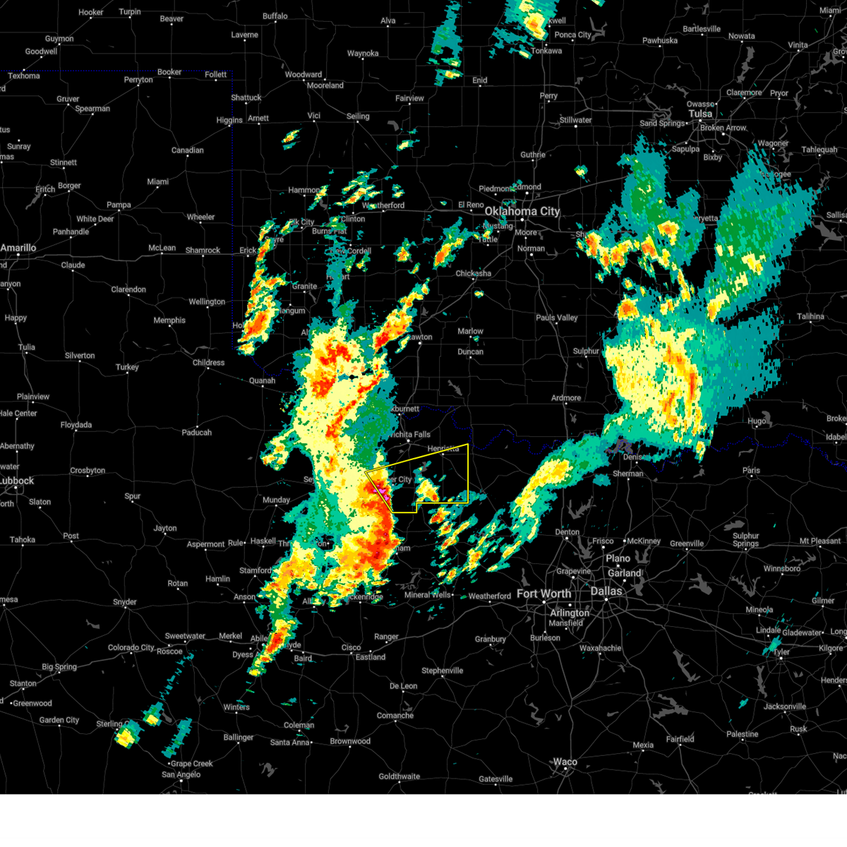
The Top Recent Hail Date for Bellevue, TX is Monday, May 19, 2025 (5th out of 105)
Hail and Wind Damage Spotted near Bellevue, TX
| Date / Time | Report Details |
|---|---|
| 6/3/2025 7:30 PM CDT | Storm damage reported in montague county TX, 2.7 miles W of Bellevue, TX |
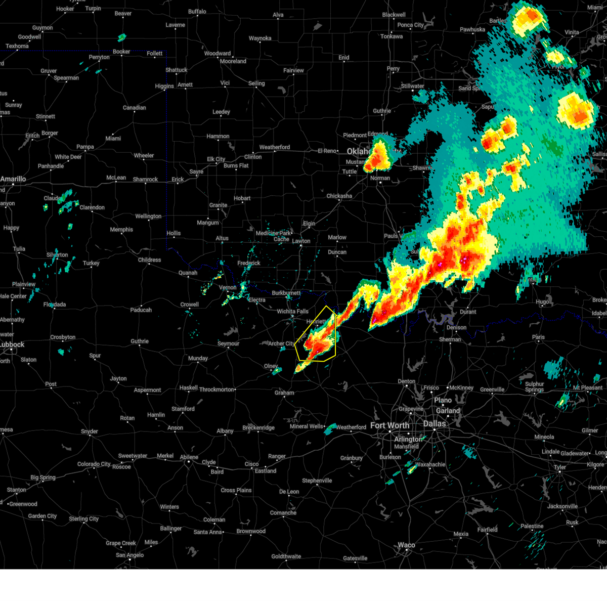
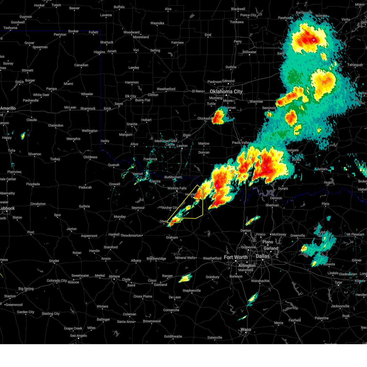
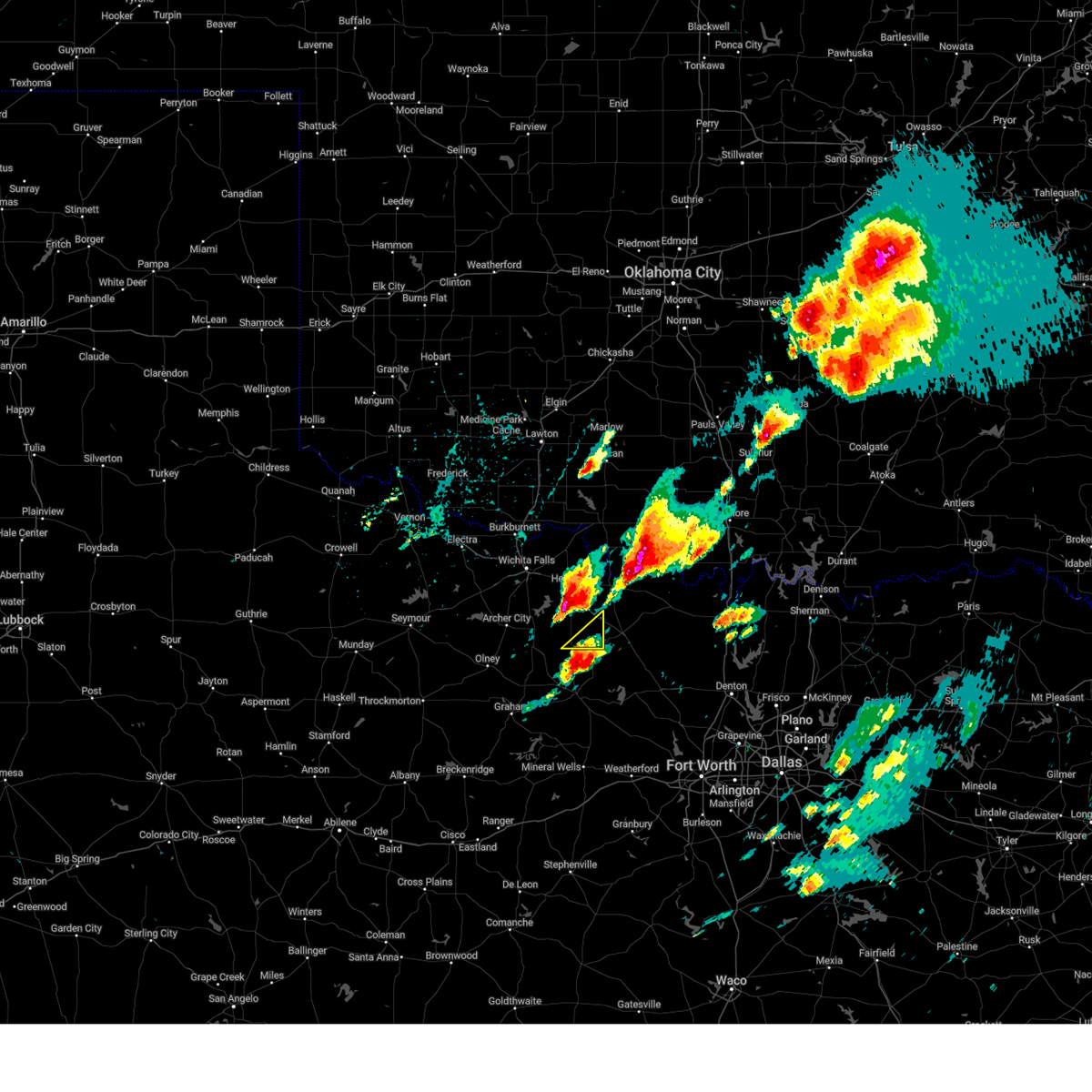
| 5/19/2025 6:01 PM CDT | At 601 pm cdt, a severe thunderstorm was located 4 miles southeast of bellevue, moving northeast at 30 mph (radar indicated). Hazards include golf ball size hail and 60 mph wind gusts. People and animals outdoors will be injured. expect hail damage to roofs, siding, windows, and vehicles. expect wind damage to roofs, siding, and trees. Locations impacted include, bellevue, newport, and vashti. |
| 5/19/2025 5:44 PM CDT | Svroun the national weather service in norman has issued a * severe thunderstorm warning for, southeastern clay county in northern texas, * until 615 pm cdt. * at 544 pm cdt, a severe thunderstorm was located 4 miles southwest of bellevue, moving northeast at 30 mph (radar indicated). Hazards include golf ball size hail and 60 mph wind gusts. People and animals outdoors will be injured. expect hail damage to roofs, siding, windows, and vehicles. Expect wind damage to roofs, siding, and trees. |
| 5/19/2025 5:28 PM CDT | At 528 pm cdt, a severe thunderstorm was located 9 miles southwest of nocona, moving northeast at 35 mph (radar indicated). Hazards include golf ball size hail and 60 mph wind gusts. People and animals outdoors will be injured. expect hail damage to roofs, siding, windows, and vehicles. expect wind damage to roofs, siding, and trees. Locations impacted include, terral, bellevue, vashti, shannon, and joy. |
| 5/19/2025 5:05 PM CDT | At 505 pm cdt, a severe thunderstorm was located near bellevue, moving northeast at 30 mph (radar indicated). Hazards include golf ball size hail and 60 mph wind gusts. People and animals outdoors will be injured. expect hail damage to roofs, siding, windows, and vehicles. expect wind damage to roofs, siding, and trees. Locations impacted include, terral, bellevue, bluegrove, oscar, joy, vashti, and shannon. |
| 5/19/2025 4:55 PM CDT |
 Svroun the national weather service in norman has issued a * severe thunderstorm warning for, south central jefferson county in southern oklahoma, southern clay county in northern texas, * until 545 pm cdt. * at 455 pm cdt, a severe thunderstorm was located 6 miles west of bellevue, moving northeast at 35 mph (radar indicated). Hazards include golf ball size hail and 60 mph wind gusts. People and animals outdoors will be injured. expect hail damage to roofs, siding, windows, and vehicles. Expect wind damage to roofs, siding, and trees. Svroun the national weather service in norman has issued a * severe thunderstorm warning for, south central jefferson county in southern oklahoma, southern clay county in northern texas, * until 545 pm cdt. * at 455 pm cdt, a severe thunderstorm was located 6 miles west of bellevue, moving northeast at 35 mph (radar indicated). Hazards include golf ball size hail and 60 mph wind gusts. People and animals outdoors will be injured. expect hail damage to roofs, siding, windows, and vehicles. Expect wind damage to roofs, siding, and trees.
|
| 5/19/2025 4:47 PM CDT |
 At 447 pm cdt, a severe thunderstorm was located 4 miles east of bluegrove, moving northeast at 60 mph (radar indicated). Hazards include two inch hail and 60 mph wind gusts. People and animals outdoors will be injured. expect hail damage to roofs, siding, windows, and vehicles. expect wind damage to roofs, siding, and trees. Locations impacted include, henrietta, scotland, windthorst, bellevue, lake arrowhead, bluegrove, joy, vashti, and shannon. At 447 pm cdt, a severe thunderstorm was located 4 miles east of bluegrove, moving northeast at 60 mph (radar indicated). Hazards include two inch hail and 60 mph wind gusts. People and animals outdoors will be injured. expect hail damage to roofs, siding, windows, and vehicles. expect wind damage to roofs, siding, and trees. Locations impacted include, henrietta, scotland, windthorst, bellevue, lake arrowhead, bluegrove, joy, vashti, and shannon.
|
| 5/19/2025 4:21 PM CDT |
 Svroun the national weather service in norman has issued a * severe thunderstorm warning for, clay county in northern texas, southeastern archer county in northern texas, * until 500 pm cdt. * at 421 pm cdt, a severe thunderstorm was located 10 miles southwest of windthorst, moving northeast at 60 mph (radar indicated). Hazards include ping pong ball size hail and 60 mph wind gusts. People and animals outdoors will be injured. expect hail damage to roofs, siding, windows, and vehicles. Expect wind damage to roofs, siding, and trees. Svroun the national weather service in norman has issued a * severe thunderstorm warning for, clay county in northern texas, southeastern archer county in northern texas, * until 500 pm cdt. * at 421 pm cdt, a severe thunderstorm was located 10 miles southwest of windthorst, moving northeast at 60 mph (radar indicated). Hazards include ping pong ball size hail and 60 mph wind gusts. People and animals outdoors will be injured. expect hail damage to roofs, siding, windows, and vehicles. Expect wind damage to roofs, siding, and trees.
|
| 5/19/2025 3:51 PM CDT | At 351 pm cdt, a severe thunderstorm was located near terral, moving northeast at 40 mph (radar indicated). Hazards include tennis ball size hail and 60 mph wind gusts. People and animals outdoors will be injured. expect hail damage to roofs, siding, windows, and vehicles. expect wind damage to roofs, siding, and trees. Locations impacted include, ryan, terral, bellevue, sugden, and oscar. |
| 5/19/2025 3:40 PM CDT | Svroun the national weather service in norman has issued a * severe thunderstorm warning for, central jefferson county in southern oklahoma, eastern clay county in northern texas, * until 430 pm cdt. * at 340 pm cdt, a severe thunderstorm was located 6 miles east of henrietta, moving northeast at 35 mph (radar indicated). Hazards include tennis ball size hail and 60 mph wind gusts. People and animals outdoors will be injured. expect hail damage to roofs, siding, windows, and vehicles. Expect wind damage to roofs, siding, and trees. |
| 5/19/2025 3:20 PM CDT |
 Svroun the national weather service in norman has issued a * severe thunderstorm warning for, southeastern clay county in northern texas, * until 345 pm cdt. * at 319 pm cdt, a severe thunderstorm was located 8 miles southwest of newport, moving northeast at 55 mph (radar indicated). Hazards include ping pong ball size hail and 60 mph wind gusts. People and animals outdoors will be injured. expect hail damage to roofs, siding, windows, and vehicles. Expect wind damage to roofs, siding, and trees. Svroun the national weather service in norman has issued a * severe thunderstorm warning for, southeastern clay county in northern texas, * until 345 pm cdt. * at 319 pm cdt, a severe thunderstorm was located 8 miles southwest of newport, moving northeast at 55 mph (radar indicated). Hazards include ping pong ball size hail and 60 mph wind gusts. People and animals outdoors will be injured. expect hail damage to roofs, siding, windows, and vehicles. Expect wind damage to roofs, siding, and trees.
|
| 5/19/2025 2:53 PM CDT |
 Svroun the national weather service in norman has issued a * severe thunderstorm warning for, jefferson county in southern oklahoma, northwestern love county in southern oklahoma, southeastern stephens county in southern oklahoma, southwestern carter county in southern oklahoma, east central clay county in northern texas, * until 345 pm cdt. * at 252 pm cdt, a severe thunderstorm was located near terral, moving northeast at 45 mph (radar indicated). Hazards include tennis ball size hail and 60 mph wind gusts. People and animals outdoors will be injured. expect hail damage to roofs, siding, windows, and vehicles. Expect wind damage to roofs, siding, and trees. Svroun the national weather service in norman has issued a * severe thunderstorm warning for, jefferson county in southern oklahoma, northwestern love county in southern oklahoma, southeastern stephens county in southern oklahoma, southwestern carter county in southern oklahoma, east central clay county in northern texas, * until 345 pm cdt. * at 252 pm cdt, a severe thunderstorm was located near terral, moving northeast at 45 mph (radar indicated). Hazards include tennis ball size hail and 60 mph wind gusts. People and animals outdoors will be injured. expect hail damage to roofs, siding, windows, and vehicles. Expect wind damage to roofs, siding, and trees.
|
| 5/2/2025 4:05 AM CDT |
 The storm which prompted the warning has moved into montague county. therefore, the warning will be allowed to expire for clay county. The storm which prompted the warning has moved into montague county. therefore, the warning will be allowed to expire for clay county.
|
| 5/2/2025 3:57 AM CDT |
 At 357 am cdt, a severe thunderstorm was located near bellevue, moving southeast at 45 mph (radar indicated). Hazards include 60 mph wind gusts and penny size hail. Expect damage to roofs, siding, and trees. Locations impacted include, bellevue and vashti. At 357 am cdt, a severe thunderstorm was located near bellevue, moving southeast at 45 mph (radar indicated). Hazards include 60 mph wind gusts and penny size hail. Expect damage to roofs, siding, and trees. Locations impacted include, bellevue and vashti.
|
| 5/2/2025 3:39 AM CDT |
 At 339 am cdt, severe thunderstorms were located along a line extending from 7 miles east of henrietta to near bluegrove, moving east at 30 mph (radar indicated). Hazards include 60 mph wind gusts and penny size hail. Expect damage to roofs, siding, and trees. Locations impacted include, henrietta, bellevue, bluegrove, vashti, and joy. At 339 am cdt, severe thunderstorms were located along a line extending from 7 miles east of henrietta to near bluegrove, moving east at 30 mph (radar indicated). Hazards include 60 mph wind gusts and penny size hail. Expect damage to roofs, siding, and trees. Locations impacted include, henrietta, bellevue, bluegrove, vashti, and joy.
|
| 5/2/2025 3:25 AM CDT |
 Svroun the national weather service in norman has issued a * severe thunderstorm warning for, clay county in northern texas, * until 415 am cdt. * at 324 am cdt, severe thunderstorms were located along a line extending from 4 miles southwest of terral to near lake arrowhead, moving east at 25 mph. strong winds will be possible well ahead of the thunderstorms themselves (radar indicated). Hazards include 60 mph wind gusts and penny size hail. expect damage to roofs, siding, and trees Svroun the national weather service in norman has issued a * severe thunderstorm warning for, clay county in northern texas, * until 415 am cdt. * at 324 am cdt, severe thunderstorms were located along a line extending from 4 miles southwest of terral to near lake arrowhead, moving east at 25 mph. strong winds will be possible well ahead of the thunderstorms themselves (radar indicated). Hazards include 60 mph wind gusts and penny size hail. expect damage to roofs, siding, and trees
|
| 4/29/2025 10:43 PM CDT |
 At 1043 pm cdt, a severe thunderstorm was located near bluegrove, moving northeast at 25 mph (radar indicated). Hazards include 60 mph wind gusts and half dollar size hail. Hail damage to vehicles is expected. expect wind damage to roofs, siding, and trees. Locations impacted include, bellevue, bluegrove, and joy. At 1043 pm cdt, a severe thunderstorm was located near bluegrove, moving northeast at 25 mph (radar indicated). Hazards include 60 mph wind gusts and half dollar size hail. Hail damage to vehicles is expected. expect wind damage to roofs, siding, and trees. Locations impacted include, bellevue, bluegrove, and joy.
|
| 4/29/2025 10:19 PM CDT |
 At 1019 pm cdt, a severe thunderstorm was located 4 miles east of windthorst, moving east-northeast at 30 mph (radar indicated). Hazards include 60 mph wind gusts and half dollar size hail. Hail damage to vehicles is expected. expect wind damage to roofs, siding, and trees. Locations impacted include, henrietta, windthorst, bellevue, lake arrowhead, bluegrove, newport, joy, vashti, and shannon. At 1019 pm cdt, a severe thunderstorm was located 4 miles east of windthorst, moving east-northeast at 30 mph (radar indicated). Hazards include 60 mph wind gusts and half dollar size hail. Hail damage to vehicles is expected. expect wind damage to roofs, siding, and trees. Locations impacted include, henrietta, windthorst, bellevue, lake arrowhead, bluegrove, newport, joy, vashti, and shannon.
|
| 4/29/2025 10:00 PM CDT |
 Svroun the national weather service in norman has issued a * severe thunderstorm warning for, southern clay county in northern texas, * until 1100 pm cdt. * at 958 pm cdt, a severe thunderstorm was located 7 miles west- southwest of bellevue. another severe thunderstorm was located in archer county, 6 miles southwest of windthorst. these storms were moving east-northeast at 35 mph (radar indicated). Hazards include 60 mph wind gusts and quarter size hail. Hail damage to vehicles is expected. Expect wind damage to roofs, siding, and trees. Svroun the national weather service in norman has issued a * severe thunderstorm warning for, southern clay county in northern texas, * until 1100 pm cdt. * at 958 pm cdt, a severe thunderstorm was located 7 miles west- southwest of bellevue. another severe thunderstorm was located in archer county, 6 miles southwest of windthorst. these storms were moving east-northeast at 35 mph (radar indicated). Hazards include 60 mph wind gusts and quarter size hail. Hail damage to vehicles is expected. Expect wind damage to roofs, siding, and trees.
|
| 4/29/2025 9:11 PM CDT |
 Svroun the national weather service in norman has issued a * severe thunderstorm warning for, southern clay county in northern texas, * until 1000 pm cdt. * at 910 pm cdt, severe thunderstorms were located along a line extending from 6 miles southwest of terral to 6 miles northwest of newport to 7 miles south of windthorst, moving east at 20 mph (radar indicated). Hazards include 60 mph wind gusts and quarter size hail. Hail damage to vehicles is expected. Expect wind damage to roofs, siding, and trees. Svroun the national weather service in norman has issued a * severe thunderstorm warning for, southern clay county in northern texas, * until 1000 pm cdt. * at 910 pm cdt, severe thunderstorms were located along a line extending from 6 miles southwest of terral to 6 miles northwest of newport to 7 miles south of windthorst, moving east at 20 mph (radar indicated). Hazards include 60 mph wind gusts and quarter size hail. Hail damage to vehicles is expected. Expect wind damage to roofs, siding, and trees.
|
| 4/29/2025 9:04 PM CDT |
 the severe thunderstorm warning has been cancelled and is no longer in effect the severe thunderstorm warning has been cancelled and is no longer in effect
|
| 4/29/2025 9:04 PM CDT |
 At 904 pm cdt, severe thunderstorms were located along a line extending from 5 miles south of terral to 5 miles northwest of newport to 6 miles south of windthorst, moving northeast at 25 mph (radar indicated). Hazards include 70 mph wind gusts and quarter size hail. Hail damage to vehicles is expected. expect considerable tree damage. wind damage is also likely to mobile homes, roofs, and outbuildings. Locations impacted include, henrietta, scotland, byers, windthorst, bellevue, lake arrowhead, bluegrove, newport, joy, vashti, and shannon. At 904 pm cdt, severe thunderstorms were located along a line extending from 5 miles south of terral to 5 miles northwest of newport to 6 miles south of windthorst, moving northeast at 25 mph (radar indicated). Hazards include 70 mph wind gusts and quarter size hail. Hail damage to vehicles is expected. expect considerable tree damage. wind damage is also likely to mobile homes, roofs, and outbuildings. Locations impacted include, henrietta, scotland, byers, windthorst, bellevue, lake arrowhead, bluegrove, newport, joy, vashti, and shannon.
|
| 4/29/2025 8:28 PM CDT |
 Svroun the national weather service in norman has issued a * severe thunderstorm warning for, clay county in northern texas, eastern archer county in northern texas, eastern wichita county in northern texas, * until 915 pm cdt. * at 828 pm cdt, severe thunderstorms were located along a line extending from 5 miles northeast of sheppard afb to 3 miles west of bluegrove to 11 miles south of windthorst, moving east at 55 mph (radar indicated). Hazards include 70 mph wind gusts and quarter size hail. Hail damage to vehicles is expected. expect considerable tree damage. Wind damage is also likely to mobile homes, roofs, and outbuildings. Svroun the national weather service in norman has issued a * severe thunderstorm warning for, clay county in northern texas, eastern archer county in northern texas, eastern wichita county in northern texas, * until 915 pm cdt. * at 828 pm cdt, severe thunderstorms were located along a line extending from 5 miles northeast of sheppard afb to 3 miles west of bluegrove to 11 miles south of windthorst, moving east at 55 mph (radar indicated). Hazards include 70 mph wind gusts and quarter size hail. Hail damage to vehicles is expected. expect considerable tree damage. Wind damage is also likely to mobile homes, roofs, and outbuildings.
|
| 4/29/2025 8:21 PM CDT |
 Toroun the national weather service in norman has issued a * tornado warning for, central clay county in northern texas, * until 845 pm cdt. * at 821 pm cdt, a severe thunderstorm capable of producing a tornado was located near lake arrowhead, moving northeast at 50 mph (radar indicated rotation). Hazards include tornado and quarter size hail. Flying debris will be dangerous to those caught without shelter. mobile homes will be damaged or destroyed. damage to roofs, windows, and vehicles will occur. Tree damage is likely. Toroun the national weather service in norman has issued a * tornado warning for, central clay county in northern texas, * until 845 pm cdt. * at 821 pm cdt, a severe thunderstorm capable of producing a tornado was located near lake arrowhead, moving northeast at 50 mph (radar indicated rotation). Hazards include tornado and quarter size hail. Flying debris will be dangerous to those caught without shelter. mobile homes will be damaged or destroyed. damage to roofs, windows, and vehicles will occur. Tree damage is likely.
|
| 4/24/2025 5:31 AM CDT |
 At 530 am cdt, severe thunderstorms were located along a line extending from 5 miles northeast of comanche to 7 miles northwest of grady to near bellevue, moving east at 35 mph (radar indicated). Hazards include 60 mph wind gusts. Expect damage to roofs, siding, and trees. Locations impacted include, henrietta, waurika, comanche, ringling, ryan, terral, bellevue, loco, addington, sugden, bluegrove, grady, oscar, empire city, cornish, and petersburg. At 530 am cdt, severe thunderstorms were located along a line extending from 5 miles northeast of comanche to 7 miles northwest of grady to near bellevue, moving east at 35 mph (radar indicated). Hazards include 60 mph wind gusts. Expect damage to roofs, siding, and trees. Locations impacted include, henrietta, waurika, comanche, ringling, ryan, terral, bellevue, loco, addington, sugden, bluegrove, grady, oscar, empire city, cornish, and petersburg.
|
| 4/24/2025 5:31 AM CDT |
 the severe thunderstorm warning has been cancelled and is no longer in effect the severe thunderstorm warning has been cancelled and is no longer in effect
|
| 4/24/2025 5:21 AM CDT |
 At 520 am cdt, severe thunderstorms were located along a line extending from near comanche to 9 miles east of sugden to 5 miles east of bluegrove, moving east at 30 mph (radar indicated). Hazards include 60 mph wind gusts. Expect damage to roofs, siding, and trees. Locations impacted include, henrietta, waurika, comanche, ringling, ryan, scotland, terral, bellevue, hastings, loco, addington, sugden, lake arrowhead, waurika lake, bluegrove, grady, corum, oscar, empire city, and cornish. At 520 am cdt, severe thunderstorms were located along a line extending from near comanche to 9 miles east of sugden to 5 miles east of bluegrove, moving east at 30 mph (radar indicated). Hazards include 60 mph wind gusts. Expect damage to roofs, siding, and trees. Locations impacted include, henrietta, waurika, comanche, ringling, ryan, scotland, terral, bellevue, hastings, loco, addington, sugden, lake arrowhead, waurika lake, bluegrove, grady, corum, oscar, empire city, and cornish.
|
| 4/24/2025 5:10 AM CDT |
 At 510 am cdt, severe thunderstorms were located along a line extending from near comanche to near ryan to 5 miles east of bluegrove, moving east at 35 mph (radar indicated). Hazards include 60 mph wind gusts. Expect damage to roofs, siding, and trees. Locations impacted include, henrietta, waurika, comanche, ringling, temple, ryan, petrolia, scotland, byers, dean, terral, bellevue, jolly, hastings, loco, addington, sugden, bluegrove, grady, and corum. At 510 am cdt, severe thunderstorms were located along a line extending from near comanche to near ryan to 5 miles east of bluegrove, moving east at 35 mph (radar indicated). Hazards include 60 mph wind gusts. Expect damage to roofs, siding, and trees. Locations impacted include, henrietta, waurika, comanche, ringling, temple, ryan, petrolia, scotland, byers, dean, terral, bellevue, jolly, hastings, loco, addington, sugden, bluegrove, grady, and corum.
|
| 4/24/2025 5:10 AM CDT |
 the severe thunderstorm warning has been cancelled and is no longer in effect the severe thunderstorm warning has been cancelled and is no longer in effect
|
| 4/24/2025 4:57 AM CDT |
 Svroun the national weather service in norman has issued a * severe thunderstorm warning for, jefferson county in southern oklahoma, southern stephens county in southern oklahoma, eastern cotton county in southwestern oklahoma, clay county in northern texas, southeastern wichita county in northern texas, * until 545 am cdt. * at 457 am cdt, severe thunderstorms were located along a line extending from near corum to 6 miles west of ryan to near bluegrove, moving east at 35 mph (radar indicated). Hazards include 60 mph wind gusts. expect damage to roofs, siding, and trees Svroun the national weather service in norman has issued a * severe thunderstorm warning for, jefferson county in southern oklahoma, southern stephens county in southern oklahoma, eastern cotton county in southwestern oklahoma, clay county in northern texas, southeastern wichita county in northern texas, * until 545 am cdt. * at 457 am cdt, severe thunderstorms were located along a line extending from near corum to 6 miles west of ryan to near bluegrove, moving east at 35 mph (radar indicated). Hazards include 60 mph wind gusts. expect damage to roofs, siding, and trees
|
| 4/19/2025 7:02 PM CDT |
 the severe thunderstorm warning has been cancelled and is no longer in effect the severe thunderstorm warning has been cancelled and is no longer in effect
|
| 4/19/2025 6:29 PM CDT |
 Svroun the national weather service in norman has issued a * severe thunderstorm warning for, southeastern clay county in northern texas, * until 715 pm cdt. * at 629 pm cdt, a severe thunderstorm was located 4 miles west of newport, moving north at 25 mph (radar indicated). Hazards include ping pong ball size hail and 60 mph wind gusts. People and animals outdoors will be injured. expect hail damage to roofs, siding, windows, and vehicles. Expect wind damage to roofs, siding, and trees. Svroun the national weather service in norman has issued a * severe thunderstorm warning for, southeastern clay county in northern texas, * until 715 pm cdt. * at 629 pm cdt, a severe thunderstorm was located 4 miles west of newport, moving north at 25 mph (radar indicated). Hazards include ping pong ball size hail and 60 mph wind gusts. People and animals outdoors will be injured. expect hail damage to roofs, siding, windows, and vehicles. Expect wind damage to roofs, siding, and trees.
|
| 4/3/2025 6:47 AM CDT |
 Svroun the national weather service in norman has issued a * severe thunderstorm warning for, southeastern clay county in northern texas, * until 730 am cdt. * at 647 am cdt, a severe thunderstorm was located 7 miles southwest of newport, moving northeast at 50 mph (radar indicated). Hazards include 60 mph wind gusts and quarter size hail. Hail damage to vehicles is expected. Expect wind damage to roofs, siding, and trees. Svroun the national weather service in norman has issued a * severe thunderstorm warning for, southeastern clay county in northern texas, * until 730 am cdt. * at 647 am cdt, a severe thunderstorm was located 7 miles southwest of newport, moving northeast at 50 mph (radar indicated). Hazards include 60 mph wind gusts and quarter size hail. Hail damage to vehicles is expected. Expect wind damage to roofs, siding, and trees.
|
| 4/3/2025 4:33 AM CDT | the severe thunderstorm warning has been cancelled and is no longer in effect |
| 4/3/2025 4:25 AM CDT |
 At 425 am cdt, a severe thunderstorm was located near vashti, or 5 miles south of bellevue, moving northeast at 45 mph (radar indicated). Hazards include 60 mph wind gusts and half dollar size hail. Hail damage to vehicles is expected. expect wind damage to roofs, siding, and trees. Locations impacted include, vashti, newport, and bellevue. At 425 am cdt, a severe thunderstorm was located near vashti, or 5 miles south of bellevue, moving northeast at 45 mph (radar indicated). Hazards include 60 mph wind gusts and half dollar size hail. Hail damage to vehicles is expected. expect wind damage to roofs, siding, and trees. Locations impacted include, vashti, newport, and bellevue.
|
| 4/3/2025 4:11 AM CDT | Svroun the national weather service in norman has issued a * severe thunderstorm warning for, southeastern clay county in northern texas, * until 445 am cdt. * at 411 am cdt, a severe thunderstorm was located 11 miles west of newport, moving northeast at 45 mph (radar indicated). Hazards include 60 mph wind gusts and half dollar size hail. Hail damage to vehicles is expected. Expect wind damage to roofs, siding, and trees. |
| 3/4/2025 4:01 AM CST |
 The storms which prompted the warning have moved into montague county. therefore, the warning has been allowed to expire for clay county. however, strong to severe storms persist in jack county that could affect southeastern clay county. The storms which prompted the warning have moved into montague county. therefore, the warning has been allowed to expire for clay county. however, strong to severe storms persist in jack county that could affect southeastern clay county.
|
| 3/4/2025 3:43 AM CST |
 At 343 am cst, severe thunderstorms were located along a line extending from 7 miles east of henrietta to near newport, moving northeast at 45 mph (radar indicated). Hazards include 60 mph wind gusts and half dollar size hail. Hail damage to vehicles is expected. expect wind damage to roofs, siding, and trees. Locations impacted include, vashti, newport, and bellevue. At 343 am cst, severe thunderstorms were located along a line extending from 7 miles east of henrietta to near newport, moving northeast at 45 mph (radar indicated). Hazards include 60 mph wind gusts and half dollar size hail. Hail damage to vehicles is expected. expect wind damage to roofs, siding, and trees. Locations impacted include, vashti, newport, and bellevue.
|
| 3/4/2025 3:30 AM CST |
 Svroun the national weather service in norman has issued a * severe thunderstorm warning for, southeastern clay county in northern texas, * until 400 am cst. * at 330 am cst, severe thunderstorms were located along a line extending from henrietta to 6 miles southwest of newport, moving northeast at 45 mph (radar indicated). Hazards include 60 mph wind gusts and penny size hail. expect damage to roofs, siding, and trees Svroun the national weather service in norman has issued a * severe thunderstorm warning for, southeastern clay county in northern texas, * until 400 am cst. * at 330 am cst, severe thunderstorms were located along a line extending from henrietta to 6 miles southwest of newport, moving northeast at 45 mph (radar indicated). Hazards include 60 mph wind gusts and penny size hail. expect damage to roofs, siding, and trees
|
| 11/18/2024 6:58 AM CST |
 The storms which prompted the warning have weakened. therefore, the warning will be allowed to expire. however, gusty winds and heavy rain are still possible with these thunderstorms. The storms which prompted the warning have weakened. therefore, the warning will be allowed to expire. however, gusty winds and heavy rain are still possible with these thunderstorms.
|
| 11/18/2024 6:44 AM CST |
 At 644 am cst, severe thunderstorms were located along a line extending from 9 miles southeast of petrolia to near henrietta to 9 miles southeast of windthorst, moving northeast at 75 mph (radar indicated). Hazards include 60 mph wind gusts. Expect damage to roofs, siding, and trees. Locations impacted include, henrietta, petrolia, byers, dean, windthorst, bellevue, jolly, lake arrowhead, bluegrove, newport, shannon, joy, charlie, and vashti. At 644 am cst, severe thunderstorms were located along a line extending from 9 miles southeast of petrolia to near henrietta to 9 miles southeast of windthorst, moving northeast at 75 mph (radar indicated). Hazards include 60 mph wind gusts. Expect damage to roofs, siding, and trees. Locations impacted include, henrietta, petrolia, byers, dean, windthorst, bellevue, jolly, lake arrowhead, bluegrove, newport, shannon, joy, charlie, and vashti.
|
| 11/18/2024 6:44 AM CST |
 the severe thunderstorm warning has been cancelled and is no longer in effect the severe thunderstorm warning has been cancelled and is no longer in effect
|
| 11/18/2024 6:14 AM CST |
 Svroun the national weather service in norman has issued a * severe thunderstorm warning for, clay county in northern texas, archer county in northern texas, southeastern wichita county in northern texas, * until 700 am cst. * at 613 am cst, severe thunderstorms were located along a line extending from 3 miles northwest of byers to 3 miles east of dean to 10 miles south of archer city, moving northeast at 80 mph (radar indicated). Hazards include 60 mph wind gusts and penny size hail. expect damage to roofs, siding, and trees Svroun the national weather service in norman has issued a * severe thunderstorm warning for, clay county in northern texas, archer county in northern texas, southeastern wichita county in northern texas, * until 700 am cst. * at 613 am cst, severe thunderstorms were located along a line extending from 3 miles northwest of byers to 3 miles east of dean to 10 miles south of archer city, moving northeast at 80 mph (radar indicated). Hazards include 60 mph wind gusts and penny size hail. expect damage to roofs, siding, and trees
|
| 11/8/2024 2:32 PM CST |
 At 232 pm cst, severe thunderstorms were located along a line extending from near petrolia to 7 miles southeast of henrietta to 4 miles south of newport, moving northeast at 30 mph (radar indicated). Hazards include 70 mph wind gusts. Expect considerable tree damage. damage is likely to mobile homes, roofs, and outbuildings. Locations impacted include, henrietta, walters, waurika, temple, ryan, petrolia, byers, terral, bellevue, hastings, addington, sugden, newport, waurika lake, corum, oscar, taylor, charlie, and vashti. At 232 pm cst, severe thunderstorms were located along a line extending from near petrolia to 7 miles southeast of henrietta to 4 miles south of newport, moving northeast at 30 mph (radar indicated). Hazards include 70 mph wind gusts. Expect considerable tree damage. damage is likely to mobile homes, roofs, and outbuildings. Locations impacted include, henrietta, walters, waurika, temple, ryan, petrolia, byers, terral, bellevue, hastings, addington, sugden, newport, waurika lake, corum, oscar, taylor, charlie, and vashti.
|
| 11/8/2024 2:25 PM CST |
 Svroun the national weather service in norman has issued a * severe thunderstorm warning for, southwestern jefferson county in southern oklahoma, eastern cotton county in southwestern oklahoma, southwestern stephens county in southern oklahoma, clay county in northern texas, * until 315 pm cst. * at 224 pm cst, severe thunderstorms were located along a line extending from 4 miles southwest of petrolia to 6 miles northeast of bluegrove to 7 miles south of newport, moving northeast at 30 mph (radar indicated). Hazards include 60 mph wind gusts. expect damage to roofs, siding, and trees Svroun the national weather service in norman has issued a * severe thunderstorm warning for, southwestern jefferson county in southern oklahoma, eastern cotton county in southwestern oklahoma, southwestern stephens county in southern oklahoma, clay county in northern texas, * until 315 pm cst. * at 224 pm cst, severe thunderstorms were located along a line extending from 4 miles southwest of petrolia to 6 miles northeast of bluegrove to 7 miles south of newport, moving northeast at 30 mph (radar indicated). Hazards include 60 mph wind gusts. expect damage to roofs, siding, and trees
|
| 11/8/2024 2:03 PM CST |
 At 203 pm cst, severe thunderstorms were located along a line extending from 5 miles north of lake arrowhead to 9 miles south of bluegrove, moving northeast at 50 mph (radar indicated). Hazards include 60 mph wind gusts and penny size hail. Expect damage to roofs, siding, and trees. Locations impacted include, henrietta, ryan, petrolia, byers, terral, bellevue, jolly, sugden, newport, lake arrowhead, bluegrove, shannon, joy, and vashti. At 203 pm cst, severe thunderstorms were located along a line extending from 5 miles north of lake arrowhead to 9 miles south of bluegrove, moving northeast at 50 mph (radar indicated). Hazards include 60 mph wind gusts and penny size hail. Expect damage to roofs, siding, and trees. Locations impacted include, henrietta, ryan, petrolia, byers, terral, bellevue, jolly, sugden, newport, lake arrowhead, bluegrove, shannon, joy, and vashti.
|
| 11/8/2024 1:38 PM CST |
 Svroun the national weather service in norman has issued a * severe thunderstorm warning for, southwestern jefferson county in southern oklahoma, clay county in northern texas, southeastern archer county in northern texas, * until 230 pm cst. * at 138 pm cst, severe thunderstorms were located along a line extending from 6 miles southwest of windthorst to 6 miles north of bryson, moving northeast at 55 mph (radar indicated). Hazards include 60 mph wind gusts and penny size hail. expect damage to roofs, siding, and trees Svroun the national weather service in norman has issued a * severe thunderstorm warning for, southwestern jefferson county in southern oklahoma, clay county in northern texas, southeastern archer county in northern texas, * until 230 pm cst. * at 138 pm cst, severe thunderstorms were located along a line extending from 6 miles southwest of windthorst to 6 miles north of bryson, moving northeast at 55 mph (radar indicated). Hazards include 60 mph wind gusts and penny size hail. expect damage to roofs, siding, and trees
|
| 11/7/2024 2:18 PM CST |
 the severe thunderstorm warning has been cancelled and is no longer in effect the severe thunderstorm warning has been cancelled and is no longer in effect
|
| 11/7/2024 1:59 PM CST |
 Svroun the national weather service in norman has issued a * severe thunderstorm warning for, southeastern clay county in northern texas, * until 245 pm cst. * at 158 pm cst, a severe thunderstorm was located 10 miles southwest of newport, moving northeast at 30 mph (radar indicated). Hazards include 60 mph wind gusts and quarter size hail. Hail damage to vehicles is expected. Expect wind damage to roofs, siding, and trees. Svroun the national weather service in norman has issued a * severe thunderstorm warning for, southeastern clay county in northern texas, * until 245 pm cst. * at 158 pm cst, a severe thunderstorm was located 10 miles southwest of newport, moving northeast at 30 mph (radar indicated). Hazards include 60 mph wind gusts and quarter size hail. Hail damage to vehicles is expected. Expect wind damage to roofs, siding, and trees.
|
| 11/3/2024 2:36 PM CST |
 Svroun the national weather service in norman has issued a * severe thunderstorm warning for, jefferson county in southern oklahoma, eastern clay county in northern texas, * until 300 pm cst. * at 236 pm cst, severe thunderstorms were located along a line extending from 7 miles southeast of petrolia to 9 miles east of henrietta to 3 miles southeast of bellevue, moving northeast at 55 mph (radar indicated). Hazards include 70 mph wind gusts and quarter size hail. Hail damage to vehicles is expected. expect considerable tree damage. Wind damage is also likely to mobile homes, roofs, and outbuildings. Svroun the national weather service in norman has issued a * severe thunderstorm warning for, jefferson county in southern oklahoma, eastern clay county in northern texas, * until 300 pm cst. * at 236 pm cst, severe thunderstorms were located along a line extending from 7 miles southeast of petrolia to 9 miles east of henrietta to 3 miles southeast of bellevue, moving northeast at 55 mph (radar indicated). Hazards include 70 mph wind gusts and quarter size hail. Hail damage to vehicles is expected. expect considerable tree damage. Wind damage is also likely to mobile homes, roofs, and outbuildings.
|
| 11/3/2024 2:23 PM CST |
 At 222 pm cst, severe thunderstorms were located along a line extending from near henrietta to 7 miles northwest of newport, moving east at 50 mph (radar indicated). Hazards include 70 mph wind gusts and quarter size hail. Hail damage to vehicles is expected. expect considerable tree damage. wind damage is also likely to mobile homes, roofs, and outbuildings. Locations impacted include, henrietta, windthorst, bellevue, lake arrowhead, bluegrove, newport, joy, vashti, and shannon. At 222 pm cst, severe thunderstorms were located along a line extending from near henrietta to 7 miles northwest of newport, moving east at 50 mph (radar indicated). Hazards include 70 mph wind gusts and quarter size hail. Hail damage to vehicles is expected. expect considerable tree damage. wind damage is also likely to mobile homes, roofs, and outbuildings. Locations impacted include, henrietta, windthorst, bellevue, lake arrowhead, bluegrove, newport, joy, vashti, and shannon.
|
| 11/3/2024 2:23 PM CST |
 the severe thunderstorm warning has been cancelled and is no longer in effect the severe thunderstorm warning has been cancelled and is no longer in effect
|
| 11/3/2024 2:03 PM CST |
 At 203 pm cst, severe thunderstorms were located along a line extending from 7 miles north of scotland to 7 miles south of windthorst, moving east at 45 mph (radar indicated). Hazards include 70 mph wind gusts and quarter size hail. Hail damage to vehicles is expected. expect considerable tree damage. wind damage is also likely to mobile homes, roofs, and outbuildings. Locations impacted include, henrietta, archer city, scotland, windthorst, bellevue, lake arrowhead, bluegrove, newport, joy, vashti, and shannon. At 203 pm cst, severe thunderstorms were located along a line extending from 7 miles north of scotland to 7 miles south of windthorst, moving east at 45 mph (radar indicated). Hazards include 70 mph wind gusts and quarter size hail. Hail damage to vehicles is expected. expect considerable tree damage. wind damage is also likely to mobile homes, roofs, and outbuildings. Locations impacted include, henrietta, archer city, scotland, windthorst, bellevue, lake arrowhead, bluegrove, newport, joy, vashti, and shannon.
|
| 11/3/2024 1:45 PM CST |
 Svroun the national weather service in norman has issued a * severe thunderstorm warning for, southern clay county in northern texas, archer county in northern texas, * until 245 pm cst. * at 145 pm cst, a severe thunderstorm was located 5 miles south of archer city, moving east at 50 mph (radar indicated). Hazards include 60 mph wind gusts and quarter size hail. Hail damage to vehicles is expected. Expect wind damage to roofs, siding, and trees. Svroun the national weather service in norman has issued a * severe thunderstorm warning for, southern clay county in northern texas, archer county in northern texas, * until 245 pm cst. * at 145 pm cst, a severe thunderstorm was located 5 miles south of archer city, moving east at 50 mph (radar indicated). Hazards include 60 mph wind gusts and quarter size hail. Hail damage to vehicles is expected. Expect wind damage to roofs, siding, and trees.
|
| 6/2/2024 3:13 PM CDT |
 the severe thunderstorm warning has been cancelled and is no longer in effect the severe thunderstorm warning has been cancelled and is no longer in effect
|
| 6/2/2024 2:41 PM CDT |
 Svroun the national weather service in norman has issued a * severe thunderstorm warning for, central clay county in northern texas, * until 330 pm cdt. * at 240 pm cdt, a severe thunderstorm was located near henrietta, moving east at 20 mph (radar indicated). Hazards include 60 mph wind gusts and quarter size hail. Hail damage to vehicles is expected. Expect wind damage to roofs, siding, and trees. Svroun the national weather service in norman has issued a * severe thunderstorm warning for, central clay county in northern texas, * until 330 pm cdt. * at 240 pm cdt, a severe thunderstorm was located near henrietta, moving east at 20 mph (radar indicated). Hazards include 60 mph wind gusts and quarter size hail. Hail damage to vehicles is expected. Expect wind damage to roofs, siding, and trees.
|
| 5/28/2024 4:21 AM CDT |
 The storm which prompted the warning has moved into montague county. therefore, the warning will be allowed to expire for clay county. The storm which prompted the warning has moved into montague county. therefore, the warning will be allowed to expire for clay county.
|
| 5/28/2024 3:58 AM CDT |
 At 357 am cdt, a severe thunderstorm was located over bellevue, moving southeast at 20 mph. this storm will affect bellevue and motorists along highway 287 in southeastern clay county (radar indicated). Hazards include tennis ball size hail and 60 mph wind gusts. People and animals outdoors will be injured. expect hail damage to roofs, siding, windows, and vehicles. expect wind damage to roofs, siding, and trees. Locations impacted include, bellevue and vashti. At 357 am cdt, a severe thunderstorm was located over bellevue, moving southeast at 20 mph. this storm will affect bellevue and motorists along highway 287 in southeastern clay county (radar indicated). Hazards include tennis ball size hail and 60 mph wind gusts. People and animals outdoors will be injured. expect hail damage to roofs, siding, windows, and vehicles. expect wind damage to roofs, siding, and trees. Locations impacted include, bellevue and vashti.
|
| 5/28/2024 3:40 AM CDT |
 Svroun the national weather service in norman has issued a * severe thunderstorm warning for, southeastern clay county in northern texas, * until 430 am cdt. * at 340 am cdt, a severe thunderstorm was located 4 miles northwest of bellevue, moving southeast at 20 mph. other strong to severe thunderstorms extended north to near and north of henrietta (radar indicated). Hazards include golf ball size hail and 60 mph wind gusts. People and animals outdoors will be injured. expect hail damage to roofs, siding, windows, and vehicles. Expect wind damage to roofs, siding, and trees. Svroun the national weather service in norman has issued a * severe thunderstorm warning for, southeastern clay county in northern texas, * until 430 am cdt. * at 340 am cdt, a severe thunderstorm was located 4 miles northwest of bellevue, moving southeast at 20 mph. other strong to severe thunderstorms extended north to near and north of henrietta (radar indicated). Hazards include golf ball size hail and 60 mph wind gusts. People and animals outdoors will be injured. expect hail damage to roofs, siding, windows, and vehicles. Expect wind damage to roofs, siding, and trees.
|
| 5/25/2024 9:09 PM CDT |
 The storm which prompted the warning has weakened below severe limits, and has exited the warned area. therefore, the warning will be allowed to expire. The storm which prompted the warning has weakened below severe limits, and has exited the warned area. therefore, the warning will be allowed to expire.
|
| 5/25/2024 8:25 PM CDT |
 Svroun the national weather service in norman has issued a * severe thunderstorm warning for, southern clay county in northern texas, * until 915 pm cdt. * at 825 pm cdt, a severe thunderstorm was located 11 miles southeast of windthorst, moving east at 35 mph (radar indicated). Hazards include ping pong ball size hail and 60 mph wind gusts. People and animals outdoors will be injured. expect hail damage to roofs, siding, windows, and vehicles. Expect wind damage to roofs, siding, and trees. Svroun the national weather service in norman has issued a * severe thunderstorm warning for, southern clay county in northern texas, * until 915 pm cdt. * at 825 pm cdt, a severe thunderstorm was located 11 miles southeast of windthorst, moving east at 35 mph (radar indicated). Hazards include ping pong ball size hail and 60 mph wind gusts. People and animals outdoors will be injured. expect hail damage to roofs, siding, windows, and vehicles. Expect wind damage to roofs, siding, and trees.
|
| 5/25/2024 7:50 PM CDT |
 Svroun the national weather service in norman has issued a * severe thunderstorm warning for, southern clay county in northern texas, * until 830 pm cdt. * at 750 pm cdt, a severe thunderstorm was located 8 miles east of windthorst, moving east at 40 mph (radar indicated). Hazards include 60 mph wind gusts and half dollar size hail. Hail damage to vehicles is expected. Expect wind damage to roofs, siding, and trees. Svroun the national weather service in norman has issued a * severe thunderstorm warning for, southern clay county in northern texas, * until 830 pm cdt. * at 750 pm cdt, a severe thunderstorm was located 8 miles east of windthorst, moving east at 40 mph (radar indicated). Hazards include 60 mph wind gusts and half dollar size hail. Hail damage to vehicles is expected. Expect wind damage to roofs, siding, and trees.
|
| 5/25/2024 5:45 PM CDT |
 At 545 pm cdt, a severe thunderstorm capable of producing a tornado was located over bluegrove, moving east at 35 mph (radar indicated rotation). Hazards include tornado and two inch hail. Flying debris will be dangerous to those caught without shelter. mobile homes will be damaged or destroyed. damage to roofs, windows, and vehicles will occur. tree damage is likely. Locations impacted include, bellevue, bluegrove, and southern lake arrowhead. At 545 pm cdt, a severe thunderstorm capable of producing a tornado was located over bluegrove, moving east at 35 mph (radar indicated rotation). Hazards include tornado and two inch hail. Flying debris will be dangerous to those caught without shelter. mobile homes will be damaged or destroyed. damage to roofs, windows, and vehicles will occur. tree damage is likely. Locations impacted include, bellevue, bluegrove, and southern lake arrowhead.
|
| 5/25/2024 5:39 PM CDT |
 At 539 pm cdt, a confirmed tornado was located 5 miles west of bluegrove, moving east at 30 mph (weather spotters confirmed tornado west of bluegrove). Hazards include damaging tornado and two inch hail. Flying debris will be dangerous to those caught without shelter. mobile homes will be damaged or destroyed. damage to roofs, windows, and vehicles will occur. tree damage is likely. Locations impacted include, bellevue, bluegrove, and southern lake arrowhead. At 539 pm cdt, a confirmed tornado was located 5 miles west of bluegrove, moving east at 30 mph (weather spotters confirmed tornado west of bluegrove). Hazards include damaging tornado and two inch hail. Flying debris will be dangerous to those caught without shelter. mobile homes will be damaged or destroyed. damage to roofs, windows, and vehicles will occur. tree damage is likely. Locations impacted include, bellevue, bluegrove, and southern lake arrowhead.
|
| 5/25/2024 5:35 PM CDT |
 At 535 pm cdt, a severe thunderstorm capable of producing a tornado was located 5 miles southwest of bluegrove, moving east at 35 mph (radar indicated rotation). Hazards include tornado and two inch hail. Flying debris will be dangerous to those caught without shelter. mobile homes will be damaged or destroyed. damage to roofs, windows, and vehicles will occur. tree damage is likely. Locations impacted include, bellevue, bluegrove, and southern lake arrowhead. At 535 pm cdt, a severe thunderstorm capable of producing a tornado was located 5 miles southwest of bluegrove, moving east at 35 mph (radar indicated rotation). Hazards include tornado and two inch hail. Flying debris will be dangerous to those caught without shelter. mobile homes will be damaged or destroyed. damage to roofs, windows, and vehicles will occur. tree damage is likely. Locations impacted include, bellevue, bluegrove, and southern lake arrowhead.
|
| 5/25/2024 5:31 PM CDT |
 At 531 pm cdt, a severe thunderstorm capable of producing a tornado was located 5 miles south of lake arrowhead, moving northeast at 25 mph (radar indicated rotation). Hazards include tornado and two inch hail. Flying debris will be dangerous to those caught without shelter. mobile homes will be damaged or destroyed. damage to roofs, windows, and vehicles will occur. tree damage is likely. Locations impacted include, bellevue, bluegrove, southern lake arrowhead, vashti, and joy. At 531 pm cdt, a severe thunderstorm capable of producing a tornado was located 5 miles south of lake arrowhead, moving northeast at 25 mph (radar indicated rotation). Hazards include tornado and two inch hail. Flying debris will be dangerous to those caught without shelter. mobile homes will be damaged or destroyed. damage to roofs, windows, and vehicles will occur. tree damage is likely. Locations impacted include, bellevue, bluegrove, southern lake arrowhead, vashti, and joy.
|
| 5/25/2024 5:20 PM CDT |
 At 520 pm cdt, a confirmed large and extremely dangerous tornado was located near windthorst, moving east at 35 mph. this is a particularly dangerous situation. take cover now! (broadcast media confirmed tornado in windhorst). Hazards include damaging tornado. You are in a life-threatening situation. flying debris may be deadly to those caught without shelter. mobile homes will be destroyed. considerable damage to homes, businesses, and vehicles is likely and complete destruction is possible. Locations impacted include, bellevue, bluegrove, southern lake arrowhead, vashti, and joy. At 520 pm cdt, a confirmed large and extremely dangerous tornado was located near windthorst, moving east at 35 mph. this is a particularly dangerous situation. take cover now! (broadcast media confirmed tornado in windhorst). Hazards include damaging tornado. You are in a life-threatening situation. flying debris may be deadly to those caught without shelter. mobile homes will be destroyed. considerable damage to homes, businesses, and vehicles is likely and complete destruction is possible. Locations impacted include, bellevue, bluegrove, southern lake arrowhead, vashti, and joy.
|
| 5/25/2024 5:17 PM CDT |
 At 517 pm cdt, a confirmed tornado was located near windthorst, moving east at 35 mph (broadcast media confirmed tornado in windhorst). Hazards include damaging tornado and two inch hail. Flying debris will be dangerous to those caught without shelter. mobile homes will be damaged or destroyed. damage to roofs, windows, and vehicles will occur. tree damage is likely. Locations impacted include, bellevue, bluegrove, southern lake arrowhead, vashti, and joy. At 517 pm cdt, a confirmed tornado was located near windthorst, moving east at 35 mph (broadcast media confirmed tornado in windhorst). Hazards include damaging tornado and two inch hail. Flying debris will be dangerous to those caught without shelter. mobile homes will be damaged or destroyed. damage to roofs, windows, and vehicles will occur. tree damage is likely. Locations impacted include, bellevue, bluegrove, southern lake arrowhead, vashti, and joy.
|
| 5/25/2024 5:15 PM CDT |
 Toroun the national weather service in norman has issued a * tornado warning for, southern clay county in northern texas, * until 600 pm cdt. * at 515 pm cdt, a severe thunderstorm capable of producing a tornado was located near windthorst, moving east at 35 mph (radar indicated rotation). Hazards include tornado and hail up to two inches in diameter. Flying debris will be dangerous to those caught without shelter. mobile homes will be damaged or destroyed. damage to roofs, windows, and vehicles will occur. Tree damage is likely. Toroun the national weather service in norman has issued a * tornado warning for, southern clay county in northern texas, * until 600 pm cdt. * at 515 pm cdt, a severe thunderstorm capable of producing a tornado was located near windthorst, moving east at 35 mph (radar indicated rotation). Hazards include tornado and hail up to two inches in diameter. Flying debris will be dangerous to those caught without shelter. mobile homes will be damaged or destroyed. damage to roofs, windows, and vehicles will occur. Tree damage is likely.
|
| 5/25/2024 4:59 PM CDT |
 Svroun the national weather service in norman has issued a * severe thunderstorm warning for, clay county in northern texas, northeastern archer county in northern texas, southeastern wichita county in northern texas, * until 545 pm cdt. * at 459 pm cdt, a severe thunderstorm was located 4 miles west of windthorst, moving northeast at 35 mph (radar indicated). Hazards include golf ball size hail and 60 mph wind gusts. People and animals outdoors will be injured. expect hail damage to roofs, siding, windows, and vehicles. Expect wind damage to roofs, siding, and trees. Svroun the national weather service in norman has issued a * severe thunderstorm warning for, clay county in northern texas, northeastern archer county in northern texas, southeastern wichita county in northern texas, * until 545 pm cdt. * at 459 pm cdt, a severe thunderstorm was located 4 miles west of windthorst, moving northeast at 35 mph (radar indicated). Hazards include golf ball size hail and 60 mph wind gusts. People and animals outdoors will be injured. expect hail damage to roofs, siding, windows, and vehicles. Expect wind damage to roofs, siding, and trees.
|
| 5/9/2024 1:40 PM CDT |
 At 140 pm cdt, a severe thunderstorm was located 10 miles west of newport, moving northeast at 25 mph (radar indicated). Hazards include half dollar size hail. Damage to vehicles is expected. Locations impacted include, bellevue, vashti, shannon, and joy. At 140 pm cdt, a severe thunderstorm was located 10 miles west of newport, moving northeast at 25 mph (radar indicated). Hazards include half dollar size hail. Damage to vehicles is expected. Locations impacted include, bellevue, vashti, shannon, and joy.
|
| 5/9/2024 1:08 PM CDT |
 Svroun the national weather service in norman has issued a * severe thunderstorm warning for, southern clay county in northern texas, * until 215 pm cdt. * at 107 pm cdt, a severe thunderstorm was located 7 miles southeast of windthorst, moving northeast at 35 mph (radar indicated). Hazards include ping pong ball size hail. People and animals outdoors will be injured. Expect damage to roofs, siding, windows, and vehicles. Svroun the national weather service in norman has issued a * severe thunderstorm warning for, southern clay county in northern texas, * until 215 pm cdt. * at 107 pm cdt, a severe thunderstorm was located 7 miles southeast of windthorst, moving northeast at 35 mph (radar indicated). Hazards include ping pong ball size hail. People and animals outdoors will be injured. Expect damage to roofs, siding, windows, and vehicles.
|
| 5/3/2024 8:06 PM CDT |
 The storms which prompted the warning have weakened below severe limits, therefore the warning will be allowed to expire. however, gusty winds are still possible with these thunderstorms. The storms which prompted the warning have weakened below severe limits, therefore the warning will be allowed to expire. however, gusty winds are still possible with these thunderstorms.
|
| 5/3/2024 7:53 PM CDT |
 At 753 pm cdt, severe thunderstorms were located along a line extending from near bluegrove to 3 miles northwest of newport, moving northeast at 25 mph (radar indicated). Hazards include 60 mph wind gusts and quarter size hail. Hail damage to vehicles is expected. expect wind damage to roofs, siding, and trees. Locations impacted include, henrietta, bellevue, newport, bluegrove, vashti, and joy. At 753 pm cdt, severe thunderstorms were located along a line extending from near bluegrove to 3 miles northwest of newport, moving northeast at 25 mph (radar indicated). Hazards include 60 mph wind gusts and quarter size hail. Hail damage to vehicles is expected. expect wind damage to roofs, siding, and trees. Locations impacted include, henrietta, bellevue, newport, bluegrove, vashti, and joy.
|
| 5/3/2024 7:35 PM CDT |
 Svroun the national weather service in norman has issued a * severe thunderstorm warning for, southern clay county in northern texas, * until 815 pm cdt. * at 735 pm cdt, severe thunderstorms were located along a line extending from 8 miles south of bluegrove to 8 miles southwest of newport, moving northeast at 25 mph (radar indicated). Hazards include 60 mph wind gusts and half dollar size hail. Hail damage to vehicles is expected. Expect wind damage to roofs, siding, and trees. Svroun the national weather service in norman has issued a * severe thunderstorm warning for, southern clay county in northern texas, * until 815 pm cdt. * at 735 pm cdt, severe thunderstorms were located along a line extending from 8 miles south of bluegrove to 8 miles southwest of newport, moving northeast at 25 mph (radar indicated). Hazards include 60 mph wind gusts and half dollar size hail. Hail damage to vehicles is expected. Expect wind damage to roofs, siding, and trees.
|
| 4/8/2024 11:30 PM CDT |
 At 1130 pm cdt, a severe thunderstorm was located 5 miles northwest of newport, moving east at 30 mph (radar indicated). Hazards include 60 mph wind gusts and quarter size hail. Hail damage to vehicles is expected. expect wind damage to roofs, siding, and trees. Locations impacted include, bellevue, newport, vashti, shannon, and joy. At 1130 pm cdt, a severe thunderstorm was located 5 miles northwest of newport, moving east at 30 mph (radar indicated). Hazards include 60 mph wind gusts and quarter size hail. Hail damage to vehicles is expected. expect wind damage to roofs, siding, and trees. Locations impacted include, bellevue, newport, vashti, shannon, and joy.
|
| 4/8/2024 11:13 PM CDT |
 Svroun the national weather service in norman has issued a * severe thunderstorm warning for, southeastern clay county in northern texas, * until midnight cdt. * at 1112 pm cdt, a severe thunderstorm was located 12 miles northwest of jacksboro, moving northeast at 30 mph (radar indicated). Hazards include 60 mph wind gusts and quarter size hail. Hail damage to vehicles is expected. Expect wind damage to roofs, siding, and trees. Svroun the national weather service in norman has issued a * severe thunderstorm warning for, southeastern clay county in northern texas, * until midnight cdt. * at 1112 pm cdt, a severe thunderstorm was located 12 miles northwest of jacksboro, moving northeast at 30 mph (radar indicated). Hazards include 60 mph wind gusts and quarter size hail. Hail damage to vehicles is expected. Expect wind damage to roofs, siding, and trees.
|
| 3/24/2024 8:57 PM CDT |
 the severe thunderstorm warning has been cancelled and is no longer in effect the severe thunderstorm warning has been cancelled and is no longer in effect
|
| 3/24/2024 8:57 PM CDT |
 At 856 pm cdt, severe thunderstorms were located along a line extending from near ryan to 3 miles southwest of terral to 7 miles south of bluegrove, moving east at 30 mph (radar indicated). Hazards include 60 mph wind gusts and quarter size hail. Hail damage to vehicles is expected. expect wind damage to roofs, siding, and trees. Locations impacted include, henrietta, ringling, ryan, terral, bellevue, sugden, bluegrove, grady, oscar, northeastern lake arrowhead, cornish, petersburg, joy, and vashti. At 856 pm cdt, severe thunderstorms were located along a line extending from near ryan to 3 miles southwest of terral to 7 miles south of bluegrove, moving east at 30 mph (radar indicated). Hazards include 60 mph wind gusts and quarter size hail. Hail damage to vehicles is expected. expect wind damage to roofs, siding, and trees. Locations impacted include, henrietta, ringling, ryan, terral, bellevue, sugden, bluegrove, grady, oscar, northeastern lake arrowhead, cornish, petersburg, joy, and vashti.
|
| 3/24/2024 8:27 PM CDT |
 Svroun the national weather service in norman has issued a * severe thunderstorm warning for, jefferson county in southern oklahoma, clay county in northern texas, southeastern archer county in northern texas, * until 915 pm cdt. * at 827 pm cdt, severe thunderstorms were located along a line extending from near petrolia to 6 miles north of henrietta to 5 miles east of archer city, moving east at 50 mph (radar indicated). Hazards include 60 mph wind gusts and quarter size hail. Hail damage to vehicles is expected. Expect wind damage to roofs, siding, and trees. Svroun the national weather service in norman has issued a * severe thunderstorm warning for, jefferson county in southern oklahoma, clay county in northern texas, southeastern archer county in northern texas, * until 915 pm cdt. * at 827 pm cdt, severe thunderstorms were located along a line extending from near petrolia to 6 miles north of henrietta to 5 miles east of archer city, moving east at 50 mph (radar indicated). Hazards include 60 mph wind gusts and quarter size hail. Hail damage to vehicles is expected. Expect wind damage to roofs, siding, and trees.
|
| 3/21/2024 5:33 PM CDT |
 the severe thunderstorm warning has been cancelled and is no longer in effect the severe thunderstorm warning has been cancelled and is no longer in effect
|
| 3/21/2024 5:08 PM CDT |
 Svroun the national weather service in norman has issued a * severe thunderstorm warning for, southeastern clay county in northern texas, * until 600 pm cdt. * at 508 pm cdt, a severe thunderstorm was located 5 miles north of newport, moving northeast at 10 mph (radar indicated). Hazards include 60 mph wind gusts and quarter size hail. Hail damage to vehicles is expected. Expect wind damage to roofs, siding, and trees. Svroun the national weather service in norman has issued a * severe thunderstorm warning for, southeastern clay county in northern texas, * until 600 pm cdt. * at 508 pm cdt, a severe thunderstorm was located 5 miles north of newport, moving northeast at 10 mph (radar indicated). Hazards include 60 mph wind gusts and quarter size hail. Hail damage to vehicles is expected. Expect wind damage to roofs, siding, and trees.
|
| 10/4/2023 6:21 PM CDT |
 The severe thunderstorm warning for southeastern clay county will expire at 630 pm cdt, the storms which prompted the warning have moved out of the warned area. therefore, the warning will be allowed to expire. The severe thunderstorm warning for southeastern clay county will expire at 630 pm cdt, the storms which prompted the warning have moved out of the warned area. therefore, the warning will be allowed to expire.
|
| 10/4/2023 5:57 PM CDT |
 At 557 pm cdt, severe thunderstorms were located along a line extending from 9 miles south of terral to 4 miles south of bellevue to 6 miles northwest of newport, moving east at 35 mph (radar indicated). Hazards include 60 mph wind gusts and quarter size hail. Hail damage to vehicles is expected. expect wind damage to roofs, siding, and trees. locations impacted include, bellevue and vashti. hail threat, radar indicated max hail size, 1. 00 in wind threat, radar indicated max wind gust, 60 mph. At 557 pm cdt, severe thunderstorms were located along a line extending from 9 miles south of terral to 4 miles south of bellevue to 6 miles northwest of newport, moving east at 35 mph (radar indicated). Hazards include 60 mph wind gusts and quarter size hail. Hail damage to vehicles is expected. expect wind damage to roofs, siding, and trees. locations impacted include, bellevue and vashti. hail threat, radar indicated max hail size, 1. 00 in wind threat, radar indicated max wind gust, 60 mph.
|
| 10/4/2023 5:47 PM CDT |
 At 546 pm cdt, severe thunderstorms were located along a line extending from 8 miles southeast of henrietta to 8 miles southeast of bluegrove to 8 miles southeast of windthorst, moving east at 45 mph (radar indicated). Hazards include 60 mph wind gusts and quarter size hail. Hail damage to vehicles is expected. expect wind damage to roofs, siding, and trees. locations impacted include, henrietta, windthorst, bellevue, bluegrove, newport, southern lake arrowhead, joy, vashti, and shannon. hail threat, radar indicated max hail size, 1. 00 in wind threat, radar indicated max wind gust, 60 mph. At 546 pm cdt, severe thunderstorms were located along a line extending from 8 miles southeast of henrietta to 8 miles southeast of bluegrove to 8 miles southeast of windthorst, moving east at 45 mph (radar indicated). Hazards include 60 mph wind gusts and quarter size hail. Hail damage to vehicles is expected. expect wind damage to roofs, siding, and trees. locations impacted include, henrietta, windthorst, bellevue, bluegrove, newport, southern lake arrowhead, joy, vashti, and shannon. hail threat, radar indicated max hail size, 1. 00 in wind threat, radar indicated max wind gust, 60 mph.
|
| 10/4/2023 5:25 PM CDT |
 At 525 pm cdt, severe thunderstorms were located along a line extending from near jolly to 4 miles east of scotland to 7 miles southeast of archer city, moving southeast at 30 mph (radar indicated). Hazards include 60 mph wind gusts. expect damage to roofs, siding, and trees At 525 pm cdt, severe thunderstorms were located along a line extending from near jolly to 4 miles east of scotland to 7 miles southeast of archer city, moving southeast at 30 mph (radar indicated). Hazards include 60 mph wind gusts. expect damage to roofs, siding, and trees
|
| 8/10/2023 7:42 PM CDT |
 At 742 pm cdt, a severe thunderstorm was located 5 miles northwest of newport, moving northeast at 15 mph (radar indicated). Hazards include 60 mph wind gusts and nickel size hail. expect damage to roofs, siding, and trees At 742 pm cdt, a severe thunderstorm was located 5 miles northwest of newport, moving northeast at 15 mph (radar indicated). Hazards include 60 mph wind gusts and nickel size hail. expect damage to roofs, siding, and trees
|
| 7/9/2023 4:51 AM CDT |
 At 449 am cdt, severe thunderstorms were located along a line extending from 5 miles west of loco to 5 miles west of iowa park, moving east at 45 mph. these are destructive storms for wichita falls, henrietta, ryan, and waurika (emergency management reported 76 mph wind gust in wichita falls). Hazards include 80 mph wind gusts and penny size hail. Flying debris will be dangerous to those caught without shelter. mobile homes will be heavily damaged. expect considerable damage to roofs, windows, and vehicles. Extensive tree damage and power outages are likely. At 449 am cdt, severe thunderstorms were located along a line extending from 5 miles west of loco to 5 miles west of iowa park, moving east at 45 mph. these are destructive storms for wichita falls, henrietta, ryan, and waurika (emergency management reported 76 mph wind gust in wichita falls). Hazards include 80 mph wind gusts and penny size hail. Flying debris will be dangerous to those caught without shelter. mobile homes will be heavily damaged. expect considerable damage to roofs, windows, and vehicles. Extensive tree damage and power outages are likely.
|
| 7/6/2023 12:46 AM CDT |
 At 1246 am cdt, severe thunderstorms were located along a line extending from 8 miles southwest of terral to 9 miles northwest of newport to 11 miles south of windthorst, moving southeast at 40 mph (radar indicated). Hazards include 60 mph wind gusts. Expect damage to roofs, siding, and trees. locations impacted include, henrietta, archer city, scotland, windthorst, bellevue, jolly, lake arrowhead, bluegrove, newport, joy, vashti, and shannon. hail threat, radar indicated max hail size, <. 75 in wind threat, radar indicated max wind gust, 60 mph. At 1246 am cdt, severe thunderstorms were located along a line extending from 8 miles southwest of terral to 9 miles northwest of newport to 11 miles south of windthorst, moving southeast at 40 mph (radar indicated). Hazards include 60 mph wind gusts. Expect damage to roofs, siding, and trees. locations impacted include, henrietta, archer city, scotland, windthorst, bellevue, jolly, lake arrowhead, bluegrove, newport, joy, vashti, and shannon. hail threat, radar indicated max hail size, <. 75 in wind threat, radar indicated max wind gust, 60 mph.
|
| 7/6/2023 12:28 AM CDT |
 At 1228 am cdt, severe thunderstorms were located along a line extending from 5 miles northeast of henrietta to 4 miles southwest of bluegrove to 6 miles south of archer city, moving southeast at 40 mph (radar indicated). Hazards include 60 mph wind gusts. expect damage to roofs, siding, and trees At 1228 am cdt, severe thunderstorms were located along a line extending from 5 miles northeast of henrietta to 4 miles southwest of bluegrove to 6 miles south of archer city, moving southeast at 40 mph (radar indicated). Hazards include 60 mph wind gusts. expect damage to roofs, siding, and trees
|
| 6/15/2023 8:08 PM CDT |
 At 808 pm cdt, a confirmed tornado was located 7 miles southeast of henrietta, moving east at 35 mph (weather spotters confirmed tornado). Hazards include damaging tornado and golf ball size hail. Flying debris will be dangerous to those caught without shelter. mobile homes will be damaged or destroyed. damage to roofs, windows, and vehicles will occur. tree damage is likely. Locations impacted include, bellevue. At 808 pm cdt, a confirmed tornado was located 7 miles southeast of henrietta, moving east at 35 mph (weather spotters confirmed tornado). Hazards include damaging tornado and golf ball size hail. Flying debris will be dangerous to those caught without shelter. mobile homes will be damaged or destroyed. damage to roofs, windows, and vehicles will occur. tree damage is likely. Locations impacted include, bellevue.
|
| 6/15/2023 8:01 PM CDT |
 At 801 pm cdt, a severe thunderstorm capable of producing a tornado was located near henrietta, moving east at 35 mph (radar indicated rotation). Hazards include tornado and golf ball size hail. Flying debris will be dangerous to those caught without shelter. mobile homes will be damaged or destroyed. damage to roofs, windows, and vehicles will occur. Tree damage is likely. At 801 pm cdt, a severe thunderstorm capable of producing a tornado was located near henrietta, moving east at 35 mph (radar indicated rotation). Hazards include tornado and golf ball size hail. Flying debris will be dangerous to those caught without shelter. mobile homes will be damaged or destroyed. damage to roofs, windows, and vehicles will occur. Tree damage is likely.
|
| 5/24/2023 1:22 AM CDT |
 At 122 am cdt, a severe thunderstorm was located 7 miles northwest of newport, moving east at 10 mph (radar indicated). Hazards include 60 mph wind gusts and penny size hail. Expect damage to roofs, siding, and trees. locations impacted include, bellevue, newport, vashti, and joy. hail threat, radar indicated max hail size, 0. 75 in wind threat, radar indicated max wind gust, 60 mph. At 122 am cdt, a severe thunderstorm was located 7 miles northwest of newport, moving east at 10 mph (radar indicated). Hazards include 60 mph wind gusts and penny size hail. Expect damage to roofs, siding, and trees. locations impacted include, bellevue, newport, vashti, and joy. hail threat, radar indicated max hail size, 0. 75 in wind threat, radar indicated max wind gust, 60 mph.
|
| 5/24/2023 1:05 AM CDT |
 At 105 am cdt, a severe thunderstorm was located 6 miles south of bluegrove, moving east at 25 mph (radar indicated). Hazards include 60 mph wind gusts and penny size hail. Expect damage to roofs, siding, and trees. locations impacted include, windthorst, bellevue, bluegrove, newport, joy, vashti, and shannon. hail threat, radar indicated max hail size, 0. 75 in wind threat, radar indicated max wind gust, 60 mph. At 105 am cdt, a severe thunderstorm was located 6 miles south of bluegrove, moving east at 25 mph (radar indicated). Hazards include 60 mph wind gusts and penny size hail. Expect damage to roofs, siding, and trees. locations impacted include, windthorst, bellevue, bluegrove, newport, joy, vashti, and shannon. hail threat, radar indicated max hail size, 0. 75 in wind threat, radar indicated max wind gust, 60 mph.
|
| 5/24/2023 12:41 AM CDT |
 At 1240 am cdt, severe thunderstorms were located along a line extending from 5 miles southeast of wichita falls to 3 miles east of lake arrowhead to 7 miles southeast of windthorst, moving east at 25 mph (radar indicated). Hazards include 60 mph wind gusts and nickel size hail. expect damage to roofs, siding, and trees At 1240 am cdt, severe thunderstorms were located along a line extending from 5 miles southeast of wichita falls to 3 miles east of lake arrowhead to 7 miles southeast of windthorst, moving east at 25 mph (radar indicated). Hazards include 60 mph wind gusts and nickel size hail. expect damage to roofs, siding, and trees
|
| 5/18/2023 5:21 PM CDT |
 At 520 pm cdt, a severe thunderstorm was located 7 miles northwest of newport, moving northeast at 15 mph. another storm was strengthening wsw of joy (radar indicated). Hazards include 60 mph wind gusts and quarter size hail. Hail damage to vehicles is expected. Expect wind damage to roofs, siding, and trees. At 520 pm cdt, a severe thunderstorm was located 7 miles northwest of newport, moving northeast at 15 mph. another storm was strengthening wsw of joy (radar indicated). Hazards include 60 mph wind gusts and quarter size hail. Hail damage to vehicles is expected. Expect wind damage to roofs, siding, and trees.
|
| 5/12/2023 9:14 PM CDT |
 At 913 pm cdt, severe thunderstorms were located along a line extending from near wichita falls to 6 miles southeast of windthorst to 5 miles east of graham, moving east at 25 mph (radar indicated). Hazards include 60 mph wind gusts and quarter size hail. Hail damage to vehicles is expected. Expect wind damage to roofs, siding, and trees. At 913 pm cdt, severe thunderstorms were located along a line extending from near wichita falls to 6 miles southeast of windthorst to 5 miles east of graham, moving east at 25 mph (radar indicated). Hazards include 60 mph wind gusts and quarter size hail. Hail damage to vehicles is expected. Expect wind damage to roofs, siding, and trees.
|
| 5/6/2023 8:20 PM CDT |
 At 820 pm cdt, a severe thunderstorm was located near bellevue, moving east at 25 mph (radar indicated). Hazards include 60 mph wind gusts and penny size hail. expect damage to roofs, siding, and trees At 820 pm cdt, a severe thunderstorm was located near bellevue, moving east at 25 mph (radar indicated). Hazards include 60 mph wind gusts and penny size hail. expect damage to roofs, siding, and trees
|
| 5/6/2023 8:11 PM CDT |
 At 810 pm cdt, a severe thunderstorm was located 7 miles south of bluegrove, moving east at 30 mph (radar indicated). Hazards include 60 mph wind gusts and penny size hail. Expect damage to roofs, siding, and trees. locations impacted include, scotland, windthorst, bellevue, lake arrowhead, bluegrove, joy, vashti, and shannon. hail threat, radar indicated max hail size, 0. 75 in wind threat, radar indicated max wind gust, 60 mph. At 810 pm cdt, a severe thunderstorm was located 7 miles south of bluegrove, moving east at 30 mph (radar indicated). Hazards include 60 mph wind gusts and penny size hail. Expect damage to roofs, siding, and trees. locations impacted include, scotland, windthorst, bellevue, lake arrowhead, bluegrove, joy, vashti, and shannon. hail threat, radar indicated max hail size, 0. 75 in wind threat, radar indicated max wind gust, 60 mph.
|
| 5/6/2023 7:39 PM CDT |
 At 739 pm cdt, a severe thunderstorm was located 5 miles southwest of windthorst, moving east at 30 mph (radar indicated). Hazards include 60 mph wind gusts and penny size hail. expect damage to roofs, siding, and trees At 739 pm cdt, a severe thunderstorm was located 5 miles southwest of windthorst, moving east at 30 mph (radar indicated). Hazards include 60 mph wind gusts and penny size hail. expect damage to roofs, siding, and trees
|
| 5/4/2023 7:28 PM CDT |
 At 728 pm cdt, a severe thunderstorm was located 5 miles northwest of newport, moving east at 25 mph (radar indicated). Hazards include tennis ball size hail and 70 mph wind gusts. People and animals outdoors will be injured. expect hail damage to roofs, siding, windows, and vehicles. expect considerable tree damage. wind damage is also likely to mobile homes, roofs, and outbuildings. locations impacted include, bellevue, newport, and vashti. thunderstorm damage threat, considerable hail threat, radar indicated max hail size, 2. 50 in wind threat, radar indicated max wind gust, 70 mph. At 728 pm cdt, a severe thunderstorm was located 5 miles northwest of newport, moving east at 25 mph (radar indicated). Hazards include tennis ball size hail and 70 mph wind gusts. People and animals outdoors will be injured. expect hail damage to roofs, siding, windows, and vehicles. expect considerable tree damage. wind damage is also likely to mobile homes, roofs, and outbuildings. locations impacted include, bellevue, newport, and vashti. thunderstorm damage threat, considerable hail threat, radar indicated max hail size, 2. 50 in wind threat, radar indicated max wind gust, 70 mph.
|
| 5/4/2023 7:21 PM CDT |
 The tornado warning for southeastern clay county will expire at 730 pm cdt, the storm which prompted the warning has moved out of the area. therefore, the warning will be allowed to expire. The tornado warning for southeastern clay county will expire at 730 pm cdt, the storm which prompted the warning has moved out of the area. therefore, the warning will be allowed to expire.
|
| 5/4/2023 7:21 PM CDT |
 At 721 pm cdt, a severe thunderstorm was located 7 miles northwest of newport, moving east at 35 mph (radar indicated). Hazards include 70 mph wind gusts and half dollar size hail. Hail damage to vehicles is expected. expect considerable tree damage. wind damage is also likely to mobile homes, roofs, and outbuildings. locations impacted include, bellevue, newport, vashti, joy, and shannon. thunderstorm damage threat, considerable hail threat, radar indicated max hail size, 1. 25 in wind threat, radar indicated max wind gust, 70 mph. At 721 pm cdt, a severe thunderstorm was located 7 miles northwest of newport, moving east at 35 mph (radar indicated). Hazards include 70 mph wind gusts and half dollar size hail. Hail damage to vehicles is expected. expect considerable tree damage. wind damage is also likely to mobile homes, roofs, and outbuildings. locations impacted include, bellevue, newport, vashti, joy, and shannon. thunderstorm damage threat, considerable hail threat, radar indicated max hail size, 1. 25 in wind threat, radar indicated max wind gust, 70 mph.
|
| 5/4/2023 7:16 PM CDT |
 At 716 pm cdt, a severe thunderstorm was located near stoneburg, moving east at 35 mph (radar indicated). Hazards include tennis ball size hail and 60 mph wind gusts. People and animals outdoors will be injured. expect hail damage to roofs, siding, windows, and vehicles. Expect wind damage to roofs, siding, and trees. At 716 pm cdt, a severe thunderstorm was located near stoneburg, moving east at 35 mph (radar indicated). Hazards include tennis ball size hail and 60 mph wind gusts. People and animals outdoors will be injured. expect hail damage to roofs, siding, windows, and vehicles. Expect wind damage to roofs, siding, and trees.
|
| 5/4/2023 7:11 PM CDT |
 At 711 pm cdt, a confirmed tornado was located near bellevue, moving east at 20 mph (weather spotters confirmed tornado). Hazards include damaging tornado and tennis ball size hail. Flying debris will be dangerous to those caught without shelter. mobile homes will be damaged or destroyed. damage to roofs, windows, and vehicles will occur. Tree damage is likely. At 711 pm cdt, a confirmed tornado was located near bellevue, moving east at 20 mph (weather spotters confirmed tornado). Hazards include damaging tornado and tennis ball size hail. Flying debris will be dangerous to those caught without shelter. mobile homes will be damaged or destroyed. damage to roofs, windows, and vehicles will occur. Tree damage is likely.
|
| 5/4/2023 7:09 PM CDT |
 At 709 pm cdt, a severe thunderstorm was located 9 miles south of bluegrove, moving east at 35 mph (radar indicated). Hazards include 60 mph wind gusts and quarter size hail. Hail damage to vehicles is expected. expect wind damage to roofs, siding, and trees. locations impacted include, bellevue, newport, vashti, shannon, and joy. hail threat, radar indicated max hail size, 1. 00 in wind threat, radar indicated max wind gust, 60 mph. At 709 pm cdt, a severe thunderstorm was located 9 miles south of bluegrove, moving east at 35 mph (radar indicated). Hazards include 60 mph wind gusts and quarter size hail. Hail damage to vehicles is expected. expect wind damage to roofs, siding, and trees. locations impacted include, bellevue, newport, vashti, shannon, and joy. hail threat, radar indicated max hail size, 1. 00 in wind threat, radar indicated max wind gust, 60 mph.
|
| 5/4/2023 7:05 PM CDT | Powerlines down. tree damage. time estimated based on rada in clay county TX, 2.6 miles SE of Bellevue, TX |
| 5/4/2023 7:03 PM CDT |
 At 702 pm cdt, a severe thunderstorm was located 5 miles northwest of bellevue, moving east at 35 mph (radar indicated). Hazards include tennis ball size hail and 60 mph wind gusts. People and animals outdoors will be injured. expect hail damage to roofs, siding, windows, and vehicles. expect wind damage to roofs, siding, and trees. Locations impacted include, henrietta, bellevue, and bluegrove. At 702 pm cdt, a severe thunderstorm was located 5 miles northwest of bellevue, moving east at 35 mph (radar indicated). Hazards include tennis ball size hail and 60 mph wind gusts. People and animals outdoors will be injured. expect hail damage to roofs, siding, windows, and vehicles. expect wind damage to roofs, siding, and trees. Locations impacted include, henrietta, bellevue, and bluegrove.
|
| 5/4/2023 6:55 PM CDT |
 At 653 pm cdt, a severe thunderstorm was located near windthorst, moving east at 30 mph (radar indicated). Hazards include 60 mph wind gusts and quarter size hail. Hail damage to vehicles is expected. Expect wind damage to roofs, siding, and trees. At 653 pm cdt, a severe thunderstorm was located near windthorst, moving east at 30 mph (radar indicated). Hazards include 60 mph wind gusts and quarter size hail. Hail damage to vehicles is expected. Expect wind damage to roofs, siding, and trees.
|
| 5/4/2023 6:47 PM CDT |
 At 647 pm cdt, a severe thunderstorm was located near bluegrove, moving east at 30 mph (radar indicated). Hazards include golf ball size hail and 60 mph wind gusts. People and animals outdoors will be injured. expect hail damage to roofs, siding, windows, and vehicles. expect wind damage to roofs, siding, and trees. Locations impacted include, henrietta, bellevue, lake arrowhead, and bluegrove. At 647 pm cdt, a severe thunderstorm was located near bluegrove, moving east at 30 mph (radar indicated). Hazards include golf ball size hail and 60 mph wind gusts. People and animals outdoors will be injured. expect hail damage to roofs, siding, windows, and vehicles. expect wind damage to roofs, siding, and trees. Locations impacted include, henrietta, bellevue, lake arrowhead, and bluegrove.
|
| 5/4/2023 6:34 PM CDT |
 At 633 pm cdt, a severe thunderstorm was located near lake arrowhead, moving east at 30 mph (radar indicated). Hazards include golf ball size hail and 60 mph wind gusts. People and animals outdoors will be injured. expect hail damage to roofs, siding, windows, and vehicles. Expect wind damage to roofs, siding, and trees. At 633 pm cdt, a severe thunderstorm was located near lake arrowhead, moving east at 30 mph (radar indicated). Hazards include golf ball size hail and 60 mph wind gusts. People and animals outdoors will be injured. expect hail damage to roofs, siding, windows, and vehicles. Expect wind damage to roofs, siding, and trees.
|
| 4/2/2023 3:22 PM CDT |
 At 321 pm cdt, severe thunderstorms were located along a line extending from 7 miles north of archer city to near windthorst to 14 miles south of bluegrove, moving east at 45 mph (radar indicated). Hazards include 60 mph wind gusts and half dollar size hail. Hail damage to vehicles is expected. Expect wind damage to roofs, siding, and trees. At 321 pm cdt, severe thunderstorms were located along a line extending from 7 miles north of archer city to near windthorst to 14 miles south of bluegrove, moving east at 45 mph (radar indicated). Hazards include 60 mph wind gusts and half dollar size hail. Hail damage to vehicles is expected. Expect wind damage to roofs, siding, and trees.
|
| 3/8/2023 4:58 PM CST |
 The severe thunderstorm warning for southern clay and southeastern archer counties will expire at 500 pm cst, the storm which prompted the warning has weakened below severe limits, therefore the warning will be allowed to expire. however small hail is still possible with this thunderstorm. The severe thunderstorm warning for southern clay and southeastern archer counties will expire at 500 pm cst, the storm which prompted the warning has weakened below severe limits, therefore the warning will be allowed to expire. however small hail is still possible with this thunderstorm.
|
| 3/8/2023 4:52 PM CST |
 At 451 pm cst, a severe thunderstorm was located near windthorst, moving northeast at 55 mph (radar indicated). Hazards include quarter size hail. Damage to vehicles is expected. locations impacted include, scotland, windthorst, bellevue, lake arrowhead, bluegrove, joy, vashti and shannon. hail threat, radar indicated max hail size, 1. 00 in wind threat, radar indicated max wind gust, <50 mph. At 451 pm cst, a severe thunderstorm was located near windthorst, moving northeast at 55 mph (radar indicated). Hazards include quarter size hail. Damage to vehicles is expected. locations impacted include, scotland, windthorst, bellevue, lake arrowhead, bluegrove, joy, vashti and shannon. hail threat, radar indicated max hail size, 1. 00 in wind threat, radar indicated max wind gust, <50 mph.
|
| 3/8/2023 4:36 PM CST |
 At 435 pm cst, a severe thunderstorm was located 10 miles east of olney, moving northeast at 55 mph (radar indicated). Hazards include quarter size hail. damage to vehicles is expected At 435 pm cst, a severe thunderstorm was located 10 miles east of olney, moving northeast at 55 mph (radar indicated). Hazards include quarter size hail. damage to vehicles is expected
|
| 2/26/2023 9:39 PM CST |
 The severe thunderstorm warning for central jefferson, southeastern cotton, clay, eastern archer and southeastern wichita counties will expire at 945 pm cst, the storms which prompted the warning have weakened below severe limits, therefore the warning will be allowed to expire. however gusty winds are still possible with these thunderstorms. The severe thunderstorm warning for central jefferson, southeastern cotton, clay, eastern archer and southeastern wichita counties will expire at 945 pm cst, the storms which prompted the warning have weakened below severe limits, therefore the warning will be allowed to expire. however gusty winds are still possible with these thunderstorms.
|
| 2/26/2023 9:03 PM CST |
 At 902 pm cst, severe thunderstorms were located along a line extending from 4 miles southeast of randlett to 3 miles north of olney, moving east at 55 mph (radar indicated). Hazards include 60 mph wind gusts and nickel size hail. expect damage to roofs, siding, and trees At 902 pm cst, severe thunderstorms were located along a line extending from 4 miles southeast of randlett to 3 miles north of olney, moving east at 55 mph (radar indicated). Hazards include 60 mph wind gusts and nickel size hail. expect damage to roofs, siding, and trees
|
| 9/2/2022 4:31 PM CDT |
 At 430 pm cdt, a severe thunderstorm was located 9 miles southwest of terral, moving southwest at 10 mph (radar indicated). Hazards include 60 mph wind gusts and quarter size hail. Hail damage to vehicles is expected. Expect wind damage to roofs, siding, and trees. At 430 pm cdt, a severe thunderstorm was located 9 miles southwest of terral, moving southwest at 10 mph (radar indicated). Hazards include 60 mph wind gusts and quarter size hail. Hail damage to vehicles is expected. Expect wind damage to roofs, siding, and trees.
|
| 8/10/2022 6:05 PM CDT |
 At 605 pm cdt, a severe thunderstorm was located 5 miles northeast of henrietta, moving southwest at 5 mph (radar indicated). Hazards include 60 mph wind gusts. Expect damage to roofs, siding, and trees. locations impacted include, henrietta, bellevue and northeastern lake arrowhead. hail threat, radar indicated max hail size, <. 75 in wind threat, radar indicated max wind gust, 60 mph. At 605 pm cdt, a severe thunderstorm was located 5 miles northeast of henrietta, moving southwest at 5 mph (radar indicated). Hazards include 60 mph wind gusts. Expect damage to roofs, siding, and trees. locations impacted include, henrietta, bellevue and northeastern lake arrowhead. hail threat, radar indicated max hail size, <. 75 in wind threat, radar indicated max wind gust, 60 mph.
|
| 8/10/2022 5:27 PM CDT |
 At 527 pm cdt, a severe thunderstorm was located 5 miles northeast of henrietta, moving southwest at 10 mph (radar indicated). Hazards include 60 mph wind gusts. expect damage to roofs, siding, and trees At 527 pm cdt, a severe thunderstorm was located 5 miles northeast of henrietta, moving southwest at 10 mph (radar indicated). Hazards include 60 mph wind gusts. expect damage to roofs, siding, and trees
|
| 6/10/2022 1:58 AM CDT |
 At 158 am cdt, the leading edge of winds from severe thunderstorms was located along a line extending from 6 miles west of loco to near terral to 4 miles southeast of windthorst, moving east at 50 mph (radar indicated). Hazards include 70 mph wind gusts. Expect considerable tree damage. damage is likely to mobile homes, roofs, and outbuildings. locations impacted include, henrietta, waurika, healdton, wilson, comanche, ringling, ryan, scotland, windthorst, terral, bellevue, hastings, loco, addington, sugden, bluegrove, grady, corum, oscar and waurika lake. thunderstorm damage threat, considerable hail threat, radar indicated max hail size, <. 75 in wind threat, radar indicated max wind gust, 70 mph. At 158 am cdt, the leading edge of winds from severe thunderstorms was located along a line extending from 6 miles west of loco to near terral to 4 miles southeast of windthorst, moving east at 50 mph (radar indicated). Hazards include 70 mph wind gusts. Expect considerable tree damage. damage is likely to mobile homes, roofs, and outbuildings. locations impacted include, henrietta, waurika, healdton, wilson, comanche, ringling, ryan, scotland, windthorst, terral, bellevue, hastings, loco, addington, sugden, bluegrove, grady, corum, oscar and waurika lake. thunderstorm damage threat, considerable hail threat, radar indicated max hail size, <. 75 in wind threat, radar indicated max wind gust, 70 mph.
|
| 6/10/2022 1:35 AM CDT |
 At 134 am cdt, the leading edge of winds from a line of severe thunderstorms was located along a line extending from 3 miles north of corum to near petrolia to 4 miles northwest of archer city, moving southeast at 50 mph (trained weather spotters measured a 73 mph wind gust southwest of wichita falls). Hazards include 70 mph wind gusts and penny size hail. Expect considerable tree damage. Damage is likely to mobile homes, roofs, and outbuildings. At 134 am cdt, the leading edge of winds from a line of severe thunderstorms was located along a line extending from 3 miles north of corum to near petrolia to 4 miles northwest of archer city, moving southeast at 50 mph (trained weather spotters measured a 73 mph wind gust southwest of wichita falls). Hazards include 70 mph wind gusts and penny size hail. Expect considerable tree damage. Damage is likely to mobile homes, roofs, and outbuildings.
|
| 6/8/2022 10:04 AM CDT |
 At 1003 am cdt, severe thunderstorms were located along a line extending from 6 miles southwest of ryan to 8 miles west of westover, moving southeast at 35 mph (trained weather spotters reported a 68 mph wind gust southwest of wichita falls). Hazards include 70 mph wind gusts. Expect considerable tree damage. Damage is likely to mobile homes, roofs, and outbuildings. At 1003 am cdt, severe thunderstorms were located along a line extending from 6 miles southwest of ryan to 8 miles west of westover, moving southeast at 35 mph (trained weather spotters reported a 68 mph wind gust southwest of wichita falls). Hazards include 70 mph wind gusts. Expect considerable tree damage. Damage is likely to mobile homes, roofs, and outbuildings.
|
| 5/4/2022 11:17 PM CDT |
 At 1117 pm cdt, a severe thunderstorm was located near bluegrove, moving northeast at 30 mph (radar indicated). Hazards include 60 mph wind gusts and quarter size hail. Hail damage to vehicles is expected. Expect wind damage to roofs, siding, and trees. At 1117 pm cdt, a severe thunderstorm was located near bluegrove, moving northeast at 30 mph (radar indicated). Hazards include 60 mph wind gusts and quarter size hail. Hail damage to vehicles is expected. Expect wind damage to roofs, siding, and trees.
|
| 5/4/2022 10:52 PM CDT |
 At 1052 pm cdt, severe thunderstorms were located along a line extending from 5 miles southwest of ryan to 4 miles north of stoneburg to near bellevue, moving east at 40 mph (radar indicated). Hazards include 70 mph wind gusts and quarter size hail. Hail damage to vehicles is expected. expect considerable tree damage. Wind damage is also likely to mobile homes, roofs, and outbuildings. At 1052 pm cdt, severe thunderstorms were located along a line extending from 5 miles southwest of ryan to 4 miles north of stoneburg to near bellevue, moving east at 40 mph (radar indicated). Hazards include 70 mph wind gusts and quarter size hail. Hail damage to vehicles is expected. expect considerable tree damage. Wind damage is also likely to mobile homes, roofs, and outbuildings.
|
| 5/4/2022 10:35 PM CDT |
 At 1035 pm cdt, severe thunderstorms were located along a line extending from near jolly to 3 miles northwest of henrietta to 5 miles east of bluegrove to 11 miles southeast of windthorst, moving northeast at 50 mph (radar indicated). Hazards include 70 mph wind gusts and quarter size hail. Hail damage to vehicles is expected. expect considerable tree damage. wind damage is also likely to mobile homes, roofs, and outbuildings. locations impacted include, henrietta, windthorst, bellevue, jolly, lake arrowhead, bluegrove, newport, joy, vashti and shannon. thunderstorm damage threat, considerable hail threat, radar indicated max hail size, 1. 00 in wind threat, radar indicated max wind gust, 70 mph. At 1035 pm cdt, severe thunderstorms were located along a line extending from near jolly to 3 miles northwest of henrietta to 5 miles east of bluegrove to 11 miles southeast of windthorst, moving northeast at 50 mph (radar indicated). Hazards include 70 mph wind gusts and quarter size hail. Hail damage to vehicles is expected. expect considerable tree damage. wind damage is also likely to mobile homes, roofs, and outbuildings. locations impacted include, henrietta, windthorst, bellevue, jolly, lake arrowhead, bluegrove, newport, joy, vashti and shannon. thunderstorm damage threat, considerable hail threat, radar indicated max hail size, 1. 00 in wind threat, radar indicated max wind gust, 70 mph.
|
| 5/4/2022 10:06 PM CDT |
 At 1006 pm cdt, severe thunderstorms were located along a line extending from 3 miles east of holliday to 8 miles north of archer city to near windthorst, moving east at 55 mph (radar indicated). Hazards include 70 mph wind gusts and quarter size hail. Hail damage to vehicles is expected. expect considerable tree damage. Wind damage is also likely to mobile homes, roofs, and outbuildings. At 1006 pm cdt, severe thunderstorms were located along a line extending from 3 miles east of holliday to 8 miles north of archer city to near windthorst, moving east at 55 mph (radar indicated). Hazards include 70 mph wind gusts and quarter size hail. Hail damage to vehicles is expected. expect considerable tree damage. Wind damage is also likely to mobile homes, roofs, and outbuildings.
|
| 5/2/2022 10:43 PM CDT |
 At 1043 pm cdt, a severe thunderstorm was located 5 miles northwest of bellevue, moving southeast at 30 mph (radar indicated). Hazards include ping pong ball size hail and 60 mph wind gusts. People and animals outdoors will be injured. expect hail damage to roofs, siding, windows, and vehicles. expect wind damage to roofs, siding, and trees. locations impacted include, bellevue. hail threat, radar indicated max hail size, 1. 50 in wind threat, radar indicated max wind gust, 60 mph. At 1043 pm cdt, a severe thunderstorm was located 5 miles northwest of bellevue, moving southeast at 30 mph (radar indicated). Hazards include ping pong ball size hail and 60 mph wind gusts. People and animals outdoors will be injured. expect hail damage to roofs, siding, windows, and vehicles. expect wind damage to roofs, siding, and trees. locations impacted include, bellevue. hail threat, radar indicated max hail size, 1. 50 in wind threat, radar indicated max wind gust, 60 mph.
|
| 5/2/2022 10:14 PM CDT |
 At 1013 pm cdt, a severe thunderstorm was located 4 miles west of henrietta, moving east at 25 mph (radar indicated). Hazards include golf ball size hail and 60 mph wind gusts. People and animals outdoors will be injured. expect hail damage to roofs, siding, windows, and vehicles. Expect wind damage to roofs, siding, and trees. At 1013 pm cdt, a severe thunderstorm was located 4 miles west of henrietta, moving east at 25 mph (radar indicated). Hazards include golf ball size hail and 60 mph wind gusts. People and animals outdoors will be injured. expect hail damage to roofs, siding, windows, and vehicles. Expect wind damage to roofs, siding, and trees.
|
| 11/10/2021 7:12 PM CST | Quarter sized hail reported 8.8 miles NE of Bellevue, TX |
| 11/10/2021 7:01 PM CST |
 At 700 pm cst, severe thunderstorms were located along a line extending from near stoneburg to near bluegrove, moving east- southeast at 55 mph (radar indicated). Hazards include golf ball size hail and 60 mph wind gusts. People and animals outdoors will be injured. expect hail damage to roofs, siding, windows, and vehicles. expect wind damage to roofs, siding, and trees. locations impacted include, bellevue, lake arrowhead, bluegrove, vashti and joy. thunderstorm damage threat, considerable hail threat, radar indicated max hail size, 1. 75 in wind threat, radar indicated max wind gust, 60 mph. At 700 pm cst, severe thunderstorms were located along a line extending from near stoneburg to near bluegrove, moving east- southeast at 55 mph (radar indicated). Hazards include golf ball size hail and 60 mph wind gusts. People and animals outdoors will be injured. expect hail damage to roofs, siding, windows, and vehicles. expect wind damage to roofs, siding, and trees. locations impacted include, bellevue, lake arrowhead, bluegrove, vashti and joy. thunderstorm damage threat, considerable hail threat, radar indicated max hail size, 1. 75 in wind threat, radar indicated max wind gust, 60 mph.
|
| 11/10/2021 7:00 PM CST |
 At 659 pm cst, severe thunderstorms were located near scotland and from 7 miles southwest of bluegrove to 5 miles south of bluegrove, moving southeast at 30 mph (radar indicated). Hazards include ping pong ball size hail and 60 mph wind gusts. People and animals outdoors will be injured. expect hail damage to roofs, siding, windows, and vehicles. Expect wind damage to roofs, siding, and trees. At 659 pm cst, severe thunderstorms were located near scotland and from 7 miles southwest of bluegrove to 5 miles south of bluegrove, moving southeast at 30 mph (radar indicated). Hazards include ping pong ball size hail and 60 mph wind gusts. People and animals outdoors will be injured. expect hail damage to roofs, siding, windows, and vehicles. Expect wind damage to roofs, siding, and trees.
|
| 11/10/2021 6:30 PM CST |
 At 630 pm cst, severe thunderstorms were located along a line extending from 3 miles south of jolly to 7 miles south of wichita falls, moving east at 55 mph (radar indicated). Hazards include golf ball size hail and 60 mph wind gusts. People and animals outdoors will be injured. expect hail damage to roofs, siding, windows, and vehicles. Expect wind damage to roofs, siding, and trees. At 630 pm cst, severe thunderstorms were located along a line extending from 3 miles south of jolly to 7 miles south of wichita falls, moving east at 55 mph (radar indicated). Hazards include golf ball size hail and 60 mph wind gusts. People and animals outdoors will be injured. expect hail damage to roofs, siding, windows, and vehicles. Expect wind damage to roofs, siding, and trees.
|
| 10/10/2021 7:47 PM CDT |
 At 746 pm cdt, severe thunderstorms were located along a line extending from near byers to 11 miles west of newport, moving east at 55 mph (radar indicated). Hazards include 60 mph wind gusts and quarter size hail. Hail damage to vehicles is expected. Expect wind damage to roofs, siding, and trees. At 746 pm cdt, severe thunderstorms were located along a line extending from near byers to 11 miles west of newport, moving east at 55 mph (radar indicated). Hazards include 60 mph wind gusts and quarter size hail. Hail damage to vehicles is expected. Expect wind damage to roofs, siding, and trees.
|
| 10/10/2021 7:05 PM CDT |
 At 705 pm cdt, severe thunderstorms were located along a line extending from near burkburnett to 5 miles northwest of olney, moving east at 55 mph (radar indicated). Hazards include 60 mph wind gusts and quarter size hail. Hail damage to vehicles is expected. Expect wind damage to roofs, siding, and trees. At 705 pm cdt, severe thunderstorms were located along a line extending from near burkburnett to 5 miles northwest of olney, moving east at 55 mph (radar indicated). Hazards include 60 mph wind gusts and quarter size hail. Hail damage to vehicles is expected. Expect wind damage to roofs, siding, and trees.
|
| 6/7/2021 5:10 AM CDT |
 The severe thunderstorm warning for clay, archer, wichita and southeastern baylor counties will expire at 515 am cdt, the storms which prompted the warning have weakened below severe limits, therefore the warning will be allowed to expire. however, gusty winds are still possible with these thunderstorms. The severe thunderstorm warning for clay, archer, wichita and southeastern baylor counties will expire at 515 am cdt, the storms which prompted the warning have weakened below severe limits, therefore the warning will be allowed to expire. however, gusty winds are still possible with these thunderstorms.
|
| 6/7/2021 4:45 AM CDT |
 At 445 am cdt, severe thunderstorms were located along a line extending from 7 miles west of burkburnett to 3 miles south of iowa park to 4 miles southeast of lake kickapoo to near megargel, moving east at 45 mph (radar indicated). Hazards include ping pong ball size hail and 60 mph wind gusts. People and animals outdoors will be injured. expect hail damage to roofs, siding, windows, and vehicles. expect wind damage to roofs, siding, and trees. Locations impacted include, wichita falls, burkburnett, henrietta, archer city, iowa park, holliday, petrolia, scotland, byers, dean, windthorst, bellevue, megargel, jolly, bluegrove, mankins, lake arrowhead, sheppard afb, lake kickapoo and newport. At 445 am cdt, severe thunderstorms were located along a line extending from 7 miles west of burkburnett to 3 miles south of iowa park to 4 miles southeast of lake kickapoo to near megargel, moving east at 45 mph (radar indicated). Hazards include ping pong ball size hail and 60 mph wind gusts. People and animals outdoors will be injured. expect hail damage to roofs, siding, windows, and vehicles. expect wind damage to roofs, siding, and trees. Locations impacted include, wichita falls, burkburnett, henrietta, archer city, iowa park, holliday, petrolia, scotland, byers, dean, windthorst, bellevue, megargel, jolly, bluegrove, mankins, lake arrowhead, sheppard afb, lake kickapoo and newport.
|
| 6/7/2021 4:31 AM CDT |
 At 431 am cdt, severe thunderstorms were located along a line extending from 7 miles northeast of electra to 6 miles southwest of iowa park to 5 miles southwest of lake kickapoo to 4 miles south of westover, moving east at 50 mph (radar indicated). Hazards include 60 mph wind gusts and quarter size hail. Hail damage to vehicles is expected. Expect wind damage to roofs, siding, and trees. At 431 am cdt, severe thunderstorms were located along a line extending from 7 miles northeast of electra to 6 miles southwest of iowa park to 5 miles southwest of lake kickapoo to 4 miles south of westover, moving east at 50 mph (radar indicated). Hazards include 60 mph wind gusts and quarter size hail. Hail damage to vehicles is expected. Expect wind damage to roofs, siding, and trees.
|
| 6/2/2021 4:21 PM CDT |
 The severe thunderstorm warning for southeastern clay county will expire at 430 pm cdt, the storm which prompted the warning has weakened below severe limits, and has exited the warned area. therefore, the warning will be allowed to expire. The severe thunderstorm warning for southeastern clay county will expire at 430 pm cdt, the storm which prompted the warning has weakened below severe limits, and has exited the warned area. therefore, the warning will be allowed to expire.
|
| 6/2/2021 4:00 PM CDT |
 At 400 pm cdt, a severe thunderstorm was located near bellevue, moving southeast at 15 mph (radar indicated). Hazards include 60 mph wind gusts and quarter size hail. Hail damage to vehicles is expected. expect wind damage to roofs, siding, and trees. Locations impacted include, bellevue. At 400 pm cdt, a severe thunderstorm was located near bellevue, moving southeast at 15 mph (radar indicated). Hazards include 60 mph wind gusts and quarter size hail. Hail damage to vehicles is expected. expect wind damage to roofs, siding, and trees. Locations impacted include, bellevue.
|
| 6/2/2021 3:38 PM CDT |
 At 337 pm cdt, a severe thunderstorm was located 8 miles southeast of henrietta, moving southeast at 20 mph (radar indicated). Hazards include 60 mph wind gusts and quarter size hail. Hail damage to vehicles is expected. Expect wind damage to roofs, siding, and trees. At 337 pm cdt, a severe thunderstorm was located 8 miles southeast of henrietta, moving southeast at 20 mph (radar indicated). Hazards include 60 mph wind gusts and quarter size hail. Hail damage to vehicles is expected. Expect wind damage to roofs, siding, and trees.
|
| 5/16/2021 9:19 PM CDT |
 At 918 pm cdt, a severe thunderstorm was located 4 miles south of bluegrove, moving southeast at 15 mph. persons in and near joy and buffalo springs need to have sturdy shelter and stay away from windows (radar indicated). Hazards include two inch hail and 70 mph wind gusts. People and animals outdoors will be injured. expect hail damage to roofs, siding, windows, and vehicles. expect considerable tree damage. wind damage is also likely to mobile homes, roofs, and outbuildings. Locations impacted include, bellevue, newport, bluegrove, vashti, shannon and joy. At 918 pm cdt, a severe thunderstorm was located 4 miles south of bluegrove, moving southeast at 15 mph. persons in and near joy and buffalo springs need to have sturdy shelter and stay away from windows (radar indicated). Hazards include two inch hail and 70 mph wind gusts. People and animals outdoors will be injured. expect hail damage to roofs, siding, windows, and vehicles. expect considerable tree damage. wind damage is also likely to mobile homes, roofs, and outbuildings. Locations impacted include, bellevue, newport, bluegrove, vashti, shannon and joy.
|
| 5/16/2021 9:04 PM CDT |
 At 903 pm cdt, a severe thunderstorm was located near bluegrove, moving southeast at 10 mph. this is a dangerous storm! (radar indicated). Hazards include tennis ball size hail and 70 mph wind gusts. People and animals outdoors will be injured. expect hail damage to roofs, siding, windows, and vehicles. expect considerable tree damage. Wind damage is also likely to mobile homes, roofs, and outbuildings. At 903 pm cdt, a severe thunderstorm was located near bluegrove, moving southeast at 10 mph. this is a dangerous storm! (radar indicated). Hazards include tennis ball size hail and 70 mph wind gusts. People and animals outdoors will be injured. expect hail damage to roofs, siding, windows, and vehicles. expect considerable tree damage. Wind damage is also likely to mobile homes, roofs, and outbuildings.
|
| 5/16/2021 8:46 PM CDT |
 At 845 pm cdt, a severe thunderstorm was located just northwest of bluegrove, moving southeast at 10 mph. this is a dangerous storm! (radar indicated). Hazards include tennis ball size hail and 70 mph wind gusts. People and animals outdoors will be injured. expect hail damage to roofs, siding, windows, and vehicles. expect considerable tree damage. wind damage is also likely to mobile homes, roofs, and outbuildings. Locations impacted include, henrietta, bellevue, lake arrowhead, bluegrove and vashti. At 845 pm cdt, a severe thunderstorm was located just northwest of bluegrove, moving southeast at 10 mph. this is a dangerous storm! (radar indicated). Hazards include tennis ball size hail and 70 mph wind gusts. People and animals outdoors will be injured. expect hail damage to roofs, siding, windows, and vehicles. expect considerable tree damage. wind damage is also likely to mobile homes, roofs, and outbuildings. Locations impacted include, henrietta, bellevue, lake arrowhead, bluegrove and vashti.
|
| 5/16/2021 8:32 PM CDT |
 At 831 pm cdt, severe thunderstorms were located along a line extending from 5 miles northeast of lake arrowhead to 6 miles north of bellevue, moving southeast at 10 mph. the strongest storm with the largest hail was located just northeast of lake arrowhead, moving toward the bluegrove area (radar indicated). Hazards include two inch hail and 60 mph wind gusts. People and animals outdoors will be injured. expect hail damage to roofs, siding, windows, and vehicles. expect wind damage to roofs, siding, and trees. Locations impacted include, henrietta, bellevue, jolly, lake arrowhead, bluegrove and vashti. At 831 pm cdt, severe thunderstorms were located along a line extending from 5 miles northeast of lake arrowhead to 6 miles north of bellevue, moving southeast at 10 mph. the strongest storm with the largest hail was located just northeast of lake arrowhead, moving toward the bluegrove area (radar indicated). Hazards include two inch hail and 60 mph wind gusts. People and animals outdoors will be injured. expect hail damage to roofs, siding, windows, and vehicles. expect wind damage to roofs, siding, and trees. Locations impacted include, henrietta, bellevue, jolly, lake arrowhead, bluegrove and vashti.
|
| 5/16/2021 8:10 PM CDT |
 At 810 pm cdt, severe thunderstorms were located along a line extending from 5 miles south of jolly to 7 miles north of bellevue, moving southeast at 10 mph (radar indicated). Hazards include ping pong ball size hail and 60 mph wind gusts. People and animals outdoors will be injured. expect hail damage to roofs, siding, windows, and vehicles. Expect wind damage to roofs, siding, and trees. At 810 pm cdt, severe thunderstorms were located along a line extending from 5 miles south of jolly to 7 miles north of bellevue, moving southeast at 10 mph (radar indicated). Hazards include ping pong ball size hail and 60 mph wind gusts. People and animals outdoors will be injured. expect hail damage to roofs, siding, windows, and vehicles. Expect wind damage to roofs, siding, and trees.
|
| 5/16/2021 7:53 PM CDT |
 At 752 pm cdt, a severe thunderstorm was located 9 miles north of bellevue, moving southeast at 15 mph (radar indicated). Hazards include ping pong ball size hail and 60 mph wind gusts. People and animals outdoors will be injured. expect hail damage to roofs, siding, windows, and vehicles. expect wind damage to roofs, siding, and trees. Locations impacted include, bellevue. At 752 pm cdt, a severe thunderstorm was located 9 miles north of bellevue, moving southeast at 15 mph (radar indicated). Hazards include ping pong ball size hail and 60 mph wind gusts. People and animals outdoors will be injured. expect hail damage to roofs, siding, windows, and vehicles. expect wind damage to roofs, siding, and trees. Locations impacted include, bellevue.
|
| 5/16/2021 7:43 PM CDT |
 At 743 pm cdt, a severe thunderstorm was located 7 miles east of henrietta, moving southeast at 15 mph (radar indicated). Hazards include 60 mph wind gusts and quarter size hail. Hail damage to vehicles is expected. expect wind damage to roofs, siding, and trees. Locations impacted include, bellevue. At 743 pm cdt, a severe thunderstorm was located 7 miles east of henrietta, moving southeast at 15 mph (radar indicated). Hazards include 60 mph wind gusts and quarter size hail. Hail damage to vehicles is expected. expect wind damage to roofs, siding, and trees. Locations impacted include, bellevue.
|
| 5/16/2021 7:23 PM CDT |
 At 723 pm cdt, a severe thunderstorm was located 6 miles northeast of henrietta, moving southeast at 15 mph (radar indicated). Hazards include 60 mph wind gusts and quarter size hail. Hail damage to vehicles is expected. Expect wind damage to roofs, siding, and trees. At 723 pm cdt, a severe thunderstorm was located 6 miles northeast of henrietta, moving southeast at 15 mph (radar indicated). Hazards include 60 mph wind gusts and quarter size hail. Hail damage to vehicles is expected. Expect wind damage to roofs, siding, and trees.
|
| 4/23/2021 10:05 PM CDT | Half Dollar sized hail reported 1.7 miles SE of Bellevue, TX |
| 4/23/2021 9:44 PM CDT |
 At 944 pm cdt, a severe thunderstorm was located 5 miles northwest of bellevue, moving east at 30 mph (radar indicated). Hazards include golf ball size hail and 60 mph wind gusts. People and animals outdoors will be injured. expect hail damage to roofs, siding, windows, and vehicles. Expect wind damage to roofs, siding, and trees. At 944 pm cdt, a severe thunderstorm was located 5 miles northwest of bellevue, moving east at 30 mph (radar indicated). Hazards include golf ball size hail and 60 mph wind gusts. People and animals outdoors will be injured. expect hail damage to roofs, siding, windows, and vehicles. Expect wind damage to roofs, siding, and trees.
|
| 4/23/2021 9:27 PM CDT |
 At 927 pm cdt, a severe thunderstorm was located near bluegrove, moving east at 30 mph (radar indicated). Hazards include ping pong ball size hail and 60 mph wind gusts. People and animals outdoors will be injured. expect hail damage to roofs, siding, windows, and vehicles. Expect wind damage to roofs, siding, and trees. At 927 pm cdt, a severe thunderstorm was located near bluegrove, moving east at 30 mph (radar indicated). Hazards include ping pong ball size hail and 60 mph wind gusts. People and animals outdoors will be injured. expect hail damage to roofs, siding, windows, and vehicles. Expect wind damage to roofs, siding, and trees.
|
| 4/23/2021 9:02 PM CDT |
 At 902 pm cdt, a severe thunderstorm was located 4 miles northwest of lake arrowhead, moving east at 30 mph (radar indicated). Hazards include golf ball size hail and 60 mph wind gusts. People and animals outdoors will be injured. expect hail damage to roofs, siding, windows, and vehicles. Expect wind damage to roofs, siding, and trees. At 902 pm cdt, a severe thunderstorm was located 4 miles northwest of lake arrowhead, moving east at 30 mph (radar indicated). Hazards include golf ball size hail and 60 mph wind gusts. People and animals outdoors will be injured. expect hail damage to roofs, siding, windows, and vehicles. Expect wind damage to roofs, siding, and trees.
|
| 8/31/2020 5:54 PM CDT |
 At 554 pm cdt, a severe thunderstorm was located near bluegrove, moving northeast at 20 mph (radar indicated). Hazards include ping pong ball size hail and 60 mph wind gusts. People and animals outdoors will be injured. expect hail damage to roofs, siding, windows, and vehicles. expect wind damage to roofs, siding, and trees. Locations impacted include, henrietta, windthorst, bellevue, lake arrowhead, bluegrove, joy and vashti. At 554 pm cdt, a severe thunderstorm was located near bluegrove, moving northeast at 20 mph (radar indicated). Hazards include ping pong ball size hail and 60 mph wind gusts. People and animals outdoors will be injured. expect hail damage to roofs, siding, windows, and vehicles. expect wind damage to roofs, siding, and trees. Locations impacted include, henrietta, windthorst, bellevue, lake arrowhead, bluegrove, joy and vashti.
|
| 8/31/2020 5:46 PM CDT |
 At 546 pm cdt, a severe thunderstorm was located near bluegrove, moving northeast at 25 mph (radar indicated). Hazards include 60 mph wind gusts and quarter size hail. Hail damage to vehicles is expected. Expect wind damage to roofs, siding, and trees. At 546 pm cdt, a severe thunderstorm was located near bluegrove, moving northeast at 25 mph (radar indicated). Hazards include 60 mph wind gusts and quarter size hail. Hail damage to vehicles is expected. Expect wind damage to roofs, siding, and trees.
|
| 8/16/2020 8:51 PM CDT |
 The severe thunderstorm warning for southern clay county will expire at 900 pm cdt, the storms which prompted the warning have weakened below severe limits, therefore the warning will be allowed to expire. remember, a severe thunderstorm warning still remains in effect for northern clay county until 915 pm. The severe thunderstorm warning for southern clay county will expire at 900 pm cdt, the storms which prompted the warning have weakened below severe limits, therefore the warning will be allowed to expire. remember, a severe thunderstorm warning still remains in effect for northern clay county until 915 pm.
|
| 8/16/2020 8:30 PM CDT |
 At 829 pm cdt, severe thunderstorms were located along a line extending from 7 miles southwest of terral to near bellevue to 10 miles southwest of newport, moving east at 45 mph (radar indicated). Hazards include 70 mph wind gusts. Expect considerable tree damage. damage is likely to mobile homes, roofs, and outbuildings. Locations impacted include, henrietta, windthorst, bellevue, lake arrowhead, bluegrove, newport, joy, vashti and shannon. At 829 pm cdt, severe thunderstorms were located along a line extending from 7 miles southwest of terral to near bellevue to 10 miles southwest of newport, moving east at 45 mph (radar indicated). Hazards include 70 mph wind gusts. Expect considerable tree damage. damage is likely to mobile homes, roofs, and outbuildings. Locations impacted include, henrietta, windthorst, bellevue, lake arrowhead, bluegrove, newport, joy, vashti and shannon.
|
| 8/16/2020 7:56 PM CDT |
 At 756 pm cdt, severe thunderstorms were located along a line extending from 5 miles south of wichita falls to 4 miles west of windthorst to 9 miles east of olney, moving east at 40 mph. these are very dangerous storms (radar indicated). Hazards include 80 mph wind gusts. Flying debris will be dangerous to those caught without shelter. mobile homes will be heavily damaged. expect considerable damage to roofs, windows, and vehicles. Extensive tree damage and power outages are likely. At 756 pm cdt, severe thunderstorms were located along a line extending from 5 miles south of wichita falls to 4 miles west of windthorst to 9 miles east of olney, moving east at 40 mph. these are very dangerous storms (radar indicated). Hazards include 80 mph wind gusts. Flying debris will be dangerous to those caught without shelter. mobile homes will be heavily damaged. expect considerable damage to roofs, windows, and vehicles. Extensive tree damage and power outages are likely.
|
| 8/16/2020 6:40 PM CDT |
 At 640 pm cdt, a severe thunderstorm was located 5 miles northwest of bellevue, moving southeast at 10 mph (radar indicated). Hazards include 60 mph wind gusts and quarter size hail. Hail damage to vehicles is expected. Expect wind damage to roofs, siding, and trees. At 640 pm cdt, a severe thunderstorm was located 5 miles northwest of bellevue, moving southeast at 10 mph (radar indicated). Hazards include 60 mph wind gusts and quarter size hail. Hail damage to vehicles is expected. Expect wind damage to roofs, siding, and trees.
|
| 7/5/2020 9:23 PM CDT |
 The severe thunderstorm warning for southeastern clay county will expire at 930 pm cdt, the storms which prompted the warning have weakened below severe limits, therefore the warning will be allowed to expire. however gusty winds and heavy rain are still possible with these thunderstorms. The severe thunderstorm warning for southeastern clay county will expire at 930 pm cdt, the storms which prompted the warning have weakened below severe limits, therefore the warning will be allowed to expire. however gusty winds and heavy rain are still possible with these thunderstorms.
|
| 7/5/2020 9:12 PM CDT |
 At 911 pm cdt, severe thunderstorms were located 4 miles northwest of bellevue and 4 miles northwest of bluegrove, both moving south at 10 to 15 mph (radar indicated). Hazards include 60 mph wind gusts and nickel size hail. Expect damage to roofs, siding, and trees. Locations impacted include, bellevue, bluegrove and joy. At 911 pm cdt, severe thunderstorms were located 4 miles northwest of bellevue and 4 miles northwest of bluegrove, both moving south at 10 to 15 mph (radar indicated). Hazards include 60 mph wind gusts and nickel size hail. Expect damage to roofs, siding, and trees. Locations impacted include, bellevue, bluegrove and joy.
|
| 7/5/2020 8:44 PM CDT |
 At 843 pm cdt, severe thunderstorms were located 5 miles northeast of henrietta and 6 miles northwest of henrietta, both moving south at 15 mph (radar indicated). Hazards include 60 mph wind gusts and quarter size hail. Hail damage to vehicles is expected. expect wind damage to roofs, siding, and trees. Locations impacted include, henrietta, bellevue, bluegrove and joy. At 843 pm cdt, severe thunderstorms were located 5 miles northeast of henrietta and 6 miles northwest of henrietta, both moving south at 15 mph (radar indicated). Hazards include 60 mph wind gusts and quarter size hail. Hail damage to vehicles is expected. expect wind damage to roofs, siding, and trees. Locations impacted include, henrietta, bellevue, bluegrove and joy.
|
| 7/5/2020 8:24 PM CDT |
 At 823 pm cdt, a severe thunderstorm was located 5 miles south of petrolia, moving south at 15 mph (radar indicated). Hazards include 60 mph wind gusts and quarter size hail. Hail damage to vehicles is expected. Expect wind damage to roofs, siding, and trees. At 823 pm cdt, a severe thunderstorm was located 5 miles south of petrolia, moving south at 15 mph (radar indicated). Hazards include 60 mph wind gusts and quarter size hail. Hail damage to vehicles is expected. Expect wind damage to roofs, siding, and trees.
|
| 6/22/2020 2:22 AM CDT |
 The severe thunderstorm warning for southwestern jefferson, south central cotton, clay, archer and wichita counties will expire at 230 am cdt, the storms which prompted the warning have weakened below severe limits, and have exited the warned area. therefore, the warning will be allowed to expire. however gusty winds and heavy rain are still possible with these thunderstorms. The severe thunderstorm warning for southwestern jefferson, south central cotton, clay, archer and wichita counties will expire at 230 am cdt, the storms which prompted the warning have weakened below severe limits, and have exited the warned area. therefore, the warning will be allowed to expire. however gusty winds and heavy rain are still possible with these thunderstorms.
|
| 6/22/2020 1:41 AM CDT |
 The national weather service in norman has issued a * severe thunderstorm warning for. southwestern jefferson county in southern oklahoma. south central cotton county in southwestern oklahoma. clay county in northern texas. Archer county in northern texas. The national weather service in norman has issued a * severe thunderstorm warning for. southwestern jefferson county in southern oklahoma. south central cotton county in southwestern oklahoma. clay county in northern texas. Archer county in northern texas.
|
| 6/22/2020 1:41 AM CDT |
 At 141 am cdt, severe thunderstorms were located along a line extending from 8 miles east of electra to 4 miles northwest of henrietta to 3 miles south of terral, moving south at 45 mph (radar indicated). Hazards include 60 mph wind gusts and nickel size hail. expect damage to roofs, siding, and trees At 141 am cdt, severe thunderstorms were located along a line extending from 8 miles east of electra to 4 miles northwest of henrietta to 3 miles south of terral, moving south at 45 mph (radar indicated). Hazards include 60 mph wind gusts and nickel size hail. expect damage to roofs, siding, and trees
|
| 6/4/2020 10:25 PM CDT |
 The severe thunderstorm warning for southern clay and southeastern archer counties will expire at 1030 pm cdt, the gust front ahead of the storms which prompted the warning have moved out of the area. therefore, the warning will be allowed to expire. however small hail and gusty winds are still possible with these thunderstorms. The severe thunderstorm warning for southern clay and southeastern archer counties will expire at 1030 pm cdt, the gust front ahead of the storms which prompted the warning have moved out of the area. therefore, the warning will be allowed to expire. however small hail and gusty winds are still possible with these thunderstorms.
|
| 6/4/2020 10:02 PM CDT |
 At 1001 pm cdt, the leading edge of winds from a line of severe thunderstorms was located along a line extending from 5 miles southwest of terral to 4 miles east of lake kickapoo, moving south at 35 mph (radar indicated). Hazards include 70 mph wind gusts. Expect considerable tree damage. Damage is likely to mobile homes, roofs, and outbuildings. At 1001 pm cdt, the leading edge of winds from a line of severe thunderstorms was located along a line extending from 5 miles southwest of terral to 4 miles east of lake kickapoo, moving south at 35 mph (radar indicated). Hazards include 70 mph wind gusts. Expect considerable tree damage. Damage is likely to mobile homes, roofs, and outbuildings.
|
| 5/23/2020 3:04 AM CDT |
 At 304 am cdt, a severe thunderstorm was located 4 miles southwest of windthorst, moving east at 30 mph (radar indicated). Hazards include 60 mph wind gusts and quarter size hail. Hail damage to vehicles is expected. Expect wind damage to roofs, siding, and trees. At 304 am cdt, a severe thunderstorm was located 4 miles southwest of windthorst, moving east at 30 mph (radar indicated). Hazards include 60 mph wind gusts and quarter size hail. Hail damage to vehicles is expected. Expect wind damage to roofs, siding, and trees.
|
| 5/23/2020 2:20 AM CDT |
 The severe thunderstorm warning for southern clay and southeastern archer counties will expire at 230 am cdt, the storm which prompted the warning has weakened below severe limits, and has exited the warned area. therefore, the warning will be allowed to expire. The severe thunderstorm warning for southern clay and southeastern archer counties will expire at 230 am cdt, the storm which prompted the warning has weakened below severe limits, and has exited the warned area. therefore, the warning will be allowed to expire.
|
| 5/23/2020 1:41 AM CDT |
 At 140 am cdt, a severe thunderstorm was located 6 miles south of archer city, moving east at 45 mph (radar indicated). Hazards include 60 mph wind gusts and quarter size hail. Hail damage to vehicles is expected. Expect wind damage to roofs, siding, and trees. At 140 am cdt, a severe thunderstorm was located 6 miles south of archer city, moving east at 45 mph (radar indicated). Hazards include 60 mph wind gusts and quarter size hail. Hail damage to vehicles is expected. Expect wind damage to roofs, siding, and trees.
|
| 5/22/2020 10:45 PM CDT |
 At 1045 pm cdt, a severe thunderstorm was located near archer city, moving east at 20 mph (trained weather spotters). Hazards include 60 mph wind gusts and quarter size hail. Hail damage to vehicles is expected. Expect wind damage to roofs, siding, and trees. At 1045 pm cdt, a severe thunderstorm was located near archer city, moving east at 20 mph (trained weather spotters). Hazards include 60 mph wind gusts and quarter size hail. Hail damage to vehicles is expected. Expect wind damage to roofs, siding, and trees.
|
| 5/22/2020 9:44 PM CDT |
 At 944 pm cdt, severe thunderstorms were located along a line extending from 3 miles south of bluegrove to 6 miles south of windthorst to 4 miles east of holliday, moving northeast at 30 mph (radar indicated). Hazards include 70 mph wind gusts and ping pong ball size hail. People and animals outdoors will be injured. expect hail damage to roofs, siding, windows, and vehicles. expect considerable tree damage. Wind damage is also likely to mobile homes, roofs, and outbuildings. At 944 pm cdt, severe thunderstorms were located along a line extending from 3 miles south of bluegrove to 6 miles south of windthorst to 4 miles east of holliday, moving northeast at 30 mph (radar indicated). Hazards include 70 mph wind gusts and ping pong ball size hail. People and animals outdoors will be injured. expect hail damage to roofs, siding, windows, and vehicles. expect considerable tree damage. Wind damage is also likely to mobile homes, roofs, and outbuildings.
|
| 5/22/2020 9:35 PM CDT |
 At 935 pm cdt, a severe thunderstorm was located near newport, moving east at 15 mph (radar indicated). Hazards include 60 mph wind gusts and quarter size hail. Hail damage to vehicles is expected. expect wind damage to roofs, siding, and trees. Locations impacted include, bellevue, newport and vashti. At 935 pm cdt, a severe thunderstorm was located near newport, moving east at 15 mph (radar indicated). Hazards include 60 mph wind gusts and quarter size hail. Hail damage to vehicles is expected. expect wind damage to roofs, siding, and trees. Locations impacted include, bellevue, newport and vashti.
|
| 5/22/2020 9:15 PM CDT |
 At 915 pm cdt, a severe thunderstorm was located 5 miles northwest of newport, moving east at 15 mph. this is a very dangerous storm (radar indicated). Hazards include 80 mph wind gusts and golf ball size hail. Flying debris will be dangerous to those caught without shelter. mobile homes will be heavily damaged. expect considerable damage to roofs, windows, and vehicles. Extensive tree damage and power outages are likely. At 915 pm cdt, a severe thunderstorm was located 5 miles northwest of newport, moving east at 15 mph. this is a very dangerous storm (radar indicated). Hazards include 80 mph wind gusts and golf ball size hail. Flying debris will be dangerous to those caught without shelter. mobile homes will be heavily damaged. expect considerable damage to roofs, windows, and vehicles. Extensive tree damage and power outages are likely.
|
| 5/22/2020 8:58 PM CDT |
 At 858 pm cdt, severe thunderstorms were located along a line extending from 4 miles southeast of bellevue to 9 miles west of newport, moving east at 20 mph (radar indicated). Hazards include golf ball size hail and 60 mph wind gusts. People and animals outdoors will be injured. expect hail damage to roofs, siding, windows, and vehicles. expect wind damage to roofs, siding, and trees. Locations impacted include, bellevue, newport, vashti, shannon and joy. At 858 pm cdt, severe thunderstorms were located along a line extending from 4 miles southeast of bellevue to 9 miles west of newport, moving east at 20 mph (radar indicated). Hazards include golf ball size hail and 60 mph wind gusts. People and animals outdoors will be injured. expect hail damage to roofs, siding, windows, and vehicles. expect wind damage to roofs, siding, and trees. Locations impacted include, bellevue, newport, vashti, shannon and joy.
|
| 5/22/2020 8:48 PM CDT | Ping Pong Ball sized hail reported 2.3 miles NW of Bellevue, TX |
| 5/22/2020 8:40 PM CDT |
 At 840 pm cdt, severe thunderstorms were located along a line extending from 3 miles west of waurika to near henrietta to near bluegrove, moving east at 25 mph (radar indicated). Hazards include golf ball size hail and 70 mph wind gusts. People and animals outdoors will be injured. expect hail damage to roofs, siding, windows, and vehicles. expect considerable tree damage. Wind damage is also likely to mobile homes, roofs, and outbuildings. At 840 pm cdt, severe thunderstorms were located along a line extending from 3 miles west of waurika to near henrietta to near bluegrove, moving east at 25 mph (radar indicated). Hazards include golf ball size hail and 70 mph wind gusts. People and animals outdoors will be injured. expect hail damage to roofs, siding, windows, and vehicles. expect considerable tree damage. Wind damage is also likely to mobile homes, roofs, and outbuildings.
|
| 5/22/2020 8:38 PM CDT | Golf Ball sized hail reported 1.4 miles NW of Bellevue, TX |
| 5/22/2020 8:38 PM CDT |
 At 837 pm cdt, a severe thunderstorm was located 5 miles northwest of newport, moving east at 20 mph (radar indicated). Hazards include golf ball size hail and 60 mph wind gusts. People and animals outdoors will be injured. expect hail damage to roofs, siding, windows, and vehicles. expect wind damage to roofs, siding, and trees. Locations impacted include, bellevue, newport, vashti, shannon and joy. At 837 pm cdt, a severe thunderstorm was located 5 miles northwest of newport, moving east at 20 mph (radar indicated). Hazards include golf ball size hail and 60 mph wind gusts. People and animals outdoors will be injured. expect hail damage to roofs, siding, windows, and vehicles. expect wind damage to roofs, siding, and trees. Locations impacted include, bellevue, newport, vashti, shannon and joy.
|
| 5/22/2020 8:37 PM CDT | Quarter sized hail reported 0.3 miles NE of Bellevue, TX |
| 5/22/2020 8:32 PM CDT |
 At 832 pm cdt, a severe thunderstorm was located 6 miles northwest of newport, moving east at 20 mph (radar indicated). Hazards include golf ball size hail and 60 mph wind gusts. People and animals outdoors will be injured. expect hail damage to roofs, siding, windows, and vehicles. Expect wind damage to roofs, siding, and trees. At 832 pm cdt, a severe thunderstorm was located 6 miles northwest of newport, moving east at 20 mph (radar indicated). Hazards include golf ball size hail and 60 mph wind gusts. People and animals outdoors will be injured. expect hail damage to roofs, siding, windows, and vehicles. Expect wind damage to roofs, siding, and trees.
|
| 5/22/2020 8:12 PM CDT |
 At 811 pm cdt, a severe thunderstorm was located near bluegrove, moving east at 15 mph (radar indicated). Hazards include two inch hail and 60 mph wind gusts. People and animals outdoors will be injured. expect hail damage to roofs, siding, windows, and vehicles. Expect wind damage to roofs, siding, and trees. At 811 pm cdt, a severe thunderstorm was located near bluegrove, moving east at 15 mph (radar indicated). Hazards include two inch hail and 60 mph wind gusts. People and animals outdoors will be injured. expect hail damage to roofs, siding, windows, and vehicles. Expect wind damage to roofs, siding, and trees.
|
| 5/22/2020 8:09 PM CDT | Tennis Ball sized hail reported 1.7 miles N of Bellevue, TX |
| 5/22/2020 8:07 PM CDT |
 The tornado warning for southeastern clay county will expire at 815 pm cdt, the tornado threat has diminished and the tornado warning has been cancelled. however, large hail and damaging winds remain likely and a severe thunderstorm warning remains in effect for the area. The tornado warning for southeastern clay county will expire at 815 pm cdt, the tornado threat has diminished and the tornado warning has been cancelled. however, large hail and damaging winds remain likely and a severe thunderstorm warning remains in effect for the area.
|
| 5/22/2020 8:06 PM CDT |
 At 805 pm cdt, a severe thunderstorm was located 4 miles south of bellevue, moving east at 15 mph (radar indicated). Hazards include golf ball size hail and 60 mph wind gusts. People and animals outdoors will be injured. expect hail damage to roofs, siding, windows, and vehicles. Expect wind damage to roofs, siding, and trees. At 805 pm cdt, a severe thunderstorm was located 4 miles south of bellevue, moving east at 15 mph (radar indicated). Hazards include golf ball size hail and 60 mph wind gusts. People and animals outdoors will be injured. expect hail damage to roofs, siding, windows, and vehicles. Expect wind damage to roofs, siding, and trees.
|
| 5/22/2020 8:01 PM CDT |
 At 800 pm cdt, a severe thunderstorm capable of producing a tornado was located 5 miles south of bellevue, moving northeast at 15 mph (radar indicated rotation). Hazards include tornado and golf ball size hail. Flying debris will be dangerous to those caught without shelter. mobile homes will be damaged or destroyed. damage to roofs, windows, and vehicles will occur. tree damage is likely. Locations impacted include, bellevue and vashti. At 800 pm cdt, a severe thunderstorm capable of producing a tornado was located 5 miles south of bellevue, moving northeast at 15 mph (radar indicated rotation). Hazards include tornado and golf ball size hail. Flying debris will be dangerous to those caught without shelter. mobile homes will be damaged or destroyed. damage to roofs, windows, and vehicles will occur. tree damage is likely. Locations impacted include, bellevue and vashti.
|
| 5/22/2020 7:38 PM CDT |
 At 737 pm cdt, a confirmed tornado was located 8 miles northwest of newport, moving northeast at 15 mph (weather spotters confirmed tornado). Hazards include damaging tornado and two inch hail. Flying debris will be dangerous to those caught without shelter. mobile homes will be damaged or destroyed. damage to roofs, windows, and vehicles will occur. tree damage is likely. Locations impacted include, bellevue and vashti. At 737 pm cdt, a confirmed tornado was located 8 miles northwest of newport, moving northeast at 15 mph (weather spotters confirmed tornado). Hazards include damaging tornado and two inch hail. Flying debris will be dangerous to those caught without shelter. mobile homes will be damaged or destroyed. damage to roofs, windows, and vehicles will occur. tree damage is likely. Locations impacted include, bellevue and vashti.
|
| 5/22/2020 7:28 PM CDT |
 At 727 pm cdt, a confirmed tornado was located 9 miles west of newport, moving east at 10 mph (weather spotters confirmed tornado just northeast of shannon). Hazards include damaging tornado and two inch hail. Flying debris will be dangerous to those caught without shelter. mobile homes will be damaged or destroyed. damage to roofs, windows, and vehicles will occur. tree damage is likely. Locations impacted include, bellevue and vashti. At 727 pm cdt, a confirmed tornado was located 9 miles west of newport, moving east at 10 mph (weather spotters confirmed tornado just northeast of shannon). Hazards include damaging tornado and two inch hail. Flying debris will be dangerous to those caught without shelter. mobile homes will be damaged or destroyed. damage to roofs, windows, and vehicles will occur. tree damage is likely. Locations impacted include, bellevue and vashti.
|
| 5/22/2020 7:23 PM CDT |
 At 723 pm cdt, a severe thunderstorm capable of producing a tornado was located 10 miles west of newport, moving east at 10 mph (radar indicated rotation). Hazards include tornado and hail up to two inches in diameter. Flying debris will be dangerous to those caught without shelter. mobile homes will be damaged or destroyed. damage to roofs, windows, and vehicles will occur. Tree damage is likely. At 723 pm cdt, a severe thunderstorm capable of producing a tornado was located 10 miles west of newport, moving east at 10 mph (radar indicated rotation). Hazards include tornado and hail up to two inches in diameter. Flying debris will be dangerous to those caught without shelter. mobile homes will be damaged or destroyed. damage to roofs, windows, and vehicles will occur. Tree damage is likely.
|
| 5/22/2020 7:15 PM CDT |
 At 715 pm cdt, a severe thunderstorm was located 6 miles west of bellevue, moving northeast at 25 mph (radar indicated). Hazards include two inch hail and 60 mph wind gusts. People and animals outdoors will be injured. expect hail damage to roofs, siding, windows, and vehicles. expect wind damage to roofs, siding, and trees. Locations impacted include, bellevue, bluegrove, vashti and joy. At 715 pm cdt, a severe thunderstorm was located 6 miles west of bellevue, moving northeast at 25 mph (radar indicated). Hazards include two inch hail and 60 mph wind gusts. People and animals outdoors will be injured. expect hail damage to roofs, siding, windows, and vehicles. expect wind damage to roofs, siding, and trees. Locations impacted include, bellevue, bluegrove, vashti and joy.
|
| 5/22/2020 6:53 PM CDT |
 At 653 pm cdt, severe thunderstorms were located along a line extending from 6 miles west of bellevue to 12 miles southeast of windthorst, moving northeast at 30 mph (radar indicated). Hazards include ping pong ball size hail and 60 mph wind gusts. People and animals outdoors will be injured. expect hail damage to roofs, siding, windows, and vehicles. Expect wind damage to roofs, siding, and trees. At 653 pm cdt, severe thunderstorms were located along a line extending from 6 miles west of bellevue to 12 miles southeast of windthorst, moving northeast at 30 mph (radar indicated). Hazards include ping pong ball size hail and 60 mph wind gusts. People and animals outdoors will be injured. expect hail damage to roofs, siding, windows, and vehicles. Expect wind damage to roofs, siding, and trees.
|
| 5/15/2020 9:38 PM CDT |
 At 938 pm cdt, severe thunderstorms were located along a line extending from 4 miles east of addington to near terral to 3 miles west of newport, moving east at 35 mph (radar indicated). Hazards include 60 mph wind gusts and quarter size hail. Hail damage to vehicles is expected. expect wind damage to roofs, siding, and trees. Locations impacted include, henrietta, waurika, ryan, petrolia, byers, terral, bellevue, hastings, sugden, newport, bluegrove, eastern lake arrowhead, shannon, joy and vashti. At 938 pm cdt, severe thunderstorms were located along a line extending from 4 miles east of addington to near terral to 3 miles west of newport, moving east at 35 mph (radar indicated). Hazards include 60 mph wind gusts and quarter size hail. Hail damage to vehicles is expected. expect wind damage to roofs, siding, and trees. Locations impacted include, henrietta, waurika, ryan, petrolia, byers, terral, bellevue, hastings, sugden, newport, bluegrove, eastern lake arrowhead, shannon, joy and vashti.
|
| 5/15/2020 9:12 PM CDT |
 At 910 pm cdt, severe thunderstorms were located along a line extending from 3 miles west of waurika lake to 4 miles southeast of petrolia to 5 miles south of windthorst, moving east at 25 mph (a weather observation station in wichita falls recorded a 60 mph wind gust at 852 pm. numerous reports of wind damage were also reported by trained spotters in archer city at 810 pm). Hazards include 60 mph wind gusts and quarter size hail. Hail damage to vehicles is expected. Expect wind damage to roofs, siding, and trees. At 910 pm cdt, severe thunderstorms were located along a line extending from 3 miles west of waurika lake to 4 miles southeast of petrolia to 5 miles south of windthorst, moving east at 25 mph (a weather observation station in wichita falls recorded a 60 mph wind gust at 852 pm. numerous reports of wind damage were also reported by trained spotters in archer city at 810 pm). Hazards include 60 mph wind gusts and quarter size hail. Hail damage to vehicles is expected. Expect wind damage to roofs, siding, and trees.
|
| 4/28/2020 10:02 PM CDT | Hen Egg sized hail reported 0.6 miles SW of Bellevue, TX |
| 4/28/2020 10:01 PM CDT | Quarter sized hail reported 0.3 miles NE of Bellevue, TX |
| 4/28/2020 9:54 PM CDT | Ping Pong Ball sized hail reported 0.3 miles NE of Bellevue, TX, spotternetwork report. |
| 4/28/2020 9:49 PM CDT |
 A severe thunderstorm warning remains in effect until 1015 pm cdt for southeastern clay county. at 948 pm cdt, severe thunderstorms were located along a line extending from near bellevue to 12 miles west of newport, moving southeast at 20 mph. hazard. Golf ball size hail and 60 mph wind gusts. A severe thunderstorm warning remains in effect until 1015 pm cdt for southeastern clay county. at 948 pm cdt, severe thunderstorms were located along a line extending from near bellevue to 12 miles west of newport, moving southeast at 20 mph. hazard. Golf ball size hail and 60 mph wind gusts.
|
| 4/28/2020 9:27 PM CDT |
 At 926 pm cdt, severe thunderstorms were located along a line extending from 8 miles east of henrietta to 6 miles southeast of windthorst to southeast archer county west of windthorst, moving south-southeast at 35 mph (radar indicated). Hazards include ping pong ball size hail and 60 mph wind gusts. People and animals outdoors will be injured. expect hail damage to roofs, siding, windows, and vehicles. Expect wind damage to roofs, siding, and trees. At 926 pm cdt, severe thunderstorms were located along a line extending from 8 miles east of henrietta to 6 miles southeast of windthorst to southeast archer county west of windthorst, moving south-southeast at 35 mph (radar indicated). Hazards include ping pong ball size hail and 60 mph wind gusts. People and animals outdoors will be injured. expect hail damage to roofs, siding, windows, and vehicles. Expect wind damage to roofs, siding, and trees.
|
| 8/13/2019 6:19 PM CDT |
 The national weather service in norman has issued a * severe thunderstorm warning for. southern clay county in northern texas. until 700 pm cdt. At 619 pm cdt, a severe thunderstorm was located 12 miles southeast of windthorst, moving northeast at 10 mph. The national weather service in norman has issued a * severe thunderstorm warning for. southern clay county in northern texas. until 700 pm cdt. At 619 pm cdt, a severe thunderstorm was located 12 miles southeast of windthorst, moving northeast at 10 mph.
|
| 6/23/2019 6:36 PM CDT |
 At 636 pm cdt, severe thunderstorms were located along a line extending from 4 miles southwest of windthorst to 4 miles southwest of megargel, moving east at 35 mph (radar indicated). Hazards include 60 mph wind gusts and quarter size hail. Hail damage to vehicles is expected. expect wind damage to roofs, siding, and trees. Locations impacted include, archer city, scotland, windthorst, bellevue, megargel, newport, lake arrowhead, westover, bluegrove, lake kickapoo, shannon, joy and vashti. At 636 pm cdt, severe thunderstorms were located along a line extending from 4 miles southwest of windthorst to 4 miles southwest of megargel, moving east at 35 mph (radar indicated). Hazards include 60 mph wind gusts and quarter size hail. Hail damage to vehicles is expected. expect wind damage to roofs, siding, and trees. Locations impacted include, archer city, scotland, windthorst, bellevue, megargel, newport, lake arrowhead, westover, bluegrove, lake kickapoo, shannon, joy and vashti.
|
| 6/23/2019 6:13 PM CDT |
 At 612 pm cdt, severe thunderstorms were located 4 miles southwest of bluegrove, 6 miles southwest of archer city, 7 miles southwest of westover, moving east-northeast at 35 mph (radar indicated). Hazards include 60 mph wind gusts and quarter size hail. Hail damage to vehicles is expected. Expect wind damage to roofs, siding, and trees. At 612 pm cdt, severe thunderstorms were located 4 miles southwest of bluegrove, 6 miles southwest of archer city, 7 miles southwest of westover, moving east-northeast at 35 mph (radar indicated). Hazards include 60 mph wind gusts and quarter size hail. Hail damage to vehicles is expected. Expect wind damage to roofs, siding, and trees.
|
| 6/16/2019 12:35 AM CDT |
 At 1234 am cdt, severe thunderstorms were located along a line extending from 5 miles southeast of ryan to 5 miles west of terral to 6 miles southeast of windthorst, moving east at 45 mph. the strongest winds will move through the ryan and oscar areas of southern jefferson county (radar indicated). Hazards include 70 mph wind gusts and nickel size hail. Expect considerable tree damage. damage is likely to mobile homes, roofs, and outbuildings. Locations impacted include, henrietta, ryan, petrolia, scotland, byers, windthorst, terral, bellevue, newport, lake arrowhead, bluegrove, grady, oscar, shannon, petersburg, joy and vashti. At 1234 am cdt, severe thunderstorms were located along a line extending from 5 miles southeast of ryan to 5 miles west of terral to 6 miles southeast of windthorst, moving east at 45 mph. the strongest winds will move through the ryan and oscar areas of southern jefferson county (radar indicated). Hazards include 70 mph wind gusts and nickel size hail. Expect considerable tree damage. damage is likely to mobile homes, roofs, and outbuildings. Locations impacted include, henrietta, ryan, petrolia, scotland, byers, windthorst, terral, bellevue, newport, lake arrowhead, bluegrove, grady, oscar, shannon, petersburg, joy and vashti.
|
| 6/16/2019 12:24 AM CDT |
 At 1222 am cdt, severe thunderstorms were located along a line extending from near ryan to 4 miles north of henrietta to 11 miles southwest of windthorst, moving east at 45 mph. the strongest winds will move through the petrolia area and locations east from there toward ryan in oklahoma (radar indicated). Hazards include 70 mph wind gusts and nickel size hail. Expect considerable tree damage. damage is likely to mobile homes, roofs, and outbuildings. Locations impacted include, henrietta, ryan, petrolia, scotland, byers, dean, windthorst, terral, bellevue, jolly, newport, lake arrowhead, bluegrove, grady, oscar, shannon, petersburg, joy and vashti. At 1222 am cdt, severe thunderstorms were located along a line extending from near ryan to 4 miles north of henrietta to 11 miles southwest of windthorst, moving east at 45 mph. the strongest winds will move through the petrolia area and locations east from there toward ryan in oklahoma (radar indicated). Hazards include 70 mph wind gusts and nickel size hail. Expect considerable tree damage. damage is likely to mobile homes, roofs, and outbuildings. Locations impacted include, henrietta, ryan, petrolia, scotland, byers, dean, windthorst, terral, bellevue, jolly, newport, lake arrowhead, bluegrove, grady, oscar, shannon, petersburg, joy and vashti.
|
| 6/16/2019 12:13 AM CDT |
 At 1212 am cdt, severe thunderstorms were located along a line extending from 7 miles east of petrolia to near jolly to 6 miles northeast of olney, moving east at 45 mph. the strongest winds are expected in the dean, jolly, petrolia, and ryan areas (radar indicated). Hazards include 70 mph wind gusts and nickel size hail. Expect considerable tree damage. damage is likely to mobile homes, roofs, and outbuildings. Locations impacted include, wichita falls, henrietta, archer city, holliday, ryan, petrolia, scotland, byers, dean, windthorst, terral, bellevue, jolly, newport, bluegrove, grady, oscar, lake arrowhead, sheppard afb and lakeside city. At 1212 am cdt, severe thunderstorms were located along a line extending from 7 miles east of petrolia to near jolly to 6 miles northeast of olney, moving east at 45 mph. the strongest winds are expected in the dean, jolly, petrolia, and ryan areas (radar indicated). Hazards include 70 mph wind gusts and nickel size hail. Expect considerable tree damage. damage is likely to mobile homes, roofs, and outbuildings. Locations impacted include, wichita falls, henrietta, archer city, holliday, ryan, petrolia, scotland, byers, dean, windthorst, terral, bellevue, jolly, newport, bluegrove, grady, oscar, lake arrowhead, sheppard afb and lakeside city.
|
| 6/15/2019 11:57 PM CDT |
 At 1157 pm cdt, severe thunderstorms were located along a line extending from near byers to near wichita falls to 3 miles north of olney, moving east at 45 mph. these storms have a history of producing wind damage south and west of wichita falls (radar indicated). Hazards include 60 mph wind gusts and nickel size hail. expect damage to roofs, siding, and trees At 1157 pm cdt, severe thunderstorms were located along a line extending from near byers to near wichita falls to 3 miles north of olney, moving east at 45 mph. these storms have a history of producing wind damage south and west of wichita falls (radar indicated). Hazards include 60 mph wind gusts and nickel size hail. expect damage to roofs, siding, and trees
|
| 5/1/2019 5:20 PM CDT |
 At 519 pm cdt, severe thunderstorms were located along a line extending from 4 miles southeast of stoneburg to 12 miles south of windthorst, moving northeast at 25 mph (radar indicated). Hazards include 60 mph wind gusts and up to quarter size hail. Hail damage to vehicles is possible as well as wind damage to roofs, siding, and trees. Locations impacted include, bellevue, newport, vashti, shannon and joy. At 519 pm cdt, severe thunderstorms were located along a line extending from 4 miles southeast of stoneburg to 12 miles south of windthorst, moving northeast at 25 mph (radar indicated). Hazards include 60 mph wind gusts and up to quarter size hail. Hail damage to vehicles is possible as well as wind damage to roofs, siding, and trees. Locations impacted include, bellevue, newport, vashti, shannon and joy.
|
| 5/1/2019 4:59 PM CDT |
 At 459 pm cdt, a severe thunderstorm was located 6 miles northwest of newport, moving northeast at 30 mph (radar indicated). Hazards include 60 mph wind gusts and quarter size hail. Hail damage to vehicles is expected. Expect wind damage to roofs, siding, and trees. At 459 pm cdt, a severe thunderstorm was located 6 miles northwest of newport, moving northeast at 30 mph (radar indicated). Hazards include 60 mph wind gusts and quarter size hail. Hail damage to vehicles is expected. Expect wind damage to roofs, siding, and trees.
|
| 5/1/2019 4:38 PM CDT |
 At 437 pm cdt, severe thunderstorms were located along a line extending from 7 miles northwest of stoneburg to 11 miles southeast of windthorst, moving east at 30 mph (radar indicated). Hazards include 60 mph wind gusts and quarter size hail. Hail damage to vehicles is expected. expect wind damage to roofs, siding, and trees. Locations impacted include, bellevue, newport, bluegrove, vashti, shannon and joy. At 437 pm cdt, severe thunderstorms were located along a line extending from 7 miles northwest of stoneburg to 11 miles southeast of windthorst, moving east at 30 mph (radar indicated). Hazards include 60 mph wind gusts and quarter size hail. Hail damage to vehicles is expected. expect wind damage to roofs, siding, and trees. Locations impacted include, bellevue, newport, bluegrove, vashti, shannon and joy.
|
| 5/1/2019 4:20 PM CDT |
 At 419 pm cdt, a severe thunderstorm was located 8 miles southeast of windthorst, moving east at 25 mph (radar indicated). Hazards include ping pong ball size hail and 60 mph wind gusts. People and animals outdoors will be injured. expect hail damage to roofs, siding, windows, and vehicles. Expect wind damage to roofs, siding, and trees. At 419 pm cdt, a severe thunderstorm was located 8 miles southeast of windthorst, moving east at 25 mph (radar indicated). Hazards include ping pong ball size hail and 60 mph wind gusts. People and animals outdoors will be injured. expect hail damage to roofs, siding, windows, and vehicles. Expect wind damage to roofs, siding, and trees.
|
| 4/17/2019 6:40 PM CDT |
 At 640 pm cdt, a severe thunderstorm was located near newport, moving northeast at 40 mph (radar indicated). Hazards include 60 mph wind gusts and quarter size hail. Hail damage to vehicles is expected. Expect wind damage to roofs, siding, and trees. At 640 pm cdt, a severe thunderstorm was located near newport, moving northeast at 40 mph (radar indicated). Hazards include 60 mph wind gusts and quarter size hail. Hail damage to vehicles is expected. Expect wind damage to roofs, siding, and trees.
|
| 3/13/2019 3:52 AM CDT |
 The severe thunderstorm warning for clay, northeastern archer and southeastern wichita counties will expire at 400 am cdt, the storms which prompted the warning have weakened below severe limits, and have exited the warned area. therefore, the warning will be allowed to expire. however gusty winds are still possible with these thunderstorms. The severe thunderstorm warning for clay, northeastern archer and southeastern wichita counties will expire at 400 am cdt, the storms which prompted the warning have weakened below severe limits, and have exited the warned area. therefore, the warning will be allowed to expire. however gusty winds are still possible with these thunderstorms.
|
| 3/13/2019 3:25 AM CDT |
 At 325 am cdt, severe thunderstorms were located along a line extending from 4 miles northwest of holliday to 8 miles north of bryson, moving northeast at 45 mph (radar indicated). Hazards include 70 mph wind gusts and penny size hail. Expect considerable tree damage. damage is likely to mobile homes, roofs, and outbuildings. Locations impacted include, wichita falls, henrietta, petrolia, scotland, dean, windthorst, bellevue, jolly, newport, lake arrowhead, sheppard afb, bluegrove, lakeside city, pleasant valley, shannon, joy, charlie and vashti. At 325 am cdt, severe thunderstorms were located along a line extending from 4 miles northwest of holliday to 8 miles north of bryson, moving northeast at 45 mph (radar indicated). Hazards include 70 mph wind gusts and penny size hail. Expect considerable tree damage. damage is likely to mobile homes, roofs, and outbuildings. Locations impacted include, wichita falls, henrietta, petrolia, scotland, dean, windthorst, bellevue, jolly, newport, lake arrowhead, sheppard afb, bluegrove, lakeside city, pleasant valley, shannon, joy, charlie and vashti.
|
| 3/13/2019 2:53 AM CDT |
 At 252 am cdt, severe thunderstorms were located along a line extending from 7 miles north of westover to 5 miles southwest of graham, moving northeast at 45 mph (radar indicated). Hazards include 70 mph wind gusts and penny size hail. Expect considerable tree damage. Damage is likely to mobile homes, roofs, and outbuildings. At 252 am cdt, severe thunderstorms were located along a line extending from 7 miles north of westover to 5 miles southwest of graham, moving northeast at 45 mph (radar indicated). Hazards include 70 mph wind gusts and penny size hail. Expect considerable tree damage. Damage is likely to mobile homes, roofs, and outbuildings.
|
| 2/7/2019 2:06 AM CST |
 The severe thunderstorm warning for southeastern clay county will expire at 215 am cst, the storm which prompted the warning has moved out of the area. therefore, the warning will be allowed to expire. The severe thunderstorm warning for southeastern clay county will expire at 215 am cst, the storm which prompted the warning has moved out of the area. therefore, the warning will be allowed to expire.
|
| 2/7/2019 1:52 AM CST |
 At 152 am cst, a severe thunderstorm was located 7 miles northwest of newport, moving northeast at 60 mph (radar indicated). Hazards include 60 mph wind gusts and quarter size hail. Hail damage to vehicles is expected. Expect wind damage to roofs, siding, and trees. At 152 am cst, a severe thunderstorm was located 7 miles northwest of newport, moving northeast at 60 mph (radar indicated). Hazards include 60 mph wind gusts and quarter size hail. Hail damage to vehicles is expected. Expect wind damage to roofs, siding, and trees.
|
| 12/26/2018 6:56 PM CST |
 At 655 pm cst, severe thunderstorms were located along a line extending from 4 miles east of lake lawtonka to 7 miles east of geronimo to near waurika to near terral, moving northeast at 60 mph (radar indicated). Hazards include 70 mph wind gusts. Expect considerable tree damage. damage is likely to mobile homes, roofs, and outbuildings. Locations impacted include, lawton, duncan, anadarko, marlow, henrietta, walters, waurika, cache, elgin, comanche, apache, geronimo, rush springs, bray, fletcher, cyril, temple, ryan, sterling and petrolia. At 655 pm cst, severe thunderstorms were located along a line extending from 4 miles east of lake lawtonka to 7 miles east of geronimo to near waurika to near terral, moving northeast at 60 mph (radar indicated). Hazards include 70 mph wind gusts. Expect considerable tree damage. damage is likely to mobile homes, roofs, and outbuildings. Locations impacted include, lawton, duncan, anadarko, marlow, henrietta, walters, waurika, cache, elgin, comanche, apache, geronimo, rush springs, bray, fletcher, cyril, temple, ryan, sterling and petrolia.
|
| 12/26/2018 6:38 PM CST |
 At 637 pm cst, severe thunderstorms were located along a line extending from near cache to near cookietown to 4 miles southeast of petrolia to 7 miles northwest of newport, moving northeast at 60 mph (radar indicated). Hazards include 70 mph wind gusts. Expect considerable tree damage. Damage is likely to mobile homes, roofs, and outbuildings. At 637 pm cst, severe thunderstorms were located along a line extending from near cache to near cookietown to 4 miles southeast of petrolia to 7 miles northwest of newport, moving northeast at 60 mph (radar indicated). Hazards include 70 mph wind gusts. Expect considerable tree damage. Damage is likely to mobile homes, roofs, and outbuildings.
|
| 7/1/2018 1:57 PM CDT |
 At 156 pm cdt, a severe thunderstorm was located near bellevue, moving northeast at 20 mph (radar indicated). Hazards include quarter size hail. damage to vehicles is expected At 156 pm cdt, a severe thunderstorm was located near bellevue, moving northeast at 20 mph (radar indicated). Hazards include quarter size hail. damage to vehicles is expected
|
| 5/2/2018 9:56 PM CDT |
 At 956 pm cdt, a severe thunderstorm was located 9 miles south of bluegrove, moving northeast at 30 mph (radar indicated). Hazards include 60 mph wind gusts and quarter size hail. Hail damage to vehicles is expected. Expect wind damage to roofs, siding, and trees. At 956 pm cdt, a severe thunderstorm was located 9 miles south of bluegrove, moving northeast at 30 mph (radar indicated). Hazards include 60 mph wind gusts and quarter size hail. Hail damage to vehicles is expected. Expect wind damage to roofs, siding, and trees.
|
| 5/2/2018 8:23 PM CDT |
 At 823 pm cdt, a severe thunderstorm was located near windthorst, moving east at 70 mph (radar indicated). Hazards include 70 mph wind gusts and quarter size hail. Hail damage to vehicles is expected. expect considerable tree damage. Wind damage is also likely to mobile homes, roofs, and outbuildings. At 823 pm cdt, a severe thunderstorm was located near windthorst, moving east at 70 mph (radar indicated). Hazards include 70 mph wind gusts and quarter size hail. Hail damage to vehicles is expected. expect considerable tree damage. Wind damage is also likely to mobile homes, roofs, and outbuildings.
|
| 2/24/2018 5:51 AM CST |
 At 551 am cst, a severe thunderstorm was located 6 miles southwest of bellevue, moving northeast at 60 mph (radar indicated). Hazards include quarter size hail. damage to vehicles is expected At 551 am cst, a severe thunderstorm was located 6 miles southwest of bellevue, moving northeast at 60 mph (radar indicated). Hazards include quarter size hail. damage to vehicles is expected
|
| 10/21/2017 10:21 PM CDT |
 The severe thunderstorm warning for southern clay county will expire at 1030 pm cdt, the storms which prompted the warning have weakened below severe limits, and no longer pose an immediate threat to life or property. therefore the warning will be allowed to expire. however gusty winds are still possible with these thunderstorms. The severe thunderstorm warning for southern clay county will expire at 1030 pm cdt, the storms which prompted the warning have weakened below severe limits, and no longer pose an immediate threat to life or property. therefore the warning will be allowed to expire. however gusty winds are still possible with these thunderstorms.
|
| 10/21/2017 9:49 PM CDT |
 At 949 pm cdt, a severe thunderstorm was located 5 miles south of windthorst, moving northeast at 40 mph (radar indicated). Hazards include 60 mph wind gusts and quarter size hail. Hail damage to vehicles is expected. Expect wind damage to roofs, siding, and trees. At 949 pm cdt, a severe thunderstorm was located 5 miles south of windthorst, moving northeast at 40 mph (radar indicated). Hazards include 60 mph wind gusts and quarter size hail. Hail damage to vehicles is expected. Expect wind damage to roofs, siding, and trees.
|
| 9/19/2017 7:27 PM CDT |
 The severe thunderstorm warning for southern clay and southeastern archer counties will expire at 730 pm cdt. the storms which prompted the warning have weakened below severe limits, therefore the warning will be allowed to expire. However gusty winds are still possible with these thunderstorms. The severe thunderstorm warning for southern clay and southeastern archer counties will expire at 730 pm cdt. the storms which prompted the warning have weakened below severe limits, therefore the warning will be allowed to expire. However gusty winds are still possible with these thunderstorms.
|
| 9/19/2017 7:15 PM CDT |
 At 715 pm cdt, severe thunderstorms were located along a line extending from 4 miles northwest of newport to 10 miles south of windthorst, moving southeast at 20 mph (radar indicated). Hazards include 60 mph wind gusts and quarter size hail. Hail damage to vehicles is expected. expect wind damage to roofs, siding, and trees. Locations impacted include, bellevue, newport, vashti, shannon and joy. At 715 pm cdt, severe thunderstorms were located along a line extending from 4 miles northwest of newport to 10 miles south of windthorst, moving southeast at 20 mph (radar indicated). Hazards include 60 mph wind gusts and quarter size hail. Hail damage to vehicles is expected. expect wind damage to roofs, siding, and trees. Locations impacted include, bellevue, newport, vashti, shannon and joy.
|
| 9/19/2017 6:40 PM CDT |
 At 639 pm cdt, severe thunderstorms were located along a line extending from 3 miles east of bluegrove to 12 miles southwest of bellevue to 6 miles south of windthorst, moving east at 20 mph (radar indicated). Hazards include ping pong ball size hail and 60 mph wind gusts. People and animals outdoors will be injured. expect hail damage to roofs, siding, windows, and vehicles. Expect wind damage to roofs, siding, and trees. At 639 pm cdt, severe thunderstorms were located along a line extending from 3 miles east of bluegrove to 12 miles southwest of bellevue to 6 miles south of windthorst, moving east at 20 mph (radar indicated). Hazards include ping pong ball size hail and 60 mph wind gusts. People and animals outdoors will be injured. expect hail damage to roofs, siding, windows, and vehicles. Expect wind damage to roofs, siding, and trees.
|
| 8/19/2017 4:21 PM CDT |
 The severe thunderstorm warning for southern clay county will expire at 430 pm cdt, the storm which prompted the warning has weakened below severe limits, therefore the warning will be allowed to expire. however gusty winds are still possible with this thunderstorm. The severe thunderstorm warning for southern clay county will expire at 430 pm cdt, the storm which prompted the warning has weakened below severe limits, therefore the warning will be allowed to expire. however gusty winds are still possible with this thunderstorm.
|
| 8/19/2017 3:44 PM CDT |
 At 343 pm cdt, a severe thunderstorm was located 4 miles southwest of bellevue, moving northeast at 15 mph. other strong to severe storms were located 4 miles south of henrietta and 3 miles northeast of shannon (radar indicated). Hazards include 60 mph wind gusts and half dollar size hail. Hail damage to vehicles is expected. Expect wind damage to roofs, siding, and trees. At 343 pm cdt, a severe thunderstorm was located 4 miles southwest of bellevue, moving northeast at 15 mph. other strong to severe storms were located 4 miles south of henrietta and 3 miles northeast of shannon (radar indicated). Hazards include 60 mph wind gusts and half dollar size hail. Hail damage to vehicles is expected. Expect wind damage to roofs, siding, and trees.
|
| 8/6/2017 2:47 PM CDT |
 At 247 pm cdt, a severe thunderstorm was located near bellevue, moving east at 15 mph (radar indicated). Hazards include ping pong ball size hail and 60 mph wind gusts. People and animals outdoors will be injured. expect hail damage to roofs, siding, windows, and vehicles. Expect wind damage to roofs, siding, and trees. At 247 pm cdt, a severe thunderstorm was located near bellevue, moving east at 15 mph (radar indicated). Hazards include ping pong ball size hail and 60 mph wind gusts. People and animals outdoors will be injured. expect hail damage to roofs, siding, windows, and vehicles. Expect wind damage to roofs, siding, and trees.
|
| 7/5/2017 3:29 AM CDT |
 At 328 am cdt, severe thunderstorms were located along a line extending from near ryan to near henrietta to near wichita falls, moving southeast at 35 mph (radar indicated). Hazards include 60 mph wind gusts and nickel size hail. Expect damage to roofs, siding, and trees. Locations impacted include, wichita falls, henrietta, iowa park, ryan, petrolia, byers, dean, terral, bellevue, jolly, lake arrowhead, sheppard afb, bluegrove, lakeside city and pleasant valley. At 328 am cdt, severe thunderstorms were located along a line extending from near ryan to near henrietta to near wichita falls, moving southeast at 35 mph (radar indicated). Hazards include 60 mph wind gusts and nickel size hail. Expect damage to roofs, siding, and trees. Locations impacted include, wichita falls, henrietta, iowa park, ryan, petrolia, byers, dean, terral, bellevue, jolly, lake arrowhead, sheppard afb, bluegrove, lakeside city and pleasant valley.
|
| 7/5/2017 3:11 AM CDT |
 At 309 am cdt, severe thunderstorms were located along a line extending from 9 miles southeast of petrolia to 5 miles southeast of jolly to 7 miles southwest of iowa park, moving southeast at 35 mph (the sheppard air force base asos recorded a 59 mph wind gust at 2:59 am). Hazards include 60 mph wind gusts and nickel size hail. Expect damage to roofs, siding, and trees. Locations impacted include, wichita falls, henrietta, iowa park, holliday, ryan, petrolia, scotland, byers, dean, windthorst, terral, bellevue, jolly, lake arrowhead, sheppard afb, bluegrove, lakeside city, pleasant valley, joy and charlie. At 309 am cdt, severe thunderstorms were located along a line extending from 9 miles southeast of petrolia to 5 miles southeast of jolly to 7 miles southwest of iowa park, moving southeast at 35 mph (the sheppard air force base asos recorded a 59 mph wind gust at 2:59 am). Hazards include 60 mph wind gusts and nickel size hail. Expect damage to roofs, siding, and trees. Locations impacted include, wichita falls, henrietta, iowa park, holliday, ryan, petrolia, scotland, byers, dean, windthorst, terral, bellevue, jolly, lake arrowhead, sheppard afb, bluegrove, lakeside city, pleasant valley, joy and charlie.
|
| 7/5/2017 2:55 AM CDT |
 At 255 am cdt, severe thunderstorms were located along a line extending from near petrolia to 3 miles west of jolly to 8 miles north of mankins, moving southeast at 35 mph (radar indicated). Hazards include 60 mph wind gusts and nickel size hail. expect damage to roofs, siding, and trees At 255 am cdt, severe thunderstorms were located along a line extending from near petrolia to 3 miles west of jolly to 8 miles north of mankins, moving southeast at 35 mph (radar indicated). Hazards include 60 mph wind gusts and nickel size hail. expect damage to roofs, siding, and trees
|
| 5/19/2017 6:35 PM CDT |
 At 635 pm cdt, severe thunderstorms were located along a line extending from 3 miles south of henrietta to 6 miles south of bluegrove, moving northeast at 40 mph (radar indicated). Hazards include 70 mph wind gusts and half dollar size hail. Hail damage to vehicles is expected. expect considerable tree damage. Wind damage is also likely to mobile homes, roofs, and outbuildings. At 635 pm cdt, severe thunderstorms were located along a line extending from 3 miles south of henrietta to 6 miles south of bluegrove, moving northeast at 40 mph (radar indicated). Hazards include 70 mph wind gusts and half dollar size hail. Hail damage to vehicles is expected. expect considerable tree damage. Wind damage is also likely to mobile homes, roofs, and outbuildings.
|
| 5/19/2017 2:47 PM CDT |
 At 246 pm cdt, severe thunderstorms were located along a line extending from 6 miles southeast of petrolia to 5 miles east of henrietta to 5 miles northwest of bellevue to 7 miles southeast of bluegrove, moving northeast at 40 mph (radar indicated). Hazards include 60 mph wind gusts and half dollar size hail. Hail damage to vehicles is expected. expect wind damage to roofs, siding, and trees. Locations impacted include, henrietta and bellevue. At 246 pm cdt, severe thunderstorms were located along a line extending from 6 miles southeast of petrolia to 5 miles east of henrietta to 5 miles northwest of bellevue to 7 miles southeast of bluegrove, moving northeast at 40 mph (radar indicated). Hazards include 60 mph wind gusts and half dollar size hail. Hail damage to vehicles is expected. expect wind damage to roofs, siding, and trees. Locations impacted include, henrietta and bellevue.
|
| 5/19/2017 2:32 PM CDT |
 At 231 pm cdt, severe thunderstorms were located along a line extending from 5 miles west of henrietta to near bluegrove to 10 miles southeast of lake arrowhead to 11 miles east of windthorst, moving northeast at 40 mph (trained weather spotters). Hazards include 60 mph wind gusts and half dollar size hail. Hail damage to vehicles is expected. expect wind damage to roofs, siding, and trees. Locations impacted include, henrietta, bellevue, bluegrove, northeastern lake arrowhead, joy, vashti and shannon. At 231 pm cdt, severe thunderstorms were located along a line extending from 5 miles west of henrietta to near bluegrove to 10 miles southeast of lake arrowhead to 11 miles east of windthorst, moving northeast at 40 mph (trained weather spotters). Hazards include 60 mph wind gusts and half dollar size hail. Hail damage to vehicles is expected. expect wind damage to roofs, siding, and trees. Locations impacted include, henrietta, bellevue, bluegrove, northeastern lake arrowhead, joy, vashti and shannon.
|
| 5/19/2017 2:26 PM CDT |
 At 225 pm cdt, a severe thunderstorm was located 4 miles southwest of bluegrove, moving northeast at 40 mph (trained weather spotters). Hazards include 60 mph wind gusts and half dollar size hail. Hail damage to vehicles is expected. expect wind damage to roofs, siding, and trees. Locations impacted include, henrietta, scotland, windthorst, bellevue, lake arrowhead, bluegrove, joy, vashti and shannon. At 225 pm cdt, a severe thunderstorm was located 4 miles southwest of bluegrove, moving northeast at 40 mph (trained weather spotters). Hazards include 60 mph wind gusts and half dollar size hail. Hail damage to vehicles is expected. expect wind damage to roofs, siding, and trees. Locations impacted include, henrietta, scotland, windthorst, bellevue, lake arrowhead, bluegrove, joy, vashti and shannon.
|
| 5/19/2017 2:18 PM CDT |
 At 218 pm cdt, a severe thunderstorm was located 4 miles east of windthorst, moving northeast at 40 mph (radar indicated). Hazards include ping pong ball size hail and 60 mph wind gusts. People and animals outdoors will be injured. expect hail damage to roofs, siding, windows, and vehicles. Expect wind damage to roofs, siding, and trees. At 218 pm cdt, a severe thunderstorm was located 4 miles east of windthorst, moving northeast at 40 mph (radar indicated). Hazards include ping pong ball size hail and 60 mph wind gusts. People and animals outdoors will be injured. expect hail damage to roofs, siding, windows, and vehicles. Expect wind damage to roofs, siding, and trees.
|
| 5/18/2017 9:11 PM CDT |
 At 911 pm cdt, a severe thunderstorm capable of producing a tornado was located near lake arrowhead, moving east at 30 mph (radar indicated rotation). Hazards include tornado and golf ball size hail. Flying debris will be dangerous to those caught without shelter. mobile homes will be damaged or destroyed. damage to roofs, windows, and vehicles will occur. Tree damage is likely. At 911 pm cdt, a severe thunderstorm capable of producing a tornado was located near lake arrowhead, moving east at 30 mph (radar indicated rotation). Hazards include tornado and golf ball size hail. Flying debris will be dangerous to those caught without shelter. mobile homes will be damaged or destroyed. damage to roofs, windows, and vehicles will occur. Tree damage is likely.
|
| 4/21/2017 1:54 AM CDT |
 At 153 am cdt, a severe thunderstorm was located 4 miles southeast of henrietta, moving southeast at 30 mph (radar indicated). Hazards include golf ball size hail and 70 mph wind gusts. People and animals outdoors will be injured. expect hail damage to roofs, siding, windows, and vehicles. expect considerable tree damage. Wind damage is also likely to mobile homes, roofs, and outbuildings. At 153 am cdt, a severe thunderstorm was located 4 miles southeast of henrietta, moving southeast at 30 mph (radar indicated). Hazards include golf ball size hail and 70 mph wind gusts. People and animals outdoors will be injured. expect hail damage to roofs, siding, windows, and vehicles. expect considerable tree damage. Wind damage is also likely to mobile homes, roofs, and outbuildings.
|
| 10/6/2016 11:47 PM CDT |
 At 1147 pm cdt, a severe thunderstorm was located near bellevue, moving east at 20 mph (radar indicated). Hazards include 60 mph wind gusts and quarter size hail. Hail damage to vehicles is expected. expect wind damage to roofs, siding, and trees. Locations impacted include, bellevue, buffalo springs and vashti. At 1147 pm cdt, a severe thunderstorm was located near bellevue, moving east at 20 mph (radar indicated). Hazards include 60 mph wind gusts and quarter size hail. Hail damage to vehicles is expected. expect wind damage to roofs, siding, and trees. Locations impacted include, bellevue, buffalo springs and vashti.
|
| 10/6/2016 11:27 PM CDT |
 At 1127 pm cdt, a severe thunderstorm was located near bluegrove, moving east at 30 mph (radar indicated). Hazards include 60 mph wind gusts and quarter size hail. Hail damage to vehicles is expected. Expect wind damage to roofs, siding, and trees. At 1127 pm cdt, a severe thunderstorm was located near bluegrove, moving east at 30 mph (radar indicated). Hazards include 60 mph wind gusts and quarter size hail. Hail damage to vehicles is expected. Expect wind damage to roofs, siding, and trees.
|
| 7/15/2016 6:44 AM CDT |
 At 644 am cdt, a severe thunderstorm was located 5 miles southwest of bellevue, moving east at 10 mph (radar indicated). Hazards include 60 mph wind gusts and quarter size hail. Hail damage to vehicles is expected. Expect wind damage to roofs, siding, and trees. At 644 am cdt, a severe thunderstorm was located 5 miles southwest of bellevue, moving east at 10 mph (radar indicated). Hazards include 60 mph wind gusts and quarter size hail. Hail damage to vehicles is expected. Expect wind damage to roofs, siding, and trees.
|
| 7/9/2016 5:35 PM CDT |
 At 535 pm cdt, a severe thunderstorm was located 7 miles west of newport, moving southeast at 15 mph (radar indicated). Hazards include 60 mph wind gusts and penny size hail. Expect damage to roofs. siding. and trees. Locations impacted include, newport, buffalo springs and vashti. At 535 pm cdt, a severe thunderstorm was located 7 miles west of newport, moving southeast at 15 mph (radar indicated). Hazards include 60 mph wind gusts and penny size hail. Expect damage to roofs. siding. and trees. Locations impacted include, newport, buffalo springs and vashti.
|
| 7/9/2016 5:10 PM CDT |
 At 510 pm cdt, a severe thunderstorm was located 5 miles south of bellevue, moving east at 15 mph (radar indicated). Hazards include 70 mph wind gusts and quarter size hail. Hail damage to vehicles is expected. expect considerable tree damage. wind damage is also likely to mobile homes, roofs, and outbuildings. Locations impacted include, bellevue, newport, buffalo springs and vashti. At 510 pm cdt, a severe thunderstorm was located 5 miles south of bellevue, moving east at 15 mph (radar indicated). Hazards include 70 mph wind gusts and quarter size hail. Hail damage to vehicles is expected. expect considerable tree damage. wind damage is also likely to mobile homes, roofs, and outbuildings. Locations impacted include, bellevue, newport, buffalo springs and vashti.
|
| 7/9/2016 4:55 PM CDT |
 At 455 pm cdt, a severe thunderstorm was located over buffalo springs, moving east at 5 to 10 mph (radar indicated). Hazards include 60 mph wind gusts and quarter size hail. Hail damage to vehicles is expected. Expect wind damage to roofs, siding, and trees. At 455 pm cdt, a severe thunderstorm was located over buffalo springs, moving east at 5 to 10 mph (radar indicated). Hazards include 60 mph wind gusts and quarter size hail. Hail damage to vehicles is expected. Expect wind damage to roofs, siding, and trees.
|
| 7/9/2016 4:38 PM CDT |
 At 435 pm cdt, a strong to severe thunderstorm was located near bellevue, moving east at 10 mph. this storm has weakened some and the warning will likely be allowed to expire at 445 pm (radar indicated). Hazards include 60 mph wind gusts and penny size hail. Expect damage to roofs. siding. and trees. Locations impacted include, bellevue. At 435 pm cdt, a strong to severe thunderstorm was located near bellevue, moving east at 10 mph. this storm has weakened some and the warning will likely be allowed to expire at 445 pm (radar indicated). Hazards include 60 mph wind gusts and penny size hail. Expect damage to roofs. siding. and trees. Locations impacted include, bellevue.
|
| 7/9/2016 4:20 PM CDT |
 At 420 pm cdt, a severe thunderstorm was located 8 miles north of bellevue, moving east at 5 mph (radar indicated). Hazards include 60 mph wind gusts and quarter size hail. Hail damage to vehicles is expected. expect wind damage to roofs, siding, and trees. Locations impacted include, bellevue. At 420 pm cdt, a severe thunderstorm was located 8 miles north of bellevue, moving east at 5 mph (radar indicated). Hazards include 60 mph wind gusts and quarter size hail. Hail damage to vehicles is expected. expect wind damage to roofs, siding, and trees. Locations impacted include, bellevue.
|
| 7/9/2016 3:59 PM CDT |
 At 359 pm cdt, a severe thunderstorm was located 7 miles southeast of henrietta, moving east at 5 to 10 mph (radar indicated). Hazards include 60 mph wind gusts and quarter size hail. Hail damage to vehicles is expected. Expect wind damage to roofs, siding, and trees. At 359 pm cdt, a severe thunderstorm was located 7 miles southeast of henrietta, moving east at 5 to 10 mph (radar indicated). Hazards include 60 mph wind gusts and quarter size hail. Hail damage to vehicles is expected. Expect wind damage to roofs, siding, and trees.
|
| 7/3/2016 8:56 PM CDT |
 The severe thunderstorm warning for southeastern clay county will expire at 900 pm cdt, the storm which prompted the warning has moved out of the area. therefore the warning will be allowed to expire. however gusty winds and heavy rain are still possible with this thunderstorm. The severe thunderstorm warning for southeastern clay county will expire at 900 pm cdt, the storm which prompted the warning has moved out of the area. therefore the warning will be allowed to expire. however gusty winds and heavy rain are still possible with this thunderstorm.
|
| 7/3/2016 8:34 PM CDT |
 At 834 pm cdt, a severe thunderstorm was located 8 miles west of newport, moving east at 35 mph (radar indicated). Hazards include 70 mph wind gusts and ping pong ball size hail. People and animals outdoors will be injured. expect hail damage to roofs, siding, windows, and vehicles. expect considerable tree damage. wind damage is also likely to mobile homes, roofs, and outbuildings. Locations impacted include, bellevue, newport, buffalo springs, vashti, joy and shannon. At 834 pm cdt, a severe thunderstorm was located 8 miles west of newport, moving east at 35 mph (radar indicated). Hazards include 70 mph wind gusts and ping pong ball size hail. People and animals outdoors will be injured. expect hail damage to roofs, siding, windows, and vehicles. expect considerable tree damage. wind damage is also likely to mobile homes, roofs, and outbuildings. Locations impacted include, bellevue, newport, buffalo springs, vashti, joy and shannon.
|
| 7/3/2016 8:15 PM CDT |
 At 815 pm cdt, a severe thunderstorm was located 5 miles southeast of windthorst, moving east at 35 mph (radar indicated). Hazards include ping pong ball size hail and 60 mph wind gusts. People and animals outdoors will be injured. expect hail damage to roofs, siding, windows, and vehicles. Expect wind damage to roofs, siding, and trees. At 815 pm cdt, a severe thunderstorm was located 5 miles southeast of windthorst, moving east at 35 mph (radar indicated). Hazards include ping pong ball size hail and 60 mph wind gusts. People and animals outdoors will be injured. expect hail damage to roofs, siding, windows, and vehicles. Expect wind damage to roofs, siding, and trees.
|
| 5/23/2016 7:30 AM CDT | Hen Egg sized hail reported 1.8 miles SSW of Bellevue, TX, relayed by kfdx tv |
| 4/26/2016 7:46 PM CDT |
 At 746 pm cdt, severe thunderstorms were located along a line extending from near faxon to near randlett to near dean to near lake arrowhead to 12 miles southeast of windthorst, moving east at 35 to 45 mph (radar indicated). Hazards include 60 mph wind gusts and half dollar size hail. Hail damage to vehicles is expected. Expect wind damage to roofs, siding, and trees. At 746 pm cdt, severe thunderstorms were located along a line extending from near faxon to near randlett to near dean to near lake arrowhead to 12 miles southeast of windthorst, moving east at 35 to 45 mph (radar indicated). Hazards include 60 mph wind gusts and half dollar size hail. Hail damage to vehicles is expected. Expect wind damage to roofs, siding, and trees.
|
| 4/19/2016 10:50 PM CDT |
 At 1050 pm cdt, a severe thunderstorm was located 4 miles northeast of newport, moving east at 35 mph (radar indicated). Hazards include 60 mph wind gusts and half dollar size hail. Hail damage to vehicles is expected. expect wind damage to roofs, siding, and trees. Locations impacted include, bellevue, newport and vashti. At 1050 pm cdt, a severe thunderstorm was located 4 miles northeast of newport, moving east at 35 mph (radar indicated). Hazards include 60 mph wind gusts and half dollar size hail. Hail damage to vehicles is expected. expect wind damage to roofs, siding, and trees. Locations impacted include, bellevue, newport and vashti.
|
| 4/19/2016 10:29 PM CDT |
 At 1029 pm cdt, severe thunderstorms were located along a line extending from near bluegrove to 10 miles southwest of bellevue to 12 miles west of newport, moving east at 40 mph (radar indicated). Hazards include 60 mph wind gusts and half dollar size hail. Hail damage to vehicles is expected. expect wind damage to roofs, siding, and trees. Locations impacted include, bellevue, newport, bluegrove, buffalo springs, vashti, joy and shannon. At 1029 pm cdt, severe thunderstorms were located along a line extending from near bluegrove to 10 miles southwest of bellevue to 12 miles west of newport, moving east at 40 mph (radar indicated). Hazards include 60 mph wind gusts and half dollar size hail. Hail damage to vehicles is expected. expect wind damage to roofs, siding, and trees. Locations impacted include, bellevue, newport, bluegrove, buffalo springs, vashti, joy and shannon.
|
| 4/19/2016 10:18 PM CDT |
 At 1017 pm cdt, severe thunderstorms were located along a line extending from 5 miles southeast of lake arrowhead to 7 miles east of windthorst to 14 miles southeast of scotland, moving east at 40 mph (radar indicated). Hazards include 60 mph wind gusts and half dollar size hail. Hail damage to vehicles is expected. Expect wind damage to roofs, siding, and trees. At 1017 pm cdt, severe thunderstorms were located along a line extending from 5 miles southeast of lake arrowhead to 7 miles east of windthorst to 14 miles southeast of scotland, moving east at 40 mph (radar indicated). Hazards include 60 mph wind gusts and half dollar size hail. Hail damage to vehicles is expected. Expect wind damage to roofs, siding, and trees.
|
| 4/11/2016 4:08 PM CDT |
 The tornado warning for southern clay county will expire at 415 pm cdt, the storm which prompted the warning has moved out of the area. therefore the warning will be allowed to expire. The tornado warning for southern clay county will expire at 415 pm cdt, the storm which prompted the warning has moved out of the area. therefore the warning will be allowed to expire.
|
| 4/11/2016 3:50 PM CDT | Hen Egg sized hail reported 8.8 miles NE of Bellevue, TX |
| 4/11/2016 3:45 PM CDT | Golf Ball sized hail reported 5.3 miles NNE of Bellevue, TX |
| 4/11/2016 3:45 PM CDT | Tennis Ball sized hail reported 8.8 miles NE of Bellevue, TX, relayed by kauz-tv. |
| 4/11/2016 3:40 PM CDT |
 At 339 pm cdt, a severe thunderstorm capable of producing a tornado was located 9 miles northwest of newport, moving east at 35 mph (radar indicated rotation). Hazards include tornado and tennis ball size hail. Flying debris will be dangerous to those caught without shelter. mobile homes will be damaged or destroyed. damage to roofs, windows, and vehicles will occur. tree damage is likely. Locations impacted include, bellevue, newport, buffalo springs, vashti and joy. At 339 pm cdt, a severe thunderstorm capable of producing a tornado was located 9 miles northwest of newport, moving east at 35 mph (radar indicated rotation). Hazards include tornado and tennis ball size hail. Flying debris will be dangerous to those caught without shelter. mobile homes will be damaged or destroyed. damage to roofs, windows, and vehicles will occur. tree damage is likely. Locations impacted include, bellevue, newport, buffalo springs, vashti and joy.
|
| 4/11/2016 3:27 PM CDT |
 At 326 pm cdt, a severe thunderstorm capable of producing a tornado was located 6 miles south of bluegrove, moving east at 35 mph (radar indicated rotation). Hazards include tornado and hail up to two inches in diameter. Flying debris will be dangerous to those caught without shelter. mobile homes will be damaged or destroyed. damage to roofs, windows, and vehicles will occur. Tree damage is likely. At 326 pm cdt, a severe thunderstorm capable of producing a tornado was located 6 miles south of bluegrove, moving east at 35 mph (radar indicated rotation). Hazards include tornado and hail up to two inches in diameter. Flying debris will be dangerous to those caught without shelter. mobile homes will be damaged or destroyed. damage to roofs, windows, and vehicles will occur. Tree damage is likely.
|
| 4/11/2016 3:08 PM CDT |
 At 308 pm cdt, a severe thunderstorm was located near scotland, moving east at 45 mph (radar indicated). Hazards include two inch hail and 70 mph wind gusts. People and animals outdoors will be injured. expect hail damage to roofs, siding, windows, and vehicles. expect considerable tree damage. Wind damage is also likely to mobile homes, roofs, and outbuildings. At 308 pm cdt, a severe thunderstorm was located near scotland, moving east at 45 mph (radar indicated). Hazards include two inch hail and 70 mph wind gusts. People and animals outdoors will be injured. expect hail damage to roofs, siding, windows, and vehicles. expect considerable tree damage. Wind damage is also likely to mobile homes, roofs, and outbuildings.
|
| 11/17/2015 1:25 AM CST |
 At 125 am cst, severe thunderstorms were located along a line extending from 4 miles west of corum to 5 miles south of temple to 6 miles northeast of jolly to 6 miles east of windthorst, moving east at 50 mph (radar indicated). Hazards include 60 mph wind gusts and penny size hail. Expect damage to roofs. Siding and trees. At 125 am cst, severe thunderstorms were located along a line extending from 4 miles west of corum to 5 miles south of temple to 6 miles northeast of jolly to 6 miles east of windthorst, moving east at 50 mph (radar indicated). Hazards include 60 mph wind gusts and penny size hail. Expect damage to roofs. Siding and trees.
|
| 11/5/2015 2:24 PM CST |
 At 223 pm cst, a strong to severe thunderstorms was located 4 miles north of newport, moving northeast at 50 mph. another severe storm was located 13 miles north of jacksboro which may affect southeast clay county near newport (radar indicated). Hazards include 70 mph wind gusts and ping pong ball size hail. People and animals outdoors will be injured. expect hail damage to roofs, siding, windows and vehicles. expect considerable tree damage. wind damage is also likely to mobile homes, roofs and outbuildings. Locations impacted include, bellevue, newport, buffalo springs and vashti. At 223 pm cst, a strong to severe thunderstorms was located 4 miles north of newport, moving northeast at 50 mph. another severe storm was located 13 miles north of jacksboro which may affect southeast clay county near newport (radar indicated). Hazards include 70 mph wind gusts and ping pong ball size hail. People and animals outdoors will be injured. expect hail damage to roofs, siding, windows and vehicles. expect considerable tree damage. wind damage is also likely to mobile homes, roofs and outbuildings. Locations impacted include, bellevue, newport, buffalo springs and vashti.
|
| 11/5/2015 1:55 PM CST |
 At 154 pm cst, severe thunderstorms were located near bellevue and 6 miles west of newport, moving northeast at 65 mph (radar indicated). Hazards include 70 mph wind gusts and ping pong ball size hail. People and animals outdoors will be injured. expect hail damage to roofs, siding, windows and vehicles. expect considerable tree damage. Wind damage is also likely to mobile homes, roofs and outbuildings. At 154 pm cst, severe thunderstorms were located near bellevue and 6 miles west of newport, moving northeast at 65 mph (radar indicated). Hazards include 70 mph wind gusts and ping pong ball size hail. People and animals outdoors will be injured. expect hail damage to roofs, siding, windows and vehicles. expect considerable tree damage. Wind damage is also likely to mobile homes, roofs and outbuildings.
|
| 7/31/2015 5:39 PM CDT |
 The severe thunderstorm warning for southern clay county will expire at 545 pm cdt, the storm which prompted the warning has weakened below severe limits, and no longer poses an immediate threat to life or property. therefore, the warning will be allowed to expire. however, gusty winds and heavy rain are still possible with this thunderstorm. The severe thunderstorm warning for southern clay county will expire at 545 pm cdt, the storm which prompted the warning has weakened below severe limits, and no longer poses an immediate threat to life or property. therefore, the warning will be allowed to expire. however, gusty winds and heavy rain are still possible with this thunderstorm.
|
| 7/31/2015 4:58 PM CDT |
 At 458 pm cdt, a severe thunderstorm was located near bluegrove, moving south at 10 mph (radar indicated). Hazards include 60 mph wind gusts and quarter size hail. Hail damage to vehicles is expected. Expect wind damage to roofs, siding and trees. At 458 pm cdt, a severe thunderstorm was located near bluegrove, moving south at 10 mph (radar indicated). Hazards include 60 mph wind gusts and quarter size hail. Hail damage to vehicles is expected. Expect wind damage to roofs, siding and trees.
|
| 5/28/2015 7:28 PM CDT | At 727 pm cdt, severe thunderstorms were located along a line extending from 7 miles northwest of corum to near waurika to 4 miles northeast of ryan to 4 miles southwest of terral to 5 miles northwest of newport, moving northeast at 30 mph (radar indicated). Hazards include 70 mph wind gusts and quarter size hail. Hail damage to vehicles is expected. expect considerable tree damage. wind damage is also likely to mobile homes, roofs and outbuildings. Locations impacted include, duncan, marlow, henrietta, walters, waurika, comanche, bray, ringling, temple, ryan, velma, byers, terral, bellevue, hastings, loco, addington, sugden, oscar and newport. |
| 5/28/2015 7:28 PM CDT | At 727 pm cdt, severe thunderstorms were located along a line extending from 7 miles northwest of corum to near waurika to 4 miles northeast of ryan to 4 miles southwest of terral to 5 miles northwest of newport, moving northeast at 30 mph (radar indicated). Hazards include 70 mph wind gusts and quarter size hail. Hail damage to vehicles is expected. expect considerable tree damage. wind damage is also likely to mobile homes, roofs and outbuildings. Locations impacted include, duncan, marlow, henrietta, walters, waurika, comanche, bray, ringling, temple, ryan, velma, byers, terral, bellevue, hastings, loco, addington, sugden, oscar and newport. |
| 5/28/2015 7:03 PM CDT | At 702 pm cdt, severe thunderstorms were located along a line extending from 4 miles west of walters to 3 miles east of byers to 5 miles east of henrietta to 11 miles south of bluegrove, moving northeast at 35 mph (radar indicated. there have also been numerous reports of 60 to 80 mph wind gusts and damage across southwest oklahoma and western north texas. seek shelter and stay away from windows!). Hazards include 70 mph wind gusts and half dollar size hail. Hail damage to vehicles is expected. expect considerable tree damage. Wind damage is also likely to mobile homes, roofs and outbuildings. |
| 5/28/2015 7:03 PM CDT | At 702 pm cdt, severe thunderstorms were located along a line extending from 4 miles west of walters to 3 miles east of byers to 5 miles east of henrietta to 11 miles south of bluegrove, moving northeast at 35 mph (radar indicated. there have also been numerous reports of 60 to 80 mph wind gusts and damage across southwest oklahoma and western north texas. seek shelter and stay away from windows!). Hazards include 70 mph wind gusts and half dollar size hail. Hail damage to vehicles is expected. expect considerable tree damage. Wind damage is also likely to mobile homes, roofs and outbuildings. |
| 5/28/2015 6:43 PM CDT | At 642 pm cdt, severe thunderstorms were located along a line extending from 3 miles north of grandfield to 4 miles east of randlett to 3 miles east of dean to 3 miles south of windthorst, moving northeast at 30 mph (radar indicated. there have also been numerous reports of 60 to 80 mph wind gusts with damage across the red river valley and northern texas). Hazards include 70 mph wind gusts and half dollar size hail. Hail damage to vehicles is expected. expect considerable tree damage. wind damage is also likely to mobile homes, roofs and outbuildings. Locations impacted include, wichita falls, burkburnett, henrietta, walters, waurika, archer city, iowa park, comanche, geronimo, grandfield, temple, ryan, petrolia, scotland, byers, dean, chattanooga, randlett, windthorst and terral. |
| 5/28/2015 6:43 PM CDT | At 642 pm cdt, severe thunderstorms were located along a line extending from 3 miles north of grandfield to 4 miles east of randlett to 3 miles east of dean to 3 miles south of windthorst, moving northeast at 30 mph (radar indicated. there have also been numerous reports of 60 to 80 mph wind gusts with damage across the red river valley and northern texas). Hazards include 70 mph wind gusts and half dollar size hail. Hail damage to vehicles is expected. expect considerable tree damage. wind damage is also likely to mobile homes, roofs and outbuildings. Locations impacted include, wichita falls, burkburnett, henrietta, walters, waurika, archer city, iowa park, comanche, geronimo, grandfield, temple, ryan, petrolia, scotland, byers, dean, chattanooga, randlett, windthorst and terral. |
| 5/28/2015 6:17 PM CDT | At 616 pm cdt, severe thunderstorms were located along a line extending from 10 miles southwest of loveland to near burkburnett to 5 miles south of wichita falls to 8 miles northeast of olney, moving northeast at 30 mph. these are very dangerous storms (radar indicated. storm spotters also measured winds near 80 mph east of electra and haynesville at 607 pm). Hazards include 80 mph wind gusts and half dollar size hail. Flying debris will be dangerous to those caught without shelter. mobile homes will be heavily damaged. expect considerable damage to roofs, windows and vehicles. Extensive tree damage and power outages are likely. |
| 5/28/2015 6:17 PM CDT | At 616 pm cdt, severe thunderstorms were located along a line extending from 10 miles southwest of loveland to near burkburnett to 5 miles south of wichita falls to 8 miles northeast of olney, moving northeast at 30 mph. these are very dangerous storms (radar indicated. storm spotters also measured winds near 80 mph east of electra and haynesville at 607 pm). Hazards include 80 mph wind gusts and half dollar size hail. Flying debris will be dangerous to those caught without shelter. mobile homes will be heavily damaged. expect considerable damage to roofs, windows and vehicles. Extensive tree damage and power outages are likely. |
| 5/26/2015 4:54 PM CDT | At 453 pm cdt, a large severe thunderstorm was located near windthorst, moving northeast at 40 mph. hail to the size of tennis balls is likely with this storm. other severe storms are developing through archer county moving east and northeast (radar indicated). Hazards include tennis ball size hail and 60 mph wind gusts. People and animals outdoors will be injured. expect hail damage to roofs, siding, windows and vehicles. Expect wind damage to roofs, siding and trees. |
| 5/25/2015 1:36 PM CDT | At 135 pm cdt, severe thunderstorms were located along a line extending from near devol to 5 miles north of bellevue, moving northeast at 35 mph (radar indicated). Hazards include 70 mph wind gusts and quarter size hail. Hail damage to vehicles is expected. expect considerable tree damage. wind damage is also likely to mobile homes, roofs and outbuildings. Locations impacted include, wichita falls, duncan, burkburnett, henrietta, walters, waurika, comanche, geronimo, grandfield, temple, ryan, petrolia, byers, dean, randlett, terral, bellevue, jolly, devol and hastings. |
| 5/25/2015 1:36 PM CDT | At 135 pm cdt, severe thunderstorms were located along a line extending from near devol to 5 miles north of bellevue, moving northeast at 35 mph (radar indicated). Hazards include 70 mph wind gusts and quarter size hail. Hail damage to vehicles is expected. expect considerable tree damage. wind damage is also likely to mobile homes, roofs and outbuildings. Locations impacted include, wichita falls, duncan, burkburnett, henrietta, walters, waurika, comanche, geronimo, grandfield, temple, ryan, petrolia, byers, dean, randlett, terral, bellevue, jolly, devol and hastings. |
| 5/25/2015 1:14 PM CDT | At 114 pm cdt, severe thunderstorms were located along a line extending from 8 miles northeast of electra to 9 miles northwest of newport, moving northeast at 60 mph (radar indicated). Hazards include 70 mph wind gusts and quarter size hail. Hail damage to vehicles is expected. expect considerable tree damage. Wind damage is also likely to mobile homes, roofs and outbuildings. |
| 5/25/2015 1:14 PM CDT | At 114 pm cdt, severe thunderstorms were located along a line extending from 8 miles northeast of electra to 9 miles northwest of newport, moving northeast at 60 mph (radar indicated). Hazards include 70 mph wind gusts and quarter size hail. Hail damage to vehicles is expected. expect considerable tree damage. Wind damage is also likely to mobile homes, roofs and outbuildings. |
| 5/25/2015 12:48 PM CDT | At 1248 pm cdt, severe thunderstorms were located along a line extending from 5 miles east of lake kickapoo to 7 miles northeast of bryson, moving northeast at 40 mph (radar indicated). Hazards include 70 mph wind gusts and quarter size hail. Hail damage to vehicles is expected. expect considerable tree damage. Wind damage is also likely to mobile homes, roofs and outbuildings. |
| 5/20/2015 1:15 AM CDT | At 114 am cdt, a severe thunderstorm was located near bowie, moving southeast at 45 mph (radar indicated). Hazards include 70 mph wind gusts and quarter size hail. Hail damage to vehicles is expected. expect considerable tree damage. Wind damage is also likely to mobile homes, roofs and outbuildings. |
| 5/20/2015 1:06 AM CDT | At 103 am cdt, severe thunderstorms were located along a line extending from near terral to 5 miles northwest of bellevue to 8 miles south of bluegrove to 5 miles southeast of archer city to 5 miles northeast of westover, moving east at 35 mph (radar indicated). Hazards include 70 mph wind gusts and quarter size hail. Hail damage to vehicles is expected. expect considerable tree damage. wind damage is also likely to mobile homes, roofs and outbuildings. Locations impacted include, henrietta, archer city, scotland, windthorst, bellevue, megargel, lake arrowhead, newport, bluegrove, lake kickapoo, westover, buffalo springs, shannon, vashti and joy. |
| 5/20/2015 12:47 AM CDT | At 1245 am cdt, severe thunderstorms were located along a line extending from 7 miles west of terral to near bluegrove to near windthorst to near archer city to 6 miles southeast of mabelle, moving southeast at 25 mph (radar indicated). Hazards include 70 mph wind gusts and quarter size hail. Hail damage to vehicles is expected. expect considerable tree damage. wind damage is also likely to mobile homes, roofs and outbuildings. Locations impacted include, henrietta, archer city, scotland, windthorst, bellevue, megargel, jolly, lake arrowhead, newport, bluegrove, lake kickapoo, westover, buffalo springs, shannon, vashti and joy. |
| 5/20/2015 12:29 AM CDT | At 1228 am cdt, severe thunderstorms were located along a line extending from 5 miles southeast of petrolia to 4 miles north of lake arrowhead to 7 miles south of lake kickapoo to 5 miles east of seymour, moving southeast at 25 mph. one storm merging with the line south of jolly, shows signs of moderate rotation, and may produce a brief tornado (radar indicated). Hazards include 60 mph wind gusts and quarter size hail. Hail damage to vehicles is expected. expect wind damage to roofs, siding and trees. Locations impacted include, southeastern wichita falls, henrietta, archer city, petrolia, scotland, dean, windthorst, bellevue, megargel, jolly, lake arrowhead, newport, bluegrove, lake kickapoo, westover, buffalo springs, shannon, vashti and joy. |
| 5/20/2015 12:14 AM CDT | At 1213 am cdt, severe thunderstorms were located along a line extending from near petrolia to 7 miles south of wichita falls to 4 miles southwest of lake kickapoo to near seymour, moving east at 30 mph. another storm was located north of scotland, and was moving north at around 25 mph. this storm will eventually merge with the line of storms to the north (radar indicated). Hazards include 60 mph wind gusts and quarter size hail. Hail damage to vehicles is expected. expect wind damage to roofs, siding and trees. Locations impacted include, southeastern wichita falls, henrietta, seymour, archer city, petrolia, scotland, dean, windthorst, bellevue, megargel, jolly, lake arrowhead, newport, bluegrove, lake kickapoo, westover, lakeside city, buffalo springs, shannon and vashti. |
| 5/19/2015 11:57 PM CDT | At 1157 pm cdt, severe thunderstorms were located along a line extending from near sheppard afb to 4 miles south of holliday to 7 miles southwest of lake kickapoo to 7 miles west of westover, moving southeast at 25 mph (radar indicated). Hazards include 60 mph wind gusts and quarter size hail. Hail damage to vehicles is expected. Expect wind damage to roofs, siding and trees. |
| 5/19/2015 11:57 PM CDT | At 1157 pm cdt, severe thunderstorms were located along a line extending from near sheppard afb to 4 miles south of holliday to 7 miles southwest of lake kickapoo to 7 miles west of westover, moving southeast at 25 mph (radar indicated). Hazards include 60 mph wind gusts and quarter size hail. Hail damage to vehicles is expected. Expect wind damage to roofs, siding and trees. |
| 5/19/2015 11:57 PM CDT | At 1157 pm cdt, severe thunderstorms were located along a line extending from near sheppard afb to 4 miles south of holliday to 7 miles southwest of lake kickapoo to 7 miles west of westover, moving southeast at 25 mph (radar indicated). Hazards include 60 mph wind gusts and quarter size hail. Hail damage to vehicles is expected. Expect wind damage to roofs, siding and trees. |
| 5/19/2015 6:53 PM CDT | At 653 pm cdt, a severe thunderstorm capable of producing a tornado was located 7 miles northwest of newport, moving east at 20 mph. storm has a history of producing tornadoes (radar indicated rotation). Hazards include tornado and golf ball size hail. Flying debris will be dangerous to those caught without shelter. mobile homes will be damaged or destroyed. damage to roofs, windows and vehicles will occur. Tree damage is likely. |
| 5/8/2015 6:38 PM CDT | At 638 pm cdt, a severe thunderstorm was located 5 miles north of newport, moving northeast at 30 mph (radar indicated). Hazards include ping pong ball size hail and 60 mph wind gusts. People and animals outdoors will be injured. expect hail damage to roofs, siding, windows and vehicles. Expect wind damage to roofs, siding and trees. |
| 5/7/2015 5:45 PM CDT | At 545 pm cdt, a severe thunderstorm was located 4 miles northwest of newport, moving northeast at 20 mph (radar indicated). Hazards include ping pong ball size hail and 60 mph wind gusts. People and animals outdoors will be injured. expect hail damage to roofs, siding, windows and vehicles. Expect wind damage to roofs, siding and trees. |
| 5/7/2015 5:32 PM CDT | At 531 pm cdt, severe thunderstorms were located along a line extending from 3 miles southwest of ryan to 6 miles north of jacksboro, moving east at 30 mph (radar indicated). Hazards include 60 mph wind gusts and half dollar size hail. Hail damage to vehicles is expected. expect wind damage to roofs, siding and trees. locations impacted include, henrietta, waurika, ryan, terral, bellevue, sugden, newport, bluegrove, buffalo springs, vashti, joy and shannon. 1. 25in. |
| 5/7/2015 5:32 PM CDT | At 531 pm cdt, severe thunderstorms were located along a line extending from 3 miles southwest of ryan to 6 miles north of jacksboro, moving east at 30 mph (radar indicated). Hazards include 60 mph wind gusts and half dollar size hail. Hail damage to vehicles is expected. expect wind damage to roofs, siding and trees. locations impacted include, henrietta, waurika, ryan, terral, bellevue, sugden, newport, bluegrove, buffalo springs, vashti, joy and shannon. 1. 25in. |
| 5/7/2015 5:11 PM CDT | At 510 pm cdt, severe thunderstorms were located along a line extending from 4 miles east of petrolia to 12 miles northwest of jacksboro, moving east at 30 mph (radar indicated). Hazards include 70 mph wind gusts and ping pong ball size hail. People and animals outdoors will be injured. expect hail damage to roofs, siding, windows and vehicles. expect considerable tree damage. wind damage is also likely to mobile homes, roofs and outbuildings. locations impacted include, henrietta, waurika, ryan, petrolia, byers, terral, bellevue, sugden, newport, bluegrove, eastern lake arrowhead, buffalo springs, shannon, vashti and joy. 1. 50in. |
| 5/7/2015 5:11 PM CDT | At 510 pm cdt, severe thunderstorms were located along a line extending from 4 miles east of petrolia to 12 miles northwest of jacksboro, moving east at 30 mph (radar indicated). Hazards include 70 mph wind gusts and ping pong ball size hail. People and animals outdoors will be injured. expect hail damage to roofs, siding, windows and vehicles. expect considerable tree damage. wind damage is also likely to mobile homes, roofs and outbuildings. locations impacted include, henrietta, waurika, ryan, petrolia, byers, terral, bellevue, sugden, newport, bluegrove, eastern lake arrowhead, buffalo springs, shannon, vashti and joy. 1. 50in. |
| 5/7/2015 4:49 PM CDT | At 449 pm cdt, severe thunderstorms were located along a line extending from 6 miles north of dean to 13 miles south of windthorst, moving east at 30 mph (radar indicated). Hazards include 70 mph wind gusts and ping pong ball size hail. People and animals outdoors will be injured. expect hail damage to roofs, siding, windows and vehicles. expect considerable tree damage. Wind damage is also likely to mobile homes, roofs and outbuildings. |
| 5/7/2015 4:49 PM CDT | At 449 pm cdt, severe thunderstorms were located along a line extending from 6 miles north of dean to 13 miles south of windthorst, moving east at 30 mph (radar indicated). Hazards include 70 mph wind gusts and ping pong ball size hail. People and animals outdoors will be injured. expect hail damage to roofs, siding, windows and vehicles. expect considerable tree damage. Wind damage is also likely to mobile homes, roofs and outbuildings. |
| 5/7/2015 12:33 AM CDT | At 1233 am cdt, a severe thunderstorm was located 4 miles north of newport, moving northeast at 20 mph (radar indicated). Hazards include golf ball size hail and 60 mph wind gusts. People and animals outdoors will be injured. expect hail damage to roofs, siding, windows and vehicles. expect wind damage to roofs, siding and trees. locations impacted include, henrietta, windthorst, bellevue, newport, bluegrove, lake arrowhead, buffalo springs, vashti, joy and shannon. 1. 75in. |
| 5/6/2015 11:55 PM CDT | At 1155 pm cdt, a severe thunderstorm was located 7 miles southeast of bluegrove, moving northeast at 15 mph (radar indicated). Hazards include 60 mph wind gusts and half dollar size hail. Hail damage to vehicles is expected. Expect wind damage to roofs, siding and trees. |
| 5/6/2015 11:15 PM CDT | At 1114 pm cdt, a severe thunderstorm capable of producing a tornado was located 6 miles north of bellevue, moving northeast at 30 mph (radar indicated rotation). Hazards include tornado and golf ball size hail. Flying debris will be dangerous to those caught without shelter. mobile homes will be damaged or destroyed. damage to roofs, windows and vehicles will occur. tree damage is likely. locations impacted include, bellevue. Radar indicated. |
| 5/6/2015 10:58 PM CDT | At 1058 pm cdt, a severe thunderstorm capable of producing a tornado was located 5 miles southeast of bluegrove, moving northeast at 25 mph (radar indicated rotation). Hazards include tornado and golf ball size hail. Flying debris will be dangerous to those caught without shelter. mobile homes will be damaged or destroyed. damage to roofs, windows and vehicles will occur. Tree damage is likely. |
| 5/6/2015 10:47 PM CDT | At 1047 pm cdt, a severe thunderstorm capable of producing a tornado was located 5 miles south of bluegrove, moving east at 30 mph (radar indicated rotation). Hazards include tornado and golf ball size hail. Flying debris will be dangerous to those caught without shelter. mobile homes will be damaged or destroyed. damage to roofs, windows and vehicles will occur. tree damage is likely. locations impacted include, bellevue, buffalo springs, vashti and joy. Radar indicated. |
| 5/6/2015 10:34 PM CDT | At 1034 pm cdt, a severe thunderstorm capable of producing a tornado was located 5 miles south of bluegrove, moving east at 20 mph (radar indicated rotation). Hazards include tornado and golf ball size hail. Flying debris will be dangerous to those caught without shelter. mobile homes will be damaged or destroyed. damage to roofs, windows and vehicles will occur. Tree damage is likely. |
| 5/6/2015 10:18 PM CDT | At 1018 pm cdt, a severe thunderstorm was located 5 miles northeast of windthorst, moving east at 30 mph (radar indicated). Hazards include golf ball size hail and 70 mph wind gusts. People and animals outdoors will be injured. expect hail damage to roofs, siding, windows and vehicles. expect considerable tree damage. wind damage is also likely to mobile homes, roofs and outbuildings. locations impacted include, henrietta, archer city, scotland, windthorst, bellevue, jolly, bluegrove, lake kickapoo, lake arrowhead and joy. Possible. |
| 5/6/2015 10:05 PM CDT | At 1005 pm cdt, a severe thunderstorm was located 4 miles southwest of scotland, moving northeast at 20 mph (radar indicated). Hazards include golf ball size hail and 70 mph wind gusts. People and animals outdoors will be injured. expect hail damage to roofs, siding, windows and vehicles. expect considerable tree damage. Wind damage is also likely to mobile homes, roofs and outbuildings. |
| 3/19/2015 6:27 PM CDT | The national weather service in norman has issued a * severe thunderstorm warning for. southeastern clay county in northern texas. until 700 pm cdt * at 626 pm cdt. a severe thunderstorm was located 8 miles southwest of bellevue. Moving east-southeast at 30 mph. |
| 3/19/2015 6:22 PM CDT | A severe thunderstorm warning remains in effect until 630 pm cdt for southern clay and east central archer counties. at 621 pm cdt. a severe thunderstorm was located near joy. or 7 miles south of bluegrove. moving east at 35 mph. hazard. golf ball size hail and 60 mph wind gusts. source. Radar indicated. |
| 3/19/2015 5:42 PM CDT | The national weather service in norman has issued a * severe thunderstorm warning for. southern clay county in northern texas. east central archer county in northern texas. until 630 pm cdt * at 542 pm cdt. A severe thunderstorm was located near. |
| 4/13/2014 7:45 PM CDT | Golf Ball sized hail reported 0.3 miles NE of Bellevue, TX |
| 8/15/2013 7:48 PM CDT | Carport dest in clay county TX, 6.1 miles NNE of Bellevue, TX |
| 8/15/2013 7:40 PM CDT | Recreational vehicle turned over on hwy 287 in clay county TX, 0.3 miles NE of Bellevue, TX |
| 5/15/2013 6:15 PM CDT | Golf Ball sized hail reported 8.1 miles NNE of Bellevue, TX |
| 6/11/2012 9:27 PM CDT | Golf Ball sized hail reported 6.5 miles N of Bellevue, TX, nr county line |
| 1/1/0001 12:00 AM | Quarter sized hail reported 6.1 miles NNE of Bellevue, TX |
| 1/1/0001 12:00 AM | Tree down over highway 148. report from clay county sherriff office relayed by emergency manage in clay county TX, 10 miles E of Bellevue, TX |
Hail Maps for Bellevue, TX

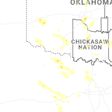
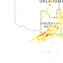
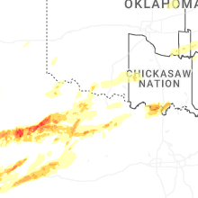

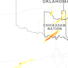
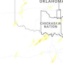
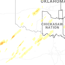


Connect with Interactive Hail Maps