

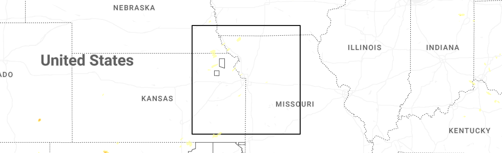
Hail Map for Big Lake, MO
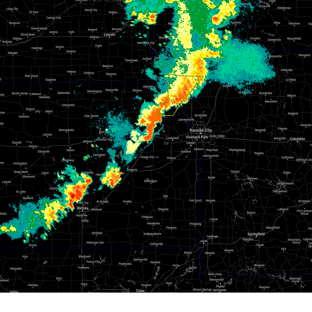
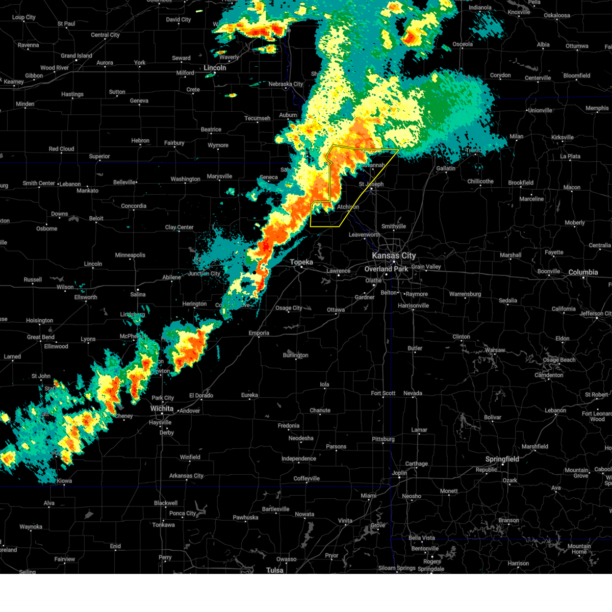
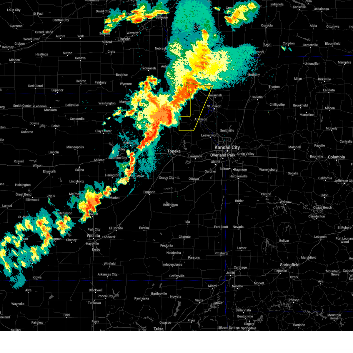
The Big Lake, MO area has had 0 reports of on-the-ground hail by trained spotters, and has been under severe weather warnings 6 times during the past 12 months. Doppler radar has detected hail at or near Big Lake, MO on 82 occasions, including 1 occasion during the past year.
| Name: | Big Lake, MO |
| Where Located: | 78.5 miles NNW of Kansas City, MO |
| Map: | Google Map for Big Lake, MO |
| Population: | 159 |
| Housing Units: | 386 |
| More Info: | Search Google for Big Lake, MO |
1
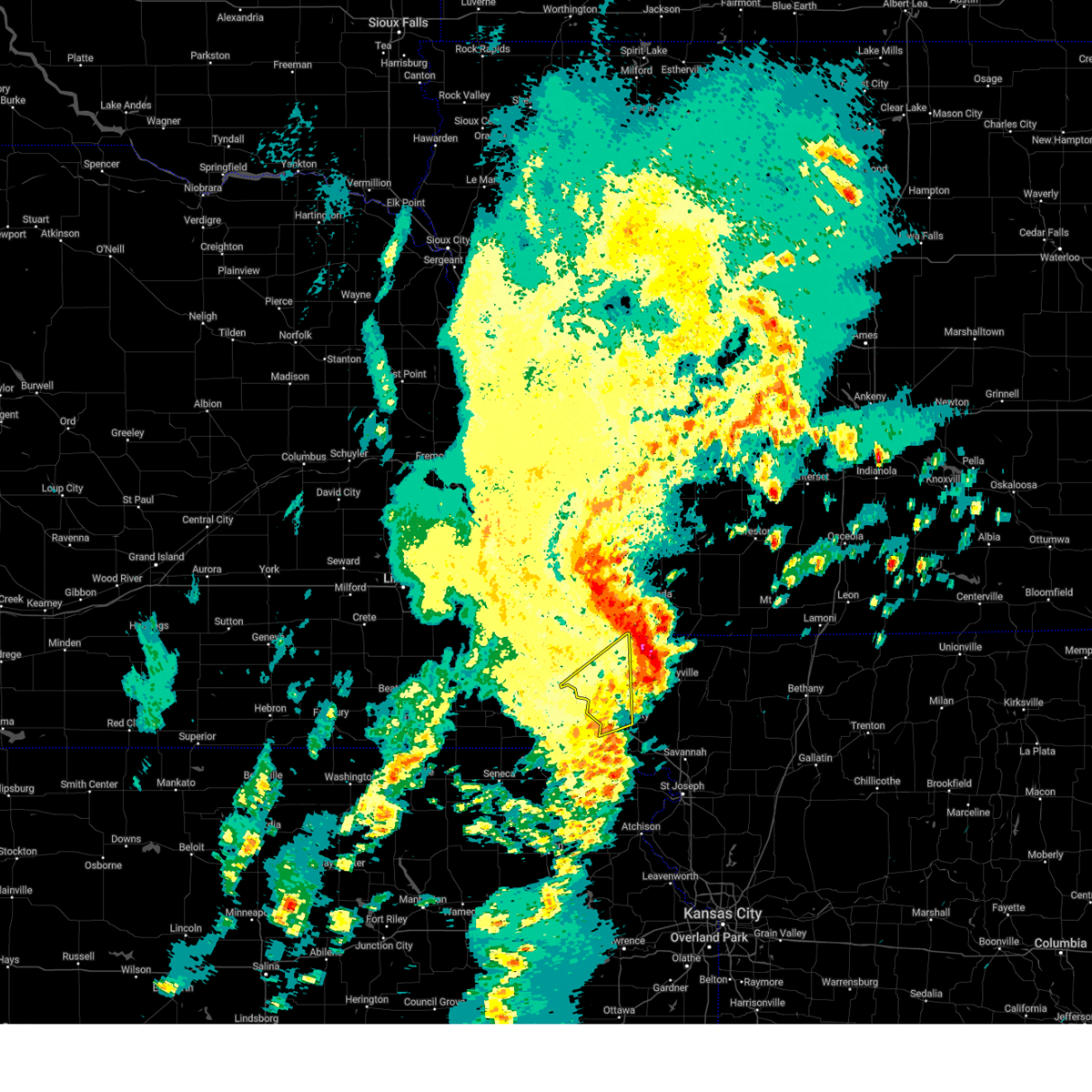
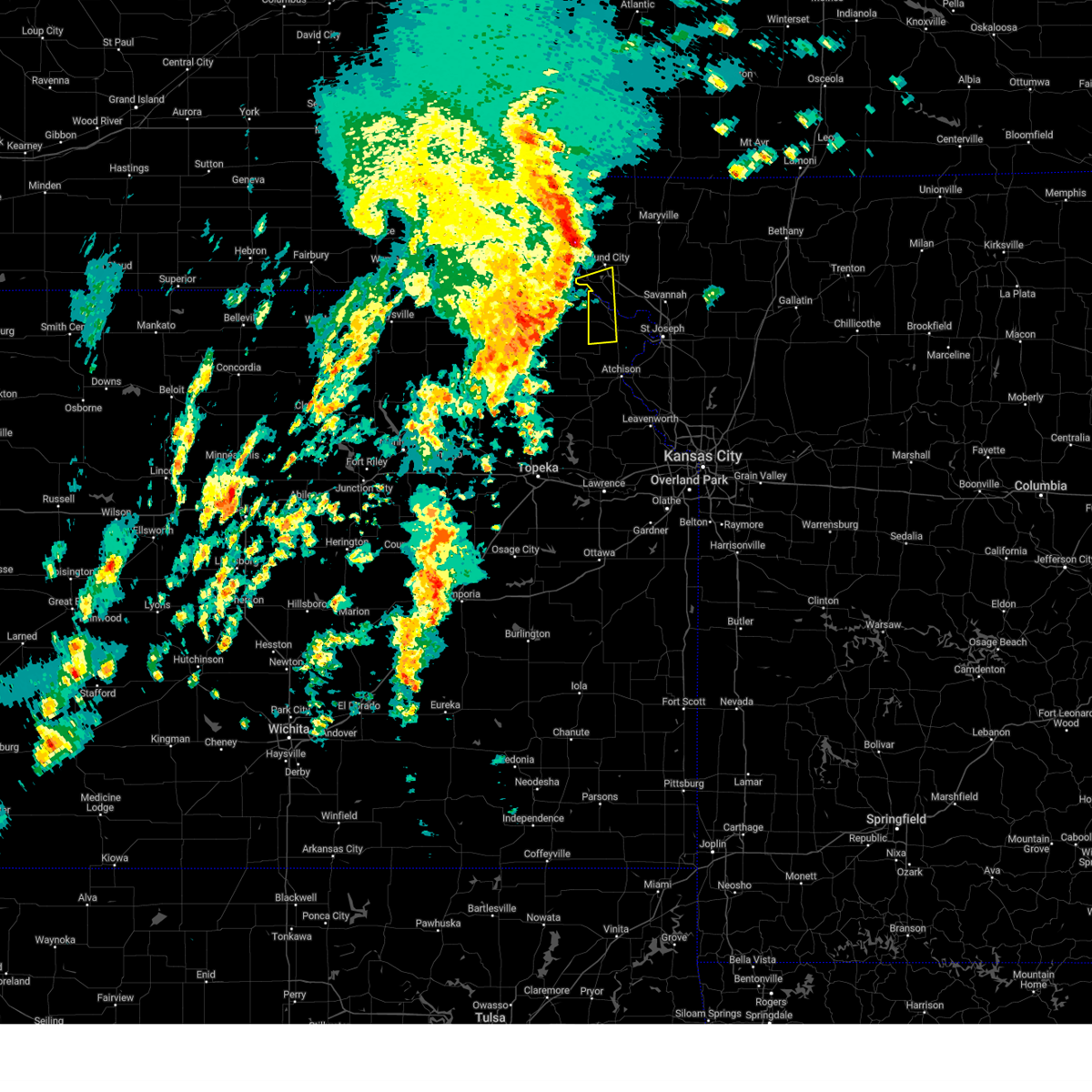
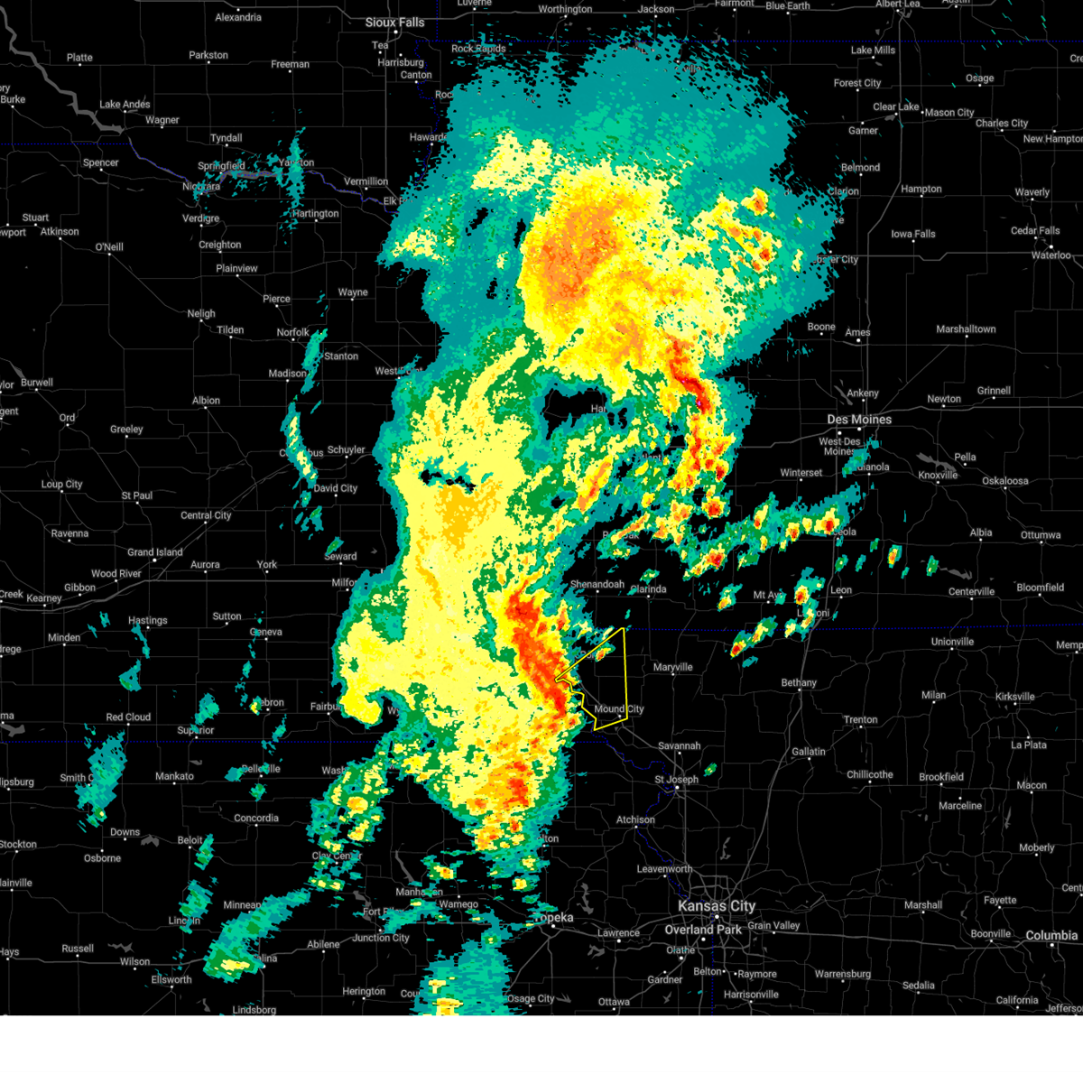
The Top Recent Hail Date for Big Lake, MO is Thursday, June 26, 2025 (26th out of 82)
Hail and Wind Damage Spotted near Big Lake, MO
| Date / Time | Report Details |
|---|---|
| 10/30/2024 1:41 PM CDT |
 The storm which prompted the warning has moved out of the area. therefore, the warning will be allowed to expire. a severe thunderstorm watch remains in effect until 700 pm cdt for northwestern missouri. remember, a severe thunderstorm warning still remains in effect for eastern atchison county. The storm which prompted the warning has moved out of the area. therefore, the warning will be allowed to expire. a severe thunderstorm watch remains in effect until 700 pm cdt for northwestern missouri. remember, a severe thunderstorm warning still remains in effect for eastern atchison county.
|
| 10/30/2024 1:23 PM CDT |
 Svreax the national weather service in pleasant hill has issued a * severe thunderstorm warning for, northwestern doniphan county in northeastern kansas, central holt county in northwestern missouri, * until 200 pm cdt. * at 122 pm cdt, a severe thunderstorm was located near rulo, or 11 miles east of falls city, moving northeast at 80 mph (radar indicated). Hazards include 60 mph wind gusts and penny size hail. expect damage to roofs, siding, and trees Svreax the national weather service in pleasant hill has issued a * severe thunderstorm warning for, northwestern doniphan county in northeastern kansas, central holt county in northwestern missouri, * until 200 pm cdt. * at 122 pm cdt, a severe thunderstorm was located near rulo, or 11 miles east of falls city, moving northeast at 80 mph (radar indicated). Hazards include 60 mph wind gusts and penny size hail. expect damage to roofs, siding, and trees
|
| 10/30/2024 1:09 PM CDT |
 Svreax the national weather service in pleasant hill has issued a * severe thunderstorm warning for, southeastern atchison county in northwestern missouri, northwestern holt county in northwestern missouri, * until 145 pm cdt. * at 108 pm cdt, a severe thunderstorm was located 7 miles east of shubert, or 12 miles north of falls city, moving northeast at 65 mph. this is a destructive storm for holt and atchison county (radar indicated). Hazards include 80 mph wind gusts and quarter size hail. Flying debris will be dangerous to those caught without shelter. mobile homes will be heavily damaged. expect considerable damage to roofs, windows, and vehicles. Extensive tree damage and power outages are likely. Svreax the national weather service in pleasant hill has issued a * severe thunderstorm warning for, southeastern atchison county in northwestern missouri, northwestern holt county in northwestern missouri, * until 145 pm cdt. * at 108 pm cdt, a severe thunderstorm was located 7 miles east of shubert, or 12 miles north of falls city, moving northeast at 65 mph. this is a destructive storm for holt and atchison county (radar indicated). Hazards include 80 mph wind gusts and quarter size hail. Flying debris will be dangerous to those caught without shelter. mobile homes will be heavily damaged. expect considerable damage to roofs, windows, and vehicles. Extensive tree damage and power outages are likely.
|
| 8/14/2024 10:24 PM CDT |
 The storms which prompted the warning have weakened below severe limits, and no longer pose an immediate threat to life or property. therefore, the warning will be allowed to expire. however, gusty winds and heavy rain are still possible with these thunderstorms. a severe thunderstorm watch remains in effect until 100 am cdt for northeastern kansas, and northwestern missouri. The storms which prompted the warning have weakened below severe limits, and no longer pose an immediate threat to life or property. therefore, the warning will be allowed to expire. however, gusty winds and heavy rain are still possible with these thunderstorms. a severe thunderstorm watch remains in effect until 100 am cdt for northeastern kansas, and northwestern missouri.
|
| 8/14/2024 9:53 PM CDT |
 Svreax the national weather service in pleasant hill has issued a * severe thunderstorm warning for, doniphan county in northeastern kansas, atchison county in northeastern kansas, northwestern buchanan county in northwestern missouri, western gentry county in northwestern missouri, southeastern holt county in northwestern missouri, andrew county in northwestern missouri, * until 1030 pm cdt. * at 953 pm cdt, severe thunderstorms were located along a line extending from 6 miles northeast of fillmore to 6 miles east of highland to near denton to 3 miles south of potawatomi reservation, moving east at 35 mph (radar indicated). Hazards include 60 mph wind gusts. expect damage to roofs, siding, and trees Svreax the national weather service in pleasant hill has issued a * severe thunderstorm warning for, doniphan county in northeastern kansas, atchison county in northeastern kansas, northwestern buchanan county in northwestern missouri, western gentry county in northwestern missouri, southeastern holt county in northwestern missouri, andrew county in northwestern missouri, * until 1030 pm cdt. * at 953 pm cdt, severe thunderstorms were located along a line extending from 6 miles northeast of fillmore to 6 miles east of highland to near denton to 3 miles south of potawatomi reservation, moving east at 35 mph (radar indicated). Hazards include 60 mph wind gusts. expect damage to roofs, siding, and trees
|
| 8/14/2024 9:22 PM CDT |
 Svreax the national weather service in pleasant hill has issued a * severe thunderstorm warning for, doniphan county in northeastern kansas, atchison county in northeastern kansas, holt county in northwestern missouri, northwestern andrew county in northwestern missouri, * until 1000 pm cdt. * at 921 pm cdt, severe thunderstorms were located along a line extending from 5 miles south of maitland to near hiawatha to near holton, moving east at 35 mph (radar indicated). Hazards include 60 mph wind gusts and penny size hail. expect damage to roofs, siding, and trees Svreax the national weather service in pleasant hill has issued a * severe thunderstorm warning for, doniphan county in northeastern kansas, atchison county in northeastern kansas, holt county in northwestern missouri, northwestern andrew county in northwestern missouri, * until 1000 pm cdt. * at 921 pm cdt, severe thunderstorms were located along a line extending from 5 miles south of maitland to near hiawatha to near holton, moving east at 35 mph (radar indicated). Hazards include 60 mph wind gusts and penny size hail. expect damage to roofs, siding, and trees
|
| 6/26/2024 12:56 AM CDT |
 Svreax the national weather service in pleasant hill has issued a * severe thunderstorm warning for, central doniphan county in northeastern kansas, eastern holt county in northwestern missouri, central andrew county in northwestern missouri, * until 130 am cdt. * at 1255 am cdt, a severe thunderstorm was located near mound city, moving southeast at 45 mph (radar indicated). Hazards include 60 mph wind gusts and nickel size hail. expect damage to roofs, siding, and trees Svreax the national weather service in pleasant hill has issued a * severe thunderstorm warning for, central doniphan county in northeastern kansas, eastern holt county in northwestern missouri, central andrew county in northwestern missouri, * until 130 am cdt. * at 1255 am cdt, a severe thunderstorm was located near mound city, moving southeast at 45 mph (radar indicated). Hazards include 60 mph wind gusts and nickel size hail. expect damage to roofs, siding, and trees
|
| 6/26/2024 12:45 AM CDT |
 the severe thunderstorm warning has been cancelled and is no longer in effect the severe thunderstorm warning has been cancelled and is no longer in effect
|
| 6/26/2024 12:45 AM CDT |
 At 1245 am cdt, a severe thunderstorm was located over mound city, moving southeast at 45 mph (radar indicated). Hazards include 60 mph wind gusts and nickel size hail. Expect damage to roofs, siding, and trees. locations impacted include, mound city, oregon, maitland, amazonia, forest city, craig, fillmore, graham, big lake, fortescue, bigelow, corning, indian cave state park, and iowa reservation of kansas and nebraska. This includes interstate 29 between mile markers 59 and 98. At 1245 am cdt, a severe thunderstorm was located over mound city, moving southeast at 45 mph (radar indicated). Hazards include 60 mph wind gusts and nickel size hail. Expect damage to roofs, siding, and trees. locations impacted include, mound city, oregon, maitland, amazonia, forest city, craig, fillmore, graham, big lake, fortescue, bigelow, corning, indian cave state park, and iowa reservation of kansas and nebraska. This includes interstate 29 between mile markers 59 and 98.
|
| 6/26/2024 12:24 AM CDT |
 Svreax the national weather service in pleasant hill has issued a * severe thunderstorm warning for, southeastern atchison county in northwestern missouri, holt county in northwestern missouri, southwestern nodaway county in northwestern missouri, western andrew county in northwestern missouri, * until 100 am cdt. * at 1224 am cdt, a severe thunderstorm was located near fairfax, or 12 miles southwest of tarkio, moving southeast at 40 mph (radar indicated). Hazards include 60 mph wind gusts and quarter size hail. Hail damage to vehicles is expected. Expect wind damage to roofs, siding, and trees. Svreax the national weather service in pleasant hill has issued a * severe thunderstorm warning for, southeastern atchison county in northwestern missouri, holt county in northwestern missouri, southwestern nodaway county in northwestern missouri, western andrew county in northwestern missouri, * until 100 am cdt. * at 1224 am cdt, a severe thunderstorm was located near fairfax, or 12 miles southwest of tarkio, moving southeast at 40 mph (radar indicated). Hazards include 60 mph wind gusts and quarter size hail. Hail damage to vehicles is expected. Expect wind damage to roofs, siding, and trees.
|
| 6/15/2024 8:28 PM CDT |
 Svreax the national weather service in pleasant hill has issued a * severe thunderstorm warning for, eastern atchison county in northwestern missouri, northern holt county in northwestern missouri, nodaway county in northwestern missouri, * until 915 pm cdt. * at 828 pm cdt, severe thunderstorms were located along a line extending from near clarinda to near burlington junction to 8 miles northeast of craig, moving northeast at 40 mph (radar indicated). Hazards include 60 mph wind gusts and penny size hail. expect damage to roofs, siding, and trees Svreax the national weather service in pleasant hill has issued a * severe thunderstorm warning for, eastern atchison county in northwestern missouri, northern holt county in northwestern missouri, nodaway county in northwestern missouri, * until 915 pm cdt. * at 828 pm cdt, severe thunderstorms were located along a line extending from near clarinda to near burlington junction to 8 miles northeast of craig, moving northeast at 40 mph (radar indicated). Hazards include 60 mph wind gusts and penny size hail. expect damage to roofs, siding, and trees
|
| 6/15/2024 8:12 PM CDT |
 At 812 pm cdt, severe thunderstorms were located along a line extending from near farragut to 7 miles northwest of skidmore to highland, moving northeast at 45 mph (trained weather spotters). Hazards include 60 mph wind gusts and penny size hail. Expect damage to roofs, siding, and trees. locations impacted include, tarkio, mound city, rock port, fairfax, burlington junction, maitland, skidmore, craig, graham, clearmont, elmo, big lake, westboro, quitman, fortescue, bigelow, and corning. This includes interstate 29 between mile markers 80 and 112. At 812 pm cdt, severe thunderstorms were located along a line extending from near farragut to 7 miles northwest of skidmore to highland, moving northeast at 45 mph (trained weather spotters). Hazards include 60 mph wind gusts and penny size hail. Expect damage to roofs, siding, and trees. locations impacted include, tarkio, mound city, rock port, fairfax, burlington junction, maitland, skidmore, craig, graham, clearmont, elmo, big lake, westboro, quitman, fortescue, bigelow, and corning. This includes interstate 29 between mile markers 80 and 112.
|
| 6/15/2024 7:49 PM CDT |
 At 749 pm cdt, severe thunderstorms were located along a line extending from near nebraska city to 7 miles west of craig to near powhattan, moving northeast at 40 mph (trained weather spotters). Hazards include 70 mph wind gusts and penny size hail. Expect considerable tree damage. damage is likely to mobile homes, roofs, and outbuildings. locations impacted include, tarkio, mound city, rock port, fairfax, burlington junction, maitland, skidmore, craig, graham, clearmont, elmo, big lake, westboro, watson, quitman, fortescue, bigelow, corning, phelps city, and brownville state recreation area. This includes interstate 29 between mile markers 80 and 123. At 749 pm cdt, severe thunderstorms were located along a line extending from near nebraska city to 7 miles west of craig to near powhattan, moving northeast at 40 mph (trained weather spotters). Hazards include 70 mph wind gusts and penny size hail. Expect considerable tree damage. damage is likely to mobile homes, roofs, and outbuildings. locations impacted include, tarkio, mound city, rock port, fairfax, burlington junction, maitland, skidmore, craig, graham, clearmont, elmo, big lake, westboro, watson, quitman, fortescue, bigelow, corning, phelps city, and brownville state recreation area. This includes interstate 29 between mile markers 80 and 123.
|
| 6/15/2024 7:35 PM CDT |
 Svreax the national weather service in pleasant hill has issued a * severe thunderstorm warning for, atchison county in northwestern missouri, northern holt county in northwestern missouri, western nodaway county in northwestern missouri, * until 830 pm cdt. * at 734 pm cdt, severe thunderstorms were located along a line extending from near lorton to near verdon to near kickapoo reservation, moving northeast at 45 mph (radar indicated). Hazards include 60 mph wind gusts and quarter size hail. Hail damage to vehicles is expected. Expect wind damage to roofs, siding, and trees. Svreax the national weather service in pleasant hill has issued a * severe thunderstorm warning for, atchison county in northwestern missouri, northern holt county in northwestern missouri, western nodaway county in northwestern missouri, * until 830 pm cdt. * at 734 pm cdt, severe thunderstorms were located along a line extending from near lorton to near verdon to near kickapoo reservation, moving northeast at 45 mph (radar indicated). Hazards include 60 mph wind gusts and quarter size hail. Hail damage to vehicles is expected. Expect wind damage to roofs, siding, and trees.
|
| 5/25/2024 11:18 PM CDT |
 Svreax the national weather service in pleasant hill has issued a * severe thunderstorm warning for, doniphan county in northeastern kansas, northern atchison county in northeastern kansas, central buchanan county in northwestern missouri, southeastern atchison county in northwestern missouri, holt county in northwestern missouri, southwestern nodaway county in northwestern missouri, andrew county in northwestern missouri, * until 1215 am cdt. * at 1117 pm cdt, severe thunderstorms were located along a line extending from 6 miles southeast of nemaha to near hiawatha to near muscotah, moving east at 50 mph (radar indicated). Hazards include 60 mph wind gusts and penny size hail. expect damage to roofs, siding, and trees Svreax the national weather service in pleasant hill has issued a * severe thunderstorm warning for, doniphan county in northeastern kansas, northern atchison county in northeastern kansas, central buchanan county in northwestern missouri, southeastern atchison county in northwestern missouri, holt county in northwestern missouri, southwestern nodaway county in northwestern missouri, andrew county in northwestern missouri, * until 1215 am cdt. * at 1117 pm cdt, severe thunderstorms were located along a line extending from 6 miles southeast of nemaha to near hiawatha to near muscotah, moving east at 50 mph (radar indicated). Hazards include 60 mph wind gusts and penny size hail. expect damage to roofs, siding, and trees
|
| 5/24/2024 4:00 AM CDT |
 At 400 am cdt, severe thunderstorms were located along a line extending from near blanchard to 6 miles west of skidmore to near white cloud, moving east at 45 mph (radar indicated). Hazards include 60 mph wind gusts. Expect damage to roofs, siding, and trees. locations impacted include, maryville, tarkio, mound city, rock port, fairfax, burlington junction, hopkins, maitland, skidmore, craig, graham, clearmont, elmo, pickering, big lake, westboro, arkoe, quitman, fortescue, and bigelow. This includes interstate 29 between mile markers 76 and 113. At 400 am cdt, severe thunderstorms were located along a line extending from near blanchard to 6 miles west of skidmore to near white cloud, moving east at 45 mph (radar indicated). Hazards include 60 mph wind gusts. Expect damage to roofs, siding, and trees. locations impacted include, maryville, tarkio, mound city, rock port, fairfax, burlington junction, hopkins, maitland, skidmore, craig, graham, clearmont, elmo, pickering, big lake, westboro, arkoe, quitman, fortescue, and bigelow. This includes interstate 29 between mile markers 76 and 113.
|
| 5/24/2024 3:16 AM CDT |
 Svreax the national weather service in pleasant hill has issued a * severe thunderstorm warning for, atchison county in northwestern missouri, holt county in northwestern missouri, nodaway county in northwestern missouri, * until 415 am cdt. * at 315 am cdt, severe thunderstorms were located along a line extending from near nebraska city to near auburn to near du bois, moving east at 50 mph (radar indicated). Hazards include 60 mph wind gusts. expect damage to roofs, siding, and trees Svreax the national weather service in pleasant hill has issued a * severe thunderstorm warning for, atchison county in northwestern missouri, holt county in northwestern missouri, nodaway county in northwestern missouri, * until 415 am cdt. * at 315 am cdt, severe thunderstorms were located along a line extending from near nebraska city to near auburn to near du bois, moving east at 50 mph (radar indicated). Hazards include 60 mph wind gusts. expect damage to roofs, siding, and trees
|
| 5/6/2024 9:51 PM CDT |
 The storms which prompted the warning have weakened below severe limits, and no longer pose an immediate threat to life or property. therefore, the warning will be allowed to expire. however, gusty winds and heavy rain are still possible with these thunderstorms. a tornado watch remains in effect until 1100 pm cdt for northeastern kansas, and northwestern missouri. a tornado watch also remains in effect until 400 am cdt for northwestern missouri. to report severe weather, contact your nearest law enforcement agency. they will relay your report to the national weather service pleasant hill. The storms which prompted the warning have weakened below severe limits, and no longer pose an immediate threat to life or property. therefore, the warning will be allowed to expire. however, gusty winds and heavy rain are still possible with these thunderstorms. a tornado watch remains in effect until 1100 pm cdt for northeastern kansas, and northwestern missouri. a tornado watch also remains in effect until 400 am cdt for northwestern missouri. to report severe weather, contact your nearest law enforcement agency. they will relay your report to the national weather service pleasant hill.
|
| 5/6/2024 9:33 PM CDT |
 At 933 pm cdt, severe thunderstorms were located along a line extending from near red oak to near tarkio to near falls city, moving northeast at 50 mph (radar indicated). Hazards include 60 mph wind gusts and penny size hail. Expect damage to roofs, siding, and trees. locations impacted include, tarkio, mound city, rock port, fairfax, craig, blanchard, big lake, westboro, fortescue, bigelow, corning, and indian cave state park. This includes interstate 29 between mile markers 80 and 113. At 933 pm cdt, severe thunderstorms were located along a line extending from near red oak to near tarkio to near falls city, moving northeast at 50 mph (radar indicated). Hazards include 60 mph wind gusts and penny size hail. Expect damage to roofs, siding, and trees. locations impacted include, tarkio, mound city, rock port, fairfax, craig, blanchard, big lake, westboro, fortescue, bigelow, corning, and indian cave state park. This includes interstate 29 between mile markers 80 and 113.
|
| 5/6/2024 9:14 PM CDT |
 At 913 pm cdt, severe thunderstorms were located along a line extending from 6 miles northwest of essex to 6 miles southwest of fairfax to near morrill, moving northeast at 55 mph (trained weather spotters. a 64 mph wind gust was reported southwest of nemaha, nebraska, as these storms passed). Hazards include 70 mph wind gusts and quarter size hail. Hail damage to vehicles is expected. expect considerable tree damage. wind damage is also likely to mobile homes, roofs, and outbuildings. locations impacted include, tarkio, mound city, rock port, fairfax, craig, blanchard, big lake, westboro, watson, fortescue, bigelow, corning, phelps city, and indian cave state park. This includes interstate 29 between mile markers 80 and 123. At 913 pm cdt, severe thunderstorms were located along a line extending from 6 miles northwest of essex to 6 miles southwest of fairfax to near morrill, moving northeast at 55 mph (trained weather spotters. a 64 mph wind gust was reported southwest of nemaha, nebraska, as these storms passed). Hazards include 70 mph wind gusts and quarter size hail. Hail damage to vehicles is expected. expect considerable tree damage. wind damage is also likely to mobile homes, roofs, and outbuildings. locations impacted include, tarkio, mound city, rock port, fairfax, craig, blanchard, big lake, westboro, watson, fortescue, bigelow, corning, phelps city, and indian cave state park. This includes interstate 29 between mile markers 80 and 123.
|
| 5/6/2024 8:44 PM CDT |
 Svreax the national weather service in pleasant hill has issued a * severe thunderstorm warning for, atchison county in northwestern missouri, northwestern holt county in northwestern missouri, * until 1000 pm cdt. * at 844 pm cdt, severe thunderstorms were located along a line extending from near nebraska city to near dawson to near corning, moving northeast at 50 mph (radar indicated). Hazards include 60 mph wind gusts and quarter size hail. Hail damage to vehicles is expected. Expect wind damage to roofs, siding, and trees. Svreax the national weather service in pleasant hill has issued a * severe thunderstorm warning for, atchison county in northwestern missouri, northwestern holt county in northwestern missouri, * until 1000 pm cdt. * at 844 pm cdt, severe thunderstorms were located along a line extending from near nebraska city to near dawson to near corning, moving northeast at 50 mph (radar indicated). Hazards include 60 mph wind gusts and quarter size hail. Hail damage to vehicles is expected. Expect wind damage to roofs, siding, and trees.
|
| 4/30/2024 5:59 PM CDT |
 The tornado threat has diminished and the tornado warning has been allowed to expire. however, large hail and damaging winds remain likely and a severe thunderstorm warning remains in effect for the area. a tornado watch remains in effect until 1100 pm cdt for northwestern missouri. The tornado threat has diminished and the tornado warning has been allowed to expire. however, large hail and damaging winds remain likely and a severe thunderstorm warning remains in effect for the area. a tornado watch remains in effect until 1100 pm cdt for northwestern missouri.
|
| 4/30/2024 5:43 PM CDT |
 At 542 pm cdt, a severe thunderstorm capable of producing a tornado was located over craig, or 11 miles northwest of mound city, moving east at 45 mph (radar indicated rotation). Hazards include tornado and baseball size hail. Flying debris will be dangerous to those caught without shelter. mobile homes will be damaged or destroyed. damage to roofs, windows, and vehicles will occur. tree damage is likely. locations impacted include, mound city, craig, big lake, bigelow, and corning. This includes interstate 29 between mile markers 78 and 98. At 542 pm cdt, a severe thunderstorm capable of producing a tornado was located over craig, or 11 miles northwest of mound city, moving east at 45 mph (radar indicated rotation). Hazards include tornado and baseball size hail. Flying debris will be dangerous to those caught without shelter. mobile homes will be damaged or destroyed. damage to roofs, windows, and vehicles will occur. tree damage is likely. locations impacted include, mound city, craig, big lake, bigelow, and corning. This includes interstate 29 between mile markers 78 and 98.
|
| 4/30/2024 5:34 PM CDT |
 Toreax the national weather service in pleasant hill has issued a * tornado warning for, northern holt county in northwestern missouri, * until 600 pm cdt. * at 534 pm cdt, a severe thunderstorm capable of producing a tornado was located 7 miles west of craig, or 10 miles northeast of falls city, moving east at 45 mph (radar indicated rotation). Hazards include tornado and baseball size hail. Flying debris will be dangerous to those caught without shelter. mobile homes will be damaged or destroyed. damage to roofs, windows, and vehicles will occur. Tree damage is likely. Toreax the national weather service in pleasant hill has issued a * tornado warning for, northern holt county in northwestern missouri, * until 600 pm cdt. * at 534 pm cdt, a severe thunderstorm capable of producing a tornado was located 7 miles west of craig, or 10 miles northeast of falls city, moving east at 45 mph (radar indicated rotation). Hazards include tornado and baseball size hail. Flying debris will be dangerous to those caught without shelter. mobile homes will be damaged or destroyed. damage to roofs, windows, and vehicles will occur. Tree damage is likely.
|
| 4/27/2024 4:00 PM CDT |
 Svreax the national weather service in pleasant hill has issued a * severe thunderstorm warning for, northwestern doniphan county in northeastern kansas, eastern holt county in northwestern missouri, southwestern nodaway county in northwestern missouri, northern andrew county in northwestern missouri, * until 445 pm cdt. * at 359 pm cdt, a severe thunderstorm was located over white cloud, or 9 miles north of highland, moving northeast at 40 mph (radar indicated). Hazards include 60 mph wind gusts and quarter size hail. Hail damage to vehicles is expected. Expect wind damage to roofs, siding, and trees. Svreax the national weather service in pleasant hill has issued a * severe thunderstorm warning for, northwestern doniphan county in northeastern kansas, eastern holt county in northwestern missouri, southwestern nodaway county in northwestern missouri, northern andrew county in northwestern missouri, * until 445 pm cdt. * at 359 pm cdt, a severe thunderstorm was located over white cloud, or 9 miles north of highland, moving northeast at 40 mph (radar indicated). Hazards include 60 mph wind gusts and quarter size hail. Hail damage to vehicles is expected. Expect wind damage to roofs, siding, and trees.
|
| 4/27/2024 2:28 PM CDT |
 At 228 pm cdt, a confirmed tornado was located near white cloud, or 7 miles south of mound city, moving northeast at 30 mph (law enforcement confirmed tornado). Hazards include damaging tornado and quarter size hail. Flying debris will be dangerous to those caught without shelter. mobile homes will be damaged or destroyed. damage to roofs, windows, and vehicles will occur. tree damage is likely. locations impacted include, mound city, big lake, fortescue, and bigelow. This includes interstate 29 between mile markers 73 and 85. At 228 pm cdt, a confirmed tornado was located near white cloud, or 7 miles south of mound city, moving northeast at 30 mph (law enforcement confirmed tornado). Hazards include damaging tornado and quarter size hail. Flying debris will be dangerous to those caught without shelter. mobile homes will be damaged or destroyed. damage to roofs, windows, and vehicles will occur. tree damage is likely. locations impacted include, mound city, big lake, fortescue, and bigelow. This includes interstate 29 between mile markers 73 and 85.
|
| 4/27/2024 2:28 PM CDT |
 the tornado warning has been cancelled and is no longer in effect the tornado warning has been cancelled and is no longer in effect
|
| 4/27/2024 2:17 PM CDT |
 At 217 pm cdt, a confirmed tornado was located over white cloud, or 8 miles northwest of highland, moving northeast at 30 mph (law enforcement confirmed tornado). Hazards include damaging tornado and quarter size hail. Flying debris will be dangerous to those caught without shelter. mobile homes will be damaged or destroyed. damage to roofs, windows, and vehicles will occur. tree damage is likely. locations impacted include, mound city, oregon, forest city, white cloud, big lake, fortescue, bigelow, iowa point, and iowa reservation of kansas and nebraska. This includes interstate 29 between mile markers 71 and 86. At 217 pm cdt, a confirmed tornado was located over white cloud, or 8 miles northwest of highland, moving northeast at 30 mph (law enforcement confirmed tornado). Hazards include damaging tornado and quarter size hail. Flying debris will be dangerous to those caught without shelter. mobile homes will be damaged or destroyed. damage to roofs, windows, and vehicles will occur. tree damage is likely. locations impacted include, mound city, oregon, forest city, white cloud, big lake, fortescue, bigelow, iowa point, and iowa reservation of kansas and nebraska. This includes interstate 29 between mile markers 71 and 86.
|
| 4/27/2024 2:06 PM CDT |
 Toreax the national weather service in pleasant hill has issued a * tornado warning for, northwestern doniphan county in northeastern kansas, central holt county in northwestern missouri, * until 245 pm cdt. * at 206 pm cdt, a severe thunderstorm capable of producing a tornado was located near robinson, or 7 miles northeast of hiawatha, moving northeast at 30 mph (radar indicated rotation). Hazards include tornado and quarter size hail. Flying debris will be dangerous to those caught without shelter. mobile homes will be damaged or destroyed. damage to roofs, windows, and vehicles will occur. Tree damage is likely. Toreax the national weather service in pleasant hill has issued a * tornado warning for, northwestern doniphan county in northeastern kansas, central holt county in northwestern missouri, * until 245 pm cdt. * at 206 pm cdt, a severe thunderstorm capable of producing a tornado was located near robinson, or 7 miles northeast of hiawatha, moving northeast at 30 mph (radar indicated rotation). Hazards include tornado and quarter size hail. Flying debris will be dangerous to those caught without shelter. mobile homes will be damaged or destroyed. damage to roofs, windows, and vehicles will occur. Tree damage is likely.
|
| 4/26/2024 5:40 PM CDT |
 Svreax the national weather service in pleasant hill has issued a * severe thunderstorm warning for, northeastern holt county in northwestern missouri, * until 615 pm cdt. * at 539 pm cdt, a severe thunderstorm was located near rulo, or 8 miles southeast of falls city, moving northeast at 45 mph (radar indicated). Hazards include 60 mph wind gusts and half dollar size hail. Hail damage to vehicles is expected. Expect wind damage to roofs, siding, and trees. Svreax the national weather service in pleasant hill has issued a * severe thunderstorm warning for, northeastern holt county in northwestern missouri, * until 615 pm cdt. * at 539 pm cdt, a severe thunderstorm was located near rulo, or 8 miles southeast of falls city, moving northeast at 45 mph (radar indicated). Hazards include 60 mph wind gusts and half dollar size hail. Hail damage to vehicles is expected. Expect wind damage to roofs, siding, and trees.
|
| 4/16/2024 8:37 AM CDT |
 At 837 am cdt, severe thunderstorms were located along a line extending from near skidmore to near fillmore, moving northeast at 55 mph (radar indicated). Hazards include 60 mph wind gusts. Expect damage to roofs, siding, and trees. locations impacted include, maryville, atchison, mound city, highland, troy, oregon, effingham, burlington junction, hopkins, maitland, lancaster, skidmore, forest city, fillmore, white cloud, muscotah, braddyville, denton, blanchard, and barnard. This includes interstate 29 between mile markers 62 and 90. At 837 am cdt, severe thunderstorms were located along a line extending from near skidmore to near fillmore, moving northeast at 55 mph (radar indicated). Hazards include 60 mph wind gusts. Expect damage to roofs, siding, and trees. locations impacted include, maryville, atchison, mound city, highland, troy, oregon, effingham, burlington junction, hopkins, maitland, lancaster, skidmore, forest city, fillmore, white cloud, muscotah, braddyville, denton, blanchard, and barnard. This includes interstate 29 between mile markers 62 and 90.
|
| 4/16/2024 8:13 AM CDT |
 Svreax the national weather service in pleasant hill has issued a * severe thunderstorm warning for, doniphan county in northeastern kansas, atchison county in northeastern kansas, eastern atchison county in northwestern missouri, holt county in northwestern missouri, nodaway county in northwestern missouri, northwestern andrew county in northwestern missouri, * until 900 am cdt. * at 813 am cdt, severe thunderstorms were located along a line extending from rulo to highland, moving northeast at 55 mph (radar indicated). Hazards include 60 mph wind gusts. expect damage to roofs, siding, and trees Svreax the national weather service in pleasant hill has issued a * severe thunderstorm warning for, doniphan county in northeastern kansas, atchison county in northeastern kansas, eastern atchison county in northwestern missouri, holt county in northwestern missouri, nodaway county in northwestern missouri, northwestern andrew county in northwestern missouri, * until 900 am cdt. * at 813 am cdt, severe thunderstorms were located along a line extending from rulo to highland, moving northeast at 55 mph (radar indicated). Hazards include 60 mph wind gusts. expect damage to roofs, siding, and trees
|
| 8/6/2023 12:19 AM CDT |
 At 1218 am cdt, a severe thunderstorm was located near maitland, or near mound city, moving east at 35 mph (radar indicated). Hazards include 60 mph wind gusts and penny size hail. Expect damage to roofs, siding, and trees. locations impacted include, mound city, oregon, maitland, skidmore, forest city, graham, big lake, quitman, fortescue, bigelow and iowa reservation of kansas and nebraska. this includes interstate 29 between mile markers 71 and 91. hail threat, radar indicated max hail size, 0. 75 in wind threat, radar indicated max wind gust, 60 mph. At 1218 am cdt, a severe thunderstorm was located near maitland, or near mound city, moving east at 35 mph (radar indicated). Hazards include 60 mph wind gusts and penny size hail. Expect damage to roofs, siding, and trees. locations impacted include, mound city, oregon, maitland, skidmore, forest city, graham, big lake, quitman, fortescue, bigelow and iowa reservation of kansas and nebraska. this includes interstate 29 between mile markers 71 and 91. hail threat, radar indicated max hail size, 0. 75 in wind threat, radar indicated max wind gust, 60 mph.
|
| 8/6/2023 12:08 AM CDT |
 At 1208 am cdt, a severe thunderstorm was located near mound city, moving east at 35 mph (radar indicated). Hazards include 60 mph wind gusts and penny size hail. Expect damage to roofs, siding, and trees. locations impacted include, mound city, oregon, maitland, skidmore, forest city, craig, graham, big lake, quitman, fortescue, bigelow and iowa reservation of kansas and nebraska. this includes interstate 29 between mile markers 71 and 96. hail threat, radar indicated max hail size, 0. 75 in wind threat, radar indicated max wind gust, 60 mph. At 1208 am cdt, a severe thunderstorm was located near mound city, moving east at 35 mph (radar indicated). Hazards include 60 mph wind gusts and penny size hail. Expect damage to roofs, siding, and trees. locations impacted include, mound city, oregon, maitland, skidmore, forest city, craig, graham, big lake, quitman, fortescue, bigelow and iowa reservation of kansas and nebraska. this includes interstate 29 between mile markers 71 and 96. hail threat, radar indicated max hail size, 0. 75 in wind threat, radar indicated max wind gust, 60 mph.
|
| 8/5/2023 11:49 PM CDT |
 At 1149 pm cdt, a severe thunderstorm was located near craig, or 10 miles northeast of falls city, moving east at 35 mph (radar indicated). Hazards include 60 mph wind gusts and quarter size hail. Hail damage to vehicles is expected. Expect wind damage to roofs, siding, and trees. At 1149 pm cdt, a severe thunderstorm was located near craig, or 10 miles northeast of falls city, moving east at 35 mph (radar indicated). Hazards include 60 mph wind gusts and quarter size hail. Hail damage to vehicles is expected. Expect wind damage to roofs, siding, and trees.
|
| 7/30/2023 7:10 PM CDT |
 At 709 pm cdt, a severe thunderstorm was located over troy, moving southeast at 45 mph (law enforcement reported several trees down across roads in oregon missouri). Hazards include 60 mph wind gusts and penny size hail. Expect damage to roofs, siding, and trees. locations impacted include, st. joseph, atchison, savannah, wathena, elwood, mound city, highland, troy, country club villa, country club, oregon, effingham, amazonia, rushville, lancaster, forest city, fillmore, white cloud, muscotah and denton. this includes the following highways, interstate 29 between mile markers 40 and 88. interstate 229 between mile markers 0 and 14. hail threat, radar indicated max hail size, 0. 75 in wind threat, radar indicated max wind gust, 60 mph. At 709 pm cdt, a severe thunderstorm was located over troy, moving southeast at 45 mph (law enforcement reported several trees down across roads in oregon missouri). Hazards include 60 mph wind gusts and penny size hail. Expect damage to roofs, siding, and trees. locations impacted include, st. joseph, atchison, savannah, wathena, elwood, mound city, highland, troy, country club villa, country club, oregon, effingham, amazonia, rushville, lancaster, forest city, fillmore, white cloud, muscotah and denton. this includes the following highways, interstate 29 between mile markers 40 and 88. interstate 229 between mile markers 0 and 14. hail threat, radar indicated max hail size, 0. 75 in wind threat, radar indicated max wind gust, 60 mph.
|
| 7/30/2023 6:52 PM CDT |
 At 652 pm cdt, a severe thunderstorm was located over white cloud, or near highland, moving southeast at 45 mph (radar indicated). Hazards include 60 mph wind gusts and penny size hail. expect damage to roofs, siding, and trees At 652 pm cdt, a severe thunderstorm was located over white cloud, or near highland, moving southeast at 45 mph (radar indicated). Hazards include 60 mph wind gusts and penny size hail. expect damage to roofs, siding, and trees
|
| 7/29/2023 9:56 AM CDT |
 At 955 am cdt, severe thunderstorms were located along a line extending from near tarkio to near mound city to near hiawatha, moving east at 45 mph (radar indicated). Hazards include 60 mph wind gusts and nickel size hail. expect damage to roofs, siding, and trees At 955 am cdt, severe thunderstorms were located along a line extending from near tarkio to near mound city to near hiawatha, moving east at 45 mph (radar indicated). Hazards include 60 mph wind gusts and nickel size hail. expect damage to roofs, siding, and trees
|
| 7/29/2023 9:48 AM CDT |
 At 948 am cdt, severe thunderstorms were located along a line extending from near tarkio to near craig to powhattan, moving east at 50 mph (radar indicated). Hazards include 60 mph wind gusts and nickel size hail. Expect damage to roofs, siding, and trees. locations impacted include, tarkio, mound city, rock port, fairfax, craig, white cloud, big lake, westboro, watson, fortescue, bigelow, corning, phelps city and iowa reservation of kansas and nebraska. this includes interstate 29 between mile markers 78 and 123. hail threat, radar indicated max hail size, 0. 88 in wind threat, observed max wind gust, 60 mph. At 948 am cdt, severe thunderstorms were located along a line extending from near tarkio to near craig to powhattan, moving east at 50 mph (radar indicated). Hazards include 60 mph wind gusts and nickel size hail. Expect damage to roofs, siding, and trees. locations impacted include, tarkio, mound city, rock port, fairfax, craig, white cloud, big lake, westboro, watson, fortescue, bigelow, corning, phelps city and iowa reservation of kansas and nebraska. this includes interstate 29 between mile markers 78 and 123. hail threat, radar indicated max hail size, 0. 88 in wind threat, observed max wind gust, 60 mph.
|
| 7/29/2023 9:30 AM CDT |
 At 929 am cdt, severe thunderstorms were located along a line extending from near peru to 6 miles east of shubert to woodlawn, moving east at 50 mph (radar indicated). Hazards include 60 mph wind gusts and nickel size hail. Expect damage to roofs, siding, and trees. locations impacted include, tarkio, mound city, rock port, fairfax, craig, white cloud, big lake, westboro, watson, fortescue, bigelow, corning, phelps city and iowa reservation of kansas and nebraska. this includes interstate 29 between mile markers 78 and 123. hail threat, radar indicated max hail size, 0. 88 in wind threat, observed max wind gust, 60 mph. At 929 am cdt, severe thunderstorms were located along a line extending from near peru to 6 miles east of shubert to woodlawn, moving east at 50 mph (radar indicated). Hazards include 60 mph wind gusts and nickel size hail. Expect damage to roofs, siding, and trees. locations impacted include, tarkio, mound city, rock port, fairfax, craig, white cloud, big lake, westboro, watson, fortescue, bigelow, corning, phelps city and iowa reservation of kansas and nebraska. this includes interstate 29 between mile markers 78 and 123. hail threat, radar indicated max hail size, 0. 88 in wind threat, observed max wind gust, 60 mph.
|
| 7/29/2023 9:15 AM CDT |
 At 914 am cdt, severe thunderstorms were located along a line extending from near julian to near stella to seneca, moving east at 50 mph (trained spotters have reported 60 to 70 mph wind). Hazards include 70 mph wind gusts and nickel size hail. Expect considerable tree damage. Damage is likely to mobile homes, roofs, and outbuildings. At 914 am cdt, severe thunderstorms were located along a line extending from near julian to near stella to seneca, moving east at 50 mph (trained spotters have reported 60 to 70 mph wind). Hazards include 70 mph wind gusts and nickel size hail. Expect considerable tree damage. Damage is likely to mobile homes, roofs, and outbuildings.
|
| 7/24/2023 6:12 AM CDT |
 The severe thunderstorm warning for northwestern doniphan, atchison, holt, western nodaway and northwestern andrew counties will expire at 615 am cdt, the storms which prompted the warning have weakened below severe limits, and no longer pose an immediate threat to life or property. therefore, the warning will be allowed to expire. however small hail and gusty winds are still possible with these thunderstorms. a severe thunderstorm watch remains in effect until 900 am cdt for northwestern missouri. a severe thunderstorm watch also remains in effect until noon cdt for northeastern kansas, and northwestern missouri. The severe thunderstorm warning for northwestern doniphan, atchison, holt, western nodaway and northwestern andrew counties will expire at 615 am cdt, the storms which prompted the warning have weakened below severe limits, and no longer pose an immediate threat to life or property. therefore, the warning will be allowed to expire. however small hail and gusty winds are still possible with these thunderstorms. a severe thunderstorm watch remains in effect until 900 am cdt for northwestern missouri. a severe thunderstorm watch also remains in effect until noon cdt for northeastern kansas, and northwestern missouri.
|
| 7/24/2023 6:07 AM CDT |
 At 604 am cdt, severe thunderstorms were located along a line extending from 6 miles south of blanchard to near white cloud, moving southeast at 35 mph (radar indicated). Hazards include 60 mph wind gusts and nickel size hail. Expect damage to roofs, siding, and trees. locations impacted include, tarkio, mound city, rock port, oregon, fairfax, burlington junction, maitland, skidmore, forest city, craig, white cloud, graham, clearmont, elmo, big lake, westboro, watson, quitman, fortescue and bigelow. this includes interstate 29 between mile markers 68 and 122. hail threat, radar indicated max hail size, 0. 88 in wind threat, radar indicated max wind gust, 60 mph. At 604 am cdt, severe thunderstorms were located along a line extending from 6 miles south of blanchard to near white cloud, moving southeast at 35 mph (radar indicated). Hazards include 60 mph wind gusts and nickel size hail. Expect damage to roofs, siding, and trees. locations impacted include, tarkio, mound city, rock port, oregon, fairfax, burlington junction, maitland, skidmore, forest city, craig, white cloud, graham, clearmont, elmo, big lake, westboro, watson, quitman, fortescue and bigelow. this includes interstate 29 between mile markers 68 and 122. hail threat, radar indicated max hail size, 0. 88 in wind threat, radar indicated max wind gust, 60 mph.
|
| 7/24/2023 5:58 AM CDT |
 At 558 am cdt, severe thunderstorms were located along a line extending from near blanchard to near rulo, moving southeast at 35 mph (radar indicated). Hazards include 60 mph wind gusts and nickel size hail. Expect damage to roofs, siding, and trees. locations impacted include, tarkio, mound city, rock port, oregon, fairfax, burlington junction, maitland, skidmore, forest city, craig, white cloud, graham, clearmont, elmo, big lake, westboro, watson, quitman, fortescue and bigelow. this includes interstate 29 between mile markers 68 and 122. hail threat, radar indicated max hail size, 0. 88 in wind threat, radar indicated max wind gust, 60 mph. At 558 am cdt, severe thunderstorms were located along a line extending from near blanchard to near rulo, moving southeast at 35 mph (radar indicated). Hazards include 60 mph wind gusts and nickel size hail. Expect damage to roofs, siding, and trees. locations impacted include, tarkio, mound city, rock port, oregon, fairfax, burlington junction, maitland, skidmore, forest city, craig, white cloud, graham, clearmont, elmo, big lake, westboro, watson, quitman, fortescue and bigelow. this includes interstate 29 between mile markers 68 and 122. hail threat, radar indicated max hail size, 0. 88 in wind threat, radar indicated max wind gust, 60 mph.
|
| 7/24/2023 5:50 AM CDT |
 At 549 am cdt, severe thunderstorms were located along a line extending from 8 miles west of blanchard to near rulo, moving southeast at 35 mph (radar indicated). Hazards include 60 mph wind gusts and half dollar size hail. Hail damage to vehicles is expected. expect wind damage to roofs, siding, and trees. locations impacted include, tarkio, mound city, rock port, oregon, fairfax, burlington junction, maitland, skidmore, forest city, craig, white cloud, graham, clearmont, elmo, big lake, westboro, watson, quitman, fortescue and bigelow. this includes interstate 29 between mile markers 68 and 123. hail threat, radar indicated max hail size, 1. 25 in wind threat, radar indicated max wind gust, 60 mph. At 549 am cdt, severe thunderstorms were located along a line extending from 8 miles west of blanchard to near rulo, moving southeast at 35 mph (radar indicated). Hazards include 60 mph wind gusts and half dollar size hail. Hail damage to vehicles is expected. expect wind damage to roofs, siding, and trees. locations impacted include, tarkio, mound city, rock port, oregon, fairfax, burlington junction, maitland, skidmore, forest city, craig, white cloud, graham, clearmont, elmo, big lake, westboro, watson, quitman, fortescue and bigelow. this includes interstate 29 between mile markers 68 and 123. hail threat, radar indicated max hail size, 1. 25 in wind threat, radar indicated max wind gust, 60 mph.
|
| 7/24/2023 5:38 AM CDT |
 At 538 am cdt, severe thunderstorms were located along a line extending from 6 miles north of tarkio to near rulo, moving southeast at 35 mph (radar indicated). Hazards include 60 mph wind gusts and half dollar size hail. Hail damage to vehicles is expected. Expect wind damage to roofs, siding, and trees. At 538 am cdt, severe thunderstorms were located along a line extending from 6 miles north of tarkio to near rulo, moving southeast at 35 mph (radar indicated). Hazards include 60 mph wind gusts and half dollar size hail. Hail damage to vehicles is expected. Expect wind damage to roofs, siding, and trees.
|
| 7/24/2023 5:33 AM CDT |
 At 532 am cdt, a severe thunderstorm was located near fairfax, or 11 miles southwest of tarkio, moving southeast at 35 mph (radar indicated). Hazards include 60 mph wind gusts and half dollar size hail. Hail damage to vehicles is expected. expect wind damage to roofs, siding, and trees. locations impacted include, tarkio, rock port, fairfax, craig, brownville, big lake, westboro, watson, fortescue, bigelow, corning, phelps city, indian cave state park and brownville state recreation area. this includes interstate 29 between mile markers 87 and 122. hail threat, radar indicated max hail size, 1. 25 in wind threat, radar indicated max wind gust, 60 mph. At 532 am cdt, a severe thunderstorm was located near fairfax, or 11 miles southwest of tarkio, moving southeast at 35 mph (radar indicated). Hazards include 60 mph wind gusts and half dollar size hail. Hail damage to vehicles is expected. expect wind damage to roofs, siding, and trees. locations impacted include, tarkio, rock port, fairfax, craig, brownville, big lake, westboro, watson, fortescue, bigelow, corning, phelps city, indian cave state park and brownville state recreation area. this includes interstate 29 between mile markers 87 and 122. hail threat, radar indicated max hail size, 1. 25 in wind threat, radar indicated max wind gust, 60 mph.
|
| 7/24/2023 5:27 AM CDT |
 At 526 am cdt, a severe thunderstorm was located near rock port, or 12 miles southwest of tarkio, moving southeast at 35 mph (radar indicated). Hazards include 60 mph wind gusts and quarter size hail. Hail damage to vehicles is expected. expect wind damage to roofs, siding, and trees. locations impacted include, tarkio, rock port, fairfax, craig, blanchard, big lake, westboro, watson, fortescue, bigelow, corning, phelps city and indian cave state park. this includes interstate 29 between mile markers 87 and 123. hail threat, radar indicated max hail size, 1. 00 in wind threat, radar indicated max wind gust, 60 mph. At 526 am cdt, a severe thunderstorm was located near rock port, or 12 miles southwest of tarkio, moving southeast at 35 mph (radar indicated). Hazards include 60 mph wind gusts and quarter size hail. Hail damage to vehicles is expected. expect wind damage to roofs, siding, and trees. locations impacted include, tarkio, rock port, fairfax, craig, blanchard, big lake, westboro, watson, fortescue, bigelow, corning, phelps city and indian cave state park. this includes interstate 29 between mile markers 87 and 123. hail threat, radar indicated max hail size, 1. 00 in wind threat, radar indicated max wind gust, 60 mph.
|
| 7/24/2023 5:19 AM CDT |
 At 519 am cdt, a severe thunderstorm was located near brownville, or 11 miles west of tarkio, moving southeast at 35 mph (radar indicated). Hazards include 60 mph wind gusts and nickel size hail. expect damage to roofs, siding, and trees At 519 am cdt, a severe thunderstorm was located near brownville, or 11 miles west of tarkio, moving southeast at 35 mph (radar indicated). Hazards include 60 mph wind gusts and nickel size hail. expect damage to roofs, siding, and trees
|
| 6/29/2023 8:25 AM CDT |
 At 824 am cdt, severe thunderstorms were located along a line extending from near oregon to near wathena to near atchison, moving east at 60 mph (trained weather spotters). Hazards include 70 mph wind gusts. Expect considerable tree damage. damage is likely to mobile homes, roofs, and outbuildings. locations impacted include, st. joseph, atchison, savannah, wathena, elwood, highland, troy, country club villa, country club, oregon, agency, dearborn, amazonia, rushville, forest city, fillmore, white cloud, denton, lewis and clark village and doniphan. this includes the following highways, interstate 29 between mile markers 28 and 82. interstate 229 between mile markers 0 and 14. thunderstorm damage threat, considerable hail threat, radar indicated max hail size, <. 75 in wind threat, observed max wind gust, 70 mph. At 824 am cdt, severe thunderstorms were located along a line extending from near oregon to near wathena to near atchison, moving east at 60 mph (trained weather spotters). Hazards include 70 mph wind gusts. Expect considerable tree damage. damage is likely to mobile homes, roofs, and outbuildings. locations impacted include, st. joseph, atchison, savannah, wathena, elwood, highland, troy, country club villa, country club, oregon, agency, dearborn, amazonia, rushville, forest city, fillmore, white cloud, denton, lewis and clark village and doniphan. this includes the following highways, interstate 29 between mile markers 28 and 82. interstate 229 between mile markers 0 and 14. thunderstorm damage threat, considerable hail threat, radar indicated max hail size, <. 75 in wind threat, observed max wind gust, 70 mph.
|
| 6/29/2023 8:17 AM CDT |
 At 816 am cdt, severe thunderstorms were located along a line extending from forest city to near troy to near atchison, moving east at 60 mph (trained weather spotters). Hazards include 70 mph wind gusts. Expect considerable tree damage. damage is likely to mobile homes, roofs, and outbuildings. locations impacted include, st. joseph, atchison, savannah, wathena, elwood, highland, troy, country club villa, country club, oregon, agency, dearborn, amazonia, rushville, lancaster, forest city, fillmore, white cloud, denton and lewis and clark village. this includes the following highways, interstate 29 between mile markers 28 and 82. interstate 229 between mile markers 0 and 14. thunderstorm damage threat, considerable hail threat, radar indicated max hail size, <. 75 in wind threat, observed max wind gust, 70 mph. At 816 am cdt, severe thunderstorms were located along a line extending from forest city to near troy to near atchison, moving east at 60 mph (trained weather spotters). Hazards include 70 mph wind gusts. Expect considerable tree damage. damage is likely to mobile homes, roofs, and outbuildings. locations impacted include, st. joseph, atchison, savannah, wathena, elwood, highland, troy, country club villa, country club, oregon, agency, dearborn, amazonia, rushville, lancaster, forest city, fillmore, white cloud, denton and lewis and clark village. this includes the following highways, interstate 29 between mile markers 28 and 82. interstate 229 between mile markers 0 and 14. thunderstorm damage threat, considerable hail threat, radar indicated max hail size, <. 75 in wind threat, observed max wind gust, 70 mph.
|
| 6/29/2023 7:52 AM CDT |
 At 750 am cdt, severe thunderstorms were located along a line extending from near morrill to near powhattan to near holton, moving east at 55 mph (trained weather spotters). Hazards include 70 mph wind gusts and quarter size hail. Hail damage to vehicles is expected. expect considerable tree damage. Wind damage is also likely to mobile homes, roofs, and outbuildings. At 750 am cdt, severe thunderstorms were located along a line extending from near morrill to near powhattan to near holton, moving east at 55 mph (trained weather spotters). Hazards include 70 mph wind gusts and quarter size hail. Hail damage to vehicles is expected. expect considerable tree damage. Wind damage is also likely to mobile homes, roofs, and outbuildings.
|
| 6/29/2023 7:33 AM CDT |
 At 732 am cdt, severe thunderstorms were located along a line extending from maryville to 12 miles east of maitland to near fillmore, moving east at 45 mph (trained weather spotters). Hazards include 60 mph wind gusts and nickel size hail. Expect damage to roofs, siding, and trees. locations impacted include, maryville, savannah, bethany, albany, stanberry, mound city, king city, grant city, oregon, ravenwood, union star, pattonsburg, maitland, new hampton, skidmore, forest city, fillmore, barnard, altamont and conception junction. this includes the following highways, interstate 35 in missouri between mile markers 65 and 100. interstate 29 between mile markers 66 and 89. hail threat, radar indicated max hail size, 0. 88 in wind threat, observed max wind gust, 60 mph. At 732 am cdt, severe thunderstorms were located along a line extending from maryville to 12 miles east of maitland to near fillmore, moving east at 45 mph (trained weather spotters). Hazards include 60 mph wind gusts and nickel size hail. Expect damage to roofs, siding, and trees. locations impacted include, maryville, savannah, bethany, albany, stanberry, mound city, king city, grant city, oregon, ravenwood, union star, pattonsburg, maitland, new hampton, skidmore, forest city, fillmore, barnard, altamont and conception junction. this includes the following highways, interstate 35 in missouri between mile markers 65 and 100. interstate 29 between mile markers 66 and 89. hail threat, radar indicated max hail size, 0. 88 in wind threat, observed max wind gust, 60 mph.
|
| 6/29/2023 7:31 AM CDT |
 At 731 am cdt, severe thunderstorms were located along a line extending from maryville to 11 miles southwest of ravenwood to 6 miles northeast of fillmore, moving east at 45 mph (trained weather spotters). Hazards include 60 mph wind gusts and nickel size hail. Expect damage to roofs, siding, and trees. locations impacted include, maryville, savannah, bethany, albany, stanberry, mound city, king city, grant city, oregon, ravenwood, union star, pattonsburg, maitland, new hampton, skidmore, forest city, fillmore, barnard, altamont and conception junction. this includes the following highways, interstate 35 in missouri between mile markers 65 and 100. interstate 29 between mile markers 66 and 89. hail threat, radar indicated max hail size, 0. 88 in wind threat, radar indicated max wind gust, 60 mph. At 731 am cdt, severe thunderstorms were located along a line extending from maryville to 11 miles southwest of ravenwood to 6 miles northeast of fillmore, moving east at 45 mph (trained weather spotters). Hazards include 60 mph wind gusts and nickel size hail. Expect damage to roofs, siding, and trees. locations impacted include, maryville, savannah, bethany, albany, stanberry, mound city, king city, grant city, oregon, ravenwood, union star, pattonsburg, maitland, new hampton, skidmore, forest city, fillmore, barnard, altamont and conception junction. this includes the following highways, interstate 35 in missouri between mile markers 65 and 100. interstate 29 between mile markers 66 and 89. hail threat, radar indicated max hail size, 0. 88 in wind threat, radar indicated max wind gust, 60 mph.
|
| 6/29/2023 7:29 AM CDT |
 At 729 am cdt, severe thunderstorms were located along a line extending from maryville to 11 miles southwest of ravenwood to 6 miles northeast of fillmore, moving east at 45 mph (radar indicated). Hazards include 60 mph wind gusts and nickel size hail. expect damage to roofs, siding, and trees At 729 am cdt, severe thunderstorms were located along a line extending from maryville to 11 miles southwest of ravenwood to 6 miles northeast of fillmore, moving east at 45 mph (radar indicated). Hazards include 60 mph wind gusts and nickel size hail. expect damage to roofs, siding, and trees
|
| 6/29/2023 7:21 AM CDT |
 At 720 am cdt, a severe thunderstorm was located near maitland, or 13 miles east of mound city, moving east at 40 mph (radar indicated). Hazards include 60 mph wind gusts and quarter size hail. Hail damage to vehicles is expected. expect wind damage to roofs, siding, and trees. locations impacted include, maryville, savannah, mound city, oregon, ravenwood, maitland, skidmore, forest city, craig, fillmore, white cloud, barnard, conception junction, bolckow, graham, big lake, rosendale, guilford, clyde and arkoe. this includes interstate 29 between mile markers 63 and 95. hail threat, radar indicated max hail size, 1. 00 in wind threat, radar indicated max wind gust, 60 mph. At 720 am cdt, a severe thunderstorm was located near maitland, or 13 miles east of mound city, moving east at 40 mph (radar indicated). Hazards include 60 mph wind gusts and quarter size hail. Hail damage to vehicles is expected. expect wind damage to roofs, siding, and trees. locations impacted include, maryville, savannah, mound city, oregon, ravenwood, maitland, skidmore, forest city, craig, fillmore, white cloud, barnard, conception junction, bolckow, graham, big lake, rosendale, guilford, clyde and arkoe. this includes interstate 29 between mile markers 63 and 95. hail threat, radar indicated max hail size, 1. 00 in wind threat, radar indicated max wind gust, 60 mph.
|
| 6/29/2023 7:09 AM CDT |
 At 708 am cdt, a severe thunderstorm was located near maitland, or near mound city, moving east at 45 mph (radar indicated). Hazards include 60 mph wind gusts and half dollar size hail. Hail damage to vehicles is expected. expect wind damage to roofs, siding, and trees. locations impacted include, maryville, savannah, mound city, oregon, fairfax, ravenwood, maitland, amazonia, skidmore, forest city, craig, fillmore, white cloud, barnard, conception junction, bolckow, graham, big lake, rosendale and cosby. this includes the following highways, interstate 29 between mile markers 55 and 103, and near mile marker 109. interstate 229 near mile marker 14. hail threat, radar indicated max hail size, 1. 25 in wind threat, radar indicated max wind gust, 60 mph. At 708 am cdt, a severe thunderstorm was located near maitland, or near mound city, moving east at 45 mph (radar indicated). Hazards include 60 mph wind gusts and half dollar size hail. Hail damage to vehicles is expected. expect wind damage to roofs, siding, and trees. locations impacted include, maryville, savannah, mound city, oregon, fairfax, ravenwood, maitland, amazonia, skidmore, forest city, craig, fillmore, white cloud, barnard, conception junction, bolckow, graham, big lake, rosendale and cosby. this includes the following highways, interstate 29 between mile markers 55 and 103, and near mile marker 109. interstate 229 near mile marker 14. hail threat, radar indicated max hail size, 1. 25 in wind threat, radar indicated max wind gust, 60 mph.
|
| 6/29/2023 6:45 AM CDT |
 At 645 am cdt, a severe thunderstorm was located near craig, or 10 miles northeast of falls city, moving east at 45 mph (radar indicated). Hazards include 60 mph wind gusts and half dollar size hail. Hail damage to vehicles is expected. Expect wind damage to roofs, siding, and trees. At 645 am cdt, a severe thunderstorm was located near craig, or 10 miles northeast of falls city, moving east at 45 mph (radar indicated). Hazards include 60 mph wind gusts and half dollar size hail. Hail damage to vehicles is expected. Expect wind damage to roofs, siding, and trees.
|
| 5/12/2023 7:47 PM CDT |
 At 747 pm cdt, a severe thunderstorm was located near rulo, or 9 miles west of mound city, moving northeast at 10 mph (radar indicated). Hazards include 60 mph wind gusts and quarter size hail. Hail damage to vehicles is expected. expect wind damage to roofs, siding, and trees. locations impacted include, mound city, craig, big lake and bigelow. this includes interstate 29 between mile markers 84 and 95. hail threat, radar indicated max hail size, 1. 00 in wind threat, radar indicated max wind gust, 60 mph. At 747 pm cdt, a severe thunderstorm was located near rulo, or 9 miles west of mound city, moving northeast at 10 mph (radar indicated). Hazards include 60 mph wind gusts and quarter size hail. Hail damage to vehicles is expected. expect wind damage to roofs, siding, and trees. locations impacted include, mound city, craig, big lake and bigelow. this includes interstate 29 between mile markers 84 and 95. hail threat, radar indicated max hail size, 1. 00 in wind threat, radar indicated max wind gust, 60 mph.
|
| 5/12/2023 7:11 PM CDT |
 At 711 pm cdt, a severe thunderstorm was located near rulo, or near falls city, moving northeast at 20 mph (radar indicated). Hazards include 60 mph wind gusts and half dollar size hail. Hail damage to vehicles is expected. Expect wind damage to roofs, siding, and trees. At 711 pm cdt, a severe thunderstorm was located near rulo, or near falls city, moving northeast at 20 mph (radar indicated). Hazards include 60 mph wind gusts and half dollar size hail. Hail damage to vehicles is expected. Expect wind damage to roofs, siding, and trees.
|
| 5/7/2023 10:20 PM CDT |
 At 1019 pm cdt, a severe thunderstorm was located over falls city, moving east at 55 mph (radar indicated). Hazards include 70 mph wind gusts and quarter size hail. Hail damage to vehicles is expected. expect considerable tree damage. Wind damage is also likely to mobile homes, roofs, and outbuildings. At 1019 pm cdt, a severe thunderstorm was located over falls city, moving east at 55 mph (radar indicated). Hazards include 70 mph wind gusts and quarter size hail. Hail damage to vehicles is expected. expect considerable tree damage. Wind damage is also likely to mobile homes, roofs, and outbuildings.
|
| 4/19/2023 8:39 PM CDT |
 At 839 pm cdt, a severe thunderstorm was located over craig, or 9 miles northwest of mound city, moving northeast at 35 mph (radar indicated). Hazards include 60 mph wind gusts and quarter size hail. Hail damage to vehicles is expected. expect wind damage to roofs, siding, and trees. locations impacted include, mound city, fairfax, burlington junction, maitland, skidmore, craig, elmo, big lake, quitman, bigelow, corning and indian cave state park. this includes interstate 29 between mile markers 84 and 106. hail threat, radar indicated max hail size, 1. 00 in wind threat, radar indicated max wind gust, 60 mph. At 839 pm cdt, a severe thunderstorm was located over craig, or 9 miles northwest of mound city, moving northeast at 35 mph (radar indicated). Hazards include 60 mph wind gusts and quarter size hail. Hail damage to vehicles is expected. expect wind damage to roofs, siding, and trees. locations impacted include, mound city, fairfax, burlington junction, maitland, skidmore, craig, elmo, big lake, quitman, bigelow, corning and indian cave state park. this includes interstate 29 between mile markers 84 and 106. hail threat, radar indicated max hail size, 1. 00 in wind threat, radar indicated max wind gust, 60 mph.
|
| 4/19/2023 8:25 PM CDT |
 At 824 pm cdt, a severe thunderstorm was located near falls city, moving northeast at 35 mph (radar indicated). Hazards include 60 mph wind gusts and quarter size hail. Hail damage to vehicles is expected. Expect wind damage to roofs, siding, and trees. At 824 pm cdt, a severe thunderstorm was located near falls city, moving northeast at 35 mph (radar indicated). Hazards include 60 mph wind gusts and quarter size hail. Hail damage to vehicles is expected. Expect wind damage to roofs, siding, and trees.
|
| 4/4/2023 7:41 PM CDT |
 At 741 pm cdt, severe thunderstorms were located along a line extending from near rulo to hiawatha, moving northeast at 40 mph (radar indicated). Hazards include 60 mph wind gusts and half dollar size hail. Hail damage to vehicles is expected. Expect wind damage to roofs, siding, and trees. At 741 pm cdt, severe thunderstorms were located along a line extending from near rulo to hiawatha, moving northeast at 40 mph (radar indicated). Hazards include 60 mph wind gusts and half dollar size hail. Hail damage to vehicles is expected. Expect wind damage to roofs, siding, and trees.
|
| 4/4/2023 4:20 PM CDT |
 At 420 pm cdt, a severe thunderstorm was located over mound city, moving northeast at 65 mph (radar indicated). Hazards include 60 mph wind gusts and quarter size hail. Hail damage to vehicles is expected. Expect wind damage to roofs, siding, and trees. At 420 pm cdt, a severe thunderstorm was located over mound city, moving northeast at 65 mph (radar indicated). Hazards include 60 mph wind gusts and quarter size hail. Hail damage to vehicles is expected. Expect wind damage to roofs, siding, and trees.
|
| 7/7/2022 2:07 AM CDT |
 At 206 am cdt, severe thunderstorms were located along a line extending from near shenandoah to near skidmore to near nortonville, moving northeast at 50 mph (radar indicated). Hazards include 60 mph wind gusts and nickel size hail. expect damage to roofs, siding, and trees At 206 am cdt, severe thunderstorms were located along a line extending from near shenandoah to near skidmore to near nortonville, moving northeast at 50 mph (radar indicated). Hazards include 60 mph wind gusts and nickel size hail. expect damage to roofs, siding, and trees
|
| 6/17/2022 5:19 AM CDT |
 At 519 am cdt, a severe thunderstorm was located near craig, or 10 miles northeast of falls city, moving southeast at 30 mph (radar indicated). Hazards include 60 mph wind gusts and quarter size hail. Hail damage to vehicles is expected. Expect wind damage to roofs, siding, and trees. At 519 am cdt, a severe thunderstorm was located near craig, or 10 miles northeast of falls city, moving southeast at 30 mph (radar indicated). Hazards include 60 mph wind gusts and quarter size hail. Hail damage to vehicles is expected. Expect wind damage to roofs, siding, and trees.
|
| 6/17/2022 12:38 AM CDT |
 The severe thunderstorm warning for northwestern doniphan, eastern atchison, holt, nodaway and northwestern andrew counties will expire at 1245 am cdt, the storms which prompted the warning have weakened below severe limits, or have exited the warned area. therefore, the warning will be allowed to expire. however gusty winds and heavy rain are still possible with these thunderstorms. a severe thunderstorm watch remains in effect until 400 am cdt for northeastern kansas, and northwestern missouri. The severe thunderstorm warning for northwestern doniphan, eastern atchison, holt, nodaway and northwestern andrew counties will expire at 1245 am cdt, the storms which prompted the warning have weakened below severe limits, or have exited the warned area. therefore, the warning will be allowed to expire. however gusty winds and heavy rain are still possible with these thunderstorms. a severe thunderstorm watch remains in effect until 400 am cdt for northeastern kansas, and northwestern missouri.
|
| 6/16/2022 11:57 PM CDT |
 At 1156 pm cdt, severe thunderstorms were located along a line extending from 6 miles north of tarkio to craig to salem, moving southeast at 30 mph (radar indicated). Hazards include 60 mph wind gusts and penny size hail. expect damage to roofs, siding, and trees At 1156 pm cdt, severe thunderstorms were located along a line extending from 6 miles north of tarkio to craig to salem, moving southeast at 30 mph (radar indicated). Hazards include 60 mph wind gusts and penny size hail. expect damage to roofs, siding, and trees
|
| 6/7/2022 11:13 PM CDT |
 At 1113 pm cdt, a severe thunderstorm was located near craig, or 11 miles northeast of falls city, moving southeast at 40 mph (radar indicated). Hazards include 60 mph wind gusts and quarter size hail. Hail damage to vehicles is expected. Expect wind damage to roofs, siding, and trees. At 1113 pm cdt, a severe thunderstorm was located near craig, or 11 miles northeast of falls city, moving southeast at 40 mph (radar indicated). Hazards include 60 mph wind gusts and quarter size hail. Hail damage to vehicles is expected. Expect wind damage to roofs, siding, and trees.
|
| 6/7/2022 9:17 PM CDT |
 At 916 pm cdt, a severe thunderstorm was located over craig, or 10 miles northwest of mound city, moving southeast at 20 mph (radar indicated). Hazards include ping pong ball size hail and 60 mph wind gusts. People and animals outdoors will be injured. expect hail damage to roofs, siding, windows, and vehicles. expect wind damage to roofs, siding, and trees. locations impacted include, mound city, craig, big lake, fortescue, bigelow, corning and indian cave state park. this includes interstate 29 between mile markers 83 and 98. hail threat, radar indicated max hail size, 1. 50 in wind threat, radar indicated max wind gust, 60 mph. At 916 pm cdt, a severe thunderstorm was located over craig, or 10 miles northwest of mound city, moving southeast at 20 mph (radar indicated). Hazards include ping pong ball size hail and 60 mph wind gusts. People and animals outdoors will be injured. expect hail damage to roofs, siding, windows, and vehicles. expect wind damage to roofs, siding, and trees. locations impacted include, mound city, craig, big lake, fortescue, bigelow, corning and indian cave state park. this includes interstate 29 between mile markers 83 and 98. hail threat, radar indicated max hail size, 1. 50 in wind threat, radar indicated max wind gust, 60 mph.
|
| 6/7/2022 9:06 PM CDT |
 At 905 pm cdt, a severe thunderstorm was located near craig, or 12 miles northeast of falls city, moving southeast at 20 mph (radar indicated). Hazards include ping pong ball size hail and 60 mph wind gusts. People and animals outdoors will be injured. expect hail damage to roofs, siding, windows, and vehicles. expect wind damage to roofs, siding, and trees. locations impacted include, mound city, craig, big lake, fortescue, bigelow, corning and indian cave state park. this includes interstate 29 between mile markers 83 and 102. hail threat, radar indicated max hail size, 1. 50 in wind threat, radar indicated max wind gust, 60 mph. At 905 pm cdt, a severe thunderstorm was located near craig, or 12 miles northeast of falls city, moving southeast at 20 mph (radar indicated). Hazards include ping pong ball size hail and 60 mph wind gusts. People and animals outdoors will be injured. expect hail damage to roofs, siding, windows, and vehicles. expect wind damage to roofs, siding, and trees. locations impacted include, mound city, craig, big lake, fortescue, bigelow, corning and indian cave state park. this includes interstate 29 between mile markers 83 and 102. hail threat, radar indicated max hail size, 1. 50 in wind threat, radar indicated max wind gust, 60 mph.
|
| 6/7/2022 8:55 PM CDT |
 At 854 pm cdt, a severe thunderstorm was located 7 miles northwest of craig, or 13 miles northeast of falls city, moving southeast at 20 mph (radar indicated). Hazards include ping pong ball size hail and 60 mph wind gusts. People and animals outdoors will be injured. expect hail damage to roofs, siding, windows, and vehicles. Expect wind damage to roofs, siding, and trees. At 854 pm cdt, a severe thunderstorm was located 7 miles northwest of craig, or 13 miles northeast of falls city, moving southeast at 20 mph (radar indicated). Hazards include ping pong ball size hail and 60 mph wind gusts. People and animals outdoors will be injured. expect hail damage to roofs, siding, windows, and vehicles. Expect wind damage to roofs, siding, and trees.
|
| 4/29/2022 8:45 PM CDT |
 At 845 pm cdt, severe thunderstorms were located along a line extending from near reserve to near willis to near potawatomi reservation, moving northeast at 35 mph (radar indicated). Hazards include 60 mph wind gusts and quarter size hail. Hail damage to vehicles is expected. Expect wind damage to roofs, siding, and trees. At 845 pm cdt, severe thunderstorms were located along a line extending from near reserve to near willis to near potawatomi reservation, moving northeast at 35 mph (radar indicated). Hazards include 60 mph wind gusts and quarter size hail. Hail damage to vehicles is expected. Expect wind damage to roofs, siding, and trees.
|
| 4/23/2022 5:29 PM CDT |
 The severe thunderstorm warning for southeastern atchison, northwestern holt and northwestern nodaway counties will expire at 530 pm cdt, the storm which prompted the warning has weakened below severe limits, and has exited the warned area. therefore, the warning will be allowed to expire. however small hail, gusty winds and heavy rain are still possible with this thunderstorm. a severe thunderstorm watch remains in effect until 1000 pm cdt for northwestern missouri. The severe thunderstorm warning for southeastern atchison, northwestern holt and northwestern nodaway counties will expire at 530 pm cdt, the storm which prompted the warning has weakened below severe limits, and has exited the warned area. therefore, the warning will be allowed to expire. however small hail, gusty winds and heavy rain are still possible with this thunderstorm. a severe thunderstorm watch remains in effect until 1000 pm cdt for northwestern missouri.
|
| 4/23/2022 5:19 PM CDT |
 At 518 pm cdt, a severe thunderstorm was located 7 miles northwest of skidmore, or 11 miles southeast of tarkio, moving northeast at 70 mph (radar indicated). Hazards include 60 mph wind gusts and penny size hail. Expect damage to roofs, siding, and trees. locations impacted include, mound city, burlington junction, skidmore, craig, clearmont, elmo, big lake, quitman and bigelow. this includes interstate 29 between mile markers 85 and 94. hail threat, radar indicated max hail size, 0. 75 in wind threat, radar indicated max wind gust, 60 mph. At 518 pm cdt, a severe thunderstorm was located 7 miles northwest of skidmore, or 11 miles southeast of tarkio, moving northeast at 70 mph (radar indicated). Hazards include 60 mph wind gusts and penny size hail. Expect damage to roofs, siding, and trees. locations impacted include, mound city, burlington junction, skidmore, craig, clearmont, elmo, big lake, quitman and bigelow. this includes interstate 29 between mile markers 85 and 94. hail threat, radar indicated max hail size, 0. 75 in wind threat, radar indicated max wind gust, 60 mph.
|
| 4/23/2022 5:06 PM CDT |
 At 505 pm cdt, severe thunderstorms were located along a line extending from near burlington junction to 7 miles northwest of skidmore to near craig, moving northeast at 45 mph (radar indicated). Hazards include 60 mph wind gusts and penny size hail. Expect damage to roofs, siding, and trees. locations impacted include, mound city, fairfax, burlington junction, skidmore, craig, clearmont, elmo, big lake, quitman, blanchard, bigelow and corning. this includes interstate 29 between mile markers 85 and 99. hail threat, radar indicated max hail size, 0. 75 in wind threat, radar indicated max wind gust, 60 mph. At 505 pm cdt, severe thunderstorms were located along a line extending from near burlington junction to 7 miles northwest of skidmore to near craig, moving northeast at 45 mph (radar indicated). Hazards include 60 mph wind gusts and penny size hail. Expect damage to roofs, siding, and trees. locations impacted include, mound city, fairfax, burlington junction, skidmore, craig, clearmont, elmo, big lake, quitman, blanchard, bigelow and corning. this includes interstate 29 between mile markers 85 and 99. hail threat, radar indicated max hail size, 0. 75 in wind threat, radar indicated max wind gust, 60 mph.
|
| 4/23/2022 4:50 PM CDT |
 At 449 pm cdt, a severe thunderstorm was located near craig, or 11 miles northwest of mound city, moving northeast at 45 mph (radar indicated). Hazards include 60 mph wind gusts and quarter size hail. Hail damage to vehicles is expected. Expect wind damage to roofs, siding, and trees. At 449 pm cdt, a severe thunderstorm was located near craig, or 11 miles northwest of mound city, moving northeast at 45 mph (radar indicated). Hazards include 60 mph wind gusts and quarter size hail. Hail damage to vehicles is expected. Expect wind damage to roofs, siding, and trees.
|
| 11/10/2021 2:15 PM CST |
 At 214 pm cst, a severe thunderstorm was located near muscotah, or 10 miles east of holton, moving northeast at 35 mph (radar indicated). Hazards include 60 mph wind gusts. Expect damage to roofs, siding, and trees. locations impacted include, mound city, highland, forest city, white cloud, denton, big lake, severance, leona, fortescue, bigelow and iowa point. this includes interstate 29 between mile markers 79 and 85. hail threat, radar indicated max hail size, <. 75 in wind threat, radar indicated max wind gust, 60 mph. At 214 pm cst, a severe thunderstorm was located near muscotah, or 10 miles east of holton, moving northeast at 35 mph (radar indicated). Hazards include 60 mph wind gusts. Expect damage to roofs, siding, and trees. locations impacted include, mound city, highland, forest city, white cloud, denton, big lake, severance, leona, fortescue, bigelow and iowa point. this includes interstate 29 between mile markers 79 and 85. hail threat, radar indicated max hail size, <. 75 in wind threat, radar indicated max wind gust, 60 mph.
|
| 11/10/2021 1:53 PM CST |
 At 152 pm cst, a severe thunderstorm was located over mayetta, or near holton, moving northeast at 35 mph (radar indicated). Hazards include 60 mph wind gusts. expect damage to roofs, siding, and trees At 152 pm cst, a severe thunderstorm was located over mayetta, or near holton, moving northeast at 35 mph (radar indicated). Hazards include 60 mph wind gusts. expect damage to roofs, siding, and trees
|
| 8/20/2021 8:11 PM CDT |
 At 811 pm cdt, severe thunderstorms were located along a line extending from 6 miles north of tarkio to near fairfax to near falls city, moving east at 55 mph (radar indicated). Hazards include 60 mph wind gusts and nickel size hail. Expect damage to roofs, siding, and trees. locations impacted include, mound city, oregon, fairfax, maitland, skidmore, forest city, craig, white cloud, graham, big lake, quitman, fortescue, bigelow, corning and indian cave state park. this includes interstate 29 between mile markers 71 and 106. hail threat, radar indicated max hail size, 0. 88 in wind threat, radar indicated max wind gust, 60 mph. At 811 pm cdt, severe thunderstorms were located along a line extending from 6 miles north of tarkio to near fairfax to near falls city, moving east at 55 mph (radar indicated). Hazards include 60 mph wind gusts and nickel size hail. Expect damage to roofs, siding, and trees. locations impacted include, mound city, oregon, fairfax, maitland, skidmore, forest city, craig, white cloud, graham, big lake, quitman, fortescue, bigelow, corning and indian cave state park. this includes interstate 29 between mile markers 71 and 106. hail threat, radar indicated max hail size, 0. 88 in wind threat, radar indicated max wind gust, 60 mph.
|
| 8/20/2021 7:51 PM CDT |
 At 750 pm cdt, severe thunderstorms were located along a line extending from peru to shubert to 6 miles northeast of bern, moving east at 45 mph (radar indicated). Hazards include 60 mph wind gusts and nickel size hail. Expect damage to roofs, siding, and trees. locations impacted include, tarkio, mound city, rock port, oregon, fairfax, maitland, skidmore, forest city, craig, white cloud, graham, big lake, quitman, fortescue, bigelow, corning, phelps city and indian cave state park. this includes interstate 29 between mile markers 71 and 114. hail threat, radar indicated max hail size, 0. 88 in wind threat, radar indicated max wind gust, 60 mph. At 750 pm cdt, severe thunderstorms were located along a line extending from peru to shubert to 6 miles northeast of bern, moving east at 45 mph (radar indicated). Hazards include 60 mph wind gusts and nickel size hail. Expect damage to roofs, siding, and trees. locations impacted include, tarkio, mound city, rock port, oregon, fairfax, maitland, skidmore, forest city, craig, white cloud, graham, big lake, quitman, fortescue, bigelow, corning, phelps city and indian cave state park. this includes interstate 29 between mile markers 71 and 114. hail threat, radar indicated max hail size, 0. 88 in wind threat, radar indicated max wind gust, 60 mph.
|
| 8/20/2021 7:39 PM CDT |
 At 739 pm cdt, severe thunderstorms were located along a line extending from near johnson to near humboldt to near bern, moving east at 55 mph (radar indicated). Hazards include 60 mph wind gusts and nickel size hail. expect damage to roofs, siding, and trees At 739 pm cdt, severe thunderstorms were located along a line extending from near johnson to near humboldt to near bern, moving east at 55 mph (radar indicated). Hazards include 60 mph wind gusts and nickel size hail. expect damage to roofs, siding, and trees
|
| 7/10/2021 1:40 AM CDT |
 At 139 am cdt, severe thunderstorms were located along a line extending from near athelstan to hiawatha, moving southeast at 45 mph (radar indicated). Hazards include 70 mph wind gusts and penny size hail. Expect considerable tree damage. Damage is likely to mobile homes, roofs, and outbuildings. At 139 am cdt, severe thunderstorms were located along a line extending from near athelstan to hiawatha, moving southeast at 45 mph (radar indicated). Hazards include 70 mph wind gusts and penny size hail. Expect considerable tree damage. Damage is likely to mobile homes, roofs, and outbuildings.
|
| 6/24/2021 7:17 PM CDT |
 At 717 pm cdt, severe thunderstorms were located along a line extending from near maitland to near oregon to near white cloud, moving southeast at 30 mph (radar indicated). Hazards include 60 mph wind gusts and penny size hail. expect damage to roofs, siding, and trees At 717 pm cdt, severe thunderstorms were located along a line extending from near maitland to near oregon to near white cloud, moving southeast at 30 mph (radar indicated). Hazards include 60 mph wind gusts and penny size hail. expect damage to roofs, siding, and trees
|
| 6/24/2021 7:07 PM CDT |
 At 706 pm cdt, a severe thunderstorm was located over maitland, or 7 miles northeast of mound city, moving northeast at 30 mph (radar indicated). Hazards include 60 mph wind gusts and quarter size hail. Hail damage to vehicles is expected. expect wind damage to roofs, siding, and trees. Locations impacted include, mound city, fairfax, burlington junction, maitland, skidmore, craig, graham, big lake, quitman, bigelow, corning and indian cave state park. At 706 pm cdt, a severe thunderstorm was located over maitland, or 7 miles northeast of mound city, moving northeast at 30 mph (radar indicated). Hazards include 60 mph wind gusts and quarter size hail. Hail damage to vehicles is expected. expect wind damage to roofs, siding, and trees. Locations impacted include, mound city, fairfax, burlington junction, maitland, skidmore, craig, graham, big lake, quitman, bigelow, corning and indian cave state park.
|
| 6/24/2021 6:53 PM CDT |
 At 653 pm cdt, a severe thunderstorm was located 7 miles northeast of craig, or 8 miles north of mound city, moving east at 25 mph (radar indicated). Hazards include 60 mph wind gusts and nickel size hail. expect damage to roofs, siding, and trees At 653 pm cdt, a severe thunderstorm was located 7 miles northeast of craig, or 8 miles north of mound city, moving east at 25 mph (radar indicated). Hazards include 60 mph wind gusts and nickel size hail. expect damage to roofs, siding, and trees
|
| 6/24/2021 4:30 AM CDT |
 At 429 am cdt, severe thunderstorms were located along a line extending from 6 miles northeast of braddyville to 7 miles northeast of craig to near humboldt, moving east at 45 mph (radar indicated). Hazards include 60 mph wind gusts and half dollar size hail. Hail damage to vehicles is expected. expect wind damage to roofs, siding, and trees. Locations impacted include, tarkio, mound city, rock port, fairfax, burlington junction, maitland, skidmore, craig, graham, clearmont, elmo, big lake, westboro, quitman, bigelow, corning, phelps city and indian cave state park. At 429 am cdt, severe thunderstorms were located along a line extending from 6 miles northeast of braddyville to 7 miles northeast of craig to near humboldt, moving east at 45 mph (radar indicated). Hazards include 60 mph wind gusts and half dollar size hail. Hail damage to vehicles is expected. expect wind damage to roofs, siding, and trees. Locations impacted include, tarkio, mound city, rock port, fairfax, burlington junction, maitland, skidmore, craig, graham, clearmont, elmo, big lake, westboro, quitman, bigelow, corning, phelps city and indian cave state park.
|
| 6/24/2021 4:14 AM CDT |
 At 414 am cdt, severe thunderstorms were located along a line extending from near coin to near fairfax to near table rock, moving southeast at 45 mph (radar indicated). Hazards include 60 mph wind gusts and penny size hail. expect damage to roofs, siding, and trees At 414 am cdt, severe thunderstorms were located along a line extending from near coin to near fairfax to near table rock, moving southeast at 45 mph (radar indicated). Hazards include 60 mph wind gusts and penny size hail. expect damage to roofs, siding, and trees
|
| 6/11/2021 1:41 PM CDT |
 At 140 pm cdt, severe thunderstorms were located along a line extending from oregon to near lancaster to near denison, moving east at 30 mph (radar indicated). Hazards include 70 mph wind gusts and quarter size hail. Hail damage to vehicles is expected. expect considerable tree damage. wind damage is also likely to mobile homes, roofs, and outbuildings. severe thunderstorms will be near, oregon, forest city and denton around 145 pm cdt. fillmore around 155 pm cdt. atchison around 200 pm cdt. other locations in the path of these severe thunderstorms include amazonia, rushville, lewis and clark village and savannah. this includes the following highways, interstate 29 between mile markers 56 and 89. Interstate 229 between mile markers 4 and 14. At 140 pm cdt, severe thunderstorms were located along a line extending from oregon to near lancaster to near denison, moving east at 30 mph (radar indicated). Hazards include 70 mph wind gusts and quarter size hail. Hail damage to vehicles is expected. expect considerable tree damage. wind damage is also likely to mobile homes, roofs, and outbuildings. severe thunderstorms will be near, oregon, forest city and denton around 145 pm cdt. fillmore around 155 pm cdt. atchison around 200 pm cdt. other locations in the path of these severe thunderstorms include amazonia, rushville, lewis and clark village and savannah. this includes the following highways, interstate 29 between mile markers 56 and 89. Interstate 229 between mile markers 4 and 14.
|
| 6/11/2021 1:16 PM CDT |
 At 115 pm cdt, severe thunderstorms were located along a line extending from near mound city to near willis to near holton, moving southeast at 30 mph (radar indicated). Hazards include 60 mph wind gusts and quarter size hail. Hail damage to vehicles is expected. expect wind damage to roofs, siding, and trees. severe thunderstorms will be near, oregon, forest city and denton around 135 pm cdt. other locations in the path of these severe thunderstorms include effingham and lancaster. This includes interstate 29 between mile markers 67 and 93. At 115 pm cdt, severe thunderstorms were located along a line extending from near mound city to near willis to near holton, moving southeast at 30 mph (radar indicated). Hazards include 60 mph wind gusts and quarter size hail. Hail damage to vehicles is expected. expect wind damage to roofs, siding, and trees. severe thunderstorms will be near, oregon, forest city and denton around 135 pm cdt. other locations in the path of these severe thunderstorms include effingham and lancaster. This includes interstate 29 between mile markers 67 and 93.
|
| 10/11/2020 11:36 PM CDT |
 At 1135 pm cdt, severe thunderstorms were located along a line extending from 7 miles southeast of villisca to 6 miles northeast of reserve, moving east at 50 mph (radar indicated). Hazards include 70 mph wind gusts. Expect considerable tree damage. Damage is likely to mobile homes, roofs, and outbuildings. At 1135 pm cdt, severe thunderstorms were located along a line extending from 7 miles southeast of villisca to 6 miles northeast of reserve, moving east at 50 mph (radar indicated). Hazards include 70 mph wind gusts. Expect considerable tree damage. Damage is likely to mobile homes, roofs, and outbuildings.
|
| 10/11/2020 11:27 PM CDT |
 At 1126 pm cdt, severe thunderstorms were located along a line extending from near clarinda to 7 miles southwest of craig, moving east at 45 mph (public). Hazards include 70 mph wind gusts. Expect considerable tree damage. damage is likely to mobile homes, roofs, and outbuildings. Locations impacted include, tarkio, mound city, rock port, fairfax, burlington junction, craig, rockport, clearmont, elmo, big lake, westboro, watson, quitman, fortescue, bigelow, corning, phelps city and indian cave state park. At 1126 pm cdt, severe thunderstorms were located along a line extending from near clarinda to 7 miles southwest of craig, moving east at 45 mph (public). Hazards include 70 mph wind gusts. Expect considerable tree damage. damage is likely to mobile homes, roofs, and outbuildings. Locations impacted include, tarkio, mound city, rock port, fairfax, burlington junction, craig, rockport, clearmont, elmo, big lake, westboro, watson, quitman, fortescue, bigelow, corning, phelps city and indian cave state park.
|
| 10/11/2020 10:51 PM CDT |
 At 1050 pm cdt, severe thunderstorms were located along a line extending from near sidney to near table rock, moving east at 45 mph (radar indicated). Hazards include 70 mph wind gusts. Expect considerable tree damage. damage is likely to mobile homes, roofs, and outbuildings. Blowing dust will also occur, which may reduce visibility below 1 mile. At 1050 pm cdt, severe thunderstorms were located along a line extending from near sidney to near table rock, moving east at 45 mph (radar indicated). Hazards include 70 mph wind gusts. Expect considerable tree damage. damage is likely to mobile homes, roofs, and outbuildings. Blowing dust will also occur, which may reduce visibility below 1 mile.
|
| 7/9/2020 3:06 AM CDT |
 The severe thunderstorm warning for atchison, holt, nodaway and western andrew counties will expire at 315 am cdt, the storms which prompted the warning have weakened below severe limits, and no longer pose an immediate threat to life or property. therefore, the warning will be allowed to expire. however gusty winds are still possible with these thunderstorms. a severe thunderstorm watch remains in effect until 1000 am cdt for northeastern kansas, and northwestern missouri. The severe thunderstorm warning for atchison, holt, nodaway and western andrew counties will expire at 315 am cdt, the storms which prompted the warning have weakened below severe limits, and no longer pose an immediate threat to life or property. therefore, the warning will be allowed to expire. however gusty winds are still possible with these thunderstorms. a severe thunderstorm watch remains in effect until 1000 am cdt for northeastern kansas, and northwestern missouri.
|
| 7/9/2020 2:40 AM CDT |
 At 240 am cdt, severe thunderstorms were located along a line extending from craig to near willis to near hoyt, moving east at 55 mph (radar indicated). Hazards include 60 mph wind gusts. expect damage to roofs, siding, and trees At 240 am cdt, severe thunderstorms were located along a line extending from craig to near willis to near hoyt, moving east at 55 mph (radar indicated). Hazards include 60 mph wind gusts. expect damage to roofs, siding, and trees
|
| 7/9/2020 2:09 AM CDT |
 At 209 am cdt, severe thunderstorms were located along a line extending from near auburn to near oneida to 7 miles south of onaga, moving east at 55 mph (radar indicated). Hazards include 60 mph wind gusts. expect damage to roofs, siding, and trees At 209 am cdt, severe thunderstorms were located along a line extending from near auburn to near oneida to 7 miles south of onaga, moving east at 55 mph (radar indicated). Hazards include 60 mph wind gusts. expect damage to roofs, siding, and trees
|
| 7/1/2020 3:25 AM CDT |
 At 325 am cdt, a severe thunderstorm was located over forest city, or 7 miles north of highland, moving southeast at 60 mph (radar indicated). Hazards include 60 mph wind gusts. expect damage to roofs, siding, and trees At 325 am cdt, a severe thunderstorm was located over forest city, or 7 miles north of highland, moving southeast at 60 mph (radar indicated). Hazards include 60 mph wind gusts. expect damage to roofs, siding, and trees
|
| 6/5/2020 1:57 AM CDT |
 The national weather service in pleasant hill has issued a * severe thunderstorm warning for. northwestern doniphan county in northeastern kansas. southeastern atchison county in northwestern missouri. holt county in northwestern missouri. Nodaway county in northwestern missouri. The national weather service in pleasant hill has issued a * severe thunderstorm warning for. northwestern doniphan county in northeastern kansas. southeastern atchison county in northwestern missouri. holt county in northwestern missouri. Nodaway county in northwestern missouri.
|
| 6/4/2020 1:06 AM CDT |
 At 106 am cdt, severe thunderstorms were located along a line extending from near mound city to near everest to near potawatomi reservation, moving east at 45 mph (radar indicated). Hazards include 60 mph wind gusts and half dollar size hail. Hail damage to vehicles is expected. expect wind damage to roofs, siding, and trees. locations impacted include, st. Joseph, atchison, savannah, wathena, elwood, mound city, highland, troy, country club villa, country club, oregon, effingham, amazonia, rushville, lancaster, forest city, fillmore, white cloud, muscotah and denton. At 106 am cdt, severe thunderstorms were located along a line extending from near mound city to near everest to near potawatomi reservation, moving east at 45 mph (radar indicated). Hazards include 60 mph wind gusts and half dollar size hail. Hail damage to vehicles is expected. expect wind damage to roofs, siding, and trees. locations impacted include, st. Joseph, atchison, savannah, wathena, elwood, mound city, highland, troy, country club villa, country club, oregon, effingham, amazonia, rushville, lancaster, forest city, fillmore, white cloud, muscotah and denton.
|
| 6/4/2020 12:46 AM CDT |
 At 1246 am cdt, severe thunderstorms were located along a line extending from near white cloud to kickapoo reservation to near onaga, moving east at 45 mph (radar indicated). Hazards include 60 mph wind gusts and quarter size hail. Hail damage to vehicles is expected. Expect wind damage to roofs, siding, and trees. At 1246 am cdt, severe thunderstorms were located along a line extending from near white cloud to kickapoo reservation to near onaga, moving east at 45 mph (radar indicated). Hazards include 60 mph wind gusts and quarter size hail. Hail damage to vehicles is expected. Expect wind damage to roofs, siding, and trees.
|
| 5/22/2020 8:38 PM CDT |
 At 838 pm cdt, severe thunderstorms were located along a line extending from near falls city to near white cloud, moving northeast at 30 mph (radar indicated). Hazards include 60 mph wind gusts and quarter size hail. Hail damage to vehicles is expected. Expect wind damage to roofs, siding, and trees. At 838 pm cdt, severe thunderstorms were located along a line extending from near falls city to near white cloud, moving northeast at 30 mph (radar indicated). Hazards include 60 mph wind gusts and quarter size hail. Hail damage to vehicles is expected. Expect wind damage to roofs, siding, and trees.
|
| 3/19/2020 6:58 PM CDT |
 At 657 pm cdt, a severe thunderstorm was located near mound city, moving northeast at 55 mph. a second storm is located east of fairfax, and is moving northeast at 50 mph. this storm is also capable of producing quarter to golf ball sized hail (radar indicated). Hazards include golf ball size hail and 60 mph wind gusts. People and animals outdoors will be injured. expect hail damage to roofs, siding, windows, and vehicles. Expect wind damage to roofs, siding, and trees. At 657 pm cdt, a severe thunderstorm was located near mound city, moving northeast at 55 mph. a second storm is located east of fairfax, and is moving northeast at 50 mph. this storm is also capable of producing quarter to golf ball sized hail (radar indicated). Hazards include golf ball size hail and 60 mph wind gusts. People and animals outdoors will be injured. expect hail damage to roofs, siding, windows, and vehicles. Expect wind damage to roofs, siding, and trees.
|
| 3/19/2020 6:39 PM CDT |
 At 639 pm cdt, a severe thunderstorm was located near craig, or near mound city, moving northeast at 35 mph (radar indicated). Hazards include 60 mph wind gusts and half dollar size hail. Hail damage to vehicles is expected. expect wind damage to roofs, siding, and trees. Locations impacted include, mound city, maitland, skidmore, craig, graham, big lake, quitman, fortescue and bigelow. At 639 pm cdt, a severe thunderstorm was located near craig, or near mound city, moving northeast at 35 mph (radar indicated). Hazards include 60 mph wind gusts and half dollar size hail. Hail damage to vehicles is expected. expect wind damage to roofs, siding, and trees. Locations impacted include, mound city, maitland, skidmore, craig, graham, big lake, quitman, fortescue and bigelow.
|
| 3/19/2020 6:24 PM CDT |
 At 623 pm cdt, a severe thunderstorm was located 7 miles northwest of white cloud, or 10 miles east of falls city, moving northeast at 55 mph (radar indicated). Hazards include 60 mph wind gusts and quarter size hail. Hail damage to vehicles is expected. Expect wind damage to roofs, siding, and trees. At 623 pm cdt, a severe thunderstorm was located 7 miles northwest of white cloud, or 10 miles east of falls city, moving northeast at 55 mph (radar indicated). Hazards include 60 mph wind gusts and quarter size hail. Hail damage to vehicles is expected. Expect wind damage to roofs, siding, and trees.
|
| 8/29/2019 9:40 PM CDT |
 At 940 pm cdt, severe thunderstorms were located along a line extending from near maysville to white cloud, moving southeast at 20 mph (radar indicated). Hazards include 60 mph wind gusts and half dollar size hail. Hail damage to vehicles is expected. expect wind damage to roofs, siding, and trees. locations impacted include, st. Joseph, savannah, wathena, elwood, maysville, highland, troy, country club villa, country club, oregon, stewartsville, union star, osborn, amazonia, clarksdale, forest city, fillmore, white cloud, denton and easton. At 940 pm cdt, severe thunderstorms were located along a line extending from near maysville to white cloud, moving southeast at 20 mph (radar indicated). Hazards include 60 mph wind gusts and half dollar size hail. Hail damage to vehicles is expected. expect wind damage to roofs, siding, and trees. locations impacted include, st. Joseph, savannah, wathena, elwood, maysville, highland, troy, country club villa, country club, oregon, stewartsville, union star, osborn, amazonia, clarksdale, forest city, fillmore, white cloud, denton and easton.
|
| 8/29/2019 9:16 PM CDT |
 At 916 pm cdt, severe thunderstorms were located along a line extending from 6 miles northwest of maysville to white cloud, moving southeast at 30 mph (radar indicated). Hazards include 60 mph wind gusts and quarter size hail. Hail damage to vehicles is expected. Expect wind damage to roofs, siding, and trees. At 916 pm cdt, severe thunderstorms were located along a line extending from 6 miles northwest of maysville to white cloud, moving southeast at 30 mph (radar indicated). Hazards include 60 mph wind gusts and quarter size hail. Hail damage to vehicles is expected. Expect wind damage to roofs, siding, and trees.
|
| 6/21/2019 8:14 AM CDT |
 At 814 am cdt, a severe thunderstorm was located near tarkio, moving northeast at 60 mph (radar indicated). Hazards include 60 mph wind gusts. expect damage to roofs, siding, and trees At 814 am cdt, a severe thunderstorm was located near tarkio, moving northeast at 60 mph (radar indicated). Hazards include 60 mph wind gusts. expect damage to roofs, siding, and trees
|
| 6/15/2019 4:38 PM CDT |
 The severe thunderstorm warning for holt county will expire at 445 pm cdt, the storm which prompted the warning has weakened below severe limits, and no longer poses an immediate threat to life or property. therefore, the warning will be allowed to expire. however small hail is still possible with this thunderstorm. The severe thunderstorm warning for holt county will expire at 445 pm cdt, the storm which prompted the warning has weakened below severe limits, and no longer poses an immediate threat to life or property. therefore, the warning will be allowed to expire. however small hail is still possible with this thunderstorm.
|
| 6/15/2019 4:10 PM CDT |
 At 410 pm cdt, a severe thunderstorm was located near craig, or 10 miles northeast of falls city, moving east at 25 mph (radar indicated). Hazards include 60 mph wind gusts and quarter size hail. Hail damage to vehicles is expected. Expect wind damage to roofs, siding, and trees. At 410 pm cdt, a severe thunderstorm was located near craig, or 10 miles northeast of falls city, moving east at 25 mph (radar indicated). Hazards include 60 mph wind gusts and quarter size hail. Hail damage to vehicles is expected. Expect wind damage to roofs, siding, and trees.
|
| 5/28/2019 10:02 PM CDT |
 At 1001 pm cdt, severe thunderstorms were located along a line extending from near shubert to 6 miles east of falls city to near powhattan, moving northeast at 55 mph (radar indicated). Hazards include 60 mph wind gusts and quarter size hail. Hail damage to vehicles is expected. Expect wind damage to roofs, siding, and trees. At 1001 pm cdt, severe thunderstorms were located along a line extending from near shubert to 6 miles east of falls city to near powhattan, moving northeast at 55 mph (radar indicated). Hazards include 60 mph wind gusts and quarter size hail. Hail damage to vehicles is expected. Expect wind damage to roofs, siding, and trees.
|
| 5/28/2019 4:25 PM CDT |
 The severe thunderstorm warning for eastern holt, southwestern nodaway and northwestern andrew counties will expire at 430 pm cdt, the storm which prompted the warning has weakened below severe limits, and no longer poses an immediate threat to life or property. therefore, the warning will be allowed to expire. however small hail is still possible with this thunderstorm. a tornado watch remains in effect until 1000 pm cdt for northeastern kansas. a severe thunderstorm watch remains in effect until 1000 pm cdt for northwestern missouri. The severe thunderstorm warning for eastern holt, southwestern nodaway and northwestern andrew counties will expire at 430 pm cdt, the storm which prompted the warning has weakened below severe limits, and no longer poses an immediate threat to life or property. therefore, the warning will be allowed to expire. however small hail is still possible with this thunderstorm. a tornado watch remains in effect until 1000 pm cdt for northeastern kansas. a severe thunderstorm watch remains in effect until 1000 pm cdt for northwestern missouri.
|
| 5/28/2019 4:07 PM CDT |
 The severe thunderstorm warning for southeastern atchison, northern holt and west central nodaway counties will expire at 415 pm cdt, the storm which prompted the warning has weakened below severe limits, and no longer poses an immediate threat to life or property. therefore, the warning will be allowed to expire. however gusty winds are still possible with this thunderstorm. a severe thunderstorm watch remains in effect until 1000 pm cdt for northwestern missouri. remember, a severe thunderstorm warning still remains in effect for central holt county until 430 pm cdt. The severe thunderstorm warning for southeastern atchison, northern holt and west central nodaway counties will expire at 415 pm cdt, the storm which prompted the warning has weakened below severe limits, and no longer poses an immediate threat to life or property. therefore, the warning will be allowed to expire. however gusty winds are still possible with this thunderstorm. a severe thunderstorm watch remains in effect until 1000 pm cdt for northwestern missouri. remember, a severe thunderstorm warning still remains in effect for central holt county until 430 pm cdt.
|
| 5/28/2019 3:47 PM CDT |
 At 347 pm cdt, a severe thunderstorm was located near white cloud, or 10 miles southwest of mound city, moving east at 40 mph (radar indicated). Hazards include ping pong ball size hail and 60 mph wind gusts. People and animals outdoors will be injured. expect hail damage to roofs, siding, windows, and vehicles. Expect wind damage to roofs, siding, and trees. At 347 pm cdt, a severe thunderstorm was located near white cloud, or 10 miles southwest of mound city, moving east at 40 mph (radar indicated). Hazards include ping pong ball size hail and 60 mph wind gusts. People and animals outdoors will be injured. expect hail damage to roofs, siding, windows, and vehicles. Expect wind damage to roofs, siding, and trees.
|
| 5/28/2019 3:36 PM CDT |
 At 335 pm cdt, a severe thunderstorm was located near falls city, moving northeast at 40 mph (radar indicated). Hazards include ping pong ball size hail and 60 mph wind gusts. People and animals outdoors will be injured. expect hail damage to roofs, siding, windows, and vehicles. Expect wind damage to roofs, siding, and trees. At 335 pm cdt, a severe thunderstorm was located near falls city, moving northeast at 40 mph (radar indicated). Hazards include ping pong ball size hail and 60 mph wind gusts. People and animals outdoors will be injured. expect hail damage to roofs, siding, windows, and vehicles. Expect wind damage to roofs, siding, and trees.
|
| 5/28/2019 3:23 PM CDT |
 At 323 pm cdt, severe thunderstorms were located along a line extending from skidmore to 9 miles northeast of fillmore to near union star, moving northeast at 75 mph (radar indicated). Hazards include 60 mph wind gusts and quarter size hail. Hail damage to vehicles is expected. expect wind damage to roofs, siding, and trees. Locations impacted include, maryville, savannah, stanberry, mound city, country club villa, country club, king city, oregon, union star, maitland, amazonia, skidmore, forest city, fillmore, barnard, conception junction, bolckow, graham, big lake and rosendale. At 323 pm cdt, severe thunderstorms were located along a line extending from skidmore to 9 miles northeast of fillmore to near union star, moving northeast at 75 mph (radar indicated). Hazards include 60 mph wind gusts and quarter size hail. Hail damage to vehicles is expected. expect wind damage to roofs, siding, and trees. Locations impacted include, maryville, savannah, stanberry, mound city, country club villa, country club, king city, oregon, union star, maitland, amazonia, skidmore, forest city, fillmore, barnard, conception junction, bolckow, graham, big lake and rosendale.
|
| 5/28/2019 3:07 PM CDT |
 At 307 pm cdt, severe thunderstorms were located along a line extending from 6 miles southwest of mound city to near oregon to near wathena, moving northeast at 70 mph (radar indicated). Hazards include 60 mph wind gusts and quarter size hail. Hail damage to vehicles is expected. Expect wind damage to roofs, siding, and trees. At 307 pm cdt, severe thunderstorms were located along a line extending from 6 miles southwest of mound city to near oregon to near wathena, moving northeast at 70 mph (radar indicated). Hazards include 60 mph wind gusts and quarter size hail. Hail damage to vehicles is expected. Expect wind damage to roofs, siding, and trees.
|
| 5/24/2019 4:53 AM CDT |
 At 451 am cdt, a severe thunderstorm was located 7 miles northeast of falls city, moving northeast at 55 mph (radar indicated). Hazards include 60 mph wind gusts and quarter size hail. Hail damage to vehicles is expected. Expect wind damage to roofs, siding, and trees. At 451 am cdt, a severe thunderstorm was located 7 miles northeast of falls city, moving northeast at 55 mph (radar indicated). Hazards include 60 mph wind gusts and quarter size hail. Hail damage to vehicles is expected. Expect wind damage to roofs, siding, and trees.
|
| 9/20/2018 9:55 PM CDT |
 At 955 pm cdt, severe thunderstorms were located along a line extending from near hopkins to near white cloud, moving east at 40 mph (radar indicated). Hazards include 60 mph wind gusts. Expect damage to roofs, siding, and trees. locations impacted include, maryville, mound city, highland, oregon, burlington junction, hopkins, maitland, skidmore, forest city, fillmore, white cloud, barnard, graham, clearmont, elmo, pickering, big lake, braddyville, arkoe and quitman. This includes interstate 29 between mile markers 67 and 91. At 955 pm cdt, severe thunderstorms were located along a line extending from near hopkins to near white cloud, moving east at 40 mph (radar indicated). Hazards include 60 mph wind gusts. Expect damage to roofs, siding, and trees. locations impacted include, maryville, mound city, highland, oregon, burlington junction, hopkins, maitland, skidmore, forest city, fillmore, white cloud, barnard, graham, clearmont, elmo, pickering, big lake, braddyville, arkoe and quitman. This includes interstate 29 between mile markers 67 and 91.
|
| 9/20/2018 9:38 PM CDT |
 The national weather service in pleasant hill has issued a * severe thunderstorm warning for. northwestern doniphan county in northeastern kansas. eastern atchison county in northwestern missouri. holt county in northwestern missouri. Nodaway county in northwestern missouri. The national weather service in pleasant hill has issued a * severe thunderstorm warning for. northwestern doniphan county in northeastern kansas. eastern atchison county in northwestern missouri. holt county in northwestern missouri. Nodaway county in northwestern missouri.
|
| 9/20/2018 9:38 PM CDT |
 At 938 pm cdt, severe thunderstorms were located along a line extending from near braddyville to near reserve, moving east at 40 mph (radar indicated). Hazards include 60 mph wind gusts. expect damage to roofs, siding, and trees At 938 pm cdt, severe thunderstorms were located along a line extending from near braddyville to near reserve, moving east at 40 mph (radar indicated). Hazards include 60 mph wind gusts. expect damage to roofs, siding, and trees
|
| 6/30/2018 7:01 PM CDT |
 At 701 pm cdt, severe thunderstorms were located along a line extending from near mound city to near troy to near weston, moving east at 30 mph (radar indicated). Hazards include 60 mph wind gusts and nickel size hail. expect damage to roofs, siding, and trees At 701 pm cdt, severe thunderstorms were located along a line extending from near mound city to near troy to near weston, moving east at 30 mph (radar indicated). Hazards include 60 mph wind gusts and nickel size hail. expect damage to roofs, siding, and trees
|
| 6/11/2018 8:58 PM CDT |
 At 857 pm cdt, severe thunderstorms were located along a line extending from irena to near maryville to near craig, moving southeast at 35 mph (radar indicated). Hazards include 70 mph wind gusts and quarter size hail. Hail damage to vehicles is expected. expect considerable tree damage. Wind damage is also likely to mobile homes, roofs, and outbuildings. At 857 pm cdt, severe thunderstorms were located along a line extending from irena to near maryville to near craig, moving southeast at 35 mph (radar indicated). Hazards include 70 mph wind gusts and quarter size hail. Hail damage to vehicles is expected. expect considerable tree damage. Wind damage is also likely to mobile homes, roofs, and outbuildings.
|
| 6/11/2018 7:38 PM CDT |
 At 734 pm cdt, severe thunderstorms were located along a line extending from near red oak to 9 miles northwest of pawnee city, moving southeast at 40 mph (radar indicated). Hazards include two inch hail and 70 mph wind gusts. People and animals outdoors will be injured. expect hail damage to roofs, siding, windows, and vehicles. expect considerable tree damage. Wind damage is also likely to mobile homes, roofs, and outbuildings. At 734 pm cdt, severe thunderstorms were located along a line extending from near red oak to 9 miles northwest of pawnee city, moving southeast at 40 mph (radar indicated). Hazards include two inch hail and 70 mph wind gusts. People and animals outdoors will be injured. expect hail damage to roofs, siding, windows, and vehicles. expect considerable tree damage. Wind damage is also likely to mobile homes, roofs, and outbuildings.
|
| 5/2/2018 7:07 PM CDT |
 At 706 pm cdt, severe thunderstorms were located along a line extending from 7 miles southwest of craig to near hiawatha to everest to 6 miles north of valley falls to near denison to near hoyt, moving northeast at 45 mph (radar indicated). Hazards include 60 mph wind gusts and quarter size hail. Hail damage to vehicles is expected. expect wind damage to roofs, siding, and trees. locations impacted include, atchison, mound city, highland, troy, oregon, effingham, maitland, lancaster, skidmore, forest city, craig, white cloud, muscotah, denton, doniphan, big lake, severance, farmington, huron and leona. this includes interstate 29 between mile markers 67 and 102. A tornado watch remains in effect until 100 am cdt for northeastern kansas, and northwestern and west central missouri. At 706 pm cdt, severe thunderstorms were located along a line extending from 7 miles southwest of craig to near hiawatha to everest to 6 miles north of valley falls to near denison to near hoyt, moving northeast at 45 mph (radar indicated). Hazards include 60 mph wind gusts and quarter size hail. Hail damage to vehicles is expected. expect wind damage to roofs, siding, and trees. locations impacted include, atchison, mound city, highland, troy, oregon, effingham, maitland, lancaster, skidmore, forest city, craig, white cloud, muscotah, denton, doniphan, big lake, severance, farmington, huron and leona. this includes interstate 29 between mile markers 67 and 102. A tornado watch remains in effect until 100 am cdt for northeastern kansas, and northwestern and west central missouri.
|
| 5/2/2018 6:49 PM CDT |
 At 648 pm cdt, severe thunderstorms were located along a line extending from near falls city to near powhattan to near netawaka to mayetta to near potawatomi reservation to near willard, moving northeast at 45 mph (radar indicated). Hazards include 60 mph wind gusts and quarter size hail. Hail damage to vehicles is expected. Expect wind damage to roofs, siding, and trees. At 648 pm cdt, severe thunderstorms were located along a line extending from near falls city to near powhattan to near netawaka to mayetta to near potawatomi reservation to near willard, moving northeast at 45 mph (radar indicated). Hazards include 60 mph wind gusts and quarter size hail. Hail damage to vehicles is expected. Expect wind damage to roofs, siding, and trees.
|
| 4/13/2018 6:13 PM CDT |
 At 613 pm cdt, a severe thunderstorm was located 8 miles east of falls city, moving northeast at 45 mph (radar indicated). Hazards include ping pong ball size hail and 60 mph wind gusts. People and animals outdoors will be injured. expect hail damage to roofs, siding, windows, and vehicles. Expect wind damage to roofs, siding, and trees. At 613 pm cdt, a severe thunderstorm was located 8 miles east of falls city, moving northeast at 45 mph (radar indicated). Hazards include ping pong ball size hail and 60 mph wind gusts. People and animals outdoors will be injured. expect hail damage to roofs, siding, windows, and vehicles. Expect wind damage to roofs, siding, and trees.
|
| 6/16/2017 10:25 PM CDT |
 At 1024 pm cdt, a severe thunderstorm was located near oregon, or 7 miles southeast of mound city, moving southeast at 40 mph. this is a very dangerous storm (radar indicated). Hazards include 80 mph wind gusts. Flying debris will be dangerous to those caught without shelter. mobile homes will be heavily damaged. expect considerable damage to roofs, windows, and vehicles. extensive tree damage and power outages are likely. locations impacted include, mound city, oregon, maitland, skidmore, forest city, craig, fillmore, bolckow, graham, big lake, rosendale, rea, fortescue, bigelow, corning and indian cave state park. This includes interstate 29 between mile markers 67 and 101. At 1024 pm cdt, a severe thunderstorm was located near oregon, or 7 miles southeast of mound city, moving southeast at 40 mph. this is a very dangerous storm (radar indicated). Hazards include 80 mph wind gusts. Flying debris will be dangerous to those caught without shelter. mobile homes will be heavily damaged. expect considerable damage to roofs, windows, and vehicles. extensive tree damage and power outages are likely. locations impacted include, mound city, oregon, maitland, skidmore, forest city, craig, fillmore, bolckow, graham, big lake, rosendale, rea, fortescue, bigelow, corning and indian cave state park. This includes interstate 29 between mile markers 67 and 101.
|
| 6/16/2017 9:44 PM CDT |
 At 943 pm cdt, severe thunderstorms were located along a line extending from near burlington junction to 6 miles southwest of fairfax, moving southeast at 45 mph (radar indicated). Hazards include 70 mph wind gusts. Expect considerable tree damage. Damage is likely to mobile homes, roofs, and outbuildings. At 943 pm cdt, severe thunderstorms were located along a line extending from near burlington junction to 6 miles southwest of fairfax, moving southeast at 45 mph (radar indicated). Hazards include 70 mph wind gusts. Expect considerable tree damage. Damage is likely to mobile homes, roofs, and outbuildings.
|
| 4/9/2017 11:53 PM CDT |
 At 1152 pm cdt, a severe thunderstorm was located near falls city, moving east at 45 mph (radar indicated). Hazards include quarter size hail. damage to vehicles is expected At 1152 pm cdt, a severe thunderstorm was located near falls city, moving east at 45 mph (radar indicated). Hazards include quarter size hail. damage to vehicles is expected
|
| 3/6/2017 6:12 PM CST |
 At 612 pm cst, a severe thunderstorm capable of producing a tornado was located near mound city, moving east at 55 mph (radar indicated rotation). Hazards include tornado and quarter size hail. Flying debris will be dangerous to those caught without shelter. mobile homes will be damaged or destroyed. damage to roofs, windows, and vehicles will occur. Tree damage is likely. At 612 pm cst, a severe thunderstorm capable of producing a tornado was located near mound city, moving east at 55 mph (radar indicated rotation). Hazards include tornado and quarter size hail. Flying debris will be dangerous to those caught without shelter. mobile homes will be damaged or destroyed. damage to roofs, windows, and vehicles will occur. Tree damage is likely.
|
| 8/24/2016 7:18 PM CDT |
 At 717 pm cdt, a severe thunderstorm was located near mound city, moving northeast at 25 mph (radar indicated). Hazards include 60 mph wind gusts and quarter size hail. Hail damage to vehicles is expected. expect wind damage to roofs, siding, and trees. locations impacted include, mound city, oregon, forest city, white cloud, big lake, fortescue and bigelow. This includes interstate 29 between mile markers 69 and 90. At 717 pm cdt, a severe thunderstorm was located near mound city, moving northeast at 25 mph (radar indicated). Hazards include 60 mph wind gusts and quarter size hail. Hail damage to vehicles is expected. expect wind damage to roofs, siding, and trees. locations impacted include, mound city, oregon, forest city, white cloud, big lake, fortescue and bigelow. This includes interstate 29 between mile markers 69 and 90.
|
| 8/24/2016 6:57 PM CDT |
 At 657 pm cdt, a severe thunderstorm was located near white cloud, or 10 miles east of falls city, moving northeast at 25 mph (radar indicated). Hazards include 60 mph wind gusts and quarter size hail. Hail damage to vehicles is expected. Expect wind damage to roofs, siding, and trees. At 657 pm cdt, a severe thunderstorm was located near white cloud, or 10 miles east of falls city, moving northeast at 25 mph (radar indicated). Hazards include 60 mph wind gusts and quarter size hail. Hail damage to vehicles is expected. Expect wind damage to roofs, siding, and trees.
|
| 8/24/2016 12:56 AM CDT |
 The severe thunderstorm warning for atchison, northern andrew, northwestern gentry, western worth, nodaway and holt counties will expire at 100 am cdt, the storms which prompted the warning have weakened below severe limits, and no longer pose an immediate threat to life or property. therefore the warning will be allowed to expire. however gusty winds and heavy rain are still possible with these thunderstorms. to report severe weather, contact your nearest law enforcement agency. they will relay your report to the national weather service pleasant hill. The severe thunderstorm warning for atchison, northern andrew, northwestern gentry, western worth, nodaway and holt counties will expire at 100 am cdt, the storms which prompted the warning have weakened below severe limits, and no longer pose an immediate threat to life or property. therefore the warning will be allowed to expire. however gusty winds and heavy rain are still possible with these thunderstorms. to report severe weather, contact your nearest law enforcement agency. they will relay your report to the national weather service pleasant hill.
|
| 8/24/2016 12:15 AM CDT |
 At 1214 am cdt, severe thunderstorms were located along a line extending from 11 miles north of bedford to near tarkio to near auburn, moving south at 40 mph (radar indicated). Hazards include 60 mph wind gusts. Expect damage to roofs. siding. And trees. At 1214 am cdt, severe thunderstorms were located along a line extending from 11 miles north of bedford to near tarkio to near auburn, moving south at 40 mph (radar indicated). Hazards include 60 mph wind gusts. Expect damage to roofs. siding. And trees.
|
| 7/7/2016 3:54 AM CDT |
 The severe thunderstorm warning for eastern atchison and northwestern holt counties will expire at 400 am cdt, the storms which prompted the warning have moved out of the area. therefore the warning will be allowed to expire. a severe thunderstorm watch remains in effect until 900 am cdt for northwestern missouri. The severe thunderstorm warning for eastern atchison and northwestern holt counties will expire at 400 am cdt, the storms which prompted the warning have moved out of the area. therefore the warning will be allowed to expire. a severe thunderstorm watch remains in effect until 900 am cdt for northwestern missouri.
|
| 7/7/2016 3:42 AM CDT |
 At 341 am cdt, severe thunderstorms were located along a line extending from near blanchard to near tarkio to 7 miles west of maitland to 6 miles southwest of mound city, moving east at 50 mph. this storm has knocked tree limbs down in the town of fairfax (emergency management). Hazards include 70 mph wind gusts. Expect considerable tree damage. Damage is likely to mobile homes, roofs, and outbuildings. At 341 am cdt, severe thunderstorms were located along a line extending from near blanchard to near tarkio to 7 miles west of maitland to 6 miles southwest of mound city, moving east at 50 mph. this storm has knocked tree limbs down in the town of fairfax (emergency management). Hazards include 70 mph wind gusts. Expect considerable tree damage. Damage is likely to mobile homes, roofs, and outbuildings.
|
| 7/7/2016 3:24 AM CDT |
 At 322 am cdt, severe thunderstorms were located along a line extending from 6 miles north of tarkio to near rockport to near craig to near falls city, moving east at 60 mph. law enforcement in rockport also reported high winds and observing equipment in falls city nebraska recorded a 68 mph wind gust (radar indicated). Hazards include 70 mph wind gusts and penny size hail. Expect considerable tree damage. damage is likely to mobile homes, roofs, and outbuildings. locations impacted include, tarkio, mound city, rock port, fairfax, craig, rockport, big lake, westboro, watson, blanchard, fortescue, bigelow, corning, indian cave state park and phelps city. This includes interstate 29 between mile markers 78 and 123. At 322 am cdt, severe thunderstorms were located along a line extending from 6 miles north of tarkio to near rockport to near craig to near falls city, moving east at 60 mph. law enforcement in rockport also reported high winds and observing equipment in falls city nebraska recorded a 68 mph wind gust (radar indicated). Hazards include 70 mph wind gusts and penny size hail. Expect considerable tree damage. damage is likely to mobile homes, roofs, and outbuildings. locations impacted include, tarkio, mound city, rock port, fairfax, craig, rockport, big lake, westboro, watson, blanchard, fortescue, bigelow, corning, indian cave state park and phelps city. This includes interstate 29 between mile markers 78 and 123.
|
| 7/7/2016 3:17 AM CDT |
 At 316 am cdt, severe thunderstorms were located along a line extending from near hamburg to near rock port to 7 miles southwest of fairfax to near falls city, moving east at 65 mph (radar indicated). Hazards include 70 mph wind gusts and nickel size hail. Expect considerable tree damage. damage is likely to mobile homes, roofs, and outbuildings. locations impacted include, tarkio, mound city, rock port, fairfax, craig, rockport, big lake, westboro, watson, blanchard, fortescue, bigelow, corning, indian cave state park and phelps city. This includes interstate 29 between mile markers 78 and 123. At 316 am cdt, severe thunderstorms were located along a line extending from near hamburg to near rock port to 7 miles southwest of fairfax to near falls city, moving east at 65 mph (radar indicated). Hazards include 70 mph wind gusts and nickel size hail. Expect considerable tree damage. damage is likely to mobile homes, roofs, and outbuildings. locations impacted include, tarkio, mound city, rock port, fairfax, craig, rockport, big lake, westboro, watson, blanchard, fortescue, bigelow, corning, indian cave state park and phelps city. This includes interstate 29 between mile markers 78 and 123.
|
| 7/7/2016 3:05 AM CDT |
 At 304 am cdt, severe thunderstorms were located along a line extending from near hamburg to near peru to near shubert, moving east at 55 mph (radar indicated). Hazards include 70 mph wind gusts and nickel size hail. Expect considerable tree damage. damage is likely to mobile homes, roofs, and outbuildings. locations impacted include, tarkio, mound city, rock port, fairfax, craig, rockport, big lake, westboro, watson, blanchard, fortescue, bigelow, corning, indian cave state park and phelps city. This includes interstate 29 between mile markers 78 and 123. At 304 am cdt, severe thunderstorms were located along a line extending from near hamburg to near peru to near shubert, moving east at 55 mph (radar indicated). Hazards include 70 mph wind gusts and nickel size hail. Expect considerable tree damage. damage is likely to mobile homes, roofs, and outbuildings. locations impacted include, tarkio, mound city, rock port, fairfax, craig, rockport, big lake, westboro, watson, blanchard, fortescue, bigelow, corning, indian cave state park and phelps city. This includes interstate 29 between mile markers 78 and 123.
|
| 7/7/2016 2:51 AM CDT |
 At 250 am cdt, severe thunderstorms were located along a line extending from near nebraska city to near johnson to near table rock, moving east at 55 mph (radar indicated). Hazards include 70 mph wind gusts and nickel size hail. Expect considerable tree damage. Damage is likely to mobile homes, roofs, and outbuildings. At 250 am cdt, severe thunderstorms were located along a line extending from near nebraska city to near johnson to near table rock, moving east at 55 mph (radar indicated). Hazards include 70 mph wind gusts and nickel size hail. Expect considerable tree damage. Damage is likely to mobile homes, roofs, and outbuildings.
|
| 5/25/2016 11:26 PM CDT |
 At 1125 pm cdt, a severe thunderstorm was located over forest city, or 8 miles north of highland, moving northeast at 35 mph (radar indicated). Hazards include ping pong ball size hail and 60 mph wind gusts. People and animals outdoors will be injured. expect hail damage to roofs, siding, windows, and vehicles. expect wind damage to roofs, siding, and trees. locations impacted include, highland, oregon, forest city, fillmore, white cloud, graham, fortescue and iowa point. This includes interstate 29 between mile markers 59 and 82. At 1125 pm cdt, a severe thunderstorm was located over forest city, or 8 miles north of highland, moving northeast at 35 mph (radar indicated). Hazards include ping pong ball size hail and 60 mph wind gusts. People and animals outdoors will be injured. expect hail damage to roofs, siding, windows, and vehicles. expect wind damage to roofs, siding, and trees. locations impacted include, highland, oregon, forest city, fillmore, white cloud, graham, fortescue and iowa point. This includes interstate 29 between mile markers 59 and 82.
|
| 5/25/2016 11:00 PM CDT |
 At 1100 pm cdt, a severe thunderstorm was located near white cloud, or 7 miles northwest of highland, moving northeast at 30 mph (radar indicated). Hazards include ping pong ball size hail and 60 mph wind gusts. People and animals outdoors will be injured. expect hail damage to roofs, siding, windows, and vehicles. Expect wind damage to roofs, siding, and trees. At 1100 pm cdt, a severe thunderstorm was located near white cloud, or 7 miles northwest of highland, moving northeast at 30 mph (radar indicated). Hazards include ping pong ball size hail and 60 mph wind gusts. People and animals outdoors will be injured. expect hail damage to roofs, siding, windows, and vehicles. Expect wind damage to roofs, siding, and trees.
|
| 4/27/2016 3:23 PM CDT |
 At 322 pm cdt, a severe thunderstorm was located near mound city, moving north at 25 mph (radar indicated). Hazards include golf ball size hail and 60 mph wind gusts. People and animals outdoors will be injured. expect hail damage to roofs, siding, windows, and vehicles. expect wind damage to roofs, siding, and trees. locations impacted include, mound city, craig, big lake, fortescue and bigelow. this includes interstate 29 between mile markers 79 and 96. A tornado watch remains in effect until 900 pm cdt for northwestern missouri. At 322 pm cdt, a severe thunderstorm was located near mound city, moving north at 25 mph (radar indicated). Hazards include golf ball size hail and 60 mph wind gusts. People and animals outdoors will be injured. expect hail damage to roofs, siding, windows, and vehicles. expect wind damage to roofs, siding, and trees. locations impacted include, mound city, craig, big lake, fortescue and bigelow. this includes interstate 29 between mile markers 79 and 96. A tornado watch remains in effect until 900 pm cdt for northwestern missouri.
|
| 4/27/2016 3:15 PM CDT |
 At 315 pm cdt, a severe thunderstorm was located near white cloud, or 8 miles southwest of mound city, moving north at 30 mph (radar indicated). Hazards include ping pong ball size hail and 60 mph wind gusts. People and animals outdoors will be injured. expect hail damage to roofs, siding, windows, and vehicles. Expect wind damage to roofs, siding, and trees. At 315 pm cdt, a severe thunderstorm was located near white cloud, or 8 miles southwest of mound city, moving north at 30 mph (radar indicated). Hazards include ping pong ball size hail and 60 mph wind gusts. People and animals outdoors will be injured. expect hail damage to roofs, siding, windows, and vehicles. Expect wind damage to roofs, siding, and trees.
|
| 4/26/2016 6:54 AM CDT |
 At 654 am cdt, a severe thunderstorm was located over white cloud, or 8 miles north of highland, moving northeast at 30 mph (radar indicated). Hazards include ping pong ball size hail and 60 mph wind gusts. People and animals outdoors will be injured. expect hail damage to roofs, siding, windows, and vehicles. expect wind damage to roofs, siding, and trees. locations impacted include, mound city, oregon, forest city, white cloud, big lake, fortescue and iowa point. This includes interstate 29 between mile markers 76 and 84. At 654 am cdt, a severe thunderstorm was located over white cloud, or 8 miles north of highland, moving northeast at 30 mph (radar indicated). Hazards include ping pong ball size hail and 60 mph wind gusts. People and animals outdoors will be injured. expect hail damage to roofs, siding, windows, and vehicles. expect wind damage to roofs, siding, and trees. locations impacted include, mound city, oregon, forest city, white cloud, big lake, fortescue and iowa point. This includes interstate 29 between mile markers 76 and 84.
|
| 4/26/2016 6:45 AM CDT |
 At 644 am cdt, a severe thunderstorm was located near white cloud, or 7 miles northwest of highland, moving northeast at 30 mph (radar indicated). Hazards include ping pong ball size hail and 60 mph wind gusts. People and animals outdoors will be injured. expect hail damage to roofs, siding, windows, and vehicles. Expect wind damage to roofs, siding, and trees. At 644 am cdt, a severe thunderstorm was located near white cloud, or 7 miles northwest of highland, moving northeast at 30 mph (radar indicated). Hazards include ping pong ball size hail and 60 mph wind gusts. People and animals outdoors will be injured. expect hail damage to roofs, siding, windows, and vehicles. Expect wind damage to roofs, siding, and trees.
|
| 8/8/2015 11:48 PM CDT |
 At 1147 pm cdt, a severe thunderstorm was located over mound city, moving east at 30 mph (radar indicated. law enforcement reports power lines down in mound city missouri). Hazards include 60 mph wind gusts and quarter size hail. Hail damage to vehicles is expected. expect wind damage to roofs, siding and trees. locations impacted include, mound city, oregon, maitland, forest city, big lake, fortescue and bigelow. This includes interstate 29 between mile markers 67 and 86. At 1147 pm cdt, a severe thunderstorm was located over mound city, moving east at 30 mph (radar indicated. law enforcement reports power lines down in mound city missouri). Hazards include 60 mph wind gusts and quarter size hail. Hail damage to vehicles is expected. expect wind damage to roofs, siding and trees. locations impacted include, mound city, oregon, maitland, forest city, big lake, fortescue and bigelow. This includes interstate 29 between mile markers 67 and 86.
|
| 8/8/2015 11:15 PM CDT |
 At 1115 pm cdt, a severe thunderstorm was located near craig, or 7 miles northeast of falls city, moving east at 30 mph (radar indicated). Hazards include 60 mph wind gusts and quarter size hail. Hail damage to vehicles is expected. Expect wind damage to roofs, siding and trees. At 1115 pm cdt, a severe thunderstorm was located near craig, or 7 miles northeast of falls city, moving east at 30 mph (radar indicated). Hazards include 60 mph wind gusts and quarter size hail. Hail damage to vehicles is expected. Expect wind damage to roofs, siding and trees.
|
| 8/8/2015 10:31 PM CDT |
 At 1030 pm cdt, a severe thunderstorm was located 7 miles west of craig, or 10 miles northeast of falls city, moving east at 30 mph (radar indicated). Hazards include 60 mph wind gusts and quarter size hail. Hail damage to vehicles is expected. Expect wind damage to roofs, siding and trees. At 1030 pm cdt, a severe thunderstorm was located 7 miles west of craig, or 10 miles northeast of falls city, moving east at 30 mph (radar indicated). Hazards include 60 mph wind gusts and quarter size hail. Hail damage to vehicles is expected. Expect wind damage to roofs, siding and trees.
|
| 6/4/2015 8:38 AM CDT | At 807 am, the public reported a 60.00 mph wind gust 10 miles southwest of rockport. at 835 am cdt, severe thunderstorms were located along a line extending from 8 miles west of burlington junction to 5 miles east of reserve, and moving east at 30 mph (radar indicated). Hazards include 60 mph wind gusts and quarter size hail. Hail damage to vehicles is expected. expect wind damage to roofs, siding and trees. locations impacted include, mound city, burlington junction, white cloud, skidmore, maitland, forest city, oregon, big lake, bigelow, elmo, fortescue, clearmont, quitman, iowa point and graham. This will impact i-29 between mile markers 72 and 94. |
| 6/4/2015 8:38 AM CDT | At 807 am, the public reported a 60.00 mph wind gust 10 miles southwest of rockport. at 835 am cdt, severe thunderstorms were located along a line extending from 8 miles west of burlington junction to 5 miles east of reserve, and moving east at 30 mph (radar indicated). Hazards include 60 mph wind gusts and quarter size hail. Hail damage to vehicles is expected. expect wind damage to roofs, siding and trees. locations impacted include, mound city, burlington junction, white cloud, skidmore, maitland, forest city, oregon, big lake, bigelow, elmo, fortescue, clearmont, quitman, iowa point and graham. This will impact i-29 between mile markers 72 and 94. |
| 6/4/2015 8:24 AM CDT | At 822 am cdt, severe thunderstorms were located along a line extending from 8 miles north of tarkio to falls city, and moving east at 30 mph. at 807 am, the public reported a 60 mph wind gust 11 miles southwest of rockport (radar indicated). Hazards include 60 mph wind gusts and quarter size hail. Hail damage to vehicles is expected. Expect wind damage to roofs, siding and trees. |
| 6/4/2015 8:24 AM CDT | At 822 am cdt, severe thunderstorms were located along a line extending from 8 miles north of tarkio to falls city, and moving east at 30 mph. at 807 am, the public reported a 60 mph wind gust 11 miles southwest of rockport (radar indicated). Hazards include 60 mph wind gusts and quarter size hail. Hail damage to vehicles is expected. Expect wind damage to roofs, siding and trees. |
Hail Maps for Big Lake, MO
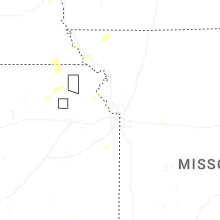


Connect with Interactive Hail Maps