

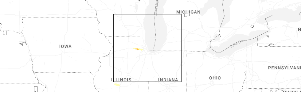
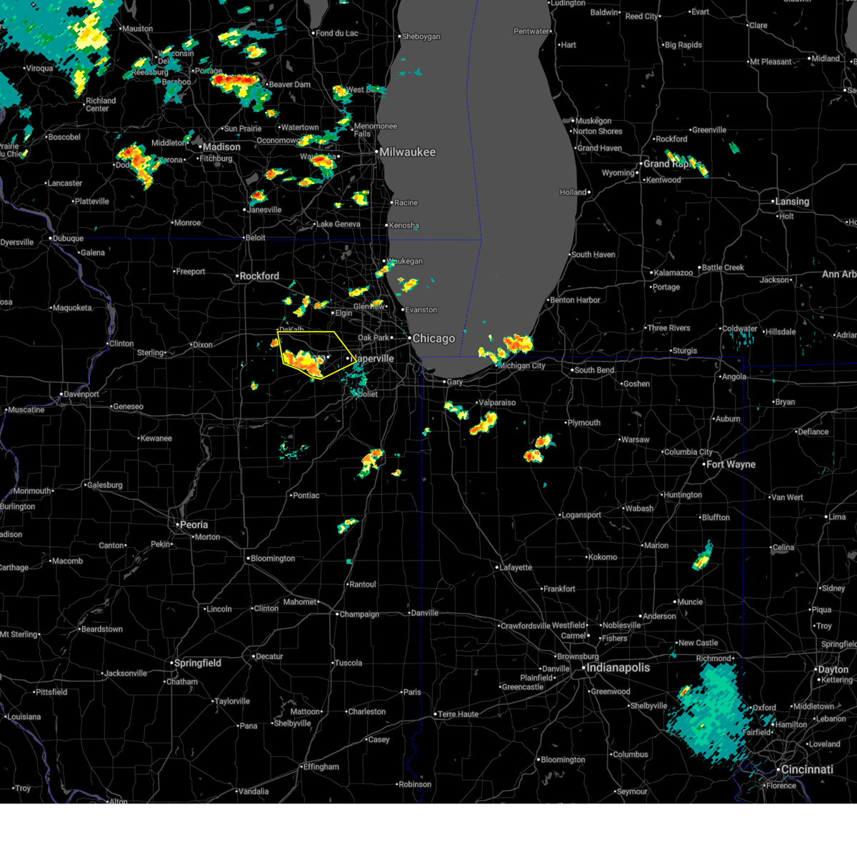
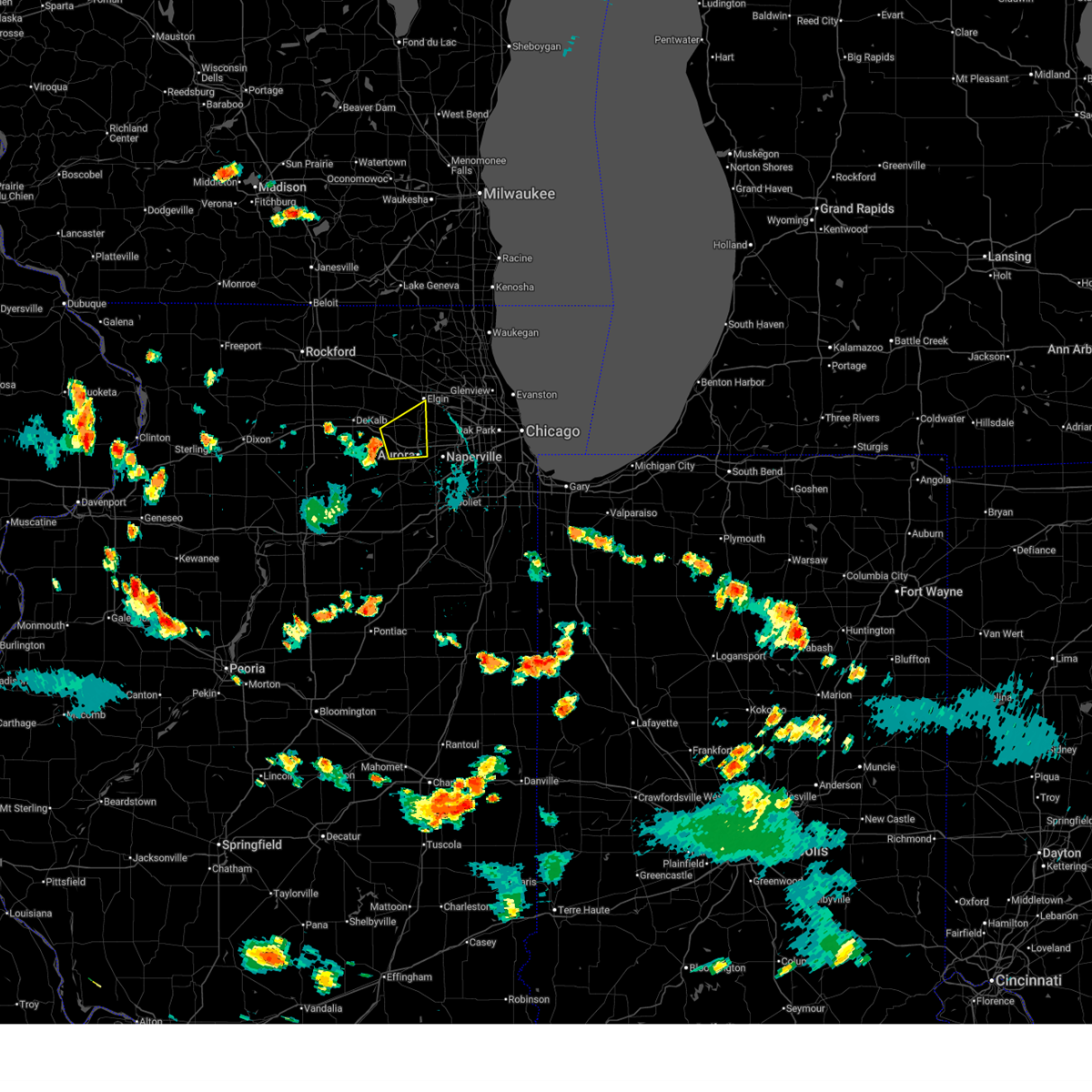
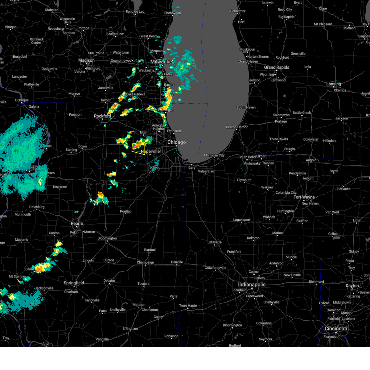
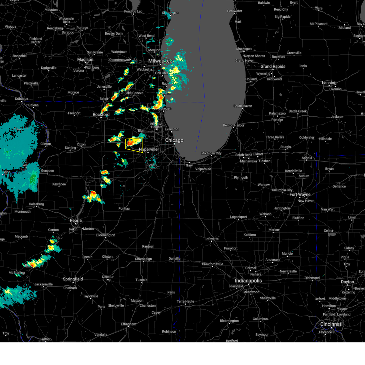
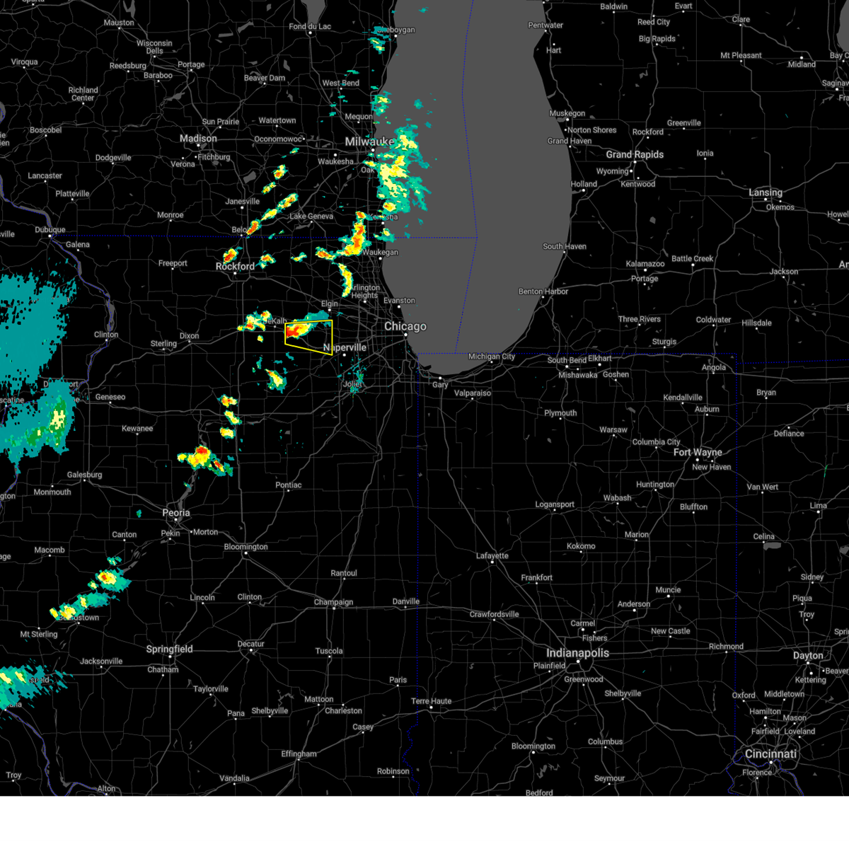
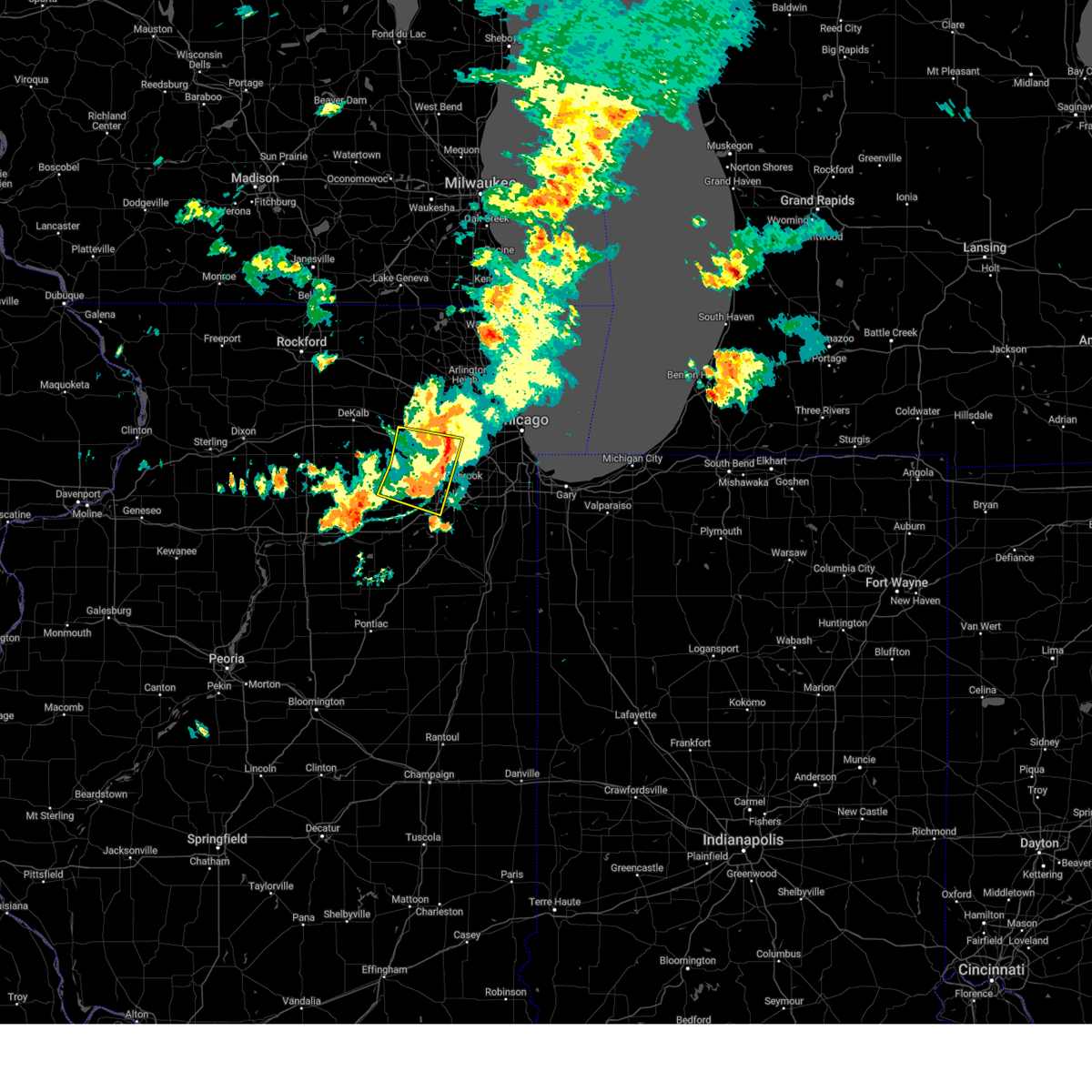
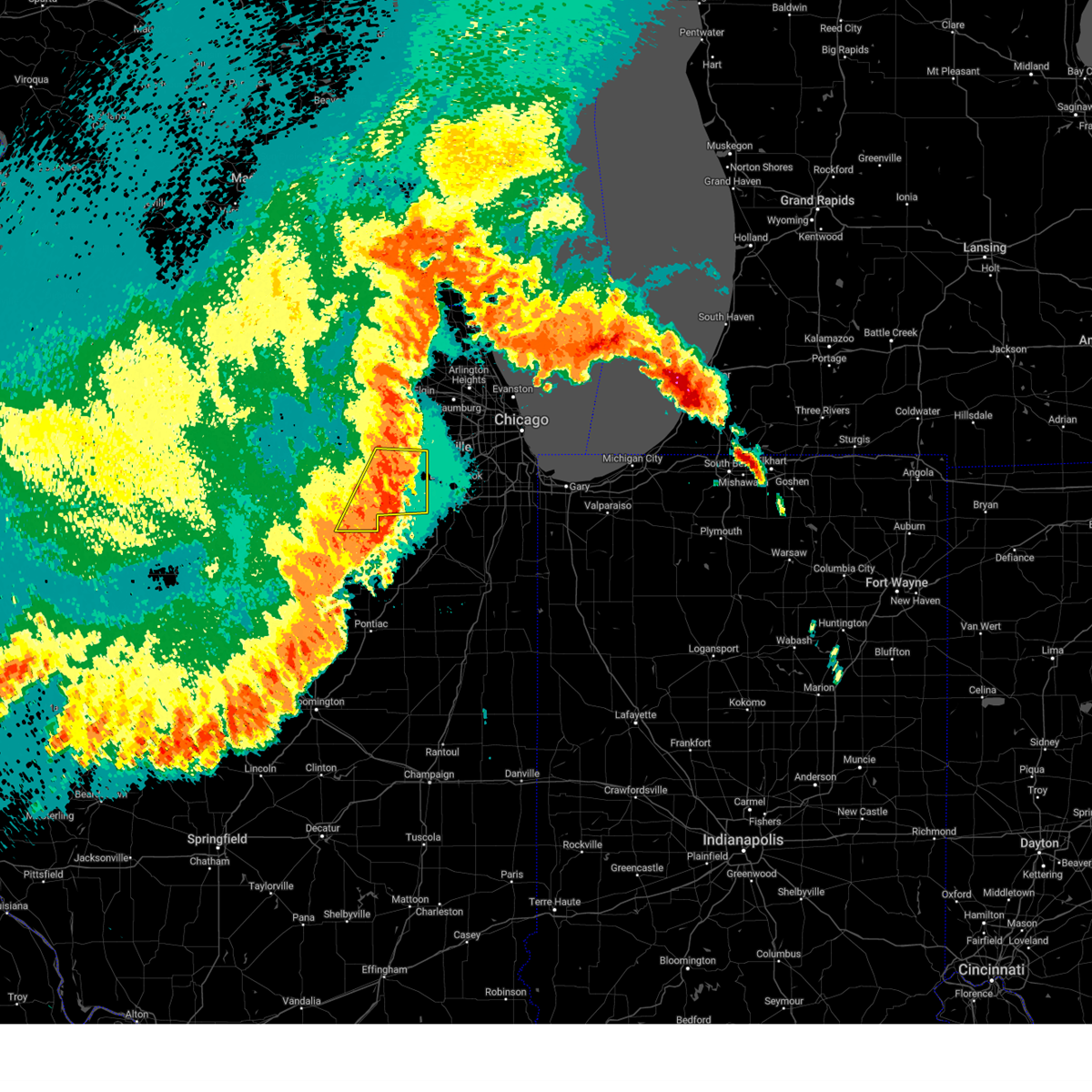
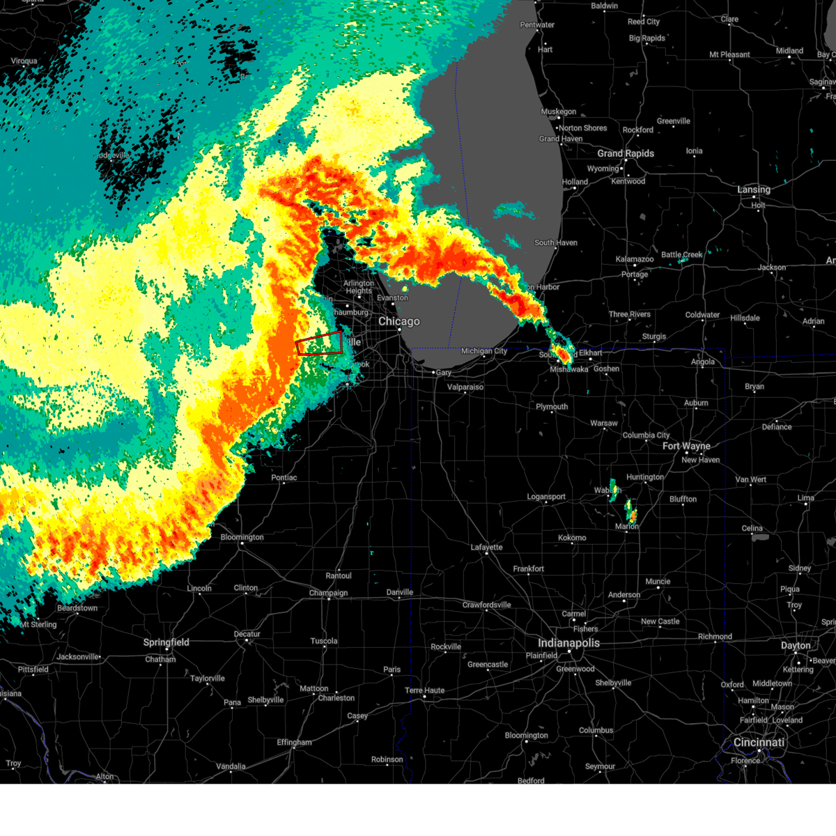
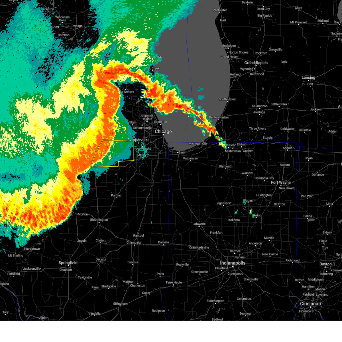
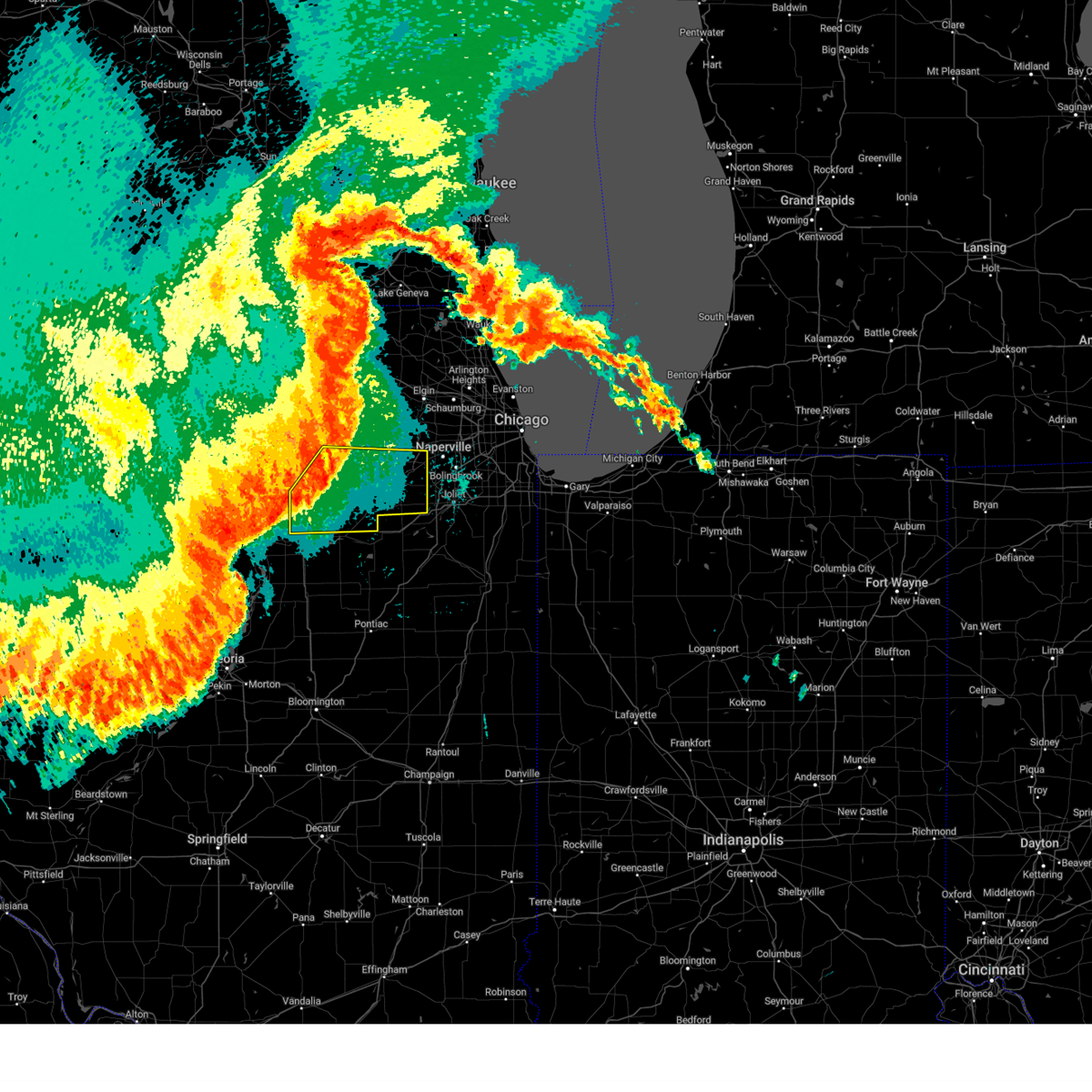
Hail Map for Big Rock, IL
The Big Rock, IL area has had 3 reports of on-the-ground hail by trained spotters, and has been under severe weather warnings 42 times during the past 12 months. Doppler radar has detected hail at or near Big Rock, IL on 70 occasions, including 3 occasions during the past year.
| Name: | Big Rock, IL |
| Where Located: | 46.6 miles W of Chicago, IL |
| Map: | Google Map for Big Rock, IL |
| Population: | 1126 |
| Housing Units: | 426 |
| More Info: | Search Google for Big Rock, IL |
0
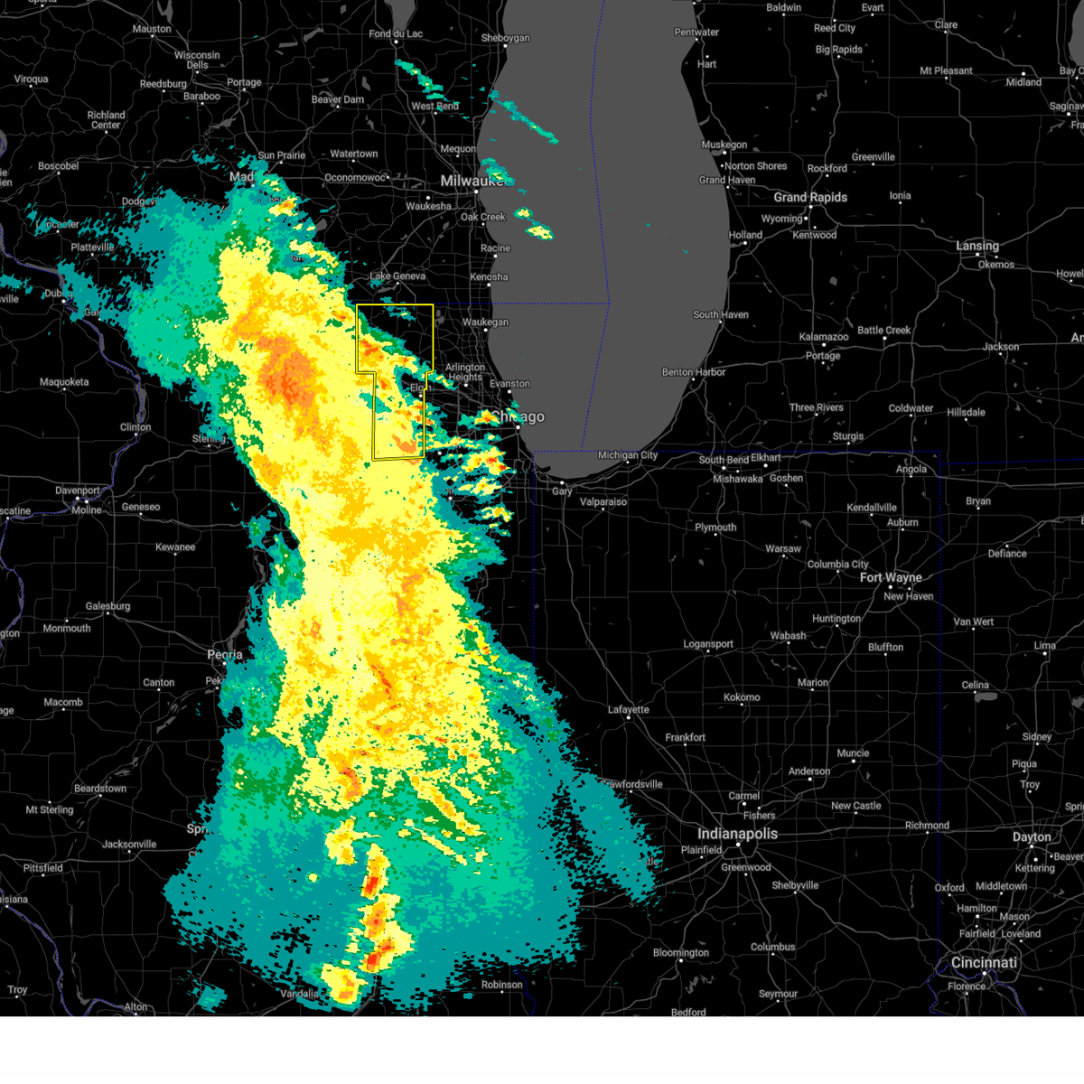
The Top Recent Hail Date for Big Rock, IL is Sunday, June 8, 2025 (70th out of 70)
Hail and Wind Damage Spotted near Big Rock, IL
| Date / Time | Report Details |
|---|---|
| 6/26/2025 7:13 PM CDT |
 the severe thunderstorm warning has been cancelled and is no longer in effect the severe thunderstorm warning has been cancelled and is no longer in effect
|
| 6/26/2025 6:58 PM CDT |
 At 657 pm cdt, a severe thunderstorm was located over kaneville and batavia, and was moving northeast at 20 mph (radar indicated). Hazards include 60 mph wind gusts. Expect damage to roofs, siding, and trees. locations impacted include, kaneville, batavia, elburn, north aurora, geneva, maple park, st. Charles, aurora, sugar grove, west chicago, and campton hills. At 657 pm cdt, a severe thunderstorm was located over kaneville and batavia, and was moving northeast at 20 mph (radar indicated). Hazards include 60 mph wind gusts. Expect damage to roofs, siding, and trees. locations impacted include, kaneville, batavia, elburn, north aurora, geneva, maple park, st. Charles, aurora, sugar grove, west chicago, and campton hills.
|
| 6/26/2025 6:58 PM CDT |
 the severe thunderstorm warning has been cancelled and is no longer in effect the severe thunderstorm warning has been cancelled and is no longer in effect
|
| 6/26/2025 6:46 PM CDT |
 the severe thunderstorm warning has been cancelled and is no longer in effect the severe thunderstorm warning has been cancelled and is no longer in effect
|
| 6/26/2025 6:46 PM CDT |
 At 646 pm cdt, a severe thunderstorm was located over kaneville and north aurora, moving northeast at 25 mph (radar indicated). Hazards include 60 mph wind gusts. Expect damage to roofs, siding, and trees. locations impacted include, montgomery, elburn, north aurora, geneva, big rock, kaneville, aurora, batavia, sugar grove, warrenville, maple park, st. Charles, west chicago, naperville, and campton hills. At 646 pm cdt, a severe thunderstorm was located over kaneville and north aurora, moving northeast at 25 mph (radar indicated). Hazards include 60 mph wind gusts. Expect damage to roofs, siding, and trees. locations impacted include, montgomery, elburn, north aurora, geneva, big rock, kaneville, aurora, batavia, sugar grove, warrenville, maple park, st. Charles, west chicago, naperville, and campton hills.
|
| 6/26/2025 6:36 PM CDT |
 At 635 pm cdt, a severe thunderstorm was located near plano, moving northeast at 20 mph (radar indicated). Hazards include 60 mph wind gusts. the strongest winds are expected to impact kane county with this storm. Expect damage to roofs, siding, and trees. locations impacted include, oswego, montgomery, elburn, naperville, north aurora, geneva, boulder hill, big rock, kaneville, aurora, batavia, hinckley, bristol, sugar grove, yorkville, warrenville, little rock, maple park, st. Charles, plano, cortland, dekalb, west chicago, and campton hills. At 635 pm cdt, a severe thunderstorm was located near plano, moving northeast at 20 mph (radar indicated). Hazards include 60 mph wind gusts. the strongest winds are expected to impact kane county with this storm. Expect damage to roofs, siding, and trees. locations impacted include, oswego, montgomery, elburn, naperville, north aurora, geneva, boulder hill, big rock, kaneville, aurora, batavia, hinckley, bristol, sugar grove, yorkville, warrenville, little rock, maple park, st. Charles, plano, cortland, dekalb, west chicago, and campton hills.
|
| 6/26/2025 6:28 PM CDT | Svrlot the national weather service in chicago has issued a * severe thunderstorm warning for, northern kendall county in northeastern illinois, northwestern will county in northeastern illinois, southeastern de kalb county in north central illinois, southern kane county in northeastern illinois, southwestern dupage county in northeastern illinois, * until 730 pm cdt. * at 628 pm cdt, a severe thunderstorm was located near plano, moving northeast at 20 mph (radar indicated). Hazards include 60 mph wind gusts. expect damage to roofs, siding, and trees |
| 6/25/2025 5:12 PM CDT |
 At 512 pm cdt, a severe thunderstorm was located over elburn, or near campton hills, moving northeast at 30 mph (radar indicated). Hazards include 60 mph wind gusts. Expect damage to roofs, siding, and trees. locations impacted include, valley view, elburn, north aurora, geneva, kaneville, aurora, batavia, st. Charles, campton hills, sugar grove, south elgin, wayne, lily lake, and elgin. At 512 pm cdt, a severe thunderstorm was located over elburn, or near campton hills, moving northeast at 30 mph (radar indicated). Hazards include 60 mph wind gusts. Expect damage to roofs, siding, and trees. locations impacted include, valley view, elburn, north aurora, geneva, kaneville, aurora, batavia, st. Charles, campton hills, sugar grove, south elgin, wayne, lily lake, and elgin.
|
| 6/25/2025 5:04 PM CDT | Svrlot the national weather service in chicago has issued a * severe thunderstorm warning for, southern kane county in northeastern illinois, * until 545 pm cdt. * at 503 pm cdt, a severe thunderstorm was located near elburn, or 9 miles southwest of campton hills, moving northeast at 30 mph (radar indicated). Hazards include 60 mph wind gusts. expect damage to roofs, siding, and trees |
| 6/8/2025 2:47 PM CDT |
 At 247 pm cdt, a severe thunderstorm was located near elburn, or near geneva, moving east southeast at 35 mph (radar indicated). Hazards include 60 mph wind gusts and half dollar size hail. Hail damage to vehicles is expected. expect wind damage to roofs, siding, and trees. locations impacted include, aurora, batavia, st. charles, elburn, north aurora, geneva, sugar grove, west chicago, and campton hills. Including the following interstate, i-88 between mile markers 107 and 120. At 247 pm cdt, a severe thunderstorm was located near elburn, or near geneva, moving east southeast at 35 mph (radar indicated). Hazards include 60 mph wind gusts and half dollar size hail. Hail damage to vehicles is expected. expect wind damage to roofs, siding, and trees. locations impacted include, aurora, batavia, st. charles, elburn, north aurora, geneva, sugar grove, west chicago, and campton hills. Including the following interstate, i-88 between mile markers 107 and 120.
|
| 6/8/2025 2:37 PM CDT |
 At 237 pm cdt, a severe thunderstorm was located over elburn, or 7 miles southwest of campton hills, moving east southeast at 35 mph (radar indicated). Hazards include 60 mph wind gusts and half dollar size hail. Hail damage to vehicles is expected. expect wind damage to roofs, siding, and trees. locations impacted include, valley view, elburn, north aurora, geneva, lily lake, kaneville, wayne, aurora, batavia, st. Charles, campton hills, maple park, virgil, sugar grove, and west chicago. At 237 pm cdt, a severe thunderstorm was located over elburn, or 7 miles southwest of campton hills, moving east southeast at 35 mph (radar indicated). Hazards include 60 mph wind gusts and half dollar size hail. Hail damage to vehicles is expected. expect wind damage to roofs, siding, and trees. locations impacted include, valley view, elburn, north aurora, geneva, lily lake, kaneville, wayne, aurora, batavia, st. Charles, campton hills, maple park, virgil, sugar grove, and west chicago.
|
| 6/8/2025 2:37 PM CDT |
 the severe thunderstorm warning has been cancelled and is no longer in effect the severe thunderstorm warning has been cancelled and is no longer in effect
|
| 6/8/2025 2:32 PM CDT |
 Svrlot the national weather service in chicago has issued a * severe thunderstorm warning for, east central de kalb county in north central illinois, southern kane county in northeastern illinois, * until 315 pm cdt. * at 231 pm cdt, a severe thunderstorm was located over maple park, or 9 miles southeast of sycamore, moving east at 35 mph (radar indicated). Hazards include 60 mph wind gusts and quarter size hail. Hail damage to vehicles is expected. Expect wind damage to roofs, siding, and trees. Svrlot the national weather service in chicago has issued a * severe thunderstorm warning for, east central de kalb county in north central illinois, southern kane county in northeastern illinois, * until 315 pm cdt. * at 231 pm cdt, a severe thunderstorm was located over maple park, or 9 miles southeast of sycamore, moving east at 35 mph (radar indicated). Hazards include 60 mph wind gusts and quarter size hail. Hail damage to vehicles is expected. Expect wind damage to roofs, siding, and trees.
|
| 3/15/2025 12:13 AM CDT | The storms which prompted the warning have moved out of the area. therefore, the warning will be allowed to expire. however, gusty winds are still possible with these thunderstorms. a severe thunderstorm watch remains in effect until 200 am cdt for north central and northeastern illinois. |
| 3/14/2025 11:50 PM CDT |
 At 1149 pm cdt, severe thunderstorms were located along a line extending from near edgerton to near huntley to aurora, moving northeast at 50 mph (radar indicated). Hazards include 60 mph wind gusts. Expect damage to roofs, siding, and trees. locations impacted include, oakwood hills, fox river grove, valley view, algonquin, lily lake, woodstock, kaneville, aurora, west dundee, ridgefield, south elgin, chemung, pistakee highlands, huntley, greenwood, gilberts, montgomery, lakewood, wayne, marengo, st. Charles, crystal lake, sugar grove, sleepy hollow, and richmond. At 1149 pm cdt, severe thunderstorms were located along a line extending from near edgerton to near huntley to aurora, moving northeast at 50 mph (radar indicated). Hazards include 60 mph wind gusts. Expect damage to roofs, siding, and trees. locations impacted include, oakwood hills, fox river grove, valley view, algonquin, lily lake, woodstock, kaneville, aurora, west dundee, ridgefield, south elgin, chemung, pistakee highlands, huntley, greenwood, gilberts, montgomery, lakewood, wayne, marengo, st. Charles, crystal lake, sugar grove, sleepy hollow, and richmond.
|
| 3/14/2025 11:45 PM CDT | the tornado warning has been cancelled and is no longer in effect |
| 3/14/2025 11:37 PM CDT | At 1137 pm cdt, severe thunderstorms capable of producing tornadoes were located along a line extending from maple park to near elburn to sugar grove, moving northeast at 60 mph (radar indicated rotation). Hazards include tornado. Flying debris will be dangerous to those caught without shelter. mobile homes will be damaged or destroyed. damage to roofs, windows, and vehicles will occur. tree damage is likely. These dangerous storms will be near, maple park around 1140 pm cdt. |
| 3/14/2025 11:25 PM CDT |
 Torlot the national weather service in chicago has issued a * tornado warning for, southeastern de kalb county in north central illinois, southwestern kane county in northeastern illinois, * until midnight cdt. * at 1124 pm cdt, severe thunderstorms capable of producing a tornado were located along a line extending from waterman to near somonauk to lake holiday, moving northeast at 60 mph (radar indicated rotation). Hazards include tornado. Flying debris will be dangerous to those caught without shelter. mobile homes will be damaged or destroyed. damage to roofs, windows, and vehicles will occur. tree damage is likely. these dangerous storms will be near, hinckley around 1130 pm cdt. Maple park around 1135 pm cdt. Torlot the national weather service in chicago has issued a * tornado warning for, southeastern de kalb county in north central illinois, southwestern kane county in northeastern illinois, * until midnight cdt. * at 1124 pm cdt, severe thunderstorms capable of producing a tornado were located along a line extending from waterman to near somonauk to lake holiday, moving northeast at 60 mph (radar indicated rotation). Hazards include tornado. Flying debris will be dangerous to those caught without shelter. mobile homes will be damaged or destroyed. damage to roofs, windows, and vehicles will occur. tree damage is likely. these dangerous storms will be near, hinckley around 1130 pm cdt. Maple park around 1135 pm cdt.
|
| 3/14/2025 11:24 PM CDT |
 the severe thunderstorm warning has been cancelled and is no longer in effect the severe thunderstorm warning has been cancelled and is no longer in effect
|
| 3/14/2025 11:24 PM CDT |
 At 1123 pm cdt, severe thunderstorms were located along a line extending from near brodhead to near malta to near sheridan, moving northeast at 50 mph (radar indicated). Hazards include 60 mph wind gusts. Expect damage to roofs, siding, and trees. locations impacted include, oakwood hills, fox river grove, valley view, algonquin, lily lake, woodstock, kaneville, aurora, west dundee, ridgefield, south elgin, chemung, pistakee highlands, huntley, greenwood, gilberts, montgomery, lakewood, wayne, marengo, st. charles, crystal lake, sugar grove, sleepy hollow, and richmond. including the following interstates, i-88 between mile markers 102 and 120. I-90 between mile markers 32 and 56. At 1123 pm cdt, severe thunderstorms were located along a line extending from near brodhead to near malta to near sheridan, moving northeast at 50 mph (radar indicated). Hazards include 60 mph wind gusts. Expect damage to roofs, siding, and trees. locations impacted include, oakwood hills, fox river grove, valley view, algonquin, lily lake, woodstock, kaneville, aurora, west dundee, ridgefield, south elgin, chemung, pistakee highlands, huntley, greenwood, gilberts, montgomery, lakewood, wayne, marengo, st. charles, crystal lake, sugar grove, sleepy hollow, and richmond. including the following interstates, i-88 between mile markers 102 and 120. I-90 between mile markers 32 and 56.
|
| 3/14/2025 11:20 PM CDT | Svrlot the national weather service in chicago has issued a * severe thunderstorm warning for, northeastern la salle county in north central illinois, northeastern lee county in north central illinois, kane county in northeastern illinois, mchenry county in northeastern illinois, * until 1215 am cdt. * at 1119 pm cdt, severe thunderstorms were located along a line extending from near brodhead to near malta to near sheridan, moving northeast at 50 mph. numerous reports of 60 mph gusts have been reported with this line of storms (radar indicated). Hazards include 60 mph wind gusts. expect damage to roofs, siding, and trees |
| 8/16/2024 7:43 PM CDT |
 The storms which prompted the warning have moved out of the area. therefore, the warning will be allowed to expire. however, gusty winds are still possible with these thunderstorms. remember, a severe thunderstorm warning still remains in effect for will and dupage counties. The storms which prompted the warning have moved out of the area. therefore, the warning will be allowed to expire. however, gusty winds are still possible with these thunderstorms. remember, a severe thunderstorm warning still remains in effect for will and dupage counties.
|
| 8/16/2024 7:30 PM CDT |
 the severe thunderstorm warning has been cancelled and is no longer in effect the severe thunderstorm warning has been cancelled and is no longer in effect
|
| 8/16/2024 7:30 PM CDT |
 At 730 pm cdt, severe thunderstorms were located along a line extending from geneva to aurora to near yorkville to near newark, moving east at 50 mph (radar indicated). Hazards include 60 mph wind gusts. Expect damage to roofs, siding, and trees. Locations impacted include, aurora, joliet, naperville, bolingbrook, wheaton, downers grove, romeoville, plainfield, woodridge, oswego, glen ellyn, west chicago, batavia, geneva, yorkville, channahon, minooka, plano, lisle, crest hill, montgomery, north aurora, shorewood, warrenville, and winfield. At 730 pm cdt, severe thunderstorms were located along a line extending from geneva to aurora to near yorkville to near newark, moving east at 50 mph (radar indicated). Hazards include 60 mph wind gusts. Expect damage to roofs, siding, and trees. Locations impacted include, aurora, joliet, naperville, bolingbrook, wheaton, downers grove, romeoville, plainfield, woodridge, oswego, glen ellyn, west chicago, batavia, geneva, yorkville, channahon, minooka, plano, lisle, crest hill, montgomery, north aurora, shorewood, warrenville, and winfield.
|
| 8/16/2024 7:21 PM CDT |
 At 721 pm cdt, severe thunderstorms were located along a line extending from elburn to sugar grove to near sandwich to near earlville, moving east at 45 mph (radar indicated). Hazards include 60 mph wind gusts. Expect damage to roofs, siding, and trees. Locations impacted include, aurora, joliet, naperville, bolingbrook, wheaton, downers grove, romeoville, plainfield, woodridge, oswego, glen ellyn, west chicago, batavia, geneva, yorkville, channahon, minooka, plano, sandwich, lisle, crest hill, montgomery, north aurora, shorewood, and warrenville. At 721 pm cdt, severe thunderstorms were located along a line extending from elburn to sugar grove to near sandwich to near earlville, moving east at 45 mph (radar indicated). Hazards include 60 mph wind gusts. Expect damage to roofs, siding, and trees. Locations impacted include, aurora, joliet, naperville, bolingbrook, wheaton, downers grove, romeoville, plainfield, woodridge, oswego, glen ellyn, west chicago, batavia, geneva, yorkville, channahon, minooka, plano, sandwich, lisle, crest hill, montgomery, north aurora, shorewood, and warrenville.
|
| 8/16/2024 7:08 PM CDT |
 Svrlot the national weather service in chicago has issued a * severe thunderstorm warning for, kendall county in northeastern illinois, northeastern la salle county in north central illinois, northwestern will county in northeastern illinois, southeastern de kalb county in north central illinois, southern kane county in northeastern illinois, southwestern dupage county in northeastern illinois, * until 745 pm cdt. * at 706 pm cdt, severe thunderstorms were located along a line extending from cortland to near hinckley to leland to near mendota, moving east at 50 mph (radar indicated). Hazards include 60 mph wind gusts. expect damage to roofs, siding, and trees Svrlot the national weather service in chicago has issued a * severe thunderstorm warning for, kendall county in northeastern illinois, northeastern la salle county in north central illinois, northwestern will county in northeastern illinois, southeastern de kalb county in north central illinois, southern kane county in northeastern illinois, southwestern dupage county in northeastern illinois, * until 745 pm cdt. * at 706 pm cdt, severe thunderstorms were located along a line extending from cortland to near hinckley to leland to near mendota, moving east at 50 mph (radar indicated). Hazards include 60 mph wind gusts. expect damage to roofs, siding, and trees
|
| 7/15/2024 9:04 PM CDT |
 At 903 pm cdt, severe thunderstorms were located along a line extending from aurora to near oswego to near marseilles, moving east at 45 mph. the aurora-sugar grove airport measured a 70 mph wind gust with these storms (surface observations). Hazards include 70 mph wind gusts. Expect considerable tree damage. damage is likely to mobile homes, roofs, and outbuildings. Locations impacted include, aurora, joliet, plainfield, oswego, ottawa, yorkville, minooka, plano, sandwich, sheridan, montgomery, sugar grove, boulder hill, lake holiday, somonauk, serena, newark, millington, big rock, dayton, millbrook, lisbon, plattville, bristol, and wedron. At 903 pm cdt, severe thunderstorms were located along a line extending from aurora to near oswego to near marseilles, moving east at 45 mph. the aurora-sugar grove airport measured a 70 mph wind gust with these storms (surface observations). Hazards include 70 mph wind gusts. Expect considerable tree damage. damage is likely to mobile homes, roofs, and outbuildings. Locations impacted include, aurora, joliet, plainfield, oswego, ottawa, yorkville, minooka, plano, sandwich, sheridan, montgomery, sugar grove, boulder hill, lake holiday, somonauk, serena, newark, millington, big rock, dayton, millbrook, lisbon, plattville, bristol, and wedron.
|
| 7/15/2024 9:04 PM CDT |
 the severe thunderstorm warning has been cancelled and is no longer in effect the severe thunderstorm warning has been cancelled and is no longer in effect
|
| 7/15/2024 8:58 PM CDT |
 the severe thunderstorm warning has been cancelled and is no longer in effect the severe thunderstorm warning has been cancelled and is no longer in effect
|
| 7/15/2024 8:58 PM CDT |
 At 856 pm cdt, severe thunderstorms were located along a line extending from richmond to lakewood to near campton hills to sugar grove, moving east at 35 mph. the aurora-sugar grove airport just recorded a wind gust to 70 mph with these storms (trained weather spotters). Hazards include 70 mph wind gusts. Expect considerable tree damage. damage is likely to mobile homes, roofs, and outbuildings. locations impacted include, aurora, elgin, bartlett, crystal lake, carpentersville, st. Charles, algonquin, lake in the hills, west chicago, mchenry, batavia, woodstock, huntley, geneva, sycamore, campton hills, fox lake, island lake, marengo, south elgin, cary, north aurora, sugar grove, pingree grove, and gilberts. At 856 pm cdt, severe thunderstorms were located along a line extending from richmond to lakewood to near campton hills to sugar grove, moving east at 35 mph. the aurora-sugar grove airport just recorded a wind gust to 70 mph with these storms (trained weather spotters). Hazards include 70 mph wind gusts. Expect considerable tree damage. damage is likely to mobile homes, roofs, and outbuildings. locations impacted include, aurora, elgin, bartlett, crystal lake, carpentersville, st. Charles, algonquin, lake in the hills, west chicago, mchenry, batavia, woodstock, huntley, geneva, sycamore, campton hills, fox lake, island lake, marengo, south elgin, cary, north aurora, sugar grove, pingree grove, and gilberts.
|
| 7/15/2024 8:52 PM CDT |
 Torlot the national weather service in chicago has issued a * tornado warning for, southeastern kane county in northeastern illinois, southwestern dupage county in northeastern illinois, * until 930 pm cdt. * at 852 pm cdt, a severe thunderstorm capable of producing a tornado was located over sugar grove, or 8 miles northeast of plano, moving east at 40 mph (radar indicated rotation). Hazards include tornado. Flying debris will be dangerous to those caught without shelter. mobile homes will be damaged or destroyed. damage to roofs, windows, and vehicles will occur. tree damage is likely. this dangerous storm will be near, aurora, batavia, montgomery, north aurora, and sugar grove around 900 pm cdt. naperville and warrenville around 905 pm cdt. Other locations in the path of this tornadic thunderstorm include wheaton. Torlot the national weather service in chicago has issued a * tornado warning for, southeastern kane county in northeastern illinois, southwestern dupage county in northeastern illinois, * until 930 pm cdt. * at 852 pm cdt, a severe thunderstorm capable of producing a tornado was located over sugar grove, or 8 miles northeast of plano, moving east at 40 mph (radar indicated rotation). Hazards include tornado. Flying debris will be dangerous to those caught without shelter. mobile homes will be damaged or destroyed. damage to roofs, windows, and vehicles will occur. tree damage is likely. this dangerous storm will be near, aurora, batavia, montgomery, north aurora, and sugar grove around 900 pm cdt. naperville and warrenville around 905 pm cdt. Other locations in the path of this tornadic thunderstorm include wheaton.
|
| 7/15/2024 8:51 PM CDT | Public report of possible tree damage southeast of big rock. time estimated by radar. relayed via mpin in kane county IL, 0.6 miles N of Big Rock, IL |
| 7/15/2024 8:41 PM CDT |
 At 841 pm cdt, severe thunderstorms were located along a line extending from near hinckley to 6 miles southeast of earlville to near dalzell, moving east at 45 mph (radar indicated). Hazards include 70 mph wind gusts. Expect considerable tree damage. damage is likely to mobile homes, roofs, and outbuildings. Locations impacted include, aurora, joliet, plainfield, oswego, ottawa, yorkville, minooka, plano, la salle, sandwich, mendota, sheridan, shabbona, montgomery, sugar grove, boulder hill, lake holiday, hinckley, somonauk, earlville, waterman, serena, newark, leland, and paw paw. At 841 pm cdt, severe thunderstorms were located along a line extending from near hinckley to 6 miles southeast of earlville to near dalzell, moving east at 45 mph (radar indicated). Hazards include 70 mph wind gusts. Expect considerable tree damage. damage is likely to mobile homes, roofs, and outbuildings. Locations impacted include, aurora, joliet, plainfield, oswego, ottawa, yorkville, minooka, plano, la salle, sandwich, mendota, sheridan, shabbona, montgomery, sugar grove, boulder hill, lake holiday, hinckley, somonauk, earlville, waterman, serena, newark, leland, and paw paw.
|
| 7/15/2024 8:34 PM CDT |
 At 834 pm cdt, severe thunderstorms were located along a line extending from near harvard to near marengo to near sycamore to near waterman, moving east at 45 mph (radar indicated). Hazards include 70 mph wind gusts. Expect considerable tree damage. damage is likely to mobile homes, roofs, and outbuildings. locations impacted include, aurora, elgin, dekalb, bartlett, crystal lake, carpentersville, st. Charles, algonquin, lake in the hills, west chicago, mchenry, batavia, belvidere, woodstock, huntley, geneva, sycamore, campton hills, fox lake, harvard, island lake, marengo, poplar grove, genoa, and south elgin. At 834 pm cdt, severe thunderstorms were located along a line extending from near harvard to near marengo to near sycamore to near waterman, moving east at 45 mph (radar indicated). Hazards include 70 mph wind gusts. Expect considerable tree damage. damage is likely to mobile homes, roofs, and outbuildings. locations impacted include, aurora, elgin, dekalb, bartlett, crystal lake, carpentersville, st. Charles, algonquin, lake in the hills, west chicago, mchenry, batavia, belvidere, woodstock, huntley, geneva, sycamore, campton hills, fox lake, harvard, island lake, marengo, poplar grove, genoa, and south elgin.
|
| 7/15/2024 8:31 PM CDT |
 At 831 pm cdt, severe thunderstorms were located along a line extending from waterman to near earlville to near la moille, moving east at 40 mph (radar indicated). Hazards include 70 mph wind gusts. Expect considerable tree damage. damage is likely to mobile homes, roofs, and outbuildings. Locations impacted include, aurora, joliet, plainfield, oswego, ottawa, yorkville, minooka, plano, la salle, sandwich, mendota, sheridan, shabbona, montgomery, sugar grove, boulder hill, lake holiday, hinckley, somonauk, earlville, waterman, serena, newark, leland, and paw paw. At 831 pm cdt, severe thunderstorms were located along a line extending from waterman to near earlville to near la moille, moving east at 40 mph (radar indicated). Hazards include 70 mph wind gusts. Expect considerable tree damage. damage is likely to mobile homes, roofs, and outbuildings. Locations impacted include, aurora, joliet, plainfield, oswego, ottawa, yorkville, minooka, plano, la salle, sandwich, mendota, sheridan, shabbona, montgomery, sugar grove, boulder hill, lake holiday, hinckley, somonauk, earlville, waterman, serena, newark, leland, and paw paw.
|
| 7/15/2024 8:22 PM CDT |
 At 822 pm cdt, severe thunderstorms were located along a line extending from 6 miles southwest of sharon to near belvidere to near kirkland to near shabbona, moving east at 45 mph (radar indicated). Hazards include 70 mph wind gusts. Expect considerable tree damage. damage is likely to mobile homes, roofs, and outbuildings. locations impacted include, aurora, elgin, dekalb, bartlett, crystal lake, carpentersville, st. Charles, algonquin, lake in the hills, west chicago, mchenry, batavia, belvidere, woodstock, huntley, loves park, geneva, sycamore, campton hills, fox lake, harvard, island lake, marengo, poplar grove, and genoa. At 822 pm cdt, severe thunderstorms were located along a line extending from 6 miles southwest of sharon to near belvidere to near kirkland to near shabbona, moving east at 45 mph (radar indicated). Hazards include 70 mph wind gusts. Expect considerable tree damage. damage is likely to mobile homes, roofs, and outbuildings. locations impacted include, aurora, elgin, dekalb, bartlett, crystal lake, carpentersville, st. Charles, algonquin, lake in the hills, west chicago, mchenry, batavia, belvidere, woodstock, huntley, loves park, geneva, sycamore, campton hills, fox lake, harvard, island lake, marengo, poplar grove, and genoa.
|
| 7/15/2024 8:22 PM CDT |
 the severe thunderstorm warning has been cancelled and is no longer in effect the severe thunderstorm warning has been cancelled and is no longer in effect
|
| 7/15/2024 8:21 PM CDT | Svrlot the national weather service in chicago has issued a * severe thunderstorm warning for, kendall county in northeastern illinois, northern la salle county in north central illinois, southeastern lee county in north central illinois, southern de kalb county in north central illinois, southern kane county in northeastern illinois, * until 915 pm cdt. * at 821 pm cdt, severe thunderstorms were located along a line extending from near shabbona to near mendota to 6 miles southwest of la moille, moving southeast at 40 mph (radar indicated). Hazards include 70 mph wind gusts. Expect considerable tree damage. Damage is likely to mobile homes, roofs, and outbuildings. |
| 7/15/2024 8:01 PM CDT | Svrlot the national weather service in chicago has issued a * severe thunderstorm warning for, southeastern ogle county in north central illinois, eastern lee county in north central illinois, de kalb county in north central illinois, eastern winnebago county in north central illinois, kane county in northeastern illinois, mchenry county in northeastern illinois, boone county in north central illinois, * until 915 pm cdt. * at 801 pm cdt, severe thunderstorms were located along a line extending from near rockton to rockford airport to near davis junction to near ashton, moving east at 45 mph (radar indicated). Hazards include 70 mph wind gusts. Expect considerable tree damage. Damage is likely to mobile homes, roofs, and outbuildings. |
| 7/14/2024 10:19 PM CDT | Light pole leaning over granart roa in kane county IL, 1.7 miles NE of Big Rock, IL |
| 7/14/2024 9:51 PM CDT |
 the severe thunderstorm warning has been cancelled and is no longer in effect the severe thunderstorm warning has been cancelled and is no longer in effect
|
| 7/14/2024 9:51 PM CDT |
 At 949 pm cdt, severe thunderstorms were located along a line extending from near st. charles to sugar grove, moving east at 45 mph (trained weather spotters). Hazards include 70 mph wind gusts. Expect considerable tree damage. damage is likely to mobile homes, roofs, and outbuildings. locations impacted include, aurora, bartlett, st. Charles, west chicago, batavia, geneva, campton hills, south elgin, montgomery, north aurora, sugar grove, elburn, wayne, valley view, lily lake, big rock, and kaneville. At 949 pm cdt, severe thunderstorms were located along a line extending from near st. charles to sugar grove, moving east at 45 mph (trained weather spotters). Hazards include 70 mph wind gusts. Expect considerable tree damage. damage is likely to mobile homes, roofs, and outbuildings. locations impacted include, aurora, bartlett, st. Charles, west chicago, batavia, geneva, campton hills, south elgin, montgomery, north aurora, sugar grove, elburn, wayne, valley view, lily lake, big rock, and kaneville.
|
| 7/14/2024 9:23 PM CDT |
 At 922 pm cdt, severe thunderstorms were located along a line extending from near hampshire to cortland, moving east at 40 mph (radar indicated). Hazards include 70 mph wind gusts and quarter size hail. Hail damage to vehicles is expected. expect considerable tree damage. wind damage is also likely to mobile homes, roofs, and outbuildings. locations impacted include, aurora, elgin, dekalb, bartlett, carpentersville, st. Charles, algonquin, west chicago, batavia, huntley, geneva, sycamore, campton hills, genoa, south elgin, montgomery, north aurora, sugar grove, pingree grove, gilberts, west dundee, hampshire, elburn, cortland, and barrington hills. At 922 pm cdt, severe thunderstorms were located along a line extending from near hampshire to cortland, moving east at 40 mph (radar indicated). Hazards include 70 mph wind gusts and quarter size hail. Hail damage to vehicles is expected. expect considerable tree damage. wind damage is also likely to mobile homes, roofs, and outbuildings. locations impacted include, aurora, elgin, dekalb, bartlett, carpentersville, st. Charles, algonquin, west chicago, batavia, huntley, geneva, sycamore, campton hills, genoa, south elgin, montgomery, north aurora, sugar grove, pingree grove, gilberts, west dundee, hampshire, elburn, cortland, and barrington hills.
|
| 7/14/2024 9:01 PM CDT |
 Svrlot the national weather service in chicago has issued a * severe thunderstorm warning for, de kalb county in north central illinois, kane county in northeastern illinois, * until 1000 pm cdt. * at 901 pm cdt, severe thunderstorms were located along a line extending from near kirkland to near rochelle, moving east at 45 mph (radar indicated). Hazards include 60 mph wind gusts and quarter size hail. Hail damage to vehicles is expected. Expect wind damage to roofs, siding, and trees. Svrlot the national weather service in chicago has issued a * severe thunderstorm warning for, de kalb county in north central illinois, kane county in northeastern illinois, * until 1000 pm cdt. * at 901 pm cdt, severe thunderstorms were located along a line extending from near kirkland to near rochelle, moving east at 45 mph (radar indicated). Hazards include 60 mph wind gusts and quarter size hail. Hail damage to vehicles is expected. Expect wind damage to roofs, siding, and trees.
|
| 6/25/2024 8:25 AM CDT |
 the severe thunderstorm warning has been cancelled and is no longer in effect the severe thunderstorm warning has been cancelled and is no longer in effect
|
| 6/25/2024 8:18 AM CDT |
 At 817 am cdt, a severe thunderstorm was located near hinckley, or near plano, moving east at 55 mph (radar indicated). Hazards include 60 mph wind gusts. Expect damage to roofs, siding, and trees. locations impacted include, aurora, dekalb, plainfield, st. Charles, oswego, west chicago, batavia, geneva, yorkville, campton hills, plano, sandwich, montgomery, north aurora, sugar grove, boulder hill, elburn, cortland, wayne, hinckley, somonauk, waterman, maple park, big rock, and kaneville. At 817 am cdt, a severe thunderstorm was located near hinckley, or near plano, moving east at 55 mph (radar indicated). Hazards include 60 mph wind gusts. Expect damage to roofs, siding, and trees. locations impacted include, aurora, dekalb, plainfield, st. Charles, oswego, west chicago, batavia, geneva, yorkville, campton hills, plano, sandwich, montgomery, north aurora, sugar grove, boulder hill, elburn, cortland, wayne, hinckley, somonauk, waterman, maple park, big rock, and kaneville.
|
| 6/25/2024 8:18 AM CDT |
 the severe thunderstorm warning has been cancelled and is no longer in effect the severe thunderstorm warning has been cancelled and is no longer in effect
|
| 6/25/2024 8:04 AM CDT |
 Svrlot the national weather service in chicago has issued a * severe thunderstorm warning for, northern kendall county in northeastern illinois, northeastern lee county in north central illinois, southern de kalb county in north central illinois, southern kane county in northeastern illinois, * until 845 am cdt. * at 803 am cdt, a severe thunderstorm was located over waterman, or near shabbona, moving east at 60 mph. a personal weather station gusted to 56 mph with these storms (radar indicated). Hazards include 60 mph wind gusts and nickel size hail. expect damage to roofs, siding, and trees Svrlot the national weather service in chicago has issued a * severe thunderstorm warning for, northern kendall county in northeastern illinois, northeastern lee county in north central illinois, southern de kalb county in north central illinois, southern kane county in northeastern illinois, * until 845 am cdt. * at 803 am cdt, a severe thunderstorm was located over waterman, or near shabbona, moving east at 60 mph. a personal weather station gusted to 56 mph with these storms (radar indicated). Hazards include 60 mph wind gusts and nickel size hail. expect damage to roofs, siding, and trees
|
| 6/25/2024 7:28 AM CDT |
 the severe thunderstorm warning has been cancelled and is no longer in effect the severe thunderstorm warning has been cancelled and is no longer in effect
|
| 6/25/2024 6:55 AM CDT |
 At 655 am cdt, severe thunderstorms were located along a line extending from roselle to near west chicago to near hinckley, moving east at 50 mph. spotters reported powerlines down in sugar grove with these storms (trained weather spotters). Hazards include 60 mph wind gusts and quarter size hail. Hail damage to vehicles is expected. expect wind damage to roofs, siding, and trees. locations impacted include, aurora, naperville, bolingbrook, wheaton, downers grove, elmhurst, lombard, bartlett, carol stream, hanover park, addison, glendale heights, elk grove village, st. Charles, woodridge, glen ellyn, west chicago, batavia, geneva, franklin park, hinsdale, lemont, campton hills, burr ridge, and oak brook. At 655 am cdt, severe thunderstorms were located along a line extending from roselle to near west chicago to near hinckley, moving east at 50 mph. spotters reported powerlines down in sugar grove with these storms (trained weather spotters). Hazards include 60 mph wind gusts and quarter size hail. Hail damage to vehicles is expected. expect wind damage to roofs, siding, and trees. locations impacted include, aurora, naperville, bolingbrook, wheaton, downers grove, elmhurst, lombard, bartlett, carol stream, hanover park, addison, glendale heights, elk grove village, st. Charles, woodridge, glen ellyn, west chicago, batavia, geneva, franklin park, hinsdale, lemont, campton hills, burr ridge, and oak brook.
|
| 6/25/2024 6:32 AM CDT |
 Svrlot the national weather service in chicago has issued a * severe thunderstorm warning for, kane county in northeastern illinois, dupage county in northeastern illinois, * until 745 am cdt. * at 632 am cdt, a severe thunderstorm was located over maple park, or near dekalb, moving east at 55 mph (radar indicated). Hazards include 60 mph wind gusts and quarter size hail. Hail damage to vehicles is expected. Expect wind damage to roofs, siding, and trees. Svrlot the national weather service in chicago has issued a * severe thunderstorm warning for, kane county in northeastern illinois, dupage county in northeastern illinois, * until 745 am cdt. * at 632 am cdt, a severe thunderstorm was located over maple park, or near dekalb, moving east at 55 mph (radar indicated). Hazards include 60 mph wind gusts and quarter size hail. Hail damage to vehicles is expected. Expect wind damage to roofs, siding, and trees.
|
| 5/7/2024 8:11 PM CDT |
 Svrlot the national weather service in chicago has issued a * severe thunderstorm warning for, northern kendall county in northeastern illinois, southeastern kane county in northeastern illinois, * until 830 pm cdt. * at 811 pm cdt, a severe thunderstorm was located near plano, moving east at 40 mph (radar indicated). Hazards include 60 mph wind gusts. expect damage to roofs, siding, and trees Svrlot the national weather service in chicago has issued a * severe thunderstorm warning for, northern kendall county in northeastern illinois, southeastern kane county in northeastern illinois, * until 830 pm cdt. * at 811 pm cdt, a severe thunderstorm was located near plano, moving east at 40 mph (radar indicated). Hazards include 60 mph wind gusts. expect damage to roofs, siding, and trees
|
| 2/27/2024 7:27 PM CST |
 At 727 pm cst, severe thunderstorms were located along a line extending from fox river grove to near streamwood to near warrenville to near oswego, moving northeast at 45 mph (trained weather spotters). Hazards include 70 mph wind gusts and quarter size hail. Hail damage to vehicles is expected. expect considerable tree damage. wind damage is also likely to mobile homes, roofs, and outbuildings. Locations impacted include, chicago, aurora, joliet, naperville, elgin, waukegan, cicero, arlington heights, evanston, schaumburg, bolingbrook, palatine, skokie, des plaines, orland park, tinley park, oak lawn, berwyn, mount prospect, wheaton, hoffman estates, oak park, downers grove, glenview, and elmhurst. At 727 pm cst, severe thunderstorms were located along a line extending from fox river grove to near streamwood to near warrenville to near oswego, moving northeast at 45 mph (trained weather spotters). Hazards include 70 mph wind gusts and quarter size hail. Hail damage to vehicles is expected. expect considerable tree damage. wind damage is also likely to mobile homes, roofs, and outbuildings. Locations impacted include, chicago, aurora, joliet, naperville, elgin, waukegan, cicero, arlington heights, evanston, schaumburg, bolingbrook, palatine, skokie, des plaines, orland park, tinley park, oak lawn, berwyn, mount prospect, wheaton, hoffman estates, oak park, downers grove, glenview, and elmhurst.
|
| 2/27/2024 7:11 PM CST |
 At 711 pm cst, severe thunderstorms were located along a line extending from algonquin to near st. charles to near north aurora to near yorkville, moving east at 40 mph (radar indicated). Hazards include 70 mph wind gusts and half dollar size hail. Hail damage to vehicles is expected. expect considerable tree damage. wind damage is also likely to mobile homes, roofs, and outbuildings. Locations impacted include, chicago, aurora, joliet, naperville, elgin, waukegan, cicero, arlington heights, evanston, schaumburg, bolingbrook, palatine, skokie, des plaines, orland park, tinley park, oak lawn, berwyn, mount prospect, wheaton, hoffman estates, oak park, downers grove, glenview, and elmhurst. At 711 pm cst, severe thunderstorms were located along a line extending from algonquin to near st. charles to near north aurora to near yorkville, moving east at 40 mph (radar indicated). Hazards include 70 mph wind gusts and half dollar size hail. Hail damage to vehicles is expected. expect considerable tree damage. wind damage is also likely to mobile homes, roofs, and outbuildings. Locations impacted include, chicago, aurora, joliet, naperville, elgin, waukegan, cicero, arlington heights, evanston, schaumburg, bolingbrook, palatine, skokie, des plaines, orland park, tinley park, oak lawn, berwyn, mount prospect, wheaton, hoffman estates, oak park, downers grove, glenview, and elmhurst.
|
| 2/27/2024 7:07 PM CST |
 Svrlot the national weather service in chicago has issued a * severe thunderstorm warning for, kendall county in northeastern illinois, southern lake county in northeastern illinois, northwestern will county in northeastern illinois, kane county in northeastern illinois, southeastern mchenry county in northeastern illinois, dupage county in northeastern illinois, cook county in northeastern illinois, * until 815 pm cst. * at 707 pm cst, severe thunderstorms were located along a line extending from algonquin to near campton hills to near sugar grove to near yorkville, moving east at 40 mph (radar indicated). Hazards include 70 mph wind gusts and half dollar size hail. Hail damage to vehicles is expected. expect considerable tree damage. Wind damage is also likely to mobile homes, roofs, and outbuildings. Svrlot the national weather service in chicago has issued a * severe thunderstorm warning for, kendall county in northeastern illinois, southern lake county in northeastern illinois, northwestern will county in northeastern illinois, kane county in northeastern illinois, southeastern mchenry county in northeastern illinois, dupage county in northeastern illinois, cook county in northeastern illinois, * until 815 pm cst. * at 707 pm cst, severe thunderstorms were located along a line extending from algonquin to near campton hills to near sugar grove to near yorkville, moving east at 40 mph (radar indicated). Hazards include 70 mph wind gusts and half dollar size hail. Hail damage to vehicles is expected. expect considerable tree damage. Wind damage is also likely to mobile homes, roofs, and outbuildings.
|
| 2/27/2024 7:00 PM CST |
 At 700 pm cst, a confirmed tornado was located near sugar grove, or near plano, moving east at 40 mph (weather spotters confirmed tornado east of hinkley near interstate 88). Hazards include damaging tornado. Flying debris will be dangerous to those caught without shelter. mobile homes will be damaged or destroyed. damage to roofs, windows, and vehicles will occur. tree damage is likely. this tornado will be near, aurora, yorkville, montgomery, north aurora, and sugar grove around 705 pm cst. batavia and boulder hill around 710 pm cst. Other locations in the path of this tornadic thunderstorm include oswego. At 700 pm cst, a confirmed tornado was located near sugar grove, or near plano, moving east at 40 mph (weather spotters confirmed tornado east of hinkley near interstate 88). Hazards include damaging tornado. Flying debris will be dangerous to those caught without shelter. mobile homes will be damaged or destroyed. damage to roofs, windows, and vehicles will occur. tree damage is likely. this tornado will be near, aurora, yorkville, montgomery, north aurora, and sugar grove around 705 pm cst. batavia and boulder hill around 710 pm cst. Other locations in the path of this tornadic thunderstorm include oswego.
|
| 2/27/2024 6:54 PM CST |
 Torlot the national weather service in chicago has issued a * tornado warning for, northern kendall county in northeastern illinois, southern kane county in northeastern illinois, * until 730 pm cst. * at 654 pm cst, a severe thunderstorm capable of producing a tornado was located over hinckley, or near sandwich, moving east at 40 mph (radar indicated rotation). Hazards include tornado. Flying debris will be dangerous to those caught without shelter. mobile homes will be damaged or destroyed. damage to roofs, windows, and vehicles will occur. tree damage is likely. this dangerous storm will be near, yorkville and sugar grove around 700 pm cst. aurora and montgomery around 705 pm cst. Oswego, north aurora, and boulder hill around 710 pm cst. Torlot the national weather service in chicago has issued a * tornado warning for, northern kendall county in northeastern illinois, southern kane county in northeastern illinois, * until 730 pm cst. * at 654 pm cst, a severe thunderstorm capable of producing a tornado was located over hinckley, or near sandwich, moving east at 40 mph (radar indicated rotation). Hazards include tornado. Flying debris will be dangerous to those caught without shelter. mobile homes will be damaged or destroyed. damage to roofs, windows, and vehicles will occur. tree damage is likely. this dangerous storm will be near, yorkville and sugar grove around 700 pm cst. aurora and montgomery around 705 pm cst. Oswego, north aurora, and boulder hill around 710 pm cst.
|
| 2/27/2024 6:37 PM CST |
 At 637 pm cst, multiple severe thunderstorms were located along a line extending from shabbona to near cortland, moving east northeast at 25 mph (public). Hazards include ping pong ball size hail and 60 mph wind gusts. People and animals outdoors will be injured. expect hail damage to roofs, siding, windows, and vehicles. expect wind damage to roofs, siding, and trees. locations impacted include, aurora, elgin, dekalb, bartlett, carpentersville, st. Charles, algonquin, west chicago, batavia, huntley, geneva, sycamore, campton hills, sandwich, genoa, shabbona, south elgin, montgomery, north aurora, sugar grove, pingree grove, gilberts, west dundee, hampshire, and elburn. At 637 pm cst, multiple severe thunderstorms were located along a line extending from shabbona to near cortland, moving east northeast at 25 mph (public). Hazards include ping pong ball size hail and 60 mph wind gusts. People and animals outdoors will be injured. expect hail damage to roofs, siding, windows, and vehicles. expect wind damage to roofs, siding, and trees. locations impacted include, aurora, elgin, dekalb, bartlett, carpentersville, st. Charles, algonquin, west chicago, batavia, huntley, geneva, sycamore, campton hills, sandwich, genoa, shabbona, south elgin, montgomery, north aurora, sugar grove, pingree grove, gilberts, west dundee, hampshire, and elburn.
|
| 2/27/2024 6:10 PM CST |
 At 610 pm cst, multiple severe thunderstorms were located along a line extending from 7 miles northwest of paw paw to near shabbona to near maple park, moving northeast at 25 mph (radar indicated). Hazards include golf ball size hail and 60 mph wind gusts. People and animals outdoors will be injured. expect hail damage to roofs, siding, windows, and vehicles. expect wind damage to roofs, siding, and trees. locations impacted include, aurora, elgin, dekalb, bartlett, carpentersville, st. Charles, algonquin, west chicago, batavia, huntley, geneva, sycamore, campton hills, sandwich, genoa, shabbona, south elgin, montgomery, north aurora, sugar grove, pingree grove, gilberts, west dundee, hampshire, and elburn. At 610 pm cst, multiple severe thunderstorms were located along a line extending from 7 miles northwest of paw paw to near shabbona to near maple park, moving northeast at 25 mph (radar indicated). Hazards include golf ball size hail and 60 mph wind gusts. People and animals outdoors will be injured. expect hail damage to roofs, siding, windows, and vehicles. expect wind damage to roofs, siding, and trees. locations impacted include, aurora, elgin, dekalb, bartlett, carpentersville, st. Charles, algonquin, west chicago, batavia, huntley, geneva, sycamore, campton hills, sandwich, genoa, shabbona, south elgin, montgomery, north aurora, sugar grove, pingree grove, gilberts, west dundee, hampshire, and elburn.
|
| 2/27/2024 6:02 PM CST |
 At 602 pm cst, multiple severe thunderstorms were located along a line extending from 7 miles northeast of sublette to shabbona to near maple park, moving northeast at 25 mph (radar indicated). Hazards include ping pong ball size hail and 60 mph wind gusts. People and animals outdoors will be injured. expect hail damage to roofs, siding, windows, and vehicles. expect wind damage to roofs, siding, and trees. locations impacted include, aurora, elgin, dekalb, bartlett, carpentersville, st. Charles, algonquin, west chicago, batavia, huntley, geneva, sycamore, campton hills, sandwich, genoa, shabbona, south elgin, montgomery, north aurora, sugar grove, pingree grove, gilberts, west dundee, hampshire, and elburn. At 602 pm cst, multiple severe thunderstorms were located along a line extending from 7 miles northeast of sublette to shabbona to near maple park, moving northeast at 25 mph (radar indicated). Hazards include ping pong ball size hail and 60 mph wind gusts. People and animals outdoors will be injured. expect hail damage to roofs, siding, windows, and vehicles. expect wind damage to roofs, siding, and trees. locations impacted include, aurora, elgin, dekalb, bartlett, carpentersville, st. Charles, algonquin, west chicago, batavia, huntley, geneva, sycamore, campton hills, sandwich, genoa, shabbona, south elgin, montgomery, north aurora, sugar grove, pingree grove, gilberts, west dundee, hampshire, and elburn.
|
| 2/27/2024 5:44 PM CST |
 Svrlot the national weather service in chicago has issued a * severe thunderstorm warning for, de kalb county in north central illinois, kane county in northeastern illinois, * until 715 pm cst. * at 544 pm cst, severe thunderstorms were located along a line extending from near sublette to near leland, moving northeast at 30 mph (radar indicated). Hazards include ping pong ball size hail and 60 mph wind gusts. People and animals outdoors will be injured. expect hail damage to roofs, siding, windows, and vehicles. Expect wind damage to roofs, siding, and trees. Svrlot the national weather service in chicago has issued a * severe thunderstorm warning for, de kalb county in north central illinois, kane county in northeastern illinois, * until 715 pm cst. * at 544 pm cst, severe thunderstorms were located along a line extending from near sublette to near leland, moving northeast at 30 mph (radar indicated). Hazards include ping pong ball size hail and 60 mph wind gusts. People and animals outdoors will be injured. expect hail damage to roofs, siding, windows, and vehicles. Expect wind damage to roofs, siding, and trees.
|
| 7/28/2023 10:47 PM CDT |
 At 1047 pm cdt, severe thunderstorms were located along a line extending from evanston to near lisle to near plano, moving southeast at 35 mph (radar indicated). Hazards include 60 mph wind gusts. Expect damage to roofs, siding, and trees. locations impacted include, chicago, aurora, naperville, cicero, arlington heights, evanston, schaumburg, bolingbrook, skokie, des plaines, oak lawn, berwyn, mount prospect, wheaton, oak park, downers grove, glenview, elmhurst, lombard and bartlett. hail threat, radar indicated max hail size, <. 75 in wind threat, radar indicated max wind gust, 60 mph. At 1047 pm cdt, severe thunderstorms were located along a line extending from evanston to near lisle to near plano, moving southeast at 35 mph (radar indicated). Hazards include 60 mph wind gusts. Expect damage to roofs, siding, and trees. locations impacted include, chicago, aurora, naperville, cicero, arlington heights, evanston, schaumburg, bolingbrook, skokie, des plaines, oak lawn, berwyn, mount prospect, wheaton, oak park, downers grove, glenview, elmhurst, lombard and bartlett. hail threat, radar indicated max hail size, <. 75 in wind threat, radar indicated max wind gust, 60 mph.
|
| 7/28/2023 10:25 PM CDT |
 At 1024 pm cdt, severe thunderstorms were located along a line extending from wayne to near maple park to shabbona, moving southeast at 30 mph (radar indicated). Hazards include 60 mph wind gusts. Expect damage to roofs, siding, and trees. locations impacted include, elgin, dekalb, bartlett, carpentersville, st. charles, algonquin, huntley, geneva, sycamore, campton hills, shabbona, south elgin, sugar grove, pingree grove, gilberts, west dundee, hampshire, elburn, cortland and barrington hills. hail threat, radar indicated max hail size, <. 75 in wind threat, radar indicated max wind gust, 60 mph. At 1024 pm cdt, severe thunderstorms were located along a line extending from wayne to near maple park to shabbona, moving southeast at 30 mph (radar indicated). Hazards include 60 mph wind gusts. Expect damage to roofs, siding, and trees. locations impacted include, elgin, dekalb, bartlett, carpentersville, st. charles, algonquin, huntley, geneva, sycamore, campton hills, shabbona, south elgin, sugar grove, pingree grove, gilberts, west dundee, hampshire, elburn, cortland and barrington hills. hail threat, radar indicated max hail size, <. 75 in wind threat, radar indicated max wind gust, 60 mph.
|
| 7/28/2023 10:23 PM CDT |
 At 1022 pm cdt, severe thunderstorms were located along a line extending from wheeling to near west chicago to near sugar grove, moving southeast at 35 mph (radar indicated). Hazards include 60 mph wind gusts. expect damage to roofs, siding, and trees At 1022 pm cdt, severe thunderstorms were located along a line extending from wheeling to near west chicago to near sugar grove, moving southeast at 35 mph (radar indicated). Hazards include 60 mph wind gusts. expect damage to roofs, siding, and trees
|
| 7/28/2023 9:55 PM CDT |
 At 954 pm cdt, severe thunderstorms were located along a line extending from lakewood to near genoa to near kirkland, moving southeast at 35 mph (radar indicated). Hazards include 60 mph wind gusts. expect damage to roofs, siding, and trees At 954 pm cdt, severe thunderstorms were located along a line extending from lakewood to near genoa to near kirkland, moving southeast at 35 mph (radar indicated). Hazards include 60 mph wind gusts. expect damage to roofs, siding, and trees
|
| 7/28/2023 3:35 AM CDT |
 The severe thunderstorm warning for kendall and kane counties will expire at 345 am cdt, the storm which prompted the warning has weakened below severe limits, and no longer poses an immediate threat to life or property. therefore, the warning will be allowed to expire. however gusty winds are still possible with this thunderstorm. to report severe weather, contact your nearest law enforcement agency. they will relay your report to the national weather service chicago. The severe thunderstorm warning for kendall and kane counties will expire at 345 am cdt, the storm which prompted the warning has weakened below severe limits, and no longer poses an immediate threat to life or property. therefore, the warning will be allowed to expire. however gusty winds are still possible with this thunderstorm. to report severe weather, contact your nearest law enforcement agency. they will relay your report to the national weather service chicago.
|
| 7/28/2023 3:25 AM CDT |
 At 325 am cdt, a severe thunderstorm was located over aurora, moving east at 50 mph (radar indicated). Hazards include 60 mph wind gusts. Expect damage to roofs, siding, and trees. locations impacted include, aurora, joliet, elgin, bartlett, plainfield, carpentersville, st. charles, oswego, west chicago, batavia, geneva, yorkville, campton hills, minooka, plano, sandwich, south elgin, montgomery, north aurora and sugar grove. this includes, aurora university, elgin community college, fermilab, il math and science academy, kane county cougars ballpark, and waubonsee community college. including the following interstates, i-80 between mile markers 120 and 122. i-88 between mile markers 102 and 120. i-90 between mile markers 49 and 56. hail threat, radar indicated max hail size, <. 75 in wind threat, radar indicated max wind gust, 60 mph. At 325 am cdt, a severe thunderstorm was located over aurora, moving east at 50 mph (radar indicated). Hazards include 60 mph wind gusts. Expect damage to roofs, siding, and trees. locations impacted include, aurora, joliet, elgin, bartlett, plainfield, carpentersville, st. charles, oswego, west chicago, batavia, geneva, yorkville, campton hills, minooka, plano, sandwich, south elgin, montgomery, north aurora and sugar grove. this includes, aurora university, elgin community college, fermilab, il math and science academy, kane county cougars ballpark, and waubonsee community college. including the following interstates, i-80 between mile markers 120 and 122. i-88 between mile markers 102 and 120. i-90 between mile markers 49 and 56. hail threat, radar indicated max hail size, <. 75 in wind threat, radar indicated max wind gust, 60 mph.
|
| 7/28/2023 3:06 AM CDT |
 At 306 am cdt, a severe thunderstorm was located over hinckley, or 7 miles northwest of plano, moving east at 50 mph (radar indicated). Hazards include 60 mph wind gusts. expect damage to roofs, siding, and trees At 306 am cdt, a severe thunderstorm was located over hinckley, or 7 miles northwest of plano, moving east at 50 mph (radar indicated). Hazards include 60 mph wind gusts. expect damage to roofs, siding, and trees
|
| 7/14/2023 9:10 PM CDT |
 The severe thunderstorm warning for kendall and southern kane counties will expire at 915 pm cdt, the storm which prompted the warning has moved out of the area. therefore, the warning will be allowed to expire. a severe thunderstorm watch remains in effect until 1000 pm cdt for northeastern illinois. to report severe weather, contact your nearest law enforcement agency. they will relay your report to the national weather service chicago. The severe thunderstorm warning for kendall and southern kane counties will expire at 915 pm cdt, the storm which prompted the warning has moved out of the area. therefore, the warning will be allowed to expire. a severe thunderstorm watch remains in effect until 1000 pm cdt for northeastern illinois. to report severe weather, contact your nearest law enforcement agency. they will relay your report to the national weather service chicago.
|
| 7/14/2023 8:58 PM CDT |
 At 858 pm cdt, a severe thunderstorm was located over naperville, moving east at 45 mph (trained weather spotters). Hazards include 60 to 70 mph wind gusts. Expect considerable tree damage. damage is likely to mobile homes, roofs, and outbuildings. locations impacted include, aurora, joliet, bartlett, plainfield, st. charles, oswego, west chicago, batavia, geneva, yorkville, campton hills, minooka, plano, montgomery, north aurora, sugar grove, boulder hill, elburn, wayne and valley view. this includes, aurora university, fermilab, il math and science academy, kane county cougars ballpark, and waubonsee community college. including the following interstates, i-80 between mile markers 120 and 122. I-88 between mile markers 105 and 120. At 858 pm cdt, a severe thunderstorm was located over naperville, moving east at 45 mph (trained weather spotters). Hazards include 60 to 70 mph wind gusts. Expect considerable tree damage. damage is likely to mobile homes, roofs, and outbuildings. locations impacted include, aurora, joliet, bartlett, plainfield, st. charles, oswego, west chicago, batavia, geneva, yorkville, campton hills, minooka, plano, montgomery, north aurora, sugar grove, boulder hill, elburn, wayne and valley view. this includes, aurora university, fermilab, il math and science academy, kane county cougars ballpark, and waubonsee community college. including the following interstates, i-80 between mile markers 120 and 122. I-88 between mile markers 105 and 120.
|
| 7/14/2023 8:42 PM CDT |
 At 842 pm cdt, a severe thunderstorm was located over yorkville, moving east at 40 mph (trained weather spotters. a 64 mph wind gust was measured in plano with these storms). Hazards include 70 mph wind gusts. Expect considerable tree damage. damage is likely to mobile homes, roofs, and outbuildings. locations impacted include, aurora, joliet, bartlett, plainfield, st. charles, oswego, west chicago, batavia, geneva, yorkville, campton hills, minooka, plano, sandwich, south elgin, montgomery, north aurora, sugar grove, boulder hill and elburn. this includes, aurora university, fermilab, il math and science academy, kane county cougars ballpark, and waubonsee community college. including the following interstates, i-80 between mile markers 120 and 122. I-88 between mile markers 102 and 120. At 842 pm cdt, a severe thunderstorm was located over yorkville, moving east at 40 mph (trained weather spotters. a 64 mph wind gust was measured in plano with these storms). Hazards include 70 mph wind gusts. Expect considerable tree damage. damage is likely to mobile homes, roofs, and outbuildings. locations impacted include, aurora, joliet, bartlett, plainfield, st. charles, oswego, west chicago, batavia, geneva, yorkville, campton hills, minooka, plano, sandwich, south elgin, montgomery, north aurora, sugar grove, boulder hill and elburn. this includes, aurora university, fermilab, il math and science academy, kane county cougars ballpark, and waubonsee community college. including the following interstates, i-80 between mile markers 120 and 122. I-88 between mile markers 102 and 120.
|
| 7/14/2023 8:30 PM CDT |
 At 830 pm cdt, a severe thunderstorm was located near plano, moving east at 40 mph (radar indicated). Hazards include 70 mph wind gusts. Expect considerable tree damage. damage is likely to mobile homes, roofs, and outbuildings. locations impacted include, aurora, joliet, dekalb, bartlett, plainfield, st. charles, oswego, west chicago, batavia, geneva, yorkville, campton hills, minooka, plano, sandwich, south elgin, montgomery, north aurora, sugar grove and boulder hill. this includes, aurora university, fermilab, il math and science academy, kane county cougars ballpark, and waubonsee community college. including the following interstates, i-80 between mile markers 120 and 122. I-88 between mile markers 92 and 120. At 830 pm cdt, a severe thunderstorm was located near plano, moving east at 40 mph (radar indicated). Hazards include 70 mph wind gusts. Expect considerable tree damage. damage is likely to mobile homes, roofs, and outbuildings. locations impacted include, aurora, joliet, dekalb, bartlett, plainfield, st. charles, oswego, west chicago, batavia, geneva, yorkville, campton hills, minooka, plano, sandwich, south elgin, montgomery, north aurora, sugar grove and boulder hill. this includes, aurora university, fermilab, il math and science academy, kane county cougars ballpark, and waubonsee community college. including the following interstates, i-80 between mile markers 120 and 122. I-88 between mile markers 92 and 120.
|
| 7/14/2023 8:18 PM CDT |
 At 817 pm cdt, a severe thunderstorm was located near somonauk, or near sandwich, moving east at 45 mph (radar indicated). Hazards include 70 mph wind gusts. the strongest winds are moving toward hinkley, kaneville, and sugar grove. Expect considerable tree damage. Damage is likely to mobile homes, roofs, and outbuildings. At 817 pm cdt, a severe thunderstorm was located near somonauk, or near sandwich, moving east at 45 mph (radar indicated). Hazards include 70 mph wind gusts. the strongest winds are moving toward hinkley, kaneville, and sugar grove. Expect considerable tree damage. Damage is likely to mobile homes, roofs, and outbuildings.
|
| 7/5/2023 5:27 PM CDT |
 The severe thunderstorm warning for eastern de kalb and kane counties will expire at 530 pm cdt, the storms which prompted the warning have weakened below severe limits, and no longer pose an immediate threat to life or property. therefore, the warning will be allowed to expire. however gusty winds are still possible with these thunderstorms. The severe thunderstorm warning for eastern de kalb and kane counties will expire at 530 pm cdt, the storms which prompted the warning have weakened below severe limits, and no longer pose an immediate threat to life or property. therefore, the warning will be allowed to expire. however gusty winds are still possible with these thunderstorms.
|
| 7/5/2023 4:59 PM CDT |
 At 459 pm cdt, severe thunderstorms were located along a line extending from near genoa to waterman, moving east at 20 mph (radar indicated). Hazards include 60 mph wind gusts and penny size hail. expect damage to roofs, siding, and trees At 459 pm cdt, severe thunderstorms were located along a line extending from near genoa to waterman, moving east at 20 mph (radar indicated). Hazards include 60 mph wind gusts and penny size hail. expect damage to roofs, siding, and trees
|
| 4/20/2023 5:49 PM CDT |
 At 549 pm cdt, a severe thunderstorm was located near sugar grove, or 10 miles north of plano, moving northeast at 60 mph (radar indicated). Hazards include 60 mph wind gusts and quarter size hail. Hail damage to vehicles is expected. expect wind damage to roofs, siding, and trees. locations impacted include, elgin, bartlett, carpentersville, st. charles, algonquin, batavia, huntley, geneva, campton hills, south elgin, north aurora, sugar grove, pingree grove, gilberts, west dundee, hampshire, elburn, barrington hills, sleepy hollow and east dundee. this includes, elgin community college and waubonsee community college. including the following interstates, i-88 between mile markers 102 and 112. i-90 between mile markers 42 and 56. hail threat, radar indicated max hail size, 1. 00 in wind threat, radar indicated max wind gust, 60 mph. At 549 pm cdt, a severe thunderstorm was located near sugar grove, or 10 miles north of plano, moving northeast at 60 mph (radar indicated). Hazards include 60 mph wind gusts and quarter size hail. Hail damage to vehicles is expected. expect wind damage to roofs, siding, and trees. locations impacted include, elgin, bartlett, carpentersville, st. charles, algonquin, batavia, huntley, geneva, campton hills, south elgin, north aurora, sugar grove, pingree grove, gilberts, west dundee, hampshire, elburn, barrington hills, sleepy hollow and east dundee. this includes, elgin community college and waubonsee community college. including the following interstates, i-88 between mile markers 102 and 112. i-90 between mile markers 42 and 56. hail threat, radar indicated max hail size, 1. 00 in wind threat, radar indicated max wind gust, 60 mph.
|
| 4/20/2023 5:31 PM CDT |
 At 530 pm cdt, severe thunderstorms were located along a line extending from near genoa to lily lake to near geneva, moving northeast at 60 mph. additional strong to severe thunderstorms were located off to the west and southwest (radar indicated). Hazards include 60 mph wind gusts and quarter size hail. Hail damage to vehicles is expected. expect wind damage to roofs, siding, and trees. locations impacted include, elgin, dekalb, bartlett, carpentersville, st. charles, algonquin, batavia, huntley, geneva, sycamore, campton hills, south elgin, north aurora, sugar grove, pingree grove, gilberts, west dundee, hampshire, elburn and cortland. this includes, northern illinois university, elgin community college, and waubonsee community college. including the following interstates, i-88 between mile markers 88 and 112. i-90 between mile markers 42 and 56. hail threat, radar indicated max hail size, 1. 00 in wind threat, radar indicated max wind gust, 60 mph. At 530 pm cdt, severe thunderstorms were located along a line extending from near genoa to lily lake to near geneva, moving northeast at 60 mph. additional strong to severe thunderstorms were located off to the west and southwest (radar indicated). Hazards include 60 mph wind gusts and quarter size hail. Hail damage to vehicles is expected. expect wind damage to roofs, siding, and trees. locations impacted include, elgin, dekalb, bartlett, carpentersville, st. charles, algonquin, batavia, huntley, geneva, sycamore, campton hills, south elgin, north aurora, sugar grove, pingree grove, gilberts, west dundee, hampshire, elburn and cortland. this includes, northern illinois university, elgin community college, and waubonsee community college. including the following interstates, i-88 between mile markers 88 and 112. i-90 between mile markers 42 and 56. hail threat, radar indicated max hail size, 1. 00 in wind threat, radar indicated max wind gust, 60 mph.
|
| 4/20/2023 5:14 PM CDT |
 At 513 pm cdt, a severe thunderstorm was located over hinckley, or 10 miles north of sandwich, moving northeast at 60 mph (radar indicated). Hazards include 60 mph wind gusts and half dollar size hail. Hail damage to vehicles is expected. Expect wind damage to roofs, siding, and trees. At 513 pm cdt, a severe thunderstorm was located over hinckley, or 10 miles north of sandwich, moving northeast at 60 mph (radar indicated). Hazards include 60 mph wind gusts and half dollar size hail. Hail damage to vehicles is expected. Expect wind damage to roofs, siding, and trees.
|
| 4/5/2023 6:57 AM CDT |
 The severe thunderstorm warning for kane county will expire at 700 am cdt, the storms which prompted the warning have moved out of the area. therefore, the warning will be allowed to expire. however gusty winds to 45 mph are still likely through 730 am cdt. a severe thunderstorm watch remains in effect until 1100 am cdt for northeastern illinois. The severe thunderstorm warning for kane county will expire at 700 am cdt, the storms which prompted the warning have moved out of the area. therefore, the warning will be allowed to expire. however gusty winds to 45 mph are still likely through 730 am cdt. a severe thunderstorm watch remains in effect until 1100 am cdt for northeastern illinois.
|
| 4/5/2023 6:46 AM CDT |
 At 646 am cdt, severe thunderstorms were located along a line extending from near huntley to near geneva to near montgomery, moving east at 55 mph (radar indicated). Hazards include 60 mph wind gusts. Expect damage to roofs, siding, and trees. locations impacted include, aurora, elgin, bartlett, carpentersville, st. charles, algonquin, west chicago, batavia, huntley, geneva, campton hills, south elgin, montgomery, north aurora, sugar grove, pingree grove, gilberts, west dundee, hampshire and elburn. this includes, aurora university, elgin community college, fermilab, il math and science academy, kane county cougars ballpark, and waubonsee community college. including the following interstates, i-88 between mile markers 107 and 120. I-90 between mile markers 42 and 56. At 646 am cdt, severe thunderstorms were located along a line extending from near huntley to near geneva to near montgomery, moving east at 55 mph (radar indicated). Hazards include 60 mph wind gusts. Expect damage to roofs, siding, and trees. locations impacted include, aurora, elgin, bartlett, carpentersville, st. charles, algonquin, west chicago, batavia, huntley, geneva, campton hills, south elgin, montgomery, north aurora, sugar grove, pingree grove, gilberts, west dundee, hampshire and elburn. this includes, aurora university, elgin community college, fermilab, il math and science academy, kane county cougars ballpark, and waubonsee community college. including the following interstates, i-88 between mile markers 107 and 120. I-90 between mile markers 42 and 56.
|
| 4/5/2023 6:26 AM CDT |
 At 625 am cdt, severe thunderstorms were located along a line extending from near dekalb to near waterman to near leland, moving east at 60 mph (radar indicated). Hazards include 60 mph wind gusts. expect damage to roofs, siding, and trees At 625 am cdt, severe thunderstorms were located along a line extending from near dekalb to near waterman to near leland, moving east at 60 mph (radar indicated). Hazards include 60 mph wind gusts. expect damage to roofs, siding, and trees
|
| 4/4/2023 9:14 PM CDT |
 At 914 pm cdt, a severe thunderstorm was located near sandwich, moving northeast at 50 mph (radar indicated). Hazards include 60 mph wind gusts and quarter size hail. Hail damage to vehicles is expected. Expect wind damage to roofs, siding, and trees. At 914 pm cdt, a severe thunderstorm was located near sandwich, moving northeast at 50 mph (radar indicated). Hazards include 60 mph wind gusts and quarter size hail. Hail damage to vehicles is expected. Expect wind damage to roofs, siding, and trees.
|
| 4/4/2023 1:03 PM CDT | Golf Ball sized hail reported 1.6 miles NW of Big Rock, IL, relayed via mping. |
| 4/4/2023 12:50 PM CDT | Golf Ball sized hail reported 3.7 miles NE of Big Rock, IL, time estimated by radar. |
| 4/4/2023 12:47 PM CDT |
 At 1247 pm cdt, severe thunderstorms were located along a line extending from near malta to 6 miles southwest of dekalb to hinckley to plano, moving northeast at 30 mph (radar indicated). Hazards include golf ball size hail and 70 mph wind gusts. People and animals outdoors will be injured. expect hail damage to roofs, siding, windows, and vehicles. expect considerable tree damage. Wind damage is also likely to mobile homes, roofs, and outbuildings. At 1247 pm cdt, severe thunderstorms were located along a line extending from near malta to 6 miles southwest of dekalb to hinckley to plano, moving northeast at 30 mph (radar indicated). Hazards include golf ball size hail and 70 mph wind gusts. People and animals outdoors will be injured. expect hail damage to roofs, siding, windows, and vehicles. expect considerable tree damage. Wind damage is also likely to mobile homes, roofs, and outbuildings.
|
| 11/5/2022 11:23 AM CDT |
 At 1122 am cdt, severe thunderstorms were located along a line extending from near marengo to near batavia to channahon to near herscher, moving east at 45 mph. brief spin-ups and localized enhanced areas of wind damage are possible along this line (radar indicated). Hazards include 60 mph wind gusts. Expect damage to roofs, siding, and trees. locations impacted include, aurora, joliet, elgin, bartlett, plainfield, carpentersville, st. charles, oswego, algonquin, west chicago, batavia, huntley, geneva, yorkville, campton hills, minooka, genoa, south elgin, montgomery and north aurora. this includes, aurora university, elgin community college, fermilab, il math and science academy, kane county cougars ballpark, and waubonsee community college. including the following interstates, i-80 between mile markers 120 and 122. i-88 between mile markers 104 and 120. I-90 between mile markers 42 and 56. At 1122 am cdt, severe thunderstorms were located along a line extending from near marengo to near batavia to channahon to near herscher, moving east at 45 mph. brief spin-ups and localized enhanced areas of wind damage are possible along this line (radar indicated). Hazards include 60 mph wind gusts. Expect damage to roofs, siding, and trees. locations impacted include, aurora, joliet, elgin, bartlett, plainfield, carpentersville, st. charles, oswego, algonquin, west chicago, batavia, huntley, geneva, yorkville, campton hills, minooka, genoa, south elgin, montgomery and north aurora. this includes, aurora university, elgin community college, fermilab, il math and science academy, kane county cougars ballpark, and waubonsee community college. including the following interstates, i-80 between mile markers 120 and 122. i-88 between mile markers 104 and 120. I-90 between mile markers 42 and 56.
|
| 11/5/2022 11:09 AM CDT | Report relayed via social media of numerous trees and powerlines downed near big rock. time and location estimate in kane county IL, 0.6 miles E of Big Rock, IL |
| 11/5/2022 10:52 AM CDT |
 At 1052 am cdt, severe thunderstorms were located along a line extending from near cherry valley to near waterman to near marseilles to near odell, moving east at 40 mph (radar indicated). Hazards include 60 mph wind gusts. expect damage to roofs, siding, and trees At 1052 am cdt, severe thunderstorms were located along a line extending from near cherry valley to near waterman to near marseilles to near odell, moving east at 40 mph (radar indicated). Hazards include 60 mph wind gusts. expect damage to roofs, siding, and trees
|
| 9/20/2022 5:48 PM CDT |
 At 547 pm cdt, a severe thunderstorm was located over campton hills, moving southeast at 30 mph (radar indicated). Hazards include 60 mph wind gusts and quarter size hail. Hail damage to vehicles is expected. expect wind damage to roofs, siding, and trees. locations impacted include, aurora, naperville, elgin, wheaton, downers grove, lombard, bartlett, carol stream, hanover park, addison, glendale heights, st. charles, glen ellyn, west chicago, batavia, geneva, campton hills, lisle, bloomingdale and south elgin. this includes, aurora university, benedictine university, college of dupage, dupage county fairgrounds, elgin community college, fermilab, il math and science academy, kane county cougars ballpark, morton arboretum, waubonsee community college, and wheaton college. including the following interstates, i-88 between mile markers 105 and 130. i-90 between mile markers 52 and 55. i-355 between mile markers 24 and 29. hail threat, radar indicated max hail size, 1. 00 in wind threat, radar indicated max wind gust, 60 mph. At 547 pm cdt, a severe thunderstorm was located over campton hills, moving southeast at 30 mph (radar indicated). Hazards include 60 mph wind gusts and quarter size hail. Hail damage to vehicles is expected. expect wind damage to roofs, siding, and trees. locations impacted include, aurora, naperville, elgin, wheaton, downers grove, lombard, bartlett, carol stream, hanover park, addison, glendale heights, st. charles, glen ellyn, west chicago, batavia, geneva, campton hills, lisle, bloomingdale and south elgin. this includes, aurora university, benedictine university, college of dupage, dupage county fairgrounds, elgin community college, fermilab, il math and science academy, kane county cougars ballpark, morton arboretum, waubonsee community college, and wheaton college. including the following interstates, i-88 between mile markers 105 and 130. i-90 between mile markers 52 and 55. i-355 between mile markers 24 and 29. hail threat, radar indicated max hail size, 1. 00 in wind threat, radar indicated max wind gust, 60 mph.
|
| 9/20/2022 5:34 PM CDT |
 At 534 pm cdt, a severe thunderstorm was located near pingree grove, or near campton hills, moving southeast at 30 mph (radar indicated). Hazards include 60 mph wind gusts and quarter size hail. Hail damage to vehicles is expected. Expect wind damage to roofs, siding, and trees. At 534 pm cdt, a severe thunderstorm was located near pingree grove, or near campton hills, moving southeast at 30 mph (radar indicated). Hazards include 60 mph wind gusts and quarter size hail. Hail damage to vehicles is expected. Expect wind damage to roofs, siding, and trees.
|
| 8/29/2022 12:21 PM CDT | The severe thunderstorm warning for northeastern kendall, northwestern will, kane, dupage and northwestern cook counties will expire at 1230 pm cdt, the storms which prompted the warning have moved out of the area. therefore, the warning will be allowed to expire. gusty winds will continue for a period after the storms. a severe thunderstorm watch remains in effect until 400 pm cdt for northeastern illinois. to report severe weather, contact your nearest law enforcement agency. they will relay your report to the national weather service chicago. |
| 8/29/2022 12:05 PM CDT | At 1204 pm cdt, severe thunderstorms were located along a line extending from carpentersville to near west chicago to montgomery, moving east at 55 mph (radar indicated). Hazards include 60 mph wind gusts. Expect damage to roofs, siding, and trees. locations impacted include, aurora, naperville, elgin, schaumburg, bolingbrook, palatine, wheaton, hoffman estates, downers grove, lombard, bartlett, streamwood, carol stream, romeoville, hanover park, carpentersville, addison, glendale heights, elk grove village and st. charles. this includes, schaumburg boomers baseball, aurora university, benedictine university, college of dupage, dupage county fairgrounds, elgin community college, fermilab, harper college, il math and science academy, kane county cougars ballpark, morton arboretum, waubonsee community college, and wheaton college. hail threat, radar indicated max hail size, <. 75 in wind threat, radar indicated max wind gust, 60 mph. |
| 8/29/2022 11:51 AM CDT | At 1150 am cdt, severe thunderstorms were located along a line extending from hampshire to near lily lake to near plano, moving east at 50 mph (radar indicated). Hazards include 60 mph wind gusts. Expect damage to roofs, siding, and trees. locations impacted include, aurora, naperville, elgin, schaumburg, bolingbrook, palatine, wheaton, hoffman estates, downers grove, dekalb, lombard, bartlett, streamwood, carol stream, romeoville, hanover park, carpentersville, addison, glendale heights and elk grove village. this includes, schaumburg boomers baseball, aurora university, benedictine university, college of dupage, dupage county fairgrounds, elgin community college, fermilab, harper college, il math and science academy, kane county cougars ballpark, morton arboretum, waubonsee community college, and wheaton college. hail threat, radar indicated max hail size, <. 75 in wind threat, radar indicated max wind gust, 60 mph. |
| 8/29/2022 11:40 AM CDT | The national weather service in chicago has issued a * severe thunderstorm warning for. northern kendall county in northeastern illinois. northwestern will county in northeastern illinois. central de kalb county in north central illinois. Kane county in northeastern illinois. |
| 8/28/2022 5:12 PM CDT | The severe thunderstorm warning for southern kane county will expire at 515 pm cdt, the storms which prompted the warning have moved out of the area. therefore, the warning will be allowed to expire. however gusty winds and heavy rain are still possible with these thunderstorms. a severe thunderstorm watch remains in effect until 700 pm cdt for northeastern illinois. |
| 8/28/2022 4:52 PM CDT | At 452 pm cdt, severe thunderstorms were located along a line extending from elburn to near geneva to near north aurora, moving northeast at 45 mph (radar indicated). Hazards include 60 mph wind gusts. Expect damage to roofs, siding, and trees. these severe storms will be near, aurora and campton hills around 455 pm cdt. geneva and north aurora around 500 pm cdt. st. charles, west chicago, batavia, wayne and valley view around 505 pm cdt. bartlett and south elgin around 510 pm cdt. elgin and east dundee around 515 pm cdt. other locations impacted by these severe thunderstorms include kaneville, big rock and virgil. this includes, elgin community college, fermilab, il math and science academy, kane county cougars ballpark, and waubonsee community college. including the following interstates, i-88 between mile markers 104 and 120. I-90 between mile markers 55 and 56. |
| 8/28/2022 4:30 PM CDT | At 430 pm cdt, severe thunderstorms were located along a line extending from near hinckley to sandwich, moving northeast at 45 mph (radar indicated). Hazards include 60 mph wind gusts. Expect damage to roofs, siding, and trees. severe thunderstorms will be near, plano around 435 pm cdt. yorkville around 440 pm cdt. sugar grove and maple park around 445 pm cdt. aurora, montgomery and elburn around 450 pm cdt. campton hills, north aurora and lily lake around 455 pm cdt. st. charles, batavia and geneva around 500 pm cdt. bartlett, west chicago, south elgin, wayne and valley view around 505 pm cdt. elgin around 510 pm cdt. other locations impacted by these severe thunderstorms include kaneville, little rock, big rock and virgil. including the following interstates, i-88 between mile markers 102 and 120. i-90 between mile markers 55 and 56. this includes, aurora university, elgin community college, fermilab, il math and science academy, kane county cougars ballpark, and waubonsee community college. hail threat, radar indicated max hail size, <. 75 in wind threat, radar indicated max wind gust, 60 mph. |
| 7/23/2022 9:35 AM CDT |
 At 935 am cdt, a severe thunderstorm was located near sugar grove, or near aurora, moving east at 35 mph (radar indicated). Hazards include 60 mph wind gusts and half dollar size hail. Hail damage to vehicles is expected. expect wind damage to roofs, siding, and trees. locations impacted include, aurora, oswego, batavia, geneva, yorkville, montgomery, north aurora, sugar grove, boulder hill, elburn, big rock and kaneville. this includes, aurora university, fermilab, il math and science academy, and waubonsee community college. including the following interstate, i-88 between mile markers 102 and 120. hail threat, radar indicated max hail size, 1. 25 in wind threat, radar indicated max wind gust, 60 mph. At 935 am cdt, a severe thunderstorm was located near sugar grove, or near aurora, moving east at 35 mph (radar indicated). Hazards include 60 mph wind gusts and half dollar size hail. Hail damage to vehicles is expected. expect wind damage to roofs, siding, and trees. locations impacted include, aurora, oswego, batavia, geneva, yorkville, montgomery, north aurora, sugar grove, boulder hill, elburn, big rock and kaneville. this includes, aurora university, fermilab, il math and science academy, and waubonsee community college. including the following interstate, i-88 between mile markers 102 and 120. hail threat, radar indicated max hail size, 1. 25 in wind threat, radar indicated max wind gust, 60 mph.
|
| 7/23/2022 9:08 AM CDT |
 At 908 am cdt, a severe thunderstorm was located near hinckley, or 9 miles southeast of dekalb, moving east at 35 mph (radar indicated). Hazards include 60 mph wind gusts and half dollar size hail. Hail damage to vehicles is expected. Expect wind damage to roofs, siding, and trees. At 908 am cdt, a severe thunderstorm was located near hinckley, or 9 miles southeast of dekalb, moving east at 35 mph (radar indicated). Hazards include 60 mph wind gusts and half dollar size hail. Hail damage to vehicles is expected. Expect wind damage to roofs, siding, and trees.
|
| 7/23/2022 5:32 AM CDT |
 At 532 am cdt, severe thunderstorms were located along a line extending from streamwood to north aurora to plano, moving east at 40 mph. the strongest winds are occurring well behind the initial thunderstorms. rochelle recently gusted to 58 mph (surface observations). Hazards include 60 mph wind gusts. expect damage to roofs, siding, and trees At 532 am cdt, severe thunderstorms were located along a line extending from streamwood to north aurora to plano, moving east at 40 mph. the strongest winds are occurring well behind the initial thunderstorms. rochelle recently gusted to 58 mph (surface observations). Hazards include 60 mph wind gusts. expect damage to roofs, siding, and trees
|
| 7/5/2022 8:06 PM CDT |
 At 805 pm cdt, severe thunderstorms were located along a line extending from near maple park to campton hills to elgin, moving southeast at 35 mph (radar indicated). Hazards include 60 mph wind gusts and penny size hail. expect damage to roofs, siding, and trees At 805 pm cdt, severe thunderstorms were located along a line extending from near maple park to campton hills to elgin, moving southeast at 35 mph (radar indicated). Hazards include 60 mph wind gusts and penny size hail. expect damage to roofs, siding, and trees
|
| 3/25/2022 4:21 PM CDT |
 At 420 pm cdt, a severe thunderstorm was located over montgomery, or near oswego, moving east at 50 mph (automated measurement. a 72 mph wind gust was measured in sugar grove. the strongest winds are moving into aurora and oswego). Hazards include 70 mph wind gusts. Expect considerable tree damage. damage is likely to mobile homes, roofs, and outbuildings. locations impacted include, aurora, joliet, naperville, bolingbrook, downers grove, romeoville, plainfield, woodridge, oswego, batavia, lockport, new lenox, homer glen, mokena, yorkville, lemont, plano, burr ridge, westmont and lisle. this includes, argonne national laboratory, aurora university, benedictine university, il math and science academy, lewis university, waubonsee community college, and north central college. including the following interstates, i-55 between mile markers 256 and 276. i-80 between mile markers 137 and 142. i-88 between mile markers 107 and 124. i-355 between mile markers 1 and 7, and between mile markers 11 and 18. thunderstorm damage threat, considerable hail threat, radar indicated max hail size, <. 75 in wind threat, observed max wind gust, 70 mph. At 420 pm cdt, a severe thunderstorm was located over montgomery, or near oswego, moving east at 50 mph (automated measurement. a 72 mph wind gust was measured in sugar grove. the strongest winds are moving into aurora and oswego). Hazards include 70 mph wind gusts. Expect considerable tree damage. damage is likely to mobile homes, roofs, and outbuildings. locations impacted include, aurora, joliet, naperville, bolingbrook, downers grove, romeoville, plainfield, woodridge, oswego, batavia, lockport, new lenox, homer glen, mokena, yorkville, lemont, plano, burr ridge, westmont and lisle. this includes, argonne national laboratory, aurora university, benedictine university, il math and science academy, lewis university, waubonsee community college, and north central college. including the following interstates, i-55 between mile markers 256 and 276. i-80 between mile markers 137 and 142. i-88 between mile markers 107 and 124. i-355 between mile markers 1 and 7, and between mile markers 11 and 18. thunderstorm damage threat, considerable hail threat, radar indicated max hail size, <. 75 in wind threat, observed max wind gust, 70 mph.
|
| 3/25/2022 4:16 PM CDT |
 At 416 pm cdt, a severe thunderstorm was located over sugar grove, or near oswego, moving east at 50 mph (automated observations. a gust 63 mph wind gust was measured in sugar grove). Hazards include 70 mph wind gusts. Expect considerable tree damage. Damage is likely to mobile homes, roofs, and outbuildings. At 416 pm cdt, a severe thunderstorm was located over sugar grove, or near oswego, moving east at 50 mph (automated observations. a gust 63 mph wind gust was measured in sugar grove). Hazards include 70 mph wind gusts. Expect considerable tree damage. Damage is likely to mobile homes, roofs, and outbuildings.
|
| 3/5/2022 11:26 PM CST |
 The severe thunderstorm warning for kendall, east central la salle, grundy and southern kane counties will expire at 1130 pm cst, the storms which prompted the warning have moved out of the area. therefore, the warning will be allowed to expire. a severe thunderstorm watch remains in effect until 200 am cst for north central and northeastern illinois. The severe thunderstorm warning for kendall, east central la salle, grundy and southern kane counties will expire at 1130 pm cst, the storms which prompted the warning have moved out of the area. therefore, the warning will be allowed to expire. a severe thunderstorm watch remains in effect until 200 am cst for north central and northeastern illinois.
|
| 3/5/2022 11:11 PM CST |
 At 1110 pm cst, severe thunderstorms were located along a line extending from near oswego to 8 miles south of seneca, moving east at 45 mph (radar indicated). Hazards include 70 mph wind gusts. Expect considerable tree damage. damage is likely to mobile homes, roofs, and outbuildings. these severe storms will be near, plainfield and boulder hill around 1115 pm cst. dwight and mazon around 1125 pm cst. gardner around 1135 pm cst. coal city, diamond and braceville around 1140 pm cst. including the following interstates, i-55 between mile markers 221 and 233. i-80 between mile markers 97 and 122. i-88 between mile markers 111 and 119. thunderstorm damage threat, considerable hail threat, radar indicated max hail size, <. 75 in wind threat, radar indicated max wind gust, 70 mph. At 1110 pm cst, severe thunderstorms were located along a line extending from near oswego to 8 miles south of seneca, moving east at 45 mph (radar indicated). Hazards include 70 mph wind gusts. Expect considerable tree damage. damage is likely to mobile homes, roofs, and outbuildings. these severe storms will be near, plainfield and boulder hill around 1115 pm cst. dwight and mazon around 1125 pm cst. gardner around 1135 pm cst. coal city, diamond and braceville around 1140 pm cst. including the following interstates, i-55 between mile markers 221 and 233. i-80 between mile markers 97 and 122. i-88 between mile markers 111 and 119. thunderstorm damage threat, considerable hail threat, radar indicated max hail size, <. 75 in wind threat, radar indicated max wind gust, 70 mph.
|
| 3/5/2022 11:06 PM CST |
 The severe thunderstorm warning for central kane and eastern mchenry counties will expire at 1115 pm cst, the storms which prompted the warning have moved out of the warned area. therefore, the warning will be allowed to expire. remember, a severe thunderstorm warning still remains in effect for southern kane county. The severe thunderstorm warning for central kane and eastern mchenry counties will expire at 1115 pm cst, the storms which prompted the warning have moved out of the warned area. therefore, the warning will be allowed to expire. remember, a severe thunderstorm warning still remains in effect for southern kane county.
|
| 3/5/2022 11:05 PM CST |
 At 1104 pm cst, severe thunderstorms were located along a line extending from near kenosha to vernon hills to near naperville, moving east at 55 mph (radar indicated and numerous measured gusts at or above 70 mph). Hazards include 70 mph wind gusts. Expect considerable tree damage. damage is likely to mobile homes, roofs, and outbuildings. these severe storms will be near, northbrook, libertyville, lake forest, deerfield, lincolnshire, winthrop harbor, green oaks, riverwoods and bannockburn around 1110 pm cst. north chicago, highland park, glencoe, lake bluff and highwood around 1115 pm cst. palos hills, hinsdale, burr ridge, oak brook, western springs, clarendon hills, willow springs and indian head park around 1120 pm cst. melrose park, brookfield, westchester, la grange, justice, summit, bellwood, bridgeview, hickory hills and la grange park around 1125 pm cst. cicero, oak lawn, berwyn, oak park, midway airport, austin, chicago lawn, burbank, maywood and ashburn around 1130 pm cst. south lawndale, bridgeport, englewood, irving park, brighton park, humboldt park, belmont cragin, logan square, new city and albany park around 1135 pm cst. chicago loop, west town, lincoln park, lake view, navy pier, near west side, near north side, uptown, rogers park and edgewater around 1140 pm cst. including the following interstates, i-55 between mile markers 265 and 294. i-88 between mile markers 111 and 140. i-90 between mile markers 60 and 103. i-94 between mile markers 1 and 61. i-290 between mile markers 1 and 29. i-294 between mile markers 1 and 61. i-355 between mile markers 11 and 30. thunderstorm damage threat, considerable hail threat, radar indicated max hail size, <. 75 in wind threat, radar indicated max wind gust, 70 mph. At 1104 pm cst, severe thunderstorms were located along a line extending from near kenosha to vernon hills to near naperville, moving east at 55 mph (radar indicated and numerous measured gusts at or above 70 mph). Hazards include 70 mph wind gusts. Expect considerable tree damage. damage is likely to mobile homes, roofs, and outbuildings. these severe storms will be near, northbrook, libertyville, lake forest, deerfield, lincolnshire, winthrop harbor, green oaks, riverwoods and bannockburn around 1110 pm cst. north chicago, highland park, glencoe, lake bluff and highwood around 1115 pm cst. palos hills, hinsdale, burr ridge, oak brook, western springs, clarendon hills, willow springs and indian head park around 1120 pm cst. melrose park, brookfield, westchester, la grange, justice, summit, bellwood, bridgeview, hickory hills and la grange park around 1125 pm cst. cicero, oak lawn, berwyn, oak park, midway airport, austin, chicago lawn, burbank, maywood and ashburn around 1130 pm cst. south lawndale, bridgeport, englewood, irving park, brighton park, humboldt park, belmont cragin, logan square, new city and albany park around 1135 pm cst. chicago loop, west town, lincoln park, lake view, navy pier, near west side, near north side, uptown, rogers park and edgewater around 1140 pm cst. including the following interstates, i-55 between mile markers 265 and 294. i-88 between mile markers 111 and 140. i-90 between mile markers 60 and 103. i-94 between mile markers 1 and 61. i-290 between mile markers 1 and 29. i-294 between mile markers 1 and 61. i-355 between mile markers 11 and 30. thunderstorm damage threat, considerable hail threat, radar indicated max hail size, <. 75 in wind threat, radar indicated max wind gust, 70 mph.
|
| 3/5/2022 10:55 PM CST |
 At 1054 pm cst, severe thunderstorms were located along a line extending from browns lake to near antioch to round lake park to west chicago, moving northeast at 65 mph (radar indicated). Hazards include 70 mph wind gusts. Expect considerable tree damage. damage is likely to mobile homes, roofs, and outbuildings. these severe thunderstorms will remain over mainly rural areas of central kane and eastern mchenry counties, including the following locations, kaneville, greenwood, trout valley, holiday hills, ridgefield, ringwood and big rock. including the following interstates, i-88 between mile markers 105 and 110. i-90 between mile markers 47 and 56. thunderstorm damage threat, considerable hail threat, radar indicated max hail size, <. 75 in wind threat, radar indicated max wind gust, 70 mph. At 1054 pm cst, severe thunderstorms were located along a line extending from browns lake to near antioch to round lake park to west chicago, moving northeast at 65 mph (radar indicated). Hazards include 70 mph wind gusts. Expect considerable tree damage. damage is likely to mobile homes, roofs, and outbuildings. these severe thunderstorms will remain over mainly rural areas of central kane and eastern mchenry counties, including the following locations, kaneville, greenwood, trout valley, holiday hills, ridgefield, ringwood and big rock. including the following interstates, i-88 between mile markers 105 and 110. i-90 between mile markers 47 and 56. thunderstorm damage threat, considerable hail threat, radar indicated max hail size, <. 75 in wind threat, radar indicated max wind gust, 70 mph.
|
| 3/5/2022 10:54 PM CST |
 At 1053 pm cst, severe thunderstorms were located along a line extending from near montgomery to near south streator, moving east at 55 mph (radar indicated). Hazards include 70 mph wind gusts. Expect considerable tree damage. damage is likely to mobile homes, roofs, and outbuildings. these severe storms will be near, aurora, batavia, montgomery, north aurora and boulder hill around 1100 pm cst. dwight around 1120 pm cst. mazon around 1125 pm cst. gardner and braceville around 1130 pm cst. coal city and diamond around 1135 pm cst. including the following interstates, i-39 between mile markers 41 and 50. i-55 between mile markers 220 and 233. i-80 between mile markers 81 and 122. i-88 between mile markers 111 and 119. thunderstorm damage threat, considerable hail threat, radar indicated max hail size, <. 75 in wind threat, radar indicated max wind gust, 70 mph. At 1053 pm cst, severe thunderstorms were located along a line extending from near montgomery to near south streator, moving east at 55 mph (radar indicated). Hazards include 70 mph wind gusts. Expect considerable tree damage. damage is likely to mobile homes, roofs, and outbuildings. these severe storms will be near, aurora, batavia, montgomery, north aurora and boulder hill around 1100 pm cst. dwight around 1120 pm cst. mazon around 1125 pm cst. gardner and braceville around 1130 pm cst. coal city and diamond around 1135 pm cst. including the following interstates, i-39 between mile markers 41 and 50. i-55 between mile markers 220 and 233. i-80 between mile markers 81 and 122. i-88 between mile markers 111 and 119. thunderstorm damage threat, considerable hail threat, radar indicated max hail size, <. 75 in wind threat, radar indicated max wind gust, 70 mph.
|
| 3/5/2022 10:45 PM CST |
 At 1044 pm cst, severe thunderstorms were located along a line extending from near hebron to near gilberts to near sandwich, moving northeast at 60 mph (radar indicated). Hazards include 70 mph wind gusts. Expect considerable tree damage. damage is likely to mobile homes, roofs, and outbuildings. severe thunderstorms will be near, elgin, hoffman estates, carpentersville, barrington hills and east dundee around 1050 pm cst. wauconda, barrington, island lake, inverness, lake barrington, fox river grove, port barrington and tower lakes around 1055 pm cst. aurora, naperville, palatine, lake zurich, montgomery, boulder hill, hawthorn woods, kildeer, channel lake and forest lake around 1100 pm cst. thunderstorm damage threat, considerable hail threat, radar indicated max hail size, <. 75 in wind threat, radar indicated max wind gust, 70 mph. At 1044 pm cst, severe thunderstorms were located along a line extending from near hebron to near gilberts to near sandwich, moving northeast at 60 mph (radar indicated). Hazards include 70 mph wind gusts. Expect considerable tree damage. damage is likely to mobile homes, roofs, and outbuildings. severe thunderstorms will be near, elgin, hoffman estates, carpentersville, barrington hills and east dundee around 1050 pm cst. wauconda, barrington, island lake, inverness, lake barrington, fox river grove, port barrington and tower lakes around 1055 pm cst. aurora, naperville, palatine, lake zurich, montgomery, boulder hill, hawthorn woods, kildeer, channel lake and forest lake around 1100 pm cst. thunderstorm damage threat, considerable hail threat, radar indicated max hail size, <. 75 in wind threat, radar indicated max wind gust, 70 mph.
|
| 3/5/2022 10:34 PM CST |
 At 1033 pm cst, severe thunderstorms were located along a line extending from near somonauk to varna, moving east at 65 mph (radar indicated. at 1031 pm cst the illinois valley regional airport measured a 64 mph wind gust). Hazards include 70 mph wind gusts. Expect considerable tree damage. damage is likely to mobile homes, roofs, and outbuildings. these severe storms will be near, sandwich and somonauk around 1040 pm cst. yorkville and plano around 1045 pm cst. oswego, streator and sugar grove around 1050 pm cst. aurora, montgomery, north aurora and boulder hill around 1055 pm cst. plainfield and batavia around 1100 pm cst. dwight around 1110 pm cst. mazon around 1115 pm cst. gardner and braceville around 1120 pm cst. including the following interstates, i-39 between mile markers 41 and 77. i-55 between mile markers 220 and 233. i-80 between mile markers 74 and 122. i-88 between mile markers 111 and 119. thunderstorm damage threat, considerable hail threat, radar indicated max hail size, <. 75 in wind threat, radar indicated max wind gust, 70 mph. At 1033 pm cst, severe thunderstorms were located along a line extending from near somonauk to varna, moving east at 65 mph (radar indicated. at 1031 pm cst the illinois valley regional airport measured a 64 mph wind gust). Hazards include 70 mph wind gusts. Expect considerable tree damage. damage is likely to mobile homes, roofs, and outbuildings. these severe storms will be near, sandwich and somonauk around 1040 pm cst. yorkville and plano around 1045 pm cst. oswego, streator and sugar grove around 1050 pm cst. aurora, montgomery, north aurora and boulder hill around 1055 pm cst. plainfield and batavia around 1100 pm cst. dwight around 1110 pm cst. mazon around 1115 pm cst. gardner and braceville around 1120 pm cst. including the following interstates, i-39 between mile markers 41 and 77. i-55 between mile markers 220 and 233. i-80 between mile markers 74 and 122. i-88 between mile markers 111 and 119. thunderstorm damage threat, considerable hail threat, radar indicated max hail size, <. 75 in wind threat, radar indicated max wind gust, 70 mph.
|
| 3/5/2022 10:31 PM CST |
 At 1031 pm cst, severe thunderstorms were located along a line extending from near clinton to marengo to near genoa to near leland, moving east at 60 mph (radar indicated). Hazards include 70 mph wind gusts. Expect considerable tree damage. damage is likely to mobile homes, roofs, and outbuildings. these severe storms will be near, marengo and hampshire around 1035 pm cst. woodstock, huntley, harvard, pingree grove, lakewood and hinckley around 1040 pm cst. crystal lake, gilberts, west dundee, wonder lake, sleepy hollow and bull valley around 1045 pm cst. elgin, carpentersville, algonquin, lake in the hills, mchenry, island lake, cary, spring grove, fox river grove and barrington hills around 1050 pm cst. fox lake, johnsburg, lakemoor, pistakee highlands and richmond around 1055 pm cst. including the following interstates, i-88 between mile markers 88 and 110. i-90 between mile markers 26 and 56. thunderstorm damage threat, considerable hail threat, radar indicated max hail size, <. 75 in wind threat, radar indicated max wind gust, 70 mph. At 1031 pm cst, severe thunderstorms were located along a line extending from near clinton to marengo to near genoa to near leland, moving east at 60 mph (radar indicated). Hazards include 70 mph wind gusts. Expect considerable tree damage. damage is likely to mobile homes, roofs, and outbuildings. these severe storms will be near, marengo and hampshire around 1035 pm cst. woodstock, huntley, harvard, pingree grove, lakewood and hinckley around 1040 pm cst. crystal lake, gilberts, west dundee, wonder lake, sleepy hollow and bull valley around 1045 pm cst. elgin, carpentersville, algonquin, lake in the hills, mchenry, island lake, cary, spring grove, fox river grove and barrington hills around 1050 pm cst. fox lake, johnsburg, lakemoor, pistakee highlands and richmond around 1055 pm cst. including the following interstates, i-88 between mile markers 88 and 110. i-90 between mile markers 26 and 56. thunderstorm damage threat, considerable hail threat, radar indicated max hail size, <. 75 in wind threat, radar indicated max wind gust, 70 mph.
|
| 3/5/2022 10:14 PM CST |
 At 1014 pm cst, severe thunderstorms were located along a line extending from near mendota to near camp grove, moving east at 55 mph (radar indicated). Hazards include 70 mph wind gusts. Expect considerable tree damage. damage is likely to mobile homes, roofs, and outbuildings. severe thunderstorms will be near, mendota around 1020 pm cst. earlville around 1025 pm cst. leland around 1030 pm cst. sandwich, lake holiday and somonauk around 1040 pm cst. plano and tonica around 1045 pm cst. yorkville around 1050 pm cst. oswego and sugar grove around 1055 pm cst. aurora, streator, montgomery, boulder hill and grand ridge around 1100 pm cst. other locations impacted by these severe thunderstorms include millbrook, triumph, ransom, harding, dayton, prairie center, kinsman, south wilmington, bristol and east brooklyn. including the following interstates, i-39 between mile markers 41 and 77. i-55 between mile markers 220 and 233. i-80 between mile markers 74 and 122. i-88 between mile markers 111 and 119. thunderstorm damage threat, considerable hail threat, radar indicated max hail size, <. 75 in wind threat, radar indicated max wind gust, 70 mph. At 1014 pm cst, severe thunderstorms were located along a line extending from near mendota to near camp grove, moving east at 55 mph (radar indicated). Hazards include 70 mph wind gusts. Expect considerable tree damage. damage is likely to mobile homes, roofs, and outbuildings. severe thunderstorms will be near, mendota around 1020 pm cst. earlville around 1025 pm cst. leland around 1030 pm cst. sandwich, lake holiday and somonauk around 1040 pm cst. plano and tonica around 1045 pm cst. yorkville around 1050 pm cst. oswego and sugar grove around 1055 pm cst. aurora, streator, montgomery, boulder hill and grand ridge around 1100 pm cst. other locations impacted by these severe thunderstorms include millbrook, triumph, ransom, harding, dayton, prairie center, kinsman, south wilmington, bristol and east brooklyn. including the following interstates, i-39 between mile markers 41 and 77. i-55 between mile markers 220 and 233. i-80 between mile markers 74 and 122. i-88 between mile markers 111 and 119. thunderstorm damage threat, considerable hail threat, radar indicated max hail size, <. 75 in wind threat, radar indicated max wind gust, 70 mph.
|
| 3/5/2022 10:11 PM CST |
 At 1010 pm cst, severe thunderstorms were located along a line extending from 6 miles west of rockton to cherry valley to 6 miles southwest of kirkland to 6 miles west of paw paw, moving northeast at 65 mph (radar indicated). Hazards include 70 mph wind gusts. Expect considerable tree damage. damage is likely to mobile homes, roofs, and outbuildings. severe thunderstorms will be near, belvidere, loves park, cherry valley and kirkland around 1015 pm cst. poplar grove, candlewick lake, kingston and timberlane around 1020 pm cst. genoa, shabbona, waterman and capron around 1025 pm cst. malta around 1030 pm cst. dekalb, harvard, marengo and cortland around 1035 pm cst. crystal lake, sycamore, lakewood, maple park and hebron around 1040 pm cst. woodstock, campton hills, wonder lake, bull valley and lily lake around 1045 pm cst. mchenry, huntley, pingree grove, hampshire, spring grove and mccullom lake around 1050 pm cst. including the following interstates, i-88 between mile markers 83 and 110. i-90 between mile markers 19 and 56. thunderstorm damage threat, considerable hail threat, radar indicated max hail size, <. 75 in wind threat, radar indicated max wind gust, 70 mph. At 1010 pm cst, severe thunderstorms were located along a line extending from 6 miles west of rockton to cherry valley to 6 miles southwest of kirkland to 6 miles west of paw paw, moving northeast at 65 mph (radar indicated). Hazards include 70 mph wind gusts. Expect considerable tree damage. damage is likely to mobile homes, roofs, and outbuildings. severe thunderstorms will be near, belvidere, loves park, cherry valley and kirkland around 1015 pm cst. poplar grove, candlewick lake, kingston and timberlane around 1020 pm cst. genoa, shabbona, waterman and capron around 1025 pm cst. malta around 1030 pm cst. dekalb, harvard, marengo and cortland around 1035 pm cst. crystal lake, sycamore, lakewood, maple park and hebron around 1040 pm cst. woodstock, campton hills, wonder lake, bull valley and lily lake around 1045 pm cst. mchenry, huntley, pingree grove, hampshire, spring grove and mccullom lake around 1050 pm cst. including the following interstates, i-88 between mile markers 83 and 110. i-90 between mile markers 19 and 56. thunderstorm damage threat, considerable hail threat, radar indicated max hail size, <. 75 in wind threat, radar indicated max wind gust, 70 mph.
|
| 9/7/2021 2:08 PM CDT |
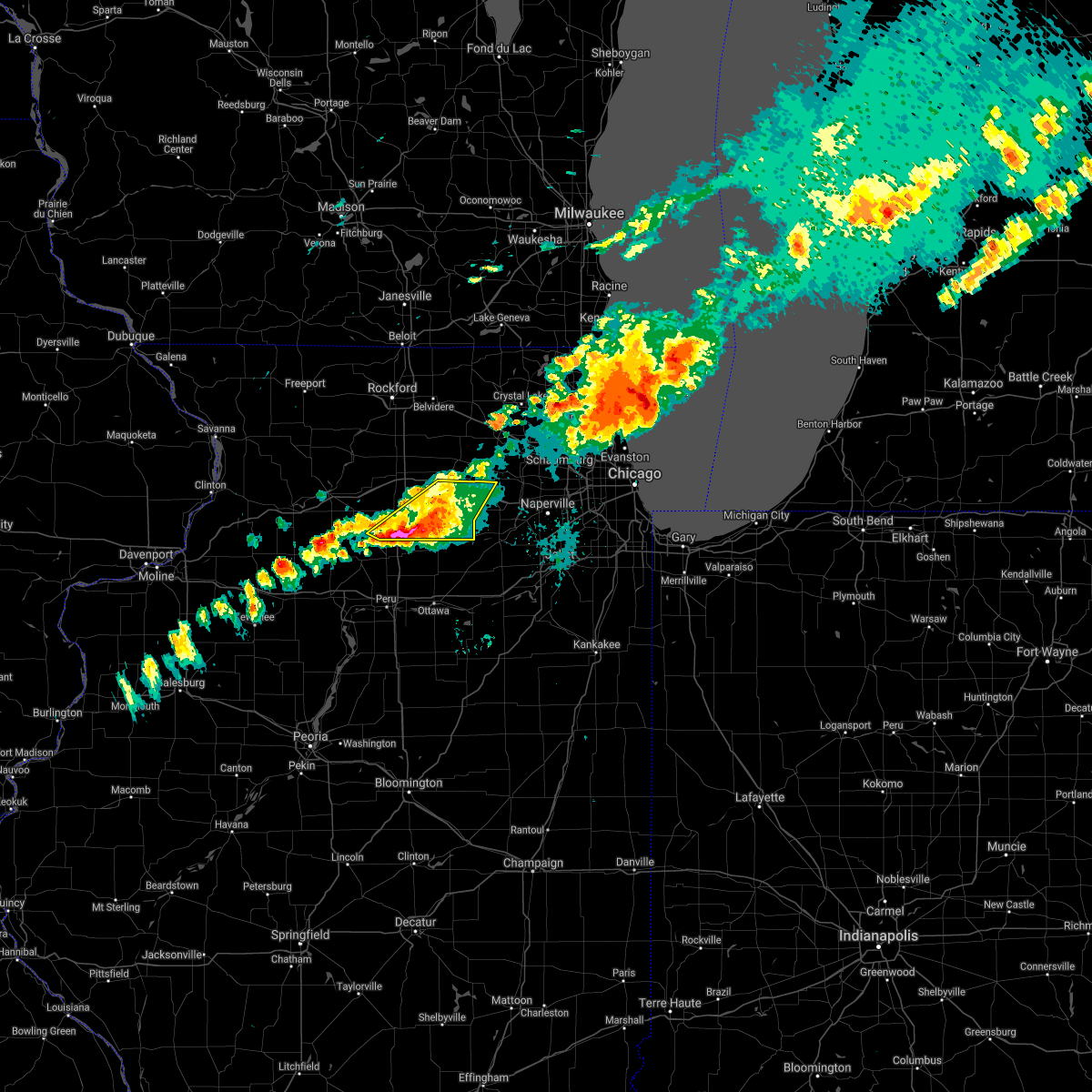 At 207 pm cdt, severe thunderstorms were located along a line extending from waterman to paw paw, moving east at 45 mph (public reported golf ball sized hail near compton). Hazards include golf ball size hail and 60 mph wind gusts. People and animals outdoors will be injured. expect hail damage to roofs, siding, windows, and vehicles. expect wind damage to roofs, siding, and trees. locations impacted include, dekalb, sandwich, shabbona, elburn, hinckley, somonauk, waterman, paw paw, kaneville, lee, compton and west brooklyn. thunderstorm damage threat, considerable hail threat, observed max hail size, 1. 75 in wind threat, radar indicated max wind gust, 60 mph. At 207 pm cdt, severe thunderstorms were located along a line extending from waterman to paw paw, moving east at 45 mph (public reported golf ball sized hail near compton). Hazards include golf ball size hail and 60 mph wind gusts. People and animals outdoors will be injured. expect hail damage to roofs, siding, windows, and vehicles. expect wind damage to roofs, siding, and trees. locations impacted include, dekalb, sandwich, shabbona, elburn, hinckley, somonauk, waterman, paw paw, kaneville, lee, compton and west brooklyn. thunderstorm damage threat, considerable hail threat, observed max hail size, 1. 75 in wind threat, radar indicated max wind gust, 60 mph.
|
| 9/7/2021 1:48 PM CDT |
 At 147 pm cdt, severe thunderstorms were located along a line extending from 6 miles south of rochelle to near amboy, moving east at 40 mph (radar indicated). Hazards include golf ball size hail and 60 mph wind gusts. People and animals outdoors will be injured. expect hail damage to roofs, siding, windows, and vehicles. expect wind damage to roofs, siding, and trees. locations impacted include, dekalb, campton hills, rochelle, sandwich, amboy, shabbona, elburn, cortland, hinckley, somonauk, waterman, hillcrest, maple park, malta, franklin grove, lily lake, ashton, paw paw, creston and kaneville. thunderstorm damage threat, considerable hail threat, radar indicated max hail size, 1. 75 in wind threat, radar indicated max wind gust, 60 mph. At 147 pm cdt, severe thunderstorms were located along a line extending from 6 miles south of rochelle to near amboy, moving east at 40 mph (radar indicated). Hazards include golf ball size hail and 60 mph wind gusts. People and animals outdoors will be injured. expect hail damage to roofs, siding, windows, and vehicles. expect wind damage to roofs, siding, and trees. locations impacted include, dekalb, campton hills, rochelle, sandwich, amboy, shabbona, elburn, cortland, hinckley, somonauk, waterman, hillcrest, maple park, malta, franklin grove, lily lake, ashton, paw paw, creston and kaneville. thunderstorm damage threat, considerable hail threat, radar indicated max hail size, 1. 75 in wind threat, radar indicated max wind gust, 60 mph.
|
| 9/7/2021 1:32 PM CDT |
 At 131 pm cdt, severe thunderstorms were located along a line extending from near rochelle to near amboy, moving east at 50 mph (public). Hazards include two inch hail and 60 mph wind gusts. People and animals outdoors will be injured. expect hail damage to roofs, siding, windows, and vehicles. expect wind damage to roofs, siding, and trees. locations impacted include, dekalb, sycamore, campton hills, rochelle, sandwich, amboy, shabbona, elburn, cortland, hinckley, somonauk, waterman, hillcrest, maple park, malta, franklin grove, lily lake, ashton, paw paw and creston. thunderstorm damage threat, considerable hail threat, radar indicated max hail size, 2. 00 in wind threat, radar indicated max wind gust, 60 mph. At 131 pm cdt, severe thunderstorms were located along a line extending from near rochelle to near amboy, moving east at 50 mph (public). Hazards include two inch hail and 60 mph wind gusts. People and animals outdoors will be injured. expect hail damage to roofs, siding, windows, and vehicles. expect wind damage to roofs, siding, and trees. locations impacted include, dekalb, sycamore, campton hills, rochelle, sandwich, amboy, shabbona, elburn, cortland, hinckley, somonauk, waterman, hillcrest, maple park, malta, franklin grove, lily lake, ashton, paw paw and creston. thunderstorm damage threat, considerable hail threat, radar indicated max hail size, 2. 00 in wind threat, radar indicated max wind gust, 60 mph.
|
| 9/7/2021 1:23 PM CDT |
 At 122 pm cdt, severe thunderstorms were located along a line extending from near ashton to near dixon, moving east at 45 mph (radar indicated). Hazards include 60 mph wind gusts and half dollar size hail. Hail damage to vehicles is expected. Expect wind damage to roofs, siding, and trees. At 122 pm cdt, severe thunderstorms were located along a line extending from near ashton to near dixon, moving east at 45 mph (radar indicated). Hazards include 60 mph wind gusts and half dollar size hail. Hail damage to vehicles is expected. Expect wind damage to roofs, siding, and trees.
|
| 8/24/2021 6:33 PM CDT |
 At 632 pm cdt, severe thunderstorms were located along a line extending from near sharon to near kingston to near waterman to near paw paw, moving east at 50 mph. this line of storms has a history of producing winds in excess of 60 mph (radar indicated). Hazards include 60 mph wind gusts. Expect damage to roofs, siding, and trees. locations impacted include, elgin, dekalb, crystal lake, carpentersville, st. charles, algonquin, lake in the hills, mchenry, belvidere, woodstock, huntley, geneva, sycamore, campton hills, fox lake, rochelle, harvard, island lake, marengo and sandwich. hail threat, radar indicated max hail size, <. 75 in wind threat, observed max wind gust, 60 mph. At 632 pm cdt, severe thunderstorms were located along a line extending from near sharon to near kingston to near waterman to near paw paw, moving east at 50 mph. this line of storms has a history of producing winds in excess of 60 mph (radar indicated). Hazards include 60 mph wind gusts. Expect damage to roofs, siding, and trees. locations impacted include, elgin, dekalb, crystal lake, carpentersville, st. charles, algonquin, lake in the hills, mchenry, belvidere, woodstock, huntley, geneva, sycamore, campton hills, fox lake, rochelle, harvard, island lake, marengo and sandwich. hail threat, radar indicated max hail size, <. 75 in wind threat, observed max wind gust, 60 mph.
|
| 8/24/2021 6:09 PM CDT |
 At 608 pm cdt, severe thunderstorms were located along a line extending from rockton to near davis junction to 8 miles northeast of walnut, moving east at 55 mph (radar indicated). Hazards include 60 mph wind gusts. expect damage to roofs, siding, and trees At 608 pm cdt, severe thunderstorms were located along a line extending from rockton to near davis junction to 8 miles northeast of walnut, moving east at 55 mph (radar indicated). Hazards include 60 mph wind gusts. expect damage to roofs, siding, and trees
|
| 8/11/2021 9:32 PM CDT |
 At 930 pm cdt, a severe thunderstorm was located over batavia, moving east at 35 mph. dupage airport gusted to 56 mph with this storm 930 pm cdt (radar indicated). Hazards include 60 mph wind gusts and quarter size hail. Hail damage to vehicles is expected. expect wind damage to roofs, siding, and trees. locations impacted include, aurora, naperville, bolingbrook, wheaton, downers grove, lombard, bartlett, carol stream, hanover park, addison, glendale heights, st. Charles, woodridge, glen ellyn, west chicago, batavia, geneva, campton hills, oak brook and westmont. At 930 pm cdt, a severe thunderstorm was located over batavia, moving east at 35 mph. dupage airport gusted to 56 mph with this storm 930 pm cdt (radar indicated). Hazards include 60 mph wind gusts and quarter size hail. Hail damage to vehicles is expected. expect wind damage to roofs, siding, and trees. locations impacted include, aurora, naperville, bolingbrook, wheaton, downers grove, lombard, bartlett, carol stream, hanover park, addison, glendale heights, st. Charles, woodridge, glen ellyn, west chicago, batavia, geneva, campton hills, oak brook and westmont.
|
| 8/11/2021 9:09 PM CDT |
 At 856 pm cdt, a severe thunderstorm was located near sugar grove, or 9 miles west of batavia, moving east at 40 mph (radar indicated). Hazards include 60 mph wind gusts and penny size hail. expect damage to roofs, siding, and trees At 856 pm cdt, a severe thunderstorm was located near sugar grove, or 9 miles west of batavia, moving east at 40 mph (radar indicated). Hazards include 60 mph wind gusts and penny size hail. expect damage to roofs, siding, and trees
|
| 8/11/2021 8:57 PM CDT |
 At 856 pm cdt, a severe thunderstorm was located near sugar grove, or 9 miles west of batavia, moving east at 40 mph (radar indicated). Hazards include 60 mph wind gusts and penny size hail. expect damage to roofs, siding, and trees At 856 pm cdt, a severe thunderstorm was located near sugar grove, or 9 miles west of batavia, moving east at 40 mph (radar indicated). Hazards include 60 mph wind gusts and penny size hail. expect damage to roofs, siding, and trees
|
| 8/11/2021 10:26 AM CDT |
 The severe thunderstorm warning for kendall, northern grundy and southern kane counties will expire at 1030 am cdt, the storm which prompted the warning has moved out of the area. therefore, the warning will be allowed to expire. a severe thunderstorm watch remains in effect until 100 pm cdt for north central and northeastern illinois. to report severe weather, contact your nearest law enforcement agency. they will relay your report to the national weather service chicago. The severe thunderstorm warning for kendall, northern grundy and southern kane counties will expire at 1030 am cdt, the storm which prompted the warning has moved out of the area. therefore, the warning will be allowed to expire. a severe thunderstorm watch remains in effect until 100 pm cdt for north central and northeastern illinois. to report severe weather, contact your nearest law enforcement agency. they will relay your report to the national weather service chicago.
|
| 8/11/2021 10:18 AM CDT |
 At 1018 am cdt, a severe thunderstorm was located near gary, moving east at 65 mph (trained weather spotters). Hazards include 60 mph wind gusts. Expect damage to roofs, siding, and trees. locations impacted include, aurora, joliet, plainfield, oswego, batavia, yorkville, morris, channahon, minooka, plano, sandwich, coal city, montgomery, north aurora, sugar grove, boulder hill, diamond, newark, millington and big rock. hail threat, radar indicated max hail size, <. 75 in wind threat, observed max wind gust, 60 mph. At 1018 am cdt, a severe thunderstorm was located near gary, moving east at 65 mph (trained weather spotters). Hazards include 60 mph wind gusts. Expect damage to roofs, siding, and trees. locations impacted include, aurora, joliet, plainfield, oswego, batavia, yorkville, morris, channahon, minooka, plano, sandwich, coal city, montgomery, north aurora, sugar grove, boulder hill, diamond, newark, millington and big rock. hail threat, radar indicated max hail size, <. 75 in wind threat, observed max wind gust, 60 mph.
|
| 8/11/2021 9:55 AM CDT |
 At 955 am cdt, a severe thunderstorm was located over orland park, moving east at 65 mph (trained weather spotters). Hazards include 60 mph wind gusts. Expect damage to roofs, siding, and trees. locations impacted include, aurora, joliet, plainfield, oswego, batavia, yorkville, morris, channahon, minooka, plano, sandwich, coal city, montgomery, north aurora, sugar grove, boulder hill, diamond, newark, millington and big rock. hail threat, radar indicated max hail size, <. 75 in wind threat, observed max wind gust, 60 mph. At 955 am cdt, a severe thunderstorm was located over orland park, moving east at 65 mph (trained weather spotters). Hazards include 60 mph wind gusts. Expect damage to roofs, siding, and trees. locations impacted include, aurora, joliet, plainfield, oswego, batavia, yorkville, morris, channahon, minooka, plano, sandwich, coal city, montgomery, north aurora, sugar grove, boulder hill, diamond, newark, millington and big rock. hail threat, radar indicated max hail size, <. 75 in wind threat, observed max wind gust, 60 mph.
|
| 8/11/2021 9:50 AM CDT |
 At 949 am cdt, a severe thunderstorm was located over homer glen, moving east at 65 mph (trained weather spotters). Hazards include 70 mph wind gusts. Expect considerable tree damage. Damage is likely to mobile homes, roofs, and outbuildings. At 949 am cdt, a severe thunderstorm was located over homer glen, moving east at 65 mph (trained weather spotters). Hazards include 70 mph wind gusts. Expect considerable tree damage. Damage is likely to mobile homes, roofs, and outbuildings.
|
| 8/11/2021 9:38 AM CDT |
 At 937 am cdt, a severe thunderstorm was located near crest hill, or near plainfield, moving east at 65 mph (trained spotters). Hazards include 70 mph wind gusts. this storm is producing widespread wind damage!. Expect considerable tree damage. damage is likely to mobile homes, roofs, and outbuildings. locations impacted include, aurora, joliet, plainfield, oswego, batavia, yorkville, morris, channahon, minooka, plano, sandwich, coal city, montgomery, north aurora, sugar grove, boulder hill, diamond, newark, millington and big rock. thunderstorm damage threat, considerable hail threat, radar indicated max hail size, <. 75 in wind threat, observed max wind gust, 70 mph. At 937 am cdt, a severe thunderstorm was located near crest hill, or near plainfield, moving east at 65 mph (trained spotters). Hazards include 70 mph wind gusts. this storm is producing widespread wind damage!. Expect considerable tree damage. damage is likely to mobile homes, roofs, and outbuildings. locations impacted include, aurora, joliet, plainfield, oswego, batavia, yorkville, morris, channahon, minooka, plano, sandwich, coal city, montgomery, north aurora, sugar grove, boulder hill, diamond, newark, millington and big rock. thunderstorm damage threat, considerable hail threat, radar indicated max hail size, <. 75 in wind threat, observed max wind gust, 70 mph.
|
| 8/11/2021 9:22 AM CDT | Large oak tree snapped at bas in kendall county IL, 3.7 miles NE of Big Rock, IL |
| 8/11/2021 9:22 AM CDT |
 At 922 am cdt, a severe thunderstorm was located near yorkville, moving east at 65 mph (radar indicated). Hazards include 70 mph wind gusts. the damaging winds may last longer than 30 minutes!. Expect considerable tree damage. damage is likely to mobile homes, roofs, and outbuildings. locations impacted include, aurora, joliet, plainfield, oswego, batavia, yorkville, morris, channahon, minooka, plano, sandwich, coal city, montgomery, north aurora, sugar grove, boulder hill, diamond, newark, millington and big rock. thunderstorm damage threat, considerable hail threat, radar indicated max hail size, <. 75 in wind threat, radar indicated max wind gust, 70 mph. At 922 am cdt, a severe thunderstorm was located near yorkville, moving east at 65 mph (radar indicated). Hazards include 70 mph wind gusts. the damaging winds may last longer than 30 minutes!. Expect considerable tree damage. damage is likely to mobile homes, roofs, and outbuildings. locations impacted include, aurora, joliet, plainfield, oswego, batavia, yorkville, morris, channahon, minooka, plano, sandwich, coal city, montgomery, north aurora, sugar grove, boulder hill, diamond, newark, millington and big rock. thunderstorm damage threat, considerable hail threat, radar indicated max hail size, <. 75 in wind threat, radar indicated max wind gust, 70 mph.
|
| 8/11/2021 9:05 AM CDT |
 At 905 am cdt, a severe thunderstorm was located near earlville, or 8 miles west of sheridan, moving east at 65 mph (radar indicated). Hazards include 70 mph wind gusts. the strongest winds will move into kendall county!. Expect considerable tree damage. Damage is likely to mobile homes, roofs, and outbuildings. At 905 am cdt, a severe thunderstorm was located near earlville, or 8 miles west of sheridan, moving east at 65 mph (radar indicated). Hazards include 70 mph wind gusts. the strongest winds will move into kendall county!. Expect considerable tree damage. Damage is likely to mobile homes, roofs, and outbuildings.
|
| 8/10/2021 7:44 PM CDT |
 At 744 pm cdt, severe thunderstorms were located along a line extending from near warrenville to near morris, moving east at 55 mph (trained weather spotters). Hazards include 70 mph wind gusts and quarter size hail. Hail damage to vehicles is expected. expect considerable tree damage. wind damage is also likely to mobile homes, roofs, and outbuildings. locations impacted include, aurora, joliet, plainfield, oswego, west chicago, batavia, geneva, yorkville, morris, channahon, minooka, plano, sandwich, montgomery, north aurora, sugar grove, boulder hill, elburn, newark and big rock. thunderstorm damage threat, considerable hail threat, radar indicated max hail size, 1. 00 in wind threat, radar indicated max wind gust, 70 mph. At 744 pm cdt, severe thunderstorms were located along a line extending from near warrenville to near morris, moving east at 55 mph (trained weather spotters). Hazards include 70 mph wind gusts and quarter size hail. Hail damage to vehicles is expected. expect considerable tree damage. wind damage is also likely to mobile homes, roofs, and outbuildings. locations impacted include, aurora, joliet, plainfield, oswego, west chicago, batavia, geneva, yorkville, morris, channahon, minooka, plano, sandwich, montgomery, north aurora, sugar grove, boulder hill, elburn, newark and big rock. thunderstorm damage threat, considerable hail threat, radar indicated max hail size, 1. 00 in wind threat, radar indicated max wind gust, 70 mph.
|
| 8/10/2021 7:25 PM CDT |
 At 725 pm cdt, severe thunderstorms were located along a line extending from geneva to 6 miles southeast of serena, moving east at 55 mph. these storms have a history of producing wind damage (trained weather spotters). Hazards include 70 mph wind gusts and quarter size hail. Hail damage to vehicles is expected. expect considerable tree damage. wind damage is also likely to mobile homes, roofs, and outbuildings. locations impacted include, aurora, joliet, plainfield, oswego, west chicago, batavia, geneva, yorkville, morris, channahon, minooka, plano, sandwich, montgomery, north aurora, sugar grove, boulder hill, elburn, newark and big rock. thunderstorm damage threat, considerable hail threat, radar indicated max hail size, 1. 00 in wind threat, radar indicated max wind gust, 70 mph. At 725 pm cdt, severe thunderstorms were located along a line extending from geneva to 6 miles southeast of serena, moving east at 55 mph. these storms have a history of producing wind damage (trained weather spotters). Hazards include 70 mph wind gusts and quarter size hail. Hail damage to vehicles is expected. expect considerable tree damage. wind damage is also likely to mobile homes, roofs, and outbuildings. locations impacted include, aurora, joliet, plainfield, oswego, west chicago, batavia, geneva, yorkville, morris, channahon, minooka, plano, sandwich, montgomery, north aurora, sugar grove, boulder hill, elburn, newark and big rock. thunderstorm damage threat, considerable hail threat, radar indicated max hail size, 1. 00 in wind threat, radar indicated max wind gust, 70 mph.
|
| 8/10/2021 6:57 PM CDT |
 At 656 pm cdt, severe thunderstorms were located along a line extending from near maple park to near seneca, moving east at 35 mph. these storms have strong winds out ahead of them as well, having produced a 58 mph gust at aurora airport in sugar grove (trained weather spotters). Hazards include 70 mph wind gusts and quarter size hail. Hail damage to vehicles is expected. expect considerable tree damage. wind damage is also likely to mobile homes, roofs, and outbuildings. locations impacted include, aurora, joliet, plainfield, oswego, west chicago, batavia, geneva, yorkville, morris, channahon, minooka, plano, sandwich, montgomery, north aurora, sugar grove, boulder hill, elburn, newark and big rock. thunderstorm damage threat, considerable hail threat, radar indicated max hail size, 1. 00 in wind threat, radar indicated max wind gust, 70 mph. At 656 pm cdt, severe thunderstorms were located along a line extending from near maple park to near seneca, moving east at 35 mph. these storms have strong winds out ahead of them as well, having produced a 58 mph gust at aurora airport in sugar grove (trained weather spotters). Hazards include 70 mph wind gusts and quarter size hail. Hail damage to vehicles is expected. expect considerable tree damage. wind damage is also likely to mobile homes, roofs, and outbuildings. locations impacted include, aurora, joliet, plainfield, oswego, west chicago, batavia, geneva, yorkville, morris, channahon, minooka, plano, sandwich, montgomery, north aurora, sugar grove, boulder hill, elburn, newark and big rock. thunderstorm damage threat, considerable hail threat, radar indicated max hail size, 1. 00 in wind threat, radar indicated max wind gust, 70 mph.
|
| 8/10/2021 6:38 PM CDT |
 At 638 pm cdt, severe thunderstorms were located along a line extending from near waterman to near marseilles, moving east at 30 mph (radar indicated). Hazards include 60 mph wind gusts. expect damage to roofs, siding, and trees At 638 pm cdt, severe thunderstorms were located along a line extending from near waterman to near marseilles, moving east at 30 mph (radar indicated). Hazards include 60 mph wind gusts. expect damage to roofs, siding, and trees
|
| 7/29/2021 3:31 AM CDT |
 The severe thunderstorm warning for central de kalb, southern kane, dupage and northern cook counties has expired, the storms which prompted the warning have moved out of the area. therefore, the warning has been allowed to expire. however gusty winds are still possible with these thunderstorms. a severe thunderstorm watch remains in effect until 800 am cdt for north central and northeastern illinois. remember, a severe thunderstorm warning still remains in effect for southern cook county until 415 am cdt. The severe thunderstorm warning for central de kalb, southern kane, dupage and northern cook counties has expired, the storms which prompted the warning have moved out of the area. therefore, the warning has been allowed to expire. however gusty winds are still possible with these thunderstorms. a severe thunderstorm watch remains in effect until 800 am cdt for north central and northeastern illinois. remember, a severe thunderstorm warning still remains in effect for southern cook county until 415 am cdt.
|
| 7/29/2021 3:06 AM CDT |
 At 305 am cdt, severe thunderstorms were located along a line extending from the north side of chicago to aurora to near hinckley, moving southeast at 50 mph (emergency management. multiple reports of wind damage across the north half of the chicago metro). Hazards include 70 mph wind gusts. Expect considerable tree damage. damage is likely to mobile homes, roofs, and outbuildings. Locations impacted include, chicago, aurora, naperville, cicero, evanston, schaumburg, bolingbrook, skokie, des plaines, oak lawn, berwyn, wheaton, oak park, downers grove, elmhurst, dekalb, lombard, bartlett, ohare airport and carol stream. At 305 am cdt, severe thunderstorms were located along a line extending from the north side of chicago to aurora to near hinckley, moving southeast at 50 mph (emergency management. multiple reports of wind damage across the north half of the chicago metro). Hazards include 70 mph wind gusts. Expect considerable tree damage. damage is likely to mobile homes, roofs, and outbuildings. Locations impacted include, chicago, aurora, naperville, cicero, evanston, schaumburg, bolingbrook, skokie, des plaines, oak lawn, berwyn, wheaton, oak park, downers grove, elmhurst, dekalb, lombard, bartlett, ohare airport and carol stream.
|
| 7/29/2021 2:34 AM CDT |
 At 233 am cdt, severe thunderstorms were located along a line extending from lake bluff to near hampshire to near kirkland, moving southeast at 50 mph (emergency management. multiple reports of wind damage in mchenry and lake counties with this line of storms). Hazards include 70 mph wind gusts. Expect considerable tree damage. damage is likely to mobile homes, roofs, and outbuildings. Locations impacted include, chicago, aurora, naperville, elgin, cicero, arlington heights, evanston, schaumburg, bolingbrook, palatine, skokie, des plaines, oak lawn, berwyn, mount prospect, wheaton, hoffman estates, oak park, downers grove and glenview. At 233 am cdt, severe thunderstorms were located along a line extending from lake bluff to near hampshire to near kirkland, moving southeast at 50 mph (emergency management. multiple reports of wind damage in mchenry and lake counties with this line of storms). Hazards include 70 mph wind gusts. Expect considerable tree damage. damage is likely to mobile homes, roofs, and outbuildings. Locations impacted include, chicago, aurora, naperville, elgin, cicero, arlington heights, evanston, schaumburg, bolingbrook, palatine, skokie, des plaines, oak lawn, berwyn, mount prospect, wheaton, hoffman estates, oak park, downers grove and glenview.
|
| 7/29/2021 2:14 AM CDT |
 At 212 am cdt, severe thunderstorms were located along a line extending from near kenosha to near woodstock to pecatonica, moving southeast at 55 mph (radar indicated). Hazards include 70 mph wind gusts. Expect considerable tree damage. Damage is likely to mobile homes, roofs, and outbuildings. At 212 am cdt, severe thunderstorms were located along a line extending from near kenosha to near woodstock to pecatonica, moving southeast at 55 mph (radar indicated). Hazards include 70 mph wind gusts. Expect considerable tree damage. Damage is likely to mobile homes, roofs, and outbuildings.
|
| 6/20/2021 11:09 PM CDT |
 The tornado warning for southern kane and northwestern dupage counties will expire at 1115 pm cdt, the storm which prompted the warning has moved out of the area. therefore, the warning will be allowed to expire. however, gusty winds greater than 40 mph are still expected at times through 1130 pm. a severe thunderstorm watch remains in effect until 200 am cdt for northeastern illinois. The tornado warning for southern kane and northwestern dupage counties will expire at 1115 pm cdt, the storm which prompted the warning has moved out of the area. therefore, the warning will be allowed to expire. however, gusty winds greater than 40 mph are still expected at times through 1130 pm. a severe thunderstorm watch remains in effect until 200 am cdt for northeastern illinois.
|
| 6/20/2021 11:00 PM CDT |
 At 1100 pm cdt, a severe thunderstorm was located over west chicago, moving east at 40 mph (radar indicated). Hazards include 60 mph wind gusts. Expect damage to roofs, siding, and trees. locations impacted include, aurora, elgin, bartlett, st. Charles, west chicago, batavia, geneva, campton hills, south elgin, montgomery, north aurora, sugar grove, elburn, east dundee, wayne, valley view, maple park, lily lake, big rock and kaneville. At 1100 pm cdt, a severe thunderstorm was located over west chicago, moving east at 40 mph (radar indicated). Hazards include 60 mph wind gusts. Expect damage to roofs, siding, and trees. locations impacted include, aurora, elgin, bartlett, st. Charles, west chicago, batavia, geneva, campton hills, south elgin, montgomery, north aurora, sugar grove, elburn, east dundee, wayne, valley view, maple park, lily lake, big rock and kaneville.
|
| 6/20/2021 10:53 PM CDT |
 At 1052 pm cdt, a severe thunderstorm capable of producing a tornado was located near north aurora, or near batavia, moving east at 30 mph. aurora airport in sugar grove gusted to 60 mph near this area (radar indicated rotation). Hazards include tornado. Flying debris will be dangerous to those caught without shelter. mobile homes will be damaged or destroyed. damage to roofs, windows, and vehicles will occur. tree damage is likely. this dangerous storm will be near, aurora around 1055 pm cdt. north aurora around 1100 pm cdt. other locations in the path of this tornadic thunderstorm include st. Charles, batavia, geneva, valley view, bartlett, west chicago, warrenville, wayne, dupage airport, carol stream, winfield and wheaton. At 1052 pm cdt, a severe thunderstorm capable of producing a tornado was located near north aurora, or near batavia, moving east at 30 mph. aurora airport in sugar grove gusted to 60 mph near this area (radar indicated rotation). Hazards include tornado. Flying debris will be dangerous to those caught without shelter. mobile homes will be damaged or destroyed. damage to roofs, windows, and vehicles will occur. tree damage is likely. this dangerous storm will be near, aurora around 1055 pm cdt. north aurora around 1100 pm cdt. other locations in the path of this tornadic thunderstorm include st. Charles, batavia, geneva, valley view, bartlett, west chicago, warrenville, wayne, dupage airport, carol stream, winfield and wheaton.
|
| 6/20/2021 10:50 PM CDT |
 At 1050 pm cdt, a severe thunderstorm was located near mendota, moving east at 40 mph. more severe storms were moving across southern dekalb county into kendall county (radar indicated). Hazards include 70 mph wind gusts and quarter size hail. Hail damage to vehicles is expected. expect considerable tree damage. Wind damage is also likely to mobile homes, roofs, and outbuildings. At 1050 pm cdt, a severe thunderstorm was located near mendota, moving east at 40 mph. more severe storms were moving across southern dekalb county into kendall county (radar indicated). Hazards include 70 mph wind gusts and quarter size hail. Hail damage to vehicles is expected. expect considerable tree damage. Wind damage is also likely to mobile homes, roofs, and outbuildings.
|
| 6/20/2021 10:43 PM CDT |
 At 1042 pm cdt, a severe thunderstorm capable of producing a tornado was located near north aurora, or near batavia, moving east at 40 mph. there`s also developing rotation southeast of maple park (radar indicated rotation). Hazards include tornado. Flying debris will be dangerous to those caught without shelter. mobile homes will be damaged or destroyed. damage to roofs, windows, and vehicles will occur. tree damage is likely. this dangerous storm will be near, northern aurora around 1045 pm cdt. geneva and north aurora around 1050 pm cdt. st. charles, batavia, wayne and dupage airport around 1055 pm cdt. west chicago and warrenville around 1100 pm cdt. other locations in the path of this tornadic thunderstorm include carol stream, winfield and wheaton. this includes, fermilab, il math and science academy, kane county cougars ballpark, and waubonsee community college. Including the following interstate, i-88 between mile markers 103 and 126. At 1042 pm cdt, a severe thunderstorm capable of producing a tornado was located near north aurora, or near batavia, moving east at 40 mph. there`s also developing rotation southeast of maple park (radar indicated rotation). Hazards include tornado. Flying debris will be dangerous to those caught without shelter. mobile homes will be damaged or destroyed. damage to roofs, windows, and vehicles will occur. tree damage is likely. this dangerous storm will be near, northern aurora around 1045 pm cdt. geneva and north aurora around 1050 pm cdt. st. charles, batavia, wayne and dupage airport around 1055 pm cdt. west chicago and warrenville around 1100 pm cdt. other locations in the path of this tornadic thunderstorm include carol stream, winfield and wheaton. this includes, fermilab, il math and science academy, kane county cougars ballpark, and waubonsee community college. Including the following interstate, i-88 between mile markers 103 and 126.
|
| 6/20/2021 10:37 PM CDT |
 At 1037 pm cdt, a severe thunderstorm was located near elburn, or 9 miles southwest of campton hills, moving east at 40 mph. a second severe storm was located cortland, and was moving southeast at 50 mph (radar indicated). Hazards include 60 mph wind gusts. Expect damage to roofs, siding, and trees. locations impacted include, aurora, elgin, bartlett, carpentersville, st. Charles, algonquin, west chicago, batavia, huntley, geneva, campton hills, south elgin, montgomery, north aurora, sugar grove, pingree grove, gilberts, west dundee, hampshire and elburn. At 1037 pm cdt, a severe thunderstorm was located near elburn, or 9 miles southwest of campton hills, moving east at 40 mph. a second severe storm was located cortland, and was moving southeast at 50 mph (radar indicated). Hazards include 60 mph wind gusts. Expect damage to roofs, siding, and trees. locations impacted include, aurora, elgin, bartlett, carpentersville, st. Charles, algonquin, west chicago, batavia, huntley, geneva, campton hills, south elgin, montgomery, north aurora, sugar grove, pingree grove, gilberts, west dundee, hampshire and elburn.
|
| 6/20/2021 10:22 PM CDT |
 At 1021 pm cdt, a severe thunderstorm was located near hinckley, or 9 miles south of dekalb, moving east at 40 mph. there also is weak rotation with this storm. in addition, there is a line of wind producing thunderstorms just east of i-39 moving toward kane county (radar indicated). Hazards include ping pong ball size hail and 60 mph wind gusts. People and animals outdoors will be injured. expect hail damage to roofs, siding, windows, and vehicles. Expect wind damage to roofs, siding, and trees. At 1021 pm cdt, a severe thunderstorm was located near hinckley, or 9 miles south of dekalb, moving east at 40 mph. there also is weak rotation with this storm. in addition, there is a line of wind producing thunderstorms just east of i-39 moving toward kane county (radar indicated). Hazards include ping pong ball size hail and 60 mph wind gusts. People and animals outdoors will be injured. expect hail damage to roofs, siding, windows, and vehicles. Expect wind damage to roofs, siding, and trees.
|
| 6/12/2021 3:39 PM CDT |
 At 338 pm cdt, a severe thunderstorm was located over montgomery, or near oswego, moving southeast at 15 mph. additional severe thunderstorms were moving into will county, as well (radar indicated). Hazards include 60 mph wind gusts and quarter size hail. Hail damage to vehicles is expected. expect wind damage to roofs, siding, and trees. Locations impacted include, joliet, bolingbrook, orland park, tinley park, romeoville, plainfield, woodridge, oswego, lockport, new lenox, homer glen, mokena, frankfort, yorkville, channahon, minooka, plano, sandwich, crest hill and montgomery. At 338 pm cdt, a severe thunderstorm was located over montgomery, or near oswego, moving southeast at 15 mph. additional severe thunderstorms were moving into will county, as well (radar indicated). Hazards include 60 mph wind gusts and quarter size hail. Hail damage to vehicles is expected. expect wind damage to roofs, siding, and trees. Locations impacted include, joliet, bolingbrook, orland park, tinley park, romeoville, plainfield, woodridge, oswego, lockport, new lenox, homer glen, mokena, frankfort, yorkville, channahon, minooka, plano, sandwich, crest hill and montgomery.
|
| 6/12/2021 3:26 PM CDT |
 At 326 pm cdt, a severe thunderstorm was located over sugar grove, or 7 miles southwest of batavia, moving southeast at 15 mph (radar indicated). Hazards include 60 mph wind gusts and quarter size hail. Hail damage to vehicles is expected. Expect wind damage to roofs, siding, and trees. At 326 pm cdt, a severe thunderstorm was located over sugar grove, or 7 miles southwest of batavia, moving southeast at 15 mph (radar indicated). Hazards include 60 mph wind gusts and quarter size hail. Hail damage to vehicles is expected. Expect wind damage to roofs, siding, and trees.
|
| 11/10/2020 5:21 PM CST |
 The severe thunderstorm warning for kendall and kane counties will expire at 530 pm cst, the storms which prompted the warning have moved out of the area. therefore, the warning will be allowed to expire. a tornado watch remains in effect until 800 pm cst for north central and northeastern illinois. The severe thunderstorm warning for kendall and kane counties will expire at 530 pm cst, the storms which prompted the warning have moved out of the area. therefore, the warning will be allowed to expire. a tornado watch remains in effect until 800 pm cst for north central and northeastern illinois.
|
| 11/10/2020 4:52 PM CST |
 At 451 pm cst, severe thunderstorms were located along a line extending from near huntley to st. charles to near yorkville, moving northeast at 65 mph (trained weather spotters. multiple reports of damaging 70 mph winds with this line of storms). Hazards include 70 mph wind gusts and penny size hail. Expect considerable tree damage. damage is likely to mobile homes, roofs, and outbuildings. locations impacted include, aurora, joliet, elgin, bartlett, plainfield, carpentersville, st. Charles, oswego, algonquin, west chicago, batavia, huntley, geneva, yorkville, campton hills, minooka, plano, sandwich, south elgin and montgomery. At 451 pm cst, severe thunderstorms were located along a line extending from near huntley to st. charles to near yorkville, moving northeast at 65 mph (trained weather spotters. multiple reports of damaging 70 mph winds with this line of storms). Hazards include 70 mph wind gusts and penny size hail. Expect considerable tree damage. damage is likely to mobile homes, roofs, and outbuildings. locations impacted include, aurora, joliet, elgin, bartlett, plainfield, carpentersville, st. Charles, oswego, algonquin, west chicago, batavia, huntley, geneva, yorkville, campton hills, minooka, plano, sandwich, south elgin and montgomery.
|
| 11/10/2020 4:13 PM CST |
 At 413 pm cst, severe thunderstorms were located along a line extending from near paw paw to near earlville to tonica, moving northeast at 65 mph (trained weather spotters. several reports of 60 to 70 mph winds and tree damage with this line of storms). Hazards include 70 mph wind gusts and penny size hail. Expect considerable tree damage. damage is likely to mobile homes, roofs, and outbuildings. locations impacted include, aurora, joliet, elgin, dekalb, bartlett, plainfield, carpentersville, st. Charles, oswego, algonquin, west chicago, batavia, huntley, geneva, sycamore, yorkville, campton hills, minooka, plano and sandwich. At 413 pm cst, severe thunderstorms were located along a line extending from near paw paw to near earlville to tonica, moving northeast at 65 mph (trained weather spotters. several reports of 60 to 70 mph winds and tree damage with this line of storms). Hazards include 70 mph wind gusts and penny size hail. Expect considerable tree damage. damage is likely to mobile homes, roofs, and outbuildings. locations impacted include, aurora, joliet, elgin, dekalb, bartlett, plainfield, carpentersville, st. Charles, oswego, algonquin, west chicago, batavia, huntley, geneva, sycamore, yorkville, campton hills, minooka, plano and sandwich.
|
| 11/10/2020 4:10 PM CST |
 At 410 pm cst, severe thunderstorms were located along a line extending from near paw paw to 6 miles south of earlville to tonica, moving northeast at 65 mph (radar indicated). Hazards include 70 mph wind gusts and penny size hail. Expect considerable tree damage. Damage is likely to mobile homes, roofs, and outbuildings. At 410 pm cst, severe thunderstorms were located along a line extending from near paw paw to 6 miles south of earlville to tonica, moving northeast at 65 mph (radar indicated). Hazards include 70 mph wind gusts and penny size hail. Expect considerable tree damage. Damage is likely to mobile homes, roofs, and outbuildings.
|
| 8/10/2020 3:21 PM CDT |
 At 321 pm cdt, tornado producing storms were located along a line extending from near elburn to sugar grove to near yorkville to 8 miles southeast of plano, moving east at 60 mph (radar confirmed tornado near lisbon). Hazards include damaging tornado. Flying debris will be dangerous to those caught without shelter. mobile homes will be damaged or destroyed. damage to roofs, windows, and vehicles will occur. tree damage is likely. these tornadic storms will be near, aurora, st. charles, oswego, geneva, montgomery, boulder hill and valley view around 325 pm cdt. bartlett, west chicago, batavia, south elgin, north aurora and wayne around 330 pm cdt. plainfield around 335 pm cdt. Other locations impacted by these tornadic storms include kaneville, plattville, virgil, lisbon, bristol, millbrook, little rock and big rock. At 321 pm cdt, tornado producing storms were located along a line extending from near elburn to sugar grove to near yorkville to 8 miles southeast of plano, moving east at 60 mph (radar confirmed tornado near lisbon). Hazards include damaging tornado. Flying debris will be dangerous to those caught without shelter. mobile homes will be damaged or destroyed. damage to roofs, windows, and vehicles will occur. tree damage is likely. these tornadic storms will be near, aurora, st. charles, oswego, geneva, montgomery, boulder hill and valley view around 325 pm cdt. bartlett, west chicago, batavia, south elgin, north aurora and wayne around 330 pm cdt. plainfield around 335 pm cdt. Other locations impacted by these tornadic storms include kaneville, plattville, virgil, lisbon, bristol, millbrook, little rock and big rock.
|
| 8/10/2020 3:11 PM CDT |
 At 310 pm cdt, severe thunderstorms capable of producing tornadoes were located along a line extending from maple park to near hinckley to near sandwich to lake holiday to near sheridan, moving east at 60 mph (radar indicated rotation). Hazards include tornado. Flying debris will be dangerous to those caught without shelter. mobile homes will be damaged or destroyed. damage to roofs, windows, and vehicles will occur. tree damage is likely. these dangerous storms will be near, plano and lily lake around 315 pm cdt. yorkville, campton hills, sugar grove and elburn around 320 pm cdt. aurora, st. charles, oswego, geneva, montgomery, north aurora, boulder hill and valley view around 325 pm cdt. bartlett, west chicago, batavia, minooka and wayne around 330 pm cdt. joliet and plainfield around 335 pm cdt. other locations impacted by these tornadic storms include kaneville, plattville, norway, virgil, lisbon, bristol, millbrook, millington, little rock and big rock. this includes, sandwich fairgrounds, aurora university, fermilab, il math and science academy, kane county cougars ballpark, and waubonsee community college. including the following interstates, i-80 between mile markers 120 and 122. I-88 between mile markers 97 and 120. At 310 pm cdt, severe thunderstorms capable of producing tornadoes were located along a line extending from maple park to near hinckley to near sandwich to lake holiday to near sheridan, moving east at 60 mph (radar indicated rotation). Hazards include tornado. Flying debris will be dangerous to those caught without shelter. mobile homes will be damaged or destroyed. damage to roofs, windows, and vehicles will occur. tree damage is likely. these dangerous storms will be near, plano and lily lake around 315 pm cdt. yorkville, campton hills, sugar grove and elburn around 320 pm cdt. aurora, st. charles, oswego, geneva, montgomery, north aurora, boulder hill and valley view around 325 pm cdt. bartlett, west chicago, batavia, minooka and wayne around 330 pm cdt. joliet and plainfield around 335 pm cdt. other locations impacted by these tornadic storms include kaneville, plattville, norway, virgil, lisbon, bristol, millbrook, millington, little rock and big rock. this includes, sandwich fairgrounds, aurora university, fermilab, il math and science academy, kane county cougars ballpark, and waubonsee community college. including the following interstates, i-80 between mile markers 120 and 122. I-88 between mile markers 97 and 120.
|
| 8/10/2020 3:04 PM CDT |
 At 304 pm cdt, severe thunderstorms were located along a line extending from near orfordville to near marengo to near serena to near washburn, moving east at 65 mph. these are very dangerous storms! (emergency management). Hazards include 80 mph wind gusts and quarter size hail. Flying debris will be dangerous to those caught without shelter. mobile homes will be heavily damaged. expect considerable damage to roofs, windows, and vehicles. extensive tree damage and power outages are likely. locations impacted include, aurora, joliet, elgin, bartlett, crystal lake, plainfield, carpentersville, st. Charles, oswego, algonquin, lake in the hills, west chicago, mchenry, batavia, woodstock, huntley, geneva, yorkville, morris and channahon. At 304 pm cdt, severe thunderstorms were located along a line extending from near orfordville to near marengo to near serena to near washburn, moving east at 65 mph. these are very dangerous storms! (emergency management). Hazards include 80 mph wind gusts and quarter size hail. Flying debris will be dangerous to those caught without shelter. mobile homes will be heavily damaged. expect considerable damage to roofs, windows, and vehicles. extensive tree damage and power outages are likely. locations impacted include, aurora, joliet, elgin, bartlett, crystal lake, plainfield, carpentersville, st. Charles, oswego, algonquin, lake in the hills, west chicago, mchenry, batavia, woodstock, huntley, geneva, yorkville, morris and channahon.
|
| 8/10/2020 2:44 PM CDT |
 At 244 pm cdt, severe thunderstorms were located along a line extending from near monroe to rockford airport to near la salle to near chillicothe, moving east at 65 mph. these are very dangerous storms! (emergency management. this storm has a history of producing high-end wind damage across ogle county. this is very dangerous situation!). Hazards include 80 mph wind gusts and quarter size hail. the winds may last longer than 30 minutes!. Flying debris will be dangerous to those caught without shelter. mobile homes will be heavily damaged. expect considerable damage to roofs, windows, and vehicles. extensive tree damage and power outages are likely. locations impacted include, aurora, joliet, elgin, bartlett, crystal lake, plainfield, carpentersville, st. Charles, oswego, algonquin, lake in the hills, west chicago, mchenry, batavia, woodstock, huntley, geneva, yorkville, morris and channahon. At 244 pm cdt, severe thunderstorms were located along a line extending from near monroe to rockford airport to near la salle to near chillicothe, moving east at 65 mph. these are very dangerous storms! (emergency management. this storm has a history of producing high-end wind damage across ogle county. this is very dangerous situation!). Hazards include 80 mph wind gusts and quarter size hail. the winds may last longer than 30 minutes!. Flying debris will be dangerous to those caught without shelter. mobile homes will be heavily damaged. expect considerable damage to roofs, windows, and vehicles. extensive tree damage and power outages are likely. locations impacted include, aurora, joliet, elgin, bartlett, crystal lake, plainfield, carpentersville, st. Charles, oswego, algonquin, lake in the hills, west chicago, mchenry, batavia, woodstock, huntley, geneva, yorkville, morris and channahon.
|
| 8/10/2020 2:24 PM CDT |
 At 224 pm cdt, severe thunderstorms were located along a line extending from warren to near german valley to near princeton to near williamsfield, moving east at 65 mph. these are very dangerous storms (automated wind measurements. this storm has a history of producing measured wind gusts in excess of 80 mph!). Hazards include 80 mph wind gusts and quarter size hail. Flying debris will be dangerous to those caught without shelter. mobile homes will be heavily damaged. expect considerable damage to roofs, windows, and vehicles. Extensive tree damage and power outages are likely. At 224 pm cdt, severe thunderstorms were located along a line extending from warren to near german valley to near princeton to near williamsfield, moving east at 65 mph. these are very dangerous storms (automated wind measurements. this storm has a history of producing measured wind gusts in excess of 80 mph!). Hazards include 80 mph wind gusts and quarter size hail. Flying debris will be dangerous to those caught without shelter. mobile homes will be heavily damaged. expect considerable damage to roofs, windows, and vehicles. Extensive tree damage and power outages are likely.
|
| 6/26/2020 7:12 PM CDT |
 At 711 pm cdt, severe thunderstorms were located along a line extending from near hinckley to little rock to near plano, moving east at 55 mph (radar indicated). Hazards include 70 mph wind gusts. Expect considerable tree damage. damage is likely to mobile homes, roofs, and outbuildings. these severe storms will be near, yorkville around 715 pm cdt. sugar grove around 720 pm cdt. aurora, oswego, montgomery and north aurora around 725 pm cdt. batavia around 730 pm cdt. Other locations impacted by these severe thunderstorms include boulder hill. At 711 pm cdt, severe thunderstorms were located along a line extending from near hinckley to little rock to near plano, moving east at 55 mph (radar indicated). Hazards include 70 mph wind gusts. Expect considerable tree damage. damage is likely to mobile homes, roofs, and outbuildings. these severe storms will be near, yorkville around 715 pm cdt. sugar grove around 720 pm cdt. aurora, oswego, montgomery and north aurora around 725 pm cdt. batavia around 730 pm cdt. Other locations impacted by these severe thunderstorms include boulder hill.
|
| 6/26/2020 7:01 PM CDT |
 The national weather service in chicago has issued a * severe thunderstorm warning for. northern kendall county in northeastern illinois. southeastern de kalb county in north central illinois. southern kane county in northeastern illinois. Until 745 pm cdt. The national weather service in chicago has issued a * severe thunderstorm warning for. northern kendall county in northeastern illinois. southeastern de kalb county in north central illinois. southern kane county in northeastern illinois. Until 745 pm cdt.
|
| 5/15/2020 12:28 AM CDT |
 At 1227 am cdt, severe thunderstorms were located along a line extending from near elburn to near aurora to near shorewood, moving east at 40 mph (automated weather station. the automated weather station at the aurora airport recorded a wind gust of 60 mph at 1225 am cdt). Hazards include 60 mph wind gusts. Expect damage to roofs, siding, and trees. locations impacted include, aurora, joliet, naperville, bolingbrook, wheaton, downers grove, lombard, carol stream, romeoville, plainfield, st. Charles, oswego, glen ellyn, west chicago, batavia, lockport, lisle, geneva, yorkville and lemont. At 1227 am cdt, severe thunderstorms were located along a line extending from near elburn to near aurora to near shorewood, moving east at 40 mph (automated weather station. the automated weather station at the aurora airport recorded a wind gust of 60 mph at 1225 am cdt). Hazards include 60 mph wind gusts. Expect damage to roofs, siding, and trees. locations impacted include, aurora, joliet, naperville, bolingbrook, wheaton, downers grove, lombard, carol stream, romeoville, plainfield, st. Charles, oswego, glen ellyn, west chicago, batavia, lockport, lisle, geneva, yorkville and lemont.
|
| 5/15/2020 12:19 AM CDT |
 At 1218 am cdt, severe thunderstorms were located along a line extending from near maple park to montgomery to 7 miles northwest of minooka, moving east at 40 mph (radar indicated). Hazards include 60 mph wind gusts. expect damage to roofs, siding, and trees At 1218 am cdt, severe thunderstorms were located along a line extending from near maple park to montgomery to 7 miles northwest of minooka, moving east at 40 mph (radar indicated). Hazards include 60 mph wind gusts. expect damage to roofs, siding, and trees
|
| 5/15/2020 12:11 AM CDT |
 At 1210 am cdt, severe thunderstorms were located along a line extending from maple park to near little rock to plano, moving east at 40 mph (radar indicated). Hazards include 70 mph wind gusts. Expect considerable tree damage. damage is likely to mobile homes, roofs, and outbuildings. Locations impacted include, little rock, plano, sugar grove, hinckley and maple park. At 1210 am cdt, severe thunderstorms were located along a line extending from maple park to near little rock to plano, moving east at 40 mph (radar indicated). Hazards include 70 mph wind gusts. Expect considerable tree damage. damage is likely to mobile homes, roofs, and outbuildings. Locations impacted include, little rock, plano, sugar grove, hinckley and maple park.
|
| 5/15/2020 12:03 AM CDT |
 At 1202 am cdt, a severe thunderstorm capable of producing a tornado was located near hinckley, or 8 miles northwest of little rock, moving east at 35 mph (radar indicated rotation). Hazards include tornado. Flying debris will be dangerous to those caught without shelter. mobile homes will be damaged or destroyed. damage to roofs, windows, and vehicles will occur. tree damage is likely. This tornadic thunderstorm will remain over mainly rural areas of east central de kalb and southwestern kane counties. At 1202 am cdt, a severe thunderstorm capable of producing a tornado was located near hinckley, or 8 miles northwest of little rock, moving east at 35 mph (radar indicated rotation). Hazards include tornado. Flying debris will be dangerous to those caught without shelter. mobile homes will be damaged or destroyed. damage to roofs, windows, and vehicles will occur. tree damage is likely. This tornadic thunderstorm will remain over mainly rural areas of east central de kalb and southwestern kane counties.
|
| 5/14/2020 11:58 PM CDT |
 At 1157 pm cdt, severe thunderstorms were located along a line extending from near cortland to near little rock to near somonauk, moving east at 45 mph (radar indicated). Hazards include 70 mph wind gusts. Expect considerable tree damage. damage is likely to mobile homes, roofs, and outbuildings. Locations impacted include, yorkville, little rock, plano, sandwich, sugar grove, hinckley, somonauk, waterman, maple park, newark and millington. At 1157 pm cdt, severe thunderstorms were located along a line extending from near cortland to near little rock to near somonauk, moving east at 45 mph (radar indicated). Hazards include 70 mph wind gusts. Expect considerable tree damage. damage is likely to mobile homes, roofs, and outbuildings. Locations impacted include, yorkville, little rock, plano, sandwich, sugar grove, hinckley, somonauk, waterman, maple park, newark and millington.
|
| 5/14/2020 11:53 PM CDT |
 At 1153 pm cdt, severe thunderstorms capable of producing a tornado were located along a line extending from near waterman to near somonauk, moving east at 40 mph (radar indicated rotation). Hazards include tornado. Flying debris will be dangerous to those caught without shelter. mobile homes will be damaged or destroyed. damage to roofs, windows, and vehicles will occur. tree damage is likely. these dangerous storms will be near, little rock and hinckley around 1205 am cdt. plano around 1210 am cdt. Including the following interstate, i-88 between mile markers 100 and 105. At 1153 pm cdt, severe thunderstorms capable of producing a tornado were located along a line extending from near waterman to near somonauk, moving east at 40 mph (radar indicated rotation). Hazards include tornado. Flying debris will be dangerous to those caught without shelter. mobile homes will be damaged or destroyed. damage to roofs, windows, and vehicles will occur. tree damage is likely. these dangerous storms will be near, little rock and hinckley around 1205 am cdt. plano around 1210 am cdt. Including the following interstate, i-88 between mile markers 100 and 105.
|
| 5/14/2020 11:40 PM CDT |
 At 1139 pm cdt, severe thunderstorms were located along a line extending from shabbona to near leland to near earlville, moving east at 45 mph (radar indicated). Hazards include 70 mph wind gusts. Expect considerable tree damage. Damage is likely to mobile homes, roofs, and outbuildings. At 1139 pm cdt, severe thunderstorms were located along a line extending from shabbona to near leland to near earlville, moving east at 45 mph (radar indicated). Hazards include 70 mph wind gusts. Expect considerable tree damage. Damage is likely to mobile homes, roofs, and outbuildings.
|
| 9/12/2019 4:14 PM CDT |
 At 414 pm cdt, a severe thunderstorm capable of producing a tornado was located over hinckley, or near little rock, moving east at 15 mph (radar indicated rotation). Hazards include tornado. Flying debris will be dangerous to those caught without shelter. mobile homes will be damaged or destroyed. damage to roofs, windows, and vehicles will occur. tree damage is likely. this dangerous storm will be near, little rock around 425 pm cdt. plano around 430 pm cdt. yorkville around 440 pm cdt. sugar grove around 445 pm cdt. aurora, oswego and montgomery around 500 pm cdt. other locations impacted by this tornadic thunderstorm include boulder hill. this includes, aurora university, il math and science academy, and waubonsee community college. Including the following interstate, i-88 between mile markers 108 and 120. At 414 pm cdt, a severe thunderstorm capable of producing a tornado was located over hinckley, or near little rock, moving east at 15 mph (radar indicated rotation). Hazards include tornado. Flying debris will be dangerous to those caught without shelter. mobile homes will be damaged or destroyed. damage to roofs, windows, and vehicles will occur. tree damage is likely. this dangerous storm will be near, little rock around 425 pm cdt. plano around 430 pm cdt. yorkville around 440 pm cdt. sugar grove around 445 pm cdt. aurora, oswego and montgomery around 500 pm cdt. other locations impacted by this tornadic thunderstorm include boulder hill. this includes, aurora university, il math and science academy, and waubonsee community college. Including the following interstate, i-88 between mile markers 108 and 120.
|
| 9/12/2019 3:57 PM CDT |
 At 348 pm cdt, a severe thunderstorm capable of producing a tornado was located near hinckley, or 9 miles northeast of shabbona, moving east at 20 mph (radar indicated rotation). Hazards include tornado and quarter size hail. Flying debris will be dangerous to those caught without shelter. mobile homes will be damaged or destroyed. damage to roofs, windows, and vehicles will occur. tree damage is likely. this dangerous storm will be near, hinckley around 400 pm cdt. maple park around 410 pm cdt. Sugar grove and elburn around 415 pm cdt. At 348 pm cdt, a severe thunderstorm capable of producing a tornado was located near hinckley, or 9 miles northeast of shabbona, moving east at 20 mph (radar indicated rotation). Hazards include tornado and quarter size hail. Flying debris will be dangerous to those caught without shelter. mobile homes will be damaged or destroyed. damage to roofs, windows, and vehicles will occur. tree damage is likely. this dangerous storm will be near, hinckley around 400 pm cdt. maple park around 410 pm cdt. Sugar grove and elburn around 415 pm cdt.
|
| 9/12/2019 3:48 PM CDT |
 At 332 pm cdt, a severe thunderstorm capable of producing a tornado was located near waterman, or near shabbona, moving east at 15 mph (radar indicated rotation). Hazards include tornado and quarter size hail. Flying debris will be dangerous to those caught without shelter. mobile homes will be damaged or destroyed. damage to roofs, windows, and vehicles will occur. tree damage is likely. this dangerous storm will be near, hinckley around 400 pm cdt. sugar grove, elburn and maple park around 415 pm cdt. Including the following interstate, i-88 between mile markers 88 and 108. At 332 pm cdt, a severe thunderstorm capable of producing a tornado was located near waterman, or near shabbona, moving east at 15 mph (radar indicated rotation). Hazards include tornado and quarter size hail. Flying debris will be dangerous to those caught without shelter. mobile homes will be damaged or destroyed. damage to roofs, windows, and vehicles will occur. tree damage is likely. this dangerous storm will be near, hinckley around 400 pm cdt. sugar grove, elburn and maple park around 415 pm cdt. Including the following interstate, i-88 between mile markers 88 and 108.
|
| 9/12/2019 3:33 PM CDT |
 At 332 pm cdt, a severe thunderstorm capable of producing a tornado was located near waterman, or near shabbona, moving east at 15 mph (radar indicated rotation). Hazards include tornado and quarter size hail. Flying debris will be dangerous to those caught without shelter. mobile homes will be damaged or destroyed. damage to roofs, windows, and vehicles will occur. tree damage is likely. this dangerous storm will be near, hinckley around 400 pm cdt. sugar grove, elburn and maple park around 415 pm cdt. Including the following interstate, i-88 between mile markers 88 and 108. At 332 pm cdt, a severe thunderstorm capable of producing a tornado was located near waterman, or near shabbona, moving east at 15 mph (radar indicated rotation). Hazards include tornado and quarter size hail. Flying debris will be dangerous to those caught without shelter. mobile homes will be damaged or destroyed. damage to roofs, windows, and vehicles will occur. tree damage is likely. this dangerous storm will be near, hinckley around 400 pm cdt. sugar grove, elburn and maple park around 415 pm cdt. Including the following interstate, i-88 between mile markers 88 and 108.
|
| 6/30/2019 2:02 PM CDT |
 At 201 pm cdt, severe thunderstorms were located along a line extending from near plainfield to 7 miles northeast of walnut, moving southeast at 25 mph (radar indicated). Hazards include 60 mph wind gusts. expect damage to roofs, siding, and trees At 201 pm cdt, severe thunderstorms were located along a line extending from near plainfield to 7 miles northeast of walnut, moving southeast at 25 mph (radar indicated). Hazards include 60 mph wind gusts. expect damage to roofs, siding, and trees
|
| 6/30/2019 1:39 PM CDT |
 At 138 pm cdt, severe thunderstorms were located along a line extending from near lily lake to near polo, moving south at 15 to 20 mph (trained weather spotters). Hazards include 60 mph wind gusts. Expect damage to roofs, siding, and trees. locations impacted include, aurora, st. Charles, oswego, batavia, belvidere, sycamore, yorkville, dixon, little rock, rochelle, genoa, oregon, mount morris, shabbona, dekalb, montgomery, north aurora, sugar grove, elburn and hampshire. At 138 pm cdt, severe thunderstorms were located along a line extending from near lily lake to near polo, moving south at 15 to 20 mph (trained weather spotters). Hazards include 60 mph wind gusts. Expect damage to roofs, siding, and trees. locations impacted include, aurora, st. Charles, oswego, batavia, belvidere, sycamore, yorkville, dixon, little rock, rochelle, genoa, oregon, mount morris, shabbona, dekalb, montgomery, north aurora, sugar grove, elburn and hampshire.
|
| 6/30/2019 1:34 PM CDT | Video and detailed description showing two well-defined gustnados at the corner of scott and dauberman roads. debris was blown over 3/4 of a mile to the sout in kane county IL, 2.2 miles SSE of Big Rock, IL |
| 6/30/2019 1:13 PM CDT |
 At 112 pm cdt, severe thunderstorms were located along a line extending from near hampshire to near byron, moving south at 45 mph. a gust front out ahead of the line of storms may produce damagaing wind gusts ahead of the complex of storms (radar indicated). Hazards include 60 mph wind gusts. expect damage to roofs, siding, and trees At 112 pm cdt, severe thunderstorms were located along a line extending from near hampshire to near byron, moving south at 45 mph. a gust front out ahead of the line of storms may produce damagaing wind gusts ahead of the complex of storms (radar indicated). Hazards include 60 mph wind gusts. expect damage to roofs, siding, and trees
|
| 5/17/2019 12:41 AM CDT |
 The severe thunderstorm warning for northeastern kendall, northwestern will, southeastern kane and southwestern dupage counties will expire at 1245 am cdt, the storm which prompted the warning has moved out of the area. therefore, the warning will be allowed to expire. remember, a severe thunderstorm warning still remains in effect for eastern dupage county. a severe thunderstorm watch remains in effect until 300 am cdt for northeastern illinois. The severe thunderstorm warning for northeastern kendall, northwestern will, southeastern kane and southwestern dupage counties will expire at 1245 am cdt, the storm which prompted the warning has moved out of the area. therefore, the warning will be allowed to expire. remember, a severe thunderstorm warning still remains in effect for eastern dupage county. a severe thunderstorm watch remains in effect until 300 am cdt for northeastern illinois.
|
| 5/17/2019 12:17 AM CDT |
 At 1216 am cdt, a severe thunderstorm was located over north aurora, or near batavia, moving east at 40 mph (radar indicated). Hazards include two inch hail and 60 mph wind gusts. People and animals outdoors will be injured. expect hail damage to roofs, siding, windows, and vehicles. expect wind damage to roofs, siding, and trees. this severe storm will be near, aurora and st. charles around 1220 am cdt. batavia around 1225 am cdt. naperville, west chicago, warrenville and winfield around 1230 am cdt. lisle around 1235 am cdt. bolingbrook, wheaton and glen ellyn around 1240 am cdt. Other locations impacted by this severe thunderstorm include boulder hill and glendale heights. At 1216 am cdt, a severe thunderstorm was located over north aurora, or near batavia, moving east at 40 mph (radar indicated). Hazards include two inch hail and 60 mph wind gusts. People and animals outdoors will be injured. expect hail damage to roofs, siding, windows, and vehicles. expect wind damage to roofs, siding, and trees. this severe storm will be near, aurora and st. charles around 1220 am cdt. batavia around 1225 am cdt. naperville, west chicago, warrenville and winfield around 1230 am cdt. lisle around 1235 am cdt. bolingbrook, wheaton and glen ellyn around 1240 am cdt. Other locations impacted by this severe thunderstorm include boulder hill and glendale heights.
|
| 5/16/2019 11:44 PM CDT |
 At 1143 pm cdt, a dangerous severe thunderstorm was located near waterman, or 7 miles northeast of shabbona, moving east at 40 mph (radar indicated). Hazards include two inch diameter hail and 60 mph wind gusts. People and animals outdoors will be injured. expect hail damage to roofs, siding, windows, and vehicles. expect wind damage to roofs, siding, and trees. this severe thunderstorm will be near, hinckley around 1150 pm cdt. little rock and maple park around 1155 pm cdt. sugar grove and elburn around 1205 am cdt. oswego around 1210 am cdt. aurora, montgomery and north aurora around 1215 am cdt. batavia, geneva and dupage airport around 1220 am cdt. naperville, west chicago and warrenville around 1225 am cdt. winfield around 1230 am cdt. other locations impacted by this severe thunderstorm include boulder hill and glendale heights. including the following interstates, i-55 between mile markers 262 and 265. I-88 between mile markers 97 and 129. At 1143 pm cdt, a dangerous severe thunderstorm was located near waterman, or 7 miles northeast of shabbona, moving east at 40 mph (radar indicated). Hazards include two inch diameter hail and 60 mph wind gusts. People and animals outdoors will be injured. expect hail damage to roofs, siding, windows, and vehicles. expect wind damage to roofs, siding, and trees. this severe thunderstorm will be near, hinckley around 1150 pm cdt. little rock and maple park around 1155 pm cdt. sugar grove and elburn around 1205 am cdt. oswego around 1210 am cdt. aurora, montgomery and north aurora around 1215 am cdt. batavia, geneva and dupage airport around 1220 am cdt. naperville, west chicago and warrenville around 1225 am cdt. winfield around 1230 am cdt. other locations impacted by this severe thunderstorm include boulder hill and glendale heights. including the following interstates, i-55 between mile markers 262 and 265. I-88 between mile markers 97 and 129.
|
| 5/16/2019 9:57 PM CDT | Golf Ball sized hail reported 1.4 miles NNW of Big Rock, IL |
| 5/16/2019 9:56 PM CDT |
 At 955 pm cdt, two severe thunderstorms were moving east at 35 mph. the first storm was near waterman and the other storm was near little rock (radar indicated). Hazards include two inch hail. People and animals outdoors will be injured. expect damage to roofs, siding, windows, and vehicles. these severe storms will be near, sugar grove around 1000 pm cdt. little rock around 1010 pm cdt. Yorkville and plano around 1015 pm cdt. At 955 pm cdt, two severe thunderstorms were moving east at 35 mph. the first storm was near waterman and the other storm was near little rock (radar indicated). Hazards include two inch hail. People and animals outdoors will be injured. expect damage to roofs, siding, windows, and vehicles. these severe storms will be near, sugar grove around 1000 pm cdt. little rock around 1010 pm cdt. Yorkville and plano around 1015 pm cdt.
|
| 5/16/2019 9:39 PM CDT |
 At 938 pm cdt, a severe thunderstorm was located over hinckley, or near little rock, moving east at 30 mph (radar indicated). Hazards include half dollar size hail. Damage to vehicles is expected. this severe thunderstorm will be near, little rock around 945 pm cdt. plano around 950 pm cdt. yorkville around 955 pm cdt. sugar grove around 1000 pm cdt. including the following interstate, i-88 between mile markers 108 and 112. This includes, waubonsee community college. At 938 pm cdt, a severe thunderstorm was located over hinckley, or near little rock, moving east at 30 mph (radar indicated). Hazards include half dollar size hail. Damage to vehicles is expected. this severe thunderstorm will be near, little rock around 945 pm cdt. plano around 950 pm cdt. yorkville around 955 pm cdt. sugar grove around 1000 pm cdt. including the following interstate, i-88 between mile markers 108 and 112. This includes, waubonsee community college.
|
| 5/16/2019 12:11 PM CDT |
 At 1210 pm cdt, a severe thunderstorm was located near yorkville, moving southeast at 35 mph (radar indicated). Hazards include 70 mph wind gusts and half dollar size hail. Hail damage to vehicles is expected. expect considerable tree damage. Wind damage is also likely to mobile homes, roofs, and outbuildings. At 1210 pm cdt, a severe thunderstorm was located near yorkville, moving southeast at 35 mph (radar indicated). Hazards include 70 mph wind gusts and half dollar size hail. Hail damage to vehicles is expected. expect considerable tree damage. Wind damage is also likely to mobile homes, roofs, and outbuildings.
|
| 5/16/2019 11:53 AM CDT |
 At 1153 am cdt, a severe thunderstorm was located near hinckley, or near little rock, moving southeast at 40 mph (radar indicated). Hazards include golf ball size hail and 70 mph wind gusts. People and animals outdoors will be injured. expect hail damage to roofs, siding, windows, and vehicles. expect considerable tree damage. wind damage is also likely to mobile homes, roofs, and outbuildings. Locations impacted include, aurora, oswego, batavia, yorkville, little rock, plano, sandwich, montgomery, north aurora, sugar grove, elburn, hinckley, waterman, maple park, virgil and boulder hill. At 1153 am cdt, a severe thunderstorm was located near hinckley, or near little rock, moving southeast at 40 mph (radar indicated). Hazards include golf ball size hail and 70 mph wind gusts. People and animals outdoors will be injured. expect hail damage to roofs, siding, windows, and vehicles. expect considerable tree damage. wind damage is also likely to mobile homes, roofs, and outbuildings. Locations impacted include, aurora, oswego, batavia, yorkville, little rock, plano, sandwich, montgomery, north aurora, sugar grove, elburn, hinckley, waterman, maple park, virgil and boulder hill.
|
| 5/16/2019 11:52 AM CDT |
 At 1152 am cdt, a severe thunderstorm was located near hinckley, or near little rock, moving southeast at 40 mph (radar indicated). Hazards include 70 mph wind gusts and ping pong ball size hail. People and animals outdoors will be injured. expect hail damage to roofs, siding, windows, and vehicles. expect considerable tree damage. wind damage is also likely to mobile homes, roofs, and outbuildings. Locations impacted include, aurora, joliet, oswego, batavia, yorkville, little rock, plano, sandwich, montgomery, north aurora, sugar grove, elburn, hinckley, waterman, maple park, virgil and boulder hill. At 1152 am cdt, a severe thunderstorm was located near hinckley, or near little rock, moving southeast at 40 mph (radar indicated). Hazards include 70 mph wind gusts and ping pong ball size hail. People and animals outdoors will be injured. expect hail damage to roofs, siding, windows, and vehicles. expect considerable tree damage. wind damage is also likely to mobile homes, roofs, and outbuildings. Locations impacted include, aurora, joliet, oswego, batavia, yorkville, little rock, plano, sandwich, montgomery, north aurora, sugar grove, elburn, hinckley, waterman, maple park, virgil and boulder hill.
|
| 5/16/2019 11:46 AM CDT |
 At 1145 am cdt, a severe thunderstorm was located near hinckley, or 8 miles northwest of little rock, moving southeast at 45 mph (radar indicated). Hazards include 70 mph wind gusts and half dollar size hail. Hail damage to vehicles is expected. expect considerable tree damage. wind damage is also likely to mobile homes, roofs, and outbuildings. Locations impacted include, aurora, oswego, batavia, sycamore, yorkville, little rock, plano, sandwich, dekalb, montgomery, north aurora, sugar grove, elburn, cortland, hinckley, waterman, maple park, virgil and boulder hill. At 1145 am cdt, a severe thunderstorm was located near hinckley, or 8 miles northwest of little rock, moving southeast at 45 mph (radar indicated). Hazards include 70 mph wind gusts and half dollar size hail. Hail damage to vehicles is expected. expect considerable tree damage. wind damage is also likely to mobile homes, roofs, and outbuildings. Locations impacted include, aurora, oswego, batavia, sycamore, yorkville, little rock, plano, sandwich, dekalb, montgomery, north aurora, sugar grove, elburn, cortland, hinckley, waterman, maple park, virgil and boulder hill.
|
| 5/16/2019 11:36 AM CDT |
 At 1135 am cdt, a severe thunderstorm was located over dekalb, or 7 miles southwest of sycamore, moving southeast at 45 mph (radar indicated). Hazards include 60 mph wind gusts and quarter size hail. Hail damage to vehicles is expected. Expect wind damage to roofs, siding, and trees. At 1135 am cdt, a severe thunderstorm was located over dekalb, or 7 miles southwest of sycamore, moving southeast at 45 mph (radar indicated). Hazards include 60 mph wind gusts and quarter size hail. Hail damage to vehicles is expected. Expect wind damage to roofs, siding, and trees.
|
| 9/25/2018 5:16 PM CDT |
 At 515 pm cdt, severe thunderstorms were located along a line extending from green oaks to glenview to near shorewood, moving east at 60 mph (radar indicated). Hazards include 70 mph wind gusts. Expect considerable tree damage. damage is likely to mobile homes, roofs, and outbuildings. Locations impacted include, chicago, aurora, joliet, naperville, elgin, waukegan, cicero, arlington heights, evanston, schaumburg, bolingbrook, palatine, skokie, des plaines, orland park, tinley park, oak lawn, berwyn, mount prospect and wheaton. At 515 pm cdt, severe thunderstorms were located along a line extending from green oaks to glenview to near shorewood, moving east at 60 mph (radar indicated). Hazards include 70 mph wind gusts. Expect considerable tree damage. damage is likely to mobile homes, roofs, and outbuildings. Locations impacted include, chicago, aurora, joliet, naperville, elgin, waukegan, cicero, arlington heights, evanston, schaumburg, bolingbrook, palatine, skokie, des plaines, orland park, tinley park, oak lawn, berwyn, mount prospect and wheaton.
|
| 9/25/2018 4:52 PM CDT |
 At 448 pm cdt, severe thunderstorms were located along a line extending from near woodstock to near elgin to near serena, moving east at 50 mph (radar indicated). Hazards include 70 mph wind gusts. Expect considerable tree damage. Damage is likely to mobile homes, roofs, and outbuildings. At 448 pm cdt, severe thunderstorms were located along a line extending from near woodstock to near elgin to near serena, moving east at 50 mph (radar indicated). Hazards include 70 mph wind gusts. Expect considerable tree damage. Damage is likely to mobile homes, roofs, and outbuildings.
|
| 9/25/2018 4:39 PM CDT |
 At 438 pm cdt, severe thunderstorms were located along a line extending from near huntley to near earlville, moving east at 60 mph (radar indicated). Hazards include 70 mph wind gusts. Expect considerable tree damage. damage is likely to mobile homes, roofs, and outbuildings. locations impacted include, aurora, elgin, carpentersville, st. Charles, oswego, algonquin, west chicago, mchenry, batavia, woodstock, geneva, sycamore, yorkville, little rock, plano, island lake, marengo, sandwich, mendota and genoa. At 438 pm cdt, severe thunderstorms were located along a line extending from near huntley to near earlville, moving east at 60 mph (radar indicated). Hazards include 70 mph wind gusts. Expect considerable tree damage. damage is likely to mobile homes, roofs, and outbuildings. locations impacted include, aurora, elgin, carpentersville, st. Charles, oswego, algonquin, west chicago, mchenry, batavia, woodstock, geneva, sycamore, yorkville, little rock, plano, island lake, marengo, sandwich, mendota and genoa.
|
| 9/25/2018 4:22 PM CDT |
 At 421 pm cdt, severe thunderstorms were located along a line extending from near kingston to near la moille, moving east at 60 mph. these are very dangerous storms (radar indicated). Hazards include 80 mph wind gusts. Flying debris will be dangerous to those caught without shelter. mobile homes will be heavily damaged. expect considerable damage to roofs, windows, and vehicles. extensive tree damage and power outages are likely. locations impacted include, aurora, elgin, carpentersville, st. Charles, oswego, algonquin, west chicago, mchenry, batavia, woodstock, geneva, sycamore, yorkville, little rock, plano, rochelle, island lake, marengo, sandwich and mendota. At 421 pm cdt, severe thunderstorms were located along a line extending from near kingston to near la moille, moving east at 60 mph. these are very dangerous storms (radar indicated). Hazards include 80 mph wind gusts. Flying debris will be dangerous to those caught without shelter. mobile homes will be heavily damaged. expect considerable damage to roofs, windows, and vehicles. extensive tree damage and power outages are likely. locations impacted include, aurora, elgin, carpentersville, st. Charles, oswego, algonquin, west chicago, mchenry, batavia, woodstock, geneva, sycamore, yorkville, little rock, plano, rochelle, island lake, marengo, sandwich and mendota.
|
| 9/25/2018 4:01 PM CDT |
 At 400 pm cdt, severe thunderstorms were located along a line extending from near stillman valley to near wyanet, moving east at 55 mph. these are very dangerous storms (radar indicated). Hazards include 80 mph wind gusts. Flying debris will be dangerous to those caught without shelter. mobile homes will be heavily damaged. expect considerable damage to roofs, windows, and vehicles. Extensive tree damage and power outages are likely. At 400 pm cdt, severe thunderstorms were located along a line extending from near stillman valley to near wyanet, moving east at 55 mph. these are very dangerous storms (radar indicated). Hazards include 80 mph wind gusts. Flying debris will be dangerous to those caught without shelter. mobile homes will be heavily damaged. expect considerable damage to roofs, windows, and vehicles. Extensive tree damage and power outages are likely.
|
| 8/28/2018 9:18 PM CDT |
 At 918 pm cdt, a severe thunderstorm was located over sugar grove, or near aurora, moving east at 45 mph (radar indicated). Hazards include 60 mph wind gusts and quarter size hail. Hail damage to vehicles is expected. Expect wind damage to roofs, siding, and trees. At 918 pm cdt, a severe thunderstorm was located over sugar grove, or near aurora, moving east at 45 mph (radar indicated). Hazards include 60 mph wind gusts and quarter size hail. Hail damage to vehicles is expected. Expect wind damage to roofs, siding, and trees.
|
| 5/14/2018 9:32 PM CDT |
 At 932 pm cdt, a severe thunderstorm was located over sugar grove, or near aurora, moving east at 40 mph (radar indicated). Hazards include 60 mph wind gusts and penny size hail. Expect damage to roofs, siding, and trees. Locations impacted include, yorkville, little rock, plano, sandwich, shabbona, sugar grove, elburn, cortland, hinckley, somonauk, waterman, maple park, lily lake and virgil. At 932 pm cdt, a severe thunderstorm was located over sugar grove, or near aurora, moving east at 40 mph (radar indicated). Hazards include 60 mph wind gusts and penny size hail. Expect damage to roofs, siding, and trees. Locations impacted include, yorkville, little rock, plano, sandwich, shabbona, sugar grove, elburn, cortland, hinckley, somonauk, waterman, maple park, lily lake and virgil.
|
| 5/14/2018 9:11 PM CDT |
 At 911 pm cdt, a severe thunderstorm was located near hinckley, or 8 miles northwest of little rock, moving east at 40 mph (radar indicated). Hazards include 60 mph wind gusts and quarter size hail. Hail damage to vehicles is expected. expect wind damage to roofs, siding, and trees. Locations impacted include, sycamore, yorkville, little rock, plano, sandwich, shabbona, dekalb, sugar grove, elburn, cortland, hinckley, somonauk, waterman, maple park, malta, lily lake and virgil. At 911 pm cdt, a severe thunderstorm was located near hinckley, or 8 miles northwest of little rock, moving east at 40 mph (radar indicated). Hazards include 60 mph wind gusts and quarter size hail. Hail damage to vehicles is expected. expect wind damage to roofs, siding, and trees. Locations impacted include, sycamore, yorkville, little rock, plano, sandwich, shabbona, dekalb, sugar grove, elburn, cortland, hinckley, somonauk, waterman, maple park, malta, lily lake and virgil.
|
| 5/14/2018 8:54 PM CDT |
 At 854 pm cdt, a severe thunderstorm was located near malta, or near shabbona, moving east at 40 mph (radar indicated). Hazards include 60 mph wind gusts and quarter size hail. Hail damage to vehicles is expected. Expect wind damage to roofs, siding, and trees. At 854 pm cdt, a severe thunderstorm was located near malta, or near shabbona, moving east at 40 mph (radar indicated). Hazards include 60 mph wind gusts and quarter size hail. Hail damage to vehicles is expected. Expect wind damage to roofs, siding, and trees.
|
| 7/20/2017 4:58 AM CDT |
 The severe thunderstorm warning for central de kalb and northwestern kane counties will expire at 500 am cdt, the storm which prompted the warning has weakened below severe limits, and no longer poses an immediate threat to life or property. therefore the warning will be allowed to expire. however small hail and heavy rain are still possible with this thunderstorm. to report severe weather, contact your nearest law enforcement agency. they will relay your report to the national weather service chicago. The severe thunderstorm warning for central de kalb and northwestern kane counties will expire at 500 am cdt, the storm which prompted the warning has weakened below severe limits, and no longer poses an immediate threat to life or property. therefore the warning will be allowed to expire. however small hail and heavy rain are still possible with this thunderstorm. to report severe weather, contact your nearest law enforcement agency. they will relay your report to the national weather service chicago.
|
| 7/20/2017 4:51 AM CDT |
 At 450 am cdt, a severe thunderstorm was located over cortland, or over sycamore, moving southeast at 50 mph. this storm has had a history of large hail in winnebago county (public). Hazards include 60 mph wind gusts and quarter size hail. Hail damage to vehicles is expected. expect wind damage to roofs, siding, and trees. Locations impacted include, elgin, sycamore, genoa, sleepy hollow, east dundee, dekalb, west dundee, gilberts, elburn, hampshire, cortland, hinckley, maple park, kingston, malta, lily lake, virgil, south elgin, pingree grove and burlington. At 450 am cdt, a severe thunderstorm was located over cortland, or over sycamore, moving southeast at 50 mph. this storm has had a history of large hail in winnebago county (public). Hazards include 60 mph wind gusts and quarter size hail. Hail damage to vehicles is expected. expect wind damage to roofs, siding, and trees. Locations impacted include, elgin, sycamore, genoa, sleepy hollow, east dundee, dekalb, west dundee, gilberts, elburn, hampshire, cortland, hinckley, maple park, kingston, malta, lily lake, virgil, south elgin, pingree grove and burlington.
|
| 7/20/2017 4:35 AM CDT |
 At 434 am cdt, a severe thunderstorm was located 3 miles east of kirkland, or 12 miles west of genoa, moving southeast at 40 mph. this storm has a history of producing golf ball size hail in winnebago county (public). Hazards include golf ball size hail and 60 mph wind gusts. People and animals outdoors will be injured. expect hail damage to roofs, siding, windows, and vehicles. expect wind damage to roofs, siding, and trees. Locations impacted include, elgin, sycamore, genoa, sleepy hollow, east dundee, dekalb, west dundee, gilberts, elburn, hampshire, cortland, hinckley, kirkland, waterman, maple park, kingston, malta, lily lake, virgil and south elgin. At 434 am cdt, a severe thunderstorm was located 3 miles east of kirkland, or 12 miles west of genoa, moving southeast at 40 mph. this storm has a history of producing golf ball size hail in winnebago county (public). Hazards include golf ball size hail and 60 mph wind gusts. People and animals outdoors will be injured. expect hail damage to roofs, siding, windows, and vehicles. expect wind damage to roofs, siding, and trees. Locations impacted include, elgin, sycamore, genoa, sleepy hollow, east dundee, dekalb, west dundee, gilberts, elburn, hampshire, cortland, hinckley, kirkland, waterman, maple park, kingston, malta, lily lake, virgil and south elgin.
|
| 7/20/2017 4:21 AM CDT |
 At 420 am cdt, a severe thunderstorm was located 7 miles southeast of rockford airport, moving southeast at 50 mph. this storm has a history of producing golf ball size hail in winnebago (public). Hazards include golf ball size hail and 60 mph wind gusts. People and animals outdoors will be injured. expect hail damage to roofs, siding, windows, and vehicles. Expect wind damage to roofs, siding, and trees. At 420 am cdt, a severe thunderstorm was located 7 miles southeast of rockford airport, moving southeast at 50 mph. this storm has a history of producing golf ball size hail in winnebago (public). Hazards include golf ball size hail and 60 mph wind gusts. People and animals outdoors will be injured. expect hail damage to roofs, siding, windows, and vehicles. Expect wind damage to roofs, siding, and trees.
|
| 7/19/2017 9:22 PM CDT |
 At 921 pm cdt, severe thunderstorms were located along a line extending from lake zurich to naperville to 7 miles southeast of newark, moving southeast at 50 mph (radar indicated). Hazards include 60 mph wind gusts. Expect damage to roofs, siding, and trees. locations impacted include, aurora, naperville, elgin, schaumburg, hoffman estates, carol stream, carpentersville, st. Charles, oswego, algonquin, west chicago, mchenry, batavia, geneva, grayslake, lake zurich, round lake, yorkville, antioch and wauconda. At 921 pm cdt, severe thunderstorms were located along a line extending from lake zurich to naperville to 7 miles southeast of newark, moving southeast at 50 mph (radar indicated). Hazards include 60 mph wind gusts. Expect damage to roofs, siding, and trees. locations impacted include, aurora, naperville, elgin, schaumburg, hoffman estates, carol stream, carpentersville, st. Charles, oswego, algonquin, west chicago, mchenry, batavia, geneva, grayslake, lake zurich, round lake, yorkville, antioch and wauconda.
|
| 7/19/2017 9:10 PM CDT |
 At 910 pm cdt, severe thunderstorms were located along a line extending from oakwood hills to north aurora to sheridan, moving southeast at 50 mph (radar indicated). Hazards include 60 mph wind gusts. Expect damage to roofs, siding, and trees. locations impacted include, aurora, naperville, elgin, schaumburg, hoffman estates, carol stream, carpentersville, st. Charles, oswego, algonquin, west chicago, mchenry, batavia, woodstock, geneva, grayslake, lake zurich, round lake, sycamore and yorkville. At 910 pm cdt, severe thunderstorms were located along a line extending from oakwood hills to north aurora to sheridan, moving southeast at 50 mph (radar indicated). Hazards include 60 mph wind gusts. Expect damage to roofs, siding, and trees. locations impacted include, aurora, naperville, elgin, schaumburg, hoffman estates, carol stream, carpentersville, st. Charles, oswego, algonquin, west chicago, mchenry, batavia, woodstock, geneva, grayslake, lake zurich, round lake, sycamore and yorkville.
|
| 7/19/2017 8:54 PM CDT |
 At 853 pm cdt, severe thunderstorms were located along a line extending from near woodstock to maple park to earlville, moving southeast at 50 mph (radar indicated). Hazards include 60 mph wind gusts. Expect damage to roofs, siding, and trees. locations impacted include, aurora, naperville, elgin, schaumburg, hoffman estates, carol stream, carpentersville, st. Charles, oswego, algonquin, west chicago, mchenry, batavia, woodstock, geneva, grayslake, lake zurich, round lake, sycamore and yorkville. At 853 pm cdt, severe thunderstorms were located along a line extending from near woodstock to maple park to earlville, moving southeast at 50 mph (radar indicated). Hazards include 60 mph wind gusts. Expect damage to roofs, siding, and trees. locations impacted include, aurora, naperville, elgin, schaumburg, hoffman estates, carol stream, carpentersville, st. Charles, oswego, algonquin, west chicago, mchenry, batavia, woodstock, geneva, grayslake, lake zurich, round lake, sycamore and yorkville.
|
| 7/19/2017 8:34 PM CDT |
 At 834 pm cdt, severe thunderstorms were located along a line extending from near capron to near kirkland to 8 miles east of amboy, moving southeast at 50 mph (radar indicated). Hazards include 70 mph wind gusts. Expect considerable tree damage. Damage is likely to mobile homes, roofs, and outbuildings. At 834 pm cdt, severe thunderstorms were located along a line extending from near capron to near kirkland to 8 miles east of amboy, moving southeast at 50 mph (radar indicated). Hazards include 70 mph wind gusts. Expect considerable tree damage. Damage is likely to mobile homes, roofs, and outbuildings.
|
| 6/17/2017 8:41 PM CDT |
 The severe thunderstorm warning for northwestern kendall, southeastern de kalb and southwestern kane counties will expire at 845 pm cdt, the storm which prompted the warning has weakened below severe limits, and no longer pose an immediate threat to life or property. therefore the warning will be allowed to expire. however heavy rain is still possible with this thunderstorm. a severe thunderstorm watch remains in effect until 100 am cdt for north central and northeastern illinois. The severe thunderstorm warning for northwestern kendall, southeastern de kalb and southwestern kane counties will expire at 845 pm cdt, the storm which prompted the warning has weakened below severe limits, and no longer pose an immediate threat to life or property. therefore the warning will be allowed to expire. however heavy rain is still possible with this thunderstorm. a severe thunderstorm watch remains in effect until 100 am cdt for north central and northeastern illinois.
|
| 6/17/2017 8:30 PM CDT |
 At 828 pm cdt, a severe thunderstorm was located over plano, moving east at 35 mph (radar indicated). Hazards include 60 mph wind gusts. Expect damage to roofs, siding, and trees. this severe thunderstorm will be near, little rock and plano around 830 pm cdt. yorkville around 835 pm cdt. sugar grove around 840 pm cdt. Aurora, oswego and montgomery around 845 pm cdt. At 828 pm cdt, a severe thunderstorm was located over plano, moving east at 35 mph (radar indicated). Hazards include 60 mph wind gusts. Expect damage to roofs, siding, and trees. this severe thunderstorm will be near, little rock and plano around 830 pm cdt. yorkville around 835 pm cdt. sugar grove around 840 pm cdt. Aurora, oswego and montgomery around 845 pm cdt.
|
| 6/17/2017 8:06 PM CDT |
 At 805 pm cdt, a severe thunderstorm was located near leland, or near shabbona, moving east at 35 mph (radar indicated). Hazards include 60 mph wind gusts and nickel size hail. Expect damage to roofs, siding, and trees. this severe thunderstorm will be near, somonauk around 820 pm cdt. sandwich around 825 pm cdt. little rock and plano around 830 pm cdt. yorkville around 835 pm cdt. sugar grove around 840 pm cdt. Aurora, oswego and montgomery around 845 pm cdt. At 805 pm cdt, a severe thunderstorm was located near leland, or near shabbona, moving east at 35 mph (radar indicated). Hazards include 60 mph wind gusts and nickel size hail. Expect damage to roofs, siding, and trees. this severe thunderstorm will be near, somonauk around 820 pm cdt. sandwich around 825 pm cdt. little rock and plano around 830 pm cdt. yorkville around 835 pm cdt. sugar grove around 840 pm cdt. Aurora, oswego and montgomery around 845 pm cdt.
|
| 6/14/2017 5:03 PM CDT |
 At 502 pm cdt, severe thunderstorms were located along a line extending from near maple park to yorkville, moving east at 35 mph (public). Hazards include 70 mph wind gusts and half dollar size hail. Hail damage to vehicles is expected. expect considerable tree damage. wind damage is also likely to mobile homes, roofs, and outbuildings. locations impacted include, aurora, st. Charles, oswego, yorkville, little rock, plano, sandwich, dekalb, montgomery, north aurora, sugar grove, elburn, cortland, hinckley, somonauk, waterman and maple park. At 502 pm cdt, severe thunderstorms were located along a line extending from near maple park to yorkville, moving east at 35 mph (public). Hazards include 70 mph wind gusts and half dollar size hail. Hail damage to vehicles is expected. expect considerable tree damage. wind damage is also likely to mobile homes, roofs, and outbuildings. locations impacted include, aurora, st. Charles, oswego, yorkville, little rock, plano, sandwich, dekalb, montgomery, north aurora, sugar grove, elburn, cortland, hinckley, somonauk, waterman and maple park.
|
| 6/14/2017 5:03 PM CDT |
 At 502 pm cdt, severe thunderstorms were located along a line extending from near sugar grove to shorewood, moving northeast at 55 mph (trained weather spotters). Hazards include 70 mph wind gusts, and hail to the size of pennies. Expect considerable tree damage. Damage is likely to mobile homes, roofs, and outbuildings. At 502 pm cdt, severe thunderstorms were located along a line extending from near sugar grove to shorewood, moving northeast at 55 mph (trained weather spotters). Hazards include 70 mph wind gusts, and hail to the size of pennies. Expect considerable tree damage. Damage is likely to mobile homes, roofs, and outbuildings.
|
| 6/14/2017 4:47 PM CDT |
 At 447 pm cdt, severe thunderstorms were located along a line extending from near waterman to near sandwich, moving east at 40 mph (radar indicated). Hazards include 60 mph wind gusts and quarter size hail. Hail damage to vehicles is expected. expect wind damage to roofs, siding, and trees. locations impacted include, aurora, st. Charles, oswego, yorkville, little rock, plano, sandwich, dekalb, montgomery, north aurora, sugar grove, elburn, cortland, hinckley, somonauk, waterman, maple park and leland. At 447 pm cdt, severe thunderstorms were located along a line extending from near waterman to near sandwich, moving east at 40 mph (radar indicated). Hazards include 60 mph wind gusts and quarter size hail. Hail damage to vehicles is expected. expect wind damage to roofs, siding, and trees. locations impacted include, aurora, st. Charles, oswego, yorkville, little rock, plano, sandwich, dekalb, montgomery, north aurora, sugar grove, elburn, cortland, hinckley, somonauk, waterman, maple park and leland.
|
| 6/14/2017 4:36 PM CDT |
 At 436 pm cdt, severe thunderstorms were located along a line extending from near waterman to leland, moving east at 35 mph (radar indicated). Hazards include 60 mph wind gusts and quarter size hail. Hail damage to vehicles is expected. Expect wind damage to roofs, siding, and trees. At 436 pm cdt, severe thunderstorms were located along a line extending from near waterman to leland, moving east at 35 mph (radar indicated). Hazards include 60 mph wind gusts and quarter size hail. Hail damage to vehicles is expected. Expect wind damage to roofs, siding, and trees.
|
| 5/17/2017 11:29 PM CDT |
 At 1128 pm cdt, severe thunderstorms were located along a line extending from near newark to near little rock, moving northeast at 55 mph (radar indicated). Hazards include 70 mph wind gusts. Expect considerable tree damage. Damage is likely to mobile homes, roofs, and outbuildings. At 1128 pm cdt, severe thunderstorms were located along a line extending from near newark to near little rock, moving northeast at 55 mph (radar indicated). Hazards include 70 mph wind gusts. Expect considerable tree damage. Damage is likely to mobile homes, roofs, and outbuildings.
|
| 5/17/2017 11:00 PM CDT |
 At 1059 pm cdt, severe thunderstorms were located along a line extending from near hampshire to near lily lake to little rock, moving northeast at 65 mph (radar indicated). Hazards include 70 mph wind gusts and penny size hail. Expect considerable tree damage. damage is likely to mobile homes, roofs, and outbuildings. locations impacted include, aurora, elgin, carpentersville, st. charles, oswego, algonquin, west chicago, mchenry, batavia, geneva, sycamore, yorkville, little rock, plano, peru, island lake, sandwich, mendota, genoa and oglesby. A tornado watch remains in effect until 100 am cdt for north central and northeastern illinois. At 1059 pm cdt, severe thunderstorms were located along a line extending from near hampshire to near lily lake to little rock, moving northeast at 65 mph (radar indicated). Hazards include 70 mph wind gusts and penny size hail. Expect considerable tree damage. damage is likely to mobile homes, roofs, and outbuildings. locations impacted include, aurora, elgin, carpentersville, st. charles, oswego, algonquin, west chicago, mchenry, batavia, geneva, sycamore, yorkville, little rock, plano, peru, island lake, sandwich, mendota, genoa and oglesby. A tornado watch remains in effect until 100 am cdt for north central and northeastern illinois.
|
| 5/17/2017 10:43 PM CDT |
 At 1042 pm cdt, severe thunderstorms were located along a line extending from near malta to waterman to near leland, moving northeast at 65 mph (radar indicated). Hazards include 70 mph wind gusts and nickel size hail. Expect considerable tree damage. Damage is likely to mobile homes, roofs, and outbuildings. At 1042 pm cdt, severe thunderstorms were located along a line extending from near malta to waterman to near leland, moving northeast at 65 mph (radar indicated). Hazards include 70 mph wind gusts and nickel size hail. Expect considerable tree damage. Damage is likely to mobile homes, roofs, and outbuildings.
|
| 3/7/2017 12:43 AM CST |
 At 1242 am cst, severe thunderstorms were located along a line extending from sycamore to near newark to near flanagan, moving northeast at 80 mph (radar indicated). Hazards include 60 mph wind gusts. Expect damage to roofs, siding, and trees. severe thunderstorms will be near, maple park, newark and virgil around 1245 am cst. yorkville, plano and lily lake around 1250 am cst. elgin and oswego around 1255 am cst. aurora, naperville, west dundee and odell around 100 am cst. hoffman estates, romeoville, dwight, and inverness around 105 am cst. bolingbrook, palatine, wheaton, downers grove, glen ellyn, lisle, woodridge, darien and gardner around 110 am cst. Cicero, westchester, forest park and river forest around 120 am cst. At 1242 am cst, severe thunderstorms were located along a line extending from sycamore to near newark to near flanagan, moving northeast at 80 mph (radar indicated). Hazards include 60 mph wind gusts. Expect damage to roofs, siding, and trees. severe thunderstorms will be near, maple park, newark and virgil around 1245 am cst. yorkville, plano and lily lake around 1250 am cst. elgin and oswego around 1255 am cst. aurora, naperville, west dundee and odell around 100 am cst. hoffman estates, romeoville, dwight, and inverness around 105 am cst. bolingbrook, palatine, wheaton, downers grove, glen ellyn, lisle, woodridge, darien and gardner around 110 am cst. Cicero, westchester, forest park and river forest around 120 am cst.
|
| 2/28/2017 10:31 PM CST |
 At 1030 pm cst, severe thunderstorms were located along a line extending from near sugar grove to near plainfield to near minooka, moving northeast at 60 mph (radar indicated). Hazards include 60 mph wind gusts and penny size hail. Expect damage to roofs, siding, and trees. these severe storms will be near, joliet and naperville around 1035 pm cst. bolingbrook, romeoville, batavia, warrenville and rockdale around 1040 pm cst. wheaton, lockport and winfield around 1045 pm cst. other locations impacted by these severe thunderstorms include preston heights, crystal lawns, lisbon, crest hill, boulder hill, millington and fairmont. A tornado watch remains in effect until 400 am cst for northeastern illinois. At 1030 pm cst, severe thunderstorms were located along a line extending from near sugar grove to near plainfield to near minooka, moving northeast at 60 mph (radar indicated). Hazards include 60 mph wind gusts and penny size hail. Expect damage to roofs, siding, and trees. these severe storms will be near, joliet and naperville around 1035 pm cst. bolingbrook, romeoville, batavia, warrenville and rockdale around 1040 pm cst. wheaton, lockport and winfield around 1045 pm cst. other locations impacted by these severe thunderstorms include preston heights, crystal lawns, lisbon, crest hill, boulder hill, millington and fairmont. A tornado watch remains in effect until 400 am cst for northeastern illinois.
|
| 2/28/2017 10:18 PM CST |
 At 1017 pm cst, severe thunderstorms were located along a line extending from near little rock to near yorkville to near morris, moving northeast at 65 mph (radar indicated). Hazards include 60 mph wind gusts and quarter size hail. Hail damage to vehicles is expected. expect wind damage to roofs, siding, and trees. severe thunderstorms will be near, oswego around 1025 pm cst. aurora, naperville, minooka, montgomery and sugar grove around 1030 pm cst. joliet, plainfield, channahon, north aurora and shorewood around 1035 pm cst. bolingbrook, romeoville, west chicago, batavia, warrenville and rockdale around 1040 pm cst. wheaton, lockport and winfield around 1045 pm cst. A tornado watch remains in effect until 400 am cst for north central and northeastern illinois. At 1017 pm cst, severe thunderstorms were located along a line extending from near little rock to near yorkville to near morris, moving northeast at 65 mph (radar indicated). Hazards include 60 mph wind gusts and quarter size hail. Hail damage to vehicles is expected. expect wind damage to roofs, siding, and trees. severe thunderstorms will be near, oswego around 1025 pm cst. aurora, naperville, minooka, montgomery and sugar grove around 1030 pm cst. joliet, plainfield, channahon, north aurora and shorewood around 1035 pm cst. bolingbrook, romeoville, west chicago, batavia, warrenville and rockdale around 1040 pm cst. wheaton, lockport and winfield around 1045 pm cst. A tornado watch remains in effect until 400 am cst for north central and northeastern illinois.
|
| 11/11/2015 8:44 PM CST |
 At 843 pm cst, severe thunderstorms were located along a line extending from lily lake to 10 miles south of streator, moving northeast at 65 mph (radar indicated). Hazards include 60 mph wind gusts. Expect damage to roofs. siding and trees. locations impacted include, aurora, joliet, elgin, carpentersville, st. Charles, oswego, algonquin, west chicago, batavia, geneva, yorkville, streator, morris, channahon, pontiac, minooka, plano, marseilles, dwight and sleepy hollow. At 843 pm cst, severe thunderstorms were located along a line extending from lily lake to 10 miles south of streator, moving northeast at 65 mph (radar indicated). Hazards include 60 mph wind gusts. Expect damage to roofs. siding and trees. locations impacted include, aurora, joliet, elgin, carpentersville, st. Charles, oswego, algonquin, west chicago, batavia, geneva, yorkville, streator, morris, channahon, pontiac, minooka, plano, marseilles, dwight and sleepy hollow.
|
| 11/11/2015 8:30 PM CST |
 At 828 pm cst, severe thunderstorms were located along a line extending from near hinckley to 5 miles east of wenona, moving northeast at 55 mph. while the severe winds do not extend the entire length of this line of storms, there are scattered areas of likely severe winds based on radar, including in northern kane county, and entering kendall county (radar indicated). Hazards include 60 mph wind gusts. Expect damage to roofs. Siding and trees. At 828 pm cst, severe thunderstorms were located along a line extending from near hinckley to 5 miles east of wenona, moving northeast at 55 mph. while the severe winds do not extend the entire length of this line of storms, there are scattered areas of likely severe winds based on radar, including in northern kane county, and entering kendall county (radar indicated). Hazards include 60 mph wind gusts. Expect damage to roofs. Siding and trees.
|
| 9/18/2015 11:54 PM CDT |
 At 1154 pm cdt, severe thunderstorms were located along a line extending from wheaton to near oswego to near seneca, moving east at 45 mph (radar indicated). Hazards include 60 mph wind gusts. Expect damage to roofs. Siding and trees. At 1154 pm cdt, severe thunderstorms were located along a line extending from wheaton to near oswego to near seneca, moving east at 45 mph (radar indicated). Hazards include 60 mph wind gusts. Expect damage to roofs. Siding and trees.
|
| 8/2/2015 11:51 PM CDT |
 The severe thunderstorm warning for east central cook, southeastern kane and southern dupage counties will expire at 1200 am cdt, the storms which prompted the warning have moved out of the area. therefore the warning will be allowed to expire. a severe thunderstorm warning remains in effect for southern cook county. to report severe weather, contact your nearest law enforcement agency. they will relay your report to the national weather service chicago. The severe thunderstorm warning for east central cook, southeastern kane and southern dupage counties will expire at 1200 am cdt, the storms which prompted the warning have moved out of the area. therefore the warning will be allowed to expire. a severe thunderstorm warning remains in effect for southern cook county. to report severe weather, contact your nearest law enforcement agency. they will relay your report to the national weather service chicago.
|
| 8/2/2015 11:30 PM CDT |
 At 1129 pm cdt, severe thunderstorms were located along a line extending from hyde park to near sugar grove, moving south at 25 mph (radar indicated). Hazards include 60 mph wind gusts and quarter size hail. Hail damage to vehicles is expected. expect wind damage to roofs, siding and trees. locations impacted include, chicago, aurora, naperville, cicero, bolingbrook, oak lawn, berwyn, wheaton, oak park, downers grove, elmhurst, lombard, glen ellyn, westmont, maywood, lisle, villa park, brookfield, hinsdale and westchester. This includes, grant park, midway airport. At 1129 pm cdt, severe thunderstorms were located along a line extending from hyde park to near sugar grove, moving south at 25 mph (radar indicated). Hazards include 60 mph wind gusts and quarter size hail. Hail damage to vehicles is expected. expect wind damage to roofs, siding and trees. locations impacted include, chicago, aurora, naperville, cicero, bolingbrook, oak lawn, berwyn, wheaton, oak park, downers grove, elmhurst, lombard, glen ellyn, westmont, maywood, lisle, villa park, brookfield, hinsdale and westchester. This includes, grant park, midway airport.
|
| 8/2/2015 11:13 PM CDT |
 At 1111 pm cdt, severe thunderstorms were located along a line extending from 9 miles east of navy pier to near maple park, moving south at 25 mph (radar indicated). Hazards include 60 mph wind gusts and quarter size hail. Hail damage to vehicles is expected. expect wind damage to roofs, siding and trees. locations impacted include, chicago, aurora, naperville, cicero, bolingbrook, oak lawn, berwyn, wheaton, oak park, downers grove, elmhurst, lombard, carol stream, addison, st. charles, glen ellyn, west chicago, batavia, westmont and maywood. This includes, grant park, midway airport. At 1111 pm cdt, severe thunderstorms were located along a line extending from 9 miles east of navy pier to near maple park, moving south at 25 mph (radar indicated). Hazards include 60 mph wind gusts and quarter size hail. Hail damage to vehicles is expected. expect wind damage to roofs, siding and trees. locations impacted include, chicago, aurora, naperville, cicero, bolingbrook, oak lawn, berwyn, wheaton, oak park, downers grove, elmhurst, lombard, carol stream, addison, st. charles, glen ellyn, west chicago, batavia, westmont and maywood. This includes, grant park, midway airport.
|
| 8/2/2015 10:54 PM CDT |
 At 1052 pm cdt, severe thunderstorms were located along a line extending from near montrose harbor to near maple park, moving south at 25 mph. there have been multiple reports of large hail with this storm in northern cook county. this warning replaces existing warnings for central cook, dupage, and kane counties (trained weather spotters). Hazards include 60 mph wind gusts and half dollar size hail. Hail damage to vehicles is expected. Expect wind damage to roofs, siding and trees. At 1052 pm cdt, severe thunderstorms were located along a line extending from near montrose harbor to near maple park, moving south at 25 mph. there have been multiple reports of large hail with this storm in northern cook county. this warning replaces existing warnings for central cook, dupage, and kane counties (trained weather spotters). Hazards include 60 mph wind gusts and half dollar size hail. Hail damage to vehicles is expected. Expect wind damage to roofs, siding and trees.
|
| 8/2/2015 2:17 PM CDT |
 At 217 pm cdt, a severe thunderstorm was located over dupage airport, moving east at 50 mph (trained weather spotters). Hazards include golf ball size hail and 60 mph wind gusts. People and animals outdoors will be injured. expect hail damage to roofs, siding, windows and vehicles. expect wind damage to roofs, siding and trees. locations impacted include, aurora, naperville, wheaton, carol stream, st. charles, glen ellyn, west chicago, batavia, lisle, geneva, dupage airport, bartlett, hanover park, woodridge, north aurora, warrenville, winfield, sugar grove, elburn and wayne. this includes, benedictine university, college of dupage, dupage county fairgrounds, fermilab, il math and science academy, kane county cougars ballpark, waubonsee community college, and wheaton college. Including the following interstate, i-88 between mile markers 105 and 130. At 217 pm cdt, a severe thunderstorm was located over dupage airport, moving east at 50 mph (trained weather spotters). Hazards include golf ball size hail and 60 mph wind gusts. People and animals outdoors will be injured. expect hail damage to roofs, siding, windows and vehicles. expect wind damage to roofs, siding and trees. locations impacted include, aurora, naperville, wheaton, carol stream, st. charles, glen ellyn, west chicago, batavia, lisle, geneva, dupage airport, bartlett, hanover park, woodridge, north aurora, warrenville, winfield, sugar grove, elburn and wayne. this includes, benedictine university, college of dupage, dupage county fairgrounds, fermilab, il math and science academy, kane county cougars ballpark, waubonsee community college, and wheaton college. Including the following interstate, i-88 between mile markers 105 and 130.
|
| 8/2/2015 2:14 PM CDT |
 At 214 pm cdt, a severe thunderstorm was located over geneva, moving east at 40 mph (trained weather spotters). Hazards include 60 mph wind gusts and quarter size hail. Hail damage to vehicles is expected. expect wind damage to roofs, siding and trees. locations impacted include, aurora, naperville, wheaton, carol stream, st. charles, glen ellyn, west chicago, batavia, lisle, geneva, dupage airport, bartlett, hanover park, woodridge, north aurora, warrenville, winfield, sugar grove, elburn and wayne. this includes, benedictine university, college of dupage, dupage county fairgrounds, fermilab, il math and science academy, kane county cougars ballpark, waubonsee community college, and wheaton college. Including the following interstate, i-88 between mile markers 103 and 130. At 214 pm cdt, a severe thunderstorm was located over geneva, moving east at 40 mph (trained weather spotters). Hazards include 60 mph wind gusts and quarter size hail. Hail damage to vehicles is expected. expect wind damage to roofs, siding and trees. locations impacted include, aurora, naperville, wheaton, carol stream, st. charles, glen ellyn, west chicago, batavia, lisle, geneva, dupage airport, bartlett, hanover park, woodridge, north aurora, warrenville, winfield, sugar grove, elburn and wayne. this includes, benedictine university, college of dupage, dupage county fairgrounds, fermilab, il math and science academy, kane county cougars ballpark, waubonsee community college, and wheaton college. Including the following interstate, i-88 between mile markers 103 and 130.
|
| 8/2/2015 1:54 PM CDT |
 At 154 pm cdt, a severe thunderstorm was located over maple park, or 8 miles southeast of sycamore, moving east at 40 mph (radar indicated). Hazards include 60 mph wind gusts and quarter size hail. Hail damage to vehicles is expected. Expect wind damage to roofs, siding and trees. At 154 pm cdt, a severe thunderstorm was located over maple park, or 8 miles southeast of sycamore, moving east at 40 mph (radar indicated). Hazards include 60 mph wind gusts and quarter size hail. Hail damage to vehicles is expected. Expect wind damage to roofs, siding and trees.
|
| 7/13/2015 6:33 AM CDT |
 At 632 am cdt, severe thunderstorms were located along a line extending from near skokie to shabbona, moving south at 40 mph (trained weather spotters). Hazards include 60 mph wind gusts. Expect damage to roofs. siding and trees. locations impacted include, chicago, aurora, naperville, cicero, bolingbrook, oak lawn, berwyn, wheaton, oak park, downers grove, elmhurst, lombard, carol stream, romeoville, plainfield, park ridge, addison, st. charles, oswego and glen ellyn. including the following interstates, i-55 between mile markers 262 and 294. i-57 between mile markers 356 and 358. i-88 between mile markers 98 and 140. i-94 between mile markers 41 and 65. i-290 between mile markers 7 and 29. i-294 between mile markers 41 and 65. I-355 between mile markers 8 and 30. At 632 am cdt, severe thunderstorms were located along a line extending from near skokie to shabbona, moving south at 40 mph (trained weather spotters). Hazards include 60 mph wind gusts. Expect damage to roofs. siding and trees. locations impacted include, chicago, aurora, naperville, cicero, bolingbrook, oak lawn, berwyn, wheaton, oak park, downers grove, elmhurst, lombard, carol stream, romeoville, plainfield, park ridge, addison, st. charles, oswego and glen ellyn. including the following interstates, i-55 between mile markers 262 and 294. i-57 between mile markers 356 and 358. i-88 between mile markers 98 and 140. i-94 between mile markers 41 and 65. i-290 between mile markers 7 and 29. i-294 between mile markers 41 and 65. I-355 between mile markers 8 and 30.
|
| 7/13/2015 6:22 AM CDT |
 At 621 am cdt, severe thunderstorms were located along a line extending from arlington heights to near malta, moving south at 40 mph (radar indicated). Hazards include 60 mph wind gusts. Expect damage to roofs. Siding and trees. At 621 am cdt, severe thunderstorms were located along a line extending from arlington heights to near malta, moving south at 40 mph (radar indicated). Hazards include 60 mph wind gusts. Expect damage to roofs. Siding and trees.
|
| 6/8/2015 4:53 PM CDT | At 453 pm cdt, a severe thunderstorm was located over montgomery, or near aurora, moving east at 30 mph (radar indicated). Hazards include 60 mph wind gusts and quarter size hail. Hail damage to vehicles is expected. expect wind damage to roofs, siding and trees. locations impacted include, aurora, oswego, yorkville, montgomery, north aurora, sugar grove and boulder hill. this includes, aurora university, il math and science academy, and waubonsee community college. Including the following interstate, i-88 between mile markers 108 and 118. |
| 6/8/2015 4:39 PM CDT | At 438 pm cdt, a severe thunderstorm was located over sugar grove, or near little rock, moving southeast at 45 mph (kane county emergency management reported golf ball sized hail at sugar grove). Hazards include golf ball size hail and 60 mph wind gusts. People and animals outdoors will be injured. expect hail damage to roofs, siding, windows and vehicles. expect wind damage to roofs, siding and trees. locations impacted include, aurora, oswego, yorkville, little rock, montgomery, north aurora, sugar grove, maple park and boulder hill. this includes, aurora university, il math and science academy, and waubonsee community college. Including the following interstate, i-88 between mile markers 102 and 119. |
| 6/8/2015 4:33 PM CDT | At 432 pm cdt, a severe thunderstorm was located near sugar grove, or near little rock, moving southeast at 20 mph (radar indicated). Hazards include ping pong ball size hail and 60 mph wind gusts. People and animals outdoors will be injured. expect hail damage to roofs, siding, windows and vehicles. Expect wind damage to roofs, siding and trees. |
| 6/8/2015 4:07 PM CDT | At 407 pm cdt, severe thunderstorms were located along a line extending from near warrenville to somonauk, moving southeast at 25 mph (radar indicated). Hazards include 60 mph wind gusts and quarter size hail. Hail damage to vehicles is expected. expect wind damage to roofs, siding and trees. locations impacted include, aurora, st. charles, oswego, west chicago, batavia, geneva, yorkville, little rock, plano, sandwich, montgomery, north aurora, sugar grove, somonauk and boulder hill. this includes, sandwich fairgrounds, aurora university, fermilab, il math and science academy, and kane county cougars ballpark. Including the following interstate, i-88 between mile markers 111 and 120. |
| 6/8/2015 3:44 PM CDT | At 343 pm cdt, severe thunderstorms were located along a line extending from wayne to near shabbona, moving southeast at 30 mph (radar indicated). Hazards include 60 mph wind gusts and quarter size hail. Hail damage to vehicles is expected. expect wind damage to roofs, siding and trees. locations impacted include, aurora, elgin, st. charles, oswego, west chicago, batavia, geneva, sycamore, yorkville, little rock, plano, sandwich, shabbona, de kalb, bartlett, montgomery, north aurora, sugar grove and elburn. this includes, northern illinois university, sandwich fairgrounds, aurora university, elgin community college, fermilab, il math and science academy, kane county cougars ballpark, and waubonsee community college. including the following interstates, i-39 between mile markers 83 and 94. I-88 between mile markers 84 and 120. |
| 6/8/2015 3:27 PM CDT |
 At 327 pm cdt, severe thunderstorms were located along a line extending from near elgin to near shabbona, moving southeast at 30 mph (radar indicated). Hazards include 60 mph wind gusts and quarter size hail. Hail damage to vehicles is expected. Expect wind damage to roofs, siding and trees. At 327 pm cdt, severe thunderstorms were located along a line extending from near elgin to near shabbona, moving southeast at 30 mph (radar indicated). Hazards include 60 mph wind gusts and quarter size hail. Hail damage to vehicles is expected. Expect wind damage to roofs, siding and trees.
|
| 6/12/2013 5:09 PM CDT | Large tree and several large branches downed along chicago road at multiple farmstead in kendall county IL, 2.9 miles NNE of Big Rock, IL |
Hail Maps for Big Rock, IL


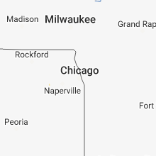


Connect with Interactive Hail Maps