

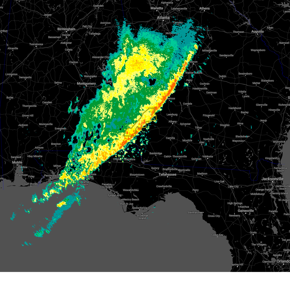
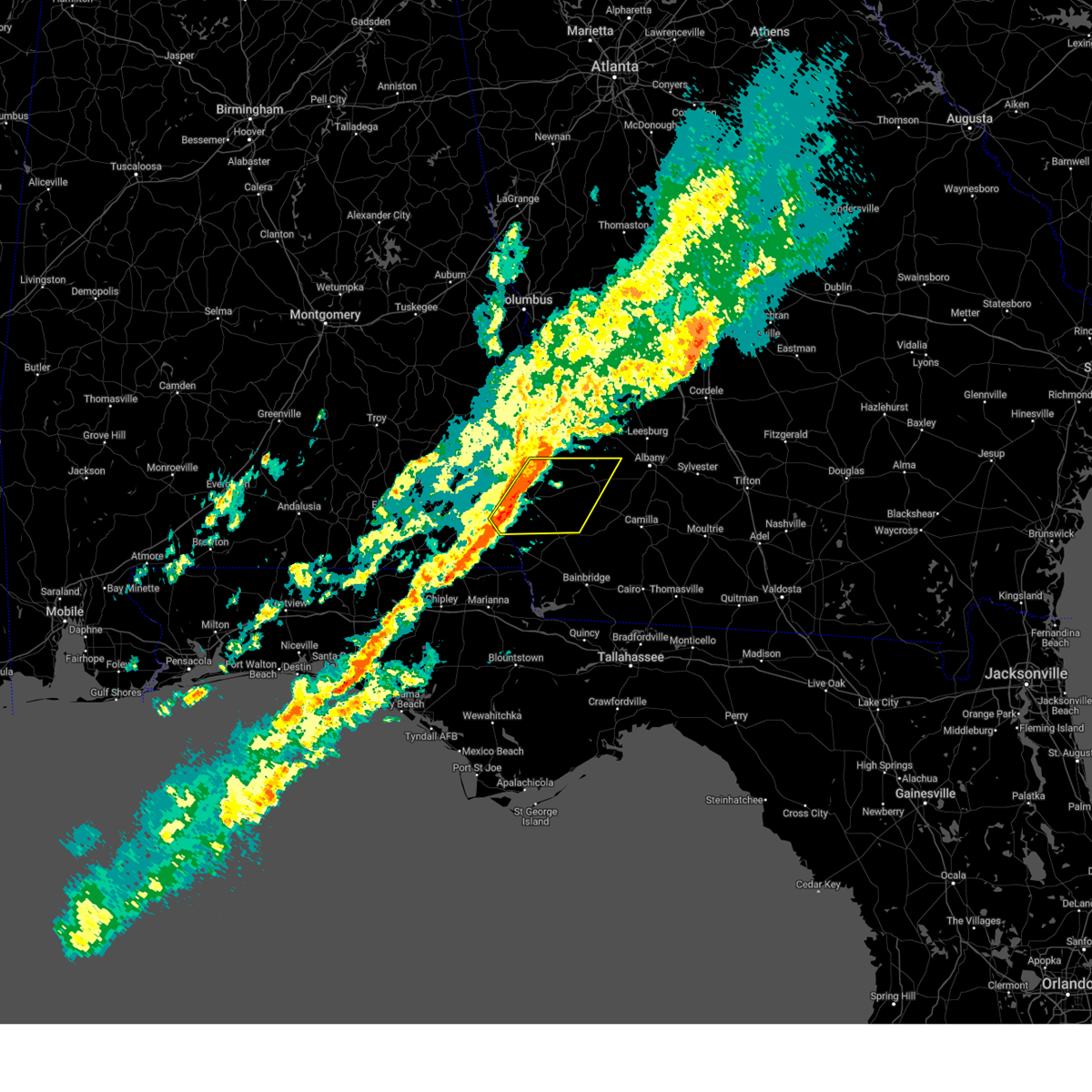
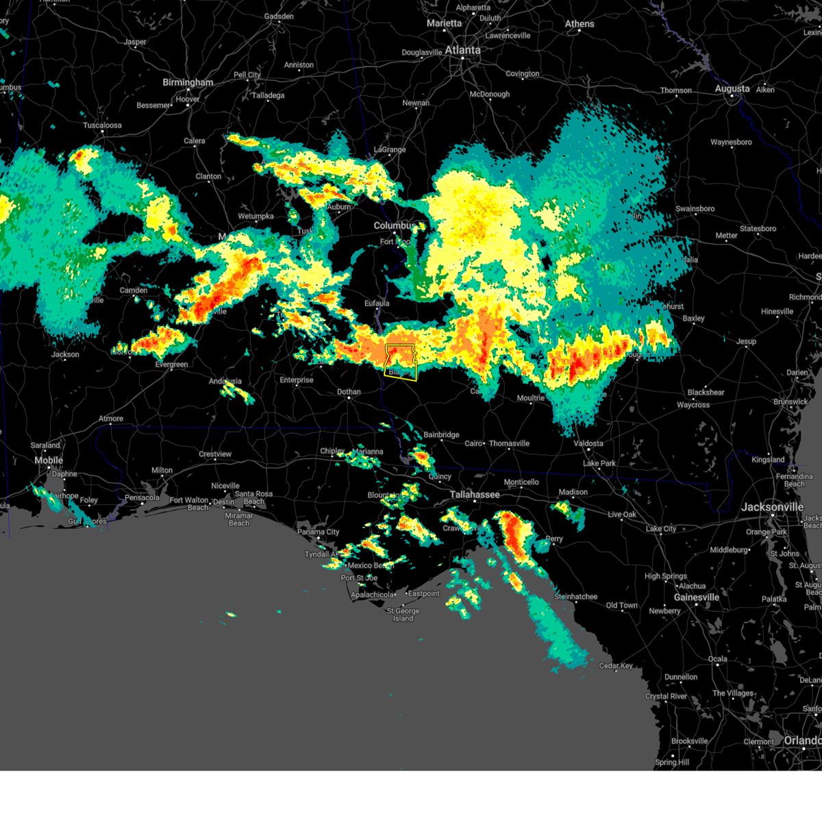
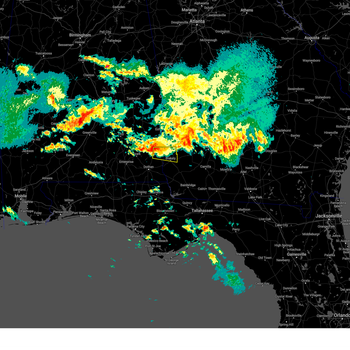
Hail Map for Bluffton, GA
The Bluffton, GA area has had 0 reports of on-the-ground hail by trained spotters, and has been under severe weather warnings 21 times during the past 12 months. Doppler radar has detected hail at or near Bluffton, GA on 43 occasions.
| Name: | Bluffton, GA |
| Where Located: | 82.1 miles NNW of Tallahassee, FL |
| Map: | Google Map for Bluffton, GA |
| Population: | 103 |
| Housing Units: | 54 |
| More Info: | Search Google for Bluffton, GA |
0
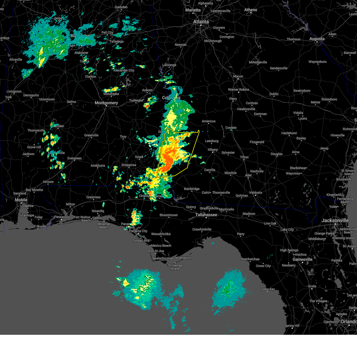
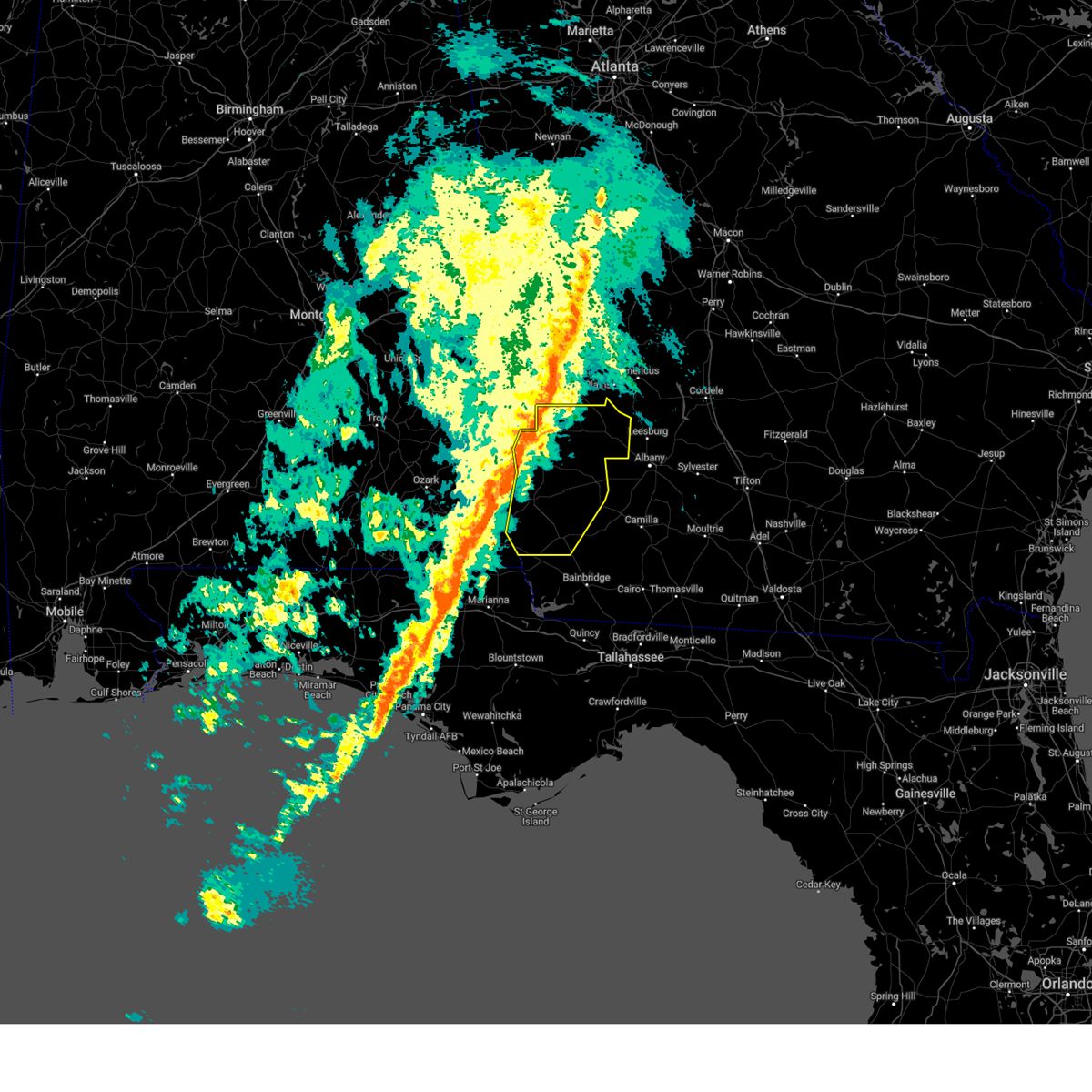
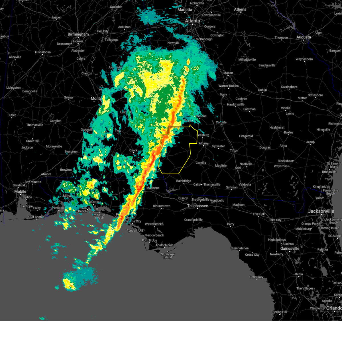
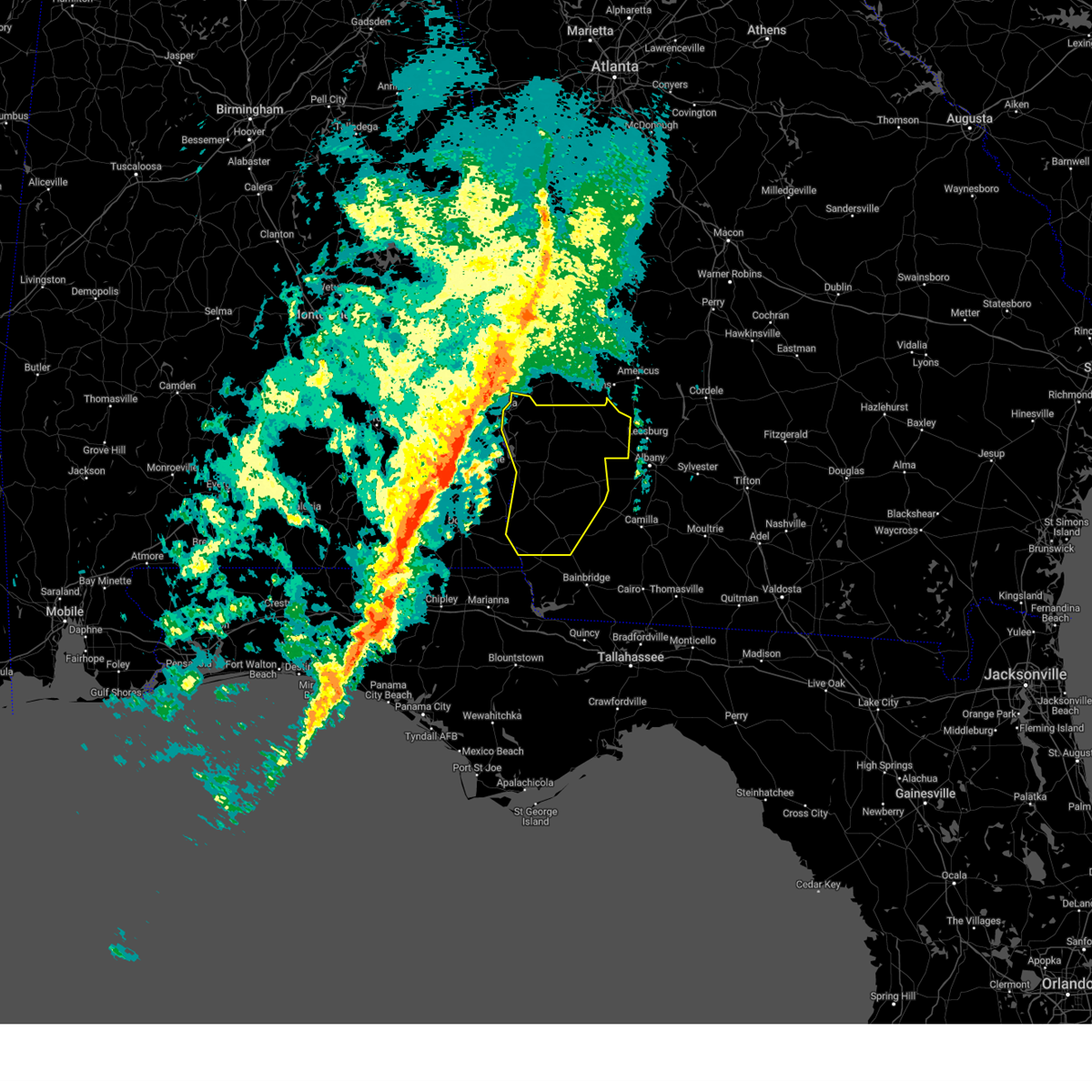
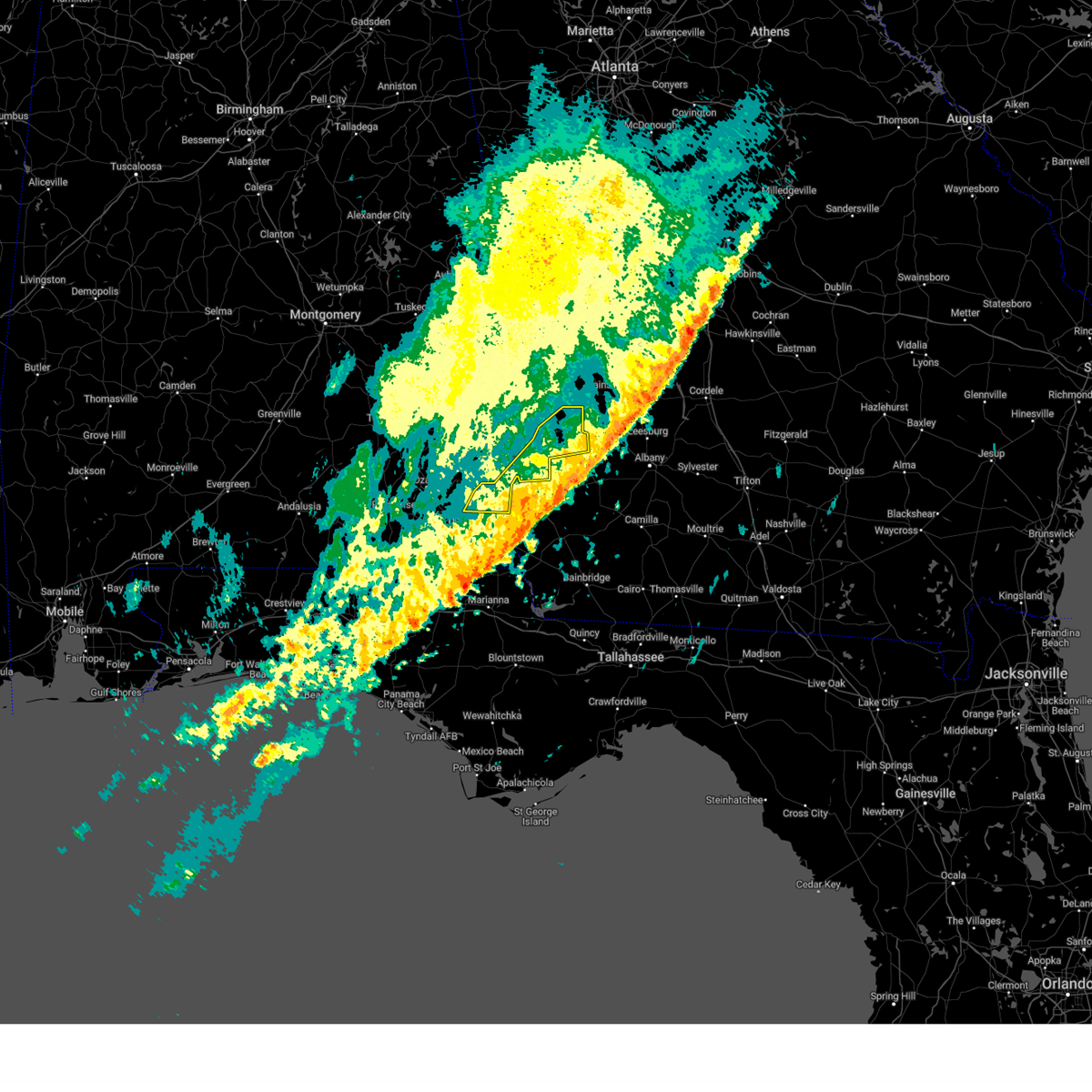
The Top Recent Hail Date for Bluffton, GA is Monday, May 27, 2024 (43rd out of 43)

Hail and Wind Damage Spotted near Bluffton, GA
| Date / Time | Report Details |
|---|---|
| 5/10/2025 2:33 PM EDT |
 Svrtae the national weather service in tallahassee has issued a * severe thunderstorm warning for, eastern henry county in southeastern alabama, northeastern houston county in southeastern alabama, northwestern miller county in southwestern georgia, clay county in southwestern georgia, randolph county in southwestern georgia, calhoun county in southwestern georgia, early county in southwestern georgia, quitman county in southwestern georgia, western terrell county in southwestern georgia, * until 330 pm edt/230 pm cdt/. * at 233 pm edt/133 pm cdt/, severe thunderstorms were located along a line extending from 7 miles southeast of fort gaines to near columbia, moving northeast at 25 mph (radar indicated). Hazards include 60 mph wind gusts and quarter size hail. Hail damage to vehicles is expected. Expect wind damage to roofs, siding, and trees. Svrtae the national weather service in tallahassee has issued a * severe thunderstorm warning for, eastern henry county in southeastern alabama, northeastern houston county in southeastern alabama, northwestern miller county in southwestern georgia, clay county in southwestern georgia, randolph county in southwestern georgia, calhoun county in southwestern georgia, early county in southwestern georgia, quitman county in southwestern georgia, western terrell county in southwestern georgia, * until 330 pm edt/230 pm cdt/. * at 233 pm edt/133 pm cdt/, severe thunderstorms were located along a line extending from 7 miles southeast of fort gaines to near columbia, moving northeast at 25 mph (radar indicated). Hazards include 60 mph wind gusts and quarter size hail. Hail damage to vehicles is expected. Expect wind damage to roofs, siding, and trees.
|
| 3/31/2025 1:58 PM EDT |
 Svrtae the national weather service in tallahassee has issued a * severe thunderstorm warning for, southeastern henry county in southeastern alabama, northeastern houston county in southeastern alabama, miller county in southwestern georgia, dougherty county in southwestern georgia, clay county in southwestern georgia, randolph county in southwestern georgia, mitchell county in southwestern georgia, lee county in southwestern georgia, baker county in southwestern georgia, calhoun county in southwestern georgia, early county in southwestern georgia, terrell county in southwestern georgia, * until 300 pm edt/200 pm cdt/. * at 158 pm edt/1258 pm cdt/, severe thunderstorms were located along a line extending from near cuthbert to 9 miles northwest of blakely to near cottonwood, moving east at 45 mph (radar indicated). Hazards include 60 mph wind gusts and penny size hail. expect damage to roofs, siding, and trees Svrtae the national weather service in tallahassee has issued a * severe thunderstorm warning for, southeastern henry county in southeastern alabama, northeastern houston county in southeastern alabama, miller county in southwestern georgia, dougherty county in southwestern georgia, clay county in southwestern georgia, randolph county in southwestern georgia, mitchell county in southwestern georgia, lee county in southwestern georgia, baker county in southwestern georgia, calhoun county in southwestern georgia, early county in southwestern georgia, terrell county in southwestern georgia, * until 300 pm edt/200 pm cdt/. * at 158 pm edt/1258 pm cdt/, severe thunderstorms were located along a line extending from near cuthbert to 9 miles northwest of blakely to near cottonwood, moving east at 45 mph (radar indicated). Hazards include 60 mph wind gusts and penny size hail. expect damage to roofs, siding, and trees
|
| 3/31/2025 1:47 PM EDT |
 the severe thunderstorm warning has been cancelled and is no longer in effect the severe thunderstorm warning has been cancelled and is no longer in effect
|
| 3/31/2025 1:47 PM EDT |
 At 147 pm edt/1247 pm cdt/, severe thunderstorms were located along a line extending from near cuthbert to 7 miles northwest of columbia to 6 miles east of graceville, moving east at 45 mph (radar indicated). Hazards include 60 mph wind gusts. Expect damage to roofs, siding, and trees. Locations impacted include, shorterville, parksville, hayes, pecan, rock hill, thomas mill creek, chambliss, hatcher, suttons corner, springvale, fort gaines-clay airport, arlington, georgetown, wades, balkum, howards mill, moores crossroads, yeomans, garnersville, and blakely. At 147 pm edt/1247 pm cdt/, severe thunderstorms were located along a line extending from near cuthbert to 7 miles northwest of columbia to 6 miles east of graceville, moving east at 45 mph (radar indicated). Hazards include 60 mph wind gusts. Expect damage to roofs, siding, and trees. Locations impacted include, shorterville, parksville, hayes, pecan, rock hill, thomas mill creek, chambliss, hatcher, suttons corner, springvale, fort gaines-clay airport, arlington, georgetown, wades, balkum, howards mill, moores crossroads, yeomans, garnersville, and blakely.
|
| 3/31/2025 1:22 PM EDT |
 Svrtae the national weather service in tallahassee has issued a * severe thunderstorm warning for, eastern dale county in southeastern alabama, henry county in southeastern alabama, northeastern geneva county in southeastern alabama, houston county in southeastern alabama, northwestern miller county in southwestern georgia, clay county in southwestern georgia, randolph county in southwestern georgia, western calhoun county in southwestern georgia, early county in southwestern georgia, quitman county in southwestern georgia, western terrell county in southwestern georgia, * until 200 pm edt/100 pm cdt/. * at 121 pm edt/1221 pm cdt/, severe thunderstorms were located along a line extending from near clio to 6 miles southwest of new brockton to 10 miles northwest of de funiak springs, moving east at 45 mph (radar indicated). Hazards include 60 mph wind gusts. expect damage to roofs, siding, and trees Svrtae the national weather service in tallahassee has issued a * severe thunderstorm warning for, eastern dale county in southeastern alabama, henry county in southeastern alabama, northeastern geneva county in southeastern alabama, houston county in southeastern alabama, northwestern miller county in southwestern georgia, clay county in southwestern georgia, randolph county in southwestern georgia, western calhoun county in southwestern georgia, early county in southwestern georgia, quitman county in southwestern georgia, western terrell county in southwestern georgia, * until 200 pm edt/100 pm cdt/. * at 121 pm edt/1221 pm cdt/, severe thunderstorms were located along a line extending from near clio to 6 miles southwest of new brockton to 10 miles northwest of de funiak springs, moving east at 45 mph (radar indicated). Hazards include 60 mph wind gusts. expect damage to roofs, siding, and trees
|
| 3/5/2025 2:42 AM EST |
 At 242 am est, severe thunderstorms were located along a line extending from 7 miles southwest of plains to 7 miles northwest of donalsonville, moving east at 40 mph (radar indicated). Hazards include 60 mph wind gusts. Expect damage to roofs, siding, and trees. Locations impacted include, iveys mill, parksville, carnegie, parrott, bluffton, dawson municipal a/p, chambliss, suttons corner, chickasawhatchee, arlington, rowena, howards mill, herod, centerville, yeomans, blakely, graves, fountain bridge, goffs mill, and commissary hill. At 242 am est, severe thunderstorms were located along a line extending from 7 miles southwest of plains to 7 miles northwest of donalsonville, moving east at 40 mph (radar indicated). Hazards include 60 mph wind gusts. Expect damage to roofs, siding, and trees. Locations impacted include, iveys mill, parksville, carnegie, parrott, bluffton, dawson municipal a/p, chambliss, suttons corner, chickasawhatchee, arlington, rowena, howards mill, herod, centerville, yeomans, blakely, graves, fountain bridge, goffs mill, and commissary hill.
|
| 3/5/2025 2:15 AM EST |
 the severe thunderstorm warning has been cancelled and is no longer in effect the severe thunderstorm warning has been cancelled and is no longer in effect
|
| 3/5/2025 2:15 AM EST |
 At 215 am est, severe thunderstorms were located along a line extending from 9 miles south of lumpkin to near ashford, moving east at 50 mph (radar indicated). Hazards include 60 mph wind gusts. Expect damage to roofs, siding, and trees. Locations impacted include, iveys mill, parksville, carnegie, watson crossroads, parrott, bluffton, pecan, rock hill, dawson municipal a/p, bellville, chambliss, bethel, suttons corner, springvale, fort gaines-clay airport, chickasawhatchee, arlington, wades, rowena, and howards mill. At 215 am est, severe thunderstorms were located along a line extending from 9 miles south of lumpkin to near ashford, moving east at 50 mph (radar indicated). Hazards include 60 mph wind gusts. Expect damage to roofs, siding, and trees. Locations impacted include, iveys mill, parksville, carnegie, watson crossroads, parrott, bluffton, pecan, rock hill, dawson municipal a/p, bellville, chambliss, bethel, suttons corner, springvale, fort gaines-clay airport, chickasawhatchee, arlington, wades, rowena, and howards mill.
|
| 3/5/2025 1:30 AM EST |
 Svrtae the national weather service in tallahassee has issued a * severe thunderstorm warning for, miller county in southwestern georgia, clay county in southwestern georgia, randolph county in southwestern georgia, northwestern baker county in southwestern georgia, calhoun county in southwestern georgia, early county in southwestern georgia, quitman county in southwestern georgia, terrell county in southwestern georgia, * until 300 am est. * at 129 am est, severe thunderstorms were located along a line extending from near blue springs to near geneva, moving east at 45 mph (radar indicated). Hazards include 60 mph wind gusts. expect damage to roofs, siding, and trees Svrtae the national weather service in tallahassee has issued a * severe thunderstorm warning for, miller county in southwestern georgia, clay county in southwestern georgia, randolph county in southwestern georgia, northwestern baker county in southwestern georgia, calhoun county in southwestern georgia, early county in southwestern georgia, quitman county in southwestern georgia, terrell county in southwestern georgia, * until 300 am est. * at 129 am est, severe thunderstorms were located along a line extending from near blue springs to near geneva, moving east at 45 mph (radar indicated). Hazards include 60 mph wind gusts. expect damage to roofs, siding, and trees
|
| 2/16/2025 6:05 AM EST |
 The storms which prompted the warning have moved out of the area. therefore, the warning will be allowed to expire. a tornado watch remains in effect until 1000 am est/900 am cst/ for southeastern alabama, and southwestern georgia. to report severe weather, contact your nearest law enforcement agency. they will relay your report to the national weather service tallahassee. The storms which prompted the warning have moved out of the area. therefore, the warning will be allowed to expire. a tornado watch remains in effect until 1000 am est/900 am cst/ for southeastern alabama, and southwestern georgia. to report severe weather, contact your nearest law enforcement agency. they will relay your report to the national weather service tallahassee.
|
| 2/16/2025 5:50 AM EST |
 At 550 am est/450 am cst/, severe thunderstorms were located along a line extending from near preston to near columbia, moving east at 50 mph (radar indicated). Hazards include 60 mph wind gusts. Expect damage to roofs, siding, and trees. Locations impacted include, fort gaines, headland, cuthbert, shellman, newville, bellville, haleburg, bluffton, tumbleton, grandberry crossroads, carnegie, hayes, pecan, randolph co a/p, headland municipal a/p, dancey, jones crossing, martins crossroads, bethel, and benevolence. At 550 am est/450 am cst/, severe thunderstorms were located along a line extending from near preston to near columbia, moving east at 50 mph (radar indicated). Hazards include 60 mph wind gusts. Expect damage to roofs, siding, and trees. Locations impacted include, fort gaines, headland, cuthbert, shellman, newville, bellville, haleburg, bluffton, tumbleton, grandberry crossroads, carnegie, hayes, pecan, randolph co a/p, headland municipal a/p, dancey, jones crossing, martins crossroads, bethel, and benevolence.
|
| 2/16/2025 5:50 AM EST |
 the severe thunderstorm warning has been cancelled and is no longer in effect the severe thunderstorm warning has been cancelled and is no longer in effect
|
| 2/16/2025 4:47 AM EST |
 Svrtae the national weather service in tallahassee has issued a * severe thunderstorm warning for, eastern dale county in southeastern alabama, henry county in southeastern alabama, clay county in southwestern georgia, randolph county in southwestern georgia, quitman county in southwestern georgia, * until 615 am est/515 am cst/. * at 447 am est/347 am cst/, severe thunderstorms were located along a line extending from spring hill to near elba, moving east at 50 mph (radar indicated). Hazards include 60 mph wind gusts. expect damage to roofs, siding, and trees Svrtae the national weather service in tallahassee has issued a * severe thunderstorm warning for, eastern dale county in southeastern alabama, henry county in southeastern alabama, clay county in southwestern georgia, randolph county in southwestern georgia, quitman county in southwestern georgia, * until 615 am est/515 am cst/. * at 447 am est/347 am cst/, severe thunderstorms were located along a line extending from spring hill to near elba, moving east at 50 mph (radar indicated). Hazards include 60 mph wind gusts. expect damage to roofs, siding, and trees
|
| 2/13/2025 6:07 AM EST |
 The storms which prompted the warning have weakened below severe limits, and no longer pose an immediate threat to life or property. therefore, the warning will be allowed to expire. however, gusty winds and heavy rain are still possible with these thunderstorms. to report severe weather, contact your nearest law enforcement agency. they will relay your report to the national weather service tallahassee. The storms which prompted the warning have weakened below severe limits, and no longer pose an immediate threat to life or property. therefore, the warning will be allowed to expire. however, gusty winds and heavy rain are still possible with these thunderstorms. to report severe weather, contact your nearest law enforcement agency. they will relay your report to the national weather service tallahassee.
|
| 2/13/2025 5:42 AM EST |
 the severe thunderstorm warning has been cancelled and is no longer in effect the severe thunderstorm warning has been cancelled and is no longer in effect
|
| 2/13/2025 5:42 AM EST |
 At 542 am est, severe thunderstorms were located along a line extending from edison to 6 miles south of blakely, moving east at 50 mph (radar indicated). Hazards include 60 mph wind gusts and nickel size hail. Expect damage to roofs, siding, and trees. Locations impacted include, morgan, blakely, edison, arlington, leary, douglasville, centerville, damascus, bluffton, iveys mill, parksville, holt, rock hill, early co a/p, hentown, suttons corner, hilton, rowena, harrisons mill, and milford. At 542 am est, severe thunderstorms were located along a line extending from edison to 6 miles south of blakely, moving east at 50 mph (radar indicated). Hazards include 60 mph wind gusts and nickel size hail. Expect damage to roofs, siding, and trees. Locations impacted include, morgan, blakely, edison, arlington, leary, douglasville, centerville, damascus, bluffton, iveys mill, parksville, holt, rock hill, early co a/p, hentown, suttons corner, hilton, rowena, harrisons mill, and milford.
|
| 2/13/2025 5:28 AM EST |
 Svrtae the national weather service in tallahassee has issued a * severe thunderstorm warning for, southeastern henry county in southeastern alabama, northeastern houston county in southeastern alabama, northern miller county in southwestern georgia, northwestern dougherty county in southwestern georgia, southeastern clay county in southwestern georgia, northwestern baker county in southwestern georgia, calhoun county in southwestern georgia, early county in southwestern georgia, * until 615 am est/515 am cst/. * at 528 am est/428 am cst/, severe thunderstorms were located along a line extending from 9 miles southeast of fort gaines to near columbia, moving east at 50 mph (radar indicated). Hazards include 60 mph wind gusts and nickel size hail. expect damage to roofs, siding, and trees Svrtae the national weather service in tallahassee has issued a * severe thunderstorm warning for, southeastern henry county in southeastern alabama, northeastern houston county in southeastern alabama, northern miller county in southwestern georgia, northwestern dougherty county in southwestern georgia, southeastern clay county in southwestern georgia, northwestern baker county in southwestern georgia, calhoun county in southwestern georgia, early county in southwestern georgia, * until 615 am est/515 am cst/. * at 528 am est/428 am cst/, severe thunderstorms were located along a line extending from 9 miles southeast of fort gaines to near columbia, moving east at 50 mph (radar indicated). Hazards include 60 mph wind gusts and nickel size hail. expect damage to roofs, siding, and trees
|
| 7/31/2024 6:48 PM CDT |
 At 748 pm edt/648 pm cdt/, severe thunderstorms were located along a line extending from near fort novosel to 7 miles southeast of columbia to 9 miles west of edison, moving southeast at 15 mph (radar indicated). Hazards include 60 mph wind gusts and quarter size hail. Hail damage to vehicles is expected. expect wind damage to roofs, siding, and trees. Locations impacted include, daleville, dothan, blakely, fort novosel, ozark, enterprise, taylor, midland city, kinsey, ashford, level plains, cowarts, edison, newton, arlington, webb, columbia, pinckard, centerville, and clayhatchee. At 748 pm edt/648 pm cdt/, severe thunderstorms were located along a line extending from near fort novosel to 7 miles southeast of columbia to 9 miles west of edison, moving southeast at 15 mph (radar indicated). Hazards include 60 mph wind gusts and quarter size hail. Hail damage to vehicles is expected. expect wind damage to roofs, siding, and trees. Locations impacted include, daleville, dothan, blakely, fort novosel, ozark, enterprise, taylor, midland city, kinsey, ashford, level plains, cowarts, edison, newton, arlington, webb, columbia, pinckard, centerville, and clayhatchee.
|
| 7/31/2024 6:48 PM CDT |
 the severe thunderstorm warning has been cancelled and is no longer in effect the severe thunderstorm warning has been cancelled and is no longer in effect
|
| 7/31/2024 6:25 PM CDT | Svrtae the national weather service in tallahassee has issued a * severe thunderstorm warning for, dale county in southeastern alabama, southern henry county in southeastern alabama, northern houston county in southeastern alabama, northwestern miller county in southwestern georgia, clay county in southwestern georgia, southwestern randolph county in southwestern georgia, western calhoun county in southwestern georgia, early county in southwestern georgia, * until 830 pm edt/730 pm cdt/. * at 725 pm edt/625 pm cdt/, severe thunderstorms were located along a line extending from near fort novosel to columbia to 6 miles east of fort gaines, moving southeast at 15 mph (radar indicated). Hazards include 60 mph wind gusts and quarter size hail. Hail damage to vehicles is expected. Expect wind damage to roofs, siding, and trees. |
| 7/31/2024 5:41 PM EDT |
 Svrtae the national weather service in tallahassee has issued a * severe thunderstorm warning for, dougherty county in southwestern georgia, southeastern clay county in southwestern georgia, northeastern mitchell county in southwestern georgia, baker county in southwestern georgia, calhoun county in southwestern georgia, northeastern early county in southwestern georgia, * until 630 pm edt. * at 540 pm edt, severe thunderstorms were located along a line extending from 6 miles west of putney to near morgan to near blakely, moving south at 25 mph (radar indicated). Hazards include 60 mph wind gusts and penny size hail. expect damage to roofs, siding, and trees Svrtae the national weather service in tallahassee has issued a * severe thunderstorm warning for, dougherty county in southwestern georgia, southeastern clay county in southwestern georgia, northeastern mitchell county in southwestern georgia, baker county in southwestern georgia, calhoun county in southwestern georgia, northeastern early county in southwestern georgia, * until 630 pm edt. * at 540 pm edt, severe thunderstorms were located along a line extending from 6 miles west of putney to near morgan to near blakely, moving south at 25 mph (radar indicated). Hazards include 60 mph wind gusts and penny size hail. expect damage to roofs, siding, and trees
|
| 6/6/2024 2:05 PM EDT |
 The storm which prompted the warning has weakened below severe limits, and no longer poses an immediate threat to life or property. therefore, the warning will be allowed to expire. however, gusty winds and heavy rain are still possible with this thunderstorm. The storm which prompted the warning has weakened below severe limits, and no longer poses an immediate threat to life or property. therefore, the warning will be allowed to expire. however, gusty winds and heavy rain are still possible with this thunderstorm.
|
| 6/6/2024 1:49 PM EDT |
 At 149 pm edt, a severe thunderstorm was located over edison, or near morgan, moving east at 40 mph (radar indicated). Hazards include 60 mph wind gusts. Expect damage to roofs, siding, and trees. Locations impacted include, morgan, edison, leary, bellville, bluffton, harrisons mill, parksville, zetto, carnegie, moye, cordrays mill, colomokee, fountain bridge, turman, shivers mill, aycock mill, bermuda, martins crossroads, suttons corner, and dickey. At 149 pm edt, a severe thunderstorm was located over edison, or near morgan, moving east at 40 mph (radar indicated). Hazards include 60 mph wind gusts. Expect damage to roofs, siding, and trees. Locations impacted include, morgan, edison, leary, bellville, bluffton, harrisons mill, parksville, zetto, carnegie, moye, cordrays mill, colomokee, fountain bridge, turman, shivers mill, aycock mill, bermuda, martins crossroads, suttons corner, and dickey.
|
| 6/6/2024 1:49 PM EDT |
 the severe thunderstorm warning has been cancelled and is no longer in effect the severe thunderstorm warning has been cancelled and is no longer in effect
|
| 6/6/2024 1:27 PM EDT |
 Svrtae the national weather service in tallahassee has issued a * severe thunderstorm warning for, southeastern clay county in southwestern georgia, southeastern randolph county in southwestern georgia, northwestern baker county in southwestern georgia, calhoun county in southwestern georgia, northeastern early county in southwestern georgia, * until 215 pm edt. * at 127 pm edt, a severe thunderstorm was located near blakely, moving east at 40 mph (radar indicated). Hazards include 60 mph wind gusts. expect damage to roofs, siding, and trees Svrtae the national weather service in tallahassee has issued a * severe thunderstorm warning for, southeastern clay county in southwestern georgia, southeastern randolph county in southwestern georgia, northwestern baker county in southwestern georgia, calhoun county in southwestern georgia, northeastern early county in southwestern georgia, * until 215 pm edt. * at 127 pm edt, a severe thunderstorm was located near blakely, moving east at 40 mph (radar indicated). Hazards include 60 mph wind gusts. expect damage to roofs, siding, and trees
|
| 5/27/2024 7:16 PM EDT |
 the severe thunderstorm warning has been cancelled and is no longer in effect the severe thunderstorm warning has been cancelled and is no longer in effect
|
| 5/27/2024 6:42 PM EDT |
 At 642 pm edt, a severe thunderstorm was located near edison, or 8 miles west of morgan, moving east at 30 mph (radar indicated). Hazards include 60 mph wind gusts and half dollar size hail. Hail damage to vehicles is expected. expect wind damage to roofs, siding, and trees. Locations impacted include, morgan, edison, arlington, leary, bluffton, parksville, holt, cordrays mill, clarks mill, commissary hill, turman, bermuda, and dickey. At 642 pm edt, a severe thunderstorm was located near edison, or 8 miles west of morgan, moving east at 30 mph (radar indicated). Hazards include 60 mph wind gusts and half dollar size hail. Hail damage to vehicles is expected. expect wind damage to roofs, siding, and trees. Locations impacted include, morgan, edison, arlington, leary, bluffton, parksville, holt, cordrays mill, clarks mill, commissary hill, turman, bermuda, and dickey.
|
| 5/27/2024 6:24 PM EDT |
 Svrtae the national weather service in tallahassee has issued a * severe thunderstorm warning for, southeastern clay county in southwestern georgia, southeastern randolph county in southwestern georgia, calhoun county in southwestern georgia, northeastern early county in southwestern georgia, south central terrell county in southwestern georgia, * until 730 pm edt. * at 623 pm edt, a severe thunderstorm was located 7 miles north of blakely, moving east at 30 mph (radar indicated). Hazards include 60 mph wind gusts and quarter size hail. Hail damage to vehicles is expected. Expect wind damage to roofs, siding, and trees. Svrtae the national weather service in tallahassee has issued a * severe thunderstorm warning for, southeastern clay county in southwestern georgia, southeastern randolph county in southwestern georgia, calhoun county in southwestern georgia, northeastern early county in southwestern georgia, south central terrell county in southwestern georgia, * until 730 pm edt. * at 623 pm edt, a severe thunderstorm was located 7 miles north of blakely, moving east at 30 mph (radar indicated). Hazards include 60 mph wind gusts and quarter size hail. Hail damage to vehicles is expected. Expect wind damage to roofs, siding, and trees.
|
| 5/18/2024 9:46 AM EDT |
 Svrtae the national weather service in tallahassee has issued a * severe thunderstorm warning for, southeastern henry county in southeastern alabama, southeastern clay county in southwestern georgia, western calhoun county in southwestern georgia, early county in southwestern georgia, * until 1030 am edt/930 am cdt/. * at 945 am edt/845 am cdt/, a severe thunderstorm was located near columbia, or near blakely, moving east at 25 mph (radar indicated). Hazards include 60 mph wind gusts. expect damage to roofs, siding, and trees Svrtae the national weather service in tallahassee has issued a * severe thunderstorm warning for, southeastern henry county in southeastern alabama, southeastern clay county in southwestern georgia, western calhoun county in southwestern georgia, early county in southwestern georgia, * until 1030 am edt/930 am cdt/. * at 945 am edt/845 am cdt/, a severe thunderstorm was located near columbia, or near blakely, moving east at 25 mph (radar indicated). Hazards include 60 mph wind gusts. expect damage to roofs, siding, and trees
|
| 5/10/2024 3:46 AM CDT |
 Svrtae the national weather service in tallahassee has issued a * severe thunderstorm warning for, dale county in southeastern alabama, henry county in southeastern alabama, geneva county in southeastern alabama, houston county in southeastern alabama, miller county in southwestern georgia, clay county in southwestern georgia, randolph county in southwestern georgia, calhoun county in southwestern georgia, northern seminole county in southwestern georgia, early county in southwestern georgia, quitman county in southwestern georgia, * until 545 am edt/445 am cdt/. * at 446 am edt/346 am cdt/, severe thunderstorms were located along a line extending from 6 miles south of georgetown to 7 miles west of blakely to 10 miles southeast of ashford, moving northeast at 50 mph (radar indicated). Hazards include 60 mph wind gusts and quarter size hail. Hail damage to vehicles is expected. Expect wind damage to roofs, siding, and trees. Svrtae the national weather service in tallahassee has issued a * severe thunderstorm warning for, dale county in southeastern alabama, henry county in southeastern alabama, geneva county in southeastern alabama, houston county in southeastern alabama, miller county in southwestern georgia, clay county in southwestern georgia, randolph county in southwestern georgia, calhoun county in southwestern georgia, northern seminole county in southwestern georgia, early county in southwestern georgia, quitman county in southwestern georgia, * until 545 am edt/445 am cdt/. * at 446 am edt/346 am cdt/, severe thunderstorms were located along a line extending from 6 miles south of georgetown to 7 miles west of blakely to 10 miles southeast of ashford, moving northeast at 50 mph (radar indicated). Hazards include 60 mph wind gusts and quarter size hail. Hail damage to vehicles is expected. Expect wind damage to roofs, siding, and trees.
|
| 5/10/2024 12:31 AM EDT |
 the severe thunderstorm warning has been cancelled and is no longer in effect the severe thunderstorm warning has been cancelled and is no longer in effect
|
| 5/10/2024 12:31 AM EDT |
 At 1230 am edt, a severe thunderstorm was located 9 miles northeast of fort gaines, moving southeast at 45 mph (radar indicated). Hazards include 60 mph wind gusts. Expect damage to roofs, siding, and trees. Locations impacted include, fort gaines, cuthbert, georgetown, bellville, bluffton, wire bridge, walter f george lake, bonapartes retreat, standleys store, carnegie, watson crossroads, crossroads, ricks place, pecan, randolph co a/p, hatcher, morris, jones crossing, bethel, and benevolence. At 1230 am edt, a severe thunderstorm was located 9 miles northeast of fort gaines, moving southeast at 45 mph (radar indicated). Hazards include 60 mph wind gusts. Expect damage to roofs, siding, and trees. Locations impacted include, fort gaines, cuthbert, georgetown, bellville, bluffton, wire bridge, walter f george lake, bonapartes retreat, standleys store, carnegie, watson crossroads, crossroads, ricks place, pecan, randolph co a/p, hatcher, morris, jones crossing, bethel, and benevolence.
|
| 5/9/2024 11:59 PM EDT |
 Svrtae the national weather service in tallahassee has issued a * severe thunderstorm warning for, central henry county in southeastern alabama, clay county in southwestern georgia, randolph county in southwestern georgia, northwestern early county in southwestern georgia, quitman county in southwestern georgia, * until 1245 am edt/1145 pm cdt/. * at 1159 pm edt/1059 pm cdt/, a severe thunderstorm was located over white oak, or 11 miles west of eufaula, moving southeast at 45 mph (radar indicated). Hazards include 60 mph wind gusts. expect damage to roofs, siding, and trees Svrtae the national weather service in tallahassee has issued a * severe thunderstorm warning for, central henry county in southeastern alabama, clay county in southwestern georgia, randolph county in southwestern georgia, northwestern early county in southwestern georgia, quitman county in southwestern georgia, * until 1245 am edt/1145 pm cdt/. * at 1159 pm edt/1059 pm cdt/, a severe thunderstorm was located over white oak, or 11 miles west of eufaula, moving southeast at 45 mph (radar indicated). Hazards include 60 mph wind gusts. expect damage to roofs, siding, and trees
|
| 4/3/2024 4:13 AM EDT |
 At 413 am edt, severe thunderstorms were located along a line extending from 8 miles west of smithville to near fort gaines, moving east at 35 mph (radar indicated). Hazards include 60 mph wind gusts. Expect damage to roofs, siding, and trees. Locations impacted include, fort gaines, dawson, leesburg, cuthbert, albany, shellman, smithville, sasser, bronwood, parrott, bellville, bluffton, stocks, carnegie, watson crossroads, pecan, dawson municipal a/p, neyami, bethel, and suttons corner. At 413 am edt, severe thunderstorms were located along a line extending from 8 miles west of smithville to near fort gaines, moving east at 35 mph (radar indicated). Hazards include 60 mph wind gusts. Expect damage to roofs, siding, and trees. Locations impacted include, fort gaines, dawson, leesburg, cuthbert, albany, shellman, smithville, sasser, bronwood, parrott, bellville, bluffton, stocks, carnegie, watson crossroads, pecan, dawson municipal a/p, neyami, bethel, and suttons corner.
|
| 4/3/2024 3:48 AM EDT |
 At 348 am edt, a severe thunderstorm was located near cuthbert, moving east at 55 mph (radar indicated). Hazards include 60 mph wind gusts. Expect damage to roofs, siding, and trees. Locations impacted include, fort gaines, dawson, leesburg, cuthbert, albany, shellman, smithville, sasser, bronwood, parrott, bellville, bluffton, stocks, carnegie, watson crossroads, ricks place, pecan, dawson municipal a/p, chambliss, and neyami. At 348 am edt, a severe thunderstorm was located near cuthbert, moving east at 55 mph (radar indicated). Hazards include 60 mph wind gusts. Expect damage to roofs, siding, and trees. Locations impacted include, fort gaines, dawson, leesburg, cuthbert, albany, shellman, smithville, sasser, bronwood, parrott, bellville, bluffton, stocks, carnegie, watson crossroads, ricks place, pecan, dawson municipal a/p, chambliss, and neyami.
|
| 4/3/2024 3:48 AM EDT |
 the severe thunderstorm warning has been cancelled and is no longer in effect the severe thunderstorm warning has been cancelled and is no longer in effect
|
| 4/3/2024 3:14 AM EDT |
 Svrtae the national weather service in tallahassee has issued a * severe thunderstorm warning for, clay county in southwestern georgia, randolph county in southwestern georgia, lee county in southwestern georgia, quitman county in southwestern georgia, terrell county in southwestern georgia, * until 445 am edt. * at 314 am edt, severe thunderstorms were located along a line extending from 7 miles east of lakepoint resort state park to 7 miles northwest of abbeville, moving east at 55 mph (radar indicated). Hazards include 60 mph wind gusts. expect damage to roofs, siding, and trees Svrtae the national weather service in tallahassee has issued a * severe thunderstorm warning for, clay county in southwestern georgia, randolph county in southwestern georgia, lee county in southwestern georgia, quitman county in southwestern georgia, terrell county in southwestern georgia, * until 445 am edt. * at 314 am edt, severe thunderstorms were located along a line extending from 7 miles east of lakepoint resort state park to 7 miles northwest of abbeville, moving east at 55 mph (radar indicated). Hazards include 60 mph wind gusts. expect damage to roofs, siding, and trees
|
| 1/9/2024 9:25 AM EST |
 At 925 am est/825 am cst/, severe thunderstorms were located along a line extending from 8 miles south of lumpkin to 6 miles southeast of cottonwood, moving east at 30 mph (radar indicated). Hazards include 70 mph wind gusts. Expect considerable tree damage. damage is likely to mobile homes, roofs, and outbuildings. Locations impacted include, colquitt, cottonwood, fort gaines, morgan, blakely, dawson, cuthbert, ashford, edison, arlington, shellman, columbia, leary, douglasville, centerville, avon, gordon, sasser, damascus, and bronwood. At 925 am est/825 am cst/, severe thunderstorms were located along a line extending from 8 miles south of lumpkin to 6 miles southeast of cottonwood, moving east at 30 mph (radar indicated). Hazards include 70 mph wind gusts. Expect considerable tree damage. damage is likely to mobile homes, roofs, and outbuildings. Locations impacted include, colquitt, cottonwood, fort gaines, morgan, blakely, dawson, cuthbert, ashford, edison, arlington, shellman, columbia, leary, douglasville, centerville, avon, gordon, sasser, damascus, and bronwood.
|
| 1/9/2024 8:54 AM EST |
 At 854 am est/754 am cst/, severe thunderstorms were located along a line extending from 9 miles northeast of lakepoint resort state park to graceville, moving northeast at 65 mph (radar indicated). Hazards include 60 mph wind gusts. expect damage to roofs, siding, and trees At 854 am est/754 am cst/, severe thunderstorms were located along a line extending from 9 miles northeast of lakepoint resort state park to graceville, moving northeast at 65 mph (radar indicated). Hazards include 60 mph wind gusts. expect damage to roofs, siding, and trees
|
| 1/9/2024 7:09 AM EST |
 At 709 am est/609 am cst/, a severe thunderstorm was located near columbia, or 8 miles east of headland, moving northeast at 50 mph (radar indicated). Hazards include 70 mph wind gusts and ping pong ball size hail. People and animals outdoors will be injured. expect hail damage to roofs, siding, windows, and vehicles. expect considerable tree damage. Wind damage is also likely to mobile homes, roofs, and outbuildings. At 709 am est/609 am cst/, a severe thunderstorm was located near columbia, or 8 miles east of headland, moving northeast at 50 mph (radar indicated). Hazards include 70 mph wind gusts and ping pong ball size hail. People and animals outdoors will be injured. expect hail damage to roofs, siding, windows, and vehicles. expect considerable tree damage. Wind damage is also likely to mobile homes, roofs, and outbuildings.
|
| 8/11/2023 5:51 PM EDT |
 At 550 pm edt/450 pm cdt/, severe thunderstorms were located along a line extending from near leary to 11 miles northeast of colquitt to 6 miles southeast of blakely, moving southeast at 55 mph (radar indicated). Hazards include 60 mph wind gusts. Expect damage to roofs, siding, and trees. locations impacted include, abbeville, fort gaines, morgan, headland, blakely, edison, arlington, leary, kinsey, douglasville, newville, bellville, haleburg, bluffton, shorterville, parksville, hayes, pecan, rock hill and bethel. hail threat, radar indicated max hail size, <. 75 in wind threat, radar indicated max wind gust, 60 mph. At 550 pm edt/450 pm cdt/, severe thunderstorms were located along a line extending from near leary to 11 miles northeast of colquitt to 6 miles southeast of blakely, moving southeast at 55 mph (radar indicated). Hazards include 60 mph wind gusts. Expect damage to roofs, siding, and trees. locations impacted include, abbeville, fort gaines, morgan, headland, blakely, edison, arlington, leary, kinsey, douglasville, newville, bellville, haleburg, bluffton, shorterville, parksville, hayes, pecan, rock hill and bethel. hail threat, radar indicated max hail size, <. 75 in wind threat, radar indicated max wind gust, 60 mph.
|
| 8/11/2023 5:09 PM EDT |
 At 508 pm edt/408 pm cdt/, severe thunderstorms were located along a line extending from 9 miles northwest of cuthbert to near fort gaines to near richards crossroads, moving southeast at 55 mph (radar indicated). Hazards include 60 mph wind gusts. expect damage to roofs, siding, and trees At 508 pm edt/408 pm cdt/, severe thunderstorms were located along a line extending from 9 miles northwest of cuthbert to near fort gaines to near richards crossroads, moving southeast at 55 mph (radar indicated). Hazards include 60 mph wind gusts. expect damage to roofs, siding, and trees
|
| 8/8/2023 5:09 PM EDT |
 The severe thunderstorm warning for henry county in southeastern alabama, clay, randolph, calhoun, northern early and quitman counties in southwestern georgia will expire at 515 pm edt/415 pm cdt/, the storms which prompted the warning have moved out of the area. therefore, the warning will be allowed to expire. a severe thunderstorm watch remains in effect until 900 pm edt/800 pm cdt/ for southeastern alabama, and southwestern georgia. to report severe weather, contact your nearest law enforcement agency. they will relay your report to the national weather service tallahassee. The severe thunderstorm warning for henry county in southeastern alabama, clay, randolph, calhoun, northern early and quitman counties in southwestern georgia will expire at 515 pm edt/415 pm cdt/, the storms which prompted the warning have moved out of the area. therefore, the warning will be allowed to expire. a severe thunderstorm watch remains in effect until 900 pm edt/800 pm cdt/ for southeastern alabama, and southwestern georgia. to report severe weather, contact your nearest law enforcement agency. they will relay your report to the national weather service tallahassee.
|
| 8/8/2023 4:32 PM EDT |
 At 432 pm edt/332 pm cdt/, severe thunderstorms were located along a line extending from 8 miles north of cuthbert to near daleville, moving east at 55 mph (radar indicated). Hazards include 60 mph wind gusts. Expect damage to roofs, siding, and trees. locations impacted include, abbeville, fort gaines, morgan, georgetown, cuthbert, edison, arlington, shellman, newville, bellville, haleburg, bluffton, shorterville, wire bridge, parksville, carnegie, hayes, watson crossroads, scottsboro crossroads and ricks place. hail threat, radar indicated max hail size, <. 75 in wind threat, radar indicated max wind gust, 60 mph. At 432 pm edt/332 pm cdt/, severe thunderstorms were located along a line extending from 8 miles north of cuthbert to near daleville, moving east at 55 mph (radar indicated). Hazards include 60 mph wind gusts. Expect damage to roofs, siding, and trees. locations impacted include, abbeville, fort gaines, morgan, georgetown, cuthbert, edison, arlington, shellman, newville, bellville, haleburg, bluffton, shorterville, wire bridge, parksville, carnegie, hayes, watson crossroads, scottsboro crossroads and ricks place. hail threat, radar indicated max hail size, <. 75 in wind threat, radar indicated max wind gust, 60 mph.
|
| 8/8/2023 4:15 PM EDT |
 At 415 pm edt/315 pm cdt/, severe thunderstorms were located along a line extending from near georgetown to 6 miles east of opp, moving east at 30 mph (radar indicated). Hazards include 60 mph wind gusts. Expect damage to roofs, siding, and trees. locations impacted include, abbeville, fort gaines, morgan, georgetown, cuthbert, ozark, fort novosel, edison, arlington, shellman, ariton, newville, bellville, haleburg, bluffton, shorterville, parksville, hayes, camp humming hills and pecan. hail threat, radar indicated max hail size, <. 75 in wind threat, radar indicated max wind gust, 60 mph. At 415 pm edt/315 pm cdt/, severe thunderstorms were located along a line extending from near georgetown to 6 miles east of opp, moving east at 30 mph (radar indicated). Hazards include 60 mph wind gusts. Expect damage to roofs, siding, and trees. locations impacted include, abbeville, fort gaines, morgan, georgetown, cuthbert, ozark, fort novosel, edison, arlington, shellman, ariton, newville, bellville, haleburg, bluffton, shorterville, parksville, hayes, camp humming hills and pecan. hail threat, radar indicated max hail size, <. 75 in wind threat, radar indicated max wind gust, 60 mph.
|
| 8/8/2023 2:45 PM CDT |
 At 344 pm edt/244 pm cdt/, severe thunderstorms were located along a line extending from near davisville to near glenwood, moving east at 50 mph (radar indicated). Hazards include 60 mph wind gusts. expect damage to roofs, siding, and trees At 344 pm edt/244 pm cdt/, severe thunderstorms were located along a line extending from near davisville to near glenwood, moving east at 50 mph (radar indicated). Hazards include 60 mph wind gusts. expect damage to roofs, siding, and trees
|
| 8/6/2023 8:35 PM EDT |
 At 835 pm edt/735 pm cdt/, severe thunderstorms were located along a line extending from near lumpkin to 7 miles southwest of abbeville, moving east at 35 mph (radar indicated). Hazards include 60 mph wind gusts. Expect damage to roofs, siding, and trees. locations impacted include, abbeville, fort gaines, georgetown, cuthbert, shellman, bellville, bluffton, haleburg, shorterville, wire bridge, carnegie, hayes, watson crossroads, scottsboro crossroads, ricks place, pecan, thomas mill creek, phillips crossroads, hatcher and morris. hail threat, radar indicated max hail size, <. 75 in wind threat, radar indicated max wind gust, 60 mph. At 835 pm edt/735 pm cdt/, severe thunderstorms were located along a line extending from near lumpkin to 7 miles southwest of abbeville, moving east at 35 mph (radar indicated). Hazards include 60 mph wind gusts. Expect damage to roofs, siding, and trees. locations impacted include, abbeville, fort gaines, georgetown, cuthbert, shellman, bellville, bluffton, haleburg, shorterville, wire bridge, carnegie, hayes, watson crossroads, scottsboro crossroads, ricks place, pecan, thomas mill creek, phillips crossroads, hatcher and morris. hail threat, radar indicated max hail size, <. 75 in wind threat, radar indicated max wind gust, 60 mph.
|
| 8/6/2023 7:45 PM EDT |
 At 745 pm edt/645 pm cdt/, a severe thunderstorm was located near tyler crossroads, or near clio, moving east at 20 mph (radar indicated). Hazards include 60 mph wind gusts. expect damage to roofs, siding, and trees At 745 pm edt/645 pm cdt/, a severe thunderstorm was located near tyler crossroads, or near clio, moving east at 20 mph (radar indicated). Hazards include 60 mph wind gusts. expect damage to roofs, siding, and trees
|
| 7/22/2023 11:56 AM CDT |
 The severe thunderstorm warning for northern dale and henry counties in southeastern alabama, clay, southwestern randolph, northwestern calhoun and northwestern early counties in southwestern georgia will expire at 100 pm edt/noon cdt/, the storms which prompted the warning have moved out of the area. therefore, the warning will be allowed to expire. however gusty winds are still possible with these thunderstorms. a severe thunderstorm watch remains in effect until 800 pm edt/700 pm cdt/ for southeastern alabama, and southwestern georgia. to report severe weather, contact your nearest law enforcement agency. they will relay your report to the national weather service tallahassee. The severe thunderstorm warning for northern dale and henry counties in southeastern alabama, clay, southwestern randolph, northwestern calhoun and northwestern early counties in southwestern georgia will expire at 100 pm edt/noon cdt/, the storms which prompted the warning have moved out of the area. therefore, the warning will be allowed to expire. however gusty winds are still possible with these thunderstorms. a severe thunderstorm watch remains in effect until 800 pm edt/700 pm cdt/ for southeastern alabama, and southwestern georgia. to report severe weather, contact your nearest law enforcement agency. they will relay your report to the national weather service tallahassee.
|
| 7/22/2023 11:04 AM CDT |
 At 1204 pm edt/1104 am cdt/, severe thunderstorms were located along a line extending from near richards crossroads to near ozark, moving east at 25 mph (radar indicated). Hazards include 60 mph wind gusts and penny size hail. expect damage to roofs, siding, and trees At 1204 pm edt/1104 am cdt/, severe thunderstorms were located along a line extending from near richards crossroads to near ozark, moving east at 25 mph (radar indicated). Hazards include 60 mph wind gusts and penny size hail. expect damage to roofs, siding, and trees
|
| 7/21/2023 11:16 PM EDT |
 At 1115 pm edt, severe thunderstorms were located along a line extending from 6 miles southwest of albany to near arlington to near taylor, moving southeast at 10 mph (radar indicated). Hazards include 60 mph wind gusts and penny size hail. expect damage to roofs, siding, and trees At 1115 pm edt, severe thunderstorms were located along a line extending from 6 miles southwest of albany to near arlington to near taylor, moving southeast at 10 mph (radar indicated). Hazards include 60 mph wind gusts and penny size hail. expect damage to roofs, siding, and trees
|
| 7/8/2023 4:49 PM CDT |
 At 549 pm edt/449 pm cdt/, severe thunderstorms were located along a line extending from near blue springs to near newton to near geneva, moving east at 40 mph (radar indicated). Hazards include 60 mph wind gusts and penny size hail. expect damage to roofs, siding, and trees At 549 pm edt/449 pm cdt/, severe thunderstorms were located along a line extending from near blue springs to near newton to near geneva, moving east at 40 mph (radar indicated). Hazards include 60 mph wind gusts and penny size hail. expect damage to roofs, siding, and trees
|
| 6/19/2023 7:38 AM EDT |
 At 738 am edt/638 am cdt/, severe thunderstorms were located along a line extending from near weston to near shellman to near fort gaines, moving northeast at 60 mph (radar indicated). Hazards include 60 mph wind gusts. Expect damage to roofs, siding, and trees. locations impacted include, morgan, blakely, dawson, cuthbert, edison, arlington, webb, shellman, columbia, leary, douglasville, centerville, damascus, bronwood, parrott, bellville, haleburg, bluffton, iveys mill and parksville. hail threat, radar indicated max hail size, <. 75 in wind threat, radar indicated max wind gust, 60 mph. At 738 am edt/638 am cdt/, severe thunderstorms were located along a line extending from near weston to near shellman to near fort gaines, moving northeast at 60 mph (radar indicated). Hazards include 60 mph wind gusts. Expect damage to roofs, siding, and trees. locations impacted include, morgan, blakely, dawson, cuthbert, edison, arlington, webb, shellman, columbia, leary, douglasville, centerville, damascus, bronwood, parrott, bellville, haleburg, bluffton, iveys mill and parksville. hail threat, radar indicated max hail size, <. 75 in wind threat, radar indicated max wind gust, 60 mph.
|
| 6/19/2023 7:15 AM EDT |
 At 715 am edt/615 am cdt/, severe thunderstorms were located along a line extending from near georgetown to near fort gaines to near headland, moving northeast at 60 mph (radar indicated). Hazards include 60 mph wind gusts. expect damage to roofs, siding, and trees At 715 am edt/615 am cdt/, severe thunderstorms were located along a line extending from near georgetown to near fort gaines to near headland, moving northeast at 60 mph (radar indicated). Hazards include 60 mph wind gusts. expect damage to roofs, siding, and trees
|
| 6/15/2023 10:28 AM EDT |
 At 1028 am edt, a severe thunderstorm was located 8 miles south of fort gaines, moving east at 30 mph (radar indicated). Hazards include 60 mph wind gusts and penny size hail. Expect damage to roofs, siding, and trees. Locations impacted include, fort gaines, blakely, bellville, bluffton, colomokee, harrisons mill, ferrell crossroads, zetto, early co a/p, kolomoki mounds sp and suttons corner. At 1028 am edt, a severe thunderstorm was located 8 miles south of fort gaines, moving east at 30 mph (radar indicated). Hazards include 60 mph wind gusts and penny size hail. Expect damage to roofs, siding, and trees. Locations impacted include, fort gaines, blakely, bellville, bluffton, colomokee, harrisons mill, ferrell crossroads, zetto, early co a/p, kolomoki mounds sp and suttons corner.
|
| 6/15/2023 10:04 AM EDT |
 At 1003 am edt/903 am cdt/, a severe thunderstorm was located near abbeville, moving east at 30 mph (radar indicated). Hazards include 60 mph wind gusts and penny size hail. expect damage to roofs, siding, and trees At 1003 am edt/903 am cdt/, a severe thunderstorm was located near abbeville, moving east at 30 mph (radar indicated). Hazards include 60 mph wind gusts and penny size hail. expect damage to roofs, siding, and trees
|
| 6/15/2023 5:48 AM EDT |
 At 548 am edt/448 am cdt/, severe thunderstorms were located along a line extending from near edison to 8 miles southeast of columbia to near ashford, moving southeast at 55 mph (radar indicated). Hazards include 60 mph wind gusts and quarter size hail. Hail damage to vehicles is expected. expect wind damage to roofs, siding, and trees. locations impacted include, blakely, dothan, ashford, cowarts, arlington, webb, columbia, centerville, avon, gordon, jakin, bluffton, saffold, pansey, parksville, sigma, enon, mayhaw, rock hill and barber. hail threat, radar indicated max hail size, 1. 00 in wind threat, radar indicated max wind gust, 60 mph. At 548 am edt/448 am cdt/, severe thunderstorms were located along a line extending from near edison to 8 miles southeast of columbia to near ashford, moving southeast at 55 mph (radar indicated). Hazards include 60 mph wind gusts and quarter size hail. Hail damage to vehicles is expected. expect wind damage to roofs, siding, and trees. locations impacted include, blakely, dothan, ashford, cowarts, arlington, webb, columbia, centerville, avon, gordon, jakin, bluffton, saffold, pansey, parksville, sigma, enon, mayhaw, rock hill and barber. hail threat, radar indicated max hail size, 1. 00 in wind threat, radar indicated max wind gust, 60 mph.
|
| 6/15/2023 4:37 AM CDT |
 At 536 am edt/436 am cdt/, severe thunderstorms were located along a line extending from 9 miles southeast of fort gaines to near columbia to near taylor, moving southeast at 55 mph (radar indicated). Hazards include 60 mph wind gusts and quarter size hail. Hail damage to vehicles is expected. expect wind damage to roofs, siding, and trees. locations impacted include, cottonwood, fort gaines, dothan, blakely, headland, taylor, midland city, kinsey, ashford, cowarts, arlington, webb, columbia, pinckard, centerville, malvern, rehobeth, grimes, avon and napier field. hail threat, radar indicated max hail size, 1. 00 in wind threat, radar indicated max wind gust, 60 mph. At 536 am edt/436 am cdt/, severe thunderstorms were located along a line extending from 9 miles southeast of fort gaines to near columbia to near taylor, moving southeast at 55 mph (radar indicated). Hazards include 60 mph wind gusts and quarter size hail. Hail damage to vehicles is expected. expect wind damage to roofs, siding, and trees. locations impacted include, cottonwood, fort gaines, dothan, blakely, headland, taylor, midland city, kinsey, ashford, cowarts, arlington, webb, columbia, pinckard, centerville, malvern, rehobeth, grimes, avon and napier field. hail threat, radar indicated max hail size, 1. 00 in wind threat, radar indicated max wind gust, 60 mph.
|
| 6/15/2023 4:14 AM CDT |
 At 514 am edt/414 am cdt/, severe thunderstorms were located along a line extending from near richards crossroads to 6 miles north of midland city to near enterprise, moving southeast at 55 mph (radar indicated). Hazards include 60 mph wind gusts and quarter size hail. Hail damage to vehicles is expected. Expect wind damage to roofs, siding, and trees. At 514 am edt/414 am cdt/, severe thunderstorms were located along a line extending from near richards crossroads to 6 miles north of midland city to near enterprise, moving southeast at 55 mph (radar indicated). Hazards include 60 mph wind gusts and quarter size hail. Hail damage to vehicles is expected. Expect wind damage to roofs, siding, and trees.
|
| 6/14/2023 8:08 PM EDT |
 At 808 pm edt/708 pm cdt/, severe thunderstorms were located along a line extending from near cuthbert to 8 miles northeast of headland, moving east at 50 mph (radar indicated). Hazards include 70 mph wind gusts and quarter size hail. Hail damage to vehicles is expected. expect considerable tree damage. wind damage is also likely to mobile homes, roofs, and outbuildings. locations impacted include, blakely, edison, arlington, columbia, centerville, jakin, bellville, haleburg, bluffton, saffold, parksville, carnegie, hayes, mayhaw, rock hill, early co a/p, hentown, suttons corner, hilton and harrisons mill. thunderstorm damage threat, considerable hail threat, radar indicated max hail size, 1. 00 in wind threat, radar indicated max wind gust, 70 mph. At 808 pm edt/708 pm cdt/, severe thunderstorms were located along a line extending from near cuthbert to 8 miles northeast of headland, moving east at 50 mph (radar indicated). Hazards include 70 mph wind gusts and quarter size hail. Hail damage to vehicles is expected. expect considerable tree damage. wind damage is also likely to mobile homes, roofs, and outbuildings. locations impacted include, blakely, edison, arlington, columbia, centerville, jakin, bellville, haleburg, bluffton, saffold, parksville, carnegie, hayes, mayhaw, rock hill, early co a/p, hentown, suttons corner, hilton and harrisons mill. thunderstorm damage threat, considerable hail threat, radar indicated max hail size, 1. 00 in wind threat, radar indicated max wind gust, 70 mph.
|
| 6/14/2023 7:34 PM EDT |
 At 733 pm edt/633 pm cdt/, severe thunderstorms were located along a line extending from near abbeville to near newton, moving east at 50 mph (radar indicated). Hazards include 70 mph wind gusts and quarter size hail. Hail damage to vehicles is expected. expect considerable tree damage. Wind damage is also likely to mobile homes, roofs, and outbuildings. At 733 pm edt/633 pm cdt/, severe thunderstorms were located along a line extending from near abbeville to near newton, moving east at 50 mph (radar indicated). Hazards include 70 mph wind gusts and quarter size hail. Hail damage to vehicles is expected. expect considerable tree damage. Wind damage is also likely to mobile homes, roofs, and outbuildings.
|
| 6/14/2023 6:21 PM EDT |
 At 621 pm edt/521 pm cdt/, severe thunderstorms were located along a line extending from near texasville to marine corps logistics base, moving southeast at 50 mph (radar indicated). Hazards include 60 mph wind gusts. expect damage to roofs, siding, and trees At 621 pm edt/521 pm cdt/, severe thunderstorms were located along a line extending from near texasville to marine corps logistics base, moving southeast at 50 mph (radar indicated). Hazards include 60 mph wind gusts. expect damage to roofs, siding, and trees
|
| 6/14/2023 5:10 PM EDT |
 At 509 pm edt/409 pm cdt/, a severe thunderstorm was located near hawkinsville, or 11 miles northwest of eufaula, moving southeast at 40 mph (radar indicated). Hazards include 60 mph wind gusts and quarter size hail. Hail damage to vehicles is expected. Expect wind damage to roofs, siding, and trees. At 509 pm edt/409 pm cdt/, a severe thunderstorm was located near hawkinsville, or 11 miles northwest of eufaula, moving southeast at 40 mph (radar indicated). Hazards include 60 mph wind gusts and quarter size hail. Hail damage to vehicles is expected. Expect wind damage to roofs, siding, and trees.
|
| 6/14/2023 1:44 PM EDT |
 At 144 pm edt, a severe thunderstorm capable of producing a tornado was located 7 miles west of arlington, or 8 miles northeast of blakely, moving east at 35 mph (radar indicated rotation). Hazards include tornado and quarter size hail. Flying debris will be dangerous to those caught without shelter. mobile homes will be damaged or destroyed. damage to roofs, windows, and vehicles will occur. tree damage is likely. this dangerous storm will be near, edison around 155 pm edt. arlington around 200 pm edt. Other locations impacted by this tornadic thunderstorm include colomokee, commissary hill, turman, parksville, ferrell crossroads, bluffton, kolomoki mounds sp and dickey. At 144 pm edt, a severe thunderstorm capable of producing a tornado was located 7 miles west of arlington, or 8 miles northeast of blakely, moving east at 35 mph (radar indicated rotation). Hazards include tornado and quarter size hail. Flying debris will be dangerous to those caught without shelter. mobile homes will be damaged or destroyed. damage to roofs, windows, and vehicles will occur. tree damage is likely. this dangerous storm will be near, edison around 155 pm edt. arlington around 200 pm edt. Other locations impacted by this tornadic thunderstorm include colomokee, commissary hill, turman, parksville, ferrell crossroads, bluffton, kolomoki mounds sp and dickey.
|
| 6/14/2023 1:25 PM EDT |
 At 124 pm edt, a severe thunderstorm capable of producing a tornado was located 8 miles northwest of blakely, moving east at 30 mph (radar indicated rotation). Hazards include tornado and golf ball size hail. Flying debris will be dangerous to those caught without shelter. mobile homes will be damaged or destroyed. damage to roofs, windows, and vehicles will occur. tree damage is likely. this dangerous storm will be near, edison and arlington around 200 pm edt. Other locations impacted by this tornadic thunderstorm include colomokee, harrisons mill, commissary hill, turman, parksville, ferrell crossroads, bluffton, kolomoki mounds sp and dickey. At 124 pm edt, a severe thunderstorm capable of producing a tornado was located 8 miles northwest of blakely, moving east at 30 mph (radar indicated rotation). Hazards include tornado and golf ball size hail. Flying debris will be dangerous to those caught without shelter. mobile homes will be damaged or destroyed. damage to roofs, windows, and vehicles will occur. tree damage is likely. this dangerous storm will be near, edison and arlington around 200 pm edt. Other locations impacted by this tornadic thunderstorm include colomokee, harrisons mill, commissary hill, turman, parksville, ferrell crossroads, bluffton, kolomoki mounds sp and dickey.
|
| 6/14/2023 1:05 PM EDT |
 At 104 pm edt/1204 pm cdt/, a severe thunderstorm capable of producing a tornado was located 9 miles southeast of abbeville, moving east at 40 mph (radar indicated rotation). Hazards include tornado. Flying debris will be dangerous to those caught without shelter. mobile homes will be damaged or destroyed. damage to roofs, windows, and vehicles will occur. tree damage is likely. This tornadic thunderstorm will remain over mainly rural areas of southeastern henry, south central clay and northwestern early counties, including the following locations, shorterville, haleburg, barnes, tumbleton, hardwickburg, zetto, hayes, colomokee, miller and ferrell crossroads. At 104 pm edt/1204 pm cdt/, a severe thunderstorm capable of producing a tornado was located 9 miles southeast of abbeville, moving east at 40 mph (radar indicated rotation). Hazards include tornado. Flying debris will be dangerous to those caught without shelter. mobile homes will be damaged or destroyed. damage to roofs, windows, and vehicles will occur. tree damage is likely. This tornadic thunderstorm will remain over mainly rural areas of southeastern henry, south central clay and northwestern early counties, including the following locations, shorterville, haleburg, barnes, tumbleton, hardwickburg, zetto, hayes, colomokee, miller and ferrell crossroads.
|
| 6/14/2023 1:05 PM EDT |
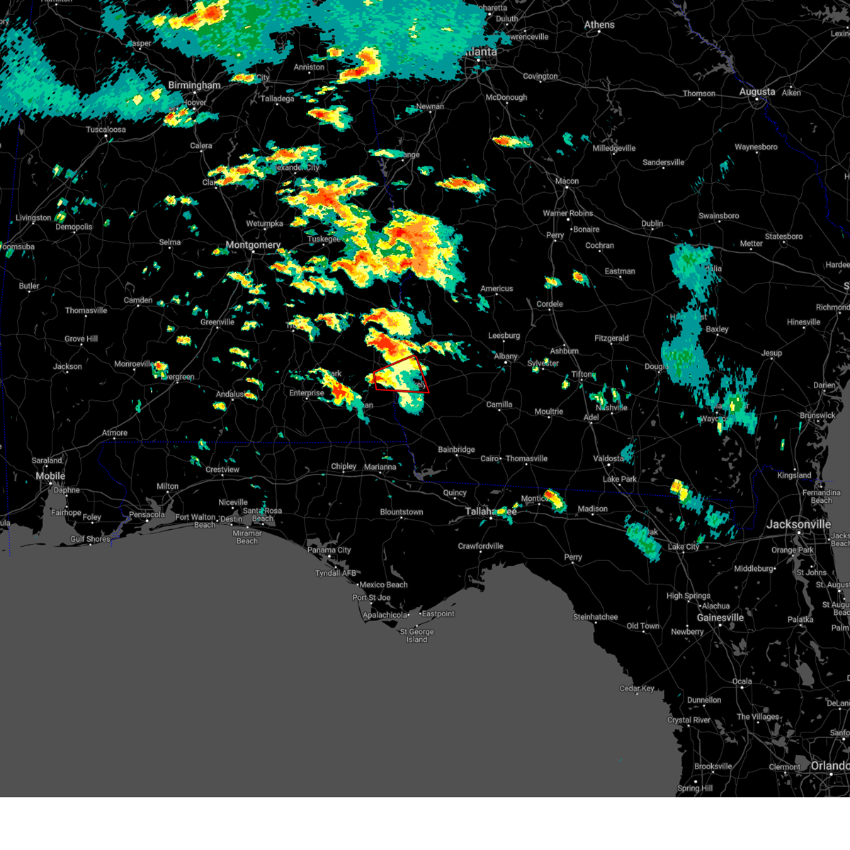 At 104 pm edt/1204 pm cdt/, a severe thunderstorm capable of producing a tornado was located 9 miles southeast of abbeville, moving east at 40 mph (radar indicated rotation). Hazards include tornado. Flying debris will be dangerous to those caught without shelter. mobile homes will be damaged or destroyed. damage to roofs, windows, and vehicles will occur. tree damage is likely. This tornadic thunderstorm will remain over mainly rural areas of southeastern henry, south central clay and northwestern early counties, including the following locations, shorterville, haleburg, barnes, tumbleton, hardwickburg, zetto, hayes, colomokee, miller and ferrell crossroads. At 104 pm edt/1204 pm cdt/, a severe thunderstorm capable of producing a tornado was located 9 miles southeast of abbeville, moving east at 40 mph (radar indicated rotation). Hazards include tornado. Flying debris will be dangerous to those caught without shelter. mobile homes will be damaged or destroyed. damage to roofs, windows, and vehicles will occur. tree damage is likely. This tornadic thunderstorm will remain over mainly rural areas of southeastern henry, south central clay and northwestern early counties, including the following locations, shorterville, haleburg, barnes, tumbleton, hardwickburg, zetto, hayes, colomokee, miller and ferrell crossroads.
|
| 6/13/2023 3:06 PM EDT |
 At 306 pm edt, a severe thunderstorm was located over richards crossroads, or 10 miles southwest of eufaula, moving east at 45 mph (radar indicated). Hazards include 60 mph wind gusts and quarter size hail. Hail damage to vehicles is expected. Expect wind damage to roofs, siding, and trees. At 306 pm edt, a severe thunderstorm was located over richards crossroads, or 10 miles southwest of eufaula, moving east at 45 mph (radar indicated). Hazards include 60 mph wind gusts and quarter size hail. Hail damage to vehicles is expected. Expect wind damage to roofs, siding, and trees.
|
| 6/12/2023 11:26 PM EDT |
 The severe thunderstorm warning for central henry, clay, southwestern randolph, northwestern early and western quitman counties will expire at 1130 pm edt/1030 pm cdt/, the storms which prompted the warning have weakened below severe limits, and no longer pose an immediate threat to life or property. therefore, the warning will be allowed to expire. however gusty winds in excess of 40 mph are still possible with these thunderstorms. The severe thunderstorm warning for central henry, clay, southwestern randolph, northwestern early and western quitman counties will expire at 1130 pm edt/1030 pm cdt/, the storms which prompted the warning have weakened below severe limits, and no longer pose an immediate threat to life or property. therefore, the warning will be allowed to expire. however gusty winds in excess of 40 mph are still possible with these thunderstorms.
|
| 6/12/2023 11:06 PM EDT |
 At 1106 pm edt/1006 pm cdt/, severe thunderstorms were located along a line extending from near texasville to 6 miles northwest of columbia, moving northeast at 30 mph (radar indicated). Hazards include 60 mph wind gusts and penny size hail. expect damage to roofs, siding, and trees At 1106 pm edt/1006 pm cdt/, severe thunderstorms were located along a line extending from near texasville to 6 miles northwest of columbia, moving northeast at 30 mph (radar indicated). Hazards include 60 mph wind gusts and penny size hail. expect damage to roofs, siding, and trees
|
| 6/12/2023 5:56 AM EDT |
 The severe thunderstorm warning for central henry, clay, southwestern randolph and northwestern early counties will expire at 600 am edt/500 am cdt/, the storm which prompted the warning has moved out of the area. therefore, the warning will be allowed to expire. however gusty winds are still possible with this thunderstorm. to report severe weather, contact your nearest law enforcement agency. they will relay your report to the national weather service tallahassee. The severe thunderstorm warning for central henry, clay, southwestern randolph and northwestern early counties will expire at 600 am edt/500 am cdt/, the storm which prompted the warning has moved out of the area. therefore, the warning will be allowed to expire. however gusty winds are still possible with this thunderstorm. to report severe weather, contact your nearest law enforcement agency. they will relay your report to the national weather service tallahassee.
|
| 6/12/2023 5:56 AM EDT |
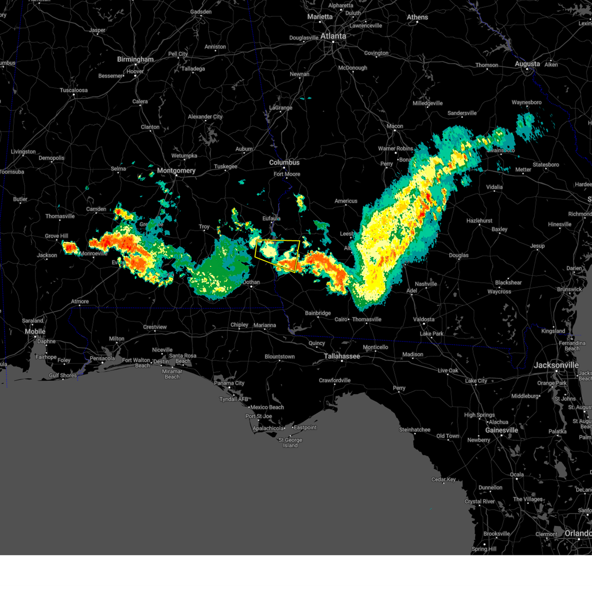 The severe thunderstorm warning for central henry, clay, southwestern randolph and northwestern early counties will expire at 600 am edt/500 am cdt/, the storm which prompted the warning has moved out of the area. therefore, the warning will be allowed to expire. however gusty winds are still possible with this thunderstorm. to report severe weather, contact your nearest law enforcement agency. they will relay your report to the national weather service tallahassee. The severe thunderstorm warning for central henry, clay, southwestern randolph and northwestern early counties will expire at 600 am edt/500 am cdt/, the storm which prompted the warning has moved out of the area. therefore, the warning will be allowed to expire. however gusty winds are still possible with this thunderstorm. to report severe weather, contact your nearest law enforcement agency. they will relay your report to the national weather service tallahassee.
|
| 6/12/2023 5:54 AM EDT |
 At 554 am edt, severe thunderstorms were located along a line extending from near newton to near blakely, moving east at 30 mph (radar indicated). Hazards include 60 mph wind gusts and penny size hail. expect damage to roofs, siding, and trees At 554 am edt, severe thunderstorms were located along a line extending from near newton to near blakely, moving east at 30 mph (radar indicated). Hazards include 60 mph wind gusts and penny size hail. expect damage to roofs, siding, and trees
|
| 6/12/2023 5:18 AM EDT |
 At 518 am edt/418 am cdt/, a severe thunderstorm was located near abbeville, moving east at 45 mph (radar indicated). Hazards include 60 mph wind gusts and penny size hail. expect damage to roofs, siding, and trees At 518 am edt/418 am cdt/, a severe thunderstorm was located near abbeville, moving east at 45 mph (radar indicated). Hazards include 60 mph wind gusts and penny size hail. expect damage to roofs, siding, and trees
|
| 6/12/2023 5:18 AM EDT |
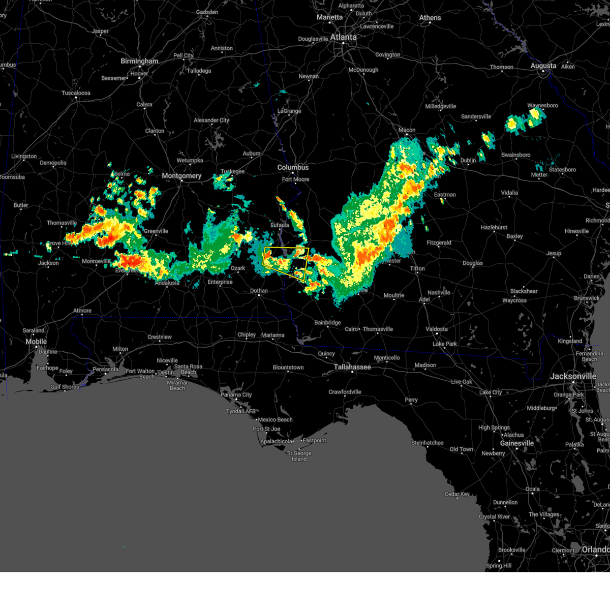 At 518 am edt/418 am cdt/, a severe thunderstorm was located near abbeville, moving east at 45 mph (radar indicated). Hazards include 60 mph wind gusts and penny size hail. expect damage to roofs, siding, and trees At 518 am edt/418 am cdt/, a severe thunderstorm was located near abbeville, moving east at 45 mph (radar indicated). Hazards include 60 mph wind gusts and penny size hail. expect damage to roofs, siding, and trees
|
| 5/12/2023 5:58 PM EDT |
 The severe thunderstorm warning for northeastern houston county in southeastern alabama, northwestern miller, southeastern clay, southwestern calhoun and early counties in southwestern georgia will expire at 600 pm edt/500 pm cdt/, the storms which prompted the warning have weakened below severe limits, and have exited the warned area. therefore, the warning will be allowed to expire. however gusty winds and heavy rain are still possible with these thunderstorms. The severe thunderstorm warning for northeastern houston county in southeastern alabama, northwestern miller, southeastern clay, southwestern calhoun and early counties in southwestern georgia will expire at 600 pm edt/500 pm cdt/, the storms which prompted the warning have weakened below severe limits, and have exited the warned area. therefore, the warning will be allowed to expire. however gusty winds and heavy rain are still possible with these thunderstorms.
|
| 5/12/2023 5:49 PM EDT |
 At 548 pm edt/448 pm cdt/, severe thunderstorms were located along a line extending from near arlington to 7 miles southeast of blakely to 11 miles southeast of columbia to near ashford, moving east at 25 mph (radar indicated). Hazards include 60 mph wind gusts and penny size hail. Expect damage to roofs, siding, and trees. locations impacted include, blakely, ashford, cowarts, edison, arlington, columbia, centerville, avon, gordon, bellville, bluffton, memphis, saffold, pansey, parksville, wilson mill, mayhaw, rock hill, keytons and early co a/p. hail threat, radar indicated max hail size, 0. 75 in wind threat, observed max wind gust, 60 mph. At 548 pm edt/448 pm cdt/, severe thunderstorms were located along a line extending from near arlington to 7 miles southeast of blakely to 11 miles southeast of columbia to near ashford, moving east at 25 mph (radar indicated). Hazards include 60 mph wind gusts and penny size hail. Expect damage to roofs, siding, and trees. locations impacted include, blakely, ashford, cowarts, edison, arlington, columbia, centerville, avon, gordon, bellville, bluffton, memphis, saffold, pansey, parksville, wilson mill, mayhaw, rock hill, keytons and early co a/p. hail threat, radar indicated max hail size, 0. 75 in wind threat, observed max wind gust, 60 mph.
|
| 5/12/2023 5:32 PM EDT |
 At 532 pm edt/432 pm cdt/, severe thunderstorms were located along a line extending from 10 miles west of edison to near blakely to 6 miles south of columbia to near cowarts, moving east at 25 mph (radar indicated). Hazards include 60 mph wind gusts and penny size hail. Expect damage to roofs, siding, and trees. locations impacted include, blakely, ashford, cowarts, edison, arlington, columbia, centerville, avon, gordon, bellville, bluffton, memphis, saffold, pansey, parksville, hayes, wilson mill, mayhaw, rock hill and keytons. hail threat, radar indicated max hail size, 0. 75 in wind threat, observed max wind gust, 60 mph. At 532 pm edt/432 pm cdt/, severe thunderstorms were located along a line extending from 10 miles west of edison to near blakely to 6 miles south of columbia to near cowarts, moving east at 25 mph (radar indicated). Hazards include 60 mph wind gusts and penny size hail. Expect damage to roofs, siding, and trees. locations impacted include, blakely, ashford, cowarts, edison, arlington, columbia, centerville, avon, gordon, bellville, bluffton, memphis, saffold, pansey, parksville, hayes, wilson mill, mayhaw, rock hill and keytons. hail threat, radar indicated max hail size, 0. 75 in wind threat, observed max wind gust, 60 mph.
|
| 5/12/2023 5:10 PM EDT |
 At 510 pm edt/410 pm cdt/, severe thunderstorms were located along a line extending from 6 miles south of fort gaines to near columbia to near ashford to taylor, moving east at 25 mph (radar indicated). Hazards include 60 mph wind gusts and penny size hail. expect damage to roofs, siding, and trees At 510 pm edt/410 pm cdt/, severe thunderstorms were located along a line extending from 6 miles south of fort gaines to near columbia to near ashford to taylor, moving east at 25 mph (radar indicated). Hazards include 60 mph wind gusts and penny size hail. expect damage to roofs, siding, and trees
|
| 4/1/2023 2:47 PM EDT |
 At 247 pm edt, a severe thunderstorm was located over arlington, or 10 miles northeast of blakely, moving east at 40 mph (radar indicated). Hazards include 60 mph wind gusts and quarter size hail. Hail damage to vehicles is expected. Expect wind damage to roofs, siding, and trees. At 247 pm edt, a severe thunderstorm was located over arlington, or 10 miles northeast of blakely, moving east at 40 mph (radar indicated). Hazards include 60 mph wind gusts and quarter size hail. Hail damage to vehicles is expected. Expect wind damage to roofs, siding, and trees.
|
| 1/12/2023 6:42 PM EST |
 At 642 pm est, a severe thunderstorm was located near morgan, moving east at 60 mph (radar indicated). Hazards include 70 mph wind gusts and quarter size hail. Hail damage to vehicles is expected. expect considerable tree damage. Wind damage is also likely to mobile homes, roofs, and outbuildings. At 642 pm est, a severe thunderstorm was located near morgan, moving east at 60 mph (radar indicated). Hazards include 70 mph wind gusts and quarter size hail. Hail damage to vehicles is expected. expect considerable tree damage. Wind damage is also likely to mobile homes, roofs, and outbuildings.
|
| 1/12/2023 6:33 PM EST |
 At 633 pm est/533 pm cst/, severe thunderstorms were located along a line extending from near edison to 6 miles south of blakely to near ashford, moving east at 45 mph (radar indicated). Hazards include 70 mph wind gusts and quarter size hail. Hail damage to vehicles is expected. expect considerable tree damage. wind damage is also likely to mobile homes, roofs, and outbuildings. Locations impacted include, fort gaines, blakely, edison, columbia, bellville, haleburg, bluffton, parksville, carnegie, hayes, pecan, randolph co a/p, rock hill, early co a/p, jones crossing, bethel, suttons corner, harrisons mill, zetto and moye. At 633 pm est/533 pm cst/, severe thunderstorms were located along a line extending from near edison to 6 miles south of blakely to near ashford, moving east at 45 mph (radar indicated). Hazards include 70 mph wind gusts and quarter size hail. Hail damage to vehicles is expected. expect considerable tree damage. wind damage is also likely to mobile homes, roofs, and outbuildings. Locations impacted include, fort gaines, blakely, edison, columbia, bellville, haleburg, bluffton, parksville, carnegie, hayes, pecan, randolph co a/p, rock hill, early co a/p, jones crossing, bethel, suttons corner, harrisons mill, zetto and moye.
|
| 1/12/2023 5:00 PM CST |
 At 600 pm est/500 pm cst/, severe thunderstorms were located along a line extending from near fort gaines to kinsey to near slocomb, moving east at 45 mph (radar indicated). Hazards include 60 mph wind gusts and quarter size hail. Hail damage to vehicles is expected. Expect wind damage to roofs, siding, and trees. At 600 pm est/500 pm cst/, severe thunderstorms were located along a line extending from near fort gaines to kinsey to near slocomb, moving east at 45 mph (radar indicated). Hazards include 60 mph wind gusts and quarter size hail. Hail damage to vehicles is expected. Expect wind damage to roofs, siding, and trees.
|
| 1/3/2023 6:12 PM EST |
 At 612 pm est, a severe thunderstorm was located near fort gaines, moving northeast at 40 mph (radar indicated). Hazards include 60 mph wind gusts and penny size hail. Expect damage to roofs, siding, and trees. Locations impacted include, edison, bellville, bluffton, harrisons mill, turman, parksville, zetto, moye and suttons corner. At 612 pm est, a severe thunderstorm was located near fort gaines, moving northeast at 40 mph (radar indicated). Hazards include 60 mph wind gusts and penny size hail. Expect damage to roofs, siding, and trees. Locations impacted include, edison, bellville, bluffton, harrisons mill, turman, parksville, zetto, moye and suttons corner.
|
| 1/3/2023 5:51 PM EST |
 At 550 pm est/450 pm cst/, a severe thunderstorm was located 7 miles east of headland, moving northeast at 40 mph (radar indicated). Hazards include 60 mph wind gusts and penny size hail. Expect damage to roofs, siding, and trees. locations impacted include, abbeville, fort gaines, headland, blakely, edison, arlington, columbia, kinsey, newville, bellville, haleburg, bluffton, shorterville, walter f. George lock and dam, walter f george lake, tumbleton, parksville, standleys store, grandberry crossroads and hayes. At 550 pm est/450 pm cst/, a severe thunderstorm was located 7 miles east of headland, moving northeast at 40 mph (radar indicated). Hazards include 60 mph wind gusts and penny size hail. Expect damage to roofs, siding, and trees. locations impacted include, abbeville, fort gaines, headland, blakely, edison, arlington, columbia, kinsey, newville, bellville, haleburg, bluffton, shorterville, walter f. George lock and dam, walter f george lake, tumbleton, parksville, standleys store, grandberry crossroads and hayes.
|
| 1/3/2023 4:31 PM CST |
 At 531 pm est/431 pm cst/, a severe thunderstorm was located near dothan, moving northeast at 40 mph (radar indicated). Hazards include 60 mph wind gusts and penny size hail. expect damage to roofs, siding, and trees At 531 pm est/431 pm cst/, a severe thunderstorm was located near dothan, moving northeast at 40 mph (radar indicated). Hazards include 60 mph wind gusts and penny size hail. expect damage to roofs, siding, and trees
|
| 11/30/2022 7:22 AM EST |
 At 722 am est, severe thunderstorms were located along a line extending from near lakepoint resort state park to 7 miles east of richards crossroads to near abbeville, moving east at 40 mph (radar indicated). Hazards include 60 mph wind gusts. expect damage to roofs, siding, and trees At 722 am est, severe thunderstorms were located along a line extending from near lakepoint resort state park to 7 miles east of richards crossroads to near abbeville, moving east at 40 mph (radar indicated). Hazards include 60 mph wind gusts. expect damage to roofs, siding, and trees
|
| 4/5/2022 2:48 PM EDT |
 At 246 pm edt/146 pm cdt/, severe thunderstorms were located along a line extending from near dawson to near taylor, moving east at 45 mph (radar indicated). Hazards include 60 mph wind gusts. Expect damage to roofs, siding, and trees. Locations impacted include, abbeville, fort gaines, headland, dothan, dawson, cuthbert, blakely, midland city, kinsey, edison, newton, webb, shellman, columbia, pinckard, smithville, clayhatchee, grimes, newville and napier field. At 246 pm edt/146 pm cdt/, severe thunderstorms were located along a line extending from near dawson to near taylor, moving east at 45 mph (radar indicated). Hazards include 60 mph wind gusts. Expect damage to roofs, siding, and trees. Locations impacted include, abbeville, fort gaines, headland, dothan, dawson, cuthbert, blakely, midland city, kinsey, edison, newton, webb, shellman, columbia, pinckard, smithville, clayhatchee, grimes, newville and napier field.
|
| 4/5/2022 2:14 PM EDT |
 At 214 pm edt/114 pm cdt/, severe thunderstorms were located along a line extending from 7 miles north of cuthbert to 8 miles southwest of enterprise, moving east at 40 mph (radar indicated). Hazards include 60 mph wind gusts. expect damage to roofs, siding, and trees At 214 pm edt/114 pm cdt/, severe thunderstorms were located along a line extending from 7 miles north of cuthbert to 8 miles southwest of enterprise, moving east at 40 mph (radar indicated). Hazards include 60 mph wind gusts. expect damage to roofs, siding, and trees
|
| 3/18/2022 1:53 PM EDT |
 At 153 pm edt/1253 pm cdt/, severe thunderstorms were located along a line extending from 8 miles northwest of edison to 6 miles southeast of cottonwood, moving southeast at 25 mph (radar indicated). Hazards include 60 mph wind gusts. expect damage to roofs, siding, and trees At 153 pm edt/1253 pm cdt/, severe thunderstorms were located along a line extending from 8 miles northwest of edison to 6 miles southeast of cottonwood, moving southeast at 25 mph (radar indicated). Hazards include 60 mph wind gusts. expect damage to roofs, siding, and trees
|
| 3/18/2022 1:28 PM EDT |
 At 128 pm edt/1228 pm cdt/, severe thunderstorms were located along a line extending from 6 miles northwest of fort gaines to taylor, moving northeast at 50 mph (radar indicated). Hazards include 60 mph wind gusts. expect damage to roofs, siding, and trees At 128 pm edt/1228 pm cdt/, severe thunderstorms were located along a line extending from 6 miles northwest of fort gaines to taylor, moving northeast at 50 mph (radar indicated). Hazards include 60 mph wind gusts. expect damage to roofs, siding, and trees
|
| 1/9/2022 9:22 PM EST |
 At 921 pm est, a severe thunderstorm was located near edison, or 12 miles east of fort gaines, moving east at 45 mph (radar indicated). Hazards include 60 mph wind gusts and penny size hail. expect damage to roofs, siding, and trees At 921 pm est, a severe thunderstorm was located near edison, or 12 miles east of fort gaines, moving east at 45 mph (radar indicated). Hazards include 60 mph wind gusts and penny size hail. expect damage to roofs, siding, and trees
|
| 12/30/2021 5:38 PM EST |
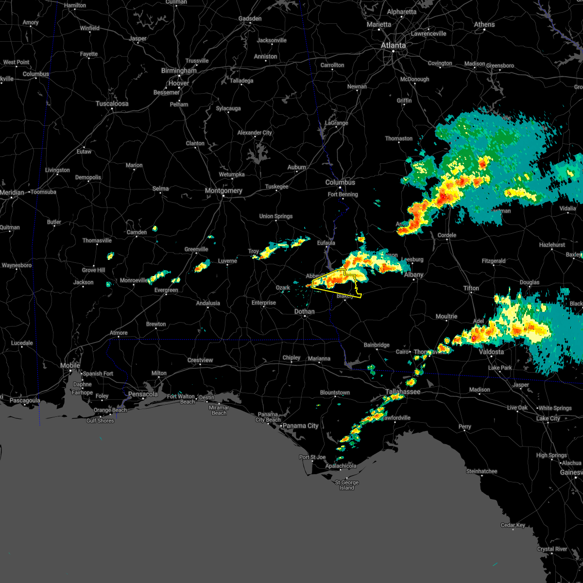 At 538 pm est/438 pm cst/, a severe thunderstorm was located near fort gaines, moving east at 30 mph (radar indicated). Hazards include 60 mph wind gusts and penny size hail. Expect damage to roofs, siding, and trees. locations impacted include, abbeville, fort gaines, bellville, bluffton, harrisons mill, shorterville, walter f. George lock and dam, barnes, hardwickburg, zetto, hayes, pecan, colomokee, murphy station, ferrell crossroads, jones crossing, willis crossroads, kolomoki mounds sp, suttons corner and fort gaines-clay airport. At 538 pm est/438 pm cst/, a severe thunderstorm was located near fort gaines, moving east at 30 mph (radar indicated). Hazards include 60 mph wind gusts and penny size hail. Expect damage to roofs, siding, and trees. locations impacted include, abbeville, fort gaines, bellville, bluffton, harrisons mill, shorterville, walter f. George lock and dam, barnes, hardwickburg, zetto, hayes, pecan, colomokee, murphy station, ferrell crossroads, jones crossing, willis crossroads, kolomoki mounds sp, suttons corner and fort gaines-clay airport.
|
| 12/30/2021 5:32 PM EST |
 At 531 pm est/431 pm cst/, a severe thunderstorm was located near fort gaines, moving east at 30 mph (radar indicated). Hazards include 60 mph wind gusts and penny size hail. Expect damage to roofs, siding, and trees. locations impacted include, abbeville, fort gaines, bellville, bluffton, shorterville, walter f. george lock and dam, walter f george lake, hayes, pecan, graball, jones crossing, suttons corner, fort gaines-clay airport, harrisons mill, barnes, hardwickburg, zetto, colomokee, murphy station and screamer. hail threat, radar indicated max hail size, 0. 75 in wind threat, radar indicated max wind gust, 60 mph. At 531 pm est/431 pm cst/, a severe thunderstorm was located near fort gaines, moving east at 30 mph (radar indicated). Hazards include 60 mph wind gusts and penny size hail. Expect damage to roofs, siding, and trees. locations impacted include, abbeville, fort gaines, bellville, bluffton, shorterville, walter f. george lock and dam, walter f george lake, hayes, pecan, graball, jones crossing, suttons corner, fort gaines-clay airport, harrisons mill, barnes, hardwickburg, zetto, colomokee, murphy station and screamer. hail threat, radar indicated max hail size, 0. 75 in wind threat, radar indicated max wind gust, 60 mph.
|
| 12/30/2021 5:32 PM EST |
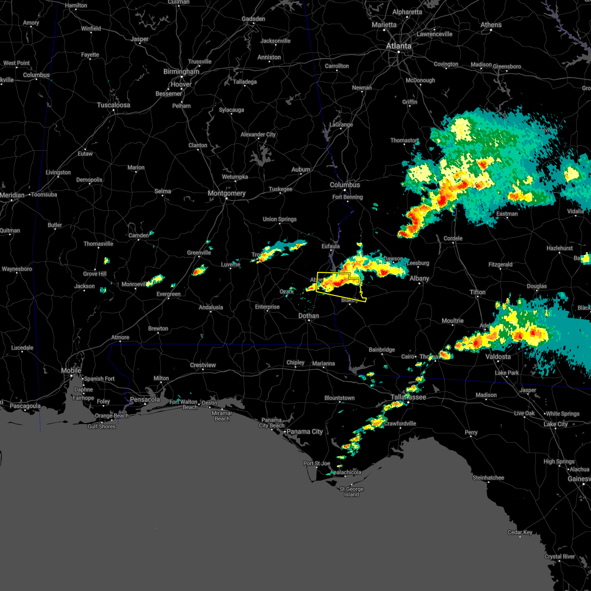 At 531 pm est/431 pm cst/, a severe thunderstorm was located near fort gaines, moving east at 30 mph (radar indicated). Hazards include 60 mph wind gusts and penny size hail. Expect damage to roofs, siding, and trees. locations impacted include, abbeville, fort gaines, bellville, bluffton, shorterville, walter f. george lock and dam, walter f george lake, hayes, pecan, graball, jones crossing, suttons corner, fort gaines-clay airport, harrisons mill, barnes, hardwickburg, zetto, colomokee, murphy station and screamer. hail threat, radar indicated max hail size, 0. 75 in wind threat, radar indicated max wind gust, 60 mph. At 531 pm est/431 pm cst/, a severe thunderstorm was located near fort gaines, moving east at 30 mph (radar indicated). Hazards include 60 mph wind gusts and penny size hail. Expect damage to roofs, siding, and trees. locations impacted include, abbeville, fort gaines, bellville, bluffton, shorterville, walter f. george lock and dam, walter f george lake, hayes, pecan, graball, jones crossing, suttons corner, fort gaines-clay airport, harrisons mill, barnes, hardwickburg, zetto, colomokee, murphy station and screamer. hail threat, radar indicated max hail size, 0. 75 in wind threat, radar indicated max wind gust, 60 mph.
|
| 12/30/2021 5:13 PM EST |
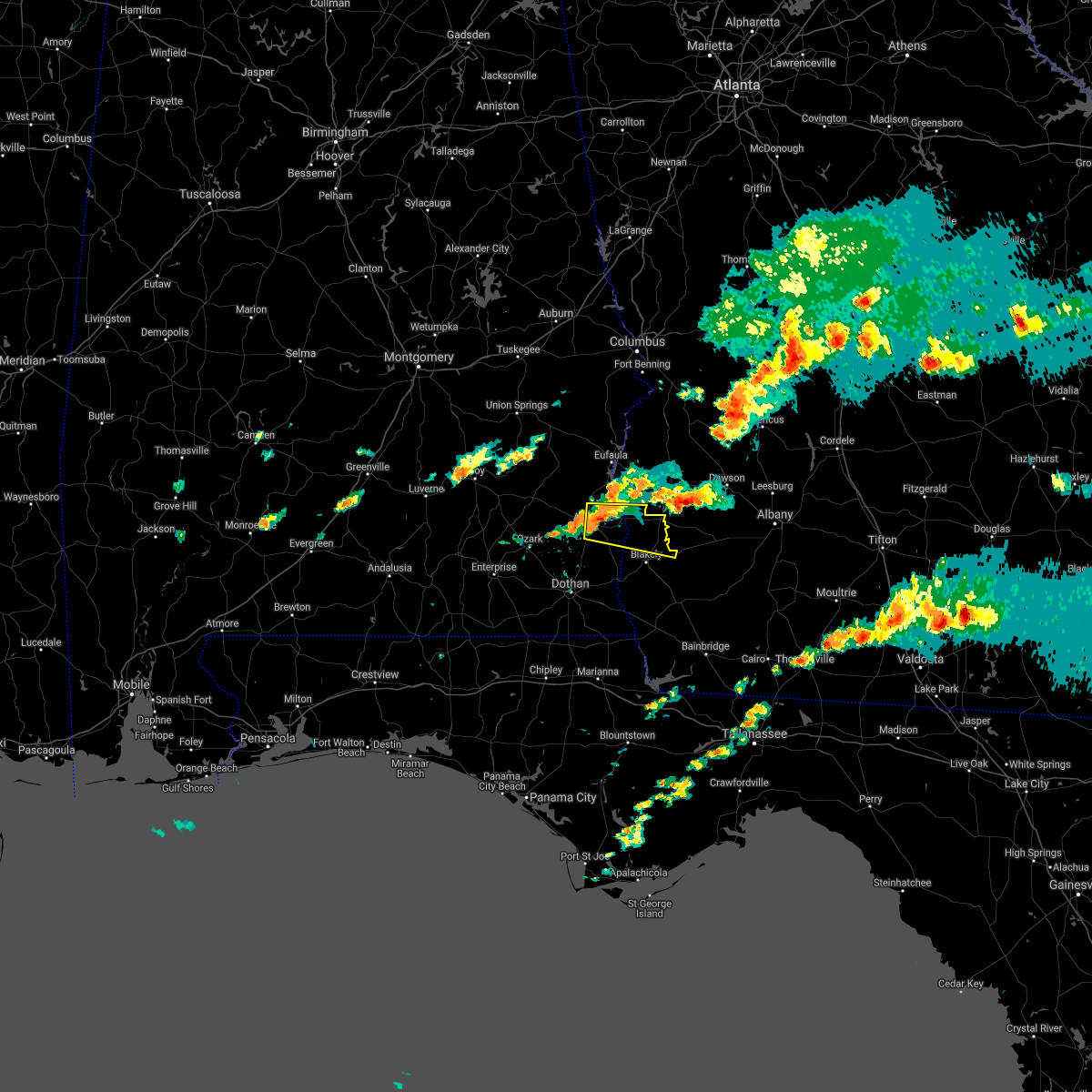 At 513 pm est/413 pm cst/, a severe thunderstorm was located over abbeville, moving east at 25 mph (radar indicated). Hazards include 60 mph wind gusts and penny size hail. expect damage to roofs, siding, and trees At 513 pm est/413 pm cst/, a severe thunderstorm was located over abbeville, moving east at 25 mph (radar indicated). Hazards include 60 mph wind gusts and penny size hail. expect damage to roofs, siding, and trees
|
| 6/19/2021 1:57 PM EDT |
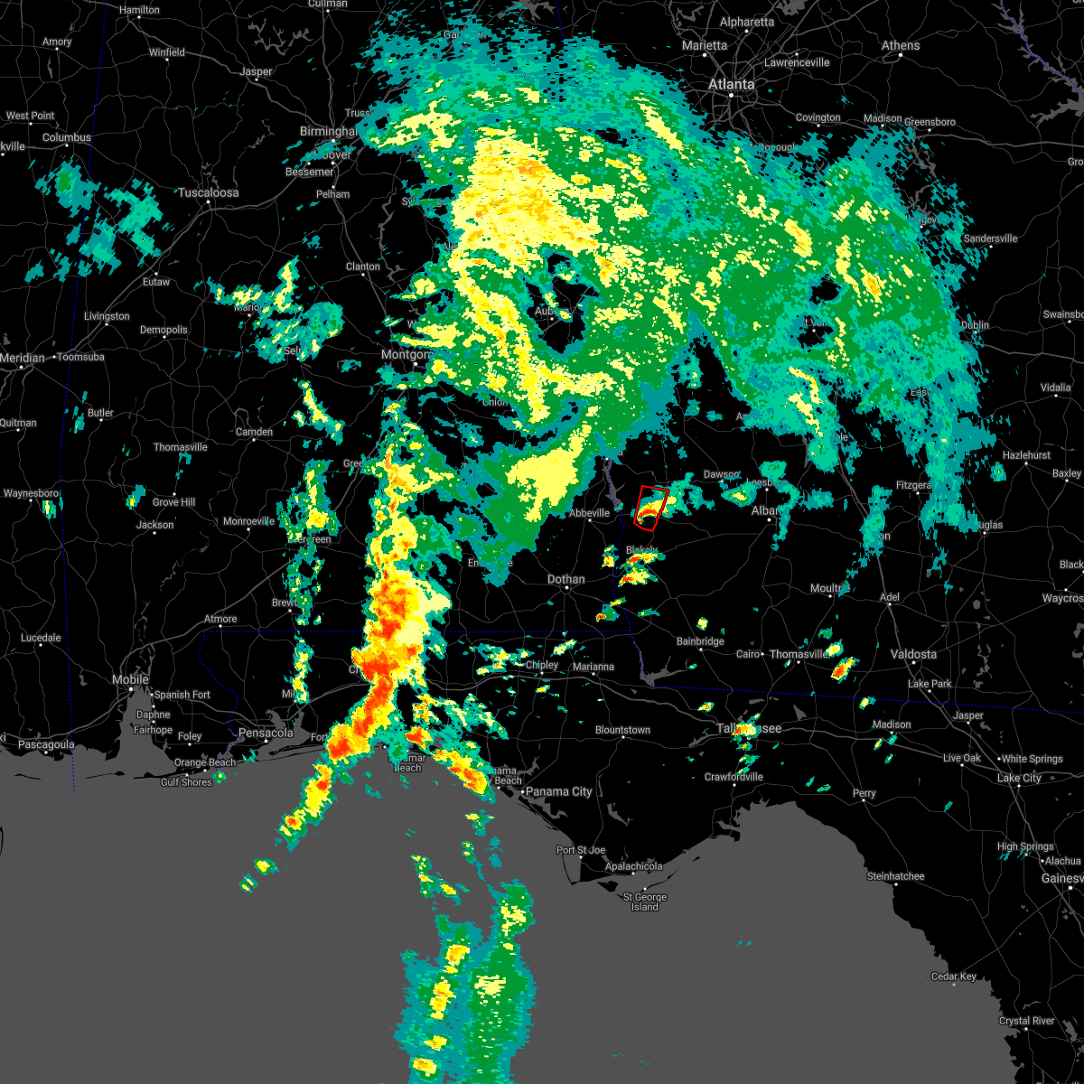 At 157 pm edt, a confirmed tornado was located 8 miles southeast of fort gaines, moving north at 25 mph (weather spotters confirmed tornado). Hazards include damaging tornado. Flying debris will be dangerous to those caught without shelter. mobile homes will be damaged or destroyed. damage to roofs, windows, and vehicles will occur. tree damage is likely. Locations impacted include, bellville, bluffton, harrisons mill, zetto, coleman, suttons corner and randolph co a/p. At 157 pm edt, a confirmed tornado was located 8 miles southeast of fort gaines, moving north at 25 mph (weather spotters confirmed tornado). Hazards include damaging tornado. Flying debris will be dangerous to those caught without shelter. mobile homes will be damaged or destroyed. damage to roofs, windows, and vehicles will occur. tree damage is likely. Locations impacted include, bellville, bluffton, harrisons mill, zetto, coleman, suttons corner and randolph co a/p.
|
| 6/19/2021 1:39 PM EDT |
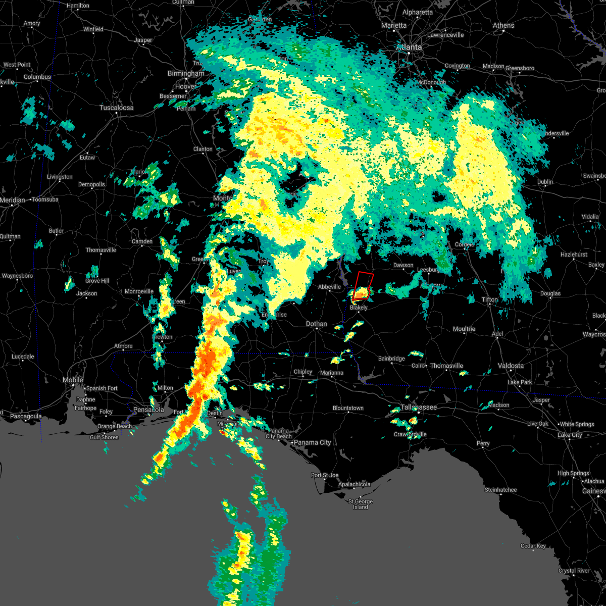 At 138 pm edt, a tornado producing storm was located near blakely, moving north at 30 mph (radar confirmed tornado). Hazards include damaging tornado. Flying debris will be dangerous to those caught without shelter. mobile homes will be damaged or destroyed. damage to roofs, windows, and vehicles will occur. tree damage is likely. This tornadic thunderstorm will remain over mainly rural areas of southeastern clay and southwestern randolph counties, including the following locations, harrisons mill, zetto, bellville, coleman, bluffton, suttons corner and randolph co a/p. At 138 pm edt, a tornado producing storm was located near blakely, moving north at 30 mph (radar confirmed tornado). Hazards include damaging tornado. Flying debris will be dangerous to those caught without shelter. mobile homes will be damaged or destroyed. damage to roofs, windows, and vehicles will occur. tree damage is likely. This tornadic thunderstorm will remain over mainly rural areas of southeastern clay and southwestern randolph counties, including the following locations, harrisons mill, zetto, bellville, coleman, bluffton, suttons corner and randolph co a/p.
|
| 5/4/2021 9:52 PM EDT |
 At 952 pm edt, severe thunderstorms were located along a line extending from near morgan to near columbia, moving southeast at 55 mph (radar indicated). Hazards include 60 mph wind gusts. expect damage to roofs, siding, and trees At 952 pm edt, severe thunderstorms were located along a line extending from near morgan to near columbia, moving southeast at 55 mph (radar indicated). Hazards include 60 mph wind gusts. expect damage to roofs, siding, and trees
|
| 5/4/2021 9:24 PM EDT |
 At 924 pm edt/824 pm cdt/, severe thunderstorms were located along a line extending from 7 miles west of buena vista to near ozark, moving east at 45 mph (radar indicated). Hazards include 60 mph wind gusts. Expect damage to roofs, siding, and trees. Locations impacted include, abbeville, fort gaines, georgetown, cuthbert, fort rucker, ozark, shellman, ariton, newville, bellville, haleburg, bluffton, shorterville, hooper stage field, hayes, pecan, thomas mill creek, phillips crossroads, hatcher and suttons corner. At 924 pm edt/824 pm cdt/, severe thunderstorms were located along a line extending from 7 miles west of buena vista to near ozark, moving east at 45 mph (radar indicated). Hazards include 60 mph wind gusts. Expect damage to roofs, siding, and trees. Locations impacted include, abbeville, fort gaines, georgetown, cuthbert, fort rucker, ozark, shellman, ariton, newville, bellville, haleburg, bluffton, shorterville, hooper stage field, hayes, pecan, thomas mill creek, phillips crossroads, hatcher and suttons corner.
|
| 5/4/2021 8:21 PM EDT |
 At 821 pm edt/721 pm cdt/, severe thunderstorms were located along a line extending from near society hill to near dozier, moving east at 45 mph (radar indicated). Hazards include 60 mph wind gusts. expect damage to roofs, siding, and trees At 821 pm edt/721 pm cdt/, severe thunderstorms were located along a line extending from near society hill to near dozier, moving east at 45 mph (radar indicated). Hazards include 60 mph wind gusts. expect damage to roofs, siding, and trees
|
| 4/24/2021 8:37 PM EDT |
 At 837 pm edt/737 pm cdt/, a severe thunderstorm was located near fort gaines, moving east at 60 mph (radar indicated). Hazards include 60 mph wind gusts. expect damage to roofs, siding, and trees At 837 pm edt/737 pm cdt/, a severe thunderstorm was located near fort gaines, moving east at 60 mph (radar indicated). Hazards include 60 mph wind gusts. expect damage to roofs, siding, and trees
|
| 4/24/2021 8:01 PM EDT |
 At 801 pm edt, a severe thunderstorm was located near arlington, or 9 miles northeast of blakely, moving east at 50 mph (radar indicated). Hazards include 60 mph wind gusts. expect damage to roofs, siding, and trees At 801 pm edt, a severe thunderstorm was located near arlington, or 9 miles northeast of blakely, moving east at 50 mph (radar indicated). Hazards include 60 mph wind gusts. expect damage to roofs, siding, and trees
|
| 4/24/2021 7:47 PM EDT |
 At 746 pm edt/646 pm cdt/, a severe thunderstorm was located near texasville, or 8 miles northwest of abbeville, moving east at 60 mph (radar indicated). Hazards include 60 mph wind gusts and quarter size hail. Hail damage to vehicles is expected. Expect wind damage to roofs, siding, and trees. At 746 pm edt/646 pm cdt/, a severe thunderstorm was located near texasville, or 8 miles northwest of abbeville, moving east at 60 mph (radar indicated). Hazards include 60 mph wind gusts and quarter size hail. Hail damage to vehicles is expected. Expect wind damage to roofs, siding, and trees.
|
| 4/24/2021 7:17 PM EDT | Scattered trees down in clay count in clay county GA, 0.2 miles E of Bluffton, GA |
| 4/24/2021 7:07 PM EDT |
 The tornado warning for southeastern clay, northwestern baker, calhoun, northeastern early and south central terrell counties in southwestern georgia will expire at 715 pm edt, the tornado threat has diminished and the tornado warning has been cancelled. however, large hail and damaging winds remain likely and a severe thunderstorm warning remains in effect for the area. a severe thunderstorm watch remains in effect until 1000 pm edt for southwestern georgia. remember, a severe thunderstorm warning still remains in effect. The tornado warning for southeastern clay, northwestern baker, calhoun, northeastern early and south central terrell counties in southwestern georgia will expire at 715 pm edt, the tornado threat has diminished and the tornado warning has been cancelled. however, large hail and damaging winds remain likely and a severe thunderstorm warning remains in effect for the area. a severe thunderstorm watch remains in effect until 1000 pm edt for southwestern georgia. remember, a severe thunderstorm warning still remains in effect.
|
| 4/24/2021 7:05 PM EDT |
 At 705 pm edt/605 pm cdt/, a severe thunderstorm was located near fort gaines, moving east at 55 mph (radar indicated). Hazards include ping pong ball size hail and 60 mph wind gusts. People and animals outdoors will be injured. expect hail damage to roofs, siding, windows, and vehicles. Expect wind damage to roofs, siding, and trees. At 705 pm edt/605 pm cdt/, a severe thunderstorm was located near fort gaines, moving east at 55 mph (radar indicated). Hazards include ping pong ball size hail and 60 mph wind gusts. People and animals outdoors will be injured. expect hail damage to roofs, siding, windows, and vehicles. Expect wind damage to roofs, siding, and trees.
|
| 4/24/2021 6:37 PM EDT |
 At 637 pm edt, a severe thunderstorm capable of producing a tornado was located 7 miles southwest of edison, or 10 miles northeast of blakely, moving east at 55 mph (radar indicated rotation). Hazards include tornado and quarter size hail. Flying debris will be dangerous to those caught without shelter. mobile homes will be damaged or destroyed. damage to roofs, windows, and vehicles will occur. tree damage is likely. this dangerous storm will be near, arlington around 645 pm edt. morgan around 655 pm edt. leary around 700 pm edt. Other locations impacted by this tornadic thunderstorm include colomokee, clarks mill, harrisons mill, commissary hill, turman, parksville, aycock mill, bermuda, bluffton and holt. At 637 pm edt, a severe thunderstorm capable of producing a tornado was located 7 miles southwest of edison, or 10 miles northeast of blakely, moving east at 55 mph (radar indicated rotation). Hazards include tornado and quarter size hail. Flying debris will be dangerous to those caught without shelter. mobile homes will be damaged or destroyed. damage to roofs, windows, and vehicles will occur. tree damage is likely. this dangerous storm will be near, arlington around 645 pm edt. morgan around 655 pm edt. leary around 700 pm edt. Other locations impacted by this tornadic thunderstorm include colomokee, clarks mill, harrisons mill, commissary hill, turman, parksville, aycock mill, bermuda, bluffton and holt.
|
| 4/24/2021 3:49 PM EDT |
 At 349 pm edt/249 pm cdt/, a severe thunderstorm was located near headland, moving east at 45 mph (radar indicated). Hazards include 60 mph wind gusts. expect damage to roofs, siding, and trees At 349 pm edt/249 pm cdt/, a severe thunderstorm was located near headland, moving east at 45 mph (radar indicated). Hazards include 60 mph wind gusts. expect damage to roofs, siding, and trees
|
| 4/24/2021 9:05 AM EDT |
 At 905 am edt, a confirmed tornado was located near blakely, moving east at 60 mph (radar confirmed tornado). Hazards include damaging tornado. Flying debris will be dangerous to those caught without shelter. mobile homes will be damaged or destroyed. damage to roofs, windows, and vehicles will occur. tree damage is likely. this tornado will be near, arlington around 920 am edt. Other locations impacted by this tornadic thunderstorm include harrisons mill, parksville, douglasville, bluffton, rock hill, colomokee, commissary hill, turman, ferrell crossroads and early co a/p. At 905 am edt, a confirmed tornado was located near blakely, moving east at 60 mph (radar confirmed tornado). Hazards include damaging tornado. Flying debris will be dangerous to those caught without shelter. mobile homes will be damaged or destroyed. damage to roofs, windows, and vehicles will occur. tree damage is likely. this tornado will be near, arlington around 920 am edt. Other locations impacted by this tornadic thunderstorm include harrisons mill, parksville, douglasville, bluffton, rock hill, colomokee, commissary hill, turman, ferrell crossroads and early co a/p.
|
| 4/24/2021 9:04 AM EDT |
 At 904 am edt, a severe thunderstorm capable of producing a tornado was located near blakely, moving east at 60 mph (radar indicated rotation). Hazards include tornado. Flying debris will be dangerous to those caught without shelter. mobile homes will be damaged or destroyed. damage to roofs, windows, and vehicles will occur. tree damage is likely. this dangerous storm will be near, arlington around 920 am edt. Other locations impacted by this tornadic thunderstorm include harrisons mill, parksville, douglasville, bluffton, rock hill, colomokee, commissary hill, turman, ferrell crossroads and early co a/p. At 904 am edt, a severe thunderstorm capable of producing a tornado was located near blakely, moving east at 60 mph (radar indicated rotation). Hazards include tornado. Flying debris will be dangerous to those caught without shelter. mobile homes will be damaged or destroyed. damage to roofs, windows, and vehicles will occur. tree damage is likely. this dangerous storm will be near, arlington around 920 am edt. Other locations impacted by this tornadic thunderstorm include harrisons mill, parksville, douglasville, bluffton, rock hill, colomokee, commissary hill, turman, ferrell crossroads and early co a/p.
|
| 4/24/2021 8:52 AM EDT |
 At 852 am edt/752 am cdt/, a severe thunderstorm capable of producing a tornado was located 8 miles northwest of columbia, or 9 miles east of headland, moving east at 60 mph (radar indicated rotation). Hazards include tornado. Flying debris will be dangerous to those caught without shelter. mobile homes will be damaged or destroyed. damage to roofs, windows, and vehicles will occur. tree damage is likely. this dangerous storm will be near, blakely around 910 am edt. arlington around 925 am edt. Other locations impacted by this tornadic thunderstorm include harrisons mill, haleburg, barnes, tumbleton, parksville, grandberry crossroads, hayes, douglasville, bluffton and rock hill. At 852 am edt/752 am cdt/, a severe thunderstorm capable of producing a tornado was located 8 miles northwest of columbia, or 9 miles east of headland, moving east at 60 mph (radar indicated rotation). Hazards include tornado. Flying debris will be dangerous to those caught without shelter. mobile homes will be damaged or destroyed. damage to roofs, windows, and vehicles will occur. tree damage is likely. this dangerous storm will be near, blakely around 910 am edt. arlington around 925 am edt. Other locations impacted by this tornadic thunderstorm include harrisons mill, haleburg, barnes, tumbleton, parksville, grandberry crossroads, hayes, douglasville, bluffton and rock hill.
|
| 4/24/2021 8:40 AM EDT |
 At 839 am edt, severe thunderstorms were located along a line extending from 6 miles southwest of richards crossroads to 7 miles north of graceville, moving east at 60 mph (radar indicated). Hazards include 70 mph wind gusts. Expect considerable tree damage. Damage is likely to mobile homes, roofs, and outbuildings. At 839 am edt, severe thunderstorms were located along a line extending from 6 miles southwest of richards crossroads to 7 miles north of graceville, moving east at 60 mph (radar indicated). Hazards include 70 mph wind gusts. Expect considerable tree damage. Damage is likely to mobile homes, roofs, and outbuildings.
|
| 3/18/2021 7:56 AM EDT |
 At 756 am edt, severe thunderstorms were located along a line extending from 8 miles west of cuthbert to near arlington, moving northeast at 60 mph (radar indicated). Hazards include 60 mph wind gusts. Expect damage to roofs, siding, and trees. Locations impacted include, newton, morgan, dawson, cuthbert, edison, arlington, shellman, leary, douglasville, sasser, damascus, bronwood, parrott, bellville, bluffton, iveys mill, parksville, carnegie, dawson municipal a/p and chambliss. At 756 am edt, severe thunderstorms were located along a line extending from 8 miles west of cuthbert to near arlington, moving northeast at 60 mph (radar indicated). Hazards include 60 mph wind gusts. Expect damage to roofs, siding, and trees. Locations impacted include, newton, morgan, dawson, cuthbert, edison, arlington, shellman, leary, douglasville, sasser, damascus, bronwood, parrott, bellville, bluffton, iveys mill, parksville, carnegie, dawson municipal a/p and chambliss.
|
| 3/18/2021 7:01 AM EDT |
 At 701 am edt/601 am cdt/, severe thunderstorms were located along a line extending from near headland to near cottonwood, moving east at 20 mph (radar indicated). Hazards include 60 mph wind gusts. expect damage to roofs, siding, and trees At 701 am edt/601 am cdt/, severe thunderstorms were located along a line extending from near headland to near cottonwood, moving east at 20 mph (radar indicated). Hazards include 60 mph wind gusts. expect damage to roofs, siding, and trees
|
| 2/15/2021 4:01 PM EST |
 At 401 pm est/301 pm cst/, severe thunderstorms were located along a line extending from 6 miles west of fort gaines to 7 miles east of cottonwood, moving northeast at 75 mph (radar indicated). Hazards include 60 mph wind gusts and quarter size hail. Hail damage to vehicles is expected. Expect wind damage to roofs, siding, and trees. At 401 pm est/301 pm cst/, severe thunderstorms were located along a line extending from 6 miles west of fort gaines to 7 miles east of cottonwood, moving northeast at 75 mph (radar indicated). Hazards include 60 mph wind gusts and quarter size hail. Hail damage to vehicles is expected. Expect wind damage to roofs, siding, and trees.
|
| 2/15/2021 4:01 PM EST |
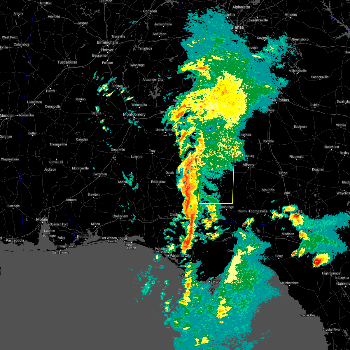 At 401 pm est/301 pm cst/, severe thunderstorms were located along a line extending from 6 miles west of fort gaines to 7 miles east of cottonwood, moving northeast at 75 mph (radar indicated). Hazards include 60 mph wind gusts and quarter size hail. Hail damage to vehicles is expected. Expect wind damage to roofs, siding, and trees. At 401 pm est/301 pm cst/, severe thunderstorms were located along a line extending from 6 miles west of fort gaines to 7 miles east of cottonwood, moving northeast at 75 mph (radar indicated). Hazards include 60 mph wind gusts and quarter size hail. Hail damage to vehicles is expected. Expect wind damage to roofs, siding, and trees.
|
| 6/25/2020 6:40 PM EDT |
 At 639 pm edt/539 pm cdt/, a severe thunderstorm was located near cuthbert, moving east at 55 mph (radar indicated). Hazards include 70 mph wind gusts. Expect considerable tree damage. damage is likely to mobile homes, roofs, and outbuildings. locations impacted include, fort gaines, cuthbert, edison, bellville, bluffton, shorterville, walter f. George lock and dam, walter f george lake, standleys store, carnegie, watson crossroads, double bridges, crossroads, ricks place, pecan, randolph co a/p, thomas mill creek, hatcher, morris and jones crossing. At 639 pm edt/539 pm cdt/, a severe thunderstorm was located near cuthbert, moving east at 55 mph (radar indicated). Hazards include 70 mph wind gusts. Expect considerable tree damage. damage is likely to mobile homes, roofs, and outbuildings. locations impacted include, fort gaines, cuthbert, edison, bellville, bluffton, shorterville, walter f. George lock and dam, walter f george lake, standleys store, carnegie, watson crossroads, double bridges, crossroads, ricks place, pecan, randolph co a/p, thomas mill creek, hatcher, morris and jones crossing.
|
| 6/25/2020 5:10 PM CDT |
 At 610 pm edt/510 pm cdt/, a severe thunderstorm was located near abbeville, moving east at 55 mph (radar indicated). Hazards include 60 mph wind gusts. expect damage to roofs, siding, and trees At 610 pm edt/510 pm cdt/, a severe thunderstorm was located near abbeville, moving east at 55 mph (radar indicated). Hazards include 60 mph wind gusts. expect damage to roofs, siding, and trees
|
| 6/23/2020 2:27 PM EDT |
 At 226 pm edt, severe thunderstorms were located along a line extending from 6 miles west of edison to 9 miles southeast of columbia, moving east at 35 mph (radar indicated). Hazards include 60 mph wind gusts. expect damage to roofs, siding, and trees At 226 pm edt, severe thunderstorms were located along a line extending from 6 miles west of edison to 9 miles southeast of columbia, moving east at 35 mph (radar indicated). Hazards include 60 mph wind gusts. expect damage to roofs, siding, and trees
|
| 4/20/2020 12:36 AM CDT |
 The severe thunderstorm warning for northeastern houston, clay, western randolph, western early and quitman counties will expire at 145 am edt/1245 am cdt/, the storms which prompted the warning have moved out of the area. therefore, the warning will be allowed to expire. a tornado watch remains in effect until 700 am edt/600 am cdt/ for southeastern alabama, and southwestern georgia. to report severe weather, contact your nearest law enforcement agency. they will relay your report to the national weather service tallahassee. The severe thunderstorm warning for northeastern houston, clay, western randolph, western early and quitman counties will expire at 145 am edt/1245 am cdt/, the storms which prompted the warning have moved out of the area. therefore, the warning will be allowed to expire. a tornado watch remains in effect until 700 am edt/600 am cdt/ for southeastern alabama, and southwestern georgia. to report severe weather, contact your nearest law enforcement agency. they will relay your report to the national weather service tallahassee.
|
| 4/20/2020 12:08 AM CDT |
 At 108 am edt/1208 am cdt/, severe thunderstorms were located along a line extending from near weston to near edison, moving east at 80 mph (radar indicated). Hazards include 70 mph wind gusts. Expect considerable tree damage. damage is likely to mobile homes, roofs, and outbuildings. Locations impacted include, abbeville, fort gaines, headland, dothan, blakely, georgetown, taylor, kinsey, ashford, cowarts, webb, columbia, avon, newville, gordon, bellville, haleburg, bluffton, shorterville and wire bridge. At 108 am edt/1208 am cdt/, severe thunderstorms were located along a line extending from near weston to near edison, moving east at 80 mph (radar indicated). Hazards include 70 mph wind gusts. Expect considerable tree damage. damage is likely to mobile homes, roofs, and outbuildings. Locations impacted include, abbeville, fort gaines, headland, dothan, blakely, georgetown, taylor, kinsey, ashford, cowarts, webb, columbia, avon, newville, gordon, bellville, haleburg, bluffton, shorterville and wire bridge.
|
| 4/20/2020 1:05 AM EDT |
 At 105 am edt, severe thunderstorms were located along a line extending from near lumpkin to 6 miles west of edison to near blakely, moving east at 50 mph (radar indicated). Hazards include 70 mph wind gusts. Expect considerable tree damage. Damage is likely to mobile homes, roofs, and outbuildings. At 105 am edt, severe thunderstorms were located along a line extending from near lumpkin to 6 miles west of edison to near blakely, moving east at 50 mph (radar indicated). Hazards include 70 mph wind gusts. Expect considerable tree damage. Damage is likely to mobile homes, roofs, and outbuildings.
|
| 4/19/2020 11:10 PM CDT |
 At 1210 am edt/1110 pm cdt/, severe thunderstorms were located along a line extending from near banks to near new brockton, moving east at 80 mph (radar indicated). Hazards include 70 mph wind gusts. Expect considerable tree damage. Damage is likely to mobile homes, roofs, and outbuildings. At 1210 am edt/1110 pm cdt/, severe thunderstorms were located along a line extending from near banks to near new brockton, moving east at 80 mph (radar indicated). Hazards include 70 mph wind gusts. Expect considerable tree damage. Damage is likely to mobile homes, roofs, and outbuildings.
|
| 4/13/2020 4:14 AM EDT |
 At 414 am edt, severe thunderstorms were located along a line extending from near shellman to near blakely, moving east at 65 mph (radar indicated). Hazards include 60 mph wind gusts. Expect damage to roofs, siding, and trees. Locations impacted include, fort gaines, blakely, columbia, gordon, jakin, bellville, bluffton, harrisons mill, saffold, howards mill, zetto, rock hill, colomokee, killarney, ferrell crossroads, early co a/p, cedar springs, kolomoki mounds sp, suttons corner and hilton. At 414 am edt, severe thunderstorms were located along a line extending from near shellman to near blakely, moving east at 65 mph (radar indicated). Hazards include 60 mph wind gusts. Expect damage to roofs, siding, and trees. Locations impacted include, fort gaines, blakely, columbia, gordon, jakin, bellville, bluffton, harrisons mill, saffold, howards mill, zetto, rock hill, colomokee, killarney, ferrell crossroads, early co a/p, cedar springs, kolomoki mounds sp, suttons corner and hilton.
|
| 4/13/2020 3:50 AM EDT |
 At 349 am edt/249 am cdt/, severe thunderstorms were located along a line extending from 6 miles north of fort gaines to kinsey, moving northeast at 45 mph (radar indicated). Hazards include 60 mph wind gusts. Expect damage to roofs, siding, and trees. Locations impacted include, abbeville, fort gaines, headland, blakely, columbia, newville, gordon, jakin, bellville, haleburg, bluffton, shorterville, hayes, watson crossroads, scottsboro crossroads, ricks place, pecan, rock hill, thomas mill creek and bethel. At 349 am edt/249 am cdt/, severe thunderstorms were located along a line extending from 6 miles north of fort gaines to kinsey, moving northeast at 45 mph (radar indicated). Hazards include 60 mph wind gusts. Expect damage to roofs, siding, and trees. Locations impacted include, abbeville, fort gaines, headland, blakely, columbia, newville, gordon, jakin, bellville, haleburg, bluffton, shorterville, hayes, watson crossroads, scottsboro crossroads, ricks place, pecan, rock hill, thomas mill creek and bethel.
|
| 4/13/2020 2:25 AM CDT |
 At 324 am edt/224 am cdt/, severe thunderstorms were located along a line extending from 6 miles northwest of abbeville to near daleville, moving east at 65 mph (radar indicated). Hazards include 60 mph wind gusts. expect damage to roofs, siding, and trees At 324 am edt/224 am cdt/, severe thunderstorms were located along a line extending from 6 miles northwest of abbeville to near daleville, moving east at 65 mph (radar indicated). Hazards include 60 mph wind gusts. expect damage to roofs, siding, and trees
|
| 3/31/2020 1:05 PM EDT |
 At 105 pm edt/1205 pm cdt/, severe thunderstorms were located along a line extending from 8 miles north of cuthbert to 8 miles north of blakely to near taylor, moving east at 55 mph (radar indicated). Hazards include 60 mph wind gusts. expect damage to roofs, siding, and trees At 105 pm edt/1205 pm cdt/, severe thunderstorms were located along a line extending from 8 miles north of cuthbert to 8 miles north of blakely to near taylor, moving east at 55 mph (radar indicated). Hazards include 60 mph wind gusts. expect damage to roofs, siding, and trees
|
| 3/31/2020 12:50 PM EDT |
 At 1249 pm edt/1149 am cdt/, severe thunderstorms were located along a line extending from 8 miles northeast of georgetown to 7 miles south of abbeville to near daleville, moving east at 50 mph (radar indicated). Hazards include 60 mph wind gusts. expect damage to roofs, siding, and trees At 1249 pm edt/1149 am cdt/, severe thunderstorms were located along a line extending from 8 miles northeast of georgetown to 7 miles south of abbeville to near daleville, moving east at 50 mph (radar indicated). Hazards include 60 mph wind gusts. expect damage to roofs, siding, and trees
|
| 1/11/2020 6:49 PM EST |
 At 649 pm est, severe thunderstorms were located along a line extending from 7 miles southwest of weston to near columbia, moving east at 30 mph (radar indicated). Hazards include 60 mph wind gusts. Expect damage to roofs, siding, and trees. Locations impacted include, cuthbert, blakely, bellville, bluffton, harrisons mill, springvale station, zetto, peterson hill, coles, white house, randolph co a/p, rock hill, ferrell crossroads, coleman, benevolence, kolomoki mounds sp, suttons corner, springvale and wades. At 649 pm est, severe thunderstorms were located along a line extending from 7 miles southwest of weston to near columbia, moving east at 30 mph (radar indicated). Hazards include 60 mph wind gusts. Expect damage to roofs, siding, and trees. Locations impacted include, cuthbert, blakely, bellville, bluffton, harrisons mill, springvale station, zetto, peterson hill, coles, white house, randolph co a/p, rock hill, ferrell crossroads, coleman, benevolence, kolomoki mounds sp, suttons corner, springvale and wades.
|
| 1/11/2020 6:46 PM EST |
 At 646 pm est, severe thunderstorms were located along a line extending from 8 miles northwest of edison to 12 miles west of donalsonville, moving northeast at 40 mph (radar indicated). Hazards include 60 mph wind gusts. expect damage to roofs, siding, and trees At 646 pm est, severe thunderstorms were located along a line extending from 8 miles northwest of edison to 12 miles west of donalsonville, moving northeast at 40 mph (radar indicated). Hazards include 60 mph wind gusts. expect damage to roofs, siding, and trees
|
| 1/11/2020 6:30 PM EST |
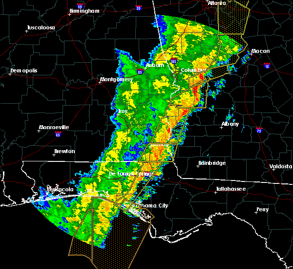 At 630 pm est/530 pm cst/, severe thunderstorms were located along a line extending from 8 miles north of cuthbert to near columbia, moving east at 25 mph (radar indicated). Hazards include 60 mph wind gusts. Expect damage to roofs, siding, and trees. locations impacted include, fort gaines, cuthbert, blakely, bellville, haleburg, bluffton, shorterville, walter f. George lock and dam, walter f george lake, standleys store, grandberry crossroads, hayes, watson crossroads, crossroads, pecan, randolph co a/p, rock hill, hatcher, morris and jones crossing. At 630 pm est/530 pm cst/, severe thunderstorms were located along a line extending from 8 miles north of cuthbert to near columbia, moving east at 25 mph (radar indicated). Hazards include 60 mph wind gusts. Expect damage to roofs, siding, and trees. locations impacted include, fort gaines, cuthbert, blakely, bellville, haleburg, bluffton, shorterville, walter f. George lock and dam, walter f george lake, standleys store, grandberry crossroads, hayes, watson crossroads, crossroads, pecan, randolph co a/p, rock hill, hatcher, morris and jones crossing.
|
| 1/11/2020 5:57 PM EST |
 At 538 pm est/438 pm cst/, severe thunderstorms were located along a line extending from near lakepoint resort state park to 11 miles northwest of headland, moving northeast at 40 mph (radar indicated). Hazards include 60 mph wind gusts. expect damage to roofs, siding, and trees At 538 pm est/438 pm cst/, severe thunderstorms were located along a line extending from near lakepoint resort state park to 11 miles northwest of headland, moving northeast at 40 mph (radar indicated). Hazards include 60 mph wind gusts. expect damage to roofs, siding, and trees
|
| 1/11/2020 5:57 PM EST |
 At 557 pm est/457 pm cst/, severe thunderstorms were located along a line extending from near georgetown to near headland, moving east at 25 mph (radar indicated). Hazards include 70 mph wind gusts. Expect considerable tree damage. damage is likely to mobile homes, roofs, and outbuildings. Locations impacted include, abbeville, fort gaines, headland, georgetown, blakely, cuthbert, columbia, newville, bellville, haleburg, bluffton, shorterville, wire bridge, hayes, watson crossroads, scottsboro crossroads, ricks place, pecan, rock hill and thomas mill creek. At 557 pm est/457 pm cst/, severe thunderstorms were located along a line extending from near georgetown to near headland, moving east at 25 mph (radar indicated). Hazards include 70 mph wind gusts. Expect considerable tree damage. damage is likely to mobile homes, roofs, and outbuildings. Locations impacted include, abbeville, fort gaines, headland, georgetown, blakely, cuthbert, columbia, newville, bellville, haleburg, bluffton, shorterville, wire bridge, hayes, watson crossroads, scottsboro crossroads, ricks place, pecan, rock hill and thomas mill creek.
|
| 1/11/2020 5:38 PM EST |
 At 538 pm est/438 pm cst/, severe thunderstorms were located along a line extending from near lakepoint resort state park to 11 miles northwest of headland, moving northeast at 40 mph (radar indicated). Hazards include 60 mph wind gusts. expect damage to roofs, siding, and trees At 538 pm est/438 pm cst/, severe thunderstorms were located along a line extending from near lakepoint resort state park to 11 miles northwest of headland, moving northeast at 40 mph (radar indicated). Hazards include 60 mph wind gusts. expect damage to roofs, siding, and trees
|
| 7/18/2019 7:24 PM EDT |
 At 724 pm edt, a severe thunderstorm was located 7 miles north of blakely, moving east at 35 mph (radar indicated). Hazards include 60 mph wind gusts. expect damage to roofs, siding, and trees At 724 pm edt, a severe thunderstorm was located 7 miles north of blakely, moving east at 35 mph (radar indicated). Hazards include 60 mph wind gusts. expect damage to roofs, siding, and trees
|
| 7/18/2019 5:31 PM EDT |
 At 530 pm edt, severe thunderstorms were located along a line extending from near cuthbert to near leesburg, moving south at 20 mph (radar indicated). Hazards include 60 mph wind gusts and penny size hail. Expect damage to roofs, siding, and trees. Locations impacted include, morgan, dawson, leesburg, cuthbert, albany, edison, shellman, sasser, bronwood, bluffton, forrester, parksville, carnegie, palmyra, randolph co a/p, clarks mill, dawson municipal a/p, aycock mill, neyami and martins crossroads. At 530 pm edt, severe thunderstorms were located along a line extending from near cuthbert to near leesburg, moving south at 20 mph (radar indicated). Hazards include 60 mph wind gusts and penny size hail. Expect damage to roofs, siding, and trees. Locations impacted include, morgan, dawson, leesburg, cuthbert, albany, edison, shellman, sasser, bronwood, bluffton, forrester, parksville, carnegie, palmyra, randolph co a/p, clarks mill, dawson municipal a/p, aycock mill, neyami and martins crossroads.
|
| 7/18/2019 5:15 PM EDT |
 At 515 pm edt, severe thunderstorms were located along a line extending from near cuthbert to 6 miles northwest of leesburg, moving south at 25 mph (radar indicated). Hazards include 60 mph wind gusts and quarter size hail. Hail damage to vehicles is expected. Expect wind damage to roofs, siding, and trees. At 515 pm edt, severe thunderstorms were located along a line extending from near cuthbert to 6 miles northwest of leesburg, moving south at 25 mph (radar indicated). Hazards include 60 mph wind gusts and quarter size hail. Hail damage to vehicles is expected. Expect wind damage to roofs, siding, and trees.
|
| 7/9/2019 9:59 PM EDT |
 At 959 pm edt/859 pm cdt/, a severe thunderstorm was located 9 miles northeast of blakely, moving west at 20 mph (radar indicated). Hazards include 60 mph wind gusts. expect damage to roofs, siding, and trees At 959 pm edt/859 pm cdt/, a severe thunderstorm was located 9 miles northeast of blakely, moving west at 20 mph (radar indicated). Hazards include 60 mph wind gusts. expect damage to roofs, siding, and trees
|
| 6/20/2019 6:23 PM EDT |
 At 603 pm edt/503 pm cdt/, a severe thunderstorm was located 9 miles southeast of abbeville, moving east at 55 mph (radar indicated). Hazards include 60 mph wind gusts and penny size hail. expect damage to roofs, siding, and trees At 603 pm edt/503 pm cdt/, a severe thunderstorm was located 9 miles southeast of abbeville, moving east at 55 mph (radar indicated). Hazards include 60 mph wind gusts and penny size hail. expect damage to roofs, siding, and trees
|
| 6/20/2019 6:04 PM EDT |
 At 603 pm edt/503 pm cdt/, a severe thunderstorm was located 9 miles southeast of abbeville, moving east at 55 mph (radar indicated). Hazards include 60 mph wind gusts and penny size hail. expect damage to roofs, siding, and trees At 603 pm edt/503 pm cdt/, a severe thunderstorm was located 9 miles southeast of abbeville, moving east at 55 mph (radar indicated). Hazards include 60 mph wind gusts and penny size hail. expect damage to roofs, siding, and trees
|
| 5/12/2019 12:28 PM EDT |
 At 1228 pm edt, severe thunderstorms were located along a line extending from 6 miles east of fort gaines to near arlington to near colquitt, moving northeast at 40 mph (radar indicated). Hazards include 60 mph wind gusts. expect damage to roofs, siding, and trees At 1228 pm edt, severe thunderstorms were located along a line extending from 6 miles east of fort gaines to near arlington to near colquitt, moving northeast at 40 mph (radar indicated). Hazards include 60 mph wind gusts. expect damage to roofs, siding, and trees
|
| 5/12/2019 11:55 AM EDT |
 At 1155 am edt/1055 am cdt/, severe thunderstorms were located along a line extending from 6 miles south of texasville to 9 miles west of blakely to 7 miles south of columbia, moving east at 50 mph (radar indicated). Hazards include 70 mph wind gusts and penny size hail. Expect considerable tree damage. Damage is likely to mobile homes, roofs, and outbuildings. At 1155 am edt/1055 am cdt/, severe thunderstorms were located along a line extending from 6 miles south of texasville to 9 miles west of blakely to 7 miles south of columbia, moving east at 50 mph (radar indicated). Hazards include 70 mph wind gusts and penny size hail. Expect considerable tree damage. Damage is likely to mobile homes, roofs, and outbuildings.
|
| 4/14/2019 11:21 AM EDT |
 At 1121 am edt, severe thunderstorms were located along a line extending from near blakely to 8 miles southwest of arlington to 11 miles east of columbia, moving northeast at 45 mph (radar indicated). Hazards include 60 mph wind gusts. expect damage to roofs, siding, and trees At 1121 am edt, severe thunderstorms were located along a line extending from near blakely to 8 miles southwest of arlington to 11 miles east of columbia, moving northeast at 45 mph (radar indicated). Hazards include 60 mph wind gusts. expect damage to roofs, siding, and trees
|
| 3/3/2019 6:04 PM EST |
 At 604 pm est/504 pm cst/, severe thunderstorms were located along a line extending from near shellman to 6 miles northeast of graceville, moving east at 35 mph (radar indicated). Hazards include 60 mph wind gusts and penny size hail. Expect damage to roofs, siding, and trees. locations impacted include, cottonwood, morgan, blakely, dothan, taylor, ashford, cowarts, edison, arlington, webb, columbia, leary, kinsey, douglasville, centerville, malvern, rehobeth, avon, madrid and gordon. A tornado watch remains in effect until 800 pm est/700 pm cst/ for southeastern alabama, the panhandle of florida, and southwestern georgia. At 604 pm est/504 pm cst/, severe thunderstorms were located along a line extending from near shellman to 6 miles northeast of graceville, moving east at 35 mph (radar indicated). Hazards include 60 mph wind gusts and penny size hail. Expect damage to roofs, siding, and trees. locations impacted include, cottonwood, morgan, blakely, dothan, taylor, ashford, cowarts, edison, arlington, webb, columbia, leary, kinsey, douglasville, centerville, malvern, rehobeth, avon, madrid and gordon. A tornado watch remains in effect until 800 pm est/700 pm cst/ for southeastern alabama, the panhandle of florida, and southwestern georgia.
|
| 3/3/2019 6:00 PM EST | Trees down along highway 2 in clay county GA, 0.2 miles E of Bluffton, GA |
| 3/3/2019 5:39 PM EST |
 At 538 pm est/438 pm cst/, severe thunderstorms were located along a line extending from 6 miles southwest of cuthbert to near hartford, moving east at 70 mph (radar indicated). Hazards include 60 mph wind gusts and penny size hail. expect damage to roofs, siding, and trees At 538 pm est/438 pm cst/, severe thunderstorms were located along a line extending from 6 miles southwest of cuthbert to near hartford, moving east at 70 mph (radar indicated). Hazards include 60 mph wind gusts and penny size hail. expect damage to roofs, siding, and trees
|
| 3/3/2019 5:11 PM EST |
 At 511 pm est/411 pm cst/, severe thunderstorms were located along a line extending from near lumpkin to near abbeville, moving east at 45 mph (radar indicated). Hazards include 60 mph wind gusts. expect damage to roofs, siding, and trees At 511 pm est/411 pm cst/, severe thunderstorms were located along a line extending from near lumpkin to near abbeville, moving east at 45 mph (radar indicated). Hazards include 60 mph wind gusts. expect damage to roofs, siding, and trees
|
| 3/3/2019 3:00 PM EST |
 At 259 pm est, a severe thunderstorm was located over edison, or 9 miles west of morgan, moving northeast at 35 mph (radar indicated). Hazards include 60 mph wind gusts and quarter size hail. Hail damage to vehicles is expected. Expect wind damage to roofs, siding, and trees. At 259 pm est, a severe thunderstorm was located over edison, or 9 miles west of morgan, moving northeast at 35 mph (radar indicated). Hazards include 60 mph wind gusts and quarter size hail. Hail damage to vehicles is expected. Expect wind damage to roofs, siding, and trees.
|
| 1/23/2019 9:31 PM EST |
 At 931 pm est, severe thunderstorms were located along a line extending from 7 miles southwest of weston to 6 miles west of blakely, moving east at 35 mph (radar indicated). Hazards include 60 mph wind gusts. Expect damage to roofs, siding, and trees. Locations impacted include, cuthbert, blakely, edison, arlington, shellman, columbia, centerville, parrott, bellville, bluffton, parksville, carnegie, pecan, randolph co a/p, rock hill, chambliss, early co a/p, jones crossing, martins crossroads and bethel. At 931 pm est, severe thunderstorms were located along a line extending from 7 miles southwest of weston to 6 miles west of blakely, moving east at 35 mph (radar indicated). Hazards include 60 mph wind gusts. Expect damage to roofs, siding, and trees. Locations impacted include, cuthbert, blakely, edison, arlington, shellman, columbia, centerville, parrott, bellville, bluffton, parksville, carnegie, pecan, randolph co a/p, rock hill, chambliss, early co a/p, jones crossing, martins crossroads and bethel.
|
| 1/23/2019 8:56 PM EST |
 At 855 pm est, severe thunderstorms were located along a line extending from near lakepoint resort state park to near kinsey, moving northeast at 45 mph (radar indicated). Hazards include 60 mph wind gusts. expect damage to roofs, siding, and trees At 855 pm est, severe thunderstorms were located along a line extending from near lakepoint resort state park to near kinsey, moving northeast at 45 mph (radar indicated). Hazards include 60 mph wind gusts. expect damage to roofs, siding, and trees
|
| 1/19/2019 7:55 PM EST |
 At 755 pm est, severe thunderstorms were located along a line extending from near weston to 6 miles southeast of fort gaines, moving northeast at 25 mph (radar indicated). Hazards include 60 mph wind gusts. expect damage to roofs, siding, and trees At 755 pm est, severe thunderstorms were located along a line extending from near weston to 6 miles southeast of fort gaines, moving northeast at 25 mph (radar indicated). Hazards include 60 mph wind gusts. expect damage to roofs, siding, and trees
|
| 12/2/2018 3:26 AM EST |
 At 326 am est/226 am cst/, a severe thunderstorm was located near fort gaines, moving northeast at 35 mph (radar indicated). Hazards include 60 mph wind gusts. expect damage to roofs, siding, and trees At 326 am est/226 am cst/, a severe thunderstorm was located near fort gaines, moving northeast at 35 mph (radar indicated). Hazards include 60 mph wind gusts. expect damage to roofs, siding, and trees
|
| 9/4/2018 4:27 PM EDT |
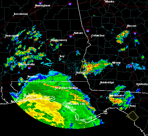 At 426 pm edt/326 pm cdt/, a severe thunderstorm was located near blakely, moving west at 30 mph (radar indicated). Hazards include 60 mph wind gusts. Expect damage to roofs, siding, and trees. locations impacted include, fort gaines, blakely, bellville, haleburg, bluffton, harrisons mill, shorterville, walter f. George lock and dam, barnes, hardwickburg, zetto, grandberry crossroads, hayes, colomokee, miller, ferrell crossroads, early co a/p, willis crossroads, kolomoki mounds sp and fort gaines-clay airport. At 426 pm edt/326 pm cdt/, a severe thunderstorm was located near blakely, moving west at 30 mph (radar indicated). Hazards include 60 mph wind gusts. Expect damage to roofs, siding, and trees. locations impacted include, fort gaines, blakely, bellville, haleburg, bluffton, harrisons mill, shorterville, walter f. George lock and dam, barnes, hardwickburg, zetto, grandberry crossroads, hayes, colomokee, miller, ferrell crossroads, early co a/p, willis crossroads, kolomoki mounds sp and fort gaines-clay airport.
|
| 9/4/2018 4:10 PM EDT |
 At 410 pm edt/310 pm cdt/, a severe thunderstorm was located near arlington, or near blakely, moving west at 30 mph (radar indicated). Hazards include 60 mph wind gusts. expect damage to roofs, siding, and trees At 410 pm edt/310 pm cdt/, a severe thunderstorm was located near arlington, or near blakely, moving west at 30 mph (radar indicated). Hazards include 60 mph wind gusts. expect damage to roofs, siding, and trees
|
| 8/31/2018 6:34 PM EDT |
 At 633 pm edt, severe thunderstorms were located along a line extending from near turner city to 11 miles northeast of colquitt, moving northwest at 40 mph (radar indicated). Hazards include 60 mph wind gusts. expect damage to roofs, siding, and trees At 633 pm edt, severe thunderstorms were located along a line extending from near turner city to 11 miles northeast of colquitt, moving northwest at 40 mph (radar indicated). Hazards include 60 mph wind gusts. expect damage to roofs, siding, and trees
|
| 8/6/2018 9:01 PM EDT |
 At 901 pm edt/801 pm cdt/, severe thunderstorms were located along a line extending from near richards crossroads to near west bainbridge, moving southwest at 20 mph (radar indicated). Hazards include 60 mph wind gusts. Expect damage to roofs, siding, and trees. Locations impacted include, abbeville, colquitt, fort gaines, bainbridge, donalsonville, blakely, columbia, west bainbridge, centerville, gordon, iron city, damascus, brinson, jakin, haleburg, bluffton, shorterville, crosby, hayes and watson crossroads. At 901 pm edt/801 pm cdt/, severe thunderstorms were located along a line extending from near richards crossroads to near west bainbridge, moving southwest at 20 mph (radar indicated). Hazards include 60 mph wind gusts. Expect damage to roofs, siding, and trees. Locations impacted include, abbeville, colquitt, fort gaines, bainbridge, donalsonville, blakely, columbia, west bainbridge, centerville, gordon, iron city, damascus, brinson, jakin, haleburg, bluffton, shorterville, crosby, hayes and watson crossroads.
|
| 8/6/2018 8:32 PM EDT |
 At 832 pm edt/732 pm cdt/, severe thunderstorms were located along a line extending from near georgetown to 15 miles southwest of newton, moving southwest at 10 mph (radar indicated). Hazards include 60 mph wind gusts. expect damage to roofs, siding, and trees At 832 pm edt/732 pm cdt/, severe thunderstorms were located along a line extending from near georgetown to 15 miles southwest of newton, moving southwest at 10 mph (radar indicated). Hazards include 60 mph wind gusts. expect damage to roofs, siding, and trees
|
| 8/6/2018 8:32 PM EDT |
 The national weather service in tallahassee has issued a * severe thunderstorm warning for. eastern henry county in southeastern alabama. eastern houston county in southeastern alabama. northern decatur county in southwestern georgia. Miller county in southwestern georgia. The national weather service in tallahassee has issued a * severe thunderstorm warning for. eastern henry county in southeastern alabama. eastern houston county in southeastern alabama. northern decatur county in southwestern georgia. Miller county in southwestern georgia.
|
| 8/6/2018 8:06 PM EDT |
 At 805 pm edt, a severe thunderstorm was located over edison, or 9 miles west of morgan, moving southwest at 20 mph (radar indicated). Hazards include 60 mph wind gusts. expect damage to roofs, siding, and trees At 805 pm edt, a severe thunderstorm was located over edison, or 9 miles west of morgan, moving southwest at 20 mph (radar indicated). Hazards include 60 mph wind gusts. expect damage to roofs, siding, and trees
|
| 7/22/2018 4:09 PM EDT |
 A severe thunderstorm warning remains in effect until 430 pm edt/330 pm cdt/ for southeastern henry county in southeastern alabama. southern clay. south central randolph. western calhoun and northern early counties in southwestern georgia. At 409 pm edt/309 pm cdt/, a severe thunderstorm was located near blakely, moving east at 40 mph. A severe thunderstorm warning remains in effect until 430 pm edt/330 pm cdt/ for southeastern henry county in southeastern alabama. southern clay. south central randolph. western calhoun and northern early counties in southwestern georgia. At 409 pm edt/309 pm cdt/, a severe thunderstorm was located near blakely, moving east at 40 mph.
|
| 7/22/2018 4:08 PM EDT |
 At 408 pm edt/308 pm cdt/, doppler radar indicated a severe thunderstorm capable of producing quarter size hail and destructive winds in excess of 80 mph. this storm was located 7 miles east of fort gaines, and moving east at 45 mph. At 408 pm edt/308 pm cdt/, doppler radar indicated a severe thunderstorm capable of producing quarter size hail and destructive winds in excess of 80 mph. this storm was located 7 miles east of fort gaines, and moving east at 45 mph.
|
| 7/22/2018 3:51 PM EDT |
 At 350 pm edt/250 pm cdt/, a severe thunderstorm was located 9 miles southeast of abbeville, moving east at 40 mph. this is a very dangerous storm (radar indicated). Hazards include 80 mph wind gusts and quarter size hail. Flying debris will be dangerous to those caught without shelter. mobile homes will be heavily damaged. expect considerable damage to roofs, windows, and vehicles. extensive tree damage and power outages are likely. locations impacted include, abbeville, colquitt, fort gaines, headland, blakely, edison, arlington, columbia, centerville, newville, bellville, haleburg, bluffton, shorterville, walter f. George lock and dam, tumbleton, parksville, grandberry crossroads, hayes and rock hill. At 350 pm edt/250 pm cdt/, a severe thunderstorm was located 9 miles southeast of abbeville, moving east at 40 mph. this is a very dangerous storm (radar indicated). Hazards include 80 mph wind gusts and quarter size hail. Flying debris will be dangerous to those caught without shelter. mobile homes will be heavily damaged. expect considerable damage to roofs, windows, and vehicles. extensive tree damage and power outages are likely. locations impacted include, abbeville, colquitt, fort gaines, headland, blakely, edison, arlington, columbia, centerville, newville, bellville, haleburg, bluffton, shorterville, walter f. George lock and dam, tumbleton, parksville, grandberry crossroads, hayes and rock hill.
|
| 7/22/2018 2:41 PM CDT |
 At 341 pm edt/241 pm cdt/, a severe thunderstorm was located 7 miles north of headland, moving east at 40 mph (radar indicated). Hazards include 70 mph wind gusts and quarter size hail. Hail damage to vehicles is expected. expect considerable tree damage. Wind damage is also likely to mobile homes, roofs, and outbuildings. At 341 pm edt/241 pm cdt/, a severe thunderstorm was located 7 miles north of headland, moving east at 40 mph (radar indicated). Hazards include 70 mph wind gusts and quarter size hail. Hail damage to vehicles is expected. expect considerable tree damage. Wind damage is also likely to mobile homes, roofs, and outbuildings.
|
| 7/21/2018 9:44 PM EDT |
 At 944 pm edt, severe thunderstorms were located along a line extending from 7 miles north of leary to near morgan to near edison, moving southeast at 35 mph (radar indicated). Hazards include 60 mph wind gusts and penny size hail. Expect damage to roofs, siding, and trees. Locations impacted include, morgan, edison, shellman, bellville, bluffton, harrisons mill, parksville, carnegie, moye, cordrays mill, fountain bridge, goffs mill, turman, shivers mill, aycock mill, martins crossroads, suttons corner and dickey. At 944 pm edt, severe thunderstorms were located along a line extending from 7 miles north of leary to near morgan to near edison, moving southeast at 35 mph (radar indicated). Hazards include 60 mph wind gusts and penny size hail. Expect damage to roofs, siding, and trees. Locations impacted include, morgan, edison, shellman, bellville, bluffton, harrisons mill, parksville, carnegie, moye, cordrays mill, fountain bridge, goffs mill, turman, shivers mill, aycock mill, martins crossroads, suttons corner and dickey.
|
| 7/21/2018 9:07 PM EDT |
 At 907 pm edt, severe thunderstorms were located along a line extending from near cuthbert to 13 miles northeast of fort gaines to 8 miles south of georgetown, moving southeast at 35 mph (radar indicated). Hazards include 60 mph wind gusts and quarter size hail. Hail damage to vehicles is expected. Expect wind damage to roofs, siding, and trees. At 907 pm edt, severe thunderstorms were located along a line extending from near cuthbert to 13 miles northeast of fort gaines to 8 miles south of georgetown, moving southeast at 35 mph (radar indicated). Hazards include 60 mph wind gusts and quarter size hail. Hail damage to vehicles is expected. Expect wind damage to roofs, siding, and trees.
|
| 7/21/2018 11:25 AM EDT |
 At 1124 am edt/1024 am cdt/, severe thunderstorms were located along a line extending from near edison to webb, moving southeast at 45 mph (radar indicated). Hazards include 60 mph wind gusts and nickel size hail. expect damage to roofs, siding, and trees At 1124 am edt/1024 am cdt/, severe thunderstorms were located along a line extending from near edison to webb, moving southeast at 45 mph (radar indicated). Hazards include 60 mph wind gusts and nickel size hail. expect damage to roofs, siding, and trees
|
| 7/3/2018 9:03 PM EDT |
 At 903 pm edt, a severe thunderstorm was located over arlington, or 10 miles southwest of morgan, moving west at 25 mph (radar indicated). Hazards include 60 mph wind gusts. expect damage to roofs, siding, and trees At 903 pm edt, a severe thunderstorm was located over arlington, or 10 miles southwest of morgan, moving west at 25 mph (radar indicated). Hazards include 60 mph wind gusts. expect damage to roofs, siding, and trees
|
| 8/30/2017 2:03 PM EDT |
 At 202 pm edt, a severe thunderstorm was located near shellman, or near cuthbert, moving northeast at 30 mph (radar indicated). Hazards include 60 mph wind gusts. Expect damage to roofs, siding, and trees. Locations impacted include, cuthbert, edison, shellman, bellville, bluffton, harrisons mill, pachitla, parksville, zetto, carnegie, moye, coles, white house, randolph co a/p, colomokee, fountain bridge, goffs mill, shivers mill, aycock mill and coleman. At 202 pm edt, a severe thunderstorm was located near shellman, or near cuthbert, moving northeast at 30 mph (radar indicated). Hazards include 60 mph wind gusts. Expect damage to roofs, siding, and trees. Locations impacted include, cuthbert, edison, shellman, bellville, bluffton, harrisons mill, pachitla, parksville, zetto, carnegie, moye, coles, white house, randolph co a/p, colomokee, fountain bridge, goffs mill, shivers mill, aycock mill and coleman.
|
| 8/30/2017 1:42 PM EDT |
 At 142 pm edt, doppler radar indicated a severe thunderstorm capable of producing damaging winds in excess of 60 mph. this storm was located 8 miles southeast of fort gaines, and moving northeast at 45 mph. At 142 pm edt, doppler radar indicated a severe thunderstorm capable of producing damaging winds in excess of 60 mph. this storm was located 8 miles southeast of fort gaines, and moving northeast at 45 mph.
|
| 7/8/2017 4:53 PM EDT |
 At 452 pm edt/352 pm cdt/, a severe thunderstorm was located near abbeville, moving northeast at 35 mph (radar indicated). Hazards include 60 mph wind gusts and quarter size hail. Hail damage to vehicles is expected. Expect wind damage to roofs, siding, and trees. At 452 pm edt/352 pm cdt/, a severe thunderstorm was located near abbeville, moving northeast at 35 mph (radar indicated). Hazards include 60 mph wind gusts and quarter size hail. Hail damage to vehicles is expected. Expect wind damage to roofs, siding, and trees.
|
| 1/22/2017 2:42 PM EST |
 At 242 pm est, a tornado producing storm was located near edison, or 12 miles south of cuthbert, moving northeast at 50 mph (radar confirmed tornado). Hazards include damaging tornado and quarter size hail. Flying debris will be dangerous to those caught without shelter. mobile homes will be damaged or destroyed. damage to roofs, windows, and vehicles will occur. tree damage is likely. this tornadic storm will be near, edison around 245 pm est. shellman around 300 pm est. dawson around 310 pm est. Other locations impacted by this tornadic thunderstorm include dawson municipal a/p, suttons corner, bluffton, cordrays mill, moye, yeomans, clarks mill, shivers mill, herod and olivers mill. At 242 pm est, a tornado producing storm was located near edison, or 12 miles south of cuthbert, moving northeast at 50 mph (radar confirmed tornado). Hazards include damaging tornado and quarter size hail. Flying debris will be dangerous to those caught without shelter. mobile homes will be damaged or destroyed. damage to roofs, windows, and vehicles will occur. tree damage is likely. this tornadic storm will be near, edison around 245 pm est. shellman around 300 pm est. dawson around 310 pm est. Other locations impacted by this tornadic thunderstorm include dawson municipal a/p, suttons corner, bluffton, cordrays mill, moye, yeomans, clarks mill, shivers mill, herod and olivers mill.
|
| 1/22/2017 2:32 PM EST |
 At 232 pm est/132 pm cst/, severe thunderstorms were located along a line extending from near abbeville to 10 miles east of cottonwood, moving northeast at 65 mph (radar indicated). Hazards include 60 mph wind gusts and penny size hail. Expect damage to roofs, siding, and trees. locations impacted include, abbeville, cottonwood, fort gaines, blakely, headland, dothan, kinsey, ashford, cowarts, webb, columbia, rehobeth, avon, newville, madrid, gordon, bellville, haleburg, bluffton and memphis. A tornado watch remains in effect until 800 pm est/700 pm cst/ for southeastern alabama, and southwestern georgia. At 232 pm est/132 pm cst/, severe thunderstorms were located along a line extending from near abbeville to 10 miles east of cottonwood, moving northeast at 65 mph (radar indicated). Hazards include 60 mph wind gusts and penny size hail. Expect damage to roofs, siding, and trees. locations impacted include, abbeville, cottonwood, fort gaines, blakely, headland, dothan, kinsey, ashford, cowarts, webb, columbia, rehobeth, avon, newville, madrid, gordon, bellville, haleburg, bluffton and memphis. A tornado watch remains in effect until 800 pm est/700 pm cst/ for southeastern alabama, and southwestern georgia.
|
| 1/22/2017 2:31 PM EST |
 At 230 pm est, a severe thunderstorm capable of producing a tornado was located 8 miles southeast of fort gaines, moving northeast at 45 mph (radar indicated rotation). Hazards include tornado and quarter size hail. Flying debris will be dangerous to those caught without shelter. mobile homes will be damaged or destroyed. damage to roofs, windows, and vehicles will occur. tree damage is likely. this dangerous storm will be near, edison around 245 pm est. Other locations impacted by this tornadic thunderstorm include suttons corner, bluffton, moye, ferrell crossroads, turman, parksville, bellville, harrisons mill, carnegie and dickey. At 230 pm est, a severe thunderstorm capable of producing a tornado was located 8 miles southeast of fort gaines, moving northeast at 45 mph (radar indicated rotation). Hazards include tornado and quarter size hail. Flying debris will be dangerous to those caught without shelter. mobile homes will be damaged or destroyed. damage to roofs, windows, and vehicles will occur. tree damage is likely. this dangerous storm will be near, edison around 245 pm est. Other locations impacted by this tornadic thunderstorm include suttons corner, bluffton, moye, ferrell crossroads, turman, parksville, bellville, harrisons mill, carnegie and dickey.
|
| 1/22/2017 2:20 PM EST |
 At 220 pm est/120 pm cst/, a severe thunderstorm capable of producing a tornado was located 7 miles north of columbia, or 9 miles west of blakely, moving northeast at 45 mph (radar indicated rotation). Hazards include tornado and quarter size hail. Flying debris will be dangerous to those caught without shelter. mobile homes will be damaged or destroyed. damage to roofs, windows, and vehicles will occur. tree damage is likely. this dangerous storm will be near, blakely around 230 pm est. edison and arlington around 245 pm est. Other locations impacted by this tornadic thunderstorm include suttons corner, bluffton, moye, rowena, ferrell crossroads, early co a/p, parksville, turman, colomokee and barnes. At 220 pm est/120 pm cst/, a severe thunderstorm capable of producing a tornado was located 7 miles north of columbia, or 9 miles west of blakely, moving northeast at 45 mph (radar indicated rotation). Hazards include tornado and quarter size hail. Flying debris will be dangerous to those caught without shelter. mobile homes will be damaged or destroyed. damage to roofs, windows, and vehicles will occur. tree damage is likely. this dangerous storm will be near, blakely around 230 pm est. edison and arlington around 245 pm est. Other locations impacted by this tornadic thunderstorm include suttons corner, bluffton, moye, rowena, ferrell crossroads, early co a/p, parksville, turman, colomokee and barnes.
|
| 1/22/2017 12:59 PM CST |
 At 159 pm est/1259 pm cst/, severe thunderstorms were located along a line extending from 7 miles south of abbeville to near hartford, moving northeast at 60 mph (radar indicated). Hazards include 60 mph wind gusts and penny size hail. expect damage to roofs, siding, and trees At 159 pm est/1259 pm cst/, severe thunderstorms were located along a line extending from 7 miles south of abbeville to near hartford, moving northeast at 60 mph (radar indicated). Hazards include 60 mph wind gusts and penny size hail. expect damage to roofs, siding, and trees
|
| 1/22/2017 1:26 AM EST |
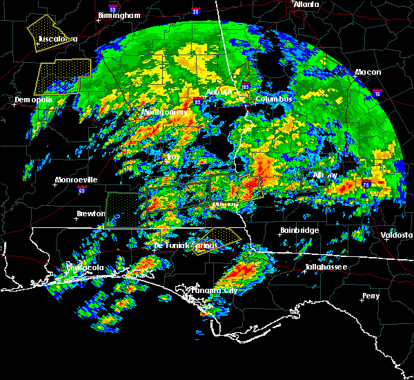 At 125 am est, a severe thunderstorm was located 9 miles north of blakely, moving northeast at 45 mph (radar indicated). Hazards include 60 mph wind gusts and half dollar size hail. Hail damage to vehicles is expected. expect wind damage to roofs, siding, and trees. locations impacted include, fort gaines, blakely, columbia, bellville, bluffton, suttons corner, ferrell crossroads, early co a/p, colomokee, harrisons mill, rock hill, kolomoki mounds sp, jones crossing and zetto. A tornado watch remains in effect until 400 am est for southeastern alabama, and southwestern georgia. At 125 am est, a severe thunderstorm was located 9 miles north of blakely, moving northeast at 45 mph (radar indicated). Hazards include 60 mph wind gusts and half dollar size hail. Hail damage to vehicles is expected. expect wind damage to roofs, siding, and trees. locations impacted include, fort gaines, blakely, columbia, bellville, bluffton, suttons corner, ferrell crossroads, early co a/p, colomokee, harrisons mill, rock hill, kolomoki mounds sp, jones crossing and zetto. A tornado watch remains in effect until 400 am est for southeastern alabama, and southwestern georgia.
|
| 1/22/2017 1:12 AM EST |
 At 111 am est/1211 am cst/, a severe thunderstorm was located 10 miles southeast of abbeville, moving northeast at 45 mph (radar indicated). Hazards include 60 mph wind gusts and quarter size hail. Hail damage to vehicles is expected. expect wind damage to roofs, siding, and trees. locations impacted include, fort gaines, blakely, columbia, bellville, bluffton, haleburg, suttons corner, shorterville, ferrell crossroads, early co a/p, colomokee, barnes, harrisons mill, rock hill, kolomoki mounds sp, jones crossing, zetto, hayes, miller and hardwickburg. A tornado watch remains in effect until 400 am est/300 am cst/ for southeastern alabama, and southwestern georgia. At 111 am est/1211 am cst/, a severe thunderstorm was located 10 miles southeast of abbeville, moving northeast at 45 mph (radar indicated). Hazards include 60 mph wind gusts and quarter size hail. Hail damage to vehicles is expected. expect wind damage to roofs, siding, and trees. locations impacted include, fort gaines, blakely, columbia, bellville, bluffton, haleburg, suttons corner, shorterville, ferrell crossroads, early co a/p, colomokee, barnes, harrisons mill, rock hill, kolomoki mounds sp, jones crossing, zetto, hayes, miller and hardwickburg. A tornado watch remains in effect until 400 am est/300 am cst/ for southeastern alabama, and southwestern georgia.
|
| 1/22/2017 1:12 AM EST |
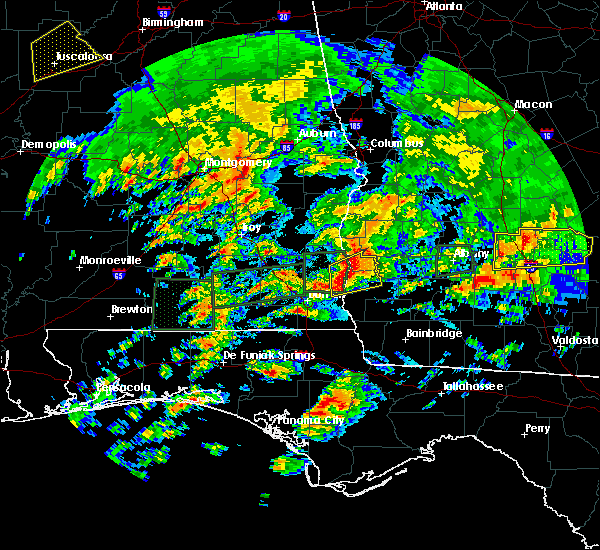 At 111 am est/1211 am cst/, a severe thunderstorm was located 10 miles southeast of abbeville, moving northeast at 45 mph (radar indicated). Hazards include 60 mph wind gusts and quarter size hail. Hail damage to vehicles is expected. expect wind damage to roofs, siding, and trees. locations impacted include, fort gaines, blakely, columbia, bellville, bluffton, haleburg, suttons corner, shorterville, ferrell crossroads, early co a/p, colomokee, barnes, harrisons mill, rock hill, kolomoki mounds sp, jones crossing, zetto, hayes, miller and hardwickburg. A tornado watch remains in effect until 400 am est/300 am cst/ for southeastern alabama, and southwestern georgia. At 111 am est/1211 am cst/, a severe thunderstorm was located 10 miles southeast of abbeville, moving northeast at 45 mph (radar indicated). Hazards include 60 mph wind gusts and quarter size hail. Hail damage to vehicles is expected. expect wind damage to roofs, siding, and trees. locations impacted include, fort gaines, blakely, columbia, bellville, bluffton, haleburg, suttons corner, shorterville, ferrell crossroads, early co a/p, colomokee, barnes, harrisons mill, rock hill, kolomoki mounds sp, jones crossing, zetto, hayes, miller and hardwickburg. A tornado watch remains in effect until 400 am est/300 am cst/ for southeastern alabama, and southwestern georgia.
|
| 1/22/2017 12:59 AM EST |
 At 1259 am est/1159 pm cst/, a severe thunderstorm was located near headland, moving east at 45 mph (radar indicated). Hazards include 60 mph wind gusts and quarter size hail. Hail damage to vehicles is expected. Expect wind damage to roofs, siding, and trees. At 1259 am est/1159 pm cst/, a severe thunderstorm was located near headland, moving east at 45 mph (radar indicated). Hazards include 60 mph wind gusts and quarter size hail. Hail damage to vehicles is expected. Expect wind damage to roofs, siding, and trees.
|
| 1/22/2017 12:59 AM EST |
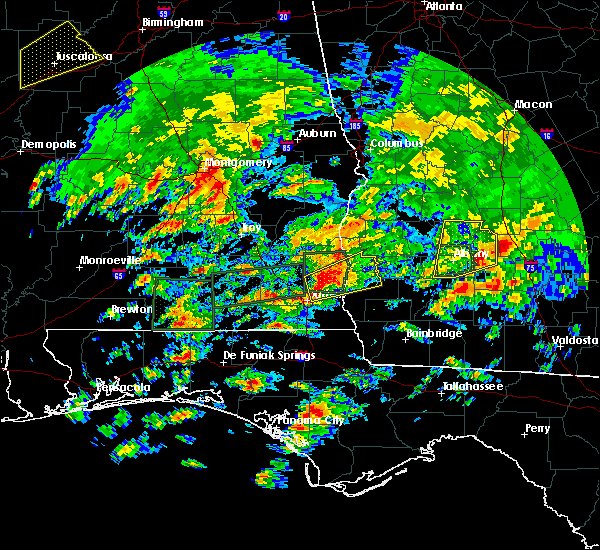 At 1259 am est/1159 pm cst/, a severe thunderstorm was located near headland, moving east at 45 mph (radar indicated). Hazards include 60 mph wind gusts and quarter size hail. Hail damage to vehicles is expected. Expect wind damage to roofs, siding, and trees. At 1259 am est/1159 pm cst/, a severe thunderstorm was located near headland, moving east at 45 mph (radar indicated). Hazards include 60 mph wind gusts and quarter size hail. Hail damage to vehicles is expected. Expect wind damage to roofs, siding, and trees.
|
| 1/21/2017 11:44 PM EST |
 At 1144 pm est, severe thunderstorms were located along a line extending from 8 miles northeast of fort gaines to near blakely, moving northeast at 45 mph (radar indicated). Hazards include 60 mph wind gusts and quarter size hail. Hail damage to vehicles is expected. Expect wind damage to roofs, siding, and trees. At 1144 pm est, severe thunderstorms were located along a line extending from 8 miles northeast of fort gaines to near blakely, moving northeast at 45 mph (radar indicated). Hazards include 60 mph wind gusts and quarter size hail. Hail damage to vehicles is expected. Expect wind damage to roofs, siding, and trees.
|
| 1/2/2017 9:23 PM EST |
 At 922 pm est/822 pm cst/, severe thunderstorms were located along a line extending from arlington to near donalsonville, moving northeast at 55 mph (radar indicated). Hazards include 70 mph wind gusts. Expect considerable tree damage. damage is likely to mobile homes, roofs, and outbuildings. locations impacted include, colquitt, morgan, blakely, donalsonville, bainbridge, edison, arlington, columbia, leary, west bainbridge, douglasville, centerville, gordon, iron city, damascus, brinson, jakin, bluffton, cedar springs and cuba. A tornado watch remains in effect until 1100 pm est/1000 pm cst/ for southeastern alabama, the panhandle of florida, and southwestern georgia. At 922 pm est/822 pm cst/, severe thunderstorms were located along a line extending from arlington to near donalsonville, moving northeast at 55 mph (radar indicated). Hazards include 70 mph wind gusts. Expect considerable tree damage. damage is likely to mobile homes, roofs, and outbuildings. locations impacted include, colquitt, morgan, blakely, donalsonville, bainbridge, edison, arlington, columbia, leary, west bainbridge, douglasville, centerville, gordon, iron city, damascus, brinson, jakin, bluffton, cedar springs and cuba. A tornado watch remains in effect until 1100 pm est/1000 pm cst/ for southeastern alabama, the panhandle of florida, and southwestern georgia.
|
| 1/2/2017 8:45 PM EST |
 At 844 pm est/744 pm cst/, severe thunderstorms were located along a line extending from near webb to near marianna, moving northeast at 65 mph (radar indicated). Hazards include 70 mph wind gusts. Expect considerable tree damage. Damage is likely to mobile homes, roofs, and outbuildings. At 844 pm est/744 pm cst/, severe thunderstorms were located along a line extending from near webb to near marianna, moving northeast at 65 mph (radar indicated). Hazards include 70 mph wind gusts. Expect considerable tree damage. Damage is likely to mobile homes, roofs, and outbuildings.
|
| 7/11/2016 2:56 PM EDT |
 At 255 pm edt, a severe thunderstorm was located near blakely, moving northeast at 40 mph (radar indicated). Hazards include 60 mph wind gusts. Expect damage to roofs. siding. And trees. At 255 pm edt, a severe thunderstorm was located near blakely, moving northeast at 40 mph (radar indicated). Hazards include 60 mph wind gusts. Expect damage to roofs. siding. And trees.
|
| 7/10/2016 3:27 PM EDT |
 At 326 pm edt, severe thunderstorms were located along a line extending from fort gaines to 6 miles southeast of blakely, moving east at 20 mph (radar indicated). Hazards include 60 mph wind gusts and penny size hail. Expect damage to roofs. siding. And trees. At 326 pm edt, severe thunderstorms were located along a line extending from fort gaines to 6 miles southeast of blakely, moving east at 20 mph (radar indicated). Hazards include 60 mph wind gusts and penny size hail. Expect damage to roofs. siding. And trees.
|
| 6/17/2016 8:47 PM EDT |
 At 846 pm edt/746 pm cdt/, severe thunderstorms were located along a line extending from 6 miles south of dawson to 8 miles northwest of bonifay, moving southeast at 50 mph (trained weather spotters). Hazards include 70 mph wind gusts and quarter size hail. Hail damage to vehicles is expected. expect considerable tree damage. wind damage is also likely to mobile homes, roofs, and outbuildings. Locations impacted include, daleville, abbeville, cottonwood, fort gaines, morgan, blakely, cuthbert, geneva, dothan, headland, hartford, taylor, midland city, kinsey, ashford, slocomb, cowarts, edison, newton and arlington. At 846 pm edt/746 pm cdt/, severe thunderstorms were located along a line extending from 6 miles south of dawson to 8 miles northwest of bonifay, moving southeast at 50 mph (trained weather spotters). Hazards include 70 mph wind gusts and quarter size hail. Hail damage to vehicles is expected. expect considerable tree damage. wind damage is also likely to mobile homes, roofs, and outbuildings. Locations impacted include, daleville, abbeville, cottonwood, fort gaines, morgan, blakely, cuthbert, geneva, dothan, headland, hartford, taylor, midland city, kinsey, ashford, slocomb, cowarts, edison, newton and arlington.
|
| 6/17/2016 8:12 PM EDT |
 At 812 pm edt/712 pm cdt/, severe thunderstorms were located along a line extending from 8 miles south of lumpkin to 7 miles west of samson, moving southeast at 50 mph (radar indicated). Hazards include 70 mph wind gusts and quarter size hail. Hail damage to vehicles is expected. expect considerable tree damage. Wind damage is also likely to mobile homes, roofs, and outbuildings. At 812 pm edt/712 pm cdt/, severe thunderstorms were located along a line extending from 8 miles south of lumpkin to 7 miles west of samson, moving southeast at 50 mph (radar indicated). Hazards include 70 mph wind gusts and quarter size hail. Hail damage to vehicles is expected. expect considerable tree damage. Wind damage is also likely to mobile homes, roofs, and outbuildings.
|
| 6/17/2016 6:20 PM CDT |
 At 719 pm edt/619 pm cdt/, severe thunderstorms were located along a line extending from 8 miles south of seale to near gantt, moving southeast at 60 mph (radar indicated). Hazards include 60 mph wind gusts and quarter size hail. Hail damage to vehicles is expected. Expect wind damage to roofs, siding, and trees. At 719 pm edt/619 pm cdt/, severe thunderstorms were located along a line extending from 8 miles south of seale to near gantt, moving southeast at 60 mph (radar indicated). Hazards include 60 mph wind gusts and quarter size hail. Hail damage to vehicles is expected. Expect wind damage to roofs, siding, and trees.
|
| 3/24/2016 5:45 PM EDT |
 At 544 pm edt, severe thunderstorms were located along a line extending from 6 miles south of georgetown to 7 miles northeast of fort gaines to 10 miles west of edison to 12 miles west of arlington to blakely, moving northeast at 50 mph (radar indicated). Hazards include 60 mph wind gusts. Expect damage to roofs. siding. And trees. At 544 pm edt, severe thunderstorms were located along a line extending from 6 miles south of georgetown to 7 miles northeast of fort gaines to 10 miles west of edison to 12 miles west of arlington to blakely, moving northeast at 50 mph (radar indicated). Hazards include 60 mph wind gusts. Expect damage to roofs. siding. And trees.
|
| 3/24/2016 5:40 PM EDT |
 At 540 pm edt, severe thunderstorms were located along a line extending from fort gaines to 14 miles east of abbeville to 12 miles northeast of columbia to near blakely, moving east at 40 mph (radar indicated). Hazards include 60 mph wind gusts. Expect damage to roofs. siding. and trees. locations impacted include, fort gaines, blakely, edison, arlington, douglasville, damascus. A tornado watch remains in effect until 800 pm edt for southeastern alabama. At 540 pm edt, severe thunderstorms were located along a line extending from fort gaines to 14 miles east of abbeville to 12 miles northeast of columbia to near blakely, moving east at 40 mph (radar indicated). Hazards include 60 mph wind gusts. Expect damage to roofs. siding. and trees. locations impacted include, fort gaines, blakely, edison, arlington, douglasville, damascus. A tornado watch remains in effect until 800 pm edt for southeastern alabama.
|
| 3/24/2016 5:26 PM EDT |
 At 525 pm edt/425 pm cdt/, severe thunderstorms were located along a line extending from near abbeville to 8 miles southwest of fort gaines to near columbia, moving east at 40 mph (radar indicated). Hazards include 60 mph wind gusts. Expect damage to roofs. siding. And trees. At 525 pm edt/425 pm cdt/, severe thunderstorms were located along a line extending from near abbeville to 8 miles southwest of fort gaines to near columbia, moving east at 40 mph (radar indicated). Hazards include 60 mph wind gusts. Expect damage to roofs. siding. And trees.
|
| 3/17/2016 3:27 PM CDT |
 At 427 pm edt/327 pm cdt/, the national weather service has detected a severe thunderstorm capable of producing quarter size hail and damaging winds in excess of 60 mph. this storm was located near abbeville, and moving east at 50 mph. At 427 pm edt/327 pm cdt/, the national weather service has detected a severe thunderstorm capable of producing quarter size hail and damaging winds in excess of 60 mph. this storm was located near abbeville, and moving east at 50 mph.
|
| 2/24/2016 12:38 AM EST |
 At 1237 am est /1137 pm cst/, severe thunderstorms were located along a line extending from 7 miles west of edison to 9 miles southeast of blakely to 8 miles north of marianna, moving northeast at 90 mph (radar indicated). Hazards include 70 mph wind gusts and penny size hail. Expect considerable tree damage. Damage is likely to mobile homes, roofs and outbuildings. At 1237 am est /1137 pm cst/, severe thunderstorms were located along a line extending from 7 miles west of edison to 9 miles southeast of blakely to 8 miles north of marianna, moving northeast at 90 mph (radar indicated). Hazards include 70 mph wind gusts and penny size hail. Expect considerable tree damage. Damage is likely to mobile homes, roofs and outbuildings.
|
| 2/24/2016 12:22 AM EST |
 At 1222 am est, a severe thunderstorm capable of producing a tornado was located near edison, or 11 miles northeast of blakely, moving northeast at 50 mph (radar indicated rotation). Hazards include tornado. Flying debris will be dangerous to those caught without shelter. mobile homes will be damaged or destroyed. damage to roofs, windows and vehicles will occur. tree damage is likely. this dangerous storm will be near, edison around 1230 am est. Other locations impacted by this tornadic thunderstorm include suttons corner, bluffton, carnegie, moye, harrisons mill and parksville. At 1222 am est, a severe thunderstorm capable of producing a tornado was located near edison, or 11 miles northeast of blakely, moving northeast at 50 mph (radar indicated rotation). Hazards include tornado. Flying debris will be dangerous to those caught without shelter. mobile homes will be damaged or destroyed. damage to roofs, windows and vehicles will occur. tree damage is likely. this dangerous storm will be near, edison around 1230 am est. Other locations impacted by this tornadic thunderstorm include suttons corner, bluffton, carnegie, moye, harrisons mill and parksville.
|
| 2/24/2016 12:14 AM EST |
 At 1214 am est, a confirmed tornado was located 7 miles north of blakely, moving northeast at 55 mph (radar confirmed tornado). Hazards include damaging tornado. Flying debris will be dangerous to those caught without shelter. mobile homes will be damaged or destroyed. damage to roofs, windows and vehicles will occur. tree damage is likely. this tornado will be near, edison around 1230 am est. Other locations impacted by this tornadic thunderstorm include suttons corner, bluffton, moye, ferrell crossroads, early co a/p, parksville, turman, coleman, colomokee and randolph co a/p. At 1214 am est, a confirmed tornado was located 7 miles north of blakely, moving northeast at 55 mph (radar confirmed tornado). Hazards include damaging tornado. Flying debris will be dangerous to those caught without shelter. mobile homes will be damaged or destroyed. damage to roofs, windows and vehicles will occur. tree damage is likely. this tornado will be near, edison around 1230 am est. Other locations impacted by this tornadic thunderstorm include suttons corner, bluffton, moye, ferrell crossroads, early co a/p, parksville, turman, coleman, colomokee and randolph co a/p.
|
| 2/24/2016 12:10 AM EST |
 At 1210 am est /1110 pm cst/, a severe thunderstorm capable of producing a tornado was located near blakely, moving northeast at 55 mph (radar indicated rotation). Hazards include tornado. Flying debris will be dangerous to those caught without shelter. mobile homes will be damaged or destroyed. damage to roofs, windows and vehicles will occur. tree damage is likely. this dangerous storm will be near, edison around 1230 am est. morgan around 1235 am est. Other locations impacted by this tornadic thunderstorm include suttons corner, bluffton, moye, ferrell crossroads, early co a/p, parksville, turman, coleman, colomokee and randolph co a/p. At 1210 am est /1110 pm cst/, a severe thunderstorm capable of producing a tornado was located near blakely, moving northeast at 55 mph (radar indicated rotation). Hazards include tornado. Flying debris will be dangerous to those caught without shelter. mobile homes will be damaged or destroyed. damage to roofs, windows and vehicles will occur. tree damage is likely. this dangerous storm will be near, edison around 1230 am est. morgan around 1235 am est. Other locations impacted by this tornadic thunderstorm include suttons corner, bluffton, moye, ferrell crossroads, early co a/p, parksville, turman, coleman, colomokee and randolph co a/p.
|
| 2/23/2016 11:54 PM EST |
 At 1154 pm est /1054 pm cst/, severe thunderstorms were located along a line extending from 8 miles south of fort gaines to near columbia to cottonwood, moving northeast at 70 mph (radar indicated). Hazards include 70 mph wind gusts and penny size hail. Expect considerable tree damage. Damage is likely to mobile homes, roofs and outbuildings. At 1154 pm est /1054 pm cst/, severe thunderstorms were located along a line extending from 8 miles south of fort gaines to near columbia to cottonwood, moving northeast at 70 mph (radar indicated). Hazards include 70 mph wind gusts and penny size hail. Expect considerable tree damage. Damage is likely to mobile homes, roofs and outbuildings.
|
| 2/15/2016 8:36 PM EST |
 At 835 pm est /735 pm cst/, severe thunderstorms were located along a line extending from 10 miles southwest of lumpkin to near cottonwood, moving east at 40 mph (radar indicated). Hazards include 60 mph wind gusts. Expect damage to roofs. Siding and trees. At 835 pm est /735 pm cst/, severe thunderstorms were located along a line extending from 10 miles southwest of lumpkin to near cottonwood, moving east at 40 mph (radar indicated). Hazards include 60 mph wind gusts. Expect damage to roofs. Siding and trees.
|
| 7/30/2015 7:05 PM EDT |
 The severe thunderstorm warning for southeastern clay, northwestern calhoun and southern randolph counties in southwestern georgia will expire at 715 pm edt, the storms which prompted the warning have weakened below severe limits and exited the warned area. therefore the warning will be allowed to expire. The severe thunderstorm warning for southeastern clay, northwestern calhoun and southern randolph counties in southwestern georgia will expire at 715 pm edt, the storms which prompted the warning have weakened below severe limits and exited the warned area. therefore the warning will be allowed to expire.
|
| 7/30/2015 6:52 PM EDT |
 At 652 pm edt, doppler radar indicated a line of severe thunderstorms capable of producing damaging winds in excess of 60 mph. these storms were located along a line extending from near shellman to 9 miles northwest of edison, moving southwest at 10 mph. locations impacted include, edison, bellville, bluffton, suttons corner, aycock mill, cordrays mill, moye, coleman, shivers mill, randolph co a/p, goffs mill, harrisons mill, carnegie, zetto, martins crossroads and fountain bridge. At 652 pm edt, doppler radar indicated a line of severe thunderstorms capable of producing damaging winds in excess of 60 mph. these storms were located along a line extending from near shellman to 9 miles northwest of edison, moving southwest at 10 mph. locations impacted include, edison, bellville, bluffton, suttons corner, aycock mill, cordrays mill, moye, coleman, shivers mill, randolph co a/p, goffs mill, harrisons mill, carnegie, zetto, martins crossroads and fountain bridge.
|
| 7/30/2015 6:26 PM EDT |
 At 626 pm edt, the national weather service has detected a line of severe thunderstorms capable of producing damaging winds in excess of 60 mph. these storms were located along a line extending from near shellman to 7 miles southwest of cuthbert, and moving southwest at 10 mph. At 626 pm edt, the national weather service has detected a line of severe thunderstorms capable of producing damaging winds in excess of 60 mph. these storms were located along a line extending from near shellman to 7 miles southwest of cuthbert, and moving southwest at 10 mph.
|
| 7/21/2015 4:19 PM EDT |
 At 418 pm edt /318 pm cdt/, doppler radar indicated a line of severe thunderstorms capable of producing damaging winds in excess of 60 mph. these storms were located along a line extending from 9 miles west of edison to near blakely to near columbia, moving south at 30 mph. locations impacted include, blakely, bluffton, haleburg, ferrell crossroads, colomokee, kolomoki mounds sp, zetto, barnes, hayes, miller, hardwickburg and rock hill. At 418 pm edt /318 pm cdt/, doppler radar indicated a line of severe thunderstorms capable of producing damaging winds in excess of 60 mph. these storms were located along a line extending from 9 miles west of edison to near blakely to near columbia, moving south at 30 mph. locations impacted include, blakely, bluffton, haleburg, ferrell crossroads, colomokee, kolomoki mounds sp, zetto, barnes, hayes, miller, hardwickburg and rock hill.
|
| 7/21/2015 3:57 PM EDT |
 At 357 pm edt /257 pm cdt/, the national weather service has detected a line of severe thunderstorms capable of producing damaging winds in excess of 60 mph. these storms were located along a line extending from 11 miles southwest of cuthbert to 6 miles south of fort gaines to 7 miles south of abbeville, and moving south at 30 mph. At 357 pm edt /257 pm cdt/, the national weather service has detected a line of severe thunderstorms capable of producing damaging winds in excess of 60 mph. these storms were located along a line extending from 11 miles southwest of cuthbert to 6 miles south of fort gaines to 7 miles south of abbeville, and moving south at 30 mph.
|
| 7/4/2015 9:14 PM EDT |
 At 913 pm edt, doppler radar indicated a line of severe thunderstorms capable of producing damaging winds in excess of 60 mph. these storms were located along a line extending from 8 miles southwest of lumpkin to 8 miles east of georgetown to 9 miles east of fort gaines to 8 miles north of blakely, moving east at 40 mph. locations impacted include, fort gaines, morgan, cuthbert, georgetown, dawson, edison, shellman, union, parrott, bellville, bluffton, dawson municipal a/p, suttons corner, cordrays mill, springvale, oak hill, springvale station, bethel, shivers mill and herod. At 913 pm edt, doppler radar indicated a line of severe thunderstorms capable of producing damaging winds in excess of 60 mph. these storms were located along a line extending from 8 miles southwest of lumpkin to 8 miles east of georgetown to 9 miles east of fort gaines to 8 miles north of blakely, moving east at 40 mph. locations impacted include, fort gaines, morgan, cuthbert, georgetown, dawson, edison, shellman, union, parrott, bellville, bluffton, dawson municipal a/p, suttons corner, cordrays mill, springvale, oak hill, springvale station, bethel, shivers mill and herod.
|
| 7/4/2015 8:59 PM EDT |
 At 858 pm edt /758 pm cdt/, local law enforcement reported a line of severe thunderstorms producing damaging winds in excess of 60 mph. these storms were located along a line extending from near lakepoint resort state park to near georgetown to fort gaines to 6 miles north of columbia, and moving east at 40 mph. these storms have a history of blowing down trees in southeast alabama. multiple reports of trees down have been received. At 858 pm edt /758 pm cdt/, local law enforcement reported a line of severe thunderstorms producing damaging winds in excess of 60 mph. these storms were located along a line extending from near lakepoint resort state park to near georgetown to fort gaines to 6 miles north of columbia, and moving east at 40 mph. these storms have a history of blowing down trees in southeast alabama. multiple reports of trees down have been received.
|
| 7/2/2015 2:23 PM EDT |
 At 223 pm edt /123 pm cdt/, the national weather service has detected a line of severe thunderstorms capable of producing damaging winds in excess of 60 mph. these storms were located along a line extending from 8 miles north of blakely to 10 miles west of chattahoochee, and moving east at 35 mph. At 223 pm edt /123 pm cdt/, the national weather service has detected a line of severe thunderstorms capable of producing damaging winds in excess of 60 mph. these storms were located along a line extending from 8 miles north of blakely to 10 miles west of chattahoochee, and moving east at 35 mph.
|
| 6/27/2015 4:05 PM EDT |
 The severe thunderstorm warning for northwestern early, southeastern clay and northwestern calhoun counties in southwestern georgia will expire at 415 pm edt, the storms which prompted the warning have weakened below severe limits and exited the warned area. therefore the warning will be allowed to expire. The severe thunderstorm warning for northwestern early, southeastern clay and northwestern calhoun counties in southwestern georgia will expire at 415 pm edt, the storms which prompted the warning have weakened below severe limits and exited the warned area. therefore the warning will be allowed to expire.
|
| 6/27/2015 3:54 PM EDT |
 At 353 pm edt, doppler radar indicated a line of severe thunderstorms capable of producing damaging winds in excess of 60 mph. these storms were located along a line extending from near fort gaines to 7 miles southeast of abbeville to 7 miles northwest of headland. these storms were nearly stationary. locations impacted include, blakely, edison, bellville, bluffton, suttons corner, harrisons mill, ferrell crossroads, early co a/p, parksville, colomokee, kolomoki mounds sp and zetto. At 353 pm edt, doppler radar indicated a line of severe thunderstorms capable of producing damaging winds in excess of 60 mph. these storms were located along a line extending from near fort gaines to 7 miles southeast of abbeville to 7 miles northwest of headland. these storms were nearly stationary. locations impacted include, blakely, edison, bellville, bluffton, suttons corner, harrisons mill, ferrell crossroads, early co a/p, parksville, colomokee, kolomoki mounds sp and zetto.
|
| 6/27/2015 3:33 PM EDT |
 At 333 pm edt /233 pm cdt/, the national weather service has detected a line of severe thunderstorms capable of producing damaging winds in excess of 60 mph. these storms were located along a line extending from near fort gaines to 7 miles southeast of abbeville to 7 miles northwest of headland, and moving east at 25 mph. At 333 pm edt /233 pm cdt/, the national weather service has detected a line of severe thunderstorms capable of producing damaging winds in excess of 60 mph. these storms were located along a line extending from near fort gaines to 7 miles southeast of abbeville to 7 miles northwest of headland, and moving east at 25 mph.
|
| 4/25/2015 6:45 PM EDT | At 644 pm edt, the national weather service has detected a line of severe thunderstorms capable of producing destructive winds in excess of 70 mph. these storms were located along a line extending from 8 miles south of abbeville to cottonwood, and moving east at 55 mph. |
| 4/19/2015 10:47 AM EDT | The national weather service in tallahassee has issued a * tornado warning for. eastern clay county in southwestern georgia. northern calhoun county in southwestern georgia. southeastern quitman county in southwestern georgia. Terrell county in southwestern georgia. |
| 8/30/2013 9:10 PM EDT | One tree down near kolomoki r in clay county GA, 1 miles NE of Bluffton, GA |
| 6/10/2012 3:30 PM EDT | Tree down on sains hatchery r in clay county GA, 0.2 miles E of Bluffton, GA |
Hail Maps for Bluffton, GA


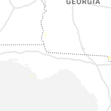


Connect with Interactive Hail Maps