

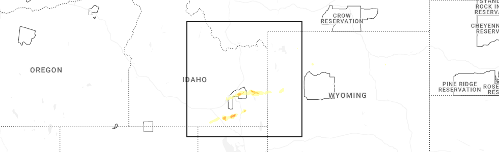
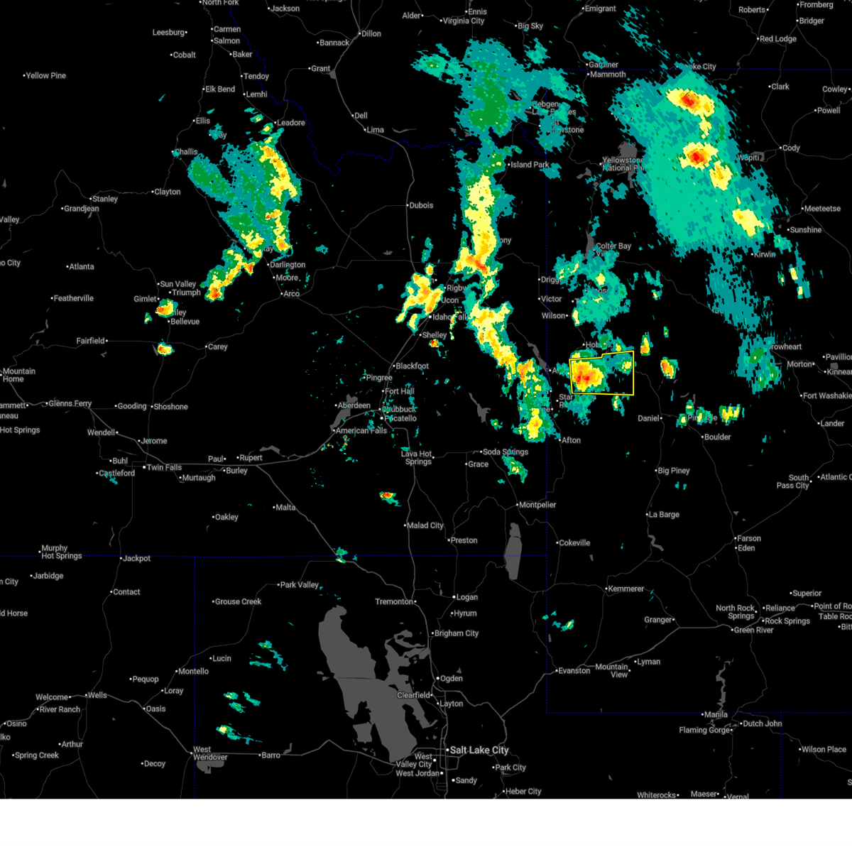
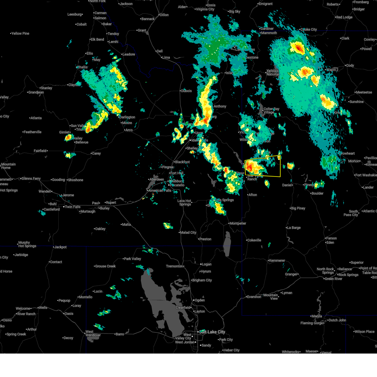
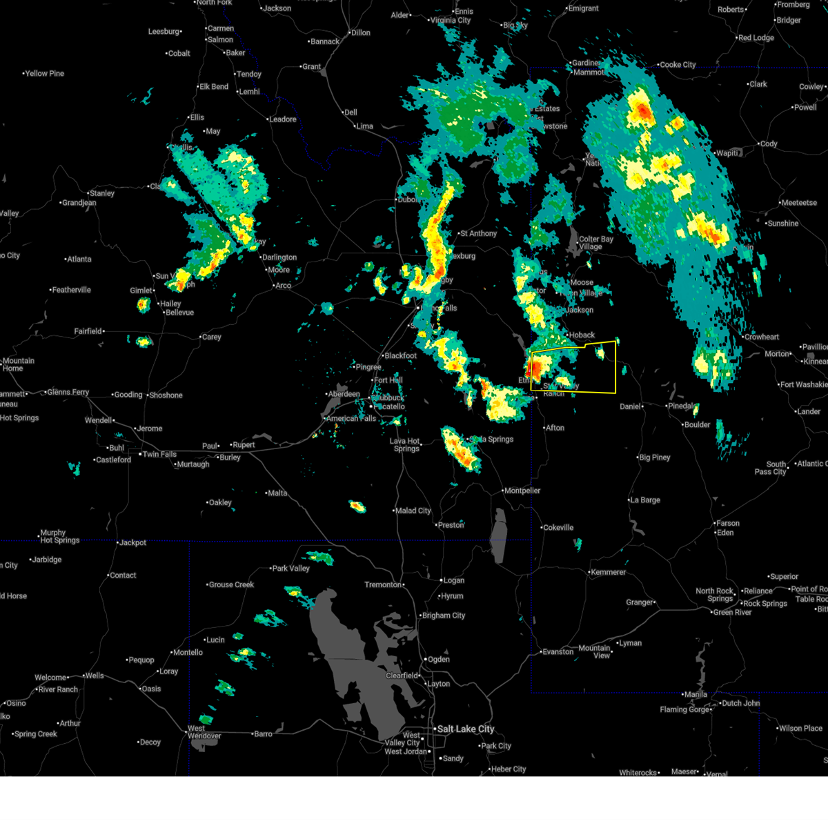
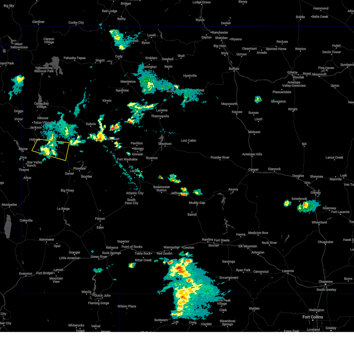
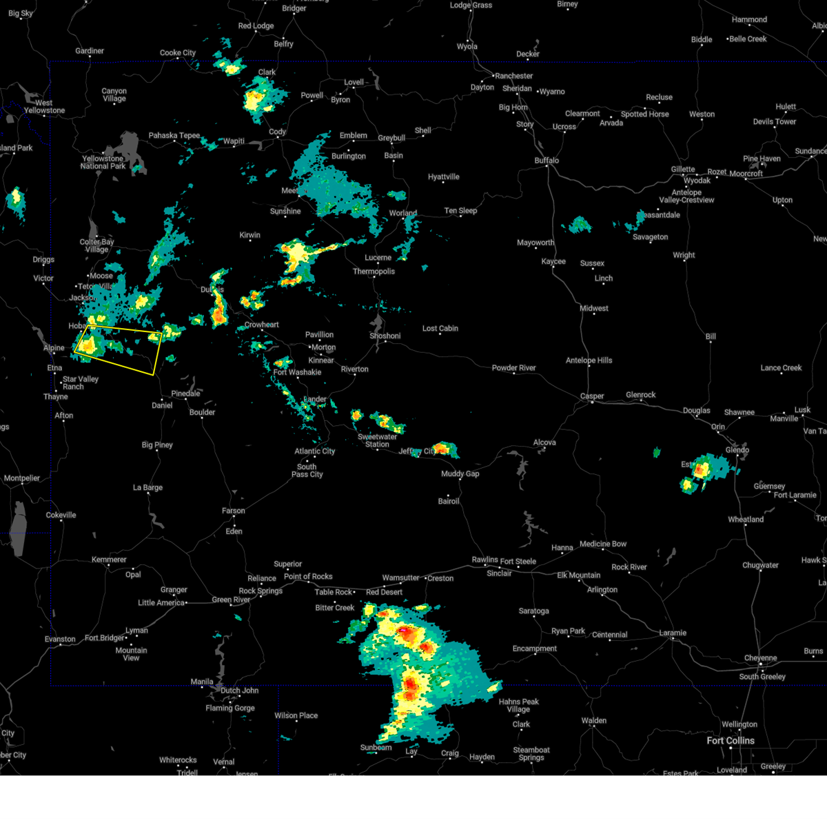
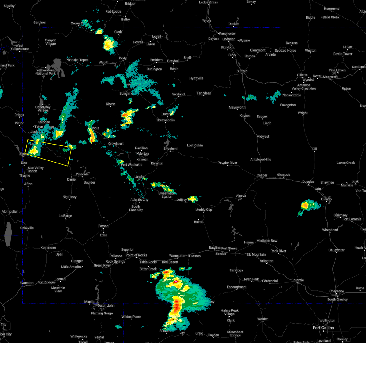
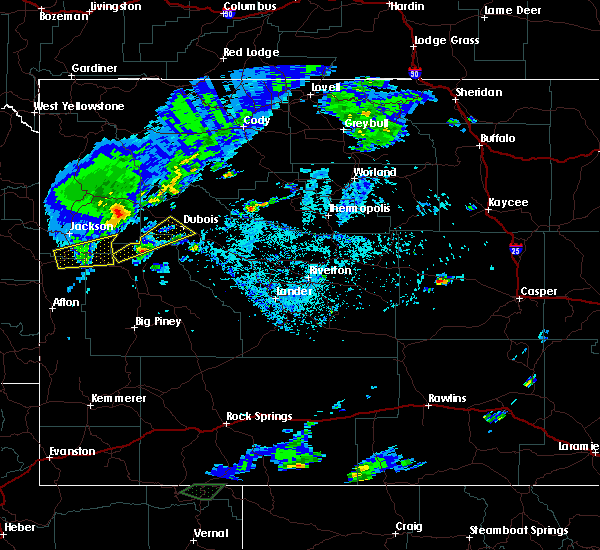
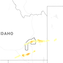
Hail Map for Bondurant, WY
The Bondurant, WY area has had 1 report of on-the-ground hail by trained spotters, and has been under severe weather warnings 12 times during the past 12 months. Doppler radar has detected hail at or near Bondurant, WY on 7 occasions, including 2 occasions during the past year.
| Name: | Bondurant, WY |
| Where Located: | 87.1 miles ESE of Idaho Falls, ID |
| Map: | Google Map for Bondurant, WY |
| Population: | 93 |
| Housing Units: | 120 |
| More Info: | Search Google for Bondurant, WY |
5
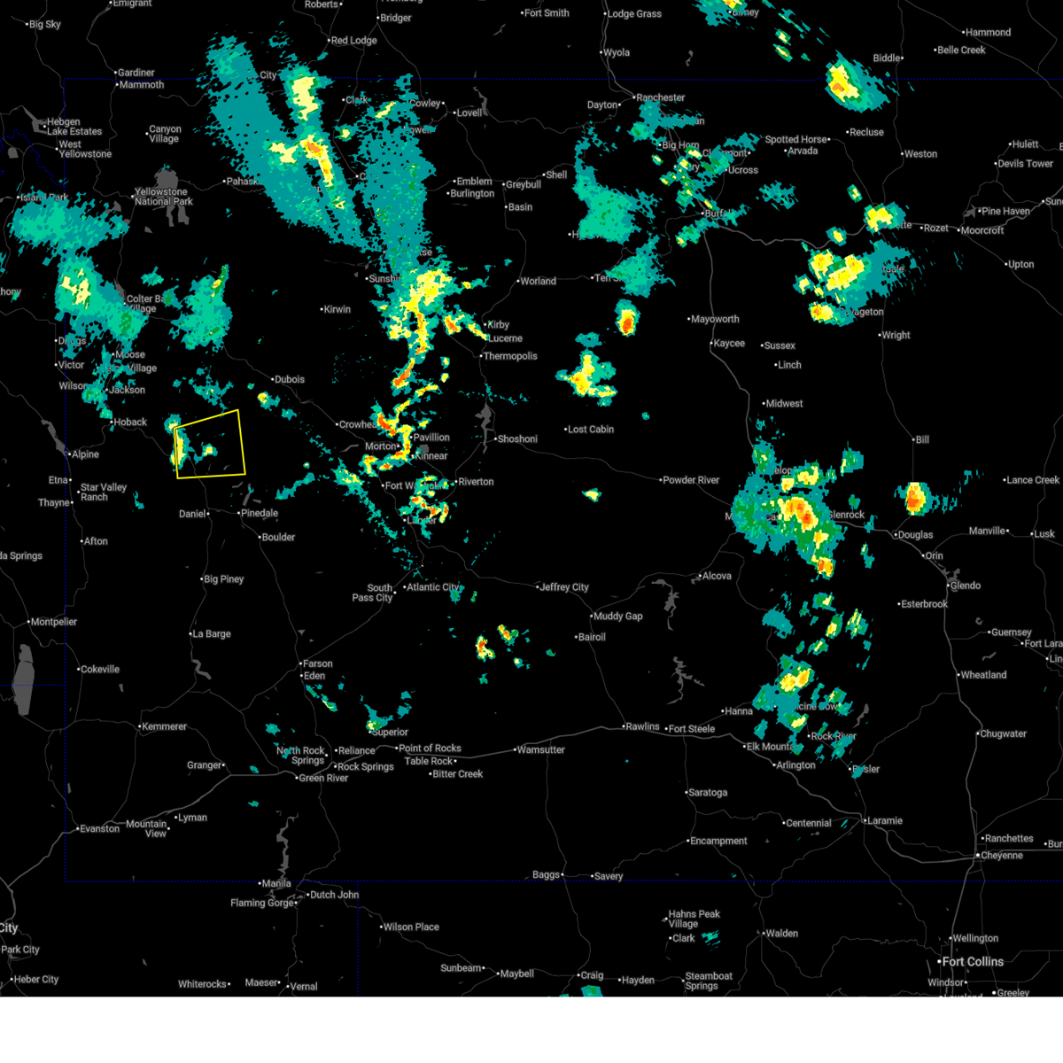
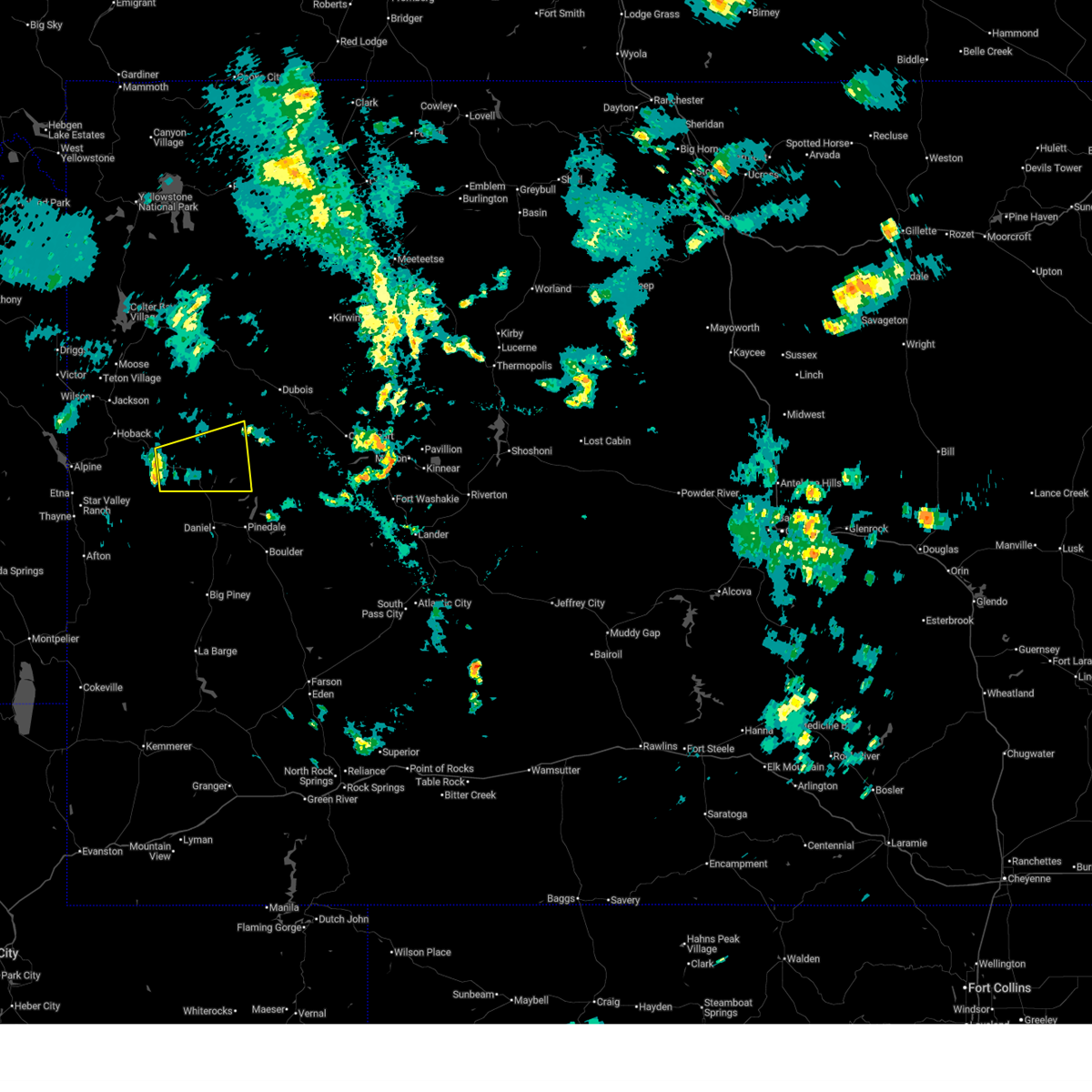
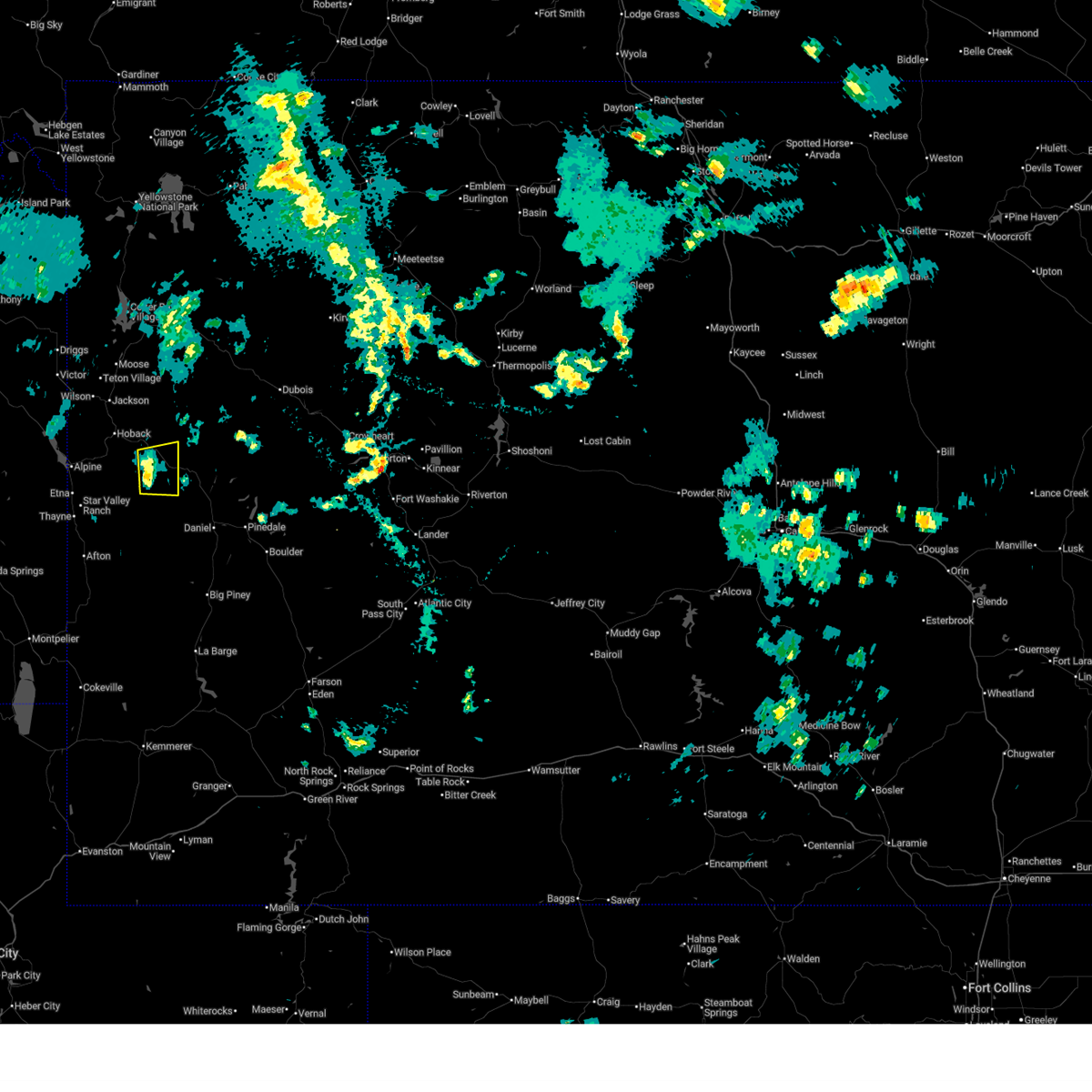
The Top Recent Hail Date for Bondurant, WY is Wednesday, June 11, 2025 (1st out of 7)
Hail and Wind Damage Spotted near Bondurant, WY
| Date / Time | Report Details |
|---|---|
| 6/11/2025 5:14 PM MDT |
 At 514 pm mdt, a severe thunderstorm was located 9 miles north of warren bridge, which is 25 miles northwest of pinedale, moving east at 35 mph (radar indicated). Hazards include quarter size hail. Damage to vehicles is expected. Locations impacted include, new fork lake and green river lake campground. At 514 pm mdt, a severe thunderstorm was located 9 miles north of warren bridge, which is 25 miles northwest of pinedale, moving east at 35 mph (radar indicated). Hazards include quarter size hail. Damage to vehicles is expected. Locations impacted include, new fork lake and green river lake campground.
|
| 6/11/2025 5:02 PM MDT |
 At 502 pm mdt, a severe thunderstorm was located near bondurant, which is 30 miles northwest of pinedale, moving east at 35 mph (radar indicated). Hazards include half dollar size hail. Damage to vehicles is expected. Locations impacted include, bondurant, new fork lake, and green river lake campground. At 502 pm mdt, a severe thunderstorm was located near bondurant, which is 30 miles northwest of pinedale, moving east at 35 mph (radar indicated). Hazards include half dollar size hail. Damage to vehicles is expected. Locations impacted include, bondurant, new fork lake, and green river lake campground.
|
| 6/11/2025 4:57 PM MDT |
 Svrriw the national weather service in riverton has issued a * severe thunderstorm warning for, northwestern sublette county in west central wyoming, * until 545 pm mdt. * at 457 pm mdt, a severe thunderstorm was located near bondurant, which is 30 miles southeast of jackson, moving east at 35 mph (radar indicated). Hazards include half dollar size hail. damage to vehicles is expected Svrriw the national weather service in riverton has issued a * severe thunderstorm warning for, northwestern sublette county in west central wyoming, * until 545 pm mdt. * at 457 pm mdt, a severe thunderstorm was located near bondurant, which is 30 miles southeast of jackson, moving east at 35 mph (radar indicated). Hazards include half dollar size hail. damage to vehicles is expected
|
| 6/11/2025 4:48 PM MDT |
 the severe thunderstorm warning has been cancelled and is no longer in effect the severe thunderstorm warning has been cancelled and is no longer in effect
|
| 6/11/2025 4:48 PM MDT |
 At 447 pm mdt, a severe thunderstorm was located near bondurant, which is 28 miles southeast of jackson, moving east at 45 mph (radar indicated). Hazards include quarter size hail. Damage to vehicles is expected. Locations impacted include, bondurant. At 447 pm mdt, a severe thunderstorm was located near bondurant, which is 28 miles southeast of jackson, moving east at 45 mph (radar indicated). Hazards include quarter size hail. Damage to vehicles is expected. Locations impacted include, bondurant.
|
| 6/11/2025 4:43 PM MDT |
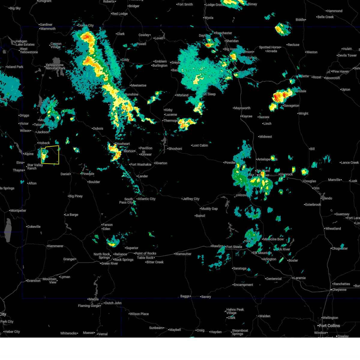 At 443 pm mdt, a severe thunderstorm was located near bondurant, which is 26 miles southeast of jackson, moving east at 45 mph (radar indicated). Hazards include quarter size hail. Damage to vehicles is expected. Locations impacted include, bondurant. At 443 pm mdt, a severe thunderstorm was located near bondurant, which is 26 miles southeast of jackson, moving east at 45 mph (radar indicated). Hazards include quarter size hail. Damage to vehicles is expected. Locations impacted include, bondurant.
|
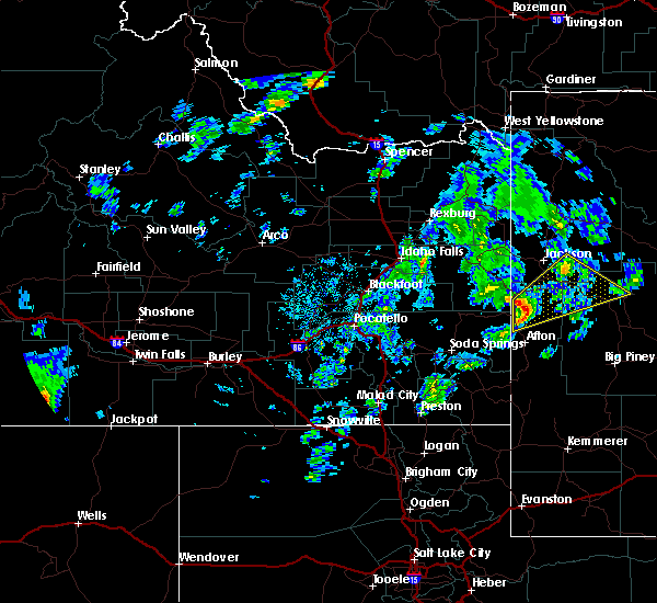
| 6/11/2025 4:32 PM MDT |
 At 432 pm mdt, a severe thunderstorm was located 12 miles west of bondurant, which is 18 miles east of alpine, moving east at 45 mph (radar indicated). Hazards include quarter size hail. Damage to vehicles is expected. Locations impacted include, bondurant. At 432 pm mdt, a severe thunderstorm was located 12 miles west of bondurant, which is 18 miles east of alpine, moving east at 45 mph (radar indicated). Hazards include quarter size hail. Damage to vehicles is expected. Locations impacted include, bondurant.
|
| 6/11/2025 4:20 PM MDT |
 At 420 pm mdt, a severe thunderstorm was located near stewart peak, which is 10 miles east of alpine, moving east at 45 mph (radar indicated). Hazards include quarter size hail. Damage to vehicles is expected. Locations impacted include, star valley ranch, bondurant, and stewart peak. At 420 pm mdt, a severe thunderstorm was located near stewart peak, which is 10 miles east of alpine, moving east at 45 mph (radar indicated). Hazards include quarter size hail. Damage to vehicles is expected. Locations impacted include, star valley ranch, bondurant, and stewart peak.
|
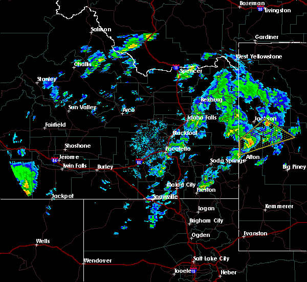
| 6/11/2025 4:14 PM MDT |
 Svrriw the national weather service in riverton has issued a * severe thunderstorm warning for, northwestern sublette county in west central wyoming, northwestern lincoln county in west central wyoming, * until 500 pm mdt. * at 413 pm mdt, a severe thunderstorm was located over stewart peak, which is near alpine, moving east at 45 mph (radar indicated). Hazards include quarter size hail. damage to vehicles is expected Svrriw the national weather service in riverton has issued a * severe thunderstorm warning for, northwestern sublette county in west central wyoming, northwestern lincoln county in west central wyoming, * until 500 pm mdt. * at 413 pm mdt, a severe thunderstorm was located over stewart peak, which is near alpine, moving east at 45 mph (radar indicated). Hazards include quarter size hail. damage to vehicles is expected
|
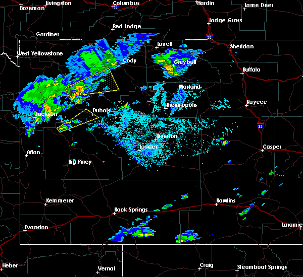
| 8/10/2024 2:34 PM MDT |
 the severe thunderstorm warning has been cancelled and is no longer in effect the severe thunderstorm warning has been cancelled and is no longer in effect
|
| 8/10/2024 2:19 PM MDT |
 At 219 pm mdt, a severe thunderstorm was located 7 miles southeast of hoback, which is 17 miles south of jackson, moving east at 35 mph (radar indicated). Hazards include quarter size hail. Damage to vehicles is expected. Locations impacted include, hoback, bondurant, kozy campground, and hoback campground. At 219 pm mdt, a severe thunderstorm was located 7 miles southeast of hoback, which is 17 miles south of jackson, moving east at 35 mph (radar indicated). Hazards include quarter size hail. Damage to vehicles is expected. Locations impacted include, hoback, bondurant, kozy campground, and hoback campground.
|
| 8/10/2024 2:09 PM MDT |
 Svrriw the national weather service in riverton has issued a * severe thunderstorm warning for, northwestern sublette county in west central wyoming, north central lincoln county in west central wyoming, southwestern teton county in northwestern wyoming, * until 245 pm mdt. * at 208 pm mdt, a severe thunderstorm was located near hoback, which is 13 miles northeast of alpine, moving east at 35 mph (radar indicated). Hazards include ping pong ball size hail. People and animals outdoors will be injured. Expect damage to roofs, siding, windows, and vehicles. Svrriw the national weather service in riverton has issued a * severe thunderstorm warning for, northwestern sublette county in west central wyoming, north central lincoln county in west central wyoming, southwestern teton county in northwestern wyoming, * until 245 pm mdt. * at 208 pm mdt, a severe thunderstorm was located near hoback, which is 13 miles northeast of alpine, moving east at 35 mph (radar indicated). Hazards include ping pong ball size hail. People and animals outdoors will be injured. Expect damage to roofs, siding, windows, and vehicles.
|
| 7/20/2017 3:32 PM MDT |
 At 332 pm mdt, a severe thunderstorm was located near union pass, which is 17 miles southwest of dubois, moving northeast at 40 mph (radar indicated). Hazards include 60 mph wind gusts and quarter size hail. Hail damage to vehicles is expected. expect wind damage to roofs, siding, and trees. Locations impacted include, union pass to dubois. At 332 pm mdt, a severe thunderstorm was located near union pass, which is 17 miles southwest of dubois, moving northeast at 40 mph (radar indicated). Hazards include 60 mph wind gusts and quarter size hail. Hail damage to vehicles is expected. expect wind damage to roofs, siding, and trees. Locations impacted include, union pass to dubois.
|
| 7/20/2017 3:24 PM MDT |
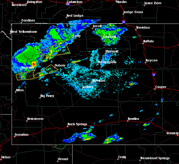 At 323 pm mdt, a severe thunderstorm was located near hoback, which is 13 miles northeast of alpine, moving east at 30 mph (radar indicated). Hazards include 60 mph wind gusts and quarter size hail. Hail damage to vehicles is expected. expect wind damage to roofs, siding, and trees. this severe thunderstorm will be near, hoback around 335 pm mdt. bondurant and granite falls hot springs around 415 pm mdt. Other locations impacted by this severe thunderstorm include station creek campground, hoback campground, east elbow campground, granite creek campground, east table creek campground, kozy campground and cabin creek campground. At 323 pm mdt, a severe thunderstorm was located near hoback, which is 13 miles northeast of alpine, moving east at 30 mph (radar indicated). Hazards include 60 mph wind gusts and quarter size hail. Hail damage to vehicles is expected. expect wind damage to roofs, siding, and trees. this severe thunderstorm will be near, hoback around 335 pm mdt. bondurant and granite falls hot springs around 415 pm mdt. Other locations impacted by this severe thunderstorm include station creek campground, hoback campground, east elbow campground, granite creek campground, east table creek campground, kozy campground and cabin creek campground.
|
| 7/20/2017 3:08 PM MDT |
 At 308 pm mdt, a severe thunderstorm was located 11 miles northeast of bondurant, which is 31 miles southeast of jackson, moving northeast at 40 mph (radar indicated). Hazards include 60 mph wind gusts and quarter size hail. Hail damage to vehicles is expected. expect wind damage to roofs, siding, and trees. this severe thunderstorm will be near, union pass around 340 pm mdt. dubois and torrey lake around 400 pm mdt. Other locations impacted by this severe thunderstorm include dubois municipal airport, antelope hills golf course, crooked creek guest ranch and longhorn ranch lodge and rv resort. At 308 pm mdt, a severe thunderstorm was located 11 miles northeast of bondurant, which is 31 miles southeast of jackson, moving northeast at 40 mph (radar indicated). Hazards include 60 mph wind gusts and quarter size hail. Hail damage to vehicles is expected. expect wind damage to roofs, siding, and trees. this severe thunderstorm will be near, union pass around 340 pm mdt. dubois and torrey lake around 400 pm mdt. Other locations impacted by this severe thunderstorm include dubois municipal airport, antelope hills golf course, crooked creek guest ranch and longhorn ranch lodge and rv resort.
|
| 9/4/2016 12:55 PM MDT | Quarter sized hail reported 2.5 miles E of Bondurant, WY, public report relayed through em |
| 7/10/2016 1:03 PM MDT |
 At 102 pm mdt, a severe thunderstorm was located 11 miles east of stewart peak, which is 15 miles east of alpine, moving northeast at 55 mph (trained weather spotters). Hazards include 60 mph wind gusts and quarter size hail. Hail damage to vehicles is expected. expect wind damage to roofs, siding and trees. this severe storm will be near, bondurant around 120 pm mdt. granite falls hot springs around 125 pm mdt. Other locations impacted by this severe thunderstorm include etna, thayne, granite creek campground, cedar creek golf course and wolf creek campground. At 102 pm mdt, a severe thunderstorm was located 11 miles east of stewart peak, which is 15 miles east of alpine, moving northeast at 55 mph (trained weather spotters). Hazards include 60 mph wind gusts and quarter size hail. Hail damage to vehicles is expected. expect wind damage to roofs, siding and trees. this severe storm will be near, bondurant around 120 pm mdt. granite falls hot springs around 125 pm mdt. Other locations impacted by this severe thunderstorm include etna, thayne, granite creek campground, cedar creek golf course and wolf creek campground.
|
| 7/10/2016 12:55 PM MDT |
 At 1254 pm mdt, a severe thunderstorm was located near stewart peak, which is 11 miles southeast of alpine, moving northeast at 55 mph (radar indicated). Hazards include 60 mph wind gusts and quarter size hail. Hail damage to vehicles is expected. expect wind damage to roofs, siding and trees. this severe thunderstorm will be near, bondurant around 120 pm mdt. granite falls hot springs around 125 pm mdt. Other locations impacted by this severe thunderstorm include etna, thayne, cedar creek golf course and wolf creek campground. At 1254 pm mdt, a severe thunderstorm was located near stewart peak, which is 11 miles southeast of alpine, moving northeast at 55 mph (radar indicated). Hazards include 60 mph wind gusts and quarter size hail. Hail damage to vehicles is expected. expect wind damage to roofs, siding and trees. this severe thunderstorm will be near, bondurant around 120 pm mdt. granite falls hot springs around 125 pm mdt. Other locations impacted by this severe thunderstorm include etna, thayne, cedar creek golf course and wolf creek campground.
|
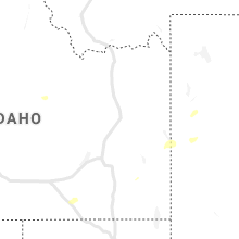
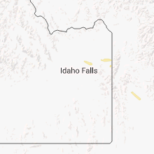
Hail Maps for Bondurant, WY


Connect with Interactive Hail Maps