

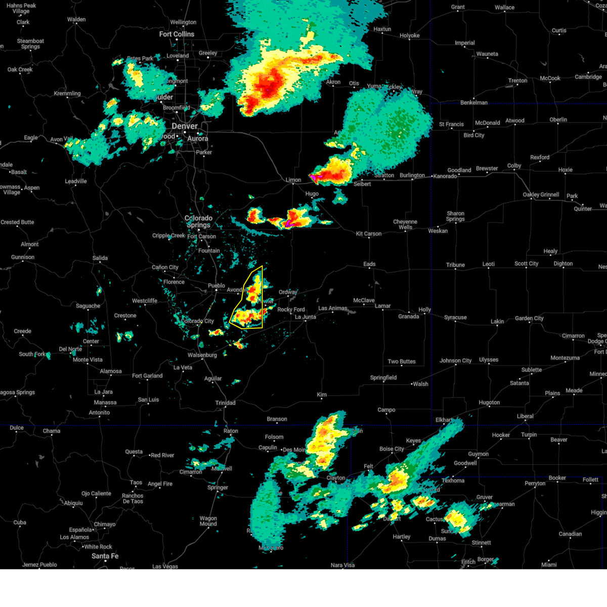
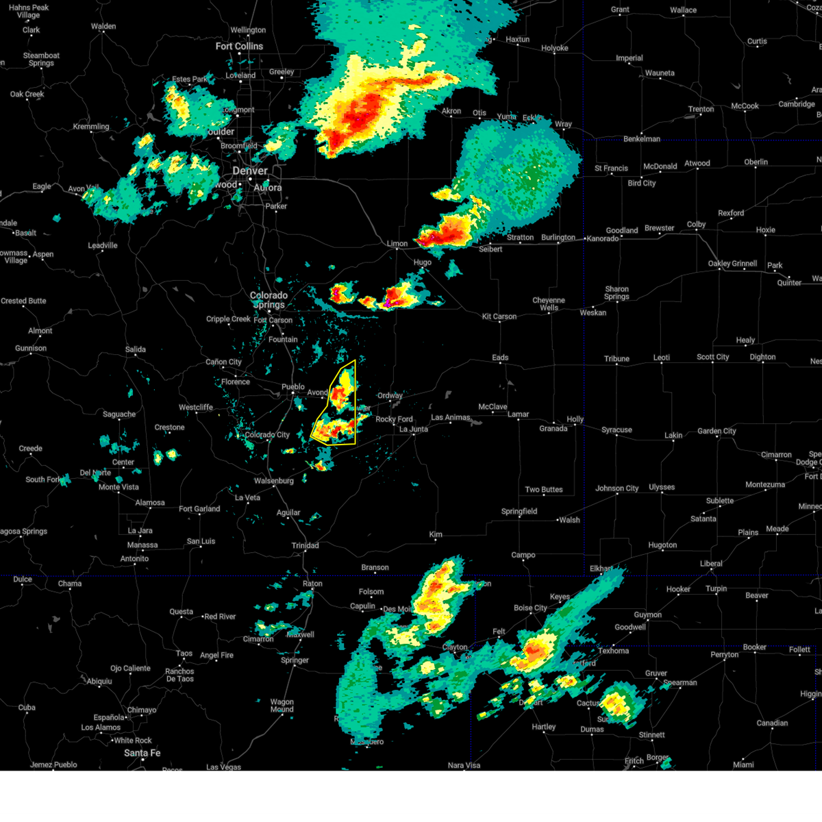
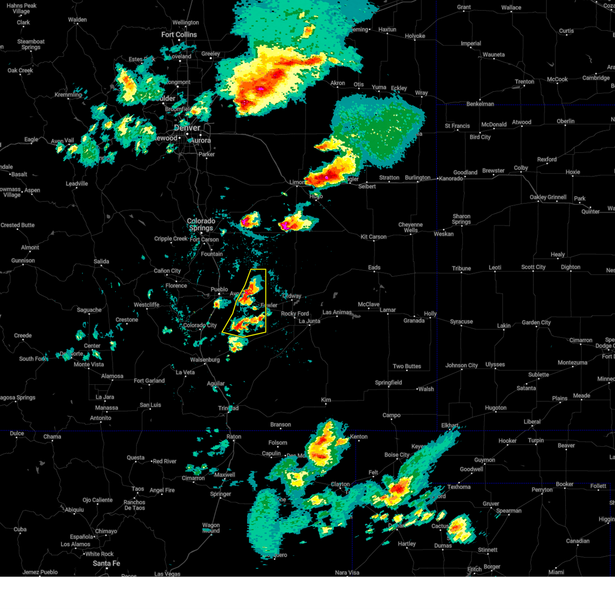
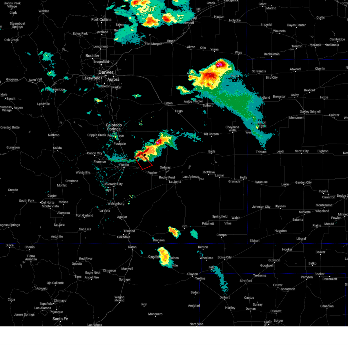
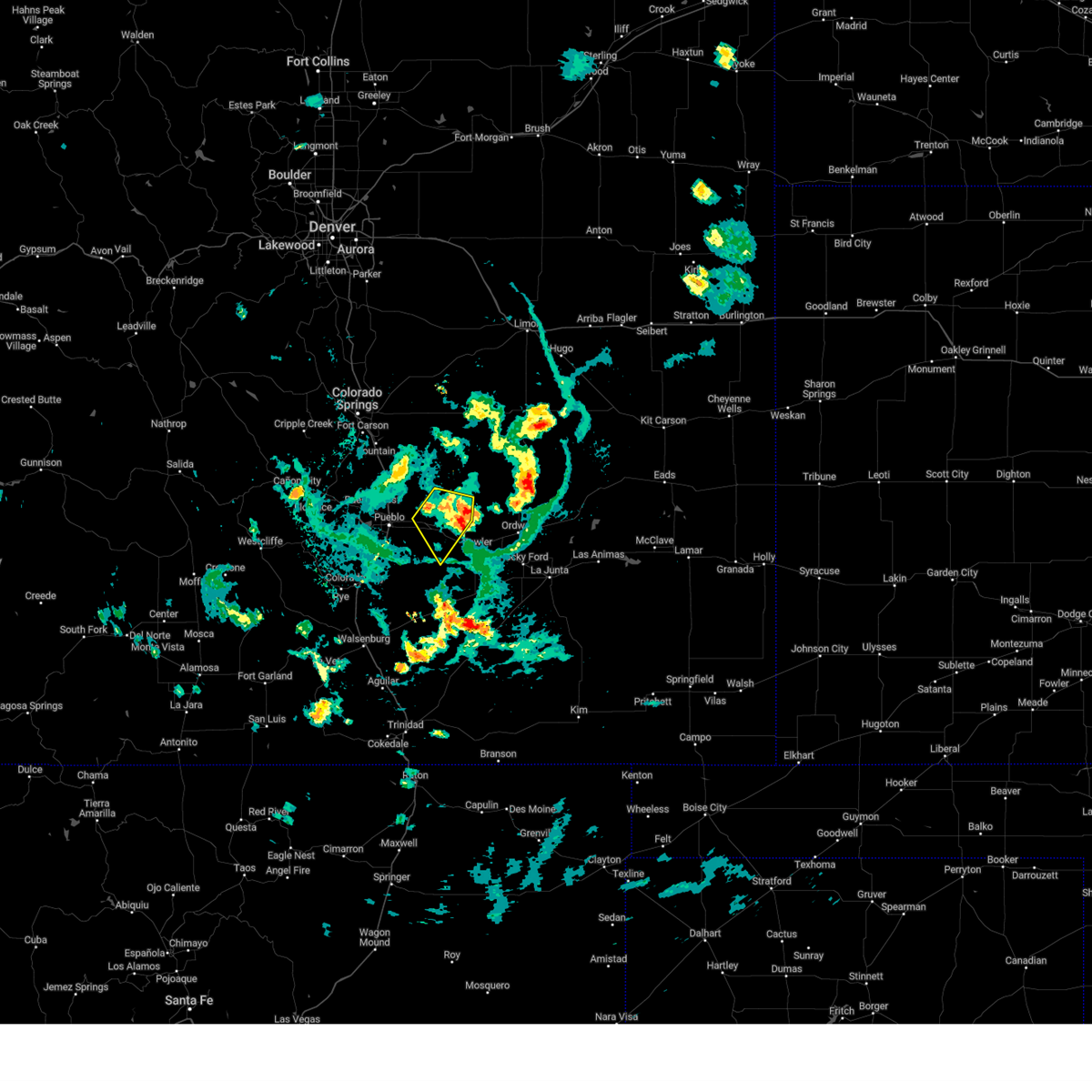
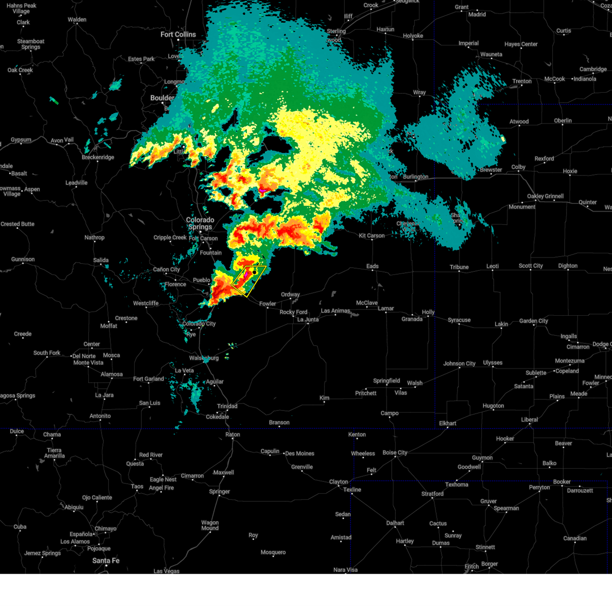
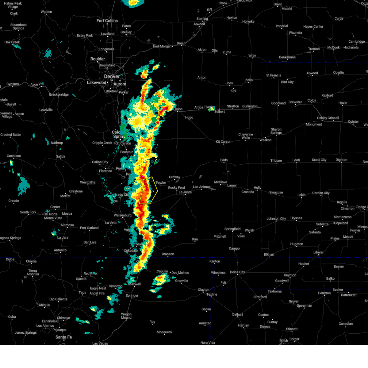
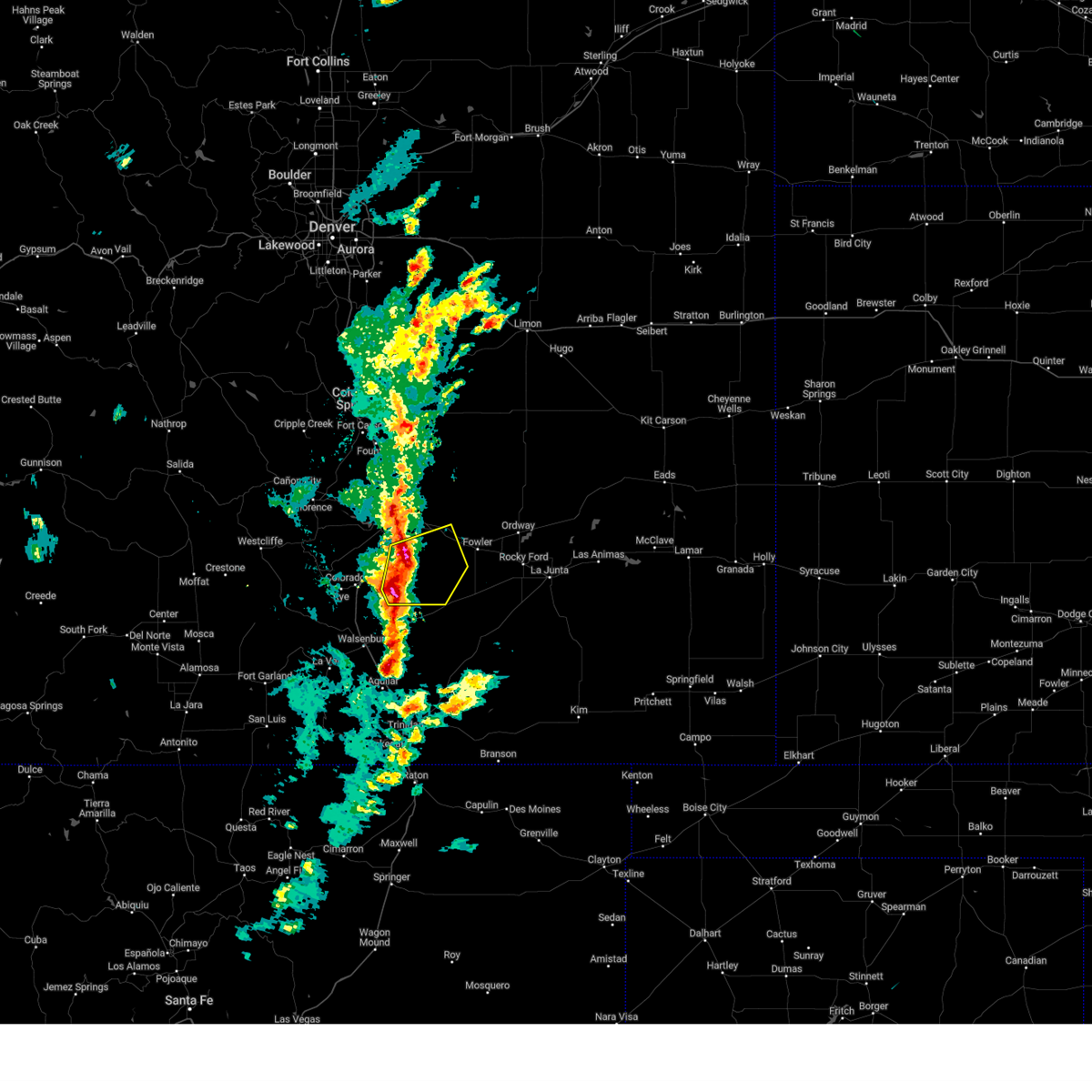
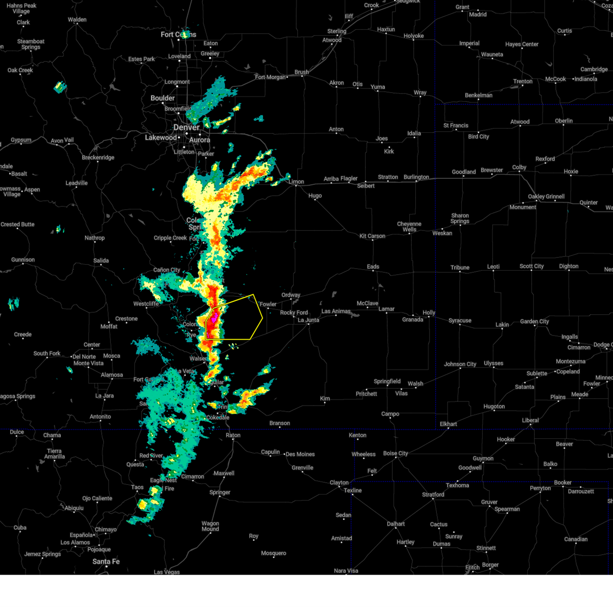
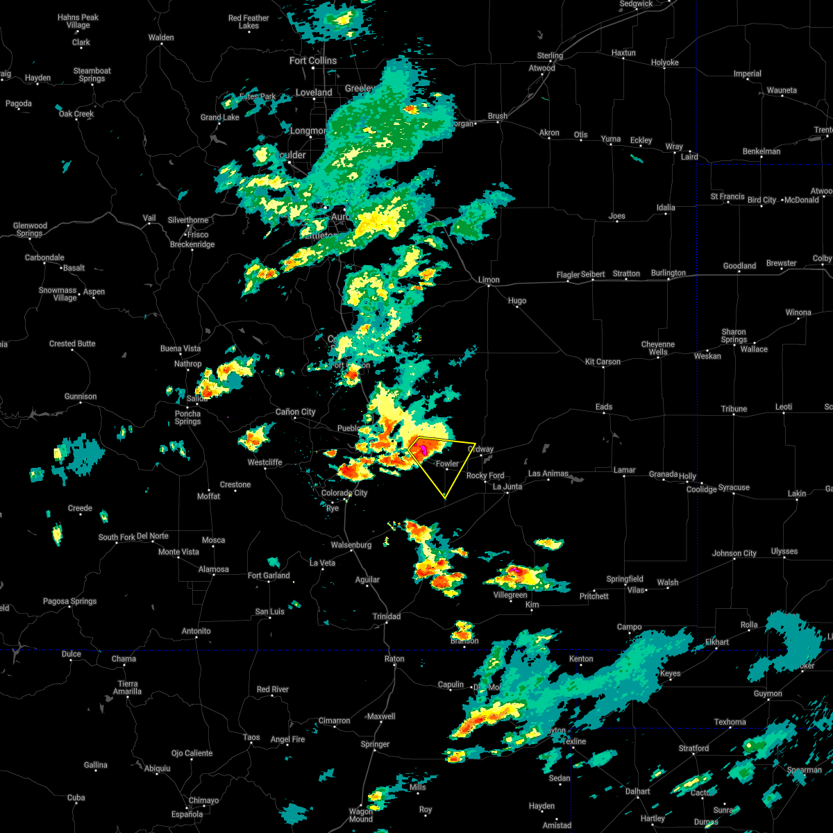
Hail Map for Boone, CO
The Boone, CO area has had 11 reports of on-the-ground hail by trained spotters, and has been under severe weather warnings 14 times during the past 12 months. Doppler radar has detected hail at or near Boone, CO on 58 occasions, including 6 occasions during the past year.
| Name: | Boone, CO |
| Where Located: | 19.4 miles E of Pueblo, CO |
| Map: | Google Map for Boone, CO |
| Population: | 339 |
| Housing Units: | 182 |
| More Info: | Search Google for Boone, CO |
1
The Top Recent Hail Date for Boone, CO is Friday, July 11, 2025 (12th out of 58)
Hail and Wind Damage Spotted near Boone, CO
| Date / Time | Report Details |
|---|---|
| 6/29/2025 4:11 PM MDT |
 The storm which prompted the warning has weakened below severe limits, and no longer poses an immediate threat to life or property. therefore, the warning will be allowed to expire. however, gusty winds and heavy rain are still possible with this thunderstorm. The storm which prompted the warning has weakened below severe limits, and no longer poses an immediate threat to life or property. therefore, the warning will be allowed to expire. however, gusty winds and heavy rain are still possible with this thunderstorm.
|
| 6/29/2025 4:03 PM MDT |
 At 403 pm mdt, a severe thunderstorm was located over pueblo depot, or 10 miles east of pueblo airport, moving northeast at 20 mph (radar indicated). Hazards include 60 mph wind gusts. Expect damage to roofs, siding, and trees. Locations impacted include, boone, avondale, and pueblo depot. At 403 pm mdt, a severe thunderstorm was located over pueblo depot, or 10 miles east of pueblo airport, moving northeast at 20 mph (radar indicated). Hazards include 60 mph wind gusts. Expect damage to roofs, siding, and trees. Locations impacted include, boone, avondale, and pueblo depot.
|
| 6/29/2025 3:44 PM MDT |
 Svrpub the national weather service in pueblo has issued a * severe thunderstorm warning for, northeastern pueblo county in southeastern colorado, * until 415 pm mdt. * at 344 pm mdt, a severe thunderstorm was located near pueblo airport, moving northeast at 20 mph (radar indicated). Hazards include 60 mph wind gusts. expect damage to roofs, siding, and trees Svrpub the national weather service in pueblo has issued a * severe thunderstorm warning for, northeastern pueblo county in southeastern colorado, * until 415 pm mdt. * at 344 pm mdt, a severe thunderstorm was located near pueblo airport, moving northeast at 20 mph (radar indicated). Hazards include 60 mph wind gusts. expect damage to roofs, siding, and trees
|
| 6/24/2025 4:45 PM MDT | Storm damage reported in pueblo county CO, 12.7 miles S of Boone, CO |
| 4/24/2025 8:45 PM MDT |
 Svrpub the national weather service in pueblo has issued a * severe thunderstorm warning for, east central pueblo county in southeastern colorado, * until 915 pm mdt. * at 844 pm mdt, a severe thunderstorm was located 7 miles southwest of avondale, or 10 miles south of pueblo airport, moving east at 20 mph (trained weather spotter reported quarter sized hail with this storm). Hazards include 60 mph wind gusts and quarter size hail. Hail damage to vehicles is expected. Expect wind damage to roofs, siding, and trees. Svrpub the national weather service in pueblo has issued a * severe thunderstorm warning for, east central pueblo county in southeastern colorado, * until 915 pm mdt. * at 844 pm mdt, a severe thunderstorm was located 7 miles southwest of avondale, or 10 miles south of pueblo airport, moving east at 20 mph (trained weather spotter reported quarter sized hail with this storm). Hazards include 60 mph wind gusts and quarter size hail. Hail damage to vehicles is expected. Expect wind damage to roofs, siding, and trees.
|
| 9/17/2024 3:18 PM MDT |
 At 317 pm mdt, severe thunderstorms were located along a line extending from 6 miles northwest of pueblo depot to 20 miles northwest of delhi, moving east at 45 mph (radar indicated). Hazards include 70 mph wind gusts and penny size hail. Expect considerable tree damage. damage is likely to mobile homes, roofs, and outbuildings. Locations impacted include, pueblo, pueblo airport, boone, salt creek, blende, avondale, and pueblo depot. At 317 pm mdt, severe thunderstorms were located along a line extending from 6 miles northwest of pueblo depot to 20 miles northwest of delhi, moving east at 45 mph (radar indicated). Hazards include 70 mph wind gusts and penny size hail. Expect considerable tree damage. damage is likely to mobile homes, roofs, and outbuildings. Locations impacted include, pueblo, pueblo airport, boone, salt creek, blende, avondale, and pueblo depot.
|
| 9/17/2024 3:17 PM MDT |
 Svrpub the national weather service in pueblo has issued a * severe thunderstorm warning for, otero county in southeastern colorado, north central las animas county in southeastern colorado, crowley county in southeastern colorado, eastern pueblo county in southeastern colorado, * until 400 pm mdt. * at 315 pm mdt, a severe thunderstorm was located 20 miles southwest of fowler, or 28 miles southeast of pueblo airport, moving northeast at 30 mph. this storm has a history of producing damaging winds. a wind gust to 72 mph was measured with this storm at 306 pm (radar indicated). Hazards include 70 mph wind gusts and nickel size hail. Expect considerable tree damage. Damage is likely to mobile homes, roofs, and outbuildings. Svrpub the national weather service in pueblo has issued a * severe thunderstorm warning for, otero county in southeastern colorado, north central las animas county in southeastern colorado, crowley county in southeastern colorado, eastern pueblo county in southeastern colorado, * until 400 pm mdt. * at 315 pm mdt, a severe thunderstorm was located 20 miles southwest of fowler, or 28 miles southeast of pueblo airport, moving northeast at 30 mph. this storm has a history of producing damaging winds. a wind gust to 72 mph was measured with this storm at 306 pm (radar indicated). Hazards include 70 mph wind gusts and nickel size hail. Expect considerable tree damage. Damage is likely to mobile homes, roofs, and outbuildings.
|
| 9/17/2024 3:07 PM MDT |
 At 305 pm mdt, severe thunderstorms were located along a line extending from near pueblo airport to 21 miles northeast of walsenburg, moving east at 45 mph. at 405 pm mdt, a 73 mph wind gust was observed at the pueblo airport (radar indicated). Hazards include 70 mph wind gusts and nickel size hail. Expect considerable tree damage. damage is likely to mobile homes, roofs, and outbuildings. Locations impacted include, pueblo, pueblo airport, walsenburg, boone, salt creek, blende, avondale, pueblo depot, and pueblo west. At 305 pm mdt, severe thunderstorms were located along a line extending from near pueblo airport to 21 miles northeast of walsenburg, moving east at 45 mph. at 405 pm mdt, a 73 mph wind gust was observed at the pueblo airport (radar indicated). Hazards include 70 mph wind gusts and nickel size hail. Expect considerable tree damage. damage is likely to mobile homes, roofs, and outbuildings. Locations impacted include, pueblo, pueblo airport, walsenburg, boone, salt creek, blende, avondale, pueblo depot, and pueblo west.
|
| 9/17/2024 2:56 PM MDT |
 Svrpub the national weather service in pueblo has issued a * severe thunderstorm warning for, northeastern huerfano county in southeastern colorado, north central las animas county in southeastern colorado, central pueblo county in southeastern colorado, * until 330 pm mdt. * at 256 pm mdt, severe thunderstorms were located along a line extending from near pueblo west to 16 miles northeast of walsenburg, moving east at 45 mph (radar indicated). Hazards include 60 mph wind gusts and nickel size hail. expect damage to roofs, siding, and trees Svrpub the national weather service in pueblo has issued a * severe thunderstorm warning for, northeastern huerfano county in southeastern colorado, north central las animas county in southeastern colorado, central pueblo county in southeastern colorado, * until 330 pm mdt. * at 256 pm mdt, severe thunderstorms were located along a line extending from near pueblo west to 16 miles northeast of walsenburg, moving east at 45 mph (radar indicated). Hazards include 60 mph wind gusts and nickel size hail. expect damage to roofs, siding, and trees
|
| 9/4/2024 6:08 PM MDT |
 the severe thunderstorm warning has been cancelled and is no longer in effect the severe thunderstorm warning has been cancelled and is no longer in effect
|
| 9/4/2024 5:54 PM MDT |
 At 554 pm mdt, a severe thunderstorm was located 11 miles north of pueblo depot, or 17 miles northeast of pueblo airport, moving east at 20 mph (radar indicated). Hazards include 60 mph wind gusts. Expect damage to roofs, siding, and trees. Locations impacted include, eastern pueblo, pueblo airport, boone, and pueblo depot. At 554 pm mdt, a severe thunderstorm was located 11 miles north of pueblo depot, or 17 miles northeast of pueblo airport, moving east at 20 mph (radar indicated). Hazards include 60 mph wind gusts. Expect damage to roofs, siding, and trees. Locations impacted include, eastern pueblo, pueblo airport, boone, and pueblo depot.
|
| 9/4/2024 5:39 PM MDT |
 Svrpub the national weather service in pueblo has issued a * severe thunderstorm warning for, southeastern el paso county in east central colorado, northeastern pueblo county in southeastern colorado, * until 630 pm mdt. * at 539 pm mdt, a severe thunderstorm was located 9 miles south of hanover, or 15 miles northeast of pueblo airport, moving east at 20 mph (radar indicated). Hazards include 60 mph wind gusts. expect damage to roofs, siding, and trees Svrpub the national weather service in pueblo has issued a * severe thunderstorm warning for, southeastern el paso county in east central colorado, northeastern pueblo county in southeastern colorado, * until 630 pm mdt. * at 539 pm mdt, a severe thunderstorm was located 9 miles south of hanover, or 15 miles northeast of pueblo airport, moving east at 20 mph (radar indicated). Hazards include 60 mph wind gusts. expect damage to roofs, siding, and trees
|
| 7/16/2024 3:36 PM MDT |
 The storms which prompted the warning have moved out of the area. therefore, the warning will be allowed to expire. however, gusty winds and heavy rain are still possible with these thunderstorms. The storms which prompted the warning have moved out of the area. therefore, the warning will be allowed to expire. however, gusty winds and heavy rain are still possible with these thunderstorms.
|
| 7/16/2024 2:59 PM MDT |
 Svrpub the national weather service in pueblo has issued a * severe thunderstorm warning for, northeastern pueblo county in southeastern colorado, * until 330 pm mdt. * at 258 pm mdt, a severe thunderstorm was located over pueblo airport, moving southeast at 30 mph (a gust of 70 mph was measured by the pueblo asos). Hazards include 70 mph wind gusts and quarter size hail. Hail damage to vehicles is expected. expect considerable tree damage. Wind damage is also likely to mobile homes, roofs, and outbuildings. Svrpub the national weather service in pueblo has issued a * severe thunderstorm warning for, northeastern pueblo county in southeastern colorado, * until 330 pm mdt. * at 258 pm mdt, a severe thunderstorm was located over pueblo airport, moving southeast at 30 mph (a gust of 70 mph was measured by the pueblo asos). Hazards include 70 mph wind gusts and quarter size hail. Hail damage to vehicles is expected. expect considerable tree damage. Wind damage is also likely to mobile homes, roofs, and outbuildings.
|
| 7/16/2024 2:55 PM MDT |
 Svrpub the national weather service in pueblo has issued a * severe thunderstorm warning for, western otero county in southeastern colorado, southeastern el paso county in east central colorado, northwestern crowley county in southeastern colorado, northeastern pueblo county in southeastern colorado, * until 345 pm mdt. * at 255 pm mdt, severe thunderstorms were located along a line extending from near truckton to 10 miles north of pueblo depot, moving east at 40 mph (radar indicated). Hazards include 70 mph wind gusts and quarter size hail. Hail damage to vehicles is expected. expect considerable tree damage. Wind damage is also likely to mobile homes, roofs, and outbuildings. Svrpub the national weather service in pueblo has issued a * severe thunderstorm warning for, western otero county in southeastern colorado, southeastern el paso county in east central colorado, northwestern crowley county in southeastern colorado, northeastern pueblo county in southeastern colorado, * until 345 pm mdt. * at 255 pm mdt, severe thunderstorms were located along a line extending from near truckton to 10 miles north of pueblo depot, moving east at 40 mph (radar indicated). Hazards include 70 mph wind gusts and quarter size hail. Hail damage to vehicles is expected. expect considerable tree damage. Wind damage is also likely to mobile homes, roofs, and outbuildings.
|
| 7/16/2024 2:36 PM MDT | Estimated 50 to 60 mph wind gus in pueblo county CO, 12.4 miles WSW of Boone, CO |
| 7/7/2024 7:50 PM MDT |
 the severe thunderstorm warning has been cancelled and is no longer in effect the severe thunderstorm warning has been cancelled and is no longer in effect
|
| 7/7/2024 7:26 PM MDT |
 Svrpub the national weather service in pueblo has issued a * severe thunderstorm warning for, northwestern otero county in southeastern colorado, southwestern crowley county in southeastern colorado, east central pueblo county in southeastern colorado, * until 815 pm mdt. * at 726 pm mdt, a severe thunderstorm was located near boone, or 19 miles east of pueblo airport, moving southeast at 20 mph (radar indicated). Hazards include 60 mph wind gusts and half dollar size hail. Hail damage to vehicles is expected. Expect wind damage to roofs, siding, and trees. Svrpub the national weather service in pueblo has issued a * severe thunderstorm warning for, northwestern otero county in southeastern colorado, southwestern crowley county in southeastern colorado, east central pueblo county in southeastern colorado, * until 815 pm mdt. * at 726 pm mdt, a severe thunderstorm was located near boone, or 19 miles east of pueblo airport, moving southeast at 20 mph (radar indicated). Hazards include 60 mph wind gusts and half dollar size hail. Hail damage to vehicles is expected. Expect wind damage to roofs, siding, and trees.
|
| 6/8/2024 3:57 PM MDT |
 The storms which prompted the warning have moved out of the area. therefore, the warning will be allowed to expire. however, a new severe thunderstorm warning is in effect for far eastern portions of the warned area. hail is still a threat in this area. a severe thunderstorm watch remains in effect until 700 pm mdt for southeastern colorado. remember, a severe thunderstorm warning still remains in effect for far eastern pueblo county. The storms which prompted the warning have moved out of the area. therefore, the warning will be allowed to expire. however, a new severe thunderstorm warning is in effect for far eastern portions of the warned area. hail is still a threat in this area. a severe thunderstorm watch remains in effect until 700 pm mdt for southeastern colorado. remember, a severe thunderstorm warning still remains in effect for far eastern pueblo county.
|
| 6/8/2024 3:51 PM MDT |
 Svrpub the national weather service in pueblo has issued a * severe thunderstorm warning for, western otero county in southeastern colorado, north central las animas county in southeastern colorado, crowley county in southeastern colorado, eastern pueblo county in southeastern colorado, * until 430 pm mdt. * at 350 pm mdt, a cluster of severe thunderstorms was located 10 miles southwest of fowler, or 26 miles southeast of pueblo airport, moving east at 40 mph (radar indicated). Hazards include 70 mph wind gusts and quarter size hail. Hail damage to vehicles is expected. expect considerable tree damage. Wind damage is also likely to mobile homes, roofs, and outbuildings. Svrpub the national weather service in pueblo has issued a * severe thunderstorm warning for, western otero county in southeastern colorado, north central las animas county in southeastern colorado, crowley county in southeastern colorado, eastern pueblo county in southeastern colorado, * until 430 pm mdt. * at 350 pm mdt, a cluster of severe thunderstorms was located 10 miles southwest of fowler, or 26 miles southeast of pueblo airport, moving east at 40 mph (radar indicated). Hazards include 70 mph wind gusts and quarter size hail. Hail damage to vehicles is expected. expect considerable tree damage. Wind damage is also likely to mobile homes, roofs, and outbuildings.
|
| 6/8/2024 3:46 PM MDT |
 At 346 pm mdt, severe thunderstorms were located along a line extending from 9 miles northeast of boone to 10 miles west of fowler to 23 miles south of avondale, moving southeast at 30 mph (radar indicated). Hazards include 60 mph wind gusts and quarter size hail. Hail damage to vehicles is expected. expect wind damage to roofs, siding, and trees. Locations impacted include, boone and pueblo depot. At 346 pm mdt, severe thunderstorms were located along a line extending from 9 miles northeast of boone to 10 miles west of fowler to 23 miles south of avondale, moving southeast at 30 mph (radar indicated). Hazards include 60 mph wind gusts and quarter size hail. Hail damage to vehicles is expected. expect wind damage to roofs, siding, and trees. Locations impacted include, boone and pueblo depot.
|
| 6/8/2024 3:39 PM MDT |
 the severe thunderstorm warning has been cancelled and is no longer in effect the severe thunderstorm warning has been cancelled and is no longer in effect
|
| 6/8/2024 3:39 PM MDT |
 At 338 pm mdt, severe thunderstorms were located along a line extending from 8 miles east of pueblo depot to 7 miles south of boone to 21 miles south of blende, moving east at 35 mph (radar indicated). Hazards include 60 mph wind gusts and quarter size hail. Hail damage to vehicles is expected. expect wind damage to roofs, siding, and trees. Locations impacted include, boone, avondale, and pueblo depot. At 338 pm mdt, severe thunderstorms were located along a line extending from 8 miles east of pueblo depot to 7 miles south of boone to 21 miles south of blende, moving east at 35 mph (radar indicated). Hazards include 60 mph wind gusts and quarter size hail. Hail damage to vehicles is expected. expect wind damage to roofs, siding, and trees. Locations impacted include, boone, avondale, and pueblo depot.
|
| 6/8/2024 3:28 PM MDT |
 At 327 pm mdt, severe thunderstorms were located along a line extending from near pueblo depot to 9 miles south of avondale to 19 miles north of walsenburg, moving southeast at 35 mph (radar indicated). Hazards include 60 mph wind gusts and quarter size hail. Hail damage to vehicles is expected. expect wind damage to roofs, siding, and trees. Locations impacted include, pueblo, pueblo airport, boone, salt creek, blende, avondale, and pueblo depot. At 327 pm mdt, severe thunderstorms were located along a line extending from near pueblo depot to 9 miles south of avondale to 19 miles north of walsenburg, moving southeast at 35 mph (radar indicated). Hazards include 60 mph wind gusts and quarter size hail. Hail damage to vehicles is expected. expect wind damage to roofs, siding, and trees. Locations impacted include, pueblo, pueblo airport, boone, salt creek, blende, avondale, and pueblo depot.
|
| 6/8/2024 3:16 PM MDT |
 Svrpub the national weather service in pueblo has issued a * severe thunderstorm warning for, northeastern huerfano county in southeastern colorado, pueblo county in southeastern colorado, * until 400 pm mdt. * at 316 pm mdt, severe thunderstorms were located along a line extending from near pueblo depot to 6 miles south of blende to 14 miles east of greenhorn mountain, moving southeast at 30 mph (radar indicated). Hazards include 60 mph wind gusts and quarter size hail. Hail damage to vehicles is expected. Expect wind damage to roofs, siding, and trees. Svrpub the national weather service in pueblo has issued a * severe thunderstorm warning for, northeastern huerfano county in southeastern colorado, pueblo county in southeastern colorado, * until 400 pm mdt. * at 316 pm mdt, severe thunderstorms were located along a line extending from near pueblo depot to 6 miles south of blende to 14 miles east of greenhorn mountain, moving southeast at 30 mph (radar indicated). Hazards include 60 mph wind gusts and quarter size hail. Hail damage to vehicles is expected. Expect wind damage to roofs, siding, and trees.
|
| 8/5/2023 4:16 PM MDT |
 At 416 pm mdt, a severe thunderstorm capable of producing a tornado was located near pueblo depot, or 12 miles northeast of pueblo airport, moving southeast at 25 mph (weather spotters reported a funnel cloud). Hazards include tornado. Flying debris will be dangerous to those caught without shelter. mobile homes will be damaged or destroyed. damage to roofs, windows, and vehicles will occur. tree damage is likely. this dangerous storm will be near, pueblo depot around 420 pm mdt. Other locations in the path of this tornadic thunderstorm include boone. At 416 pm mdt, a severe thunderstorm capable of producing a tornado was located near pueblo depot, or 12 miles northeast of pueblo airport, moving southeast at 25 mph (weather spotters reported a funnel cloud). Hazards include tornado. Flying debris will be dangerous to those caught without shelter. mobile homes will be damaged or destroyed. damage to roofs, windows, and vehicles will occur. tree damage is likely. this dangerous storm will be near, pueblo depot around 420 pm mdt. Other locations in the path of this tornadic thunderstorm include boone.
|
| 8/5/2023 4:09 PM MDT |
 At 408 pm mdt, a severe storm capable of producing a tornado was located 8 miles north of pueblo depot, or 12 miles northeast of pueblo airport, moving southeast at 25 mph (weather spotters confirmed tornado). Hazards include damaging tornado. faa personnel from the pueblo airport continue to indicate funnel clouds associated with this storm. pilots have also observed funnel clouds with this storm. Flying debris will be dangerous to those caught without shelter. mobile homes will be damaged or destroyed. damage to roofs, windows, and vehicles will occur. tree damage is likely. the tornado will be near, pueblo depot around 415 pm mdt. Other locations in the path of this tornadic thunderstorm include boone. At 408 pm mdt, a severe storm capable of producing a tornado was located 8 miles north of pueblo depot, or 12 miles northeast of pueblo airport, moving southeast at 25 mph (weather spotters confirmed tornado). Hazards include damaging tornado. faa personnel from the pueblo airport continue to indicate funnel clouds associated with this storm. pilots have also observed funnel clouds with this storm. Flying debris will be dangerous to those caught without shelter. mobile homes will be damaged or destroyed. damage to roofs, windows, and vehicles will occur. tree damage is likely. the tornado will be near, pueblo depot around 415 pm mdt. Other locations in the path of this tornadic thunderstorm include boone.
|
| 8/3/2023 6:08 PM MDT |
 The severe thunderstorm warning for northeastern pueblo county will expire at 615 pm mdt, the storm which prompted the warning has weakened below severe limits, and has exited the warned area. therefore, the warning will be allowed to expire. however small hail, gusty winds and heavy rain are still possible with this thunderstorm. The severe thunderstorm warning for northeastern pueblo county will expire at 615 pm mdt, the storm which prompted the warning has weakened below severe limits, and has exited the warned area. therefore, the warning will be allowed to expire. however small hail, gusty winds and heavy rain are still possible with this thunderstorm.
|
| 8/3/2023 5:53 PM MDT |
 At 552 pm mdt, a collapsing severe thunderstorm located over northeastern pueblo, moving east at 15 mph, has produced severe outflow winds (at 515 pm, a peak wind of 67 mph was measured at the pueblo airport). Hazards include 70 mph wind gusts and penny size hail. Expect considerable tree damage. damage is likely to mobile homes, roofs, and outbuildings. locations impacted include, boone, avondale and pueblo depot. thunderstorm damage threat, considerable hail threat, radar indicated max hail size, 0. 75 in wind threat, radar indicated max wind gust, 70 mph. At 552 pm mdt, a collapsing severe thunderstorm located over northeastern pueblo, moving east at 15 mph, has produced severe outflow winds (at 515 pm, a peak wind of 67 mph was measured at the pueblo airport). Hazards include 70 mph wind gusts and penny size hail. Expect considerable tree damage. damage is likely to mobile homes, roofs, and outbuildings. locations impacted include, boone, avondale and pueblo depot. thunderstorm damage threat, considerable hail threat, radar indicated max hail size, 0. 75 in wind threat, radar indicated max wind gust, 70 mph.
|
| 8/3/2023 5:41 PM MDT |
 At 540 pm mdt, a severe thunderstorm located over pueblo airport, moving east at 15 mph (at 515 pm, a peak wind of 67 mph was measured at the pueblo airport). Hazards include 70 mph wind gusts and penny size hail. Expect considerable tree damage. damage is likely to mobile homes, roofs, and outbuildings. locations impacted include, eastern pueblo, pueblo airport, boone, avondale and pueblo depot. thunderstorm damage threat, considerable hail threat, radar indicated max hail size, 0. 75 in wind threat, radar indicated max wind gust, 70 mph. At 540 pm mdt, a severe thunderstorm located over pueblo airport, moving east at 15 mph (at 515 pm, a peak wind of 67 mph was measured at the pueblo airport). Hazards include 70 mph wind gusts and penny size hail. Expect considerable tree damage. damage is likely to mobile homes, roofs, and outbuildings. locations impacted include, eastern pueblo, pueblo airport, boone, avondale and pueblo depot. thunderstorm damage threat, considerable hail threat, radar indicated max hail size, 0. 75 in wind threat, radar indicated max wind gust, 70 mph.
|
| 8/3/2023 5:28 PM MDT |
 At 526 pm mdt, a severe thunderstorm was located over northwestern pueblo, moving east at 15 mph (at 515 pm, a peak wind of 67 mph was measured at the pueblo airport). Hazards include 70 mph wind gusts and penny size hail. Expect considerable tree damage. damage is likely to mobile homes, roofs, and outbuildings. locations impacted include, pueblo, pueblo airport, boone, salt creek, blende, avondale and pueblo depot. thunderstorm damage threat, considerable hail threat, radar indicated max hail size, 0. 75 in wind threat, radar indicated max wind gust, 70 mph. At 526 pm mdt, a severe thunderstorm was located over northwestern pueblo, moving east at 15 mph (at 515 pm, a peak wind of 67 mph was measured at the pueblo airport). Hazards include 70 mph wind gusts and penny size hail. Expect considerable tree damage. damage is likely to mobile homes, roofs, and outbuildings. locations impacted include, pueblo, pueblo airport, boone, salt creek, blende, avondale and pueblo depot. thunderstorm damage threat, considerable hail threat, radar indicated max hail size, 0. 75 in wind threat, radar indicated max wind gust, 70 mph.
|
| 8/3/2023 5:14 PM MDT |
 At 514 pm mdt, a severe thunderstorm was located near pueblo, moving east at 15 mph (radar indicated). Hazards include 70 mph wind gusts and nickel size hail. Expect considerable tree damage. Damage is likely to mobile homes, roofs, and outbuildings. At 514 pm mdt, a severe thunderstorm was located near pueblo, moving east at 15 mph (radar indicated). Hazards include 70 mph wind gusts and nickel size hail. Expect considerable tree damage. Damage is likely to mobile homes, roofs, and outbuildings.
|
| 7/25/2023 5:42 PM MDT |
 At 542 pm mdt, a severe thunderstorm was located over avondale, or 9 miles southeast of pueblo airport, moving east at 25 mph (radar indicated). Hazards include 60 mph wind gusts and nickel size hail. Expect damage to roofs, siding, and trees. locations impacted include, boone, avondale and pueblo depot. hail threat, radar indicated max hail size, 0. 88 in wind threat, radar indicated max wind gust, 60 mph. At 542 pm mdt, a severe thunderstorm was located over avondale, or 9 miles southeast of pueblo airport, moving east at 25 mph (radar indicated). Hazards include 60 mph wind gusts and nickel size hail. Expect damage to roofs, siding, and trees. locations impacted include, boone, avondale and pueblo depot. hail threat, radar indicated max hail size, 0. 88 in wind threat, radar indicated max wind gust, 60 mph.
|
| 7/25/2023 5:24 PM MDT |
 At 524 pm mdt, a severe thunderstorm was located near blende, or near pueblo airport, moving east at 25 mph (radar indicated). Hazards include 60 mph wind gusts and quarter size hail. Hail damage to vehicles is expected. Expect wind damage to roofs, siding, and trees. At 524 pm mdt, a severe thunderstorm was located near blende, or near pueblo airport, moving east at 25 mph (radar indicated). Hazards include 60 mph wind gusts and quarter size hail. Hail damage to vehicles is expected. Expect wind damage to roofs, siding, and trees.
|
| 7/13/2023 5:44 PM MDT |
 At 543 pm mdt, a severe thunderstorm was located near avondale, or 12 miles southeast of pueblo, moving southeast at 30 mph. this is a destructive storm for blende and avondale (radar indicated). Hazards include three inch hail and 60 mph wind gusts. People and animals outdoors will be severely injured. expect shattered windows, extensive damage to roofs, siding, and vehicles. locations impacted include, boone, avondale and pueblo depot. thunderstorm damage threat, destructive hail threat, radar indicated max hail size, 3. 00 in wind threat, radar indicated max wind gust, 60 mph. At 543 pm mdt, a severe thunderstorm was located near avondale, or 12 miles southeast of pueblo, moving southeast at 30 mph. this is a destructive storm for blende and avondale (radar indicated). Hazards include three inch hail and 60 mph wind gusts. People and animals outdoors will be severely injured. expect shattered windows, extensive damage to roofs, siding, and vehicles. locations impacted include, boone, avondale and pueblo depot. thunderstorm damage threat, destructive hail threat, radar indicated max hail size, 3. 00 in wind threat, radar indicated max wind gust, 60 mph.
|
| 7/13/2023 5:33 PM MDT |
 At 532 pm mdt, a severe thunderstorm was located over blende, or near pueblo, moving southeast at 30 mph. this is a destructive storm for east pueblo, blende (radar indicated). Hazards include three inch hail and 60 mph wind gusts. People and animals outdoors will be severely injured. Expect shattered windows, extensive damage to roofs, siding, and vehicles. At 532 pm mdt, a severe thunderstorm was located over blende, or near pueblo, moving southeast at 30 mph. this is a destructive storm for east pueblo, blende (radar indicated). Hazards include three inch hail and 60 mph wind gusts. People and animals outdoors will be severely injured. Expect shattered windows, extensive damage to roofs, siding, and vehicles.
|
| 7/13/2023 5:22 PM MDT |
 At 522 pm mdt, a severe thunderstorm was located near blende, or near pueblo, moving southeast at 20 mph (radar indicated). Hazards include two inch hail and 60 mph wind gusts. People and animals outdoors will be injured. expect hail damage to roofs, siding, windows, and vehicles. Expect wind damage to roofs, siding, and trees. At 522 pm mdt, a severe thunderstorm was located near blende, or near pueblo, moving southeast at 20 mph (radar indicated). Hazards include two inch hail and 60 mph wind gusts. People and animals outdoors will be injured. expect hail damage to roofs, siding, windows, and vehicles. Expect wind damage to roofs, siding, and trees.
|
| 7/10/2023 2:42 PM MDT |
 The severe thunderstorm warning for northeastern pueblo county will expire at 245 pm mdt, the storm which prompted the warning has weakened below severe limits, and has exited the warned area. therefore, the warning will be allowed to expire. a severe thunderstorm watch remains in effect until 700 pm mdt for southeastern colorado. The severe thunderstorm warning for northeastern pueblo county will expire at 245 pm mdt, the storm which prompted the warning has weakened below severe limits, and has exited the warned area. therefore, the warning will be allowed to expire. a severe thunderstorm watch remains in effect until 700 pm mdt for southeastern colorado.
|
| 7/10/2023 2:30 PM MDT |
 At 229 pm mdt, a severe thunderstorm was located near boone, or 20 miles east of pueblo, moving southeast at 25 mph (radar indicated). Hazards include 60 mph wind gusts and quarter size hail. Hail damage to vehicles is expected. expect wind damage to roofs, siding, and trees. damaging winds could extend well ahead of the storm. locations impacted include, boone, avondale and pueblo depot. hail threat, radar indicated max hail size, 1. 00 in wind threat, radar indicated max wind gust, 60 mph. At 229 pm mdt, a severe thunderstorm was located near boone, or 20 miles east of pueblo, moving southeast at 25 mph (radar indicated). Hazards include 60 mph wind gusts and quarter size hail. Hail damage to vehicles is expected. expect wind damage to roofs, siding, and trees. damaging winds could extend well ahead of the storm. locations impacted include, boone, avondale and pueblo depot. hail threat, radar indicated max hail size, 1. 00 in wind threat, radar indicated max wind gust, 60 mph.
|
| 7/10/2023 2:18 PM MDT |
 At 218 pm mdt, a severe thunderstorm was located over pueblo depot, or 16 miles east of pueblo, moving southeast at 25 mph (radar indicated). Hazards include 60 mph wind gusts and quarter size hail. Hail damage to vehicles is expected. Expect wind damage to roofs, siding, and trees. At 218 pm mdt, a severe thunderstorm was located over pueblo depot, or 16 miles east of pueblo, moving southeast at 25 mph (radar indicated). Hazards include 60 mph wind gusts and quarter size hail. Hail damage to vehicles is expected. Expect wind damage to roofs, siding, and trees.
|
| 7/5/2023 8:10 PM MDT |
 At 810 pm mdt, a severe thunderstorm was located near pueblo depot, or 21 miles east of pueblo, moving east at 30 mph (radar indicated). Hazards include ping pong ball size hail and 60 mph wind gusts. People and animals outdoors will be injured. expect hail damage to roofs, siding, windows, and vehicles. Expect wind damage to roofs, siding, and trees. At 810 pm mdt, a severe thunderstorm was located near pueblo depot, or 21 miles east of pueblo, moving east at 30 mph (radar indicated). Hazards include ping pong ball size hail and 60 mph wind gusts. People and animals outdoors will be injured. expect hail damage to roofs, siding, windows, and vehicles. Expect wind damage to roofs, siding, and trees.
|
| 6/22/2023 1:24 AM MDT |
 At 124 am mdt, a severe thunderstorm was located near avondale, or 14 miles southeast of pueblo, moving east at 20 mph (radar indicated). Hazards include two inch hail and 60 mph wind gusts. People and animals outdoors will be injured. expect hail damage to roofs, siding, windows, and vehicles. expect wind damage to roofs, siding, and trees. this severe thunderstorm will be near, boone around 135 am mdt. Other locations in the path of this severe thunderstorm include fowler. At 124 am mdt, a severe thunderstorm was located near avondale, or 14 miles southeast of pueblo, moving east at 20 mph (radar indicated). Hazards include two inch hail and 60 mph wind gusts. People and animals outdoors will be injured. expect hail damage to roofs, siding, windows, and vehicles. expect wind damage to roofs, siding, and trees. this severe thunderstorm will be near, boone around 135 am mdt. Other locations in the path of this severe thunderstorm include fowler.
|
| 6/22/2023 1:19 AM MDT |
 At 119 am mdt, a severe thunderstorm was located 9 miles southwest of avondale, or 13 miles southeast of pueblo, moving southeast at 20 mph (trained weather spotters). Hazards include half dollar size hail. Damage to vehicles is expected. Locations impacted include, eastern pueblo, boone, avondale, pueblo depot and blende. At 119 am mdt, a severe thunderstorm was located 9 miles southwest of avondale, or 13 miles southeast of pueblo, moving southeast at 20 mph (trained weather spotters). Hazards include half dollar size hail. Damage to vehicles is expected. Locations impacted include, eastern pueblo, boone, avondale, pueblo depot and blende.
|
| 6/22/2023 12:58 AM MDT |
 At 1258 am mdt, a severe thunderstorm was located near blende, or 7 miles southeast of pueblo, moving southeast at 20 mph (public). Hazards include golf ball size hail. People and animals outdoors will be injured. expect damage to roofs, siding, windows, and vehicles. Locations impacted include, pueblo, boone, salt creek, blende, avondale, pueblo depot and pueblo west. At 1258 am mdt, a severe thunderstorm was located near blende, or 7 miles southeast of pueblo, moving southeast at 20 mph (public). Hazards include golf ball size hail. People and animals outdoors will be injured. expect damage to roofs, siding, windows, and vehicles. Locations impacted include, pueblo, boone, salt creek, blende, avondale, pueblo depot and pueblo west.
|
| 6/22/2023 12:48 AM MDT |
 At 1248 am mdt, a severe thunderstorm was located near salt creek, or near pueblo, moving southeast at 20 mph (radar indicated). Hazards include ping pong ball size hail. People and animals outdoors will be injured. Expect damage to roofs, siding, windows, and vehicles. At 1248 am mdt, a severe thunderstorm was located near salt creek, or near pueblo, moving southeast at 20 mph (radar indicated). Hazards include ping pong ball size hail. People and animals outdoors will be injured. Expect damage to roofs, siding, windows, and vehicles.
|
| 6/22/2023 12:45 AM MDT |
 At 1245 am mdt, a severe thunderstorm was located near pueblo depot, or 18 miles northeast of pueblo, moving east at 15 mph (radar indicated). Hazards include quarter size hail. damage to vehicles is expected At 1245 am mdt, a severe thunderstorm was located near pueblo depot, or 18 miles northeast of pueblo, moving east at 15 mph (radar indicated). Hazards include quarter size hail. damage to vehicles is expected
|
| 6/17/2023 2:07 PM MDT |
 At 207 pm mdt, severe thunderstorms were located along a line extending from 6 miles south of avondale to 17 miles south of boone to 23 miles south of blende, moving east at 25 mph (radar indicated). Hazards include 60 mph wind gusts and quarter size hail. Hail damage to vehicles is expected. expect wind damage to roofs, siding, and trees. these severe thunderstorms will remain over mainly rural areas of northeastern huerfano and southeastern pueblo counties. hail threat, radar indicated max hail size, 1. 00 in wind threat, radar indicated max wind gust, 60 mph. At 207 pm mdt, severe thunderstorms were located along a line extending from 6 miles south of avondale to 17 miles south of boone to 23 miles south of blende, moving east at 25 mph (radar indicated). Hazards include 60 mph wind gusts and quarter size hail. Hail damage to vehicles is expected. expect wind damage to roofs, siding, and trees. these severe thunderstorms will remain over mainly rural areas of northeastern huerfano and southeastern pueblo counties. hail threat, radar indicated max hail size, 1. 00 in wind threat, radar indicated max wind gust, 60 mph.
|
| 6/17/2023 1:41 PM MDT |
 At 141 pm mdt, severe thunderstorms were located along a line extending from 9 miles south of blende to 19 miles south of salt creek to 19 miles northeast of walsenburg, moving east at 25 mph (radar indicated). Hazards include 60 mph wind gusts and quarter size hail. Hail damage to vehicles is expected. expect wind damage to roofs, siding, and trees. these severe thunderstorms will remain over mainly rural areas of northeastern huerfano and southeastern pueblo counties. hail threat, radar indicated max hail size, 1. 00 in wind threat, radar indicated max wind gust, 60 mph. At 141 pm mdt, severe thunderstorms were located along a line extending from 9 miles south of blende to 19 miles south of salt creek to 19 miles northeast of walsenburg, moving east at 25 mph (radar indicated). Hazards include 60 mph wind gusts and quarter size hail. Hail damage to vehicles is expected. expect wind damage to roofs, siding, and trees. these severe thunderstorms will remain over mainly rural areas of northeastern huerfano and southeastern pueblo counties. hail threat, radar indicated max hail size, 1. 00 in wind threat, radar indicated max wind gust, 60 mph.
|
| 6/17/2023 1:24 PM MDT |
 At 124 pm mdt, severe thunderstorms were located along a line extending from 10 miles south of salt creek to 20 miles south of blende to 16 miles north of walsenburg, moving east at 25 mph (radar indicated). Hazards include 60 mph wind gusts and quarter size hail. Hail damage to vehicles is expected. expect wind damage to roofs, siding, and trees. these severe thunderstorms will remain over mainly rural areas of northeastern huerfano and southeastern pueblo counties. hail threat, radar indicated max hail size, 1. 00 in wind threat, radar indicated max wind gust, 60 mph. At 124 pm mdt, severe thunderstorms were located along a line extending from 10 miles south of salt creek to 20 miles south of blende to 16 miles north of walsenburg, moving east at 25 mph (radar indicated). Hazards include 60 mph wind gusts and quarter size hail. Hail damage to vehicles is expected. expect wind damage to roofs, siding, and trees. these severe thunderstorms will remain over mainly rural areas of northeastern huerfano and southeastern pueblo counties. hail threat, radar indicated max hail size, 1. 00 in wind threat, radar indicated max wind gust, 60 mph.
|
| 6/12/2023 3:03 PM MDT |
 At 302 pm mdt, severe thunderstorms were located along a line extending from 16 miles northeast of pueblo depot to near blende to 15 miles northeast of greenhorn mountain, moving southeast at 30 mph (radar indicated). Hazards include 60 mph wind gusts and quarter size hail. Hail damage to vehicles is expected. expect wind damage to roofs, siding, and trees. the strongest storms on this line are located in southern pueblo county and far eastern crowley county. locations impacted include, pueblo, rocky ford, fowler, ordway, manzanola, olney springs, boone, sugar city, crowley, salt creek, pueblo depot, blende, avondale and colorado city. hail threat, radar indicated max hail size, 1. 00 in wind threat, radar indicated max wind gust, 60 mph. At 302 pm mdt, severe thunderstorms were located along a line extending from 16 miles northeast of pueblo depot to near blende to 15 miles northeast of greenhorn mountain, moving southeast at 30 mph (radar indicated). Hazards include 60 mph wind gusts and quarter size hail. Hail damage to vehicles is expected. expect wind damage to roofs, siding, and trees. the strongest storms on this line are located in southern pueblo county and far eastern crowley county. locations impacted include, pueblo, rocky ford, fowler, ordway, manzanola, olney springs, boone, sugar city, crowley, salt creek, pueblo depot, blende, avondale and colorado city. hail threat, radar indicated max hail size, 1. 00 in wind threat, radar indicated max wind gust, 60 mph.
|
| 6/12/2023 2:50 PM MDT |
 At 250 pm mdt, severe thunderstorms were located along a line extending from 18 miles south of truckton to near blende to 17 miles northeast of greenhorn mountain, moving southeast at 40 mph (radar indicated). Hazards include 60 mph wind gusts and quarter size hail. Hail damage to vehicles is expected. Expect wind damage to roofs, siding, and trees. At 250 pm mdt, severe thunderstorms were located along a line extending from 18 miles south of truckton to near blende to 17 miles northeast of greenhorn mountain, moving southeast at 40 mph (radar indicated). Hazards include 60 mph wind gusts and quarter size hail. Hail damage to vehicles is expected. Expect wind damage to roofs, siding, and trees.
|
| 6/12/2023 2:31 PM MDT |
 At 231 pm mdt, severe thunderstorms were located along a line extending from 7 miles east of pinon to pueblo to 8 miles southwest of salt creek, moving east at 25 mph (radar indicated). Hazards include 60 mph wind gusts and half dollar size hail. Hail damage to vehicles is expected. expect wind damage to roofs, siding, and trees. locations impacted include, pueblo, boone, pueblo reservoir, salt creek, blende, avondale, pueblo west and pueblo depot. hail threat, radar indicated max hail size, 1. 25 in wind threat, radar indicated max wind gust, 60 mph. At 231 pm mdt, severe thunderstorms were located along a line extending from 7 miles east of pinon to pueblo to 8 miles southwest of salt creek, moving east at 25 mph (radar indicated). Hazards include 60 mph wind gusts and half dollar size hail. Hail damage to vehicles is expected. expect wind damage to roofs, siding, and trees. locations impacted include, pueblo, boone, pueblo reservoir, salt creek, blende, avondale, pueblo west and pueblo depot. hail threat, radar indicated max hail size, 1. 25 in wind threat, radar indicated max wind gust, 60 mph.
|
| 6/12/2023 1:59 PM MDT |
 At 159 pm mdt, severe thunderstorms were located along a line extending from near pinon to 7 miles south of pueblo reservoir, moving east at 45 mph (radar indicated). Hazards include 60 mph wind gusts and half dollar size hail. Hail damage to vehicles is expected. Expect wind damage to roofs, siding, and trees. At 159 pm mdt, severe thunderstorms were located along a line extending from near pinon to 7 miles south of pueblo reservoir, moving east at 45 mph (radar indicated). Hazards include 60 mph wind gusts and half dollar size hail. Hail damage to vehicles is expected. Expect wind damage to roofs, siding, and trees.
|
| 5/29/2023 8:39 PM MDT |
 At 839 pm mdt, a severe thunderstorm was located over pueblo depot, or 14 miles east of pueblo, moving northeast at 10 mph (radar indicated). Hazards include 60 mph wind gusts and nickel size hail. Expect damage to roofs, siding, and trees. locations impacted include, boone, avondale and pueblo depot. hail threat, radar indicated max hail size, 0. 88 in wind threat, radar indicated max wind gust, 60 mph. At 839 pm mdt, a severe thunderstorm was located over pueblo depot, or 14 miles east of pueblo, moving northeast at 10 mph (radar indicated). Hazards include 60 mph wind gusts and nickel size hail. Expect damage to roofs, siding, and trees. locations impacted include, boone, avondale and pueblo depot. hail threat, radar indicated max hail size, 0. 88 in wind threat, radar indicated max wind gust, 60 mph.
|
| 5/29/2023 8:24 PM MDT |
 At 824 pm mdt, a severe thunderstorm was located near avondale, or 12 miles east of pueblo, moving northeast at 10 mph (radar indicated). Hazards include 60 mph wind gusts and quarter size hail. Hail damage to vehicles is expected. Expect wind damage to roofs, siding, and trees. At 824 pm mdt, a severe thunderstorm was located near avondale, or 12 miles east of pueblo, moving northeast at 10 mph (radar indicated). Hazards include 60 mph wind gusts and quarter size hail. Hail damage to vehicles is expected. Expect wind damage to roofs, siding, and trees.
|
| 7/24/2022 5:58 PM MDT |
 The severe thunderstorm warning for northeastern pueblo county will expire at 600 pm mdt, the storm which prompted the warning has weakened below severe limits, and no longer poses an immediate threat to life or property. therefore, the warning will be allowed to expire. however gusty winds and heavy rain are still possible with this thunderstorm. The severe thunderstorm warning for northeastern pueblo county will expire at 600 pm mdt, the storm which prompted the warning has weakened below severe limits, and no longer poses an immediate threat to life or property. therefore, the warning will be allowed to expire. however gusty winds and heavy rain are still possible with this thunderstorm.
|
| 7/24/2022 5:46 PM MDT |
 At 546 pm mdt, a severe thunderstorm was located near pinon, or 15 miles northeast of pueblo, moving northeast at 25 mph (radar indicated). Hazards include 60 mph wind gusts. Expect damage to roofs, siding, and trees. locations impacted include, pueblo, boone, salt creek, blende, avondale, pueblo depot, pinon and pueblo west. hail threat, radar indicated max hail size, <. 75 in wind threat, radar indicated max wind gust, 60 mph. At 546 pm mdt, a severe thunderstorm was located near pinon, or 15 miles northeast of pueblo, moving northeast at 25 mph (radar indicated). Hazards include 60 mph wind gusts. Expect damage to roofs, siding, and trees. locations impacted include, pueblo, boone, salt creek, blende, avondale, pueblo depot, pinon and pueblo west. hail threat, radar indicated max hail size, <. 75 in wind threat, radar indicated max wind gust, 60 mph.
|
| 7/24/2022 5:38 PM MDT |
 At 538 pm mdt, a severe thunderstorm was located near pinon, or 11 miles north of pueblo, moving northeast at 25 mph (radar indicated). Hazards include 60 mph wind gusts. Expect damage to roofs, siding, and trees. locations impacted include, pueblo, boone, salt creek, blende, avondale, pueblo depot, pinon and pueblo west. hail threat, radar indicated max hail size, <. 75 in wind threat, radar indicated max wind gust, 60 mph. At 538 pm mdt, a severe thunderstorm was located near pinon, or 11 miles north of pueblo, moving northeast at 25 mph (radar indicated). Hazards include 60 mph wind gusts. Expect damage to roofs, siding, and trees. locations impacted include, pueblo, boone, salt creek, blende, avondale, pueblo depot, pinon and pueblo west. hail threat, radar indicated max hail size, <. 75 in wind threat, radar indicated max wind gust, 60 mph.
|
| 7/24/2022 5:17 PM MDT |
 At 517 pm mdt, a severe thunderstorm was located near pueblo west, or near pueblo, moving northeast at 25 mph (radar indicated). Hazards include 60 mph wind gusts. Expect damage to roofs, siding, and trees. locations impacted include, pueblo, boone, salt creek, blende, avondale, pueblo depot, pinon and pueblo west. hail threat, radar indicated max hail size, <. 75 in wind threat, radar indicated max wind gust, 60 mph. At 517 pm mdt, a severe thunderstorm was located near pueblo west, or near pueblo, moving northeast at 25 mph (radar indicated). Hazards include 60 mph wind gusts. Expect damage to roofs, siding, and trees. locations impacted include, pueblo, boone, salt creek, blende, avondale, pueblo depot, pinon and pueblo west. hail threat, radar indicated max hail size, <. 75 in wind threat, radar indicated max wind gust, 60 mph.
|
| 7/24/2022 5:05 PM MDT |
 At 505 pm mdt, a severe thunderstorm was located over pueblo reservoir, or near pueblo, moving northeast at 25 mph (radar indicated). Hazards include 70 mph wind gusts. Expect considerable tree damage. Damage is likely to mobile homes, roofs, and outbuildings. At 505 pm mdt, a severe thunderstorm was located over pueblo reservoir, or near pueblo, moving northeast at 25 mph (radar indicated). Hazards include 70 mph wind gusts. Expect considerable tree damage. Damage is likely to mobile homes, roofs, and outbuildings.
|
| 7/20/2022 3:56 PM MDT |
 The severe thunderstorm warning for southeastern el paso and northeastern pueblo counties will expire at 400 pm mdt, the storms which prompted the warning have moved out of the area. therefore, the warning will be allowed to expire. however gusty winds are still possible with these thunderstorms. The severe thunderstorm warning for southeastern el paso and northeastern pueblo counties will expire at 400 pm mdt, the storms which prompted the warning have moved out of the area. therefore, the warning will be allowed to expire. however gusty winds are still possible with these thunderstorms.
|
| 7/20/2022 3:43 PM MDT |
 At 342 pm mdt, severe thunderstorms were located along a line extending from 13 miles south of truckton to 10 miles northeast of boone, moving east at 25 mph (radar indicated). Hazards include 60 mph wind gusts. Expect damage to roofs, siding, and trees. locations impacted include, eastern pueblo, boone, avondale and pueblo depot. hail threat, radar indicated max hail size, <. 75 in wind threat, radar indicated max wind gust, 60 mph. At 342 pm mdt, severe thunderstorms were located along a line extending from 13 miles south of truckton to 10 miles northeast of boone, moving east at 25 mph (radar indicated). Hazards include 60 mph wind gusts. Expect damage to roofs, siding, and trees. locations impacted include, eastern pueblo, boone, avondale and pueblo depot. hail threat, radar indicated max hail size, <. 75 in wind threat, radar indicated max wind gust, 60 mph.
|
| 7/20/2022 3:06 PM MDT |
 At 306 pm mdt, severe thunderstorms were located along a line extending from hanover to 9 miles north of pueblo depot, moving east at 30 mph (radar indicated). Hazards include 60 mph wind gusts and quarter size hail. Hail damage to vehicles is expected. expect wind damage to roofs, siding, and trees. locations impacted include, eastern pueblo, boone, avondale, hanover and pueblo depot. hail threat, radar indicated max hail size, 1. 00 in wind threat, radar indicated max wind gust, 60 mph. At 306 pm mdt, severe thunderstorms were located along a line extending from hanover to 9 miles north of pueblo depot, moving east at 30 mph (radar indicated). Hazards include 60 mph wind gusts and quarter size hail. Hail damage to vehicles is expected. expect wind damage to roofs, siding, and trees. locations impacted include, eastern pueblo, boone, avondale, hanover and pueblo depot. hail threat, radar indicated max hail size, 1. 00 in wind threat, radar indicated max wind gust, 60 mph.
|
| 7/20/2022 2:44 PM MDT |
 At 243 pm mdt, severe thunderstorms were located along a line extending from near fountain to pinon, moving east at 25 mph (radar indicated). Hazards include 60 mph wind gusts and quarter size hail. Hail damage to vehicles is expected. Expect wind damage to roofs, siding, and trees. At 243 pm mdt, severe thunderstorms were located along a line extending from near fountain to pinon, moving east at 25 mph (radar indicated). Hazards include 60 mph wind gusts and quarter size hail. Hail damage to vehicles is expected. Expect wind damage to roofs, siding, and trees.
|
| 7/12/2022 4:42 PM MDT |
 At 442 pm mdt, severe thunderstorms were located along a line extending from 18 miles north of walsenburg to near pueblo depot, moving southeast at 20 mph (radar indicated). Hazards include 60 mph wind gusts and penny size hail. Expect damage to roofs, siding, and trees. locations impacted include, pueblo, boone, salt creek, blende, avondale, pueblo depot, pueblo reservoir, pueblo west and colorado city. hail threat, radar indicated max hail size, 0. 75 in wind threat, radar indicated max wind gust, 60 mph. At 442 pm mdt, severe thunderstorms were located along a line extending from 18 miles north of walsenburg to near pueblo depot, moving southeast at 20 mph (radar indicated). Hazards include 60 mph wind gusts and penny size hail. Expect damage to roofs, siding, and trees. locations impacted include, pueblo, boone, salt creek, blende, avondale, pueblo depot, pueblo reservoir, pueblo west and colorado city. hail threat, radar indicated max hail size, 0. 75 in wind threat, radar indicated max wind gust, 60 mph.
|
| 7/12/2022 4:12 PM MDT |
 At 410 pm mdt, a widespread area of strong to severe wind gusts accompanying isolated thunderstorms was spreading across pueblo county. individual storms were moving southeast at 20 mph (radar indicated). Hazards include 60 mph wind gusts and penny size hail. expect damage to roofs, siding, and trees At 410 pm mdt, a widespread area of strong to severe wind gusts accompanying isolated thunderstorms was spreading across pueblo county. individual storms were moving southeast at 20 mph (radar indicated). Hazards include 60 mph wind gusts and penny size hail. expect damage to roofs, siding, and trees
|
| 6/19/2022 6:17 PM MDT |
 At 617 pm mdt, severe thunderstorms were located along a line extending from 6 miles east of pinon to near pueblo depot to near avondale, moving northeast at 35 mph (radar indicated). Hazards include 60 mph wind gusts. Expect damage to roofs, siding, and trees. locations impacted include, pueblo, boone, salt creek, blende, avondale, pueblo depot and pueblo west. hail threat, radar indicated max hail size, <. 75 in wind threat, radar indicated max wind gust, 60 mph. At 617 pm mdt, severe thunderstorms were located along a line extending from 6 miles east of pinon to near pueblo depot to near avondale, moving northeast at 35 mph (radar indicated). Hazards include 60 mph wind gusts. Expect damage to roofs, siding, and trees. locations impacted include, pueblo, boone, salt creek, blende, avondale, pueblo depot and pueblo west. hail threat, radar indicated max hail size, <. 75 in wind threat, radar indicated max wind gust, 60 mph.
|
| 6/19/2022 6:10 PM MDT |
 At 608 pm mdt, severe thunderstorms were located along a line extending from near pinon to near blende to 7 miles southwest of avondale, moving northeast at 35 mph (radar indicated. earlier a weather station measured a severe winds gust near pueblo reservoir). Hazards include 60 mph wind gusts. Expect damage to roofs, siding, and trees. locations impacted include, pueblo, boone, pueblo reservoir, salt creek, blende, avondale, pueblo west and pueblo depot. hail threat, radar indicated max hail size, <. 75 in wind threat, radar indicated max wind gust, 60 mph. At 608 pm mdt, severe thunderstorms were located along a line extending from near pinon to near blende to 7 miles southwest of avondale, moving northeast at 35 mph (radar indicated. earlier a weather station measured a severe winds gust near pueblo reservoir). Hazards include 60 mph wind gusts. Expect damage to roofs, siding, and trees. locations impacted include, pueblo, boone, pueblo reservoir, salt creek, blende, avondale, pueblo west and pueblo depot. hail threat, radar indicated max hail size, <. 75 in wind threat, radar indicated max wind gust, 60 mph.
|
| 6/19/2022 5:50 PM MDT |
 At 549 pm mdt, severe thunderstorms were located along a line extending from pueblo west to near salt creek to 12 miles south of blende, moving northeast at 35 mph (weather sensor measured 70 mph wind gust). Hazards include 70 mph wind gusts. Expect considerable tree damage. damage is likely to mobile homes, roofs, and outbuildings. locations impacted include, pueblo, boone, pueblo reservoir, salt creek, blende, avondale, pueblo west and pueblo depot. thunderstorm damage threat, considerable hail threat, radar indicated max hail size, <. 75 in wind threat, radar indicated max wind gust, 70 mph. At 549 pm mdt, severe thunderstorms were located along a line extending from pueblo west to near salt creek to 12 miles south of blende, moving northeast at 35 mph (weather sensor measured 70 mph wind gust). Hazards include 70 mph wind gusts. Expect considerable tree damage. damage is likely to mobile homes, roofs, and outbuildings. locations impacted include, pueblo, boone, pueblo reservoir, salt creek, blende, avondale, pueblo west and pueblo depot. thunderstorm damage threat, considerable hail threat, radar indicated max hail size, <. 75 in wind threat, radar indicated max wind gust, 70 mph.
|
| 6/19/2022 5:40 PM MDT |
 At 539 pm mdt, severe thunderstorms were located along a line extending from near pueblo west to 7 miles southeast of pueblo reservoir to 15 miles south of salt creek, moving northeast at 35 mph (radar indicated). Hazards include 60 mph wind gusts. expect damage to roofs, siding, and trees At 539 pm mdt, severe thunderstorms were located along a line extending from near pueblo west to 7 miles southeast of pueblo reservoir to 15 miles south of salt creek, moving northeast at 35 mph (radar indicated). Hazards include 60 mph wind gusts. expect damage to roofs, siding, and trees
|
| 6/3/2022 3:52 PM MDT |
 At 351 pm mdt, severe thunderstorms were continuing to develop along a line extending from pueblo to 17 miles southwest of fowler, moving northeast at 20 mph (radar indicated). Hazards include 60 mph wind gusts and quarter size hail. Hail damage to vehicles is expected. expect wind damage to roofs, siding, and trees. locations impacted include, pueblo, boone, salt creek, blende, avondale, pueblo depot, greenhorn mountain, rye, beulah, san isabel and colorado city. hail threat, radar indicated max hail size, 1. 00 in wind threat, radar indicated max wind gust, 60 mph. At 351 pm mdt, severe thunderstorms were continuing to develop along a line extending from pueblo to 17 miles southwest of fowler, moving northeast at 20 mph (radar indicated). Hazards include 60 mph wind gusts and quarter size hail. Hail damage to vehicles is expected. expect wind damage to roofs, siding, and trees. locations impacted include, pueblo, boone, salt creek, blende, avondale, pueblo depot, greenhorn mountain, rye, beulah, san isabel and colorado city. hail threat, radar indicated max hail size, 1. 00 in wind threat, radar indicated max wind gust, 60 mph.
|
| 6/3/2022 3:12 PM MDT |
 At 311 pm mdt, a cluster of developing severe thunderstorms was located over southern pueblo county and east central custer county, moving northeast at 30 mph (radar indicated). Hazards include 60 mph wind gusts and quarter size hail. Hail damage to vehicles is expected. Expect wind damage to roofs, siding, and trees. At 311 pm mdt, a cluster of developing severe thunderstorms was located over southern pueblo county and east central custer county, moving northeast at 30 mph (radar indicated). Hazards include 60 mph wind gusts and quarter size hail. Hail damage to vehicles is expected. Expect wind damage to roofs, siding, and trees.
|
| 5/27/2022 4:54 PM MDT |
 At 452 pm mdt, a high based shower was located over boone, or 19 miles east of pueblo, moving northeast at 35 mph (radar indicated). Hazards include 60 mph wind gusts. Expect damage to roofs, siding, and trees. locations impacted include, boone, pueblo depot, and open country of northeast pueblo county. hail threat, radar indicated max hail size, <. 75 in wind threat, observed max wind gust, 60 mph. At 452 pm mdt, a high based shower was located over boone, or 19 miles east of pueblo, moving northeast at 35 mph (radar indicated). Hazards include 60 mph wind gusts. Expect damage to roofs, siding, and trees. locations impacted include, boone, pueblo depot, and open country of northeast pueblo county. hail threat, radar indicated max hail size, <. 75 in wind threat, observed max wind gust, 60 mph.
|
| 5/27/2022 4:34 PM MDT |
 At 433 pm mdt, a high based shower was located near pueblo depot, or 9 miles northeast of pueblo, moving northeast at 30 mph (radar indicated. at 426 pm a 65 mph wind gust was reported at the pueblo airport). Hazards include 60 mph wind gusts. expect damage to roofs, siding, and trees At 433 pm mdt, a high based shower was located near pueblo depot, or 9 miles northeast of pueblo, moving northeast at 30 mph (radar indicated. at 426 pm a 65 mph wind gust was reported at the pueblo airport). Hazards include 60 mph wind gusts. expect damage to roofs, siding, and trees
|
| 4/27/2022 1:05 PM MDT |
 At 103 pm mdt, very strong winds from dissipating showers were spreading across the warning area, moving northeast at 20 mph (automated weather observation at pueblo reporting winds gusting over 60 mph). Hazards include 60 mph wind gusts. Expect damage to roofs, siding, and trees. severe thunderstorms will be near, pueblo depot around 110 pm mdt. other locations in the path of these severe thunderstorms include higbee. hail threat, radar indicated max hail size, <. 75 in wind threat, observed max wind gust, 60 mph. At 103 pm mdt, very strong winds from dissipating showers were spreading across the warning area, moving northeast at 20 mph (automated weather observation at pueblo reporting winds gusting over 60 mph). Hazards include 60 mph wind gusts. Expect damage to roofs, siding, and trees. severe thunderstorms will be near, pueblo depot around 110 pm mdt. other locations in the path of these severe thunderstorms include higbee. hail threat, radar indicated max hail size, <. 75 in wind threat, observed max wind gust, 60 mph.
|
| 12/15/2021 7:41 AM MST |
 The severe thunderstorm warning for northwestern otero, northeastern huerfano, southeastern el paso, northwestern las animas, crowley and eastern pueblo counties will expire at 745 am mst, the storm which prompted the warning has weakened, however strong synoptic winds of 45 to 70 mph will continue across the southeastern colorado plains this morning into early afternoon. The severe thunderstorm warning for northwestern otero, northeastern huerfano, southeastern el paso, northwestern las animas, crowley and eastern pueblo counties will expire at 745 am mst, the storm which prompted the warning has weakened, however strong synoptic winds of 45 to 70 mph will continue across the southeastern colorado plains this morning into early afternoon.
|
| 12/15/2021 7:31 AM MST |
 At 730 am mst, a severe thunderstorm was located 11 miles southeast of avondale, or 23 miles southeast of pueblo, moving northeast at 65 mph (radar indicated). Hazards include 80 mph wind gusts. this storm was producing poor visibility due to dust across eastern pueblo county. Flying debris will be dangerous to those caught without shelter. mobile homes will be heavily damaged. expect considerable damage to roofs, windows, and vehicles. extensive tree damage and power outages are likely. this severe storm will be near, fowler around 740 am mst. other locations in the path of this severe thunderstorm include olney springs, crowley and ordway. thunderstorm damage threat, destructive hail threat, radar indicated max hail size, <. 75 in wind threat, radar indicated max wind gust, 80 mph. At 730 am mst, a severe thunderstorm was located 11 miles southeast of avondale, or 23 miles southeast of pueblo, moving northeast at 65 mph (radar indicated). Hazards include 80 mph wind gusts. this storm was producing poor visibility due to dust across eastern pueblo county. Flying debris will be dangerous to those caught without shelter. mobile homes will be heavily damaged. expect considerable damage to roofs, windows, and vehicles. extensive tree damage and power outages are likely. this severe storm will be near, fowler around 740 am mst. other locations in the path of this severe thunderstorm include olney springs, crowley and ordway. thunderstorm damage threat, destructive hail threat, radar indicated max hail size, <. 75 in wind threat, radar indicated max wind gust, 80 mph.
|
| 12/15/2021 7:22 AM MST |
 At 720 am mst, a severe thunderstorm was located 16 miles south of avondale, or 20 miles southeast of pueblo, moving northeast at 65 mph. a wind gusts to 76 mph were observed at national weather service pueblo. lightning was indicated with this storm (radar indicated). Hazards include 80 mph wind gusts. Flying debris will be dangerous to those caught without shelter. mobile homes will be heavily damaged. expect considerable damage to roofs, windows, and vehicles. extensive tree damage and power outages are likely. this severe thunderstorm will be near, fowler around 740 am mst. other locations in the path of this severe thunderstorm include olney springs. thunderstorm damage threat, destructive hail threat, radar indicated max hail size, <. 75 in wind threat, radar indicated max wind gust, 80 mph. At 720 am mst, a severe thunderstorm was located 16 miles south of avondale, or 20 miles southeast of pueblo, moving northeast at 65 mph. a wind gusts to 76 mph were observed at national weather service pueblo. lightning was indicated with this storm (radar indicated). Hazards include 80 mph wind gusts. Flying debris will be dangerous to those caught without shelter. mobile homes will be heavily damaged. expect considerable damage to roofs, windows, and vehicles. extensive tree damage and power outages are likely. this severe thunderstorm will be near, fowler around 740 am mst. other locations in the path of this severe thunderstorm include olney springs. thunderstorm damage threat, destructive hail threat, radar indicated max hail size, <. 75 in wind threat, radar indicated max wind gust, 80 mph.
|
| 7/1/2021 5:25 PM MDT |
 At 525 pm mdt, a severe thunderstorm was located 7 miles southeast of boone, or 26 miles east of pueblo, moving southeast at 20 mph (radar indicated). Hazards include 70 mph wind gusts and ping pong ball size hail. People and animals outdoors will be injured. expect hail damage to roofs, siding, windows, and vehicles. expect considerable tree damage. wind damage is also likely to mobile homes, roofs, and outbuildings. Locations impacted include, fowler, olney springs and boone. At 525 pm mdt, a severe thunderstorm was located 7 miles southeast of boone, or 26 miles east of pueblo, moving southeast at 20 mph (radar indicated). Hazards include 70 mph wind gusts and ping pong ball size hail. People and animals outdoors will be injured. expect hail damage to roofs, siding, windows, and vehicles. expect considerable tree damage. wind damage is also likely to mobile homes, roofs, and outbuildings. Locations impacted include, fowler, olney springs and boone.
|
| 7/1/2021 5:17 PM MDT |
 At 517 pm mdt, a severe thunderstorm was located near boone, or 24 miles east of pueblo, moving southeast at 20 mph (radar indicated). Hazards include two inch hail and 70 mph wind gusts. People and animals outdoors will be injured. expect hail damage to roofs, siding, windows, and vehicles. expect considerable tree damage. wind damage is also likely to mobile homes, roofs, and outbuildings. Locations impacted include, fowler, olney springs, boone and pueblo depot. At 517 pm mdt, a severe thunderstorm was located near boone, or 24 miles east of pueblo, moving southeast at 20 mph (radar indicated). Hazards include two inch hail and 70 mph wind gusts. People and animals outdoors will be injured. expect hail damage to roofs, siding, windows, and vehicles. expect considerable tree damage. wind damage is also likely to mobile homes, roofs, and outbuildings. Locations impacted include, fowler, olney springs, boone and pueblo depot.
|
| 7/1/2021 5:06 PM MDT |
 At 506 pm mdt, a severe thunderstorm was located over boone, or 21 miles east of pueblo, moving southeast at 20 mph. this is a very dangerous storm (radar indicated). Hazards include three inch hail and 70 mph wind gusts. People and animals outdoors will be severely injured. Expect shattered windows, extensive damage to roofs, siding, and vehicles. At 506 pm mdt, a severe thunderstorm was located over boone, or 21 miles east of pueblo, moving southeast at 20 mph. this is a very dangerous storm (radar indicated). Hazards include three inch hail and 70 mph wind gusts. People and animals outdoors will be severely injured. Expect shattered windows, extensive damage to roofs, siding, and vehicles.
|
| 7/1/2021 4:56 PM MDT |
 At 456 pm mdt, a severe thunderstorm capable of producing a tornado was located over boone, or 18 miles east of pueblo, moving southeast at 20 mph (radar indicated rotation). Hazards include tornado and baseball size hail. Flying debris will be dangerous to those caught without shelter. mobile homes will be damaged or destroyed. damage to roofs, windows, and vehicles will occur. tree damage is likely. This tornadic thunderstorm will remain over mainly rural areas of western crowley and northeastern pueblo counties. At 456 pm mdt, a severe thunderstorm capable of producing a tornado was located over boone, or 18 miles east of pueblo, moving southeast at 20 mph (radar indicated rotation). Hazards include tornado and baseball size hail. Flying debris will be dangerous to those caught without shelter. mobile homes will be damaged or destroyed. damage to roofs, windows, and vehicles will occur. tree damage is likely. This tornadic thunderstorm will remain over mainly rural areas of western crowley and northeastern pueblo counties.
|
| 7/1/2021 4:49 PM MDT |
 At 448 pm mdt, a severe thunderstorm capable of producing a tornado was located over pueblo depot, or 15 miles east of pueblo, moving southeast at 20 mph (radar indicated rotation). Hazards include tornado and three inch hail. Flying debris will be dangerous to those caught without shelter. mobile homes will be damaged or destroyed. damage to roofs, windows, and vehicles will occur. tree damage is likely. This dangerous storm will be near, boone around 500 pm mdt. At 448 pm mdt, a severe thunderstorm capable of producing a tornado was located over pueblo depot, or 15 miles east of pueblo, moving southeast at 20 mph (radar indicated rotation). Hazards include tornado and three inch hail. Flying debris will be dangerous to those caught without shelter. mobile homes will be damaged or destroyed. damage to roofs, windows, and vehicles will occur. tree damage is likely. This dangerous storm will be near, boone around 500 pm mdt.
|
| 7/1/2021 4:45 PM MDT | Baseball sized hail reported 4.8 miles ESE of Boone, CO, golf ball to baseball size hail lasted through around 515 pm. |
| 7/1/2021 4:45 PM MDT | 5 empty rail cars flipped. power lines downed. time of damage estimate in pueblo county CO, 4.8 miles ESE of Boone, CO |
| 7/1/2021 4:44 PM MDT |
 At 444 pm mdt, a severe thunderstorm capable of producing a tornado was located over pueblo depot, or 14 miles east of pueblo, moving southeast at 20 mph (radar indicated rotation). Hazards include tornado and baseball size hail. Flying debris will be dangerous to those caught without shelter. mobile homes will be damaged or destroyed. damage to roofs, windows, and vehicles will occur. tree damage is likely. this dangerous storm will be near, avondale around 450 pm mdt. Boone around 500 pm mdt. At 444 pm mdt, a severe thunderstorm capable of producing a tornado was located over pueblo depot, or 14 miles east of pueblo, moving southeast at 20 mph (radar indicated rotation). Hazards include tornado and baseball size hail. Flying debris will be dangerous to those caught without shelter. mobile homes will be damaged or destroyed. damage to roofs, windows, and vehicles will occur. tree damage is likely. this dangerous storm will be near, avondale around 450 pm mdt. Boone around 500 pm mdt.
|
| 7/1/2021 4:41 PM MDT |
 At 441 pm mdt, a severe thunderstorm was located over pueblo depot, or 13 miles east of pueblo, moving southeast at 20 mph (radar indicated). Hazards include tennis ball size hail and 70 mph wind gusts. People and animals outdoors will be injured. expect hail damage to roofs, siding, windows, and vehicles. expect considerable tree damage. wind damage is also likely to mobile homes, roofs, and outbuildings. Locations impacted include, eastern pueblo, boone, avondale and pueblo depot. At 441 pm mdt, a severe thunderstorm was located over pueblo depot, or 13 miles east of pueblo, moving southeast at 20 mph (radar indicated). Hazards include tennis ball size hail and 70 mph wind gusts. People and animals outdoors will be injured. expect hail damage to roofs, siding, windows, and vehicles. expect considerable tree damage. wind damage is also likely to mobile homes, roofs, and outbuildings. Locations impacted include, eastern pueblo, boone, avondale and pueblo depot.
|
| 7/1/2021 4:36 PM MDT |
 At 436 pm mdt, a severe thunderstorm was located near pueblo depot, or 11 miles east of pueblo, moving southeast at 20 mph (radar indicated). Hazards include golf ball size hail and 70 mph wind gusts. People and animals outdoors will be injured. expect hail damage to roofs, siding, windows, and vehicles. expect considerable tree damage. wind damage is also likely to mobile homes, roofs, and outbuildings. Locations impacted include, eastern pueblo, boone, avondale and pueblo depot. At 436 pm mdt, a severe thunderstorm was located near pueblo depot, or 11 miles east of pueblo, moving southeast at 20 mph (radar indicated). Hazards include golf ball size hail and 70 mph wind gusts. People and animals outdoors will be injured. expect hail damage to roofs, siding, windows, and vehicles. expect considerable tree damage. wind damage is also likely to mobile homes, roofs, and outbuildings. Locations impacted include, eastern pueblo, boone, avondale and pueblo depot.
|
| 7/1/2021 4:30 PM MDT |
 At 429 pm mdt, a severe thunderstorm was located near pueblo depot, or 10 miles northeast of pueblo, moving southeast at 20 mph (radar indicated). Hazards include 60 mph wind gusts and half dollar size hail. Hail damage to vehicles is expected. Expect wind damage to roofs, siding, and trees. At 429 pm mdt, a severe thunderstorm was located near pueblo depot, or 10 miles northeast of pueblo, moving southeast at 20 mph (radar indicated). Hazards include 60 mph wind gusts and half dollar size hail. Hail damage to vehicles is expected. Expect wind damage to roofs, siding, and trees.
|
| 6/1/2021 5:05 PM MDT | Quarter sized hail reported 8.1 miles SSW of Boone, CO |
| 5/29/2021 5:47 PM MDT |
 At 547 pm mdt, a severe thunderstorm was located near avondale, or 9 miles east of pueblo, moving northeast at 20 mph (radar indicated). Hazards include 60 mph wind gusts and quarter size hail. Hail damage to vehicles is expected. expect wind damage to roofs, siding, and trees. Locations impacted include, eastern pueblo, boone, avondale, pueblo depot and blende. At 547 pm mdt, a severe thunderstorm was located near avondale, or 9 miles east of pueblo, moving northeast at 20 mph (radar indicated). Hazards include 60 mph wind gusts and quarter size hail. Hail damage to vehicles is expected. expect wind damage to roofs, siding, and trees. Locations impacted include, eastern pueblo, boone, avondale, pueblo depot and blende.
|
| 5/29/2021 5:33 PM MDT |
 At 533 pm mdt, a severe thunderstorm was located near blende, or 8 miles southeast of pueblo, moving northeast at 20 mph (radar indicated). Hazards include 60 mph wind gusts and quarter size hail. Hail damage to vehicles is expected. Expect wind damage to roofs, siding, and trees. At 533 pm mdt, a severe thunderstorm was located near blende, or 8 miles southeast of pueblo, moving northeast at 20 mph (radar indicated). Hazards include 60 mph wind gusts and quarter size hail. Hail damage to vehicles is expected. Expect wind damage to roofs, siding, and trees.
|
| 5/16/2021 5:52 PM MDT |
 At 552 pm mdt, a severe thunderstorm was located over boone, or 20 miles east of pueblo, moving southeast at 15 mph (radar indicated). Hazards include ping pong ball size hail and 60 mph wind gusts. People and animals outdoors will be injured. expect hail damage to roofs, siding, windows, and vehicles. Expect wind damage to roofs, siding, and trees. At 552 pm mdt, a severe thunderstorm was located over boone, or 20 miles east of pueblo, moving southeast at 15 mph (radar indicated). Hazards include ping pong ball size hail and 60 mph wind gusts. People and animals outdoors will be injured. expect hail damage to roofs, siding, windows, and vehicles. Expect wind damage to roofs, siding, and trees.
|
| 5/16/2021 4:27 PM MDT |
 At 426 pm mdt, a severe thunderstorm was located over northern pueblo, and is nearly stationary (public). Hazards include golf ball size hail and 60 mph wind gusts. People and animals outdoors will be injured. expect hail damage to roofs, siding, windows, and vehicles. expect wind damage to roofs, siding, and trees. Locations impacted include, pueblo, boone, salt creek, blende, avondale, pueblo depot, pinon and pueblo west. At 426 pm mdt, a severe thunderstorm was located over northern pueblo, and is nearly stationary (public). Hazards include golf ball size hail and 60 mph wind gusts. People and animals outdoors will be injured. expect hail damage to roofs, siding, windows, and vehicles. expect wind damage to roofs, siding, and trees. Locations impacted include, pueblo, boone, salt creek, blende, avondale, pueblo depot, pinon and pueblo west.
|
| 5/16/2021 4:26 PM MDT |
 At 426 pm mdt, a severe thunderstorm was located over northern pueblo, and is nearly stationary (radar indicated). Hazards include 60 mph wind gusts and quarter size hail. Hail damage to vehicles is expected. Expect wind damage to roofs, siding, and trees. At 426 pm mdt, a severe thunderstorm was located over northern pueblo, and is nearly stationary (radar indicated). Hazards include 60 mph wind gusts and quarter size hail. Hail damage to vehicles is expected. Expect wind damage to roofs, siding, and trees.
|
| 7/31/2020 7:56 PM MDT |
 The severe thunderstorm warning for northwestern otero and northeastern pueblo counties will expire at 800 pm mdt, the storm which prompted the warning has weakened below severe limits, and no longer poses an immediate threat to life or property. therefore, the warning will be allowed to expire. however gusty winds are still possible with this thunderstorm. The severe thunderstorm warning for northwestern otero and northeastern pueblo counties will expire at 800 pm mdt, the storm which prompted the warning has weakened below severe limits, and no longer poses an immediate threat to life or property. therefore, the warning will be allowed to expire. however gusty winds are still possible with this thunderstorm.
|
| 7/31/2020 7:47 PM MDT |
 At 747 pm mdt, a severe thunderstorm was located near avondale, or 11 miles east of pueblo, moving southeast at 25 mph (radar indicated). Hazards include 60 mph wind gusts and quarter size hail. Hail damage to vehicles is expected. expect wind damage to roofs, siding, and trees. Locations impacted include, eastern pueblo, boone, avondale and pueblo depot. At 747 pm mdt, a severe thunderstorm was located near avondale, or 11 miles east of pueblo, moving southeast at 25 mph (radar indicated). Hazards include 60 mph wind gusts and quarter size hail. Hail damage to vehicles is expected. expect wind damage to roofs, siding, and trees. Locations impacted include, eastern pueblo, boone, avondale and pueblo depot.
|
| 7/31/2020 7:37 PM MDT |
 At 736 pm mdt, a severe thunderstorm was located near blende, or 8 miles east of pueblo, moving southeast at 25 mph. this storm has a history of producing wind gusts of 60 mph (radar indicated). Hazards include 60 mph wind gusts and quarter size hail. Hail damage to vehicles is expected. Expect wind damage to roofs, siding, and trees. At 736 pm mdt, a severe thunderstorm was located near blende, or 8 miles east of pueblo, moving southeast at 25 mph. this storm has a history of producing wind gusts of 60 mph (radar indicated). Hazards include 60 mph wind gusts and quarter size hail. Hail damage to vehicles is expected. Expect wind damage to roofs, siding, and trees.
|
| 7/15/2020 5:37 PM MDT |
 At 537 pm mdt, a severe thunderstorm was located 7 miles west of fowler, or 25 miles east of pueblo, moving northeast at 30 mph (radar indicated). Hazards include 60 mph wind gusts and nickel size hail. Expect damage to roofs, siding, and trees. Locations impacted include, fowler, olney springs, boone, crowley, avondale and pueblo depot. At 537 pm mdt, a severe thunderstorm was located 7 miles west of fowler, or 25 miles east of pueblo, moving northeast at 30 mph (radar indicated). Hazards include 60 mph wind gusts and nickel size hail. Expect damage to roofs, siding, and trees. Locations impacted include, fowler, olney springs, boone, crowley, avondale and pueblo depot.
|
| 7/15/2020 5:25 PM MDT |
 At 525 pm mdt, a severe thunderstorm was located 11 miles southeast of avondale, or 22 miles southeast of pueblo, moving northeast at 30 mph (radar indicated). Hazards include 60 mph wind gusts and nickel size hail. expect damage to roofs, siding, and trees At 525 pm mdt, a severe thunderstorm was located 11 miles southeast of avondale, or 22 miles southeast of pueblo, moving northeast at 30 mph (radar indicated). Hazards include 60 mph wind gusts and nickel size hail. expect damage to roofs, siding, and trees
|
| 7/12/2020 5:02 PM MDT |
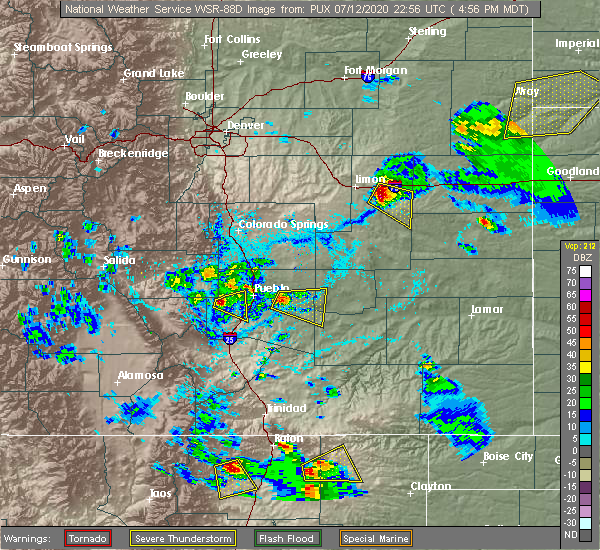 At 502 pm mdt, a severe thunderstorm was located over avondale, or 15 miles east of pueblo, moving east at 20 mph (radar indicated). Hazards include 60 mph wind gusts and quarter size hail. Hail damage to vehicles is expected. Expect wind damage to roofs, siding, and trees. At 502 pm mdt, a severe thunderstorm was located over avondale, or 15 miles east of pueblo, moving east at 20 mph (radar indicated). Hazards include 60 mph wind gusts and quarter size hail. Hail damage to vehicles is expected. Expect wind damage to roofs, siding, and trees.
|
| 6/6/2020 5:44 PM MDT |
 At 543 pm mdt, a severe thunderstorm was located near pueblo depot, or 19 miles northeast of pueblo, moving northeast at 40 mph (radar indicated). Hazards include 70 mph wind gusts and penny size hail. Expect considerable tree damage. damage is likely to mobile homes, roofs, and outbuildings. Locations impacted include, eastern pueblo, fowler, manzanola, olney springs, boone, hanover, truckton, yoder, ellicott, pueblo depot, blende, avondale and rush. At 543 pm mdt, a severe thunderstorm was located near pueblo depot, or 19 miles northeast of pueblo, moving northeast at 40 mph (radar indicated). Hazards include 70 mph wind gusts and penny size hail. Expect considerable tree damage. damage is likely to mobile homes, roofs, and outbuildings. Locations impacted include, eastern pueblo, fowler, manzanola, olney springs, boone, hanover, truckton, yoder, ellicott, pueblo depot, blende, avondale and rush.
|
| 6/6/2020 5:30 PM MDT |
 At 529 pm mdt, a severe thunderstorm was located near pueblo depot, or 13 miles east of pueblo, moving northeast at 65 mph. this is a very dangerous storm (radar indicated). Hazards include 80 mph wind gusts and quarter size hail. Flying debris will be dangerous to those caught without shelter. mobile homes will be heavily damaged. expect considerable damage to roofs, windows, and vehicles. extensive tree damage and power outages are likely. Locations impacted include, pueblo, fowler, manzanola, olney springs, boone, crowley, hanover, truckton, yoder, salt creek, ellicott, pueblo depot, blende, avondale and rush. At 529 pm mdt, a severe thunderstorm was located near pueblo depot, or 13 miles east of pueblo, moving northeast at 65 mph. this is a very dangerous storm (radar indicated). Hazards include 80 mph wind gusts and quarter size hail. Flying debris will be dangerous to those caught without shelter. mobile homes will be heavily damaged. expect considerable damage to roofs, windows, and vehicles. extensive tree damage and power outages are likely. Locations impacted include, pueblo, fowler, manzanola, olney springs, boone, crowley, hanover, truckton, yoder, salt creek, ellicott, pueblo depot, blende, avondale and rush.
|
| 6/6/2020 5:21 PM MDT |
 At 520 pm mdt, a severe thunderstorm was located near blende, or 9 miles southeast of pueblo, moving northeast at 65 mph. this is a very dangerous storm (radar indicated). Hazards include 80 mph wind gusts and quarter size hail. Flying debris will be dangerous to those caught without shelter. mobile homes will be heavily damaged. expect considerable damage to roofs, windows, and vehicles. extensive tree damage and power outages are likely. Locations impacted include, pueblo, fowler, manzanola, olney springs, boone, crowley, hanover, truckton, yoder, salt creek, ellicott, pueblo depot, blende, avondale and rush. At 520 pm mdt, a severe thunderstorm was located near blende, or 9 miles southeast of pueblo, moving northeast at 65 mph. this is a very dangerous storm (radar indicated). Hazards include 80 mph wind gusts and quarter size hail. Flying debris will be dangerous to those caught without shelter. mobile homes will be heavily damaged. expect considerable damage to roofs, windows, and vehicles. extensive tree damage and power outages are likely. Locations impacted include, pueblo, fowler, manzanola, olney springs, boone, crowley, hanover, truckton, yoder, salt creek, ellicott, pueblo depot, blende, avondale and rush.
|
| 6/6/2020 5:11 PM MDT |
 At 510 pm mdt, a severe thunderstorm was located 13 miles south of salt creek, or 15 miles south of pueblo, moving northeast at 65 mph. this is a very dangerous storm (radar indicated). Hazards include 80 mph wind gusts and quarter size hail. Flying debris will be dangerous to those caught without shelter. mobile homes will be heavily damaged. expect considerable damage to roofs, windows, and vehicles. Extensive tree damage and power outages are likely. At 510 pm mdt, a severe thunderstorm was located 13 miles south of salt creek, or 15 miles south of pueblo, moving northeast at 65 mph. this is a very dangerous storm (radar indicated). Hazards include 80 mph wind gusts and quarter size hail. Flying debris will be dangerous to those caught without shelter. mobile homes will be heavily damaged. expect considerable damage to roofs, windows, and vehicles. Extensive tree damage and power outages are likely.
|
| 6/6/2020 5:06 PM MDT |
 At 505 pm mdt, severe thunderstorms were located along a line extending from 6 miles northeast of byers to 9 miles northwest of matheson to ellicott, moving northeast at 60 mph. these are very dangerous storms (radar indicated). Hazards include 80 mph wind gusts and quarter size hail. Flying debris will be dangerous to those caught without shelter. mobile homes will be heavily damaged. expect considerable damage to roofs, windows, and vehicles. extensive tree damage and power outages are likely. Locations impacted include, pueblo, calhan, boone, ramah, hanover, truckton, yoder, salt creek, ellicott, schriever afb, pueblo depot, pinon, blende, avondale, rush and pueblo west. At 505 pm mdt, severe thunderstorms were located along a line extending from 6 miles northeast of byers to 9 miles northwest of matheson to ellicott, moving northeast at 60 mph. these are very dangerous storms (radar indicated). Hazards include 80 mph wind gusts and quarter size hail. Flying debris will be dangerous to those caught without shelter. mobile homes will be heavily damaged. expect considerable damage to roofs, windows, and vehicles. extensive tree damage and power outages are likely. Locations impacted include, pueblo, calhan, boone, ramah, hanover, truckton, yoder, salt creek, ellicott, schriever afb, pueblo depot, pinon, blende, avondale, rush and pueblo west.
|
| 6/6/2020 4:55 PM MDT |
 At 454 pm mdt, severe thunderstorms were located along a line extending from 9 miles south of byers to ramah to 7 miles northwest of hanover, moving northeast at 60 mph. these are very dangerous storms (radar indicated). Hazards include 80 mph wind gusts and quarter size hail. Flying debris will be dangerous to those caught without shelter. mobile homes will be heavily damaged. expect considerable damage to roofs, windows, and vehicles. extensive tree damage and power outages are likely. Locations impacted include, southeastern colorado springs, pueblo, fountain, calhan, boone, ramah, hanover, truckton, yoder, pueblo reservoir, salt creek, ellicott, peyton, schriever afb, pueblo depot, pinon, blende, avondale, pueblo west and rush. At 454 pm mdt, severe thunderstorms were located along a line extending from 9 miles south of byers to ramah to 7 miles northwest of hanover, moving northeast at 60 mph. these are very dangerous storms (radar indicated). Hazards include 80 mph wind gusts and quarter size hail. Flying debris will be dangerous to those caught without shelter. mobile homes will be heavily damaged. expect considerable damage to roofs, windows, and vehicles. extensive tree damage and power outages are likely. Locations impacted include, southeastern colorado springs, pueblo, fountain, calhan, boone, ramah, hanover, truckton, yoder, pueblo reservoir, salt creek, ellicott, peyton, schriever afb, pueblo depot, pinon, blende, avondale, pueblo west and rush.
|
| 6/6/2020 4:43 PM MDT |
 At 443 pm mdt, severe thunderstorms were located along a line extending from near kiowa to 6 miles north of ellicott to near pinon, moving northeast at 60 mph. these are very dangerous storms (radar indicated). Hazards include 80 mph wind gusts and quarter size hail. Flying debris will be dangerous to those caught without shelter. mobile homes will be heavily damaged. expect considerable damage to roofs, windows, and vehicles. Extensive tree damage and power outages are likely. At 443 pm mdt, severe thunderstorms were located along a line extending from near kiowa to 6 miles north of ellicott to near pinon, moving northeast at 60 mph. these are very dangerous storms (radar indicated). Hazards include 80 mph wind gusts and quarter size hail. Flying debris will be dangerous to those caught without shelter. mobile homes will be heavily damaged. expect considerable damage to roofs, windows, and vehicles. Extensive tree damage and power outages are likely.
|
| 8/8/2019 7:37 PM MDT | Quarter sized hail reported 9.8 miles SW of Boone, CO, measured 64 mph wind gust and had 0.70 inches of rainfall. |
| 8/8/2019 7:37 PM MDT | Quarter sized hail reported 10.3 miles SW of Boone, CO, measured 64 mph wind gust and had 0.70 inches of rainfall with this storm. |
| 7/27/2019 6:41 PM MDT |
 The severe thunderstorm warning for southeastern el paso, western crowley and northeastern pueblo counties will expire at 645 pm mdt, the storms which prompted the warning have weakened below severe limits, and no longer pose an immediate threat to life or property. therefore, the warning will be allowed to expire. however gusty winds are still possible with these thunderstorms. The severe thunderstorm warning for southeastern el paso, western crowley and northeastern pueblo counties will expire at 645 pm mdt, the storms which prompted the warning have weakened below severe limits, and no longer pose an immediate threat to life or property. therefore, the warning will be allowed to expire. however gusty winds are still possible with these thunderstorms.
|
| 7/27/2019 6:25 PM MDT |
 At 624 pm mdt, severe thunderstorms were located along a line extending from 14 miles northeast of pueblo depot to near boone, moving east at 45 mph (radar indicated). Hazards include 60 mph wind gusts. Expect damage to roofs, siding, and trees. Locations impacted include, olney springs, boone, crowley, avondale and pueblo depot. At 624 pm mdt, severe thunderstorms were located along a line extending from 14 miles northeast of pueblo depot to near boone, moving east at 45 mph (radar indicated). Hazards include 60 mph wind gusts. Expect damage to roofs, siding, and trees. Locations impacted include, olney springs, boone, crowley, avondale and pueblo depot.
|
| 7/27/2019 6:04 PM MDT |
 At 603 pm mdt, severe thunderstorms were located along a line extending from 7 miles south of hanover to near blende, moving east at 45 mph (radar indicated). Hazards include 60 mph wind gusts. expect damage to roofs, siding, and trees At 603 pm mdt, severe thunderstorms were located along a line extending from 7 miles south of hanover to near blende, moving east at 45 mph (radar indicated). Hazards include 60 mph wind gusts. expect damage to roofs, siding, and trees
|
| 7/21/2019 9:26 PM MDT |
 At 924 pm mdt, a severe thunderstorm was located over pueblo reservoir, or near pueblo, moving southeast at 25 mph. numerous other strong to severe thunderstorms are expected to develop across most of puelbl county through 10 pm. very intense rain is likely with these storms (radar indicated). Hazards include 60 mph wind gusts and quarter size hail. very intense rainfall is also likely. Hail damage to vehicles is expected. Expect wind damage to roofs, siding, and trees. At 924 pm mdt, a severe thunderstorm was located over pueblo reservoir, or near pueblo, moving southeast at 25 mph. numerous other strong to severe thunderstorms are expected to develop across most of puelbl county through 10 pm. very intense rain is likely with these storms (radar indicated). Hazards include 60 mph wind gusts and quarter size hail. very intense rainfall is also likely. Hail damage to vehicles is expected. Expect wind damage to roofs, siding, and trees.
|
| 7/20/2019 5:43 PM MDT |
 The severe thunderstorm warning for central pueblo county will expire at 545 pm mdt, the storm which prompted the warning has weakened below severe limits, and no longer poses an immediate threat to life or property. therefore, the warning will be allowed to expire. however, this storm will continue to produce gusty winds and very heavy rain capable of producing flash flooding. a severe thunderstorm watch remains in effect until 1100 pm mdt for southeastern colorado. The severe thunderstorm warning for central pueblo county will expire at 545 pm mdt, the storm which prompted the warning has weakened below severe limits, and no longer poses an immediate threat to life or property. therefore, the warning will be allowed to expire. however, this storm will continue to produce gusty winds and very heavy rain capable of producing flash flooding. a severe thunderstorm watch remains in effect until 1100 pm mdt for southeastern colorado.
|
| 7/20/2019 5:32 PM MDT |
 At 532 pm mdt, a severe thunderstorm was located 13 miles southeast of hanover, or 28 miles northeast of pueblo, moving southeast at 20 mph (radar indicated). Hazards include 70 mph wind gusts and half dollar size hail. Hail damage to vehicles is expected. expect considerable tree damage. wind damage is also likely to mobile homes, roofs, and outbuildings. Locations impacted include, fowler, manzanola, olney springs, boone, crowley, hanover, truckton, schriever afb and pueblo depot. At 532 pm mdt, a severe thunderstorm was located 13 miles southeast of hanover, or 28 miles northeast of pueblo, moving southeast at 20 mph (radar indicated). Hazards include 70 mph wind gusts and half dollar size hail. Hail damage to vehicles is expected. expect considerable tree damage. wind damage is also likely to mobile homes, roofs, and outbuildings. Locations impacted include, fowler, manzanola, olney springs, boone, crowley, hanover, truckton, schriever afb and pueblo depot.
|
| 7/20/2019 5:29 PM MDT |
 At 527 pm mdt, a severe thunderstorm was located near pueblo west, or 9 miles northwest of pueblo, moving northwest at 20 mph (pueblo airport weather station). Hazards include 60 mph wind gusts and quarter size hail. winds of 61 mph were being measured at the pueblo airport at 5:28 pm. Hail damage to vehicles is expected. expect wind damage to roofs, siding, and trees. Locations impacted include, pueblo, boone, pueblo reservoir, salt creek, blende, avondale, pueblo west, pueblo depot and pinon. At 527 pm mdt, a severe thunderstorm was located near pueblo west, or 9 miles northwest of pueblo, moving northwest at 20 mph (pueblo airport weather station). Hazards include 60 mph wind gusts and quarter size hail. winds of 61 mph were being measured at the pueblo airport at 5:28 pm. Hail damage to vehicles is expected. expect wind damage to roofs, siding, and trees. Locations impacted include, pueblo, boone, pueblo reservoir, salt creek, blende, avondale, pueblo west, pueblo depot and pinon.
|
| 7/20/2019 5:19 PM MDT |
 At 518 pm mdt, a severe thunderstorm was located over pueblo reservoir, or near pueblo, moving northwest at 20 mph (pueblo airport weather station). Hazards include 60 mph wind gusts and half dollar size hail. at 5:17 pm, a wind gusts to 60 mph was measured at the pueblo airport. Hail damage to vehicles is expected. expect wind damage to roofs, siding, and trees. Locations impacted include, pueblo, boone, pueblo reservoir, salt creek, blende, avondale, pueblo west, pueblo depot and pinon. At 518 pm mdt, a severe thunderstorm was located over pueblo reservoir, or near pueblo, moving northwest at 20 mph (pueblo airport weather station). Hazards include 60 mph wind gusts and half dollar size hail. at 5:17 pm, a wind gusts to 60 mph was measured at the pueblo airport. Hail damage to vehicles is expected. expect wind damage to roofs, siding, and trees. Locations impacted include, pueblo, boone, pueblo reservoir, salt creek, blende, avondale, pueblo west, pueblo depot and pinon.
|
| 7/20/2019 5:17 PM MDT |
 At 516 pm mdt, a severe thunderstorm was located 8 miles southeast of hanover, or 27 miles northeast of pueblo, moving southeast at 20 mph (radar indicated). Hazards include 70 mph wind gusts and half dollar size hail. Hail damage to vehicles is expected. expect considerable tree damage. Wind damage is also likely to mobile homes, roofs, and outbuildings. At 516 pm mdt, a severe thunderstorm was located 8 miles southeast of hanover, or 27 miles northeast of pueblo, moving southeast at 20 mph (radar indicated). Hazards include 70 mph wind gusts and half dollar size hail. Hail damage to vehicles is expected. expect considerable tree damage. Wind damage is also likely to mobile homes, roofs, and outbuildings.
|
| 7/20/2019 5:08 PM MDT |
 At 506 pm mdt, a severe thunderstorm was located near pueblo, moving northwest at 20 mph. other strong to severe storms were also noted in northwest pueblo county. this storm has a history of producing ping pong size hail (radar indicated). Hazards include golf ball size hail and 70 mph wind gusts. People and animals outdoors will be injured. expect hail damage to roofs, siding, windows, and vehicles. expect considerable tree damage. Wind damage is also likely to mobile homes, roofs, and outbuildings. At 506 pm mdt, a severe thunderstorm was located near pueblo, moving northwest at 20 mph. other strong to severe storms were also noted in northwest pueblo county. this storm has a history of producing ping pong size hail (radar indicated). Hazards include golf ball size hail and 70 mph wind gusts. People and animals outdoors will be injured. expect hail damage to roofs, siding, windows, and vehicles. expect considerable tree damage. Wind damage is also likely to mobile homes, roofs, and outbuildings.
|
| 7/5/2019 10:02 PM MDT | Quarter sized hail reported 8.1 miles SSW of Boone, CO |
| 7/1/2019 5:28 PM MDT |
 The severe thunderstorm warning for southeastern el paso and northeastern pueblo counties will expire at 530 pm mdt, the storm which prompted the warning has weakened below severe limits, and no longer poses an immediate threat to life or property. therefore, the warning will be allowed to expire. however gusty winds are still possible with this thunderstorm. The severe thunderstorm warning for southeastern el paso and northeastern pueblo counties will expire at 530 pm mdt, the storm which prompted the warning has weakened below severe limits, and no longer poses an immediate threat to life or property. therefore, the warning will be allowed to expire. however gusty winds are still possible with this thunderstorm.
|
| 7/1/2019 5:05 PM MDT |
 At 504 pm mdt, a severe thunderstorm was located near pueblo depot, or 13 miles northeast of pueblo, moving east northeast at 15 mph (radar indicated). Hazards include 60 mph wind gusts and quarter size hail. Hail damage to vehicles is expected. expect wind damage to roofs, siding, and trees. Locations impacted include, pueblo, boone, pueblo reservoir, salt creek, blende, avondale, pueblo depot and pueblo west. At 504 pm mdt, a severe thunderstorm was located near pueblo depot, or 13 miles northeast of pueblo, moving east northeast at 15 mph (radar indicated). Hazards include 60 mph wind gusts and quarter size hail. Hail damage to vehicles is expected. expect wind damage to roofs, siding, and trees. Locations impacted include, pueblo, boone, pueblo reservoir, salt creek, blende, avondale, pueblo depot and pueblo west.
|
| 7/1/2019 4:52 PM MDT |
 At 451 pm mdt, a severe thunderstorm was located near blende, or 7 miles northeast of pueblo, moving east northeast at 20 mph (radar indicated). Hazards include 60 mph wind gusts and quarter size hail. Hail damage to vehicles is expected. expect wind damage to roofs, siding, and trees. Locations impacted include, pueblo, boone, pueblo reservoir, salt creek, blende, avondale, pueblo depot and pueblo west. At 451 pm mdt, a severe thunderstorm was located near blende, or 7 miles northeast of pueblo, moving east northeast at 20 mph (radar indicated). Hazards include 60 mph wind gusts and quarter size hail. Hail damage to vehicles is expected. expect wind damage to roofs, siding, and trees. Locations impacted include, pueblo, boone, pueblo reservoir, salt creek, blende, avondale, pueblo depot and pueblo west.
|
| 7/1/2019 4:42 PM MDT |
 The national weather service in pueblo has issued a * severe thunderstorm warning for. southeastern el paso county in east central colorado. northeastern pueblo county in southeastern colorado. until 530 pm mdt. At 442 pm mdt, a severe thunderstorm was located near blende, or. The national weather service in pueblo has issued a * severe thunderstorm warning for. southeastern el paso county in east central colorado. northeastern pueblo county in southeastern colorado. until 530 pm mdt. At 442 pm mdt, a severe thunderstorm was located near blende, or.
|
| 8/8/2018 12:34 PM MDT |
 At 1234 pm mdt, a severe thunderstorm was located near boone, or 23 miles east of pueblo, moving southeast at 30 mph (radar indicated). Hazards include 60 mph wind gusts and half dollar size hail. Hail damage to vehicles is expected. expect wind damage to roofs, siding, and trees. Locations impacted include, fowler, boone and pueblo depot. At 1234 pm mdt, a severe thunderstorm was located near boone, or 23 miles east of pueblo, moving southeast at 30 mph (radar indicated). Hazards include 60 mph wind gusts and half dollar size hail. Hail damage to vehicles is expected. expect wind damage to roofs, siding, and trees. Locations impacted include, fowler, boone and pueblo depot.
|
| 8/8/2018 12:23 PM MDT |
 At 1223 pm mdt, a severe thunderstorm was located over boone, or 21 miles east of pueblo, moving southeast at 35 mph (radar indicated). Hazards include 60 mph wind gusts and half dollar size hail. Hail damage to vehicles is expected. Expect wind damage to roofs, siding, and trees. At 1223 pm mdt, a severe thunderstorm was located over boone, or 21 miles east of pueblo, moving southeast at 35 mph (radar indicated). Hazards include 60 mph wind gusts and half dollar size hail. Hail damage to vehicles is expected. Expect wind damage to roofs, siding, and trees.
|
| 8/8/2018 12:27 AM MDT |
 The severe thunderstorm warning for northeastern pueblo county will expire at 1230 am mdt. the storm which prompted the warning has weakened below severe limits, and no longer poses an immediate threat to life or property. therefore, the warning will be allowed to expire. however small hail and heavy rain are still possible with this thunderstorm. A The severe thunderstorm warning for northeastern pueblo county will expire at 1230 am mdt. the storm which prompted the warning has weakened below severe limits, and no longer poses an immediate threat to life or property. therefore, the warning will be allowed to expire. however small hail and heavy rain are still possible with this thunderstorm. A
|
| 8/8/2018 12:19 AM MDT |
 At 1218 am mdt, a severe thunderstorm was located 8 miles northwest of pueblo depot, or 14 miles northeast of pueblo, moving southeast at 15 mph (radar indicated). Hazards include 60 mph wind gusts and quarter size hail. Hail damage to vehicles is expected. expect wind damage to roofs, siding, and trees. Locations impacted include, boone, and pueblo depot. At 1218 am mdt, a severe thunderstorm was located 8 miles northwest of pueblo depot, or 14 miles northeast of pueblo, moving southeast at 15 mph (radar indicated). Hazards include 60 mph wind gusts and quarter size hail. Hail damage to vehicles is expected. expect wind damage to roofs, siding, and trees. Locations impacted include, boone, and pueblo depot.
|
| 8/8/2018 12:05 AM MDT |
 At 1204 am mdt, a severe thunderstorm was located near pinon, or 13 miles northeast of pueblo, moving southeast at 20 mph (radar indicated). Hazards include 60 mph wind gusts and half dollar size hail. Hail damage to vehicles is expected. Expect wind damage to roofs, siding, and trees. At 1204 am mdt, a severe thunderstorm was located near pinon, or 13 miles northeast of pueblo, moving southeast at 20 mph (radar indicated). Hazards include 60 mph wind gusts and half dollar size hail. Hail damage to vehicles is expected. Expect wind damage to roofs, siding, and trees.
|
| 8/7/2018 9:49 PM MDT |
 At 949 pm mdt, a severe thunderstorm was located near boone, or 24 miles east of pueblo, moving southeast at 15 mph (radar indicated). Hazards include 60 mph wind gusts and quarter size hail. Hail damage to vehicles is expected. Expect wind damage to roofs, siding, and trees. At 949 pm mdt, a severe thunderstorm was located near boone, or 24 miles east of pueblo, moving southeast at 15 mph (radar indicated). Hazards include 60 mph wind gusts and quarter size hail. Hail damage to vehicles is expected. Expect wind damage to roofs, siding, and trees.
|
| 8/7/2018 12:40 AM MDT |
 At 1239 am mdt, a severe thunderstorm was located near blende, or 8 miles east of pueblo, moving southeast at 20 mph. another severe storm was just southeast of blende (radar indicated). Hazards include 60 mph wind gusts and half dollar size hail. Hail damage to vehicles is expected. expect wind damage to roofs, siding, and trees. locations impacted include, eastern pueblo, boone, avondale, pueblo depot, salt creek and blende. Very heavy rain was also associated with these storms. At 1239 am mdt, a severe thunderstorm was located near blende, or 8 miles east of pueblo, moving southeast at 20 mph. another severe storm was just southeast of blende (radar indicated). Hazards include 60 mph wind gusts and half dollar size hail. Hail damage to vehicles is expected. expect wind damage to roofs, siding, and trees. locations impacted include, eastern pueblo, boone, avondale, pueblo depot, salt creek and blende. Very heavy rain was also associated with these storms.
|
| 8/7/2018 12:27 AM MDT |
 At 1226 am mdt, a severe thunderstorm was located 7 miles northeast of pueblo, moving southeast at 15 mph (radar indicated). Hazards include half dollar size hail. damage to vehicles is expected At 1226 am mdt, a severe thunderstorm was located 7 miles northeast of pueblo, moving southeast at 15 mph (radar indicated). Hazards include half dollar size hail. damage to vehicles is expected
|
| 8/7/2018 12:19 AM MDT |
 At 1218 am mdt, a severe thunderstorm was located 8 miles southeast of pinon, or 8 miles northeast of pueblo, moving southeast at 15 mph. an additional severe storm was over the south side of pueblo, and it was moving southeast at 5 mph (radar indicated). Hazards include 60 mph wind gusts and half dollar size hail. Hail damage to vehicles is expected. expect wind damage to roofs, siding, and trees. Locations impacted include, pueblo, boone, salt creek, blende, avondale, pueblo depot, pinon and pueblo west. At 1218 am mdt, a severe thunderstorm was located 8 miles southeast of pinon, or 8 miles northeast of pueblo, moving southeast at 15 mph. an additional severe storm was over the south side of pueblo, and it was moving southeast at 5 mph (radar indicated). Hazards include 60 mph wind gusts and half dollar size hail. Hail damage to vehicles is expected. expect wind damage to roofs, siding, and trees. Locations impacted include, pueblo, boone, salt creek, blende, avondale, pueblo depot, pinon and pueblo west.
|
| 8/7/2018 12:04 AM MDT |
 At 1204 am mdt, a severe thunderstorm was located near pinon, or 10 miles north of pueblo, moving southeast at 10 mph (radar indicated). Hazards include golf ball size hail and 60 mph wind gusts. People and animals outdoors will be injured. expect hail damage to roofs, siding, windows, and vehicles. expect wind damage to roofs, siding, and trees. Locations impacted include, pueblo, boone, salt creek, blende, avondale, pueblo depot, pinon and pueblo west. At 1204 am mdt, a severe thunderstorm was located near pinon, or 10 miles north of pueblo, moving southeast at 10 mph (radar indicated). Hazards include golf ball size hail and 60 mph wind gusts. People and animals outdoors will be injured. expect hail damage to roofs, siding, windows, and vehicles. expect wind damage to roofs, siding, and trees. Locations impacted include, pueblo, boone, salt creek, blende, avondale, pueblo depot, pinon and pueblo west.
|
| 8/6/2018 11:49 PM MDT |
 At 1149 pm mdt, a severe thunderstorm was located over pinon, or 10 miles north of pueblo, moving southeast at 15 mph (radar indicated). Hazards include quarter size hail. damage to vehicles is expected At 1149 pm mdt, a severe thunderstorm was located over pinon, or 10 miles north of pueblo, moving southeast at 15 mph (radar indicated). Hazards include quarter size hail. damage to vehicles is expected
|
| 8/6/2018 4:20 PM MDT |
 At 419 pm mdt, a severe thunderstorm was located 7 miles east of boone, or 26 miles east of pueblo, moving southeast at 35 mph. this is a very dangerous storm (radar indicated). Hazards include three inch hail and 60 mph wind gusts. People and animals outdoors will be severely injured. expect shattered windows, extensive damage to roofs, siding, and vehicles. Locations impacted include, fowler, olney springs, boone, crowley and pueblo depot. At 419 pm mdt, a severe thunderstorm was located 7 miles east of boone, or 26 miles east of pueblo, moving southeast at 35 mph. this is a very dangerous storm (radar indicated). Hazards include three inch hail and 60 mph wind gusts. People and animals outdoors will be severely injured. expect shattered windows, extensive damage to roofs, siding, and vehicles. Locations impacted include, fowler, olney springs, boone, crowley and pueblo depot.
|
| 8/6/2018 4:08 PM MDT | Tennis Ball sized hail reported 11.2 miles SSW of Boone, CO, house windows broken. |
| 8/6/2018 3:50 PM MDT |
 At 350 pm mdt, a severe thunderstorm was located 7 miles north of pueblo depot, or 20 miles northeast of pueblo, moving southeast at 30 mph. this is a very dangerous storm (radar indicated). Hazards include three inch hail and 60 mph wind gusts. People and animals outdoors will be severely injured. Expect shattered windows, extensive damage to roofs, siding, and vehicles. At 350 pm mdt, a severe thunderstorm was located 7 miles north of pueblo depot, or 20 miles northeast of pueblo, moving southeast at 30 mph. this is a very dangerous storm (radar indicated). Hazards include three inch hail and 60 mph wind gusts. People and animals outdoors will be severely injured. Expect shattered windows, extensive damage to roofs, siding, and vehicles.
|
| 7/29/2018 10:31 PM MDT |
 At 1030 pm mdt, a severe thunderstorm was located near fowler, or 28 miles northwest of la junta, moving south at 45 mph (radar indicated). Hazards include golf ball size hail and 60 mph wind gusts. People and animals outdoors will be injured. expect hail damage to roofs, siding, windows, and vehicles. expect wind damage to roofs, siding, and trees. Locations impacted include, fowler, manzanola, olney springs, and crowley. At 1030 pm mdt, a severe thunderstorm was located near fowler, or 28 miles northwest of la junta, moving south at 45 mph (radar indicated). Hazards include golf ball size hail and 60 mph wind gusts. People and animals outdoors will be injured. expect hail damage to roofs, siding, windows, and vehicles. expect wind damage to roofs, siding, and trees. Locations impacted include, fowler, manzanola, olney springs, and crowley.
|
| 7/29/2018 10:19 PM MDT |
 At 1018 pm mdt, a severe thunderstorm was located 10 miles east of boone, or 29 miles east of pueblo, moving south at 30 mph (radar indicated). Hazards include tennis ball size hail and 60 mph wind gusts. People and animals outdoors will be injured. expect hail damage to roofs, siding, windows, and vehicles. expect wind damage to roofs, siding, and trees. Locations impacted include, rocky ford, fowler, manzanola, olney springs, boone, and crowley. At 1018 pm mdt, a severe thunderstorm was located 10 miles east of boone, or 29 miles east of pueblo, moving south at 30 mph (radar indicated). Hazards include tennis ball size hail and 60 mph wind gusts. People and animals outdoors will be injured. expect hail damage to roofs, siding, windows, and vehicles. expect wind damage to roofs, siding, and trees. Locations impacted include, rocky ford, fowler, manzanola, olney springs, boone, and crowley.
|
| 7/29/2018 10:11 PM MDT |
 At 1009 pm mdt, a severe thunderstorm was located 12 miles northeast of boone, or 29 miles east of pueblo, moving south at 45 mph (radar indicated). Hazards include golf ball size hail and 60 mph wind gusts. People and animals outdoors will be injured. expect hail damage to roofs, siding, windows, and vehicles. Expect wind damage to roofs, siding, and trees. At 1009 pm mdt, a severe thunderstorm was located 12 miles northeast of boone, or 29 miles east of pueblo, moving south at 45 mph (radar indicated). Hazards include golf ball size hail and 60 mph wind gusts. People and animals outdoors will be injured. expect hail damage to roofs, siding, windows, and vehicles. Expect wind damage to roofs, siding, and trees.
|
| 7/29/2018 10:05 PM MDT |
 At 1004 pm mdt, severe thunderstorms were located along a line extending from 16 miles southwest of forder to near pueblo depot, moving south at 45 mph (radar indicated). Hazards include 60 mph wind gusts and half dollar size hail. Hail damage to vehicles is expected. expect wind damage to roofs, siding, and trees. Locations impacted include, boone. At 1004 pm mdt, severe thunderstorms were located along a line extending from 16 miles southwest of forder to near pueblo depot, moving south at 45 mph (radar indicated). Hazards include 60 mph wind gusts and half dollar size hail. Hail damage to vehicles is expected. expect wind damage to roofs, siding, and trees. Locations impacted include, boone.
|
| 7/29/2018 9:58 PM MDT |
 At 957 pm mdt, severe thunderstorms were located along a line extending from 14 miles southwest of forder to 8 miles north of pueblo depot, moving south at 45 mph (radar indicated). Hazards include 60 mph wind gusts and half dollar size hail. Hail damage to vehicles is expected. expect wind damage to roofs, siding, and trees. Locations impacted include, rural areas of southeast el paso and northeast pueblo counties. At 957 pm mdt, severe thunderstorms were located along a line extending from 14 miles southwest of forder to 8 miles north of pueblo depot, moving south at 45 mph (radar indicated). Hazards include 60 mph wind gusts and half dollar size hail. Hail damage to vehicles is expected. expect wind damage to roofs, siding, and trees. Locations impacted include, rural areas of southeast el paso and northeast pueblo counties.
|
| 7/29/2018 9:43 PM MDT |
 At 942 pm mdt, severe thunderstorms were located along a line extending from 9 miles southeast of rush to near hanover, moving south at 60 mph (radar indicated). Hazards include 60 mph wind gusts and half dollar size hail. Hail damage to vehicles is expected. expect wind damage to roofs, siding, and trees. Locations impacted include, truckton, yoder, avondale, pueblo depot, and rush. At 942 pm mdt, severe thunderstorms were located along a line extending from 9 miles southeast of rush to near hanover, moving south at 60 mph (radar indicated). Hazards include 60 mph wind gusts and half dollar size hail. Hail damage to vehicles is expected. expect wind damage to roofs, siding, and trees. Locations impacted include, truckton, yoder, avondale, pueblo depot, and rush.
|
| 7/29/2018 9:32 PM MDT |
 At 931 pm mdt, severe thunderstorms were located along a line extending from near rush to 6 miles north of hanover, moving south at 45 mph (radar indicated). Hazards include 60 mph wind gusts and half dollar size hail. Hail damage to vehicles is expected. Expect wind damage to roofs, siding, and trees. At 931 pm mdt, severe thunderstorms were located along a line extending from near rush to 6 miles north of hanover, moving south at 45 mph (radar indicated). Hazards include 60 mph wind gusts and half dollar size hail. Hail damage to vehicles is expected. Expect wind damage to roofs, siding, and trees.
|
| 7/23/2018 6:12 PM MDT |
 At 609 pm mdt, golf ball size was observed in boone. this is a very dangerous storm (weather spotters). Hazards include 80 mph wind gusts will be possible across the eastern parts of pueblo county, crowley county and otero county. Flying debris will be dangerous to those caught without shelter. mobile homes will be heavily damaged. expect considerable damage to roofs, windows, and vehicles. extensive tree damage and power outages are likely. another severe storm capable of producing quarter size hail will be possible in the city of pueblo. Locations impacted include, pueblo, fowler, manzanola, olney springs, boone, pueblo reservoir, salt creek, blende, avondale, pueblo depot and pueblo west. At 609 pm mdt, golf ball size was observed in boone. this is a very dangerous storm (weather spotters). Hazards include 80 mph wind gusts will be possible across the eastern parts of pueblo county, crowley county and otero county. Flying debris will be dangerous to those caught without shelter. mobile homes will be heavily damaged. expect considerable damage to roofs, windows, and vehicles. extensive tree damage and power outages are likely. another severe storm capable of producing quarter size hail will be possible in the city of pueblo. Locations impacted include, pueblo, fowler, manzanola, olney springs, boone, pueblo reservoir, salt creek, blende, avondale, pueblo depot and pueblo west.
|
| 7/23/2018 6:10 PM MDT | Golf Ball sized hail reported 1.8 miles E of Boone, CO |
| 7/23/2018 5:56 PM MDT |
 At 554 pm mdt, a severe thunderstorm was located near pueblo depot, or 13 miles northeast of pueblo, moving southeast at 30 mph. this is a very dangerous storm. a wind gusts to 78 mph wind gusts occurred at the national weather service in pueblo at 5:54 pm (national weather service weather station). Hazards include 80 mph wind gusts. Flying debris will be dangerous to those caught without shelter. mobile homes will be heavily damaged. expect considerable damage to roofs, windows, and vehicles. Extensive tree damage and power outages are likely. At 554 pm mdt, a severe thunderstorm was located near pueblo depot, or 13 miles northeast of pueblo, moving southeast at 30 mph. this is a very dangerous storm. a wind gusts to 78 mph wind gusts occurred at the national weather service in pueblo at 5:54 pm (national weather service weather station). Hazards include 80 mph wind gusts. Flying debris will be dangerous to those caught without shelter. mobile homes will be heavily damaged. expect considerable damage to roofs, windows, and vehicles. Extensive tree damage and power outages are likely.
|
| 7/23/2018 5:44 PM MDT |
 At 544 pm mdt, a severe thunderstorm was located 8 miles southeast of pinon, or 12 miles northeast of pueblo, moving southeast at 25 mph (radar indicated). Hazards include golf ball size hail and 70 mph wind gusts. People and animals outdoors will be injured. expect hail damage to roofs, siding, windows, and vehicles. expect considerable tree damage. wind damage is also likely to mobile homes, roofs, and outbuildings. Locations impacted include, pueblo, boone, salt creek, blende, avondale, pueblo depot, pueblo west, pinon and pueblo reservoir. At 544 pm mdt, a severe thunderstorm was located 8 miles southeast of pinon, or 12 miles northeast of pueblo, moving southeast at 25 mph (radar indicated). Hazards include golf ball size hail and 70 mph wind gusts. People and animals outdoors will be injured. expect hail damage to roofs, siding, windows, and vehicles. expect considerable tree damage. wind damage is also likely to mobile homes, roofs, and outbuildings. Locations impacted include, pueblo, boone, salt creek, blende, avondale, pueblo depot, pueblo west, pinon and pueblo reservoir.
|
| 7/23/2018 5:14 PM MDT |
 At 514 pm mdt, a severe thunderstorm was located near pinon, or 19 miles north of pueblo, moving southeast at 25 mph (radar indicated). Hazards include golf ball size hail and 70 mph wind gusts. People and animals outdoors will be injured. expect hail damage to roofs, siding, windows, and vehicles. expect considerable tree damage. Wind damage is also likely to mobile homes, roofs, and outbuildings. At 514 pm mdt, a severe thunderstorm was located near pinon, or 19 miles north of pueblo, moving southeast at 25 mph (radar indicated). Hazards include golf ball size hail and 70 mph wind gusts. People and animals outdoors will be injured. expect hail damage to roofs, siding, windows, and vehicles. expect considerable tree damage. Wind damage is also likely to mobile homes, roofs, and outbuildings.
|
| 7/22/2018 3:43 PM MDT |
 At 342 pm mdt, a severe thunderstorm was located 14 miles south of salt creek, or 16 miles south of pueblo, moving southeast at 10 mph. the kpub asos reported at 63 mph gust. there have also been reports of 0.75 inch hail south of the pueblo reservoir (trained weather spotters). Hazards include 70 mph wind gusts and quarter size hail. Hail damage to vehicles is expected. expect considerable tree damage. wind damage is also likely to mobile homes, roofs, and outbuildings. Locations impacted include, boone, avondale, blende, pueblo depot and colorado city. At 342 pm mdt, a severe thunderstorm was located 14 miles south of salt creek, or 16 miles south of pueblo, moving southeast at 10 mph. the kpub asos reported at 63 mph gust. there have also been reports of 0.75 inch hail south of the pueblo reservoir (trained weather spotters). Hazards include 70 mph wind gusts and quarter size hail. Hail damage to vehicles is expected. expect considerable tree damage. wind damage is also likely to mobile homes, roofs, and outbuildings. Locations impacted include, boone, avondale, blende, pueblo depot and colorado city.
|
| 7/22/2018 3:29 PM MDT |
 At 329 pm mdt, a severe thunderstorm was located 12 miles south of salt creek, or 14 miles south of pueblo, moving southeast at 10 mph (trained weather spotters). Hazards include 70 mph wind gusts and quarter size hail. Hail damage to vehicles is expected. expect considerable tree damage. Wind damage is also likely to mobile homes, roofs, and outbuildings. At 329 pm mdt, a severe thunderstorm was located 12 miles south of salt creek, or 14 miles south of pueblo, moving southeast at 10 mph (trained weather spotters). Hazards include 70 mph wind gusts and quarter size hail. Hail damage to vehicles is expected. expect considerable tree damage. Wind damage is also likely to mobile homes, roofs, and outbuildings.
|
| 7/22/2018 3:23 PM MDT |
 At 323 pm mdt, a severe thunderstorm was located 11 miles south of salt creek, or 12 miles south of pueblo, moving southeast at 5 mph. the kpub asos reported at 63 mph gust. there have also been reports of 0.75 inch hail south of the pueblo reservoir (trained weather spotters). Hazards include 70 mph wind gusts and quarter size hail. Hail damage to vehicles is expected. expect considerable tree damage. wind damage is also likely to mobile homes, roofs, and outbuildings. Locations impacted include, pueblo, boone, pueblo reservoir, salt creek, blende, avondale, pueblo depot, pueblo west and colorado city. At 323 pm mdt, a severe thunderstorm was located 11 miles south of salt creek, or 12 miles south of pueblo, moving southeast at 5 mph. the kpub asos reported at 63 mph gust. there have also been reports of 0.75 inch hail south of the pueblo reservoir (trained weather spotters). Hazards include 70 mph wind gusts and quarter size hail. Hail damage to vehicles is expected. expect considerable tree damage. wind damage is also likely to mobile homes, roofs, and outbuildings. Locations impacted include, pueblo, boone, pueblo reservoir, salt creek, blende, avondale, pueblo depot, pueblo west and colorado city.
|
| 7/22/2018 3:12 PM MDT |
 At 311 pm mdt, a severe thunderstorm was located 9 miles south of salt creek, or 11 miles south of pueblo, moving southeast at 15 mph. the kpub asos reported at 63 mph gust. there have also been reports of 0.75 inch hail south of the pueblo reservoir (trained weather spotters). Hazards include 70 mph wind gusts and quarter size hail. Hail damage to vehicles is expected. expect considerable tree damage. wind damage is also likely to mobile homes, roofs, and outbuildings. Locations impacted include, pueblo, boone, pueblo reservoir, salt creek, blende, avondale, pueblo depot, pueblo west and colorado city. At 311 pm mdt, a severe thunderstorm was located 9 miles south of salt creek, or 11 miles south of pueblo, moving southeast at 15 mph. the kpub asos reported at 63 mph gust. there have also been reports of 0.75 inch hail south of the pueblo reservoir (trained weather spotters). Hazards include 70 mph wind gusts and quarter size hail. Hail damage to vehicles is expected. expect considerable tree damage. wind damage is also likely to mobile homes, roofs, and outbuildings. Locations impacted include, pueblo, boone, pueblo reservoir, salt creek, blende, avondale, pueblo depot, pueblo west and colorado city.
|
| 7/22/2018 3:03 PM MDT |
 At 303 pm mdt, a severe thunderstorm was located over salt creek, or near pueblo, and is nearly stationary (radar indicated). Hazards include 70 mph wind gusts and nickel size hail. Expect considerable tree damage. Damage is likely to mobile homes, roofs, and outbuildings. At 303 pm mdt, a severe thunderstorm was located over salt creek, or near pueblo, and is nearly stationary (radar indicated). Hazards include 70 mph wind gusts and nickel size hail. Expect considerable tree damage. Damage is likely to mobile homes, roofs, and outbuildings.
|
| 6/13/2018 3:13 PM MDT |
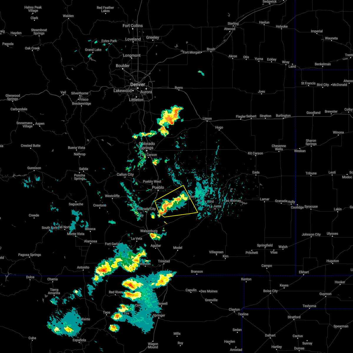 The severe thunderstorm warning for west central otero, southwestern crowley and southeastern pueblo counties will expire at 315 pm mdt, the storm which prompted the warning has weakened below severe limits, and no longer poses an immediate threat to life or property. therefore, the warning will be allowed to expire. however gusty winds and heavy rain are still possible with this thunderstorm. The severe thunderstorm warning for west central otero, southwestern crowley and southeastern pueblo counties will expire at 315 pm mdt, the storm which prompted the warning has weakened below severe limits, and no longer poses an immediate threat to life or property. therefore, the warning will be allowed to expire. however gusty winds and heavy rain are still possible with this thunderstorm.
|
| 6/13/2018 3:06 PM MDT |
 At 306 pm mdt, a severe thunderstorm was located 8 miles south of boone, or 22 miles southeast of pueblo, moving east at 25 mph (radar indicated). Hazards include 60 mph wind gusts and quarter size hail. Hail damage to vehicles is expected. expect wind damage to roofs, siding, and trees. Locations impacted include, fowler, boone, avondale and pueblo depot. At 306 pm mdt, a severe thunderstorm was located 8 miles south of boone, or 22 miles southeast of pueblo, moving east at 25 mph (radar indicated). Hazards include 60 mph wind gusts and quarter size hail. Hail damage to vehicles is expected. expect wind damage to roofs, siding, and trees. Locations impacted include, fowler, boone, avondale and pueblo depot.
|
| 6/13/2018 2:55 PM MDT |
 At 255 pm mdt, a severe thunderstorm was located 7 miles south of avondale, or 18 miles southeast of pueblo, moving northeast at 10 mph (radar indicated). Hazards include 60 mph wind gusts and quarter size hail. Hail damage to vehicles is expected. expect wind damage to roofs, siding, and trees. Locations impacted include, fowler, boone, avondale and pueblo depot. At 255 pm mdt, a severe thunderstorm was located 7 miles south of avondale, or 18 miles southeast of pueblo, moving northeast at 10 mph (radar indicated). Hazards include 60 mph wind gusts and quarter size hail. Hail damage to vehicles is expected. expect wind damage to roofs, siding, and trees. Locations impacted include, fowler, boone, avondale and pueblo depot.
|
| 6/13/2018 2:49 PM MDT |
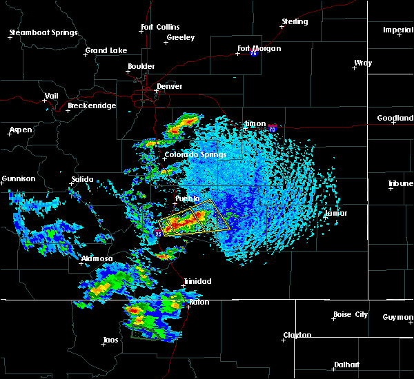 At 248 pm mdt, a severe thunderstorm was located 14 miles south of avondale, or 19 miles southeast of pueblo, moving east at 40 mph (trained weather spotters). Hazards include 60 mph wind gusts and quarter size hail. Hail damage to vehicles is expected. Expect wind damage to roofs, siding, and trees. At 248 pm mdt, a severe thunderstorm was located 14 miles south of avondale, or 19 miles southeast of pueblo, moving east at 40 mph (trained weather spotters). Hazards include 60 mph wind gusts and quarter size hail. Hail damage to vehicles is expected. Expect wind damage to roofs, siding, and trees.
|
| 7/25/2017 5:24 PM MDT |
 At 524 pm mdt, a severe thunderstorm was located over blende, or near pueblo, moving northeast at 20 mph (radar indicated). Hazards include 60 mph wind gusts and penny size hail. Expect damage to roofs, siding, and trees. Locations impacted include, pueblo, boone, salt creek, blende, avondale, pueblo depot and pueblo west. At 524 pm mdt, a severe thunderstorm was located over blende, or near pueblo, moving northeast at 20 mph (radar indicated). Hazards include 60 mph wind gusts and penny size hail. Expect damage to roofs, siding, and trees. Locations impacted include, pueblo, boone, salt creek, blende, avondale, pueblo depot and pueblo west.
|
| 7/25/2017 5:09 PM MDT |
 At 507 pm mdt, a severe thunderstorm was located over salt creek, or near pueblo, moving northeast at 20 mph (radar indicated). Hazards include 60 mph wind gusts and penny size hail. Expect damage to roofs, siding, and trees. the strongest winds were likely occurring in the blende area extending northeastward towards the pueblo depot. Locations impacted include, pueblo, boone, salt creek, blende, avondale, pueblo depot, pueblo west and pueblo reservoir. At 507 pm mdt, a severe thunderstorm was located over salt creek, or near pueblo, moving northeast at 20 mph (radar indicated). Hazards include 60 mph wind gusts and penny size hail. Expect damage to roofs, siding, and trees. the strongest winds were likely occurring in the blende area extending northeastward towards the pueblo depot. Locations impacted include, pueblo, boone, salt creek, blende, avondale, pueblo depot, pueblo west and pueblo reservoir.
|
| 7/25/2017 4:55 PM MDT |
 At 455 pm mdt, a severe thunderstorm was located near salt creek, or 7 miles south of pueblo, moving northeast at 20 mph (radar indicated). Hazards include 60 mph wind gusts and penny size hail. expect damage to roofs, siding, and trees At 455 pm mdt, a severe thunderstorm was located near salt creek, or 7 miles south of pueblo, moving northeast at 20 mph (radar indicated). Hazards include 60 mph wind gusts and penny size hail. expect damage to roofs, siding, and trees
|
| 5/8/2017 5:00 PM MDT | Quarter sized hail reported 8.2 miles N of Boone, CO, yard is flooded. |
| 9/14/2016 1:55 PM MDT |
 At 155 pm mdt, a severe thunderstorm was located near boone, or 24 miles east of pueblo, moving northeast at 20 mph (radar indicated). Hazards include 60 mph wind gusts and quarter size hail. Hail damage to vehicles is expected. expect wind damage to roofs, siding, and trees. Locations impacted include, fowler, olney springs and boone. At 155 pm mdt, a severe thunderstorm was located near boone, or 24 miles east of pueblo, moving northeast at 20 mph (radar indicated). Hazards include 60 mph wind gusts and quarter size hail. Hail damage to vehicles is expected. expect wind damage to roofs, siding, and trees. Locations impacted include, fowler, olney springs and boone.
|
| 9/14/2016 1:42 PM MDT |
 At 142 pm mdt, a severe thunderstorm was located near boone, or 22 miles east of pueblo, moving northeast at 20 mph (radar indicated). Hazards include 60 mph wind gusts and quarter size hail. Hail damage to vehicles is expected. Expect wind damage to roofs, siding, and trees. At 142 pm mdt, a severe thunderstorm was located near boone, or 22 miles east of pueblo, moving northeast at 20 mph (radar indicated). Hazards include 60 mph wind gusts and quarter size hail. Hail damage to vehicles is expected. Expect wind damage to roofs, siding, and trees.
|
| 7/28/2016 7:24 PM MDT |
 At 724 pm mdt, a severe thunderstorm was located near boone, or 22 miles east of pueblo, moving southeast at 20 mph (radar indicated). Hazards include 60 mph wind gusts and half dollar size hail. Hail damage to vehicles is expected. expect wind damage to roofs, siding, and trees. Locations impacted include, fowler, olney springs, boone, crowley and pueblo depot. At 724 pm mdt, a severe thunderstorm was located near boone, or 22 miles east of pueblo, moving southeast at 20 mph (radar indicated). Hazards include 60 mph wind gusts and half dollar size hail. Hail damage to vehicles is expected. expect wind damage to roofs, siding, and trees. Locations impacted include, fowler, olney springs, boone, crowley and pueblo depot.
|
| 7/28/2016 7:13 PM MDT |
 At 712 pm mdt, a severe thunderstorm was located over boone, or 19 miles east of pueblo, moving southeast at 20 mph (radar indicated). Hazards include 60 mph wind gusts and half dollar size hail. Hail damage to vehicles is expected. Expect wind damage to roofs, siding, and trees. At 712 pm mdt, a severe thunderstorm was located over boone, or 19 miles east of pueblo, moving southeast at 20 mph (radar indicated). Hazards include 60 mph wind gusts and half dollar size hail. Hail damage to vehicles is expected. Expect wind damage to roofs, siding, and trees.
|
| 7/25/2016 7:24 PM MDT |
 At 721 pm mdt, a severe thunderstorm and severe gust front was in western otero county (radar indicated). Hazards include 60 mph wind gusts and penny size hail. Expect damage to roofs. siding. and trees. Locations impacted include, manzanola, olney springs, boone, crowley. At 721 pm mdt, a severe thunderstorm and severe gust front was in western otero county (radar indicated). Hazards include 60 mph wind gusts and penny size hail. Expect damage to roofs. siding. and trees. Locations impacted include, manzanola, olney springs, boone, crowley.
|
| 7/25/2016 7:01 PM MDT |
 At 658 pm mdt, severe thunderstorms were located north of olney springs and west of fowler, and a severe outflow of winds was located nearing the pueblo otero county line south of fowler (radar indicated). Hazards include 60 mph wind gusts and penny size hail. Expect damage to roofs. siding. and trees. Locations impacted include, eastern pueblo, fowler, manzanola, olney springs, boone, crowley, blende, avondale, salt creek and pueblo depot. At 658 pm mdt, severe thunderstorms were located north of olney springs and west of fowler, and a severe outflow of winds was located nearing the pueblo otero county line south of fowler (radar indicated). Hazards include 60 mph wind gusts and penny size hail. Expect damage to roofs. siding. and trees. Locations impacted include, eastern pueblo, fowler, manzanola, olney springs, boone, crowley, blende, avondale, salt creek and pueblo depot.
|
| 7/25/2016 6:46 PM MDT |
 At 644 pm mdt, a line of severe thunderstorms was located across northeast pueblo county with outflow winds, moving east at 30 mph (radar indicated). Hazards include 60 mph wind gusts and quarter size hail. Hail damage to vehicles is expected. Expect wind damage to roofs, siding, and trees. At 644 pm mdt, a line of severe thunderstorms was located across northeast pueblo county with outflow winds, moving east at 30 mph (radar indicated). Hazards include 60 mph wind gusts and quarter size hail. Hail damage to vehicles is expected. Expect wind damage to roofs, siding, and trees.
|
| 7/25/2016 6:32 PM MDT |
 At 630 pm mdt, a severe thunderstorm with severe outflow winds was across northeast pueblo county (radar indicated). Hazards include 70 mph wind gusts and penny size hail. Expect tree damage. damage is likely to mobile homes, roofs, and outbuildings. Locations impacted include, eastern pueblo, fowler, boone, blende, pueblo depot, salt creek and avondale. At 630 pm mdt, a severe thunderstorm with severe outflow winds was across northeast pueblo county (radar indicated). Hazards include 70 mph wind gusts and penny size hail. Expect tree damage. damage is likely to mobile homes, roofs, and outbuildings. Locations impacted include, eastern pueblo, fowler, boone, blende, pueblo depot, salt creek and avondale.
|
| 7/25/2016 6:18 PM MDT |
 At 617 pm mdt..severe thunderstorms was located in the pueblo area, moving east at 40 mph (radar indicated). Hazards include 70 mph wind gusts and penny size hail. Expect considerable tree damage. Damage is likely to mobile homes, roofs, and outbuildings. At 617 pm mdt..severe thunderstorms was located in the pueblo area, moving east at 40 mph (radar indicated). Hazards include 70 mph wind gusts and penny size hail. Expect considerable tree damage. Damage is likely to mobile homes, roofs, and outbuildings.
|
| 7/8/2016 6:10 AM MDT |
 At 608 am mdt, a severe thunderstorm was located near salt creek, or near pueblo, moving east at 15 mph. largest hail will be just south of blende at 615 am mdt (radar indicated). Hazards include ping pong ball size hail and 60 mph wind gusts. People and animals outdoors will be injured. expect hail damage to roofs, siding, windows, and vehicles. expect wind damage to roofs, siding, and trees. Locations impacted include, pueblo, boone, blende, pueblo depot, salt creek, avondale and pueblo west. At 608 am mdt, a severe thunderstorm was located near salt creek, or near pueblo, moving east at 15 mph. largest hail will be just south of blende at 615 am mdt (radar indicated). Hazards include ping pong ball size hail and 60 mph wind gusts. People and animals outdoors will be injured. expect hail damage to roofs, siding, windows, and vehicles. expect wind damage to roofs, siding, and trees. Locations impacted include, pueblo, boone, blende, pueblo depot, salt creek, avondale and pueblo west.
|
| 7/8/2016 6:05 AM MDT |
 At 604 am mdt, a severe thunderstorm was located over salt creek, or near pueblo, moving east at 15 mph (radar indicated). Hazards include 60 mph wind gusts and half dollar size hail. Hail damage to vehicles is expected. expect wind damage to roofs, siding, and trees. Locations impacted include, pueblo, boone, blende, pueblo depot, salt creek, avondale and pueblo west. At 604 am mdt, a severe thunderstorm was located over salt creek, or near pueblo, moving east at 15 mph (radar indicated). Hazards include 60 mph wind gusts and half dollar size hail. Hail damage to vehicles is expected. expect wind damage to roofs, siding, and trees. Locations impacted include, pueblo, boone, blende, pueblo depot, salt creek, avondale and pueblo west.
|
| 7/8/2016 5:54 AM MDT |
 At 554 am mdt, a severe thunderstorm was located over western pueblo, moving southeast at 15 mph (radar indicated). Hazards include 60 mph wind gusts and quarter size hail. Hail damage to vehicles is expected. Expect wind damage to roofs, siding, and trees. At 554 am mdt, a severe thunderstorm was located over western pueblo, moving southeast at 15 mph (radar indicated). Hazards include 60 mph wind gusts and quarter size hail. Hail damage to vehicles is expected. Expect wind damage to roofs, siding, and trees.
|
| 7/1/2016 4:05 PM MDT |
 At 405 pm mdt, a severe thunderstorm was located 14 miles southwest of fowler, or 29 miles southeast of pueblo, moving northeast at 15 mph (radar indicated). Hazards include 60 mph wind gusts and quarter size hail. Hail damage to vehicles is expected. Expect wind damage to roofs, siding, and trees. At 405 pm mdt, a severe thunderstorm was located 14 miles southwest of fowler, or 29 miles southeast of pueblo, moving northeast at 15 mph (radar indicated). Hazards include 60 mph wind gusts and quarter size hail. Hail damage to vehicles is expected. Expect wind damage to roofs, siding, and trees.
|
| 6/23/2016 5:03 PM MDT |
 At 502 pm mdt, a severe thunderstorm was located over avondale, or 14 miles east of pueblo, moving east at 35 mph (radar indicated). Hazards include 60 mph wind gusts and quarter size hail. Hail damage to vehicles is expected. Expect wind damage to roofs, siding, and trees. At 502 pm mdt, a severe thunderstorm was located over avondale, or 14 miles east of pueblo, moving east at 35 mph (radar indicated). Hazards include 60 mph wind gusts and quarter size hail. Hail damage to vehicles is expected. Expect wind damage to roofs, siding, and trees.
|
| 6/23/2016 5:03 PM MDT |
 The national weather service in pueblo has issued a * severe thunderstorm warning for. central otero county in southeastern colorado. eastern pueblo county in southeastern colorado. western crowley county in southeastern colorado. Until 600 pm mdt. The national weather service in pueblo has issued a * severe thunderstorm warning for. central otero county in southeastern colorado. eastern pueblo county in southeastern colorado. western crowley county in southeastern colorado. Until 600 pm mdt.
|
| 6/13/2016 4:40 PM MDT |
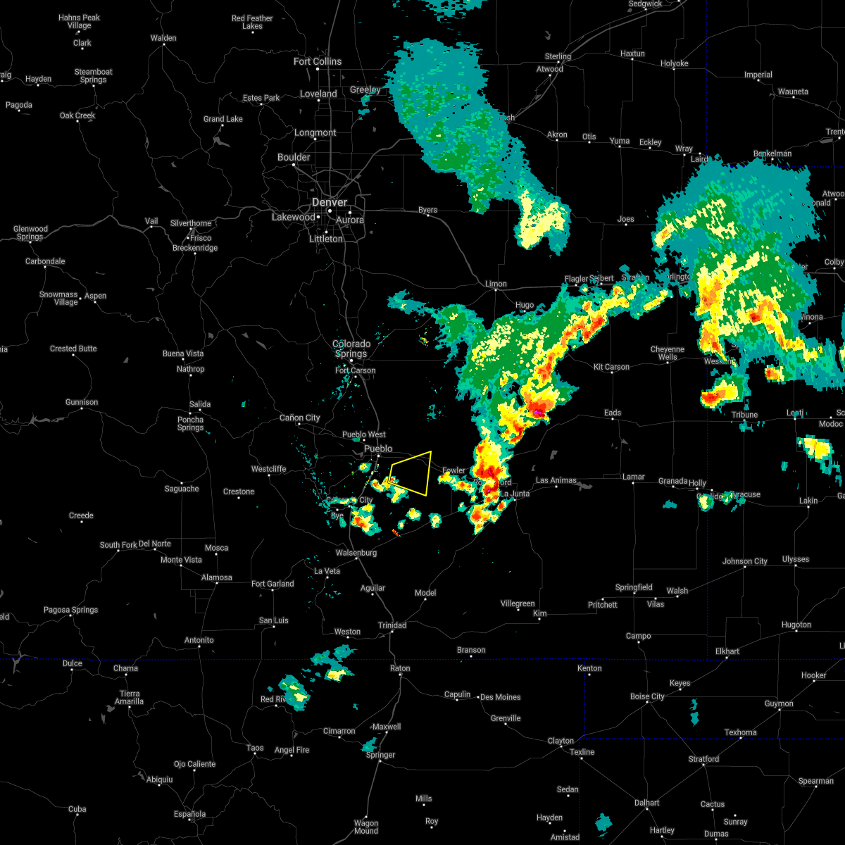 The severe thunderstorm warning for east central pueblo county will expire at 445 pm mdt, the severe thunderstorm which prompted the warning has weakened. therefore the warning will be allowed to expire. a tornado watch remains in effect until 900 pm mdt for southeastern colorado. The severe thunderstorm warning for east central pueblo county will expire at 445 pm mdt, the severe thunderstorm which prompted the warning has weakened. therefore the warning will be allowed to expire. a tornado watch remains in effect until 900 pm mdt for southeastern colorado.
|
| 6/13/2016 4:32 PM MDT |
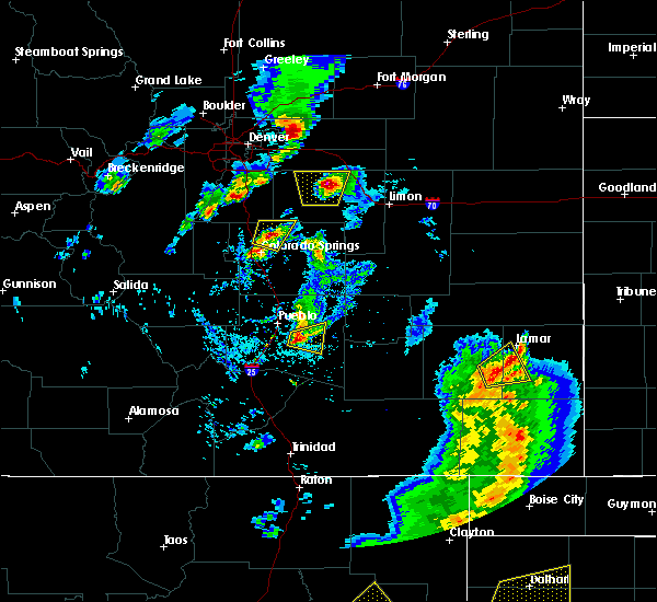 At 432 pm mdt, a severe thunderstorm was located 10 miles south of blende, or 13 miles southeast of pueblo, moving east at 10 mph (radar indicated). Hazards include 60 mph wind gusts and quarter size hail. Hail damage to vehicles is expected. expect wind damage to roofs, siding, and trees. locations impacted include, boone and avondale. A tornado watch remains in effect until 900 pm mdt for southeastern colorado. At 432 pm mdt, a severe thunderstorm was located 10 miles south of blende, or 13 miles southeast of pueblo, moving east at 10 mph (radar indicated). Hazards include 60 mph wind gusts and quarter size hail. Hail damage to vehicles is expected. expect wind damage to roofs, siding, and trees. locations impacted include, boone and avondale. A tornado watch remains in effect until 900 pm mdt for southeastern colorado.
|
| 6/13/2016 4:26 PM MDT |
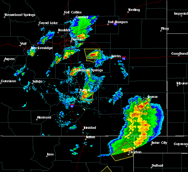 At 426 pm mdt, a severe thunderstorm was located 9 miles south of blende, or 13 miles southeast of pueblo, moving east at 10 mph (radar indicated). Hazards include golf ball size hail and 70 mph wind gusts. People and animals outdoors will be injured. expect hail damage to roofs, siding, windows, and vehicles. expect considerable tree damage. wind damage is also likely to mobile homes, roofs, and outbuildings. locations impacted include, boone and avondale. A tornado watch remains in effect until 900 pm mdt for southeastern colorado. At 426 pm mdt, a severe thunderstorm was located 9 miles south of blende, or 13 miles southeast of pueblo, moving east at 10 mph (radar indicated). Hazards include golf ball size hail and 70 mph wind gusts. People and animals outdoors will be injured. expect hail damage to roofs, siding, windows, and vehicles. expect considerable tree damage. wind damage is also likely to mobile homes, roofs, and outbuildings. locations impacted include, boone and avondale. A tornado watch remains in effect until 900 pm mdt for southeastern colorado.
|
| 6/13/2016 4:16 PM MDT |
 At 416 pm mdt, a severe thunderstorm was located 9 miles south of blende, or 12 miles southeast of pueblo, moving east at 10 mph (radar indicated). Hazards include golf ball size hail and 70 mph wind gusts. People and animals outdoors will be injured. expect hail damage to roofs, siding, windows, and vehicles. expect considerable tree damage. Wind damage is also likely to mobile homes, roofs, and outbuildings. At 416 pm mdt, a severe thunderstorm was located 9 miles south of blende, or 12 miles southeast of pueblo, moving east at 10 mph (radar indicated). Hazards include golf ball size hail and 70 mph wind gusts. People and animals outdoors will be injured. expect hail damage to roofs, siding, windows, and vehicles. expect considerable tree damage. Wind damage is also likely to mobile homes, roofs, and outbuildings.
|
| 6/12/2016 7:10 PM MDT | Quarter sized hail reported 11.2 miles SSW of Boone, CO, . |
| 6/3/2015 10:34 PM MDT | At 1034 pm mdt, a severe thunderstorm was located 11 miles east of boone, or 30 miles east of pueblo, moving northeast at 30 mph (radar indicated). Hazards include ping pong ball size hail and 60 mph wind gusts. People and animals outdoors will be injured. expect hail damage to roofs, siding, windows and vehicles. expect wind damage to roofs, siding and trees. Locations impacted include, boone. |
| 6/3/2015 10:25 PM MDT | At 1025 pm mdt, a severe thunderstorm was located 7 miles east of boone, or 26 miles east of pueblo, moving northeast at 20 mph (radar indicated). Hazards include golf ball size hail and 60 mph wind gusts. People and animals outdoors will be injured. expect hail damage to roofs, siding, windows and vehicles. expect wind damage to roofs, siding and trees. Locations impacted include, boone. |
| 6/3/2015 10:14 PM MDT | At 1014 pm mdt, a severe thunderstorm was located near boone, or 22 miles east of pueblo, moving northeast at 35 mph (radar indicated). Hazards include golf ball size hail and 60 mph wind gusts. People and animals outdoors will be injured. expect hail damage to roofs, siding, windows and vehicles. expect wind damage to roofs, siding and trees. Locations impacted include, fowler, olney springs and boone. |
| 6/3/2015 10:10 PM MDT | At 1009 pm mdt, a severe thunderstorm was located near boone, or 21 miles east of pueblo, moving northeast at 15 mph. it will cross highway 50 between mile markers 335 and 345 (radar indicated). Hazards include 60 mph wind gusts and half dollar size hail. Hail damage to vehicles is expected. expect wind damage to roofs, siding and trees. Locations impacted include, fowler, olney springs, boone and pueblo depot. |
| 6/3/2015 9:58 PM MDT | At 958 pm mdt, a severe thunderstorm was located near boone, or 21 miles east of pueblo, moving northeast at 25 mph (radar indicated). Hazards include 60 mph wind gusts and quarter size hail. Hail damage to vehicles is expected. Expect wind damage to roofs, siding and trees. |
| 6/1/2015 5:57 PM MDT | At 556 pm mdt, a severe thunderstorm was located 13 miles south of avondale, or 18 miles southeast of pueblo, moving east at 25 mph (radar indicated). Hazards include 60 mph wind gusts and half dollar size hail. Hail damage to vehicles is expected. Expect wind damage to roofs, siding and trees. |
| 5/29/2015 2:19 PM MDT | At 218 pm mdt, a severe thunderstorm was located over boone, or 19 miles east of pueblo, moving southeast at 15 mph (radar indicated). Hazards include quarter size hail. Damage to vehicles is expected. Locations impacted include, boone, pueblo depot and avondale. |
| 5/29/2015 2:06 PM MDT | At 206 pm mdt, a severe thunderstorm was located over pueblo depot, or 17 miles east of pueblo, moving southeast at 20 mph (radar indicated). Hazards include quarter size hail. damage to vehicles is expected |
| 5/9/2015 2:26 PM MDT | At 225 pm mdt, a severe thunderstorm capable of producing a tornado was located near blende, or 9 miles southeast of pueblo, moving northeast at 25 mph (radar indicated rotation). Hazards include tornado and golf ball size hail. Flying debris will be dangerous to those caught without shelter. mobile homes will be damaged or destroyed. damage to roofs, windows and vehicles will occur. tree damage is likely. this dangerous storm will be near, avondale around 240 pm mdt. boone around 250 pm mdt. pueblo depot around 255 pm mdt. Radar indicated. |
| 5/9/2015 2:08 PM MDT | At 208 pm mdt, a severe thunderstorm was located 7 miles southwest of salt creek, or 8 miles south of pueblo, moving northeast at 20 mph (radar indicated). Hazards include 60 mph wind gusts and half dollar size hail. Hail damage to vehicles is expected. expect wind damage to roofs, siding and trees. locations impacted include, pueblo, boone, pinon, blende, salt creek, pueblo reservoir, avondale, pueblo depot and pueblo west. a tornado watch remains in effect until 900 pm mdt for southeastern colorado. 1. 25in. |
| 5/9/2015 1:53 PM MDT | At 153 pm mdt, a severe thunderstorm was located 11 miles southwest of salt creek, or 12 miles southwest of pueblo, moving northeast at 35 mph (radar indicated). Hazards include 60 mph wind gusts and quarter size hail. Hail damage to vehicles is expected. Expect wind damage to roofs, siding and trees. |
| 5/2/2015 4:48 PM MDT | At 447 pm mdt, a severe thunderstorm was located near boone, or 18 miles east of pueblo, moving east at 25 mph (radar indicated). Hazards include 60 mph wind gusts and quarter size hail. Hail damage to vehicles is expected. Expect wind damage to roofs, siding and trees. |
| 7/12/2014 4:44 PM MDT | Quarter sized hail reported 3.5 miles NNW of Boone, CO |
| 7/10/2013 4:53 PM MDT | Storm damage reported in pueblo county CO, 14.2 miles SW of Boone, CO |
| 9/27/2012 5:20 PM MDT | Quarter sized hail reported 11.2 miles SSW of Boone, CO |
Hail Maps for Boone, CO
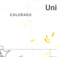


Connect with Interactive Hail Maps