

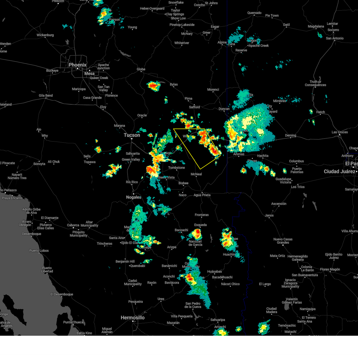
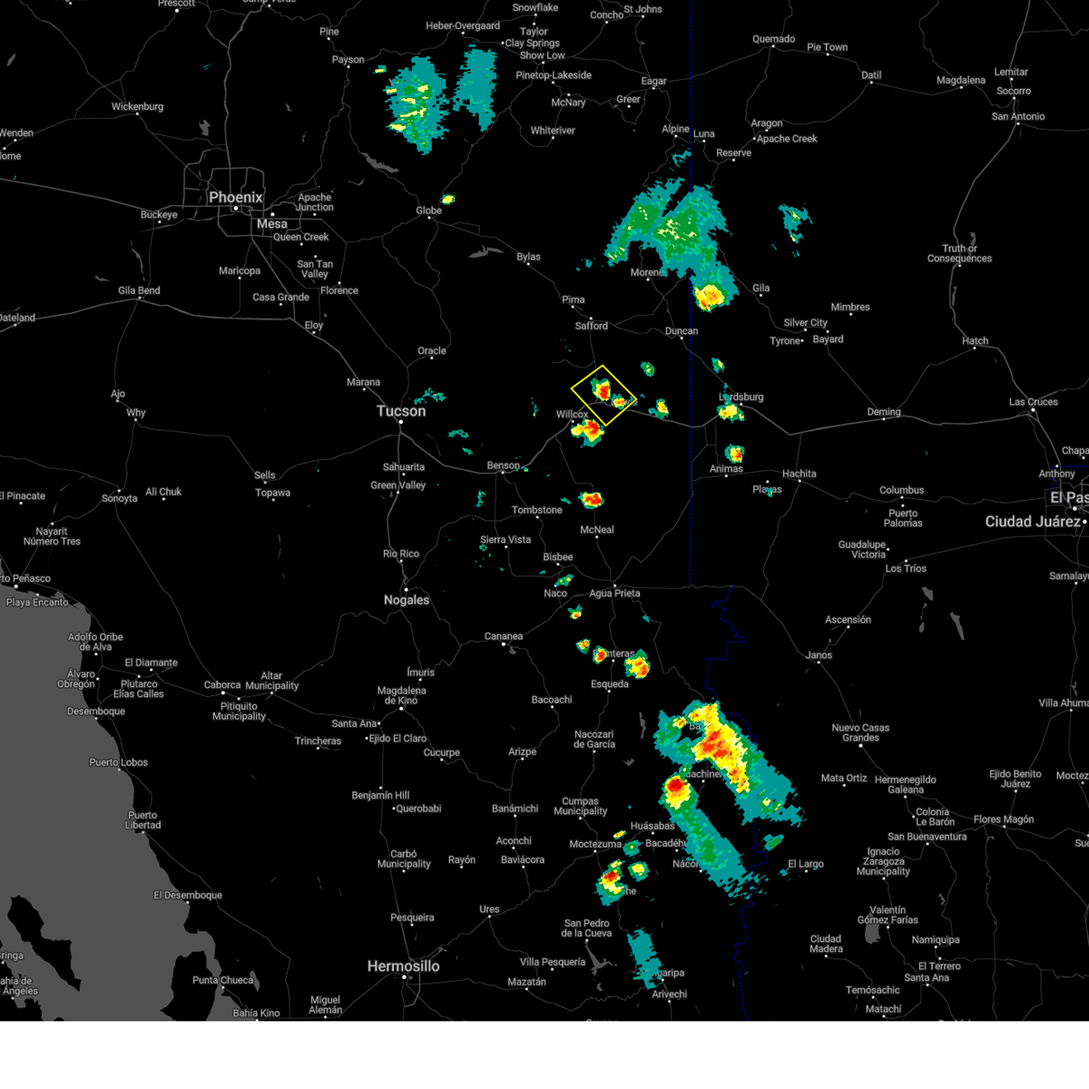
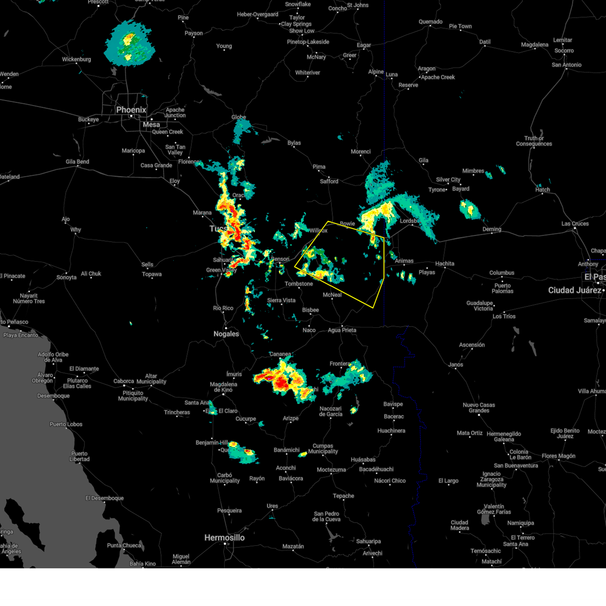
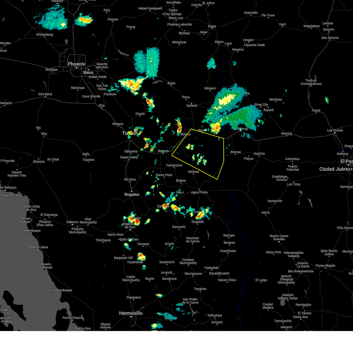
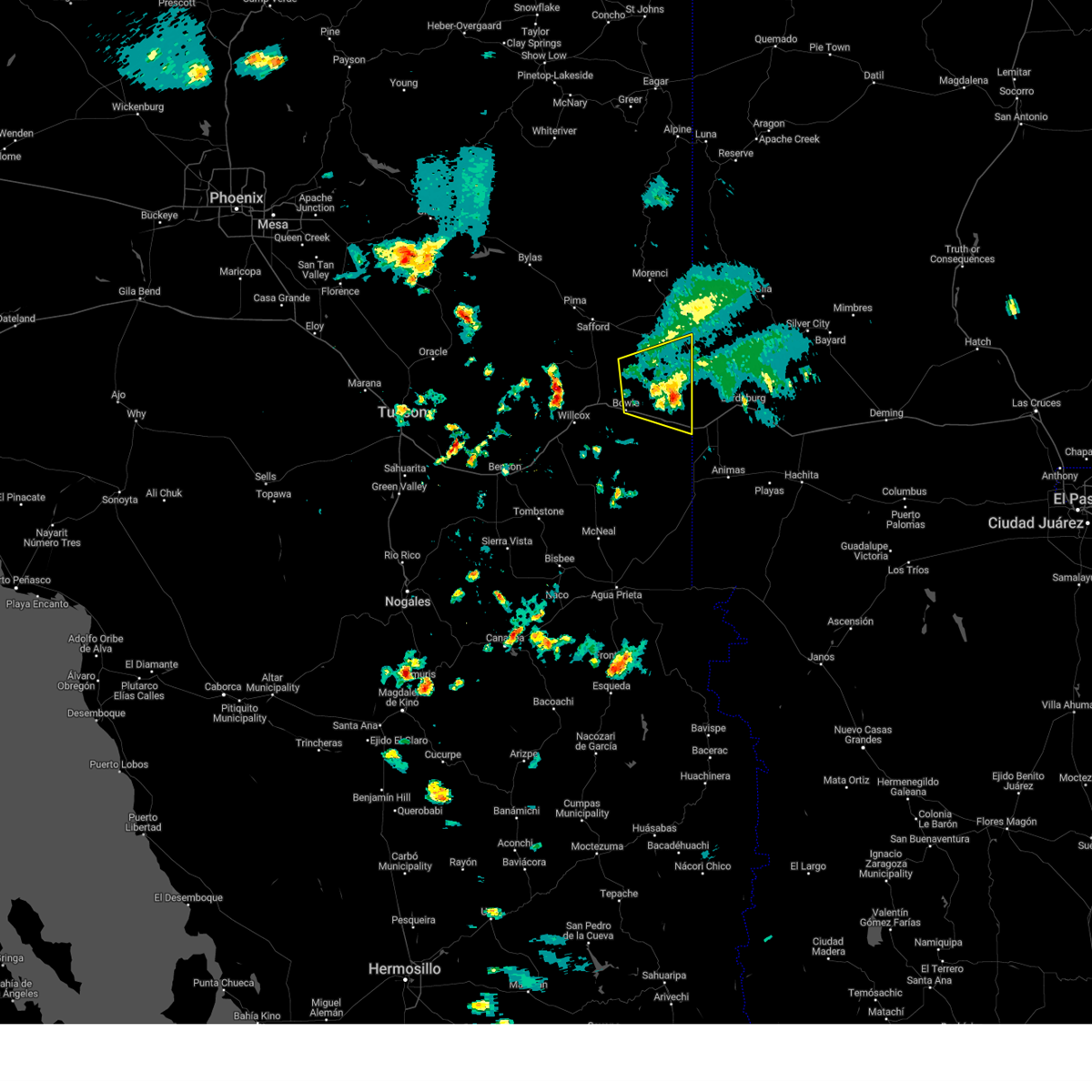
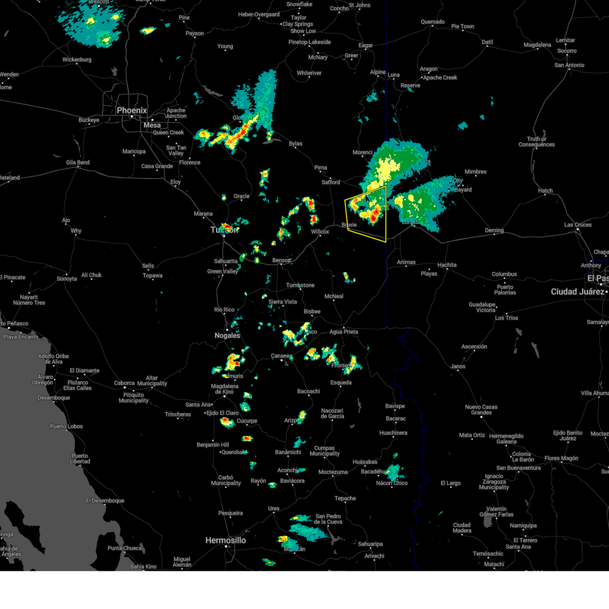
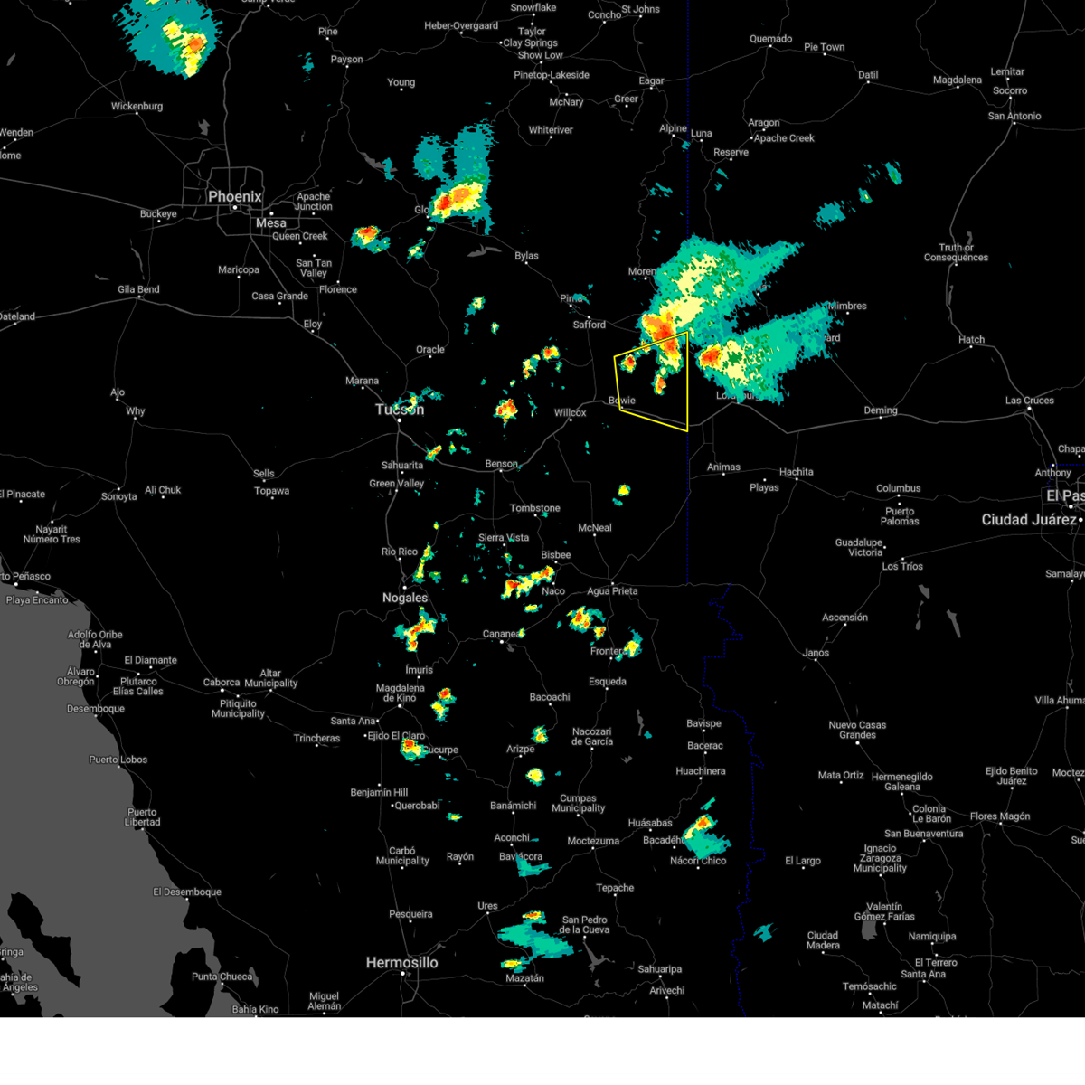
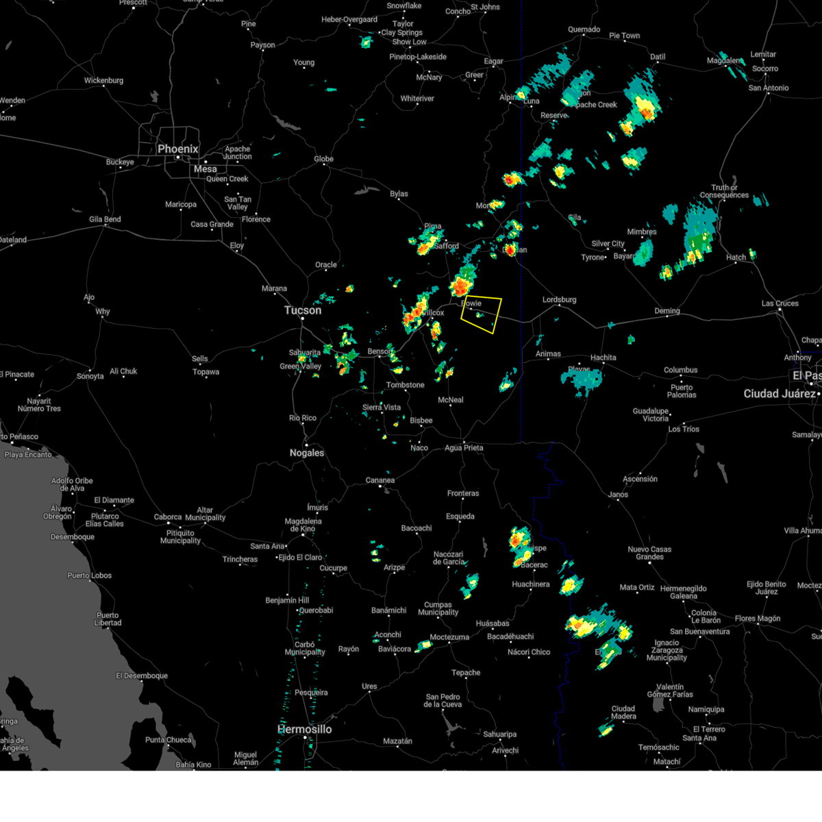
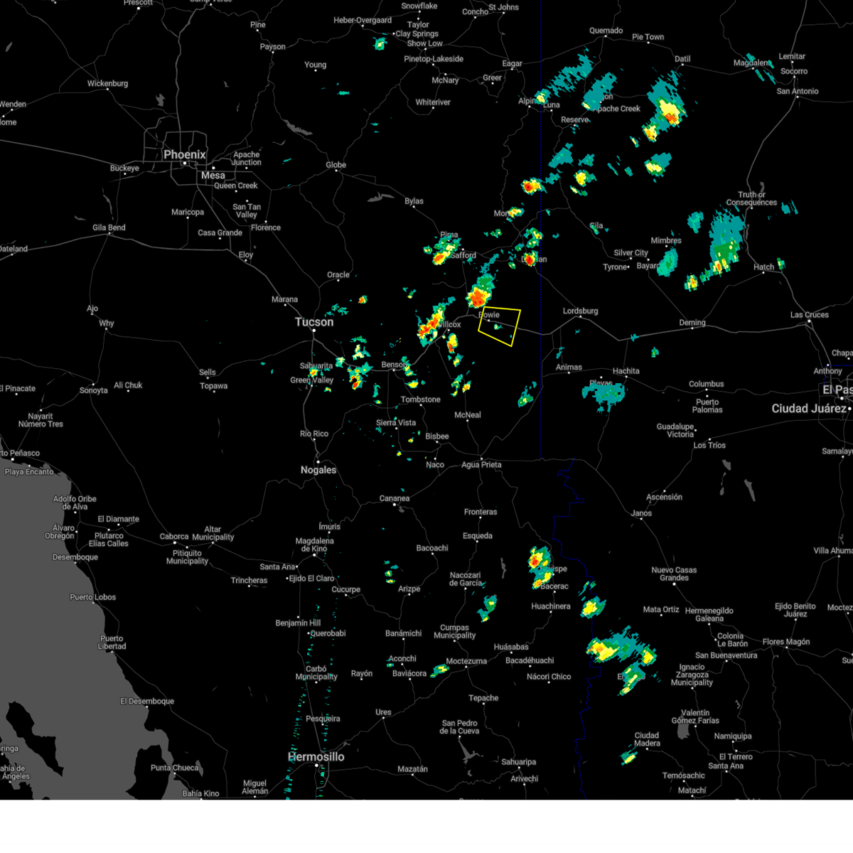
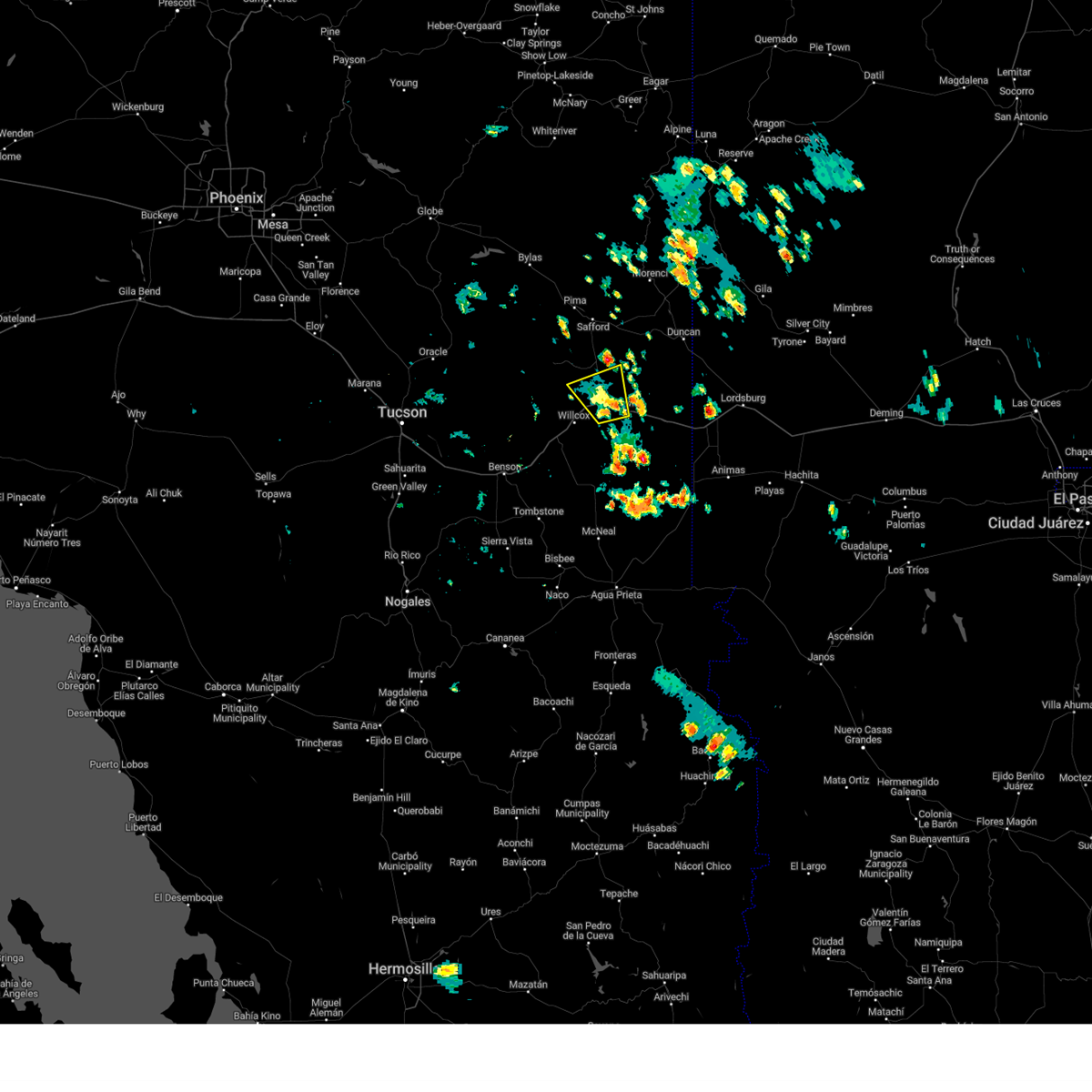
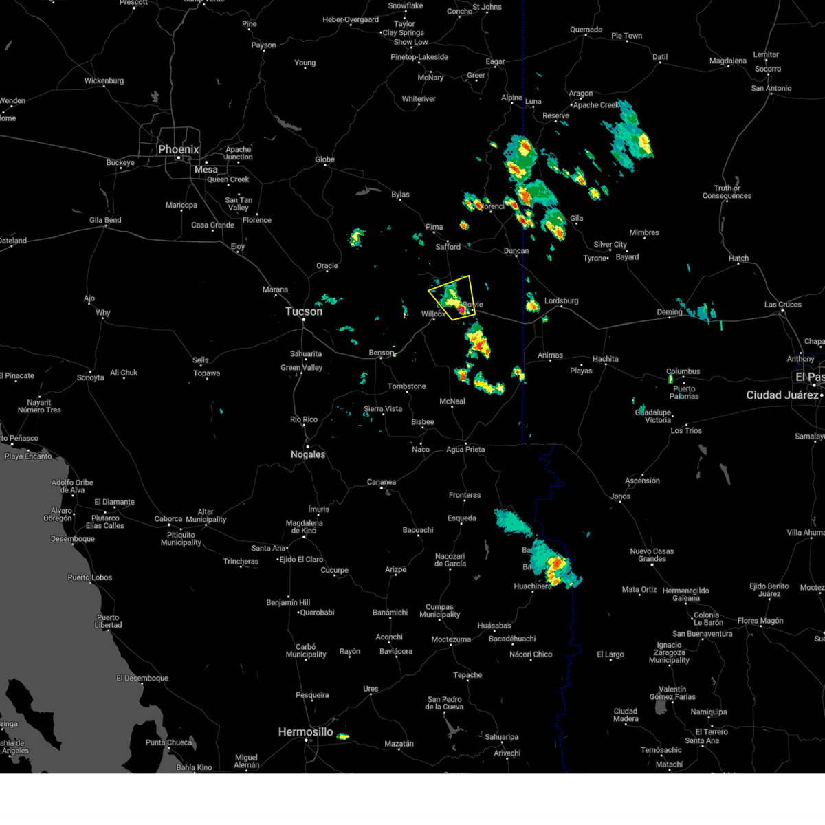
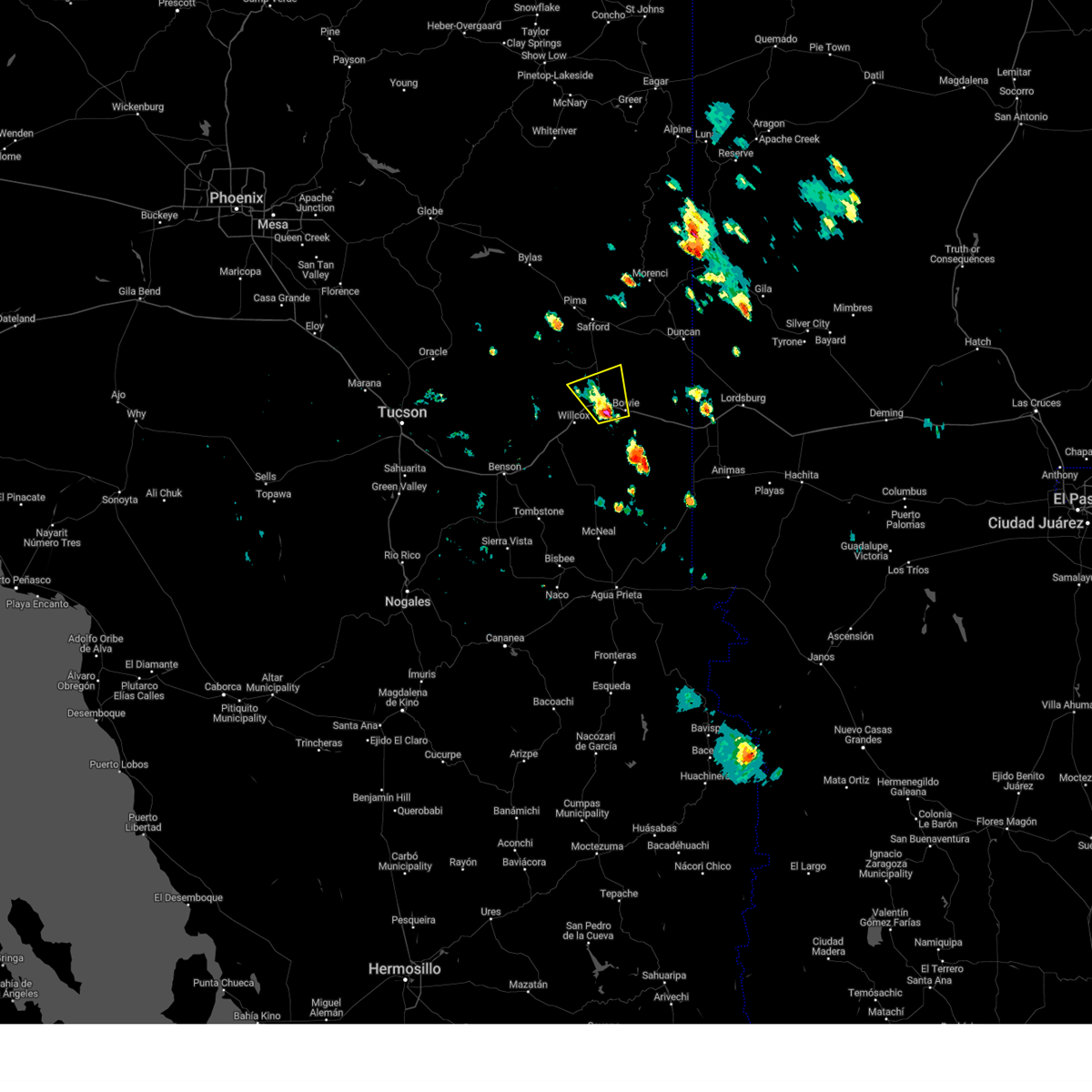
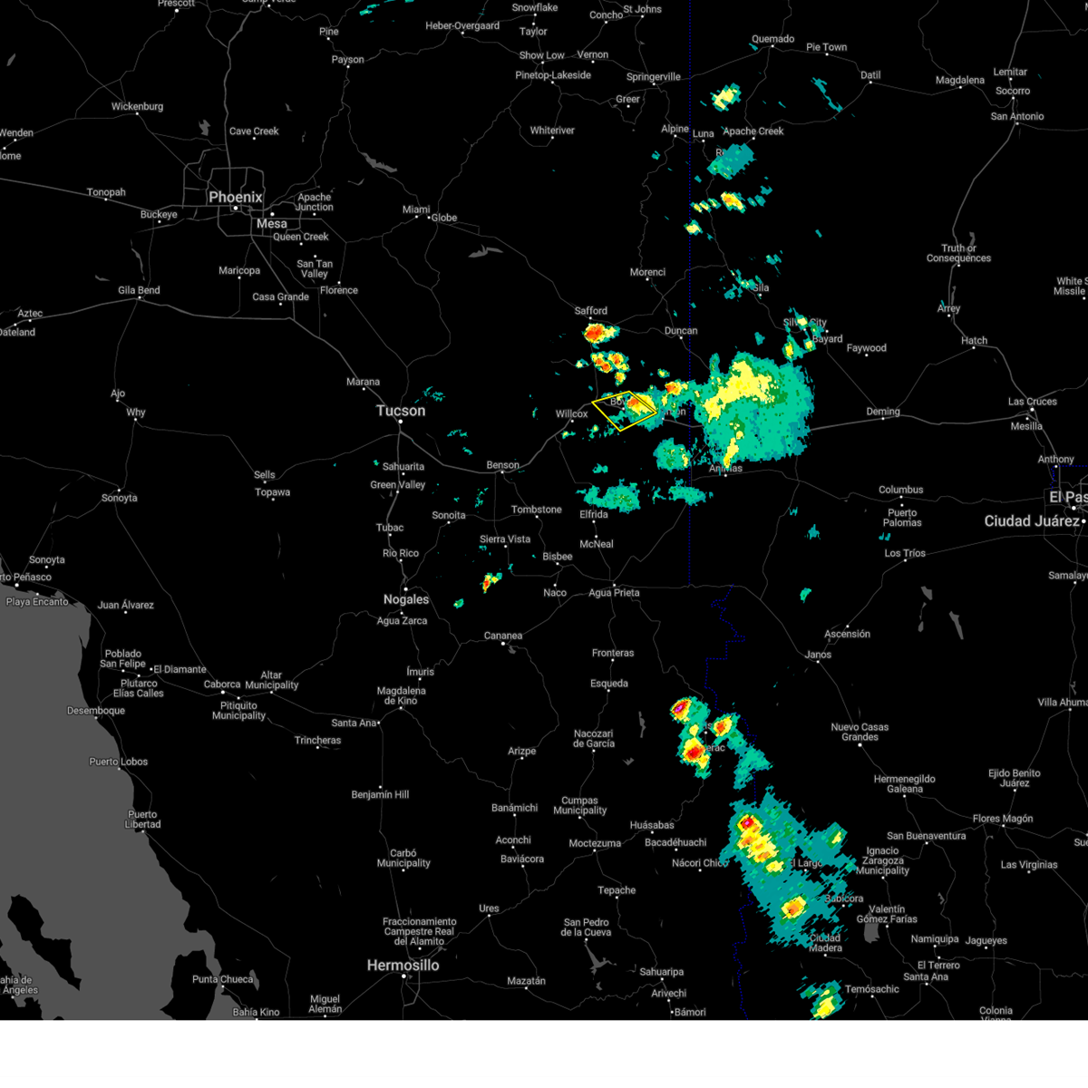
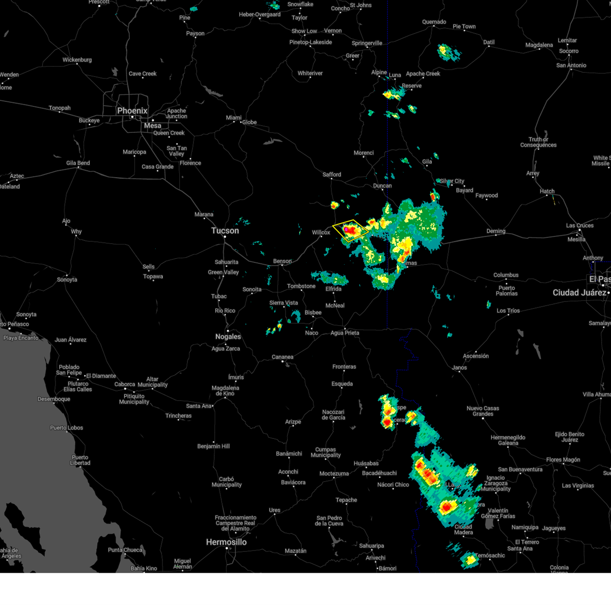
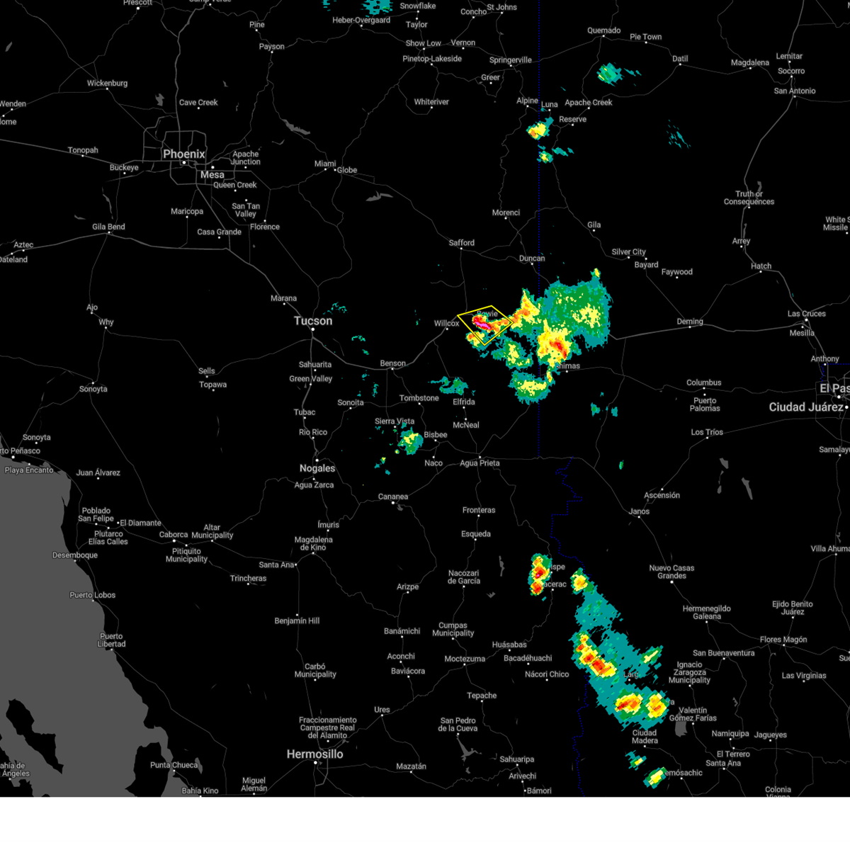
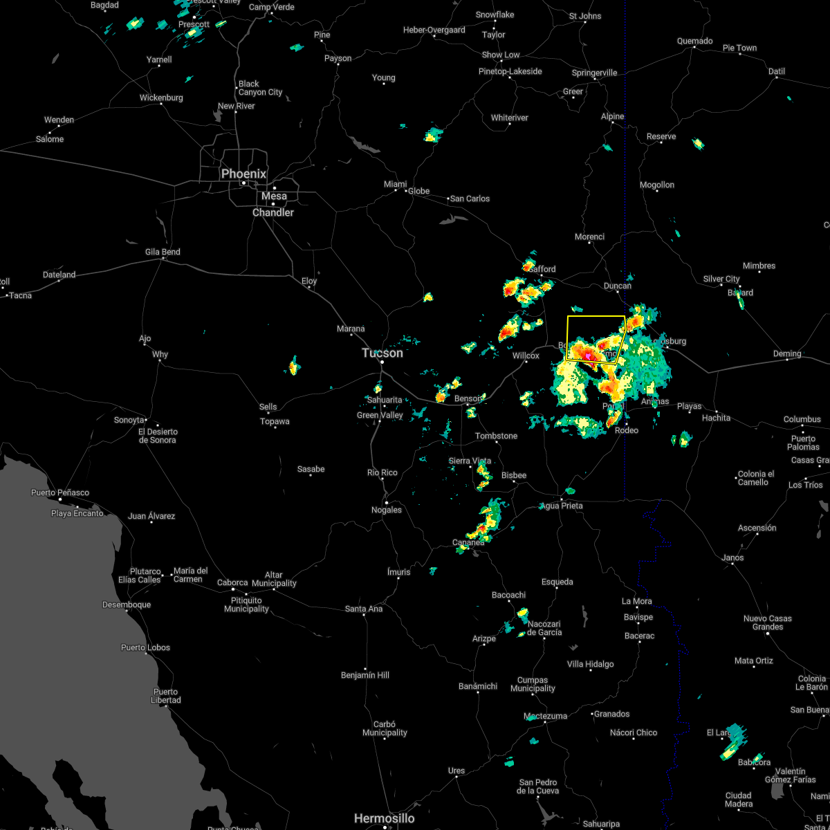
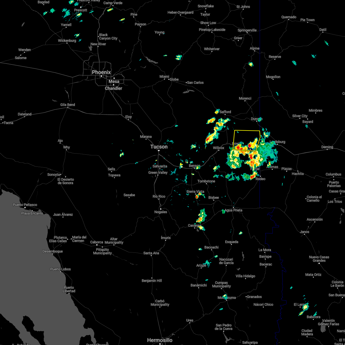
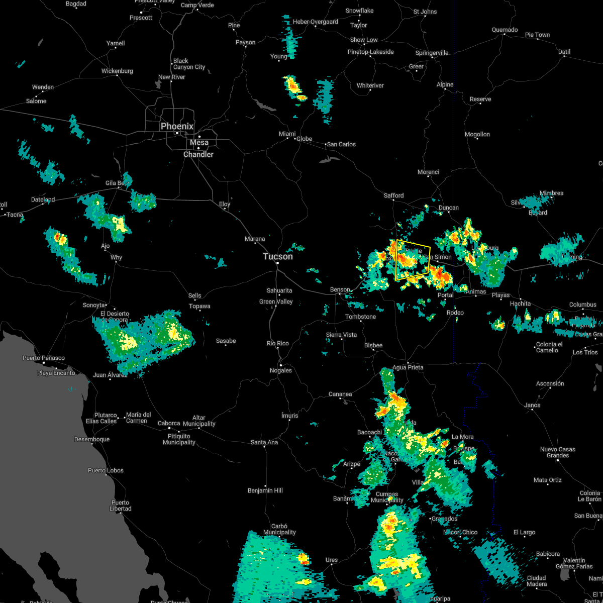
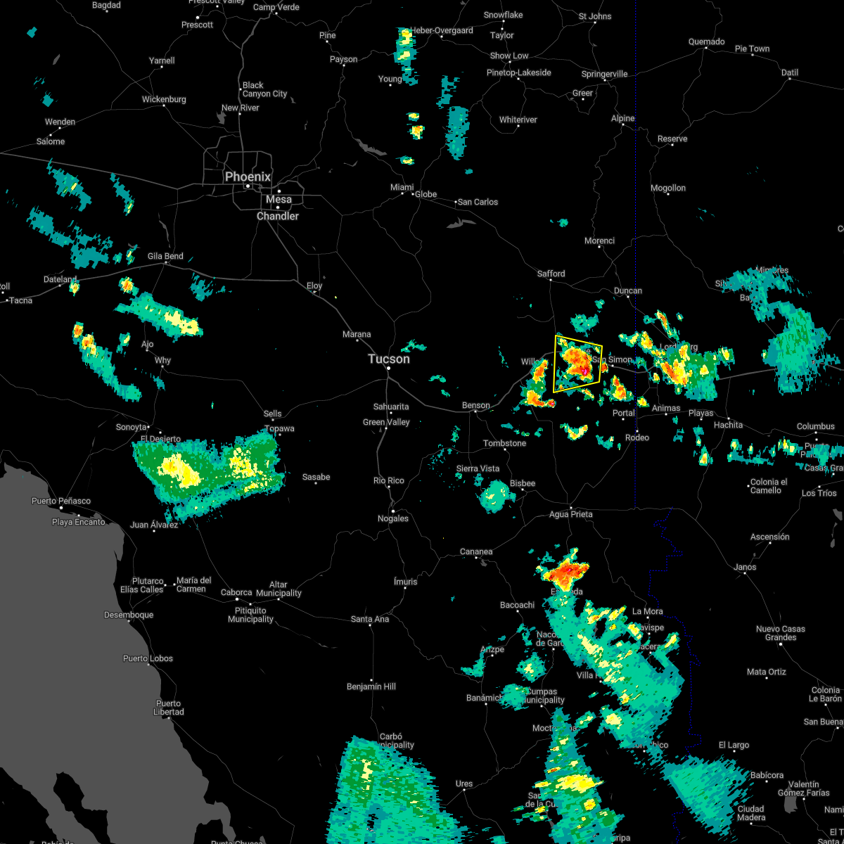
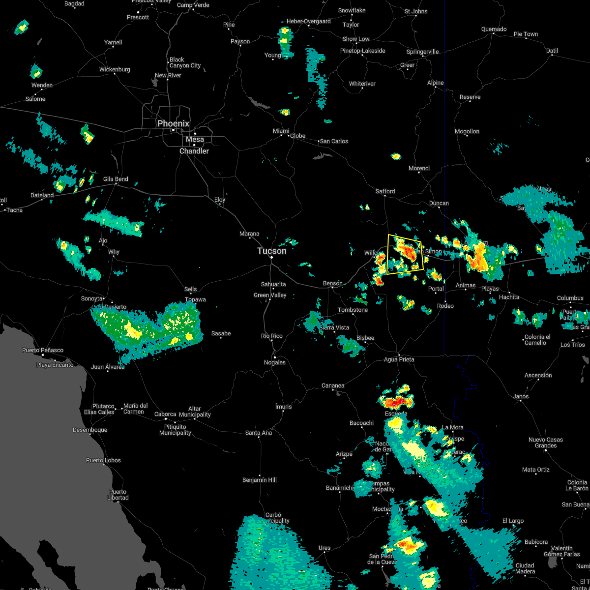
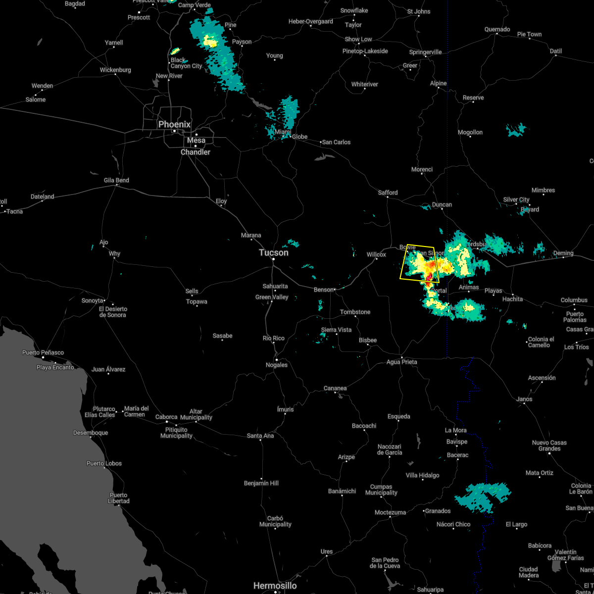
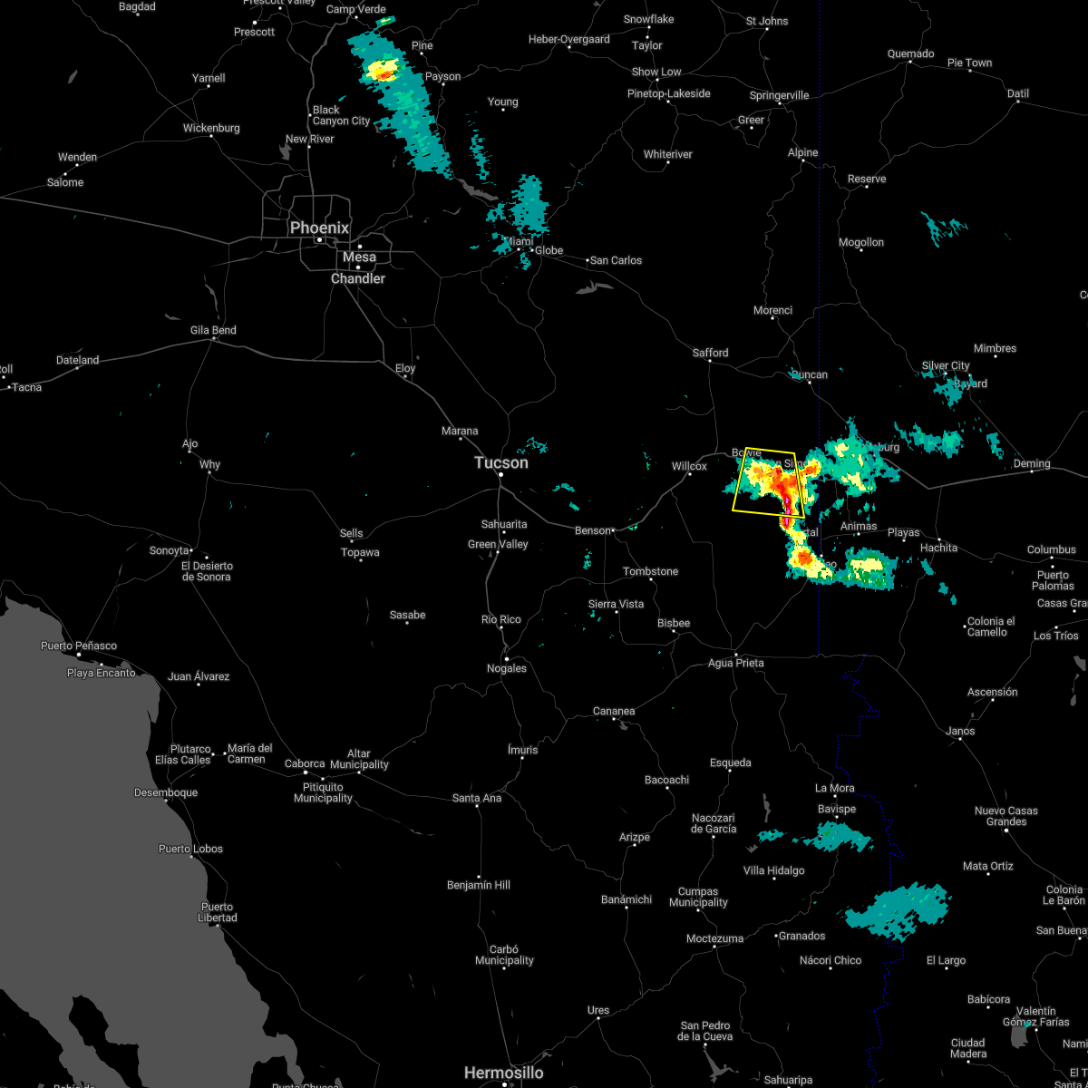
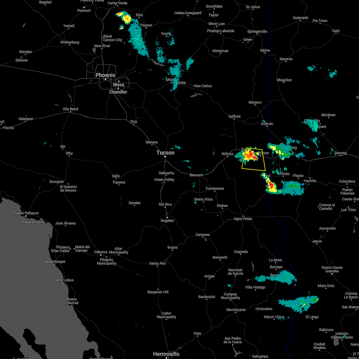
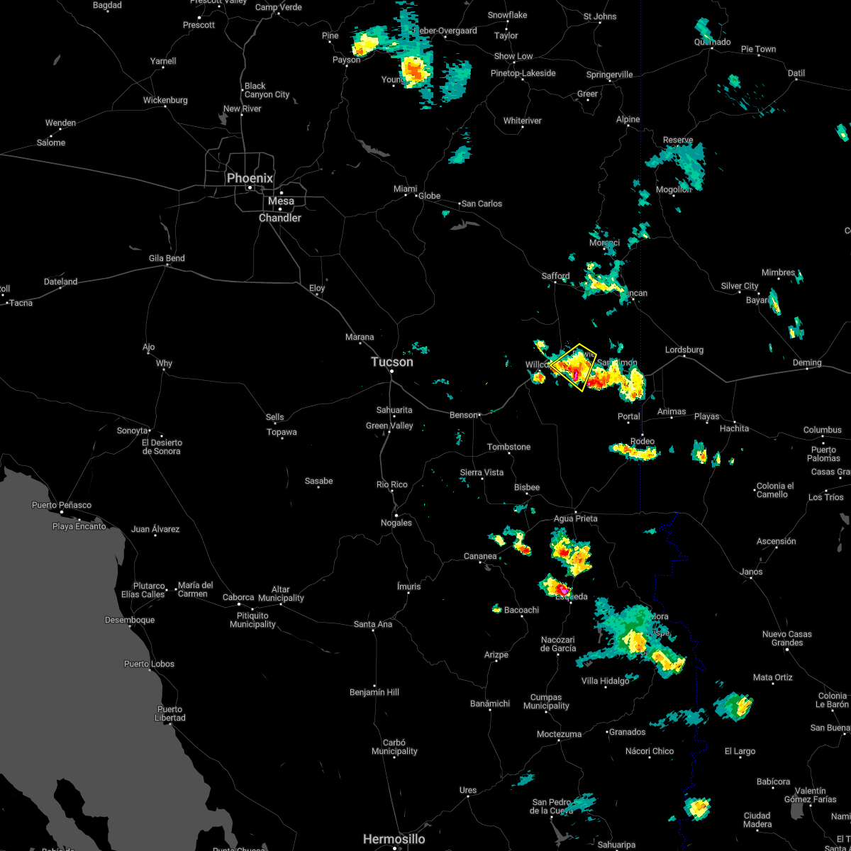
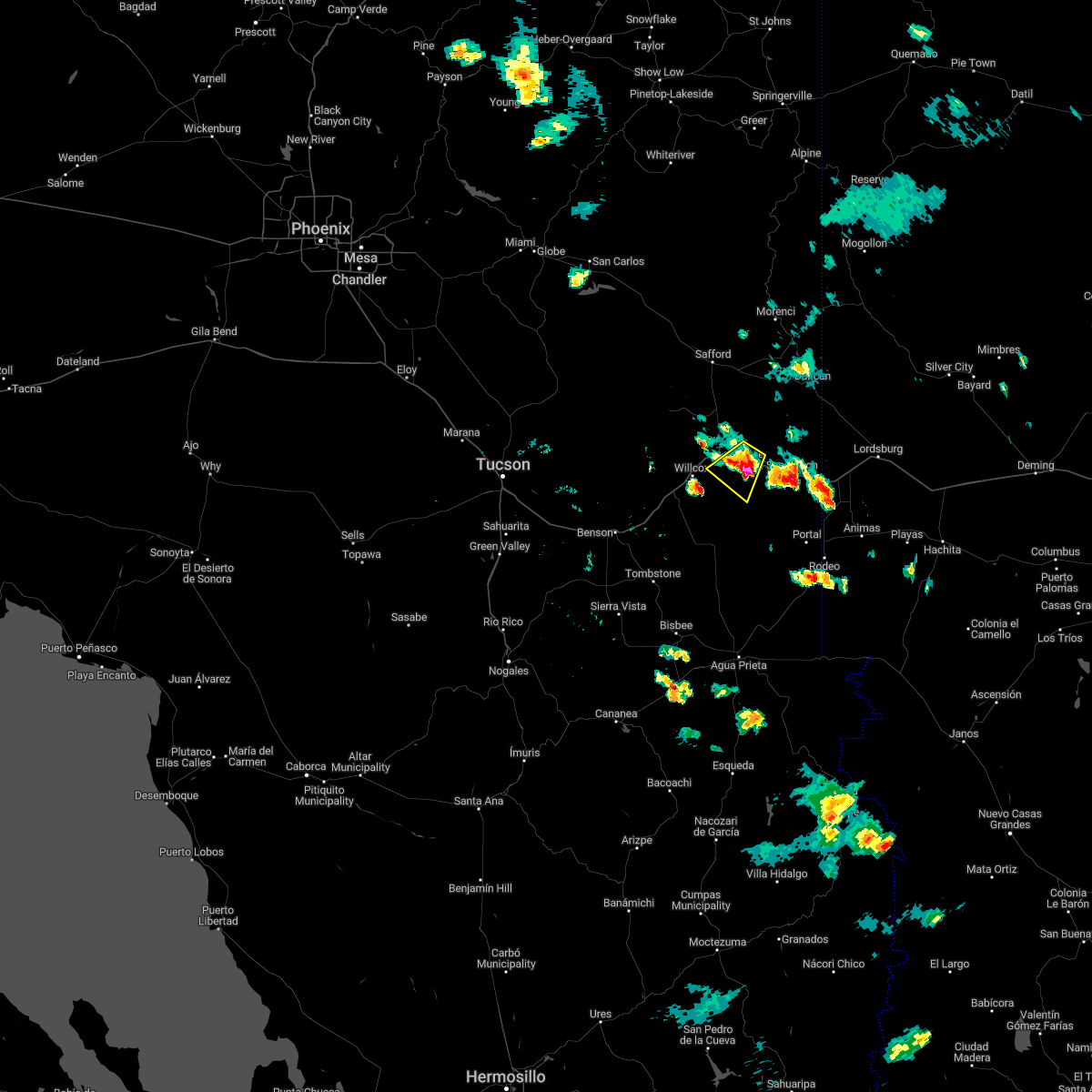
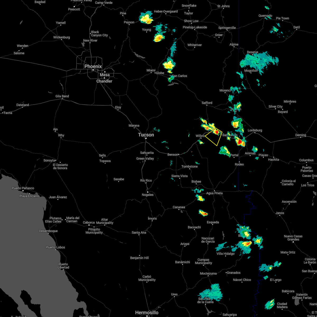
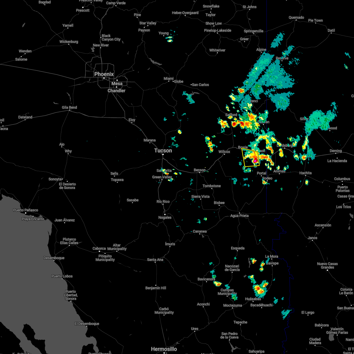
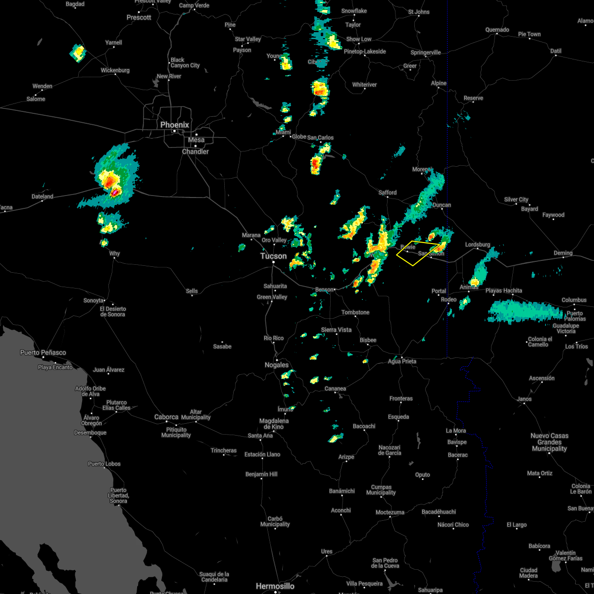
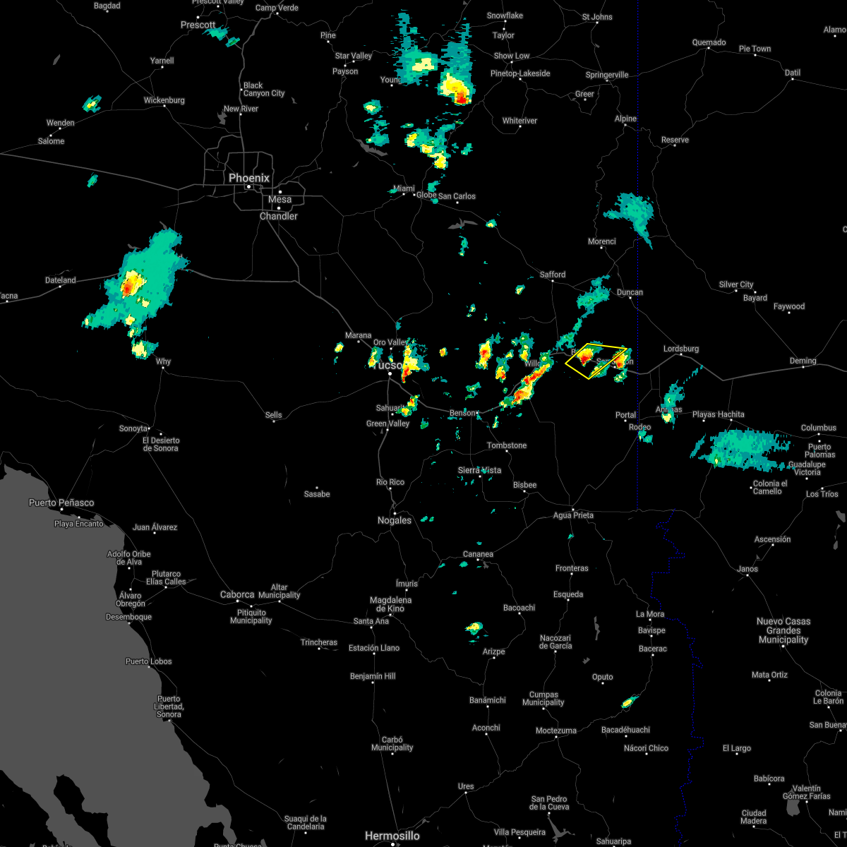
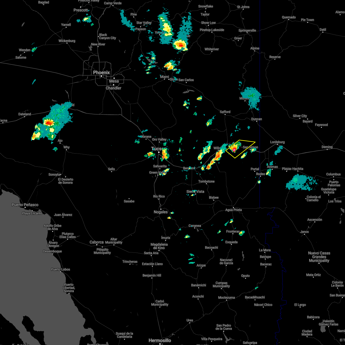
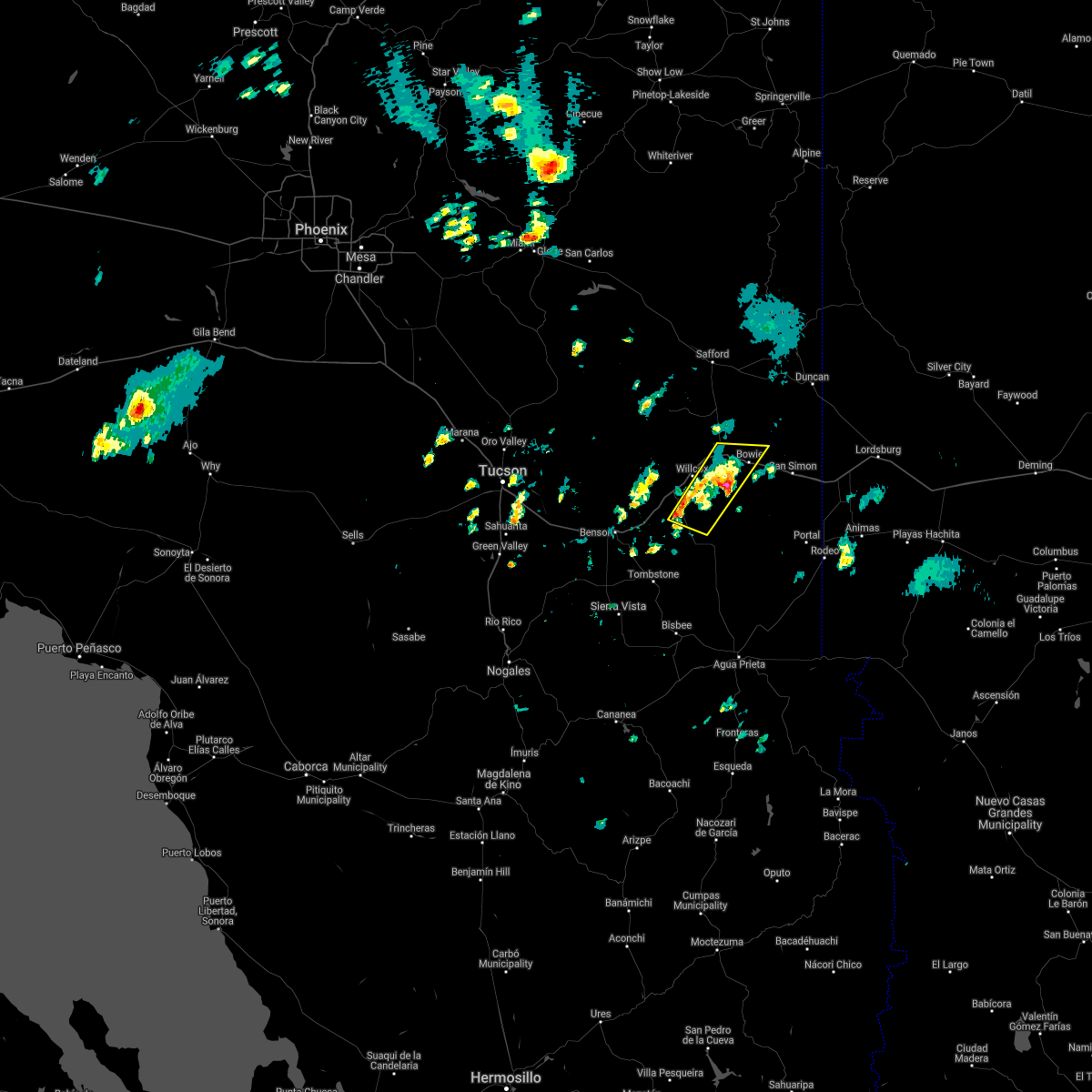
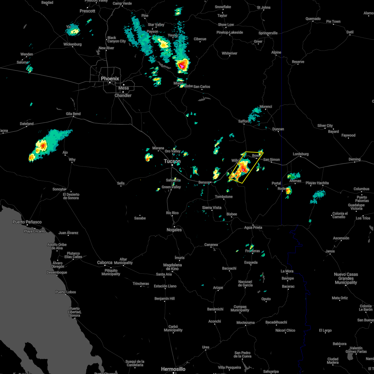
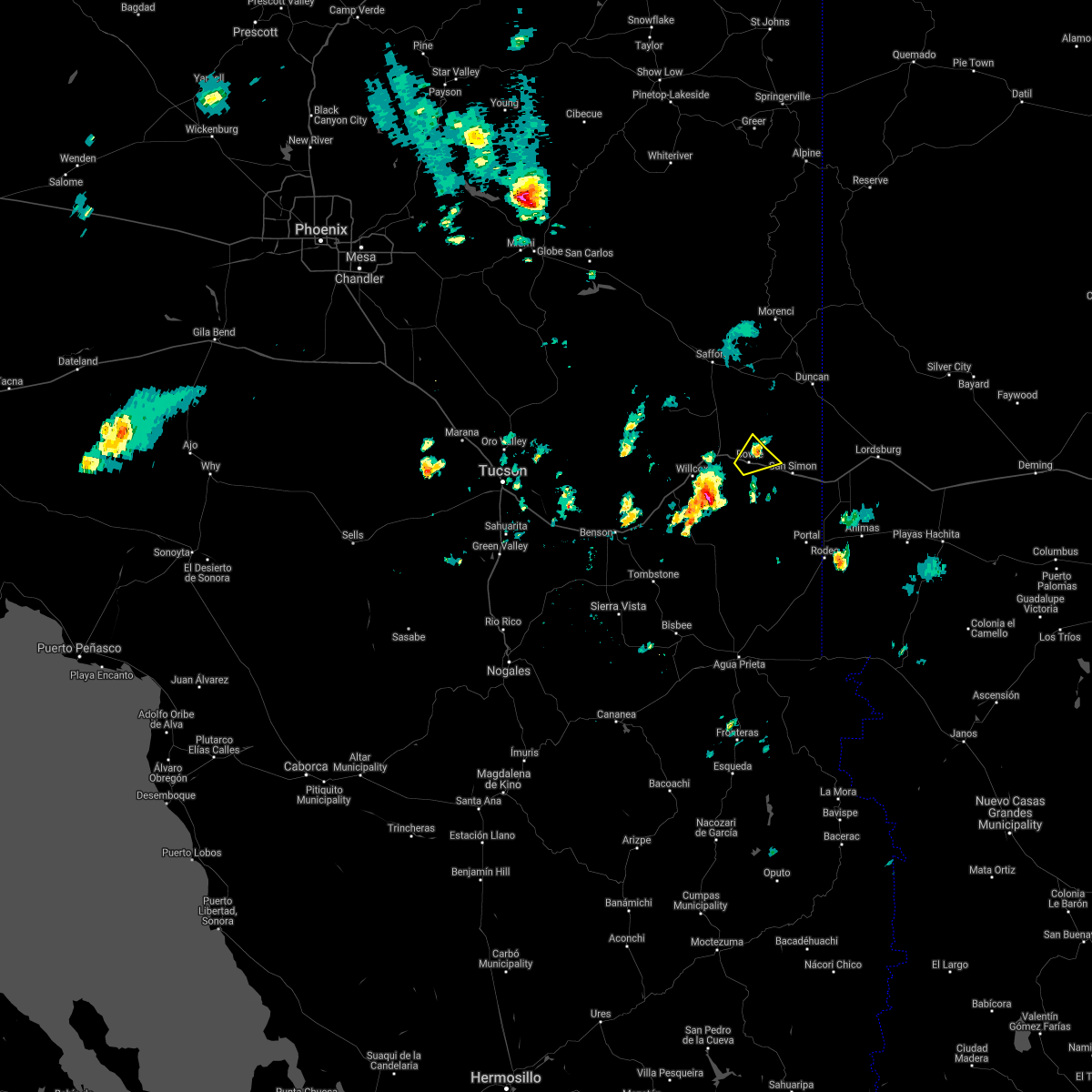
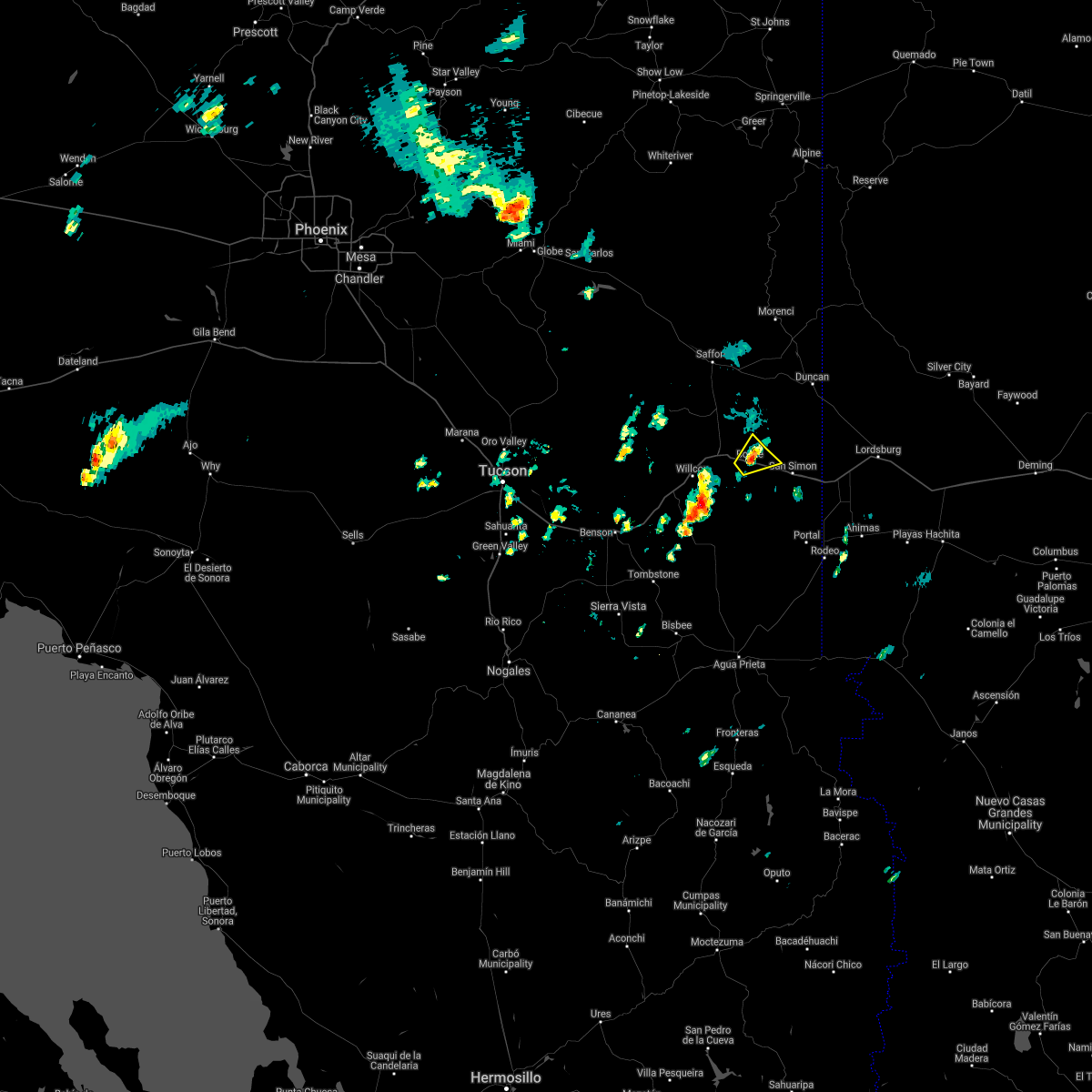
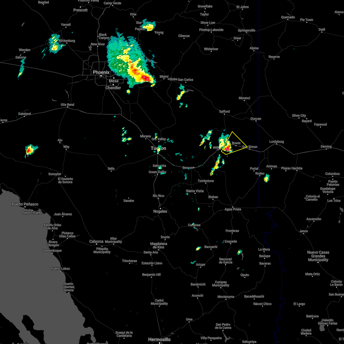
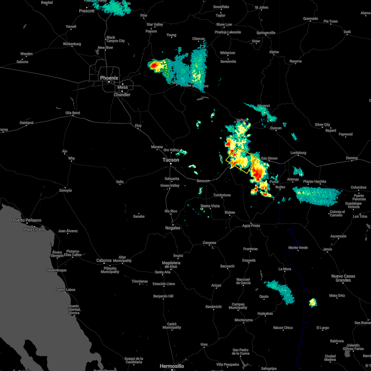
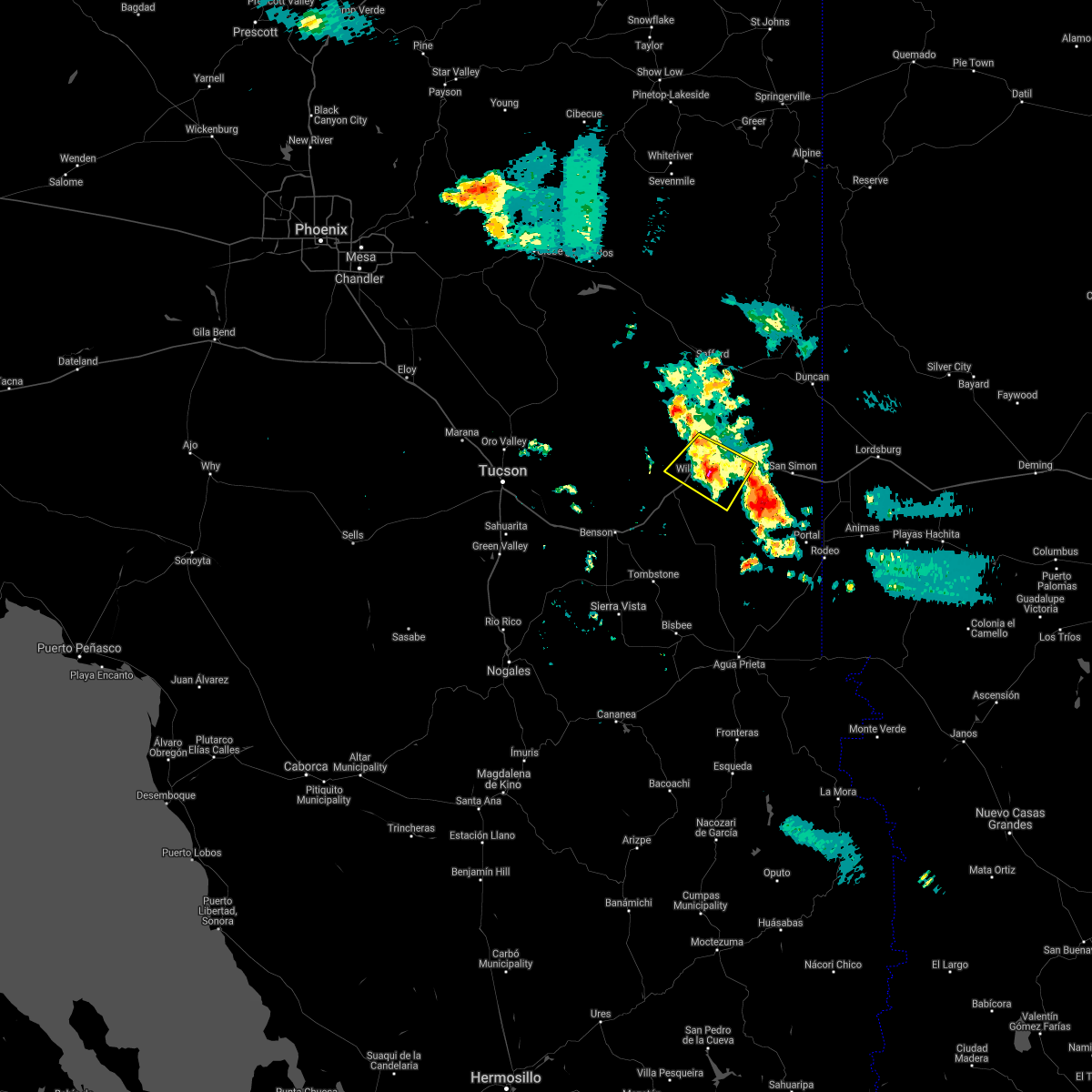
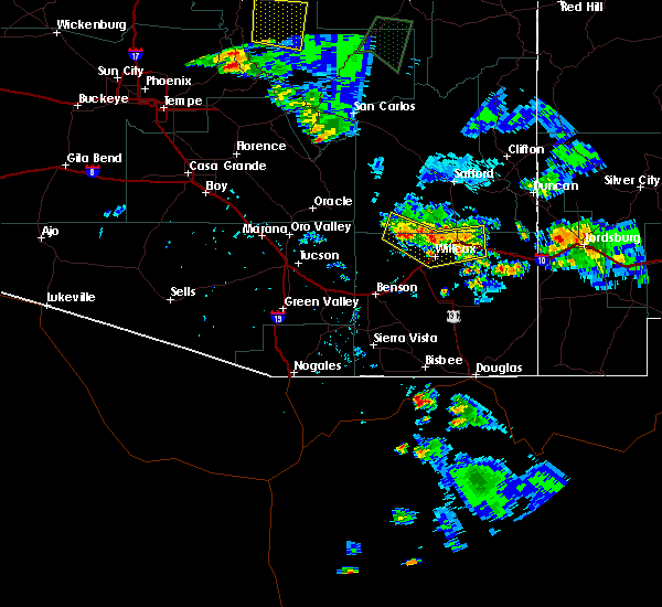
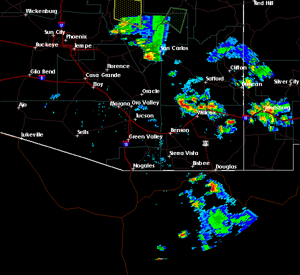
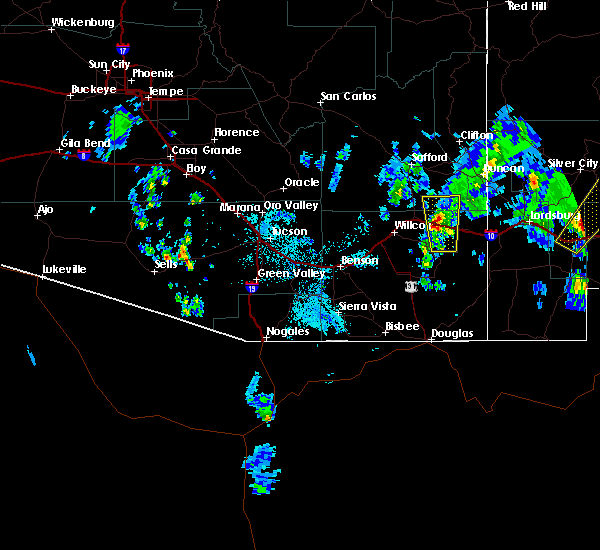
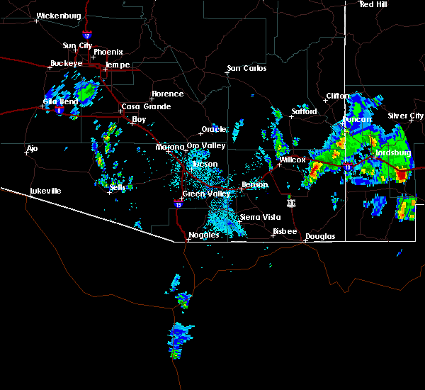
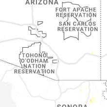
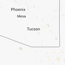
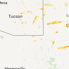
Hail Map for Bowie, AZ
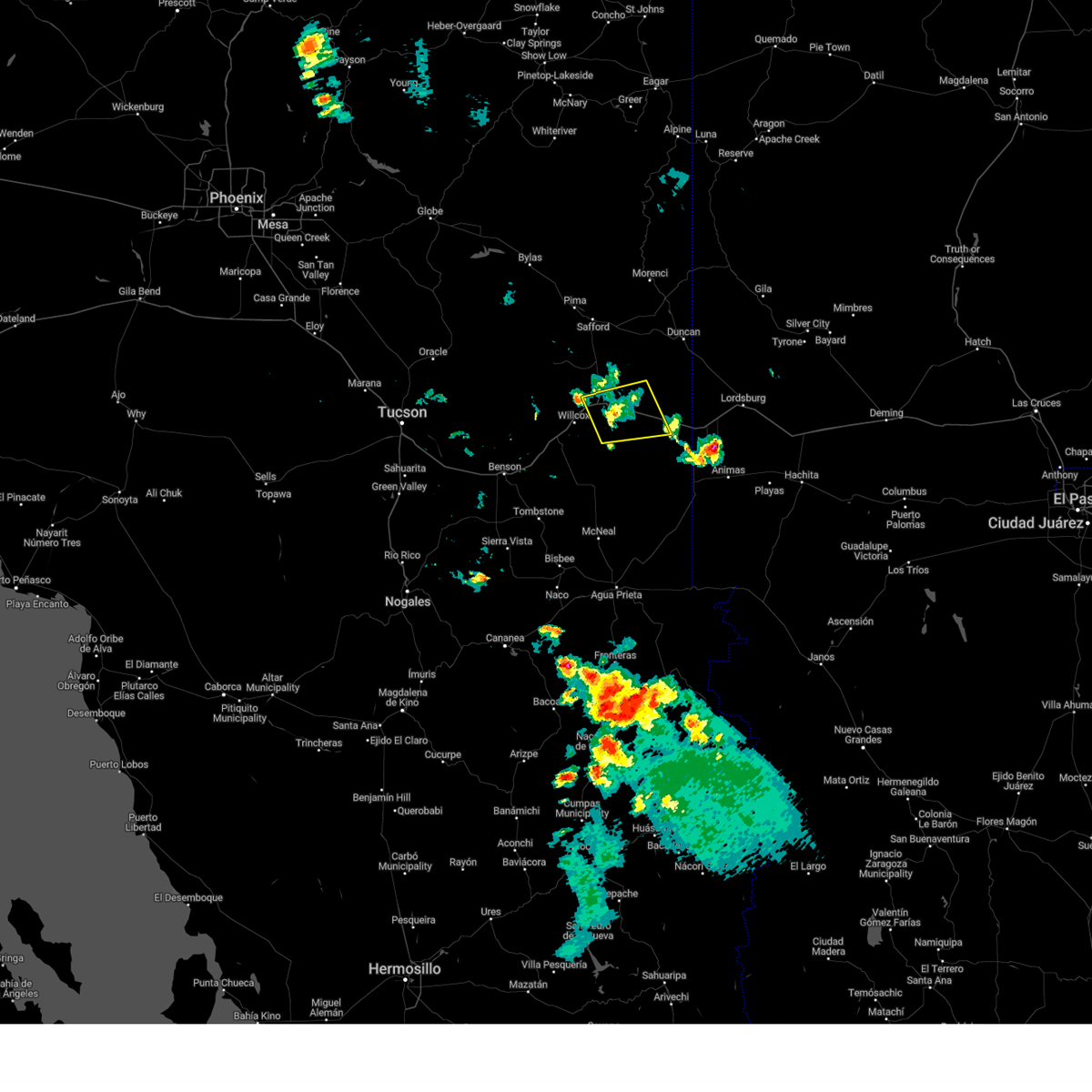
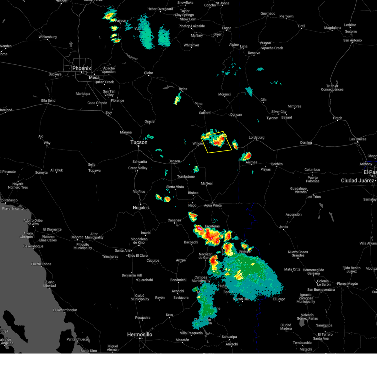
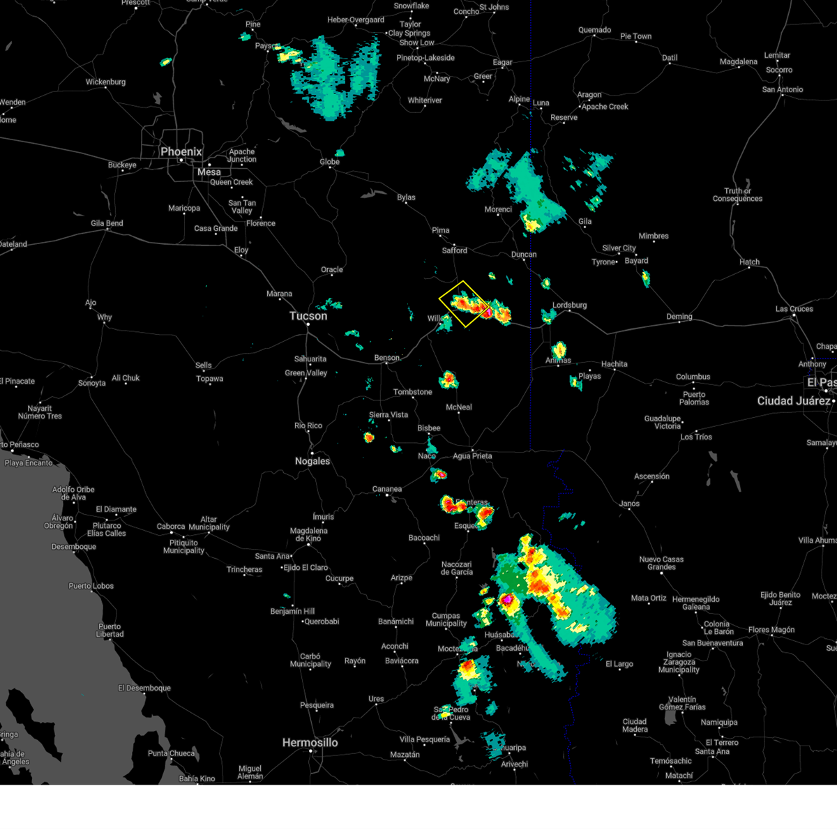
The Bowie, AZ area has had 0 reports of on-the-ground hail by trained spotters, and has been under severe weather warnings 11 times during the past 12 months. Doppler radar has detected hail at or near Bowie, AZ on 21 occasions, including 1 occasion during the past year.
| Name: | Bowie, AZ |
| Where Located: | 67.8 miles N of Douglas, AZ |
| Map: | Google Map for Bowie, AZ |
| Population: | 449 |
| Housing Units: | 256 |
| More Info: | Search Google for Bowie, AZ |
2
The Top Recent Hail Date for Bowie, AZ is Tuesday, July 16, 2024 (6th out of 21)

Hail and Wind Damage Spotted near Bowie, AZ
| Date / Time | Report Details |
|---|---|
| 7/20/2024 4:53 PM MST |
 Svrtwc the national weather service in tucson has issued a * severe thunderstorm warning for, northeastern cochise county in southeastern arizona, * until 545 pm mst. * at 453 pm mst, severe thunderstorms were located along a line extending from 10 miles west of bowie to near chiricahua national monument, moving west and southwest at 15 mph (radar indicated). Hazards include 60 mph wind gusts. expect damage to roofs, siding, and trees Svrtwc the national weather service in tucson has issued a * severe thunderstorm warning for, northeastern cochise county in southeastern arizona, * until 545 pm mst. * at 453 pm mst, severe thunderstorms were located along a line extending from 10 miles west of bowie to near chiricahua national monument, moving west and southwest at 15 mph (radar indicated). Hazards include 60 mph wind gusts. expect damage to roofs, siding, and trees
|
| 7/16/2024 7:21 PM MST |
 the severe thunderstorm warning has been cancelled and is no longer in effect the severe thunderstorm warning has been cancelled and is no longer in effect
|
| 7/16/2024 6:55 PM MST |
 Svrtwc the national weather service in tucson has issued a * severe thunderstorm warning for, south central graham county in southeastern arizona, northeastern cochise county in southeastern arizona, * until 745 pm mst. * at 654 pm mst, a severe thunderstorm was located over bowie, or 19 miles east of willcox, moving west at 10 mph (radar indicated). Hazards include 60 mph wind gusts and nickel size hail. expect damage to roofs, siding, and trees Svrtwc the national weather service in tucson has issued a * severe thunderstorm warning for, south central graham county in southeastern arizona, northeastern cochise county in southeastern arizona, * until 745 pm mst. * at 654 pm mst, a severe thunderstorm was located over bowie, or 19 miles east of willcox, moving west at 10 mph (radar indicated). Hazards include 60 mph wind gusts and nickel size hail. expect damage to roofs, siding, and trees
|
| 7/16/2024 6:21 PM MST | The storm which prompted the warning has weakened below severe limits, and no longer poses an immediate threat to life or property. therefore, the warning will be allowed to expire. however, gusty winds are still possible with this thunderstorm. |
| 7/16/2024 6:06 PM MST |
 At 606 pm mst, a severe thunderstorm was located 11 miles northwest of bowie, or 16 miles northeast of willcox, moving west at 5 mph (radar indicated). Hazards include 60 mph wind gusts and quarter size hail. Hail damage to vehicles is expected. expect wind damage to roofs, siding, and trees. locations impacted include, bowie. this includes the following highways, interstate 10 between mile markers 349 and 364. Route 191 between mile markers 88 and 100. At 606 pm mst, a severe thunderstorm was located 11 miles northwest of bowie, or 16 miles northeast of willcox, moving west at 5 mph (radar indicated). Hazards include 60 mph wind gusts and quarter size hail. Hail damage to vehicles is expected. expect wind damage to roofs, siding, and trees. locations impacted include, bowie. this includes the following highways, interstate 10 between mile markers 349 and 364. Route 191 between mile markers 88 and 100.
|
| 7/16/2024 5:43 PM MST |
 Svrtwc the national weather service in tucson has issued a * severe thunderstorm warning for, south central graham county in southeastern arizona, north central cochise county in southeastern arizona, * until 630 pm mst. * at 542 pm mst, a severe thunderstorm was located 10 miles northwest of bowie, or 16 miles northeast of willcox, moving southwest at 10 mph (radar indicated). Hazards include 60 mph wind gusts and quarter size hail. Hail damage to vehicles is expected. Expect wind damage to roofs, siding, and trees. Svrtwc the national weather service in tucson has issued a * severe thunderstorm warning for, south central graham county in southeastern arizona, north central cochise county in southeastern arizona, * until 630 pm mst. * at 542 pm mst, a severe thunderstorm was located 10 miles northwest of bowie, or 16 miles northeast of willcox, moving southwest at 10 mph (radar indicated). Hazards include 60 mph wind gusts and quarter size hail. Hail damage to vehicles is expected. Expect wind damage to roofs, siding, and trees.
|
| 7/11/2024 5:04 PM MST |
 the severe thunderstorm warning has been cancelled and is no longer in effect the severe thunderstorm warning has been cancelled and is no longer in effect
|
| 7/11/2024 4:12 PM MST |
 Svrtwc the national weather service in tucson has issued a * severe thunderstorm warning for, northeastern cochise county in southeastern arizona, * until 515 pm mst. * at 411 pm mst, severe thunderstorms were located along a line extending from 9 miles east of willcox to 7 miles north of portal, moving southwest at 15 mph (radar indicated). Hazards include 60 mph wind gusts and areas of blowing dust. expect damage to roofs, siding, and trees Svrtwc the national weather service in tucson has issued a * severe thunderstorm warning for, northeastern cochise county in southeastern arizona, * until 515 pm mst. * at 411 pm mst, severe thunderstorms were located along a line extending from 9 miles east of willcox to 7 miles north of portal, moving southwest at 15 mph (radar indicated). Hazards include 60 mph wind gusts and areas of blowing dust. expect damage to roofs, siding, and trees
|
| 7/11/2024 4:07 PM MST |
 The storm which prompted the warning has weakened below severe limits, and no longer poses an immediate threat to life or property. therefore, the warning will be allowed to expire. remember, a severe thunderstorm warning still remains in effect for greenlee, graham, and cochise counties until 4:40 pm mst. The storm which prompted the warning has weakened below severe limits, and no longer poses an immediate threat to life or property. therefore, the warning will be allowed to expire. remember, a severe thunderstorm warning still remains in effect for greenlee, graham, and cochise counties until 4:40 pm mst.
|
| 7/11/2024 3:53 PM MST | Mesonet station azt15 bowi in cochise county AZ, 0.7 miles NW of Bowie, AZ |
| 7/11/2024 3:50 PM MST | Mesonet station azt19 i-10 @ mp-372.3 - olg in cochise county AZ, 7.7 miles WNW of Bowie, AZ |
| 7/11/2024 3:45 PM MST |
 At 344 pm mst, a severe thunderstorm was located 17 miles northeast of bowie, or 20 miles northwest of steins, and is nearly stationary (radar indicated). Hazards include 60 mph wind gusts and quarter size hail. Hail damage to vehicles is expected. expect wind damage to roofs, siding, and trees. locations impacted include, bowie, duncan, franklin, and san simon. this includes the following highways, interstate 10 between mile markers 364 and 391. route 70 between mile markers 378 and 385. Route 75 between mile markers 379 and 380. At 344 pm mst, a severe thunderstorm was located 17 miles northeast of bowie, or 20 miles northwest of steins, and is nearly stationary (radar indicated). Hazards include 60 mph wind gusts and quarter size hail. Hail damage to vehicles is expected. expect wind damage to roofs, siding, and trees. locations impacted include, bowie, duncan, franklin, and san simon. this includes the following highways, interstate 10 between mile markers 364 and 391. route 70 between mile markers 378 and 385. Route 75 between mile markers 379 and 380.
|
| 7/11/2024 3:26 PM MST |
 Svrtwc the national weather service in tucson has issued a * severe thunderstorm warning for, southeastern graham county in southeastern arizona, northeastern cochise county in southeastern arizona, southeastern greenlee county in southeastern arizona, * until 415 pm mst. * at 326 pm mst, a severe thunderstorm was located 18 miles northeast of bowie, or 19 miles southwest of virden, and is nearly stationary (radar indicated). Hazards include 60 mph wind gusts and quarter size hail. Hail damage to vehicles is expected. Expect wind damage to roofs, siding, and trees. Svrtwc the national weather service in tucson has issued a * severe thunderstorm warning for, southeastern graham county in southeastern arizona, northeastern cochise county in southeastern arizona, southeastern greenlee county in southeastern arizona, * until 415 pm mst. * at 326 pm mst, a severe thunderstorm was located 18 miles northeast of bowie, or 19 miles southwest of virden, and is nearly stationary (radar indicated). Hazards include 60 mph wind gusts and quarter size hail. Hail damage to vehicles is expected. Expect wind damage to roofs, siding, and trees.
|
| 7/2/2024 2:50 PM MST |
 The storm which prompted the warning has weakened below severe limits, and no longer poses an immediate threat to life or property. therefore, the warning will be allowed to expire. The storm which prompted the warning has weakened below severe limits, and no longer poses an immediate threat to life or property. therefore, the warning will be allowed to expire.
|
| 7/2/2024 2:40 PM MST |
 At 240 pm mst, a severe thunderstorm was located near bowie, or 23 miles east of willcox, moving east at 10 mph (radar indicated). Hazards include 60 mph wind gusts and penny size hail. Expect damage to roofs, siding, and trees. locations impacted include, bowie. This includes interstate 10 between mile markers 361 and 378. At 240 pm mst, a severe thunderstorm was located near bowie, or 23 miles east of willcox, moving east at 10 mph (radar indicated). Hazards include 60 mph wind gusts and penny size hail. Expect damage to roofs, siding, and trees. locations impacted include, bowie. This includes interstate 10 between mile markers 361 and 378.
|
| 7/2/2024 2:20 PM MST |
 Svrtwc the national weather service in tucson has issued a * severe thunderstorm warning for, northeastern cochise county in southeastern arizona, * until 300 pm mst. * at 220 pm mst, a severe thunderstorm was located over bowie, or 21 miles east of willcox, moving east at 10 mph (radar indicated). Hazards include 60 mph wind gusts and penny size hail. expect damage to roofs, siding, and trees Svrtwc the national weather service in tucson has issued a * severe thunderstorm warning for, northeastern cochise county in southeastern arizona, * until 300 pm mst. * at 220 pm mst, a severe thunderstorm was located over bowie, or 21 miles east of willcox, moving east at 10 mph (radar indicated). Hazards include 60 mph wind gusts and penny size hail. expect damage to roofs, siding, and trees
|
| 7/2/2024 2:06 PM MST | Storm damage reported in cochise county AZ, 0.7 miles NW of Bowie, AZ |
| 6/30/2024 2:10 PM MST |
 The storm which prompted the warning has weakened below severe limits, and no longer poses an immediate threat to life or property. therefore, the warning will be allowed to expire. however, small hail, gusty winds and heavy rain are still possible with this thunderstorm. The storm which prompted the warning has weakened below severe limits, and no longer poses an immediate threat to life or property. therefore, the warning will be allowed to expire. however, small hail, gusty winds and heavy rain are still possible with this thunderstorm.
|
| 6/30/2024 1:51 PM MST |
 At 151 pm mst, a severe thunderstorm was located near bowie, or 15 miles east of willcox, moving north at 5 mph (radar indicated). Hazards include 60 mph wind gusts and quarter size hail. Hail damage to vehicles is expected. expect wind damage to roofs, siding, and trees. locations impacted include, bowie. this includes the following highways, interstate 10 between mile markers 348 and 365. Route 191 between mile markers 88 and 99. At 151 pm mst, a severe thunderstorm was located near bowie, or 15 miles east of willcox, moving north at 5 mph (radar indicated). Hazards include 60 mph wind gusts and quarter size hail. Hail damage to vehicles is expected. expect wind damage to roofs, siding, and trees. locations impacted include, bowie. this includes the following highways, interstate 10 between mile markers 348 and 365. Route 191 between mile markers 88 and 99.
|
| 6/30/2024 1:27 PM MST |
 Svrtwc the national weather service in tucson has issued a * severe thunderstorm warning for, south central graham county in southeastern arizona, north central cochise county in southeastern arizona, * until 215 pm mst. * at 126 pm mst, a severe thunderstorm was located 7 miles west of bowie, or 14 miles northeast of willcox, moving north at 15 mph (radar indicated). Hazards include 60 mph wind gusts and quarter size hail. Hail damage to vehicles is expected. Expect wind damage to roofs, siding, and trees. Svrtwc the national weather service in tucson has issued a * severe thunderstorm warning for, south central graham county in southeastern arizona, north central cochise county in southeastern arizona, * until 215 pm mst. * at 126 pm mst, a severe thunderstorm was located 7 miles west of bowie, or 14 miles northeast of willcox, moving north at 15 mph (radar indicated). Hazards include 60 mph wind gusts and quarter size hail. Hail damage to vehicles is expected. Expect wind damage to roofs, siding, and trees.
|
| 8/7/2023 3:06 PM MST |
 The severe thunderstorm warning for north central cochise county will expire at 315 pm mst, the storm which prompted the warning has weakened below severe limits, and no longer poses an immediate threat to life or property. therefore, the warning will be allowed to expire. however heavy rain is still possible with this thunderstorm. The severe thunderstorm warning for north central cochise county will expire at 315 pm mst, the storm which prompted the warning has weakened below severe limits, and no longer poses an immediate threat to life or property. therefore, the warning will be allowed to expire. however heavy rain is still possible with this thunderstorm.
|
| 8/7/2023 2:51 PM MST |
 At 250 pm mst, a severe thunderstorm was located over bowie, or 19 miles east of willcox, moving northeast at 10 mph (radar indicated). Hazards include 60 mph wind gusts and quarter size hail. Hail damage to vehicles is expected. expect wind damage to roofs, siding, and trees. locations impacted include, bowie. hail threat, radar indicated max hail size, 1. 00 in wind threat, radar indicated max wind gust, 60 mph. At 250 pm mst, a severe thunderstorm was located over bowie, or 19 miles east of willcox, moving northeast at 10 mph (radar indicated). Hazards include 60 mph wind gusts and quarter size hail. Hail damage to vehicles is expected. expect wind damage to roofs, siding, and trees. locations impacted include, bowie. hail threat, radar indicated max hail size, 1. 00 in wind threat, radar indicated max wind gust, 60 mph.
|
| 8/7/2023 2:32 PM MST |
 At 232 pm mst, a severe thunderstorm was located near bowie, or 17 miles east of willcox, moving northeast at 10 mph (radar indicated). Hazards include 60 mph wind gusts and quarter size hail. Hail damage to vehicles is expected. Expect wind damage to roofs, siding, and trees. At 232 pm mst, a severe thunderstorm was located near bowie, or 17 miles east of willcox, moving northeast at 10 mph (radar indicated). Hazards include 60 mph wind gusts and quarter size hail. Hail damage to vehicles is expected. Expect wind damage to roofs, siding, and trees.
|
| 9/13/2022 2:19 PM MST |
 At 219 pm mst, a severe thunderstorm was located 14 miles east of bowie, or 17 miles northwest of steins, moving north at 15 mph (radar indicated). Hazards include 60 mph wind gusts and quarter size hail. Hail damage to vehicles is expected. expect wind damage to roofs, siding, and trees. locations impacted include, bowie and san simon. hail threat, radar indicated max hail size, 1. 00 in wind threat, radar indicated max wind gust, 60 mph. At 219 pm mst, a severe thunderstorm was located 14 miles east of bowie, or 17 miles northwest of steins, moving north at 15 mph (radar indicated). Hazards include 60 mph wind gusts and quarter size hail. Hail damage to vehicles is expected. expect wind damage to roofs, siding, and trees. locations impacted include, bowie and san simon. hail threat, radar indicated max hail size, 1. 00 in wind threat, radar indicated max wind gust, 60 mph.
|
| 9/13/2022 2:07 PM MST |
 At 207 pm mst, a severe thunderstorm was located 13 miles east of bowie, or 16 miles northwest of steins, moving north at 15 mph (radar indicated). Hazards include 60 mph wind gusts and quarter size hail. Hail damage to vehicles is expected. Expect wind damage to roofs, siding, and trees. At 207 pm mst, a severe thunderstorm was located 13 miles east of bowie, or 16 miles northwest of steins, moving north at 15 mph (radar indicated). Hazards include 60 mph wind gusts and quarter size hail. Hail damage to vehicles is expected. Expect wind damage to roofs, siding, and trees.
|
| 8/9/2022 6:55 PM MST |
 The severe thunderstorm warning for southeastern graham and northeastern cochise counties will expire at 700 pm mst, the storm which prompted the warning has moved out of the area. therefore, the warning will be allowed to expire. The severe thunderstorm warning for southeastern graham and northeastern cochise counties will expire at 700 pm mst, the storm which prompted the warning has moved out of the area. therefore, the warning will be allowed to expire.
|
| 8/9/2022 6:26 PM MST |
 At 626 pm mst, a severe thunderstorm was located near bowie, or 21 miles east of willcox, moving west at 15 mph (radar indicated). Hazards include 60 mph wind gusts and quarter size hail. Hail damage to vehicles is expected. expect wind damage to roofs, siding, and trees. locations impacted include, bowie. hail threat, radar indicated max hail size, 1. 00 in wind threat, radar indicated max wind gust, 60 mph. At 626 pm mst, a severe thunderstorm was located near bowie, or 21 miles east of willcox, moving west at 15 mph (radar indicated). Hazards include 60 mph wind gusts and quarter size hail. Hail damage to vehicles is expected. expect wind damage to roofs, siding, and trees. locations impacted include, bowie. hail threat, radar indicated max hail size, 1. 00 in wind threat, radar indicated max wind gust, 60 mph.
|
| 8/9/2022 6:12 PM MST |
 At 612 pm mst, a severe thunderstorm was located near bowie, or 24 miles east of willcox, moving west at 15 mph (radar indicated). Hazards include 60 mph wind gusts and quarter size hail. Hail damage to vehicles is expected. Expect wind damage to roofs, siding, and trees. At 612 pm mst, a severe thunderstorm was located near bowie, or 24 miles east of willcox, moving west at 15 mph (radar indicated). Hazards include 60 mph wind gusts and quarter size hail. Hail damage to vehicles is expected. Expect wind damage to roofs, siding, and trees.
|
| 7/21/2022 7:42 PM MST |
 The severe thunderstorm warning for northeastern cochise county will expire at 745 pm mst, the storm which prompted the warning has weakened below severe limits, and no longer poses an immediate threat to life or property. therefore, the warning will be allowed to expire. however gusty winds are still possible with this thunderstorm. The severe thunderstorm warning for northeastern cochise county will expire at 745 pm mst, the storm which prompted the warning has weakened below severe limits, and no longer poses an immediate threat to life or property. therefore, the warning will be allowed to expire. however gusty winds are still possible with this thunderstorm.
|
| 7/21/2022 7:27 PM MST |
 At 726 pm mst, a severe thunderstorm was located 10 miles north of chiricahua national monument, or 20 miles west of steins, moving south at 10 mph (radar indicated). Hazards include 60 mph wind gusts and quarter size hail. Hail damage to vehicles is expected. expect wind damage to roofs, siding, and trees. locations impacted include, bowie and san simon. hail threat, radar indicated max hail size, 1. 00 in wind threat, observed max wind gust, 60 mph. At 726 pm mst, a severe thunderstorm was located 10 miles north of chiricahua national monument, or 20 miles west of steins, moving south at 10 mph (radar indicated). Hazards include 60 mph wind gusts and quarter size hail. Hail damage to vehicles is expected. expect wind damage to roofs, siding, and trees. locations impacted include, bowie and san simon. hail threat, radar indicated max hail size, 1. 00 in wind threat, observed max wind gust, 60 mph.
|
| 7/21/2022 7:10 PM MST | Mesonet station azt19 i-10 @ mp-372.3 - olg in cochise county AZ, 7.7 miles WNW of Bowie, AZ |
| 7/21/2022 7:02 PM MST |
 At 702 pm mst, a severe thunderstorm was located 11 miles southeast of bowie, or 20 miles west of steins, moving south at 10 mph (radar indicated). Hazards include 60 mph wind gusts and quarter size hail. Hail damage to vehicles is expected. Expect wind damage to roofs, siding, and trees. At 702 pm mst, a severe thunderstorm was located 11 miles southeast of bowie, or 20 miles west of steins, moving south at 10 mph (radar indicated). Hazards include 60 mph wind gusts and quarter size hail. Hail damage to vehicles is expected. Expect wind damage to roofs, siding, and trees.
|
| 7/21/2022 6:30 PM MST | Mesonet station azt19 i-10 @ mp-372.3 - olg in cochise county AZ, 7.7 miles WNW of Bowie, AZ |
| 7/19/2022 5:13 PM MST |
 The severe thunderstorm warning for southeastern graham and north central cochise counties will expire at 515 pm mst, the storm which prompted the warning has weakened below severe limits, and no longer poses an immediate threat to life or property. therefore, the warning will be allowed to expire. however gusty winds are still possible with this thunderstorm. The severe thunderstorm warning for southeastern graham and north central cochise counties will expire at 515 pm mst, the storm which prompted the warning has weakened below severe limits, and no longer poses an immediate threat to life or property. therefore, the warning will be allowed to expire. however gusty winds are still possible with this thunderstorm.
|
| 7/19/2022 4:53 PM MST |
 At 452 pm mst, a severe thunderstorm was located near bowie, or 19 miles east of willcox, moving south at 10 mph (radar indicated). Hazards include 60 mph wind gusts and quarter size hail. Hail damage to vehicles is expected. expect wind damage to roofs, siding, and trees. locations impacted include, bowie. hail threat, radar indicated max hail size, 1. 00 in wind threat, radar indicated max wind gust, 60 mph. At 452 pm mst, a severe thunderstorm was located near bowie, or 19 miles east of willcox, moving south at 10 mph (radar indicated). Hazards include 60 mph wind gusts and quarter size hail. Hail damage to vehicles is expected. expect wind damage to roofs, siding, and trees. locations impacted include, bowie. hail threat, radar indicated max hail size, 1. 00 in wind threat, radar indicated max wind gust, 60 mph.
|
| 7/19/2022 4:30 PM MST |
 At 430 pm mst, a severe thunderstorm was located over bowie, or 20 miles east of willcox, moving southwest at 10 mph (radar indicated). Hazards include 60 mph wind gusts and quarter size hail. Hail damage to vehicles is expected. Expect wind damage to roofs, siding, and trees. At 430 pm mst, a severe thunderstorm was located over bowie, or 20 miles east of willcox, moving southwest at 10 mph (radar indicated). Hazards include 60 mph wind gusts and quarter size hail. Hail damage to vehicles is expected. Expect wind damage to roofs, siding, and trees.
|
| 7/9/2022 3:49 PM MST |
 At 346 pm mst, a severe thunderstorm was located 3 miles south of san simon, or 13 miles north of chiricahua national monument, moving west at 15 mph (radar indicated). Hazards include 60 mph wind gusts and quarter size hail. Hail damage to vehicles is expected. Expect wind damage to roofs, siding, and trees. At 346 pm mst, a severe thunderstorm was located 3 miles south of san simon, or 13 miles north of chiricahua national monument, moving west at 15 mph (radar indicated). Hazards include 60 mph wind gusts and quarter size hail. Hail damage to vehicles is expected. Expect wind damage to roofs, siding, and trees.
|
| 10/5/2021 4:11 PM MST |
 The severe thunderstorm warning for north central cochise county will expire at 415 pm mst, the storm which prompted the warning has weakened below severe limits, and no longer poses an immediate threat to life or property. therefore, the warning will be allowed to expire. The severe thunderstorm warning for north central cochise county will expire at 415 pm mst, the storm which prompted the warning has weakened below severe limits, and no longer poses an immediate threat to life or property. therefore, the warning will be allowed to expire.
|
| 10/5/2021 3:42 PM MST |
 At 341 pm mst, a severe thunderstorm was located over bowie, or 23 miles east of willcox, moving northeast at 20 mph (radar indicated). Hazards include 60 mph wind gusts and quarter size hail. Hail damage to vehicles is expected. expect wind damage to roofs, siding, and trees. locations impacted include, bowie. hail threat, radar indicated max hail size, 1. 00 in wind threat, radar indicated max wind gust, 60 mph. At 341 pm mst, a severe thunderstorm was located over bowie, or 23 miles east of willcox, moving northeast at 20 mph (radar indicated). Hazards include 60 mph wind gusts and quarter size hail. Hail damage to vehicles is expected. expect wind damage to roofs, siding, and trees. locations impacted include, bowie. hail threat, radar indicated max hail size, 1. 00 in wind threat, radar indicated max wind gust, 60 mph.
|
| 10/5/2021 3:23 PM MST |
 At 322 pm mst, a severe thunderstorm was located near bowie, or 17 miles east of willcox, moving northeast at 20 mph (radar indicated). Hazards include 70 mph wind gusts and ping pong ball size hail. People and animals outdoors will be injured. expect hail damage to roofs, siding, windows, and vehicles. expect considerable tree damage. Wind damage is also likely to mobile homes, roofs, and outbuildings. At 322 pm mst, a severe thunderstorm was located near bowie, or 17 miles east of willcox, moving northeast at 20 mph (radar indicated). Hazards include 70 mph wind gusts and ping pong ball size hail. People and animals outdoors will be injured. expect hail damage to roofs, siding, windows, and vehicles. expect considerable tree damage. Wind damage is also likely to mobile homes, roofs, and outbuildings.
|
| 10/5/2021 3:04 PM MST |
 At 304 pm mst, a severe thunderstorm was located 10 miles east of willcox, moving northeast at 20 mph (radar indicated). Hazards include 60 mph wind gusts and quarter size hail. Hail damage to vehicles is expected. expect wind damage to roofs, siding, and trees. locations impacted include, willcox, bowie, pearce-sunsites and kansas settlement. hail threat, radar indicated max hail size, 1. 00 in wind threat, radar indicated max wind gust, 60 mph. At 304 pm mst, a severe thunderstorm was located 10 miles east of willcox, moving northeast at 20 mph (radar indicated). Hazards include 60 mph wind gusts and quarter size hail. Hail damage to vehicles is expected. expect wind damage to roofs, siding, and trees. locations impacted include, willcox, bowie, pearce-sunsites and kansas settlement. hail threat, radar indicated max hail size, 1. 00 in wind threat, radar indicated max wind gust, 60 mph.
|
| 10/5/2021 2:48 PM MST |
 At 248 pm mst, a severe thunderstorm was located 9 miles southeast of willcox, moving northeast at 20 mph (radar indicated). Hazards include 60 mph wind gusts and quarter size hail. Hail damage to vehicles is expected. Expect wind damage to roofs, siding, and trees. At 248 pm mst, a severe thunderstorm was located 9 miles southeast of willcox, moving northeast at 20 mph (radar indicated). Hazards include 60 mph wind gusts and quarter size hail. Hail damage to vehicles is expected. Expect wind damage to roofs, siding, and trees.
|
| 10/5/2021 2:42 PM MST |
 The severe thunderstorm warning for southeastern graham and north central cochise counties will expire at 245 pm mst, the storm which prompted the warning has weakened below severe limits, and no longer poses an immediate threat to life or property. therefore, the warning will be allowed to expire. however small hail and gusty winds are still possible with this thunderstorm. The severe thunderstorm warning for southeastern graham and north central cochise counties will expire at 245 pm mst, the storm which prompted the warning has weakened below severe limits, and no longer poses an immediate threat to life or property. therefore, the warning will be allowed to expire. however small hail and gusty winds are still possible with this thunderstorm.
|
| 10/5/2021 2:31 PM MST |
 At 230 pm mst, a severe thunderstorm was located over bowie, or 23 miles east of willcox, moving northeast at 20 mph (radar indicated). Hazards include 60 mph wind gusts and quarter size hail. Hail damage to vehicles is expected. expect wind damage to roofs, siding, and trees. locations impacted include, bowie. hail threat, radar indicated max hail size, 1. 00 in wind threat, radar indicated max wind gust, 60 mph. At 230 pm mst, a severe thunderstorm was located over bowie, or 23 miles east of willcox, moving northeast at 20 mph (radar indicated). Hazards include 60 mph wind gusts and quarter size hail. Hail damage to vehicles is expected. expect wind damage to roofs, siding, and trees. locations impacted include, bowie. hail threat, radar indicated max hail size, 1. 00 in wind threat, radar indicated max wind gust, 60 mph.
|
| 10/5/2021 1:58 PM MST |
 At 158 pm mst, a severe thunderstorm was located 8 miles west of bowie, or 12 miles east of willcox, moving northeast at 20 mph (radar indicated). Hazards include 70 mph wind gusts and ping pong ball size hail. People and animals outdoors will be injured. expect hail damage to roofs, siding, windows, and vehicles. expect considerable tree damage. Wind damage is also likely to mobile homes, roofs, and outbuildings. At 158 pm mst, a severe thunderstorm was located 8 miles west of bowie, or 12 miles east of willcox, moving northeast at 20 mph (radar indicated). Hazards include 70 mph wind gusts and ping pong ball size hail. People and animals outdoors will be injured. expect hail damage to roofs, siding, windows, and vehicles. expect considerable tree damage. Wind damage is also likely to mobile homes, roofs, and outbuildings.
|
| 8/22/2020 7:37 PM MST |
 The severe thunderstorm warning for south central graham and north central cochise counties will expire at 745 pm mst, the storm which prompted the warning has weakened below severe limits, and no longer poses an immediate threat to life or property. therefore, the warning will be allowed to expire. however gusty winds and brief heavy rain are still possible with this thunderstorm. The severe thunderstorm warning for south central graham and north central cochise counties will expire at 745 pm mst, the storm which prompted the warning has weakened below severe limits, and no longer poses an immediate threat to life or property. therefore, the warning will be allowed to expire. however gusty winds and brief heavy rain are still possible with this thunderstorm.
|
| 8/22/2020 7:21 PM MST |
 At 721 pm mst, a severe thunderstorm was located near willcox, moving south at 15 mph (radar indicated). Hazards include 60 mph wind gusts and half dollar size hail. Hail damage to vehicles is expected. expect wind damage to roofs, siding, and trees. locations impacted include, willcox and bowie. this includes the following highways, interstate 10 between mile markers 337 and 366. route 186 between mile markers 327 and 345. Route 191 between mile markers 88 and 91. At 721 pm mst, a severe thunderstorm was located near willcox, moving south at 15 mph (radar indicated). Hazards include 60 mph wind gusts and half dollar size hail. Hail damage to vehicles is expected. expect wind damage to roofs, siding, and trees. locations impacted include, willcox and bowie. this includes the following highways, interstate 10 between mile markers 337 and 366. route 186 between mile markers 327 and 345. Route 191 between mile markers 88 and 91.
|
| 8/22/2020 6:56 PM MST |
 At 655 pm mst, there were two severe thunderstorms, one near bowie and one 5 miles east of willcox, moving south at 15 mph (radar indicated). Hazards include 60 mph wind gusts and half dollar size hail. Hail damage to vehicles is expected. expect wind damage to roofs, siding, and trees. locations impacted include, willcox and bowie. this includes the following highways, interstate 10 between mile markers 337 and 366. route 186 between mile markers 327 and 346. Route 191 between mile markers 88 and 99. At 655 pm mst, there were two severe thunderstorms, one near bowie and one 5 miles east of willcox, moving south at 15 mph (radar indicated). Hazards include 60 mph wind gusts and half dollar size hail. Hail damage to vehicles is expected. expect wind damage to roofs, siding, and trees. locations impacted include, willcox and bowie. this includes the following highways, interstate 10 between mile markers 337 and 366. route 186 between mile markers 327 and 346. Route 191 between mile markers 88 and 99.
|
| 8/22/2020 6:46 PM MST |
 At 644 pm mst, a severe thunderstorm was located 11 miles northeast of willcox, moving south at 15 mph (radar indicated). Hazards include 60 mph wind gusts and half dollar size hail. Hail damage to vehicles is expected. Expect wind damage to roofs, siding, and trees. At 644 pm mst, a severe thunderstorm was located 11 miles northeast of willcox, moving south at 15 mph (radar indicated). Hazards include 60 mph wind gusts and half dollar size hail. Hail damage to vehicles is expected. Expect wind damage to roofs, siding, and trees.
|
| 9/23/2019 9:21 PM MST |
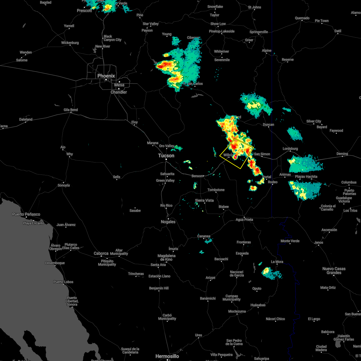
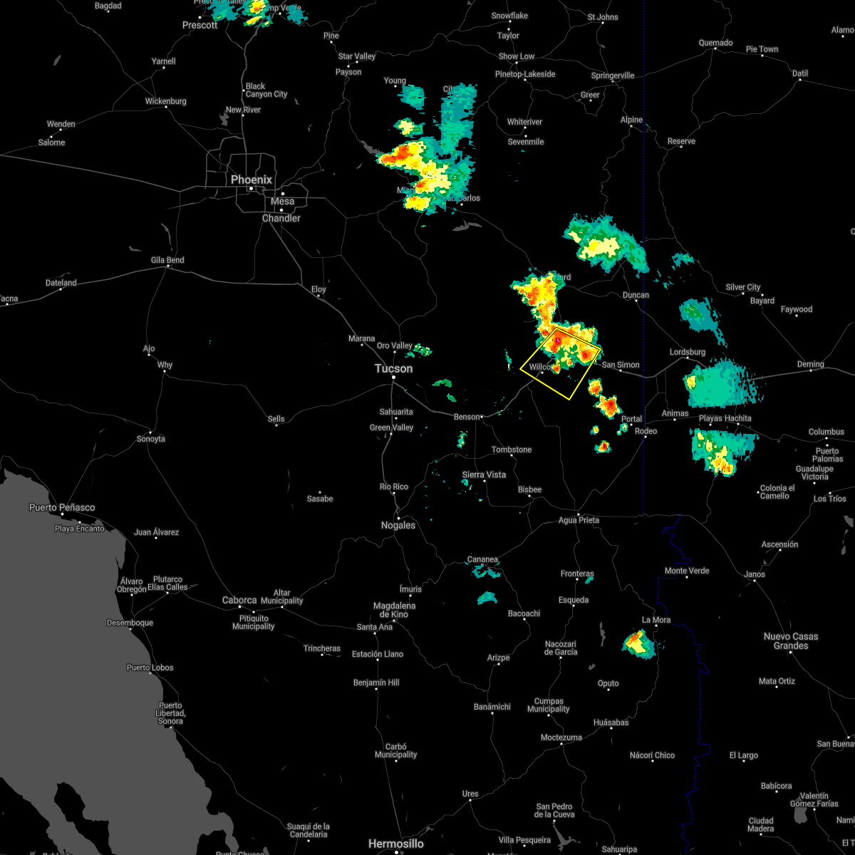
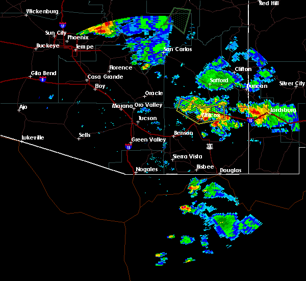
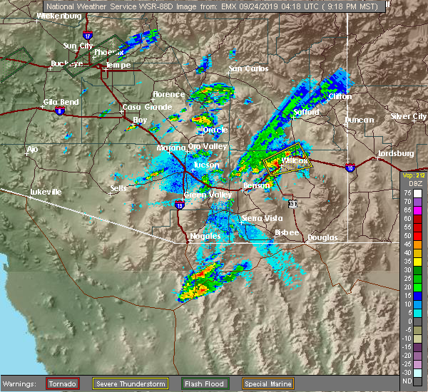 At 921 pm mst, a severe thunderstorm capable of producing a tornado was located over willcox, moving northeast at 30 mph (radar indicated rotation). Hazards include tornado and quarter size hail. Flying debris will be dangerous to those caught without shelter. mobile homes will be damaged or destroyed. damage to roofs, windows, and vehicles will occur. tree damage is likely. this tornadic thunderstorm will remain over mainly remote areas of south central graham and north central cochise counties. this includes the following highways, interstate 10 between mile markers 339 and 364. route 186 between mile markers 327 and 337. Route 191 between mile markers 88 and 93. At 921 pm mst, a severe thunderstorm capable of producing a tornado was located over willcox, moving northeast at 30 mph (radar indicated rotation). Hazards include tornado and quarter size hail. Flying debris will be dangerous to those caught without shelter. mobile homes will be damaged or destroyed. damage to roofs, windows, and vehicles will occur. tree damage is likely. this tornadic thunderstorm will remain over mainly remote areas of south central graham and north central cochise counties. this includes the following highways, interstate 10 between mile markers 339 and 364. route 186 between mile markers 327 and 337. Route 191 between mile markers 88 and 93.
|
| 8/8/2018 6:41 PM MST |
 The severe thunderstorm warning for south central graham and north central cochise counties will expire at 645 pm mst, the storms in northern cochise county which prompted the warning have weakened below severe limits. therefore, the warning will be allowed to expire. however heavy rain is still possible with these thunderstorms along with wind gusts to 40 mph. The severe thunderstorm warning for south central graham and north central cochise counties will expire at 645 pm mst, the storms in northern cochise county which prompted the warning have weakened below severe limits. therefore, the warning will be allowed to expire. however heavy rain is still possible with these thunderstorms along with wind gusts to 40 mph.
|
| 8/8/2018 6:17 PM MST |
 At 614 pm mst, severe thunderstorms were located along a line extending from 20 miles northwest of willcox, to willcox to near bowie, moving south at 10 mph (radar indicated). Hazards include 60 mph wind gusts and penny size hail. also, areas of blowing dust followed by heavy rain. Expect damage to roofs, siding, and trees. hazardous driving conditions. locations impacted include, willcox, bowie. this includes the following highways, interstate 10 between mile markers 335 and 366. route 186 between mile markers 327 and 335. Route 191 between mile markers 88 and 95. At 614 pm mst, severe thunderstorms were located along a line extending from 20 miles northwest of willcox, to willcox to near bowie, moving south at 10 mph (radar indicated). Hazards include 60 mph wind gusts and penny size hail. also, areas of blowing dust followed by heavy rain. Expect damage to roofs, siding, and trees. hazardous driving conditions. locations impacted include, willcox, bowie. this includes the following highways, interstate 10 between mile markers 335 and 366. route 186 between mile markers 327 and 335. Route 191 between mile markers 88 and 95.
|
| 8/8/2018 6:01 PM MST |
 At 559 pm mst, severe thunderstorms were located along a line extending from 12 miles southwest of fort grant to near willcox to 6 miles northwest of bowie, moving south at 10 mph (radar indicated). Hazards include 60 mph wind gusts and penny size hail along with heavy rain. expect damage to roofs, siding, and trees At 559 pm mst, severe thunderstorms were located along a line extending from 12 miles southwest of fort grant to near willcox to 6 miles northwest of bowie, moving south at 10 mph (radar indicated). Hazards include 60 mph wind gusts and penny size hail along with heavy rain. expect damage to roofs, siding, and trees
|
| 10/21/2015 1:19 AM MST |
 At 116 am mst, doppler radar indicated a severe thunderstorm capable of producing quarter size hail and destructive winds in excess of 70 mph. this storm was located near bowie, moving north at 40 mph. locations impacted include, bowie. At 116 am mst, doppler radar indicated a severe thunderstorm capable of producing quarter size hail and destructive winds in excess of 70 mph. this storm was located near bowie, moving north at 40 mph. locations impacted include, bowie.
|
| 10/21/2015 1:02 AM MST |
 At 101 am mst, doppler radar indicated a severe thunderstorm capable of producing quarter size hail and damaging winds in excess of 65 mph. this storm was located 10 miles south of bowie, and moving north at 40 mph. At 101 am mst, doppler radar indicated a severe thunderstorm capable of producing quarter size hail and damaging winds in excess of 65 mph. this storm was located 10 miles south of bowie, and moving north at 40 mph.
|
Hail Maps for Bowie, AZ


Connect with Interactive Hail Maps