

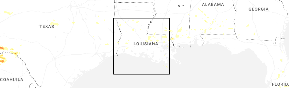
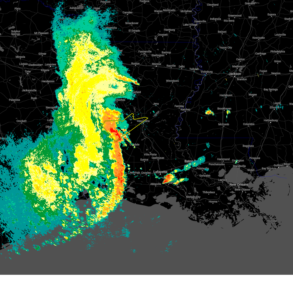
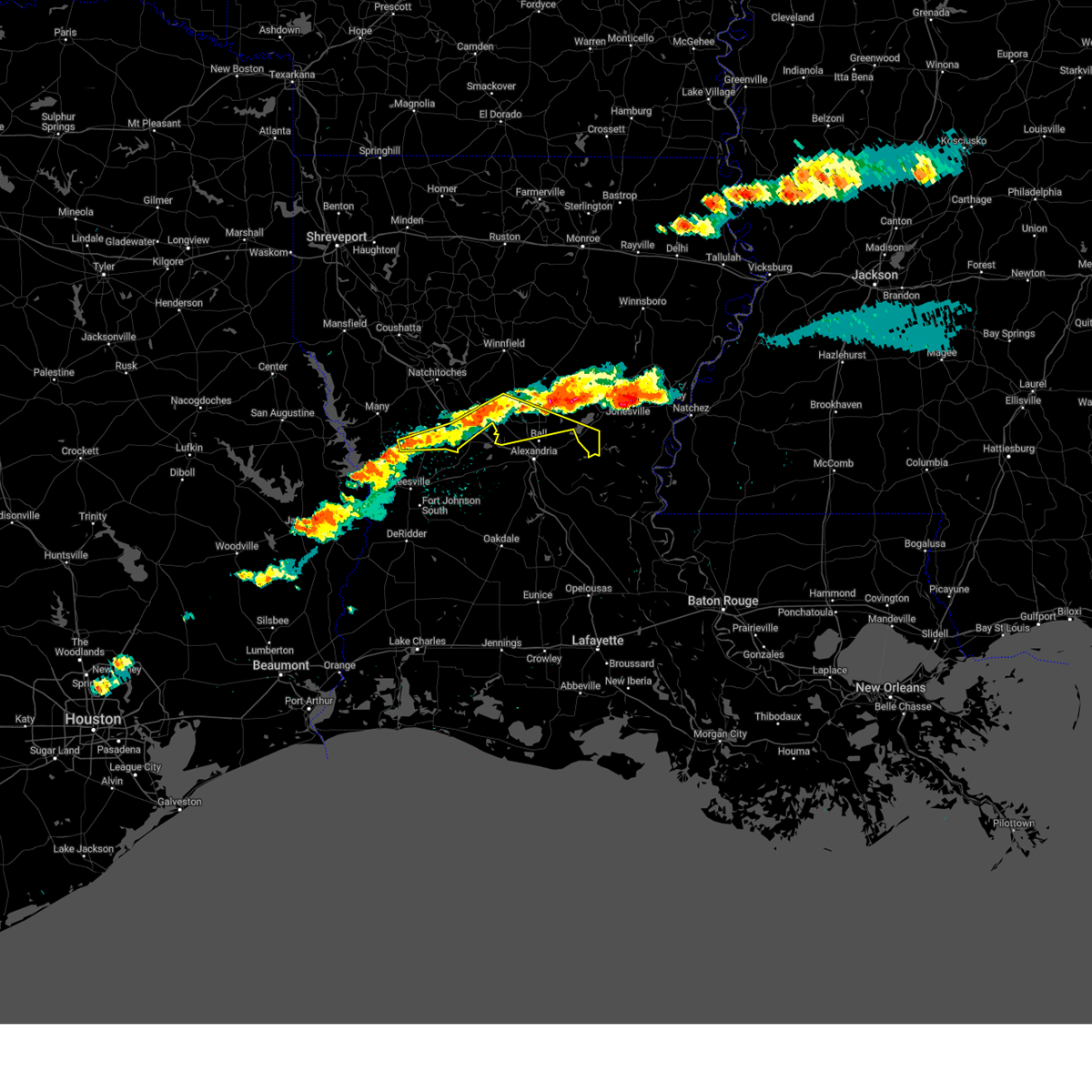
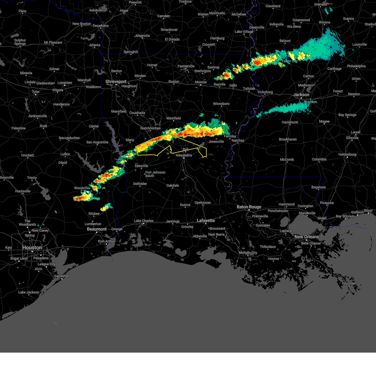
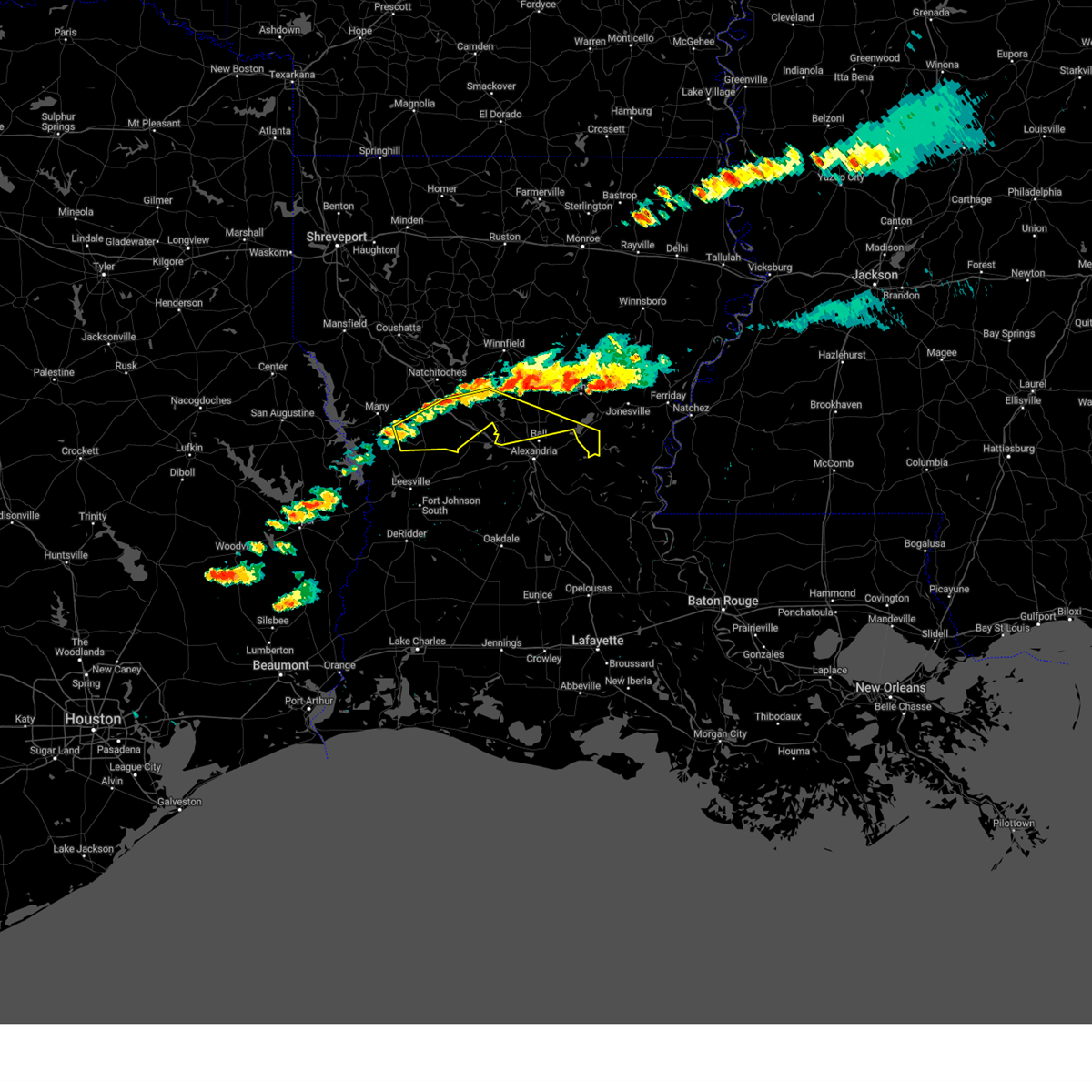
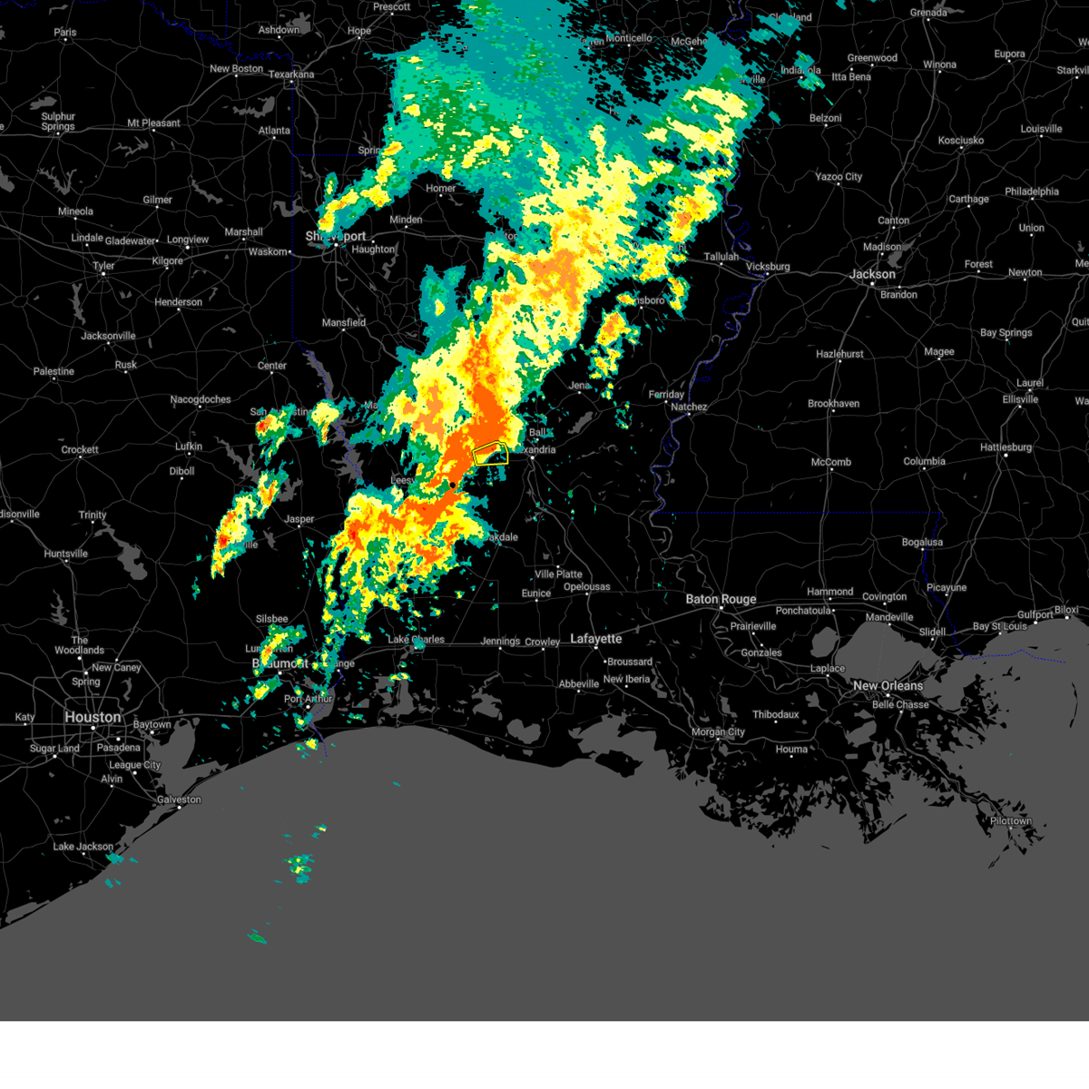
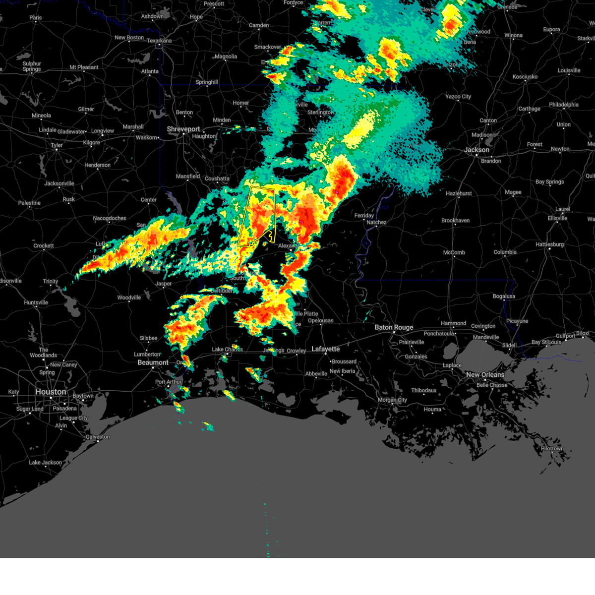
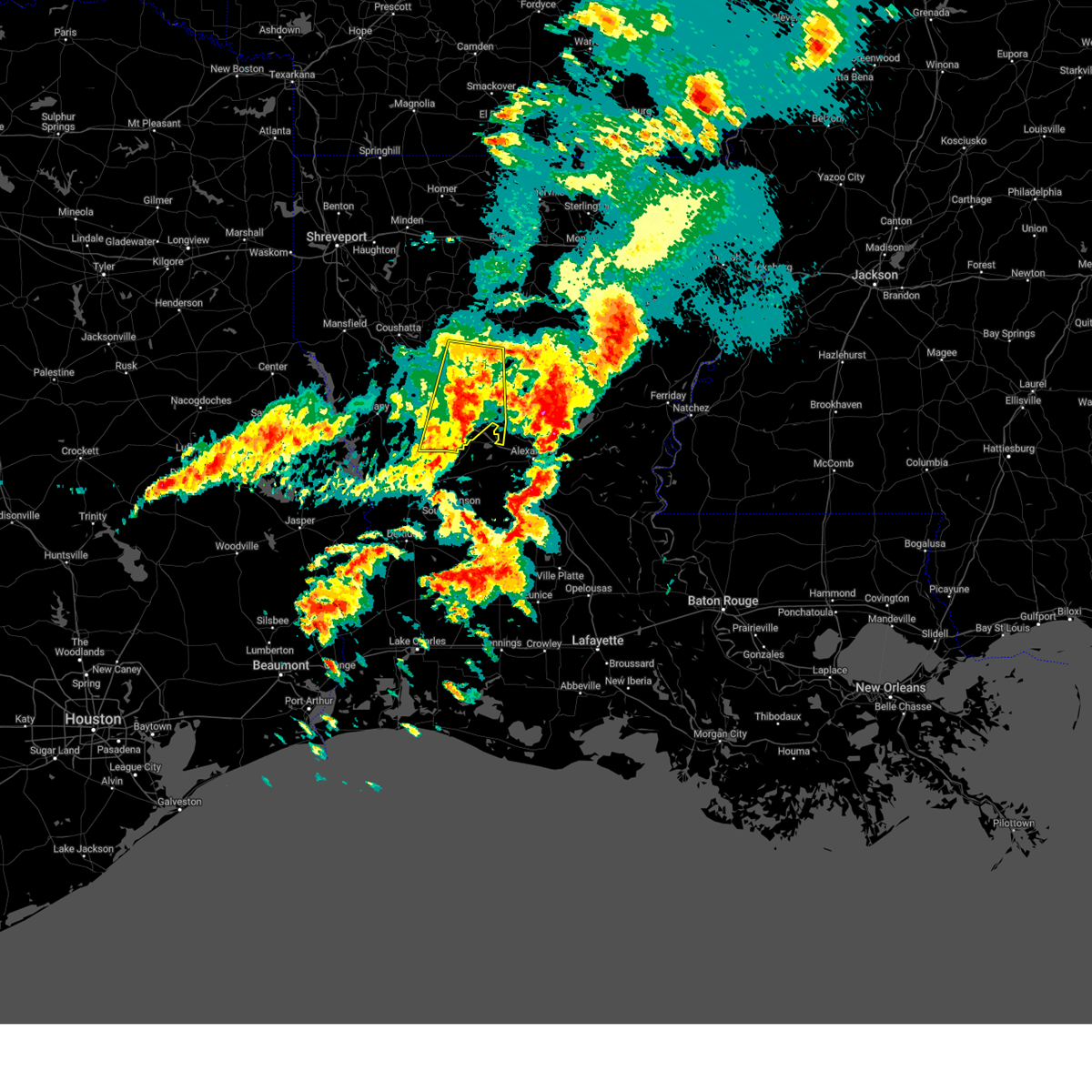
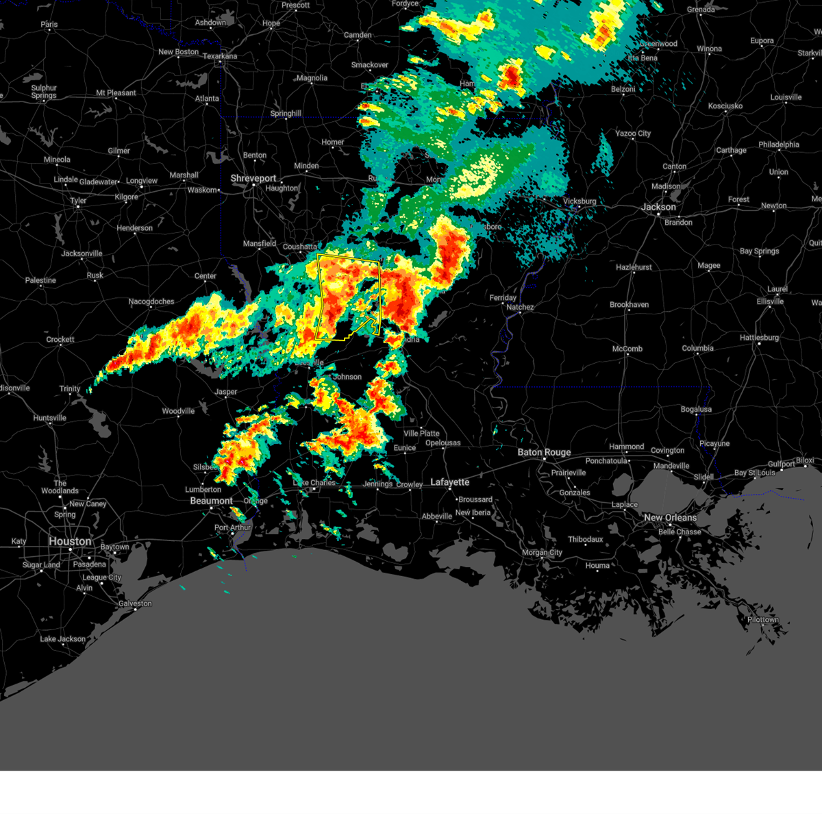
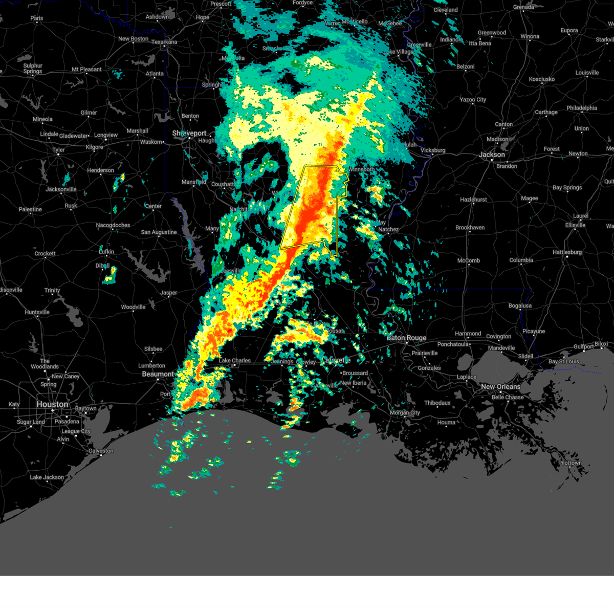
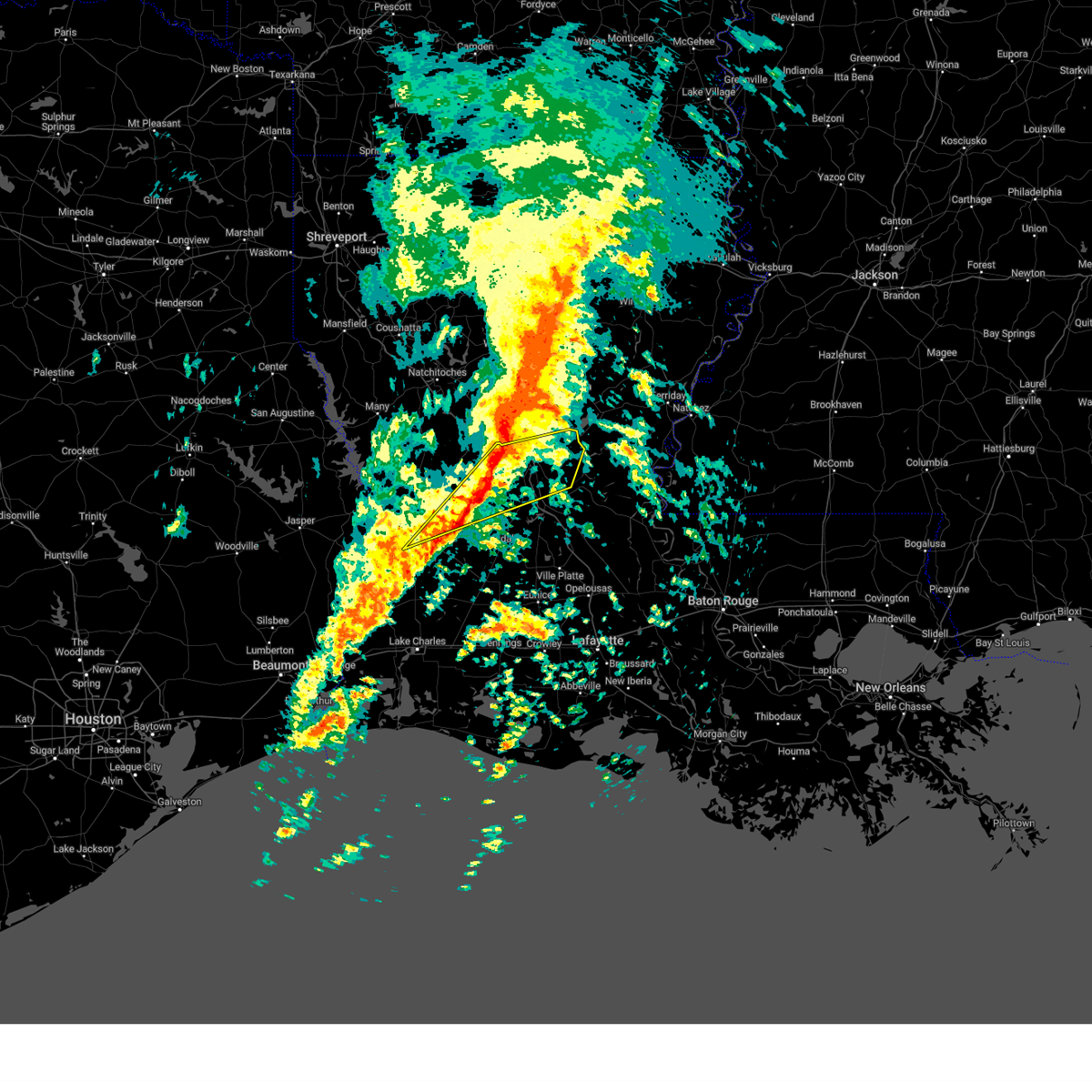
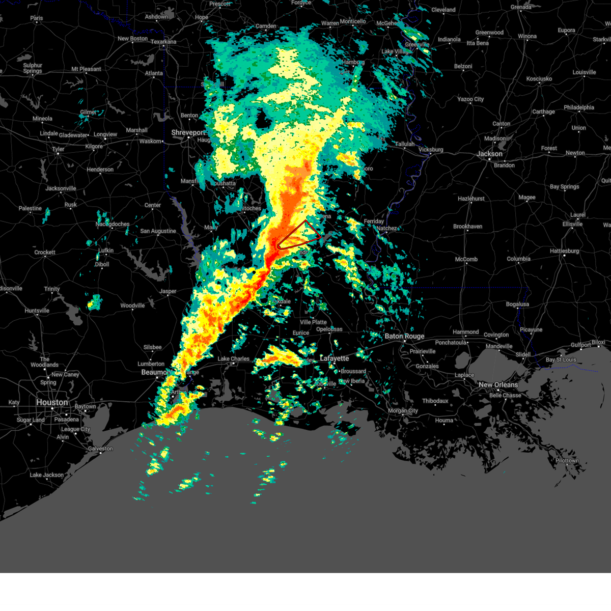
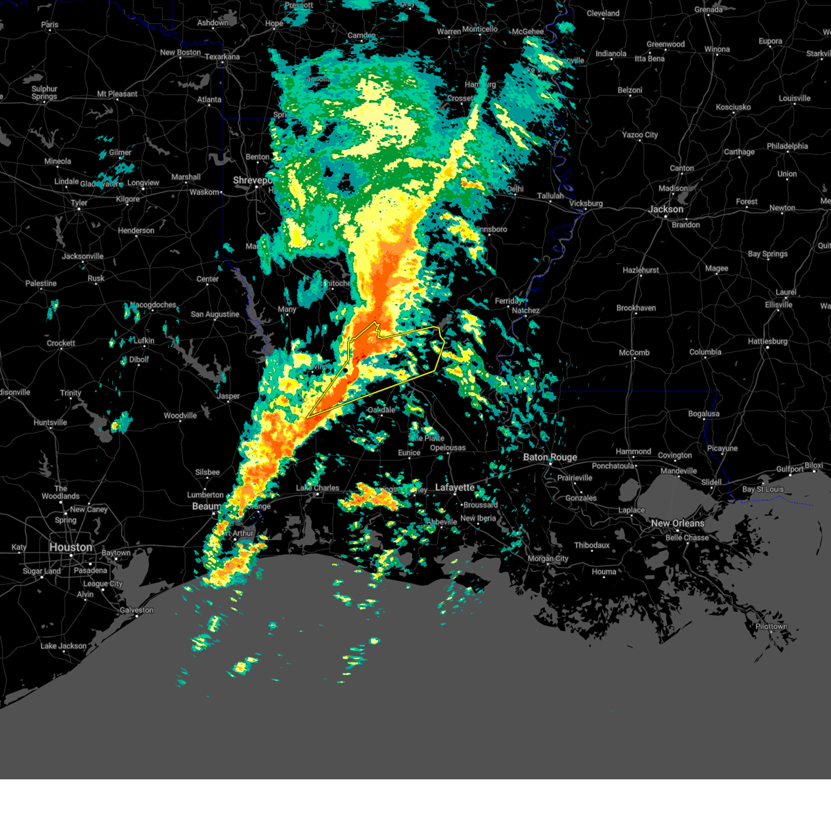
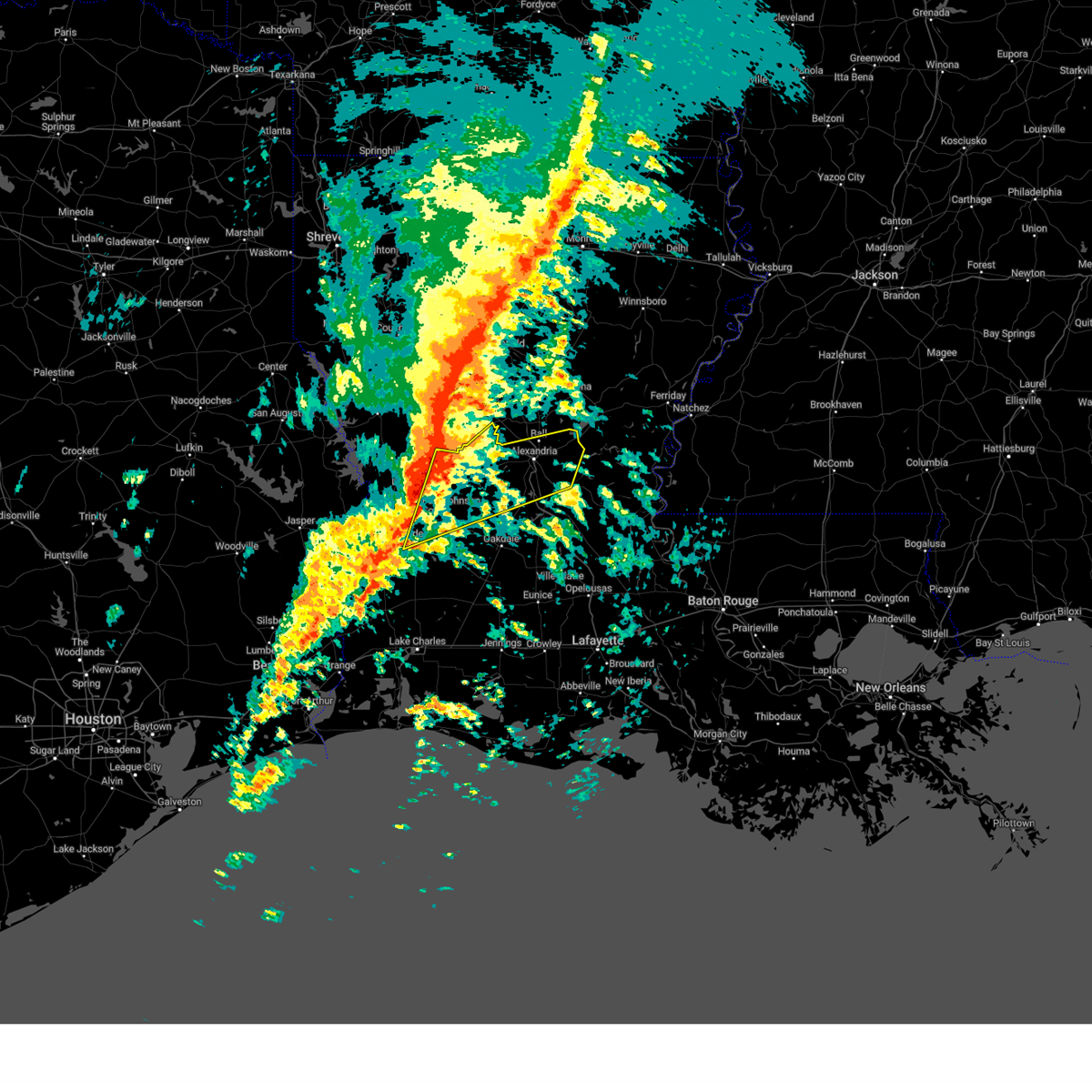
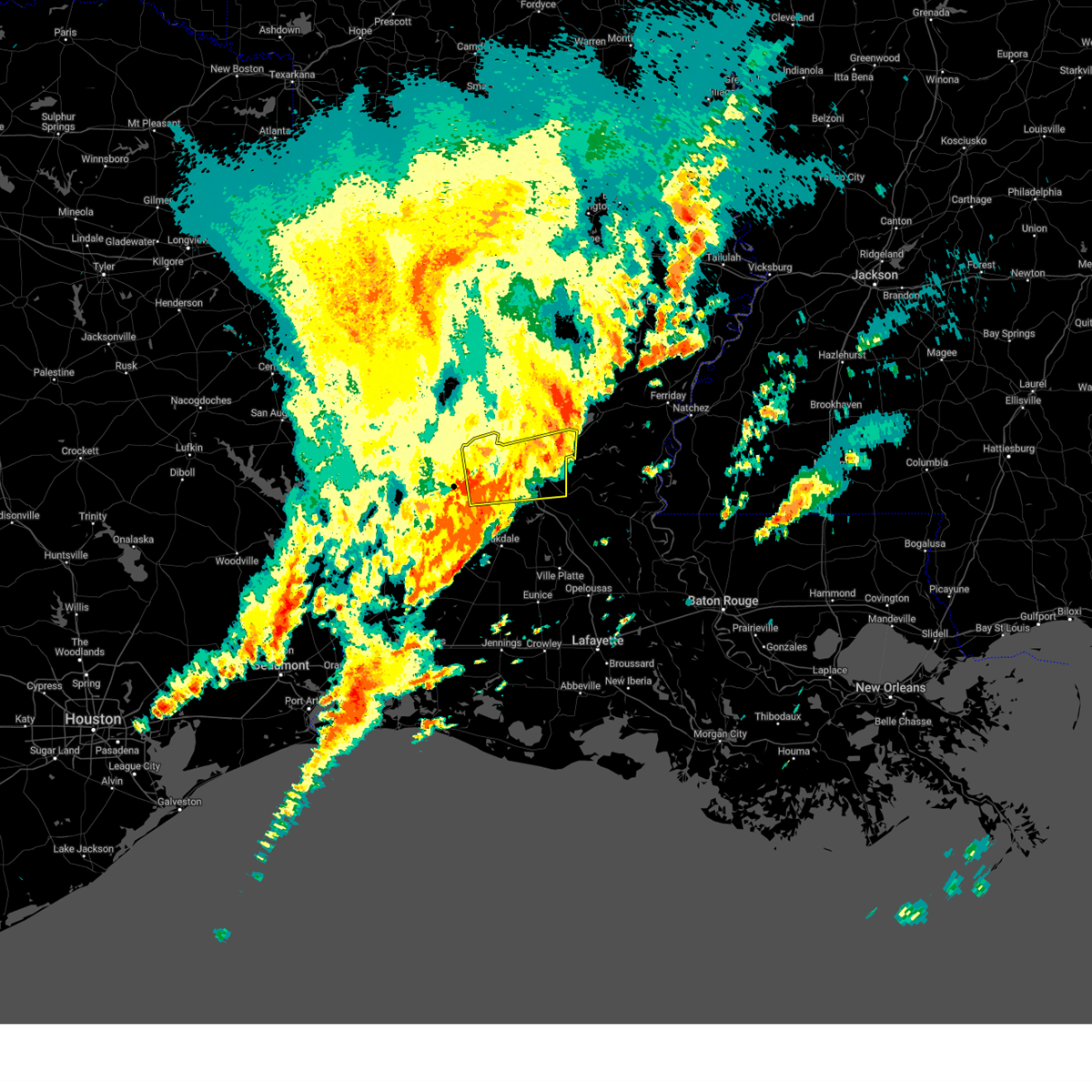
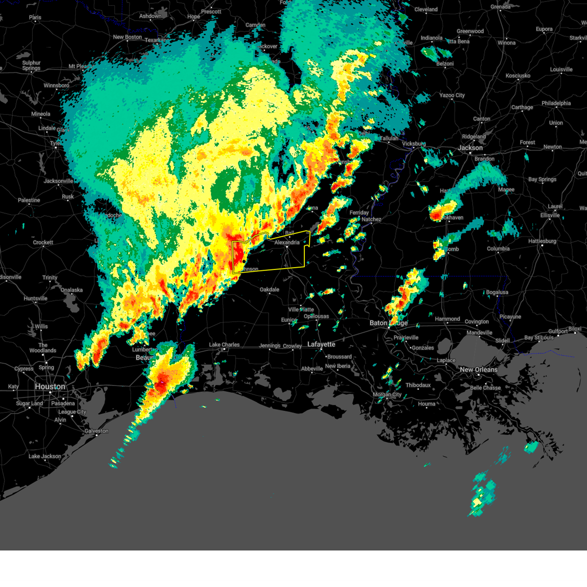
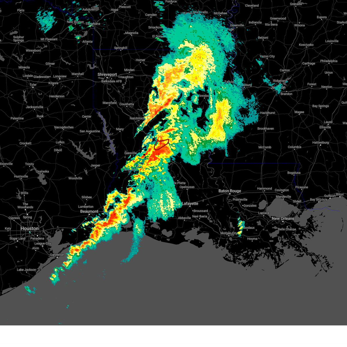
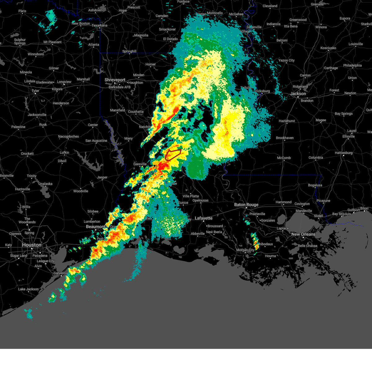
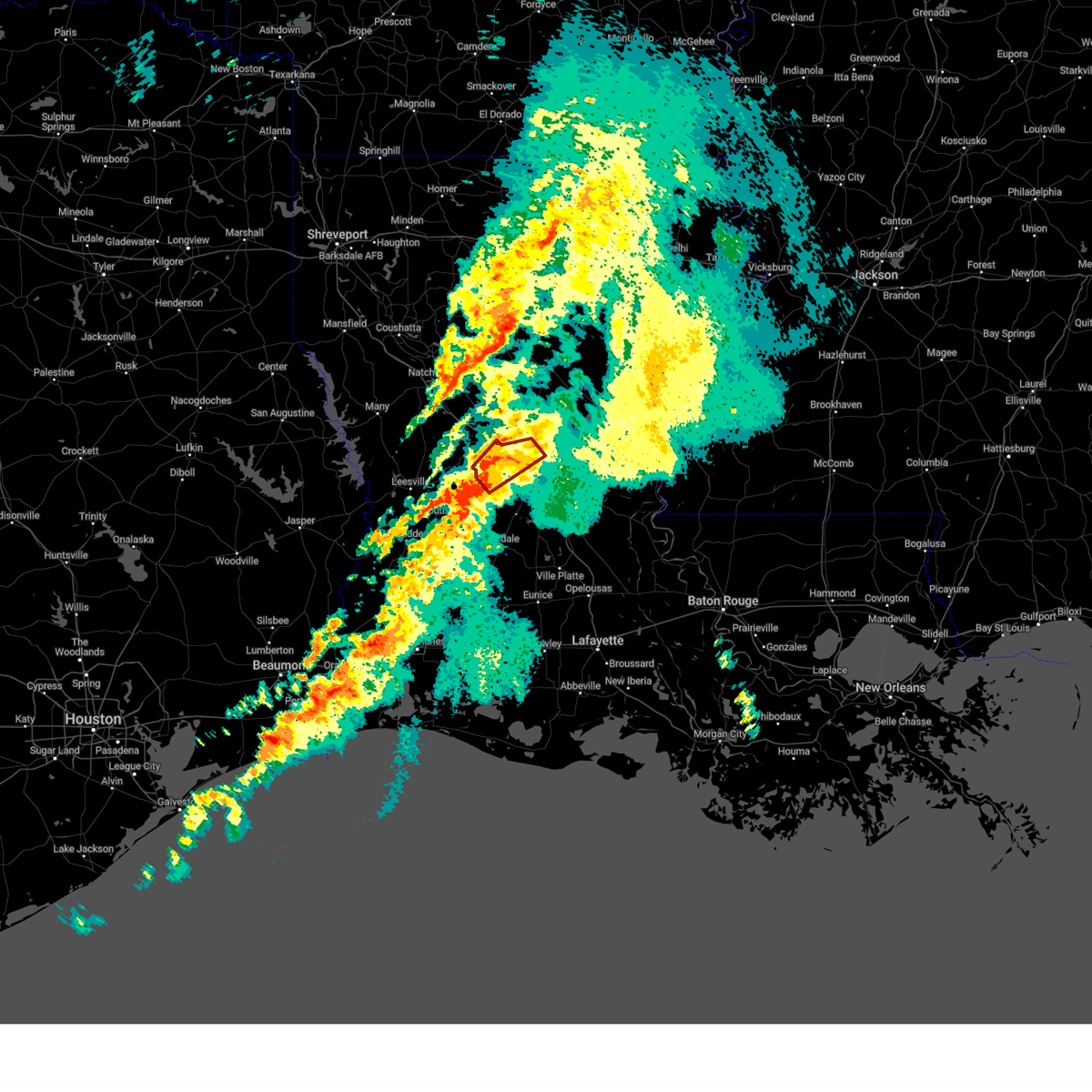
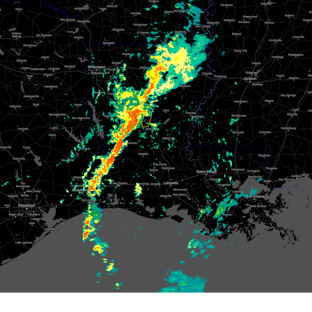
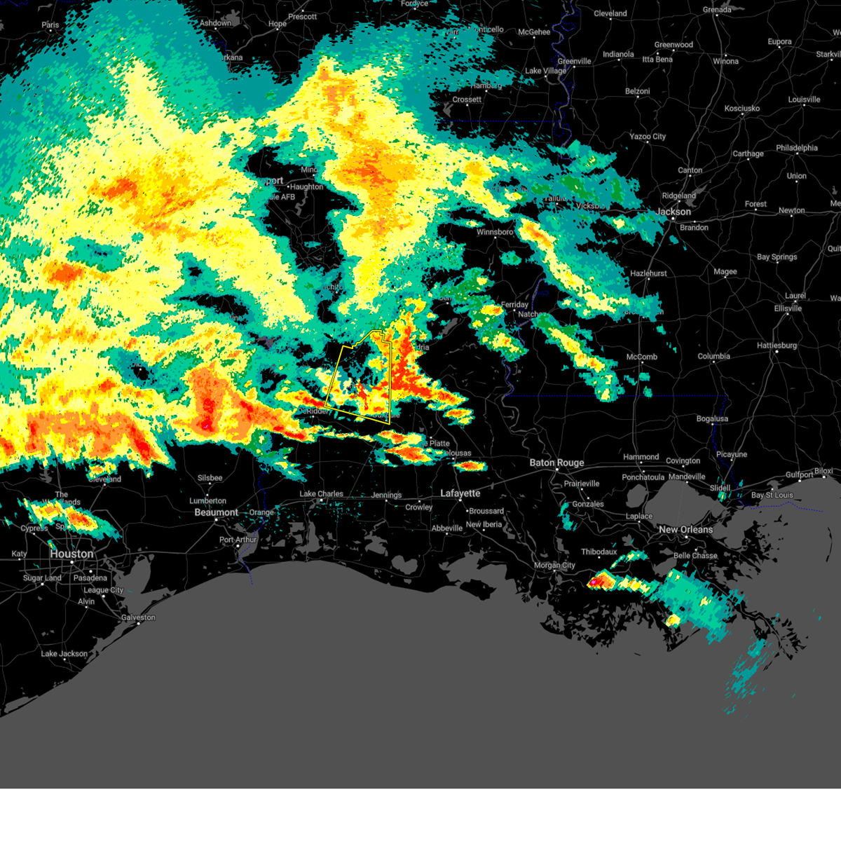
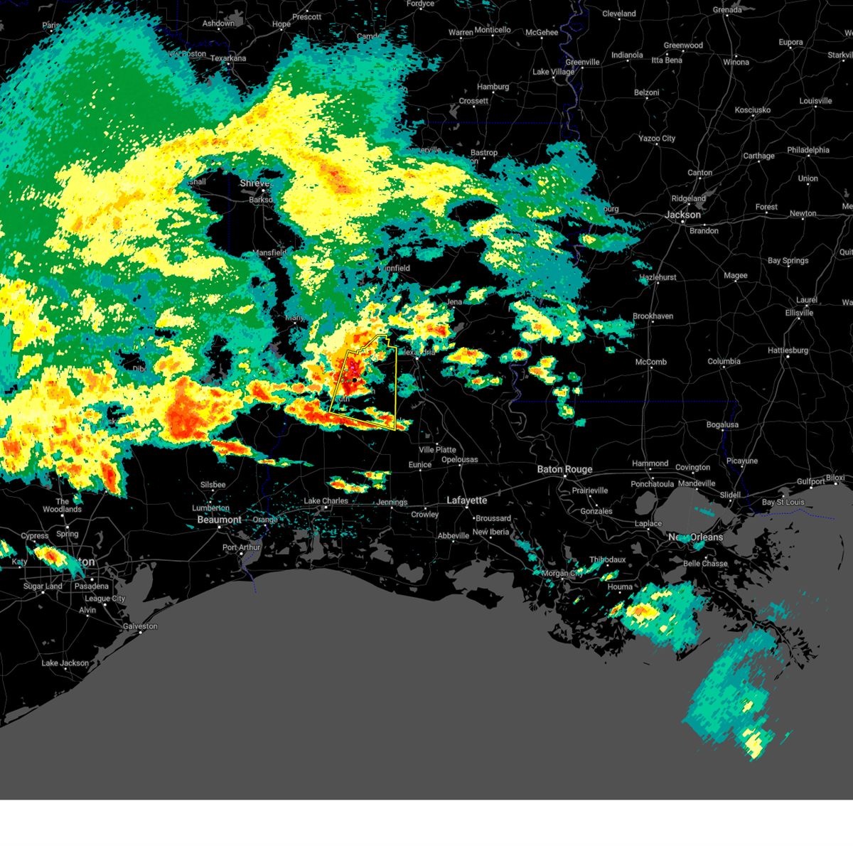
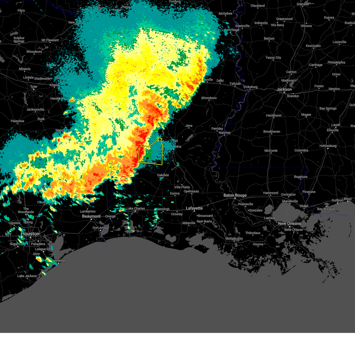
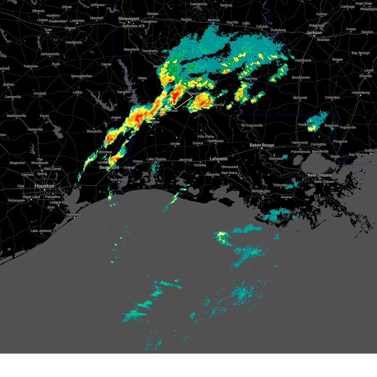
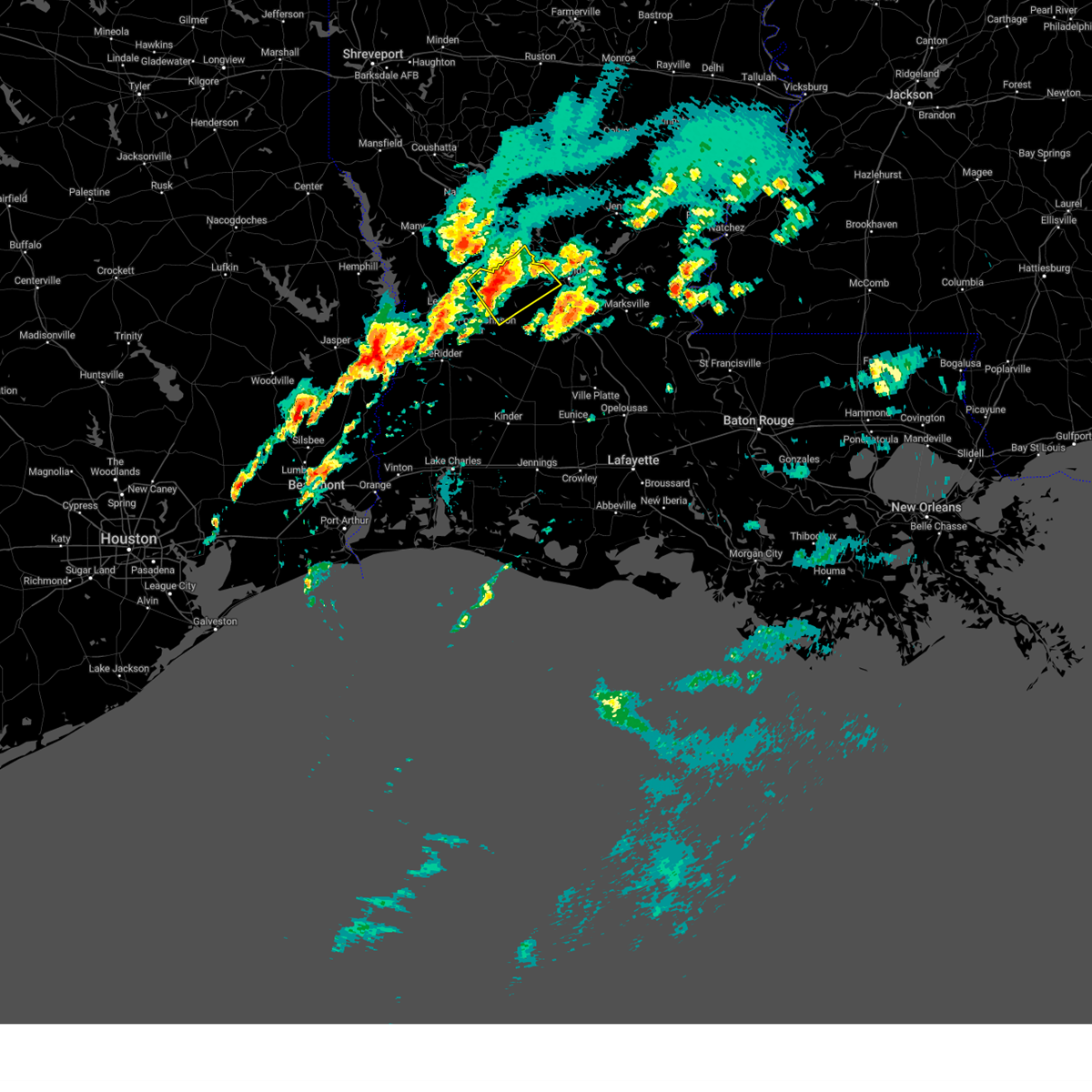
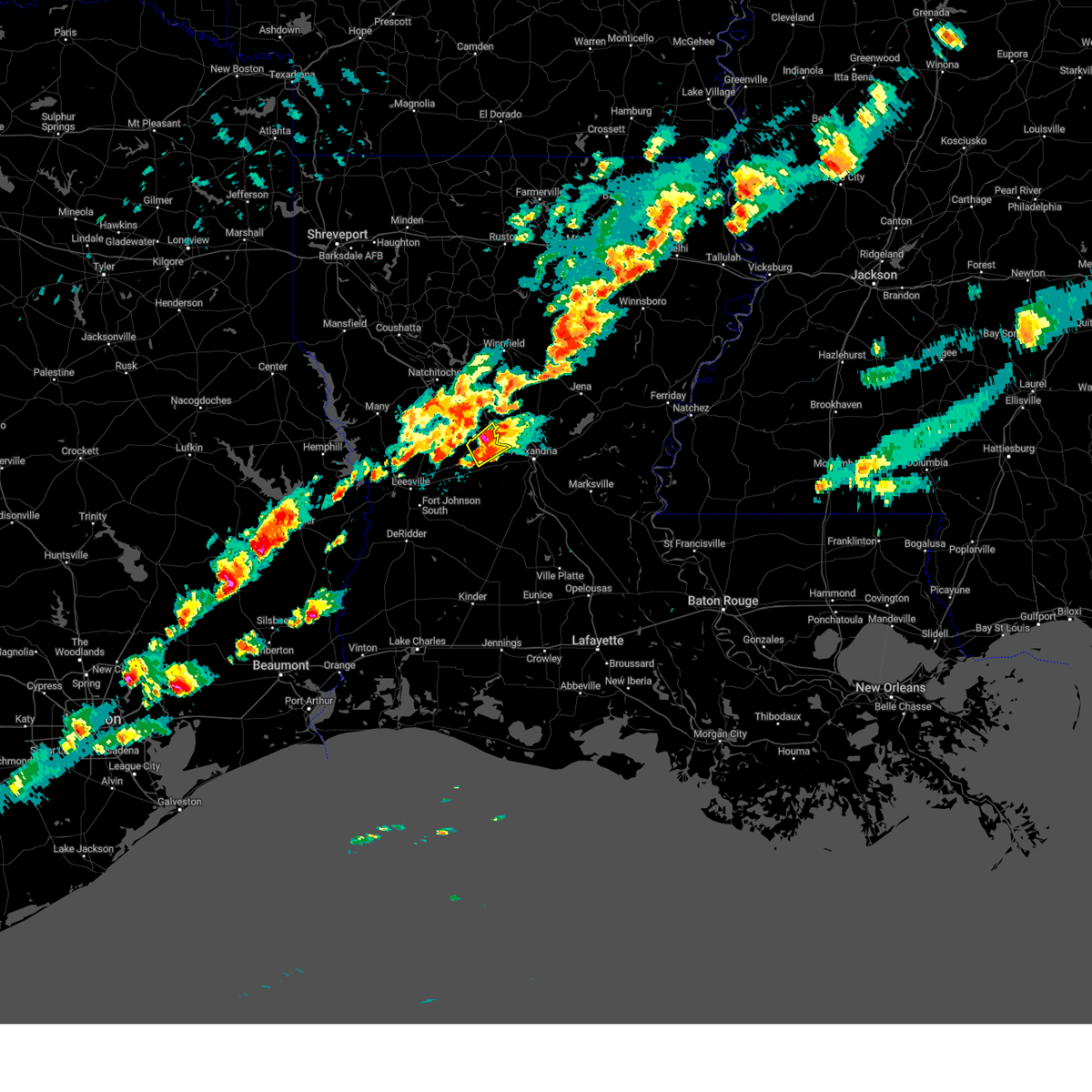
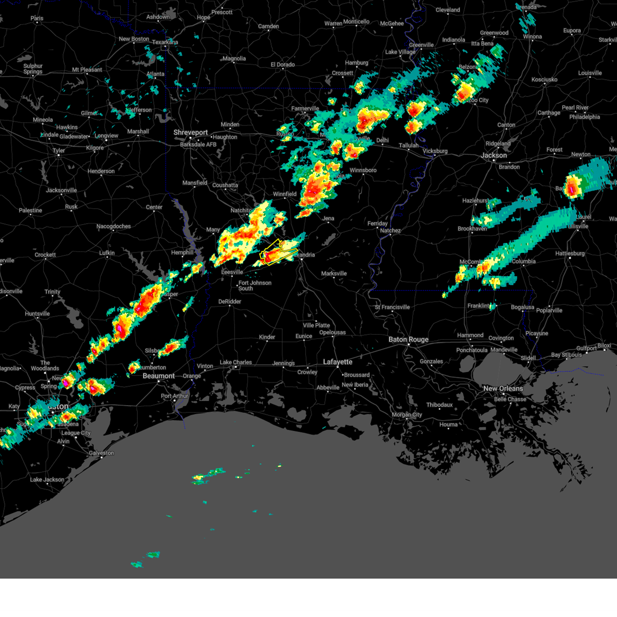
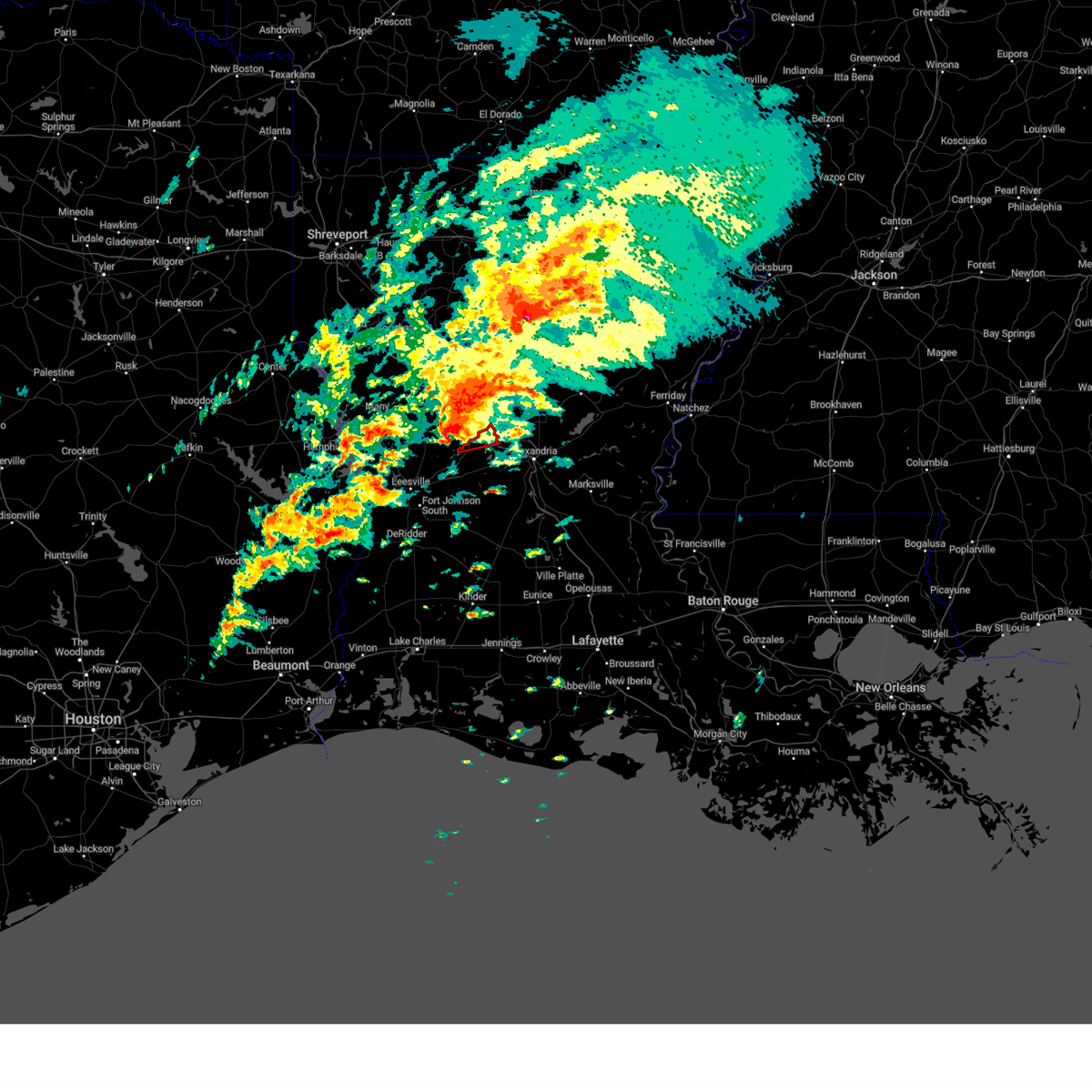
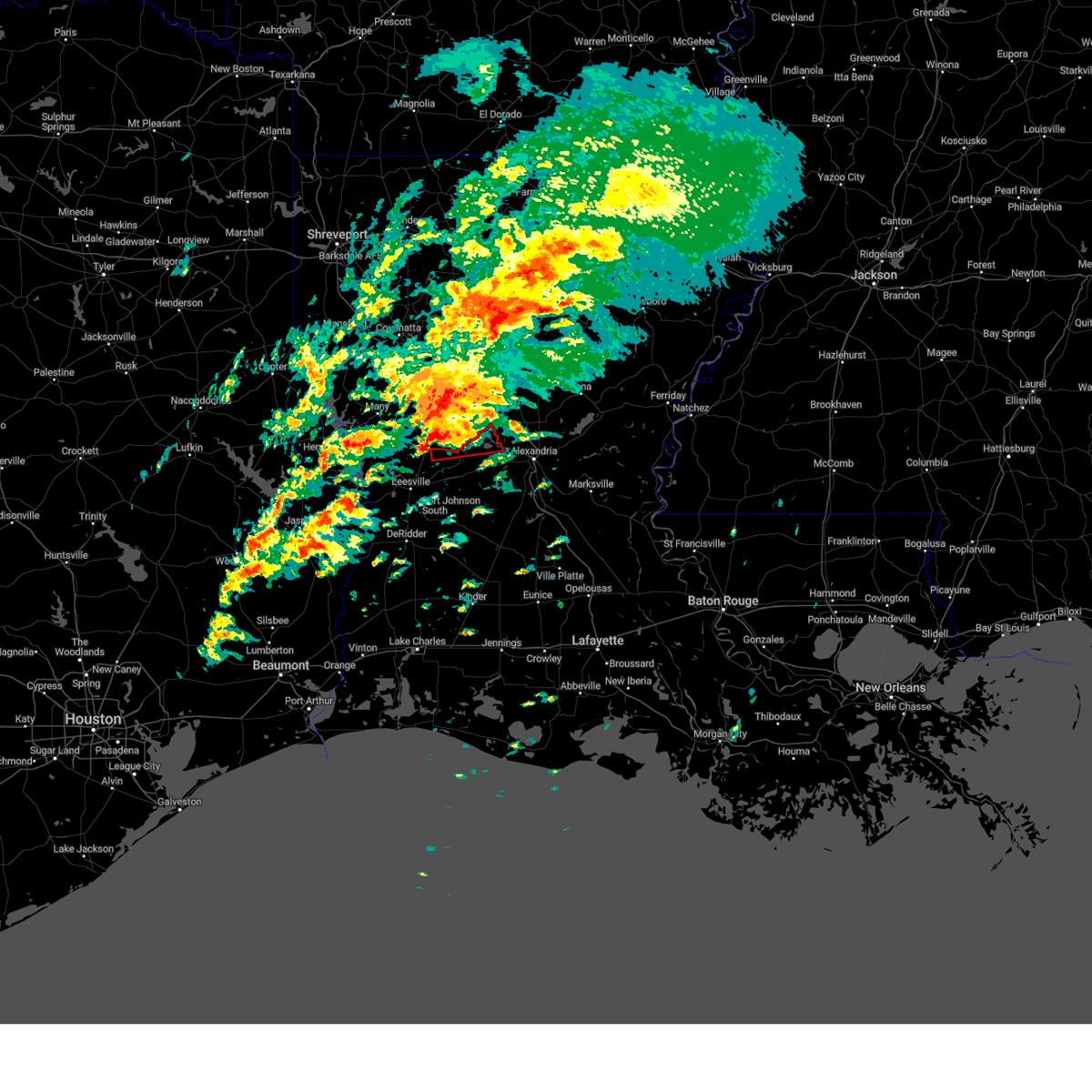
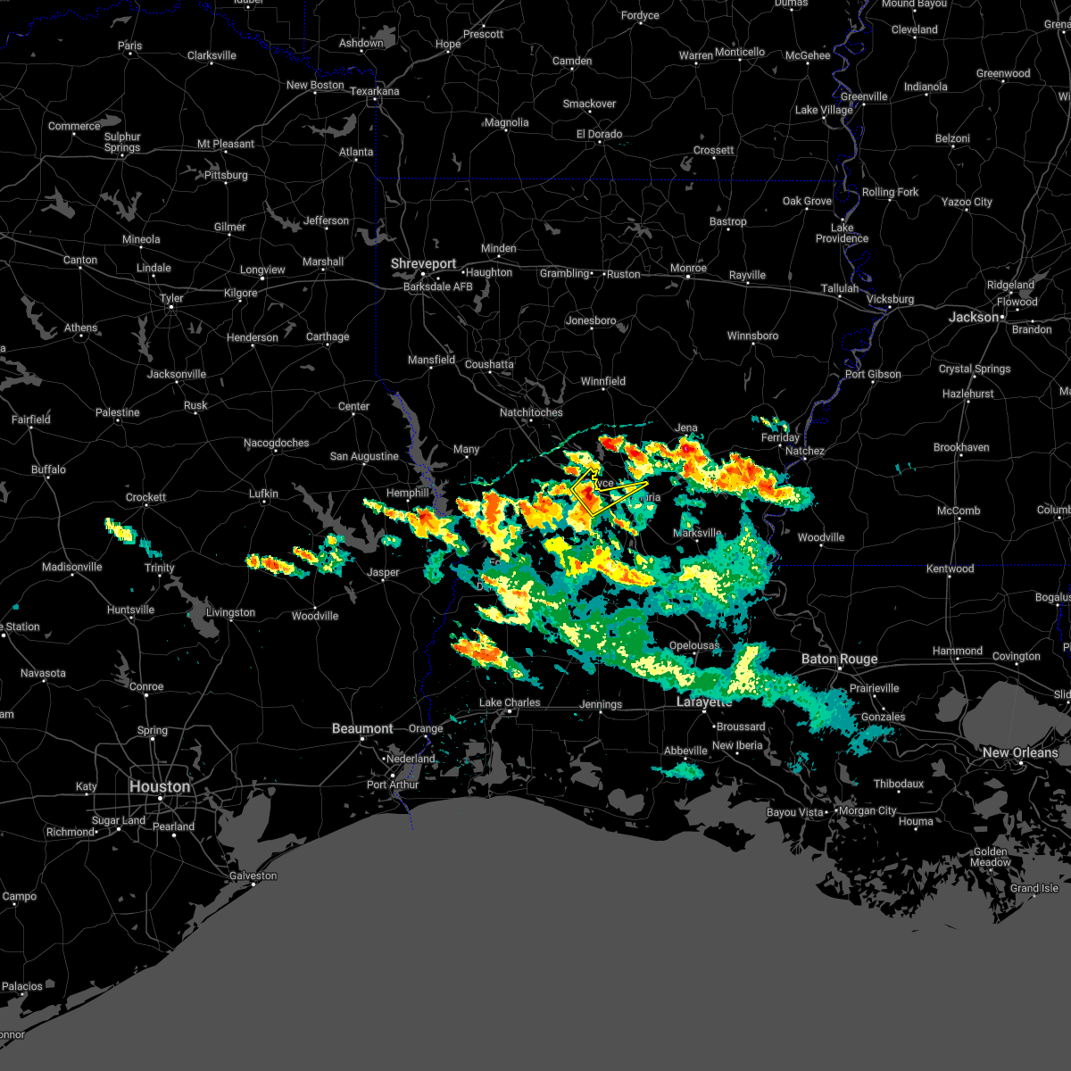
Hail Map for Boyce, LA
The Boyce, LA area has had 5 reports of on-the-ground hail by trained spotters, and has been under severe weather warnings 28 times during the past 12 months. Doppler radar has detected hail at or near Boyce, LA on 58 occasions, including 4 occasions during the past year.
| Name: | Boyce, LA |
| Where Located: | 89.4 miles NNW of Lafayette, LA |
| Map: | Google Map for Boyce, LA |
| Population: | 1004 |
| Housing Units: | 454 |
| More Info: | Search Google for Boyce, LA |
0
The Top Recent Hail Date for Boyce, LA is Tuesday, June 10, 2025 (50th out of 58)
Hail and Wind Damage Spotted near Boyce, LA
| Date / Time | Report Details |
|---|---|
| 5/27/2025 4:58 AM CDT |
 the severe thunderstorm warning has been cancelled and is no longer in effect the severe thunderstorm warning has been cancelled and is no longer in effect
|
| 5/27/2025 4:30 AM CDT |
 Svrlch the national weather service in lake charles has issued a * severe thunderstorm warning for, northwestern rapides parish in central louisiana, * until 515 am cdt. * at 428 am cdt, a severe thunderstorm was located over gardner, or near boyce, moving northeast at 30 mph (radar indicated). Hazards include 60 mph wind gusts and penny size hail. expect damage to roofs, siding, and trees Svrlch the national weather service in lake charles has issued a * severe thunderstorm warning for, northwestern rapides parish in central louisiana, * until 515 am cdt. * at 428 am cdt, a severe thunderstorm was located over gardner, or near boyce, moving northeast at 30 mph (radar indicated). Hazards include 60 mph wind gusts and penny size hail. expect damage to roofs, siding, and trees
|
| 5/27/2025 3:55 AM CDT |
 At 355 am cdt, a severe thunderstorm was located near lacamp, or near slagle, moving northeast at 25 mph (radar indicated). Hazards include 60 mph wind gusts and penny size hail. Expect damage to roofs, siding, and trees. Locations impacted include, alexandria, pineville, boyce, lena, alexandria international airport, ball, colfax, lacamp, tioga, timber trails, hutton, clifton, flatwoods, otis, kurthwood, leander, sieper, gardner, paradise, and simpson. At 355 am cdt, a severe thunderstorm was located near lacamp, or near slagle, moving northeast at 25 mph (radar indicated). Hazards include 60 mph wind gusts and penny size hail. Expect damage to roofs, siding, and trees. Locations impacted include, alexandria, pineville, boyce, lena, alexandria international airport, ball, colfax, lacamp, tioga, timber trails, hutton, clifton, flatwoods, otis, kurthwood, leander, sieper, gardner, paradise, and simpson.
|
| 5/27/2025 3:34 AM CDT |
 Svrlch the national weather service in lake charles has issued a * severe thunderstorm warning for, northwestern rapides parish in central louisiana, northeastern vernon parish in west central louisiana, * until 430 am cdt. * at 333 am cdt, a severe thunderstorm was located near slagle, moving northeast at 25 mph (radar indicated). Hazards include 70 mph wind gusts and penny size hail. Expect considerable tree damage. Damage is likely to mobile homes, roofs, and outbuildings. Svrlch the national weather service in lake charles has issued a * severe thunderstorm warning for, northwestern rapides parish in central louisiana, northeastern vernon parish in west central louisiana, * until 430 am cdt. * at 333 am cdt, a severe thunderstorm was located near slagle, moving northeast at 25 mph (radar indicated). Hazards include 70 mph wind gusts and penny size hail. Expect considerable tree damage. Damage is likely to mobile homes, roofs, and outbuildings.
|
| 5/20/2025 7:43 PM CDT |
 At 743 pm cdt, severe thunderstorms were located along a line extending from 7 miles east of colfax to near flatwoods to near anacoco, moving southeast at 20 mph (radar indicated). Hazards include 60 mph wind gusts and quarter size hail. Hail damage to vehicles is expected. expect wind damage to roofs, siding, and trees. Locations impacted include, kisatchie, rogers, lake iatt, chopin, pollock, aloha, dry prong, fishville, bentley, colfax, and gorum. At 743 pm cdt, severe thunderstorms were located along a line extending from 7 miles east of colfax to near flatwoods to near anacoco, moving southeast at 20 mph (radar indicated). Hazards include 60 mph wind gusts and quarter size hail. Hail damage to vehicles is expected. expect wind damage to roofs, siding, and trees. Locations impacted include, kisatchie, rogers, lake iatt, chopin, pollock, aloha, dry prong, fishville, bentley, colfax, and gorum.
|
| 5/20/2025 7:12 PM CDT |
 At 712 pm cdt, severe thunderstorms were located along a line extending from 11 miles north of colfax to 9 miles southwest of montgomery to near hornbeck, moving southeast at 20 mph (radar indicated). Hazards include 60 mph wind gusts and quarter size hail. Hail damage to vehicles is expected. expect wind damage to roofs, siding, and trees. Locations impacted include, kisatchie, cloutierville, melrose, rogers, montgomery, bellwood, chopin, dry prong, bentley, lake iatt, cypress, pollock, aloha, fishville, colfax, and gorum. At 712 pm cdt, severe thunderstorms were located along a line extending from 11 miles north of colfax to 9 miles southwest of montgomery to near hornbeck, moving southeast at 20 mph (radar indicated). Hazards include 60 mph wind gusts and quarter size hail. Hail damage to vehicles is expected. expect wind damage to roofs, siding, and trees. Locations impacted include, kisatchie, cloutierville, melrose, rogers, montgomery, bellwood, chopin, dry prong, bentley, lake iatt, cypress, pollock, aloha, fishville, colfax, and gorum.
|
| 5/20/2025 7:07 PM CDT |
 Svrshv the national weather service in shreveport has issued a * severe thunderstorm warning for, grant parish in north central louisiana, southern natchitoches parish in northwestern louisiana, southern la salle parish in north central louisiana, east central sabine parish in northwestern louisiana, * until 815 pm cdt. * at 707 pm cdt, severe thunderstorms were located along a line extending from 12 miles north of colfax to 9 miles southwest of montgomery to near hornbeck, moving southeast at 20 mph (radar indicated). Hazards include 60 mph wind gusts and half dollar size hail. Hail damage to vehicles is expected. Expect wind damage to roofs, siding, and trees. Svrshv the national weather service in shreveport has issued a * severe thunderstorm warning for, grant parish in north central louisiana, southern natchitoches parish in northwestern louisiana, southern la salle parish in north central louisiana, east central sabine parish in northwestern louisiana, * until 815 pm cdt. * at 707 pm cdt, severe thunderstorms were located along a line extending from 12 miles north of colfax to 9 miles southwest of montgomery to near hornbeck, moving southeast at 20 mph (radar indicated). Hazards include 60 mph wind gusts and half dollar size hail. Hail damage to vehicles is expected. Expect wind damage to roofs, siding, and trees.
|
| 5/6/2025 8:06 PM CDT | Report of tree down in boyce. time estimated by rada in rapides county LA, 0.1 miles SE of Boyce, LA |
| 4/5/2025 8:20 PM CDT |
 the severe thunderstorm warning has been cancelled and is no longer in effect the severe thunderstorm warning has been cancelled and is no longer in effect
|
| 4/5/2025 8:11 PM CDT |
 At 811 pm cdt, a severe thunderstorm was located near boyce, moving east at 55 mph (radar indicated). Hazards include 60 mph wind gusts. Expect damage to roofs, siding, and trees. Locations impacted include, boyce. At 811 pm cdt, a severe thunderstorm was located near boyce, moving east at 55 mph (radar indicated). Hazards include 60 mph wind gusts. Expect damage to roofs, siding, and trees. Locations impacted include, boyce.
|
| 4/5/2025 8:08 PM CDT |
 Svrlch the national weather service in lake charles has issued a * severe thunderstorm warning for, northern rapides parish in central louisiana, * until 845 pm cdt. * at 807 pm cdt, a severe thunderstorm was located near gardner, or 7 miles southwest of boyce, moving east at 55 mph (radar indicated). Hazards include 60 mph wind gusts. expect damage to roofs, siding, and trees Svrlch the national weather service in lake charles has issued a * severe thunderstorm warning for, northern rapides parish in central louisiana, * until 845 pm cdt. * at 807 pm cdt, a severe thunderstorm was located near gardner, or 7 miles southwest of boyce, moving east at 55 mph (radar indicated). Hazards include 60 mph wind gusts. expect damage to roofs, siding, and trees
|
| 3/31/2025 3:35 AM CDT |
 the severe thunderstorm warning has been cancelled and is no longer in effect the severe thunderstorm warning has been cancelled and is no longer in effect
|
| 3/31/2025 3:17 AM CDT |
 At 317 am cdt, severe thunderstorms were located along a line from 6 miles south of winnfield to 20 miles southwest of colfax, or along a line from 6 miles south of winnfield to 34 miles south of natchitoches, moving east at 40 mph (radar indicated). Hazards include 60 mph wind gusts and quarter size hail. Hail damage to vehicles is expected. expect wind damage to roofs, siding, and trees. locations impacted include, winnfield, colfax, montgomery, calvin, atlanta, aloha, cloutierville, melrose, st. Maurice, bermuda, chopin, lake iatt and gorum. At 317 am cdt, severe thunderstorms were located along a line from 6 miles south of winnfield to 20 miles southwest of colfax, or along a line from 6 miles south of winnfield to 34 miles south of natchitoches, moving east at 40 mph (radar indicated). Hazards include 60 mph wind gusts and quarter size hail. Hail damage to vehicles is expected. expect wind damage to roofs, siding, and trees. locations impacted include, winnfield, colfax, montgomery, calvin, atlanta, aloha, cloutierville, melrose, st. Maurice, bermuda, chopin, lake iatt and gorum.
|
| 3/31/2025 3:10 AM CDT |
 At 310 am cdt, severe thunderstorms were located along a line from 7 miles southwest of winnfield to 22 miles southwest of colfax, or along a line from 7 miles southwest of winnfield to 31 miles south of natchitoches, moving east at 40 mph (radar indicated). Hazards include 60 mph wind gusts and quarter size hail. Hail damage to vehicles is expected. expect wind damage to roofs, siding, and trees. locations impacted include, natchitoches, winnfield, colfax, montgomery, natchez, clarence, calvin, atlanta, melrose, bermuda, cloutierville, st. Maurice, aloha, cypress, chopin, flora, gorum, bellwood, lake iatt and clear lake. At 310 am cdt, severe thunderstorms were located along a line from 7 miles southwest of winnfield to 22 miles southwest of colfax, or along a line from 7 miles southwest of winnfield to 31 miles south of natchitoches, moving east at 40 mph (radar indicated). Hazards include 60 mph wind gusts and quarter size hail. Hail damage to vehicles is expected. expect wind damage to roofs, siding, and trees. locations impacted include, natchitoches, winnfield, colfax, montgomery, natchez, clarence, calvin, atlanta, melrose, bermuda, cloutierville, st. Maurice, aloha, cypress, chopin, flora, gorum, bellwood, lake iatt and clear lake.
|
| 3/31/2025 3:10 AM CDT |
 the severe thunderstorm warning has been cancelled and is no longer in effect the severe thunderstorm warning has been cancelled and is no longer in effect
|
| 3/31/2025 3:01 AM CDT |
 Svrshv the national weather service in shreveport has issued a * severe thunderstorm warning for, southwestern grant parish in north central louisiana, southwestern winn parish in north central louisiana, eastern natchitoches parish in northwestern louisiana, southeastern red river parish in northwestern louisiana, * until 345 am cdt. * at 301 am cdt, severe thunderstorms were located along a line from 12 miles west of winnfield to 26 miles southwest of montgomery, or along a line from 12 miles west of winnfield to 28 miles south of natchitoches, moving east at 40 mph (radar indicated). Hazards include 60 mph wind gusts and quarter size hail. Hail damage to vehicles is expected. Expect wind damage to roofs, siding, and trees. Svrshv the national weather service in shreveport has issued a * severe thunderstorm warning for, southwestern grant parish in north central louisiana, southwestern winn parish in north central louisiana, eastern natchitoches parish in northwestern louisiana, southeastern red river parish in northwestern louisiana, * until 345 am cdt. * at 301 am cdt, severe thunderstorms were located along a line from 12 miles west of winnfield to 26 miles southwest of montgomery, or along a line from 12 miles west of winnfield to 28 miles south of natchitoches, moving east at 40 mph (radar indicated). Hazards include 60 mph wind gusts and quarter size hail. Hail damage to vehicles is expected. Expect wind damage to roofs, siding, and trees.
|
| 3/4/2025 12:11 PM CST |
 the severe thunderstorm warning has been cancelled and is no longer in effect the severe thunderstorm warning has been cancelled and is no longer in effect
|
| 3/4/2025 12:11 PM CST |
 At 1211 pm cst, severe thunderstorms were located along a line from 9 miles northeast of columbia to 20 miles southwest of midway, or along a line from 9 miles northeast of columbia to 39 miles southeast of winnfield, moving east at 60 mph (radar indicated). Hazards include 70 mph wind gusts and quarter size hail. Hail damage to vehicles is expected. expect considerable tree damage. wind damage is also likely to mobile homes, roofs, and outbuildings. Locations impacted include, columbia, jena, olla, clarks, grayson, midway, urania, pollock, dry prong, tullos, georgetown, zenoria, rochelle, standard, burlington, spaulding, kelly, nebo, rogers and fishville. At 1211 pm cst, severe thunderstorms were located along a line from 9 miles northeast of columbia to 20 miles southwest of midway, or along a line from 9 miles northeast of columbia to 39 miles southeast of winnfield, moving east at 60 mph (radar indicated). Hazards include 70 mph wind gusts and quarter size hail. Hail damage to vehicles is expected. expect considerable tree damage. wind damage is also likely to mobile homes, roofs, and outbuildings. Locations impacted include, columbia, jena, olla, clarks, grayson, midway, urania, pollock, dry prong, tullos, georgetown, zenoria, rochelle, standard, burlington, spaulding, kelly, nebo, rogers and fishville.
|
| 3/4/2025 12:07 PM CST |
 At 1207 pm cst, severe thunderstorms were located along a line extending from 11 miles southwest of olla to near elizabeth, moving east at 65 mph (radar indicated). Hazards include 70 mph wind gusts. Expect considerable tree damage. damage is likely to mobile homes, roofs, and outbuildings. Locations impacted include, ball, tioga, timber trails, esler regional airport, calcasieu, otis, elmer, kingsville, alexandria international airport, sieper, boyce, poland, kolin, alexandria, ruby, holloway, deville, union hill, lacamp, and libuse. At 1207 pm cst, severe thunderstorms were located along a line extending from 11 miles southwest of olla to near elizabeth, moving east at 65 mph (radar indicated). Hazards include 70 mph wind gusts. Expect considerable tree damage. damage is likely to mobile homes, roofs, and outbuildings. Locations impacted include, ball, tioga, timber trails, esler regional airport, calcasieu, otis, elmer, kingsville, alexandria international airport, sieper, boyce, poland, kolin, alexandria, ruby, holloway, deville, union hill, lacamp, and libuse.
|
| 3/4/2025 11:55 AM CST |
 Torshv the national weather service in shreveport has issued a * tornado warning for, southeastern grant parish in north central louisiana, west central la salle parish in north central louisiana, * until 1230 pm cst. * at 1155 am cst, a severe thunderstorm capable of producing a tornado was located 8 miles southeast of colfax, or 35 miles southeast of natchitoches, moving northeast at 50 mph (radar indicated rotation). Hazards include tornado. Flying debris will be dangerous to those caught without shelter. mobile homes will be damaged or destroyed. damage to roofs, windows and vehicles will occur. Tree damage is likely. Torshv the national weather service in shreveport has issued a * tornado warning for, southeastern grant parish in north central louisiana, west central la salle parish in north central louisiana, * until 1230 pm cst. * at 1155 am cst, a severe thunderstorm capable of producing a tornado was located 8 miles southeast of colfax, or 35 miles southeast of natchitoches, moving northeast at 50 mph (radar indicated rotation). Hazards include tornado. Flying debris will be dangerous to those caught without shelter. mobile homes will be damaged or destroyed. damage to roofs, windows and vehicles will occur. Tree damage is likely.
|
| 3/4/2025 11:52 AM CST | Reports of damage in the boyce area. this may have been a tornado and will be surveyed tomorro in rapides county LA, 0.1 miles SE of Boyce, LA |
| 3/4/2025 11:49 AM CST |
 At 1149 am cst, severe thunderstorms were located along a line extending from 13 miles north of colfax to near sugartown, moving east at 40 mph (radar indicated). Hazards include 70 mph wind gusts. Expect considerable tree damage. damage is likely to mobile homes, roofs, and outbuildings. Locations impacted include, ball, tioga, timber trails, esler regional airport, flatwoods, calcasieu, otis, elmer, kingsville, alexandria international airport, sieper, boyce, poland, kolin, alexandria, ruby, holloway, deville, union hill, and lacamp. At 1149 am cst, severe thunderstorms were located along a line extending from 13 miles north of colfax to near sugartown, moving east at 40 mph (radar indicated). Hazards include 70 mph wind gusts. Expect considerable tree damage. damage is likely to mobile homes, roofs, and outbuildings. Locations impacted include, ball, tioga, timber trails, esler regional airport, flatwoods, calcasieu, otis, elmer, kingsville, alexandria international airport, sieper, boyce, poland, kolin, alexandria, ruby, holloway, deville, union hill, and lacamp.
|
| 3/4/2025 11:28 AM CST |
 Svrlch the national weather service in lake charles has issued a * severe thunderstorm warning for, rapides parish in central louisiana, north central beauregard parish in southwestern louisiana, northwestern avoyelles parish in central louisiana, eastern vernon parish in west central louisiana, * until 1230 pm cst. * at 1127 am cst, severe thunderstorms were located along a line extending from 6 miles southwest of montgomery to near rosepine, moving northeast at 60 mph (radar indicated). Hazards include 70 mph wind gusts. Expect considerable tree damage. Damage is likely to mobile homes, roofs, and outbuildings. Svrlch the national weather service in lake charles has issued a * severe thunderstorm warning for, rapides parish in central louisiana, north central beauregard parish in southwestern louisiana, northwestern avoyelles parish in central louisiana, eastern vernon parish in west central louisiana, * until 1230 pm cst. * at 1127 am cst, severe thunderstorms were located along a line extending from 6 miles southwest of montgomery to near rosepine, moving northeast at 60 mph (radar indicated). Hazards include 70 mph wind gusts. Expect considerable tree damage. Damage is likely to mobile homes, roofs, and outbuildings.
|
| 3/4/2025 11:27 AM CST |
 Svrshv the national weather service in shreveport has issued a * severe thunderstorm warning for, caldwell parish in north central louisiana, grant parish in north central louisiana, southern jackson parish in north central louisiana, la salle parish in north central louisiana, winn parish in north central louisiana, eastern natchitoches parish in northwestern louisiana, * until 1245 pm cst. * at 1127 am cst, severe thunderstorms were located along a line from 10 miles east of jonesboro to 19 miles southwest of colfax, or along a line from 10 miles east of jonesboro to 26 miles south of natchitoches, moving east at 45 mph (radar indicated). Hazards include 70 mph wind gusts and quarter size hail. Hail damage to vehicles is expected. expect considerable tree damage. Wind damage is also likely to mobile homes, roofs, and outbuildings. Svrshv the national weather service in shreveport has issued a * severe thunderstorm warning for, caldwell parish in north central louisiana, grant parish in north central louisiana, southern jackson parish in north central louisiana, la salle parish in north central louisiana, winn parish in north central louisiana, eastern natchitoches parish in northwestern louisiana, * until 1245 pm cst. * at 1127 am cst, severe thunderstorms were located along a line from 10 miles east of jonesboro to 19 miles southwest of colfax, or along a line from 10 miles east of jonesboro to 26 miles south of natchitoches, moving east at 45 mph (radar indicated). Hazards include 70 mph wind gusts and quarter size hail. Hail damage to vehicles is expected. expect considerable tree damage. Wind damage is also likely to mobile homes, roofs, and outbuildings.
|
| 12/28/2024 4:32 PM CST |
 At 432 pm cst, a severe thunderstorm was located over libuse, or near pineville, moving east at 50 mph (radar indicated). Hazards include 60 mph wind gusts and penny size hail. Expect damage to roofs, siding, and trees. Locations impacted include, ball, tioga, timber trails, esler regional airport, flatwoods, calcasieu, otis, elmer, kingsville, alexandria international airport, sieper, boyce, poland, kolin, alexandria, ruby, holloway, libuse, hineston, and echo. At 432 pm cst, a severe thunderstorm was located over libuse, or near pineville, moving east at 50 mph (radar indicated). Hazards include 60 mph wind gusts and penny size hail. Expect damage to roofs, siding, and trees. Locations impacted include, ball, tioga, timber trails, esler regional airport, flatwoods, calcasieu, otis, elmer, kingsville, alexandria international airport, sieper, boyce, poland, kolin, alexandria, ruby, holloway, libuse, hineston, and echo.
|
| 12/28/2024 3:46 PM CST |
 Svrlch the national weather service in lake charles has issued a * severe thunderstorm warning for, rapides parish in central louisiana, northeastern vernon parish in west central louisiana, * until 445 pm cst. * at 345 pm cst, a severe thunderstorm was located near lacamp, or near slagle, moving east at 50 mph (radar indicated). Hazards include 70 mph wind gusts and penny size hail. Expect considerable tree damage. Damage is likely to mobile homes, roofs, and outbuildings. Svrlch the national weather service in lake charles has issued a * severe thunderstorm warning for, rapides parish in central louisiana, northeastern vernon parish in west central louisiana, * until 445 pm cst. * at 345 pm cst, a severe thunderstorm was located near lacamp, or near slagle, moving east at 50 mph (radar indicated). Hazards include 70 mph wind gusts and penny size hail. Expect considerable tree damage. Damage is likely to mobile homes, roofs, and outbuildings.
|
| 12/26/2024 8:56 PM CST |
 the tornado warning has been cancelled and is no longer in effect the tornado warning has been cancelled and is no longer in effect
|
| 12/26/2024 8:44 PM CST |
 At 844 pm cst, a confirmed tornado was located over gardner, or 8 miles south of boyce, moving northeast at 30 mph (radar confirmed tornado). Hazards include damaging tornado. Flying debris will be dangerous to those caught without shelter. mobile homes will be damaged or destroyed. damage to roofs, windows, and vehicles will occur. tree damage is likely. This tornado will be near, boyce and alexandria around 850 pm cst. At 844 pm cst, a confirmed tornado was located over gardner, or 8 miles south of boyce, moving northeast at 30 mph (radar confirmed tornado). Hazards include damaging tornado. Flying debris will be dangerous to those caught without shelter. mobile homes will be damaged or destroyed. damage to roofs, windows, and vehicles will occur. tree damage is likely. This tornado will be near, boyce and alexandria around 850 pm cst.
|
| 12/26/2024 8:38 PM CST |
 Torlch the national weather service in lake charles has issued a * tornado warning for, central rapides parish in central louisiana, * until 915 pm cst. * at 837 pm cst, a tornado producing storm was located over otis, or 7 miles north of hineston, moving northeast at 30 mph (radar confirmed tornado). Hazards include damaging tornado. Flying debris will be dangerous to those caught without shelter. mobile homes will be damaged or destroyed. damage to roofs, windows, and vehicles will occur. tree damage is likely. this tornadic storm will be near, boyce, gardner, and alexandria around 845 pm cst. alexandria international airport around 850 pm cst. pineville around 905 pm cst. This includes interstate 49 between mile markers 84 and 102. Torlch the national weather service in lake charles has issued a * tornado warning for, central rapides parish in central louisiana, * until 915 pm cst. * at 837 pm cst, a tornado producing storm was located over otis, or 7 miles north of hineston, moving northeast at 30 mph (radar confirmed tornado). Hazards include damaging tornado. Flying debris will be dangerous to those caught without shelter. mobile homes will be damaged or destroyed. damage to roofs, windows, and vehicles will occur. tree damage is likely. this tornadic storm will be near, boyce, gardner, and alexandria around 845 pm cst. alexandria international airport around 850 pm cst. pineville around 905 pm cst. This includes interstate 49 between mile markers 84 and 102.
|
| 11/18/2024 7:52 PM CST |
 Svrshv the national weather service in shreveport has issued a * severe thunderstorm warning for, grant parish in north central louisiana, southwestern winn parish in north central louisiana, southeastern natchitoches parish in northwestern louisiana, * until 830 pm cst. * at 752 pm cst, severe thunderstorms were located along a line from 7 miles north of montgomery to 12 miles southwest of colfax, or along a line from 14 miles east of natchitoches to 27 miles southeast of natchitoches, moving northeast at 40 mph (radar indicated). Hazards include 60 mph wind gusts. expect damage to roofs, siding, and trees Svrshv the national weather service in shreveport has issued a * severe thunderstorm warning for, grant parish in north central louisiana, southwestern winn parish in north central louisiana, southeastern natchitoches parish in northwestern louisiana, * until 830 pm cst. * at 752 pm cst, severe thunderstorms were located along a line from 7 miles north of montgomery to 12 miles southwest of colfax, or along a line from 14 miles east of natchitoches to 27 miles southeast of natchitoches, moving northeast at 40 mph (radar indicated). Hazards include 60 mph wind gusts. expect damage to roofs, siding, and trees
|
| 6/16/2024 5:14 PM CDT |
 the severe thunderstorm warning has been cancelled and is no longer in effect the severe thunderstorm warning has been cancelled and is no longer in effect
|
| 6/16/2024 4:47 PM CDT |
 Svrlch the national weather service in lake charles has issued a * severe thunderstorm warning for, central rapides parish in central louisiana, * until 545 pm cdt. * at 447 pm cdt, a severe thunderstorm was located near alexandria international airport, moving northwest at 5 mph (radar indicated). Hazards include 60 mph wind gusts. expect damage to roofs, siding, and trees Svrlch the national weather service in lake charles has issued a * severe thunderstorm warning for, central rapides parish in central louisiana, * until 545 pm cdt. * at 447 pm cdt, a severe thunderstorm was located near alexandria international airport, moving northwest at 5 mph (radar indicated). Hazards include 60 mph wind gusts. expect damage to roofs, siding, and trees
|
| 6/4/2024 3:22 PM CDT |
 The storm which prompted the warning has moved out of the area. therefore, the warning will be allowed to expire. however heavy rain is still possible with this thunderstorm. a severe thunderstorm watch remains in effect until 800 pm cdt for central, southwestern and west central louisiana. The storm which prompted the warning has moved out of the area. therefore, the warning will be allowed to expire. however heavy rain is still possible with this thunderstorm. a severe thunderstorm watch remains in effect until 800 pm cdt for central, southwestern and west central louisiana.
|
| 6/4/2024 2:25 PM CDT |
 The storm which prompted the warning has moved out of the area. therefore, the warning will be allowed to expire. The storm which prompted the warning has moved out of the area. therefore, the warning will be allowed to expire.
|
| 6/4/2024 2:24 PM CDT |
 Svrlch the national weather service in lake charles has issued a * severe thunderstorm warning for, central rapides parish in central louisiana, northern beauregard parish in southwestern louisiana, vernon parish in west central louisiana, northeastern newton county in southeastern texas, * until 330 pm cdt. * at 224 pm cdt, a severe thunderstorm was located near hutton, or 12 miles northeast of slagle, moving east at 15 mph (radar indicated). Hazards include 60 mph wind gusts and penny size hail. expect damage to roofs, siding, and trees Svrlch the national weather service in lake charles has issued a * severe thunderstorm warning for, central rapides parish in central louisiana, northern beauregard parish in southwestern louisiana, vernon parish in west central louisiana, northeastern newton county in southeastern texas, * until 330 pm cdt. * at 224 pm cdt, a severe thunderstorm was located near hutton, or 12 miles northeast of slagle, moving east at 15 mph (radar indicated). Hazards include 60 mph wind gusts and penny size hail. expect damage to roofs, siding, and trees
|
| 6/4/2024 2:07 PM CDT |
 At 207 pm cdt, a severe thunderstorm was located near flatwoods, or 10 miles southwest of lena, moving east at 55 mph (radar indicated). Hazards include 60 mph wind gusts and penny size hail. Expect damage to roofs, siding, and trees. Locations impacted include, alexandria, pineville, leesville, boyce, anacoco, hineston, lena, alexandria international airport, slagle, fort johnson, new llano, hornbeck, lacamp, hutton, clifton, flatwoods, otis, kurthwood, leander, and sieper. At 207 pm cdt, a severe thunderstorm was located near flatwoods, or 10 miles southwest of lena, moving east at 55 mph (radar indicated). Hazards include 60 mph wind gusts and penny size hail. Expect damage to roofs, siding, and trees. Locations impacted include, alexandria, pineville, leesville, boyce, anacoco, hineston, lena, alexandria international airport, slagle, fort johnson, new llano, hornbeck, lacamp, hutton, clifton, flatwoods, otis, kurthwood, leander, and sieper.
|
| 6/4/2024 2:00 PM CDT |
 Svrshv the national weather service in shreveport has issued a * severe thunderstorm warning for, southwestern grant parish in north central louisiana, southeastern red river parish in northwestern louisiana, natchitoches parish in northwestern louisiana, sabine parish in northwestern louisiana, northeastern sabine county in eastern texas, * until 245 pm cdt. * at 158 pm cdt, severe thunderstorms were located along a line extending from 7 miles northwest of montgomery to near toledo bend dam, moving east at 55 mph (radar indicated). Hazards include 60 mph wind gusts. expect damage to roofs, siding, and trees Svrshv the national weather service in shreveport has issued a * severe thunderstorm warning for, southwestern grant parish in north central louisiana, southeastern red river parish in northwestern louisiana, natchitoches parish in northwestern louisiana, sabine parish in northwestern louisiana, northeastern sabine county in eastern texas, * until 245 pm cdt. * at 158 pm cdt, severe thunderstorms were located along a line extending from 7 miles northwest of montgomery to near toledo bend dam, moving east at 55 mph (radar indicated). Hazards include 60 mph wind gusts. expect damage to roofs, siding, and trees
|
| 6/4/2024 1:33 PM CDT |
 Svrlch the national weather service in lake charles has issued a * severe thunderstorm warning for, northwestern rapides parish in central louisiana, northern vernon parish in west central louisiana, * until 230 pm cdt. * at 133 pm cdt, a severe thunderstorm was located near many, or 18 miles north of anacoco, moving east at 45 mph (radar indicated). Hazards include 60 mph wind gusts and penny size hail. expect damage to roofs, siding, and trees Svrlch the national weather service in lake charles has issued a * severe thunderstorm warning for, northwestern rapides parish in central louisiana, northern vernon parish in west central louisiana, * until 230 pm cdt. * at 133 pm cdt, a severe thunderstorm was located near many, or 18 miles north of anacoco, moving east at 45 mph (radar indicated). Hazards include 60 mph wind gusts and penny size hail. expect damage to roofs, siding, and trees
|
| 6/3/2024 9:35 PM CDT |
 At 935 pm cdt, severe thunderstorms were located along a line extending from near harrisonburg to near midway to 6 miles north of colfax, moving east at 35 mph (radar indicated). Hazards include 60 mph wind gusts. Expect damage to roofs, siding, and trees. Locations impacted include, jena, colfax, midway, pollock, dry prong, georgetown, atlanta, nebo, rogers, catahoula lake, bentley, rochelle, zenoria, lake iatt, aloha, fishville, and williana. At 935 pm cdt, severe thunderstorms were located along a line extending from near harrisonburg to near midway to 6 miles north of colfax, moving east at 35 mph (radar indicated). Hazards include 60 mph wind gusts. Expect damage to roofs, siding, and trees. Locations impacted include, jena, colfax, midway, pollock, dry prong, georgetown, atlanta, nebo, rogers, catahoula lake, bentley, rochelle, zenoria, lake iatt, aloha, fishville, and williana.
|
| 6/3/2024 9:35 PM CDT |
 the severe thunderstorm warning has been cancelled and is no longer in effect the severe thunderstorm warning has been cancelled and is no longer in effect
|
| 6/3/2024 8:56 PM CDT |
 Svrshv the national weather service in shreveport has issued a * severe thunderstorm warning for, grant parish in north central louisiana, southern caldwell parish in north central louisiana, la salle parish in north central louisiana, southern winn parish in north central louisiana, * until 1000 pm cdt. * at 856 pm cdt, severe thunderstorms were located along a line extending from 7 miles southwest of liddieville to 11 miles west of olla to 11 miles east of campti, moving southeast at 35 mph (radar indicated. numerous trees and power lines have been downed across monroe and ouachita parish from these storms). Hazards include 60 mph wind gusts. expect damage to roofs, siding, and trees Svrshv the national weather service in shreveport has issued a * severe thunderstorm warning for, grant parish in north central louisiana, southern caldwell parish in north central louisiana, la salle parish in north central louisiana, southern winn parish in north central louisiana, * until 1000 pm cdt. * at 856 pm cdt, severe thunderstorms were located along a line extending from 7 miles southwest of liddieville to 11 miles west of olla to 11 miles east of campti, moving southeast at 35 mph (radar indicated. numerous trees and power lines have been downed across monroe and ouachita parish from these storms). Hazards include 60 mph wind gusts. expect damage to roofs, siding, and trees
|
| 5/30/2024 9:57 PM CDT |
 The storms which prompted the warning have moved out of the area. therefore, the warning will be allowed to expire. however gusty winds and heavy rain are still possible with these thunderstorms. a severe thunderstorm watch remains in effect until 1100 pm cdt for central, southwestern and west central louisiana. The storms which prompted the warning have moved out of the area. therefore, the warning will be allowed to expire. however gusty winds and heavy rain are still possible with these thunderstorms. a severe thunderstorm watch remains in effect until 1100 pm cdt for central, southwestern and west central louisiana.
|
| 5/30/2024 9:35 PM CDT |
 At 935 pm cdt, severe thunderstorms were located along a line extending from near boyce to near alexandria international airport to 6 miles southeast of elmer to near oakdale, moving east at 40 mph (radar indicated). Hazards include 70 mph wind gusts and penny size hail. Expect considerable tree damage. damage is likely to mobile homes, roofs, and outbuildings. Locations impacted include, alexandria, pineville, glenmora, boyce, cheneyville, elizabeth, turkey creek, alexandria international airport, hineston, ball, lecompte, tioga, timber trails, esler regional airport, otis, elmer, kingsville, sieper, poland, and kolin. At 935 pm cdt, severe thunderstorms were located along a line extending from near boyce to near alexandria international airport to 6 miles southeast of elmer to near oakdale, moving east at 40 mph (radar indicated). Hazards include 70 mph wind gusts and penny size hail. Expect considerable tree damage. damage is likely to mobile homes, roofs, and outbuildings. Locations impacted include, alexandria, pineville, glenmora, boyce, cheneyville, elizabeth, turkey creek, alexandria international airport, hineston, ball, lecompte, tioga, timber trails, esler regional airport, otis, elmer, kingsville, sieper, poland, and kolin.
|
| 5/30/2024 9:25 PM CDT |
 At 925 pm cdt, severe thunderstorms were located along a line extending from near boyce to gardner to near elmer to near oakdale, moving east at 55 mph (radar indicated). Hazards include 60 mph wind gusts and penny size hail. Expect damage to roofs, siding, and trees. Locations impacted include, alexandria, pineville, glenmora, boyce, cheneyville, elizabeth, turkey creek, alexandria international airport, hineston, pitkin, ball, lecompte, tioga, timber trails, esler regional airport, otis, elmer, kingsville, sieper, and poland. At 925 pm cdt, severe thunderstorms were located along a line extending from near boyce to gardner to near elmer to near oakdale, moving east at 55 mph (radar indicated). Hazards include 60 mph wind gusts and penny size hail. Expect damage to roofs, siding, and trees. Locations impacted include, alexandria, pineville, glenmora, boyce, cheneyville, elizabeth, turkey creek, alexandria international airport, hineston, pitkin, ball, lecompte, tioga, timber trails, esler regional airport, otis, elmer, kingsville, sieper, and poland.
|
| 5/30/2024 8:58 PM CDT |
 Svrlch the national weather service in lake charles has issued a * severe thunderstorm warning for, rapides parish in central louisiana, northern evangeline parish in central louisiana, northwestern avoyelles parish in central louisiana, eastern vernon parish in west central louisiana, northeastern allen parish in southwestern louisiana, * until 1000 pm cdt. * at 857 pm cdt, severe thunderstorms were located along a line extending from near hutton to 7 miles north of fullerton to near sugartown, moving east at 40 mph (radar indicated). Hazards include 60 mph wind gusts and penny size hail. expect damage to roofs, siding, and trees Svrlch the national weather service in lake charles has issued a * severe thunderstorm warning for, rapides parish in central louisiana, northern evangeline parish in central louisiana, northwestern avoyelles parish in central louisiana, eastern vernon parish in west central louisiana, northeastern allen parish in southwestern louisiana, * until 1000 pm cdt. * at 857 pm cdt, severe thunderstorms were located along a line extending from near hutton to 7 miles north of fullerton to near sugartown, moving east at 40 mph (radar indicated). Hazards include 60 mph wind gusts and penny size hail. expect damage to roofs, siding, and trees
|
| 5/16/2024 4:37 PM CDT |
 The storm which prompted the warning has weakened below severe limits, and has exited the warned area. therefore, the warning will be allowed to expire. a tornado watch remains in effect until 1000 pm cdt for central, southwestern and west central louisiana. The storm which prompted the warning has weakened below severe limits, and has exited the warned area. therefore, the warning will be allowed to expire. a tornado watch remains in effect until 1000 pm cdt for central, southwestern and west central louisiana.
|
| 5/16/2024 4:05 PM CDT |
 the severe thunderstorm warning has been cancelled and is no longer in effect the severe thunderstorm warning has been cancelled and is no longer in effect
|
| 5/16/2024 4:05 PM CDT |
 At 405 pm cdt, a severe thunderstorm was located near fort johnson, moving east at 50 mph (radar indicated). Hazards include 60 mph wind gusts and quarter size hail. Hail damage to vehicles is expected. expect wind damage to roofs, siding, and trees. Locations impacted include, oakdale, boyce, elizabeth, hineston, lena, pitkin, lacamp, fullerton, hutton, clifton, flatwoods, otis, elmer, leander, sieper, gardner, cravens, calcasieu, simpson, and union hill. At 405 pm cdt, a severe thunderstorm was located near fort johnson, moving east at 50 mph (radar indicated). Hazards include 60 mph wind gusts and quarter size hail. Hail damage to vehicles is expected. expect wind damage to roofs, siding, and trees. Locations impacted include, oakdale, boyce, elizabeth, hineston, lena, pitkin, lacamp, fullerton, hutton, clifton, flatwoods, otis, elmer, leander, sieper, gardner, cravens, calcasieu, simpson, and union hill.
|
| 5/16/2024 3:40 PM CDT |
 Svrlch the national weather service in lake charles has issued a * severe thunderstorm warning for, western rapides parish in central louisiana, vernon parish in west central louisiana, northeastern allen parish in southwestern louisiana, northeastern newton county in southeastern texas, * until 445 pm cdt. * at 339 pm cdt, a severe thunderstorm was located near burr ferry, or near toledo bend dam, moving east at 50 mph (radar indicated). Hazards include 60 mph wind gusts and quarter size hail. Hail damage to vehicles is expected. Expect wind damage to roofs, siding, and trees. Svrlch the national weather service in lake charles has issued a * severe thunderstorm warning for, western rapides parish in central louisiana, vernon parish in west central louisiana, northeastern allen parish in southwestern louisiana, northeastern newton county in southeastern texas, * until 445 pm cdt. * at 339 pm cdt, a severe thunderstorm was located near burr ferry, or near toledo bend dam, moving east at 50 mph (radar indicated). Hazards include 60 mph wind gusts and quarter size hail. Hail damage to vehicles is expected. Expect wind damage to roofs, siding, and trees.
|
| 4/29/2024 1:37 AM CDT |
 Torlch the national weather service in lake charles has issued a * tornado warning for, north central rapides parish in central louisiana, * until 200 am cdt. * at 136 am cdt, a severe thunderstorm capable of producing a tornado was located near boyce, moving east at 35 mph (radar indicated rotation). Hazards include tornado. Flying debris will be dangerous to those caught without shelter. mobile homes will be damaged or destroyed. damage to roofs, windows, and vehicles will occur. tree damage is likely. this dangerous storm will be near, alexandria, pineville, alexandria international airport, and timber trails around 140 am cdt. ball, kingsville, and tioga around 145 am cdt. paradise around 150 am cdt. This includes interstate 49 between mile markers 80 and 99. Torlch the national weather service in lake charles has issued a * tornado warning for, north central rapides parish in central louisiana, * until 200 am cdt. * at 136 am cdt, a severe thunderstorm capable of producing a tornado was located near boyce, moving east at 35 mph (radar indicated rotation). Hazards include tornado. Flying debris will be dangerous to those caught without shelter. mobile homes will be damaged or destroyed. damage to roofs, windows, and vehicles will occur. tree damage is likely. this dangerous storm will be near, alexandria, pineville, alexandria international airport, and timber trails around 140 am cdt. ball, kingsville, and tioga around 145 am cdt. paradise around 150 am cdt. This includes interstate 49 between mile markers 80 and 99.
|
| 4/29/2024 1:07 AM CDT |
 At 107 am cdt, a severe thunderstorm was located near clifton, or 12 miles east of slagle, moving east at 40 mph (radar indicated). Hazards include 60 mph wind gusts and penny size hail. Expect damage to roofs, siding, and trees. Locations impacted include, boyce, hineston, lena, slagle, fort johnson, lacamp, hutton, clifton, flatwoods, otis, elmer, leander, sieper, gardner, calcasieu, and simpson. At 107 am cdt, a severe thunderstorm was located near clifton, or 12 miles east of slagle, moving east at 40 mph (radar indicated). Hazards include 60 mph wind gusts and penny size hail. Expect damage to roofs, siding, and trees. Locations impacted include, boyce, hineston, lena, slagle, fort johnson, lacamp, hutton, clifton, flatwoods, otis, elmer, leander, sieper, gardner, calcasieu, and simpson.
|
| 4/29/2024 12:43 AM CDT |
 Svrlch the national weather service in lake charles has issued a * severe thunderstorm warning for, northwestern rapides parish in central louisiana, northern vernon parish in west central louisiana, * until 130 am cdt. * at 1243 am cdt, a severe thunderstorm was located near slagle, moving east at 40 mph (radar indicated). Hazards include 60 mph wind gusts and penny size hail. expect damage to roofs, siding, and trees Svrlch the national weather service in lake charles has issued a * severe thunderstorm warning for, northwestern rapides parish in central louisiana, northern vernon parish in west central louisiana, * until 130 am cdt. * at 1243 am cdt, a severe thunderstorm was located near slagle, moving east at 40 mph (radar indicated). Hazards include 60 mph wind gusts and penny size hail. expect damage to roofs, siding, and trees
|
| 3/15/2024 11:31 AM CDT |
 the tornado warning has been cancelled and is no longer in effect the tornado warning has been cancelled and is no longer in effect
|
| 3/15/2024 11:25 AM CDT |
 At 1124 am cdt, a severe thunderstorm capable of producing a tornado was located near colfax, or 10 miles northeast of boyce, moving east at 40 mph (radar indicated rotation). Hazards include tornado. Flying debris will be dangerous to those caught without shelter. mobile homes will be damaged or destroyed. damage to roofs, windows, and vehicles will occur. tree damage is likely. Locations impacted include, ball, colfax, pollock, dry prong, fishville, and bentley. At 1124 am cdt, a severe thunderstorm capable of producing a tornado was located near colfax, or 10 miles northeast of boyce, moving east at 40 mph (radar indicated rotation). Hazards include tornado. Flying debris will be dangerous to those caught without shelter. mobile homes will be damaged or destroyed. damage to roofs, windows, and vehicles will occur. tree damage is likely. Locations impacted include, ball, colfax, pollock, dry prong, fishville, and bentley.
|
| 3/15/2024 11:25 AM CDT |
 the tornado warning has been cancelled and is no longer in effect the tornado warning has been cancelled and is no longer in effect
|
| 3/15/2024 11:13 AM CDT |
 Torshv the national weather service in shreveport has issued a * tornado warning for, southeastern grant parish in north central louisiana, eastern natchitoches parish in northwestern louisiana, * until 1145 am cdt. * at 1112 am cdt, a severe thunderstorm capable of producing a tornado was located over colfax, or near lena, moving east at 40 mph (radar indicated rotation). Hazards include tornado. Flying debris will be dangerous to those caught without shelter. mobile homes will be damaged or destroyed. damage to roofs, windows, and vehicles will occur. tree damage is likely. This tornadic thunderstorm will remain over mainly rural areas of southeastern grant and eastern natchitoches parishes, including the following locations, pollock, aloha, dry prong, fishville, and bentley. Torshv the national weather service in shreveport has issued a * tornado warning for, southeastern grant parish in north central louisiana, eastern natchitoches parish in northwestern louisiana, * until 1145 am cdt. * at 1112 am cdt, a severe thunderstorm capable of producing a tornado was located over colfax, or near lena, moving east at 40 mph (radar indicated rotation). Hazards include tornado. Flying debris will be dangerous to those caught without shelter. mobile homes will be damaged or destroyed. damage to roofs, windows, and vehicles will occur. tree damage is likely. This tornadic thunderstorm will remain over mainly rural areas of southeastern grant and eastern natchitoches parishes, including the following locations, pollock, aloha, dry prong, fishville, and bentley.
|
| 2/11/2024 4:16 PM CST |
 At 416 pm cst, a severe thunderstorm was located near gardner, or near alexandria international airport, moving northeast at 45 mph (radar indicated). Hazards include 60 mph wind gusts and quarter size hail. Hail damage to vehicles is expected. Expect wind damage to roofs, siding, and trees. At 416 pm cst, a severe thunderstorm was located near gardner, or near alexandria international airport, moving northeast at 45 mph (radar indicated). Hazards include 60 mph wind gusts and quarter size hail. Hail damage to vehicles is expected. Expect wind damage to roofs, siding, and trees.
|
| 2/11/2024 3:08 PM CST |
 At 306 pm cst, a severe thunderstorm was located near boyce, moving northeast at 45 mph (radar indicated). Hazards include 60 mph wind gusts and quarter size hail. Hail damage to vehicles is expected. expect wind damage to roofs, siding, and trees. locations impacted include, alexandria, boyce, lena, clifton, gardner, flatwoods, and otis. hail threat, radar indicated max hail size, 1. 00 in wind threat, radar indicated max wind gust, 60 mph. At 306 pm cst, a severe thunderstorm was located near boyce, moving northeast at 45 mph (radar indicated). Hazards include 60 mph wind gusts and quarter size hail. Hail damage to vehicles is expected. expect wind damage to roofs, siding, and trees. locations impacted include, alexandria, boyce, lena, clifton, gardner, flatwoods, and otis. hail threat, radar indicated max hail size, 1. 00 in wind threat, radar indicated max wind gust, 60 mph.
|
| 2/11/2024 2:55 PM CST |
 At 255 pm cst, a severe thunderstorm was located near clifton, or 8 miles south of lena, moving northeast at 45 mph (radar indicated). Hazards include 60 mph wind gusts and quarter size hail. Hail damage to vehicles is expected. expect wind damage to roofs, siding, and trees. Locations impacted include, alexandria, boyce, lena, leander, sieper, clifton, gardner, flatwoods, otis, and simpson. At 255 pm cst, a severe thunderstorm was located near clifton, or 8 miles south of lena, moving northeast at 45 mph (radar indicated). Hazards include 60 mph wind gusts and quarter size hail. Hail damage to vehicles is expected. expect wind damage to roofs, siding, and trees. Locations impacted include, alexandria, boyce, lena, leander, sieper, clifton, gardner, flatwoods, otis, and simpson.
|
| 2/11/2024 2:48 PM CST |
 At 247 pm cst, a severe thunderstorm was located over clifton, or 12 miles northwest of hineston, moving northeast at 45 mph (radar indicated). Hazards include 60 mph wind gusts and quarter size hail. Hail damage to vehicles is expected. Expect wind damage to roofs, siding, and trees. At 247 pm cst, a severe thunderstorm was located over clifton, or 12 miles northwest of hineston, moving northeast at 45 mph (radar indicated). Hazards include 60 mph wind gusts and quarter size hail. Hail damage to vehicles is expected. Expect wind damage to roofs, siding, and trees.
|
| 12/9/2023 6:22 PM CST |
 At 622 pm cst, a severe thunderstorm was located over boyce, moving east at 25 mph (radar indicated). Hazards include quarter size hail. Damage to vehicles is expected. locations impacted include, boyce. hail threat, radar indicated max hail size, 1. 00 in wind threat, radar indicated max wind gust, <50 mph. At 622 pm cst, a severe thunderstorm was located over boyce, moving east at 25 mph (radar indicated). Hazards include quarter size hail. Damage to vehicles is expected. locations impacted include, boyce. hail threat, radar indicated max hail size, 1. 00 in wind threat, radar indicated max wind gust, <50 mph.
|
| 12/9/2023 5:59 PM CST |
 At 559 pm cst, a severe thunderstorm was located over lena, moving northeast at 40 mph (radar indicated). Hazards include 60 mph wind gusts and half dollar size hail. Hail damage to vehicles is expected. expect wind damage to roofs, siding, and trees. locations impacted include, boyce, lena, and flatwoods. hail threat, radar indicated max hail size, 1. 25 in wind threat, radar indicated max wind gust, 60 mph. At 559 pm cst, a severe thunderstorm was located over lena, moving northeast at 40 mph (radar indicated). Hazards include 60 mph wind gusts and half dollar size hail. Hail damage to vehicles is expected. expect wind damage to roofs, siding, and trees. locations impacted include, boyce, lena, and flatwoods. hail threat, radar indicated max hail size, 1. 25 in wind threat, radar indicated max wind gust, 60 mph.
|
| 12/9/2023 5:45 PM CST |
 At 544 pm cst, a severe thunderstorm was located near flatwoods, or 7 miles southwest of lena, moving northeast at 30 mph (radar indicated). Hazards include 60 mph wind gusts and nickel size hail. Expect damage to roofs, siding, and trees. locations impacted include, boyce, lena, clifton, and flatwoods. hail threat, radar indicated max hail size, 0. 88 in wind threat, radar indicated max wind gust, 60 mph. At 544 pm cst, a severe thunderstorm was located near flatwoods, or 7 miles southwest of lena, moving northeast at 30 mph (radar indicated). Hazards include 60 mph wind gusts and nickel size hail. Expect damage to roofs, siding, and trees. locations impacted include, boyce, lena, clifton, and flatwoods. hail threat, radar indicated max hail size, 0. 88 in wind threat, radar indicated max wind gust, 60 mph.
|
| 12/9/2023 5:35 PM CST |
 At 535 pm cst, a severe thunderstorm was located near clifton, or 13 miles northeast of slagle, moving northeast at 25 mph (radar indicated). Hazards include 60 mph wind gusts and nickel size hail. expect damage to roofs, siding, and trees At 535 pm cst, a severe thunderstorm was located near clifton, or 13 miles northeast of slagle, moving northeast at 25 mph (radar indicated). Hazards include 60 mph wind gusts and nickel size hail. expect damage to roofs, siding, and trees
|
| 11/20/2023 4:50 PM CST |
 At 450 pm cst, a severe thunderstorm was located over alexandria international airport, moving east at 30 mph (radar indicated). Hazards include 60 mph wind gusts and penny size hail. expect damage to roofs, siding, and trees At 450 pm cst, a severe thunderstorm was located over alexandria international airport, moving east at 30 mph (radar indicated). Hazards include 60 mph wind gusts and penny size hail. expect damage to roofs, siding, and trees
|
| 11/20/2023 4:18 PM CST |
 At 417 pm cst, a severe thunderstorm was located over clifton, or 13 miles southwest of lena, moving east at 20 mph (radar indicated). Hazards include 60 mph wind gusts and penny size hail. expect damage to roofs, siding, and trees At 417 pm cst, a severe thunderstorm was located over clifton, or 13 miles southwest of lena, moving east at 20 mph (radar indicated). Hazards include 60 mph wind gusts and penny size hail. expect damage to roofs, siding, and trees
|
| 11/20/2023 2:44 PM CST |
 At 243 pm cst, a confirmed tornado was located 5 miles north northwest of flatwoods, moving east at 45 mph (radar confirmed tornado). Hazards include damaging tornado and quarter size hail. Flying debris will be dangerous to those caught without shelter. mobile homes will be damaged or destroyed. damage to roofs, windows, and vehicles will occur. tree damage is likely. This tornado will be near, lena around 250 pm cst. At 243 pm cst, a confirmed tornado was located 5 miles north northwest of flatwoods, moving east at 45 mph (radar confirmed tornado). Hazards include damaging tornado and quarter size hail. Flying debris will be dangerous to those caught without shelter. mobile homes will be damaged or destroyed. damage to roofs, windows, and vehicles will occur. tree damage is likely. This tornado will be near, lena around 250 pm cst.
|
| 11/20/2023 2:37 PM CST |
 At 236 pm cst, a severe thunderstorm capable of producing a tornado was located 7 miles west of flatwoods, or 12 miles west of lena, moving east at 45 mph (radar indicated rotation). Hazards include tornado and quarter size hail. Flying debris will be dangerous to those caught without shelter. mobile homes will be damaged or destroyed. damage to roofs, windows, and vehicles will occur. tree damage is likely. this dangerous storm will be near, flatwoods around 240 pm cst. Lena around 245 pm cst. At 236 pm cst, a severe thunderstorm capable of producing a tornado was located 7 miles west of flatwoods, or 12 miles west of lena, moving east at 45 mph (radar indicated rotation). Hazards include tornado and quarter size hail. Flying debris will be dangerous to those caught without shelter. mobile homes will be damaged or destroyed. damage to roofs, windows, and vehicles will occur. tree damage is likely. this dangerous storm will be near, flatwoods around 240 pm cst. Lena around 245 pm cst.
|
| 11/20/2023 2:26 PM CST |
 At 226 pm cst, a severe thunderstorm capable of producing a tornado was located near hutton, or 5 miles northeast of kurthwood, moving east at 45 mph (radar indicated rotation). Hazards include tornado and quarter size hail. Flying debris will be dangerous to those caught without shelter. mobile homes will be damaged or destroyed. damage to roofs, windows, and vehicles will occur. tree damage is likely. this dangerous storm will be near, hutton around 230 pm cst. flatwoods around 235 pm cst. lena around 240 pm cst. This includes interstate 49 between mile markers 99 and 109. At 226 pm cst, a severe thunderstorm capable of producing a tornado was located near hutton, or 5 miles northeast of kurthwood, moving east at 45 mph (radar indicated rotation). Hazards include tornado and quarter size hail. Flying debris will be dangerous to those caught without shelter. mobile homes will be damaged or destroyed. damage to roofs, windows, and vehicles will occur. tree damage is likely. this dangerous storm will be near, hutton around 230 pm cst. flatwoods around 235 pm cst. lena around 240 pm cst. This includes interstate 49 between mile markers 99 and 109.
|
| 11/20/2023 2:25 PM CST |
 At 224 pm cst, a severe thunderstorm capable of producing a tornado was located near hutton, or 13 miles west of lena, moving northeast at 45 mph (radar indicated rotation). Hazards include tornado and quarter size hail. Flying debris will be dangerous to those caught without shelter. mobile homes will be damaged or destroyed. damage to roofs, windows, and vehicles will occur. tree damage is likely. This tornadic thunderstorm will remain over mainly rural areas of southwestern grant and southeastern natchitoches parishes, including the following locations, chopin, kisatchie, aloha, and gorum. At 224 pm cst, a severe thunderstorm capable of producing a tornado was located near hutton, or 13 miles west of lena, moving northeast at 45 mph (radar indicated rotation). Hazards include tornado and quarter size hail. Flying debris will be dangerous to those caught without shelter. mobile homes will be damaged or destroyed. damage to roofs, windows, and vehicles will occur. tree damage is likely. This tornadic thunderstorm will remain over mainly rural areas of southwestern grant and southeastern natchitoches parishes, including the following locations, chopin, kisatchie, aloha, and gorum.
|
| 9/8/2023 11:57 AM CDT | Pictures received of trees down south of boyce. time estimated by rada in rapides county LA, 4.1 miles N of Boyce, LA |
| 6/16/2023 3:08 AM CDT |
 At 308 am cdt, severe thunderstorms were located along a line extending from 10 miles west of olla to 7 miles north of flatwoods, moving southeast at 55 mph (radar indicated). Hazards include 60 mph wind gusts and quarter size hail. Hail damage to vehicles is expected. Expect wind damage to roofs, siding, and trees. At 308 am cdt, severe thunderstorms were located along a line extending from 10 miles west of olla to 7 miles north of flatwoods, moving southeast at 55 mph (radar indicated). Hazards include 60 mph wind gusts and quarter size hail. Hail damage to vehicles is expected. Expect wind damage to roofs, siding, and trees.
|
| 6/10/2023 5:00 PM CDT |
 At 459 pm cdt, severe thunderstorms were located along a line extending from near clarks to 9 miles north of ball to flatwoods, moving east at 20 mph (radar indicated). Hazards include 60 mph wind gusts and quarter size hail. Hail damage to vehicles is expected. expect wind damage to roofs, siding, and trees. locations impacted include, columbia, jena, colfax, olla, clarks, grayson, midway, urania, pollock, dry prong, tullos, georgetown, nebo, spaulding, rogers, catahoula lake, standard, bentley, rochelle and kelly. hail threat, radar indicated max hail size, 1. 00 in wind threat, radar indicated max wind gust, 60 mph. At 459 pm cdt, severe thunderstorms were located along a line extending from near clarks to 9 miles north of ball to flatwoods, moving east at 20 mph (radar indicated). Hazards include 60 mph wind gusts and quarter size hail. Hail damage to vehicles is expected. expect wind damage to roofs, siding, and trees. locations impacted include, columbia, jena, colfax, olla, clarks, grayson, midway, urania, pollock, dry prong, tullos, georgetown, nebo, spaulding, rogers, catahoula lake, standard, bentley, rochelle and kelly. hail threat, radar indicated max hail size, 1. 00 in wind threat, radar indicated max wind gust, 60 mph.
|
| 6/10/2023 4:32 PM CDT |
 At 431 pm cdt, severe thunderstorms were located along a line extending from near olla to near colfax to near hutton, moving east at 20 mph (radar indicated). Hazards include 60 mph wind gusts and quarter size hail. Hail damage to vehicles is expected. Expect wind damage to roofs, siding, and trees. At 431 pm cdt, severe thunderstorms were located along a line extending from near olla to near colfax to near hutton, moving east at 20 mph (radar indicated). Hazards include 60 mph wind gusts and quarter size hail. Hail damage to vehicles is expected. Expect wind damage to roofs, siding, and trees.
|
| 4/15/2023 8:01 PM CDT |
 At 800 pm cdt, a severe thunderstorm was located 8 miles southwest of natchitoches, moving east at 45 mph (radar indicated). Hazards include 60 mph wind gusts and half dollar size hail. Hail damage to vehicles is expected. Expect wind damage to roofs, siding, and trees. At 800 pm cdt, a severe thunderstorm was located 8 miles southwest of natchitoches, moving east at 45 mph (radar indicated). Hazards include 60 mph wind gusts and half dollar size hail. Hail damage to vehicles is expected. Expect wind damage to roofs, siding, and trees.
|
| 8/17/2022 4:15 PM CDT |
 At 415 pm cdt, severe thunderstorms were located along a line extending from 7 miles southwest of walters to 6 miles northwest of timber trails, moving southeast at 25 mph (radar indicated). Hazards include 60 mph wind gusts and penny size hail. expect damage to roofs, siding, and trees At 415 pm cdt, severe thunderstorms were located along a line extending from 7 miles southwest of walters to 6 miles northwest of timber trails, moving southeast at 25 mph (radar indicated). Hazards include 60 mph wind gusts and penny size hail. expect damage to roofs, siding, and trees
|
| 5/1/2022 7:07 PM CDT |
 The severe thunderstorm warning for northwestern rapides parish will expire at 715 pm cdt, the storm which prompted the warning has weakened below severe limits, and has exited the warned area. therefore, the warning will be allowed to expire. to report severe weather, contact your nearest law enforcement agency. they will relay your report to the national weather service lake charles. The severe thunderstorm warning for northwestern rapides parish will expire at 715 pm cdt, the storm which prompted the warning has weakened below severe limits, and has exited the warned area. therefore, the warning will be allowed to expire. to report severe weather, contact your nearest law enforcement agency. they will relay your report to the national weather service lake charles.
|
| 5/1/2022 6:50 PM CDT | Quarter sized hail reported 0.1 miles SE of Boyce, LA, broadcast media relayed public photo of quarter size hail in boyce. |
| 5/1/2022 6:41 PM CDT |
 At 641 pm cdt, a severe thunderstorm was located over boyce, moving northeast at 25 mph (radar indicated). Hazards include ping pong ball size hail and 60 mph wind gusts. People and animals outdoors will be injured. expect hail damage to roofs, siding, windows, and vehicles. Expect wind damage to roofs, siding, and trees. At 641 pm cdt, a severe thunderstorm was located over boyce, moving northeast at 25 mph (radar indicated). Hazards include ping pong ball size hail and 60 mph wind gusts. People and animals outdoors will be injured. expect hail damage to roofs, siding, windows, and vehicles. Expect wind damage to roofs, siding, and trees.
|
| 4/13/2022 6:11 PM CDT |
 The severe thunderstorm warning for central rapides and southeastern vernon parishes will expire at 615 pm cdt, the storms which prompted the warning have weakened below severe limits, and no longer pose an immediate threat to life or property. therefore, the warning will be allowed to expire. however gusty winds and heavy rain are still possible with these thunderstorms. a tornado watch remains in effect until 1000 pm cdt for central and west central louisiana. The severe thunderstorm warning for central rapides and southeastern vernon parishes will expire at 615 pm cdt, the storms which prompted the warning have weakened below severe limits, and no longer pose an immediate threat to life or property. therefore, the warning will be allowed to expire. however gusty winds and heavy rain are still possible with these thunderstorms. a tornado watch remains in effect until 1000 pm cdt for central and west central louisiana.
|
| 4/13/2022 6:01 PM CDT |
 At 600 pm cdt, severe thunderstorms were located along a line extending from manifest to fullerton, moving east at 45 mph (radar indicated). Hazards include 60 mph wind gusts and penny size hail. Expect damage to roofs, siding, and trees. locations impacted include, alexandria, pineville, fort polk, alexandria international airport, hineston, ball, new llano, tioga, timber trails, esler regional airport, otis, elmer, kingsville, sieper, kolin, holloway, lacamp, libuse, fullerton and leander. hail threat, radar indicated max hail size, 0. 75 in wind threat, radar indicated max wind gust, 60 mph. At 600 pm cdt, severe thunderstorms were located along a line extending from manifest to fullerton, moving east at 45 mph (radar indicated). Hazards include 60 mph wind gusts and penny size hail. Expect damage to roofs, siding, and trees. locations impacted include, alexandria, pineville, fort polk, alexandria international airport, hineston, ball, new llano, tioga, timber trails, esler regional airport, otis, elmer, kingsville, sieper, kolin, holloway, lacamp, libuse, fullerton and leander. hail threat, radar indicated max hail size, 0. 75 in wind threat, radar indicated max wind gust, 60 mph.
|
| 4/13/2022 5:56 PM CDT |
 At 556 pm cdt, severe thunderstorms were located along a line extending from rosefield to near jena to tioga, moving east at 40 mph (radar indicated). Hazards include 70 mph wind gusts and penny size hail. Expect considerable tree damage. Damage is likely to mobile homes, roofs, and outbuildings. At 556 pm cdt, severe thunderstorms were located along a line extending from rosefield to near jena to tioga, moving east at 40 mph (radar indicated). Hazards include 70 mph wind gusts and penny size hail. Expect considerable tree damage. Damage is likely to mobile homes, roofs, and outbuildings.
|
| 4/13/2022 5:51 PM CDT |
 At 551 pm cdt, severe thunderstorms were located along a line extending from near jena to near cravens, moving east at 45 mph (radar indicated). Hazards include 70 mph wind gusts and penny size hail. Expect considerable tree damage. damage is likely to mobile homes, roofs, and outbuildings. Locations impacted include, alexandria, pineville, boyce, fort polk, alexandria international airport, hineston, ball, new llano, tioga, timber trails, esler regional airport, otis, elmer, kingsville, sieper, kolin, holloway, lacamp, libuse and fullerton. At 551 pm cdt, severe thunderstorms were located along a line extending from near jena to near cravens, moving east at 45 mph (radar indicated). Hazards include 70 mph wind gusts and penny size hail. Expect considerable tree damage. damage is likely to mobile homes, roofs, and outbuildings. Locations impacted include, alexandria, pineville, boyce, fort polk, alexandria international airport, hineston, ball, new llano, tioga, timber trails, esler regional airport, otis, elmer, kingsville, sieper, kolin, holloway, lacamp, libuse and fullerton.
|
| 4/13/2022 5:47 PM CDT |
 At 547 pm cdt, severe thunderstorms were located along a line extending from near buckner to near enterprise to near boyce, moving east at 55 mph (radar indicated. at 5 pm, numerous trees have been downed across much of winn parish from these storms). Hazards include 70 mph wind gusts and penny size hail. Expect considerable tree damage. damage is likely to mobile homes, roofs, and outbuildings. Locations impacted include, columbia, jena, colfax, olla, midway, urania, pollock, dry prong, tullos, georgetown, nebo, rogers, catahoula lake, chopin, standard, lake iatt, burlington, williana, spaulding and bentley. At 547 pm cdt, severe thunderstorms were located along a line extending from near buckner to near enterprise to near boyce, moving east at 55 mph (radar indicated. at 5 pm, numerous trees have been downed across much of winn parish from these storms). Hazards include 70 mph wind gusts and penny size hail. Expect considerable tree damage. damage is likely to mobile homes, roofs, and outbuildings. Locations impacted include, columbia, jena, colfax, olla, midway, urania, pollock, dry prong, tullos, georgetown, nebo, rogers, catahoula lake, chopin, standard, lake iatt, burlington, williana, spaulding and bentley.
|
| 4/13/2022 5:38 PM CDT |
 At 538 pm cdt, severe thunderstorms were located along a line extending from near midway to near fort polk, moving east at 45 mph (radar indicated). Hazards include 70 mph wind gusts and penny size hail. Expect considerable tree damage. damage is likely to mobile homes, roofs, and outbuildings. locations impacted include, alexandria, pineville, leesville, boyce, fort polk, alexandria international airport, slagle, hineston, lena, ball, new llano, tioga, timber trails, esler regional airport, flatwoods, otis, elmer, kingsville, sieper and kolin. thunderstorm damage threat, considerable hail threat, radar indicated max hail size, 0. 75 in wind threat, radar indicated max wind gust, 70 mph. At 538 pm cdt, severe thunderstorms were located along a line extending from near midway to near fort polk, moving east at 45 mph (radar indicated). Hazards include 70 mph wind gusts and penny size hail. Expect considerable tree damage. damage is likely to mobile homes, roofs, and outbuildings. locations impacted include, alexandria, pineville, leesville, boyce, fort polk, alexandria international airport, slagle, hineston, lena, ball, new llano, tioga, timber trails, esler regional airport, flatwoods, otis, elmer, kingsville, sieper and kolin. thunderstorm damage threat, considerable hail threat, radar indicated max hail size, 0. 75 in wind threat, radar indicated max wind gust, 70 mph.
|
| 4/13/2022 5:24 PM CDT | At 522 pm cdt, severe thunderstorms were located along a line extending from 15 miles west of midway to near burr ferry, moving southeast at 40 mph (radar indicated). Hazards include 70 mph wind gusts and penny size hail. Expect considerable tree damage. damage is likely to mobile homes, roofs, and outbuildings. locations impacted include, alexandria, pineville, leesville, boyce, anacoco, fort polk, alexandria international airport, slagle, hineston, lena, ball, new llano, tioga, timber trails, hutton, esler regional airport, flatwoods, otis, elmer and kingsville. thunderstorm damage threat, considerable hail threat, radar indicated max hail size, 0. 75 in wind threat, radar indicated max wind gust, 70 mph. |
| 4/13/2022 5:14 PM CDT |
 At 513 pm cdt, severe thunderstorms were located along a line extending from 13 miles northwest of columbia to 12 miles southwest of olla to near hutton, moving east at 65 mph. these are destructive storms for winn, caldwell, grant, and la salle parishes (radar indicated). Hazards include 80 mph wind gusts. Flying debris will be dangerous to those caught without shelter. mobile homes will be heavily damaged. expect considerable damage to roofs, windows, and vehicles. Extensive tree damage and power outages are likely. At 513 pm cdt, severe thunderstorms were located along a line extending from 13 miles northwest of columbia to 12 miles southwest of olla to near hutton, moving east at 65 mph. these are destructive storms for winn, caldwell, grant, and la salle parishes (radar indicated). Hazards include 80 mph wind gusts. Flying debris will be dangerous to those caught without shelter. mobile homes will be heavily damaged. expect considerable damage to roofs, windows, and vehicles. Extensive tree damage and power outages are likely.
|
| 4/13/2022 5:08 PM CDT |
 At 507 pm cdt, severe thunderstorms were located along a line extending from 9 miles southeast of winnfield to near burr ferry, moving east at 45 mph (radar indicated). Hazards include 70 mph wind gusts and penny size hail. Expect considerable tree damage. Damage is likely to mobile homes, roofs, and outbuildings. At 507 pm cdt, severe thunderstorms were located along a line extending from 9 miles southeast of winnfield to near burr ferry, moving east at 45 mph (radar indicated). Hazards include 70 mph wind gusts and penny size hail. Expect considerable tree damage. Damage is likely to mobile homes, roofs, and outbuildings.
|
| 3/30/2022 1:10 PM CDT |
 The severe thunderstorm warning for central grant, southeastern natchitoches and south central winn parishes will expire at 115 pm cdt, the storms which prompted the warning have moved out of the area. therefore, the warning will be allowed to expire. a tornado watch remains in effect until 800 pm cdt for north central louisiana. The severe thunderstorm warning for central grant, southeastern natchitoches and south central winn parishes will expire at 115 pm cdt, the storms which prompted the warning have moved out of the area. therefore, the warning will be allowed to expire. a tornado watch remains in effect until 800 pm cdt for north central louisiana.
|
| 3/30/2022 1:04 PM CDT |
 At 104 pm cdt, severe thunderstorms were located along a line extending from 18 miles northwest of clarks to 10 miles northeast of colfax to near boyce, moving east at 50 mph (radar indicated). Hazards include 60 mph wind gusts. expect damage to roofs, siding, and trees At 104 pm cdt, severe thunderstorms were located along a line extending from 18 miles northwest of clarks to 10 miles northeast of colfax to near boyce, moving east at 50 mph (radar indicated). Hazards include 60 mph wind gusts. expect damage to roofs, siding, and trees
|
| 3/30/2022 12:54 PM CDT |
 At 1254 pm cdt, severe thunderstorms were located along a line extending from 8 miles southwest of winnfield to near montgomery to near flatwoods, moving northeast at 35 mph (radar indicated). Hazards include 60 mph wind gusts. Expect damage to roofs, siding, and trees. Locations impacted include, colfax, chopin, aloha, lake iatt and williana. At 1254 pm cdt, severe thunderstorms were located along a line extending from 8 miles southwest of winnfield to near montgomery to near flatwoods, moving northeast at 35 mph (radar indicated). Hazards include 60 mph wind gusts. Expect damage to roofs, siding, and trees. Locations impacted include, colfax, chopin, aloha, lake iatt and williana.
|
| 3/30/2022 12:35 PM CDT |
 At 1235 pm cdt, severe thunderstorms were located along a line extending from 14 miles southwest of winnfield to 7 miles south of montgomery to near hutton, moving northeast at 35 mph (radar indicated). Hazards include 60 mph wind gusts. expect damage to roofs, siding, and trees At 1235 pm cdt, severe thunderstorms were located along a line extending from 14 miles southwest of winnfield to 7 miles south of montgomery to near hutton, moving northeast at 35 mph (radar indicated). Hazards include 60 mph wind gusts. expect damage to roofs, siding, and trees
|
| 12/6/2021 10:40 AM CST |
 At 1039 am cst, severe thunderstorms were located along a line extending from 6 miles south of montgomery to 7 miles northeast of kurthwood, moving east at 45 mph (radar indicated). Hazards include 60 mph wind gusts. expect damage to roofs, siding, and trees At 1039 am cst, severe thunderstorms were located along a line extending from 6 miles south of montgomery to 7 miles northeast of kurthwood, moving east at 45 mph (radar indicated). Hazards include 60 mph wind gusts. expect damage to roofs, siding, and trees
|
| 12/6/2021 10:33 AM CST |
 At 1033 am cst, severe thunderstorms were located along a line extending from near montgomery to 11 miles northwest of lena to 8 miles northwest of flatwoods to 7 miles north of hutton, moving east at 35 mph (radar indicated). Hazards include 60 mph wind gusts. expect damage to roofs, siding, and trees At 1033 am cst, severe thunderstorms were located along a line extending from near montgomery to 11 miles northwest of lena to 8 miles northwest of flatwoods to 7 miles north of hutton, moving east at 35 mph (radar indicated). Hazards include 60 mph wind gusts. expect damage to roofs, siding, and trees
|
| 10/27/2021 1:26 PM CDT |
 At 125 pm cdt, severe thunderstorms were located along a line extending from near boyce to bond, moving east at 60 mph (radar indicated). Hazards include 60 mph wind gusts. expect damage to roofs, siding, and trees At 125 pm cdt, severe thunderstorms were located along a line extending from near boyce to bond, moving east at 60 mph (radar indicated). Hazards include 60 mph wind gusts. expect damage to roofs, siding, and trees
|
| 6/13/2021 8:48 PM CDT |
 At 848 pm cdt, a severe thunderstorm was located over boyce, moving southwest at 20 mph (radar indicated). Hazards include 60 mph wind gusts and quarter size hail. Hail damage to vehicles is expected. Expect wind damage to roofs, siding, and trees. At 848 pm cdt, a severe thunderstorm was located over boyce, moving southwest at 20 mph (radar indicated). Hazards include 60 mph wind gusts and quarter size hail. Hail damage to vehicles is expected. Expect wind damage to roofs, siding, and trees.
|
| 5/11/2021 6:55 AM CDT |
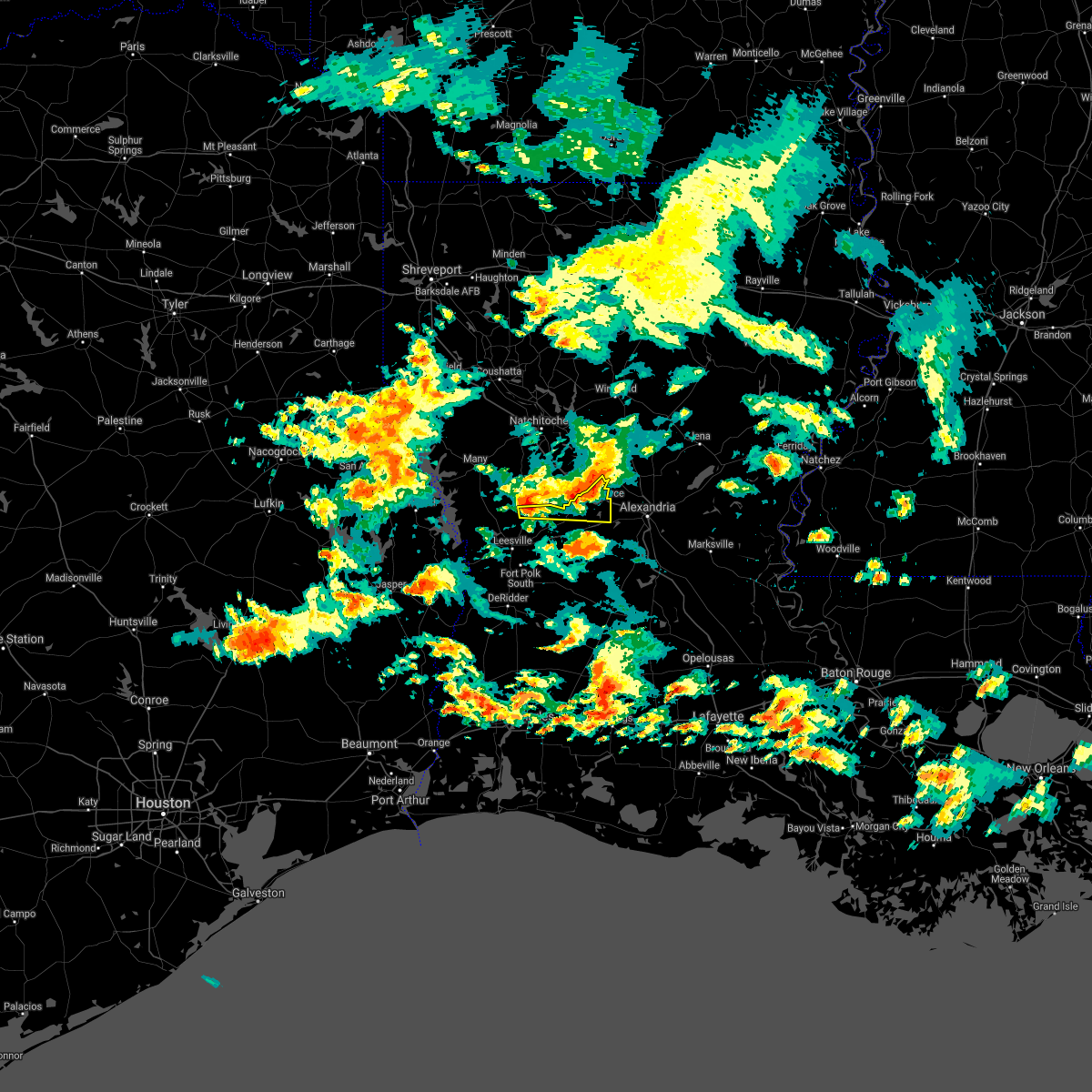 At 654 am cdt, a severe thunderstorm was located over kurthwood, or 10 miles north of slagle, moving east at 20 mph (radar indicated). Hazards include quarter size hail. damage to vehicles is expected At 654 am cdt, a severe thunderstorm was located over kurthwood, or 10 miles north of slagle, moving east at 20 mph (radar indicated). Hazards include quarter size hail. damage to vehicles is expected
|
| 4/23/2021 8:23 PM CDT |
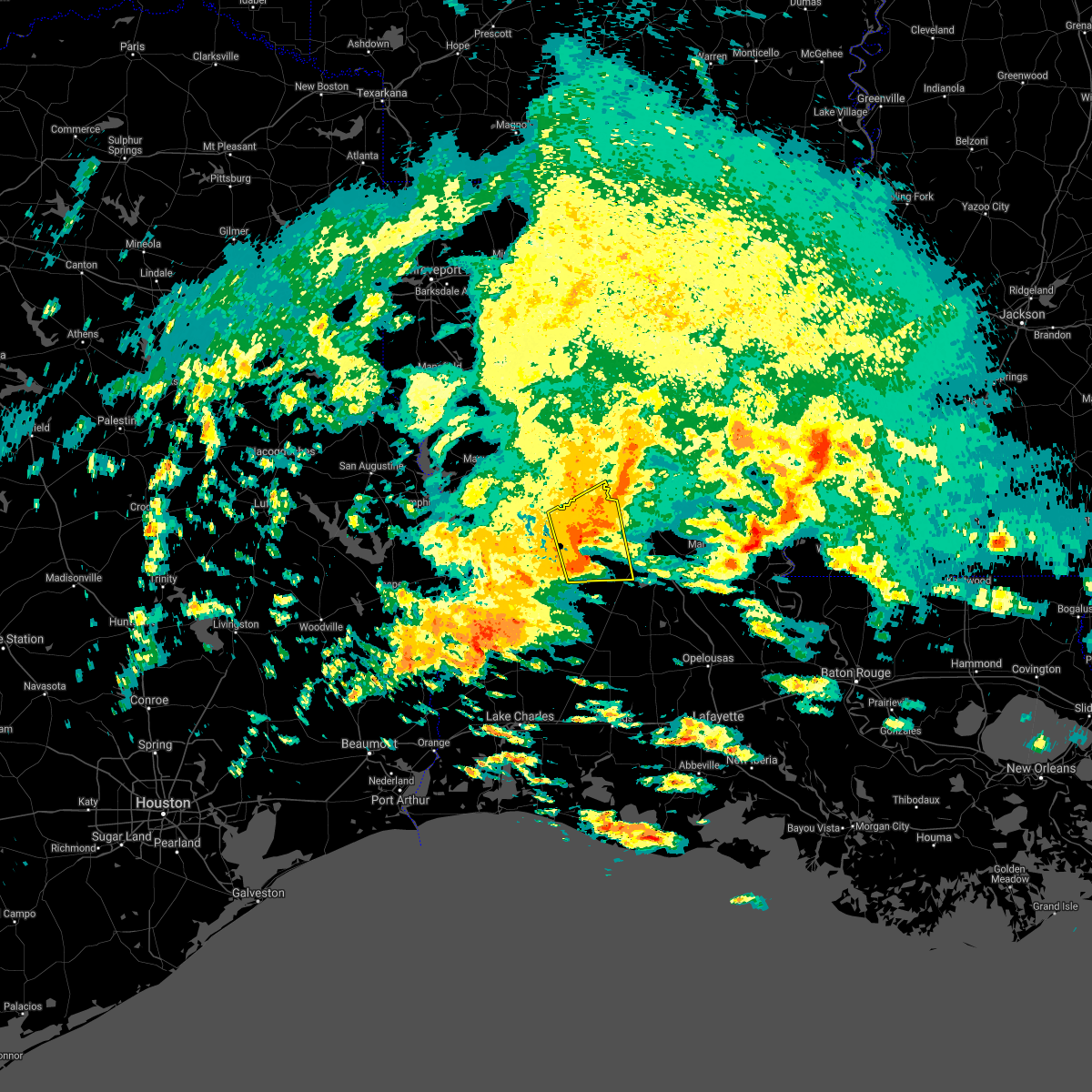 At 822 pm cdt, a severe thunderstorm was located over lacamp, or 8 miles west of hineston, moving east at 30 mph (radar indicated). Hazards include 60 mph wind gusts and nickel size hail. Expect damage to roofs, siding, and trees. locations impacted include, glenmora, boyce, hineston, lacamp, hutton, clifton, flatwoods, otis, elmer, leander, sieper, gardner, calcasieu, simpson, mcnary and union hill. This includes interstate 49 between mile markers 98 and 107. At 822 pm cdt, a severe thunderstorm was located over lacamp, or 8 miles west of hineston, moving east at 30 mph (radar indicated). Hazards include 60 mph wind gusts and nickel size hail. Expect damage to roofs, siding, and trees. locations impacted include, glenmora, boyce, hineston, lacamp, hutton, clifton, flatwoods, otis, elmer, leander, sieper, gardner, calcasieu, simpson, mcnary and union hill. This includes interstate 49 between mile markers 98 and 107.
|
| 4/23/2021 8:00 PM CDT |
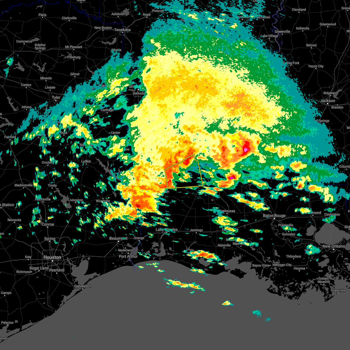 At 800 pm cdt, a severe thunderstorm was located 7 miles south of slagle, moving east at 30 mph (radar indicated). Hazards include 60 mph wind gusts and nickel size hail. expect damage to roofs, siding, and trees At 800 pm cdt, a severe thunderstorm was located 7 miles south of slagle, moving east at 30 mph (radar indicated). Hazards include 60 mph wind gusts and nickel size hail. expect damage to roofs, siding, and trees
|
| 4/9/2021 9:50 PM CDT |
 At 950 pm cdt, severe thunderstorms were located along a line extending from near colfax to near boyce to sieper, moving east at 40 mph (radar indicated). Hazards include 60 mph wind gusts and quarter size hail. Hail damage to vehicles is expected. expect wind damage to roofs, siding, and trees. locations impacted include, alexandria, pineville, boyce, alexandria international airport, ball, lecompte, deville, libuse, tioga, timber trails, esler regional airport, clifton, otis, kingsville, sieper, kolin, gardner, ruby, holloway and paradise. This includes interstate 49 between mile markers 68 and 107. At 950 pm cdt, severe thunderstorms were located along a line extending from near colfax to near boyce to sieper, moving east at 40 mph (radar indicated). Hazards include 60 mph wind gusts and quarter size hail. Hail damage to vehicles is expected. expect wind damage to roofs, siding, and trees. locations impacted include, alexandria, pineville, boyce, alexandria international airport, ball, lecompte, deville, libuse, tioga, timber trails, esler regional airport, clifton, otis, kingsville, sieper, kolin, gardner, ruby, holloway and paradise. This includes interstate 49 between mile markers 68 and 107.
|
| 4/9/2021 9:24 PM CDT |
 At 924 pm cdt, severe thunderstorms were located along a line extending from 14 miles south of winnfield to near flatwoods to hutton, moving east at 25 mph (radar indicated). Hazards include 60 mph wind gusts and quarter size hail. Hail damage to vehicles is expected. Expect wind damage to roofs, siding, and trees. At 924 pm cdt, severe thunderstorms were located along a line extending from 14 miles south of winnfield to near flatwoods to hutton, moving east at 25 mph (radar indicated). Hazards include 60 mph wind gusts and quarter size hail. Hail damage to vehicles is expected. Expect wind damage to roofs, siding, and trees.
|
| 7/31/2020 4:53 PM CDT |
 At 453 pm cdt, severe thunderstorms were located along a line extending from sherwood to near midway to near ball to near boyce, moving east southeast at 30 mph (radar indicated). Hazards include 60 mph wind gusts. Expect damage to roofs, siding, and trees. Locations impacted include, ball, jena, colfax, olla, clarks, grayson, midway, urania, pollock, dry prong, nebo, spaulding, rogers, catahoula lake, standard, bentley, kelly, zenoria, burlington and fishville. At 453 pm cdt, severe thunderstorms were located along a line extending from sherwood to near midway to near ball to near boyce, moving east southeast at 30 mph (radar indicated). Hazards include 60 mph wind gusts. Expect damage to roofs, siding, and trees. Locations impacted include, ball, jena, colfax, olla, clarks, grayson, midway, urania, pollock, dry prong, nebo, spaulding, rogers, catahoula lake, standard, bentley, kelly, zenoria, burlington and fishville.
|
| 7/31/2020 4:21 PM CDT |
 At 421 pm cdt, severe thunderstorms were located along a line extending from near grayson to 14 miles west of midway to 6 miles north of colfax to 9 miles northwest of flatwoods, moving east at 25 mph (radar indicated). Hazards include 60 mph wind gusts. expect damage to roofs, siding, and trees At 421 pm cdt, severe thunderstorms were located along a line extending from near grayson to 14 miles west of midway to 6 miles north of colfax to 9 miles northwest of flatwoods, moving east at 25 mph (radar indicated). Hazards include 60 mph wind gusts. expect damage to roofs, siding, and trees
|
| 4/29/2020 3:23 AM CDT |
 At 322 am cdt, severe thunderstorms were located along a line extending from 6 miles southeast of archie to 6 miles east of fort polk to near colmesneil, moving south at 45 mph (radar indicated). Hazards include 60 mph wind gusts and quarter size hail. Hail damage to vehicles is expected. expect wind damage to roofs, siding, and trees. locations impacted include, alexandria, pineville, de ridder, oakdale, jasper, leesville, marksville, woodville, newton, kirbyville, rosepine, glenmora, merryville, boyce, moreauville, anacoco, cheneyville, colmesneil, elizabeth and chester. This includes interstate 49 between mile markers 54 and 109. At 322 am cdt, severe thunderstorms were located along a line extending from 6 miles southeast of archie to 6 miles east of fort polk to near colmesneil, moving south at 45 mph (radar indicated). Hazards include 60 mph wind gusts and quarter size hail. Hail damage to vehicles is expected. expect wind damage to roofs, siding, and trees. locations impacted include, alexandria, pineville, de ridder, oakdale, jasper, leesville, marksville, woodville, newton, kirbyville, rosepine, glenmora, merryville, boyce, moreauville, anacoco, cheneyville, colmesneil, elizabeth and chester. This includes interstate 49 between mile markers 54 and 109.
|
| 4/29/2020 2:47 AM CDT |
 At 247 am cdt, severe thunderstorms were located along a line extending from near rosefield to near kurthwood to near huntington, moving south at 40 mph (radar indicated). Hazards include 60 mph wind gusts and quarter size hail. Hail damage to vehicles is expected. Expect wind damage to roofs, siding, and trees. At 247 am cdt, severe thunderstorms were located along a line extending from near rosefield to near kurthwood to near huntington, moving south at 40 mph (radar indicated). Hazards include 60 mph wind gusts and quarter size hail. Hail damage to vehicles is expected. Expect wind damage to roofs, siding, and trees.
|
| 4/22/2020 4:15 PM CDT |
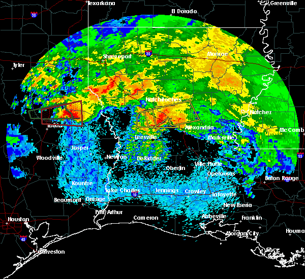 At 414 pm cdt, a severe thunderstorm was located near lena, moving east at 35 mph (radar indicated). Hazards include 60 mph wind gusts and quarter size hail. Hail damage to vehicles is expected. expect wind damage to roofs, siding, and trees. locations impacted include, boyce, lena and flatwoods. This includes interstate 49 between mile markers 95 and 108. At 414 pm cdt, a severe thunderstorm was located near lena, moving east at 35 mph (radar indicated). Hazards include 60 mph wind gusts and quarter size hail. Hail damage to vehicles is expected. expect wind damage to roofs, siding, and trees. locations impacted include, boyce, lena and flatwoods. This includes interstate 49 between mile markers 95 and 108.
|
| 4/22/2020 3:58 PM CDT |
 At 358 pm cdt, a severe thunderstorm was located near flatwoods, or 12 miles west of lena, moving east at 35 mph (radar indicated). Hazards include 60 mph wind gusts and quarter size hail. Hail damage to vehicles is expected. Expect wind damage to roofs, siding, and trees. At 358 pm cdt, a severe thunderstorm was located near flatwoods, or 12 miles west of lena, moving east at 35 mph (radar indicated). Hazards include 60 mph wind gusts and quarter size hail. Hail damage to vehicles is expected. Expect wind damage to roofs, siding, and trees.
|
| 4/22/2020 3:23 PM CDT |
 The severe thunderstorm warning for northwestern rapides and northeastern vernon parishes will expire at 330 pm cdt, the storm which prompted the warning is weakening, and will be exiting the warned area. therefore, the warning will be allowed to expire. a tornado watch remains in effect until 500 pm cdt for central and west central louisiana. The severe thunderstorm warning for northwestern rapides and northeastern vernon parishes will expire at 330 pm cdt, the storm which prompted the warning is weakening, and will be exiting the warned area. therefore, the warning will be allowed to expire. a tornado watch remains in effect until 500 pm cdt for central and west central louisiana.
|
| 4/22/2020 3:08 PM CDT |
 At 307 pm cdt, a severe thunderstorm was located near lena, moving east at 50 mph (radar indicated). Hazards include quarter size hail. Damage to vehicles is expected. locations impacted include, alexandria, boyce, lena, alexandria international airport, clifton and flatwoods. This includes interstate 49 between mile markers 89 and 109. At 307 pm cdt, a severe thunderstorm was located near lena, moving east at 50 mph (radar indicated). Hazards include quarter size hail. Damage to vehicles is expected. locations impacted include, alexandria, boyce, lena, alexandria international airport, clifton and flatwoods. This includes interstate 49 between mile markers 89 and 109.
|
| 4/22/2020 2:48 PM CDT |
 At 248 pm cdt, a severe thunderstorm was located over hutton, or 10 miles northeast of slagle, moving east at 45 mph (radar indicated). Hazards include quarter size hail. damage to vehicles is expected At 248 pm cdt, a severe thunderstorm was located over hutton, or 10 miles northeast of slagle, moving east at 45 mph (radar indicated). Hazards include quarter size hail. damage to vehicles is expected
|
| 4/19/2020 5:31 PM CDT |
 At 531 pm cdt, a severe thunderstorm was located over otis, or near hineston, moving east at 50 mph (radar indicated). Hazards include 70 mph wind gusts and quarter size hail. Hail damage to vehicles is expected. expect considerable tree damage. wind damage is also likely to mobile homes, roofs, and outbuildings. locations impacted include, boyce, hineston, lena, lacamp, leander, sieper, clifton, gardner, flatwoods, otis, elmer and calcasieu. This includes interstate 49 between mile markers 96 and 109. At 531 pm cdt, a severe thunderstorm was located over otis, or near hineston, moving east at 50 mph (radar indicated). Hazards include 70 mph wind gusts and quarter size hail. Hail damage to vehicles is expected. expect considerable tree damage. wind damage is also likely to mobile homes, roofs, and outbuildings. locations impacted include, boyce, hineston, lena, lacamp, leander, sieper, clifton, gardner, flatwoods, otis, elmer and calcasieu. This includes interstate 49 between mile markers 96 and 109.
|
| 4/19/2020 4:49 PM CDT |
 At 449 pm cdt, a severe thunderstorm was located near anacoco, moving east at 50 mph (radar indicated). Hazards include 70 mph wind gusts and half dollar size hail. Hail damage to vehicles is expected. expect considerable tree damage. Wind damage is also likely to mobile homes, roofs, and outbuildings. At 449 pm cdt, a severe thunderstorm was located near anacoco, moving east at 50 mph (radar indicated). Hazards include 70 mph wind gusts and half dollar size hail. Hail damage to vehicles is expected. expect considerable tree damage. Wind damage is also likely to mobile homes, roofs, and outbuildings.
|
| 2/5/2020 12:18 PM CST | Ping Pong Ball sized hail reported 3.9 miles ESE of Boyce, LA, hail reported near hwy 49 |
| 2/5/2020 12:02 PM CST |
 At 1202 pm cst, a severe thunderstorm was located near boyce, moving northeast at 65 mph (radar indicated). Hazards include 60 mph wind gusts and quarter size hail. Hail damage to vehicles is expected. expect wind damage to roofs, siding, and trees. locations impacted include, boyce, lena and flatwoods. This includes interstate 49 between mile markers 94 and 109. At 1202 pm cst, a severe thunderstorm was located near boyce, moving northeast at 65 mph (radar indicated). Hazards include 60 mph wind gusts and quarter size hail. Hail damage to vehicles is expected. expect wind damage to roofs, siding, and trees. locations impacted include, boyce, lena and flatwoods. This includes interstate 49 between mile markers 94 and 109.
|
| 2/5/2020 11:47 AM CST |
 At 1146 am cst, a severe thunderstorm was located near sieper, or 8 miles northwest of hineston, moving northeast at 65 mph (radar indicated). Hazards include 60 mph wind gusts and quarter size hail. Hail damage to vehicles is expected. Expect wind damage to roofs, siding, and trees. At 1146 am cst, a severe thunderstorm was located near sieper, or 8 miles northwest of hineston, moving northeast at 65 mph (radar indicated). Hazards include 60 mph wind gusts and quarter size hail. Hail damage to vehicles is expected. Expect wind damage to roofs, siding, and trees.
|
| 1/11/2020 4:17 AM CST |
 At 416 am cst, severe thunderstorms were located along a line extending from near boyce to near grand chenier, moving east at 45 mph (radar indicated). Hazards include 60 mph wind gusts. expect damage to roofs, siding, and trees At 416 am cst, severe thunderstorms were located along a line extending from near boyce to near grand chenier, moving east at 45 mph (radar indicated). Hazards include 60 mph wind gusts. expect damage to roofs, siding, and trees
|
| 1/11/2020 3:14 AM CST |
 At 313 am cst, severe thunderstorms were located along a line extending from near kurthwood to near johnsons bayou, moving east at 30 mph (radar indicated). Hazards include 60 mph wind gusts. expect damage to roofs, siding, and trees At 313 am cst, severe thunderstorms were located along a line extending from near kurthwood to near johnsons bayou, moving east at 30 mph (radar indicated). Hazards include 60 mph wind gusts. expect damage to roofs, siding, and trees
|
| 5/8/2019 6:04 PM CDT |
 At 604 pm cdt, severe thunderstorms were located along a line extending from 16 miles northwest of columbia to 10 miles west of clarks to 6 miles west of olla to 15 miles north of ball to 6 miles northeast of boyce, moving east at 40 mph (radar indicated). Hazards include 60 mph wind gusts and penny size hail. expect damage to roofs, siding, and trees At 604 pm cdt, severe thunderstorms were located along a line extending from 16 miles northwest of columbia to 10 miles west of clarks to 6 miles west of olla to 15 miles north of ball to 6 miles northeast of boyce, moving east at 40 mph (radar indicated). Hazards include 60 mph wind gusts and penny size hail. expect damage to roofs, siding, and trees
|
| 5/8/2019 5:22 PM CDT |
 At 522 pm cdt, severe thunderstorms were located along a line extending from 11 miles southwest of jonesboro to 13 miles east of campti to near montgomery to near hutton, moving east at 50 mph (radar indicated). Hazards include 60 mph wind gusts and penny size hail. expect damage to roofs, siding, and trees At 522 pm cdt, severe thunderstorms were located along a line extending from 11 miles southwest of jonesboro to 13 miles east of campti to near montgomery to near hutton, moving east at 50 mph (radar indicated). Hazards include 60 mph wind gusts and penny size hail. expect damage to roofs, siding, and trees
|
| 4/25/2019 5:27 AM CDT |
 At 526 am cdt, a severe thunderstorm was located over boyce, moving northeast at 40 mph (radar indicated). Hazards include 60 mph wind gusts. expect damage to roofs, siding, and trees At 526 am cdt, a severe thunderstorm was located over boyce, moving northeast at 40 mph (radar indicated). Hazards include 60 mph wind gusts. expect damage to roofs, siding, and trees
|
| 4/25/2019 5:19 AM CDT |
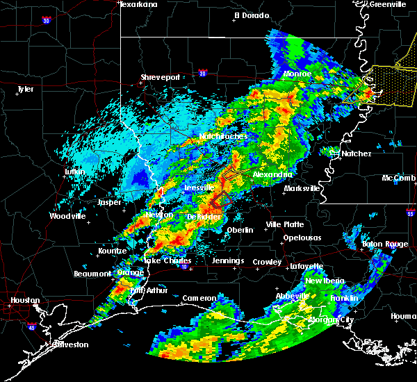 At 519 am cdt, a severe thunderstorm was located near boyce, moving northeast at 35 mph (radar indicated). Hazards include 60 mph wind gusts and quarter size hail. Hail damage to vehicles is expected. Expect wind damage to roofs, siding, and trees. At 519 am cdt, a severe thunderstorm was located near boyce, moving northeast at 35 mph (radar indicated). Hazards include 60 mph wind gusts and quarter size hail. Hail damage to vehicles is expected. Expect wind damage to roofs, siding, and trees.
|
| 4/13/2019 5:20 PM CDT |
 At 520 pm cdt, severe thunderstorms were located along a line extending from boyce to near reeves, moving east at 35 mph (radar indicated). Hazards include 60 mph wind gusts. expect damage to roofs, siding, and trees At 520 pm cdt, severe thunderstorms were located along a line extending from boyce to near reeves, moving east at 35 mph (radar indicated). Hazards include 60 mph wind gusts. expect damage to roofs, siding, and trees
|
| 4/13/2019 2:52 AM CDT |
 At 252 am cdt, a severe thunderstorm was located near colfax, or 8 miles north of lena, moving northeast at 45 mph (radar indicated). Hazards include ping pong ball size hail and 60 mph wind gusts. People and animals outdoors will be injured. expect hail damage to roofs, siding, windows, and vehicles. expect wind damage to roofs, siding, and trees. Locations impacted include, alexandria, colfax, montgomery, pollock, dry prong, lake iatt, aloha, fishville, williana and bentley. At 252 am cdt, a severe thunderstorm was located near colfax, or 8 miles north of lena, moving northeast at 45 mph (radar indicated). Hazards include ping pong ball size hail and 60 mph wind gusts. People and animals outdoors will be injured. expect hail damage to roofs, siding, windows, and vehicles. expect wind damage to roofs, siding, and trees. Locations impacted include, alexandria, colfax, montgomery, pollock, dry prong, lake iatt, aloha, fishville, williana and bentley.
|
| 4/13/2019 2:42 AM CDT |
 At 242 am cdt, a severe thunderstorm was located near lena, moving east at 45 mph (radar indicated). Hazards include 60 mph wind gusts and quarter size hail. Hail damage to vehicles is expected. Expect wind damage to roofs, siding, and trees. At 242 am cdt, a severe thunderstorm was located near lena, moving east at 45 mph (radar indicated). Hazards include 60 mph wind gusts and quarter size hail. Hail damage to vehicles is expected. Expect wind damage to roofs, siding, and trees.
|
| 4/13/2019 2:40 AM CDT |
 At 240 am cdt, a severe thunderstorm was located 7 miles north of flatwoods, or 8 miles northwest of lena, moving northeast at 45 mph (radar indicated). Hazards include golf ball size hail and 60 mph wind gusts. People and animals outdoors will be injured. expect hail damage to roofs, siding, windows, and vehicles. Expect wind damage to roofs, siding, and trees. At 240 am cdt, a severe thunderstorm was located 7 miles north of flatwoods, or 8 miles northwest of lena, moving northeast at 45 mph (radar indicated). Hazards include golf ball size hail and 60 mph wind gusts. People and animals outdoors will be injured. expect hail damage to roofs, siding, windows, and vehicles. Expect wind damage to roofs, siding, and trees.
|
| 4/7/2019 4:41 PM CDT |
 At 441 pm cdt, a severe thunderstorm capable of producing a tornado was located over boyce, moving northeast at 50 mph (radar indicated rotation). Hazards include tornado. Flying debris will be dangerous to those caught without shelter. mobile homes will be damaged or destroyed. damage to roofs, windows, and vehicles will occur. tree damage is likely. This tornadic thunderstorm will remain over mainly rural areas of north central rapides parish. At 441 pm cdt, a severe thunderstorm capable of producing a tornado was located over boyce, moving northeast at 50 mph (radar indicated rotation). Hazards include tornado. Flying debris will be dangerous to those caught without shelter. mobile homes will be damaged or destroyed. damage to roofs, windows, and vehicles will occur. tree damage is likely. This tornadic thunderstorm will remain over mainly rural areas of north central rapides parish.
|
| 4/7/2019 4:36 PM CDT |
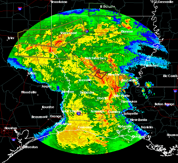 At 436 pm cdt, a severe thunderstorm capable of producing a tornado was located over boyce, moving northeast at 50 mph (radar indicated rotation). Hazards include tornado. Flying debris will be dangerous to those caught without shelter. mobile homes will be damaged or destroyed. damage to roofs, windows, and vehicles will occur. tree damage is likely. This dangerous storm will be near, timber trails around 450 pm cdt. At 436 pm cdt, a severe thunderstorm capable of producing a tornado was located over boyce, moving northeast at 50 mph (radar indicated rotation). Hazards include tornado. Flying debris will be dangerous to those caught without shelter. mobile homes will be damaged or destroyed. damage to roofs, windows, and vehicles will occur. tree damage is likely. This dangerous storm will be near, timber trails around 450 pm cdt.
|
| 4/7/2019 3:44 PM CDT |
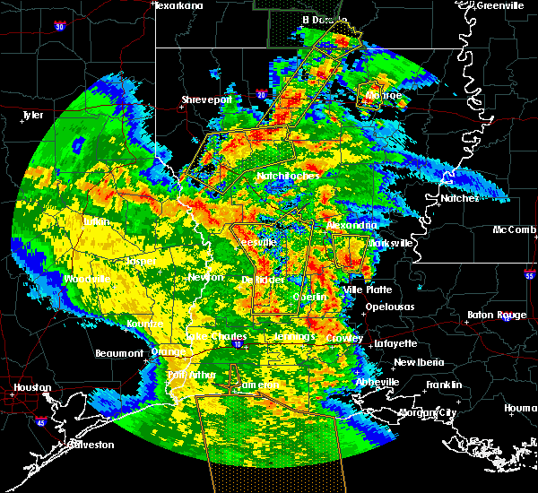 At 344 pm cdt, severe thunderstorms were located along a line extending from near kurthwood to near fullerton to dry creek, moving northeast at 35 mph (radar indicated). Hazards include 60 mph wind gusts. expect damage to roofs, siding, and trees At 344 pm cdt, severe thunderstorms were located along a line extending from near kurthwood to near fullerton to dry creek, moving northeast at 35 mph (radar indicated). Hazards include 60 mph wind gusts. expect damage to roofs, siding, and trees
|
| 4/6/2019 8:59 PM CDT |
 At 859 pm cdt, a severe thunderstorm capable of producing a tornado was located over gardner, or 7 miles northeast of hineston, moving northeast at 25 mph (radar indicated rotation). Hazards include tornado and quarter size hail. Flying debris will be dangerous to those caught without shelter. mobile homes will be damaged or destroyed. damage to roofs, windows, and vehicles will occur. tree damage is likely. this dangerous storm will be near, alexandria, boyce and alexandria international airport around 920 pm cdt. timber trails, tioga, paradise and kingsville around 940 pm cdt. Ball around 945 pm cdt. At 859 pm cdt, a severe thunderstorm capable of producing a tornado was located over gardner, or 7 miles northeast of hineston, moving northeast at 25 mph (radar indicated rotation). Hazards include tornado and quarter size hail. Flying debris will be dangerous to those caught without shelter. mobile homes will be damaged or destroyed. damage to roofs, windows, and vehicles will occur. tree damage is likely. this dangerous storm will be near, alexandria, boyce and alexandria international airport around 920 pm cdt. timber trails, tioga, paradise and kingsville around 940 pm cdt. Ball around 945 pm cdt.
|
| 4/6/2019 8:53 PM CDT |
 At 851 pm cdt, a severe thunderstorm was located near montgomery, or 11 miles southeast of natchitoches, moving northeast at 40 mph. other intense thunderstorms were developing in the same general vicinity along the red river valley (radar indicated). Hazards include golf ball size hail and 60 mph wind gusts. People and animals outdoors will be injured. expect hail damage to roofs, siding, windows, and vehicles. Expect wind damage to roofs, siding, and trees. At 851 pm cdt, a severe thunderstorm was located near montgomery, or 11 miles southeast of natchitoches, moving northeast at 40 mph. other intense thunderstorms were developing in the same general vicinity along the red river valley (radar indicated). Hazards include golf ball size hail and 60 mph wind gusts. People and animals outdoors will be injured. expect hail damage to roofs, siding, windows, and vehicles. Expect wind damage to roofs, siding, and trees.
|
| 4/6/2019 8:50 PM CDT |
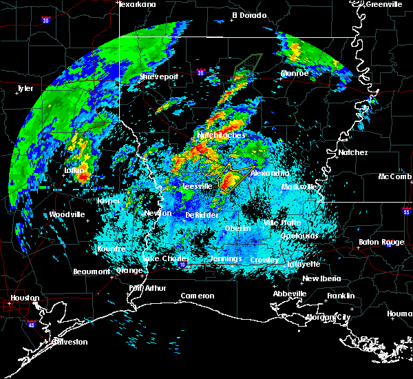 At 850 pm cdt, a severe thunderstorm was located over otis, or near hineston, moving northeast at 25 mph (radar indicated). Hazards include 60 mph wind gusts and quarter size hail. Hail damage to vehicles is expected. Expect wind damage to roofs, siding, and trees. At 850 pm cdt, a severe thunderstorm was located over otis, or near hineston, moving northeast at 25 mph (radar indicated). Hazards include 60 mph wind gusts and quarter size hail. Hail damage to vehicles is expected. Expect wind damage to roofs, siding, and trees.
|
| 4/6/2019 12:39 PM CDT |
 At 1238 pm cdt, a cluster of severe thunderstorms was located 10 miles southwest of olla, or 18 miles southeast of winnfield, moving northeast at 35 mph (radar indicated). Hazards include 60 mph wind gusts and quarter size hail. Hail damage to vehicles is expected. Expect wind damage to roofs, siding, and trees. At 1238 pm cdt, a cluster of severe thunderstorms was located 10 miles southwest of olla, or 18 miles southeast of winnfield, moving northeast at 35 mph (radar indicated). Hazards include 60 mph wind gusts and quarter size hail. Hail damage to vehicles is expected. Expect wind damage to roofs, siding, and trees.
|
| 4/6/2019 11:51 AM CDT |
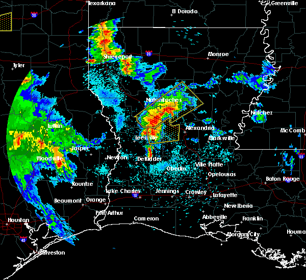 At 1150 am cdt, severe thunderstorms were located along a line extending from near flatwoods to lacamp, moving northeast at 35 mph (radar indicated). Hazards include quarter size hail. Damage to vehicles is expected. Locations impacted include, alexandria, boyce, hineston, lena, alexandria international airport, lacamp, hutton, clifton, flatwoods, otis, leander, sieper, gardner and simpson. At 1150 am cdt, severe thunderstorms were located along a line extending from near flatwoods to lacamp, moving northeast at 35 mph (radar indicated). Hazards include quarter size hail. Damage to vehicles is expected. Locations impacted include, alexandria, boyce, hineston, lena, alexandria international airport, lacamp, hutton, clifton, flatwoods, otis, leander, sieper, gardner and simpson.
|
| 4/6/2019 11:32 AM CDT |
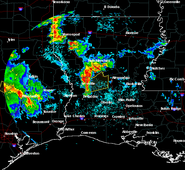 At 1132 am cdt, severe thunderstorms were located along a line extending from near hutton to near cravens, moving northeast at 35 mph (radar indicated). Hazards include quarter size hail. damage to vehicles is expected At 1132 am cdt, severe thunderstorms were located along a line extending from near hutton to near cravens, moving northeast at 35 mph (radar indicated). Hazards include quarter size hail. damage to vehicles is expected
|
| 11/1/2018 12:09 AM CDT |
 At 1209 am cdt, severe thunderstorms were located along a line extending from near boyce to 8 miles west of glenmora to near oberlin, moving east at 40 mph (radar indicated). Hazards include 60 mph wind gusts. expect damage to roofs, siding, and trees At 1209 am cdt, severe thunderstorms were located along a line extending from near boyce to 8 miles west of glenmora to near oberlin, moving east at 40 mph (radar indicated). Hazards include 60 mph wind gusts. expect damage to roofs, siding, and trees
|
| 7/29/2018 4:51 PM CDT |
 At 450 pm cdt, severe thunderstorms were located along a line extending from near grayson to near colfax, moving southeast at 30 mph (radar indicated). Hazards include 60 mph wind gusts. expect damage to roofs, siding, and trees At 450 pm cdt, severe thunderstorms were located along a line extending from near grayson to near colfax, moving southeast at 30 mph (radar indicated). Hazards include 60 mph wind gusts. expect damage to roofs, siding, and trees
|
| 7/29/2018 3:46 PM CDT |
 At 346 pm cdt, severe thunderstorms were located along a line extending from 7 miles north of winnfield to near many, moving southeast at 30 mph (radar indicated). Hazards include 60 mph wind gusts. expect damage to roofs, siding, and trees At 346 pm cdt, severe thunderstorms were located along a line extending from 7 miles north of winnfield to near many, moving southeast at 30 mph (radar indicated). Hazards include 60 mph wind gusts. expect damage to roofs, siding, and trees
|
| 4/6/2018 10:29 PM CDT |
 At 1028 pm cdt, severe thunderstorms were located along a line extending from near walters to near alexandria international airport to 9 miles west of hornbeck, moving southeast at 25 mph (radar indicated). Hazards include 60 mph wind gusts and quarter size hail. Hail damage to vehicles is expected. Expect wind damage to roofs, siding, and trees. At 1028 pm cdt, severe thunderstorms were located along a line extending from near walters to near alexandria international airport to 9 miles west of hornbeck, moving southeast at 25 mph (radar indicated). Hazards include 60 mph wind gusts and quarter size hail. Hail damage to vehicles is expected. Expect wind damage to roofs, siding, and trees.
|
| 4/6/2018 9:33 PM CDT |
 At 932 pm cdt, severe thunderstorms were located along a line extending from 6 miles northeast of colfax to near flatwoods to near kurthwood, moving southeast at 40 mph (radar indicated). Hazards include 70 mph wind gusts and quarter size hail. Hail damage to vehicles is expected. expect considerable tree damage. Wind damage is also likely to mobile homes, roofs, and outbuildings. At 932 pm cdt, severe thunderstorms were located along a line extending from 6 miles northeast of colfax to near flatwoods to near kurthwood, moving southeast at 40 mph (radar indicated). Hazards include 70 mph wind gusts and quarter size hail. Hail damage to vehicles is expected. expect considerable tree damage. Wind damage is also likely to mobile homes, roofs, and outbuildings.
|
| 4/6/2018 7:59 PM CDT |
 At 758 pm cdt, severe thunderstorms were located along a line extending from 9 miles west of campti to 7 miles northeast of natchitoches to 14 miles southwest of jonesboro, moving southeast at 45 mph (radar indicated). Hazards include 60 mph wind gusts and half dollar size hail. Hail damage to vehicles is expected. Expect wind damage to roofs, siding, and trees. At 758 pm cdt, severe thunderstorms were located along a line extending from 9 miles west of campti to 7 miles northeast of natchitoches to 14 miles southwest of jonesboro, moving southeast at 45 mph (radar indicated). Hazards include 60 mph wind gusts and half dollar size hail. Hail damage to vehicles is expected. Expect wind damage to roofs, siding, and trees.
|
| 4/3/2018 9:30 PM CDT |
 The national weather service in lake charles has issued a * severe thunderstorm warning for. western rapides parish in central louisiana. beauregard parish in southwestern louisiana. vernon parish in west central louisiana. Southern newton county in southeastern texas. The national weather service in lake charles has issued a * severe thunderstorm warning for. western rapides parish in central louisiana. beauregard parish in southwestern louisiana. vernon parish in west central louisiana. Southern newton county in southeastern texas.
|
| 4/3/2018 9:30 PM CDT |
 At 929 pm cdt, severe thunderstorms were located along a line extending from near slagle to near devils pocket, moving east at 30 mph (radar indicated). Hazards include 60 mph wind gusts and quarter size hail. Hail damage to vehicles is expected. Expect wind damage to roofs, siding, and trees. At 929 pm cdt, severe thunderstorms were located along a line extending from near slagle to near devils pocket, moving east at 30 mph (radar indicated). Hazards include 60 mph wind gusts and quarter size hail. Hail damage to vehicles is expected. Expect wind damage to roofs, siding, and trees.
|
| 4/3/2018 7:17 PM CDT |
 At 715 pm cdt, a severe thunderstorm was located over lacamp, or 10 miles west of hineston, moving east at 35 mph (radar indicated). Hazards include 60 mph wind gusts. Expect damage to roofs, siding, and trees. Locations impacted include, alexandria, pineville, leesville, rosepine, boyce, fort polk, alexandria international airport, slagle, hineston, lena, pitkin, deridder, ball, new llano, tioga, timber trails, hutton, esler regional airport, flatwoods and otis. At 715 pm cdt, a severe thunderstorm was located over lacamp, or 10 miles west of hineston, moving east at 35 mph (radar indicated). Hazards include 60 mph wind gusts. Expect damage to roofs, siding, and trees. Locations impacted include, alexandria, pineville, leesville, rosepine, boyce, fort polk, alexandria international airport, slagle, hineston, lena, pitkin, deridder, ball, new llano, tioga, timber trails, hutton, esler regional airport, flatwoods and otis.
|
| 4/3/2018 7:00 PM CDT |
 At 659 pm cdt, severe thunderstorms were located along a line extending from 8 miles west of midway to near clifton, moving east at 40 mph (radar indicated). Hazards include 60 mph wind gusts and penny size hail. expect damage to roofs, siding, and trees At 659 pm cdt, severe thunderstorms were located along a line extending from 8 miles west of midway to near clifton, moving east at 40 mph (radar indicated). Hazards include 60 mph wind gusts and penny size hail. expect damage to roofs, siding, and trees
|
| 4/3/2018 6:48 PM CDT |
 At 647 pm cdt, a line of severe thunderstorms was located near leesville, moving east at 35 mph (radar indicated). Hazards include 60 mph wind gusts. expect damage to roofs, siding, and trees At 647 pm cdt, a line of severe thunderstorms was located near leesville, moving east at 35 mph (radar indicated). Hazards include 60 mph wind gusts. expect damage to roofs, siding, and trees
|
| 4/3/2018 6:00 PM CDT |
 At 559 pm cdt, severe thunderstorms were located along a line extending from near montgomery to near toledo bend dam, moving east at 50 mph (radar indicated). Hazards include 60 mph wind gusts and quarter size hail. Hail damage to vehicles is expected. Expect wind damage to roofs, siding, and trees. At 559 pm cdt, severe thunderstorms were located along a line extending from near montgomery to near toledo bend dam, moving east at 50 mph (radar indicated). Hazards include 60 mph wind gusts and quarter size hail. Hail damage to vehicles is expected. Expect wind damage to roofs, siding, and trees.
|
| 4/3/2018 5:38 PM CDT |
 At 537 pm cdt, a severe thunderstorm was located near hornbeck, or 10 miles northwest of anacoco, moving east at 40 mph (radar indicated). Hazards include 60 mph wind gusts and penny size hail. expect damage to roofs, siding, and trees At 537 pm cdt, a severe thunderstorm was located near hornbeck, or 10 miles northwest of anacoco, moving east at 40 mph (radar indicated). Hazards include 60 mph wind gusts and penny size hail. expect damage to roofs, siding, and trees
|
| 2/21/2018 10:11 AM CST |
 At 1011 am cst, a severe thunderstorm capable of producing a tornado was located near clifton, or 9 miles northwest of hineston, moving north at 25 mph (radar indicated rotation). Hazards include tornado. Flying debris will be dangerous to those caught without shelter. mobile homes will be damaged or destroyed. damage to roofs, windows, and vehicles will occur. tree damage is likely. this dangerous storm will be near, clifton around 1015 am cst. flatwoods around 1030 am cst. boyce around 1035 am cst. Lena around 1045 am cst. At 1011 am cst, a severe thunderstorm capable of producing a tornado was located near clifton, or 9 miles northwest of hineston, moving north at 25 mph (radar indicated rotation). Hazards include tornado. Flying debris will be dangerous to those caught without shelter. mobile homes will be damaged or destroyed. damage to roofs, windows, and vehicles will occur. tree damage is likely. this dangerous storm will be near, clifton around 1015 am cst. flatwoods around 1030 am cst. boyce around 1035 am cst. Lena around 1045 am cst.
|
| 5/28/2017 8:44 PM CDT |
 At 844 pm cdt, severe thunderstorms were located along a line extending from near timber trails to near elmer to near sugartown, moving southeast at 40 mph (radar indicated). Hazards include 60 mph wind gusts and nickel size hail. Expect damage to roofs, siding, and trees. Locations impacted include, alexandria, pineville, oakdale, glenmora, boyce, elizabeth, fort polk, alexandria international airport, hineston, lena, pitkin, ball, lecompte, tioga, timber trails, esler regional airport, otis, elmer, kingsville and allen parish airport. At 844 pm cdt, severe thunderstorms were located along a line extending from near timber trails to near elmer to near sugartown, moving southeast at 40 mph (radar indicated). Hazards include 60 mph wind gusts and nickel size hail. Expect damage to roofs, siding, and trees. Locations impacted include, alexandria, pineville, oakdale, glenmora, boyce, elizabeth, fort polk, alexandria international airport, hineston, lena, pitkin, ball, lecompte, tioga, timber trails, esler regional airport, otis, elmer, kingsville and allen parish airport.
|
| 5/28/2017 8:39 PM CDT |
 At 838 pm cdt, severe thunderstorms were located along a line extending from 12 miles southwest of claiborne to 14 miles east of jonesboro to 6 miles southeast of winnfield to near flatwoods, moving east at 20 mph (radar indicated). Hazards include 60 mph wind gusts and nickel size hail. expect damage to roofs, siding, and trees At 838 pm cdt, severe thunderstorms were located along a line extending from 12 miles southwest of claiborne to 14 miles east of jonesboro to 6 miles southeast of winnfield to near flatwoods, moving east at 20 mph (radar indicated). Hazards include 60 mph wind gusts and nickel size hail. expect damage to roofs, siding, and trees
|
| 5/28/2017 8:15 PM CDT |
 At 814 pm cdt, severe thunderstorms were located along a line extending from near montgomery to near fort polk, moving southeast at 30 mph (radar indicated). Hazards include 60 mph wind gusts and nickel size hail. expect damage to roofs, siding, and trees At 814 pm cdt, severe thunderstorms were located along a line extending from near montgomery to near fort polk, moving southeast at 30 mph (radar indicated). Hazards include 60 mph wind gusts and nickel size hail. expect damage to roofs, siding, and trees
|
| 5/28/2017 8:10 PM CDT |
 At 809 pm cdt, severe thunderstorms were located along a line extending from near montgomery to 6 miles south of slagle, moving southeast at 35 mph (radar indicated). Hazards include 60 mph wind gusts and nickel size hail. Expect damage to roofs, siding, and trees. Locations impacted include, leesville, boyce, anacoco, hineston, lena, pitkin, slagle, fort polk, hornbeck, lacamp, fullerton, hutton, clifton, flatwoods, otis, kurthwood, leander, sieper, gardner and cravens. At 809 pm cdt, severe thunderstorms were located along a line extending from near montgomery to 6 miles south of slagle, moving southeast at 35 mph (radar indicated). Hazards include 60 mph wind gusts and nickel size hail. Expect damage to roofs, siding, and trees. Locations impacted include, leesville, boyce, anacoco, hineston, lena, pitkin, slagle, fort polk, hornbeck, lacamp, fullerton, hutton, clifton, flatwoods, otis, kurthwood, leander, sieper, gardner and cravens.
|
| 5/28/2017 7:46 PM CDT |
 At 746 pm cdt, severe thunderstorms were located along a line extending from 10 miles south of natchitoches to near burr ferry to near browndell, moving southeast at 40 mph (radar indicated). Hazards include 60 mph wind gusts and nickel size hail. Expect damage to roofs, siding, and trees. Locations impacted include, leesville, newton, rosepine, boyce, anacoco, fort polk, de ridder, sugartown, slagle, toledo bend dam, hineston, lena, pitkin, burkeville, deridder, new llano, colfax, hornbeck, hutton and flatwoods. At 746 pm cdt, severe thunderstorms were located along a line extending from 10 miles south of natchitoches to near burr ferry to near browndell, moving southeast at 40 mph (radar indicated). Hazards include 60 mph wind gusts and nickel size hail. Expect damage to roofs, siding, and trees. Locations impacted include, leesville, newton, rosepine, boyce, anacoco, fort polk, de ridder, sugartown, slagle, toledo bend dam, hineston, lena, pitkin, burkeville, deridder, new llano, colfax, hornbeck, hutton and flatwoods.
|
| 5/28/2017 7:19 PM CDT |
 At 715 pm cdt, severe thunderstorms were located along a line extending from 15 miles west of natchitoches to 7 miles southeast of hemphill to 10 miles southeast of etoile, moving southeast at 45 mph (radar indicated). Hazards include 60 mph wind gusts and nickel size hail. expect damage to roofs, siding, and trees At 715 pm cdt, severe thunderstorms were located along a line extending from 15 miles west of natchitoches to 7 miles southeast of hemphill to 10 miles southeast of etoile, moving southeast at 45 mph (radar indicated). Hazards include 60 mph wind gusts and nickel size hail. expect damage to roofs, siding, and trees
|
| 5/3/2017 7:06 PM CDT |
 At 659 pm cdt, severe thunderstorms were located along a line extending from 7 miles north of ball to near anacoco, moving east at 20 mph (radar indicated). Hazards include 60 mph wind gusts. expect damage to roofs, siding, and trees At 659 pm cdt, severe thunderstorms were located along a line extending from 7 miles north of ball to near anacoco, moving east at 20 mph (radar indicated). Hazards include 60 mph wind gusts. expect damage to roofs, siding, and trees
|
| 4/2/2017 7:38 PM CDT |
 The severe thunderstorm warning for northeastern rapides parish will expire at 745 pm cdt, the storm which prompted the warning has moved out of the area. therefore the warning will be allowed to expire. however small hail and gusty winds are still possible with this thunderstorm. additional strong storms are developing west of the area and warnings may again be required later this evening. a tornado watch remains in effect until 900 pm cdt for central louisiana. The severe thunderstorm warning for northeastern rapides parish will expire at 745 pm cdt, the storm which prompted the warning has moved out of the area. therefore the warning will be allowed to expire. however small hail and gusty winds are still possible with this thunderstorm. additional strong storms are developing west of the area and warnings may again be required later this evening. a tornado watch remains in effect until 900 pm cdt for central louisiana.
|
| 4/2/2017 7:10 PM CDT |
 At 709 pm cdt, a severe thunderstorm was located near alexandria international airport, moving northeast at 45 mph (radar indicated). Hazards include 60 mph wind gusts and quarter size hail. Hail damage to vehicles is expected. Expect wind damage to roofs, siding, and trees. At 709 pm cdt, a severe thunderstorm was located near alexandria international airport, moving northeast at 45 mph (radar indicated). Hazards include 60 mph wind gusts and quarter size hail. Hail damage to vehicles is expected. Expect wind damage to roofs, siding, and trees.
|
| 4/2/2017 6:40 PM CDT |
 At 639 pm cdt, a severe thunderstorm was located near flatwoods, or near boyce, moving northeast at 35 mph (radar indicated). Hazards include 60 mph wind gusts and quarter size hail. Hail damage to vehicles is expected. Expect wind damage to roofs, siding, and trees. At 639 pm cdt, a severe thunderstorm was located near flatwoods, or near boyce, moving northeast at 35 mph (radar indicated). Hazards include 60 mph wind gusts and quarter size hail. Hail damage to vehicles is expected. Expect wind damage to roofs, siding, and trees.
|
| 4/2/2017 6:28 PM CDT |
 At 628 pm cdt, a severe thunderstorm was located near clifton, or 10 miles north of hineston, moving northeast at 35 mph (radar indicated). Hazards include 60 mph wind gusts and quarter size hail. Hail damage to vehicles is expected. Expect wind damage to roofs, siding, and trees. At 628 pm cdt, a severe thunderstorm was located near clifton, or 10 miles north of hineston, moving northeast at 35 mph (radar indicated). Hazards include 60 mph wind gusts and quarter size hail. Hail damage to vehicles is expected. Expect wind damage to roofs, siding, and trees.
|
| 4/2/2017 6:06 PM CDT |
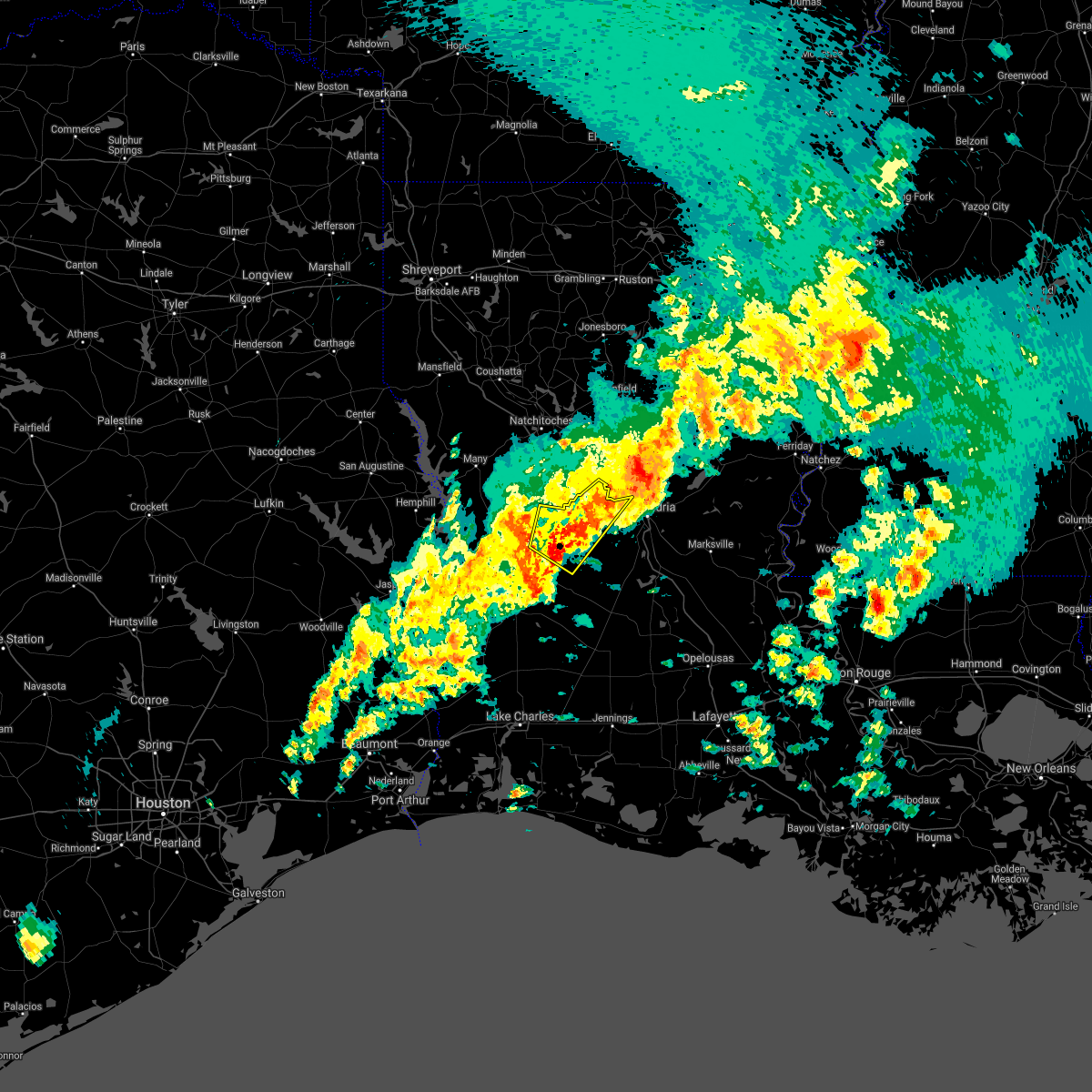 At 606 pm cdt, a severe thunderstorm was located near lacamp, or 8 miles east of slagle, moving northeast at 65 mph (radar indicated). Hazards include 60 mph wind gusts and quarter size hail. Hail damage to vehicles is expected. Expect wind damage to roofs, siding, and trees. At 606 pm cdt, a severe thunderstorm was located near lacamp, or 8 miles east of slagle, moving northeast at 65 mph (radar indicated). Hazards include 60 mph wind gusts and quarter size hail. Hail damage to vehicles is expected. Expect wind damage to roofs, siding, and trees.
|
| 4/2/2017 5:45 PM CDT |
 At 545 pm cdt, a severe thunderstorm was located over boyce, moving east at 35 mph (radar indicated). Hazards include 60 mph wind gusts and quarter size hail. Hail damage to vehicles is expected. Expect wind damage to roofs, siding, and trees. At 545 pm cdt, a severe thunderstorm was located over boyce, moving east at 35 mph (radar indicated). Hazards include 60 mph wind gusts and quarter size hail. Hail damage to vehicles is expected. Expect wind damage to roofs, siding, and trees.
|
| 4/2/2017 4:34 PM CDT |
 At 434 pm cdt, severe thunderstorms were located along a line extending from 16 miles east of jonesboro to 9 miles south of winnfield to near colfax, moving east at 40 mph (radar indicated). Hazards include 60 mph wind gusts and quarter size hail. Hail damage to vehicles is expected. expect wind damage to roofs, siding, and trees. locations impacted include, winnfield, columbia, jena, colfax, olla, clarks, grayson, midway, urania, pollock, dry prong, tullos, dodson, georgetown, atlanta, sikes, nebo, rogers, catahoula lake and chopin. A tornado watch remains in effect until 900 pm cdt for north central and northwestern louisiana. At 434 pm cdt, severe thunderstorms were located along a line extending from 16 miles east of jonesboro to 9 miles south of winnfield to near colfax, moving east at 40 mph (radar indicated). Hazards include 60 mph wind gusts and quarter size hail. Hail damage to vehicles is expected. expect wind damage to roofs, siding, and trees. locations impacted include, winnfield, columbia, jena, colfax, olla, clarks, grayson, midway, urania, pollock, dry prong, tullos, dodson, georgetown, atlanta, sikes, nebo, rogers, catahoula lake and chopin. A tornado watch remains in effect until 900 pm cdt for north central and northwestern louisiana.
|
| 4/2/2017 4:12 PM CDT |
 At 412 pm cdt, severe thunderstorms were located along a line extending from 7 miles southeast of jonesboro to 6 miles northeast of montgomery to flatwoods, moving east at 40 mph (radar indicated). Hazards include 60 mph wind gusts and quarter size hail. Hail damage to vehicles is expected. Expect wind damage to roofs, siding, and trees. At 412 pm cdt, severe thunderstorms were located along a line extending from 7 miles southeast of jonesboro to 6 miles northeast of montgomery to flatwoods, moving east at 40 mph (radar indicated). Hazards include 60 mph wind gusts and quarter size hail. Hail damage to vehicles is expected. Expect wind damage to roofs, siding, and trees.
|
| 1/2/2017 11:13 AM CST |
 At 1113 am cst, severe thunderstorms were located along a line extending from near timber trails to kinder, moving east at 45 mph (radar indicated). Hazards include 70 mph wind gusts. Expect considerable tree damage. damage is likely to mobile homes, roofs, and outbuildings. locations impacted include, alexandria, pineville, eunice, oakdale, mamou, kinder, basile, oberlin, glenmora, boyce, cheneyville, elizabeth, turkey creek, reeves, lena, alexandria international airport, mittie, hineston, grant and ball. A tornado watch remains in effect until 200 pm cst for west central, central and southwestern louisiana. At 1113 am cst, severe thunderstorms were located along a line extending from near timber trails to kinder, moving east at 45 mph (radar indicated). Hazards include 70 mph wind gusts. Expect considerable tree damage. damage is likely to mobile homes, roofs, and outbuildings. locations impacted include, alexandria, pineville, eunice, oakdale, mamou, kinder, basile, oberlin, glenmora, boyce, cheneyville, elizabeth, turkey creek, reeves, lena, alexandria international airport, mittie, hineston, grant and ball. A tornado watch remains in effect until 200 pm cst for west central, central and southwestern louisiana.
|
| 1/2/2017 11:04 AM CST | 911 cener reports roof removed from trailer...powerpoles and lines down on boogaerts r in rapides county LA, 5.4 miles WNW of Boyce, LA |
| 1/2/2017 10:58 AM CST |
 At 1058 am cst, severe thunderstorms were located along a line extending from near boyce to near reeves, moving east at 45 mph (radar indicated). Hazards include 70 mph wind gusts. Expect considerable tree damage. damage is likely to mobile homes, roofs, and outbuildings. locations impacted include, alexandria, pineville, eunice, oakdale, mamou, kinder, basile, oberlin, glenmora, boyce, cheneyville, elizabeth, turkey creek, reeves, lena, dry creek, ragley, sugartown, alexandria international airport and mittie. A tornado watch remains in effect until 200 pm cst for west central, central and southwestern louisiana. At 1058 am cst, severe thunderstorms were located along a line extending from near boyce to near reeves, moving east at 45 mph (radar indicated). Hazards include 70 mph wind gusts. Expect considerable tree damage. damage is likely to mobile homes, roofs, and outbuildings. locations impacted include, alexandria, pineville, eunice, oakdale, mamou, kinder, basile, oberlin, glenmora, boyce, cheneyville, elizabeth, turkey creek, reeves, lena, dry creek, ragley, sugartown, alexandria international airport and mittie. A tornado watch remains in effect until 200 pm cst for west central, central and southwestern louisiana.
|
| 1/2/2017 10:46 AM CST |
 At 1045 am cst, severe thunderstorms were located along a line extending from 15 miles northeast of coushatta to 9 miles northeast of natchitoches to near flatwoods, moving east at 50 mph (radar indicated). Hazards include 70 mph wind gusts and nickel size hail. Expect considerable tree damage. damage is likely to mobile homes, roofs, and outbuildings. locations impacted include, natchitoches, colfax, campti, montgomery, natchez, martin, clarence, goldonna, saline, lucky, ashland, calvin, atlanta, cloutierville, melrose, chopin, st. maurice, chestnut, clear lake and gorum. A tornado watch remains in effect until 200 pm cst for north central and northwestern louisiana. At 1045 am cst, severe thunderstorms were located along a line extending from 15 miles northeast of coushatta to 9 miles northeast of natchitoches to near flatwoods, moving east at 50 mph (radar indicated). Hazards include 70 mph wind gusts and nickel size hail. Expect considerable tree damage. damage is likely to mobile homes, roofs, and outbuildings. locations impacted include, natchitoches, colfax, campti, montgomery, natchez, martin, clarence, goldonna, saline, lucky, ashland, calvin, atlanta, cloutierville, melrose, chopin, st. maurice, chestnut, clear lake and gorum. A tornado watch remains in effect until 200 pm cst for north central and northwestern louisiana.
|
| 1/2/2017 10:32 AM CST |
 At 1032 am cst, severe thunderstorms were located along a line extending from near flatwoods to near buhler, moving east at 45 mph (radar indicated). Hazards include 70 mph wind gusts. Expect considerable tree damage. Damage is likely to mobile homes, roofs, and outbuildings. At 1032 am cst, severe thunderstorms were located along a line extending from near flatwoods to near buhler, moving east at 45 mph (radar indicated). Hazards include 70 mph wind gusts. Expect considerable tree damage. Damage is likely to mobile homes, roofs, and outbuildings.
|
| 1/2/2017 10:18 AM CST |
 At 1018 am cst, severe thunderstorms were located along a line extending from 7 miles west of coushatta to 13 miles west of natchitoches to near kurthwood, moving east at 50 mph (radar indicated). Hazards include 70 mph wind gusts and quarter size hail. Hail damage to vehicles is expected. expect considerable tree damage. Wind damage is also likely to mobile homes, roofs, and outbuildings. At 1018 am cst, severe thunderstorms were located along a line extending from 7 miles west of coushatta to 13 miles west of natchitoches to near kurthwood, moving east at 50 mph (radar indicated). Hazards include 70 mph wind gusts and quarter size hail. Hail damage to vehicles is expected. expect considerable tree damage. Wind damage is also likely to mobile homes, roofs, and outbuildings.
|
| 8/7/2016 10:58 PM CDT |
 At 1058 pm cdt, severe thunderstorms were located along a line extending from kurthwood to near alexandria international airport, moving southwest at 20 mph (radar indicated). Hazards include 60 mph wind gusts and nickel size hail. Expect damage to roofs. siding. And trees. At 1058 pm cdt, severe thunderstorms were located along a line extending from kurthwood to near alexandria international airport, moving southwest at 20 mph (radar indicated). Hazards include 60 mph wind gusts and nickel size hail. Expect damage to roofs. siding. And trees.
|
| 7/14/2016 10:26 PM CDT | At 1024 pm cdt, severe thunderstorms were located along a line extending from 7 miles north of flatwoods to near colfax to 10 miles north of boyce to 9 miles north of ball, moving south at 15 mph (radar indicated). Hazards include 60 mph wind gusts. Expect damage to roofs. siding. and trees. Locations impacted include, colfax, pollock, dry prong, chopin, gorum, fishville, cloutierville, aloha and bentley. |
| 7/14/2016 10:08 PM CDT |
 At 1008 pm cdt, severe thunderstorms were located along a line extending from manifest to 12 miles northeast of colfax to 10 miles southwest of montgomery, moving south at 30 mph (radar indicated). Hazards include 60 mph wind gusts. Expect damage to roofs. siding. And trees. At 1008 pm cdt, severe thunderstorms were located along a line extending from manifest to 12 miles northeast of colfax to 10 miles southwest of montgomery, moving south at 30 mph (radar indicated). Hazards include 60 mph wind gusts. Expect damage to roofs. siding. And trees.
|
| 7/14/2016 9:56 PM CDT |
 At 956 pm cdt, a strong gust front with a broken line of strong to severe thunderstorms were located along a line extending from 6 miles west of natchitoches to 13 miles north of colfax to near aimwell, moving south at 25 mph. while these storms have weakened over the last few minutes, sporadic wind damage will remain possible over the next half hour (radar indicated). Hazards include 60 mph wind gusts. Expect damage to roofs. siding. and trees. Locations impacted include, natchitoches, jena, colfax, olla, montgomery, midway, allen, urania, provencal, natchez, clarence, pollock, dry prong, tullos, georgetown, robeline, atlanta, flora, williana and hagewood. At 956 pm cdt, a strong gust front with a broken line of strong to severe thunderstorms were located along a line extending from 6 miles west of natchitoches to 13 miles north of colfax to near aimwell, moving south at 25 mph. while these storms have weakened over the last few minutes, sporadic wind damage will remain possible over the next half hour (radar indicated). Hazards include 60 mph wind gusts. Expect damage to roofs. siding. and trees. Locations impacted include, natchitoches, jena, colfax, olla, montgomery, midway, allen, urania, provencal, natchez, clarence, pollock, dry prong, tullos, georgetown, robeline, atlanta, flora, williana and hagewood.
|
| 7/14/2016 9:26 PM CDT |
 At 926 pm cdt, severe thunderstorms were located along a line extending from campti to 6 miles southeast of winnfield to near enterprise, moving south at 25 mph (radar indicated). Hazards include 60 mph wind gusts. Expect damage to roofs. siding. And trees. At 926 pm cdt, severe thunderstorms were located along a line extending from campti to 6 miles southeast of winnfield to near enterprise, moving south at 25 mph (radar indicated). Hazards include 60 mph wind gusts. Expect damage to roofs. siding. And trees.
|
| 6/18/2016 1:23 PM CDT |
 At 122 pm cdt, severe thunderstorms were located along a line extending from 9 miles east of elmer to near slagle, moving south at 25 mph (radar indicated). Hazards include 60 mph wind gusts. Expect damage to roofs. siding. and trees. Locations impacted include, alexandria, glenmora, boyce, pitkin, hineston, alexandria international airport, lacamp, elmer, gardner, cravens, flatwoods, hutton, clifton, fullerton, leander, otis, sieper, calcasieu, simpson and mcnary. At 122 pm cdt, severe thunderstorms were located along a line extending from 9 miles east of elmer to near slagle, moving south at 25 mph (radar indicated). Hazards include 60 mph wind gusts. Expect damage to roofs. siding. and trees. Locations impacted include, alexandria, glenmora, boyce, pitkin, hineston, alexandria international airport, lacamp, elmer, gardner, cravens, flatwoods, hutton, clifton, fullerton, leander, otis, sieper, calcasieu, simpson and mcnary.
|
| 6/18/2016 12:47 PM CDT |
 At 1247 pm cdt, a severe thunderstorm was located over flatwoods, or near lena, moving south at 20 mph (radar indicated). Hazards include 60 mph wind gusts. Expect damage to roofs. siding. And trees. At 1247 pm cdt, a severe thunderstorm was located over flatwoods, or near lena, moving south at 20 mph (radar indicated). Hazards include 60 mph wind gusts. Expect damage to roofs. siding. And trees.
|
| 5/27/2016 5:49 PM CDT |
 At 548 pm cdt, severe thunderstorms were located along a line extending from clifton to elizabeth to lake charles, moving east at 35 mph (radar indicated). Hazards include 60 mph wind gusts. Expect damage to roofs. siding. and trees. Locations impacted include, lake charles, alexandria, sulphur, oakdale, westlake, welsh, iowa, kinder, oberlin, glenmora, elton, boyce, elizabeth, fenton, reeves, lena, dry creek, ragley, sugartown and alexandria international airport. At 548 pm cdt, severe thunderstorms were located along a line extending from clifton to elizabeth to lake charles, moving east at 35 mph (radar indicated). Hazards include 60 mph wind gusts. Expect damage to roofs. siding. and trees. Locations impacted include, lake charles, alexandria, sulphur, oakdale, westlake, welsh, iowa, kinder, oberlin, glenmora, elton, boyce, elizabeth, fenton, reeves, lena, dry creek, ragley, sugartown and alexandria international airport.
|
| 5/27/2016 5:14 PM CDT |
 At 512 pm cdt, severe thunderstorms were located along a line extending from near slagle to 6 miles southwest of sugartown to 6 miles southeast of vinton, moving east at 35 mph (radar indicated). Hazards include 60 mph wind gusts. Expect damage to roofs. siding. And trees. At 512 pm cdt, severe thunderstorms were located along a line extending from near slagle to 6 miles southwest of sugartown to 6 miles southeast of vinton, moving east at 35 mph (radar indicated). Hazards include 60 mph wind gusts. Expect damage to roofs. siding. And trees.
|
| 4/30/2016 11:07 AM CDT |
 At 1107 am cdt, a severe thunderstorm was located over boyce, moving east at 20 mph (radar indicated). Hazards include 60 mph wind gusts and quarter size hail. Hail damage to vehicles is expected. expect wind damage to roofs, siding, and trees. Locations impacted include, alexandria, pineville, boyce, lena, alexandria international airport, ball, kolin, libuse, tioga, esler regional airport, kingsville, paradise and timber trails. At 1107 am cdt, a severe thunderstorm was located over boyce, moving east at 20 mph (radar indicated). Hazards include 60 mph wind gusts and quarter size hail. Hail damage to vehicles is expected. expect wind damage to roofs, siding, and trees. Locations impacted include, alexandria, pineville, boyce, lena, alexandria international airport, ball, kolin, libuse, tioga, esler regional airport, kingsville, paradise and timber trails.
|
| 4/30/2016 10:50 AM CDT |
 At 1049 am cdt, a severe thunderstorm was located near flatwoods, or near lena, moving east at 25 mph (radar indicated). Hazards include 60 mph wind gusts and quarter size hail. Hail damage to vehicles is expected. Expect wind damage to roofs, siding, and trees. At 1049 am cdt, a severe thunderstorm was located near flatwoods, or near lena, moving east at 25 mph (radar indicated). Hazards include 60 mph wind gusts and quarter size hail. Hail damage to vehicles is expected. Expect wind damage to roofs, siding, and trees.
|
| 3/31/2016 4:37 PM CDT | Half Dollar sized hail reported 4.8 miles E of Boyce, LA, public posted photos of half dollar size hail in sharp. time estimated from radar. |
| 3/17/2016 4:03 PM CDT |
 At 402 pm cdt, severe thunderstorms were located along a line extending from near alexandria to near burr ferry, moving southeast at 35 mph (radar indicated). Hazards include 60 mph wind gusts and quarter size hail. Hail damage to vehicles is expected. expect wind damage to roofs, siding and trees. Locations impacted include, alexandria, pineville, leesville, boyce, anacoco, lena, fort polk, hineston, alexandria international airport, slagle, ball, new llano, colfax, hornbeck, lacamp, libuse, flatwoods, paradise, hutton and clifton. At 402 pm cdt, severe thunderstorms were located along a line extending from near alexandria to near burr ferry, moving southeast at 35 mph (radar indicated). Hazards include 60 mph wind gusts and quarter size hail. Hail damage to vehicles is expected. expect wind damage to roofs, siding and trees. Locations impacted include, alexandria, pineville, leesville, boyce, anacoco, lena, fort polk, hineston, alexandria international airport, slagle, ball, new llano, colfax, hornbeck, lacamp, libuse, flatwoods, paradise, hutton and clifton.
|
| 3/17/2016 3:39 PM CDT |
 At 339 pm cdt, severe thunderstorms were located along a line extending from near boyce to 6 miles north of toledo bend dam, moving southeast at 35 mph (radar indicated). Hazards include 60 mph wind gusts and quarter size hail. Hail damage to vehicles is expected. Expect wind damage to roofs, siding and trees. At 339 pm cdt, severe thunderstorms were located along a line extending from near boyce to 6 miles north of toledo bend dam, moving southeast at 35 mph (radar indicated). Hazards include 60 mph wind gusts and quarter size hail. Hail damage to vehicles is expected. Expect wind damage to roofs, siding and trees.
|
| 3/1/2016 4:52 PM CST |
 At 450 pm cst, severe thunderstorms were located along a line extending from 6 miles southeast of enterprise to near jena to 8 miles north of timber trails to boyce, moving southeast at 35 mph (radar indicated). Hazards include 60 mph wind gusts and quarter size hail. Hail damage to vehicles is expected. expect wind damage to roofs, siding, and trees. Locations impacted include, jena, midway, pollock, catahoula lake, fishville, rogers, nebo and bentley. At 450 pm cst, severe thunderstorms were located along a line extending from 6 miles southeast of enterprise to near jena to 8 miles north of timber trails to boyce, moving southeast at 35 mph (radar indicated). Hazards include 60 mph wind gusts and quarter size hail. Hail damage to vehicles is expected. expect wind damage to roofs, siding, and trees. Locations impacted include, jena, midway, pollock, catahoula lake, fishville, rogers, nebo and bentley.
|
| 3/1/2016 4:17 PM CST |
 At 416 pm cst, severe thunderstorms were located along a line extending from 6 miles east of columbia to olla to 8 miles south of winnfield to near montgomery, moving southeast at 35 mph (radar indicated). Hazards include 60 mph wind gusts and quarter size hail. Hail damage to vehicles is expected. Expect wind damage to roofs, siding, and trees. At 416 pm cst, severe thunderstorms were located along a line extending from 6 miles east of columbia to olla to 8 miles south of winnfield to near montgomery, moving southeast at 35 mph (radar indicated). Hazards include 60 mph wind gusts and quarter size hail. Hail damage to vehicles is expected. Expect wind damage to roofs, siding, and trees.
|
| 1/21/2016 2:41 PM CST | At 241 pm cst, severe thunderstorms were located along a line extending from near timber trails to near glenmora to near cravens, moving northeast at 50 mph (radar indicated). Hazards include 60 mph wind gusts and quarter size hail. Hail damage to vehicles is expected. Expect wind damage to roofs, siding and trees. |
| 12/28/2015 12:12 AM CST |
 At 1212 am cst, severe thunderstorms were located along a line extending from 10 miles southwest of jonesboro to near alexandria international airport, moving northeast at 45 mph (radar indicated). Hazards include 60 mph wind gusts. Expect damage to roofs. siding. and trees. locations impacted include, winnfield, jonesboro, colfax, montgomery, hodge, dry prong, goldonna, dodson, calvin, bienville, atlanta, williana, bentley, lake iatt, brice, friendship, aloha and liberty hill. A tornado watch remains in effect until 500 am cst for northwestern louisiana. At 1212 am cst, severe thunderstorms were located along a line extending from 10 miles southwest of jonesboro to near alexandria international airport, moving northeast at 45 mph (radar indicated). Hazards include 60 mph wind gusts. Expect damage to roofs. siding. and trees. locations impacted include, winnfield, jonesboro, colfax, montgomery, hodge, dry prong, goldonna, dodson, calvin, bienville, atlanta, williana, bentley, lake iatt, brice, friendship, aloha and liberty hill. A tornado watch remains in effect until 500 am cst for northwestern louisiana.
|
| 12/27/2015 11:57 PM CST |
 At 1156 pm cst, severe thunderstorms were located along a line extending from 12 miles northeast of campti to near hineston, moving east at 45 mph (radar indicated). Hazards include 60 mph wind gusts. Expect damage to roofs. siding. and trees. locations impacted include, winnfield, jonesboro, colfax, montgomery, clarence, hodge, dry prong, goldonna, dodson, saline, lucky, ashland, calvin, bienville, atlanta, clear lake, creston, williana, brice and friendship. A tornado watch remains in effect until 500 am cst for northwestern louisiana. At 1156 pm cst, severe thunderstorms were located along a line extending from 12 miles northeast of campti to near hineston, moving east at 45 mph (radar indicated). Hazards include 60 mph wind gusts. Expect damage to roofs. siding. and trees. locations impacted include, winnfield, jonesboro, colfax, montgomery, clarence, hodge, dry prong, goldonna, dodson, saline, lucky, ashland, calvin, bienville, atlanta, clear lake, creston, williana, brice and friendship. A tornado watch remains in effect until 500 am cst for northwestern louisiana.
|
| 12/27/2015 11:33 PM CST |
 At 1132 pm cst, severe thunderstorms were located along a line extending from near campti to near fullerton, moving northeast at 45 mph (radar indicated). Hazards include 60 mph wind gusts. Expect damage to roofs. siding. And trees. At 1132 pm cst, severe thunderstorms were located along a line extending from near campti to near fullerton, moving northeast at 45 mph (radar indicated). Hazards include 60 mph wind gusts. Expect damage to roofs. siding. And trees.
|
| 10/31/2015 8:46 AM CDT |
 At 846 am cdt, a severe thunderstorm capable of producing a tornado was located near lacamp, or 8 miles southeast of slagle, moving northeast at 30 mph (radar indicated rotation). Hazards include tornado and quarter size hail. Flying debris will be dangerous to those caught without shelter. mobile homes will be damaged or destroyed. damage to roofs, windows and vehicles will occur. tree damage is likely. this dangerous storm will be near, lacamp around 850 am cdt. leander around 855 am cdt. sieper and hutton around 905 am cdt. clifton around 910 am cdt. flatwoods around 925 am cdt. lena around 930 am cdt. Other locations impacted by this tornadic thunderstorm include simpson. At 846 am cdt, a severe thunderstorm capable of producing a tornado was located near lacamp, or 8 miles southeast of slagle, moving northeast at 30 mph (radar indicated rotation). Hazards include tornado and quarter size hail. Flying debris will be dangerous to those caught without shelter. mobile homes will be damaged or destroyed. damage to roofs, windows and vehicles will occur. tree damage is likely. this dangerous storm will be near, lacamp around 850 am cdt. leander around 855 am cdt. sieper and hutton around 905 am cdt. clifton around 910 am cdt. flatwoods around 925 am cdt. lena around 930 am cdt. Other locations impacted by this tornadic thunderstorm include simpson.
|
| 10/31/2015 7:55 AM CDT |
 The severe thunderstorm warning for rapides parish will expire at 800 am cdt, the storms which prompted the warning have weakened. therefore the warning will be allowed to expire, however wind gusts of 40 to 50 mph will remain possible. a tornado watch remains in effect until 200 pm cdt for central louisiana. The severe thunderstorm warning for rapides parish will expire at 800 am cdt, the storms which prompted the warning have weakened. therefore the warning will be allowed to expire, however wind gusts of 40 to 50 mph will remain possible. a tornado watch remains in effect until 200 pm cdt for central louisiana.
|
| 10/31/2015 7:39 AM CDT |
 At 739 am cdt, severe thunderstorms were located along a line extending from near gardner to elmer to 7 miles northeast of elizabeth, moving east at 30 mph (radar indicated). Hazards include 60 mph wind gusts. Expect damage to roofs. siding and trees. locations impacted include, alexandria, pineville, glenmora, boyce, hineston, alexandria international airport, ball, lecompte, kolin, libuse, paradise, tioga, otis, sieper, elmer, gardner, kingsville, poland, esler regional airport and timber trails. A tornado watch remains in effect until 200 pm cdt for central louisiana. At 739 am cdt, severe thunderstorms were located along a line extending from near gardner to elmer to 7 miles northeast of elizabeth, moving east at 30 mph (radar indicated). Hazards include 60 mph wind gusts. Expect damage to roofs. siding and trees. locations impacted include, alexandria, pineville, glenmora, boyce, hineston, alexandria international airport, ball, lecompte, kolin, libuse, paradise, tioga, otis, sieper, elmer, gardner, kingsville, poland, esler regional airport and timber trails. A tornado watch remains in effect until 200 pm cdt for central louisiana.
|
| 10/31/2015 7:16 AM CDT |
 At 716 am cdt, severe thunderstorms were located along a line extending from near clifton to near leander to near pitkin, moving northeast at 35 mph (radar indicated). Hazards include 60 mph wind gusts. Expect damage to roofs. Siding and trees. At 716 am cdt, severe thunderstorms were located along a line extending from near clifton to near leander to near pitkin, moving northeast at 35 mph (radar indicated). Hazards include 60 mph wind gusts. Expect damage to roofs. Siding and trees.
|
| 5/27/2015 6:23 AM CDT | At 623 am cdt, doppler radar indicated a line of severe thunderstorms capable of producing quarter size hail and damaging winds in excess of 60 mph. these storms were located along a line extending from near boyce to ragley, and moving east at 30 mph. |
| 5/25/2015 11:17 PM CDT | At 1117 pm cdt, doppler radar indicated a line of severe thunderstorms capable of producing quarter size hail and damaging winds in excess of 60 mph. these storms were located along a line extending from libuse to near cheneyville to near lake charles to near port acres, moving southeast at 50 mph. locations impacted include, beaumont, lake charles, port arthur, alexandria, sulphur, orange, nederland, groves, pineville, port neches, vidor, jennings, bridge city, oakdale, ville platte, westlake, west orange, mamou, welsh and vinton. a tornado watch remains in effect until 200 am cdt for southwestern louisiana and southeastern texas. a tornado watch also remains in effect until 500 am cdt for central louisiana. |
| 5/25/2015 11:17 PM CDT | At 1117 pm cdt, doppler radar indicated a line of severe thunderstorms capable of producing quarter size hail and damaging winds in excess of 60 mph. these storms were located along a line extending from libuse to near cheneyville to near lake charles to near port acres, moving southeast at 50 mph. locations impacted include, beaumont, lake charles, port arthur, alexandria, sulphur, orange, nederland, groves, pineville, port neches, vidor, jennings, bridge city, oakdale, ville platte, westlake, west orange, mamou, welsh and vinton. a tornado watch remains in effect until 200 am cdt for southwestern louisiana and southeastern texas. a tornado watch also remains in effect until 500 am cdt for central louisiana. |
| 5/25/2015 10:59 PM CDT | At 1058 pm cdt, doppler radar indicated a line of severe thunderstorms capable of producing quarter size hail and damaging winds in excess of 60 mph. these storms were located along a line extending from near boyce to near glenmora to near vinton to hamshire, and moving southeast at 45 mph. |
| 5/25/2015 10:59 PM CDT | At 1058 pm cdt, doppler radar indicated a line of severe thunderstorms capable of producing quarter size hail and damaging winds in excess of 60 mph. these storms were located along a line extending from near boyce to near glenmora to near vinton to hamshire, and moving southeast at 45 mph. |
| 5/25/2015 10:45 PM CDT | At 1045 pm cdt, doppler radar indicated a line of severe thunderstorms capable of producing quarter size hail and damaging winds in excess of 60 mph. these storms were located along a line extending from near boyce to near buhler to near fannett, moving east at 30 mph. locations impacted include, beaumont, port arthur, alexandria, orange, lumberton, vidor, bridge city, west orange, vinton, sour lake, rosepine, merryville, boyce, nome, deweyville, lena, dry creek, ragley, fort polk and evadale. a tornado watch remains in effect until 200 am cdt for southwestern louisiana and southeastern texas. |
| 5/25/2015 10:45 PM CDT | At 1045 pm cdt, doppler radar indicated a line of severe thunderstorms capable of producing quarter size hail and damaging winds in excess of 60 mph. these storms were located along a line extending from near boyce to near buhler to near fannett, moving east at 30 mph. locations impacted include, beaumont, port arthur, alexandria, orange, lumberton, vidor, bridge city, west orange, vinton, sour lake, rosepine, merryville, boyce, nome, deweyville, lena, dry creek, ragley, fort polk and evadale. a tornado watch remains in effect until 200 am cdt for southwestern louisiana and southeastern texas. |
| 5/25/2015 10:19 PM CDT | At 1018 pm cdt, doppler radar indicated a line of severe thunderstorms capable of producing quarter size hail and damaging winds in excess of 60 mph. these storms were located along a line extending from near de ridder to near lunita to nome. these storms were nearly stationary. |
| 5/25/2015 10:19 PM CDT | At 1018 pm cdt, doppler radar indicated a line of severe thunderstorms capable of producing quarter size hail and damaging winds in excess of 60 mph. these storms were located along a line extending from near de ridder to near lunita to nome. these storms were nearly stationary. |
| 5/24/2015 12:20 PM CDT | At 1219 pm cdt, severe thunderstorms were located along a line extending from near coushatta to 7 miles west of natchitoches to 8 miles northwest of kurthwood, moving northeast at 25 mph (radar indicated). Hazards include 60 mph wind gusts and quarter size hail. Hail damage to vehicles is expected. Expect wind damage to roofs, siding and trees. |
| 4/27/2015 7:39 AM CDT | At 737 am cdt, doppler radar indicated a line of severe thunderstorms capable of producing quarter size hail and damaging winds in excess of 60 mph. these storms were located along a line extending from near gardner to 6 miles northwest of turkey creek to near hayes, moving east at 55 mph. locations impacted include, alexandria, opelousas, pineville, crowley, eunice, jennings, rayne, oakdale, ville platte, marksville, church point, bunkie, mamou, welsh, iowa, lake arthur, kinder, basile, oberlin and iota. a tornado watch remains in effect until 100 pm cdt for southwestern louisiana. |
| 4/27/2015 7:20 AM CDT | At 719 am cdt, doppler radar indicated a line of severe thunderstorms capable of producing quarter size hail and damaging winds in excess of 60 mph. these storms were located along a line extending from near hutton to near elizabeth to near lake charles regional airport, and moving east at 55 mph. |
| 4/19/2015 9:36 PM CDT | At 936 pm cdt, doppler radar indicated a severe thunderstorm capable of producing a tornado. this dangerous storm was located over boyce, and moving east at 30 mph. |
| 4/19/2015 9:21 PM CDT | At 919 pm cdt, doppler radar indicated a severe thunderstorm capable of producing large damaging hail up to golf ball size and damaging winds in excess of 60 mph. this storm was located near lena, and moving east at 40 mph. |
| 4/19/2015 8:55 PM CDT | The severe thunderstorm warning for northeastern vernon and northern rapides parishes will expire at 900 pm cdt, the storm which prompted the warning has weakened below severe limits, and no longer poses an immediate threat to life or property. therefore the warning will be allowed to expire. however gusty winds and heavy rain are still possible with other thunderstorms moving through the area. |
| 4/19/2015 7:58 PM CDT | The national weather service in lake charles has issued a * severe thunderstorm warning for. northeastern vernon parish in west central louisiana. northern rapides parish in central louisiana. until 900 pm cdt * at 758 pm cdt. Doppler radar indicated a severe thunderstorm. |
| 4/19/2015 7:31 PM CDT | At 731 pm cdt, doppler radar indicated a severe thunderstorm capable of producing quarter size hail. this storm was located near boyce, moving east at 30 mph. locations impacted include, alexandria, pineville, boyce, lena, alexandria international airport, ball, kolin, libuse, kingsville, flatwoods, paradise, deville, holloway, esler regional airport, tioga and timber trails. |
| 4/19/2015 7:07 PM CDT | The national weather service in lake charles has issued a * severe thunderstorm warning for. northern rapides parish in central louisiana. until 800 pm cdt * at 707 pm cdt. doppler radar indicated a severe thunderstorm capable of producing quarter size hail. This storm was located near. |
| 2/1/2015 4:30 PM CST | Quarter sized hail reported 8.3 miles N of Boyce, LA, kalb tv reported public report of quarter sized hail near boyce/gardner area via facebook. |
| 2/10/2013 11:25 AM CST | Tree and power line down in grant county LA, 4.2 miles S of Boyce, LA |
| 1/1/0001 12:00 AM | Rapides sheriff reports trees and powerlines down along vanzant and bathouse road in rapides county LA, 5.9 miles NE of Boyce, LA |
| 1/1/0001 12:00 AM | Quarter sized hail reported 8.3 miles N of Boyce, LA |
| 1/1/0001 12:00 AM | Parish highway department reported tree down on power lines on mill race r in rapides county LA, 5.6 miles NNW of Boyce, LA |
| 1/1/0001 12:00 AM | Storm damage reported in rapides county LA, 0.1 miles SE of Boyce, LA |
Hail Maps for Boyce, LA

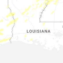


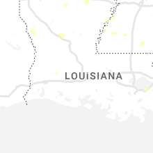


Connect with Interactive Hail Maps