

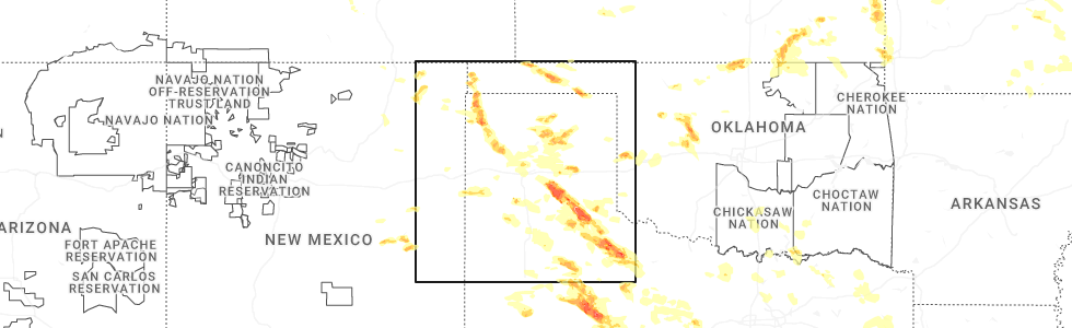
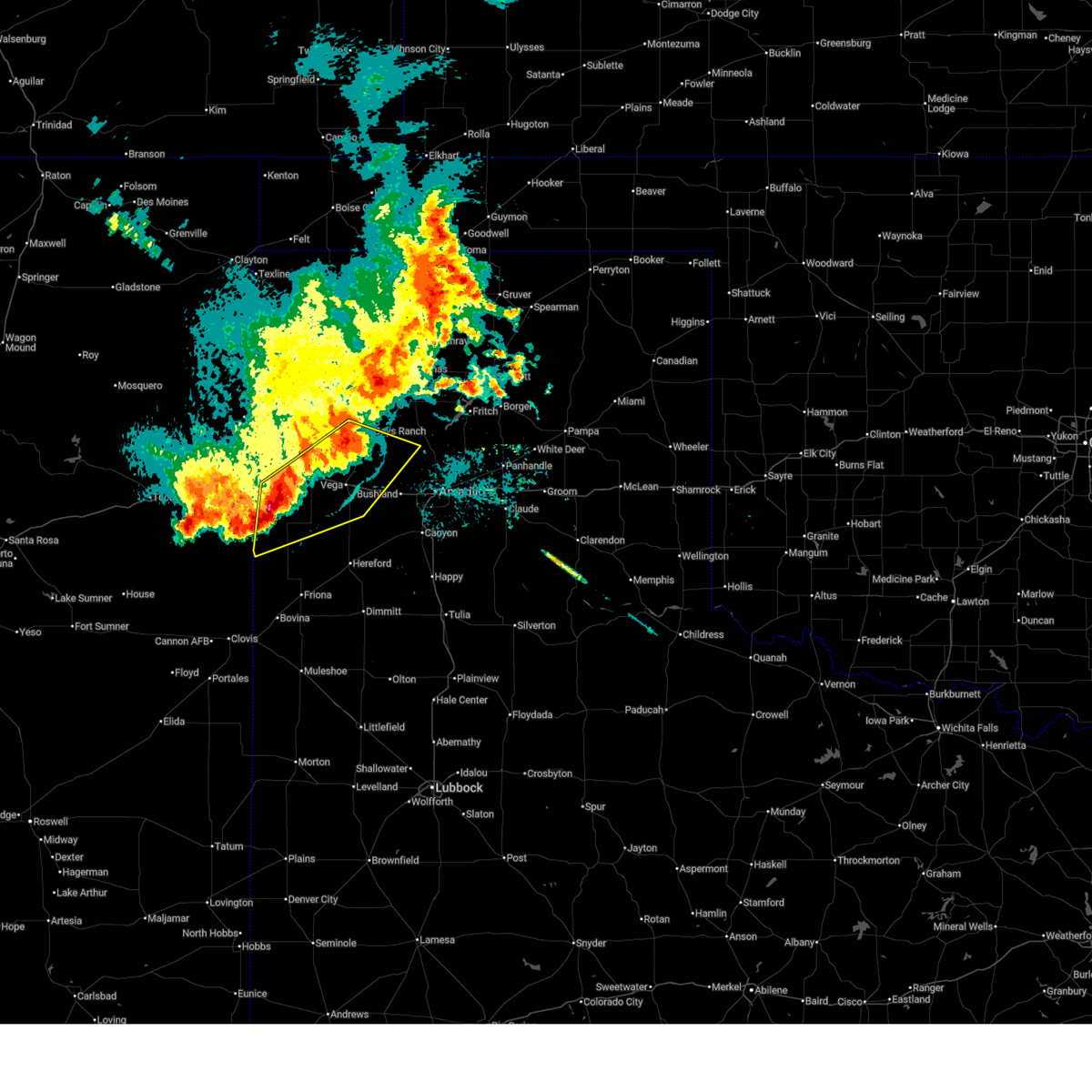
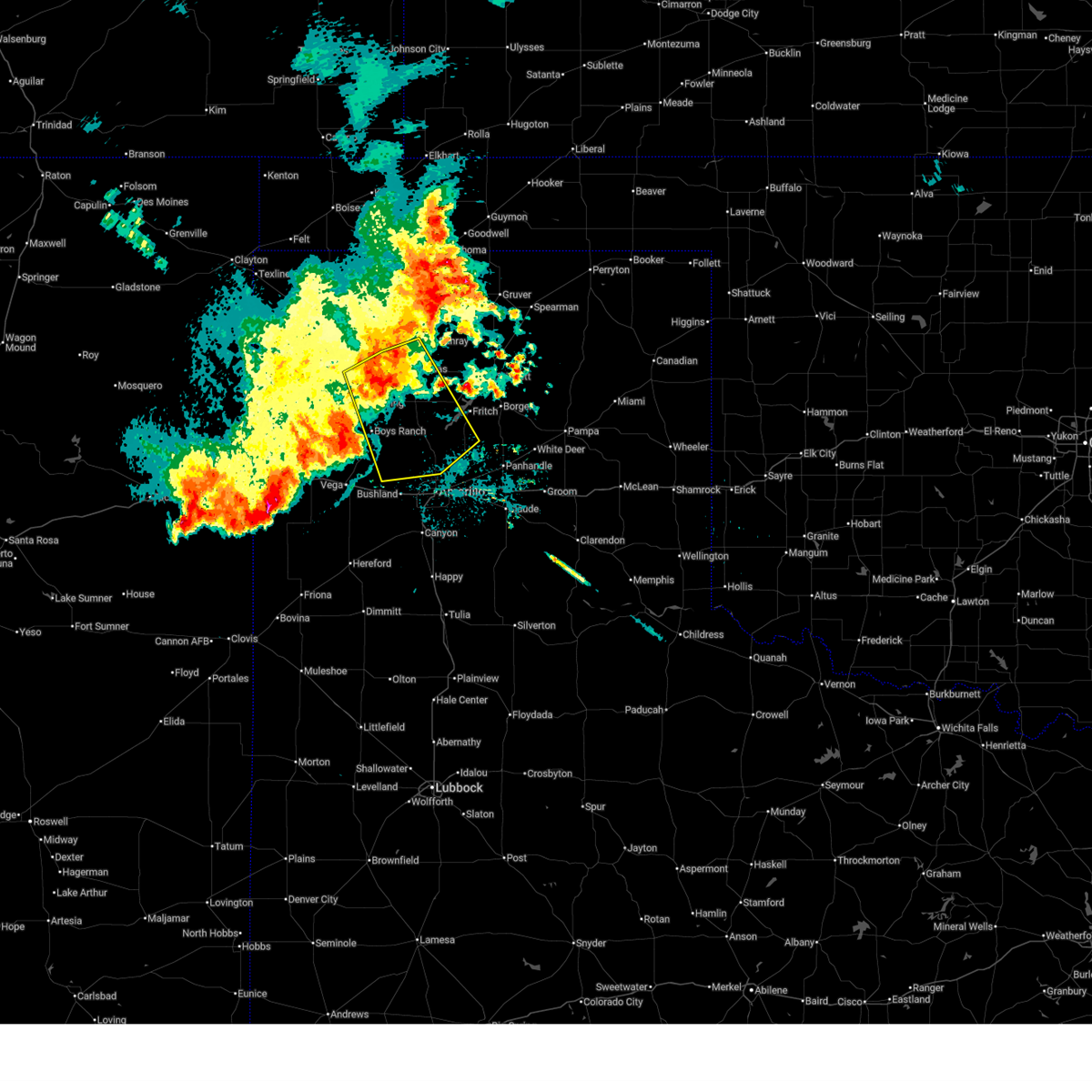
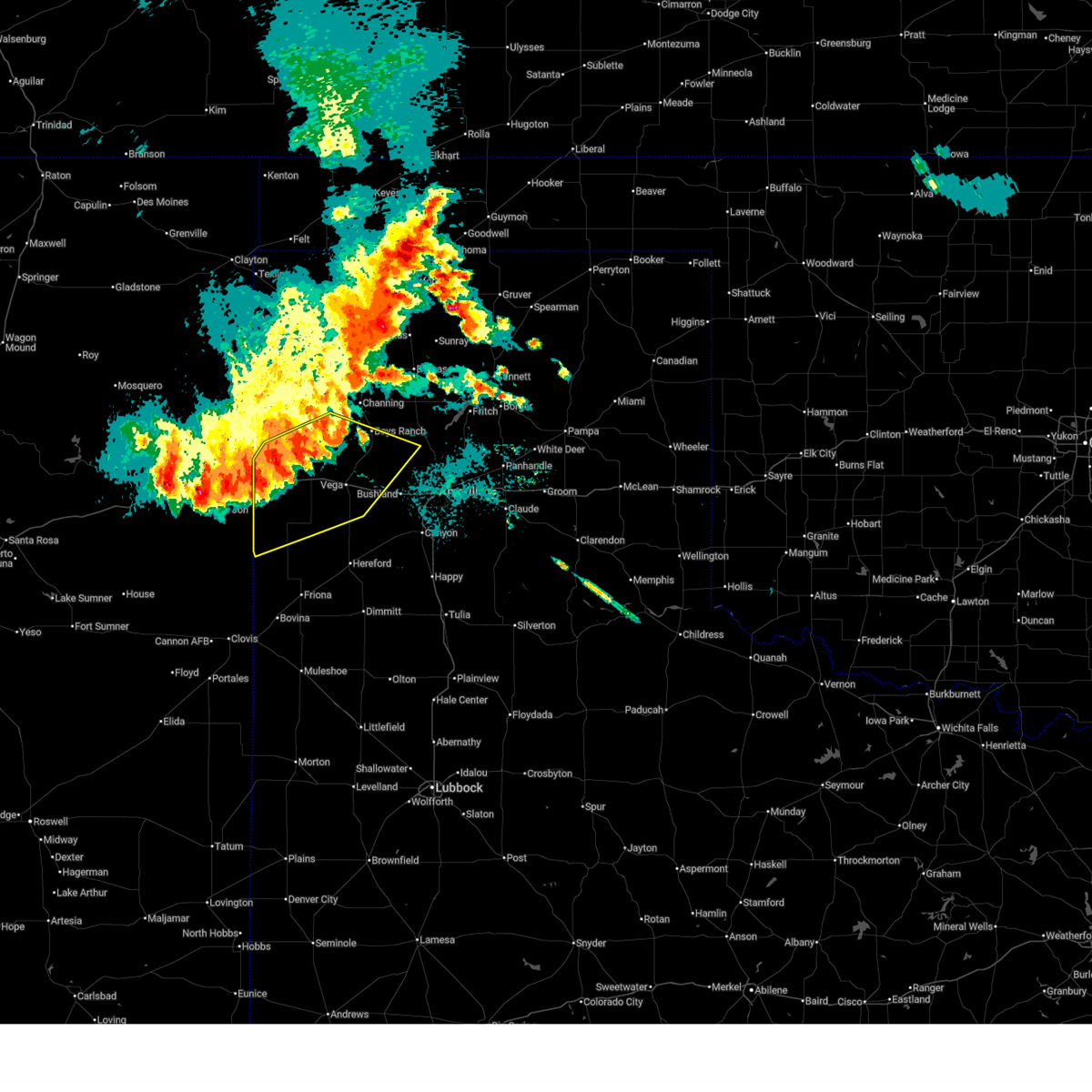
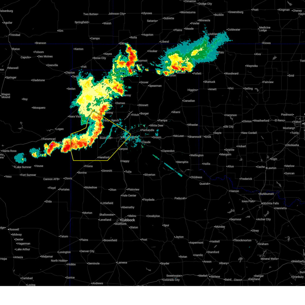
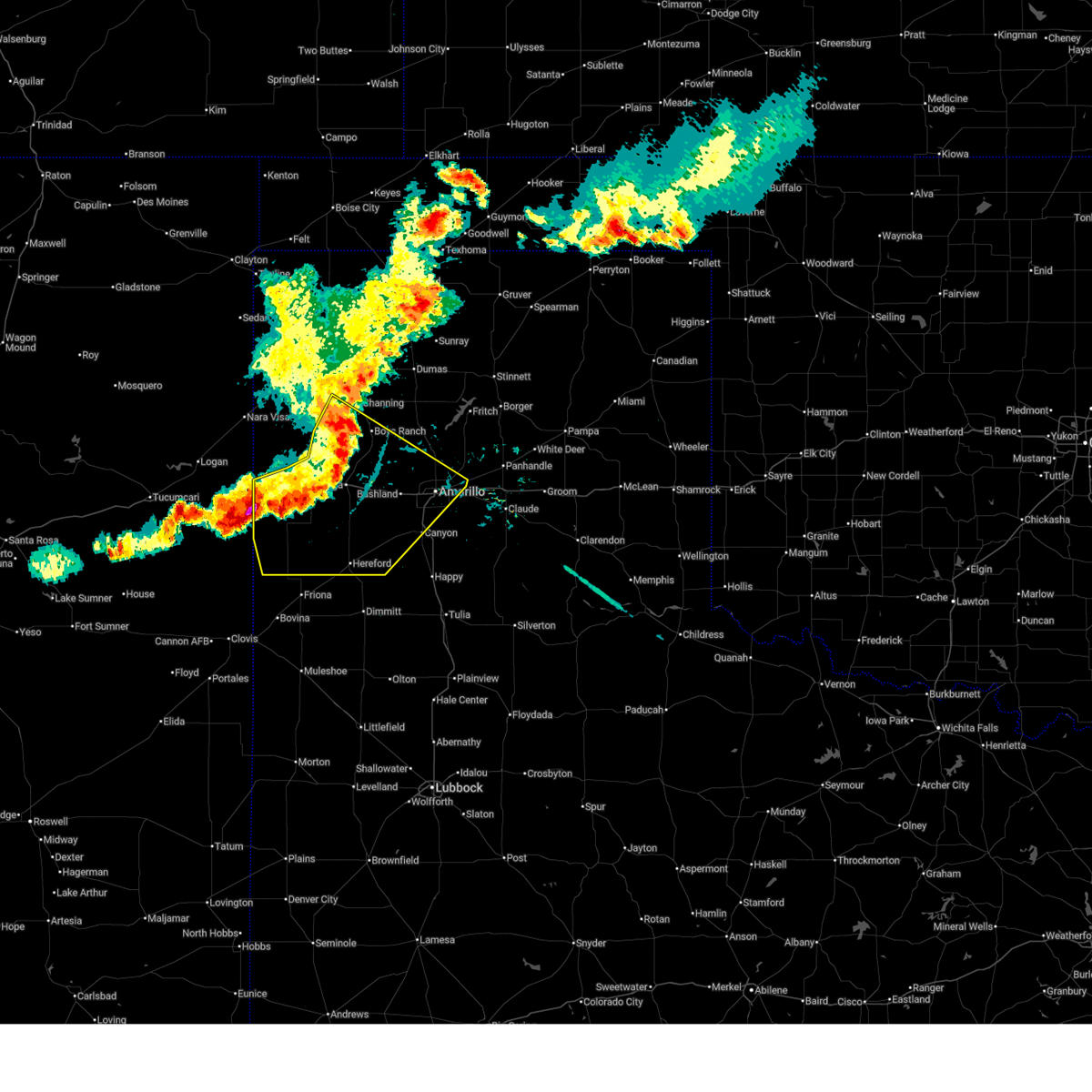
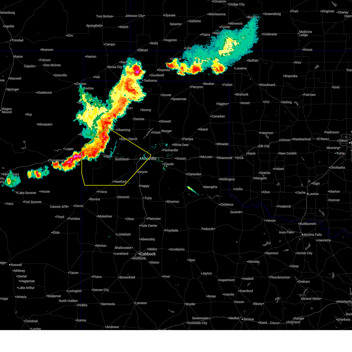
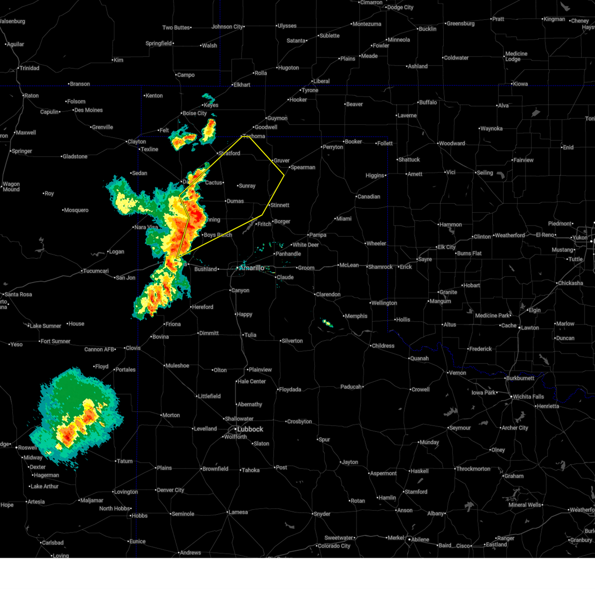
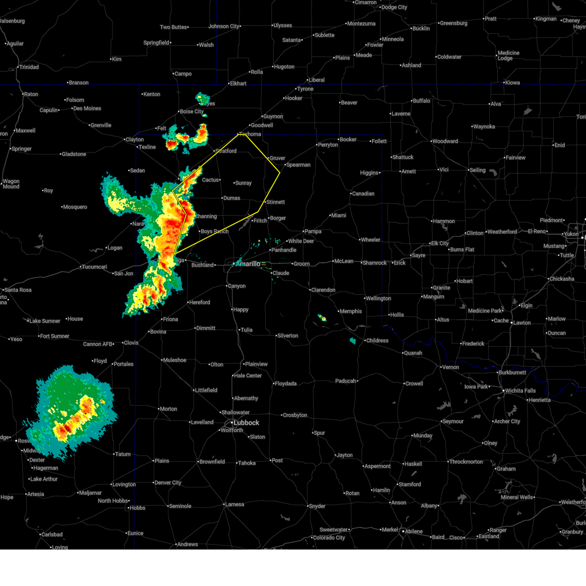
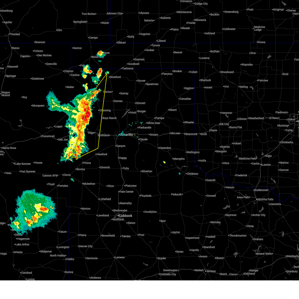
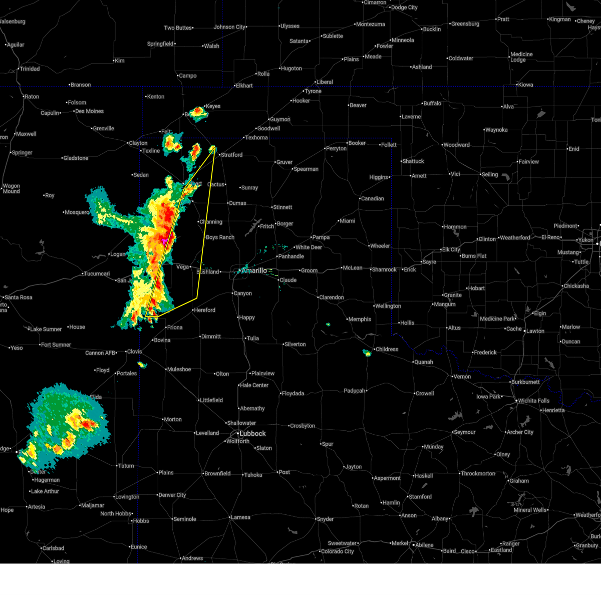
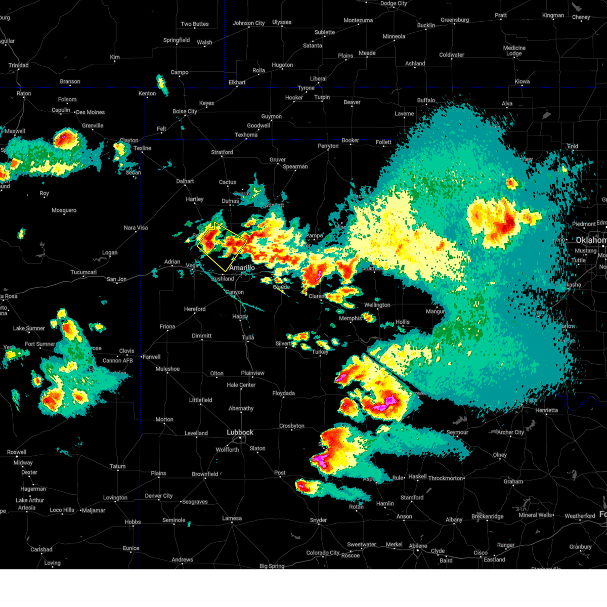
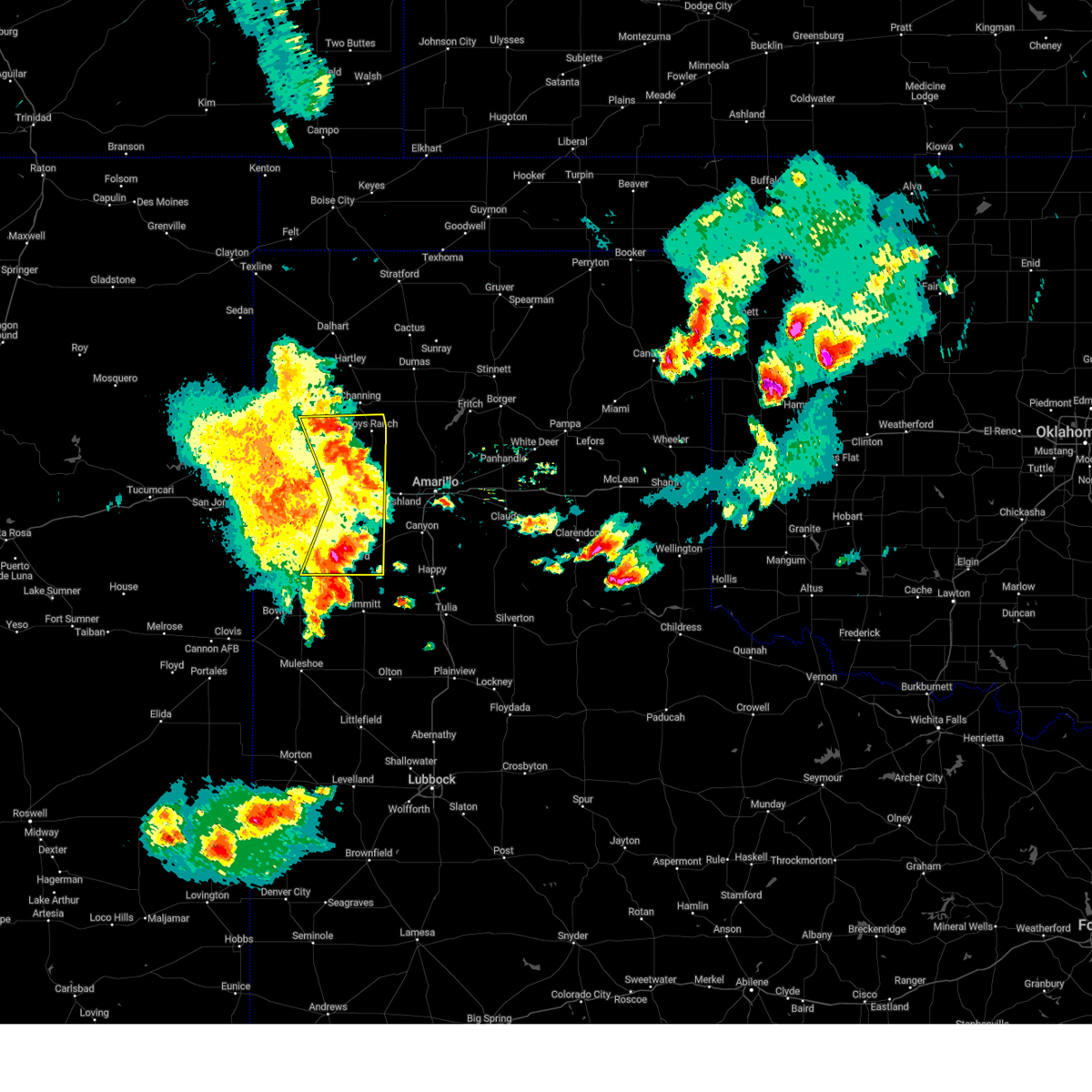
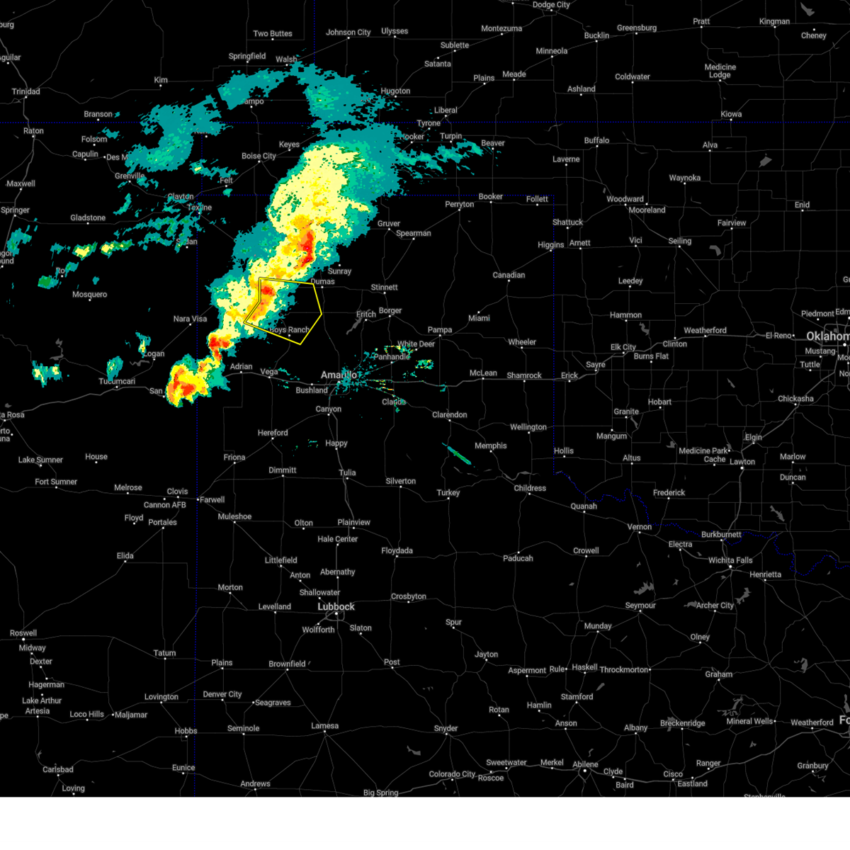
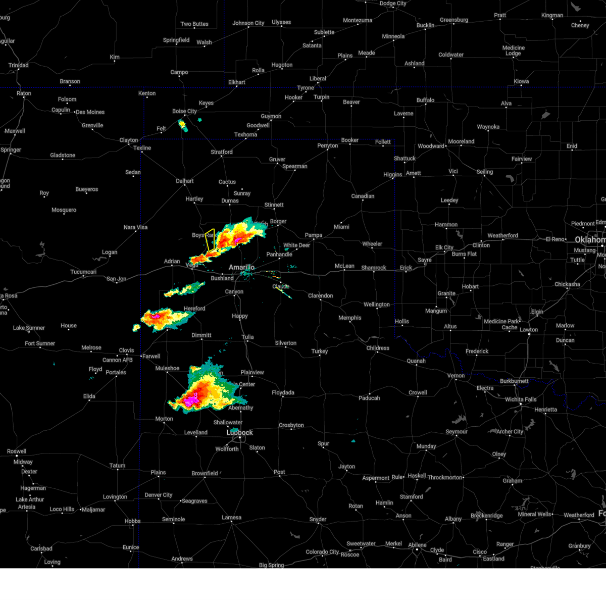
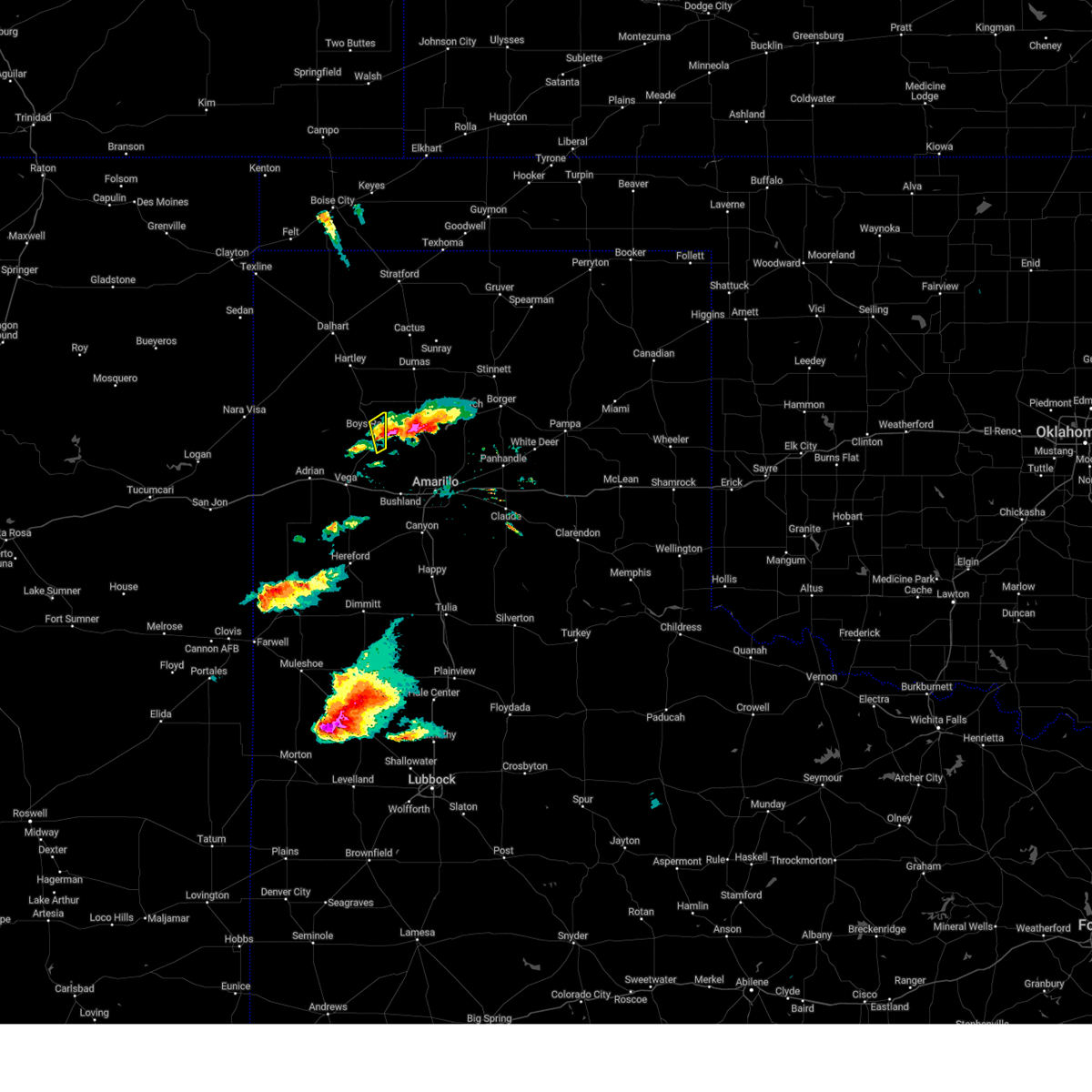
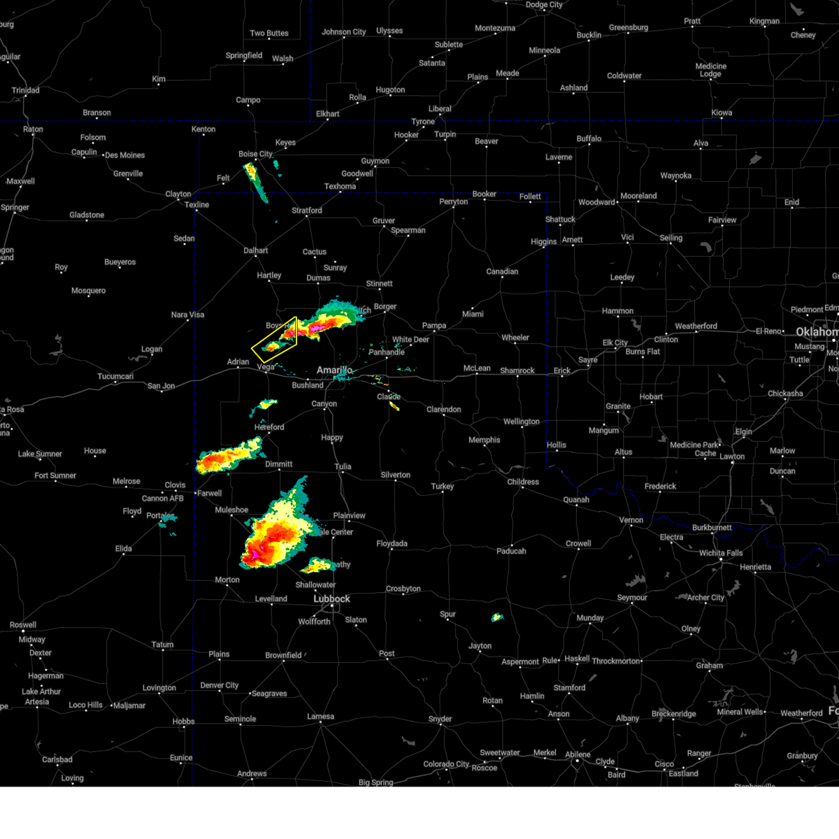
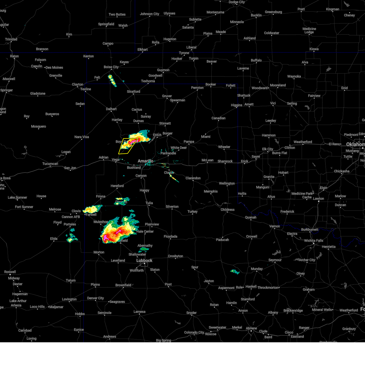
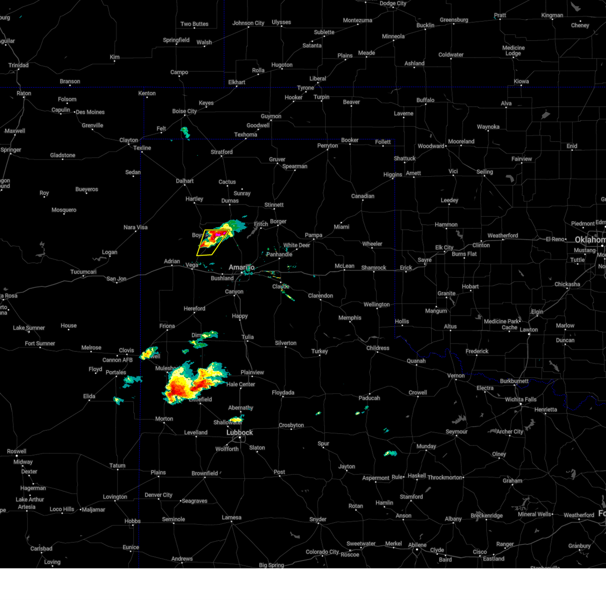
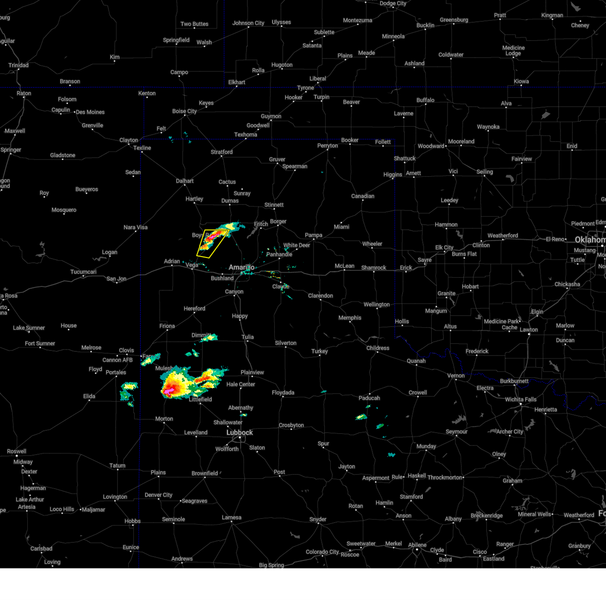
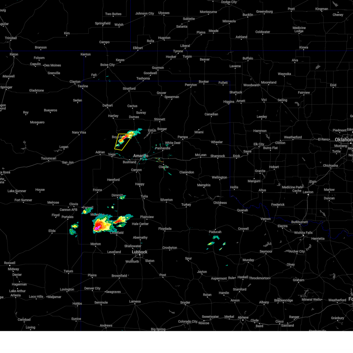
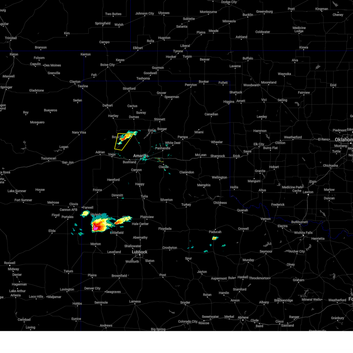
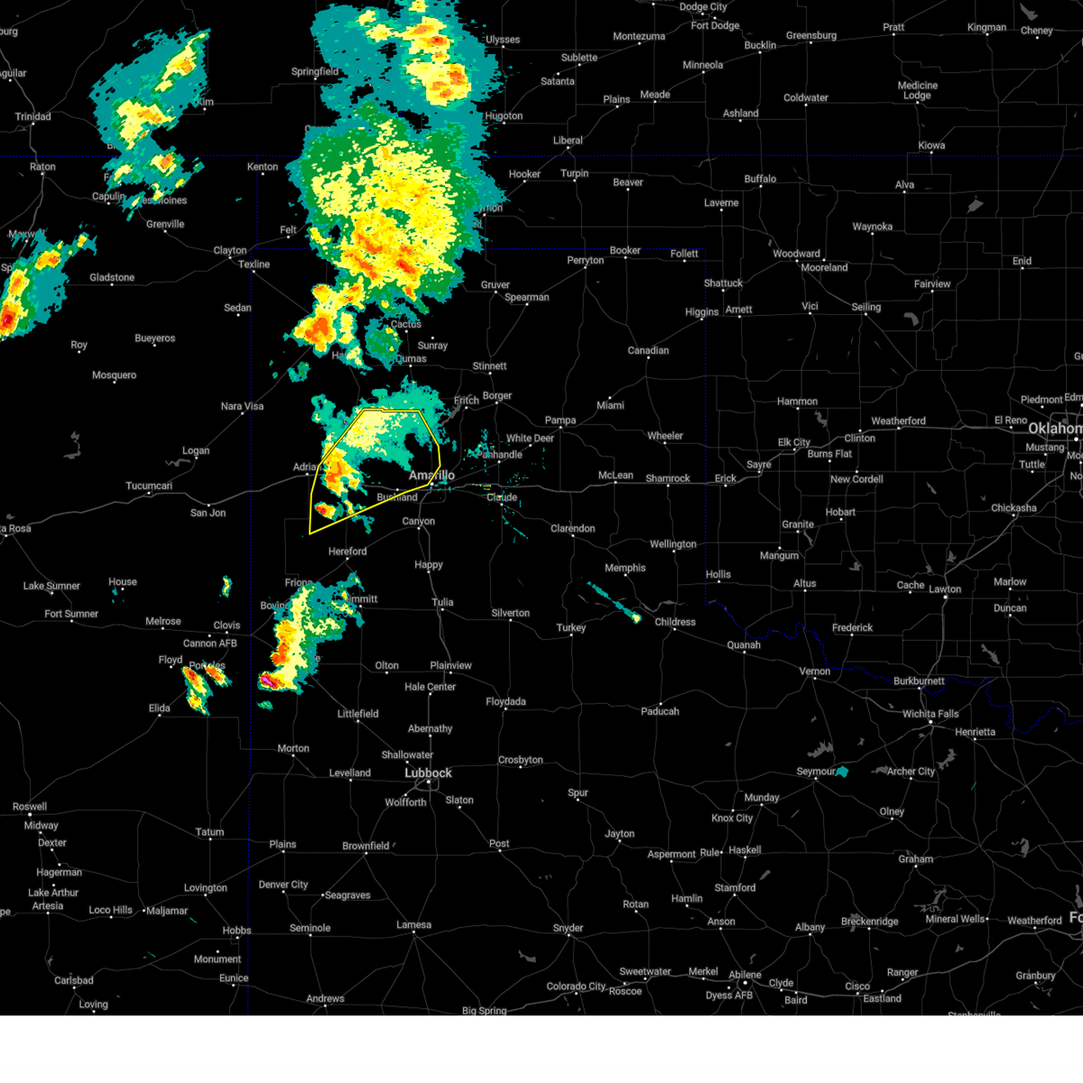
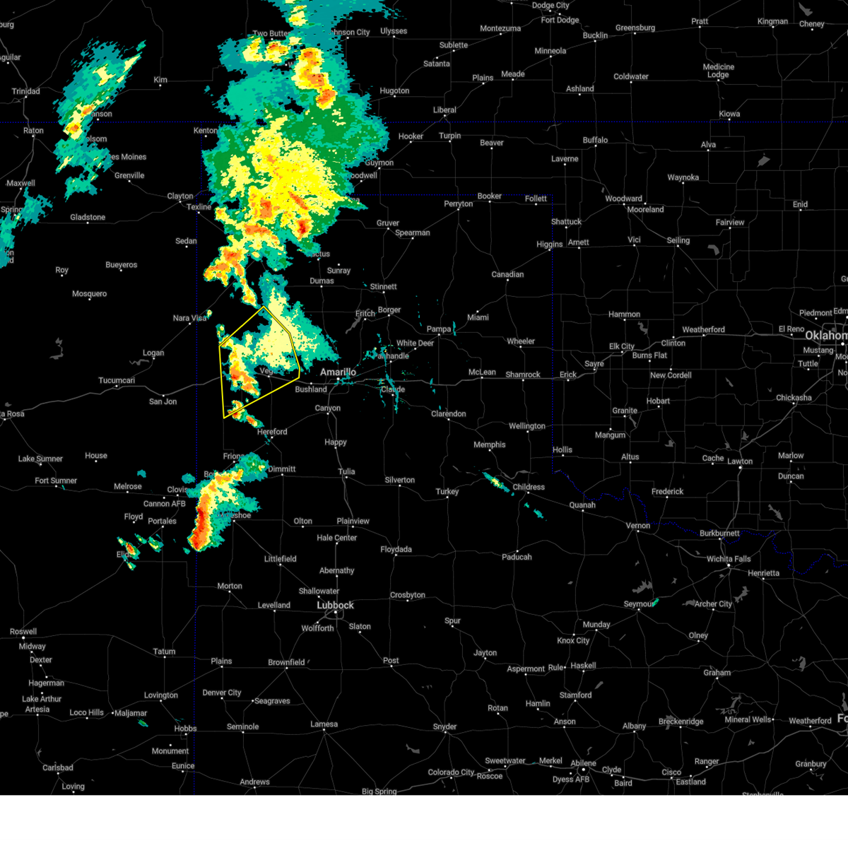
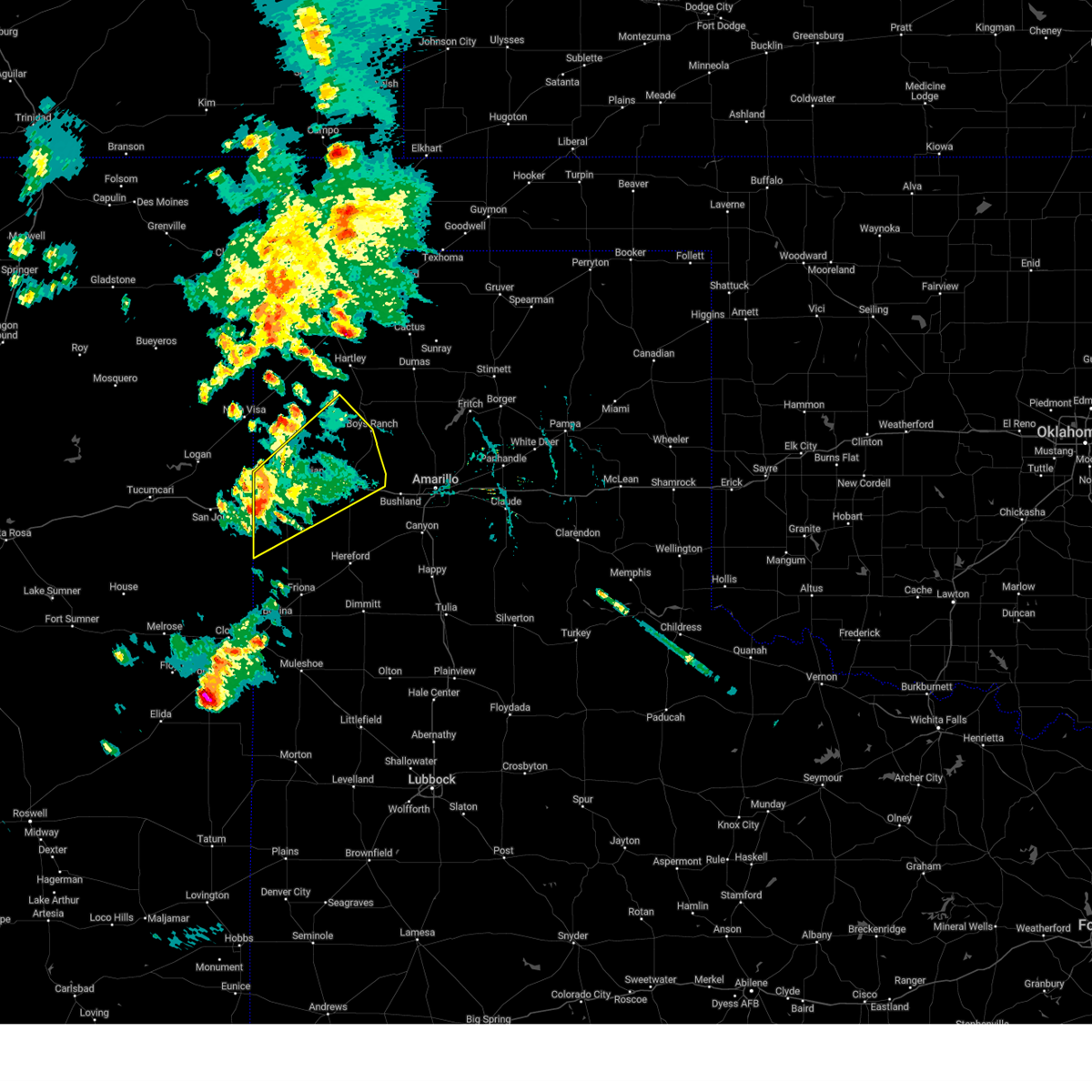
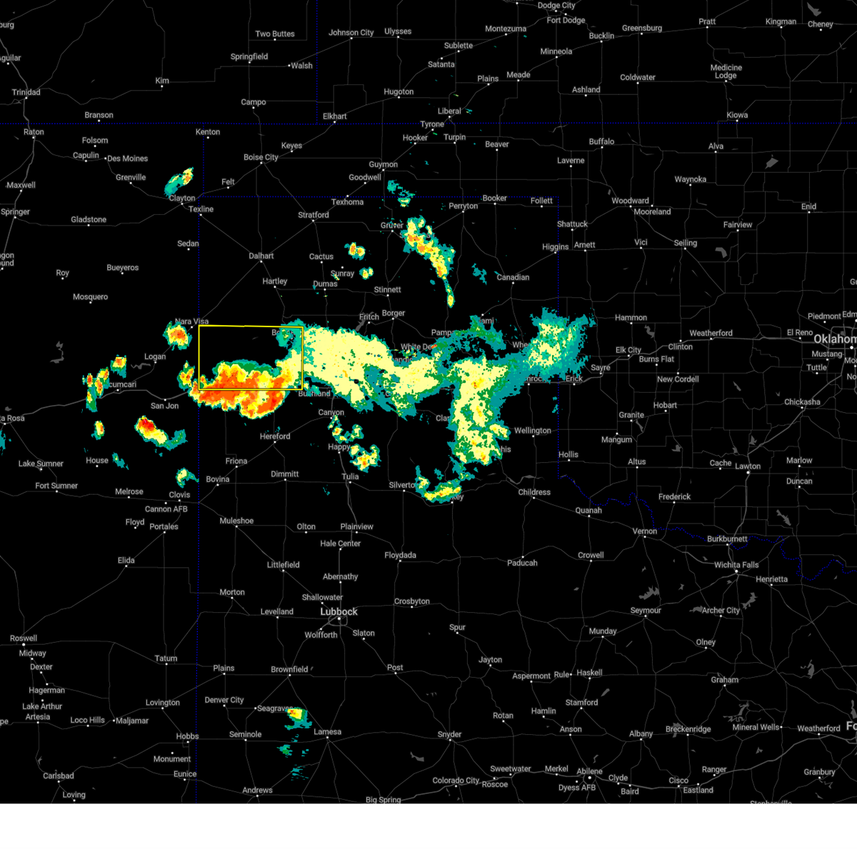
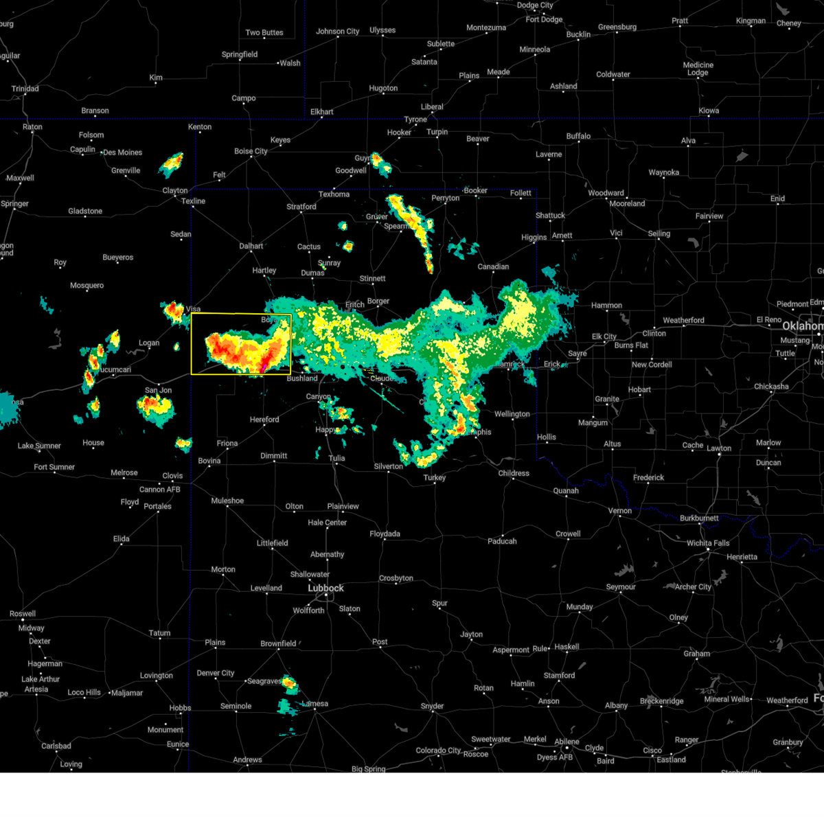
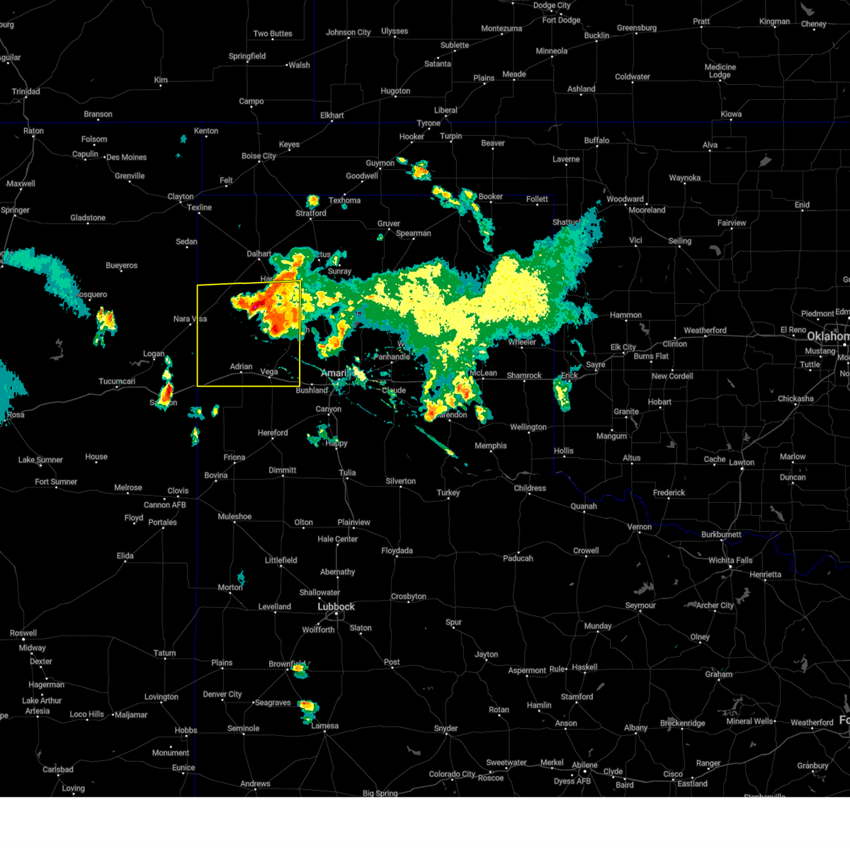
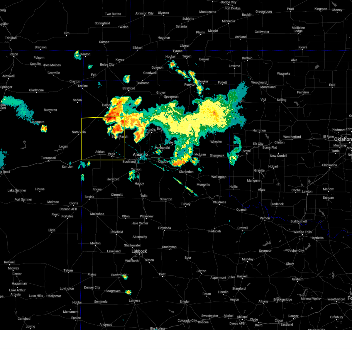
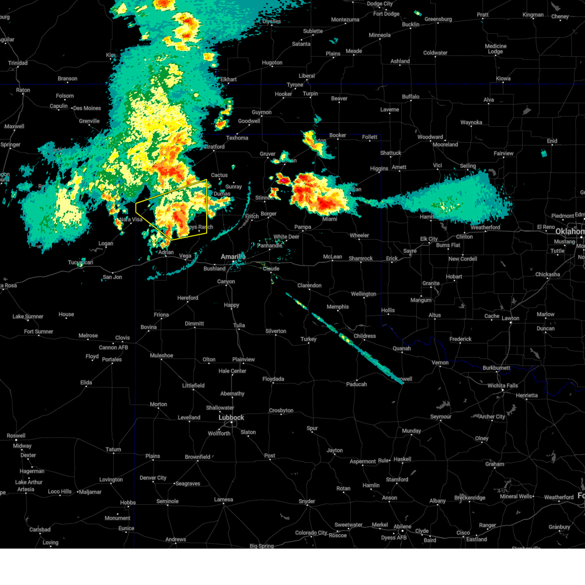
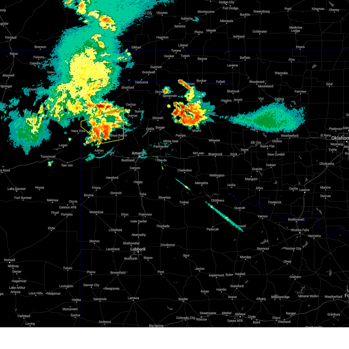
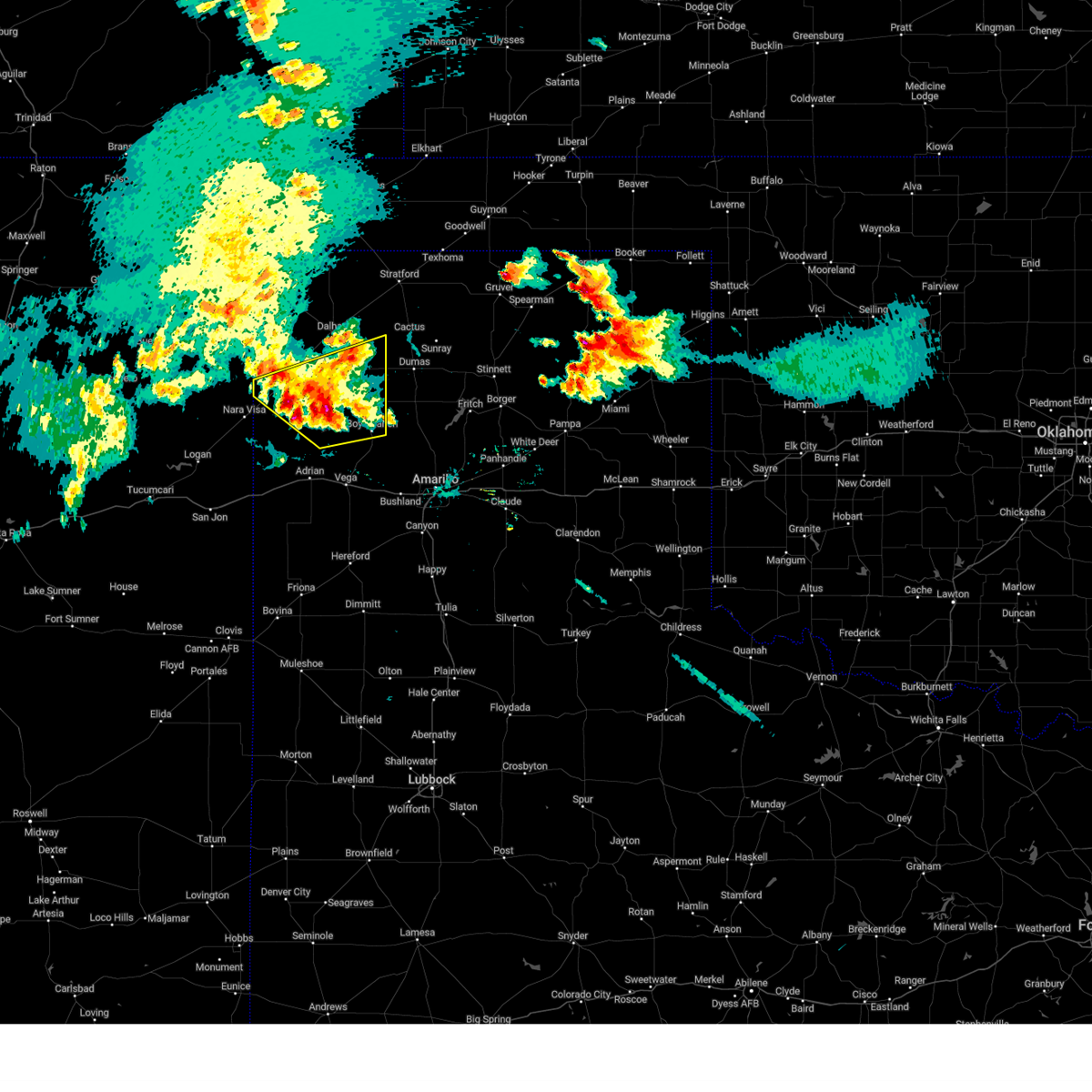
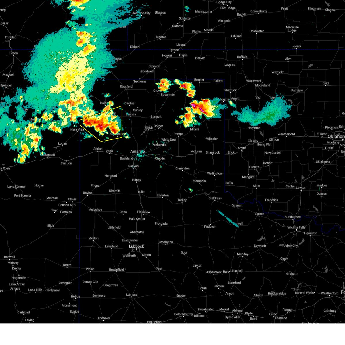
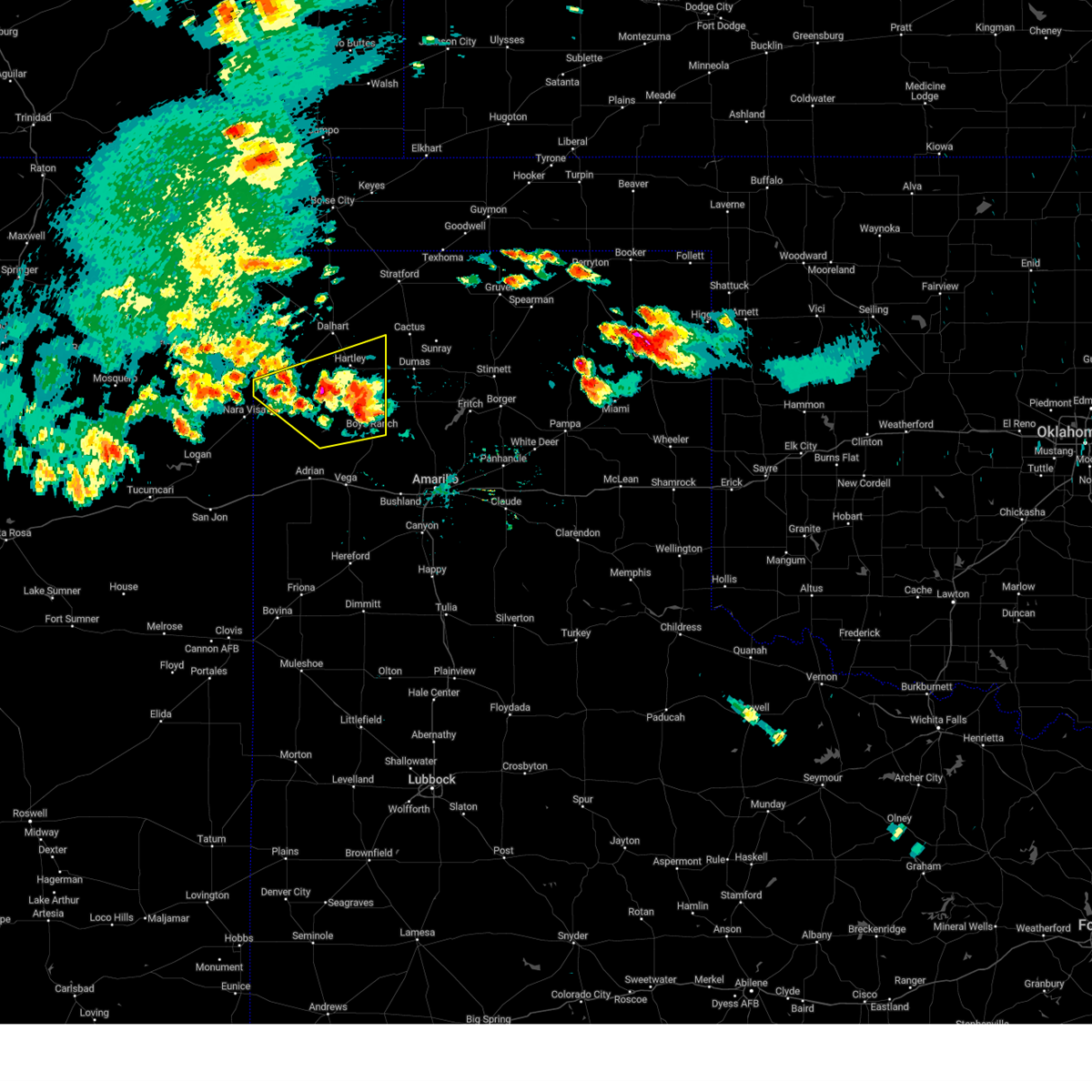
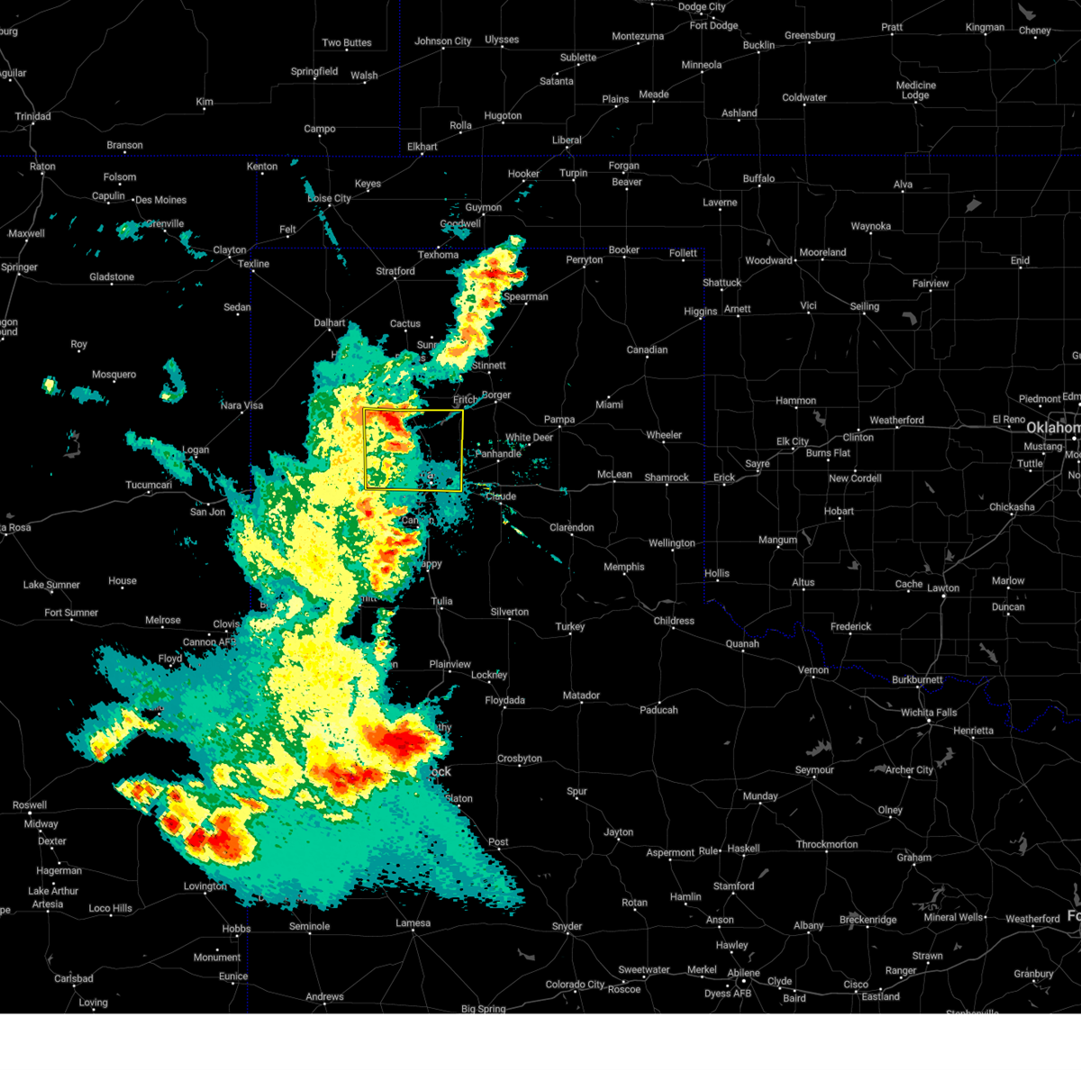
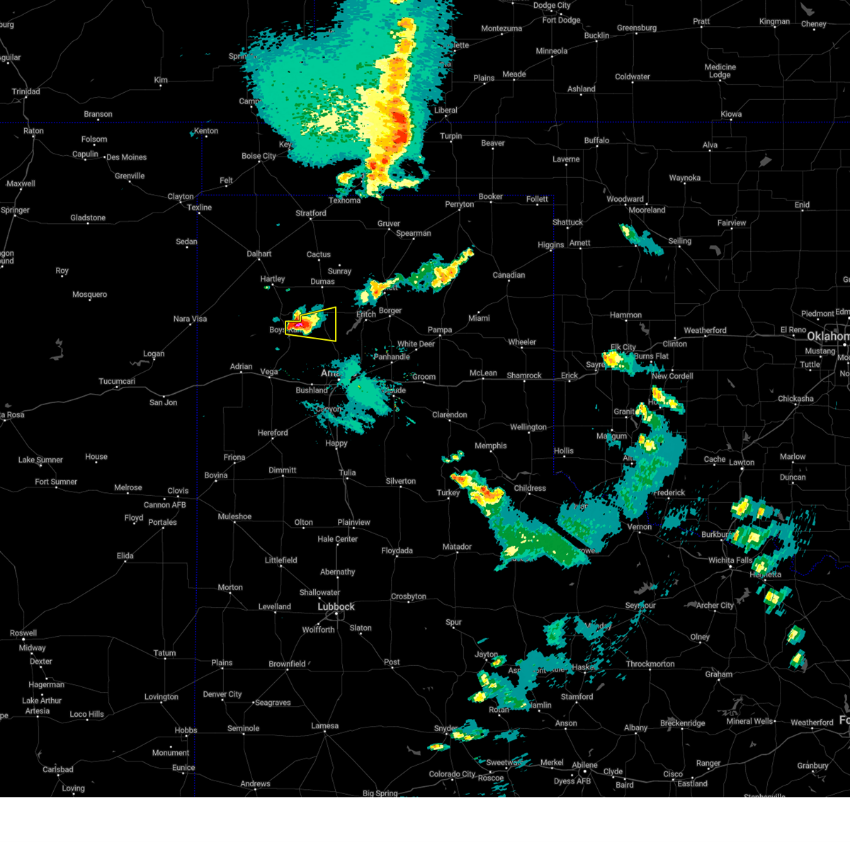
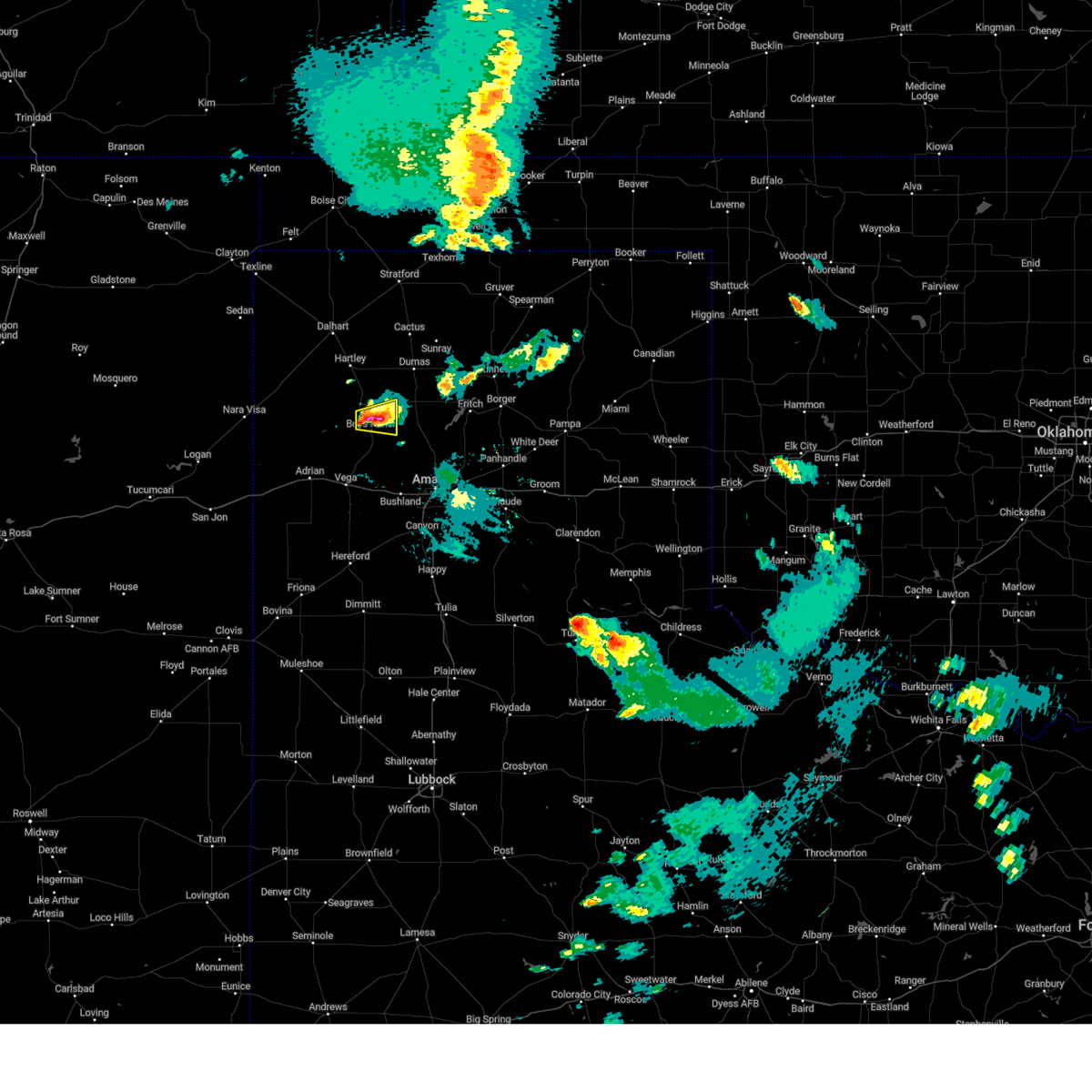
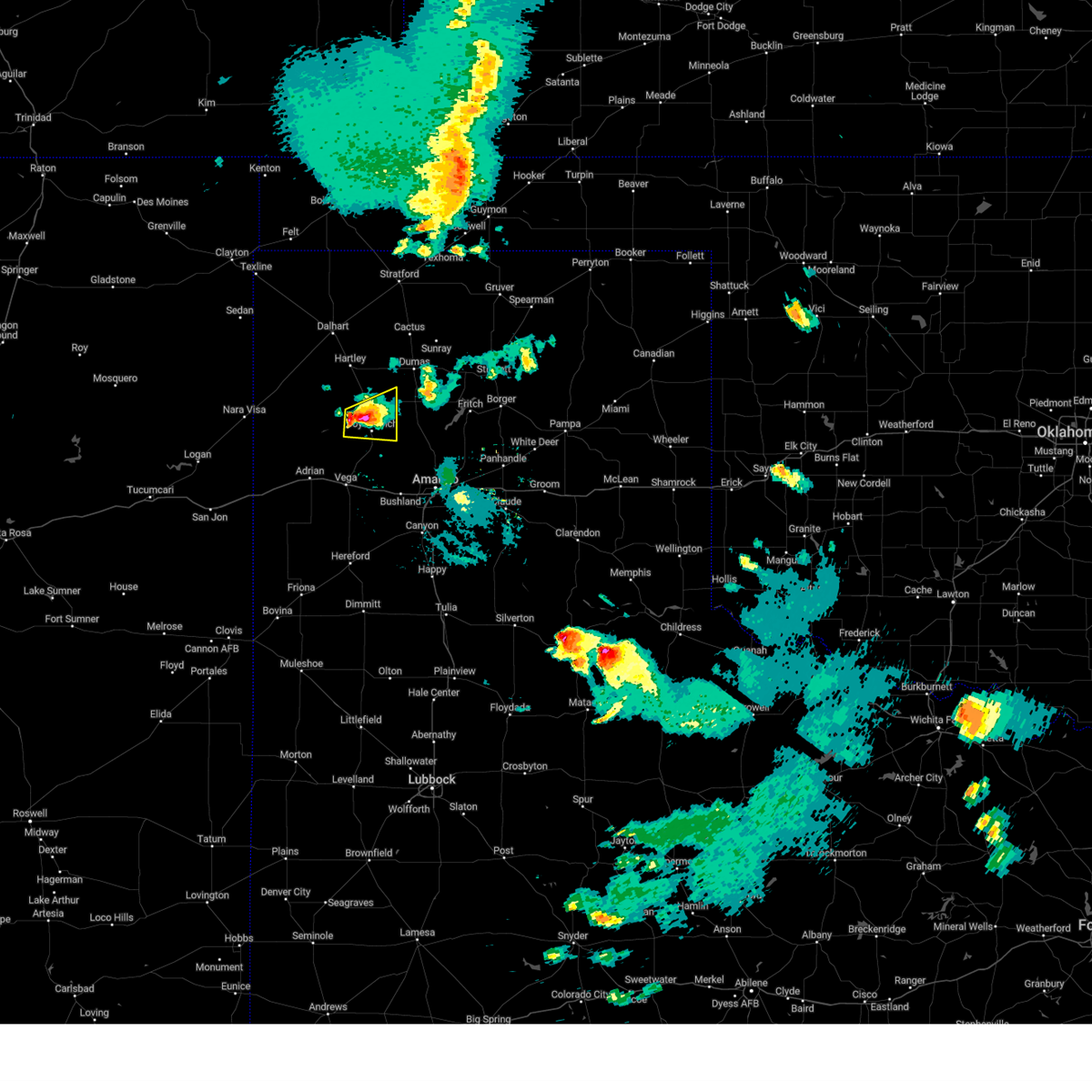
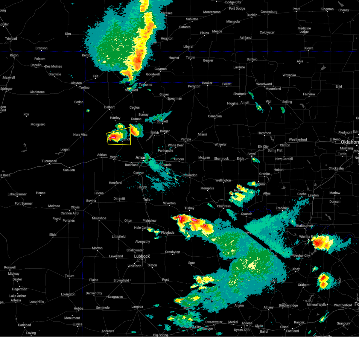
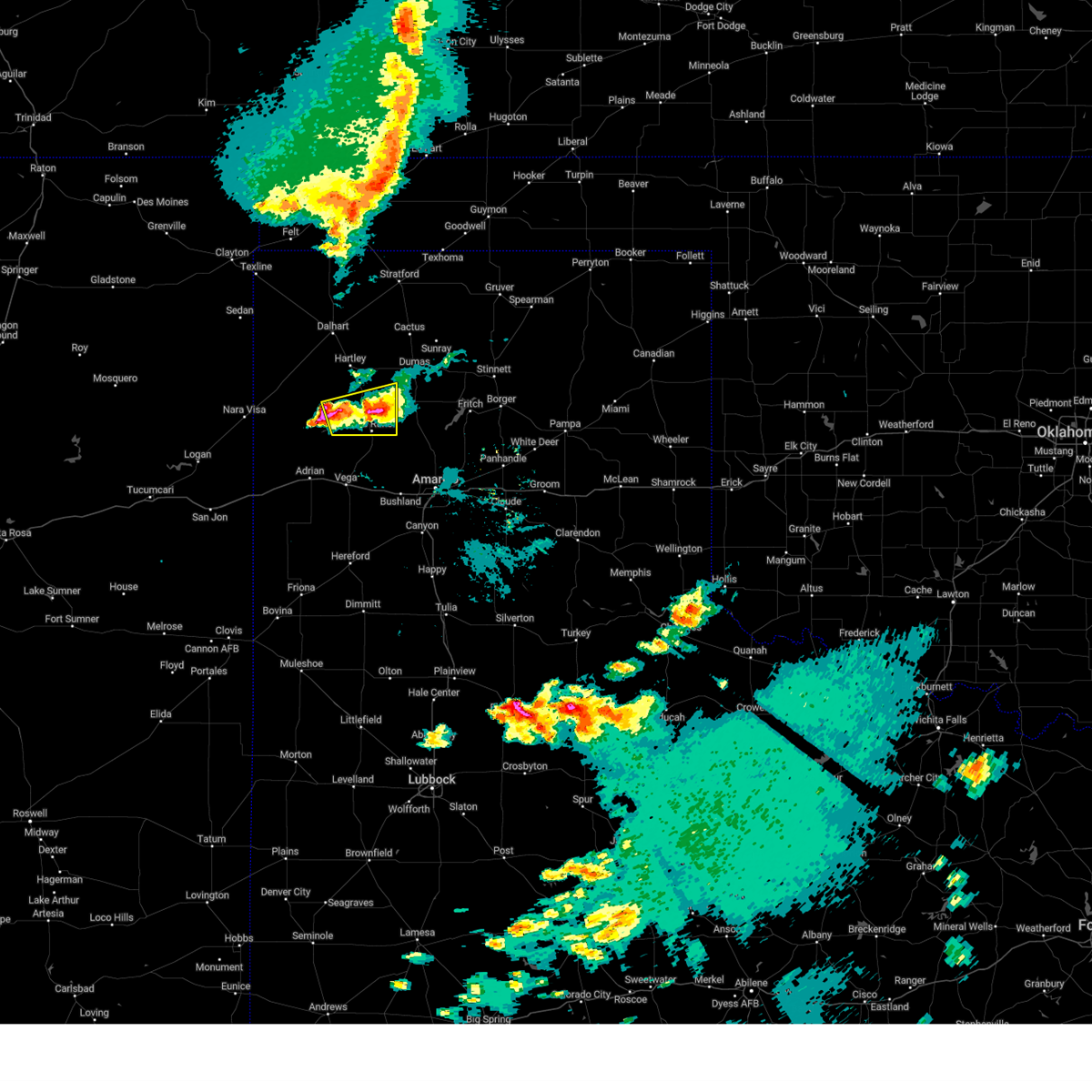
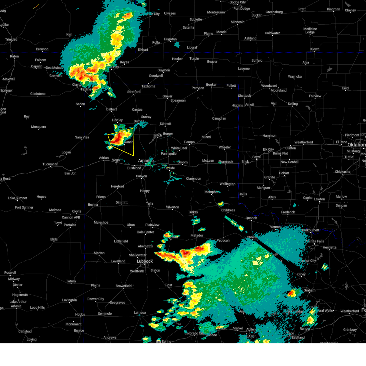
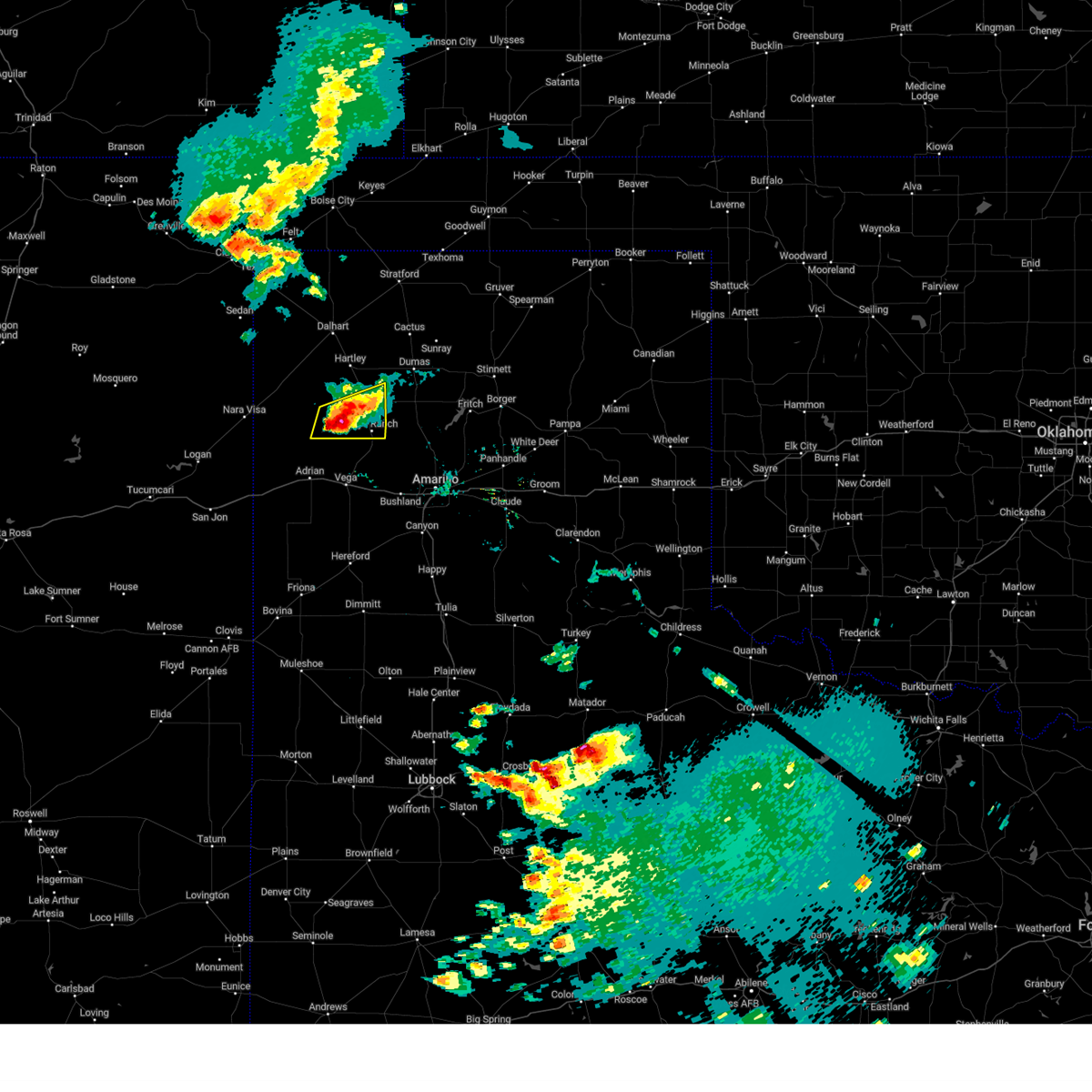
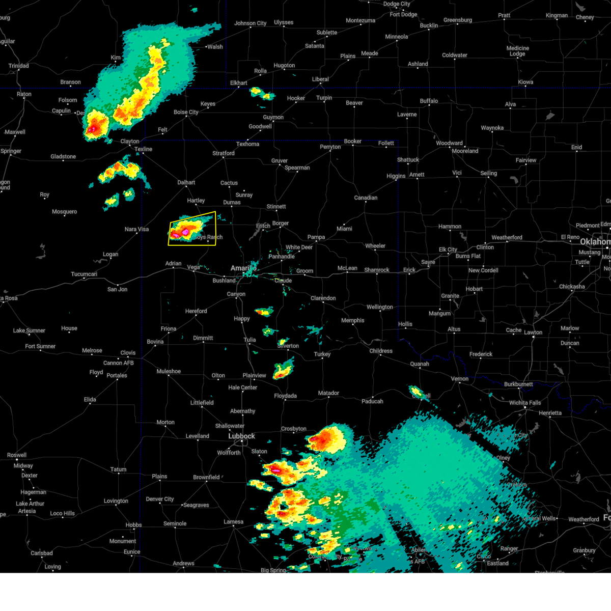
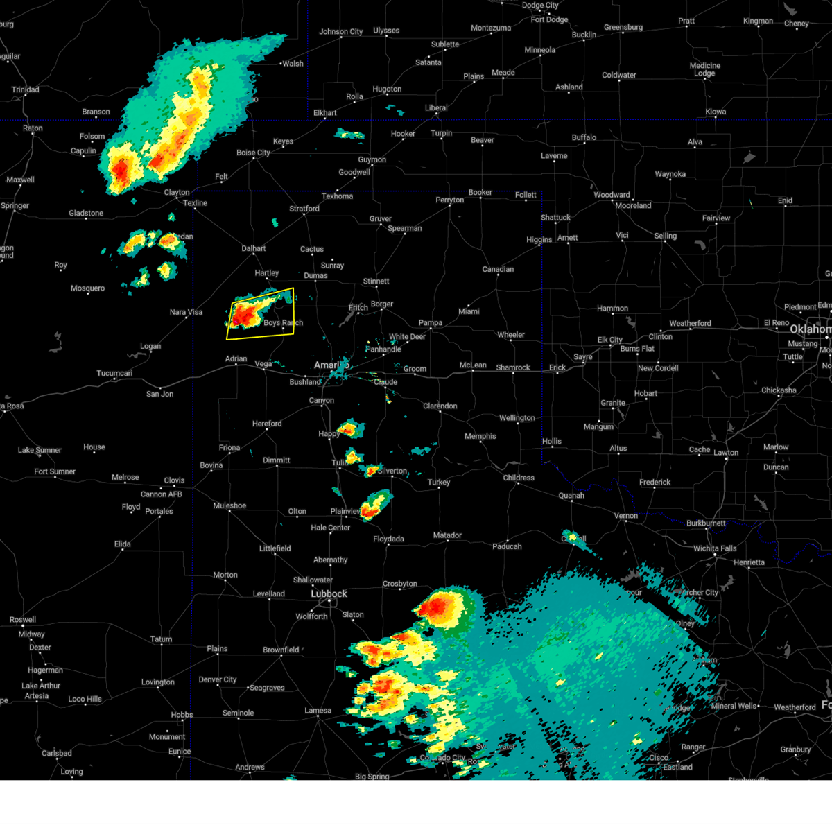
Hail Map for Boys Ranch, TX
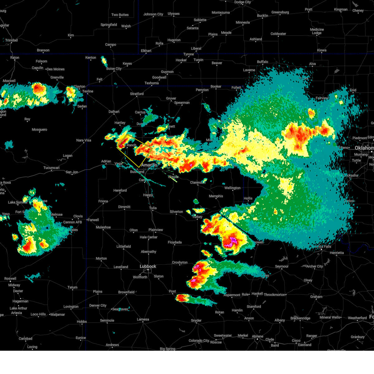
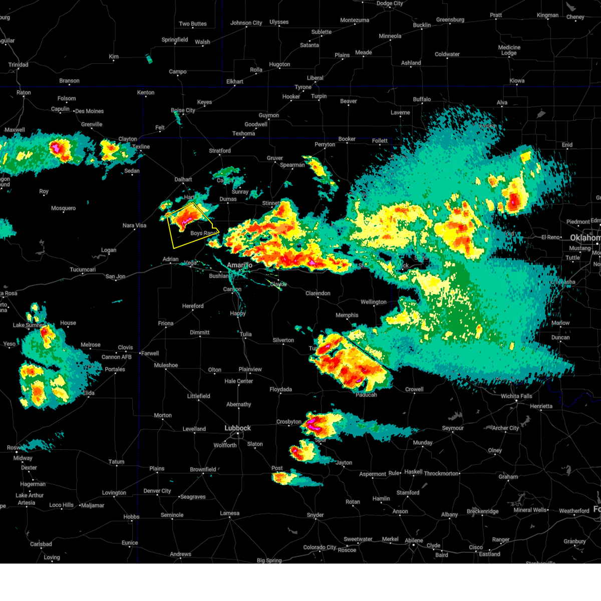
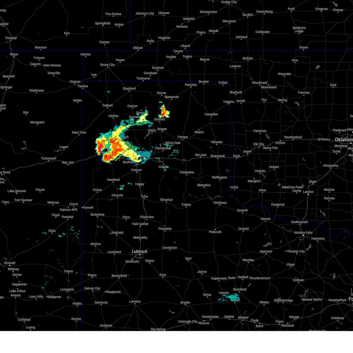
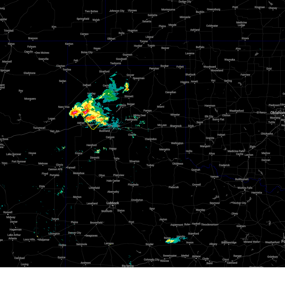
The Boys Ranch, TX area has had 30 reports of on-the-ground hail by trained spotters, and has been under severe weather warnings 55 times during the past 12 months. Doppler radar has detected hail at or near Boys Ranch, TX on 100 occasions, including 7 occasions during the past year.
| Name: | Boys Ranch, TX |
| Where Located: | 32.6 miles NW of Amarillo, TX |
| Map: | Google Map for Boys Ranch, TX |
| Population: | 282 |
| Housing Units: | 58 |
| More Info: | Search Google for Boys Ranch, TX |
2
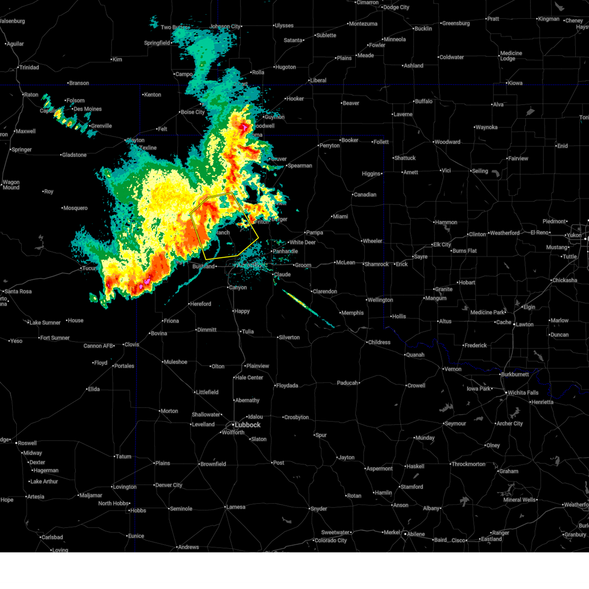
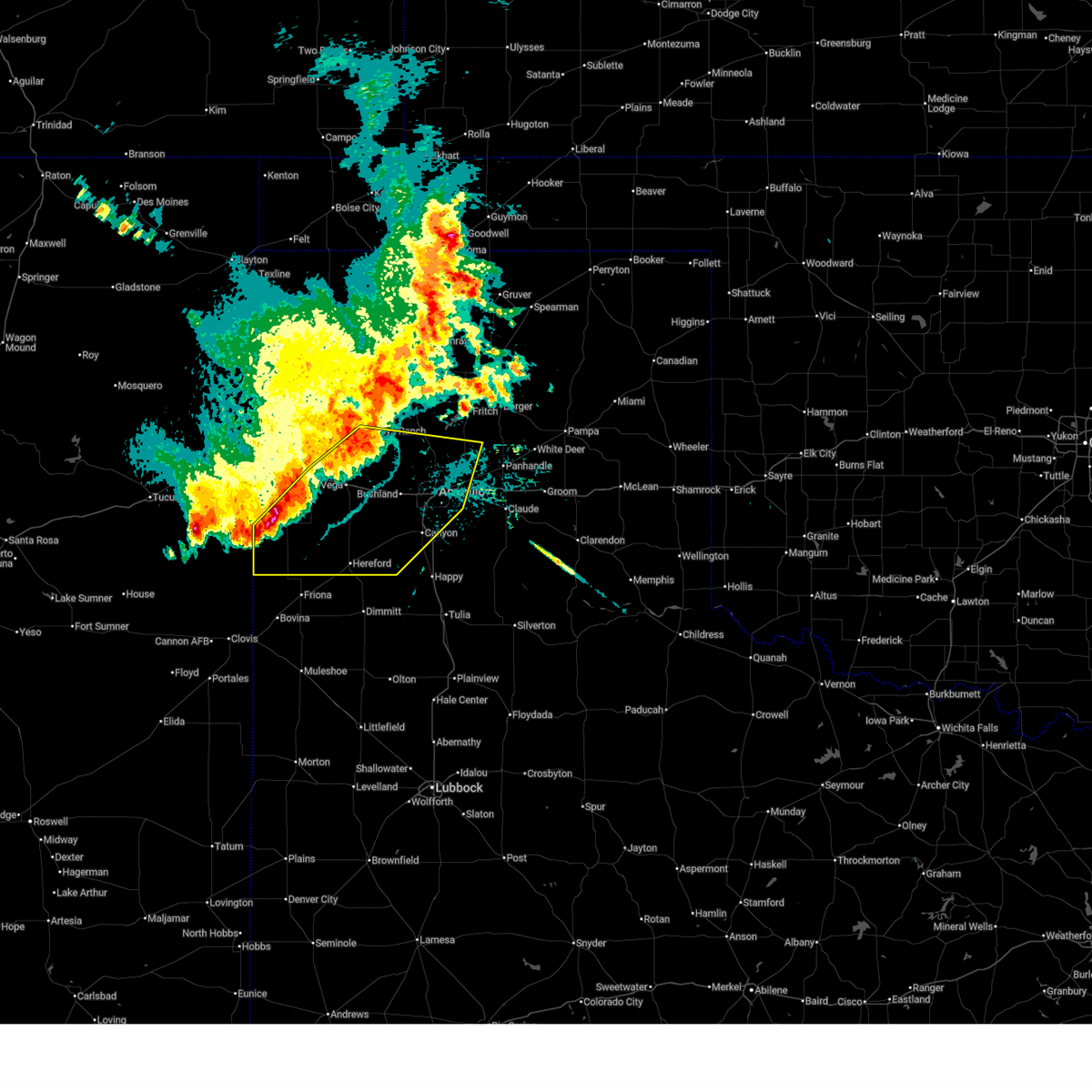
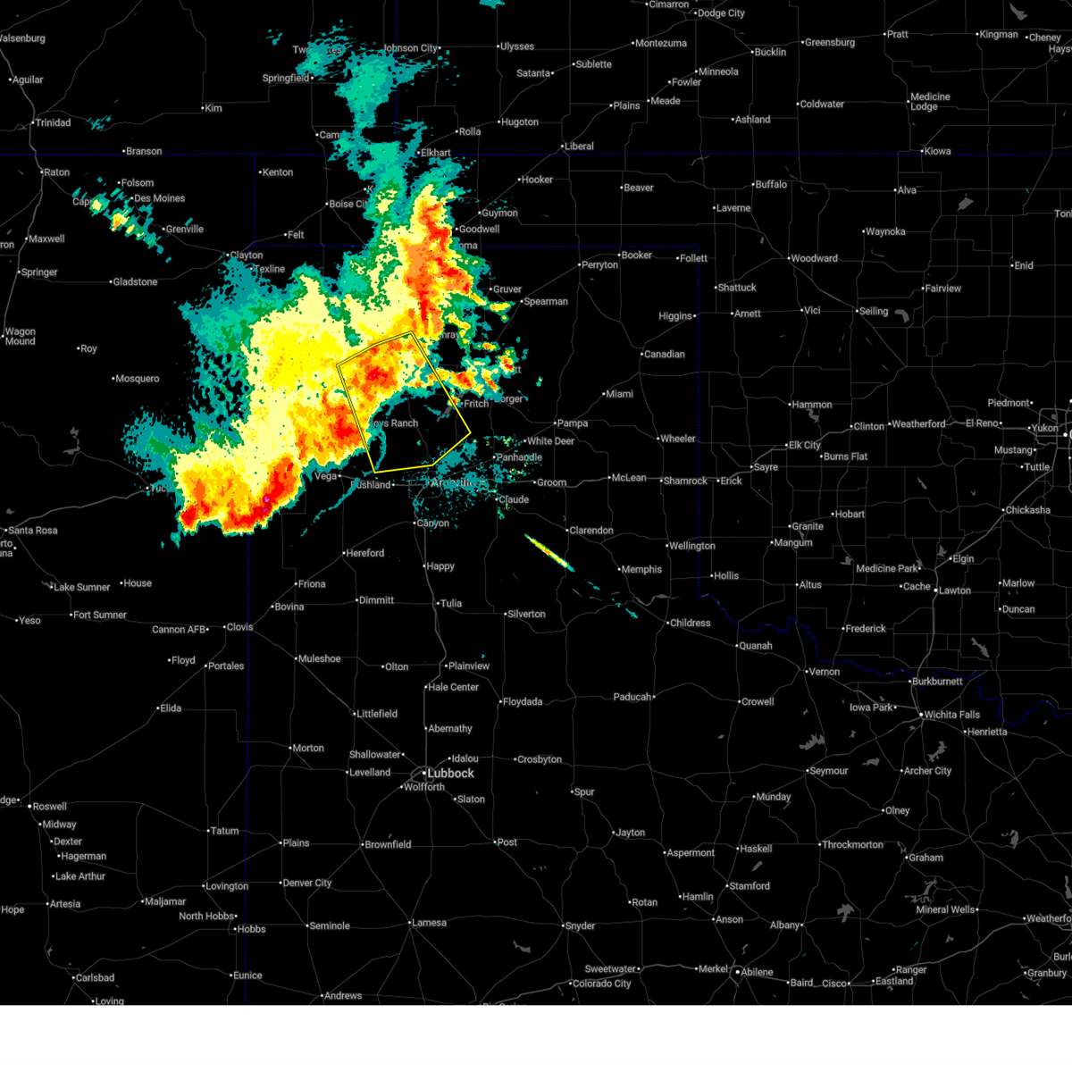
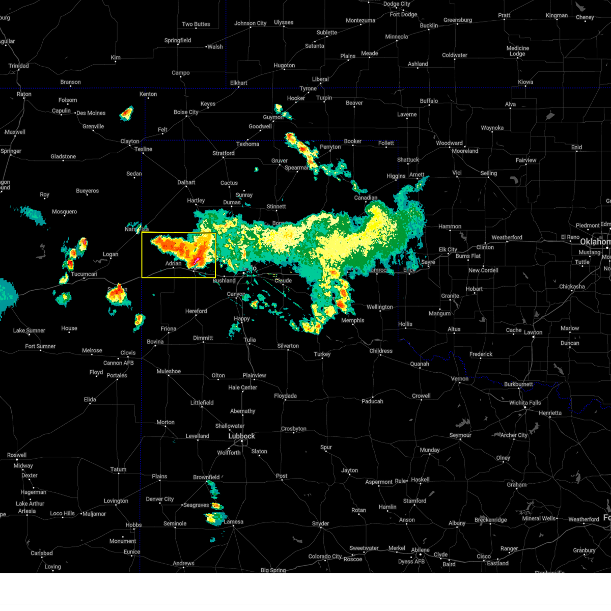
The Top Recent Hail Date for Boys Ranch, TX is Sunday, June 8, 2025 (7th out of 100)
Hail and Wind Damage Spotted near Boys Ranch, TX
| Date / Time | Report Details |
|---|---|
| 7/11/2025 11:33 PM CDT |
 At 1133 pm cdt, severe thunderstorms were located along a line extending from 7 miles east of four way to 5 miles south of masterson to valley de oro, moving southeast at 45 mph (radar indicated). Hazards include 60 mph wind gusts and penny size hail. Minor damage to roofs, siding, and trees is possible. Locations impacted include, amarillo, dumas, channing, four way, valley de oro, boys ranch, and masterson. At 1133 pm cdt, severe thunderstorms were located along a line extending from 7 miles east of four way to 5 miles south of masterson to valley de oro, moving southeast at 45 mph (radar indicated). Hazards include 60 mph wind gusts and penny size hail. Minor damage to roofs, siding, and trees is possible. Locations impacted include, amarillo, dumas, channing, four way, valley de oro, boys ranch, and masterson.
|
| 7/11/2025 11:25 PM CDT |
 Svrama the national weather service in amarillo has issued a * severe thunderstorm warning for, randall county in the panhandle of texas, eastern oldham county in the panhandle of texas, west central carson county in the panhandle of texas, deaf smith county in the panhandle of texas, potter county in the panhandle of texas, * until 1215 am cdt. * at 1125 pm cdt, severe thunderstorms were located along a line extending from near valley de oro to 7 miles northwest of bushland to near wildorado to 8 miles east of bootleg, moving southeast at 35 mph (radar indicated). Hazards include 60 mph wind gusts and penny size hail. minor damage to roofs, siding, and trees is possible Svrama the national weather service in amarillo has issued a * severe thunderstorm warning for, randall county in the panhandle of texas, eastern oldham county in the panhandle of texas, west central carson county in the panhandle of texas, deaf smith county in the panhandle of texas, potter county in the panhandle of texas, * until 1215 am cdt. * at 1125 pm cdt, severe thunderstorms were located along a line extending from near valley de oro to 7 miles northwest of bushland to near wildorado to 8 miles east of bootleg, moving southeast at 35 mph (radar indicated). Hazards include 60 mph wind gusts and penny size hail. minor damage to roofs, siding, and trees is possible
|
| 7/11/2025 11:19 PM CDT |
 At 1118 pm cdt, automated weather equipment reported severe thunderstorms were located along a line extending from 5 miles southeast of dumas to 3 miles west of four way to 5 miles northeast of boys ranch, moving southeast at 45 mph (automated weather equipment in dumas reported 71 miles per hour wind gust). Hazards include 70 mph wind gusts. Expect some tree damage. damage is likely to mobile homes, roofs, and outbuildings. Locations impacted include, amarillo, dumas, channing, four way, valley de oro, boys ranch, and masterson. At 1118 pm cdt, automated weather equipment reported severe thunderstorms were located along a line extending from 5 miles southeast of dumas to 3 miles west of four way to 5 miles northeast of boys ranch, moving southeast at 45 mph (automated weather equipment in dumas reported 71 miles per hour wind gust). Hazards include 70 mph wind gusts. Expect some tree damage. damage is likely to mobile homes, roofs, and outbuildings. Locations impacted include, amarillo, dumas, channing, four way, valley de oro, boys ranch, and masterson.
|
| 7/11/2025 11:16 PM CDT |
 At 1115 pm cdt, automated weather equipment reported severe thunderstorms were located along a line extending from 7 miles southwest of valley de oro to 7 miles south of vega to 6 miles west of simms, moving southeast at 30 mph (automated weather equipment in bootleg reported 67 miles per hour wind gust). Hazards include 70 mph wind gusts and penny size hail. Expect some tree damage. damage is likely to mobile homes, roofs, and outbuildings. Locations impacted include, vega, adrian, boys ranch, wildorado, valley de oro, and simms. At 1115 pm cdt, automated weather equipment reported severe thunderstorms were located along a line extending from 7 miles southwest of valley de oro to 7 miles south of vega to 6 miles west of simms, moving southeast at 30 mph (automated weather equipment in bootleg reported 67 miles per hour wind gust). Hazards include 70 mph wind gusts and penny size hail. Expect some tree damage. damage is likely to mobile homes, roofs, and outbuildings. Locations impacted include, vega, adrian, boys ranch, wildorado, valley de oro, and simms.
|
| 7/11/2025 11:13 PM CDT |
 Svrama the national weather service in amarillo has issued a * severe thunderstorm warning for, northeastern oldham county in the panhandle of texas, west central carson county in the panhandle of texas, potter county in the panhandle of texas, moore county in the panhandle of texas, southeastern hartley county in the panhandle of texas, * until midnight cdt. * at 1112 pm cdt, severe thunderstorms were located along a line extending from 4 miles southeast of dumas to 5 miles northwest of four way to 6 miles east of channing, moving southeast at 35 mph (radar indicated). Hazards include 60 mph wind gusts. minor damage to roofs, siding, and trees is possible Svrama the national weather service in amarillo has issued a * severe thunderstorm warning for, northeastern oldham county in the panhandle of texas, west central carson county in the panhandle of texas, potter county in the panhandle of texas, moore county in the panhandle of texas, southeastern hartley county in the panhandle of texas, * until midnight cdt. * at 1112 pm cdt, severe thunderstorms were located along a line extending from 4 miles southeast of dumas to 5 miles northwest of four way to 6 miles east of channing, moving southeast at 35 mph (radar indicated). Hazards include 60 mph wind gusts. minor damage to roofs, siding, and trees is possible
|
| 7/11/2025 10:45 PM CDT |
 Svrama the national weather service in amarillo has issued a * severe thunderstorm warning for, oldham county in the panhandle of texas, northern deaf smith county in the panhandle of texas, west central potter county in the panhandle of texas, * until 1130 pm cdt. * at 1045 pm cdt, severe thunderstorms were located along a line extending from 14 miles southwest of channing to 4 miles west of adrian to near glenrio, moving southeast at 30 mph (radar indicated). Hazards include 60 mph wind gusts and penny size hail. minor damage to roofs, siding, and trees is possible Svrama the national weather service in amarillo has issued a * severe thunderstorm warning for, oldham county in the panhandle of texas, northern deaf smith county in the panhandle of texas, west central potter county in the panhandle of texas, * until 1130 pm cdt. * at 1045 pm cdt, severe thunderstorms were located along a line extending from 14 miles southwest of channing to 4 miles west of adrian to near glenrio, moving southeast at 30 mph (radar indicated). Hazards include 60 mph wind gusts and penny size hail. minor damage to roofs, siding, and trees is possible
|
| 7/5/2025 9:48 PM CDT |
 the severe thunderstorm warning has been cancelled and is no longer in effect the severe thunderstorm warning has been cancelled and is no longer in effect
|
| 7/5/2025 9:38 PM CDT |
 At 938 pm cdt, severe thunderstorms were located along a line extending from 5 miles south of valley de oro to 8 miles northwest of summerfield, moving east at 35 mph (radar indicated). Hazards include 60 mph wind gusts. Minor damage to roofs, siding, and trees is possible. Locations impacted include, amarillo, hereford, canyon, vega, adrian, glenrio, buffalo lake, bushland, valley de oro, boys ranch, umbarger, bootleg, wildorado, mescalero park, dawn, and simms. At 938 pm cdt, severe thunderstorms were located along a line extending from 5 miles south of valley de oro to 8 miles northwest of summerfield, moving east at 35 mph (radar indicated). Hazards include 60 mph wind gusts. Minor damage to roofs, siding, and trees is possible. Locations impacted include, amarillo, hereford, canyon, vega, adrian, glenrio, buffalo lake, bushland, valley de oro, boys ranch, umbarger, bootleg, wildorado, mescalero park, dawn, and simms.
|
| 7/5/2025 9:17 PM CDT |
 Svrama the national weather service in amarillo has issued a * severe thunderstorm warning for, northwestern randall county in the panhandle of texas, oldham county in the panhandle of texas, deaf smith county in the panhandle of texas, southern potter county in the panhandle of texas, south central hartley county in the panhandle of texas, * until 1015 pm cdt. * at 917 pm cdt, severe thunderstorms were located along a line extending from boys ranch to 7 miles southwest of simms, moving southeast at 35 mph (radar indicated). Hazards include 70 mph wind gusts. Expect some tree damage. Damage is likely to mobile homes, roofs, and outbuildings. Svrama the national weather service in amarillo has issued a * severe thunderstorm warning for, northwestern randall county in the panhandle of texas, oldham county in the panhandle of texas, deaf smith county in the panhandle of texas, southern potter county in the panhandle of texas, south central hartley county in the panhandle of texas, * until 1015 pm cdt. * at 917 pm cdt, severe thunderstorms were located along a line extending from boys ranch to 7 miles southwest of simms, moving southeast at 35 mph (radar indicated). Hazards include 70 mph wind gusts. Expect some tree damage. Damage is likely to mobile homes, roofs, and outbuildings.
|
| 6/22/2025 8:10 PM CDT | The first gust of 59mph occurred at 810pm cdt... with another 58mph gust at 812pm cdt and the last 59mph gust at 814pm cd in oldham county TX, 1 miles ENE of Boys Ranch, TX |
| 6/22/2025 8:04 PM CDT |
 At 803 pm cdt, severe thunderstorms were located along a line extending from 4 miles south of dalhart to 6 miles east of channing to 10 miles north of vega, moving east at 55 mph (radar indicated). Hazards include 70 mph wind gusts and quarter size hail. Expect some tree damage. damage is likely to mobile homes, roofs, and outbuildings. hail damage to vehicles is expected. Locations impacted include, dumas, hartley, cactus, sunray, channing, morse, four way, boys ranch, masterson, and pringle. At 803 pm cdt, severe thunderstorms were located along a line extending from 4 miles south of dalhart to 6 miles east of channing to 10 miles north of vega, moving east at 55 mph (radar indicated). Hazards include 70 mph wind gusts and quarter size hail. Expect some tree damage. damage is likely to mobile homes, roofs, and outbuildings. hail damage to vehicles is expected. Locations impacted include, dumas, hartley, cactus, sunray, channing, morse, four way, boys ranch, masterson, and pringle.
|
| 6/22/2025 7:59 PM CDT |
 Svrama the national weather service in amarillo has issued a * severe thunderstorm warning for, northeastern oldham county in the panhandle of texas, northwestern hutchinson county in the panhandle of texas, southwestern hansford county in the panhandle of texas, sherman county in the panhandle of texas, northwestern potter county in the panhandle of texas, southeastern dallam county in the panhandle of texas, moore county in the panhandle of texas, eastern hartley county in the panhandle of texas, * until 900 pm cdt. * at 759 pm cdt, severe thunderstorms were located along a line extending from 5 miles south of dalhart to 5 miles east of channing to 10 miles north of vega, moving northeast at 55 mph (radar indicated). Hazards include 70 mph wind gusts and quarter size hail. Expect some tree damage. damage is likely to mobile homes, roofs, and outbuildings. Hail damage to vehicles is expected. Svrama the national weather service in amarillo has issued a * severe thunderstorm warning for, northeastern oldham county in the panhandle of texas, northwestern hutchinson county in the panhandle of texas, southwestern hansford county in the panhandle of texas, sherman county in the panhandle of texas, northwestern potter county in the panhandle of texas, southeastern dallam county in the panhandle of texas, moore county in the panhandle of texas, eastern hartley county in the panhandle of texas, * until 900 pm cdt. * at 759 pm cdt, severe thunderstorms were located along a line extending from 5 miles south of dalhart to 5 miles east of channing to 10 miles north of vega, moving northeast at 55 mph (radar indicated). Hazards include 70 mph wind gusts and quarter size hail. Expect some tree damage. damage is likely to mobile homes, roofs, and outbuildings. Hail damage to vehicles is expected.
|
| 6/22/2025 7:46 PM CDT |
 At 746 pm cdt, severe thunderstorms were located along a line extending from 6 miles northwest of hartley to 6 miles northeast of bootleg, moving northeast at 45 mph (radar indicated). Hazards include 70 mph wind gusts and quarter size hail. Expect some tree damage. damage is likely to mobile homes, roofs, and outbuildings. hail damage to vehicles is expected. Locations impacted include, vega, hartley, channing, adrian, conlen, bootleg, and simms. At 746 pm cdt, severe thunderstorms were located along a line extending from 6 miles northwest of hartley to 6 miles northeast of bootleg, moving northeast at 45 mph (radar indicated). Hazards include 70 mph wind gusts and quarter size hail. Expect some tree damage. damage is likely to mobile homes, roofs, and outbuildings. hail damage to vehicles is expected. Locations impacted include, vega, hartley, channing, adrian, conlen, bootleg, and simms.
|
| 6/22/2025 7:31 PM CDT |
 Svrama the national weather service in amarillo has issued a * severe thunderstorm warning for, central oldham county in the panhandle of texas, central deaf smith county in the panhandle of texas, west central sherman county in the panhandle of texas, southeastern dallam county in the panhandle of texas, eastern hartley county in the panhandle of texas, * until 830 pm cdt. * at 731 pm cdt, severe thunderstorms were located along a line extending from 10 miles west of hartley to near bootleg, moving northeast at 30 mph (radar indicated). Hazards include 60 mph wind gusts and quarter size hail. Minor damage to roofs, siding, and trees is possible. Hail damage to vehicles is expected. Svrama the national weather service in amarillo has issued a * severe thunderstorm warning for, central oldham county in the panhandle of texas, central deaf smith county in the panhandle of texas, west central sherman county in the panhandle of texas, southeastern dallam county in the panhandle of texas, eastern hartley county in the panhandle of texas, * until 830 pm cdt. * at 731 pm cdt, severe thunderstorms were located along a line extending from 10 miles west of hartley to near bootleg, moving northeast at 30 mph (radar indicated). Hazards include 60 mph wind gusts and quarter size hail. Minor damage to roofs, siding, and trees is possible. Hail damage to vehicles is expected.
|
| 6/8/2025 6:49 PM CDT |
 the severe thunderstorm warning has been cancelled and is no longer in effect the severe thunderstorm warning has been cancelled and is no longer in effect
|
| 6/8/2025 6:49 PM CDT |
 At 649 pm cdt, a severe thunderstorm was located 4 miles southeast of boys ranch, or 21 miles northeast of vega, moving southeast at 45 mph (radar indicated). Hazards include ping pong ball size hail and 60 mph wind gusts. Minor damage to roofs, siding, and trees is possible. people and animals outdoors will be injured. expect hail damage to roofs, siding, windows, and vehicles. Locations impacted include, boys ranch and valley de oro. At 649 pm cdt, a severe thunderstorm was located 4 miles southeast of boys ranch, or 21 miles northeast of vega, moving southeast at 45 mph (radar indicated). Hazards include ping pong ball size hail and 60 mph wind gusts. Minor damage to roofs, siding, and trees is possible. people and animals outdoors will be injured. expect hail damage to roofs, siding, windows, and vehicles. Locations impacted include, boys ranch and valley de oro.
|
| 6/8/2025 6:46 PM CDT | Quarter sized hail reported 1.6 miles N of Boys Ranch, TX, size ranged from 0.5 to 1 inch. |
| 6/8/2025 6:37 PM CDT |
 Svrama the national weather service in amarillo has issued a * severe thunderstorm warning for, northeastern oldham county in the panhandle of texas, western potter county in the panhandle of texas, southwestern moore county in the panhandle of texas, southeastern hartley county in the panhandle of texas, * until 730 pm cdt. * at 637 pm cdt, a severe thunderstorm was located 5 miles west of boys ranch, or 20 miles north of vega, moving southeast at 35 mph (radar indicated). Hazards include ping pong ball size hail and 60 mph wind gusts. Minor damage to roofs, siding, and trees is possible. people and animals outdoors will be injured. Expect hail damage to roofs, siding, windows, and vehicles. Svrama the national weather service in amarillo has issued a * severe thunderstorm warning for, northeastern oldham county in the panhandle of texas, western potter county in the panhandle of texas, southwestern moore county in the panhandle of texas, southeastern hartley county in the panhandle of texas, * until 730 pm cdt. * at 637 pm cdt, a severe thunderstorm was located 5 miles west of boys ranch, or 20 miles north of vega, moving southeast at 35 mph (radar indicated). Hazards include ping pong ball size hail and 60 mph wind gusts. Minor damage to roofs, siding, and trees is possible. people and animals outdoors will be injured. Expect hail damage to roofs, siding, windows, and vehicles.
|
| 6/8/2025 6:30 PM CDT | At 630 pm cdt, a severe thunderstorm was located 8 miles southwest of channing, or 22 miles north of vega, moving southeast at 30 mph (radar indicated). Hazards include ping pong ball size hail and 60 mph wind gusts. Minor damage to roofs, siding, and trees is possible. people and animals outdoors will be injured. expect hail damage to roofs, siding, windows, and vehicles. Locations impacted include, channing. |
| 6/8/2025 6:18 PM CDT |
 At 618 pm cdt, a severe thunderstorm was located 9 miles west of channing, or 28 miles south of dalhart, moving southeast at 25 mph (radar indicated). Hazards include golf ball size hail and 60 mph wind gusts. Minor damage to roofs, siding, and trees is possible. people and animals outdoors will be injured. expect hail damage to roofs, siding, windows, and vehicles. Locations impacted include, channing. At 618 pm cdt, a severe thunderstorm was located 9 miles west of channing, or 28 miles south of dalhart, moving southeast at 25 mph (radar indicated). Hazards include golf ball size hail and 60 mph wind gusts. Minor damage to roofs, siding, and trees is possible. people and animals outdoors will be injured. expect hail damage to roofs, siding, windows, and vehicles. Locations impacted include, channing.
|
| 6/8/2025 5:52 PM CDT | Svrama the national weather service in amarillo has issued a * severe thunderstorm warning for, northeastern oldham county in the panhandle of texas, northwestern potter county in the panhandle of texas, southeastern hartley county in the panhandle of texas, * until 645 pm cdt. * at 552 pm cdt, a severe thunderstorm was located 12 miles southwest of hartley, or 18 miles south of dalhart, moving southeast at 20 mph (radar indicated). Hazards include ping pong ball size hail and 60 mph wind gusts. Minor damage to roofs, siding, and trees is possible. people and animals outdoors will be injured. Expect hail damage to roofs, siding, windows, and vehicles. |
| 6/8/2025 1:46 AM CDT |
 At 146 am cdt, a severe thunderstorm was located 8 miles west of boys ranch, or 15 miles north of vega, moving southeast at 25 mph (radar indicated). Hazards include 60 mph wind gusts and quarter size hail. Minor damage to roofs, siding, and trees is possible. hail damage to vehicles is expected. Locations impacted include, vega, boys ranch, and valley de oro. At 146 am cdt, a severe thunderstorm was located 8 miles west of boys ranch, or 15 miles north of vega, moving southeast at 25 mph (radar indicated). Hazards include 60 mph wind gusts and quarter size hail. Minor damage to roofs, siding, and trees is possible. hail damage to vehicles is expected. Locations impacted include, vega, boys ranch, and valley de oro.
|
| 6/8/2025 1:29 AM CDT |
 Svrama the national weather service in amarillo has issued a * severe thunderstorm warning for, eastern oldham county in the panhandle of texas, west central potter county in the panhandle of texas, * until 215 am cdt. * at 129 am cdt, a severe thunderstorm was located 14 miles west of boys ranch, or 18 miles north of vega, moving southeast at 35 mph (radar indicated). Hazards include ping pong ball size hail and 60 mph wind gusts. Minor damage to roofs, siding, and trees is possible. people and animals outdoors will be injured. Expect hail damage to roofs, siding, windows, and vehicles. Svrama the national weather service in amarillo has issued a * severe thunderstorm warning for, eastern oldham county in the panhandle of texas, west central potter county in the panhandle of texas, * until 215 am cdt. * at 129 am cdt, a severe thunderstorm was located 14 miles west of boys ranch, or 18 miles north of vega, moving southeast at 35 mph (radar indicated). Hazards include ping pong ball size hail and 60 mph wind gusts. Minor damage to roofs, siding, and trees is possible. people and animals outdoors will be injured. Expect hail damage to roofs, siding, windows, and vehicles.
|
| 5/26/2025 8:55 PM CDT |
 At 855 pm cdt, automated weather equipment reported severe thunderstorms were located along a line extending from 7 miles northwest of boys ranch to 4 miles south of hereford, moving east at 35 mph (automated weather equipment). Hazards include 70 mph wind gusts and penny size hail. Expect some tree damage. damage is likely to mobile homes, roofs, and outbuildings. Locations impacted include, vega, boys ranch, hereford, wildorado, and dawn. At 855 pm cdt, automated weather equipment reported severe thunderstorms were located along a line extending from 7 miles northwest of boys ranch to 4 miles south of hereford, moving east at 35 mph (automated weather equipment). Hazards include 70 mph wind gusts and penny size hail. Expect some tree damage. damage is likely to mobile homes, roofs, and outbuildings. Locations impacted include, vega, boys ranch, hereford, wildorado, and dawn.
|
| 5/26/2025 8:54 PM CDT |
 Svrama the national weather service in amarillo has issued a * severe thunderstorm warning for, randall county in the panhandle of texas, eastern oldham county in the panhandle of texas, eastern deaf smith county in the panhandle of texas, potter county in the panhandle of texas, * until 1030 pm cdt. * at 853 pm cdt, severe thunderstorms were located along a line extending from 9 miles southwest of channing to 10 miles south of boys ranch to 8 miles northwest of bushland to 3 miles southeast of wildorado to 7 miles west of dawn to 4 miles northeast of summerfield, moving east at 20 mph (automated weather equipment). Hazards include 70 mph wind gusts and penny size hail. Expect some tree damage. Damage is likely to mobile homes, roofs, and outbuildings. Svrama the national weather service in amarillo has issued a * severe thunderstorm warning for, randall county in the panhandle of texas, eastern oldham county in the panhandle of texas, eastern deaf smith county in the panhandle of texas, potter county in the panhandle of texas, * until 1030 pm cdt. * at 853 pm cdt, severe thunderstorms were located along a line extending from 9 miles southwest of channing to 10 miles south of boys ranch to 8 miles northwest of bushland to 3 miles southeast of wildorado to 7 miles west of dawn to 4 miles northeast of summerfield, moving east at 20 mph (automated weather equipment). Hazards include 70 mph wind gusts and penny size hail. Expect some tree damage. Damage is likely to mobile homes, roofs, and outbuildings.
|
| 5/26/2025 8:25 PM CDT |
 Svrama the national weather service in amarillo has issued a * severe thunderstorm warning for, oldham county in the panhandle of texas, deaf smith county in the panhandle of texas, * until 915 pm cdt. * at 824 pm cdt, severe thunderstorms were located along a line extending from 18 miles southwest of channing to 6 miles northwest of black, moving east at 35 mph (radar indicated). Hazards include 60 mph wind gusts and penny size hail. minor damage to roofs, siding, and trees is possible Svrama the national weather service in amarillo has issued a * severe thunderstorm warning for, oldham county in the panhandle of texas, deaf smith county in the panhandle of texas, * until 915 pm cdt. * at 824 pm cdt, severe thunderstorms were located along a line extending from 18 miles southwest of channing to 6 miles northwest of black, moving east at 35 mph (radar indicated). Hazards include 60 mph wind gusts and penny size hail. minor damage to roofs, siding, and trees is possible
|
| 5/25/2025 8:28 PM CDT |
 Svrama the national weather service in amarillo has issued a * severe thunderstorm warning for, northeastern oldham county in the panhandle of texas, northwestern potter county in the panhandle of texas, southwestern moore county in the panhandle of texas, eastern hartley county in the panhandle of texas, * until 930 pm cdt. * at 828 pm cdt, severe thunderstorms were located along a line extending from 8 miles west of channing to 3 miles southeast of boys ranch, moving northeast at 20 mph (radar indicated). Hazards include ping pong ball size hail and 60 mph wind gusts. Minor damage to roofs, siding, and trees is possible. people and animals outdoors will be injured. Expect hail damage to roofs, siding, windows, and vehicles. Svrama the national weather service in amarillo has issued a * severe thunderstorm warning for, northeastern oldham county in the panhandle of texas, northwestern potter county in the panhandle of texas, southwestern moore county in the panhandle of texas, eastern hartley county in the panhandle of texas, * until 930 pm cdt. * at 828 pm cdt, severe thunderstorms were located along a line extending from 8 miles west of channing to 3 miles southeast of boys ranch, moving northeast at 20 mph (radar indicated). Hazards include ping pong ball size hail and 60 mph wind gusts. Minor damage to roofs, siding, and trees is possible. people and animals outdoors will be injured. Expect hail damage to roofs, siding, windows, and vehicles.
|
| 5/1/2025 7:59 PM CDT |
 At 758 pm cdt, severe thunderstorms were located along a line extending from hartley to 5 miles northwest of channing to 17 miles northwest of boys ranch, moving east at 30 mph (radar indicated). Hazards include 60 mph wind gusts and penny size hail. Minor damage to roofs, siding, and trees is possible. Locations impacted include, channing, boys ranch, and hartley. At 758 pm cdt, severe thunderstorms were located along a line extending from hartley to 5 miles northwest of channing to 17 miles northwest of boys ranch, moving east at 30 mph (radar indicated). Hazards include 60 mph wind gusts and penny size hail. Minor damage to roofs, siding, and trees is possible. Locations impacted include, channing, boys ranch, and hartley.
|
| 5/1/2025 7:43 PM CDT | Svrama the national weather service in amarillo has issued a * severe thunderstorm warning for, northeastern oldham county in the panhandle of texas, northwestern potter county in the panhandle of texas, southwestern moore county in the panhandle of texas, eastern hartley county in the panhandle of texas, * until 830 pm cdt. * at 743 pm cdt, severe thunderstorms were located along a line extending from 6 miles west of hartley to 11 miles northwest of channing to 16 miles east of romero, moving east at 30 mph (radar indicated). Hazards include 60 mph wind gusts and penny size hail. minor damage to roofs, siding, and trees is possible |
| 4/25/2025 4:57 PM CDT |
 the severe thunderstorm warning has been cancelled and is no longer in effect the severe thunderstorm warning has been cancelled and is no longer in effect
|
| 4/25/2025 4:41 PM CDT |
 At 440 pm cdt, a severe thunderstorm was located near boys ranch, or 22 miles northeast of vega, and is nearly stationary (radar indicated). Hazards include ping pong ball size hail and 60 mph wind gusts. Minor damage to roofs, siding, and trees is possible. people and animals outdoors will be injured. expect hail damage to roofs, siding, windows, and vehicles. Locations impacted include, boys ranch. At 440 pm cdt, a severe thunderstorm was located near boys ranch, or 22 miles northeast of vega, and is nearly stationary (radar indicated). Hazards include ping pong ball size hail and 60 mph wind gusts. Minor damage to roofs, siding, and trees is possible. people and animals outdoors will be injured. expect hail damage to roofs, siding, windows, and vehicles. Locations impacted include, boys ranch.
|
| 4/25/2025 4:33 PM CDT |
 Svrama the national weather service in amarillo has issued a * severe thunderstorm warning for, northeastern oldham county in the panhandle of texas, * until 530 pm cdt. * at 432 pm cdt, a severe thunderstorm was located over boys ranch, or 21 miles northeast of vega, and is nearly stationary (radar indicated). Hazards include ping pong ball size hail and 60 mph wind gusts. Minor damage to roofs, siding, and trees is possible. people and animals outdoors will be injured. Expect hail damage to roofs, siding, windows, and vehicles. Svrama the national weather service in amarillo has issued a * severe thunderstorm warning for, northeastern oldham county in the panhandle of texas, * until 530 pm cdt. * at 432 pm cdt, a severe thunderstorm was located over boys ranch, or 21 miles northeast of vega, and is nearly stationary (radar indicated). Hazards include ping pong ball size hail and 60 mph wind gusts. Minor damage to roofs, siding, and trees is possible. people and animals outdoors will be injured. Expect hail damage to roofs, siding, windows, and vehicles.
|
| 4/25/2025 4:08 PM CDT |
 The storm which prompted the warning has moved out of the area. therefore, the warning will be allowed to expire. however, small hail is still possible with this thunderstorm. a tornado watch remains in effect until 1000 pm cdt for the panhandle of texas. remember, a severe thunderstorm warning still remains in effect for portions of oldham and potter counties. The storm which prompted the warning has moved out of the area. therefore, the warning will be allowed to expire. however, small hail is still possible with this thunderstorm. a tornado watch remains in effect until 1000 pm cdt for the panhandle of texas. remember, a severe thunderstorm warning still remains in effect for portions of oldham and potter counties.
|
| 4/25/2025 3:54 PM CDT |
 At 353 pm cdt, a severe thunderstorm was located 6 miles east of boys ranch, or 24 miles southwest of dumas, moving east at 5 mph. this is a destructive storm for far northwest potter county (radar indicated). Hazards include three inch hail and 60 mph wind gusts. People and animals outdoors will be severely injured. expect shattered windows, extensive damage to roofs, siding, and vehicles. Locations impacted include, boys ranch. At 353 pm cdt, a severe thunderstorm was located 6 miles east of boys ranch, or 24 miles southwest of dumas, moving east at 5 mph. this is a destructive storm for far northwest potter county (radar indicated). Hazards include three inch hail and 60 mph wind gusts. People and animals outdoors will be severely injured. expect shattered windows, extensive damage to roofs, siding, and vehicles. Locations impacted include, boys ranch.
|
| 4/25/2025 3:40 PM CDT |
 At 340 pm cdt, a severe thunderstorm was located 4 miles east of boys ranch, or 23 miles northeast of vega, moving east at 5 mph (radar indicated). Hazards include tennis ball size hail and 60 mph wind gusts. Minor damage to roofs, siding, and trees is possible. people and animals outdoors will be injured. expect hail damage to roofs, siding, windows, and vehicles. Locations impacted include, boys ranch. At 340 pm cdt, a severe thunderstorm was located 4 miles east of boys ranch, or 23 miles northeast of vega, moving east at 5 mph (radar indicated). Hazards include tennis ball size hail and 60 mph wind gusts. Minor damage to roofs, siding, and trees is possible. people and animals outdoors will be injured. expect hail damage to roofs, siding, windows, and vehicles. Locations impacted include, boys ranch.
|
| 4/25/2025 3:33 PM CDT |
 At 333 pm cdt, a severe thunderstorm was located over boys ranch, or 21 miles northeast of vega, moving southeast at 5 mph (radar indicated). Hazards include golf ball size hail. People and animals outdoors will be injured. expect damage to roofs, siding, windows, and vehicles. Locations impacted include, boys ranch. At 333 pm cdt, a severe thunderstorm was located over boys ranch, or 21 miles northeast of vega, moving southeast at 5 mph (radar indicated). Hazards include golf ball size hail. People and animals outdoors will be injured. expect damage to roofs, siding, windows, and vehicles. Locations impacted include, boys ranch.
|
| 4/25/2025 3:25 PM CDT |
 At 324 pm cdt, a severe thunderstorm was located over boys ranch, or 21 miles northeast of vega, and is nearly stationary (radar indicated). Hazards include half dollar size hail. Damage to vehicles is expected. Locations impacted include, boys ranch. At 324 pm cdt, a severe thunderstorm was located over boys ranch, or 21 miles northeast of vega, and is nearly stationary (radar indicated). Hazards include half dollar size hail. Damage to vehicles is expected. Locations impacted include, boys ranch.
|
| 4/25/2025 3:18 PM CDT |
 Svrama the national weather service in amarillo has issued a * severe thunderstorm warning for, northeastern oldham county in the panhandle of texas, northwestern potter county in the panhandle of texas, * until 415 pm cdt. * at 317 pm cdt, a severe thunderstorm was located 4 miles east of boys ranch, or 22 miles northeast of vega, moving southeast at 5 mph (radar indicated). Hazards include half dollar size hail. damage to vehicles is expected Svrama the national weather service in amarillo has issued a * severe thunderstorm warning for, northeastern oldham county in the panhandle of texas, northwestern potter county in the panhandle of texas, * until 415 pm cdt. * at 317 pm cdt, a severe thunderstorm was located 4 miles east of boys ranch, or 22 miles northeast of vega, moving southeast at 5 mph (radar indicated). Hazards include half dollar size hail. damage to vehicles is expected
|
| 11/2/2024 1:39 AM CDT |
 The storm which prompted the warning has weakened below severe limits, and no longer poses an immediate threat to life or property. therefore, the warning has been allowed to expire. however, heavy rain is still possible with this thunderstorm. The storm which prompted the warning has weakened below severe limits, and no longer poses an immediate threat to life or property. therefore, the warning has been allowed to expire. however, heavy rain is still possible with this thunderstorm.
|
| 11/2/2024 12:57 AM CDT |
 At 1256 am cdt, a severe thunderstorm was located 9 miles west of boys ranch, or 17 miles north of vega, moving northeast at 40 mph (radar indicated). Hazards include 60 mph wind gusts and quarter size hail. Minor damage to roofs, siding, and trees is possible. hail damage to vehicles is expected. Locations impacted include, channing and boys ranch. At 1256 am cdt, a severe thunderstorm was located 9 miles west of boys ranch, or 17 miles north of vega, moving northeast at 40 mph (radar indicated). Hazards include 60 mph wind gusts and quarter size hail. Minor damage to roofs, siding, and trees is possible. hail damage to vehicles is expected. Locations impacted include, channing and boys ranch.
|
| 11/2/2024 12:32 AM CDT |
 Svrama the national weather service in amarillo has issued a * severe thunderstorm warning for, northeastern oldham county in the panhandle of texas, northwestern potter county in the panhandle of texas, southwestern moore county in the panhandle of texas, southeastern hartley county in the panhandle of texas, * until 130 am cdt. * at 1232 am cdt, a severe thunderstorm was located 11 miles southwest of boys ranch, or 12 miles north of vega, moving north at 25 mph (radar indicated). Hazards include 60 mph wind gusts and quarter size hail. Minor damage to roofs, siding, and trees is possible. Hail damage to vehicles is expected. Svrama the national weather service in amarillo has issued a * severe thunderstorm warning for, northeastern oldham county in the panhandle of texas, northwestern potter county in the panhandle of texas, southwestern moore county in the panhandle of texas, southeastern hartley county in the panhandle of texas, * until 130 am cdt. * at 1232 am cdt, a severe thunderstorm was located 11 miles southwest of boys ranch, or 12 miles north of vega, moving north at 25 mph (radar indicated). Hazards include 60 mph wind gusts and quarter size hail. Minor damage to roofs, siding, and trees is possible. Hail damage to vehicles is expected.
|
| 9/17/2024 7:44 PM CDT |
 Svrama the national weather service in amarillo has issued a * severe thunderstorm warning for, northwestern randall county in the panhandle of texas, eastern oldham county in the panhandle of texas, northeastern deaf smith county in the panhandle of texas, potter county in the panhandle of texas, * until 845 pm cdt. * at 743 pm cdt, severe thunderstorms were located along a line extending from 13 miles northeast of adrian to 3 miles north of vega to 7 miles northeast of simms, moving northeast at 30 mph (radar indicated). Hazards include 60 mph wind gusts. minor damage to roofs, siding, and trees is possible Svrama the national weather service in amarillo has issued a * severe thunderstorm warning for, northwestern randall county in the panhandle of texas, eastern oldham county in the panhandle of texas, northeastern deaf smith county in the panhandle of texas, potter county in the panhandle of texas, * until 845 pm cdt. * at 743 pm cdt, severe thunderstorms were located along a line extending from 13 miles northeast of adrian to 3 miles north of vega to 7 miles northeast of simms, moving northeast at 30 mph (radar indicated). Hazards include 60 mph wind gusts. minor damage to roofs, siding, and trees is possible
|
| 9/17/2024 7:17 PM CDT |
 At 717 pm cdt, a severe thunderstorm was located over adrian, or 16 miles west of vega, moving northeast at 25 mph (radar indicated). Hazards include 60 mph wind gusts. Minor damage to roofs, siding, and trees is possible. Locations impacted include, vega, adrian, boys ranch, wildorado, and simms. At 717 pm cdt, a severe thunderstorm was located over adrian, or 16 miles west of vega, moving northeast at 25 mph (radar indicated). Hazards include 60 mph wind gusts. Minor damage to roofs, siding, and trees is possible. Locations impacted include, vega, adrian, boys ranch, wildorado, and simms.
|
| 9/17/2024 6:39 PM CDT |
 Svrama the national weather service in amarillo has issued a * severe thunderstorm warning for, oldham county in the panhandle of texas, northwestern deaf smith county in the panhandle of texas, south central hartley county in the panhandle of texas, * until 745 pm cdt. * at 639 pm cdt, a severe thunderstorm was located 5 miles east of glenrio, or 29 miles west of vega, moving northeast at 40 mph (radar indicated). Hazards include 70 mph wind gusts. Expect some tree damage. Damage is likely to mobile homes, roofs, and outbuildings. Svrama the national weather service in amarillo has issued a * severe thunderstorm warning for, oldham county in the panhandle of texas, northwestern deaf smith county in the panhandle of texas, south central hartley county in the panhandle of texas, * until 745 pm cdt. * at 639 pm cdt, a severe thunderstorm was located 5 miles east of glenrio, or 29 miles west of vega, moving northeast at 40 mph (radar indicated). Hazards include 70 mph wind gusts. Expect some tree damage. Damage is likely to mobile homes, roofs, and outbuildings.
|
| 8/3/2024 8:46 PM CDT |
 The storms which prompted the warning have moved out of the area. therefore, the warning has been allowed to expire. however, gusty winds are still possible with these thunderstorms. The storms which prompted the warning have moved out of the area. therefore, the warning has been allowed to expire. however, gusty winds are still possible with these thunderstorms.
|
| 8/3/2024 8:30 PM CDT |
 At 830 pm cdt, severe thunderstorms were located along a line extending from near wildorado to 4 miles northeast of glenrio, moving south at 25 mph (radar indicated). Hazards include 70 mph wind gusts. Expect some tree damage. damage is likely to mobile homes, roofs, and outbuildings. Locations impacted include, vega, adrian, boys ranch, and wildorado. At 830 pm cdt, severe thunderstorms were located along a line extending from near wildorado to 4 miles northeast of glenrio, moving south at 25 mph (radar indicated). Hazards include 70 mph wind gusts. Expect some tree damage. damage is likely to mobile homes, roofs, and outbuildings. Locations impacted include, vega, adrian, boys ranch, and wildorado.
|
| 8/3/2024 8:15 PM CDT |
 the severe thunderstorm warning has been cancelled and is no longer in effect the severe thunderstorm warning has been cancelled and is no longer in effect
|
| 8/3/2024 8:15 PM CDT |
 At 814 pm cdt, severe thunderstorms were located along a line extending from near vega to 12 miles southeast of nara visa, moving south at 30 mph (radar indicated). Hazards include 60 mph wind gusts. Minor damage to roofs, siding, and trees is possible. Locations impacted include, vega, adrian, boys ranch, and wildorado. At 814 pm cdt, severe thunderstorms were located along a line extending from near vega to 12 miles southeast of nara visa, moving south at 30 mph (radar indicated). Hazards include 60 mph wind gusts. Minor damage to roofs, siding, and trees is possible. Locations impacted include, vega, adrian, boys ranch, and wildorado.
|
| 8/3/2024 8:06 PM CDT |
 At 806 pm cdt, severe thunderstorms were located along a line extending from 5 miles north of vega to 11 miles east of nara visa, moving southwest at 35 mph (radar indicated). Hazards include 60 mph wind gusts. Minor damage to roofs, siding, and trees is possible. Locations impacted include, vega, adrian, boys ranch, and wildorado. At 806 pm cdt, severe thunderstorms were located along a line extending from 5 miles north of vega to 11 miles east of nara visa, moving southwest at 35 mph (radar indicated). Hazards include 60 mph wind gusts. Minor damage to roofs, siding, and trees is possible. Locations impacted include, vega, adrian, boys ranch, and wildorado.
|
| 8/3/2024 7:48 PM CDT |
 At 748 pm cdt, a severe thunderstorm was located 13 miles southwest of channing, or 23 miles north of vega, moving south at 35 mph (radar indicated). Hazards include 60 mph wind gusts. Minor damage to roofs, siding, and trees is possible. Locations impacted include, vega, channing, adrian, boys ranch, wildorado, and romero. At 748 pm cdt, a severe thunderstorm was located 13 miles southwest of channing, or 23 miles north of vega, moving south at 35 mph (radar indicated). Hazards include 60 mph wind gusts. Minor damage to roofs, siding, and trees is possible. Locations impacted include, vega, channing, adrian, boys ranch, wildorado, and romero.
|
| 8/3/2024 7:36 PM CDT |
 At 735 pm cdt, a severe thunderstorm was located 11 miles west of channing, or 25 miles south of dalhart, moving south at 35 mph (radar indicated). Hazards include 60 mph wind gusts. Minor damage to roofs, siding, and trees is possible. Locations impacted include, vega, hartley, channing, adrian, boys ranch, wildorado, and romero. At 735 pm cdt, a severe thunderstorm was located 11 miles west of channing, or 25 miles south of dalhart, moving south at 35 mph (radar indicated). Hazards include 60 mph wind gusts. Minor damage to roofs, siding, and trees is possible. Locations impacted include, vega, hartley, channing, adrian, boys ranch, wildorado, and romero.
|
| 8/3/2024 7:19 PM CDT |
 Svrama the national weather service in amarillo has issued a * severe thunderstorm warning for, oldham county in the panhandle of texas, hartley county in the panhandle of texas, * until 845 pm cdt. * at 719 pm cdt, a severe thunderstorm was located 4 miles south of hartley, or 17 miles south of dalhart, moving south at 35 mph (radar indicated). Hazards include 60 mph wind gusts. minor damage to roofs, siding, and trees is possible Svrama the national weather service in amarillo has issued a * severe thunderstorm warning for, oldham county in the panhandle of texas, hartley county in the panhandle of texas, * until 845 pm cdt. * at 719 pm cdt, a severe thunderstorm was located 4 miles south of hartley, or 17 miles south of dalhart, moving south at 35 mph (radar indicated). Hazards include 60 mph wind gusts. minor damage to roofs, siding, and trees is possible
|
| 8/1/2024 7:51 PM CDT |
 The storms which prompted the warning have weakened below severe limits, and no longer pose an immediate threat to life or property. therefore, the warning will be allowed to expire. however, gusty winds are still possible with these thunderstorms. The storms which prompted the warning have weakened below severe limits, and no longer pose an immediate threat to life or property. therefore, the warning will be allowed to expire. however, gusty winds are still possible with these thunderstorms.
|
| 8/1/2024 7:30 PM CDT |
 At 729 pm cdt, severe thunderstorms were located along a line extending from 8 miles west of boys ranch to 7 miles east of channing, moving southeast at 35 mph (radar indicated). Hazards include 70 mph wind gusts. Expect some tree damage. damage is likely to mobile homes, roofs, and outbuildings. Locations impacted include, hartley, channing, boys ranch, and romero. At 729 pm cdt, severe thunderstorms were located along a line extending from 8 miles west of boys ranch to 7 miles east of channing, moving southeast at 35 mph (radar indicated). Hazards include 70 mph wind gusts. Expect some tree damage. damage is likely to mobile homes, roofs, and outbuildings. Locations impacted include, hartley, channing, boys ranch, and romero.
|
| 8/1/2024 7:04 PM CDT |
 At 703 pm cdt, severe thunderstorms were located along a line extending from 12 miles southeast of romero to 4 miles southeast of channing, moving northeast at 10 mph (radar indicated). Hazards include 60 mph wind gusts and quarter size hail. Minor damage to roofs, siding, and trees is possible. hail damage to vehicles is expected. Locations impacted include, hartley, channing, boys ranch, and romero. At 703 pm cdt, severe thunderstorms were located along a line extending from 12 miles southeast of romero to 4 miles southeast of channing, moving northeast at 10 mph (radar indicated). Hazards include 60 mph wind gusts and quarter size hail. Minor damage to roofs, siding, and trees is possible. hail damage to vehicles is expected. Locations impacted include, hartley, channing, boys ranch, and romero.
|
| 8/1/2024 6:45 PM CDT |
 At 644 pm cdt, severe thunderstorms were located along a line extending from 14 miles east of romero to 4 miles southeast of channing, and are nearly stationary (radar indicated). Hazards include 70 mph wind gusts and quarter size hail. Expect some tree damage. damage is likely to mobile homes, roofs, and outbuildings. hail damage to vehicles is expected. Locations impacted include, hartley, channing, boys ranch, and romero. At 644 pm cdt, severe thunderstorms were located along a line extending from 14 miles east of romero to 4 miles southeast of channing, and are nearly stationary (radar indicated). Hazards include 70 mph wind gusts and quarter size hail. Expect some tree damage. damage is likely to mobile homes, roofs, and outbuildings. hail damage to vehicles is expected. Locations impacted include, hartley, channing, boys ranch, and romero.
|
| 8/1/2024 6:23 PM CDT |
 Svrama the national weather service in amarillo has issued a * severe thunderstorm warning for, northeastern oldham county in the panhandle of texas, hartley county in the panhandle of texas, * until 800 pm cdt. * at 622 pm cdt, a severe thunderstorm was located near channing, or 26 miles southwest of dumas, moving north at 15 mph (radar indicated). Hazards include 60 mph wind gusts and quarter size hail. Minor damage to roofs, siding, and trees is possible. Hail damage to vehicles is expected. Svrama the national weather service in amarillo has issued a * severe thunderstorm warning for, northeastern oldham county in the panhandle of texas, hartley county in the panhandle of texas, * until 800 pm cdt. * at 622 pm cdt, a severe thunderstorm was located near channing, or 26 miles southwest of dumas, moving north at 15 mph (radar indicated). Hazards include 60 mph wind gusts and quarter size hail. Minor damage to roofs, siding, and trees is possible. Hail damage to vehicles is expected.
|
| 7/19/2024 3:49 PM CDT | Quarter sized hail reported 9.9 miles NW of Boys Ranch, TX |
| 5/31/2024 9:54 PM CDT |
 the severe thunderstorm warning has been cancelled and is no longer in effect the severe thunderstorm warning has been cancelled and is no longer in effect
|
| 5/31/2024 9:54 PM CDT |
 At 954 pm cdt, a severe thunderstorm was located 9 miles north of amarillo, moving east at 35 mph (radar indicated). Hazards include 60 mph wind gusts and penny size hail. Minor damage to roofs, siding, and trees is possible. Locations impacted include, amarillo, boys ranch, bushland, wildorado, and valley de oro. At 954 pm cdt, a severe thunderstorm was located 9 miles north of amarillo, moving east at 35 mph (radar indicated). Hazards include 60 mph wind gusts and penny size hail. Minor damage to roofs, siding, and trees is possible. Locations impacted include, amarillo, boys ranch, bushland, wildorado, and valley de oro.
|
| 5/31/2024 9:31 PM CDT |
 Svrama the national weather service in amarillo has issued a * severe thunderstorm warning for, eastern oldham county in the panhandle of texas, potter county in the panhandle of texas, southern moore county in the panhandle of texas, southeastern hartley county in the panhandle of texas, * until 1030 pm cdt. * at 931 pm cdt, a severe thunderstorm was located 5 miles south of valley de oro, or 18 miles northeast of vega, moving east at 35 mph (radar indicated). Hazards include 60 mph wind gusts and penny size hail. minor damage to roofs, siding, and trees is possible Svrama the national weather service in amarillo has issued a * severe thunderstorm warning for, eastern oldham county in the panhandle of texas, potter county in the panhandle of texas, southern moore county in the panhandle of texas, southeastern hartley county in the panhandle of texas, * until 1030 pm cdt. * at 931 pm cdt, a severe thunderstorm was located 5 miles south of valley de oro, or 18 miles northeast of vega, moving east at 35 mph (radar indicated). Hazards include 60 mph wind gusts and penny size hail. minor damage to roofs, siding, and trees is possible
|
| 5/31/2024 8:57 PM CDT |
 At 856 pm cdt, severe thunderstorms were located along a line extending from 10 miles southwest of dumas to 12 miles north of adrian to 19 miles northeast of glenrio, moving southeast at 40 mph (radar indicated). Hazards include 60 mph wind gusts and quarter size hail. Minor damage to roofs, siding, and trees is possible. hail damage to vehicles is expected. Locations impacted include, vega, channing, adrian, four way, valley de oro, boys ranch, masterson, and wildorado. At 856 pm cdt, severe thunderstorms were located along a line extending from 10 miles southwest of dumas to 12 miles north of adrian to 19 miles northeast of glenrio, moving southeast at 40 mph (radar indicated). Hazards include 60 mph wind gusts and quarter size hail. Minor damage to roofs, siding, and trees is possible. hail damage to vehicles is expected. Locations impacted include, vega, channing, adrian, four way, valley de oro, boys ranch, masterson, and wildorado.
|
| 5/31/2024 8:38 PM CDT |
 Svrama the national weather service in amarillo has issued a * severe thunderstorm warning for, oldham county in the panhandle of texas, northwestern potter county in the panhandle of texas, southwestern moore county in the panhandle of texas, southeastern hartley county in the panhandle of texas, * until 930 pm cdt. * at 838 pm cdt, severe thunderstorms were located along a line extending from 4 miles north of channing to 16 miles southeast of romero to 11 miles south of nara visa, moving southeast at 45 mph (radar indicated). Hazards include 60 mph wind gusts and half dollar size hail. Minor damage to roofs, siding, and trees is possible. Hail damage to vehicles is expected. Svrama the national weather service in amarillo has issued a * severe thunderstorm warning for, oldham county in the panhandle of texas, northwestern potter county in the panhandle of texas, southwestern moore county in the panhandle of texas, southeastern hartley county in the panhandle of texas, * until 930 pm cdt. * at 838 pm cdt, severe thunderstorms were located along a line extending from 4 miles north of channing to 16 miles southeast of romero to 11 miles south of nara visa, moving southeast at 45 mph (radar indicated). Hazards include 60 mph wind gusts and half dollar size hail. Minor damage to roofs, siding, and trees is possible. Hail damage to vehicles is expected.
|
| 5/30/2024 5:52 PM CDT |
 At 551 pm cdt, severe thunderstorms were located along a line extending from 4 miles north of morse to 10 miles northwest of lake meredith to near channing, moving southeast at 35 mph (radar indicated). Hazards include 70 mph wind gusts. Expect some tree damage. damage is likely to mobile homes, roofs, and outbuildings. Locations impacted include, dumas, borger, fritch, sunray, stinnett, channing, sanford, valley de oro, boys ranch, pringle, morse, four way, masterson, and lake meredith. At 551 pm cdt, severe thunderstorms were located along a line extending from 4 miles north of morse to 10 miles northwest of lake meredith to near channing, moving southeast at 35 mph (radar indicated). Hazards include 70 mph wind gusts. Expect some tree damage. damage is likely to mobile homes, roofs, and outbuildings. Locations impacted include, dumas, borger, fritch, sunray, stinnett, channing, sanford, valley de oro, boys ranch, pringle, morse, four way, masterson, and lake meredith.
|
| 5/30/2024 5:40 PM CDT |
 the severe thunderstorm warning has been cancelled and is no longer in effect the severe thunderstorm warning has been cancelled and is no longer in effect
|
| 5/30/2024 5:40 PM CDT |
 At 539 pm cdt, automated weather equipment reported severe thunderstorms were located along a line extending from 9 miles northeast of sunray to 5 miles east of dumas to 6 miles northeast of channing, moving southeast at 35 mph (automated weather equipment). Hazards include 70 mph wind gusts. Expect some tree damage. damage is likely to mobile homes, roofs, and outbuildings. Locations impacted include, dumas, borger, hartley, cactus, fritch, sunray, stinnett, channing, sanford, valley de oro, boys ranch, pringle, morse, four way, masterson, and lake meredith. At 539 pm cdt, automated weather equipment reported severe thunderstorms were located along a line extending from 9 miles northeast of sunray to 5 miles east of dumas to 6 miles northeast of channing, moving southeast at 35 mph (automated weather equipment). Hazards include 70 mph wind gusts. Expect some tree damage. damage is likely to mobile homes, roofs, and outbuildings. Locations impacted include, dumas, borger, hartley, cactus, fritch, sunray, stinnett, channing, sanford, valley de oro, boys ranch, pringle, morse, four way, masterson, and lake meredith.
|
| 5/30/2024 5:21 PM CDT |
 Svrama the national weather service in amarillo has issued a * severe thunderstorm warning for, northeastern oldham county in the panhandle of texas, northwestern carson county in the panhandle of texas, hutchinson county in the panhandle of texas, southwestern hansford county in the panhandle of texas, northern potter county in the panhandle of texas, southern sherman county in the panhandle of texas, southeastern dallam county in the panhandle of texas, moore county in the panhandle of texas, eastern hartley county in the panhandle of texas, * until 615 pm cdt. * at 520 pm cdt, severe thunderstorms were located along a line extending from 13 miles north of sunray to near cactus to hartley, moving southeast at 30 mph (automated weather equipment). Hazards include 70 mph wind gusts and penny size hail. Expect some tree damage. Damage is likely to mobile homes, roofs, and outbuildings. Svrama the national weather service in amarillo has issued a * severe thunderstorm warning for, northeastern oldham county in the panhandle of texas, northwestern carson county in the panhandle of texas, hutchinson county in the panhandle of texas, southwestern hansford county in the panhandle of texas, northern potter county in the panhandle of texas, southern sherman county in the panhandle of texas, southeastern dallam county in the panhandle of texas, moore county in the panhandle of texas, eastern hartley county in the panhandle of texas, * until 615 pm cdt. * at 520 pm cdt, severe thunderstorms were located along a line extending from 13 miles north of sunray to near cactus to hartley, moving southeast at 30 mph (automated weather equipment). Hazards include 70 mph wind gusts and penny size hail. Expect some tree damage. Damage is likely to mobile homes, roofs, and outbuildings.
|
| 5/3/2024 7:55 PM CDT |
 Svrama the national weather service in amarillo has issued a * severe thunderstorm warning for, northeastern oldham county in the panhandle of texas, northwestern potter county in the panhandle of texas, southwestern moore county in the panhandle of texas, * until 845 pm cdt. * at 755 pm cdt, a severe thunderstorm was located 7 miles northeast of boys ranch, or 21 miles southwest of dumas, moving east at 25 mph (radar indicated). Hazards include 60 mph wind gusts and half dollar size hail. Minor damage to roofs, siding, and trees is possible. Hail damage to vehicles is expected. Svrama the national weather service in amarillo has issued a * severe thunderstorm warning for, northeastern oldham county in the panhandle of texas, northwestern potter county in the panhandle of texas, southwestern moore county in the panhandle of texas, * until 845 pm cdt. * at 755 pm cdt, a severe thunderstorm was located 7 miles northeast of boys ranch, or 21 miles southwest of dumas, moving east at 25 mph (radar indicated). Hazards include 60 mph wind gusts and half dollar size hail. Minor damage to roofs, siding, and trees is possible. Hail damage to vehicles is expected.
|
| 5/3/2024 7:44 PM CDT | Golf Ball sized hail reported 4.5 miles SSE of Boys Ranch, TX |
| 5/3/2024 7:44 PM CDT |
 At 744 pm cdt, a severe thunderstorm was located 7 miles north of boys ranch, or 22 miles southwest of dumas, moving east at 25 mph (radar indicated). Hazards include ping pong ball size hail and 60 mph wind gusts. Minor damage to roofs, siding, and trees is possible. people and animals outdoors will be injured. expect hail damage to roofs, siding, windows, and vehicles. This severe thunderstorm will remain over mainly rural areas of northeastern oldham, northwestern potter, southwestern moore and southeastern hartley counties. At 744 pm cdt, a severe thunderstorm was located 7 miles north of boys ranch, or 22 miles southwest of dumas, moving east at 25 mph (radar indicated). Hazards include ping pong ball size hail and 60 mph wind gusts. Minor damage to roofs, siding, and trees is possible. people and animals outdoors will be injured. expect hail damage to roofs, siding, windows, and vehicles. This severe thunderstorm will remain over mainly rural areas of northeastern oldham, northwestern potter, southwestern moore and southeastern hartley counties.
|
| 5/3/2024 7:31 PM CDT |
 At 731 pm cdt, a severe thunderstorm was located 6 miles south of channing, or 25 miles north of vega, moving east at 25 mph (radar indicated). Hazards include ping pong ball size hail and 60 mph wind gusts. Minor damage to roofs, siding, and trees is possible. people and animals outdoors will be injured. expect hail damage to roofs, siding, windows, and vehicles. Locations impacted include, channing and boys ranch. At 731 pm cdt, a severe thunderstorm was located 6 miles south of channing, or 25 miles north of vega, moving east at 25 mph (radar indicated). Hazards include ping pong ball size hail and 60 mph wind gusts. Minor damage to roofs, siding, and trees is possible. people and animals outdoors will be injured. expect hail damage to roofs, siding, windows, and vehicles. Locations impacted include, channing and boys ranch.
|
| 5/3/2024 7:12 PM CDT |
 Svrama the national weather service in amarillo has issued a * severe thunderstorm warning for, northeastern oldham county in the panhandle of texas, northwestern potter county in the panhandle of texas, southwestern moore county in the panhandle of texas, southeastern hartley county in the panhandle of texas, * until 800 pm cdt. * at 712 pm cdt, a severe thunderstorm was located 8 miles southwest of channing, or 24 miles north of vega, moving east at 25 mph (radar indicated). Hazards include ping pong ball size hail and 60 mph wind gusts. Minor damage to roofs, siding, and trees is possible. people and animals outdoors will be injured. Expect hail damage to roofs, siding, windows, and vehicles. Svrama the national weather service in amarillo has issued a * severe thunderstorm warning for, northeastern oldham county in the panhandle of texas, northwestern potter county in the panhandle of texas, southwestern moore county in the panhandle of texas, southeastern hartley county in the panhandle of texas, * until 800 pm cdt. * at 712 pm cdt, a severe thunderstorm was located 8 miles southwest of channing, or 24 miles north of vega, moving east at 25 mph (radar indicated). Hazards include ping pong ball size hail and 60 mph wind gusts. Minor damage to roofs, siding, and trees is possible. people and animals outdoors will be injured. Expect hail damage to roofs, siding, windows, and vehicles.
|
| 5/3/2024 6:45 PM CDT |
 At 645 pm cdt, a severe thunderstorm was located 7 miles southeast of channing, or 21 miles southwest of dumas, moving east at 25 mph (radar indicated). Hazards include ping pong ball size hail and 60 mph wind gusts. Minor damage to roofs, siding, and trees is possible. people and animals outdoors will be injured. expect hail damage to roofs, siding, windows, and vehicles. Locations impacted include, channing and boys ranch. At 645 pm cdt, a severe thunderstorm was located 7 miles southeast of channing, or 21 miles southwest of dumas, moving east at 25 mph (radar indicated). Hazards include ping pong ball size hail and 60 mph wind gusts. Minor damage to roofs, siding, and trees is possible. people and animals outdoors will be injured. expect hail damage to roofs, siding, windows, and vehicles. Locations impacted include, channing and boys ranch.
|
| 5/3/2024 6:12 PM CDT |
 The storm which prompted the warning has moved out of the area. therefore, the warning will be allowed to expire. however, small hail is still possible with this thunderstorm. The storm which prompted the warning has moved out of the area. therefore, the warning will be allowed to expire. however, small hail is still possible with this thunderstorm.
|
| 5/3/2024 6:11 PM CDT |
 Svrama the national weather service in amarillo has issued a * severe thunderstorm warning for, northeastern oldham county in the panhandle of texas, northwestern potter county in the panhandle of texas, southwestern moore county in the panhandle of texas, southeastern hartley county in the panhandle of texas, * until 715 pm cdt. * at 611 pm cdt, a severe thunderstorm was located 7 miles southwest of channing, or 23 miles north of vega, moving east at 20 mph (radar indicated). Hazards include ping pong ball size hail and 60 mph wind gusts. Minor damage to roofs, siding, and trees is possible. people and animals outdoors will be injured. Expect hail damage to roofs, siding, windows, and vehicles. Svrama the national weather service in amarillo has issued a * severe thunderstorm warning for, northeastern oldham county in the panhandle of texas, northwestern potter county in the panhandle of texas, southwestern moore county in the panhandle of texas, southeastern hartley county in the panhandle of texas, * until 715 pm cdt. * at 611 pm cdt, a severe thunderstorm was located 7 miles southwest of channing, or 23 miles north of vega, moving east at 20 mph (radar indicated). Hazards include ping pong ball size hail and 60 mph wind gusts. Minor damage to roofs, siding, and trees is possible. people and animals outdoors will be injured. Expect hail damage to roofs, siding, windows, and vehicles.
|
| 5/3/2024 5:54 PM CDT |
 At 554 pm cdt, a severe thunderstorm was located 10 miles southwest of channing, or 21 miles north of vega, moving southeast at 20 mph (radar indicated). Hazards include two inch hail and 60 mph wind gusts. Minor damage to roofs, siding, and trees is possible. people and animals outdoors will be injured. expect hail damage to roofs, siding, windows, and vehicles. Locations impacted include, channing and boys ranch. At 554 pm cdt, a severe thunderstorm was located 10 miles southwest of channing, or 21 miles north of vega, moving southeast at 20 mph (radar indicated). Hazards include two inch hail and 60 mph wind gusts. Minor damage to roofs, siding, and trees is possible. people and animals outdoors will be injured. expect hail damage to roofs, siding, windows, and vehicles. Locations impacted include, channing and boys ranch.
|
| 5/3/2024 5:24 PM CDT |
 At 523 pm cdt, a severe thunderstorm was located 13 miles southwest of channing, or 25 miles north of vega, moving east at 20 mph (radar indicated). Hazards include tennis ball size hail and 60 mph wind gusts. Minor damage to roofs, siding, and trees is possible. people and animals outdoors will be injured. expect hail damage to roofs, siding, windows, and vehicles. Locations impacted include, channing and boys ranch. At 523 pm cdt, a severe thunderstorm was located 13 miles southwest of channing, or 25 miles north of vega, moving east at 20 mph (radar indicated). Hazards include tennis ball size hail and 60 mph wind gusts. Minor damage to roofs, siding, and trees is possible. people and animals outdoors will be injured. expect hail damage to roofs, siding, windows, and vehicles. Locations impacted include, channing and boys ranch.
|
| 5/3/2024 5:09 PM CDT |
 Svrama the national weather service in amarillo has issued a * severe thunderstorm warning for, northeastern oldham county in the panhandle of texas, southeastern hartley county in the panhandle of texas, * until 615 pm cdt. * at 509 pm cdt, a severe thunderstorm was located 18 miles west of channing, or 26 miles east of nara visa, moving east at 20 mph (radar indicated). Hazards include golf ball size hail and 60 mph wind gusts. Minor damage to roofs, siding, and trees is possible. people and animals outdoors will be injured. Expect hail damage to roofs, siding, windows, and vehicles. Svrama the national weather service in amarillo has issued a * severe thunderstorm warning for, northeastern oldham county in the panhandle of texas, southeastern hartley county in the panhandle of texas, * until 615 pm cdt. * at 509 pm cdt, a severe thunderstorm was located 18 miles west of channing, or 26 miles east of nara visa, moving east at 20 mph (radar indicated). Hazards include golf ball size hail and 60 mph wind gusts. Minor damage to roofs, siding, and trees is possible. people and animals outdoors will be injured. Expect hail damage to roofs, siding, windows, and vehicles.
|
| 8/13/2023 7:50 PM CDT |
 At 750 pm cdt, a severe thunderstorm was located over channing, or 26 miles southwest of dumas, moving northeast at 30 mph (radar indicated). Hazards include 60 mph wind gusts. Minor damage to roofs, siding, and trees is possible. locations impacted include, hartley, channing, and boys ranch. hail threat, radar indicated max hail size, <. 75 in wind threat, radar indicated max wind gust, 60 mph. At 750 pm cdt, a severe thunderstorm was located over channing, or 26 miles southwest of dumas, moving northeast at 30 mph (radar indicated). Hazards include 60 mph wind gusts. Minor damage to roofs, siding, and trees is possible. locations impacted include, hartley, channing, and boys ranch. hail threat, radar indicated max hail size, <. 75 in wind threat, radar indicated max wind gust, 60 mph.
|
| 8/13/2023 7:37 PM CDT |
 At 737 pm cdt, a severe thunderstorm was located 5 miles south of channing, or 25 miles north of vega, moving northeast at 35 mph (radar indicated). Hazards include 60 mph wind gusts. Minor damage to roofs, siding, and trees is possible. locations impacted include, hartley, channing, boys ranch, and romero. hail threat, radar indicated max hail size, <. 75 in wind threat, radar indicated max wind gust, 60 mph. At 737 pm cdt, a severe thunderstorm was located 5 miles south of channing, or 25 miles north of vega, moving northeast at 35 mph (radar indicated). Hazards include 60 mph wind gusts. Minor damage to roofs, siding, and trees is possible. locations impacted include, hartley, channing, boys ranch, and romero. hail threat, radar indicated max hail size, <. 75 in wind threat, radar indicated max wind gust, 60 mph.
|
| 8/13/2023 7:28 PM CDT |
 At 728 pm cdt, a severe thunderstorm was located 10 miles southwest of channing, or 22 miles north of vega, moving northeast at 35 mph (radar indicated). Hazards include 60 mph wind gusts. Minor damage to roofs, siding, and trees is possible. locations impacted include, hartley, channing, boys ranch, and romero. hail threat, radar indicated max hail size, <. 75 in wind threat, radar indicated max wind gust, 60 mph. At 728 pm cdt, a severe thunderstorm was located 10 miles southwest of channing, or 22 miles north of vega, moving northeast at 35 mph (radar indicated). Hazards include 60 mph wind gusts. Minor damage to roofs, siding, and trees is possible. locations impacted include, hartley, channing, boys ranch, and romero. hail threat, radar indicated max hail size, <. 75 in wind threat, radar indicated max wind gust, 60 mph.
|
| 8/13/2023 7:18 PM CDT |
 At 718 pm cdt, a severe thunderstorm was located 16 miles southwest of channing, or 20 miles north of vega, moving east at 30 mph (radar indicated). Hazards include 60 mph wind gusts. Minor damage to roofs, siding, and trees is possible. locations impacted include, hartley, channing, boys ranch, and romero. hail threat, radar indicated max hail size, <. 75 in wind threat, radar indicated max wind gust, 60 mph. At 718 pm cdt, a severe thunderstorm was located 16 miles southwest of channing, or 20 miles north of vega, moving east at 30 mph (radar indicated). Hazards include 60 mph wind gusts. Minor damage to roofs, siding, and trees is possible. locations impacted include, hartley, channing, boys ranch, and romero. hail threat, radar indicated max hail size, <. 75 in wind threat, radar indicated max wind gust, 60 mph.
|
| 8/13/2023 7:04 PM CDT |
 At 703 pm cdt, a severe thunderstorm was located 16 miles north of adrian, or 20 miles east of nara visa, moving east at 30 mph (radar indicated). Hazards include 60 mph wind gusts. Minor damage to roofs, siding, and trees is possible. locations impacted include, hartley, channing, boys ranch, and romero. hail threat, radar indicated max hail size, <. 75 in wind threat, radar indicated max wind gust, 60 mph. At 703 pm cdt, a severe thunderstorm was located 16 miles north of adrian, or 20 miles east of nara visa, moving east at 30 mph (radar indicated). Hazards include 60 mph wind gusts. Minor damage to roofs, siding, and trees is possible. locations impacted include, hartley, channing, boys ranch, and romero. hail threat, radar indicated max hail size, <. 75 in wind threat, radar indicated max wind gust, 60 mph.
|
| 8/13/2023 6:38 PM CDT |
 At 638 pm cdt, a severe thunderstorm was located 13 miles southeast of nara visa, moving northeast at 30 mph (radar indicated). Hazards include 60 mph wind gusts and penny size hail. minor damage to roofs, siding, and trees is possible At 638 pm cdt, a severe thunderstorm was located 13 miles southeast of nara visa, moving northeast at 30 mph (radar indicated). Hazards include 60 mph wind gusts and penny size hail. minor damage to roofs, siding, and trees is possible
|
| 7/15/2023 10:58 PM CDT |
 At 1058 pm cdt, a severe thunderstorm was located 4 miles southeast of vega, moving southeast at 20 mph (radar indicated). Hazards include 70 mph wind gusts and half dollar size hail. Expect some tree damage. damage is likely to mobile homes, roofs, and outbuildings. hail damage to vehicles is expected. locations impacted include, amarillo, vega, adrian, bushland, valley de oro, boys ranch, umbarger and wildorado. thunderstorm damage threat, considerable hail threat, radar indicated max hail size, 1. 25 in wind threat, radar indicated max wind gust, 70 mph. At 1058 pm cdt, a severe thunderstorm was located 4 miles southeast of vega, moving southeast at 20 mph (radar indicated). Hazards include 70 mph wind gusts and half dollar size hail. Expect some tree damage. damage is likely to mobile homes, roofs, and outbuildings. hail damage to vehicles is expected. locations impacted include, amarillo, vega, adrian, bushland, valley de oro, boys ranch, umbarger and wildorado. thunderstorm damage threat, considerable hail threat, radar indicated max hail size, 1. 25 in wind threat, radar indicated max wind gust, 70 mph.
|
| 7/15/2023 10:50 PM CDT |
 At 1050 pm cdt, a severe thunderstorm was located over vega, moving south at 35 mph (radar indicated). Hazards include tennis ball size hail and 70 mph wind gusts. Expect some tree damage. damage is likely to mobile homes, roofs, and outbuildings. people and animals outdoors will be injured. expect hail damage to roofs, siding, windows, and vehicles. locations impacted include, amarillo, vega, adrian, bushland, valley de oro, boys ranch, umbarger and wildorado. thunderstorm damage threat, considerable hail threat, radar indicated max hail size, 2. 50 in wind threat, radar indicated max wind gust, 70 mph. At 1050 pm cdt, a severe thunderstorm was located over vega, moving south at 35 mph (radar indicated). Hazards include tennis ball size hail and 70 mph wind gusts. Expect some tree damage. damage is likely to mobile homes, roofs, and outbuildings. people and animals outdoors will be injured. expect hail damage to roofs, siding, windows, and vehicles. locations impacted include, amarillo, vega, adrian, bushland, valley de oro, boys ranch, umbarger and wildorado. thunderstorm damage threat, considerable hail threat, radar indicated max hail size, 2. 50 in wind threat, radar indicated max wind gust, 70 mph.
|
| 7/15/2023 10:43 PM CDT |
 At 1043 pm cdt, a severe thunderstorm was located over vega, moving southeast at 30 mph (radar indicated). Hazards include two inch hail and 70 mph wind gusts. Expect some tree damage. damage is likely to mobile homes, roofs, and outbuildings. people and animals outdoors will be injured. expect hail damage to roofs, siding, windows, and vehicles. locations impacted include, amarillo, vega, adrian, bushland, valley de oro, boys ranch, umbarger and wildorado. thunderstorm damage threat, considerable hail threat, radar indicated max hail size, 2. 00 in wind threat, radar indicated max wind gust, 70 mph. At 1043 pm cdt, a severe thunderstorm was located over vega, moving southeast at 30 mph (radar indicated). Hazards include two inch hail and 70 mph wind gusts. Expect some tree damage. damage is likely to mobile homes, roofs, and outbuildings. people and animals outdoors will be injured. expect hail damage to roofs, siding, windows, and vehicles. locations impacted include, amarillo, vega, adrian, bushland, valley de oro, boys ranch, umbarger and wildorado. thunderstorm damage threat, considerable hail threat, radar indicated max hail size, 2. 00 in wind threat, radar indicated max wind gust, 70 mph.
|
| 7/15/2023 10:36 PM CDT |
 At 1036 pm cdt, a severe thunderstorm was located 7 miles north of vega, moving south at 15 mph (radar indicated). Hazards include two inch hail and 70 mph wind gusts. Expect some tree damage. damage is likely to mobile homes, roofs, and outbuildings. people and animals outdoors will be injured. expect hail damage to roofs, siding, windows, and vehicles. locations impacted include, amarillo, vega, channing, adrian, bushland, valley de oro, boys ranch, umbarger and wildorado. thunderstorm damage threat, considerable hail threat, radar indicated max hail size, 2. 00 in wind threat, radar indicated max wind gust, 70 mph. At 1036 pm cdt, a severe thunderstorm was located 7 miles north of vega, moving south at 15 mph (radar indicated). Hazards include two inch hail and 70 mph wind gusts. Expect some tree damage. damage is likely to mobile homes, roofs, and outbuildings. people and animals outdoors will be injured. expect hail damage to roofs, siding, windows, and vehicles. locations impacted include, amarillo, vega, channing, adrian, bushland, valley de oro, boys ranch, umbarger and wildorado. thunderstorm damage threat, considerable hail threat, radar indicated max hail size, 2. 00 in wind threat, radar indicated max wind gust, 70 mph.
|
| 7/15/2023 10:31 PM CDT |
 At 1031 pm cdt, a severe thunderstorm was located 9 miles north of vega, moving south at 15 mph (radar indicated). Hazards include 60 mph wind gusts and quarter size hail. Minor damage to roofs, siding, and trees is possible. Hail damage to vehicles is expected. At 1031 pm cdt, a severe thunderstorm was located 9 miles north of vega, moving south at 15 mph (radar indicated). Hazards include 60 mph wind gusts and quarter size hail. Minor damage to roofs, siding, and trees is possible. Hail damage to vehicles is expected.
|
| 7/7/2023 6:21 PM CDT |
 The severe thunderstorm warning for eastern oldham, western potter, southern moore and southeastern hartley counties will expire at 630 pm cdt, the storms which prompted the warning have moved out of the area. therefore, the warning will be allowed to expire. a severe thunderstorm watch remains in effect until 900 pm cdt for the panhandle of texas. to report severe weather, contact your nearest law enforcement agency. they will relay your report to the national weather service amarillo. remember, a severe thunderstorm warning still remains in effect for central and eastern potter county!. The severe thunderstorm warning for eastern oldham, western potter, southern moore and southeastern hartley counties will expire at 630 pm cdt, the storms which prompted the warning have moved out of the area. therefore, the warning will be allowed to expire. a severe thunderstorm watch remains in effect until 900 pm cdt for the panhandle of texas. to report severe weather, contact your nearest law enforcement agency. they will relay your report to the national weather service amarillo. remember, a severe thunderstorm warning still remains in effect for central and eastern potter county!.
|
| 7/7/2023 5:52 PM CDT |
 At 552 pm cdt, severe thunderstorms were located along a line extending from 9 miles east of channing to valley de oro to 4 miles north of wildorado, moving east at 45 mph (radar indicated). Hazards include 70 mph wind gusts and ping pong ball size hail. Expect some tree damage. damage is likely to mobile homes, roofs, and outbuildings. people and animals outdoors will be injured. expect hail damage to roofs, siding, windows, and vehicles. Locations impacted include, vega, channing, bushland, four way, valley de oro, boys ranch, masterson and wildorado. At 552 pm cdt, severe thunderstorms were located along a line extending from 9 miles east of channing to valley de oro to 4 miles north of wildorado, moving east at 45 mph (radar indicated). Hazards include 70 mph wind gusts and ping pong ball size hail. Expect some tree damage. damage is likely to mobile homes, roofs, and outbuildings. people and animals outdoors will be injured. expect hail damage to roofs, siding, windows, and vehicles. Locations impacted include, vega, channing, bushland, four way, valley de oro, boys ranch, masterson and wildorado.
|
| 7/7/2023 5:49 PM CDT | Storm damage reported in oldham county TX, 1 miles ENE of Boys Ranch, TX |
| 7/7/2023 5:22 PM CDT |
 At 522 pm cdt, severe thunderstorms were located along a line extending from channing to 9 miles north of adrian, moving east at 40 mph (radar indicated). Hazards include golf ball size hail and 70 mph wind gusts. Expect some tree damage. damage is likely to mobile homes, roofs, and outbuildings. people and animals outdoors will be injured. Expect hail damage to roofs, siding, windows, and vehicles. At 522 pm cdt, severe thunderstorms were located along a line extending from channing to 9 miles north of adrian, moving east at 40 mph (radar indicated). Hazards include golf ball size hail and 70 mph wind gusts. Expect some tree damage. damage is likely to mobile homes, roofs, and outbuildings. people and animals outdoors will be injured. Expect hail damage to roofs, siding, windows, and vehicles.
|
| 7/5/2023 10:21 PM CDT |
 At 1020 pm cdt, severe thunderstorms were located along a line extending from 3 miles west of boys ranch to 10 miles northwest of wildorado to 6 miles west of vega, moving southeast at 30 mph (radar indicated). Hazards include 70 mph wind gusts and quarter size hail. Expect some tree damage. damage is likely to mobile homes, roofs, and outbuildings. hail damage to vehicles is expected. locations impacted include, vega, adrian, boys ranch and wildorado. thunderstorm damage threat, considerable hail threat, radar indicated max hail size, 1. 00in wind threat, radar indicated max wind gust, 70 mph. At 1020 pm cdt, severe thunderstorms were located along a line extending from 3 miles west of boys ranch to 10 miles northwest of wildorado to 6 miles west of vega, moving southeast at 30 mph (radar indicated). Hazards include 70 mph wind gusts and quarter size hail. Expect some tree damage. damage is likely to mobile homes, roofs, and outbuildings. hail damage to vehicles is expected. locations impacted include, vega, adrian, boys ranch and wildorado. thunderstorm damage threat, considerable hail threat, radar indicated max hail size, 1. 00in wind threat, radar indicated max wind gust, 70 mph.
|
| 7/5/2023 9:54 PM CDT |
 At 954 pm cdt, severe thunderstorms were located along a line extending from 13 miles southwest of channing to 12 miles northwest of vega to 3 miles northwest of adrian, moving southeast at 30 mph (radar indicated). Hazards include 70 mph wind gusts and quarter size hail. Expect some tree damage. damage is likely to mobile homes, roofs, and outbuildings. Hail damage to vehicles is expected. At 954 pm cdt, severe thunderstorms were located along a line extending from 13 miles southwest of channing to 12 miles northwest of vega to 3 miles northwest of adrian, moving southeast at 30 mph (radar indicated). Hazards include 70 mph wind gusts and quarter size hail. Expect some tree damage. damage is likely to mobile homes, roofs, and outbuildings. Hail damage to vehicles is expected.
|
| 7/2/2023 7:21 PM CDT |
 The severe thunderstorm warning for northeastern oldham, northwestern carson, southern hutchinson, potter and southern moore counties will expire at 730 pm cdt, the storms which prompted the warning have moved out of the area. therefore, the warning will be allowed to expire. however a new warning is set to take its place with gusty winds still possible with these thunderstorms. a severe thunderstorm watch remains in effect until 800 pm cdt for the panhandle of texas. The severe thunderstorm warning for northeastern oldham, northwestern carson, southern hutchinson, potter and southern moore counties will expire at 730 pm cdt, the storms which prompted the warning have moved out of the area. therefore, the warning will be allowed to expire. however a new warning is set to take its place with gusty winds still possible with these thunderstorms. a severe thunderstorm watch remains in effect until 800 pm cdt for the panhandle of texas.
|
| 7/2/2023 7:01 PM CDT |
 At 700 pm cdt, severe thunderstorms were located along a line extending from 11 miles west of pringle to 6 miles west of lake meredith to near boys ranch, moving east at 35 mph (radar indicated). Hazards include 60 mph wind gusts and nickel size hail. Minor damage to roofs, siding, and trees is possible. locations impacted include, borger, fritch, stinnett, sanford, four way, valley de oro, boys ranch, masterson and lake meredith. hail threat, radar indicated max hail size, 0. 88in wind threat, radar indicated max wind gust, 60 mph. At 700 pm cdt, severe thunderstorms were located along a line extending from 11 miles west of pringle to 6 miles west of lake meredith to near boys ranch, moving east at 35 mph (radar indicated). Hazards include 60 mph wind gusts and nickel size hail. Minor damage to roofs, siding, and trees is possible. locations impacted include, borger, fritch, stinnett, sanford, four way, valley de oro, boys ranch, masterson and lake meredith. hail threat, radar indicated max hail size, 0. 88in wind threat, radar indicated max wind gust, 60 mph.
|
| 7/2/2023 6:23 PM CDT |
 At 622 pm cdt, severe thunderstorms were located along a line extending from 3 miles southeast of cactus to 7 miles northwest of four way to 12 miles southwest of channing, moving southeast at 35 mph (radar indicated). Hazards include 60 mph wind gusts and penny size hail. minor damage to roofs, siding, and trees is possible At 622 pm cdt, severe thunderstorms were located along a line extending from 3 miles southeast of cactus to 7 miles northwest of four way to 12 miles southwest of channing, moving southeast at 35 mph (radar indicated). Hazards include 60 mph wind gusts and penny size hail. minor damage to roofs, siding, and trees is possible
|
| 6/23/2023 5:05 AM CDT |
 At 505 am cdt, severe thunderstorms were located along a line extending from 7 miles north of amistad to 11 miles north of romero to 11 miles west of channing, moving northeast at 25 mph (radar indicated). Hazards include half dollar size hail. Damage to vehicles is expected. locations impacted include, dalhart, hartley, channing, boys ranch and ware. hail threat, radar indicated max hail size, 1. 25 in wind threat, radar indicated max wind gust, <50 mph. At 505 am cdt, severe thunderstorms were located along a line extending from 7 miles north of amistad to 11 miles north of romero to 11 miles west of channing, moving northeast at 25 mph (radar indicated). Hazards include half dollar size hail. Damage to vehicles is expected. locations impacted include, dalhart, hartley, channing, boys ranch and ware. hail threat, radar indicated max hail size, 1. 25 in wind threat, radar indicated max wind gust, <50 mph.
|
| 6/23/2023 4:56 AM CDT |
 At 455 am cdt, severe thunderstorms were located along a line extending from 4 miles north of amistad to 8 miles north of romero to 14 miles southwest of channing, moving northeast at 25 mph (radar indicated). Hazards include half dollar size hail. damage to vehicles is expected At 455 am cdt, severe thunderstorms were located along a line extending from 4 miles north of amistad to 8 miles north of romero to 14 miles southwest of channing, moving northeast at 25 mph (radar indicated). Hazards include half dollar size hail. damage to vehicles is expected
|
| 6/20/2023 7:06 PM CDT |
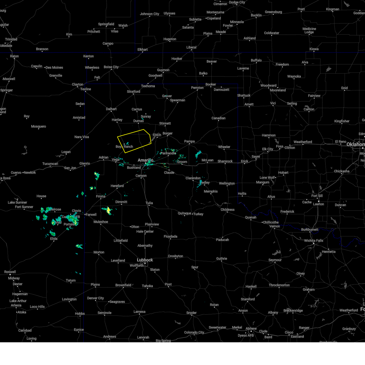 At 706 pm cdt, a severe thunderstorm was located 6 miles northeast of boys ranch, or 24 miles southwest of dumas, moving east at 45 mph (radar indicated). Hazards include 60 mph wind gusts. Minor damage to roofs, siding, and trees is possible. locations impacted include, boys ranch, masterson, four way and valley de oro. hail threat, radar indicated max hail size, <. 75 in wind threat, radar indicated max wind gust, 60 mph. At 706 pm cdt, a severe thunderstorm was located 6 miles northeast of boys ranch, or 24 miles southwest of dumas, moving east at 45 mph (radar indicated). Hazards include 60 mph wind gusts. Minor damage to roofs, siding, and trees is possible. locations impacted include, boys ranch, masterson, four way and valley de oro. hail threat, radar indicated max hail size, <. 75 in wind threat, radar indicated max wind gust, 60 mph.
|
| 6/20/2023 7:00 PM CDT |
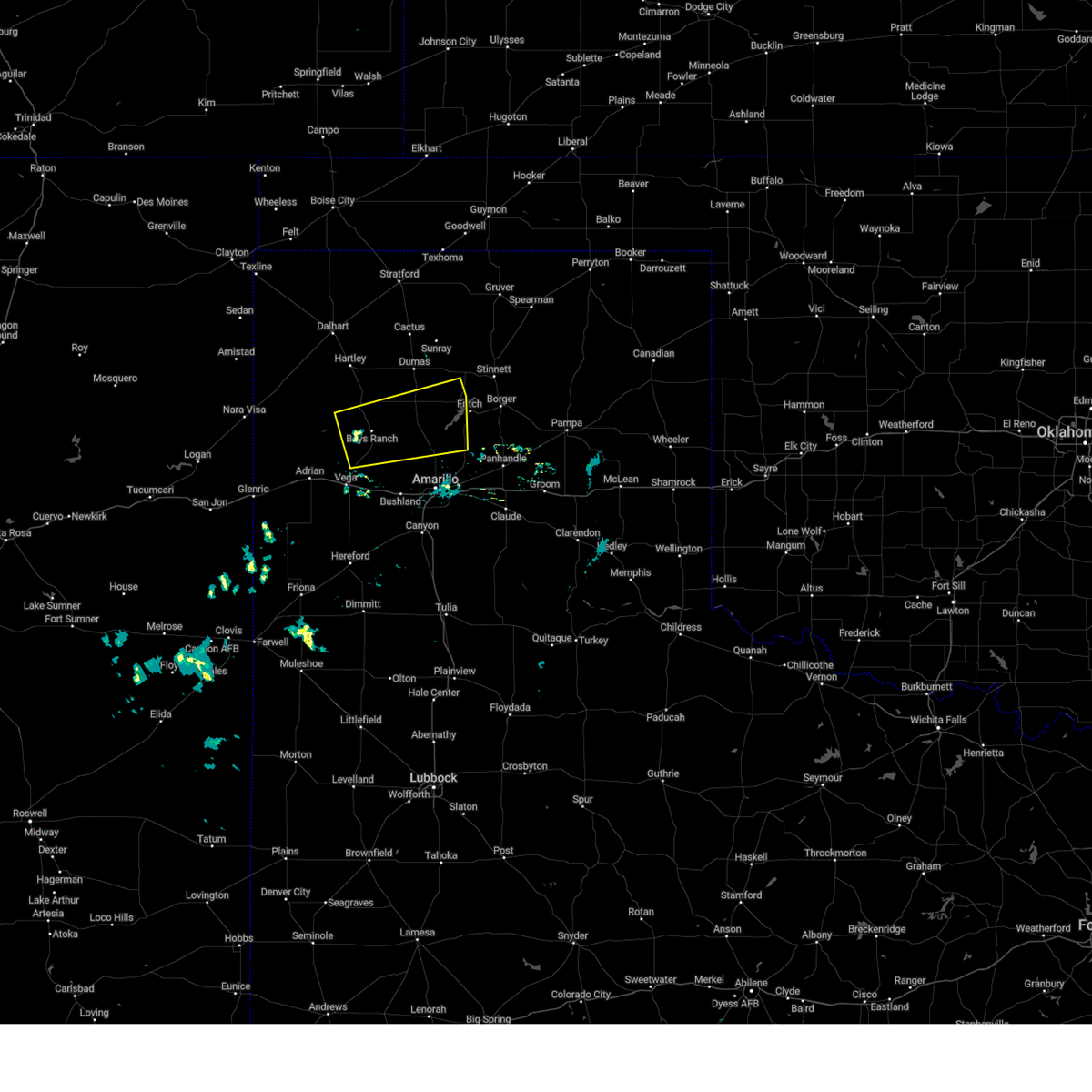 At 659 pm cdt, a severe thunderstorm was located over boys ranch, or 21 miles northeast of vega, moving east at 45 mph (radar indicated). Hazards include 70 mph wind gusts. Expect some tree damage. damage is likely to mobile homes, roofs, and outbuildings. locations impacted include, boys ranch, masterson, four way, valley de oro and lake meredith. thunderstorm damage threat, considerable hail threat, radar indicated max hail size, <. 75 in wind threat, radar indicated max wind gust, 70 mph. At 659 pm cdt, a severe thunderstorm was located over boys ranch, or 21 miles northeast of vega, moving east at 45 mph (radar indicated). Hazards include 70 mph wind gusts. Expect some tree damage. damage is likely to mobile homes, roofs, and outbuildings. locations impacted include, boys ranch, masterson, four way, valley de oro and lake meredith. thunderstorm damage threat, considerable hail threat, radar indicated max hail size, <. 75 in wind threat, radar indicated max wind gust, 70 mph.
|
| 6/20/2023 6:54 PM CDT |
 At 653 pm cdt, a severe thunderstorm was located 5 miles west of boys ranch, or 17 miles north of vega, moving east at 50 mph (radar indicated). Hazards include 70 mph wind gusts. Expect some tree damage. Damage is likely to mobile homes, roofs, and outbuildings. At 653 pm cdt, a severe thunderstorm was located 5 miles west of boys ranch, or 17 miles north of vega, moving east at 50 mph (radar indicated). Hazards include 70 mph wind gusts. Expect some tree damage. Damage is likely to mobile homes, roofs, and outbuildings.
|
| 6/12/2023 10:36 AM CDT |
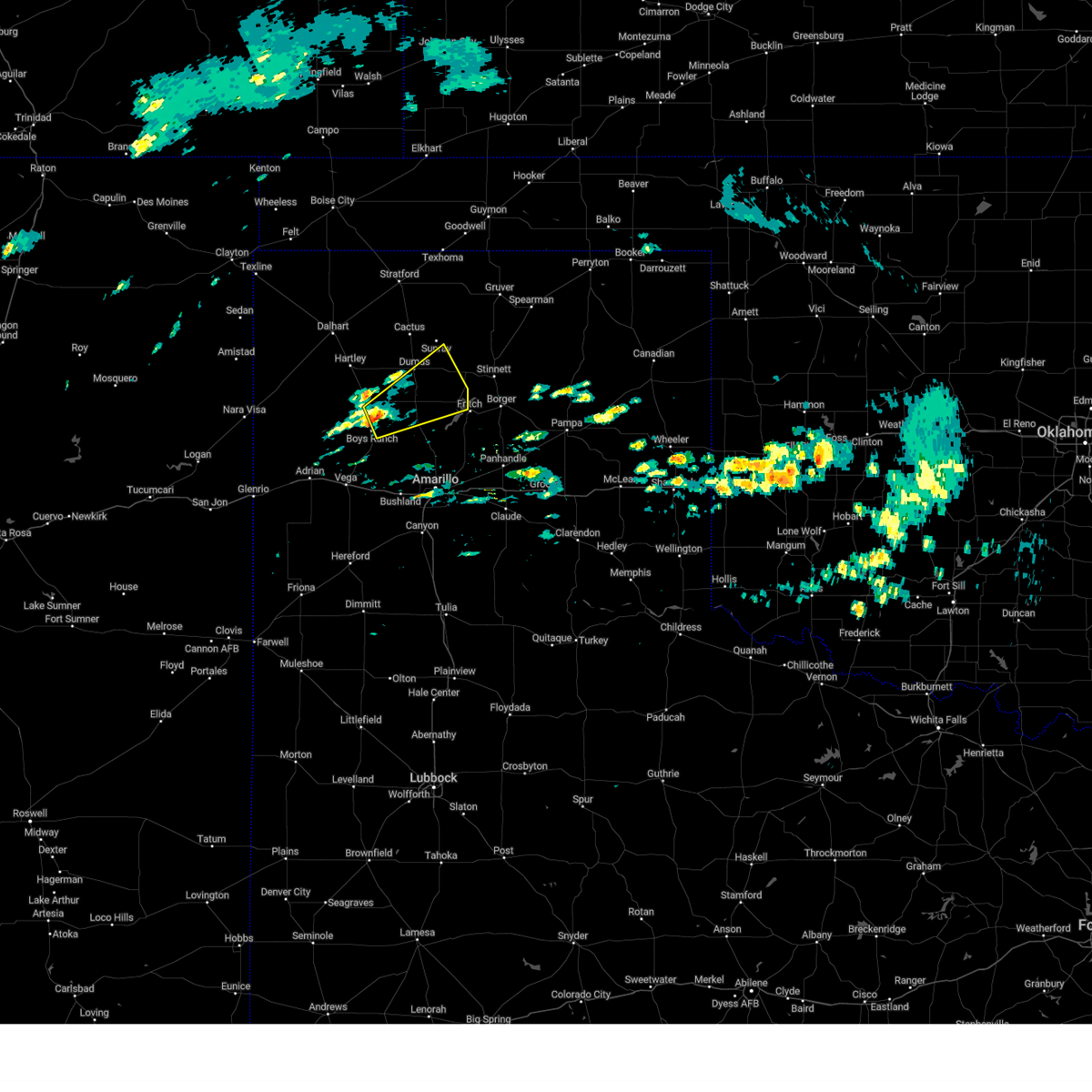 At 1036 am cdt, a severe thunderstorm was located 7 miles northeast of boys ranch, or 21 miles southwest of dumas, moving northeast at 25 mph (radar indicated). Hazards include half dollar size hail. damage to vehicles is expected At 1036 am cdt, a severe thunderstorm was located 7 miles northeast of boys ranch, or 21 miles southwest of dumas, moving northeast at 25 mph (radar indicated). Hazards include half dollar size hail. damage to vehicles is expected
|
| 6/4/2023 6:16 PM CDT |
 At 616 pm cdt, a severe thunderstorm was located 6 miles south of hartley, or 19 miles south of dalhart, moving southeast at 20 mph (radar indicated). Hazards include 60 mph wind gusts. Minor damage to roofs, siding, and trees is possible. locations impacted include, hartley, channing, boys ranch and romero. hail threat, radar indicated max hail size, <. 75 in wind threat, radar indicated max wind gust, 60 mph. At 616 pm cdt, a severe thunderstorm was located 6 miles south of hartley, or 19 miles south of dalhart, moving southeast at 20 mph (radar indicated). Hazards include 60 mph wind gusts. Minor damage to roofs, siding, and trees is possible. locations impacted include, hartley, channing, boys ranch and romero. hail threat, radar indicated max hail size, <. 75 in wind threat, radar indicated max wind gust, 60 mph.
|
| 6/4/2023 6:09 PM CDT |
 At 608 pm cdt, a severe thunderstorm was located 5 miles south of hartley, or 18 miles south of dalhart, moving southeast at 20 mph (radar indicated). Hazards include 60 mph wind gusts. Minor damage to roofs, siding, and trees is possible. locations impacted include, dalhart, hartley, channing, boys ranch and romero. hail threat, radar indicated max hail size, <. 75 in wind threat, radar indicated max wind gust, 60 mph. At 608 pm cdt, a severe thunderstorm was located 5 miles south of hartley, or 18 miles south of dalhart, moving southeast at 20 mph (radar indicated). Hazards include 60 mph wind gusts. Minor damage to roofs, siding, and trees is possible. locations impacted include, dalhart, hartley, channing, boys ranch and romero. hail threat, radar indicated max hail size, <. 75 in wind threat, radar indicated max wind gust, 60 mph.
|
| 6/4/2023 6:03 PM CDT |
 At 603 pm cdt, a severe thunderstorm was located 5 miles southwest of hartley, or 16 miles south of dalhart, moving southeast at 20 mph (radar indicated). Hazards include 60 mph wind gusts. Minor damage to roofs, siding, and trees is possible. locations impacted include, dalhart, hartley, channing, boys ranch and romero. hail threat, radar indicated max hail size, <. 75 in wind threat, radar indicated max wind gust, 60 mph. At 603 pm cdt, a severe thunderstorm was located 5 miles southwest of hartley, or 16 miles south of dalhart, moving southeast at 20 mph (radar indicated). Hazards include 60 mph wind gusts. Minor damage to roofs, siding, and trees is possible. locations impacted include, dalhart, hartley, channing, boys ranch and romero. hail threat, radar indicated max hail size, <. 75 in wind threat, radar indicated max wind gust, 60 mph.
|
| 6/4/2023 5:48 PM CDT |
 At 548 pm cdt, a severe thunderstorm was located 7 miles west of hartley, or 14 miles south of dalhart, moving southeast at 20 mph (radar indicated). Hazards include 60 mph wind gusts and penny size hail. Minor damage to roofs, siding, and trees is possible. locations impacted include, dalhart, hartley, channing, boys ranch and romero. hail threat, radar indicated max hail size, 0. 75in wind threat, radar indicated max wind gust, 60 mph. At 548 pm cdt, a severe thunderstorm was located 7 miles west of hartley, or 14 miles south of dalhart, moving southeast at 20 mph (radar indicated). Hazards include 60 mph wind gusts and penny size hail. Minor damage to roofs, siding, and trees is possible. locations impacted include, dalhart, hartley, channing, boys ranch and romero. hail threat, radar indicated max hail size, 0. 75in wind threat, radar indicated max wind gust, 60 mph.
|
| 6/4/2023 5:32 PM CDT |
 At 532 pm cdt, a severe thunderstorm was located 9 miles southwest of dalhart, moving southeast at 20 mph (radar indicated). Hazards include 60 mph wind gusts and quarter size hail. Minor damage to roofs, siding, and trees is possible. Hail damage to vehicles is expected. At 532 pm cdt, a severe thunderstorm was located 9 miles southwest of dalhart, moving southeast at 20 mph (radar indicated). Hazards include 60 mph wind gusts and quarter size hail. Minor damage to roofs, siding, and trees is possible. Hail damage to vehicles is expected.
|
| 5/31/2023 8:19 PM CDT |
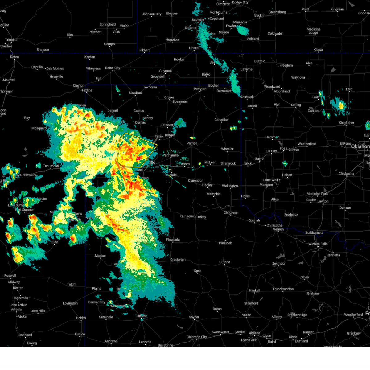 At 818 pm cdt, a severe thunderstorm was located 8 miles northeast of boys ranch, or 21 miles southwest of dumas, moving northeast at 40 mph (radar indicated). Hazards include 60 mph wind gusts and penny size hail. Minor damage to roofs, siding, and trees is possible. locations impacted include, amarillo, channing, boys ranch, masterson, wildorado and valley de oro. hail threat, radar indicated max hail size, 0. 75in wind threat, radar indicated max wind gust, 60 mph. At 818 pm cdt, a severe thunderstorm was located 8 miles northeast of boys ranch, or 21 miles southwest of dumas, moving northeast at 40 mph (radar indicated). Hazards include 60 mph wind gusts and penny size hail. Minor damage to roofs, siding, and trees is possible. locations impacted include, amarillo, channing, boys ranch, masterson, wildorado and valley de oro. hail threat, radar indicated max hail size, 0. 75in wind threat, radar indicated max wind gust, 60 mph.
|
| 5/31/2023 8:02 PM CDT |
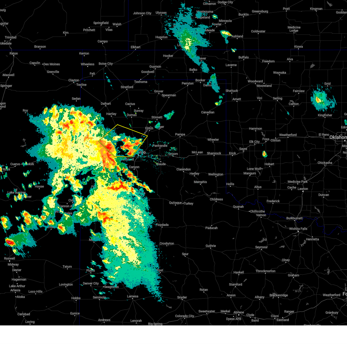 At 801 pm cdt, a severe thunderstorm was located near boys ranch, or 16 miles northeast of vega, moving northeast at 40 mph. another severe storm was located 5 miles northwest of bishopp hills moving north at 25 mph (radar indicated). Hazards include 60 mph wind gusts and half dollar size hail. Minor damage to roofs, siding, and trees is possible. Hail damage to vehicles is expected. At 801 pm cdt, a severe thunderstorm was located near boys ranch, or 16 miles northeast of vega, moving northeast at 40 mph. another severe storm was located 5 miles northwest of bishopp hills moving north at 25 mph (radar indicated). Hazards include 60 mph wind gusts and half dollar size hail. Minor damage to roofs, siding, and trees is possible. Hail damage to vehicles is expected.
|
| 5/31/2023 7:51 PM CDT |
 At 750 pm cdt, a severe thunderstorm was located 10 miles north of vega, moving northeast at 35 mph (radar indicated). Hazards include 60 mph wind gusts. Minor damage to roofs, siding, and trees is possible. locations impacted include, vega, adrian and boys ranch. hail threat, radar indicated max hail size, <. 75 in wind threat, radar indicated max wind gust, 60 mph. At 750 pm cdt, a severe thunderstorm was located 10 miles north of vega, moving northeast at 35 mph (radar indicated). Hazards include 60 mph wind gusts. Minor damage to roofs, siding, and trees is possible. locations impacted include, vega, adrian and boys ranch. hail threat, radar indicated max hail size, <. 75 in wind threat, radar indicated max wind gust, 60 mph.
|
| 5/31/2023 7:15 PM CDT |
 At 715 pm cdt, a severe thunderstorm was located 7 miles southwest of adrian, or 18 miles west of vega, moving northeast at 50 mph (radar indicated). Hazards include 60 mph wind gusts. minor damage to roofs, siding, and trees is possible At 715 pm cdt, a severe thunderstorm was located 7 miles southwest of adrian, or 18 miles west of vega, moving northeast at 50 mph (radar indicated). Hazards include 60 mph wind gusts. minor damage to roofs, siding, and trees is possible
|
| 5/31/2023 3:30 PM CDT |
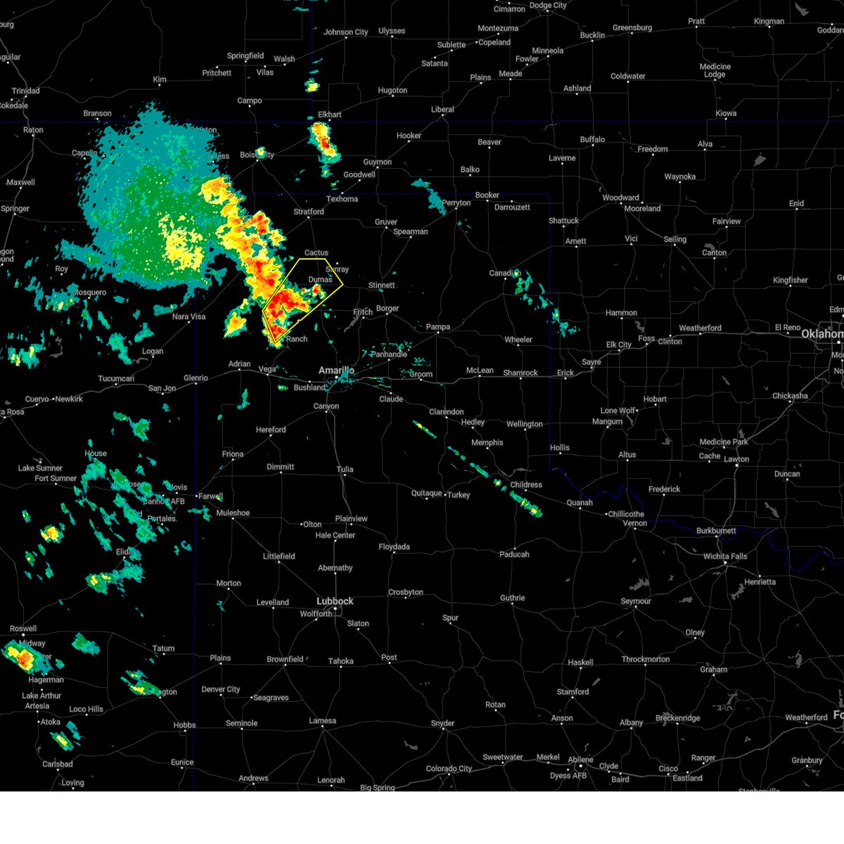 At 330 pm cdt, a severe thunderstorm was located over channing, or 23 miles southwest of dumas, moving northeast at 25 mph (radar indicated). Hazards include 60 mph wind gusts and quarter size hail. Minor damage to roofs, siding, and trees is possible. Hail damage to vehicles is expected. At 330 pm cdt, a severe thunderstorm was located over channing, or 23 miles southwest of dumas, moving northeast at 25 mph (radar indicated). Hazards include 60 mph wind gusts and quarter size hail. Minor damage to roofs, siding, and trees is possible. Hail damage to vehicles is expected.
|
| 5/31/2023 6:45 AM CDT |
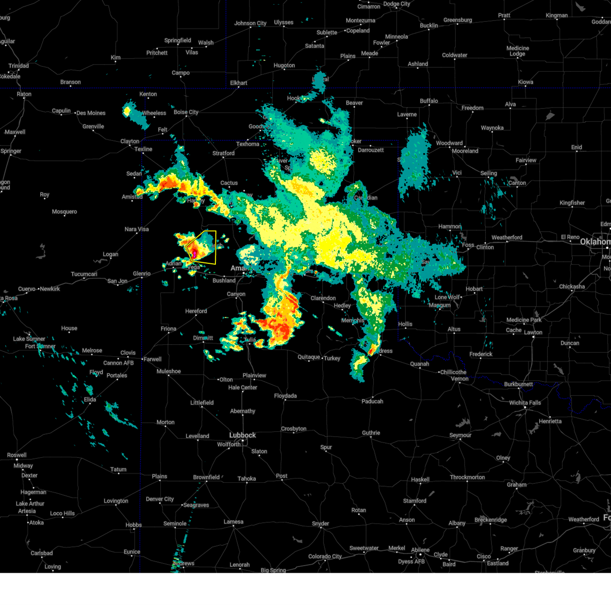 At 645 am cdt, a severe thunderstorm was located 8 miles southwest of boys ranch, or 11 miles north of vega, moving east at 20 mph (radar indicated). Hazards include quarter size hail. Damage to vehicles is expected. locations impacted include, boys ranch. hail threat, radar indicated max hail size, 1. 00in wind threat, radar indicated max wind gust, <50 mph. At 645 am cdt, a severe thunderstorm was located 8 miles southwest of boys ranch, or 11 miles north of vega, moving east at 20 mph (radar indicated). Hazards include quarter size hail. Damage to vehicles is expected. locations impacted include, boys ranch. hail threat, radar indicated max hail size, 1. 00in wind threat, radar indicated max wind gust, <50 mph.
|
| 5/31/2023 6:31 AM CDT |
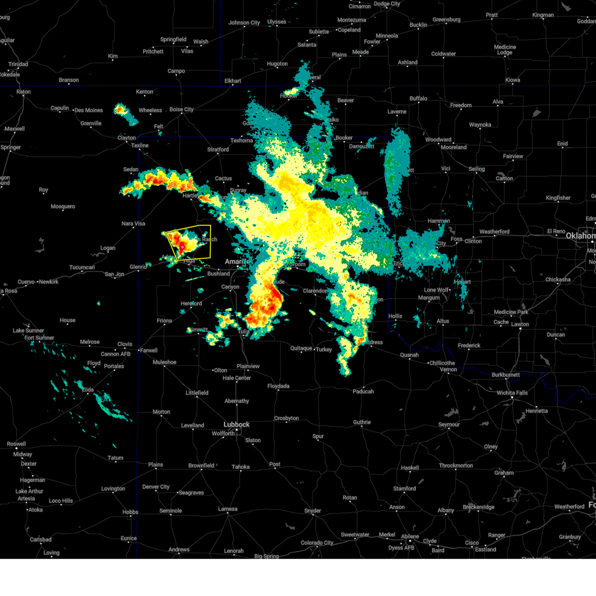 At 631 am cdt, a severe thunderstorm was located 10 miles northwest of vega, moving east at 15 mph (radar indicated). Hazards include half dollar size hail. damage to vehicles is expected At 631 am cdt, a severe thunderstorm was located 10 miles northwest of vega, moving east at 15 mph (radar indicated). Hazards include half dollar size hail. damage to vehicles is expected
|
| 5/31/2023 3:52 AM CDT |
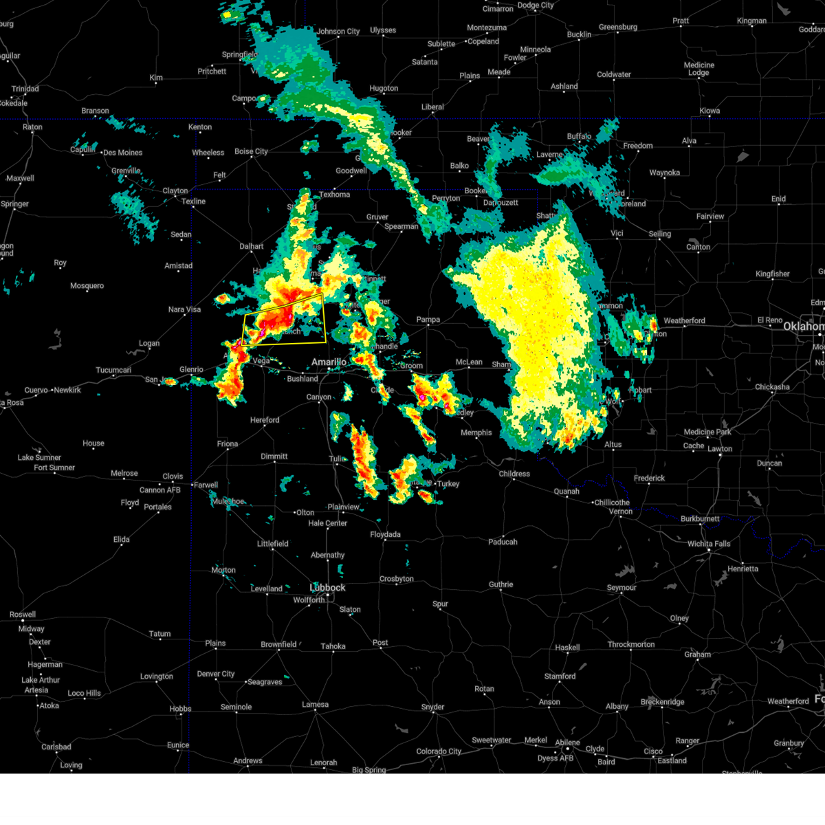 At 352 am cdt, a severe thunderstorm was located 8 miles southwest of masterson, or 21 miles south of dumas, moving east at 35 mph (radar indicated). Hazards include 60 mph wind gusts and quarter size hail. Minor damage to roofs, siding, and trees is possible. hail damage to vehicles is expected. locations impacted include, boys ranch, masterson, four way and valley de oro. hail threat, radar indicated max hail size, 1. 00in wind threat, radar indicated max wind gust, 60 mph. At 352 am cdt, a severe thunderstorm was located 8 miles southwest of masterson, or 21 miles south of dumas, moving east at 35 mph (radar indicated). Hazards include 60 mph wind gusts and quarter size hail. Minor damage to roofs, siding, and trees is possible. hail damage to vehicles is expected. locations impacted include, boys ranch, masterson, four way and valley de oro. hail threat, radar indicated max hail size, 1. 00in wind threat, radar indicated max wind gust, 60 mph.
|
| 5/31/2023 3:31 AM CDT |
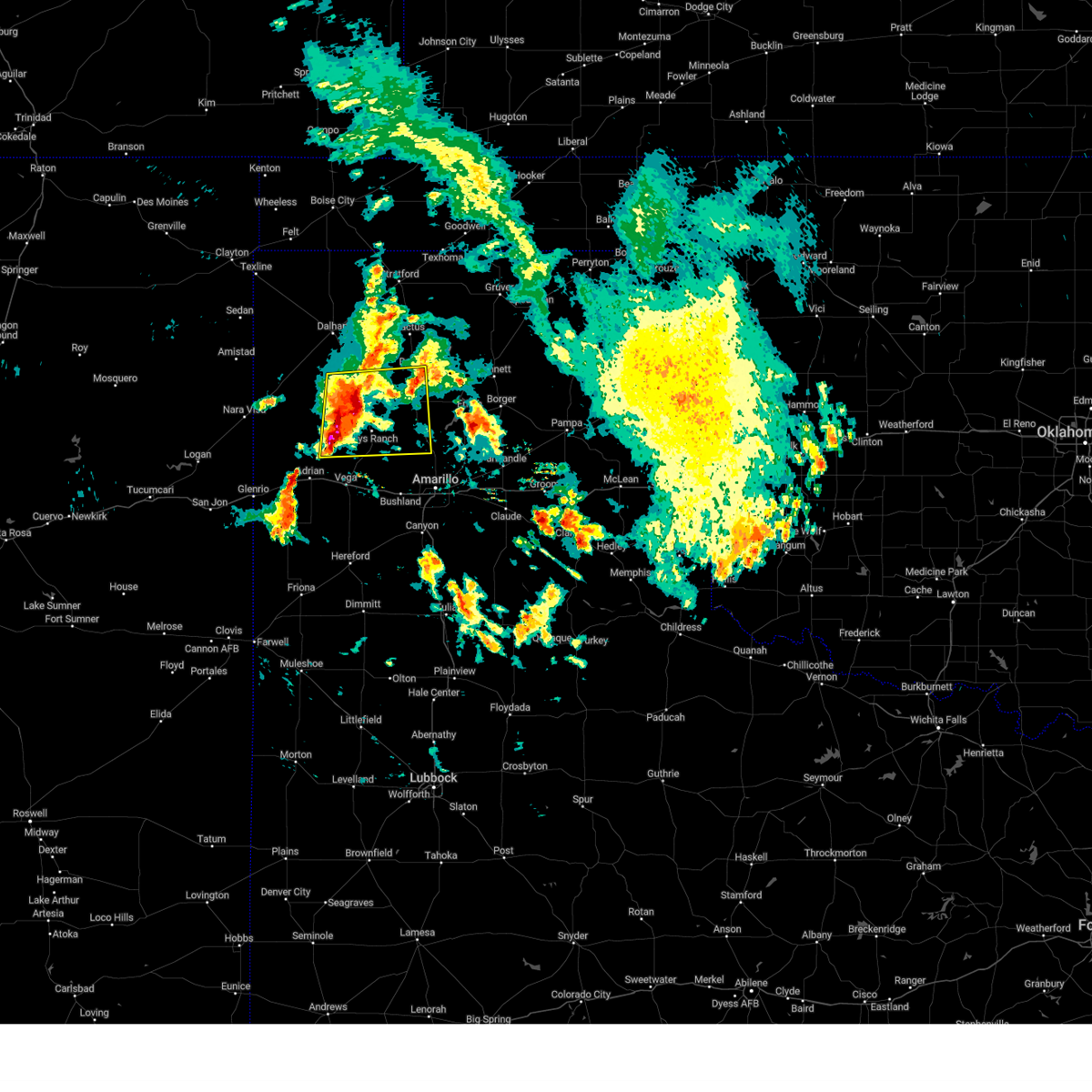 At 331 am cdt, a severe thunderstorm was located 7 miles west of boys ranch, or 21 miles north of vega, moving east at 30 mph (radar indicated). Hazards include ping pong ball size hail and 60 mph wind gusts. Minor damage to roofs, siding, and trees is possible. people and animals outdoors will be injured. expect hail damage to roofs, siding, windows, and vehicles. locations impacted include, dumas, channing, boys ranch, masterson, four way and valley de oro. hail threat, radar indicated max hail size, 1. 50 in wind threat, radar indicated max wind gust, 60 mph. At 331 am cdt, a severe thunderstorm was located 7 miles west of boys ranch, or 21 miles north of vega, moving east at 30 mph (radar indicated). Hazards include ping pong ball size hail and 60 mph wind gusts. Minor damage to roofs, siding, and trees is possible. people and animals outdoors will be injured. expect hail damage to roofs, siding, windows, and vehicles. locations impacted include, dumas, channing, boys ranch, masterson, four way and valley de oro. hail threat, radar indicated max hail size, 1. 50 in wind threat, radar indicated max wind gust, 60 mph.
|
| 5/31/2023 3:12 AM CDT |
 At 312 am cdt, a severe thunderstorm was located 14 miles southwest of channing, or 22 miles north of vega, moving east at 30 mph (radar indicated). Hazards include ping pong ball size hail and 60 mph wind gusts. Minor damage to roofs, siding, and trees is possible. people and animals outdoors will be injured. Expect hail damage to roofs, siding, windows, and vehicles. At 312 am cdt, a severe thunderstorm was located 14 miles southwest of channing, or 22 miles north of vega, moving east at 30 mph (radar indicated). Hazards include ping pong ball size hail and 60 mph wind gusts. Minor damage to roofs, siding, and trees is possible. people and animals outdoors will be injured. Expect hail damage to roofs, siding, windows, and vehicles.
|
| 5/30/2023 8:38 PM CDT |
 At 837 pm cdt, a severe thunderstorm was located over romero, or 11 miles northeast of nara visa, moving east at 15 mph (radar indicated). Hazards include 60 mph wind gusts and quarter size hail. Minor damage to roofs, siding, and trees is possible. hail damage to vehicles is expected. locations impacted include, hartley, channing, boys ranch and romero. hail threat, radar indicated max hail size, 1. 00in wind threat, radar indicated max wind gust, 60 mph. At 837 pm cdt, a severe thunderstorm was located over romero, or 11 miles northeast of nara visa, moving east at 15 mph (radar indicated). Hazards include 60 mph wind gusts and quarter size hail. Minor damage to roofs, siding, and trees is possible. hail damage to vehicles is expected. locations impacted include, hartley, channing, boys ranch and romero. hail threat, radar indicated max hail size, 1. 00in wind threat, radar indicated max wind gust, 60 mph.
|
| 5/30/2023 8:24 PM CDT |
 At 824 pm cdt, a severe thunderstorm was located over romero, or 12 miles northeast of nara visa, moving east at 25 mph (radar indicated). Hazards include ping pong ball size hail and 60 mph wind gusts. Minor damage to roofs, siding, and trees is possible. people and animals outdoors will be injured. expect hail damage to roofs, siding, windows, and vehicles. locations impacted include, hartley, channing, boys ranch and romero. hail threat, radar indicated max hail size, 1. 50 in wind threat, radar indicated max wind gust, 60 mph. At 824 pm cdt, a severe thunderstorm was located over romero, or 12 miles northeast of nara visa, moving east at 25 mph (radar indicated). Hazards include ping pong ball size hail and 60 mph wind gusts. Minor damage to roofs, siding, and trees is possible. people and animals outdoors will be injured. expect hail damage to roofs, siding, windows, and vehicles. locations impacted include, hartley, channing, boys ranch and romero. hail threat, radar indicated max hail size, 1. 50 in wind threat, radar indicated max wind gust, 60 mph.
|
| 5/30/2023 8:15 PM CDT |
 At 815 pm cdt, a severe thunderstorm was located over romero, or 10 miles northeast of nara visa, moving east at 25 mph (radar indicated). Hazards include 60 mph wind gusts and quarter size hail. Minor damage to roofs, siding, and trees is possible. Hail damage to vehicles is expected. At 815 pm cdt, a severe thunderstorm was located over romero, or 10 miles northeast of nara visa, moving east at 25 mph (radar indicated). Hazards include 60 mph wind gusts and quarter size hail. Minor damage to roofs, siding, and trees is possible. Hail damage to vehicles is expected.
|
| 5/28/2023 10:07 PM CDT |
 The severe thunderstorm warning for northeastern oldham, northern potter, southeastern sherman, moore and southeastern hartley counties will expire at 1015 pm cdt, the storms which prompted the warning have weakened below severe limits, and no longer pose an immediate threat to life or property. therefore, the warning will be allowed to expire. however gusty winds and heavy rain are still possible with these thunderstorms. The severe thunderstorm warning for northeastern oldham, northern potter, southeastern sherman, moore and southeastern hartley counties will expire at 1015 pm cdt, the storms which prompted the warning have weakened below severe limits, and no longer pose an immediate threat to life or property. therefore, the warning will be allowed to expire. however gusty winds and heavy rain are still possible with these thunderstorms.
|
| 5/28/2023 9:53 PM CDT |
 At 952 pm cdt, severe thunderstorms were located along a line extending from 11 miles west of stinnett to 12 miles southwest of channing, moving south at 25 mph (radar indicated). Hazards include 60 mph wind gusts. Minor damage to roofs, siding, and trees is possible. locations impacted include, dumas, hartley, cactus, fritch, sunray, channing, four way, boys ranch, masterson and lake meredith. hail threat, radar indicated max hail size, <. 75 in wind threat, radar indicated max wind gust, 60 mph. At 952 pm cdt, severe thunderstorms were located along a line extending from 11 miles west of stinnett to 12 miles southwest of channing, moving south at 25 mph (radar indicated). Hazards include 60 mph wind gusts. Minor damage to roofs, siding, and trees is possible. locations impacted include, dumas, hartley, cactus, fritch, sunray, channing, four way, boys ranch, masterson and lake meredith. hail threat, radar indicated max hail size, <. 75 in wind threat, radar indicated max wind gust, 60 mph.
|
| 5/28/2023 9:35 PM CDT |
 At 935 pm cdt, severe thunderstorms were located along a line extending from 8 miles southeast of sunray to 12 miles west of channing, moving south at 40 mph (radar indicated). Hazards include 70 mph wind gusts. Expect some tree damage. damage is likely to mobile homes, roofs, and outbuildings. locations impacted include, dumas, dalhart, hartley, cactus, fritch, sunray, channing, four way, boys ranch, masterson and lake meredith. thunderstorm damage threat, considerable hail threat, radar indicated max hail size, <. 75 in wind threat, radar indicated max wind gust, 70 mph. At 935 pm cdt, severe thunderstorms were located along a line extending from 8 miles southeast of sunray to 12 miles west of channing, moving south at 40 mph (radar indicated). Hazards include 70 mph wind gusts. Expect some tree damage. damage is likely to mobile homes, roofs, and outbuildings. locations impacted include, dumas, dalhart, hartley, cactus, fritch, sunray, channing, four way, boys ranch, masterson and lake meredith. thunderstorm damage threat, considerable hail threat, radar indicated max hail size, <. 75 in wind threat, radar indicated max wind gust, 70 mph.
|
| 5/28/2023 9:09 PM CDT |
 At 909 pm cdt, severe thunderstorms were located along a line extending from 8 miles northeast of sunray to 14 miles southwest of hartley, moving south at 30 mph (radar indicated). Hazards include 70 mph wind gusts and penny size hail. Expect some tree damage. damage is likely to mobile homes, roofs, and outbuildings. locations impacted include, dumas, dalhart, hartley, cactus, fritch, sunray, channing, four way, conlen, boys ranch, masterson and lake meredith. thunderstorm damage threat, considerable hail threat, radar indicated max hail size, 0. 75in wind threat, radar indicated max wind gust, 70 mph. At 909 pm cdt, severe thunderstorms were located along a line extending from 8 miles northeast of sunray to 14 miles southwest of hartley, moving south at 30 mph (radar indicated). Hazards include 70 mph wind gusts and penny size hail. Expect some tree damage. damage is likely to mobile homes, roofs, and outbuildings. locations impacted include, dumas, dalhart, hartley, cactus, fritch, sunray, channing, four way, conlen, boys ranch, masterson and lake meredith. thunderstorm damage threat, considerable hail threat, radar indicated max hail size, 0. 75in wind threat, radar indicated max wind gust, 70 mph.
|
| 5/28/2023 8:42 PM CDT |
 At 841 pm cdt, a severe thunderstorm was located near conlen, or 10 miles southwest of stratford, moving south at 25 mph (radar indicated). Hazards include 70 mph wind gusts and penny size hail. Expect some tree damage. Damage is likely to mobile homes, roofs, and outbuildings. At 841 pm cdt, a severe thunderstorm was located near conlen, or 10 miles southwest of stratford, moving south at 25 mph (radar indicated). Hazards include 70 mph wind gusts and penny size hail. Expect some tree damage. Damage is likely to mobile homes, roofs, and outbuildings.
|
| 5/18/2023 7:42 PM CDT |
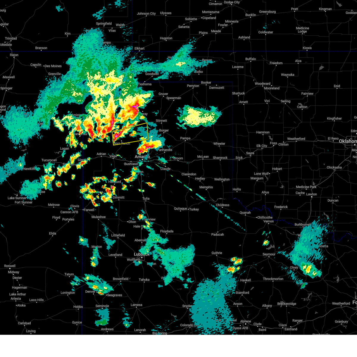 At 742 pm cdt, a severe thunderstorm was located 6 miles south of channing, or 24 miles north of vega, moving east at 20 mph (radar indicated). Hazards include 60 mph wind gusts and half dollar size hail. Minor damage to roofs, siding, and trees is possible. Hail damage to vehicles is expected. At 742 pm cdt, a severe thunderstorm was located 6 miles south of channing, or 24 miles north of vega, moving east at 20 mph (radar indicated). Hazards include 60 mph wind gusts and half dollar size hail. Minor damage to roofs, siding, and trees is possible. Hail damage to vehicles is expected.
|
| 5/18/2023 4:53 PM CDT | Quarter sized hail reported 1.6 miles N of Boys Ranch, TX, time estimated based on radar. |
| 5/10/2023 11:05 PM CDT |
 The severe thunderstorm warning for northeastern oldham county will expire at 1115 pm cdt, the storm which prompted the warning has weakened below severe limits, and no longer poses an immediate threat to life or property. therefore, the warning will be allowed to expire. however small hail is still possible with this thunderstorm. The severe thunderstorm warning for northeastern oldham county will expire at 1115 pm cdt, the storm which prompted the warning has weakened below severe limits, and no longer poses an immediate threat to life or property. therefore, the warning will be allowed to expire. however small hail is still possible with this thunderstorm.
|
| 5/10/2023 11:00 PM CDT |
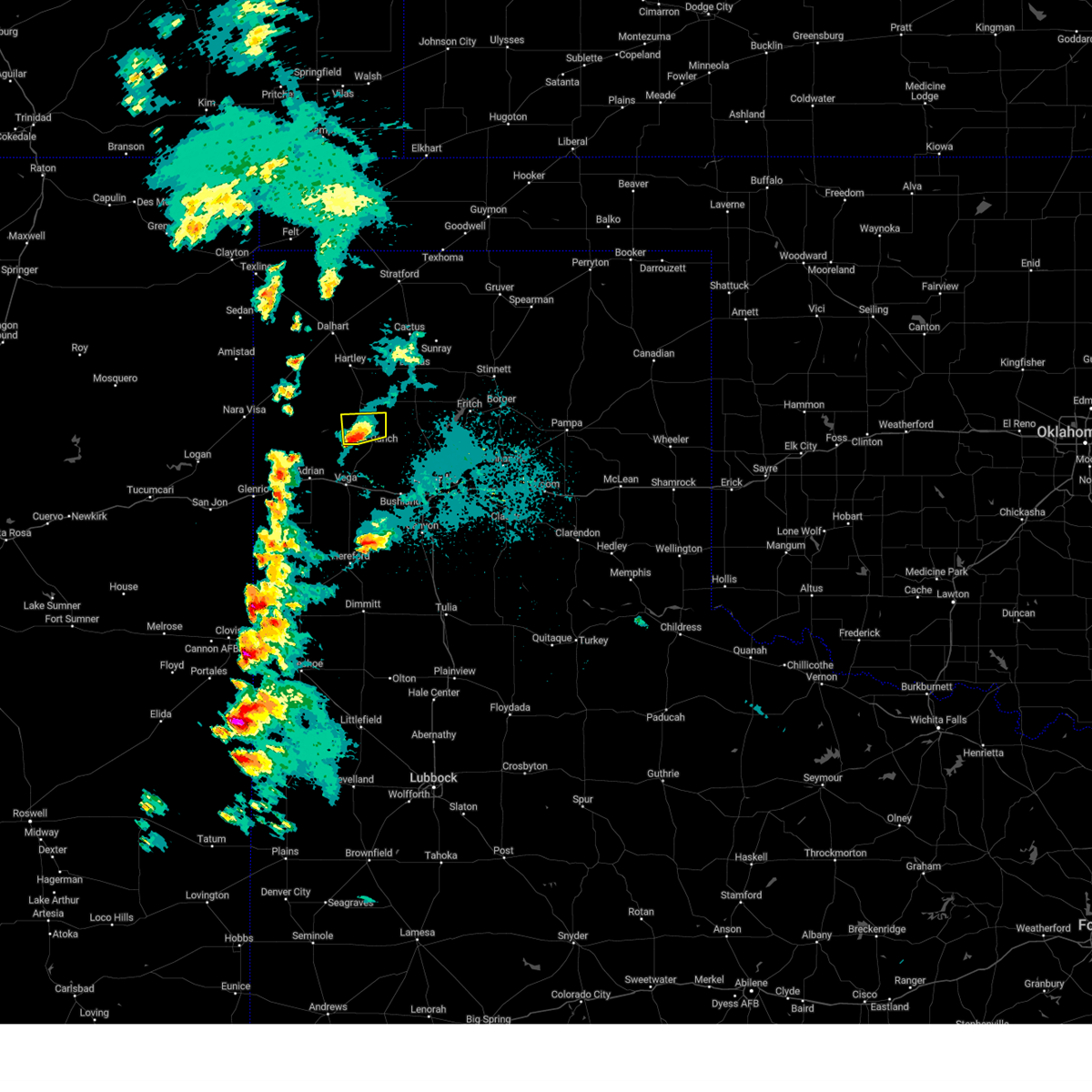 At 1059 pm cdt, a severe thunderstorm was located 6 miles west of boys ranch, or 16 miles north of vega, moving northeast at 20 mph (radar indicated). Hazards include quarter size hail. Damage to vehicles is expected. locations impacted include, boys ranch. hail threat, radar indicated max hail size, 1. 00in wind threat, radar indicated max wind gust, <50 mph. At 1059 pm cdt, a severe thunderstorm was located 6 miles west of boys ranch, or 16 miles north of vega, moving northeast at 20 mph (radar indicated). Hazards include quarter size hail. Damage to vehicles is expected. locations impacted include, boys ranch. hail threat, radar indicated max hail size, 1. 00in wind threat, radar indicated max wind gust, <50 mph.
|
| 5/10/2023 10:43 PM CDT |
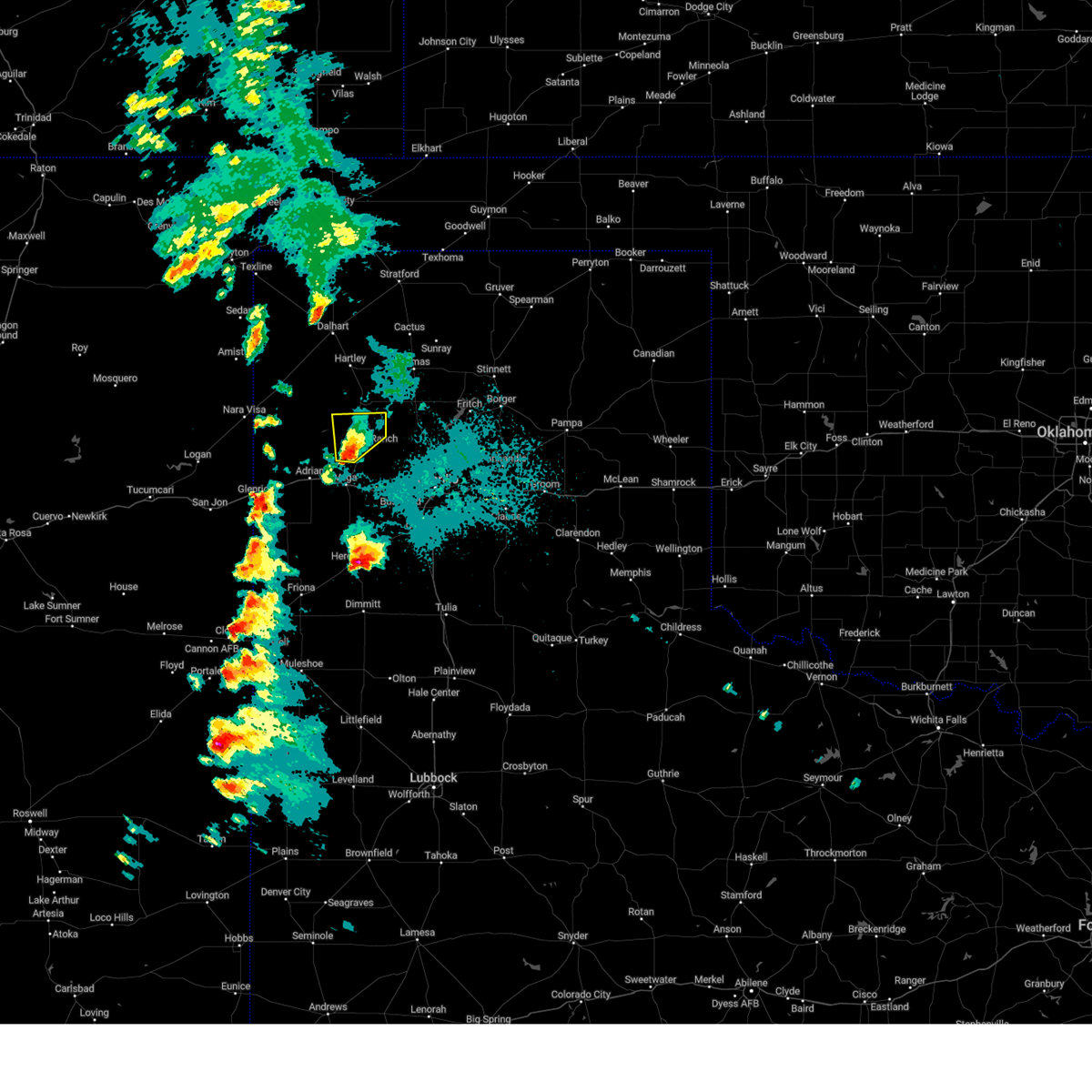 At 1043 pm cdt, a severe thunderstorm was located 11 miles north of vega, moving northeast at 20 mph (radar indicated). Hazards include 60 mph wind gusts and quarter size hail. Minor damage to roofs, siding, and trees is possible. hail damage to vehicles is expected. locations impacted include, boys ranch. hail threat, radar indicated max hail size, 1. 00in wind threat, radar indicated max wind gust, 60 mph. At 1043 pm cdt, a severe thunderstorm was located 11 miles north of vega, moving northeast at 20 mph (radar indicated). Hazards include 60 mph wind gusts and quarter size hail. Minor damage to roofs, siding, and trees is possible. hail damage to vehicles is expected. locations impacted include, boys ranch. hail threat, radar indicated max hail size, 1. 00in wind threat, radar indicated max wind gust, 60 mph.
|
| 5/10/2023 10:25 PM CDT |
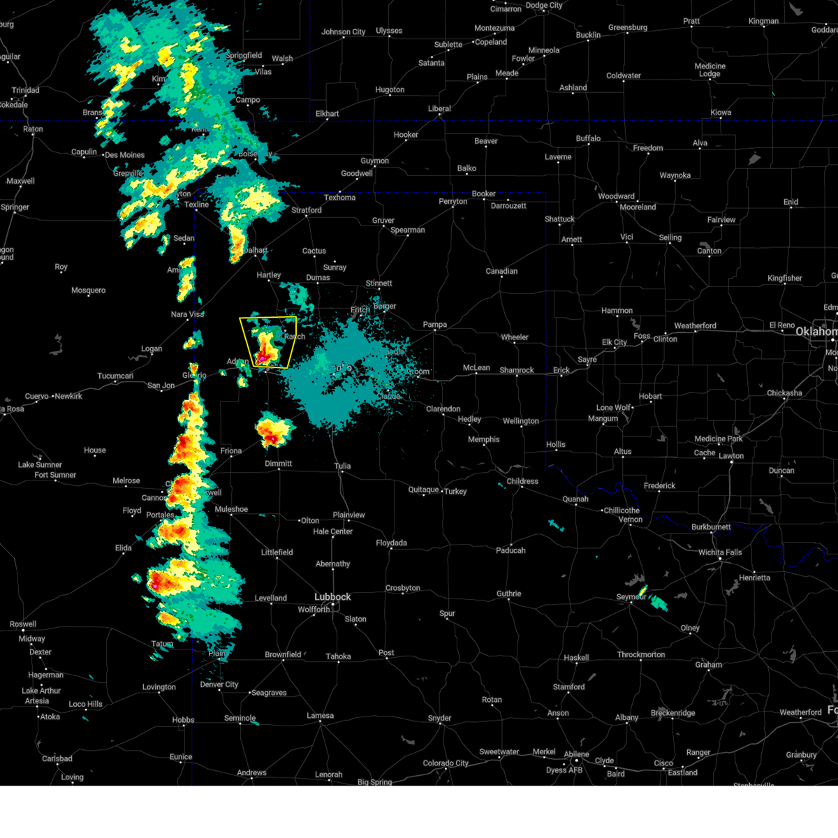 At 1025 pm cdt, a severe thunderstorm was located 5 miles north of vega, moving northeast at 20 mph (radar indicated). Hazards include 60 mph wind gusts and half dollar size hail. Minor damage to roofs, siding, and trees is possible. hail damage to vehicles is expected. locations impacted include, boys ranch. hail threat, radar indicated max hail size, 1. 25 in wind threat, radar indicated max wind gust, 60 mph. At 1025 pm cdt, a severe thunderstorm was located 5 miles north of vega, moving northeast at 20 mph (radar indicated). Hazards include 60 mph wind gusts and half dollar size hail. Minor damage to roofs, siding, and trees is possible. hail damage to vehicles is expected. locations impacted include, boys ranch. hail threat, radar indicated max hail size, 1. 25 in wind threat, radar indicated max wind gust, 60 mph.
|
| 5/10/2023 10:10 PM CDT |
 At 1010 pm cdt, a severe thunderstorm was located near vega, moving northeast at 20 mph (radar indicated). Hazards include 60 mph wind gusts and half dollar size hail. Minor damage to roofs, siding, and trees is possible. Hail damage to vehicles is expected. At 1010 pm cdt, a severe thunderstorm was located near vega, moving northeast at 20 mph (radar indicated). Hazards include 60 mph wind gusts and half dollar size hail. Minor damage to roofs, siding, and trees is possible. Hail damage to vehicles is expected.
|
| 7/29/2022 7:07 PM CDT |
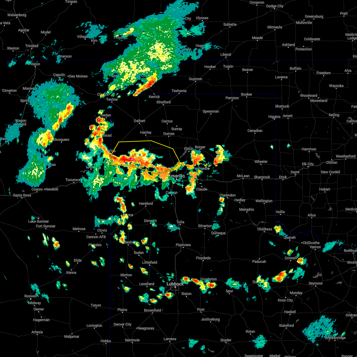 At 707 pm cdt, severe thunderstorms were located along a line extending from 7 miles southeast of nara visa to 17 miles north of adrian to 7 miles southwest of boys ranch, moving northeast at 25 mph (radar indicated). Hazards include 60 mph wind gusts and nickel size hail. minor damage to roofs, siding, and trees is possible At 707 pm cdt, severe thunderstorms were located along a line extending from 7 miles southeast of nara visa to 17 miles north of adrian to 7 miles southwest of boys ranch, moving northeast at 25 mph (radar indicated). Hazards include 60 mph wind gusts and nickel size hail. minor damage to roofs, siding, and trees is possible
|
| 7/28/2022 5:49 PM CDT |
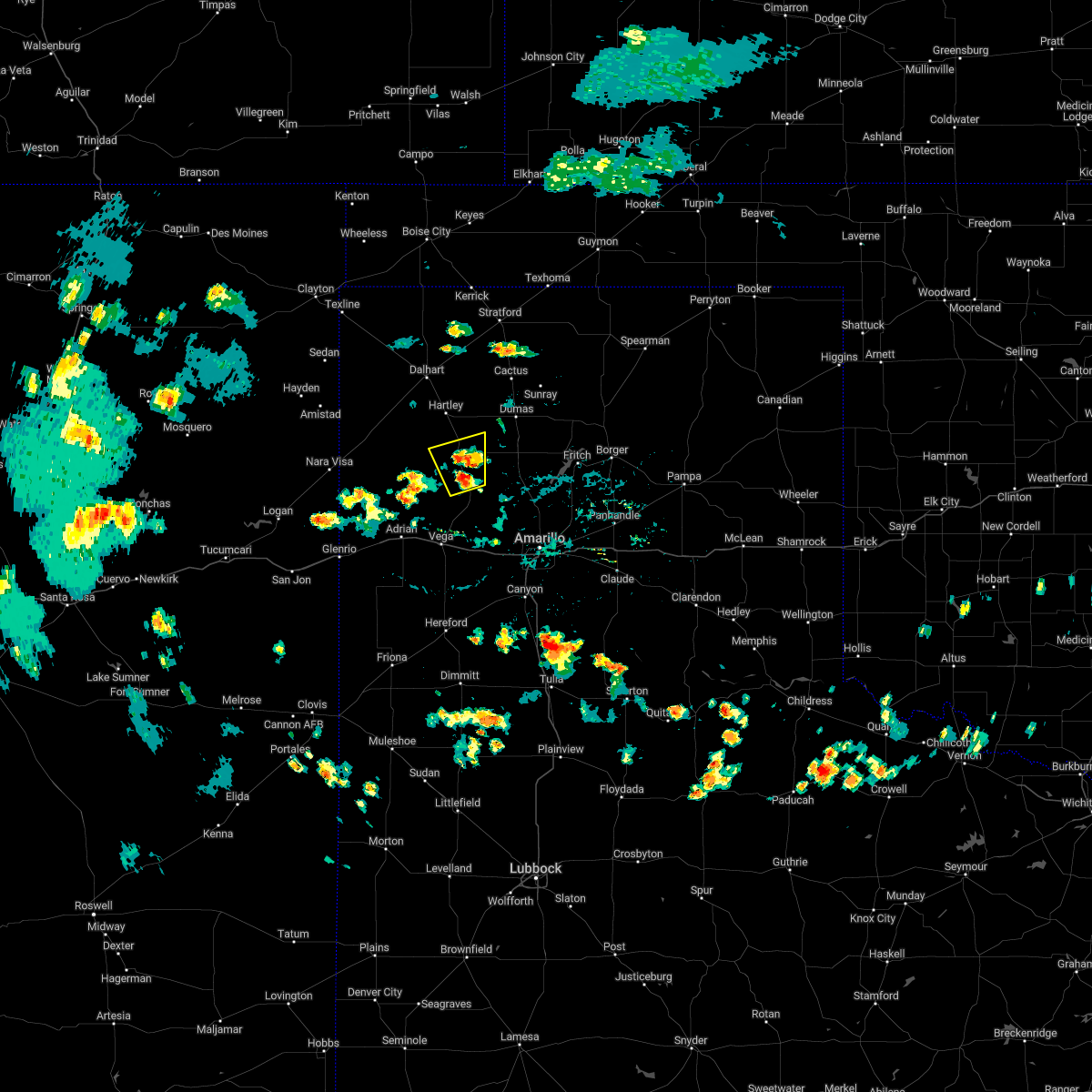 At 549 pm cdt, a severe thunderstorm was located 5 miles northwest of boys ranch, or 24 miles north of vega, moving north at 15 mph (radar indicated). Hazards include 60 mph wind gusts. minor damage to roofs, siding, and trees is possible At 549 pm cdt, a severe thunderstorm was located 5 miles northwest of boys ranch, or 24 miles north of vega, moving north at 15 mph (radar indicated). Hazards include 60 mph wind gusts. minor damage to roofs, siding, and trees is possible
|
| 7/28/2022 5:28 PM CDT | Mesonet station 86 boys ranch 1ws in oldham county TX, 1 miles ENE of Boys Ranch, TX |
| 6/9/2022 8:28 PM CDT |
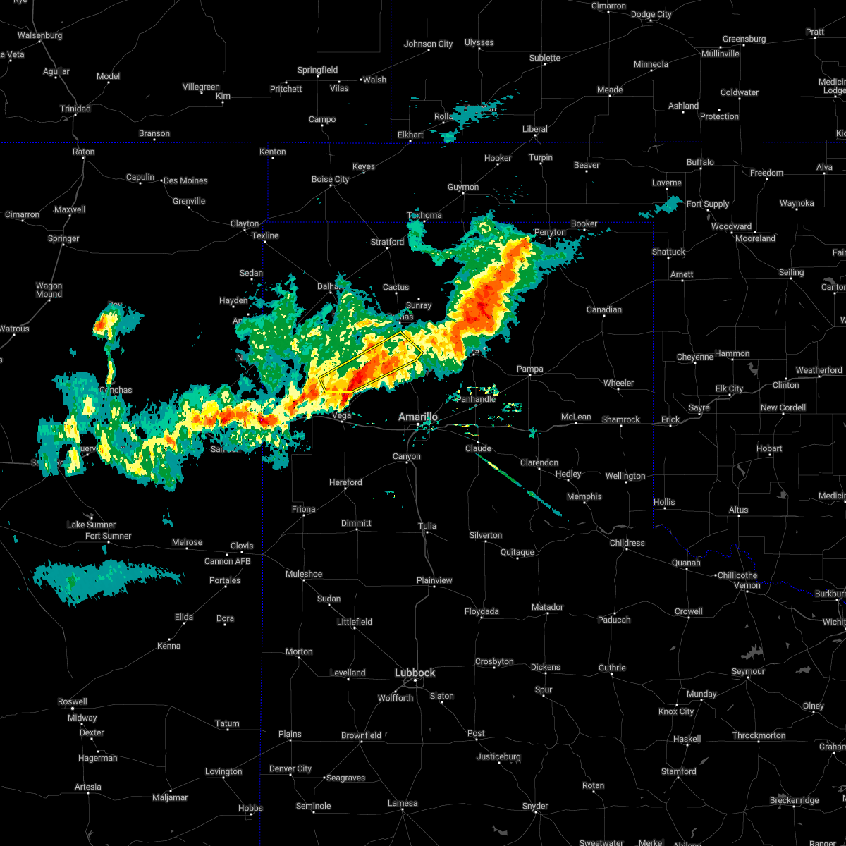 The severe thunderstorm warning for northeastern oldham, northwestern potter, southwestern moore and southeastern hartley counties will expire at 830 pm cdt, the storms which prompted the warning have weakened below severe limits, and no longer pose an immediate threat to life or property. therefore, the warning will be allowed to expire. however gusty winds and heavy rain are still possible with these thunderstorms. a severe thunderstorm watch remains in effect until 900 pm cdt for the panhandle of texas. a severe thunderstorm watch also remains in effect until 200 am cdt for the panhandle of texas. The severe thunderstorm warning for northeastern oldham, northwestern potter, southwestern moore and southeastern hartley counties will expire at 830 pm cdt, the storms which prompted the warning have weakened below severe limits, and no longer pose an immediate threat to life or property. therefore, the warning will be allowed to expire. however gusty winds and heavy rain are still possible with these thunderstorms. a severe thunderstorm watch remains in effect until 900 pm cdt for the panhandle of texas. a severe thunderstorm watch also remains in effect until 200 am cdt for the panhandle of texas.
|
| 6/9/2022 8:16 PM CDT |
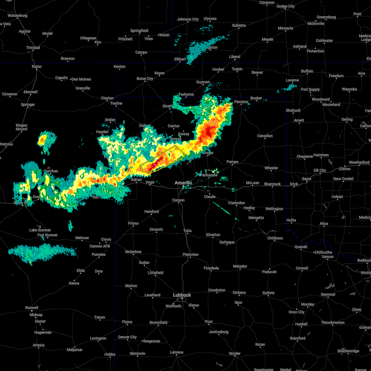 At 815 pm cdt, severe thunderstorms were located along a line extending from masterson to 6 miles north of valley de oro to 10 miles southwest of boys ranch, moving east at 45 mph (radar indicated). Hazards include 70 mph wind gusts and half dollar size hail. Expect some tree damage. damage is likely to mobile homes, roofs, and outbuildings. hail damage to vehicles is expected. locations impacted include, boys ranch, masterson and four way. thunderstorm damage threat, considerable hail threat, radar indicated max hail size, 1. 25 in wind threat, radar indicated max wind gust, 70 mph. At 815 pm cdt, severe thunderstorms were located along a line extending from masterson to 6 miles north of valley de oro to 10 miles southwest of boys ranch, moving east at 45 mph (radar indicated). Hazards include 70 mph wind gusts and half dollar size hail. Expect some tree damage. damage is likely to mobile homes, roofs, and outbuildings. hail damage to vehicles is expected. locations impacted include, boys ranch, masterson and four way. thunderstorm damage threat, considerable hail threat, radar indicated max hail size, 1. 25 in wind threat, radar indicated max wind gust, 70 mph.
|
| 6/9/2022 8:00 PM CDT |
 At 800 pm cdt, severe thunderstorms were located along a line extending from 11 miles southwest of pringle to near masterson to 8 miles west of boys ranch, moving east at 20 mph (radar indicated). Hazards include 70 mph wind gusts and ping pong ball size hail. Expect some tree damage. damage is likely to mobile homes, roofs, and outbuildings. people and animals outdoors will be injured. expect hail damage to roofs, siding, windows, and vehicles. locations impacted include, dumas, channing, boys ranch, masterson and four way. thunderstorm damage threat, considerable hail threat, radar indicated max hail size, 1. 50 in wind threat, radar indicated max wind gust, 70 mph. At 800 pm cdt, severe thunderstorms were located along a line extending from 11 miles southwest of pringle to near masterson to 8 miles west of boys ranch, moving east at 20 mph (radar indicated). Hazards include 70 mph wind gusts and ping pong ball size hail. Expect some tree damage. damage is likely to mobile homes, roofs, and outbuildings. people and animals outdoors will be injured. expect hail damage to roofs, siding, windows, and vehicles. locations impacted include, dumas, channing, boys ranch, masterson and four way. thunderstorm damage threat, considerable hail threat, radar indicated max hail size, 1. 50 in wind threat, radar indicated max wind gust, 70 mph.
|
| 6/9/2022 7:47 PM CDT |
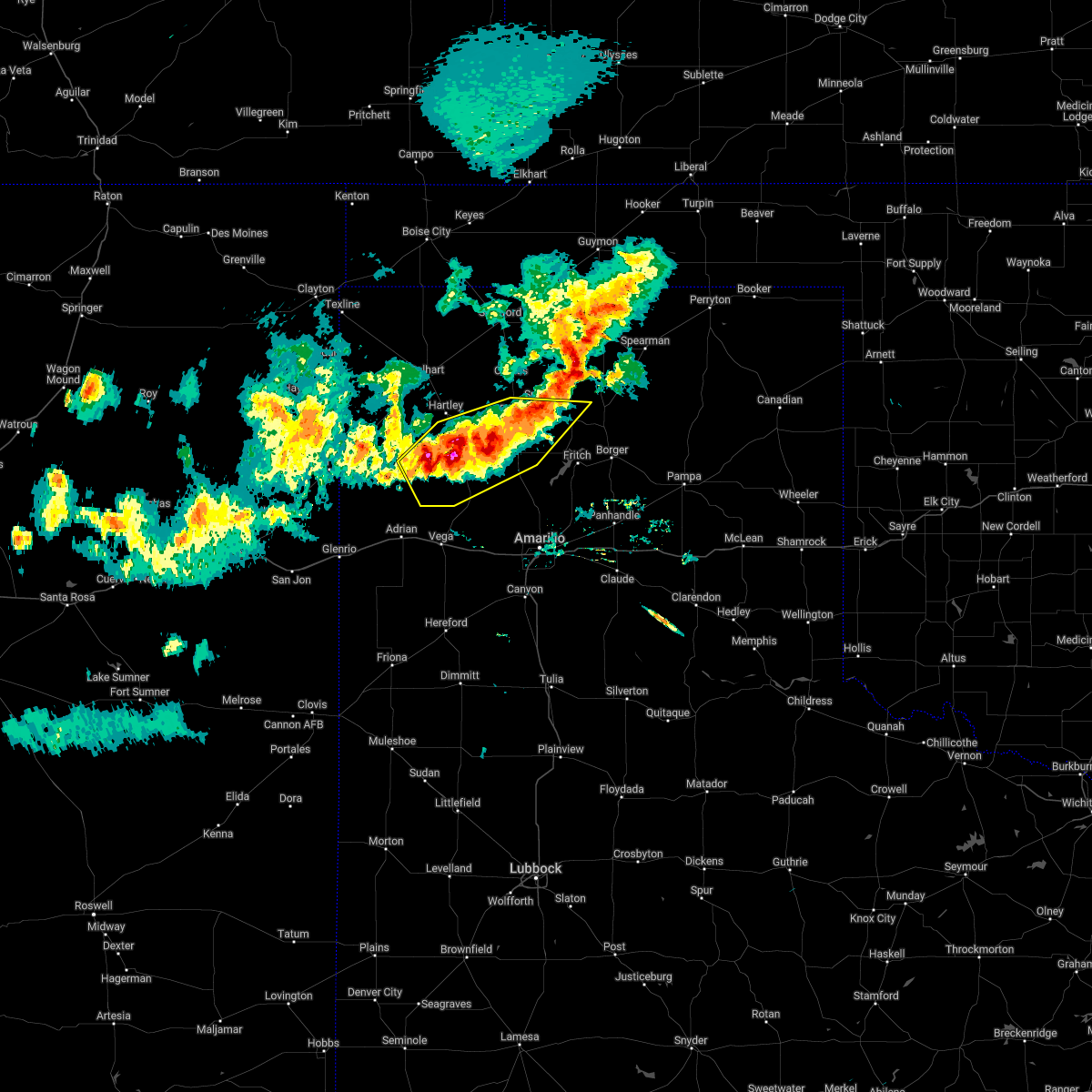 At 745 pm cdt, automated weather equipment 3 miles southeast of dumas reported a 70 mph wind gust. severe thunderstorms were located along a line extending from 11 miles southeast of sunray to 3 miles southwest of four way to 11 miles west of boys ranch, moving east at 25 mph (automated weather equipment). Hazards include 70 mph wind gusts and quarter size hail. Expect some tree damage. damage is likely to mobile homes, roofs, and outbuildings. hail damage to vehicles is expected. locations impacted include, dumas, channing, boys ranch, masterson and four way. thunderstorm damage threat, considerable hail threat, radar indicated max hail size, 1. 00in wind threat, observed max wind gust, 70 mph. At 745 pm cdt, automated weather equipment 3 miles southeast of dumas reported a 70 mph wind gust. severe thunderstorms were located along a line extending from 11 miles southeast of sunray to 3 miles southwest of four way to 11 miles west of boys ranch, moving east at 25 mph (automated weather equipment). Hazards include 70 mph wind gusts and quarter size hail. Expect some tree damage. damage is likely to mobile homes, roofs, and outbuildings. hail damage to vehicles is expected. locations impacted include, dumas, channing, boys ranch, masterson and four way. thunderstorm damage threat, considerable hail threat, radar indicated max hail size, 1. 00in wind threat, observed max wind gust, 70 mph.
|
| 6/9/2022 7:28 PM CDT |
 At 728 pm cdt, severe thunderstorms were located along a line extending from dumas to 8 miles west of four way to 5 miles south of channing, moving southeast at 20 mph (radar indicated). Hazards include 60 mph wind gusts and half dollar size hail. Minor damage to roofs, siding, and trees is possible. Hail damage to vehicles is expected. At 728 pm cdt, severe thunderstorms were located along a line extending from dumas to 8 miles west of four way to 5 miles south of channing, moving southeast at 20 mph (radar indicated). Hazards include 60 mph wind gusts and half dollar size hail. Minor damage to roofs, siding, and trees is possible. Hail damage to vehicles is expected.
|
| 5/10/2022 6:44 PM CDT |
 At 643 pm cdt, severe thunderstorms were located along a line extending from 4 miles east of vega to 4 miles south of washburn, moving northeast at 50 mph (radar indicated). Hazards include golf ball size hail and 70 mph wind gusts. Expect some tree damage. damage is likely to mobile homes, roofs, and outbuildings. people and animals outdoors will be injured. expect hail damage to roofs, siding, windows, and vehicles. locations impacted include, amarillo, canyon, panhandle, vega, lake tanglewood, bushland, valley de oro, washburn, boys ranch, umbarger, wildorado, palo duro canyon, mescalero park, timbercreek canyon and pantex. thunderstorm damage threat, considerable hail threat, radar indicated max hail size, 1. 75 in wind threat, radar indicated max wind gust, 70 mph. At 643 pm cdt, severe thunderstorms were located along a line extending from 4 miles east of vega to 4 miles south of washburn, moving northeast at 50 mph (radar indicated). Hazards include golf ball size hail and 70 mph wind gusts. Expect some tree damage. damage is likely to mobile homes, roofs, and outbuildings. people and animals outdoors will be injured. expect hail damage to roofs, siding, windows, and vehicles. locations impacted include, amarillo, canyon, panhandle, vega, lake tanglewood, bushland, valley de oro, washburn, boys ranch, umbarger, wildorado, palo duro canyon, mescalero park, timbercreek canyon and pantex. thunderstorm damage threat, considerable hail threat, radar indicated max hail size, 1. 75 in wind threat, radar indicated max wind gust, 70 mph.
|
| 5/10/2022 6:29 PM CDT |
 At 629 pm cdt, severe thunderstorms were located along a line extending from 10 miles northeast of simms to palo duro canyon, moving northeast at 50 mph (radar indicated). Hazards include 70 mph wind gusts and ping pong ball size hail. Expect some tree damage. damage is likely to mobile homes, roofs, and outbuildings. people and animals outdoors will be injured. Expect hail damage to roofs, siding, windows, and vehicles. At 629 pm cdt, severe thunderstorms were located along a line extending from 10 miles northeast of simms to palo duro canyon, moving northeast at 50 mph (radar indicated). Hazards include 70 mph wind gusts and ping pong ball size hail. Expect some tree damage. damage is likely to mobile homes, roofs, and outbuildings. people and animals outdoors will be injured. Expect hail damage to roofs, siding, windows, and vehicles.
|
| 5/1/2022 8:30 PM CDT |
 At 830 pm cdt, a severe thunderstorm was located over channing, or 26 miles southwest of dumas, moving east at 10 mph (radar indicated). Hazards include two inch hail and 70 mph wind gusts. Expect some tree damage. damage is likely to mobile homes, roofs, and outbuildings. people and animals outdoors will be injured. expect hail damage to roofs, siding, windows, and vehicles. locations impacted include, channing and boys ranch. thunderstorm damage threat, considerable hail threat, radar indicated max hail size, 2. 00 in wind threat, radar indicated max wind gust, 70 mph. At 830 pm cdt, a severe thunderstorm was located over channing, or 26 miles southwest of dumas, moving east at 10 mph (radar indicated). Hazards include two inch hail and 70 mph wind gusts. Expect some tree damage. damage is likely to mobile homes, roofs, and outbuildings. people and animals outdoors will be injured. expect hail damage to roofs, siding, windows, and vehicles. locations impacted include, channing and boys ranch. thunderstorm damage threat, considerable hail threat, radar indicated max hail size, 2. 00 in wind threat, radar indicated max wind gust, 70 mph.
|
| 5/1/2022 8:08 PM CDT |
 At 808 pm cdt, a severe thunderstorm was located 4 miles west of channing, or 28 miles south of dalhart, moving east at 10 mph (radar indicated). Hazards include ping pong ball size hail and 60 mph wind gusts. Minor damage to roofs, siding, and trees is possible. people and animals outdoors will be injured. Expect hail damage to roofs, siding, windows, and vehicles. At 808 pm cdt, a severe thunderstorm was located 4 miles west of channing, or 28 miles south of dalhart, moving east at 10 mph (radar indicated). Hazards include ping pong ball size hail and 60 mph wind gusts. Minor damage to roofs, siding, and trees is possible. people and animals outdoors will be injured. Expect hail damage to roofs, siding, windows, and vehicles.
|
| 4/27/2022 8:12 PM CDT |
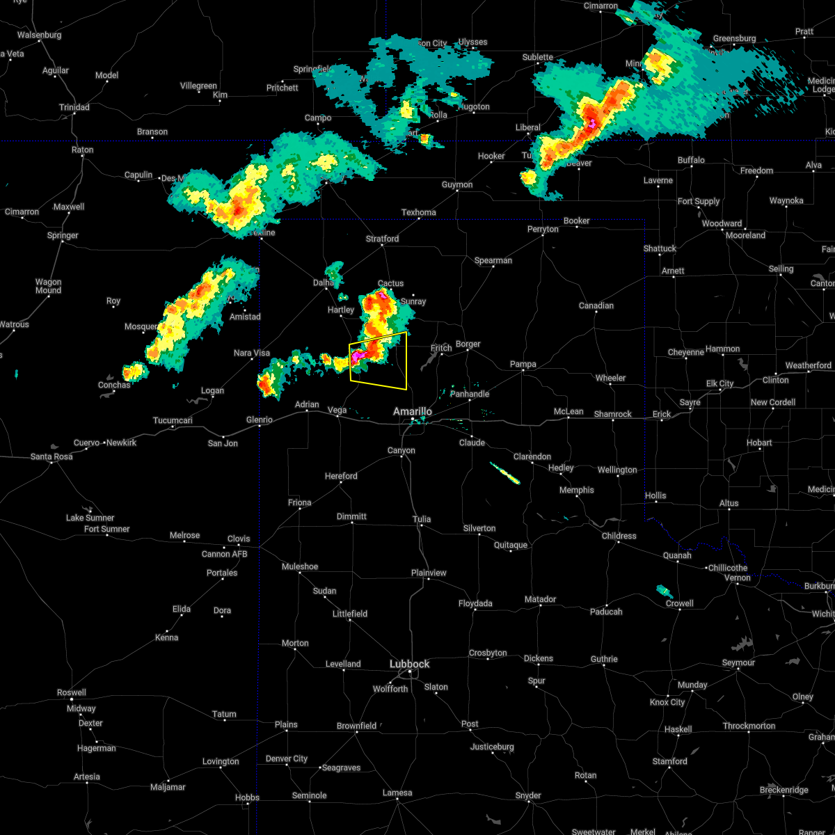 At 812 pm cdt, a severe thunderstorm was located 6 miles northeast of boys ranch, or 22 miles southwest of dumas, moving east at 20 mph (radar indicated). Hazards include ping pong ball size hail and 60 mph wind gusts. Minor damage to roofs, siding, and trees is possible. people and animals outdoors will be injured. Expect hail damage to roofs, siding, windows, and vehicles. At 812 pm cdt, a severe thunderstorm was located 6 miles northeast of boys ranch, or 22 miles southwest of dumas, moving east at 20 mph (radar indicated). Hazards include ping pong ball size hail and 60 mph wind gusts. Minor damage to roofs, siding, and trees is possible. people and animals outdoors will be injured. Expect hail damage to roofs, siding, windows, and vehicles.
|
| 4/22/2022 6:27 PM CDT | Half Dollar sized hail reported 9.9 miles NW of Boys Ranch, TX |
| 4/22/2022 6:25 PM CDT | Quarter sized hail reported 10.3 miles WNW of Boys Ranch, TX |
| 4/22/2022 6:17 PM CDT |
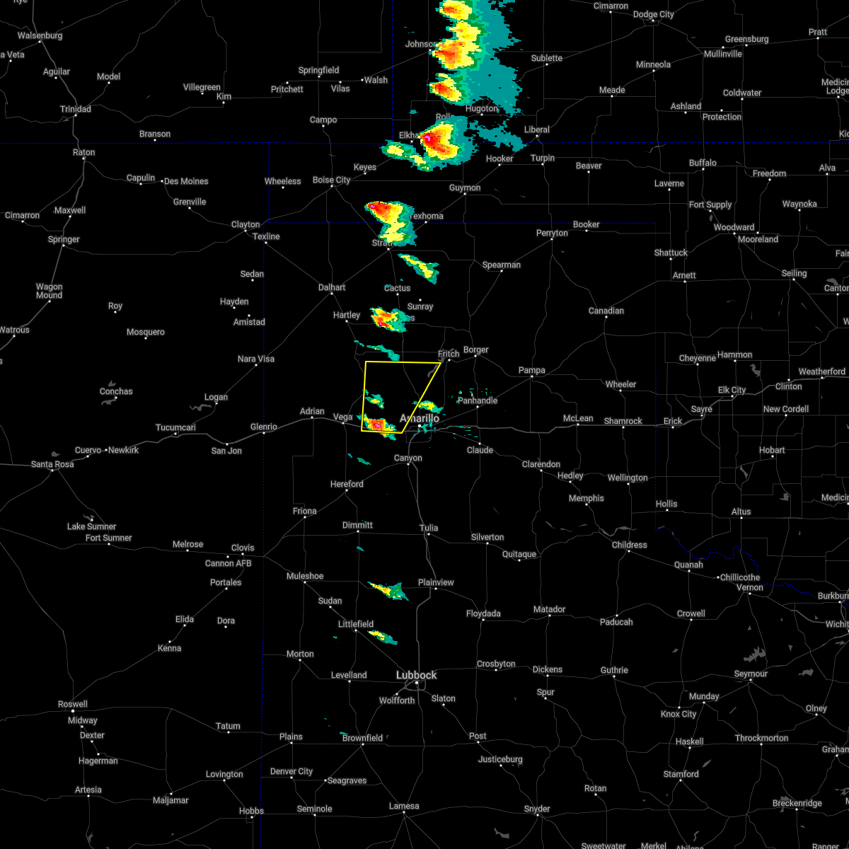 At 617 pm cdt, a severe thunderstorm was located 8 miles northwest of bushland, or 17 miles northwest of amarillo, moving northeast at 55 mph (radar indicated). Hazards include golf ball size hail and 60 mph wind gusts. Minor damage to roofs, siding, and trees is possible. people and animals outdoors will be injured. expect hail damage to roofs, siding, windows, and vehicles. locations impacted include, boys ranch, wildorado, bushland and valley de oro. thunderstorm damage threat, considerable hail threat, radar indicated max hail size, 1. 75 in wind threat, radar indicated max wind gust, 60 mph. At 617 pm cdt, a severe thunderstorm was located 8 miles northwest of bushland, or 17 miles northwest of amarillo, moving northeast at 55 mph (radar indicated). Hazards include golf ball size hail and 60 mph wind gusts. Minor damage to roofs, siding, and trees is possible. people and animals outdoors will be injured. expect hail damage to roofs, siding, windows, and vehicles. locations impacted include, boys ranch, wildorado, bushland and valley de oro. thunderstorm damage threat, considerable hail threat, radar indicated max hail size, 1. 75 in wind threat, radar indicated max wind gust, 60 mph.
|
| 4/22/2022 6:08 PM CDT |
 At 607 pm cdt, a severe thunderstorm was located over wildorado, or 12 miles east of vega, moving northeast at 55 mph (radar indicated). Hazards include 60 mph wind gusts and quarter size hail. Minor damage to roofs, siding, and trees is possible. Hail damage to vehicles is expected. At 607 pm cdt, a severe thunderstorm was located over wildorado, or 12 miles east of vega, moving northeast at 55 mph (radar indicated). Hazards include 60 mph wind gusts and quarter size hail. Minor damage to roofs, siding, and trees is possible. Hail damage to vehicles is expected.
|
| 7/15/2021 5:21 PM CDT |
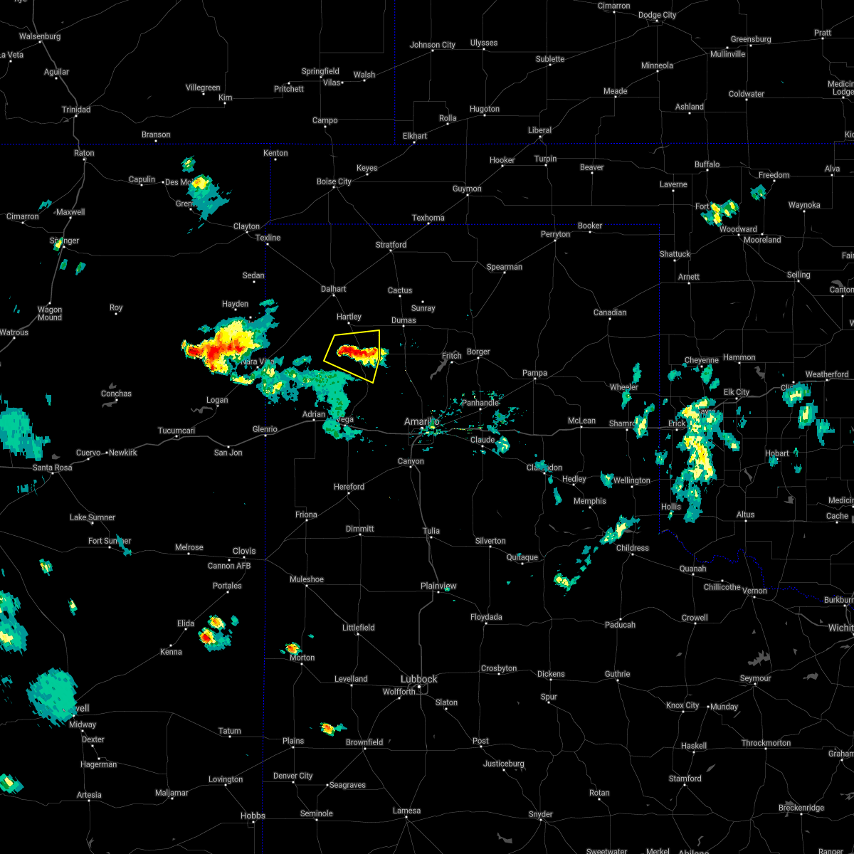 At 521 pm cdt, a severe thunderstorm was located 4 miles northwest of channing, or 24 miles south of dalhart, and is nearly stationary (radar indicated). Hazards include 60 mph wind gusts and quarter size hail. Minor damage to roofs, siding, and trees is possible. hail damage to vehicles is expected. Hail may accumulate on roadways causing hazardous travel. At 521 pm cdt, a severe thunderstorm was located 4 miles northwest of channing, or 24 miles south of dalhart, and is nearly stationary (radar indicated). Hazards include 60 mph wind gusts and quarter size hail. Minor damage to roofs, siding, and trees is possible. hail damage to vehicles is expected. Hail may accumulate on roadways causing hazardous travel.
|
| 7/4/2021 10:40 PM CDT |
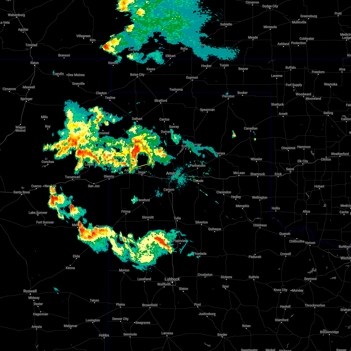 At 1040 pm cdt, a severe thunderstorm was located 12 miles west of channing, or 26 miles north of vega, moving south at 20 mph (radar indicated). Hazards include 70 mph wind gusts and quarter size hail. Expect some tree damage. damage is likely to mobile homes, roofs, and outbuildings. Hail damage to vehicles is expected. At 1040 pm cdt, a severe thunderstorm was located 12 miles west of channing, or 26 miles north of vega, moving south at 20 mph (radar indicated). Hazards include 70 mph wind gusts and quarter size hail. Expect some tree damage. damage is likely to mobile homes, roofs, and outbuildings. Hail damage to vehicles is expected.
|
| 7/4/2021 5:28 PM CDT |
 At 527 pm cdt, a severe thunderstorm was located 9 miles northwest of four way, or 9 miles southwest of dumas, moving southwest at 15 mph (radar indicated). Hazards include 60 mph wind gusts and quarter size hail. Minor damage to roofs, siding, and trees is possible. hail damage to vehicles is expected. Locations impacted include, hartley, channing, boys ranch, masterson, four way and valley de oro. At 527 pm cdt, a severe thunderstorm was located 9 miles northwest of four way, or 9 miles southwest of dumas, moving southwest at 15 mph (radar indicated). Hazards include 60 mph wind gusts and quarter size hail. Minor damage to roofs, siding, and trees is possible. hail damage to vehicles is expected. Locations impacted include, hartley, channing, boys ranch, masterson, four way and valley de oro.
|
| 7/4/2021 5:21 PM CDT |
 At 521 pm cdt, a severe thunderstorm was located 8 miles northwest of four way, or 8 miles southwest of dumas, moving southwest at 10 mph (radar indicated). Hazards include 60 mph wind gusts and half dollar size hail. Minor damage to roofs, siding, and trees is possible. hail damage to vehicles is expected. Locations impacted include, dumas, hartley, channing, four way, valley de oro, boys ranch and masterson. At 521 pm cdt, a severe thunderstorm was located 8 miles northwest of four way, or 8 miles southwest of dumas, moving southwest at 10 mph (radar indicated). Hazards include 60 mph wind gusts and half dollar size hail. Minor damage to roofs, siding, and trees is possible. hail damage to vehicles is expected. Locations impacted include, dumas, hartley, channing, four way, valley de oro, boys ranch and masterson.
|
| 7/4/2021 5:03 PM CDT |
 At 503 pm cdt, a severe thunderstorm was located 5 miles southwest of dumas, moving southwest at 15 mph (radar indicated). Hazards include 60 mph wind gusts and half dollar size hail. Minor damage to roofs, siding, and trees is possible. hail damage to vehicles is expected. Locations impacted include, dumas, hartley, channing, four way, valley de oro, boys ranch and masterson. At 503 pm cdt, a severe thunderstorm was located 5 miles southwest of dumas, moving southwest at 15 mph (radar indicated). Hazards include 60 mph wind gusts and half dollar size hail. Minor damage to roofs, siding, and trees is possible. hail damage to vehicles is expected. Locations impacted include, dumas, hartley, channing, four way, valley de oro, boys ranch and masterson.
|
| 7/4/2021 4:48 PM CDT |
 At 448 pm cdt, a severe thunderstorm was located near dumas, moving southwest at 15 mph (public). Hazards include 60 mph wind gusts and half dollar size hail. Minor damage to roofs, siding, and trees is possible. hail damage to vehicles is expected. Locations impacted include, dumas, hartley, cactus, channing, four way, boys ranch, masterson and valley de oro. At 448 pm cdt, a severe thunderstorm was located near dumas, moving southwest at 15 mph (public). Hazards include 60 mph wind gusts and half dollar size hail. Minor damage to roofs, siding, and trees is possible. hail damage to vehicles is expected. Locations impacted include, dumas, hartley, cactus, channing, four way, boys ranch, masterson and valley de oro.
|
| 7/4/2021 4:40 PM CDT |
 At 440 pm cdt, a severe thunderstorm was located near dumas, moving southwest at 15 mph (radar indicated). Hazards include 60 mph wind gusts and half dollar size hail. Minor damage to roofs, siding, and trees is possible. hail damage to vehicles is expected. Locations impacted include, dumas, hartley, cactus, channing, four way, boys ranch, masterson and valley de oro. At 440 pm cdt, a severe thunderstorm was located near dumas, moving southwest at 15 mph (radar indicated). Hazards include 60 mph wind gusts and half dollar size hail. Minor damage to roofs, siding, and trees is possible. hail damage to vehicles is expected. Locations impacted include, dumas, hartley, cactus, channing, four way, boys ranch, masterson and valley de oro.
|
| 7/4/2021 4:32 PM CDT |
 At 432 pm cdt, a severe thunderstorm was located near dumas, moving southwest at 10 mph (radar indicated). Hazards include 60 mph wind gusts and half dollar size hail. Minor damage to roofs, siding, and trees is possible. Hail damage to vehicles is expected. At 432 pm cdt, a severe thunderstorm was located near dumas, moving southwest at 10 mph (radar indicated). Hazards include 60 mph wind gusts and half dollar size hail. Minor damage to roofs, siding, and trees is possible. Hail damage to vehicles is expected.
|
| 6/25/2021 4:30 PM CDT |
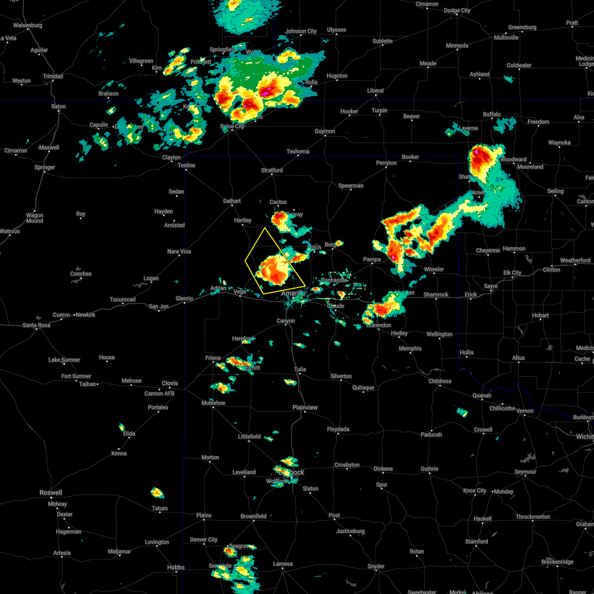 At 430 pm cdt, a severe thunderstorm was located 6 miles east of valley de oro, or 17 miles northwest of amarillo, moving east at 30 mph (radar indicated). Hazards include 70 mph wind gusts and quarter size hail. Expect some tree damage. damage is likely to mobile homes, roofs, and outbuildings. hail damage to vehicles is expected. Locations impacted include, amarillo, boys ranch, masterson and valley de oro. At 430 pm cdt, a severe thunderstorm was located 6 miles east of valley de oro, or 17 miles northwest of amarillo, moving east at 30 mph (radar indicated). Hazards include 70 mph wind gusts and quarter size hail. Expect some tree damage. damage is likely to mobile homes, roofs, and outbuildings. hail damage to vehicles is expected. Locations impacted include, amarillo, boys ranch, masterson and valley de oro.
|
| 6/25/2021 4:18 PM CDT | At 417 pm cdt, a severe thunderstorm was located 7 miles north of valley de oro, or 22 miles south of dumas, moving northeast at 30 mph (radar indicated). Hazards include 70 mph wind gusts and quarter size hail. Expect some tree damage. damage is likely to mobile homes, roofs, and outbuildings. hail damage to vehicles is expected. Locations impacted include, boys ranch and masterson. |
| 6/25/2021 4:06 PM CDT |
 At 406 pm cdt, a severe thunderstorm was located near valley de oro, or 23 miles northeast of vega, moving northeast at 40 mph (radar indicated). Hazards include 70 mph wind gusts and quarter size hail. Expect some tree damage. damage is likely to mobile homes, roofs, and outbuildings. hail damage to vehicles is expected. Locations impacted include, hartley, channing, boys ranch and masterson. At 406 pm cdt, a severe thunderstorm was located near valley de oro, or 23 miles northeast of vega, moving northeast at 40 mph (radar indicated). Hazards include 70 mph wind gusts and quarter size hail. Expect some tree damage. damage is likely to mobile homes, roofs, and outbuildings. hail damage to vehicles is expected. Locations impacted include, hartley, channing, boys ranch and masterson.
|
| 6/25/2021 3:56 PM CDT |
 At 356 pm cdt, a severe thunderstorm was located near boys ranch, or 18 miles northeast of vega, moving northeast at 15 mph (radar indicated). Hazards include 70 mph wind gusts and ping pong ball size hail. Expect some tree damage. damage is likely to mobile homes, roofs, and outbuildings. people and animals outdoors will be injured. Expect hail damage to roofs, siding, windows, and vehicles. At 356 pm cdt, a severe thunderstorm was located near boys ranch, or 18 miles northeast of vega, moving northeast at 15 mph (radar indicated). Hazards include 70 mph wind gusts and ping pong ball size hail. Expect some tree damage. damage is likely to mobile homes, roofs, and outbuildings. people and animals outdoors will be injured. Expect hail damage to roofs, siding, windows, and vehicles.
|
| 6/25/2021 3:29 PM CDT |
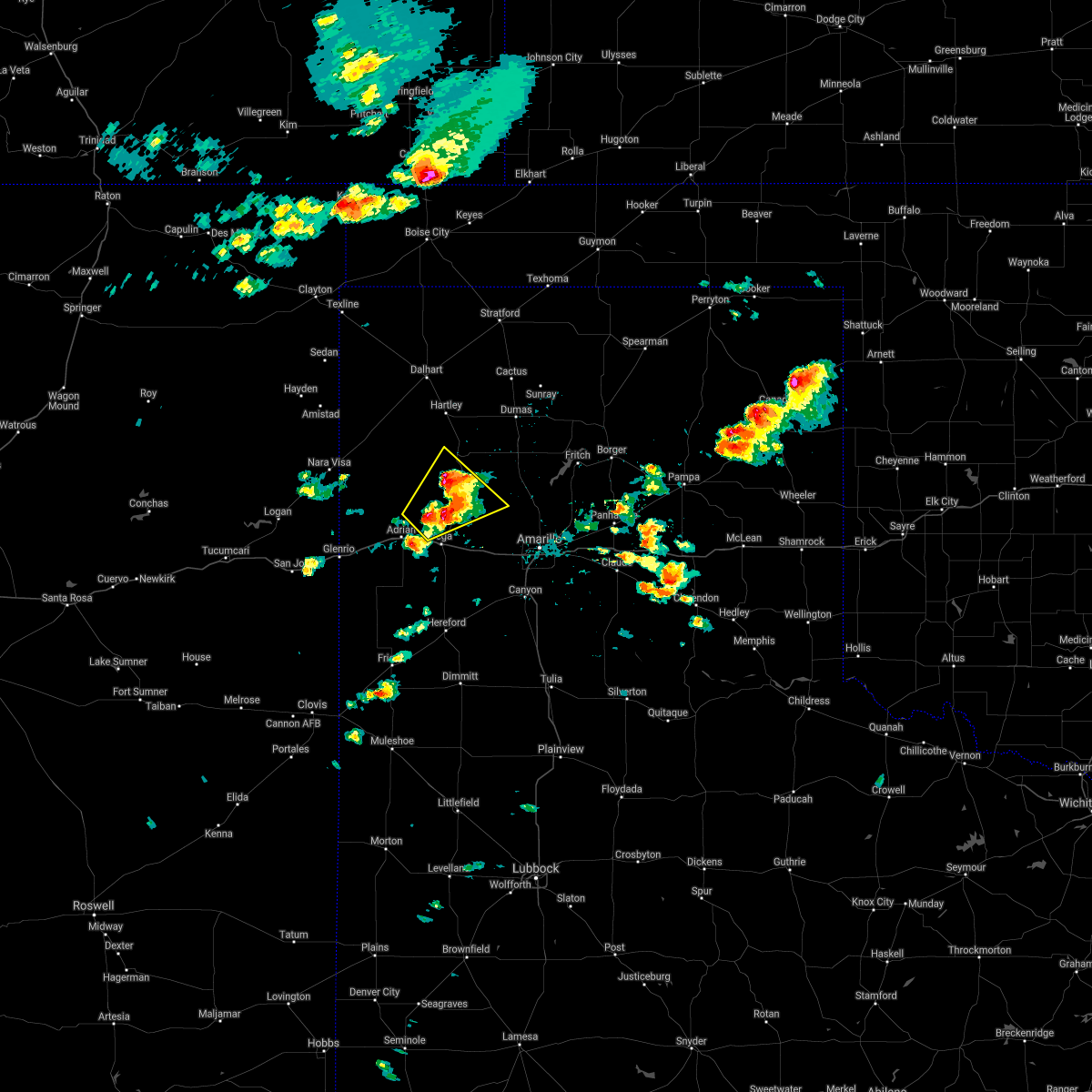 At 329 pm cdt, a severe thunderstorm was located 9 miles north of vega, moving east at 15 mph (radar indicated). Hazards include 70 mph wind gusts and ping pong ball size hail. Expect some tree damage. damage is likely to mobile homes, roofs, and outbuildings. people and animals outdoors will be injured. expect hail damage to roofs, siding, windows, and vehicles. Locations impacted include, boys ranch and valley de oro. At 329 pm cdt, a severe thunderstorm was located 9 miles north of vega, moving east at 15 mph (radar indicated). Hazards include 70 mph wind gusts and ping pong ball size hail. Expect some tree damage. damage is likely to mobile homes, roofs, and outbuildings. people and animals outdoors will be injured. expect hail damage to roofs, siding, windows, and vehicles. Locations impacted include, boys ranch and valley de oro.
|
| 6/25/2021 3:27 PM CDT |
 At 327 pm cdt, a severe thunderstorm was located 8 miles west of boys ranch, or 20 miles north of vega, moving northeast at 30 mph (radar indicated). Hazards include 70 mph wind gusts and quarter size hail. Expect some tree damage. damage is likely to mobile homes, roofs, and outbuildings. Hail damage to vehicles is expected. At 327 pm cdt, a severe thunderstorm was located 8 miles west of boys ranch, or 20 miles north of vega, moving northeast at 30 mph (radar indicated). Hazards include 70 mph wind gusts and quarter size hail. Expect some tree damage. damage is likely to mobile homes, roofs, and outbuildings. Hail damage to vehicles is expected.
|
| 6/25/2021 3:01 PM CDT |
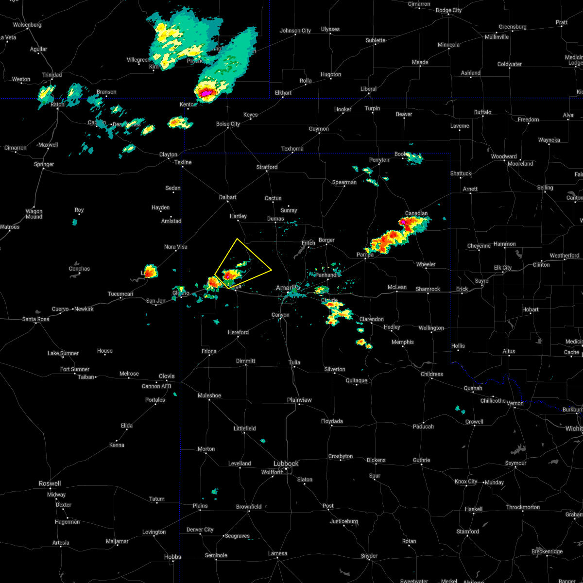 At 301 pm cdt, a severe thunderstorm was located 10 miles northeast of adrian, or 10 miles northwest of vega, moving northeast at 20 mph (radar indicated). Hazards include 60 mph wind gusts and half dollar size hail. Minor damage to roofs, siding, and trees is possible. Hail damage to vehicles is expected. At 301 pm cdt, a severe thunderstorm was located 10 miles northeast of adrian, or 10 miles northwest of vega, moving northeast at 20 mph (radar indicated). Hazards include 60 mph wind gusts and half dollar size hail. Minor damage to roofs, siding, and trees is possible. Hail damage to vehicles is expected.
|
| 6/13/2021 12:49 AM CDT |
 At 1248 am cdt, automated weather equipment reported severe thunderstorms were located along a line extending from 6 miles west of gruver to boys ranch, moving southeast at 40 mph (automated weather equipment measured a 61 mile per hour wind gust at the dumas airport with these storms). Hazards include 60 mph wind gusts and quarter size hail. Minor damage to roofs, siding, and trees is possible. hail damage to vehicles is expected. Locations impacted include, dumas, borger, spearman, cactus, fritch, sunray, stinnett, gruver, channing, sanford, valley de oro, boys ranch, wildorado, pringle, morse, four way, masterson and lake meredith. At 1248 am cdt, automated weather equipment reported severe thunderstorms were located along a line extending from 6 miles west of gruver to boys ranch, moving southeast at 40 mph (automated weather equipment measured a 61 mile per hour wind gust at the dumas airport with these storms). Hazards include 60 mph wind gusts and quarter size hail. Minor damage to roofs, siding, and trees is possible. hail damage to vehicles is expected. Locations impacted include, dumas, borger, spearman, cactus, fritch, sunray, stinnett, gruver, channing, sanford, valley de oro, boys ranch, wildorado, pringle, morse, four way, masterson and lake meredith.
|
| 6/13/2021 12:42 AM CDT |
 The national weather service in amarillo has issued a * severe thunderstorm warning for. northwestern carson county in the panhandle of texas. eastern oldham county in the panhandle of texas. hutchinson county in the panhandle of texas. Potter county in the panhandle of texas. The national weather service in amarillo has issued a * severe thunderstorm warning for. northwestern carson county in the panhandle of texas. eastern oldham county in the panhandle of texas. hutchinson county in the panhandle of texas. Potter county in the panhandle of texas.
|
| 6/13/2021 12:34 AM CDT |
 At 1234 am cdt, severe thunderstorms were located along a line extending from 6 miles northeast of morse to 4 miles southeast of valley de oro, moving southeast at 50 mph (radar indicated). Hazards include 60 mph wind gusts and quarter size hail. Minor damage to roofs, siding, and trees is possible. hail damage to vehicles is expected. Locations impacted include, dumas, hartley, cactus, sunray, stinnett, gruver, channing, morse, four way, boys ranch, masterson and pringle. At 1234 am cdt, severe thunderstorms were located along a line extending from 6 miles northeast of morse to 4 miles southeast of valley de oro, moving southeast at 50 mph (radar indicated). Hazards include 60 mph wind gusts and quarter size hail. Minor damage to roofs, siding, and trees is possible. hail damage to vehicles is expected. Locations impacted include, dumas, hartley, cactus, sunray, stinnett, gruver, channing, morse, four way, boys ranch, masterson and pringle.
|
| 6/13/2021 12:09 AM CDT |
 At 1145 pm cdt, severe thunderstorms were located along a line extending from 8 miles southwest of texhoma to 13 miles west of channing, moving southeast at 50 mph (radar indicated). Hazards include 70 mph wind gusts and quarter size hail. Expect some tree damage. damage is likely to mobile homes, roofs, and outbuildings. Hail damage to vehicles is expected. At 1145 pm cdt, severe thunderstorms were located along a line extending from 8 miles southwest of texhoma to 13 miles west of channing, moving southeast at 50 mph (radar indicated). Hazards include 70 mph wind gusts and quarter size hail. Expect some tree damage. damage is likely to mobile homes, roofs, and outbuildings. Hail damage to vehicles is expected.
|
| 6/12/2021 11:46 PM CDT |
 At 1145 pm cdt, severe thunderstorms were located along a line extending from 8 miles southwest of texhoma to 13 miles west of channing, moving southeast at 50 mph (radar indicated). Hazards include 70 mph wind gusts and quarter size hail. Expect some tree damage. damage is likely to mobile homes, roofs, and outbuildings. Hail damage to vehicles is expected. At 1145 pm cdt, severe thunderstorms were located along a line extending from 8 miles southwest of texhoma to 13 miles west of channing, moving southeast at 50 mph (radar indicated). Hazards include 70 mph wind gusts and quarter size hail. Expect some tree damage. damage is likely to mobile homes, roofs, and outbuildings. Hail damage to vehicles is expected.
|
| 5/30/2021 8:22 PM CDT |
 The severe thunderstorm warning for northeastern oldham, northwestern potter, western moore and eastern hartley counties will expire at 830 pm cdt, the storms which prompted the warning have weakened below severe limits, and no longer pose an immediate threat to life or property. therefore, the warning will be allowed to expire. however small hail, gusty winds and heavy rain are still possible with these thunderstorms. a tornado watch remains in effect until midnight cdt for the panhandle of texas. The severe thunderstorm warning for northeastern oldham, northwestern potter, western moore and eastern hartley counties will expire at 830 pm cdt, the storms which prompted the warning have weakened below severe limits, and no longer pose an immediate threat to life or property. therefore, the warning will be allowed to expire. however small hail, gusty winds and heavy rain are still possible with these thunderstorms. a tornado watch remains in effect until midnight cdt for the panhandle of texas.
|
| 5/30/2021 7:47 PM CDT |
 At 747 pm cdt, severe thunderstorms were located along a line extending from 8 miles north of hartley to 15 miles west of dumas to near channing, moving northeast at 35 mph (radar indicated). Hazards include 60 mph wind gusts and quarter size hail. Minor damage to roofs, siding, and trees is possible. hail damage to vehicles is expected. locations impacted include, dumas, hartley, cactus, channing, masterson and four way. A tornado watch remains in effect until midnight cdt for the panhandle of texas. At 747 pm cdt, severe thunderstorms were located along a line extending from 8 miles north of hartley to 15 miles west of dumas to near channing, moving northeast at 35 mph (radar indicated). Hazards include 60 mph wind gusts and quarter size hail. Minor damage to roofs, siding, and trees is possible. hail damage to vehicles is expected. locations impacted include, dumas, hartley, cactus, channing, masterson and four way. A tornado watch remains in effect until midnight cdt for the panhandle of texas.
|
| 5/30/2021 7:22 PM CDT |
 At 722 pm cdt, severe thunderstorms were located along a line extending from 9 miles southwest of dalhart to 8 miles southwest of hartley to 13 miles southwest of channing, moving northeast at 35 mph (radar indicated). Hazards include 60 mph wind gusts and quarter size hail. Minor damage to roofs, siding, and trees is possible. Hail damage to vehicles is expected. At 722 pm cdt, severe thunderstorms were located along a line extending from 9 miles southwest of dalhart to 8 miles southwest of hartley to 13 miles southwest of channing, moving northeast at 35 mph (radar indicated). Hazards include 60 mph wind gusts and quarter size hail. Minor damage to roofs, siding, and trees is possible. Hail damage to vehicles is expected.
|
| 5/18/2021 6:05 PM CDT |
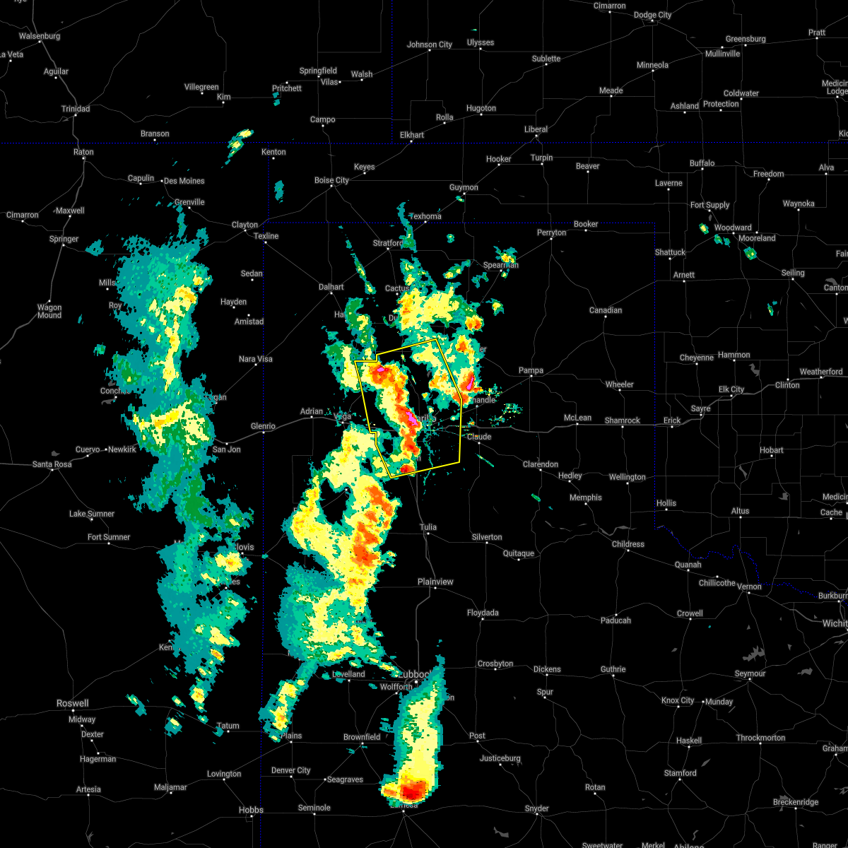 At 604 pm cdt, severe thunderstorms were located along a line extending from 3 miles southwest of masterson to 6 miles south of lake tanglewood, moving east at 20 mph (radar indicated). Hazards include 60 mph wind gusts and quarter size hail. Minor damage to roofs, siding, and trees is possible. hail damage to vehicles is expected. Locations impacted include, amarillo, canyon, lake tanglewood, bushland, valley de oro, washburn, boys ranch, mescalero park, four way, masterson, lake meredith, timbercreek canyon and pantex. At 604 pm cdt, severe thunderstorms were located along a line extending from 3 miles southwest of masterson to 6 miles south of lake tanglewood, moving east at 20 mph (radar indicated). Hazards include 60 mph wind gusts and quarter size hail. Minor damage to roofs, siding, and trees is possible. hail damage to vehicles is expected. Locations impacted include, amarillo, canyon, lake tanglewood, bushland, valley de oro, washburn, boys ranch, mescalero park, four way, masterson, lake meredith, timbercreek canyon and pantex.
|
| 5/18/2021 5:54 PM CDT |
 At 553 pm cdt, severe thunderstorms were located along a line extending from 5 miles northeast of valley de oro to 3 miles north of mescalero park, moving east at 15 mph (radar indicated). Hazards include 60 mph wind gusts and quarter size hail. Minor damage to roofs, siding, and trees is possible. hail damage to vehicles is expected. Locations impacted include, amarillo, canyon, lake tanglewood, bushland, valley de oro, washburn, boys ranch, mescalero park, four way, masterson, lake meredith, timbercreek canyon and pantex. At 553 pm cdt, severe thunderstorms were located along a line extending from 5 miles northeast of valley de oro to 3 miles north of mescalero park, moving east at 15 mph (radar indicated). Hazards include 60 mph wind gusts and quarter size hail. Minor damage to roofs, siding, and trees is possible. hail damage to vehicles is expected. Locations impacted include, amarillo, canyon, lake tanglewood, bushland, valley de oro, washburn, boys ranch, mescalero park, four way, masterson, lake meredith, timbercreek canyon and pantex.
|
| 5/18/2021 5:41 PM CDT |
 At 541 pm cdt, severe thunderstorms were located along a line extending from near valley de oro to 4 miles northwest of mescalero park, moving east at 20 mph (radar indicated). Hazards include 60 mph wind gusts and quarter size hail. Minor damage to roofs, siding, and trees is possible. hail damage to vehicles is expected. Locations impacted include, amarillo, canyon, lake tanglewood, bushland, valley de oro, washburn, boys ranch, mescalero park, four way, masterson, lake meredith, timbercreek canyon and pantex. At 541 pm cdt, severe thunderstorms were located along a line extending from near valley de oro to 4 miles northwest of mescalero park, moving east at 20 mph (radar indicated). Hazards include 60 mph wind gusts and quarter size hail. Minor damage to roofs, siding, and trees is possible. hail damage to vehicles is expected. Locations impacted include, amarillo, canyon, lake tanglewood, bushland, valley de oro, washburn, boys ranch, mescalero park, four way, masterson, lake meredith, timbercreek canyon and pantex.
|
| 5/18/2021 5:32 PM CDT |
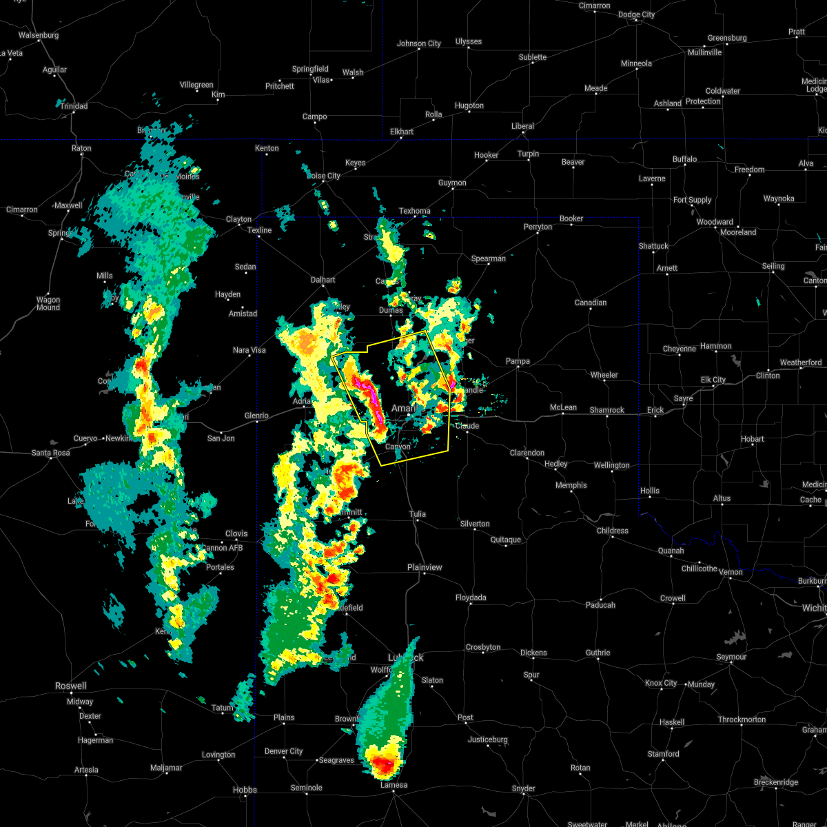 At 532 pm cdt, severe thunderstorms were located along a line extending from valley de oro to 4 miles northwest of mescalero park, moving east at 20 mph (radar indicated). Hazards include 60 mph wind gusts and half dollar size hail. Minor damage to roofs, siding, and trees is possible. hail damage to vehicles is expected. Locations impacted include, amarillo, canyon, lake tanglewood, bushland, valley de oro, washburn, boys ranch, mescalero park, four way, masterson, lake meredith, timbercreek canyon and pantex. At 532 pm cdt, severe thunderstorms were located along a line extending from valley de oro to 4 miles northwest of mescalero park, moving east at 20 mph (radar indicated). Hazards include 60 mph wind gusts and half dollar size hail. Minor damage to roofs, siding, and trees is possible. hail damage to vehicles is expected. Locations impacted include, amarillo, canyon, lake tanglewood, bushland, valley de oro, washburn, boys ranch, mescalero park, four way, masterson, lake meredith, timbercreek canyon and pantex.
|
| 5/18/2021 5:19 PM CDT |
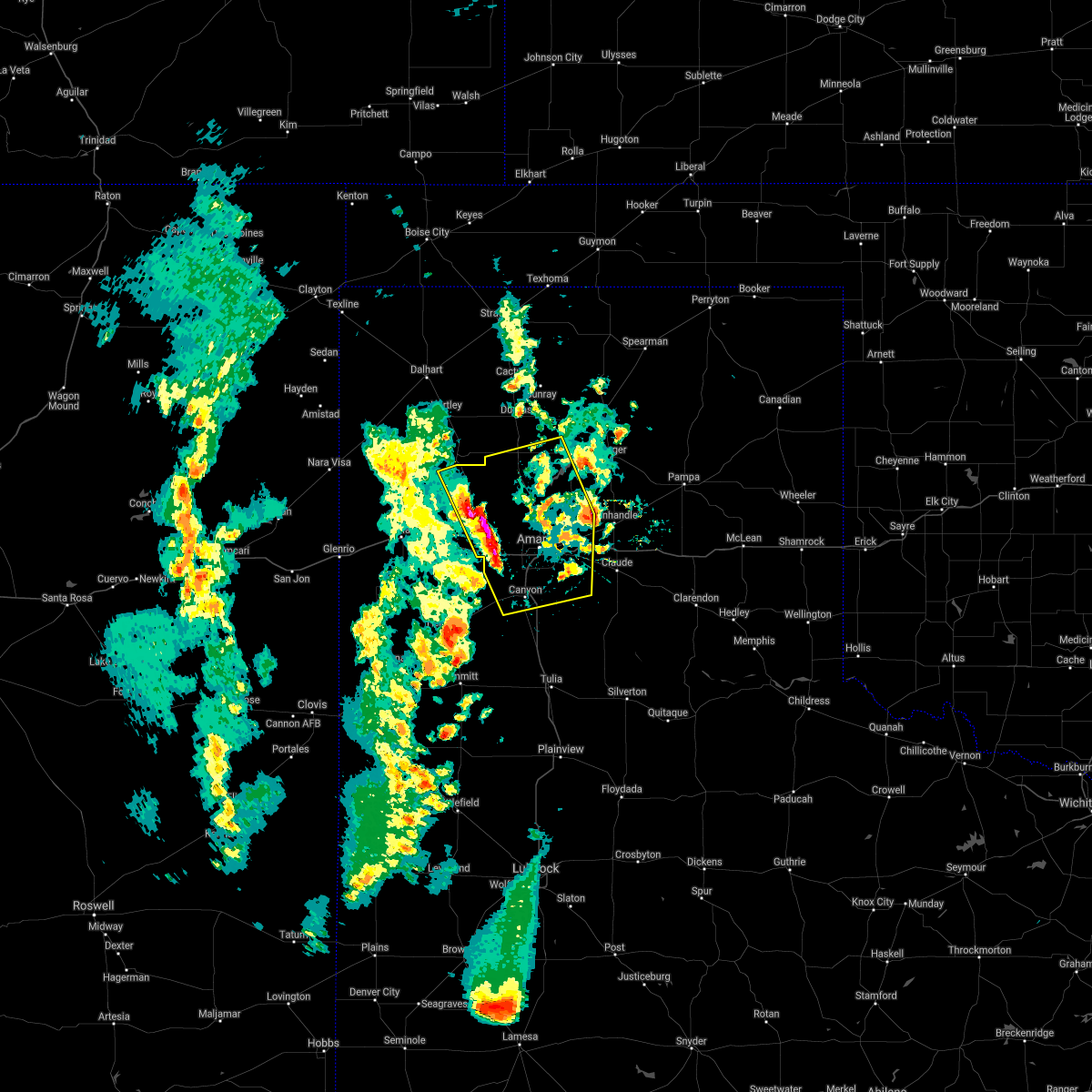 At 519 pm cdt, severe thunderstorms were located along a line extending from 6 miles west of valley de oro to 4 miles south of bushland, moving east at 20 mph (radar indicated). Hazards include 60 mph wind gusts and half dollar size hail. Minor damage to roofs, siding, and trees is possible. Hail damage to vehicles is expected. At 519 pm cdt, severe thunderstorms were located along a line extending from 6 miles west of valley de oro to 4 miles south of bushland, moving east at 20 mph (radar indicated). Hazards include 60 mph wind gusts and half dollar size hail. Minor damage to roofs, siding, and trees is possible. Hail damage to vehicles is expected.
|
| 5/18/2021 5:12 PM CDT |
 At 512 pm cdt, a severe thunderstorm was located 8 miles south of boys ranch, or 14 miles northeast of vega, moving northeast at 20 mph (radar indicated). Hazards include 60 mph wind gusts and half dollar size hail. Minor damage to roofs, siding, and trees is possible. hail damage to vehicles is expected. Locations impacted include, vega, boys ranch, wildorado and valley de oro. At 512 pm cdt, a severe thunderstorm was located 8 miles south of boys ranch, or 14 miles northeast of vega, moving northeast at 20 mph (radar indicated). Hazards include 60 mph wind gusts and half dollar size hail. Minor damage to roofs, siding, and trees is possible. hail damage to vehicles is expected. Locations impacted include, vega, boys ranch, wildorado and valley de oro.
|
| 5/18/2021 5:06 PM CDT |
 At 505 pm cdt, a severe thunderstorm was located 8 miles north of wildorado, or 13 miles northeast of vega, moving east at 20 mph (radar indicated). Hazards include 60 mph wind gusts and half dollar size hail. Minor damage to roofs, siding, and trees is possible. hail damage to vehicles is expected. Locations impacted include, vega, boys ranch, wildorado and valley de oro. At 505 pm cdt, a severe thunderstorm was located 8 miles north of wildorado, or 13 miles northeast of vega, moving east at 20 mph (radar indicated). Hazards include 60 mph wind gusts and half dollar size hail. Minor damage to roofs, siding, and trees is possible. hail damage to vehicles is expected. Locations impacted include, vega, boys ranch, wildorado and valley de oro.
|
| 5/18/2021 4:54 PM CDT |
 At 454 pm cdt, a severe thunderstorm was located 7 miles north of wildorado, or 10 miles northeast of vega, moving east at 20 mph (radar indicated). Hazards include 60 mph wind gusts and half dollar size hail. Minor damage to roofs, siding, and trees is possible. hail damage to vehicles is expected. Locations impacted include, vega, boys ranch, wildorado and valley de oro. At 454 pm cdt, a severe thunderstorm was located 7 miles north of wildorado, or 10 miles northeast of vega, moving east at 20 mph (radar indicated). Hazards include 60 mph wind gusts and half dollar size hail. Minor damage to roofs, siding, and trees is possible. hail damage to vehicles is expected. Locations impacted include, vega, boys ranch, wildorado and valley de oro.
|
| 5/18/2021 4:46 PM CDT |
 At 446 pm cdt, a severe thunderstorm was located 6 miles northwest of wildorado, or 7 miles northeast of vega, moving east at 25 mph (radar indicated). Hazards include 60 mph wind gusts and quarter size hail. Minor damage to roofs, siding, and trees is possible. hail damage to vehicles is expected. Locations impacted include, vega, boys ranch, wildorado and valley de oro. At 446 pm cdt, a severe thunderstorm was located 6 miles northwest of wildorado, or 7 miles northeast of vega, moving east at 25 mph (radar indicated). Hazards include 60 mph wind gusts and quarter size hail. Minor damage to roofs, siding, and trees is possible. hail damage to vehicles is expected. Locations impacted include, vega, boys ranch, wildorado and valley de oro.
|
| 5/18/2021 4:39 PM CDT |
 At 439 pm cdt, a severe thunderstorm was located 5 miles northeast of vega, moving northeast at 25 mph (radar indicated). Hazards include 60 mph wind gusts and quarter size hail. Minor damage to roofs, siding, and trees is possible. hail damage to vehicles is expected. Locations impacted include, vega, boys ranch, wildorado and valley de oro. At 439 pm cdt, a severe thunderstorm was located 5 miles northeast of vega, moving northeast at 25 mph (radar indicated). Hazards include 60 mph wind gusts and quarter size hail. Minor damage to roofs, siding, and trees is possible. hail damage to vehicles is expected. Locations impacted include, vega, boys ranch, wildorado and valley de oro.
|
| 5/18/2021 4:29 PM CDT |
 At 429 pm cdt, a severe thunderstorm was located near vega, moving northeast at 20 mph (radar indicated). Hazards include 60 mph wind gusts and quarter size hail. Minor damage to roofs, siding, and trees is possible. hail damage to vehicles is expected. Locations impacted include, vega, boys ranch, wildorado and valley de oro. At 429 pm cdt, a severe thunderstorm was located near vega, moving northeast at 20 mph (radar indicated). Hazards include 60 mph wind gusts and quarter size hail. Minor damage to roofs, siding, and trees is possible. hail damage to vehicles is expected. Locations impacted include, vega, boys ranch, wildorado and valley de oro.
|
| 5/18/2021 4:19 PM CDT |
 At 419 pm cdt, a severe thunderstorm was located 4 miles northwest of vega, moving northeast at 20 mph (radar indicated). Hazards include 70 mph wind gusts and ping pong ball size hail. Expect some tree damage. damage is likely to mobile homes, roofs, and outbuildings. people and animals outdoors will be injured. expect hail damage to roofs, siding, windows, and vehicles. Locations impacted include, vega, boys ranch, wildorado and valley de oro. At 419 pm cdt, a severe thunderstorm was located 4 miles northwest of vega, moving northeast at 20 mph (radar indicated). Hazards include 70 mph wind gusts and ping pong ball size hail. Expect some tree damage. damage is likely to mobile homes, roofs, and outbuildings. people and animals outdoors will be injured. expect hail damage to roofs, siding, windows, and vehicles. Locations impacted include, vega, boys ranch, wildorado and valley de oro.
|
| 5/18/2021 4:10 PM CDT |
 At 409 pm cdt, a severe thunderstorm was located 6 miles east of adrian, or 7 miles west of vega, moving northeast at 20 mph (radar indicated). Hazards include 70 mph wind gusts and half dollar size hail. Expect some tree damage. damage is likely to mobile homes, roofs, and outbuildings. hail damage to vehicles is expected. Locations impacted include, vega, boys ranch, wildorado and valley de oro. At 409 pm cdt, a severe thunderstorm was located 6 miles east of adrian, or 7 miles west of vega, moving northeast at 20 mph (radar indicated). Hazards include 70 mph wind gusts and half dollar size hail. Expect some tree damage. damage is likely to mobile homes, roofs, and outbuildings. hail damage to vehicles is expected. Locations impacted include, vega, boys ranch, wildorado and valley de oro.
|
| 5/18/2021 4:00 PM CDT |
 At 359 pm cdt, a severe thunderstorm was located 7 miles southeast of adrian, or 8 miles west of vega, moving northeast at 25 mph (radar indicated). Hazards include 60 mph wind gusts and quarter size hail. Minor damage to roofs, siding, and trees is possible. Hail damage to vehicles is expected. At 359 pm cdt, a severe thunderstorm was located 7 miles southeast of adrian, or 8 miles west of vega, moving northeast at 25 mph (radar indicated). Hazards include 60 mph wind gusts and quarter size hail. Minor damage to roofs, siding, and trees is possible. Hail damage to vehicles is expected.
|
| 5/17/2021 7:51 PM CDT |
 At 751 pm cdt, a severe thunderstorm was located over channing, or 26 miles southwest of dumas, moving north at 20 mph (radar indicated). Hazards include golf ball size hail and 70 mph wind gusts. Expect some tree damage. damage is likely to mobile homes, roofs, and outbuildings. people and animals outdoors will be injured. expect hail damage to roofs, siding, windows, and vehicles. locations impacted include, dalhart, hartley, channing and boys ranch. A tornado watch remains in effect until 1100 pm cdt for the panhandle of texas. At 751 pm cdt, a severe thunderstorm was located over channing, or 26 miles southwest of dumas, moving north at 20 mph (radar indicated). Hazards include golf ball size hail and 70 mph wind gusts. Expect some tree damage. damage is likely to mobile homes, roofs, and outbuildings. people and animals outdoors will be injured. expect hail damage to roofs, siding, windows, and vehicles. locations impacted include, dalhart, hartley, channing and boys ranch. A tornado watch remains in effect until 1100 pm cdt for the panhandle of texas.
|
| 5/17/2021 7:50 PM CDT |
 At 750 pm cdt, severe thunderstorms were located along a line extending from 5 miles northwest of hartley to 4 miles west of boys ranch, moving east at 35 mph (radar indicated). Hazards include 70 mph wind gusts and ping pong ball size hail. Expect some tree damage. damage is likely to mobile homes, roofs, and outbuildings. people and animals outdoors will be injured. expect hail damage to roofs, siding, windows, and vehicles. locations impacted include, dalhart, hartley, channing and boys ranch. A tornado watch remains in effect until 1100 pm cdt for the panhandle of texas. At 750 pm cdt, severe thunderstorms were located along a line extending from 5 miles northwest of hartley to 4 miles west of boys ranch, moving east at 35 mph (radar indicated). Hazards include 70 mph wind gusts and ping pong ball size hail. Expect some tree damage. damage is likely to mobile homes, roofs, and outbuildings. people and animals outdoors will be injured. expect hail damage to roofs, siding, windows, and vehicles. locations impacted include, dalhart, hartley, channing and boys ranch. A tornado watch remains in effect until 1100 pm cdt for the panhandle of texas.
|
| 5/17/2021 7:36 PM CDT | Golf Ball sized hail reported 1.6 miles N of Boys Ranch, TX |
| 5/17/2021 7:26 PM CDT | Ping Pong Ball sized hail reported 1.6 miles N of Boys Ranch, TX |
| 5/17/2021 7:19 PM CDT |
 At 719 pm cdt, a severe thunderstorm was located near boys ranch, or 20 miles north of vega, moving north at 30 mph (radar indicated). Hazards include tennis ball size hail and 70 mph wind gusts. Expect some tree damage. damage is likely to mobile homes, roofs, and outbuildings. people and animals outdoors will be injured. expect hail damage to roofs, siding, windows, and vehicles. locations impacted include, dalhart, hartley, channing, boys ranch and romero. A tornado watch remains in effect until 1100 pm cdt for the panhandle of texas. At 719 pm cdt, a severe thunderstorm was located near boys ranch, or 20 miles north of vega, moving north at 30 mph (radar indicated). Hazards include tennis ball size hail and 70 mph wind gusts. Expect some tree damage. damage is likely to mobile homes, roofs, and outbuildings. people and animals outdoors will be injured. expect hail damage to roofs, siding, windows, and vehicles. locations impacted include, dalhart, hartley, channing, boys ranch and romero. A tornado watch remains in effect until 1100 pm cdt for the panhandle of texas.
|
| 5/17/2021 7:15 PM CDT |
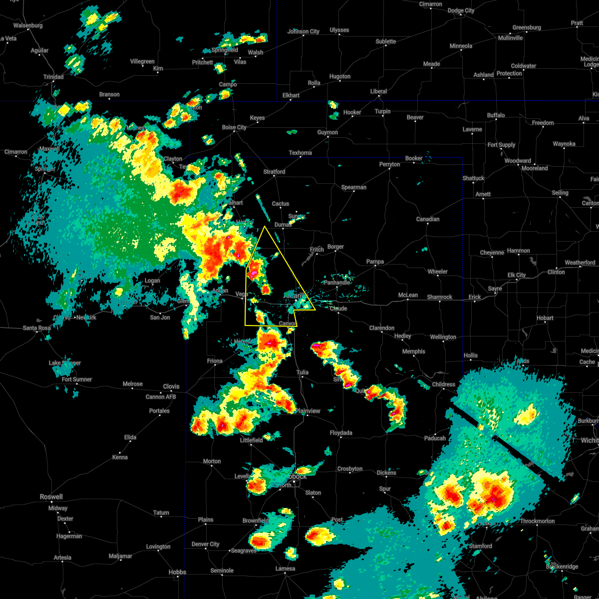 At 715 pm cdt, severe thunderstorms were located along a line extending from 3 miles west of boys ranch to 8 miles northeast of wildorado to 10 miles northwest of umbarger, moving north at 30 mph (radar indicated). Hazards include golf ball size hail and 60 mph wind gusts. Minor damage to roofs, siding, and trees is possible. people and animals outdoors will be injured. Expect hail damage to roofs, siding, windows, and vehicles. At 715 pm cdt, severe thunderstorms were located along a line extending from 3 miles west of boys ranch to 8 miles northeast of wildorado to 10 miles northwest of umbarger, moving north at 30 mph (radar indicated). Hazards include golf ball size hail and 60 mph wind gusts. Minor damage to roofs, siding, and trees is possible. people and animals outdoors will be injured. Expect hail damage to roofs, siding, windows, and vehicles.
|
| 5/17/2021 6:42 PM CDT |
 At 641 pm cdt, a severe thunderstorm was located 17 miles east of romero, or 25 miles east of nara visa, moving north at 20 mph (radar indicated). Hazards include golf ball size hail and 70 mph wind gusts. Expect some tree damage. damage is likely to mobile homes, roofs, and outbuildings. people and animals outdoors will be injured. Expect hail damage to roofs, siding, windows, and vehicles. At 641 pm cdt, a severe thunderstorm was located 17 miles east of romero, or 25 miles east of nara visa, moving north at 20 mph (radar indicated). Hazards include golf ball size hail and 70 mph wind gusts. Expect some tree damage. damage is likely to mobile homes, roofs, and outbuildings. people and animals outdoors will be injured. Expect hail damage to roofs, siding, windows, and vehicles.
|
| 5/7/2021 5:38 PM CDT |
 At 538 pm cdt, severe thunderstorms were located along a line extending from 5 miles southwest of valley de oro to 5 miles southeast of wildorado to 6 miles north of hereford, moving east at 45 mph (radar indicated). Hazards include 60 mph wind gusts and quarter size hail. Minor damage to roofs, siding, and trees is possible. Hail damage to vehicles is expected. At 538 pm cdt, severe thunderstorms were located along a line extending from 5 miles southwest of valley de oro to 5 miles southeast of wildorado to 6 miles north of hereford, moving east at 45 mph (radar indicated). Hazards include 60 mph wind gusts and quarter size hail. Minor damage to roofs, siding, and trees is possible. Hail damage to vehicles is expected.
|
| 3/13/2021 3:30 PM CST |
 At 329 pm cst, severe thunderstorms were located along a line extending from 7 miles west of dumas to valley de oro to 3 miles northeast of wildorado, moving northeast at 40 mph (radar indicated). Hazards include 60 mph wind gusts and half dollar size hail. Minor damage to roofs, siding, and trees is possible. Hail damage to vehicles is expected. At 329 pm cst, severe thunderstorms were located along a line extending from 7 miles west of dumas to valley de oro to 3 miles northeast of wildorado, moving northeast at 40 mph (radar indicated). Hazards include 60 mph wind gusts and half dollar size hail. Minor damage to roofs, siding, and trees is possible. Hail damage to vehicles is expected.
|
| 3/13/2021 2:53 PM CST |
 At 253 pm cst, severe thunderstorms were located along a line extending from 13 miles southwest of boys ranch to 8 miles southwest of vega to 4 miles southeast of simms, moving northeast at 50 mph (radar indicated). Hazards include ping pong ball size hail and 60 mph wind gusts. Minor damage to roofs, siding, and trees is possible. people and animals outdoors will be injured. expect hail damage to roofs, siding, windows, and vehicles. locations impacted include, vega, adrian, boys ranch and simms. A tornado watch remains in effect until 600 pm cst for the panhandle of texas. At 253 pm cst, severe thunderstorms were located along a line extending from 13 miles southwest of boys ranch to 8 miles southwest of vega to 4 miles southeast of simms, moving northeast at 50 mph (radar indicated). Hazards include ping pong ball size hail and 60 mph wind gusts. Minor damage to roofs, siding, and trees is possible. people and animals outdoors will be injured. expect hail damage to roofs, siding, windows, and vehicles. locations impacted include, vega, adrian, boys ranch and simms. A tornado watch remains in effect until 600 pm cst for the panhandle of texas.
|
| 3/13/2021 2:24 PM CST |
 At 224 pm cst, a severe thunderstorm was located near simms, or 20 miles southwest of vega, moving northeast at 40 mph (radar indicated). Hazards include 60 mph wind gusts and half dollar size hail. Minor damage to roofs, siding, and trees is possible. Hail damage to vehicles is expected. At 224 pm cst, a severe thunderstorm was located near simms, or 20 miles southwest of vega, moving northeast at 40 mph (radar indicated). Hazards include 60 mph wind gusts and half dollar size hail. Minor damage to roofs, siding, and trees is possible. Hail damage to vehicles is expected.
|
| 8/29/2020 8:08 PM CDT | Quarter sized hail reported 10.7 miles NW of Boys Ranch, TX, late report of quarter size hail. |
| 8/29/2020 7:45 PM CDT |
 At 744 pm cdt, a severe thunderstorm was located 6 miles south of valley de oro, or 18 miles northwest of amarillo, moving east at 20 mph (trained weather spotters. at 744 pm cdt, trained spotters reported ping pong ball size hail 6 miles south of valley de oro). Hazards include ping pong ball size hail and 60 mph wind gusts. accumulating hail is also possible. Minor damage to roofs, siding, and trees is possible. people and animals outdoors will be injured. expect hail damage to roofs, siding, windows, and vehicles. hail may accumulate on roadways causing hazardous travel. Locations impacted include, boys ranch and valley de oro. At 744 pm cdt, a severe thunderstorm was located 6 miles south of valley de oro, or 18 miles northwest of amarillo, moving east at 20 mph (trained weather spotters. at 744 pm cdt, trained spotters reported ping pong ball size hail 6 miles south of valley de oro). Hazards include ping pong ball size hail and 60 mph wind gusts. accumulating hail is also possible. Minor damage to roofs, siding, and trees is possible. people and animals outdoors will be injured. expect hail damage to roofs, siding, windows, and vehicles. hail may accumulate on roadways causing hazardous travel. Locations impacted include, boys ranch and valley de oro.
|
| 8/29/2020 7:43 PM CDT | Ping Pong Ball sized hail reported 14.2 miles NW of Boys Ranch, TX, hail reported on fm 1061. |
| 8/29/2020 7:37 PM CDT |
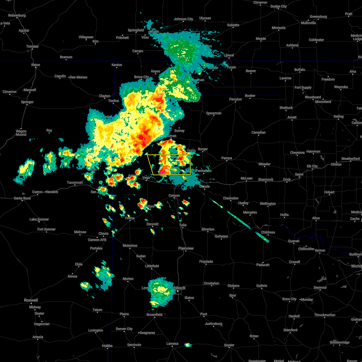 At 736 pm cdt, a severe thunderstorm was located 5 miles south of valley de oro, or 18 miles northeast of vega, moving east at 20 mph (radar indicated). Hazards include ping pong ball size hail and 60 mph wind gusts. accumulating hail is also possible. Minor damage to roofs, siding, and trees is possible. people and animals outdoors will be injured. expect hail damage to roofs, siding, windows, and vehicles. hail may accumulate on roadways causing hazardous travel. Locations impacted include, boys ranch and valley de oro. At 736 pm cdt, a severe thunderstorm was located 5 miles south of valley de oro, or 18 miles northeast of vega, moving east at 20 mph (radar indicated). Hazards include ping pong ball size hail and 60 mph wind gusts. accumulating hail is also possible. Minor damage to roofs, siding, and trees is possible. people and animals outdoors will be injured. expect hail damage to roofs, siding, windows, and vehicles. hail may accumulate on roadways causing hazardous travel. Locations impacted include, boys ranch and valley de oro.
|
| 8/29/2020 7:33 PM CDT |
 At 733 pm cdt, a severe thunderstorm was located 4 miles south of valley de oro, or 20 miles northeast of vega, moving east at 25 mph (radar indicated). Hazards include ping pong ball size hail and 60 mph wind gusts. Minor damage to roofs, siding, and trees is possible. people and animals outdoors will be injured. expect hail damage to roofs, siding, windows, and vehicles. Locations impacted include, boys ranch and valley de oro. At 733 pm cdt, a severe thunderstorm was located 4 miles south of valley de oro, or 20 miles northeast of vega, moving east at 25 mph (radar indicated). Hazards include ping pong ball size hail and 60 mph wind gusts. Minor damage to roofs, siding, and trees is possible. people and animals outdoors will be injured. expect hail damage to roofs, siding, windows, and vehicles. Locations impacted include, boys ranch and valley de oro.
|
| 8/29/2020 7:20 PM CDT |
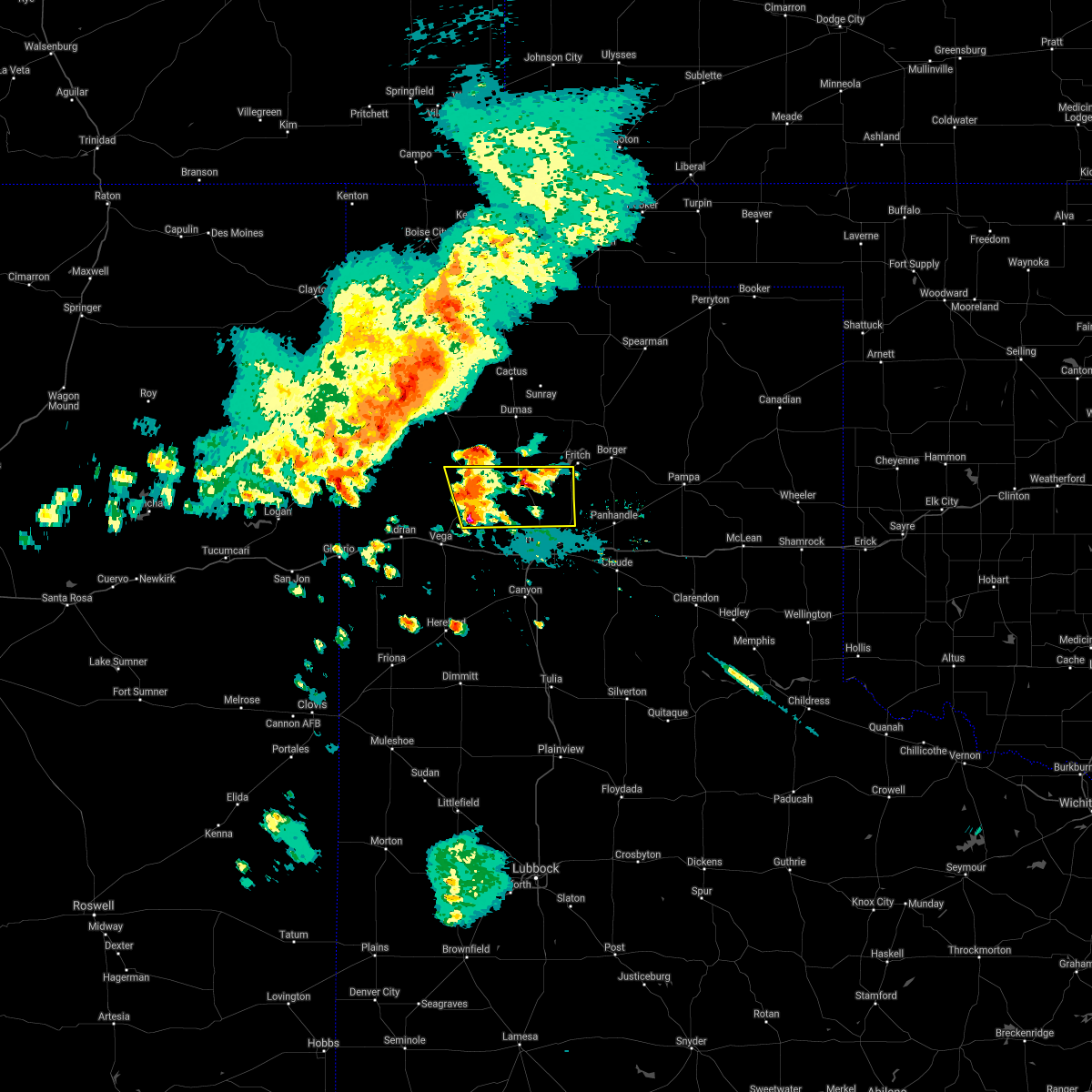 At 720 pm cdt, a severe thunderstorm was located 7 miles southwest of valley de oro, or 15 miles northeast of vega, moving east at 25 mph (radar indicated). Hazards include 60 mph wind gusts and half dollar size hail. Minor damage to roofs, siding, and trees is possible. Hail damage to vehicles is expected. At 720 pm cdt, a severe thunderstorm was located 7 miles southwest of valley de oro, or 15 miles northeast of vega, moving east at 25 mph (radar indicated). Hazards include 60 mph wind gusts and half dollar size hail. Minor damage to roofs, siding, and trees is possible. Hail damage to vehicles is expected.
|
| 8/29/2020 7:08 PM CDT |
 At 655 pm cdt, severe thunderstorms were located along a line extending from 13 miles southeast of felt to 8 miles southwest of ware to 8 miles southeast of amistad, moving east at 35 mph (radar indicated). Hazards include 60 mph wind gusts and quarter size hail. Minor damage to roofs, siding, and trees is possible. Hail damage to vehicles is expected. At 655 pm cdt, severe thunderstorms were located along a line extending from 13 miles southeast of felt to 8 miles southwest of ware to 8 miles southeast of amistad, moving east at 35 mph (radar indicated). Hazards include 60 mph wind gusts and quarter size hail. Minor damage to roofs, siding, and trees is possible. Hail damage to vehicles is expected.
|
| 8/29/2020 6:55 PM CDT |
 At 655 pm cdt, severe thunderstorms were located along a line extending from 13 miles southeast of felt to 8 miles southwest of ware to 8 miles southeast of amistad, moving east at 35 mph (radar indicated). Hazards include 60 mph wind gusts and quarter size hail. Minor damage to roofs, siding, and trees is possible. Hail damage to vehicles is expected. At 655 pm cdt, severe thunderstorms were located along a line extending from 13 miles southeast of felt to 8 miles southwest of ware to 8 miles southeast of amistad, moving east at 35 mph (radar indicated). Hazards include 60 mph wind gusts and quarter size hail. Minor damage to roofs, siding, and trees is possible. Hail damage to vehicles is expected.
|
| 8/9/2020 9:24 PM CDT |
 At 923 pm cdt, severe thunderstorms were located along a line extending from 19 miles northwest of vega to 4 miles west of adrian, moving east at 10 mph (radar indicated). Hazards include 70 mph wind gusts and quarter size hail. Expect some tree damage. damage is likely to mobile homes, roofs, and outbuildings. hail damage to vehicles is expected. Locations impacted include, vega, adrian and boys ranch. At 923 pm cdt, severe thunderstorms were located along a line extending from 19 miles northwest of vega to 4 miles west of adrian, moving east at 10 mph (radar indicated). Hazards include 70 mph wind gusts and quarter size hail. Expect some tree damage. damage is likely to mobile homes, roofs, and outbuildings. hail damage to vehicles is expected. Locations impacted include, vega, adrian and boys ranch.
|
| 8/9/2020 9:16 PM CDT |
 At 916 pm cdt, severe thunderstorms were located along a line extending from 19 miles northwest of vega to 5 miles west of adrian, moving southeast at 10 mph (radar indicated). Hazards include 70 mph wind gusts and quarter size hail. Expect some tree damage. damage is likely to mobile homes, roofs, and outbuildings. hail damage to vehicles is expected. Locations impacted include, vega, channing, adrian and boys ranch. At 916 pm cdt, severe thunderstorms were located along a line extending from 19 miles northwest of vega to 5 miles west of adrian, moving southeast at 10 mph (radar indicated). Hazards include 70 mph wind gusts and quarter size hail. Expect some tree damage. damage is likely to mobile homes, roofs, and outbuildings. hail damage to vehicles is expected. Locations impacted include, vega, channing, adrian and boys ranch.
|
| 8/9/2020 9:01 PM CDT |
 At 845 pm cdt, severe thunderstorms were located along a line extending from 17 miles southeast of romero to 10 miles northwest of adrian, moving east at 10 mph (radar indicated). Hazards include 70 mph wind gusts and ping pong ball size hail. Expect some tree damage. damage is likely to mobile homes, roofs, and outbuildings. people and animals outdoors will be injured. Expect hail damage to roofs, siding, windows, and vehicles. At 845 pm cdt, severe thunderstorms were located along a line extending from 17 miles southeast of romero to 10 miles northwest of adrian, moving east at 10 mph (radar indicated). Hazards include 70 mph wind gusts and ping pong ball size hail. Expect some tree damage. damage is likely to mobile homes, roofs, and outbuildings. people and animals outdoors will be injured. Expect hail damage to roofs, siding, windows, and vehicles.
|
| 8/9/2020 8:46 PM CDT |
 At 845 pm cdt, severe thunderstorms were located along a line extending from 17 miles southeast of romero to 10 miles northwest of adrian, moving east at 10 mph (radar indicated). Hazards include 70 mph wind gusts and ping pong ball size hail. Expect some tree damage. damage is likely to mobile homes, roofs, and outbuildings. people and animals outdoors will be injured. Expect hail damage to roofs, siding, windows, and vehicles. At 845 pm cdt, severe thunderstorms were located along a line extending from 17 miles southeast of romero to 10 miles northwest of adrian, moving east at 10 mph (radar indicated). Hazards include 70 mph wind gusts and ping pong ball size hail. Expect some tree damage. damage is likely to mobile homes, roofs, and outbuildings. people and animals outdoors will be injured. Expect hail damage to roofs, siding, windows, and vehicles.
|
| 7/18/2020 7:27 PM CDT |
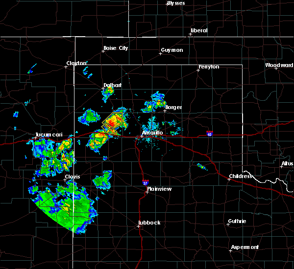 At 727 pm cdt, a severe thunderstorm was located 8 miles southwest of boys ranch, or 12 miles north of vega, moving east at 15 mph (radar indicated). Hazards include 60 mph wind gusts and quarter size hail. Minor damage to roofs, siding, and trees is possible. hail damage to vehicles is expected. Locations impacted include, boys ranch. At 727 pm cdt, a severe thunderstorm was located 8 miles southwest of boys ranch, or 12 miles north of vega, moving east at 15 mph (radar indicated). Hazards include 60 mph wind gusts and quarter size hail. Minor damage to roofs, siding, and trees is possible. hail damage to vehicles is expected. Locations impacted include, boys ranch.
|
| 7/18/2020 7:07 PM CDT |
 At 706 pm cdt, a severe thunderstorm was located 10 miles southwest of boys ranch, or 13 miles north of vega, moving northeast at 15 mph (radar indicated). Hazards include 60 mph wind gusts and quarter size hail. Minor damage to roofs, siding, and trees is possible. Hail damage to vehicles is expected. At 706 pm cdt, a severe thunderstorm was located 10 miles southwest of boys ranch, or 13 miles north of vega, moving northeast at 15 mph (radar indicated). Hazards include 60 mph wind gusts and quarter size hail. Minor damage to roofs, siding, and trees is possible. Hail damage to vehicles is expected.
|
| 7/4/2020 10:54 PM CDT |
 At 1054 pm cdt, severe thunderstorms were located along a line extending from 5 miles south of hartley to 4 miles northwest of vega, moving east at 30 mph (radar indicated). Hazards include 60 mph wind gusts. Minor damage to roofs, siding, and trees is possible. Locations impacted include, vega, hartley, channing, adrian, boys ranch and wildorado. At 1054 pm cdt, severe thunderstorms were located along a line extending from 5 miles south of hartley to 4 miles northwest of vega, moving east at 30 mph (radar indicated). Hazards include 60 mph wind gusts. Minor damage to roofs, siding, and trees is possible. Locations impacted include, vega, hartley, channing, adrian, boys ranch and wildorado.
|
| 7/4/2020 10:26 PM CDT |
 At 1025 pm cdt, a severe thunderstorm was located 16 miles southwest of channing, or 25 miles northwest of vega, moving east at 40 mph (radar indicated). Hazards include 70 mph wind gusts. Expect some tree damage. damage is likely to mobile homes, roofs, and outbuildings. Locations impacted include, vega, hartley, channing, adrian, boys ranch, wildorado and romero. At 1025 pm cdt, a severe thunderstorm was located 16 miles southwest of channing, or 25 miles northwest of vega, moving east at 40 mph (radar indicated). Hazards include 70 mph wind gusts. Expect some tree damage. damage is likely to mobile homes, roofs, and outbuildings. Locations impacted include, vega, hartley, channing, adrian, boys ranch, wildorado and romero.
|
| 7/4/2020 10:14 PM CDT |
 At 1013 pm cdt, a severe thunderstorm was located 14 miles southeast of romero, or 18 miles east of nara visa, moving east at 40 mph (radar indicated). Hazards include 60 mph wind gusts. minor damage to roofs, siding, and trees is possible At 1013 pm cdt, a severe thunderstorm was located 14 miles southeast of romero, or 18 miles east of nara visa, moving east at 40 mph (radar indicated). Hazards include 60 mph wind gusts. minor damage to roofs, siding, and trees is possible
|
| 6/22/2020 9:22 PM CDT |
 The severe thunderstorm warning for eastern oldham county will expire at 930 pm cdt, the storms which prompted the warning have moved out of the area. therefore, the warning will be allowed to expire. a severe thunderstorm watch remains in effect until 1100 pm cdt for the panhandle of texas. The severe thunderstorm warning for eastern oldham county will expire at 930 pm cdt, the storms which prompted the warning have moved out of the area. therefore, the warning will be allowed to expire. a severe thunderstorm watch remains in effect until 1100 pm cdt for the panhandle of texas.
|
| 6/22/2020 8:05 PM CDT |
 At 804 pm cdt, severe thunderstorms were located along a line extending from boys ranch to 4 miles southwest of adrian, moving southeast at 40 mph. these are very dangerous storms (trained weather spotters). Hazards include 80 mph wind gusts and golf ball size hail. Flying debris will be dangerous to those caught without shelter. mobile homes could be heavily damaged. expect considerable damage to roofs, windows, and vehicles. tree damage and power outages are possible. people and animals outdoors will be injured. Expect hail damage to roofs, siding, windows, and vehicles. At 804 pm cdt, severe thunderstorms were located along a line extending from boys ranch to 4 miles southwest of adrian, moving southeast at 40 mph. these are very dangerous storms (trained weather spotters). Hazards include 80 mph wind gusts and golf ball size hail. Flying debris will be dangerous to those caught without shelter. mobile homes could be heavily damaged. expect considerable damage to roofs, windows, and vehicles. tree damage and power outages are possible. people and animals outdoors will be injured. Expect hail damage to roofs, siding, windows, and vehicles.
|
| 6/22/2020 7:39 PM CDT | Storm damage reported in oldham county TX, 1 miles ENE of Boys Ranch, TX |
| 6/22/2020 7:39 PM CDT |
 At 739 pm cdt, a severe thunderstorm was located 7 miles northeast of vega, moving southeast at 10 mph. this is a very dangerous storm (trained weather spotters). Hazards include three inch hail and 60 mph wind gusts. People and animals outdoors will be severely injured. expect shattered windows, extensive damage to roofs, siding, and vehicles. Locations impacted include, vega, boys ranch and wildorado. At 739 pm cdt, a severe thunderstorm was located 7 miles northeast of vega, moving southeast at 10 mph. this is a very dangerous storm (trained weather spotters). Hazards include three inch hail and 60 mph wind gusts. People and animals outdoors will be severely injured. expect shattered windows, extensive damage to roofs, siding, and vehicles. Locations impacted include, vega, boys ranch and wildorado.
|
| 6/22/2020 6:57 PM CDT |
 At 656 pm cdt, a severe thunderstorm was located 11 miles north of vega, moving east at 5 mph (radar indicated). Hazards include ping pong ball size hail and 60 mph wind gusts. Minor damage to roofs, siding, and trees is possible. people and animals outdoors will be injured. Expect hail damage to roofs, siding, windows, and vehicles. At 656 pm cdt, a severe thunderstorm was located 11 miles north of vega, moving east at 5 mph (radar indicated). Hazards include ping pong ball size hail and 60 mph wind gusts. Minor damage to roofs, siding, and trees is possible. people and animals outdoors will be injured. Expect hail damage to roofs, siding, windows, and vehicles.
|
| 4/22/2020 2:33 AM CDT |
 At 233 am cdt, a severe thunderstorm was located 9 miles east of channing, or 19 miles southwest of dumas, moving east at 30 mph (radar indicated). Hazards include ping pong ball size hail. People and animals outdoors will be injured. expect damage to roofs, siding, windows, and vehicles. Locations impacted include, channing, four way and masterson. At 233 am cdt, a severe thunderstorm was located 9 miles east of channing, or 19 miles southwest of dumas, moving east at 30 mph (radar indicated). Hazards include ping pong ball size hail. People and animals outdoors will be injured. expect damage to roofs, siding, windows, and vehicles. Locations impacted include, channing, four way and masterson.
|
| 4/22/2020 2:11 AM CDT |
 At 155 am cdt, a severe thunderstorm was located 6 miles southwest of channing, or 24 miles north of vega, moving northeast at 35 mph (radar indicated). Hazards include ping pong ball size hail. People and animals outdoors will be injured. Expect damage to roofs, siding, windows, and vehicles. At 155 am cdt, a severe thunderstorm was located 6 miles southwest of channing, or 24 miles north of vega, moving northeast at 35 mph (radar indicated). Hazards include ping pong ball size hail. People and animals outdoors will be injured. Expect damage to roofs, siding, windows, and vehicles.
|
| 4/22/2020 1:55 AM CDT |
 At 155 am cdt, a severe thunderstorm was located 6 miles southwest of channing, or 24 miles north of vega, moving northeast at 35 mph (radar indicated). Hazards include ping pong ball size hail. People and animals outdoors will be injured. Expect damage to roofs, siding, windows, and vehicles. At 155 am cdt, a severe thunderstorm was located 6 miles southwest of channing, or 24 miles north of vega, moving northeast at 35 mph (radar indicated). Hazards include ping pong ball size hail. People and animals outdoors will be injured. Expect damage to roofs, siding, windows, and vehicles.
|
| 9/19/2019 4:32 PM CDT |
 At 431 pm cdt, a severe thunderstorm was located over dumas, and northwest of boys ranch, moving north to northeast at 25 mph (radar indicated). Hazards include 60 mph wind gusts and half dollar size hail. Minor damage to roofs, siding, and trees is possible. hail damage to vehicles is expected. Locations impacted include, dumas, cactus, sunray, channing, four way, boys ranch and masterson. At 431 pm cdt, a severe thunderstorm was located over dumas, and northwest of boys ranch, moving north to northeast at 25 mph (radar indicated). Hazards include 60 mph wind gusts and half dollar size hail. Minor damage to roofs, siding, and trees is possible. hail damage to vehicles is expected. Locations impacted include, dumas, cactus, sunray, channing, four way, boys ranch and masterson.
|
| 9/19/2019 4:00 PM CDT |
 At 400 pm cdt, a severe thunderstorm was located 5 miles west of four way, or 14 miles southwest of dumas, moving north at 25 mph (radar indicated). Hazards include 60 mph wind gusts and half dollar size hail. Minor damage to roofs, siding, and trees is possible. Hail damage to vehicles is expected. At 400 pm cdt, a severe thunderstorm was located 5 miles west of four way, or 14 miles southwest of dumas, moving north at 25 mph (radar indicated). Hazards include 60 mph wind gusts and half dollar size hail. Minor damage to roofs, siding, and trees is possible. Hail damage to vehicles is expected.
|
| 9/19/2019 3:27 PM CDT |
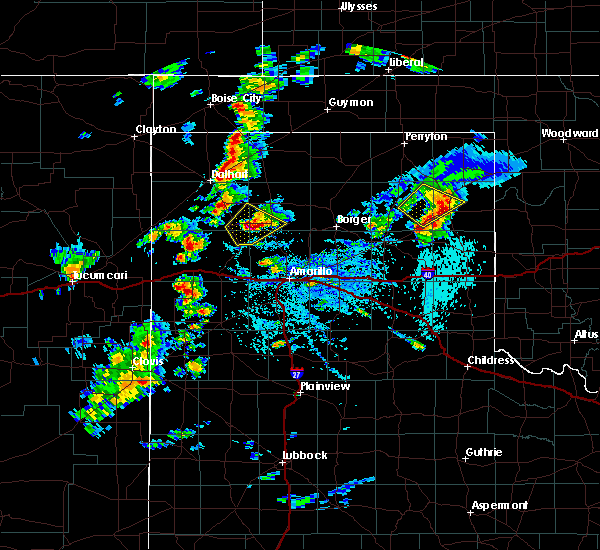 At 327 pm cdt, a severe thunderstorm was located 8 miles west of four way, or 14 miles southwest of dumas, moving northeast at 10 mph (radar indicated). Hazards include golf ball size hail and 60 mph wind gusts. Minor damage to roofs, siding, and trees is possible. people and animals outdoors will be injured. expect hail damage to roofs, siding, windows, and vehicles. Locations impacted include, channing, boys ranch, masterson and four way. At 327 pm cdt, a severe thunderstorm was located 8 miles west of four way, or 14 miles southwest of dumas, moving northeast at 10 mph (radar indicated). Hazards include golf ball size hail and 60 mph wind gusts. Minor damage to roofs, siding, and trees is possible. people and animals outdoors will be injured. expect hail damage to roofs, siding, windows, and vehicles. Locations impacted include, channing, boys ranch, masterson and four way.
|
| 9/19/2019 3:14 PM CDT |
 At 314 pm cdt, a severe thunderstorm was located 10 miles west of four way, or 17 miles southwest of dumas, moving northeast at 10 mph (radar indicated). Hazards include ping pong ball size hail and 60 mph wind gusts. Minor damage to roofs, siding, and trees is possible. people and animals outdoors will be injured. expect hail damage to roofs, siding, windows, and vehicles. Locations impacted include, channing, boys ranch, masterson and four way. At 314 pm cdt, a severe thunderstorm was located 10 miles west of four way, or 17 miles southwest of dumas, moving northeast at 10 mph (radar indicated). Hazards include ping pong ball size hail and 60 mph wind gusts. Minor damage to roofs, siding, and trees is possible. people and animals outdoors will be injured. expect hail damage to roofs, siding, windows, and vehicles. Locations impacted include, channing, boys ranch, masterson and four way.
|
| 9/19/2019 3:01 PM CDT |
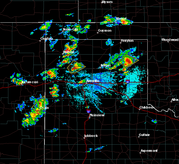 At 301 pm cdt, a severe thunderstorm was located 9 miles northeast of boys ranch, or 19 miles southwest of dumas, moving northeast at 10 mph (radar indicated). Hazards include 60 mph wind gusts and half dollar size hail. Minor damage to roofs, siding, and trees is possible. Hail damage to vehicles is expected. At 301 pm cdt, a severe thunderstorm was located 9 miles northeast of boys ranch, or 19 miles southwest of dumas, moving northeast at 10 mph (radar indicated). Hazards include 60 mph wind gusts and half dollar size hail. Minor damage to roofs, siding, and trees is possible. Hail damage to vehicles is expected.
|
| 8/31/2019 9:30 PM CDT |
 A severe thunderstorm warning remains in effect until 1015 pm cdt for eastern oldham county. at 928 pm cdt, a severe thunderstorm was located 9 miles north of vega, moving east at 10 mph. hazard. 60 mph wind gusts and half dollar size hail. source. Radar indicated. A severe thunderstorm warning remains in effect until 1015 pm cdt for eastern oldham county. at 928 pm cdt, a severe thunderstorm was located 9 miles north of vega, moving east at 10 mph. hazard. 60 mph wind gusts and half dollar size hail. source. Radar indicated.
|
| 8/31/2019 9:15 PM CDT |
 The national weather service in amarillo has issued a * severe thunderstorm warning for. eastern oldham county in the panhandle of texas. northwestern potter county in the panhandle of texas. until 1015 pm cdt. At 915 pm cdt, a severe thunderstorm was located 9 miles north of. The national weather service in amarillo has issued a * severe thunderstorm warning for. eastern oldham county in the panhandle of texas. northwestern potter county in the panhandle of texas. until 1015 pm cdt. At 915 pm cdt, a severe thunderstorm was located 9 miles north of.
|
| 8/23/2019 8:10 PM CDT |
 At 810 pm cdt, severe thunderstorms were located along a line extending from 4 miles north of sunray to 7 miles west of dumas to 5 miles west of channing, moving south at 35 mph (radar indicated). Hazards include 60 mph wind gusts and quarter size hail. Minor damage to roofs, siding, and trees is possible. Hail damage to vehicles is expected. At 810 pm cdt, severe thunderstorms were located along a line extending from 4 miles north of sunray to 7 miles west of dumas to 5 miles west of channing, moving south at 35 mph (radar indicated). Hazards include 60 mph wind gusts and quarter size hail. Minor damage to roofs, siding, and trees is possible. Hail damage to vehicles is expected.
|
| 8/12/2019 8:56 PM CDT |
 At 856 pm cdt, a severe thunderstorm was located near boys ranch, or 18 miles northeast of vega, moving east at 10 mph (radar indicated). Hazards include 60 mph wind gusts and penny size hail. minor damage to roofs, siding, and trees is possible At 856 pm cdt, a severe thunderstorm was located near boys ranch, or 18 miles northeast of vega, moving east at 10 mph (radar indicated). Hazards include 60 mph wind gusts and penny size hail. minor damage to roofs, siding, and trees is possible
|
| 8/12/2019 8:12 PM CDT |
 The severe thunderstorm warning for northeastern oldham and southeastern hartley counties will expire at 815 pm cdt, the storm which prompted the warning has weakened below severe limits, and no longer poses an immediate threat to life or property. therefore, the warning will be allowed to expire. however small hail and heavy rain are still possible with this thunderstorm. The severe thunderstorm warning for northeastern oldham and southeastern hartley counties will expire at 815 pm cdt, the storm which prompted the warning has weakened below severe limits, and no longer poses an immediate threat to life or property. therefore, the warning will be allowed to expire. however small hail and heavy rain are still possible with this thunderstorm.
|
| 8/12/2019 7:51 PM CDT |
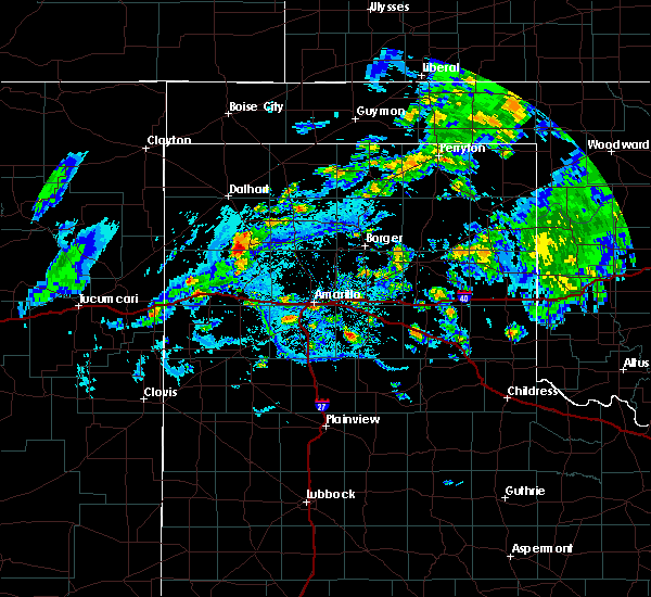 At 750 pm cdt, a severe thunderstorm was located 5 miles west of channing, or 27 miles south of dalhart, and is moving southeast at 5 mph (radar indicated). Hazards include 70 mph wind gusts and quarter size hail. Expect some tree damage. damage is likely to mobile homes, roofs, and outbuildings. hail damage to vehicles is expected. Locations impacted include, channing and boys ranch. At 750 pm cdt, a severe thunderstorm was located 5 miles west of channing, or 27 miles south of dalhart, and is moving southeast at 5 mph (radar indicated). Hazards include 70 mph wind gusts and quarter size hail. Expect some tree damage. damage is likely to mobile homes, roofs, and outbuildings. hail damage to vehicles is expected. Locations impacted include, channing and boys ranch.
|
| 8/12/2019 7:30 PM CDT |
 At 729 pm cdt, a severe thunderstorm was located 5 miles west of channing, or 26 miles south of dalhart, and is nearly stationary (radar indicated). Hazards include 70 mph wind gusts and half dollar size hail. Expect some tree damage. damage is likely to mobile homes, roofs, and outbuildings. Hail damage to vehicles is expected. At 729 pm cdt, a severe thunderstorm was located 5 miles west of channing, or 26 miles south of dalhart, and is nearly stationary (radar indicated). Hazards include 70 mph wind gusts and half dollar size hail. Expect some tree damage. damage is likely to mobile homes, roofs, and outbuildings. Hail damage to vehicles is expected.
|
| 7/10/2019 6:33 PM CDT |
 At 632 pm cdt, a severe thunderstorm was located 5 miles north of valley de oro, or 23 miles south of dumas, moving northwest at 25 mph (radar indicated). Hazards include 60 mph wind gusts and quarter size hail. Minor damage to roofs, siding, and trees is possible. hail damage to vehicles is expected. Locations impacted include, channing, boys ranch and valley de oro. At 632 pm cdt, a severe thunderstorm was located 5 miles north of valley de oro, or 23 miles south of dumas, moving northwest at 25 mph (radar indicated). Hazards include 60 mph wind gusts and quarter size hail. Minor damage to roofs, siding, and trees is possible. hail damage to vehicles is expected. Locations impacted include, channing, boys ranch and valley de oro.
|
| 7/10/2019 6:17 PM CDT |
 A severe thunderstorm warning remains in effect until 700 pm cdt for northeastern oldham. northwestern potter. southwestern moore and southeastern hartley counties. at 617 pm cdt, a severe thunderstorm was located 6 miles northwest of boys ranch, or 23 miles north of vega, moving north at 15 mph. hazard. 60 mph wind gusts and quarter size hail. A severe thunderstorm warning remains in effect until 700 pm cdt for northeastern oldham. northwestern potter. southwestern moore and southeastern hartley counties. at 617 pm cdt, a severe thunderstorm was located 6 miles northwest of boys ranch, or 23 miles north of vega, moving north at 15 mph. hazard. 60 mph wind gusts and quarter size hail.
|
| 7/10/2019 5:54 PM CDT |
 At 553 pm cdt, a severe thunderstorm was located over valley de oro, or 20 miles northeast of vega, moving northwest at 15 mph (radar indicated). Hazards include 60 mph wind gusts and quarter size hail. Minor damage to roofs, siding, and trees is possible. Hail damage to vehicles is expected. At 553 pm cdt, a severe thunderstorm was located over valley de oro, or 20 miles northeast of vega, moving northwest at 15 mph (radar indicated). Hazards include 60 mph wind gusts and quarter size hail. Minor damage to roofs, siding, and trees is possible. Hail damage to vehicles is expected.
|
| 7/10/2019 5:23 PM CDT | Quarter sized hail reported 9.9 miles NW of Boys Ranch, TX, quarter sized hail... with larger stones beginning to fall. |
| 6/17/2019 9:21 PM CDT |
 At 920 pm cdt, severe thunderstorms were located along a line extending from 8 miles north of valley de oro to 4 miles west of wildorado to 9 miles northwest of summerfield, moving southeast at 40 mph (trained weather spotters. at 915 pm cdt, storm chasers reported at least 60 mph gusts and blowing dust in vega). Hazards include 60 mph wind gusts. Minor damage to roofs, siding, and trees is possible. Locations impacted include, amarillo, hereford, canyon, vega, lake tanglewood, adrian, buffalo lake, bushland, valley de oro, boys ranch, umbarger, bootleg, wildorado, mescalero park, dawn, simms and timbercreek canyon. At 920 pm cdt, severe thunderstorms were located along a line extending from 8 miles north of valley de oro to 4 miles west of wildorado to 9 miles northwest of summerfield, moving southeast at 40 mph (trained weather spotters. at 915 pm cdt, storm chasers reported at least 60 mph gusts and blowing dust in vega). Hazards include 60 mph wind gusts. Minor damage to roofs, siding, and trees is possible. Locations impacted include, amarillo, hereford, canyon, vega, lake tanglewood, adrian, buffalo lake, bushland, valley de oro, boys ranch, umbarger, bootleg, wildorado, mescalero park, dawn, simms and timbercreek canyon.
|
| 6/17/2019 9:09 PM CDT |
 At 907 pm cdt, severe thunderstorms were located along a line extending from 5 miles northeast of boys ranch to vega to 3 miles northeast of bootleg, moving southeast at 30 mph (automated weather equipment. at 857 pm cdt, a 67 mph gust was recorded 11 miles west northwest of bootleg). Hazards include 60 mph wind gusts. minor damage to roofs, siding, and trees is possible At 907 pm cdt, severe thunderstorms were located along a line extending from 5 miles northeast of boys ranch to vega to 3 miles northeast of bootleg, moving southeast at 30 mph (automated weather equipment. at 857 pm cdt, a 67 mph gust was recorded 11 miles west northwest of bootleg). Hazards include 60 mph wind gusts. minor damage to roofs, siding, and trees is possible
|
| 6/15/2019 9:14 PM CDT |
 At 913 pm cdt, severe thunderstorms were located along a line extending from 9 miles southeast of conlen to 7 miles southwest of dumas to 4 miles west of boys ranch, moving east at 35 mph (radar indicated). Hazards include 60 mph wind gusts and half dollar size hail. Minor damage to roofs, siding, and trees is possible. hail damage to vehicles is expected. Locations impacted include, dumas, hartley, cactus, sunray, channing, four way, valley de oro, boys ranch and masterson. At 913 pm cdt, severe thunderstorms were located along a line extending from 9 miles southeast of conlen to 7 miles southwest of dumas to 4 miles west of boys ranch, moving east at 35 mph (radar indicated). Hazards include 60 mph wind gusts and half dollar size hail. Minor damage to roofs, siding, and trees is possible. hail damage to vehicles is expected. Locations impacted include, dumas, hartley, cactus, sunray, channing, four way, valley de oro, boys ranch and masterson.
|
| 6/15/2019 8:54 PM CDT |
 At 853 pm cdt, severe thunderstorms were located along a line extending from 9 miles east of dalhart to 7 miles northeast of channing to 5 miles west of adrian, moving northeast at 50 mph (radar indicated). Hazards include 60 mph wind gusts and quarter size hail. Minor damage to roofs, siding, and trees is possible. Hail damage to vehicles is expected. At 853 pm cdt, severe thunderstorms were located along a line extending from 9 miles east of dalhart to 7 miles northeast of channing to 5 miles west of adrian, moving northeast at 50 mph (radar indicated). Hazards include 60 mph wind gusts and quarter size hail. Minor damage to roofs, siding, and trees is possible. Hail damage to vehicles is expected.
|
| 6/1/2019 7:16 PM CDT |
 At 715 pm cdt, a severe thunderstorm was located over valley de oro, or 21 miles northwest of amarillo, moving southeast at 35 mph (automated weather equipment. at 703 pm cdt, automated weather equipment recorded a 60 mph wind gust at boys ranch). Hazards include ping pong ball size hail and 60 mph wind gusts. Minor damage to roofs, siding, and trees is possible. people and animals outdoors will be injured. expect hail damage to roofs, siding, windows, and vehicles. hail may accumulate on roadways causing hazardous travel. Locations impacted include, amarillo, canyon, lake tanglewood, mescalero park, bushland, valley de oro, boys ranch, wildorado and timbercreek canyon. At 715 pm cdt, a severe thunderstorm was located over valley de oro, or 21 miles northwest of amarillo, moving southeast at 35 mph (automated weather equipment. at 703 pm cdt, automated weather equipment recorded a 60 mph wind gust at boys ranch). Hazards include ping pong ball size hail and 60 mph wind gusts. Minor damage to roofs, siding, and trees is possible. people and animals outdoors will be injured. expect hail damage to roofs, siding, windows, and vehicles. hail may accumulate on roadways causing hazardous travel. Locations impacted include, amarillo, canyon, lake tanglewood, mescalero park, bushland, valley de oro, boys ranch, wildorado and timbercreek canyon.
|
| 6/1/2019 7:12 PM CDT |
 At 711 pm cdt, a severe thunderstorm was located over valley de oro, or 22 miles northeast of vega, moving southeast at 35 mph (radar indicated). Hazards include ping pong ball size hail and 60 mph wind gusts. Minor damage to roofs, siding, and trees is possible. people and animals outdoors will be injured. expect hail damage to roofs, siding, windows, and vehicles. Hail may accumulate on roadways causing hazardous travel. At 711 pm cdt, a severe thunderstorm was located over valley de oro, or 22 miles northeast of vega, moving southeast at 35 mph (radar indicated). Hazards include ping pong ball size hail and 60 mph wind gusts. Minor damage to roofs, siding, and trees is possible. people and animals outdoors will be injured. expect hail damage to roofs, siding, windows, and vehicles. Hail may accumulate on roadways causing hazardous travel.
|
| 6/1/2019 7:03 PM CDT | Storm damage reported in oldham county TX, 1 miles ENE of Boys Ranch, TX |
| 6/1/2019 6:37 PM CDT |
 At 637 pm cdt, a severe thunderstorm was located over channing, or 22 miles southwest of dumas, moving southeast at 20 mph. this is a very dangerous storm (radar indicated). Hazards include baseball size hail and 60 mph wind gusts. People and animals outdoors will be severely injured. Expect shattered windows, extensive damage to roofs, siding, and vehicles. At 637 pm cdt, a severe thunderstorm was located over channing, or 22 miles southwest of dumas, moving southeast at 20 mph. this is a very dangerous storm (radar indicated). Hazards include baseball size hail and 60 mph wind gusts. People and animals outdoors will be severely injured. Expect shattered windows, extensive damage to roofs, siding, and vehicles.
|
| 5/27/2019 12:58 AM CDT |
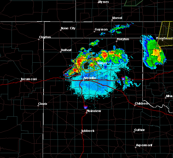 At 1257 am cdt, a severe thunderstorm capable of producing a tornado was located over valley de oro, or 22 miles northwest of amarillo, moving east at 40 mph (weather spotters reported a rotating wall cloud). Hazards include tornado and quarter size hail. Flying debris will be dangerous to those caught without shelter. mobile homes will be damaged or destroyed. damage to roofs, windows, and vehicles will occur. tree damage is likely. Locations impacted include, boys ranch and valley de oro. At 1257 am cdt, a severe thunderstorm capable of producing a tornado was located over valley de oro, or 22 miles northwest of amarillo, moving east at 40 mph (weather spotters reported a rotating wall cloud). Hazards include tornado and quarter size hail. Flying debris will be dangerous to those caught without shelter. mobile homes will be damaged or destroyed. damage to roofs, windows, and vehicles will occur. tree damage is likely. Locations impacted include, boys ranch and valley de oro.
|
| 5/27/2019 12:40 AM CDT |
 At 1239 am cdt, a severe thunderstorm capable of producing a tornado was located 7 miles southwest of boys ranch, or 12 miles northeast of vega, moving east at 35 mph (media video showing a rotating wall cloud). Hazards include tornado and quarter size hail. Flying debris will be dangerous to those caught without shelter. mobile homes will be damaged or destroyed. damage to roofs, windows, and vehicles will occur. Tree damage is likely. At 1239 am cdt, a severe thunderstorm capable of producing a tornado was located 7 miles southwest of boys ranch, or 12 miles northeast of vega, moving east at 35 mph (media video showing a rotating wall cloud). Hazards include tornado and quarter size hail. Flying debris will be dangerous to those caught without shelter. mobile homes will be damaged or destroyed. damage to roofs, windows, and vehicles will occur. Tree damage is likely.
|
| 5/27/2019 12:19 AM CDT |
 At 1218 am cdt, a severe thunderstorm was located over channing, or 24 miles southwest of dumas, moving northeast at 40 mph (radar indicated). Hazards include 60 mph wind gusts and quarter size hail. Minor damage to roofs, siding, and trees is possible. Hail damage to vehicles is expected. At 1218 am cdt, a severe thunderstorm was located over channing, or 24 miles southwest of dumas, moving northeast at 40 mph (radar indicated). Hazards include 60 mph wind gusts and quarter size hail. Minor damage to roofs, siding, and trees is possible. Hail damage to vehicles is expected.
|
| 5/27/2019 12:04 AM CDT | Half Dollar sized hail reported 9.9 miles NW of Boys Ranch, TX |
| 5/27/2019 12:00 AM CDT | Quarter sized hail reported 9.4 miles NW of Boys Ranch, TX |
| 5/26/2019 11:38 PM CDT |
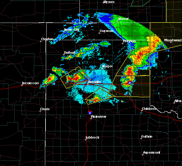 At 1138 pm cdt, a severe thunderstorm was located 5 miles southwest of valley de oro, or 18 miles northeast of vega, moving northeast at 40 mph (law enforcement). Hazards include 60 mph wind gusts and half dollar size hail. Minor damage to roofs, siding, and trees is possible. hail damage to vehicles is expected. locations impacted include, amarillo, boys ranch and valley de oro. A tornado watch remains in effect until 200 am cdt for the panhandle of texas. At 1138 pm cdt, a severe thunderstorm was located 5 miles southwest of valley de oro, or 18 miles northeast of vega, moving northeast at 40 mph (law enforcement). Hazards include 60 mph wind gusts and half dollar size hail. Minor damage to roofs, siding, and trees is possible. hail damage to vehicles is expected. locations impacted include, amarillo, boys ranch and valley de oro. A tornado watch remains in effect until 200 am cdt for the panhandle of texas.
|
| 5/26/2019 11:22 PM CDT |
 At 1121 pm cdt, a severe thunderstorm was located 6 miles northwest of wildorado, or 6 miles northeast of vega, moving northeast at 40 mph (radar indicated). Hazards include two inch hail and 60 mph wind gusts. Minor damage to roofs, siding, and trees is possible. people and animals outdoors will be injured. expect hail damage to roofs, siding, windows, and vehicles. locations impacted include, amarillo, vega, boys ranch, wildorado and valley de oro. A tornado watch remains in effect until 200 am cdt for the panhandle of texas. At 1121 pm cdt, a severe thunderstorm was located 6 miles northwest of wildorado, or 6 miles northeast of vega, moving northeast at 40 mph (radar indicated). Hazards include two inch hail and 60 mph wind gusts. Minor damage to roofs, siding, and trees is possible. people and animals outdoors will be injured. expect hail damage to roofs, siding, windows, and vehicles. locations impacted include, amarillo, vega, boys ranch, wildorado and valley de oro. A tornado watch remains in effect until 200 am cdt for the panhandle of texas.
|
| 5/26/2019 11:14 PM CDT |
 At 1113 pm cdt, a severe thunderstorm was located over vega, moving northeast at 40 mph (radar indicated). Hazards include 60 mph wind gusts and half dollar size hail. Minor damage to roofs, siding, and trees is possible. Hail damage to vehicles is expected. At 1113 pm cdt, a severe thunderstorm was located over vega, moving northeast at 40 mph (radar indicated). Hazards include 60 mph wind gusts and half dollar size hail. Minor damage to roofs, siding, and trees is possible. Hail damage to vehicles is expected.
|
| 5/26/2019 8:52 PM CDT |
 At 851 pm cdt, severe thunderstorms were located along a line extending from 5 miles southwest of valley de oro to 3 miles southwest of wildorado to 7 miles north of hereford, moving east at 55 mph (radar indicated). Hazards include 70 mph wind gusts and quarter size hail. Expect some tree damage. damage is likely to mobile homes, roofs, and outbuildings. Hail damage to vehicles is expected. At 851 pm cdt, severe thunderstorms were located along a line extending from 5 miles southwest of valley de oro to 3 miles southwest of wildorado to 7 miles north of hereford, moving east at 55 mph (radar indicated). Hazards include 70 mph wind gusts and quarter size hail. Expect some tree damage. damage is likely to mobile homes, roofs, and outbuildings. Hail damage to vehicles is expected.
|
| 5/26/2019 8:29 PM CDT |
 At 828 pm cdt, severe thunderstorms were located along a line extending from 8 miles south of channing to 8 miles southwest of vega to 7 miles east of bootleg, moving east at 40 mph (trained weather spotters. at 825 pm cdt, trained spotters estimated a 70 mph wind gust 7 miles south southwest of vega). Hazards include 70 mph wind gusts and quarter size hail. Expect some tree damage. damage is likely to mobile homes, roofs, and outbuildings. hail damage to vehicles is expected. locations impacted include, hereford, vega, adrian, buffalo lake, bushland, dawn, valley de oro, boys ranch, umbarger, bootleg, wildorado and simms. a tornado watch remains in effect until 1000 pm cdt for the panhandle of texas. A tornado watch also remains in effect until 200 am cdt for the panhandle of texas. At 828 pm cdt, severe thunderstorms were located along a line extending from 8 miles south of channing to 8 miles southwest of vega to 7 miles east of bootleg, moving east at 40 mph (trained weather spotters. at 825 pm cdt, trained spotters estimated a 70 mph wind gust 7 miles south southwest of vega). Hazards include 70 mph wind gusts and quarter size hail. Expect some tree damage. damage is likely to mobile homes, roofs, and outbuildings. hail damage to vehicles is expected. locations impacted include, hereford, vega, adrian, buffalo lake, bushland, dawn, valley de oro, boys ranch, umbarger, bootleg, wildorado and simms. a tornado watch remains in effect until 1000 pm cdt for the panhandle of texas. A tornado watch also remains in effect until 200 am cdt for the panhandle of texas.
|
| 5/26/2019 8:05 PM CDT |
 At 805 pm cdt, severe thunderstorms were located along a line extending from 19 miles southeast of romero to 10 miles southwest of adrian to 8 miles west of bootleg, moving east at 40 mph (radar indicated). Hazards include 60 mph wind gusts and quarter size hail. Minor damage to roofs, siding, and trees is possible. Hail damage to vehicles is expected. At 805 pm cdt, severe thunderstorms were located along a line extending from 19 miles southeast of romero to 10 miles southwest of adrian to 8 miles west of bootleg, moving east at 40 mph (radar indicated). Hazards include 60 mph wind gusts and quarter size hail. Minor damage to roofs, siding, and trees is possible. Hail damage to vehicles is expected.
|
| 5/26/2019 7:39 PM CDT |
 At 739 pm cdt, severe thunderstorms capable of producing a tornado were located along a line extending from 3 miles east of romero to 15 miles east of nara visa, moving northeast at 60 mph (radar indicated rotation). Hazards include tornado and baseball size hail. Flying debris will be dangerous to those caught without shelter. mobile homes will be damaged or destroyed. damage to roofs, windows, and vehicles will occur. Tree damage is likely. At 739 pm cdt, severe thunderstorms capable of producing a tornado were located along a line extending from 3 miles east of romero to 15 miles east of nara visa, moving northeast at 60 mph (radar indicated rotation). Hazards include tornado and baseball size hail. Flying debris will be dangerous to those caught without shelter. mobile homes will be damaged or destroyed. damage to roofs, windows, and vehicles will occur. Tree damage is likely.
|
| 5/25/2019 2:48 PM CDT |
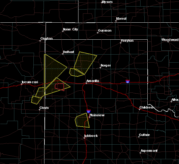 At 248 pm cdt, a severe thunderstorm was located 6 miles southwest of masterson, or 21 miles south of dumas, moving northeast at 20 mph (radar indicated). Hazards include two inch hail and 60 mph wind gusts. Minor damage to roofs, siding, and trees is possible. people and animals outdoors will be injured. expect hail damage to roofs, siding, windows, and vehicles. Locations impacted include, boys ranch and valley de oro. At 248 pm cdt, a severe thunderstorm was located 6 miles southwest of masterson, or 21 miles south of dumas, moving northeast at 20 mph (radar indicated). Hazards include two inch hail and 60 mph wind gusts. Minor damage to roofs, siding, and trees is possible. people and animals outdoors will be injured. expect hail damage to roofs, siding, windows, and vehicles. Locations impacted include, boys ranch and valley de oro.
|
| 5/25/2019 2:36 PM CDT |
 At 236 pm cdt, a severe thunderstorm was located near valley de oro, or 24 miles northwest of amarillo, moving northeast at 20 mph (radar indicated). Hazards include ping pong ball size hail and 60 mph wind gusts. Minor damage to roofs, siding, and trees is possible. people and animals outdoors will be injured. expect hail damage to roofs, siding, windows, and vehicles. Locations impacted include, amarillo, vega, boys ranch, wildorado and valley de oro. At 236 pm cdt, a severe thunderstorm was located near valley de oro, or 24 miles northwest of amarillo, moving northeast at 20 mph (radar indicated). Hazards include ping pong ball size hail and 60 mph wind gusts. Minor damage to roofs, siding, and trees is possible. people and animals outdoors will be injured. expect hail damage to roofs, siding, windows, and vehicles. Locations impacted include, amarillo, vega, boys ranch, wildorado and valley de oro.
|
| 5/25/2019 2:05 PM CDT |
 At 204 pm cdt, a severe thunderstorm was located 5 miles north of wildorado, or 9 miles east of vega, moving northeast at 20 mph (radar indicated). Hazards include ping pong ball size hail and 60 mph wind gusts. Minor damage to roofs, siding, and trees is possible. people and animals outdoors will be injured. Expect hail damage to roofs, siding, windows, and vehicles. At 204 pm cdt, a severe thunderstorm was located 5 miles north of wildorado, or 9 miles east of vega, moving northeast at 20 mph (radar indicated). Hazards include ping pong ball size hail and 60 mph wind gusts. Minor damage to roofs, siding, and trees is possible. people and animals outdoors will be injured. Expect hail damage to roofs, siding, windows, and vehicles.
|
| 5/23/2019 4:36 PM CDT |
 At 435 pm cdt, a severe thunderstorm was located over wildorado, or 10 miles east of vega, moving northeast at 45 mph (radar indicated). Hazards include 60 mph wind gusts and half dollar size hail. Minor damage to roofs, siding, and trees is possible. hail damage to vehicles is expected. locations impacted include, amarillo, vega, channing, bushland, valley de oro, boys ranch and wildorado. A tornado watch remains in effect until 1000 pm cdt for the panhandle of texas. At 435 pm cdt, a severe thunderstorm was located over wildorado, or 10 miles east of vega, moving northeast at 45 mph (radar indicated). Hazards include 60 mph wind gusts and half dollar size hail. Minor damage to roofs, siding, and trees is possible. hail damage to vehicles is expected. locations impacted include, amarillo, vega, channing, bushland, valley de oro, boys ranch and wildorado. A tornado watch remains in effect until 1000 pm cdt for the panhandle of texas.
|
| 5/23/2019 4:26 PM CDT |
 At 426 pm cdt, a severe thunderstorm was located 8 miles southwest of wildorado, or 11 miles southeast of vega, moving northeast at 45 mph (radar indicated). Hazards include 60 mph wind gusts and half dollar size hail. Minor damage to roofs, siding, and trees is possible. Hail damage to vehicles is expected. At 426 pm cdt, a severe thunderstorm was located 8 miles southwest of wildorado, or 11 miles southeast of vega, moving northeast at 45 mph (radar indicated). Hazards include 60 mph wind gusts and half dollar size hail. Minor damage to roofs, siding, and trees is possible. Hail damage to vehicles is expected.
|
| 5/20/2019 12:45 PM CDT |
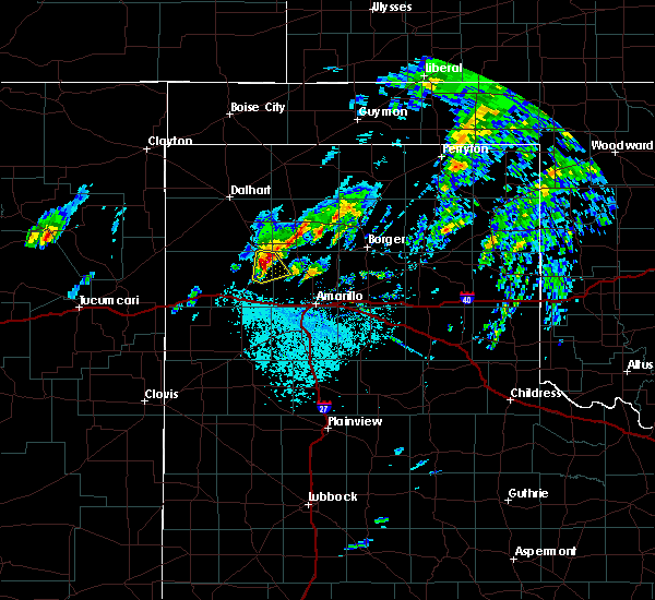 At 1245 pm cdt, a severe thunderstorm was located near boys ranch, or 21 miles northeast of vega, moving northeast at 30 mph (radar indicated). Hazards include two inch hail and 60 mph wind gusts. Minor damage to roofs, siding, and trees is possible. people and animals outdoors will be injured. expect hail damage to roofs, siding, windows, and vehicles. locations impacted include, boys ranch and valley de oro. A tornado watch remains in effect until 800 pm cdt for the panhandle of texas. At 1245 pm cdt, a severe thunderstorm was located near boys ranch, or 21 miles northeast of vega, moving northeast at 30 mph (radar indicated). Hazards include two inch hail and 60 mph wind gusts. Minor damage to roofs, siding, and trees is possible. people and animals outdoors will be injured. expect hail damage to roofs, siding, windows, and vehicles. locations impacted include, boys ranch and valley de oro. A tornado watch remains in effect until 800 pm cdt for the panhandle of texas.
|
| 5/20/2019 12:40 PM CDT | Quarter sized hail reported 1.6 miles N of Boys Ranch, TX, late report of quarter size hail. |
| 5/20/2019 12:38 PM CDT |
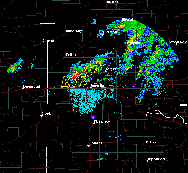 At 1238 pm cdt, a severe thunderstorm was located 4 miles south of boys ranch, or 16 miles northeast of vega, moving northeast at 40 mph (radar indicated). Hazards include golf ball size hail and 60 mph wind gusts. Minor damage to roofs, siding, and trees is possible. people and animals outdoors will be injured. expect hail damage to roofs, siding, windows, and vehicles. locations impacted include, boys ranch and valley de oro. A tornado watch remains in effect until 800 pm cdt for the panhandle of texas. At 1238 pm cdt, a severe thunderstorm was located 4 miles south of boys ranch, or 16 miles northeast of vega, moving northeast at 40 mph (radar indicated). Hazards include golf ball size hail and 60 mph wind gusts. Minor damage to roofs, siding, and trees is possible. people and animals outdoors will be injured. expect hail damage to roofs, siding, windows, and vehicles. locations impacted include, boys ranch and valley de oro. A tornado watch remains in effect until 800 pm cdt for the panhandle of texas.
|
| 5/20/2019 12:33 PM CDT | Quarter sized hail reported 0.3 miles NW of Boys Ranch, TX, hail up to the size of quarters reported at boys ranch. |
| 5/20/2019 12:27 PM CDT |
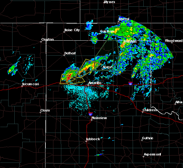 The national weather service in amarillo has issued a * severe thunderstorm warning for. eastern oldham county in the panhandle of texas. western potter county in the panhandle of texas. until 115 pm cdt. At 1227 pm cdt, a severe thunderstorm was located 6 miles north of. The national weather service in amarillo has issued a * severe thunderstorm warning for. eastern oldham county in the panhandle of texas. western potter county in the panhandle of texas. until 115 pm cdt. At 1227 pm cdt, a severe thunderstorm was located 6 miles north of.
|
| 5/7/2019 5:11 PM CDT | Half Dollar sized hail reported 20.9 miles NNW of Boys Ranch, TX |
| 5/7/2019 3:48 PM CDT |
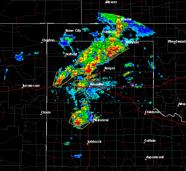 At 348 pm cdt, a severe thunderstorm was located 8 miles north of adrian, or 14 miles northwest of vega, moving northeast at 30 mph (radar indicated). Hazards include ping pong ball size hail and 60 mph wind gusts. Minor damage to roofs, siding, and trees is possible. people and animals outdoors will be injured. expect hail damage to roofs, siding, windows, and vehicles. locations impacted include, adrian and boys ranch. A tornado watch remains in effect until 1000 pm cdt for the panhandle of texas. At 348 pm cdt, a severe thunderstorm was located 8 miles north of adrian, or 14 miles northwest of vega, moving northeast at 30 mph (radar indicated). Hazards include ping pong ball size hail and 60 mph wind gusts. Minor damage to roofs, siding, and trees is possible. people and animals outdoors will be injured. expect hail damage to roofs, siding, windows, and vehicles. locations impacted include, adrian and boys ranch. A tornado watch remains in effect until 1000 pm cdt for the panhandle of texas.
|
| 5/7/2019 3:38 PM CDT |
 At 338 pm cdt, a severe thunderstorm was located near adrian, or 14 miles west of vega, moving northeast at 30 mph (radar indicated). Hazards include two inch hail and 60 mph wind gusts. Minor damage to roofs, siding, and trees is possible. people and animals outdoors will be injured. expect hail damage to roofs, siding, windows, and vehicles. locations impacted include, adrian and boys ranch. A tornado watch remains in effect until 1000 pm cdt for the panhandle of texas. At 338 pm cdt, a severe thunderstorm was located near adrian, or 14 miles west of vega, moving northeast at 30 mph (radar indicated). Hazards include two inch hail and 60 mph wind gusts. Minor damage to roofs, siding, and trees is possible. people and animals outdoors will be injured. expect hail damage to roofs, siding, windows, and vehicles. locations impacted include, adrian and boys ranch. A tornado watch remains in effect until 1000 pm cdt for the panhandle of texas.
|
| 5/7/2019 3:27 PM CDT |
 At 327 pm cdt, a severe thunderstorm was located near adrian, or 16 miles west of vega, moving northeast at 30 mph (radar indicated). Hazards include golf ball size hail and 60 mph wind gusts. Minor damage to roofs, siding, and trees is possible. people and animals outdoors will be injured. Expect hail damage to roofs, siding, windows, and vehicles. At 327 pm cdt, a severe thunderstorm was located near adrian, or 16 miles west of vega, moving northeast at 30 mph (radar indicated). Hazards include golf ball size hail and 60 mph wind gusts. Minor damage to roofs, siding, and trees is possible. people and animals outdoors will be injured. Expect hail damage to roofs, siding, windows, and vehicles.
|
| 5/7/2019 3:25 PM CDT | Golf Ball sized hail reported 15 miles W of Boys Ranch, TX |
| 5/7/2019 3:00 PM CDT | Quarter sized hail reported 9.9 miles NW of Boys Ranch, TX |
| 5/7/2019 2:51 PM CDT |
 At 251 pm cdt, a severe thunderstorm was located 4 miles west of valley de oro, or 18 miles northeast of vega, moving northeast at 30 mph. this is a very dangerous storm (radar indicated). Hazards include baseball size hail and 60 mph wind gusts. People and animals outdoors will be severely injured. expect shattered windows, extensive damage to roofs, siding, and vehicles. locations impacted include, boys ranch and valley de oro. A tornado watch remains in effect until 1000 pm cdt for the panhandle of texas. At 251 pm cdt, a severe thunderstorm was located 4 miles west of valley de oro, or 18 miles northeast of vega, moving northeast at 30 mph. this is a very dangerous storm (radar indicated). Hazards include baseball size hail and 60 mph wind gusts. People and animals outdoors will be severely injured. expect shattered windows, extensive damage to roofs, siding, and vehicles. locations impacted include, boys ranch and valley de oro. A tornado watch remains in effect until 1000 pm cdt for the panhandle of texas.
|
| 5/7/2019 2:45 PM CDT |
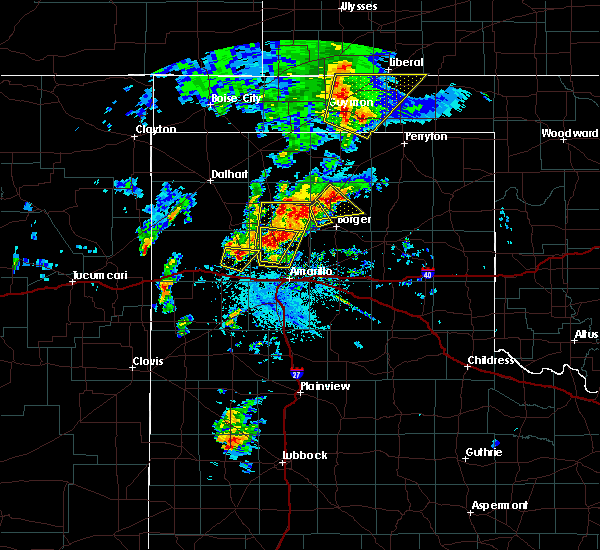 At 245 pm cdt, a severe thunderstorm was located 7 miles southwest of valley de oro, or 15 miles northeast of vega, moving northeast at 30 mph (radar indicated). Hazards include tennis ball size hail and 60 mph wind gusts. Minor damage to roofs, siding, and trees is possible. people and animals outdoors will be injured. Expect hail damage to roofs, siding, windows, and vehicles. At 245 pm cdt, a severe thunderstorm was located 7 miles southwest of valley de oro, or 15 miles northeast of vega, moving northeast at 30 mph (radar indicated). Hazards include tennis ball size hail and 60 mph wind gusts. Minor damage to roofs, siding, and trees is possible. people and animals outdoors will be injured. Expect hail damage to roofs, siding, windows, and vehicles.
|
| 5/4/2019 6:53 PM CDT |
 At 651 pm cdt, severe thunderstorms were located near boys ranch, or 20 miles north of vega, and 15 miles north of adrian moving east at 15 mph (radar indicated). Hazards include 60 mph wind gusts and quarter size hail. Minor damage to roofs, siding, and trees is possible. hail damage to vehicles is expected. Locations impacted include, boys ranch and valley de oro. At 651 pm cdt, severe thunderstorms were located near boys ranch, or 20 miles north of vega, and 15 miles north of adrian moving east at 15 mph (radar indicated). Hazards include 60 mph wind gusts and quarter size hail. Minor damage to roofs, siding, and trees is possible. hail damage to vehicles is expected. Locations impacted include, boys ranch and valley de oro.
|
| 5/4/2019 6:22 PM CDT |
 At 621 pm cdt, a severe thunderstorm was located 10 miles west of boys ranch, or 20 miles north of vega, moving east at 15 mph (radar indicated). Hazards include 60 mph wind gusts and half dollar size hail. Minor damage to roofs, siding, and trees is possible. Hail damage to vehicles is expected. At 621 pm cdt, a severe thunderstorm was located 10 miles west of boys ranch, or 20 miles north of vega, moving east at 15 mph (radar indicated). Hazards include 60 mph wind gusts and half dollar size hail. Minor damage to roofs, siding, and trees is possible. Hail damage to vehicles is expected.
|
| 4/5/2019 9:19 PM CDT |
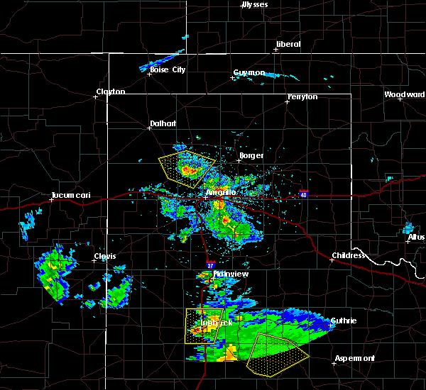 At 919 pm cdt, a severe thunderstorm was located 6 miles northeast of valley de oro, or 23 miles south of dumas, moving north at 35 mph (radar indicated). Hazards include 60 mph wind gusts and penny size hail. Minor damage to roofs, siding, and trees is possible. Locations impacted include, channing, boys ranch, masterson, four way and valley de oro. At 919 pm cdt, a severe thunderstorm was located 6 miles northeast of valley de oro, or 23 miles south of dumas, moving north at 35 mph (radar indicated). Hazards include 60 mph wind gusts and penny size hail. Minor damage to roofs, siding, and trees is possible. Locations impacted include, channing, boys ranch, masterson, four way and valley de oro.
|
| 4/5/2019 9:09 PM CDT |
 At 908 pm cdt, a severe thunderstorm was located over valley de oro, or 22 miles northeast of vega, moving north at 35 mph (radar indicated). Hazards include 60 mph wind gusts and quarter size hail. Minor damage to roofs, siding, and trees is possible. hail damage to vehicles is expected. Locations impacted include, channing, boys ranch, masterson, four way and valley de oro. At 908 pm cdt, a severe thunderstorm was located over valley de oro, or 22 miles northeast of vega, moving north at 35 mph (radar indicated). Hazards include 60 mph wind gusts and quarter size hail. Minor damage to roofs, siding, and trees is possible. hail damage to vehicles is expected. Locations impacted include, channing, boys ranch, masterson, four way and valley de oro.
|
| 4/5/2019 9:00 PM CDT |
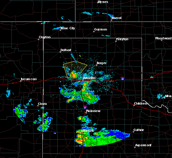 At 859 pm cdt, a severe thunderstorm was located 7 miles south of valley de oro, or 17 miles northeast of vega, moving north at 35 mph (radar indicated). Hazards include 60 mph wind gusts and quarter size hail. Minor damage to roofs, siding, and trees is possible. Hail damage to vehicles is expected. At 859 pm cdt, a severe thunderstorm was located 7 miles south of valley de oro, or 17 miles northeast of vega, moving north at 35 mph (radar indicated). Hazards include 60 mph wind gusts and quarter size hail. Minor damage to roofs, siding, and trees is possible. Hail damage to vehicles is expected.
|
| 3/22/2019 6:10 PM CDT |
 At 608 pm cdt, severe thunderstorms were located along a line extending from boys ranch to wildorado to 5 miles northeast of hereford, moving east at 25 mph (radar indicated and reported by trained spotters). Hazards include golf ball size hail and 60 mph wind gusts. a trained spotter reported golf ball size hail 10 miles south of vega at 5:51 pm cdt. Minor damage to roofs, siding, and trees is possible. people and animals outdoors will be injured. expect hail damage to roofs, siding, windows, and vehicles. Locations impacted include, hereford, buffalo lake, bushland, dawn, valley de oro, boys ranch, umbarger and wildorado. At 608 pm cdt, severe thunderstorms were located along a line extending from boys ranch to wildorado to 5 miles northeast of hereford, moving east at 25 mph (radar indicated and reported by trained spotters). Hazards include golf ball size hail and 60 mph wind gusts. a trained spotter reported golf ball size hail 10 miles south of vega at 5:51 pm cdt. Minor damage to roofs, siding, and trees is possible. people and animals outdoors will be injured. expect hail damage to roofs, siding, windows, and vehicles. Locations impacted include, hereford, buffalo lake, bushland, dawn, valley de oro, boys ranch, umbarger and wildorado.
|
| 3/22/2019 5:57 PM CDT |
 At 557 pm cdt, severe thunderstorms were located along a line extending from 5 miles west of boys ranch to 3 miles northwest of wildorado to 6 miles north of hereford, moving east at 25 mph (radar indicated). Hazards include 60 mph wind gusts and half dollar size hail. Minor damage to roofs, siding, and trees is possible. Hail damage to vehicles is expected. At 557 pm cdt, severe thunderstorms were located along a line extending from 5 miles west of boys ranch to 3 miles northwest of wildorado to 6 miles north of hereford, moving east at 25 mph (radar indicated). Hazards include 60 mph wind gusts and half dollar size hail. Minor damage to roofs, siding, and trees is possible. Hail damage to vehicles is expected.
|
| 3/22/2019 3:55 PM CDT |
 At 353 pm cdt, a severe thunderstorm capable of producing a tornado was located 16 miles north of adrian, or 21 miles northwest of vega, moving northeast at 30 mph (live media video of multiple funnel clouds). Hazards include tornado and golf ball size hail. Flying debris will be dangerous to those caught without shelter. mobile homes will be damaged or destroyed. damage to roofs, windows, and vehicles will occur. tree damage is likely. This tornadic thunderstorm will remain over mainly rural areas of northeastern oldham and south central hartley counties. At 353 pm cdt, a severe thunderstorm capable of producing a tornado was located 16 miles north of adrian, or 21 miles northwest of vega, moving northeast at 30 mph (live media video of multiple funnel clouds). Hazards include tornado and golf ball size hail. Flying debris will be dangerous to those caught without shelter. mobile homes will be damaged or destroyed. damage to roofs, windows, and vehicles will occur. tree damage is likely. This tornadic thunderstorm will remain over mainly rural areas of northeastern oldham and south central hartley counties.
|
| 3/22/2019 3:41 PM CDT |
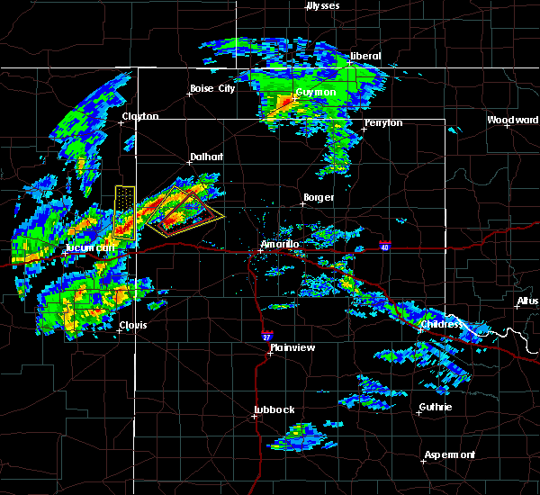 At 340 pm cdt, a severe thunderstorm capable of producing a tornado was located 11 miles north of adrian, or 20 miles northwest of vega, moving northeast at 35 mph (weather spotters reported funnel cloud). Hazards include tornado and golf ball size hail. Flying debris will be dangerous to those caught without shelter. mobile homes will be damaged or destroyed. damage to roofs, windows, and vehicles will occur. tree damage is likely. This tornadic thunderstorm will remain over mainly rural areas of northeastern oldham and south central hartley counties. At 340 pm cdt, a severe thunderstorm capable of producing a tornado was located 11 miles north of adrian, or 20 miles northwest of vega, moving northeast at 35 mph (weather spotters reported funnel cloud). Hazards include tornado and golf ball size hail. Flying debris will be dangerous to those caught without shelter. mobile homes will be damaged or destroyed. damage to roofs, windows, and vehicles will occur. tree damage is likely. This tornadic thunderstorm will remain over mainly rural areas of northeastern oldham and south central hartley counties.
|
| 3/22/2019 3:39 PM CDT |
 At 338 pm cdt, a severe thunderstorm was located 12 miles north of adrian, or 22 miles northwest of vega, moving northeast at 35 mph (radar indicated). Hazards include ping pong ball size hail and 60 mph wind gusts. Minor damage to roofs, siding, and trees is possible. people and animals outdoors will be injured. expect hail damage to roofs, siding, windows, and vehicles. Locations impacted include, boys ranch. At 338 pm cdt, a severe thunderstorm was located 12 miles north of adrian, or 22 miles northwest of vega, moving northeast at 35 mph (radar indicated). Hazards include ping pong ball size hail and 60 mph wind gusts. Minor damage to roofs, siding, and trees is possible. people and animals outdoors will be injured. expect hail damage to roofs, siding, windows, and vehicles. Locations impacted include, boys ranch.
|
| 3/22/2019 3:30 PM CDT |
 At 328 pm cdt, a severe thunderstorm was located 11 miles northwest of adrian, or 22 miles southeast of nara visa, moving northeast at 30 mph. another potentially severe storm has formed ahead of this storm and is moving into rural southern hartley county (radar indicated). Hazards include 60 mph wind gusts and quarter size hail. Minor damage to roofs, siding, and trees is possible. hail damage to vehicles is expected. Locations impacted include, boys ranch. At 328 pm cdt, a severe thunderstorm was located 11 miles northwest of adrian, or 22 miles southeast of nara visa, moving northeast at 30 mph. another potentially severe storm has formed ahead of this storm and is moving into rural southern hartley county (radar indicated). Hazards include 60 mph wind gusts and quarter size hail. Minor damage to roofs, siding, and trees is possible. hail damage to vehicles is expected. Locations impacted include, boys ranch.
|
| 3/22/2019 3:14 PM CDT |
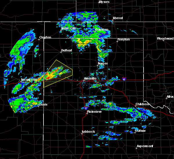 At 313 pm cdt, a severe thunderstorm was located 8 miles northwest of adrian, or 20 miles northwest of vega, moving northeast at 40 mph (radar indicated). Hazards include 60 mph wind gusts and quarter size hail. Minor damage to roofs, siding, and trees is possible. hail damage to vehicles is expected. Locations impacted include, adrian and boys ranch. At 313 pm cdt, a severe thunderstorm was located 8 miles northwest of adrian, or 20 miles northwest of vega, moving northeast at 40 mph (radar indicated). Hazards include 60 mph wind gusts and quarter size hail. Minor damage to roofs, siding, and trees is possible. hail damage to vehicles is expected. Locations impacted include, adrian and boys ranch.
|
| 3/22/2019 2:55 PM CDT |
 At 255 pm cdt, a severe thunderstorm was located 7 miles northeast of glenrio, or 27 miles west of vega, moving northeast at 40 mph (radar indicated). Hazards include 60 mph wind gusts and quarter size hail. Minor damage to roofs, siding, and trees is possible. Hail damage to vehicles is expected. At 255 pm cdt, a severe thunderstorm was located 7 miles northeast of glenrio, or 27 miles west of vega, moving northeast at 40 mph (radar indicated). Hazards include 60 mph wind gusts and quarter size hail. Minor damage to roofs, siding, and trees is possible. Hail damage to vehicles is expected.
|
| 12/26/2018 3:21 PM CST |
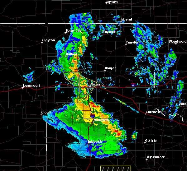 The severe thunderstorm warning for northeastern oldham and northwestern potter counties will expire at 330 pm cst, the storm which prompted the warning has weakened below severe limits, and no longer poses an immediate threat to life or property. therefore, the warning will be allowed to expire. a severe thunderstorm watch remains in effect until 700 pm cst for the panhandle of texas. The severe thunderstorm warning for northeastern oldham and northwestern potter counties will expire at 330 pm cst, the storm which prompted the warning has weakened below severe limits, and no longer poses an immediate threat to life or property. therefore, the warning will be allowed to expire. a severe thunderstorm watch remains in effect until 700 pm cst for the panhandle of texas.
|
| 12/26/2018 3:02 PM CST |
 At 301 pm cst, a severe thunderstorm was located near boys ranch, or 20 miles north of vega, moving northeast at 35 mph (radar indicated). Hazards include quarter size hail. Damage to vehicles is expected. Locations impacted include, boys ranch. At 301 pm cst, a severe thunderstorm was located near boys ranch, or 20 miles north of vega, moving northeast at 35 mph (radar indicated). Hazards include quarter size hail. Damage to vehicles is expected. Locations impacted include, boys ranch.
|
| 12/26/2018 2:46 PM CST |
 At 245 pm cst, a severe thunderstorm was located 8 miles north of vega, moving north at 25 mph (radar indicated). Hazards include quarter size hail. Damage to vehicles is expected. Locations impacted include, vega and boys ranch. At 245 pm cst, a severe thunderstorm was located 8 miles north of vega, moving north at 25 mph (radar indicated). Hazards include quarter size hail. Damage to vehicles is expected. Locations impacted include, vega and boys ranch.
|
| 12/26/2018 2:31 PM CST |
 At 230 pm cst, a severe thunderstorm was located over vega, moving north at 25 mph (radar indicated). Hazards include half dollar size hail. damage to vehicles is expected At 230 pm cst, a severe thunderstorm was located over vega, moving north at 25 mph (radar indicated). Hazards include half dollar size hail. damage to vehicles is expected
|
| 9/9/2018 8:12 PM CDT |
 At 811 pm cdt, severe thunderstorms were located along a line extending from 12 miles southwest of channing to adrian to 5 miles southwest of glenrio, moving southeast at 25 mph (radar indicated). Hazards include 60 mph wind gusts and penny size hail. Minor damage to roofs, siding, and trees is possible. high profile vehicles and 18 wheelers along i-40 could become difficult to control. Locations impacted include, vega, adrian, glenrio, boys ranch, bootleg, wildorado and simms. At 811 pm cdt, severe thunderstorms were located along a line extending from 12 miles southwest of channing to adrian to 5 miles southwest of glenrio, moving southeast at 25 mph (radar indicated). Hazards include 60 mph wind gusts and penny size hail. Minor damage to roofs, siding, and trees is possible. high profile vehicles and 18 wheelers along i-40 could become difficult to control. Locations impacted include, vega, adrian, glenrio, boys ranch, bootleg, wildorado and simms.
|
| 9/9/2018 7:49 PM CDT |
 At 748 pm cdt, severe thunderstorms were located along a line extending from 12 miles southwest of channing to 4 miles north of glenrio, moving southeast at 30 mph (radar indicated). Hazards include 60 mph wind gusts and quarter size hail. Minor damage to roofs, siding, and trees is possible. Hail damage to vehicles is expected. At 748 pm cdt, severe thunderstorms were located along a line extending from 12 miles southwest of channing to 4 miles north of glenrio, moving southeast at 30 mph (radar indicated). Hazards include 60 mph wind gusts and quarter size hail. Minor damage to roofs, siding, and trees is possible. Hail damage to vehicles is expected.
|
| 6/25/2018 1:44 AM CDT |
 At 144 am cdt, a severe thunderstorm was located 8 miles west of boys ranch, or 17 miles north of vega, moving east at 35 mph (radar indicated). Hazards include 60 mph wind gusts. Minor damage to roofs, siding, and trees is possible. Locations impacted include, channing and boys ranch. At 144 am cdt, a severe thunderstorm was located 8 miles west of boys ranch, or 17 miles north of vega, moving east at 35 mph (radar indicated). Hazards include 60 mph wind gusts. Minor damage to roofs, siding, and trees is possible. Locations impacted include, channing and boys ranch.
|
| 6/25/2018 1:26 AM CDT |
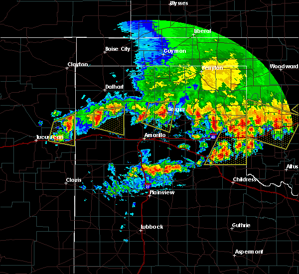 At 126 am cdt, a severe thunderstorm was located 16 miles north of adrian, or 19 miles northwest of vega, moving east at 40 mph (radar indicated). Hazards include 60 mph wind gusts and penny size hail. Minor damage to roofs, siding, and trees is possible. Locations impacted include, channing and boys ranch. At 126 am cdt, a severe thunderstorm was located 16 miles north of adrian, or 19 miles northwest of vega, moving east at 40 mph (radar indicated). Hazards include 60 mph wind gusts and penny size hail. Minor damage to roofs, siding, and trees is possible. Locations impacted include, channing and boys ranch.
|
| 6/25/2018 1:02 AM CDT |
 At 102 am cdt, a severe thunderstorm was located 15 miles southeast of nara visa, moving east at 35 mph (radar indicated). Hazards include ping pong ball size hail and 60 mph wind gusts. Minor damage to roofs, siding, and trees is possible. people and animals outdoors will be injured. Expect hail damage to roofs, siding, windows, and vehicles. At 102 am cdt, a severe thunderstorm was located 15 miles southeast of nara visa, moving east at 35 mph (radar indicated). Hazards include ping pong ball size hail and 60 mph wind gusts. Minor damage to roofs, siding, and trees is possible. people and animals outdoors will be injured. Expect hail damage to roofs, siding, windows, and vehicles.
|
| 6/25/2018 12:11 AM CDT |
 At 1210 am cdt, a severe thunderstorm was located 4 miles east of channing, or 21 miles southwest of dumas, moving east at 30 mph (radar indicated). Hazards include two inch hail and 60 mph wind gusts. Minor damage to roofs, siding, and trees is possible. people and animals outdoors will be injured. expect hail damage to roofs, siding, windows, and vehicles. Locations impacted include, dumas, hartley, channing, four way, valley de oro, boys ranch and masterson. At 1210 am cdt, a severe thunderstorm was located 4 miles east of channing, or 21 miles southwest of dumas, moving east at 30 mph (radar indicated). Hazards include two inch hail and 60 mph wind gusts. Minor damage to roofs, siding, and trees is possible. people and animals outdoors will be injured. expect hail damage to roofs, siding, windows, and vehicles. Locations impacted include, dumas, hartley, channing, four way, valley de oro, boys ranch and masterson.
|
| 6/24/2018 11:51 PM CDT |
 At 1150 pm cdt, a severe thunderstorm was located 7 miles west of channing, or 24 miles south of dalhart, moving east at 30 mph (radar indicated). Hazards include ping pong ball size hail and 60 mph wind gusts. Minor damage to roofs, siding, and trees is possible. people and animals outdoors will be injured. Expect hail damage to roofs, siding, windows, and vehicles. At 1150 pm cdt, a severe thunderstorm was located 7 miles west of channing, or 24 miles south of dalhart, moving east at 30 mph (radar indicated). Hazards include ping pong ball size hail and 60 mph wind gusts. Minor damage to roofs, siding, and trees is possible. people and animals outdoors will be injured. Expect hail damage to roofs, siding, windows, and vehicles.
|
| 6/22/2018 6:14 PM CDT |
 At 614 pm cdt, a severe thunderstorm was located 5 miles northeast of boys ranch, or 24 miles southwest of dumas, moving east at 35 mph (radar indicated). Hazards include 60 mph wind gusts and quarter size hail. Minor damage to roofs, siding, and trees is possible. hail damage to vehicles is expected. Locations impacted include, boys ranch, masterson and valley de oro. At 614 pm cdt, a severe thunderstorm was located 5 miles northeast of boys ranch, or 24 miles southwest of dumas, moving east at 35 mph (radar indicated). Hazards include 60 mph wind gusts and quarter size hail. Minor damage to roofs, siding, and trees is possible. hail damage to vehicles is expected. Locations impacted include, boys ranch, masterson and valley de oro.
|
| 6/22/2018 6:05 PM CDT | Quarter sized hail reported 1.6 miles N of Boys Ranch, TX |
| 6/22/2018 5:58 PM CDT |
 At 558 pm cdt, a severe thunderstorm was located near boys ranch, or 18 miles north of vega, moving east at 35 mph (radar indicated). Hazards include 60 mph wind gusts and quarter size hail. Minor damage to roofs, siding, and trees is possible. Hail damage to vehicles is expected. At 558 pm cdt, a severe thunderstorm was located near boys ranch, or 18 miles north of vega, moving east at 35 mph (radar indicated). Hazards include 60 mph wind gusts and quarter size hail. Minor damage to roofs, siding, and trees is possible. Hail damage to vehicles is expected.
|
| 6/12/2018 11:15 PM CDT |
 At 1114 pm cdt, a severe thunderstorm was located near boys ranch, or 24 miles northeast of vega, moving east at 20 mph (radar indicated). Hazards include 60 mph wind gusts and quarter size hail. Minor damage to roofs, siding, and trees is possible. hail damage to vehicles is expected. Locations impacted include, channing, boys ranch, masterson, four way and valley de oro. At 1114 pm cdt, a severe thunderstorm was located near boys ranch, or 24 miles northeast of vega, moving east at 20 mph (radar indicated). Hazards include 60 mph wind gusts and quarter size hail. Minor damage to roofs, siding, and trees is possible. hail damage to vehicles is expected. Locations impacted include, channing, boys ranch, masterson, four way and valley de oro.
|
| 6/12/2018 10:54 PM CDT |
 At 1054 pm cdt, a severe thunderstorm was located 7 miles south of channing, or 23 miles north of vega, moving east at 20 mph (radar indicated). Hazards include golf ball size hail and 60 mph wind gusts. Minor damage to roofs, siding, and trees is possible. people and animals outdoors will be injured. Expect hail damage to roofs, siding, windows, and vehicles. At 1054 pm cdt, a severe thunderstorm was located 7 miles south of channing, or 23 miles north of vega, moving east at 20 mph (radar indicated). Hazards include golf ball size hail and 60 mph wind gusts. Minor damage to roofs, siding, and trees is possible. people and animals outdoors will be injured. Expect hail damage to roofs, siding, windows, and vehicles.
|
| 6/12/2018 10:43 PM CDT |
 At 1043 pm cdt, severe thunderstorms were located along a line extending from near guymon to 5 miles northwest of sunray to 7 miles southwest of channing, moving east at 20 mph (radar indicated). Hazards include tennis ball size hail and 60 mph wind gusts. Minor damage to roofs, siding, and trees is possible. people and animals outdoors will be injured. expect hail damage to roofs, siding, windows, and vehicles. Locations impacted include, dumas, guymon, hartley, cactus, sunray, goodwell, channing, optima, valley de oro, boys ranch, four way, masterson and texhoma. At 1043 pm cdt, severe thunderstorms were located along a line extending from near guymon to 5 miles northwest of sunray to 7 miles southwest of channing, moving east at 20 mph (radar indicated). Hazards include tennis ball size hail and 60 mph wind gusts. Minor damage to roofs, siding, and trees is possible. people and animals outdoors will be injured. expect hail damage to roofs, siding, windows, and vehicles. Locations impacted include, dumas, guymon, hartley, cactus, sunray, goodwell, channing, optima, valley de oro, boys ranch, four way, masterson and texhoma.
|
| 6/12/2018 10:17 PM CDT |
 At 1016 pm cdt, severe thunderstorms were located along a line extending from 8 miles north of goodwell to 3 miles north of cactus to 12 miles southwest of channing, moving east at 25 mph (radar indicated). Hazards include tennis ball size hail and 60 mph wind gusts. Minor damage to roofs, siding, and trees is possible. people and animals outdoors will be injured. expect hail damage to roofs, siding, windows, and vehicles. Locations impacted include, dumas, guymon, stratford, hartley, cactus, sunray, goodwell, channing, optima, valley de oro, boys ranch, eva, four way, conlen, masterson and texhoma. At 1016 pm cdt, severe thunderstorms were located along a line extending from 8 miles north of goodwell to 3 miles north of cactus to 12 miles southwest of channing, moving east at 25 mph (radar indicated). Hazards include tennis ball size hail and 60 mph wind gusts. Minor damage to roofs, siding, and trees is possible. people and animals outdoors will be injured. expect hail damage to roofs, siding, windows, and vehicles. Locations impacted include, dumas, guymon, stratford, hartley, cactus, sunray, goodwell, channing, optima, valley de oro, boys ranch, eva, four way, conlen, masterson and texhoma.
|
| 6/12/2018 9:57 PM CDT |
 At 956 pm cdt, severe thunderstorms were located along a line extending from 7 miles southeast of griggs to 12 miles south of conlen to 15 miles west of channing, moving east at 35 mph (radar indicated). Hazards include tennis ball size hail and 60 mph wind gusts. Minor damage to roofs, siding, and trees is possible. people and animals outdoors will be injured. expect hail damage to roofs, siding, windows, and vehicles. Locations impacted include, dumas, guymon, dalhart, stratford, hartley, cactus, sunray, goodwell, channing, optima, valley de oro, boys ranch, griggs, eva, four way, conlen, masterson and texhoma. At 956 pm cdt, severe thunderstorms were located along a line extending from 7 miles southeast of griggs to 12 miles south of conlen to 15 miles west of channing, moving east at 35 mph (radar indicated). Hazards include tennis ball size hail and 60 mph wind gusts. Minor damage to roofs, siding, and trees is possible. people and animals outdoors will be injured. expect hail damage to roofs, siding, windows, and vehicles. Locations impacted include, dumas, guymon, dalhart, stratford, hartley, cactus, sunray, goodwell, channing, optima, valley de oro, boys ranch, griggs, eva, four way, conlen, masterson and texhoma.
|
| 6/12/2018 9:49 PM CDT |
 At 948 pm cdt, severe thunderstorms were located along a line extending from 4 miles south of griggs to 11 miles east of dalhart to 17 miles southeast of romero, moving east at 35 mph (radar indicated). Hazards include tennis ball size hail and 60 mph wind gusts. Minor damage to roofs, siding, and trees is possible. people and animals outdoors will be injured. Expect hail damage to roofs, siding, windows, and vehicles. At 948 pm cdt, severe thunderstorms were located along a line extending from 4 miles south of griggs to 11 miles east of dalhart to 17 miles southeast of romero, moving east at 35 mph (radar indicated). Hazards include tennis ball size hail and 60 mph wind gusts. Minor damage to roofs, siding, and trees is possible. people and animals outdoors will be injured. Expect hail damage to roofs, siding, windows, and vehicles.
|
| 6/12/2018 9:44 PM CDT |
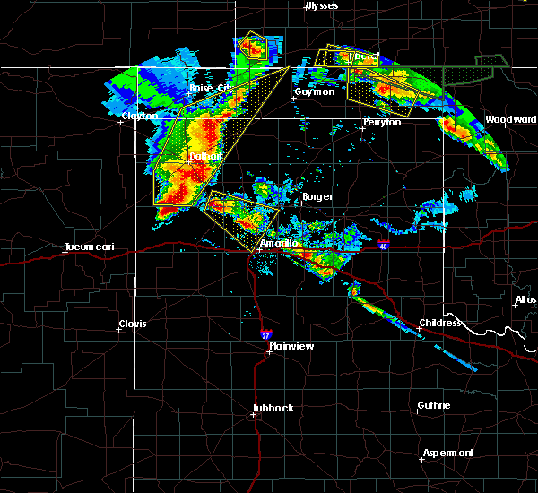 At 944 pm cdt, a severe thunderstorm was located 7 miles north of boys ranch, or 22 miles southwest of dumas, moving southeast at 10 mph (radar indicated). Hazards include two inch hail and 60 mph wind gusts. Minor damage to roofs, siding, and trees is possible. people and animals outdoors will be injured. Expect hail damage to roofs, siding, windows, and vehicles. At 944 pm cdt, a severe thunderstorm was located 7 miles north of boys ranch, or 22 miles southwest of dumas, moving southeast at 10 mph (radar indicated). Hazards include two inch hail and 60 mph wind gusts. Minor damage to roofs, siding, and trees is possible. people and animals outdoors will be injured. Expect hail damage to roofs, siding, windows, and vehicles.
|
| 6/12/2018 9:24 PM CDT |
 At 921 pm cdt, a severe thunderstorms were located 7 miles southeast of channing, or 22 miles southwest of dumas, and 15 miles northwest of amarillo is nearly stationary (radar indicated). Hazards include two inch hail and 60 mph wind gusts. Minor damage to roofs, siding, and trees is possible. people and animals outdoors will be injured. expect hail damage to roofs, siding, windows, and vehicles. Locations impacted include, dumas, channing, boys ranch, masterson, four way and valley de oro. At 921 pm cdt, a severe thunderstorms were located 7 miles southeast of channing, or 22 miles southwest of dumas, and 15 miles northwest of amarillo is nearly stationary (radar indicated). Hazards include two inch hail and 60 mph wind gusts. Minor damage to roofs, siding, and trees is possible. people and animals outdoors will be injured. expect hail damage to roofs, siding, windows, and vehicles. Locations impacted include, dumas, channing, boys ranch, masterson, four way and valley de oro.
|
| 6/12/2018 8:55 PM CDT |
 At 855 pm cdt, a severe thunderstorm was located 5 miles southwest of masterson, or 18 miles south of dumas, moving north at 10 mph (radar indicated). Hazards include 60 mph wind gusts and quarter size hail. Minor damage to roofs, siding, and trees is possible. hail damage to vehicles is expected. Locations impacted include, dumas, channing, boys ranch, masterson, four way and valley de oro. At 855 pm cdt, a severe thunderstorm was located 5 miles southwest of masterson, or 18 miles south of dumas, moving north at 10 mph (radar indicated). Hazards include 60 mph wind gusts and quarter size hail. Minor damage to roofs, siding, and trees is possible. hail damage to vehicles is expected. Locations impacted include, dumas, channing, boys ranch, masterson, four way and valley de oro.
|
| 6/12/2018 8:48 PM CDT |
 At 848 pm cdt, severe thunderstorms were located along a line extending from 9 miles east of channing to 10 miles south of masterson, moving north at 10 mph (radar indicated). Hazards include 60 mph wind gusts and quarter size hail. Minor damage to roofs, siding, and trees is possible. hail damage to vehicles is expected. Locations impacted include, dumas, channing, boys ranch, masterson, four way and valley de oro. At 848 pm cdt, severe thunderstorms were located along a line extending from 9 miles east of channing to 10 miles south of masterson, moving north at 10 mph (radar indicated). Hazards include 60 mph wind gusts and quarter size hail. Minor damage to roofs, siding, and trees is possible. hail damage to vehicles is expected. Locations impacted include, dumas, channing, boys ranch, masterson, four way and valley de oro.
|
| 6/12/2018 8:31 PM CDT |
 At 830 pm cdt, severe thunderstorms were located along a line extending from 10 miles east of channing to 11 miles east of valley de oro, moving north at 10 mph (radar indicated). Hazards include 60 mph wind gusts and half dollar size hail. Minor damage to roofs, siding, and trees is possible. Hail damage to vehicles is expected. At 830 pm cdt, severe thunderstorms were located along a line extending from 10 miles east of channing to 11 miles east of valley de oro, moving north at 10 mph (radar indicated). Hazards include 60 mph wind gusts and half dollar size hail. Minor damage to roofs, siding, and trees is possible. Hail damage to vehicles is expected.
|
| 5/28/2018 7:36 PM CDT |
 At 735 pm cdt, a severe thunderstorm was located over four way, or 12 miles south of dumas, moving northeast at 50 mph (radar indicated). Hazards include 60 mph wind gusts and half dollar size hail. Minor damage to roofs, siding, and trees is possible. Hail damage to vehicles is expected. At 735 pm cdt, a severe thunderstorm was located over four way, or 12 miles south of dumas, moving northeast at 50 mph (radar indicated). Hazards include 60 mph wind gusts and half dollar size hail. Minor damage to roofs, siding, and trees is possible. Hail damage to vehicles is expected.
|
| 9/17/2017 6:12 PM CDT |
 At 612 pm cdt, a severe thunderstorm was located 8 miles east of channing, or 19 miles southwest of dumas, moving north at 20 mph (radar indicated). Hazards include 60 mph wind gusts and quarter size hail. Minor damage to roofs, siding, and trees is possible. hail damage to vehicles is expected. Locations impacted include, boys ranch and masterson. At 612 pm cdt, a severe thunderstorm was located 8 miles east of channing, or 19 miles southwest of dumas, moving north at 20 mph (radar indicated). Hazards include 60 mph wind gusts and quarter size hail. Minor damage to roofs, siding, and trees is possible. hail damage to vehicles is expected. Locations impacted include, boys ranch and masterson.
|
| 9/17/2017 5:59 PM CDT |
 At 559 pm cdt, a severe thunderstorm was located 5 miles northeast of boys ranch, or 23 miles southwest of dumas, moving north at 20 mph (radar indicated). Hazards include 60 mph wind gusts and half dollar size hail. Minor damage to roofs, siding, and trees is possible. hail damage to vehicles is expected. Locations impacted include, boys ranch and masterson. At 559 pm cdt, a severe thunderstorm was located 5 miles northeast of boys ranch, or 23 miles southwest of dumas, moving north at 20 mph (radar indicated). Hazards include 60 mph wind gusts and half dollar size hail. Minor damage to roofs, siding, and trees is possible. hail damage to vehicles is expected. Locations impacted include, boys ranch and masterson.
|
| 9/17/2017 5:44 PM CDT |
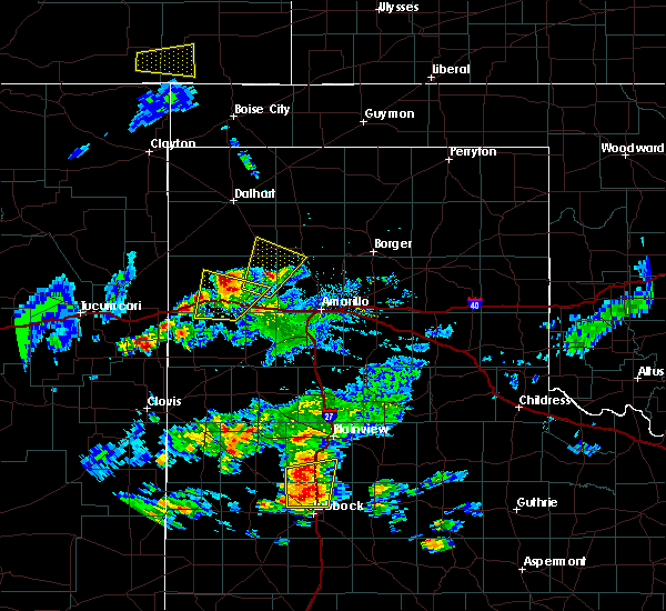 At 544 pm cdt, a severe thunderstorm was located over boys ranch, or 21 miles northeast of vega, moving north at 20 mph (radar indicated). Hazards include 60 mph wind gusts and half dollar size hail. Minor damage to roofs, siding, and trees is possible. hail damage to vehicles is expected. Locations impacted include, boys ranch, masterson and valley de oro. At 544 pm cdt, a severe thunderstorm was located over boys ranch, or 21 miles northeast of vega, moving north at 20 mph (radar indicated). Hazards include 60 mph wind gusts and half dollar size hail. Minor damage to roofs, siding, and trees is possible. hail damage to vehicles is expected. Locations impacted include, boys ranch, masterson and valley de oro.
|
| 9/17/2017 5:24 PM CDT |
 At 524 pm cdt, a severe thunderstorm was located 6 miles south of boys ranch, or 14 miles northeast of vega, moving north at 20 mph (radar indicated). Hazards include 60 mph wind gusts and half dollar size hail. Minor damage to roofs, siding, and trees is possible. Hail damage to vehicles is expected. At 524 pm cdt, a severe thunderstorm was located 6 miles south of boys ranch, or 14 miles northeast of vega, moving north at 20 mph (radar indicated). Hazards include 60 mph wind gusts and half dollar size hail. Minor damage to roofs, siding, and trees is possible. Hail damage to vehicles is expected.
|
| 8/27/2017 10:42 PM CDT |
 The severe thunderstorm warning for eastern oldham, western potter, southeastern hartley and southwestern moore counties will expire at 1045 pm cdt, the storm which prompted the warning has weakened below severe limits, and no longer poses an immediate threat to life or property. therefore the warning will be allowed to expire. however gusty winds are still possible with this thunderstorm. a severe thunderstorm watch remains in effect until 1100 pm cdt for the panhandle of texas. The severe thunderstorm warning for eastern oldham, western potter, southeastern hartley and southwestern moore counties will expire at 1045 pm cdt, the storm which prompted the warning has weakened below severe limits, and no longer poses an immediate threat to life or property. therefore the warning will be allowed to expire. however gusty winds are still possible with this thunderstorm. a severe thunderstorm watch remains in effect until 1100 pm cdt for the panhandle of texas.
|
| 8/27/2017 10:37 PM CDT |
 At 1037 pm cdt, a severe thunderstorm was located 6 miles northeast of wildorado, or 14 miles east of vega, moving south at 20 mph (radar indicated). Hazards include 60 mph wind gusts. minor damage to roofs, siding, and trees is possible At 1037 pm cdt, a severe thunderstorm was located 6 miles northeast of wildorado, or 14 miles east of vega, moving south at 20 mph (radar indicated). Hazards include 60 mph wind gusts. minor damage to roofs, siding, and trees is possible
|
| 8/27/2017 10:10 PM CDT | Storm damage reported in oldham county TX, 1 miles ENE of Boys Ranch, TX |
| 8/27/2017 9:50 PM CDT |
 At 950 pm cdt, a severe thunderstorm was located 7 miles northeast of boys ranch, or 21 miles southwest of dumas, moving south at 50 mph (radar indicated). Hazards include 60 mph wind gusts and nickel size hail. minor damage to roofs, siding, and trees is possible At 950 pm cdt, a severe thunderstorm was located 7 miles northeast of boys ranch, or 21 miles southwest of dumas, moving south at 50 mph (radar indicated). Hazards include 60 mph wind gusts and nickel size hail. minor damage to roofs, siding, and trees is possible
|
| 8/14/2017 9:59 PM CDT |
 At 959 pm cdt, severe thunderstorms were located along a line extending from 6 miles north of valley de oro to 3 miles southeast of adrian, moving southeast at 25 mph (radar indicated). Hazards include 60 mph wind gusts and penny size hail. Minor damage to roofs, siding, and trees is possible. Locations impacted include, amarillo, hereford, vega, fritch, adrian, glenrio, bushland, valley de oro, boys ranch, umbarger, bootleg, wildorado, mescalero park, dawn, four way, masterson, simms, lake meredith and pantex. At 959 pm cdt, severe thunderstorms were located along a line extending from 6 miles north of valley de oro to 3 miles southeast of adrian, moving southeast at 25 mph (radar indicated). Hazards include 60 mph wind gusts and penny size hail. Minor damage to roofs, siding, and trees is possible. Locations impacted include, amarillo, hereford, vega, fritch, adrian, glenrio, bushland, valley de oro, boys ranch, umbarger, bootleg, wildorado, mescalero park, dawn, four way, masterson, simms, lake meredith and pantex.
|
| 8/14/2017 9:43 PM CDT |
 At 943 pm cdt, severe thunderstorms were located along a line extending from 5 miles north of boys ranch to 4 miles west of adrian, moving southeast at 25 mph (radar indicated). Hazards include 60 mph wind gusts and penny size hail. minor damage to roofs, siding, and trees is possible At 943 pm cdt, severe thunderstorms were located along a line extending from 5 miles north of boys ranch to 4 miles west of adrian, moving southeast at 25 mph (radar indicated). Hazards include 60 mph wind gusts and penny size hail. minor damage to roofs, siding, and trees is possible
|
| 8/14/2017 9:32 PM CDT |
 At 932 pm cdt, severe thunderstorms were located along a line extending from 7 miles east of channing to 6 miles northwest of adrian, moving southeast at 40 mph (radar indicated). Hazards include 60 mph wind gusts and nickel size hail. Minor damage to roofs, siding, and trees is possible. Locations impacted include, vega, channing, adrian, four way, valley de oro, boys ranch, masterson and simms. At 932 pm cdt, severe thunderstorms were located along a line extending from 7 miles east of channing to 6 miles northwest of adrian, moving southeast at 40 mph (radar indicated). Hazards include 60 mph wind gusts and nickel size hail. Minor damage to roofs, siding, and trees is possible. Locations impacted include, vega, channing, adrian, four way, valley de oro, boys ranch, masterson and simms.
|
| 8/14/2017 9:13 PM CDT |
 At 913 pm cdt, severe thunderstorms were located along a line extending from 6 miles southeast of hartley to 16 miles southeast of nara visa, moving southeast at 35 mph (radar indicated). Hazards include 60 mph wind gusts and nickel size hail. Minor damage to roofs, siding, and trees is possible. Locations impacted include, vega, hartley, channing, adrian, four way, valley de oro, boys ranch, masterson and simms. At 913 pm cdt, severe thunderstorms were located along a line extending from 6 miles southeast of hartley to 16 miles southeast of nara visa, moving southeast at 35 mph (radar indicated). Hazards include 60 mph wind gusts and nickel size hail. Minor damage to roofs, siding, and trees is possible. Locations impacted include, vega, hartley, channing, adrian, four way, valley de oro, boys ranch, masterson and simms.
|
| 8/14/2017 8:50 PM CDT |
 At 848 pm cdt, severe thunderstorms were located along a line extending from 7 miles north of hartley to 8 miles south of romero, moving southeast at 35 mph (asos reported 60 mph winds at dalhart). Hazards include 60 mph wind gusts and nickel size hail. Minor damage to roofs, siding, and trees is possible. Locations impacted include, dumas, dalhart, vega, hartley, cactus, sunray, channing, adrian, valley de oro, boys ranch, romero, four way, masterson and simms. At 848 pm cdt, severe thunderstorms were located along a line extending from 7 miles north of hartley to 8 miles south of romero, moving southeast at 35 mph (asos reported 60 mph winds at dalhart). Hazards include 60 mph wind gusts and nickel size hail. Minor damage to roofs, siding, and trees is possible. Locations impacted include, dumas, dalhart, vega, hartley, cactus, sunray, channing, adrian, valley de oro, boys ranch, romero, four way, masterson and simms.
|
| 8/14/2017 8:23 PM CDT |
 At 823 pm cdt, severe thunderstorms were located along a line extending from 5 miles north of dalhart to 4 miles southwest of romero, moving southeast at 40 mph (radar indicated). Hazards include 60 mph wind gusts and nickel size hail. minor damage to roofs, siding, and trees is possible At 823 pm cdt, severe thunderstorms were located along a line extending from 5 miles north of dalhart to 4 miles southwest of romero, moving southeast at 40 mph (radar indicated). Hazards include 60 mph wind gusts and nickel size hail. minor damage to roofs, siding, and trees is possible
|
| 8/13/2017 7:45 PM CDT |
 At 744 pm cdt, severe thunderstorms were located along a line extending from 6 miles east of masterson to 7 miles southeast of vega, moving southeast at 30 mph. these are very dangerous storms (radar indicated). Hazards include 80 mph wind gusts and penny size hail. Flying debris will be dangerous to those caught without shelter. mobile homes will be heavily damaged. expect considerable damage to roofs, windows, and vehicles. tree damage and power outages are likely. Locations impacted include, amarillo, vega, bushland, buffalo lake, four way, valley de oro, boys ranch, masterson, umbarger and wildorado. At 744 pm cdt, severe thunderstorms were located along a line extending from 6 miles east of masterson to 7 miles southeast of vega, moving southeast at 30 mph. these are very dangerous storms (radar indicated). Hazards include 80 mph wind gusts and penny size hail. Flying debris will be dangerous to those caught without shelter. mobile homes will be heavily damaged. expect considerable damage to roofs, windows, and vehicles. tree damage and power outages are likely. Locations impacted include, amarillo, vega, bushland, buffalo lake, four way, valley de oro, boys ranch, masterson, umbarger and wildorado.
|
| 8/13/2017 7:26 PM CDT |
 At 725 pm cdt, severe thunderstorms were located along a line extending from 7 miles west of dumas to vega, moving southeast at 20 mph. these are very dangerous storms (radar indicated). Hazards include 80 mph wind gusts and penny size hail. Flying debris will be dangerous to those caught without shelter. mobile homes will be heavily damaged. expect considerable damage to roofs, windows, and vehicles. Tree damage and power outages are likely. At 725 pm cdt, severe thunderstorms were located along a line extending from 7 miles west of dumas to vega, moving southeast at 20 mph. these are very dangerous storms (radar indicated). Hazards include 80 mph wind gusts and penny size hail. Flying debris will be dangerous to those caught without shelter. mobile homes will be heavily damaged. expect considerable damage to roofs, windows, and vehicles. Tree damage and power outages are likely.
|
| 8/13/2017 7:06 PM CDT |
 At 706 pm cdt, severe thunderstorms were located along a line extending from 11 miles northeast of hartley to 11 miles northeast of adrian, moving southeast at 40 mph (radar indicated). Hazards include 70 mph wind gusts. Expect some tree damage. damage is likely to mobile homes, roofs, and outbuildings. Locations impacted include, hartley, channing and boys ranch. At 706 pm cdt, severe thunderstorms were located along a line extending from 11 miles northeast of hartley to 11 miles northeast of adrian, moving southeast at 40 mph (radar indicated). Hazards include 70 mph wind gusts. Expect some tree damage. damage is likely to mobile homes, roofs, and outbuildings. Locations impacted include, hartley, channing and boys ranch.
|
| 8/13/2017 6:48 PM CDT | Storm damage reported in oldham county TX, 1 miles ENE of Boys Ranch, TX |
| 8/13/2017 6:36 PM CDT |
 At 635 pm cdt, severe thunderstorms were located along a line extending from dalhart to 11 miles north of romero, moving southeast at 25 mph (trained weather spotters). Hazards include 70 mph wind gusts. Expect some tree damage. damage is likely to mobile homes, roofs, and outbuildings. Locations impacted include, dalhart, hartley, channing, boys ranch and romero. At 635 pm cdt, severe thunderstorms were located along a line extending from dalhart to 11 miles north of romero, moving southeast at 25 mph (trained weather spotters). Hazards include 70 mph wind gusts. Expect some tree damage. damage is likely to mobile homes, roofs, and outbuildings. Locations impacted include, dalhart, hartley, channing, boys ranch and romero.
|
| 8/13/2017 6:16 PM CDT |
 At 616 pm cdt, severe thunderstorms were located along a line extending from near ware to 10 miles east of amistad, moving southeast at 40 mph (radar indicated). Hazards include 70 mph wind gusts and quarter size hail. Expect some tree damage. damage is likely to mobile homes, roofs, and outbuildings. Hail damage to vehicles is expected. At 616 pm cdt, severe thunderstorms were located along a line extending from near ware to 10 miles east of amistad, moving southeast at 40 mph (radar indicated). Hazards include 70 mph wind gusts and quarter size hail. Expect some tree damage. damage is likely to mobile homes, roofs, and outbuildings. Hail damage to vehicles is expected.
|
| 8/10/2017 8:42 PM CDT |
 The severe thunderstorm warning for northeastern oldham, southeastern dallam and eastern hartley counties will expire at 845 pm cdt, the storms which prompted the warning have weakened below severe limits, and no longer pose an immediate threat to life or property. therefore the warning will be allowed to expire. however small hail and heavy rain are still possible with these thunderstorms. a severe thunderstorm watch remains in effect until 1100 pm cdt for the panhandle of texas. The severe thunderstorm warning for northeastern oldham, southeastern dallam and eastern hartley counties will expire at 845 pm cdt, the storms which prompted the warning have weakened below severe limits, and no longer pose an immediate threat to life or property. therefore the warning will be allowed to expire. however small hail and heavy rain are still possible with these thunderstorms. a severe thunderstorm watch remains in effect until 1100 pm cdt for the panhandle of texas.
|
| 8/10/2017 8:06 PM CDT |
 At 806 pm cdt, severe thunderstorms were located along a line extending from 4 miles east of dalhart to 6 miles west of boys ranch, moving northeast at 10 mph (radar indicated). Hazards include 70 mph wind gusts and half dollar size hail. Expect some tree damage. damage is likely to mobile homes, roofs, and outbuildings. hail damage to vehicles is expected. Locations impacted include, dalhart, hartley, channing and boys ranch. At 806 pm cdt, severe thunderstorms were located along a line extending from 4 miles east of dalhart to 6 miles west of boys ranch, moving northeast at 10 mph (radar indicated). Hazards include 70 mph wind gusts and half dollar size hail. Expect some tree damage. damage is likely to mobile homes, roofs, and outbuildings. hail damage to vehicles is expected. Locations impacted include, dalhart, hartley, channing and boys ranch.
|
| 8/10/2017 7:38 PM CDT |
 At 738 pm cdt, severe thunderstorms were located along a line extending from 5 miles east of dalhart to 4 miles southwest of channing, moving east at 25 mph (radar indicated). Hazards include 70 mph wind gusts and half dollar size hail. Expect some tree damage. damage is likely to mobile homes, roofs, and outbuildings. Hail damage to vehicles is expected. At 738 pm cdt, severe thunderstorms were located along a line extending from 5 miles east of dalhart to 4 miles southwest of channing, moving east at 25 mph (radar indicated). Hazards include 70 mph wind gusts and half dollar size hail. Expect some tree damage. damage is likely to mobile homes, roofs, and outbuildings. Hail damage to vehicles is expected.
|
| 8/10/2017 7:20 PM CDT | Half Dollar sized hail reported 6.4 miles N of Boys Ranch, TX |
| 8/10/2017 5:27 PM CDT |
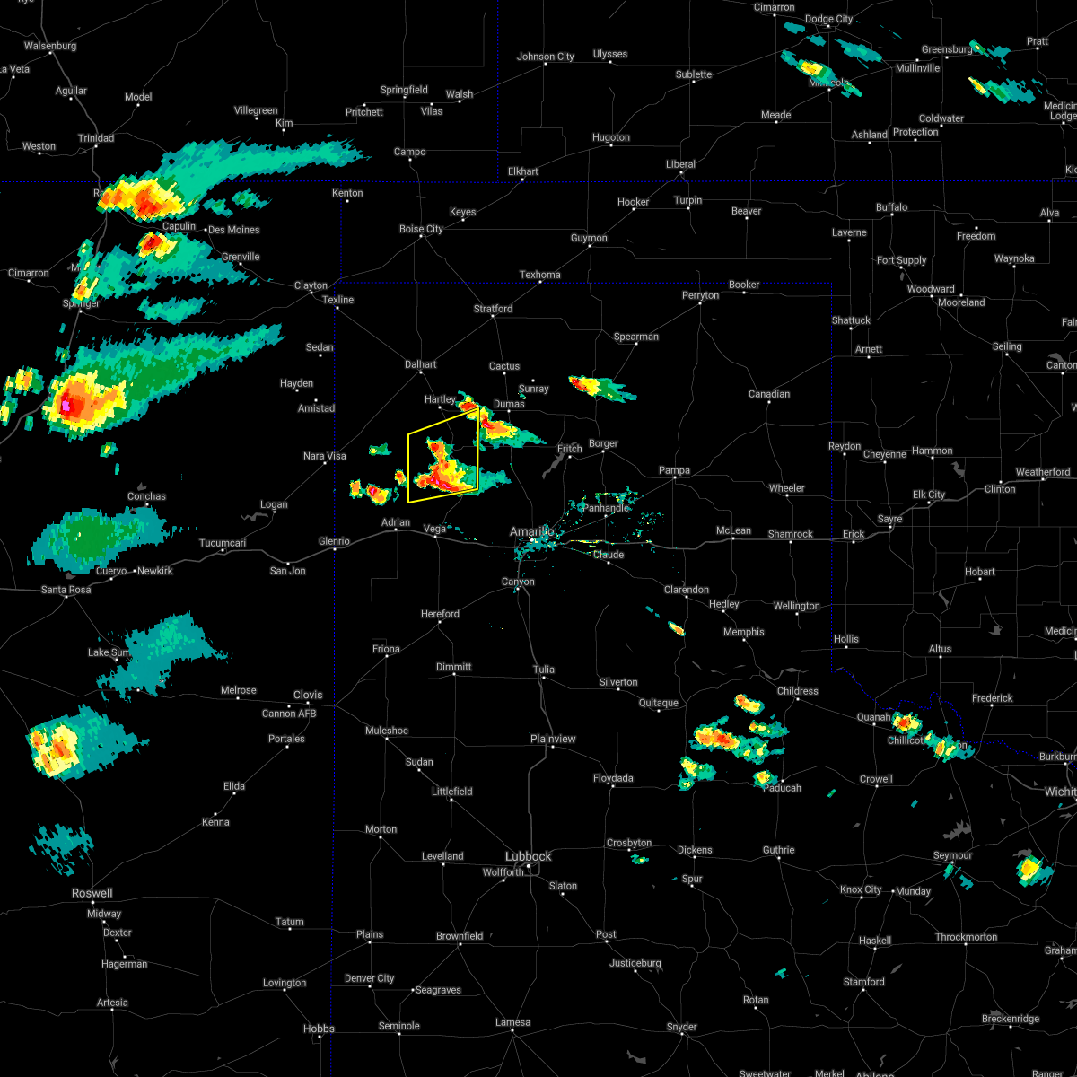 The severe thunderstorm warning for northeastern oldham and southeastern hartley counties will expire at 530 pm cdt, the storms which prompted the warning have weakened below severe limits, and have exited the warned area. therefore the warning will be allowed to expire. however gusty winds and heavy rain are still possible with these thunderstorms. a severe thunderstorm watch remains in effect until 1100 pm cdt for the panhandle of texas. The severe thunderstorm warning for northeastern oldham and southeastern hartley counties will expire at 530 pm cdt, the storms which prompted the warning have weakened below severe limits, and have exited the warned area. therefore the warning will be allowed to expire. however gusty winds and heavy rain are still possible with these thunderstorms. a severe thunderstorm watch remains in effect until 1100 pm cdt for the panhandle of texas.
|
| 8/10/2017 4:54 PM CDT |
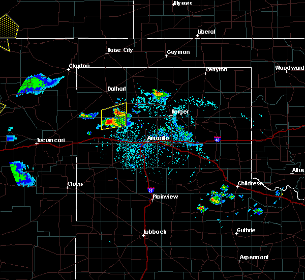 At 451 pm cdt, a severe thunderstorm was located over channing, or 24 miles southwest of dumas, moving east at 25 mph. this storm and another one west of boys ranch will move across highway 385 from boys ranch to north of channing (radar indicated). Hazards include 70 mph wind gusts and half dollar size hail. Expect some tree damage. damage is likely to mobile homes, roofs, and outbuildings. hail damage to vehicles is expected. Locations impacted include, channing and boys ranch. At 451 pm cdt, a severe thunderstorm was located over channing, or 24 miles southwest of dumas, moving east at 25 mph. this storm and another one west of boys ranch will move across highway 385 from boys ranch to north of channing (radar indicated). Hazards include 70 mph wind gusts and half dollar size hail. Expect some tree damage. damage is likely to mobile homes, roofs, and outbuildings. hail damage to vehicles is expected. Locations impacted include, channing and boys ranch.
|
| 8/10/2017 4:34 PM CDT |
 At 434 pm cdt, a severe thunderstorm was located 8 miles southwest of channing, or 26 miles north of vega, moving northeast at 20 mph (radar indicated). Hazards include half dollar size hail. damage to vehicles is expected At 434 pm cdt, a severe thunderstorm was located 8 miles southwest of channing, or 26 miles north of vega, moving northeast at 20 mph (radar indicated). Hazards include half dollar size hail. damage to vehicles is expected
|
| 7/24/2017 7:17 PM CDT |
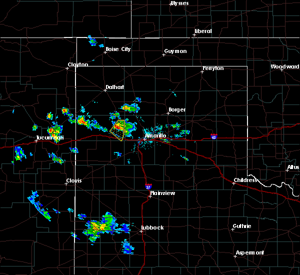 At 715 pm cdt, a severe thunderstorm was located 5 miles south of boys ranch, or 14 miles northeast of vega, moving south southwest at 15 mph (radar indicated). Hazards include 60 mph wind gusts and penny size hail. Minor damage to roofs, siding, and trees is possible. Locations impacted include, boys ranch and wildorado. At 715 pm cdt, a severe thunderstorm was located 5 miles south of boys ranch, or 14 miles northeast of vega, moving south southwest at 15 mph (radar indicated). Hazards include 60 mph wind gusts and penny size hail. Minor damage to roofs, siding, and trees is possible. Locations impacted include, boys ranch and wildorado.
|
| 7/24/2017 6:49 PM CDT |
 At 649 pm cdt, a severe thunderstorm was located 5 miles west of valley de oro, or 18 miles northeast of vega, moving south at 10 mph (radar indicated). Hazards include 60 mph wind gusts and quarter size hail. Minor damage to roofs, siding, and trees is possible. Hail damage to vehicles is expected. At 649 pm cdt, a severe thunderstorm was located 5 miles west of valley de oro, or 18 miles northeast of vega, moving south at 10 mph (radar indicated). Hazards include 60 mph wind gusts and quarter size hail. Minor damage to roofs, siding, and trees is possible. Hail damage to vehicles is expected.
|
| 6/25/2017 9:53 PM CDT |
 At 953 pm cdt, severe thunderstorms were located along a line extending from 11 miles north of adrian to 8 miles northeast of vega, moving south at 40 mph (radar indicated). Hazards include 60 mph wind gusts and quarter size hail. Minor damage to roofs, siding, and trees is possible. hail damage to vehicles is expected. Locations impacted include, vega, adrian, boys ranch and wildorado. At 953 pm cdt, severe thunderstorms were located along a line extending from 11 miles north of adrian to 8 miles northeast of vega, moving south at 40 mph (radar indicated). Hazards include 60 mph wind gusts and quarter size hail. Minor damage to roofs, siding, and trees is possible. hail damage to vehicles is expected. Locations impacted include, vega, adrian, boys ranch and wildorado.
|
| 6/25/2017 9:41 PM CDT |
 At 941 pm cdt, severe thunderstorms were located along a line extending from 10 miles southeast of romero to 3 miles west of boys ranch, moving south at 30 mph (radar indicated). Hazards include 60 mph wind gusts and quarter size hail. Minor damage to roofs, siding, and trees is possible. hail damage to vehicles is expected. Locations impacted include, vega, channing, adrian, boys ranch and wildorado. At 941 pm cdt, severe thunderstorms were located along a line extending from 10 miles southeast of romero to 3 miles west of boys ranch, moving south at 30 mph (radar indicated). Hazards include 60 mph wind gusts and quarter size hail. Minor damage to roofs, siding, and trees is possible. hail damage to vehicles is expected. Locations impacted include, vega, channing, adrian, boys ranch and wildorado.
|
| 6/25/2017 9:22 PM CDT |
 At 922 pm cdt, severe thunderstorms were located along a line extending from 10 miles east of romero to 5 miles southeast of channing, moving south at 30 mph (radar indicated). Hazards include 70 mph wind gusts and ping pong ball size hail. Expect some tree damage. damage is likely to mobile homes, roofs, and outbuildings. people and animals outdoors will be injured. expect hail damage to roofs, siding, windows, and vehicles. Locations impacted include, vega, channing, adrian, boys ranch, wildorado and romero. At 922 pm cdt, severe thunderstorms were located along a line extending from 10 miles east of romero to 5 miles southeast of channing, moving south at 30 mph (radar indicated). Hazards include 70 mph wind gusts and ping pong ball size hail. Expect some tree damage. damage is likely to mobile homes, roofs, and outbuildings. people and animals outdoors will be injured. expect hail damage to roofs, siding, windows, and vehicles. Locations impacted include, vega, channing, adrian, boys ranch, wildorado and romero.
|
| 6/25/2017 8:55 PM CDT |
 At 855 pm cdt, severe thunderstorms were located along a line extending from 14 miles southwest of dalhart to 10 miles northeast of channing, moving south at 30 mph. these are very dangerous storms (radar indicated). Hazards include baseball size hail and 70 mph wind gusts. People and animals outdoors will be severely injured. Expect shattered windows, extensive damage to roofs, siding, and vehicles. At 855 pm cdt, severe thunderstorms were located along a line extending from 14 miles southwest of dalhart to 10 miles northeast of channing, moving south at 30 mph. these are very dangerous storms (radar indicated). Hazards include baseball size hail and 70 mph wind gusts. People and animals outdoors will be severely injured. Expect shattered windows, extensive damage to roofs, siding, and vehicles.
|
| 6/22/2017 8:33 PM CDT |
 At 832 pm cdt, a severe thunderstorm was located 7 miles north of channing, or 20 miles south of dalhart, moving east at 20 mph (radar indicated). Hazards include golf ball size hail and 70 mph wind gusts. Expect some tree damage. damage is likely to mobile homes, roofs, and outbuildings. people and animals outdoors will be injured. expect hail damage to roofs, siding, windows, and vehicles. Locations impacted include, channing and boys ranch. At 832 pm cdt, a severe thunderstorm was located 7 miles north of channing, or 20 miles south of dalhart, moving east at 20 mph (radar indicated). Hazards include golf ball size hail and 70 mph wind gusts. Expect some tree damage. damage is likely to mobile homes, roofs, and outbuildings. people and animals outdoors will be injured. expect hail damage to roofs, siding, windows, and vehicles. Locations impacted include, channing and boys ranch.
|
| 6/22/2017 8:12 PM CDT |
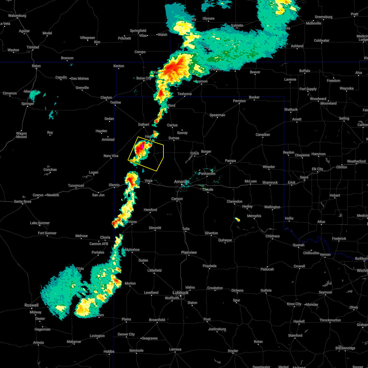 At 811 pm cdt, a severe thunderstorm was located 11 miles southwest of hartley, or 21 miles south of dalhart, moving southeast at 25 mph (radar indicated). Hazards include golf ball size hail and 70 mph wind gusts. Expect some tree damage. damage is likely to mobile homes, roofs, and outbuildings. people and animals outdoors will be injured. Expect hail damage to roofs, siding, windows, and vehicles. At 811 pm cdt, a severe thunderstorm was located 11 miles southwest of hartley, or 21 miles south of dalhart, moving southeast at 25 mph (radar indicated). Hazards include golf ball size hail and 70 mph wind gusts. Expect some tree damage. damage is likely to mobile homes, roofs, and outbuildings. people and animals outdoors will be injured. Expect hail damage to roofs, siding, windows, and vehicles.
|
| 6/21/2017 7:43 PM CDT |
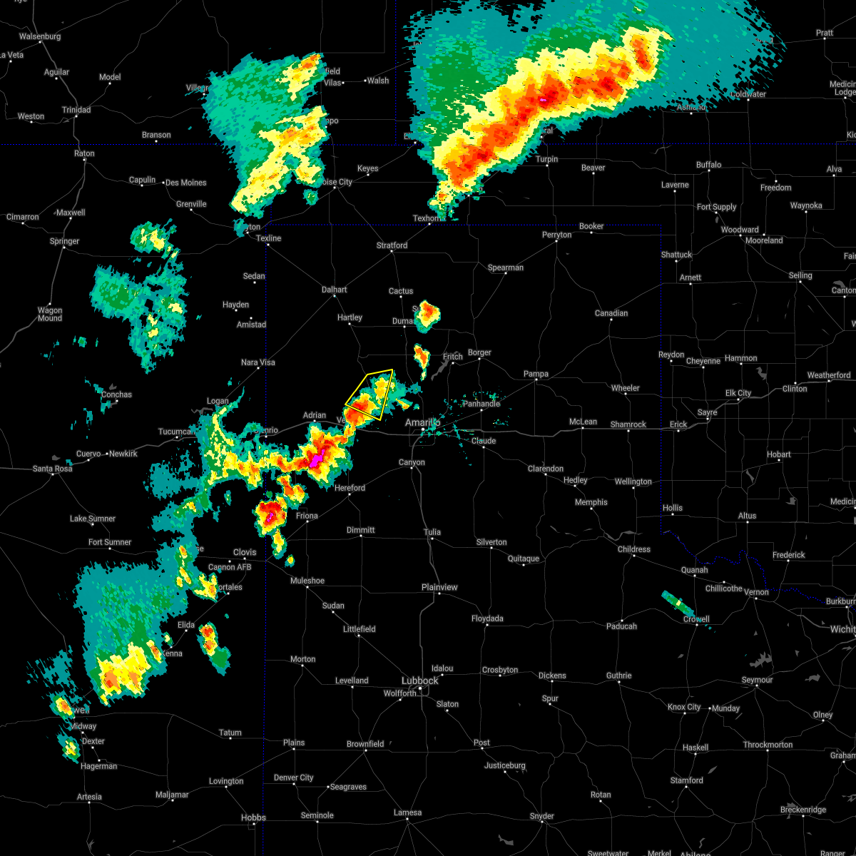 The severe thunderstorm warning for east central oldham and northwestern potter counties will expire at 745 pm cdt. the storms which prompted the warning have weakened below severe limits, and have exited the warned area. therefore the warning will be allowed to expire. However small hail and gusty winds are still possible with these thunderstorms. The severe thunderstorm warning for east central oldham and northwestern potter counties will expire at 745 pm cdt. the storms which prompted the warning have weakened below severe limits, and have exited the warned area. therefore the warning will be allowed to expire. However small hail and gusty winds are still possible with these thunderstorms.
|
| 6/21/2017 7:33 PM CDT |
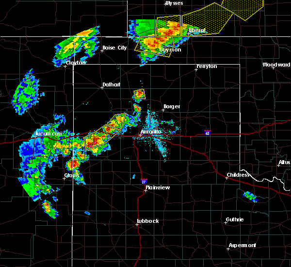 At 733 pm cdt, severe thunderstorms were located along a line extending from 4 miles east of boys ranch to 7 miles northeast of vega, moving southeast at 15 mph (radar indicated). Hazards include 60 mph wind gusts and quarter size hail. Minor damage to roofs, siding, and trees is possible. hail damage to vehicles is expected. Locations impacted include, boys ranch. At 733 pm cdt, severe thunderstorms were located along a line extending from 4 miles east of boys ranch to 7 miles northeast of vega, moving southeast at 15 mph (radar indicated). Hazards include 60 mph wind gusts and quarter size hail. Minor damage to roofs, siding, and trees is possible. hail damage to vehicles is expected. Locations impacted include, boys ranch.
|
| 6/21/2017 7:14 PM CDT |
 At 714 pm cdt, severe thunderstorms were located along a line extending from boys ranch to 8 miles north of vega, moving southeast at 15 mph (radar indicated). Hazards include ping pong ball size hail and 60 mph wind gusts. Minor damage to roofs, siding, and trees is possible. people and animals outdoors will be injured. expect hail damage to roofs, siding, windows, and vehicles. Locations impacted include, boys ranch. At 714 pm cdt, severe thunderstorms were located along a line extending from boys ranch to 8 miles north of vega, moving southeast at 15 mph (radar indicated). Hazards include ping pong ball size hail and 60 mph wind gusts. Minor damage to roofs, siding, and trees is possible. people and animals outdoors will be injured. expect hail damage to roofs, siding, windows, and vehicles. Locations impacted include, boys ranch.
|
| 6/21/2017 6:58 PM CDT | Storm damage reported in potter county TX, 15 miles W of Boys Ranch, TX |
| 6/21/2017 6:52 PM CDT |
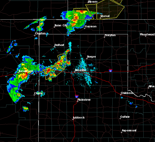 At 652 pm cdt, severe thunderstorms were located along a line extending from 12 miles southwest of dumas to 8 miles east of channing to near boys ranch, moving east at 15 mph (radar indicated). Hazards include 60 mph wind gusts and quarter size hail. Minor damage to roofs, siding, and trees is possible. hail damage to vehicles is expected. Locations impacted include, channing and boys ranch. At 652 pm cdt, severe thunderstorms were located along a line extending from 12 miles southwest of dumas to 8 miles east of channing to near boys ranch, moving east at 15 mph (radar indicated). Hazards include 60 mph wind gusts and quarter size hail. Minor damage to roofs, siding, and trees is possible. hail damage to vehicles is expected. Locations impacted include, channing and boys ranch.
|
| 6/21/2017 6:16 PM CDT | Storm damage reported in oldham county TX, 1.8 miles NNE of Boys Ranch, TX |
| 6/21/2017 6:15 PM CDT |
 At 614 pm cdt, severe thunderstorms were located along a line extending from 7 miles east of hartley to 6 miles northeast of channing to 5 miles north of boys ranch to 12 miles north of vega, moving east-southeast at 10 mph (radar indicated). Hazards include 60 mph wind gusts and quarter size hail. Minor damage to roofs, siding, and trees is possible. Hail damage to vehicles is expected. At 614 pm cdt, severe thunderstorms were located along a line extending from 7 miles east of hartley to 6 miles northeast of channing to 5 miles north of boys ranch to 12 miles north of vega, moving east-southeast at 10 mph (radar indicated). Hazards include 60 mph wind gusts and quarter size hail. Minor damage to roofs, siding, and trees is possible. Hail damage to vehicles is expected.
|
| 5/15/2017 6:20 PM CDT | Golf Ball sized hail reported 15 miles W of Boys Ranch, TX, golf ball size hail reported |
| 5/15/2017 5:31 PM CDT |
 At 531 pm cdt, a severe thunderstorm was located 4 miles south of channing, or 25 miles southwest of dumas, moving north at 50 mph (radar indicated). Hazards include 60 mph wind gusts and half dollar size hail. Minor damage to roofs, siding, and trees is possible. Hail damage to vehicles is expected. At 531 pm cdt, a severe thunderstorm was located 4 miles south of channing, or 25 miles southwest of dumas, moving north at 50 mph (radar indicated). Hazards include 60 mph wind gusts and half dollar size hail. Minor damage to roofs, siding, and trees is possible. Hail damage to vehicles is expected.
|
| 4/14/2017 6:10 PM CDT |
 At 610 pm cdt, a severe thunderstorm was located 4 miles northeast of boys ranch, or 24 miles northeast of vega, moving northeast at 35 mph (radar indicated). Hazards include half dollar size hail. Damage to vehicles is expected. Locations impacted include, boys ranch, valley de oro and wildorado. At 610 pm cdt, a severe thunderstorm was located 4 miles northeast of boys ranch, or 24 miles northeast of vega, moving northeast at 35 mph (radar indicated). Hazards include half dollar size hail. Damage to vehicles is expected. Locations impacted include, boys ranch, valley de oro and wildorado.
|
| 4/14/2017 5:42 PM CDT |
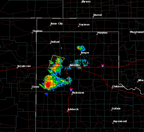 At 542 pm cdt, a severe thunderstorm was located 8 miles northeast of vega, moving northeast at 35 mph (radar indicated). Hazards include half dollar size hail. Damage to vehicles is expected. Locations impacted include, vega, boys ranch, wildorado and valley de oro. At 542 pm cdt, a severe thunderstorm was located 8 miles northeast of vega, moving northeast at 35 mph (radar indicated). Hazards include half dollar size hail. Damage to vehicles is expected. Locations impacted include, vega, boys ranch, wildorado and valley de oro.
|
| 4/14/2017 5:25 PM CDT |
 At 525 pm cdt, a severe thunderstorm was located over vega, moving northeast at 35 mph (radar indicated). Hazards include ping pong ball size hail and 60 mph wind gusts. Minor damage to roofs, siding, and trees is possible. people and animals outdoors will be injured. Expect hail damage to roofs, siding, windows, and vehicles. At 525 pm cdt, a severe thunderstorm was located over vega, moving northeast at 35 mph (radar indicated). Hazards include ping pong ball size hail and 60 mph wind gusts. Minor damage to roofs, siding, and trees is possible. people and animals outdoors will be injured. Expect hail damage to roofs, siding, windows, and vehicles.
|
| 3/23/2017 7:23 PM CDT |
 The severe thunderstorm warning for western randall, eastern oldham, eastern deaf smith and western potter counties will expire at 730 pm cdt, the storms which prompted the warning have moved out of the warned area. therefore the warning will be allowed to expire. a severe thunderstorm watch remains in effect until 1000 pm cdt for the panhandle of texas. The severe thunderstorm warning for western randall, eastern oldham, eastern deaf smith and western potter counties will expire at 730 pm cdt, the storms which prompted the warning have moved out of the warned area. therefore the warning will be allowed to expire. a severe thunderstorm watch remains in effect until 1000 pm cdt for the panhandle of texas.
|
| 3/23/2017 7:08 PM CDT |
 At 707 pm cdt, severe thunderstorms were located along a line extending from 9 miles west of texhoma to 3 miles southwest of valley de oro, moving northeast at 55 mph (radar indicated). Hazards include 70 mph wind gusts and quarter size hail. Expect some tree damage. damage is likely to mobile homes, roofs, and outbuildings. Hail damage to vehicles is expected. At 707 pm cdt, severe thunderstorms were located along a line extending from 9 miles west of texhoma to 3 miles southwest of valley de oro, moving northeast at 55 mph (radar indicated). Hazards include 70 mph wind gusts and quarter size hail. Expect some tree damage. damage is likely to mobile homes, roofs, and outbuildings. Hail damage to vehicles is expected.
|
| 3/23/2017 7:08 PM CDT |
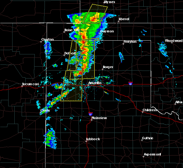 At 707 pm cdt, severe thunderstorms were located along a line extending from 9 miles west of texhoma to 3 miles southwest of valley de oro, moving northeast at 55 mph (radar indicated). Hazards include 70 mph wind gusts and quarter size hail. Expect some tree damage. damage is likely to mobile homes, roofs, and outbuildings. Hail damage to vehicles is expected. At 707 pm cdt, severe thunderstorms were located along a line extending from 9 miles west of texhoma to 3 miles southwest of valley de oro, moving northeast at 55 mph (radar indicated). Hazards include 70 mph wind gusts and quarter size hail. Expect some tree damage. damage is likely to mobile homes, roofs, and outbuildings. Hail damage to vehicles is expected.
|
| 3/23/2017 7:03 PM CDT |
 At 700 pm cdt, severe thunderstorms were located along a line extending from 4 miles west of cactus to 4 miles northwest of wildorado, moving north at 60 mph (trained weather spotters, with one inch hail reported 3 miles east of vega). Hazards include quarter size hail. Damage to vehicles is expected. Locations impacted include, hereford, vega, bushland, buffalo lake, dawn, valley de oro, boys ranch, umbarger and wildorado. At 700 pm cdt, severe thunderstorms were located along a line extending from 4 miles west of cactus to 4 miles northwest of wildorado, moving north at 60 mph (trained weather spotters, with one inch hail reported 3 miles east of vega). Hazards include quarter size hail. Damage to vehicles is expected. Locations impacted include, hereford, vega, bushland, buffalo lake, dawn, valley de oro, boys ranch, umbarger and wildorado.
|
| 3/23/2017 6:33 PM CDT |
 At 633 pm cdt, severe thunderstorms were located along a line extending from 6 miles southeast of channing to 4 miles northwest of hereford, moving north at 60 mph (radar indicated). Hazards include 70 mph wind gusts and quarter size hail. Expect some tree damage. damage is likely to mobile homes, roofs, and outbuildings. Hail damage to vehicles is expected. At 633 pm cdt, severe thunderstorms were located along a line extending from 6 miles southeast of channing to 4 miles northwest of hereford, moving north at 60 mph (radar indicated). Hazards include 70 mph wind gusts and quarter size hail. Expect some tree damage. damage is likely to mobile homes, roofs, and outbuildings. Hail damage to vehicles is expected.
|
| 8/25/2016 8:16 PM CDT |
 At 816 pm cdt, a severe thunderstorm was located 5 miles southwest of channing, or 25 miles north of vega, moving north at 15 mph (radar indicated). Hazards include golf ball size hail and 60 mph wind gusts. Minor damage to roofs. siding. and trees is possible. people and animals outdoors will be injured. Expect hail damage to roofs, siding, windows, and vehicles. At 816 pm cdt, a severe thunderstorm was located 5 miles southwest of channing, or 25 miles north of vega, moving north at 15 mph (radar indicated). Hazards include golf ball size hail and 60 mph wind gusts. Minor damage to roofs. siding. and trees is possible. people and animals outdoors will be injured. Expect hail damage to roofs, siding, windows, and vehicles.
|
| 7/15/2016 7:24 PM CDT | Storm damage reported in potter county TX, 15 miles W of Boys Ranch, TX |
| 6/13/2016 6:29 PM CDT | Hen Egg sized hail reported 9.9 miles NW of Boys Ranch, TX, hail slightly larger than golf balls was beginning to fall in valley de oro. |
| 6/13/2016 6:15 PM CDT | Half Dollar sized hail reported 9.9 miles NW of Boys Ranch, TX |
| 6/13/2016 6:10 PM CDT | Quarter sized hail reported 9.9 miles NW of Boys Ranch, TX |
| 6/13/2016 6:02 PM CDT |
 At 601 pm cdt, a severe thunderstorm was located 6 miles south of boys ranch, or 15 miles northeast of vega, moving east at 20 mph (radar indicated). Hazards include tennis ball size hail. People and animals outdoors will be injured. expect damage to roofs, siding, windows, and vehicles. locations impacted include, boys ranch. A tornado watch remains in effect until 1000 pm cdt for the panhandle of texas. At 601 pm cdt, a severe thunderstorm was located 6 miles south of boys ranch, or 15 miles northeast of vega, moving east at 20 mph (radar indicated). Hazards include tennis ball size hail. People and animals outdoors will be injured. expect damage to roofs, siding, windows, and vehicles. locations impacted include, boys ranch. A tornado watch remains in effect until 1000 pm cdt for the panhandle of texas.
|
| 6/13/2016 5:40 PM CDT |
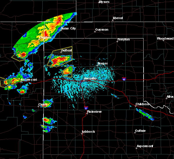 At 540 pm cdt, a severe thunderstorm was located 9 miles southwest of boys ranch, or 12 miles north of vega, moving east at 20 mph (radar indicated). Hazards include ping pong ball size hail. People and animals outdoors will be injured. Expect damage to roofs, siding, windows, and vehicles. At 540 pm cdt, a severe thunderstorm was located 9 miles southwest of boys ranch, or 12 miles north of vega, moving east at 20 mph (radar indicated). Hazards include ping pong ball size hail. People and animals outdoors will be injured. Expect damage to roofs, siding, windows, and vehicles.
|
| 5/30/2016 11:51 PM CDT |
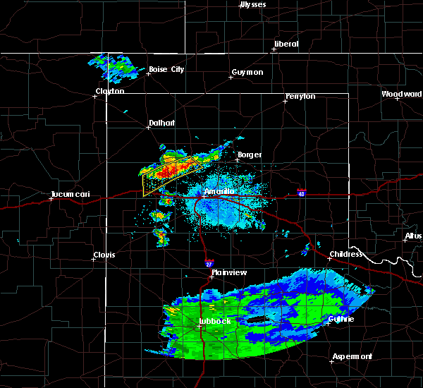 At 1149 pm cdt, a severe thunderstorm was located 4 miles southwest of boys ranch, or 17 miles north of vega, moving southeast at 10 mph (radar indicated). Hazards include half dollar size hail. Damage to vehicles is expected. locations impacted include, valley de oro, masterson and boys ranch. This includes interstate 40 between mile markers 29 and 33. At 1149 pm cdt, a severe thunderstorm was located 4 miles southwest of boys ranch, or 17 miles north of vega, moving southeast at 10 mph (radar indicated). Hazards include half dollar size hail. Damage to vehicles is expected. locations impacted include, valley de oro, masterson and boys ranch. This includes interstate 40 between mile markers 29 and 33.
|
| 5/30/2016 11:33 PM CDT |
 At 1133 pm cdt, a severe thunderstorm was located 6 miles west of boys ranch, or 20 miles north of vega, moving south at 10 mph (radar indicated). Hazards include quarter size hail. Damage to vehicles is expected. locations impacted include, valley de oro, masterson and boys ranch. This includes interstate 40 between mile markers 27 and 33. At 1133 pm cdt, a severe thunderstorm was located 6 miles west of boys ranch, or 20 miles north of vega, moving south at 10 mph (radar indicated). Hazards include quarter size hail. Damage to vehicles is expected. locations impacted include, valley de oro, masterson and boys ranch. This includes interstate 40 between mile markers 27 and 33.
|
| 5/30/2016 11:11 PM CDT |
 At 1111 pm cdt, a severe thunderstorm was located 8 miles northwest of boys ranch, or 21 miles north of vega, moving southeast at 10 mph (radar indicated). Hazards include 60 mph wind gusts and half dollar size hail. Minor damage to roofs. siding. and trees is possible. Hail damage to vehicles is expected. At 1111 pm cdt, a severe thunderstorm was located 8 miles northwest of boys ranch, or 21 miles north of vega, moving southeast at 10 mph (radar indicated). Hazards include 60 mph wind gusts and half dollar size hail. Minor damage to roofs. siding. and trees is possible. Hail damage to vehicles is expected.
|
| 5/30/2016 10:45 PM CDT |
 At 1045 pm cdt, severe thunderstorms were located along a line extending from 5 miles northwest of dumas to 3 miles southeast of channing to 14 miles west of boys ranch, moving southeast at 15 mph (radar indicated). Hazards include 60 mph wind gusts and quarter size hail. Minor damage to roofs. siding. and trees is possible. hail damage to vehicles is expected. Locations impacted include, dumas, channing and boys ranch. At 1045 pm cdt, severe thunderstorms were located along a line extending from 5 miles northwest of dumas to 3 miles southeast of channing to 14 miles west of boys ranch, moving southeast at 15 mph (radar indicated). Hazards include 60 mph wind gusts and quarter size hail. Minor damage to roofs. siding. and trees is possible. hail damage to vehicles is expected. Locations impacted include, dumas, channing and boys ranch.
|
| 5/30/2016 10:34 PM CDT |
 At 1034 pm cdt, severe thunderstorms were located along a line extending from 7 miles south of cactus to near channing to 16 miles west of boys ranch, moving southeast at 15 mph (radar indicated). Hazards include 60 mph wind gusts and half dollar size hail. Minor damage to roofs. siding. and trees is possible. hail damage to vehicles is expected. Locations impacted include, dumas, channing and boys ranch. At 1034 pm cdt, severe thunderstorms were located along a line extending from 7 miles south of cactus to near channing to 16 miles west of boys ranch, moving southeast at 15 mph (radar indicated). Hazards include 60 mph wind gusts and half dollar size hail. Minor damage to roofs. siding. and trees is possible. hail damage to vehicles is expected. Locations impacted include, dumas, channing and boys ranch.
|
| 5/30/2016 10:08 PM CDT |
 At 1008 pm cdt, severe thunderstorms were located along a line extending from 11 miles west of cactus to 6 miles west of channing to 18 miles southeast of romero, moving southeast at 10 mph. these are very dangerous storms (radar indicated). Hazards include baseball size hail and 60 mph wind gusts. People and animals outdoors will be severely injured. Expect shattered windows, extensive damage to roofs, siding, and vehicles. At 1008 pm cdt, severe thunderstorms were located along a line extending from 11 miles west of cactus to 6 miles west of channing to 18 miles southeast of romero, moving southeast at 10 mph. these are very dangerous storms (radar indicated). Hazards include baseball size hail and 60 mph wind gusts. People and animals outdoors will be severely injured. Expect shattered windows, extensive damage to roofs, siding, and vehicles.
|
| 5/29/2016 4:05 PM CDT |
 At 405 pm cdt, severe thunderstorms were located along a line extending from 7 miles north of wildorado to 6 miles north of bootleg, moving east at 15 mph (radar indicated). Hazards include golf ball size hail and 60 mph wind gusts. Minor damage to roofs. siding. and trees is possible. people and animals outdoors will be injured. expect hail damage to roofs, siding, windows, and vehicles. locations impacted include, vega, adrian, boys ranch, wildorado, simms, bootleg and dawn. This includes interstate 40 between mile markers 9 and 51. At 405 pm cdt, severe thunderstorms were located along a line extending from 7 miles north of wildorado to 6 miles north of bootleg, moving east at 15 mph (radar indicated). Hazards include golf ball size hail and 60 mph wind gusts. Minor damage to roofs. siding. and trees is possible. people and animals outdoors will be injured. expect hail damage to roofs, siding, windows, and vehicles. locations impacted include, vega, adrian, boys ranch, wildorado, simms, bootleg and dawn. This includes interstate 40 between mile markers 9 and 51.
|
| 5/29/2016 3:26 PM CDT |
 At 326 pm cdt, severe thunderstorms were located along a line extending from 15 miles northwest of adrian to bootleg, moving northeast at 20 mph (radar indicated). Hazards include golf ball size hail and 60 mph wind gusts. Minor damage to roofs. siding. and trees is possible. people and animals outdoors will be injured. Expect hail damage to roofs, siding, windows, and vehicles. At 326 pm cdt, severe thunderstorms were located along a line extending from 15 miles northwest of adrian to bootleg, moving northeast at 20 mph (radar indicated). Hazards include golf ball size hail and 60 mph wind gusts. Minor damage to roofs. siding. and trees is possible. people and animals outdoors will be injured. Expect hail damage to roofs, siding, windows, and vehicles.
|
| 5/16/2016 8:33 PM CDT | Tea Cup sized hail reported 18.2 miles W of Boys Ranch, TX, hail up to 3 inches damaged windshields of vehicles in marsh on highway 87. |
| 5/16/2016 7:40 PM CDT |
 At 739 pm cdt, a severe thunderstorm was located 6 miles northwest of channing, or 22 miles south of dalhart, moving southeast at 40 mph (radar indicated). Hazards include 70 mph wind gusts and half dollar size hail. Expect some tree damage. damage is likely to mobile homes, roofs, and outbuildings. Hail damage to vehicles is expected. At 739 pm cdt, a severe thunderstorm was located 6 miles northwest of channing, or 22 miles south of dalhart, moving southeast at 40 mph (radar indicated). Hazards include 70 mph wind gusts and half dollar size hail. Expect some tree damage. damage is likely to mobile homes, roofs, and outbuildings. Hail damage to vehicles is expected.
|
| 5/11/2016 9:54 PM CDT | Quarter sized hail reported 9.9 miles NW of Boys Ranch, TX |
| 4/28/2016 6:39 PM CDT |
 At 639 pm cdt, a severe thunderstorm was located 6 miles north of valley de oro, or 23 miles south of dumas, moving northeast at 15 mph (radar indicated). Hazards include ping pong ball size hail. People and animals outdoors will be injured. expect damage to roofs, siding, windows, and vehicles. hail may accumulate on roadways causing hazardous travel. Locations impacted include, valley de oro, masterson, boys ranch and four way. At 639 pm cdt, a severe thunderstorm was located 6 miles north of valley de oro, or 23 miles south of dumas, moving northeast at 15 mph (radar indicated). Hazards include ping pong ball size hail. People and animals outdoors will be injured. expect damage to roofs, siding, windows, and vehicles. hail may accumulate on roadways causing hazardous travel. Locations impacted include, valley de oro, masterson, boys ranch and four way.
|
| 4/28/2016 6:26 PM CDT |
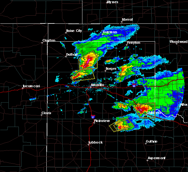 At 625 pm cdt, a severe thunderstorm was located 5 miles east of boys ranch, or 24 miles northeast of vega, moving northeast at 20 mph (radar indicated). Hazards include ping pong ball size hail. People and animals outdoors will be injured. expect damage to roofs, siding, windows, and vehicles. Hail may accumulate on roadways causing hazardous travel. At 625 pm cdt, a severe thunderstorm was located 5 miles east of boys ranch, or 24 miles northeast of vega, moving northeast at 20 mph (radar indicated). Hazards include ping pong ball size hail. People and animals outdoors will be injured. expect damage to roofs, siding, windows, and vehicles. Hail may accumulate on roadways causing hazardous travel.
|
| 4/15/2016 6:08 PM CDT |
 At 608 pm cdt, a severe thunderstorm was located over boys ranch, or 20 miles northeast of vega, moving northeast at 35 mph (radar indicated). Hazards include 60 mph wind gusts and quarter size hail. Minor damage to roofs. siding. and trees is possible. hail damage to vehicles is expected. locations impacted include, boys ranch. A tornado watch remains in effect until 1000 pm cdt. At 608 pm cdt, a severe thunderstorm was located over boys ranch, or 20 miles northeast of vega, moving northeast at 35 mph (radar indicated). Hazards include 60 mph wind gusts and quarter size hail. Minor damage to roofs. siding. and trees is possible. hail damage to vehicles is expected. locations impacted include, boys ranch. A tornado watch remains in effect until 1000 pm cdt.
|
| 4/15/2016 5:54 PM CDT |
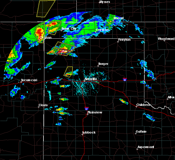 At 553 pm cdt, a severe thunderstorm was located 9 miles south of boys ranch, or 11 miles northeast of vega, moving northeast at 35 mph (radar indicated). Hazards include 60 mph wind gusts and half dollar size hail. Minor damage to roofs. siding. and trees is possible. hail damage to vehicles is expected. locations impacted include, boys ranch. A tornado watch remains in effect until 1000 pm cdt. At 553 pm cdt, a severe thunderstorm was located 9 miles south of boys ranch, or 11 miles northeast of vega, moving northeast at 35 mph (radar indicated). Hazards include 60 mph wind gusts and half dollar size hail. Minor damage to roofs. siding. and trees is possible. hail damage to vehicles is expected. locations impacted include, boys ranch. A tornado watch remains in effect until 1000 pm cdt.
|
| 4/15/2016 5:45 PM CDT |
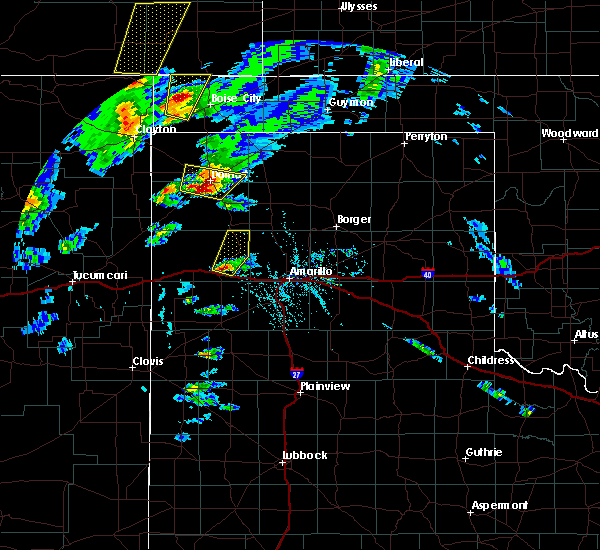 At 544 pm cdt, a severe thunderstorm was located 6 miles northeast of vega, moving northeast at 40 mph (radar indicated). Hazards include 60 mph wind gusts and half dollar size hail. Minor damage to roofs. siding. and trees is possible. hail damage to vehicles is expected. locations impacted include, boys ranch. A tornado watch remains in effect until 1000 pm cdt. At 544 pm cdt, a severe thunderstorm was located 6 miles northeast of vega, moving northeast at 40 mph (radar indicated). Hazards include 60 mph wind gusts and half dollar size hail. Minor damage to roofs. siding. and trees is possible. hail damage to vehicles is expected. locations impacted include, boys ranch. A tornado watch remains in effect until 1000 pm cdt.
|
| 4/15/2016 5:36 PM CDT |
 At 536 pm cdt, a severe thunderstorm was located over vega, moving northeast at 35 mph (radar indicated). Hazards include 60 mph wind gusts and half dollar size hail. Minor damage to roofs. siding. and trees is possible. Hail damage to vehicles is expected. At 536 pm cdt, a severe thunderstorm was located over vega, moving northeast at 35 mph (radar indicated). Hazards include 60 mph wind gusts and half dollar size hail. Minor damage to roofs. siding. and trees is possible. Hail damage to vehicles is expected.
|
| 11/16/2015 6:32 PM CST |
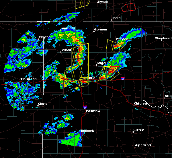 At 631 pm cst, severe thunderstorms were located extending from 13 miles southeast of stratford to wildorado, moving northeast at 45 mph (radar indicated). Hazards include 70 mph wind gusts and penny size hail. Expect some tree damage. damage is likely to mobile homes, roofs and outbuildings. locations impacted include, amarillo, dumas, cactus, sunray, boys ranch, masterson, wildorado, lake meredith, valley de oro, bushland and four way. A tornado watch remains in effect until 900 pm cst for central texas. At 631 pm cst, severe thunderstorms were located extending from 13 miles southeast of stratford to wildorado, moving northeast at 45 mph (radar indicated). Hazards include 70 mph wind gusts and penny size hail. Expect some tree damage. damage is likely to mobile homes, roofs and outbuildings. locations impacted include, amarillo, dumas, cactus, sunray, boys ranch, masterson, wildorado, lake meredith, valley de oro, bushland and four way. A tornado watch remains in effect until 900 pm cst for central texas.
|
| 11/16/2015 6:09 PM CST |
 At 608 pm cst, severe thunderstorms were located extending from near hartley to near vega, moving northeast at 45 mph (radar indicated. similar storms today have produced wind gusts to 70 mph). Hazards include 70 mph wind gusts and penny size hail. Expect some tree damage. Damage is likely to mobile homes, roofs and outbuildings. At 608 pm cst, severe thunderstorms were located extending from near hartley to near vega, moving northeast at 45 mph (radar indicated. similar storms today have produced wind gusts to 70 mph). Hazards include 70 mph wind gusts and penny size hail. Expect some tree damage. Damage is likely to mobile homes, roofs and outbuildings.
|
| 8/19/2015 12:12 AM CDT |
 At 1212 am cdt, a severe thunderstorm was located 8 miles southwest of channing, or 24 miles north of vega, moving east at 15 mph (radar indicated). Hazards include 60 mph wind gusts and half dollar size hail. Hail damage to vehicles is expected. Minor wind damage to roofs, siding and trees is possible. At 1212 am cdt, a severe thunderstorm was located 8 miles southwest of channing, or 24 miles north of vega, moving east at 15 mph (radar indicated). Hazards include 60 mph wind gusts and half dollar size hail. Hail damage to vehicles is expected. Minor wind damage to roofs, siding and trees is possible.
|
| 8/18/2015 11:26 PM CDT |
 At 1126 pm cdt, a severe thunderstorm was located 11 miles west of boys ranch, or 18 miles north of vega, moving southeast at 35 mph (radar indicated). Hazards include 60 mph wind gusts and quarter size hail. Hail damage to vehicles is expected. minor wind damage to roofs, siding and trees is possible. This severe thunderstorm will remain over mainly rural areas of south central hartley and eastern oldham counties. At 1126 pm cdt, a severe thunderstorm was located 11 miles west of boys ranch, or 18 miles north of vega, moving southeast at 35 mph (radar indicated). Hazards include 60 mph wind gusts and quarter size hail. Hail damage to vehicles is expected. minor wind damage to roofs, siding and trees is possible. This severe thunderstorm will remain over mainly rural areas of south central hartley and eastern oldham counties.
|
| 8/18/2015 10:58 PM CDT |
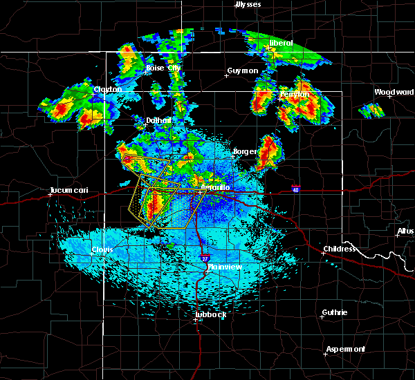 At 1058 pm cdt, a severe thunderstorm was located 14 miles southeast of romero, or 21 miles east of nara visa, moving southeast at 35 mph (radar indicated). Hazards include 60 mph wind gusts and half dollar size hail. Hail damage to vehicles is expected. minor wind damage to roofs, siding and trees is possible. This severe thunderstorm will remain over mainly rural areas of south central hartley and eastern oldham counties. At 1058 pm cdt, a severe thunderstorm was located 14 miles southeast of romero, or 21 miles east of nara visa, moving southeast at 35 mph (radar indicated). Hazards include 60 mph wind gusts and half dollar size hail. Hail damage to vehicles is expected. minor wind damage to roofs, siding and trees is possible. This severe thunderstorm will remain over mainly rural areas of south central hartley and eastern oldham counties.
|
| 8/18/2015 9:43 PM CDT |
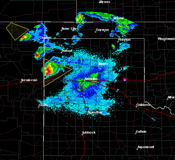 At 943 pm cdt, a severe thunderstorm was located 14 miles southeast of nara visa, moving southeast at 35 mph (radar indicated). Hazards include ping pong ball size hail and 60 mph wind gusts. People and animals outdoors will be injured. expect hail damage to roofs, siding, windows and vehicles. minor wind damage to roofs, siding and trees is possible. Locations impacted include, adrian and glenrio. At 943 pm cdt, a severe thunderstorm was located 14 miles southeast of nara visa, moving southeast at 35 mph (radar indicated). Hazards include ping pong ball size hail and 60 mph wind gusts. People and animals outdoors will be injured. expect hail damage to roofs, siding, windows and vehicles. minor wind damage to roofs, siding and trees is possible. Locations impacted include, adrian and glenrio.
|
| 8/18/2015 9:23 PM CDT |
 At 923 pm cdt, a severe thunderstorm was located near nara visa, moving southeast at 35 mph (radar indicated). Hazards include two inch hail and 60 mph wind gusts. People and animals outdoors will be injured. expect hail damage to roofs, siding, windows and vehicles. minor wind damage to roofs, siding and trees is possible. Locations impacted include, adrian, romero and glenrio. At 923 pm cdt, a severe thunderstorm was located near nara visa, moving southeast at 35 mph (radar indicated). Hazards include two inch hail and 60 mph wind gusts. People and animals outdoors will be injured. expect hail damage to roofs, siding, windows and vehicles. minor wind damage to roofs, siding and trees is possible. Locations impacted include, adrian, romero and glenrio.
|
| 8/18/2015 8:56 PM CDT |
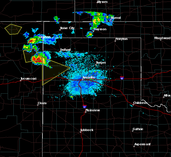 At 856 pm cdt, a severe thunderstorm was located 9 miles northwest of nara visa, moving southeast at 30 mph (radar indicated). Hazards include ping pong ball size hail and 60 mph wind gusts. People and animals outdoors will be injured. expect hail damage to roofs, siding, windows and vehicles. Minor wind damage to roofs, siding and trees is possible. At 856 pm cdt, a severe thunderstorm was located 9 miles northwest of nara visa, moving southeast at 30 mph (radar indicated). Hazards include ping pong ball size hail and 60 mph wind gusts. People and animals outdoors will be injured. expect hail damage to roofs, siding, windows and vehicles. Minor wind damage to roofs, siding and trees is possible.
|
| 8/3/2015 10:32 PM CDT |
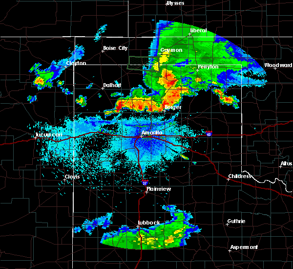 At 1028 pm cdt, a severe thunderstorm was located 6 miles east of channing, and moving southeast at 35 mph (radar indicated). Hazards include 60 mph wind gusts and quarter size hail. Hail damage to vehicles is expected. Minor wind damage to roofs, siding and trees is possible. At 1028 pm cdt, a severe thunderstorm was located 6 miles east of channing, and moving southeast at 35 mph (radar indicated). Hazards include 60 mph wind gusts and quarter size hail. Hail damage to vehicles is expected. Minor wind damage to roofs, siding and trees is possible.
|
| 7/8/2015 8:14 PM CDT |
 At 813 pm cdt, a severe thunderstorm was located near boys ranch, and moving southeast at 20 mph (trained weather spotters). Hazards include golf ball size hail and 60 mph wind gusts. People and animals outdoors will be injured. expect hail damage to roofs, siding, windows and vehicles. Minor wind damage to roofs, siding and trees is possible. At 813 pm cdt, a severe thunderstorm was located near boys ranch, and moving southeast at 20 mph (trained weather spotters). Hazards include golf ball size hail and 60 mph wind gusts. People and animals outdoors will be injured. expect hail damage to roofs, siding, windows and vehicles. Minor wind damage to roofs, siding and trees is possible.
|
| 7/8/2015 7:54 PM CDT | Baseball sized hail reported 5.4 miles SE of Boys Ranch, TX, baseball size hail |
| 7/8/2015 7:51 PM CDT |
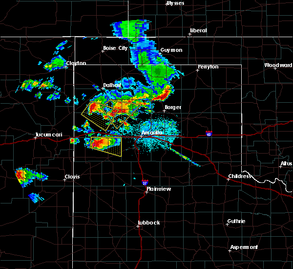 At 747 pm cdt, a severe thunderstorm was located 6 miles southeast of channing, and moving southeast at 15 mph. this is a very dangerous storm (trained weather spotters. hail to the size of baseballs was reported with this storm in channing, and spotters have reported seeing a high based funnel cloud with this storm south of channing). Hazards include baseball size hail and 60 mph wind gusts. People and animals outdoors will be severely injured. Expect shattered windows, extensive damage to roofs, siding and vehicles. At 747 pm cdt, a severe thunderstorm was located 6 miles southeast of channing, and moving southeast at 15 mph. this is a very dangerous storm (trained weather spotters. hail to the size of baseballs was reported with this storm in channing, and spotters have reported seeing a high based funnel cloud with this storm south of channing). Hazards include baseball size hail and 60 mph wind gusts. People and animals outdoors will be severely injured. Expect shattered windows, extensive damage to roofs, siding and vehicles.
|
| 7/8/2015 7:37 PM CDT |
 At 734 pm cdt, a severe thunderstorm was located near channing, and moving southeast at 25 mph. this is a very dangerous storm (trained weather spotters. hail to the size of baseballs was reported in channing at 730 pm cdt). Hazards include baseball size hail and 60 mph wind gusts. People and animals outdoors will be severely injured. Expect shattered windows, extensive damage to roofs, siding and vehicles. At 734 pm cdt, a severe thunderstorm was located near channing, and moving southeast at 25 mph. this is a very dangerous storm (trained weather spotters. hail to the size of baseballs was reported in channing at 730 pm cdt). Hazards include baseball size hail and 60 mph wind gusts. People and animals outdoors will be severely injured. Expect shattered windows, extensive damage to roofs, siding and vehicles.
|
| 7/8/2015 7:17 PM CDT |
 At 715 pm cdt, a severe thunderstorm was located 5 miles northwest of channing, and moving southeast at 25 mph (radar indicated). Hazards include golf ball size hail and 60 mph wind gusts. People and animals outdoors will be injured. expect hail damage to roofs, siding, windows and vehicles. Minor wind damage to roofs, siding and trees is possible. At 715 pm cdt, a severe thunderstorm was located 5 miles northwest of channing, and moving southeast at 25 mph (radar indicated). Hazards include golf ball size hail and 60 mph wind gusts. People and animals outdoors will be injured. expect hail damage to roofs, siding, windows and vehicles. Minor wind damage to roofs, siding and trees is possible.
|
| 6/14/2015 6:28 PM CDT |
 At 625 pm cdt, a severe thunderstorm was located near bushland, and moving northeast at 30 mph (radar indicated). Hazards include 75 mph wind gusts and quarter size hail. Hail damage to vehicles is expected. expect some tree damage. Wind damage is also likely to mobile homes, roofs and outbuildings. At 625 pm cdt, a severe thunderstorm was located near bushland, and moving northeast at 30 mph (radar indicated). Hazards include 75 mph wind gusts and quarter size hail. Hail damage to vehicles is expected. expect some tree damage. Wind damage is also likely to mobile homes, roofs and outbuildings.
|
| 6/14/2015 6:14 PM CDT |
 At 612 pm cdt, a severe thunderstorm was located 10 miles northwest of umbarger, and moving northeast at 30 mph (radar indicated). Hazards include 70 mph wind gusts and quarter size hail. Hail damage to vehicles is expected. expect some tree damage. Wind damage is also likely to mobile homes, roofs and outbuildings. At 612 pm cdt, a severe thunderstorm was located 10 miles northwest of umbarger, and moving northeast at 30 mph (radar indicated). Hazards include 70 mph wind gusts and quarter size hail. Hail damage to vehicles is expected. expect some tree damage. Wind damage is also likely to mobile homes, roofs and outbuildings.
|
| 5/23/2015 5:07 AM CDT | The severe thunderstorm warning for east central oldham county will expire at 515 am cdt, the storm which prompted the warning has weakened below severe limits, and no longer poses an immediate threat to life or property. |
| 5/23/2015 5:00 AM CDT | At 501 am cdt, a severe thunderstorm was located 7 miles south of boys ranch, and moving north at 60 mph (radar indicated). Hazards include 60 mph wind gusts and quarter size hail. Hail damage to vehicles is expected. Minor wind damage to roofs, siding and trees is possible. |
| 5/23/2015 4:52 AM CDT | At 451 am cdt, a severe thunderstorm was located 8 miles northwest of wildorado, and moving north at 60 mph (radar indicated). Hazards include 60 mph wind gusts and quarter size hail. Hail damage to vehicles is expected. Minor wind damage to roofs, siding and trees is possible. |
| 5/23/2015 4:43 AM CDT | At 442 am cdt, a severe thunderstorm was located 6 miles southwest of wildorado, and moving north at 60 mph (radar indicated). Hazards include 60 mph wind gusts and quarter size hail. Hail damage to vehicles is expected. Minor wind damage to roofs, siding and trees is possible. |
| 5/9/2015 5:10 AM CDT | At 507 am cdt, a severe thunderstorm was located 6 miles northeast of vega, and moving north at 50 mph (radar indicated). Hazards include 70 mph wind gusts and ping pong ball size hail. People and animals outdoors will be injured. expect hail damage to roofs, siding, windows and vehicles. expect some tree damage. Wind damage is also likely to mobile homes, roofs and outbuildings. |
| 5/9/2015 4:55 AM CDT | At 453 am cdt, a severe thunderstorm was located 9 miles southeast of vega, and moving north at 50 mph (radar indicated). Hazards include golf ball size hail and 70 mph wind gusts. People and animals outdoors will be injured. expect hail damage to roofs, siding, windows and vehicles. expect some tree damage. Wind damage is also likely to mobile homes, roofs and outbuildings. |
| 9/24/2014 12:51 PM CDT | Golf Ball sized hail reported 1.6 miles N of Boys Ranch, TX, viewer report relayed by kamr. |
| 9/24/2014 12:49 PM CDT | Golf Ball sized hail reported 1.6 miles N of Boys Ranch, TX, relayed by amarillo emergency manager |
| 9/24/2014 12:47 PM CDT | Golf Ball sized hail reported 1.6 miles N of Boys Ranch, TX |
| 6/8/2014 9:12 PM CDT | Several trees blown down. estimated 60 mph. very heavy rain als in oldham county TX, 1.6 miles N of Boys Ranch, TX |
| 12/14/2012 3:32 PM CST | A couple of trucks were overturned on us highway 38 in oldham county TX, 11.2 miles ENE of Boys Ranch, TX |
| 7/25/2012 4:27 PM CDT | Storm damage reported in oldham county TX, 0.3 miles NW of Boys Ranch, TX |
Hail Maps for Boys Ranch, TX
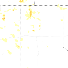
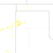

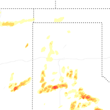
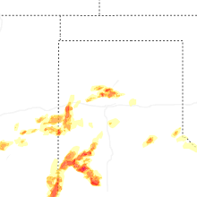


Connect with Interactive Hail Maps