

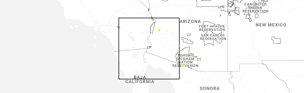
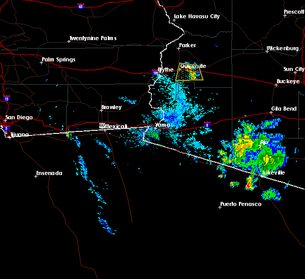
Hail Map for Brenda, AZ
The Brenda, AZ area has had 0 reports of on-the-ground hail by trained spotters, and has been under severe weather warnings 6 times during the past 12 months. Doppler radar has detected hail at or near Brenda, AZ on 23 occasions, including 2 occasions during the past year.
| Name: | Brenda, AZ |
| Where Located: | 59.5 miles SSE of Lake Havasu City, AZ |
| Map: | Google Map for Brenda, AZ |
| Population: | 676 |
| Housing Units: | 725 |
| More Info: | Search Google for Brenda, AZ |
0
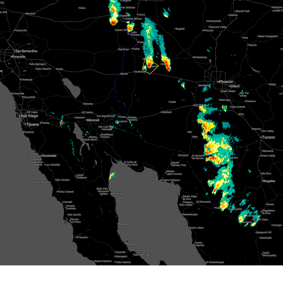
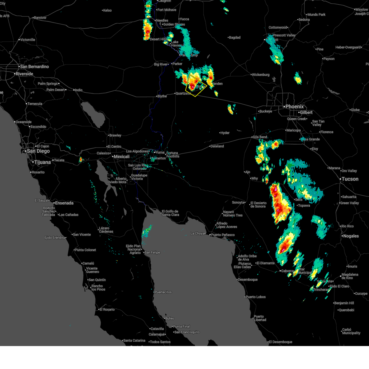
The Top Recent Hail Date for Brenda, AZ is Wednesday, July 2, 2025 (21st out of 23)
Hail and Wind Damage Spotted near Brenda, AZ
| Date / Time | Report Details |
|---|---|
| 7/2/2025 6:26 PM MST |
 The storm which prompted the warning has weakened below severe limits, and no longer poses an immediate threat to life or property. therefore, the warning will be allowed to expire. however, gusty winds and heavy rain are still possible with this thunderstorm. to report severe weather, contact your nearest law enforcement agency. they will relay your report to the national weather service phoenix. The storm which prompted the warning has weakened below severe limits, and no longer poses an immediate threat to life or property. therefore, the warning will be allowed to expire. however, gusty winds and heavy rain are still possible with this thunderstorm. to report severe weather, contact your nearest law enforcement agency. they will relay your report to the national weather service phoenix.
|
| 7/2/2025 5:45 PM MST |
 Svrpsr the national weather service in phoenix has issued a * severe thunderstorm warning for, central la paz county in west central arizona, * until 630 pm mst. * at 545 pm mst, a severe thunderstorm was located near brenda, or 34 miles southeast of parker, moving northeast at 10 mph (radar indicated). Hazards include 60 mph wind gusts and penny size hail. expect damage to roofs, siding, and trees Svrpsr the national weather service in phoenix has issued a * severe thunderstorm warning for, central la paz county in west central arizona, * until 630 pm mst. * at 545 pm mst, a severe thunderstorm was located near brenda, or 34 miles southeast of parker, moving northeast at 10 mph (radar indicated). Hazards include 60 mph wind gusts and penny size hail. expect damage to roofs, siding, and trees
|
| 8/10/2024 2:12 PM MST |
 Svrpsr the national weather service in phoenix has issued a * severe thunderstorm warning for, central la paz county in west central arizona, * until 245 pm mst. * at 212 pm mst, a severe thunderstorm was located over brenda, or 35 miles southeast of parker, and is nearly stationary (radar indicated). Hazards include 60 mph wind gusts. expect damage to roofs, siding, and trees Svrpsr the national weather service in phoenix has issued a * severe thunderstorm warning for, central la paz county in west central arizona, * until 245 pm mst. * at 212 pm mst, a severe thunderstorm was located over brenda, or 35 miles southeast of parker, and is nearly stationary (radar indicated). Hazards include 60 mph wind gusts. expect damage to roofs, siding, and trees
|
| 7/22/2024 8:20 PM MST |
 The storm which prompted the warning has weakened below severe limits, and no longer poses an immediate threat to life or property. therefore, the warning will be allowed to expire. however, gusty winds and heavy rain are still possible with this thunderstorm. The storm which prompted the warning has weakened below severe limits, and no longer poses an immediate threat to life or property. therefore, the warning will be allowed to expire. however, gusty winds and heavy rain are still possible with this thunderstorm.
|
| 7/22/2024 8:01 PM MST |
 At 801 pm mst, a severe thunderstorm was located over brenda, or 34 miles southeast of parker, and is nearly stationary (radar indicated). Hazards include 60 mph wind gusts. Expect damage to roofs, siding, and trees. locations impacted include, brenda. this includes the following highways, az interstate 10 between mile markers 25 and 40. Us highway 60 between mile markers 31 and 40. At 801 pm mst, a severe thunderstorm was located over brenda, or 34 miles southeast of parker, and is nearly stationary (radar indicated). Hazards include 60 mph wind gusts. Expect damage to roofs, siding, and trees. locations impacted include, brenda. this includes the following highways, az interstate 10 between mile markers 25 and 40. Us highway 60 between mile markers 31 and 40.
|
| 7/22/2024 7:40 PM MST |
 Svrpsr the national weather service in phoenix has issued a * severe thunderstorm warning for, central la paz county in west central arizona, * until 830 pm mst. * at 740 pm mst, a severe thunderstorm was located near brenda, or 34 miles southeast of parker, and is nearly stationary (radar indicated). Hazards include 60 mph wind gusts. expect damage to roofs, siding, and trees Svrpsr the national weather service in phoenix has issued a * severe thunderstorm warning for, central la paz county in west central arizona, * until 830 pm mst. * at 740 pm mst, a severe thunderstorm was located near brenda, or 34 miles southeast of parker, and is nearly stationary (radar indicated). Hazards include 60 mph wind gusts. expect damage to roofs, siding, and trees
|
| 7/13/2024 7:37 PM MST |
 the severe thunderstorm warning has been cancelled and is no longer in effect the severe thunderstorm warning has been cancelled and is no longer in effect
|
| 7/13/2024 7:04 PM MST |
 Svrpsr the national weather service in phoenix has issued a * severe thunderstorm warning for, central la paz county in west central arizona, * until 800 pm mst. * at 703 pm mst, a severe thunderstorm was located near brenda, or 36 miles southeast of parker, moving northwest at 10 mph (radar indicated). Hazards include 60 mph wind gusts and penny size hail. expect damage to roofs, siding, and trees Svrpsr the national weather service in phoenix has issued a * severe thunderstorm warning for, central la paz county in west central arizona, * until 800 pm mst. * at 703 pm mst, a severe thunderstorm was located near brenda, or 36 miles southeast of parker, moving northwest at 10 mph (radar indicated). Hazards include 60 mph wind gusts and penny size hail. expect damage to roofs, siding, and trees
|
| 8/13/2023 1:01 PM MST |
 At 101 pm mst, a severe thunderstorm was located over brenda, or 38 miles southeast of parker, moving north at 10 mph (radar indicated). Hazards include 60 mph wind gusts and penny size hail. expect damage to roofs, siding, and trees At 101 pm mst, a severe thunderstorm was located over brenda, or 38 miles southeast of parker, moving north at 10 mph (radar indicated). Hazards include 60 mph wind gusts and penny size hail. expect damage to roofs, siding, and trees
|
| 7/27/2023 4:57 PM MST |
 The severe thunderstorm warning for east central la paz county will expire at 500 pm mst, the storm which prompted the warning has weakened below severe limits, and no longer poses an immediate threat to life or property. therefore, the warning will be allowed to expire. to report severe weather, contact your nearest law enforcement agency. they will relay your report to the national weather service phoenix. The severe thunderstorm warning for east central la paz county will expire at 500 pm mst, the storm which prompted the warning has weakened below severe limits, and no longer poses an immediate threat to life or property. therefore, the warning will be allowed to expire. to report severe weather, contact your nearest law enforcement agency. they will relay your report to the national weather service phoenix.
|
| 7/27/2023 4:47 PM MST |
 At 447 pm mst, a severe thunderstorm was located near vicksburg junction, or 42 miles south of alamo lake, moving northeast at 5 mph (radar indicated). Hazards include 60 mph wind gusts. Expect damage to roofs, siding, and trees. locations impacted include, salome, vicksburg, brenda, vicksburg junction, and harcuvar. this includes the following highways, az interstate 10 between mile markers 38 and 58. us highway 60 between mile markers 35 and 56. az route 72 between mile markers 41 and 49. hail threat, radar indicated max hail size, <. 75 in wind threat, radar indicated max wind gust, 60 mph. At 447 pm mst, a severe thunderstorm was located near vicksburg junction, or 42 miles south of alamo lake, moving northeast at 5 mph (radar indicated). Hazards include 60 mph wind gusts. Expect damage to roofs, siding, and trees. locations impacted include, salome, vicksburg, brenda, vicksburg junction, and harcuvar. this includes the following highways, az interstate 10 between mile markers 38 and 58. us highway 60 between mile markers 35 and 56. az route 72 between mile markers 41 and 49. hail threat, radar indicated max hail size, <. 75 in wind threat, radar indicated max wind gust, 60 mph.
|
| 7/27/2023 4:31 PM MST |
 At 431 pm mst, a severe thunderstorm was located near vicksburg junction, or 43 miles south of alamo lake, moving northeast at 10 mph (radar indicated). Hazards include 60 mph wind gusts. Expect damage to roofs, siding, and trees. locations impacted include, salome, vicksburg, brenda, vicksburg junction, and harcuvar. this includes the following highways, az interstate 10 between mile markers 32 and 58. us highway 60 between mile markers 32 and 56. az route 72 between mile markers 41 and 49. hail threat, radar indicated max hail size, <. 75 in wind threat, radar indicated max wind gust, 60 mph. At 431 pm mst, a severe thunderstorm was located near vicksburg junction, or 43 miles south of alamo lake, moving northeast at 10 mph (radar indicated). Hazards include 60 mph wind gusts. Expect damage to roofs, siding, and trees. locations impacted include, salome, vicksburg, brenda, vicksburg junction, and harcuvar. this includes the following highways, az interstate 10 between mile markers 32 and 58. us highway 60 between mile markers 32 and 56. az route 72 between mile markers 41 and 49. hail threat, radar indicated max hail size, <. 75 in wind threat, radar indicated max wind gust, 60 mph.
|
| 7/27/2023 4:13 PM MST |
 At 413 pm mst, a severe thunderstorm was located near vicksburg junction, or 44 miles south of alamo lake, moving northeast at 10 mph (radar indicated). Hazards include 60 mph wind gusts. expect damage to roofs, siding, and trees At 413 pm mst, a severe thunderstorm was located near vicksburg junction, or 44 miles south of alamo lake, moving northeast at 10 mph (radar indicated). Hazards include 60 mph wind gusts. expect damage to roofs, siding, and trees
|
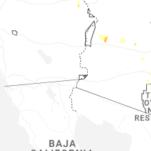
| 8/24/2022 7:12 PM MST | At 712 pm mst/712 pm pdt/, severe thunderstorms were located along a line extending from near brenda to 10 miles northwest of nicholls warm springs, moving north at 15 mph. the blythe airport recently reported a wind gust of 69 mph (radar indicated). Hazards include 70 mph wind gusts. Expect considerable tree damage. damage is likely to mobile homes, roofs, and outbuildings. locations impacted include, blythe, quartzsite, nicholls warm springs, brenda, midland, kofa wildlife refuge, blythe airport, bouse, ripley, east blythe and ehrenberg. this includes the following highways, az interstate 10 between mile markers 1 and 41. ca interstate 10 between mile markers 132 and 156. us highway 60 between mile markers 31 and 43. thunderstorm damage threat, considerable hail threat, radar indicated max hail size, <. 75 in wind threat, radar indicated max wind gust, 70 mph. |
| 8/24/2022 7:12 PM MST | At 712 pm mst/712 pm pdt/, severe thunderstorms were located along a line extending from near brenda to 10 miles northwest of nicholls warm springs, moving north at 15 mph. the blythe airport recently reported a wind gust of 69 mph (radar indicated). Hazards include 70 mph wind gusts. Expect considerable tree damage. damage is likely to mobile homes, roofs, and outbuildings. locations impacted include, blythe, quartzsite, nicholls warm springs, brenda, midland, kofa wildlife refuge, blythe airport, bouse, ripley, east blythe and ehrenberg. this includes the following highways, az interstate 10 between mile markers 1 and 41. ca interstate 10 between mile markers 132 and 156. us highway 60 between mile markers 31 and 43. thunderstorm damage threat, considerable hail threat, radar indicated max hail size, <. 75 in wind threat, radar indicated max wind gust, 70 mph. |
| 8/24/2022 6:53 PM MST | At 652 pm mst/652 pm pdt/, severe thunderstorms were located along a line extending from near brenda to 9 miles west of nicholls warm springs, moving north at 15 mph (radar indicated). Hazards include 60 mph wind gusts. expect damage to roofs, siding, and trees |
| 8/24/2022 6:53 PM MST | At 652 pm mst/652 pm pdt/, severe thunderstorms were located along a line extending from near brenda to 9 miles west of nicholls warm springs, moving north at 15 mph (radar indicated). Hazards include 60 mph wind gusts. expect damage to roofs, siding, and trees |
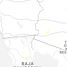
| 8/23/2022 7:25 PM MST | At 725 pm mst, a severe thunderstorm was located near brenda, or 39 miles southeast of parker, moving west at 5 mph (radar indicated). Hazards include 70 mph wind gusts and ping pong ball size hail. People and animals outdoors will be injured. expect hail damage to roofs, siding, windows, and vehicles. expect considerable tree damage. Wind damage is also likely to mobile homes, roofs, and outbuildings. |
| 8/21/2022 11:16 PM MST | At 1116 pm mst/1116 pm pdt/, severe thunderstorms were located along a line extending from 9 miles south of big river to 17 miles northeast of blythe to 7 miles southeast of quartzsite to 8 miles northeast of kofa wildlife refuge, moving southwest at 25 mph (radar indicated). Hazards include 60 mph wind gusts. Expect damage to roofs, siding, and trees. locations impacted include, parker, quartzsite, brenda, vicksburg junction, kofa wildlife refuge, vicksburg and poston. this includes the following highways, az interstate 10 between mile markers 11 and 54. us highway 60 between mile markers 31 and 51. az route 72 between mile markers 14 and 16, and between mile markers 44 and 49. hail threat, radar indicated max hail size, <. 75 in wind threat, radar indicated max wind gust, 60 mph. |
| 8/21/2022 11:16 PM MST | At 1116 pm mst/1116 pm pdt/, severe thunderstorms were located along a line extending from 9 miles south of big river to 17 miles northeast of blythe to 7 miles southeast of quartzsite to 8 miles northeast of kofa wildlife refuge, moving southwest at 25 mph (radar indicated). Hazards include 60 mph wind gusts. Expect damage to roofs, siding, and trees. locations impacted include, parker, quartzsite, brenda, vicksburg junction, kofa wildlife refuge, vicksburg and poston. this includes the following highways, az interstate 10 between mile markers 11 and 54. us highway 60 between mile markers 31 and 51. az route 72 between mile markers 14 and 16, and between mile markers 44 and 49. hail threat, radar indicated max hail size, <. 75 in wind threat, radar indicated max wind gust, 60 mph. |
| 8/21/2022 11:01 PM MST | At 1101 pm mst/1101 pm pdt/, severe thunderstorms were located along a line extending from near big river to 17 miles west of bouse to 7 miles east of quartzsite to 6 miles southeast of brenda, moving southwest at 35 mph (radar indicated). Hazards include 60 mph wind gusts. Expect damage to roofs, siding, and trees. locations impacted include, parker, quartzsite, salome, brenda, vicksburg junction, buckskin mountain park, wenden, kofa wildlife refuge, vicksburg, bouse, harcuvar and poston. this includes the following highways, az interstate 10 between mile markers 11 and 54. us highway 60 between mile markers 31 and 64. az route 72 between mile markers 14 and 49. hail threat, radar indicated max hail size, <. 75 in wind threat, radar indicated max wind gust, 60 mph. |
| 8/21/2022 11:01 PM MST | At 1101 pm mst/1101 pm pdt/, severe thunderstorms were located along a line extending from near big river to 17 miles west of bouse to 7 miles east of quartzsite to 6 miles southeast of brenda, moving southwest at 35 mph (radar indicated). Hazards include 60 mph wind gusts. Expect damage to roofs, siding, and trees. locations impacted include, parker, quartzsite, salome, brenda, vicksburg junction, buckskin mountain park, wenden, kofa wildlife refuge, vicksburg, bouse, harcuvar and poston. this includes the following highways, az interstate 10 between mile markers 11 and 54. us highway 60 between mile markers 31 and 64. az route 72 between mile markers 14 and 49. hail threat, radar indicated max hail size, <. 75 in wind threat, radar indicated max wind gust, 60 mph. |
| 8/21/2022 10:33 PM MST | At 1032 pm mst/1032 pm pdt/, severe thunderstorms were located along a line extending from parker dam to 7 miles northwest of bouse to 8 miles northwest of vicksburg to near salome, moving southwest at 25 mph (radar indicated). Hazards include 60 mph wind gusts. expect damage to roofs, siding, and trees |
| 8/21/2022 10:33 PM MST | At 1032 pm mst/1032 pm pdt/, severe thunderstorms were located along a line extending from parker dam to 7 miles northwest of bouse to 8 miles northwest of vicksburg to near salome, moving southwest at 25 mph (radar indicated). Hazards include 60 mph wind gusts. expect damage to roofs, siding, and trees |
| 8/30/2021 2:16 PM MST |
 At 216 pm mst, a severe thunderstorm was located near brenda, or 33 miles southeast of parker, moving west at 5 mph (radar indicated). Hazards include 60 mph wind gusts and nickel size hail. Expect damage to roofs, siding, and trees. locations impacted include, quartzsite and brenda. this includes the following highways, az interstate 10 between mile markers 18 and 41. us highway 60 between mile markers 31 and 44. az route 95 between mile markers 100 and 112. hail threat, radar indicated max hail size, 0. 88 in wind threat, radar indicated max wind gust, 60 mph. At 216 pm mst, a severe thunderstorm was located near brenda, or 33 miles southeast of parker, moving west at 5 mph (radar indicated). Hazards include 60 mph wind gusts and nickel size hail. Expect damage to roofs, siding, and trees. locations impacted include, quartzsite and brenda. this includes the following highways, az interstate 10 between mile markers 18 and 41. us highway 60 between mile markers 31 and 44. az route 95 between mile markers 100 and 112. hail threat, radar indicated max hail size, 0. 88 in wind threat, radar indicated max wind gust, 60 mph.
|
| 8/30/2021 1:55 PM MST |
 At 155 pm mst, a severe thunderstorm was located near brenda, or 35 miles southeast of parker, moving west at 5 mph (radar indicated). Hazards include 60 mph wind gusts and penny size hail. expect damage to roofs, siding, and trees At 155 pm mst, a severe thunderstorm was located near brenda, or 35 miles southeast of parker, moving west at 5 mph (radar indicated). Hazards include 60 mph wind gusts and penny size hail. expect damage to roofs, siding, and trees
|
| 8/16/2021 2:54 AM MST |
 The severe thunderstorm warning for central la paz county will expire at 300 am mst, the storm which prompted the warning has weakened below severe limits, and has exited the warned area. therefore, the warning will be allowed to expire. however heavy rain is still possible with this thunderstorm. The severe thunderstorm warning for central la paz county will expire at 300 am mst, the storm which prompted the warning has weakened below severe limits, and has exited the warned area. therefore, the warning will be allowed to expire. however heavy rain is still possible with this thunderstorm.
|
| 8/16/2021 1:54 AM MST |
 At 154 am mst, a severe thunderstorm was located 7 miles east of bouse, or 27 miles southeast of parker, moving southwest at 30 mph (radar indicated). Hazards include 60 mph wind gusts and quarter size hail. Hail damage to vehicles is expected. Expect wind damage to roofs, siding, and trees. At 154 am mst, a severe thunderstorm was located 7 miles east of bouse, or 27 miles southeast of parker, moving southwest at 30 mph (radar indicated). Hazards include 60 mph wind gusts and quarter size hail. Hail damage to vehicles is expected. Expect wind damage to roofs, siding, and trees.
|
| 8/13/2021 11:34 PM MST |
 At 1133 pm mst, severe thunderstorms were located along a line extending from 6 miles east of bouse to near vicksburg junction to 13 miles south of vicksburg to 18 miles northwest of sundad, moving southwest at 50 mph (radar indicated). Hazards include 60 mph wind gusts. Expect damage to roofs, siding, and trees. locations impacted include, quartzsite, salome, aguila, brenda, vicksburg junction, wenden, kofa wildlife refuge, vicksburg, bouse, gladden, harcuvar and palm canyon. this includes the following highways, az interstate 10 between mile markers 6 and 88. us highway 60 between mile markers 31 and 85. az route 72 between mile markers 25 and 49. hail threat, radar indicated max hail size, <. 75 in wind threat, radar indicated max wind gust, 60 mph. At 1133 pm mst, severe thunderstorms were located along a line extending from 6 miles east of bouse to near vicksburg junction to 13 miles south of vicksburg to 18 miles northwest of sundad, moving southwest at 50 mph (radar indicated). Hazards include 60 mph wind gusts. Expect damage to roofs, siding, and trees. locations impacted include, quartzsite, salome, aguila, brenda, vicksburg junction, wenden, kofa wildlife refuge, vicksburg, bouse, gladden, harcuvar and palm canyon. this includes the following highways, az interstate 10 between mile markers 6 and 88. us highway 60 between mile markers 31 and 85. az route 72 between mile markers 25 and 49. hail threat, radar indicated max hail size, <. 75 in wind threat, radar indicated max wind gust, 60 mph.
|
| 8/13/2021 11:01 PM MST |
 At 1100 pm mst, severe thunderstorms were located along a line extending from 14 miles south of alamo lake state park to near wenden to 13 miles south of gladden to 11 miles northwest of tonopah, moving southwest at 60 mph (radar indicated). Hazards include 70 mph wind gusts and penny size hail. Expect considerable tree damage. Damage is likely to mobile homes, roofs, and outbuildings. At 1100 pm mst, severe thunderstorms were located along a line extending from 14 miles south of alamo lake state park to near wenden to 13 miles south of gladden to 11 miles northwest of tonopah, moving southwest at 60 mph (radar indicated). Hazards include 70 mph wind gusts and penny size hail. Expect considerable tree damage. Damage is likely to mobile homes, roofs, and outbuildings.
|
| 8/10/2021 8:18 PM MST |
 At 816 pm mst/pdt, severe thunderstorms were located over central and southwest la paz county moving southwest at 20 mph (radar indicated). Hazards include 60 mph wind gusts. small hail. expect damage to roofs, siding, and trees At 816 pm mst/pdt, severe thunderstorms were located over central and southwest la paz county moving southwest at 20 mph (radar indicated). Hazards include 60 mph wind gusts. small hail. expect damage to roofs, siding, and trees
|
| 8/10/2021 8:08 PM MST |
 At 806 pm mst/806 pm pdt/, severe thunderstorms were located over central and southwestern portions of la paz county moving southwest at 15 mph (radar indicated). Hazards include 60 mph wind gusts. dense blowing dust. Expect damage to roofs, siding, and trees. very hazardous driving conditions due to sudden very strong wind gusts and poor visibility. locations impacted include, blythe, quartzsite, cibola, salome, brenda, bouse, vicksburg junction, wenden, vicksburg, harcuvar, and ehrenberg. this includes the following highways, az interstate 10 between mile markers 1 and 71. ca interstate 10 between mile markers 153 and 156. Us highway 60 between mile markers 31 and 70. At 806 pm mst/806 pm pdt/, severe thunderstorms were located over central and southwestern portions of la paz county moving southwest at 15 mph (radar indicated). Hazards include 60 mph wind gusts. dense blowing dust. Expect damage to roofs, siding, and trees. very hazardous driving conditions due to sudden very strong wind gusts and poor visibility. locations impacted include, blythe, quartzsite, cibola, salome, brenda, bouse, vicksburg junction, wenden, vicksburg, harcuvar, and ehrenberg. this includes the following highways, az interstate 10 between mile markers 1 and 71. ca interstate 10 between mile markers 153 and 156. Us highway 60 between mile markers 31 and 70.
|
| 8/10/2021 7:26 PM MST |
 At 723 pm mst/723 pm pdt/, multiple severe thunderstorms were located over central la paz county, moving southwest at 15 mph (radar indicated). Hazards include 60 mph wind gusts. dense blowing dust. Expect damage to roofs, siding, and trees. Very hazardous driving conditions due to sudden very strong wind gusts and poor visibility. At 723 pm mst/723 pm pdt/, multiple severe thunderstorms were located over central la paz county, moving southwest at 15 mph (radar indicated). Hazards include 60 mph wind gusts. dense blowing dust. Expect damage to roofs, siding, and trees. Very hazardous driving conditions due to sudden very strong wind gusts and poor visibility.
|
| 8/10/2021 6:53 PM MST |
 At 651 pm mst/pdt, severe thunderstorms were over northern and western la paz county and moving south-southwest at up to 45 mph (radar indicated). Hazards include 60 mph wind gusts. half inch sized hail. Expect damage to roofs, siding, and trees. locations impacted include, parker, quartzsite, salome, brenda, wenden, vicksburg, bouse, harcuvar and poston. this includes the following highways, az interstate 10 between mile markers 8 and 64. us highway 60 between mile markers 31 and 73. Az route 72 between mile markers 14 and 49. At 651 pm mst/pdt, severe thunderstorms were over northern and western la paz county and moving south-southwest at up to 45 mph (radar indicated). Hazards include 60 mph wind gusts. half inch sized hail. Expect damage to roofs, siding, and trees. locations impacted include, parker, quartzsite, salome, brenda, wenden, vicksburg, bouse, harcuvar and poston. this includes the following highways, az interstate 10 between mile markers 8 and 64. us highway 60 between mile markers 31 and 73. Az route 72 between mile markers 14 and 49.
|
| 8/10/2021 6:30 PM MST |
 At 625 pm mst/pdt, severe thunderstorms were located over northern and western portions of la paz county moving south and southwest at 45 mph (radar indicated). Hazards include 60 mph wind gusts. half inch sized hail. expect damage to roofs, siding, and trees At 625 pm mst/pdt, severe thunderstorms were located over northern and western portions of la paz county moving south and southwest at 45 mph (radar indicated). Hazards include 60 mph wind gusts. half inch sized hail. expect damage to roofs, siding, and trees
|
| 8/30/2020 7:51 PM MST |
 The severe thunderstorm warning for central la paz county will expire at 800 pm mst, the storm which prompted the warning has weakened below severe limits, and no longer poses an immediate threat to life or property. therefore, the warning will be allowed to expire. however gusty winds and heavy rain are still possible with this thunderstorm. The severe thunderstorm warning for central la paz county will expire at 800 pm mst, the storm which prompted the warning has weakened below severe limits, and no longer poses an immediate threat to life or property. therefore, the warning will be allowed to expire. however gusty winds and heavy rain are still possible with this thunderstorm.
|
| 8/30/2020 7:35 PM MST |
 At 735 pm mst, a severe thunderstorm was located near brenda, or 36 miles southeast of parker, moving east at 15 mph (radar indicated). Hazards include 60 mph wind gusts. Expect damage to roofs, siding, and trees. locations impacted include, quartzsite and brenda. this includes the following highways, az interstate 10 between mile markers 17 and 49. us highway 60 between mile markers 31 and 46. Az route 72 between mile markers 34 and 45. At 735 pm mst, a severe thunderstorm was located near brenda, or 36 miles southeast of parker, moving east at 15 mph (radar indicated). Hazards include 60 mph wind gusts. Expect damage to roofs, siding, and trees. locations impacted include, quartzsite and brenda. this includes the following highways, az interstate 10 between mile markers 17 and 49. us highway 60 between mile markers 31 and 46. Az route 72 between mile markers 34 and 45.
|
| 8/30/2020 7:09 PM MST |
 At 709 pm mst, a severe thunderstorm was located over brenda, or 34 miles southeast of parker, moving east at 15 mph (radar indicated). Hazards include 60 mph wind gusts. expect damage to roofs, siding, and trees At 709 pm mst, a severe thunderstorm was located over brenda, or 34 miles southeast of parker, moving east at 15 mph (radar indicated). Hazards include 60 mph wind gusts. expect damage to roofs, siding, and trees
|
| 9/5/2019 6:53 PM MST |
 At 653 pm mst, a severe thunderstorm was located 8 miles southwest of vicksburg junction, or 44 miles southeast of parker, moving northeast at 20 mph (radar indicated). Hazards include 60 mph wind gusts and penny size hail. expect damage to roofs, siding, and trees At 653 pm mst, a severe thunderstorm was located 8 miles southwest of vicksburg junction, or 44 miles southeast of parker, moving northeast at 20 mph (radar indicated). Hazards include 60 mph wind gusts and penny size hail. expect damage to roofs, siding, and trees
|
| 8/7/2019 2:28 PM MST |
 The severe thunderstorm warning for central la paz county will expire at 230 pm mst, the storm which prompted the warning has weakened below severe limits, and no longer poses an immediate threat to life or property. therefore, the warning will be allowed to expire. however heavy rain is still possible with this thunderstorm. The severe thunderstorm warning for central la paz county will expire at 230 pm mst, the storm which prompted the warning has weakened below severe limits, and no longer poses an immediate threat to life or property. therefore, the warning will be allowed to expire. however heavy rain is still possible with this thunderstorm.
|
| 8/7/2019 2:08 PM MST |
 At 208 pm mst, a severe thunderstorm was located 8 miles northwest of brenda, or 29 miles southeast of parker, moving northeast at 15 mph (radar indicated). Hazards include 60 mph wind gusts and nickel size hail. Expect damage to roofs, siding, and trees. locations impacted include, quartzsite, brenda and bouse. this includes the following highways, az interstate 10 between mile markers 15 and 43. us highway 60 between mile markers 31 and 41. Az route 72 between mile markers 20 and 21. At 208 pm mst, a severe thunderstorm was located 8 miles northwest of brenda, or 29 miles southeast of parker, moving northeast at 15 mph (radar indicated). Hazards include 60 mph wind gusts and nickel size hail. Expect damage to roofs, siding, and trees. locations impacted include, quartzsite, brenda and bouse. this includes the following highways, az interstate 10 between mile markers 15 and 43. us highway 60 between mile markers 31 and 41. Az route 72 between mile markers 20 and 21.
|
| 8/7/2019 1:44 PM MST |
 At 144 pm mst, a severe thunderstorm was located near quartzsite, or 30 miles south of parker, moving northeast at 15 mph (radar indicated). Hazards include 60 mph wind gusts and nickel size hail. expect damage to roofs, siding, and trees At 144 pm mst, a severe thunderstorm was located near quartzsite, or 30 miles south of parker, moving northeast at 15 mph (radar indicated). Hazards include 60 mph wind gusts and nickel size hail. expect damage to roofs, siding, and trees
|
| 8/7/2019 1:39 PM MST |
 At 139 pm mst, a severe thunderstorm was located near quartzsite, or 31 miles south of parker, moving north at 15 mph (radar indicated). Hazards include 60 mph wind gusts and penny size hail. Expect damage to roofs, siding, and trees. locations impacted include, quartzsite and brenda. this includes the following highways, az interstate 10 between mile markers 16 and 35. us highway 60 between mile markers 31 and 37. Az route 95 between mile markers 93 and 122. At 139 pm mst, a severe thunderstorm was located near quartzsite, or 31 miles south of parker, moving north at 15 mph (radar indicated). Hazards include 60 mph wind gusts and penny size hail. Expect damage to roofs, siding, and trees. locations impacted include, quartzsite and brenda. this includes the following highways, az interstate 10 between mile markers 16 and 35. us highway 60 between mile markers 31 and 37. Az route 95 between mile markers 93 and 122.
|
| 8/7/2019 1:18 PM MST |
 At 117 pm mst, a severe thunderstorm was located near quartzsite, or 35 miles south of parker, moving north at 15 mph (radar indicated). Hazards include 60 mph wind gusts and penny size hail. expect damage to roofs, siding, and trees At 117 pm mst, a severe thunderstorm was located near quartzsite, or 35 miles south of parker, moving north at 15 mph (radar indicated). Hazards include 60 mph wind gusts and penny size hail. expect damage to roofs, siding, and trees
|
| 8/9/2018 10:00 PM MST |
 At 1000 pm mst, a severe thunderstorm was located near quartzsite, or 34 miles south of parker, moving west at 35 mph (radar indicated). Hazards include 60 mph wind gusts and nickel size hail. Expect damage to roofs, siding, and trees. locations impacted include, quartzsite and brenda. this includes the following highways, az interstate 10 between mile markers 11 and 38. us highway 60 between mile markers 31 and 38. Az route 95 between mile markers 93 and 120. At 1000 pm mst, a severe thunderstorm was located near quartzsite, or 34 miles south of parker, moving west at 35 mph (radar indicated). Hazards include 60 mph wind gusts and nickel size hail. Expect damage to roofs, siding, and trees. locations impacted include, quartzsite and brenda. this includes the following highways, az interstate 10 between mile markers 11 and 38. us highway 60 between mile markers 31 and 38. Az route 95 between mile markers 93 and 120.
|
| 8/9/2018 9:46 PM MST |
 At 946 pm mst, a severe thunderstorm was located near brenda, or 37 miles southeast of parker, moving west at 35 mph (radar indicated). Hazards include 60 mph wind gusts and nickel size hail. expect damage to roofs, siding, and trees At 946 pm mst, a severe thunderstorm was located near brenda, or 37 miles southeast of parker, moving west at 35 mph (radar indicated). Hazards include 60 mph wind gusts and nickel size hail. expect damage to roofs, siding, and trees
|
| 8/2/2018 1:26 PM MST |
 The severe thunderstorm warning for central la paz county will expire at 130 pm mst, the storm which prompted the warning has weakened below severe limits, and no longer poses an immediate threat to life or property. therefore, the warning will be allowed to expire. however heavy rain is still possible with this thunderstorm. The severe thunderstorm warning for central la paz county will expire at 130 pm mst, the storm which prompted the warning has weakened below severe limits, and no longer poses an immediate threat to life or property. therefore, the warning will be allowed to expire. however heavy rain is still possible with this thunderstorm.
|
| 8/2/2018 1:11 PM MST |
 At 110 pm mst, a severe thunderstorm was located near brenda, or 35 miles southeast of parker, moving north at 15 mph (radar indicated). Hazards include 60 mph wind gusts and half dollar size hail. Hail damage to vehicles is expected. expect wind damage to roofs, siding, and trees. locations impacted include, brenda. this includes the following highways, az interstate 10 between mile markers 27 and 38. us highway 60 between mile markers 31 and 43. Az route 72 between mile markers 41 and 45. At 110 pm mst, a severe thunderstorm was located near brenda, or 35 miles southeast of parker, moving north at 15 mph (radar indicated). Hazards include 60 mph wind gusts and half dollar size hail. Hail damage to vehicles is expected. expect wind damage to roofs, siding, and trees. locations impacted include, brenda. this includes the following highways, az interstate 10 between mile markers 27 and 38. us highway 60 between mile markers 31 and 43. Az route 72 between mile markers 41 and 45.
|
| 8/2/2018 1:00 PM MST |
 At 100 pm mst, a severe thunderstorm was located over brenda, or 37 miles southeast of parker, moving north at 10 mph (radar indicated). Hazards include 60 mph wind gusts and half dollar size hail. Hail damage to vehicles is expected. Expect wind damage to roofs, siding, and trees. At 100 pm mst, a severe thunderstorm was located over brenda, or 37 miles southeast of parker, moving north at 10 mph (radar indicated). Hazards include 60 mph wind gusts and half dollar size hail. Hail damage to vehicles is expected. Expect wind damage to roofs, siding, and trees.
|
| 8/2/2018 12:42 PM MST |
 At 1242 pm mst, a severe thunderstorm was located near brenda, or 36 miles southeast of parker, moving northeast at 5 mph (radar indicated). Hazards include 60 mph wind gusts and half dollar size hail. Hail damage to vehicles is expected. expect wind damage to roofs, siding, and trees. locations impacted include, brenda. this includes the following highways, az interstate 10 between mile markers 27 and 43. Us highway 60 between mile markers 31 and 40. At 1242 pm mst, a severe thunderstorm was located near brenda, or 36 miles southeast of parker, moving northeast at 5 mph (radar indicated). Hazards include 60 mph wind gusts and half dollar size hail. Hail damage to vehicles is expected. expect wind damage to roofs, siding, and trees. locations impacted include, brenda. this includes the following highways, az interstate 10 between mile markers 27 and 43. Us highway 60 between mile markers 31 and 40.
|
| 8/2/2018 12:30 PM MST |
 At 1230 pm mst, a severe thunderstorm was located near brenda, or 36 miles southeast of parker, moving northeast at 5 mph (radar indicated). Hazards include 60 mph wind gusts and half dollar size hail. Hail damage to vehicles is expected. Expect wind damage to roofs, siding, and trees. At 1230 pm mst, a severe thunderstorm was located near brenda, or 36 miles southeast of parker, moving northeast at 5 mph (radar indicated). Hazards include 60 mph wind gusts and half dollar size hail. Hail damage to vehicles is expected. Expect wind damage to roofs, siding, and trees.
|
| 8/10/2017 1:53 PM MST |
 At 152 pm mst, a severe thunderstorm was located near brenda, or 33 miles southeast of parker, moving north at 10 mph. the storm is still strong. please seek shelter now! (radar indicated). Hazards include 60 mph wind gusts and nickel size hail. Expect damage to roofs, siding, and trees. Locations impacted include, brenda. At 152 pm mst, a severe thunderstorm was located near brenda, or 33 miles southeast of parker, moving north at 10 mph. the storm is still strong. please seek shelter now! (radar indicated). Hazards include 60 mph wind gusts and nickel size hail. Expect damage to roofs, siding, and trees. Locations impacted include, brenda.
|
| 8/10/2017 1:35 PM MST |
 At 135 pm mst, a severe thunderstorm was located over brenda, or 35 miles southeast of parker, moving north at 10 mph (radar indicated). Hazards include 60 mph wind gusts and nickel size hail. expect damage to roofs, siding, and trees At 135 pm mst, a severe thunderstorm was located over brenda, or 35 miles southeast of parker, moving north at 10 mph (radar indicated). Hazards include 60 mph wind gusts and nickel size hail. expect damage to roofs, siding, and trees
|
| 7/8/2017 9:05 PM MST |
 At 905 pm mst, a severe thunderstorm was located near vicksburg junction, or 39 miles southeast of parker, moving south at 10 mph (radar indicated). Hazards include 60 mph wind gusts. Expect damage to roofs, siding, and trees. Locations impacted include, brenda. At 905 pm mst, a severe thunderstorm was located near vicksburg junction, or 39 miles southeast of parker, moving south at 10 mph (radar indicated). Hazards include 60 mph wind gusts. Expect damage to roofs, siding, and trees. Locations impacted include, brenda.
|
| 7/8/2017 8:57 PM MST |
 At 856 pm mst, a severe thunderstorm was located near vicksburg junction, or 38 miles south of alamo lake, moving south at 10 mph (radar indicated). Hazards include 60 mph wind gusts. expect damage to roofs, siding, and trees At 856 pm mst, a severe thunderstorm was located near vicksburg junction, or 38 miles south of alamo lake, moving south at 10 mph (radar indicated). Hazards include 60 mph wind gusts. expect damage to roofs, siding, and trees
|
| 7/8/2017 8:42 PM MST |
 At 841 pm mst, a severe thunderstorm was located near vicksburg, or 35 miles southeast of parker, moving southwest at 20 mph (radar indicated). Hazards include 70 mph wind gusts and penny size hail. Expect considerable tree damage. damage is likely to mobile homes, roofs, and outbuildings. strong winds may also loft dust into the air thus reducing visibility. locations impacted include, vicksburg, brenda, vicksburg junction, harcuvar and salome. Includes highway 72 and us60. At 841 pm mst, a severe thunderstorm was located near vicksburg, or 35 miles southeast of parker, moving southwest at 20 mph (radar indicated). Hazards include 70 mph wind gusts and penny size hail. Expect considerable tree damage. damage is likely to mobile homes, roofs, and outbuildings. strong winds may also loft dust into the air thus reducing visibility. locations impacted include, vicksburg, brenda, vicksburg junction, harcuvar and salome. Includes highway 72 and us60.
|
| 7/8/2017 8:30 PM MST |
 At 829 pm mst, doppler radar indicated a severe thunderstorm capable of producing destructive winds in excess of 70 mph. this storm was located near vicksburg, or 33 miles south of alamo lake, and moving southwest at 20 mph. penny size hail may also accompany the damaging winds. At 829 pm mst, doppler radar indicated a severe thunderstorm capable of producing destructive winds in excess of 70 mph. this storm was located near vicksburg, or 33 miles south of alamo lake, and moving southwest at 20 mph. penny size hail may also accompany the damaging winds.
|
| 8/17/2016 3:37 PM MST |
 At 334 pm mst, doppler radar indicated several severe thunderstorms capable of producing damaging winds in excess of 60 mph. these storms were located near the kofa wildlife refuge, or 41 miles south of parker, to just south of the town of bouse, moving north at 10 mph. very heavy rain is also possible. locations impacted include, brenda. At 334 pm mst, doppler radar indicated several severe thunderstorms capable of producing damaging winds in excess of 60 mph. these storms were located near the kofa wildlife refuge, or 41 miles south of parker, to just south of the town of bouse, moving north at 10 mph. very heavy rain is also possible. locations impacted include, brenda.
|
| 8/17/2016 3:20 PM MST |
 At 319 pm mst, doppler radar indicated a severe thunderstorm capable of producing damaging winds in excess of 60 mph. this storm was located 7 miles southwest of brenda, or 40 miles southeast of parker, and moving north at 10 mph. At 319 pm mst, doppler radar indicated a severe thunderstorm capable of producing damaging winds in excess of 60 mph. this storm was located 7 miles southwest of brenda, or 40 miles southeast of parker, and moving north at 10 mph.
|
| 7/1/2016 8:36 PM MST |
 At 836 pm mst, doppler radar indicated a severe thunderstorm capable of producing quarter size hail and damaging winds in excess of 60 mph. this storm was located over brenda, or 38 miles southeast of parker, moving southeast at 10 mph. locations impacted include, vicksburg, brenda, harcuvar and vicksburg junction. At 836 pm mst, doppler radar indicated a severe thunderstorm capable of producing quarter size hail and damaging winds in excess of 60 mph. this storm was located over brenda, or 38 miles southeast of parker, moving southeast at 10 mph. locations impacted include, vicksburg, brenda, harcuvar and vicksburg junction.
|
| 7/1/2016 8:15 PM MST |
 At 815 pm mst, doppler radar indicated a severe thunderstorm capable of producing damaging winds in excess of 60 mph. this storm was located over brenda, or 35 miles southeast of parker, and moving southeast at 10 mph. nickel size hail may also accompany the damaging winds. At 815 pm mst, doppler radar indicated a severe thunderstorm capable of producing damaging winds in excess of 60 mph. this storm was located over brenda, or 35 miles southeast of parker, and moving southeast at 10 mph. nickel size hail may also accompany the damaging winds.
|
| 8/12/2015 7:04 PM MST |
 At 703 pm mst, doppler radar indicated a severe thunderstorm capable of producing damaging winds in excess of 60 mph. this storm was located 7 miles west of brenda, or 35 miles south of parker, and moving west at 10 mph. At 703 pm mst, doppler radar indicated a severe thunderstorm capable of producing damaging winds in excess of 60 mph. this storm was located 7 miles west of brenda, or 35 miles south of parker, and moving west at 10 mph.
|
| 8/6/2015 2:10 PM MST |
 At 209 pm mst, doppler radar indicated severe thunderstorms capable of producing damaging winds in excess of 60 mph. this storm was located 12 miles north of quartzsite, or 19 miles south of parker, moving north at 10 mph. severe thunderstorms were also detected 25 miles east of quartzsite along interstate 10. this severe thunderstorm will remain over mainly rural areas of central la paz county. At 209 pm mst, doppler radar indicated severe thunderstorms capable of producing damaging winds in excess of 60 mph. this storm was located 12 miles north of quartzsite, or 19 miles south of parker, moving north at 10 mph. severe thunderstorms were also detected 25 miles east of quartzsite along interstate 10. this severe thunderstorm will remain over mainly rural areas of central la paz county.
|
| 8/6/2015 2:07 PM MST |
 At 205 pm mst, doppler radar indicated severe thunderstorms capable of producing damaging winds in excess of 60 mph. this storm was located 10 miles southwest of bouse, or 20 miles south of parker, moving north at 8 mph. * this severe thunderstorm will remain over mainly rural areas of central la paz county. At 205 pm mst, doppler radar indicated severe thunderstorms capable of producing damaging winds in excess of 60 mph. this storm was located 10 miles southwest of bouse, or 20 miles south of parker, moving north at 8 mph. * this severe thunderstorm will remain over mainly rural areas of central la paz county.
|
Hail Maps for Brenda, AZ


Connect with Interactive Hail Maps