

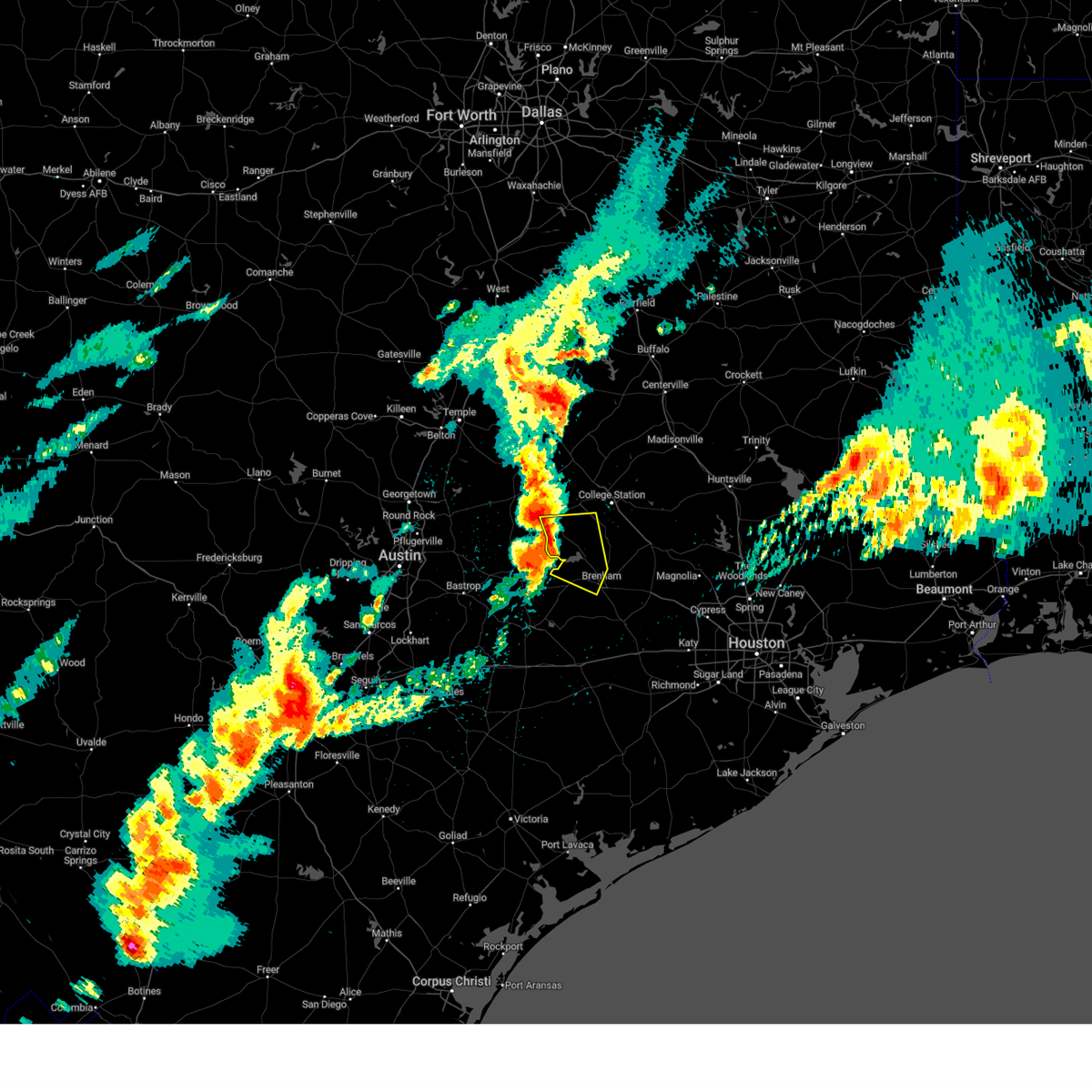
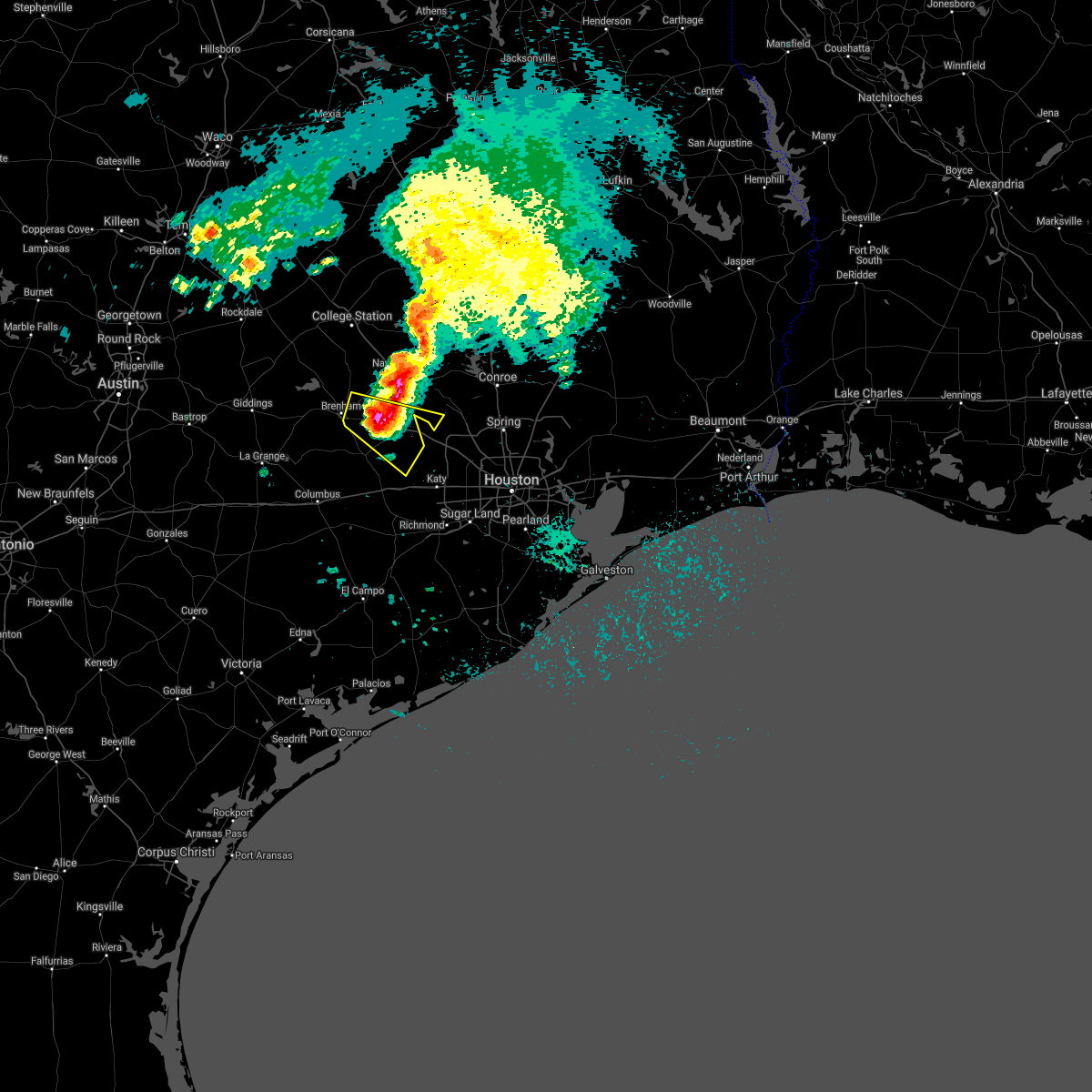
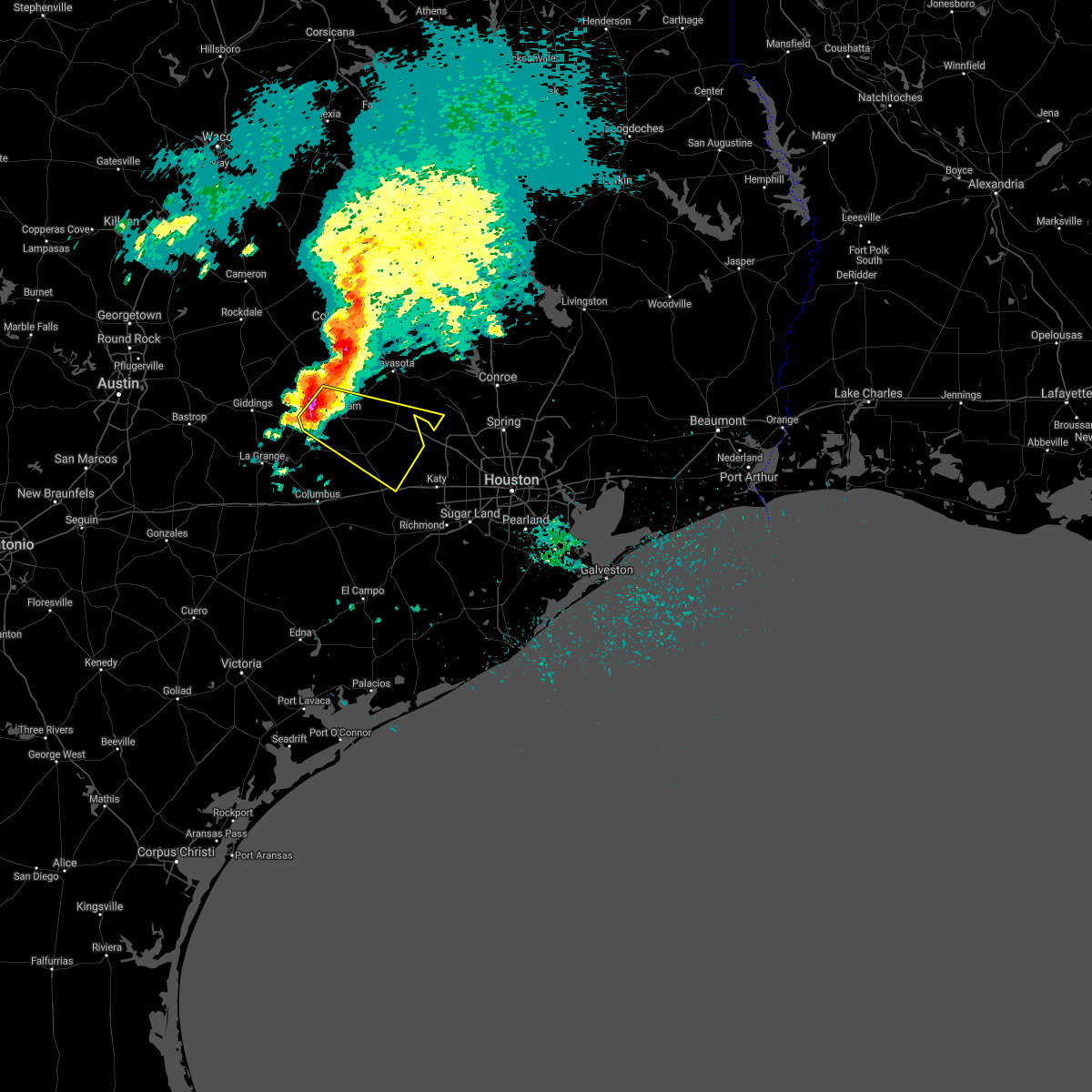
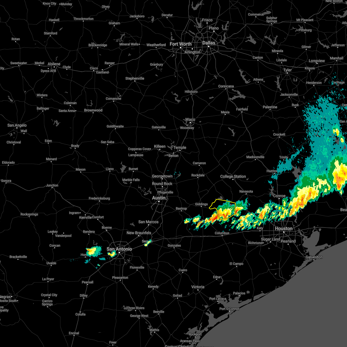
Hail Map for Brenham, TX
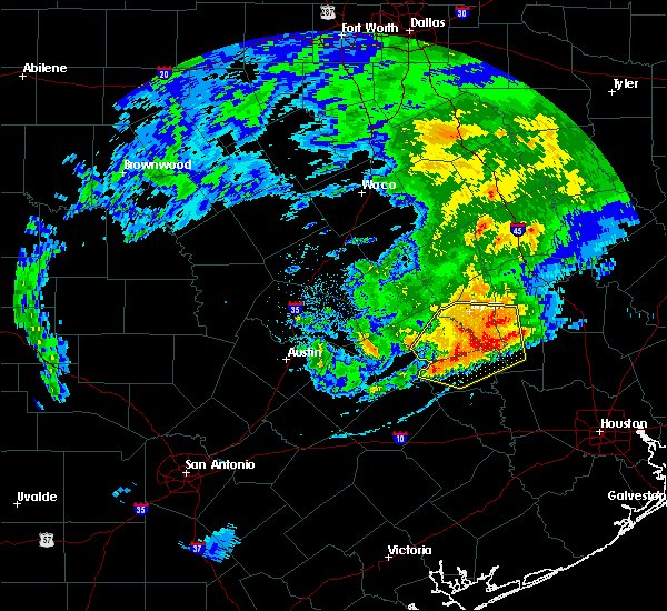
The Brenham, TX area has had 2 reports of on-the-ground hail by trained spotters, and has been under severe weather warnings 9 times during the past 12 months. Doppler radar has detected hail at or near Brenham, TX on 35 occasions, including 5 occasions during the past year.
| Name: | Brenham, TX |
| Where Located: | 67.6 miles WNW of Houston, TX |
| Map: | Google Map for Brenham, TX |
| Population: | 15716 |
| Housing Units: | 6377 |
| More Info: | Search Google for Brenham, TX |
2
The Top Recent Hail Date for Brenham, TX is Monday, May 5, 2025 (2nd out of 35)
Hail and Wind Damage Spotted near Brenham, TX
| Date / Time | Report Details |
|---|---|
| 6/13/2025 7:53 PM CDT |
 the severe thunderstorm warning has been cancelled and is no longer in effect the severe thunderstorm warning has been cancelled and is no longer in effect
|
| 6/13/2025 7:38 PM CDT |
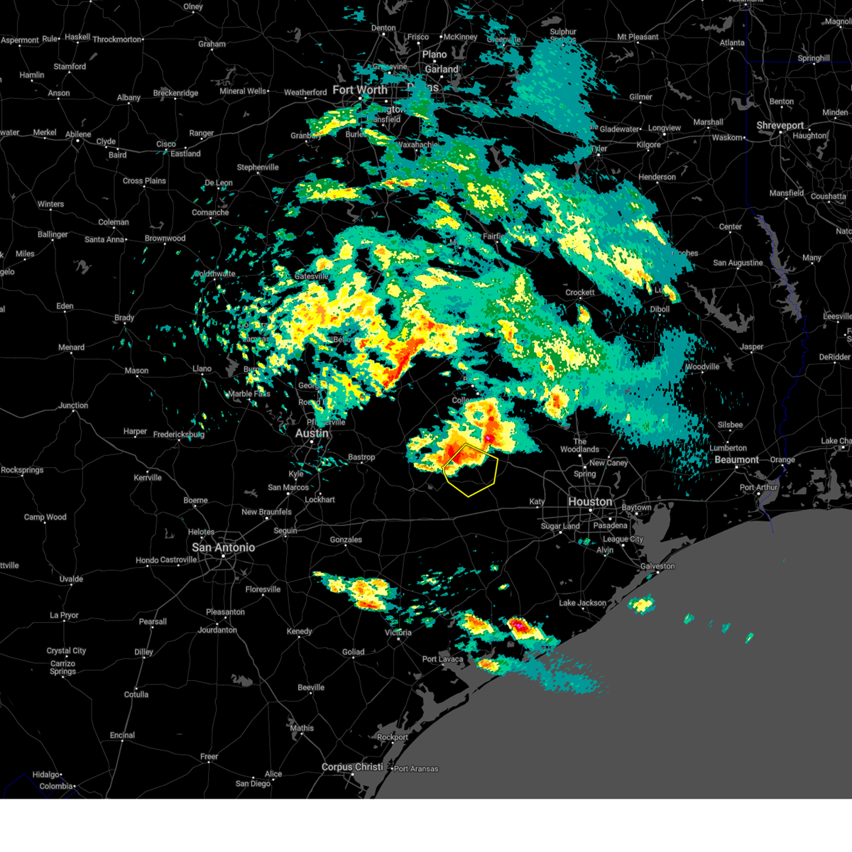
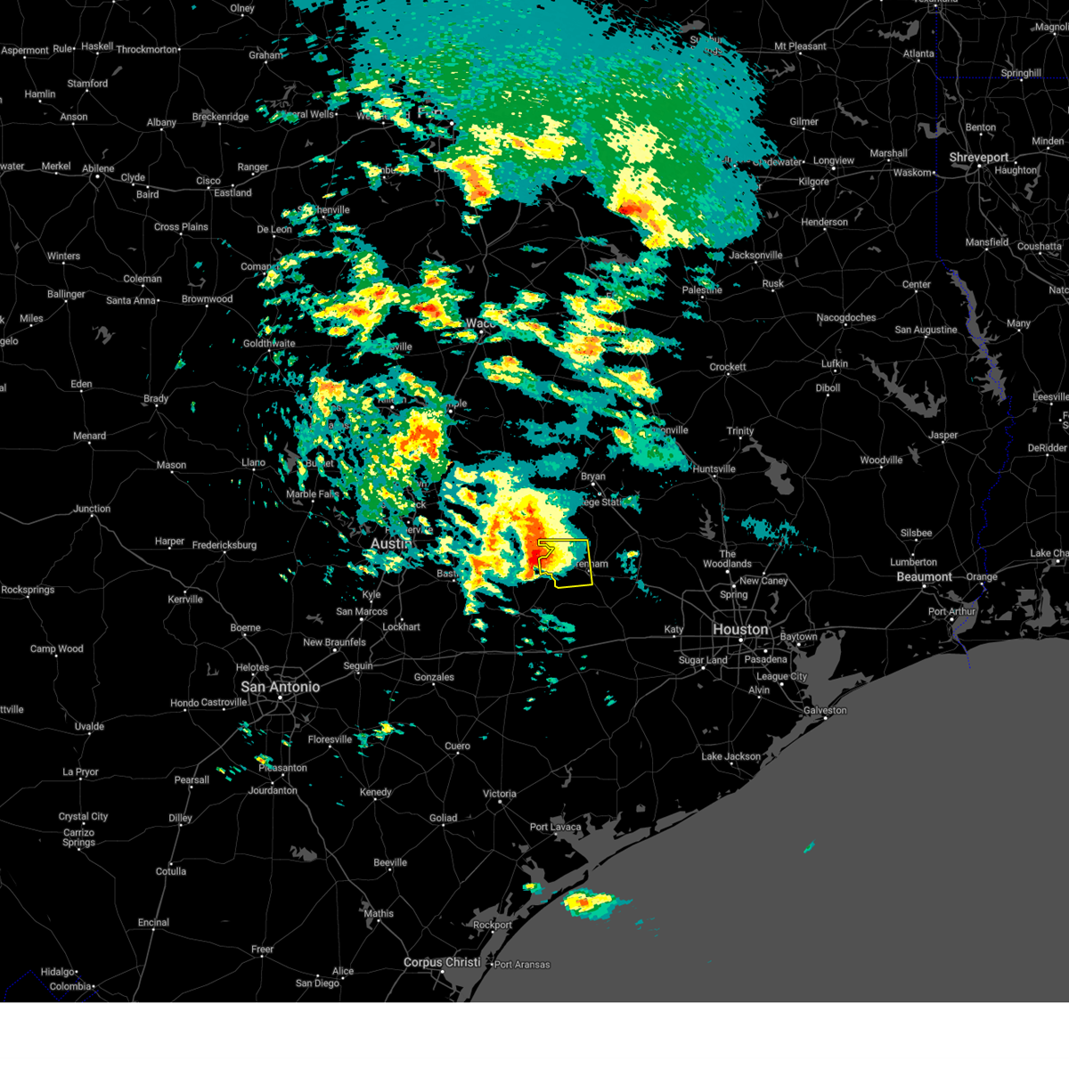
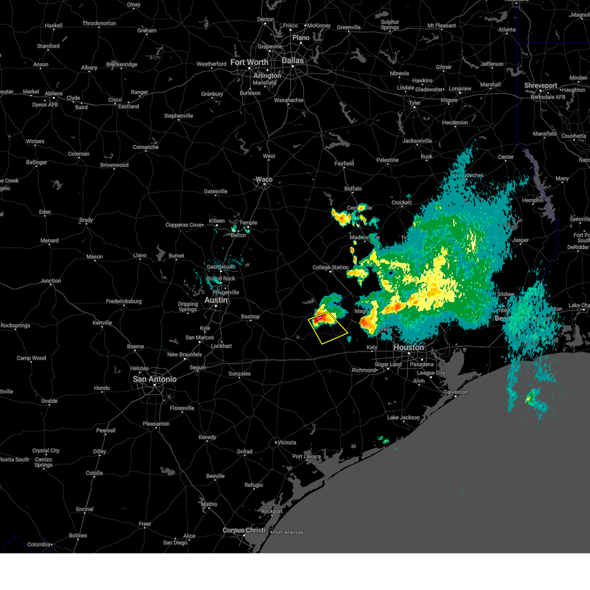
 Svrhgx the national weather service in league city has issued a * severe thunderstorm warning for, north central austin county in southeastern texas, southeastern burleson county in southeastern texas, central washington county in southeastern texas, * until 815 pm cdt. * at 738 pm cdt, a severe thunderstorm was located near lake somerville dam, or 10 miles northwest of brenham, moving southeast at 15 mph (radar indicated). Hazards include 60 mph wind gusts and quarter size hail. Hail damage to vehicles is expected. Expect wind damage to roofs, siding, and trees. Svrhgx the national weather service in league city has issued a * severe thunderstorm warning for, north central austin county in southeastern texas, southeastern burleson county in southeastern texas, central washington county in southeastern texas, * until 815 pm cdt. * at 738 pm cdt, a severe thunderstorm was located near lake somerville dam, or 10 miles northwest of brenham, moving southeast at 15 mph (radar indicated). Hazards include 60 mph wind gusts and quarter size hail. Hail damage to vehicles is expected. Expect wind damage to roofs, siding, and trees.
|
| 5/5/2025 4:24 PM CDT |
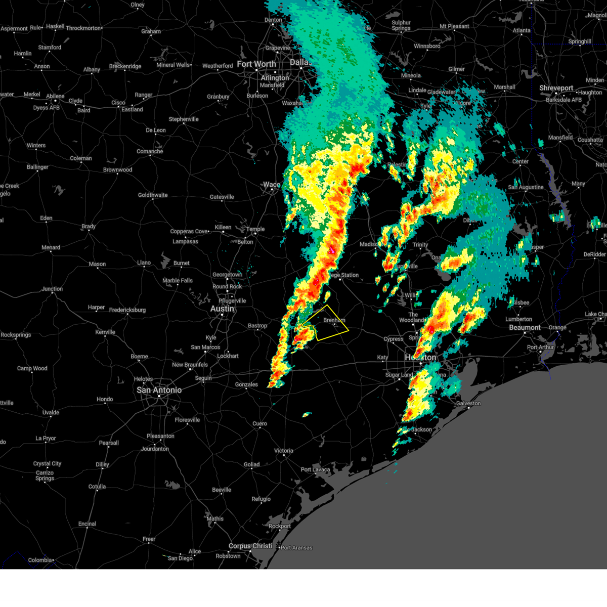
 Svrhgx the national weather service in league city has issued a * severe thunderstorm warning for, northeastern austin county in southeastern texas, southeastern washington county in southeastern texas, northwestern waller county in southeastern texas, * until 500 pm cdt. * at 424 pm cdt, a severe thunderstorm was located 7 miles southeast of brenham, moving east at 30 mph (radar indicated). Hazards include 60 mph wind gusts and quarter size hail. Hail damage to vehicles is expected. Expect wind damage to roofs, siding, and trees. Svrhgx the national weather service in league city has issued a * severe thunderstorm warning for, northeastern austin county in southeastern texas, southeastern washington county in southeastern texas, northwestern waller county in southeastern texas, * until 500 pm cdt. * at 424 pm cdt, a severe thunderstorm was located 7 miles southeast of brenham, moving east at 30 mph (radar indicated). Hazards include 60 mph wind gusts and quarter size hail. Hail damage to vehicles is expected. Expect wind damage to roofs, siding, and trees.
|
| 5/5/2025 3:47 PM CDT |
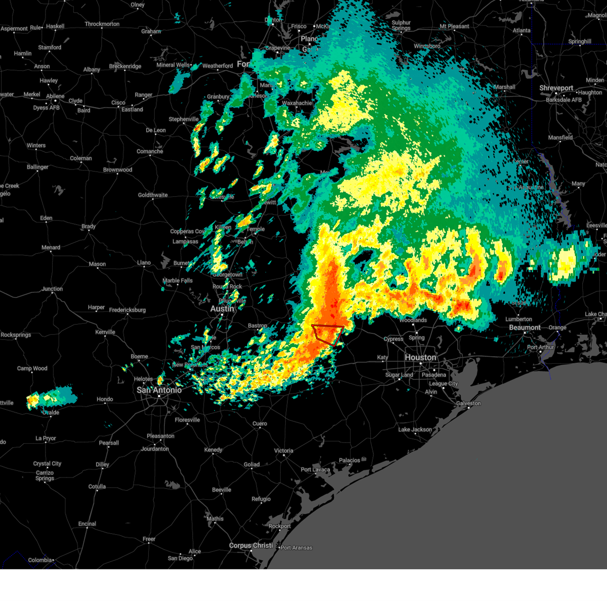
 Svrhgx the national weather service in league city has issued a * severe thunderstorm warning for, northwestern austin county in southeastern texas, southeastern washington county in southeastern texas, northwestern waller county in southeastern texas, * until 430 pm cdt. * at 347 pm cdt, a severe thunderstorm was located near brenham, moving southeast at 30 mph (radar indicated). Hazards include 60 mph wind gusts and quarter size hail. Hail damage to vehicles is expected. Expect wind damage to roofs, siding, and trees. Svrhgx the national weather service in league city has issued a * severe thunderstorm warning for, northwestern austin county in southeastern texas, southeastern washington county in southeastern texas, northwestern waller county in southeastern texas, * until 430 pm cdt. * at 347 pm cdt, a severe thunderstorm was located near brenham, moving southeast at 30 mph (radar indicated). Hazards include 60 mph wind gusts and quarter size hail. Hail damage to vehicles is expected. Expect wind damage to roofs, siding, and trees.
|
| 5/5/2025 3:20 PM CDT |
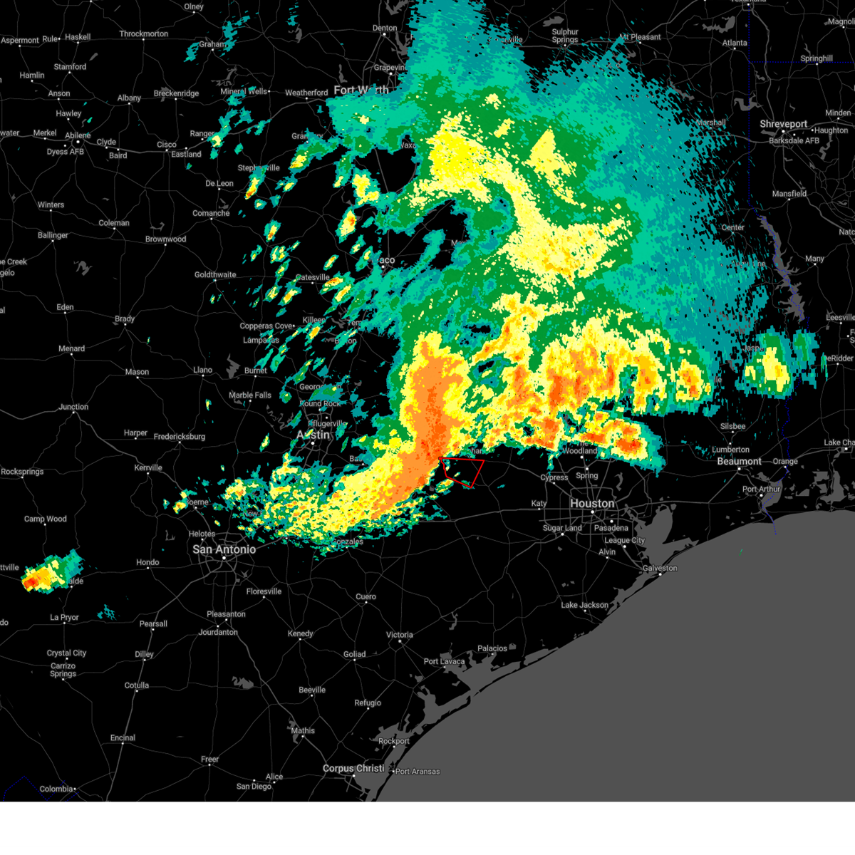
 Svrhgx the national weather service in league city has issued a * severe thunderstorm warning for, western washington county in southeastern texas, * until 400 pm cdt. * at 320 pm cdt, a severe thunderstorm was located over burton, or 14 miles west of brenham, moving east at 30 mph (radar indicated). Hazards include 60 mph wind gusts and quarter size hail. Hail damage to vehicles is expected. Expect wind damage to roofs, siding, and trees. Svrhgx the national weather service in league city has issued a * severe thunderstorm warning for, western washington county in southeastern texas, * until 400 pm cdt. * at 320 pm cdt, a severe thunderstorm was located over burton, or 14 miles west of brenham, moving east at 30 mph (radar indicated). Hazards include 60 mph wind gusts and quarter size hail. Hail damage to vehicles is expected. Expect wind damage to roofs, siding, and trees.
|
| 5/5/2025 3:13 PM CDT |
 Svrhgx the national weather service in league city has issued a * severe thunderstorm warning for, southwestern grimes county in southeastern texas, southeastern brazos county in southeastern texas, northeastern washington county in southeastern texas, northwestern waller county in southeastern texas, * until 345 pm cdt. * at 312 pm cdt, a severe thunderstorm was located over brenham, moving east at 20 mph (radar indicated). Hazards include quarter size hail. damage to vehicles is expected Svrhgx the national weather service in league city has issued a * severe thunderstorm warning for, southwestern grimes county in southeastern texas, southeastern brazos county in southeastern texas, northeastern washington county in southeastern texas, northwestern waller county in southeastern texas, * until 345 pm cdt. * at 312 pm cdt, a severe thunderstorm was located over brenham, moving east at 20 mph (radar indicated). Hazards include quarter size hail. damage to vehicles is expected
|
| 5/5/2025 2:43 PM CDT |
 Svrhgx the national weather service in league city has issued a * severe thunderstorm warning for, washington county in southeastern texas, * until 330 pm cdt. * at 243 pm cdt, a severe thunderstorm was located near burton, or 8 miles west of brenham, moving east at 25 mph (radar indicated). Hazards include ping pong ball size hail and 60 mph wind gusts. People and animals outdoors will be injured. expect hail damage to roofs, siding, windows, and vehicles. Expect wind damage to roofs, siding, and trees. Svrhgx the national weather service in league city has issued a * severe thunderstorm warning for, washington county in southeastern texas, * until 330 pm cdt. * at 243 pm cdt, a severe thunderstorm was located near burton, or 8 miles west of brenham, moving east at 25 mph (radar indicated). Hazards include ping pong ball size hail and 60 mph wind gusts. People and animals outdoors will be injured. expect hail damage to roofs, siding, windows, and vehicles. Expect wind damage to roofs, siding, and trees.
|
| 5/5/2025 2:08 PM CDT |
 Svrhgx the national weather service in league city has issued a * severe thunderstorm warning for, south central burleson county in southeastern texas, western washington county in southeastern texas, * until 245 pm cdt. * at 208 pm cdt, a severe thunderstorm was located near lake somerville dam, or 11 miles northwest of brenham, moving east at 30 mph (radar indicated). Hazards include 60 mph wind gusts and quarter size hail. Hail damage to vehicles is expected. Expect wind damage to roofs, siding, and trees. Svrhgx the national weather service in league city has issued a * severe thunderstorm warning for, south central burleson county in southeastern texas, western washington county in southeastern texas, * until 245 pm cdt. * at 208 pm cdt, a severe thunderstorm was located near lake somerville dam, or 11 miles northwest of brenham, moving east at 30 mph (radar indicated). Hazards include 60 mph wind gusts and quarter size hail. Hail damage to vehicles is expected. Expect wind damage to roofs, siding, and trees.
|
| 12/28/2024 12:27 PM CST |
 Svrhgx the national weather service in league city has issued a * severe thunderstorm warning for, northwestern austin county in southeastern texas, south central burleson county in southeastern texas, central washington county in southeastern texas, * until 115 pm cst. * at 1227 pm cst, a severe thunderstorm was located 7 miles north of la grange, moving northeast at 35 mph (radar indicated). Hazards include 60 mph wind gusts and quarter size hail. Hail damage to vehicles is expected. Expect wind damage to roofs, siding, and trees. Svrhgx the national weather service in league city has issued a * severe thunderstorm warning for, northwestern austin county in southeastern texas, south central burleson county in southeastern texas, central washington county in southeastern texas, * until 115 pm cst. * at 1227 pm cst, a severe thunderstorm was located 7 miles north of la grange, moving northeast at 35 mph (radar indicated). Hazards include 60 mph wind gusts and quarter size hail. Hail damage to vehicles is expected. Expect wind damage to roofs, siding, and trees.
|
| 5/31/2024 6:14 AM CDT |
 At 613 am cdt, severe thunderstorms were located along a line extending from 7 miles northeast of huntsville to 7 miles southeast of columbus, moving southeast at 40 mph (radar indicated). Hazards include 60 mph wind gusts and penny size hail. Expect damage to roofs, siding, and trees. Locations impacted include, huntsville, brenham, tomball, navasota, crockett, sealy, hempstead, prairie view, bellville, columbus, pinehurst, austonio, washington, shelby, hockley, trinity, waller, grapeland, magnolia, and new waverly. At 613 am cdt, severe thunderstorms were located along a line extending from 7 miles northeast of huntsville to 7 miles southeast of columbus, moving southeast at 40 mph (radar indicated). Hazards include 60 mph wind gusts and penny size hail. Expect damage to roofs, siding, and trees. Locations impacted include, huntsville, brenham, tomball, navasota, crockett, sealy, hempstead, prairie view, bellville, columbus, pinehurst, austonio, washington, shelby, hockley, trinity, waller, grapeland, magnolia, and new waverly.
|
| 5/31/2024 5:58 AM CDT |
 Svrhgx the national weather service in league city has issued a * severe thunderstorm warning for, southwestern trinity county in southeastern texas, northeastern colorado county in southeastern texas, austin county in southeastern texas, grimes county in southeastern texas, southeastern brazos county in southeastern texas, washington county in southeastern texas, western montgomery county in southeastern texas, houston county in southeastern texas, eastern madison county in southeastern texas, waller county in southeastern texas, walker county in southeastern texas, northwestern harris county in southeastern texas, * until 645 am cdt. * at 557 am cdt, severe thunderstorms were located along a line extending from 7 miles west of riverside to 6 miles north of columbus, moving southeast at around 40 mph (radar indicated). Hazards include 60 mph wind gusts and penny size hail. expect damage to roofs, siding, and trees Svrhgx the national weather service in league city has issued a * severe thunderstorm warning for, southwestern trinity county in southeastern texas, northeastern colorado county in southeastern texas, austin county in southeastern texas, grimes county in southeastern texas, southeastern brazos county in southeastern texas, washington county in southeastern texas, western montgomery county in southeastern texas, houston county in southeastern texas, eastern madison county in southeastern texas, waller county in southeastern texas, walker county in southeastern texas, northwestern harris county in southeastern texas, * until 645 am cdt. * at 557 am cdt, severe thunderstorms were located along a line extending from 7 miles west of riverside to 6 miles north of columbus, moving southeast at around 40 mph (radar indicated). Hazards include 60 mph wind gusts and penny size hail. expect damage to roofs, siding, and trees
|
| 5/31/2024 5:03 AM CDT |
 At 501 am cdt, severe thunderstorms were located along a line extending from 10 miles southeast of fort boggy state park to 8 miles north of lake somerville state park & trailway, moving southeast at around 45 mph (radar indicated). Hazards include 60 mph wind gusts and penny size hail. Expect damage to roofs, siding, and trees. Locations impacted include, college station, bryan, huntsville, brenham, navasota, madisonville, caldwell, austonio, washington, trinity, somerville, lovelady, snook, riverside, bedias, kurten, burton, wixon valley, millican, and anderson. At 501 am cdt, severe thunderstorms were located along a line extending from 10 miles southeast of fort boggy state park to 8 miles north of lake somerville state park & trailway, moving southeast at around 45 mph (radar indicated). Hazards include 60 mph wind gusts and penny size hail. Expect damage to roofs, siding, and trees. Locations impacted include, college station, bryan, huntsville, brenham, navasota, madisonville, caldwell, austonio, washington, trinity, somerville, lovelady, snook, riverside, bedias, kurten, burton, wixon valley, millican, and anderson.
|
| 5/31/2024 4:36 AM CDT |
 Svrhgx the national weather service in league city has issued a * severe thunderstorm warning for, west central trinity county in southeastern texas, grimes county in southeastern texas, burleson county in southeastern texas, brazos county in southeastern texas, washington county in southeastern texas, northwestern montgomery county in southeastern texas, southwestern houston county in southeastern texas, madison county in southeastern texas, walker county in southeastern texas, * until 530 am cdt. * at 435 am cdt, severe thunderstorms were located along a line extending from 9 miles west of fort boggy state park to near tanglewood, moving southeast at around 50 mph (radar indicated). Hazards include 60 mph wind gusts and penny size hail. expect damage to roofs, siding, and trees Svrhgx the national weather service in league city has issued a * severe thunderstorm warning for, west central trinity county in southeastern texas, grimes county in southeastern texas, burleson county in southeastern texas, brazos county in southeastern texas, washington county in southeastern texas, northwestern montgomery county in southeastern texas, southwestern houston county in southeastern texas, madison county in southeastern texas, walker county in southeastern texas, * until 530 am cdt. * at 435 am cdt, severe thunderstorms were located along a line extending from 9 miles west of fort boggy state park to near tanglewood, moving southeast at around 50 mph (radar indicated). Hazards include 60 mph wind gusts and penny size hail. expect damage to roofs, siding, and trees
|
| 5/16/2024 5:23 PM CDT |
 The tornado threat has diminished and the tornado warning has been cancelled. however, large hail and damaging winds remain likely and a severe thunderstorm warning remains in effect for the area. however, hail, damaging winds and heavy rain are still possible with this thunderstorm. a tornado watch remains in effect until 1000 pm cdt for southeastern texas. The tornado threat has diminished and the tornado warning has been cancelled. however, large hail and damaging winds remain likely and a severe thunderstorm warning remains in effect for the area. however, hail, damaging winds and heavy rain are still possible with this thunderstorm. a tornado watch remains in effect until 1000 pm cdt for southeastern texas.
|
| 5/16/2024 5:10 PM CDT | Trees down. funnel cloud sighted... possible tornado. near wesle in washington county TX, 9 miles NE of Brenham, TX |
| 5/16/2024 5:03 PM CDT |
 Torhgx the national weather service in league city has issued a * tornado warning for, northwestern austin county in southeastern texas, southwestern washington county in southeastern texas, * until 530 pm cdt. * at 503 pm cdt, a severe thunderstorm capable of producing a tornado was located near shelby, or 12 miles west of brenham, moving east at 45 mph (radar indicated rotation). Hazards include tornado. Flying debris will be dangerous to those caught without shelter. mobile homes will be damaged or destroyed. damage to roofs, windows, and vehicles will occur. tree damage is likely. This dangerous storm will be near, brenham and industry around 510 pm cdt. Torhgx the national weather service in league city has issued a * tornado warning for, northwestern austin county in southeastern texas, southwestern washington county in southeastern texas, * until 530 pm cdt. * at 503 pm cdt, a severe thunderstorm capable of producing a tornado was located near shelby, or 12 miles west of brenham, moving east at 45 mph (radar indicated rotation). Hazards include tornado. Flying debris will be dangerous to those caught without shelter. mobile homes will be damaged or destroyed. damage to roofs, windows, and vehicles will occur. tree damage is likely. This dangerous storm will be near, brenham and industry around 510 pm cdt.
|
| 5/16/2024 4:56 PM CDT |
 Svrhgx the national weather service in league city has issued a * severe thunderstorm warning for, northwestern colorado county in southeastern texas, northwestern austin county in southeastern texas, southwestern washington county in southeastern texas, * until 530 pm cdt. * at 455 pm cdt, a severe thunderstorm was located near la grange, moving southeast at 35 mph (radar indicated). Hazards include 60 mph wind gusts and quarter size hail. Hail damage to vehicles is expected. Expect wind damage to roofs, siding, and trees. Svrhgx the national weather service in league city has issued a * severe thunderstorm warning for, northwestern colorado county in southeastern texas, northwestern austin county in southeastern texas, southwestern washington county in southeastern texas, * until 530 pm cdt. * at 455 pm cdt, a severe thunderstorm was located near la grange, moving southeast at 35 mph (radar indicated). Hazards include 60 mph wind gusts and quarter size hail. Hail damage to vehicles is expected. Expect wind damage to roofs, siding, and trees.
|
| 4/9/2024 10:45 PM CDT |
 Svrhgx the national weather service in league city has issued a * severe thunderstorm warning for, southern burleson county in southeastern texas, central washington county in southeastern texas, * until 1115 pm cdt. * at 1045 pm cdt, severe thunderstorms were located along a line extending from caldwell to near lake somerville state park & trailway to 6 miles west of burton, moving east at 30 mph (radar indicated). Hazards include 60 mph wind gusts and quarter size hail. Hail damage to vehicles is expected. Expect wind damage to roofs, siding, and trees. Svrhgx the national weather service in league city has issued a * severe thunderstorm warning for, southern burleson county in southeastern texas, central washington county in southeastern texas, * until 1115 pm cdt. * at 1045 pm cdt, severe thunderstorms were located along a line extending from caldwell to near lake somerville state park & trailway to 6 miles west of burton, moving east at 30 mph (radar indicated). Hazards include 60 mph wind gusts and quarter size hail. Hail damage to vehicles is expected. Expect wind damage to roofs, siding, and trees.
|
| 4/9/2024 10:11 PM CDT |
 Svrhgx the national weather service in league city has issued a * severe thunderstorm warning for, burleson county in southeastern texas, west central brazos county in southeastern texas, western washington county in southeastern texas, * until 1045 pm cdt. * at 1008 pm cdt, severe thunderstorms were located along a line extending from near alcoa lake to near lexington to near giddings to 7 miles northeast of smithville, moving east at 40 mph (radar indicated). Hazards include 60 mph wind gusts and quarter size hail. Hail damage to vehicles is expected. Expect wind damage to roofs, siding, and trees. Svrhgx the national weather service in league city has issued a * severe thunderstorm warning for, burleson county in southeastern texas, west central brazos county in southeastern texas, western washington county in southeastern texas, * until 1045 pm cdt. * at 1008 pm cdt, severe thunderstorms were located along a line extending from near alcoa lake to near lexington to near giddings to 7 miles northeast of smithville, moving east at 40 mph (radar indicated). Hazards include 60 mph wind gusts and quarter size hail. Hail damage to vehicles is expected. Expect wind damage to roofs, siding, and trees.
|
| 2/11/2024 9:57 AM CST |
 The tornado warning for eastern washington and northwestern waller counties will expire at 1000 am cst, the storm which prompted the warning has weakened below severe limits, and no longer appears capable of producing a tornado. therefore, the warning will be allowed to expire. a tornado watch remains in effect until 300 pm cst for southeastern texas. The tornado warning for eastern washington and northwestern waller counties will expire at 1000 am cst, the storm which prompted the warning has weakened below severe limits, and no longer appears capable of producing a tornado. therefore, the warning will be allowed to expire. a tornado watch remains in effect until 300 pm cst for southeastern texas.
|
| 2/11/2024 9:37 AM CST |
 At 937 am cst, a severe thunderstorm capable of producing a tornado was located near brenham, moving east at 40 mph (radar indicated rotation). Hazards include tornado. Flying debris will be dangerous to those caught without shelter. mobile homes will be damaged or destroyed. damage to roofs, windows, and vehicles will occur. tree damage is likely. This dangerous storm will be near, washington around 950 am cst. At 937 am cst, a severe thunderstorm capable of producing a tornado was located near brenham, moving east at 40 mph (radar indicated rotation). Hazards include tornado. Flying debris will be dangerous to those caught without shelter. mobile homes will be damaged or destroyed. damage to roofs, windows, and vehicles will occur. tree damage is likely. This dangerous storm will be near, washington around 950 am cst.
|
| 2/11/2024 9:26 AM CST |
 At 925 am cst, a severe thunderstorm capable of producing a tornado was located near brenham, moving east at 40 mph (radar indicated rotation). Hazards include tornado. Flying debris will be dangerous to those caught without shelter. mobile homes will be damaged or destroyed. damage to roofs, windows, and vehicles will occur. tree damage is likely. this dangerous storm will be near, brenham around 930 am cst. Washington around 950 am cst. At 925 am cst, a severe thunderstorm capable of producing a tornado was located near brenham, moving east at 40 mph (radar indicated rotation). Hazards include tornado. Flying debris will be dangerous to those caught without shelter. mobile homes will be damaged or destroyed. damage to roofs, windows, and vehicles will occur. tree damage is likely. this dangerous storm will be near, brenham around 930 am cst. Washington around 950 am cst.
|
| 2/11/2024 9:22 AM CST |
 At 922 am cst, a severe thunderstorm capable of producing a tornado was located near brenham, moving east at 40 mph (radar indicated rotation). Hazards include tornado. Flying debris will be dangerous to those caught without shelter. mobile homes will be damaged or destroyed. damage to roofs, windows, and vehicles will occur. tree damage is likely. This dangerous storm will be near, brenham around 930 am cst. At 922 am cst, a severe thunderstorm capable of producing a tornado was located near brenham, moving east at 40 mph (radar indicated rotation). Hazards include tornado. Flying debris will be dangerous to those caught without shelter. mobile homes will be damaged or destroyed. damage to roofs, windows, and vehicles will occur. tree damage is likely. This dangerous storm will be near, brenham around 930 am cst.
|
| 2/11/2024 8:57 AM CST |
 At 856 am cst, a severe thunderstorm capable of producing a tornado was located near round top, or 10 miles northeast of la grange, moving east at 40 mph (radar indicated rotation). Hazards include tornado and quarter size hail. Flying debris will be dangerous to those caught without shelter. mobile homes will be damaged or destroyed. damage to roofs, windows, and vehicles will occur. tree damage is likely. this dangerous storm will be near, shelby around 900 am cst. burton around 910 am cst. brenham around 920 am cst. Other locations impacted by this tornadic thunderstorm include quarry. At 856 am cst, a severe thunderstorm capable of producing a tornado was located near round top, or 10 miles northeast of la grange, moving east at 40 mph (radar indicated rotation). Hazards include tornado and quarter size hail. Flying debris will be dangerous to those caught without shelter. mobile homes will be damaged or destroyed. damage to roofs, windows, and vehicles will occur. tree damage is likely. this dangerous storm will be near, shelby around 900 am cst. burton around 910 am cst. brenham around 920 am cst. Other locations impacted by this tornadic thunderstorm include quarry.
|
| 6/23/2023 10:14 PM CDT |
 At 1014 pm cdt, a severe thunderstorm was located over hempstead, moving northwest at 15 mph (radar indicated). Hazards include ping pong ball size hail and 60 mph wind gusts. People and animals outdoors will be injured. expect hail damage to roofs, siding, windows, and vehicles. expect wind damage to roofs, siding, and trees. locations impacted include, brenham, hempstead, prairie view, washington, waller, pine island and independence. hail threat, radar indicated max hail size, 1. 50 in wind threat, radar indicated max wind gust, 60 mph. At 1014 pm cdt, a severe thunderstorm was located over hempstead, moving northwest at 15 mph (radar indicated). Hazards include ping pong ball size hail and 60 mph wind gusts. People and animals outdoors will be injured. expect hail damage to roofs, siding, windows, and vehicles. expect wind damage to roofs, siding, and trees. locations impacted include, brenham, hempstead, prairie view, washington, waller, pine island and independence. hail threat, radar indicated max hail size, 1. 50 in wind threat, radar indicated max wind gust, 60 mph.
|
| 6/23/2023 9:42 PM CDT |
 At 941 pm cdt, a severe thunderstorm was located near prairie view, moving northwest at 20 mph (radar indicated). Hazards include 60 mph wind gusts and quarter size hail. Hail damage to vehicles is expected. Expect wind damage to roofs, siding, and trees. At 941 pm cdt, a severe thunderstorm was located near prairie view, moving northwest at 20 mph (radar indicated). Hazards include 60 mph wind gusts and quarter size hail. Hail damage to vehicles is expected. Expect wind damage to roofs, siding, and trees.
|
| 6/10/2023 11:59 PM CDT |
 At 1159 pm cdt, a severe thunderstorm was located near bellville, moving southeast at 40 mph (radar indicated). Hazards include 60 mph wind gusts and quarter size hail. Hail damage to vehicles is expected. expect wind damage to roofs, siding, and trees. locations impacted include, brenham, bellville and industry. hail threat, radar indicated max hail size, 1. 00 in wind threat, radar indicated max wind gust, 60 mph. At 1159 pm cdt, a severe thunderstorm was located near bellville, moving southeast at 40 mph (radar indicated). Hazards include 60 mph wind gusts and quarter size hail. Hail damage to vehicles is expected. expect wind damage to roofs, siding, and trees. locations impacted include, brenham, bellville and industry. hail threat, radar indicated max hail size, 1. 00 in wind threat, radar indicated max wind gust, 60 mph.
|
| 6/10/2023 11:53 PM CDT |
 At 1152 pm cdt, a severe thunderstorm was located 7 miles northeast of industry, or 8 miles south of brenham, moving southeast at 40 mph (trained weather spotters). Hazards include golf ball size hail and 70 mph wind gusts. People and animals outdoors will be injured. expect hail damage to roofs, siding, windows, and vehicles. expect considerable tree damage. wind damage is also likely to mobile homes, roofs, and outbuildings. locations impacted include, brenham, bellville and industry. thunderstorm damage threat, considerable hail threat, radar indicated max hail size, 1. 75 in wind threat, radar indicated max wind gust, 70 mph. At 1152 pm cdt, a severe thunderstorm was located 7 miles northeast of industry, or 8 miles south of brenham, moving southeast at 40 mph (trained weather spotters). Hazards include golf ball size hail and 70 mph wind gusts. People and animals outdoors will be injured. expect hail damage to roofs, siding, windows, and vehicles. expect considerable tree damage. wind damage is also likely to mobile homes, roofs, and outbuildings. locations impacted include, brenham, bellville and industry. thunderstorm damage threat, considerable hail threat, radar indicated max hail size, 1. 75 in wind threat, radar indicated max wind gust, 70 mph.
|
| 6/10/2023 11:34 PM CDT |
 At 1134 pm cdt, a severe thunderstorm was located near burton, or near brenham, moving southeast at 40 mph (trained weather spotters). Hazards include two inch hail and 70 mph wind gusts. People and animals outdoors will be injured. expect hail damage to roofs, siding, windows, and vehicles. expect considerable tree damage. Wind damage is also likely to mobile homes, roofs, and outbuildings. At 1134 pm cdt, a severe thunderstorm was located near burton, or near brenham, moving southeast at 40 mph (trained weather spotters). Hazards include two inch hail and 70 mph wind gusts. People and animals outdoors will be injured. expect hail damage to roofs, siding, windows, and vehicles. expect considerable tree damage. Wind damage is also likely to mobile homes, roofs, and outbuildings.
|
| 6/10/2023 11:32 PM CDT |
 At 1131 pm cdt, a severe thunderstorm was located near brenham, moving east at 35 mph (trained weather spotters). Hazards include two inch hail and 70 mph wind gusts. People and animals outdoors will be injured. expect hail damage to roofs, siding, windows, and vehicles. expect considerable tree damage. wind damage is also likely to mobile homes, roofs, and outbuildings. locations impacted include, brenham, somerville, burton, lake somerville dam, lake somerville state park & trailway and quarry. thunderstorm damage threat, considerable hail threat, radar indicated max hail size, 2. 00 in wind threat, radar indicated max wind gust, 70 mph. At 1131 pm cdt, a severe thunderstorm was located near brenham, moving east at 35 mph (trained weather spotters). Hazards include two inch hail and 70 mph wind gusts. People and animals outdoors will be injured. expect hail damage to roofs, siding, windows, and vehicles. expect considerable tree damage. wind damage is also likely to mobile homes, roofs, and outbuildings. locations impacted include, brenham, somerville, burton, lake somerville dam, lake somerville state park & trailway and quarry. thunderstorm damage threat, considerable hail threat, radar indicated max hail size, 2. 00 in wind threat, radar indicated max wind gust, 70 mph.
|
| 6/10/2023 11:10 PM CDT |
 At 1109 pm cdt, a severe thunderstorm was located near lake somerville dam, or 15 miles south of caldwell, moving southeast at 35 mph (radar indicated). Hazards include two inch hail and 60 mph wind gusts. People and animals outdoors will be injured. expect hail damage to roofs, siding, windows, and vehicles. Expect wind damage to roofs, siding, and trees. At 1109 pm cdt, a severe thunderstorm was located near lake somerville dam, or 15 miles south of caldwell, moving southeast at 35 mph (radar indicated). Hazards include two inch hail and 60 mph wind gusts. People and animals outdoors will be injured. expect hail damage to roofs, siding, windows, and vehicles. Expect wind damage to roofs, siding, and trees.
|
| 6/10/2023 10:49 PM CDT |
 At 1048 pm cdt, severe thunderstorms were located along a line extending from 6 miles northwest of lake conroe dam to 7 miles southeast of washington to near dime box, moving east at 50 mph (radar indicated). Hazards include 60 mph wind gusts. areas near and south of caldwell and also near washington could have up to 2 inch hail. People and animals outdoors will be injured. expect hail damage to roofs, siding, windows, and vehicles. expect wind damage to roofs, siding, and trees. locations impacted include, southeastern college station, brenham, navasota, hempstead, caldwell, washington, somerville, montgomery, snook, burton, millican, anderson, todd mission, lake somerville dam, lake somerville state park & trailway, lyons, deanville, dobbin, independence and quarry. thunderstorm damage threat, considerable hail threat, radar indicated max hail size, 2. 00 in wind threat, radar indicated max wind gust, 60 mph. At 1048 pm cdt, severe thunderstorms were located along a line extending from 6 miles northwest of lake conroe dam to 7 miles southeast of washington to near dime box, moving east at 50 mph (radar indicated). Hazards include 60 mph wind gusts. areas near and south of caldwell and also near washington could have up to 2 inch hail. People and animals outdoors will be injured. expect hail damage to roofs, siding, windows, and vehicles. expect wind damage to roofs, siding, and trees. locations impacted include, southeastern college station, brenham, navasota, hempstead, caldwell, washington, somerville, montgomery, snook, burton, millican, anderson, todd mission, lake somerville dam, lake somerville state park & trailway, lyons, deanville, dobbin, independence and quarry. thunderstorm damage threat, considerable hail threat, radar indicated max hail size, 2. 00 in wind threat, radar indicated max wind gust, 60 mph.
|
| 6/10/2023 10:37 PM CDT |
 At 1037 pm cdt, severe thunderstorms were located along a line extending from 8 miles north of montgomery to near washington to near dime box, moving southeast at 50 mph (radar indicated). Hazards include 60 mph wind gusts and up to quarter size hail. Hail damage to vehicles is possible. Expect wind damage to roofs, siding, and trees. At 1037 pm cdt, severe thunderstorms were located along a line extending from 8 miles north of montgomery to near washington to near dime box, moving southeast at 50 mph (radar indicated). Hazards include 60 mph wind gusts and up to quarter size hail. Hail damage to vehicles is possible. Expect wind damage to roofs, siding, and trees.
|
| 4/28/2023 7:37 PM CDT |
 At 737 pm cdt, severe thunderstorms were located along a line extending from near washington to 7 miles northeast of bellville to 11 miles southeast of industry to near sublime, moving east at 30 mph (radar indicated). Hazards include 60 mph wind gusts and quarter size hail. Hail damage to vehicles is expected. expect wind damage to roofs, siding, and trees. locations impacted include, brenham, sealy, hempstead, prairie view, bellville, columbus, eagle lake, shelby, weimar, pine island, san felipe, industry, monaville, new ulm, cat spring, sheridan, altair, frelsburg and rock island. hail threat, radar indicated max hail size, 1. 00 in wind threat, radar indicated max wind gust, 60 mph. At 737 pm cdt, severe thunderstorms were located along a line extending from near washington to 7 miles northeast of bellville to 11 miles southeast of industry to near sublime, moving east at 30 mph (radar indicated). Hazards include 60 mph wind gusts and quarter size hail. Hail damage to vehicles is expected. expect wind damage to roofs, siding, and trees. locations impacted include, brenham, sealy, hempstead, prairie view, bellville, columbus, eagle lake, shelby, weimar, pine island, san felipe, industry, monaville, new ulm, cat spring, sheridan, altair, frelsburg and rock island. hail threat, radar indicated max hail size, 1. 00 in wind threat, radar indicated max wind gust, 60 mph.
|
| 4/28/2023 7:25 PM CDT |
 At 724 pm cdt, severe thunderstorms were located along a line extending from near millican to 8 miles southeast of brenham to near industry to near schulenburg, moving southeast at 35 mph (radar indicated). Hazards include 60 mph wind gusts and quarter size hail. Hail damage to vehicles is expected. Expect wind damage to roofs, siding, and trees. At 724 pm cdt, severe thunderstorms were located along a line extending from near millican to 8 miles southeast of brenham to near industry to near schulenburg, moving southeast at 35 mph (radar indicated). Hazards include 60 mph wind gusts and quarter size hail. Hail damage to vehicles is expected. Expect wind damage to roofs, siding, and trees.
|
| 4/28/2023 7:16 PM CDT |
 At 715 pm cdt, severe thunderstorms were located along a line extending from near washington to near brenham to 6 miles northeast of industry, moving southeast at 40 mph (radar indicated). Hazards include 60 mph wind gusts and quarter size hail. Hail damage to vehicles is expected. expect wind damage to roofs, siding, and trees. locations impacted include, brenham, navasota, washington, shelby, somerville, snook, industry, burton, lake somerville dam, lake somerville state park & trailway, carmine, lyons, independence, new ulm, quarry and frelsburg. hail threat, radar indicated max hail size, 1. 00 in wind threat, radar indicated max wind gust, 60 mph. At 715 pm cdt, severe thunderstorms were located along a line extending from near washington to near brenham to 6 miles northeast of industry, moving southeast at 40 mph (radar indicated). Hazards include 60 mph wind gusts and quarter size hail. Hail damage to vehicles is expected. expect wind damage to roofs, siding, and trees. locations impacted include, brenham, navasota, washington, shelby, somerville, snook, industry, burton, lake somerville dam, lake somerville state park & trailway, carmine, lyons, independence, new ulm, quarry and frelsburg. hail threat, radar indicated max hail size, 1. 00 in wind threat, radar indicated max wind gust, 60 mph.
|
| 4/28/2023 6:44 PM CDT |
 At 644 pm cdt, severe thunderstorms were located along a line extending from near snook to near lake somerville state park & trailway to 8 miles west of burton, moving southeast at 40 mph (radar indicated). Hazards include 60 mph wind gusts and quarter size hail. Hail damage to vehicles is expected. Expect wind damage to roofs, siding, and trees. At 644 pm cdt, severe thunderstorms were located along a line extending from near snook to near lake somerville state park & trailway to 8 miles west of burton, moving southeast at 40 mph (radar indicated). Hazards include 60 mph wind gusts and quarter size hail. Hail damage to vehicles is expected. Expect wind damage to roofs, siding, and trees.
|
| 4/25/2023 9:42 PM CDT |
 The severe thunderstorm warning for north central austin and south central washington counties will expire at 945 pm cdt, the storm which prompted the warning has weakened below severe limits, and no longer poses an immediate threat to life or property. therefore, the warning will be allowed to expire. however small hail is still possible with this thunderstorm. The severe thunderstorm warning for north central austin and south central washington counties will expire at 945 pm cdt, the storm which prompted the warning has weakened below severe limits, and no longer poses an immediate threat to life or property. therefore, the warning will be allowed to expire. however small hail is still possible with this thunderstorm.
|
| 4/25/2023 9:37 PM CDT | Quarter sized hail reported 0.9 miles ENE of Brenham, TX, quarter sized hail at blinn college. |
| 4/25/2023 9:25 PM CDT |
 At 924 pm cdt, a severe thunderstorm was located near brenham, moving east at 25 mph (radar indicated). Hazards include quarter size hail. Damage to vehicles is expected. locations impacted include, brenham. hail threat, radar indicated max hail size, 1. 00 in wind threat, radar indicated max wind gust, <50 mph. At 924 pm cdt, a severe thunderstorm was located near brenham, moving east at 25 mph (radar indicated). Hazards include quarter size hail. Damage to vehicles is expected. locations impacted include, brenham. hail threat, radar indicated max hail size, 1. 00 in wind threat, radar indicated max wind gust, <50 mph.
|
| 4/25/2023 9:10 PM CDT |
 At 909 pm cdt, a severe thunderstorm was located over burton, or 11 miles west of brenham, moving east at 25 mph (radar indicated). Hazards include quarter size hail. damage to vehicles is expected At 909 pm cdt, a severe thunderstorm was located over burton, or 11 miles west of brenham, moving east at 25 mph (radar indicated). Hazards include quarter size hail. damage to vehicles is expected
|
| 3/2/2023 9:11 PM CST |
 At 909 pm cst, severe thunderstorms were located along a line extending from near buffalo to near centerville to near lake somerville dam, moving east at 50 mph (radar indicated). Hazards include 60 mph wind gusts. Expect damage to roofs, siding, and trees. locations impacted include, college station, bryan, caldwell, somerville, snook, kurten, burton, wixon valley, lake somerville dam, lake somerville state park & trailway, kyle field, bryan utilities lake, normangee, iola, carmine, lyons, deanville, independence, chriesman and quarry. hail threat, radar indicated max hail size, <. 75 in wind threat, radar indicated max wind gust, 60 mph. At 909 pm cst, severe thunderstorms were located along a line extending from near buffalo to near centerville to near lake somerville dam, moving east at 50 mph (radar indicated). Hazards include 60 mph wind gusts. Expect damage to roofs, siding, and trees. locations impacted include, college station, bryan, caldwell, somerville, snook, kurten, burton, wixon valley, lake somerville dam, lake somerville state park & trailway, kyle field, bryan utilities lake, normangee, iola, carmine, lyons, deanville, independence, chriesman and quarry. hail threat, radar indicated max hail size, <. 75 in wind threat, radar indicated max wind gust, 60 mph.
|
| 3/2/2023 8:42 PM CST |
 At 842 pm cst, severe thunderstorms were located along a line extending from 11 miles southwest of lake limestone to near twin oak reservoir to 7 miles east of fedor, moving east at 50 mph (radar indicated). Hazards include 60 mph wind gusts. expect damage to roofs, siding, and trees At 842 pm cst, severe thunderstorms were located along a line extending from 11 miles southwest of lake limestone to near twin oak reservoir to 7 miles east of fedor, moving east at 50 mph (radar indicated). Hazards include 60 mph wind gusts. expect damage to roofs, siding, and trees
|
| 5/25/2022 1:29 AM CDT |
 At 127 am cdt, severe thunderstorms were located along a line extending from 10 miles southwest of centerville to near bedias to near navasota to 9 miles north of bellville to sublime, moving southeast at 50 mph (radar indicated). Hazards include 60 mph wind gusts. expect damage to roofs, siding, and trees At 127 am cdt, severe thunderstorms were located along a line extending from 10 miles southwest of centerville to near bedias to near navasota to 9 miles north of bellville to sublime, moving southeast at 50 mph (radar indicated). Hazards include 60 mph wind gusts. expect damage to roofs, siding, and trees
|
| 5/25/2022 12:43 AM CDT |
 At 1242 am cdt, severe thunderstorms were located along a line extending from 7 miles southeast of hearne to 9 miles northeast of caldwell to 6 miles north of lake somerville state park & trailway to 6 miles northwest of round top to near cistern, moving east at 45 mph (radar indicated). Hazards include 70 mph wind gusts and penny size hail. Expect considerable tree damage. Damage is likely to mobile homes, roofs, and outbuildings. At 1242 am cdt, severe thunderstorms were located along a line extending from 7 miles southeast of hearne to 9 miles northeast of caldwell to 6 miles north of lake somerville state park & trailway to 6 miles northwest of round top to near cistern, moving east at 45 mph (radar indicated). Hazards include 70 mph wind gusts and penny size hail. Expect considerable tree damage. Damage is likely to mobile homes, roofs, and outbuildings.
|
| 3/22/2022 5:28 AM CDT |
 At 527 am cdt, severe thunderstorms were located along a line extending from 7 miles east of brenham to near sealy to near pierce, moving northeast at 45 mph (radar indicated). Hazards include 60 mph wind gusts. expect damage to roofs, siding, and trees At 527 am cdt, severe thunderstorms were located along a line extending from 7 miles east of brenham to near sealy to near pierce, moving northeast at 45 mph (radar indicated). Hazards include 60 mph wind gusts. expect damage to roofs, siding, and trees
|
| 6/2/2021 11:45 PM CDT | Trees down time estimate in washington county TX, 6.5 miles W of Brenham, TX |
| 6/2/2021 11:38 PM CDT |
 At 1138 pm cdt, a severe thunderstorm was located over brenham, moving east at 15 mph (radar indicated). Hazards include 60 mph wind gusts and quarter size hail. Hail damage to vehicles is expected. Expect wind damage to roofs, siding, and trees. At 1138 pm cdt, a severe thunderstorm was located over brenham, moving east at 15 mph (radar indicated). Hazards include 60 mph wind gusts and quarter size hail. Hail damage to vehicles is expected. Expect wind damage to roofs, siding, and trees.
|
| 4/15/2021 6:32 PM CDT |
 At 632 pm cdt, a severe thunderstorm was located near hempstead, moving east at 40 mph (radar indicated). Hazards include quarter size hail. Damage to vehicles is expected. Locations impacted include, brenham, hempstead, prairie view, waller, pine island and monaville. At 632 pm cdt, a severe thunderstorm was located near hempstead, moving east at 40 mph (radar indicated). Hazards include quarter size hail. Damage to vehicles is expected. Locations impacted include, brenham, hempstead, prairie view, waller, pine island and monaville.
|
| 4/15/2021 6:01 PM CDT |
 The national weather service in league city has issued a * severe thunderstorm warning for. northern austin county in southeastern texas. washington county in southeastern texas. southwestern montgomery county in southeastern texas. Waller county in southeastern texas. The national weather service in league city has issued a * severe thunderstorm warning for. northern austin county in southeastern texas. washington county in southeastern texas. southwestern montgomery county in southeastern texas. Waller county in southeastern texas.
|
| 4/15/2021 5:30 PM CDT |
 At 529 pm cdt, a severe thunderstorm was located over dime box, or 11 miles northeast of giddings, moving southeast at 45 mph (radar indicated). Hazards include 60 mph wind gusts and quarter size hail. Hail damage to vehicles is expected. Expect wind damage to roofs, siding, and trees. At 529 pm cdt, a severe thunderstorm was located over dime box, or 11 miles northeast of giddings, moving southeast at 45 mph (radar indicated). Hazards include 60 mph wind gusts and quarter size hail. Hail damage to vehicles is expected. Expect wind damage to roofs, siding, and trees.
|
| 8/2/2020 3:50 PM CDT | Big tree down. report via social medi in washington county TX, 8.4 miles WNW of Brenham, TX |
| 5/27/2020 6:55 PM CDT |
 At 655 pm cdt, a severe thunderstorm was located near somerville, or 11 miles southeast of caldwell, moving southeast at 25 mph (radar indicated). Hazards include quarter size hail. damage to vehicles is expected At 655 pm cdt, a severe thunderstorm was located near somerville, or 11 miles southeast of caldwell, moving southeast at 25 mph (radar indicated). Hazards include quarter size hail. damage to vehicles is expected
|
| 5/27/2020 3:36 PM CDT |
 At 336 pm cdt, severe thunderstorms were located along a line extending from 7 miles west of montgomery to near prairie view to near bellville, moving southeast at 40 mph (radar indicated). Hazards include 70 mph wind gusts and half dollar size hail. Hail damage to vehicles is expected. expect considerable tree damage. wind damage is also likely to mobile homes, roofs, and outbuildings. Locations impacted include, conroe, brenham, tomball, navasota, hempstead, prairie view, brookshire, pinehurst, the woodlands, washington, hockley, oak ridge north, waller, panorama village, shenandoah, magnolia, cut and shoot, pine island, montgomery and stagecoach. At 336 pm cdt, severe thunderstorms were located along a line extending from 7 miles west of montgomery to near prairie view to near bellville, moving southeast at 40 mph (radar indicated). Hazards include 70 mph wind gusts and half dollar size hail. Hail damage to vehicles is expected. expect considerable tree damage. wind damage is also likely to mobile homes, roofs, and outbuildings. Locations impacted include, conroe, brenham, tomball, navasota, hempstead, prairie view, brookshire, pinehurst, the woodlands, washington, hockley, oak ridge north, waller, panorama village, shenandoah, magnolia, cut and shoot, pine island, montgomery and stagecoach.
|
| 5/27/2020 3:08 PM CDT |
 At 308 pm cdt, severe thunderstorms were located along a line extending from 7 miles northeast of anderson to near navasota to near brenham, moving southeast at 60 mph (radar indicated). Hazards include ping pong ball size hail and 60 mph wind gusts. People and animals outdoors will be injured. expect hail damage to roofs, siding, windows, and vehicles. Expect wind damage to roofs, siding, and trees. At 308 pm cdt, severe thunderstorms were located along a line extending from 7 miles northeast of anderson to near navasota to near brenham, moving southeast at 60 mph (radar indicated). Hazards include ping pong ball size hail and 60 mph wind gusts. People and animals outdoors will be injured. expect hail damage to roofs, siding, windows, and vehicles. Expect wind damage to roofs, siding, and trees.
|
| 5/27/2020 2:42 PM CDT |
 At 242 pm cdt, severe thunderstorms were located along a line extending from near college station to 6 miles east of caldwell, moving southeast at 30 mph (trained weather spotters). Hazards include ping pong ball size hail and 60 mph wind gusts. People and animals outdoors will be injured. expect hail damage to roofs, siding, windows, and vehicles. Expect wind damage to roofs, siding, and trees. At 242 pm cdt, severe thunderstorms were located along a line extending from near college station to 6 miles east of caldwell, moving southeast at 30 mph (trained weather spotters). Hazards include ping pong ball size hail and 60 mph wind gusts. People and animals outdoors will be injured. expect hail damage to roofs, siding, windows, and vehicles. Expect wind damage to roofs, siding, and trees.
|
| 5/24/2020 5:21 PM CDT |
 The severe thunderstorm warning for northwestern austin, southeastern washington and northwestern waller counties will expire at 530 pm cdt, the storm which prompted the warning has weakened below severe limits, and no longer poses an immediate threat to life or property. therefore, the warning will be allowed to expire. however heavy rain is still possible with this thunderstorm. The severe thunderstorm warning for northwestern austin, southeastern washington and northwestern waller counties will expire at 530 pm cdt, the storm which prompted the warning has weakened below severe limits, and no longer poses an immediate threat to life or property. therefore, the warning will be allowed to expire. however heavy rain is still possible with this thunderstorm.
|
| 5/24/2020 4:57 PM CDT |
 At 457 pm cdt, a severe thunderstorm was located near bellville, moving northeast at 20 mph (radar indicated). Hazards include 60 mph wind gusts and quarter size hail. Hail damage to vehicles is expected. Expect wind damage to roofs, siding, and trees. At 457 pm cdt, a severe thunderstorm was located near bellville, moving northeast at 20 mph (radar indicated). Hazards include 60 mph wind gusts and quarter size hail. Hail damage to vehicles is expected. Expect wind damage to roofs, siding, and trees.
|
| 4/29/2020 5:12 AM CDT |
 At 512 am cdt, a severe thunderstorm was located over burton, or 13 miles west of brenham, moving southeast at 35 mph (radar indicated). Hazards include 60 mph wind gusts and nickel size hail. expect damage to roofs, siding, and trees At 512 am cdt, a severe thunderstorm was located over burton, or 13 miles west of brenham, moving southeast at 35 mph (radar indicated). Hazards include 60 mph wind gusts and nickel size hail. expect damage to roofs, siding, and trees
|
| 4/29/2020 4:11 AM CDT |
 At 410 am cdt, severe thunderstorms were located along a line extending from near honey island to near splendora to near woodloch to near navasota to 9 miles north of caldwell, moving south at 40 mph (radar indicated). Hazards include 60 mph wind gusts and quarter size hail. Hail damage to vehicles is expected. Expect wind damage to roofs, siding, and trees. At 410 am cdt, severe thunderstorms were located along a line extending from near honey island to near splendora to near woodloch to near navasota to 9 miles north of caldwell, moving south at 40 mph (radar indicated). Hazards include 60 mph wind gusts and quarter size hail. Hail damage to vehicles is expected. Expect wind damage to roofs, siding, and trees.
|
| 4/9/2020 5:00 PM CDT |
 At 458 pm cdt, a cluster of severe thunderstorms were located along a line extending from near bedias to near montgomery to 6 miles southwest of brenham, moving east at 45 mph. these storms have had a history of producing quarter sized hail (radar indicated). Hazards include 70 mph wind gusts and quarter size hail. Hail damage to vehicles is expected. expect considerable tree damage. Wind damage is also likely to mobile homes, roofs, and outbuildings. At 458 pm cdt, a cluster of severe thunderstorms were located along a line extending from near bedias to near montgomery to 6 miles southwest of brenham, moving east at 45 mph. these storms have had a history of producing quarter sized hail (radar indicated). Hazards include 70 mph wind gusts and quarter size hail. Hail damage to vehicles is expected. expect considerable tree damage. Wind damage is also likely to mobile homes, roofs, and outbuildings.
|
| 4/9/2020 4:59 PM CDT |
 At 444 pm cdt, a cluster of severe thunderstorms was located near washington, or 9 miles southwest of navasota, moving east at 30 mph. trained weather spotter has reported quarter sized hail in 10 miles northwest of navasota (trained weather spotters). Hazards include 70 mph wind gusts and quarter size hail. Hail damage to vehicles is expected. expect considerable tree damage. wind damage is also likely to mobile homes, roofs, and outbuildings. Locations impacted include, college station, eastern bryan, brenham, navasota, washington, somerville, burton, millican, anderson, lake somerville dam, kyle field, independence, quarry, wellborn and carlos. At 444 pm cdt, a cluster of severe thunderstorms was located near washington, or 9 miles southwest of navasota, moving east at 30 mph. trained weather spotter has reported quarter sized hail in 10 miles northwest of navasota (trained weather spotters). Hazards include 70 mph wind gusts and quarter size hail. Hail damage to vehicles is expected. expect considerable tree damage. wind damage is also likely to mobile homes, roofs, and outbuildings. Locations impacted include, college station, eastern bryan, brenham, navasota, washington, somerville, burton, millican, anderson, lake somerville dam, kyle field, independence, quarry, wellborn and carlos.
|
| 4/9/2020 4:46 PM CDT |
 At 444 pm cdt, a cluster of severe thunderstorms was located near washington, or 9 miles southwest of navasota, moving east at 30 mph. trained weather spotter has reported quarter sized hail in 10 miles northwest of navasota (trained weather spotters). Hazards include 70 mph wind gusts and quarter size hail. Hail damage to vehicles is expected. expect considerable tree damage. wind damage is also likely to mobile homes, roofs, and outbuildings. Locations impacted include, college station, eastern bryan, brenham, navasota, washington, somerville, burton, millican, anderson, lake somerville dam, kyle field, independence, quarry, wellborn and carlos. At 444 pm cdt, a cluster of severe thunderstorms was located near washington, or 9 miles southwest of navasota, moving east at 30 mph. trained weather spotter has reported quarter sized hail in 10 miles northwest of navasota (trained weather spotters). Hazards include 70 mph wind gusts and quarter size hail. Hail damage to vehicles is expected. expect considerable tree damage. wind damage is also likely to mobile homes, roofs, and outbuildings. Locations impacted include, college station, eastern bryan, brenham, navasota, washington, somerville, burton, millican, anderson, lake somerville dam, kyle field, independence, quarry, wellborn and carlos.
|
| 4/9/2020 4:34 PM CDT |
 At 431 pm cdt, a severe thunderstorm was located 9 miles west of washington, or 11 miles northeast of brenham, moving east at 30 mph. trained weather spotter has reported quarter sized hail in southern college station (trained weather spotters). Hazards include 70 mph wind gusts and quarter size hail. Hail damage to vehicles is expected. expect considerable tree damage. wind damage is also likely to mobile homes, roofs, and outbuildings. Locations impacted include, college station, eastern bryan, brenham, navasota, washington, somerville, snook, burton, millican, anderson, lake somerville dam, kyle field, lake somerville state park & trailway, lyons, independence, quarry, wellborn and carlos. At 431 pm cdt, a severe thunderstorm was located 9 miles west of washington, or 11 miles northeast of brenham, moving east at 30 mph. trained weather spotter has reported quarter sized hail in southern college station (trained weather spotters). Hazards include 70 mph wind gusts and quarter size hail. Hail damage to vehicles is expected. expect considerable tree damage. wind damage is also likely to mobile homes, roofs, and outbuildings. Locations impacted include, college station, eastern bryan, brenham, navasota, washington, somerville, snook, burton, millican, anderson, lake somerville dam, kyle field, lake somerville state park & trailway, lyons, independence, quarry, wellborn and carlos.
|
| 4/9/2020 4:15 PM CDT |
 At 413 pm cdt, a severe thunderstorm was located over somerville, or 14 miles southeast of caldwell, moving east at 45 mph (radar indicated). Hazards include 70 mph wind gusts and quarter size hail. Hail damage to vehicles is expected. expect considerable tree damage. Wind damage is also likely to mobile homes, roofs, and outbuildings. At 413 pm cdt, a severe thunderstorm was located over somerville, or 14 miles southeast of caldwell, moving east at 45 mph (radar indicated). Hazards include 70 mph wind gusts and quarter size hail. Hail damage to vehicles is expected. expect considerable tree damage. Wind damage is also likely to mobile homes, roofs, and outbuildings.
|
| 4/9/2020 3:44 PM CDT |
 At 344 pm cdt, a severe thunderstorm was located near caldwell, moving southeast at 60 mph (radar indicated). Hazards include 70 mph wind gusts and quarter size hail. Hail damage to vehicles is expected. expect considerable tree damage. wind damage is also likely to mobile homes, roofs, and outbuildings. Locations impacted include, brenham, caldwell, somerville, snook, burton, lake somerville dam, lake somerville state park & trailway, carmine, lyons, deanville, independence, quarry and chriesman. At 344 pm cdt, a severe thunderstorm was located near caldwell, moving southeast at 60 mph (radar indicated). Hazards include 70 mph wind gusts and quarter size hail. Hail damage to vehicles is expected. expect considerable tree damage. wind damage is also likely to mobile homes, roofs, and outbuildings. Locations impacted include, brenham, caldwell, somerville, snook, burton, lake somerville dam, lake somerville state park & trailway, carmine, lyons, deanville, independence, quarry and chriesman.
|
| 4/9/2020 3:33 PM CDT |
 At 333 pm cdt, a severe thunderstorm was located near tanglewood, or near rockdale, moving southeast at 60 mph (radar indicated). Hazards include 70 mph wind gusts and penny size hail. Expect considerable tree damage. Damage is likely to mobile homes, roofs, and outbuildings. At 333 pm cdt, a severe thunderstorm was located near tanglewood, or near rockdale, moving southeast at 60 mph (radar indicated). Hazards include 70 mph wind gusts and penny size hail. Expect considerable tree damage. Damage is likely to mobile homes, roofs, and outbuildings.
|
| 1/10/2020 9:40 PM CST |
 At 940 pm cst, severe thunderstorms were located along a line extending from 7 miles southwest of hearne to 6 miles west of fayetteville, moving northeast at 60 mph. the most severe part of the line of storms is near caldwell (radar indicated). Hazards include 70 mph wind gusts. Expect considerable tree damage. damage is likely to mobile homes, roofs, and outbuildings. Locations impacted include, college station, bryan, brenham, navasota, caldwell, washington, shelby, somerville, snook, kurten, burton, wixon valley, millican, lake somerville dam, kyle field, lake somerville state park & trailway, iola, carmine, lyons and north zulch. At 940 pm cst, severe thunderstorms were located along a line extending from 7 miles southwest of hearne to 6 miles west of fayetteville, moving northeast at 60 mph. the most severe part of the line of storms is near caldwell (radar indicated). Hazards include 70 mph wind gusts. Expect considerable tree damage. damage is likely to mobile homes, roofs, and outbuildings. Locations impacted include, college station, bryan, brenham, navasota, caldwell, washington, shelby, somerville, snook, kurten, burton, wixon valley, millican, lake somerville dam, kyle field, lake somerville state park & trailway, iola, carmine, lyons and north zulch.
|
| 1/10/2020 9:25 PM CST |
 At 924 pm cst, severe thunderstorms were located along a line extending from 8 miles east of rockdale to near muldoon, moving northeast at 55 mph (radar indicated). Hazards include 60 mph wind gusts. expect damage to roofs, siding, and trees At 924 pm cst, severe thunderstorms were located along a line extending from 8 miles east of rockdale to near muldoon, moving northeast at 55 mph (radar indicated). Hazards include 60 mph wind gusts. expect damage to roofs, siding, and trees
|
| 10/20/2019 9:11 PM CDT |
 At 911 pm cdt, a severe thunderstorm was located near giddings, moving northeast at 25 mph (radar indicated). Hazards include 60 mph wind gusts and quarter size hail. Hail damage to vehicles is expected. Expect wind damage to roofs, siding, and trees. At 911 pm cdt, a severe thunderstorm was located near giddings, moving northeast at 25 mph (radar indicated). Hazards include 60 mph wind gusts and quarter size hail. Hail damage to vehicles is expected. Expect wind damage to roofs, siding, and trees.
|
| 8/31/2019 5:54 PM CDT | Strong winds peeled back part of a metal roof on a barn. strong winds also toppled 3 trees on the farm located at 5203 fm 33 in washington county TX, 5.5 miles NE of Brenham, TX |
| 5/3/2019 11:12 AM CDT |
 The severe thunderstorm warning for southeastern burleson, southwestern grimes, eastern washington and southeastern brazos counties will expire at 1115 am cdt, the storm which prompted the warning has weakened below severe limits, and no longer poses an immediate threat to life or property. therefore, the warning will be allowed to expire. however gusty winds are still possible with this thunderstorm. The severe thunderstorm warning for southeastern burleson, southwestern grimes, eastern washington and southeastern brazos counties will expire at 1115 am cdt, the storm which prompted the warning has weakened below severe limits, and no longer poses an immediate threat to life or property. therefore, the warning will be allowed to expire. however gusty winds are still possible with this thunderstorm.
|
| 5/3/2019 10:59 AM CDT |
 At 1046 am cdt, a severe thunderstorm was located near brenham, moving northeast at 45 mph (radar indicated). Hazards include 60 mph wind gusts and quarter size hail. Hail damage to vehicles is expected. Expect wind damage to roofs, siding, and trees. At 1046 am cdt, a severe thunderstorm was located near brenham, moving northeast at 45 mph (radar indicated). Hazards include 60 mph wind gusts and quarter size hail. Hail damage to vehicles is expected. Expect wind damage to roofs, siding, and trees.
|
| 5/3/2019 10:46 AM CDT |
 At 1046 am cdt, a severe thunderstorm was located near brenham, moving northeast at 45 mph (radar indicated). Hazards include 60 mph wind gusts and quarter size hail. Hail damage to vehicles is expected. Expect wind damage to roofs, siding, and trees. At 1046 am cdt, a severe thunderstorm was located near brenham, moving northeast at 45 mph (radar indicated). Hazards include 60 mph wind gusts and quarter size hail. Hail damage to vehicles is expected. Expect wind damage to roofs, siding, and trees.
|
| 4/18/2019 2:40 AM CDT |
 At 239 am cdt, severe thunderstorms were located along a line extending from 10 miles southeast of bedias to 6 miles north of hempstead, moving east at 35 mph (radar indicated). Hazards include 60 mph wind gusts. Expect damage to roofs, siding, and trees. Locations impacted include, southeastern college station, brenham, navasota, hempstead, washington, millican, anderson, roans prairie, independence, richards and carlos. At 239 am cdt, severe thunderstorms were located along a line extending from 10 miles southeast of bedias to 6 miles north of hempstead, moving east at 35 mph (radar indicated). Hazards include 60 mph wind gusts. Expect damage to roofs, siding, and trees. Locations impacted include, southeastern college station, brenham, navasota, hempstead, washington, millican, anderson, roans prairie, independence, richards and carlos.
|
| 4/18/2019 2:13 AM CDT |
 At 213 am cdt, severe thunderstorms were located along a line extending from 9 miles northeast of madisonville to near brenham, moving east at 40 mph (radar indicated). Hazards include 60 mph wind gusts. expect damage to roofs, siding, and trees At 213 am cdt, severe thunderstorms were located along a line extending from 9 miles northeast of madisonville to near brenham, moving east at 40 mph (radar indicated). Hazards include 60 mph wind gusts. expect damage to roofs, siding, and trees
|
| 4/18/2019 1:46 AM CDT |
 At 145 am cdt, severe thunderstorms were located along a line extending from near snook to near burton, moving east at 45 mph (radar indicated). Hazards include 60 mph wind gusts. Expect damage to roofs, siding, and trees. Locations impacted include, brenham, somerville, snook, burton, millican, lake somerville dam, lake somerville state park & trailway, carmine, lyons, deanville, independence and quarry. At 145 am cdt, severe thunderstorms were located along a line extending from near snook to near burton, moving east at 45 mph (radar indicated). Hazards include 60 mph wind gusts. Expect damage to roofs, siding, and trees. Locations impacted include, brenham, somerville, snook, burton, millican, lake somerville dam, lake somerville state park & trailway, carmine, lyons, deanville, independence and quarry.
|
| 4/18/2019 1:25 AM CDT |
 At 124 am cdt, severe thunderstorms were located along a line extending from 7 miles southeast of caldwell to 7 miles southeast of giddings, moving east at 45 mph (radar indicated). Hazards include 60 mph wind gusts. expect damage to roofs, siding, and trees At 124 am cdt, severe thunderstorms were located along a line extending from 7 miles southeast of caldwell to 7 miles southeast of giddings, moving east at 45 mph (radar indicated). Hazards include 60 mph wind gusts. expect damage to roofs, siding, and trees
|
| 10/31/2018 6:24 PM CDT |
 At 624 pm cdt, a severe thunderstorm was located 8 miles east of brenham, moving east at 30 mph (radar indicated). Hazards include 60 mph wind gusts. Expect damage to roofs, siding, and trees. locations impacted include, brenham, bellville, shelby, industry and independence. A tornado watch remains in effect until 1000 pm cdt for southeastern texas. At 624 pm cdt, a severe thunderstorm was located 8 miles east of brenham, moving east at 30 mph (radar indicated). Hazards include 60 mph wind gusts. Expect damage to roofs, siding, and trees. locations impacted include, brenham, bellville, shelby, industry and independence. A tornado watch remains in effect until 1000 pm cdt for southeastern texas.
|
| 10/31/2018 6:04 PM CDT |
 At 603 pm cdt, a severe thunderstorm was located over brenham, moving east at 30 mph (radar indicated). Hazards include 60 mph wind gusts. expect damage to roofs, siding, and trees At 603 pm cdt, a severe thunderstorm was located over brenham, moving east at 30 mph (radar indicated). Hazards include 60 mph wind gusts. expect damage to roofs, siding, and trees
|
| 5/23/2018 2:11 PM CDT |
 At 210 pm cdt, a severe thunderstorm was located over industry, or 12 miles west of bellville, moving northwest at 10 mph (radar indicated). Hazards include 60 mph wind gusts and quarter size hail. Hail damage to vehicles is expected. Expect wind damage to roofs, siding, and trees. At 210 pm cdt, a severe thunderstorm was located over industry, or 12 miles west of bellville, moving northwest at 10 mph (radar indicated). Hazards include 60 mph wind gusts and quarter size hail. Hail damage to vehicles is expected. Expect wind damage to roofs, siding, and trees.
|
| 5/22/2018 4:26 PM CDT |
 At 400 pm cdt, a severe thunderstorm was located near bellville, moving northwest at 25 mph (radar indicated). Hazards include 60 mph wind gusts and quarter size hail. Hail damage to vehicles is expected. Expect wind damage to roofs, siding, and trees. At 400 pm cdt, a severe thunderstorm was located near bellville, moving northwest at 25 mph (radar indicated). Hazards include 60 mph wind gusts and quarter size hail. Hail damage to vehicles is expected. Expect wind damage to roofs, siding, and trees.
|
| 5/22/2018 4:01 PM CDT |
 At 400 pm cdt, a severe thunderstorm was located near bellville, moving northwest at 25 mph (radar indicated). Hazards include 60 mph wind gusts and quarter size hail. Hail damage to vehicles is expected. Expect wind damage to roofs, siding, and trees. At 400 pm cdt, a severe thunderstorm was located near bellville, moving northwest at 25 mph (radar indicated). Hazards include 60 mph wind gusts and quarter size hail. Hail damage to vehicles is expected. Expect wind damage to roofs, siding, and trees.
|
| 5/3/2017 7:43 PM CDT |
 The severe thunderstorm warning for northwestern austin. southern burleson and southwestern washington counties will expire at 745 pm cdt. the storm which prompted the warning has weakened below severe limits, and no longer poses an immediate threat to life or property. therefore the warning will be allowed to expire. However, small. The severe thunderstorm warning for northwestern austin. southern burleson and southwestern washington counties will expire at 745 pm cdt. the storm which prompted the warning has weakened below severe limits, and no longer poses an immediate threat to life or property. therefore the warning will be allowed to expire. However, small.
|
| 5/3/2017 7:05 PM CDT |
 At 703 pm cdt, a severe thunderstorm was located 5 miles northwest of burton, or 15 miles northwest of brenham, moving southeast at 25 mph (radar indicated). Hazards include quarter size hail. damage to vehicles is possible At 703 pm cdt, a severe thunderstorm was located 5 miles northwest of burton, or 15 miles northwest of brenham, moving southeast at 25 mph (radar indicated). Hazards include quarter size hail. damage to vehicles is possible
|
| 3/24/2017 7:02 PM CDT |
 At 702 pm cdt, a severe thunderstorm was located near shelby, or 16 miles east of la grange, moving northeast at 35 mph (radar indicated). Hazards include 60 mph wind gusts and quarter size hail. Hail damage to vehicles is expected. Expect wind damage to roofs, siding, and trees. At 702 pm cdt, a severe thunderstorm was located near shelby, or 16 miles east of la grange, moving northeast at 35 mph (radar indicated). Hazards include 60 mph wind gusts and quarter size hail. Hail damage to vehicles is expected. Expect wind damage to roofs, siding, and trees.
|
| 2/14/2017 6:42 AM CST |
 At 642 am cst, severe thunderstorms were located along a line extending from 8 miles east of lake somerville dam to 13 miles east of sublime, moving east at 30 to 35 mph (radar indicated). Hazards include 60 mph wind gusts. expect damage to roofs, siding, and trees At 642 am cst, severe thunderstorms were located along a line extending from 8 miles east of lake somerville dam to 13 miles east of sublime, moving east at 30 to 35 mph (radar indicated). Hazards include 60 mph wind gusts. expect damage to roofs, siding, and trees
|
| 1/2/2017 6:50 AM CST |
 At 646 am cst, severe thunderstorms were located along a line extending from 9 miles east of kyle field to near college station to 6 miles southeast of snook to 10 miles east of somerville to near brenham to 9 miles northeast of industry, moving east at 35 mph (radar indicated). Hazards include 60 mph wind gusts. expect damage to roofs, siding, and trees At 646 am cst, severe thunderstorms were located along a line extending from 9 miles east of kyle field to near college station to 6 miles southeast of snook to 10 miles east of somerville to near brenham to 9 miles northeast of industry, moving east at 35 mph (radar indicated). Hazards include 60 mph wind gusts. expect damage to roofs, siding, and trees
|
| 1/2/2017 6:06 AM CST |
 At 606 am cst, severe thunderstorms were located along a line extending from 6 miles northeast of tanglewood to near caldwell to 7 miles east of dime box to 7 miles west of burton to near round top, moving northeast at 40 mph (radar indicated). Hazards include 60 mph wind gusts. expect damage to roofs, siding, and trees At 606 am cst, severe thunderstorms were located along a line extending from 6 miles northeast of tanglewood to near caldwell to 7 miles east of dime box to 7 miles west of burton to near round top, moving northeast at 40 mph (radar indicated). Hazards include 60 mph wind gusts. expect damage to roofs, siding, and trees
|
| 5/27/2016 3:34 AM CDT |
 At 333 am cdt, severe thunderstorms were located along a line extending from near washington to 7 miles west of hempstead to 12 miles northeast of columbus, moving east at 40 mph. the storm has intensified recently (radar indicated). Hazards include 70 mph wind gusts and quarter size hail. Hail damage to vehicles is expected. expect considerable tree damage. wind damage is also likely to mobile homes, roofs, and outbuildings. Locations impacted include, brenham, katy, navasota, sealy, hempstead, prairie view, brookshire, bellville, pinehurst, washington, hockley, waller, magnolia, pine island, san felipe, stagecoach, pattison, todd mission, dobbin and monaville. At 333 am cdt, severe thunderstorms were located along a line extending from near washington to 7 miles west of hempstead to 12 miles northeast of columbus, moving east at 40 mph. the storm has intensified recently (radar indicated). Hazards include 70 mph wind gusts and quarter size hail. Hail damage to vehicles is expected. expect considerable tree damage. wind damage is also likely to mobile homes, roofs, and outbuildings. Locations impacted include, brenham, katy, navasota, sealy, hempstead, prairie view, brookshire, bellville, pinehurst, washington, hockley, waller, magnolia, pine island, san felipe, stagecoach, pattison, todd mission, dobbin and monaville.
|
| 5/27/2016 3:28 AM CDT |
 At 328 am cdt, severe thunderstorms were located along a line extending from 8 miles west of washington to 9 miles southeast of brenham to 9 miles northeast of columbus, moving east at 40 mph (radar indicated). Hazards include 60 mph wind gusts and nickel size hail. Expect damage to roofs. siding. And trees. At 328 am cdt, severe thunderstorms were located along a line extending from 8 miles west of washington to 9 miles southeast of brenham to 9 miles northeast of columbus, moving east at 40 mph (radar indicated). Hazards include 60 mph wind gusts and nickel size hail. Expect damage to roofs. siding. And trees.
|
| 5/27/2016 2:54 AM CDT |
 At 254 am cdt, a severe thunderstorm was located near burton, or 9 miles west of brenham, moving northeast at 30 mph (radar indicated). Hazards include 60 mph wind gusts. Expect damage to roofs. siding. And trees. At 254 am cdt, a severe thunderstorm was located near burton, or 9 miles west of brenham, moving northeast at 30 mph (radar indicated). Hazards include 60 mph wind gusts. Expect damage to roofs. siding. And trees.
|
| 5/27/2016 2:36 AM CDT |
 At 236 am cdt, a severe thunderstorm capable of producing a tornado was located over burton, or 13 miles west of brenham, moving northeast at 30 mph (radar indicated rotation). Hazards include tornado. Flying debris will be dangerous to those caught without shelter. mobile homes will be damaged or destroyed. damage to roofs, windows, and vehicles will occur. Tree damage is likely. At 236 am cdt, a severe thunderstorm capable of producing a tornado was located over burton, or 13 miles west of brenham, moving northeast at 30 mph (radar indicated rotation). Hazards include tornado. Flying debris will be dangerous to those caught without shelter. mobile homes will be damaged or destroyed. damage to roofs, windows, and vehicles will occur. Tree damage is likely.
|
| 5/27/2016 2:33 AM CDT |
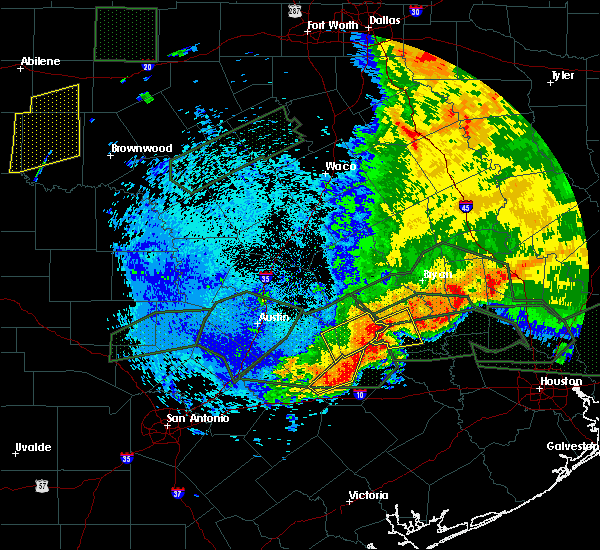 At 232 am cdt, a severe thunderstorm was located near burton, or 14 miles east of giddings, moving east at 30 mph. the storm was intensifying and hail and damaging wind threat is increasing (radar indicated). Hazards include 70 mph wind gusts and quarter size hail. Hail damage to vehicles is expected. expect considerable tree damage. wind damage is also likely to mobile homes, roofs, and outbuildings. Locations impacted include, brenham, somerville, burton, lake somerville dam, quarry and lyons. At 232 am cdt, a severe thunderstorm was located near burton, or 14 miles east of giddings, moving east at 30 mph. the storm was intensifying and hail and damaging wind threat is increasing (radar indicated). Hazards include 70 mph wind gusts and quarter size hail. Hail damage to vehicles is expected. expect considerable tree damage. wind damage is also likely to mobile homes, roofs, and outbuildings. Locations impacted include, brenham, somerville, burton, lake somerville dam, quarry and lyons.
|
| 5/27/2016 2:07 AM CDT |
 At 205 am cdt, a severe thunderstorm was located near giddings, moving east at 20 mph (radar indicated). Hazards include 60 mph wind gusts and quarter size hail. the strong winds combined with the saturated soil will be capable of knocking down trees. Hail damage to vehicles is expected. Expect wind damage to roofs, siding, and trees. At 205 am cdt, a severe thunderstorm was located near giddings, moving east at 20 mph (radar indicated). Hazards include 60 mph wind gusts and quarter size hail. the strong winds combined with the saturated soil will be capable of knocking down trees. Hail damage to vehicles is expected. Expect wind damage to roofs, siding, and trees.
|
| 5/26/2016 8:12 PM CDT | The severe thunderstorm warning for southern washington. northwestern waller and northern austin counties will expire at 815 pm cdt. the severe thunderstorm which prompted the warning will continue to weaken and move east therefore the warning will be allowed to expire. However gusty winds and heavy rain are still possible with. |
| 5/26/2016 7:12 PM CDT | Numerous reports of damage throughout the count in washington county TX, 0.4 miles NNE of Brenham, TX |
| 5/26/2016 7:09 PM CDT |
 At 709 pm cdt, a severe thunderstorm was located 7 miles southwest of brenham, moving east at 15 mph (radar indicated). Hazards include 60 mph wind gusts and quarter size hail. Hail damage to vehicles is expected. Expect wind damage to roofs, siding, and trees. At 709 pm cdt, a severe thunderstorm was located 7 miles southwest of brenham, moving east at 15 mph (radar indicated). Hazards include 60 mph wind gusts and quarter size hail. Hail damage to vehicles is expected. Expect wind damage to roofs, siding, and trees.
|
| 5/26/2016 6:57 PM CDT | The severe thunderstorm warning for southeastern washington, northwestern waller and northern austin counties will expire at 700 pm cdt, the severe thunderstorm which prompted the warning has been slowly weakening therefore the warning will be allowed to expire. however gusty winds are still possible with this thunderstorm. remember, a severe thunderstorm warning still remains in effect for wahsington and austin counties. |
| 5/26/2016 6:44 PM CDT |
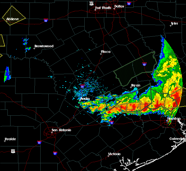 At 643 pm cdt, a severe thunderstorm was located 7 miles east of brenham, moving east at 15 mph (radar indicated). Hazards include 60 mph wind gusts and quarter size hail. Hail damage to vehicles is expected. expect wind damage to roofs, siding, and trees. Locations impacted include, brenham. At 643 pm cdt, a severe thunderstorm was located 7 miles east of brenham, moving east at 15 mph (radar indicated). Hazards include 60 mph wind gusts and quarter size hail. Hail damage to vehicles is expected. expect wind damage to roofs, siding, and trees. Locations impacted include, brenham.
|
| 5/26/2016 6:13 PM CDT |
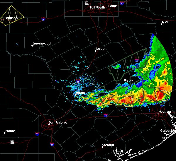 At 613 pm cdt, a severe thunderstorm was located over brenham, moving east at 15 mph (radar indicated). Hazards include 60 mph wind gusts and nickel size hail. Expect damage to roofs. siding. And trees. At 613 pm cdt, a severe thunderstorm was located over brenham, moving east at 15 mph (radar indicated). Hazards include 60 mph wind gusts and nickel size hail. Expect damage to roofs. siding. And trees.
|
| 5/26/2016 6:12 PM CDT | Quarter sized hail reported 0.4 miles NNE of Brenham, TX |
| 5/26/2016 5:44 PM CDT |
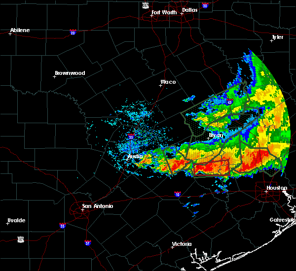 At 543 pm cdt, a severe thunderstorm capable of producing a tornado was located near burton, or 8 miles west of brenham, moving east at 15 mph (radar indicated rotation). Hazards include tornado and ping pong ball size hail. Flying debris will be dangerous to those caught without shelter. mobile homes will be damaged or destroyed. damage to roofs, windows, and vehicles will occur. Tree damage is likely. At 543 pm cdt, a severe thunderstorm capable of producing a tornado was located near burton, or 8 miles west of brenham, moving east at 15 mph (radar indicated rotation). Hazards include tornado and ping pong ball size hail. Flying debris will be dangerous to those caught without shelter. mobile homes will be damaged or destroyed. damage to roofs, windows, and vehicles will occur. Tree damage is likely.
|
| 5/26/2016 5:19 PM CDT |
 At 518 pm cdt, a severe thunderstorm was located over burton, or 14 miles west of brenham, moving east at 25 mph (radar indicated). Hazards include 60 mph wind gusts and quarter size hail. Hail damage to vehicles is expected. Expect wind damage to roofs, siding, and trees. At 518 pm cdt, a severe thunderstorm was located over burton, or 14 miles west of brenham, moving east at 25 mph (radar indicated). Hazards include 60 mph wind gusts and quarter size hail. Hail damage to vehicles is expected. Expect wind damage to roofs, siding, and trees.
|
| 5/26/2016 5:15 PM CDT | Cars and trucks traveling on fm 50 between brenham and independence were hit by very strong wind that toppled trailers behind the cars. destroyed a roof on a shed near in washington county TX, 0.4 miles NNE of Brenham, TX |
| 5/26/2016 5:01 PM CDT |
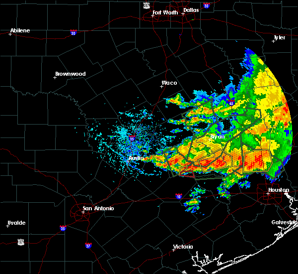 At 501 pm cdt, a severe thunderstorm was located 7 miles north of brenham, moving northeast at 30 mph (radar indicated). Hazards include 60 mph wind gusts and quarter size hail. Hail damage to vehicles is expected. Expect wind damage to roofs, siding, and trees. At 501 pm cdt, a severe thunderstorm was located 7 miles north of brenham, moving northeast at 30 mph (radar indicated). Hazards include 60 mph wind gusts and quarter size hail. Hail damage to vehicles is expected. Expect wind damage to roofs, siding, and trees.
|
| 4/30/2016 7:00 AM CDT |
 At 657 am cdt, severe thunderstorms were located along a line extending from 11 miles northwest of bedias to 6 miles southwest of pine island, moving east at 30 mph (college station asos reported a 56 mph wind gust at 653 am). Hazards include 60 mph wind gusts. Expect damage to roofs. siding. and trees. trees are more susceptible of toppling due to recently more saturated ground. Locations impacted include, college station, bryan, brenham, navasota, sealy, hempstead, prairie view, brookshire, bellville, columbus, washington, waller, weimar, pine island, san felipe, snook, pattison, bedias, kurten and industry. At 657 am cdt, severe thunderstorms were located along a line extending from 11 miles northwest of bedias to 6 miles southwest of pine island, moving east at 30 mph (college station asos reported a 56 mph wind gust at 653 am). Hazards include 60 mph wind gusts. Expect damage to roofs. siding. and trees. trees are more susceptible of toppling due to recently more saturated ground. Locations impacted include, college station, bryan, brenham, navasota, sealy, hempstead, prairie view, brookshire, bellville, columbus, washington, waller, weimar, pine island, san felipe, snook, pattison, bedias, kurten and industry.
|
| 4/30/2016 6:33 AM CDT |
 At 632 am cdt, severe thunderstorms were located along a line extending from near kurten to near bellville, moving east at 35 mph (radar indicated). Hazards include 60 mph wind gusts. Expect damage to roofs. siding. and trees. Toppled trees. At 632 am cdt, severe thunderstorms were located along a line extending from near kurten to near bellville, moving east at 35 mph (radar indicated). Hazards include 60 mph wind gusts. Expect damage to roofs. siding. and trees. Toppled trees.
|
| 4/30/2016 6:23 AM CDT |
 At 622 am cdt, severe thunderstorms were located along a line extending from snook to industry to 7 miles northeast of sublime, moving east at 40 mph (radar indicated). Hazards include 60 mph wind gusts and quarter size hail. Downed trees. trees can topple at winds speeds under 60 mph due to saturated grounds. possible home damage from both hail and wind. Locations impacted include, college station, bryan, brenham, navasota, sealy, hempstead, prairie view, caldwell, bellville, columbus, eagle lake, washington, weimar, somerville, wallis, pine island, san felipe, snook, pattison and kurten. At 622 am cdt, severe thunderstorms were located along a line extending from snook to industry to 7 miles northeast of sublime, moving east at 40 mph (radar indicated). Hazards include 60 mph wind gusts and quarter size hail. Downed trees. trees can topple at winds speeds under 60 mph due to saturated grounds. possible home damage from both hail and wind. Locations impacted include, college station, bryan, brenham, navasota, sealy, hempstead, prairie view, caldwell, bellville, columbus, eagle lake, washington, weimar, somerville, wallis, pine island, san felipe, snook, pattison and kurten.
|
| 4/30/2016 5:51 AM CDT |
 At 548 am cdt, severe thunderstorms were located along a line extending from 7 miles east of tanglewood to near la grange to near moulton, moving east at 45 mph (radar indicated). Hazards include 60 mph wind gusts and quarter size hail. Expect possible wind damage to homes and downed trees. trees will topple more easily due to the saturated grounds. Hail damage to vehicles may occur. At 548 am cdt, severe thunderstorms were located along a line extending from 7 miles east of tanglewood to near la grange to near moulton, moving east at 45 mph (radar indicated). Hazards include 60 mph wind gusts and quarter size hail. Expect possible wind damage to homes and downed trees. trees will topple more easily due to the saturated grounds. Hail damage to vehicles may occur.
|
| 12/27/2015 10:23 AM CST |
 At 1022 am cst, a severe thunderstorm was located near brenham, moving north at 75 mph (radar indicated). Hazards include 60 mph wind gusts. Expect damage to roofs. siding and trees. locations impacted include, brenham and independence. A tornado watch remains in effect until 400 pm cst for southeastern texas. At 1022 am cst, a severe thunderstorm was located near brenham, moving north at 75 mph (radar indicated). Hazards include 60 mph wind gusts. Expect damage to roofs. siding and trees. locations impacted include, brenham and independence. A tornado watch remains in effect until 400 pm cst for southeastern texas.
|
| 12/27/2015 10:07 AM CST |
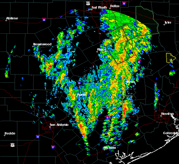 At 1007 am cst, a severe thunderstorm was located 7 miles west of bellville, moving north at 50 mph (radar indicated). Hazards include 60 mph wind gusts. Expect damage to roofs. Siding and trees. At 1007 am cst, a severe thunderstorm was located 7 miles west of bellville, moving north at 50 mph (radar indicated). Hazards include 60 mph wind gusts. Expect damage to roofs. Siding and trees.
|
| 8/25/2015 1:39 PM CDT |
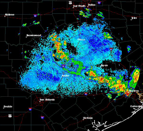 At 138 pm cdt, doppler radar indicated a severe thunderstorm capable of producing damaging winds in excess of 60 mph. this storm was located between independence and brenham, moving south at 15 mph. at 133 pm, nickel size hail was reported near the intersection of fm 50 and marcus road. locations impacted include, brenham and independence. At 138 pm cdt, doppler radar indicated a severe thunderstorm capable of producing damaging winds in excess of 60 mph. this storm was located between independence and brenham, moving south at 15 mph. at 133 pm, nickel size hail was reported near the intersection of fm 50 and marcus road. locations impacted include, brenham and independence.
|
| 8/25/2015 1:31 PM CDT | Trees down near the intersection of old independence road and prairie hill roa in washington county TX, 5.9 miles S of Brenham, TX |
| 8/25/2015 1:27 PM CDT |
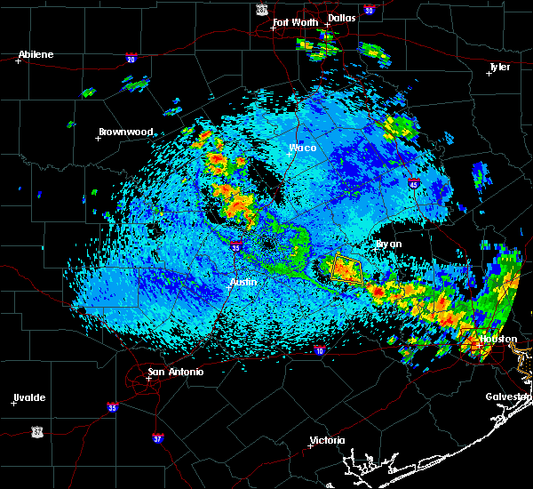 At 126 pm cdt, doppler radar indicated a severe thunderstorm capable of producing damaging winds in excess of 60 mph. this storm was located near independence, and moving south at 15 to 20 mph. At 126 pm cdt, doppler radar indicated a severe thunderstorm capable of producing damaging winds in excess of 60 mph. this storm was located near independence, and moving south at 15 to 20 mph.
|
| 5/25/2015 7:11 PM CDT | At 711 pm cdt, doppler radar indicated a severe thunderstorm capable of producing quarter size hail and damaging winds in excess of 60 mph. this storm was located near industry, or 10 miles southwest of brenham, and moving east at 25 mph. |
| 5/25/2015 6:51 PM CDT | At 651 pm cdt, doppler radar indicated a severe thunderstorm capable of producing a tornado. this dangerous storm was located near shelby, or 14 miles east of la grange, and moving northeast at 45 mph. |
| 5/25/2015 6:06 PM CDT | At 605 pm cdt, doppler radar indicated a severe thunderstorm capable of producing damaging winds in excess of 60 mph. this storm was located 7 miles west of somerville, or 13 miles south of caldwell, and moving east at 50 mph. |
| 5/6/2015 8:21 AM CDT | Trees down in indepedence at the intersection of fm-50 and fm-39 in washington county TX, 10.7 miles SSW of Brenham, TX |
| 4/27/2015 3:40 AM CDT | Trees down in brenha in washington county TX, 0.4 miles NNE of Brenham, TX |
| 4/27/2015 3:38 AM CDT | At 336 am cdt, doppler radar indicated a line of severe thunderstorms capable of producing damaging winds in excess of 60 mph. these storms were located along a line extending from 13 miles northwest of snook to 6 miles southeast of caldwell to near burton to near industry to 6 miles west of columbus, moving east at 45 mph. storm spotters measured a 48 mph gust at lake somervile at 331 am. locations impacted include, college station, bryan, brenham, navasota, sealy, hempstead, bellville, columbus, eagle lake, washington, weimar, somerville, snook, kurten, industry, burton, wixon valley, millican, kyle field and lake somerville dam. a tornado watch remains in effect until 900 am cdt for southeastern texas. |
| 4/27/2015 3:35 AM CDT | Trees down in washington county TX, 0.4 miles NNE of Brenham, TX |
| 4/27/2015 3:21 AM CDT | At 319 am cdt, doppler radar indicated a line of severe thunderstorms capable of producing damaging winds in excess of 60 mph. these storms were located along a line extending from 15 miles east of rockdale to 6 miles south of caldwell to near burton to near fayetteville to weimar, and moving east at 45 mph. these storms have a history of downing trees as they moved through areas just west of the region. |
| 4/19/2015 4:50 PM CDT | The national weather service in league city has issued a * severe thunderstorm warning for. south central burleson county in southeastern texas. central washington county in southeastern texas. until 515 pm cdt * at 449 pm cdt. Doppler radar indicated a severe thunderstorm. |
| 4/19/2015 3:44 PM CDT | At 343 pm cdt, doppler radar indicated a severe thunderstorm capable of producing large hail up to ping pong ball size and damaging winds in excess of 60 mph. this storm was located near somerville, or 12 miles south of caldwell, and moving east southeast at 25 mph. |
| 4/18/2015 11:04 PM CDT | Tree downed in the brenham are in washington county TX, 0.4 miles NNE of Brenham, TX |
| 4/16/2015 4:10 PM CDT | The severe thunderstorm warning for northwestern colorado, southwestern washington and northwestern austin counties will expire at 415 pm cdt, the storm which prompted the warning has weakened below severe limits, and no longer poses an immediate threat to life or property. therefore the warning will be allowed to expire. however small hail and gusty winds are still possible with this thunderstorm. to report severe weather, contact your nearest law enforcement agency. they will relay your report to the national weather service league city. |
| 4/16/2015 3:48 PM CDT | At 347 pm cdt, doppler radar indicated a severe thunderstorm capable of producing quarter size hail and damaging winds in excess of 60 mph. this storm was located near columbus, and moving north at 45 mph. |
| 1/1/0001 12:00 AM | Tree down blocking country in washington county TX, 5.8 miles W of Brenham, TX |
| 1/1/0001 12:00 AM | County wide damage including roof damage and downed power line in washington county TX, 0.4 miles NNE of Brenham, TX |
| 1/1/0001 12:00 AM | County wide damage including roof damage and downed power line in washington county TX, 0.4 miles NNE of Brenham, TX |
| 1/1/0001 12:00 AM | Numerous trees down and vehicle damage in downtown brenha in washington county TX, 0.4 miles NNE of Brenham, TX |
| 1/1/0001 12:00 AM | 70 mph gust at brenham awo in washington county TX, 0.4 miles NNE of Brenham, TX |
| 1/1/0001 12:00 AM | Emergency manager reported roof damage to 2 houses...one barn destroyed and damage to a television tower in chapel hil in washington county TX, 7.1 miles WNW of Brenham, TX |
| 1/1/0001 12:00 AM | Storm damage reported in washington county TX, 0.4 miles NNE of Brenham, TX |
| 1/1/0001 12:00 AM | Numerous trees downed - estimated 60-70 mph wind in washington county TX, 0.4 miles NNE of Brenham, TX |
Hail Maps for Brenham, TX
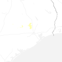


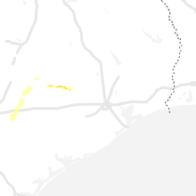


Connect with Interactive Hail Maps