

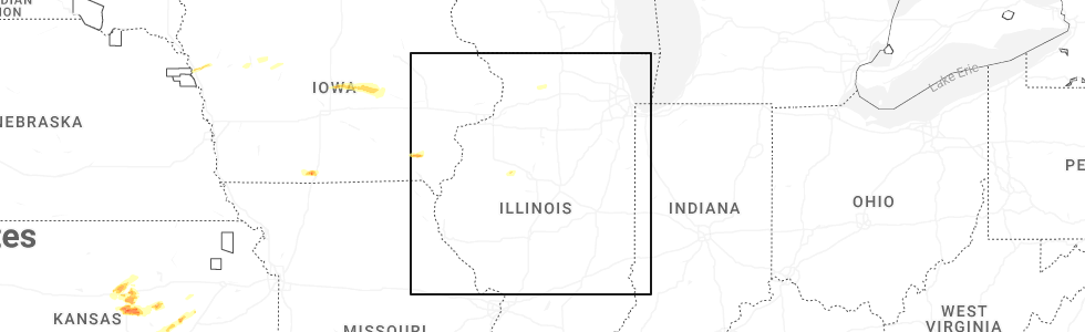
Hail Map for Brimfield, IL
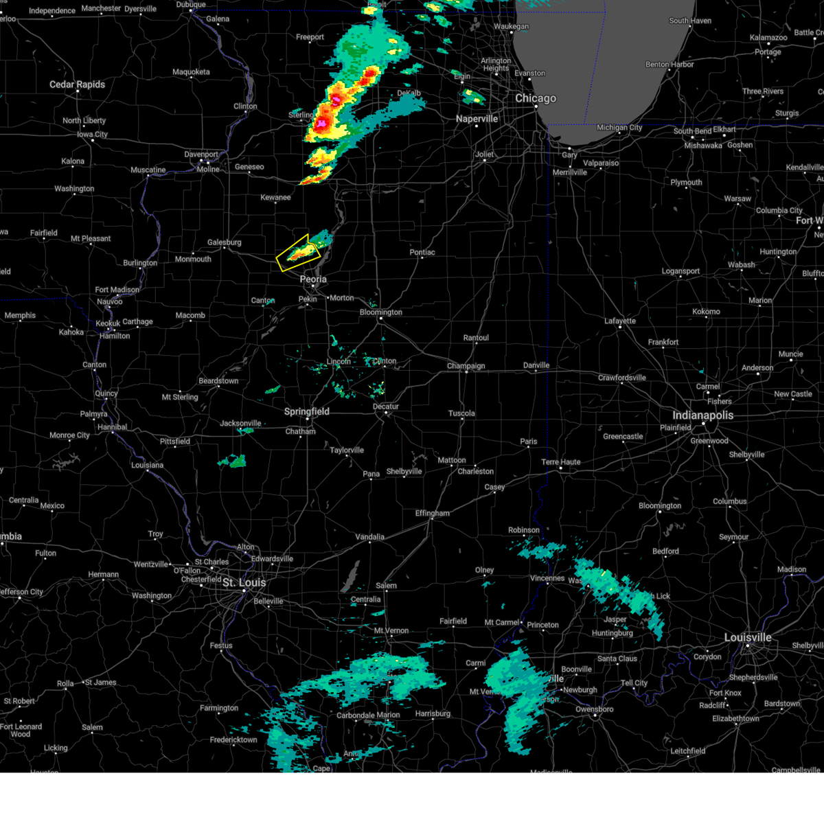
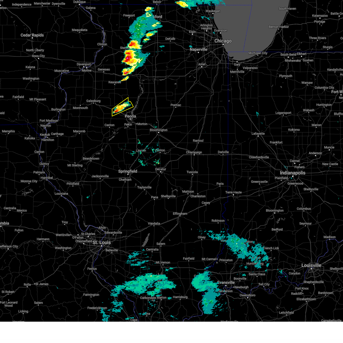
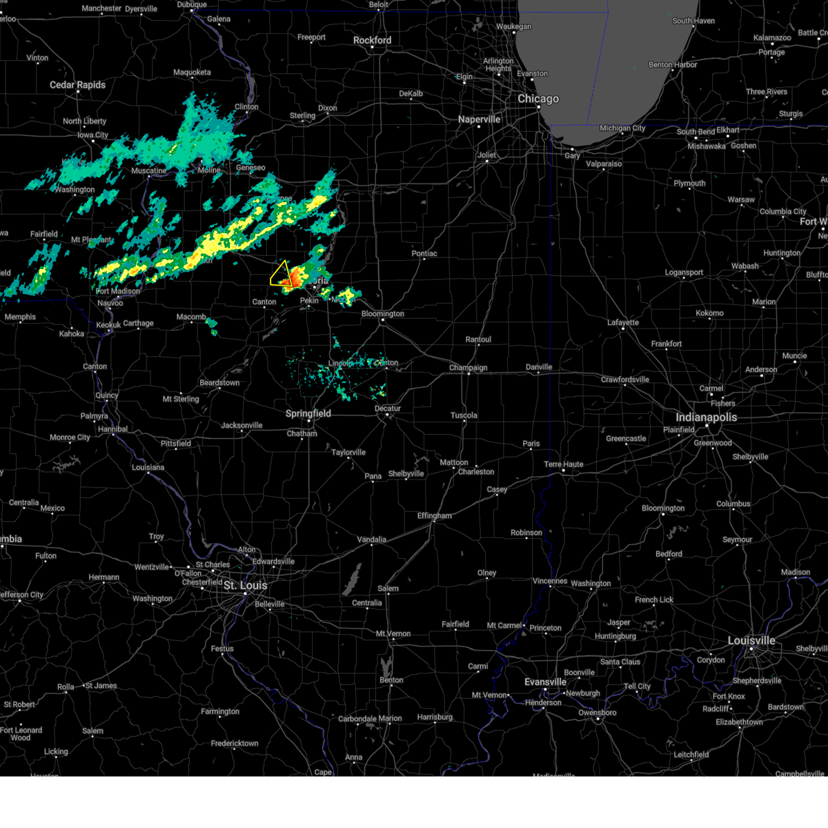
The Brimfield, IL area has had 3 reports of on-the-ground hail by trained spotters, and has been under severe weather warnings 18 times during the past 12 months. Doppler radar has detected hail at or near Brimfield, IL on 56 occasions, including 2 occasions during the past year.
| Name: | Brimfield, IL |
| Where Located: | 18.5 miles WNW of Peoria, IL |
| Map: | Google Map for Brimfield, IL |
| Population: | 868 |
| Housing Units: | 355 |
| More Info: | Search Google for Brimfield, IL |
0
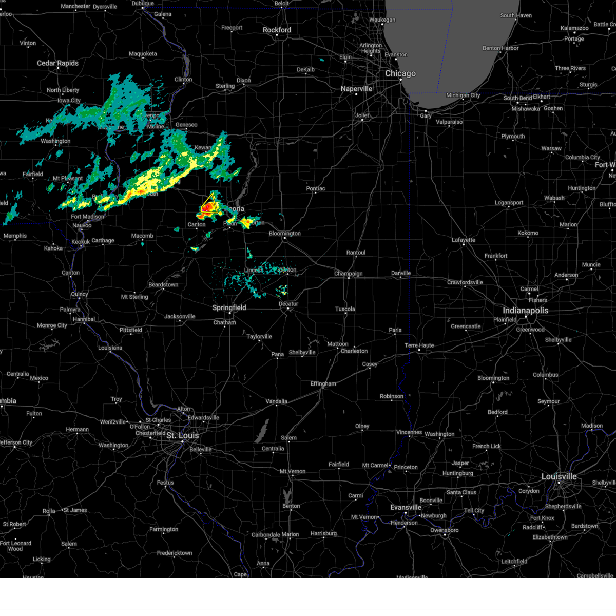
The Top Recent Hail Date for Brimfield, IL is Tuesday, April 22, 2025 (56th out of 56)
Hail and Wind Damage Spotted near Brimfield, IL
| Date / Time | Report Details |
|---|---|
| 5/15/2025 6:09 PM CDT | The storm which prompted the warning has weakened below severe limits, and has exited the warned area. therefore, the warning will be allowed to expire. a tornado watch remains in effect until 1000 pm cdt for central and north central illinois. to report severe weather, contact your nearest law enforcement agency. they will relay your report to the national weather service lincoln. |
| 5/15/2025 5:53 PM CDT |
 At 552 pm cdt, a severe thunderstorm was located 5 miles southwest of princeville, or 11 miles northwest of peoria, moving northeast at 60 mph (radar indicated). Hazards include 60 mph wind gusts and quarter size hail. Hail damage to vehicles is expected. expect wind damage to roofs, siding, and trees. this severe storm will be near, edelstein around 600 pm cdt. other locations impacted by this severe thunderstorm include jubilee college state park, lawn ridge, and monica. This includes interstate 74 between mile markers 74 and 77. At 552 pm cdt, a severe thunderstorm was located 5 miles southwest of princeville, or 11 miles northwest of peoria, moving northeast at 60 mph (radar indicated). Hazards include 60 mph wind gusts and quarter size hail. Hail damage to vehicles is expected. expect wind damage to roofs, siding, and trees. this severe storm will be near, edelstein around 600 pm cdt. other locations impacted by this severe thunderstorm include jubilee college state park, lawn ridge, and monica. This includes interstate 74 between mile markers 74 and 77.
|
| 5/15/2025 5:45 PM CDT |
 At 545 pm cdt, a severe thunderstorm was located over brimfield, or 14 miles west of peoria, moving northeast at 55 mph (radar indicated). Hazards include 60 mph wind gusts and quarter size hail. Hail damage to vehicles is expected. expect wind damage to roofs, siding, and trees. this severe storm will be near, princeville and dunlap around 555 pm cdt. edelstein around 600 pm cdt. other locations impacted by this severe thunderstorm include jubilee college state park, lawn ridge, and monica. This includes interstate 74 between mile markers 69 and 78. At 545 pm cdt, a severe thunderstorm was located over brimfield, or 14 miles west of peoria, moving northeast at 55 mph (radar indicated). Hazards include 60 mph wind gusts and quarter size hail. Hail damage to vehicles is expected. expect wind damage to roofs, siding, and trees. this severe storm will be near, princeville and dunlap around 555 pm cdt. edelstein around 600 pm cdt. other locations impacted by this severe thunderstorm include jubilee college state park, lawn ridge, and monica. This includes interstate 74 between mile markers 69 and 78.
|
| 5/15/2025 5:45 PM CDT |
 the severe thunderstorm warning has been cancelled and is no longer in effect the severe thunderstorm warning has been cancelled and is no longer in effect
|
| 5/15/2025 5:35 PM CDT | Svrilx the national weather service in lincoln has issued a * severe thunderstorm warning for, southeastern stark county in north central illinois, southeastern knox county in west central illinois, northern peoria county in central illinois, * until 615 pm cdt. * at 534 pm cdt, a severe thunderstorm was located over yates city, or 12 miles north of canton, moving northeast at 55 mph (radar indicated). Hazards include 60 mph wind gusts and quarter size hail. Hail damage to vehicles is expected. expect wind damage to roofs, siding, and trees. this severe thunderstorm will be near, elmwood, brimfield, and yates city around 540 pm cdt. other locations in the path of this severe thunderstorm include princeville, dunlap and edelstein. This includes interstate 74 between mile markers 67 and 79. |
| 4/22/2025 4:58 PM CDT |
 The storm which prompted the warning has weakened below severe limits, and has exited the warned area. therefore, the warning will be allowed to expire. however, heavy rain is still possible with this thunderstorm. The storm which prompted the warning has weakened below severe limits, and has exited the warned area. therefore, the warning will be allowed to expire. however, heavy rain is still possible with this thunderstorm.
|
| 4/22/2025 4:36 PM CDT |
 the severe thunderstorm warning has been cancelled and is no longer in effect the severe thunderstorm warning has been cancelled and is no longer in effect
|
| 4/22/2025 4:36 PM CDT |
 At 435 pm cdt, a severe thunderstorm was located east of farmington, or 12 miles northeast of canton, moving northeast at 20 mph (radar indicated). Hazards include 60 mph wind gusts and quarter size hail. Hail damage to vehicles is expected. expect wind damage to roofs, siding, and trees. this severe thunderstorm will remain over mainly rural areas of west central peoria county. This includes interstate 74 between mile markers 74 and 77. At 435 pm cdt, a severe thunderstorm was located east of farmington, or 12 miles northeast of canton, moving northeast at 20 mph (radar indicated). Hazards include 60 mph wind gusts and quarter size hail. Hail damage to vehicles is expected. expect wind damage to roofs, siding, and trees. this severe thunderstorm will remain over mainly rural areas of west central peoria county. This includes interstate 74 between mile markers 74 and 77.
|
| 4/22/2025 4:22 PM CDT |
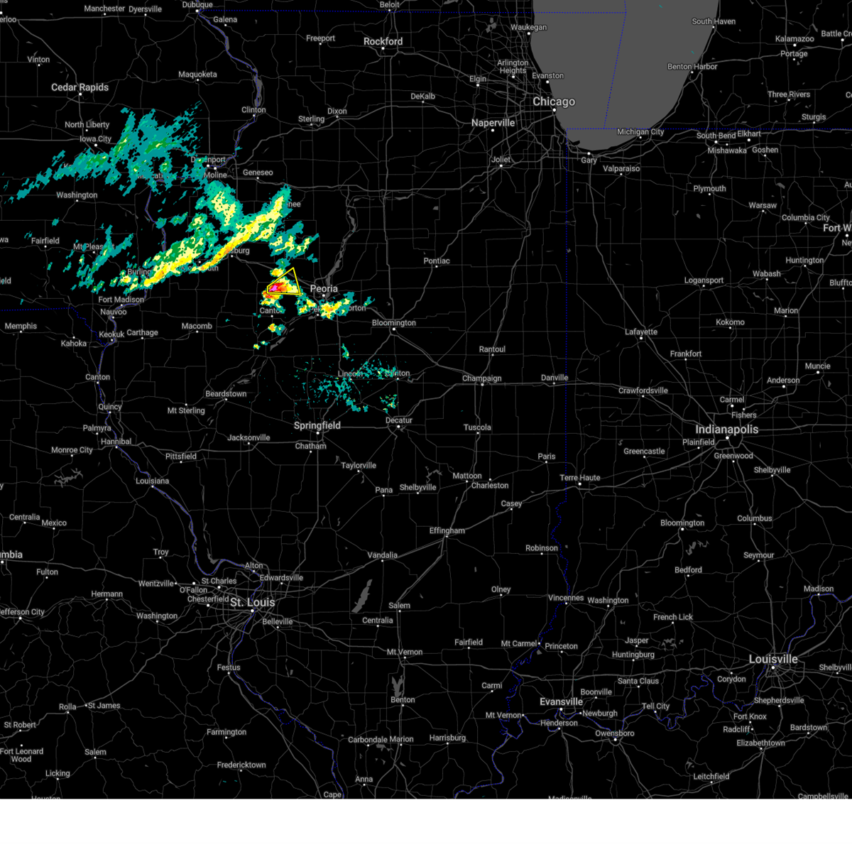 Svrilx the national weather service in lincoln has issued a * severe thunderstorm warning for, southeastern knox county in west central illinois, west central peoria county in central illinois, * until 500 pm cdt. * at 421 pm cdt, a severe thunderstorm was located just north of farmington, or 11 miles north of canton, moving east at 20 mph (radar indicated). Hazards include 60 mph wind gusts and quarter size hail. Hail damage to vehicles is expected. expect wind damage to roofs, siding, and trees. this severe thunderstorm will be near, elmwood and yates city around 425 pm cdt. trivoli around 430 pm cdt. This includes interstate 74 between mile markers 73 and 77. Svrilx the national weather service in lincoln has issued a * severe thunderstorm warning for, southeastern knox county in west central illinois, west central peoria county in central illinois, * until 500 pm cdt. * at 421 pm cdt, a severe thunderstorm was located just north of farmington, or 11 miles north of canton, moving east at 20 mph (radar indicated). Hazards include 60 mph wind gusts and quarter size hail. Hail damage to vehicles is expected. expect wind damage to roofs, siding, and trees. this severe thunderstorm will be near, elmwood and yates city around 425 pm cdt. trivoli around 430 pm cdt. This includes interstate 74 between mile markers 73 and 77.
|
| 4/20/2025 8:28 PM CDT |
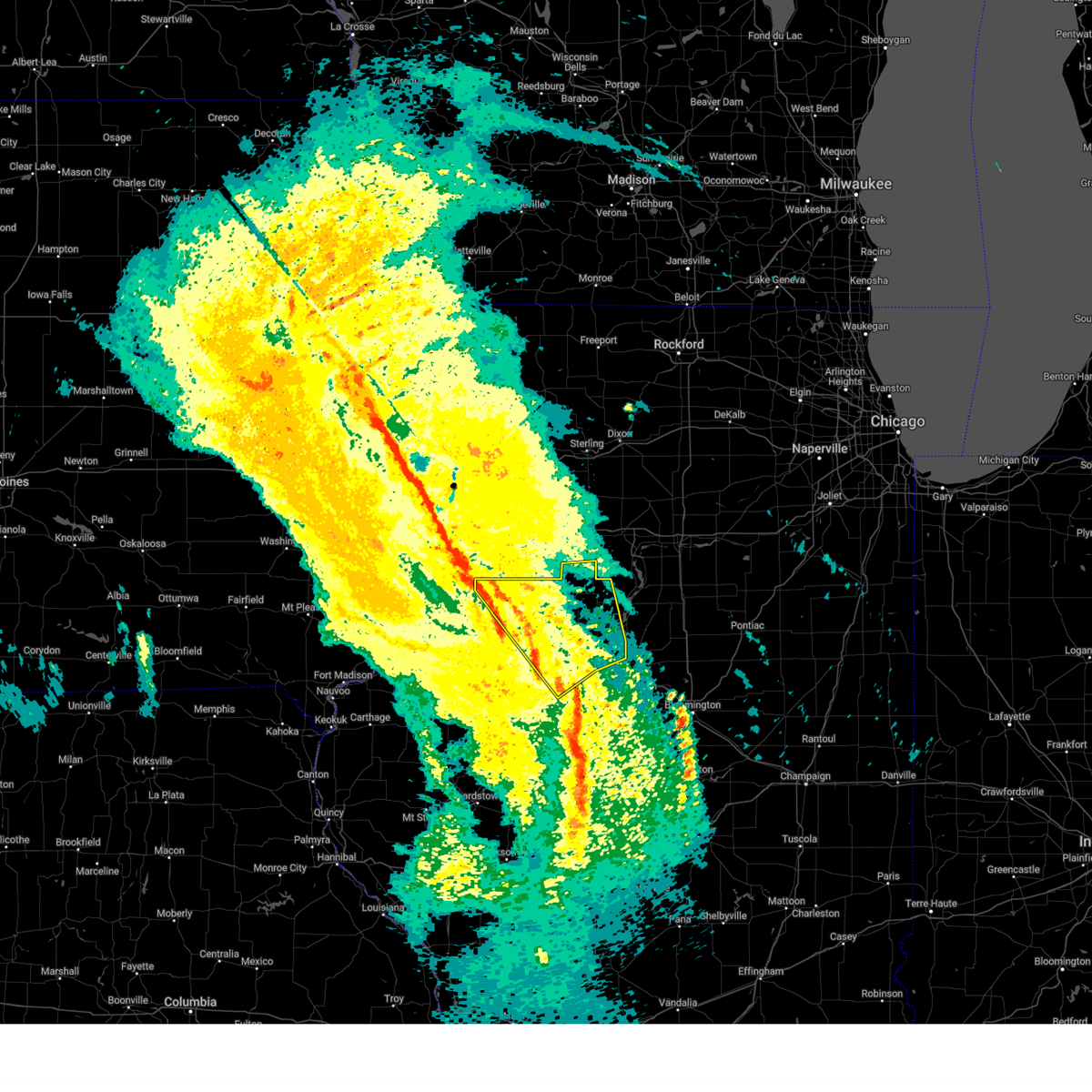 Svrilx the national weather service in lincoln has issued a * severe thunderstorm warning for, western marshall county in central illinois, northwestern woodford county in central illinois, northeastern fulton county in west central illinois, stark county in north central illinois, knox county in west central illinois, northern tazewell county in central illinois, peoria county in central illinois, * until 900 pm cdt. * at 828 pm cdt, severe thunderstorms were located along a line extending from near rio to near glasford, moving north at 75 mph (radar indicated). Hazards include 60 mph wind gusts. Expect damage to roofs, siding, and trees. severe thunderstorms will be near, victoria, laura, bellevue, elmwood, williamsfield, trivoli, elmore, brimfield, peoria international airport, and oneida around 835 pm cdt. west peoria, peoria, and la fayette around 840 pm cdt. dunlap, princeville, wyoming, and toulon around 845 pm cdt. other locations in the path of these severe thunderstorms include elmira and edelstein. this includes the following highways, interstate 474 between mile markers 0 and 5. Interstate 74 between mile markers 34 and 45, and between mile markers 53 and 92. Svrilx the national weather service in lincoln has issued a * severe thunderstorm warning for, western marshall county in central illinois, northwestern woodford county in central illinois, northeastern fulton county in west central illinois, stark county in north central illinois, knox county in west central illinois, northern tazewell county in central illinois, peoria county in central illinois, * until 900 pm cdt. * at 828 pm cdt, severe thunderstorms were located along a line extending from near rio to near glasford, moving north at 75 mph (radar indicated). Hazards include 60 mph wind gusts. Expect damage to roofs, siding, and trees. severe thunderstorms will be near, victoria, laura, bellevue, elmwood, williamsfield, trivoli, elmore, brimfield, peoria international airport, and oneida around 835 pm cdt. west peoria, peoria, and la fayette around 840 pm cdt. dunlap, princeville, wyoming, and toulon around 845 pm cdt. other locations in the path of these severe thunderstorms include elmira and edelstein. this includes the following highways, interstate 474 between mile markers 0 and 5. Interstate 74 between mile markers 34 and 45, and between mile markers 53 and 92.
|
| 3/14/2025 10:07 PM CDT | Trees dow in peoria county IL, 3.4 miles NW of Brimfield, IL |
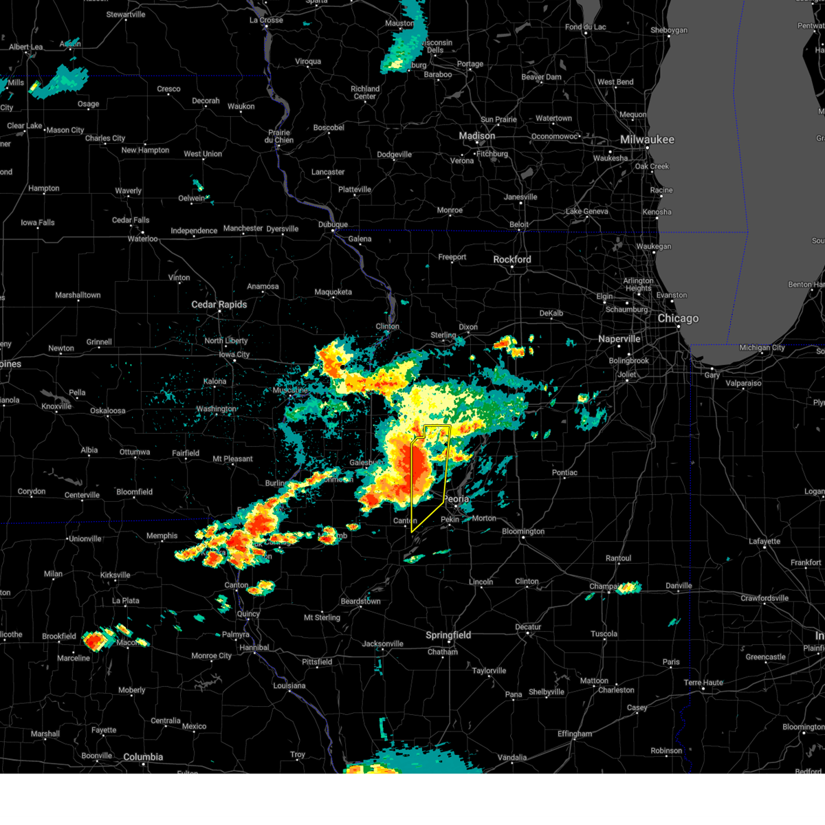
| 3/14/2025 9:46 PM CDT | Svrilx the national weather service in lincoln has issued a * severe thunderstorm warning for, western marshall county in central illinois, northwestern woodford county in central illinois, northeastern fulton county in west central illinois, stark county in north central illinois, western tazewell county in central illinois, northeastern mason county in central illinois, peoria county in central illinois, * until 1045 pm cdt. * at 946 pm cdt, severe thunderstorms were located along a line extending from near galva to yates city to near havana, moving northeast at 65 mph (radar indicated). Hazards include 70 mph wind gusts. Expect considerable tree damage. damage is likely to mobile homes, roofs, and outbuildings. severe thunderstorms will be near, laura, elmwood, trivoli, elmore, brimfield, farmington, la fayette, canton, and toulon around 950 pm cdt. elmira around 955 pm cdt. glasford, princeville, hanna city, osceola, and wyoming around 1000 pm cdt. castleton and bradford around 1005 pm cdt. other locations in the path of these severe thunderstorms include peoria, camp grove, dunlap and edelstein. this includes the following highways, interstate 474 between mile markers 0 and 13. Interstate 74 between mile markers 69 and 98. |
| 8/15/2024 11:16 PM CDT |
 the severe thunderstorm warning has been cancelled and is no longer in effect the severe thunderstorm warning has been cancelled and is no longer in effect
|
| 8/15/2024 11:16 PM CDT |
 At 1116 pm cdt, severe thunderstorms were located along a line extending from castleton to near hanna city to near farmington, moving east at 55 mph (radar indicated). Hazards include 70 mph wind gusts and quarter size hail. Hail damage to vehicles is expected. expect considerable tree damage. wind damage is also likely to mobile homes, roofs, and outbuildings. these severe storms will be near, dunlap, hanna city, and trivoli around 1120 pm cdt. other locations impacted by these severe thunderstorms include kickapoo, west jersey, jubilee college state park, duncan, smithville, and monica. This includes interstate 74 between mile markers 69 and 85. At 1116 pm cdt, severe thunderstorms were located along a line extending from castleton to near hanna city to near farmington, moving east at 55 mph (radar indicated). Hazards include 70 mph wind gusts and quarter size hail. Hail damage to vehicles is expected. expect considerable tree damage. wind damage is also likely to mobile homes, roofs, and outbuildings. these severe storms will be near, dunlap, hanna city, and trivoli around 1120 pm cdt. other locations impacted by these severe thunderstorms include kickapoo, west jersey, jubilee college state park, duncan, smithville, and monica. This includes interstate 74 between mile markers 69 and 85.
|
| 8/15/2024 10:59 PM CDT |
 Svrilx the national weather service in lincoln has issued a * severe thunderstorm warning for, northern fulton county in west central illinois, stark county in north central illinois, eastern knox county in west central illinois, western peoria county in central illinois, * until 1145 pm cdt. * at 1059 pm cdt, severe thunderstorms were located along a line extending from near altona to near maquon to avon, moving east at 35 mph (radar indicated). Hazards include 70 mph wind gusts and ping pong ball size hail. People and animals outdoors will be injured. expect hail damage to roofs, siding, windows, and vehicles. expect considerable tree damage. wind damage is also likely to mobile homes, roofs, and outbuildings. severe thunderstorms will be near, williamsfield, london mills, maquon, la fayette, and elmore around 1105 pm cdt. toulon, elmwood, yates city, fairview, and laura around 1110 pm cdt. farmington around 1115 pm cdt. other locations in the path of these severe thunderstorms include wyoming, brimfield, princeville, trivoli, castleton, canton and hanna city. This includes interstate 74 between mile markers 56 and 85. Svrilx the national weather service in lincoln has issued a * severe thunderstorm warning for, northern fulton county in west central illinois, stark county in north central illinois, eastern knox county in west central illinois, western peoria county in central illinois, * until 1145 pm cdt. * at 1059 pm cdt, severe thunderstorms were located along a line extending from near altona to near maquon to avon, moving east at 35 mph (radar indicated). Hazards include 70 mph wind gusts and ping pong ball size hail. People and animals outdoors will be injured. expect hail damage to roofs, siding, windows, and vehicles. expect considerable tree damage. wind damage is also likely to mobile homes, roofs, and outbuildings. severe thunderstorms will be near, williamsfield, london mills, maquon, la fayette, and elmore around 1105 pm cdt. toulon, elmwood, yates city, fairview, and laura around 1110 pm cdt. farmington around 1115 pm cdt. other locations in the path of these severe thunderstorms include wyoming, brimfield, princeville, trivoli, castleton, canton and hanna city. This includes interstate 74 between mile markers 56 and 85.
|
| 7/15/2024 8:30 PM CDT | The storms which prompted the warning have weakened below severe limits, and have exited the warned area. therefore, the warning will be allowed to expire. however, gusty winds are still possible with these thunderstorms. a tornado watch remains in effect until 100 am cdt for central, north central and west central illinois. |
| 7/15/2024 8:27 PM CDT |
 Svrilx the national weather service in lincoln has issued a * severe thunderstorm warning for, marshall county in central illinois, northern logan county in central illinois, woodford county in central illinois, northeastern fulton county in west central illinois, stark county in north central illinois, southeastern knox county in west central illinois, northwestern de witt county in central illinois, tazewell county in central illinois, western mclean county in central illinois, northeastern mason county in central illinois, peoria county in central illinois, * until 930 pm cdt. * at 827 pm cdt, severe thunderstorms were located along a line extending from near camp grove to near dunlap to near canton, moving southeast at 55 mph (radar indicated). Hazards include 70 mph wind gusts and penny size hail. Expect considerable tree damage. damage is likely to mobile homes, roofs, and outbuildings. severe thunderstorms will be near, peoria, chillicothe, bartonville, west peoria, bellevue, rome, hanna city, glasford, spring bay, and sparland around 830 pm cdt. pekin, east peoria, lacon, washington, creve coeur, germantown hills, marquette heights, manito, and mapleton around 835 pm cdt. morton, metamora, and south pekin around 840 pm cdt. tremont, washburn, green valley, and deer creek around 845 pm cdt. other locations in the path of these severe thunderstorms include eureka, mackinaw, delavan, goodfield, san jose, roanoke, hopedale, emden, congerville, minier, danvers, stanford, carlock, benson, secor, hartsburg, el paso and armington. this includes the following highways, interstate 155 between mile markers 0 and 31. interstate 39 between mile markers 0 and 40. interstate 474 between mile markers 0 and 14. interstate 55 between mile markers 123 and 172. Interstate 74 between mile markers 64 and 139. Svrilx the national weather service in lincoln has issued a * severe thunderstorm warning for, marshall county in central illinois, northern logan county in central illinois, woodford county in central illinois, northeastern fulton county in west central illinois, stark county in north central illinois, southeastern knox county in west central illinois, northwestern de witt county in central illinois, tazewell county in central illinois, western mclean county in central illinois, northeastern mason county in central illinois, peoria county in central illinois, * until 930 pm cdt. * at 827 pm cdt, severe thunderstorms were located along a line extending from near camp grove to near dunlap to near canton, moving southeast at 55 mph (radar indicated). Hazards include 70 mph wind gusts and penny size hail. Expect considerable tree damage. damage is likely to mobile homes, roofs, and outbuildings. severe thunderstorms will be near, peoria, chillicothe, bartonville, west peoria, bellevue, rome, hanna city, glasford, spring bay, and sparland around 830 pm cdt. pekin, east peoria, lacon, washington, creve coeur, germantown hills, marquette heights, manito, and mapleton around 835 pm cdt. morton, metamora, and south pekin around 840 pm cdt. tremont, washburn, green valley, and deer creek around 845 pm cdt. other locations in the path of these severe thunderstorms include eureka, mackinaw, delavan, goodfield, san jose, roanoke, hopedale, emden, congerville, minier, danvers, stanford, carlock, benson, secor, hartsburg, el paso and armington. this includes the following highways, interstate 155 between mile markers 0 and 31. interstate 39 between mile markers 0 and 40. interstate 474 between mile markers 0 and 14. interstate 55 between mile markers 123 and 172. Interstate 74 between mile markers 64 and 139.
|
| 7/15/2024 8:14 PM CDT | At 813 pm cdt, tornado producing storms were located along a line extending from near elmira to near fairview, moving southeast at 65 mph (emergency management confirmed tornado west of farmington). Hazards include damaging tornado. Flying debris will be dangerous to those caught without shelter. mobile homes will be damaged or destroyed. damage to roofs, windows, and vehicles will occur. tree damage is likely. these tornadic storms will be near, canton, farmington, elmwood, princeville, trivoli, brimfield, camp grove, and edelstein around 820 pm cdt. peoria, dunlap, hanna city, and glasford around 825 pm cdt. other locations impacted by these tornadic storms include norris, jubilee college state park, banner, smithville, alta, west jersey, monica, kickapoo, lawn ridge, and dahinda. this includes the following highways, interstate 474 near mile marker 0. Interstate 74 between mile markers 60 and 86. |
| 7/15/2024 7:55 PM CDT | Torilx the national weather service in lincoln has issued a * tornado warning for, northwestern marshall county in central illinois, northeastern fulton county in west central illinois, stark county in north central illinois, knox county in west central illinois, peoria county in central illinois, * until 830 pm cdt. * at 754 pm cdt, severe thunderstorms capable of producing both tornadoes and extensive straight line wind damage were located along a line extending from near atkinson to near knoxville, moving southeast at 65 mph (radar indicated rotation). Hazards include tornado. Flying debris will be dangerous to those caught without shelter. mobile homes will be damaged or destroyed. damage to roofs, windows, and vehicles will occur. tree damage is likely. these dangerous storms will be near, williamsfield, victoria, maquon, and la fayette around 800 pm cdt. toulon, farmington, elmwood, yates city, elmira, laura, and elmore around 805 pm cdt. wyoming, osceola, and brimfield around 810 pm cdt. other locations in the path of these tornadic storms include princeville, trivoli, bradford, castleton, peoria, dunlap, hanna city, glasford, camp grove and edelstein. this includes the following highways, interstate 474 near mile marker 0. Interstate 74 between mile markers 45 and 86. |
| 7/15/2024 1:11 AM CDT |
 The storm which prompted the warning has weakened below severe limits, and no longer poses an immediate threat to life or property. therefore, the warning will be allowed to expire. however, gusty winds and heavy rain are still possible with this thunderstorm. a severe thunderstorm watch remains in effect until 300 am cdt for central illinois. The storm which prompted the warning has weakened below severe limits, and no longer poses an immediate threat to life or property. therefore, the warning will be allowed to expire. however, gusty winds and heavy rain are still possible with this thunderstorm. a severe thunderstorm watch remains in effect until 300 am cdt for central illinois.
|
| 7/15/2024 12:54 AM CDT |
 At 1254 am cdt, a severe thunderstorm was located over tremont, or near morton, moving southeast at 55 mph (radar indicated). Hazards include 60 mph wind gusts and quarter size hail. Hail damage to vehicles is expected. expect wind damage to roofs, siding, and trees. this severe thunderstorm will remain over mainly rural areas of northwestern woodford, northeastern tazewell and central peoria counties, including the following locations, norwood, mossville, kickapoo, north pekin, jubilee college state park, smithville, alta, peoria heights, powerton, and bay view gardens. this includes the following highways, interstate 155 between mile markers 29 and 31. interstate 474 between mile markers 0 and 14. Interstate 74 between mile markers 75 and 104. At 1254 am cdt, a severe thunderstorm was located over tremont, or near morton, moving southeast at 55 mph (radar indicated). Hazards include 60 mph wind gusts and quarter size hail. Hail damage to vehicles is expected. expect wind damage to roofs, siding, and trees. this severe thunderstorm will remain over mainly rural areas of northwestern woodford, northeastern tazewell and central peoria counties, including the following locations, norwood, mossville, kickapoo, north pekin, jubilee college state park, smithville, alta, peoria heights, powerton, and bay view gardens. this includes the following highways, interstate 155 between mile markers 29 and 31. interstate 474 between mile markers 0 and 14. Interstate 74 between mile markers 75 and 104.
|
| 7/15/2024 12:46 AM CDT |
 The storm which prompted the warning has weakened below severe limits, and no longer poses an immediate threat to life or property. therefore, the warning has been allowed to expire. however, gusty winds and heavy rain are still possible with this thunderstorm. a severe thunderstorm watch remains in effect until 100 am cdt for central, north central and west central illinois. The storm which prompted the warning has weakened below severe limits, and no longer poses an immediate threat to life or property. therefore, the warning has been allowed to expire. however, gusty winds and heavy rain are still possible with this thunderstorm. a severe thunderstorm watch remains in effect until 100 am cdt for central, north central and west central illinois.
|
| 7/15/2024 12:27 AM CDT |
 At 1227 am cdt, a severe thunderstorm was located over laura, or 12 miles south of toulon, moving southeast at 40 mph (radar indicated). Hazards include 60 mph wind gusts and quarter size hail. Hail damage to vehicles is expected. expect wind damage to roofs, siding, and trees. this severe storm will be near, brimfield around 1230 am cdt. other locations impacted by this severe thunderstorm include west jersey, dahinda, duncan, and monica. This includes interstate 74 between mile markers 61 and 73. At 1227 am cdt, a severe thunderstorm was located over laura, or 12 miles south of toulon, moving southeast at 40 mph (radar indicated). Hazards include 60 mph wind gusts and quarter size hail. Hail damage to vehicles is expected. expect wind damage to roofs, siding, and trees. this severe storm will be near, brimfield around 1230 am cdt. other locations impacted by this severe thunderstorm include west jersey, dahinda, duncan, and monica. This includes interstate 74 between mile markers 61 and 73.
|
| 7/15/2024 12:23 AM CDT |
 Svrilx the national weather service in lincoln has issued a * severe thunderstorm warning for, northwestern woodford county in central illinois, northeastern tazewell county in central illinois, peoria county in central illinois, * until 115 am cdt. * at 1223 am cdt, a severe thunderstorm was located over brimfield, or 14 miles south of wyoming, moving southeast at 45 mph (radar indicated). Hazards include 60 mph wind gusts and quarter size hail. Hail damage to vehicles is expected. expect wind damage to roofs, siding, and trees. this severe thunderstorm will be near, peoria around 1230 am cdt. bellevue around 1235 am cdt. east peoria, bartonville, west peoria, and peoria international airport around 1240 am cdt. other locations in the path of this severe thunderstorm include creve coeur, marquette heights, pekin and morton. this includes the following highways, interstate 155 between mile markers 29 and 31. interstate 474 between mile markers 0 and 14. Interstate 74 between mile markers 72 and 104. Svrilx the national weather service in lincoln has issued a * severe thunderstorm warning for, northwestern woodford county in central illinois, northeastern tazewell county in central illinois, peoria county in central illinois, * until 115 am cdt. * at 1223 am cdt, a severe thunderstorm was located over brimfield, or 14 miles south of wyoming, moving southeast at 45 mph (radar indicated). Hazards include 60 mph wind gusts and quarter size hail. Hail damage to vehicles is expected. expect wind damage to roofs, siding, and trees. this severe thunderstorm will be near, peoria around 1230 am cdt. bellevue around 1235 am cdt. east peoria, bartonville, west peoria, and peoria international airport around 1240 am cdt. other locations in the path of this severe thunderstorm include creve coeur, marquette heights, pekin and morton. this includes the following highways, interstate 155 between mile markers 29 and 31. interstate 474 between mile markers 0 and 14. Interstate 74 between mile markers 72 and 104.
|
| 7/15/2024 12:03 AM CDT |
 Svrilx the national weather service in lincoln has issued a * severe thunderstorm warning for, southern stark county in north central illinois, northeastern knox county in west central illinois, northwestern peoria county in central illinois, * until 1245 am cdt. * at 1203 am cdt, a severe thunderstorm was located over altona, or 14 miles west of toulon, moving southeast at 35 mph (radar indicated). Hazards include 60 mph wind gusts and quarter size hail. Hail damage to vehicles is expected. expect wind damage to roofs, siding, and trees. this severe thunderstorm will be near, victoria around 1210 am cdt. elmore around 1220 am cdt. other locations in the path of this severe thunderstorm include laura. This includes interstate 74 between mile markers 60 and 73. Svrilx the national weather service in lincoln has issued a * severe thunderstorm warning for, southern stark county in north central illinois, northeastern knox county in west central illinois, northwestern peoria county in central illinois, * until 1245 am cdt. * at 1203 am cdt, a severe thunderstorm was located over altona, or 14 miles west of toulon, moving southeast at 35 mph (radar indicated). Hazards include 60 mph wind gusts and quarter size hail. Hail damage to vehicles is expected. expect wind damage to roofs, siding, and trees. this severe thunderstorm will be near, victoria around 1210 am cdt. elmore around 1220 am cdt. other locations in the path of this severe thunderstorm include laura. This includes interstate 74 between mile markers 60 and 73.
|
| 6/25/2024 8:53 PM CDT |
 At 852 pm cdt, a severe thunderstorm was located over bartonville, or near pekin, moving south at 35 mph (radar indicated). Hazards include 70 mph wind gusts and quarter size hail. Hail damage to vehicles is expected. expect considerable tree damage. wind damage is also likely to mobile homes, roofs, and outbuildings. this severe storm will be near, pekin and south pekin around 900 pm cdt. other locations impacted by this severe thunderstorm include smithville, dillon, powerton, west jersey, dunfermline, norwood, kickapoo, fiatt, dahinda, and peoria heights. this includes the following highways, interstate 155 between mile markers 19 and 31. interstate 474 between mile markers 0 and 14. Interstate 74 between mile markers 58 and 106. At 852 pm cdt, a severe thunderstorm was located over bartonville, or near pekin, moving south at 35 mph (radar indicated). Hazards include 70 mph wind gusts and quarter size hail. Hail damage to vehicles is expected. expect considerable tree damage. wind damage is also likely to mobile homes, roofs, and outbuildings. this severe storm will be near, pekin and south pekin around 900 pm cdt. other locations impacted by this severe thunderstorm include smithville, dillon, powerton, west jersey, dunfermline, norwood, kickapoo, fiatt, dahinda, and peoria heights. this includes the following highways, interstate 155 between mile markers 19 and 31. interstate 474 between mile markers 0 and 14. Interstate 74 between mile markers 58 and 106.
|
| 6/25/2024 8:53 PM CDT |
 the severe thunderstorm warning has been cancelled and is no longer in effect the severe thunderstorm warning has been cancelled and is no longer in effect
|
| 6/25/2024 8:41 PM CDT |
 At 840 pm cdt, a severe thunderstorm was located over bellevue, or near peoria, moving south at 30 mph (radar indicated). Hazards include 70 mph wind gusts and quarter size hail. Hail damage to vehicles is expected. expect considerable tree damage. wind damage is also likely to mobile homes, roofs, and outbuildings. this severe storm will be near, peoria, bartonville, west peoria, bellevue, and peoria international airport around 845 pm cdt. pekin around 850 pm cdt. mapleton around 855 pm cdt. south pekin around 905 pm cdt. other locations impacted by this severe thunderstorm include smithville, dillon, powerton, west jersey, dunfermline, norwood, kickapoo, fiatt, dahinda, and peoria heights. this includes the following highways, interstate 155 between mile markers 19 and 31. interstate 474 between mile markers 0 and 14. Interstate 74 between mile markers 58 and 117. At 840 pm cdt, a severe thunderstorm was located over bellevue, or near peoria, moving south at 30 mph (radar indicated). Hazards include 70 mph wind gusts and quarter size hail. Hail damage to vehicles is expected. expect considerable tree damage. wind damage is also likely to mobile homes, roofs, and outbuildings. this severe storm will be near, peoria, bartonville, west peoria, bellevue, and peoria international airport around 845 pm cdt. pekin around 850 pm cdt. mapleton around 855 pm cdt. south pekin around 905 pm cdt. other locations impacted by this severe thunderstorm include smithville, dillon, powerton, west jersey, dunfermline, norwood, kickapoo, fiatt, dahinda, and peoria heights. this includes the following highways, interstate 155 between mile markers 19 and 31. interstate 474 between mile markers 0 and 14. Interstate 74 between mile markers 58 and 117.
|
| 6/25/2024 8:20 PM CDT |
 Svrilx the national weather service in lincoln has issued a * severe thunderstorm warning for, southwestern marshall county in central illinois, western woodford county in central illinois, northeastern fulton county in west central illinois, southern stark county in north central illinois, southeastern knox county in west central illinois, tazewell county in central illinois, west central mclean county in central illinois, peoria county in central illinois, * until 915 pm cdt. * at 820 pm cdt, severe thunderstorms were located along a line extending from near benson to 6 miles east of knoxville, moving south at 20 mph (radar indicated). Hazards include 70 mph wind gusts and half dollar size hail. Hail damage to vehicles is expected. expect considerable tree damage. wind damage is also likely to mobile homes, roofs, and outbuildings. severe thunderstorms will be near, peoria, metamora, germantown hills, elmwood, roanoke, dunlap, brimfield, yates city, spring bay, and maquon around 825 pm cdt. east peoria, eureka, and washington around 830 pm cdt. west peoria, farmington, bellevue, hanna city, and trivoli around 835 pm cdt. morton, bartonville, creve coeur, goodfield, deer creek, congerville, and peoria international airport around 840 pm cdt. other locations in the path of these severe thunderstorms include marquette heights, pekin, canton, glasford, mapleton, tremont, mackinaw, danvers, south pekin and st. david. this includes the following highways, interstate 155 between mile markers 19 and 31. interstate 474 between mile markers 0 and 14. Interstate 74 between mile markers 58 and 117. Svrilx the national weather service in lincoln has issued a * severe thunderstorm warning for, southwestern marshall county in central illinois, western woodford county in central illinois, northeastern fulton county in west central illinois, southern stark county in north central illinois, southeastern knox county in west central illinois, tazewell county in central illinois, west central mclean county in central illinois, peoria county in central illinois, * until 915 pm cdt. * at 820 pm cdt, severe thunderstorms were located along a line extending from near benson to 6 miles east of knoxville, moving south at 20 mph (radar indicated). Hazards include 70 mph wind gusts and half dollar size hail. Hail damage to vehicles is expected. expect considerable tree damage. wind damage is also likely to mobile homes, roofs, and outbuildings. severe thunderstorms will be near, peoria, metamora, germantown hills, elmwood, roanoke, dunlap, brimfield, yates city, spring bay, and maquon around 825 pm cdt. east peoria, eureka, and washington around 830 pm cdt. west peoria, farmington, bellevue, hanna city, and trivoli around 835 pm cdt. morton, bartonville, creve coeur, goodfield, deer creek, congerville, and peoria international airport around 840 pm cdt. other locations in the path of these severe thunderstorms include marquette heights, pekin, canton, glasford, mapleton, tremont, mackinaw, danvers, south pekin and st. david. this includes the following highways, interstate 155 between mile markers 19 and 31. interstate 474 between mile markers 0 and 14. Interstate 74 between mile markers 58 and 117.
|
| 5/24/2024 4:30 PM CDT |
 the severe thunderstorm warning has been cancelled and is no longer in effect the severe thunderstorm warning has been cancelled and is no longer in effect
|
| 5/24/2024 4:15 PM CDT |
 the severe thunderstorm warning has been cancelled and is no longer in effect the severe thunderstorm warning has been cancelled and is no longer in effect
|
| 5/24/2024 4:15 PM CDT |
 At 414 pm cdt, a severe thunderstorm was located near hanna city, or 8 miles west of peoria, moving northeast at 35 mph (radar indicated). Hazards include 60 mph wind gusts and half dollar size hail. Hail damage to vehicles is expected. expect wind damage to roofs, siding, and trees. this severe storm will be near, peoria around 420 pm cdt. other locations impacted by this severe thunderstorm include norwood, kickapoo, jubilee college state park, smithville, and peoria heights. this includes the following highways, interstate 474 between mile markers 0 and 2. Interstate 74 between mile markers 70 and 89. At 414 pm cdt, a severe thunderstorm was located near hanna city, or 8 miles west of peoria, moving northeast at 35 mph (radar indicated). Hazards include 60 mph wind gusts and half dollar size hail. Hail damage to vehicles is expected. expect wind damage to roofs, siding, and trees. this severe storm will be near, peoria around 420 pm cdt. other locations impacted by this severe thunderstorm include norwood, kickapoo, jubilee college state park, smithville, and peoria heights. this includes the following highways, interstate 474 between mile markers 0 and 2. Interstate 74 between mile markers 70 and 89.
|
| 5/24/2024 3:54 PM CDT |
 Svrilx the national weather service in lincoln has issued a * severe thunderstorm warning for, northeastern fulton county in west central illinois, southeastern knox county in west central illinois, northwestern peoria county in central illinois, * until 445 pm cdt. * at 353 pm cdt, a severe thunderstorm was located over canton, moving northeast at 35 mph (radar indicated). Hazards include 60 mph wind gusts and half dollar size hail. Hail damage to vehicles is expected. expect wind damage to roofs, siding, and trees. this severe thunderstorm will be near, farmington and trivoli around 400 pm cdt. hanna city around 410 pm cdt. other locations in the path of this severe thunderstorm include peoria. this includes the following highways, interstate 474 between mile markers 0 and 3. Interstate 74 between mile markers 68 and 89. Svrilx the national weather service in lincoln has issued a * severe thunderstorm warning for, northeastern fulton county in west central illinois, southeastern knox county in west central illinois, northwestern peoria county in central illinois, * until 445 pm cdt. * at 353 pm cdt, a severe thunderstorm was located over canton, moving northeast at 35 mph (radar indicated). Hazards include 60 mph wind gusts and half dollar size hail. Hail damage to vehicles is expected. expect wind damage to roofs, siding, and trees. this severe thunderstorm will be near, farmington and trivoli around 400 pm cdt. hanna city around 410 pm cdt. other locations in the path of this severe thunderstorm include peoria. this includes the following highways, interstate 474 between mile markers 0 and 3. Interstate 74 between mile markers 68 and 89.
|
| 5/7/2024 5:35 AM CDT |
 the severe thunderstorm warning has been cancelled and is no longer in effect the severe thunderstorm warning has been cancelled and is no longer in effect
|
| 5/7/2024 5:35 AM CDT |
 At 534 am cdt, severe thunderstorms were located along a line extending from near trivoli to near glasford, moving northeast at 45 mph (radar indicated). Hazards include 60 mph wind gusts and penny size hail. Expect damage to roofs, siding, and trees. these severe storms will be near, bellevue, hanna city, and peoria international airport around 540 am cdt. peoria and dunlap around 545 am cdt. other locations impacted by these severe thunderstorms include norwood, kickapoo, jubilee college state park, smithville, monica, and alta. this includes the following highways, interstate 474 between mile markers 0 and 5. Interstate 74 between mile markers 65 and 89. At 534 am cdt, severe thunderstorms were located along a line extending from near trivoli to near glasford, moving northeast at 45 mph (radar indicated). Hazards include 60 mph wind gusts and penny size hail. Expect damage to roofs, siding, and trees. these severe storms will be near, bellevue, hanna city, and peoria international airport around 540 am cdt. peoria and dunlap around 545 am cdt. other locations impacted by these severe thunderstorms include norwood, kickapoo, jubilee college state park, smithville, monica, and alta. this includes the following highways, interstate 474 between mile markers 0 and 5. Interstate 74 between mile markers 65 and 89.
|
| 5/7/2024 5:18 AM CDT |
 Svrilx the national weather service in lincoln has issued a * severe thunderstorm warning for, northeastern fulton county in west central illinois, southeastern knox county in west central illinois, peoria county in central illinois, * until 600 am cdt. * at 517 am cdt, severe thunderstorms were located along a line extending from near fairview to near st. david, moving northeast at 50 mph (radar indicated). Hazards include 60 mph wind gusts and penny size hail. Expect damage to roofs, siding, and trees. severe thunderstorms will be near, farmington, elmwood, trivoli, and yates city around 525 am cdt. hanna city and brimfield around 535 am cdt. laura around 540 am cdt. peoria, princeville, and dunlap around 545 am cdt. other locations impacted by these severe thunderstorms include norwood, norris, kickapoo, jubilee college state park, smithville, alta, dunfermline, middle grove, monica, and banner. this includes the following highways, interstate 474 between mile markers 0 and 5. Interstate 74 between mile markers 62 and 89. Svrilx the national weather service in lincoln has issued a * severe thunderstorm warning for, northeastern fulton county in west central illinois, southeastern knox county in west central illinois, peoria county in central illinois, * until 600 am cdt. * at 517 am cdt, severe thunderstorms were located along a line extending from near fairview to near st. david, moving northeast at 50 mph (radar indicated). Hazards include 60 mph wind gusts and penny size hail. Expect damage to roofs, siding, and trees. severe thunderstorms will be near, farmington, elmwood, trivoli, and yates city around 525 am cdt. hanna city and brimfield around 535 am cdt. laura around 540 am cdt. peoria, princeville, and dunlap around 545 am cdt. other locations impacted by these severe thunderstorms include norwood, norris, kickapoo, jubilee college state park, smithville, alta, dunfermline, middle grove, monica, and banner. this includes the following highways, interstate 474 between mile markers 0 and 5. Interstate 74 between mile markers 62 and 89.
|
| 5/2/2024 6:27 PM CDT |
 The storm which prompted the warning has weakened below severe limits, and no longer poses an immediate threat to life or property. therefore, the warning will be allowed to expire. however, heavy rain is still possible with this thunderstorm. The storm which prompted the warning has weakened below severe limits, and no longer poses an immediate threat to life or property. therefore, the warning will be allowed to expire. however, heavy rain is still possible with this thunderstorm.
|
| 5/2/2024 6:11 PM CDT |
 At 611 pm cdt, a severe thunderstorm was located over elmwood, or 15 miles west of peoria, moving northeast at 40 mph (radar indicated). Hazards include 60 mph wind gusts and quarter size hail. Hail damage to vehicles is expected. expect wind damage to roofs, siding, and trees. this severe storm will be near, brimfield around 615 pm cdt. other locations impacted by this severe thunderstorm include norris, kickapoo, jubilee college state park, dahinda, smithville, dunfermline, and middle grove. this includes the following highways, interstate 474 near mile marker 0. Interstate 74 between mile markers 58 and 86. At 611 pm cdt, a severe thunderstorm was located over elmwood, or 15 miles west of peoria, moving northeast at 40 mph (radar indicated). Hazards include 60 mph wind gusts and quarter size hail. Hail damage to vehicles is expected. expect wind damage to roofs, siding, and trees. this severe storm will be near, brimfield around 615 pm cdt. other locations impacted by this severe thunderstorm include norris, kickapoo, jubilee college state park, dahinda, smithville, dunfermline, and middle grove. this includes the following highways, interstate 474 near mile marker 0. Interstate 74 between mile markers 58 and 86.
|
| 5/2/2024 5:45 PM CDT |
 Svrilx the national weather service in lincoln has issued a * severe thunderstorm warning for, northern fulton county in west central illinois, southern knox county in west central illinois, southwestern peoria county in central illinois, * until 630 pm cdt. * at 543 pm cdt, a severe thunderstorm was located near fairview, or near canton, moving northeast at 35 mph. a line of storms behind that are located from roughly adair to smithfield, moving northeast at 50 mph (radar indicated. though spotter indicate the line of storms further southwest is producing intense straight line winds). Hazards include 60 mph wind gusts and half dollar size hail. Hail damage to vehicles is expected. expect wind damage to roofs, siding, and trees. the storms further southwest are producing strong winds, while the storm near fairview is producing mainly hail. this severe thunderstorm will be near, farmington around 550 pm cdt. elmwood and yates city around 600 pm cdt. other locations in the path of this severe thunderstorm include trivoli and brimfield. this includes the following highways, interstate 474 between mile markers 0 and 5. Interstate 74 between mile markers 42 and 91. Svrilx the national weather service in lincoln has issued a * severe thunderstorm warning for, northern fulton county in west central illinois, southern knox county in west central illinois, southwestern peoria county in central illinois, * until 630 pm cdt. * at 543 pm cdt, a severe thunderstorm was located near fairview, or near canton, moving northeast at 35 mph. a line of storms behind that are located from roughly adair to smithfield, moving northeast at 50 mph (radar indicated. though spotter indicate the line of storms further southwest is producing intense straight line winds). Hazards include 60 mph wind gusts and half dollar size hail. Hail damage to vehicles is expected. expect wind damage to roofs, siding, and trees. the storms further southwest are producing strong winds, while the storm near fairview is producing mainly hail. this severe thunderstorm will be near, farmington around 550 pm cdt. elmwood and yates city around 600 pm cdt. other locations in the path of this severe thunderstorm include trivoli and brimfield. this includes the following highways, interstate 474 between mile markers 0 and 5. Interstate 74 between mile markers 42 and 91.
|
| 5/2/2024 5:02 PM CDT |
 the severe thunderstorm warning has been cancelled and is no longer in effect the severe thunderstorm warning has been cancelled and is no longer in effect
|
| 5/2/2024 4:53 PM CDT |
 At 453 pm cdt, a severe thunderstorm was located near yates city, or 18 miles north of canton, moving northeast at 35 mph (radar indicated). Hazards include 60 mph wind gusts and quarter size hail. Hail damage to vehicles is expected. expect wind damage to roofs, siding, and trees. this severe storm will be near, williamsfield and laura around 500 pm cdt. elmore around 505 pm cdt. other locations impacted by this severe thunderstorm include dahinda and gilson. This includes interstate 74 between mile markers 58 and 76. At 453 pm cdt, a severe thunderstorm was located near yates city, or 18 miles north of canton, moving northeast at 35 mph (radar indicated). Hazards include 60 mph wind gusts and quarter size hail. Hail damage to vehicles is expected. expect wind damage to roofs, siding, and trees. this severe storm will be near, williamsfield and laura around 500 pm cdt. elmore around 505 pm cdt. other locations impacted by this severe thunderstorm include dahinda and gilson. This includes interstate 74 between mile markers 58 and 76.
|
| 5/2/2024 4:53 PM CDT |
 the severe thunderstorm warning has been cancelled and is no longer in effect the severe thunderstorm warning has been cancelled and is no longer in effect
|
| 5/2/2024 4:31 PM CDT |
 Svrilx the national weather service in lincoln has issued a * severe thunderstorm warning for, north central fulton county in west central illinois, southeastern knox county in west central illinois, northwestern peoria county in central illinois, * until 515 pm cdt. * at 431 pm cdt, a severe thunderstorm was located over london mills, or 15 miles northwest of canton, moving northeast at 35 mph (radar indicated). Hazards include 60 mph wind gusts and quarter size hail. Hail damage to vehicles is expected. expect wind damage to roofs, siding, and trees. this severe thunderstorm will be near, maquon around 435 pm cdt. yates city around 450 pm cdt. other locations in the path of this severe thunderstorm include williamsfield, laura and elmore. This includes interstate 74 between mile markers 56 and 80. Svrilx the national weather service in lincoln has issued a * severe thunderstorm warning for, north central fulton county in west central illinois, southeastern knox county in west central illinois, northwestern peoria county in central illinois, * until 515 pm cdt. * at 431 pm cdt, a severe thunderstorm was located over london mills, or 15 miles northwest of canton, moving northeast at 35 mph (radar indicated). Hazards include 60 mph wind gusts and quarter size hail. Hail damage to vehicles is expected. expect wind damage to roofs, siding, and trees. this severe thunderstorm will be near, maquon around 435 pm cdt. yates city around 450 pm cdt. other locations in the path of this severe thunderstorm include williamsfield, laura and elmore. This includes interstate 74 between mile markers 56 and 80.
|
| 5/2/2024 3:50 PM CDT |
 Svrilx the national weather service in lincoln has issued a * severe thunderstorm warning for, west central marshall county in central illinois, southeastern stark county in north central illinois, northwestern peoria county in central illinois, * until 415 pm cdt. * at 350 pm cdt, a severe thunderstorm was located over brimfield, or 14 miles south of wyoming, moving northeast at 25 mph (radar indicated). Hazards include 60 mph wind gusts and quarter size hail. Hail damage to vehicles is expected. expect wind damage to roofs, siding, and trees. this severe thunderstorm will be near, princeville around 355 pm cdt. This includes interstate 74 between mile markers 72 and 78. Svrilx the national weather service in lincoln has issued a * severe thunderstorm warning for, west central marshall county in central illinois, southeastern stark county in north central illinois, northwestern peoria county in central illinois, * until 415 pm cdt. * at 350 pm cdt, a severe thunderstorm was located over brimfield, or 14 miles south of wyoming, moving northeast at 25 mph (radar indicated). Hazards include 60 mph wind gusts and quarter size hail. Hail damage to vehicles is expected. expect wind damage to roofs, siding, and trees. this severe thunderstorm will be near, princeville around 355 pm cdt. This includes interstate 74 between mile markers 72 and 78.
|
| 3/4/2024 9:20 PM CST |
 At 920 pm cst, a severe thunderstorm was located over brimfield, or 14 miles west of peoria, moving northeast at 50 mph (radar indicated). Hazards include 60 mph wind gusts and penny size hail. Expect damage to roofs, siding, and trees. This severe thunderstorm will remain over mainly rural areas of northeastern fulton, southeastern knox and west central peoria counties. At 920 pm cst, a severe thunderstorm was located over brimfield, or 14 miles west of peoria, moving northeast at 50 mph (radar indicated). Hazards include 60 mph wind gusts and penny size hail. Expect damage to roofs, siding, and trees. This severe thunderstorm will remain over mainly rural areas of northeastern fulton, southeastern knox and west central peoria counties.
|
| 3/4/2024 9:12 PM CST |
 Svrilx the national weather service in lincoln has issued a * severe thunderstorm warning for, northeastern fulton county in west central illinois, southeastern knox county in west central illinois, west central peoria county in central illinois, * until 1000 pm cst. * at 911 pm cst, a severe thunderstorm was located over elmwood, or 13 miles north of canton, moving northeast at 50 mph (radar indicated). Hazards include 60 mph wind gusts and penny size hail. Expect damage to roofs, siding, and trees. this severe thunderstorm will be near, elmwood and brimfield around 915 pm cst. This includes interstate 74 between mile markers 65 and 75. Svrilx the national weather service in lincoln has issued a * severe thunderstorm warning for, northeastern fulton county in west central illinois, southeastern knox county in west central illinois, west central peoria county in central illinois, * until 1000 pm cst. * at 911 pm cst, a severe thunderstorm was located over elmwood, or 13 miles north of canton, moving northeast at 50 mph (radar indicated). Hazards include 60 mph wind gusts and penny size hail. Expect damage to roofs, siding, and trees. this severe thunderstorm will be near, elmwood and brimfield around 915 pm cst. This includes interstate 74 between mile markers 65 and 75.
|
| 8/11/2023 7:21 AM CDT |
 At 719 am cdt, a severe thunderstorm was located near elmwood, or 13 miles west of peoria, moving southeast at 45 mph (radar indicated). Hazards include 60 mph wind gusts and penny size hail. Expect damage to roofs, siding, and trees. this severe thunderstorm will be near, hanna city around 725 am cdt. peoria around 730 am cdt. bartonville, west peoria and bellevue around 735 am cdt. other locations in the path of this severe thunderstorm include pekin, creve coeur, marquette heights, morton, south pekin and tremont. this includes the following highways, interstate 155 between mile markers 25 and 31. interstate 474 between mile markers 0 and 14. interstate 74 between mile markers 69 and 108. hail threat, radar indicated max hail size, 0. 75 in wind threat, radar indicated max wind gust, 60 mph. At 719 am cdt, a severe thunderstorm was located near elmwood, or 13 miles west of peoria, moving southeast at 45 mph (radar indicated). Hazards include 60 mph wind gusts and penny size hail. Expect damage to roofs, siding, and trees. this severe thunderstorm will be near, hanna city around 725 am cdt. peoria around 730 am cdt. bartonville, west peoria and bellevue around 735 am cdt. other locations in the path of this severe thunderstorm include pekin, creve coeur, marquette heights, morton, south pekin and tremont. this includes the following highways, interstate 155 between mile markers 25 and 31. interstate 474 between mile markers 0 and 14. interstate 74 between mile markers 69 and 108. hail threat, radar indicated max hail size, 0. 75 in wind threat, radar indicated max wind gust, 60 mph.
|
| 6/29/2023 11:46 AM CDT |
 At 1145 am cdt, severe thunderstorms were located along a line extending from near maquon to near canton to 6 miles southeast of st. david, moving east at 65 mph (radar indicated). Hazards include 70 mph wind gusts and half dollar size hail. Hail damage to vehicles is expected. expect considerable tree damage. wind damage is also likely to mobile homes, roofs, and outbuildings. severe thunderstorms will be near, glasford and trivoli around 1150 am cdt. manito and brimfield around 1155 am cdt. bartonville, hanna city and south pekin around 1200 pm cdt. peoria, pekin, morton, creve coeur, marquette heights, bellevue, dunlap and green valley around 1205 pm cdt. other locations in the path of these severe thunderstorms include west peoria, tremont, delavan, east peoria, washington, germantown hills, mackinaw, hopedale, deer creek, spring bay, bay view gardens, metamora, minier, goodfield, armington and eureka. this includes the following highways, interstate 155 between mile markers 12 and 31. interstate 474 between mile markers 0 and 14. Interstate 74 between mile markers 70 and 112. At 1145 am cdt, severe thunderstorms were located along a line extending from near maquon to near canton to 6 miles southeast of st. david, moving east at 65 mph (radar indicated). Hazards include 70 mph wind gusts and half dollar size hail. Hail damage to vehicles is expected. expect considerable tree damage. wind damage is also likely to mobile homes, roofs, and outbuildings. severe thunderstorms will be near, glasford and trivoli around 1150 am cdt. manito and brimfield around 1155 am cdt. bartonville, hanna city and south pekin around 1200 pm cdt. peoria, pekin, morton, creve coeur, marquette heights, bellevue, dunlap and green valley around 1205 pm cdt. other locations in the path of these severe thunderstorms include west peoria, tremont, delavan, east peoria, washington, germantown hills, mackinaw, hopedale, deer creek, spring bay, bay view gardens, metamora, minier, goodfield, armington and eureka. this includes the following highways, interstate 155 between mile markers 12 and 31. interstate 474 between mile markers 0 and 14. Interstate 74 between mile markers 70 and 112.
|
| 5/7/2023 8:21 PM CDT |
 At 821 pm cdt, a severe thunderstorm was located over trivoli, or 13 miles northeast of canton, moving east at 55 mph (radar indicated). Hazards include 60 mph wind gusts and quarter size hail. Hail damage to vehicles is expected. expect wind damage to roofs, siding, and trees. locations impacted include, peoria. this includes the following highways, interstate 474 near mile marker 0. interstate 74 between mile markers 64 and 86. hail threat, radar indicated max hail size, 1. 00 in wind threat, radar indicated max wind gust, 60 mph. At 821 pm cdt, a severe thunderstorm was located over trivoli, or 13 miles northeast of canton, moving east at 55 mph (radar indicated). Hazards include 60 mph wind gusts and quarter size hail. Hail damage to vehicles is expected. expect wind damage to roofs, siding, and trees. locations impacted include, peoria. this includes the following highways, interstate 474 near mile marker 0. interstate 74 between mile markers 64 and 86. hail threat, radar indicated max hail size, 1. 00 in wind threat, radar indicated max wind gust, 60 mph.
|
| 5/7/2023 7:58 PM CDT |
 At 758 pm cdt, a severe thunderstorm was located near abingdon, or 12 miles south of galesburg, moving southeast at 40 mph (radar indicated). Hazards include 60 mph wind gusts and quarter size hail. Hail damage to vehicles is expected. expect wind damage to roofs, siding, and trees. this severe thunderstorm will be near, london mills and maquon around 805 pm cdt. fairview around 815 pm cdt. other locations in the path of this severe thunderstorm include farmington. this includes the following highways, interstate 474 near mile marker 0. interstate 74 between mile markers 64 and 86. hail threat, radar indicated max hail size, 1. 00 in wind threat, radar indicated max wind gust, 60 mph. At 758 pm cdt, a severe thunderstorm was located near abingdon, or 12 miles south of galesburg, moving southeast at 40 mph (radar indicated). Hazards include 60 mph wind gusts and quarter size hail. Hail damage to vehicles is expected. expect wind damage to roofs, siding, and trees. this severe thunderstorm will be near, london mills and maquon around 805 pm cdt. fairview around 815 pm cdt. other locations in the path of this severe thunderstorm include farmington. this includes the following highways, interstate 474 near mile marker 0. interstate 74 between mile markers 64 and 86. hail threat, radar indicated max hail size, 1. 00 in wind threat, radar indicated max wind gust, 60 mph.
|
| 4/19/2023 12:10 PM CDT |
 At 1209 pm cdt, a severe thunderstorm was located over laura, or 18 miles northwest of peoria, moving northeast at 35 mph (radar indicated. at 12:08 pm, trained spotters reported penny sized hail in laura). Hazards include 60 mph wind gusts and quarter size hail. Hail damage to vehicles is expected. expect wind damage to roofs, siding, and trees. locations impacted include, princeville and wyoming. this includes interstate 74 near mile marker 72. hail threat, radar indicated max hail size, 1. 00 in wind threat, radar indicated max wind gust, 60 mph. At 1209 pm cdt, a severe thunderstorm was located over laura, or 18 miles northwest of peoria, moving northeast at 35 mph (radar indicated. at 12:08 pm, trained spotters reported penny sized hail in laura). Hazards include 60 mph wind gusts and quarter size hail. Hail damage to vehicles is expected. expect wind damage to roofs, siding, and trees. locations impacted include, princeville and wyoming. this includes interstate 74 near mile marker 72. hail threat, radar indicated max hail size, 1. 00 in wind threat, radar indicated max wind gust, 60 mph.
|
| 4/19/2023 11:58 AM CDT |
 At 1158 am cdt, a severe thunderstorm was located near williamsfield, or 20 miles north of canton, moving northeast at 35 mph (radar indicated). Hazards include 60 mph wind gusts and quarter size hail. Hail damage to vehicles is expected. expect wind damage to roofs, siding, and trees. this severe thunderstorm will be near, brimfield and laura around 1205 pm cdt. other locations in the path of this severe thunderstorm include princeville and wyoming. this includes interstate 74 between mile markers 63 and 73. hail threat, radar indicated max hail size, 1. 00 in wind threat, radar indicated max wind gust, 60 mph. At 1158 am cdt, a severe thunderstorm was located near williamsfield, or 20 miles north of canton, moving northeast at 35 mph (radar indicated). Hazards include 60 mph wind gusts and quarter size hail. Hail damage to vehicles is expected. expect wind damage to roofs, siding, and trees. this severe thunderstorm will be near, brimfield and laura around 1205 pm cdt. other locations in the path of this severe thunderstorm include princeville and wyoming. this includes interstate 74 between mile markers 63 and 73. hail threat, radar indicated max hail size, 1. 00 in wind threat, radar indicated max wind gust, 60 mph.
|
| 4/15/2023 7:56 PM CDT |
 At 756 pm cdt, a severe thunderstorm was located over fairview, or 10 miles northwest of canton, moving northeast at 30 mph (emergency management). Hazards include 70 mph wind gusts and nickel size hail. Expect considerable tree damage. damage is likely to mobile homes, roofs, and outbuildings. this severe thunderstorm will be near, farmington and maquon around 810 pm cdt. yates city and gilson around 815 pm cdt. other locations in the path of this severe thunderstorm include elmwood, brimfield, williamsfield, elmore, laura and west jersey. this includes interstate 74 between mile markers 34 and 78. thunderstorm damage threat, considerable hail threat, radar indicated max hail size, 0. 88 in wind threat, observed max wind gust, 70 mph. At 756 pm cdt, a severe thunderstorm was located over fairview, or 10 miles northwest of canton, moving northeast at 30 mph (emergency management). Hazards include 70 mph wind gusts and nickel size hail. Expect considerable tree damage. damage is likely to mobile homes, roofs, and outbuildings. this severe thunderstorm will be near, farmington and maquon around 810 pm cdt. yates city and gilson around 815 pm cdt. other locations in the path of this severe thunderstorm include elmwood, brimfield, williamsfield, elmore, laura and west jersey. this includes interstate 74 between mile markers 34 and 78. thunderstorm damage threat, considerable hail threat, radar indicated max hail size, 0. 88 in wind threat, observed max wind gust, 70 mph.
|
| 4/15/2023 7:15 PM CDT |
 At 715 pm cdt, a severe thunderstorm was located near maquon, or 14 miles north of canton, moving northeast at 30 mph (radar indicated). Hazards include 60 mph wind gusts and quarter size hail. Hail damage to vehicles is expected. expect wind damage to roofs, siding, and trees. this severe thunderstorm will be near, yates city around 720 pm cdt. elmwood around 725 pm cdt. brimfield around 735 pm cdt. other locations in the path of this severe thunderstorm include williamsfield, elmore, laura and west jersey. this includes interstate 74 between mile markers 54 and 80. hail threat, radar indicated max hail size, 1. 00 in wind threat, radar indicated max wind gust, 60 mph. At 715 pm cdt, a severe thunderstorm was located near maquon, or 14 miles north of canton, moving northeast at 30 mph (radar indicated). Hazards include 60 mph wind gusts and quarter size hail. Hail damage to vehicles is expected. expect wind damage to roofs, siding, and trees. this severe thunderstorm will be near, yates city around 720 pm cdt. elmwood around 725 pm cdt. brimfield around 735 pm cdt. other locations in the path of this severe thunderstorm include williamsfield, elmore, laura and west jersey. this includes interstate 74 between mile markers 54 and 80. hail threat, radar indicated max hail size, 1. 00 in wind threat, radar indicated max wind gust, 60 mph.
|
| 8/1/2022 3:22 AM CDT |
 The severe thunderstorm warning for stark, northeastern knox and northwestern peoria counties will expire at 330 am cdt, the storm which prompted the warning has moved out of the area. therefore, the warning will be allowed to expire. remember, a severe thunderstorm warning still remains in effect for northeastern peoria county until 345 am cdt. The severe thunderstorm warning for stark, northeastern knox and northwestern peoria counties will expire at 330 am cdt, the storm which prompted the warning has moved out of the area. therefore, the warning will be allowed to expire. remember, a severe thunderstorm warning still remains in effect for northeastern peoria county until 345 am cdt.
|
| 8/1/2022 3:10 AM CDT |
 At 310 am cdt, a severe thunderstorm was located near princeville, or 18 miles northwest of peoria, moving southeast at 50 mph (radar indicated). Hazards include 60 mph wind gusts and penny size hail. Expect damage to roofs, siding, and trees. locations impacted include, elmwood, princeville, wyoming, dunlap, toulon, brimfield, bradford, williamsfield, elmira, west jersey, la fayette, castleton, laura, elmore, duncan and monica. this includes interstate 74 between mile markers 67 and 76. hail threat, radar indicated max hail size, 0. 75 in wind threat, radar indicated max wind gust, 60 mph. At 310 am cdt, a severe thunderstorm was located near princeville, or 18 miles northwest of peoria, moving southeast at 50 mph (radar indicated). Hazards include 60 mph wind gusts and penny size hail. Expect damage to roofs, siding, and trees. locations impacted include, elmwood, princeville, wyoming, dunlap, toulon, brimfield, bradford, williamsfield, elmira, west jersey, la fayette, castleton, laura, elmore, duncan and monica. this includes interstate 74 between mile markers 67 and 76. hail threat, radar indicated max hail size, 0. 75 in wind threat, radar indicated max wind gust, 60 mph.
|
| 8/1/2022 2:54 AM CDT |
 At 254 am cdt, a severe thunderstorm was located over la fayette, or 11 miles south of kewanee, moving southeast at 45 mph (radar indicated). Hazards include 60 mph wind gusts and penny size hail. expect damage to roofs, siding, and trees At 254 am cdt, a severe thunderstorm was located over la fayette, or 11 miles south of kewanee, moving southeast at 45 mph (radar indicated). Hazards include 60 mph wind gusts and penny size hail. expect damage to roofs, siding, and trees
|
| 6/25/2022 8:24 PM CDT |
 At 823 pm cdt, severe thunderstorms were located along a line extending from brimfield to yates city to near fairview, moving southeast at 30 mph (radar indicated). Hazards include 60 mph wind gusts. Expect damage to roofs, siding, and trees. locations impacted include, farmington, trivoli, hanna city and canton. this includes interstate 74 between mile markers 65 and 84. hail threat, radar indicated max hail size, <. 75 in wind threat, radar indicated max wind gust, 60 mph. At 823 pm cdt, severe thunderstorms were located along a line extending from brimfield to yates city to near fairview, moving southeast at 30 mph (radar indicated). Hazards include 60 mph wind gusts. Expect damage to roofs, siding, and trees. locations impacted include, farmington, trivoli, hanna city and canton. this includes interstate 74 between mile markers 65 and 84. hail threat, radar indicated max hail size, <. 75 in wind threat, radar indicated max wind gust, 60 mph.
|
| 6/25/2022 8:06 PM CDT |
 At 805 pm cdt, severe thunderstorms were located along a line extending from elmore to near gilson to near maquon, moving southeast at 30 mph (radar indicated). Hazards include 60 mph wind gusts. Expect damage to roofs, siding, and trees. severe thunderstorms will be near, maquon around 810 pm cdt. london mills and laura around 815 pm cdt. elmwood and yates city around 820 pm cdt. brimfield around 825 pm cdt. other locations in the path of these severe thunderstorms include farmington, fairview, trivoli, canton and hanna city. this includes interstate 74 between mile markers 58 and 84. hail threat, radar indicated max hail size, <. 75 in wind threat, radar indicated max wind gust, 60 mph. At 805 pm cdt, severe thunderstorms were located along a line extending from elmore to near gilson to near maquon, moving southeast at 30 mph (radar indicated). Hazards include 60 mph wind gusts. Expect damage to roofs, siding, and trees. severe thunderstorms will be near, maquon around 810 pm cdt. london mills and laura around 815 pm cdt. elmwood and yates city around 820 pm cdt. brimfield around 825 pm cdt. other locations in the path of these severe thunderstorms include farmington, fairview, trivoli, canton and hanna city. this includes interstate 74 between mile markers 58 and 84. hail threat, radar indicated max hail size, <. 75 in wind threat, radar indicated max wind gust, 60 mph.
|
| 6/18/2021 11:47 PM CDT |
 At 1147 pm cdt, a severe thunderstorm was located near london mills, or 13 miles south of galesburg, moving southeast at 30 mph (radar indicated). Hazards include 70 mph wind gusts and quarter size hail. Hail damage to vehicles is expected. expect considerable tree damage. wind damage is also likely to mobile homes, roofs, and outbuildings. this severe thunderstorm will be near, london mills and maquon around 1155 pm cdt. other locations in the path of this severe thunderstorm include fairview, farmington and canton. This includes interstate 74 between mile markers 50 and 84. At 1147 pm cdt, a severe thunderstorm was located near london mills, or 13 miles south of galesburg, moving southeast at 30 mph (radar indicated). Hazards include 70 mph wind gusts and quarter size hail. Hail damage to vehicles is expected. expect considerable tree damage. wind damage is also likely to mobile homes, roofs, and outbuildings. this severe thunderstorm will be near, london mills and maquon around 1155 pm cdt. other locations in the path of this severe thunderstorm include fairview, farmington and canton. This includes interstate 74 between mile markers 50 and 84.
|
| 6/18/2021 10:24 PM CDT |
 At 1024 pm cdt, a severe thunderstorm was located over yates city, or 14 miles north of canton, moving east at 35 mph (radar indicated). Hazards include 60 mph wind gusts and quarter size hail. Hail damage to vehicles is expected. expect wind damage to roofs, siding, and trees. this severe thunderstorm will be near, elmwood around 1035 pm cdt. trivoli and brimfield around 1040 pm cdt. other locations in the path of this severe thunderstorm include hanna city. This includes interstate 74 between mile markers 71 and 85. At 1024 pm cdt, a severe thunderstorm was located over yates city, or 14 miles north of canton, moving east at 35 mph (radar indicated). Hazards include 60 mph wind gusts and quarter size hail. Hail damage to vehicles is expected. expect wind damage to roofs, siding, and trees. this severe thunderstorm will be near, elmwood around 1035 pm cdt. trivoli and brimfield around 1040 pm cdt. other locations in the path of this severe thunderstorm include hanna city. This includes interstate 74 between mile markers 71 and 85.
|
| 11/10/2020 3:25 PM CST |
 At 325 pm cst, severe thunderstorms were located along a line extending from near tiskilwa to near bath, moving east at 45 mph (radar indicated). Hazards include 60 mph wind gusts and penny size hail. expect damage to roofs, siding, and trees At 325 pm cst, severe thunderstorms were located along a line extending from near tiskilwa to near bath, moving east at 45 mph (radar indicated). Hazards include 60 mph wind gusts and penny size hail. expect damage to roofs, siding, and trees
|
| 11/10/2020 3:17 PM CST |
 At 317 pm cst, severe thunderstorms were located along a line extending from near buda to near bath, moving east at 45 mph (radar indicated). Hazards include 60 mph wind gusts and penny size hail. Expect damage to roofs, siding, and trees. locations impacted include, canton, havana, lewistown, elmwood, princeville, manito, wyoming, toulon, hanna city, glasford, trivoli, osceola, brimfield, bradford, st. david, bath, easton, elmira, castleton and laura. This includes interstate 74 between mile markers 71 and 84. At 317 pm cst, severe thunderstorms were located along a line extending from near buda to near bath, moving east at 45 mph (radar indicated). Hazards include 60 mph wind gusts and penny size hail. Expect damage to roofs, siding, and trees. locations impacted include, canton, havana, lewistown, elmwood, princeville, manito, wyoming, toulon, hanna city, glasford, trivoli, osceola, brimfield, bradford, st. david, bath, easton, elmira, castleton and laura. This includes interstate 74 between mile markers 71 and 84.
|
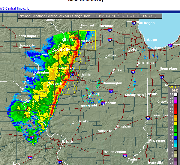
| 11/10/2020 3:08 PM CST |
 At 308 pm cst, severe thunderstorms were located along a line extending from near sheffield to near bath, moving east at 30 mph (radar indicated). Hazards include 60 mph wind gusts and penny size hail. Expect damage to roofs, siding, and trees. locations impacted include, canton, havana, lewistown, farmington, elmwood, princeville, manito, wyoming, cuba, toulon, hanna city, astoria, glasford, trivoli, osceola, brimfield, bradford, yates city, st. david and williamsfield. This includes interstate 74 between mile markers 63 and 84. At 308 pm cst, severe thunderstorms were located along a line extending from near sheffield to near bath, moving east at 30 mph (radar indicated). Hazards include 60 mph wind gusts and penny size hail. Expect damage to roofs, siding, and trees. locations impacted include, canton, havana, lewistown, farmington, elmwood, princeville, manito, wyoming, cuba, toulon, hanna city, astoria, glasford, trivoli, osceola, brimfield, bradford, yates city, st. david and williamsfield. This includes interstate 74 between mile markers 63 and 84.
|
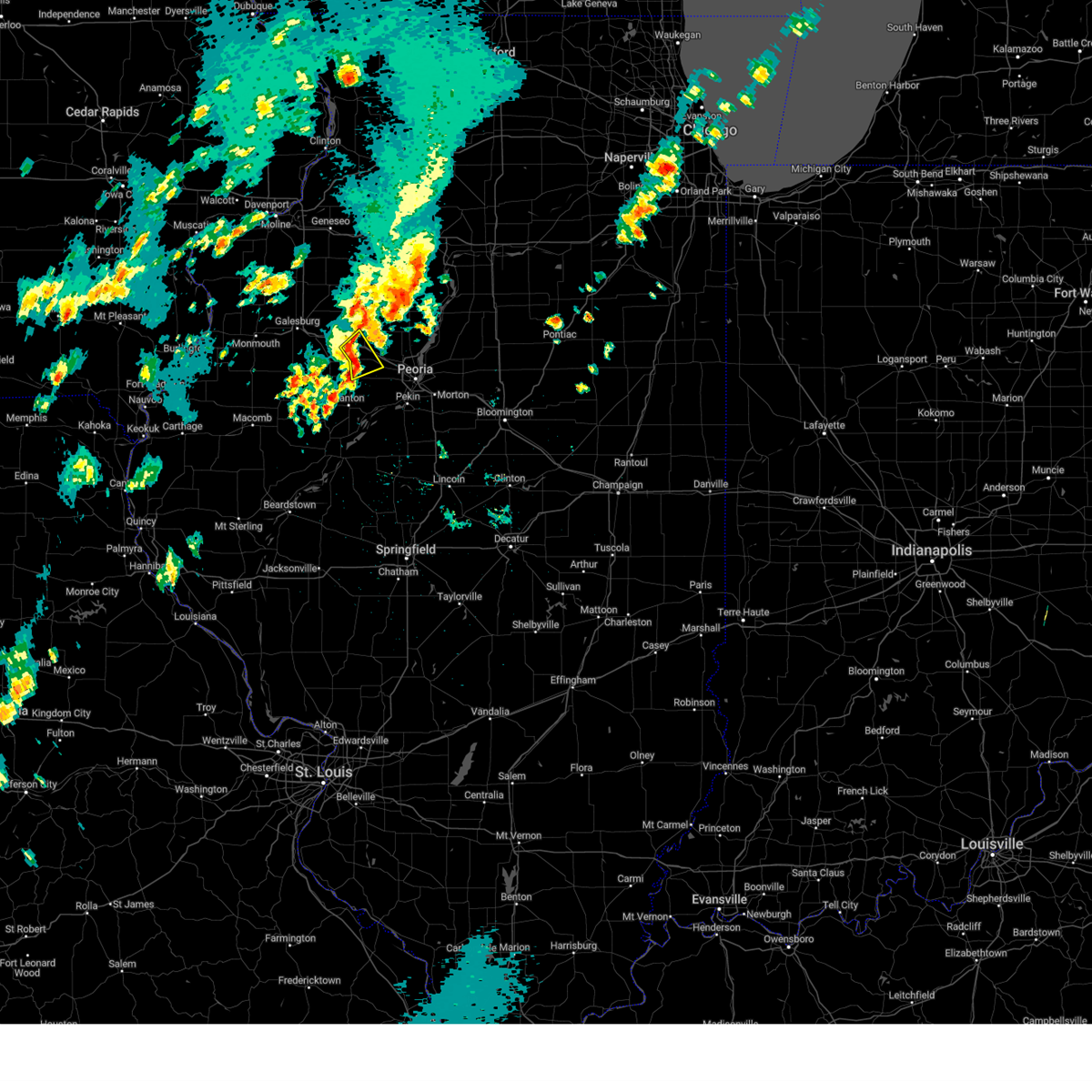
| 11/10/2020 3:05 PM CST |
 At 304 pm cst, a severe squall line capable of producing both tornadoes and extensive straight line wind damage was located near trivoli, or 13 miles northeast of canton, moving east at 50 mph (radar indicated rotation). Hazards include tornado. Flying debris will be dangerous to those caught without shelter. mobile homes will be damaged or destroyed. damage to roofs, windows, and vehicles will occur. tree damage is likely. this tornadic thunderstorm will remain over mainly rural areas of eastern knox and northwestern peoria counties, including the following locations, kickapoo and monica. This includes interstate 74 between mile markers 68 and 82. At 304 pm cst, a severe squall line capable of producing both tornadoes and extensive straight line wind damage was located near trivoli, or 13 miles northeast of canton, moving east at 50 mph (radar indicated rotation). Hazards include tornado. Flying debris will be dangerous to those caught without shelter. mobile homes will be damaged or destroyed. damage to roofs, windows, and vehicles will occur. tree damage is likely. this tornadic thunderstorm will remain over mainly rural areas of eastern knox and northwestern peoria counties, including the following locations, kickapoo and monica. This includes interstate 74 between mile markers 68 and 82.
|
| 11/10/2020 2:51 PM CST |
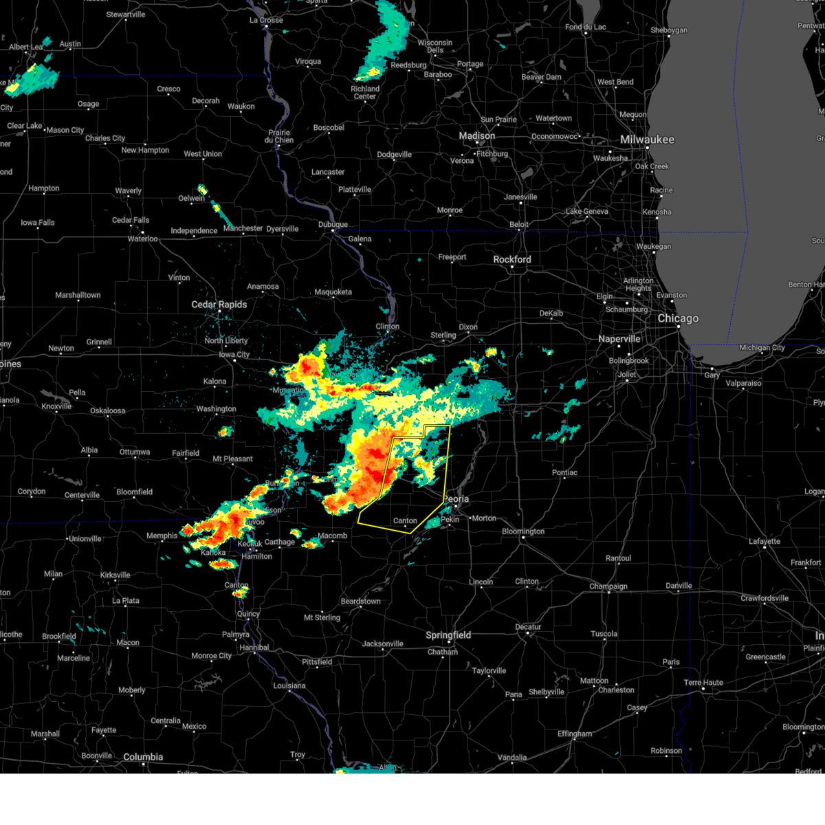
 At 251 pm cst, severe thunderstorms capable of producing both tornadoes and extensive straight line wind damage were located near fairview, or 9 miles northwest of canton, moving east at 50 mph (radar indicated rotation). Hazards include tornado. Flying debris will be dangerous to those caught without shelter. mobile homes will be damaged or destroyed. damage to roofs, windows, and vehicles will occur. tree damage is likely. these dangerous storms will be near, farmington and yates city around 300 pm cst. elmwood and trivoli around 305 pm cst. brimfield around 310 pm cst. hanna city around 315 pm cst. other locations impacted by this tornadic thunderstorm include middle grove, smithville, kickapoo, norris and monica. This includes interstate 74 between mile markers 68 and 82. At 251 pm cst, severe thunderstorms capable of producing both tornadoes and extensive straight line wind damage were located near fairview, or 9 miles northwest of canton, moving east at 50 mph (radar indicated rotation). Hazards include tornado. Flying debris will be dangerous to those caught without shelter. mobile homes will be damaged or destroyed. damage to roofs, windows, and vehicles will occur. tree damage is likely. these dangerous storms will be near, farmington and yates city around 300 pm cst. elmwood and trivoli around 305 pm cst. brimfield around 310 pm cst. hanna city around 315 pm cst. other locations impacted by this tornadic thunderstorm include middle grove, smithville, kickapoo, norris and monica. This includes interstate 74 between mile markers 68 and 82.
|
| 11/10/2020 2:41 PM CST |
 At 241 pm cst, severe thunderstorms were located along a line extending from 7 miles northwest of kewanee to near rushville, moving east at 45 mph (radar indicated). Hazards include 60 mph wind gusts and penny size hail. expect damage to roofs, siding, and trees At 241 pm cst, severe thunderstorms were located along a line extending from 7 miles northwest of kewanee to near rushville, moving east at 45 mph (radar indicated). Hazards include 60 mph wind gusts and penny size hail. expect damage to roofs, siding, and trees
|
| 8/10/2020 2:05 PM CDT |
 At 202 pm cdt, severe thunderstorms were located along a line extending from 6 miles northeast of kewanee to near victoria to bushnell, moving east at 70 mph (radar indicated. at 155 pm gusts to 54 mph was reported at galesburg airport). Hazards include 70 mph wind gusts. Expect considerable tree damage. damage is likely to mobile homes, roofs, and outbuildings. strong winds will continue for an extended period behind the initial gusts. these severe storms will be near, osceola, williamsfield, west jersey, la fayette and elmore around 205 pm cdt. toulon and laura around 210 pm cdt. wyoming around 215 pm cdt. other locations impacted by these severe thunderstorms include snake den hollow, galesburg airport, ellisville, monica, smithfield, marietta, fiatt, dahinda, delong and east galesburg. This includes interstate 74 between mile markers 34 and 75. At 202 pm cdt, severe thunderstorms were located along a line extending from 6 miles northeast of kewanee to near victoria to bushnell, moving east at 70 mph (radar indicated. at 155 pm gusts to 54 mph was reported at galesburg airport). Hazards include 70 mph wind gusts. Expect considerable tree damage. damage is likely to mobile homes, roofs, and outbuildings. strong winds will continue for an extended period behind the initial gusts. these severe storms will be near, osceola, williamsfield, west jersey, la fayette and elmore around 205 pm cdt. toulon and laura around 210 pm cdt. wyoming around 215 pm cdt. other locations impacted by these severe thunderstorms include snake den hollow, galesburg airport, ellisville, monica, smithfield, marietta, fiatt, dahinda, delong and east galesburg. This includes interstate 74 between mile markers 34 and 75.
|
| 8/10/2020 1:33 PM CDT |
 At 131 pm cdt, severe thunderstorms were located along a line extending from near coal valley to near burgess to dallas city, moving east at 70 mph (radar indicated). Hazards include 70 mph wind gusts. Expect considerable tree damage. damage is likely to mobile homes, roofs, and outbuildings. severe thunderstorms will be near, rio and galesburg around 145 pm cdt. wataga and oneida around 150 pm cdt. altona around 155 pm cdt. victoria around 200 pm cdt. toulon, osceola, williamsfield, west jersey, la fayette, elmore and laura around 205 pm cdt. wyoming around 210 pm cdt. other locations impacted by these severe thunderstorms include snake den hollow, galesburg airport, ellisville, monica, smithfield, marietta, fiatt, dahinda, delong and east galesburg. This includes interstate 74 between mile markers 34 and 75. At 131 pm cdt, severe thunderstorms were located along a line extending from near coal valley to near burgess to dallas city, moving east at 70 mph (radar indicated). Hazards include 70 mph wind gusts. Expect considerable tree damage. damage is likely to mobile homes, roofs, and outbuildings. severe thunderstorms will be near, rio and galesburg around 145 pm cdt. wataga and oneida around 150 pm cdt. altona around 155 pm cdt. victoria around 200 pm cdt. toulon, osceola, williamsfield, west jersey, la fayette, elmore and laura around 205 pm cdt. wyoming around 210 pm cdt. other locations impacted by these severe thunderstorms include snake den hollow, galesburg airport, ellisville, monica, smithfield, marietta, fiatt, dahinda, delong and east galesburg. This includes interstate 74 between mile markers 34 and 75.
|
| 7/11/2020 8:45 PM CDT | Trees down in peoria county IL, 1.8 miles W of Brimfield, IL |
| 7/9/2020 8:21 PM CDT |
 At 820 pm cdt, severe thunderstorms were located along a line extending from laura to near cuba, moving east at 45 mph (radar indicated). Hazards include 60 mph wind gusts. Expect damage to roofs, siding, and trees. locations impacted include, canton, farmington, elmwood, princeville, cuba, hanna city, glasford, trivoli, brimfield, yates city, st. david, williamsfield, fairview, london mills, maquon, laura, elmore, dunfermline, duncan and norris. This includes interstate 74 between mile markers 59 and 80. At 820 pm cdt, severe thunderstorms were located along a line extending from laura to near cuba, moving east at 45 mph (radar indicated). Hazards include 60 mph wind gusts. Expect damage to roofs, siding, and trees. locations impacted include, canton, farmington, elmwood, princeville, cuba, hanna city, glasford, trivoli, brimfield, yates city, st. david, williamsfield, fairview, london mills, maquon, laura, elmore, dunfermline, duncan and norris. This includes interstate 74 between mile markers 59 and 80.
|
| 7/9/2020 7:38 PM CDT |
 At 738 pm cdt, severe thunderstorms were located along a line extending from altona to near prairie city, moving northeast at 40 mph (radar indicated). Hazards include 60 mph wind gusts. expect damage to roofs, siding, and trees At 738 pm cdt, severe thunderstorms were located along a line extending from altona to near prairie city, moving northeast at 40 mph (radar indicated). Hazards include 60 mph wind gusts. expect damage to roofs, siding, and trees
|
| 5/14/2020 11:12 PM CDT |
 The severe thunderstorm warning for southern stark and northwestern peoria counties will expire at 1115 pm cdt, the storm which prompted the warning has weakened below severe limits, and no longer poses an immediate threat to life or property. therefore, the warning will be allowed to expire. however heavy rain is still possible with this thunderstorm. a severe thunderstorm watch remains in effect until 100 am cdt for central and north central illinois. The severe thunderstorm warning for southern stark and northwestern peoria counties will expire at 1115 pm cdt, the storm which prompted the warning has weakened below severe limits, and no longer poses an immediate threat to life or property. therefore, the warning will be allowed to expire. however heavy rain is still possible with this thunderstorm. a severe thunderstorm watch remains in effect until 100 am cdt for central and north central illinois.
|
| 5/14/2020 11:05 PM CDT |
 At 1104 pm cdt, a severe thunderstorm was located over brimfield, or 15 miles northwest of peoria, moving east at 40 mph (radar indicated). Hazards include 60 mph wind gusts. Expect damage to roofs, siding, and trees. locations impacted include, elmwood, princeville, dunlap, brimfield, laura, elmore, kickapoo, duncan and monica. This includes interstate 74 between mile markers 69 and 85. At 1104 pm cdt, a severe thunderstorm was located over brimfield, or 15 miles northwest of peoria, moving east at 40 mph (radar indicated). Hazards include 60 mph wind gusts. Expect damage to roofs, siding, and trees. locations impacted include, elmwood, princeville, dunlap, brimfield, laura, elmore, kickapoo, duncan and monica. This includes interstate 74 between mile markers 69 and 85.
|
| 5/14/2020 10:55 PM CDT | Large tree branch fell on a hous in peoria county IL, 0.2 miles SW of Brimfield, IL |
| 5/14/2020 10:43 PM CDT |
 At 1042 pm cdt, a severe thunderstorm was located near gilson, or 15 miles east of galesburg, moving east at 45 mph (radar indicated). Hazards include 60 mph wind gusts and quarter size hail. Hail damage to vehicles is expected. expect wind damage to roofs, siding, and trees. locations impacted include, elmwood, princeville, dunlap, brimfield, yates city, williamsfield, maquon, gilson, laura, elmore, kickapoo, duncan, monica and dahinda. This includes interstate 74 between mile markers 55 and 85. At 1042 pm cdt, a severe thunderstorm was located near gilson, or 15 miles east of galesburg, moving east at 45 mph (radar indicated). Hazards include 60 mph wind gusts and quarter size hail. Hail damage to vehicles is expected. expect wind damage to roofs, siding, and trees. locations impacted include, elmwood, princeville, dunlap, brimfield, yates city, williamsfield, maquon, gilson, laura, elmore, kickapoo, duncan, monica and dahinda. This includes interstate 74 between mile markers 55 and 85.
|
| 5/14/2020 10:20 PM CDT |
 The national weather service in lincoln has issued a * severe thunderstorm warning for. northern fulton county in west central illinois. southern stark county in north central illinois. knox county in west central illinois. Peoria county in central illinois. The national weather service in lincoln has issued a * severe thunderstorm warning for. northern fulton county in west central illinois. southern stark county in north central illinois. knox county in west central illinois. Peoria county in central illinois.
|
| 4/8/2020 4:37 PM CDT |
 The severe thunderstorm warning for central knox and west central peoria counties will expire at 445 pm cdt, the storm which prompted the warning has weakened below severe limits, and no longer poses an immediate threat to life or property. therefore, the warning will be allowed to expire. a severe thunderstorm watch remains in effect until 900 pm cdt for central and west central illinois. The severe thunderstorm warning for central knox and west central peoria counties will expire at 445 pm cdt, the storm which prompted the warning has weakened below severe limits, and no longer poses an immediate threat to life or property. therefore, the warning will be allowed to expire. a severe thunderstorm watch remains in effect until 900 pm cdt for central and west central illinois.
|
| 4/8/2020 4:12 PM CDT |
 At 411 pm cdt, a severe thunderstorm was located over gilson, or 9 miles southeast of galesburg, moving southeast at 45 mph (radar indicated). Hazards include 60 mph wind gusts and half dollar size hail. Hail damage to vehicles is expected. expect wind damage to roofs, siding, and trees. locations impacted include, peoria, knoxville, brimfield, gilson, kickapoo and east galesburg. This includes interstate 74 between mile markers 50 and 81. At 411 pm cdt, a severe thunderstorm was located over gilson, or 9 miles southeast of galesburg, moving southeast at 45 mph (radar indicated). Hazards include 60 mph wind gusts and half dollar size hail. Hail damage to vehicles is expected. expect wind damage to roofs, siding, and trees. locations impacted include, peoria, knoxville, brimfield, gilson, kickapoo and east galesburg. This includes interstate 74 between mile markers 50 and 81.
|
| 4/8/2020 4:08 PM CDT |
 At 408 pm cdt, a severe thunderstorm was located near knoxville, or 7 miles southeast of galesburg, moving east at 40 mph (radar indicated). Hazards include 60 mph wind gusts and half dollar size hail. Hail damage to vehicles is expected. Expect wind damage to roofs, siding, and trees. At 408 pm cdt, a severe thunderstorm was located near knoxville, or 7 miles southeast of galesburg, moving east at 40 mph (radar indicated). Hazards include 60 mph wind gusts and half dollar size hail. Hail damage to vehicles is expected. Expect wind damage to roofs, siding, and trees.
|
| 4/8/2020 3:53 PM CDT |
 At 353 pm cdt, a severe thunderstorm was located near galesburg, moving east at 50 mph (radar indicated). Hazards include 60 mph wind gusts and quarter size hail. Hail damage to vehicles is expected. Expect wind damage to roofs, siding, and trees. At 353 pm cdt, a severe thunderstorm was located near galesburg, moving east at 50 mph (radar indicated). Hazards include 60 mph wind gusts and quarter size hail. Hail damage to vehicles is expected. Expect wind damage to roofs, siding, and trees.
|
| 11/27/2019 12:21 AM CST |
 The severe thunderstorm warning for western peoria county will expire at 1230 am cst, the storm which prompted the warning has moved out of the area. therefore, the warning will be allowed to expire. however gusty winds are still possible with this thunderstorm. The severe thunderstorm warning for western peoria county will expire at 1230 am cst, the storm which prompted the warning has moved out of the area. therefore, the warning will be allowed to expire. however gusty winds are still possible with this thunderstorm.
|
| 11/27/2019 12:11 AM CST |
 At 1210 am cst, a severe thunderstorm was located over hanna city, or 11 miles west of peoria, moving northeast at 60 mph (radar indicated). Hazards include 60 mph wind gusts. Expect damage to roofs, siding, and trees. locations impacted include, peoria, bartonville, west peoria, elmwood, bellevue, hanna city, glasford, trivoli, brimfield, kickapoo, norwood, smithville and peoria international airport. this includes the following highways, interstate 474 between mile markers 2 and 7. Interstate 74 between mile markers 73 and 86. At 1210 am cst, a severe thunderstorm was located over hanna city, or 11 miles west of peoria, moving northeast at 60 mph (radar indicated). Hazards include 60 mph wind gusts. Expect damage to roofs, siding, and trees. locations impacted include, peoria, bartonville, west peoria, elmwood, bellevue, hanna city, glasford, trivoli, brimfield, kickapoo, norwood, smithville and peoria international airport. this includes the following highways, interstate 474 between mile markers 2 and 7. Interstate 74 between mile markers 73 and 86.
|
| 11/27/2019 12:02 AM CST |
 At 1202 am cst, a severe thunderstorm was located near trivoli, or near canton, moving northeast at 60 mph (radar indicated). Hazards include 60 mph wind gusts. Expect damage to roofs, siding, and trees. locations impacted include, peoria, canton, bartonville, west peoria, farmington, elmwood, bellevue, hanna city, glasford, trivoli, brimfield, kickapoo, norwood, dunfermline, norris, banner, smithville and peoria international airport. this includes the following highways, interstate 474 between mile markers 2 and 7. Interstate 74 between mile markers 73 and 86. At 1202 am cst, a severe thunderstorm was located near trivoli, or near canton, moving northeast at 60 mph (radar indicated). Hazards include 60 mph wind gusts. Expect damage to roofs, siding, and trees. locations impacted include, peoria, canton, bartonville, west peoria, farmington, elmwood, bellevue, hanna city, glasford, trivoli, brimfield, kickapoo, norwood, dunfermline, norris, banner, smithville and peoria international airport. this includes the following highways, interstate 474 between mile markers 2 and 7. Interstate 74 between mile markers 73 and 86.
|
| 11/26/2019 11:53 PM CST |
 At 1153 pm cst, a severe thunderstorm was located over canton, moving northeast at 60 mph (radar indicated). Hazards include 60 mph wind gusts. expect damage to roofs, siding, and trees At 1153 pm cst, a severe thunderstorm was located over canton, moving northeast at 60 mph (radar indicated). Hazards include 60 mph wind gusts. expect damage to roofs, siding, and trees
|
| 9/27/2019 7:42 PM CDT |
 The severe thunderstorm warning for southeastern stark and northwestern peoria counties will expire at 745 pm cdt, the storm which prompted the warning has moved out of the area. therefore, the warning will be allowed to expire. a tornado watch remains in effect until 1100 pm cdt for central and north central illinois. a severe thunderstorm warning still remains in effect for northeast peoria county until 815 pm. The severe thunderstorm warning for southeastern stark and northwestern peoria counties will expire at 745 pm cdt, the storm which prompted the warning has moved out of the area. therefore, the warning will be allowed to expire. a tornado watch remains in effect until 1100 pm cdt for central and north central illinois. a severe thunderstorm warning still remains in effect for northeast peoria county until 815 pm.
|
| 9/27/2019 7:24 PM CDT |
 At 723 pm cdt, a severe thunderstorm was located over brimfield, or 14 miles northwest of peoria, moving east at 40 mph (radar indicated). Hazards include 60 mph wind gusts and quarter size hail. Hail damage to vehicles is expected. expect wind damage to roofs, siding, and trees. locations impacted include, princeville, dunlap, brimfield, laura, duncan and monica. This includes interstate 74 between mile markers 71 and 78. At 723 pm cdt, a severe thunderstorm was located over brimfield, or 14 miles northwest of peoria, moving east at 40 mph (radar indicated). Hazards include 60 mph wind gusts and quarter size hail. Hail damage to vehicles is expected. expect wind damage to roofs, siding, and trees. locations impacted include, princeville, dunlap, brimfield, laura, duncan and monica. This includes interstate 74 between mile markers 71 and 78.
|
| 9/27/2019 7:09 PM CDT |
 At 708 pm cdt, a severe thunderstorm was located near yates city, or 19 miles north of canton, moving east at 55 mph (radar indicated). Hazards include 60 mph wind gusts and half dollar size hail. Hail damage to vehicles is expected. expect wind damage to roofs, siding, and trees. locations impacted include, elmwood, princeville, dunlap, brimfield, yates city, williamsfield, maquon, laura, elmore, duncan, monica and dahinda. This includes interstate 74 between mile markers 57 and 78. At 708 pm cdt, a severe thunderstorm was located near yates city, or 19 miles north of canton, moving east at 55 mph (radar indicated). Hazards include 60 mph wind gusts and half dollar size hail. Hail damage to vehicles is expected. expect wind damage to roofs, siding, and trees. locations impacted include, elmwood, princeville, dunlap, brimfield, yates city, williamsfield, maquon, laura, elmore, duncan, monica and dahinda. This includes interstate 74 between mile markers 57 and 78.
|
| 9/27/2019 6:55 PM CDT |
 At 654 pm cdt, a severe thunderstorm was located 5 miles west of maquon, or 14 miles southeast of galesburg, moving east at 55 mph (radar indicated). Hazards include 60 mph wind gusts and half dollar size hail. Hail damage to vehicles is expected. Expect wind damage to roofs, siding, and trees. At 654 pm cdt, a severe thunderstorm was located 5 miles west of maquon, or 14 miles southeast of galesburg, moving east at 55 mph (radar indicated). Hazards include 60 mph wind gusts and half dollar size hail. Hail damage to vehicles is expected. Expect wind damage to roofs, siding, and trees.
|
| 8/20/2019 8:46 AM CDT |
 A severe thunderstorm warning remains in effect until 930 am cdt for fulton. stark. knox. schuyler and peoria counties. at 846 am cdt, severe thunderstorms were located along a line extending from andover to near abingdon to near bowen, moving east at 55 mph. hazard. 60 mph wind gusts and quarter size hail. A severe thunderstorm warning remains in effect until 930 am cdt for fulton. stark. knox. schuyler and peoria counties. at 846 am cdt, severe thunderstorms were located along a line extending from andover to near abingdon to near bowen, moving east at 55 mph. hazard. 60 mph wind gusts and quarter size hail.
|
| 8/20/2019 8:20 AM CDT |
 At 819 am cdt, severe thunderstorms were located along a line extending from andalusia to kirkwood to near warsaw, moving east at 55 mph (radar indicated). Hazards include 60 mph wind gusts and quarter size hail. Hail damage to vehicles is expected. Expect wind damage to roofs, siding, and trees. At 819 am cdt, severe thunderstorms were located along a line extending from andalusia to kirkwood to near warsaw, moving east at 55 mph (radar indicated). Hazards include 60 mph wind gusts and quarter size hail. Hail damage to vehicles is expected. Expect wind damage to roofs, siding, and trees.
|
| 6/30/2019 8:03 PM CDT |
 At 803 pm cdt, severe thunderstorms were located along a line extending from near henry to avon, moving southeast at 50 mph (trained weather spotters). Hazards include 60 mph wind gusts. Expect damage to roofs, siding, and trees. locations impacted include, peoria, galesburg, canton, lacon, chillicothe, abingdon, knoxville, henry, farmington, elmwood, princeville, rome, wyoming, dunlap, cuba, trivoli, brimfield, avon, yates city and williamsfield. This includes interstate 74 between mile markers 49 and 83. At 803 pm cdt, severe thunderstorms were located along a line extending from near henry to avon, moving southeast at 50 mph (trained weather spotters). Hazards include 60 mph wind gusts. Expect damage to roofs, siding, and trees. locations impacted include, peoria, galesburg, canton, lacon, chillicothe, abingdon, knoxville, henry, farmington, elmwood, princeville, rome, wyoming, dunlap, cuba, trivoli, brimfield, avon, yates city and williamsfield. This includes interstate 74 between mile markers 49 and 83.
|
| 6/30/2019 8:01 PM CDT |
 At 800 pm cdt, severe thunderstorms were located along a line extending from near varna to near brimfield, moving southeast at 35 mph (radar indicated). Hazards include 60 mph wind gusts. expect damage to roofs, siding, and trees At 800 pm cdt, severe thunderstorms were located along a line extending from near varna to near brimfield, moving southeast at 35 mph (radar indicated). Hazards include 60 mph wind gusts. expect damage to roofs, siding, and trees
|
| 6/30/2019 7:35 PM CDT |
 At 735 pm cdt, severe thunderstorms were located along a line extending from near buda to 7 miles south of north henderson, moving southeast at 55 mph (radar indicated). Hazards include 60 mph wind gusts. expect damage to roofs, siding, and trees At 735 pm cdt, severe thunderstorms were located along a line extending from near buda to 7 miles south of north henderson, moving southeast at 55 mph (radar indicated). Hazards include 60 mph wind gusts. expect damage to roofs, siding, and trees
|
| 6/26/2019 8:04 PM CDT |
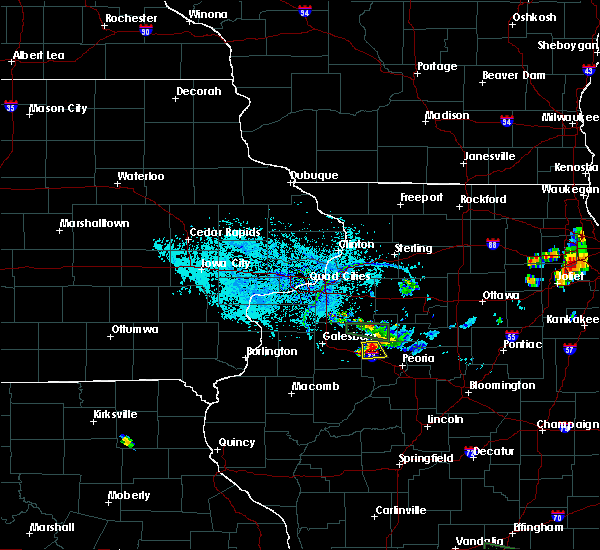 At 803 pm cdt, a severe thunderstorm was located over elmore, or 21 miles south of kewanee, moving south at 10 mph (radar indicated). Hazards include 60 mph wind gusts and quarter size hail. Hail damage to vehicles is expected. expect wind damage to roofs, siding, and trees. locations impacted include, brimfield, laura, elmore and monica. This includes interstate 74 between mile markers 69 and 75. At 803 pm cdt, a severe thunderstorm was located over elmore, or 21 miles south of kewanee, moving south at 10 mph (radar indicated). Hazards include 60 mph wind gusts and quarter size hail. Hail damage to vehicles is expected. expect wind damage to roofs, siding, and trees. locations impacted include, brimfield, laura, elmore and monica. This includes interstate 74 between mile markers 69 and 75.
|
| 6/26/2019 7:48 PM CDT |
 At 747 pm cdt, a severe thunderstorm was located over elmore, or 17 miles south of kewanee, moving south at 10 mph (radar indicated). Hazards include 60 mph wind gusts and quarter size hail. Hail damage to vehicles is expected. Expect wind damage to roofs, siding, and trees. At 747 pm cdt, a severe thunderstorm was located over elmore, or 17 miles south of kewanee, moving south at 10 mph (radar indicated). Hazards include 60 mph wind gusts and quarter size hail. Hail damage to vehicles is expected. Expect wind damage to roofs, siding, and trees.
|
| 6/15/2019 10:02 PM CDT |
 At 1001 pm cdt, a severe thunderstorm was located near trivoli, or 11 miles northeast of canton, moving east at 45 mph (radar indicated). Hazards include 60 mph wind gusts and nickel size hail. Expect damage to roofs, siding, and trees. locations impacted include, peoria, canton, chillicothe, elmwood, princeville, dunlap, hanna city, glasford, trivoli, brimfield, st. david, laura, elmore, kickapoo, norwood, dunfermline, banner, smithville, alta and monica. this includes the following highways, interstate 474 between mile markers 0 and 2. Interstate 74 between mile markers 69 and 87. At 1001 pm cdt, a severe thunderstorm was located near trivoli, or 11 miles northeast of canton, moving east at 45 mph (radar indicated). Hazards include 60 mph wind gusts and nickel size hail. Expect damage to roofs, siding, and trees. locations impacted include, peoria, canton, chillicothe, elmwood, princeville, dunlap, hanna city, glasford, trivoli, brimfield, st. david, laura, elmore, kickapoo, norwood, dunfermline, banner, smithville, alta and monica. this includes the following highways, interstate 474 between mile markers 0 and 2. Interstate 74 between mile markers 69 and 87.
|
| 6/15/2019 9:47 PM CDT |
 At 947 pm cdt, a severe thunderstorm was located over farmington, or 11 miles north of canton, moving east at 45 mph (radar indicated). Hazards include 60 mph wind gusts and nickel size hail. expect damage to roofs, siding, and trees At 947 pm cdt, a severe thunderstorm was located over farmington, or 11 miles north of canton, moving east at 45 mph (radar indicated). Hazards include 60 mph wind gusts and nickel size hail. expect damage to roofs, siding, and trees
|
| 5/28/2019 8:41 PM CDT |
 At 840 pm cdt, severe thunderstorms were located along a line extending from near kewanee to st. david, moving east at 40 mph (trained weather spotters). Hazards include 70 mph wind gusts and half dollar size hail. Hail damage to vehicles is expected. expect considerable tree damage. wind damage is also likely to mobile homes, roofs, and outbuildings. locations impacted include, peoria, canton, lewistown, bartonville, west peoria, farmington, elmwood, bellevue, princeville, wyoming, dunlap, cuba, toulon, hanna city, glasford, trivoli, osceola, brimfield, bradford and yates city. this includes the following highways, interstate 474 between mile markers 0 and 8. Interstate 74 between mile markers 57 and 88. At 840 pm cdt, severe thunderstorms were located along a line extending from near kewanee to st. david, moving east at 40 mph (trained weather spotters). Hazards include 70 mph wind gusts and half dollar size hail. Hail damage to vehicles is expected. expect considerable tree damage. wind damage is also likely to mobile homes, roofs, and outbuildings. locations impacted include, peoria, canton, lewistown, bartonville, west peoria, farmington, elmwood, bellevue, princeville, wyoming, dunlap, cuba, toulon, hanna city, glasford, trivoli, osceola, brimfield, bradford and yates city. this includes the following highways, interstate 474 between mile markers 0 and 8. Interstate 74 between mile markers 57 and 88.
|
| 5/28/2019 8:22 PM CDT |
 At 822 pm cdt, severe thunderstorms were located along a line extending from near altona to lewistown, moving northeast at 40 mph (trained weather spotters). Hazards include 70 mph wind gusts and half dollar size hail. Hail damage to vehicles is expected. expect considerable tree damage. Wind damage is also likely to mobile homes, roofs, and outbuildings. At 822 pm cdt, severe thunderstorms were located along a line extending from near altona to lewistown, moving northeast at 40 mph (trained weather spotters). Hazards include 70 mph wind gusts and half dollar size hail. Hail damage to vehicles is expected. expect considerable tree damage. Wind damage is also likely to mobile homes, roofs, and outbuildings.
|
| 12/1/2018 4:11 PM CST |
 At 410 pm cst, a severe thunderstorm capable of producing a tornado was located over yates city, or 17 miles north of canton, moving north at 25 mph (radar indicated rotation). Hazards include tornado. Flying debris will be dangerous to those caught without shelter. mobile homes will be damaged or destroyed. damage to roofs, windows, and vehicles will occur. tree damage is likely. this dangerous storm will be near, brimfield around 420 pm cst. williamsfield and laura around 430 pm cst. elmore around 435 pm cst. other locations impacted by this tornadic thunderstorm include dahinda and monica. This includes interstate 74 between mile markers 61 and 76. At 410 pm cst, a severe thunderstorm capable of producing a tornado was located over yates city, or 17 miles north of canton, moving north at 25 mph (radar indicated rotation). Hazards include tornado. Flying debris will be dangerous to those caught without shelter. mobile homes will be damaged or destroyed. damage to roofs, windows, and vehicles will occur. tree damage is likely. this dangerous storm will be near, brimfield around 420 pm cst. williamsfield and laura around 430 pm cst. elmore around 435 pm cst. other locations impacted by this tornadic thunderstorm include dahinda and monica. This includes interstate 74 between mile markers 61 and 76.
|
| 12/1/2018 3:57 PM CST |
 At 357 pm cst, a severe thunderstorm capable of producing a tornado was located over yates city, or 13 miles north of canton, moving north at 30 mph (radar indicated rotation). Hazards include tornado. Flying debris will be dangerous to those caught without shelter. mobile homes will be damaged or destroyed. damage to roofs, windows, and vehicles will occur. tree damage is likely. this dangerous storm will be near, yates city around 400 pm cst. elmwood around 405 pm cst. brimfield around 415 pm cst. williamsfield and laura around 420 pm cst. elmore around 425 pm cst. other locations impacted by this tornadic thunderstorm include dahinda and monica. This includes interstate 74 between mile markers 61 and 75. At 357 pm cst, a severe thunderstorm capable of producing a tornado was located over yates city, or 13 miles north of canton, moving north at 30 mph (radar indicated rotation). Hazards include tornado. Flying debris will be dangerous to those caught without shelter. mobile homes will be damaged or destroyed. damage to roofs, windows, and vehicles will occur. tree damage is likely. this dangerous storm will be near, yates city around 400 pm cst. elmwood around 405 pm cst. brimfield around 415 pm cst. williamsfield and laura around 420 pm cst. elmore around 425 pm cst. other locations impacted by this tornadic thunderstorm include dahinda and monica. This includes interstate 74 between mile markers 61 and 75.
|
| 8/28/2018 9:46 PM CDT |
 At 945 pm cdt, severe thunderstorms were located along a line extending from oneida to near london mills to near adair, moving east at 50 mph (radar indicated). Hazards include 60 mph wind gusts and penny size hail. Expect damage to roofs, siding, and trees. locations impacted include, galesburg, canton, lewistown, abingdon, knoxville, farmington, elmwood, cuba, toulon, brimfield, wataga, avon, oneida, yates city, vermont, st. david, williamsfield, altona, fairview and ipava. This includes interstate 74 between mile markers 34 and 75. At 945 pm cdt, severe thunderstorms were located along a line extending from oneida to near london mills to near adair, moving east at 50 mph (radar indicated). Hazards include 60 mph wind gusts and penny size hail. Expect damage to roofs, siding, and trees. locations impacted include, galesburg, canton, lewistown, abingdon, knoxville, farmington, elmwood, cuba, toulon, brimfield, wataga, avon, oneida, yates city, vermont, st. david, williamsfield, altona, fairview and ipava. This includes interstate 74 between mile markers 34 and 75.
|
| 8/28/2018 9:20 PM CDT |
 At 919 pm cdt, severe thunderstorms were located along a line extending from 6 miles east of little york to roseville to near tennessee, moving east at 50 mph (radar indicated). Hazards include 60 mph wind gusts and penny size hail. expect damage to roofs, siding, and trees At 919 pm cdt, severe thunderstorms were located along a line extending from 6 miles east of little york to roseville to near tennessee, moving east at 50 mph (radar indicated). Hazards include 60 mph wind gusts and penny size hail. expect damage to roofs, siding, and trees
|
| 6/21/2018 1:15 PM CDT |
 At 115 pm cdt, tornado producing storms were located along a line extending from oneida to near trivoli, moving northeast at 25 mph (law enforcement confirmed tornado). Hazards include tornado. Expect damage to mobile homes, roofs, and vehicles. these tornadic storms will be near, hanna city around 120 pm cdt. brimfield around 125 pm cdt. dunlap, altona and victoria around 130 pm cdt. other locations impacted by these tornadic storms include snake den hollow, norris, banner, smithville, monica, kickapoo, dahinda, east galesburg, middle grove and henderson. This includes interstate 74 between mile markers 34 and 83. At 115 pm cdt, tornado producing storms were located along a line extending from oneida to near trivoli, moving northeast at 25 mph (law enforcement confirmed tornado). Hazards include tornado. Expect damage to mobile homes, roofs, and vehicles. these tornadic storms will be near, hanna city around 120 pm cdt. brimfield around 125 pm cdt. dunlap, altona and victoria around 130 pm cdt. other locations impacted by these tornadic storms include snake den hollow, norris, banner, smithville, monica, kickapoo, dahinda, east galesburg, middle grove and henderson. This includes interstate 74 between mile markers 34 and 83.
|
| 6/21/2018 1:00 PM CDT |
 At 1259 pm cdt, tornado producing storms were located along a line extending from near wataga to near trivoli, moving northeast at 25 mph (law enforcement confirmed tornado). Hazards include tornado. Expect damage to mobile homes, roofs, and vehicles. these tornadic storms will be near, elmwood and trivoli around 105 pm cdt. hanna city and oneida around 115 pm cdt. brimfield around 120 pm cdt. altona and victoria around 125 pm cdt. dunlap around 130 pm cdt. other locations impacted by these tornadic storms include snake den hollow, norris, banner, smithville, monica, kickapoo, dahinda, east galesburg, middle grove and henderson. This includes interstate 74 between mile markers 34 and 83. At 1259 pm cdt, tornado producing storms were located along a line extending from near wataga to near trivoli, moving northeast at 25 mph (law enforcement confirmed tornado). Hazards include tornado. Expect damage to mobile homes, roofs, and vehicles. these tornadic storms will be near, elmwood and trivoli around 105 pm cdt. hanna city and oneida around 115 pm cdt. brimfield around 120 pm cdt. altona and victoria around 125 pm cdt. dunlap around 130 pm cdt. other locations impacted by these tornadic storms include snake den hollow, norris, banner, smithville, monica, kickapoo, dahinda, east galesburg, middle grove and henderson. This includes interstate 74 between mile markers 34 and 83.
|
| 6/10/2018 2:37 AM CDT |
 At 237 am cdt, severe thunderstorms were located along a line extending from near camp grove to near brimfield to near london mills, moving east at 25 mph (radar indicated). Hazards include 60 mph wind gusts. Expect damage to roofs, siding, and trees. locations impacted include, peoria, east peoria, bartonville, chillicothe, west peoria, elmwood, bellevue, princeville, rome, wyoming, dunlap, toulon, hanna city, glasford, trivoli, brimfield, bradford, west jersey, castleton and camp grove. this includes the following highways, interstate 474 between mile markers 0 and 8. Interstate 74 between mile markers 68 and 93. At 237 am cdt, severe thunderstorms were located along a line extending from near camp grove to near brimfield to near london mills, moving east at 25 mph (radar indicated). Hazards include 60 mph wind gusts. Expect damage to roofs, siding, and trees. locations impacted include, peoria, east peoria, bartonville, chillicothe, west peoria, elmwood, bellevue, princeville, rome, wyoming, dunlap, toulon, hanna city, glasford, trivoli, brimfield, bradford, west jersey, castleton and camp grove. this includes the following highways, interstate 474 between mile markers 0 and 8. Interstate 74 between mile markers 68 and 93.
|
| 6/10/2018 2:06 AM CDT |
 At 204 am cdt, severe thunderstorms were located along a line extending from near castleton to elmore to near knoxville, moving southeast at 25 mph (radar indicated). Hazards include 60 mph wind gusts. expect damage to roofs, siding, and trees At 204 am cdt, severe thunderstorms were located along a line extending from near castleton to elmore to near knoxville, moving southeast at 25 mph (radar indicated). Hazards include 60 mph wind gusts. expect damage to roofs, siding, and trees
|
| 10/14/2017 7:12 PM CDT |
 At 712 pm cdt, a severe thunderstorm was located over spring bay, or near peoria, moving east at 60 mph (radar indicated). Hazards include 70 mph wind gusts and quarter size hail. Hail damage to vehicles is expected. expect considerable tree damage. wind damage is also likely to mobile homes, roofs, and outbuildings. locations impacted include, peoria, eureka, east peoria, washington, chillicothe, west peoria, metamora, germantown hills, bellevue, rome, dunlap, hanna city, washburn, spring bay, bay view gardens, kickapoo, peoria heights, cazenovia, norwood and la rose. this includes the following highways, interstate 474 between mile markers 0 and 3. interstate 74 between mile markers 75 and 93. A tornado watch remains in effect until 100 am cdt for central illinois. At 712 pm cdt, a severe thunderstorm was located over spring bay, or near peoria, moving east at 60 mph (radar indicated). Hazards include 70 mph wind gusts and quarter size hail. Hail damage to vehicles is expected. expect considerable tree damage. wind damage is also likely to mobile homes, roofs, and outbuildings. locations impacted include, peoria, eureka, east peoria, washington, chillicothe, west peoria, metamora, germantown hills, bellevue, rome, dunlap, hanna city, washburn, spring bay, bay view gardens, kickapoo, peoria heights, cazenovia, norwood and la rose. this includes the following highways, interstate 474 between mile markers 0 and 3. interstate 74 between mile markers 75 and 93. A tornado watch remains in effect until 100 am cdt for central illinois.
|
| 10/14/2017 7:09 PM CDT |
 The severe thunderstorm warning for stark and northwestern peoria counties will expire at 715 pm cdt, the storms which prompted the warning have weakened below severe limits, and no longer pose an immediate threat to life or property. therefore the warning will be allowed to expire. however small hail and gusty winds are still possible with these thunderstorms. the severe thunderstorm warning continues for central parts of peoria county until 745 pm. a tornado watch remains in effect until 100 am cdt for central and north central illinois. The severe thunderstorm warning for stark and northwestern peoria counties will expire at 715 pm cdt, the storms which prompted the warning have weakened below severe limits, and no longer pose an immediate threat to life or property. therefore the warning will be allowed to expire. however small hail and gusty winds are still possible with these thunderstorms. the severe thunderstorm warning continues for central parts of peoria county until 745 pm. a tornado watch remains in effect until 100 am cdt for central and north central illinois.
|
| 10/14/2017 7:04 PM CDT |
 At 704 pm cdt, severe thunderstorms were located along a line extending from near wyoming to near elmwood, moving east at 50 mph (radar indicated). Hazards include 60 mph wind gusts and quarter size hail. Hail damage to vehicles is expected. expect wind damage to roofs, siding, and trees. locations impacted include, peoria, elmwood, princeville, wyoming, dunlap, toulon, osceola, brimfield, bradford, elmira, castleton, laura, kickapoo, duncan and monica. this includes interstate 74 between mile markers 69 and 85. A tornado watch remains in effect until 100 am cdt for central and north central illinois. At 704 pm cdt, severe thunderstorms were located along a line extending from near wyoming to near elmwood, moving east at 50 mph (radar indicated). Hazards include 60 mph wind gusts and quarter size hail. Hail damage to vehicles is expected. expect wind damage to roofs, siding, and trees. locations impacted include, peoria, elmwood, princeville, wyoming, dunlap, toulon, osceola, brimfield, bradford, elmira, castleton, laura, kickapoo, duncan and monica. this includes interstate 74 between mile markers 69 and 85. A tornado watch remains in effect until 100 am cdt for central and north central illinois.
|
| 10/14/2017 7:00 PM CDT |
 At 659 pm cdt, a severe thunderstorm was located near brimfield, or 11 miles west of peoria, moving east at 55 mph (radar indicated). Hazards include 70 mph wind gusts and quarter size hail. Hail damage to vehicles is expected. expect considerable tree damage. Wind damage is also likely to mobile homes, roofs, and outbuildings. At 659 pm cdt, a severe thunderstorm was located near brimfield, or 11 miles west of peoria, moving east at 55 mph (radar indicated). Hazards include 70 mph wind gusts and quarter size hail. Hail damage to vehicles is expected. expect considerable tree damage. Wind damage is also likely to mobile homes, roofs, and outbuildings.
|
| 10/14/2017 6:41 PM CDT |
 At 641 pm cdt, severe thunderstorms were located along a line extending from near west jersey to near london mills, moving east at 50 mph (radar indicated). Hazards include 60 mph wind gusts and quarter size hail. Hail damage to vehicles is expected. expect wind damage to roofs, siding, and trees. locations impacted include, peoria, abingdon, knoxville, elmwood, princeville, wyoming, dunlap, toulon, osceola, brimfield, bradford, yates city, williamsfield, elmira, victoria, maquon, west jersey, la fayette, castleton and gilson. this includes interstate 74 between mile markers 51 and 85. A tornado watch remains in effect until 100 am cdt for central, north central and west central illinois. At 641 pm cdt, severe thunderstorms were located along a line extending from near west jersey to near london mills, moving east at 50 mph (radar indicated). Hazards include 60 mph wind gusts and quarter size hail. Hail damage to vehicles is expected. expect wind damage to roofs, siding, and trees. locations impacted include, peoria, abingdon, knoxville, elmwood, princeville, wyoming, dunlap, toulon, osceola, brimfield, bradford, yates city, williamsfield, elmira, victoria, maquon, west jersey, la fayette, castleton and gilson. this includes interstate 74 between mile markers 51 and 85. A tornado watch remains in effect until 100 am cdt for central, north central and west central illinois.
|
| 10/14/2017 6:28 PM CDT |
 At 627 pm cdt, a severe thunderstorm was located over williamsfield, or 18 miles east of galesburg, moving east at 55 mph (radar indicated). Hazards include 60 mph wind gusts and quarter size hail. Hail damage to vehicles is expected. Expect wind damage to roofs, siding, and trees. At 627 pm cdt, a severe thunderstorm was located over williamsfield, or 18 miles east of galesburg, moving east at 55 mph (radar indicated). Hazards include 60 mph wind gusts and quarter size hail. Hail damage to vehicles is expected. Expect wind damage to roofs, siding, and trees.
|
| 7/10/2017 6:38 PM CDT | Quarter sized hail reported 3 miles NW of Brimfield, IL |
| 7/10/2017 6:32 PM CDT |
 At 632 pm cdt, severe thunderstorms were located between brimfield and dunlap, or 8 miles northwest of peoria, moving southeast at 30 mph (radar indicated). Hazards include 60 mph wind gusts and quarter size hail. Hail damage to vehicles is expected. expect wind damage to roofs, siding, and trees. locations impacted include, peoria, bartonville, chillicothe, west peoria, bellevue, rome, dunlap, brimfield, kickapoo, peoria heights, norwood, mossville, peoria international airport and alta. this includes the following highways, interstate 474 between mile markers 0 and 8. Interstate 74 between mile markers 74 and 92. At 632 pm cdt, severe thunderstorms were located between brimfield and dunlap, or 8 miles northwest of peoria, moving southeast at 30 mph (radar indicated). Hazards include 60 mph wind gusts and quarter size hail. Hail damage to vehicles is expected. expect wind damage to roofs, siding, and trees. locations impacted include, peoria, bartonville, chillicothe, west peoria, bellevue, rome, dunlap, brimfield, kickapoo, peoria heights, norwood, mossville, peoria international airport and alta. this includes the following highways, interstate 474 between mile markers 0 and 8. Interstate 74 between mile markers 74 and 92.
|
| 7/10/2017 6:22 PM CDT |
 At 622 pm cdt, a severe thunderstorm was located near brimfield, or 13 miles northwest of peoria, moving southeast at 30 mph (trained weather spotters. at 621 pm, quarter size hail was reported in brimfield). Hazards include 60 mph wind gusts and quarter size hail. Hail damage to vehicles is expected. expect wind damage to roofs, siding, and trees. locations impacted include, peoria, bartonville, chillicothe, west peoria, bellevue, princeville, rome, dunlap, brimfield, kickapoo, peoria heights, norwood, mossville, peoria international airport, alta and monica. this includes the following highways, interstate 474 between mile markers 0 and 8. Interstate 74 between mile markers 70 and 92. At 622 pm cdt, a severe thunderstorm was located near brimfield, or 13 miles northwest of peoria, moving southeast at 30 mph (trained weather spotters. at 621 pm, quarter size hail was reported in brimfield). Hazards include 60 mph wind gusts and quarter size hail. Hail damage to vehicles is expected. expect wind damage to roofs, siding, and trees. locations impacted include, peoria, bartonville, chillicothe, west peoria, bellevue, princeville, rome, dunlap, brimfield, kickapoo, peoria heights, norwood, mossville, peoria international airport, alta and monica. this includes the following highways, interstate 474 between mile markers 0 and 8. Interstate 74 between mile markers 70 and 92.
|
| 7/10/2017 6:21 PM CDT | Quarter sized hail reported 0.2 miles SW of Brimfield, IL |
| 7/10/2017 6:17 PM CDT |
 At 617 pm cdt, severe thunderstorms were located from near brimfield to kickapoo, moving southeast at 30 mph (radar indicated). Hazards include 60 mph wind gusts and quarter size hail. Hail damage to vehicles is expected. Expect wind damage to roofs, siding, and trees. At 617 pm cdt, severe thunderstorms were located from near brimfield to kickapoo, moving southeast at 30 mph (radar indicated). Hazards include 60 mph wind gusts and quarter size hail. Hail damage to vehicles is expected. Expect wind damage to roofs, siding, and trees.
|
| 7/10/2017 6:14 PM CDT |
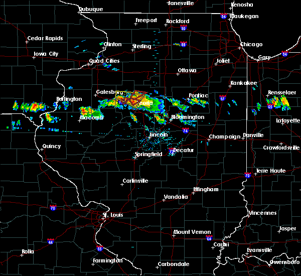 At 614 pm cdt, a severe thunderstorm capable of producing a tornado was located near brimfield, or 12 miles northwest of peoria, moving southeast at 20 mph (radar indicated rotation). Hazards include tornado and quarter size hail. Flying debris will be dangerous to those caught without shelter. mobile homes will be damaged or destroyed. damage to roofs, windows, and vehicles will occur. tree damage is likely. this tornadic thunderstorm will remain over mainly rural areas of northwestern peoria county. This includes interstate 74 between mile markers 74 and 77. At 614 pm cdt, a severe thunderstorm capable of producing a tornado was located near brimfield, or 12 miles northwest of peoria, moving southeast at 20 mph (radar indicated rotation). Hazards include tornado and quarter size hail. Flying debris will be dangerous to those caught without shelter. mobile homes will be damaged or destroyed. damage to roofs, windows, and vehicles will occur. tree damage is likely. this tornadic thunderstorm will remain over mainly rural areas of northwestern peoria county. This includes interstate 74 between mile markers 74 and 77.
|
| 7/10/2017 6:01 PM CDT |
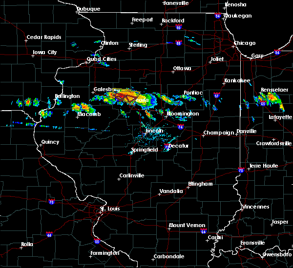 At 600 pm cdt, a severe thunderstorm capable of producing a tornado was located 5 miles southeast of laura, or 17 miles northwest of peoria, moving southeast at 20 mph (radar indicated rotation. at 558 pm, a funnel cloud was reported by trained spotters in this area). Hazards include tornado. Flying debris will be dangerous to those caught without shelter. mobile homes will be damaged or destroyed. damage to roofs, windows, and vehicles will occur. tree damage is likely. this dangerous storm will be near, brimfield around 605 pm cdt. This includes interstate 74 between mile markers 74 and 77. At 600 pm cdt, a severe thunderstorm capable of producing a tornado was located 5 miles southeast of laura, or 17 miles northwest of peoria, moving southeast at 20 mph (radar indicated rotation. at 558 pm, a funnel cloud was reported by trained spotters in this area). Hazards include tornado. Flying debris will be dangerous to those caught without shelter. mobile homes will be damaged or destroyed. damage to roofs, windows, and vehicles will occur. tree damage is likely. this dangerous storm will be near, brimfield around 605 pm cdt. This includes interstate 74 between mile markers 74 and 77.
|
| 6/14/2017 3:52 PM CDT |
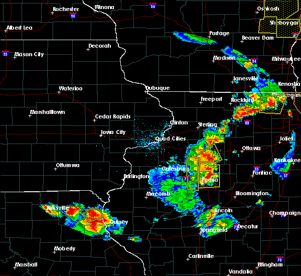 The severe thunderstorm warning for stark and central peoria counties will expire at 400 pm cdt, the storm which prompted the warning has moved out of the area. therefore the warning will be allowed to expire. a severe thunderstorm watch remains in effect until 800 pm cdt for central and north central illinois. The severe thunderstorm warning for stark and central peoria counties will expire at 400 pm cdt, the storm which prompted the warning has moved out of the area. therefore the warning will be allowed to expire. a severe thunderstorm watch remains in effect until 800 pm cdt for central and north central illinois.
|
| 6/14/2017 3:35 PM CDT |
 At 334 pm cdt, a severe thunderstorm was located near bradford, or 11 miles southeast of kewanee, moving northeast at 20 mph (law enforcement). Hazards include 70 mph wind gusts and half dollar size hail. Hail damage to vehicles is expected. expect considerable tree damage. wind damage is also likely to mobile homes, roofs, and outbuildings. locations impacted include, peoria, bartonville, bellevue, princeville, wyoming, dunlap, toulon, hanna city, osceola, brimfield, bradford, elmira, castleton, kickapoo, norwood, duncan, smithville, peoria international airport and monica. this includes the following highways, interstate 474 between mile markers 0 and 6. Interstate 74 between mile markers 75 and 87. At 334 pm cdt, a severe thunderstorm was located near bradford, or 11 miles southeast of kewanee, moving northeast at 20 mph (law enforcement). Hazards include 70 mph wind gusts and half dollar size hail. Hail damage to vehicles is expected. expect considerable tree damage. wind damage is also likely to mobile homes, roofs, and outbuildings. locations impacted include, peoria, bartonville, bellevue, princeville, wyoming, dunlap, toulon, hanna city, osceola, brimfield, bradford, elmira, castleton, kickapoo, norwood, duncan, smithville, peoria international airport and monica. this includes the following highways, interstate 474 between mile markers 0 and 6. Interstate 74 between mile markers 75 and 87.
|
| 6/14/2017 3:04 PM CDT |
 At 304 pm cdt, a severe thunderstorm was located over yates city, or 16 miles north of canton, moving east at 40 mph (radar indicated). Hazards include 60 mph wind gusts and quarter size hail. Hail damage to vehicles is expected. Expect wind damage to roofs, siding, and trees. At 304 pm cdt, a severe thunderstorm was located over yates city, or 16 miles north of canton, moving east at 40 mph (radar indicated). Hazards include 60 mph wind gusts and quarter size hail. Hail damage to vehicles is expected. Expect wind damage to roofs, siding, and trees.
|
| 3/6/2017 11:36 PM CST |
 At 1135 pm cst, severe thunderstorms were located along a line extending from near elmira to near arenzville, moving northeast at 60 mph (radar indicated). Hazards include 70 mph wind gusts and quarter size hail. Hail damage to vehicles is expected. expect considerable tree damage. wind damage is also likely to mobile homes, roofs, and outbuildings. locations impacted include, canton, lewistown, farmington, elmwood, princeville, wyoming, cuba, toulon, hanna city, astoria, trivoli, osceola, brimfield, bradford, yates city, st. david, williamsfield, altona, fairview and ipava. this includes interstate 74 between mile markers 54 and 82. A tornado watch remains in effect until 400 am cst for central, north central and west central illinois. At 1135 pm cst, severe thunderstorms were located along a line extending from near elmira to near arenzville, moving northeast at 60 mph (radar indicated). Hazards include 70 mph wind gusts and quarter size hail. Hail damage to vehicles is expected. expect considerable tree damage. wind damage is also likely to mobile homes, roofs, and outbuildings. locations impacted include, canton, lewistown, farmington, elmwood, princeville, wyoming, cuba, toulon, hanna city, astoria, trivoli, osceola, brimfield, bradford, yates city, st. david, williamsfield, altona, fairview and ipava. this includes interstate 74 between mile markers 54 and 82. A tornado watch remains in effect until 400 am cst for central, north central and west central illinois.
|
| 3/6/2017 11:25 PM CST |
 A severe thunderstorm warning remains in effect until midnight cst for fulton, stark, knox, schuyler and western peoria counties, , a tornado warning remains in effect for portions of knox and northern fulton county. at 1124 pm cst, severe thunderstorms were located along a line extending from near galva to near meredosia, moving northeast at 70 mph (radar indicated). Hazards include 70 mph wind gusts and quarter size hail. Hail damage to vehicles is expected. expect considerable tree damage. wind damage is also likely to mobile homes, roofs, and outbuildings. locations impacted include, galesburg, canton, beardstown, rushville, lewistown, abingdon, knoxville, farmington, elmwood, princeville, wyoming, cuba, toulon, hanna city, astoria, trivoli, osceola, brimfield, wataga and avon. this includes interstate 74 between mile markers 35 and 82. A tornado watch remains in effect until 400 am cst for central, north central and west central illinois. A severe thunderstorm warning remains in effect until midnight cst for fulton, stark, knox, schuyler and western peoria counties, , a tornado warning remains in effect for portions of knox and northern fulton county. at 1124 pm cst, severe thunderstorms were located along a line extending from near galva to near meredosia, moving northeast at 70 mph (radar indicated). Hazards include 70 mph wind gusts and quarter size hail. Hail damage to vehicles is expected. expect considerable tree damage. wind damage is also likely to mobile homes, roofs, and outbuildings. locations impacted include, galesburg, canton, beardstown, rushville, lewistown, abingdon, knoxville, farmington, elmwood, princeville, wyoming, cuba, toulon, hanna city, astoria, trivoli, osceola, brimfield, wataga and avon. this includes interstate 74 between mile markers 35 and 82. A tornado watch remains in effect until 400 am cst for central, north central and west central illinois.
|
| 3/6/2017 11:12 PM CST |
 At 1109 pm cst, severe thunderstorms were located along a line extending from abingdon to 7 miles west of griggsville, moving east at 60 mph (radar indicated). Hazards include 70 mph wind gusts and quarter size hail. Hail damage to vehicles is expected. expect considerable tree damage. wind damage is also likely to mobile homes, roofs, and outbuildings. locations impacted include, galesburg, canton, beardstown, rushville, lewistown, abingdon, knoxville, farmington, elmwood, princeville, wyoming, cuba, toulon, hanna city, astoria, trivoli, osceola, brimfield, wataga and avon. this includes interstate 74 between mile markers 35 and 82. A tornado watch remains in effect until 400 am cst for central, north central and west central illinois. At 1109 pm cst, severe thunderstorms were located along a line extending from abingdon to 7 miles west of griggsville, moving east at 60 mph (radar indicated). Hazards include 70 mph wind gusts and quarter size hail. Hail damage to vehicles is expected. expect considerable tree damage. wind damage is also likely to mobile homes, roofs, and outbuildings. locations impacted include, galesburg, canton, beardstown, rushville, lewistown, abingdon, knoxville, farmington, elmwood, princeville, wyoming, cuba, toulon, hanna city, astoria, trivoli, osceola, brimfield, wataga and avon. this includes interstate 74 between mile markers 35 and 82. A tornado watch remains in effect until 400 am cst for central, north central and west central illinois.
|
| 3/6/2017 10:58 PM CST |
 At 1058 pm cst, severe thunderstorms were located along a line extending from north henderson to near clayton, moving northeast at 60 mph (radar indicated). Hazards include 70 mph wind gusts and quarter size hail. Hail damage to vehicles is expected. expect considerable tree damage. Wind damage is also likely to mobile homes, roofs, and outbuildings. At 1058 pm cst, severe thunderstorms were located along a line extending from north henderson to near clayton, moving northeast at 60 mph (radar indicated). Hazards include 70 mph wind gusts and quarter size hail. Hail damage to vehicles is expected. expect considerable tree damage. Wind damage is also likely to mobile homes, roofs, and outbuildings.
|
| 3/6/2017 10:49 PM CST |
 At 1049 pm cst, severe thunderstorms were located along a line extending from near kirkwood to near beverly, moving northeast at 60 mph (radar indicated). Hazards include 70 mph wind gusts and quarter size hail. Hail damage to vehicles is expected. expect considerable tree damage. wind damage is also likely to mobile homes, roofs, and outbuildings. locations impacted include, galesburg, canton, rushville, lewistown, abingdon, knoxville, farmington, elmwood, princeville, wyoming, cuba, toulon, hanna city, astoria, trivoli, osceola, brimfield, wataga, avon and bradford. this includes interstate 74 between mile markers 34 and 82. A tornado watch remains in effect until 400 am cst for central, north central and west central illinois. At 1049 pm cst, severe thunderstorms were located along a line extending from near kirkwood to near beverly, moving northeast at 60 mph (radar indicated). Hazards include 70 mph wind gusts and quarter size hail. Hail damage to vehicles is expected. expect considerable tree damage. wind damage is also likely to mobile homes, roofs, and outbuildings. locations impacted include, galesburg, canton, rushville, lewistown, abingdon, knoxville, farmington, elmwood, princeville, wyoming, cuba, toulon, hanna city, astoria, trivoli, osceola, brimfield, wataga, avon and bradford. this includes interstate 74 between mile markers 34 and 82. A tornado watch remains in effect until 400 am cst for central, north central and west central illinois.
|
| 3/6/2017 10:32 PM CST |
 At 1031 pm cst, severe thunderstorms were located along a line extending from near rock island to near stronghurst to near palmyra, moving northeast at 65 mph (radar indicated). Hazards include 70 mph wind gusts and quarter size hail. Hail damage to vehicles is expected. expect considerable tree damage. Wind damage is also likely to mobile homes, roofs, and outbuildings. At 1031 pm cst, severe thunderstorms were located along a line extending from near rock island to near stronghurst to near palmyra, moving northeast at 65 mph (radar indicated). Hazards include 70 mph wind gusts and quarter size hail. Hail damage to vehicles is expected. expect considerable tree damage. Wind damage is also likely to mobile homes, roofs, and outbuildings.
|
| 2/28/2017 4:44 PM CST |
 At 444 pm cst, a severe thunderstorm was located near elmwood, or 20 miles north of canton, moving east at 55 mph (radar indicated). Hazards include 60 mph wind gusts and half dollar size hail. Hail damage to vehicles is expected. Expect wind damage to roofs, siding, and trees. At 444 pm cst, a severe thunderstorm was located near elmwood, or 20 miles north of canton, moving east at 55 mph (radar indicated). Hazards include 60 mph wind gusts and half dollar size hail. Hail damage to vehicles is expected. Expect wind damage to roofs, siding, and trees.
|
| 11/2/2016 4:01 PM CDT |
 At 400 pm cdt, severe thunderstorms were located along a line extending from brimfield to near hanna city to near trivoli, moving east at 25 mph (radar indicated). Hazards include 60 mph wind gusts and quarter size hail. Hail damage to vehicles is expected. expect wind damage to roofs, siding, and trees. locations impacted include, peoria, west peoria, bellevue, dunlap, hanna city, trivoli, brimfield, kickapoo, norwood and smithville. this includes the following highways, interstate 474 between mile markers 0 and 5. Interstate 74 between mile markers 72 and 88. At 400 pm cdt, severe thunderstorms were located along a line extending from brimfield to near hanna city to near trivoli, moving east at 25 mph (radar indicated). Hazards include 60 mph wind gusts and quarter size hail. Hail damage to vehicles is expected. expect wind damage to roofs, siding, and trees. locations impacted include, peoria, west peoria, bellevue, dunlap, hanna city, trivoli, brimfield, kickapoo, norwood and smithville. this includes the following highways, interstate 474 between mile markers 0 and 5. Interstate 74 between mile markers 72 and 88.
|
| 11/2/2016 3:53 PM CDT |
 At 353 pm cdt, severe thunderstorms were located along a line extending from brimfield to near trivoli to near farmington, moving east at 40 mph (radar indicated. these storms have produce hail from half inch to dime size in elmwood and farmington). Hazards include 60 mph wind gusts and quarter size hail. Hail damage to vehicles is expected. expect wind damage to roofs, siding, and trees. locations impacted include, peoria, west peoria, elmwood, bellevue, princeville, dunlap, hanna city, trivoli, brimfield, kickapoo, norwood, smithville and monica. this includes the following highways, interstate 474 between mile markers 0 and 5. Interstate 74 between mile markers 69 and 88. At 353 pm cdt, severe thunderstorms were located along a line extending from brimfield to near trivoli to near farmington, moving east at 40 mph (radar indicated. these storms have produce hail from half inch to dime size in elmwood and farmington). Hazards include 60 mph wind gusts and quarter size hail. Hail damage to vehicles is expected. expect wind damage to roofs, siding, and trees. locations impacted include, peoria, west peoria, elmwood, bellevue, princeville, dunlap, hanna city, trivoli, brimfield, kickapoo, norwood, smithville and monica. this includes the following highways, interstate 474 between mile markers 0 and 5. Interstate 74 between mile markers 69 and 88.
|
| 11/2/2016 3:43 PM CDT |
 At 342 pm cdt, a severe thunderstorm was located over yates city, or 14 miles north of canton, moving east at 25 mph. this was part of a line of strong thunderstorms, which extended southwest to near canton (radar indicated). Hazards include 60 mph wind gusts and quarter size hail. Hail damage to vehicles is expected. Expect wind damage to roofs, siding, and trees. At 342 pm cdt, a severe thunderstorm was located over yates city, or 14 miles north of canton, moving east at 25 mph. this was part of a line of strong thunderstorms, which extended southwest to near canton (radar indicated). Hazards include 60 mph wind gusts and quarter size hail. Hail damage to vehicles is expected. Expect wind damage to roofs, siding, and trees.
|
| 7/13/2016 4:36 PM CDT |
 At 436 pm cdt, severe thunderstorms were located along a line extending from camp grove to dunlap to near brimfield, moving east at 45 mph (trained weather spotters). Hazards include 70 mph wind gusts. Expect considerable tree damage. Damage is likely to mobile homes, roofs, and outbuildings. At 436 pm cdt, severe thunderstorms were located along a line extending from camp grove to dunlap to near brimfield, moving east at 45 mph (trained weather spotters). Hazards include 70 mph wind gusts. Expect considerable tree damage. Damage is likely to mobile homes, roofs, and outbuildings.
|
| 7/6/2016 5:01 AM CDT |
 At 501 am cdt, a severe thunderstorm was located near bellevue, or near peoria, moving southeast at 40 mph (radar indicated). Hazards include 60 mph wind gusts. Expect damage to roofs. siding. and trees. locations impacted include, peoria, pekin, east peoria, morton, washington, bartonville, creve coeur, west peoria, germantown hills, marquette heights, elmwood, bellevue, princeville, dunlap, hanna city, brimfield, spring bay, bay view gardens, laura and kickapoo. this includes the following highways, interstate 155 near mile marker 31. interstate 474 between mile markers 0 and 14. Interstate 74 between mile markers 68 and 102. At 501 am cdt, a severe thunderstorm was located near bellevue, or near peoria, moving southeast at 40 mph (radar indicated). Hazards include 60 mph wind gusts. Expect damage to roofs. siding. and trees. locations impacted include, peoria, pekin, east peoria, morton, washington, bartonville, creve coeur, west peoria, germantown hills, marquette heights, elmwood, bellevue, princeville, dunlap, hanna city, brimfield, spring bay, bay view gardens, laura and kickapoo. this includes the following highways, interstate 155 near mile marker 31. interstate 474 between mile markers 0 and 14. Interstate 74 between mile markers 68 and 102.
|
| 7/6/2016 4:36 AM CDT |
 At 436 am cdt, a severe thunderstorm was located over laura, or 19 miles northwest of peoria, moving southeast at 50 mph (radar indicated). Hazards include 60 mph wind gusts. Expect damage to roofs. siding. And trees. At 436 am cdt, a severe thunderstorm was located over laura, or 19 miles northwest of peoria, moving southeast at 50 mph (radar indicated). Hazards include 60 mph wind gusts. Expect damage to roofs. siding. And trees.
|
| 5/11/2016 8:04 PM CDT |
 At 803 pm cdt, a severe thunderstorm was located over dunlap, or 9 miles northwest of peoria, moving northeast at 35 mph. another severe thunderstorm was located just west of lacon, moving northeast at 35 mph (radar indicated). Hazards include 60 mph wind gusts and quarter size hail. Hail damage to vehicles is expected. expect wind damage to roofs, siding, and trees. locations impacted include, peoria, lacon, chillicothe, henry, princeville, rome, wyoming, dunlap, brimfield, bradford, sparland, camp grove, castleton, kickapoo, hopewell, duncan, marshall-putnam county fairgrounds, lake wildwood, marshall county airport and monica. This includes interstate 74 between mile markers 73 and 76, and near mile marker 80. At 803 pm cdt, a severe thunderstorm was located over dunlap, or 9 miles northwest of peoria, moving northeast at 35 mph. another severe thunderstorm was located just west of lacon, moving northeast at 35 mph (radar indicated). Hazards include 60 mph wind gusts and quarter size hail. Hail damage to vehicles is expected. expect wind damage to roofs, siding, and trees. locations impacted include, peoria, lacon, chillicothe, henry, princeville, rome, wyoming, dunlap, brimfield, bradford, sparland, camp grove, castleton, kickapoo, hopewell, duncan, marshall-putnam county fairgrounds, lake wildwood, marshall county airport and monica. This includes interstate 74 between mile markers 73 and 76, and near mile marker 80.
|
| 5/11/2016 7:47 PM CDT |
 At 747 pm cdt, a severe thunderstorm was located near hanna city, or 10 miles west of peoria, moving northeast at 35 mph (radar indicated). Hazards include 60 mph wind gusts and quarter size hail. Hail damage to vehicles is expected. Expect wind damage to roofs, siding, and trees. At 747 pm cdt, a severe thunderstorm was located near hanna city, or 10 miles west of peoria, moving northeast at 35 mph (radar indicated). Hazards include 60 mph wind gusts and quarter size hail. Hail damage to vehicles is expected. Expect wind damage to roofs, siding, and trees.
|
| 3/15/2016 8:10 PM CDT |
 The tornado warning for northern peoria county will expire at 815 pm cdt, the tornado warning that was previously in effect has been reissued for eastern peoria county, western woodford, and northwest tazewell counties and is in effect until 830 pm. please refer to that bulletin for the latest severe weather information. a tornado watch remains in effect until 1100 pm cdt for west central illinois. remember, a tornado warning still remains in effect for eastern peoria county, western woodford, and northwest tazewell counties. The tornado warning for northern peoria county will expire at 815 pm cdt, the tornado warning that was previously in effect has been reissued for eastern peoria county, western woodford, and northwest tazewell counties and is in effect until 830 pm. please refer to that bulletin for the latest severe weather information. a tornado watch remains in effect until 1100 pm cdt for west central illinois. remember, a tornado warning still remains in effect for eastern peoria county, western woodford, and northwest tazewell counties.
|
| 3/15/2016 7:48 PM CDT | Golf Ball sized hail reported 6.5 miles WNW of Brimfield, IL |
| 3/15/2016 7:43 PM CDT |
 At 741 pm cdt, a severe thunderstorm capable of producing a tornado was located over trivoli, or 12 miles northeast of canton, moving northeast at 25 mph (radar indicated rotation). Hazards include tornado and golf ball size hail. Flying debris will be dangerous to those caught without shelter. mobile homes will be damaged or destroyed. damage to roofs, windows and vehicles will occur. tree damage is likely. this dangerous storm will be near, trivoli around 745 pm cdt. hanna city and brimfield around 755 pm cdt. dunlap around 815 pm cdt. other locations impacted by this tornadic thunderstorm include alta, and kickapoo. this includes the following highways, interstate 474 between mile markers 0 and 2. Interstate 74 between mile markers 75 and 89. At 741 pm cdt, a severe thunderstorm capable of producing a tornado was located over trivoli, or 12 miles northeast of canton, moving northeast at 25 mph (radar indicated rotation). Hazards include tornado and golf ball size hail. Flying debris will be dangerous to those caught without shelter. mobile homes will be damaged or destroyed. damage to roofs, windows and vehicles will occur. tree damage is likely. this dangerous storm will be near, trivoli around 745 pm cdt. hanna city and brimfield around 755 pm cdt. dunlap around 815 pm cdt. other locations impacted by this tornadic thunderstorm include alta, and kickapoo. this includes the following highways, interstate 474 between mile markers 0 and 2. Interstate 74 between mile markers 75 and 89.
|
| 3/15/2016 7:38 PM CDT |
 At 738 pm cdt, severe thunderstorms were located along a line extending from near brimfield to trivoli to near canton, moving east at 35 mph (radar indicated). Hazards include 70 mph wind gusts and quarter size hail. Hail damage to vehicles is expected. expect considerable tree damage. Wind damage is also likely to mobile homes, roofs and outbuildings. At 738 pm cdt, severe thunderstorms were located along a line extending from near brimfield to trivoli to near canton, moving east at 35 mph (radar indicated). Hazards include 70 mph wind gusts and quarter size hail. Hail damage to vehicles is expected. expect considerable tree damage. Wind damage is also likely to mobile homes, roofs and outbuildings.
|
| 11/11/2015 7:14 PM CST |
 At 712 pm cst, severe thunderstorms were located along a line extending from near buda to 4 miles northeast of brimfield to 4 miles southeast of lewistown, moving northeast at 60 mph (trained weather spotters. at 706 pm...60 mph winds were reported in lewistown in fulton county. also multiple reports of wind damage were reported in knox county in the last 30 minutes). Hazards include 70 mph wind gusts. Expect considerable tree damage. damage is likely to mobile homes, roofs and outbuildings. locations impacted include, peoria, pekin, canton, lewistown, lacon, east peoria, morton, washington, bartonville, chillicothe, creve coeur, west peoria, metamora, germantown hills, marquette heights, henry, farmington, tremont, elmwood and bellevue. this includes the following highways, interstate 155 between mile markers 28 and 31. interstate 474 between mile markers 0 and 14. interstate 74 between mile markers 67 and 102. A tornado watch remains in effect until 900 pm cst for northwestern illinois. At 712 pm cst, severe thunderstorms were located along a line extending from near buda to 4 miles northeast of brimfield to 4 miles southeast of lewistown, moving northeast at 60 mph (trained weather spotters. at 706 pm...60 mph winds were reported in lewistown in fulton county. also multiple reports of wind damage were reported in knox county in the last 30 minutes). Hazards include 70 mph wind gusts. Expect considerable tree damage. damage is likely to mobile homes, roofs and outbuildings. locations impacted include, peoria, pekin, canton, lewistown, lacon, east peoria, morton, washington, bartonville, chillicothe, creve coeur, west peoria, metamora, germantown hills, marquette heights, henry, farmington, tremont, elmwood and bellevue. this includes the following highways, interstate 155 between mile markers 28 and 31. interstate 474 between mile markers 0 and 14. interstate 74 between mile markers 67 and 102. A tornado watch remains in effect until 900 pm cst for northwestern illinois.
|
| 11/11/2015 6:54 PM CST |
 At 654 pm cst, severe thunderstorms were located along a line extending from near galva to 4 miles southeast of maquon to astoria, moving northeast at 60 mph (radar indicated). Hazards include 70 mph wind gusts. Expect considerable tree damage. Damage is likely to mobile homes, roofs and outbuildings. At 654 pm cst, severe thunderstorms were located along a line extending from near galva to 4 miles southeast of maquon to astoria, moving northeast at 60 mph (radar indicated). Hazards include 70 mph wind gusts. Expect considerable tree damage. Damage is likely to mobile homes, roofs and outbuildings.
|
| 11/11/2015 6:25 PM CST |
 At 624 pm cst, severe thunderstorms were located along a line extending from near warner to prairie city, moving northeast at 55 mph (radar indicated). Hazards include 70 mph wind gusts. Expect considerable tree damage. damage is likely to mobile homes, roofs and outbuildings. locations impacted include, peoria, galesburg, canton, bartonville, abingdon, knoxville, farmington, elmwood, bellevue, princeville, wyoming, dunlap, cuba, toulon, hanna city, glasford, trivoli, osceola, brimfield and wataga. this includes the following highways, interstate 474 between mile markers 0 and 6. interstate 74 between mile markers 34 and 87. A tornado watch remains in effect until 900 pm cst for northwestern illinois. At 624 pm cst, severe thunderstorms were located along a line extending from near warner to prairie city, moving northeast at 55 mph (radar indicated). Hazards include 70 mph wind gusts. Expect considerable tree damage. damage is likely to mobile homes, roofs and outbuildings. locations impacted include, peoria, galesburg, canton, bartonville, abingdon, knoxville, farmington, elmwood, bellevue, princeville, wyoming, dunlap, cuba, toulon, hanna city, glasford, trivoli, osceola, brimfield and wataga. this includes the following highways, interstate 474 between mile markers 0 and 6. interstate 74 between mile markers 34 and 87. A tornado watch remains in effect until 900 pm cst for northwestern illinois.
|
| 11/11/2015 6:01 PM CST |
 At 600 pm cst, severe thunderstorms were located along a line extending from near shale city to fandon, moving northeast at 70 mph (radar indicated). Hazards include 70 mph wind gusts. Expect considerable tree damage. Damage is likely to mobile homes, roofs and outbuildings. At 600 pm cst, severe thunderstorms were located along a line extending from near shale city to fandon, moving northeast at 70 mph (radar indicated). Hazards include 70 mph wind gusts. Expect considerable tree damage. Damage is likely to mobile homes, roofs and outbuildings.
|
| 8/18/2015 5:22 PM CDT |
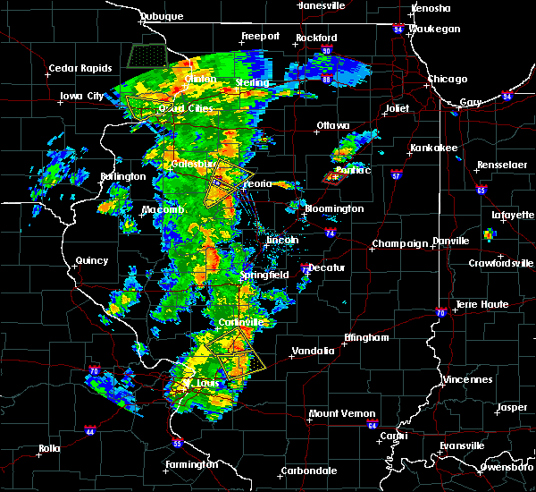 The severe thunderstorm warning for southwestern peoria and northeastern fulton counties will expire at 530 pm cdt, the storm which prompted the warning has weakened below severe limits, and no longer pose an immediate threat to life or property. therefore the warning will be allowed to expire. however gusty winds and heavy rain are still possible with this thunderstorm. a tornado watch remains in effect until 1000 pm cdt for west central illinois. The severe thunderstorm warning for southwestern peoria and northeastern fulton counties will expire at 530 pm cdt, the storm which prompted the warning has weakened below severe limits, and no longer pose an immediate threat to life or property. therefore the warning will be allowed to expire. however gusty winds and heavy rain are still possible with this thunderstorm. a tornado watch remains in effect until 1000 pm cdt for west central illinois.
|
| 8/18/2015 5:19 PM CDT |
 At 518 pm cdt, a severe thunderstorm was located near brimfield, or 12 miles west of peoria, moving northeast at 30 mph (radar indicated). Hazards include 60 mph wind gusts. Expect damage to roofs. Siding and trees. At 518 pm cdt, a severe thunderstorm was located near brimfield, or 12 miles west of peoria, moving northeast at 30 mph (radar indicated). Hazards include 60 mph wind gusts. Expect damage to roofs. Siding and trees.
|
| 8/18/2015 5:13 PM CDT | Trained spotter reported tree damage near eden and route 8...relayed by emergency manager in peoria county IL, 4.9 miles NW of Brimfield, IL |
| 8/18/2015 4:51 PM CDT |
 At 451 pm cdt, a severe thunderstorm was located 5 miles northeast of canton, moving northeast at 25 mph (radar indicated). Hazards include 60 mph wind gusts and penny size hail. Expect damage to roofs. Siding and trees. At 451 pm cdt, a severe thunderstorm was located 5 miles northeast of canton, moving northeast at 25 mph (radar indicated). Hazards include 60 mph wind gusts and penny size hail. Expect damage to roofs. Siding and trees.
|
| 7/16/2015 9:08 PM CDT |
 The severe thunderstorm warning for central peoria county will expire at 915 pm cdt, the storm which prompted the warning has weakened below severe limits and exited the warned area. therefore the warning will be allowed to expire. however gusty winds and heavy rain are still possible with this thunderstorm. a severe thunderstorm watch remains in effect until midnight cdt for west central illinois. to report severe weather, contact your nearest law enforcement agency. they will relay your report to the national weather service lincoln. The severe thunderstorm warning for central peoria county will expire at 915 pm cdt, the storm which prompted the warning has weakened below severe limits and exited the warned area. therefore the warning will be allowed to expire. however gusty winds and heavy rain are still possible with this thunderstorm. a severe thunderstorm watch remains in effect until midnight cdt for west central illinois. to report severe weather, contact your nearest law enforcement agency. they will relay your report to the national weather service lincoln.
|
| 7/16/2015 8:27 PM CDT |
 At 827 pm cdt, a severe thunderstorm was located over elmwood, or 14 miles north of canton, moving east at 40 mph (radar indicated). Hazards include 60 mph wind gusts. Expect damage to roofs. Siding and trees. At 827 pm cdt, a severe thunderstorm was located over elmwood, or 14 miles north of canton, moving east at 40 mph (radar indicated). Hazards include 60 mph wind gusts. Expect damage to roofs. Siding and trees.
|
| 6/20/2015 9:16 PM CDT |
 At 916 pm cdt, severe thunderstorms were located along a line extending from near castleton to near bartonville to near kilbourne, moving east at 50 mph (trained weather spotters). Hazards include 60 mph wind gusts. Expect damage to roofs. siding and trees. locations impacted include, peoria, pekin, havana, mason city, lacon, east peoria, morton, washington, bartonville, peoria heights, chillicothe, creve coeur, west peoria, metamora, germantown hills, marquette heights, henry, tremont, bellevue and princeville. this includes the following highways, interstate 155 between mile markers 23 and 31. interstate 474 between mile markers 0 and 14. interstate 74 between mile markers 73 and 107. A tornado watch remains in effect until 1100 pm cdt for northwestern illinois. At 916 pm cdt, severe thunderstorms were located along a line extending from near castleton to near bartonville to near kilbourne, moving east at 50 mph (trained weather spotters). Hazards include 60 mph wind gusts. Expect damage to roofs. siding and trees. locations impacted include, peoria, pekin, havana, mason city, lacon, east peoria, morton, washington, bartonville, peoria heights, chillicothe, creve coeur, west peoria, metamora, germantown hills, marquette heights, henry, tremont, bellevue and princeville. this includes the following highways, interstate 155 between mile markers 23 and 31. interstate 474 between mile markers 0 and 14. interstate 74 between mile markers 73 and 107. A tornado watch remains in effect until 1100 pm cdt for northwestern illinois.
|
| 6/20/2015 8:53 PM CDT |
 At 853 pm cdt, severe thunderstorms were located along a line extending from 4 miles northeast of altona to 4 miles north of canton to near astoria, moving east at 50 mph (radar indicated). Hazards include 60 mph wind gusts. Expect damage to roofs. Siding and trees. At 853 pm cdt, severe thunderstorms were located along a line extending from 4 miles northeast of altona to 4 miles north of canton to near astoria, moving east at 50 mph (radar indicated). Hazards include 60 mph wind gusts. Expect damage to roofs. Siding and trees.
|
| 6/10/2015 11:11 PM CDT |
 At 1111 pm cdt, severe thunderstorms were located along a line extending from near knoxville to 4 miles southeast of cuba to 5 miles northeast of brooklyn, moving east at 55 mph (radar indicated). Hazards include 70 mph wind gusts. Expect considerable tree damage. Damage is likely to mobile homes, roofs and outbuildings. At 1111 pm cdt, severe thunderstorms were located along a line extending from near knoxville to 4 miles southeast of cuba to 5 miles northeast of brooklyn, moving east at 55 mph (radar indicated). Hazards include 70 mph wind gusts. Expect considerable tree damage. Damage is likely to mobile homes, roofs and outbuildings.
|
| 6/10/2015 10:51 PM CDT |
 At 1050 pm cdt, severe thunderstorms were located along a line extending from 10 miles southwest of rio to 6 miles southwest of avon to 9 miles northwest of brooklyn, moving east at 30 mph (radar indicated). Hazards include 70 mph wind gusts. Expect considerable tree damage. Damage is likely to mobile homes, roofs and outbuildings. At 1050 pm cdt, severe thunderstorms were located along a line extending from 10 miles southwest of rio to 6 miles southwest of avon to 9 miles northwest of brooklyn, moving east at 30 mph (radar indicated). Hazards include 70 mph wind gusts. Expect considerable tree damage. Damage is likely to mobile homes, roofs and outbuildings.
|
| 6/10/2015 8:16 PM CDT |
 At 816 pm cdt, a severe thunderstorm was located near laura, or 17 miles northwest of peoria, moving east at 25 mph (radar indicated). Hazards include 60 mph wind gusts and quarter size hail. Hail damage to vehicles is expected. Expect wind damage to roofs, siding and trees. At 816 pm cdt, a severe thunderstorm was located near laura, or 17 miles northwest of peoria, moving east at 25 mph (radar indicated). Hazards include 60 mph wind gusts and quarter size hail. Hail damage to vehicles is expected. Expect wind damage to roofs, siding and trees.
|
| 6/7/2015 4:26 PM CDT | The severe thunderstorm warning for north central tazewell, central peoria and northwestern woodford counties will expire at 430 pm cdt, the storm which prompted the warning has moved out of the area. therefore the warning will be allowed to expire. a severe thunderstorm watch remains in effect until 800 pm cdt for central illinois. |
| 6/7/2015 3:51 PM CDT | At 351 pm cdt, a severe thunderstorm was located near bay view gardens, or near peoria, moving east at 35 mph (radar indicated). Hazards include 60 mph wind gusts and half dollar size hail. Hail damage to vehicles is expected. expect wind damage to roofs, siding and trees. locations impacted include, peoria, east peoria, washington, peoria heights, chillicothe, metamora, germantown hills, rome, dunlap, brimfield, spring bay, bay view gardens, kickapoo, cazenovia, alta and mossville. this includes the following highways, interstate 474 between mile markers 0 and 2. Interstate 74 between mile markers 73 and 90. |
| 6/7/2015 3:26 PM CDT | At 326 pm cdt, a severe thunderstorm was located near brimfield, or 12 miles west of peoria, moving east at 25 mph (radar indicated). Hazards include 60 mph wind gusts and half dollar size hail. Hail damage to vehicles is expected. Expect wind damage to roofs, siding and trees. |
| 6/7/2015 2:51 PM CDT | At 249 pm cdt, a severe thunderstorm was located near brimfield, or 19 miles west of peoria, moving east at 35 mph (public. at 245 pm cst half dollar size hail was reported 10 miles south of williamsfield). Hazards include 60 mph wind gusts and half dollar size hail. Hail damage to vehicles is expected. Expect wind damage to roofs, siding and trees. |
| 4/9/2015 7:10 PM CDT | A severe thunderstorm warning remains in effect for northwestern woodford. southeastern stark. northern peoria and western marshall counties until 745 pm cdt. at 706 pm cdt. a severe thunderstorm was located near dunlap. and moving northeast at 70 mph. hazard. 60 mph wind gusts and quarter size hail. |
| 4/9/2015 6:56 PM CDT | The national weather service in lincoln has issued a * severe thunderstorm warning for. southeastern knox county in west central illinois. western marshall county in central illinois. northern peoria county in central illinois. Southeastern stark county in north central illinois. |
| 5/20/2013 9:25 PM CDT | Top half of large tree blown down on powerline in peoria county IL, 0.2 miles SW of Brimfield, IL |
| 5/20/2013 9:25 PM CDT | Large tree limb down on power lines and damage to garage doo in peoria county IL, 3.9 miles SSE of Brimfield, IL |
| 5/20/2013 9:25 PM CDT | Large tree blown down across route 8 at texas roa in peoria county IL, 5 miles NNW of Brimfield, IL |
| 5/20/2013 9:22 PM CDT | Two large trees blown dow in peoria county IL, 5.7 miles S of Brimfield, IL |
| 5/20/2013 9:20 PM CDT | Large tree limbs down on powerlines at route 78 and schissler roa in peoria county IL, 2 miles ENE of Brimfield, IL |
Hail Maps for Brimfield, IL
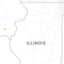


Connect with Interactive Hail Maps