

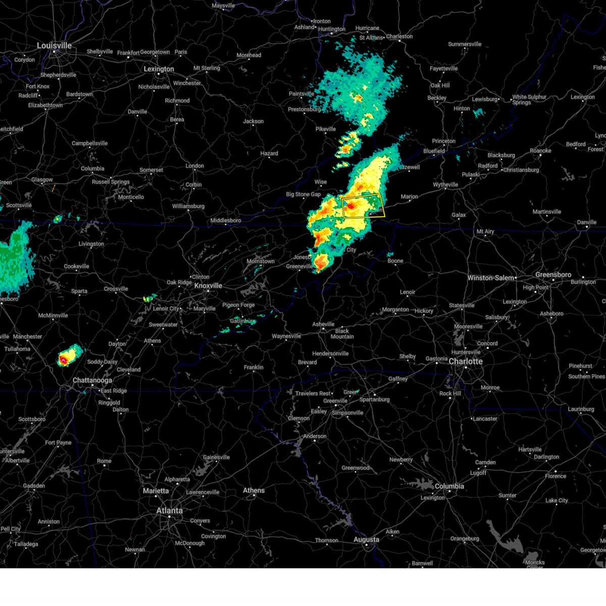
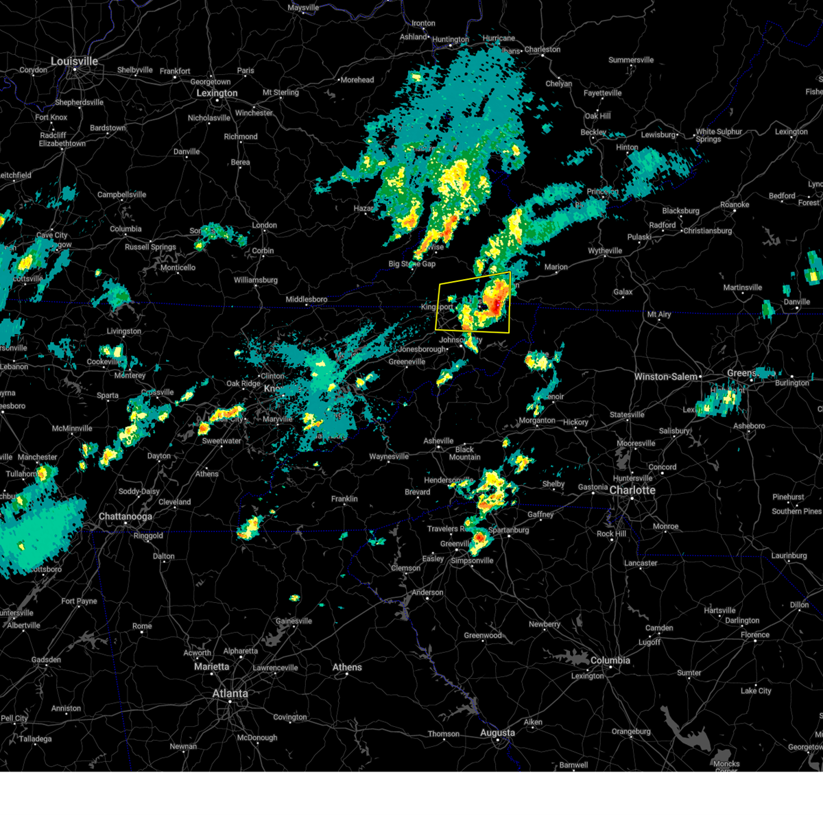
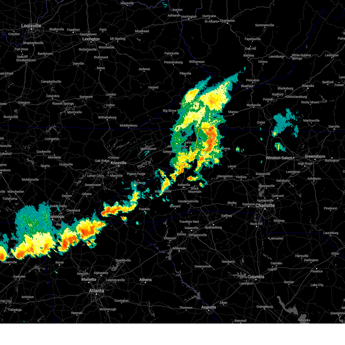
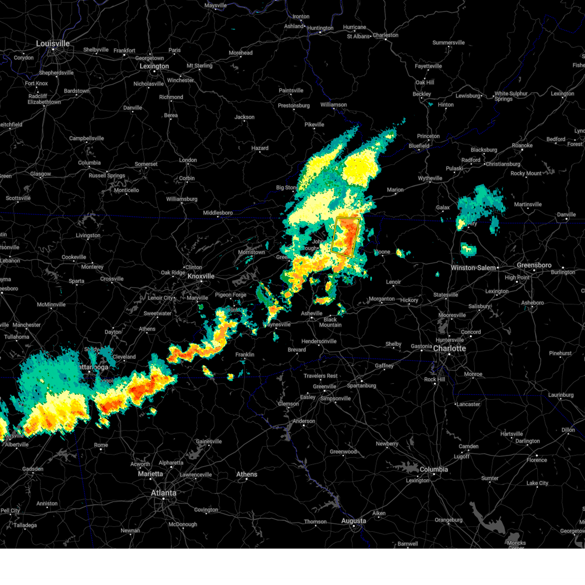
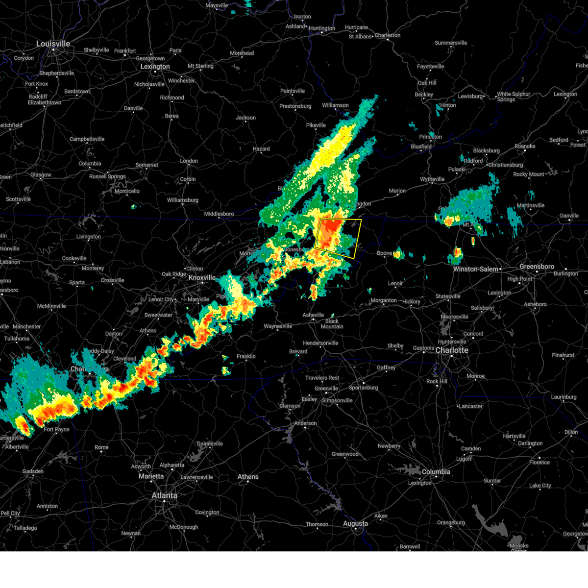
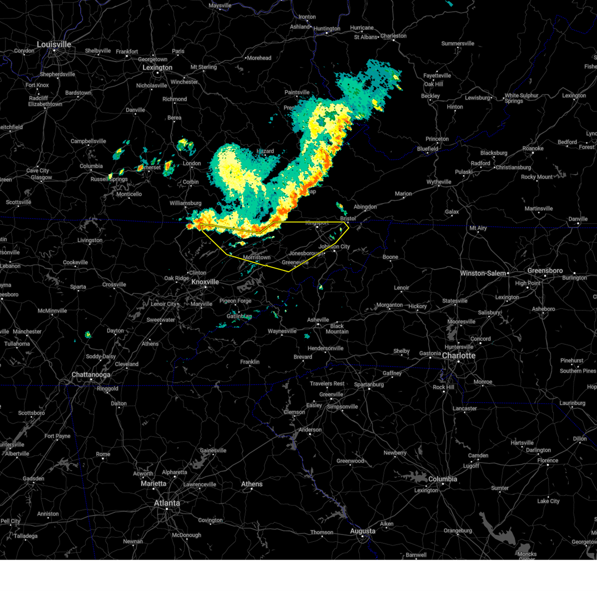
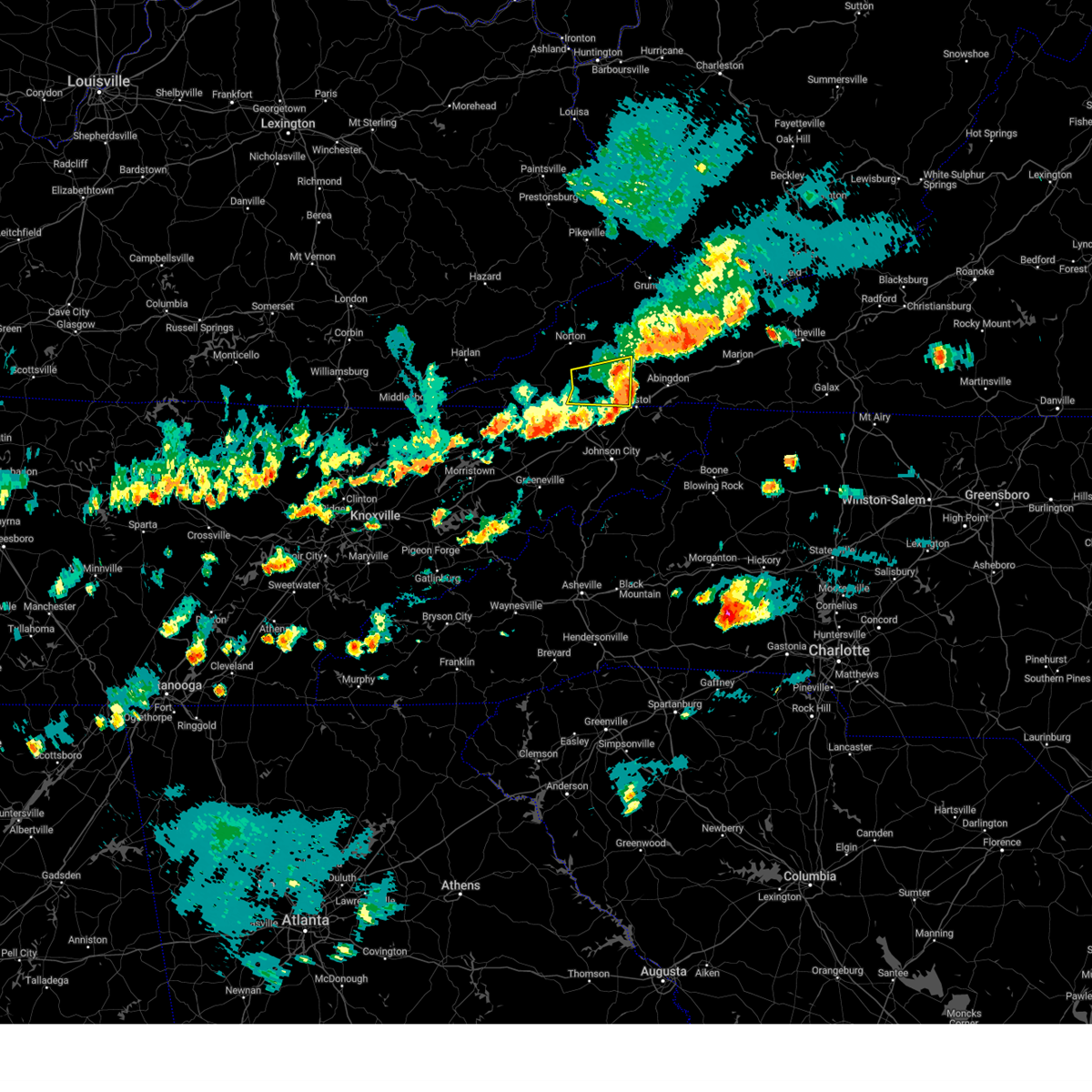
Hail Map for Bristol, VA
The Bristol, VA area has had 8 reports of on-the-ground hail by trained spotters, and has been under severe weather warnings 11 times during the past 12 months. Doppler radar has detected hail at or near Bristol, VA on 29 occasions.
| Name: | Bristol, VA |
| Where Located: | 4 miles NE of Bristol, TN |
| Map: | Google Map for Bristol, VA |
| Population: | 17835 |
| Housing Units: | 8831 |
| More Info: | Search Google for Bristol, VA |
1
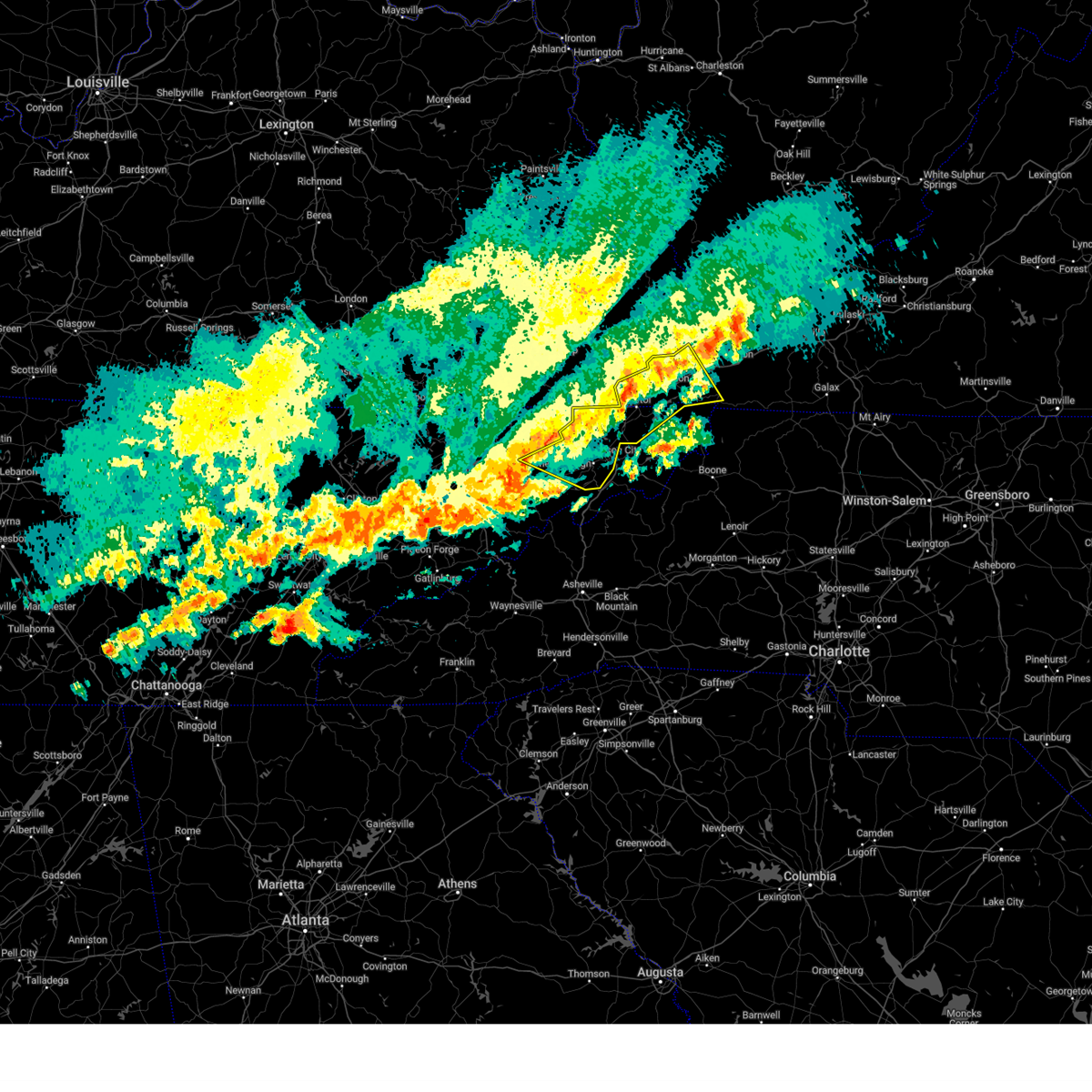
The Top Recent Hail Date for Bristol, VA is Friday, July 14, 2023 (7th out of 29)

Hail and Wind Damage Spotted near Bristol, VA
| Date / Time | Report Details |
|---|---|
| 5/20/2025 5:33 PM EDT |
 Svrmrx the national weather service in morristown has issued a * severe thunderstorm warning for, southern russell county in southwestern virginia, central washington county in southwestern virginia, * until 615 pm edt. * at 533 pm edt, a severe thunderstorm was located 10 miles north of bristol va, moving east at 30 mph (radar indicated). Hazards include 60 mph wind gusts and penny size hail. expect damage to roofs, siding, and trees Svrmrx the national weather service in morristown has issued a * severe thunderstorm warning for, southern russell county in southwestern virginia, central washington county in southwestern virginia, * until 615 pm edt. * at 533 pm edt, a severe thunderstorm was located 10 miles north of bristol va, moving east at 30 mph (radar indicated). Hazards include 60 mph wind gusts and penny size hail. expect damage to roofs, siding, and trees
|
| 5/17/2025 2:59 AM EDT |
 At 258 am edt, severe thunderstorms were located along a line extending from near cedar bluff to 6 miles east of lebanon to 9 miles northwest of walnut hill to near rogersville, moving southeast at 45 mph (emergency dispatch reports trees down across the warned area). Hazards include 60 mph wind gusts and penny size hail. Expect damage to roofs, siding, and trees. locations impacted include, leesburg, chucky, damascus, limestone, spurgeon, south holston dam, sullivan gardens, bristol tn, jonesborough, and johnson city. this includes the following highways, interstate 26 in tennessee between mile markers 1 and 23. interstate 81 in tennessee between mile markers 32 and 75. Interstate 81 in virginia between mile markers 1 and 32. At 258 am edt, severe thunderstorms were located along a line extending from near cedar bluff to 6 miles east of lebanon to 9 miles northwest of walnut hill to near rogersville, moving southeast at 45 mph (emergency dispatch reports trees down across the warned area). Hazards include 60 mph wind gusts and penny size hail. Expect damage to roofs, siding, and trees. locations impacted include, leesburg, chucky, damascus, limestone, spurgeon, south holston dam, sullivan gardens, bristol tn, jonesborough, and johnson city. this includes the following highways, interstate 26 in tennessee between mile markers 1 and 23. interstate 81 in tennessee between mile markers 32 and 75. Interstate 81 in virginia between mile markers 1 and 32.
|
| 5/17/2025 2:59 AM EDT |
 the severe thunderstorm warning has been cancelled and is no longer in effect the severe thunderstorm warning has been cancelled and is no longer in effect
|
| 5/17/2025 2:29 AM EDT |
 Svrmrx the national weather service in morristown has issued a * severe thunderstorm warning for, sullivan county in east tennessee, hawkins county in east tennessee, washington county in east tennessee, northeastern greene county in east tennessee, north central johnson county in east tennessee, northwestern carter county in east tennessee, russell county in southwestern virginia, the city of bristol in southwestern virginia, scott county in southwestern virginia, washington county in southwestern virginia, * until 330 am edt. * at 229 am edt, severe thunderstorms were located along a line extending from 7 miles southeast of grundy to near trammel to 8 miles southeast of big stone gap to sneedville, moving southeast at 40 mph (radar indicated). Hazards include 60 mph wind gusts and penny size hail. expect damage to roofs, siding, and trees Svrmrx the national weather service in morristown has issued a * severe thunderstorm warning for, sullivan county in east tennessee, hawkins county in east tennessee, washington county in east tennessee, northeastern greene county in east tennessee, north central johnson county in east tennessee, northwestern carter county in east tennessee, russell county in southwestern virginia, the city of bristol in southwestern virginia, scott county in southwestern virginia, washington county in southwestern virginia, * until 330 am edt. * at 229 am edt, severe thunderstorms were located along a line extending from 7 miles southeast of grundy to near trammel to 8 miles southeast of big stone gap to sneedville, moving southeast at 40 mph (radar indicated). Hazards include 60 mph wind gusts and penny size hail. expect damage to roofs, siding, and trees
|
| 9/24/2024 8:37 PM EDT |
 The storm which prompted the warning has weakened below severe limits, and has exited the warned area. therefore, the warning will be allowed to expire. however, gusty winds and heavy rain are still possible with this thunderstorm. The storm which prompted the warning has weakened below severe limits, and has exited the warned area. therefore, the warning will be allowed to expire. however, gusty winds and heavy rain are still possible with this thunderstorm.
|
| 9/24/2024 7:42 PM EDT |
 Svrmrx the national weather service in morristown has issued a * severe thunderstorm warning for, sullivan county in east tennessee, north central washington county in east tennessee, northwestern johnson county in east tennessee, northeastern carter county in east tennessee, southwestern russell county in southwestern virginia, the city of bristol in southwestern virginia, southeastern scott county in southwestern virginia, southwestern washington county in southwestern virginia, * until 845 pm edt. * at 742 pm edt, a severe thunderstorm was located near weber city, or 8 miles northeast of kingsport, moving east at 30 mph (radar indicated). Hazards include 60 mph wind gusts and quarter size hail. Hail damage to vehicles is expected. Expect wind damage to roofs, siding, and trees. Svrmrx the national weather service in morristown has issued a * severe thunderstorm warning for, sullivan county in east tennessee, north central washington county in east tennessee, northwestern johnson county in east tennessee, northeastern carter county in east tennessee, southwestern russell county in southwestern virginia, the city of bristol in southwestern virginia, southeastern scott county in southwestern virginia, southwestern washington county in southwestern virginia, * until 845 pm edt. * at 742 pm edt, a severe thunderstorm was located near weber city, or 8 miles northeast of kingsport, moving east at 30 mph (radar indicated). Hazards include 60 mph wind gusts and quarter size hail. Hail damage to vehicles is expected. Expect wind damage to roofs, siding, and trees.
|
| 8/16/2024 6:56 PM EDT |
 The storm which prompted the warning has moved out of the area. therefore, the warning will be allowed to expire. however, gusty winds and localized flooding are still possible with this thunderstorm. remember, a severe thunderstorm warning still remains in effect for portions of carter, johnson, and eastern sullivan counties. The storm which prompted the warning has moved out of the area. therefore, the warning will be allowed to expire. however, gusty winds and localized flooding are still possible with this thunderstorm. remember, a severe thunderstorm warning still remains in effect for portions of carter, johnson, and eastern sullivan counties.
|
| 8/16/2024 6:46 PM EDT |
 At 645 pm edt, a severe thunderstorm was located 8 miles northeast of elizabethton, moving east at 25 mph (trained weather spotters reported damaging winds and localized flooding due to torrential rainfall). Hazards include 60 mph wind gusts and penny size hail. Expect damage to roofs, siding, and trees. Locations impacted include, bristol tn, bristol va, elizabethton, central, hampton, pine crest, walnut hill, bluff city, watauga, and hunter. At 645 pm edt, a severe thunderstorm was located 8 miles northeast of elizabethton, moving east at 25 mph (trained weather spotters reported damaging winds and localized flooding due to torrential rainfall). Hazards include 60 mph wind gusts and penny size hail. Expect damage to roofs, siding, and trees. Locations impacted include, bristol tn, bristol va, elizabethton, central, hampton, pine crest, walnut hill, bluff city, watauga, and hunter.
|
| 8/16/2024 6:46 PM EDT |
 the severe thunderstorm warning has been cancelled and is no longer in effect the severe thunderstorm warning has been cancelled and is no longer in effect
|
| 8/16/2024 6:22 PM EDT |
 At 622 pm edt, a severe thunderstorm was located 7 miles northwest of elizabethton, moving east at 25 mph (trained weather spotters report damaging wind gusts and torrential rainfall). Hazards include 60 mph wind gusts and penny size hail. Expect damage to roofs, siding, and trees. locations impacted include, johnson city, kingsport, bristol tn, elizabethton, jonesborough, central, spurgeon, midway, pine crest, and gray. this includes the following highways, interstate 26 in tennessee between mile markers 12 and 27. Interstate 81 in tennessee between mile markers 60 and 75. At 622 pm edt, a severe thunderstorm was located 7 miles northwest of elizabethton, moving east at 25 mph (trained weather spotters report damaging wind gusts and torrential rainfall). Hazards include 60 mph wind gusts and penny size hail. Expect damage to roofs, siding, and trees. locations impacted include, johnson city, kingsport, bristol tn, elizabethton, jonesborough, central, spurgeon, midway, pine crest, and gray. this includes the following highways, interstate 26 in tennessee between mile markers 12 and 27. Interstate 81 in tennessee between mile markers 60 and 75.
|
| 7/30/2024 7:19 AM EDT |
 Svrmrx the national weather service in morristown has issued a * severe thunderstorm warning for, sullivan county in east tennessee, claiborne county in east tennessee, hawkins county in east tennessee, northern washington county in east tennessee, central hancock county in east tennessee, northern greene county in east tennessee, northeastern union county in east tennessee, grainger county in east tennessee, hamblen county in east tennessee, * until 815 am edt. * at 719 am edt, severe thunderstorms were located along a line extending from 10 miles southeast of pennington gap to 8 miles east of sneedville to 8 miles northwest of bean station to wilkerson, moving southeast at 30 mph (radar indicated). Hazards include 60 mph wind gusts. expect damage to roofs, siding, and trees Svrmrx the national weather service in morristown has issued a * severe thunderstorm warning for, sullivan county in east tennessee, claiborne county in east tennessee, hawkins county in east tennessee, northern washington county in east tennessee, central hancock county in east tennessee, northern greene county in east tennessee, northeastern union county in east tennessee, grainger county in east tennessee, hamblen county in east tennessee, * until 815 am edt. * at 719 am edt, severe thunderstorms were located along a line extending from 10 miles southeast of pennington gap to 8 miles east of sneedville to 8 miles northwest of bean station to wilkerson, moving southeast at 30 mph (radar indicated). Hazards include 60 mph wind gusts. expect damage to roofs, siding, and trees
|
| 6/30/2024 3:14 PM EDT |
 At 313 pm edt, a severe thunderstorm was located 9 miles north of bristol va, moving southeast at 15 mph (radar indicated). Hazards include 60 mph wind gusts. Expect damage to roofs, siding, and trees. Locations impacted include, lebanon, hansonville, benhams, and holston. At 313 pm edt, a severe thunderstorm was located 9 miles north of bristol va, moving southeast at 15 mph (radar indicated). Hazards include 60 mph wind gusts. Expect damage to roofs, siding, and trees. Locations impacted include, lebanon, hansonville, benhams, and holston.
|
| 6/30/2024 3:14 PM EDT |
 the severe thunderstorm warning has been cancelled and is no longer in effect the severe thunderstorm warning has been cancelled and is no longer in effect
|
| 6/30/2024 2:44 PM EDT |
 Svrmrx the national weather service in morristown has issued a * severe thunderstorm warning for, southwestern russell county in southwestern virginia, northeastern scott county in southwestern virginia, western washington county in southwestern virginia, southeastern wise county in southwestern virginia, * until 330 pm edt. * at 243 pm edt, a severe thunderstorm was located 10 miles southwest of cleveland va, or 12 miles west of lebanon, moving southeast at 15 mph (radar indicated). Hazards include 60 mph wind gusts. expect damage to roofs, siding, and trees Svrmrx the national weather service in morristown has issued a * severe thunderstorm warning for, southwestern russell county in southwestern virginia, northeastern scott county in southwestern virginia, western washington county in southwestern virginia, southeastern wise county in southwestern virginia, * until 330 pm edt. * at 243 pm edt, a severe thunderstorm was located 10 miles southwest of cleveland va, or 12 miles west of lebanon, moving southeast at 15 mph (radar indicated). Hazards include 60 mph wind gusts. expect damage to roofs, siding, and trees
|
| 5/26/2024 4:18 PM EDT |
 At 417 pm edt, a severe thunderstorm was located near abingdon, moving east at 50 mph (radar indicated). Hazards include 60 mph wind gusts. Expect damage to roofs, siding, and trees. locations impacted include, bristol va, abingdon, lebanon, glade spring, honaker, damascus, emory-meadow view, rosedale, dye, and lindell. This includes interstate 81 in virginia between mile markers 1 and 34. At 417 pm edt, a severe thunderstorm was located near abingdon, moving east at 50 mph (radar indicated). Hazards include 60 mph wind gusts. Expect damage to roofs, siding, and trees. locations impacted include, bristol va, abingdon, lebanon, glade spring, honaker, damascus, emory-meadow view, rosedale, dye, and lindell. This includes interstate 81 in virginia between mile markers 1 and 34.
|
| 5/26/2024 4:18 PM EDT |
 the severe thunderstorm warning has been cancelled and is no longer in effect the severe thunderstorm warning has been cancelled and is no longer in effect
|
| 5/26/2024 3:47 PM EDT |
 Svrmrx the national weather service in morristown has issued a * severe thunderstorm warning for, russell county in southwestern virginia, the city of bristol in southwestern virginia, southeastern scott county in southwestern virginia, washington county in southwestern virginia, * until 445 pm edt. * at 347 pm edt, a severe thunderstorm was located 15 miles northeast of weber city, or 15 miles northeast of gate city, moving east at 50 mph (radar indicated). Hazards include 60 mph wind gusts. expect damage to roofs, siding, and trees Svrmrx the national weather service in morristown has issued a * severe thunderstorm warning for, russell county in southwestern virginia, the city of bristol in southwestern virginia, southeastern scott county in southwestern virginia, washington county in southwestern virginia, * until 445 pm edt. * at 347 pm edt, a severe thunderstorm was located 15 miles northeast of weber city, or 15 miles northeast of gate city, moving east at 50 mph (radar indicated). Hazards include 60 mph wind gusts. expect damage to roofs, siding, and trees
|
| 2/28/2024 1:08 PM EST |
 At 107 pm est, severe thunderstorms were located along a line extending from near walnut hill to 6 miles east of russellville, moving east at 40 mph (radar indicated). Hazards include 60 mph wind gusts. Expect damage to roofs, siding, and trees. locations impacted include, johnson city, kingsport, bristol tn, bristol va, greeneville, abingdon, rogersville, jonesborough, surgoinsville, and weber city. this includes the following highways, interstate 26 in tennessee between mile markers 1 and 21. interstate 81 in tennessee between mile markers 21 and 75. Interstate 81 in virginia between mile markers 1 and 22. At 107 pm est, severe thunderstorms were located along a line extending from near walnut hill to 6 miles east of russellville, moving east at 40 mph (radar indicated). Hazards include 60 mph wind gusts. Expect damage to roofs, siding, and trees. locations impacted include, johnson city, kingsport, bristol tn, bristol va, greeneville, abingdon, rogersville, jonesborough, surgoinsville, and weber city. this includes the following highways, interstate 26 in tennessee between mile markers 1 and 21. interstate 81 in tennessee between mile markers 21 and 75. Interstate 81 in virginia between mile markers 1 and 22.
|
| 2/28/2024 1:00 PM EST | Tree down at the intersection of reedy creek rd... and pairgin r in washington county VA, 3.3 miles SSW of Bristol, VA |
| 2/28/2024 12:39 PM EST |
 Svrmrx the national weather service in morristown has issued a * severe thunderstorm warning for, sullivan county in east tennessee, hawkins county in east tennessee, northern washington county in east tennessee, central hancock county in east tennessee, northern greene county in east tennessee, northeastern grainger county in east tennessee, west central carter county in east tennessee, northeastern hamblen county in east tennessee, southern russell county in southwestern virginia, the city of bristol in southwestern virginia, southeastern scott county in southwestern virginia, southwestern washington county in southwestern virginia, * until 130 pm est. * at 1238 pm est, severe thunderstorms were located along a line extending from 6 miles northwest of kingsport to near rutledge, moving east at 40 mph (radar indicated). Hazards include 60 mph wind gusts. expect damage to roofs, siding, and trees Svrmrx the national weather service in morristown has issued a * severe thunderstorm warning for, sullivan county in east tennessee, hawkins county in east tennessee, northern washington county in east tennessee, central hancock county in east tennessee, northern greene county in east tennessee, northeastern grainger county in east tennessee, west central carter county in east tennessee, northeastern hamblen county in east tennessee, southern russell county in southwestern virginia, the city of bristol in southwestern virginia, southeastern scott county in southwestern virginia, southwestern washington county in southwestern virginia, * until 130 pm est. * at 1238 pm est, severe thunderstorms were located along a line extending from 6 miles northwest of kingsport to near rutledge, moving east at 40 mph (radar indicated). Hazards include 60 mph wind gusts. expect damage to roofs, siding, and trees
|
| 8/14/2023 10:38 PM EDT |
 At 1038 pm edt, a severe thunderstorm capable of producing a tornado was located 8 miles south of walnut hill, or 8 miles southwest of bristol tn, moving east at 25 mph (radar indicated rotation). Hazards include tornado. Flying debris will be dangerous to those caught without shelter. mobile homes will be damaged or destroyed. damage to roofs, windows, and vehicles will occur. tree damage is likely. this tornadic thunderstorm will remain over mainly rural areas of central sullivan, northeastern washington, and northwestern carter counties and the southern city of bristol, including the following locations, hunter, rocky mount state park, morril`s cave, blountville, bluff city, and tri-city airport. This includes interstate 81 in tennessee between mile markers 65 and 73. At 1038 pm edt, a severe thunderstorm capable of producing a tornado was located 8 miles south of walnut hill, or 8 miles southwest of bristol tn, moving east at 25 mph (radar indicated rotation). Hazards include tornado. Flying debris will be dangerous to those caught without shelter. mobile homes will be damaged or destroyed. damage to roofs, windows, and vehicles will occur. tree damage is likely. this tornadic thunderstorm will remain over mainly rural areas of central sullivan, northeastern washington, and northwestern carter counties and the southern city of bristol, including the following locations, hunter, rocky mount state park, morril`s cave, blountville, bluff city, and tri-city airport. This includes interstate 81 in tennessee between mile markers 65 and 73.
|
| 8/14/2023 10:09 PM EDT |
 At 1009 pm edt, a severe thunderstorm capable of producing a tornado was located over colonial heights, or near kingsport, moving east at 30 mph (radar indicated rotation). Hazards include tornado and quarter size hail. Flying debris will be dangerous to those caught without shelter. mobile homes will be damaged or destroyed. damage to roofs, windows, and vehicles will occur. tree damage is likely. this dangerous storm will be near, kingsport, colonial heights, gray, oak grove, and spurgeon around 1015 pm edt. bristol tn around 1025 pm edt. walnut hill around 1035 pm edt. other locations impacted by this tornadic thunderstorm include hunter, sullivan gardens, fall branch, rocky mount state park, morril`s cave, bluff city, warriors path state park, tri-city airport, blountville, and bays mountain park. this includes the following highways, interstate 26 in tennessee between mile markers 2 and 15. Interstate 81 in tennessee between mile markers 50 and 73. At 1009 pm edt, a severe thunderstorm capable of producing a tornado was located over colonial heights, or near kingsport, moving east at 30 mph (radar indicated rotation). Hazards include tornado and quarter size hail. Flying debris will be dangerous to those caught without shelter. mobile homes will be damaged or destroyed. damage to roofs, windows, and vehicles will occur. tree damage is likely. this dangerous storm will be near, kingsport, colonial heights, gray, oak grove, and spurgeon around 1015 pm edt. bristol tn around 1025 pm edt. walnut hill around 1035 pm edt. other locations impacted by this tornadic thunderstorm include hunter, sullivan gardens, fall branch, rocky mount state park, morril`s cave, bluff city, warriors path state park, tri-city airport, blountville, and bays mountain park. this includes the following highways, interstate 26 in tennessee between mile markers 2 and 15. Interstate 81 in tennessee between mile markers 50 and 73.
|
| 7/29/2023 5:36 PM EDT |
 At 534 pm edt, a severe thunderstorm was located 8 miles north of mountain city, moving southeast at 35 mph (radar indicated). Hazards include 60 mph wind gusts and quarter size hail. Hail damage to vehicles is expected. expect wind damage to roofs, siding, and trees. locations impacted include, bristol tn, abingdon, mountain city, bluff city, glade spring, damascus, morril`s cave, laurel bloomery, shady valley and south holston dam. this includes interstate 81 in virginia between mile markers 18 and 21, and between mile markers 23 and 33. hail threat, radar indicated max hail size, 1. 00 in wind threat, radar indicated max wind gust, 60 mph. At 534 pm edt, a severe thunderstorm was located 8 miles north of mountain city, moving southeast at 35 mph (radar indicated). Hazards include 60 mph wind gusts and quarter size hail. Hail damage to vehicles is expected. expect wind damage to roofs, siding, and trees. locations impacted include, bristol tn, abingdon, mountain city, bluff city, glade spring, damascus, morril`s cave, laurel bloomery, shady valley and south holston dam. this includes interstate 81 in virginia between mile markers 18 and 21, and between mile markers 23 and 33. hail threat, radar indicated max hail size, 1. 00 in wind threat, radar indicated max wind gust, 60 mph.
|
| 7/29/2023 5:17 PM EDT |
 At 515 pm edt, a severe thunderstorm was located near lebanon, moving east at 20 mph (radar indicated). Hazards include 60 mph wind gusts and quarter size hail. Hail damage to vehicles is expected. expect wind damage to roofs, siding, and trees. locations impacted include, johnson city, kingsport, bristol tn, bristol va, abingdon, lebanon, mountain city, gate city, weber city and spurgeon. this includes the following highways, interstate 26 in tennessee between mile markers 1 and 17. interstate 81 in tennessee between mile markers 40 and 75. interstate 81 in virginia between mile markers 1 and 34. hail threat, radar indicated max hail size, 1. 00 in wind threat, radar indicated max wind gust, 60 mph. At 515 pm edt, a severe thunderstorm was located near lebanon, moving east at 20 mph (radar indicated). Hazards include 60 mph wind gusts and quarter size hail. Hail damage to vehicles is expected. expect wind damage to roofs, siding, and trees. locations impacted include, johnson city, kingsport, bristol tn, bristol va, abingdon, lebanon, mountain city, gate city, weber city and spurgeon. this includes the following highways, interstate 26 in tennessee between mile markers 1 and 17. interstate 81 in tennessee between mile markers 40 and 75. interstate 81 in virginia between mile markers 1 and 34. hail threat, radar indicated max hail size, 1. 00 in wind threat, radar indicated max wind gust, 60 mph.
|
| 7/29/2023 4:53 PM EDT |
 At 452 pm edt, a severe thunderstorm was located near lebanon, moving east at 20 mph (radar indicated). Hazards include 60 mph wind gusts and quarter size hail. Hail damage to vehicles is expected. Expect wind damage to roofs, siding, and trees. At 452 pm edt, a severe thunderstorm was located near lebanon, moving east at 20 mph (radar indicated). Hazards include 60 mph wind gusts and quarter size hail. Hail damage to vehicles is expected. Expect wind damage to roofs, siding, and trees.
|
| 7/29/2023 4:06 PM EDT |
 At 406 pm edt, a severe thunderstorm was located over mayking, or near whitesburg, moving southeast at 35 mph (radar indicated). Hazards include 60 mph wind gusts and quarter size hail. Hail damage to vehicles is expected. Expect wind damage to roofs, siding, and trees. At 406 pm edt, a severe thunderstorm was located over mayking, or near whitesburg, moving southeast at 35 mph (radar indicated). Hazards include 60 mph wind gusts and quarter size hail. Hail damage to vehicles is expected. Expect wind damage to roofs, siding, and trees.
|
| 7/28/2023 5:45 PM EDT |
 At 545 pm edt, a severe thunderstorm was located 8 miles north of walnut hill, or 8 miles northwest of bristol va, moving southeast at 15 mph (radar indicated). Hazards include 60 mph wind gusts. Expect damage to roofs, siding, and trees. locations impacted include, bristol va, hilander park and benhams. this includes interstate 81 in virginia between mile markers 2 and 14. hail threat, radar indicated max hail size, <. 75 in wind threat, radar indicated max wind gust, 60 mph. At 545 pm edt, a severe thunderstorm was located 8 miles north of walnut hill, or 8 miles northwest of bristol va, moving southeast at 15 mph (radar indicated). Hazards include 60 mph wind gusts. Expect damage to roofs, siding, and trees. locations impacted include, bristol va, hilander park and benhams. this includes interstate 81 in virginia between mile markers 2 and 14. hail threat, radar indicated max hail size, <. 75 in wind threat, radar indicated max wind gust, 60 mph.
|
| 7/28/2023 5:19 PM EDT |
 At 518 pm edt, a severe thunderstorm was located 14 miles southwest of cleveland va, or 14 miles northwest of bristol va, moving southeast at 15 mph (radar indicated). Hazards include 60 mph wind gusts and penny size hail. expect damage to roofs, siding, and trees At 518 pm edt, a severe thunderstorm was located 14 miles southwest of cleveland va, or 14 miles northwest of bristol va, moving southeast at 15 mph (radar indicated). Hazards include 60 mph wind gusts and penny size hail. expect damage to roofs, siding, and trees
|
| 7/14/2023 6:54 PM EDT |
 The severe thunderstorm warning for northeastern sullivan and southwestern washington counties and the city of bristol will expire at 700 pm edt, the storm which prompted the warning has weakened below severe limits, and no longer poses an immediate threat to life or property. therefore, the warning will be allowed to expire. however gusty winds and heavy rain are still possible with this thunderstorm. The severe thunderstorm warning for northeastern sullivan and southwestern washington counties and the city of bristol will expire at 700 pm edt, the storm which prompted the warning has weakened below severe limits, and no longer poses an immediate threat to life or property. therefore, the warning will be allowed to expire. however gusty winds and heavy rain are still possible with this thunderstorm.
|
| 7/14/2023 6:46 PM EDT |
 At 645 pm edt, a severe thunderstorm was located over bristol tn, moving southeast at 15 mph (radar indicated). Hazards include 60 mph wind gusts and quarter size hail. Hail damage to vehicles is expected. expect wind damage to roofs, siding, and trees. locations impacted include, bristol tn, bristol va, walnut hill, south holston dam and harr. this includes the following highways, interstate 81 in tennessee between mile markers 74 and 75. interstate 81 in virginia between mile markers 1 and 9. hail threat, radar indicated max hail size, 1. 00 in wind threat, radar indicated max wind gust, 60 mph. At 645 pm edt, a severe thunderstorm was located over bristol tn, moving southeast at 15 mph (radar indicated). Hazards include 60 mph wind gusts and quarter size hail. Hail damage to vehicles is expected. expect wind damage to roofs, siding, and trees. locations impacted include, bristol tn, bristol va, walnut hill, south holston dam and harr. this includes the following highways, interstate 81 in tennessee between mile markers 74 and 75. interstate 81 in virginia between mile markers 1 and 9. hail threat, radar indicated max hail size, 1. 00 in wind threat, radar indicated max wind gust, 60 mph.
|
| 7/14/2023 6:30 PM EDT | Tree down on reedy creek road nw of bristol va. time estimated from rada in washington county VA, 3.3 miles ESE of Bristol, VA |
| 7/14/2023 6:19 PM EDT |
 At 619 pm edt, a severe thunderstorm was located near walnut hill, or near bristol va, moving southeast at 15 mph (radar indicated). Hazards include 60 mph wind gusts and quarter size hail. Hail damage to vehicles is expected. Expect wind damage to roofs, siding, and trees. At 619 pm edt, a severe thunderstorm was located near walnut hill, or near bristol va, moving southeast at 15 mph (radar indicated). Hazards include 60 mph wind gusts and quarter size hail. Hail damage to vehicles is expected. Expect wind damage to roofs, siding, and trees.
|
| 7/1/2023 7:07 AM EDT |
 At 706 am edt, a severe thunderstorm was located 9 miles southeast of bristol tn, moving southeast at 35 mph (radar indicated). Hazards include 60 mph wind gusts and quarter size hail. Hail damage to vehicles is expected. expect wind damage to roofs, siding, and trees. locations impacted include, bristol tn, bristol va, mountain city, walnut hill, bluff city, hunter, morril`s cave, neva, sadie and elk mills. this includes the following highways, interstate 81 in tennessee between mile markers 70 and 75. interstate 81 in virginia between mile markers 1 and 14. hail threat, radar indicated max hail size, 1. 00 in wind threat, radar indicated max wind gust, 60 mph. At 706 am edt, a severe thunderstorm was located 9 miles southeast of bristol tn, moving southeast at 35 mph (radar indicated). Hazards include 60 mph wind gusts and quarter size hail. Hail damage to vehicles is expected. expect wind damage to roofs, siding, and trees. locations impacted include, bristol tn, bristol va, mountain city, walnut hill, bluff city, hunter, morril`s cave, neva, sadie and elk mills. this includes the following highways, interstate 81 in tennessee between mile markers 70 and 75. interstate 81 in virginia between mile markers 1 and 14. hail threat, radar indicated max hail size, 1. 00 in wind threat, radar indicated max wind gust, 60 mph.
|
| 7/1/2023 6:27 AM EDT |
 At 626 am edt, a severe thunderstorm was located 12 miles northwest of walnut hill, or 13 miles northwest of bristol va, moving southeast at 35 mph (radar indicated). Hazards include 60 mph wind gusts and quarter size hail. Hail damage to vehicles is expected. Expect wind damage to roofs, siding, and trees. At 626 am edt, a severe thunderstorm was located 12 miles northwest of walnut hill, or 13 miles northwest of bristol va, moving southeast at 35 mph (radar indicated). Hazards include 60 mph wind gusts and quarter size hail. Hail damage to vehicles is expected. Expect wind damage to roofs, siding, and trees.
|
| 7/1/2023 6:11 AM EDT |
 At 611 am edt, a severe thunderstorm was located 12 miles southwest of trammel, or 14 miles southeast of wise, moving southeast at 40 mph (radar indicated). Hazards include 60 mph wind gusts and quarter size hail. Hail damage to vehicles is expected. expect wind damage to roofs, siding, and trees. locations impacted include, norton, lebanon, wise, cleveland va, coeburn, honaker, st. paul, nickelsville, dungannon and rosedale. this includes interstate 81 in virginia near mile marker 1. hail threat, radar indicated max hail size, 1. 00 in wind threat, radar indicated max wind gust, 60 mph. At 611 am edt, a severe thunderstorm was located 12 miles southwest of trammel, or 14 miles southeast of wise, moving southeast at 40 mph (radar indicated). Hazards include 60 mph wind gusts and quarter size hail. Hail damage to vehicles is expected. expect wind damage to roofs, siding, and trees. locations impacted include, norton, lebanon, wise, cleveland va, coeburn, honaker, st. paul, nickelsville, dungannon and rosedale. this includes interstate 81 in virginia near mile marker 1. hail threat, radar indicated max hail size, 1. 00 in wind threat, radar indicated max wind gust, 60 mph.
|
| 7/1/2023 5:45 AM EDT |
 At 544 am edt, a severe thunderstorm was located near wise, moving southeast at 40 mph (radar indicated). Hazards include 60 mph wind gusts and quarter size hail. Hail damage to vehicles is expected. Expect wind damage to roofs, siding, and trees. At 544 am edt, a severe thunderstorm was located near wise, moving southeast at 40 mph (radar indicated). Hazards include 60 mph wind gusts and quarter size hail. Hail damage to vehicles is expected. Expect wind damage to roofs, siding, and trees.
|
| 5/16/2023 6:56 PM EDT |
 The severe thunderstorm warning for northeastern sullivan, northern johnson and eastern washington counties and the eastern city of bristol will expire at 700 pm edt, the storm which prompted the warning has moved out of the area. therefore, the warning will be allowed to expire. a severe thunderstorm watch remains in effect until 800 pm edt for east tennessee, and southwestern virginia. a severe thunderstorm watch also remains in effect until 1000 pm edt for east tennessee. to report severe weather, contact your nearest law enforcement agency. they will relay your report to the national weather service morristown. The severe thunderstorm warning for northeastern sullivan, northern johnson and eastern washington counties and the eastern city of bristol will expire at 700 pm edt, the storm which prompted the warning has moved out of the area. therefore, the warning will be allowed to expire. a severe thunderstorm watch remains in effect until 800 pm edt for east tennessee, and southwestern virginia. a severe thunderstorm watch also remains in effect until 1000 pm edt for east tennessee. to report severe weather, contact your nearest law enforcement agency. they will relay your report to the national weather service morristown.
|
| 5/16/2023 6:34 PM EDT |
 At 634 pm edt, a severe thunderstorm was located 9 miles southeast of abingdon, moving east at 50 mph (radar indicated). Hazards include 60 mph wind gusts. Expect damage to roofs, siding, and trees. locations impacted include, bristol tn, bristol va, abingdon, mountain city, glade spring, damascus, laurel bloomery, emory-meadow view, shady valley and south holston dam. This includes interstate 81 in virginia between mile markers 9 and 34. At 634 pm edt, a severe thunderstorm was located 9 miles southeast of abingdon, moving east at 50 mph (radar indicated). Hazards include 60 mph wind gusts. Expect damage to roofs, siding, and trees. locations impacted include, bristol tn, bristol va, abingdon, mountain city, glade spring, damascus, laurel bloomery, emory-meadow view, shady valley and south holston dam. This includes interstate 81 in virginia between mile markers 9 and 34.
|
| 5/16/2023 6:12 PM EDT |
 The severe thunderstorm warning for southwestern russell, southeastern scott and southwestern washington counties and the southwestern city of bristol will expire at 615 pm edt, the storm which prompted the warning has moved out of the area. therefore, the warning will be allowed to expire. to report severe weather, contact your nearest law enforcement agency. they will relay your report to the national weather service morristown. remember, a severe thunderstorm warning still remains in effect for washington and russell counties in virginia, and the city of bristol, until 700 pm edt. a severe thunderstorm watch remains in effect until 800 pm edt for southwestern virginia. The severe thunderstorm warning for southwestern russell, southeastern scott and southwestern washington counties and the southwestern city of bristol will expire at 615 pm edt, the storm which prompted the warning has moved out of the area. therefore, the warning will be allowed to expire. to report severe weather, contact your nearest law enforcement agency. they will relay your report to the national weather service morristown. remember, a severe thunderstorm warning still remains in effect for washington and russell counties in virginia, and the city of bristol, until 700 pm edt. a severe thunderstorm watch remains in effect until 800 pm edt for southwestern virginia.
|
| 5/16/2023 6:03 PM EDT |
 At 603 pm edt, a severe thunderstorm was located 8 miles northwest of bristol va, moving east at 55 mph (radar indicated). Hazards include 60 mph wind gusts. expect damage to roofs, siding, and trees At 603 pm edt, a severe thunderstorm was located 8 miles northwest of bristol va, moving east at 55 mph (radar indicated). Hazards include 60 mph wind gusts. expect damage to roofs, siding, and trees
|
| 5/16/2023 5:51 PM EDT |
 At 550 pm edt, a severe thunderstorm was located near gate city, moving east at 50 mph (radar indicated). Hazards include 60 mph wind gusts and penny size hail. Expect damage to roofs, siding, and trees. Locations impacted include, gate city, weber city, nickelsville, fort blackmore, collingwood and hiltons. At 550 pm edt, a severe thunderstorm was located near gate city, moving east at 50 mph (radar indicated). Hazards include 60 mph wind gusts and penny size hail. Expect damage to roofs, siding, and trees. Locations impacted include, gate city, weber city, nickelsville, fort blackmore, collingwood and hiltons.
|
| 5/16/2023 5:42 PM EDT |
 At 541 pm edt, a severe thunderstorm was located near gate city, moving east at 60 mph (radar indicated). Hazards include 60 mph wind gusts and penny size hail. expect damage to roofs, siding, and trees At 541 pm edt, a severe thunderstorm was located near gate city, moving east at 60 mph (radar indicated). Hazards include 60 mph wind gusts and penny size hail. expect damage to roofs, siding, and trees
|
| 3/25/2023 5:15 AM EDT |
 At 515 am edt, severe thunderstorms were located along a line extending from bristol va to 7 miles south of banner hill, moving east at 65 mph (radar indicated). Hazards include 60 mph wind gusts. expect damage to roofs, siding, and trees At 515 am edt, severe thunderstorms were located along a line extending from bristol va to 7 miles south of banner hill, moving east at 65 mph (radar indicated). Hazards include 60 mph wind gusts. expect damage to roofs, siding, and trees
|
| 3/3/2023 4:37 PM EST |
 At 436 pm est, a severe thunderstorm was located 7 miles west of walnut hill, or 8 miles east of kingsport, moving northeast at 70 mph (radar indicated). Hazards include 60 mph wind gusts. expect damage to roofs, siding, and trees At 436 pm est, a severe thunderstorm was located 7 miles west of walnut hill, or 8 miles east of kingsport, moving northeast at 70 mph (radar indicated). Hazards include 60 mph wind gusts. expect damage to roofs, siding, and trees
|
| 1/12/2023 2:24 PM EST |
 At 224 pm est, severe thunderstorms were located along a line extending from walnut hill to near hampton to 8 miles northwest of bakersville, moving east at 55 mph (radar indicated). Hazards include 70 mph wind gusts. Expect considerable tree damage. damage is likely to mobile homes, roofs, and outbuildings. locations impacted include, johnson city, bristol tn, bristol va, elizabethton, abingdon, mountain city, central, pine crest, walnut hill and hampton. this includes the following highways, interstate 26 in tennessee between mile markers 25 and 28. interstate 81 in tennessee between mile markers 68 and 75. Interstate 81 in virginia between mile markers 1 and 33. At 224 pm est, severe thunderstorms were located along a line extending from walnut hill to near hampton to 8 miles northwest of bakersville, moving east at 55 mph (radar indicated). Hazards include 70 mph wind gusts. Expect considerable tree damage. damage is likely to mobile homes, roofs, and outbuildings. locations impacted include, johnson city, bristol tn, bristol va, elizabethton, abingdon, mountain city, central, pine crest, walnut hill and hampton. this includes the following highways, interstate 26 in tennessee between mile markers 25 and 28. interstate 81 in tennessee between mile markers 68 and 75. Interstate 81 in virginia between mile markers 1 and 33.
|
| 1/12/2023 2:07 PM EST |
 At 207 pm est, severe thunderstorms were located along a line extending from colonial heights to near erwin to 6 miles southwest of banner hill, moving east at 55 mph (radar indicated). Hazards include 70 mph wind gusts. Expect considerable tree damage. Damage is likely to mobile homes, roofs, and outbuildings. At 207 pm est, severe thunderstorms were located along a line extending from colonial heights to near erwin to 6 miles southwest of banner hill, moving east at 55 mph (radar indicated). Hazards include 70 mph wind gusts. Expect considerable tree damage. Damage is likely to mobile homes, roofs, and outbuildings.
|
| 9/25/2022 6:54 PM EDT |
 At 654 pm edt, severe thunderstorms were located along a line extending from 9 miles southeast of bristol va to elizabethton to near erwin, moving southeast at 45 mph (radar indicated). Hazards include 60 mph wind gusts. expect damage to roofs, siding, and trees At 654 pm edt, severe thunderstorms were located along a line extending from 9 miles southeast of bristol va to elizabethton to near erwin, moving southeast at 45 mph (radar indicated). Hazards include 60 mph wind gusts. expect damage to roofs, siding, and trees
|
| 8/15/2022 12:33 AM EDT |
 At 1233 am edt, a severe thunderstorm was located 10 miles southeast of bristol tn, moving southeast at 20 mph (radar indicated). Hazards include 60 mph wind gusts and penny size hail. Expect damage to roofs, siding, and trees. locations impacted include, bristol tn, bristol va, mountain city, walnut hill, bluff city, hunter, morril`s cave, blountville, sadie and elk mills. this includes the following highways, interstate 81 in tennessee between mile markers 68 and 75. interstate 81 in virginia between mile markers 1 and 7. hail threat, radar indicated max hail size, 0. 75 in wind threat, radar indicated max wind gust, 60 mph. At 1233 am edt, a severe thunderstorm was located 10 miles southeast of bristol tn, moving southeast at 20 mph (radar indicated). Hazards include 60 mph wind gusts and penny size hail. Expect damage to roofs, siding, and trees. locations impacted include, bristol tn, bristol va, mountain city, walnut hill, bluff city, hunter, morril`s cave, blountville, sadie and elk mills. this includes the following highways, interstate 81 in tennessee between mile markers 68 and 75. interstate 81 in virginia between mile markers 1 and 7. hail threat, radar indicated max hail size, 0. 75 in wind threat, radar indicated max wind gust, 60 mph.
|
| 8/15/2022 12:13 AM EDT |
 At 1212 am edt, a severe thunderstorm was located over bristol tn, moving southeast at 20 mph (radar indicated). Hazards include 60 mph wind gusts and penny size hail. expect damage to roofs, siding, and trees At 1212 am edt, a severe thunderstorm was located over bristol tn, moving southeast at 20 mph (radar indicated). Hazards include 60 mph wind gusts and penny size hail. expect damage to roofs, siding, and trees
|
| 8/15/2022 12:05 AM EDT | Several trees dow in scott county VA, 11.7 miles ESE of Bristol, VA |
| 8/15/2022 12:02 AM EDT |
 At 1202 am edt, a severe thunderstorm was located over walnut hill, or near bristol tn, moving southeast at 20 mph (radar indicated). Hazards include 60 mph wind gusts and penny size hail. Expect damage to roofs, siding, and trees. locations impacted include, kingsport, bristol tn, bristol va, walnut hill, colonial heights, spurgeon, bluff city, nickelsville, tri-city airport and blountville. this includes the following highways, interstate 81 in tennessee between mile markers 58 and 75. Interstate 81 in virginia between mile markers 1 and 8. At 1202 am edt, a severe thunderstorm was located over walnut hill, or near bristol tn, moving southeast at 20 mph (radar indicated). Hazards include 60 mph wind gusts and penny size hail. Expect damage to roofs, siding, and trees. locations impacted include, kingsport, bristol tn, bristol va, walnut hill, colonial heights, spurgeon, bluff city, nickelsville, tri-city airport and blountville. this includes the following highways, interstate 81 in tennessee between mile markers 58 and 75. Interstate 81 in virginia between mile markers 1 and 8.
|
| 8/14/2022 11:33 PM EDT |
 At 1132 pm edt, a severe thunderstorm was located 9 miles northwest of walnut hill, or 11 miles northwest of bristol va, moving southeast at 20 mph (radar indicated). Hazards include 60 mph wind gusts. expect damage to roofs, siding, and trees At 1132 pm edt, a severe thunderstorm was located 9 miles northwest of walnut hill, or 11 miles northwest of bristol va, moving southeast at 20 mph (radar indicated). Hazards include 60 mph wind gusts. expect damage to roofs, siding, and trees
|
| 8/5/2022 5:40 PM EDT | Tree down blocking both lanes of the roa in washington county VA, 1.3 miles SE of Bristol, VA |
| 8/5/2022 5:33 PM EDT |
 At 532 pm edt, severe thunderstorms were located along a line extending from near abingdon to bristol va to kingsport, moving north at 15 mph (radar indicated). Hazards include 60 mph wind gusts and nickel size hail. Expect damage to roofs, siding, and trees. locations impacted include, kingsport, bristol tn, bristol va, abingdon, lebanon, gate city, weber city, colonial heights, walnut hill and church hill. this includes the following highways, interstate 26 in tennessee between mile markers 1 and 7. interstate 81 in tennessee between mile markers 59 and 75. interstate 81 in virginia between mile markers 1 and 25. hail threat, radar indicated max hail size, 0. 88 in wind threat, radar indicated max wind gust, 60 mph. At 532 pm edt, severe thunderstorms were located along a line extending from near abingdon to bristol va to kingsport, moving north at 15 mph (radar indicated). Hazards include 60 mph wind gusts and nickel size hail. Expect damage to roofs, siding, and trees. locations impacted include, kingsport, bristol tn, bristol va, abingdon, lebanon, gate city, weber city, colonial heights, walnut hill and church hill. this includes the following highways, interstate 26 in tennessee between mile markers 1 and 7. interstate 81 in tennessee between mile markers 59 and 75. interstate 81 in virginia between mile markers 1 and 25. hail threat, radar indicated max hail size, 0. 88 in wind threat, radar indicated max wind gust, 60 mph.
|
| 8/5/2022 5:30 PM EDT | Tree down at wagner road and campground road. another tree down a short distance away on wagner roa in washington county VA, 1.5 miles ENE of Bristol, VA |
| 8/5/2022 5:09 PM EDT |
 At 508 pm edt, severe thunderstorms were located along a line extending from 6 miles east of bristol va to near bristol tn to 7 miles southwest of colonial heights, moving north at 15 mph (radar indicated). Hazards include 60 mph wind gusts and nickel size hail. expect damage to roofs, siding, and trees At 508 pm edt, severe thunderstorms were located along a line extending from 6 miles east of bristol va to near bristol tn to 7 miles southwest of colonial heights, moving north at 15 mph (radar indicated). Hazards include 60 mph wind gusts and nickel size hail. expect damage to roofs, siding, and trees
|
| 7/18/2022 6:05 PM EDT | Several trees dow in washington county VA, 6.2 miles WSW of Bristol, VA |
| 7/18/2022 5:31 PM EDT |
 At 530 pm edt, a severe thunderstorm was located near bristol va, moving northeast at 25 mph (radar indicated). Hazards include 60 mph wind gusts. expect damage to roofs, siding, and trees At 530 pm edt, a severe thunderstorm was located near bristol va, moving northeast at 25 mph (radar indicated). Hazards include 60 mph wind gusts. expect damage to roofs, siding, and trees
|
| 6/17/2022 3:25 PM EDT |
 At 324 pm edt, a severe thunderstorm was located over walnut hill, or over bristol tn, moving southeast at 45 mph (radar indicated). Hazards include 60 mph wind gusts and quarter size hail. Hail damage to vehicles is expected. Expect wind damage to roofs, siding, and trees. At 324 pm edt, a severe thunderstorm was located over walnut hill, or over bristol tn, moving southeast at 45 mph (radar indicated). Hazards include 60 mph wind gusts and quarter size hail. Hail damage to vehicles is expected. Expect wind damage to roofs, siding, and trees.
|
| 5/19/2022 6:45 PM EDT |
 At 644 pm edt, a severe thunderstorm was located 8 miles northeast of surgoinsville, or 12 miles west of gate city, moving east at 30 mph (radar indicated). Hazards include tennis ball size hail and 60 mph wind gusts. People and animals outdoors will be injured. expect hail damage to roofs, siding, windows, and vehicles. expect wind damage to roofs, siding, and trees. locations impacted include, kingsport, bristol tn, gate city, surgoinsville, weber city, walnut hill, colonial heights, spurgeon, oak grove and church hill. this includes the following highways, interstate 26 in tennessee between mile markers 1 and 8. Interstate 81 in tennessee between mile markers 57 and 75. At 644 pm edt, a severe thunderstorm was located 8 miles northeast of surgoinsville, or 12 miles west of gate city, moving east at 30 mph (radar indicated). Hazards include tennis ball size hail and 60 mph wind gusts. People and animals outdoors will be injured. expect hail damage to roofs, siding, windows, and vehicles. expect wind damage to roofs, siding, and trees. locations impacted include, kingsport, bristol tn, gate city, surgoinsville, weber city, walnut hill, colonial heights, spurgeon, oak grove and church hill. this includes the following highways, interstate 26 in tennessee between mile markers 1 and 8. Interstate 81 in tennessee between mile markers 57 and 75.
|
| 5/19/2022 6:40 PM EDT |
 At 639 pm edt, a severe thunderstorm was located 8 miles north of surgoinsville, or 14 miles west of gate city, moving east at 25 mph (radar indicated). Hazards include ping pong ball size hail and 60 mph wind gusts. People and animals outdoors will be injured. expect hail damage to roofs, siding, windows, and vehicles. Expect wind damage to roofs, siding, and trees. At 639 pm edt, a severe thunderstorm was located 8 miles north of surgoinsville, or 14 miles west of gate city, moving east at 25 mph (radar indicated). Hazards include ping pong ball size hail and 60 mph wind gusts. People and animals outdoors will be injured. expect hail damage to roofs, siding, windows, and vehicles. Expect wind damage to roofs, siding, and trees.
|
| 5/6/2022 6:40 PM EDT | Several trees dow in washington county VA, 9.2 miles ESE of Bristol, VA |
| 5/6/2022 6:40 PM EDT |
 At 640 pm edt, severe thunderstorms were located along a line extending from 10 miles northeast of gate city to 8 miles north of walnut hill to 6 miles southeast of bristol va, moving northeast at 60 mph (radar indicated). Hazards include 60 mph wind gusts and penny size hail. Expect damage to roofs, siding, and trees. locations impacted include, kingsport, bristol tn, bristol va, abingdon, lebanon, gate city, weber city, cleveland va, walnut hill and coeburn. this includes the following highways, interstate 81 in tennessee between mile markers 66 and 75. interstate 81 in virginia between mile markers 1 and 24. hail threat, radar indicated max hail size, 0. 75 in wind threat, radar indicated max wind gust, 60 mph. At 640 pm edt, severe thunderstorms were located along a line extending from 10 miles northeast of gate city to 8 miles north of walnut hill to 6 miles southeast of bristol va, moving northeast at 60 mph (radar indicated). Hazards include 60 mph wind gusts and penny size hail. Expect damage to roofs, siding, and trees. locations impacted include, kingsport, bristol tn, bristol va, abingdon, lebanon, gate city, weber city, cleveland va, walnut hill and coeburn. this includes the following highways, interstate 81 in tennessee between mile markers 66 and 75. interstate 81 in virginia between mile markers 1 and 24. hail threat, radar indicated max hail size, 0. 75 in wind threat, radar indicated max wind gust, 60 mph.
|
| 5/6/2022 6:14 PM EDT |
 At 613 pm edt, severe thunderstorms were located along a line extending from near jonesville to 8 miles southwest of gate city to gray, moving northeast at 45 mph. this line of storm has a history of producing damaging winds (radar indicated). Hazards include 60 mph wind gusts and quarter size hail. Hail damage to vehicles is expected. Expect wind damage to roofs, siding, and trees. At 613 pm edt, severe thunderstorms were located along a line extending from near jonesville to 8 miles southwest of gate city to gray, moving northeast at 45 mph. this line of storm has a history of producing damaging winds (radar indicated). Hazards include 60 mph wind gusts and quarter size hail. Hail damage to vehicles is expected. Expect wind damage to roofs, siding, and trees.
|
| 5/6/2022 5:13 PM EDT |
 At 512 pm edt, a severe thunderstorm was located near oak grove, or 9 miles southwest of bristol tn, moving northeast at 40 mph (radar indicated). Hazards include 60 mph wind gusts and quarter size hail. Hail damage to vehicles is expected. expect wind damage to roofs, siding, and trees. locations impacted include, johnson city, kingsport, bristol tn, bristol va, walnut hill, oak grove, bluff city, south holston dam, morril`s cave and rocky mount state park. this includes the following highways, interstate 81 in tennessee between mile markers 62 and 75. interstate 81 in virginia between mile markers 1 and 4. hail threat, radar indicated max hail size, 1. 00 in wind threat, radar indicated max wind gust, 60 mph. At 512 pm edt, a severe thunderstorm was located near oak grove, or 9 miles southwest of bristol tn, moving northeast at 40 mph (radar indicated). Hazards include 60 mph wind gusts and quarter size hail. Hail damage to vehicles is expected. expect wind damage to roofs, siding, and trees. locations impacted include, johnson city, kingsport, bristol tn, bristol va, walnut hill, oak grove, bluff city, south holston dam, morril`s cave and rocky mount state park. this includes the following highways, interstate 81 in tennessee between mile markers 62 and 75. interstate 81 in virginia between mile markers 1 and 4. hail threat, radar indicated max hail size, 1. 00 in wind threat, radar indicated max wind gust, 60 mph.
|
| 5/6/2022 4:58 PM EDT |
 At 458 pm edt, a severe thunderstorm was located over gray, or near kingsport, moving northeast at 45 mph (radar indicated). Hazards include 60 mph wind gusts and quarter size hail. Hail damage to vehicles is expected. Expect wind damage to roofs, siding, and trees. At 458 pm edt, a severe thunderstorm was located over gray, or near kingsport, moving northeast at 45 mph (radar indicated). Hazards include 60 mph wind gusts and quarter size hail. Hail damage to vehicles is expected. Expect wind damage to roofs, siding, and trees.
|
| 5/6/2022 4:55 PM EDT | Half Dollar sized hail reported 2.5 miles SSE of Bristol, VA, several trees and power lines down as well. |
| 5/6/2022 4:51 PM EDT |
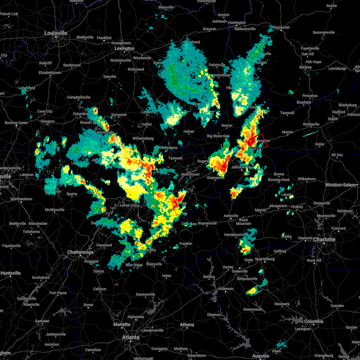 At 450 pm edt, a severe thunderstorm capable of producing a tornado was located near bristol va, moving east at 30 mph (radar indicated rotation). Hazards include tornado and quarter size hail. Flying debris will be dangerous to those caught without shelter. mobile homes will be damaged or destroyed. damage to roofs, windows, and vehicles will occur. tree damage is likely. this dangerous storm will be near, abingdon around 505 pm edt. other locations impacted by this tornadic thunderstorm include hilander park and holston. This includes interstate 81 in virginia between mile markers 9 and 20. At 450 pm edt, a severe thunderstorm capable of producing a tornado was located near bristol va, moving east at 30 mph (radar indicated rotation). Hazards include tornado and quarter size hail. Flying debris will be dangerous to those caught without shelter. mobile homes will be damaged or destroyed. damage to roofs, windows, and vehicles will occur. tree damage is likely. this dangerous storm will be near, abingdon around 505 pm edt. other locations impacted by this tornadic thunderstorm include hilander park and holston. This includes interstate 81 in virginia between mile markers 9 and 20.
|
| 5/6/2022 4:36 PM EDT |
 At 435 pm edt, a severe thunderstorm capable of producing a tornado was located near bristol va, moving east at 30 mph (radar indicated rotation). Hazards include tornado and quarter size hail. Flying debris will be dangerous to those caught without shelter. mobile homes will be damaged or destroyed. damage to roofs, windows, and vehicles will occur. tree damage is likely. this dangerous storm will be near, bristol va around 450 pm edt. abingdon around 510 pm edt. other locations impacted by this tornadic thunderstorm include hilander park, benhams and holston. This includes interstate 81 in virginia between mile markers 1 and 20. At 435 pm edt, a severe thunderstorm capable of producing a tornado was located near bristol va, moving east at 30 mph (radar indicated rotation). Hazards include tornado and quarter size hail. Flying debris will be dangerous to those caught without shelter. mobile homes will be damaged or destroyed. damage to roofs, windows, and vehicles will occur. tree damage is likely. this dangerous storm will be near, bristol va around 450 pm edt. abingdon around 510 pm edt. other locations impacted by this tornadic thunderstorm include hilander park, benhams and holston. This includes interstate 81 in virginia between mile markers 1 and 20.
|
| 5/6/2022 4:31 PM EDT |
 At 431 pm edt, a severe thunderstorm was located 8 miles north of walnut hill, or 8 miles northwest of bristol va, moving northeast at 35 mph (radar indicated). Hazards include 60 mph wind gusts and quarter size hail. Hail damage to vehicles is expected. Expect wind damage to roofs, siding, and trees. At 431 pm edt, a severe thunderstorm was located 8 miles north of walnut hill, or 8 miles northwest of bristol va, moving northeast at 35 mph (radar indicated). Hazards include 60 mph wind gusts and quarter size hail. Hail damage to vehicles is expected. Expect wind damage to roofs, siding, and trees.
|
| 6/7/2021 4:28 PM EDT |
 At 427 pm edt, severe thunderstorms were located along a line extending from 7 miles south of trammel to near abingdon, moving northeast at 30 mph (radar indicated). Hazards include 60 mph wind gusts. Expect damage to roofs, siding, and trees. locations impacted include, bristol va, abingdon, lebanon, cleveland va, glade spring, honaker, st. paul, emory-meadow view, rosedale and dye. This includes interstate 81 in virginia between mile markers 9 and 34. At 427 pm edt, severe thunderstorms were located along a line extending from 7 miles south of trammel to near abingdon, moving northeast at 30 mph (radar indicated). Hazards include 60 mph wind gusts. Expect damage to roofs, siding, and trees. locations impacted include, bristol va, abingdon, lebanon, cleveland va, glade spring, honaker, st. paul, emory-meadow view, rosedale and dye. This includes interstate 81 in virginia between mile markers 9 and 34.
|
| 6/7/2021 4:17 PM EDT | Tree down northeast of bristol tennesse in washington county VA, 3 miles SW of Bristol, VA |
| 6/7/2021 3:59 PM EDT |
 The national weather service in morristown has issued a * severe thunderstorm warning for. eastern sullivan county in east tennessee. northwestern johnson county in east tennessee. northeastern carter county in east tennessee. Russell county in southwestern virginia. The national weather service in morristown has issued a * severe thunderstorm warning for. eastern sullivan county in east tennessee. northwestern johnson county in east tennessee. northeastern carter county in east tennessee. Russell county in southwestern virginia.
|
| 6/7/2021 3:59 PM EDT |
 At 358 pm edt, severe thunderstorms were located along a line extending from 11 miles northeast of gate city to 11 miles southeast of bristol tn, moving northeast at 30 mph (radar indicated). Hazards include 60 mph wind gusts. expect damage to roofs, siding, and trees At 358 pm edt, severe thunderstorms were located along a line extending from 11 miles northeast of gate city to 11 miles southeast of bristol tn, moving northeast at 30 mph (radar indicated). Hazards include 60 mph wind gusts. expect damage to roofs, siding, and trees
|
| 3/28/2021 2:38 AM EDT |
 At 237 am edt, a severe thunderstorm was located over abingdon, moving east at 55 mph (radar indicated). Hazards include 60 mph wind gusts and quarter size hail. Hail damage to vehicles is expected. expect wind damage to roofs, siding, and trees. locations impacted include, bristol tn, bristol va, abingdon, holston, hilander park, harr and emory-meadow view. This includes interstate 81 in virginia between mile markers 6 and 23. At 237 am edt, a severe thunderstorm was located over abingdon, moving east at 55 mph (radar indicated). Hazards include 60 mph wind gusts and quarter size hail. Hail damage to vehicles is expected. expect wind damage to roofs, siding, and trees. locations impacted include, bristol tn, bristol va, abingdon, holston, hilander park, harr and emory-meadow view. This includes interstate 81 in virginia between mile markers 6 and 23.
|
| 3/28/2021 2:35 AM EDT | Quarter sized hail reported 2.7 miles SSE of Bristol, VA |
| 3/28/2021 2:35 AM EDT | Quarter sized hail reported 2.6 miles E of Bristol, VA |
| 3/28/2021 2:18 AM EDT |
 At 218 am edt, a severe thunderstorm was located over walnut hill, or near bristol tn, moving east at 55 mph (radar indicated). Hazards include 60 mph wind gusts and half dollar size hail. Hail damage to vehicles is expected. Expect wind damage to roofs, siding, and trees. At 218 am edt, a severe thunderstorm was located over walnut hill, or near bristol tn, moving east at 55 mph (radar indicated). Hazards include 60 mph wind gusts and half dollar size hail. Hail damage to vehicles is expected. Expect wind damage to roofs, siding, and trees.
|
| 3/27/2021 9:08 PM EDT |
 The severe thunderstorm warning for northeastern sullivan and southwestern washington counties and the city of bristol will expire at 915 pm edt, the storm which prompted the warning has weakened below severe limits, and no longer poses an immediate threat to life or property. therefore, the warning will be allowed to expire. however gusty winds are still possible with this thunderstorm. The severe thunderstorm warning for northeastern sullivan and southwestern washington counties and the city of bristol will expire at 915 pm edt, the storm which prompted the warning has weakened below severe limits, and no longer poses an immediate threat to life or property. therefore, the warning will be allowed to expire. however gusty winds are still possible with this thunderstorm.
|
| 3/27/2021 9:00 PM EDT |
 At 900 pm edt, a severe thunderstorm was located near bristol va, moving east at 55 mph (radar indicated). Hazards include 60 mph wind gusts and penny size hail. Expect damage to roofs, siding, and trees. locations impacted include, bristol tn, bristol va, abingdon, hilander park and harr. This includes interstate 81 in virginia between mile markers 2 and 18. At 900 pm edt, a severe thunderstorm was located near bristol va, moving east at 55 mph (radar indicated). Hazards include 60 mph wind gusts and penny size hail. Expect damage to roofs, siding, and trees. locations impacted include, bristol tn, bristol va, abingdon, hilander park and harr. This includes interstate 81 in virginia between mile markers 2 and 18.
|
| 3/27/2021 8:48 PM EDT |
 At 847 pm edt, a severe thunderstorm was located near walnut hill, or near bristol tn, moving east at 55 mph (radar indicated). Hazards include 60 mph wind gusts and quarter size hail. Hail damage to vehicles is expected. expect wind damage to roofs, siding, and trees. locations impacted include, bristol tn, bristol va, abingdon, walnut hill, south holston dam, hilander park, benhams, harr, blountville and emory-meadow view. this includes the following highways, interstate 81 in tennessee between mile markers 67 and 75. Interstate 81 in virginia between mile markers 1 and 22. At 847 pm edt, a severe thunderstorm was located near walnut hill, or near bristol tn, moving east at 55 mph (radar indicated). Hazards include 60 mph wind gusts and quarter size hail. Hail damage to vehicles is expected. expect wind damage to roofs, siding, and trees. locations impacted include, bristol tn, bristol va, abingdon, walnut hill, south holston dam, hilander park, benhams, harr, blountville and emory-meadow view. this includes the following highways, interstate 81 in tennessee between mile markers 67 and 75. Interstate 81 in virginia between mile markers 1 and 22.
|
| 3/27/2021 8:31 PM EDT |
 At 830 pm edt, a severe thunderstorm was located over weber city, or over gate city, moving east at 55 mph (radar indicated). Hazards include 60 mph wind gusts and quarter size hail. Hail damage to vehicles is expected. Expect wind damage to roofs, siding, and trees. At 830 pm edt, a severe thunderstorm was located over weber city, or over gate city, moving east at 55 mph (radar indicated). Hazards include 60 mph wind gusts and quarter size hail. Hail damage to vehicles is expected. Expect wind damage to roofs, siding, and trees.
|
| 3/27/2021 1:43 PM EDT |
 The severe thunderstorm warning for eastern sullivan, johnson, carter, eastern russell and washington counties and the eastern city of bristol will expire at 145 pm edt, the storms which prompted the warning have moved out of the area. therefore, the warning will be allowed to expire. The severe thunderstorm warning for eastern sullivan, johnson, carter, eastern russell and washington counties and the eastern city of bristol will expire at 145 pm edt, the storms which prompted the warning have moved out of the area. therefore, the warning will be allowed to expire.
|
| 3/27/2021 1:25 PM EDT |
 At 125 pm edt, severe thunderstorms were located along a line extending from near davenport to near elk park, moving east at 35 mph (radar indicated). Hazards include 60 mph wind gusts and penny size hail. Expect damage to roofs, siding, and trees. locations impacted include, bristol tn, bristol va, elizabethton, abingdon, lebanon, mountain city, hampton, glade spring, honaker and damascus. This includes interstate 81 in virginia between mile markers 6 and 34. At 125 pm edt, severe thunderstorms were located along a line extending from near davenport to near elk park, moving east at 35 mph (radar indicated). Hazards include 60 mph wind gusts and penny size hail. Expect damage to roofs, siding, and trees. locations impacted include, bristol tn, bristol va, elizabethton, abingdon, lebanon, mountain city, hampton, glade spring, honaker and damascus. This includes interstate 81 in virginia between mile markers 6 and 34.
|
| 3/27/2021 1:10 PM EDT | Several trees dow in city of bristol county VA, 1.2 miles NNE of Bristol, VA |
| 3/27/2021 1:01 PM EDT |
 At 101 pm edt, severe thunderstorms were located along a line extending from near trammel to 6 miles east of erwin, moving east at 35 mph (radar indicated). Hazards include 60 mph wind gusts and penny size hail. expect damage to roofs, siding, and trees At 101 pm edt, severe thunderstorms were located along a line extending from near trammel to 6 miles east of erwin, moving east at 35 mph (radar indicated). Hazards include 60 mph wind gusts and penny size hail. expect damage to roofs, siding, and trees
|
| 3/27/2021 1:01 PM EDT |
 The national weather service in morristown has issued a * severe thunderstorm warning for. sullivan county in east tennessee. northeastern washington county in east tennessee. northeastern unicoi county in east tennessee. Johnson county in east tennessee. The national weather service in morristown has issued a * severe thunderstorm warning for. sullivan county in east tennessee. northeastern washington county in east tennessee. northeastern unicoi county in east tennessee. Johnson county in east tennessee.
|
| 3/27/2021 11:34 AM EDT |
 At 1133 am edt, a severe thunderstorm was located near walnut hill, or 7 miles northwest of bristol tn, moving northeast at 40 mph (radar indicated). Hazards include quarter size hail. Damage to vehicles is expected. locations impacted include, bristol tn, bristol va, walnut hill, hilander park, benhams and blountville. this includes the following highways, interstate 81 in tennessee between mile markers 67 and 75. Interstate 81 in virginia between mile markers 1 and 11. At 1133 am edt, a severe thunderstorm was located near walnut hill, or 7 miles northwest of bristol tn, moving northeast at 40 mph (radar indicated). Hazards include quarter size hail. Damage to vehicles is expected. locations impacted include, bristol tn, bristol va, walnut hill, hilander park, benhams and blountville. this includes the following highways, interstate 81 in tennessee between mile markers 67 and 75. Interstate 81 in virginia between mile markers 1 and 11.
|
| 3/27/2021 11:18 AM EDT |
 At 1118 am edt, a severe thunderstorm was located near kingsport, moving east at 45 mph (radar indicated). Hazards include ping pong ball size hail. People and animals outdoors will be injured. expect damage to roofs, siding, windows, and vehicles. locations impacted include, kingsport, bristol tn, bristol va, weber city, walnut hill, colonial heights, blountville, collingwood, hansonville and hilander park. this includes the following highways, interstate 81 in tennessee between mile markers 64 and 75. Interstate 81 in virginia between mile markers 1 and 12. At 1118 am edt, a severe thunderstorm was located near kingsport, moving east at 45 mph (radar indicated). Hazards include ping pong ball size hail. People and animals outdoors will be injured. expect damage to roofs, siding, windows, and vehicles. locations impacted include, kingsport, bristol tn, bristol va, weber city, walnut hill, colonial heights, blountville, collingwood, hansonville and hilander park. this includes the following highways, interstate 81 in tennessee between mile markers 64 and 75. Interstate 81 in virginia between mile markers 1 and 12.
|
| 3/27/2021 11:07 AM EDT |
 At 1107 am edt, a severe thunderstorm was located near kingsport, moving east at 45 mph (radar indicated). Hazards include quarter size hail. damage to vehicles is expected At 1107 am edt, a severe thunderstorm was located near kingsport, moving east at 45 mph (radar indicated). Hazards include quarter size hail. damage to vehicles is expected
|
| 7/24/2020 7:03 PM EDT |
 At 703 pm edt, severe thunderstorms were located along a line extending from near bristol va to 7 miles northeast of kingsport to near weber city, moving south at 20 mph (radar indicated). Hazards include 60 mph wind gusts. Expect damage to roofs, siding, and trees. locations impacted include, kingsport, bristol tn, bristol va, weber city, walnut hill, south holston dam, harr, blountville and bloomingdale. this includes the following highways, interstate 26 in tennessee near mile marker 1. interstate 81 in tennessee between mile markers 66 and 75. Interstate 81 in virginia between mile markers 1 and 8. At 703 pm edt, severe thunderstorms were located along a line extending from near bristol va to 7 miles northeast of kingsport to near weber city, moving south at 20 mph (radar indicated). Hazards include 60 mph wind gusts. Expect damage to roofs, siding, and trees. locations impacted include, kingsport, bristol tn, bristol va, weber city, walnut hill, south holston dam, harr, blountville and bloomingdale. this includes the following highways, interstate 26 in tennessee near mile marker 1. interstate 81 in tennessee between mile markers 66 and 75. Interstate 81 in virginia between mile markers 1 and 8.
|
| 7/24/2020 7:00 PM EDT | A few trees dow in washington county VA, 7 miles E of Bristol, VA |
| 7/24/2020 6:38 PM EDT |
 At 638 pm edt, severe thunderstorms were located along a line extending from bristol va to 6 miles east of weber city to near clover fork, moving south at 20 mph (radar indicated). Hazards include 60 mph wind gusts. Expect damage to roofs, siding, and trees. locations impacted include, kingsport, bristol tn, bristol va, gate city, weber city, walnut hill, church hill, mount carmel, duffield and clinchport. this includes the following highways, interstate 26 in tennessee near mile marker 1. interstate 81 in tennessee between mile markers 66 and 75. Interstate 81 in virginia between mile markers 1 and 10. At 638 pm edt, severe thunderstorms were located along a line extending from bristol va to 6 miles east of weber city to near clover fork, moving south at 20 mph (radar indicated). Hazards include 60 mph wind gusts. Expect damage to roofs, siding, and trees. locations impacted include, kingsport, bristol tn, bristol va, gate city, weber city, walnut hill, church hill, mount carmel, duffield and clinchport. this includes the following highways, interstate 26 in tennessee near mile marker 1. interstate 81 in tennessee between mile markers 66 and 75. Interstate 81 in virginia between mile markers 1 and 10.
|
| 7/24/2020 6:12 PM EDT |
 At 612 pm edt, severe thunderstorms were located along a line extending from 6 miles north of bristol va to 6 miles south of big stone gap, moving south at 5 mph (radar indicated). Hazards include 60 mph wind gusts. expect damage to roofs, siding, and trees At 612 pm edt, severe thunderstorms were located along a line extending from 6 miles north of bristol va to 6 miles south of big stone gap, moving south at 5 mph (radar indicated). Hazards include 60 mph wind gusts. expect damage to roofs, siding, and trees
|
| 7/24/2020 6:01 PM EDT |
 At 601 pm edt, severe thunderstorms were located along a line extending from 6 miles west of saltville to 8 miles north of bristol va to 7 miles southeast of big stone gap, moving southeast at 20 mph (radar indicated). Hazards include 60 mph wind gusts. Expect damage to roofs, siding, and trees. locations impacted include, bristol va, abingdon, gate city, weber city, mount carmel, glade spring, nickelsville, dungannon, emory-meadow view and lindell. This includes interstate 81 in virginia between mile markers 13 and 34. At 601 pm edt, severe thunderstorms were located along a line extending from 6 miles west of saltville to 8 miles north of bristol va to 7 miles southeast of big stone gap, moving southeast at 20 mph (radar indicated). Hazards include 60 mph wind gusts. Expect damage to roofs, siding, and trees. locations impacted include, bristol va, abingdon, gate city, weber city, mount carmel, glade spring, nickelsville, dungannon, emory-meadow view and lindell. This includes interstate 81 in virginia between mile markers 13 and 34.
|
| 7/24/2020 5:36 PM EDT |
 At 536 pm edt, severe thunderstorms were located along a line extending from 8 miles east of lebanon to 7 miles north of gate city, moving southeast at 15 mph (radar indicated). Hazards include 60 mph wind gusts and penny size hail. Expect damage to roofs, siding, and trees. locations impacted include, bristol va, abingdon, lebanon, gate city, big stone gap, weber city, cleveland va, mount carmel, glade spring and st. paul. This includes interstate 81 in virginia between mile markers 13 and 34. At 536 pm edt, severe thunderstorms were located along a line extending from 8 miles east of lebanon to 7 miles north of gate city, moving southeast at 15 mph (radar indicated). Hazards include 60 mph wind gusts and penny size hail. Expect damage to roofs, siding, and trees. locations impacted include, bristol va, abingdon, lebanon, gate city, big stone gap, weber city, cleveland va, mount carmel, glade spring and st. paul. This includes interstate 81 in virginia between mile markers 13 and 34.
|
| 7/24/2020 5:16 PM EDT |
 At 516 pm edt, severe thunderstorms were located along a line extending from 8 miles northeast of lebanon to 7 miles southeast of big stone gap, moving southeast at 15 mph (radar indicated). Hazards include 60 mph wind gusts and penny size hail. expect damage to roofs, siding, and trees At 516 pm edt, severe thunderstorms were located along a line extending from 8 miles northeast of lebanon to 7 miles southeast of big stone gap, moving southeast at 15 mph (radar indicated). Hazards include 60 mph wind gusts and penny size hail. expect damage to roofs, siding, and trees
|
| 7/23/2020 3:38 PM EDT |
 The severe thunderstorm warning for central sullivan county will expire at 345 pm edt, the storm which prompted the warning has weakened below severe limits, and no longer poses an immediate threat to life or property. therefore, the warning will be allowed to expire. however gusty winds and heavy rain are still possible with this thunderstorm. The severe thunderstorm warning for central sullivan county will expire at 345 pm edt, the storm which prompted the warning has weakened below severe limits, and no longer poses an immediate threat to life or property. therefore, the warning will be allowed to expire. however gusty winds and heavy rain are still possible with this thunderstorm.
|
| 7/23/2020 3:26 PM EDT |
 At 326 pm edt, a severe thunderstorm was located near bristol tn, moving northeast at 15 mph (radar indicated). Hazards include 60 mph wind gusts. Expect damage to roofs, siding, and trees. locations impacted include, bristol tn, bristol va, walnut hill, bluff city, south holston dam, morril`s cave and blountville. This includes interstate 81 in tennessee between mile markers 73 and 75. At 326 pm edt, a severe thunderstorm was located near bristol tn, moving northeast at 15 mph (radar indicated). Hazards include 60 mph wind gusts. Expect damage to roofs, siding, and trees. locations impacted include, bristol tn, bristol va, walnut hill, bluff city, south holston dam, morril`s cave and blountville. This includes interstate 81 in tennessee between mile markers 73 and 75.
|
| 7/23/2020 3:09 PM EDT |
 The national weather service in morristown has issued a * severe thunderstorm warning for. central sullivan county in east tennessee. northwestern carter county in east tennessee. until 345 pm edt. At 308 pm edt, a severe thunderstorm was located 7 miles north of. The national weather service in morristown has issued a * severe thunderstorm warning for. central sullivan county in east tennessee. northwestern carter county in east tennessee. until 345 pm edt. At 308 pm edt, a severe thunderstorm was located 7 miles north of.
|
| 3/29/2020 7:35 AM EDT |
 The severe thunderstorm warning for eastern sullivan, johnson, carter and washington counties and the city of bristol will expire at 745 am edt, the storms which prompted the warning have weakened below severe limits, and no longer pose an immediate threat to life or property. therefore, the warning will be allowed to expire. however gusty winds are still possible with these thunderstorms. The severe thunderstorm warning for eastern sullivan, johnson, carter and washington counties and the city of bristol will expire at 745 am edt, the storms which prompted the warning have weakened below severe limits, and no longer pose an immediate threat to life or property. therefore, the warning will be allowed to expire. however gusty winds are still possible with these thunderstorms.
|
| 3/29/2020 7:26 AM EDT |
 At 726 am edt, severe thunderstorms were located along a line extending from 6 miles west of abingdon to 10 miles east of bristol tn to near hampton, moving east at 70 mph (radar indicated). Hazards include 60 mph wind gusts. Expect damage to roofs, siding, and trees. locations impacted include, bristol tn, bristol va, elizabethton, abingdon, mountain city, walnut hill, hampton, bluff city, glade spring and damascus. this includes the following highways, interstate 81 in tennessee between mile markers 73 and 75. Interstate 81 in virginia between mile markers 1 and 34. At 726 am edt, severe thunderstorms were located along a line extending from 6 miles west of abingdon to 10 miles east of bristol tn to near hampton, moving east at 70 mph (radar indicated). Hazards include 60 mph wind gusts. Expect damage to roofs, siding, and trees. locations impacted include, bristol tn, bristol va, elizabethton, abingdon, mountain city, walnut hill, hampton, bluff city, glade spring and damascus. this includes the following highways, interstate 81 in tennessee between mile markers 73 and 75. Interstate 81 in virginia between mile markers 1 and 34.
|
| 3/29/2020 7:06 AM EDT |
 At 705 am edt, severe thunderstorms were located along a line extending from near weber city to oak grove to near erwin, moving east at 75 mph (radar indicated). Hazards include 60 mph wind gusts. expect damage to roofs, siding, and trees At 705 am edt, severe thunderstorms were located along a line extending from near weber city to oak grove to near erwin, moving east at 75 mph (radar indicated). Hazards include 60 mph wind gusts. expect damage to roofs, siding, and trees
|
| 1/11/2020 7:51 PM EST |
 The severe thunderstorm warning for northeastern sullivan, johnson, eastern carter, eastern russell and washington counties and the east central city of bristol will expire at 800 pm est, the storms which prompted the warning have moved out of the warned area. therefore, the warning will be allowed to expire. The severe thunderstorm warning for northeastern sullivan, johnson, eastern carter, eastern russell and washington counties and the east central city of bristol will expire at 800 pm est, the storms which prompted the warning have moved out of the warned area. therefore, the warning will be allowed to expire.
|
| 1/11/2020 7:16 PM EST | Photo from twitter of 60 mph wind gust on home weather station at 19:16 which verifies with radar data for the are in washington county VA, 4.9 miles WSW of Bristol, VA |
| 1/11/2020 7:16 PM EST |
 At 715 pm est, severe thunderstorms were located along a line extending from near cleveland va to near elk park, moving east at 65 mph (radar indicated). Hazards include 70 mph wind gusts. Expect considerable tree damage. Damage is likely to mobile homes, roofs, and outbuildings. At 715 pm est, severe thunderstorms were located along a line extending from near cleveland va to near elk park, moving east at 65 mph (radar indicated). Hazards include 70 mph wind gusts. Expect considerable tree damage. Damage is likely to mobile homes, roofs, and outbuildings.
|
| 1/11/2020 7:03 PM EST |
 At 703 pm est, severe thunderstorms were located along a line extending from 6 miles west of walnut hill to near erwin, moving east at 55 mph (radar indicated). Hazards include 70 mph wind gusts. Expect considerable tree damage. damage is likely to mobile homes, roofs, and outbuildings. Locations impacted include, johnson city, kingsport, bristol tn, bristol va, elizabethton, erwin, jonesborough, central, spurgeon and midway. At 703 pm est, severe thunderstorms were located along a line extending from 6 miles west of walnut hill to near erwin, moving east at 55 mph (radar indicated). Hazards include 70 mph wind gusts. Expect considerable tree damage. damage is likely to mobile homes, roofs, and outbuildings. Locations impacted include, johnson city, kingsport, bristol tn, bristol va, elizabethton, erwin, jonesborough, central, spurgeon and midway.
|
| 1/11/2020 6:39 PM EST |
 At 638 pm est, severe thunderstorms were located along a line extending from near surgoinsville to 7 miles south of tusculum, moving east at 55 mph (radar indicated). Hazards include 70 mph wind gusts. Expect considerable tree damage. Damage is likely to mobile homes, roofs, and outbuildings. At 638 pm est, severe thunderstorms were located along a line extending from near surgoinsville to 7 miles south of tusculum, moving east at 55 mph (radar indicated). Hazards include 70 mph wind gusts. Expect considerable tree damage. Damage is likely to mobile homes, roofs, and outbuildings.
|
| 10/31/2019 1:25 PM EDT |
 The severe thunderstorm warning for western sullivan, southwestern russell, eastern scott and southwestern washington counties and the city of bristol will expire at 130 pm edt, the storms which prompted the warning have weakened below severe limits, and no longer pose an immediate threat to life or property. therefore, the warning will be allowed to expire. a tornado watch remains in effect until 700 pm edt for east tennessee, and southwestern virginia. The severe thunderstorm warning for western sullivan, southwestern russell, eastern scott and southwestern washington counties and the city of bristol will expire at 130 pm edt, the storms which prompted the warning have weakened below severe limits, and no longer pose an immediate threat to life or property. therefore, the warning will be allowed to expire. a tornado watch remains in effect until 700 pm edt for east tennessee, and southwestern virginia.
|
| 10/31/2019 1:05 PM EDT |
 At 104 pm edt, severe thunderstorms were located along a line extending from 9 miles southeast of norton to 7 miles southwest of colonial heights, moving northeast at 50 mph (radar indicated). Hazards include 60 mph wind gusts. Expect damage to roofs, siding, and trees. locations impacted include, kingsport, bristol tn, bristol va, gate city, weber city, walnut hill, colonial heights, spurgeon, st. Paul and nickelsville. At 104 pm edt, severe thunderstorms were located along a line extending from 9 miles southeast of norton to 7 miles southwest of colonial heights, moving northeast at 50 mph (radar indicated). Hazards include 60 mph wind gusts. Expect damage to roofs, siding, and trees. locations impacted include, kingsport, bristol tn, bristol va, gate city, weber city, walnut hill, colonial heights, spurgeon, st. Paul and nickelsville.
|
| 10/31/2019 12:47 PM EDT |
 At 1247 pm edt, severe thunderstorms were located along a line extending from 9 miles south of big stone gap to 9 miles south of rogersville, moving northeast at 55 mph (radar indicated). Hazards include 60 mph wind gusts. expect damage to roofs, siding, and trees At 1247 pm edt, severe thunderstorms were located along a line extending from 9 miles south of big stone gap to 9 miles south of rogersville, moving northeast at 55 mph (radar indicated). Hazards include 60 mph wind gusts. expect damage to roofs, siding, and trees
|
| 8/20/2019 5:42 PM EDT |
 The severe thunderstorm warning for southwestern washington county and the eastern city of bristol will expire at 545 pm edt, the storm which prompted the warning has weakened below severe limits, and no longer poses an immediate threat to life or property. therefore, the warning will be allowed to expire. however small hail, gusty winds and heavy rain are still possible with this thunderstorm. The severe thunderstorm warning for southwestern washington county and the eastern city of bristol will expire at 545 pm edt, the storm which prompted the warning has weakened below severe limits, and no longer poses an immediate threat to life or property. therefore, the warning will be allowed to expire. however small hail, gusty winds and heavy rain are still possible with this thunderstorm.
|
| 8/20/2019 5:27 PM EDT |
 At 505 pm edt, a severe thunderstorm was located near abingdon, moving west at 10 mph (radar indicated). Hazards include 60 mph wind gusts and quarter size hail. Hail damage to vehicles is expected. Expect wind damage to roofs, siding, and trees. At 505 pm edt, a severe thunderstorm was located near abingdon, moving west at 10 mph (radar indicated). Hazards include 60 mph wind gusts and quarter size hail. Hail damage to vehicles is expected. Expect wind damage to roofs, siding, and trees.
|
| 8/20/2019 5:20 PM EDT |
 A severe thunderstorm warning remains in effect until 545 pm edt for northeastern sullivan and southwestern washington counties and the eastern city of bristol. at 519 pm edt, a severe thunderstorm was located near abingdon, moving west at 10 mph. hazard. 60 mph wind gusts and quarter size hail. A severe thunderstorm warning remains in effect until 545 pm edt for northeastern sullivan and southwestern washington counties and the eastern city of bristol. at 519 pm edt, a severe thunderstorm was located near abingdon, moving west at 10 mph. hazard. 60 mph wind gusts and quarter size hail.
|
| 8/20/2019 5:06 PM EDT |
 At 505 pm edt, a severe thunderstorm was located near abingdon, moving west at 10 mph (radar indicated). Hazards include 60 mph wind gusts and quarter size hail. Hail damage to vehicles is expected. Expect wind damage to roofs, siding, and trees. At 505 pm edt, a severe thunderstorm was located near abingdon, moving west at 10 mph (radar indicated). Hazards include 60 mph wind gusts and quarter size hail. Hail damage to vehicles is expected. Expect wind damage to roofs, siding, and trees.
|
| 8/13/2019 2:07 PM EDT |
 At 206 pm edt, a severe thunderstorm was located near mountain city, moving southeast at 25 mph (radar indicated). Hazards include 60 mph wind gusts and quarter size hail. Hail damage to vehicles is expected. expect wind damage to roofs, siding, and trees. Locations impacted include, bristol tn, bristol va, mountain city, shady valley, neva and laurel bloomery. At 206 pm edt, a severe thunderstorm was located near mountain city, moving southeast at 25 mph (radar indicated). Hazards include 60 mph wind gusts and quarter size hail. Hail damage to vehicles is expected. expect wind damage to roofs, siding, and trees. Locations impacted include, bristol tn, bristol va, mountain city, shady valley, neva and laurel bloomery.
|
| 8/13/2019 1:43 PM EDT |
 At 143 pm edt, a severe thunderstorm was located near bristol va, moving southeast at 25 mph (radar indicated). Hazards include 60 mph wind gusts and quarter size hail. Hail damage to vehicles is expected. Expect wind damage to roofs, siding, and trees. At 143 pm edt, a severe thunderstorm was located near bristol va, moving southeast at 25 mph (radar indicated). Hazards include 60 mph wind gusts and quarter size hail. Hail damage to vehicles is expected. Expect wind damage to roofs, siding, and trees.
|
| 8/13/2019 1:24 PM EDT |
 The severe thunderstorm warning for southern russell and central washington counties will expire at 130 pm edt, the storm which prompted the warning has weakened below severe limits, and no longer poses an immediate threat to life or property. therefore, the warning will be allowed to expire. however gusty winds and heavy rain are still possible with this thunderstorm. a severe thunderstorm watch remains in effect until 700 pm edt for southwestern virginia. to report severe weather, contact your nearest law enforcement agency. they will relay your report to the national weather service morristown. The severe thunderstorm warning for southern russell and central washington counties will expire at 130 pm edt, the storm which prompted the warning has weakened below severe limits, and no longer poses an immediate threat to life or property. therefore, the warning will be allowed to expire. however gusty winds and heavy rain are still possible with this thunderstorm. a severe thunderstorm watch remains in effect until 700 pm edt for southwestern virginia. to report severe weather, contact your nearest law enforcement agency. they will relay your report to the national weather service morristown.
|
| 8/13/2019 1:14 PM EDT |
 At 113 pm edt, a severe thunderstorm was located near abingdon, moving southeast at 15 mph (radar indicated). Hazards include 60 mph wind gusts and quarter size hail. Hail damage to vehicles is expected. expect wind damage to roofs, siding, and trees. Locations impacted include, bristol va, abingdon, hansonville, lindell, holston and emory-meadow view. At 113 pm edt, a severe thunderstorm was located near abingdon, moving southeast at 15 mph (radar indicated). Hazards include 60 mph wind gusts and quarter size hail. Hail damage to vehicles is expected. expect wind damage to roofs, siding, and trees. Locations impacted include, bristol va, abingdon, hansonville, lindell, holston and emory-meadow view.
|
| 8/13/2019 12:51 PM EDT |
 At 1251 pm edt, a severe thunderstorm was located near lebanon, moving southeast at 20 mph (radar indicated). Hazards include 60 mph wind gusts and quarter size hail. Hail damage to vehicles is expected. expect wind damage to roofs, siding, and trees. Locations impacted include, bristol va, abingdon, lebanon, lindell, holston, hansonville and emory-meadow view. At 1251 pm edt, a severe thunderstorm was located near lebanon, moving southeast at 20 mph (radar indicated). Hazards include 60 mph wind gusts and quarter size hail. Hail damage to vehicles is expected. expect wind damage to roofs, siding, and trees. Locations impacted include, bristol va, abingdon, lebanon, lindell, holston, hansonville and emory-meadow view.
|
| 8/13/2019 12:32 PM EDT |
 At 1231 pm edt, a severe thunderstorm was located over cleveland va, or near lebanon, moving southeast at 20 mph (radar indicated). Hazards include 60 mph wind gusts and quarter size hail. Hail damage to vehicles is expected. Expect wind damage to roofs, siding, and trees. At 1231 pm edt, a severe thunderstorm was located over cleveland va, or near lebanon, moving southeast at 20 mph (radar indicated). Hazards include 60 mph wind gusts and quarter size hail. Hail damage to vehicles is expected. Expect wind damage to roofs, siding, and trees.
|
| 6/22/2019 1:38 AM EDT |
 At 137 am edt, severe thunderstorms were located along a line extending from 6 miles southwest of cleveland va to near reese, moving northeast at 45 mph (radar indicated). Hazards include 60 mph wind gusts. Expect damage to roofs, siding, and trees. Locations impacted include, bristol tn, bristol va, abingdon, lebanon, mountain city, cleveland va, walnut hill, glade spring, honaker, damascus, laurel bloomery, emory-meadow view, rosedale, shady valley, south holston dam, collingwood, doeville, hansonville, konnarock and neva. At 137 am edt, severe thunderstorms were located along a line extending from 6 miles southwest of cleveland va to near reese, moving northeast at 45 mph (radar indicated). Hazards include 60 mph wind gusts. Expect damage to roofs, siding, and trees. Locations impacted include, bristol tn, bristol va, abingdon, lebanon, mountain city, cleveland va, walnut hill, glade spring, honaker, damascus, laurel bloomery, emory-meadow view, rosedale, shady valley, south holston dam, collingwood, doeville, hansonville, konnarock and neva.
|
| 6/22/2019 1:08 AM EDT |
 At 108 am edt, severe thunderstorms were located along a line extending from 11 miles northeast of gate city to near erwin, moving east at 50 mph (radar indicated). Hazards include 60 mph wind gusts. expect damage to roofs, siding, and trees At 108 am edt, severe thunderstorms were located along a line extending from 11 miles northeast of gate city to near erwin, moving east at 50 mph (radar indicated). Hazards include 60 mph wind gusts. expect damage to roofs, siding, and trees
|
| 4/14/2019 7:40 PM EDT | Tree down across woodland drive in bristol proximated by rada in city of bristol county VA, 1 miles ENE of Bristol, VA |
| 11/6/2018 6:50 AM EST |
 The severe thunderstorm warning for sullivan, southeastern scott and southwestern washington counties and the city of bristol will expire at 700 am est, the storm which prompted the warning has weakened below severe limits, and no longer poses an immediate threat to life or property. therefore, the warning will be allowed to expire. The severe thunderstorm warning for sullivan, southeastern scott and southwestern washington counties and the city of bristol will expire at 700 am est, the storm which prompted the warning has weakened below severe limits, and no longer poses an immediate threat to life or property. therefore, the warning will be allowed to expire.
|
| 11/6/2018 6:20 AM EST |
 At 620 am est, a severe thunderstorm was located near kingsport, moving east at 50 mph (radar indicated). Hazards include 60 mph wind gusts. expect damage to roofs, siding, and trees At 620 am est, a severe thunderstorm was located near kingsport, moving east at 50 mph (radar indicated). Hazards include 60 mph wind gusts. expect damage to roofs, siding, and trees
|
| 9/9/2018 7:51 PM EDT |
 At 751 pm edt, severe thunderstorms were located along a line extending from 10 miles southeast of wise to near abingdon, moving northeast at 40 mph (radar indicated). Hazards include 60 mph wind gusts and penny size hail. Expect damage to roofs, siding, and trees. locations impacted include, bristol va, abingdon, lebanon, cleveland va, glade spring, honaker, st. Paul, damascus, nickelsville, dungannon, emory-meadow view, rosedale, dye, lindell, collingwood, castlewood, holston, hansonville, hilander park and benhams. At 751 pm edt, severe thunderstorms were located along a line extending from 10 miles southeast of wise to near abingdon, moving northeast at 40 mph (radar indicated). Hazards include 60 mph wind gusts and penny size hail. Expect damage to roofs, siding, and trees. locations impacted include, bristol va, abingdon, lebanon, cleveland va, glade spring, honaker, st. Paul, damascus, nickelsville, dungannon, emory-meadow view, rosedale, dye, lindell, collingwood, castlewood, holston, hansonville, hilander park and benhams.
|
| 9/9/2018 7:33 PM EDT |
 At 732 pm edt, severe thunderstorms were located along a line extending from 8 miles south of norton to bristol tn, moving northeast at 40 mph (radar indicated). Hazards include 60 mph wind gusts and penny size hail. Expect damage to roofs, siding, and trees. locations impacted include, kingsport, bristol tn, bristol va, abingdon, lebanon, gate city, cleveland va, walnut hill, bluff city, glade spring, honaker, st. Paul, damascus, nickelsville, dungannon, laurel bloomery, emory-meadow view, rosedale, shady valley and south holston dam. At 732 pm edt, severe thunderstorms were located along a line extending from 8 miles south of norton to bristol tn, moving northeast at 40 mph (radar indicated). Hazards include 60 mph wind gusts and penny size hail. Expect damage to roofs, siding, and trees. locations impacted include, kingsport, bristol tn, bristol va, abingdon, lebanon, gate city, cleveland va, walnut hill, bluff city, glade spring, honaker, st. Paul, damascus, nickelsville, dungannon, laurel bloomery, emory-meadow view, rosedale, shady valley and south holston dam.
|
| 9/9/2018 7:12 PM EDT |
 At 712 pm edt, severe thunderstorms were located along a line extending from 12 miles north of surgoinsville to near oak grove, moving northeast at 40 mph (radar indicated). Hazards include 60 mph wind gusts and penny size hail. expect damage to roofs, siding, and trees At 712 pm edt, severe thunderstorms were located along a line extending from 12 miles north of surgoinsville to near oak grove, moving northeast at 40 mph (radar indicated). Hazards include 60 mph wind gusts and penny size hail. expect damage to roofs, siding, and trees
|
| 9/9/2018 7:03 PM EDT |
 At 703 pm edt, severe thunderstorms were located along a line extending from 6 miles east of sneedville to 6 miles northeast of surgoinsville to near gray, moving northeast at 40 mph (radar indicated). Hazards include 60 mph wind gusts and penny size hail. Expect damage to roofs, siding, and trees. Locations impacted include, johnson city, kingsport, bristol tn, bristol va, gate city, surgoinsville, weber city, spurgeon, colonial heights, gray, oak grove, walnut hill, church hill, mount carmel, bluff city, duffield, clinchport, bays mountain state park, sullivan gardens and okolona. At 703 pm edt, severe thunderstorms were located along a line extending from 6 miles east of sneedville to 6 miles northeast of surgoinsville to near gray, moving northeast at 40 mph (radar indicated). Hazards include 60 mph wind gusts and penny size hail. Expect damage to roofs, siding, and trees. Locations impacted include, johnson city, kingsport, bristol tn, bristol va, gate city, surgoinsville, weber city, spurgeon, colonial heights, gray, oak grove, walnut hill, church hill, mount carmel, bluff city, duffield, clinchport, bays mountain state park, sullivan gardens and okolona.
|
| 9/9/2018 6:42 PM EDT |
 At 642 pm edt, severe thunderstorms were located along a line extending from near bean station to near rogersville to 7 miles north of tusculum, moving northeast at 35 mph (radar indicated). Hazards include 60 mph wind gusts and penny size hail. expect damage to roofs, siding, and trees At 642 pm edt, severe thunderstorms were located along a line extending from near bean station to near rogersville to 7 miles north of tusculum, moving northeast at 35 mph (radar indicated). Hazards include 60 mph wind gusts and penny size hail. expect damage to roofs, siding, and trees
|
| 7/20/2018 10:10 PM EDT |
 The national weather service in morristown has issued a * severe thunderstorm warning for. sullivan county in east tennessee. washington county in east tennessee. jefferson county in east tennessee. Cocke county in east tennessee. The national weather service in morristown has issued a * severe thunderstorm warning for. sullivan county in east tennessee. washington county in east tennessee. jefferson county in east tennessee. Cocke county in east tennessee.
|
| 7/20/2018 10:10 PM EDT |
 At 1009 pm edt, severe thunderstorms were located along a line extending from 7 miles northeast of gate city to near kingsport to 10 miles southwest of colonial heights to 9 miles north of greeneville to near russellville to 6 miles northeast of jefferson city, moving southeast at 55 mph (radar indicated). Hazards include 60 mph wind gusts and penny size hail. expect damage to roofs, siding, and trees At 1009 pm edt, severe thunderstorms were located along a line extending from 7 miles northeast of gate city to near kingsport to 10 miles southwest of colonial heights to 9 miles north of greeneville to near russellville to 6 miles northeast of jefferson city, moving southeast at 55 mph (radar indicated). Hazards include 60 mph wind gusts and penny size hail. expect damage to roofs, siding, and trees
|
| 6/26/2018 11:37 AM EDT |
 At 1136 am edt, severe thunderstorms were located along a line extending from near trammel to 10 miles southeast of wise to 6 miles southeast of norton, moving southeast at 40 mph (radar indicated). Hazards include 60 mph wind gusts. expect damage to roofs, siding, and trees At 1136 am edt, severe thunderstorms were located along a line extending from near trammel to 10 miles southeast of wise to 6 miles southeast of norton, moving southeast at 40 mph (radar indicated). Hazards include 60 mph wind gusts. expect damage to roofs, siding, and trees
|
| 6/25/2018 3:53 PM EDT |
 At 353 pm edt, severe thunderstorms were located along a line extending from near richlands to near bristol tn, moving east at 30 mph (radar indicated). Hazards include 60 mph wind gusts and penny size hail. expect damage to roofs, siding, and trees At 353 pm edt, severe thunderstorms were located along a line extending from near richlands to near bristol tn, moving east at 30 mph (radar indicated). Hazards include 60 mph wind gusts and penny size hail. expect damage to roofs, siding, and trees
|
| 5/10/2018 6:48 PM EDT |
 At 648 pm edt, a severe thunderstorm was located near abingdon, moving southeast at 30 mph (radar indicated). Hazards include 60 mph wind gusts and quarter size hail. Hail damage to vehicles is expected. Expect wind damage to roofs, siding, and trees. At 648 pm edt, a severe thunderstorm was located near abingdon, moving southeast at 30 mph (radar indicated). Hazards include 60 mph wind gusts and quarter size hail. Hail damage to vehicles is expected. Expect wind damage to roofs, siding, and trees.
|
| 5/10/2018 6:48 PM EDT |
 The national weather service in morristown has issued a * severe thunderstorm warning for. northeastern sullivan county in east tennessee. northern johnson county in east tennessee. the northeastern city of bristol in southwestern virginia. Southeastern washington county in southwestern virginia. The national weather service in morristown has issued a * severe thunderstorm warning for. northeastern sullivan county in east tennessee. northern johnson county in east tennessee. the northeastern city of bristol in southwestern virginia. Southeastern washington county in southwestern virginia.
|
| 3/17/2018 7:43 PM EDT |
 At 743 pm edt, a severe thunderstorm was located 7 miles northeast of wise, moving southeast at 50 mph (radar indicated). Hazards include 60 mph wind gusts and quarter size hail. Hail damage to vehicles is expected. Expect wind damage to roofs, siding, and trees. At 743 pm edt, a severe thunderstorm was located 7 miles northeast of wise, moving southeast at 50 mph (radar indicated). Hazards include 60 mph wind gusts and quarter size hail. Hail damage to vehicles is expected. Expect wind damage to roofs, siding, and trees.
|
| 11/18/2017 10:16 PM EST |
 At 1016 pm est, severe thunderstorms were located along a line extending from near bristol va to near bristol tn to midway, moving east at 60 mph (radar indicated). Hazards include 60 mph wind gusts. expect damage to roofs, siding, and trees At 1016 pm est, severe thunderstorms were located along a line extending from near bristol va to near bristol tn to midway, moving east at 60 mph (radar indicated). Hazards include 60 mph wind gusts. expect damage to roofs, siding, and trees
|
| 5/27/2017 8:05 PM EDT |
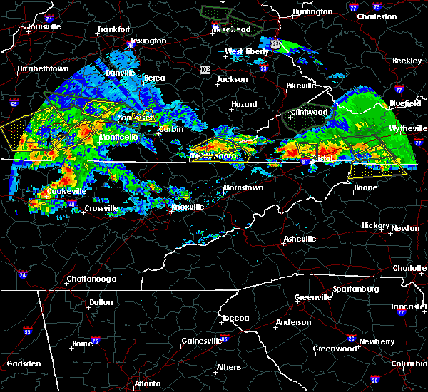 The severe thunderstorm warning for southwestern russell and southwestern washington counties and the northeastern city of bristol will expire at 815 pm edt, the severe thunderstorm which prompted the warning has weakened. therefore, the warning will be allowed to expire. a severe thunderstorm watch remains in effect until 200 am edt for southwestern virginia. The severe thunderstorm warning for southwestern russell and southwestern washington counties and the northeastern city of bristol will expire at 815 pm edt, the severe thunderstorm which prompted the warning has weakened. therefore, the warning will be allowed to expire. a severe thunderstorm watch remains in effect until 200 am edt for southwestern virginia.
|
| 5/27/2017 7:50 PM EDT |
 At 750 pm edt, a severe thunderstorm was located 8 miles north of bristol va, moving east at 20 mph (radar indicated). Hazards include 60 mph wind gusts and half dollar size hail. Hail damage to vehicles is expected. expect wind damage to roofs, siding, and trees. Locations impacted include, bristol va, hansonville, benhams and collingwood. At 750 pm edt, a severe thunderstorm was located 8 miles north of bristol va, moving east at 20 mph (radar indicated). Hazards include 60 mph wind gusts and half dollar size hail. Hail damage to vehicles is expected. expect wind damage to roofs, siding, and trees. Locations impacted include, bristol va, hansonville, benhams and collingwood.
|
| 5/27/2017 7:29 PM EDT |
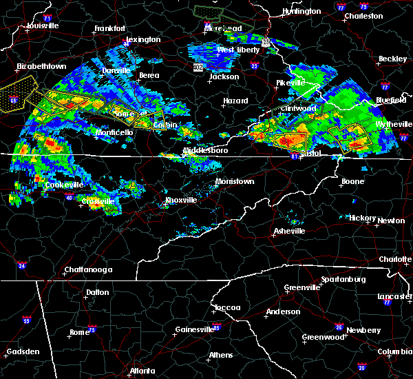 At 728 pm edt, a severe thunderstorm was located 13 miles northeast of gate city, moving east at 20 mph (radar indicated). Hazards include 60 mph wind gusts and half dollar size hail. Hail damage to vehicles is expected. expect wind damage to roofs, siding, and trees. Locations impacted include, bristol va, lebanon, nickelsville, dungannon, collingwood, castlewood, hansonville and benhams. At 728 pm edt, a severe thunderstorm was located 13 miles northeast of gate city, moving east at 20 mph (radar indicated). Hazards include 60 mph wind gusts and half dollar size hail. Hail damage to vehicles is expected. expect wind damage to roofs, siding, and trees. Locations impacted include, bristol va, lebanon, nickelsville, dungannon, collingwood, castlewood, hansonville and benhams.
|
| 5/27/2017 7:16 PM EDT |
 At 715 pm edt, a severe thunderstorm was located 10 miles southeast of norton, moving east at 20 mph (radar indicated). Hazards include 60 mph wind gusts and quarter size hail. Hail damage to vehicles is expected. Expect wind damage to roofs, siding, and trees. At 715 pm edt, a severe thunderstorm was located 10 miles southeast of norton, moving east at 20 mph (radar indicated). Hazards include 60 mph wind gusts and quarter size hail. Hail damage to vehicles is expected. Expect wind damage to roofs, siding, and trees.
|
| 5/24/2017 1:53 PM EDT | Trees down at washington-lee elementary school. trees and power lines down on lee highway near valley driv in city of bristol county VA, 1.2 miles NNE of Bristol, VA |
| 5/24/2017 1:51 PM EDT | Numerous trees and power lines down across the city of bristol... va. some structural damage to roofs of a few building in city of bristol county VA, 1.2 miles NNE of Bristol, VA |
| 5/24/2017 1:39 PM EDT |
 At 139 pm edt, severe thunderstorms were located along a line extending from 6 miles north of surgoinsville to 10 miles west of gray to 8 miles west of jonesborough to 11 miles southeast of tusculum, moving northeast at 45 mph (radar indicated). Hazards include 60 mph wind gusts. expect damage to roofs, siding, and trees At 139 pm edt, severe thunderstorms were located along a line extending from 6 miles north of surgoinsville to 10 miles west of gray to 8 miles west of jonesborough to 11 miles southeast of tusculum, moving northeast at 45 mph (radar indicated). Hazards include 60 mph wind gusts. expect damage to roofs, siding, and trees
|
| 3/1/2017 12:21 PM EST |
 At 1220 pm est, severe thunderstorms were located along a line extending from chilhowie to near bristol tn, moving east at 55 mph (radar indicated). Hazards include 60 mph wind gusts and penny size hail. expect damage to roofs, siding, and trees At 1220 pm est, severe thunderstorms were located along a line extending from chilhowie to near bristol tn, moving east at 55 mph (radar indicated). Hazards include 60 mph wind gusts and penny size hail. expect damage to roofs, siding, and trees
|
| 3/1/2017 12:03 PM EST |
 At 1202 pm est, severe thunderstorms were located along a line extending from near lebanon to 6 miles northeast of surgoinsville, moving southeast at 25 mph (radar indicated). Hazards include 60 mph wind gusts and penny size hail. Expect damage to roofs, siding, and trees. locations impacted include, kingsport, bristol tn, bristol va, abingdon, rogersville, lebanon, gate city, surgoinsville, weber city, cleveland va, walnut hill, church hill, mount carmel, coeburn, glade spring, honaker, st. Paul, damascus, nickelsville and dungannon. At 1202 pm est, severe thunderstorms were located along a line extending from near lebanon to 6 miles northeast of surgoinsville, moving southeast at 25 mph (radar indicated). Hazards include 60 mph wind gusts and penny size hail. Expect damage to roofs, siding, and trees. locations impacted include, kingsport, bristol tn, bristol va, abingdon, rogersville, lebanon, gate city, surgoinsville, weber city, cleveland va, walnut hill, church hill, mount carmel, coeburn, glade spring, honaker, st. Paul, damascus, nickelsville and dungannon.
|
| 3/1/2017 11:10 AM EST |
 At 1109 am est, severe thunderstorms were located along a line extending from 8 miles east of wise to near jonesville, moving southeast at 50 mph (radar indicated). Hazards include 60 mph wind gusts and penny size hail. expect damage to roofs, siding, and trees At 1109 am est, severe thunderstorms were located along a line extending from 8 miles east of wise to near jonesville, moving southeast at 50 mph (radar indicated). Hazards include 60 mph wind gusts and penny size hail. expect damage to roofs, siding, and trees
|
| 11/30/2016 10:40 AM EST |
 At 1039 am est, a severe thunderstorm was located 7 miles south of lebanon, moving northeast at 45 mph (radar indicated). Hazards include 60 mph wind gusts and quarter size hail. Hail damage to vehicles is expected. Expect wind damage to roofs, siding, and trees. At 1039 am est, a severe thunderstorm was located 7 miles south of lebanon, moving northeast at 45 mph (radar indicated). Hazards include 60 mph wind gusts and quarter size hail. Hail damage to vehicles is expected. Expect wind damage to roofs, siding, and trees.
|
| 11/30/2016 10:18 AM EST |
 At 1017 am est, a severe thunderstorm was located 7 miles east of weber city, or 8 miles northeast of kingsport, moving northeast at 45 mph (radar indicated). Hazards include 60 mph wind gusts and quarter size hail. Hail damage to vehicles is expected. Expect wind damage to roofs, siding, and trees. At 1017 am est, a severe thunderstorm was located 7 miles east of weber city, or 8 miles northeast of kingsport, moving northeast at 45 mph (radar indicated). Hazards include 60 mph wind gusts and quarter size hail. Hail damage to vehicles is expected. Expect wind damage to roofs, siding, and trees.
|
| 11/30/2016 7:02 AM EST |
 At 701 am est, severe thunderstorms were located along a line extending from 9 miles southwest of cleveland va to 6 miles west of walnut hill to near midway, moving east at 55 mph (radar indicated). Hazards include 60 mph wind gusts. Expect damage to roofs. siding. and trees. Locations impacted include, johnson city, kingsport, bristol tn, bristol va, elizabethton, abingdon, lebanon, mountain city, jonesborough, cleveland va, central, walnut hill, oak grove, spurgeon, hampton, gray, pine crest, midway, colonial heights and bluff city. At 701 am est, severe thunderstorms were located along a line extending from 9 miles southwest of cleveland va to 6 miles west of walnut hill to near midway, moving east at 55 mph (radar indicated). Hazards include 60 mph wind gusts. Expect damage to roofs. siding. and trees. Locations impacted include, johnson city, kingsport, bristol tn, bristol va, elizabethton, abingdon, lebanon, mountain city, jonesborough, cleveland va, central, walnut hill, oak grove, spurgeon, hampton, gray, pine crest, midway, colonial heights and bluff city.
|
| 11/30/2016 6:47 AM EST |
 At 646 am est, severe thunderstorms were located along a line extending from 11 miles southeast of norton to near kingsport to near tusculum, moving east at 50 mph (radar indicated). Hazards include 60 mph wind gusts. Expect damage to roofs. siding. And trees. At 646 am est, severe thunderstorms were located along a line extending from 11 miles southeast of norton to near kingsport to near tusculum, moving east at 50 mph (radar indicated). Hazards include 60 mph wind gusts. Expect damage to roofs. siding. And trees.
|
| 11/30/2016 5:09 AM EST |
 At 509 am est, a severe thunderstorm was located near bristol tn, moving east at 50 mph (radar indicated). Hazards include 60 mph wind gusts and penny size hail. Expect damage to roofs. siding. and trees. Locations impacted include, bristol tn, bristol va, elizabethton, abingdon, mountain city, walnut hill, bluff city, damascus, watauga, hunter, hilander park, sadie, harr, south holston dam, laurel bloomery, doeville, emory-meadow view, morril`s cave, neva and shady valley. At 509 am est, a severe thunderstorm was located near bristol tn, moving east at 50 mph (radar indicated). Hazards include 60 mph wind gusts and penny size hail. Expect damage to roofs. siding. and trees. Locations impacted include, bristol tn, bristol va, elizabethton, abingdon, mountain city, walnut hill, bluff city, damascus, watauga, hunter, hilander park, sadie, harr, south holston dam, laurel bloomery, doeville, emory-meadow view, morril`s cave, neva and shady valley.
|
| 11/30/2016 4:51 AM EST |
 At 451 am est, a severe thunderstorm was located over oak grove, or near johnson city, moving east at 50 mph (radar indicated). Hazards include 60 mph wind gusts and quarter size hail. Hail damage to vehicles is expected. Expect wind damage to roofs, siding, and trees. At 451 am est, a severe thunderstorm was located over oak grove, or near johnson city, moving east at 50 mph (radar indicated). Hazards include 60 mph wind gusts and quarter size hail. Hail damage to vehicles is expected. Expect wind damage to roofs, siding, and trees.
|
| 8/16/2016 6:19 PM EDT |
 At 617 pm edt, a severe thunderstorm was located near oak grove, or 8 miles north of johnson city, moving northeast at 25 mph (radar indicated). Hazards include 60 mph wind gusts and quarter size hail. Hail damage to vehicles is expected. expect wind damage to roofs, siding, and trees. Locations impacted include, bristol tn, bristol va, walnut hill, bluff city, tri-city airport, benhams, hilander park, blountville, morril`s cave and hunter. At 617 pm edt, a severe thunderstorm was located near oak grove, or 8 miles north of johnson city, moving northeast at 25 mph (radar indicated). Hazards include 60 mph wind gusts and quarter size hail. Hail damage to vehicles is expected. expect wind damage to roofs, siding, and trees. Locations impacted include, bristol tn, bristol va, walnut hill, bluff city, tri-city airport, benhams, hilander park, blountville, morril`s cave and hunter.
|
| 8/16/2016 6:03 PM EDT |
 At 601 pm edt, a severe thunderstorm was located 7 miles south of walnut hill, or 8 miles north of elizabethton, moving north at 15 mph (radar indicated). Hazards include 60 mph wind gusts and quarter size hail. Hail damage to vehicles is expected. Expect wind damage to roofs, siding, and trees. At 601 pm edt, a severe thunderstorm was located 7 miles south of walnut hill, or 8 miles north of elizabethton, moving north at 15 mph (radar indicated). Hazards include 60 mph wind gusts and quarter size hail. Hail damage to vehicles is expected. Expect wind damage to roofs, siding, and trees.
|
| 8/15/2016 3:49 PM EDT |
 At 349 pm edt, severe thunderstorms were located along a line extending from near big black mountain to near bristol tn, moving northeast at 25 mph (radar indicated). Hazards include 60 mph wind gusts and nickel size hail. Expect damage to roofs. siding. and trees. locations impacted include, bristol tn, bristol va, abingdon, norton, lebanon, wise, big stone gap, cleveland va, walnut hill, coeburn, appalachia, bluff city, glade spring, pound, st. Paul, damascus, nickelsville, dungannon, south holston dam and pardee. At 349 pm edt, severe thunderstorms were located along a line extending from near big black mountain to near bristol tn, moving northeast at 25 mph (radar indicated). Hazards include 60 mph wind gusts and nickel size hail. Expect damage to roofs. siding. and trees. locations impacted include, bristol tn, bristol va, abingdon, norton, lebanon, wise, big stone gap, cleveland va, walnut hill, coeburn, appalachia, bluff city, glade spring, pound, st. Paul, damascus, nickelsville, dungannon, south holston dam and pardee.
|
| 8/15/2016 3:23 PM EDT |
 At 323 pm edt, severe thunderstorms were located along a line extending from holmes mill to 6 miles south of walnut hill, moving northeast at 25 mph (radar indicated). Hazards include 60 mph wind gusts and nickel size hail. Expect damage to roofs. siding. And trees. At 323 pm edt, severe thunderstorms were located along a line extending from holmes mill to 6 miles south of walnut hill, moving northeast at 25 mph (radar indicated). Hazards include 60 mph wind gusts and nickel size hail. Expect damage to roofs. siding. And trees.
|
| 8/15/2016 3:10 PM EDT |
 At 309 pm edt, severe thunderstorms were located along a line extending from pennington gap to near spurgeon, moving northeast at 25 mph (radar indicated). Hazards include 60 mph wind gusts and quarter size hail. Hail damage to vehicles is expected. expect wind damage to roofs, siding, and trees. locations impacted include, johnson city, kingsport, bristol tn, bristol va, gate city, jonesville, pennington gap, weber city, colonial heights, walnut hill, spurgeon, oak grove, church hill, mount carmel, bluff city, st. Charles, duffield, clinchport, pattonsville and south holston dam. At 309 pm edt, severe thunderstorms were located along a line extending from pennington gap to near spurgeon, moving northeast at 25 mph (radar indicated). Hazards include 60 mph wind gusts and quarter size hail. Hail damage to vehicles is expected. expect wind damage to roofs, siding, and trees. locations impacted include, johnson city, kingsport, bristol tn, bristol va, gate city, jonesville, pennington gap, weber city, colonial heights, walnut hill, spurgeon, oak grove, church hill, mount carmel, bluff city, st. Charles, duffield, clinchport, pattonsville and south holston dam.
|
| 8/15/2016 2:49 PM EDT |
 At 249 pm edt, severe thunderstorms were located along a line extending from near jonesville to 6 miles southwest of gray, moving northeast at 20 mph (radar indicated). Hazards include 60 mph wind gusts and quarter size hail. Hail damage to vehicles is expected. Expect wind damage to roofs, siding, and trees. At 249 pm edt, severe thunderstorms were located along a line extending from near jonesville to 6 miles southwest of gray, moving northeast at 20 mph (radar indicated). Hazards include 60 mph wind gusts and quarter size hail. Hail damage to vehicles is expected. Expect wind damage to roofs, siding, and trees.
|
| 7/8/2016 6:30 PM EDT |
 At 629 pm edt, severe thunderstorms were located along a line extending from 7 miles south of walnut hill to johnson city to 8 miles east of tusculum to near greeneville, moving southeast at 50 mph (radar indicated). Hazards include 70 mph wind gusts. Expect considerable tree damage. damage is likely to mobile homes, roofs, and outbuildings. Locations impacted include, johnson city, kingsport, bristol tn, bristol va, greeneville, jonesborough, tusculum, walnut hill, midway, oak grove, spurgeon, gray, mosheim, bluff city, cedar creek, limestone, chucky, south holston dam, avondale and camp creek. At 629 pm edt, severe thunderstorms were located along a line extending from 7 miles south of walnut hill to johnson city to 8 miles east of tusculum to near greeneville, moving southeast at 50 mph (radar indicated). Hazards include 70 mph wind gusts. Expect considerable tree damage. damage is likely to mobile homes, roofs, and outbuildings. Locations impacted include, johnson city, kingsport, bristol tn, bristol va, greeneville, jonesborough, tusculum, walnut hill, midway, oak grove, spurgeon, gray, mosheim, bluff city, cedar creek, limestone, chucky, south holston dam, avondale and camp creek.
|
| 7/8/2016 6:19 PM EDT |
 At 618 pm edt, severe thunderstorms were located along a line extending from 6 miles northeast of oak grove to near gray to near tusculum to 7 miles west of greeneville, moving southeast at 45 mph (radar indicated). Hazards include 60 mph wind gusts. Expect damage to roofs. siding. and trees. Locations impacted include, johnson city, kingsport, bristol tn, bristol va, greeneville, jonesborough, tusculum, colonial heights, walnut hill, midway, oak grove, spurgeon, gray, mosheim, bluff city, baileyton, cedar creek, limestone, chucky and south holston dam. At 618 pm edt, severe thunderstorms were located along a line extending from 6 miles northeast of oak grove to near gray to near tusculum to 7 miles west of greeneville, moving southeast at 45 mph (radar indicated). Hazards include 60 mph wind gusts. Expect damage to roofs. siding. and trees. Locations impacted include, johnson city, kingsport, bristol tn, bristol va, greeneville, jonesborough, tusculum, colonial heights, walnut hill, midway, oak grove, spurgeon, gray, mosheim, bluff city, baileyton, cedar creek, limestone, chucky and south holston dam.
|
| 7/6/2016 8:31 PM EDT |
 At 830 pm edt, severe thunderstorms were located along a line extending from near bristol va to near hampton to near burnsville, moving east at 55 mph (radar indicated). Hazards include 60 mph wind gusts and penny size hail. Expect damage to roofs. siding. And trees. At 830 pm edt, severe thunderstorms were located along a line extending from near bristol va to near hampton to near burnsville, moving east at 55 mph (radar indicated). Hazards include 60 mph wind gusts and penny size hail. Expect damage to roofs. siding. And trees.
|
| 7/4/2016 8:58 PM EDT |
 At 858 pm edt, severe thunderstorms were located along a line extending from 7 miles south of lebanon to near bristol va to bristol tn, moving east at 45 mph (radar indicated). Hazards include 60 mph wind gusts. Expect damage to roofs. siding. and trees. Locations impacted include, bristol tn, bristol va, abingdon, walnut hill, hilander park, harr, south holston dam and holston. At 858 pm edt, severe thunderstorms were located along a line extending from 7 miles south of lebanon to near bristol va to bristol tn, moving east at 45 mph (radar indicated). Hazards include 60 mph wind gusts. Expect damage to roofs. siding. and trees. Locations impacted include, bristol tn, bristol va, abingdon, walnut hill, hilander park, harr, south holston dam and holston.
|
| 7/4/2016 8:43 PM EDT |
 At 842 pm edt, severe thunderstorms were located along a line extending from 12 miles northwest of bristol va to near walnut hill to 8 miles northeast of spurgeon, moving east at 45 mph (radar indicated). Hazards include 60 mph wind gusts. Expect damage to roofs. siding. and trees. Locations impacted include, kingsport, bristol tn, bristol va, abingdon, walnut hill, benhams, harr, hilander park, south holston dam, holston, collingwood, blountville and hansonville. At 842 pm edt, severe thunderstorms were located along a line extending from 12 miles northwest of bristol va to near walnut hill to 8 miles northeast of spurgeon, moving east at 45 mph (radar indicated). Hazards include 60 mph wind gusts. Expect damage to roofs. siding. and trees. Locations impacted include, kingsport, bristol tn, bristol va, abingdon, walnut hill, benhams, harr, hilander park, south holston dam, holston, collingwood, blountville and hansonville.
|
| 7/4/2016 8:26 PM EDT |
 At 826 pm edt, severe thunderstorms were located along a line extending from 9 miles northeast of gate city to near weber city to kingsport, moving east at 40 mph (radar indicated). Hazards include 60 mph wind gusts. Expect damage to roofs. siding. And trees. At 826 pm edt, severe thunderstorms were located along a line extending from 9 miles northeast of gate city to near weber city to kingsport, moving east at 40 mph (radar indicated). Hazards include 60 mph wind gusts. Expect damage to roofs. siding. And trees.
|
| 6/23/2016 10:00 PM EDT |
 At 1000 pm edt, a severe thunderstorm was located near mountain city, moving southeast at 25 mph (radar indicated). Hazards include 60 mph wind gusts and quarter size hail. Hail damage to vehicles is expected. expect wind damage to roofs, siding, and trees. Locations impacted include, bristol tn, bristol va, abingdon, mountain city, walnut hill, glade spring, damascus, trade, sadie, south holston dam, elk mills, shady valley, hunter, benhams, harr, hilander park, laurel bloomery, doeville, holston and konnarock. At 1000 pm edt, a severe thunderstorm was located near mountain city, moving southeast at 25 mph (radar indicated). Hazards include 60 mph wind gusts and quarter size hail. Hail damage to vehicles is expected. expect wind damage to roofs, siding, and trees. Locations impacted include, bristol tn, bristol va, abingdon, mountain city, walnut hill, glade spring, damascus, trade, sadie, south holston dam, elk mills, shady valley, hunter, benhams, harr, hilander park, laurel bloomery, doeville, holston and konnarock.
|
| 6/23/2016 9:22 PM EDT |
 At 921 pm edt, a severe thunderstorm was located near bristol va, moving southeast at 30 mph (radar indicated). Hazards include 60 mph wind gusts and quarter size hail. Hail damage to vehicles is expected. Expect wind damage to roofs, siding, and trees. At 921 pm edt, a severe thunderstorm was located near bristol va, moving southeast at 30 mph (radar indicated). Hazards include 60 mph wind gusts and quarter size hail. Hail damage to vehicles is expected. Expect wind damage to roofs, siding, and trees.
|
| 6/23/2016 8:46 PM EDT |
 At 845 pm edt, a severe thunderstorm was located 8 miles east of abingdon, moving southeast at 35 mph (radar indicated). Hazards include 60 mph wind gusts and quarter size hail. Hail damage to vehicles is expected. expect wind damage to roofs, siding, and trees. locations impacted include, bristol tn, bristol va, abingdon, lebanon, cleveland va, glade spring, honaker, st. Paul, damascus, hilander park, harr, holston, konnarock, rosedale, castlewood, dye, lindell, emory-meadow view and hansonville. At 845 pm edt, a severe thunderstorm was located 8 miles east of abingdon, moving southeast at 35 mph (radar indicated). Hazards include 60 mph wind gusts and quarter size hail. Hail damage to vehicles is expected. expect wind damage to roofs, siding, and trees. locations impacted include, bristol tn, bristol va, abingdon, lebanon, cleveland va, glade spring, honaker, st. Paul, damascus, hilander park, harr, holston, konnarock, rosedale, castlewood, dye, lindell, emory-meadow view and hansonville.
|
| 6/23/2016 8:11 PM EDT |
 At 811 pm edt, a severe thunderstorm was located near cleveland va, or 7 miles south of davenport, moving southeast at 35 mph (radar indicated). Hazards include 60 mph wind gusts and quarter size hail. Hail damage to vehicles is expected. Expect wind damage to roofs, siding, and trees. At 811 pm edt, a severe thunderstorm was located near cleveland va, or 7 miles south of davenport, moving southeast at 35 mph (radar indicated). Hazards include 60 mph wind gusts and quarter size hail. Hail damage to vehicles is expected. Expect wind damage to roofs, siding, and trees.
|
| 6/22/2016 3:26 PM EDT |
 At 325 pm edt, a severe thunderstorm was located 8 miles southeast of abingdon, moving southeast at 25 mph (radar indicated). Hazards include 60 mph wind gusts and quarter size hail. Hail damage to vehicles is expected. expect wind damage to roofs, siding, and trees. Locations impacted include, abingdon, glade spring, lindell, emory-meadow view, hilander park and harr. At 325 pm edt, a severe thunderstorm was located 8 miles southeast of abingdon, moving southeast at 25 mph (radar indicated). Hazards include 60 mph wind gusts and quarter size hail. Hail damage to vehicles is expected. expect wind damage to roofs, siding, and trees. Locations impacted include, abingdon, glade spring, lindell, emory-meadow view, hilander park and harr.
|
| 6/22/2016 2:56 PM EDT |
 At 255 pm edt, a severe thunderstorm was located near abingdon, moving southeast at 30 mph (radar indicated). Hazards include 60 mph wind gusts and penny size hail. Expect damage to roofs. siding. and trees. Locations impacted include, bristol va, abingdon, glade spring, hilander park, harr, lindell, holston and emory-meadow view. At 255 pm edt, a severe thunderstorm was located near abingdon, moving southeast at 30 mph (radar indicated). Hazards include 60 mph wind gusts and penny size hail. Expect damage to roofs. siding. and trees. Locations impacted include, bristol va, abingdon, glade spring, hilander park, harr, lindell, holston and emory-meadow view.
|
| 6/22/2016 2:40 PM EDT |
 At 239 pm edt, a severe thunderstorm was located 7 miles southwest of lebanon, moving southeast at 25 mph (radar indicated). Hazards include 60 mph wind gusts and penny size hail. Expect damage to roofs. siding. And trees. At 239 pm edt, a severe thunderstorm was located 7 miles southwest of lebanon, moving southeast at 25 mph (radar indicated). Hazards include 60 mph wind gusts and penny size hail. Expect damage to roofs. siding. And trees.
|
| 6/17/2016 12:26 AM EDT |
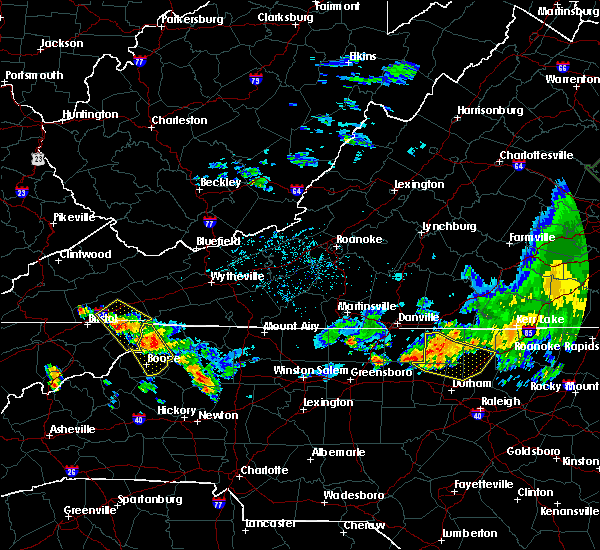 At 1225 am edt, a severe thunderstorm was located 7 miles northwest of mountain city, moving southeast at 30 mph (radar indicated). Hazards include 60 mph wind gusts and penny size hail. Expect damage to roofs. siding. and trees. Locations impacted include, abingdon, mountain city, damascus, trade, hilander park, harr, laurel bloomery, neva, shady valley and emory-meadow view. At 1225 am edt, a severe thunderstorm was located 7 miles northwest of mountain city, moving southeast at 30 mph (radar indicated). Hazards include 60 mph wind gusts and penny size hail. Expect damage to roofs. siding. and trees. Locations impacted include, abingdon, mountain city, damascus, trade, hilander park, harr, laurel bloomery, neva, shady valley and emory-meadow view.
|
| 6/17/2016 12:14 AM EDT |
 At 1214 am edt, a severe thunderstorm was located near mountain city, moving southeast at 30 mph (radar indicated). Hazards include 60 mph wind gusts and quarter size hail. Hail damage to vehicles is expected. expect wind damage to roofs, siding, and trees. Locations impacted include, abingdon, mountain city, damascus, trade, hilander park, harr, laurel bloomery, neva, shady valley and emory-meadow view. At 1214 am edt, a severe thunderstorm was located near mountain city, moving southeast at 30 mph (radar indicated). Hazards include 60 mph wind gusts and quarter size hail. Hail damage to vehicles is expected. expect wind damage to roofs, siding, and trees. Locations impacted include, abingdon, mountain city, damascus, trade, hilander park, harr, laurel bloomery, neva, shady valley and emory-meadow view.
|
| 6/17/2016 12:14 AM EDT |
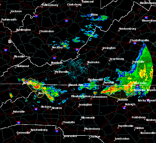 At 1214 am edt, a severe thunderstorm was located near mountain city, moving southeast at 30 mph (radar indicated). Hazards include 60 mph wind gusts and quarter size hail. Hail damage to vehicles is expected. expect wind damage to roofs, siding, and trees. Locations impacted include, abingdon, mountain city, damascus, trade, hilander park, harr, laurel bloomery, neva, shady valley and emory-meadow view. At 1214 am edt, a severe thunderstorm was located near mountain city, moving southeast at 30 mph (radar indicated). Hazards include 60 mph wind gusts and quarter size hail. Hail damage to vehicles is expected. expect wind damage to roofs, siding, and trees. Locations impacted include, abingdon, mountain city, damascus, trade, hilander park, harr, laurel bloomery, neva, shady valley and emory-meadow view.
|
| 6/16/2016 11:59 PM EDT |
 At 1158 pm edt, a severe thunderstorm was located 8 miles southeast of abingdon, moving southeast at 30 mph (radar indicated). Hazards include 60 mph wind gusts and quarter size hail. Hail damage to vehicles is expected. Expect wind damage to roofs, siding, and trees. At 1158 pm edt, a severe thunderstorm was located 8 miles southeast of abingdon, moving southeast at 30 mph (radar indicated). Hazards include 60 mph wind gusts and quarter size hail. Hail damage to vehicles is expected. Expect wind damage to roofs, siding, and trees.
|
| 6/16/2016 11:59 PM EDT |
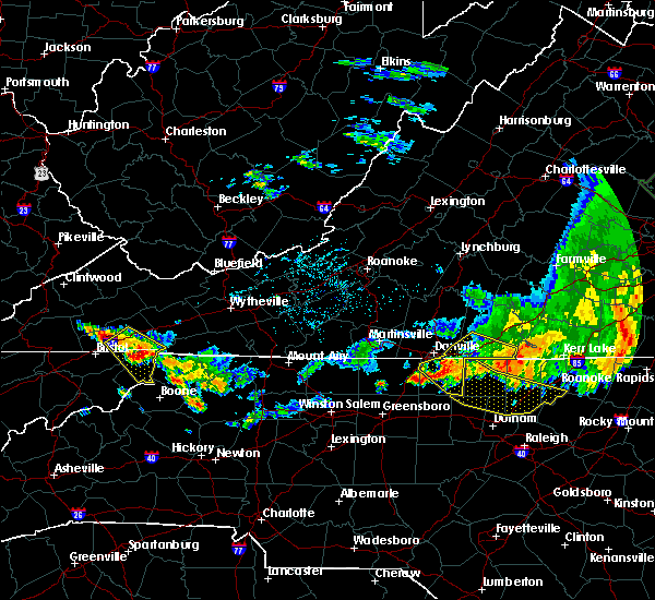 At 1158 pm edt, a severe thunderstorm was located 8 miles southeast of abingdon, moving southeast at 30 mph (radar indicated). Hazards include 60 mph wind gusts and quarter size hail. Hail damage to vehicles is expected. Expect wind damage to roofs, siding, and trees. At 1158 pm edt, a severe thunderstorm was located 8 miles southeast of abingdon, moving southeast at 30 mph (radar indicated). Hazards include 60 mph wind gusts and quarter size hail. Hail damage to vehicles is expected. Expect wind damage to roofs, siding, and trees.
|
| 5/12/2016 6:25 PM EDT |
 At 624 pm edt, severe thunderstorms were located along a line extending from 11 miles northeast of cleveland to near bristol, moving northeast at 35 mph (radar indicated). Hazards include 60 mph wind gusts and penny size hail. Expect damage to roofs. siding. And trees. At 624 pm edt, severe thunderstorms were located along a line extending from 11 miles northeast of cleveland to near bristol, moving northeast at 35 mph (radar indicated). Hazards include 60 mph wind gusts and penny size hail. Expect damage to roofs. siding. And trees.
|
| 5/12/2016 6:15 PM EDT |
 At 615 pm edt, a severe thunderstorm was located near bristol, or near abingdon, moving northeast at 30 mph (radar indicated). Hazards include 60 mph wind gusts and quarter size hail. Hail damage to vehicles is expected. expect wind damage to roofs, siding, and trees. Locations impacted include, abingdon, bristol va, bristol tn, bristol, walnut hill, benhams, south holston dam, hilander park and harr. At 615 pm edt, a severe thunderstorm was located near bristol, or near abingdon, moving northeast at 30 mph (radar indicated). Hazards include 60 mph wind gusts and quarter size hail. Hail damage to vehicles is expected. expect wind damage to roofs, siding, and trees. Locations impacted include, abingdon, bristol va, bristol tn, bristol, walnut hill, benhams, south holston dam, hilander park and harr.
|
| 5/12/2016 6:10 PM EDT | Multiple trees down just west of bristol v in city of bristol county VA, 1.9 miles NE of Bristol, VA |
| 5/12/2016 5:50 PM EDT |
 At 550 pm edt, a severe thunderstorm was located near oak grove, or 10 miles east of kingsport, moving northeast at 30 mph (radar indicated). Hazards include 60 mph wind gusts and quarter size hail. Hail damage to vehicles is expected. Expect wind damage to roofs, siding, and trees. At 550 pm edt, a severe thunderstorm was located near oak grove, or 10 miles east of kingsport, moving northeast at 30 mph (radar indicated). Hazards include 60 mph wind gusts and quarter size hail. Hail damage to vehicles is expected. Expect wind damage to roofs, siding, and trees.
|
| 3/14/2016 3:54 PM EDT |
 At 353 pm edt, a severe thunderstorm was located over abingdon, moving northeast at 35 mph (radar indicated). Hazards include 60 mph wind gusts and quarter size hail. Hail damage to vehicles is expected. expect wind damage to roofs, siding, and trees. Locations impacted include, abingdon, bristol va, bristol, glade spring, damascus, lindell, benhams, shady valley, holston, south holston dam, hilander park, konnarock, harr and emory-meadow view. At 353 pm edt, a severe thunderstorm was located over abingdon, moving northeast at 35 mph (radar indicated). Hazards include 60 mph wind gusts and quarter size hail. Hail damage to vehicles is expected. expect wind damage to roofs, siding, and trees. Locations impacted include, abingdon, bristol va, bristol, glade spring, damascus, lindell, benhams, shady valley, holston, south holston dam, hilander park, konnarock, harr and emory-meadow view.
|
| 3/14/2016 3:37 PM EDT |
 At 337 pm edt, a severe thunderstorm was located over bristol tn, moving northeast at 25 mph (radar indicated). Hazards include 60 mph wind gusts and quarter size hail. Hail damage to vehicles is expected. Expect wind damage to roofs, siding, and trees. At 337 pm edt, a severe thunderstorm was located over bristol tn, moving northeast at 25 mph (radar indicated). Hazards include 60 mph wind gusts and quarter size hail. Hail damage to vehicles is expected. Expect wind damage to roofs, siding, and trees.
|
| 7/14/2015 9:11 PM EDT |
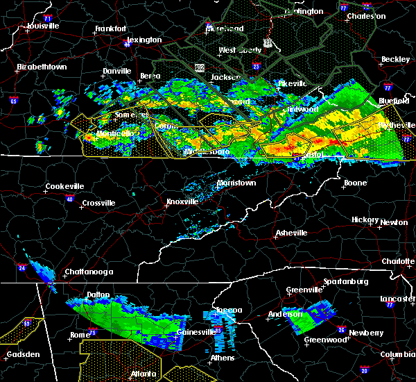 At 910 pm edt, severe thunderstorms were located along a line extending from 11 miles southwest of cleveland to 10 miles northwest of bristol va to 10 miles northwest of walnut hill to 6 miles northeast of weber city to near gate city, moving southeast at 40 mph (radar indicated). Hazards include 60 mph wind gusts and nickel size hail. Expect damage to roofs. siding and trees. locations impacted include, gate city, weber city, st. Paul, nickelsville, benhams, holston, castlewood, collingwood, hansonville, fort blackmore and hiltons. At 910 pm edt, severe thunderstorms were located along a line extending from 11 miles southwest of cleveland to 10 miles northwest of bristol va to 10 miles northwest of walnut hill to 6 miles northeast of weber city to near gate city, moving southeast at 40 mph (radar indicated). Hazards include 60 mph wind gusts and nickel size hail. Expect damage to roofs. siding and trees. locations impacted include, gate city, weber city, st. Paul, nickelsville, benhams, holston, castlewood, collingwood, hansonville, fort blackmore and hiltons.
|
| 7/14/2015 8:54 PM EDT |
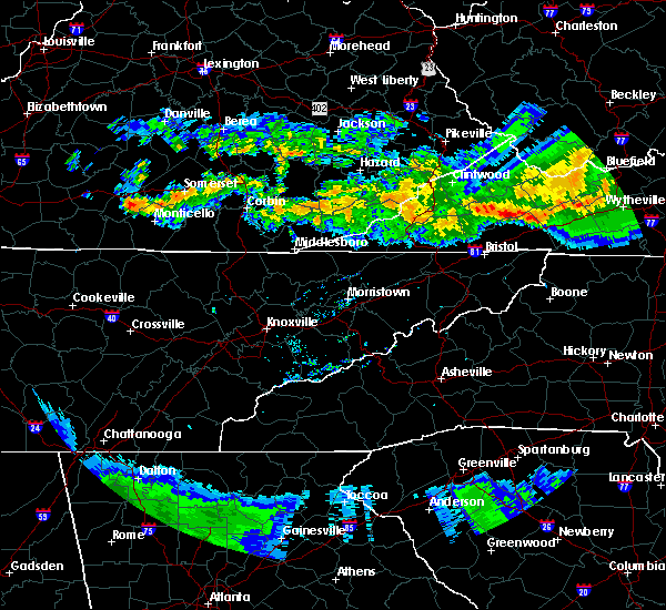 At 854 pm edt, severe thunderstorms were located along a line extending from 10 miles southeast of wise to 16 miles west of cleveland to 8 miles south of norton to big stone gap, moving southeast at 50 mph (radar indicated). Hazards include 60 mph wind gusts and nickel size hail. Expect damage to roofs. Siding and trees. At 854 pm edt, severe thunderstorms were located along a line extending from 10 miles southeast of wise to 16 miles west of cleveland to 8 miles south of norton to big stone gap, moving southeast at 50 mph (radar indicated). Hazards include 60 mph wind gusts and nickel size hail. Expect damage to roofs. Siding and trees.
|
| 7/13/2015 6:35 PM EDT |
 A severe thunderstorm warning remains in effect until 700 pm edt for washington. southeastern scott counties and the city of bristol. at 634 pm edt. severe thunderstorms were located along a line extending from 32 miles northeast of abingdon to near kingsport. Moving east at 60 mph. A severe thunderstorm warning remains in effect until 700 pm edt for washington. southeastern scott counties and the city of bristol. at 634 pm edt. severe thunderstorms were located along a line extending from 32 miles northeast of abingdon to near kingsport. Moving east at 60 mph.
|
| 7/13/2015 6:24 PM EDT |
 The national weather service in morristown has issued a * severe thunderstorm warning for. eastern carter county in east tennessee. eastern sullivan county in east tennessee. johnson county in east tennessee. Until 715 pm edt. The national weather service in morristown has issued a * severe thunderstorm warning for. eastern carter county in east tennessee. eastern sullivan county in east tennessee. johnson county in east tennessee. Until 715 pm edt.
|
| 7/13/2015 6:20 PM EDT |
 A severe thunderstorm warning remains in effect until 700 pm edt for washington. central russell. southeastern scott counties and the city of bristol. at 620 pm edt. severe thunderstorms were located along a line extending from 23 miles east of lebanon to 7 miles southwest of gate city. Moving east at 60 mph. A severe thunderstorm warning remains in effect until 700 pm edt for washington. central russell. southeastern scott counties and the city of bristol. at 620 pm edt. severe thunderstorms were located along a line extending from 23 miles east of lebanon to 7 miles southwest of gate city. Moving east at 60 mph.
|
| 7/13/2015 6:03 PM EDT |
 At 601 pm edt, severe thunderstorms were located along a line extending from 12 miles northeast of lebanon to 8 miles southeast of jonesville, moving east at 50 mph (radar indicated). Hazards include 60 mph wind gusts and quarter size hail. Hail damage to vehicles is possible. Expect wind damage to roofs, siding and trees. At 601 pm edt, severe thunderstorms were located along a line extending from 12 miles northeast of lebanon to 8 miles southeast of jonesville, moving east at 50 mph (radar indicated). Hazards include 60 mph wind gusts and quarter size hail. Hail damage to vehicles is possible. Expect wind damage to roofs, siding and trees.
|
| 7/13/2015 5:53 PM EDT |
 At 553 pm edt, a severe thunderstorm was located near bristol, or near bristol tn, moving southeast at 20 mph (radar indicated). Hazards include 60 mph wind gusts and half dollar size hail. Hail damage to vehicles is expected. expect wind damage to roofs, siding and trees. Locations impacted include, elizabethton, bristol tn, bristol, walnut hill, bluff city, watauga, blountville, sadie, elk mills, hunter, south holston dam, doeville and tri-city airport. At 553 pm edt, a severe thunderstorm was located near bristol, or near bristol tn, moving southeast at 20 mph (radar indicated). Hazards include 60 mph wind gusts and half dollar size hail. Hail damage to vehicles is expected. expect wind damage to roofs, siding and trees. Locations impacted include, elizabethton, bristol tn, bristol, walnut hill, bluff city, watauga, blountville, sadie, elk mills, hunter, south holston dam, doeville and tri-city airport.
|
| 7/13/2015 5:36 PM EDT |
 At 535 pm edt, a severe thunderstorm was located near walnut hill, or 10 miles east of kingsport, moving southeast at 20 mph (radar indicated). Hazards include 60 mph wind gusts and half dollar size hail. Hail damage to vehicles is expected. Expect wind damage to roofs, siding and trees. At 535 pm edt, a severe thunderstorm was located near walnut hill, or 10 miles east of kingsport, moving southeast at 20 mph (radar indicated). Hazards include 60 mph wind gusts and half dollar size hail. Hail damage to vehicles is expected. Expect wind damage to roofs, siding and trees.
|
| 6/8/2015 6:31 PM EDT | At 631 pm edt, a severe thunderstorm was located 9 miles southeast of bristol va, moving east at 35 mph (radar indicated). Hazards include 60 mph wind gusts and nickel size hail. Expect damage to roofs. siding and trees. Locations impacted include, bristol tn, bristol va, mountain city, damascus, harr, sadie, south holston dam, laurel bloomery, neva, shady valley and hunter. |
| 6/8/2015 6:31 PM EDT | At 631 pm edt, a severe thunderstorm was located 9 miles southeast of bristol va, moving east at 35 mph (radar indicated). Hazards include 60 mph wind gusts and nickel size hail. Expect damage to roofs. siding and trees. Locations impacted include, bristol tn, bristol va, mountain city, damascus, harr, sadie, south holston dam, laurel bloomery, neva, shady valley and hunter. |
| 6/8/2015 6:17 PM EDT | At 616 pm edt, severe thunderstorms were located along a line extending from near raven to near bristol va, moving east at 35 mph (radar indicated). Hazards include 60 mph wind gusts and nickel size hail. Expect damage to roofs. siding and trees. Locations impacted include, bristol va, abingdon, lebanon, glade spring, honaker, damascus, benhams, hilander park, holston, konnarock, rosedale, dye, lindell, emory-meadow view and hansonville. |
| 6/8/2015 6:02 PM EDT | At 601 pm edt, a severe thunderstorm was located near walnut hill, or 9 miles west of bristol tn, moving east at 35 mph (radar indicated). Hazards include 60 mph wind gusts and nickel size hail. Expect damage to roofs. Siding and trees. |
| 6/8/2015 6:02 PM EDT | At 601 pm edt, a severe thunderstorm was located near walnut hill, or 9 miles west of bristol tn, moving east at 35 mph (radar indicated). Hazards include 60 mph wind gusts and nickel size hail. Expect damage to roofs. Siding and trees. |
| 6/8/2015 5:45 PM EDT | At 544 pm edt, severe thunderstorms were located along a line extending from near trammel to 6 miles east of weber city, moving east at 30 mph (radar indicated). Hazards include 60 mph wind gusts and nickel size hail. Expect damage to roofs. Siding and trees. |
| 4/19/2015 11:33 PM EDT | At 1132 pm edt, severe thunderstorms were located along a line extending from 11 miles northeast of cleveland to 9 miles north of abingdon to 8 miles north of mountain city, moving northeast at 55 mph (radar indicated). Hazards include 60 mph wind gusts. Expect damage to roofs. siding and trees. locations impacted include, abingdon, lebanon, mountain city, bristol tn, bristol va, bristol, cleveland, walnut hill, bluff city, glade spring, honaker, st. paul, damascus, lindell, hansonville, laurel bloomery, holston, castlewood, collingwood and rosedale. 75in. |
| 4/19/2015 11:33 PM EDT | At 1132 pm edt, severe thunderstorms were located along a line extending from 11 miles northeast of cleveland to 9 miles north of abingdon to 8 miles north of mountain city, moving northeast at 55 mph (radar indicated). Hazards include 60 mph wind gusts. Expect damage to roofs. siding and trees. locations impacted include, abingdon, lebanon, mountain city, bristol tn, bristol va, bristol, cleveland, walnut hill, bluff city, glade spring, honaker, st. paul, damascus, lindell, hansonville, laurel bloomery, holston, castlewood, collingwood and rosedale. 75in. |
| 4/19/2015 11:11 PM EDT | At 1110 pm edt, severe thunderstorms were located along a line extending from 8 miles west of cleveland to 9 miles northwest of bristol va to near bristol, moving northeast at 55 mph (radar indicated). Hazards include 60 mph wind gusts. Expect damage to roofs. Siding and trees. |
| 4/19/2015 11:11 PM EDT | At 1110 pm edt, severe thunderstorms were located along a line extending from 8 miles west of cleveland to 9 miles northwest of bristol va to near bristol, moving northeast at 55 mph (radar indicated). Hazards include 60 mph wind gusts. Expect damage to roofs. Siding and trees. |
| 4/19/2015 10:51 PM EDT | At 1050 pm edt, severe thunderstorms were located along a line extending from near norton to 10 miles north of weber city to gate city, moving east at 50 mph (radar indicated). Hazards include 60 mph wind gusts. Expect damage to roofs. siding and trees. locations impacted include, norton, lebanon, wise, gate city, bristol va, bristol, big stone gap, weber city, cleveland, coeburn, appalachia, pound, st. paul, nickelsville, dungannon, hansonville, fort blackmore, pardee, hiltons and benhams. 75in. |
| 4/19/2015 10:30 PM EDT | At 1028 pm edt, severe thunderstorms were located along a line extending from 14 miles north of pennington gap to 10 miles south of big stone gap to 6 miles north of surgoinsville, moving east at 50 mph (radar indicated). Hazards include 60 mph wind gusts. Expect damage to roofs. Siding and trees. |
| 6/10/2014 6:30 PM EDT | Trees and powerlines down countywide in city of bristol county VA, 1.2 miles NNE of Bristol, VA |
| 8/3/2012 5:45 PM EDT | Couple of trees down around bristo in city of bristol county VA, 1.2 miles NNE of Bristol, VA |
| 7/25/2012 2:50 AM EDT | A few trees dow in city of bristol county VA, 1.2 miles NNE of Bristol, VA |
| 7/24/2012 4:20 PM EDT | One tree down across railroad tracks in city of bristol in city of bristol county VA, 1.2 miles NNE of Bristol, VA |
| 1/1/0001 12:00 AM | Tree down in city of bristo in city of bristol county VA, 1.2 miles NNE of Bristol, VA |
| 1/1/0001 12:00 AM | A few trees down at the intersection of cove road and memphis lane. reported by spotter. corrected for the time of the even in city of bristol county VA, 1.2 miles NNE of Bristol, VA |
| 1/1/0001 12:00 AM | A few trees down at the intersection of cove road and memphis lane. reported by spotte in city of bristol county VA, 1.2 miles NNE of Bristol, VA |
| 1/1/0001 12:00 AM | Several trees and powerlines down on and along haskell station road near the junction with reedy creek road. reported by dispatc in washington county VA, 3 miles S of Bristol, VA |
| 1/1/0001 12:00 AM | Quarter sized hail reported 1.2 miles NNE of Bristol, VA, along interstate 81. |
| 1/1/0001 12:00 AM | Quarter sized hail reported 1.2 miles NNE of Bristol, VA, hail occurring at the bristol mall. |
| 1/1/0001 12:00 AM | Several trees down on oakwood drive and also on pine hill rd in bristol v in city of bristol county VA, 1.2 miles NNE of Bristol, VA |
| 1/1/0001 12:00 AM | Couple trees dow in city of bristol county VA, 1.3 miles W of Bristol, VA |
| 1/1/0001 12:00 AM | Half Dollar sized hail reported 6.1 miles SSE of Bristol, VA |
| 1/1/0001 12:00 AM | Golf Ball sized hail reported 2.4 miles SSW of Bristol, VA |
| 4/27/2011 9:45 PM EDT | Hen Egg sized hail reported 7.1 miles E of Bristol, VA |
Hail Maps for Bristol, VA


Connect with Interactive Hail Maps